This is a modern-English version of Travels in the East Indian archipelago, originally written by Bickmore, Albert S. (Albert Smith).
It has been thoroughly updated, including changes to sentence structure, words, spelling,
and grammar—to ensure clarity for contemporary readers, while preserving the original spirit and nuance. If
you click on a paragraph, you will see the original text that we modified, and you can toggle between the two versions.
Scroll to the bottom of this page and you will find a free ePUB download link for this book.

WIVES OF ONE OF THE TWO HIGHEST PRINCES IN JAVA.
WIVES OF ONE OF THE TWO HIGHEST PRINCES IN JAVA.
TRAVELS
IN THE
EAST INDIAN ARCHIPELAGO.
TRAVELS
IN THE
EAST INDIES.
By ALBERT S. BICKMORE, M.A.,
FELLOW OF THE ROYAL GEOGRAPHICAL SOCIETY OF LONDON,
CORRESPONDING MEMBER OF THE AMERICAN AND LONDON ETHNOLOGICAL SOCIETIES,
NEW YORK LYCEUM OF NATURAL HISTORY, MEMBER OF THE BOSTON SOCIETY
OF NATURAL HISTORY AND AMERICAN ORIENTAL SOCIETY, AND
PROFESSOR OF NATURAL HISTORY IN MADISON
UNIVERSITY, HAMILTON, N. Y.
By ALBERT S. BICKMORE, M.A.,
FELLOW OF THE ROYAL GEOGRAPHICAL SOCIETY OF LONDON,
CORRESPONDING MEMBER OF THE AMERICAN AND LONDON ETHNOLOGICAL SOCIETIES,
MEMBER OF THE NEW YORK LYCEUM OF NATURAL HISTORY, THE BOSTON SOCIETY
OF NATURAL HISTORY, AND THE AMERICAN ORIENTAL SOCIETY, AND
PROFESSOR OF NATURAL HISTORY AT MADISON
UNIVERSITY, HAMILTON, N. Y.
WITH MAPS AND ILLUSTRATIONS.
WITH MAPS AND ILLUSTRATIONS.
LONDON:
JOHN MURRAY, ALBEMARLE STREET.
1868.
LONDON:
JOHN MURRAY, ALBEMARLE STREET.
1868.
The right of Translation is reserved.
The right to translate is reserved.
LONDON: PRINTED BY W. CLOWES AND SONS, DUKE STREET, STAMFORD STREET,
AND CHARING CROSS.
LONDON: PRINTED BY W. CLOWES AND SONS, DUKE STREET, STAMFORD STREET,
AND CHARING CROSS.
TO
THE GENEROUS FRIENDS OF SCIENCE
IN
BOSTON AND CAMBRIDGE,
THROUGH WHOSE LIBERALITY THE TRAVELS
HEREIN DESCRIBED WERE MADE,
THIS VOLUME
Is Respectfully Dedicated.
TO
THE GENEROUS FRIENDS OF SCIENCE
IN
BOSTON AND CAMBRIDGE,
WHOSE SUPPORT MADE THESE TRAVELS
POSSIBLE,
THIS VOLUME
Is Respectfully Dedicated.

GOVERNMENT BUILDINGS AT BATAVIA.
Government Buildings in Batavia.
The object of my voyage to Amboina was simply to re-collect the shells figured in Rumphius’s “Rariteit Kamer,” and the idea of writing a volume of travels was not seriously entertained until I arrived at Batavia, and, instead of being forbidden by the Dutch Government to proceed to the Spice Islands, as some of my warmest friends feared, I was honored by His Excellency, the Governor-General of “the Netherlands India,” with the order given on page 40.
The purpose of my trip to Amboina was just to collect the shells shown in Rumphius’s “Rariteit Kamer,” and I didn’t seriously think about writing a travel book until I got to Batavia. Instead of being prevented by the Dutch Government from going to the Spice Islands, as some of my closest friends worried, I was honored by His Excellency, the Governor-General of “the Netherlands India,” with the order mentioned on page 40.
Having fully accomplished that object, I availed myself of the unexampled facilities to travel afforded me in every part of the archipelago, and all except the first six chapters describe the regions thus visited.
Having fully achieved that goal, I took advantage of the unique travel opportunities available to me throughout the archipelago, and all except the first six chapters describe the areas I visited.
My sincerest thanks are herein expressed to the liberal gentlemen to whom this volume is dedicated; to Baron Sloet van de Beele, formerly Governor-General of the Netherlands India; to Mr. N. A. T. Arriens, formerly Governor of the Moluccas; to Mr. J. F. R. S. van den Bosche, formerly Governor of the West Coast of Sumatra; to the many officers of the Netherlands Government, and to the Dutch and American merchants who entertained me with the most cordial hospitality, and aided me in every possible way throughout the East Indian Archipelago.
My heartfelt thanks go out to the generous gentlemen to whom this book is dedicated; to Baron Sloet van de Beele, who was the former Governor-General of the Netherlands Indies; to Mr. N. A. T. Arriens, who was the former Governor of the Moluccas; to Mr. J. F. R. S. van den Bosche, who was the former Governor of the West Coast of Sumatra; to the many officials of the Netherlands Government, and to the Dutch and American merchants who welcomed me with warm hospitality and supported me in every way possible throughout the East Indian Archipelago.
Cambridge, Mass., U. S. A., Sept. 1, 1868.
Cambridge, MA, USA, Sept. 1, 1868.
| CHAPTER I. THE STRAIT OF SUNDA AND BATAVIA. |
|
| Object of the Travels described in this volume—Nearing the coast of Java—Balmy breezes of the Eastern Isles—King Æolus’s favorite seat—A veil of rain—First view of Malays—Entering the Java Sea—The Malay language—Early history of Java—Marco Polo—Hinduism in Java—History of Batavia—The roadstead of Batavia—The city of Batavia—Houses of Europeans—Mode of cooking—Characteristics of the Malays—Collecting butterflies—Visit Rahden Saleh—Attacked with a fever—Receive a letter from the Governor-General | 13-41 |
| CHAPTER II. SAMARANG AND SURABAYA. |
|
| Sail from Batavia for the Moluccas—My companions—Mount Slamat—The north coast of Java—Mount Prau—Temples at Boro Bodo and Brambanan—Samarang—Mohammedan mosque—History of Mohammedanism—Mount Japara—The Guevo Upas, or Valley of Poison—Gresik—Novel mode of navigating mud-flats—Surabaya—Government dock-yard and machine-shops—Zoological gardens—History of Hinduism—The Klings—Excursion to a sugar plantation—Roads and telegraphic routes in Java—Malay mode of gathering rice—The kinds of sugar-cane | 42-70 |
| CHAPTER III. THE FLORA AND FAUNA OF THE TROPICAL EAST. |
|
| Leave Surabaya for Macassar—Madura—The Sapi—Manufacture of salt—The Tenger Mountains—The Sandy Sea—Eruptions of Mount Papandayang and Mount Galunggong—Java and Cuba compared—The forests of Java—Fauna of Java—The cocoa-nut palm—The Pandanus—The banana—Tropical fruits—The mangostin—The rambutan—mango—duku—durian—bread-fruit—Bali—Javanese[8] traditions—Limit between the fauna of Asia and that of Australia—A plateau beneath the sea—Caste and suttee practices on Bali | 71-96 |
| CHAPTER IV. CELEBES AND TIMUR. |
|
| History of Celebes—De Barros—Diogo de Cauto—Head-hunters of Celebes—The harbor of Macassar—Voyages of the Bugis—Skilful diving—Fort Rotterdam—The Societeit, or Club—A drive into the country—The tomb of a native merchant—Tombs of ancient princes—Sail for Kupang, in Timur—Flying-fish—The Gunong Api in Sapi Strait—Gillibanta—Sumbawa—Eruption of Mount Tomboro—The Eye of the Devil—Floris and Sandal-wood Island—Kupang—Fruits on Timur—Its barrenness and the cause of it—Different kinds of people seen at Kupang—Human sacrifice—Purchasing shells—Geology of the vicinity of Kupang—Sail for Dilli—Village of Dilli—Islands north of Timur—The Bandas—Monsoons in the Java and China Seas | 97-129 |
| CHAPTER V. AMBOINA. |
|
| Description of the island and city of Amboina—Dutch mode of governing the natives—A pleasant home—A living nautilus is secured—Excursion to Hitu—Hassar steering—History of the cocoa-tree—Indian corn—Hunting in the tropics—Butterflies—Excursion along the shores of Hitu for shells—Mode of travelling in the Spice Islands—The pine-apple—Covered bridges—Hitu-lama—Purchasing specimens—History of the Spice Islands—Enormous hermit-crabs—An exodus—Assilulu—Babirusa shells from Buru—Great curiosities—Jewels in the brains of snakes and wild boars—Description of the clove-tree—History of the clove-trade—Watched by the rajah’s wives—Lariki and Wakasihu—A storm in the height of the southeast monsoon—Variety of native dialects—Dangerous voyage by night—An earthquake—Excursion to Tulahu | 130-176 |
| CHAPTER VI. THE ULIASSERS AND CERAM. |
|
| The arrival of the mail at Amboina—The Uliassers—Chewing the betel-nut and siri—Haruku—We strike on a reef—Saparua Island, village, and bay—Nusalaut—Strange reception—An Eastern banquet—Examining the native schools—Different classes of natives—Yield of cloves in the Uliassers—Nullahia, Amet, and Abobo—Breaking of the surf on the coral reefs—Tanjong O—Travel by night—Ceram—Elpaputi Bay and Amahai—Alfura, or head-hunters,[9] come down from the mountains and dance before us—Land on the south coast of Ceram—Fiendish revels of the natives—Return to Saparua and Amboina | 177-212 |
| CHAPTER VII. BANDA. |
|
| Governor Arriens invites me to accompany him to Banda—The Gunong Api—Road of the Bandas—Banda Neira and its forts—Geology of Lontar—The Bandas and the crater in the Tenger Mountains compared—The groves of nutmeg-trees—The canari-tree—Orang Datang—We ascend the volcano—In imminent peril—The crater—Perilous descent—Eruptions of Gunong Api—Earthquakes at Neira—Great extent of the Residency of Banda—The Ki and Arru Islands—Return to Amboina—Geology of the island of Amboina—Trade of Amboina—The grave of Rumphius—His history | 213-252 |
| CHAPTER VIII. BURU. |
|
| Adieu to Amboina—North coast of Ceram—Wahai—Buru—Kayéli—Excursions to various parts of the bay—A home in the forests—Malay cuisine—Tobacco and maize—Flocks of parrots—Beautiful birds—History of Buru—The religion and laws of the Alfura—Shaving the head of a young child—A wedding-feast—Marriage laws in Mohammedan countries—A Malay marriage—Opium, its effects and its history—Kayu-puti oil—Gardens beneath the sea—Roban—Skinning birds—Tropical pests—A deer-hunt—Dinding—A threatening fleet—A page of romance—A last glance at Buru | 253-297 |
| CHAPTER IX. TERNATE, TIDORE, AND GILOLO. |
|
| Seasons in Ceram and Buru—Bachian and Makian—Eruptions of Ternate—Magellan—Former monopolies—The bloodhounds of Gilolo—Migrations—A birth-mark—The Molucca Passage—Malay pirates—They challenge the Dutch | 298-322 |
| CHAPTER X. THE NORTHERN PENINSULA OF CELEBES. |
|
| Mount Klabat—Kema—A hunt for babirusa—A camp by the sea—Enormous snakes—From Kema to Menado—Eruption of Mount Kemaas—Population of the Minahassa—Thrown from a horse—The Bantiks—A living death—History of the coffee-tree—In the jaws of a crocodile—The bay of Menado—Lake Linu—A grove by moonlight | 323-355[10] |
| CHAPTER XI. THE MINAHASSA. |
|
| The waterfall of Tinchep—A mud-well—A boiling pool—The ancient appearance of our earth—Lake Tondano—One of the finest views in the world—Palm-wine—Graves of the natives—Christianity and education—Tanjong Fiasco—Gold-mines in Celebes—The island of Buton—Macassar—A raving maniac | 356-383 |
| CHAPTER XII. SUMATRA. |
|
| Padang—Beautiful drives—Crossing the streams—The cleft—Crescent-shaped roofs—Distending the lobe of the ear—Cañons—The great crater of Manindyu—Immense amphitheatres—Ophir—Gold-mines | 384-406 |
| CHAPTER XIII. TO THE LAND OF THE CANNIBALS. |
|
| Valley of Bondyol—Monkeys—The orang-utan—Lubu Siképing—Tigers and buffaloes—The Valley of Rau—A Batta grave—Riding along the edge of a precipice—Twilight and evening—Padang Sidempuan—Among the cannibals—Descent from the Barizan—The suspension bridge of rattan—Ornaments of gold—The camphor-tree | 407-434 |
| CHAPTER XIV. RETURN TO PADANG. |
|
| Bay of Tapanuli—The Devil’s Dwelling—Dangerous fording—Among the Battas—Missionaries and their brides—The feasts of the cannibals—The pepper trade—The English appear in the East—Struck by a heavy squall—Ayar Bangis and Natal—The king’s birthday—Malay ideas of greatness | 435-457 |
| CHAPTER XV. THE PADANG PLATEAU. |
|
| Thunder and lightning in the tropics—Paya Kombo and the Bua Valley—The Bua cave—Up the valley to Suka Rajah—Ancient capitals of Menangkabau—The reformers of Korinchi—Malay mode of making matchlocks—A simple meal—Geological history of the plateau—The Thirteen Confederate Towns—The flanks of the Mérapi—Natives of the Pagi Islands—Where the basin of the Indian Ocean begins | 458-485[11] |
| CHAPTER XVI. CROSSING SUMATRA. |
|
| Bay of Bencoolen—Rat Island—Loss of Governor Raffles’s collection—A trap for tigers—Blood-suckers—Pits for the rhinoceros—virgin children—Plateau of the Musi—From Kopaiyong to Kaban Agong—Natives destroyed by tigers—Sumatra’s wealth—The Anak gadis—Troops of monkeys—From Tebing Tingi to Bunga Mas—We come upon an elephant—Among tigers—The Pasuma people—Horseback travel over—The land of game | 486-520 |
| CHAPTER XVII. PALEMBANG, BANCA, AND SINGAPORE. |
|
| Mount Dempo—Rafts of cocoa-nuts—Floating down the Limatang—Cotton—From Purgatory to Paradise—Palembang—The Kubus—Banca—Presented with a python—The python escapes—A struggle for life—Sail for China | 521-542 |
| Appendix A. Area of the principal islands, according to Baron van Carnbée | 543 |
| ” B. Population of the Netherlands India, 1865 | 543 |
| ” C. A table of heights of the principal mountains in the archipelago | 544 |
| " " D. Coffee sold by the government at Padang | 545 |
| ” E. Trade of Java and Madura during 1864 | 546 |
| ” F. A list of the birds collected by the author on the island of Buru | 547 |
| Index | 549 |

“SAPIE” OXEN FROM MADURA.
"Madura" sapie oxen.
| Wives of one of the great Princes of Java | (from a Photograph) | Frontispiece |
| Poultry Vender, Batavia | ” | Page 27 |
| Government Buildings in Batavia | ” | 4 |
| Sapis, or oxen from Madura | ” | 11 |
| Javanese and family | ” | 33 |
| Rahden Saleh | "Below is a short piece of text (5 words or fewer)." | 37 |
| Rahden Saleh’s Palace | ” | 37 |
| Watering the streets, Java | ” | 49 |
| A Tandu | ” | 49 |
| A Kling | 63 | |
| A Native of Beloochistan | (from a Photograph) | 63 |
| Fruit-Market | “ | 89 |
| The Pinang, or Betel-nut Palm (from a Drawing by Rahden Saleh) | 180 | |
| After the bath | (from a Photograph) | 182 |
| Musical Instruments of the Malays (Batavia) | 191 | |
| Dyak, or Head-hunter of Borneo | (from a Photograph) | 206 |
| Landing through the Surf on the south coast of Ceram | (from a Sketch) | 209 |
| The Lontar Palm | 220 | |
| Ascent of the Volcano of Banda—saved by a fern | (from a Sketch) | 234 |
| A Jungle | 261 | |
| A Malay Opium-smoker | (from a Photograph) | 281 |
| The Gomuti Palm | (from a Sketch) | 370 |
| The Bamboo | 374 | |
| Approach to the Cleft near Padang | 390 | |
| Women of Menangkaban | 395 | |
| Scene in the interior of Sumatra | 404 | |
| Driving round a dangerous Bluff | 419 | |
| Suspension Bridge of rattan | 428 | |
| Native of Nias | 445 | |
| Natives of the Pagi Islands | 482 | |
| Singapore | 521 | |
| River Scene in Sumatra, on the Limatang | 525 | |
| Natives of Palembang | } | 530 |
| Palembang—high water | } | |
| Killing a Python | 541 | |
| Map of Sumatra | To face page 384 | |
| Tomb of the Sultan—Palembang | 546 | |
| Map of the Eastern Archipelago | at the end | |
On the 19th of April, 1865, I was fifty miles east of Christmas Island, floating on the good ship “Memnon” toward the Strait of Sunda.
On April 19, 1865, I was fifty miles east of Christmas Island, cruising on the good ship "Memnon" toward the Sunda Strait.
I was going to Batavia, to sail thence to the Spice Islands, which lie east of Celebes, for the purpose of collecting the beautiful shells of those seas.
I was heading to Batavia to sail from there to the Spice Islands, which are east of Celebes, to collect the beautiful shells found in those waters.
I had chosen that in preference to any other part of the world, because the first collection of shells from the East that was ever described and figured with sufficient accuracy to be of any scientific value was made by Rumphius, a doctor who lived many years at Amboina, the capital of those islands. His great work, the “Rariteit Kamer,” or Chamber of Curiosities, was published in 1705, more than sixty years before the twelfth edition of the “Systema Naturæ” was issued by Linnæus, “the Father of Natural History,” who referred to the figures in that work[14] to illustrate a part of his own writings. When Holland became a province of France, in 1811, and it was designed to make Paris the centre of science and literature in Europe, it is said that this collection was taken from Leyden to that city, and afterward returned, and that during these two transfers a large proportion of the specimens disappeared; and that, finally, what was left of this valuable collection was scattered through the great museum at Leyden. It was partly to restore Rumphius’s specimens, and partly to bring into our own country such a standard collection, that I was going to search myself for the shells figured in the “Rariteit Kamer,” on the very points and headlands, and in the very bays, where Rumphius’s specimens were found.
I chose this place over any other part of the world because the first collection of shells from the East that was ever accurately described and illustrated for scientific value was created by Rumphius, a doctor who lived for many years in Amboina, the capital of those islands. His major work, the “Rariteit Kamer,” or Chamber of Curiosities, was published in 1705, more than sixty years before the twelfth edition of the “Systema Naturæ” came out by Linnæus, known as “the Father of Natural History,” who referenced the illustrations in that work to support his own writings[14]. When Holland became a province of France in 1811, and there were plans to make Paris the center of science and literature in Europe, it's said that this collection was moved from Leyden to Paris and then returned, but a significant number of specimens went missing during those transfers. Ultimately, the remaining pieces of this valuable collection ended up scattered throughout the large museum in Leyden. I was going to search for the shells illustrated in the “Rariteit Kamer” on the exact points, headlands, and in the very bays where Rumphius’s specimens were originally found, both to restore Rumphius’s collection and to bring a standard collection back to our country.
As we neared the coast of Java, cocoa-nuts and fragments of sea-washed palms, drifting by, indicated our approach to a land very different at least from the temperate shores we had left behind; and we could in some degree experience Columbus’s pleasure, when he first saw the new branch and its vermilion berries. Strange, indeed, must be this land to which we are coming, for here we see snakes swimming on the water, and occasionally fragments of rock drifting over the sea. New birds also appear, now sailing singly through the sky, and now hovering in flocks over certain places, hoping to satisfy their hungry maws on the small fishes that follow the floating driftwood. Here it must be that the old Dutch sailors fabled could be seen the tree—then unknown—that bore that strange fruit, the double cocoa-nut. They always represented it as rising up from a great depth[15] and spreading out its uppermost leaves on the surface of the sea. It was guarded by a bird, that was not bird but half beast; and when a ship came near, she was always drawn irresistibly toward this spot, and not one of her ill-fated crew ever escaped the beak and formidable talons of this insatiable harpy.
As we got closer to the coast of Java, coconuts and bits of sea-washed palm trees drifting by signaled our approach to a land that was definitely different from the temperate shores we had just left. We could somewhat relate to Columbus's excitement when he first saw the new land with its bright red berries. This place must be truly strange, as we could see snakes swimming in the water and occasionally pieces of rock floating on the sea. New birds appeared as well, some flying alone in the sky and others gathering in flocks over certain areas, looking to satisfy their hunger with the small fish that followed the floating driftwood. Here, according to the old Dutch sailors' tales, was the tree—unknown until then—that bore the unusual double coconut. They described it as rising from great depths and stretching its top leaves out on the surface of the sea. It was said to be guarded by a creature that was part bird and part beast. Whenever a ship got close, it was always pulled in uncontrollably to this spot, and none of its doomed crew ever escaped the beak and terrifying talons of this relentless harpy.[15]
But such wonders unfortunately fade away before the light of advancing knowledge; and the prince of Ceylon, who is said to have given a whole vessel laden with spice for a single specimen, could have satisfied his heart’s fullest desire if he had only known it was not rare on the Seychelles, north of Mauritius.
But such wonders unfortunately disappear in the face of increasing knowledge; and the prince of Ceylon, who supposedly offered an entire ship full of spices for just one specimen, could have fulfilled his deepest desire if he had only known it wasn't rare in the Seychelles, north of Mauritius.
The trades soon became light and baffling. Heavy rain-squalls, with thunder and lightning, were frequent; and three days after, as one of these cleared away, the high mountain near Java Head appeared full a quarter of a degree above the horizon, its black shoulders rising out of a beautiful mantle of the ermine-white, fleecy clouds, called cumuli.
The trades soon became gentle and confusing. Heavy rain squalls, accompanied by thunder and lightning, were common; and three days later, as one of these storms passed, the tall mountain near Java Head rose a quarter of a degree above the horizon, its dark peaks emerging from a stunning blanket of fluffy, white clouds known as cumuli.
Although we were thirty-five miles from the shore, yet large numbers of dragon-flies came round the ship, and I quickly improvised a net and captured a goodly number of them.
Although we were thirty-five miles from shore, a lot of dragonflies surrounded the ship, and I quickly made a net and caught a good number of them.
After sunset, there was a light air off-shore, which carried us to within a few miles of the land, and at midnight the captain called me on deck to enjoy “the balmy breezes of the Eastern isles;” and certainly to myself, as well as to the others, the air seemed to have the rich fragrance of new-mown clover, but far more spicy. At that hour it was quite clear, but at sunrise a thick haze rose up from the ocean,[16] and this phenomenon was repeated each morning that we were trying to enter the Strait of Sunda. As we had arrived during the changing of the monsoons, calms were so continuous that for six days we tried in vain to gain fifty miles. When a breeze would take us up near the mouth of the channel, it would then die away and let a strong current sweep us away to the east, and one time we were carried most unpleasantly near the high, threatening crags at Palembang Point, near Java Head. Those who have passed Sunda at this time of the year, or Ombay Strait in the beginning of the opposite monsoon, will readily recall the many weary hours they have passed waiting for a favorable breeze to take them only a few miles farther on their long voyage.
After sunset, there was a gentle offshore breeze that brought us a few miles from the land, and at midnight the captain called me on deck to enjoy “the balmy breezes of the Eastern isles.” To me, and the others, the air felt like the rich scent of freshly cut clover, but even spicier. At that time, it was pretty clear, but at sunrise, a thick haze rose from the ocean,[16] and this happened every morning while we were trying to enter the Strait of Sunda. We arrived during the monsoon transition, and the calm weather was so persistent that for six days we struggled to cover fifty miles. Whenever a breeze would push us close to the channel’s entrance, it would die down, allowing a strong current to push us east. One time, we were uncomfortably swept near the high, threatening cliffs at Palembang Point, near Java Head. Those who have navigated through Sunda during this season, or Ombay Strait at the start of the opposite monsoon, will easily remember the many exhausting hours spent waiting for a favorable breeze to take them just a few miles further on their long journey.
During those six days, at noon the sun poured down his hottest rays, the thermometer ranging from 88° to 90° Fahr. in the shade, and not the slightest air moving to afford a momentary relief. Although constantly for a year I was almost under the equator, these six days were the most tedious and oppressive I ever experienced.
During those six days, at noon the sun was blazing down with its hottest rays, with the thermometer hovering between 88° and 90° Fahrenheit in the shade, and not a hint of breeze to provide even a brief relief. Even though I had spent nearly a year close to the equator, these six days were the most exhausting and stifling I had ever faced.
The mountain back of Java Head seemed to be King Eolus’s favorite seat. Clouds would come from every quarter of the heavens and gather round its summit, while the sun was reaching the zenith; but soon after he began to pass down the western sky, lightnings would be seen darting their forked tongues around the mountain-crest: and then, as if the winds had broken from the grasp of their king, thick cloud-masses would suddenly roll down the mountain-sides, lightnings dart hither and thither, and again and[17] again the thunders would crash and roar enough to shake the very firmament.
The mountain behind Java Head looked like King Eolus's favorite spot. Clouds would gather from all directions and hover around its peak while the sun was at its highest. But soon after it started to set in the western sky, you could see lightning flashing around the mountaintop; then, as if the winds had broken free from their king's control, thick clouds would suddenly roll down the mountainsides, lightning striking everywhere, and the thunder would crash and roar fiercely enough to shake the heavens.
We are not alone. Six or eight vessels are also detained here—for this Strait of Sunda is the great gate through which pass out most of the valuable teas and costly silks of China and Japan, and these ships are carrying cotton goods to those lands to exchange in part for such luxuries. On the evening of the sixth day a more favorable breeze took us slowly up the channel past a group of large rocks, where the unceasing swell of the ocean was breaking, and making them sound in the quiet night like the howling and snarling of some fierce monster set to guard the way and unable to prevent his expected prey from escaping.
We’re not alone. Six or eight other ships are also stuck here—this Strait of Sunda is the major route through which most of the valuable teas and expensive silks of China and Japan pass. These ships are carrying cotton goods to those countries to trade for some of those luxuries. On the evening of the sixth day, a better breeze slowly pushed us up the channel past a cluster of large rocks where the constant swell of the ocean was crashing, making them sound in the quiet night like the howling and snarling of a fierce monster guarding the way, unable to stop its expected prey from getting away.
With the morning came a fine breeze, and, as we sailed up the strait, several small showers passed over the mountains, parallel to the shore, on the Java side; and once a long cloud rested its ends on two mountains, and unfolded from its dark mass a thin veil of sparkling rain, through which we could see quite distinctly all the outlines and the bright-green foliage of the valley behind it. The highly-cultivated lands near the water, and on the lower declivities of the mountains, whose tops were one dense mass of perennial green, made the whole view most enchanting to me; but our captain (who was a Cape Cod man) declared that the sand-hills on the outer side of Cape Cod were vastly more charming to him. On the shallows, near the shore, the clear sea-water took a beautiful tint of emerald green in the bright sunlight, and here we passed[18] long lines of cuttle-fish bones and parts of mysterious fruits where the tides met, that were setting in different directions.
With the morning came a gentle breeze, and as we sailed up the strait, several light showers swept over the mountains along the Java side. At one point, a long cloud rested between two mountains and released a fine veil of sparkling rain, through which we could clearly see the outlines and vibrant green foliage of the valley behind it. The highly cultivated lands near the water, along the lower slopes of the mountains—whose peaks were a solid mass of lush green—made the whole view incredibly enchanting to me. However, our captain (who was from Cape Cod) insisted that the sand dunes on the outer side of Cape Cod were far more beautiful to him. In the shallows near the shore, the clear sea water shimmered with a lovely emerald green under the bright sunlight, and here we passed[18] long lines of cuttlefish bones and odd fruits where the tides converged, flowing in different directions.
Nearly all the islands in the strait are steep, volcanic cones, with their bases beneath the sea; the bright-green foliage on their sides forming an agreeable contrast with the blue ocean at their feet when the waves roll away before a strong breeze; but when it is calm, and the water reflects the light, as from a polished mirror, they appear like gigantic emeralds set in a sea of silver.
Nearly all the islands in the strait are steep, volcanic cones, with their bases underwater. The bright green foliage on their sides creates a nice contrast with the blue ocean at their feet when the waves roll away in a strong breeze. But when it’s calm, and the water reflects the light like a polished mirror, they look like giant emeralds set in a sea of silver.
As we approached Angir, where ships bound to and from China frequently stop for fresh provisions, we saw, to our great alarm, a steamship! Was it the pirate Shenandoah, and was our ship to be taken and burnt there, almost at the end of our long voyage? I must confess that was what we all feared till we came near enough to see the “Stars and Stripes” of the loyal flag of our native land.
As we got closer to Angir, where ships traveling to and from China often stop for fresh supplies, we saw, to our great concern, a steamship! Was it the pirate Shenandoah, and were we about to have our ship seized and burned there, almost at the end of our long journey? I have to admit that was what we all worried about until we got close enough to see the “Stars and Stripes” of our homeland's loyal flag.
Here many Malays paddled off in their canoes to sell us fruit. We watch the approach of the first boat with a peculiar, indescribable interest. It contains two young men, who row. They are dressed in trousers and jackets of calico, with cotton handkerchiefs tied round their heads. This is the usual dress throughout the archipelago, except that, instead of the trousers or over them, is worn the sarong, which is a piece of cotton cloth, two yards long by a yard wide, with the two shorter sides sewn together, so as to make a bag open at the top and bottom. The men draw this on over the body, and gather it on the right hip; the loose part is then twisted, and[19] tucked under the part passing around the body, so as to form a rude knot. There is a man in the stern, sitting with his feet under him, steering the canoe, and at the same time helping it onward with his paddle. He is dressed in a close-fitting red shirt? No! He is not encumbered with any clothing except what Nature has provided for him, save a narrow cloth about his loins, the usual working-costume of the coolies, or poorer classes. He brings several kinds of bananas, green cocoa-nuts, and the “pompelmus,” which is a gigantic orange, from six to eight inches in diameter. He seems perfectly happy, and talks with the most surprising rapidity. From an occasional word that may be half English, we suppose, like traders in the Western world, he is speaking in no moderate manner of the value of what he has to sell.
Here, many Malays paddled off in their canoes to sell us fruit. We watched the approach of the first boat with a strange, indescribable interest. It had two young men rowing. They wore trousers and jackets made of calico, with cotton handkerchiefs tied around their heads. This is the typical outfit throughout the archipelago, except that instead of trousers, or worn over them, is the sarong, which is a piece of cotton cloth, two yards long by a yard wide, with the two shorter sides sewn together to make a bag open at the top and bottom. The men put this on over their bodies and gather it at the right hip; the loose part is then twisted and[19] tucked under the part wrapped around their bodies to create a rough knot. There’s a man in the back sitting with his feet tucked underneath him, steering the canoe while also pushing it forward with his paddle. He wears a tight-fitting red shirt? No! He is not burdened with any clothing except for what Nature provides, except for a narrow piece of cloth around his waist, the usual working attire of the coolies or poorer classes. He brings several types of bananas, green coconuts, and the “pompelmus,” which is a giant orange about six to eight inches in diameter. He seems perfectly content and talks with remarkable speed. From the occasional half-English word, we guess that, like traders in the Western world, he is passionately discussing the value of what he has to sell.
Mount Karang, back of Angir, now comes into view, raising its crest of green foliage to a height of five thousand feet; a light breeze takes us round Cape St. Nicholas, the northwest extremity of Java. It is a high land, with sharp ridges coming down to the water, thus forming a series of little rocky headlands, separated by small sandy bays. These, as we sail along, come up, and open to our view with a most charming panoramic effect. Near the shore a few Malays are seen on their praus, or large boats, while others appear in groups on the beaches, around their canoes, and only now and then do we catch glimpses of their rude houses under the feathery leaves of the cocoa-nut palm.
Mount Karang, behind Angir, now comes into view, rising its crest of green foliage to a height of five thousand feet; a light breeze takes us around Cape St. Nicholas, the northwest tip of Java. It's a high land, with sharp ridges coming down to the water, creating a series of small rocky headlands, separated by little sandy bays. As we sail along, these come into view, revealing a stunning panoramic effect. Near the shore, we see a few Malays on their praus, or large boats, while others appear in groups on the beaches, around their canoes, and only occasionally do we catch glimpses of their simple houses beneath the feathery leaves of the coconut palm.
We are in the Java Sea. It seems very strange[20] after being pitched and tossed about constantly for more than a hundred days, thus to feel our ship glide along so steadily; and after scanning the horizon by the hour, day after day, hoping to be able to discern one vessel, and so feel that we had at least one companion on “the wide waste of waters,” now to see land on every side, and small boats scattered in all directions over the quiet sea. That night we anchored near Babi Island, on a bottom of very soft, sticky clay, largely composed of fragments of shells and coral. A boat came off from the shore, and, as the coxswain could speak a little English, I took my first lesson in Malay, the common language, or lingua franca, of the whole archipelago. As it was necessary, at least, that I should be able to talk with these natives if I would live among them, and purchase shells of them, it was my first and most imperative task, on reaching the East, to acquire this language. The Malay spoken at Batavia, and at all the Dutch ports and posts in the islands to the east, differs very much from the high or pure Malay spoken in the Menangkabau country, in the interior of Sumatra, north of Padang, whence the Malays originally came: after passing from island to island, they have spread over all Malaysia, that is, the great archipelago between Asia, Australia, and New Guinea. Perhaps of all languages in the world, the low or common Malay is the one most readily acquired. It contains no harsh gutturals or other consonants that are difficult to pronounce. It is soft and musical, and somewhat resembles the Italian in its liquid sounds; and one who has learned it can never fail[21] to be charmed by the nice blending of vowels and consonants whenever a word is pronounced in his presence. The only difficult thing in this language is, that words of widely different meaning sometimes are so similar that, at first, one may be mistaken for another. Every European in all the Netherlands India speaks Malay. It is the only language used in addressing servants; and all the European children born on these islands learn it from their Malay nurses long before they are able to speak the language of their parents. Such children generally find it difficult to make the harsh, guttural sounds of the Dutch language, and the Malays themselves are never able to speak it well; and, for the same reason, Dutchmen seldom speak Malay as correctly as Englishmen and Frenchmen.
We are in the Java Sea. It feels very strange[20] after being tossed around for over a hundred days to finally feel our ship glide so smoothly; and after scanning the horizon for hours, day after day, hoping to spot a single vessel and feel that we had at least one companion on “the wide waste of waters,” now to see land all around us and small boats scattered in every direction over the calm sea. That night we anchored near Babi Island, on a bottom of very soft, sticky clay made up mostly of fragments of shells and coral. A boat came out from the shore, and since the coxswain spoke a little English, I took my first lesson in Malay, the common language, or lingua franca, of the entire archipelago. It was necessary for me to be able to communicate with these locals if I wanted to live among them and buy shells from them, so my top priority upon reaching the East was to learn this language. The Malay spoken in Batavia and at all the Dutch ports and posts in the islands to the east is quite different from the high or pure Malay spoken in the Menangkabau region, in the interior of Sumatra, north of Padang, where the Malays originally came from. After moving from island to island, they have spread throughout all of Malaysia, the vast archipelago between Asia, Australia, and New Guinea. Of all the languages in the world, low or common Malay is perhaps the easiest to learn. It has no harsh gutturals or other consonants that are hard to pronounce. It sounds soft and musical, somewhat similar to Italian in its flowing sounds; and once you learn it, you’ll always be charmed by the nice blending of vowels and consonants whenever a word is spoken near you. The only tricky part about this language is that words with very different meanings can sometimes sound so alike that, at first, one could be confused with another. Every European in the whole Netherlands India speaks Malay. It’s the only language used for talking to servants; and all European children born on these islands learn it from their Malay nurses long before they can speak their parents' language. Such kids usually find it hard to make the harsh, guttural sounds of the Dutch language, and the Malays never manage to speak it well either; for the same reason, Dutch people often don’t speak Malay as correctly as English or French speakers do.
We are now off the ancient city of Bantam, and we naturally here review the voyages of the earliest European navigators in these seas, and the principal events in the ancient history of this rich island of Java.
We are now off the ancient city of Bantam, and we naturally take this opportunity to look back at the journeys of the first European navigators in these waters, as well as the key events in the early history of this rich island of Java.
The word Java, or, more correctly, “Jawa,” is the name of the people who originally lived only in the eastern part of the island, but, in more modern times, they have spread over the whole island, and given it their name. The Chinese claim to have known it in ancient times, and call it Chi-po or Cha-po, which is as near Jawa as their pronunciation of most foreign names at the present day.
The word Java, or more accurately, “Jawa,” refers to the people who originally inhabited only the eastern part of the island. However, in more recent times, they have spread across the entire island and given it their name. The Chinese claim to have known it in ancient times, calling it Chi-po or Cha-po, which is as close to Jawa as their pronunciation of most foreign names today.
It was first made known to the Western world by that great traveller, Marco Polo, in his description of the lands he saw or passed while on his voyage[22] from China to the Persian Gulf, in the latter part of the thirteenth century. He did not see it himself, but only gathered accounts in regard to it from others. He calls it Giaua, and says it produces cloves and nutmegs, though we know now that they were all brought to Java from the Spice Islands, farther to the east. In regard to gold, he says it yielded a quantity “exceeding all calculation and belief.” This was also probably brought from other islands, chiefly from Sumatra, Borneo, and Celebes.
It was first introduced to the Western world by the famous traveler Marco Polo, who described the places he visited or passed through on his journey[22] from China to the Persian Gulf in the late thirteenth century. He didn’t see it himself but gathered information about it from others. He refers to it as Giaua and mentions that it produces cloves and nutmegs, though we now know these were all imported to Java from the Spice Islands, which are further east. Regarding gold, he claims it produced an amount “beyond all calculation and belief.” This was likely sourced from other islands, mainly Sumatra, Borneo, and Celebes.
In 1493, one year after the discovery of America by Columbus, Bartholomew Dias, a Portuguese, discovered the southern extremity of Africa, which he called the Cape of Storms, but which his king said should be named the Cape of Good Hope, because it gave a good hope that, at last, they had discovered a way to India by sea. Accordingly, the next year, this king[1] sent Pedro da Covilham and Alfonso de Payva directly to the east to settle this important question. From Genoa they came to Alexandria in the guise of travelling merchants, thence to Cairo, and down the Red Sea to Aden. Here they separated—Payva to search for “Prester John,” a Christian prince, said to be reigning in Abyssinia over a people of high cultivation; and Covilham to visit the Indies, it having been arranged that they should meet again at Cairo or Memphis. Payva died before reaching the principal city of Abyssinia, but Covilham had a prosperous journey to India, where he made drawings of the cities and harbors, especially of Goa and Calicut (Calcutta), and marked their[23] positions on a map given him by King John of Portugal. Thence he returned along the coast of Persia to Cape Guardafui, and continued south to Mozambique and “Zofala,” where he ascertained that that land joined the Cape of Good Hope, and thus was the first man who knew that it was possible to sail from Europe to India. From Zofala he returned to Abyssinia, and sent his diary, charts, and drawings to Genoa by some Portuguese merchants who were trading at Memphis.
In 1493, one year after the discovery of America by Columbus, Bartholomew Dias, a Portuguese, discovered the southern extremity of Africa, which he called the Cape of Storms, but which his king said should be named the Cape of Good Hope, because it gave a good hope that, at last, they had discovered a way to India by sea. Accordingly, the next year, this king[1] sent Pedro da Covilham and Alfonso de Payva directly to the east to settle this important question. From Genoa they came to Alexandria in the guise of travelling merchants, thence to Cairo, and down the Red Sea to Aden. Here they separated—Payva to search for “Prester John,” a Christian prince, said to be reigning in Abyssinia over a people of high cultivation; and Covilham to visit the Indies, it having been arranged that they should meet again at Cairo or Memphis. Payva died before reaching the principal city of Abyssinia, but Covilham had a prosperous journey to India, where he made drawings of the cities and harbors, especially of Goa and Calicut (Calcutta), and marked their[23] positions on a map given him by King John of Portugal. Thence he returned along the coast of Persia to Cape Guardafui, and continued south to Mozambique and “Zofala,” where he ascertained that that land joined the Cape of Good Hope, and thus was the first man who knew that it was possible to sail from Europe to India. From Zofala he returned to Abyssinia, and sent his diary, charts, and drawings to Genoa by some Portuguese merchants who were trading at Memphis.
On receiving this news, King Emanuel, who had succeeded King John, sent out, during the following year, 1495, four ships under Vasco di Gama, who visited Natal and Mozambique; in 1498 he was at Calcutta, and in 1499 back at Lisbon.
On hearing this news, King Emanuel, who had taken over from King John, sent out four ships the following year, 1495, under Vasco di Gama. He visited Natal and Mozambique; by 1498, he reached Calcutta, and in 1499, he returned to Lisbon.
In 1509 the Portuguese, under Sequiera, first came into the archipelago. During the next year Alfonso Albuquerque visited Sumatra, and in 1511 took the Malay city Malacca, and established a military post from which he sent out Antonio d’Abreu to search for the Spice Islands. On his way eastward, D’Abreu touched at Agasai (Gresik) on Java.
In 1509, the Portuguese, led by Sequiera, arrived in the archipelago for the first time. The following year, Alfonso Albuquerque traveled to Sumatra and captured the Malay city of Malacca in 1511, setting up a military base from which he sent Antonio d’Abreu to look for the Spice Islands. On his journey east, d’Abreu stopped at Agasai (Gresik) on Java.
In 1511 the Portuguese visited Bantam, and two years later Alvrin was sent from Malacca with four vessels to bring away a cargo of spices from a ship wrecked on the Java coast while on her way back from the Spice Islands.
In 1511, the Portuguese went to Bantam, and two years later, Alvrin was sent from Malacca with four ships to collect a load of spices from a ship that had wrecked on the Java coast while returning from the Spice Islands.
Ludovico Barthema was the first European who described Java from personal observation. He remained on it fourteen days, but his descriptions are questionable in part, for he represents parents as selling their children, to be eaten by their purchasers,[24] and himself as quitting the island in haste for fear of being made a meal of.
Ludovico Barthema was the first European to describe Java based on his own observations. He stayed there for fourteen days, but some of his descriptions are questionable because he claims that parents sold their children to be eaten by those who bought them, and he also says he left the island quickly out of fear of being eaten himself.[24]
In 1596 the Dutch, under Houtman, first arrived off Bantam, and, finding the native king at war with the Portuguese, readily furnished him with assistance against their rivals, on his offering to give them a place where they could establish themselves and commence purchasing pepper, which at that time was almost the only export.
In 1596, the Dutch, led by Houtman, first showed up near Bantam. They discovered that the local king was at war with the Portuguese and quickly offered him support against his enemies, in exchange for a location where they could settle and start buying pepper, which was nearly the only thing exported at that time.
The English, following the example of the Portuguese and the Dutch, sent out a fleet in 1602, during the reign of Queen Elizabeth. These ships touched at Achin, on the western end of Sumatra, and thence sailed to Bantam.
The English, inspired by the Portuguese and the Dutch, sent out a fleet in 1602, during Queen Elizabeth's reign. These ships stopped at Achin, on the western end of Sumatra, and then sailed to Bantam.
In 1610 the Dutch built a fort at a native village called Jacatra, “the work of victory,” but which they named Batavia. This was destroyed in 1619, and the first Dutch governor-general, Bolt, decided to rebuild it and remove his settlement from Bantam to that place, which was done on the 4th of March of that year. This was the foundation of the present city of Batavia. The English, who had meantime maintained an establishment at Bantam, withdrew in 1683.
In 1610, the Dutch built a fort at a native village called Jacatra, meaning "the work of victory," but they renamed it Batavia. This was destroyed in 1619, and the first Dutch governor-general, Bolt, decided to rebuild it and move his settlement from Bantam to that location, which was done on March 4th of that year. This marked the foundation of the present city of Batavia. Meanwhile, the English, who had been maintaining a presence at Bantam, withdrew in 1683.
In 1811, when Holland became subject to France, the French flag was hoisted at Batavia, but that same year it was captured by the English. On the 19th of August, 1816, they restored it to the Dutch, who have held it uninterruptedly down to the present time.
In 1811, when Holland came under French control, the French flag was raised in Batavia, but that same year it was taken by the English. On August 19, 1816, they returned it to the Dutch, who have kept it without interruption ever since.
In glancing at the internal history of Java, we find that, for many centuries previous to A. D. 1250,[25] Hinduism, that is, a mixture of Buddhism and Brahminism, had been the prevailing religion. At that time an attempt was made to convert the reigning prince to Mohammedanism. This proved unsuccessful; but so soon afterward did this new religion gain a foothold, and so rapidly did it spread, that in 1475, at the overthrow of the great empire of Majapahit, who ruled over the whole of Java and the eastern parts of Sumatra, a Mohammedan prince took the throne. Up to this time the people in the western part of Java, as far east as Cheribon (about Long. 109°), spoke a language called Sundanese, and only the people in the remaining eastern part of the island spoke Javanese; but in 1811 nine-tenths of the whole population of Java spoke Javanese, and the Sundanese was already confined to the mountainous parts of the south and west, and to a small colony near Bantam.
In looking at the internal history of Java, we see that for many centuries before A. D. 1250,[25] Hinduism, which was a mix of Buddhism and Brahminism, was the main religion. At that time, there was an attempt to convert the ruling prince to Islam. This attempt failed; however, soon after, this new religion gained a foothold and spread so quickly that by 1475, when the great Majapahit Empire, which ruled all of Java and the eastern parts of Sumatra, was overthrown, a Muslim prince took the throne. Up until that point, the people in the western part of Java, as far east as Cheribon (around Long. 109°), spoke a language called Sundanese, while only those in the rest of the eastern part of the island spoke Javanese. By 1811, though, ninety percent of the entire population of Java spoke Javanese, and Sundanese had become limited to the mountainous areas in the south and west, along with a small community near Bantam.
Soon after founding Batavia, the Dutch made an alliance offensive and defensive with the chief prince, who resided near Surakarta. Various chiefs rebelled from time to time against his authority, and the Dutch, in return for the assistance they rendered him, obtained the site of the present city of Samarang; and in this way they continued to increase their area until 1749, when the prince then reigning signed an official deed “to abdicate for himself and for his heirs the sovereignty of the country, conferring the same on the Dutch East India Company, and leaving them to dispose of it, in future, to any person they might think competent to govern it for the benefit of the company and of Java.” Seven years[26] before this time the empire had been nominally divided, the hereditary prince being styled Susunan, or “object of adoration,” whose descendants now reside at Surakarta, near Solo; and a second prince, who was styled Sultan, and whose descendants reside at Jokyokarta. Each receives a large annuity from the Dutch Government, and keeps a great number of servants. Their wives are chosen from all the native beauties in the land, and the engraving we give from a photograph represents those of one of the highest dignitaries in full costume, but barefoot, just as they dress themselves on festive occasions to dance before their lord and his assembled guests.
Soon after establishing Batavia, the Dutch formed a military alliance with the chief prince living near Surakarta. Various chiefs occasionally revolted against his authority, and in exchange for the support they provided him, the Dutch gained control of the area that is now the city of Semarang. They kept expanding their territory until 1749, when the reigning prince officially signed a document “to abdicate for himself and his heirs the sovereignty of the country, granting it to the Dutch East India Company, and allowing them to assign it to anyone they deemed fit to govern it for the benefit of the company and Java.” Seven years[26] before this, the empire had been nominally divided, with the hereditary prince being called Susunan, or “object of adoration,” whose descendants now live in Surakarta, near Solo; and a second prince, called Sultan, whose descendants reside in Yogyakarta. Each prince receives a significant allowance from the Dutch Government and maintains a large staff. Their wives are chosen from the most beautiful native women in the land, and the image we provide from a photograph shows the wives of one of the top dignitaries in full costume, though barefoot, just as they dress on festive occasions to perform dances before their lord and his guests.
The next day when the sea-breeze came, about one o’clock, we sailed up through the many islands of this part of the coast of Java. They are all very low and flat, and covered with a short, dense shrubbery, out of which rise the tall cocoa-nut palm and the waringin or Indian fig. This green foliage is only separated from the sea by a narrow beach of ivory-white coral sand, which reflects the bright light of the noonday sun until it becomes positively dazzling. Where the banks are muddy, mangrove-trees are seen below high-water level, holding on to the soft earth with hundreds of branching rootlets, as if trying to claim as land what really is the dominion of the sea.
The next day, when the sea breeze arrived around one o'clock, we sailed through the many islands along the coast of Java. They are all very low and flat, covered with short, dense shrubs, and rising above them are tall coconut palms and the waringin, or Indian fig. This lush greenery is only separated from the sea by a narrow beach of ivory-white coral sand, which reflects the bright light of the midday sun until it becomes almost blinding. In areas where the banks are muddy, mangrove trees can be seen just below high-water level, clutching the soft earth with hundreds of branching roots, as if trying to claim land that really belongs to the sea.

POULTRY VENDER.
Poultry vendor.
This dense vegetation is one of the great characteristics of these tropical islands; and the constantly varied grouping of the palms, mangroves, and other trees, and the irregular contour and relief of the shores, afford an endless series of exquisite views.[27] As we passed one of the outer islands, its trees were quite covered with kites, gulls, and other sea-birds.
This thick vegetation is one of the key features of these tropical islands. The constantly changing arrangement of palms, mangroves, and other trees, along with the jagged shape and layout of the shores, provides an endless variety of stunning views.[27] As we passed one of the outer islands, its trees were completely covered with kites, gulls, and other seabirds.
The next evening we came to the Batavia road, a shallow bay where ships lie at anchor partially sheltered from the sea by the many islands scattered about its entrance. The shores of this bay form a low, muddy morass, but high mountains appear in the distance. Through this morass a canal has been cut. Its sides are well walled in, and extend out some distance toward the shipping, on account of the shallowness of the water along the shore. At the end of one of these moles, or walls, stands a small white light-house, indicating the way of approaching the city, which cannot be fully seen from the anchorage.
The next evening, we arrived at the Batavia road, a shallow bay where ships anchor, partly protected from the sea by the various islands scattered around its entrance. The shores of this bay are a low, muddy marsh, but tall mountains can be seen in the distance. A canal has been dug through this marsh, with well-built walls extending out towards the shipping area due to the shallow water along the shore. At the end of one of these piers stands a small white lighthouse, guiding the way to the city, which isn't fully visible from the anchorage.
When a ship arrives from a foreign port, no one can leave her before she is boarded by an officer from the guardship, a list of her passengers and crew obtained, and it is ascertained that there is no sickness on board. Having observed this regulation, we rowed up the canal to the “boom” or tree, where an officer of the customs looks into every boat that passes. This word “boom” came into use, as an officer informed me, when it was the custom to let a tree fall across the canal at night, in order to prevent any boat from landing or going out to the shipping.
When a ship arrives from another country, no one can leave it until an officer from the guardship boards, collects a list of passengers and crew, and checks that there’s no sickness on board. After following this rule, we rowed up the canal to the “boom” or tree, where a customs officer inspects every boat that passes. I was told that the term “boom” came into use because it used to be customary to drop a tree across the canal at night to stop any boats from coming in or going out to the ships.
Here were crowds of Malay boatmen, engaged in gambling, by pitching coins. This seemed also the headquarters of poultry-venders, who were carrying round living fowls, ducks, and geese, whose feet had been tied together and fastened to a stick, so that they had to hang with their heads downward—the very ideal of cruelty.
Here were crowds of Malay boatmen, gambling by tossing coins. This also appeared to be the main spot for poultry sellers, who carried live chickens, ducks, and geese, their feet tied together and attached to a stick, forcing them to hang upside down—an absolute example of cruelty.
Before we could land, we were asked several times in Dutch, French, and English, to take a carriage, for cabmen seem to have the same persistent habits in every corner of the earth. Meanwhile the Malay drivers kept shouting out, “Crétur tuan! crétur tuan!” So we took a “crétur,” that is, a low, covered, four-wheeled carriage, drawn by two miniature ponies. The driver sits up on a seat in front, in a neat baju or jacket of red or scarlet calico, and an enormous hemispherical hat, so gilded or bronzed as to dazzle your eyes when the sun shines.
Before we could land, we were asked several times in Dutch, French, and English to take a carriage, since cab drivers seem to have the same persistent habits everywhere. Meanwhile, the Malay drivers kept shouting out, “Crétur tuan! crétur tuan!” So we took a “crétur,” which is a low, covered, four-wheeled carriage pulled by two tiny ponies. The driver sits on a seat in front, wearing a neat baju or jacket made of red or scarlet calico, and a huge hemispherical hat that is so shiny or bronzed that it dazzles your eyes when the sun shines.
Though these ponies are small, they go at a quick canter, and we were rapidly whirled along between a row of shade-trees to the city gate, almost the only part of the old walls of the city that is now standing. The other parts were torn down by Marshal Daendals, to allow a freer circulation of air. Then we passed through another row of shade-trees, and over a bridge, to the office of the American consul, a graduate of Harvard; and, as Cambridge had been my home for four years, we at once considered ourselves as old friends.
Though these ponies are small, they move at a fast canter, and we quickly sped along between a line of shade trees to the city gate, which is almost the only part of the old city walls still standing. The other sections were taken down by Marshal Daendals to improve air circulation. After that, we went through another row of shade trees and over a bridge to the office of the American consul, a Harvard graduate; since Cambridge had been my home for four years, we immediately felt like old friends.
Before I left America, Senator Sumner, as chairman of our Committee on Foreign Relations, kindly gave me a note of warm commendation to the representatives of foreign powers; and Mr. J. G. S. van Breda, the secretary of the Society of Sciences in Holland, with whom I had been in correspondence while at the Museum of Comparative Zoology in Cambridge, gave me a kind note to Baron Sloet van de Beele, the governor-general of the Netherlands India. I immediately addressed a note to His Excellency, enclosing[29] these credentials, and explaining my plan to visit the Spice Islands for the purpose of collecting the shells figured in Rumphius’s “Rariteit Kamer,” and expressing the hope that he would do what he could to aid me in my humble attempts to develop more fully the natural history of that interesting region. These papers our consul kindly forwarded, adding a note endorsing them himself.
Before I left America, Senator Sumner, as chair of our Foreign Relations Committee, kindly gave me a note of warm recommendation to the representatives of foreign powers. Mr. J. G. S. van Breda, the secretary of the Society of Sciences in Holland, with whom I had been in touch while at the Museum of Comparative Zoology in Cambridge, provided me with a thoughtful note to Baron Sloet van de Beele, the governor-general of the Netherlands India. I promptly wrote a note to His Excellency, enclosing[29] these credentials and explaining my plan to visit the Spice Islands to collect the shells mentioned in Rumphius’s “Rariteit Kamer.” I expressed my hope that he would assist me in my modest efforts to further develop the natural history of that fascinating region. Our consul kindly forwarded these papers, adding his own note of endorsement.
As the governor-general administers both the civil and military departments of all the Dutch possessions in the East, I could not expect an immediate reply. I therefore found a quiet place in a Dutch family, with two other boarders who spoke English and could assist me in learning their difficult language, and, bidding Captain Freeman and the other good officers of the Memnon farewell, took up my abode on shore.
As the governor-general manages both the civil and military branches of all the Dutch territories in the East, I didn’t expect a quick response. So, I found a quiet spot with a Dutch family, along with two other boarders who spoke English and could help me learn their challenging language. After saying goodbye to Captain Freeman and the other good officers of the Memnon, I settled in on land.
Batavia at present is more properly the name of a district or “residency,” than of a city. Formerly it was compact and enclosed by walls, but these were destroyed by Marshal Daendals, in 1811. The foreigners then moved out and built their residences at various places in the vicinity, and these localities still retain their old Malay names. In this part of the city there are several fine hotels, a large opera-house, and a club-house. There are two scientific societies, which publish many valuable papers on the natural history, antiquities, geography, and geology, of all parts of the Netherlands India. These societies have valuable collections in Batavia, and at Buitenzorg there is a large collection of minerals and geological specimens. The “King’s Plain” is a very large open[30] square, surrounded by rows of shade-trees and the residences of the wealthier merchants. Near this is the “Waterloo Plain.” On one of its sides is the largest building in Batavia, containing the offices of the various government bureaus, and the “throne-room,” where the governor-general receives, in the name of the king, congratulations from the higher officials in that vicinity.
Batavia is currently more accurately the name of a district or "residency" rather than just a city. It used to be a compact area enclosed by walls, but those were destroyed by Marshal Daendals in 1811. After that, foreigners relocated and built their homes in various nearby locations, which still carry their old Malay names. In this part of the city, there are several nice hotels, a large opera house, and a club house. There are two scientific societies that publish many valuable papers on the natural history, antiquities, geography, and geology of all parts of the Netherlands Indies. These societies have significant collections in Batavia, and in Buitenzorg, there is a large collection of minerals and geological specimens. The "King’s Plain" is a very large open square, surrounded by rows of shade trees and the homes of wealthier merchants. Close by is the "Waterloo Plain." On one side of it stands the largest building in Batavia, which houses the offices of various government bureaus, and the "throne room," where the governor-general receives congratulations from the higher officials in the area on behalf of the king.
The governor-general has a palace near by, but he resides most of the time at Buitenzorg, forty miles in the interior, where the land rises to about a thousand feet above the level of the sea, and the climate is much more temperate.
The governor-general has a palace nearby, but he spends most of his time at Buitenzorg, which is forty miles inland, where the land reaches about a thousand feet above sea level, and the climate is much more temperate.
A river, that rises in the mountains to the south, flows through the city and canal, and empties into the bay. Many bridges are thrown over this river and its branches, and beautiful shade-trees are planted along its banks.
A river that starts in the mountains to the south flows through the city and canals, emptying into the bay. Many bridges cross this river and its tributaries, and beautiful shade trees line its banks.
All the houses in these Eastern lands are low, rarely more than one story, for fear of earthquakes, which, however, occur in this part of the island at long intervals. The walls are of bricks, or fragments of coral rock covered with layers of plaster. The roof is of tiles, or atap, a kind of thatching of palm-leaves. A common plan is, a house part parallel to the street, and behind this and at right angles to it an L or porch, the whole building being nearly in the form of a cross.
All the houses in these Eastern regions are low, usually no more than one story, because of the risk of earthquakes, which only happen infrequently in this part of the island. The walls are made of bricks or pieces of coral rock covered with layers of plaster. The roof is tiled or made from atap, a type of palm-leaf thatching. A typical layout features a part of the house facing the street, with an L-shaped section or porch behind it, creating a structure that resembles a cross.
In front is a broad veranda, where the inmates sit in the cool evening and receive the calls of their friends. This opens into a front parlor, which, with a few sleeping-rooms, occupies the whole house part.[31] The L, when there is one, usually has only a low wall around it, and a roof resting on pillars. It is therefore open on three sides to the air, unless shutters are placed between the pillars. This is usually the dining-room. Back of the house is a square, open area, enclosed on the remaining three sides by a row of low, shed-roofed houses. Here are extra bedrooms, servants’ quarters, cook-rooms, bath-rooms, and stables. Within this area is usually a well, surrounded with shade-trees. The water from this well is poured into a thick urn-shaped vessel of coral rock, and slowly filters through into an earthen pot beneath; it is then cooled with ice from our own New-England ponds. Thus the cold of our temperate zone is made to allay the heat of the tropics. Several shiploads of ice come from Boston to this port every year. At Surabaya and Singapore large quantities are manufactured, but it is as soft as ice in ice-cream. When one is accustomed to drinking ice-water, there is no danger of any ill effect; but, on returning from the eastern part of the archipelago where they never have ice, to Surabaya, I suffered severely for a time, and, as I believe, from no other cause. In the frequent cases of fever in the East it is a luxury, and indeed a medicine, which can only be appreciated by one who has himself endured that indescribable burning.
In front is a wide porch where the residents sit in the cool evening, chatting with their friends. This leads into a front living room, which, along with a few bedrooms, fills the entire front part of the house.[31] The L-shaped area, if there is one, typically has just a low wall around it and a roof supported by pillars. So it’s open on three sides to the breeze, unless shutters are installed between the pillars. This area often serves as the dining room. Behind the house is a square courtyard, enclosed on three sides by a row of low, shed-roofed buildings. Here are extra bedrooms, staff quarters, kitchens, bathrooms, and stables. Inside this courtyard is usually a well, surrounded by shade trees. The water from this well is poured into a thick, urn-shaped container made of coral rock, and it slowly filters into an earthen pot below; it is then chilled with ice from our New England ponds. This way, the coolness of our temperate zone helps mitigate the heat of the tropics. Each year, several shiploads of ice arrive from Boston to this port. In Surabaya and Singapore, large quantities are produced, but it's softer than ice in ice cream. When you get used to drinking ice water, there’s no danger of any adverse effects; however, after returning from the eastern part of the archipelago, where they never have ice, to Surabaya, I suffered quite a bit for a while, which I believe was due to that change. In the frequent cases of fever in the East, ice is a luxury, and truly a remedy, that only someone who has experienced that indescribable burning can appreciate.
The cook-room, as already noticed, is some distance from the dining-room, but this inconvenience is of little importance in those hot lands. The Malays are the only cooks, and I do not think that cooking as an art is carried to the highest perfection in that[32] part of the world, though I must add, that I soon became quite partial to many of their dishes, which are especially adapted for that climate. The kitchen is not provided with stoves or cooking-ranges, as in the Western world, but on one side of the room there is a raised platform, and on this is a series of small arches, which answer the same purpose. Fires are made in these arches with small pieces of wood, and the food is therefore more commonly fried or boiled, than baked. There is no chimney, and the smoke, after filling the room, finally escapes through a place in the roof which is slightly raised above the parts around it.
The kitchen, as mentioned earlier, is quite a distance from the dining room, but this isn’t a big deal in those hot regions. The Malays are the only cooks, and I don’t think that cooking is perfected to the highest degree in that part of the world; however, I have to say that I quickly grew fond of many of their dishes, which are especially suited for that climate. The kitchen doesn’t have stoves or cooking ranges like in the West, but on one side of the room, there’s a raised platform with a series of small arches that serve a similar purpose. Fires are made in these arches with small pieces of wood, so food is more often fried or boiled rather than baked. There’s no chimney, and the smoke, after filling the room, eventually escapes through a spot in the roof that is slightly higher than the surrounding areas.
As I am often questioned about the mode of living in the East, I may add that always once a day, and generally for dinner, rice and curry appear, and to these are added, for dinner, potatoes, fried and boiled; steak, fried and broiled; fried bananas (the choicest of all delicacies), various kinds of greens, and many sorts of pickles and sambal, or vegetables mixed with red peppers. The next course is salad, and then are brought on bananas of three or four kinds, at all seasons; and, at certain times, oranges, pompelmuses, mangoes, mangostins, and rambutans; and as this is but such a bill of fare as every man of moderate means expects to provide, the people of the West can see that their friends in the East, as well as themselves, believe in the motto, “Carpe diem.” A cigar, or pipe, and a small glass of gin, are generally regarded as indispensable things to perfect happiness by my good Dutch friends, and they all seemed to wonder that[33] I could be a traveller and never touch either. It is generally supposed, in Europe and America, that housekeepers here, in the East, have little care or vexation, where every family employs so many servants; but, on the contrary, their troubles seem to multiply in direct ratio to the number of servants employed. No servant there will do more than one thing. If engaged as a nurse, it is only to care for one child; if as a groom, it is only to care for one horse, or, at most, one span of horses; and as all these Malays are bent on doing every thing in the easiest way, it is almost as much trouble to watch them as to do their work.
As I often get asked about life in the East, I should mention that rice and curry are served at least once a day, usually for dinner, along with potatoes—both fried and boiled; steak, which can be fried or broiled; fried bananas (the best delicacy of all); various greens; and lots of pickles and sambal, which is a mix of vegetables and red peppers. Next comes the salad, followed by bananas of three or four types, available year-round. At certain times, you can also find oranges, pompelmuses, mangoes, mangostins, and rambutans. This meal is what anyone of average means expects to have, showing that people in the West can see their friends in the East also believe in the saying, “Carpe diem.” My good Dutch friends usually consider a cigar or pipe and a small glass of gin essential for happiness, and they all seem surprised that I can be a traveler and never touch either. There's a common belief in Europe and America that housekeepers here in the East have little worry or hassle since every family employs so many servants; however, their troubles actually seem to increase with the number of servants they hire. No servant here will do more than one task. If they’re hired as a nurse, it’s just for one child; if as a groom, it’s only for one horse, or at most, a pair of horses. And since all these Malays prefer to do everything the easy way, supervising them often feels just as burdensome as doing their work.

JAVANESE AND FAMILY.
Javanese and family.
The total population of the Residency of Batavia is 517,762. Of these, 5,576 are Europeans; 47,570 Chinese; 463,591 native; 684 Arabs; and 341 of other Eastern nations.
The total population of the Residency of Batavia is 517,762. Of these, 5,576 are Europeans; 47,570 are Chinese; 463,591 are natives; 684 are Arabs; and 341 are from other Eastern nations.
All the natives are remarkably short in stature, the male sex averaging not more than five feet three inches in height, or four inches less than that of Europeans. The face is somewhat lozenge-shaped, the cheekbones high and prominent, the mouth wide, and the nose short—not flat as in the negroes, or prominent as in Europeans. They are generally of a mild disposition, except the wild tribes in the mountainous parts of Sumatra, Borneo, Celebes, Timor, Ceram, and a few other large islands. The coast people are invariably hospitable and trustworthy. They are usually quiet, and extremely indolent. They all have an insatiable passion for gambling, which no restrictive or prohibitory laws can eradicate.
All the natives are surprisingly short, with men averaging about five feet three inches tall, which is four inches shorter than Europeans. Their faces are somewhat diamond-shaped, with high and prominent cheekbones, wide mouths, and short noses—not flat like those of Africans, or prominent like Europeans. They tend to have mild temperaments, except for the wild tribes in the mountainous areas of Sumatra, Borneo, Celebes, Timor, Ceram, and a few other large islands. Coastal people are always hospitable and trustworthy. They are typically quiet and very lazy. They all have an uncontrollable urge for gambling, which no laws can seem to stop.
They are nominally Mohammedans, but have[34] none of the fanaticism of that sect in Arabia. They still retain many of their previous Hindu notions, and their belief may be properly defined as a mixture of Hinduism and Mohammedanism. A few are “Christians,” that is, they attend the service of the Dutch Church, and do not shave their heads or file their teeth. They are cleanly in their habits, and scores of all ages may be seen in the rivers and canals of every city and village, especially in the morning and evening. The sarong, their universal dress, is peculiarly fitted for this habit. When they have finished their baths, a dry one is drawn on over the head, and the wet one is slipped off beneath without exposing the person in the least. The females wear the sarong long, and generally twist it tightly round the body, just under the arms. Occasionally it is made with sleeves, like a loose gown. A close-fitting jacket or baju is worn with it.
They are nominally Muslims, but they don’t have any of the fanaticism associated with that sect in Arabia. They still hold on to many of their old Hindu beliefs, and their faith can be accurately described as a blend of Hinduism and Islam. A few are "Christians," meaning they attend services at the Dutch Church, and they don’t shave their heads or file their teeth. They maintain good hygiene, and you'll see people of all ages bathing in the rivers and canals of every city and village, especially in the morning and evening. The sarong, their common attire, is particularly suited for this practice. After bathing, they pull a dry one over their head and slip off the wet one underneath without any exposure. The women wear the sarong long and typically wrap it tightly around their bodies just under the arms. Sometimes it has sleeves, resembling a loose gown. A fitted jacket or baju is worn with it.
The men have but a few straggling hairs for beards, and these they generally pull out with a pair of iron tweezers. The hair of the head in both sexes is lank, coarse, and worn long. Each sex, therefore, resembles the other so closely that nearly every foreigner will, at first, find himself puzzled in many cases to know whether he is looking at a man or a woman. This want of differentiation in the sexes possibly indicates their low rank in the human family, if the law may be applied here that obtains among most other animals.
The men have just a few scattered hairs for beards, and they usually pull those out with iron tweezers. Both men and women have long, straight, coarse hair. As a result, they look so similar that almost any foreigner will initially be confused about whether they are looking at a man or a woman. This lack of distinction between the sexes might suggest their lower status in the human family, similar to what is seen in most other animals.
Every day I went out to collect the peculiar birds and beautiful butterflies of that region, my favorite place for this pleasure being in an old[35] Chinese cemetery just outside the city, where, as the land was level, the earth had been thrown up into mounds to keep the bones of their inmates from “the wet unfortunate places,” just as in China, when far from any mountain or hill. A Malay servant followed, carrying my ammunition and collecting-boxes. At first I supposed he would have many superstitious objections to wandering to and fro with me over the relics of the Celestials, but, to my surprise, I found his people cultivating the spaces between the graves, as if they, at least, did not consider it sacred soil; yet, several times, when we came to the graves of his own ancestors, he was careful to approach with every manifestation of awe and respect.
Every day, I set out to collect the unique birds and beautiful butterflies of that area. My favorite spot for this was an old [35] Chinese cemetery just outside the city. The land was flat, so they had piled the earth into mounds to keep the graves dry, similar to how it's done in China when there are no mountains or hills around. A Malay servant accompanied me, carrying my supplies and collection boxes. At first, I thought he might have some superstitions about wandering among the remains of the Celestials, but I was surprised to see his people tending to the spaces between the graves, as if they didn’t think of it as sacred land. However, several times when we came to the graves of his own ancestors, he approached with evident awe and respect.
A small piece of land, a bamboo hut, and a buffalo, comprise all the worldly possessions of most coolies, and yet with these they always seem most enviably contented.
A small piece of land, a bamboo hut, and a buffalo, make up all the worldly possessions of most laborers, and yet with these, they always seem genuinely content.
They generally use but a single buffalo in their ploughs and carts. A string passing through his nostrils is tied to his horns, and to this is attached another for a rein, by which he is guided or urged to hasten on his slow motions. This useful animal is distributed over all the large islands of the archipelago, including the Philippines, over India and Ceylon; and during the middle ages was introduced into Egypt, Greece, and Italy. It thrives well only in warm climates. From its peculiar habit of wallowing in pools and mires, and burying itself until only its nose and eyes can be seen, it has been named the “water-ox.” This[36] appears to be its mode of resting, as well as escaping the scorching rays of the sun, and the swarms of annoying flies; and in the higher lands the natives make artificial ponds by the roadside, where these animals may stop when on a journey. They are generally of a dark slate-color, and occasionally of a light flesh-color, but rarely or never white. They are so sparsely covered with hair as to be nearly naked. They are larger than our oxen, but less capable of continued labor. They are usually so docile that even the Malay children can drive them, but they dislike the appearance of a European, and have a peculiar mode of manifesting this aversion by breathing heavily through the nose. At such times they become restive and unmanageable, and their owners have frequently requested me to walk away, for fear I should be attacked. When the females are suckling their young, they are specially dangerous. A large male has been found to be more than a match for a full-grown royal tiger.
They usually use just one buffalo for their plows and carts. A string goes through its nostrils and is tied to its horns, and another string acts as a rein to guide it or encourage it to move faster. This useful animal can be found on all the large islands of the archipelago, including the Philippines, across India and Ceylon; during the Middle Ages, it was introduced to Egypt, Greece, and Italy. It only thrives in warm climates. Because of its habit of wallowing in pools and mud, burying itself until only its nose and eyes are visible, it’s known as the "water-ox." This seems to be its way of resting and avoiding the hot sun and swarms of pesky flies. In higher areas, the locals create artificial ponds by the roadside so these animals can rest while traveling. They are typically a dark slate color, occasionally a light flesh color, but very rarely white. They are so lightly covered in hair that they’re almost naked. They are larger than our oxen but less capable of sustained labor. They are usually very gentle, so much so that even Malay children can drive them, but they are uneasy around Europeans, showing their discomfort by breathing heavily through their noses. During such times, they can become restless and difficult to control, and their owners have often asked me to walk away for fear that I might provoke them. Female buffalo with their young can be particularly dangerous. A large male buffalo has been known to overpower a fully grown royal tiger.
On most of the islands where the tame buffalo is seen, wild ones are also found among the mountains; but naturalists generally suppose the original home of the species was on the continent, and that the wild ones are merely the descendants of those that have escaped to the forests. The Spaniards found them on the Philippines when they first visited that archipelago.
On most of the islands where you see domesticated buffalo, there are also wild ones found in the mountains; however, naturalists typically believe that the original home of the species was on the mainland, and that the wild ones are just descendants of those that escaped into the forests. The Spaniards discovered them in the Philippines when they first visited that group of islands.

RAHDEN SALEH.
RAHDEN SALEH.

RAHDEN SALEH’S PALACE.
RAHDEN SALEH'S PALACE.
The plough generally used has both sides alike, and a single handle, which the coolie holds in his right hand while he guides the buffalo with the left.[37] The lower part of the share is of iron, the other parts of wood. It only scratches the ground to the depth of six or eight inches—a strange contrast to our deep subsoil ploughing. In these shallow furrows are dropped kernels of our own Indian maize and seeds of the sugar-cane. Sometimes the fields are planted with cocoa-nut palms about twenty yards apart, more for their shade, it appears, than for their fruit, which is now hanging in great green and yellow clusters, and will be ripe in a month. Beneath these trees are blighted nuts, and in many places large heaps of them are seen, gathered by the natives for the sake of the husk, from which they make a coarse rope.
The plow that's typically used has two identical sides and a single handle that the laborer holds in his right hand while he steers the buffalo with his left.[37] The lower part of the plowshare is made of iron, while the other parts are wooden. It only scratches the surface of the ground to a depth of six or eight inches—a stark contrast to our deep plowing techniques. In these shallow furrows, kernels of Indian corn and sugarcane seeds are planted. Sometimes the fields are spaced with coconut palms around twenty yards apart, seemingly more for shade than for the fruit, which is now hanging in large green and yellow clusters and will be ripe in a month. Beneath these trees, there are spoiled coconuts, and in many areas, large piles of them can be seen, collected by the locals for the husk, which they use to make coarse rope.
Among these trees I was surprised to hear the noise, or more properly words, “Tokay! tokay!” and my servant at once explained that that was the way a kind of lizard “talked” in his land. So snugly do these animals hide away among the green leaves that it was several days before I could satisfy myself that I had secured a specimen of this speaking quadruped.
Among these trees, I was surprised to hear a sound, or more accurately, words: “Tokay! tokay!” My servant quickly explained that this was how a certain type of lizard “talked” in his country. These animals hide so well among the green leaves that it took me several days to confirm that I had actually captured one of these talking creatures.
During my hunting I enjoyed some charming views of the high, dark-blue mountains to the south. One excursion is worthy of especial mention. It was to the palace of Rahden Saleh, a native prince. This palace consisted of a central part and two wings, with broad verandas on all sides. On entering the main building we found ourselves in a spacious hall, with a gallery above. In the centre of the floor rose a sort of table, and around the sides of the room were chairs of an antique pattern. Side-doors opened out[38] of this hall into smaller rooms, each of which was furnished with a straw carpet, and in the centre a small, square Brussels carpet, on which was a table ornamented with carved-work, and surrounded with a row of richly-cushioned chairs. Along the sides were similar chairs and small, gilded tables. On the walls hung large steel engravings, among which I noticed two frequently seen in our own land: “The Mohammedan’s Paradise,” and one of two female figures personifying the past and the future. In front of the palace the grounds were tastefully laid out as small lawns and flower-plats, bordered with a shrub filled with red leaves. An accurate idea of the harmonious proportions of this beautiful palace is given in the accompanying cut. It is the richest residence owned by any native prince in the whole East Indian Archipelago.
During my hunt, I enjoyed some beautiful views of the high, dark-blue mountains to the south. One trip stands out in particular. It was to the palace of Rahden Saleh, a local prince. This palace had a central part and two wings, with wide verandas on all sides. Upon entering the main building, we found ourselves in a spacious hall with a gallery above. In the center of the floor was a kind of table, and around the sides of the room were chairs with an antique design. Side doors opened from this hall into smaller rooms, each furnished with a straw carpet, and in the center, a small square Brussels carpet topped with a table decorated with carvings, surrounded by a row of richly-cushioned chairs. Along the sides were similar chairs and small, gilded tables. Large steel engravings adorned the walls, and I noticed two that are often seen in our own country: “The Mohammedan’s Paradise,” and one featuring two female figures representing the past and the future. In front of the palace, the grounds were beautifully arranged with small lawns and flowerbeds, bordered by shrubs with red leaves. A clear idea of the harmonious proportions of this stunning palace is shown in the accompanying illustration. It is the most luxurious residence owned by any local prince in the entire East Indian Archipelago.
The Rahden at the time was in the adjoining grounds, which he is now forming into large zoological gardens for the government at Batavia. When a youth, he was sent to Holland, and educated at the expense of the Dutch Government. While there, he acquired a good command of the German and French languages, was received as a distinguished guest at all the courts, and associated with the leading literati. In this manner he became acquainted with Eugene Sue, who was then at work on his “Wandering Jew,” and—as is generally believed—at once chose the Rahden as a model for his “Eastern prince,” one of the most prominent characters in that book. But it is chiefly as a landscape-painter that the Rahden is most famous. A few years ago[39] there was a great flood here at Batavia, which proved a fit subject for his pencil; and the painting was so greatly admired, that he presented it to the King of Holland. When I was introduced to him, he at once, with all a courtier’s art, inquired whether I was from the North or the South; and on hearing that I was not only from the North, but had served for a time in the Union army, he insisted on shaking hands again, remarking that he trusted that it would not be long before all the slaves in our land would be free.
The Rahden at that time was in the nearby grounds, which he is now transforming into large zoological gardens for the government in Batavia. As a young man, he was sent to Holland and educated at the expense of the Dutch Government. While there, he became fluent in German and French, was welcomed as a distinguished guest at all the courts, and connected with leading intellectuals. This way, he got to know Eugene Sue, who was then working on his “Wandering Jew,” and—it is widely believed—immediately chose the Rahden as a model for his “Eastern prince,” one of the main characters in that book. However, he is mainly known as a landscape painter. A few years ago[39] there was a huge flood in Batavia, which became an excellent subject for his painting; it was so greatly admired that he presented it to the King of Holland. When I was introduced to him, he quickly, with all the charm of a courtier, asked whether I was from the North or the South; and upon hearing that I was not only from the North but had also served for a time in the Union army, he insisted on shaking hands again, saying he hoped it wouldn't be long before all the slaves in our country would be free.
I had not been out many times collecting before I found myself seized one night with a severe pain in the back of the neck and small of the back—a sure sign of an approaching fever. The next day found me worse, then I became somewhat better, and then worse again. The sensation was as if some one were repeatedly thrusting a handful of red-hot knitting-needles into the top of my head, which, as they passed in, diverged till they touched the base of the brain. Then came chills, and then again those indescribable darting pains. It seemed as if I could not long retain the command of my mind under such severe torture. At last, after seven days of this suffering, I decided to go to the military hospital, which is open to citizens of all nations on their paying the same price per day as in the best hotels. The hospital consisted of a series of long, low, one-story buildings placed at right angles to each other, and on both sides facing open squares and wide walks or gardens, which were all bordered with large trees and contained some fine flowers. In each of the buildings were two rows of rooms or chambers of convenient size, which[40] opened out on to a wide piazza, where the sick could enjoy all the breezes and yet be sheltered from the sun. Every morning the chief doctor came round to each room with assistants and servants, who carefully noted his directions and prescriptions. He was a German, and appeared very kindly in his manner; but when the time arrived to take medicine, I found he had not only assigned for me huge doses of that most bitter of all bitter things—quinine—but also copious draughts of some fluid villanously sour. The ultimate result of these allopathic doses was, however, decidedly beneficial; and after keeping perfectly quiet for a week, I was well enough to return to my boarding-house, but yet was so weak for some time that I could scarcely walk.
I hadn’t gone out collecting many times before I was suddenly hit one night with a sharp pain in the back of my neck and lower back—a sure sign that a fever was coming on. The next day, I felt worse, then I improved a bit, but then I felt bad again. It felt like someone was repeatedly jabbing a bunch of red-hot knitting needles into the top of my head, which spread out as they went in until they reached the base of my brain. Then came the chills, followed by those indescribable stabbing pains. It felt like I couldn’t keep my mind together under such intense torture. Finally, after seven days of suffering, I decided to go to the military hospital, which is accessible to citizens of all nations if they pay the same daily rate as at the best hotels. The hospital was made up of a series of long, low, one-story buildings arranged at right angles to each other, facing open squares and wide paths or gardens, all lined with large trees and filled with beautiful flowers. Each building had two rows of comfortably sized rooms that opened onto a wide porch, where patients could enjoy the breezes while being sheltered from the sun. Every morning, the chief doctor came around to each room with assistants and staff, who carefully recorded his instructions and prescriptions. He was German and appeared very kind; however, when it was time to take my medicine, I discovered he had prescribed not only large doses of the most bitter thing—quinine—but also large amounts of some sour liquid. The final outcome of these allopathic treatments was definitely beneficial; after resting completely for a week, I was well enough to return to my boarding house, but I was still so weak for a while that I could barely walk.
Our consul, who had been kindly visiting me all the while, now came with a letter from His Excellency the governor-general that was amply sufficient to make me wholly forget my unfavorable initiation into tropical life. It was addressed to the “Heads of the Provincial Governments in and out of Java,” and read thus: “I have the honor to ask Your Excellency to render to the bearer, Mr. Albert S. Bickmore, who may come into the district under your command in the interest of science, all the assistance in your power, without causing a charge to the public funds or a burden to the native people.”
Our consul, who had been kindly visiting me all along, now arrived with a letter from His Excellency the governor-general that was enough to make me completely forget my rough start in tropical life. It was addressed to the “Heads of the Provincial Governments in and out of Java,” and read as follows: “I have the honor to ask Your Excellency to provide to the bearer, Mr. Albert S. Bickmore, who may come into your district on behalf of science, all the assistance you can offer, without incurring any expense to the public funds or placing a burden on the local people.”
Besides honoring me with this kind letter, His Excellency generously wrote the consul that he would be happy to offer me “post-horses free over all Java,” if I should like to travel in the interior. But it was with the hope of reaching the Spice Islands that I[41] had come to the East, and, after thanking the governor-general for such great consideration and kindness, I began making preparations for a voyage through the eastern part of the archipelago. I had brought with me a good supply of large copper cans with screw covers. These were filled with arrack, a kind of rum made of molasses and rice. Dip-nets, hooks, lines, and all such other paraphernalia, I had fully provided myself with before I left America. Yet one paper, besides a ticket, was needed before I could go on board the mail-boat, and that was a “permission to travel in the Netherlands India.” This paper ought to have been renewed, according to law, once every month; but the governor-general’s letter was such an ample passport, that I never troubled myself about the matter again during the year I was journeying in the Dutch possessions.
Besides honoring me with this nice letter, His Excellency kindly wrote to the consul that he would be happy to offer me “post-horses free over all Java,” if I wanted to travel inland. But I had actually come to the East with the hope of reaching the Spice Islands, and after thanking the governor-general for his great consideration and kindness, I started making preparations for a trip through the eastern part of the archipelago. I had brought along a good supply of large copper cans with screw-on lids. These were filled with arrack, a type of rum made from molasses and rice. I had fully stocked up on dip-nets, hooks, lines, and all other necessary gear before I left America. However, I needed one more document, in addition to a ticket, before I could board the mail-boat, which was a “permission to travel in the Netherlands India.” According to the law, this document needed to be renewed every month; but the governor-general’s letter was such an excellent passport that I didn’t worry about it again during the year I spent traveling in the Dutch territories.
On the 7th of June, as the twilight was brightening in the eastern sky, I left my new Batavia home, and was hurriedly driven to the “boom.” A small steamer was waiting to take passengers off to the mail-boat that goes to Celebes, Timor, and Amboina, the capital of the Spice Islands.
On June 7th, as the twilight brightened in the eastern sky, I left my new home in Batavia and was quickly driven to the "boom." A small steamer was waiting to take passengers to the mail boat that goes to Celebes, Timor, and Amboina, the capital of the Spice Islands.
My baggage all on board, I had time to rest, and realize that once more I was a wanderer; but lonesome thoughts were quickly banished when I began to observe who were to be my companions, there on the eastern side of the world, so far from the centre of civilization and fashion; and just then a real exquisite stepped on board. He was tall, but appeared much taller from wearing a high fur hat, the most uncomfortable covering for the head imaginable in that hot climate. Then his neckcloth! It was spotlessly white, and evidently tied with the greatest care; but what especially attracted my attention were his long, thin hands, carefully protected by white kid gloves. However, we had not been a long time on the steamer, where every place was covered with a thick layer of coal-dust, before Mr. Exquisite changed his elegant apparel for a matter-of-fact suit, and made[43] his second appearance as a littérateur, with a copy of the Cornhill Magazine. As he evidently did not intend to read, I borrowed it, and found it was already three years old, and the leaves still uncut. It contained a graphic description of the grounds about Isaac Walton’s retired home—probably the most like the garden of Eden of any place seen on our earth since man’s fall.
My luggage all loaded, I had a moment to relax and realize that once again I was a traveler; but my lonely thoughts quickly faded when I started to notice who my fellow passengers would be on this side of the world, so far from the center of civilization and style; and just then, a real standout stepped on board. He was tall, but looked even taller because of the high fur hat he wore, which was the most uncomfortable headwear imaginable in that hot climate. Then there was his necktie! It was perfectly white and clearly tied with great care; but what really caught my eye were his long, thin hands, carefully protected by white leather gloves. However, we hadn’t been on the steamer for long, where everything was covered in a thick layer of coal dust, before Mr. Exquisite switched his fancy clothes for a practical outfit and made his second appearance as a writer, with a copy of the Cornhill Magazine. Since it was clear he didn’t plan to read, I borrowed it and found it was already three years old, with the pages still uncut. It featured a vivid description of the grounds surrounding Isaac Walton’s secluded home—probably the most similar to the Garden of Eden of any place on earth since the fall of man.
The other passengers were mostly officials and merchants going to Samarang, Surabaya, or Macassar, and I found that I was the only one travelling to Amboina. The general commanding the Dutch army in the East was on board. He was a very polite, unassuming gentleman, and manifested much interest in a Sharpe’s breech-loader I had brought from America, and regarded it the most effective army rifle of any he had seen up to that time. He was going to the headquarters of the army, which is a strongly-fortified place back of Samarang. It was described to me as located on a mountain or high plateau with steep sides—a perfect Gibraltar, which they boasted a small army could maintain for an indefinite length of time against any force that might be brought against it. About five months later, however, it was nearly destroyed by a violent earthquake, but has since been completely rebuilt.
The other passengers were mainly officials and merchants heading to Samarang, Surabaya, or Macassar, and I found that I was the only one traveling to Amboina. The general in charge of the Dutch army in the East was on board. He was a very polite, humble man and showed a lot of interest in a Sharpe’s breech-loader I had brought from America, calling it the most effective army rifle he had seen up until that time. He was heading to the army's headquarters, which is a heavily fortified place behind Samarang. I was told it was located on a mountain or high plateau with steep sides—a perfect Gibraltar, which they claimed a small army could hold for an indefinite time against any opposing force. However, about five months later, it was nearly destroyed by a violent earthquake, but it has since been completely rebuilt.
One genial acquaintance I soon found in a young man who had just come from Sumatra. He had travelled far among the high mountains and deep gorges in the interior of that almost unexplored island, and his vivid descriptions gave me an indescribable longing to behold such magnificent scenery—a[44] pleasure I did not fancy at that time it would be my good fortune to enjoy before I left the archipelago.
One friendly acquaintance I quickly met was a young man who had just arrived from Sumatra. He had traveled far through the high mountains and deep gorges in the interior of that nearly unexplored island, and his vivid descriptions created an intense desire in me to see such amazing scenery—a[44] pleasure I didn't think I would be lucky enough to experience before leaving the archipelago.
All day the sky was very hazy, but we obtained several grand views of high volcanoes, especially two steep cones that can be seen in the west from the road at Batavia. A light, but steady breeze came from the east, for it was as yet only the early part of the eastern monsoon. When the sun sank in the west, the full moon rose in the east, and spread out a broad band of silver over the sea. The air was so soft and balmy, and the whole sky and sea so enchanting, that to recall it this day seems like fancying anew a part of some fascinating dream.
All day the sky was really hazy, but we got several amazing views of tall volcanoes, especially two steep cones visible in the west from the road in Batavia. A light but steady breeze came from the east, as it was still early in the eastern monsoon. When the sun set in the west, the full moon rose in the east and spread a broad band of silver over the ocean. The air was soft and pleasant, and the entire sky and sea were so enchanting that recalling this day feels like remembering a part of some captivating dream.
This word monsoon is only a corruption of the Arabic word musim, “season,” which the Portuguese learned from the Arabians and their descendants, who were then navigating these seas. It first occurs in the writings of De Barros, where he speaks of a famine that occurred at Malacca, because the usual quantity of rice had not been brought from Java; and “the mução” being adverse, it was not possible to obtain a sufficient supply. The Malays have a peculiar manner of always speaking of any region to the west as being “above the wind,” and any region to the east as being “below the wind.”
The word monsoon is just a variation of the Arabic word musim, which means “season.” The Portuguese picked it up from the Arabs and their descendants, who were navigating these waters at the time. It first appears in the writings of De Barros, where he talks about a famine in Malacca because the usual amount of rice hadn’t come from Java; and since “the monsoon” was unfavorable, it was impossible to get enough supplies. The Malays have a unique way of referring to any region to the west as “above the wind” and any area to the east as “below the wind.”
June 8th.—Went on deck early this morning to look at the mountains which we might be passing; and, while I was absorbed in viewing a fine headland, the captain asked me if I had seen that gigantic peak, pointing upward, as he spoke, to a mountain-top, rising out of such high clouds that I had not[45] noticed it. It was Mount Slamat, which attains an elevation of eleven thousand three hundred and thirty English feet above the sea—the highest peak but one among the many lofty mountains on Java, and, like most of them, an active volcano. The upper limit of vegetation on it is three thousand feet below its crest. The northern coast of Java is so low here that this mountain, instead of appearing to rise up, as it does, from the interior of the island, seemed close by the shore—an effect which occurs in viewing nearly all these lofty peaks while the observer is sailing on the Java Sea. M. Zollinger, a Swiss, says that at sunrise the tops of these loftiest peaks are brightened with the same rose-red glow that is seen on Monte Rosa and Mont Blanc when the sun is setting, and once or twice I thought I observed the same charming phenomenon. The lowlands and the lower declivities of all the mountains seen to-day are under the highest state of cultivation. Indeed, this part of Java may be correctly described as one magnificent garden, divided into small lots by lines of thick evergreens, and tall, feathery palm-trees. This afternoon we steamed into the open roadstead of Samarang during a heavy rain-squall; for though the “western monsoon,” or “rainy season,” is past, yet nearly every afternoon we have a heavy shower, and every one is speaking of the great damage it is likely to do to the rice and sugar crops which are just now ripening. The heavy rain-squall cleared away the thick haze that filled the sky, and the next morning I went on shore to see the city. A few miles directly back of it rises the sharp peak of Ungarung to a[46] height of some five thousand feet, its flanks highly cultivated in fields, and its upper region devoted to coffee-trees. Somewhat west of this, near the shore, I noticed a small naked cone, apparently of brown, volcanic ashes, and of so recent an origin that the vigorous vegetation of these tropical lands had not had time to spread over its surface. Back of Ungarung rise three lofty peaks in a line northwest and southeast. The northernmost and nearest is Mount Prau; the central, Mount Sumbing; and the southern one, Mount Sindoro.
June 8th.—I went on deck early this morning to check out the mountains we might be passing. While I was focused on admiring a nice headland, the captain asked if I had seen that gigantic peak, pointing up to a mountain top that was so high it was poking out of the clouds, which I hadn’t noticed. That was Mount Slamat, which stands at an elevation of eleven thousand three hundred and thirty feet above sea level—the second highest peak among the many tall mountains on Java, and like most of them, it’s an active volcano. The highest point where vegetation grows is three thousand feet below its summit. The northern coast of Java is so low at this spot that this mountain, instead of appearing to rise up from the interior of the island, seemed close to the shore—this effect is common when looking at these tall peaks while sailing on the Java Sea. M. Zollinger, a Swiss, says that at sunrise, the tops of these tallest peaks are lit up with the same rose-red glow that you see on Monte Rosa and Mont Blanc at sunset, and a couple of times, I thought I noticed the same beautiful sight. The lowlands and lower slopes of all the mountains we saw today are highly cultivated. In fact, this part of Java could be described as one magnificent garden, divided into small plots by lines of thick evergreens and tall, feathery palm trees. This afternoon, we steamed into the open roadstead of Samarang during a heavy rain squall; even though the “western monsoon,” or “rainy season,” has passed, we still get a heavy shower almost every afternoon, and everyone is worried about the damage it might do to the rice and sugar crops that are currently ripening. The heavy rain squall cleared away the thick haze that covered the sky, and the next morning, I went ashore to explore the city. A few miles directly behind it, the sharp peak of Ungarung rises to about five thousand feet; its sides are heavily cultivated with fields, and the upper area is dedicated to coffee trees. A little west of it, near the shore, I noticed a small bare cone, apparently made of brown volcanic ash, that was so recently formed that the lush vegetation typical of these tropical lands hadn’t had time to cover it yet. Behind Ungarung, three tall peaks rise in a line from northwest to southeast. The northernmost and closest is Mount Prau; the middle one is Mount Sumbing; and the southern one is Mount Sindoro.
Mount Prau receives its name from its shape, which has been fancied to be like that of a “prau,” or native boat, turned upside down. It was the supposed residence of the gods and demigods of the Javanese in ancient times, and now it abounds in the ruins of many temples; some partially covered with lava, showing that earthquakes and eruptions have done their share in causing this destruction. Many images of these ancient gods in metal have been found on this mountain. Ruins of enormous temples of those olden times are yet to be seen at Boro Bodo, in the province of Kedu, and at Brambanan, in the province of Matarem. At Boro Bodo a hill-top has been changed into a low pyramid, one hundred feet high, and having a base of six hundred and twenty feet on a side. Its sides are formed into five terraces, and the perpendicular faces of these terraces contain many niches, in each of which was once an image of Buddha. On the level area at the summit of the pyramid is a large dome-shaped building, surrounded by seventy-two[47] smaller ones of the same general form. According to the chronology of the Javanese, it was built in A. D. 1344.
Mount Prau gets its name from its shape, which resembles an upside-down “prau,” or native boat. In ancient times, it was believed to be the home of the gods and demigods of the Javanese, and now it's filled with the ruins of many temples; some are partially covered with lava, indicating that earthquakes and eruptions have contributed to this destruction. Many metal images of these ancient gods have been discovered on this mountain. Remains of huge temples from those times can still be seen at Boro Bodo in Kedu province and at Brambanan in Matarem province. At Boro Bodo, a hilltop has been transformed into a low pyramid, one hundred feet high, with a base measuring six hundred and twenty feet on each side. Its sides are shaped into five terraces, and the steep faces of these terraces feature numerous niches, each originally housing an image of Buddha. At the flat area on top of the pyramid stands a large dome-shaped building, surrounded by seventy-two smaller ones of a similar shape. According to the Javanese timeline, it was built in A.D. 1344.
At Brambanan are seen extensive ruins of several groups of temples, built of huge blocks of trachyte, carefully hewn and put together without any kind of cement. The most wonderful of those groups is that of “The Thousand Temples.” They actually number two hundred and ninety-six, and are situated on a low, rectangular terrace, measuring five hundred and forty by five hundred and ten feet, in five rows, one within another; a large central building, on a second terrace, overlooks the whole. This was elaborately ornamented, and, before it began to decay, probably formed, with those around it, one of the most imposing temples ever reared in all the East. According to the traditions of the Javanese, these buildings were erected between A. D. 1266 and 1296.
At Brambanan, you can see extensive ruins of several groups of temples made from massive blocks of trachyte, carefully carved and assembled without any kind of cement. The most impressive of these groups is called “The Thousand Temples.” They actually number two hundred and ninety-six and are situated on a low, rectangular terrace that measures five hundred and forty by five hundred and ten feet, arranged in five rows, one inside the other; a large central building on a second terrace overlooks the entire site. This central structure was elaborately decorated, and before it started to decay, it probably formed, along with the surrounding buildings, one of the most magnificent temples ever built in the East. According to Javanese traditions, these structures were constructed between A.D. 1266 and 1296.
These structures were doubtless planned and superintended by natives of India. They were dedicated to Hindu worship, and here the Brahmins and Buddhists appear to have forgotten their bitter hostility, and in some cases to have even worshipped in the same temple. The Indian origin of these works is further proved by images of the zebu, or humped ox, which have been found here and elsewhere in Java, but it does not now exist, and probably never did, in any part of the archipelago.
These structures were definitely designed and overseen by people from India. They were meant for Hindu worship, and here Brahmins and Buddhists seem to have set aside their deep-seated rivalry, even worshipping together in the same temple in some instances. The Indian roots of these works are further confirmed by the discovery of images of the zebu, or humped ox, found here and in other places in Java, but it no longer exists, and likely never did, anywhere in the archipelago.
As two Malays rowed me rapidly along in a narrow, canoe-like boat, I watched the clouds gather and embrace the high head of Mount Prau. Only[48] thin and fibrous cumuli covered the other lofty peaks, but a thick cloud wrapped itself around the crest of this mountain and many small ones gathered on its dark sides, which occasionally could be seen through the partings in its white fleecy shroud. The form of the whole was just that of the mountain, except at its top, where for a time the clouds rose like a gigantic, circular castle, the square openings in their dense mass exactly resembling the windows in such thick walls.
As two Malays quickly rowed me in a narrow, canoe-like boat, I watched the clouds gather and wrap around the peak of Mount Prau. Only[48] a few thin and wispy clouds covered the other tall peaks, but a thick cloud enveloped the top of this mountain, and numerous small clouds formed on its dark sides, which could occasionally be seen through the gaps in its white, fluffy cover. The overall shape was that of the mountain, except at the peak, where at times the clouds rose in the shape of a gigantic, circular castle, with the square openings in their dense mass looking exactly like windows in such thick walls.
Eastward of Ungarung are seen the lofty summits of Merbabu and Mérapi, and east from the anchorage rises Mount Japara, forming, with the low lands at its feet, almost an island, on Java’s north coast.
East of Ungarung, you can see the tall peaks of Merbabu and Mérapi, and to the east of the anchorage, Mount Japara rises, creating what looks like an island with the lowlands at its base on Java's northern coast.
Like Batavia, Samarang is situated on both sides of a small river, in a low morass. The river was much swollen by late rains, and in the short time I passed along it, I saw dead horses, cats, dogs, and monkeys borne on its muddy waters out to the bay, there perhaps to sink and be covered with layers of mud, and, if after long ages those strata should be elevated above the level of the sea and fall under a geologist’s eye, to become the subject of some prolix disquisition. This is, in fact, exactly the way that most of the land animals in the marine deposits of former times have come down to us—an extremely fragmentary history at best, yet sufficient to give us some idea of the strange denizens of the earth when few or none of the highest mountains had yet been formed.
Like Batavia, Samarang is located on both sides of a small river in a low marshy area. The river was swollen from the recent rains, and during the short time I traveled along it, I saw dead horses, cats, dogs, and monkeys floating on its muddy waters toward the bay, where they would likely sink and get buried under layers of mud. If, after many ages, those layers were to rise above sea level and come under a geologist’s examination, they could become the focus of some lengthy analysis. This is, in fact, exactly how most of the land animals in ancient marine deposits have come down to us—an extremely fragmented history, yet enough to give us some insight into the peculiar inhabitants of the Earth when few or none of the tallest mountains had been formed.

WATERING THE STREETS, BATAVIA.
Washing the streets, Batavia.

A TANDU.
A TANDU.
Through this low morass they are now digging a canal out to the roads, so that the city may be approached from the anchorage by the canal and the[49] river. This canal is firmly walled in, as at Batavia. From the landing-place to the city proper the road was a stream of mud, and the houses are small and occupied only by Malays and the poorer classes of Chinese. In such streets two coolies are occasionally seen carrying one of the native belles in a tandu. The city itself is more compact than Batavia, and the shops are remarkably fine. It was pleasant to look again on some of the same engravings exposed for sale in our own shops. The finest building in the city, and the best of the kind that I have seen in the East, is a large one containing the custom and other bureaus. It is two stories high, and occupies three sides of a rectangle. I was told that they were fifteen years in building it, though in our country a private firm would have put it up in half as many months. There are several very fine hotels, and I saw one most richly furnished. Near the river stands a high watch-tower, where a constant lookout is kept for all ships approaching the road. From its top a wide view is obtained over the anchorage, the lowlands, and the city. Toward the interior rich fields are seen stretching away to the province of Kedu, “the garden of Java.” A railroad has been begun here, which will extend to Surakarta and Jokyokarta, on the east side of Mount Mérapi, and will open this rich region more fully to the world.[2]
Through this low morass they are now digging a canal out to the roads, so that the city may be approached from the anchorage by the canal and the[49] river. This canal is firmly walled in, as at Batavia. From the landing-place to the city proper the road was a stream of mud, and the houses are small and occupied only by Malays and the poorer classes of Chinese. In such streets two coolies are occasionally seen carrying one of the native belles in a tandu. The city itself is more compact than Batavia, and the shops are remarkably fine. It was pleasant to look again on some of the same engravings exposed for sale in our own shops. The finest building in the city, and the best of the kind that I have seen in the East, is a large one containing the custom and other bureaus. It is two stories high, and occupies three sides of a rectangle. I was told that they were fifteen years in building it, though in our country a private firm would have put it up in half as many months. There are several very fine hotels, and I saw one most richly furnished. Near the river stands a high watch-tower, where a constant lookout is kept for all ships approaching the road. From its top a wide view is obtained over the anchorage, the lowlands, and the city. Toward the interior rich fields are seen stretching away to the province of Kedu, “the garden of Java.” A railroad has been begun here, which will extend to Surakarta and Jokyokarta, on the east side of Mount Mérapi, and will open this rich region more fully to the world.[2]
The church of the city, which is chiefly sustained[50] here as elsewhere by the Dutch Government, is a large cathedral-like building, finished in the interior in an octagonal form. One side is occupied by the pulpit, another by the organ, and the others are for the congregation. At the time I entered, the pastor was lecturing in a conversational but earnest manner to some twenty Malays and Chinese, gathered around him. At the close of his exhortation he shook hands with each in the most cordial manner.
The church in the city, mainly supported[50] by the Dutch Government like everywhere else, is a large building that resembles a cathedral, finished inside with an octagonal design. One side has the pulpit, another side has the organ, and the rest are for the congregation. When I arrived, the pastor was speaking earnestly yet conversationally to about twenty Malays and Chinese gathered around him. At the end of his talk, he warmly shook hands with each one of them.
From this church I went to the Mohammedan mosque, a square pagoda-like structure, with three roofs, one above the other, and each being a little smaller than the one beneath it. It was Friday, the Mohammedan Sabbath, and large numbers were coming to pay their devotions to the false prophet, for his is the prevailing religion in this land. By the gate in the wall enclosing the mosque were a well and a huge stone tank, where all the faithful performed the most scrupulous ablutions before proceeding to repeat the required parts of the Koran. It was pleasant to see that at least they believed and practised the maxim that “cleanliness is next to godliness.” From the gate I walked up an inclined terrace to the large doorway, and at once saw, from the troubled expression on the faces of those who were kneeling on their straw mats outside the building, that I had committed some impropriety; and one answered my look of inquiry by pointing to my feet. I had forgotten that I was treading on “holy ground,” and had therefore neglected “to put off my shoes.” Opposite the entrance is usually a niche, and on one side of this a kind of throne, but what[51] was the origin or signification of either I never could learn, and believe the common people are as ignorant as myself in this respect. Their whole ceremony is to kneel, facing this niche, and repeat in a low, mumbling, nasal tone some parts of the writings of their prophet. Their priests are always Arabs, or their mestizo descendants, the same class of people as those who introduced this faith. Any one who has been to Mecca is regarded as next to a saint, and many go to Singapore or Penang, where they remain a year or two, and then return and declare they have seen the holy city. The first conversions to Mohammedanism in any part of the archipelago occurred at Achin, the western end of Sumatra, in 1204. It was not taught by pure Arabs, but by those descendants of Arabs and Persians who came from the Persian Gulf to Achin to trade. Thence it spread slowly eastward to Java, Celebes, and the Moluccas, and northward to the Philippines, where it was just gaining a foothold when the Spanish arrived. Under their rule it was soon eradicated, and supplanted by Catholic Christianity. Bali is almost the only island where the people can read and write their native tongue, and have not partially adopted this religion. On the continent it spread so rapidly that, within one hundred years after the Hegira, it was established from Persia to Spain; but, as its promulgators were not a maritime people, it did not reach Achin until five hundred and seventy-two years after the Hegira, and then its followers had so little of the fanaticism and energy of the Arabs, that it was more than three hundred years in reaching Celebes, and fully establishing[52] itself on that island. The Malay name for this religion is always “Islam.”
From this church, I went to the mosque, a square pagoda-like building with three roofs, each slightly smaller than the one below it. It was Friday, the Muslim Sabbath, and large numbers of people were arriving to pay their respects to the false prophet, as his religion is the dominant one in this area. By the gate in the wall surrounding the mosque were a well and a large stone tank, where the faithful performed thorough washing before reciting the required parts of the Quran. It was nice to see that they adhered to the belief that “cleanliness is next to godliness.” As I approached the large doorway, I noticed the worried expressions on the faces of those kneeling on straw mats outside the building, which indicated that I had done something inappropriate; one person responded to my confused look by pointing to my feet. I had forgotten that I was walking on "holy ground" and hadn’t "taken off my shoes." Opposite the entrance, there is usually a niche, and beside it a sort of throne, but I never learned the origin or meaning of either, and I believe the common people are just as unaware as I am. Their entire ceremony consists of kneeling in front of this niche and reciting parts of their prophet's writings in a low, mumbling, nasal tone. Their priests are always Arabs or their mixed-descendant communities, the same group that brought this faith. Anyone who has traveled to Mecca is considered almost a saint, and many go to Singapore or Penang, stay for a year or two, and then return claiming to have visited the holy city. The first conversions to Islam in any part of the archipelago occurred in Achin, at the western end of Sumatra, in 1204. This was not taught by pure Arabs but by those descendants of Arabs and Persians who came from the Persian Gulf to trade in Achin. From there, it spread slowly eastward to Java, Celebes, and the Moluccas, and northward to the Philippines, where it was just starting to take root when the Spanish arrived. Under their rule, it was soon wiped out and replaced by Catholic Christianity. Bali is almost the only island where people can read and write their native language and haven’t partially adopted this religion. On the mainland, it spread so quickly that, within one hundred years after the Hegira, it was established from Persia to Spain; however, since its promoters were not maritime people, it didn’t reach Achin until five hundred seventy-two years after the Hegira, and then its followers lacked the fanaticism and energy of the Arabs, so it took more than three hundred years to reach Celebes and fully establish itself there. The Malay name for this religion is always "Islam."
On our way back to the mail-boat we passed quite a fleet of fishing-boats, at the mouth of the river. They are generally made alike at both ends, and look like huge canoes. Some have high lantern-shaped houses perched on the stern, as if to make them more unsightly. Here they all have decks, but those at Batavia are merely open boats.
On our way back to the mail boat, we passed a bunch of fishing boats at the mouth of the river. They’re usually built the same at both ends and look like giant canoes. Some have tall lantern-shaped cabins on the back, making them look even more unattractive. Here, they all have decks, but the ones in Batavia are just open boats.
The next day we continued on our course to the eastward, around the promontory formed by Mount Japara, whose sides are so completely scored by deep ravines that little or none of the original surface of the mountain can be seen. Dr. Junghuhn, who has spent many years studying in detail the mountains of Java, finds that above a height of ten thousand feet but very few ravines exist. This height is the common cloud-level, and the rains that they pour out, of course, only affect the mountain-sides below that elevation, hence the flanks of a mountain are sometimes deeply scored while its top remains entire. The substances of which these great cones are chiefly composed are mostly volcanic ashes, sand, and small fragments of basalt or lava, just the kind of materials that swift torrents would rapidly carry away.
The next day we continued our journey eastward, around the headland formed by Mount Japara, whose sides are so deeply carved with ravines that hardly any of the original surface of the mountain is visible. Dr. Junghuhn, who has spent many years closely studying the mountains of Java, points out that above ten thousand feet, there are very few ravines. This elevation is usually the cloud level, and the rains they bring mainly affect the mountainsides below that height, which is why the sides of a mountain can be deeply carved while its peak remains intact. The materials that make up these large cones are mostly volcanic ashes, sand, and small pieces of basalt or lava, the kind of materials that fast-running water would quickly wash away.
The volcanoes of Java are mostly in two lines: one, commencing near Cape St. Nicholas, its northwestern extremity, passes diagonally across the island to its southeastern headland on the Strait of Bali. The other is parallel to this, and extends from the middle of the Strait of Sunda to the south coast in the longitude of Cheribon. They stand along two immense[53] fissures in the earth’s crust, but the elevating power appears only to have found vent at certain separate points along these fissures. At these points sub-aërial eruptions of volcanic ashes, sand, and scoriæ have occurred, and occasionally streams of basaltic and trachytic lava have poured out, until no less than thirty-eight cones, some of immense size, have been formed on this island. Their peculiar character is, that they are distinct and separate mountains, and not peaks in a continuous chain.
The volcanoes of Java mostly form two lines: one starts near Cape St. Nicholas, its northwestern tip, and runs diagonally across the island to its southeastern point on the Strait of Bali. The other line runs parallel to this one, extending from the middle of the Strait of Sunda to the southern coast near Cheribon. They are located along two huge[53] fissures in the Earth’s crust, but the magma seems to have only erupted at specific points along these fissures. At these locations, there have been eruptions of volcanic ash, sand, and cinders, and occasionally, flows of basaltic and trachytic lava have emerged, resulting in the formation of at least thirty-eight cones, some of which are quite large. What’s interesting is that these are distinct and separate mountains, not peaks in a continuous chain.
The second characteristic of these mountains is the great quantity of sulphur they produce. White clouds of sulphurous acid gas continually wreath the crests of these high peaks, and betoken the unceasing activity within their gigantic masses. This gas is the one that is formed when a friction-match is lighted, and is, of course, extremely destructive to all animal and vegetable life.
The second characteristic of these mountains is the large amount of sulfur they produce. White clouds of sulfurous acid gas constantly swirl around the tops of these high peaks, indicating the ongoing activity within their massive structures. This gas is the same one that's created when a match is struck, and it’s obviously very harmful to all animal and plant life.
At various localities in the vicinity of active volcanoes and in old craters this gas still escapes, and the famous “Guevo Upas” or Valley of Poison, on the flanks of the volcano Papandayang, is one of these areas of noxious vapors. It is situated at the head of a valley on the outer declivity of the mountain, five hundred or seven hundred feet below the rim of the old crater which contains the “Telaga Bodas” or White Lake. It is a small, bare place, of a pale gray or yellowish color, containing many crevices and openings from which carbonic acid gas pours out from time to time. Here both Mr. Reinwardt and Dr. Junghuhn saw a great number of dead animals of various kinds, as dogs, cats, tigers, rhinoceroses, squirrels, and other rodents,[54] many birds, and even snakes, who had lost their lives in this fatal place. Besides carbonic acid gas, sulphurous acid gas also escapes. This was the only gas present at the time of Dr. Junghuhn’s visit, and is probably the one that causes such certain destruction to all the animals that wander into this valley of death. The soft parts of these animals, as the skin, the muscles, and the hair or feathers, were found by both observers quite entire, while the bones had crumbled and mostly disappeared. The reason that so many dead animals are found on this spot, while none exist in the surrounding forests, is because beasts of prey not only cannot consume them, but even they lose their lives in the midst of these poisonous gases.
In various areas near active volcanoes and within old craters, this gas still escapes, and the well-known “Guevo Upas” or Valley of Poison, located on the slopes of the Papandayang volcano, is one of those regions filled with toxic vapors. It sits at the top of a valley on the outer slope of the mountain, five hundred to seven hundred feet below the edge of the old crater that houses the “Telaga Bodas” or White Lake. It is a small, barren area, with a pale gray or yellowish hue, featuring numerous cracks and openings from which carbon dioxide gas occasionally escapes. Here, both Mr. Reinwardt and Dr. Junghuhn observed a large number of dead animals of various kinds, including dogs, cats, tigers, rhinoceroses, squirrels, and other rodents, along with many birds and even snakes, all of which perished in this deadly spot. In addition to carbon dioxide, sulfur dioxide also escapes here. This was the only gas present during Dr. Junghuhn’s visit and is likely the main factor that leads to the indiscriminate death of all animals that enter this valley of death. The soft tissues of these animals, such as skin, muscle, and fur or feathers, remained largely intact, while the bones had mostly crumbled and disappeared. The reason so many dead animals are found in this spot, while none are present in the nearby forests, is that predators not only cannot consume them but also end up losing their lives amidst these toxic gases.[54]
It was in such a place that the deadly upas was fabled to be found. The first account of this wonderful tree was given by Mr. N. P. Foersch, a surgeon in the service of the Dutch East India Company. His original article was published in the fourth volume of Pennant’s “Outlines of the Globe,” and repeated in the London Magazine for September, 1785. He states that he saw it himself, and describes it as “the sole individual of its species, standing alone, in a scene of solitary horror, on the middle of a naked, blasted plain, surrounded by a circle of mountains, the whole area of which is covered with the skeletons of birds, beasts, and men. Not a vestige of vegetable life is to be seen within the contaminated atmosphere, and even the fishes die in the water!” This, like most fables, has some foundation in fact; and a large forest-tree exists in Java, the Antiaris toxicaria of botanists, that has a poisonous sap. When its[55] bark is cut, a sap flows out much resembling milk, but thicker and more viscid. A native prepared some poison from this kind of sap for Dr. Horsfield. He mingled with it about half a drachm of the sap of the following vegetables—arum, kempferia galanga, anomum, a kind of zerumbed, common onion or garlic, and a drachm and a half of black pepper. This poison proved mortal to a dog in one hour; a mouse in ten minutes; a monkey in seven; a cat in fifteen; and a large buffalo died in two hours and ten minutes from the effects of it. A similar poison is prepared from the sap of the chetek, a climbing vine.
It was in such a place that the deadly upas tree was said to exist. The first account of this remarkable tree came from Mr. N. P. Foersch, a surgeon working for the Dutch East India Company. His original article was published in the fourth volume of Pennant’s “Outlines of the Globe” and repeated in the London Magazine in September 1785. He claims he saw it himself and describes it as “the only one of its kind, standing alone in a scene of eerie desolation, in the middle of a bare, devastated plain, surrounded by mountains, the entire area littered with the skeletons of birds, animals, and humans. There is not a trace of plant life visible in the contaminated air, and even the fish die in the water!” This, like most tales, has some basis in reality; there is a large forest tree in Java, the Antiaris toxicaria known to botanists, that produces a poisonous sap. When its bark is cut, a sap flows out resembling milk, but thicker and more syrupy. A local prepared some poison from this sap for Dr. Horsfield. He mixed in about half a drachm of the sap from the following plants—arum, kempferia galanga, anomum, a type of zerumbed, common onion or garlic, and a drachm and a half of black pepper. This poison proved fatal to a dog in one hour; a mouse in ten minutes; a monkey in seven; a cat in fifteen; and a large buffalo died in two hours and ten minutes from its effects. A similar poison is made from the sap of the chetek, a climbing vine.
The deadly anchar is thus pictured in Darwin’s “Botanic Garden:”
The lethal anchar is depicted in Darwin’s "Botanic Garden:"
All the north coast of Java is very low, often forming a morass, except here and there where some mountain sends out a spur to form a low headland. As we neared Madura this low land spread out beneath the shallow sea and we were obliged to keep[56] eight or ten miles from land. On both sides of the Madura Strait the land is also low, and on the left hand we passed many villages of native fishermen who tend bamboo weirs that extend out a long way from the shore.
All along the north coast of Java, the land is very flat, often turning into swamps, except for a few places where a mountain juts out to create a low headland. As we got closer to Madura, this flat land spread out under the shallow sea, and we had to stay about eight or ten miles from shore. On both sides of the Madura Strait, the land is also low, and on our left, we passed many villages of local fishermen who maintain bamboo fish traps that stretch far out from the shore.
Here, for the first time, I saw boats with outriggers. Each had one such float on the leeward side, while, on a kind of rack on the windward side, was placed a canoe and every thing on board that was movable. Each boat carries two triangular sails, made of narrow, white cloths, with occasionally a red or black one in the middle or on the margins by way of ornament.
Here, for the first time, I saw boats with outriggers. Each had one float on the side away from the wind, while on a rack on the windward side was a canoe and everything on board that could be moved. Each boat has two triangular sails made of narrow white fabric, sometimes featuring a red or black one in the middle or along the edges for decoration.
Just before entering the road of Surabaya we passed Gresik, a small village of Chinese and other foreigners, situated immediately on the beach. It is an old site and famous in the early history of Java, but the houses seemed mostly new, and their red-tiled roofs contrasted prettily with their white ridge-poles and gable-ends. It was here, according to the Javanese historians, that the Mohammedan religion was first established on their soil.
Just before we hit the road to Surabaya, we passed through Gresik, a small village of Chinese and other foreigners right on the beach. It's an old place and well-known in the early history of Java, but most of the houses looked new, and their red-tiled roofs looked great against the white ridge-poles and gable ends. According to Javanese historians, this is where the Mohammedan religion was first established on their land.
At Surabaya there appears to be much more business than at Batavia, and we found a larger number of vessels at anchor in the roads. At Batavia, the anchorage is somewhat sheltered by the islands at the mouth of the bay. At Samarang, the anchorage is quite exposed during the western monsoon, and the swell and surf are sometimes so great that boats cannot land, but at Surabaya the shipping is perfectly sheltered from all gales. There are, however, strong tidal currents, on account of the size of the bay, at[57] the anchorage, and the narrow straits that connect it with the sea. These straits, though narrow, are not dangerous, and this may be said to be the only good harbor that is frequented on the island of Java. On the south coast, at Chilachap, there is a safe and well-sheltered anchorage, but it has very little trade.
At Surabaya, there seems to be a lot more business than at Batavia, and we noticed a greater number of ships anchored in the harbor. At Batavia, the anchorage is somewhat protected by the islands at the mouth of the bay. In Samarang, the anchorage is quite exposed during the western monsoon, and the waves and surf can be so intense that boats can't land. However, at Surabaya, the shipping is completely sheltered from all storms. There are, though, strong tidal currents due to the size of the bay, at[57] the anchorage, and the narrow straits that connect it to the ocean. These straits, while narrow, are not dangerous, and this could be considered the only good harbor that is commonly used on the island of Java. On the south coast, at Chilachap, there's a safe and well-protected anchorage, but it has very little trade.
At evening, when the water is ebbing, flocks of white herons range themselves in lines along its retreating edge, and calmly await the approach of some unlucky fish. Then the fishing-boats come up from the east, spreading out their white sails, and forming a counterpart to the lines of white herons along the shore.
At sunset, when the tide is going out, groups of white herons line up along the receding edge of the water, patiently waiting for an unfortunate fish to swim by. Then, the fishing boats arrive from the east, unfurling their white sails and creating a mirror image of the white herons along the shore.
The natives, unable to walk to their huts on the banks, have a most novel and rapid mode of navigating these mud-flats. A board about two feet wide, five or six feet long, and curved up at one end like the runner of a sled, is placed on the soft mud, and the fisherman rests the left knee on it while he kicks with the right foot, in just the way that boys push themselves on their sleds over ice or snow. In this way they go as fast as a man would walk on solid ground.
The locals, unable to walk to their huts on the banks, have a really unique and quick way of getting around these muddy areas. They use a board that's about two feet wide and five or six feet long, curved up at one end like a sled runner. The fisherman kneels on his left knee on the board while kicking with his right foot, just like how kids push themselves on their sleds over ice or snow. This way, they can move as fast as someone would walk on solid ground.
Like Batavia and Samarang, Surabaya[3] is situated on both sides of a small river, on low land, but not in a morass, like the old city of Batavia, and yet much nearer the shipping. This river has been changed into a canal by walling in its banks. Near its entrance it is lined on one side with nice[58] dwelling-houses, and bordered with a row of fine shade-trees. Back of these dwellings is the government dock-yard. It is very carefully built, and contains a dry-dock, a place to take up ships like our railways, ample work-shops, and large sheds for storing away lumber. They were then building six small steamers and two or three boats, besides a great dry-dock for the largest ships. Here was the Medusa, the ship that led the allied Dutch, English, French, and American fleet in the attack on Simonosaki, at the entrance of the Inland Sea in Japan. The many scars in her sides showed the dangerous part she had taken in the attack, and I have frequently heard the Dutch officers speak with a just pride of the bravery and skill of her officers in that engagement. Formerly, ships could only be repaired by being “thrown down” at Onrust, an island six miles west of the road at Batavia; but now nearly all such work is done in this yard. It was most enlivening to hear the rapid ringing of hammers on anvils—a sound one can rarely enjoy in those dull Eastern cities.
Like Batavia and Samarang, Surabaya[3] is situated on both sides of a small river, on low land, but not in a morass, like the old city of Batavia, and yet much nearer the shipping. This river has been changed into a canal by walling in its banks. Near its entrance it is lined on one side with nice[58] dwelling-houses, and bordered with a row of fine shade-trees. Back of these dwellings is the government dock-yard. It is very carefully built, and contains a dry-dock, a place to take up ships like our railways, ample work-shops, and large sheds for storing away lumber. They were then building six small steamers and two or three boats, besides a great dry-dock for the largest ships. Here was the Medusa, the ship that led the allied Dutch, English, French, and American fleet in the attack on Simonosaki, at the entrance of the Inland Sea in Japan. The many scars in her sides showed the dangerous part she had taken in the attack, and I have frequently heard the Dutch officers speak with a just pride of the bravery and skill of her officers in that engagement. Formerly, ships could only be repaired by being “thrown down” at Onrust, an island six miles west of the road at Batavia; but now nearly all such work is done in this yard. It was most enlivening to hear the rapid ringing of hammers on anvils—a sound one can rarely enjoy in those dull Eastern cities.
The government machine-shop is another proof of the determination of the Dutch to make for themselves whatever they need, and to be independent of foreign markets. Here they make many castings, but their chief business is manufacturing steam-boilers for the navy. Nine hundred Javanese were then in this establishment, all laboring voluntarily, and having full liberty to leave whenever they chose. Most of the overseers even are natives, and but few Europeans are employed in the whole works. They[59] all perform their allotted tasks quietly and steadily, without loud talking or any unnecessary noise. Some of them are so skilful that they receive nearly two guilders per day. These facts show the capabilities of the Javanese, and indicate that there may yet be a bright future for this people. Here the standard weights and measures for the government are manufactured; and as an instance of the longevity of this people, when they are correct in their habits, the director told me that one native had worked for fifty-seven years in that department, and for some time had been assisted by both his sons and grandsons. He had just retired, and the director had been able to obtain for him a pension of full pay on account of the long time he had been in the service. There were three others still in the works, who also began fifty-seven years ago. Such cases are the more remarkable, because these natives are usually unable to labor at the age of thirty-five or forty, on account of their dissolute habits. Most of their machinery is not as nicely finished as that imported from Europe, but it appears to be quite as durable. Yet the fact that some Javanese have the capacity to do nice work was proved by one in charge of the engraving-department, whose fine lines would have been creditable to many a European. A merchant also has a similar machine-shop on a still greater scale.
The government machine shop is another example of the Dutch determination to create whatever they need and to be self-sufficient, avoiding reliance on foreign markets. They produce many castings, but their main focus is on manufacturing steam boilers for the navy. At that time, nine hundred Javanese worked there, all voluntarily, with the freedom to leave whenever they wanted. Most of the overseers are locals, and there are only a few Europeans employed in the entire facility. They all perform their assigned tasks quietly and steadily, without loud talking or unnecessary noise. Some of them are so skilled that they earn nearly two guilders a day. These facts demonstrate the capabilities of the Javanese and suggest that there may be a bright future for this community. This is also where the standard weights and measures for the government are made. As a testament to the longevity of this community, when they follow healthy habits, the director told me about one local who had worked in this department for fifty-seven years, and for some time, both his sons and grandsons assisted him. He had just retired, and the director was able to secure him a pension with full pay due to his long service. There were three others still working there who also began fifty-seven years ago. Such cases are particularly remarkable because these locals usually can’t work past the age of thirty-five or forty due to unhealthy habits. Although most of their machinery isn't as finely finished as that imported from Europe, it seems just as durable. However, the fact that some Javanese can produce high-quality work was demonstrated by one person in charge of the engraving department, whose fine lines would have been impressive to many Europeans. A merchant also operates a similar machine shop on an even larger scale.
Near by are the government artillery-works, where all the parts of wood and iron and the saddles and harnesses are manufactured, every thing but the guns. The wood used is carefully-seasoned teak. It is extremely durable, and combines in a good degree both[60] lightness and strength. The leather is made by the natives from hides of the sapi, or cattle of Madura, the only kind seen here in Surabaya. It is light and flexible, and somewhat spongy compared to that made from our Northern hides. When it is wet it “spots,” the wet places taking a darker color, which they retain when the leather again becomes dry. The director of the works thought that these defects might be remedied by adopting some other mode of tanning it. The leather made from the hide of the buffalo is thin, and, at the same time, excessively rigid.
Nearby are the government artillery facilities, where all the wooden and metal parts, along with saddles and harnesses, are made—everything except the guns. The wood used is carefully seasoned teak. It is very durable and offers a good combination of lightness and strength. The leather is crafted by locals from the hides of the sapi, or cattle from Madura, which are the only type found here in Surabaya. It is lightweight and flexible, and somewhat spongy compared to leather made from our Northern hides. When it gets wet, it “spots,” with the wet areas turning a darker color that they keep even after the leather dries. The director of the facility believed that these issues could be fixed by using a different tanning method. The leather made from buffalo hides is thin yet extremely stiff.
The streets of Surabaya are narrow compared to those of Batavia; but they are far better provided with shade-trees of different species, among which the tamarind, with its highly compound leaves, appears to be the favorite. Here, as in all the other chief cities of the archipelago, the dusty streets are usually sprinkled by coolies, who carry about two large watering-pots. In the centre of the city, on an open square, is the opera-house, a large, well-proportioned building, neatly painted and frescoed within. In the suburbs is the public garden, nicely laid out, and abounding in richly-flowering shrubs. There were a number of birds peculiar to the East: a cassowary from Ceram, a black-swan from Australia, and some beautiful wild pheasants (Gallus) from Madura. Of this genus, Gallus, there are two wild species on that island and in Java. One of these, Gallus bankiva, is also found in Sumatra and the peninsula of Malacca. A third species is found in the Philippines, but none is yet known in the great islands of Borneo and Celebes or in any of the islands eastward. On the[61] peninsula of Malacca, Sumatra, Borneo, and the Spice Islands, the Malay word ayam is used, but on the Philippines and Java the Javanese word manuk is frequently heard—it has hence been inferred that the Malays and Javanese were the first to domesticate it, and distribute it over the archipelago. Temminck regards the Gallus bankiva as the progenitor of our common fowl. If he is right in this conjecture, it was probably brought into Greece by the Persians, for the Greeks sometimes called it the “Persian bird.”[4] Its early introduction into Europe is shown by representations of it on the walls of the Etruscan tombs, and Mr. Crawfurd states that it was found in England more than two thousand years ago. The small variety known to us as “the Bantam,” is not a native of Java, but received that name because it was first seen by European traders on Japanese junks which came to that city to trade.
The streets of Surabaya are narrow compared to those of Batavia; but they are far better provided with shade-trees of different species, among which the tamarind, with its highly compound leaves, appears to be the favorite. Here, as in all the other chief cities of the archipelago, the dusty streets are usually sprinkled by coolies, who carry about two large watering-pots. In the centre of the city, on an open square, is the opera-house, a large, well-proportioned building, neatly painted and frescoed within. In the suburbs is the public garden, nicely laid out, and abounding in richly-flowering shrubs. There were a number of birds peculiar to the East: a cassowary from Ceram, a black-swan from Australia, and some beautiful wild pheasants (Gallus) from Madura. Of this genus, Gallus, there are two wild species on that island and in Java. One of these, Gallus bankiva, is also found in Sumatra and the peninsula of Malacca. A third species is found in the Philippines, but none is yet known in the great islands of Borneo and Celebes or in any of the islands eastward. On the[61] peninsula of Malacca, Sumatra, Borneo, and the Spice Islands, the Malay word ayam is used, but on the Philippines and Java the Javanese word manuk is frequently heard—it has hence been inferred that the Malays and Javanese were the first to domesticate it, and distribute it over the archipelago. Temminck regards the Gallus bankiva as the progenitor of our common fowl. If he is right in this conjecture, it was probably brought into Greece by the Persians, for the Greeks sometimes called it the “Persian bird.”[4] Its early introduction into Europe is shown by representations of it on the walls of the Etruscan tombs, and Mr. Crawfurd states that it was found in England more than two thousand years ago. The small variety known to us as “the Bantam,” is not a native of Java, but received that name because it was first seen by European traders on Japanese junks which came to that city to trade.
All the Malay race, except the Javanese, have the most inordinate thirst for gambling, and their favorite method of gratifying this passion is cock-fighting. This is forbidden by the Dutch Government; but in the Philippines the Spanish only subject the gamblers to a heavy tax, and the extent to which it is indulged in those islands is indicated by a yearly revenue of forty thousand dollars from this source alone.
All the Malay people, except for the Javanese, have a huge craving for gambling, and their favorite way to satisfy this urge is through cock-fighting. This is banned by the Dutch Government; however, in the Philippines, the Spanish simply impose a heavy tax on gamblers, and the level of gambling in those islands is shown by an annual revenue of forty thousand dollars from this activity alone.
The passion for this vice among the Malays is also shown in their language; for, according to Mr. Crawfurd, there is one specific name for cock-fighting, one for the natural and one for the artificial spur[62] of the cock, two names for the comb, three for crowing, two for a cock-pit, and one for a professional cock-fighter.
The enthusiasm for this vice among the Malays is evident in their language; according to Mr. Crawfurd, there is one specific term for cock-fighting, one for the natural spur and one for the artificial spur[62] of the cock, two terms for the comb, three for crowing, two for a cock-pit, and one for a professional cock-fighter.
But to return to the garden, where, among more interesting objects, were some images of the Brahman or Buddhist gods, worshipped by the ancient Javanese. One, particularly monstrous, appeared to have the body of a man and the head of a beast. A favorite model was to represent a man with the head of an elephant, seated on a throne that rested on a row of human skulls.
But back to the garden, where, among more fascinating things, there were some statues of the Brahman or Buddhist gods, worshipped by the ancient Javanese. One, particularly grotesque, seemed to have the body of a man and the head of a beast. A popular design was to depict a man with the head of an elephant, sitting on a throne supported by a row of human skulls.
Hinduism was undoubtedly introduced into the archipelago in the same way as Mohammedanism—namely, by those who came from the West to trade, first into Sumatra, and afterward into Java and Celebes. This commercial intercourse probably began in the very remotest ages; for, according to Sir Gardner Wilkinson, the Egyptians used tin in manufacturing their implements of bronze two thousand years before the Christian era, and it is more probable that this tin came from the Malay peninsula than from Cornwall, the only two sources of any importance that are yet known for this valuable metal, if we include with the former the islands of Billiton and Banca. In the “Periplus of the Erythræan Sea,” written about A. D. 60, it is stated that this mineral was found at two cities on the western coast of India, but that it came from countries farther east. In this same descriptive treatise it is also mentioned that the malabrathrum, a kind of odoriferous gum imported from India for the use of the luxurious Romans, was found at Barake, a port on the coast of Malabar,[63] but that it likewise came from some land farther east; and malabrathrum is supposed by many to be the modern benzoin, a resin obtained from the Styrax benzoin, a plant only found in the lands of the Battas, in Sumatra, and on the coast of Brunai, in the northern part of Borneo.
Hinduism was definitely brought to the archipelago similarly to how Islam was, that is, by traders from the West who first arrived in Sumatra and later in Java and Celebes. This trade likely started in ancient times; Sir Gardner Wilkinson notes that the Egyptians used tin to make their bronze tools two thousand years before Christ, and it’s more likely that this tin came from the Malay Peninsula rather than Cornwall, the only two significant sources known for this valuable metal, also considering the islands of Billiton and Banca as part of the Malay Peninsula. In the “Periplus of the Erythræan Sea,” written around A. D. 60, it mentions that this mineral was found in two cities on India’s western coast, but that it originated from countries even further east. This same document also notes that the malabrathrum, a fragrant gum imported from India for the luxury-loving Romans, was found at Barake, a port on the Malabar coast,[63] but that it too came from lands further east; many believe malabrathrum is the modern benzoin, a resin from the Styrax benzoin, a plant found only in the lands of the Battas in Sumatra and on the coast of Brunei in northern Borneo.

A KLING.
A Kling.

NATIVE OF BILUCHISTAN.
FROM BILUCHISTAN.
Although we gather from the records of Western nations these indications of products coming from the archipelago in the earliest ages, yet we have no information in regard to the time that the Hindu traders, who sailed eastward from India and purchased these valuable articles, succeeded in planting their own religion among those distant nations. The annals of both the Malay and Javanese are evidently fanciful, and are generally considered unreliable for any date previous to the introduction of Mohammedanism. Simple chronological lists are found in Java, which refer as far back as A. D. 78; but Mr. Crawfurd says that “they are incontestable fabrications, often differing widely from each other, and containing gaps of whole centuries.”
Although we can see from the records of Western nations that products from the archipelago existed in ancient times, we don’t have information about when Hindu traders, who sailed east from India and bought these valuable items, were able to establish their own religion among those distant nations. The histories of both the Malay and Javanese appear to be fanciful and are generally regarded as unreliable for any dates before the arrival of Mohammedanism. Simple chronological lists are found in Java, extending back to A.D. 78; however, Mr. Crawfurd notes that “they are undeniable fabrications, often differing significantly from one another and containing gaps of entire centuries.”
The people who came from India on these early voyages were probably of the same Talagu or Telugu nation as those now called by the Malays “Klings” or “Kalings,” a word evidently derived from Kalinga, the Sanscrit name for the northern part of the coast of Coromandel. They have always continued to trade with the peninsula, and I met them on the coast of Sumatra. Barbosa, who saw them at Malacca when the Portuguese first arrived at that city, thus describes them:[5] “There are many great merchants[64] here, Moor as well as Gentile strangers, but chiefly of the Chetis, who are of the Coromandel coast, and have large ships, which they call giunchi” (junks). Unlike the irregular winds that must have greatly discouraged the early Greeks and Phœnicians from long voyages over the Euxine and the Mediterranean, the steady monsoons of the Bay of Bengal invited those people out to sea, and by their regular changes promised to bring them within a year safely back to their homes.
The people who came from India on these early voyages were probably of the same Talagu or Telugu nation as those now called by the Malays “Klings” or “Kalings,” a word evidently derived from Kalinga, the Sanscrit name for the northern part of the coast of Coromandel. They have always continued to trade with the peninsula, and I met them on the coast of Sumatra. Barbosa, who saw them at Malacca when the Portuguese first arrived at that city, thus describes them:[5] “There are many great merchants[64] here, Moor as well as Gentile strangers, but chiefly of the Chetis, who are of the Coromandel coast, and have large ships, which they call giunchi” (junks). Unlike the irregular winds that must have greatly discouraged the early Greeks and Phœnicians from long voyages over the Euxine and the Mediterranean, the steady monsoons of the Bay of Bengal invited those people out to sea, and by their regular changes promised to bring them within a year safely back to their homes.
The United States steamship Iroquois was then lying in the roads, and our consular agent at this port invited Captain Rodgers, our consul from Batavia, who was there on business, and myself, to take a ride with him out to a sugar-plantation that was under his care. In those hot countries it is the custom to start early on pleasure excursions, in order to avoid the scorching heat of the noonday sun. We were therefore astir at six. Our friend had obtained a large post-coach giving ample room for four persons, but, like all such carriages in Java, it was so heavy and clumsy that both the driver and a footman, who was perched up in a high box behind, had to constantly lash our four little ponies to keep them up to even a moderate rate of speed. Our ride of ten miles was over a well-graded road, beautifully shaded for most of the way with tamarind-trees. Parallel with the carriage-roads, in Java, there is always one for buffaloes and carts, and in this manner the former are almost always kept in prime order. Such a great double highway begins at Angir, on the Strait of Sunda, and extends throughout the whole length of the island to[65] Banyuwangi, on the Strait of Bali. It passes near Bantam and Batavia, and thence along the low lands near the north coast to Cheribon and Samarang, thence south of Mount Japara and so eastward. This, I was informed, was made by Marshal Daendals, who governed Java under the French rule in 1809. There is also a military road from Samarang to Surakarta and Jokyokarta, where the two native princes now reside. Java also enjoys a very complete system of telegraphic communication. On the 23d of October, 1856, the first line, between Batavia (Weltevreden) and Buitenzorg, was finished. Immediately after, it was so rapidly extended that, in 1859, 1,670 English miles were completed. A telegraphic cable was also laid in that year from Batavia up the Straits of Banca and Rhio to Singapore; but, unfortunately, it was broken in a short time, probably by the anchor of some vessel in those shallow straits. After it had been repaired it was immediately broken a second time, and in 1861 the enterprise was given up, but now they are laying another cable across the Strait of Sunda, from Angir to the district of Lampong; thence it will extend up the west coast to Bencoolen and Padang, and, passing across the Padang plateau, through Fort de Rock and Paya Kombo, come to the Strait of Malacca, and be laid directly across to Singapore.
The United States steamship Iroquois was docked in the harbor, and our consular agent at this port invited Captain Rodgers, our consul from Batavia who was there on business, and me to join him for a ride to a sugar plantation he managed. In hot climates, it’s common to start pleasure trips early to avoid the intense midday heat. So, we got up at six. Our friend had arranged for a large coach that could comfortably fit four people, but like all carriages in Java, it was so heavy and awkward that both the driver and a footman sitting in a high box at the back had to constantly whip our four little ponies to keep them going at even a moderate speed. Our ten-mile ride was along a well-maintained road, nicely shaded for most of the route with tamarind trees. In Java, there’s always a dedicated path for buffaloes and carts running parallel to the carriage roads, which helps keep the latter in good shape. This major roadway starts in Angir, on the Strait of Sunda, and stretches the entire length of the island to Banyuwangi, on the Strait of Bali. It passes near Bantam and Batavia, then continues along the lowlands by the north coast to Cheribon and Samarang, and then south of Mount Japara heading eastward. I learned that this was built by Marshal Daendals, who governed Java under French rule in 1809. There’s also a military road from Samarang to Surakarta and Jokyokarta, where the two local princes reside today. Java has a very comprehensive telegraph system. On October 23, 1856, the first line between Batavia (Weltevreden) and Buitenzorg was finished. It was quickly extended, and by 1859, 1,670 English miles were completed. A telegraph cable was also laid that year from Batavia up the Straits of Banca and Rhio to Singapore; however, it was unfortunately damaged shortly after, likely by a ship's anchor in those shallow waters. After it was repaired, it broke again, and by 1861, the project was abandoned. Now, they are laying another cable across the Strait of Sunda, from Angir to the Lampong district; from there, it will extend up the west coast to Bencoolen and Padang, then cross the Padang plateau through Fort de Rock and Paya Kombo, reaching the Strait of Malacca, and then it will be laid directly across to Singapore.
These Javanese ponies go well on a level or down-hill, but when the road becomes steep they frequently stop altogether. In the hilly parts of Java, therefore, the natives are obliged to fasten their buffaloes to your carriage, and you must patiently wait for[66] those sluggish animals to take you up to the crest of the elevation.
Our road that morning led over a low country, which was devoted wholly to rice and sugar-cane. Some of these rice-fields stretched away on either hand as far as the eye could see, and appeared as boundless as the ocean. Numbers of natives were scattered through these wide fields, selecting out the ripened blades, which their religion requires them to cut off one by one. It appears an endless task thus to gather in all the blades over a wide plain. These are clipped off near the top, and the rice in this state, with the hull still on, is called “paddy.” The remaining part of the stalks is left in the fields to enrich the soil. After each crop the ground is spaded or dug up with a large hoe, or ploughed with a buffalo, and afterward harrowed with a huge rake; and to aid in breaking up the clods, water to the depth of four or five inches is let in. This is retained by dikes which cross the fields at right angles, dividing them up into little beds from fifty to one hundred feet square. The seed is sown thickly in small plats at the beginning of the rainy monsoon. When the plants are four or five inches high they are transferred to the larger beds, which are still kept overflowed for some time. They come to maturity about this time (June 14th), the first part of the eastern monsoon, or dry season. Such low lands that can be thus flooded are called sawas. Although the Javanese have built magnificent temples, they have never invented or adopted any apparatus that has come into common use for raising water for their rice-fields, not even the[67] simple means employed by the ancient Egyptians along the hill, and which the slabs from the palaces at Nineveh show us were also used along the Euphrates.
Our route that morning took us through flat land entirely given over to rice and sugarcane. Some of the rice fields stretched out on both sides as far as we could see, seeming as endless as the ocean. Many locals were scattered across these vast fields, carefully selecting the ripe stalks, which their beliefs require them to cut one by one. Gathering up all the stalks from such a large area appears to be a never-ending job. They cut them off near the top, and this stage of rice, still with the hull, is known as “paddy.” The leftover parts of the stalks are left in the fields to enrich the soil. After each harvest, the ground is turned over with a large hoe or plowed with a buffalo and then raked with a huge rake; to help break up the clumps, water is let in to a depth of four or five inches. This water is kept in by dikes that cross the fields at right angles, dividing them into small beds that are fifty to one hundred feet square. The seeds are densely sown in small plots at the start of the rainy monsoon. When the plants reach four or five inches in height, they are moved to the larger beds, which remain flooded for a while. They mature around this time (June 14th), during the beginning of the eastern monsoon or dry season. The lowlands that can be flooded like this are called sawas. Although the Javanese have built stunning temples, they have never created or adopted any tools commonly used to raise water for their rice fields, not even the[67] simple methods employed by the ancient Egyptians or the techniques shown on the slabs from the palaces at Nineveh that were also used along the Euphrates.
Only one crop is usually taken from the soil each year, unless the fields can be readily irrigated. Manure is rarely or never used, and yet the sawas appear as fertile as ever. The sugar-cane, however, quickly exhausts the soil. One cause of this probably is that the whole of every cane is taken from the field except the top and root, while only the upper part of the rice-stalks are carried away, and the rest is burned or allowed to decay on the ground. On this account only one-third of a plantation is devoted to its culture at any one time, the remaining two-thirds being planted with rice, for the sustenance of the natives that work on that plantation. These crops are kept rotating so that the same fields are liable to an extra drain from sugar-cane only once in three years. On each plantation is a village of Javanese, and several of these villages are under the immediate management of a controleur. It is his duty to see that a certain number of natives are at work every day, that they prepare the ground, and put in the seed at the proper season, and take due care of it till harvest-time.[6]
Only one crop is usually taken from the soil each year, unless the fields can be readily irrigated. Manure is rarely or never used, and yet the sawas appear as fertile as ever. The sugar-cane, however, quickly exhausts the soil. One cause of this probably is that the whole of every cane is taken from the field except the top and root, while only the upper part of the rice-stalks are carried away, and the rest is burned or allowed to decay on the ground. On this account only one-third of a plantation is devoted to its culture at any one time, the remaining two-thirds being planted with rice, for the sustenance of the natives that work on that plantation. These crops are kept rotating so that the same fields are liable to an extra drain from sugar-cane only once in three years. On each plantation is a village of Javanese, and several of these villages are under the immediate management of a controleur. It is his duty to see that a certain number of natives are at work every day, that they prepare the ground, and put in the seed at the proper season, and take due care of it till harvest-time.[6]
The name of the plantation we were to see was “Seroenie.” As we neared it, several long, low, white buildings came into view, and two or three high[68] chimneys, pouring out dense volumes of black smoke. By the road was a dwelling-house, and the “fabrik” was in the rear. The canes are cut in the field and bound into bundles, each containing twenty-five. They are then hauled to the factory in clumsy, two-wheeled carts called pedatis, with a yoke of sapis. On this plantation alone there are two hundred such carts. The mode adopted here of obtaining the sugar from the cane is the same as in our country. It is partially clarified by pouring over it, while yet in the earthen pots in which it cools and crystallizes, a quantity of clay, mixed with water, to the consistency of cream. The water, filtering through, washes the crystals and makes the sugar, which up to this time is of a dark brown, almost as white as if it had been refined. This simple process is said to have been introduced by some one who noticed that wherever the birds stepped on the brown sugar with their muddy feet, in those places it became strangely white. After all the sugar has been obtained that is possible, the cheap and impure molasses that drains off is fermented with a small quantity of rice. Palm-wine is then added, and from this mixture is distilled the liquor known as “arrack,” which consequently differs little from rum. It is considered, and no doubt rightly, the most destructive stimulant that can be placed in the human stomach, in these hot regions. From Java large quantities are shipped to the cold regions of Sweden and Norway, where, if it is as injurious, its manufacturers are, at least, not obliged to witness its poisonous effects.
The name of the plantation we were about to visit was “Seroenie.” As we got closer, we saw several long, low white buildings and a couple of tall chimneys spewing out thick black smoke. By the road was a house, and the factory was at the back. The sugarcane is cut in the fields and bundled into groups of twenty-five. These bundles are then transported to the factory in clunky two-wheeled carts called pedatis, pulled by a yoke of sapis. This plantation alone has two hundred of those carts. The method used here to extract sugar from the cane is the same as in our country. It’s partially clarified by pouring a mix of clay and water, with a creamy consistency, over it while it cools and crystallizes in the earthen pots. The water filters through, washing the crystals and turning the sugar, which up to this point is a dark brown, almost as white as if it were refined. This straightforward process is said to have been discovered by someone who noticed that wherever birds walked on the brown sugar with their muddy feet, it turned white in those spots. Once all the possible sugar has been extracted, the cheap and impure molasses that drains off is fermented with a little rice. Palm wine is added, and from this combo, the liquor known as “arrack” is distilled, which is quite similar to rum. It’s widely regarded, and likely rightly so, as one of the most harmful stimulants that can be consumed in these hot regions. Large quantities are shipped from Java to the cold regions of Sweden and Norway, where, if it is as harmful as rumored, its manufacturers at least don’t have to see its toxic effects.
After the sugar has been dried in the sun it[69] is packed in large cylindrical baskets of bamboo, and is ready to be taken to market and shipped abroad.[7]
After the sugar has been dried in the sun it[69] is packed in large cylindrical baskets of bamboo, and is ready to be taken to market and shipped abroad.[7]
Three species of the sugar-cane are recognized by botanists: the Saccharum sinensis of China; the Saccharum officinarum of India, which was introduced by the Arabs into Southern Europe, and thence transported to our own country[8] and the West Indies; and the Saccharum violaceum of Tahiti, of which the cane of the Malay Archipelago is probably only a variety. This view of the last species is strengthened by the similarity of the names for it in Malaysia and Polynesia. The Malays call it tabu; the inhabitants of the Philippines, tubu; the Kayans of Borneo, turo; the natives of Floris, between Java and Timur, and of Tongatabu, in Polynesia, tau; the people of Tahiti and the Marquesas, to; and the Sandwich Islanders, ko.
Three species of the sugar-cane are recognized by botanists: the Saccharum sinensis of China; the Saccharum officinarum of India, which was introduced by the Arabs into Southern Europe, and thence transported to our own country[8] and the West Indies; and the Saccharum violaceum of Tahiti, of which the cane of the Malay Archipelago is probably only a variety. This view of the last species is strengthened by the similarity of the names for it in Malaysia and Polynesia. The Malays call it tabu; the inhabitants of the Philippines, tubu; the Kayans of Borneo, turo; the natives of Floris, between Java and Timur, and of Tongatabu, in Polynesia, tau; the people of Tahiti and the Marquesas, to; and the Sandwich Islanders, ko.
It is either a native of the archipelago or was introduced in the remotest times. The Malays used to cultivate it then as they do now, not for the purpose of making sugar, but for its sweet juice, and great quantities of it are seen at this time of year in all the markets, usually cut up into short pieces and the outer layers or rind removed. These people appear also to have been wholly ignorant of the mode of making sugar from it, and all the sugar, or more properly molasses, that was used, was obtained then as it is now in the Eastern islands, namely, by boiling[70] down the sap of the gomuti-palm (Borassus gomuti).[9]
It is either a native of the archipelago or was introduced in the remotest times. The Malays used to cultivate it then as they do now, not for the purpose of making sugar, but for its sweet juice, and great quantities of it are seen at this time of year in all the markets, usually cut up into short pieces and the outer layers or rind removed. These people appear also to have been wholly ignorant of the mode of making sugar from it, and all the sugar, or more properly molasses, that was used, was obtained then as it is now in the Eastern islands, namely, by boiling[70] down the sap of the gomuti-palm (Borassus gomuti).[9]
Sugar from cane was first brought to Europe by the Arabs, who, as we know from the Chinese annals, frequently visited Canpu, a port on Hanchow Bay, a short distance south of Shanghai. Dioscorides, who lived in the early part of the first century, appears to be the earliest writer in the West who has mentioned it. He calls it saccharon, and says that “in consistence it was like salt.” Pliny, who lived a little later in the same century, thus describes the article seen in the Roman markets in his day: “Saccharon is a honey which forms on reeds, white like gum, which crumbles under the teeth, and of which the largest pieces are of the size of a filbert.” (Book xii., chap. 8.)
Sugar from cane was first brought to Europe by the Arabs, who, as we know from Chinese records, frequently visited Canpu, a port on Hanchow Bay, just south of Shanghai. Dioscorides, who lived in the early part of the first century, seems to be the earliest Western writer to mention it. He refers to it as saccharon and says it “has a texture like salt.” Pliny, who lived a little later in the same century, describes what he saw in the Roman markets of his time: “Saccharon is a honey that forms on reeds, white like gum, which crumbles under the teeth, and the largest pieces are about the size of a filbert.” (Book xii., chap. 8.)
This is a perfect description of the sugar or rock-candy that I found the Chinese manufacturing over the southern and central parts of China during my long journeyings through that empire, and at the same time it is not in the least applicable to the dark-brown, crushed sugar made in India.
This is a perfect description of the sugar or rock candy that I found the Chinese making in the southern and central parts of China during my extensive travels through that country, and at the same time it doesn't apply at all to the dark-brown, crushed sugar produced in India.
June 15th.—At 8 A. M. we left our anchorage off Surabaya, and steamed down the Madura Strait for Macassar, the capital of Celebes. Along the shores of the strait were many villages of fishermen, and bamboo weirs extending out to a distance of five or six miles from both the Java and Madura shores, and showing well how shallow the water must be so far from land. During the forenoon it was nearly calm, but the motion of the steamer supplied a pleasant air. In the afternoon the wind rose to a light breeze from the east. At noon we passed Pulo Kambing (“Goat Island”), a small, low coral island off the south coast of Madura. Near by was a fleet of small fishing-boats, each containing two men, who were only protected from the broiling sun by a hat and a narrow cloth about the loins. These boats and other larger ones farther out to sea were extremely narrow, and provided with outriggers.
June 15th.—At 8 AM we left our anchorage near Surabaya and headed down the Madura Strait towards Macassar, the capital of Celebes. Along the shores of the strait, there were many fishing villages and bamboo weirs stretching out five or six miles from both the Java and Madura coasts, clearly showing how shallow the water was that far from land. In the morning, it was nearly calm, but the movement of the steamer created a nice breeze. In the afternoon, the wind picked up to a light breeze from the east. At noon, we passed Pulo Kambing (“Goat Island”), a small, low coral island off the south coast of Madura. Nearby was a fleet of small fishing boats, each with two men who were only shielded from the intense sun by a hat and a piece of cloth around their waists. These boats, along with some larger ones further out at sea, were very narrow and equipped with outriggers.
Madura receives its name from a Hindu legend, which makes it the abode of the demigod, Baladewa. It has but one mountain-range, and that crosses it from north to south. It is, therefore, not well watered,[72] and unsuitable for raising rice; and many of its people have been obliged to migrate to the adjoining fertile shores of Java. The coffee-tree is raised on this island, but the land is best adapted for pasturage of the sapi, which is similar in its habits to our own neat-cattle, and never wallows in mires and morasses like the buffalo. In the mountains on the western part of Java, a wild species, the banteng (Bos sondaicus), is still found. It is not regarded as the source of the sapi, but a fertile cross is obtained from the two, and this intermediate breed is said to be the one used on Bali and Lombok. The sapi is found on all the islands to and including Timur, on Borneo, Celebes, and the Spice Islands, and has been introduced into the Philippines since their discovery, and now lives in a wild state on Luzon, just as the cattle of the pampas in South America, which have also descended from the domesticated breeds imported by the Spaniards.
Madura gets its name from a Hindu legend that says it's the home of the demigod, Baladewa. There’s only one mountain range, which runs north to south. Because of this, the island isn’t well-watered and isn’t great for growing rice, leading many of its residents to move to the fertile shores of Java. Coffee is grown here, but the land is better suited for grazing cattle, specifically the sapi, which behaves like our own cattle and doesn’t wallow in mud like buffalo do. In the mountains in western Java, there’s a wild species called banteng (Bos sondaicus), which isn’t considered the ancestor of the sapi. However, a fertile hybrid from the two does exist, and this mixed breed is said to be used on Bali and Lombok. The sapi can be found on all the islands up to and including Timur, on Borneo, Celebes, and the Spice Islands, and it was brought to the Philippines after their discovery. Now, these cattle live in the wild on Luzon, similar to the cattle in the pampas of South America, which also descended from domesticated breeds brought over by the Spaniards.
On the eastern end of the island, which is quite low, great quantities of salt are obtained by evaporating water in “pans,” or small areas enclosed with low dikes, like rice-fields. It is also manufactured in a similar manner at several places on the north coast of Java and on the western shore of Luzon, in the province of Pangasinan. Generally the coasts of the islands throughout the archipelago are either too high, or so low as to form merely muddy morasses, which are mostly covered with a dense growth of mangroves. In some places on the south coast of Java, sea-water is sprinkled over sand. When this water has evaporated, the process is repeated. The sand is then[73] gathered, and water filtered through it and evaporated by artificial heat. In Borneo, and among some of the Philippines, marine plants are burned, and the lye made from their ashes is evaporated for the sake of the salt contained in the residuum. All through the interior, and among the mountains, houses are built for storing it, and officials are appointed to dispose of it to the natives. The quantity yearly manufactured for the government at all the various places is about 40,000 koyangs, or 80,000 tons; but it is not allowed to be shipped and used until it is five years old, and a supply of 200,000 koyangs, or 400,000 tons, is therefore constantly kept on hand. It is deposited in the government store-houses by individuals at one-third of a guilder per picul. It is then transported and sold at a great profit by the government, which monopolizes the traffic in this necessary condiment, and obtains a large portion of its revenue in this manner.[10]
On the eastern end of the island, which is quite low, great quantities of salt are obtained by evaporating water in “pans,” or small areas enclosed with low dikes, like rice-fields. It is also manufactured in a similar manner at several places on the north coast of Java and on the western shore of Luzon, in the province of Pangasinan. Generally the coasts of the islands throughout the archipelago are either too high, or so low as to form merely muddy morasses, which are mostly covered with a dense growth of mangroves. In some places on the south coast of Java, sea-water is sprinkled over sand. When this water has evaporated, the process is repeated. The sand is then[73] gathered, and water filtered through it and evaporated by artificial heat. In Borneo, and among some of the Philippines, marine plants are burned, and the lye made from their ashes is evaporated for the sake of the salt contained in the residuum. All through the interior, and among the mountains, houses are built for storing it, and officials are appointed to dispose of it to the natives. The quantity yearly manufactured for the government at all the various places is about 40,000 koyangs, or 80,000 tons; but it is not allowed to be shipped and used until it is five years old, and a supply of 200,000 koyangs, or 400,000 tons, is therefore constantly kept on hand. It is deposited in the government store-houses by individuals at one-third of a guilder per picul. It is then transported and sold at a great profit by the government, which monopolizes the traffic in this necessary condiment, and obtains a large portion of its revenue in this manner.[10]
In the afternoon we were abreast the high Tenger (i. e., wide or spacious) mountains. Here is the famous “Sandy Sea,” a strange thing on an island covered with such luxuriant vegetation as everywhere appears in Java. To reach it one has to climb an old volcano to a height of about 7,500 feet above the sea, when he suddenly finds himself on the rim of an old crater of an irregular elliptical form, with a minor[74] axis of three and a half and a major axis of four and a half miles. It is the largest crater in Java, and one of the largest in the world. Its bottom is a level floor of sand, which in some places is drifted by the wind like the sea, and is properly named in Malay the Laut Pasar, or “Sandy Sea.” From this sandy floor rise four cones, where the eruptive force has successively found vent for a time, the greatest being evidently the oldest, and the smallest the present active Bromo, or Brama, from the Sanscrit Brama, the god of fire. The position and relation of this Bromo, as compared to the surrounding crater, is entirely analogous to those that exist between Vesuvius and Monte Somma. The outer walls of this old mountain are of trachytic lava, and Dr. Junghuhn thinks its history may be summed up thus: first, a period when the trachyte was formed; this was followed by a period of trachytic lavas, then of obsidian; fourth, of obsidian and pumice-stone; fifth, the sand period, during which an enormous quantity of sand was thrown out, and the present sandy floor formed with the cones rising from it; and sixth, the present ash-period, during which only fine ashes are thrown out from time to time, and steam and sulphurous acid gas are constantly emitted.
In the afternoon, we were alongside the vast Tenger mountains. Here lies the famous "Sandy Sea," an unusual feature on an island teeming with the lush vegetation typical of Java. To reach it, you have to climb an old volcano to about 7,500 feet above sea level, and then you suddenly find yourself on the edge of an ancient crater shaped like an irregular ellipse, with a minor axis of three and a half miles and a major axis of four and a half miles. It is the largest crater in Java and one of the largest in the world. Its bottom consists of a flat floor of sand, which in some areas is blown around by the wind like the ocean, and is aptly named in Malay the Laut Pasar, or "Sandy Sea." From this sandy base rise four cones, where the eruptive force has intermittently found an outlet, with the largest being clearly the oldest, and the smallest being the currently active Bromo, or Brama, derived from the Sanskrit Brama, the god of fire. The position and relationship of this Bromo, compared to the surrounding crater, is completely similar to that between Vesuvius and Monte Somma. The outer walls of this ancient mountain are made of trachytic lava, and Dr. Junghuhn believes its history can be summarized as follows: first, a period during which the trachyte was formed; next, a period of trachytic lavas, then of obsidian; fourth, of obsidian and pumice stone; fifth, the sand period, during which a massive amount of sand was expelled, forming the current sandy floor with the cones emerging from it; and sixth, the current ash period, characterized by occasional ejections of fine ashes, along with continuous emissions of steam and sulfurous acid gas.
The earliest descriptions of this crater represent it nearly as it is seen at the present day; but great eruptions, similar to the one supposed to have occurred, have been witnessed by Europeans since they first came to Java. In the year 1772 the volcano Papandayang, which is near the south coast of Java, and about in Long. 108° E., threw out such an[75] immense quantity of scoriæ and ashes, that Dr. Junghuhn thinks a layer nearly fifty feet thick was spread over an area within a radius of seven miles; and yet all this was thrown out during a single night. Forty native villages were buried beneath it, and about three thousand souls are supposed to have perished between this single setting and rising of the sun. Dr. Horsfield, who drew up an account of this terrible phenomenon from the stories of the natives, wrongly supposed that “an extent of ground, of the mountain and its environs, fifteen miles long, and full six broad, was by this commotion swallowed up within the bowels of the earth.”
The earliest descriptions of this crater show it almost exactly as it appears today; however, major eruptions, like the one believed to have happened, have been witnessed by Europeans since they first arrived in Java. In 1772, the Papandayang volcano, located near the south coast of Java at about 108° E longitude, erupted and released such an enormous amount of scoria and ash that Dr. Junghuhn estimates a layer nearly fifty feet thick spread over an area within a seven-mile radius; all of this occurred in just one night. Forty native villages were buried under it, and around three thousand people are thought to have died between that single sunrise and sunset. Dr. Horsfield, who documented this tragic event based on the accounts of locals, mistakenly believed that “an area of land, measuring fifteen miles long and six miles wide, was swallowed up by this upheaval.”
On the 8th of July, 1822, Mount Galunggong, an old volcano, but a few miles northeast of Papandayang, suffered a far more terrible and destructive eruption. At noon on that day not a cloud could be seen in the sky. The wild beasts gladly sought the friendly shades of the dense forest; the hum of myriads of insects was hushed, and not a sound was to be heard over the highly-cultivated declivities of this mountain, or over the rich adjoining plain, but the dull creaking of some native cart drawn by the sluggish buffalo. The natives, under shelter of their rude huts, were giving themselves up to indolent repose, when suddenly a frightful thundering was heard in the earth; and from the top of this old volcano a dark, dense mass was seen rising higher and higher into the air, and spreading itself out over the clear sky with such an appalling rapidity that in a few moments the whole landscape was shrouded in the darkness of night.
On July 8, 1822, Mount Galunggong, an old volcano just a few miles northeast of Papandayang, experienced a much more terrifying and destructive eruption. At noon that day, the sky was completely clear. Wild animals happily sought refuge in the shade of the dense forest; the buzzing of countless insects had stopped, and there was no sound over the well-tended slopes of the mountain or the rich nearby plain, except for the dull creaking of a native cart being pulled by a sluggish buffalo. The locals, sheltered in their simple huts, were enjoying lazy rest when suddenly a terrifying rumbling was heard from the ground; from the summit of the old volcano, a dark, thick cloud began rising higher and higher into the air, spreading out over the clear sky so quickly that within moments the entire landscape was engulfed in darkness.
Through this thick darkness flashes of lightning gleamed in a hundred lines, and many natives were instantly struck down to the earth by stones falling from the sky. Then a deluge of hot water and flowing mud rose over the rim of the old crater, and poured down the mountain-sides, sweeping away trees and beasts and human bodies in its seething mass. At the same moment, stones and ashes and sand were projected to an enormous height into the air, and, as they fell, destroyed nearly every thing within a radius of more than twenty miles. A few villages, that were situated on high hills on the lower declivities of the mountain, strangely escaped the surrounding destruction by being above the streams of hot water and flowing mud, while most of the stones and ashes and sand that were thrown out passed completely over them, and destroyed many villages that were farther removed from the centre of this great eruption.
Through the thick darkness, flashes of lightning gleamed in hundreds of lines, and many locals were instantly struck down by stones falling from the sky. Then a flood of hot water and flowing mud spilled over the edge of the old crater and rushed down the mountain slopes, sweeping away trees, animals, and human bodies in its boiling mass. At the same time, stones, ashes, and sand were launched to enormous heights into the air, and as they fell, they destroyed nearly everything within a radius of more than twenty miles. A few villages, located on high hills on the lower slopes of the mountain, surprisingly escaped the surrounding destruction by being above the torrents of hot water and flowing mud, while most of the stones, ashes, and sand that were ejected passed completely over them and obliterated many villages that were further away from the center of this massive eruption.
The thundering was first heard at half-past one o’clock. At four the extreme violence of the eruption was past; at five the sky began to grow clear once more, and the same sun that at noon had shed his life-giving light over this rich landscape, at evening was casting his rays over the same spot then changed into a scene of utter desolation. A second eruption followed within five days, and by that time more than twenty thousand persons had lost their lives.
The booming sound was first heard at 1:30 PM. By 4 PM, the worst of the eruption had passed; by 5 PM, the sky began to clear up again, and the same sun that at noon had poured out its life-giving light over this lush landscape was, in the evening, shining down on a place now transformed into a scene of complete devastation. A second eruption occurred within five days, and by that time, over twenty thousand people had lost their lives.
When the mountain could be ascended, a great valley was found, which Dr. Junghuhn considers analogous to the “Val del Bove” on the flanks of[77] Ætna, except that a great depression among these movable materials could not have such high, precipitous walls as are seen in that deep gulf. This eruption was quite like that of Papandayang, except that there was a lake in the bottom of this crater which supplied the hot water and the mud, while all the materials thrown out by the former volcano were in a dry state. In a similar way it is supposed the great crater and the “Sandy Sea” of the Tenger Mountains were formed in ancient times. On these Tenger Mountains live a peculiar people, who speak a dialect of the Javanese, and, despite the zealous efforts of the Mohammedan priests, still retain their ancient Hindu religion.
When the mountain could be climbed, a large valley was discovered, which Dr. Junghuhn thinks is similar to the “Val del Bove” on the slopes of[77] Ætna, except that a big depression among these loose materials couldn't have such high, steep walls like those seen in that deep gulf. This eruption was quite similar to that of Papandayang, except that there was a lake at the bottom of this crater that provided the hot water and mud, while all the materials ejected by the earlier volcano were dry. It is believed that the large crater and the “Sandy Sea” of the Tenger Mountains were formed in a similar way in ancient times. The Tenger Mountains are home to a unique group of people who speak a dialect of Javanese and, despite the dedicated efforts of the Mohammedan priests, still practice their ancient Hindu religion.
In the evening, fires appeared on the hills near the sea. This was the last we saw of Java, which, though but one-sixth of the area of Borneo, and one-third that of Sumatra, is by far the most important island in the archipelago. It is to the East Indies what Cuba is to the West Indies. In each there is a great central chain of mountains. Both shores of Cuba are opposite small bodies of water, and are continuously low and swampy for miles, but in Java only the north coast borders on a small sea. This shore is low, but the southern coast, on the margin of the wide Indian Ocean that stretches away to the Antarctic lands, is high and bold, an exception which is in accordance with the rule that the higher elevations are opposite the greater oceans, or, more properly, that they stand along the borders of the ocean-beds or greatest depressions on the surface of our globe. In Java, where the coast is rocky,[78] the rocks are hard volcanic basalts and trachytes, which resist the action of the sea, and the shore-line is therefore quite regular; but in Cuba there is a fringing of soft coral rock, which the waves quickly wear away into hundreds of little projecting headlands and bays, and on the map the island has a ragged border. In its geological structure, Cuba, with its central axis of mica slates, granitic rocks, serpentines, and marbles, has a more perfect analogue in Sumatra; for in Java the mountains, instead of being formed by elevations of preëxisting strata, are merely heaps of scoriæ, ashes, sand, and rock, once fluid, which have all been ejected out of separate and distinct vents. The area of Java is estimated at 38,250 square geographical miles; that of Cuba at about 45,000. The length of Java is 575 geographical or 666 statute miles; that of Cuba 750 statute miles. But while the total population of Cuba is estimated only at a million and a half, the total population of Java and Madura is now (1865), according to official statements, 13,917,368.[11] In 1755, after fifteen years of civil war, the total population of Java and Madura was but 2,001,911. In a single century, therefore, it has increased more than sixfold. This is one of the beneficial effects of a government that can put down rebellions and all internal wars, and encourage industry. In Cuba, of a total area of thirty million acres, it was estimated, in 1857, that only 48,572 were under cultivation, or,[79] including pasturage, 218,161 acres. In Java and Madura, last year (1864), the cultivated fields and the groves of cocoa-nut palms covered an area of 2,437,037 acres. In Cuba, from 1853 to 1858, the yearly exports were from 27,000,000 to 32,000,000 of dollars, and the imports of about the same value. In Java, last year, the imports amounted to 66,846,412 guilders (26,738,565 dollars); and the exports to the enormous sum of 123,094,798 guilders (49,237,919 dollars). During 1864 twenty-four ships arrived from the United States, of 12,610 tons’ capacity, and three sailed for our country, of a united capacity of 2,258 tons.[12]
In the evening, fires appeared on the hills near the sea. This was the last we saw of Java, which, though but one-sixth of the area of Borneo, and one-third that of Sumatra, is by far the most important island in the archipelago. It is to the East Indies what Cuba is to the West Indies. In each there is a great central chain of mountains. Both shores of Cuba are opposite small bodies of water, and are continuously low and swampy for miles, but in Java only the north coast borders on a small sea. This shore is low, but the southern coast, on the margin of the wide Indian Ocean that stretches away to the Antarctic lands, is high and bold, an exception which is in accordance with the rule that the higher elevations are opposite the greater oceans, or, more properly, that they stand along the borders of the ocean-beds or greatest depressions on the surface of our globe. In Java, where the coast is rocky,[78] the rocks are hard volcanic basalts and trachytes, which resist the action of the sea, and the shore-line is therefore quite regular; but in Cuba there is a fringing of soft coral rock, which the waves quickly wear away into hundreds of little projecting headlands and bays, and on the map the island has a ragged border. In its geological structure, Cuba, with its central axis of mica slates, granitic rocks, serpentines, and marbles, has a more perfect analogue in Sumatra; for in Java the mountains, instead of being formed by elevations of preëxisting strata, are merely heaps of scoriæ, ashes, sand, and rock, once fluid, which have all been ejected out of separate and distinct vents. The area of Java is estimated at 38,250 square geographical miles; that of Cuba at about 45,000. The length of Java is 575 geographical or 666 statute miles; that of Cuba 750 statute miles. But while the total population of Cuba is estimated only at a million and a half, the total population of Java and Madura is now (1865), according to official statements, 13,917,368.[11] In 1755, after fifteen years of civil war, the total population of Java and Madura was but 2,001,911. In a single century, therefore, it has increased more than sixfold. This is one of the beneficial effects of a government that can put down rebellions and all internal wars, and encourage industry. In Cuba, of a total area of thirty million acres, it was estimated, in 1857, that only 48,572 were under cultivation, or,[79] including pasturage, 218,161 acres. In Java and Madura, last year (1864), the cultivated fields and the groves of cocoa-nut palms covered an area of 2,437,037 acres. In Cuba, from 1853 to 1858, the yearly exports were from 27,000,000 to 32,000,000 of dollars, and the imports of about the same value. In Java, last year, the imports amounted to 66,846,412 guilders (26,738,565 dollars); and the exports to the enormous sum of 123,094,798 guilders (49,237,919 dollars). During 1864 twenty-four ships arrived from the United States, of 12,610 tons’ capacity, and three sailed for our country, of a united capacity of 2,258 tons.[12]
Both of these great islands abound in forests, that yield large quantities of valuable timber. Java furnishes the indestructible teak, from which the Malays and Javanese fitted out a fleet of three hundred vessels that besieged Malacca, two years after it had fallen into the hands of the Portuguese. In like manner the Spaniards, between 1724 and 1796, built with timber from the forests of Cuba an armada that numbered one hundred and fourteen vessels, carrying more than four thousand guns. From the Cuban forests come the indestructible lignum-vitæ, and the beautiful mahogany. Those jungles shelter no wild animals larger than dogs, but these in Java are the haunts of wild oxen, tigers, one large and two small species of leopard, the rhinoceros, two wild species of hog, and five species of weasel. Two of the latter yield musk; and one, the Viverra musanga,[80] of the size of a cat, is also found in the Philippines. Six species of deer are found on this island, and two of them, the Cervus rufa and Cervus mantjac, are sometimes domesticated.[13] The elephant is not found in Java, though it lives in Sumatra, Borneo, and the peninsula. Also the wild horse of Sumatra or Celebes does not exist in Java.
Both of these great islands abound in forests, that yield large quantities of valuable timber. Java furnishes the indestructible teak, from which the Malays and Javanese fitted out a fleet of three hundred vessels that besieged Malacca, two years after it had fallen into the hands of the Portuguese. In like manner the Spaniards, between 1724 and 1796, built with timber from the forests of Cuba an armada that numbered one hundred and fourteen vessels, carrying more than four thousand guns. From the Cuban forests come the indestructible lignum-vitæ, and the beautiful mahogany. Those jungles shelter no wild animals larger than dogs, but these in Java are the haunts of wild oxen, tigers, one large and two small species of leopard, the rhinoceros, two wild species of hog, and five species of weasel. Two of the latter yield musk; and one, the Viverra musanga,[80] of the size of a cat, is also found in the Philippines. Six species of deer are found on this island, and two of them, the Cervus rufa and Cervus mantjac, are sometimes domesticated.[13] The elephant is not found in Java, though it lives in Sumatra, Borneo, and the peninsula. Also the wild horse of Sumatra or Celebes does not exist in Java.
Among the more noticeable birds of Java is a beautiful species of peacock, the Pavo spicifer. It was represented to me as quite abundant in some places along the south coast. The natives make very beautiful cigar-holders from fine strips of its quills. In Sumatra it is not found, but is represented by an allied species. Of pigeons, Java has no less than ten species. The web-footed birds are remarkably few in species and numbers. A single duck, a teal, and two pelicans, are said to comprise the whole number. The white heron has already been noticed, and besides this, ten other species have been described. One of the smallest birds in Java, and yet, perhaps, the most important, from its great numbers, is the rice-eater, Fringilla oryzivora, a kind of sparrow. Great flocks of these birds are continually annoying the Malays as soon as the rice is nearly grown. The[81] natives have a very simple and effective mode of driving them away. In the midst of a field a little bamboo house, sufficient to shelter its occupant from the rain and scorching sunshine, is perched high up on poles above the rice-stalks. Around each field are placed rows of tall, flexible stakes, which are connected together by a string. Many radiating lines of such stakes extend from the house to those along the borders, and the child or old person on watch has simply to pull any set of these lines in order to frighten away the birds from any part of the field. There are seven species of owls, and when the hooting of one is heard near any house, many of the natives believe that sickness or some other misfortune will certainly come to the inmates of that dwelling. Of eagles and falcons, or kites, eight species are mentioned. One of the kites is very abundant at all the anchorages, and so tame as to light on the rigging of a ship quite near where the sailors are working. When it has caught any offal in its long talons, it does not fly away at once to a perch to consume the delicious morsel at its leisure, like many birds of prey, but is so extremely greedy that it tears off pieces with its beak and swallows them as it slowly sails along in the air.
Among the more noticeable birds of Java is a beautiful species of peacock, the Pavo spicifer. I was told it's quite common in some areas along the south coast. The locals make beautiful cigar holders from its fine quills. It's not found in Sumatra, but there's a related species there. Java has at least ten species of pigeons. The web-footed birds are remarkably few in species and numbers. There’s only one duck, a teal, and two pelicans, which are said to be the entire count. The white heron has already been mentioned, and in addition, ten other species have been described. One of the smallest birds in Java, but perhaps the most significant because of its large numbers, is the rice-eater, Fringilla oryzivora, a type of sparrow. Massive flocks of these birds are constantly bothering the Malays as soon as the rice is nearly ready. The locals have a simple and effective way to drive them away. In the middle of a field, there's a small bamboo house, high up on poles, providing shelter from rain and harsh sunlight. Around each field, tall, flexible stakes are set up, connected by string. Many lines of these stakes extend from the house to those along the edges, and the child or elder on watch just needs to pull any of these lines to scare the birds away from any part of the field. There are seven species of owls, and when one hoots near a house, many locals believe that sickness or other misfortunes will surely come to the people living there. Eight species of eagles and falcons, or kites, are noted. One of the kites is very common at all the anchorages and is so tame that it lands on a ship's rigging close to where the sailors are working. When it catches any scraps in its long talons, it doesn’t fly away to a perch to enjoy the tasty morsel like many birds of prey. Instead, it's so incredibly greedy that it tears off pieces with its beak and swallows them as it glides slowly through the air.
When we begin to examine the luxuriant flora of these tropical islands, almost the first tree that we notice by the shore is the tall, graceful cocoa-nut palm. Occasionally it is found in small clumps, far from the abode of man, for instead of being reared by his care, it often comes to maturity alone, and then invites him to take up his abode beneath its shade, by[82] offering him at the same time its fruit for food, and its leaves as ample thatching for the only kind of a hut which he thinks he needs in an unchanging, tropical climate.
When we start to explore the lush plant life of these tropical islands, the first tree we notice along the shore is the tall, elegant coconut palm. Sometimes it appears in small groups, far from human habitation, because instead of being cultivated by people, it often grows independently, inviting humans to settle beneath its shade by[82] providing them with fruit for food and its leaves for sufficient roofing for the simple hut they believe is all they need in a constant tropical climate.
As it stands along the shore, it invariably inclines toward its parent, the sea, for borne on the waves came the nut from which it sprang, and now fully grown, it seeks to make a due return to its ancestor by leaning over the shore and dropping into the ocean’s bosom rich clusters of its golden fruit. Here, buoyed up by a thick husk which is covered with a water-tight skin, the living kernel safely floats over the calm and the stormy sea, until some friendly wave casts it high up on a distant beach. The hot sun then quickly enables it to thrust out its rootlets into the genial soil of coral sand and fragments of shells, and in a few years it too is seen tossing its crest of plumes high over the white surf, which in these sunny climes everywhere forms the margin of the deep-blue ocean.
As it stands along the shore, it always leans toward its parent, the sea, because the nut that brought it to life was carried on the waves. Now fully grown, it tries to repay its ancestor by leaning over the shore and dropping clusters of its golden fruit into the ocean's embrace. Here, protected by a thick husk covered with a waterproof skin, the living seed safely floats over both calm and stormy seas until a friendly wave washes it up on a distant beach. The hot sun quickly helps it push out its roots into the welcoming soil of coral sand and bits of shells, and in a few years, it too can be seen waving its plume high above the white surf, which surrounds the deep-blue ocean in these sunny regions.
When the nut is young, the shell is soft and not separate from the husk. In a short time it turns from a pale green to a light yellow. The shell is now formed, and on its inner side is a thin layer, so soft that it can be cut with a spoon. The natives now call it klapa muda, or the young cocoa-nut, and they rarely eat it except in this condition. As it grows older, the exterior becomes of a wood-color, the husk is dry, and the shell hard and surrounded on the inside with a thick, tough, oily, and most indigestible layer, popularly known as “the meat” of the nut. This is the condition in which it is brought to our[83] markets, but the Malays seldom or never think of eating it in this condition, and only value it for its oil. To obtain this the nut is broken, and the meat scraped out with a knife. This pulp is then boiled in a large pan, when the oil separates, floats on the top, and is skimmed off. This oil is almost the only substance used for lighting in the East, where far more lights are kept burning, in proportion to the foreign population, than in our own temperate zone, notwithstanding our long winter evenings, it being the custom there for each man to light his house and veranda very brilliantly every evening; and, if it is a festive occasion, rows of lamps must be placed throughout his grounds.
When the nut is young, the shell is soft and still attached to the husk. Soon after, it changes from a pale green to a light yellow. The shell is now formed, and the inner side has a thin layer that is so soft it can be scooped out with a spoon. The locals call it klapa muda, or young coconut, and they only eat it at this stage. As it matures, the outside turns a wood color, the husk becomes dry, and the shell hardens, with a thick, tough, oily, and very hard-to-digest layer inside, commonly known as “the meat” of the nut. This is how it arrives at our[83]markets, but the Malays rarely think of eating it at this stage, valuing it mainly for its oil. To extract the oil, the nut is broken open, and the meat is scraped out with a knife. This pulp is then boiled in a large pan, causing the oil to separate and float to the top, where it can be skimmed off. This oil is almost the sole source of lighting in the East, where significantly more lights are kept burning relative to the foreign population than in our own temperate regions, despite our long winter evenings. It’s customary for each person to brightly light their house and veranda every evening; and on festive occasions, rows of lamps are placed throughout their grounds.
The natives also are fond of such display. The common lamp which they have for burning cocoa-nut oil is nothing but a glass tumbler. This is partly filled with water, a small quantity of oil is then poured in, and on this float two small splints that support a piece of pith in a vertical position for a wick. When the oil is first made, it has a sweet, rich taste, but in such a hot climate it soon becomes extremely rancid, and that used for cooking should not be more than two or three days old. The cool, clear water which the young nuts contain is a most refreshing drink in those hot climates, far preferable, according to my taste, to the warm, muddy water usually found in all low lands within the tropics. Especially can one appreciate it when, exposed to the burning sun on a low coral island, he longs for a single draught from the cold sparkling streams among his native New-England hills. He looks[84] around him and realizes that he is surrounded by the salt waters of the ocean—then one of his dark attendants, divining his desire, climbs the smooth trunk of a lofty palm, and brings down, apparently from the sky, a nectar delicious enough for the gods.
The locals also enjoy such displays. The typical lamp they use to burn coconut oil is just a glass tumbler. It’s partially filled with water, a small amount of oil is added, and two small splints float on top supporting a piece of pith that acts as a wick. When the oil is freshly made, it has a sweet, rich flavor, but in such a hot climate, it quickly becomes very rancid, and the oil used for cooking shouldn't be more than two or three days old. The cool, clear water found in young coconuts is a really refreshing drink in those hot climates, way better, in my opinion, than the warm, muddy water usually found in all low-lying tropical areas. You especially appreciate it while exposed to the scorching sun on a low coral island, longing for a sip from the cold, sparkling streams of your home in New England. You look around and realize you're surrounded by the salty ocean waters—then one of your dark-skinned attendants, sensing your craving, climbs the smooth trunk of a tall palm and brings down, seemingly from the sky, a nectar sweet enough for the gods.
This tree is of such importance to the natives that the Dutch officials are required to ascertain as nearly as possible the number of them in their several districts. In 1861 there were in Java and Madura nearly twenty millions of these trees, or more than three to every two natives.
This tree is so important to the locals that Dutch officials must find out as accurately as they can how many of them are in their specific areas. In 1861, there were nearly twenty million of these trees in Java and Madura, which is more than three for every two locals.
Near the cocoa-nut grows the Pandanus, or “screw-pine,” which may be correctly described as a trunk with branches at both ends. There are two species of it widely distributed over the archipelago. The flowers of one, the P. odoratissimus, are very fragrant and highly prized among the Malays. In some places mats and baskets are made from its leaves. Its woody fruit is of a spherical form, from four to six inches in diameter, and its surface is divided with geometrical precision by projections of a pointed pyramidal or diamond shape.
Near the coconut tree grows the Pandanus, or “screw-pine,” which can be accurately described as a trunk with branches at both ends. There are two species of it commonly found throughout the archipelago. The flowers of one, the P. odoratissimus, are very fragrant and highly valued by the Malays. In some areas, mats and baskets are made from its leaves. Its woody fruit is spherical, measuring four to six inches in diameter, and its surface is marked with geometrical precision by pointed pyramidal or diamond-shaped projections.
On the low lands, back from the shore, where the soil has been enriched with vegetable mould, the banana thrives. Unlike the cocoa-nut tree, it is seldom seen where it has not been planted by the hand of man. The traveller, therefore, who is worn out with his long wanderings through the thick, almost impassable, jungles, beholds with delight the long, green, drooping leaves of this tree. He knows that he is near some native hut where he can find a shelter from the hot sun, and slake his thirst with[85] the water of the cocoa-nut, and appease his hunger on bananas and boiled rice, a simple and literally a frugal meal. Out of the midst of these drooping leaves hangs down the top of the main stem, with its fruit decreasing in size to the end. Some near the base are already changing from a dark green to a bright golden yellow. Those are filled with delicious juices, and they melt in your mouth like a delicately-flavored cream. Such bananas as can be purchased in our markets have been so bruised, and taste so little like this fruit at its home in the tropics, or at least in the East Indian islands, that they scarcely serve to remind one of what he has been accustomed to enjoy. The number of the varieties of bananas and the difference between them is as great as among apples in our own land.
In the lowlands, away from the shore, where the soil is rich with organic matter, bananas flourish. Unlike coconut trees, you rarely see them unless they’ve been planted by people. So, for a traveler who is exhausted from wandering through the thick, nearly impassable jungles, the sight of the long, green, drooping leaves of this tree brings joy. He knows he's close to a native hut where he can escape the harsh sun and quench his thirst with coconut water, while satisfying his hunger with bananas and boiled rice—a simple and truly modest meal. From among these drooping leaves hangs the top of the main stem, with its fruit tapering off towards the end. Some near the bottom are already shifting from dark green to bright golden yellow. These are filled with sweet juices and melt in your mouth like a finely flavored cream. The bananas available in our markets are often bruised and taste so little like the fresh fruit found in its tropical home, especially in the East Indian islands, that they hardly remind one of the deliciousness they’re used to enjoying. The variety of bananas and the differences between them are as diverse as the varieties of apples in our own country.
Botanists call this tree the Musa paradisiaca, for its fruit is so constantly ripening throughout the year, and is such a common article of food, that it corresponds well to “the tree that yielded her fruit every month,” and whose “leaves were for the healing of the nations.”
Botanists refer to this tree as Musa paradisiaca, because its fruit ripens continuously throughout the year and is a staple food source, fitting the description of “the tree that yielded her fruit every month,” and whose “leaves were for the healing of the nations.”
Besides these plants, there are also seen on the low lands Aroideæ, Amaranthaceæ, papilionaceous or leguminous plants, and poisonous Euphorbiaceæ. The papaw (Carica papaya) thrives luxuriantly on most soils. The natives are always fond of it, and I found it a most palatable fruit, but the Europeans in the East generally consider it a too coarse or common fruit to be placed on the table. It was evidently introduced by the Portuguese and Spanish from[86] the West Indies, and the Malay name papaya comes from the Spanish papayo.
Besides these plants, you can also find in the lowlands Aroideæ, Amaranthaceæ, leguminous plants, and toxic Euphorbiaceæ. The papaw (Carica papaya) grows abundantly in most soils. The locals love it, and I found it to be a very tasty fruit, but Europeans in the East generally think it's too coarse or ordinary to serve at the table. It was clearly brought over by the Portuguese and Spanish from[86] the West Indies, and the Malay name papaya comes from the Spanish papayo.
At the height of one thousand feet ferns appear in very considerable numbers, and here also the useful bamboo grows in abundance, though it is found all the way down to the level of the sea. Practically this is a tree, but botanically it is grass, though it sometimes attains a height of seventy or eighty feet. It is used by the natives for the walls of their huts. For this purpose it is split open and pressed out flat, and other perpendicular and horizontal pieces hold it in place. It is also used for masts, spear-handles, baskets, vessels of all kinds, and for so many other necessary articles, that it seems almost indispensable to them. Its outer surface becomes so hard when partially burned, that it will take a sharp, almost cutting edge, and the weapons of the natives were probably all made in this manner previous to the introduction of iron. At the present time sharpened stakes, ranjaus, of this kind are driven into the ground in the tall grass surrounding a ladang or garden, so that any native with naked feet (except the owner) will spear himself in attempting to approach. I saw one man, on the island of Bum, who had received a frightful, ragged wound in this way.
At an elevation of one thousand feet, ferns appear in large quantities, and here, the useful bamboo grows abundantly, although it can also be found all the way down to sea level. It is essentially a tree, but botanically, it's classified as grass, and it can grow to heights of seventy or eighty feet. The locals use it to construct the walls of their huts. For this, it's split open and flattened, with other vertical and horizontal pieces keeping it in place. It's also used for masts, spear handles, baskets, vessels of all kinds, and many other essential items, making it seem almost indispensable to them. Its outer surface hardens when partially burned, creating a sharp, almost cutting edge, and the natives likely made all their weapons in this way before the introduction of iron. Nowadays, sharpened stakes, called ranjaus, are driven into the ground in the tall grass surrounding a ladang or garden, so that any native with bare feet (except for the owner) will injure themselves if they try to approach. I saw one man on the island of Bum who had received a terrible, ragged wound like this.
Above one thousand feet the palms, bananas, and papilionaceous plants become fewer, and are replaced by the lofty fig or waringin, which, with its high top and long branches, rivals the magnificent palms by the sea-shore. The liquidambar also accompanies the fig. Orchidaceous plants of the most wonderful forms appear on the forest-trees, and are fastened[87] to them so closely, that they seem to be parts of them. Here the ferns also are seen in great variety. Loranthaceæ and Melanostomaceæ are found in this zone. To this region belongs the beautiful cotton-wood tree. Its trunk is seldom more than ten or twelve inches in diameter, and rises up almost perpendicularly thirty feet. The bark is of a light olive-green, and remarkably smooth and fair. The limbs shoot out in whorls at right angles to the trunk, and, as they are separated by a considerable space, their open foliage is in strong contrast to the dark, dense jungle out of which they usually rise. They thrive well also along the banks of rivers. In Java these trees are frequently used as telegraph-posts—a purpose for which they are admirably adapted on account of their regularity. Besides, any thing but a living post would quickly decay in these tropical lands. The fruit is a pod, and the fibrous substance it yields is quite like cotton. I found it very suitable for stuffing birds.
Above one thousand feet, the number of palms, bananas, and flowering plants decreases and is replaced by the tall fig or waringin, which, with its high top and long branches, rivals the stunning palms by the seaside. The liquidambar also grows alongside the fig. Incredible orchid plants appear on the forest trees, tightly attached to them, as if they are part of the trees themselves. Here, ferns are also seen in great variety. Loranthaceæ and Melanostomaceæ are found in this area. This region is home to the beautiful cotton-wood tree. Its trunk is rarely more than ten or twelve inches in diameter and rises almost straight up for thirty feet. The bark is a light olive-green and is remarkably smooth and clean. The branches extend out in whorls at right angles to the trunk, and since they are spaced apart, their open foliage stands in stark contrast to the dark, dense jungle from which they usually emerge. They also thrive well along riverbanks. In Java, these trees are often used as telegraph poles—a purpose for which they are ideally suited due to their regularity. Furthermore, anything other than a living post would quickly rot in these tropical areas. The fruit is a pod, and the fibrous material it produces is very similar to cotton. I found it very suitable for stuffing birds.
Over this region of the fig comes that of oaks and laurels. Orchidaceous plants and melastomas are more abundant here.
Over this area, you'll find oaks and laurels. There are also more orchid-like plants and melastomas here.
Above five or six thousand feet are Rubiaceæ, heaths, and cone-bearing trees; and from this region we pass up into one where small ferns abound, and lichens and mosses cover the rocks and hang from the trees. The tropical world is now beneath us, and we are in the temperate zone.
Above five or six thousand feet, we find Rubiaceæ, heaths, and coniferous trees; from here, we move into a zone filled with small ferns, where lichens and mosses cover the rocks and dangle from the trees. The tropical world is now below us, and we are in the temperate zone.
One of the great privileges of a residence in the tropics is to enjoy the delicious fruits of those regions in all their perfection. Of all those fruits, in my opinion, the mangostin ought unquestionably to be considered the first. This tree, a Garcinia, is about the size of a pear-tree. Its Malay name is manggusta, whence our own, but it is more generally known in the archipelago by the Javanese name manggis. It flourishes in most of the islands from the south coast of Java to Mindanao, the southernmost of the Philippines. On the continent it yields well as far up the Peninsula of Malacca as Bankok, in Siam, and in the interior to 16° N., but on the coast of the Bay of Bengal only to 14° N. The attempts to introduce it into India have failed, but the fruit is sometimes sent from Singapore after it has been carefully coated with wax to exclude the air. In Ceylon they have only partially succeeded in cultivating it. All the trials to raise it in the West Indies have proved unsuccessful, so that this, the best of all tropical fruits, is never seen on our continent. Its limited geographical range is the more remarkable, for it is frequently seen flourishing in the East Indian islands on all kinds of soils, and there is reason to suppose that it has been introduced into the Philippines within a comparatively late period, for in 1685 Dampier did not notice it on Mindanao. The fruit is of a spherical form, and a reddish-brown color. The outer part is a thick, tough[89] covering containing a white, opaque centre an inch or more in diameter. This is divided into four or five parts, each of which usually contains a small seed. This white part has a slightly-sweet taste, and a rich yet delicate flavor, which is entirely peculiar to itself. It tastes perhaps more like the white interior of a checkerberry than any other fruit in our temperate climate. The thick covering is dried by the natives and used for an astringent.
One of the great perks of living in the tropics is getting to enjoy the delicious fruits from those regions in all their glory. Out of all those fruits, I believe the mangosteen should clearly be considered the best. This tree, a Garcinia, is about the size of a pear tree. Its Malay name is manggusta, which is where our name comes from, but it’s more commonly known in the archipelago by the Javanese name manggis. It thrives in most islands from the south coast of Java to Mindanao, the southernmost part of the Philippines. On the mainland, it grows well as far up the Malay Peninsula as Bangkok in Siam, and in the interior up to 16° N, but on the coast of the Bay of Bengal, it only reaches 14° N. Attempts to introduce it to India have not succeeded, but the fruit is sometimes sent from Singapore after being carefully coated with wax to keep the air out. In Ceylon, they have only had limited success in cultivating it. All efforts to grow it in the West Indies have failed, so this, the best of all tropical fruits, is never found on our continent. Its restricted geographical range is particularly surprising since it is frequently seen thriving in the East Indian islands in a variety of soils, and there’s reason to believe it was introduced to the Philippines relatively recently, as Dampier didn't notice it on Mindanao in 1685. The fruit is round and reddish-brown. The outer part is a thick, tough[89] covering that contains a white, opaque center an inch or more in diameter. This is divided into four or five segments, each usually having a small seed. The white part has a mildly sweet taste and a rich yet delicate flavor that is completely unique. It may taste more like the white interior of a checkerberry than any other fruit we have in our temperate climate. The thick covering is dried by the locals and used for its astringent properties.

FRUIT MARKET.
Grocery Market.
Several fruits claim the second place in this scale. Some Europeans would place the rambutan next the mangostin, and others would prefer the mango or the duku. The rambutan (Nephelium lappaceum) is nearly as large as an apple-tree. The fruit is globular in form, and an inch or an inch and a half in diameter. The outside is a bright-red rind, ornamented with coarse, scattered bristles. Within is a semi-transparent pulp, of a slightly acid taste, surrounding the seed. This tree, like the durian and the mangostin, is wholly confined to the archipelago, and its acid fruit is most refreshing in those hot lands. At Batavia it is so abundant in February and March, that great quantities almost line the streets in the market parts of the city, and small boats are seen filled to overflowing with this bright, strawberry-colored fruit.
Several fruits compete for second place on this list. Some Europeans might rank the rambutan right next to the mangosteen, while others might prefer the mango or the duku. The rambutan (Nephelium lappaceum) is almost as big as an apple. The fruit is round, measuring about an inch to an inch and a half in diameter. Its outer skin is bright red and has rough, scattered bristles. Inside, there's a semi-transparent pulp with a slightly tart flavor that surrounds the seed. This tree, like the durian and the mangosteen, is found exclusively in the archipelago, and its tart fruit is incredibly refreshing in those hot climates. In Batavia, it becomes so plentiful in February and March that huge amounts nearly fill the streets in the market areas, and small boats can be seen overflowing with this bright, strawberry-colored fruit.
The mango-tree (Mangifera indica) is a large, thickly-branching tree, with bright-green leaves. Its fruit is of an elliptical form, and contains a flat stone of the same shape. Before it is ripe it is so keenly acid, that it needs only to be preserved in salt water to be a nice pickle for the table, especially with the[90] universal curry. As it ripens, the interior changes from green to white, and then to a bright yellow. A tough outer skin being removed, there is seen a soft, almost pulpy, but somewhat fibrous mass within. Some of these fruits are extremely rich, and quite aromatic, while others have a sharp smack of turpentine. They even vary greatly in two localities, which may be but a few miles apart. Rumphius informs us that it was introduced into the moluccas by the Dutch in 1655. It has also been introduced into Zanzibar and Madagascar. When the Spaniards first visited the Philippines it was not noticed, but now it is very common in those islands, and considerable quantities of it are shipped to China, where I was frequently assured it was very delicious; but those who have tasted this or any other tropical fruit from only one locality are by no means competent judges. At Singapore I found some very nice ones that had been brought down from Siam. It also flourishes in India, and Mr. Crawfurd thinks, from the fact that the Malay and Javanese names are evidently only corruptions of the old Sanscrit, that it was originally brought into the archipelago from the continent, and should not be regarded as indigenous.
The mango tree (Mangifera indica) is a large, widely branching tree with bright green leaves. Its fruit is oval-shaped and contains a flat pit of the same shape. When unripe, it's so intensely sour that simply soaking it in saltwater makes a great pickle for the table, especially alongside the[90] universal curry. As it ripens, the flesh changes from green to white, and then to a vibrant yellow. Once the tough outer skin is peeled away, you'll find a soft, almost mushy, yet somewhat fibrous pulp inside. Some of these fruits are incredibly rich and fragrant, while others have a strong flavor reminiscent of turpentine. They can even vary significantly between two locations just a few miles apart. Rumphius notes that it was brought to the Moluccas by the Dutch in 1655. It has also made its way to Zanzibar and Madagascar. When the Spaniards first arrived in the Philippines, it went unnoticed, but now it’s very common in those islands, and a significant amount is exported to China, where I was often told it’s delicious; however, those who have only tasted this or any other tropical fruit from one area aren’t really reliable judges. In Singapore, I found some really good ones that were imported from Siam. It also thrives in India, and Mr. Crawfurd believes, based on the fact that the Malay and Javanese names are clearly just corruptions of the old Sanskrit, that it was originally brought to the archipelago from the mainland and shouldn't be considered native.
The duku is another highly-esteemed fruit. The tree is tall, and bears a loose foliage. From its trunk and limbs little branchlets grow out, bearing in long clusters the fruit, which is about the size of a robin’s egg. The outer coating of this fruit is thin and leathery, and of a dull-yellow color. This contains several long seeds, surrounded by a transparent pulp, which is sweet or pleasantly acid. The seeds themselves[91] are intensely bitter. The natives, however, invariably prefer the durian to all other fruits. The Durio zibethinus is a very large tree. Its fruit is spherical in form, six or eight inches in diameter, and generally covered with many sharply-pointed tubercles. This exterior is a hard shell. Within it is divided into several parts. On breaking the shell, a seed, as large as a chestnut, is found in each division, surrounded by a pale-yellow substance of the consistency of thick cream, and having an odor of putrid animal matter, so strong that a single fruit is enough to infect the air in a large house. In the season for this fruit the whole atmosphere in the native villages is filled with this detestable odor. The taste of this soft, salvy, half-clotted substance is well described by Mr. Crawfurd as like “fresh cream and filberts.” It seems paradoxical to state that the same substance may violate a man’s sense of smell, and yet gratify his sense of taste at the same time, but the natives certainly are most passionately fond of it, and I once met a foreigner who assured me that when he had once smelled this fruit he could never be satisfied till he had eaten some of it. Its simple odor is generally quite enough for all Europeans. It thrives well in Sumatra, Java, the Spice Islands, and Celebes, and is found as far north as Mindanao. On the continent forests of it exist on the Malay Peninsula, and it is successfully raised as far north in Siam as the thirteenth or fourteenth parallel. On the coast of the Bay of Bengal it is grown as far north as Tenasserim, in Lat. 14° N. It flourishes well on all the kinds of soils in this area, but all attempts have failed to introduce[92] it into India and also into the West Indies. Its Malay name durian comes from duri, a thorn, and is thus applied on account of the sharp, thorny points of the pyramidal tubercles that cover its shell. The fact, that the Malay name is the one used wherever the fruit is known, indicates that it originated in a Malay country, and this view is strengthened by the circumstance that, while I was crossing Sumatra, I passed through large forests mostly composed of these trees in the high lands near the sources of the Palembang River.
The duku is another highly valued fruit. The tree is tall and has loose foliage. From its trunk and branches, small twigs grow out, holding long clusters of fruit that are about the size of a robin’s egg. The outer skin of this fruit is thin and leathery, with a dull yellow color. Inside, there are several long seeds surrounded by transparent pulp that is either sweet or pleasantly tart. The seeds, however, are extremely bitter. The locals, however, always prefer the durian over any other fruit. The Durio zibethinus is a very large tree. Its fruit is round, six to eight inches in diameter, and is usually covered with many sharp, pointed spikes. This outer layer is a hard shell. Inside, it is divided into several sections. When you break the shell, you'll find a seed about the size of a chestnut in each section, surrounded by a pale yellow substance that has the consistency of thick cream and a strong smell reminiscent of rotten animal matter—so strong that just one fruit can fill the air in a large house with the odor. During the fruit's season, the entire atmosphere in native villages is saturated with this unpleasant smell. The taste of this soft, gooey, semi-clotted substance is aptly described by Mr. Crawfurd as being like “fresh cream and filberts.” It seems contradictory to say that something can offend someone's sense of smell while simultaneously satisfying their sense of taste, but the locals truly love it, and I once met a foreigner who told me that once he had smelled this fruit, he could never get enough until he had eaten some. The mere smell is usually more than enough for all Europeans. It grows well in Sumatra, Java, the Spice Islands, and Celebes, reaching as far north as Mindanao. On the mainland, forests of it can be found on the Malay Peninsula, and it is successfully cultivated as far north in Siam as the thirteenth or fourteenth parallel. Along the coast of the Bay of Bengal, it is grown as far north as Tenasserim, at Latitude 14° N. It thrives in all types of soils in this region, but attempts to introduce it into India and the West Indies have failed. Its Malay name durian comes from duri, meaning thorn, due to the sharp, thorny spikes covering its shell. The fact that the Malay name is used wherever the fruit is known suggests it originated in a Malay region, a point supported by the fact that while I was traveling through Sumatra, I passed through large forests mostly made up of these trees in the highlands near the sources of the Palembang River.
Another far-famed fruit is the bread-fruit. It grows on a tree, the Artocarpus incisa, which attains a height of forty or fifty feet. It will be noticed at once by the stranger, on account of its enormous, sharply-lobed leaves, which are frequently a foot wide and a foot and a half long. The fruit has nearly the form of a melon, and is attached by its stem directly to the trunk or limbs. It is regarded of little value by the Malays, but farther east, in the Society Islands, and other parts of the South Sea, it furnishes the natives with their chief sustenance. Just before it is ripe it is cut into slices and fried, and eaten with a thick, black molasses, obtained by boiling down the sap of the gomuti-palm. When prepared in this manner it tastes somewhat like a potato, except that it is very fibrous. The seeds of this fruit in the South Sea are said, when roasted, to be as nice as chestnuts, but I never saw the Malays make any use of them. From the Pacific Islands it has been introduced into the West Indies and tropical America. Another species of this genus, the A. integrifolia, bears the huge[93] “jack-fruit,” which very closely resembles the bread-fruit. Sometimes it attains a weight of nearly seventy-five pounds, so that one is a good load for a coolie. The only part which the natives eat is a sweet, pulpy substance enveloping each seed.
Another well-known fruit is the breadfruit. It grows on a tree, the Artocarpus incisa, which can reach a height of forty to fifty feet. A stranger will notice it right away because of its large, jagged leaves, which are often a foot wide and a foot and a half long. The fruit is shaped like a melon and is attached directly to the trunk or branches by its stem. The Malays consider it to be of little value, but further east, in the Society Islands and other parts of the South Pacific, it provides the locals with their main source of food. Just before it's ripe, it's sliced and fried, then eaten with thick, black molasses made by boiling down the sap of the gomuti palm. When prepared this way, it tastes a bit like a potato, but it's very fibrous. The seeds of this fruit in the South Pacific are said to taste as good as roasted chestnuts, but I never saw the Malays use them. It has been brought from the Pacific Islands to the West Indies and tropical America. Another species of this genus, the A. integrifolia, produces the large “jackfruit,” which looks very much like the breadfruit. Sometimes it can weigh nearly seventy-five pounds, making one a heavy load for a laborer. The only part that the locals eat is the sweet, pulpy substance surrounding each seed.
June 16th.—This morning the gigantic mountain on Bali, Gunung Agung, or “The Great Mountain,” towered up abeam of us against the southern sky. According to Mr. Crawford it attains an elevation of twelve thousand three hundred and seventy-nine feet, or four hundred and thirty-three feet higher than the far-famed Peak of Teneriffe.
June 16th.—This morning, the massive mountain on Bali, Gunung Agung, or “The Great Mountain,” loomed to our side against the southern sky. Mr. Crawford says it reaches a height of twelve thousand three hundred and seventy-nine feet, which is four hundred and thirty-three feet taller than the famous Peak of Teneriffe.
These mountains are only a continuation of the chain which traverses Java, and Bali may be regarded as almost a part of Java, as it has quite the same flora and fauna, and is only separated from that island by a narrow strait. Here the Asiatic fauna of Sumatra, Borneo, and Java reaches its most eastern boundary. On Lombok, the next island eastward, a wholly different fauna is seen, having well-marked affinities with that of Australia. According to the traditions of the Javanese, Sumatra, Java, Bali, Lombok, and Sumbawa, were all formerly united, and afterward separated into nine different parts, and when three thousand rainy reasons shall have passed away they will be reunited. The dates of these separations are given as follows:
These mountains are just a continuation of the range that goes through Java, and Bali can be seen as almost part of Java since it has similar plants and animals, and is only separated from that island by a narrow strait. Here, the Asian wildlife of Sumatra, Borneo, and Java reaches its farthest eastern point. On Lombok, the next island to the east, a completely different set of wildlife is found, which is closely related to that of Australia. According to Javanese traditions, Sumatra, Java, Bali, Lombok, and Sumbawa were all once connected and later split into nine distinct parts, and when three thousand rainy seasons have passed, they will be joined together again. The dates of these separations are given as follows:
Palembang (the eastern end of Sumatra) from Java, A. D. 1192.
Palembang (the eastern end of Sumatra) from Java, A. D. 1192.
Bali from Balembangan (the eastern end of Java), A. D. 1282.
Bali from Balembangan (the eastern end of Java), A. D. 1282.
Lombok from Sumbawa, A. D. 1350.
Lombok from Sumbawa, A.D. 1350.
All these dates are absurdly recent, and besides, the separations, in all probability, did not occur in the order given above. When we compare the fauna of the continent with that of Sumatra, Java, and Borneo, we find that Sumatra has the greatest number of species identical with those of the Peninsula of Malacca; that Borneo has a somewhat less proportion, and that Java has the largest number peculiar to itself. Thence we conclude that Java was the first of these islands that was separated from the continent, that Borneo was next detached, and Sumatra at the latest period. Bali was probably separated from Java at a yet more recent date.
All these dates are incredibly recent, and besides, the separations probably didn't happen in the order listed above. When we compare the wildlife of the continent with that of Sumatra, Java, and Borneo, we see that Sumatra has the highest number of species identical to those of the Malacca Peninsula; Borneo has a slightly lower proportion, and Java has the most species that are unique to itself. From this, we can conclude that Java was the first of these islands to separate from the continent, followed by Borneo, and then Sumatra last. Bali was likely separated from Java more recently.
Mr. Sclater was the first to notice the fact that the dividing line between the Asiatic fauna and that of Australia must be drawn down the Strait of Macassar, and this observation has only been confirmed by all who have collected in those regions since. Mr. A. R. Wallace further ascertained that this line should be continued southward, through the Strait of Lombok, between the island of that name and Bali. He visited the latter island, and thus contrasts its birds with those of Lombok: “In Bali we have barbets, fruit-thrushes, and woodpeckers; on passing over to Lombok these are seen no more, but we have an abundance of cockatoos, honeysuckers, and brush-turkeys (Megapodiidæ), which are equally unknown in Bali, and every island farther west. The strait here is but fifteen miles wide, so that we may pass in two hours from one great division of the earth to another, differing as essentially in their animal life as Europe does from America.”
Mr. Sclater was the first to notice that the dividing line between the animals of Asia and those of Australia should be drawn down the Strait of Macassar, and this observation has since been confirmed by everyone who has collected in those areas. Mr. A. R. Wallace further determined that this line should extend south through the Strait of Lombok, between the island of Lombok and Bali. He visited Bali and contrasted its birds with those of Lombok: “In Bali, we have barbets, fruit-thrushes, and woodpeckers; when we move over to Lombok, these are gone, but we find plenty of cockatoos, honeysuckers, and brush-turkeys (Megapodiidæ), which are completely absent in Bali and every island further west. The strait here is only fifteen miles wide, so we can cross from one major part of the world to another in just two hours, which differ in their animal life as much as Europe does from America.”
The royal tiger of Sumatra and Java is also found on that part of Bali nearest Java, but neither this nor any other feline animal exists on Lombok.
The royal tiger of Sumatra and Java is also found in the part of Bali closest to Java, but neither this nor any other big cat exists on Lombok.
Monkeys, squirrels, civets, and others are seen west of this dividing line, but not east of it. Wild hogs are distributed over all the larger islands from Sumatra to New Guinea, and even occur as far eastward as Ceram. The flora of these islands is not divided in this manner, but maintains quite the same character from the northern end of Timur to the eastern end of Java.
Monkeys, squirrels, civets, and others can be found west of this dividing line, but not east of it. Wild hogs are spread across all the larger islands from Sumatra to New Guinea, and they even occur as far east as Ceram. The plant life on these islands is not divided in this way, but retains a consistent character from the northern end of Timur to the eastern end of Java.
In 1845 Mr. Earl pointed out the fact that Java, Sumatra, and Borneo, all stand on a plateau which is only covered by a shallow sea. They therefore not only were formerly connected, as the similarity of their faunæ shows, but are at the present day, and a line on the map, which indicates where the sea reaches a depth of one hundred fathoms, shows exactly where the great basins of the Pacific and Indian Oceans really begin. Northward this line unites the Philippines to Asia, and also proves that Formosa, the Lew-Chew and Japanese Islands, and the Kuriles, are all parts of the same great continent. Judging from what is known of their fauna, Mr. Wallace thinks the separation of the Philippines from the continent occurred before that of Java, and since that epoch they have undergone very considerable changes in their physical geography.
In 1845, Mr. Earl noted that Java, Sumatra, and Borneo all sit on a plateau that is only covered by shallow sea. This means they were not only connected in the past, as the similarity of their animal life indicates, but they still are today. A line on the map showing where the sea reaches a depth of one hundred fathoms marks exactly where the vast basins of the Pacific and Indian Oceans begin. To the north, this line connects the Philippines to Asia and also shows that Formosa, the Ryukyu Islands, and the Kuril Islands are all part of the same larger continent. Based on what is known about their animal life, Mr. Wallace believes that the Philippines separated from the continent before Java did, and since then, they have experienced significant changes in their physical geography.
In 1478, when the Hindu religion was driven out of Java, it took refuge in Bali, where it exists to the present day. The natives here, as in India, are divided into four castes. The first and highest[96] includes only the priests; the second, the soldiers; the third, the merchants; and the fourth, and lowest, comprises the common laborers. According to Mr. Crawford, who visited the island, the wives of the soldiers frequently sacrifice themselves by stabbing with the kris, and the body is afterward burned, and “with the princes, the sacrifice of one or two women is indispensable.” The high mountains on Bali contain a number of lakes or tarns, which supply many streams, and the natives are thus enabled to irrigate their land so completely, that about twenty thousand tons of rice are annually exported to other parts of the archipelago, after a population of nearly three-quarters of a million is supplied. In 1861 Java had only a population of three hundred and twenty-five to a square mile, while Bali was supposed to have nearly five hundred, and it is probably the most densely populated island in these seas at the present time.
In 1478, when the Hindu religion was pushed out of Java, it found refuge in Bali, where it still exists today. The locals here, like in India, are divided into four castes. The first and highest includes only the priests; the second consists of the soldiers; the third is made up of the merchants; and the fourth, the lowest, is made up of common laborers. According to Mr. Crawford, who visited the island, the wives of soldiers often sacrifice themselves by stabbing with the kris, and the body is then burned, and “for the princes, sacrificing one or two women is essential.” The high mountains in Bali contain many lakes or tarns, which feed several streams, allowing the locals to irrigate their land so thoroughly that about twenty thousand tons of rice are exported annually to other parts of the archipelago after supporting a population of nearly three-quarters of a million. In 1861, Java had a population of only three hundred and twenty-five people per square mile, while Bali was believed to have nearly five hundred, making it probably the most densely populated island in these seas today.
The Hindu religion also prevails over a part of Lombok. On this island a huge mountain rises up, according to the trigonometrical measurements of Baron van Carnbée, to a height of twelve thousand three hundred and sixty English feet, and probably overtops every other lofty peak in the whole archipelago.
The Hindu religion is also present in a part of Lombok. On this island, a massive mountain stands tall, reaching a height of twelve thousand three hundred and sixty English feet according to Baron van Carnbée's measurements, and likely surpasses every other high peak in the entire archipelago.
June 18th.—We anchored this evening close in to the coast of Celebes on a shallow plateau, which is really only a slightly-submerged part of the island itself. This word Celebes is not of native origin, and was probably introduced by the Portuguese, who were the earliest Europeans that visited this island. It first appears in the historical and descriptive writings of De Barros,[14] who informs us that it was not discovered until 1525, fourteen years after the Portuguese first came to the Moluccas; but at that time they were only anxious to find the regions where the clove and the nutmeg grew. Afterward they were induced to search for this island from the rumors that came of the gold found here; and, indeed, to this day, gold is obtained in the northern and southwestern peninsulas. At first, Celebes was supposed to[98] consist of many islands, and this belief appears to have given it a name in a plural form. It consists of a small, irregular, central area and four long limbs or peninsulas, and De Cauto[15] very aptly describes it as “resembling in form a huge grasshopper.” Two of these peninsulas extend to the south, and are separated from each other by the Gulf of Boni: one takes an easterly direction, and the other stretches away six degrees to the north and northeast. In the southwest peninsula, which is the only one that has been completely explored, two languages are spoken—the Mangkasara, in the native tongue, or Mangkasa, in the Malay (of which word, “Macassar,” the name of the Dutch capital, is only a corruption), and the Wugi or Bugi, which was originally more particularly limited to the coast of the Gulf of Boni. North of Macassar, in the most western part of the island, is another people—the Mandhar—who speak another language. On the island of Buton, which ought to be considered a part of the peninsula east of the Gulf of Boni, another language is spoken. The eastern peninsula is unexplored. The northern contains the people speaking the Gorontalo and the Menado languages.
June 18th.—We anchored this evening close in to the coast of Celebes on a shallow plateau, which is really only a slightly-submerged part of the island itself. This word Celebes is not of native origin, and was probably introduced by the Portuguese, who were the earliest Europeans that visited this island. It first appears in the historical and descriptive writings of De Barros,[14] who informs us that it was not discovered until 1525, fourteen years after the Portuguese first came to the Moluccas; but at that time they were only anxious to find the regions where the clove and the nutmeg grew. Afterward they were induced to search for this island from the rumors that came of the gold found here; and, indeed, to this day, gold is obtained in the northern and southwestern peninsulas. At first, Celebes was supposed to[98] consist of many islands, and this belief appears to have given it a name in a plural form. It consists of a small, irregular, central area and four long limbs or peninsulas, and De Cauto[15] very aptly describes it as “resembling in form a huge grasshopper.” Two of these peninsulas extend to the south, and are separated from each other by the Gulf of Boni: one takes an easterly direction, and the other stretches away six degrees to the north and northeast. In the southwest peninsula, which is the only one that has been completely explored, two languages are spoken—the Mangkasara, in the native tongue, or Mangkasa, in the Malay (of which word, “Macassar,” the name of the Dutch capital, is only a corruption), and the Wugi or Bugi, which was originally more particularly limited to the coast of the Gulf of Boni. North of Macassar, in the most western part of the island, is another people—the Mandhar—who speak another language. On the island of Buton, which ought to be considered a part of the peninsula east of the Gulf of Boni, another language is spoken. The eastern peninsula is unexplored. The northern contains the people speaking the Gorontalo and the Menado languages.
The primitive religion of most of these natives is supposed to have been some form of Hinduism. De[99] Cauto says: “They have no temples, but pray looking up to the skies with their heads raised,” which he regards as conclusive evidence that “they had a knowledge of the true God.” According to the records of the Macassar people,[16] the Mohammedan religion was first taught them by a native of Menangkabau, a province on the plateau in the interior of Sumatra, north of the present city of Padang. This occurred just before the arrival of the Portuguese in 1525, and the native annals say that the doctrine of the false Prophet and of Christianity were presented to the prince of Macassar at the same time, and that his advisers pressed him to accept Mohammedanism, because “God would not allow error to arrive before truth.”
The primitive religion of most of these natives is supposed to have been some form of Hinduism. De[99] Cauto says: “They have no temples, but pray looking up to the skies with their heads raised,” which he regards as conclusive evidence that “they had a knowledge of the true God.” According to the records of the Macassar people,[16] the Mohammedan religion was first taught them by a native of Menangkabau, a province on the plateau in the interior of Sumatra, north of the present city of Padang. This occurred just before the arrival of the Portuguese in 1525, and the native annals say that the doctrine of the false Prophet and of Christianity were presented to the prince of Macassar at the same time, and that his advisers pressed him to accept Mohammedanism, because “God would not allow error to arrive before truth.”
In the interior live a people called by the coast tribes Turaju, who are represented as head-hunters,[100] and even cannibals. Barbosa[17] makes a similar statement in regard to all the natives of this island in his time. He says, when they came to the Moluccas to trade, they were accustomed to ask the king of those islands to kindly deliver up to them the persons he had condemned to death, that they might gratify their palates on the bodies of such unfortunates, “as if asking for a hog.”
In the interior live a people called by the coast tribes Turaju, who are represented as head-hunters,[100] and even cannibals. Barbosa[17] makes a similar statement in regard to all the natives of this island in his time. He says, when they came to the Moluccas to trade, they were accustomed to ask the king of those islands to kindly deliver up to them the persons he had condemned to death, that they might gratify their palates on the bodies of such unfortunates, “as if asking for a hog.”
As we steamed up the coast to Macassar, the mountains in the interior came grandly into view. They appear much more connected into chains than in Java. One of them, Lompo-batung, rises to a height of eight thousand two hundred feet above the sea, and is probably the loftiest peak on the whole island.
As we cruised up the coast to Macassar, the mountains inland came into view majestically. They seem much more linked together in chains than in Java. One of them, Lompo-batung, rises to a height of eight thousand two hundred feet above the sea and is likely the highest peak on the entire island.
The harbor of Macassar is formed by a long, curving coral reef, with its convex side from the shore. At a few places this reef rises above the surface of the water and forms low islands; but, in the heavy gales of the western monsoon, the sea frequently breaks over it into the road with such violence as to drive most of the native praus on shore. Near it were fleets of fishing-boats, and this was the first place in these tropical seas where I found a fish that, according to my taste, was as nice as those which come from the cold waters that bathe our New-England shores.
The harbor of Macassar is created by a long, curving coral reef, with its convex side facing the shore. In some spots, this reef surfaces and forms small islands; however, during the strong winds of the western monsoon, the sea often crashes over it into the bay with such force that it drives most of the local praus ashore. Nearby, there were fleets of fishing boats, and this was the first place in these tropical waters where I found a fish that, to my taste, was just as good as those from the cold waters off our New England coast.
In the road were many praus of forty or fifty tons’ burden, and some even twice as large. In the beginning of the western monsoon they go in great numbers to the Arru Islands, the principal rendezvous[18] for the people of Ceram, Goram, the Ki Islands, Tenimber, Baba, and the adjacent coast of New Guinea. Mr. Wallace, who was particularly seeking the birds of paradise, went in one of these rude vessels to the Arrus, a distance of one thousand miles. When Mr. Jukes was at Port Essington, in January, 1845, two of these praus were there. One had made the passage from Macassar in ten, and another in fifteen days. But, on these long voyages, many never return. In the last of the month a third came into that port and reported that four others, more than had arrived safely, had just foundered during a heavy gale, and that the crew of only one was salved. Many go every year to the islands off the eastern end of Ceram and to the neighboring coast of Papua, and sometimes along its northern shores to Geelvink Bay. These long voyages indicate that the Bugis are now what the Malays were when the Portuguese first came to the East, namely, the great navigators and traders of the archipelago. They carry to all these localities English calicoes and cotton goods of their own manufacture, also Chinese gongs and large quantities of arrack. They bring in return tortoise-shell, mother-of-pearl shell, pearls, birds of paradise, and tripang, which appears to be the common Malay[102] name for all kinds of Holothurians, or “sea-cucumbers.” These latter animals abound on every coral reef throughout the archipelago, just above and below low-water level. As many as twenty different sorts are recognized of perhaps half as many species. That kind is considered the most valuable which is found on the banks of coral sand which are bare, or nearly bare, at low tide, and are covered with a short, green sea-weed. After the animals are collected, the intestines are removed, and they are boiled in sea-water, in some places with the leaves of the papaw, and in others with the bark of a mangrove-tree which gives them a bright-red color. After they have been boiled, they are buried in the ground till the next day, when they are spread out to dry in the sun. Sometimes they are not buried in the ground, but dried at once on a framework of bamboo-splints over a fire. They are now ready to be shipped to China, the only market for this disgusting article. There the Celestials make of them one of their many favorite soups. It is said that the Chinese cooks boil them some time with pieces of sugar-cane to partially neutralize their rank flavor. Many are also gathered in the Gulf of Siam and sent up the China Sea. Mr. Crawfurd has been unable to discover any mention of tripang by the Portuguese writers, and this he regards as one proof, among others, “that the Chinese, who chiefly carry on this trade, had not yet settled in the archipelago when the Portuguese first appeared in it.” There are yearly shipped from Macassar some fourteen thousand piculs of this article, of a value of nearly six hundred thousand dollars! A few cargoes,[103] chiefly of coffee, from Menado and the interior, are exported each year directly to Europe, but ships usually have to go to China for a return-freight. In 1847 Macassar was made a free port, in imitation of Singapore.
In the road were many praus of forty or fifty tons’ burden, and some even twice as large. In the beginning of the western monsoon they go in great numbers to the Arru Islands, the principal rendezvous[18] for the people of Ceram, Goram, the Ki Islands, Tenimber, Baba, and the adjacent coast of New Guinea. Mr. Wallace, who was particularly seeking the birds of paradise, went in one of these rude vessels to the Arrus, a distance of one thousand miles. When Mr. Jukes was at Port Essington, in January, 1845, two of these praus were there. One had made the passage from Macassar in ten, and another in fifteen days. But, on these long voyages, many never return. In the last of the month a third came into that port and reported that four others, more than had arrived safely, had just foundered during a heavy gale, and that the crew of only one was salved. Many go every year to the islands off the eastern end of Ceram and to the neighboring coast of Papua, and sometimes along its northern shores to Geelvink Bay. These long voyages indicate that the Bugis are now what the Malays were when the Portuguese first came to the East, namely, the great navigators and traders of the archipelago. They carry to all these localities English calicoes and cotton goods of their own manufacture, also Chinese gongs and large quantities of arrack. They bring in return tortoise-shell, mother-of-pearl shell, pearls, birds of paradise, and tripang, which appears to be the common Malay[102] name for all kinds of Holothurians, or “sea-cucumbers.” These latter animals abound on every coral reef throughout the archipelago, just above and below low-water level. As many as twenty different sorts are recognized of perhaps half as many species. That kind is considered the most valuable which is found on the banks of coral sand which are bare, or nearly bare, at low tide, and are covered with a short, green sea-weed. After the animals are collected, the intestines are removed, and they are boiled in sea-water, in some places with the leaves of the papaw, and in others with the bark of a mangrove-tree which gives them a bright-red color. After they have been boiled, they are buried in the ground till the next day, when they are spread out to dry in the sun. Sometimes they are not buried in the ground, but dried at once on a framework of bamboo-splints over a fire. They are now ready to be shipped to China, the only market for this disgusting article. There the Celestials make of them one of their many favorite soups. It is said that the Chinese cooks boil them some time with pieces of sugar-cane to partially neutralize their rank flavor. Many are also gathered in the Gulf of Siam and sent up the China Sea. Mr. Crawfurd has been unable to discover any mention of tripang by the Portuguese writers, and this he regards as one proof, among others, “that the Chinese, who chiefly carry on this trade, had not yet settled in the archipelago when the Portuguese first appeared in it.” There are yearly shipped from Macassar some fourteen thousand piculs of this article, of a value of nearly six hundred thousand dollars! A few cargoes,[103] chiefly of coffee, from Menado and the interior, are exported each year directly to Europe, but ships usually have to go to China for a return-freight. In 1847 Macassar was made a free port, in imitation of Singapore.
Our steamer came alongside a well-built iron pier, the only one of any kind I had yet seen in the East. Though the mail then came but once a month, there seemed to be no great excitement. A small group of soldiers, with red and yellow epaulets, came down and looked on in a most unconcerned manner, while a number of coolies gathered and began carrying the cargo on shore—for trucks and drays are modern innovations that have not yet appeared in these distant regions, not even to any considerable degree in Batavia. The sea-water here is remarkably pure and clear. As we were hauling in to the pier, several boys kept swimming round and round the ship, and shouting out, “Képing tuam! képing tuan!” that is, “A small piece of money, sir! a small piece of money, sir!” and I found that when I threw a copper coin as large as a cent, so that it would strike the water edgewise, even at a distance of ten feet from them, some one would invariably catch it before it reached the bottom. This is quite as wonderful skill as is shown by any of the natives in the South Seas.
Our steamer docked at a well-built iron pier, the only one I'd seen in the East so far. Even though mail only came once a month, there didn't seem to be much excitement. A small group of soldiers, wearing red and yellow epaulets, stood by, looking on nonchalantly, while several coolies gathered to start unloading the cargo—since trucks and drays are modern innovations that haven't made their way to these remote areas, not even significantly in Batavia. The sea water here is incredibly pure and clear. As we were pulling into the pier, several boys swam around the ship, shouting, “Képing tuam! képing tuan!” which means, “A small piece of money, sir! A small piece of money, sir!” I noticed that when I tossed a copper coin the size of a cent so it would hit the water edgewise, even from ten feet away, someone always caught it before it hit the bottom. This skill is just as impressive as what you'd see from any of the people in the South Seas.
From the pier a street leads up to a large common, and on the right side is Fort Rotterdam, which was built soon after 1640, when the Dutch first formed a settlement on the island, though they had been trading with the natives since 1607. In 1660 they had[104] driven away their rivals the Portuguese, had conquered the natives of Macassar, and fully established their authority over all this part of the island. Opposite the fort is the “Societeit,” or Club-House—for every place of any considerable size in the Netherlands India has one or two of these pleasant resorts, where newspapers and periodicals are received, and all the social Europeans gather in the cool evenings to enjoy a “pijt”—a small glass of gin with bitters—or “a potje van bier,” in just the way that Irving pictures the happy moments of Rip van Winkle. Any member may introduce a stranger, who is at once considered one of the fraternity; and I formed many pleasant acquaintances and passed many pleasant hours in this way. Beyond the club-house, on a street beautifully shaded with tamarind-trees, are the hotel and residence of the governor. I called on him, for, as I was travelling under the patronage of the government, it was expected that I should present myself before the highest official of each place that I might chance to visit, and thus express my sense of the kindness of the government toward me; and, at the same time, do what the etiquette of the land required. The governor here most kindly offered me post-horses free, if I would stop and travel in the territory under his immediate command. After the heat of the day was passed, two of my merchant-friends gave me a ride through the town, and a mile or two out into the adjoining country, to visit the tombs of the native princes who ruled that region before the arrival of Europeans. These tombs had, originally, been enclosed in a[105] house, but the roof was already gone, and the walls were rapidly crumbling away. At the foot and head of each grave was a square pillar. Near by were the ruins of a building which may have been the residence of one of these princes. It was, like the house enclosing the tombs, about thirty feet square, with an entrance on one side. In the front, and right and left sides, were two ranges of holes, probably designed for windows. The upper ones were small, but the lower ones were a foot and a half in diameter. Its walls were eighteen inches thick, and of the common coral rock. Several steps led up to the entrance, and this and the windows were grotesquely ornamented. De Cauto informs us that these people were accustomed “to burn their dead, and collect the ashes in urns, which they inter in separate fields, where they erect chapels, and for a year the relatives bring food, which they place on their tombs, and which the dogs, cats, and birds carry off.”
From the pier, a street leads up to a large public area, and on the right side is Fort Rotterdam, which was built shortly after 1640 when the Dutch first established a settlement on the island, although they had been trading with the natives since 1607. By 1660, they had[104] driven out their rivals, the Portuguese, conquered the natives of Macassar, and fully asserted their authority over this part of the island. Across from the fort is the "Societeit," or Club-House—since every place of any size in the Netherlands East Indies has one or two of these pleasant spots, where newspapers and magazines are received, and all the social Europeans gather in the cool evenings to enjoy a "pijt"—a small glass of gin with bitters—or "a potje van bier," just like Irving describes the joyful moments of Rip van Winkle. Any member can introduce a newcomer, who is immediately accepted as part of the community; I made many enjoyable connections and spent countless enjoyable hours this way. Beyond the club-house, on a street beautifully shaded with tamarind trees, are the hotel and residence of the governor. I visited him, as I was traveling under government patronage, and it was expected that I should present myself to the highest official in each place I visited, to acknowledge the government’s kindness towards me and follow the local etiquette. The governor here kindly offered me free post-horses if I would stay and travel within his territory. After the heat of the day had passed, two of my merchant friends gave me a ride through the town and about a mile or two into the surrounding area to see the tombs of the native princes who ruled that region before Europeans arrived. These tombs were originally enclosed in a[105] house, but the roof was already gone, and the walls were decaying rapidly. At the foot and head of each grave was a square pillar. Nearby were the ruins of a building that might have been the residence of one of these princes. Like the house around the tombs, it was about thirty feet square, with an entrance on one side. The front and both sides had two rows of holes, probably meant for windows. The upper holes were small, while the lower ones were a foot and a half in diameter. Its walls were eighteen inches thick and made of the common coral rock. Several steps led up to the entrance, and both the entrance and windows were oddly decorated. De Cauto tells us that these people used to “burn their dead and collect the ashes in urns, which they bury in separate fields, where they build chapels, and for a year, the relatives bring food to put on the tombs, which the dogs, cats, and birds carry away.”
We then took a delightful walk through the adjoining forest of waringin-trees and cocoa-nut and betel-nut palms, and again and again I wished I could have photographic views of the scenery around us to show to my friends, for words utterly fail to convey any idea of the rich grouping of the palms and shrubbery, and festooning vines about us, as the setting sun shot into the luxuriant foliage long, horizontal pencils of golden light.
We then took a lovely walk through the nearby forest of waringin trees, coconut trees, and betel nut palms, and over and over I wished I could capture photos of the scenery around us to share with my friends, because words just can’t convey the stunning arrangement of the palms and bushes, and the hanging vines around us, as the setting sun streamed long, horizontal beams of golden light into the lush foliage.
Here we found the coffee-tree growing wild, and near by we came to the tomb of a rich native merchant. It was a low, square building, surmounted[106] by a dome, and the whole enclosed by a wall about two feet high, whose outer surface was covered with blue plates of porcelain. As we approached, a monotonous, nasal chanting greeted our ears. It was made by a native priest, who was repeating long prayers from the Koran, by the grave of his departed friends. The notes of his minor, melancholy chant echoed and reëchoed widely through the quiet forest, and were the more impressive because they seemed to come from the abode of the dead. He invited us in, and showed us his books, which were written by hand, and yet all the characters were as neat and regular as copperplate. In the grounds was a papaw-tree with a branch which bore at its summit leaves and fruit like the parent stem.
Here we found the coffee tree growing wild, and nearby, we came across the tomb of a wealthy native merchant. It was a low, square building topped with a dome, all enclosed by a wall about two feet high, with its outer surface covered in blue porcelain tiles. As we approached, we heard a monotonous, nasal chanting. It was a native priest reciting long prayers from the Koran by the grave of his deceased friends. The notes of his minor, sorrowful chant echoed broadly through the quiet forest, and they were even more striking because they seemed to come from the realm of the dead. He invited us in and showed us his books, all handwritten with characters as neat and regular as copperplate. In the grounds, there was a papaw tree with a branch that had leaves and fruit at its top like the main stem.
On the 20th of June we sailed for Kupang, a port near the southern end of the island of Timur. The southern extremity of the southwestern peninsula of Celebes is low, with mountains of moderate height rising in the interior. As we steamed past it on our way southward to Sapi Strait, between Sumbawa on one side and Commodo and Floris[19] on the other, we found that the eastern monsoon had already freshened to a strong breeze, but it was steady, and the sky and sea reminded one of “the trades.” Many flying-fish sprang out of the sea, as if too happy to remain in their more proper element.
On the 20th of June we sailed for Kupang, a port near the southern end of the island of Timur. The southern extremity of the southwestern peninsula of Celebes is low, with mountains of moderate height rising in the interior. As we steamed past it on our way southward to Sapi Strait, between Sumbawa on one side and Commodo and Floris[19] on the other, we found that the eastern monsoon had already freshened to a strong breeze, but it was steady, and the sky and sea reminded one of “the trades.” Many flying-fish sprang out of the sea, as if too happy to remain in their more proper element.
On the second morning from Macassar, Gunong Api, “The Burning Mountain,” rose up majestically[107] before us. Its high top, five thousand eight hundred feet above the level of the sea, was hidden by horizontal clouds, strati, which parted while we were observing the mountain, and let down a band of bright sunlight over its dark sides. It is not a single but a double peak—the one to the northwest appearing from the deep valleys and ravines in its sides to be the older. On the eastern flanks of this peak, near the shore, there appears to be an old crater, whose outer wall has been washed away by the sea. For one-third of the distance from the shore to the top of this peak there is some shrubbery in the bottoms of the deep ravines; but the remaining two-thirds are quite bare. At its top, this mountain ends in a small truncated cone. The southwestern peak seems to have recently formed, for, from its top down to the shore, on the southeast side, there is one continuous sheet of fine volcanic materials, scored only by narrow grooves with perpendicular sides. When viewed in profile, the unbroken sweep of its sides, from its summit to the sea, was most majestic. It was so regular, that it was difficult to believe it had not been shaped by the hand of man. By this time we were in the midst of the strait between Sumbawa and Commodo, and soon we passed on the left hand Gillibanta, whose highest point is only twelve hundred feet above the sea. Its name in Javanese means the “one that disputes the way.” It is merely the remnant of an old crater, whose northwestern wall has disappeared beneath the sea. The southerly dip of the successive overflows of lava was plainly to be seen.
On the second morning after leaving Macassar, Gunong Api, "The Burning Mountain," rose majestically before us. Its peak, standing five thousand eight hundred feet above sea level, was obscured by horizontal clouds, or strati, which parted while we were watching the mountain, allowing a band of bright sunlight to shine on its dark sides. It isn’t a single peak but rather a double one—the northwest peak appears to be older based on the deep valleys and ravines on its sides. On the eastern side of this peak, near the shore, there seems to be an old crater whose outer wall has eroded away due to the sea. For the first third of the way from the shore to the top of this peak, there’s some shrubbery in the bottoms of the deep ravines, but the remaining two-thirds are completely bare. At the summit, this mountain ends in a small flat-topped cone. The southwestern peak looks recently formed, as there is a continuous layer of fine volcanic material stretching from its top down to the shore on the southeast side, marked only by narrow grooves with vertical sides. Seen in profile, the unbroken curves of its sides, from summit to sea, were incredibly majestic. It was so perfectly shaped that it was hard to believe it hadn’t been crafted by human hands. By this time, we were in the strait between Sumbawa and Commando, and soon we passed on the left side Gillibanta, whose highest point is only twelve hundred feet above sea level. Its name in Javanese means "the one that disputes the way." It’s simply a remnant of an old crater, with its northwestern wall having vanished beneath the sea. The southward slope of the successive lava flows was clearly visible.
On our right was Sumbawa, with its high mountains, and near its southeastern end is Sapi, or Cattle Bay, which gives its name to the strait. In a peninsula on the northern side of this island is Mount Tomboro, which suffered such a terrible eruption, and caused so much destruction of human life, in 1815. The first intimation that the people of Java received of this frightful phenomenon was a series of explosions, so closely resembling the reports of cannon, that at Jokyokarta, in Java, a distance of four hundred and eighty miles, troops were marched toward a neighboring post that was supposed to have been attacked. At Surabaya, gunboats were sent out to assist ships that were thought to be trying to defend themselves against pirates in the Madura Strait; and at two places on the coast, boats put off to search for ships that were imagined to be in distress. These reports occurred on the 5th of April, and continued for five days, when the sky over the eastern part of Java began to be darkened by falling ashes, and for four days they could not see the sun. Mr. Crawfurd says that at Surabaya the sky for several months did not become as clear as it usually is in the southeast monsoon. Northward from Sumbawa the reports accompanying this eruption were heard as far as the island of Ternate, near Gilolo, a distance of seven hundred and twenty geographical miles, and so distinctly, that the Resident sent out a boat to look for the ship which was supposed to have been firing signals. To the westward these reports were heard at Mokomoko, a post near Bencoolen, which is no less than nine hundred and seventy geographical[109] miles in a right line—as far as from New York to the Keys off the southern extremity of Florida. The ashes that were poured into the air during this eruption fell to the eastward, or against the prevailing wind, as far as the middle of Floris, about two hundred and ten geographical miles; and westward on Java, in the mountains of Cheribon, about two hundred and seventy miles from the volcano. So great was the quantity of ashes thrown out at this time, that it is estimated that on the island of Lombok, about ninety miles distant, forty-four thousand persons perished in the famine that followed. Dr. Junghuhn thinks that, within a circle described by a radius of two hundred and ten miles, the average depth of the ashes was at least two feet; this mountain, therefore, must have ejected several times its own mass, and yet no subsidence has been noticed in the adjoining area, and the only change that has been observed is, that during the eruption Tomboro lost two-thirds of its previous height.[20] The captain of a ship dispatched[110] from Macassar to the scene of this terrible phenomenon states: “On approaching the coast, I passed through great quantities of pumice-stone floating on the sea, which had at first the appearance of shoals, so much so that I sent a boat to examine one, which, at the distance of less than a mile, I took for a dry sand-bank, upward of three miles in length, with black rocks in several parts of it.” This is the kind of stones I saw floating over the sea as we were approaching the Strait of Sunda. Besides the quantities of this porous, foam-like lava, that are thrown directly into the sea by such eruptions, great quantities remain on the sides of the volcano, and on the surrounding mountains, and much of that is conveyed, during the rainy monsoon, by the rivers to the ocean. The land at the southeast extremity of Sumbawa appears to be composed of a light-colored clay, the strata of which have been greatly plicated.
On our right was Sumbawa, with its high mountains, and near its southeastern end is Sapi, or Cattle Bay, which gives its name to the strait. In a peninsula on the northern side of this island is Mount Tomboro, which suffered such a terrible eruption, and caused so much destruction of human life, in 1815. The first intimation that the people of Java received of this frightful phenomenon was a series of explosions, so closely resembling the reports of cannon, that at Jokyokarta, in Java, a distance of four hundred and eighty miles, troops were marched toward a neighboring post that was supposed to have been attacked. At Surabaya, gunboats were sent out to assist ships that were thought to be trying to defend themselves against pirates in the Madura Strait; and at two places on the coast, boats put off to search for ships that were imagined to be in distress. These reports occurred on the 5th of April, and continued for five days, when the sky over the eastern part of Java began to be darkened by falling ashes, and for four days they could not see the sun. Mr. Crawfurd says that at Surabaya the sky for several months did not become as clear as it usually is in the southeast monsoon. Northward from Sumbawa the reports accompanying this eruption were heard as far as the island of Ternate, near Gilolo, a distance of seven hundred and twenty geographical miles, and so distinctly, that the Resident sent out a boat to look for the ship which was supposed to have been firing signals. To the westward these reports were heard at Mokomoko, a post near Bencoolen, which is no less than nine hundred and seventy geographical[109] miles in a right line—as far as from New York to the Keys off the southern extremity of Florida. The ashes that were poured into the air during this eruption fell to the eastward, or against the prevailing wind, as far as the middle of Floris, about two hundred and ten geographical miles; and westward on Java, in the mountains of Cheribon, about two hundred and seventy miles from the volcano. So great was the quantity of ashes thrown out at this time, that it is estimated that on the island of Lombok, about ninety miles distant, forty-four thousand persons perished in the famine that followed. Dr. Junghuhn thinks that, within a circle described by a radius of two hundred and ten miles, the average depth of the ashes was at least two feet; this mountain, therefore, must have ejected several times its own mass, and yet no subsidence has been noticed in the adjoining area, and the only change that has been observed is, that during the eruption Tomboro lost two-thirds of its previous height.[20] The captain of a ship dispatched[110] from Macassar to the scene of this terrible phenomenon states: “On approaching the coast, I passed through great quantities of pumice-stone floating on the sea, which had at first the appearance of shoals, so much so that I sent a boat to examine one, which, at the distance of less than a mile, I took for a dry sand-bank, upward of three miles in length, with black rocks in several parts of it.” This is the kind of stones I saw floating over the sea as we were approaching the Strait of Sunda. Besides the quantities of this porous, foam-like lava, that are thrown directly into the sea by such eruptions, great quantities remain on the sides of the volcano, and on the surrounding mountains, and much of that is conveyed, during the rainy monsoon, by the rivers to the ocean. The land at the southeast extremity of Sumbawa appears to be composed of a light-colored clay, the strata of which have been greatly plicated.
Several ugly rocks rise in this strait. The largest is named, in the native tongue, “The Eye of the Devil,” and it winked at us most wickedly out of the white surf as we passed. While in the Java Sea, before entering the strait, we had only light winds; but, as we came into the Indian Ocean, we experienced a strong breeze from the southeast. The current, which had been with us and against the[111] wind, was met off the southwest promontory of Floris by a current with the wind from the east, and at once the sea rose up into pyramidal masses, or formed waves that rolled over and broke against the wind, like those from the windward quarter of a ship which is sailing “on a wind.” High mountains also line the Commodo and Floris side, but the scenery became especially grand as we rounded the southwest promontory of the latter island. It reminded me of the pictures of the precipitous coast of Scotland, except that, while those rocks are all bare, these are all covered with the trailing plants that have gained a foothold in the crevices of these precipices. Floris is also called Endé, from the principal port of that name on its southern coast. The trade of this place is mostly with Sandal-wood Island. It is also called Mangerai, the name of the chief place on its northern shore. The people of the latter port trade mostly with the Bugis and Malays. In the coves and bays on the northern coast near this strait many pirates formerly took shelter. They were merely Malays or Bugis from Bali, Sumbawa, or Celebes. In the interior there is a people whose hair is frizzled. A similar one also live in the interior and mountainous part of Solor, Pintar, Lombata, and Ombay. Those living on the sea-coast belong to the brown or Malay race. On the south coast there is a tribe called Rakka, who are reported to be the worst kind of cannibals, accustomed not only to devour their enemies, but the bodies of their deceased relatives.
Several jagged rocks rise in this strait. The largest is called, in the local language, “The Eye of the Devil,” and it wickedly winked at us out of the white surf as we passed by. While we were in the Java Sea, before entering the strait, the winds were light; but as we entered the Indian Ocean, we faced a strong breeze coming from the southeast. The current, which had been with us and against the wind, met off the southwest point of Floris with a current and wind from the east, and immediately the sea rose into pyramid-shaped masses or formed waves that rolled over and crashed against the wind, like those from the windward side of a ship that’s sailing “on a wind.” High mountains also line the Commodo and Floris side, but the scenery became especially magnificent as we rounded the southwest point of the latter island. It reminded me of pictures of the steep coast of Scotland, except that, while those rocks are bare, these are all covered with trailing plants that have taken hold in the crevices of the cliffs. Floris is also known as Endé, named after the main port on its southern coast. The trade in this area is mostly with Sandalwood Island, also called Mangerai, the name of the main place on its northern shore. The people from that port primarily trade with the Bugis and Malays. In the coves and bays on the northern coast near this strait, many pirates used to seek shelter. They were mostly Malays or Bugis from Bali, Sumbawa, or Celebes. In the interior, there is a group of people known for their frizzled hair. A similar group also lives in the interior and mountainous regions of Solor, Pintar, Lombata, and Ombay. Those living along the coast belong to the brown or Malay race. On the south coast, there is a tribe called Rakka, who are rumored to be the worst kind of cannibals, known to devour not only their enemies but also the bodies of their deceased relatives.
At sunset we could just discern the outline of[112] Sumba or Sandal-wood Island. It appeared uniformly high, as it has always been described. Mr. Jukes passed near its southeast point, while on a voyage in her Britannic Majesty’s ship Fly from northern Australia to Surabaya. He describes it as composed of ranges of hills that rise immediately from the sea to a height of two thousand feet. The strata of these hills are nearly level, and appeared to be composed of comminuted coral. This would indicate that the island had undergone a great elevation during the later tertiary period. It is probably composed mostly of volcanic rocks, like the adjacent islands. Its area is about four thousand geographical square miles. The most frequented harbor is near the middle of the northern shore. Vessels go there from Surabaya, in the latter part of the western monsoon, to purchase the active little ponies peculiar to this island, and return in the beginning of the eastern monsoon, after having remained there about three months. These horses are considered more valuable than those from any other part of the archipelago, except the Batta lands, in the interior of Sumatra. When a ship arrives, her crew at once scatter over the whole island, visiting all the various campongs, or villages, to make their purchases. A Dutch officer, who has travelled over the island, informs me that these people have quite different features from the natives of the adjoining island of Savu, especially the females, whose faces are much broader. They are said to have a peculiar language, and to be a separate nation; but I judge from all I could learn that they form merely a subdivision of the Malay[113] family. The captain of an American whale-ship, which was wrecked on one of the southern points, complained to me that the natives stole every thing he brought on shore, and threatened him and his crew with violence; but I think it was only because he could not speak Malay, and because each party misunderstood the intentions of the other.
At sunset, we could just make out the shape of [112] Sumba or Sandalwood Island. It looked consistently high, just as it has always been described. Mr. Jukes passed close to its southeast point while sailing in Her Britannic Majesty’s ship Fly from northern Australia to Surabaya. He describes it as being made up of hills that rise straight from the sea to a height of two thousand feet. These hills’ layers are almost level and seem to consist of crushed coral. This suggests that the island has experienced significant elevation during the later tertiary period. It’s most likely made up mostly of volcanic rocks, like the nearby islands. Its total area is about four thousand square geographical miles. The busiest harbor is located in the middle of the northern shore. Ships travel there from Surabaya during the latter part of the western monsoon to buy the energetic little ponies unique to this island and return at the start of the eastern monsoon, after staying there for about three months. These horses are considered more valuable than those from anywhere else in the archipelago, except for the Batta lands in the interior of Sumatra. When a ship arrives, her crew immediately spreads out across the whole island, visiting all the different campongs, or villages, to make their purchases. A Dutch officer who has traveled around the island told me that these people have quite different features from the natives of the neighboring island of Savu, especially the women, whose faces are much broader. They are said to have a unique language and to be a separate nation; however, from everything I gathered, I believe they simply form a subgroup of the Malay [113] family. The captain of an American whaling ship, which was wrecked at one of the southern points, complained to me that the locals stole everything he brought ashore and threatened him and his crew with violence; but I think it was just because he couldn't speak Malay, and both sides misunderstood each other’s intentions.
At noon the next day we saw the lofty peak of Mount Romba rising up on Floris. It is said to be only seven thousand feet in height, but it appeared to us as high as Mount Slamat in Java. At the eastern end of the island, opposite Adenara and Solor, is a small Portuguese settlement, called Laruntuka. The extreme length of the island is about two hundred geographical miles, and its area a fraction larger than Sandal-wood Island. It yields much sandal-wood, and the natives state that copper is found there, but gold and iron are not known to occur. While in this part of the Indian Ocean, generally in the morning, we had strong breezes from the southeast, which moderated at noon, and increased again at sunset. They varied considerably in the hour they began, and in their strength and duration, and were quite unlike the steady trades.
At noon the next day, we saw the tall peak of Mount Romba rising up on Floris. It's said to be only seven thousand feet high, but to us, it looked as tall as Mount Slamat in Java. At the eastern end of the island, across from Adenara and Solor, there's a small Portuguese settlement called Laruntuka. The island is about two hundred geographical miles long and has an area slightly larger than Sandalwood Island. It produces a lot of sandalwood, and the locals say that copper can be found there, but gold and iron are not known to exist. While we were in this part of the Indian Ocean, we usually experienced strong breezes from the southeast in the morning, which eased up at noon and picked up again at sunset. The breeze patterns varied quite a bit in terms of when they started, their strength, and how long they lasted, and they were quite different from the steady trade winds.
At 2 P. M., on our third day from Macassar, we sighted the island of Semao, off the bay of Kupang. Its northern end is only a rock, sparsely covered with trees. It has no mountains, and most of its beaches are composed of coral sand.
At 2 P.M., on our third day from Macassar, we spotted the island of Semao, near the bay of Kupang. The northern tip is just a rocky area with a few trees. There are no mountains, and most of the beaches are made up of coral sand.
After dark that evening we anchored near the village of Kupang, which is situated on the south side of a great bay, some twelve miles wide and twenty[114] long. This is a fine harbor now in the eastern monsoon, but during the western monsoon it is so slightly protected by the northern end of Semao that the sea may be said to roll directly in from the open ocean. At such times the steamer is obliged to seek a partial shelter under the lee of a small island on the north side of the bay. Whalers, and merchant-ships bound to and from China in the western monsoon, however, frequently call here, because it is the only harbor of any kind near the southern end of the island. If the projected line of steamers between northern Australia, Surabaya, Batavia, and Singapore, is established, this port would be one of the places they would visit. The village is situated on a sandy beach, that is terminated on either hand by cliffs of coral rock, which the sea has worn out into caves and small projecting points of the most grotesque forms. It has a population estimated at from six to seven thousand. Its chief exports are tripang, beeswax from the interior, and a sandal-wood, which is said to be the best in the whole archipelago. They raise several kinds of the nicest oranges. The Mandarin orange, probably brought originally from China, is the most delicious of any kind of this fruit that I ever tasted. I doubt very much whether our West India Islands, or Sicily, or any other part of the world, can compete with Timur in the rich flavor of its oranges. The hills around the village are only covered with a scanty vegetation, through which the coral rock outcrops, and in every direction the whole country, except in the valleys, presents a most barren and uninviting aspect,[115] compared to the richly-clothed shores of Java, and most of the other islands we have seen. Indeed, none of the hills and high ridges throughout all the southern half of the island are covered with such dense forests as are seen in the eastern and northern parts of Java, and the middle and northern parts of Celebes, and over all the higher parts of Borneo and Sumatra.
After dark that evening, we anchored near the village of Kupang, which is located on the south side of a large bay, about twelve miles wide and twenty miles long. This is a great harbor now during the eastern monsoon, but in the western monsoon, it’s only slightly protected by the northern end of Semao, so the sea can roll directly in from the open ocean. During these times, steamers have to seek partial shelter behind a small island on the north side of the bay. Whalers and merchant ships traveling to and from China during the western monsoon often stop here because it’s the only harbor of any kind near the southern end of the island. If the proposed line of steamers between northern Australia, Surabaya, Batavia, and Singapore is established, this port would be one of the stops. The village is located on a sandy beach, flanked on either side by coral rock cliffs that the sea has eroded into caves and strange shapes. It has a population estimated between six and seven thousand. Its main exports are tripang, beeswax from the interior, and sandalwood, which is said to be the best in the whole archipelago. They cultivate several varieties of delicious oranges. The Mandarin orange, likely originally from China, is the tastiest variety of this fruit that I have ever tried. I seriously doubt that our West Indies, Sicily, or any other part of the world can match Timur for the rich flavor of its oranges. The hills around the village have sparse vegetation, with coral rock peeking through, and everywhere you look, except in the valleys, the country appears barren and uninviting compared to the lush shores of Java and most of the other islands we've seen. In fact, none of the hills and high ridges in the entire southern half of the island have the dense forests that are found in the eastern and northern parts of Java, as well as the central and northern areas of Celebes and throughout the higher regions of Borneo and Sumatra.
As we passed through Sapi Strait, I noticed that, although both shores were green, yet forests appeared to be wanting both on Sumbawa and Floris, and this is also said to be true of Sandal-wood Island. It is also asserted that this is somewhat the condition of the eastern end of Java and the southern end of Celebes. Probably the cause of this partial sterility is chiefly owing to the circumstance that the southeast monsoon, which continues here most of the year, from about March till November, comes over the dry, desert-like interior of Australia, and does not become saturated with moisture on its passage over the Arafura Sea. Most of the precipitation, therefore, that does take place on Timur, must occur on the southeast side of the water-shed, and it is possible that extensive forests may exist on that part of the island. The northern half of the island, which is owned by the Portuguese, is far more fertile, and if it were thickly inhabited, and properly cultivated, might yield large crops of coffee. On landing, the most surprising of all the objects that meet the eye are the natives. At that time there were at least six different kinds in this same village, besides descendants of Malay mothers,[116] and Chinese, Portuguese, Dutch, English, and probably American fathers, of every possible degree of mixture, a perfect Gordian knot for the ablest ethnologist. Each of these varieties of natives had some peculiarity in dress, and one wore the hair long and frizzled; but I doubt whether they could be referred to the true Papuan type. They appeared to be fair specimens of the aborigines, who have been already mentioned as inhabiting the interior of Floris, Solor, Omblata, Pintar, and Ombay. The natives of Savu are described as belonging to this same group, which Mr. Crawfurd calls the Negro-Malayan race. The Rajah of Savu was at Kupang while we were there, and certainly was nearly of pure Malay blood.
As we sailed through Sapi Strait, I noticed that even though both shores were green, there seemed to be a lack of forests on Sumbawa and Floris, and it’s also claimed that Sandalwood Island is similar. It's said that this is somewhat the case at the eastern end of Java and the southern end of Celebes too. The main reason for this partial barrenness probably stems from the southeast monsoon, which lasts here for most of the year, from about March to November, as it blows over the dry, desert-like interior of Australia. It doesn't gather much moisture while crossing the Arafura Sea. Most of the rainfall that does happen on Timur likely occurs on the southeast side of the watershed, and it's possible that there are vast forests on that part of the island. The northern half of the island, controlled by the Portuguese, is much more fertile, and if it were densely populated and properly farmed, it could produce large crops of coffee. Upon landing, the most striking sights were the locals. At that time, there were at least six different groups in that same village, along with descendants of Malay mothers,[116] and fathers from Chinese, Portuguese, Dutch, English, and probably American backgrounds, creating a complex mix that would challenge even the best ethnologist. Each group of locals had their own unique style of dress, and one had long, frizzled hair; however, I’m not sure they could be classified as the true Papuan type. They appeared to be decent examples of the indigenous people, already noted as residing in the interior of Floris, Solor, Omblata, Pintar, and Ombay. The natives of Savu are described as being part of this same group, which Mr. Crawfurd refers to as the Negro-Malayan race. The Rajah of Savu was at Kupang while we were there and definitely had nearly pure Malay blood.
Contrary to what would be supposed, from its position, the island of Rotti, off the southern end of Timur, is inhabited by a lank-haired race, who are probably Malays. They were represented to me, by the Resident of Kupang, as a most peaceable people, and very different in this respect from the wild natives of Timur. On the southeast coast of Timur, near Mount Alias, there is said to be a tribe of black people whose hair is frizzled, and, instead of being evenly distributed over the scalp, is collected into little tufts, a characteristic which seems to separate the Papuans from all other people. Mr. Earl says[21] that some of the people on the table-land back of Dilli have “opaque yellow complexions, the exposed parts of the skin being covered with light-brown[117] spots or freckles,[22] and the hair is straight, fine, and of a reddish hue, or dark-auburn color. Every intermediate variety of hair and complexion between this and the black, or deep-chocolate color, and the short tufted hair of the mountain Papuan, is found in Timur.” This statement would indicate that all the intermediate shades of difference were the results of a mixture of the Malayan and Papuan blood, and this seems to be the probable origin of the whole Negro-Malayan race. Its position in that part of the archipelago nearest Papua is in entire accordance with this hypothesis.
Contrary to what would be supposed, from its position, the island of Rotti, off the southern end of Timur, is inhabited by a lank-haired race, who are probably Malays. They were represented to me, by the Resident of Kupang, as a most peaceable people, and very different in this respect from the wild natives of Timur. On the southeast coast of Timur, near Mount Alias, there is said to be a tribe of black people whose hair is frizzled, and, instead of being evenly distributed over the scalp, is collected into little tufts, a characteristic which seems to separate the Papuans from all other people. Mr. Earl says[21] that some of the people on the table-land back of Dilli have “opaque yellow complexions, the exposed parts of the skin being covered with light-brown[117] spots or freckles,[22] and the hair is straight, fine, and of a reddish hue, or dark-auburn color. Every intermediate variety of hair and complexion between this and the black, or deep-chocolate color, and the short tufted hair of the mountain Papuan, is found in Timur.” This statement would indicate that all the intermediate shades of difference were the results of a mixture of the Malayan and Papuan blood, and this seems to be the probable origin of the whole Negro-Malayan race. Its position in that part of the archipelago nearest Papua is in entire accordance with this hypothesis.
Tradition says that the Rajah of Kupang formerly sacrificed a young virgin to the sharks and crocodiles once every year, but this was generally regarded as a fable, until a gentleman visited the island of Semao, some twenty years ago, and asserted that a rajah pointed out to him a place on the beach of a bay near the southeast point of that island, where “it was their custom after harvest to bring sugar-cane, rice, fowls, eggs, pigs, dogs, and a little child, and offer them to the evil spirits,” and the rajah further declared, that he had witnessed this murderous rite himself.
Tradition says that the Rajah of Kupang used to sacrifice a young virgin to the sharks and crocodiles once a year, but this was mostly seen as a myth until a man visited the island of Semao about twenty years ago. He claimed that a rajah showed him a spot on the beach of a bay near the southeast point of the island, where “it was their custom after the harvest to bring sugar-cane, rice, chickens, eggs, pigs, dogs, and a little child, and offer them to the evil spirits.” The rajah even stated that he had personally witnessed this brutal ritual.
As we were to remain only one day, and I was chiefly interested in collecting shells, I at once engaged[118] a Malay guide to conduct me to a village near the shore, a mile westward toward Semao. Our road was a bridle-path, a few large stones having been removed, but the ragged coral rock everywhere projects so completely through the thin soil, that it was a constant wonder to me how the natives could travel barefoot with such apparent ease. We soon came to half a dozen circular huts, enclosed by a low stone wall. They were the most wretched abodes for human beings that I saw in all my journeys over the archipelago. The walls, instead of being made of boards or flattened bamboos, as in the other islands, are composed of small sticks about three feet high, driven into the ground. These supported a conical roof, thatched with palm-leaves. Ugly-looking pigs, with long bristles on their backs, were rooting about these detestable hovels. Soon after, we passed a burial-place. A low wall enclosed a small irregular plat, that was filled with earth. This contained one or more graves, each of which had for its foot and head stones small square pyramidal blocks of wood, with the apex fixed in the ground. The next village we entered contained only a dozen huts. A pack of wolf-like dogs saluted us with a fierce yelping and barking, and my attendant, after much shouting and bustle, roused the inmates of one of these miserable dwellings. The men were gone to fish, but the women and children came out to gaze at us, and when their dull apprehensions finally allowed them to realize that we had come to purchase shells, and had a good supply of small copper coins, they briskly hunted about, and soon brought[119] me a large number of nautilus-shells of enormous size. The children were nearly all entirely naked, and the women only wore a sarong, fastened at the waist and descending to the knees. This scanty clothing they supplied by coyly folding their arms across their breasts as they approached to sell their shells. Those of the nautilus, they all agreed in saying, did not come from their own shores, but from Rotti; and a gentleman, who had been along all the neighboring shores, assured me that he had seen the natives there dive for them, in about two fathoms at low tide, and bring them up alive, and that in this way great numbers are gathered for food.
Since we were only going to stay for a day, and my main interest was in collecting shells, I immediately hired a Malay guide to take me to a village close to the shore, a mile west toward Semao. Our path was a bridle path where a few large stones had been cleared, but the jagged coral rock protruded through the thin soil, making it a constant surprise to me how the locals could walk barefoot with such ease. We soon arrived at a few circular huts surrounded by a low stone wall. They were the most miserable shelters for people that I encountered throughout my travels in the archipelago. Instead of walls made from wooden boards or flattened bamboo like in other islands, these were made of small sticks about three feet high, driven into the ground. These supported a conical roof that was thatched with palm leaves. Unsightly pigs with long bristles on their backs were rummaging around these dreadful hovels. Shortly after, we passed a burial site. A low wall enclosed a small, uneven plot filled with earth, which contained one or more graves, each marked by small square pyramidal blocks of wood set into the ground at the foot and head. The next village we entered had only about a dozen huts. A pack of dogs that looked like wolves greeted us with fierce yelping and barking, and my guide, after a lot of shouting and commotion, managed to wake the people up in one of these shabby homes. The men were out fishing, but the women and children came out to stare at us. When they finally understood that we had come to buy shells and had a good supply of small copper coins, they eagerly searched around and soon brought me a large number of enormous nautilus shells. The children were mostly completely naked, while the women only wore a sarong tied at the waist, reaching down to their knees. They modestly covered their breasts with their arms as they approached to sell their shells. They all insisted that the nautilus shells did not come from their own shores, but from Rotti; a gentleman who had traveled along the nearby coasts told me that he had seen the locals diving for them in about two fathoms of water at low tide, bringing them up alive, and that this was how many were gathered for food.
The latter part of the western monsoon, or the changing of the monsoons, was recommended to me as the most favorable time to collect these rare animals. Besides the nautilus, I obtained many species of Pteroceras, Strombus, and many beautiful cones and cypræas.
The latter part of the western monsoon, or the transition between monsoons, was suggested to me as the best time to gather these rare animals. In addition to the nautilus, I collected many species of Pteroceras, Strombus, and various beautiful cones and cypræas.
The coral rocks on the hills that we crossed contained specimens apparently of living species, at a height which I judge was five hundred feet above the level of the sea. I marked the whole in my notebook as merely a coral reef of very recent elevation. Since returning, and comparing this observation with the careful description of that region given by Mr. Jukes,[23] in his voyage of the Fly, I find he expresses[120] the same view, having seen this same late formation at an estimated height of six hundred feet above the sea; and a plateau, which rises in the interior to the height of one thousand feet, he also suspects is of the same origin. Mr. Schneider, however, has described a “kalk formatie,” about Kupang, which, from its position on the map, would seem to be identical with that seen by Mr. Jukes and myself. This formation Mr. Schneider refers to the age of the “Coral Rag,” of the Jura, in England. Other fossiliferous strata he regards as belonging to the old Oölitic period, or the Lias, and underlying all he thinks is a “diorite, or dioritic porphyry and amorphous dioritic porphyry—the last, like that found in Humboldt’s Bay, on the north coast of New Guinea, and much like the amorphous dioritic porphyry of Australia.” Copper-veins are found more or less wherever the Jurassic beds appear, but in the greatest quantity nearest the diorite.
The coral rocks on the hills that we crossed contained specimens apparently of living species, at a height which I judge was five hundred feet above the level of the sea. I marked the whole in my notebook as merely a coral reef of very recent elevation. Since returning, and comparing this observation with the careful description of that region given by Mr. Jukes,[23] in his voyage of the Fly, I find he expresses[120] the same view, having seen this same late formation at an estimated height of six hundred feet above the sea; and a plateau, which rises in the interior to the height of one thousand feet, he also suspects is of the same origin. Mr. Schneider, however, has described a “kalk formatie,” about Kupang, which, from its position on the map, would seem to be identical with that seen by Mr. Jukes and myself. This formation Mr. Schneider refers to the age of the “Coral Rag,” of the Jura, in England. Other fossiliferous strata he regards as belonging to the old Oölitic period, or the Lias, and underlying all he thinks is a “diorite, or dioritic porphyry and amorphous dioritic porphyry—the last, like that found in Humboldt’s Bay, on the north coast of New Guinea, and much like the amorphous dioritic porphyry of Australia.” Copper-veins are found more or less wherever the Jurassic beds appear, but in the greatest quantity nearest the diorite.
On the evening of the 24th we steamed out of Kupang Bay, and along the northwest coast of Timur, for Dilli; and all the way to that port we were so completely under the lee of the land, that we had only calms, and light airs from the southeast and east-northeast. With these light winds we always had a very clear sky; but on coming round the southwestern end of Floris, and also on entering Kupang Bay, each time when there was a strong breeze from the east, the sky was remarkably thick and hazy. Our captain, who has made many voyages, at all seasons, in these seas, informs me that the sky is almost always thick when the eastern monsoon[121] has become strong. This coast of Timur is not low, like the north coast of Java, but rises immediately up from the sea, in a succession of hills. No gigantic and lofty peaks can be seen, as in Java, and in all the islands east to and including Ombay; the peaks along the water-shed, on Timur, generally rising to not more than four or five thousand feet, and Lakaan, which is regarded as the highest in that chain, is supposed to be only six thousand. The soil appears to be very infertile, yet when the sun was approaching the western horizon, and the cumuli, floating in the pure air, slowly drew along their changing shadows over the innumerable hills and valleys, the whole scene was nearly as delightful as my first view of the tropics in coming up the Strait of Sunda. There is no road in the interior of the island, and every one who will travel the shortest distance, must go on horseback along the sandy beaches.
On the evening of the 24th, we left Kupang Bay and headed up the northwest coast of Timur toward Dilli. The whole way to that port, we were sheltered by the land, experiencing only calm waters and light winds from the southeast and east-northeast. With these gentle breezes, the sky was always clear; however, when we rounded the southwestern tip of Floris and entered Kupang Bay, the sky became noticeably thick and hazy whenever a strong easterly breeze blew. Our captain, who has sailed these waters in all seasons, told me that the sky is usually dense when the eastern monsoon is strong. The coast of Timur isn't low like Java’s northern coast; it rises sharply from the sea in a series of hills. There aren’t any towering peaks like those in Java or the islands east to Ombay. The peaks along the ridge of Timur generally reach only about four or five thousand feet, with Lakaan, considered the tallest in that range, thought to be just six thousand. The soil seems quite barren, but as the sun dipped toward the western horizon and cumulus clouds drifted in the clear air, casting their shifting shadows across the countless hills and valleys, the whole scene was almost as beautiful as my first sight of the tropics while passing through the Strait of Sunda. There are no roads inland, so anyone wanting to travel any distance has to do so on horseback along the sandy beaches.
This afternoon we passed Pulo Gula Batu, “Sugar-Loaf Island.” It is quite high, with steep, almost perpendicular sides, which have a white, chalky appearance, and appear to be composed of strata of coral rock, which would indicate that it had recently been elevated above the sea. At sunset we entered Ombay Passage, the one that ships from England and America usually choose when going to China in the western monsoon, and frequently when returning in the eastern monsoon. One was just then drifting down into the Indian Ocean, on her homeward voyage. This was the first vessel we had seen since we passed down Sapi Strait, and left the[122] Java Sea. It was then nearly calm, and yet I saw flying-fish come out of the water and go a considerable distance before plunging into it again, thus proving that they must sustain themselves in the air chiefly by a vibrating motion of their great pectoral fins. The sun was now sinking behind the high, dark peaks of the island of Pintar.
This afternoon we passed Pulo Gula Batu, “Sugar-Loaf Island.” It’s quite tall, with steep, almost vertical sides that have a white, chalky look, and seem to be made up of layers of coral rock, suggesting it was recently raised above sea level. At sunset, we entered Ombay Passage, the route that ships from England and America typically take when heading to China during the western monsoon, and often when returning in the eastern monsoon. One was just drifting down into the Indian Ocean, on its way home. This was the first vessel we’d seen since we passed through Sapi Strait and left the [122] Java Sea. The sea was nearly calm, yet I saw flying fish leap out of the water and glide a good distance before diving back in, showing they must rely on a sharp motion of their large pectoral fins to stay airborne. The sun was now setting behind the tall, dark peaks of the island of Pintar.
At daylight next morning we were steaming into a little bay surrounded by hills of fifteen hundred to two thousand feet. At the head of the bay and around its southern shore extended a narrow strip of level land, bordering the bases of these high hills. On the low land are two miserable forts, and a few houses and native huts. These comprise the city of Dilli, the Portuguese capital in all these waters. Of all the nations in Europe, the Portuguese were the first to discover the way to the Indies by sea. Then, for a time, they enjoyed an undisputed monopoly over the Eastern trade; but now the northern half of this island, the eastern end of Floris, the city of Macao in China, and Goa in Hindustan, are the only places of importance in all the East that continue in their hands. The common, or low Malay language, has been more affected by the Portuguese than any other nation, for the simple reason that those early navigators brought with them many things that were new to the Malays, who therefore adopted the Portuguese names for those articles. The last governor of this place had run away a few months before we arrived, because he had received no pay for half a year, though his salary was only five hundred guilders per month; and a merchant[123] at Macassar told me that, when he arrived at that city, he did not have the means to pay his passage back to Europe. The first inquiry, therefore, that was made, was whether we had brought a new governor. The captain’s reply was, that he had but one passenger in the first cabin, and the only place he appeared to care to see in that region was the coral reef at the mouth of the harbor.
At daybreak the next morning, we were cruising into a small bay surrounded by hills that rose between fifteen hundred and two thousand feet. At the end of the bay and along its southern shore was a narrow stretch of flat land, right at the base of these towering hills. On the low ground, there were two rundown forts, a few houses, and some native huts. Together, these made up the city of Dilli, the Portuguese capital in this area. Of all the European nations, the Portuguese were the first to find the sea route to the Indies. For a while, they held a complete monopoly over Eastern trade, but now only the northern part of this island, the eastern tip of Flores, the city of Macao in China, and Goa in India are the key areas they still control. The common Malay language has been influenced more by the Portuguese than any other country because those early explorers introduced many new items to the Malays, who then adopted Portuguese names for them. The last governor had fled a few months before we arrived because he hadn’t been paid for six months, even though his salary was only five hundred guilders a month; a merchant at Macassar told me that when he got to that city, he couldn’t afford to pay for his ticket back to Europe. So, the first question that came up was whether we had brought a new governor. The captain replied that he had only one passenger in the first cabin, and the only place he seemed interested in seeing in that area was the coral reef at the mouth of the harbor.[123]
The native boats that came off with bananas, cocoa-nuts, oranges, and fowls, were all very narrow, only as wide as a native at the shoulders. Each was merely a canoe, dug out of a single small tree, and built up on the sides with pieces of wood and palm-leaves. They were all provided with outriggers. It was then low water, and the reef was bare. It had not been my privilege to visit a coral reef, and I was most anxious to see one, but I could not make up my mind to risk myself in such a dangerous skiff. The captain, with his usual kindness, however, offered me the use of one of his large boats; and as we neared the reef, and passed over a wide garden richly-tinted with polyps, with here and there vermilion star-fishes scattered about, and bright-hued fishes darting hither and thither like flashes of light, a deep thrill of pleasure ran along my nerves, which I shall never forget to the end of my days. Here in an hour I collected three species of beautiful star-fishes, and sixty-five kinds of shells, almost all of the richest colors. The coral rocks, thus laid bare by the receding tide, were all black, and not white, like the fragments of coral seen on shores. This reef is scarcely covered at high water, and therefore breaks[124] off all swell from the ocean; but, unfortunately, the entrance is narrow, and the harbor is too small for large ships. Only two vessels were there at that time. One was a brig from Amboina, that had come for buffaloes, or for sapis, and the other was a small topsail schooner from Macassar, that had come for coffee, which is raised in considerable quantities on the plateau back of Dilli, and is brought down on the backs of horses. Long lines of them were seen ascending and descending the winding paths on the steep hill-sides back of the village. These declivities were sparsely covered with trees, but a thick grove of cocoa-nut palms grew on the low land bordering the bay. The name Dilli, according to Mr. Crawfurd, is identical with that of the Malay state on the northeastern side of Sumatra, which we call Delli, and he suspects from this fact that this area was settled by a colony of Malays from Sumatra in the earliest times. The word Timur, in the Malay, means “East,” and this island was probably the limit of their voyages in that direction, hence its name. Immediately off the harbor of Dilli lies Pulo Kambing, or Goat Island, a common name for many islands in the archipelago. On both this island and Pintar the highest peaks are at the southern end. North of Dilli the coast is steep, and the mountains rise abruptly from the sea. The sides of all these elevations are deeply scored with valleys that have been formed by the denuding action of rain.
The native boats that brought bananas, coconuts, oranges, and chickens were very narrow, just wide enough for a person’s shoulders. Each was just a canoe, carved out of a single small tree, and built up on the sides with pieces of wood and palm leaves. They all had outriggers. It was low tide, and the reef was exposed. I hadn’t had the chance to visit a coral reef before, and I was really eager to see one, but I couldn’t bring myself to risk it in such a fragile little boat. The captain, being his usual kind self, offered me use of one of his larger boats; and as we got closer to the reef and passed over a wide garden full of colorful polyps, with bright red starfish scattered around and vibrant fish darting in every direction like flashes of light, I felt a deep thrill of pleasure that I’ll remember for the rest of my life. In just one hour, I collected three types of beautiful starfish and sixty-five varieties of shells, nearly all in stunning colors. The coral rocks, exposed by the receding tide, were all black, not white like the coral fragments typically seen on beaches. This reef is barely covered at high tide, breaking the ocean swell; however, the entrance is narrow, and the harbor is too small for large ships. At that time, only two vessels were present. One was a brig from Amboina, there for buffaloes or sapis, and the other was a small topsail schooner from Macassar, there for coffee, which is grown in significant amounts on the plateau behind Dilli and transported on horses. Long lines of them could be seen going up and down the winding paths on the steep hillsides behind the village. These slopes had sparse tree cover, but a thick grove of coconut palms grew on the low land by the bay. According to Mr. Crawfurd, the name Dilli is the same as that of the Malay state on the northeastern side of Sumatra, which we call Delli, and he suspects this area was settled by a colony of Malays from Sumatra a long time ago. The word Timur in Malay means “East,” and this island was probably the farthest point of their travels in that direction, hence its name. Just offshore from the harbor of Dilli is Pulo Kambing, or Goat Island, a common name for many islands in the archipelago. On both this island and Pintar, the highest peaks are at the southern end. North of Dilli, the coast is steep, and the mountains rise sharply from the sea. The sides of all these elevations are deeply cut with valleys formed by the erosive action of rain.
From Dilli we steamed northward along the southeast coast of Wetta, a high, mountainous island. Its coasts are occupied by Malays, and its interior by a[125] black, frizzled-haired people, allied to the inhabitants of Timur. The bloody practice of “head-hunting” still exists among them. North of Timur is Kissa, the most important island in this part of the archipelago. In the early part of the present century this was the seat of a Dutch residency. It is a low island, and the rice and maize consumed by its inhabitants are chiefly imported from Wetta. Its people, however, carry on a very considerable trade with the surrounding islands, and are said to be far in advance of the natives of Amboina in point of industry. Southeast of Kissa lies Letti, for the most part high and hilly, but level near the sea. Kloff[24] describes the natives as tall and well formed, and having light-brown complexions. The men wear no other dress than a piece of cloth wrapped around the waist. The women sometimes wear, in addition to this dress, a kabaya, open in front. Polygamy is not found, and adultery is punishable with death or slavery. When the Dutch occupied these islands, they induced the natives to change these sentences into exile to the Banda Islands, where men were needed to cultivate the nutmeg-trees. Neither Mohammedanism nor Hinduism has been introduced into these islands; they only pay homage to an image of human shape placed on a heap of stones that has been raised under a large tree near the centre of the village. When a marriage or death, or any remarkable event occurs, a large hog or buffalo, which has been kept and fattened for the purpose, is slaughtered. They are especially anxious[126] to obtain elephants’ teeth, and hoard them up as the choicest treasures.
From Dilli we steamed northward along the southeast coast of Wetta, a high, mountainous island. Its coasts are occupied by Malays, and its interior by a[125] black, frizzled-haired people, allied to the inhabitants of Timur. The bloody practice of “head-hunting” still exists among them. North of Timur is Kissa, the most important island in this part of the archipelago. In the early part of the present century this was the seat of a Dutch residency. It is a low island, and the rice and maize consumed by its inhabitants are chiefly imported from Wetta. Its people, however, carry on a very considerable trade with the surrounding islands, and are said to be far in advance of the natives of Amboina in point of industry. Southeast of Kissa lies Letti, for the most part high and hilly, but level near the sea. Kloff[24] describes the natives as tall and well formed, and having light-brown complexions. The men wear no other dress than a piece of cloth wrapped around the waist. The women sometimes wear, in addition to this dress, a kabaya, open in front. Polygamy is not found, and adultery is punishable with death or slavery. When the Dutch occupied these islands, they induced the natives to change these sentences into exile to the Banda Islands, where men were needed to cultivate the nutmeg-trees. Neither Mohammedanism nor Hinduism has been introduced into these islands; they only pay homage to an image of human shape placed on a heap of stones that has been raised under a large tree near the centre of the village. When a marriage or death, or any remarkable event occurs, a large hog or buffalo, which has been kept and fattened for the purpose, is slaughtered. They are especially anxious[126] to obtain elephants’ teeth, and hoard them up as the choicest treasures.
The morning after leaving Dilli, Roma appeared on our starboard hand. It is very high and mountainous. In 1823 it suffered very severely from a violent hurricane, which also caused a frightful destruction on Letti. On the latter island the cocoa-nut trees were levelled to the ground over considerable areas. This disaster was followed by a drought, which destroyed all their crops, and produced great mortality among the cattle, through lack of food. The hurricane also caused the bees to desert the island for a time—a serious loss to the inhabitants, as wax and honey are among their chief exports. These are taken to the Arru Islands, and thence to Macassar and Amboina. When a chief dies, his wife takes his place in the council, a privilege rarely granted to a woman among these Eastern nations. East of Letti is Lakor, a dry coral bank, raised twenty feet above the sea.
The morning after leaving Dilli, we saw Roma on our right side. It’s very high and mountainous. In 1823, it was hit hard by a violent hurricane, which also caused terrible destruction on Letti. On that island, the coconut trees were flattened over large areas. This disaster was followed by a drought that ruined all their crops and led to a high number of livestock deaths due to lack of food. The hurricane also caused the bees to leave the island temporarily—a serious loss for the locals since wax and honey are among their main exports. These products are sent to the Arru Islands and then to Macassar and Amboina. When a chief dies, his wife takes his place in the council, a privilege that’s rarely granted to women in these Eastern cultures. To the east of Letti is Lakor, a dry coral bank that’s raised twenty feet above sea level.
Damma soon after came into view. It is also high and mountainous, and has a lofty volcanic peak at its northeastern extremity. In 1825 it was pouring forth great quantities of gas. At its foot is a sulphur-spring, such as exist at many places in Java and Celebes, in the immediate vicinity of existing volcanic action. The doctor of Captain Kloff’s ship, the Dourga, sent some of the crew to bathe in this spring, and he states that “though they were so affected with rheumatism as to be not only unfit for duty but in a state of great misery, the use of this water contributed greatly to the improvement of their health.”[127] Springs of this kind are found in the district of Pekalongan, west of Mount Prau, and are frequented by many foreigners, but I never heard that any remarkable cure has ever been effected by the use of their waters. The nutmeg-tree grows wild on Damma, and the canari also thrives here. Thirty years after the Dutch deserted this island, the whole population were found to have completely relapsed into barbarism, but some of the natives of Moa, Letti, Roma, and Kissa, continue to be Christians, and five or six native schoolmasters are now located among those islands. Southeast of Damma lies Baba. Its people have the odd custom of rubbing lime into their hair, even from infancy. An English vessel that was trading here was boarded by these wild natives, and all her crew were butchered. Another vessel suffered a like fate at Timur-laut, that is, “Timur lying to seaward,” an island about one hundred miles long, and one-third as wide in its broadest part. It is customary here for each family to preserve the head of one of their ancestors in their dwelling, and, as if to remind them all of his valorous deeds and their own mortality, this ghastly skull is placed on a scaffold opposite the entrance. When a young woman marries, each ankle is adorned with heavy copper rings, “to give forth music as she walks.” Their war customs are like those of the Ceramese. It is said that among the mountains of this island a black, frizzled-haired people exist. If this should prove true, they will probably be found to be like the inhabitants of Timur and Ombay, and not referable to the Papuan type. The inhabitants[128] of all these islands are constantly separated by petty feuds, or carrying on an open warfare with each other.
Damma soon came into view. It's also high and mountainous, with a tall volcanic peak at its northeastern tip. In 1825, it was releasing a lot of gas. At its base, there's a sulfur spring, similar to those found in various places in Java and Celebes, near active volcanic areas. The doctor on Captain Kloff’s ship, the Dourga, sent some crew members to bathe in this spring and noted that “even though they were suffering from rheumatism and were unfit for duty and in great misery, using this water significantly improved their health.”[127] Springs like this can be found in the Pekalongan district, west of Mount Prau, and are visited by many foreigners, but I’ve never heard of any remarkable cures coming from their waters. The nutmeg tree grows wild on Damma, and the canari also thrives here. Thirty years after the Dutch left this island, the entire population had reverted to barbarism, though some natives from Moa, Letti, Roma, and Kissa remain Christians, and there are now five or six native schoolmasters among those islands. Southeast of Damma lies Baba. Its people have the unusual custom of rubbing lime into their hair from infancy. An English trading vessel was boarded by these wild natives, and all the crew were killed. Another ship met a similar fate at Timur-laut, known as “Timur lying to seaward,” an island about one hundred miles long and one-third as wide at its broadest point. Families here typically keep the head of one of their ancestors in their home, and as if to remind them of his brave deeds and their own mortality, this grim skull is placed on a scaffold facing the entrance. When a young woman gets married, she wears heavy copper rings on each ankle “to make music as she walks.” Their war customs resemble those of the Ceramese. It's said that in the mountains of this island, there are people with black, frizzy hair. If this is true, they will likely be similar to the inhabitants of Timur and Ombay and not classified as Papuan. The people[128] of all these islands are often caught up in petty disputes or engaged in open warfare with each other.
We were now fully in the Banda Sea, and on the 28th of June the summit of the Gunong Api, or “Burning Mountain” of that group, appeared above the horizon, but, as I afterward revisited these beautiful islands, a description of them is deferred to a future page. As we steamed away from the Bandas, we passed out of the region of continuous dry weather and began to enter one where the wet and dry seasons are just opposite to what they are in all the wide area extending from the middle part of Sumatra to the eastern end of Timur, including the southern half of Borneo and the southern peninsulas of Celebes. In all that region the eastern monsoon brings dry weather, though occasional showers may occur; but at Amboina, and on the south coast of Ceram and Buru, this same wind bears along clouds that pour down almost incessant floods. At Amboina I was assured that sometimes it rained for two weeks at a time, without apparently stopping for five minutes, and from what I experienced myself I can readily believe that such a phenomenon is not of rare occurrence.
We were now fully in the Banda Sea, and on June 28th, the peak of Gunong Api, or "Burning Mountain," came into view above the horizon. However, since I later returned to these beautiful islands, I'll describe them in a future section. As we steamed away from the Bandas, we left the area of consistent dry weather and started to enter one where the wet and dry seasons are opposite to those in the extensive region from central Sumatra to the eastern tip of Timur, covering the southern half of Borneo and the southern peninsulas of Celebes. In that area, the eastern monsoon brings dry weather, although occasional showers can happen; but at Amboina, and on the south coast of Ceram and Buru, this same wind carries clouds that release almost constant downpours. In Amboina, I was told that sometimes it rained for two weeks straight without seeming to stop for even five minutes, and from what I experienced myself, I can easily believe that such a phenomenon isn't uncommon.
In the northern part of Celebes, at Ternate, and in the northern part of Gillolo, and the islands between it and New Guinea, and also on the shores of the western part of that great island, the wet and dry seasons are not well defined. This exceptional area is mostly included within the parallels of latitude two degrees north and two degrees south of the equator.[129] North of it the wind at this time of year is from the southwest, instead of from the southeast. This dry southeast monsoon bends round Borneo, and becomes the southwest monsoon of the China Sea, supplying abundant rains to the northern parts of Borneo and the Philippines. It has its origin near Australia, and thence it pushes its way first toward the northwest and then toward the northeast across the whole Philippine group. It appears in Timur in March, and reaches the southern part of the China Sea in May.
In the northern part of Sulawesi, around Ternate, and in the northern areas of Halmahera, as well as the islands between them and New Guinea, and also along the western shores of that large island, the wet and dry seasons aren't clearly defined. This unique region generally lies between two degrees north and two degrees south of the equator.[129] During this time of year, the wind blows from the southwest instead of the southeast. The dry southeast monsoon curves around Borneo, turning into the southwest monsoon over the China Sea, bringing plenty of rain to the northern parts of Borneo and the Philippines. It originates near Australia and moves first northwest and then northeast across the entire Philippine archipelago. It arrives in Timor in March and reaches the southern part of the China Sea by May.
June 29th.—We are this morning approaching Amboina, the goal of my long journey, and the most important of the Spice Islands. Amboina is both the name of the island and its chief city. In form the island is nearly elliptical, and a deep, narrow bay, fourteen miles long, almost divides it longitudinally into two unequal parts. That on the west, which forms the main body of the island, is called Hitu; and that on the east Laitimur, which in Malay means “the eastern leaf.” Both are composed of high hills which rise up so abruptly from the sea that, though this bay for one-third of its length is nearly four miles wide, yet it perfectly resembles a frith or broad river. Along the shores are many little bays where praus are seen at anchor, and on the beaches are small groves of the cocoa-nut palm, which furnish food and shade to the natives dwelling in the rude huts beneath them. Higher up the hill-sides, large, open areas are seen covered with a tall, coarse grass; but the richly-cultivated fields on the flanks of the mountains in Java nowhere appear. These grassy hill-sides are the favorite burial-places with the[131] Chinese, for they rarely or never carry back the bones of their friends to the sacred soil of the Celestial Land from these islands as they do from California. Such graves are always horseshoe-shaped, just as in China, and their white walls make very conspicuous objects on the green hill-sides. Above the open areas, in the wooded regions, we notice a few places filled with small trees that have a peculiar bright-green foliage. Those are the gardens of clove-trees which have made this island so famous throughout the world.
June 29th.—This morning we're getting close to Amboina, the destination of my long journey and the most crucial of the Spice Islands. Amboina refers to both the island and its main city. The island is almost oval-shaped, and a deep, narrow bay, fourteen miles long, nearly splits it into two uneven parts. The western part, which makes up the bulk of the island, is called Hitu, while the eastern part is Laitimur, which means "the eastern leaf" in Malay. Both sides consist of steep hills that rise sharply from the sea, making the bay, which is nearly four miles wide for a third of its length, look like a broad river. There are several small bays along the shores where praus are anchored, and on the beaches stand small clusters of coconut palms that provide food and shade for the locals living in the simple huts below. Further up the hills, you can see large, open areas covered with tall, rough grass; however, the well-tended fields found on the slopes of the Java mountains are nowhere to be seen here. These grassy hillsides are favored burial sites for the Chinese, as they rarely, if ever, bring their loved ones' remains back to the sacred ground of the Celestial Land from these islands, unlike what they do from California. The graves are always in a horseshoe shape, just like in China, and their white walls stand out distinctly against the green hillsides. Above the open areas in the wooded regions, there are a few spots filled with small trees that have a unique bright-green foliage. Those are the clove gardens that have made this island so renowned around the globe.
It is now the rainy season here, and thick rain-clouds at first completely enshrouded us; but as we passed up the bay they slowly broke away, and revealed on either hand high hills and mountains, which, on the Hitu side, began to assume a most wonderful appearance. The strong easterly wind pushed away the thick, white clouds from the exposed sides of all these elevations, and caused them to trail off to the west like smoke from hundreds of railroad engines, until every separate peak appeared to have become an active volcano that was continually pouring out dense volumes of white, opaque gas; and as these hills rose tier above tier to high, dark mountains which formed the background, the whole scene was most awe-inspiring, especially in this land where eruptions and earthquakes are frequent, and only a comparatively thin crust separates one from the earth’s internal fires.
It’s currently the rainy season here, and thick rain clouds initially surrounded us completely. However, as we moved up the bay, they slowly started to clear, revealing high hills and mountains on either side. On the Hitu side, these began to look truly amazing. The strong easterly wind blew the thick, white clouds away from the exposed sides of all these peaks, making them drift off to the west like smoke from hundreds of trains. Each peak seemed like an active volcano constantly emitting dense volumes of white, opaque gas. As these hills rose tier upon tier to tall, dark mountains in the background, the entire scene was incredibly awe-inspiring, especially in this region where eruptions and earthquakes are common, and only a relatively thin layer separates us from the earth’s internal fires.
Near the mouth of the bay the water is very deep, but eight or nine miles within it is sufficiently shallow for an anchorage. Here also the hills on the east or Laitimur side are separated from the beach by[132] a triangular, level area, about a paal[25] long, and on this has been built the city of “Amboina” or “Ambon,” in the native language. Viewed from the anchorage, the city has a pleasing appearance, its streets being broad, straight, and well shaded. About half way from its southern end is Fort Nieuw Victoria. Landing at a quay we passed through this old stronghold out into a pretty lawn, which is surrounded by the Societeit, or Club-House, and the residences of officials and merchants. The total population of the city is about fourteen thousand. Of these, seven hundred are Europeans, three hundred Chinese, and four hundred Arabs. The others are natives. The entire population of the island is about thirty-two thousand. Like all the cities and larger settlements in the Dutch possessions, Amboina is divided into a native kampong or quarter, a Chinese kampong, and a quarter where foreigners reside. The natives are directly under the control of a rajah or prince, and he, in turn, is responsible to a Dutch assistant resident. In a similar manner the Chinese are subject to a “Captain China,” who, in the larger cities, has one or more assistants or “lieutenants.” He, likewise, must report himself to the assistant resident. In this way each separate people is immediately ruled by officers chosen from its own nation, and consequently of the same views and prejudices. Justice is thus more perfectly administered, and the hostile feelings which each of these bigoted Eastern nations always entertains against every other are thus completely avoided.
Near the mouth of the bay the water is very deep, but eight or nine miles within it is sufficiently shallow for an anchorage. Here also the hills on the east or Laitimur side are separated from the beach by[132] a triangular, level area, about a paal[25] long, and on this has been built the city of “Amboina” or “Ambon,” in the native language. Viewed from the anchorage, the city has a pleasing appearance, its streets being broad, straight, and well shaded. About half way from its southern end is Fort Nieuw Victoria. Landing at a quay we passed through this old stronghold out into a pretty lawn, which is surrounded by the Societeit, or Club-House, and the residences of officials and merchants. The total population of the city is about fourteen thousand. Of these, seven hundred are Europeans, three hundred Chinese, and four hundred Arabs. The others are natives. The entire population of the island is about thirty-two thousand. Like all the cities and larger settlements in the Dutch possessions, Amboina is divided into a native kampong or quarter, a Chinese kampong, and a quarter where foreigners reside. The natives are directly under the control of a rajah or prince, and he, in turn, is responsible to a Dutch assistant resident. In a similar manner the Chinese are subject to a “Captain China,” who, in the larger cities, has one or more assistants or “lieutenants.” He, likewise, must report himself to the assistant resident. In this way each separate people is immediately ruled by officers chosen from its own nation, and consequently of the same views and prejudices. Justice is thus more perfectly administered, and the hostile feelings which each of these bigoted Eastern nations always entertains against every other are thus completely avoided.
On leaving Batavia, Cores de Vries & Co., who then owned all the mail-steamers in the Netherlands India, kindly gave me a letter of credit so that I might draw on their agents from place to place, and wholly avoid the trouble and danger of carrying any considerable sum with me. This letter further recommended me to the kind attention of all their employés, and Mr. Var Marle, their agent at this place, at once said that I must make his house my home while I remained in that part of the archipelago; and this unexpected and very generous invitation was still more acceptable, as both he and his good lady spoke English. A chamber was assigned me, and a large room in an adjoining out-building, where I could store my collections and pack them up for their long transit to America; and thus I was ready to commence my allotted work without the least delay. I then called on His Excellency the Governor of the Spice Islands, who received me in the most cordial manner, and said that boats, coolies, and whatever other assistance I might need, would be immediately ordered whenever I wished.
On leaving Batavia, Cores de Vries & Co., who owned all the mail steamers in the Dutch East Indies, kindly gave me a letter of credit so I could draw funds from their agents as I traveled and completely avoid the hassle and risk of carrying a large amount of cash. This letter also recommended me to the friendly attention of all their employees, and Mr. Var Marle, their agent here, immediately insisted that I should make his home my base while I stayed in that part of the archipelago; this unexpected and very generous invitation was even more welcome since both he and his wife spoke English. I was given a room, and a large space in a nearby outbuilding where I could store my collections and pack them up for their long journey to America; so I was ready to start my assigned work without any delay. I then visited His Excellency the Governor of the Spice Islands, who received me very warmly and said that boats, porters, and whatever assistance I needed would be arranged right away whenever I wanted it.
Amboina has long been famous for its shells, and the Dutch officials have been accustomed for years to purchase very considerable quantities as presents for their friends in Europe. The natives, therefore, are in the habit of gathering them for sale, and a few have become extensive traders in these beautiful objects. It was soon noised abroad that a foreigner had come from a land even farther away than “Ollanda,” as they call Holland, solely for the purpose of purchasing shells; and immediately, to my great delight, basketful[134] after basketful of the species that I had always regarded as the rarest and most valuable began to appear, every native being anxious to dispose of his lot before his fellows, and thus obtain a share of the envied shining coin, which I was careful to display to their gloating eyes before I should say I had bought all I desired. Competition, here as elsewhere, had a wonderfully depressing effect on the price of their commodities, judging from what they asked at first and what they were finally willing to take. The trade, however, became more brisk day after day, and some natives came from long distances partly to sell their shells and partly to see whether “that man” could be sane who had come so far and was spending, according to their ideas, so much money for shells. At first I bought them by the basketful, until all the more common species had been obtained, and then I showed the natives the figures in Rumphius’s “Rariteit Kamer” of those species I still wished to secure, and at the same time offered them an extra price for others not represented in that comprehensive work. One species I was particularly anxious to secure alive. It was the pearly nautilus. The shell has always been common, but the animal has seldom been described. The first was found at this place, and a description and drawing were given by Rumphius. Afterward a dissection and drawing were given by Professor Owen, of the British Museum, and his monograph probably contains the most complete anatomical description that has ever been made of any animal from a single specimen. He worked, as he himself described it to me, with a dissecting-knife in one hand[135] and a pencil in the other. So little escaped his pen and pencil, that very little information has been added by later dissections. I was so anxious to secure one of these rare animals, that I felt that, if I should obtain one and a few more common species, I could feel that my long journey had been far from fruitless. Only the second day after my arrival, to my inexpressible delight, a native brought me one still living. Seeing how highly I prized it, he began by asking ten guilders (four Mexican dollars) for it, but finally concluded to part with it for two guilders (less than one Mexican dollar), though I should certainly have paid him fifty if I could not have obtained it for a less price. It had been taken in this way: the natives throughout the archipelago rarely fish with a hook and line as we do, but, where the water is too deep to build a weir, they use instead a bubu, or barrel of open basket-work of bamboo. Each end of this barrel is an inverted cone, with a small opening at its apex. Pieces of fish and other bait are suspended from within, and the bubu is then sunk on the clear patches of sand on a coral reef, or more commonly out where the water is from twenty to fifty fathoms deep. No line is attached to those on the reefs, but they are taken up with a gaff. Those in deep water are buoyed by a cord and a long bamboo, to one end of which a stick is fastened in a vertical position, and to this is attached a piece of palm-leaf for a flag, to make it more conspicuous. In this case it happened that one of these bubus was washed off into deeper water than usual, and the nautilus chanced to crawl through the opening in one of the[136] cones to get at the bait within. If the opening had not been much larger than usual, it could not possibly have got in. It was at once placed in a can containing strong arrack. I then offered twice as much for a duplicate specimen, and hundreds of natives tried and tried, but in vain, to procure another during the five months I was in those seas. They are so rare even there, that a gentleman, who had made large collections of shells, assured me that I ought not to expect to obtain another if I were to remain at Amboina three years. Rumphius, who usually is remarkably accurate in his descriptions of the habits of the mollusks he figures, says it sometimes swims on the sea; but this statement he probably received from the natives, who made such a mistake because many empty shells are frequently found floating on the ocean. When the animal dies and becomes separated from the shell, the latter rises to the surface of the sea on account of the air or other gas contained in the chambers. It is then swept away by the wind and tide to the shore of a neighboring island. When the natives are questioned as to where these shells come from, they invariably reply, “The sea;” and as to where the animal lives, they merely answer, “Dalam,” “In the deep.” The dead shells are so abundant on these islands, that they can be purchased in any quantity at from four to ten cents apiece.
Amboina has long been known for its shells, and the Dutch officials have been used to buying large amounts as gifts for their friends in Europe for years. As a result, the locals often collect them for sale, and a few have become significant traders of these beautiful items. News quickly spread that a foreigner had come from a place even further away than "Ollanda," as they call Holland, just to buy shells. To my great joy, basket after basket of the species I always considered the rarest and most valuable started appearing, with every native eager to sell their lot before their neighbors and get a piece of the coveted shiny coin, which I made sure to display to their eager eyes before I said I had bought all I wanted. Competition, like everywhere else, had a surprisingly lowering effect on the prices of their goods, judging by what they initially asked and what they were finally willing to accept. The trade, however, became more active day by day, and some locals traveled from far away both to sell their shells and to see if “that man” could be sane for coming so far and spending so much money on shells, according to their worldview. At first, I bought them by the basketful until all the more common species were gathered, and then I showed the locals the illustrations in Rumphius’s “Rariteit Kamer” of the species I still wanted and at the same time offered them extra for others not included in that detailed work. One species I was especially eager to get alive was the pearly nautilus. The shell has always been common, but the animal itself has rarely been described. The first was discovered in this location, and Rumphius provided a description and drawing. Later, Professor Owen from the British Museum provided a dissection and drawing, and his monograph likely contains the most thorough anatomical description of any animal from a single specimen. He worked, as he explained to me, with a dissecting knife in one hand and a pencil in the other. So little eluded his pen and pencil that very little information has been added by later dissections. I was so determined to obtain one of these rare animals that I felt if I could get one along with a few more common species, I could consider my long journey worthwhile. Just the second day after my arrival, to my immense delight, a native brought me one still living. Seeing how much I valued it, he initially asked for ten guilders (four Mexican dollars), but eventually agreed to sell it for two guilders (less than one Mexican dollar), though I would have gladly paid him fifty if I had to. It was caught this way: the locals in the archipelago rarely fish with a hook and line like we do; instead, where the water is too deep to build a weir, they use a bubu, a barrel of open-basket work made from bamboo. Each end of the barrel has an inverted cone with a small opening at its tip. Pieces of fish and other bait are hung from inside, and the bubu is then sunk on clear patches of sand on a coral reef or, more commonly, where the water is between twenty to fifty fathoms deep. No line is attached to those on the reefs, but they are pulled up with a gaff. Those in deeper water are buoyed by a cord and a long bamboo, to the end of which a stick is attached in a vertical position, with a piece of palm leaf as a flag to make it more visible. In this case, one of those bubus was washed off into deeper water than usual, and the nautilus happened to crawl through the opening of one of the cones to get to the bait inside. If the opening hadn't been much larger than normal, it could not have gotten in. It was quickly placed in a can of strong arrack. I then offered double for another specimen, and hundreds of locals tried and tried, but fruitlessly, to find another during the five months I spent in those waters. They are so rare there that a gentleman who had collected many shells assured me I shouldn't expect to find another even if I stayed in Amboina for three years. Rumphius, who is usually very precise in his descriptions of the habits of the mollusks he illustrates, says it sometimes swims in the ocean; but he likely heard this from the natives, who made that mistake because many empty shells are often found floating on the sea. When the animal dies and separates from the shell, the shell rises to the surface due to the air or gas in its chambers. It is then blown away by the wind and tide to the shore of a nearby island. When asked where these shells come from, the locals always reply, “The sea;” and when asked where the animal lives, they simply say, “Dalam,” meaning “In the deep.” The dead shells are so plentiful on these islands that they can be bought in any quantity for four to ten cents each.
My first excursion from the city of Amboina was with a gentleman to a large cocoa-garden, which he had lately planted on the high hills on the Hitu side. A nice boat or orangbai—literally, “a good fellow”—took us over the bay to the little village of Ruma[137] Tiga, or “Three Houses.” The boatmen were gayly dressed in white trousers with red trimmings, and had red handkerchiefs tied round their heads. A small gong and a tifa or drum, made by tightly stretching a piece of the hide of a wild deer over the end of a short, hollow log, gave forth a rude, wild music, and at least served to aid the boatmen in keeping time as they rowed. Occasionally, to break the monotony of their labor, they sang a low, plaintive song. Instead of steering straight for the point which we wished to arrive at on the opposite side of the bay, our helmsman kept the boat so near the shore that we really passed round the head of the bay, twice as far as it would have been in a right line. This mode of hassar steering, or, as the sailors express it in our language, “hugging the shore,” I afterward found was the one universally adopted in all this part of the archipelago. When we landed, I had the pleasure to find, just beneath low-water level, hundreds of black sea-urchins, with needle-like spines nearly a foot long, and so extremely sharp and brittle, that it was very difficult to get the animals out of the little cavities in the rocks where they had anchored themselves fast with their many suckers. Near by, the villagers were busy boiling down the sap of the sagaru-palm for the sugar it contains. According to my taste it is much like maple-sugar. Up to the time that Europeans first came to the East, this was the only kind of sugar known to the natives, and large quantities of it are still consumed among the islands here in the eastern part of the archipelago.
My first trip away from the city of Amboina was with a man to a large cocoa garden he had recently planted on the high hills on the Hitu side. A nice boat, or orangbai—which literally means “a good fellow”—took us across the bay to the small village of Ruma[137]Tiga, or “Three Houses.” The boatmen were cheerfully dressed in white trousers with red trim and had red handkerchiefs tied around their heads. A small gong and a tifa, or drum, made by tightly stretching a piece of wild deer hide over the end of a short, hollow log, produced a rough, lively music, and at least helped the boatmen keep time as they rowed. Occasionally, to break the monotony of their work, they sang a soft, sad song. Instead of heading straight for our destination on the other side of the bay, our helmsman kept the boat so close to the shore that we ended up going around the edge of the bay, which was twice as far as it would have been in a straight line. This style of hassar steering, or what sailors call “hugging the shore,” I later found out was the common method used throughout this part of the archipelago. When we arrived, I was pleased to find hundreds of black sea urchins just below low water level, with needle-like spines almost a foot long, so sharp and brittle that it was very hard to get them out of the little crevices in the rocks where they had fastened themselves with their numerous suckers. Nearby, the villagers were busy boiling down the sap of the sagaru palm for the sugar it contains. To me, it tastes a lot like maple sugar. Until Europeans first arrived in the East, this was the only type of sugar known to the locals, and large amounts of it are still consumed among the islands in this eastern part of the archipelago.
From the beach, a narrow footpath led through[138] a grove of palm-trees into a thick forest, and then zigzagged up a steep hill-side, until it reached a small plateau. Here were the young cocoa-trees, filled with their long, red, cucumber-like fruit. The original forest had been felled and burned, and these trees had been planted in its place. Almost the only difficulty in cultivating the cocoa-tree here is in removing the grass and small shrubs which are continually springing up; yet the natives are all so idle and untrustworthy that a gentleman must frequently inspect his garden himself, if he expects it to yield a fair return. This tree,[26] the Theobroma cacao, Lin., is not a native of the East. It was discovered by the Spaniards in Mexico during the conquest of that country by Cortez. From Mexico they took it to their provinces in South America and the West India Islands. At present it is cultivated in Trinidad, and in Guiana and Brazil. It probably thrives as well here as in Mexico, and is now completely supplanting the less profitable clove-tree.
From the beach, a narrow footpath led through[138] a grove of palm-trees into a thick forest, and then zigzagged up a steep hill-side, until it reached a small plateau. Here were the young cocoa-trees, filled with their long, red, cucumber-like fruit. The original forest had been felled and burned, and these trees had been planted in its place. Almost the only difficulty in cultivating the cocoa-tree here is in removing the grass and small shrubs which are continually springing up; yet the natives are all so idle and untrustworthy that a gentleman must frequently inspect his garden himself, if he expects it to yield a fair return. This tree,[26] the Theobroma cacao, Lin., is not a native of the East. It was discovered by the Spaniards in Mexico during the conquest of that country by Cortez. From Mexico they took it to their provinces in South America and the West India Islands. At present it is cultivated in Trinidad, and in Guiana and Brazil. It probably thrives as well here as in Mexico, and is now completely supplanting the less profitable clove-tree.
The chief article of food of the natives working in this garden is our own yellow Indian corn, another exotic, also introduced into the East by Europeans. It is now raised in every part of the archipelago in such quantities as to form one of the chief articles of food for the natives. The Dutch never use it, and generally think it strange that it should[139] be made into bread for the very nicest tables in our land. I never knew the natives to grind it or pound it. They are accustomed to roast it on the ear after the kernels have become quite hard and yellow. Our house in this tropical garden was merely a bamboo hut, with a broad veranda, which afforded us an ample shelter from the pouring rains and scorching sunshine. I had been careful to take along my fowling-piece, and at once I commenced a rambling hunt through the adjoining forest. Large flocks of small birds, much like our blackbird, were hovering about, but they so invariably chose to alight only on the tops of the tallest trees, that I was a long time securing half a dozen specimens, for at every shot they would select another distant tree-top, and give me a long walk over tangled roots and fallen trees in the dense, almost gloomy, jungle. As evening came on, small green parrots uttered their shrill, deafening screams, as they darted to and fro through the thick foliage. A few of these also entered my game-bag.
The main food for the locals working in this garden is our own yellow Indian corn, another exotic plant that Europeans also brought to the East. It's now grown throughout the entire archipelago in such large amounts that it has become one of the main food sources for the locals. The Dutch never consume it and often find it strange that it can be turned into bread for the finest tables in our country. I never saw the locals grind or pound it. They are used to roasting it on the cob once the kernels have turned hard and yellow. Our house in this tropical garden was just a bamboo hut with a wide veranda, which provided us plenty of shelter from the heavy rains and blazing sun. I had made sure to bring my shotgun, and right away I started a wandering hunt through the nearby forest. Large flocks of small birds, similar to our blackbirds, were flitting around, but they always chose to land only on the tops of the tallest trees, which made it take a long time to catch half a dozen specimens. With each shot, they would pick another distant treetop and send me on a long trek over tangled roots and fallen trees in the dense, almost gloomy jungle. As evening approached, small green parrots shrieked their loud, piercing cries as they flew back and forth through the thick leaves. A few of these also ended up in my game bag.
In these tropical lands, when the sun sets, it is high time for the hunter to forsake his fascinating sport and hurry home. There is no long, fading twilight, but darkness presses closely on the footsteps of retreating day, and at once it is night. On my return, my friend remarked in the coolest manner that I had secured us both a good supper; and before I had recovered from my shock at such a suggestion, the cook had torn out a large handful of rich feathers from the skins, and all were spoiled for my collection; however, I consoled myself with the[140] thought that it did not fall to the good lot of every hunter to live in the midst of such a wondrous vegetation and feast on parrots. In the evening, a full moon shed broad oscillating bands of silver light through the large polished leaves of the bananas around our dwelling, as they slowly waved to and fro in the cool, refreshing breeze. Then the low cooing of doves came up out of the dark forest, and the tree-toads piped out their long, shrill notes. That universal pest, the mosquito, was also there, singing his same bloodthirsty tune in our ears. Our beds were perched on poles, high above the floor of the hut, that we might avoid such unpleasant bedfellows as large snakes, which are very common and most unceremonious visitors. That night we were disturbed but once, and then by a loud rattling of iron pots and a general crashing of crockery; instantly I awoke with an indefinite apprehension that we were experiencing one of the frightful earthquakes which my friend had been vividly picturing before we retired. The natives set up a loud hooting and shouting, and finally the cause of the whole disturbance was found to be a lean, hungry dog that was attempting to satisfy his appetite on what remained of our parrot-stew.
In these tropical lands, when the sun sets, it's time for the hunter to leave his exciting sport and hurry home. There’s no long, fading twilight; darkness follows quickly after the day retreats, and suddenly it’s night. On my way back, my friend casually mentioned that I had gotten us both a good supper, and before I could recover from the shock of such a suggestion, the cook had yanked a large handful of rich feathers from the skins, ruining my collection. Still, I comforted myself with the thought that not every hunter is lucky enough to live among such amazing vegetation and feast on parrots. In the evening, a full moon cast broad, shimmering bands of silver light through the large, glossy banana leaves around our home, as they slowly swayed in the cool, refreshing breeze. Then, the soft cooing of doves echoed from the dark forest, and the tree-toads sang their long, shrill notes. That annoying pest, the mosquito, was also around, buzzing his familiar bloodthirsty tune in our ears. Our beds were elevated on poles, high above the hut floor, to avoid unwelcome visitors like large snakes, which are quite common and very brazen. That night, we were disturbed only once, by a loud rattling of metal pots and the crashing of dishes; I woke up with a vague fear that we were experiencing one of the terrifying earthquakes my friend had vividly described before we went to bed. The locals started hooting and shouting, and eventually, the cause of all the racket turned out to be a lean, hungry dog trying to scavenge what was left of our parrot stew.
My chief object on this excursion was to collect insects; and among some white-leaved shrubs, near the shore, I found many magnificent specimens of a very large, richly-colored Papilio. The general color of the upper surface of its wings was a blue-black, and beneath were large patches of bright red. Another was a blue-black above, with large spots of[141] bright blue. The wings of these butterflies expand five or six inches, and they seem almost like small birds as they flit by.
My main goal on this trip was to collect insects, and while I was exploring some white-leafed shrubs near the shore, I discovered many stunning examples of a large, brightly colored Papilio. The top side of its wings was a blue-black color, while underneath, there were large patches of bright red. Another one had a blue-black top with big spots of bright blue.[141] These butterflies have wings that stretch five or six inches wide, and they look almost like small birds as they flutter by.
It was my desire not only to obtain the same shells that Rumphius figures, but to procure them from the same points and bays, so that there could be no doubt about the identity of my specimens with his drawings. I therefore proposed to travel along all the shores of Amboina and the neighboring islands, and trade with the natives of every village, so as to be sure of the localities myself, and, moreover, get specimens of all the species alive, and thus have ample material for studying their anatomy. I now realized the value of the letter with which His Excellency the Governor-General had honored me at Batavia. I had only to apply to the assistant resident, and he at once kindly ordered a boat and coolies for me at the same rate as if they were employed by the government, which was frequently less than half of what I should have been obliged to pay if I had hired them myself; and besides, many times I could not have obtained boats nor coolies at any price; and when the Resident ordered them to come at a certain hour, I always found them ready.
It was my goal not just to find the same shells that Rumphius illustrated, but to get them from the exact locations and bays, so there would be no doubt about my specimens matching his drawings. So, I planned to travel along all the coasts of Amboina and the nearby islands and trade with the locals in every village to ensure I knew the areas myself. Additionally, I wanted to collect live specimens of all the species, giving me plenty of material to study their anatomy. I now understood the importance of the letter that His Excellency the Governor-General had given me in Batavia. I just needed to reach out to the assistant resident, and he immediately arranged a boat and coolies for me at the same rate as if they were employed by the government, which was often less than half of what I would have had to pay if I had hired them myself. Plus, there were times when I wouldn't have been able to find boats or coolies at any price; and when the Resident ordered them to arrive at a specific time, they were always ready.
My first excursion along the shores of the island was on the north coast of Hitu. Two servants accompanied me, to aid in arranging the shells, and carrying bottles of alcohol to contain the animals. From the city of Amboina, a boat took us over the bay to Ruma Tiga, where several coolies were waiting with a “chair” to carry me over the high hills to the opposite shore. This “chair,” or palanquin, is[142] merely a common arm-chair, with a bamboo fastened on each side. A light roof and curtains on the sides keep out the rain or hot sunshine. Usually eight or more coolies are detailed to each chair, so that one-half may relieve the others every few moments. The motion is much like that on horseback, when the horse is urged into a hurried walk, and is neither extremely unpleasant nor so very delightful as some writers who have visited these islands have described it. In China, where only two coolies carry a chair, the motion is far more regular and agreeable. This is the only mode of travelling in all the islands where horses have not been introduced, and where all the so-called roads are mere narrow footpaths, except in the villages.
My first trip along the island's shores was on the north coast of Hitu. I had two helpers with me to organize the shells and carry bottles of alcohol for the animals. A boat from the city of Amboina took us across the bay to Ruma Tiga, where several porters were waiting with a “chair” to carry me over the high hills to the other side. This “chair,” or palanquin, is[142] just a regular armchair with a bamboo frame on each side. A light roof and side curtains protect against rain or bright sun. Usually, eight or more porters are assigned to each chair, so half can take turns every few moments. The movement feels a lot like riding a horse when it’s encouraged into a brisk walk—not extremely uncomfortable, but also not as amazing as some writers who have visited these islands claim. In China, where only two porters carry a chair, the motion is much smoother and more pleasant. This is the only way to travel in all the islands where horses haven't been introduced, and where all the so-called roads are just narrow footpaths, except in the villages.
From the shore we climbed two hills, and on their crests passed through gardens of cocoa-trees.[27] The road then was bordered on either side with rows of pine-apples, Ananassa sativa, a third exotic from tropical America. It thrives so well in every part of the archipelago, without the slightest care, that it is very difficult to realize that it is not an indigenous plant. The native names all point out its origin. The Malays and Javanese call it nanas, which is merely a corruption of the Portuguese ananassa. In Celebes it is sometimes called pandang, a corruption of pandanus, from the marked similarity[143] of the two fruits. In the Philippines it is generally called piña, the Spanish word for pine-cone, which has the same origin as our name pine-apple. Piña is also the name of a cloth of great strength and durability, made by the natives of the Philippines, from the fibres of its leaves. The Malays, on the contrary, seldom or never make any such use of it, though it grows so abundantly in many places that any quantity of its leaves could be obtained for the simple trouble of gathering them. The fruit raised here is generally regarded as inferior to that grown in the West Indies, and the Dutch consider the variety known as “the West Indian ananas,” that is, one that has been recently introduced, as the best. The finest specimens of this fruit are raised in the interior of Sumatra and on the islands about Singapore, and great quantities are exposed for sale in the market at that city.
From the shore we climbed two hills, and on their crests passed through gardens of cocoa-trees.[27] The road then was bordered on either side with rows of pine-apples, Ananassa sativa, a third exotic from tropical America. It thrives so well in every part of the archipelago, without the slightest care, that it is very difficult to realize that it is not an indigenous plant. The native names all point out its origin. The Malays and Javanese call it nanas, which is merely a corruption of the Portuguese ananassa. In Celebes it is sometimes called pandang, a corruption of pandanus, from the marked similarity[143] of the two fruits. In the Philippines it is generally called piña, the Spanish word for pine-cone, which has the same origin as our name pine-apple. Piña is also the name of a cloth of great strength and durability, made by the natives of the Philippines, from the fibres of its leaves. The Malays, on the contrary, seldom or never make any such use of it, though it grows so abundantly in many places that any quantity of its leaves could be obtained for the simple trouble of gathering them. The fruit raised here is generally regarded as inferior to that grown in the West Indies, and the Dutch consider the variety known as “the West Indian ananas,” that is, one that has been recently introduced, as the best. The finest specimens of this fruit are raised in the interior of Sumatra and on the islands about Singapore, and great quantities are exposed for sale in the market at that city.
From the crest of the first range of hills we descended to a deep ravine, and crossed a bridge thrown over a foaming torrent. This bridge, like most the Dutch possessions, was covered with a roof, but left open on the sides. The object of the roof and its projecting eaves is to keep the boards and planks beneath dry, for whenever they are frequently soaked with rain they quickly decay in this tropical climate. The coolies here lunched on smoked fish and sago-cake, their common fare, and quenched their thirst with draughts from the rapid stream. Their ragged clothing and uncombed hair made them appear strangely out of keeping with the luxuriant vegetation surrounding us. Crossing another high range,[144] we caught a view of the blue ocean, and soon descended to the village of Hitu-lama, “Old Hitu.” The rajah received me most kindly into his house, and assigned me a chamber. Large numbers of children quickly gathered, and the rajah explained to them that I had come to buy shells, insects, and every curious thing they might bring. As it was high water, and good shells could only be found at low tide, I asked them to search for lizards, and soon I was surprised to see them coming with a number of real “flying-dragons,” not such impossible monsters as the Chinese delight to place on their temples and vases, but small lizards, Draco volans, each provided with a broad fold in the skin along either side of the body, analogous to that of our flying-squirrel, and for a similar purpose, not really for flying, but to act as a parachute to sustain the animal in the air, while it makes long leaps from branch to branch. Another lizard, of which they brought nearly a dozen specimens in a couple of hours, had a body about six inches long and a tail nearly as much longer. Knowing how impossible it is to capture these agile and wary animals, I tried to ascertain how they succeeded in surprising so many, but they all refused to tell, apparently from superstitious motives, and to this day the mystery is unsolved. When these specimens were brought to me they were always in small joints of bamboo, and when one escaped the natives generally refused to try to catch it in their hands.
From the top of the first range of hills, we went down into a deep ravine and crossed a bridge over a rushing stream. This bridge, like most Dutch structures, was covered with a roof but open on the sides. The purpose of the roof and its overhanging eaves is to keep the wood underneath dry, since in this tropical climate, it can quickly rot if frequently soaked by rain. The coolies had lunch of smoked fish and sago cake, their standard fare, and drank from the fast-moving stream. Their tattered clothes and messy hair made them look oddly out of place against the lush greenery around us. After crossing another high range,[144] we got a glimpse of the blue ocean and soon reached the village of Hitu-lama, “Old Hitu.” The rajah welcomed me warmly into his home and gave me a room. A large group of children quickly gathered, and the rajah explained to them that I had come to buy shells, insects, and any other interesting items they could find. Since it was high tide and good shells could only be found at low tide, I asked them to look for lizards, and I was soon amazed to see them bringing in real “flying-dragons”—not the fanciful creatures the Chinese like to depict on their temples and vases, but small lizards, Draco volans, each having a broad fold of skin along each side of its body, similar to our flying squirrel, serving a similar purpose—not for flying, but as a parachute to help the animal glide as it jumps from branch to branch. They also brought me another type of lizard, nearly a dozen of them in just a couple of hours, which had a body about six inches long and a tail almost that long. Knowing how difficult it is to catch these quick and cautious creatures, I tried to find out how they managed to catch so many, but they all refused to say, seemingly out of superstition, and to this day, the mystery remains unsolved. When these specimens were given to me, they were usually in small pieces of bamboo, and when one escaped, the locals typically wouldn’t try to catch it with their hands.
As the tide receded, shells began to come in; at first the more common species, and rarer ones as the ebbing ceased. My mode of trading with these people[145] was extremely simple, my stock of Malay being very limited. A small table was placed on the veranda in front of the rajah’s house, and I took a seat behind it. The natives then severally came up and placed their shells in a row on the table, and I placed opposite each shell or each lot of shells whatever I was willing to give for them, and then, pointing first to the money and then to the shells, remarked, Ini atau itu, “This or that,” leaving them to make their own choice. In this way all disputing was avoided, and the purchasing went on rapidly. Whenever one man had a rare shell, and the sum I offered did not meet his expectations, another would be sure to accept it if no more was given; then the first would change his mind, and thus I never failed to obtain both specimens. It was a pleasure that no one but a naturalist can appreciate, to see such rare and beautiful shells coming in alive, spotted cypræas, marbled cones, long Fusi, and Murices, some spiny and some richly ornamented with varices resembling compound leaves. The rarest shell that I secured that day was a living Terebellum, which was picked up on a coral reef before the village, at low-tide level. Afterward I procured another from the same place; but so limited does its distribution appear to be, that I never obtained a live specimen at any other locality.
As the tide went out, shells started to wash in; first, the more common types and then the rarer ones as the water level stabilized. My way of trading with these people[145] was pretty straightforward since my knowledge of Malay was quite limited. I set up a small table on the porch in front of the rajah’s house and sat behind it. The locals would come up one by one, laying their shells in a line on the table, and I would put down whatever I was willing to trade for them next to each shell or group of shells. Then, pointing first to the money and then to the shells, I would say, Ini atau itu, "This or that," letting them choose. This method helped avoid arguments, and the buying process went smoothly. Whenever one person had a rare shell and my offer didn’t meet his expectations, another would always agree to take it for that amount; then the first person would change his mind, ensuring I got both items. It was a joy that only a naturalist can really appreciate, seeing such rare and beautiful shells come in—spotted cypræas, marbled cones, long Fusi, and Murices, some spiny and some richly decorated with varices that looked like compound leaves. The rarest shell I found that day was a live Terebellum, which I found on a coral reef right in front of the village at low tide. Later, I found another in the same spot; however, it seems to be so limited in distribution that I never got another live specimen from anywhere else.
At sunset I walked out with the rajah along the shore of the bay. Before us lay the great island of Ceram, which the rajah called, in his musical tongue, Ceram tana biza, “The great land of Ceram,” for indeed, to him, it was a land, that is, a continent, and not in any sense a pulo or island. The departing[146] sun was sinking behind the high, jagged peaks of Ceram, and his last golden and purple rays seemed to waver as they shot over the glassy but gently-undulating surface of the bay, and the broad, deeply-fringed leaves of the cocoa-nut palms on the beach took a deeper and richer hue in the glowing sunlight. Then a dull, heavy booming came out of a small Mohammedan mosque, which was picturesquely placed on a little projecting point, almost surrounded by the purple sea. This was the low rolling of a heavy drum, calling all the faithful to assemble and return thanks to their Prophet at the close of the departing day. The rajah then left me to wander along the shore alone, and enjoy the endless variety of the changing tints in the sea and sky while the daylight faded away along the western horizon.
At sunset, I walked with the rajah along the bay's shore. In front of us was the large island of Ceram, which the rajah referred to in his melodic language as Ceram tana biza, “The great land of Ceram.” To him, it was a land, more like a continent, not just a pulo or island. The setting sun was sinking behind the high, jagged peaks of Ceram, and its last golden and purple rays seemed to shimmer as they crossed the smooth but gently rolling surface of the bay. The broad, deeply-lobed leaves of the coconut palms on the beach took on a richer color in the warm sunlight. Then, a dull, heavy sound came from a small mosque, beautifully situated on a little outcropping almost surrounded by the purple sea. This was the low thumping of a large drum, summoning the faithful to gather and give thanks to their Prophet at the end of the day. The rajah then left me to stroll along the shore alone, enjoying the endless variety of colors in the sea and sky as daylight faded along the western horizon.
It was in this bay that the Dutch first cast anchor in these seas, and this thought naturally carries us back to the early history of the Moluccas, so famous for their spices, and so coveted by almost every nation of Europe, as soon as enterprise and action began to dispel the dark clouds of ignorance and superstition which had enveloped the whole of the so-called civilized world during the middle ages. Antonio d’Abreu, a Portuguese captain, who came here from Malacca, in 1511, is generally regarded as the discoverer of Amboina and Banda, but Ludovico Barthema (Vartoma), of Bologna, after visiting Malacca and Pedir, in Sumatra, according to his own account, reached this island as early as 1506, yet his description of the Moluccas is so faulty that Valentyn thinks he never came to this region, but obtained his[147] information from the Javanese and Arabs, who, as early at least as 1322, visited these islands to purchase spices.[28] The Dutch first came to the East in the employment of the Portuguese, and in this manner became acquainted with its geography and its wealth. Their earliest expedition sailed from Holland in 1594, under Houtman. His fleet first visited Bantam and the island of Madura. At the latter place the natives seized some of his crew, and obliged him to pay two thousand rix dollars to ransom them. On the 3d of March, 1599, he arrived here off Hitu-lama. A serious and continual warfare then began between the Spanish, the Portuguese, and the Dutch, for the possession of the Moluccas, which lasted until 1610, when the Dutch became masters of these seas, and monopolized the lucrative trade of the nutmeg and the clove. The English also tried to secure this valuable prize, but the Dutch finally compelled them to[148] leave this part of the archipelago, and have continued to hold it, except for a short time in the early part of the present century.
It was in this bay that the Dutch first cast anchor in these seas, and this thought naturally carries us back to the early history of the Moluccas, so famous for their spices, and so coveted by almost every nation of Europe, as soon as enterprise and action began to dispel the dark clouds of ignorance and superstition which had enveloped the whole of the so-called civilized world during the middle ages. Antonio d’Abreu, a Portuguese captain, who came here from Malacca, in 1511, is generally regarded as the discoverer of Amboina and Banda, but Ludovico Barthema (Vartoma), of Bologna, after visiting Malacca and Pedir, in Sumatra, according to his own account, reached this island as early as 1506, yet his description of the Moluccas is so faulty that Valentyn thinks he never came to this region, but obtained his[147] information from the Javanese and Arabs, who, as early at least as 1322, visited these islands to purchase spices.[28] The Dutch first came to the East in the employment of the Portuguese, and in this manner became acquainted with its geography and its wealth. Their earliest expedition sailed from Holland in 1594, under Houtman. His fleet first visited Bantam and the island of Madura. At the latter place the natives seized some of his crew, and obliged him to pay two thousand rix dollars to ransom them. On the 3d of March, 1599, he arrived here off Hitu-lama. A serious and continual warfare then began between the Spanish, the Portuguese, and the Dutch, for the possession of the Moluccas, which lasted until 1610, when the Dutch became masters of these seas, and monopolized the lucrative trade of the nutmeg and the clove. The English also tried to secure this valuable prize, but the Dutch finally compelled them to[148] leave this part of the archipelago, and have continued to hold it, except for a short time in the early part of the present century.
The guest-chamber of my host, the rajah, was so open at the eaves that a current of damp air blew over me all night, and I had a strong reminder of the Batavia fever the next day. However, I continued along the shore to Hila, where an assistant resident is stationed, whose district also includes a part of the neighboring coast of Ceram. In the days when the clove-tree was extensively cultivated in Amboina, this was an important place, but now it has become almost deserted. It is chiefly famous for its fine mangoes, the fruit of the Mangifera Indica.
The guest room of my host, the rajah, was so open at the eaves that a chilly breeze blew over me all night, and I was reminded of the Batavia fever the next day. However, I continued along the shore to Hila, where there's an assistant resident stationed, and whose district also includes part of the neighboring coast of Ceram. Back when the clove tree was widely grown in Amboina, this was an important place, but now it's almost deserted. It's mostly known for its delicious mangoes, the fruit of the Mangifera Indica.
The Resident here had two fine specimens of an enormous hermit crab, the Birgos latro. The habits of this animal are most remarkable. Its food is the cocoa-nut, and, as the ripe nuts fall from the tree, it tears off the dry husks with its powerful claws until the end of the shell where the three black scars are found is laid bare. It then breaks the shell by hammering with one of its heavy claws, and the oily, fattening food within is obtained by means of the pincer-like claws attached to its hinder joints—so perfectly is this animal adapted to its peculiar mode of life. They are esteemed great delicacies after they have been well fed for a time, and these two unfortunates were destined for the table.
The resident here had two impressive examples of a giant hermit crab, the Birgos latro. The behavior of this creature is fascinating. Its main food source is the coconut, and as the ripe nuts drop from the tree, it uses its strong claws to remove the dry husks until it uncovers the end of the shell where the three black scars are located. It then breaks the shell by pounding it with one of its heavy claws, and it uses its pincer-like claws at the back to access the oily, rich food inside—so perfectly adapted is this animal to its unique lifestyle. They are considered a delicacy after being well-fed for some time, and these two unfortunate crabs were meant for the dinner table.
A rest of a couple of days stayed the fever, and a boat was ordered to take me to Zyt, the next village, where I reaped another rich harvest of beautiful shells. Here I purchased many Tritons, which the[149] natives had brought over from the neighboring coast of Ceram. They are quite similar to the Tritons of the Mediterranean, which in mythological times were fancied to be the trumpets used by Neptune’s attendants to herald the approach of the grim god, when he came up from the depths of the ocean, and was whirled by foaming steeds over its placid surface. The next village we visited was completely deserted, except by the rajah and his family. The cause of this strange exodus was some misunderstanding between the rajah and his people; and as the Dutch Government claims the right to appoint each native prince, and had refused to remove this rajah, all his people had deserted their homes and moved off to the various neighboring kampongs, a quiet and probably an effective mode of remonstrance. Near all these villages the beaches are lined with cocoa-nut palms, and this is frequently the only indication that you are approaching a kampong, unless, as occasionally happens, a thin column of smoke is observed slowly rising from out the tall tree-tops. When I wished to take water with me in our canoe, I naturally asked the rajah if he could provide us with a bottle, but he only smiled to think I could be so unaccustomed to tropical life, and ordered a servant to climb one of the cocoa-nut palms above us, and cut off some of its clusters of large green fruit. These we could carry anywhere, and open when we pleased, and a few strokes with a heavy cleaver at once furnished us with a sparkling fountain.
A couple of days of rest helped the fever subside, and a boat was arranged to take me to Zyt, the next village, where I collected another impressive haul of beautiful shells. Here, I bought many Tritons that the [149] locals had brought over from the nearby coast of Ceram. They are quite similar to the Tritons found in the Mediterranean, which in ancient mythology were thought to be the trumpets used by Neptune’s attendants to announce the arrival of the fearsome god when he emerged from the ocean’s depths, riding on foaming steeds across the calm surface of the sea. The next village we went to was completely deserted, except for the rajah and his family. This peculiar situation was due to some misunderstanding between the rajah and his people; since the Dutch Government claims the authority to appoint each native prince and had refused to remove this rajah, all of his people abandoned their homes and relocated to various nearby kampongs, a quiet and likely effective way to protest. Near all these villages, the beaches are lined with coconut palms, which often serve as the only sign that you’re approaching a kampong, unless, as sometimes happens, you see a thin plume of smoke slowly rising from the tall treetops. When I wanted to take some water with me in our canoe, I naturally asked the rajah if he could provide us with a bottle, but he just smiled, amused that I was so unaccustomed to tropical life, and ordered a servant to climb one of the coconut palms above us and cut off some of its clusters of large green fruit. We could carry these everywhere and open them whenever we wanted, and a few strikes with a heavy cleaver quickly gave us a refreshing fountain.
At Assilulu, the next village, I found the rajah[150] living in such style as I had always fancied a rich Eastern prince enjoyed. His house was in the centre of a large village, and located on the side of a steep hill. It covered three large terraces, and, when viewed from the landing below, appeared like a temple. At this place, besides many rare shells, I purchased several large cassowary-eggs, which had been brought over from Ceram. They are about as long as ostrich-eggs, but somewhat less in diameter, and of a green color. The bird itself belongs to the ostrich family, its feathers being imperfectly developed and separate from each other, and suitable only to aid it to run. One species has a spine on each wing to enable it to defend itself, but the usual mode of attack is by striking with the beak. In size it is twice as large as a full-grown turkey. It is not found wild on any island west of Ceram, and those reported from Java were all undoubtedly carried there from this part of the archipelago. Here also I bought of the rajah a number of superb skulls of the babirusa, Babirusa alfurus, literally “the hog-deer,” a name well chosen, for its long tusks would at once suggest to these natives the antlers of the deer, the only other wild animal of any considerable size found on these islands. These skulls came from Buru, the eastern limit of this remarkable species of hog.
At Assilulu, the next village, I found the rajah[150] living in a way I had always imagined a wealthy Eastern prince would. His house was in the center of a large village, situated on the side of a steep hill. It spanned three large terraces and, from the landing below, looked like a temple. Here, along with many rare shells, I bought several large cassowary eggs that had been brought over from Ceram. They are about the same length as ostrich eggs, but slightly smaller in diameter and are green. The bird belongs to the ostrich family, its feathers being poorly developed and separate, serving only to help it run. One species has a spine on each wing for defense, but it typically attacks with its beak. It is about twice the size of a full-grown turkey. It’s not found in the wild on any island west of Ceram, and any reports from Java were definitely relocated from this part of the archipelago. I also purchased several stunning babirusa skulls from the rajah, Babirusa alfurus, literally “the hog-deer,” a fitting name because its long tusks would immediately remind these natives of deer antlers, the only other sizable wild animal in these islands. These skulls came from Buru, the eastern boundary of this unique hog species.
For some time one of my servants kept alluding to several wonderful and most valuable curiosities which this wealthy rajah was so fortunate as to possess—curiosities indeed, according to his glowing descriptions, compared to the shells I was continually buying. At last I asked him to say to the rajah,[151] that I would be greatly obliged to him if he could show me such rare wonders, being careful not to add, that possibly I should like to purchase one or more; for I had a strong suspicion that the rajah had offered to give him all over a certain sum that I might pay for them, if he could induce me to purchase them. In these Eastern lands, when you send a servant to buy any thing, you have the unpleasant certainty in your mind, that a large part of “the price” will certainly lodge in his pocket; however, if you go to purchase yourself, such exorbitant prices will be demanded, that you will either come away without the article you need, or have the unpleasant reflection afterward that you have been cheated worse than if you had sent your servant and allowed him to levy his blackmail.
For a while, one of my servants kept bringing up some amazing and incredibly valuable curiosities that this wealthy rajah was lucky to own—curiosities that, according to his enthusiastic descriptions, were far more impressive than the shells I was always buying. Finally, I asked him to tell the rajah that I would really appreciate it if he could show me these rare wonders, being careful not to mention that I might want to buy one or more; I had a strong suspicion that the rajah had offered to give him kickbacks over a certain amount that I might pay for them, if he could convince me to make a purchase. Here in the East, when you send a servant to buy something, you have the uncomfortable feeling that a big part of "the price" will definitely end up in his pocket; however, if you go to buy it yourself, they'll demand such outrageous prices that you'll either walk away without what you need or later regret that you got ripped off worse than if you'd sent your servant and let him take his cut.
As I had anticipated, the rajah was not loath to show me his treasures. They were merely half a dozen glass rings, evidently made by cutting off a piece of a glass rod nine or ten inches long, and half an inch in diameter. This piece, having been heated, was bent into a ring and the two ends united by fusion. Instead of expressing surprise and delight, as all who were looking on seemed to expect, I coolly began explaining to the rajah what they were and how they were made. A look of surprise and incredulity appeared on the faces of all, and the rajah at once, in a most solemn manner, averred that so far from their being the work of man, they had been taken out of the heads of snakes and wild boars! Despite the dignified bearing the occasion was supposed to demand, I could not refrain from a smile as I remarked[152] that I had seen many heads of those animals myself, but never before had I heard that they carried such circular jewels in their brains. “Have you ever seen one of these taken out yourself?” I asked. “Oh, no! They come from Tana Ceram (the land or continent of Ceram).” All who were listening, now fearing that their rajah might be worsted in the discussion, and being ready on every occasion to show that they were loyal subjects, abruptly ended the argument by the unqualified assertion that every thing was exactly as the rajah had said; and, as I was his guest, I changed the conversation to another topic. When I returned to the city of Amboina, I looked at once in the “Rariteit Kamer,” confident that Rumphius would explain this remarkable and, as I afterward found, common belief; for, though the rajah probably did not believe what he said, his credulous subjects doubtless never thought before of calling in question such a generally-accepted notion; such a query would, in their view, have indicated a weak instead of an inquiring mind. This is one of the obstacles in the way of advancement among these people. Rumphius says that many rings were brought by the Portuguese and sold to the natives, who prize them very highly. This accounted for their origin; and afterward, when I came to travel over the empire of China, and noticed how that people value similar rings of jade (nephrite), and remembered that the coast of Ceram, opposite Assilulu, was once frequented by the people of that empire, who came to purchase cloves and nutmegs, it occurred to me that possibly it was from them that the Amboinese had learned to[153] place so high a value on such simple objects, and had obtained their first specimens. Java is perhaps the only island in the archipelago where such ornaments could have been made by the natives, but I do not find that they are especially prized there, or that they have been dug up with other relics of previous ages.
As I expected, the rajah was eager to show me his treasures. They were just a handful of glass rings, clearly made by cutting a piece off a glass rod that was about nine or ten inches long and half an inch wide. This piece was heated, bent into a ring, and the ends fused together. Instead of acting surprised and delighted, as everyone around seemed to be waiting for, I calmly started explaining to the rajah what they were and how they were made. Everyone looked surprised and disbelieving, and the rajah solemnly insisted that, far from being made by humans, they were taken from the heads of snakes and wild boars! Despite the serious atmosphere expected at that moment, I couldn't help but smile as I pointed out that I had seen many heads of those animals but had never heard that they carried such circular jewels in their brains. “Have you ever seen one of these taken out yourself?” I asked. “Oh, no! They come from Tana Ceram (the land or continent of Ceram).” Everyone listening, fearing their rajah might lose the argument, quickly ended the discussion by agreeing completely with the rajah's statement; and since I was his guest, I changed the subject. When I returned to the city of Amboina, I immediately looked in the “Rariteit Kamer,” confident that Rumphius would explain this striking, and as I later found out, common belief. While the rajah likely didn’t believe what he was saying, his gullible subjects probably never thought to question such a widely-held notion; doing so would, in their eyes, reflect a weak rather than an inquisitive mind. This is one of the barriers to progress among these people. Rumphius mentioned that many rings were brought by the Portuguese and sold to the locals, who value them highly. This explained their origin; and later, when I traveled through China and noticed how much that culture values similar jade rings (nephrite), and remembered that the coast of Ceram, near Assilulu, was once visited by people from that empire who came to buy cloves and nutmegs, I realized that it was likely from them that the Amboinese learned to value such simple items so highly and obtained their first examples. Java may be the only island in the archipelago where the natives could have made such ornaments, but I don’t see that they are particularly prized there, nor have they been found alongside other relics from earlier times.
Off this coast lie three islands, the Three Brothers, and on their shores the natives found a number of rare shells. In the streets of the village considerable quantities of cloves that had been gathered on the neighboring hill-sides were exposed to the sun on mats between the frequent showers, but the culture of that spice has been so neglected of late years, that this was the only place where I saw the fruit in all the Moluccas. The clove-tree (Carophyllus aromaticus) belongs to the order of myrtles, which also includes the pomegranate, the guava, and the rose-apple. The trunk of the full-grown tree is from eight to twelve inches in diameter, and occasionally much more. Its topmost branches are usually forty or fifty feet from the ground, though I have seen a tree not larger than a cherry-tree fully loaded with fruit. It was originally confined to the five islands off the west coast of Gilolo, which then comprised the whole group known as “the Moluccas,” a name that has since been extended to Buru, Amboina, and the other islands off the south coast of Ceram, where the clove has been introduced and cultivated within a comparatively late period. On those five islands it begins to bear in its seventh or eighth year, and sometimes continues to yield until it has reached an age of nearly[154] one hundred and fifty years; the trees, therefore, are of very different sizes. Here at Amboina it is not expected to bear fruit before its twelfth or fifteenth year, and to cease yielding when it is seventy-five years old. Its limited distribution has always attracted attention, and Rumphius, who describes it as “the most beautiful, the most elegant, and the most precious of all known trees,” remarks: “Hence it appears that the Great Disposer of things in His wisdom, allotting His gifts to the several regions of the world, placed cloves in the kingdom of the Moluccas, beyond which, by no human industry, can they be propagated or perfectly cultivated.” In the last observation, however, he was mistaken, for since his time it has been successfully introduced into the island of Penang, in the Strait of Malacca, and Sumatra, Bourbon, Zanzibar, and the coast of Guiana and the West India Islands. The clove is the flower-bud, and grows in clusters at the ends of the twigs. The annual yield of a good tree is about four pounds and a half, and the yearly crop on Amboina, Haruku, Saparua, and Nusalaut, the only islands where the tree is now cultivated, is 350,000 Amsterdam pounds.[29] It is, however, extremely variable and uncertain—for example, in 1846 it was 869,727 Amsterdam pounds, but in 1849 it was only 89,923, or little more than one-tenth of what it was three years before. Pigafetta informs us that, when the Spanish first came to the Moluccas, there were no restrictions on the culture or sale of the clove. The annual crop at that[155] time, 1521, according to the same authority, reached the enormous quantity of 6,000 bahars, 3,540,000 pounds of “uncleaned,” and 4,000 bahars, 2,360,000 pounds of “cleaned” cloves, about seventeen times the quantity obtained at the present time. Though this statement at first appears incredible, it is strengthened by the fact that the two ships of Magellan’s fleet that reached Tidore, one of the Spice Islands, were filled with cloves during a stay of only twenty-four days. When the buds are young they are nearly white, afterward they change to a light green, and finally to a bright red, when they must at once be gathered, which is done by picking them by hand, or beating them off with bamboos on to cloths spread beneath the trees. They are then simply dried in the sun, and are ready for the market. In drying, their color is changed from red to black, the condition in which we see them. They are gathered twice a year, at about this time, in June, and again in the last of December. The leaves, bark, and young twigs also have some peculiar aroma, and at Zanzibar the stems of the buds are also gathered and find a ready sale. The favorite locations of this tree are the high hill-sides, and it is said that it does not thrive well on low lands, where the loam is fine and heavy. The soil best adapted to it appears to be a loose, sandy loam. In its original habitat it grows chiefly on volcanic soil, but in Amboina and the other islands, where it is now cultivated, it has been found to flourish well on loams formed by the disintegration of recent sandstone and secondary rocks. The native name for this fruit is chenki, perhaps a corruption[156] of the Chinese tkeng-ki, “odoriferous nails.”[30] The Dutch name for clove is kruid-nagel, “herb-nail,” and for the trees nagelen-boomen, “nail-trees.” Our own name clove comes from the Spanish clavo (Latin clavus), a nail, which has also been given them on account of the similarity of these buds to nails.
Off this coast lie three islands, the Three Brothers, and on their shores the natives found a number of rare shells. In the streets of the village considerable quantities of cloves that had been gathered on the neighboring hill-sides were exposed to the sun on mats between the frequent showers, but the culture of that spice has been so neglected of late years, that this was the only place where I saw the fruit in all the Moluccas. The clove-tree (Carophyllus aromaticus) belongs to the order of myrtles, which also includes the pomegranate, the guava, and the rose-apple. The trunk of the full-grown tree is from eight to twelve inches in diameter, and occasionally much more. Its topmost branches are usually forty or fifty feet from the ground, though I have seen a tree not larger than a cherry-tree fully loaded with fruit. It was originally confined to the five islands off the west coast of Gilolo, which then comprised the whole group known as “the Moluccas,” a name that has since been extended to Buru, Amboina, and the other islands off the south coast of Ceram, where the clove has been introduced and cultivated within a comparatively late period. On those five islands it begins to bear in its seventh or eighth year, and sometimes continues to yield until it has reached an age of nearly[154] one hundred and fifty years; the trees, therefore, are of very different sizes. Here at Amboina it is not expected to bear fruit before its twelfth or fifteenth year, and to cease yielding when it is seventy-five years old. Its limited distribution has always attracted attention, and Rumphius, who describes it as “the most beautiful, the most elegant, and the most precious of all known trees,” remarks: “Hence it appears that the Great Disposer of things in His wisdom, allotting His gifts to the several regions of the world, placed cloves in the kingdom of the Moluccas, beyond which, by no human industry, can they be propagated or perfectly cultivated.” In the last observation, however, he was mistaken, for since his time it has been successfully introduced into the island of Penang, in the Strait of Malacca, and Sumatra, Bourbon, Zanzibar, and the coast of Guiana and the West India Islands. The clove is the flower-bud, and grows in clusters at the ends of the twigs. The annual yield of a good tree is about four pounds and a half, and the yearly crop on Amboina, Haruku, Saparua, and Nusalaut, the only islands where the tree is now cultivated, is 350,000 Amsterdam pounds.[29] It is, however, extremely variable and uncertain—for example, in 1846 it was 869,727 Amsterdam pounds, but in 1849 it was only 89,923, or little more than one-tenth of what it was three years before. Pigafetta informs us that, when the Spanish first came to the Moluccas, there were no restrictions on the culture or sale of the clove. The annual crop at that[155] time, 1521, according to the same authority, reached the enormous quantity of 6,000 bahars, 3,540,000 pounds of “uncleaned,” and 4,000 bahars, 2,360,000 pounds of “cleaned” cloves, about seventeen times the quantity obtained at the present time. Though this statement at first appears incredible, it is strengthened by the fact that the two ships of Magellan’s fleet that reached Tidore, one of the Spice Islands, were filled with cloves during a stay of only twenty-four days. When the buds are young they are nearly white, afterward they change to a light green, and finally to a bright red, when they must at once be gathered, which is done by picking them by hand, or beating them off with bamboos on to cloths spread beneath the trees. They are then simply dried in the sun, and are ready for the market. In drying, their color is changed from red to black, the condition in which we see them. They are gathered twice a year, at about this time, in June, and again in the last of December. The leaves, bark, and young twigs also have some peculiar aroma, and at Zanzibar the stems of the buds are also gathered and find a ready sale. The favorite locations of this tree are the high hill-sides, and it is said that it does not thrive well on low lands, where the loam is fine and heavy. The soil best adapted to it appears to be a loose, sandy loam. In its original habitat it grows chiefly on volcanic soil, but in Amboina and the other islands, where it is now cultivated, it has been found to flourish well on loams formed by the disintegration of recent sandstone and secondary rocks. The native name for this fruit is chenki, perhaps a corruption[156] of the Chinese tkeng-ki, “odoriferous nails.”[30] The Dutch name for clove is kruid-nagel, “herb-nail,” and for the trees nagelen-boomen, “nail-trees.” Our own name clove comes from the Spanish clavo (Latin clavus), a nail, which has also been given them on account of the similarity of these buds to nails.
Although cloves form a favorite condiment among all nations, the natives of these islands where they grow never eat them in any form, and we have no reason to suppose they ever did. The only purpose for which the Amboinese use them, so far as I am aware, is to prepare neat models of their praus and bamboo huts, by running small wire through the buds before they are dried. The Dutch purchase and send to Europe so many of these models, that almost every ethnological museum contains some specimens of this skilful workmanship. The clove probably came into use originally by accident, and I believe the first people who fancied its rich aroma, and warm, pungent taste, were the Chinese. The[157] similarity of the native name to that of the Chinese, and its marked difference, according to De Cauto, from that of the Brahmins or Hindus, lends probability to this view. When the Portuguese first came to these islands, the Chinese, Arabs, Malays, Javanese, and Macassars, were all found here trading in this article. Of the two former nations, the Chinese were probably the first to reach this region, though the Arabs sailed up the China Sea and carried on a large trade with the Chinese at Canpu, a port in Hangchau Bay, south of the present city of Shanghai, in the thirteenth century, or fully two hundred years before the Portuguese and Spaniards arrived in these seas.
Although cloves are a popular spice around the world, the local islanders where they grow never consume them in any form, and there's no reason to believe they ever did. As far as I know, the only use the Amboinese have for them is to create detailed models of their boats and bamboo houses by threading small wire through the buds before they dry. The Dutch buy and export so many of these models to Europe that almost every ethnological museum has some examples of this skilled craftsmanship. The use of cloves likely started by chance, and I think the first people to appreciate their rich aroma and warm, spicy flavor were the Chinese. The similarity of the local name to the Chinese word, along with its distinct difference from the names in Brahmin or Hindu cultures, supports this idea. When the Portuguese first arrived in these islands, they found Chinese, Arabs, Malays, Javanese, and Macassars all trading this item. Of the first two nations, the Chinese were probably the earliest to reach this area, although the Arabs sailed the China Sea and engaged in extensive trade with the Chinese at Canpu, a port in Hangchau Bay, south of modern-day Shanghai, in the thirteenth century, which was a good two hundred years before the Portuguese and Spaniards reached these waters.
The first notice of cloves in Europe occurs in a law passed during the reign of Aurelian the First, between A. D. 175 and 180, where they are mentioned as forming an article of commerce from India to Alexandria; for the Isthmus of Suez and the Red Sea formed at that time the chief highway of Eastern trade. From these islands the cloves were first taken by the Malays and Javanese to the peninsula of Malacca, where they passed into the hands of the Telingas or Klings, who carried them to Calicut, the old Capital of Malabar. Thence they were transported to the western shores of India and shipped across the Arabian Sea, and up the Gulf of Aden and the Red Sea to Cairo. These frequent transfers so increased the original price, that in England, before the discovery of the Cape of Good Hope, thirty shillings were paid for them per pound, or one hundred and sixty-eight pounds sterling per hundred-weight,[158] which was three hundred and sixty times their original price. It was to make this immense profit that the Portuguese, the Spaniards, the Dutch, and the English, were all so anxious to find a passage to the East by sea, and why, when these islands had been discovered, each strove to monopolize the trade itself, and all carried on such a persistent and piratical warfare for many years. So long as cloves were not cultivated elsewhere, and there was no competition in the European markets, the Dutch Government made a handsome profit by means of its monopoly; but when they were raised in other places, the consumption of such a luxury not increasing with the supply, the previous high price began at once to decline, and for many years the income of the government in these islands has not been equal to its expenses in the same region. Some have supposed that a further reduction in the price would be followed with a corresponding greater demand, until its consumption would become as general and as large as that of pepper; but this view is opposed by the common decision of mankind—that pepper is a necessary article of food, and that the clove is only a luxury. If no attempt had been made to keep up the price of this commodity to such a high figure in the European markets, there would have been a less incentive to other nations to introduce it into their own colonies, and thus the market would not have been overstocked so soon, and the price would not have fallen so low as to make the Spice Islands a source of loss instead of profit, except within a recent date.
The first mention of cloves in Europe comes from a law passed during the reign of Aurelian I, between A.D. 175 and 180, indicating that they were a trading item imported from India to Alexandria. At that time, the Isthmus of Suez and the Red Sea were the main routes for Eastern trade. From their original islands, the cloves were first taken by the Malays and Javanese to the Malacca Peninsula, where they were sold to the Telingas or Klings, who transported them to Calicut, the former capital of Malabar. From there, they were moved to the western shores of India, shipped across the Arabian Sea, and transported up the Gulf of Aden and the Red Sea to Cairo. These frequent transfers significantly increased the price, to the extent that in England, before the discovery of the Cape of Good Hope, cloves sold for thirty shillings per pound, or one hundred sixty-eight pounds sterling per hundred-weight,[158] making them three hundred sixty times their original price. This enormous profit motivated the Portuguese, Spaniards, Dutch, and English to seek a sea passage to the East, which is why, once these islands were discovered, each country attempted to monopolize the trade and engaged in prolonged and aggressive conflicts for many years. As long as cloves weren't grown elsewhere and there was no competition in European markets, the Dutch Government profited greatly from its monopoly. However, when cloves began to be cultivated in other regions, the demand for this luxury did not grow along with the supply, leading to a decline in price. Over the years, the income from these islands has not matched the government’s expenses in the region. Some believed that further price reductions would lead to a corresponding increase in demand, making clove consumption as widespread as that of pepper; however, this view clashes with the general consensus that pepper is a staple food, while cloves are merely a luxury. Had there not been efforts to keep this commodity’s price so high in European markets, other nations would have had less motivation to import it to their colonies, thus delaying market saturation and preventing the price from falling so low as to turn the Spice Islands into a liability rather than an asset, at least until recently.
All the rajahs I met were strict Mohammedans,[159] and, improving the privileges of their sect, had more than one wife. Soon after arriving at each rajah’s house, I was invariably asked whether or not I was married, and for a long time I could not imagine why I was so closely quizzed, until the proverbial jealousy of these people occurred to me. Each wished to know how strict a watch he was to keep over his fascinating harem; and as I was obliged to answer all such queries in the negative, I never even saw one of their wives. At meals only the rajah and myself sat at the table; and as I had two servants, and each of these princes nearly a score, we were always well served, considering our fare. Two articles never failed to appear—chickens and rice—and to these fish was usually added; and for luncheon and dessert always the richest bananas. One kind, the pisang Ambon, or “Amboina banana,” is very common in that region, but the one I soon learned to prefer, and the one that my servants were always ordered to procure if possible, wherever we chanced to halt, was the pisang mas, or “golden banana,” a small variety, with a peculiarly rich, honey-like flavor, and a bright golden skin when it is fully ripe. This rajah, I noticed, was particular to seat me at the table so that I could only look out at the front door. The first query he proposed at dinner was, how we are accustomed to eat in our land, adding that, after all, no style suited him so well as dispensing with knives and forks altogether, and adopting the simpler and more natural mode of using one’s fingers—a style so common, that each rajah usually keeps a supply of finger-bowls, and frequently these[160] are worth more than all the crockery and other glassware on the table beside. While I was most zealously explaining in reply the superiority of our custom, there arose a suppressed giggle behind me; the secret was out—the rajah’s wives had been allowed to leave their close prison and look at me, while I was so placed that I could not, without the greatest rudeness, turn round so as to steal a glance at them. But as this noise was evidently not a part of the proposed programme, I repressed my curiosity, and continued my description. One topic especially they never seemed weary of hearing about, and that was my experience as a soldier. There was something strangely fascinating to their rude imaginations in the scenes of blood through which I have had to pass. At first I had some difficulty in translating my stories into good Malay, but one of my servants fortunately spoke a little Dutch, and supplied me with a word or sentence, as the case demanded.
All the rajahs I met were strict Muslims,[159] and, taking advantage of the customs of their faith, had more than one wife. Soon after arriving at each rajah’s house, I was always asked whether or not I was married, and for a long time, I couldn't figure out why I was being interrogated so closely until I realized the jealousy that these men often had. Each one wanted to know how carefully he should monitor his alluring harem, and since I had to answer all those questions negatively, I never even saw one of their wives. At meals, only the rajah and I sat at the table; with my two servants and each of these princes having nearly twenty, we were always well served, considering the food we had. Two dishes were always present—chickens and rice—along with fish most of the time, and for lunch and dessert, we always had the richest bananas. One type, the pisang Ambon, or “Amboina banana,” is very common in that area, but the one I quickly learned to prefer, and the one that my servants were always instructed to find wherever we stopped, was the pisang mas, or “golden banana,” a small variety with a uniquely rich, honey-like flavor and a bright golden skin when fully ripe. I noticed that this rajah specifically seated me at the table in such a way that I could only see out the front door. The first question he asked at dinner was how we usually eat in our country, adding that, after all, no style suited him better than doing away with knives and forks altogether and opting for the simpler and more natural way of using one's fingers—a method so common that each rajah usually keeps a stock of finger bowls, and often these[160] are worth more than all the dishes and other glassware on the table combined. While I was enthusiastically explaining my preference for our way of eating, I heard a suppressed giggle behind me; the secret was out—the rajah’s wives had been allowed to leave their confinement and look at me while I was positioned so that I couldn't, without being extremely rude, turn around to steal a glance at them. But since this noise clearly wasn't part of the dinner plan, I suppressed my curiosity and continued my explanation. One topic they seemed particularly eager to hear about was my experiences as a soldier. There was something strangely captivating to their untamed imaginations in the violent scenes I had witnessed. At first, I struggled to translate my stories into good Malay, but luckily, one of my servants spoke a little Dutch and helped me with a word or phrase as needed.
From Assilulu I set off, during a heavy rain-storm, over a neighboring mountain for the southwest shore, and after a long walk over the rocks, sand, and shingle, we reached Lariki, where there was once a fort with a garrison, but now the ruins of the fort, and a few old, rusty guns are all that remain; and the only official stationed there is an opziener or “overseer.” In two days, at that place, I so increased my collection, that I had to hire eight coolies to transport it, each carrying two baskets—one on either end of a pole about four feet long. The baskets are made of an open framework of bamboo, covered inside with palm-leaves, and are[161] therefore very light and durable. The most common shell there is the little cypræa caput-serpentis, or “serpent’s-head cowry,” which has a close resemblance, both in form and color, to the head of a snake.
From Assilulu, I set off during a heavy rainstorm, over a nearby mountain towards the southwest shore. After a long trek over rocks, sand, and gravel, we arrived at Lariki, where there used to be a fort with a garrison. Now, all that remains are the ruins of the fort and a few old, rusty cannons; the only official there is an opziener or "overseer." In just two days at that place, I was able to expand my collection so much that I had to hire eight coolies to carry it. Each one carried two baskets—one on either end of a pole about four feet long. The baskets are made with an open bamboo framework, lined inside with palm leaves, making them very light and durable. The most common shell found there is the tiny cypræa caput-serpentis, or "serpent’s-head cowry," which closely resembles a snake's head in both shape and color.
From Lariki the opziener accompanied me to the neighboring kampong of Wakasihu. Our narrow footpath wound along the side of a rugged, projecting crag, and the view from the outer point was very imposing. The stormy monsoon was at its height. The heavy swell rolling in from the open ocean broke and flung its white spray and clotted foam far and wide over the black rocks left bare by the ebbing tide. Thick clouds, heavily freighted with rain, were driven by the strong wind against the rugged coast and adjoining mountains. The cocoa-nut palms that grew just above high-water level, and leaned over toward the sea, twisted and shook their plumy crests in a continual strife with the angry storm, and above them the branches of great evergreens moaned and piped as they lashed to and fro in the fitful gusts of the tempests.
From Lariki, the supervisor walked with me to the nearby kampong of Wakasihu. Our narrow footpath twisted along the edge of a rocky outcrop, and the view from the outer point was quite impressive. The stormy monsoon was at its peak. The powerful waves crashing in from the open ocean broke and sprayed white foam far and wide over the black rocks exposed by the receding tide. Thick clouds, heavy with rain, were driven by the strong wind against the rugged coast and nearby mountains. The coconut palms growing just above high-water level leaned toward the sea, twisting and shaking their feathery tops in an ongoing battle with the raging storm, while the branches of large evergreens swayed and creaked as they whipped back and forth in the erratic gusts of the tempests.
At Wakasihu the old white-bearded rajah, hearing of our approach, came out to welcome us. The opziener explained to him the object of my coming, and immediately he ordered a large tifa, that hung under an adjoining shed, to be beaten, as a warning to his people that their rajah required them all to assemble at once before his house. The news quickly spread that a foreigner had come to purchase shells, and the old men, young men, women, and children all came with the treasures that had been accumulating[162] for months, and even years, in their miserable dwellings. Here many perfect specimens of the richly-colored Cassis flammea appeared, and also that strangely-marked shell, the Cypræa mappa, or “map cowry,” so named from the irregular light-colored line over its back where the two edges of the mantle meet when the animal is fully expanded. They had crawled into the bubus that had been sunk for fish at a depth of several fathoms.
At Wakasihu, the old white-bearded rajah, hearing about our arrival, came out to greet us. The opziener explained the purpose of my visit, and right away he ordered a large tifa hanging under a nearby shed to be beaten, signaling his people to gather immediately in front of his house. The word spread quickly that a foreigner had come to buy shells, and soon the old men, young men, women, and children all came with the treasures they had been collecting[162] for months, even years, in their humble homes. Here, many perfect specimens of the vividly colored Cassis flammea appeared, along with that uniquely patterned shell, the Cypræa mappa, or “map cowry,” named for the irregular light-colored line on its back where the two edges of the mantle meet when the animal is fully expanded. They had crawled into the bubus that had been sunk for fish at a depth of several fathoms.
The trading was carried on only in Malay, but when I offered a price, which was higher or lower than they had expected, they frequently consulted with each other in their own peculiar dialect or bahasa. This the opziener, who was a native of the city of Amboina, was as totally unable to understand as I. He also assured me that even the natives at Lariki, from which we had walked in half an hour, could only understand an occasional word of the bahasa of this village, and that the people of neither village could understand a word of the bahasa of Assilulu, two or three hours’ walk beyond Lariki. In fact, as a rule, every community that is under one rajah, and this is generally but one village, has its own peculiar dialect, which is so different from the dialects of every adjoining village, that all are obliged to learn Malay in order to carry on any trade or hold any communication with their nearest neighbors. The bahasa is never a written language, and appears to be constantly changing, for, at the city of Amboina, the natives have completely lost their dialect since the foreigners settled among them, and now can only speak with each other in Malay. The great diversity[163] in the native dialects, and the general adoption of Malay, existed at least as early as when the Spaniards first navigated these waters, for De Barros says: “Two facts give reason to believe that the inhabitants of these islands consist of various and diverse nations. The first is the inconstancy, hatred, and suspicion with which they watch each other; and the second, the great variety of their languages; for it is not the same with them and the Bisayans (the inhabitants of Bisaya, one of the Philippines), where one language prevails with all. The variety, on the contrary, is so great that no two places understand each other’s tongue. Even the pronunciation differs widely, for some form their words in the throat, others at the point of the tongue, others between the teeth, and others in the palate. If there be any tongue through which they can understand each other, it is the Malay of Malacca, to which the nobles” (rajahs and capalas) “have lately addicted themselves since the Moors” (Arabs) “have resorted to them for the clove.” The Malays and Javanese probably visited these regions long before the Arabs; and they, and not the Arabs, were the people who first taught these natives the Malay language.
The trading was conducted only in Malay, but when I offered a price that was either higher or lower than they expected, they often consulted each other in their own unique dialect or bahasa. The opziener, who was from the city of Amboina, couldn't understand it at all, just like me. He also told me that even the locals in Lariki, which we had walked to in half an hour, could only catch an occasional word of the bahasa from this village, and that neither village could understand a word of the bahasa from Assilulu, which is a two to three-hour walk beyond Lariki. In fact, generally speaking, every community under one rajah, which is usually just one village, has its own unique dialect that is so different from the dialects of neighboring villages that everyone has to learn Malay to trade or communicate with their nearest neighbors. The bahasa is never written down and seems to be constantly changing. In the city of Amboina, the locals have completely lost their dialect since the foreigners settled there and can now only speak to each other in Malay. The significant diversity[163] in native dialects and the widespread use of Malay existed at least as far back as when the Spaniards first navigated these waters. De Barros states: “Two facts suggest that the inhabitants of these islands are made up of various and diverse nations. The first is the inconsistency, hatred, and suspicion with which they regard one another; and the second is the great variety of their languages; for they are not like the Bisayans (the inhabitants of Bisaya, one of the Philippines), where one language prevails for all. On the contrary, the variety is so extensive that no two places can understand each other’s language. Even the pronunciation varies greatly; some articulate their words in the throat, others at the tip of the tongue, some between the teeth, and others on the palate. If there is any language through which they can understand each other, it is the Malay of Malacca, which the nobles” (rajahs and capalas) “have recently taken to using since the Moors” (Arabs) “have come to them for the clove.” The Malays and Javanese likely visited these areas long before the Arabs, and it was they, not the Arabs, who first taught these locals the Malay language.
From Wakasihu I continued during a violent rain-storm along the south coast to Laha at the mouth of the bay of Amboina, determined to cross the bay and reach home that night, if possible. There were a number of villages along the route, and at each I had to procure a new relay of coolies. This caused much delay, but a foreigner soon learns that he must have an inexhaustible stock of patience to draw on at[164] any unexpected moment if he is going to deal with these people. At one village they all agreed that a neighboring stream, which we could not avoid crossing, had become so swollen by the heavy rains, that it was absolutely impassable; but I simply ordered them to quietly follow me, and where I could not lead the way they might turn back. However, when we came to its banks, we found before us a deep, foaming torrent, far more uninviting and dangerous than I had anticipated, yet by following up its course for half a mile, I came to a place where I made my way to the opposite bank; but here I found myself hemmed in by a precipitous cliff, and there could be nothing done except to beat an inglorious retreat. The natives meantime had been trying the stream farther down, and had found a ford where the strong current was only waist-deep, and here we safely gained the opposite bank. After this came another stream even more difficult to cross, and after that, still a third. Each time I almost expected that the coolies, who were carrying over my shells, would be swept away, but they were all so lightly clad that they succeeded in maintaining their footing, even where the current was perfectly boiling. The streams are changed into rapid torrents in a few hours in these islands, where the water seems to come down from the sky in broad sheets whenever it rains. There are few bridges, and the difficulty of crossing the small rivers is one of the chief obstacles in travelling here during the rainy season. However, as a compensation, there is no sultry, scorching sun. Near the beaches where the streams flow out to the[165] sea, they all widen into deep, oblong pools, which are made very narrow at high-water level by the quantities of sand thrown up by the surf. Near the low-water level they again become broad and shallow, and during ebb-tide the best place to cross them is on the ocean shore as far down as one can go and avoid the danger of being swept away by the heavy surf.
From Wakasihu, I continued during a violent rainstorm along the south coast to Laha at the mouth of the bay of Amboina, determined to cross the bay and reach home that night, if possible. There were several villages along the route, and at each one, I had to get a new team of coolies. This caused a lot of delays, but a foreigner soon learns that he must have an endless supply of patience to rely on at[164] any unexpected moment if he's going to deal with these people. At one village, they all agreed that a nearby stream, which we couldn't avoid crossing, had become so swollen from the heavy rains that it was completely impassable; but I simply ordered them to quietly follow me, and where I couldn't lead the way, they could turn back. However, when we reached the banks, we found in front of us a deep, foaming torrent, far more intimidating and dangerous than I had expected. By following its course for half a mile, I found a spot where I managed to get to the opposite bank; but here I was trapped by a steep cliff, and there was nothing to do except make an undignified retreat. Meanwhile, the locals had been trying the stream further down and found a ford where the strong current was only waist-deep, and we safely crossed to the other bank. After that came another stream even harder to cross, and then a third. Each time, I almost expected that the coolies carrying my shells would be swept away, but they were all so lightly dressed that they managed to keep their footing, even where the current was churning violently. The streams turn into raging torrents in just a few hours in these islands, where the water seems to pour down from the sky in sheets whenever it rains. There are few bridges, and the difficulty of crossing the small rivers is one of the main challenges of traveling here during the rainy season. However, as a trade-off, there isn’t a sweltering, blazing sun. Near the beaches where the streams flow into the[165] sea, they all widen into deep, oblong pools, which become very narrow at high water due to the sand pushed up by the surf. Near low water, they widen and become shallow, and during low tide, the best place to cross them is along the ocean shore as far down as you can go to avoid the danger of being swept away by the heavy surf.
It was nearly night when we reached Laha; we were all thoroughly drenched, and had eaten nothing since morning except some half-ripe bananas. The storm was unabated, but the rajah said it was possible to cross the bay against the wind and waves, and three men were detailed to paddle us six miles to the city. Our boat was a common leper-leper, that is, a canoe made from the trunk of a large tree, with pieces of plank placed on the sides to raise them to the proper height. Both ends are sharp, and curve upward. About four feet from the bow a pole is laid across, and another the same distance from the stern. These project outward from the side of the boat six or eight feet, and to them is fastened a bamboo, the whole forming what is known as an “outrigger.” The canoes themselves are so narrow, that without these external supports they would be even more crank than the birch-bark canoes of our red Indians. When we launched our leper-leper, and placed on board our cargo of shells, and got in ourselves, her sides were only about four inches out of water, but I could not procure a larger boat, so we started. It soon became so dark that all we could discern on the neighboring shores were large fires which the natives had made from place to place to lure the fish by[166] night into their weirs. The wind also increased, and the waves rose higher and began to sparkle brightly, and occasionally a strong gust would seem to change the whole surface of the sea into a sheet of fire. For a time my boatmen felt strong, and encouraged each other with a wild shouting like an Indian warwhoop, and in this way we had made more than a mile from the shore, when the wind became much heavier, and occasionally an ugly wave broke over us. My men still continued to paddle on until we found that we were scarcely holding our own against the storm. Then they became discouraged and proposed to go back, but turning round such a long, narrow boat in the midst of a rough sea was by no means an easy matter. The man forward stopped to rest, and just then a heavy flaw struck the front part of the boat, whirled it round in an instant, and away we flew off before the tempest like a race-horse. It had now become so dark and thick that, though the natives knew every foot of the shore, they could not tell where to steer, and it was only by paddling with all their might that we escaped running into a mass of foaming breakers. Finally we once more reached the shore; the rajah had some rice and fish cooked, and at midnight I took my second meal that day. My bedroom was so open that the wind whistled in on every side and so completely chilled me that I expected to find myself burning with fever the next day, but the excitement counteracted the cold, and I arrived again at Amboina safe and well. After such an excursion several days were passed writing labels, one of which I placed in each individual shell, a[167] wearying and almost an endless task, but the thought continually occurred to me that, if I should not be permitted to return to my native land, such authentic labels in my own handwriting would enable any one into whose hands my collection might fall to fully accomplish the object of my long journey.
It was almost night when we arrived in Laha; we were all completely soaked and hadn't eaten anything since morning except some underripe bananas. The storm was still going strong, but the rajah said we could cross the bay against the wind and waves, so three men were assigned to paddle us six miles to the city. Our boat was a typical leper-leper, which is a canoe made from the trunk of a large tree, with planks added to the sides to lift them to the right height. Both ends are pointed and curve upward. About four feet from the front, a pole is laid across, and another the same distance from the back. These extend outward from the side of the boat by six or eight feet, with a bamboo attached, forming what’s known as an "outrigger." The canoes are so narrow that without these external supports, they would be even more unstable than the birch-bark canoes used by our Native Americans. When we launched our leper-leper, loaded our cargo of shells, and got in ourselves, the sides were only about four inches above the water. However, I couldn't find a bigger boat, so we set off. It quickly got so dark that all we could see on the nearby shores were large fires the locals had set up to attract fish into their traps at night. The wind picked up, the waves grew higher and began to sparkle brightly, and sometimes a strong gust would make the surface of the sea look like it was on fire. For a while, my boatmen felt strong and motivated each other with loud shouts like an Indian war cry. We managed to move more than a mile from the shore when the wind picked up significantly, and occasionally a rough wave crashed over us. My men kept paddling until we realized we were barely keeping our position against the storm. They became discouraged and suggested turning back, but maneuvering such a long, narrow boat in a turbulent sea was definitely not easy. The man at the front stopped to rest, and just then a strong gust hit the front of the boat, spinning it around in an instant, and we were suddenly flying away from the storm like a racehorse. It had gotten so dark and thick that, even though the locals knew every inch of the shore, they couldn't tell which way to go. We avoided crashing into a mass of foaming waves only by paddling as hard as we could. Eventually, we reached the shore again; the rajah had some rice and fish cooked, and at midnight, I had my second meal of the day. My bedroom was so exposed that the wind whistled through on all sides and chilled me to the bone, making me expect to feel feverish the next day. However, the thrill of the adventure helped me ignore the cold, and I made it back to Amboina safe and sound. After that trip, I spent several days writing labels, one for each individual shell, which was a tiring and seemingly endless task. But the thought kept crossing my mind that if I wasn’t able to return to my homeland, those authentic labels in my handwriting would help anyone who got my collection fully understand the purpose of my long journey.
July 23d.—This morning, at a quarter-past four, I was suddenly awaked by some cause which, for the moment, I could not understand, but immediately there began a low, heavy rumbling down deep in the earth. It was not a roar, but such a rattling or quick succession of reports as is made when a number of heavily-laden coaches are rapidly driven down a steep street paved with round cobble-stones. At the next instant it seemed as if some huge giant had seized my bed, and had pushed it from him and then pulled it toward him with the greatest violence. The gentleman and lady with whom I was residing shouted out to me: “Run out of the house! run for your life! There is a dreadful earthquake!”
July 23rd.—This morning, at a quarter past four, I was suddenly awakened by something I couldn't understand at first, but then I started to hear a low, heavy rumbling deep within the earth. It wasn’t a roar, but more like a rattling or a rapid series of thuds, like when a bunch of heavily-loaded carriages are quickly driven down a steep street paved with round cobblestones. In the next moment, it felt like some enormous giant had grabbed my bed, shoved it away, and then pulled it back with great force. The couple I was staying with shouted to me: “Get out of the house! Run for your life! There’s a terrible earthquake!”
Back of the main house was the dining-room, surrounded by a low wall, and covered with a light roof. This was our place of refuge. The gentleman then explained to me that the shock which had just occurred was the second, and a very severe one, and the first, which was light, was what had so suddenly aroused me from a deep sleep. Of course, no one of us knew but another still heavier might come at the next instant and lay all the buildings near us in a mass of ruins, if indeed the earth should not open and swallow us all alive.[168] The time that elapsed between hearing the rumbling noise and feeling the shock itself was about five seconds. At this time of the year, in the middle of a monsoon, the wind blows constantly day and night; but after this earthquake there was not the slightest perceptible motion in the air. The tree-toads stopped their steady piping, and the nocturnal insects all ceased their shrill music. It was so absolutely quiet that it seemed as if all nature was waiting in dread anticipation of some coming catastrophe. Such an unnatural stillness was certainly more painful than the howling of the most violent tempest or the roar of the heaviest thunder. Meantime, lights sprang up here and there in the neighboring houses, and all the doors were thrown open, that at the slightest warning everybody might run into the street. The strange words of the Chinese, Malays, and Arabs, sounded yet stranger in the dark, still night, as each called in a subdued but most earnest tone to his or her relatives. The utter helplessness which every one feels at such a time, where even the solid earth groans and trembles beneath his feet, makes the solicitude most keenly painful. It was half an hour—and that half hour seemed an age—before the wind began to blow as before. Then the nocturnal animals, one after another, slowly resumed their nightly cries, and our alarm gradually subsided as the dawn appeared, and once more gave promise of approaching day. I had long been anxious to witness an earthquake; but since that dreadful night there is something in the very sound of the word that makes me almost shudder.[169] There is usually at least one earthquake—that is, one series of shocks—at Amboina every year, and when eight or ten months have passed without one, a very heavy shock is always expected.
At the back of the main house was the dining room, surrounded by a low wall and topped with a light roof. This was our safe haven. The gentleman then explained that the shock I had just experienced was the second one and quite severe, while the first, which was lighter, had startled me from a deep sleep. Naturally, none of us knew that an even stronger shock might follow immediately and turn all the nearby buildings into rubble, or worse, that the ground might open up and swallow us whole. [168] The time between hearing the rumbling and feeling the shock was about five seconds. At this time of year, in the middle of the monsoon, the wind blows continuously day and night, but after this earthquake, there wasn’t the slightest breeze. The tree frogs stopped their steady calls, and the nighttime insects ceased their shrill buzzing. It was so eerily quiet that it felt like all of nature was holding its breath, waiting for some impending disaster. That unnatural stillness was definitely more painful than the wildest storm or the loudest thunder. Meanwhile, lights flickered on in the neighboring houses, and all the doors swung open so that everyone could rush into the street at the slightest alarm. The peculiar words of the Chinese, Malays, and Arabs sounded even stranger in the dark, silent night as each person called out in a hushed but urgent tone to their relatives. The total helplessness everyone feels at times like this, when the very ground groans and shakes beneath them, makes the anxiety even more intense. It was half an hour—and that half hour felt like an eternity—before the wind began to blow again as it had before. Then the nocturnal animals slowly resumed their nighttime calls one by one, and our panic gradually faded as dawn approached, promising a new day. I had always wanted to experience an earthquake, but since that terrifying night, just hearing the word makes me shudder. [169] Amboina usually has at least one earthquake each year, meaning one series of shocks, and when eight or ten months go by without one, a very strong shock is always anticipated.
On the 17th of February, 1674, according to Valentyn, Amboina suffered from a heavy earthquake, and Mount Ateti, or Wawanu, on Hitu, west of the village of Zyt, poured out a great quantity of hot mud, which flowed down to the sea. In 1822 Dr. S. Müller visited it and found a considerable quantity of sublimed sulphur, and some sulphurous acid gas rising from it. Again, in 1815, when the volcano of Tomboro, or Sumbawa, was suffering its terrible eruption, an earthquake was felt at several places on this island. Many people described to me a series of shocks of great violence that began on the 1st of November, 1835, and continued three weeks. The whole population of the city were obliged to leave their houses and live for all that time in tents and bamboo huts in the large common back of the forts. Up to that date Amboina had been a remarkably healthy place, but immediately afterward a gastric-bilious fever broke out and continued until March, 1845. On the 20th of July of that year another heavy earthquake was experienced, and this disease at once began again, but had somewhat subsided, when, on the 18th and 20th of March, 1850, another severe shock occurred, and again for the third time it commenced anew. This time both the governor and the assistant resident died. At present Amboina is one of the healthiest islands in these seas. On the 4th and 5th of November, 1699, a[170] series of earthquakes occurred among the mountains where the river that flows through Batavia takes its rise. During these shocks a land-slide occurred, and the water was so filled with mud that the canals and ramifications of the river in the city were silted up, and their currents completely stopped. The immediate consequence was, a large proportion of the population of that city fell victims to a fever engendered by the great quantities of stagnant water. No similar cause could have operated here on the island of Amboina. As the quantity of rain, the strength and direction of the wind, and all other meteorological phenomena, appear to have been the same as in other years, it is evident that the disease was connected in some way with the earthquakes, and the view has been advanced that it was caused by quantities of poisonous gases which are supposed to have risen out of the earth during the violent shocks.
On February 17, 1674, Valentyn reports that Amboina experienced a major earthquake, and Mount Ateti, or Wawanu, located on Hitu, west of the village of Zyt, released a large amount of hot mud that flowed into the sea. In 1822, Dr. S. Müller visited and found a significant amount of sublimed sulfur and some sulfurous acid gas coming from it. Again, in 1815, during the disastrous eruption of the Tomboro volcano on Sumbawa, an earthquake was felt at several locations on this island. Many people told me about a series of intense shocks that began on November 1, 1835, and lasted for three weeks. The entire population of the city had to leave their homes and live in tents and bamboo huts in the large common area behind the forts. Until that time, Amboina had been a notably healthy place, but shortly after, a gastric-bilious fever broke out and persisted until March 1845. On July 20 of that year, another strong earthquake hit, and this illness immediately returned, although it had somewhat subsided when another severe shock struck on March 18 and 20, 1850, and the cycle began anew for the third time. This time, both the governor and the assistant resident died. Currently, Amboina is one of the healthiest islands in these waters. On November 4 and 5, 1699, a series of earthquakes occurred in the mountains where the river that flows through Batavia originates. During these shocks, a landslide happened, and the water became so muddy that the canals and branches of the river in the city were clogged, completely stopping their flow. The immediate result was that a large part of the city's population succumbed to a fever caused by the large amounts of stagnant water. No similar cause could have affected the island of Amboina. Since the amount of rainfall, the strength and direction of the wind, and all other weather conditions appeared to be the same as in other years, it is clear that the disease was somehow linked to the earthquakes, with the suggestion that it was triggered by toxic gases thought to have been released from the earth during the violent shocks.
Many fine shells were now brought me from Tulahu, a kampong on the northeast coast of Hitu, so I determined to go on my next excursion in that direction. Two miles up the bay from the city of Amboina a tongue of land projects out from either shore, until a passage only five hundred yards wide is left between them. Within this passage the sea again expands into a bay about three miles long and a mile and a half wide. The depth of the water in the passage is sufficient for the largest ships, yet inside it is nowhere more than twenty or twenty-five fathoms. A large navy could anchor here, and be perfectly sheltered from all winds and seas; but vessels rarely[171] or never enter it, as the road off the city is so far from the mouth of the bay that it is very seldom any considerable swell rolls in from the ocean, and moreover, the shores of this bay are considered extremely unhealthy on account of fevers, while sickness of that kind is very rare at the outer anchorage. On the eastern or Laitimur side of the bay there are several kampongs upon the low land along the shore. Back from the low land, on the Hitu side, there is a gradual ascent to mountains a mile or two back. One of them, Salhutu, rises twelve hundred metres above the sea, and is the highest peak on the island. In the shallow water around the head of the bay grow many mangrove-trees (Rhizophoræ). A low isthmus of sand and alluvium, only some thirteen hundred yards broad, and but a few feet above high-water level, connects Laitimur with Hitu. Through this a canal was cut in 1827 to the large bay of Baguala, in order that the praus bound from Ceram to Amboina might avoid the long route round the dangerous shores of Laitimur; but in twelve years this passage became so filled up with sand as to be impassable, except for small boats, and now they can only go to and fro during high tide, and thus whatever there is to be transported must be carried on the backs of coolies. It is very painful to see such valuable improvements neglected and becoming useless, for it shows that the whole tendency in this region, instead of being toward progress, is only toward decay. Crossing this isthmus, we continued along the sandy shores on the north side of Baguala Bay, for this is the only highway between the city of Amboina[172] and the populous islands of Haruku, Saparua, and Nusalaut, to the east. Occasionally the path passed over a projecting point, but when it is low water the natives usually prefer to follow along the shore, just as their fathers did for centuries before them, although it is frequently twice as far as by the road. In an hour and a half we came to Suli, a pretty Christian kampong. The road then turned to the north and led us for two or three miles over low hills of coral rock, covered with a thin layer of red soil, to Tulahu, a village on the north coast, which contains a population of about fifteen hundred, and is the largest on the island. Near its centre is a mosque, for the whole community is composed of Mohammedans. As I passed up the main street on my way to the house of the rajah, scores of boys and men kept gathering and following, to learn from my servants who this strange foreigner that headed the procession could be, and what was the object of his coming. The rajah had been notified by the Resident of my proposed visit, and received me with a profound “salaam.” In the village was a ruma négri, or “house belonging to the village.” It had been erected by the villagers, in accordance with orders from the Dutch Government, for the accommodation of all officials and foreigners passing that way. It was built in the usual style of foreign houses in the East, with a broad veranda in front, an admirable place to trade with the people. A comfortable bedroom was fitted up for me, but I dined with the rajah. I was always careful to take a good supply of tea and sugar on such excursions,[173] and my servants purchased chickens, fish, and whatever else was to be procured; in short, I bought all the food, and the rajah helped me eat it, so that I fulfilled to the letter the order of the governor-general that I should prove “no burden to the native people;” but, on the contrary, as I spent many guilders for shells in each village, my visits, in their eyes, were special blessings. Again and again mothers would come with their children and complain most bitterly that they had so little food and clothing, and beg me to take the shells they had brought, and name my own price. The rajah at first could hardly believe I should collect many shells in his village, but I asked him to beat the tifa for his capalas, literally “head men,” but really a higher class of servants, whose duty it is to convey to the people the rajah’s commands, and see them duly enforced. The capalas were ordered to summon all those who probably had shells in their houses, that I might invite them to trade. Meantime supper was prepared. The first object on the table that attracted my attention was an Octopus, or “inkfish,” an animal much like the squid of our own shores, which fishermen sometimes use for bait, and which whalers know is a favorite morsel for blackfish; but I never heard of men feasting on it before. After this questionable dish and a chicken were disposed of, the fried fruit of the Artocarpus incisa, or “bread-fruit tree,” was placed on the table. After supper I walked through all the principal streets of the village, supported on either side by a capala, who persistently drove all the natives out of the street before us, and forced them to[174] take their proper place behind us. To give the trade more éclat, I took a good quantity of small copper coins and distributed them freely among the small children as I passed along. The result of this manœuvre was most magical; everybody was anxious to make my acquaintance and sell me shells. Even the good Mohammedan priest laid aside his feelings of indifference toward the Christian stranger, and invited me under his roof. He also intimated that he could favor me with a few species, but, as his prices were five times as high as those of the common people, I neglected to make a selection from his treasures.
Many beautiful shells were brought to me from Tulahu, a kampong on the northeast coast of Hitu, so I decided to go on my next trip in that direction. Two miles up the bay from the city of Amboina, a strip of land extends out from both shores, leaving a passage only five hundred yards wide between them. Inside this passage, the sea expands into a bay that's about three miles long and a mile and a half wide. The water depth in the passage is sufficient for the largest ships, yet within it, it is nowhere more than twenty or twenty-five fathoms deep. A large navy could anchor here and be perfectly sheltered from all winds and seas; however, ships rarely or never enter it, as the road off the city is so far from the mouth of the bay that it is very rare for any significant swell to roll in from the ocean. Additionally, the shores of this bay are considered extremely unhealthy due to fevers, while that kind of sickness is very rare at the outer anchorage. On the eastern or Laitimur side of the bay, there are several kampongs along the low land by the shore. Behind the low land, on the Hitu side, there is a gradual rise to mountains a mile or two back. One of them, Salhutu, rises twelve hundred meters above the sea and is the highest peak on the island. In the shallow water around the head of the bay, many mangrove trees (Rhizophoræ) grow. A narrow isthmus of sand and alluvium, only about thirteen hundred yards wide and just a few feet above high-water level, connects Laitimur with Hitu. In 1827, a canal was cut through this isthmus to the large bay of Baguala so that the praus traveling from Ceram to Amboina could avoid the lengthy route around the dangerous shores of Laitimur; but in twelve years, this passage became so filled with sand that it was impassable except for small boats, and now they can only cross back and forth during high tide, meaning anything that needs to be transported must be carried on the backs of coolies. It's quite disheartening to see such valuable improvements neglected and rendered useless, indicating that the overall trend in this region is toward decline rather than progress. Crossing this isthmus, we continued along the sandy shores on the north side of Baguala Bay, as this is the only route between the city of Amboina and the populated islands of Haruku, Saparua, and Nusalaut to the east. Occasionally, the path would go over a protruding point, but at low tide, the locals usually prefer to stick close to the shore, just like their ancestors did for centuries, even though it is often twice as long as using the proper road. After about an hour and a half, we arrived at Suli, a charming Christian kampong. The road then turned north and led us for two or three miles over low coral rock hills, covered with a thin layer of red soil, to Tulahu, a village on the north coast with a population of about fifteen hundred, making it the largest on the island. Near the center is a mosque since the entire community is made up of Muslims. As I walked up the main street on my way to the house of the rajah, dozens of boys and men gathered and followed to learn from my servants who this strange foreigner at the front of the group could be, and why he had come. The rajah had been notified by the Resident of my planned visit and welcomed me with a deep “salaam.” There was a ruma négri, or “house belonging to the village,” in the village. It was built by the villagers following orders from the Dutch Government for the accommodation of all officials and foreigners passing through. It was constructed in the usual style of Western houses in the East, featuring a spacious veranda in front, which was a great spot for trading with the people. A comfortable bedroom was set up for me, but I dined with the rajah. I always made sure to bring a good supply of tea and sugar on trips like these, and my servants bought chickens, fish, and whatever else was available; in short, I paid for all the food, and the rajah helped me eat it, fulfilling the governor-general's order that I should prove “no burden to the native people”; instead, since I spent many guilders on shells in each village, my visits were seen as special blessings. Time and again, mothers would come with their children, expressing their distress over having so little food and clothing, and they would beg me to take the shells they had brought and let me set my own price. The rajah initially could hardly believe I would collect many shells in his village, but I asked him to beat the tifa for his capalas, literally “head men,” who are actually a higher class of servants responsible for conveying the rajah’s orders to the people and ensuring their enforcement. The capalas were instructed to gather everyone who might have shells in their homes so I could invite them to trade. Meanwhile, supper was being prepared. The first dish on the table that caught my attention was an Octopus, or “inkfish,” an animal similar to the squid from our shores, which fishermen sometimes use for bait and which whalers know is a favorite treat for blackfish; however, I had never heard of anyone feasting on it before. After this questionable dish and a chicken were finished, the fried fruit of the Artocarpus incisa, or “breadfruit tree,” was served. After dinner, I walked through all the main streets of the village, flanked on either side by a capala, who persistently cleared the way by sending all the locals away from the street before us and forcing them to stand behind us. To add more flair to the trade, I took a good amount of small copper coins and passed them out freely to the little children as I walked by. The result of this maneuver was nothing short of magical; everyone became eager to meet me and sell me shells. Even the good Muslim priest set aside his indifference toward the Christian stranger and invited me under his roof. He also hinted that he could offer me a few species, but since his prices were five times higher than those of the common people, I chose not to make a selection from his treasures.
Each evening that I was in this village the rajah insisted on my passing hour after hour on his veranda, describing to him the foreign countries he could name. Like many other natives who would like to be free from all European rule, it afforded him great comfort to hear that Tana Ollanda (Holland) was much smaller in area than France or England. When I came to tell him that Tana America was a still greater country, he listened politely, but a half-incredulous smile revealed his belief that I only spoke of it in such an enthusiastic manner because I was an American; yet when I added, that however much other nations might wish to possess these beautiful islands, America would never have such a desire, his knowledge of geography seemed to have become complete at once, and he explained to all who were listening that Tana America was admitted by all to be the largest and the most powerful of all nations. He also had an almost endless series of questions to ask[175] about the sovereigns of the lands I had described, and, like a good Mohammedan, expressed his confidence that I should speak well of the Sultan of Turkey, whom he appeared to regard as the next in authority to the Prophet himself.
Each evening I was in this village, the rajah insisted that I spend hour after hour on his veranda, describing the foreign countries he could name. Like many other locals who wanted to be free from European rule, he felt great comfort hearing that Tana Ollanda (Holland) was much smaller than France or England. When I told him that Tana America was even larger, he listened politely, but a slightly disbelieving smile showed he thought I was just being enthusiastic because I was American. Yet when I added that no matter how much other nations might want these beautiful islands, America would never want them, his understanding of geography seemed to click, and he explained to everyone listening that Tana America was recognized by all as the largest and most powerful nation. He also had an endless series of questions about the leaders of the lands I had described, and, like a devout Muslim, he expressed his hope that I would speak well of the Sultan of Turkey, whom he seemed to view as second only to the Prophet himself.[175]
The next day I went westward to Waai, where I obtained many specimens of the great Trochus marmoratus, which lives in abundance a little farther toward the northwestern end of the island, but can only be procured alive during the opposite monsoon. Its beautifully marbled, sea-green surface, and bright, pearly interior have always made it a favorite ornament for the parlor in every land. Many, wishing to improve on Nature, remove the green outer layers either by hydrochloric or nitric acid, so as to give the exterior also a bright nacreous iridescence. Hundreds of the heavy opercula of these animals are found on the neighboring shores, for Nature has provided each with this thick door, which, after it has withdrawn itself into the shell, it can close behind it, and thus be free from all harm.
The next day I went west to Waai, where I collected many specimens of the great Trochus marmoratus, which is abundant a bit further toward the northwestern end of the island but can only be found alive during the opposite monsoon. Its beautifully marbled, sea-green surface and bright, pearly interior have always made it a popular decoration for living rooms worldwide. Many people, wanting to enhance the natural look, remove the green outer layers using hydrochloric or nitric acid to give the exterior a bright, shiny iridescence. Hundreds of the heavy opercula from these creatures are found on the nearby shores, as Nature has equipped each one with this thick door that it can close behind itself once it retreats into the shell, providing protection from harm.
On my return I found my house besieged with more than two hundred of both sexes and of every age, from infancy to second childhood. Each had a lot of shells to sell, and therefore the prices were very low; but I was careful to pay them more than they could earn in any other way in the same time. The women and children on all these islands are accustomed to gather mollusks at every low tide for food, and whenever any particularly rare or beautiful shell is found, it is always saved; and it was for this reason that I was always confident that I could obtain some valuable[176] specimens in every village. Here I secured one shell, the Strombus latissimus, or “thick-lipped strombus,” that I had long been hoping to see. It lives in the deep water between these shores and the opposite coast of Ceram, and I could not hear that it is found in any other locality. Many species of long “spindle-shells” (Fusi) are found here—some nearly smooth and some richly ornamented with tubercles.
On my return, I found my house surrounded by more than two hundred people of all ages, from infants to the elderly. Each of them had a lot of shells to sell, which kept the prices very low; but I made sure to pay them more than they could earn in any other way in the same amount of time. The women and children on all these islands are used to gathering mollusks at low tide for food, and whenever a particularly rare or beautiful shell is found, it is always saved. This is why I was always confident that I could find some valuable specimens in every village. Here, I obtained one shell, the Strombus latissimus, or "thick-lipped strombus," which I had long hoped to see. It lives in the deep water between these shores and the opposite coast of Ceram, and I heard it’s not found in any other location. Many species of long "spindle-shells" (Fusi) are found here—some nearly smooth and some richly decorated with tubercles.[176]
I had now been on the island four weeks, and it was time for the monthly mail to arrive, bringing me letters from home. This exciting thought caused me to forget even my passion for shells, and, promising the natives I would come again and purchase all the specimens they could collect, I returned to the city of Amboina.
I had been on the island for four weeks now, and it was time for the monthly mail to arrive, bringing me letters from home. This exciting thought made me forget even my passion for shells, and, promising the locals I would come back and buy all the specimens they could collect, I headed back to the city of Amboina.
The arrival of the mail here, at Amboina, causes a general rejoicing. Indeed, it is the only thing there is to break the dull monotony of a residence in this enervating climate, unless, as happened this month, there is an earthquake, which affords a grand opportunity for the old residents to describe to all newcomers the fearful shocks they have experienced, and this they invariably do with that peculiar kind of semi-boasting with which a veteran fights over his battles in the presence of raw recruits. The last earthquake, which everybody witnessed, is referred to very much as we at home speak of some violent gale that has swept along the coast. Those who would be weather-wise in our land here discuss the various directions from which the different shocks came—upon which there seems a considerable variance of opinion, but I notice that generally each company agrees with the highest dignitary present. This was a fortunate mail for me. It brought me letters from home, and many American papers from our consul at Batavia, who never failed to send me the latest news all the time I was in any part of the archipelago. Before the next mail my letters were[178] read and re-read. The pages of the Boston papers seemed like the faces of familiar friends, and it was difficult not to peruse the advertisements, column by column, before I could lay them aside. I, in turn, was able to write my friends that already I possessed a full series of nearly all the species of shells I had come to seek.
The arrival of the mail here in Amboina is cause for a big celebration. It’s really the only thing that breaks the dull routine of living in this exhausting climate, unless, as happened this month, there’s an earthquake. That gives the long-term residents a chance to tell all the newcomers about the terrifying shocks they’ve felt, which they always do with that familiar mix of bragging and nostalgia that veterans have when recounting their battles to rookies. The last earthquake, which everyone experienced, is talked about much like how we back home discuss a strong storm that swept over the coast. Those who consider themselves knowledgeable about weather here talk about the various directions from which the different shocks came—there’s a lot of disagreement on that, but I’ve noticed that each group usually agrees with the highest-ranking person present. This was a lucky mail for me. It brought letters from home and many American newspapers from our consul in Batavia, who always made sure to send me the latest news while I was anywhere in the archipelago. By the time the next mail arrived, my letters were already read and re-read. The pages of the Boston papers felt like the faces of old friends, and it was hard not to read the advertisements, column by column, before I could set them aside. I was also able to write to my friends that I already had a complete collection of almost all the types of shells I had come to find.
East of Amboina lie three islands, sometimes called the “Uliassers.” The first and nearest to Amboina is Haruku (in Dutch Haroekoe); it is also known to the natives as Oma, or Buwang-bessi, “Ejecting-iron.” The second is Saparua (in Dutch Saparoea); but according to Mr. Crawfurd it should be Sapurwa, or Sapurba, from the native numeral Sa standing as an article, and the Sanscrit, purwa, “source,” a name probably given it by the Malay and Javanese traders, who came here to buy cloves long before the Portuguese reached such a remote region, and this is made more probable by the name of the third island Nusalaut (in Dutch Noesalaoet), which is compounded of the Javanese word nusa, “an island,” and the Malay word laut, “the sea.” Nusalaut, therefore, means Sea Island, and was evidently so named because it is situated more nearly in the open sea. The Javanese word nusa, which is applied, like the Malay word pulo, only to small islands, enables us to trace out the early course of the Javanese traders. At the southern end of Laitimur is a kampong named Nusaniva (niba), “Fallen Island,” perhaps because some island, or a part of Amboina itself, had sunk in that vicinity. Near the Banda group is Nusatelo (better taluh), “Magic[179] Island.” Saparua is also known to the natives as Honimoa, and Liaser, whence probably the old name Uliassers, for this is the most important of the three islands, and would naturally give its name to the whole group. A merchant from Saparua, the chief place on the island of that name, was then visiting Amboina, and kindly invited me to accompany him when he should return—an invitation I was most happy to accept, for Rumphius received many shells from these islands, and I anticipated obtaining some species alive, of which I possessed only shells. A heavy storm delayed us for a week, a frequent occurrence during the southeast monsoon. From Amboina we followed my former route to Tulahu, which we reached at evening, the usual time for commencing a voyage in these seas at this time of year, because the wind generally moderates after sunset, and freshens again the next morning soon after sunrise. We embarked at once on a large prau, manned by eighteen natives of Saparua, and readily distinguished from the people of Amboina by the peculiar custom of clipping the hair short all over the head, except a narrow band along the forehead, which is allowed to hang down over the face, and gives them a remarkably clownish appearance. One of these men, who was coxswain or captain, steered with a large paddle; two others were detailed to keep up the continual, monotonous din, and which these people consider music, and the others rowed. Our musical instruments were a huge tifa, that gave out a dull, heavy sound, such as would be caused by beating a hollow log, and not[180] the sharp, quick rap of a drum, which, however monotonous, still has something stirring and lively in it; and two gongs, imported from China, and just harsh and discordant enough to please the musical tympanums of the stupid Celestials. The tifa is beat with a piece of wood of any shape held loosely in the right hand, while the left hand raises the note by pressing against the edge of the vibrating skin. There is, therefore, no such thing as a long roll or a short roll, but one unvaried beating. The two gongs were of different sizes, and were struck alternately, but this was so slight a change that it only made the monotony more wearisome. Each rower had a small wooden box, about a foot long, four inches high, and six wide, where he carried the all-important betel-nut, siri, lime, and tobacco. It also served as a chest for his extra clothing.
East of Amboina, there are three islands sometimes referred to as the "Uliassers." The closest one to Amboina is Haruku (in Dutch Haroekoe), also known to the locals as Oma or Buwang-bessi, which means "Ejecting-iron." The second island is Saparua (in Dutch Saparoea); however, according to Mr. Crawfurd, it should be called Sapurwa or Sapurba, derived from the native numeral Sa serving as an article and the Sanskrit purwa, meaning "source." This name was likely given by Malay and Javanese traders who came here to buy cloves long before the Portuguese reached this remote area. This is further supported by the name of the third island, Nusalaut (in Dutch Noesalaoet), which combines the Javanese word nusa, meaning "island," with the Malay word laut, meaning "sea." Therefore, Nusalaut means Sea Island, likely named so because it is located closer to the open sea. The Javanese word nusa, like the Malay word pulo, is used only for small islands, allowing us to trace the early paths of Javanese traders. At the southern end of Laitimur, there’s a village named Nusaniva (niba), meaning "Fallen Island," possibly because some island or a part of Amboina itself sank in that area. Near the Banda group is Nusatelo (better taluh), meaning "Magic Island." Saparua is also known to locals as Honimoa, and Liaser, which likely contributed to the old name Uliassers, since it's the most significant of the three islands and would naturally lend its name to the entire group. A merchant from Saparua, the main settlement on that island, was visiting Amboina and kindly invited me to join him on his return—a proposal I eagerly accepted, as Rumphius received many shells from these islands, and I looked forward to collecting some live specimens, of which I had only shells. A severe storm delayed our departure for a week, a common occurrence during the southeast monsoon. We left Amboina by following my previous route to Tulahu, arriving in the evening, the typical time to start a journey in these waters at this time of year because the wind usually calms down after sunset and picks up again the next morning shortly after sunrise. We immediately boarded a large prau, crewed by eighteen Saparuan natives, easily recognizable from the people of Amboina due to their unique custom of clipping their hair short all over except for a narrow band across the forehead, which hangs down over their faces, giving them a rather comical look. One of the crew, who was the coxswain or captain, steered with a large paddle; two others were tasked with maintaining a continuous, monotonous sound that they considered music, while the rest rowed. Our musical instruments consisted of a large tifa, which produced a dull, heavy sound akin to beating a hollow log, rather than the sharp, quick beat of a drum that, despite being monotonous, still has a lively rhythm; and two gongs imported from China, just harsh and discordant enough to satisfy the musical tastes of the less discerning Celestials. The tifa is played with a piece of wood of any shape held loosely in the right hand, while the left hand raises the pitch by pressing against the edge of the vibrating skin. There’s no such thing as a long roll or a short roll; it’s just one continuous beat. The two gongs were different sizes and were struck alternately, but this slight variation only intensified the monotony. Each rower had a small wooden box, about a foot long, four inches high, and six inches wide, where he stored important items like betel nut, siri, lime, and tobacco. It also served as a container for his extra clothes.

PINANG, OR BETEL-NUT PALM.
Betel nut palm.
The betel-nut is the fruit of a tall, slender, and extremely graceful palm, the Areca catechu. The trunk is usually from six to eight inches only in diameter, but the sheaf of green leaves that springs out of its top is thirty or forty feet from the ground. Of all the beautiful palms, this is decidedly the most fascinating to me. Near the house in which I lived, at Batavia, there was a long avenue of these graceful trees, and there in the bright mornings, and cool evenings, I was accustomed to saunter to and fro, and each time it seemed that they were more charming than ever before. This tree grows over all tropical India, and the whole archipelago, including the Philippines. Its Malay name is pinang, hence Pulo Pinang is the Betel-nut Island. In nearly all[181] the large islands it has a different name, an indication that it is indigenous. In Javanese it is called jambi, and a region on the north coast of Sumatra, where it is very abundant, has therefore received that name. In favorable situations this tree begins to bear when it is six years old, and generally yields about a hundred nuts in a loose, conical cluster. Each nut, when ripe, is about as large as a pullet’s egg, and of a bright, ochreous yellow. This yellow skin encloses a husk, the analogue of the thick husk of the cocoa-nut. Within this is a small spherical nut, closely resembling a nutmeg, but very hard and tough, except when taken directly from the tree. It is chewed with a green leaf of the siri, Piper betel, which is raised only for this purpose, and such great quantities of it are consumed in this way, that large plantations are seen in Java solely devoted to its culture. The mode of preparing this morsel for use is very simple: a small quantity of lime as large as a pea is placed on a piece of the nut, and enclosed in a leaf of siri. The roll is taken between the thumb and forefinger, and rubbed violently against the front gums, while the teeth are closed firmly, and the lips opened widely. It is now chewed for a moment, and then held between the teeth and lips, so as to partly protrude from the mouth. A profusion of red brick-colored saliva now pours out of each corner of the mouth while the man is exerting himself at his oar, or hurrying along under a heavy load. When he is rich enough to enjoy tobacco, a small piece of that luxury is held with the siri between the lips and teeth. The leaf of the[182] tobacco is cut so fine that it exactly resembles the “fine cut” of civilized lands; and long threads of the fibrous, oakum-like substance are always seen hanging out of the mouths of the natives, and completing their disgusting appearance. This revolting habit prevails not only among the men, but also among the women, and whenever a number come together to gossip, as in other countries, a box containing the necessary articles is always seen near by, and a tall, urn-shaped spit-box of brass is either in the midst of the circle or passing from one to another, that each may free her mouth from surplus saliva. Whenever one native calls on another, or a stranger is received from abroad, invariably the first article that is offered him is the siri-box.
The betel nut is the fruit of a tall, slender, and very graceful palm, the Areca catechu. The trunk is usually only six to eight inches in diameter, but the cluster of green leaves that grows out of its top reaches thirty to forty feet above the ground. Out of all the beautiful palms, this one is definitely the most fascinating to me. Near the house where I lived in Batavia, there was a long avenue of these graceful trees, and there in the bright mornings and cool evenings, I would walk back and forth, and each time it seemed they were more charming than ever before. This tree grows all over tropical India and throughout the whole archipelago, including the Philippines. Its Malay name is pinang, which is why Pulo Pinang is called Betel Nut Island. On nearly all the large islands, it has a different name, showing that it is native to the area. In Javanese, it’s called jambi, and a region on the north coast of Sumatra, where it's very abundant, has therefore taken that name. In favorable conditions, this tree starts to bear fruit when it’s six years old and typically produces about a hundred nuts in a loose, conical cluster. Each nut, when ripe, is about the size of a pullet’s egg and has a bright, ochreous yellow color. This yellow skin surrounds a husk similar to the thick husk of the coconut. Inside, there’s a small spherical nut that closely resembles a nutmeg but is very hard and tough, except when taken straight from the tree. It’s chewed with a green leaf from the siri, Piper betel, which is grown only for this purpose, and so much of it is consumed this way that large plantations can be found in Java solely dedicated to its cultivation. Preparing this morsel for use is very simple: a small amount of lime the size of a pea is placed on a piece of the nut and wrapped in a leaf of siri. The roll is held between the thumb and forefinger and rubbed vigorously against the front gums while the teeth are kept firmly closed and the lips are opened wide. It’s chewed for a moment and then held between the teeth and lips, partly sticking out of the mouth. A flood of red brick-colored saliva now spills from each corner of the mouth while the person is exerting themselves at their oar or hurrying along with a heavy load. When someone is wealthy enough to enjoy tobacco, a small piece of that luxury is held with the siri between the lips and teeth. The tobacco leaves are cut so finely that they look just like the “fine cut” found in more developed places; and long threads of the fibrous, oakum-like substance are often seen hanging out of the mouths of the locals, contributing to their unappealing appearance. This habit is common not just among the men, but also among the women. Whenever a group gathers to chat, as in other countries, a box containing the necessary items is usually close by, and a tall, urn-shaped spit box made of brass is either in the center of the circle or being passed around so that everyone can remove the excess saliva. Whenever one native visits another or a newcomer from abroad is welcomed, the first thing offered is always the siri box.
From Tulahu we crossed a strait about half a mile broad, and came under the lee of the north side of Haruku, an oblong island, with a long point on the east and southwest. Its extreme length is about two and a quarter geographical miles, its greatest width one and a quarter, and its entire area eight square geographical miles. The surface abounds in hills, but the highest is not a thousand feet above the sea. Its population is upward of seven thousand, and is distributed in eleven villages, and about evenly divided between Christianity and Mohammedanism. Its geological structure is probably like the neighboring parts of Laitimur. It is quite surrounded by a platform of coral, which must be bare in some places at low water. We kept near the shore, so that I could look down deep into the clear water, and distinctly[183] see many round massive heads of brain-coral, Meandrina, and other beautiful branching forms, Astrea, hundreds of massive and tubular sponges, and broad sea-fans, Gorgonias, as we glided over these miniature forests and wide gardens beneath the sea.
From Tulahu, we crossed a strait about half a mile wide and came under the protective side of the north part of Haruku, an elongated island with a long point on the east and southwest. It stretches roughly two and a quarter geographical miles in length, one and a quarter in width, and covers a total area of eight square geographical miles. The landscape is hilly, but the tallest one is less than a thousand feet above sea level. The island has a population of over seven thousand, spread across eleven villages, with a fairly even split between Christians and Muslims. Its geological makeup is likely similar to the surrounding areas of Laitimur. The island is completely surrounded by a coral platform, which is likely exposed in some spots during low tide. We stayed close to the shore so I could look down into the clear water and clearly see many round, thick heads of brain coral, Meandrina, along with other stunning branching forms like Astrea, hundreds of massive and tubular sponges, and large sea fans, Gorgonias, as we glided over these underwater mini-forests and expansive gardens.[183]

AFTER THE BATH.
AFTER THE SHOWERS.
A clear sunset gave a good promise of an unusually pleasant night, and the stars twinkled brightly as the evening came on, but the dull vibrations of the tifa and the continual crashings of the gongs, with now and then a wild, prolonged shout from one of the oarsmen, and a similar chorus from the others, kept me awake till late in the night. Finally, just as a troubled sleep was creeping over me, there was a sudden shout from every native, and our round-bottomed prau gave a frightful lurch, first to starboard and then to larboard. All was confusion and uproar, and my first waking thought was that we must have run into the back of some sea-monster, and that, perhaps, the sea-serpent was no myth after all, for when only such savages are seen on the land for men, it is not unreasonable that hideous, antediluvian monsters must be twisting their long, snaky forms beneath in the deep, dark ocean. After awhile the danger was explained: we had struck on a coral reef, though we were at least half a mile from the shore. This indicates the width, at this place, of the platform of coral which encircles the whole island. The heavy swell which had scarcely affected the boat while afloat now made her roll almost over the moment her keel touched the rock. Such rough, projecting coral reefs are very dangerous to the best boats, for in a few moments they will frequently grind a hole through[184] her planks, and immediately she sinks in the surf, while those on board find themselves far from the shore. Pushing off, we stood directly eastward to Saparua, four miles distant, and at half-past three entered a small bay, and were at the kampong Haria. This island has quite the form of the letter H, being nearly divided into two equal parts by a deep bay on the south side and another on the north. The length of the western peninsula, which is a little longer than that of the eastern, is two and a quarter geographical miles, and the narrow isthmus which connects them is about a mile wide. The peninsulas are very mountainous, the highest peaks rising fifteen hundred feet above the sea, but the isthmus is composed of low hills, and is mostly an open prairie. The whole area of the island is ten square geographical miles. Its population numbers more than eleven thousand, making it the most densely peopled of all the islands that now produce cloves. Along its shores are no less than sixteen villages, mostly on the two bays. Of these only three are Mohammedan, the others are Christian. In 1817, when the English restored these islands to the Dutch, a great rebellion broke out in this island, which it took nearly two years to quell, and, what is remarkable, the leaders of this revolt were Christians, that is, members of the Dutch Church.
A clear sunset promised an unusually pleasant night, and the stars sparkled brightly as evening fell. However, the dull vibrations of the tifa and the constant crashing of the gongs, along with the occasional wild, loud shout from one of the oarsmen and a similar response from the others, kept me awake late into the night. Just as I was starting to drift off, there was a sudden shout from every native, and our round-bottomed prau lurched frighteningly, first to the right and then to the left. Chaos erupted, and my first waking thought was that we must have collided with a sea monster, leading me to wonder if the sea serpent was a real creature after all, given that such savages were the only men seen on land; it wasn’t unreasonable to think that hideous, ancient monsters might be twisting their long, snake-like bodies in the deep, dark ocean below. After a while, the danger was clarified: we had hit a coral reef, despite being at least half a mile from shore. This shows how wide the platform of coral is at this point, encircling the entire island. The heavy swell that had barely affected the boat while it was floating now caused it to nearly tip over as soon as the keel hit the rock. Such rough, protruding coral reefs are very dangerous even for the best boats, as they can quickly tear a hole through the planks, causing the boat to sink in the surf, with those on board finding themselves far from shore. We pushed off and headed directly eastward to Saparua, four miles away, and at half-past three, we entered a small bay and reached the kampong Haria. This island is shaped like the letter H, nearly split in two by a deep bay on the south side and another on the north. The length of the western peninsula, which is a bit longer than the eastern one, is two and a quarter geographical miles, while the narrow isthmus connecting them is about a mile wide. The peninsulas are very mountainous, with the highest peaks rising fifteen hundred feet above the sea, but the isthmus consists of low hills and is mostly open prairie. The entire area of the island is ten square geographical miles. Its population exceeds eleven thousand, making it the most densely populated of all the islands that currently produce cloves. Along its shores, there are at least sixteen villages, mostly located around the two bays. Of these, only three are Muslim; the others are Christian. In 1817, when the English returned these islands to the Dutch, a major rebellion broke out on this island that took almost two years to suppress, and remarkably, the leaders of this revolt were Christians, specifically members of the Dutch Church.
From Haria we crossed the southern peninsula to the chief town, also called Saparua, at the head of the southern bay. Unlike the narrow footpaths on the island of Amboina, the roads here are broad enough for carts, though none are used,[185] and besides, at the end of every paal from the chief village a small square pillar is set up, indicating the distance from the Resident’s house, and the year it was erected. At Saparua, my merchant-friend gave me a nice room, and the Resident, who received me in the politest manner, said he was just planning a tour of inspection to Nusalaut, the most eastern island of the group, and would be happy to have me accompany him, an invitation I most gladly accepted, for the natives had described it to me as abounding in the most beautiful shells, and already I possessed a few rare species that had passed from one native to another until they reached me at Amboina. He also showed me some choice shells that had been sent to him as presents by the various rajahs. Two were magnificent specimens of that costly wentletrap, the Scalaria preciosa, for which large sums were once paid in Europe. It was the only kind of shell which I saw or heard of during my long travels among these islands, of which I failed to obtain, at least, one good specimen. He also had many very fine map-cowries, which the natives everywhere regard as rare shells.
From Haria, we crossed the southern peninsula to the main town, also called Saparua, at the top of the southern bay. Unlike the narrow footpaths on the island of Amboina, the roads here are wide enough for carts, even though none are used,[185] and at the end of every path from the main village, a small square pillar is set up, showing the distance from the Resident’s house and the year it was built. At Saparua, my merchant friend gave me a nice room, and the Resident, who welcomed me very politely, mentioned that he was planning a tour of inspection to Nusalaut, the easternmost island of the group, and he would be happy for me to join him—an invitation I eagerly accepted, since the locals had told me it was full of beautiful shells. I already had a few rare species that had changed hands among the natives until they reached me at Amboina. He also showed me some exquisite shells that the various rajahs had sent him as gifts. Two were stunning examples of that expensive wentletrap, the Scalaria preciosa, for which large amounts were once paid in Europe. It was the only type of shell I saw or heard about during my long travels among these islands that I couldn’t manage to get at least one good specimen of. He also had many very fine map-cowries, which the locals everywhere consider to be rare shells.
That evening the commandant of the “schuterij,” or native militia, was to celebrate his birthday by giving a ball at the ruma négri. I attended, as a matter of politeness, but not being able to dance myself, withdrew when they had finished the first waltz, for the anticipation of a ramble along the neighboring shores on the morrow would have had a far greater fascination to me than whirling until I was giddy, half embraced in the arms of one of those dark belles, even if I had[186] understood how to take all their odd steps with due grace. The passion of these people for dancing appears to be insatiable, for at eight o’clock the next morning a good proportion of them were still whirling round and round with as much spirit as if the fête had just begun. As might naturally be expected, these natives abhor all application and labor, in the same degree that they are fond of excitement.
That evening, the commandant of the "schuterij," or local militia, was celebrating his birthday with a ball at the ruma négri. I went, out of politeness, but since I couldn’t dance, I left after they finished the first waltz. The thought of taking a stroll along the nearby shores the next day was much more appealing to me than spinning around until I was dizzy, half in the arms of one of those dark beauties, even if I had understood how to move gracefully with all their quirky steps. The locals’ passion for dancing seems endless; at eight o’clock the following morning, many of them were still spinning around with just as much energy as if the celebration had just started. As you might expect, these people dislike work and effort just as much as they love excitement.
Saparua Bay is one of the most beautiful inlets of the sea. Near its head is a bold, projecting bluff, and on this rise the white walls of Fort Duurstede. The other parts of the shore form a semicircular, sandy beach, which is bordered with such a thick grove of cocoa-nut palms that no one looking from the bay would imagine that they concealed hundreds of native houses. Here myriads of flat sea-urchins, Clypeastridæ, almost covered the flats near low-water level, and completely buried themselves in the calcareous sand as the tide left them. Thousands of little star-fish were also found in the same locality, hiding themselves in a similar manner. Higher up the beach among the algæ were many larger star-fishes, with the usual five rays; but, as sometimes happens among these low animals, one specimen was provided with one arm more than his companions, and could boast of six. Where ledges of coral rock rose out of the water, countless numbers of the little money cowry, Cypræa moneta, filled the excavations formed in this soft rock. They are seldom collected here, as they are too small to be used for food, and these natives never use them as a medium of exchange, as has been the custom from the earliest ages in India.
Saparua Bay is one of the most stunning sea inlets. At its head, there's a prominent bluff, and on this rise stand the white walls of Fort Duurstede. The rest of the shore forms a curved sandy beach, bordered by such a dense grove of coconut palms that anyone looking from the bay wouldn’t realize they hide hundreds of native houses. Here, countless flat sea urchins, Clypeastridæ, nearly covered the flats near low tide, completely burying themselves in the calcareous sand as the tide receded. Thousands of little starfish were also found in the same area, hiding in a similar way. Further up the beach among the algæ, there were many larger starfish, each with the usual five rays; however, occasionally among these simple creatures, one specimen had an extra arm, boasting six. Where coral rock ledges rose from the water, countless small money cowries, Cypræa moneta, filled the holes formed in the soft rock. They are rarely collected here, as they are too small for food, and the locals never use them as currency, unlike the tradition in India since ancient times.
August 17th.—At 5 A. M. started with the Resident for Nusalaut. Our party included the doctor stationed with the garrison, the commandant of militia, whose birthday had been so faithfully observed the day before, my merchant-friend, the “stuurman,” or captain, and last, and perhaps I should add least, a little mestizo scribe, whose proper title was “the commissie.” A strong head wind, with frequent squalls of rain, made our progress slow till we reached a high point which the natives called Tanjong O, the Headland O. From that point over to Nusalaut was a distance of some two miles. As we left the shore, and pushed out into the open sea, our progress became still slower. Inch by inch we gained till we were half-way across, when the wind freshened, and for a time we could scarcely hold our own, despite the increased jargon from the tifa and the gong, and a wilder whooping from every native, varied by mutterings from each, to the effect that he was the only one who was really working. Almost the moment these people meet with any unexpected difficulty they become disheartened, and want to give up their task at once, exactly like little children.
August 17th.—At 5 A.M., I set off with the Resident for Nusalaut. Our group included the doctor assigned to the garrison, the commandant of the militia, whose birthday had been celebrated just the day before, my merchant friend, the “stuurman,” or captain, and lastly, and perhaps I should say least, a little mestizo scribe, whose official title was “the commissie.” A strong headwind, along with frequent rain squalls, made our progress slow until we reached a high point the locals called Tanjong O, or Headland O. From there to Nusalaut was about two miles. Once we left the shore and ventured into open sea, our progress slowed even more. Bit by bit we made our way until we were halfway across when the wind picked up, and for a while we could hardly make headway, despite the increased noise from the tifa and the gong, and the louder whooping from every native, mixed with their grumblings about how they were the only ones actually working. Almost as soon as these people encounter any unexpected challenges, they become discouraged and want to quit immediately, just like little children.
Nusalaut, like the other Uliassers, is completely surrounded by a shallow platform of coral, which is mostly bare at low water. We therefore entered a small bay, where the deep water would allow our boat to come near the shore. Coolies now waded off with chairs on their shoulders, and landed us dry-footed on the beach, where were a dozen natives, clad in what is supposed to have been the war-costume of their ancestors long before the arrival of[188] Europeans. They were quite naked, and carried in their right hands large cleavers or swords (some of which I noticed were made of wood). On the left arm was a narrow shield about four feet long, and evidently more for show than use, as it was only three or four inches wide in the middle. On the head was a kind of crown, and, as long plumes are scarce, sticks were covered with white hen-feathers, and stuck in as a substitute. From their shoulders and elbows hung strips of bright-red calico, to make them look gay or fierce (it was difficult to say which). Their war-dance consisted in springing forward and backward, and whirling rapidly round. Forming in two lines, they fiercely brandished their swords, as we advanced between them to a little elevation, where all the rajahs had gathered to receive the Resident.
Nusalaut, like the other Uliassers, is completely surrounded by a shallow coral platform, which is mostly exposed at low tide. So, we entered a small bay where the deep water allowed our boat to get close to the shore. Coolies waded out with chairs on their shoulders, bringing us dry-footed to the beach, where about a dozen natives awaited us, dressed in what is believed to be the war attire of their ancestors long before Europeans arrived. They were mostly naked and carried large cleavers or swords in their right hands (some of which I noticed were made of wood). On their left arms, they held narrow shields about four feet long, which seemed more for show than for actual use, as they were only three or four inches wide in the middle. On their heads, they had a type of crown, and since long plumes were rare, sticks covered in white hen feathers were used as a substitute. Strips of bright-red calico hung from their shoulders and elbows, giving them a look that was either festive or fierce (it was hard to say which). Their war dance involved jumping forward and backward while spinning around quickly. Forming two lines, they fiercely waved their swords as we passed between them towards a small rise where all the rajahs had gathered to welcome the Resident.
Nusalaut is oblong in form, less than two miles in length, and in some places only half a mile wide. Its area, therefore, is somewhat less than a single square mile. Its surface is hilly, but the highest point is not more than three hundred meters above the sea, A century and a half ago its population numbered five thousand, but at present it is only three thousand five hundred. The number of villages, and, consequently, of rajahs, is only seven. We first visited Sila, the one nearest our landing. As we entered the kampong, we found the main street ornamented in a most tasteful manner. The young, light-yellow leaves of the cocoa-nut palm had been split in two, and were bent into bows or arcs with the midrib uppermost, and the leaflets hanging beneath. These bows were[189] placed on the top of the fence, so as to form a continued series of arches; a simple arrangement that certainly produced a most charming effect. As we passed along, scores of heavily-loaded flint-locks were discharged in our honor, and these mimic warriors continued their peculiar evolutions. From Sila a short walk brought us to Lainitu, and here our reception took a new phase. In front of the rajah’s house was a wide triumphal arch, made of boards, and ornamented with two furious red lions, who held up a shield containing a welcome to the Resident. But just before we passed under that, the crowd in front parted, and lo, before us stood eighteen or twenty young girls, who had been selected from the whole village for their beauty. They were all arrayed in their costliest dresses, which consisted of a bright-red sarong and a low kabaya, over which was another of lace, the latter bespangled with many thin pieces of silver. Their long, black hair was combed backward, and fastened in a knot behind, and in this were stuck many long flexible silver pins, that rapidly vibrated as they danced. Most of them had a narrow strip of the hair over the forehead clipped short, but not shaven, a most unsightly custom, and perhaps originally designed to make their foreheads higher. Their lips were stained to a dull brick-red from constantly indulging in the use of the betel. They were arranged in two rows, and their dance, the minari, was nothing more than slowly twisting their body to the right and left, and, at the same time, moving the extended arms and open hands in circles in opposite directions. The only[190] motion of their naked feet was to change the weight of the body from the heel to the toe, and vice versa. During the dance they sang a low, plaintive song, which was accompanied by a tifa and a number of small gongs, suspended by means of a cord in a framework of gaba-gaba, the dried midribs of palm-leaves. The gongs increased regularly in size from one of five or six inches to one of a foot or fifteen inches in diameter. Each had a round knob or boss in the middle, which was struck with a small stick. When made to reverberate in this manner, their music was very agreeable, and resembled closely that made by small bells. Several gentlemen informed me that this instrument was introduced here from Java by natives of these islands, who were taken there by the Dutch to assist in putting down a rebellion. It is merely a rude copy of the instrument called the bonang or kromo in Java. The number of gongs composing this instrument varies from six or eight to fourteen. In Java the sticks used in striking the gongs, instead of being made only of wood, are carefully covered with a coating of gum to make the sound softer. Another common instrument in Java is the gambang, consisting of wooden or brass bars of different lengths, placed crosswise over a wooden trough. These are struck with small sticks composed of a handle and a round ball of some light substance like pith, as shown in the accompanying photograph of a Javanese and his wife. The instrument in the left hand is a kind of flute, and that in his right is a triangle exactly like those used in negro concerts in our land.
Nusalaut is shaped like an elongated rectangle, measuring less than two miles in length and sometimes only half a mile wide. Its area is therefore slightly less than one square mile. The landscape is hilly, but the highest point only rises about three hundred meters above sea level. A century and a half ago, its population was five thousand, but now it's dropped to three thousand five hundred. There are only seven villages, and consequently, seven rajahs. We first visited Sila, the closest to where we landed. As we entered the kampong, we found the main street decorated in a very appealing way. The young, light-yellow leaves of the coconut palm had been split in half and bent into bows or arcs with the midrib facing up, and the leaflets hanging down. These bows were placed along the top of the fence, creating a continuous series of arches, a simple setup that certainly had a lovely effect. As we walked by, dozens of heavily loaded flint-lock guns were fired in our honor, and the mimic warriors continued their unique movements. A short walk from Sila took us to Lainitu, where our welcome changed. In front of the rajah’s house was a large triumphal arch made of boards, adorned with two fierce red lions that held up a shield welcoming the Resident. Just before we passed beneath it, the crowd parted, and before us stood eighteen or twenty young girls selected from the entire village for their beauty. They were all dressed in their finest outfits, consisting of a bright-red sarong and a low kabaya, over which they wore another lace layer decorated with thin pieces of silver. Their long, black hair was combed backward and tied in a knot at the back, with many long, flexible silver pins that shook as they danced. Most of them had a narrow strip of hair above their foreheads cut short, but not shaved, which is an unattractive custom, possibly starting as a way to make their foreheads appear taller. Their lips were stained dull brick-red from regularly chewing betel. They formed two rows, and their dance, the minari, consisted of slowly twisting their bodies to the right and left while moving their extended arms and open hands in circles in opposite directions. Their bare feet only shifted weight from heel to toe and vice versa. While dancing, they sang a soft, mournful song accompanied by a tifa and several small gongs, suspended with cord in a framework of gaba-gaba, made from dried palm leaf midribs. The gongs varied in size from five or six inches to one foot or fifteen inches in diameter, each featuring a round knob in the center that was struck with a small stick. When they resonated this way, the music sounded very pleasant and closely resembled the sound from small bells. Several gentlemen told me that this instrument was brought here from Java by locals taken there by the Dutch to help suppress a rebellion. It is just a rough copy of the bonang or kromo instrument found in Java. The number of gongs in this instrument ranges from six to fourteen. In Java, the sticks used to hit the gongs are not just made of wood but are carefully wrapped with a coating of gum to soften the sound. Another common instrument in Java is the gambang, made of wooden or brass bars of varying lengths, arranged crosswise over a wooden trough. These are struck with small sticks that have a handle and a round ball made of a light material like pith, as shown in the accompanying photograph of a Javanese man and his wife. The instrument in his left hand is a type of flute, and the one on his right is a triangle, just like those used in community concerts back home.

MUSICAL INSTRUMENTS USED BY THE MALAYS AT BATAVIA.
MUSICAL INSTRUMENTS USED BY THE MALAYS IN BATAVIA.
In the Sunda districts of Java very good music is produced by an instrument which consists of a series of small bamboo tubes of different lengths, so placed in a rude framework of wood that they can slightly vibrate, and strike the sides of the frame when it is shaken in the hand.
In the Sunda regions of Java, really good music is made by an instrument made up of a series of small bamboo tubes of different lengths, arranged in a simple wooden frame so they can vibrate a bit and hit the sides of the frame when shaken by hand.
On the peninsula of Malacca a kind of gigantic Æolian harp is made, by removing the partitions within a bamboo, thirty or forty feet long, and making a row of holes in the side as in a flute. This is placed upright among the dense foliage, and in the varying breeze gives out soft or heavy notes, until the whole surrounding forest seems filled with the harps of fairies.
On the Malacca peninsula, a huge wind harp is created by taking a bamboo tube that's thirty or forty feet long and removing the partitions inside it, then drilling holes in the side like a flute. This is set up vertically among the thick greenery, and in the changing breeze, it produces soft or loud notes, making it feel like the entire surrounding forest is filled with fairy harps.
All these natives are passionately fond of music, and perhaps in nothing has their inventive genius been so well displayed as in their peculiar musical instruments, which have been brought to the greatest perfection in Java, where they are so elaborate that a set of eighteen or twenty pieces, for a complete band, costs from six hundred to one thousand dollars. A number of these were taken to England by Sir Stamford Raffles, and carefully examined by a competent judge, who expressed himself “astonished and delighted with their ingenious fabrication, splendor, beauty, and accurate intonation.”
All these locals have a deep love for music, and their creative talent shines through in their unique musical instruments, which have reached incredible perfection in Java. The instruments are so intricate that a complete set of eighteen or twenty pieces for a band costs between six hundred and one thousand dollars. Sir Stamford Raffles took several of these to England, where a knowledgeable expert examined them and stated he was “astonished and delighted by their clever design, beauty, and precise tuning.”
While we were watching the slow, graceful dance, dinner was prepared, and we were summoned from the veranda to an open room in the rear. The wife of the rajah was the only lady at the table, and, as all the princes and notables of the other villages were present, the number of guests who were ready to[192] take seats with us was not small. Our bill of fare was sufficient to satisfy the most fastidious epicure: for substantial diet the neighboring forests had furnished us with an abundance of venison and the meat of the wild boar, and the adjoining bays had yielded several kinds of nice fish. All was prepared in an unexceptional manner, and the rich display of pine-apples, mangostins, dukus, and several kinds of bananas was finer than many a European prince could set before his guests. The process of demolishing had fully begun, when the dark beauties, who had been dancing before the house, came in, and ranged themselves round the table. My first impression was, that they had come in to see how Europeans eat, and I only refrained from hinting to that effect to the Resident on my right, because he had already smiled to see my surprise at our novel reception, and besides, I was anxious not to appear to be wholly ignorant of their odd customs. Soon they began to sing, and this, I thought to myself, is probably what is meant by a sumptuous banquet in the East, and, if so, it well deserves the name. As the song continued, one after another took out a handkerchief of spotless white, and folding it into a triangular form, began to fan the gentleman in front of her. This is indeed Eastern luxury, I said to myself, and while I was wondering what would come next, the damsel behind the Resident reached forward and gave him a loud kiss on his cheek. “That was intended as an appetizer I presume?” Natuurlijk, “Of course,” he replied, and I leaned back in my chair to give way to a hearty laugh, which I had been trying for a long time to restrain, when[193] suddenly I was astonished by a similar salutation on the lips! It was done so quickly that I had no time to recover from my bewildering surprise, and coolly explain that such was not the custom in my land. Instead of my laughing at the Resident’s expense, the whole party laughed at mine; but my confusion was dispelled by the assurance of all that even the governor-general himself had to submit to such treatment when he came to inspect these islands. Besides, I was made aware that the fault was largely my own, and that, when I leaned backward to laugh, the fair one behind me had misinterpreted the movement as a challenge (which she certainly seemed not loath to accept). At every village we had to run a similar gantlet, and I must confess that several times it occurred to me that the youngest member of the party certainly received his share of such tender attention, and that many of these beauties, nona itum, were determined to improve their present opportunity for fear that they might never again have the privilege of kissing a gentleman with a white face.
While we were watching the slow, graceful dance, dinner was being prepared, and we were called in from the veranda to an open room in the back. The rajah's wife was the only woman at the table, and since all the princes and important people from the other villages were present, there were quite a few guests ready to[192] join us. Our menu was enough to satisfy even the pickiest eater: the nearby forests had provided plenty of venison and wild boar meat, and the nearby bays had given us several types of delicious fish. Everything was prepared quite well, and the stunning display of pineapples, mangosteens, dukus, and various bananas was better than what many European princes could serve their guests. We were well into our meal when the beautiful dancers who had performed outside came in and gathered around the table. My first thought was that they had come to watch how Europeans eat, and I only held back from mentioning this to the Resident next to me because he was already smiling at my surprise at our unique welcome, and I was eager not to seem completely clueless about their unusual customs. Soon they began to sing, and I thought to myself, this is probably what a lavish feast in the East looks like, and if that’s the case, it certainly deserves the title. As the singing continued, one by one, they took out spotless white handkerchiefs, folded them into triangles, and started fanning the man in front of them. This is indeed Eastern luxury, I thought, and just as I was wondering what would happen next, the girl behind the Resident leaned forward and gave him a loud kiss on the cheek. "That was meant as an appetizer, I suppose?" Natuurlijk, “Of course,” he replied, and I leaned back in my chair, finally letting out a hearty laugh that I had been trying to hold back, when[193] suddenly I was stunned by a similar greeting on my lips! It happened so quickly that I didn’t have time to recover from my bewildered surprise and calmly explain that such actions were not custom in my country. Instead of laughing at the Resident, everyone laughed at me; however, my embarrassment was eased by the assurance that even the governor-general himself had to endure such treatment when he inspected these islands. I realized that the misunderstanding was mostly on my part, and that when I leaned back to laugh, the lady behind me had misread the gesture as an invitation (which she didn’t seem to mind accepting). At every village, we had to go through this same routine, and I must admit that several times I thought the youngest member of the party certainly received his share of such affectionate attention, and many of these beauties, nona itum, were determined to take their chance lest they never have the opportunity to kiss a man with a white face again.
The Resident’s duties, while on a tour of inspection, consist chiefly in visiting and examining the schools, of which there is one in every village on this island, except at one place where two kampongs, which are near each other, have one in common. On Saparua also thirteen out of the sixteen villages are each provided with a school, and on Haruku eleven villages are supplied with six schools, so distributed over the island as to be accessible to all. The facilities, therefore, afforded by the Dutch Government to these natives to acquire a good common education are[194] far better than they are in many civilized lands. The teachers are all well paid. Those on this island are all natives. They are remarkably awkward, probably because they feel dressed up; for, on such an important occasion as the present, every one who holds a government office must appear in a black suit. Again and again I found it required great self-command to keep from smiling when it was expected I should look very grave and dignified; for here, on the outskirts of civilization, I beheld all the fashions of Europe, apparently for the last two hundred years. All the petty officials wore dress coats, some with tails almost on the ground, and others with sleeves so long that you could scarcely see the ends of the fingers, and still others with the waists so small that they seemed to be in corsets. Some of these coats had narrow collars, and had evidently been worn by the most dainty exquisites, while others had lapels broad enough for the outer coat of a coachman. As soon as the inspection is over these precious articles are carefully rolled up and thoroughly smoked, to prevent their being destroyed by the ants. They are then placed away till the next year, when they are again unrolled and at once put on, entirely filled with wrinkles, and giving out the strongest odors.
The Resident’s duties during an inspection tour mainly involve visiting and checking out the schools, of which there is one in every village on this island, except in one location where two nearby villages share a school. On Saparua, thirteen out of the sixteen villages each have a school, and on Haruku, eleven villages are served by six schools, all spread out across the island to be accessible to everyone. The support provided by the Dutch Government for these natives to receive a decent basic education is far superior to what is available in many advanced countries. The teachers are all well-compensated, and they are all natives. They seem quite awkward, likely because they feel overdressed; on such an important occasion, everyone holding a government position must wear a black suit. I often found it hard not to smile when I was expected to maintain a serious and dignified demeanor because, here on the edges of civilization, I witnessed fashion trends from Europe that seemed stuck in the last two hundred years. All the minor officials wore formal coats, some with tails dragging almost to the ground, others with sleeves so long you could barely see their fingers, and still others with such tight waists that they looked like they were in corsets. Some of these coats had narrow collars and had clearly belonged to the most delicate fashionistas, while others had lapels wide enough for a coachman’s outer coat. As soon as the inspection ends, these precious garments are carefully rolled up and thoroughly smoked to protect them from ants. They are then stored away until the following year, when they are unrolled and immediately worn again, completely wrinkled and emitting strong odors.
On entering the school-house the Resident is greeted with a welcome that has been prepared long before by the teacher and committed to memory by a small boy, who now steps forward, and, stretching out both arms at full length, repeats the oration at the top of his voice, occasionally emphasizing certain sentences by making a low bow, but taking care all[195] the time not to bend his extended arms. This ordeal finished, the children join in singing a psalm, all keeping time by striking the forefinger of the right hand with the palm of the left. It was most amusing to see the little ones perform their part of the ceremony. The four classes, into which the schools are divided, are now successively examined. The two younger classes in reading and spelling the Malay language, written in the Roman alphabet, according to the Dutch rules of pronunciation. The two older classes are likewise examined in these branches, in penmanship, and the simple rules of arithmetic.
Upon entering the schoolhouse, the Resident is welcomed with a greeting that the teacher has prepared ahead of time and taught to a small boy. He steps forward, stretches out both arms fully, and enthusiastically recites the welcome at the top of his lungs, occasionally emphasizing certain sentences with a low bow, making sure not to bend his outstretched arms. Once this is done, the children join in singing a psalm, keeping the rhythm by tapping the forefinger of their right hand against the palm of their left. It’s quite entertaining to watch the little ones carry out this part of the ceremony. The four classes, into which the school is divided, are then successively examined. The two younger classes are tested in reading and spelling the Malay language, written in the Roman alphabet according to Dutch pronunciation rules. The two older classes are also examined in these subjects, along with penmanship and basic arithmetic.
As I visited school after school I became more and more surprised at the general proficiency of the children, and I am certainly of the opinion that they would compare very favorably with the children of the same ages in our own country districts. This remarkable promise in childhood is not, however, followed by a corresponding development during youth and manhood.
As I visited school after school, I became increasingly surprised by the general skill level of the children, and I truly believe they would compare quite well with children of the same ages in our rural areas. However, this impressive potential in childhood doesn't seem to lead to similar growth during adolescence and adulthood.
The population[31] of these islands is divided into the following kinds: first, that of Europeans, which also includes the mestizoes, or, as they are always called here, “half-castes,” who are of all shades of mixture, from those who are as white as Europeans to those who are as brown as the natives. Outside[196] of the city of Amboina nine-tenths of the so-called Europeans are really mestizoes. The second class is composed of those natives who are not required by the government to work in the clove-gardens. They are named by the Dutch “burgers.” The third class includes the negroijvolken or “villagers,” and the fourth comprises those who were slaves, and are mostly natives of Papua. The “villagers,” or common people, have paid no direct tax, but have been required instead to work a certain number of days in the clove-gardens belonging to the government, and also sell to the government all they raise themselves at a certain price. Now the Dutch are changing this indirect mode of taxation into a direct mode, and requiring the able-bodied men to pay one guilder each this year, but not obliging them to work so many days in the gardens. Next year they are to pay two guilders and work a less number of days, and so on till the fifth year, when they will pay five guilders, and be entirely free from any other tax.
The population[31] of these islands is divided into the following kinds: first, that of Europeans, which also includes the mestizoes, or, as they are always called here, “half-castes,” who are of all shades of mixture, from those who are as white as Europeans to those who are as brown as the natives. Outside[196] of the city of Amboina nine-tenths of the so-called Europeans are really mestizoes. The second class is composed of those natives who are not required by the government to work in the clove-gardens. They are named by the Dutch “burgers.” The third class includes the negroijvolken or “villagers,” and the fourth comprises those who were slaves, and are mostly natives of Papua. The “villagers,” or common people, have paid no direct tax, but have been required instead to work a certain number of days in the clove-gardens belonging to the government, and also sell to the government all they raise themselves at a certain price. Now the Dutch are changing this indirect mode of taxation into a direct mode, and requiring the able-bodied men to pay one guilder each this year, but not obliging them to work so many days in the gardens. Next year they are to pay two guilders and work a less number of days, and so on till the fifth year, when they will pay five guilders, and be entirely free from any other tax.
After the examination of the school has been finished, all the able-bodied men are called together before the rajah’s house, and the Resident explains to them this change, and what will be expected of them during the coming year. At present each village is obliged to furnish men at a certain price to carry the chair of every official and of every one who, like myself, has an order for such a privilege from the head government at Batavia. In four years from this time each official will be obliged to make a separate trade at every village with his chair-bearers, and these people are so indolent, and so given to demanding the[197] most extravagant prices, that I fear the chief effect of this change will be to diminish even the little travel and trade there are now, unless the present system shall be continued till large numbers of horses are introduced.
After the school's examination is over, all the able-bodied men gather in front of the rajah’s house, and the Resident explains this change and what will be expected of them in the coming year. Right now, each village has to provide men at a set price to carry the chair of every official and anyone, like me, who has received permission from the main government in Batavia for such a privilege. In four years, each official will have to negotiate separately with the chair-bearers in every village, and these people are so lazy and prone to asking for outrageous prices that I worry the main result of this change will be a decline in even the little travel and trade we have now, unless the current system continues until a lot of horses are introduced.
This proposed taxation will certainly be very light, for each man can earn the five guilders required of him by carrying coal or freight for a week at the city of Amboina.
This proposed tax will definitely be minimal, as each person can earn the five guilders they need by transporting coal or cargo for a week in the city of Amboina.
The great obstacle to every reform among these natives is, that only a very few of them, if they have enough for one day, will earn any thing for the morrow. “Carpe diem” is a motto more absolutely observed here than in luxurious Rome. The desire of all Europeans to have something reserved for sickness or old age is a feeling which these people appear to never experience, and such innate improvidence is, unfortunately, encouraged from their earliest childhood by the unfailing and unsparing manner in which Nature supplies their limited wants. The possibility of a famine is something they cannot comprehend.
The biggest hurdle to any reform among these natives is that very few of them, if they have enough for today, will save anything for tomorrow. “Carpe diem” is a motto followed here more strictly than in luxurious Rome. The desire among Europeans to set aside something for sickness or old age seems to be a feeling that these people never have, and unfortunately, this natural lack of foresight is encouraged from a young age by the consistent and generous way Nature meets their limited needs. The idea of a famine is something they just can’t grasp.
In 1854, 120,283 Amsterdam pounds of cloves were raised on this island from 13,042 trees, each tree yielding the great quantity of nine pounds. In the same year, on Saparua, from 29,732 fruit-trees, 181,137 Amsterdam pounds were gathered, one-third of the whole crop (510,912 pounds) obtained that year in Amboina, Haruku, Saparua, and Nusalaut. On Haruku 38,803 pounds were gathered that year. These three islands, Haruku, Saparua, and Nusalaut, with the neighboring south coast of Ceram, form one[198] residency, over which an assistant resident or resident of the second rank is placed.
In 1854, 120,283 Amsterdam pounds of cloves were produced on this island from 13,042 trees, with each tree yielding an impressive nine pounds. In the same year, Saparua produced 181,137 Amsterdam pounds from 29,732 fruit trees, which was one-third of the total crop (510,912 pounds) collected that year in Amboina, Haruku, Saparua, and Nusalaut. On Haruku, 38,803 pounds were harvested that year. These three islands—Haruku, Saparua, and Nusalaut—along with the nearby south coast of Ceram, make up one[198] residency, overseen by an assistant resident or a second-ranking resident.
From Lainitu we passed along the northern shore to Nullahia, where we remained for the night. Here I purchased many beautiful “harp-shells” and a few large cones, which were formerly so rare that they have been sold in Europe for more than two hundred dollars apiece. The next day we continued on to Amet, the largest kampong on the island. Here a good missionary was located, who was indeed like Melchisedek, “both priest and king.” From this place he is accustomed to travel to the various villages, preaching, teaching, and keeping a general surveillance over the conduct of his people, and the good results of his labor were well shown in the general spirit of thrift and order which characterizes these villages as compared to the Mohammedan kampongs I had previously visited on the shores of Amboina. Every person in all these villages is nominally a Christian, and this, I believe, is the only island in the archipelago of which that can be said. The missionary, however, informs me that a few of them occasionally steal away to some secret place among the mountains where they practise their ancient rites by making offerings to spirits, possibly those of their ancestors, which they were accustomed to worship before the introduction of Christianity.
From Lainitu, we traveled along the northern shore to Nullahia, where we stayed for the night. Here, I bought many beautiful “harp-shells” and a few large cones that used to be so rare they were sold in Europe for more than two hundred dollars each. The next day, we continued to Amet, the largest kampong on the island. A good missionary was stationed there, who was truly like Melchisedek, “both priest and king.” From this location, he usually travels to various villages, preaching, teaching, and keeping a general eye on his people's behavior. The positive outcomes of his efforts were clearly seen in the overall spirit of thrift and order that distinguished these villages compared to the Muslim kampongs I had visited earlier on the shores of Amboina. Every person in these villages is nominally a Christian, and I believe this is the only island in the archipelago where that can be said. However, the missionary informed me that a few of them occasionally sneak away to a hidden spot in the mountains where they practice their ancient rites by making offerings to spirits, possibly those of their ancestors, whom they used to worship before Christianity was introduced.
The village of Amet is one of the best places in the whole Moluccas to gather shells. The platform of coral which begirts the island extends out here nearly two English miles from high-water level to where the heavy swell breaks along its outer edge;[199] and all this flat area is either bare at low tide, or only covered to the depth of a few inches by small pools. Here the beautiful “mitre-shells” abound—the Mitra episcopalis, or “Bishop’s mitre,” and the Mitra papalis, or “Pope’s mitre,” and many beautiful cones and cypræas.
The village of Amet is one of the best places in the Moluccas to find shells. The coral platform surrounding the island extends nearly two English miles from high water level to where the heavy waves break along its outer edge;[199] and this flat area is either completely exposed at low tide or only a few inches deep with small pools. Here, the stunning “mitre-shells” are plentiful—the Mitra episcopalis, or “Bishop’s mitre,” and the Mitra papalis, or “Pope’s mitre,” along with many beautiful cones and cowries.
From Amet to Abobo, at the southern end of the island, a distance of more than a mile, the coral platform narrows until it is quite near the high-water line. Along the whole length of this reef the heavy swell from the ocean is seen rising again and again into one grand wall, which, slowly curling its high white crest, plunges headlong over the soft polyps, which, despite the utmost efforts of the ocean, slowly but continually advance their wondrous structure seaward. This endless lashing and washing of the waves, which would wear away the most adamantine rocks, only enables those delicate animals to work with a greater vigor, and this is probably the chief reason that the reef here is wider than anywhere else along the shores of the neighboring islands.
From Amet to Abobo, at the southern end of the island, a distance of over a mile, the coral platform narrows until it gets close to the high-water line. Along the entire length of this reef, the heavy swell from the ocean repeatedly rises into one massive wall, which, slowly curling its high white crest, crashes down over the soft polyps. These polyps, despite the relentless efforts of the ocean, gradually continue to extend their amazing structure seaward. This constant pounding and washing of the waves, which would erode the toughest rocks, actually allows those delicate creatures to work with even more energy, and this is likely the main reason that the reef here is wider than anywhere else along the shores of the neighboring islands.
Between Amet and Abobo there is sometimes found a very beautiful cone, covered with mottled bands of black and salmon-color, which once commanded fabulous prices in Europe, and is now generally regarded by the natives as the most valuable shell obtained in these seas. Although I travelled along nearly all the shores of the adjacent islands, I was continually assured that this part of Nusalaut was the only place where this shell was ever found, an assertion which I regard as true, so sparing is Nature of her choicest treasures.
Between Amet and Abobo, you can sometimes find a stunning cone shell, decorated with bands of black and salmon color. This shell once fetched incredible prices in Europe and is now seen by the locals as the most valuable shell in these waters. Even though I explored almost all the shores of the nearby islands, I was repeatedly told that this area of Nusalaut was the only place where this shell could be found. I believe this claim is true, as Nature is quite stingy with her best treasures.
Returning from Abobo to Nullahia and Lainitu, I took a small prau for Saparua. The monsoon was light and the sea smooth at first, but when again we approached Tanjong O, which these natives always spoke of with the same respect that our sailors speak of Cape Horn, we found a very strong current setting in one direction, while the wind had freshened from the opposite quarter. The meeting of the wind and current made the waves rise irregularly up in pyramids and tumble over in every direction. The natives, apparently half terrified, stripped off their clothes, as if they expected that the boat would certainly be swamped, and that soon their only chance of escape would be to swim to the shore and attempt to climb up the ragged rocks through the surf; but I encouraged them to paddle with all their might, and though several waves broke over us, we went safely through. As soon as the danger was past, each native frequently looked back and boastfully shook his head, as if to taunt the evil spirit that dwells on this dangerous headland.
Returning from Abobo to Nullahia and Lainitu, I took a small boat to Saparua. The monsoon was light and the sea was calm at first, but as we approached Tanjong O—an area the locals spoke of with the same reverence that our sailors reserve for Cape Horn—we encountered a strong current flowing in one direction, while the wind picked up from the opposite direction. The clash between the wind and current created waves that rose irregularly in pyramids and crashed down in all directions. The locals, seemingly half scared, stripped off their clothes, as if they believed the boat would definitely capsize, and their only option for survival would be to swim to shore and try to scramble up the jagged rocks through the surf. However, I encouraged them to paddle with all their strength, and despite several waves breaking over us, we made it through safely. Once the danger had passed, each native often looked back and proudly shook his head, almost as if to mock the evil spirit that resides on this perilous headland.
When we arrived at Saparua, I found the Resident just on the point of starting for the neighboring coast of Ceram, and only waiting to invite me to accompany him. So again I was in good fortune, for I had not anticipated reaching that almost unknown island. From the southern bay we were taken in chairs across the isthmus, that connects the two main parts of Saparua, to the north bay. It was now night, but we continued along the east side of this bay to the kampong Nollot, at the northern end of the island, the nearest point to the part of Ceram we were to[201] visit. Scores of natives followed us, some to relieve each other as chair-bearers, and others to carry immense torches of dry palm-leaves, which successively blazed brightly for a moment and lighted up the adjoining forests and our strange party. Several villages lay along our route, and, as we entered each, huge piles of leaves were set on fire, and the half-naked natives all whooped and shouted until we really seemed to be in the midst of the infernal regions.
When we got to Saparua, I found the Resident about to head to the nearby coast of Ceram and just waiting to invite me to join him. I was lucky again, as I hadn’t expected to reach that almost unknown island. From the southern bay, we were carried in chairs across the isthmus that connects the two main parts of Saparua to the north bay. It was now nighttime, but we continued along the east side of this bay to the kampong Nollot at the northern end of the island, which was the closest point to the part of Ceram we were going to visit. A bunch of locals followed us—some to take turns as chair-bearers and others to carry huge torches made of dry palm leaves, which lit up for a moment, illuminating the surrounding forests and our unusual group. Several villages lined our route, and as we entered each one, giant piles of leaves were set on fire, and the half-naked locals shouted and howled, making it feel like we were right in the middle of a hellish scene.
At daylight the next morning we started in two praus for Ceram. As we left the rajah’s house the beauties of the villages gathered on the bank, and, while we were embarking, chanted a song of hope that we should have “a pleasant voyage over the sea, and soon return in safety.” The tifa and gongs began the monotonous din, the rowers shouted and tugged at their oars, and the high peaks of Saparua slowly sank beneath the horizon. For a time no land was in sight, and I could but note how perfectly we were repeating the experience of the earliest navigators of the Mediterranean along the shores of Phœnicia and Greece.
At dawn the next morning, we set out in two boats for Ceram. As we left the rajah’s house, the beautiful villagers gathered on the riverbank and sang a hopeful song wishing us “a pleasant voyage over the sea, and a safe return soon.” The drums and gongs started their monotonous rhythm, the rowers yelled and pulled at their oars, and the tall peaks of Saparua gradually disappeared from view. For a while, there was no land in sight, and I couldn’t help but notice how closely we were mirroring the experiences of the early navigators of the Mediterranean along the coasts of Phoenicia and Greece.
Ceram is the largest island in the Moluccas. Its length is one hundred and sixty-two geographical miles, but its greatest breadth is only forty. Its area is computed to be about five thousand geographical square miles, which makes it rank next to Celebes in the whole archipelago. It is divided into three peninsulas by two deep bays on its southern coast. The most eastern of these great inlets of the sea is called Elpaputi Bay, which separates the western[202] end of the island from the eastward. The western third is again divided into two unequal peninsulas by the bay of Tanuno. The westernmost is called Howamowel, or “Little Ceram,” and is connected with the middle peninsula, Kaibobo, by an isthmus less than a mile broad. Kaibobo is again connected with the eastern two-thirds of the island by an isthmus about three miles broad. The whole island is really but one great mountain-chain, which sends off many transverse ranges and spurs, and the only low land it contains is east of the bay of Amahai, along its southern shore. In the western peninsula the mountains do not have any considerable height, but in the middle one some peaks attain an elevation of five thousand or six thousand feet, and in the middle part of the eastern peninsula Mount Nusaheli is supposed to rise more than three thousand metres (nine thousand eight hundred and forty-two English feet) above the sea. Over all these elevations stretches one continuous and unbroken forest. So great a part of the whole island is unknown that various and widely-different estimates of its population have been made.[32] Some of its peaks now became visible through the mist, and soon we were in Elpaputi Bay, and, changing our course toward the east, entered a small inlet called the bay of Amahai. At the head of this bay is the small village of the same name, containing a population of thirteen hundred souls. The controleur[203] stationed here told us of the “Alfura”[33] who dwelt among the neighboring mountains; and, that I might have the opportunity of seeing these wild savages, the Resident kindly sent a number of the coast people to invite them to come down and perform their war-dance before us. In a few hours a party of about twenty appeared. Only eight or ten were able-bodied men; the others were women, children, and old men. In height and general appearance they closely resemble the Malays, and evidently form merely a subdivision of the Malay race. Their peculiar characteristics are the darker color of their skins and of their hair, which, instead of being lank like that of the Malays, is crisp, but not woolly like that of the Papuans. They wear it so very long, that they may properly be said to have large and bushy[204] heads. When in full dress, however, this abundance of hair is confined by a red handkerchief, obtained from the natives on the coast, and ornamented with parts of a small shell, the Nassa, in place of beads. Their clothing is a strip of the inner bark of a tree beaten with stones until it becomes white and opaque, and appears much like white, rough paper. This garment is three or four inches wide and about three feet long. It passes round the waist and covers the loins in such a way that one end hangs down in front as far as the knee. On the arm, above the elbow, some wore a large ring, apparently made from the stalk of a sea-fan, Gorgonia. To this were fastened bunches of long, narrow green leaves, striped with yellow. Similar ornaments were fastened to the elbows and to the strip of bark at the waist. Each of the warriors was armed with a parang or cleaver, which he raised high in the right hand, while on his left arm was a shield three or four feet long but only four or five inches wide, which he held before him as if to ward off an imaginary blow. Their dance was merely a series of short leaps forward and backward, and occasionally whirling quickly round as if to defend themselves from a sudden attack in the rear. Their only musical instrument was a rude tifa, which was accompanied by a monotonous song from the women, children, and old men. At first the time of the music was slow, but by degrees it grew quicker and louder, until all sang as fast and loud as they could. The dancing warriors became more excited, and flourished their cleavers and leaped to and fro with all their might, until, as one of our company[205] remarked, their eyes were like fire. It was easy to understand that in such a state of temporary madness they would no more hesitate to cleave off a head than to cut down a bamboo. They are far-famed “head-hunters.” It is a custom that has become a law among them that every young man must at least cut off one human head before he can marry. Heads, therefore, are in great demand, and perhaps our realization of this fact made these frenzied savages appear the more shocking specimens of humanity. The head of a child will meet the inexorable demands of this bloody law, but the head of a woman is preferred, because it is supposed she can more easily defend herself or escape; for the same reason the head of a man is held in higher estimation, and the head of a white man is a proof of the greatest bravery, and therefore the most glorious trophy.
Ceram is the largest island in the Moluccas. Its length is one hundred and sixty-two geographical miles, but its greatest breadth is only forty. Its area is computed to be about five thousand geographical square miles, which makes it rank next to Celebes in the whole archipelago. It is divided into three peninsulas by two deep bays on its southern coast. The most eastern of these great inlets of the sea is called Elpaputi Bay, which separates the western[202] end of the island from the eastward. The western third is again divided into two unequal peninsulas by the bay of Tanuno. The westernmost is called Howamowel, or “Little Ceram,” and is connected with the middle peninsula, Kaibobo, by an isthmus less than a mile broad. Kaibobo is again connected with the eastern two-thirds of the island by an isthmus about three miles broad. The whole island is really but one great mountain-chain, which sends off many transverse ranges and spurs, and the only low land it contains is east of the bay of Amahai, along its southern shore. In the western peninsula the mountains do not have any considerable height, but in the middle one some peaks attain an elevation of five thousand or six thousand feet, and in the middle part of the eastern peninsula Mount Nusaheli is supposed to rise more than three thousand metres (nine thousand eight hundred and forty-two English feet) above the sea. Over all these elevations stretches one continuous and unbroken forest. So great a part of the whole island is unknown that various and widely-different estimates of its population have been made.[32] Some of its peaks now became visible through the mist, and soon we were in Elpaputi Bay, and, changing our course toward the east, entered a small inlet called the bay of Amahai. At the head of this bay is the small village of the same name, containing a population of thirteen hundred souls. The controleur[203] stationed here told us of the “Alfura”[33] who dwelt among the neighboring mountains; and, that I might have the opportunity of seeing these wild savages, the Resident kindly sent a number of the coast people to invite them to come down and perform their war-dance before us. In a few hours a party of about twenty appeared. Only eight or ten were able-bodied men; the others were women, children, and old men. In height and general appearance they closely resemble the Malays, and evidently form merely a subdivision of the Malay race. Their peculiar characteristics are the darker color of their skins and of their hair, which, instead of being lank like that of the Malays, is crisp, but not woolly like that of the Papuans. They wear it so very long, that they may properly be said to have large and bushy[204] heads. When in full dress, however, this abundance of hair is confined by a red handkerchief, obtained from the natives on the coast, and ornamented with parts of a small shell, the Nassa, in place of beads. Their clothing is a strip of the inner bark of a tree beaten with stones until it becomes white and opaque, and appears much like white, rough paper. This garment is three or four inches wide and about three feet long. It passes round the waist and covers the loins in such a way that one end hangs down in front as far as the knee. On the arm, above the elbow, some wore a large ring, apparently made from the stalk of a sea-fan, Gorgonia. To this were fastened bunches of long, narrow green leaves, striped with yellow. Similar ornaments were fastened to the elbows and to the strip of bark at the waist. Each of the warriors was armed with a parang or cleaver, which he raised high in the right hand, while on his left arm was a shield three or four feet long but only four or five inches wide, which he held before him as if to ward off an imaginary blow. Their dance was merely a series of short leaps forward and backward, and occasionally whirling quickly round as if to defend themselves from a sudden attack in the rear. Their only musical instrument was a rude tifa, which was accompanied by a monotonous song from the women, children, and old men. At first the time of the music was slow, but by degrees it grew quicker and louder, until all sang as fast and loud as they could. The dancing warriors became more excited, and flourished their cleavers and leaped to and fro with all their might, until, as one of our company[205] remarked, their eyes were like fire. It was easy to understand that in such a state of temporary madness they would no more hesitate to cleave off a head than to cut down a bamboo. They are far-famed “head-hunters.” It is a custom that has become a law among them that every young man must at least cut off one human head before he can marry. Heads, therefore, are in great demand, and perhaps our realization of this fact made these frenzied savages appear the more shocking specimens of humanity. The head of a child will meet the inexorable demands of this bloody law, but the head of a woman is preferred, because it is supposed she can more easily defend herself or escape; for the same reason the head of a man is held in higher estimation, and the head of a white man is a proof of the greatest bravery, and therefore the most glorious trophy.
On the north coast, near Sawai Bay, the Dutch, a few years ago, had a war with these natives, and when they had driven them to the mountains, they found in their huts between two and three times as many human skulls as it is probable there were people in the whole village, men, women, and children taken together. When a man is afraid to go out on such a hunt alone, he invites or hires two or three others to assist him, and all lie in wait near a neighboring village until some one chances to pass by, when they spring out and dispatch their victim, and escape. This, of course, creates a deadly enmity between each tribe and every other near it; and the whole interior of the eastern half of the island, where this head-hunting prevails, is one unchanging[206] scene of endless, bloody strife. The same custom prevails over the greater part of the interior of Borneo among many tribes known as Dyaks, the Malay word for “savage.” There only the heads of men are valued, and new ones must be obtained to celebrate every birth and funeral, as well as marriage. I have seen a necklace of human teeth made in that island by those people. Small holes had been drilled in several scores of them, which were then strung on a wire long enough to pass two or three times round the neck of the hero who wore it. When a head is secured, the brains are taken out, and it is placed over a fire to be smoked and dried. During this process, the muscles of the face contract and change the features until they assume a most ghastly grimace.
On the north coast, near Sawai Bay, the Dutch had a conflict with the locals a few years back. After pushing them into the mountains, they discovered in the huts between two and three times more human skulls than there were people in the entire village, including men, women, and children. When a man is too scared to go hunting alone, he asks or hires a couple of others to help him. They all hide near a neighboring village and wait for someone to pass by, then they jump out, kill their target, and flee. This creates deep grudges between each tribe and its neighbors. The whole interior of the eastern part of the island, where this head-hunting happens, is a constant scene of endless, bloody conflict. The same practice is common in much of the interior of Borneo among many tribes known as Dyaks, which is the Malay term for "savage." They only value human heads, and they need to obtain new ones for every birth, funeral, and marriage. I have seen a necklace made of human teeth by those people on that island. They drilled small holes in several dozen teeth, which were then strung together on a wire long enough to wrap two or three times around the neck of the person wearing it. When a head is taken, the brains are removed, and the head is placed over a fire to be smoked and dried. During this process, the muscles in the face contract, changing the features into a horrifying grimace.
The dance being finished, we conversed with them as well as we could about their customs, for none of them could speak but a few words in Malay. On the piece of paper-like bark which hangs down in front, each warrior makes a circle when he cuts off a head. Some had one or two of these circles; but one man had four, and I gave him to understand that I knew what they meant by drawing my hand four times across my throat, and then holding up the fingers of one hand, and instantly he hopped about as delighted as a child, thinking that of course I was regarding him as the bravest of the brave, while I looked at him in mute astonishment, and tried to realize what a hardened villain he was. Our North American savages are civilized men compared to these fiends in human form.
The dance over, we chatted with them as best as we could about their customs, since none of them spoke more than a few words in Malay. On the piece of paper-like bark that hangs in front, each warrior draws a circle when he beheads someone. Some had one or two of these circles; but one man had four, and I signaled to him that I understood what they meant by miming cutting my throat four times and then holding up the fingers of one hand. Instantly, he jumped around excitedly like a child, thinking I was considering him the bravest of the brave, while I stared at him in silent shock, trying to comprehend what a hardened villain he was. Our North American natives are civilized compared to these fiends in human form.

A DYAK OR HEAD-HUNTER OF BORNEO.
A DYAK OR HEAD-HUNTER OF BORNEO.
From Amahai we sailed westward across Elpaputi Bay to the peninsula already described as rejoicing in the melodious name of Kaibobo. Here, at a small village, a native of Amboina had established himself, and commenced planting cocoa-trees, which we found thriving most satisfactorily, even better than in the gardens I had previously visited on Amboina. At the present prices this is the most profitable product that can be raised in the Moluccas, and the good result of this trial shows what enormous quantities might be shipped yearly from this single great island of Ceram, if foreigners or natives would devote themselves to its culture.
From Amahai, we sailed west across Elpaputi Bay to the peninsula joyfully named Kaibobo. Here, at a small village, a native of Amboina had settled and started planting cocoa trees, which we found thriving incredibly well—better than in the gardens I had seen before on Amboina. Given the current prices, this is the most profitable crop that can be grown in the Moluccas, and the success of this trial shows what huge quantities could be shipped annually from this single large island of Ceram, if locals or foreigners would commit to cultivating it.
Near by were two villagers of Alfura, who had been induced to abandon their old habits of roaming among the mountains and make for themselves a fixed dwelling-place. The rajah of each place came to the village where we landed, to acknowledge his allegiance to the Dutch Government. From that place we proceeded southward along the eastern shore of the peninsula. While we were in the bay, the opposite shore sheltered us from the heavy southeasterly swell that now rolled in before a driving rain-storm, and made our round-bottomed praus roll and pitch so that the rowers could scarcely use their oars. At length, near night, we came to anchor off a village that the Resident was obliged to visit. It was situated on a straight, open beach, which descended so abruptly beneath the sea, that the high swell never once broke before finding itself suddenly stopped in its rapid course; it rose up in one huge wall that reeled forward and fell on the steep shore[208] with a roar like heavy thunder. Although I was born by the shore of the open sea, and had seen boats land in all kinds of weather, I never saw the most daring sailors attempt it through such a surf as was breaking before us. Every few moments the water would rebound from the sand until it rose twice and a half as high as the natives standing near it, at least fifteen feet. One of our number could not conceal his timidity, and declared that every one of us would be drowned if we should attempt to land at that time. The Resident, however, said he should try it, and I assured him he should not go alone; and the others concluded not to allow themselves to be left behind. More than two hundred natives had now gathered on the beach. They soon made a rude skid or wide ladder, with large poles on the sides, and small green ones with the bark torn off for the rounds. This was laid down when the wave was forming, and a heavy prau pushed on to it as the wave broke, and a broad sheet of surf partially buoyed her up. As this wave receded, she was successfully launched. We were now ordered to change from our boat into that one, and at once we ran in toward the shore over the heavy rollers. Other natives now appeared on the beach with a huge coil of rattan an inch or more in diameter, and, two or three of them seizing one end, ran down and plunged headlong into a high wave as coolly and as unhesitatingly as a diver would leap from the side of a boat in a quiet bay. The end of the rattan was fastened firmly to the front part of our boat; the other was carried up a long way on the beach, and the natives[209] ranged themselves in two rows, each grasping it with one hand as if ready to haul in the leviathan himself, when the warning should be given. A number of heavy seas now rolled in and broke, but the natives, by means of their paddles, kept us from being swept forward or backward. A smaller swell is coming in now. Every native gives a wild yell, and those on the shore haul in the rattan with all their might, and away we dart on the crest of a wave with the swiftness of an arrow. We are now in the midst of the surf, and our boat is on the skid, but away we glide at the speed of a locomotive, and already we are high upon the bank before the next wave can come in.
Nearby were two villagers from Alfura, who had been encouraged to leave their old habits of wandering the mountains and set up a permanent home. The local rajah of each area came to the village where we landed to pledge his loyalty to the Dutch Government. From there, we headed south along the eastern coast of the peninsula. While we were in the bay, the opposite shore protected us from the strong southeasterly swell that was rolling in ahead of a fierce rainstorm, causing our round-bottomed praus to roll and pitch so much that the rowers could barely use their oars. Finally, as night approached, we anchored near a village that the Resident needed to visit. It was located on a straight, open beach that dropped off sharply into the sea, so the high swell never broke until it was suddenly stopped in its rapid path; it rose up into a massive wall that crashed down on the steep shore[208] with a roar like heavy thunder. Even though I was born by the shore of the open sea and had seen boats land in all kinds of weather, I had never seen even the bravest sailors attempt to land in such surf as was breaking before us. Every few moments the water would bounce off the sand, rising twice and a half as high as the nearby natives, at least fifteen feet. One of us couldn't hide his fear, declaring that we would all drown if we tried to land at that moment. However, the Resident said he would give it a try, and I assured him I wouldn’t let him go alone; the others decided not to be left behind either. By now, over two hundred locals had gathered on the beach. They soon crafted a rough sled or wide ladder using large poles for the sides and smaller green poles stripped of bark for the steps. They set this up just as a wave was forming, and a heavy prau was pushed onto it as the wave broke, with the surf partially buoying her up. As the wave pulled back, she was launched successfully. We were then instructed to transfer from our boat to that one, and we quickly moved toward the shore over the heavy rollers. More locals appeared on the beach with a huge coil of rattan about an inch or more in diameter. Two or three of them seized one end and plunged headfirst into a high wave as casually and confidently as a diver would leap from the side of a boat in a calm bay. The end of the rattan was securely attached to the front of our boat; the other end was taken higher up the beach, where the natives[209] lined up in two rows, each grasping it with one hand, ready to pull in the giant when the signal was given. A series of heavy waves crashed in, but the locals used their paddles to keep us from being swept forward or backward. A smaller swell was coming in now. Every native let out a wild yell, and those on the shore pulled in the rattan with all their might, launching us forward on the crest of a wave with the speed of an arrow. We were now in the surf, and our boat was on the sled, but we glided along at the speed of a locomotive, already high on the bank before the next wave could reach us.

LANDING THROUGH THE SURF ON THE SOUTH COAST OF CERAM.
LANDING THROUGH THE WAVES ON THE SOUTH COAST OF CERAM.
The Resident, who enjoyed surprising me as much as possible, had carefully concealed the urgent business that had compelled him to land in such a difficult place, and my curiosity was not diminished when I noticed his imperative orders for the militia, who accompanied us as a guard, to come on shore immediately. We were evidently near, or already in, an enemy’s country. A large gathering of the natives was now ordered at the rajah’s house, an examination began, and several men were sentenced to be seized by the guard and brought to Amboina for trial. They had been guilty of participating in a feest kakian, or meeting of a secret organization, that was formed as early at least as a few years after the arrival of the Dutch. There are various opinions as to its object, some asserting that it originated as a confederation of many tribes against other tribes, and others supposing its design to be to resist the authority[210] of the Dutch, the view apparently entertained by that government.
The Resident, who loved to surprise me as much as possible, had carefully hidden the urgent matters that forced him to land in such a tough spot. My curiosity only grew when I noticed his urgent orders for the militia, who were with us as a guard, to come ashore immediately. It was clear we were close to or already in enemy territory. A large gathering of the locals was called at the rajah’s house, an examination started, and several men were sentenced to be taken by the guard and brought to Amboina for trial. They had been involved in a feest kakian, or meeting of a secret group, which had been formed at least a few years after the Dutch arrived. There are different views on its purpose, with some claiming it began as a confederation of many tribes against others, while others believe its goal was to resist Dutch authority, a perspective apparently held by that government.[210]
But a short time before we arrived they had held one of their drunken revels at a place only half an hour’s walk among the neighboring mountains. In these convivials at first each indulges as freely as he chooses in an intoxicating liquor made from the juice of the flowering part of a palm; then all join in a dance, and kick about a human head which has been obtained for this especial occasion, and is tossed into the midst of these human fiends all besmeared with its own clotted blood. The natives whom our soldiers were seizing were present and took part in one of these bloody carousals, as they themselves acknowledged. I must confess that a sickening sensation, akin to fear, crept over me that night before I fell asleep, as I realized the probability that, if it were not for our guard, instead of our taking away those culprits to be punished as they richly deserved, they would sever every one of our heads and have another diabolical revel over their bloody trophies.
But not long before we arrived, they had a wild party just a half-hour walk in the neighboring mountains. At these gatherings, everyone first drinks freely from an alcoholic beverage made from the juice of a flowering palm, then they all join in a dance and kick around a human head that had been brought in for this specific occasion, tossed right into the middle of these crazed people, all covered in its own dried blood. The locals our soldiers were capturing were there too, participating in one of these gruesome celebrations, as they admitted themselves. I have to say that a nauseating feeling, similar to fear, washed over me that night before I fell asleep, as I realized that if it weren’t for our guards, instead of taking those wrongdoers away to be punished as they deserved, they would chop off every one of our heads and have another wicked party over their bloody trophies.
All night the wind piped loudly in strong gusts, and the heavy pulsating of the surf came up from the beach beneath us. In the morning the storm had not abated, but I was anxious to go back to Amboina, and no one of the party desired to remain long in that savage place. To embark was more difficult than to land. Again the skid was put down on the sand, the prau placed on it, and as the water receded the natives pushed us off, several waves sweeping over their heads; but they were so completely amphibious, that it did not appear to trouble them in the[211] least. Unfortunately, a strong gust struck us just as we floated, and for some minutes we remained motionless in one spot, the sea rolling up until what Virgil says, with a poet’s license, was literally true of us, the naked earth could be seen beneath our keel.
All night the wind howled loudly in fierce gusts, and we could hear the heavy pounding of the surf from the beach below us. In the morning, the storm hadn't let up, but I was eager to return to Amboina, and no one in the group wanted to stay long in that wild place. Getting on board was harder than landing. Again, the skid was laid down on the sand, the prau was placed on it, and as the water receded, the locals pushed us off, several waves crashing over their heads; but they were so at home in the water that it didn’t seem to bother them at all. Unfortunately, a strong gust hit us just as we floated, and for several minutes we were stuck in one spot, the sea rising until what Virgil poetically says was literally true for us—the bare earth could be seen beneath our keel.
Again all that day we pitched and tossed, and the distance we had to go seemed endless, until, as the sun sank, the high land of Saparua rose before us and we entered a broad bay. The natives saw us coming, and quickly kindled on the shore huge blazing fires, which were repeated in the form of long bands of bright light on the mirror-like surface of the quiet sea, and now we were welcomed with shouts to the same place where the native belles had sung such a plaintive song at our departure.
Again, all that day we rocked back and forth, and the distance we had to cover felt never-ending, until, as the sun set, the tall land of Saparua appeared in front of us, and we entered a wide bay. The locals spotted us coming and quickly lit huge fires on the shore, which created long bands of bright light reflecting on the calm surface of the sea. Now we were greeted with cheers at the same spot where the local girls had sung such a sad song when we left.
From Saparua I returned directly to Amboina, for one who has been accustomed to the mail facilities of our land will subject himself to almost any inconvenience in order to reach the place where the mail-boat touches.
From Saparua, I went straight back to Amboina, because someone used to the postal services in our country will put up with just about any hassle to get to where the mail boat arrives.
Life at Amboina, and at almost every other place in the Dutch possessions, at the best is dull. Once or twice a month, in accordance with an established custom, the governor gives a reception on Sunday evenings, when all the Europeans and most of the mestizoes come and dance till late; and as there are some seven hundred of these people in the city, and the larger portion attend, such parties are quite brilliant affairs. The music is furnished by a small band connected with the detachment of soldiers stationed here.
Life in Amboina, like in most other places in the Dutch territories, is pretty boring. Once or twice a month, following a long-standing tradition, the governor hosts a reception on Sunday evenings, where all the Europeans and many mestizos come to dance late into the night. Since there are around seven hundred people in the city, and most of them show up, these gatherings are quite festive. A small band that’s part of the soldier detachment here provides the music.
An occasional wedding also helps to break up the unvarying monotony, and kindly furnishes a topic for general conversation, so that for a time every one does not feel obliged to complain of the abundance of rain, if it is the rainy season, or of the lack of rain if it is the dry monsoon. Whenever an official goes back to Holland, or is transferred from one place to another, which usually occurs once in three years, even when he is not promoted, he sells most of his furniture at auction. His friends always muster in full force, and each one is expected to show his attachment to his departing friend by purchasing a number of articles, or something of little value, at ten or a hundred times its price. Such an occasion also gives a change to the talk among merchants.
An occasional wedding also helps to break up the constant monotony and provides a topic for general conversation, so that for a while, everyone doesn’t feel pressured to complain about too much rain during the rainy season or too little rain during the dry season. Whenever an official returns to Holland or is transferred elsewhere, which usually happens every three years, even if they aren’t promoted, they sell most of their furniture at auction. Their friends always come out in full force, and everyone is expected to show their affection for their departing friend by buying several items, or something insignificant, at ten or even a hundred times its value. Such an event also shifts the conversation among merchants.
An auction here, instead of being a kind of private trade, as with us, is directly under the management of the government. An authorized auctioneer is regularly appointed at each place, and a scribe carefully enters the name of the successful bidder, the article he has purchased, and the price. Three months of grace are allowed before such a bill becomes due, but then the buyer must at once pay the sum due or make some arrangement satisfactory to the seller. When natives, whose assets are always limited, have purchased a number of articles, the scribe frequently takes upon himself the responsibility of ordering them not to bid again.
An auction here, instead of being a sort of private deal like it is for us, is managed directly by the government. An official auctioneer is regularly appointed at each location, and a clerk carefully records the name of the winning bidder, the item they bought, and the price. Buyers are given a three-month grace period before the bill is due, but after that, they have to pay the amount owed right away or make some arrangement that satisfies the seller. When locals, whose resources are usually limited, have bought several items, the clerk often takes it upon himself to advise them not to bid again.
Two months had now passed since I arrived at Amboina, and I had not only collected all the shells figured in Rumphius’s “Rariteit Kamer,” which I had come to seek, but more than twice as many species besides. I was therefore ready to visit some other locality, and turn my attention to a different branch of natural history. During all the time I had been gathering and arranging my collection, Governor Arriens had frequently honored me with a visit, and, as I was finishing my work, he called again, this time to give me a pleasant surprise. He had a fine steam-yacht, of three or four hundred tons. It was necessary that he should go to Banda, and he took it for granted that I would accompany him. If I had planned for myself, what could I have desired more; but he added that, when his yacht, the Telegraph, returned, there would be an item of business for her to do on the north coast of Ceram, which I should also visit, though alone, and that, when she returned to Amboina a second time, we would go together to Ternate, and, taking the Resident stationed there, proceed to the north coast of Papua—a royal programme.
Two months had passed since I arrived in Amboina, and I had not only collected all the shells listed in Rumphius’s “Rariteit Kamer,” which I had set out to find, but also more than double that number of species. I was therefore ready to explore another location and shift my focus to a different area of natural history. Throughout the time I had been gathering and organizing my collection, Governor Arriens had often visited me, and just as I was finishing my work, he came by again with a nice surprise. He owned a beautiful steam yacht, weighing around three or four hundred tons. He needed to go to Banda and assumed I would join him. If I had planned this for myself, I couldn’t have hoped for more; but he mentioned that when his yacht, the Telegraph, returned, there would be some business to take care of on the north coast of Ceram, which I would also need to visit, though on my own. He added that when she came back to Amboina a second time, we would travel together to Ternate, and with the Resident stationed there, we would head to the north coast of Papua—a fantastic plan.
Sept. 7th.—At 5 P. M. steamed down the beautiful bay of Amboina for Banda. Our company is composed of the governor, who is going on a tour of inspection, our captain, myself, an “officer of justice,” and a lieutenant with a detachment of soldiers in charge of a native of Java, who is sentenced to be hanged as soon as we reach our port. The worst of the rainy season is now over, and this evening is cool, clear, and delightful.
Sept. 7th.—At 5 P.M. we set off from the stunning bay of Amboina for Banda. Our group includes the governor, who's on an inspection tour, our captain, me, a “justice officer,” and a lieutenant with a group of soldiers overseeing a native from Java, who is sentenced to be hanged as soon as we arrive at our destination. The worst of the rainy season has passed, and this evening is cool, clear, and lovely.
Early the next morning Banda appeared on the horizon, or more correctly the Bandas—for they are ten in number. The largest, Lontar, or Great Banda, is a crescent-shaped island, about six miles long and a mile and a half wide in the broadest parts. The eastern horn of its crescent turns toward the north and the other points toward the west. In a prolongation of the former lie Pulo Pisang, “Banana Island,” and Pulo Kapal, “Ship Island.” The first is about two-thirds of a mile long, and half as wide; the last is merely a rock about three hundred feet high, and somewhat resembling the poop of a ship, hence its name. Within the circle of which these islands form an arc, lie three other islands. The highest and most remarkable is the Gunong Api,[34] or “Burning Mountain,” a conical, active volcano, about two thousand three hundred feet high. Between Gunong Api and the northern end of Lontar lies Banda Neira, about two miles long and less than a mile[215] broad. Northeast of the latter is a small rock called Pulo Krakka, or “Women’s Island.”
Early the next morning Banda appeared on the horizon, or more correctly the Bandas—for they are ten in number. The largest, Lontar, or Great Banda, is a crescent-shaped island, about six miles long and a mile and a half wide in the broadest parts. The eastern horn of its crescent turns toward the north and the other points toward the west. In a prolongation of the former lie Pulo Pisang, “Banana Island,” and Pulo Kapal, “Ship Island.” The first is about two-thirds of a mile long, and half as wide; the last is merely a rock about three hundred feet high, and somewhat resembling the poop of a ship, hence its name. Within the circle of which these islands form an arc, lie three other islands. The highest and most remarkable is the Gunong Api,[34] or “Burning Mountain,” a conical, active volcano, about two thousand three hundred feet high. Between Gunong Api and the northern end of Lontar lies Banda Neira, about two miles long and less than a mile[215] broad. Northeast of the latter is a small rock called Pulo Krakka, or “Women’s Island.”
The centre of the circle of which Lontar is an arc falls in a narrow passage called Sun Strait, which separates Gunong Api from Banda Neira. The diameter of this circle is about six miles. Without it, another concentric circle may be drawn, which will pass through Pulo Ai, “Water Island,” on the west, and Rosengain in the southwest; and outside of this a third concentric circle, which will pass through Swangi, “Sorcery or Spirit Island,” on the northwest, Pulo Run (Rung), “Chamber Island,” on the west, and the reef of Rosengain on the southwest. The total area of the whole group is seventeen and six-tenths geographical square miles.
The center of the circle that Lontar is part of is located in a narrow passage called Sun Strait, which separates Gunong Api from Banda Neira. The diameter of this circle is about six miles. Within it, another concentric circle can be drawn that will go through Pulo Ai, “Water Island,” to the west, and Rosengain in the southwest; and outside of this, a third concentric circle will pass through Swangi, “Sorcery or Spirit Island,” to the northwest, Pulo Run (Rung), “Chamber Island,” to the west, and the reef of Rosengain in the southwest. The total area of the entire group is seventeen and six-tenths geographical square miles.
The first European who reached these beautiful and long-sought islands was D’Abreu, a Portuguese, but he cannot correctly be styled their discoverer, for the Arabs and Chinese, and probably the Hindus, had been trading here for years before his arrival, as De Barros informs us D’Abreu, while on his way, touched at Gresik, in Java, to procure “Javanese and Malay pilots who had made this voyage,” and he farther adds: “Every year there repair to Lutatam” (Lontar) “Javanese and Malays to load cloves, nutmegs, and mace; for this place is in the latitudes most easily navigated, and where ships are most safe, and as the cloves of the Moluccas are brought to it by vessels of the country, it is not necessary to go to the latter in search of them. In the five islands now named” (Lontar, Rosengain, Ai, Run, and Neira), “grow all the nutmegs consumed in every part of the[216] world.” A proof of the correctness of a part of De Barros’s statements is seen in the names of the different islands, which are all of Malay or Javanese origin. The population at that time was given at fifteen thousand, which, if correct, would have made this group far more densely peopled than any island or number of islands in the whole archipelago is at the present day. Their personal appearance and form of government are thus minutely described by De Barros: “The people of these islands are robust, with a tawny complexion and lank hair, and are of the worst repute in these parts. They follow the sect of Mohammed, and are much addicted to trade, their women performing the labors of the field. They have neither king nor lord, and all their government depends on the advice of their elders; and as these are often at variance, they quarrel among themselves. The land has no other export than the nutmeg. This tree is in such abundance that the land is full of it, without its being planted by any one, for the earth yields without culture. The forests which produce it belong to no one by inheritance, but to the people in common. When June and September come, which are the months for gathering the crop, the nutmegs are allotted, and he who gathers most has most profit.”[35] The fact that the natives were Mohammedans may be regarded as a proof that they were in advance of the other nations, who continued in heathenism, and their daring and determination are well shown in their long contest with the Dutch.
The first European who reached these beautiful and long-sought islands was D’Abreu, a Portuguese, but he cannot correctly be styled their discoverer, for the Arabs and Chinese, and probably the Hindus, had been trading here for years before his arrival, as De Barros informs us D’Abreu, while on his way, touched at Gresik, in Java, to procure “Javanese and Malay pilots who had made this voyage,” and he farther adds: “Every year there repair to Lutatam” (Lontar) “Javanese and Malays to load cloves, nutmegs, and mace; for this place is in the latitudes most easily navigated, and where ships are most safe, and as the cloves of the Moluccas are brought to it by vessels of the country, it is not necessary to go to the latter in search of them. In the five islands now named” (Lontar, Rosengain, Ai, Run, and Neira), “grow all the nutmegs consumed in every part of the[216] world.” A proof of the correctness of a part of De Barros’s statements is seen in the names of the different islands, which are all of Malay or Javanese origin. The population at that time was given at fifteen thousand, which, if correct, would have made this group far more densely peopled than any island or number of islands in the whole archipelago is at the present day. Their personal appearance and form of government are thus minutely described by De Barros: “The people of these islands are robust, with a tawny complexion and lank hair, and are of the worst repute in these parts. They follow the sect of Mohammed, and are much addicted to trade, their women performing the labors of the field. They have neither king nor lord, and all their government depends on the advice of their elders; and as these are often at variance, they quarrel among themselves. The land has no other export than the nutmeg. This tree is in such abundance that the land is full of it, without its being planted by any one, for the earth yields without culture. The forests which produce it belong to no one by inheritance, but to the people in common. When June and September come, which are the months for gathering the crop, the nutmegs are allotted, and he who gathers most has most profit.”[35] The fact that the natives were Mohammedans may be regarded as a proof that they were in advance of the other nations, who continued in heathenism, and their daring and determination are well shown in their long contest with the Dutch.
For nearly a hundred years the Portuguese monopolized[217] the trade of these islands, and appear to have generally kept on good terms with the natives, but in 1609 the Dutch appeared with seven hundred troops, as large a force—Mr. Crawfurd pointedly remarks—as Cortez had with which to subjugate all Mexico. The admiral commanding this expedition, and forty-five of his companions, were taken by an ambuscade, and all slain. The Dutch then began a war of extermination, which lasted eighteen years, and was only brought to an end by a large expedition from Java, conducted by the governor-general in person. During this long contest the natives are said to have lost three thousand killed and a thousand prisoners, or more than a fourth part of what has been stated as their whole number when the Dutch arrived. All who were left alive fled to the neighboring islands, and not a vestige of their language or peculiar customs is known to exist at the present time.
For nearly a hundred years, the Portuguese controlled[217] the trade of these islands and generally maintained good relations with the locals. However, in 1609, the Dutch arrived with seven hundred troops, a force—Mr. Crawfurd notably points out—comparable to what Cortez used to conquer all of Mexico. The admiral leading this expedition, along with forty-five of his men, was ambushed and killed. The Dutch then launched a campaign of extermination that lasted eighteen years, only coming to an end when a significant expedition from Java was personally led by the governor-general. During this lengthy conflict, it is said that the natives lost three thousand people killed and a thousand taken prisoner, which was over a fourth of their estimated total population when the Dutch first arrived. Those who survived fled to nearby islands, and not a trace of their language or unique customs is known to exist today.
The Dutch were thus left sole possessors of the coveted prize, but there were no natives to cultivate the nutmeg-trees, and they were therefore obliged to import slaves to do their labor. When slavery was abolished in the Dutch possessions, convicts were sent from Java to make up the deficiency, and at this time there are about three thousand of them in all these islands. Most of them are in Lontar and Neira. They are a most villanous-looking set, and have nearly all been guilty of the bloodiest crimes. They are obliged to wear around the neck a large iron ring, weighing a pound or a pound and a half. It is bent round, and then welded, so that it can only be taken off by means of a file. It is not so heavy that[218] it is difficult for them to carry, but is designed, like the State-prison dress in our country, to show that they are common felons. The one on board our ship, who will be executed on our arrival, killed a secretary of the government—a European—in cold blood, at Banda, where he had already been banished for murder, like most of his fellows. The secretary, having occasion to arrange some papers in a box at the farther end of his room, noticed this common coolie disturbing some letters on his desk, and naturally ordered him to let them alone, and then leaned forward to continue his work. Instantly the Javanese, without further provocation, sprang forward, and, striking him on the back of the head with a heavy cleaver, killed him on the spot. Afterward, when this villain was seized and tried, he could assign no other reason for his committing the murder than the order from his superior to attend to his own business. When he heard that he was sentenced to death, he coolly remarked that he cared very little, as they would hang him, and not take off his head, so that what he had done would in no way affect his entering Paradise!
The Dutch were left as the only owners of the highly sought-after prize, but there weren’t any locals to farm the nutmeg trees, so they had to bring in slaves to do the work. When slavery was abolished in Dutch territories, convicts were sent from Java to fill the gap, and at this time, there are about three thousand of them scattered across these islands. Most of them are in Lontar and Neira. They look quite menacing and have almost all committed horrific crimes. They must wear a large iron ring around their necks, weighing about a pound or a pound and a half. The ring is shaped in a circle and welded shut, so it can only be removed with a file. It's not so heavy that it’s hard for them to carry, but it’s meant, like the uniforms worn by prisoners in our country, to indicate that they are common criminals. The one on our ship, who will be executed when we arrive, killed a government secretary—a European—in cold blood, at Banda, where he had already been banished for murder, like most of his peers. The secretary, needing to organize some papers in a box at the back of his room, saw this ordinary laborer messing with some letters on his desk, and naturally told him to leave them alone before leaning forward to go back to his work. Suddenly, the Javanese, without any further provocation, lunged forward and struck him on the back of the head with a heavy cleaver, killing him instantly. After he was caught and put on trial, this criminal could give no other reason for the murder than that he was ordered by his superior to mind his own business. When he learned he was sentenced to death, he casually noted that it didn’t matter much to him since they would hang him rather than behead him, so what he had done wouldn’t stop him from entering Paradise!
In 1852 some natives came from Timur, Timur-laut, and the neighboring islands, to work on the nutmeg-plantations, or, as the Dutch prefer to call them, “parks.” In two years these people numbered two hundred and thirteen, but they have not increased since to such a degree as to form a large fraction of the whole population.
In 1852, some locals came from Timur, Timur-laut, and the nearby islands to work on the nutmeg plantations, or as the Dutch like to call them, “parks.” In two years, these workers totaled two hundred and thirteen, but their numbers haven't grown enough to make up a significant portion of the overall population.
But while we have been glancing back over the eventful history of the Bandas, our fast yacht has[219] rapidly brought us nearer to them over the quiet, glassy sea. This is Pulo Ai on our right. It is only from three hundred to five hundred feet high, and, as we see from the low cliffs on its shores, is mostly composed of coral rock. This is also said to be the case with the other islands outside of the first circle we have already described, and we notice that, like it, they are all comparatively low. Now changing our course to the east, we steam up under the high, steep Gunong Api. On its north-northwest side, about one-fourth of the distance from its summit down to the sea, is a deep, wide gulf, out of which rise thick, opaque clouds of white gas, that now, in the still, clear air, are seen rolling grandly upward in one gigantic, expanding column to the sky. On its top also thin, veil-like clouds occasionally gather, and then slowly float away like cumuli dissolving in the pure ether. These cloud-masses are chiefly composed of steam and sulphurous acid gas, and, as they pour out, indicate what an active laboratory Nature has established deep within the bowels of this old volcano.
But while we've been looking back at the eventful history of the Bandas, our speedy yacht has[219] quickly brought us closer to them over the calm, glassy sea. This is Pulo Ai on our right. It stands only three hundred to five hundred feet high, and, as we can see from the low cliffs on its shores, is mostly made of coral rock. It's also said that the other islands outside the first circle we've already described are similar, and we notice that, like Pulo Ai, they are all relatively low. Now changing our course to the east, we head up toward the high, steep Gunong Api. On its north-northwest side, about a quarter of the way down from its summit to the sea, there’s a deep, wide gulf, from which thick, opaque clouds of white gas rise. In the still, clear air, these clouds roll grandly upward in one gigantic, expanding column to the sky. Thin, veil-like clouds occasionally gather at the top and then slowly drift away like cumulus clouds dissolving in the pure ether. These cloud masses are mostly made of steam and sulfuric acid gas, and as they pour out, they show what an active laboratory Nature has set up deep within this old volcano.
The western horn of crescent-shaped Lontar is before us. Its shore is composed of a series of nearly perpendicular crags from two to three hundred feet high, but particularly on the northern or inner side the luxuriant vegetation of these tropical islands does not allow the rocks to remain naked, and from their crevices and upper edges hang down broad sheets of a bright-green, unfading verdure. The western entrance to the road, the one through which we are now passing, is between the abrupt,[220] magnificent coast of Lontar on the right, and the high, overhanging peak of Gunong Api on the left; and, as we advance, they separate, and disclose to our view the steep and lofty wall that forms Lontar’s northern shore. This is covered with a dense, matted mass of vegetation, out of which rise the erect, columnar trunks of palms, from the crests of which, as from sheaves, long, feathery leaves hang over, slowly and gracefully oscillating in the light air, which we can just perceive fanning our faces. Now Banda Neira is in full view. It is composed of hills which gradually descend to the shore of this little bay. On the top of one near us is Fort Belgica, in form a regular pentagon. At the corners are bastions surmounted by small circular towers, so that the whole exactly resembles an old feudal castle. Its walls are white, and almost dazzling in the bright sunlight; and beneath is a broad, neatly-clipped glacis, forming a beautiful, green, descending lawn. Below this defence is Fort Nassau, which was built by the Dutch when they first arrived in 1609, only two years before the foundations of Belgica were laid, and both fortifications have existed nearly as they are now for more than two and a half centuries. On either hand along the shore extends the chief village, Neira, with rows of pretty shade-trees on the bund, or front street, bordering the bay. Its population is about two thousand. In the road are a number of praus from Ceram, strange-looking vessels, high at stern, and low at the bow, and having, instead of a single mast, a tall tripod, which can be raised and lowered at pleasure. They are all poorly built, and[221] it seems a wonder that such awkward boats can live any time in a rough sea. A number of Bugis traders are also at anchor near by. They are mostly hermaphrodite schooners, carrying a square-sail or foresail, a fore-topsail, and fore-royal, and evidently designed, like the praus, to sail only before the wind. They visit the eastern end of Ceram, the southwestern and western parts of Papua or New Guinea, the Arus, and most of the thousand islands between Banda, Timur, and Australia. When the mail-steamer that took me to Amboina touched here, a merchant of this place, who joined us, brought on board four large living specimens of the Paradisea apoda or “Great Bird of Paradise,” which he had purchased a short time before from one of these traders, and was taking with him to Europe.[36] They were all sprightly, and their colors had a bright, lively hue, incomparably richer than the most magnificent specimens I have ever seen in any museum.
The western horn of crescent-shaped Lontar is before us. Its shore is composed of a series of nearly perpendicular crags from two to three hundred feet high, but particularly on the northern or inner side the luxuriant vegetation of these tropical islands does not allow the rocks to remain naked, and from their crevices and upper edges hang down broad sheets of a bright-green, unfading verdure. The western entrance to the road, the one through which we are now passing, is between the abrupt,[220] magnificent coast of Lontar on the right, and the high, overhanging peak of Gunong Api on the left; and, as we advance, they separate, and disclose to our view the steep and lofty wall that forms Lontar’s northern shore. This is covered with a dense, matted mass of vegetation, out of which rise the erect, columnar trunks of palms, from the crests of which, as from sheaves, long, feathery leaves hang over, slowly and gracefully oscillating in the light air, which we can just perceive fanning our faces. Now Banda Neira is in full view. It is composed of hills which gradually descend to the shore of this little bay. On the top of one near us is Fort Belgica, in form a regular pentagon. At the corners are bastions surmounted by small circular towers, so that the whole exactly resembles an old feudal castle. Its walls are white, and almost dazzling in the bright sunlight; and beneath is a broad, neatly-clipped glacis, forming a beautiful, green, descending lawn. Below this defence is Fort Nassau, which was built by the Dutch when they first arrived in 1609, only two years before the foundations of Belgica were laid, and both fortifications have existed nearly as they are now for more than two and a half centuries. On either hand along the shore extends the chief village, Neira, with rows of pretty shade-trees on the bund, or front street, bordering the bay. Its population is about two thousand. In the road are a number of praus from Ceram, strange-looking vessels, high at stern, and low at the bow, and having, instead of a single mast, a tall tripod, which can be raised and lowered at pleasure. They are all poorly built, and[221] it seems a wonder that such awkward boats can live any time in a rough sea. A number of Bugis traders are also at anchor near by. They are mostly hermaphrodite schooners, carrying a square-sail or foresail, a fore-topsail, and fore-royal, and evidently designed, like the praus, to sail only before the wind. They visit the eastern end of Ceram, the southwestern and western parts of Papua or New Guinea, the Arus, and most of the thousand islands between Banda, Timur, and Australia. When the mail-steamer that took me to Amboina touched here, a merchant of this place, who joined us, brought on board four large living specimens of the Paradisea apoda or “Great Bird of Paradise,” which he had purchased a short time before from one of these traders, and was taking with him to Europe.[36] They were all sprightly, and their colors had a bright, lively hue, incomparably richer than the most magnificent specimens I have ever seen in any museum.

THE LONTAR PALM.
The Lontar Palm.
At our main truck a small flag slowly unfolds and displays a red ball. This indicates that the governor is on board, and immediately a boat comes to take us to the village; but as business is not pressing—as is usually the case in the East—we prefer to conform to the established custom in these hot lands, and enjoy a siesta, instead of obliging our good friends on shore to come out in full dress and parade in the scorching sunshine.
At our main truck, a small flag slowly unfolds and shows a red ball. This means that the governor is on board, and right away, a boat comes to take us to the village. However, since business isn't urgent—as is usually the case in the East—we prefer to stick to the tradition in these hot places and enjoy a siesta, instead of making our good friends on shore come out in formal attire and parade in the blazing sun.
At 5 P. M. we landed, and the Resident politely conducted us to his residence. Our first excursion[222] was to the western end of the opposite island, Lontar, the Malay name of the Palmyra palm, Borassus flabelliformis. Its leaves were used as parchment over all the archipelago before the introduction of paper by the Arabs or Chinese, and in some places even at the present time. Lontar, as already noticed, has the form of a crescent. Its inner side is a steep wall, bordered at the base with a narrow band of low land. On the outer side from the crest of the wall many radiating ridges descend to the sea, so that its southwestern shore is a continued series of little points separated by small bays. The whole island is covered with one continuous forest of nutmeg and canari trees. The nutmeg-tree, Myristica moschata, belongs to the order Myristicaceæ. A foot above the ground the trunk is from six to ten inches in diameter. It branches like the laurel, and its loftiest sprays are frequently fifty feet high. It is diœcious, that is, the pistils and the stamens are borne on different trees, and of course some of them are unproductive. The fruit, before it is folly ripe, closely resembles a peach that has not yet been tinged with red; but this is only a fleshy outer rind, epicarp, which soon opens into two equal parts, and within is seen a spherical, black, polished nut, surrounded by a fine branching aril—the “mace”—of a bright vermilion. In this condition it is probably by far the most beautiful fruit in the whole vegetable kingdom. It is now picked by means of a small basket fastened to the end of a long bamboo. The outer part being removed, the mace is carefully taken off and dried on large, shallow bamboo baskets in the[223] sun. During this process its bright color changes to a dull yellow. It is now ready to be packed in nice casks and shipped to market. The black, shining part, seen between the ramifications of the vermilion mace, is really a shell, and the nutmeg is within. As soon as the mace is removed, the nuts are taken to a room and spread on shallow trays of open basket-work. A slow fire is then made beneath, and here they remain for three months. By the end of that time the nutmeg has shrunk so much that it rattles in its black shell. The shell is then broken, and the nutmegs are sorted and packed in large casks of teak-wood, and a brand is placed on the head of the cask, giving the year the fruit was gathered and the name of the plantation or “park” where it grew.
At 5 P.M., we arrived, and the Resident kindly showed us to his home. Our first outing[222] was to the western end of the nearby island, Lontar, which is the Malay name for the Palmyra palm, Borassus flabelliformis. Its leaves were used as parchment throughout the archipelago before paper was brought in by the Arabs or Chinese, and in some areas, it’s still used today. Lontar, as mentioned earlier, is shaped like a crescent. The inside has a steep wall, with a narrow strip of low land at the base. On the outside, many sloping ridges extend down to the sea, making the southwestern shore a series of little points separated by small bays. The entire island is covered by a dense forest of nutmeg and canari trees. The nutmeg tree, Myristica moschata, is part of the Myristicaceæ family. About a foot above the ground, the trunk ranges from six to ten inches in diameter. It branches like a laurel and its tallest branches can reach fifty feet high. It has male and female trees, meaning some don't produce fruit. The fruit, when not fully ripe, looks a lot like an unripe peach; but this is just a fleshy outer covering, called the epicarp, which soon splits into two equal sections to reveal a spherical, shiny black nut, surrounded by a fine branching aril—the “mace”—which is a bright vermilion color. At this stage, it might be the most beautiful fruit in the entire plant kingdom. It is picked using a small basket attached to a long bamboo pole. Once the outer cover is removed, the mace is carefully taken off and dried on large, shallow bamboo baskets in the[223] sun. During this process, its bright color turns into a dull yellow. It’s then packed into nice casks and shipped to market. The shiny black part seen between the branches of the vermilion mace is actually the shell, with the nutmeg inside. After the mace is removed, the nuts are brought to a room and laid out on shallow trays made of open basket-work. A slow fire is lit underneath, and they stay there for three months. By the end of this time, the nutmeg has shrunk enough to rattle in its black shell. The shell is then cracked open, and the nutmegs are sorted and packed into large teak-wood casks, with a mark on the top indicating the year the fruit was harvested and the name of the plantation or “park” where it was grown.
From Neira a large cutter took us swiftly over the bay to Selam, a small village containing the ruins of the old capital of the Portuguese during the sixteenth and early part of the seventeenth centuries, while their rights remained undisputed by the Dutch. This western end of Lontar is about four hundred feet high, and is composed of coral rock of a very recent date. Walking eastward, we next came to a conglomerate containing angular fragments of lava. This rock was succeeded on the shore of the bay by a fine-grained, compact lava, somewhat stratified, and this again by trachytic and basaltic lavas. Indeed, the whole island, except the parts described above, consists of these eruptive rocks, and Lontar may be regarded as merely a part of the walls of an immense crater about six miles in diameter, if it were circular, though its form may have been more nearly[224] elliptical. Pulo Pisang and Pulo Kapal, already noticed as falling in the first circle, are two other fragments of the old crater wall. All the remaining parts have disappeared beneath the sea. Here, then, is another immense crater, greater even than the famous one in the Tenger Mountains in the eastern part of Java, the bottom of which is covered with shifting, naked sand, and has been appropriately named by the Malays the Laut Pasar or “Sandy Sea.” That crater is elliptical in outline, its major axis measuring four and a half miles, and its minor axis three and a half miles, and, though of such dimensions, its bottom is nearly a level floor of sand. Out of this rise four truncated cones, each containing a small crater. One of these, the “Bromo” (so named from Brama, the Hindu god, whose emblem is fire), is still active. In this old crater the island Banda Neira represents the extinct cones rising in the “Sandy Sea,” and Gunong Api has a perfect analogue in the active Bromo. The enclosed bay or road, where vessels now anchor in eight or nine fathoms, is the bottom of this old crater, and, like that in the Tenger Mountains, is composed of volcanic sand. The radiating ridges on the outer side of Lontar represent the similar ridges on the sides of every volcano that is not building up its cone by frequent eruptions at its summit. Again, the islands crossed by the second and third circles are only so many cones on the flanks of this great volcano. True, those parts of them now above the sea are largely composed of coral rock like the west end of Lontar, but undoubtedly the polyps began to build their high walls on[225] the stores of islands of lava. They are doing this at the present moment. Every island in the group is now belted with a fringing reef, except at a few places where the shore is a perpendicular precipice and the water of great depth. The western entrance, through which we came to the road, is already quite closed up by a broad reef of living coral.
From Neira, a large boat quickly took us across the bay to Selam, a small village that holds the ruins of the old Portuguese capital from the sixteenth and early seventeenth centuries when the Dutch didn't contest their rights. This western part of Lontar is about four hundred feet high and is made up of very recent coral rock. As we walked eastward, we reached a conglomerate made of angular lava fragments. On the shore of the bay, this rock was followed by fine-grained, compact lava that is somewhat layered, which was then succeeded by trachytic and basaltic lavas. In fact, the whole island, aside from the areas we've mentioned, consists of these volcanic rocks, and Lontar can be viewed as just a part of the walls of a massive crater about six miles in diameter, if it were circular, although its shape might be closer to elliptical. Pulo Pisang and Pulo Kapal, which we noted as being part of the first circle, are two additional remnants of the old crater wall. All the other parts have sunk beneath the sea. Therefore, we have another enormous crater, even larger than the well-known one in the Tenger Mountains in eastern Java, the bottom of which is covered with shifting, bare sand and has been aptly named by the Malays the Laut Pasar, or “Sandy Sea.” This crater has an elliptical shape, with its longer axis measuring four and a half miles and its shorter axis three and a half miles. Despite its size, its bottom is nearly a flat expanse of sand. Rising from this are four truncated cones, each having a small crater. One of them, “Bromo” (named after Brama, the Hindu god whose symbol is fire), is still active. In this old crater, the island of Banda Neira represents the extinct cones rising in the “Sandy Sea,” while Gunong Api has a perfect counterpart in the active Bromo. The enclosed bay or anchorage, where ships now dock in eight or nine fathoms of water, is the bottom of this old crater and, like the one in the Tenger Mountains, consists of volcanic sand. The sloping ridges on the outer side of Lontar resemble those on the sides of every volcano not currently building up its cone through frequent eruptions at its peak. Furthermore, the islands that fall within the second and third circles are merely cones on the sides of this great volcano. Admittedly, the portions now above sea level are largely made of coral rock, similar to the western end of Lontar, but it’s clear that the polyps began to construct their high walls on the remains of lava islands. They are still doing this today. Every island in the group is now surrounded by a fringing reef, except in a few spots where the shore is a steep cliff and the water is very deep. The western entrance, through which we entered the bay, is already nearly blocked by a broad reef of living coral.
A stroll through these beautiful groves would be one of the richest treats a traveller could enjoy, even if he took no interest in the rocks beneath his feet. All the nutmeg-trees were loaded down with fruit, which is chiefly gathered during this month (September), and again in June, though some is obtained from time to time throughout the year. It seemed surprising that the trees could bear so abundantly season after season, but the official reports show that there has been little variation in the annual yield for the last thirty years. An average crop for the last twenty years has been about 580,000 Amsterdam pounds of nuts and 137,000 pounds of mace. The trees may be estimated, in round numbers, at 450,000, of which only two-thirds bear. As the governor remarked to me, while I was expressing my wonder at the abundance of fruit on every side, it is, indeed, strange that the income of the government does not equal its expense. For this cause it now, for the first time, proposes to give up its long-continued monopoly. Beneath the trees is spread a carpet of green grass, while high above them the gigantic canari trees stretch out their gnarled arms and shield the valuable trees intrusted to their care from the strong winds which strive in vain to make[226] them cast off their fruit before it is ripe. Such good service do the tall canaris render in this way, that they are planted everywhere, and when the island is seen from a distance, their tops quite hide the nutmeg-trees from view. The roots of this canari are most remarkable. They spring off from the trunk above the ground in great vertical sheets, which are frequently four feet broad where they leave the tree, and wind back and forth for some distance before they disappear beneath the soil, so that the lower part of one of these old trees might well be fancied to be a huge bundle of enormous snakes struggling to free themselves from a Titanic hand that held them firmly forever.
A walk through these beautiful groves would be one of the greatest experiences a traveler could have, even if they weren't interested in the rocks under their feet. All the nutmeg trees were heavy with fruit, which is mainly harvested this month (September) and again in June, although some is collected occasionally throughout the year. It was surprising that the trees could produce so much year after year, but official reports show that there's been little change in the annual yield for the past thirty years. An average crop over the last twenty years has been about 580,000 Amsterdam pounds of nuts and 137,000 pounds of mace. The number of trees can be roughly estimated at 450,000, with only two-thirds of them bearing fruit. As the governor pointed out to me when I remarked on the abundance of fruit all around, it's indeed strange that the government's income doesn't match its expenses. Because of this, for the first time, it plans to give up its long-held monopoly. Beneath the trees, there's a carpet of green grass, while high above, the enormous canari trees stretch out their twisted branches, shielding the valuable trees entrusted to their care from the strong winds that try, in vain, to knock the fruit off before it's ripe. The tall canaris provide such good service that they're planted everywhere, and when viewed from a distance, their tops completely hide the nutmeg trees from sight. The roots of these canari trees are particularly fascinating. They grow off the trunk above ground in large vertical sheets, often measuring four feet wide where they stem from the tree, and they twist back and forth for some distance before disappearing into the soil, making the lower part of one of these old trees look like a huge bundle of giant snakes trying to escape from a Titanic hand that holds them tightly forever.
As we leisurely strolled along the crest of Lontar, with a thick foliage over our heads that effectually shut out the direct rays of the sun, we occasionally caught distant views under the trees of the blue sea breaking into white, sparkling surf on the black rocks far, far beneath us.
As we casually walked along the top of Lontar, with dense trees overhead blocking the direct sunlight, we occasionally glimpsed distant views through the trees of the blue sea crashing into white, sparkling waves on the black rocks far below us.
Soon we came to the “Lookout,” known here, however, by the Malay name Orang Datang, “The people come,” for it is a peculiarity of that language, instead of naming a place like this subjectively, as we do, that is from one’s own action, to name it objectively, that is, from the result of that action. The lookout is placed on the edge of the interior wall, and is about six hundred feet above the sea. From this point most of the Bandas are distinctly seen in a single glance, and the view is undoubtedly one of the most charming to be enjoyed among all the isles of the sea. Before us was Banda Neira, with Neira[227] its pretty village, and to the left of this the dark, smoking volcano; and beyond both, on the right, Banana Island, where the lepers live in solitary banishment; and still farther seaward, Ship Rock, with the swell chafing its abrupt sides, while, on our left, in the distance, were Pulo Ai and Pulo Run, all rising out of the blue sea, which was only ruffled here and there by light breezes or flecked by shadows of the fleecy clouds that slowly crossed the sky.
Soon we reached the “Lookout,” known here by the Malay name Orang Datang, which means “The people come,” because in this language, places are named objectively based on the result of an action, rather than subjectively from one’s own experience like we do. The lookout is situated on the edge of the interior wall and is about six hundred feet above sea level. From this spot, most of the Bandas are clearly visible in a single glance, and the view is undoubtedly one of the most beautiful to be found among all the islands of the sea. In front of us was Banda Neira, with its charming village, and to the left was the dark, smoking volcano; further to the right, we could see Banana Island, where lepers live in isolation; and even farther out to sea, Ship Rock, with the waves crashing against its steep sides. On our left, in the distance, were Pulo Ai and Pulo Run, all emerging from the blue sea, which was only slightly disturbed here and there by gentle breezes or the shadows of fluffy clouds drifting across the sky.
The next day we again went over to Lontar, and followed along the narrow band of low land between the base of the old crater-wall and the bay, visiting a number of the residences of the “Perkenniers,” as the proprietors of the parks are styled. Each of these consisted of a rectangular area of a eighth or a quarter of an acre, enclosed by a high wall. The side next the sea is formed by the park-keeper’s house, and on the other three sides of the great open yard are rows of store-houses, and the houses of the natives who work on that plantation. Near the place where we landed was a small area where all the mace is white when the fruit is ripe and not red. From the west end of the island we followed most of the distance round its outer shore, and then crossed to our landing. In the early morning, while we were leaving on our excursion, preparations were made in Fort Nassau for the execution of the Javanese we had brought the day before from Amboina, whither he had been taken to be tried for his capital crime. Long lines of natives, most of them women, were seen hurrying along to witness the shocking sight, apparently with exactly the same feelings they would[228] have if they were on their way to some theatrical show.
The next day we went back to Lontar and walked along the narrow strip of low land between the base of the old crater wall and the bay, visiting several homes of the “Perkenniers,” which is what the owners of the parks are called. Each of these homes covered a rectangular area of an eighth or a quarter of an acre, surrounded by a high wall. The side facing the sea is made up of the park-keeper’s house, while the other three sides of the large open yard feature rows of storage buildings and the homes of the local workers on that plantation. Near where we landed was a small section where all the mace is white when the fruit is ripe and not red. From the west end of the island, we traveled most of the way around its outer shore and then crossed back to our landing. Early in the morning, as we were setting out on our excursion, preparations were underway in Fort Nassau for the execution of the Javanese we had brought the day before from Amboina, where he had gone to be tried for his serious crime. Long lines of locals, mostly women, could be seen rushing to witness the shocking event, seemingly with the same mindset they would have if they were heading to a theatrical show.
As the governor had now finished his duties as inspector, he proposed that we try to reach the top of the volcano! As we looked up toward its high, dark summit, then but partially lighted by the fading sunset, the thought of such a dangerous undertaking was enough to make one shudder, and, indeed, even while we were sitting on the broad veranda, and discussing the dangers we must incur on the morrow, there was a sudden jar—everybody darted instantly down the steps—it was an earthquake, and no one knew that a shock might not come the next instant so severe as to lay the whole house in ruins. These frightful phenomena occur here, on an average, once a month, but, of course, no one can tell what moment they may occur or what destruction they may cause. Such is the unceasing solicitude that all the inhabitants of these beautiful islands have to suffer. The governor had ascended fifteen volcanoes on Java, some of them with the famous Dr. Junghuhn, and such a slight earthquake could not shake his decision. But our party had to be made up anew. I promised the governor he should not go alone, though I could not anticipate the ascent without some solicitude. The captain of our yacht then volunteered, also a lieutenant, and finally, as no other shock disturbed us, the excursion became as popular as before, and a number asked permission “to go with His Excellency,” a favor the governor was quite ready to grant, though I noticed a good-natured smile on his countenance to see such devotion and such bravery.
As the governor had just wrapped up his role as inspector, he suggested that we try to reach the top of the volcano! As we gazed up at its high, dark peak, partially illuminated by the fading sunset, the idea of such a risky endeavor was enough to make anyone uneasy. Even while we were sitting on the wide veranda discussing the dangers we faced the next day, there was a sudden jolt—everyone immediately rushed down the steps—it was an earthquake, and no one knew if another shock might hit at any moment, strong enough to bring the whole house crashing down. These terrifying events happen here about once a month, but of course, no one can predict when they might strike or the destruction they could cause. This constant worry is something all the residents of these beautiful islands have to live with. The governor had climbed fifteen volcanoes on Java, some with the renowned Dr. Junghuhn, and a small earthquake didn’t sway his resolve. However, we needed to form our group again. I promised the governor that he wouldn’t be going alone, even though I couldn’t help feeling anxious about the climb. The captain of our yacht stepped forward to join, along with a lieutenant, and eventually, since no further jolts troubled us, the trip became just as popular as before, with several people asking permission “to go with His Excellency,” a request the governor readily accepted, although I noticed a friendly smile on his face at seeing such loyalty and bravery.
There was only one man, a native, who had ever been to the top and “knew the way,” though from a distance one part of the mountain seemed as dangerous as another. That man was engaged as our “guide,” and also some ten others whose duty it was to carry a good supply of water in long bamboos. Early next morning the coolies were ready, but only the four of us before mentioned appeared at the appointed hour; the daring of the others had evidently been dispelled by portentous dreams. From the western end of the village we crossed “the Strait of the Sun” to the foot of the mountain. Some coolies had preceded us, and cleared away a path up the steep acclivity; but soon our only road was the narrow bands where large masses of rocks and sand, which had been loosened from some place high up the mountain, and shot down in a series of small land-slides, ploughing up the low shrubbery in their thundering descent. As long as we climbed up among the small trees, although it was difficult and tiring, it was not particularly dangerous until we came out on the naked sides of the mountain, for this great elevation is not covered with vegetation more than two-thirds of the distance from its base to its summit. This lack of vegetation is caused by the frequent and wide land-slides and by the great quantity of sulphur brought up to its top by sublimation and washed down its sides by the heavy rains. Here we were obliged to crawl up on all fours among small, rough blocks of porous lava, and all spread out until our party formed a horizontal line on the mountain-side, so that when one loosened several rocks, as constantly happened,[230] they might not come down upon some one beneath him. Our ascent now was extremely slow and difficult, but we kept on, though sometimes the top of the mountain seemed as far off as the stars, until we were within about five hundred feet of the summit, when we came to a horizontal band of loose, angular fragments of lava from two to six inches in diameter. The mountain-side in that place rose at least at an angle of thirty-five degrees, but to us, in either looking up or down, it seemed almost perpendicular. The band of stones was about two hundred feet wide, and so loose that, when one was touched, frequently half a dozen would go rattling down the mountain. I had got about half-way across this dangerous place, when the stones on which my feet were placed gave way. This, of course, threw my whole weight on my hands, and at once the rocks, which I was holding with the clinched grasp of death, also gave way, and I began to slide downward. The natives on either side of me cried out, but no one dared to catch me for fear that I should carry him down also. Among the loose rocks, a few ferns grew up and spread out their leaves to the sunlight. As I felt myself going down, I chanced to roll to my right side and notice one of them, and, quick as a flash of light, the thought crossed my mind that my only hope was to seize that fern. This I did with my right hand, burying my elbow among the loose stones with the same motion, and that, thanks to a kind Providence, was sufficient to stop me; if it had broken, in less than a minute—probably in thirty or forty seconds—I should have been dashed to pieces on the rough rocks beneath.[231] The whole certainly occurred in a less space of time than it takes to read two lines on this page. I found myself safe—drew a long breath of relief—thanked God it was well with me—and, kicking away the loose stones with my heels, turned round and kept on climbing. Above this band of loose stones the surface of the mountain was covered with a crust formed chiefly of the sulphur washed down by the rains, which have also formed many small grooves. Here we made better progress, though it seemed the next thing to climbing the side of a brick house; and I thought I should certainly be eligible to the “Alpine Club”—if I ever got down alive. At this moment the natives above us gave a loud shout, and I supposed of course that some one had lost his footing and was going down to certain death. “Look out! Look out!—Great rocks are coming!” was the order they gave us; and the next instant several small blocks, and one great flake of lava two feet in diameter, bounded by us with the speed of lightning. “Here is another!” It is coming straight for us, and it will take out one of our number to a certainty, I thought. I had stood up in the front of battle when shot and shell were flying, and men were falling; but now to see the danger coming, and to feel that I was perfectly helpless, I must confess, made me shudder, and I crouched down in the groove where I was, hoping it might bound over me: and at that instant, a fragment of lava, a foot square, leaped up from the mountain and passed directly over the head of a coolie a few feet to my right, clearing him by not more than[232] five or six inches. I took it for granted that the mountain was undergoing another eruption, and that in a moment we should all be shaken down its almost vertical sides; but as the rocks ceased coming down we continued our ascent, and soon stood on the rim of the crater. The mystery concerning the falling rocks was now solved. One of our number had reached the summit before the rest of us, and, with the aid of a native, had been tumbling off rocks for the sport of seeing them bound down the mountain, having stupidly forgotten that we all had to wind part way round the peak before we could get up on the edge of the summit, and that those of the party who were not on the top must be directly beneath him.
There was only one man, a local, who had ever reached the top and “knew the way,” even though from a distance one part of the mountain looked just as dangerous as another. That man was hired as our “guide,” along with about ten others who were responsible for carrying a good supply of water in long bamboo poles. Early the next morning, the porters were ready, but only the four of us mentioned earlier showed up at the appointed time; the courage of the others had clearly been shaken by ominous dreams. From the western end of the village, we crossed “the Strait of the Sun” to the base of the mountain. Some porters had gone ahead and cleared a path up the steep incline, but soon our only route was the narrow strips where large chunks of rocks and sand, loosened from somewhere high up, had cascaded down in a series of small landslides, tearing up the low shrubbery in their loud descent. As long as we climbed among the small trees, even though it was tough and tiring, it wasn’t particularly dangerous until we emerged onto the bare slopes of the mountain, since this great height is not covered with vegetation for more than two-thirds of the way from its base to its peak. This lack of plants is due to the frequent and extensive landslides and the large amounts of sulfur brought to the top by sublimation and washed down its sides by heavy rains. Here we had to crawl on all fours among small, uneven blocks of porous lava, spreading out until our group formed a horizontal line on the mountainside, so that when someone loosened several rocks, which happened all the time, they wouldn’t fall on someone below. Our ascent was now incredibly slow and hard, but we pressed on, even though at times the top of the mountain seemed as far away as the stars, until we were about five hundred feet from the summit. At that point, we encountered a flat area covered in loose, angular pieces of lava ranging from two to six inches in diameter. The slope there rose at least at a thirty-five-degree angle, but whether we looked up or down, it felt almost vertical. The field of stones was around two hundred feet wide and so loose that touching one often sent half a dozen clattering down the mountain. I had made it about halfway across this risky area when the stones I was standing on gave way. This, of course, put all my weight on my hands, and instantly the rocks I was clinging to also slipped, and I started to slide downward. The locals on either side of me shouted, but no one dared to grab me for fear they’d go down with me. Among the loose rocks, a few ferns had grown and spread their leaves to the sunlight. As I felt myself sliding down, I happened to roll onto my right side and noticed one of them, and in an instant, the thought struck me that my only hope was to grab that fern. I did that with my right hand, digging my elbow into the loose stones simultaneously, and, thanks to a kind fate, that was enough to stop me; if it had broken, in less than a minute—probably in thirty or forty seconds—I would have been smashed against the rough rocks below. The whole thing definitely happened in less time than it takes to read two lines on this page. I found myself safe—I took a deep breath of relief—thank God I was okay—and, kicking the loose stones with my heels, I turned around and kept climbing. Above this field of loose stones, the surface of the mountain was covered with a layer mainly made up of sulfur washed down by the rains, which had also formed many small grooves. Here we made better progress, even though it felt like we were climbing the side of a brick building; I thought I’d definitely qualify for the “Alpine Club”—if I ever got back down alive. At that moment, the locals above us let out a loud shout, and I assumed that someone had lost their footing and was heading for certain death. “Watch out! Watch out!—Big rocks are coming!” was the warning they gave us; and the next second, several small chunks, along with one large piece of lava two feet across, sped past us like lightning. “Here comes another!” I thought, as it headed straight for us, certain to take one of us down. I had stood bravely in battle when bullets and shells were flying, and men were falling; but now to see the danger approaching, and feel utterly helpless, I must admit made me shudder, and I crouched in the groove where I was, hoping it might bounce over me: at that moment, a piece of lava, a foot square, shot up from the mountain and flew directly over the head of a porter just a few feet to my right, clearing him by only five or six inches. I figured the mountain must be erupting again, and that soon we’d all be shaken down its nearly vertical sides; but as the rocks stopped falling, we continued our climb and soon stood on the rim of the crater. The mystery of the falling rocks was now cleared up. One of our group had reached the summit ahead of the rest of us and, with the help of a local, had started tossing rocks off for the fun of watching them bounce down the mountain, having foolishly forgotten that we all had to wind around the peak before we could get on the edge of the summit, and that those in the group who weren’t on top had to be directly beneath him.
The whole mountain is a great cone of small angular blocks of trachytic lava and volcanic sand, and the crater at its summit is only a conical cavity in the mass. It is about eighty feet deep and one hundred or one hundred and fifty yards in diameter. The area on the top is elliptical in form, about three hundred yards long and two hundred wide. This, on the eastern side, is composed of heaps of small lava-blocks, which are whitened on the exterior, and, in many places, quite incrusted with sulphur. Through the heaps of stones steam and sulphurous acid gas are continually rising, and we soon hurried around to the windward side to escape their suffocating fumes, and in a number of places we were glad to run, to prevent our shoes from being scorched by the hot rocks. On the western side of the crater the rim is largely composed of sand, and in one place[233] rises one hundred and twenty feet higher than on the eastern side. The top, therefore, partly opens toward the east, and from some of the higher parts of Lontar most of the area on the summit of this truncated cone can be seen. In the western part were many fissures, out of which rose sheets and jets of gas. When we had reached the highest point on the northwest side, we leaned over and looked directly down into the great active crater, a quarter of the distance from the summit to the sea. Dense volumes of steam and other gases were rolling up, and only now and then could we distinguish the edges of the deep, yawning abyss. Here we rested and lunched, enjoying meanwhile a magnificent view over the whole of the Banda group when the strangling gas was not blown into our faces. Again we continued around the northern side, and came down into an old crater, where was a large rock with “Ætna,” the name of a Dutch man-of-war, carved on one of its sides, and our captain busied himself for some time cutting “Telegraph,” the name of our yacht, beneath it. Great quantities of sulphur were seen here, more, the governor said, than he had noticed on any mountain in Java, for the abundance of sulphur they all yield is one of the characteristics of the volcanoes of this archipelago. It was now time to descend, and we called our guide, to whom some one had given the classical prænomen of Apollo (a more appropriate title at least than Mercury, for he never moved with winged feet); but he could not tell where we ought to go, every thing appeared so very different when we looked downward. I chose a place where the vegetation[234] was nearest the top, and asked him if I could go down there, to which, of course, he answered yes, as most people do when they do not know what to say, and must give some reply.
The entire mountain is a massive cone made up of small, rough blocks of trachytic lava and volcanic sand, with the crater at the peak being just a conical hollow in the structure. It's about eighty feet deep and ranges from one hundred to one hundred and fifty yards in diameter. The area at the top is oval-shaped, roughly three hundred yards long and two hundred wide. On the eastern side, there are piles of small lava blocks that are white on the outside and often crusted with sulfur. Steam and sulfuric acid gas are constantly rising through these stone heaps, so we quickly moved to the windward side to avoid the choking fumes, and in several spots, we had to run to keep our shoes from getting burnt on the hot rocks. The western side of the crater is mostly made of sand, and in one spot[233] it rises one hundred and twenty feet higher than the eastern side. Therefore, the top slightly opens to the east, and from some of the higher sections of Lontar, you can see most of the area at the summit of this truncated cone. The western part has many cracks, out of which sheets and jets of gas are ejected. When we reached the highest point on the northwest side, we leaned over to look directly down into the large active crater, about a quarter of the way down from the summit to the sea. Thick clouds of steam and other gases were billowing up, and we could only occasionally make out the edges of the deep, gaping chasm. Here we took a break and had lunch, enjoying a stunning view over the entire Banda group whenever the choking gas didn’t blow into our faces. After that, we continued around to the northern side and descended into an old crater, where a large rock had “Ætna,” the name of a Dutch man-of-war, carved on one side. Our captain spent some time carving “Telegraph,” the name of our yacht, beneath it. There was a significant amount of sulfur visible here, more than the governor claimed he had seen on any mountain in Java, as the abundance of sulfur produced by these volcanoes is a characteristic feature of the volcanoes in this archipelago. It was now time to head down, so we called for our guide, who had been given the classical name Apollo (a more fitting title at least than Mercury, since he never moved quickly); however, he wasn't sure where we should go, as everything looked very different from our viewpoint. I picked a spot where the vegetation[234] was closest to the top and asked if I could go down there. He, of course, answered yes, as most people do when they don't know what to say and have to respond somehow.
I had brought up with me an alpen-stock, or long stick, slightly curved at one end, and with this I reached down and broke places for my heels in the crust that covered the sand and loose stones. For hundreds of feet beneath me the descent seemed perpendicular, but I slowly worked my way downward for more than ninety feet, and had begun to congratulate myself on the good progress I was making. Soon, I thought, I shall be down there, where I can lay hold of that bush and feel that the worst is past, when I was suddenly startled by a shout from my companions, who were at some distance on my right. “Stop! Don’t go a step farther, but climb directly up just as you went down.” I now looked round for the first time, and found, to my astonishment, that I was on a tongue of land between two deep, long holes or fissures, where great land-slides had recently occurred. I had kept my attention so fixed on the bush before me that I had never looked to the right or left—generally a good rule in such trying situations. To go on was to increase my peril, so I turned, climbed up again, and passed round the head of one of these frightful holes. If at any time the crust had been weak, and had broken beneath my heels, no earthly power could have saved me from instant death. As I broke place after place for my feet with the staff, I thought of Professor Tyndal’s dangerous ascent and descent of Monte Rosa. At last I joined[235] my companions, who had found the way we had come up, and after some slips and sprains, and considerable bruising, we all reached the bottom safely, and were glad to be off the volcano, and, landing on Banda Neira, feel ourselves on terra firma once more.
I had brought a hiking stick with me, slightly curved at one end, and with it, I pushed down to make footholds in the crust covering the sand and loose stones. Below me, the drop looked straight down for hundreds of feet, but I carefully made my way down for more than ninety feet and started to feel proud of my progress. Soon, I thought, I’ll be down there, where I can grab that bush and know the worst is behind me, when I was suddenly startled by a shout from my friends, who were a bit to my right. “Stop! Don’t take another step, just climb back up like you went down.” It was the first time I looked around and, to my shock, realized that I was on a narrow ledge between two deep, long holes or fissures where massive landslides had recently happened. I had been so focused on the bush in front of me that I hadn’t looked to the right or left—usually a smart move in situations like this. Continuing down would only increase my risk, so I turned back, climbed up again, and went around the edge of one of those terrifying holes. If the crust had been weak and collapsed under my feet at any moment, I would have fallen to my death. As I found footholds with my stick, I thought about Professor Tyndall's risky climb and descent of Monte Rosa. Eventually, I caught up with[235] my friends, who had found the path we took to ascend, and after a few slips, strains, and some bruises, we all made it to the bottom safely and were relieved to be off the volcano. Landing on Banda Neira, we felt like we were on terra firma once again.

ASCENT OF BURNING MOUNTAIN; BANDA.
Ascent of Burning Mountain; Banda.
For a few days I could scarcely walk or move my arms, but this lameness soon passed away; not so with the impressions made on my mind by those dangers: and even now, when I am suddenly aroused from sleep, for a moment the past becomes the present, and I am once more on the tongue of land, with a frightful gulf on either hand, or I am saving myself by grasping that fern.
For a few days, I could barely walk or move my arms, but that stiffness didn't last long; however, the memories of those dangers linger on. Even now, when I'm suddenly jolted awake, for a moment the past feels like the present, and I'm back on that narrow stretch of land, with an terrifying chasm on either side, or I'm saving myself by grabbing onto that fern.
According to the statements of the officials, many years ago a gentleman had the hardihood to attempt to ascend this mountain alone. As he did not return at the expected time, a party of natives was sent to search for him, and his dead body was found some distance beneath the summit. The rocks to which he had intrusted himself had probably given way, and the only sensation that could have followed was one of falling and a quick succession of stunning blows, and life was gone. Governor Arriens assured me that the band of loose stones was the most dangerous place he had ever crossed, though he had climbed many nearly perpendicular walls, but always where the rocks were fixed and could be relied on for a footing and a hold. If the ascent and descent were not so difficult, sulphur might be gathered in such quantities at the summit crater that it would form an important article of export. The authorities informed me that much was obtained in former times,[236] and that the natives who undertook this perilous climbing were always careful to array themselves in white before setting out, so that if they did lose their lives in the attempt they would be dressed in the robes required by their creed, and at once be taken to Paradise. The first European who reached its summit, so far as I am aware, was Professor Reinwardt, in 1821; the second was Dr. S. Müller, in 1828; and from that time till the 13th of September, 1865, when we ascended it, only one party had attempted this difficult undertaking, and that was from the steamer Ætna, whose name we had found on a large rock in the old crater.
According to the officials, many years ago, a man boldly tried to climb this mountain by himself. When he didn't return as expected, a group of locals was sent to look for him, and they found his dead body a distance below the summit. The rocks he relied on likely gave way, and the only thing he could have felt was the sensation of falling and a rapid series of jolting hits before his life ended. Governor Arriens told me that the loose stones were the most dangerous area he had ever crossed, even though he had climbed many near-vertical walls, but always where the rocks were secure and offered reliable footing and grip. If the climb and descent were not so tough, sulfur could be collected in such amounts at the summit crater that it would become a significant export. Authorities informed me that a lot was harvested in the past, and the locals who attempted this risky climb always made sure to dress in white before setting out, so that if they died in the process, they would be clothed in the robes their religion required, allowing them to enter Paradise immediately. The first European to reach the summit, as far as I know, was Professor Reinwardt in 1821; the second was Dr. S. Müller in 1828. From then until September 13, 1865, when we climbed it, only one group had attempted this challenging feat, and that was from the steamer Ætna, whose name we found on a large rock in the old crater.[236]
The height of this volcano we found to be only two thousand three hundred and twenty-one English feet. Its spreading base is considerably less than two miles square. In size, therefore, it is insignificant compared to the gigantic mountains on Lombok, Java, and Sumatra; but when we consider the great amount of suffering and the immense destruction of property that has been caused by its repeated eruptions, it becomes one of the most important volcanoes in the archipelago.[37] In 1615 an eruption occurred in March, just as the Governor-General, Gerard Reynst, arrived from Java with a large fleet to complete the war of extermination that the Dutch had been waging with the aborigines for nearly twenty years.
The height of this volcano we found to be only two thousand three hundred and twenty-one English feet. Its spreading base is considerably less than two miles square. In size, therefore, it is insignificant compared to the gigantic mountains on Lombok, Java, and Sumatra; but when we consider the great amount of suffering and the immense destruction of property that has been caused by its repeated eruptions, it becomes one of the most important volcanoes in the archipelago.[37] In 1615 an eruption occurred in March, just as the Governor-General, Gerard Reynst, arrived from Java with a large fleet to complete the war of extermination that the Dutch had been waging with the aborigines for nearly twenty years.
For some time previous to 1820, many people[237] lived on the lower flanks of Gunong Api, and had succeeded in forming large groves of nutmeg-trees. On the 11th of June of that year, just before twelve o’clock, in an instant, without the slightest warning, an eruption began which was so violent that all the people at once fled to the shore and crossed over in boats to Banda Neira. Out of the summit rose perpendicularly great masses of ashes, sand, and stones, heated until they gave out light like living coals. The latter hailed down on every side, and, as the accounts say, “set fire to the woods and soon changed the whole mountain into one immense cone of flame.” This happened, unfortunately, during the western monsoon; and so great a quantity of sand and ashes was brought over to Banda Neira, that the branches of the nutmeg-trees were loaded down until they broke beneath its weight, and all the parks on the island were totally destroyed. Even the water became undrinkable, from the light ashes that filled the air and settled down in every crevice. The eruption continued incessantly for thirteen days, and did not wholly cease at the end of six weeks. During this convulsion the mountain was apparently split through in a north-northwest and south-southeast direction. The large, active crater which we saw beneath us on the northwestern flanks of the mountain, from the spot where we stopped to lunch, was formed at that time, and another was reported higher up between that new crater and the older one on the top of the mountain. A stream of lava poured down the western side into a small bay, and built up a tongue of land one hundred and eighty[238] feet long. The fluid rock heated the sea within a radius of more than half a mile, and nearer the shore eggs were cooked in it. This stream of lava is the more remarkable, because it is a characteristic of the volcanoes throughout the archipelago, that, instead of pouring out molten rock, they only eject hot stones, sand, and ashes, and such materials as are thrown up where the eruptive force has already reached its maximum and is growing weaker and weaker.
For some time before 1820, many people[237] lived on the lower slopes of Gunong Api and had managed to create large nutmeg groves. On June 11 of that year, just before noon, a violent eruption suddenly began without any warning, causing everyone to flee to the shore and cross over to Banda Neira by boat. Huge clouds of ashes, sand, and stones shot up from the summit, glowing like live coals. These fell all around, and, according to reports, “set fire to the woods and soon turned the entire mountain into one massive cone of flame.” This unfortunate event occurred during the western monsoon, and so much sand and ash was carried over to Banda Neira that the branches of the nutmeg trees became so heavy they broke under the weight, completely destroying all the parks on the island. Even the water became undrinkable due to the fine ash that filled the air and settled into every crack. The eruption continued non-stop for thirteen days and didn’t fully stop for six weeks. During this turmoil, the mountain was seemingly split in a north-northwest to south-southeast direction. The large, active crater we saw on the northwestern slopes of the mountain, from the spot where we stopped for lunch, was formed during this time, and another was reported higher up between that new crater and the older one at the mountain's peak. A lava flow ran down the western side into a small bay, creating a land extension one hundred and eighty[238] feet long. The molten rock heated the sea within a half-mile radius, and closer to shore, eggs were cooked in it. This lava flow is particularly noteworthy because, unlike many volcanoes in the archipelago, which typically eject only hot stones, sand, and ash, this one released molten rock at a time when the eruptive force had already peaked and was gradually decreasing.
On the 22d of April, 1824, while Governor-General Van der Capellen was entering the road, an eruption commenced, just as had happened two hundred and nine years before, on the arrival of Governor-General Reynst. A great quantity of ashes again suddenly rose from its summit, accompanied by clouds of “black smoke,” in which lightnings darted, while a heavy thundering rolled forth that completely drowned the salute from the forts on Neira. This was followed, on the 9th of June, by a second eruption, which was succeeded by a rest of fourteen days, when the volcano again seemed to have regained its strength, and once more ashes and glowing stones were hurled into the air and fell in showers on its sides.
On April 22, 1824, as Governor-General Van der Capellen was entering the road, an eruption began, just like it had two hundred and nine years earlier when Governor-General Reynst arrived. A large amount of ash suddenly shot up from the summit, accompanied by clouds of “black smoke,” with lightning flashing through it, while a loud thunder rolled that completely drowned out the salute from the forts on Neira. This was followed by a second eruption on June 9, which was preceded by a break of fourteen days, after which the volcano seemed to regain its power, and once again, ash and glowing stones were thrown into the air, falling in showers on its slopes.
But the people of Banda have suffered quite as much from earthquakes as from eruptions, though the latter are usually attended by slight shocks.[38] Almost the first objects that attract one’s attention on landing at the village are the ruins caused by[239] the last of these destructive phenomena. Many houses were levelled to the ground, but others that were built with special care suffered little injury. Their walls are made of coral rock or bricks. They are two or three feet thick and covered with layers of plaster. At short distances, along their outer side, sloping buttresses are placed against them, so that many of the Banda residences look almost as much like fortifications as dwelling-houses. The first warning any one had of the destruction that was coming was a sudden streaming out of the water from the enclosed bay, until the war-brig Haai, which was lying at anchor in eight or nine fathoms, touched the bottom. Then came in a great wave from the ocean which rose at least to a height of twenty-five or thirty feet over the low, western part of the village, which is only separated from Gunong Api by the narrow Sun Strait. The praus lying near this shore were swept up against Fort Nassau, which was then so completely engulfed, as it was stated to me on the spot, that one of these native boats remained inside the fort when the water had receded to its usual level. The part of the village over which the flood swept contained many small houses, and nearly every one in them was carried away. The rapid outflowing of the water of this enclosed bay (which is really only an old crater) was probably caused either by the elevation of the bottom at that spot, or else by such a sinking of the floor of the sea outside, that the water was drained off into some depression which had suddenly been formed. We have no reason to suppose that there was any great[240] commotion in the open ocean, and certainly there was no high wave or bore, or it would have risen on the shores of the neighboring islands. There are three entrances or straits which lead from the road out to the open sea. Two of these are wide and one is narrow. When the whole top of the old volcano, that is, Banda Neira, Gunong Api, Lontar, and the area they enclose, was raised for a moment, the water steamed out from the crater through these straits, causing only strong currents, but as the land instantly sank to its former level, the water poured in, and the streams of the two wider straits, meeting and uniting, rolled on toward the inner end of the narrow strait. Here they all met, and, piling up, spread out over the adjoining low village, causing a great destruction of life. At the Resident’s house, a few hundred yards east of Fort Nassau, the water only rose some ten or fifteen feet above high-water level, and farther east still less. The cause assigned above, though the principal one, may therefore not have been sufficient in itself to have made the sea rise so high over the southwestern part of Banda Neira and the opposite part of Gunong Api, and I suspect that an additional cause was that the land there sank for a moment below its proper level. Valentyn thus describes another less destructive earthquake wave: “In the year 1629 there was a great earthquake, and half an hour afterward a flood which was very great, and came in calm weather. The sea between Neira and Selam” (on the western part of Lontar) “rose up like a high mountain and struck on the right side of Fort Nassau, where the[241] water rose nine feet higher than in common spring floods. Several houses near the sea were broken into pieces and washed away, and the ship Briel, lying near by, was whirled round three times.”[39]
But the people of Banda have suffered quite as much from earthquakes as from eruptions, though the latter are usually attended by slight shocks.[38] Almost the first objects that attract one’s attention on landing at the village are the ruins caused by[239] the last of these destructive phenomena. Many houses were levelled to the ground, but others that were built with special care suffered little injury. Their walls are made of coral rock or bricks. They are two or three feet thick and covered with layers of plaster. At short distances, along their outer side, sloping buttresses are placed against them, so that many of the Banda residences look almost as much like fortifications as dwelling-houses. The first warning any one had of the destruction that was coming was a sudden streaming out of the water from the enclosed bay, until the war-brig Haai, which was lying at anchor in eight or nine fathoms, touched the bottom. Then came in a great wave from the ocean which rose at least to a height of twenty-five or thirty feet over the low, western part of the village, which is only separated from Gunong Api by the narrow Sun Strait. The praus lying near this shore were swept up against Fort Nassau, which was then so completely engulfed, as it was stated to me on the spot, that one of these native boats remained inside the fort when the water had receded to its usual level. The part of the village over which the flood swept contained many small houses, and nearly every one in them was carried away. The rapid outflowing of the water of this enclosed bay (which is really only an old crater) was probably caused either by the elevation of the bottom at that spot, or else by such a sinking of the floor of the sea outside, that the water was drained off into some depression which had suddenly been formed. We have no reason to suppose that there was any great[240] commotion in the open ocean, and certainly there was no high wave or bore, or it would have risen on the shores of the neighboring islands. There are three entrances or straits which lead from the road out to the open sea. Two of these are wide and one is narrow. When the whole top of the old volcano, that is, Banda Neira, Gunong Api, Lontar, and the area they enclose, was raised for a moment, the water steamed out from the crater through these straits, causing only strong currents, but as the land instantly sank to its former level, the water poured in, and the streams of the two wider straits, meeting and uniting, rolled on toward the inner end of the narrow strait. Here they all met, and, piling up, spread out over the adjoining low village, causing a great destruction of life. At the Resident’s house, a few hundred yards east of Fort Nassau, the water only rose some ten or fifteen feet above high-water level, and farther east still less. The cause assigned above, though the principal one, may therefore not have been sufficient in itself to have made the sea rise so high over the southwestern part of Banda Neira and the opposite part of Gunong Api, and I suspect that an additional cause was that the land there sank for a moment below its proper level. Valentyn thus describes another less destructive earthquake wave: “In the year 1629 there was a great earthquake, and half an hour afterward a flood which was very great, and came in calm weather. The sea between Neira and Selam” (on the western part of Lontar) “rose up like a high mountain and struck on the right side of Fort Nassau, where the[241] water rose nine feet higher than in common spring floods. Several houses near the sea were broken into pieces and washed away, and the ship Briel, lying near by, was whirled round three times.”[39]
However, all these events are but as yesterday when we glance over the early history of this ancient volcano; for, if we can judge by analogy, taking as our guide the great crater already referred to as this day existing among the lofty Tenger Mountains on Java, we see in our mind’s eye an immense volcanic mountain before us. From its high crater during the lapse of time pour out successive overflows of lava which has solidified into the trachyte of Lontar. That period is succeeded by one in which ashes, sand, and hot stones are ejected, and which insensibly passes into recent times. During one of these mighty throes the western half of the crater-wall disappeared beneath the sea, if the process of subsidence had gone on so far at that time. Slowly it sinks until it is at least four feet lower than at the present day, for we found on the western end of Lontar a large bank of coral rock at that height. The outer islands are now wholly submerged. This period of subsidence is followed by one of upheaval, but not till the slow-building coral polyps had made great reefs, which have become white, chalky cliffs, and attained their present elevation above the sea. A tropical vegetation by degrees[242] spreads downward, closely pursuing the retreating sea, and the islands become exactly what they are at the present day.
However, all these events feel like they happened just yesterday when we look back at the early history of this ancient volcano. If we use the existing large crater in the Tenger Mountains on Java as a reference, we can imagine a massive volcanic mountain in front of us. Over time, lava flows from its high crater have cooled and turned into the trachyte of Lontar. This period is followed by one marked by eruptions of ash, sand, and hot rocks, gradually transitioning into more recent times. During one of these powerful eruptions, the western half of the crater wall may have sunk beneath the sea, assuming that the sinking process had progressed that far by then. It has slowly sunk to at least four feet lower than it is today, as evidenced by a large bank of coral rock found at that height on the western end of Lontar. The outer islands are now entirely underwater. This phase of sinking is followed by a period of uplift, but not until the slow-growing coral polyps have formed extensive reefs, which turned into white, chalky cliffs and reached their current height above the sea. A tropical vegetation gradually spreads downwards, closely following the receding sea, shaping the islands into what they are today.
The Banda group form but a point in the wide area of the residency of Banda. All the eastern part of Ceram is included in it, the southwest coast of New Guinea, and the many islands south and southwest to the northern part of Timur. Southeast of Ceram are the Ceram-laut, that is, “Ceram lying to seaward,” or Keffing group, numbering seventeen islands. Their inhabitants are like those I saw on the south coast of Ceram, and do not belong to the Papuan or negro race. They are great traders, and constantly visit the adjoining coast of New Guinea, where they purchase birds of paradise, many luris or parrots of various genera, “crown pigeons,” Megapodiideæ, scented woods, and very considerable quantities of wild nutmegs, which they sell to the Bugis traders, who usually touch here at Banda on their outward and homeward passages. I saw many of the wild nutmegs that had been brought in this way from New Guinea. Instead of being spherical, like those cultivated here at Banda, they are elliptical in outline, frequently an inch or an inch and a quarter long, and about three-fourths of an inch in diameter. They do not, however, have the rich, pungent aroma of the Banda nutmegs, and this, I am assured, is also the case with all wild ones wherever found, and even with those raised on Sumatra and Pinang from seeds and plants originally carried from these islands. Wild nutmegs are also found on Damma southwest of Banda, and on Amboina, Ceram,[243] Buru, Batchian, the Obi Islands, and Gilolo, also on the islands east of the latter, and on the northern coast of the western part of New Guinea. This fruit is widely planted by the “nut-crackers,” two large species of doves, Columba ænea, Tem., and Columba perspicillata, Tem., which swallow the nuts covered with the mace, the only part digested. The kernel enclosed in its hard, polished shell is soon voided, while it yet retains the germinating power, and a young tree springs up far from its parent.
The Banda group is just a small part of the larger Banda residency area. It includes the entire eastern side of Ceram, the southwest coast of New Guinea, and various islands to the south and southwest of the northern part of Timur. Southeast of Ceram are the Ceram-laut, which means “Ceram lying to seaward,” or the Keffing group, consisting of seventeen islands. The people living there resemble those I encountered on the south coast of Ceram and do not belong to the Papuan or black African race. They are skilled traders and frequently visit the nearby coast of New Guinea, where they buy birds of paradise, many species of parrots, “crown pigeons,” Megapodiideæ, aromatic woods, and large amounts of wild nutmeg, which they sell to Bugis traders who often stop by Banda on their journeys. I saw many wild nutmegs that had come from New Guinea. Instead of being round like the ones grown here in Banda, they are oval-shaped, often measuring an inch to an inch and a quarter long and about three-quarters of an inch in diameter. However, they lack the rich, strong aroma of Banda nutmegs, and I’ve been told this is true for all wild nutmegs, no matter where they are found, including those grown in Sumatra and Pinang from seeds and plants originally brought from these islands. Wild nutmegs can also be found on Damma, southwest of Banda, and on Amboina, Ceram,[243] Buru, Batchian, the Obi Islands, and Gilolo, as well as on the islands to the east of those and the northern coast of the western part of New Guinea. This fruit is commonly dispersed by the “nut-crackers,” which are two large species of doves, Columba ænea, Tem., and Columba perspicillata, Tem., that consume the nuts encased in the mace, the only part they digest. The kernel, enclosed in its hard, shiny shell, is quickly passed out, while still retaining the ability to sprout, allowing a young tree to grow far from its parent.
East of this group is that of Goram, composed of three islands, inhabited by natives who are Mohammedans. Southeast of Goram is the Matabella group. Indeed, these groups are so united that they form but one archipelago. The Ceram-laut Islands are low, but those of Goram and Matabella are high. On the island Teor, or Tewer, in the last group, there is a volcano which suffered a great eruption in 1659. Mr. Wallace describes the Matabellas as partly composed of coral reefs raised from three to four hundred feet. Sometimes these people go as far west as Sumbawa and Bali. The “Southeastern Islands” begin on the north with the Ki group, ten in number, south of the former archipelago. Three of the Kis are large islands and two are high, a peak on one being estimated at about three thousand feet. They are so well peopled that they are supposed to contain over twenty thousand souls. The natives are very industrious, and famous as boat-builders. The wood they use comes from their own hill-sides, and they need no iron to complete boats of considerable size, which they sell to the inhabitants of all that part of[244] the archipelago. Farther to the east are the Aru (in Dutch, Aroe) Islands, that is, “the islands of the casuarina-trees.” They number about eighty, and are very low, forming a chain about a hundred miles long and half as broad. When seen on the west they appear as one continuous, low island; but on coming nearer, intricate channels are found winding among them, through which set strong tidal currents. The people are said to closely resemble those of Haruku, Saparua, and Nusalaut. The total population is given at only fourteen thousand. A few are Christians, and two or three native schoolmasters from Amboina are employed there. Papuans are said to live on the most eastern island. Large quantities of tripang are gathered on the shallow coral banks of these low islands, and in the sea the dugong, Halicore dugong, Cuv., is seen. The great bird of paradise, P. apoda, is found here, and also the red bird of paradise, P. regia. The skins of these beautiful birds were probably brought here to Banda and sold to the Chinese traders for many ages, but the first account we have of them is by Pigafetta, who accompanied Magellan’s fleet. He says that the king of Bachian, an island west of the southern end of Gilolo, gave his companions a slave and nearly two hundred pounds of cloves as a present for their Emperor, Charles V., and also “two most beautiful dead birds. These are about the size of a thrush, have small heads, long bills, legs a palm in length and as slender as a writing-quill. In lieu of proper wings, they have long feathers of different colors, like great ornamental plumes. The tail resembles that[245] of a thrush. All the feathers except those of the wings are of a dark color. It never flies except when the wind blows. We were informed these birds came from the terrestrial Paradise, and they called them bolondinata,[40] that is, ‘birds of God.’” This word the Portuguese translated into their language as “ave de paraiso,” and hence our name “birds of paradise,” a name well chosen, for in some species the feathers have all the appearance of the most brilliant jewels. Southwest of the Ki Islands lies Timur-laut, and passing on toward Timur we come to the “Southwestern Islands,” composed of the Baba, Sermatta, Letti, Roma, Wetta, and Lamma groups, which we noticed as we steamed away from Dilli.
East of this group is that of Goram, composed of three islands, inhabited by natives who are Mohammedans. Southeast of Goram is the Matabella group. Indeed, these groups are so united that they form but one archipelago. The Ceram-laut Islands are low, but those of Goram and Matabella are high. On the island Teor, or Tewer, in the last group, there is a volcano which suffered a great eruption in 1659. Mr. Wallace describes the Matabellas as partly composed of coral reefs raised from three to four hundred feet. Sometimes these people go as far west as Sumbawa and Bali. The “Southeastern Islands” begin on the north with the Ki group, ten in number, south of the former archipelago. Three of the Kis are large islands and two are high, a peak on one being estimated at about three thousand feet. They are so well peopled that they are supposed to contain over twenty thousand souls. The natives are very industrious, and famous as boat-builders. The wood they use comes from their own hill-sides, and they need no iron to complete boats of considerable size, which they sell to the inhabitants of all that part of[244] the archipelago. Farther to the east are the Aru (in Dutch, Aroe) Islands, that is, “the islands of the casuarina-trees.” They number about eighty, and are very low, forming a chain about a hundred miles long and half as broad. When seen on the west they appear as one continuous, low island; but on coming nearer, intricate channels are found winding among them, through which set strong tidal currents. The people are said to closely resemble those of Haruku, Saparua, and Nusalaut. The total population is given at only fourteen thousand. A few are Christians, and two or three native schoolmasters from Amboina are employed there. Papuans are said to live on the most eastern island. Large quantities of tripang are gathered on the shallow coral banks of these low islands, and in the sea the dugong, Halicore dugong, Cuv., is seen. The great bird of paradise, P. apoda, is found here, and also the red bird of paradise, P. regia. The skins of these beautiful birds were probably brought here to Banda and sold to the Chinese traders for many ages, but the first account we have of them is by Pigafetta, who accompanied Magellan’s fleet. He says that the king of Bachian, an island west of the southern end of Gilolo, gave his companions a slave and nearly two hundred pounds of cloves as a present for their Emperor, Charles V., and also “two most beautiful dead birds. These are about the size of a thrush, have small heads, long bills, legs a palm in length and as slender as a writing-quill. In lieu of proper wings, they have long feathers of different colors, like great ornamental plumes. The tail resembles that[245] of a thrush. All the feathers except those of the wings are of a dark color. It never flies except when the wind blows. We were informed these birds came from the terrestrial Paradise, and they called them bolondinata,[40] that is, ‘birds of God.’” This word the Portuguese translated into their language as “ave de paraiso,” and hence our name “birds of paradise,” a name well chosen, for in some species the feathers have all the appearance of the most brilliant jewels. Southwest of the Ki Islands lies Timur-laut, and passing on toward Timur we come to the “Southwestern Islands,” composed of the Baba, Sermatta, Letti, Roma, Wetta, and Lamma groups, which we noticed as we steamed away from Dilli.
Returning northward from Wetta, we come to Gunong Api, an uninhabited volcano, rising between six and seven thousand feet above the sea. It is a well-known landmark for the ships bound to China that have passed up the Ombay Passage, or those coming down the Floris Sea, intending to pass out through that strait into the Indian Ocean. Northeast of Gunong Api are the Lucipara and Turtle (in Dutch Schilpad) Islands, which praus from Amboina frequently visit for tortoise-shell. East of Gunong Api is Nila, an active volcano, about seventeen hundred feet in height, and north of it is Serua, which is merely a volcanic cone rising abruptly from the sea. In 1694 a great eruption took place in this volcano. A part of the crater wall fell in, and the lava overflowed until the whole island is represented[246] as having become one “sea of fire,” and all the inhabitants were obliged to flee to Banda. Again, in September, 1844, after a rest of a hundred and fifty years, another eruption began, which compelled every one to leave its inhospitable shores once more. Since that time it has been settled again, and here in Banda are many of the boats its people bring in the latter part of this month, when continuously for days not a breeze ripples the glassy sea—halcyon days indeed. As the natives have no iron, the whole boat is built of wood. The central part is low, but the bow and stern curve up high, quite different from all I have seen in any other part of the archipelago, and reminding one of the representations usually given of those used in some parts of the South Sea.
Returning north from Wetta, we arrive at Gunong Api, an uninhabited volcano that rises between six and seven thousand feet above sea level. It's a well-known landmark for ships heading to China that have navigated up the Ombay Passage or those coming down the Floris Sea, planning to exit through that strait into the Indian Ocean. Northeast of Gunong Api are the Lucipara and Turtle (in Dutch, Schilpad) Islands, which are regularly visited by praus from Amboina seeking tortoise shell. East of Gunong Api is Nila, an active volcano standing about seventeen hundred feet tall, and north of it is Serua, which is just a volcanic cone that rises steeply from the sea. In 1694, a massive eruption occurred at this volcano. A portion of the crater wall collapsed, and lava flowed until the whole island was described as a “sea of fire,” forcing all the inhabitants to escape to Banda. Again, in September 1844, after a break of a hundred and fifty years, another eruption started, which made everyone flee its harsh shores once more. Since then, it has been resettled, and many of the boats its people bring to Banda in the latter part of this month come here, during days when not a breeze disturbs the smooth sea—truly calm days. Since the locals have no iron, the entire boat is made of wood. The central section is low, while the bow and stern rise high, quite different from any I’ve seen in other parts of the archipelago, and reminiscent of the designs typically depicted for those used in some areas of the South Sea.
While I had been turning my attention to geology, the native who was assisting me to collect shells was searching for a “hunter,” that is, one who can skin birds. He soon had the good fortune to find one, who was also a native of Amboina, for all these natives dislike those of another village, and only associate with them when they can find none of their own people. During the few days we were at the Bandas they collected several species of most beautiful kingfishers; indeed, those who have seen only our sombre-colored specimens can scarcely conceive of the rich plumage these birds assume in the tropical East. They were also so fortunate as to find a few superb specimens of a very rare and valuable bird, with scarcely any tail, and having eight very different colors, the Pitta vigorsi. An allied species is found on the Arru Islands, and another on[247] Buru, a third on Gilolo, and a fourth on Celebes, but none is yet known on the great island of Ceram.
While I was focusing on geology, the local who was helping me gather shells was looking for a “hunter,” which means someone who can skin birds. He quickly found one, who was also from Amboina, since these locals tend to dislike people from other villages and only interact with them when they can’t find anyone from their own community. During the few days we spent in the Bandas, they collected several species of stunning kingfishers. In fact, those who have only seen our dull-colored specimens can hardly imagine the vibrant plumage these birds display in the tropical East. They also lucked out with a few amazing specimens of a very rare and valuable bird, which has almost no tail and features eight distinct colors, the Pitta vigorsi. A related species can be found on the Arru Islands, another on [247] Buru, a third on Gilolo, and a fourth on Celebes, but none have been found yet on the large island of Ceram.
We now steamed back to Amboina, and while the yacht was taking in coal and preparing to go to Ceram, I crossed over Laitimur with the governor. Our procession was headed by a native carrying a large Dutch flag, and after him came a “head man,” supported on the right by a man beating a tifa, and on the left by another beating a gong. Then came the governor, borne in a large chair by a dozen coolies, and I, in a similar chair, carried by the same number. From the city we at once ascended a series of hills, sparsely covered with shrubbery, and composed of a soft red sandstone, which is rapidly disintegrating, and is evidently of very recent origin. It is found on the highest elevation we crossed, which is from fifteen to eighteen hundred feet above the sea. Near this point we descended into a small ravine, where the soft sandstone had been washed away, and the underlying rocks were exposed to view. Here we found feldspathic porphyry and serpentine. Thence we crossed other hills of sandstone and came down to the sea-shore at the village of Rutong. We were hoping to find a small hill of granite that Dr. Schneider had discovered, but we were not able to identify the places he describes. Dr. Bleeker, who crossed over to Ema in 1856, remarks that the first hills he ascended were composed of coral rock, and that he came on to it again when he descended toward the sea-shore. We did not notice it at this time, but, on my first excursion to the cocoa plantation on Hitu, I found a long coral reef, fully five[248] hundred feet above the sea. It was a perfect repetition of the reef I visited in the bay of the Portuguese village of Dilli, at the northern end of Timur. A small place had been cleared on its crest, and there I found several pairs of the huge valves of the Tridacna gigas, which appeared from their relative position to have been once partially surrounded by the soft coral rock, which, having been washed away, allowed the valves to fall apart. They were much decayed, but had not lost more than half their weight. They had evidently never been brought there by men; because the natives rarely or never use them for food. There is no need that they should take the trouble to gather such enormous bivalves when they have a plenty of sago-palms, and all that it is necessary for them to do to obtain an abundance of food is to cut down these trees and dig out the pith. If, in former times, they did collect the Tridacna for food, they never would have carried these great shells, each of which originally weighed a hundred pounds or more, a mile back among the hills, but would have taken out the animal and left them on the shore. Governor Arriens, who had carefully studied these recent reefs, stated to me that he had found them as high up as eight hundred feet above the sea, but at that elevation they seem to disappear.
We now headed back to Amboina, and while the yacht was loading coal and getting ready to go to Ceram, I crossed over Laitimur with the governor. Our procession was led by a local carrying a large Dutch flag, followed by a “head man,” with one person on his right beating a tifa and another on his left beating a gong. Next came the governor, carried in a large chair by a dozen laborers, and I was in a similar chair, carried by the same number. We immediately climbed a series of hills, lightly covered with shrubs, made of soft red sandstone that is quickly eroding and is clearly of very recent origin. This was found at the highest point we crossed, around fifteen to eighteen hundred feet above sea level. Near this spot, we descended into a small ravine where the soft sandstone had been eroded away, revealing the underlying rocks. Here we discovered feldspathic porphyry and serpentine. From there, we crossed more sandstone hills and reached the seashore at the village of Rutong. We hoped to find a small hill of granite that Dr. Schneider had discovered, but we couldn't identify the locations he described. Dr. Bleeker, who crossed over to Ema in 1856, noted that the first hills he climbed were made of coral rock and that he encountered it again when he headed down toward the seashore. We didn't notice it this time, but on my first trip to the cocoa plantation in Hitu, I found a long coral reef sitting around five hundred feet above sea level. It was a perfect copy of the reef I visited in the bay of the Portuguese village Dilli, at the northern end of Timur. A small area had been cleared on its top, and there I found several pairs of the huge shells of the Tridacna gigas, which seemed to have once been partially surrounded by the soft coral rock that had eroded away, allowing the shells to separate. They were quite decayed but had only lost about half their weight. They were clearly never brought there by people, since the locals rarely or never eat them. There’s no reason for them to gather such massive bivalves when they have plenty of sago palms, and all they need to do for abundant food is cut down these trees and dig out the pith. If they once collected the Tridacna for food, they certainly wouldn’t have carried these huge shells, each weighing a hundred pounds or more, a mile back into the hills; they would have just removed the animal and left the shells on the shore. Governor Arriens, who carefully studied these recent reefs, told me he found them as high as eight hundred feet above sea level, but at that height, they seem to vanish.
When returning we stopped for some time on the hills back of the city to enjoy a magnificent view of the bay and the high hills rising on the opposite side. Just then the broad strati, floating in the west, parted, and rays of bright sunlight, darting through their fissures, lighted up the dark water beneath us. There[249] were not many vessels and praus at anchor off the city at that time, but I was informed that in about a month later many would arrive, for the dry season, with its clear sky and light winds, had set in about the 15th of September, when we arrived from Banda.
When we returned, we stopped for a while on the hills behind the city to take in a stunning view of the bay and the tall hills across from us. At that moment, the thick clouds floating in the west parted, and beams of bright sunlight burst through the gaps, illuminating the dark water below us. There[249] weren't many boats or small vessels anchored off the city at that time, but I was told that many would arrive in about a month for the dry season, which had begun around the 15th of September when we came from Banda.
About two hundred vessels and praus of all kinds come to Amboina in a year. The praus are owned and commanded by the natives themselves, but most of the vessels are commanded by mestizoes and owned by Arabs and Chinese, who carry on the larger part of the trade in the eastern part of the archipelago. Since a line of steamers has been established, these Arabs and Chinese avail themselves of that means of importing their goods from Batavia and Surabaya, where they are received directly from Europe. The total value of the imports is from a half to three-quarters of a million of guilders. The chief article is cotton fabrics, and the next rice, which is shipped here all the way from Java and Sumatra for the sustenance of the troops. Very little rice is raised on any of these islands, because there are no low, level lands suitable for its cultivation. In the Bandas the whole attention of the population is so devoted to cultivating the nutmeg that they are entirely dependent on other islands for a supply of food. The most important exports from this island are cloves, cocoa, kayu-puti oil, nutmegs, various kinds of woods, and mace. Formerly the inhabitants of Ceram-laut, Goram, and the Arru Islands were accustomed to bring their tripang, tortoise-shell, paradise birds, and massoi-bark to this port to sell to the[250] Bugis, but for the last forty or fifty years the Bugis have gone from Macassar directly to those islands and traded with the people at their own villages. In 1854, Amboina, Banda, Ternate, and Kayéli, were made free ports, but this has not materially increased the trade at any of those places.
About two hundred ships and praus of all kinds dock in Amboina each year. The praus are owned and operated by the local natives, but most of the vessels are captained by mestizos and owned by Arabs and Chinese, who handle the majority of trade in the eastern part of the archipelago. Since a line of steamers has been established, these Arabs and Chinese have been using that method to import their goods from Batavia and Surabaya, where they are shipped directly from Europe. The total value of imports ranges from half a million to three-quarters of a million guilders. The main import is cotton fabrics, followed by rice, which is shipped here all the way from Java and Sumatra to support the troops. Very little rice is grown on these islands because there aren’t any low, flat lands suitable for farming. In the Bandas, the entire focus of the population is on cultivating nutmeg, making them totally dependent on other islands for food supplies. The major exports from this island include cloves, cocoa, kayu-puti oil, nutmegs, various types of wood, and mace. In the past, the inhabitants of Ceram-laut, Goram, and the Arru Islands would bring tripang, tortoise shell, paradise birds, and massoi bark to this port to sell to the Bugis, but for the past forty or fifty years, the Bugis have been going from Macassar directly to those islands and trading with the locals in their own villages. In 1854, Amboina, Banda, Ternate, and Kayéli were designated as free ports, but this hasn't significantly boosted trade in any of those locations.
The period when the trade at Amboina was most flourishing was when it was last held by the English, from 1814 to 1816. The port was then free, but, when it once more passed into the hands of the Dutch, duties were again demanded, which forced the trade into other channels, where it still remains, notwithstanding there are now no duties. The proper remedy has been applied, but applied too late. This is also the history of the trade at Batavia, where the heavy duties have induced the traders of the eastern part of the archipelago to sail directly to the free port of Singapore.
The time when trade at Amboina was at its peak was during the last period it was controlled by the British, from 1814 to 1816. The port was open to free trade, but when it went back to the Dutch, they reimposed duties, which pushed trade to alternative routes that continue to prevail today, even though there are no longer any duties. The right solution has been implemented, but it came too late. This is also the case with trade at Batavia, where high duties have led traders from the eastern part of the archipelago to go straight to the free port of Singapore.
I had been at Amboina a long time before I could ascertain where the grave of Rumphius is located, and even then I found it only by chance—so rarely is this great man spoken of at the present time. From the common, back of the fort, a beautifully-shaded street leads up to the east; and the stranger, while walking in this quiet retreat, has his attention drawn to a small, square pillar in a garden. A thick group of coffee-trees almost embrace it in their drooping branches, as if trying to protect it from wind and rain and the consuming hand of Time. Under that plain monument rest the mortal remains of the great naturalist.
I had been in Amboina for a long time before I could figure out where Rumphius's grave was, and even then, I only found it by chance—it's rare for this great man to be mentioned these days. From the common area behind the fort, a beautifully shaded street leads east; and as a visitor walks in this peaceful spot, they're drawn to a small, square pillar in a garden. A dense cluster of coffee trees almost wraps around it with their drooping branches, as if trying to shield it from wind, rain, and the relentless passage of time. Beneath that simple monument lie the remains of the great naturalist.
MEMORIÆ SAORUM GEORGII EVERARDI RUMPHII,
de re botanica et historica naturali optime merita
TUMULUM
dira temporis calamitate et sacrilegia manufere
DIRUTUM,
Manibas placatis restitui jussit
et
pietatem reverentiamque publicam testificans
HOC MONUMENTUM
IPSE CONSECRAVIT
Godaras Alexander Grardus Phillipus
Liber Baro A. Capellen
Totius Indiæ Belgicæque
PREFECTUS REGIUS.
Amboinæ Mensis Aprilis,
Anno Domini M.DCCC.XXIV.
IN MEMORY OF GEORGE EVERARD RUMPHIUS,
who greatly contributed to botany and natural history
THIS GRAVE
was destroyed by the cruel calamity of time and sacrilegious hands.
It's been restored.
by the appeased spirits,
and
as a testament to public devotion and respect,
THIS MEMORIAL
HE DEDICATED HIMSELF
Godaras Alexander Grardus Phillipus,
Baron A. Capellen,
Governor of the Whole of India and Belgium.
Ambon, April,
Year of Our Lord 1824.
George Everard Rumpf, whose name has been latinized into Rumphius, as an acknowledgment of the great service he has rendered to the scientific world, was a German, a native of a small town in Hesse-Cassel. He was born about the year 1626, and, having studied medicine, at the age of twenty-eight went to Batavia, entered the mercantile service of the Dutch East India Company, and thence proceeded to Amboina, where he passed the remainder of his life. At the age of forty-two, while contemplating a voyage back to his native land, he suddenly became blind, and therefore never left his adopted island home; yet he continued to prosecute his favorite studies in natural history till his death, which occurred in 1693, when he had attained the ripe age of sixty-seven.
George Everard Rumpf, whose name has been Latinized to Rumphius in recognition of his significant contributions to science, was a German from a small town in Hesse-Cassel. He was born around 1626, and after studying medicine, he moved to Batavia at the age of twenty-eight to work for the Dutch East India Company. He later went to Amboina, where he spent the rest of his life. At forty-two, while planning to return to his home country, he suddenly went blind and never left his adopted island. Nevertheless, he continued his beloved studies in natural history until he died in 1693 at the age of sixty-seven.
His great work on the shells of Amboina, which[252] was not published till 1705, twelve years after his death, was for a long time the acknowledged standard to which all conchological writers referred. His most extensive work, however, was the “Hortus Amboinense,” which was only rescued from the Dutch archives and published at the late date of forty-eight years after his death. It contains the names and careful descriptions of the plants of this region, their flowering seasons, their habitats, their uses, and the modes of caring for those that are cultivated. When we consider that, in his time, neither botany nor zoology had become a science, and consider, moreover, the amount and the accuracy of the information he gives us, we agree with his contemporaries in giving him the high but well-merited title of “the Indian Pliny.”
His significant work on the shells of Amboina, which[252] was published in 1705, twelve years after his death, was regarded for a long time as the definitive reference for all writers on conchology. However, his most comprehensive work was the “Hortus Amboinense,” which was only recovered from the Dutch archives and published a full forty-eight years after his death. It includes the names and detailed descriptions of the region's plants, their blooming seasons, their habitats, their uses, and how to take care of those that are cultivated. Considering that, during his time, neither botany nor zoology had developed into established sciences, and taking into account the depth and accuracy of the information he provides, we agree with his contemporaries in bestowing upon him the esteemed but well-deserved title of “the Indian Pliny.”
Sept. 25th.—Steamed down the bay from Amboina, this time not without a slight feeling of sadness as I recalled the many happy hours I had passed gathering shells on its shores and rambling over its high hills, and as I realized that it would probably never be my privilege to enjoy those pleasures again. Only three months had elapsed since my arrival at Batavia, but I had passed through so many and such different scenes, that Amboina appeared to have been my home for a year—and so it seems to this day.
Sept. 25th.—I steamed down the bay from Amboina, feeling a bit sad as I thought about all the happy hours I spent collecting shells on its shores and wandering over its high hills, realizing that I might never get to enjoy those experiences again. Only three months had passed since I arrived in Batavia, but I had gone through so many different scenes that Amboina felt like my home for a year—and it still feels that way today.
As we came out of the mouth of the bay, we changed our course to the west, and kept so near the land, that I had a fine opportunity to reëxamine the places I had visited during a heavy storm, when the sea was rolling into white surf and thundering along the shore.
As we exited the bay, we turned west and stayed close to the coast, which gave me a great chance to revisit the spots I had seen during a fierce storm when the waves were crashing into white foam and roaring along the shore.
Off the western end of Ceram lie three islands, Bonoa, Kilang, and Manipa. Bonoa, the most easterly, is a hilly island about twelve miles long and half as broad. Its population is divided into Christians and Mohammedans, and each has such a bitter hatred against the other, that the Christians at last determined to expatriate themselves, and accordingly,[254] in 1837, migrated to Bachian. The clove-gardens in Bonoa were thus in danger of being neglected, and the man who was governor of the Moluccas at that time therefore sent messengers to induce them to return; but, when this measure proved unavailing, he went himself in a war-ship, and brought them back.
Off the western edge of Ceram, there are three islands: Bonoa, Kilang, and Manipa. Bonoa, the easternmost, is a hilly island about twelve miles long and six miles wide. Its population is split between Christians and Muslims, and each group has such intense animosity toward the other that the Christians eventually decided to leave and, in 1837, migrated to Bachian. As a result, the clove gardens in Bonoa were at risk of being neglected, so the governor of the Moluccas at that time sent messengers to persuade them to come back. When that failed, he went himself on a warship to bring them back.[254]
From Amboina we passed up the strait between Kilang and Manipa, which is less than a mile wide, and made much narrower by long tongue-shaped reefs of coral which project from several points. A fresh breeze had sprung up from the south, and, under a full head of steam and a good press of canvas, we ploughed through the waves which rolled up against the wind. In all these straits the tidal currents are very strong, and in many places so swift that a good boat cannot make headway against them with oars, and this makes many of these narrow channels very dangerous for the native boats.
From Amboina, we navigated the strait between Kilang and Manipa, which is less than a mile wide and made even narrower by long, tongue-shaped coral reefs extending from several points. A fresh breeze came up from the south, and with a full head of steam and a good amount of sail, we pushed through the waves that crashed against the wind. In all these straits, the tidal currents are very strong, and in many places, they're so swift that a decent boat can't make progress against them with oars. This makes many of these narrow channels very dangerous for the local boats.
That evening the bright fires built by the fishermen on the shores of Bonoa were seen on our larboard side, and the next morning we were near the Seven Brothers, a group of islands on the west side of Sawai Bay. Here are three dangerous reefs not laid down on the charts, a mile or more from the shore. As we passed, mountains three or four thousand feet in height were seen standing by the sea near the head of the bay. At noon we came to anchor in the little harbor of Wahai, which is formed by coral reefs that are bare at low tide. Unfortunately, it is too small for sailing-ships to enter safely, or it would be visited occasionally by those of our whalers who frequent these seas. The whole village consists of a[255] small fort, a house for the commandant, who has the rank of captain, a house for the doctor, and a few native huts on either hand. The only communication the inhabitants of this isolated post have with the rest of the world is by means of coolies, who cross over from the head of Elpaputi Bay to the head of Sawai Bay, and then come along the shore. All the natives in the interior are entirely independent of the Dutch Government, and the coast natives, who carry the mail, are liable to be robbed or killed at any moment while on their journey.
That evening, we spotted the bright fires lit by the fishermen on the shores of Bonoa on our left, and by the next morning, we were close to the Seven Brothers, a group of islands on the west side of Sawai Bay. Here lie three dangerous reefs not marked on the maps, about a mile or more from the shore. As we sailed by, we could see mountains standing by the sea, rising three or four thousand feet near the head of the bay. At noon, we dropped anchor in the small harbor of Wahai, which is formed by coral reefs that are exposed at low tide. Unfortunately, it's too small for sailing ships to enter safely, or else our whalers who frequent these waters would visit it occasionally. The whole village consists of a[255] small fort, a house for the commandant, who holds the rank of captain, a house for the doctor, and a few native huts on either side. The only connection the residents of this remote outpost have with the outside world is through coolies who cross from the head of Elpaputi Bay to the head of Sawai Bay and then travel along the shore. All the natives in the interior are completely independent of the Dutch Government, and the coast natives, who carry the mail, risk being robbed or killed at any moment during their journey.
My hunter at once began collecting birds, while I searched the shores for shells, and bought what the natives chanced to have in their miserable dwellings. The most common shell here is an Auricula. Its peculiar aperture, as its name implies, is like that of the human ear. It lives on the soft, muddy flats, where the many-rooted mangrove thrives. The rarest and most valuable shell found here, and indeed one of the rarest living in all these seas, is the Rostellaria rectirostris. It is so seldom found that a pair is frequently sold here for ten guilders, four Mexican dollars. My hunter soon returned with two large white doves, the Carpophaga luctuosa, and a very perfect specimen of that famous bird, the Platycercus hypophonius, G. R. Gray, called by the Malays the castori rajah, or “prince parrot,” from its being the most beautiful of all that brilliantly-plumaged family. It is a small bird for a parrot. The head, neck, and under parts are of a bright scarlet; the wings a dark, rich green, and the back and rump a bright lapis-lazuli blue, that shades off into a deeper blue in the tail, which[256] is nearly as long as the body. These birds generally fly in pairs, and as they dart through the evergreen foliage, and you catch a glimpse of their graceful forms and brilliant plumage, it seems like the momentary recollection of some dream of Paradise. Large flocks of red luris, Eos rubra, Gml., other species of parrakeets, and many sorts of doves, frequent the surrounding woods, and several species of kingfishers and snipes live by the shore. For three days I enjoyed this rare hunting. We then steamed out of the little bay of Wahai for the island of Buru. While passing Bonoa we kept near the shore, and saw a large white monument which was erected by the Portuguese, and is probably one of the padroes, or “pillars of discovery,” placed there by D’Abreu when he first reached these long-sought isles. Soon we passed Swangi, “Spirit Island,” a lonely rock near Manipa, supposed by these superstitious natives to be haunted by some evil spirit.
My hunter immediately started collecting birds, while I searched the shores for shells and bought whatever the locals had in their rundown homes. The most common shell here is an Auricula. Its unusual opening, as its name suggests, resembles a human ear. It lives on the soft, muddy flats where the many-rooted mangrove flourishes. The rarest and most valuable shell found here, and indeed one of the rarest in all these seas, is the Rostellaria rectirostris. It's so rarely found that a pair is often sold here for ten guilders, or four Mexican dollars. My hunter soon came back with two large white doves, the Carpophaga luctuosa, and a very nice specimen of that famous bird, the Platycercus hypophonius, G. R. Gray, known to the Malays as the castori rajah, or "prince parrot," because it is the most beautiful of all that vividly-colored family. It's a small parrot. The head, neck, and underparts are a bright scarlet; the wings are a dark, rich green, and the back and rump are a bright lapis lazuli blue, fading into a deeper blue in the tail, which[256] is nearly as long as the body. These birds usually fly in pairs, and as they dart through the evergreen foliage, catching a glimpse of their elegant forms and vibrant feathers feels like a fleeting memory of some Paradise dream. Large flocks of red luris, Eos rubra, Gml., other types of parrakeets, and various doves often visit the surrounding woods, along with several species of kingfishers and snipes that inhabit the shore. For three days, I enjoyed this rare hunting experience. We then steamed out of the small bay of Wahai toward the island of Buru. While passing Bonoa, we stayed close to the shore and saw a large white monument erected by the Portuguese, likely one of the padroes, or "pillars of discovery," placed there by D’Abreu when he first arrived at these long-sought islands. Soon, we passed Swangi, "Spirit Island," a solitary rock near Manipa, believed by these superstitious locals to be haunted by some evil spirit.
Buru, the island to which we were bound, lies a few miles west of Manipa. Its area is estimated at about twenty-six hundred geographical square miles, so that it is one-half larger than Bali or Lombok. Its form is oval, with the greatest axis east and west. Its shores, instead of being deeply indented, like those of all the larger islands in that region, are entire, except on the northwest corner, where they recede and form the great bay of Kayéli. The entrance to this bay is between two high capes, three or four miles apart, so that on the northeast it is quite open to the sea. Within these capes the shores become low, forming on the southwest a large morass; and[257] the bay expands to the east and west until it is about seven miles long. In the low lands bordering the south side of this bay is the Dutch “bezitting,” or post, also named Kayéli. Here is a small, well-built fort, in which are stationed a lieutenant and doctor, and a company of militia from Java or Madura. A controleur has charge of the civil department, and the governor had kindly given me a note to him, and he and his good lady at once received me kindly, and, as it proved, I made my home with them and the doctor for a long time. The plan the governor proposed was that we should leave for Ternate and New Guinea in five days after the steamer landed me at Kayéli. Those five days passed, but no steamer appeared. Again and again I watched by the hour, hoping, almost expecting, to be able to discern smoke on the horizon, and soon see the Telegraph coming into the harbor. Thus a week passed, then ten days, and by this time all, like myself, had come to the conviction that some unexpected and unfortunate event must have happened. But what was it? No one could tell. Fifteen days of such uncertainty and solicitude passed, when a large prau was seen coming in from the sea. It brought me a letter from Governor Arriens, stating that just as he was on the point of coming to take me, as proposed, news came that a great revolt had broken out in Ceram. Immediately he accompanied the captain of a large man-of-war, whose duty it was to put down all insurrections. When they arrived off the village, the captain, contrary to the advice of all, landed with a small force, hoping to be able to treat with the rebels, but he[258] had scarcely touched the shore when a party of them in ambush poured a volley into his boat, wounding him twice severely, but not fatally. I now found myself really banished, for the yacht was needed too much to come and take me away. I therefore resigned myself quietly to my fate, and determined to profit by the opportunity to make a collection of the beautiful birds of the island. My first excursion was to a cliff on the southeast side of the bay, near its mouth, which I found was composed of metamorphic schists, that were very much fissured by joints and seams, and fell apart in cubical blocks. Another place I frequently visited was the low morass on the southwest side of the bay, through which flows out a stream of such size that a large canoe can ascend it for three days. Along the canals in this morass is a thick forest, the high branches of which meet above, forming for a considerable distance grand covered avenues. Here the kingfishers delight to gather, and, perching on the lower boughs, occasionally dart downward, like falling arrows, into the quiet water. It was most delightful, during the heat of the day, to glide along in these cool and shady canals, which wind to and fro, and in such an endless series of curves and angles, that no one could weary of the rich, almost oppressive, vegetation that continually surrounds him. At the mouth of this small river are long shallow banks of sand, which are bare at low tide, and on these are many large snags and logs that have come down the streams and grounded while on their way to the sea. On these wide banks, as the ebbing ceases and the tide begins to flow, long[259] lines of gulls, sand-pipers, plovers, and curlews, gather, and, as the water advances, they are forced to approach the shore until the only resting-places left them are the logs and snags that raise their crooked limbs and roots above the surface of the water. At such times these perching-places are one living, fluttering mass of birds. Again and again I came to this spot, and always returned with as many specimens as my native hunter could skin on the following day.
Buru, the island we were headed to, is located a few miles west of Manipa. It's about 2,600 square miles in size, making it one and a half times larger than Bali or Lombok. The island is oval-shaped, with the longest axis running east to west. Its shores aren’t deeply indented like those of the larger islands in the area, except on the northwest corner, where they curve inward to form the large bay of Kayéli. The bay's entrance is between two high capes, three or four miles apart, so that on the northeast side, it’s open to the sea. Inside these capes, the shores become low, creating a large swamp on the southwest, and the bay stretches east and west until it reaches about seven miles in length. Along the southern edge of this bay is the Dutch “bezitting” or post, also called Kayéli. There’s a small, well-built fort there, home to a lieutenant and a doctor, along with a militia company from Java or Madura. A controleur manages the civil affairs, and the governor graciously gave me a note to him. He and his wife welcomed me warmly, and it turned out I ended up living with them and the doctor for quite some time. The governor suggested we would leave for Ternate and New Guinea five days after the steamer dropped me off at Kayéli. Those five days passed, but no steamer showed up. I watched repeatedly, hoping to see smoke on the horizon and soon watch the Telegraph sail into the harbor. A week went by, then ten days, and by then, everyone, including myself, believed something unexpected and unfortunate must have happened. But what was it? No one knew. After fifteen days of this uncertainty and worry, a large prau appeared sailing in from the sea. It brought me a letter from Governor Arriens, mentioning that just as he was about to come for me as planned, he received word that a major revolt had broken out in Ceram. He immediately went with the captain of a large warship, tasked with quelling all insurrections. When they reached the village, the captain landed with a small force against everyone's advice, hoping to negotiate with the rebels. However, he hardly touched the shore when an ambush party fired a volley into his boat, wounding him severely but not fatally. I then realized I was practically stranded, as the yacht was much too needed to come pick me up. I accepted my situation and decided to take the chance to collect some of the island's beautiful birds. My first exploration took me to a cliff on the southeast side of the bay, near its entrance. I discovered it was made up of metamorphic schists, which were fractured and crumbled into cubical blocks. Another spot I often visited was the swamp on the southwest side of the bay, where a stream flows that is large enough for a canoe to travel up for three days. Along the canals in this swamp, there’s a thick forest with tall branches that intertwine above, creating beautiful covered pathways for quite a distance. This is where kingfishers love to gather, perching on the lower branches and occasionally diving like arrows into the calm water below. It was incredibly enjoyable to glide through these cool, shady canals during the heat of the day, winding through endless curves and angles, surrounded by rich and lush vegetation that never ceased to captivate. At the mouth of this small river are long, shallow sandy banks that are exposed at low tide, dotted with many large snags and logs that have drifted down the streams and got stuck on their way to the sea. As the tide begins to come in and the water rises, flocks of gulls, sandpipers, plovers, and curlews gather on these banks. As the tide flows in, they’re pushed closer to the shore until their only resting spots are the logs and snags sticking up above the water. At those times, those perches turn into a lively, fluttering mass of birds. I returned to this spot again and again, always bringing home as many specimens as my local hunter could prepare the next day.
A few minutes’ walk back of the controleur’s house took me into the surrounding forest, where I was accustomed to ramble to and fro hour after hour until I knew all the favorite haunts of most of the birds; yet nearly every day, till the time I left, I secured specimens of a species that had not been represented in my collection. Still others were seen, and one or more specimens of them must be obtained; and thus, the more I collected, the more interesting became my work. My regular daily routine was to hunt in the morning till ten or eleven o’clock, return to the house to avoid the heat, and then go out again about four, and remain till the setting sun warned me to return or grope my way back as best I could through the dark woods. Soon after I arrived, a tree, as large as our oak, became filled with great scarlet flowers, and in the early morning flocks of red luris (Eos rubra, Gml.) and other parrakeets, with blue heads, red and green breasts, and the feathers on the under side of the wings of a light red and brilliant yellow (Trichoglossus cyanogrammus, Wagl.), would come to feed on them. It was easy to know[260] where those birds had begun their morning feast by their loud, unceasing screeching and chattering; and, after stealthily creeping through dense shrubbery for hundreds of yards, I would suddenly behold one of these great trees filled with scores of such brilliantly-plumaged birds, flying about or climbing out to the ends of the branches, and using their wings to aid in poising themselves while they made a dainty breakfast on the rich flowers. These are indeed the birds that Moore describes as—
A few minutes' walk behind the controleur's house took me into the nearby forest, where I used to wander back and forth for hours until I knew all the favorite spots of most of the birds. Yet, almost every day until I left, I collected specimens of a species that was not in my collection. I spotted even more species, and I had to get one or more specimens of them; thus, the more I collected, the more interesting my work became. My regular daily routine was to hunt in the morning until about ten or eleven o'clock, then return to the house to escape the heat, and go back out around four, staying until the setting sun prompted me to head back, or to make my way back as best as I could through the dark woods. Shortly after I arrived, a tree as large as our oak became filled with beautiful scarlet flowers, and in the early morning, flocks of red lories (Eos rubra, Gml.) and other parakeets, with blue heads, red and green breasts, and light red and bright yellow feathers on the underside of their wings (Trichoglossus cyanogrammus, Wagl.), would come to feed on them. It was easy to tell where those birds had started their morning feast by their loud, constant screeching and chattering. After quietly moving through dense shrubbery for hundreds of yards, I would suddenly see one of these great trees filled with dozens of brilliantly-colored birds, flying around or climbing out to the ends of the branches and using their wings to balance themselves while they enjoyed a delicious breakfast on the rich flowers. These are indeed the birds that Moore describes as—
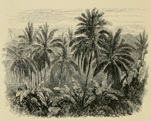
A JUNGLE.
A rainforest.
Soon after sunset huge bats always came out, in pairs, and sailed about on their leathery wings, searching for those trees that chanced to be in fruit. The wings of a male that I shot measured four feet and four inches from tip to tip, and the wings of the female, which accompanied him, expanded four feet eight inches. They are very properly named by the Dutch, “flying foxes,” and almost seem to be antediluvian monsters, which ought to have disappeared from the face of the earth long ago, like the formidable Pterodactyles. During the day they hide away in the thick foliage, and one afternoon I found one hanging, as they delight to do when they rest or sleep, with its head downward, from the limb of a tree. They are very tenacious of life, and will receive charge after charge of large shot in the head before they will let go of the limbs with their crooked claws and allow themselves to fall. They are said to be good for food, but I never saw the natives eat them, and certainly had[261] no desire myself to try the flavor of such questionable meat. A small path, leading a mile through the forest, brought me out on to a large open field or prairie, covered with a coarse grass as high as a man’s shoulders. Beyond this was another forest, and there I was informed was a settlement of two or three houses, the farthest place inland inhabited by any of the coast people or common Malays. Beyond that point there is not the slightest footpath. All the hills and high mountains, which I could see toward the interior of the island, are covered with one dense, unbroken forest, and only on some of the lower hills, bordering the bay, are there open areas of grass. What a nice thing it would be to live out there for a week in the midst of that forest! My mind was made up to do it. I returned and explained my plan to the controleur, and the next day we set off to hire one of the distant huts. The farthest one from Kayéli, and exactly the one I wanted, chanced to be unoccupied, for the native who owned it had found the place so lonely that he had deserted it and taken up his abode in the village. The rent for a week was agreed to without much parleying. The owner further agreed to send his son to bring water and keep house while I and my hunter were away, and to be generally useful, which he interpreted to mean that he would only do what he could not avoid. Another man was engaged as cook, and my domestic arrangements were complete, for I purposed not only to live in a native house, but to conform entirely to the Malay cuisine. Our cooking-apparatus consisted of a couple of shallow kettles[262] and a small frying-pan; and the little teapot that accompanied me on my Amboina excursions was not left behind.
Soon after sunset, huge bats always came out in pairs, soaring on their leathery wings and looking for fruit-bearing trees. The wings of a male bat I shot measured four feet four inches from tip to tip, while the female accompanying him had a wingspan of four feet eight inches. The Dutch aptly named them "flying foxes," and they almost seem like ancient monsters that should have vanished from the earth long ago, like the fearsome Pterodactyles. During the day, they hide in the thick foliage, and one afternoon I found one hanging upside down from a tree limb, as they like to do when they rest or sleep. They are very resilient and can take multiple shots to the head before releasing their grip with their crooked claws and letting themselves fall. They’re said to be edible, but I never saw the locals eat them, and I certainly had no desire to try such questionable meat. A small path led a mile through the forest and brought me out to a large open field or prairie, covered with coarse grass as tall as a man's shoulders. Beyond that was another forest, where I learned there was a settlement of two or three houses, the farthest inland inhabited by any of the coastal people or common Malays. Beyond that point, there wasn’t a single footpath. All the hills and high mountains I could see toward the island’s interior are covered in dense, unbroken forest, with only a few open grassy areas on the lower hills by the bay. What a great experience it would be to stay out there for a week in the middle of that forest! I decided to do it. I returned and shared my plan with the controleur, and the next day we set off to rent one of the distant huts. The farthest one from Kayéli, the exact one I wanted, happened to be unoccupied because the native owner found it too lonely and had moved to the village. We quickly agreed on the rent for a week. The owner also agreed to send his son to bring water and manage the house while my hunter and I were away, and to be generally helpful, which he took to mean only doing what he couldn't avoid. Another man was hired as a cook, and my living arrangements were complete, as I planned not only to stay in a native house but also to fully embrace the Malay cuisine. Our cooking setup consisted of a couple of shallow kettles and a small frying pan, and I didn’t leave behind the little teapot that accompanied me on my Amboina trips.
October 16th.—This morning we came out to our forest home. Our house is about eight feet wide, twelve feet long, and perched upon large posts four feet from the ground. It is divided by a transverse partition into a front room or parlor, and a back room or kitchen. In one corner of the latter is a square framework filled with ashes, in which are inserted three long stones, whose tops slightly incline toward each other. These are to support the kettles, for no Malay has ever conceived of a machine for cooking so complicated as a crane. As to a chimney, there is none whatever, but the smoke is allowed to escape under the eaves or through a hole in the side of the house that also serves for a window. The frame of the house is made from small trees. For a flooring, broad sheets of bark are used. The walls are made of gaba-gaba, the dry midribs of large palm-leaves, and the roof is of atap. The front door is in one of the gable ends, and is reached by a rickety ladder of two rounds. This part is transformed into a rude piazza by a shed-roof, beneath which we have made a seat and a kind of table for the hunter to use in skinning birds.
October 16th.—This morning we arrived at our forest home. Our house is about eight feet wide, twelve feet long, and elevated on large posts four feet off the ground. It’s divided by a wall into a front room or parlor and a back room or kitchen. In one corner of the kitchen is a square frame filled with ashes, where three long stones are set, slightly sloping toward each other. These hold the kettles, since no Malay has ever imagined a cooking device as complicated as a crane. There’s no chimney; instead, the smoke escapes under the eaves or through a hole in the side of the house that also serves as a window. The house frame is made from small trees, and we use broad sheets of bark for flooring. The walls are made of gaba-gaba, the dry midribs of large palm leaves, and the roof is constructed from atap. The front door is located at one of the gable ends and is accessed by a shaky ladder with two rungs. This area is turned into a rough piazza by a shed roof, under which we’ve set up a seat and a sort of table for the hunter to use when skinning birds.
My daily routine here is the same as before—hunting every morning and evening, with a native to carry my ammunition and to pick up the birds—a very difficult task whenever we are in the thick jungle or among the tall grass. Near our house is the stony bed of a torrent, which is now perfectly[263] dry. It is the only cleared way there is through the dense forest around us, and I avail myself of it to travel up toward the mountains and down toward the sea. Indeed, I feel proud of our grand highway. True, it is not paved with blocks all carefully cut down to one precise model, and so exactly uniform as to be absolutely painful to the eye, but Nature herself has paved it in her own inimitable way—notice how all the stones have been rounded by the boiling torrent which pours down here from the mountains during the rainy season. Some are almost perfect ellipsoides or spheres, but most are disk-shaped, for they are made from thin fragments of slate that had sharp corners when they broke away from their parent mountain. To prevent a dull uniformity of color, she has scattered here and there rounded boulders of opaque milk-white quartz, fragments, undoubtedly, from beds of that rock which, at this place at least, are interstratified with the slate. Here and there are deeper places, where the troubled stream was accustomed to rest before it went on again in a foaming torrent to empty its sparkling waters into the wide sea, the original source of all streams. By this way I visit my nearest neighbors and procure chickens, which our cook roasts on sticks over the fire, after having carefully rubbed them with salt and a liberal allowance of red pepper, the two universal condiments among the Malays. For ages all the salt these people have had has been brought from Java. The red pepper thrives well everywhere without the slightest care, and it is almost always found growing near every hut. A large bush[264] of it at one corner of our house is now filled with fruit of all sizes; some small and green, and some fully grown and showing it is already ripe by its bright-pink color. In this condition the Malays gather and dry it, and always carry a good supply wherever they go. Its Malay name is lombok, but the one more generally used is the Javanese name chabé. Besides chickens, we have paddy, that is, rice in the husk. A large elliptical hole is made in a log for a mortar, a small quantity of paddy is then poured in and pounded with a stick five or six feet long, and as large round as a man’s arm. This is raised vertically, and, when the hole is nearly even full, a native will usually pound off all the husks without scattering more than a few grains on the ground; but, if a foreigner attempts it, he will be surprised to see how the rice will fly off in all directions at every blow. When the husks are pounded off they are separated from the kernels by being tossed up from a shallow basket and carried away by the wind, as our farmers used to winnow grain. This is the only mode of preparing rice practised by the Malays, and the process is the same in every part of the archipelago. From one corner of our piazza hangs a large bunch of green bananas to ripen in the sunshine. I find it very agreeable to pluck off a nice ripe one myself when I come in weary and thirsty from a long hunt. From the other corner hangs a cluster of cocoa-nuts filled with clear, cool, refreshing water.
My daily routine here is just like it was before—hunting every morning and evening, with a local to carry my ammo and collect the birds—a tough job whenever we’re deep in the jungle or among the tall grass. Close to our house is the rocky bed of a stream, which is now completely dry. It’s the only cleared path through the thick forest around us, and I use it to travel up toward the mountains and down toward the sea. I take pride in this great pathway. Sure, it’s not paved with perfectly cut stone blocks that are all the same size and painfully uniform to look at, but Nature herself has paved it in her own unique way—notice how all the stones have been smoothed out by the rushing water that comes down here from the mountains during the rainy season. Some are almost perfectly round or oval, but most are flat disks because they’re made from thin pieces of slate that had sharp edges when they broke away from the mountain. To avoid a dull uniformity in color, Nature has scattered rounded boulders of opaque white quartz here and there, fragments that probably come from rock layers that, at least in this area, are mixed with the slate. There are also deeper spots where the turbulent stream used to pause before rushing on again, emptying its sparkling waters into the vast sea, the original source of all rivers. I use this route to visit my nearest neighbors and get chickens, which our cook roasts on sticks over the fire, after rubbing them with salt and a generous amount of red pepper, the two go-to seasonings among the Malays. For ages, all the salt these people have had has come from Java. The red pepper grows well everywhere with no care needed and is almost always found near every hut. A large bush of it at one corner of our house is now full of fruit of all sizes; some are small and green, while others are fully grown, showing they’re ripe with their bright pink color. The Malays gather and dry these when they reach this stage, always carrying a good supply wherever they go. It’s called lombok in Malay, but the more commonly used name is the Javanese term chabé. Besides chickens, we have paddy, which is rice in the husk. A large oval hole is made in a log to serve as a mortar; a small amount of paddy is poured in and pounded with a stick five or six feet long and as thick as a man’s arm. This stick is raised vertically, and when the hole is nearly full, a local can usually pound off all the husks without scattering more than a few grains on the ground; but if a foreigner tries, they’ll be surprised to see how the rice flies off in all directions with every hit. Once the husks are pounded off, they’re separated from the kernels by tossing them up from a shallow basket and letting the wind carry them away, just as our farmers used to winnow grain. This is the only method of rice preparation practiced by the Malays, and the process is the same throughout the archipelago. From one corner of our porch hangs a large bunch of green bananas ripening in the sun. I find it very nice to pick off a ripe one myself when I come back tired and thirsty from a long hunt. From the other corner hangs a cluster of coconuts filled with cool, refreshing water.
Not far from us is a hut inhabited by two natives, who are engaged in cultivating tobacco. Their ladangs, or gardens, are merely places of an acre or[265] less, where the thick forest has been partially destroyed by fire, and the seed is sown in the regular spaces between the stumps. As soon as the leaves are fully grown they are plucked off, and the petiole and a part of the midrib are cut away. Each leaf is then cut transversely into strips about a sixteenth of an inch wide, and these are dried in the sun until a mass of them looks like a bunch of oakum. It is then ready for use, and at once carried to market. This cosmopolite, Nicotiana tabacum, is a native of our own country. Las Casas says that the Spaniards on Columbus’s first voyage saw the natives in Cuba smoking it in tubes called tabacos, hence its name. Mr. Crawford states that, according to a Javanese chronicle, it was introduced into Java in the year 1601, ninety years after the conquest of Malacca by the Portuguese, who were probably the first Europeans that furnished it to the Javanese, as the Dutch had not yet formed an establishment on the island. It is now cultivated in every part of the archipelago. The fact that this narcotic was originally found only in America leads us to infer, without raising the questions whether our continent received her aboriginal population from some other part of the globe, or whether they were created here, that there never has been any extensive migration of our Indians or red-men to the islands in the Pacific, or to any distant part of the world; for if they had colonized any area, in that place at least, its use would undoubtedly continue to exist at the present day, since it is probable that they would never have thought of going to a new[266] land without taking with them this plant, which they valued more even than food, and which they had been accustomed to cultivate. If, after establishing themselves in their new colony, they had been overpowered and completely destroyed by some more powerful tribe, their conquerors would probably have become addicted to the same habit as readily as the people of every clime and every stage of civilization do now, and thus the practice would have been perpetuated, though the people who introduced it perished ages ago, and all the idols, and temples, and fortifications they might have made, have long since crumbled into dust. This inference is greatly strengthened, if we consider the past and present geographical distribution of maize, or Indian corn, which is also a native of our continent only, and, like tobacco, is now raised in every part of the archipelago. Unlike rice, this plant thrives on hill-sides and elevated lands, and can therefore be raised on all the larger islands in these seas, where there are few level areas that can be readily inundated for the cultivation of rice. It was also probably introduced by the Portuguese, for Juan Gaetano, a Spanish pilot, who visited Mindanao in 1642, twenty-one years after the discovery of the Philippines by Magellan, states[41] that “in a certain part of that island ruled by the Moors” (Arabs), “there are some small artillery, and hogs, deer, buffaloes, and other animals of the chase, with Castilian” (or common) “fowls, rice, palms, and cocoa-nuts. There is no maize in that[267] island, but for bread they use rice and a bark which they call sagu, from which also they extract oil in like manner as they do from palms.”
Not far from us is a hut inhabited by two natives, who are engaged in cultivating tobacco. Their ladangs, or gardens, are merely places of an acre or[265] less, where the thick forest has been partially destroyed by fire, and the seed is sown in the regular spaces between the stumps. As soon as the leaves are fully grown they are plucked off, and the petiole and a part of the midrib are cut away. Each leaf is then cut transversely into strips about a sixteenth of an inch wide, and these are dried in the sun until a mass of them looks like a bunch of oakum. It is then ready for use, and at once carried to market. This cosmopolite, Nicotiana tabacum, is a native of our own country. Las Casas says that the Spaniards on Columbus’s first voyage saw the natives in Cuba smoking it in tubes called tabacos, hence its name. Mr. Crawford states that, according to a Javanese chronicle, it was introduced into Java in the year 1601, ninety years after the conquest of Malacca by the Portuguese, who were probably the first Europeans that furnished it to the Javanese, as the Dutch had not yet formed an establishment on the island. It is now cultivated in every part of the archipelago. The fact that this narcotic was originally found only in America leads us to infer, without raising the questions whether our continent received her aboriginal population from some other part of the globe, or whether they were created here, that there never has been any extensive migration of our Indians or red-men to the islands in the Pacific, or to any distant part of the world; for if they had colonized any area, in that place at least, its use would undoubtedly continue to exist at the present day, since it is probable that they would never have thought of going to a new[266] land without taking with them this plant, which they valued more even than food, and which they had been accustomed to cultivate. If, after establishing themselves in their new colony, they had been overpowered and completely destroyed by some more powerful tribe, their conquerors would probably have become addicted to the same habit as readily as the people of every clime and every stage of civilization do now, and thus the practice would have been perpetuated, though the people who introduced it perished ages ago, and all the idols, and temples, and fortifications they might have made, have long since crumbled into dust. This inference is greatly strengthened, if we consider the past and present geographical distribution of maize, or Indian corn, which is also a native of our continent only, and, like tobacco, is now raised in every part of the archipelago. Unlike rice, this plant thrives on hill-sides and elevated lands, and can therefore be raised on all the larger islands in these seas, where there are few level areas that can be readily inundated for the cultivation of rice. It was also probably introduced by the Portuguese, for Juan Gaetano, a Spanish pilot, who visited Mindanao in 1642, twenty-one years after the discovery of the Philippines by Magellan, states[41] that “in a certain part of that island ruled by the Moors” (Arabs), “there are some small artillery, and hogs, deer, buffaloes, and other animals of the chase, with Castilian” (or common) “fowls, rice, palms, and cocoa-nuts. There is no maize in that[267] island, but for bread they use rice and a bark which they call sagu, from which also they extract oil in like manner as they do from palms.”
As maize is not difficult to be transported on account of its bulk or liability to any injury, and formed the chief article of food among most of our red-men, it would be the very provision they would take with them on their migrations; and as the part eaten is the fruit, they would have plenty of seed, and would know from their previous experience precisely how to cultivate it.
As corn is easy to transport because of its size and resilience, and it was the main food source for many of our Native American tribes, it would be the basic provision they carried with them during their migrations. Since the edible part is the kernel, they would have plenty of seeds and would know from their past experience exactly how to grow it.
One part of the surrounding forest is a grove of jati, or teak-trees, Tectona grandis, Linn. Those found here are only a foot or fifteen inches in diameter and forty feet high, a size they attain in Java in twenty-five or thirty years, where they do not reach their full growth in less than a century. The native name jati is a word of Javanese origin, signifying true, or genuine, and was probably applied to these trees on account of the well-known durability of the wood they yield. Now, near the end of the dry monsoon, they have lost nearly all their foliage; for, though it is sometimes asserted that in the tropics the leaves fall imperceptibly one by one, that is not true, in this region, where there are well-defined wet and dry seasons. The teak also thrives in a few places on the continent, and is found in the central and eastern provinces of Java, in Madura, Bali, and particularly in Sumbawa, where the wood is considered better than that of Java, but it is said to be unknown in Sumatra, Borneo, and in the peninsula of Malacca. It exists in some places in Celebes, but[268] the natives assert that the seed was brought there from Java by one of the sovereigns of Tanéte. It is therefore uncertain whether the teak is a native of this island. In the early morning, and again soon after sunset, flocks of large green parrots, Tanygnathus macrorynchus, Wagl., come to these trees to feed on the fruit which is now ripe. They are so wary that it is extremely difficult to get near them, especially as the large dry leaves of this tree cover the ground and continually crack and rustle beneath one’s feet. To see these magnificent birds flying back and forth in the highest glee, while they remain unconscious of danger, is a grand sight, and it seems little less than absolute wickedness to shoot one, even when it is to be made the subject, not of idle gazing, but of careful study, and it requires still greater resolution to put an end to one’s admiration and pull the fatal trigger. When one of these birds has been wounded, its mate, and sometimes the whole flock, hearing its cries, at once comes back, as if hoping to relieve its misery.
One part of the surrounding forest is a grove of jati, or teak trees, Tectona grandis, Linn. The ones here are only a foot to fifteen inches in diameter and forty feet tall, a size they reach in Java in twenty-five to thirty years, where they don’t fully mature in less than a century. The local name jati comes from Javanese, meaning true or genuine, probably because of the well-known durability of the wood they produce. Now, near the end of the dry monsoon, they have lost almost all their leaves; although it’s sometimes said that in the tropics, leaves fall one by one without notice, that isn’t the case here, where there are clearly defined wet and dry seasons. Teak also grows in a few areas on the mainland and can be found in the central and eastern provinces of Java, Madura, Bali, and especially in Sumbawa, where the wood is thought to be better than that from Java, but it’s said to be absent in Sumatra, Borneo, and the Malacca Peninsula. It exists in some areas in Celebes, but the locals claim that the seeds were brought from Java by one of the rulers of Tanéte. So, it’s uncertain whether teak is native to this island. In the early morning and again shortly after sunset, flocks of large green parrots, Tanygnathus macrorynchus, Wagl., come to these trees to eat the now ripe fruit. They are so cautious that it’s extremely hard to get close to them, especially since the large dry leaves of this tree cover the ground and constantly crackle and rustle underfoot. Watching these magnificent birds flying back and forth in pure joy, while remaining unaware of danger, is a stunning sight, and it feels close to absolute wrongness to shoot one, even if it's for serious study rather than mere idleness. It requires even greater resolve to stop admiring them and pull the fatal trigger. When one of these birds is wounded, its mate—and sometimes the whole flock—returns at once, seemingly hoping to ease its suffering.
In many places in this vicinity the tall canari-tree is seen raising its high crest, and there flocks of cream-colored doves, Carpophaga luctuosa, gather to feed on its fruit. Their loud, continuous cooing leads the hunter a long way through the jungle. Among the limbs of the lower trees are seen the long-tailed doves, Carpophaga perspiclata. On the banks of the dry brook, near our house, are bunches of bamboos, through which flit fly-catchers, Muscicapidæ, and the beautiful Monarcha loricata, a slender bird about as large as a martin, of a blue[269] above, and a pure, almost silvery white beneath, except on the throat, which is covered with scale-like feathers, of a rich metallic blue-black. So far as is known, this beautiful bird is only found on this island. In the bushes and shrubbery is constantly heard the cheerful note of a bird, the Trobidorynchus bouruensis, somewhat larger than our robin. By day I enjoyed this Robinson Crusoe life very much, but the mosquitoes proved such a torment by night that we could scarcely sleep. A great smouldering fire was made under our hut, but its only effect was to increase our misery, and make the mosquitoes more bloodthirsty. We were frequently disturbed also by several yellow dogs, which came to crunch what chicken-bones the cook had thrown away, and to upset every thing around the house that was not already in a state of stable equilibrium. Afterward, when all was still, occasionally a heavy crash sighed through the deep woods, caused by the falling of some old tree, whose roots had been slowly consumed by the fires that prevail in the neighborhood during the dry season.
In many areas around here, you can see the tall canari tree towering above, where flocks of cream-colored doves, Carpophaga luctuosa, gather to feast on its fruit. Their loud, constant cooing guides the hunter deep into the jungle. Among the branches of the lower trees, long-tailed doves, Carpophaga perspiclata, can also be spotted. On the banks of the dry brook near our house, there are clusters of bamboo, where flycatchers, Muscicapidæ, flit around, along with the stunning Monarcha loricata, a slim bird about the size of a martin, with bright blue on top and almost silvery white underneath, except for its throat, which is adorned with scale-like feathers that are a rich metallic blue-black. As far as we know, this beautiful bird is only found on this island. In the bushes, you can constantly hear the cheerful song of a bird, the Trobidorynchus bouruensis, which is slightly larger than our robin. During the day, I enjoyed this Robinson Crusoe life a lot, but at night, the mosquitoes were such a nuisance that we could barely sleep. We made a large smoldering fire under our hut, but it only made our situation worse and drew in even more mosquitoes. We were often disturbed by several yellow dogs that came to munch on the chicken bones the cook had thrown out and to knock over anything around the house that wasn’t securely placed. Later, when everything was quiet, you could occasionally hear a heavy crash in the deep woods as an old tree fell, its roots slowly eaten away by the fires that tend to occur in the area during the dry season.
At the end of a week my hunter had preserved the skins of sixty-three beautiful birds, including specimens of six species that I had not secured before. We now returned to Kayéli; and though there were only eight white persons in the whole place, I could nevertheless feel that I was returning to civilization, and that I could speak some other language than Malay.
At the end of the week, my hunter had preserved the skins of sixty-three beautiful birds, including six species that I hadn’t collected before. We returned to Kayéli, and even though there were only eight white people in the entire place, I could still feel that I was coming back to civilization and that I could speak a language other than Malay.
The village of Kayéli is really composed of eleven separate parts, or kampongs, all situated on a low,[270] marshy place, a couple of hundred yards back from the sand-beach. They are separated from each other by a little stream, or kali, and each has its own rajah, and formerly had its own little square mosque, for all these eleven tribes are Mohammedans, and keep separate from each other, because they lived in different parts of the island when the Dutch arrived. In the centre of this village is a large, square lawn, formed by the fort, the residence of a controleur, and a few other houses. Back of the lawn is the Christian kampong; for in every village where there are Mohammedans and Christians, each has a separate part to itself. Occasionally, instead of a healthful spirit of rivalry, a more bitter hostility springs up than existed between the Jews and the Samaritans, and finally the weaker party is obliged to migrate, as in the case mentioned in regard to the inhabitants of Bonoa.
The village of Kayéli is actually made up of eleven different parts, or kampongs, all located on a low, marshy area a couple of hundred yards from the sandy beach. They are separated by a small stream, or kali, and each has its own rajah, and in the past, had its own small mosque, since all eleven tribes are Muslim and keep to themselves because they lived in different areas of the island when the Dutch arrived. In the center of this village is a large square lawn, formed by the fort, the residence of a controleur, and a few other houses. Behind the lawn is the Christian kampong; in every village where there are Muslims and Christians, each has its own section. Occasionally, instead of a healthy competitive spirit, a harsher hostility develops, even greater than what existed between the Jews and the Samaritans, leading to the weaker group having to move, as was the case with the people of Bonoa.
From Valentyn we learn that, according to native accounts, as early as A. D. 1511, ten years before the arrival of the Portuguese, the Sultan of Ternate sent out expeditions which subjected all the tribes of this island. In 1652 a treaty was made between the sultan and the Dutch, that all the clove-trees on the island should be uprooted. The natives opposed this measure to the best of their ability, but after a resistance which lasted five years, they were completely subjected, all their clove-trees were destroyed, and they were obliged to remove to Kayéli Bay, and live under the range of the Dutch cannon. Since that time (1657), the clove-tree has never been introduced again. Previous to the expedition of the Sultan of[271] Ternate in 1511, the shores of the island were occupied by the Malays, who had already subjected the earliest inhabitants of the island of which we have any knowledge. During my stay at Kayéli I saw several of them, though they are always shy about entering the village. Like the Alfura of Ceram, they resemble the Malays in stature and general appearance, but are distinguished from them by their darker color, and by their hair, which is frizzly, not lank like that of the Malays, and not woolly, like that of the Papuans. As in Ceram, many of them suffer from that unsightly disease, icthyosis, in which the skin becomes dry and comes off in scales. Their houses are described as the most miserable hovels, consisting of little more than a roof of palm-leaves resting on four poles, with a kind of platform a foot or two above the ground, where they sit and sleep. They are all free, and slavery is wholly unknown. Mr. T. J. Miller, who was formerly resident here, took much pains to gather all the information possible in regard to them. He states that they have divided the island into Fennas or tribes, each of which has a chief. Instead of living together in villages, like the Malays, they are scattered over their whole territory. Several of these chiefs continue to acknowledge one of the Mohammedan rajahs, or, as they are named by the Dutch, “regents,” in the village of Kayéli, as their superior. Formerly, each was obliged to send one young girl to its regent for a bride every year, but the Dutch have long since relieved them from such an unwelcome exaction. In former times also they were compelled to pay their regent a[272] certain part of their rice and sago, and provide men to row his prau or to carry his chair, if he proceeded by land, but they have been freed from this onerous service, and the Malays who live in the village with the rajah are obliged to perform such offices for him. In regard to marriage, each man buys his wife, her price, according to their laws, depending on the rank of her father, as in Ceram, but a man is not, however, required to cut off a human head before he can be allowed to marry, as is the custom in that island. Instead, therefore, of being fierce head-hunters, as the Alfura of Ceram, they are mild and inoffensive. They believe, according to Mr. Miller, in one Supreme Being, who made every thing, and is the source of all good and all evil. They believe in evil spirits. Prayer leads to prosperity; the negligence of this duty to adversity. Through the love that this Supreme Being had for man, whom He had created, He sent him a teacher, Nabiata, who lived among the mountains. He gave the will of his Master in seven commandments, namely: 1. Thou shalt not kill nor wound. 2. Thou shalt not steal. 3. Thou shalt not commit adultery. 4. Thou shalt not set thyself against thy fenna. 5. A man shall not set himself up against the chief of his tribe. 6. The chief shall not set himself up against him that is over his or other tribes. 7. The chief over more than one tribe shall not set himself up against him who is placed over all the tribes. Nabiata also taught that, though the body perishes, the soul shall still continue to exist. They who have kept the foregoing commandments—for all the acts of men are recorded by[273] this Supreme Being—shall dwell far above the clouds near the Omniscient One. They who have done wickedly shall never rise to the abode of the happy nor remain on earth, but continually, in solitude and sorrow, wander about on the clouds, longing in vain to join their brothers who are above or beneath them. Nabiata also instituted circumcision, which was performed on both sexes when they attained the age of eight or ten years. From the introduction of this rite we may infer that this Nabiata was a Mohammedan teacher, probably an Arab, who had found his way to this region on a Javanese or Malay prau, that had come to purchase cloves. Finally, according to their legend, Nabiata made men of birth his disciples and teachers, and ascended to the abode of the good from whence he came.
From Valentyn, we learn that according to local accounts, as early as A.D. 1511, ten years before the Portuguese arrived, the Sultan of Ternate sent out expeditions that conquered all the tribes on this island. In 1652, a treaty was made between the sultan and the Dutch, mandating the uprooting of all the clove trees on the island. The locals resisted this decision as best they could, but after five years of struggle, they were fully subdued, all their clove trees were destroyed, and they were forced to relocate to Kayéli Bay, living under the threat of Dutch cannons. Since that time (1657), clove trees have never been reintroduced. Before the Sultan of Ternate's expedition in 1511, the shores of the island were occupied by Malays, who had already dominated the earliest known inhabitants of the island. During my time in Kayéli, I encountered several of them, although they tend to be shy about entering the village. Like the Alfura of Ceram, they resemble Malays in height and general appearance, but differ in their darker skin and frizzy hair, unlike the straight hair of the Malays or the woolly hair of the Papuans. As seen in Ceram, many of them suffer from the unsightly disease, ichthyosis, where the skin dries out and flakes off in scales. Their houses are described as very basic structures, consisting mainly of a palm-leaf roof supported by four poles, with a platform raised a foot or two above the ground for sitting and sleeping. They are all free, and slavery is entirely absent. Mr. T. J. Miller, a former resident, made great efforts to gather as much information as he could about them. He notes that they have divided the island into Fennas or tribes, each led by a chief. Unlike the Malays who live in villages, they are spread out across their territory. Several of these chiefs still recognize one of the Mohammedan rajahs, or "regents" as the Dutch call them, in the village of Kayéli, as their superior. Previously, each was required to send one young girl to their regent every year as a bride, but the Dutch have since relieved them of this unwelcome obligation. In the past, they were also forced to give their regent a portion of their rice and sago and provide laborers to row his prau or carry his chair on land. However, they have been freed from these burdensome duties, and the Malays living in the village with the rajah are now the ones required to perform these tasks for him. Regarding marriage, each man purchases his wife, with her price determined by her father's rank, similar to practices in Ceram. However, a man is not required to take a human head to marry, unlike the customs of that island. Thus, while they are not fierce headhunters like the Alfura of Ceram, they are instead gentle and non-threatening. According to Mr. Miller, they believe in one Supreme Being who created everything and is the source of all good and all evil. They acknowledge the existence of evil spirits. They believe prayer leads to prosperity, while neglecting this duty leads to hardships. Because of the love this Supreme Being has for humanity, whom He created, He sent a teacher, Nabiata, who lived in the mountains. He delivered His will in seven commandments: 1. You shall not kill or wound. 2. You shall not steal. 3. You shall not commit adultery. 4. You shall not go against your fenna. 5. A man shall not oppose the chief of his tribe. 6. The chief shall not oppose those over him or other tribes. 7. The chief of multiple tribes shall not oppose the supreme chief over all tribes. Nabiata also taught that while the body may perish, the soul continues to exist. Those who observe the aforementioned commandments—because all actions are recorded by this Supreme Being—will dwell far above the clouds near the Omniscient One. Those who act wickedly will never ascend to the realm of the fortunate nor remain on earth, but endlessly wander in solitude and sorrow among the clouds, longing in vain to reunite with their brethren above or below them. Nabiata also instituted circumcision, performed on both genders when they reach eight or ten years old. From the introduction of this rite, we might infer that Nabiata was a Mohammedan teacher, likely an Arab, who arrived in this region on a Javanese or Malay prau that came to trade for cloves. Lastly, according to their legend, Nabiata selected men of high birth as his disciples and teachers before ascending to the abode of the righteous from whence he came.
One day, while at Kayéli, I received a most polite invitation to attend a feast at one of the rajah’s houses. The occasion was the shaving of a young child’s head. An Arab priest began the rite by repeating a prayer in a monotonous nasal chant, five others joining in from time to time by way of a chorus. After the long prayer was ended, a servant brought in the child, and another servant followed carrying a large plate partly filled with water, in which were two parts of the blossom of a cocoa-nut-palm, a razor, and a pair of shears. The child was first carried to the chief priest, who dipped his fingers in the water, placed them on the child’s head, and then cut off a lock of hair with the large shears. The lock of hair was then carefully thrown into the water along with a guilder. We all did the same. Tea[274] and small cakes made of rice were then served, and “the feast” was ended. The child was one year old; when it becomes eight or nine it will have to submit to that abominable custom prevailing among both sexes of all ranks of Mohammedans, filing the teeth. This, I was informed, was done with a flat stone, or a fragment of slate, and sometimes even with a piece of bamboo. The object is to make the teeth short, and the front ones concave on the outer side, so as to hold the black dye. The Christians never file theirs, and the Mohammedans always ridicule the teeth of such natives by calling them “dogs’ teeth,” because they are “so white and so long.”
One day, while I was in Kayéli, I got a very polite invitation to a feast at one of the rajah’s houses. The event was the shaving of a young child's head. An Arab priest started the ceremony by chanting a prayer in a monotonous nasal tone, with five others occasionally joining in as a chorus. After the long prayer ended, a servant brought in the child, followed by another servant carrying a large plate partly filled with water, which held two pieces of the blossom from a coconut palm, a razor, and a pair of shears. The child was first taken to the chief priest, who dipped his fingers in the water, placed them on the child's head, and then cut off a lock of hair with the large shears. The lock of hair was then carefully thrown into the water along with a guilder. We all followed suit. Then tea and small rice cakes were served, and "the feast" came to an end. The child was one year old; when it turns eight or nine, it will have to go through that terrible custom common among all ranks of Muslims, which is filing the teeth. I was told this is done using a flat stone, a bit of slate, or sometimes even a piece of bamboo. The purpose is to make the teeth shorter, with the front ones concave on the outside, so they can hold the black dye. Christians never file their teeth, and Muslims often mock such natives by calling their teeth “dogs’ teeth” because they are “so white and so long.”
At another time I received an invitation to attend a wedding-feast, but, when I reached the house, it proved to be a feast that the married couple give to their friends a few days after the wedding. As on all such festive occasions, the house and veranda were brilliantly lighted, and on either side from the house out to the street were a number of posts made of the large soft trunks of bananas. On their tops large lumps of gum were burned. Between them were arches made of young leaves of the cocoa-nut palm, arranged as I had previously seen in Nusalaut. The bride (who, of course, is to be spoken of first), to our surprise, did not prove to be a young and blooming lass, but already in middle life, yet a suitable helpmeet at least for the bridegroom, who was an Arab, and had married this, his second wife, since he came to Buru, only four months ago. The former wife he had sent back to her parents, much against her wishes. When a wife desires to leave her husband,[275] she cannot do so without his consent, which the husband generally grants, choosing the less of two evils, and, moreover, it is regarded as very ungallant to retain an unwilling mate; but, while travelling in Sumatra, I saw one husband who would not allow his wife another choice, but his was a very peculiar case. His father was a Chinaman, and therefore, as the descendants of the Chinese do, he had shaved his head and wore a cue, and was a Chinaman also; but, becoming desperately enamoured of a Mohammedan lass, he concluded to yield to her unusual demand, that he too must become a Mohammedan before he could be accepted. She soon repented of her proposal, but he replied that he had suffered so much for her sake, he would not release her from her vows—such are the unlimited privileges granted the husband by the laws of the false Prophet.
At another time, I got invited to a wedding feast, but when I arrived at the house, it turned out to be a gathering that the couple hosts for their friends a few days after the wedding. As is usual for such festive occasions, the house and veranda were brightly lit, and on either side extending from the house to the street were several posts made from the large, soft trunks of banana trees. On top of them were big lumps of burning gum. Between these posts, there were arches made from young coconut palm leaves, set up like I had seen before in Nusalaut. The bride (who, of course, should be mentioned first) surprised us by not being a young, blooming woman, but rather someone in middle age, yet a suitable partner for the bridegroom, who was an Arab and had only married this, his second wife, four months ago since arriving in Buru. He had sent his first wife back to her parents, much to her dismay. When a wife wants to leave her husband,[275] she can’t do it without his permission, which the husband usually grants, choosing the lesser of two evils, and it’s also considered very unchivalrous to keep an unwilling partner. However, while I was traveling in Sumatra, I encountered a husband who wouldn’t give his wife another option, though his case was quite unusual. His father was Chinese, and like many descendants of the Chinese, he had shaved his head and wore a queue, making him Chinese too; but after becoming infatuated with a Muslim girl, he agreed to her unusual request that he convert to Islam before she would accept him. She quickly regretted her proposal, but he told her that he had endured so much for her sake that he wouldn’t release her from her vows—such is the unlimited power given to husbands by the laws of the false Prophet.
While at Amboina I was surprised one day, just before dinner, to see a strange servant appear with a large platter containing fifteen or twenty kinds of fishes, fruit, and the various inimitable mixtures made by the Chinese, in whose quarter of the city we were residing. The gentleman with whom I was living, however, explained the mystery. There was to be a wedding in a house near by, and the father of the bride was one of his hired men, and those nice preparations were intended as a present, that is, in form, it being expected that only two or three of them would be taken—and that was quite all a European palate would desire. This was repeated for three or four days. Meantime the father of the bride had hired a house where other friends were received and[276] feasted, and the father of the bridegroom also received and entertained his friends in like manner. At length came an invitation to attend the finale of this long ceremonial. We first walked to the house of the bridegroom. Large Chinese lanterns brilliantly lighted the veranda and the adjoining narrow lane, which was thronged with men and boys. We then visited the house where the bride was waiting to receive her lord. The piazza opened into a large room, and on one side of it was a smaller one, closed by a red curtain instead of a door. No one but the lady-guests were allowed to enter where the bride was sitting. The larger room contained many small tables loaded with delicacies, mostly of Chinese manufacture. Not to be unsocial, we sat down and sipped a cup of boiling tea, and observed the assembled guests while all were waiting for the coming of the bridegroom as in good Scripture times. In the opposite corner was a table surrounded with Malay ladies. It also was covered with sweetmeats, but room was soon made for the more necessary siri-box; a liberal quid of lime, pepper-leaves, and betel-nut was taken by each one, and, to complete the disgusting sight, an urn-shaped spittoon, an inseparable companion of the siri-box, was produced, and handed round from one to another as the occasion demanded. A shrill piping was now heard down the street, and every one rushed out on the veranda to see the approaching procession. First came boys with wax-candles, and near them others carrying the presents that the bride and the bridegroom had received. Then came the bridegroom himself, supported by his friends, and[277] surrounded by candles arranged at different heights on rude triangular frames. He was dressed in a Malay suit of light red, and wore a gilded chain. I had been told that, when he should attempt to enter the room where the bride sat waiting, the women would gather and persistently dispute his right to proceed, and here, in the distant East, I thought to myself, I shall see an illustration of the maxim, “None but the brave deserve the fair.” On the contrary, so far from manifesting any disposition to oppose him and prolong the ceremony, they only made way for him to enter the bridal-chamber as quickly as possible. As my friend and I were the only white persons present, we were allowed the especial favor of entering also. On one side of the room was a small table covered with a red cloth, and on this were two gigantic red wax-candles. Behind the table sat the bride, arrayed in a scarlet dress, with a white opaque veil concealing her face, and fastened to her hair. As the bridegroom approached, she slowly rose. Placing his hands with the palms together, he bowed three times in the same manner as the Chinese address the images in their temples. She returned the salutation by also bowing three times, but without raising her hands. Now came the exciting moment. She remained standing while he stepped forward and commenced pulling out the pins that held fast the opaque veil which hid her beauty from his longing eyes. Not being very skilful in this operation, a couple of the maids-in-waiting assisted him, and, by degrees, was revealed a face that was at least one shade darker than most of the ladies near her, and I[278] could but think, if that really was the first time her husband had ever seen her, he must feel not a little disappointed. However, his countenance remained unchanged, whether such a saddening reflection crossed his mind or one of delightful surprise. He then passed round the table to the side of his bashful bride, and both sat down together and were stupidly gazed at. In the opposite end of the room was the bridal-bed. The four posts rose above the bed nearly to the ceiling, and supported a mosquito-curtain which was bespangled with many little pieces of tinsel and paper flowers. Both the bride and bridegroom were Mohammedans, and this marriage was nominally according to the Mohammedan usage, but it should perhaps be more properly regarded, like most of the Malay customs at the present day, as combining parts of the rite in China and Arabia with that which existed among these nations while they observed the Hindu religion, or continued to remain in heathenism. The boys usually marry for the first time when about sixteen, and the girls at the age of thirteen or fourteen, though I was once shown a child of nine years that was already a wife, and mothers eleven or twelve years old are occasionally seen. The great obstacle to marriage in all civilized lands—the difficulty of supporting a family—is unknown here. Children, instead of being a source of expense, are a source of income. Until four or five years old, the boys do not usually wear any clothing. Their food costs very little, and all the education they receive still less, or nothing at all. The average number of persons in one family in Java, where it is[279] perhaps as large, if not larger, than elsewhere, is estimated at only four or four and a half. The fact that children help support their parents secures for them such attention that they are never entirely neglected. Polygamy is allowed here as in other Mohammedan lands, but only the wealthier natives and the princes are guilty of it. The facility with which marriages are made, and divorces obtained, is one cause why it is not more general. In regard to the evil effects of polygamy, and the ideas of this people in respect to the sacred rite of marriage, Sir Stamford Raffles, who was Governor-General of Java, most truthfully remarks: “Of the causes which have tended to lower the character of the Asiatics in comparison with Europeans, none has had a more decided influence than polygamy. To all those noble and generous feelings, all that delicacy of sentiment, that romantic and poetical spirit, which virtuous love inspires in the breast of a European, the Javan is a stranger; and in the communication between the sexes he seeks only convenience and little more than a gratification of an appetite. But the evil does not stop here: education is neglected, and family attachments are weakened. A Javan chief has been known to have sixty acknowledged children, and it too often happens that in such cases sons having been neglected in their infancy become dissipated, idle, and worthless, and spring up like rank grass and overrun the country.”
While I was in Amboina, I was surprised one day, just before dinner, to see a strange servant arrive with a large platter filled with fifteen or twenty types of fish, fruit, and various unique dishes made by the Chinese, in whose area of the city we were staying. The gentleman I was living with explained the situation. There was a wedding happening nearby, and the bride's father was one of his employees, and those lovely preparations were meant as a gift, although it was expected that only two or three of the items would actually be taken—plenty for a European palate. This went on for three or four days. In the meantime, the bride’s father had rented a house where other friends were entertained and feasted, and the bridegroom’s father was doing the same for his friends. Eventually, we received an invitation to attend the finale of this lengthy ceremony. We first walked to the bridegroom's house. Large Chinese lanterns lit up the veranda and the adjacent narrow lane, which was crowded with men and boys. Then we visited the house where the bride was waiting to meet her husband. The porch led into a big room, with a smaller room on one side that was closed off by a red curtain instead of a door. Only the female guests were allowed to enter where the bride was sitting. The larger room was filled with many small tables loaded with treats, mostly of Chinese origin. Not wanting to be anti-social, we sat down and sipped some hot tea while watching the gathered guests who were all waiting for the arrival of the bridegroom, much like in biblical times. In the opposite corner was a table surrounded by Malay ladies. It, too, was covered with sweets, but soon there was space made for the necessary betel box; each person took a generous amount of lime, pepper leaves, and betel nut, and to complete the unpleasant scene, an urn-shaped spittoon, an inseparable companion of the betel box, was circulated from one person to another as needed. A shrill sound was heard down the street, and everyone rushed out onto the veranda to see the approaching procession. First came boys holding wax candles, followed closely by others carrying the gifts that the bride and groom had received. Then the bridegroom himself arrived, supported by his friends and surrounded by candles arranged at different heights on makeshift triangular frames. He was dressed in a light red Malay suit and wore a gilded chain. I had been told that when he tried to enter the room where the bride was waiting, the women would gather and strongly contest his right to proceed, and here, in this faraway East, I thought I would see an example of the saying, “Only the brave deserve the fair.” However, contrary to my expectations, instead of opposing him and delaying the ceremony, they quickly made way for him to enter the bridal chamber as fast as possible. Since my friend and I were the only white people present, we were granted the special privilege of entering as well. On one side of the room was a small table covered with a red cloth, and upon it were two massive red wax candles. Behind the table sat the bride, dressed in a red gown, with a white opaque veil covering her face and fastened to her hair. As the bridegroom approached, she slowly stood up. With palms together, he bowed three times, just like the Chinese do when addressing the images in their temples. She returned the gesture by bowing three times as well, but without lifting her hands. Now came the thrilling moment. She remained standing while he stepped forward and began to pull out the pins holding the opaque veil that concealed her beauty from his eager eyes. Not being very skilled at this, a couple of the maids-in-waiting helped him, and gradually, a face was revealed that was at least one shade darker than most of the ladies around her, making me think that if this was truly the first time her husband had seen her, he must feel somewhat disappointed. Nonetheless, his expression remained unchanged, whether such a gloomy thought crossed his mind or if he was pleasantly surprised. He then moved around the table to his bashful bride's side, and they both sat down while everyone stared at them. At the opposite end of the room was the bridal bed. The four posts rose nearly to the ceiling and supported a mosquito net decorated with tiny pieces of tinsel and paper flowers. Both the bride and bridegroom were Muslims, and this marriage was nominally following the Muslim customs, but it might be more accurately viewed, like most modern Malay customs, as a blend of rituals from China and Arabia along with practices that existed among these people when they followed Hinduism or remained in paganism. Boys typically marry for the first time around sixteen, and girls at thirteen or fourteen, although I once met a nine-year-old who was already married, and occasionally mothers as young as eleven or twelve are seen. The major barrier to marriage found in all civilized countries—the challenge of financially supporting a family—is absent here. Children, instead of being a burden, are a source of income. Boys usually don’t wear any clothing until they’re four or five. Their food is very inexpensive, and their education costs even less, if not nothing at all. The average family size in Java, where it is probably as large, if not larger, than elsewhere, is estimated to be only four or four and a half. The fact that children contribute to their parents’ support ensures they receive sufficient attention and are never entirely neglected. Polygamy is allowed here, just like in other Muslim countries, but only among wealthier individuals and princes. The ease with which marriages can be arranged and divorces obtained is one reason it isn’t more common. Regarding the negative impacts of polygamy and this population's views on the sacred institution of marriage, Sir Stamford Raffles, who was Governor-General of Java, pointed out: “Of the causes which have tended to lower the character of the Asiatics in comparison with Europeans, none has had a more decided influence than polygamy. To all those noble and generous feelings, all that delicacy of sentiment, that romantic and poetic spirit, which virtuous love inspires in the breast of a European, the Javanese is a stranger; and in the interactions between the sexes, he seeks only convenience and little more than the satisfaction of an urge. But the harm doesn’t stop there: education is neglected, and family bonds are weakened. A Javanese chief has been known to have sixty recognized children, and it frequently happens that in such cases, neglected sons grow up to become dissipated, idle, and worthless, and sprout like weeds and overrun the land.”

A MALAY OPIUM SMOKER.
A Malay opium user.
In the little village of Kayéli there were only three Chinamen, but one of them was an opium-seller. He was agent for another Chinaman at Amboina, who had bought the privilege of selling it from[280] the Dutch Government, who “farm out” or grant this privilege in every district to the highest bidder. From this article alone, the government obtains in this way an income of four or five million dollars. Opium, as is well known, is the inspissated juice obtained from the capsule of the white poppy, Papaver somniferum. Its Malay name is apyun, which, coming from the Arabic afyun, shows at once by whom it was introduced into the archipelago; the same people, as Mr. Crawfurd remarks, who made them acquainted with ardent spirits, and at the same time gave them a religion forbidding both. It is imported from India, and the poppy is not cultivated in any part of the archipelago. Barbosa mentions it in a list of articles brought from Arabia to Calicut in Malabar, and in his time its price was about one-third what it is now. The man who sells it is obliged to keep a daily account of the quantity he disposes of, and this account is open to the inspection of the government officers at all times. So large is the sum demanded by the government for this farming privilege, and so great are the profits obtained by the Chinese, who are the people that carry on most of this nefarious traffic, that the price the Malays are obliged to pay for this luxury limits its consumption very considerably. When imported, it is usually in balls five or six inches in diameter. It is then soft and of a reddish-brown color, but becomes blacker and harder the longer it is kept. It is slightly elastic, and has a waxy lustre, a strong, unpleasant odor, and to the taste is bitter, nauseous, and persistent. To prepare it for smoking, it is boiled down to the[281] consistency of thick tar. While it is boiling, tobacco and siri are sometimes added. A lamp is then lighted, and a small quantity is taken up on a piece of wire as large as a knitting-needle. This is held in the flame of the lamp until it melts and swells up as a piece of spruce-gum would do under similar circumstances. During this process it is frequently taken out of the flame and rolled between the thumb and forefinger. It is then placed in a small hole in the large bowl of the pipe, and the wire being withdrawn, a hole is left for inhaling the air. The bowl of the pipe is now placed against the lamp and the smoke inhaled with two or three long breaths, which carry the fumes down deep into the lungs. By this time the small quantity of opium in the bowl of the pipe is consumed. It is then filled as before, and this process is repeated until the eyelids become heavy and an irresistible desire to sleep possesses the whole body. Its immediate effect is to produce a passive, dreamy state. This is followed by a loss of appetite, severe constipation, and kindred ills. When a man has once contracted the habit of using it, it is impossible to reform. Greater and greater doses are required to produce the desired lethargic effect. The evil results of this vice are well shown in the accompanying photograph of a Malay, where the victim, although only in middle life, has already become so emaciated that he is little more than a living skeleton. The rude platform of planks covered with a straw mat, on which he is sitting, is his bed, while stupified with his favorite drug. A pipe, of the customary form, is seen in his right hand. Being too[282] poor to own a lamp, he has instead a small fire of charcoal raised on the top of an urn-shaped vessel of earthen-ware. By his side are seen vessels for making tea, and by copious draughts of that stimulant he will try to revive his dead limbs by and by, when he awakes from his contemplated debauch, and finds his whole energy gone, and, as it were, his very life on the point of leaving the body.
In the small village of Kayéli, there were only three Chinese men, but one of them was an opium dealer. He worked for another Chinese man in Amboina, who had bought the right to sell it from the Dutch Government, which grants this privilege to the highest bidder in every district. The government earns about four or five million dollars from this arrangement. Opium, as many know, is the thick sap from the capsule of the white poppy, Papaver somniferum. Its Malay name is apyun, which comes from the Arabic afyun, indicating who introduced it to the archipelago; the same group, as Mr. Crawfurd points out, that introduced them to strong alcohol, even while giving them a religion that forbids both. It is imported from India, as the poppy isn’t grown anywhere in the archipelago. Barbosa mentioned it in a list of products brought from Arabia to Calicut in Malabar, and back then, its price was about one-third of what it is now. The seller must keep a daily log of how much he sells, which government officials can inspect at any time. The government charges a high fee for this selling privilege, and the profits for the Chinese, who conduct most of this illegal trade, are so substantial that the price the Malays have to pay for this luxury greatly limits its use. When imported, it usually comes in balls about five or six inches in diameter. At that point, it’s soft and reddish-brown but becomes darker and harder over time. It has a slight elasticity, a waxy sheen, a strong, unpleasant smell, and a taste that’s bitter, nauseating, and lingering. To prepare it for smoking, it’s boiled down to the consistency of thick tar. Sometimes, tobacco and siri are added during the boiling. A lamp is lit, and a small amount is placed on a piece of wire the size of a knitting needle. This is held in the lamp's flame until it melts and expands like spruce gum would in a similar situation. Throughout this process, it's often pulled out of the flame and rolled between the thumb and forefinger. It’s then placed in a small hole in the large bowl of the pipe, and once the wire is removed, it leaves a space for inhaling air. The pipe bowl is held against the lamp, and the smoke is inhaled deeply with two or three long breaths, bringing the fumes deep into the lungs. By this time, the small amount of opium in the bowl is used up. It’s then refilled, and this process continues until the eyelids grow heavy and an overwhelming desire to sleep takes over the entire body. The immediate effect is a passive, dreamy state followed by a loss of appetite, severe constipation, and related issues. Once someone becomes addicted, it’s impossible to quit. Increasing doses are needed to achieve the desired lethargic effect. The harmful effects of this addiction are evident in the accompanying photograph of a Malay man, who, despite being middle-aged, has become so thin he is barely more than a living skeleton. The rough wooden platform covered with a straw mat, on which he sits, is his bed while he is dazed from his drug of choice. A typical pipe is in his right hand. Unable to afford a lamp, he has a small charcoal fire in an urn-shaped earthenware vessel instead. Next to him are tea-making vessels, and with large sips of that stimulant, he hopes to revive his lifeless limbs later when he wakes from his intended binge, only to find his energy drained and as if his very life is about to leave his body.
My next excursion, after a week in the woods, was with the commandant of the fort to a high bluff on the eastern side of the entrance of the bay of Kayéli. The fires which rage here year after year destroy much of the thick forest, and a tall, coarse grass takes its place. In these prairies grow many kayu-puti, or whitewood-trees, so called from their bark, which makes them resemble our white birches. Their branches are very scattering, and bear long, narrow leaves, somewhat like those of our willow, which are gathered about this time of year, for the sake of their “oil.” It is obtained in the following manner: the leaves are plucked off by hand and placed in baskets which are carried to sheds, where they are emptied into large kettles, that are partly filled with water, and carefully closed. From the centre of the cover of the kettle rises a wooden tube, to which is joined another of cloth, that is coiled up in a barrel containing cold water. A fire being made beneath the kettle, the volatile “oil” is carried over and condensed in the tube. About eight thousand bottles of this article are manufactured here every year. Indeed, it forms almost the only export from this large island. The price[283] here is about a guilder per bottle. It is sent to Java and other parts of the archipelago, and is used as a sudorific. The tree, Melaleuca cajeputi, is also found in Amboina, Ceram, Celebes, and Sumatra, but the best oil comes from this island.
My next trip, after spending a week in the woods, was with the commander of the fort to a high cliff on the eastern side of the entrance to Kayéli bay. The fires that burn here year after year destroy much of the dense forest, replacing it with tall, coarse grass. In these grasslands, many kayu-puti, or whitewood trees, grow, named for their bark, which makes them look like our white birches. Their branches are quite sparse and bear long, narrow leaves, somewhat like those of our willow. These leaves are harvested around this time of year for their "oil." The process is as follows: the leaves are picked by hand and placed in baskets, which are carried to sheds where they are emptied into large kettles, partially filled with water, and sealed tightly. From the center of the kettle's lid, a wooden tube extends, which connects to another tube made of cloth coiled inside a barrel filled with cold water. A fire is lit under the kettle, causing the volatile "oil" to travel through the tube and condense. Every year, about eight thousand bottles of this oil are produced here. In fact, it is almost the only export from this large island. The price[283] here is about one guilder per bottle. It is shipped to Java and other parts of the archipelago, where it is used as a sudorific. The tree, Melaleuca cajeputi, can also be found in Amboina, Ceram, Celebes, and Sumatra, but the best oil comes from this island.
After we had wandered over a number of hills, we came down into a basin, in the bottom of which was a little lake, where we found a flock of brown ducks. The borders of the lake, however, were so marshy that I could get no fair shot at this rare game. In a small lake near by I had the privilege of seeing a pair of those beautiful birds, the Anas rajah, or “prince duck.” Around the borders of the lake was a broad band of dead trees. My hunter spied a nice flock of the brown ducks on the opposite side, and for nearly a mile we carefully crept along through the sharp-edged grass, until we were just opposite the flock. If we went down to the margin of the pond they would be completely shielded from our shot by the trees. I therefore ordered my hunter, whose gun was loaded with a ball for deer, to lie down, while I sprang upon my feet and tried the effect of one barrel of my fowling-piece, which, by-the-by, was loaded with small shot for doves. Shy as they were, we had evidently taken them by surprise. There was a click, a report, and four out of the eight remained where they were. The next thing was to get them. We had no dog nor boat, and I proposed to my hunter, as he was a good swimmer, that he swim for them, but he only shrugged his shoulders and declared the whole pool was so full of crocodiles that a man could not get[284] out where the birds were before he would be devoured. It evidently was just such a place as those monsters delight to frequent, but I determined to go after them myself; and as I proceeded to carry out my resolution, my hunter, ashamed to remain on the banks, joined me, and after an ugly scramble through the bushes and sticks, and much wallowing in the soft mud, we got into the water and out to the flock, and as soon as possible were back again on the bank. The commandant now came up, and I recounted to him what we had been doing. He was horrified! That a man could go into that pond and escape the crocodiles for ten minutes he regarded as next to a miracle. A number of natives, who had frequently visited the place, assured me that nothing could have induced them to run such a risk of losing their lives. Our whole party then continued on over the grassy hills, and came down to Roban, a place of two native huts, and one of those was empty. Here, I thought to myself, will be another good locality to find new species, and I determined to return and occupy the vacant house for a few days.
After wandering over several hills, we came down into a valley where there was a small lake with a flock of brown ducks. However, the edges of the lake were so muddy that I couldn’t get a decent shot at this rare game. Near the lake, I was lucky enough to see a pair of those beautiful birds, the Anas rajah, or “prince duck.” Around the lake's edge was a wide band of dead trees. My hunter spotted a nice flock of brown ducks on the other side, and we carefully crept along the sharp grass for almost a mile until we were directly across from them. If we approached the lake's edge, the trees would completely block our shot. So, I told my hunter, whose gun was loaded with a deer ball, to lie down while I stood up and fired one barrel of my shotgun, which was loaded with small shot for doves. Shy as they were, we evidently caught them by surprise. There was a click, a bang, and four out of the eight stayed where they were. The next challenge was to retrieve them. We had no dog or boat, so I suggested to my hunter, who was a good swimmer, that he go for them, but he just shrugged and said that the whole pond was full of crocodiles, and a man wouldn’t get to the birds without being eaten. It was clearly a place those monsters loved, but I decided to go after them myself; and as I started to follow through, my hunter, embarrassed to stay on the banks, joined me. After a rough scramble through the bushes and mud, we made it into the water and reached the flock, then quickly returned to dry land. The commandant arrived, and I told him what we had been up to. He was horrified! He considered it almost a miracle that anyone could go into that pond and avoid crocodiles for ten minutes. Several locals, who had visited the area often, assured me they would never risk their lives like that. Our whole group then continued over the grassy hills and arrived at Roban, a spot with two native huts, one of which was empty. I thought to myself that this would be another good place to find new species, and I decided to come back and stay in the vacant house for a few days.
It was already late in the afternoon before we thought of returning, and pushed off from the shore in a boat that had come round the cape at the mouth of the bay to take us home. Soon the wind sprang up ahead, our little sail was taken in, and our men used their oars; but the sun set and the moon arose, and yet we were slowly toiling on, and occasionally our boat grated on the top of a coral head that rose higher than those around it. At last we passed the cape, and reached the smooth water of the bay, yet[285] the helmsman kept near the shore, and took us between two little islands on the east side of the bay, called by the natives Crocodile Islands. As we passed the low point of one of them, within a boat’s length from the shore, an enormous crocodile crawled out of the jungle and clumsily hurried down the narrow bank into the water, as if he had come out expecting to make a meal of us. The thought of the danger I had incurred that very day of being devoured by such monsters made me shudder and seize an oar, but the amphibious beast was already out of my reach.
It was already late in the afternoon when we decided to head back, pushing off from the shore in a boat that had come around the cape at the mouth of the bay to take us home. Soon, the wind picked up against us, so we took in our little sail, and our crew used their oars. As the sun set and the moon rose, we kept moving slowly, with our boat occasionally scraping over a coral head that stood taller than the others. Finally, we rounded the cape and reached the calm waters of the bay, yet[285] the helmsman stayed close to the shore, guiding us between two small islands on the east side of the bay, known to the locals as Crocodile Islands. As we passed the low point of one of the islands, just a short distance from the shore, a massive crocodile crawled out of the jungle and clumsily rushed down the narrow bank into the water, as if it had come out expecting to eat us. The thought of the danger I faced that very day of being devoured by such monsters made me shudder and grab an oar, but the creature was already out of my reach.
Along the eastern side of Kayéli Bay there is an extensive coral reef, and farther out around the cape is another, a quarter of a mile wide, that is bare at low tide. Along the outer edges of this I floated the next day, while on my way back to Roban. The water was still, and as clear as crystal, and we could see distinctly far down into the deep, deep sea. Now, as we come near the reef, its outer wall suddenly rises up, apparently from the unfathomable abyss of the ocean. Among the first forms we notice are the hemispherical Meandrinas, or “brain corals,” named, because, when the soft polyps are removed, small fissure-like depressions are found winding to and fro over its surface, making the raised parts between them closely resemble the convolutions of the brain. Near by are some sending out many branches, like a thick bush, and others with only a few, resembling deer-antlers of abnormal growth. Some, which do not attach themselves to their neighbors, are circular, as we see them from above. Their under[286] surfaces are horizontal and their upper sides slightly convex. When the soft parts are removed, a number of radiating partitions are seen, so that the whole resembles a gigantic mushroom turned upside down; and this family of polyps is hence called Fungidæ. Scattered among the stone corals are many Gorgonias. Some are much like broad sheets of foliage and similar to those known to us as “sea-fans,” which generally come from the tropical waters among our West Indies. Others resemble bundles of rattans; and, when the soft polyps are taken off, a black horn-like axis stick is left. Others, when taken out of the sea and dried, look like limbs cut from a small spruce-tree after it has been dried, and lost hundreds of its small needle-like leaves. Numbers of sponges are also seen, mostly of a spherical form, with many ramifying ducts or tubes. But the most accurate description possible must fail to convey any proper idea of the beauty and richness of these gardens beneath the sea, because, in reading or hearing a description, the various forms that are distinctly seen at a single glance have to be mentioned one after another, and thus they pass along in a series or line before our mental vision, instead of being grouped into circular areas, where the charm consists not so much in the wonderful perfection of a few separate parts, as in the harmonious relations, or, as architects say, the effect of the whole. The pleasure of viewing coral reefs never becomes wearisome, because the grouping is always new. No two places are just alike beneath all the wide sea, and no one can fail to be thrilled with pleasure, when, after a[287] few strong strokes of the oars, his canoe is left to glide on by her own momentum, and the coral gardens pass in review below with a magical effect like a panorama.
Along the eastern side of Kayéli Bay, there’s a large coral reef, and further out around the cape, there’s another one about a quarter of a mile wide that is exposed at low tide. The next day, I floated along the outer edges of this reef while heading back to Roban. The water was calm and crystal clear, and we could see deep down into the ocean. As we approached the reef, its outer wall suddenly appeared to rise up from the deep abyss of the sea. The first things we noticed were the hemispherical Meandrinas, or “brain corals,” named because when the soft polyps are removed, small fissure-like depressions are left winding across its surface, resembling the convolutions of a brain. Nearby, some corals sent out many branches like a thick bush, while others had only a few, resembling oddly shaped deer antlers. Some corals, which don't attach to their neighbors, are circular when viewed from above. Their undersides are flat, and their tops are slightly rounded. When the soft parts are taken away, you can see many radiating partitions, making the whole thing look like a giant upside-down mushroom. This group of polyps is called Fungidæ. Scattered among the stone corals are many Gorgonias. Some look like wide sheets of leaves, similar to “sea-fans,” which are typically found in the tropical waters of the West Indies. Others resemble bundles of rattan; when the soft polyps are removed, a black horn-like axis remains. Additionally, some, when pulled from the sea and dried, look like branches cut from a small spruce tree that have lost many of their tiny needle-like leaves. There are also many sponges, mostly spherical with numerous branching ducts or tubes. However, no description can truly capture the beauty and richness of these underwater gardens, because when we read or hear a description, all the different shapes that can be seen in a single glance have to be discussed one by one. They then pass in a sequence before our minds, rather than being grouped into circular areas, where the charm lies not just in the perfect details, but in the harmonious relationships, or as architects put it, the overall effect. The pleasure of viewing coral reefs never gets boring because the arrangements are always new. No two spots are exactly the same across the vast sea, and no one can help but feel a thrill of joy when, after a few strong strokes of the oars, their canoe glides along effortlessly, and the coral gardens unfold below in a magical panorama.
At Roban I remained with my men three days, and, as we were nearer the shore, the mosquitoes did not torment us as badly as previously at our hut near the mountains. This proved to be a favorite locality of the castori rajah, or “prince parrot,” which I had already seen in Ceram, and I secured two or three pairs of them here, but I was specially anxious to get a specimen of the malayu, as the Malays strangely name a bird, the Megapodius Forsteni, which is allied to the hen. The common name for these birds is “mound-builders,” from their peculiar habit of scratching together great heaps of sand and sticks, which are frequently twenty or twenty-five feet in diameter, and five feet high. These great hillocks are their nests, and here they deposit their eggs. There is also another species here, the M. Wallacei, which burrows deeply in the sand. The natives brought me one specimen, which they caught while she was crawling up from her hidden nest. I kept her alive for some time, but, after laying an egg more than one-third as large as her whole body, she died. Two eggs of the same dimensions were found at the bottom of the tunnel she had made in the loose sand. This bird usually comes down from the hills in the early part of the evening to deposit its eggs, and then its wailing cry is occasionally heard, but it is so extremely shy, that it is one of the most difficult of all the birds on the island to procure.
At Roban, I stayed with my team for three days, and since we were closer to the shore, the mosquitoes didn’t bother us as much as they did previously at our hut near the mountains. This turned out to be a favorite spot for the castori rajah, or “prince parrot,” which I had already seen in Ceram. I managed to get a couple of pairs here, but I was especially eager to find a specimen of the malayu, which the Malays oddly call a bird, the Megapodius Forsteni, that is related to the hen. These birds are commonly known as “mound-builders” due to their unusual behavior of piling up large mounds of sand and sticks, often twenty or twenty-five feet in diameter and five feet high. These big hillocks serve as their nests, where they lay their eggs. There is also another species here, the M. Wallacei, which digs deep into the sand. The locals brought me one specimen, which they caught as it was crawling out from its hidden nest. I kept it alive for a while, but after it laid an egg that was more than one-third the size of its entire body, it died. I found two eggs of the same size at the bottom of the tunnel it had made in the loose sand. This bird usually comes down from the hills early in the evening to lay its eggs, and you might occasionally hear its wailing cry, but it is extremely shy, making it one of the hardest birds on the island to catch.
I usually shot the birds, and my hunter always skinned them, noting the locality of each, its sex, and as nearly as possible the color of its eyes. The greatest annoyance that troubles the collector of birds in the tropics is caused by the swarms of small ants that fill every conceivable place. If a bird is shot and laid down on the ground for half an hour, it will almost surely be injured so much by these insects that it will not be worth skinning. There is no certain means of keeping them away altogether, except by completely isolating a place with water, which is usually done by putting small basins under each leg of a table, but before one is aware of it, something is sure to be placed so as to touch the table, and thus form a bridge for these omnivorous pests to cross over and continue their work of destruction. As soon as the birds are brought in they are hung up by a thread or piece of small twine. After the skins are taken off, they are thoroughly poisoned with arsenic and camphor, mixed with water to the consistency of cream. Each is then filled with the cotton from the cotton-wood tree, until it has exactly the size of the bird. They are then spread in the sun on a bamboo frame, which is suspended by twines fastened at its corners. After they have become thoroughly dried, they are kept in a tight tin box with large pieces of gum-camphor, and even then they must be looked after every day or two, for they are still liable to be injured by the ants, which are particularly fond of gnawing at the base of the bill and around the eyes. During the rainy season it is extremely difficult to dry the skins properly, there is[289] so little sunshine. No one who has not lived in the tropics can have any idea what a source of constant vexation the ants are. Bread, sugar, and every thing eatable, they are sure to devour, unless it is kept in glass-stoppered bottles; and this is the greater annoyance, because, when a quantity of provisions is lost, as is constantly happening, it is so difficult to procure another supply in every part of the archipelago, except in the immediate vicinity of the few chief cities. They are sure, in some way or other, to find their way into every little nook or corner; and though a table be set with the greatest care, in nine cases out of ten some will be seen running on the white cloth before dinner is over. The floors of the houses occupied by Europeans are usually made of large, square pieces of earthen-ware, and through the cracks that chance to occur in the cement between them ants are sure to appear. It is this, probably, that has given rise to the saying, that “the ants will eat through a brick in a single night.” In all parts of the archipelago it is an established custom either to whitewash the walls inside and outside, or else paint them white, except a narrow strip along the floor, which is covered with a black paint chiefly composed of tar, the only common substance to which these pests show any aversion. All these troubles are caused by the “black ants,” but their ravages do not compare with those caused by the “white ants,” which actually eat up solid wood. The frames of many of the smaller buildings and out-houses in the East are not mortised, but are fastened together with pieces of coir rope, and, of course, when[290] they are eaten off, the whole structure comes to the ground. A large L attached to the controleur’s house, which we have been using for a dining-room, fell down from this cause the other day. Afterward, when I came to Macassar, a fine war-steamer of eight hundred or one thousand tons was pointed out to me, which the white ants had succeeded in establishing themselves in, and several gentlemen, who ought to have known, said that she was so badly eaten by them that she was almost unseaworthy.
I usually shot the birds, and my hunter always skinned them, recording where each was found, its sex, and as accurately as possible, the color of its eyes. The biggest hassle for a bird collector in the tropics is the swarms of tiny ants that invade every possible spot. If a bird is shot and left on the ground for half an hour, it will likely be so damaged by these insects that it won't be worth skinning. There’s no reliable way to keep them away completely, except by isolating the area with water, typically done by placing small basins under each leg of a table. But before you know it, something will touch the table, creating a bridge for these pesky ants to cross and continue their destruction. As soon as the birds are brought in, they’re hung up by a thread or piece of twine. After the skins are removed, they’re thoroughly poisoned with arsenic and camphor, mixed with water to a creamy consistency. Each skin is then filled with cotton from the cottonwood tree until it matches the size of the bird. They’re then laid out in the sun on a bamboo frame, suspended by twine tied at the corners. Once they’re completely dry, they’re stored in a tight tin box with large pieces of gum-camphor, and even then they need daily checks because ants still manage to damage them, especially at the base of the bill and around the eyes. During the rainy season, it’s extremely hard to dry the skins properly due to the lack of sunshine. No one who hasn’t lived in the tropics can truly understand what a continuous annoyance ants are. Bread, sugar, and anything edible are bound to be consumed unless stored in glass-stoppered bottles, which is even more frustrating because when a supply of food is lost—which happens all the time—it’s tough to find more throughout the archipelago, except near a few major cities. They always find their way into every nook and cranny; even if a table is set meticulously, in nine out of ten cases, some will be seen crawling on the white tablecloth before dinner ends. The floors of homes occupied by Europeans are typically made of large, square pieces of earthenware, and cracks that occur in the cement between them are sure to let ants in. This has probably led to the saying that “ants can eat through a brick in a single night.” Throughout the archipelago, it’s customary to either whitewash the inside and outside walls or paint them white, except for a narrow strip along the floor, which is covered in black paint made mainly from tar, the only common substance these pests seem to avoid. All these troubles come from the “black ants,” but their damage doesn't compare to the “white ants,” which can actually consume solid wood. In many smaller buildings and out-houses in the East, the frames aren’t mortised but are fastened together with coir rope, and naturally, when they chew through it, the whole structure collapses. Just the other day, a large L-shaped addition to the controleur’s house that we were using as a dining room fell down for this reason. Later, when I arrived in Macassar, someone pointed out a fine war steamer of eight hundred or a thousand tons that the white ants had infested, and several gentlemen, who should have known better, said it was so severely gnawed that it was almost unseaworthy.
On another occasion the commandant and I went to the west end of the bay to hunt deer. We started early, and at eight o’clock were already at the mouth of a small stream, which we ascended for a short distance, and a guide then led us through a strip of woods that lined the banks. Our party in all consisted of more than twenty, half of whom were soldiers, armed with rifles; the others came to start up the game. When we passed out into a level, open prairie, all that had guns were posted about twenty yards apart, in a line parallel to the woods. The others made a long circuit round, and finally entered the forest before us. Then forming into a line, they began to drive toward us, shouting with all their might, and making a din horrid enough to frighten other animals less timid than deer. Packs of dogs, that the natives had brought, were meantime yelping and howling. Soon there was a cracking in the bushes near me, and at the next instant came a female and her fawn, with high, flying leaps through the tall grass. I carried a heavy government[291] rifle, for, unfortunately, my light breech-loading Spencer was not on the island. I aimed at the foremost and fired; she fell, and I ran, shouting out to the others that I had one, when, to my surprise, at the next instant she sprang up again and with one leap disappeared into the dense jungle. That was the only good shot I had that day. Again and again we drove, but when we stood in the tall grass, which was as high as our heads, we could not see our game, and when we perched on stumps, or climbed into the trees, we could not turn round quickly enough to fire suddenly in an unexpected quarter with any certain aim. However, when the horn was sounded for all to assemble, one fine deer and one large wild hog were brought in. Once a large male came out about five hundred yards from where I was standing. At the crack of the rifle he only raised his head high and darted away, almost with the speed of a bullet. His antlers were very large and branching, and the gracefulness and speed with which he flew over the plain made the sight one of the finest I ever enjoyed. The natives are accustomed now, during the dry monsoon, to burn the prairie-lands, partly in order that new, sweet grass may spring up, and that when the deer come out of the forests to eat it they will be fully exposed to the rifles, and partly, as they say, to induce them to come out in order to lick up the ashes. The usual method, besides driving, is to lie in wait near a newly-burnt place by night, when there is moonlight enough to enable the hunters to see every thing within a rifle-shot plainly. After the deer is secured its flesh is[292] cut up into thin slices and smoked, and now, in many places on the hills around the bay of Kayéli, columns of smoke are seen rising every day, where the natives are busy changing venison into dinding, the only kind of meat they have except that of wild boars, which are very abundant on this island, though seldom taken. They are accustomed to come out into the prairie-lands in great droves, and frequently an area of a quarter of an acre is so completely rooted up by them that it looks as if it had been ploughed. They even come by night to the gardens, or cultivated places, at a little distance from the village, and in a short time destroy almost every thing growing in them. One time, seeing a rare bird perched high on the top of a lone tree that stood in the tall grass, I cautiously approached within range and fired, when suddenly there was a rattling of hoofs on the dry ground, caused by the stampede of a large herd within pistol-shot of where we were, but entirely hidden from our view by the thick grass. The natives are usually afraid of them, and the one who was crawling along behind me to pick up the bird fled at the top of his speed when he heard the thundering tread of more than a hundred hoofs, while I stood wondering what sort of beasts had so suddenly sprung out of the earth, and half querying whether my shot, as they fell on the ground, had not been changed into quadrupeds in the same miraculous way that the dragon teeth, sown by Cadmus, were transformed into men. The hog-deer, or babirusa, is also found among these mountains. While I was at Kayéli a young one was caught by some of the natives.[293] During this day’s hunt I came to a wide field of recently elevated coral, about one hundred feet above the sea. The natives, who were surprised that I should stop to look at such common rocks, asserted that the same kind of batu puti, “white stone,” was found among the hills, and I have no doubt that recent coral reefs will be found in the mountainous parts of all the adjacent islands as high up as Governor Arriens has already traced them on Amboina.
On another occasion, the commandant and I went to the west end of the bay to hunt deer. We started early, and by eight o’clock, we were already at the mouth of a small stream, which we followed for a short distance. A guide then led us through a strip of woods along the banks. Our group consisted of more than twenty people, half of whom were soldiers armed with rifles; the others came to flush out the game. When we emerged into a flat, open prairie, the hunters with guns spread out about twenty yards apart in a line parallel to the woods. The others made a long detour and finally entered the forest ahead of us. Then they formed a line and started driving toward us, shouting at the top of their lungs, making enough noise to scare off animals less timid than deer. Packs of dogs brought by the locals were barking and howling. Soon, I heard crackling in the bushes nearby, and in the next instant, a doe and her fawn sprang through the tall grass. I was carrying a heavy government rifle since, unfortunately, my lightweight breech-loading Spencer wasn’t on the island. I aimed at the lead deer and fired; she dropped, and I yelled to the others that I had one. To my surprise, she jumped up again and vanished into the thick jungle with one leap. That was the only good shot I had that day. We drove the deer again and again, but when we stood in the tall grass, which rose up to our heads, we couldn’t see the game. When we perched on stumps or climbed trees, we couldn’t turn around quickly enough to fire accurately at unexpected targets. However, when the horn sounded for everyone to gather, one beautiful deer and one large wild hog were brought in. At one point, a large male deer appeared about five hundred yards away from me. At the crack of the rifle, he simply raised his head and bolted away, almost faster than a bullet. His antlers were impressive and branching, and the way he gracefully bounded across the plain made it one of the most stunning sights I’ve ever witnessed. The locals now commonly burn the prairie lands during the dry monsoon, partly to encourage new, fresh grass to grow, so when the deer come out of the forests to eat it, they are fully exposed to the rifles, and partly, as they say, to lure them out to lick up the ashes. The usual hunting method, besides driving, is to sit and wait near a freshly burned area at night, when there’s enough moonlight for the hunters to see everything clearly within rifle range. After a deer is secured, its meat is cut into thin slices and smoked. Now, in many places on the hills around Kayéli bay, you can see columns of smoke rising every day, where the locals are busy turning venison into *dinding*, the only type of meat they have besides that of wild boars, which are very common on this island but seldom caught. They often come out into the prairie in large numbers, and a quarter-acre area can be so thoroughly rooted up by them that it looks plowed. They even come at night to the gardens or cultivated areas near the village, quickly destroying almost everything growing there. One time, I saw a rare bird perched high on a lone tree amid the tall grass. I cautiously approached within range and fired when suddenly, there was a loud sound of hooves on the dry ground caused by a stampede of a large herd just within pistol-shot distance but completely hidden from our view by the thick grass. The locals usually fear them, and the one who was sneaking behind me to pick up the bird fled at top speed when he heard the thundering sound of more than a hundred hooves, while I stood there wondering what kind of beasts had suddenly appeared and half questioning whether my shot had transformed into animals in the same miraculous way that Cadmus’s dragon teeth turned into men. The hog-deer, or *babirusa*, is also found in these mountains. While I was at Kayéli, a young one was caught by the locals. During this day’s hunt, I came across a wide field of recently raised coral about one hundred feet above the sea. The locals, surprised that I stopped to look at such ordinary rocks, claimed that the same kind of *batu puti*, “white stone,” could be found in the hills. I have no doubt that recent coral reefs will be discovered in the mountainous areas of all the nearby islands, as high up as Governor Arriens has already traced them on Amboina.
While these days were passing by, we all wondered what the authorities were doing to put down the great insurrection in Ceram. All the boats that came brought us only the vaguest tidings, sometimes of entire success, and sometimes of entire failure. We had good cause to be solicitous, for at two or three posts on that island there were only about a dozen Dutch soldiers, and if any numbers of the head-hunting Alfuras made an attack in concert, all would inevitably be butchered. While we were in this state of suspense, six large praus were seen coming in round one of the capes and entering our bay. As the foremost hove to and waited for the others, that all might reach the anchorage together, they appeared to be coming with some evil design, and immediately there was no little bustle in our settlement of nine Europeans, four of whom were ladies. The commandant summoned all his troops into the fort, sergeants were posted in the four corners by the four cannon, the men once more put through the routine of loading, so that if anybody was killed by the discharge of their pieces, which, by the by, were only six-pounders, it might be some one outside of the fort.[294] In short, every thing was made ready to do battle. Meantime the six praus came to anchor off the beach. One of them had the required pass from the Dutch authorities at Ceram, allowing his boat to come to Kayéli, but the others had no such papers, and, according to their own story, had become frightened at the great guns in Ceram, and had also deserted their homes. This seemed to me so probable that I went down on the beach, and, if the authorities had allowed it, I would have taken half a dozen natives in a canoe and boarded every one of the praus myself, and found out what they contained. I was importuned to come back from the shore, but as I had been in battle myself, I did not purpose to get frightened and hide in the fort until I could see some cause for it. After a long consultation, it was decided that I should not be permitted to inspect the praus, and a number of Malays were sent off to carefully examine each of the dangerous vessels. This was done, and the report brought back that there were only three or four natives in each, and that as to weapons, not one of them had even an old flint-lock. Thus ended the alarm, and once more the usual dull routine set in, but this time to be broken by a circumstance as romantic as it was peculiar.
While these days went by, we all wondered what the authorities were doing to suppress the major uprising in Ceram. All the boats that arrived brought us only vague news, sometimes about complete success, and other times about total failure. We had good reason to be concerned, since there were only about a dozen Dutch soldiers at two or three posts on that island, and if a group of the head-hunting Alfuras launched a coordinated attack, they would inevitably be slaughtered. In this anxious state, we saw six large praus coming around one of the capes and entering our bay. As the first one anchored and waited for the others to join it, they seemed to be approaching with some sinister intent, creating a stir among our small settlement of nine Europeans, four of whom were women. The commandant ordered all his troops into the fort, sergeants were stationed in the four corners by the four cannons, and the men went through their routine of loading their weapons, so that if anyone was hit by the gunfire—though they were only six-pounders—it would be someone outside the fort.[294] In short, everything was prepared for battle. Meanwhile, the six praus anchored off the beach. One of them had the necessary permit from the Dutch authorities in Ceram to come to Kayéli, but the others had no such papers, and according to their own story, they had been scared off by the big guns in Ceram and had fled their homes. This seemed plausible to me, so I went down to the beach, and if the authorities had allowed it, I would have taken half a dozen locals in a canoe to board each of the praus myself and see what they carried. I was urged to return from the shore, but having experienced battle myself, I had no intention of getting scared and hiding in the fort without a good reason. After a lengthy discussion, it was decided that I wouldn’t be allowed to inspect the praus, and a number of Malays were sent out to carefully examine each of the potentially dangerous vessels. They did this, and reported back that there were only three or four locals in each prau, and regarding weapons, none of them even had an old flintlock. Thus ended the alarm, and once again the usual dull routine resumed, only this time to be interrupted by something as romantic as it was unusual.
In our little community of nine persons there was a young officer. He was affable, energetic, and withal a good military man for one of his years, but, unfortunately, his mind had been fed on novels until this world appeared to him little more than half real. He was engaged to a young lady, who lived also in our little village. Besides his romantic notions,[295] another of his faults was that he was exceedingly irritable, so much so, that he and the lady’s father fell into a serious dispute, in which he became so enraged that he ordered his servant to saddle his horse forthwith, while he pulled on his long-spurred riding-boots, and stuck a large Colt’s revolver (navy size) into his belt. He now declared his intention to put an end to all his ills with his own hand, and, disregarding the screams of his affianced, and the prayers and entreaties of all, he sprang into the saddle, and, dashing by the house where I was living, disappeared up the road into the forest. The gentleman with whom I was residing saw him as he passed, and at once surmised his intent, but I assured my host that it took a brave man to commit suicide, and in due time we should certainly see our friend safely return. The sequel proved the correctness of my judgment, for in a couple of hours he came back, his horse reeking with perspiration, and he himself as crestfallen as Don Quixote after his most heart-breaking misfortunes. The only one who suffered from this event was the young lady, who had so much confidence in her gallant friend as to foolishly believe he would carry out his desperate resolve to the bitter end.
In our little community of nine people, there was a young officer. He was friendly, energetic, and a decent soldier for his age, but, unfortunately, he had spent too much time reading novels, which made the world seem only half real to him. He was engaged to a young woman who also lived in our village. Besides his romantic ideas, one of his other flaws was that he was overly irritable. This irritability led to a serious argument with the lady's father, during which he got so angry that he ordered his servant to saddle his horse immediately, while he put on his long-spurred riding boots and tucked a large Colt revolver into his belt. He declared that he intended to end all his problems by taking matters into his own hands, and despite the screams of his fiancée and the pleas and entreaties of everyone else, he jumped on his horse and, racing past the house where I was living, disappeared up the road into the forest. The gentleman I was staying with saw him as he passed by and immediately guessed his intentions, but I reassured my host that it took a brave person to commit suicide, and that we would certainly see our friend return safely in due time. As it turned out, I was right, because a couple of hours later, he came back, his horse drenched in sweat, and he himself looking as downcast as Don Quixote after his most crushing defeats. The only person truly affected by this incident was the young lady, who had so much faith in her daring fiancé that she naively believed he would follow through with his desperate plan to the bitter end.
Instead of remaining only a few days as I had planned, I had now lived more than three months in exile here at Buru, when one morning it was announced that the governor’s yacht, the Telegraph, had arrived, to my great delight, for I had already engaged a prau to call in for me while on her way from Amboina to Ternate. The Telegraph came from Ceram to afford me an opportunity of going to[296] Ternate, the very place I was anxious to reach, and at the same time to leave an order for sapis, which she would take to Ceram on her return. The sapi or Madura cattle have been introduced into all these islands by the government to be used as food for the soldiers, but only in cases of emergency. I immediately prepared to continue my travels to other islands, and that day, September 6th, we steamed out of Kayéli Bay. For two months I had wandered over hills and mountains, penetrating the densest jungles, and picking my way through bogs filled with thorny vines. Again and again the natives entertained me with descriptions of the great pythons with which the whole island abounds, but whenever I saw a bird that I wanted, I always followed it as long as I could see it. The result was, that I had collected eighty-one species,[42] which were represented by over four hundred specimens, nine-tenths of which I had shot myself.
Instead of remaining only a few days as I had planned, I had now lived more than three months in exile here at Buru, when one morning it was announced that the governor’s yacht, the Telegraph, had arrived, to my great delight, for I had already engaged a prau to call in for me while on her way from Amboina to Ternate. The Telegraph came from Ceram to afford me an opportunity of going to[296] Ternate, the very place I was anxious to reach, and at the same time to leave an order for sapis, which she would take to Ceram on her return. The sapi or Madura cattle have been introduced into all these islands by the government to be used as food for the soldiers, but only in cases of emergency. I immediately prepared to continue my travels to other islands, and that day, September 6th, we steamed out of Kayéli Bay. For two months I had wandered over hills and mountains, penetrating the densest jungles, and picking my way through bogs filled with thorny vines. Again and again the natives entertained me with descriptions of the great pythons with which the whole island abounds, but whenever I saw a bird that I wanted, I always followed it as long as I could see it. The result was, that I had collected eighty-one species,[42] which were represented by over four hundred specimens, nine-tenths of which I had shot myself.
This bay is a good harbor for our whalers, and, before the war, several came here every year. It is a free port, and there is a safe anchorage, plenty of good water and wood, and vegetables can be obtained at cheap rates.
This bay is a great harbor for our whalers, and, before the war, several came here every year. It’s a free port, with safe anchorage, plenty of fresh water and firewood, and you can get vegetables at low prices.
For the last time I looked back on the mountains rising behind in the interior of the village. Many and many an hour, as the sun was setting, I used to stand by the shore of the bay where a large cannon was planted erect in the sand, and, leaning against its dumb, rusty mouth, watch the changing of beautiful[297] colors in the clouds that rested on the high peaks in the south, while the day was fading into twilight, and the twilight into a pure, starlight night. Near this spot the sand-pipers came and tripped to and fro on the beach when the tide was full, and many long-winged night-hawks swooped back and forth, feasting on multitudes of insects that came out as evening approached. Far back of those mountains, near the centre of the island, there is a lake, and on its shores, according to the ancient belief of the natives, grows a plant which possesses the wondrous power of making every one who holds it in his hand young again, even when his locks have grown white with years, and his hand is already palsied with old age. This must be the fountain of youth, which, according to Mohammedan tradition, is situated in some dark region in the distant East, and which Moore in his “Lalla Rookh” refers to as—
For the last time, I looked back at the mountains rising behind the village. I used to spend countless hours by the bay shore, where a large cannon stood upright in the sand. Leaning against its old, rusty mouth, I would watch the beautiful colors change in the clouds resting on the high peaks to the south, as the day faded into twilight, and the twilight turned into a clear, starlit night. Nearby, sandpipers would dance back and forth on the beach when the tide was high, and long-winged night-hawks would swoop around, feasting on the swarms of insects that came out as evening approached. Far behind those mountains, near the center of the island, there's a lake, and on its shores, according to the old beliefs of the natives, grows a plant that has the amazing power to make anyone who holds it young again, even when their hair has turned white with age, and their hands tremble with the weight of years. This must be the fountain of youth, which, according to Muslim tradition, is located in some dark place in the distant East, and which Moore refers to in his “Lalla Rookh” as—
As we steamed out of the bay of Kayéli a heavy rain came on, for the rainy season, which had been prevailing on the south side of Buru, was now beginning on the north side.
As we sailed out of the bay of Kayéli, a heavy rain started to pour, since the rainy season that had been going on the south side of Buru was now beginning on the north side.
The same alternation of seasons is seen in Ceram. When I was on the south side of that island, there was one continuous rain; but when I came soon after to Wahai on the north coast, the grass was dry, and in many places completely parched. The cause of this interchange of seasons is, that the clouds which come up from the southeast are heavily charged with moisture, and when they strike against the high mountain-chain which extends from the eastern to the western end of that island, the larger part of their moisture is condensed and falls in heavy torrents, so that when they pass over the water-shed they pour out few or no showers.[43] When the wind changes and comes from the northeast, the north sides of Ceram and Buru are deluged, while it is dry weather on their southern coasts.
The same alternation of seasons is seen in Ceram. When I was on the south side of that island, there was one continuous rain; but when I came soon after to Wahai on the north coast, the grass was dry, and in many places completely parched. The cause of this interchange of seasons is, that the clouds which come up from the southeast are heavily charged with moisture, and when they strike against the high mountain-chain which extends from the eastern to the western end of that island, the larger part of their moisture is condensed and falls in heavy torrents, so that when they pass over the water-shed they pour out few or no showers.[43] When the wind changes and comes from the northeast, the north sides of Ceram and Buru are deluged, while it is dry weather on their southern coasts.
When we were three miles from the northern end of Buru, we struck into a series of tide-rips, exactly like those seen in the middle of the South Atlantic Ocean, hundreds and hundreds of miles from any shore. Night now came on, and it was so dark and thick that we could not see fifty yards in any direction. It is especially at such a time, when there is no moon, no stars, no light in the whole heavens, except the lightning which fitfully darts and flashes anywhere and everywhere over the sky, that one can feel the inestimable value of the mariner’s compass. That night we had much rough sea, and I was thankful that I was on a good steamer instead of the old prau on which I had been expecting to make this voyage. In the afternoon of the next day we passed the islands of Bachian and Tawali, which are heaved up into ridges about a thousand feet in height, and are separated by a long, narrow strait, abounding in the grandest scenery. On Bachian the clove-tree grows wild. The northern part of the island is of sedimentary origin of various ages, and there some coal and copper have been found, and gold has been washed since 1774. The southern part of the island is chiefly of volcanic origin. North of Bachian lies a small group of islands, and north of these Makian, an old volcano. In 1646 it underwent a fearful eruption, and all the villages on its flanks were destroyed. They were said to contain a population of some seven thousand. At that time the whole mountain was so completely split in two in a northeast and southwest direction, that when viewed from either of those points two[300] peaks were seen. After this destruction it was again settled, and in 1855 its population numbered six thousand. In 1862 it again burst forth, destroying nearly every one on the whole island. So great a quantity of ashes was thrown out, that at Ternate, about forty miles distant, they covered the ground to the depth of from three to four inches, and nearly all the vegetation, except the large trees, was destroyed. A similar devastation caused the severest suffering within all that radius. But this eruption, fearful as it was, could not be compared to that of Mount Tomboro, already described.
When we were three miles from the northern end of Buru, we hit a series of tide-rips, just like those found in the middle of the South Atlantic Ocean, hundreds of miles away from any shore. Night fell, and it got so dark and thick that we couldn’t see more than fifty yards in any direction. It’s especially during times like this, when there’s no moon, no stars, and no light in the sky except for the lightning that sporadically flashes across it, that you really appreciate the immense value of a mariner’s compass. That night we faced rough seas, and I was grateful to be on a sturdy steamer instead of the old prau I had expected to take for this journey. The next afternoon, we passed the islands of Bachian and Tawali, which rise into ridges about a thousand feet high and are separated by a long, narrow strait filled with stunning scenery. Bachian is home to wild clove trees. The northern part of the island consists of sedimentary rock from various ages, where some coal and copper have been found, and gold has been washed since 1774. The southern part of the island is mainly volcanic. To the north of Bachian is a small group of islands, and further north is Makian, an old volcano. In 1646, it erupted violently, destroying all the villages on its slopes, which housed a population of around seven thousand. At that time, the entire mountain was split completely in two from northeast to southwest, so that from either viewpoint, you could see two peaks. After this devastation, it was settled again, and by 1855, its population had grown to six thousand. In 1862, it erupted once more, killing nearly everyone on the island. The amount of ash it expelled was so great that in Ternate, about forty miles away, it blanketed the ground in three to four inches and nearly wiped out all plant life except for the large trees. This eruption caused severe suffering throughout the surrounding area. However, despite its ferocity, it couldn’t compare to the eruption of Mount Tomboro, as previously described.
North of Makian is Motir, a deep cone of trachytic lava, about one thousand feet in height. During the next night we passed between the high, sharp peak of Tidore on the right and that of Ternate on the left, and, entering a large, well-sheltered bay, anchored off the village, situated on the eastern declivity of the latter mountain. This morning as the sun rose the scene was both charming and imposing—imposing, while we looked upward to the lofty summit of this old volcano and watched the clouds of white gas rising in a perpendicular column high into the sky, until they came up to a level where the air was moving, and at once spread out into a broad, horizontal band, while the sun was pouring down a perfect flood of bright light over the high crest of the ancient peak and the city on its flanks; charming as we looked below the level water-line on the shore, and beheld the whole grand sight above, perfectly mirrored beneath in the quiet sea. This was the first mountain, whose flanks are cultivated,[301] that I had seen since leaving Java. Many small ridges extend from its crest part way down its sides, and then spread out into little plateau-like areas; and there the natives have cleared away the luxuriant shrubbery and formed their gardens, and from them were rising small columns of smoke as if from sacrificial altars. The whole island is merely a high volcano, whose base is beneath the ocean. Its circumference at the shore line is about six miles, and its height five thousand four hundred feet. From Valentyn, Reinwardt, Bleeker, and Junghuhn, we learn that severe and destructive eruptions took place in 1608, 1635, and 1653. In 1673 another occurred, and a considerable quantity of ashes was carried even to Amboina. Then, for one hundred and sixty-five years, only small clouds of gas rose from the summit—not even hot stones were thrown out, and the mountain seemed to have undergone its last labor, when, on the 26th of February, 1838, another but not a severe eruption took place. This, however, came suddenly—so suddenly that, of a party of six natives who chanced to be on the summit collecting sulphur, four who had gone down into the crater did not have time to escape, and the two who remained on its edge only saved themselves by hastening down the mountain; and even they were badly burned and lacerated by the showers of hot stones. On the 25th of March, of the next year, a more violent eruption occurred. A heavy thundering roared in the earth, thick clouds of ashes enveloped the whole island, and streams of glowing lava flowed down the mountain. Again, the next year, on the 2d of February, at nine[302] o’clock in the forenoon, a third eruption, yet more severe, began. Heavier thundering was heard, smoke and ashes poured out, and hot stones rose from the crater, and fell like hail on the sides of the volcano, setting fire to the dense wood which had completely spread over it during its long rest, and causing it to assume the appearance by night of a mountain of flame. At the same time much lava poured out over the crater on the north side, and flowed down to the sea between Fort Toluko and Batu Angus, “the Hot Stone.” This destruction continued for twenty-four hours, and at four o’clock the next day all was still. During the next ten days clouds of black smoke continued to pour out, but all trusted that the worst had passed, when, on the 14th, at half-past twelve or almost exactly at midnight, a “frightful, unearthly thundering” began again, and the shocks became heavier and more frequent until half-past three (before it would have been light if the sky had been clear), when the last house in the whole place had been laid in ruins. The earth split open with a cracking that could be distinctly heard above the awful thundering of the mountain. Out of the fissures jets of hot water rose for a moment, and then the earth closed again, to open in another place. An educated gentleman, who, from his great wealth, generosity, and liberality, is justly known as the “Prince of the Moluccas,” assured me that when two men were about one thousand yards apart, one would see the other rise until his feet seemed as high as the head of the observer, then immediately he would sink and the observer rise until he seemed as[303] much above his fellow as he had been below him before. The published accounts entirely agree with this statement. For fifteen hours the solid ground thus rolled like the sea, but the heaviest wave did not occur till ten o’clock on the 15th of February. Fort Orange, which had withstood all the shocks of two hundred and thirty years, was partly thrown down, and wholly buried under a mass of pumice-stone and the débris of the forests above it. The people, as soon as this last day of destruction commenced, betook themselves to their boats, for, while the land was heaving like a troubled ocean, the sea continued quiet; no great wave came in to complete the work of destruction on the shore. It seemed, indeed, as if the laws that govern these two great elements had been suddenly exchanged, and the fixed land had become the mobile sea. The whole loss caused by this devastating phenomenon was estimated at four hundred thousand Mexican dollars; and yet, after all this experience, so great was the attachment of both foreigners and natives to this particular spot, that they would not select some one less dangerous on the neighboring shores, but all returned and once more began to build their houses for another earthquake to lay in the dust, proving that the common remark in regard to them is literally true, that “they are less afraid of fire than the Hollanders are of water.” The present city, however, judging by the area of the ruins, is not more than two-thirds the size of the former one. Its total population is about 9,000. Of these, 100 are Europeans, 300 mestizoes, 200 Arabs, 400 Chinese, and the others natives of[304] this and the adjoining islands. It is divided into two parts, the southern or European quarter, known by the peculiar name Malayu, and north of this the Chinese and Arab quarter. Near the latter is Fort Orange, which was built in 1607, as early as the settlement of Jamestown. In 1824 this fort was pronounced by the governor-general the best in all the Netherlands India. Beyond the fort is “the palace” of the Sultan of Ternate, and north of this is the native village. The palace is a small residence, built in the European style, and stands on a terrace, facing a wide, beautiful lawn, that descends to the sea. Near it is a flag-staff, which leans over as if soon to fall, a fit emblem of the decaying power of its owner, whose ancestors were once so mighty as to make the Dutch regard them with fear as well as with respect.
North of Makian is Motir, a deep cone of trachytic lava, about one thousand feet tall. The next night, we passed between the sharp peak of Tidore on the right and that of Ternate on the left. We entered a large, well-sheltered bay and anchored near the village located on the eastern slope of Ternate. This morning, as the sun rose, the scene was both stunning and grand—grand as we looked up at the towering summit of this ancient volcano and watched plumes of white gas rising straight up into the sky until they reached an area where the air was moving and spread out into a wide, horizontal band. The sun was casting a perfect beam of bright light over the high crest of the old peak and the city sitting on its slopes; stunning as we looked below the waterline on the shore and saw the entire magnificent view above perfectly mirrored in the calm sea. This was the first cultivated mountain I had seen since leaving Java. Many small ridges extend from its peak partway down its sides, spreading out into plateau-like areas where the locals have cleared the dense shrubbery to create their gardens. Small columns of smoke were rising as if from altars of sacrifice. The entire island is essentially a high volcano with its base under the ocean. Its shoreline circumference is about six miles, and its height is five thousand four hundred feet. From sources like Valentyn, Reinwardt, Bleeker, and Junghuhn, we learn that severe and destructive eruptions occurred in 1608, 1635, and 1653. Another eruption took place in 1673, sending a significant amount of ash all the way to Amboina. Then, for one hundred sixty-five years, only small clouds of gas emerged from the summit—not even hot stones were ejected, and the mountain seemed to have gone silent. However, on February 26, 1838, a sudden, though not severe, eruption occurred. It happened so quickly that out of a group of six locals who happened to be on the summit collecting sulfur, four who had gone into the crater didn't have time to escape, while the two who stayed on the edge managed to save themselves by rushing down the mountain; they were badly burned and injured by the hot rocks that fell. On March 25 of the following year, a more violent eruption happened. A deep, thunderous rumble resonated through the earth, dense clouds of ash enveloped the entire island, and streams of glowing lava flowed down the mountain. Again, the following year, on February 2, at nine o'clock in the morning, a third and even more severe eruption started. The rumbling grew louder, smoke and ash spewed out, and hot rocks shot up from the crater, falling like hail onto the slopes of the volcano, igniting the dense forest that had thrived during its long dormancy and transforming it into what appeared to be a mountain of flames at night. Meanwhile, a significant amount of lava poured out over the crater on the north side, flowing down to the sea between Fort Toluko and Batu Angus, known as “the Hot Stone.” This destruction lasted for twenty-four hours, and by four o'clock the next day, everything was still. In the following ten days, clouds of black smoke continued to pour out, but everyone hoped the worst had passed when, on the 14th, at twelve-thirty or almost exactly at midnight, a “frightful, unearthly rumble” began again, and the tremors became stronger and more frequent until half-past three (when it would have been light if the sky had been clear), when the last house in the area was destroyed. The earth cracked open with a sound that could be heard above the terrifying noise of the mountain. From the fissures, jets of hot water shot up briefly before the ground sealed again, only to open elsewhere. An educated gentleman, known as the "Prince of the Moluccas" for his wealth, generosity, and kindness, told me that when two men stood about one thousand yards apart, one would see the other rise until his feet seemed as high as the observer's head, then suddenly he would drop while the observer would rise until he appeared to be as high above his companion as he had previously been below him. All published accounts agree with this observation. For fifteen hours, the solid ground rolled like the sea, but the heaviest wave didn't occur until ten o'clock on February 15. Fort Orange, which had withstood the tremors for two hundred thirty years, was partially destroyed and buried under a pile of pumice stone and debris from the surrounding forests. The locals, as soon as the final day of destruction began, fled to their boats, for while the land was shaking like a violent ocean, the sea remained calm; no massive wave came in to complete the destruction of the shore. It truly seemed as though the natural laws governing these two elements had suddenly switched, with the stable ground becoming the restless sea. The total damage caused by this catastrophic event was estimated at four hundred thousand Mexican dollars; yet, despite this experience, the attachment of both foreigners and locals to this area was so strong that they wouldn't choose a less dangerous location along the neighboring shores but all returned and began rebuilding their homes in anticipation of another earthquake that would lay them to waste, proving the common saying about them to be true: “they are less afraid of fire than the Dutch are of water.” The current city, however, based on the size of the ruins, is no more than two-thirds the size of the previous one. Its total population is about 9,000, including 100 Europeans, 300 mestizos, 200 Arabs, 400 Chinese, and the rest natives from this and nearby islands. It is divided into two sections: the southern or European quarter, known as Malayu, and north of that, the Chinese and Arab quarter. Close to the latter is Fort Orange, built in 1607, as early as the settlement of Jamestown. In 1824, this fort was declared by the governor-general to be the best in all of the Dutch East Indies. Beyond the fort is “the palace” of the Sultan of Ternate, and north of that is the native village. The palace is a small European-style residence that sits on a terrace facing a wide, lovely lawn that slopes down to the sea. Nearby is a flagpole that leans as if about to fall, a fitting symbol of its owner's declining power, whose ancestors were once so powerful that the Dutch viewed them with both fear and respect.
According to Valentyn, who gathered his information from the native records, there were formerly in Gilolo a number of independent states, each with its “kolano” or chief. In about A. D. 1250, two hundred and seventy years before any European sailed in these seas, a great migration took place to the neighboring islands, and a village named Tabona was formed on the top of this mountain, which has been an active volcano ever since it was known to Europeans. In A. D. 1322, many Javanese and Arabs came here to buy cloves. This is the first historical record we have of the spice-trade. The inhabitants of Obi and Bachian now united to counteract the growing power of the prince of Ternate, but this union effected little, for, in A. D. 1350, Molomateya,[305] who was then reigning at Ternate, learned from the Arabs how to build vessels, and, having prepared a fleet, conquered the Sula Islands. The Arabs and Javanese meantime made great exertions to convert these people to Mohammedanism, and in A. D. 1460,[44] a little more than two centuries after it had been introduced into Java, Mahum, the prince of Ternate, became a Mohammedan “through the influence of the Javanese.” About this time Malays and Chinese came from Banda to purchase cloves, which they sold to Indian traders at Malacca. In 1512 Francisco Serano, whose vessel struck on the Turtle Islands, when returning with D’Abreu from Amboina and Banda, induced the natives to assist him in getting his ship afloat while the rest of the fleet were returning to Malacca, and to pilot him to Ternate; and thus he was the first European who reached the great centre of the clove-trade. In 1521 the fleet of Magellan anchored off Tidore, an island separated from Ternate by only a narrow strait.
According to Valentyn, who gathered his information from the native records, there were formerly in Gilolo a number of independent states, each with its “kolano” or chief. In about A.D. 1250, two hundred and seventy years before any European sailed in these seas, a great migration took place to the neighboring islands, and a village named Tabona was formed on the top of this mountain, which has been an active volcano ever since it was known to Europeans. In A.D. 1322, many Javanese and Arabs came here to buy cloves. This is the first historical record we have of the spice-trade. The inhabitants of Obi and Bachian now united to counteract the growing power of the prince of Ternate, but this union effected little, for, in A.D. 1350, Molomateya,[305] who was then reigning at Ternate, learned from the Arabs how to build vessels, and, having prepared a fleet, conquered the Sula Islands. The Arabs and Javanese meantime made great exertions to convert these people to Mohammedanism, and in A. D. 1460,[44] a little more than two centuries after it had been introduced into Java, Mahum, the prince of Ternate, became a Mohammedan “through the influence of the Javanese.” About this time Malays and Chinese came from Banda to purchase cloves, which they sold to Indian traders at Malacca. In 1512 Francisco Serano, whose vessel struck on the Turtle Islands, when returning with D’Abreu from Amboina and Banda, induced the natives to assist him in getting his ship afloat while the rest of the fleet were returning to Malacca, and to pilot him to Ternate; and thus he was the first European who reached the great centre of the clove-trade. In 1521 the fleet of Magellan anchored off Tidore, an island separated from Ternate by only a narrow strait.
Ferdinand Magellan, who organized this fleet, was a Portuguese nobleman. He sailed, however, under the patronage of Charles V. of Spain. On the 20th of September, 1519, he left the port of St. Lucas with “five small ships of from sixty to one hundred and thirty tons,” his object being to find a western passage to the Indies, particularly the Spice Islands. Coasting[306] southward along the shores of Brazil, he found the strait which still continues to bear his name. This he passed through with three ships, one having been wrecked, and one having turned back. For one hundred and sixteen days he continued sailing in a northwest direction, over (as it seemed to them) an endless ocean. Their food became exhausted, but they yet kept on the same course until at last their eyes were blessed with the sight of land. Pigafetta, a member of this expedition, thus pictures their sufferings: “On Wednesday, the 28th day of November, 1520, we issued from the strait, engulfing ourselves in the ocean, in which, without comfort or consolation of any kind, we sailed for three months and twenty days. We ate biscuit which was biscuit no longer, but a wormy powder, for the worms had eaten the substance, what remained being fetid with the urine of rats and mice. The dearth was such that we were compelled to eat the leathers with which the yards of the ships were protected from the friction of the ropes. This leather, too, having been long exposed to the sun, rain, and wind, had become so hard that it was necessary to soften it by immersion in the sea for four or five days, after which it was broiled on the embers and eaten. We had to sustain ourselves by eating sawdust, and a rat was in such request that one was sold for half a ducat.”
Ferdinand Magellan, who organized this fleet, was a Portuguese nobleman. However, he sailed under the patronage of Charles V of Spain. On September 20, 1519, he left the port of St. Lucas with “five small ships ranging from sixty to one hundred and thirty tons,” aiming to find a western passage to the Indies, especially the Spice Islands. While sailing south along the coast of Brazil, he discovered the strait that still bears his name. He passed through it with three ships, one having been wrecked and another having turned back. For one hundred and sixteen days, he continued sailing in a northwest direction across what felt like an endless ocean. Their food ran out, but they kept to the same course until finally, they spotted land. Pigafetta, a member of this expedition, described their suffering: “On Wednesday, November 28, 1520, we emerged from the strait, immersing ourselves in the ocean, where we sailed for three months and twenty days without comfort or consolation. We ate biscuits that were no longer biscuits, but a powder full of worms, as they had consumed the substance, leaving what remained smelling of rat and mouse urine. The shortage was so severe that we had to eat the leather used to protect the ship's yards from the ropes. This leather, having been exposed to the sun, rain, and wind for so long, became so hard that we had to soak it in the sea for four or five days to soften it, after which we roasted it over the embers and ate it. We also had to survive by eating sawdust, and a rat became so valuable that one was sold for half a ducat.”
The first islands Magellan saw were those he named the Ladrones or “Islands of Thieves.”[45] From those he came to the Philippines, and on one of these (Mactan, near Zebu) he was murdered by the natives,[307] as was also Barbosa, a gentleman of Lisbon, who had previously visited and described India, and from whose writings we have frequently had occasion to quote. From Zebu, Magellan’s companions sailed to the northern part of Borneo and Tidore. Thence they continued southward, touching at Bachian and Timur, in 1522, and finally arrived safely back in Spain, having completed the first circumnavigation of our globe. This great voyage was accomplished nearly a century before the Pilgrims landed on our New-England shores. Soon after the Portuguese had established themselves at Ternate, they began to teach the natives their Catholic creed, and in 1535 the native king, who had accepted that religion and been christened at Goa, returned to Ternate and began his reign. Other native princes then proposed to the Portuguese to become Catholics, if they would take them under their protection, and thus Catholicism began to spread rapidly, but the same year all the native converts were destroyed by Mohammedans, headed by Cantalino, who was styled “the Moluccan Vesper.” In 1546, Francis Xavier,[46] a Catholic priest, visited Ternate. He afterward went back to Malacca and proceeded to China and Japan, and returning from the latter country died on an island off Macao, near Canton. The Dutch first came to Ternate under Admiral Houtman, in 1578. In 1605, under Stephen van der Hagen, they stormed and took Ternate, and thus drove the Portuguese out of the Moluccas, and the island, since that date, has[308] continued in their hands, the English not being able to capture it during the early part of this century, when they took Amboina and the neighboring islands. They now continued their strenuous attempts to dislodge the Spaniards from their stronghold on Tidore, until the besieged, finding themselves constantly in danger, deserted the whole Moluccas to the Dutch in 1664.
The first islands Magellan saw were those he named the Ladrones or “Islands of Thieves.”[45] From those he came to the Philippines, and on one of these (Mactan, near Zebu) he was murdered by the natives,[307] as was also Barbosa, a gentleman of Lisbon, who had previously visited and described India, and from whose writings we have frequently had occasion to quote. From Zebu, Magellan’s companions sailed to the northern part of Borneo and Tidore. Thence they continued southward, touching at Bachian and Timur, in 1522, and finally arrived safely back in Spain, having completed the first circumnavigation of our globe. This great voyage was accomplished nearly a century before the Pilgrims landed on our New-England shores. Soon after the Portuguese had established themselves at Ternate, they began to teach the natives their Catholic creed, and in 1535 the native king, who had accepted that religion and been christened at Goa, returned to Ternate and began his reign. Other native princes then proposed to the Portuguese to become Catholics, if they would take them under their protection, and thus Catholicism began to spread rapidly, but the same year all the native converts were destroyed by Mohammedans, headed by Cantalino, who was styled “the Moluccan Vesper.” In 1546, Francis Xavier,[46] a Catholic priest, visited Ternate. He afterward went back to Malacca and proceeded to China and Japan, and returning from the latter country died on an island off Macao, near Canton. The Dutch first came to Ternate under Admiral Houtman, in 1578. In 1605, under Stephen van der Hagen, they stormed and took Ternate, and thus drove the Portuguese out of the Moluccas, and the island, since that date, has[308] continued in their hands, the English not being able to capture it during the early part of this century, when they took Amboina and the neighboring islands. They now continued their strenuous attempts to dislodge the Spaniards from their stronghold on Tidore, until the besieged, finding themselves constantly in danger, deserted the whole Moluccas to the Dutch in 1664.
As the Portuguese and Spaniards had been anxious to convert the natives to Catholicism, so the Dutch were anxious to convert them to Protestantism, but they did not, however, labor in the same manner as the former. Pigafetta informs us that in eight days “all the inhabitants of this island” (Zebu, one of the Philippines) “were baptized, and also some of the other neighboring islands. In one of the latter we set fire to a village” (because the inhabitants would neither obey the king of Zebu nor Magellan). “Here we planted a wooden cross, as the people were Gentiles. Had they been Moors” (Arabs), “we should have erected a stone column, in token of their hardness of heart, for the Moors were more difficult of conversion than the Gentiles.” In three days after this conversion, these very natives murdered Magellan, and in twelve days more they waylaid and butchered twenty-four of his companions. The natives were first instructed in Protestant doctrines by teachers in 1621, and in 1623 the first Protestant clergyman came into the Moluccas. This faith has made little progress, however, and, except the inhabitants of Haruku, Saparua, and Nusalaut, and small communities at the chief places of Amboina and Ternate,[309] the whole native population east of Celebes is either Mohammedan or heathen.
As the Portuguese and Spaniards were eager to convert the natives to Catholicism, the Dutch sought to convert them to Protestantism, but they approached it differently than the former. Pigafetta tells us that in eight days “all the inhabitants of this island” (Zebu, one of the Philippines) “were baptized, along with some of the other neighboring islands. In one of these islands, we burned a village” (because the inhabitants would not obey the king of Zebu or Magellan). “Here, we planted a wooden cross, as the people were pagans. If they had been Moors” (Arabs), “we would have erected a stone column to signify their hard hearts, for the Moors were harder to convert than the pagans.” Just three days after this conversion, these same natives killed Magellan, and twelve days later, they ambushed and slaughtered twenty-four of his companions. The natives were first taught Protestant beliefs by educators in 1621, and in 1623, the first Protestant minister arrived in the Moluccas. This faith has made little headway, though, and, except for the inhabitants of Haruku, Saparua, and Nusalaut, along with small communities in the main areas of Amboina and Ternate,[309] the entire native population east of Celebes is either Muslim or pagan.
The islands on which the clove-tree grew spontaneously, and the ones originally known as “the Moluccas,” are Ternate, Tidore, Motir, Makian, and Bachian, which are situated in a row off the west coast of the southern half of Gilolo. Of this group Tidore and Bachian, only, belong to the prince of Ternate, and the Dutch East India Company, in order to make the monopoly they already enjoyed more perfect, offered this prince a yearly sum of seventeen thousand four hundred guilders, nearly seven thousand dollars, for the privilege of destroying all the clove and nutmeg trees they could find in his wide territory; for besides these five islands and other smaller ones near them, and also the adjoining coast of Gilolo, where the clove-tree was indigenous, it had been introduced by the natives themselves into Ceram, Buru, and Amboina, before the arrival of the Portuguese. This offer the prince accepted in 1652, perhaps because he could not refuse longer. From that date his power began to decline, and in 1848 he was unable to make the people of the little island of Makian acknowledge his sovereignty, which once extended from north of Gilolo to Buton and Muna south of Celebes, a distance of six hundred geographical miles. His empire also included the western coast of Celebes; and the islands that lie between it and Bachian, Buru, and a large part of Ceram, and one-half the area of Gilolo, were within its limits. For a long time expeditions were fitted out every year by the Dutch, to search each[310] island anew, and destroy all the trees which had sprung up from seed planted by birds. Another such piece of selfishness it would be difficult to find in all history. The result of this agreement and this policy has been that, for a considerable number of years, the income of the government in the Moluccas and Bandas, taken together, has not been nearly equal to its expenses in these islands; and it is now evident to all that very much has been lost by this ungenerous and exclusive mode of trade.
The islands where the clove tree grew naturally, originally known as “the Moluccas,” are Ternate, Tidore, Motir, Makian, and Bachian, located in a line off the west coast of the southern half of Gilolo. Out of this group, only Tidore and Bachian belong to the prince of Ternate, and the Dutch East India Company, aiming to enhance the monopoly they already had, offered this prince an annual payment of seventeen thousand four hundred guilders, almost seven thousand dollars, for the right to eliminate all the clove and nutmeg trees they could find in his expansive territory. Besides these five islands and other nearby smaller ones, the clove tree was also native to the coastal area of Gilolo, and the locals had introduced it to Ceram, Buru, and Amboina before the Portuguese arrived. The prince accepted this offer in 1652, possibly because he felt he had no choice. After that, his influence began to wane, and by 1848, he was unable to get the people of the small island of Makian to recognize his authority, which once stretched from north of Gilolo to Buton and Muna south of Celebes, around six hundred geographical miles. His domain also included the western coast of Celebes; the islands that lie between it and Bachian, Buru, and a significant part of Ceram, as well as half of Gilolo, were under his control. For many years, the Dutch organized expeditions every year to explore each island again and eradicate all the trees that had grown from seeds dropped by birds. It’s hard to find another instance of such selfishness in all of history. The outcome of this agreement and policy has been that, for many years, the income from the government in the Moluccas and Bandas combined has not even come close to covering its expenses in these islands; and it is now clear to everyone that a great deal has been lost due to this greedy and exclusive trading approach.
On landing at this village I found a pleasant residence with a good English lady, the second it had been my good fortune to meet since I left Java. After living so long among a people speaking another language, it is a privilege indeed to hear one’s native tongue spoken without a foreign accent, and to converse with a person whose religion, education, and views of life accord with one’s own. On these outer borders of civilization, Americans and Englishmen are—as we ought to be everywhere—members of the same family.
On arriving at this village, I discovered a lovely home run by a nice English lady, the second person I've been fortunate to meet since leaving Java. After spending so much time among people who speak a different language, it's truly a treat to hear my native tongue spoken without any foreign accent and to chat with someone whose beliefs, education, and outlook on life match my own. On these fringes of civilization, Americans and Englishmen are—as we should be everywhere—part of the same family.
The same afternoon, as it was clear, I rode with an officer up the mountain to a summer-house, two thousand four hundred feet above the sea. From this high position we had a fine view over the wide bay of Dodinga, formed by the opposite re treating coast of Gilolo. High mountains are seen to rise in the interior, and several of these are said to be volcanoes, either active or extinct. In the northern part of the island, opposite the island of Morti, the Resident informed me that there was a crater which, according to the accounts given him[311] by the officials who had visited it, must be nearly as large as the famous one in the Tenger Mountains on Java. On Morti itself is Mount Tolo, which suffered a severe eruption in the previous century. Before that time Morti was said to be well peopled, but now only the natives of the adjoining coast of Gilolo, who are most notorious pirates, stay there from time to time.
The same afternoon, since it was clear, I rode with an officer up the mountain to a summer house, two thousand four hundred feet above sea level. From this high spot, we had a great view of the wide bay of Dodinga, created by the opposite retreating coast of Gilolo. High mountains rise in the interior, and several of these are said to be volcanoes, either active or extinct. In the northern part of the island, opposite Morti Island, the Resident told me there was a crater that, according to reports from officials who had visited it, must be nearly as large as the famous one in the Tenger Mountains of Java. On Morti itself is Mount Tolo, which had a severe eruption in the previous century. Before that time, Morti was said to be well populated, but now only the natives from the nearby coast of Gilolo, who are notorious pirates, stay there occasionally.
A large number of the natives of Gilolo were then here at Ternate. Though frequently called “Alfura,” they are strictly of the Malay type, and have not the dark skin and frizzly hair of the Alfura of Ceram and Buru, though representatives of that people may exist in other parts of Gilolo. Of the whole population of Gilolo, which is supposed to be about twenty-seven thousand, all but five thousand are under the Sultan of Ternate. During the war in Java, from 1825 to 1830, the sultan sent a considerable force of his subjects to assist the Dutch, and those who were then at Ternate had been ordered to come over to hold themselves in readiness to aid in suppressing the revolt in Ceram, for the Dutch believe in the motto “cut diamond with diamond.” These natives appear to be quite as mild as most Malays, but the foreigners here say that they fought so persistently while in Java, that soon they were styled “the bloodhounds of Gilolo.” A small number of Papuans are also seen in the village. They were mostly brought here from Papua by the fleet that collects the yearly tribute for the Sultan of Tidore. While I was at Amboina a very unfavorable account of them was given by a native captain of[312] Macassar, who had been taken prisoner near this place. According to his report to the government, when he returned, all his crew was seized and eaten one after another, and the only thing that saved him from a like fate was that he read parts of the Koran. This led them to believe him a priest, and finally induced them to allow him to depart on the next vessel that came to their shores. East of Geelvink Bay two Dutch expeditions have found that the whole population, men, women, and children, always go absolutely naked.
A large number of the natives of Gilolo were here at Ternate. Even though they’re often called “Alfura,” they actually belong to the Malay type and don’t have the dark skin and curly hair typical of the Alfura from Ceram and Buru, although some representatives of that group might be found in other parts of Gilolo. Of the total population of Gilolo, which is estimated to be around twenty-seven thousand, nearly all but five thousand are under the Sultan of Ternate. During the war in Java from 1825 to 1830, the sultan sent a significant force of his subjects to help the Dutch, and those who were in Ternate at the time received orders to be ready to assist in quelling the rebellion in Ceram, since the Dutch believe in the saying “cut diamond with diamond.” These natives seem to be as gentle as most Malays, but the foreigners here say they fought so fiercely while in Java that they soon earned the nickname “the bloodhounds of Gilolo.” A small number of Papuans are also present in the village. They were mostly brought here from Papua by the fleet that collects the annual tribute for the Sultan of Tidore. While I was in Amboina, a native captain from Macassar, who had been captured near this area, gave a very negative account of them. According to his report to the government upon returning, all his crew members were captured and eaten one by one, and the only thing that spared him from the same fate was that he read parts of the Koran. This led them to view him as a priest and ultimately convinced them to let him leave on the next ship that arrived on their shores. East of Geelvink Bay, two Dutch expeditions have found that the entire population, men, women, and children, always goes completely naked.
On our right, as we looked toward the east from our lofty position, the steep, conical peak of Tidore was seen rising about six thousand feet above the sea. It is one of the sharpest peaks in all this part of the archipelago. As it has no crater either at the summit or on its sides, there is no vent by which the gases beneath it can find a ready escape. They must therefore remain confined until they have accumulated sufficient power to hurl high into the air the whole mass of ashes, sand, and rock which presses them down. This is exactly what happened at Makian. Professor Reinwardt, who examined this peak in 1821, declared that it would be blown up in twenty years, and, strange to say, it was nineteen years afterward that the terrific eruption of Makian, already described, occurred. As the islands Ternate, Tidore, Motir, and Makian, are only cones standing on the same great fissure in the earth’s crust, Professor Reinwardt’s prediction was fulfilled almost to the very letter.
On our right, as we looked east from our high vantage point, we could see the steep, conical peak of Tidore rising about six thousand feet above the sea. It's one of the sharpest peaks in this part of the archipelago. Since it has no crater at the summit or on its sides, there isn't a way for the gases underneath to escape easily. They have to stay trapped until they build up enough power to blast out the entire mass of ash, sand, and rock that weighs them down. This is exactly what happened at Makian. Professor Reinwardt, who studied this peak in 1821, predicted that it would explode in twenty years, and oddly enough, it was just nineteen years later that the massive eruption of Makian, which we've already talked about, took place. Since the islands Ternate, Tidore, Motir, and Makian are just cones standing on the same major crack in the earth's crust, Professor Reinwardt's prediction came true almost exactly.
The village of Tidore is situated on its southern[313] side, and is the residence of the sultan, whose territory is no less extensive than that of the Sultan of Ternate. It includes Tidore, Mari, the two eastern peninsulas of Gilolo, Gebi, Misol, Salwatti, Battanta, and the adjacent islands, the western and northern shores of the western peninsula of New Guinea, and the islands in Geelvink Bay. The population of Tidore and Mari is about seven thousand five hundred. The former cultivate the flanks of the mountain up to a height of about three thousand feet. Above this line is a dense wood, but the pointed summit is quite bare. The income of this sultan consists in his share of the produce obtained on Gilolo, in the sago, massoi-bark, tortoise-shell, tripang, and paradise-birds, which are yearly brought from Papua, and the islands between it and Celebes, and in twelve thousand eight hundred guilders (over five thousand dollars) paid him by the Dutch Government, in accordance with the promise made by the East India Company, when they destroyed the spice-trees in his territory. The extension of the empire of Tidore eastward was probably effected by Malays, who migrated in that direction; for it is stated in regard to Misol that the Papuans, who are now driven back into the interior, occupied the whole island when it was first visited by Europeans. This tendency to push on toward the coast is the more interesting, because it is generally supposed that, ages and ages ago, the ancestors of the present Polynesian race passed out from this part of the Malay Archipelago into Micronesia, and thence into the wide area they now occupy. From the northern[314] end of Gilolo, and the adjacent island of Morti (which is really but a part of the northern peninsula), the voyage to Lord North’s Island, and thence to the Pelew group, would not be more difficult to accomplish than the piratical expeditions which even the Papuans, an inferior race, are known to have made since the Dutch possessed the Moluccas.
The village of Tidore is located on its southern[313] side and is the home of the sultan, whose territory is just as extensive as that of the Sultan of Ternate. It includes Tidore, Mari, the two eastern peninsulas of Gilolo, Gebi, Misol, Salwatti, Battanta, and the nearby islands, as well as the western and northern shores of the western peninsula of New Guinea, and the islands in Geelvink Bay. The population of Tidore and Mari is about seven thousand five hundred. The former farms along the mountain slopes up to around three thousand feet. Above this level, there is a dense forest, but the pointed peak is completely bare. The sultan's income comes from his share of the produce from Gilolo, including sago, massoi bark, tortoise shell, tripang, and paradise birds, which are brought annually from Papua and the islands between it and Celebes, along with twelve thousand eight hundred guilders (over five thousand dollars) given to him by the Dutch government, as promised by the East India Company when they destroyed the spice trees in his territory. The expansion of Tidore's empire to the east was likely carried out by Malays who migrated that way; it is noted about Misol that the Papuans, who are now driven back into the interior, occupied the entire island when it was first visited by Europeans. This trend of moving toward the coast is particularly interesting because it is widely believed that, ages ago, the ancestors of today’s Polynesian race moved out from this part of the Malay Archipelago into Micronesia and from there into the vast areas they now occupy. From the northern[314] end of Gilolo, and the nearby island of Morti (which is really just part of the northern peninsula), the journey to Lord North’s Island, and then to the Pelew group, would be no more challenging than the pirate raids that even the Papuans, a lesser-known group, are known to have carried out since the Dutch took control of the Moluccas.
The taxes on paradise-birds[47] and other articles, levied on Papua and the islands near it, are obtained by a fleet which is sent out each year from the port of Tidore, and which, according to the official reports of the Dutch, carries out the sultan’s orders in such a manner that it is little better than a great marauding expedition.
The taxes on paradise-birds[47] and other articles, levied on Papua and the islands near it, are obtained by a fleet which is sent out each year from the port of Tidore, and which, according to the official reports of the Dutch, carries out the sultan’s orders in such a manner that it is little better than a great marauding expedition.
But while we have been engaged in viewing the scene before us, and recalling its history, the hours have been gliding by, and we are admonished to hasten down the mountain by the approaching night. When we reached the village, I was shown a remarkable case of birth-mark on a young child, whose father owned the summer-house we had just visited high up on the mountain. A short time previous[315] to the birth of the child, the family were living there. One night a heavy earthquake occurred, and a brilliant cloud was seen rising out of the top of the mountain. Immediately they began to prepare to hasten down, and the mother, being greatly frightened, attempted to run before, but fell heavily on her right arm, bruising it severely in one place. Soon afterward the child was born, and on its right arm, and exactly in the same relative position as where the mother had received the injury from her fall, was found a red spot, or mark, which all agreed had exactly the outline of the bright cloud seen by them on the mountain-top.
But while we’ve been looking at the scene in front of us and thinking about its history, the hours have slipped by, and we’re reminded to hurry down the mountain before nightfall. When we got to the village, I saw an unusual birthmark on a young child, whose father owned the summer house we had just visited high up on the mountain. Not long before the child was born, the family was living there. One night, a strong earthquake hit, and a bright cloud was seen rising from the top of the mountain. They immediately started to prepare to hurry down, and the mother, feeling very scared, tried to run ahead but fell hard on her right arm, injuring it badly in one spot. Soon after, the child was born, and on its right arm, exactly in the same spot where the mother had hurt herself in her fall, there was a red mark that everyone agreed looked just like the outline of the bright cloud they had seen at the mountain top.
The chief articles of export from this place are those brought from the islands to the east, namely, tortoise-shell, tripang, paradise-birds, massoi-bark, and wax. Up to 1837, paradise-birds formed a very important article of export from Ternate. In 1836 over 10,000 guilders’ worth were exported, chiefly to China. In 1844 over 10,000 guilders’ worth of massoi-bark was exported from this small emporium. It comes from the interior of New Guinea, and is sent to Java, where its aromatic oil is used by the natives in rheumatic diseases. Until 1844, from 14,000 to nearly 70,000 guilders’ worth of tortoise-shell was annually exported, chiefly to China; but since that time it has frequently not exceeded 4,000. The chief imports are rice, salt, and cotton goods. A merchant who sends a small vessel each year to Misol, and along the northern coast of Papua, kindly offered me an opportunity to take passage on her; but as it would be about six months before she[316] would come back to Surabaya, in Java, I was in doubt whether I ought to go further east, especially as Mr. Wallace had obtained little at Dorey, the only port on the north coast, and besides, it has the unfavorable reputation of being one of the most sickly places in the whole archipelago. The two missionaries stationed at that place are now here, having been obliged to return on account of repeated and severe attacks of fever. I was told that the residents of Dorey are only free from this disease when they have a running sore on some part of the body. While I was thus doubting whither to direct my course, the man-of-war stationed to watch for pirates in the Molucca Passage, between this island and the northern end of Celebes, came into port. She would return immediately to Kema, a port on the eastern shore of the northern peninsula of Celebes, and her commander kindly offered to take me over to the “Minahassa,” as the Dutch call the northern extremity of that island. I had long heard this spoken of as decidedly the most charming part of the archipelago, and probably the most beautiful spot in the world. But a moment was needed, therefore, to decide whether I would go to the sickly coast of Papua, or visit that beautiful land, and I accepted the commander’s invitation with many thanks. I had been on this island four days, and we had had four earthquakes. Indeed, the mountain seemed preparing for another grand eruption, and I was not loath to leave its shores. So great is the danger of its inhabitants being entombed alive by night in the ruins of their own dwellings, that all the foreigners[317] have a small sleeping-house in the rear of the one occupied by day. The walls of the larger one are usually of brick or stone, but those of the sleeping-house are always made of gaba-gaba, the dried midribs of large palm-leaves, which, when placed on end, will support a considerable weight, and yet are almost as light as cork. The roof is of atap, a thatching of dry palm-leaves, and the whole structure is therefore so light that no one would be seriously injured should it fall on its sleeping occupants. Such continual, torturing solicitude changes this place, fitted, by its fine climate, luxuriant vegetation, and beautiful scenery, for a paradise, into a perfect purgatory.
The main exports from this area are those brought in from the islands to the east, including tortoise shell, sea cucumbers, paradise birds, massoi bark, and wax. Up until 1837, paradise birds were a significant export from Ternate. In 1836, exports exceeded 10,000 guilders, mostly to China. In 1844, over 10,000 guilders worth of massoi bark was exported from this small trading center. It comes from the interior of New Guinea and is sent to Java, where locals use its aromatic oil to treat rheumatic diseases. Until 1844, tortoise shell exports ranged from 14,000 to nearly 70,000 guilders each year, primarily to China; however, since then, they often haven’t exceeded 4,000. The main imports are rice, salt, and cotton products. A merchant who sends a small ship each year to Misol and along the northern coast of Papua generously offered me a chance to board; however, since it would be about six months before she would return to Surabaya in Java, I was uncertain if I should continue east, especially since Mr. Wallace had found little at Dorey, the only port on the north coast, which also has a bad reputation for being one of the sickliest places in the entire archipelago. The two missionaries stationed there are now back, having had to return due to repeated and severe bouts of fever. I was told that Dorey residents are only free from this illness when they have a running sore somewhere on their bodies. While I was debating my next move, the warship stationed to look out for pirates in the Molucca Passage, between this island and the northern tip of Celebes, entered the port. It was set to return immediately to Kema, a port on the eastern shore of the northern peninsula of Celebes, and the commander kindly offered to take me over to “Minahassa,” as the Dutch refer to the northern part of that island. I had long heard that this was considered the most charming area of the archipelago, likely one of the prettiest places in the world. Therefore, I only needed a moment to decide whether to head to the unhealthy coast of Papua or to visit that stunning land, and I gratefully accepted the commander’s invitation. I had spent four days on this island, and during that time we experienced four earthquakes. In fact, it felt like the mountain was gearing up for another significant eruption, and I was not eager to stay on its shores. The risk of the locals being buried alive at night in the ruins of their own homes is so great that all the foreigners have a small sleeping house at the back of the one they use during the day. The walls of the larger house are typically made of brick or stone, while the sleeping house walls are always constructed from gaba-gaba, which are the dried midribs of large palm leaves. When placed on end, they can support a considerable weight and are nearly as light as cork. The roof is made of atap, which is dry palm leaves thatch, making the entire structure light enough that no one would be seriously hurt if it collapsed on the sleeping occupants. Such constant, torturing worry turns this place, which should be a paradise thanks to its great climate, lush vegetation, and beautiful scenery, into a true purgatory.
On the morning of the 12th of December we steamed out of the roads for Kema. Soon we passed near the southeast end of Ternate, and the commander pointed out to me a small lake only separated from the sea by a narrow wall, and informed me that when the Portuguese held the island they attempted to cut a canal through the wall or dike, and use this lake as a dock—certainly a very feasible plan; but for some reason, probably because they were so continually at war with their rivals, the Spaniards, they did not carry it out. This lake is said to be deep enough to float the largest ships, and is, I believe, nothing more than an old, extinct crater. On our larboard hand now was Mitarra, a steep volcanic cone as high as the Gunong Api at Banda, but appearing much smaller from being, as it were, beneath the lofty peak of Tidore. It also is of volcanic formation. We now came out into the Molucca Passage,[318] and were steering west, and I could feel that at least my face was turned homeward, a thought sufficient to give any one a deep thrill of pleasure who had wandered so far.
On the morning of December 12th, we set out for Kema. Shortly after, we passed near the southeast tip of Ternate, and the commander pointed out a small lake that was separated from the sea by a narrow wall. He told me that when the Portuguese controlled the island, they tried to dig a canal through the wall or dike to use this lake as a dock—a quite practical plan; however, for some reason, likely due to their ongoing conflicts with the Spaniards, they didn’t go through with it. This lake is said to be deep enough to accommodate large ships and is, I believe, just an old, extinct crater. To our left was Mitarra, a steep volcanic cone as tall as Gunong Api at Banda, but looking smaller because it’s somewhat overshadowed by the towering peak of Tidore. It is also of volcanic origin. We then entered the Molucca Passage,[318] heading west, and I could feel that at least my face was turned toward home, a thought that brought a deep thrill of pleasure to anyone who has traveled so far.
The wind being ahead, and our vessel steaming slowly, we did not expect to see the opposite shore until the next day, much to my satisfaction, for it gave me a good opportunity to learn from the officers many particulars about the pirates in these seas. Piracy has probably existed among these islands ever since they were first peopled. It was undoubtedly plunder, and not trade, that stimulated the natives to attempt the first expedition that was ever made over these waters. Piracy is described in the earliest Malay romances, and spoken of by these natives, not as a failing of their ancestors, but as an occasion for glorying in their brave deeds. Such has also been the case in the most enlightened parts of the earth, when civilization and Christianity had made no further progress in those regions than it has here among the Malays. It has also been prevalent along the northern shores of Europe and the British Isles. The only reason that it was not a common practice among our Indians was because they had not made sufficient progress in the arts to construct large boats, and were obliged to confine their plundering expeditions to rivers and lakes, and could not sail on the stormy ocean.
With the wind against us and our ship moving slowly, we didn't expect to see the opposite shore until the next day, which I was quite pleased about because it gave me a great chance to learn from the officers many details about the pirates in these waters. Piracy has probably been a part of life among these islands ever since they were first inhabited. It was certainly the lure of plunder, not trade, that encouraged the locals to attempt the very first expedition over these waters. Piracy is mentioned in the earliest Malay stories, and the natives talk about it not as a shameful act of their ancestors but as a reason to celebrate their courageous deeds. This has also been true in the most advanced parts of the world, where civilization and Christianity had made no more progress than they have here among the Malays. It has been common along the northern shores of Europe and the British Isles as well. The main reason it wasn't a widespread practice among our Native Americans was that they hadn't made enough advancements in technology to build large boats, so they had to limit their raiding to rivers and lakes, and couldn't venture out onto the rough ocean.
Pirates have been as numerous on the coasts of China for centuries as they are now. Sometimes they have come to the Philippines and the northern parts of Borneo, but rarely or never among these[319] islands. When the Europeans first came to the East, pirates abounded in every part of the archipelago, particularly in the Straits of Malacca, in the Sulu archipelago, between Borneo and Mindanao, and especially on the southern shores of the latter island. The establishment of a large port at Singapore by the English, and a settlement on Rhio by the Dutch, have quite scattered them from the former region, but they continue to infest the Sulu Sea and the southern part of the Philippines. They come down here in the middle of the western monsoon, that is, in January and February, and return in the beginning of the eastern monsoon, so as to have fair wind both ways, and be here during the calms that prevail in these seas in the changing of the monsoons, when the large number of oars they use enables them to attack their prey as they please. They appear to come mostly from the shores of Lanun Bay, on the south coast of Mindanao. From Dampier we learn that in 1686 they were an inland people. “The Hilanoones,” he says, “live in the heart of the country” (Mindanao). “They have little or no commerce by sea, yet they have praus that row with twelve or fourteen oars apiece. They enjoy the benefit of the gold-mines, and, with their gold, buy foreign commodities of the Mindanao people.” They are now the most daring pirates in these seas. Last year the man-of-war on this station had the good fortune to surprise five boats, one of them carrying as many as sixty men. At first they attempted to escape by means of their oars, but her shot and shell soon began to tear them to pieces.[320] They then pulled in toward the shore and jumped overboard, but, by this time, they had come near a village, and the natives at once all turned out with their spears, the only weapons they had, and scoured the woods for these murderers until, as far as could be ascertained, not one of them was left alive. They seldom attack a European vessel, but, when they do and succeed, they take revenge for the severe punishment their countrymen receive from the Dutch war-ships, and not one white man is left to tell the tale of capture and massacre. The vessels that they prey on chiefly are the small schooners commanded by mestizoes and manned by Malays, which carry on most of the trade between the Dutch ports in these islands. One of those vessels was taken and destroyed by these murderers last year while sailing down the coast from Kema. The whites and mestizoes are always murdered, and the Malay crews are kept as slaves. While I was at Kema two Malays appeared at the house of the officer with whom I was residing, and said they were natives of a small village on the bay of Gorontalo; and that, while they were fishing, they had been captured by a fleet of pirates, who soon after set out on their homeward voyage; and, while the fleet was passing Sangir, a small island between the northern end of Celebes and Mindanao, they succeeded in escaping by jumping overboard and swimming a long distance to the shore. They had now reached Kema, on their voyage toward Gorontalo, and they came to the officer to apply for food, clothing, and some means of reaching their homes once more. Such cases are specially provided for by[321] the Dutch Government, and their request was immediately granted. A few years ago these pirates sent a challenge to the Dutch fleet at Batavia to come and meet them in the Strait of Macassar, and several officers assured me that five ships were sent. When they arrived there no pirates were to be seen, but to this day all believe the challenge was a bona fide one, and that the only reason that the pirates were not ready to carry out their part was because more men-of-war appeared than they had anticipated. A short time after I arrived back at Batavia, a fleet of these plunderers was destroyed in that very strait. One chief, who was taken on the opposite coast of Borneo a few years ago, acknowledged that he had previously commanded two expeditions to the Macassar Strait, and that, though the Dutch war-ships had destroyed his fleet both times, he had been able to escape by swimming to the shore. At Kema I saw one of the five praus that were taken in that vicinity last year. It was an open boat about fifty feet long, twelve wide, and four deep. There were places for five oars on each side. At the bow and stern was a kind of deck or platform, and in the middle of each a small vertical post, on which was placed a long swivel, throwing a pound-ball. They do not, however, depend on these small cannon, but always get alongside a vessel as soon as possible, and then board her at the same moment on all sides in overpowering numbers. It is almost impossible to catch them unless it is done by surprise, and this they carefully guard against by means of spies on the shore. Our captain informed me that several times when he has[322] suddenly appeared on some part of the adjacent coasts, fires have been instantly lighted on the tops of the neighboring hills, evidently as signals to pirates in the immediate vicinity. As soon as they receive this alarm they hide away in the shallow creeks and bays among the mangrove-trees, so that a war-vessel might steam past them again and again without discovering the slightest indication of where they are concealed. To the Dutch almost exclusively belongs the honor of having rendered the navigation of these seas so comparatively safe as it now is. The English have assisted in the western part of the archipelago, but the Spaniards, from whose territory these marauders now come, have effected little toward removing this pest from the Philippines, where it is as rife as it was two hundred years ago.
Pirates have been as common on the coasts of China for centuries as they are now. Sometimes they have ventured to the Philippines and the northern parts of Borneo, but rarely or never among these [319] islands. When Europeans first arrived in the East, pirates were everywhere in the archipelago, especially in the Straits of Malacca, in the Sulu archipelago, between Borneo and Mindanao, and particularly on the southern shores of Mindanao. The establishment of a large port at Singapore by the British and a settlement on Rhio by the Dutch have significantly scattered them from the former region, but they still infest the Sulu Sea and the southern part of the Philippines. They come here during the middle of the western monsoon, in January and February, and return at the beginning of the eastern monsoon to have favorable winds both ways, and be present during the calm conditions that occur during the transition between monsoons, when their large number of oars enables them to attack their targets at will. They mostly seem to come from the shores of Lanun Bay on the south coast of Mindanao. From Dampier, we learn that in 1686 they were an inland people. “The Hilanoones,” he says, “live in the heart of the country” (Mindanao). “They have little or no trade by sea, yet they have boats that row with twelve or fourteen oars each. They benefit from the gold mines and, with their gold, buy foreign goods from the Mindanao people.” Now, they are the most daring pirates in these waters. Last year, the warship stationed here had the good fortune to surprise five boats, one of which had as many as sixty men on board. Initially, they tried to escape by rowing, but the warship's cannon fire quickly started to tear them apart. They then headed towards the shore and jumped overboard, but by this time they had approached a village, and the locals immediately came out with their spears, the only weapons they had, and scoured the woods for these murderers until, as far as could be determined, not one was left alive. They rarely attack European vessels, but when they do and succeed, they seek revenge for the harsh punishment their countrymen receive from the Dutch warships, leaving no white man to tell the tale of capture and massacre. The vessels they primarily target are the small schooners led by mestizos and crewed by Malays, which manage most of the trade between the Dutch ports in these islands. One of those vessels was captured and destroyed by these murderers last year while sailing down the coast from Kema. The whites and mestizos are always killed, and the Malay crews are kept as slaves. While I was at Kema, two Malays showed up at the house of the officer I was staying with, claiming they were from a small village on the bay of Gorontalo; they said that while fishing, they had been captured by a fleet of pirates, who soon after set off on their way home; while the fleet was passing Sangir, a small island between northern Celebes and Mindanao, they managed to escape by jumping overboard and swimming a long distance to shore. They had now reached Kema on their way back to Gorontalo, and they came to the officer asking for food, clothing, and some means to return home. Such requests are specifically accounted for by [321] the Dutch Government, and their request was immediately granted. A few years ago, these pirates challenged the Dutch fleet at Batavia to meet them in the Strait of Macassar, and several officers assured me that five ships were sent. When they arrived, no pirates could be seen, but to this day, everyone believes the challenge was genuine, and the only reason the pirates didn’t follow through was that more warships showed up than they had expected. Shortly after I returned to Batavia, a fleet of these plunderers was destroyed in that very strait. One chief, who was captured on the opposite coast of Borneo a few years ago, admitted that he had previously led two expeditions to the Macassar Strait, and that, even though the Dutch warships had destroyed his fleet both times, he managed to escape by swimming to shore. At Kema, I saw one of the five boats that were captured in that area last year. It was an open boat about fifty feet long, twelve feet wide, and four feet deep. There were spots for five oars on each side. Both the bow and stern had a sort of deck or platform, and in each middle section, there was a small vertical post mounted with a long swivel cannon, firing a pound-ball. However, they don’t rely on these small cannons; they always try to get alongside a vessel as soon as possible and then board it simultaneously from all sides with overwhelming numbers. It's almost impossible to catch them unless it’s done by surprise, and they carefully guard against this with scouts on the shore. Our captain informed me that several times when he suddenly appeared near the coasts, fires were instantly lit on the tops of the nearby hills, clearly as signals to pirates in the area. As soon as they received this warning, they hid in the shallow creeks and bays among the mangrove trees so effectively that a war vessel could pass by repeatedly without discovering any sign of where they were hiding. The Dutch primarily deserve the credit for making navigation in these waters relatively safe as it is now. The British have helped in the western part of the archipelago, but the Spaniards, from whose territory these marauders now come, have done little to remove this scourge from the Philippines, where it remains as prevalent as it was two hundred years ago.
On the morning of the 13th of December Mount Klabat, a conical volcanic mountain attaining an elevation of six thousand five hundred feet, appeared on the horizon; and soon after, north of Klabat, was seen Mount Sudara, “The Sisters,” a twin cone whose highest peak is about four thousand four hundred feet above the sea. North of this again is Batu angus, two thousand three hundred feet in height. Its name in Malay means “the hot rock,” but it is really a large volcano, whose top has been blown off and a great crater thus formed; and this shows the fearful fate that awaits each of the other two cones, as soon as the gases pent up beneath their mighty masses have acquired the necessary power. We now approached Limbi, a high, uninhabited island with abrupt shores extending in a northwest and southeast direction, and soon after came to anchor in the road off Kema, the coast here curving inward so as to form a small bay. This is the port used now in the western monsoon. During the eastern monsoon, steamers and ships go round the northern end of Celebes to Menado, in the Strait of Macassar. Kema is a village of two thousand inhabitants. Its streets are very broad,[324] and cross each other at right angles. The houses are well built, and placed on piles twelve or eighteen inches in diameter and six feet high—a remnant of the old custom of placing their huts on high posts to avoid attacks of enemies, which was practised by these people previous to the arrival of Europeans. It is certainly a good custom, not only because all such unwelcome intruders as the large snakes, which are very numerous here, are thus avoided, but also to keep the house dry and cool, by allowing a free circulation of air beneath. Each house has a small plot of ground, and this is separated from that of its neighbor by hedges, which also border the streets, and give the whole village a charming air compared to the irregular, unsightly appearance of those I had been visiting. Most of the streets are also lined with shade-trees, and in the gardens, behind the hedges, are rows of orange-trees, some of their branches bearing flowers, some green fruit, and some drooping under the abundance of their golden-yellow loads.
On the morning of December 13th, Mount Klabat, a cone-shaped volcano rising to 6,500 feet, appeared on the horizon. Soon after, to the north of Klabat, we saw Mount Sudara, known as "The Sisters," a twin cone with its highest peak reaching about 4,400 feet above sea level. Further north is Batu Angus, standing at 2,300 feet. Its name in Malay means "the hot rock," but it’s actually a large volcano with its top blown off, creating a massive crater. This shows the terrifying fate that awaits the other two cones once the gases trapped beneath them gain enough pressure. We then approached Limbi, a tall, uninhabited island with steep shores stretching northwest and southeast, and shortly after dropped anchor near Kema, where the coast curves inward to form a small bay. This port is used during the western monsoon. During the eastern monsoon, steamers and ships navigate around the northern tip of Celebes to Menado, in the Strait of Macassar. Kema is a village with around 2,000 residents. Its streets are wide and intersect at right angles. The houses are well-built, resting on piles that are 12 to 18 inches in diameter and six feet high—a remnant of the old practice of elevating huts on tall posts to prevent enemy attacks, followed by these people before the arrival of Europeans. This is certainly a good practice, as it keeps unwelcome intruders like the many large snakes in the area at bay, and it also helps to keep the houses dry and cool by allowing for air circulation underneath. Each house has a small plot of land, separated from its neighbor by hedges that also line the streets, giving the entire village a charming appearance compared to the irregular and unattractive look of those I had previously visited. Most streets are lined with shade trees, and in the gardens behind the hedges are rows of orange trees, some with flowers, some with green fruit, and others weighed down by the abundance of their golden-yellow harvests.
The controleur here kindly received me into his house. He was just going to Limbi, an island five or six miles north of Kema, to try to take some living babirusa for the governor-general’s garden at Buitenzorg, back of Batavia. That was exactly such an excursion as suited my fancy, and I was very willing to accept his invitation to join him before I began a journey I had been planning over to Menado, and thence up into the interior. While we were preparing for our excursion, another gentleman, Mr. K., decided to join us.
The controleur here warmly welcomed me into his home. He was heading to Limbi, an island about five or six miles north of Kema, to catch some live babirusa for the governor-general’s garden in Buitenzorg, behind Batavia. That was exactly the kind of adventure I was interested in, so I gladly accepted his invitation to join him before starting my planned trip to Menado and then further into the interior. While we were getting ready for our trip, another man, Mr. K., chose to join us.
December 20th.—A bright, clear day, and just suitable for starting on our hunt. We have a ship’s long-boat and a small prau, both containing about twenty natives, and a large pack of dogs to start up the game. The controleur is the captain of our boat, and an old, gray Malay, who has been a seaman and a whaler for most of his days, is the coxswain of the other, and pilot for both. For ballast we have a full load of rice, our two boats carrying only half the whole party, the other portion—twenty-five natives and half as many dogs—went yesterday, under the charge of the second native chief of the village, who rejoices in the euphonious title of Hukom kadua, but the Dutch call him the “Second Head.” From Kema up to the strait, between Limbi and Celebes, we had a light air off the shore. A thin cloud, like a veil of gauze, gathered on the heads of the twin-peaks known as “The Sisters,” and fell down in rich graceful folds over their green shoulders. From the crests of all these peaks, down to the high-water line on the shore, is one dense, unbroken forest. There dwells the sapi utung or “wild ox,” probably not indigenous, but descended from the tame sapi introduced from Java and Madura. The natives describe them as being exceedingly fierce, both the cows and the bulls. Here that peculiar antelope, the Anoa depressicornis, H. Smith, abounds. In these same dense, undisturbed forests the babirusa (Babirusa alfurus, Less.) is found in large numbers; and a species of Sus, much like the lean hog that lives in the forests of our Southern States, is very abundant. As soon as we entered[326] the strait we found a strong current against us, and landed on the south side in a small bay to take our lunch. Again we rowed and beat until we came to the narrowest part of the strait, where high, perpendicular walls of rock rise on either hand. The tide which sets toward the east, that is before the wind, now changed, and away we shot between the overhanging crags with the speed of an arrow. Outside of these narrows the shores open on both sides, so that almost at once we were exposed to the full strength of the stormy monsoon. The strong tide running against the wind rolled up a high, irregular sea; in fact, the ocean seemed to boil. “Have you any idea that we can land on that exposed shore in the midst of such a surf?” I asked the controleur. “Well, it is getting dreadfully rough,” was his indefinite reply. The old Malay pilot, who had kept his boat ahead, now stood up, and seeing the combing waves, into which the strong current was rapidly driving us, shouted out to the controleur, “Dra bisa Tuan!” “It is impossible, sir! It is impossible, sir!” Instantly we tacked and stood over toward the Celebes side, and, under the guidance of the old whaler, soon entered a small, well-sheltered bay. Near its middle part the island of Limbi is very narrow, and across that place had been stretched a series of strong nets made of rope a quarter of an inch in diameter, the meshes being about six inches square. Our plan was to commence driving at the northern end of the island and force the wild babirusas into this trap; but it was already quite dark, and the place where the hukom had landed was a long way to windward, and[327] we therefore concluded to camp here to-night. For a tent we cut poles from the neighboring bunches of bamboo and covered them with the boat’s sail and an old tarpaulin. Our friend K., who was extremely careful not to boast of being a good sailor, became exceedingly frightened while we were in the midst of the combing waves, and asked me, half a dozen times during the evening, if the tide would not rise so high as to wash us off this steep shore before morning, but I tried to quiet his nerves by assuring him that such a thing could not happen unless the earth should sink, a very possible thing now that I come to think of it, for that very beach was composed of black volcanic sand, and we were almost beneath a cone, which rose on the flanks of Batu angus, and had been formed so recently that even the luxuriant vegetation of these tropics had not yet had time to gain a footing on its dark sides. In order to get a partial shelter from the heavy showers we expected before morning, we pitched our camp beneath the sturdy branches of an old tree. There we slept while the wind, in heavy gusts, sighed through the dense foliage over our heads, and at our feet rose the heavy, pulsating roar of the ocean-surf.
December 20th.—It’s a bright, clear day, perfect for starting our hunt. We have a ship's longboat and a small prau, each carrying about twenty locals and a large pack of dogs to flush out the game. The controleur is in charge of our boat, while an old, gray Malay, who has been a seafarer and whaler for most of his life, is the coxswain of the other boat and the pilot for both. For ballast, we have a full load of rice. Our two boats are only carrying half the total party, as the other half—twenty-five locals and half as many dogs—left yesterday under the supervision of the second native chief of the village, who has the melodious title of Hukom kadua, but the Dutch call him the “Second Head.” From Kema to the strait between Limbi and Celebes, we had a light breeze from the shore. A thin cloud, like a gauzy veil, formed over the tips of the twin peaks known as “The Sisters,” cascading down in rich, graceful folds over their green slopes. From the tops of these peaks to the high-water mark on the shore stretches a dense, unbroken forest. It’s home to the sapi utung or “wild ox,” likely not native but descended from the domesticated sapi brought in from Java and Madura. The locals say they are extremely fierce, both the cows and the bulls. Here, the peculiar antelope, the Anoa depressicornis, H. Smith, is abundant. In these dense, untouched forests, the babirusa (Babirusa alfurus, Less.) is found in large numbers, along with a species of Sus that closely resembles the lean hogs found in the forests of our Southern states, which are quite plentiful. As soon as we entered[326] the strait, we encountered a strong current against us and landed on the south side in a small bay for lunch. We rowed and paddled until we reached the narrowest part of the strait, where towering, vertical rock walls rose on either side. The tide that previously flowed east, aligning with the wind, shifted, and suddenly we sped through the overhanging cliffs like an arrow. Beyond these narrows, the shores opened up on both sides, and we were immediately faced with the full force of the stormy monsoon. The strong tide against the wind created a high, tumultuous sea; it felt like the ocean was boiling. “Do you think we can land on that exposed shore in such heavy surf?” I asked the controleur. “Well, it’s getting pretty rough,” came his vague reply. The old Malay pilot, who had kept his boat ahead, stood up and, seeing the crashing waves into which the strong current was pushing us, shouted to the controleur, “Dra bisa Tuan!” “It’s impossible, sir! It’s impossible, sir!” We immediately tacked and headed toward the Celebes side, and with the guidance of the old whaler, we soon reached a small, well-sheltered bay. In the middle of the Limbi island, it becomes very narrow, and across this section, a series of strong nets made from rope a quarter of an inch thick had been set up, with about six-inch square openings. Our plan was to start herding at the northern end of the island and drive the wild babirusas into this trap; however, it was already quite dark, and the spot where the hukom had landed was far to windward, so we decided to camp here for the night. For our tent, we cut poles from nearby bamboo groves and covered them with the boat's sail and an old tarpaulin. Our friend K., who was very careful not to brag about being a good sailor, became quite frightened while we were in the midst of the towering waves, repeatedly asking me throughout the evening if the tide would rise high enough to wash us off this steep shore before morning. I tried to calm his nerves by assuring him that would only happen if the earth sank, which seemed quite possible now that I think about it, since that very beach was made of black volcanic sand and we were nearly under a cone that rose on the slopes of Batu angus, formed so recently that even the lush vegetation of these tropics had yet to take root on its dark sides. To get some protection from the heavy rain we were expecting before morning, we set up camp under the sturdy branches of an old tree. There we slept while the wind whipped through the dense foliage above us, and the heavy, pulsating roar of the ocean surf echoed at our feet.
December 21st.—After passing a comfortable night, notwithstanding the fears of our companion that we should awake before morning, and find ourselves in the midst of the sea, we again attempted to reach the northern end of Limbi, but, as soon as we got out of the bay, we struck into such a heavy sea that our men could not take us to windward, and were therefore obliged to put back once more. This[328] time, to vary the scenery, we passed through the narrows, and encamped on a charming little beach on the island side of the strait, between two high, precipitous crags. Our first care was, of course, to construct a tent, a work soon finished by our large crew. At 11 A. M. we all felt a heavy earthquake-shock, which lasted, apparently, thirty seconds; but these are frequent phenomena in this part of Celebes. On the 25th of last month, not four weeks ago, there was a very heavy earthquake over the whole Minahassa. At Kema we could still see great rents in the ground, three or four inches wide, which could be traced for several rods. The shock was so severe that nearly every article of glass or earthen-ware in the controleur’s house was broken into fragments. Indeed, as I look up now toward the west, I do not wonder the earth heaves beneath us like a troubled sea; for there rises the old volcano known in olden times as Mount Tonkoko. It has a great yawning crater, six hundred feet deep, out of which are rising thick, white clouds of gas. On the northwest side a deep ravine cuts through its flanks, and opens out into the crater. Farther down this same side is the new cone, beneath which we pitched our camp last night. In 1806 a great eruption began in this old volcano, and ashes, sand, and pumice-stone were thrown out in great quantities. At Ayar-madidi the ashes were fine and of a gray color, and covered the ground with a layer an inch thick. For two days the heavens were darkened by the great quantity of these light materials floating in the air. So many stones were ejected, that at a distance of nearly three miles a new cone[329] was formed, from which a long tongue of land stretched itself into the sea. This point the natives called Batu angus, “the Hot Rock,” and since that time the whole volcano has been known by that name. Some of the pumice-stones were said to have been as large as the native huts, but so changed into a kind of foam by the action of heat, that they readily floated on the sea.
December 21st.—After having a comfortable night, despite our companion's worries that we would wake up in the middle of the sea, we tried again to reach the northern end of Limbi. However, as soon as we left the bay, we encountered such rough seas that our crew couldn’t sail against the wind, forcing us to turn back again. This time, to change things up, we went through the narrows and set up camp on a lovely little beach on the island side of the strait, nestled between two high cliffs. Our first priority was to put together a tent, which our large crew quickly finished. At 11 A.M., we all felt a strong earthquake that lasted about thirty seconds; these are common in this part of Celebes. Just last month, on the 25th, there was a significant earthquake that affected the whole Minahassa area. In Kema, we could still see large cracks in the ground that were three or four inches wide and stretched for several yards. The tremor was so powerful that nearly every glass or ceramic item in the controleur’s house was shattered. Looking west, it's no surprise that the ground shakes beneath us like a restless sea; there stands the old volcano, once known as Mount Tonkoko. It has a massive gaping crater, six hundred feet deep, emitting thick, white clouds of gas. On the northwest side, a deep ravine cuts through its slopes and leads into the crater. Further down this side is the new cone, right beneath where we set up camp last night. In 1806, a major eruption started in this old volcano, spewing out large amounts of ash, sand, and pumice. At Ayar-madidi, the ash was fine and gray, covering the ground with a layer an inch thick. For two days, the sky was darkened by the huge amount of these light materials floating in the air. So many stones were ejected that a new cone formed nearly three miles away, stretching into the sea. The locals called this point Batu angus, “the Hot Rock,” and since then, the entire volcano has been known by that name. Some of the pumice stones were said to be as big as the local huts but had been transformed into a foamy consistency by the heat, allowing them to float on the sea.
Soon after sunset I went out to fish in a small canoe with the controleur and his old pilot. The place we chose was under a high, perpendicular precipice that rose up out of the dark water like an artificial wall. Here we remained while the rocks grew higher and higher and more and more overhanging as the daylight faded, and the approaching night blended the sharp outlines and increased the magnitude of every object around us. Near by was a deep ravine, and from its farthermost recesses rolled out the reverberating, moaning cries of monkeys, who all night long keep up a piteous calling, each answering his fellow in the same mournful tones.
Soon after sunset, I went out to fish in a small canoe with the controleur and his old pilot. We chose a spot under a steep, vertical cliff that rose out of the dark water like a man-made wall. We stayed there while the rocks grew taller and more overhanging as the daylight faded, and the approaching night blurred the sharp outlines and made everything around us seem larger. Nearby was a deep ravine, and from its furthest depths came the echoing, mournful cries of monkeys, who kept up a pitiful calling all night long, each one responding to its fellow in the same sorrowful tones.
Our lines were just about as large as a mackerel-line. The hooks each native makes for himself, from brass wire, and about a fathom of wire is attached to each hook before the line is fastened to it, in order to prevent the fish from severing the cord with their sharp teeth. For bait, small fish are taken. In fishing at anchor, no leads are used, but, instead of them, a kind of sling of palm-leaf is fastened to each hook. This sling contains a small stone, so fixed that it will carry down the line, but drop out as soon as it touches the bottom. After we had[330] obtained a good supply of fine fish, we slowly passed along the high, well-sheltered shore, while the heavy wind sighed through the lofty branches over our heads. Now a gleam of light comes over the dark water, just beyond that high bluff; we are near the camp, and in a few moments stand again on the beach. This day is done, and yet the storm continues, but we hope we may be more favored to-morrow.
Our fishing lines were about as thick as mackerel lines. Each native makes his own hooks from brass wire, and about a fathom of wire is attached to each hook before the line is tied to it, to stop the fish from cutting the line with their sharp teeth. They use small fish as bait. When fishing at anchor, they don't use weights; instead, they attach a kind of sling made from palm leaves to each hook. This sling holds a small stone that's secured so it goes down with the line but falls off as soon as it hits the bottom. After we caught a good amount of nice fish, we slowly moved along the high, well-sheltered shore while the strong wind rustled through the tall branches above us. Now a ray of light shines over the dark water, just past that high cliff; we're close to the camp, and in a few moments, we’re back on the beach. This day is over, but the storm continues, and we hope for better luck tomorrow.
December 22d.—Last night I soon fell asleep after such vigorous use of the paddle, though the storm wailed, and my couch was any thing but a bed of down. At midnight a troubled dream disturbed my brain. An indefinite horror thrilled along my veins as I fancied for a moment that I was whirling round such a deep yawning maelstrom as Poe has pictured, and then literally “a change came o’er the spirit of my dream,” but scarcely a change for the better, for I was fixed in the midst of a water-spout, and, in my struggles to escape, awoke and found a great stream of water pouring down on me from the tarpaulin that formed the roof of our tent. A heavy shower had come on, and the water was all running into a depression in the sail over me, in which, of course, there was a hole, so that the whole formed one big tunnel. Of course, both K. and the controleur enjoyed my discomfiture greatly, but I consoled myself with the thought that long before daylight they would find themselves in the same plight; and the next morning, apparently, the thing that was farthest from their thoughts was to inquire of me in regard to the water-spout.
December 22nd.—Last night I quickly fell asleep after such intense use of the paddle, even though the storm howled, and my bed was anything but comfortable. At midnight, a disturbing dream troubled my mind. An undefined fear ran through my veins as I imagined for a moment that I was spinning around in a deep, gaping whirlpool like the one Poe described, and then literally “a change came o’er the spirit of my dream,” but not a change for the better, as I found myself trapped in the middle of a waterspout. In my attempts to escape, I awoke to find water pouring down on me from the tarpaulin roof of our tent. A heavy rain had started, and the water was pooling in a dip in the sail above me, which, of course, had a hole, creating a big tunnel. Naturally, both K. and the controleur found my discomfort quite amusing, but I comforted myself with the thought that long before dawn, they would be in the same situation. The next morning, it seemed the last thing on their minds was to ask me about the waterspout.
That portion of the party that had left Kema in[331] advance of us had taken little rice. The controleur, therefore, thought we must make a third attempt to reach the northern end of the island, notwithstanding K.’s earnest entreaties to be only taken back to Kema once more. We had not reached the narrows, however, before we met the hukom with all his men and dogs. They had found the surf so high that the only way most of his men had been able to reach their boats, was to run down the steep rocks and plunge head foremost into the combing waves. We now landed a few natives to scour the woods, and finally come to the southern end of the island, while we went round in the boats. In order to make their way through the dense forest, instead of putting on more clothing as a protection against the sticks and stones and thorny vines, they stripped off what little they wore, except a narrow band over the loins. At the southern end of the island was a small, deep bay, and here we encamped for the third time. Soon the natives came in, but they had secured only two wild hogs. I preserved the skull of one, a female, in which the canine teeth were not as long as those of a male. The hukom declared that in the babirusa only the males have the long curved teeth, which the Malays have fancied resemble the antlers of a deer. While waiting for us, he had been hunting in the vicinity of his camp, and had taken one female by driving her to the end of a high point. As soon as she saw there was no chance for her to escape, she leaped down the precipice and was killed by the fall. Such suicide, he says, is frequently resorted to by that animal when it finds it can retreat no farther.[332] The wild hogs plunge into the water to avoid the dogs, and the natives then pursue them in boats and kill them with spears. As soon as the hunters return to camp, they cut up the hogs, and smoke the pieces over a smouldering fire. The dogs now skulk about to seize a piece if possible, and while the natives are crouching round the fire transforming the lean pork into tough bacon, you are frequently startled by a sharp yelping as some one finds his portion disappearing beneath the jaws of one of these hungry brutes, and a liberal chastisement is at once administered to the thief with the first stick or club at hand.
That part of the group that had left Kema before us had taken very little rice. The controleur, therefore, believed we needed to make a third attempt to reach the northern end of the island, despite K.'s heartfelt pleas to just be taken back to Kema one more time. However, we hadn't even reached the narrows before we encountered the hukom with all his men and dogs. They had found the surf so rough that the only way most of his men could get to their boats was by running down the steep rocks and diving headfirst into the crashing waves. We landed a few locals to search the woods and eventually reach the southern end of the island, while we circled around in the boats. To navigate through the dense forest, instead of putting on more clothes for protection against the sticks, stones, and thorny vines, they took off what little they wore, leaving just a narrow band around their waists. At the southern end of the island, there was a small, deep bay, and we set up camp for the third time. Soon, the locals arrived, but they had only caught two wild pigs. I kept the skull of one, a female, whose canine teeth weren't as long as a male's. The hukom explained that in the babirusa, only the males have the long, curved teeth that the Malays believe resemble deer antlers. While waiting for us, he had been hunting near his camp and managed to trap one female by driving her to the edge of a high point. Once she realized she had nowhere to escape, she jumped off the cliff and died in the fall. He says this type of suicide happens often when the animal feels it has nowhere left to retreat.[332] The wild pigs jump into the water to escape the dogs, and the locals chase them in boats, killing them with spears. As soon as the hunters return to camp, they butcher the pigs and smoke the pieces over a smoldering fire. The dogs hang around, hoping to snatch a piece, and while the locals are gathered around the fire turning the lean pork into tough bacon, you often get startled by a sharp yelp as someone discovers their portion being grabbed by one of these hungry animals, resulting in an immediate punishment for the thief with the nearest stick or club.
December 23d.—Last night there was another heavy shower. The water poured down in torrents through our thatching of palm-leaves, for we had already found that both the boat’s sail and the old tarpaulin afforded little protection here where the water appears to fall in broad sheets. Late in the evening the controleur came back from fishing. We could hear the Malays that were pulling his boat singing in an unusually loud and merry style, and all gathered on the beach to see what wonderful monster of the deep they had secured. It proved to be a fish as large as a horse-mackerel, and weighing fully two hundred pounds, which the controleur had succeeded in taking with a small line by chancing to get it alongside the boat and securing it by gaffs. As our stock of rice was getting low, we decided to return, though I could scarcely feel satisfied, for I had hoped to get a complete skeleton of the rare babirusa; however, the controleur more than made up the loss by giving me half a dozen skulls of the equally rare antelope[333] of this region. We now crossed over to the Celebes side to a village of four or five huts, to be sheltered from the heavy rains that have drenched us every night but one since we left Kema. A few natives have moved here from Kema because they take many fish off this part of the coast, and there is a small stream emptying into the sea in the vicinity. They live almost wholly by fishing, and have cleared only a small place near their houses for a garden of Indian corn. This evening they have shown me one of the monsters of these forests. It was an enormous python. Its head has been taken off, but by careful measurement I find it must have been at least fifteen feet long. It was killed here the day before yesterday by one of the natives living in the house where we are now sheltered from the rain. Missing his dog, he chanced to go to the brook where they get water, and there he found this monstrous reptile trying to swallow his favorite. As quietly as possible he stole back to the village and gave the alarm, and at once all went out and succeeded in cutting off its head before it could disgorge its prey and attack them. The natives are now taking off the skin to make rude moccasins, which they frequently use when hunting in the woods, or more especially when travelling through the tall, sharp-edged prairie-grass. They all agree that this tough, scaly skin is much more durable for such a purpose than the best kind of leather. Our old boatman tells me that he once killed one of those great reptiles on Limbi, while it was trying to swallow a wild pig. All the natives assert that this monster sometimes attacks the wild ox,[334] sapi utung, though none of them have ever seen such a dreadful combat. The controleur states to me that when he was stationed at Bachian, near the southern end of Gilolo, he was once out hunting deer, at a place called Patola, with a large party of natives. They had succeeded in starting up several, and he himself saw one of them pass under a tree and at the same instant a great snake came down from one of the lower limbs and caught the flying deer with his jaws. Unfolding his tail from the limb, he instantly wound round his victim, crushing its bones as if they were straw. An alarm was given, and the natives gathered with their spears and killed the great reptile on the spot. It was not as large round as this one, but longer. Many of our men tell me that they once assisted in killing a larger snake than this at the bathing-place back of Kema. It had seized a hog, whose squealing soon gave all the inhabitants a warning of what had happened. They also say (and this remarkable story has since been repeated to me by several other persons at Kema) that a few years ago a native boy went out as usual to work in his ladang, or garden, some distance from the village. At night he did not return, and the next morning a native chanced to pass the garden and saw one of these great monsters trying to swallow the boy head first, having already crushed the bones of its victim. He at once returned to the village, and a large party of natives went out and found the snake and its prey exactly as had been reported, and immediately killed it with such weapons as they had, and gave the body of their young friend a decent burial.[335] While they were telling me these stories I thought of the danger to which I must often have been unconsciously exposed while wandering mile after mile through the jungles on Buru, never suspecting that, before I left the archipelago, I myself should be forced into a dreadful combat with one of these monsters, and in such a place that one or the other must die on the spot.
December 23rd.—Last night we had another heavy downpour. The rain came down in torrents through our palm-leaf thatch, since we had already discovered that both the boat’s sail and the old tarp offered little protection where the water seems to fall in wide sheets. Late in the evening, the controleur returned from fishing. We could hear the Malays rowing his boat singing loudly and cheerfully, and everyone gathered on the beach to see what incredible creature they had caught. It turned out to be a fish as big as a horse mackerel, weighing around two hundred pounds, which the controleur managed to catch on a small line by bringing it alongside the boat and securing it with gaffs. Since our rice supply was running low, we decided to head back, though I was a bit unsatisfied because I had hoped to collect a complete skeleton of the rare babirusa. However, the controleur more than compensated for that by giving me half a dozen skulls of the equally rare antelope[333] from this area. We then crossed over to the Celebes side to a village of four or five huts to find shelter from the heavy rains that have soaked us every night except one since we left Kema. A few locals have moved here from Kema because they catch plenty of fish along this part of the coast, and there’s a small stream flowing into the sea nearby. They live almost entirely by fishing and have only cleared a small area close to their homes for a garden of corn. This evening, they showed me one of the forest's monsters. It was a massive python. Its head had been cut off, but careful measurements showed it must have been at least fifteen feet long. A native living in the house where we are now sheltered from the rain killed it the day before yesterday. Missing his dog, he went to the stream where they get water and discovered this gigantic reptile trying to swallow his pet. Silently, he snuck back to the village and sounded the alarm, and immediately everyone went out and managed to chop off its head before it could spit out its meal and attack them. The locals are now removing the skin to make rough moccasins, which they often wear when hunting in the woods or especially when walking through the tall, sharp grass. They all agree that this tough, scaly skin lasts much longer for this purpose than the best kind of leather. Our old boatman told me that he once killed one of those huge snakes on Limbi while it was trying to eat a wild pig. All the locals claim that this monster sometimes attacks the wild ox, sapi utung, although none of them have witnessed such a terrible fight. The controleur shared with me that when he was stationed at Bachian, near the southern end of Gilolo, he once went deer hunting at a place called Patola with a large group of natives. They had managed to startle several deer, and he personally saw one pass under a tree just as a massive snake came down from one of the lower branches and caught the fleeing deer in its jaws. Uncoiling its tail from the branch, it immediately wrapped around its victim, crushing its bones like they were nothing. An alarm was raised, and the natives gathered with their spears and killed the great snake on the spot. It wasn't as thick as this one but was longer. Many of our men told me that they once helped kill a larger snake than this at the bathing spot behind Kema. It had seized a hog, whose squealing alerted all the villagers. They also mentioned (and I've heard this remarkable story from several others in Kema) that a few years ago, a local boy went out to work in his ladang, or garden, some distance from the village. He didn't come back that night, and the next morning a native happened to pass by the garden and saw one of these huge monsters trying to swallow the boy headfirst, having already crushed his bones. He immediately returned to the village, and a large group of locals went out and found the snake and its prey just as reported, and they quickly killed it with whatever weapons they had and buried their young friend with dignity.[335] While they were sharing these stories, I thought about the danger I must have unknowingly faced while wandering mile after mile through the jungles on Buru, never suspecting that before I left the archipelago, I would be forced into a terrifying battle with one of these monsters in such a way that one of us would surely die right there.
The next day we returned to Kema, and I began my journey over the peninsula to Menado, and thence up to the plateau in the interior.
The next day we went back to Kema, and I started my journey across the peninsula to Menado, and then up to the plateau in the interior.
December 26th.—At 9 A. M. started on horseback, the only mode of travelling in the Minahassa, for Menado, the largest village in this peninsula of Celebes, and the place where the Resident of this region is located. I went there first, in order to see the Resident and obtain letters to the officials of the interior. The distance from Kema to Menado is about twenty miles. The road is made only for carts, but nearly all the way it is lined with shade-trees, and in several places, for long distances, they meet overhead so as to form a continuous covered way, thus affording to those who travel to and fro an admirable shelter from the hot sunshine and heavy showers. Among these trees were many crows, Corvus enka, not shy as they always are in our country, but so tame that I frequently rode within ten yards of where they were sitting without causing them to move. Numbers of a bright-yellow bird, about as large as our robin, were seen among the branches, and on the ground another somewhat larger than a blackbird, Dicrurus, with a long, lyre-shaped tail, and a plumage of shining blue-black.[336] These birds rarely or never hear the report of a gun, and therefore have not learned to look on man as a universal destroyer, and the tameness they manifest is perfectly charming. Even the black crow, with its hoarse caw, becomes an attractive bird when you find he no longer tries to shun your company, but makes all the overtures he can to be social.
December 26th.—At 9 A. M., I set off on horseback, the only way to travel in Minahassa, heading to Menado, the largest village on this peninsula of Celebes and the location of the Resident for the region. I went there first to meet the Resident and get letters for the officials in the interior. The distance from Kema to Menado is about twenty miles. The road is mainly for carts, but most of the way is lined with shade trees, and in several places, they connect overhead, creating a continuous covered path. This provides excellent shelter from the hot sun and heavy rain for travelers. Among these trees were many crows, Corvus enka, which are usually shy in our country, but here they were so tame that I could ride within ten yards of them without startling them. I also spotted numerous bright-yellow birds, about the size of our robin, among the branches, and on the ground, there was another bird, somewhat larger than a blackbird, Dicrurus, with a long, lyre-shaped tail and shiny blue-black feathers.[336] These birds rarely, if ever, hear the sound of a gun, so they haven’t learned to see humans as threats, and their tameness is utterly charming. Even the black crow, with its hoarse caw, becomes attractive when it no longer tries to avoid you but instead seeks to engage socially.
The road runs along the southern flanks of Mount Klabat, and is slowly ascending from Kema to Ayar-madidi, which is about half-way across, and then slowly descends again to the western shore of the peninsula. On my right hand was a deep valley, and fine scenery was occasionally revealed through the foliage of the trees that covered the way. On the opposite side of the valley were many small projecting ridges that have been formed by denuding torrents, and extend down to the level of the stream that flows out from the lake of Tondano to the ocean at Kema.
The road runs along the southern slopes of Mount Klabat and gradually rises from Kema to Ayar-madidi, which is about halfway across, before it slowly descends again to the western shore of the peninsula. To my right was a deep valley, and beautiful scenery was occasionally revealed through the trees lining the path. On the other side of the valley were several small ridges formed by eroding torrents, extending down to the level of the stream that flows from the lake of Tondano to the ocean at Kema.
By noon I came to the village of Ayar-madidi, “Hot Water,” a name it receives from a neighboring spring, which in former times was hot. As it comes out of Mount Klabat, it was probably heated by the volcanic action that raised that great mountain, which is only an extinct volcano. As the volcanic action decreased, the heat passed off, until now, the water is as cool as that of any other stream in the vicinity. Even as late as the 12th of November, 1848, this water was described as “cooking hot.” According to Valentyn, in the year 1683, a great eruption took place in a mountain near Menado, which he calls “Kemaas,” and all the surrounding country was laid[337] waste. “Kemaas” Dr. Junghuhn has supposed to be Klabat, but he never visited this region, and the conical summit of Klabat shows its destruction by heavy eruptions has not yet begun. It is far more probable that Kemaas was the mountain now known as Sudara, whose two peaks are only the fragments of the upper part of the cone that were left standing when the eruptive force blew off the other parts, or so weakened their foundations, that they have long since fallen, and the materials of which they were composed have been brought down, and spread out by the rains over the flanks of the mountain. Natives, who have been to the top of Klabat, inform me that there is a small lake on the northwest side. Its basin is, no doubt, that part of the old crater which has not yet been filled so as to make the whole elevation a perfect cone. If this, lake was of any considerable size, then, as occurred on Mount Papandayang, in Java, mud and hot water will certainly pour down the sides of this mountain, if it is again convulsed by the mighty forces that are now slumbering beneath it. Ayar-madidi is a large kampong, or négri, as the Malays sometimes call their villages. It is beautifully situated on the southern flanks of Mount Klabat. Its streets all cross each other at right angles, and are well shaded. So far as we are aware, the Malays and Javanese had no word for village previous to the arrival of the Telingas, and it has been conjectured, from this fact, that they were scattered everywhere over their particular territories exactly as we have seen is the custom of the aborigines of Buru, the Alfura, who have[338] been beyond the influence of both Hindus and Arabs, and even of those natives who have adopted any foreign religion or custom. Ayar-madidi is a prettier village than Kema. Indeed, the more I travelled in the Minahassa, the more I admired the kampongs, they are so incomparably superior to those of every other part of the archipelago in the regularity of their streets and the beautiful hedges with which they are lined, and, above all, in the neatness and evidence of thrift that everywhere appear.
By noon, I arrived at the village of Ayar-madidi, known as "Hot Water," named after a nearby spring that used to be hot. As it flows from Mount Klabat, it was likely heated by the volcanic activity that formed this massive mountain, which is now an extinct volcano. As the volcanic activity decreased, the heat dissipated, and now the water is as cool as any other stream in the area. Even on November 12, 1848, this water was described as “cooking hot.” According to Valentyn, a significant eruption occurred in a mountain near Menado, which he referred to as “Kemaas,” and it devastated the surrounding region. Dr. Junghuhn believed “Kemaas” to be Klabat, but he never visited this area, and the conical peak of Klabat shows it has not yet begun to suffer destruction from heavy eruptions. It’s much more likely that Kemaas referred to the mountain now called Sudara, whose two peaks are merely remnants of the upper part of the cone that was left standing when the eruptive force blew off the rest, or weakened its foundation so much that they collapsed long ago, with the materials carried away and spread out by rain over the mountain's slopes. Locals who have been to the summit of Klabat told me there’s a small lake on the northwest side. Its basin is likely the part of the old crater that hasn’t filled in yet to create a perfect cone. If this lake were substantial, then, like what happened on Mount Papandayang in Java, mud and hot water would certainly flow down the sides of this mountain if it were again shaken by the powerful forces lying beneath it. Ayar-madidi is a large kampong, or négri, as the Malays sometimes refer to their villages. It's beautifully located on the southern slopes of Mount Klabat. Its streets all intersect at right angles and are well shaded. As far as we know, the Malays and Javanese had no word for village before the Telingas arrived, and it's been speculated that this is because they were spread out across their territories, just like we see with the aborigines of Buru, the Alfura, who have remained untouched by Hindus and Arabs, or by any natives who have adopted foreign religions or customs. Ayar-madidi is a more attractive village than Kema. In fact, the more I traveled in Minahassa, the more I admired the kampongs; they are vastly superior to those in other parts of the archipelago in the regularity of their streets and the beautiful hedges lining them, and most importantly, in the neatness and signs of prosperity that are evident everywhere.
The chief native of this village is also the chief of the district, which contains several villages. His title in the native language is Hukom Biza, or “Great Chief,” though he prefers to be addressed by the Dutch title of major. The native official next in rank is the chief of one of the smaller villages, as at Kema. His title is Hukom Kadua. At smaller villages than Kema the chief is called Hukom Tua, or “Old Hukom,” and beneath him is the Hukom Kachil, or Little Hukom. These officers are nominally elected by the natives, but the choice is generally confined to the sons of the deceased.
The main leader of this village is also the leader of the district, which includes several villages. His title in the local language is Hukom Biza, or “Great Chief,” but he prefers to be called by the Dutch title of major. The next highest native official is the chief of one of the smaller villages, like Kema. His title is Hukom Kadua. In even smaller villages than Kema, the chief is referred to as Hukom Tua, or “Old Hukom,” and underneath him is the Hukom Kachil, or Little Hukom. These officials are technically elected by the locals, but the selection usually comes down to the sons of the former chiefs.
The Majors and Second Heads receive a percentage on all the coffee raised and delivered to the government. This amounts to about twenty thousand guilders per year for the seventeen districts in the whole Minahassa. Besides this income, the Major receives one guilder, and the Second Head half a guilder from each family in their respective districts and sub-districts, and the Hukom Tua five days’ labor from each able-bodied man yearly.
The Majors and Second Heads get a share of all the coffee produced and supplied to the government. This adds up to around twenty thousand guilders a year for the seventeen districts throughout Minahassa. In addition to this income, the Major receives one guilder, while the Second Head gets half a guilder from each family in their respective districts and sub-districts. The Hukom Tua also collects five days’ worth of labor from each able-bodied man every year.
The natives themselves are divided by the Dutch[339] into burgers or “free citizens,” and inlanders or “natives,” who are obliged to work a certain number of days in the coffee-gardens belonging to the government. The total population of the Minahassa in this year (1866), as furnished me by the Resident from the official documents, is 104,418,[48] and the marked degree of variation in the population of this country, where the natives have never been a maritime people, is worth more than a passing notice, because it shows in some degree the beneficial effect of a stable government, and how the natives are sometimes swept away by disease. In 1800, according to Valentyn, the population was 24,000, though he gives the number of able men at only 3,990. In 1825 it was 73,000; in 1842, 93,332; in 1853, 99,588. In 1854 a great mortality appeared, and the population was diminished to 92,546, no less than 12,821 persons, or about one-seventh of the population, having died in a single year. In the district of Amurang the loss was as high as 22½ per cent. The principal diseases are fevers and dysentery. The population of the Minahassa, as compared to its area, 14,000 English square miles, is by no means large. The island of Madura, which is of about the same extent, has more than five times as large a population; and the residency of Surabaya, also of about the same extent, contains more than ten times as many people. The natives directed me to the major’s residence, which I found to be a small but neat and well-painted house, built in European[340] style. It is situated in the middle of a large, oblong lawn, that is surrounded with a row of trees much like our locust-trees, and which are now in full bloom. Near the gate are a guard-house and long series of stables. Dismounting here, I walked up to the broad piazza, where the major sat smoking his pipe in the Dutch style, and discussing in the Dutch language the state of the weather, the crops, and such things as interested the Dutchmen of those lands. His manners were polished, and he received me in a most stately way. His friends were going to Menado, so that I should have companions the rest of the way. Our dinner was in European style, which seemed the more remarkable to me because it differed so much from the way I had been entertained by the rajahs of the Moluccas. In our dining-room was a fine-series of pictures representing scenes in that most charming tale, “Paul and Virginia.” We were just at the foot of Mount Klabat, but we could not see its summit on account of thick rain-clouds that covered its sides, and now and then rolled down and poured out heavy showers over the village. As one of these floated away to the east, the sun came out brightly and changed the falling drops into a remarkably broad and brilliant rainbow, which seemed suspended from the cloud, and floated along with it in a most magical manner.
The natives themselves are divided by the Dutch[339] into burgers or “free citizens,” and inlanders or “natives,” who are obliged to work a certain number of days in the coffee-gardens belonging to the government. The total population of the Minahassa in this year (1866), as furnished me by the Resident from the official documents, is 104,418,[48] and the marked degree of variation in the population of this country, where the natives have never been a maritime people, is worth more than a passing notice, because it shows in some degree the beneficial effect of a stable government, and how the natives are sometimes swept away by disease. In 1800, according to Valentyn, the population was 24,000, though he gives the number of able men at only 3,990. In 1825 it was 73,000; in 1842, 93,332; in 1853, 99,588. In 1854 a great mortality appeared, and the population was diminished to 92,546, no less than 12,821 persons, or about one-seventh of the population, having died in a single year. In the district of Amurang the loss was as high as 22½ per cent. The principal diseases are fevers and dysentery. The population of the Minahassa, as compared to its area, 14,000 English square miles, is by no means large. The island of Madura, which is of about the same extent, has more than five times as large a population; and the residency of Surabaya, also of about the same extent, contains more than ten times as many people. The natives directed me to the major’s residence, which I found to be a small but neat and well-painted house, built in European[340] style. It is situated in the middle of a large, oblong lawn, that is surrounded with a row of trees much like our locust-trees, and which are now in full bloom. Near the gate are a guard-house and long series of stables. Dismounting here, I walked up to the broad piazza, where the major sat smoking his pipe in the Dutch style, and discussing in the Dutch language the state of the weather, the crops, and such things as interested the Dutchmen of those lands. His manners were polished, and he received me in a most stately way. His friends were going to Menado, so that I should have companions the rest of the way. Our dinner was in European style, which seemed the more remarkable to me because it differed so much from the way I had been entertained by the rajahs of the Moluccas. In our dining-room was a fine-series of pictures representing scenes in that most charming tale, “Paul and Virginia.” We were just at the foot of Mount Klabat, but we could not see its summit on account of thick rain-clouds that covered its sides, and now and then rolled down and poured out heavy showers over the village. As one of these floated away to the east, the sun came out brightly and changed the falling drops into a remarkably broad and brilliant rainbow, which seemed suspended from the cloud, and floated along with it in a most magical manner.
Here I saw for the first time the plant from which “manilla hemp” is manufactured. It is a species of banana, Musa textilis, and grows to a height of twelve or fifteen feet. It appears to be indigenous, and can be raised here from the seed.[341] The fibres are taken from the large, succulent leaves. Though it resembles the banana so closely that at first most people would mistake it for that plant, its fruit is small, disagreeable to the taste, and not edible. Several residents have made strenuous efforts to extend its cultivation, but the result has shown that the natives can be more profitably employed in raising coffee. The rain-clouds having cleared away, we all started for Menado. The horse that had been kindly furnished me by an officer was not fast nor sure-footed; and, finally, as we were going down a gentle declivity at a quick canter, he fell headlong. As I am, at least, a much better sailor than horseman, I went off over his head with a most surprising momentum, my feet, unfortunately, passing so far into the stirrups that I could not extricate either of them. This so frightened the horse that he reared and plunged fearfully, but I had no idea of being dragged off like Mazeppa, and held on to the reins until my feet were once more clear, when, with one leap, I was again in the saddle, and ready for further experience in this mode of travelling. Though I was aware my position was somewhat dangerous, I could not help feeling amused at the alarm manifested by my companions. They all seemed delighted to know that I had escaped with only such inconvenience as one clad in a summer suit of white would necessarily experience in coming down in such an unceremonious manner into the midst of a muddy stream. Late in the evening we came to the Resident’s house, where a cordial welcome awaited me, and I had the pleasure to find myself once more in[342] the midst of a pleasant family after so long and lonely an exile.
Here, I saw for the first time the plant used to make “manila hemp.” It’s a type of banana, Musa textilis, and can grow up to twelve or fifteen feet tall. It seems to be native here and can be grown from seed. [341] The fibers come from the large, juicy leaves. Although it looks so much like a banana that most people would mistake it for one, its fruit is small, tastes bad, and isn't edible. Several locals have tried hard to grow it more widely, but it turns out that the locals can make more money growing coffee instead. Once the rain clouds cleared, we all set off for Menado. The horse that an officer kindly lent me wasn’t fast or sure-footed, and eventually, while going down a gentle slope at a brisk canter, he fell flat. Being a much better sailor than a horse rider, I flew off over his head with a surprising force, and unfortunately, my feet got stuck in the stirrups, making it impossible to free them. This scared the horse so much that he reared up and bucked wildly, but I didn’t want to be dragged off like Mazeppa, so I held on to the reins until my feet were clear. With one jump, I was back in the saddle, ready for more adventures on this kind of travel. Even though I knew my situation was somewhat risky, I couldn’t help but find it funny how alarmed my companions were. They all seemed pleased to learn I had managed to escape with just the minor inconvenience anyone in a white summer suit would face from landing unceremoniously in a muddy stream. Late in the evening, we arrived at the Resident’s house, where I received a warm welcome and was happy to find myself back among a friendly family after such a long and lonely time away. [342]
The next morning I walked through the village. Its total population is only about 2,500, of which 300 are Europeans and mestizoes; about 600 Chinamen, and 1,200 natives, half of whom are Christians and the other half Mohammedans. The Resident’s house is surrounded by large grounds, abounding in the choicest of tropical plants. Not far from it is the market, a house without walls, the roof resting on pillars of wood and masonry. This is the universal style of the markets in all parts of the archipelago. Here various kinds of fruits, gambier, betel-nuts, and siri are sold by the natives, and salt, cotton fabrics, and cutlery, by Chinese. The salt used here is not imported from Java, as that used on the other islands I have visited, but is made by the natives themselves in the following manner: Littoral-plants are gathered and burned. The ashes are then placed in a bamboo, which is filled with water. After this has remained for some time, the water is strained off and evaporated. The residuum is a dark, impure salt, but the natives prefer it to any that can be imported. This custom seems to have been introduced lately, for in 1841 the government sold three hundred and twelve thousand pounds of imported salt, but in 1853 only two thousand. From the village of Menado I walked northward parallel to the bay, and, crossing the little stream Menado, came to the village of the Bantiks, a peculiar people, numbering about two thousand five hundred, who refuse to become Mohammedans or Christians, and continue to[343] retain the heathen belief of their forefathers. Many of them are taller than the other people I saw in the Minahassa. Their houses are not placed on higher posts than those of other natives, but they are frequently long, and occupied by several families—a custom which appears to have been general throughout the archipelago in ancient times, and is still practised at Dorey, on the north coast of New Guinea, and again by the people of the Tenger Mountains in Java, who pride themselves on retaining the customs of their ancestors. The view has been advanced that the Bantiks are descendants of Chinamen, who established themselves here when they first came to the Moluccas to purchase spices. This may have been the case, but their features, though somewhat different from the other natives, did not appear to me to be so unlike them as to necessitate such a theory. As they have kept themselves more away from the influence of all foreigners than most Malays, they give us a good idea of what the aborigines of this region were before the arrival of the Portuguese.
The next morning, I walked through the village. Its total population is only about 2,500, including 300 Europeans and mestizos, around 600 Chinese, and 1,200 natives—half of whom are Christians and the other half are Muslims. The Resident’s house is surrounded by large grounds filled with beautiful tropical plants. Not far from it is the market, a building without walls, with a roof supported by wooden and masonry pillars. This is the typical style of markets throughout the archipelago. Here, various kinds of fruits, gambier, betel nuts, and sirih are sold by the natives, while Chinese vendors offer salt, cotton fabrics, and cutlery. The salt used here isn’t imported from Java like in other islands I’ve visited, but is made by the natives themselves in this way: They collect and burn coastal plants. The ashes are then placed in a bamboo tube filled with water. After some time, the water is strained off and evaporated. The leftover product is a dark, impure salt, but the natives prefer it over any imported version. This practice seems to have started recently, as in 1841 the government sold three hundred twelve thousand pounds of imported salt, but by 1853 only two thousand. From the village of Menado, I walked north alongside the bay and crossed the small Menado stream, arriving at the village of the Bantiks, a unique group of about 2,500 people who refuse to adopt either Islam or Christianity and continue to hold onto the pagan beliefs of their ancestors. Many of them are taller than the other locals I encountered in Minahassa. Their houses aren’t built on higher posts than those of other natives, but they are often longer and home to multiple families—a tradition that seems to have been common across the archipelago in ancient times and is still practiced in Dorey on the north coast of New Guinea, as well as by the people of the Tenger Mountains in Java, who take pride in maintaining their ancestral customs. There’s a theory that the Bantiks are descendants of Chinese who settled here when they first arrived in the Moluccas to trade for spices. This might be true, but while their features are somewhat different from other natives, they didn’t seem so unlike that it requires such a theory. Since they have kept themselves more isolated from foreign influences than most Malays, they give us a good idea of what the indigenous people of this region were like before the Portuguese arrived.
About three miles round the northern side bay, we came to Temumpa, where all the lepers of this residency are obliged to live, banished forever from all communication with other natives, except such of their friends as come to see them. The little village consists of twelve small houses, regularly arranged on either side of a street. They were all neatly whitewashed, and each has a small plot of ground, where its unfortunate occupants can busy themselves, and forget their incurable sufferings and their banishment.[344] A native who lives near by has charge of them, and my opinion was very decided that they were well cared for by the government. As we passed from house to house, the officer called them out, and I gave each a small piece of silver, for which they appeared very grateful. There are now nineteen here afflicted with this loathsome malady. The part that appears to be the first attacked is the nose, the next is the hands, and the last the feet, though in some it only appears in one of these organs. In one case the nose had wholly disappeared—even the partition between the nostrils—so that I could look directly into the chamber over the mouth. At the same time the muscles on one side of the face were so contracted that the features presented a most sickening sight. In another case, the nose and all the upper lip were gone, and even the outer part of the upper jaw, so that the front teeth only stuck fast on one side, and were completely exposed to view throughout their entire length. These, however, were the older cases, in which the disease had made greater progress. Many had lost their fingers and toes. One little girl had her ankles and feet so swollen that her ankle-bones could not be seen, and yet I could not but notice how cheerful she appeared. Two men had the disease in their feet, which had swollen until they were three times their proper size, and all broken open and fissured in the most shocking manner. No one who has not seen such lepers as these can have any idea of what forms human flesh can assume, and life yet remain in the body. Suffering from such an incurable, loathsome[345] malady is literally a living death. I found it so sickening, even to look at them, that I was glad when I came to the last house. Here I was shown a young child, a few weeks old. No marks of the disease could be detected, unless it might be that it was very much lighter colored than either of its parents. The father was one of the worst cases I saw, but the disease had not appeared in the mother, except as a great swelling in the ankles. This child must certainly die a leper, and probably will never leave the village where it was born. For this reason, if for no other, the government certainly acts wisely in compelling all who have this disease to come and live here together, where, at all events, it cannot be widely spread. When it does not appear in a very malignant form in the parents, it has been known to fail to appear in the children, but to appear again in the grandchildren. Governor Arriens told me of such a case in Java. It was evident that the man was a leper, though only a considerable swelling could be detected on one ear, yet he was able to prove that neither of his parents was a leper, but, on further inquiry, the governor found that the man’s grandfather was a leper. This disease is regarded here as an endemic, that is, chiefly confined to the Minahassa and the Moluccas. Much discussion has arisen whether leprosy is contagious. The doctor with whom I resided while at Buru had been previously stationed at Amboina, and while there a soldier who was born in Holland was taken, and died with this disease. In that case it was evident that the disease was not hereditary, and, after the most careful inquiry,[346] the doctor was not able to learn that he had ever been near a leper, or that he might have taken the disease from any one; for all afflicted with this loathsome malady in Amboina and the neighboring islands are banished to Molano, a small island southwest of Saparua. This is the only case that I heard of, during my travels among these islands, where a foreigner had suffered from this disease. It may be remarked that this is not the leprosy spoken of in the sacred Scriptures, where the sufferers are described as being “white as snow.”
About three miles around the northern side of the bay, we arrived at Temumpa, where all the lepers of this community are forced to live, cut off forever from any contact with other locals, except for friends who come to visit. The small village consists of twelve tiny houses, lined up on either side of a street. They were all neatly painted white, and each has a small piece of land where the unfortunate residents can tend to their gardens and try to forget their incurable pain and isolation.[344] A local man takes care of them, and I strongly believed they were well looked after by the government. As we strolled from house to house, the officer called them out, and I gave each one a small coin, for which they seemed very appreciative. There are currently nineteen people here suffering from this dreadful disease. The first part affected usually is the nose, followed by the hands, and finally the feet, though sometimes it targets just one of these areas. In one case, the nose had completely vanished—even the septum—so I could see directly into the cavity above the mouth. Meanwhile, the muscles on one side of the face were so tightened that the features created a disturbing sight. In another situation, the nose and all of the upper lip were missing, along with part of the upper jaw, leaving the front teeth only attached on one side and fully visible along their length. These, however, were older cases where the disease had progressed significantly. Many had lost fingers and toes. One little girl had such swollen ankles and feet that her ankle bones couldn't be seen, yet I noticed how cheerful she seemed. Two men had the disease in their feet, which had swollen to three times their normal size, with all the skin broken open and cracked in a shocking way. No one who hasn't seen lepers like these can truly understand the horrifying transformations human flesh can undergo while still alive. Enduring such an incurable and repulsive disease is essentially a form of living death. I found it so distressing, even just looking at them, that I felt relieved when I reached the last house. Here, I was shown a young child, just a few weeks old. No signs of the disease could be seen, except that the child was noticeably lighter in color than either parent. The father was one of the worst cases I encountered, but the mother only showed significant swelling in her ankles. This child will almost certainly grow up to be a leper and likely will never leave the village where it was born. For this reason, if for no other, the government certainly makes a wise decision in requiring all infected individuals to live here together, where the disease cannot spread widely. When the disease doesn't seem severe in the parents, it has been known to skip a generation and reappear in the grandchildren. Governor Arriens shared a story from Java about such a case. It was clear that the man was a leper, although only a noticeable swelling was found on one ear; he proved that neither of his parents had leprosy, but upon further investigation, the governor learned that the man's grandfather was a leper. This disease is seen here as endemic, primarily confined to the Minahassa and the Moluccas. There has been much debate about whether leprosy is contagious. The doctor I lived with while at Buru had previously been stationed in Amboina, where a soldier from Holland contracted and died from this disease. In that case, it was clear that the disease was not hereditary, and after thorough inquiry, the doctor found no evidence that the soldier had ever been near a leper or contracted the disease from anyone; all those afflicted in Amboina and the surrounding islands are exiled to Molano, a small island southwest of Saparua. This was the only instance I learned of during my travels across these islands where a foreigner was affected by this disease. It should be noted that this is not the leprosy mentioned in the holy scriptures, where sufferers are described as being “white as snow.”[345][346]
From the shore near Temumpa we had a delightful view over the bay of Menado. The sea was as smooth as glass, and scarcely a ripple broke on the sandy beach, which was shaded by graceful, overhanging palms. Before me to the south rose the high mountains which form the great buttresses to the plateau they enclose, and on my right was the sharp volcanic peak called Old Menado because foreigners first established themselves on that island, and then moved over to Celebes.
From the shore near Temumpa, we enjoyed a beautiful view of Menado Bay. The sea was as smooth as glass, and hardly a ripple disturbed the sandy beach, which was shaded by elegant, overhanging palms. In front of me to the south were the tall mountains that make up the significant supports of the plateau they surround, and to my right was the sharp volcanic peak known as Old Menado, named because foreigners first settled on that island before moving to Celebes.
In the evening the Resident showed me the large wooden store-houses where the coffee is received from the interior, and kept for exportation. As we entered the building, I was surprised at the rich aromatic fragrance that filled the air. It differed much more from the fragrance given out by the coffee seen in our land than any one will readily believe. Here it is stored in bags, just as it comes in from the plantations. In order that I might see what superior coffee the Minahassa produces, the Resident had several bags opened. I found the kernels, instead[347] of being opaque, and having, as when we usually see them, a tinge of bronze, were translucent, and of a greenish-blue color. The best are those which have these characters, and at the same time are very hard. This coffee commands a much higher price than that of Java, and is superior to any raised in the archipelago, unless it may be some that comes from the highlands in the interior of Sumatra.
In the evening, the Resident took me to the large wooden storage houses where coffee is received from the interior and kept for export. When we entered the building, I was struck by the rich, aromatic fragrance that filled the air. It was so different from the coffee scent we have back home that it's hard to believe. Here, it's stored in bags, just as it arrives from the plantations. To show me the high-quality coffee the Minahassa produces, the Resident had several bags opened. I noticed that the kernels, instead of being dull and having a bronze tint like the ones we usually see, were translucent and had a greenish-blue color. The best ones have these features and are also very hard. This coffee sells for a much higher price than that from Java and is better than any grown in the archipelago, except possibly for some that comes from the highlands in the interior of Sumatra.
The coffee crop is subject to some variation, but the Resident informs me that the average yield of the government gardens during the last few years has been no less than 37,000 piculs (5,000,000 pounds). The whole number of trees belonging to the government is 5,949,616, but a large proportion of these are young, and therefore bear little or no fruit. Several private individuals also own large plantations, that yield as well in proportion to the number of trees they contain. The trees are found to thrive best above an elevation of one thousand feet.
The coffee crop can vary, but the Resident tells me that the average yield from the government gardens over the past few years has been at least 37,000 piculs (5,000,000 pounds). The total number of trees owned by the government is 5,949,616, but a significant portion of these are young, so they produce little or no fruit. Several private individuals also have large plantations that yield well in relation to the number of trees they have. The trees grow best at elevations above one thousand feet.
The native name of this plant and its fruit is kopi, a corruption of the name in Dutch, the people who introduced it into this archipelago. The tree, Coffea Arabica, is a native of Africa, between the tenth and fifteenth degrees of north latitude,[49] but it thrives anywhere within the tropics on the hundreds of high islands in the archipelago, as well as in the dry lands where it is indigenous. It was as late as 1450, about half a century before the discovery of our continent, that it was brought over from Abyssinia to the mountainous parts of Arabia. In this way it happened that the Arabians were the people who introduced it[348] into Europe. In 1690, forty years after, the people of Europe had learned to use it as a beverage. Governor-General Van Hoorne had some of the seeds brought to him from ports on the Arabian Gulf, by the vessels of the Dutch East India Company, who then carried on some trade between those places and Java. The seeds were planted in a garden near Batavia, where the plants flourished well and bore so much fruit that their culture was at once begun, and since that time has spread to many parts of the archipelago, but the chief islands from which coffee is now exported are Celebes, Bali, Java, and Sumatra. It is also raised to some extent in the Philippines, and these and the Malay Islands furnish one-fourth or more of all that is used. One of the first plants raised at Batavia was sent to Holland, to Nicholas Witsen, the head of the East India Company, where it arrived safely and bore fruit, and the plants from its seeds were sent to Surinam, where they flourished, and in 1718 coffee began to be an article of export from that part. Ten years later, in 1728, it was introduced from Surinam into the French and English islands of the West Indies, having previously been successively introduced into Arabia, Java, and Holland. I am told that it was first brought here from Java by a native prince, and, the remarkable manner in which it thrived having attracted the attention of the officials, more trees were introduced. In 1822 only eighty piculs were produced; in 1834, a remarkably favorable year, 10,000, but in the next year only 4,000 were obtained. In 1853 the crop was 13,000 piculs, and in 1854, 23,000. This indicates how remarkably[349] this crop varies in the same locality—in that year the total number of trees was 4,600,000—and that there has been a steady increase since, both in the number of trees and in the quantity of fruit they have yielded; but yet not more than one-half the number are planted that might be if the population was sufficiently great to take proper care of them. With such an enormous yield a large surplus is left in the hands of the government after it has paid the natives who cultivate it, the percentage to the chiefs, and the cost of transportation from the small store-houses in the interior to the large ones at Menado, from which it is put on board of vessels either directly for foreign ports or to be taken to Macassar and thence be reshipped to Europe. Though the government wishes to give up its monopoly in the cultivation of spices in the Bandas and Moluccas, I did not hear that it is particularly anxious to do so here with the profitable cultivation of coffee.
The native name of this plant and its fruit is kopi, a corruption of the name in Dutch, the people who introduced it into this archipelago. The tree, Coffea Arabica, is a native of Africa, between the tenth and fifteenth degrees of north latitude,[49] but it thrives anywhere within the tropics on the hundreds of high islands in the archipelago, as well as in the dry lands where it is indigenous. It was as late as 1450, about half a century before the discovery of our continent, that it was brought over from Abyssinia to the mountainous parts of Arabia. In this way it happened that the Arabians were the people who introduced it[348] into Europe. In 1690, forty years after, the people of Europe had learned to use it as a beverage. Governor-General Van Hoorne had some of the seeds brought to him from ports on the Arabian Gulf, by the vessels of the Dutch East India Company, who then carried on some trade between those places and Java. The seeds were planted in a garden near Batavia, where the plants flourished well and bore so much fruit that their culture was at once begun, and since that time has spread to many parts of the archipelago, but the chief islands from which coffee is now exported are Celebes, Bali, Java, and Sumatra. It is also raised to some extent in the Philippines, and these and the Malay Islands furnish one-fourth or more of all that is used. One of the first plants raised at Batavia was sent to Holland, to Nicholas Witsen, the head of the East India Company, where it arrived safely and bore fruit, and the plants from its seeds were sent to Surinam, where they flourished, and in 1718 coffee began to be an article of export from that part. Ten years later, in 1728, it was introduced from Surinam into the French and English islands of the West Indies, having previously been successively introduced into Arabia, Java, and Holland. I am told that it was first brought here from Java by a native prince, and, the remarkable manner in which it thrived having attracted the attention of the officials, more trees were introduced. In 1822 only eighty piculs were produced; in 1834, a remarkably favorable year, 10,000, but in the next year only 4,000 were obtained. In 1853 the crop was 13,000 piculs, and in 1854, 23,000. This indicates how remarkably[349] this crop varies in the same locality—in that year the total number of trees was 4,600,000—and that there has been a steady increase since, both in the number of trees and in the quantity of fruit they have yielded; but yet not more than one-half the number are planted that might be if the population was sufficiently great to take proper care of them. With such an enormous yield a large surplus is left in the hands of the government after it has paid the natives who cultivate it, the percentage to the chiefs, and the cost of transportation from the small store-houses in the interior to the large ones at Menado, from which it is put on board of vessels either directly for foreign ports or to be taken to Macassar and thence be reshipped to Europe. Though the government wishes to give up its monopoly in the cultivation of spices in the Bandas and Moluccas, I did not hear that it is particularly anxious to do so here with the profitable cultivation of coffee.
From the store-houses we walked to the hospital, where I was shown a patient whose case was most remarkable. He was a native of Kema, and was bathing in one of the streams that flow through the village, when suddenly he found his head between the teeth of an enormous crocodile. Fortunately, the great reptile did not close his jaws, nor settle down with his prey as usual, and another native, hearing the cries of his friend, caught a large stick, and beat the brute until he let go. The man was at once brought here to the hospital, and has now nearly recovered. On his left jaw-bone there was one continuous incision from the ear to the chin, and on the right side[350] of his face the muscles near the cheek-bone and on the temple were dreadfully lacerated. That a man should ever escape alive after his head had once been between a crocodile’s jaws is certainly the next thing to a miracle. I asked him what he thought when he found his head in such a vice. “Well,” said he, coolly, “I thought my time had come, but that I had better sing out while I could, and that’s what saved me, you see.”
From the storage areas, we walked to the hospital, where I was shown a patient with a truly remarkable case. He was from Kema and was bathing in one of the streams that flows through the village when, out of nowhere, he found his head in the jaws of a massive crocodile. Luckily, the huge reptile didn’t close its mouth or take him down like it usually does, and another local, hearing his friend’s shouts, grabbed a large stick and hit the beast until it let go. The man was immediately brought to the hospital, and he is nearly recovered now. There was a single continuous cut on his left jaw from the ear to the chin, and on the right side of his face, the muscles near the cheekbone and temple were badly torn. For a man to escape alive after having his head in a crocodile's jaws is certainly almost miraculous. I asked him what he thought when he found himself in such a grip. “Well,” he said calmly, “I thought my time had come, but I figured I better shout while I could, and that’s what saved me, you see.”
December 28th.—At 6 A. M. bade the Resident good-by, and started for the highlands in the interior with an opas or official servant as a guide and attendant. It was a lovely morning. The cuckoos were pouring out their early songs, and the gurgling of the brook by the wayside was almost the only other sound that disturbed the stillness of the morning. A few cirri were floating high in the sky, and also a number of cumuli, whose perpendicular sides reflected the bright sunlight like pearly, opaque crystals. Along the way we met natives of both sexes carrying tobacco and vegetables to market, the men having their loads in a sled-shaped frame on their backs, and the women carrying theirs in shallow baskets on their heads. Our road, which led to the south, was—like all in the Minahassa—broad and well graded, and where it ascended an acclivity coarse fibres from the leaves of the gomuti palm were laid across it from place to place to cause the water to drain off into the ditches by its sides. When the road came to a village it always divided, that all the carts may go round the village, and not through it. This arrangement enables the natives to keep the street[351] through their village neat and smooth. Such streets usually consist of a narrow road, bordered on either side by a band of green turf, and outside of these are sidewalks of naked soil like the road. Six miles out we came to Lotta, a village of about four hundred souls, and soon after began to rapidly ascend by a well-built road, that zigzags up the sides of Mount Empung, which forms one of the northern buttresses of the plateau situated to the south and east. Nine paals from Menado, when we were about twelve hundred feet above the sea, I wheeled round my horse and enjoyed a magnificent view over the bay of Menado and the adjacent shore. Out in the bay rose several high islands, among them the volcanic peak of Menado Tua, its head raised high in the blue sky, and its feet bathed in the blue sea. Near the shore the land is very low, and abounds in various species of palms. Farther back it begins to rise, and soon curves up toward the lofty peak of Klabat.
December 28th.—At 6 A. M. I said goodbye to the Resident and set off for the highlands in the interior with an opas or official servant as my guide and companion. It was a beautiful morning. The cuckoos were singing their early songs, and the gentle sound of the brook by the roadside was almost the only thing that broke the stillness of the morning. A few wispy clouds floated high in the sky, along with several fluffy cumulus clouds, their vertical sides reflecting the bright sunlight like pearly, opaque crystals. Along the way, we encountered locals of both genders carrying tobacco and vegetables to the market; the men had their loads in sled-shaped frames on their backs, while the women carried theirs in shallow baskets on their heads. Our road, heading south, was—like all in the Minahassa—broad and well-graded. Where it climbed a hill, coarse fibers from the leaves of the gomuti palm were laid across it intermittently to help the water drain into the ditches on either side. When the road reached a village, it always split so that carts could go around the village rather than through it. This setup helps the locals keep the streets[351] in their village clean and smooth. Such streets usually consist of a narrow road bordered on both sides by a band of green grass, with dirt sidewalks like the road outside these borders. Six miles out, we arrived at Lotta, a village of about four hundred people, and soon after began to ascend quickly by a well-constructed road that zigzagged up the slopes of Mount Empung, which is one of the northern foothills of the plateau to the south and east. Nine paals from Menado, when we were about twelve hundred feet above sea level, I turned my horse around and took in a magnificent view over Menado Bay and the nearby shore. Several tall islands rose out of the bay, including the volcanic peak of Menado Tua, its summit reaching high into the blue sky while its base was surrounded by the blue sea. Near the shore, the land is very low and filled with various types of palms. Farther back, it starts to rise and soon curves up toward the towering peak of Klabat.
The beautiful cirri which we had noticed in the early morning now began to change into rain-clouds, and roll down the mountain, and soon the beautiful landscape beneath us was entirely hidden from our view. The road here passes through deep cuts that show well the various kinds of rocks, which are trachytic sand, pumice-stone, and a conglomerate of these materials. As we ascended we passed many places on the mountain-side where the natives were cultivating maize, and from far above us and beneath us came the echoing and reëchoing songs of the natives, who were busy cultivating this exotic but[352] most useful plant. The custom of these people to sing while working in the field is the more noticeable, because the Javanese and Malays usually toil without thinking of thus lightening their monotonous labor. Upward and upward we climbed until we were about three thousand feet above the sea, when we came to two small villages. Beyond, the road again became level, and soon we reached Tomohon, where I met the controleur from Tondano, a large village to the east, who had come at the Resident’s request to accompany me for the rest of that day’s journey. Another horse was brought and saddled for me, and we continued on toward the south, our party now numbering six or eight, for the chief of each village and one or two servants are obliged by law to accompany the controleur from their own village to the next one he comes to, in whatever direction he may choose to travel. We soon after entered the charming village of Saronsong. In the centre of it and on one side of the street is the chiefs house, and opposite to it but back from the street is the ruma négri, and the space between the two is a pretty garden abounding in roses. This reminder of home gave me a thrill of pleasure that I shall remember as long as I love to look on this, the most beautiful of all flowers. As we galloped out of this village the thick rain-clouds and fog cleared away, and only cumuli and cirri were again to be seen in the sky. I now had a magnificent view, on the left, of the high range along the west side of lake Tondano, toward the northwest of the sharp volcanic cone of Lohon, about five thousand feet in[353] height, west of that of Empung, attaining nearly that height, and in the northeast Gunong Api with its three peaks. Somewhat farther on we rode down into a little valley, where the road ran along the side of a small lake, whose muddy water was of a dirty-white color, and from which strong, almost strangling, fumes of sulphur were rising—a most unearthly place, and one that would remind the traveller of Bunyan’s picture of “the Valley of the Shadow of Death,” where the way was narrow, and on either hand “ever and anon came up flame and smoke in great abundance with sparks and hideous noises.” In one place a flock of ducks was swimming in this sulphurous pool, and on its margin I noticed a few waders running to and fro seeking food. Its banks were mostly covered with ferns, the leaves of which were of a bright red, reminding one of the brilliantly-colored leaves of our maples in autumn.
The beautiful clouds we noticed in the early morning began to change into rain clouds and rolled down the mountain, soon hiding the stunning landscape below us from view. The road here cuts through deep sections that reveal the different types of rocks, including trachytic sand, pumice stone, and a mix of these materials. As we climbed higher, we passed many areas on the mountainside where the locals were growing corn, and from far above and below us came the harmonious songs of the natives working on this exotic yet very useful plant. The custom of these people to sing while working in the fields stands out, especially since the Javanese and Malays usually labor without thinking of lightening their monotonous tasks. We climbed higher until we were about three thousand feet above sea level, where we came across two small villages. Beyond that, the road leveled out again, and soon we reached Tomohon, where I met the controller from Tondano, a large village to the east, who had come at the Resident’s request to join me for the rest of the day's journey. Another horse was brought and saddled for me, and we continued south, now in a group of six or eight, as the chief of each village and one or two servants are required by law to accompany the controller from their village to the next one he travels to, no matter which direction he chooses. Shortly after, we entered the lovely village of Saronsong. At the center of the village, on one side of the street, stood the chief's house, and across from it, set back from the street, was the ruma négri, with a charming garden filled with roses in between. This reminder of home filled me with joy that I will remember as long as I appreciate this, the most beautiful of all flowers. As we galloped out of the village, the thick rain clouds and fog cleared, revealing only cumulus and cirrus clouds in the sky again. I now had a magnificent view to my left of the high range along the west side of Lake Tondano, toward the northwest, where the sharp volcanic cone of Lohon rose about five thousand feet high, west of the almost equal height of Empung, and to the northeast, Gunong Api with its three peaks. A bit further on, we rode down into a small valley where the road ran alongside a small lake, its muddy water a dirty white, with strong, almost choking fumes of sulfur rising from it—a truly otherworldly place, reminiscent of Bunyan’s description of “the Valley of the Shadow of Death,” where the way was narrow and on either side “now and then came up flame and smoke in great abundance with sparks and hideous noises.” In one spot, a flock of ducks was swimming in this sulfurous pool, and along its edge, I saw a few waders scurrying back and forth searching for food. Its banks were mostly lined with ferns, their leaves a bright red, evoking the vivid colors of maple leaves in autumn.
Near the next village, Lahendong, we made a short excursion to the left, up a high but not a steep hill, to see the remarkable lake Linu. The hill is the top of an old volcano, and soon, as we descended and turned a sharp point, we found before us the lake now filling the bottom of the crater. On our way down to a house near its edge, we passed a place where much sulphurous gas was escaping. It looked indeed much like the top of a great half-slaked lime-kiln. The lake is about half a mile in diameter, and has an outlet on the southwest, through a former split in the old crater-wall. In most parts the water has a blue color, but in some it has a whitish tinge from gases that rise up through the[354] bottom of its basin. On the northeast end there is a large solfatara, like the one we passed in coming down to the lake, but larger. Here it was that the Italian count, Carlo de Vidua, who had travelled over a large part of the globe, met with a misfortune that caused his untimely death. He ventured too far on the soft, hot clay, and sank in, and before the natives, who had cautioned him against going there, could take him out, he was burned so badly that he died in a short time afterward at Amboina, whither he was taken, that he might be cared for in the best possible manner. He had travelled over a considerable portion of our own continent, and, after escaping many imminent dangers, ventured in this spot too far. Such is the history of many a daring traveller, and no one who comes out here, where on the sea there are pirates, and on the land earthquakes and savage beasts, and in some places still more savage men, can know at what moment he is planning a fatal voyage, or when he is taking the step that may be his last. Yet some one must take this risk if the limited boundaries of our knowledge of these remote lands are ever to be extended.
Near the next village, Lahendong, we took a short trip to the left up a high but not steep hill to see the impressive Linu Lake. The hill is the top of an old volcano, and soon, as we descended and turned a sharp corner, we found ourselves facing the lake that now fills the bottom of the crater. On our way down to a house near the lake's edge, we passed an area where a lot of sulphurous gas was escaping. It looked a lot like the top of a large half-slaked lime kiln. The lake is about half a mile across and has an outlet on the southwest through an old split in the crater wall. In most places, the water is blue, but in some areas, it has a whitish tint from the gases rising up through the[354] bottom of the basin. At the northeast end, there's a large solfatara, similar to the one we passed on our way down to the lake, but bigger. This is where the Italian count, Carlo de Vidua, who had traveled extensively around the world, encountered a misfortune that led to his untimely death. He ventured too far onto the soft, hot clay and sank in, and before the locals, who had warned him against it, could rescue him, he was burned badly and died shortly afterward in Amboina, where he was taken for the best possible care. He had traveled a significant part of our continent and, after escaping many dangers, pushed his luck too far in this spot. This is the fate of many bold travelers, and no one who comes out here, where the sea is filled with pirates, the land has earthquakes and wild beasts, and in some areas, even more brutal people, can know when they are planning a deadly trip or taking a step that could be their last. Yet someone has to take this risk if we ever hope to expand the limited boundaries of our knowledge about these distant lands.
Although the water of this lake is largely impregnated with sulphur and other substances that rise up through its bottom, yet Dr. Bleeker found two kinds of fish here, Ophiocephalus striatus, Bl., and Anabas scandens, Cuv., and an eel, Anguilla Elphinstonei, Syk., which are also found in the fresh waters of Java and Sumatra, and in India. Returning to the main road, we continued on to Sonder, and, passing through a part of the village, came to the[355] ruma négri, a public-house for any officer who chances to come to that place. This house is said to be far better even than any of the same kind in Java. It stands at the end of a long, beautifully-shaded avenue. The road is bordered with a narrow band of grass, neatly clipped, and the sidewalks are of a white earth, which has been brought from some distance. A fine grove surrounds the house, and here are many casuarina or cassowary-trees, the long, needle-like leaves of which closely resemble the downy plumage of that strange bird. This evening, as the full moon shines through the foliage, the whole grove is transformed into an enchanted place.
Although the water in this lake contains a lot of sulfur and other substances that seep up from the bottom, Dr. Bleeker discovered two types of fish here, Ophiocephalus striatus, Bl., and Anabas scandens, Cuv., as well as an eel, Anguilla Elphinstonei, Syk., which are also found in the freshwater of Java, Sumatra, and India. After getting back to the main road, we continued on to Sonder and, passing through part of the village, arrived at the [355] ruma négri, a pub for any officer that happens to come by. This place is said to be much better than any similar establishment in Java. It sits at the end of a long, beautifully shaded path. The road is lined with a neatly trimmed strip of grass, and the sidewalks are made of a white earth that was brought in from afar. A lovely grove encircles the house, filled with many casuarina or cassowary trees, whose long, needle-like leaves closely resemble the fluffy feathers of that unusual bird. This evening, as the full moon shines through the trees, the entire grove becomes an enchanting place.
December 29th.—Early this morning rode about two miles from Sonder in a northwest direction, down over the edge of the plateau on which that village is situated. The road was nothing but a narrow path, and led along a deep ravine, whose sides in several places were high precipices. A short distance beyond the native village of Tinchep is the beautiful waterfall Munte, nine hundred and sixty-four feet above the sea, but six hundred and fifty below Sonder. The height of the fall is about sixty feet, and the width of the stream at this time is nearly twenty. The rock over which it pours is a perpendicular wall of trachytic lava. The place from which travellers view the fall is some two hundred feet above it, where the road runs along the side of a mountain-chain, that curves in the form of a horseshoe around it, and makes a magnificent background for this charming picture. Luxuriant foliage hangs over the stream above the cataract, and vines and small trees have found a foothold in the crevices and on the projecting ledges of the steep wall beneath; and as the showers of falling drops strike the ends of their branches, they continually[357] wave to and fro, though where the beholder stands, not the slightest breeze is moving in the air. We had come at just the right time to see it when it is most charming, for the early sun was then shooting oblique bands of bright light across the falling water, and as the stream is divided into millions of drops the moment it curves over the edge of the cliff, those pearly spheres were now lighted up and now darkened, as repeatedly they shot out of the shaded parts into the bands of golden light.
December 29th.—Early this morning, I rode about two miles northwest from Sonder, down the edge of the plateau where the village sits. The road was just a narrow path that led along a deep ravine, with steep cliffs on either side in several places. A short distance past the native village of Tinchep is the stunning Munte waterfall, which is nine hundred and sixty-four feet above sea level and six hundred and fifty feet below Sonder. The waterfall itself is about sixty feet high, and the stream is nearly twenty feet wide at this time. The rock it flows over is a vertical wall of trachytic lava. Travelers view the fall from a vantage point about two hundred feet above it, where the road follows the side of a mountain range that curves in a horseshoe around it, creating a breathtaking backdrop for this lovely scene. Lush greenery hangs over the stream above the waterfall, and vines and small trees have taken root in the cracks and on the ledges of the steep wall below; as the spray from the falling water hits their branches, they sway to and fro, even though there isn't a hint of breeze where the viewer stands. We arrived at the perfect moment to witness it in all its glory, as the early sun cast bright beams of light across the waterfall, illuminating the stream that breaks into millions of droplets the moment it cascades over the cliff's edge. Those pearly spheres would flash with light and then darken repeatedly as they danced out of the shadows into beams of golden sunlight.
Returning to Sonder, I proceeded along the main route in the southeast direction to Sonder Tua, “Old Sonder,” and Kawangtoan, and thence to the lovely négri of Tompasso. During this distance, of about eight miles, we had slowly ascended until we were about five hundred and seventy-five feet above Sonder. The view here is open on all sides. In the southwest is Mount Tompasso, which attains an elevation of over thirty-eight hundred feet. In the southeast the high, steep mountains are seen that border this elevated plain on the south. Great land-slides appear on their sides; and the people at Tompasso said that, not long before, three natives, who had cleared and planted large gardens on the steep declivities, went one morning to continue their labor, as usual, when to their great surprise their gardens had disappeared, and all that was left of them was a huge heap of sandstones and fragments of trees piled up on the edge of the plain.
Returning to Sonder, I continued along the main route towards the southeast to Sonder Tua, “Old Sonder,” and Kawangtoan, then on to the beautiful town of Tompasso. Over this distance of about eight miles, we gradually climbed to around five hundred seventy-five feet above Sonder. The view here is open on all sides. To the southwest is Mount Tompasso, which rises to over thirty-eight hundred feet. To the southeast, you can see the high, steep mountains that border this elevated plain to the south. There are significant landslides visible on their slopes; the locals in Tompasso mentioned that not long ago, three residents who had cleared and planted large gardens on the steep hillsides went out one morning to continue their work, only to find, to their great surprise, that their gardens had vanished, leaving behind a massive pile of sandstones and tree fragments at the edge of the plain.
This village is laid out with a large, square pond in the middle, and on a broad dike which crosses it is the highway. A well-graded street borders this[358] pond, and the houses on its four sides are all placed facing its centre. The hedges that border the house-lots are mostly composed of rose-bushes, and the pond itself is nearly filled with the richly-colored and fragrant lotus, Nymphæa lotus, a large water-lily, held sacred in Egypt and India as the symbol of creation. It is the beautiful flower upon which Buddha is represented as sitting in each of the great images, where he is supposed to personify the Past, the Present, and the Future, three immense statues, to be seen in any of the thousand temples in the East dedicated to that heathen god. The “lotus” or “lotos” of northern Africa, the fruit of which was supposed to possess the wonderful power of making all who tasted it forget their “homes and friends and native shores,” is a tree, the Celtis Australis. If the ancients, who delighted so much in fables and myths, had only known of this charming place, they would have located their lotus-land here in the distant East, where the air is so pure and balmy, and the scenery so enchanting.
This village features a large, square pond in the middle, with a wide dike running across it that serves as the highway. A well-kept street runs alongside this[358] pond, and the houses on all four sides are arranged to face its center. The hedges around the house lots are mostly made up of rose bushes, and the pond is almost filled with vibrant and fragrant lotus flowers, Nymphæa lotus, a large water lily that is considered sacred in Egypt and India as a symbol of creation. This beautiful flower is the one on which Buddha is depicted sitting in the prominent statues, representing the Past, the Present, and the Future, which can be found in countless temples in the East dedicated to that deity. The "lotus" or "lotos" of northern Africa, whose fruit was believed to have the magical power to make anyone who tasted it forget their "homes and friends and native shores," is a tree known as Celtis Australis. If the ancients who loved fables and myths had known about this lovely place, they would have placed their legendary lotus-land here in the distant East, where the air is so fresh and pleasant, and the scenery is so captivating.
About a mile and a half beyond Tompasso we came to a number of “mud-wells,” and I began to examine them; but, as a heavy shower was now seen coming up, my attendant and I again leaped into our saddles and dashed off at a fast canter to Langowan, where the chief very politely insisted on my remaining with him instead of going to the next village—an invitation I was happy to accept, for I was determined not to leave this wonderful region until I had visited all the hot-springs in the vicinity, especially as the missionary here offered to go with me on the[359] morrow, so that I should not fail to see those that were most interesting.
About a mile and a half past Tompasso, we arrived at several “mud-wells,” and I started to check them out. However, as I noticed a heavy rainstorm approaching, my companion and I quickly hopped back on our horses and galloped off to Langowan, where the chief kindly insisted that I stay with him instead of heading to the next village—an invitation I was glad to accept. I was determined not to leave this amazing area without visiting all the hot springs nearby, especially since the missionary here offered to accompany me tomorrow so I wouldn’t miss any of the most interesting ones.[359]
December 30th.—Early this morning, in company with the missionary, the hukom tua, and a number of natives rode back nearly to Tompasso to reëxamine the mud-wells seen yesterday. The area in which most of them are found is about half a mile square, on the side of a gentle declivity. Some time before we came to them, we could tell where they were by the quantities of steam and gas rising from them, and, as we came nearer, we could hear the heavy bubbling of the principal one. It is of a triangular form, and measures about thirty feet on a side, one of the angles lying toward the top of the hill. The mud is generally of a lead color, and varies in consistency from the centre, where it is nearly as thin as muddy water, to the edges, where in some places it is as thick as cream, and in others like putty. It boils up like pitch—that is, rises up in small masses, which take a spherical form, and then burst. The distance between the centres of these ebullitions varies from six inches to two feet or more, so that the whole surface is covered with as many sets of concentric rings as there are separate boiling points. Near each of the centres the rings have a circular form; but, as they are pressed outward by the successive bubbling up of the material within them, they are pressed against each other, and become more or less irregular, the corners always remaining round until they are pressed out against those which originated from another point. By that time the rings have expanded from small circles into irregular[360] polygons. They, therefore, exactly represent the lines of concretionary structure frequently seen in schists, and represented in nearly every treatise on geology.[50] If this bubbling action should cease, and in the course of time the clay become changed by heat and pressure into slates, the similarity of the two would perhaps be very close. Have, therefore, the particles now forming the old schists which show this structure been subjected to such mechanical changing in their relative position to each other, before they were hardened into the schists they now form, as the particles of clay in this pool are undergoing at the present time?
December 30th.—Early this morning, in company with the missionary, the hukom tua, and a number of natives rode back nearly to Tompasso to reëxamine the mud-wells seen yesterday. The area in which most of them are found is about half a mile square, on the side of a gentle declivity. Some time before we came to them, we could tell where they were by the quantities of steam and gas rising from them, and, as we came nearer, we could hear the heavy bubbling of the principal one. It is of a triangular form, and measures about thirty feet on a side, one of the angles lying toward the top of the hill. The mud is generally of a lead color, and varies in consistency from the centre, where it is nearly as thin as muddy water, to the edges, where in some places it is as thick as cream, and in others like putty. It boils up like pitch—that is, rises up in small masses, which take a spherical form, and then burst. The distance between the centres of these ebullitions varies from six inches to two feet or more, so that the whole surface is covered with as many sets of concentric rings as there are separate boiling points. Near each of the centres the rings have a circular form; but, as they are pressed outward by the successive bubbling up of the material within them, they are pressed against each other, and become more or less irregular, the corners always remaining round until they are pressed out against those which originated from another point. By that time the rings have expanded from small circles into irregular[360] polygons. They, therefore, exactly represent the lines of concretionary structure frequently seen in schists, and represented in nearly every treatise on geology.[50] If this bubbling action should cease, and in the course of time the clay become changed by heat and pressure into slates, the similarity of the two would perhaps be very close. Have, therefore, the particles now forming the old schists which show this structure been subjected to such mechanical changing in their relative position to each other, before they were hardened into the schists they now form, as the particles of clay in this pool are undergoing at the present time?
Near this large well was a hot-spring about three feet in diameter, and two feet deep. Its temperature was as high as 98° Celsius, 208.4° Fahrenheit, and of course much steam rose from its surface. We boiled some eggs here hard in a few minutes. The water was pure and the natives living in the vicinity frequently come and wash their clothing in this natural boiler. No trace of vegetation could be detected beneath the surface nor on its edges where the bubbling water splashed. At the foot of the hill we visited a considerable lake which was strongly impregnated with sulphur, and near it a pond of thick, muddy water which in several places boiled up at intervals. About twenty of these boiling pools are found on this hill-side, and in the low, marshy land at its feet. Up the hill above the mud-well first described was a naked spot several yards in diameter.[361] It is composed of tana puti, white earth; that is, decomposed lavas. Considerable steam was escaping from two or three holes where the natives had been taking out this white earth or clay, which they mix with rice-water and use in whitewashing their houses, a common practice throughout the Minahassa. We now rode west to Tompasso, and turning to the north came to a small village called Nolok. Thence the natives guided us a short distance in a northeasterly direction to a brook, and following up this for some distance, we came to a large bowl-shaped basin about seventy-five feet in diameter and twenty feet deep. Its sides were of soft clay, and so steep that we had much difficulty in getting near enough to its edge to obtain such a view as I desired, and the only way we accomplished it was by selecting a place where the intertwining roots of many small trees made a kind of turf. The coolies cleared away the shrubbery with their cleavers, and then by taking the left hand of one native while he held fast to another with his right, I was enabled to lean over its soft edge and obtain a complete view of the boiling water which partly covered its miry bottom. The stream which flows down into this basin rises on higher land to the north, and is cool until it comes into this basin. Here it is heated and strongly impregnated with sulphur, and changed to a whitish color. This circular basin I suppose has been wholly formed by the motion of the water that boils with the heat beneath it. One object in visiting these hot springs was to ascertain at what degree of temperature vegetation first began to appear. We therefore went down the[362] stream, and began following its course upward toward this basin. At a place where the temperature was 48° Celsius, 118.4° Fahrenheit, the rocks and sticks in the water were thickly covered with dark-green algæ. A little higher up the temperature was 51° Celsius, 123.8° Fahrenheit, and algæ were still present, though the fumes of sulphur that rose choked me as I stooped to examine the temperature. We had now come to a thick jungle where the ground was so soft and miry it was both difficult and dangerous to get nearer the boiling pool. At last one of the natives was induced by the promise of a large piece of silver to cut away the bamboos and small shrubbery, if I would keep close behind him. Thus we slowly worked our way several yards higher up, when I ordered him to turn toward the stream. This hot-bog was certainly the next place to Tartarus. In several places between the clumps of small trees and bamboos the water was boiling and bubbling furiously, and pouring out great volumes of stifling gases, but I followed my coolie so closely that he had no time to regret his agreement, and at last we reached the bank of the stream, a place was cleared, and fastening my thermometer to the end of a long bamboo, I placed it in the hot, opaque water. Three times I repeated the observation, and each time the mercury stood at 50° Celsius, 122° Fahrenheit, but I judged from the rate it fell after the first reading that it stood at 52°, certainly not higher, before it was raised into the air. In this spot we had unfortunately come among hundreds of ants, that came out and bit me until my ankles seemed to be surrounded[363] with live coals, and at the end of the third reading I dropped the bamboo and ran back with all my might to escape these pests and end my misery. While I held the thermometer in the bubbling (not boiling) water, I ordered the coolie to raise the sticks that were floating in it, but could not discern the slightest appearance of any vegetable growth, though it was very noticeable a little farther down the stream where the temperature of the water was not more than one degree lower, but where the quantity of sulphur in the water must have been much less, judging by the proportionate strength of the fumes that rise in the two places. All the other readings given here were made while the mercury remained in the water, and as the thermometer had been carefully marked the observations are liable to but little error. If some other observer should go to the same places and find a greater or less quantity of water, no doubt the temperature also would be found to have slightly changed. The missionary in our party, who had visited this place several times, assured me that frequently, when the cold stream that flows into this basin is much swollen by heavy rains, the water is thrown up at short intervals as high as a common palm-tree, about fifty feet. The natives also told me they had all often seen it in such violent action. The basin is therefore nothing but the upper, expanding part of a deep geyser-like tube.
Near this large well was a hot spring about three feet in diameter and two feet deep. Its temperature was as high as 98°C (208.4°F), and of course, a lot of steam rose from its surface. We boiled some eggs here hard in a few minutes. The water was pure, and the locals living near often came to wash their clothes in this natural boiler. No trace of vegetation could be detected beneath the surface or on its edges where the bubbling water splashed. At the foot of the hill, we visited a sizable lake that had a strong sulfur presence, and nearby was a pond of thick, muddy water that boiled intermittently in several places. About twenty of these boiling pools were found on this hillside and in the low, marshy ground at its base. Up the hill, above the mud well I just described, was a bare spot several yards in diameter. It consisted of *tana puti*, white earth; that is, decomposed lavas. Considerable steam was escaping from two or three holes where locals had been extracting this white earth or clay, which they mix with rice water and use to whitewash their houses, a common practice throughout the Minahassa. We then rode west to Tompasso and turned north to a small village called Nolok. From there, the locals guided us a short distance in a northeastern direction to a brook, and following it for a while, we came to a large bowl-shaped basin about 75 feet in diameter and 20 feet deep. Its sides were made of soft clay and so steep that we had a hard time getting close enough to the edge for a good view, and the only way we accomplished this was by choosing a spot where the intertwining roots of many small trees formed a kind of turf. The coolies cleared away the shrubs with their cleavers, and then, by taking the left hand of one native while he held onto another with his right, I was able to lean over its soft edge and get a complete view of the boiling water covering its muddy bottom. The stream flowing into this basin rises from higher ground to the north and is cool until it reaches this basin. Here, it heats up and becomes strongly impregnated with sulfur, turning a whitish color. I suppose this circular basin has been entirely formed by the movement of the boiling water beneath it. One reason for visiting these hot springs was to determine the temperature at which vegetation first began to grow. Therefore, we followed the stream upstream toward this basin. At a spot where the temperature was 48°C (118.4°F), the rocks and sticks in the water were thickly covered with dark green algae. Higher up, at 51°C (123.8°F), algae were still present, although the sulfur fumes rising up made it hard to breathe as I bent down to check the temperature. We had now entered a thick jungle where the ground was so soft and muddy that it was both difficult and dangerous to get closer to the boiling pool. Finally, one of the locals agreed to cut away the bamboo and small shrubs for a promised large piece of silver if I would stay close behind him. Slowly, we made our way several yards higher up until I instructed him to turn toward the stream. This hot bog was definitely the closest thing to Tartarus. In several spots between the clumps of small trees and bamboos, the water was boiling and bubbling furiously, releasing large amounts of suffocating gases, but I followed my coolie so closely that he had no time to regret his agreement, and we eventually reached the stream bank where a clearing was made. I fastened my thermometer to the end of a long bamboo and placed it in the hot, opaque water. I repeated the observation three times, and each time the mercury indicated 50°C (122°F), but I judged from the rate it fell after the first reading that it was likely 52°C, certainly not higher, before it was lifted into the air. Unfortunately, we had stumbled into a colony of hundreds of ants that swarmed out and bit me until my ankles felt like they were surrounded by live coals, and by the end of the third reading, I dropped the bamboo and hurried back to escape these pests and end my misery. While I held the thermometer in the bubbling (not boiling) water, I instructed the coolie to pull out the floating sticks, but I couldn’t see any signs of plant life, even though it was quite noticeable a little further down the stream where the temperature of the water was only one degree lower, but where the sulfur content must have been much lower, judging by the strength of the fumes in the two places. All the other readings provided here were taken while the mercury was in the water, and since the thermometer was carefully marked, the observations are subject to very little error. If another observer were to visit the same spots and find a greater or lesser quantity of water, the temperature would also likely change slightly. The missionary in our group, who had visited this area several times, assured me that frequently, when the cold stream that flows into this basin is swollen by heavy rains, the water is thrown up at short intervals as high as a common palm tree, about fifty feet. The locals also told me they had often seen it in such violent action. Therefore, the basin is merely the upper, widening part of a deep geyser-like tube.
We now returned toward Langowan, and visited a large basin of hot water to the left of the road, and about a mile from that village. Its basin is bowl-shaped, nearly circular in form, forty-eight feet in[364] diameter. The water does not boil up except in one or two places, and almost the only gas that escapes is steam. Its temperature is 78° Celsius, 172.4° Fahrenheit. On one side is a small brook which carries off the surplus water, for this is truly a spring, that is, a place where water flows up from the ground. A short distance to the west and north are a number of hills, from which this water no doubt comes. As stifling gases were not pouring out, I had a better opportunity for examining the banks of the brook, which flowed off sixty feet, and was then conducted across the road by a causeway. Tracing it with the current several times, I invariably came to the first indication of vegetable life in the same place. It was a small quantity of algæ on the bottom of the brook, each plant being about as large round as a pin, and an eighth of an inch in length, and resembling the Vaucheria, or brook silk, the green threads of which are seen in the fresh-water ponds by our roadsides in summer. Here the temperature was 76¾° Celsius, 170.15° Fahrenheit. As the water flowed out through this shallow brook, a large part of all the sulphurous gas it contained of course passed off, and I believe the vegetation began at that point, not so much because the water was 1¼° Celsius cooler than in the basin, as because it was much purer, for at a short distance nearer the basin, where the temperature was 77⅛° Celsius, 172.82° Fahrenheit, no kind of vegetation could be detected, and yet the difference in the temperature of the water in the two places was only three-eighths of a degree in Celsius’s scale.
We headed back toward Langowan and stopped at a big hot water basin on the left side of the road, about a mile from the village. The basin is bowl-shaped, nearly circular, and forty-eight feet in diameter. The water only bubbles up in one or two spots, and the gas escaping is mostly steam. Its temperature is 78° Celsius, 172.4° Fahrenheit. On one side, there's a small stream that drains the excess water, as this is truly a spring, meaning it's a spot where water comes up from the ground. A little to the west and north, there are several hills, which is probably where this water originates. Since there were no suffocating gases coming out, I had a better chance to examine the banks of the stream, which ran for sixty feet before being channeled across the road by a causeway. Following the current several times, I always found the first signs of plant life in the same spot. There were a few small algae at the bottom of the stream, each about the size of a pin and an eighth of an inch long, resembling the Vaucheria, or brook silk, which you see as the green threads in freshwater ponds by the roadside in summer. Here, the temperature was 76¾° Celsius, 170.15° Fahrenheit. As the water flowed out through this shallow stream, a large portion of the sulfurous gas it held naturally escaped, and I think the vegetation started at that point. This was not just because the water was 1¼° Celsius cooler than in the basin, but because it was much cleaner. Closer to the basin, where the temperature was 77⅛° Celsius, 172.82° Fahrenheit, no vegetation could be found, even though the temperature difference between the two spots was only three-eighths of a degree on the Celsius scale.
Geologists suppose that our earth was once a molten, liquid mass, which cooled by degrees until a crust was formed, that slowly thickened until condensation began in the surrounding atmosphere, and thus the water of the primeval ocean was formed. At first this water must have been just below the boiling point, and the query has arisen, How cool did the sea become before vegetation began to appear in it, and on the land then above the sea? The partial answer indicated by the few observations above is, that the presence of vegetable life depended more on the chemical composition of the water than on its temperature. If it was as pure then as the larger pool described above, the whole ocean was yet one great steaming caldron when these very simple aquatic plants, each apparently consisting of only a single branching cell, began to grow in the shallow places along its shores. Before this time, however, other algæ, like those which now grow in moist terrestrial places, may have been thriving on the land in the steamy atmosphere.
Geologists believe that our Earth was once a molten mass that gradually cooled until a crust formed. This crust thickened over time, leading to condensation in the surrounding atmosphere, which in turn created the water of the primordial ocean. Initially, this water must have been just below the boiling point. A question has arisen: How much cooler did the sea get before plants started to appear in it and on the land above? The partial answer suggested by a few observations is that the presence of plant life depended more on the chemical composition of the water than on its temperature. If the water was as pure as the larger pool described earlier, the entire ocean was still a vast, steaming cauldron when these very simple aquatic plants, seemingly made up of only a single branching cell, began to grow in the shallow areas along its shores. However, before this, other algae, similar to those that currently thrive in moist land environments, may have been flourishing on land in the steamy atmosphere.
Sunday, December 31st.—At 8 A. M. attended the native church, where the missionary preaches. It was well filled, and the attention manifested by all was highly commendable. At the close of the service four or five couples were married; the pastor, after performing the ceremony, explaining to the husbands that they must support their wives, and not, like the Alfura, who are heathens, live in idleness, and expect their wives to support them. A controleur, who had been stationed in the interior, back of Gorontalo, now arrived at Langowan, on his[366] way to Kema, having been transferred, at his request, to Sumatra. We should therefore be companions on the steamer all the way to Java, which was especially agreeable to me, as he spoke English well, and no one not born in Holland can ever learn to pronounce the harsh gutturals of the Dutch language with perfect ease and accuracy. From Langowan we rode four miles in a northerly direction to Kakas, a village at the southern end of the lake of Tondano. The ruma négri here is one of the most pleasantly-situated buildings in the Minahassa. It is large and carefully built, and has broad verandas both toward the lake and the village. It is surrounded with plots of green grass, neatly bordered with gravelled walks, and rose-bushes covered with large crimson flowers. In the evening, when the moon rose over the sharp peaks a short distance to the east, and spread a broad band of silver light over the lake, the effect was charming; and now, while we inhale the balmy air, and recall to mind the ponds of beautiful lotus we have been passing, we may feel that we are indeed in the enchanted lotus-land that Tennyson thus pictures:
Sunday, December 31st.—At 8 A.M., I went to the local church where the missionary preaches. It was nicely filled, and everyone showed a great deal of attention, which was commendable. At the end of the service, four or five couples got married; the pastor, after the ceremony, explained to the husbands that they must support their wives and not, like the Alfura, who are heathens, live in idleness and expect their wives to take care of them. A controleur, who had been stationed inland, behind Gorontalo, arrived in Langowan on his[366] way to Kema, having requested to be transferred to Sumatra. So, we’ll be traveling together on the steamer all the way to Java, which I especially liked since he spoke English well, and no one not born in Holland can easily pronounce the harsh gutturals of the Dutch language. From Langowan, we rode four miles north to Kakas, a village at the southern end of Lake Tondano. The ruma négri here is one of the most beautifully situated buildings in Minahassa. It is large and well-built, featuring wide verandas that face both the lake and the village. It’s surrounded by patches of green grass, neatly bordered with gravel paths, and rose bushes full of big crimson flowers. In the evening, when the moon rose over the sharp peaks a short distance to the east, casting a broad band of silver light over the lake, the scene was charming; and now, as we breathe in the fragrant air and remember the lovely lotus ponds we’ve passed, we can truly feel that we are in the enchanted lotus-land that Tennyson describes:
January 1, 1866.—Walked with the controleur and chief through the village, and saw the mode of[367] pounding out rice by water-power. The axle of the water-wheel is made very long, and filled with a number of small sticks, which, as they turn over, raise poles fixed in a perpendicular position, that fall again when the revolving stick is drawn away from them. A large boat, manned by seven natives, was made ready for me to go to any part of the lake of Tondano and ascertain its depth. It occupies the lower portion of a high plateau, and its surface, as measured by S. H. De Lange, is two thousand two hundred and seventy-two English feet above the sea. It is about seventeen miles long in a northerly and southerly direction, and varies in width from two to seven miles. It is nearly divided into two equal parts by high capes that project from either shore. On the south and southwest and on the north, its shores are low, and the land slowly ascends from one to five miles, and then curves upward to the jagged mountain-crest that bounds the horizon on all sides. In the other parts of its shores it rises up from the water in steep acclivities. All the lowlands and the lower flanks of the mountains are under a high state of cultivation, and the air is cool and pure, while it is excessively hot and sultry on the ocean-shore below. Some writers have regarded this lake-basin as an old extinct crater; and some, as only a depression in the surrounding plain, or, in other words, the lower part of the plateau. To settle this question beyond a doubt, it was necessary to ascertain its form. I therefore asked the Resident if he could furnish me with a line to sound with as I crossed it. He replied that he had but one of two hundred fathoms,[368] and that I could not expect to reach the bottom with that, for all the fishermen who live on its shores declare that it “has no bottom,” that is, is unfathomable. It would be something to know that it was more than twelve hundred feet deep—so a coolie was ordered to carry the line. From Kakas we rowed over a short distance toward the high shore opposite, that being said to be one of the immeasurable places. A heavy sinker was put on, and the whole line cleared, so that it would run out freely to the last foot. I gave the man at the bow the command, and the cord began to rattle over the boat’s side, when suddenly it stopped short. “Is the sinker off?” “No, it’s on the bottom.” “How many fathoms are out.” “Eleven fathoms and five feet.” After this we sounded eight times, and the deepest water, which was near the middle, between the two high capes, is only twelve fathoms and two feet. The water not only proved shallow, but the bottom was found to be as even as the lowland at the northern and southern ends of the lake. The basin is therefore only a slight depression in the lower part of the plateau. The only fishes known in this lake are the same three species already mentioned as existing in the sulphurous waters of Lake Linu. Reaching the large village of Tondano, at the northern end of the lake, I was kindly received by the controleur, who had accompanied me already from Tomohon to Sonder. A heavy rain set in, and I was obliged to defer the rest of my journey till the next day.
January 1, 1866.—I walked with the controleur and chief through the village and saw how they were pounding rice using water power. The axle of the water wheel is very long and filled with small sticks that, as they turn, lift poles fixed upright, which then fall back down when the turning stick moves away from them. A large boat, manned by seven locals, was prepared for me to explore any part of Lake Tondano and check its depth. It sits in the lower part of a high plateau, and its surface, as measured by S. H. De Lange, is two thousand two hundred and seventy-two feet above sea level. The lake stretches about seventeen miles from north to south and varies in width from two to seven miles. It's almost split into two equal halves by high capes that jut out from either shore. The southern and southwestern shores and the northern side are low, with the land gradually rising from one to five miles before curving up to the jagged mountain peaks that outline the horizon. In other areas, the shores rise steeply from the water. The lowlands and lower slopes of the mountains are highly cultivated, and the air is cool and fresh, while down by the ocean it’s excessively hot and humid. Some writers have thought of this lake basin as an old, extinct crater; others see it simply as a dip in the surrounding plain, or the lower part of the plateau. To get a definitive answer, it was important to determine its shape. I asked the Resident if he could provide me with a line to take sounding as I crossed. He answered that he only had one that was two hundred fathoms long,[368] and that I shouldn't expect to reach the bottom with that, since all the fishermen living along the shore say it "has no bottom," meaning it’s unfathomable. It would be useful to know if it were over twelve hundred feet deep—so a coolie was ordered to carry the line. From Kakas, we rowed a short distance toward the high shore on the opposite side, which was said to be one of the immeasurable spots. A heavy sinker was attached, and the whole line was prepared to run out freely to the last foot. I instructed the man at the bow, and the cord started to rattle over the side of the boat, when suddenly it came to a halt. “Is the sinker off?” “No, it’s on the bottom.” “How many fathoms are out?” “Eleven fathoms and five feet.” After this, we took eight more soundings, and the deepest water, located near the middle between the two high capes, was only twelve fathoms and two feet deep. This not only showed the water was shallow but also that the bottom was as even as the lowlands at the northern and southern ends of the lake. Therefore, the basin is simply a slight dip in the lower part of the plateau. The only fish found in this lake are the same three species already noted as existing in the sulfurous waters of Lake Linu. Upon arriving at the large village of Tondano at the northern end of the lake, I was kindly welcomed by the controleur, who had been with me from Tomohon to Sonder. It started to rain heavily, and I had to postpone the rest of my journey until the next day.
January 2d.—The thick rain-clouds of yesterday[369] broke away this morning as the sun rose, and the sky is now perfectly clear. The controleur provided me with a horse, and a hukom tua accompanied me as a guide. Our course was nearly west, and soon the road became very steep, and extremely slippery from the late rain. As we rose, the view over the plateau beneath us widened, until we wound round the mountain to the little village of Rurukan, the highest négri in this land. The head of this village guided us to the top of a neighboring peak, where I found a large part of the Minahassa spread out before me like a great map. From the point where I stood, there stretched to the south a high mountain-chain, forming the western border of the lake of Tondano. A little more to the east were seen the lake far below, and the level land along a part of its shores, while on the opposite side of the lake rose the mountains that form the other end of the chain on which I was standing. This chain curves like a horseshoe, the open part being turned toward the north. At the same point where all the details of this plateau were comprised in a single view, by turning a little toward the north, I could look down the outer flanks of this elevated region away to the low, distant ocean-shore, where the blue sea was breaking into white, sparkling surf. A little farther toward the north rose the lofty peak of Mount Klabat, covered with a thick mantle of fleecy clouds, which had a hue of ermine in the bright light. This mantle was slowly raised and lowered by the invisible hand of the strong west wind. Beneath it, low on the sides of the mountain, was seen a line of trees[370] marking the shady way I had taken from Kema to Menado. This is considered, and I believe rightly, the finest view in the archipelago, and one of the most charming in the world, because the other famous views, like that of Damascus, do not include that great emblem of infinity, the open ocean.
January 2nd.—The heavy rain clouds from yesterday cleared this morning as the sun rose, and the sky is now completely clear. The controleur gave me a horse, and a hukom tua came along as my guide. We headed almost directly west, and soon the road became very steep and incredibly slippery from the recent rain. As we ascended, the view over the plateau below expanded until we wound around the mountain to the small village of Rurukan, the highest négri in this region. The village chief led us to the top of a nearby peak, where I could see a large part of Minahassa laid out before me like a vast map. From my vantage point, I saw to the south a high mountain range forming the western edge of Lake Tondano. A bit further east, I could make out the lake below and the flat land along some of its shores, while on the opposite side of the lake, the mountains rose, marking the other end of the range where I was standing. This range curves like a horseshoe, with the open part facing north. At the same point where all the details of this plateau came together in a single view, by turning slightly north, I could gaze down the outer slopes of the elevated region toward the distant ocean shore, where the blue sea was crashing into white, sparkling waves. A little further north, the tall peak of Mount Klabat loomed, draped in a thick blanket of fluffy clouds that glimmered like ermine in the bright light. This blanket was slowly lifted and lowered by the strong west wind. Below it, low on the mountainside, was a line of trees[370] marking the shaded path I had taken from Kema to Menado. This is considered, and I believe rightly so, the finest view in the archipelago and one of the most beautiful in the world, because other famous views, like that of Damascus, do not include that great symbol of infinity, the open ocean.

THE GOMUTI PALM.
THE GOMUTI PALM.
Rice is raised at even as great an elevation as the place we had reached, about four thousand five hundred feet, in what are called kebon kring, “dry gardens.” These are known as tegal lands in Java. The yield is said not to be as large as on the low lands, sawas, by the margin of the lake which are overflowed in the usual manner. The yearly crop in the Minahassa is from one hundred and fifty to two hundred thousand piculs, of which ten to eighteen thousand are exported chiefly to Ternate and Amboina. Tobacco is also cultivated, but only for home consumption. Cocoa is also raised; and this year (1865) forty-four and three-fourth piculs were exported. Like that at Amboina, it is all bought by Chinamen, who send it to Manilla. Cocoa-nuts are also exported to the chief islands eastward. The yield this year is estimated by the officials at four million. There is a great abundance here of the gomuti or sagaru palm-tree, the large petioles of which spread out at the base into broad fibrous sheets that enclose the trunk. Some of the fibres resemble horsehair, but are much stiffer and very brittle, and are gathered by the natives and manufactured into coir, a kind of coarse rope. As the fibres soon break, they project in every direction until the rope becomes extremely rough and difficult to handle. It has the valuable[371] property, however, of being nearly indestructible in water, and the Resident tells me that this coir will probably prove of much value in manufacturing telegraph-cable. The quantity of fibres that could be gathered yearly would be very considerable if there should be any demand for them. Among the flexible, horsehair-like fibres are coarser ones, which the natives use for pens and arrows for their blowpipes, and interwoven with them is a mass of small fibres nearly as soft as cotton, which are used as tinder. The flowering part is cut off with a knife, and the sap which exudes is gathered in a piece of bamboo. In this condition it has a slightly acid and very bitter taste, resembles the thin part of buttermilk, and is a very agreeable and refreshing beverage in such a hot climate. As soon as it is allowed to ferment it becomes tuak, a highly-intoxicating drink, of which the natives are very fond. This palm prefers higher lands than the cocoa-nut, which flourishes well only on the low areas near the level of the sea. It will be readily distinguished from all the other palms of this land by its large leaves and the rough appearance of its trunk. Gomuti is the Malay name for the coir only, the tree itself they call anau. In Amboina the native name for it is nawa, and in other parts of the archipelago it has local names, showing that it is probably an indigenous plant. The soft envelopes of the seeds, which are so numerous that, when ripe, one bunch will frequently be a load for two men, contain a poisonous juice which the natives were accustomed to use on their arrows, and which the Dutch have named “hell-water.”
Rice is grown at elevations as high as where we were, about four thousand five hundred feet, in areas called kebon kring, or "dry gardens." These are known as tegal lands in Java. The yield here is reportedly not as large as on the lowlands, sawas, along the lake's edge, which are usually flooded. The annual crop in Minahassa ranges from one hundred fifty to two hundred thousand piculs, with ten to eighteen thousand being exported mainly to Ternate and Amboina. Tobacco is also grown, but only for local use. Cocoa is cultivated too, and this year (1865) forty-four and three-fourths piculs were exported. Similar to Amboina, it's primarily purchased by Chinese traders who send it to Manila. Coconut exports are also significant to the major islands to the east. This year's yield is estimated by officials at four million. There is a great abundance of the gomuti or sagaru palm, whose large leaf stems spread out at the base into broad fibrous sheets encasing the trunk. Some of the fibers resemble horsehair but are stiffer and much more brittle. Natives gather these fibers to make coir, a type of coarse rope. Because the fibers break easily, they stick out in every direction, making the rope very rough and hard to handle. However, it has the valuable property of being nearly indestructible in water, and the Resident mentioned that this coir could be quite valuable for manufacturing telegraph cables. If there were any demand for them, the yearly quantity of fibers collected could be substantial. Among the flexible, horsehair-like fibers are coarser ones that the natives use for pens and arrows for their blowpipes, along with a mass of small fibers nearly as soft as cotton that are used as tinder. The flowering part is cut off with a knife, and the sap that drips out is collected in a piece of bamboo. At this stage, it tastes slightly acidic and very bitter, similar to the thin part of buttermilk, and serves as a refreshing drink in such a hot climate. Once it ferments, it turns into tuak, a highly intoxicating drink that the locals enjoy. This palm prefers higher altitudes than the coconut, which thrives only in lowlands close to sea level. It can be easily recognized from other palms in the area by its large leaves and the rough texture of its trunk. Gomuti is the Malay name for the coir, while the tree itself is called anau. In Amboina, the native name for it is nawa, and across different parts of the archipelago, it has various local names, indicating that it is probably an indigenous plant. The soft coverings of the seeds, which are so numerous that one bunch can often be a load for two men when ripe, contain a poisonous juice that the natives used on their arrows and which the Dutch have named "hell-water."
Besides the fruits already mentioned, there are durians, mangostins, jambus or rose-apples, lansiums, pompelmuses, limes, bread-fruits, bananas, pine-apples, and oranges. The latter are particularly nice, and in one of the kinds the leathery rind is not yellow when the fruit, which is merely a berry, is ripe, but still remains as green as when only half-grown. It is the custom here at the table to peel this fruit with a knife, exactly as we peel an apple.
Besides the fruits already mentioned, there are durians, mangosteen, jambus or rose apples, lansium, pomelo, limes, breadfruit, bananas, pineapples, and oranges. The oranges are especially good, and in one variety, the thick skin doesn’t turn yellow when the fruit, which is actually a berry, is ripe; it stays just as green as when it’s only half-grown. It’s common here at the table to peel this fruit with a knife, just like we peel an apple.
From Tondano to Kema the road is built in a deep, zigzag ravine, and commences to descend a mile north of the lake. Through the ravine flows a stream which is the outlet of the lake. On the northern side of the plateau where the road begins to descend, this stream is changed into a waterfall, which is known as the waterfall of Tondano. It consists of three falls, but, when seen from the usual point, a short distance north of the lower fall, the upper and middle ones form a boiling rapid, and only the lowest one presents a grand appearance. Where the first and second occur the water shoots down through a deep canal, which has been apparently formed in the rock by the strong current. Having rolled in a foaming mass through this deep canal, the water takes a flying leap down seventy feet into a deep, circular pool, the outer edges of this falling stream breaking up into myriads of sparkling drops, which fall in showers into the dark pool, where they disappear forever.
From Tondano to Kema, the road winds through a deep, zigzag ravine and starts to descend about a mile north of the lake. A stream flows through the ravine, which is the lake's outlet. On the northern side of the plateau, where the road begins to slope down, this stream turns into a waterfall known as Tondano Falls. It has three levels, but from the usual viewpoint a short distance north of the lower fall, the upper and middle tiers create a rushing rapid, while only the lowest tier looks truly impressive. The first and second tiers send the water plunging down through a deep channel, likely carved into the rock by the powerful current. After churning in a frothy mass through this deep channel, the water takes a dramatic leap down seventy feet into a deep, circular pool, with the outer edges of the falling water breaking apart into countless sparkling droplets that shower into the dark pool, where they vanish forever.
Here a strange tragedy occurred in the year 1855, when the governor-general from Java was journeying through this land. One of the highest officers on[373] his staff, a gentleman who had previously been governor of the Moluccas, came to this place while the others were resting at Tondano, and committed suicide by plunging headlong into the deep canal above the high fall. Only a short time before, he had dined with the whole company and seemed very cheerful, but here, probably in a moment of unusual despondency, he made the fatal leap.
Here a strange tragedy occurred in 1855 when the governor-general from Java was traveling through this area. One of the highest officers on[373] his staff, a man who had previously been the governor of the Moluccas, arrived here while the others were resting in Tondano and took his own life by jumping headfirst into the deep canal above the high waterfall. Just a short while earlier, he had enjoyed dinner with the entire group and seemed very cheerful, but here, likely in a moment of deep despair, he made the tragic leap.
Continuing in the way that followed this crooked stream, I occasionally beheld the high top of Mount Klabat before me. Several large butterflies flitted to and fro, their rich, velvety blue and green colors seeming almost too bright to be real. At the eighth paal we came to the native village Sawangan, and the chief showed me the burial-place of his people previous to the arrival of Europeans. Most of the monuments consist of three separate stones placed one on another. The lowest is square or oblong, and partly buried in the earth. Its upper surface has been squared off that the second might rest on it more firmly. This is a rectangular-parallelopipedon, one or two feet wide and two-thirds as thick, and from two to three feet high. It is placed on end on the first stone. In its upper end a deep hole has been made, and in this the body of the deceased is placed. It was covered by the third stone of a triangular form when viewed at the end, and made to represent that part of a house above the eaves. It projects a little beyond the perpendicular stone beneath it. On the sides of the roof rude figures of men, women, and children were carved, all with the knees drawn up against the chin and clasped by the[374] arms, the hands being locked together in front below the knees. In many of these the faces of the figures were flat, and holes and lines were cut representing the eyes, nose, and mouth; in others rude busts were placed on the eaves. This burial-place contains the finest monuments of olden times now existing in the Minahassa. Others can be seen at Tomohon, and especially at Kakas, but they are not as highly ornamented as these. At Kakas they are mostly composed of but two stones, one long one set upright in the ground, and another placed over this as a cover to the hole containing the body. At each of these places they are entirely neglected, and many of the images here have already fallen or been broken off. Noticing that a very good one was loose and ready to fall, I remarked to the chief that, if I did not take it, it would certainly soon be lost, and, before he had time to give his assent, I had it under my arm. The missionary at Langowan informed me that originally these graves were beset with such obscene ornaments that one of the Residents felt it his duty to order that they should all be broken off. This fact, and the rude form of the images, led me to think that they ought to be classed with the remarkable temple found near Dorey, on the north coast of New Guinea, and with the nude statues used by the Battas to ornament the graves of their deceased friends.
Continuing along the winding stream, I sometimes caught sight of the peak of Mount Klabat ahead of me. Several large butterflies fluttered around, their rich, velvety blue and green colors appearing almost unreal in their brightness. At the eighth paal, we arrived at the native village of Sawangan, where the chief showed me his people's burial site before Europeans arrived. Most of the monuments consist of three separate stones stacked on top of each other. The bottom stone is square or rectangular and is partially buried in the ground. Its top surface has been flattened so the second stone can rest more securely on it. This second stone is a rectangular block, one or two feet wide and about two-thirds as thick, standing between two to three feet high. It is placed upright on the first stone. At the top, a deep hole has been created where the body of the deceased is placed. This is covered by the third stone, which is triangular when viewed from the end, resembling the part of a house above the eaves. It extends slightly beyond the upright stone below it. On the sides of the roof, crude carvings depict men, women, and children, all with their knees drawn up to their chins and held by their arms, hands clasped together in front of their knees. In many of these figures, the faces are flat, with holes and lines carved to represent the eyes, nose, and mouth; in others, rough busts are placed on the eaves. This burial site holds the finest monuments of ancient times still existing in Minahassa. Other monuments can be seen in Tomohon and especially in Kakas, but they are not as elaborately decorated as these. In Kakas, most consist of only two stones: a long one set upright in the ground and another placed over it as a cover for the hole with the body. At each of these sites, the monuments are completely neglected, and many of the figures have already fallen or been broken off. Noticing that one particularly nice figure was loose and about to fall, I told the chief that if I didn’t take it, it would soon be lost, and before he could agree, I had it tucked under my arm. The missionary in Langowan informed me that these graves were originally adorned with such obscene decorations that one of the Residents felt compelled to order them all removed. This fact, along with the crude forms of the images, led me to think they should be compared to the remarkable temple located near Dorey on the north coast of New Guinea, and to the nude statues that the Battas use to decorate the graves of their deceased friends.

THE BAMBOO.
The Bamboo.
When the Portuguese first arrived in the Moluccas, this region was tributary to the prince of Ternate. All the natives were heathen then, and many of them yet retain the superstitious belief of their ancestors. Mohammedanism had not gained a foothold[375] among them, nor has it since, and the only Mohammedans now in the land are the immigrants at Menado, who have come from other parts of the archipelago, and a few natives banished from Java. Even as late as 1833, but little more than thirty years ago, Pietermaat, who was then Resident, in his official report, says of these people: “They are wholly ignorant of reading, writing, and arithmetic. They reckon by means of notches in a piece of bamboo, or by knots made in a cord.” Formerly they were guilty of practising the bloody custom of cutting off human heads at every great celebration, and the missionary at Langowan showed me a rude drawing of one of their principal feasts, made for him by one of the natives themselves. In front of a house where the chief was supposed to reside, was a short, circular paling of bamboos placed upright, the upper ends of all were sharpened, and on each was stuck a human head. Between thirty and forty of these heads were represented as having been taken off for this single festive occasion, and the missionary regarded the drawing as no exaggeration, from what he knew of their bloody rites.
When the Portuguese first arrived in the Moluccas, this area was under the control of the prince of Ternate. All the locals were pagans at that time, and many still hold on to the superstitious beliefs of their ancestors. Islam hadn't taken root among them, nor has it since, and the only Muslims in the region now are immigrants in Menado who came from other parts of the archipelago, along with a few locals exiled from Java. Even as recently as 1833, just over thirty years ago, Pietermaat, who was then the Resident, mentioned in his official report, “They are completely unaware of reading, writing, and math. They count using notches on a piece of bamboo or knots tied in a string.” In the past, they practiced the gruesome tradition of beheading during major celebrations, and the missionary in Langowan showed me a crude drawing of one of their main feasts, created by a native. In front of a house where the chief was believed to live, there was a short circular fence made of upright bamboo, with the upper ends sharpened, and on each one was a human head. The drawing depicted between thirty and forty heads displayed for this single festive event, and the missionary believed it to be an accurate representation based on what he knew of their violent customs.
The remarkable quantities of coffee, cocoa-nuts, and other articles yearly exported from the Minahassa show that a wonderful change has come over this land, even since 1833; and the question at once arises, What is it that has transferred these people from barbarism to civilization? The answer and the only answer is, Christianity and education. The Bible, in the hands of the missionaries, has been the chief cause that has induced these people to lay aside[376] their bloody rites. As soon as a few natives had been taught to read and write, they were employed as teachers, and schools were established from place to place, and from these centres a spirit of industry and self-respect has diffused itself among the people and supplanted in a great measure their previous predisposition to idleness and self-neglect. In 1840, seven years after Pietermaat gave the description of these people mentioned above, the number of Christians compared to that of heathen was as one to sixteen, now it is about as two to five; and exactly as this ratio continues to increase, in the same degree will the prosperity of this land become greater.
The large amounts of coffee, coconuts, and other products exported each year from Minahassa show that this land has undergone a remarkable transformation since 1833. This leads us to ask: What has moved these people from barbarism to civilization? The answer—actually, the only answer—is Christianity and education. The Bible, held by the missionaries, has played a crucial role in encouraging these people to abandon their violent rituals. Once a few locals learned to read and write, they were recruited as teachers, and schools were set up in various locations. From these centers, a spirit of hard work and self-respect spread among the people, largely replacing their former tendency toward laziness and neglect. In 1840, seven years after Pietermaat described these people, the ratio of Christians to non-Christians was one to sixteen; now it stands at about two to five. As this ratio continues to improve, the prosperity of this land will grow accordingly.[376]
The rocks seen on this journey through the Minahassa, as noted above, are trachytic lavas, volcanic sand and ashes, pumice-stone, and conglomerates composed of these materials and clay formed by their decomposition. They all appear to be of a late formation, and, as Dr. Bleeker remarks, the Minahassa seems to be only a recent prolongation of the older sedimentary rocks in the residency of Gorontalo. In this small part of the peninsula, there are no less than eleven volcanoes. North of Menado is a chain of volcanic islands, which form a prolongation of this peninsula. On the island Siao there is an active volcano. North of it is the large island of Sangir. According to Valentyn, the highest mountain on the island underwent an eruption in December, 1711. A great quantity of ashes and lava was ejected, and the air was so heated for some distance around, that many of the natives lost their[377] lives. North of the Sangir islands are the Talaut group. These are the most northern islands under the Dutch, and the boundary of their possessions in this part of the archipelago.
The rocks encountered on this journey through the Minahassa, as mentioned earlier, include trachytic lavas, volcanic sand and ash, pumice stone, and conglomerates made from these materials and clay created from their breakdown. They all seem to be of a recent formation, and as Dr. Bleeker points out, the Minahassa appears to be just a newer extension of the older sedimentary rocks in the Gorontalo region. In this small section of the peninsula, there are at least eleven volcanoes. North of Menado is a chain of volcanic islands that extend this peninsula. On the island of Siao, there is an active volcano. North of it is the large island of Sangir. According to Valentyn, the highest mountain on that island erupted in December 1711. A significant amount of ash and lava was released, and the air was so heated for quite a distance that many of the locals lost their lives. North of the Sangir islands are the Talaut group. These are the northernmost islands under Dutch control and mark the boundary of their possessions in this part of the archipelago.
The steamer Menado, on which I had previously taken passage from Batavia all the way to Amboina, now arrived at Kema. She had brought my collection from Amboina, Buru, and Ternate, and I was ready to return to Java, for some months had passed since I accomplished the object of my journey to the Spice Islands, and during that time I had travelled many hundred miles and had reached several regions which I had not dared to expect to see, even when I left Batavia. A whale-ship from New Bedford was also in the road, and when I visited her and heard every one, even the cabin-boy, speaking English, it seemed almost as strange as it did to hear nothing but Malay and Dutch when I first arrived in Java. Many whales are usually found east of the Sangir Islands, and north of Gilolo and New Guinea.
The steamer Menado, on which I had previously traveled from Batavia all the way to Amboina, now arrived at Kema. She had brought my collection from Amboina, Buru, and Ternate, and I was ready to return to Java, since months had passed since I achieved the purpose of my journey to the Spice Islands. During that time, I had traveled many hundreds of miles and reached several areas that I hadn't even dared to hope to see when I left Batavia. There was also a whale ship from New Bedford in the harbor, and when I visited her and heard everyone, even the cabin-boy, speaking English, it felt as strange as it did to hear nothing but Malay and Dutch when I first arrived in Java. Many whales are typically found east of the Sangir Islands and north of Gilolo and New Guinea.
January 10th.—At noon steamed out of the bay of Kema and down the eastern coast of Celebes for Macassar. When the sun was setting, we were just off Tanjong Flasco, which forms the northern limit of the bay of Gorontalo or Tomini. As the sun sank behind the end of this high promontory, its jagged outline received a broad margin of gold. Bands of strati stretched across the sky from north to south and successively changed from gold to a bright crimson, and then to a deep, dark red as the sunlight faded. All this bright coloring of the sky was repeated in the sea, and the air between them[378] assumed a rich, scintillating appearance, as if filled with millions of minute crystals of gold.
January 10th.—At noon, we left the bay of Kema and headed down the eastern coast of Celebes toward Macassar. As the sun was setting, we were just off Tanjong Flasco, which marks the northern edge of the bay of Gorontalo or Tomini. When the sun dipped behind the high point of land, its jagged shape was outlined with a wide band of gold. Strips of clouds stretched across the sky from north to south, changing from gold to bright crimson, and then to a deep, dark red as the sunlight faded. All this vibrant color in the sky was mirrored in the sea, and the air between them[378] sparkled, as if filled with millions of tiny gold crystals.
The controleur, on board, who travelled with me from Langowan, has been farther into the interior, south of Gorontalo, than any foreigner previously. He found the whole country divided up among many petty tribes, who are waging a continual warfare with each other; and the immediate object of his dangerous journey was to conciliate two powerful tribes near the borders of the territory which the Dutch claim as being under their command. He found that all these people are excessively addicted to the use of opium, which is brought from Singapore to the western coast, near Palos, by Mandharese and Macassars.
The controleur who traveled with me from Langowan has gone deeper into the interior, south of Gorontalo, than any foreigner before him. He discovered that the entire area is divided among many small tribes, who are constantly fighting each other. The main purpose of his risky journey was to mediate between two powerful tribes close to the borders of the territory the Dutch claim to control. He found that all these people are heavily addicted to opium, which is shipped from Singapore to the western coast near Palos by the Mandharese and Macassars.
The dress of the people consists of a sarong, made from the inner layers of the bark of a tree. They have large parangs, and value them in proportion to the number and minuteness of the damascene lines on their blades. Twenty guilders is a common price for them. The controleur gave me a very fine one, which was remarkably well tempered. The most valuable export from this bay is gold, which is found in great quantities, at least over the whole northern peninsula, from the Minahassa south to the isthmus of Palos. The amount exported is not known, for, though the Dutch Government has a contract with the princes to deliver all the gold obtained in their territory to it at a certain rate, they are offered a much higher price by the Bugis, and consequently sell it to them. No extensive survey has yet been made in this[379] territory, by the mining engineers employed by the government, and the extent and richness of these mines are therefore wholly matters of the most uncertain speculation. The fact, however, that gold was carried from this region before the arrival of Europeans, more than three hundred and forty years ago, and that the amount now exported appears to be larger than it was then, indicates that the supply must be very great. The government has not yet granted to private individuals the privilege of importing machinery and laborers, and proving whether or not mining can be carried on profitably on a large scale. A fragment of rock from this region was shown me at Kema by a gentleman, who said he knew where there were large quantities of it; and that specimen certainly was very rich in the precious metal. Gold is also found in the southwestern peninsula of Celebes, south of Macassar. The geological age of these auriferous rocks is not known, but I was assured that, back of Gorontalo, an outcropping of granite had been seen. Buffaloes and horses are plenty and cheap at Gorontalo, and many are sent by sea to the Minahassa. The horses are very fine, and from the earliest times the Bugis have been accustomed to buy and kill them to eat, having learned that such flesh is a most delectable food, centuries before this was ascertained by the enlightened Parisians.
The local clothing consists of a sarong made from the inner layers of tree bark. They carry large machetes and value them based on the number and intricacy of the damascene patterns on their blades. A typical price for these machetes is twenty guilders. The controleur gave me an excellent one, which was exceptionally well-crafted. The most valuable export from this bay is gold, found in large quantities throughout the northern peninsula, from Minahassa down to the isthmus of Palos. The exact amount exported is unknown because, although the Dutch Government has a contract with the local princes to deliver all the gold mined in their territory at a set rate, they receive a much higher price from the Bugis and thus sell it to them instead. No comprehensive survey has been conducted in this territory by the government-employed mining engineers, so the extent and richness of these mines remain largely speculative. However, the fact that gold was extracted from this area before the Europeans arrived over three hundred and forty years ago, and that the current amount being exported seems larger than it was then, suggests that the supply must be substantial. The government has not yet allowed private individuals to import machinery and laborers to test whether large-scale mining can be profitable. A piece of rock from this area was shown to me at Kema by a gentleman who claimed to know where there are large quantities of it; that sample was indeed rich in gold. Gold is also found in the southwestern peninsula of Celebes, south of Macassar. The geological age of these gold-bearing rocks is unclear, but I was informed that a granite outcrop had been spotted behind Gorontalo. Buffaloes and horses are abundant and inexpensive in Gorontalo, with many shipped by sea to Minahassa. The horses are of great quality, and the Bugis have traditionally bought and slaughtered them for food, having discovered that horse meat is a delicacy centuries before the enlightened Parisians realized it.
January 11th.—Last night and to-day the sea has been smooth, almost as smooth as glass, while we know that on the opposite or western side of Celebes there has been one continuous storm. This[380] is why we have come down the eastern side of the island. Here the seasons on the east and west coasts alternate, as we have already noticed in Ceram and Buru, though those islands extend east and west, while Celebes extends north and south. To-day we passed through the Bangai group, lying between the Sula Islands and Celebes. From the appearance of the water, and from such soundings as are given, there appears to be only a depth of some thirty fathoms in the straits. These islands, therefore, not only have formed a part of the adjacent peninsula of Celebes, but do at the present day.
January 11th.—Last night and today the sea has been calm, almost as smooth as glass, while we know that on the opposite, or western side of Celebes, there has been a constant storm. This[380] is why we have traveled down the eastern side of the island. Here, the seasons on the east and west coasts alternate, as we already noticed in Ceram and Buru, even though those islands run east and west, while Celebes runs north and south. Today we passed through the Bangai group, located between the Sula Islands and Celebes. From the look of the water and the soundings available, it seems that there's only about thirty fathoms of depth in the straits. Therefore, these islands not only were part of the neighboring peninsula of Celebes but still are today.
A remarkable similarity has been noticed between the fauna of Bachian, near the southern end of Gilolo, and that of Celebes, and in the Bangai and the Sula Islands we probably behold the remnants of an old peninsula that once completely joined those two lands. When we compare Celebes and Gilolo, we notice that the Bangai and Sula groups, stretching off to the east and southeast from one of the eastern peninsulas of Celebes, are analogous in position to Gebi, Waigiu, and Battanta, and the adjacent islands which are but the remnants of a peninsula that in former times connected Gilolo to the old continent of New Guinea and Australia.
A remarkable similarity has been observed between the wildlife of Bachian, located near the southern tip of Gilolo, and that of Celebes. In the Bangai and Sula Islands, we likely see the remnants of an old peninsula that once fully linked those two regions. When we compare Celebes and Gilolo, we notice that the Bangai and Sula groups, extending to the east and southeast from one of the eastern peninsulas of Celebes, are similar in position to Gebi, Waigiu, and Battanta, along with the nearby islands which are merely the remnants of a peninsula that in earlier times connected Gilolo to the ancient landmass of New Guinea and Australia.
Now, at sunset, we were approaching the Buton Passage, which separates the large island of Buton from Wangi-wangi, “The Sweet-scented Island.” This is a great highway for ships bound from Singapore to China in the west monsoon, and several are now here, drifting over the calm sea.
Now, at sunset, we were getting close to the Buton Passage, which separates the large island of Buton from Wangi-wangi, “The Sweet-scented Island.” This is a major route for ships traveling from Singapore to China during the west monsoon, and several are here now, drifting on the calm sea.
Buton is a hilly island, but no mountains appear. Its geological formation is said to consist of “recent limestone, containing madrepores and shells.” Here, again, we find indications of the wide upheaval that appears to be occurring in the whole archipelago, but especially in its eastern part. It is quite famous for the valuable cotton it produces, which, in the fineness and length of its fibres, is said to excel that raised in any other part of the archipelago, and is therefore highly valued by the Bugis and Macassars.
Buton is a hilly island, but it doesn't have any mountains. Its geological makeup is described as consisting of "recent limestone, including madrepores and shells." Once again, we see signs of the significant upheaval happening across the entire archipelago, particularly in the eastern region. It's well-known for the valuable cotton it produces, which is said to be finer and longer than cotton grown anywhere else in the archipelago, and because of that, it is highly prized by the Bugis and Macassars.
January 13th.—This morning we passed a large American man-of-war coming down grandly from the west, under steam and a full press of canvas. It is a most agreeable and unexpected pleasure to see such a representation of our powerful navy in these remote seas.[51]
January 13th.—This morning we passed a large American man-of-war coming down grandly from the west, under steam and a full press of canvas. It is a most agreeable and unexpected pleasure to see such a representation of our powerful navy in these remote seas.[51]
The next day we passed through Salayar Strait, which separates the southern end of the peninsula of Celebes from the Salayar Islands, and may be regarded as the boundary between the alternating wet and dry seasons on the opposite sides of Celebes.
The next day we went through Salayar Strait, which separates the southern tip of Celebes Peninsula from the Salayar Islands, and can be seen as the divide between the wet and dry seasons on either side of Celebes.
January 15th.—Arrived back at Macassar. There is nothing but one continuous series of heavy, pouring showers, with sharp lightning and heavy thunder.
January 15th.—Just got back to Macassar. It's nothing but a nonstop chain of heavy rain, with intense lightning and loud thunder.
January 16th.—Sailed for Surabaya in Java. This morning there is only such a wind as sailors would call a fresh, but not a heavy gale. In all the wide area between Java and the line of islands east to Timur on the south, and the tenth degree of north latitude, none of those frightful gales known in the Bay of Bengal as cyclones, and in the China Sea as “typhoons,” have ever been experienced. The chief sources of solicitude to the navigator of the Java and the Banda Seas are the strong currents and many reefs of coral.
January 16th.—Set sail for Surabaya in Java. This morning, there’s just a nice breeze, what sailors would call a fresh wind, but definitely not a heavy gale. In the vast stretch between Java and the line of islands extending east towards Timur in the south, and up to the tenth degree of north latitude, none of those terrifying storms known as cyclones in the Bay of Bengal or “typhoons” in the China Sea have ever been encountered. The main concerns for navigators in the Java and Banda Seas are the strong currents and numerous coral reefs.
Our large steamer is little else than a great floating menagerie. We have, as usual, many native soldiers on board, and each has with him two or three pet parrots or cockatoos. Several of our passengers have dozens of large cages, containing crested pigeons from New Guinea, and representatives of nearly every species of parrot in that part of the archipelago. We have also more than a dozen different kinds of odd-looking monkeys, two or three of which are continually getting loose and upsetting the parrot-cages, and, before the sluggish Malays can approach them with a “rope’s end” unawares, they spring up the shrouds, and escape the punishment which they know their mischief deserves. These birds and monkeys are mostly purchased in the Spice Islands; and if all now on board this ship could be safely transported to New York or London, they would far excel the collection on exhibition in the Zoological Gardens of the latter city.
Our big steamship is basically a huge floating zoo. We still have a lot of local soldiers on board, and each one has two or three pet parrots or cockatoos. Several of our passengers brought dozens of large cages filled with crested pigeons from New Guinea, along with nearly every type of parrot from that region. We also have more than a dozen different kinds of quirky-looking monkeys, a few of which constantly break free and knock over the parrot cages. Before the slow-moving Malays can catch them with a "rope's end," they scramble up the rigging and avoid the punishment they know they deserve. Most of these birds and monkeys were bought in the Spice Islands, and if everything on this ship could be safely sent to New York or London, it would easily outshine the collection at the Zoological Gardens in London.
Besides the Chinese, Arabs, Malays, and other passengers forward, there is a Buginese woman, a[383] raving maniac. She is securely shackled by an iron band around the ankle to a ring-bolt in the deck. One moment she is swaying to and fro, and moaning as if in the greatest mental agony and despair, and, the next moment, stamping and screeching in a perfect rage, her long hair streaming in the wind, her eyes bloodshot, and flashing fire like a tigress which has been robbed of her young. It would be difficult to fancy a more frightful picture. They are taking her to the mad-house near Samarang, where all such unfortunates are kindly cared for by the government. Her nation, the Bugis or Buginese, are famous for “running a muck.” Amuk, which was written by the early navigators “a muck,” is a common term in all parts of the archipelago for any reckless, bloody onset, whether made by one or more. It is, however, generally used by foreigners for those insane attacks which the Malays sometimes make on any one, generally to satisfy a feeling of revenge. When they have decided to commit a murder of this kind, they usually take opium, and, when partially under its influence, rush out into the street with a large knife and try to butcher the first person they may chance to meet. Many years ago such émeutes were of frequent occurrence, and even at the present time most of the natives who stand guard in the city of Batavia are each armed with a long staff, on the end of which is a Y-shaped fork, provided on the inner side with barbs pointing backward. This is thrust against the neck of the murderer, and he is thus secured without danger to the policeman.
Besides the Chinese, Arabs, Malays, and other passengers up front, there is a Buginese woman, a[383] raging maniac. She is tightly shackled by an iron band around her ankle to a ring-bolt on the deck. One moment she is swaying back and forth, moaning as if in immense mental pain and despair, and the next she is stomping and screaming in a full rage, her long hair flowing in the wind, her eyes bloodshot and blazing like a tigress that has lost her cubs. It's hard to imagine a more terrifying sight. They are taking her to the insane asylum near Samarang, where the government takes care of all such unfortunate souls. Her people, the Bugis or Buginese, are known for “running amok.” Amuk, which early navigators wrote as “a muck,” is a common term throughout the archipelago for any reckless, bloody attack, whether by an individual or a group. However, it is generally used by foreigners to describe the insane assaults that Malays sometimes carry out on others, often driven by a desire for revenge. When they decide to commit such a murder, they usually take opium, and when they are partially under its influence, they rush into the street with a large knife and try to stab the first person they encounter. Many years ago, these émeutes were very common, and even today, most of the locals who guard the city of Batavia are armed with a long staff, which has a Y-shaped fork at the end, equipped with backward-facing barbs on the inner side. This is pressed against the neck of the murderer, securing him without putting the policeman in danger.
On the third day from Macassar we arrived safely at Surabaya, and thence proceeded westward to Samarang, and, on the first of February, 1866, I was again in Batavia, having been absent in the eastern part of the archipelago eight months. Through the courtesy of Messrs. Dümmler & Co., of that city, who obligingly offered to receive and store my collections and forward them to America, I was left entirely free to commence a new journey.
On the third day after leaving Macassar, we safely arrived in Surabaya, and then headed west to Semarang. On February 1, 1866, I was back in Batavia after being away in the eastern part of the archipelago for eight months. Thanks to the kindness of Messrs. Dümmler & Co. in that city, who generously offered to receive, store, and ship my collections to America, I was completely free to start a new journey.
The generous offer of the governor-general to give me an order for post-horses free over all parts of Java was duly considered; but as many naturalists and travellers have described it already, I determined to proceed to Sumatra, and, if possible, travel in the interior of that unexplored island, and, accordingly, on the 12th of February, I took passage for Padang on the Menado, the same steamer in which I had already travelled so many hundred miles.
The generous offer from the governor-general to provide me with a free pass for post-horses across all of Java was taken into account; however, since many naturalists and travelers have already documented it, I decided to head to Sumatra and, if possible, explore the interior of that uncharted island. So, on February 12th, I boarded the Menado, the same steamer I had traveled many hundreds of miles on before, for my journey to Padang.
Transcriber’s Note: Map is clickable for a larger version.
Transcriber’s Note: The map can be clicked for a larger version.

ISLAND of SUMATRA
Sumatra Island
To Illustrate Professor Bickmore’s Travels.
To Showcase Professor Bickmore’s Journeys.
Edwᵈ Weller
Eddie Weller
From Batavia we soon steamed away to the Strait of Sunda, and once more it was my privilege to behold the lofty peaks in the southern end of Sumatra. From that point as far north as Cape Indrapura[385] the coast is generally bordered with a narrow band of low land, from which rises a high and almost continuous chain of mountains extending parallel with the southwest, or, as the Dutch always call it, the “west” coast, all the way north to Achin.
From Batavia, we quickly set off towards the Strait of Sunda, and once again I had the privilege of seeing the tall peaks at the southern end of Sumatra. From that point all the way up to Cape Indrapura[385], the coast is usually lined with a narrow strip of low land, from which a high and nearly continuous range of mountains rises, stretching parallel to the southwest, or as the Dutch always refer to it, the “west” coast, all the way up to Achin.
The next morning, after passing the lofty peak of Indrapura, found us steaming in under the hills and high mountains that stand by the sea at Padang and rise tier above tier until they reach the crest of the Barizan chain, producing one of the grandest effects to be enjoyed on the shores of any island in the whole archipelago. Padang, unfortunately, has no harbor, and the place where ships are obliged to anchor is an open, exposed roadstead. There is a sheltered harbor farther to the south, but it would cost a large sum to build a good road from Padang to it by cutting down the hills and bridging the ravines. The distance from the anchorage to the city is some three miles, and all the products exported must be taken out to the ships on barges.
The next morning, after passing the towering peak of Indrapura, we were steaming in under the hills and high mountains that stand by the sea at Padang, rising tier upon tier until they reach the crest of the Barizan range, creating one of the most spectacular views to be enjoyed on the shores of any island in the entire archipelago. Unfortunately, Padang doesn’t have a harbor, and where ships are required to anchor is an open, exposed roadstead. There is a sheltered harbor further to the south, but it would take a significant amount of money to build a decent road from Padang to it by cutting down the hills and bridging the ravines. The distance from the anchorage to the city is about three miles, and all the products exported must be transported to the ships on barges.
The city of Padang is situated on a small plain, whence its name; padang in Malay, meaning an open field or plain. Its population numbers about twelve thousand, and is composed of emigrants from Nias, Java, some Chinese and Arabs, and their mestizo descendants, besides the natives and Dutch. The streets are well shaded and neat. Near the centre of the city is a large, beautiful lawn, on one side of which is the residence of the governor. On the opposite side is the Club-House, a large and well-proportioned building. On the south side is a small stream where the natives haul up their boats, and[386] here the barges take in their cargoes. This part of the city is chiefly filled with the store-houses and offices of the merchants. In front of the governor’s residence is a large common. Two of its sides are occupied by private residences and the church, the roof of which has fallen in, and indeed the whole structure is in a most dilapidated condition compared to the rich Club-House on the other side of the green. Having landed and taken up my quarters at a hotel, I called on Governor Van den Bosche, who received me politely, and said that the inspector of posts, Mr. Theben Terville, whose duty it is not only to care for transporting the mails, but also to supervise and lay out the post-roads, had just arrived from Java, and must make an overland journey to Siboga, in order to examine a route that had been proposed for a post-road to that place.
The city of Padang is located on a small plain, which is where its name comes from; padang in Malay means an open field or plain. Its population is about twelve thousand, made up of immigrants from Nias, Java, some Chinese and Arabs, along with their mixed-race descendants, as well as the locals and Dutch. The streets are well shaded and tidy. Near the center of the city, there’s a large, beautiful lawn, with the governor's residence on one side. On the opposite side is the Club-House, a spacious and well-designed building. To the south, there’s a small stream where the locals pull up their boats, and[386] here the barges load their cargoes. This area of the city is mainly filled with the warehouses and offices of merchants. In front of the governor’s residence is a large common area. Two sides are taken up by private homes and a church, whose roof has collapsed, and the entire building is in a pretty bad state compared to the impressive Club-House on the other side of the green. After landing and checking into a hotel, I visited Governor Van den Bosche, who welcomed me warmly and mentioned that the postal inspector, Mr. Theben Terville, had just come from Java. He needs to make an overland trip to Siboga to inspect a proposed route for a new post-road to that area.
He had promised the inspector, who was an old gentleman, the use of his “American,” a light four-wheeled carriage made in Boston. There was room for two in it, and he would propose to the inspector to take me with him, and further provide me with letters to the chief officials along the way; but as it would be two or three days before Mr. Terville, who was then in the interior, would be ready to start, he proposed that I should leave the hotel and make my home with him as long as I might remain in Padang. “Besides,” he added, “I have eight good carriage-horses in the stable, and I have so much writing to do that they are spoiling for want of exercise; now, if you will come, you can ride whenever you please.” So again I found myself in the full tide[387] of fortune. It is scarcely necessary to add that I did not fail to avail myself of such a generous offer. In the evenings, when it became cool, the governor was accustomed to ride through the city, and occasionally out a short distance into the country. Our roads were usually shaded with tall trees, frequently with palms, and to fly along beneath them in a nice carriage, drawn by a span of fleet ponies, was a royal pleasure, and one never to be forgotten. One pleasant day we drove out a few miles to a large garden where the governor formerly resided. The palace had been taken down, but a fine garden and a richly-furnished bathing-house yet remain. The road out from Padang to this place led through a series of low rice-lands, and just then the young blades were six or eight inches high, and waved charmingly in the morning breeze. The road, for a long distance, was perfectly straight and bordered by large shade-trees. It was one of the finest avenues I ever saw. Here I was reminded of the region from which I had so lately come, the Spice Islands, by a small clove-tree, well filled with fruit. Much attention was formerly given here to the culture of the clove, but for some years raising coffee has proved the most profitable mode of employing native labor. There were also some fine animals in various parts of the garden, among which was a pair of the spotted deer, Axis maculata. Thus several days glided by, and the time for me to go up into the interior and meet the inspector came almost before I was aware of it.
He had promised the inspector, an older gentleman, the use of his “American,” a light four-wheeled carriage made in Boston. It could fit two people, and he suggested that the inspector take me along with him while also giving me letters to the main officials along the way. Since it would take two or three days for Mr. Terville, who was then in the interior, to be ready to leave, he offered that I stay at his place as long as I was in Padang. “Besides,” he added, “I have eight good carriage horses in the stable, and I have so much writing to do that they’re getting restless from lack of exercise; so if you come, you can ride whenever you want.” So, once again, I found myself in a wave of good fortune. It’s hardly worth mentioning that I eagerly accepted such a generous offer. In the evenings, when it cooled down, the governor usually rode through the city and sometimes ventured a short distance into the countryside. Our roads were typically lined with tall trees, often palms, and cruising beneath them in a nice carriage pulled by a pair of swift ponies was a delightful and unforgettable experience. One lovely day, we drove a few miles to a large garden where the governor used to live. The palace had been torn down, but a beautiful garden and a well-furnished bathing house remained. The road from Padang to this place passed through a series of low rice fields, and at that time the young shoots were six to eight inches high, swaying charmingly in the morning breeze. The road stretched straight for a long distance and was flanked by large shade trees. It was one of the finest avenues I had ever seen. I was reminded of the Spice Islands, from which I had recently come, by a small clove tree, heavily laden with fruit. A lot of attention used to be given to clove cultivation here, but in recent years, coffee farming has proven to be the more profitable way to utilize local labor. There were also some impressive animals scattered around the garden, including a pair of spotted deer, Axis maculata. Thus, several days slipped by, and the time for me to head into the interior and meet the inspector came almost before I noticed it.
February 21st, 1866.—At 8 A. M. we started from[388] Padang for Fort de Kock, sixty miles from this city. A heavy shower during the night has purified the air, and we have a clear, cool, and in its fullest sense a lovely morning. This “American” is generally drawn by two horses, but the governor has had thills put on so that one may be used, for he says, between Fort de Kock, where the present post-road ends, and Siboga, a distance of about one hundred and ninety miles, by the crooked route that we must travel, that we shall find it difficult to get one horse for a part of the way. Behind the carriage a small seat is fastened where my footman sits or stands. His duty is to help change the horses at the various stations, which are about five miles apart. When the horses are harnessed his next duty is to get them started, which is by far the most difficult, for most of those we have used to-day have been trained for the saddle, and we have not dared to put on any breeching for fear of losing our fender, these brutes are so ready to use their heels, though fortunately we have not needed any hold-back but once or twice, and then, by having the footman act as hold-back himself with a long line, I have urged on the horse, and in every case we have come down to the bottom of the hill safely. With only a weak coolie tugging behind, of course I have not been able to make these wild horses resist the temptation to go down the hill at a trot, and, after running and holding back until he was out of breath, the coolie has always let go, generally when I was half-way down; nothing of course then remained to be done but to keep the horse galloping so fast that the carriage cannot run on to him,[389] and by the time we have come to the bottom of the hill we have been moving at a break-neck rate, which has been the more solicitous for me, as I had never been on the road, and did not know what unexpected rocks or holes there would be found round the next sharp turn.
February 21st, 1866.—At 8 A.M. we started from[388] Padang to Fort de Kock, which is sixty miles from the city. A heavy rain during the night has cleared the air, and we’re greeted with a clear, cool, and truly beautiful morning. This “American” carriage is usually pulled by two horses, but the governor has had a single harness added since he says that between Fort de Kock, where the current main road ends, and Siboga, a distance of about one hundred and ninety miles along the winding path we will take, it will be hard to find one horse for part of the journey. Behind the carriage, there’s a small seat attached for my footman to sit or stand. His job is to help change the horses at the various stations, which are roughly five miles apart. Once the horses are harnessed, his next task is to get them moving, which is by far the hardest part, as most of the horses we've used today are trained for riding. We haven't dared to use any breeching for fear of losing our fender, since these animals are quick to kick, though luckily we only needed hold-backs a couple of times, and by having the footman act as hold-back himself with a long line, I’ve encouraged the horse forward, and in each instance, we’ve made it down the hill safely. With just a weak coolie pulling behind, I could hardly stop these wild horses from trotting down the hill, and after running and trying to hold back until he was breathless, the coolie always let go, generally when I was halfway down; at that point, nothing was left to do but keep the horse moving so quickly that the carriage couldn’t catch up, and by the time we reached the bottom of the hill, we were going at a breakneck speed, which made me even more anxious since I had never been on this road before and had no idea what unexpected rocks or holes might be around the next sharp turn.[389]
From Padang the road led to the northwest, over the low lands between the sea and the foot of the Barizan, or coast chain of mountains. In this low region we have crossed two large streams, which come down from these elevations on the right, and are now quite swollen from the recent rains. A long and large rattan is stretched across from one bank to the other, and a path made to slip over it is fastened to one end of a rude raft. This rattan prevents us from being swept down the boiling stream, while the natives push over the raft with long poles. I began to realize what an advantage it was to ride in the carriage of the Tuan Biza, or “Great Man,” as the Malays all call the governor. As soon as those on the opposite side of the stream saw the carriage they recognized it, and at once came over by holding on to the rattan with one hand and swimming with the other. In their struggles to hasten and kindly assist, several times the heads of a number of them were beneath the water when they came to the middle of the stream, where the current was strongest and the rattan very slack; but there was very little danger of their being drowned, for they are as amphibious as alligators. I had not been riding long over these low lands before I experienced a new and unexpected pleasure in beholding by the roadside numbers of[390] beautiful tree-ferns, which, unlike their humbler representatives in our temperate regions, grow up into trees fifteen to eighteen feet high. They are interesting, not only on account of their graceful forms and limited distribution, but because they are the living representatives of a large family of trees that flourished during the coal period.
From Padang, the road headed northwest, crossing the lowlands between the sea and the foot of the Barizan, a coastal mountain range. In this low area, we crossed two large streams that come down from the mountains on our right and are now swollen from recent rains. A long, thick rattan rope is stretched across from one bank to the other, with a path attached to one end of a makeshift raft. This rattan prevents us from being swept away by the rushing water as the locals push the raft with long poles. I quickly realized how advantageous it was to be riding in the carriage of the Tuan Biza, or “Great Man,” as the Malays refer to the governor. As soon as those on the opposite side of the stream saw the carriage, they recognized it immediately and swam over while holding onto the rattan with one hand. In their eagerness to hurry and help, several of them went underwater while crossing the middle of the stream, where the current was strongest and the rattan was slack; however, they were in little danger of drowning since they are as comfortable in water as alligators. I hadn’t been riding long through these lowlands when I discovered a new and unexpected pleasure in seeing numerous beautiful tree ferns along the roadside. Unlike their smaller relatives in temperate regions, these ferns can grow into trees that are fifteen to eighteen feet tall. They’re fascinating not just for their graceful shapes and limited range but also because they are the living representatives of a large family of trees that thrived during the coal age.

APPROACH TO THE “CLEFT,” NEAR PADANG.
APPROACH TO THE “CLEFT,” NEAR PADANG.
As we proceeded, our road approached the base of the Barizan chain until we were quite near them, and then curved again around some spur that projected toward the sea-shore. Late in the afternoon we came to the opening of a broad, triangular valley, and beheld on our right, and near the head of the valley, the towering peak of Singalang, whose summit is nine thousand eight hundred and eighty feet above the sea. Large numbers of natives were seen here travelling in company, returning homeward from the market at Kayu Tanam, the next village. Their holiday dress here as elsewhere is a bright red. Beyond Kayu Tanam the road ran along the side of a deep ravine, having in fact been cut in the soft rock, a narrow wall of it being left on the outer side to prevent carriages from sliding off into the deep chasm. Suddenly, as we whirled round the sharp corners while dashing through this place, we came into a deep cañon extending to the right and left, called by the Dutch the Kloof, or “Cleft,” a very proper name, for it is a great cleft in the Barizan chain. Up this cleft has been built a road by which all the rich products of the Padangsche Bovenlanden, or “Padang plateau,” are brought down to the coast. Opposite to us was a torrent pouring over the perpendicular side[391] of the cleft, which I judge to be about seventy-five feet in height. Where it curved over the side of the precipice it was confined, but, as soon as it began to fall, it spread out and came down, not in one continuous, unvarying sheet of water, but in a series of wavelets, until the whole resembled a huge comet trying, as it were, to escape from earth up to its proper place in the pure sky above it. On either side of this pulsating fall is a sheet of green vegetation, which has gained a foothold in every crevice and on every projecting ledge in the precipice. Behind the falling water there is a wall of black, volcanic rock, and at its foot is a mass of angular débris which has broken off from the cliff above. Now we turned sharply round to the north, and began ascending to the plateau. The cleft has not been formed in a straight but in a zigzag line, so that, in looking up or down, its sides seem to meet a short distance before you and prevent any farther advance in either direction; but, as you proceed, the road suddenly opens to the right or left, and thus the effect is never wearying. It resembles some of the dark cañons in our own country between the Rocky Mountains and Sierra Nevada, except that while their dark sides are of naked rock, the sides of this ravine are covered with a dense growth of vines, shrubs, and large trees, according to the steepness of the acclivities. Here were many trees and shrubs with very brilliantly-colored leaves. The whole scenery is so grand that no description, or even photograph, could convey an accurate idea of its magnificence. For four miles we rode up and up this chasm, and at last came on to the[392] edge of the plateau at the village of Padang Panjang. We were then more than two thousand four hundred feet above the plain, having ascended about two thousand feet in four miles. Here the inspector left word for me to wait a couple of days for him, as he was still away to the south. Heavy showers continued the next day, so that I had little opportunity of travelling far; besides, it was very cool after coming up from the low, hot land by the shore. There is almost always a current of air either up or down this cleft, and the warm air of the coast region is brought into contact with the cool air of the plateau, and condensation and precipitation seems to occur here more abundantly than at any other place in the vicinity, the number of rainy days numbering two hundred and five. This is no doubt due to the local causes already explained. The average temperature here is 49.28° Fahrenheit. In the cleft, at one or two places, are a few houses made by the people who have moved down from the plateau. They are placed on posts two or three feet above the ground. Their walls are low, only three or four feet high, and made of a rude kind of panel-work, and painted red. Large open places are left for windows, which allow any one passing to look in. There are no partitions and no chairs nor benches, and the natives squat down on the rough floor. It requires no careful scrutiny of these hovels to see that they are vastly more filthy than the bamboo huts of the Malays who live on the low land.
As we continued, our path approached the base of the Barizan mountain range until we were quite close, then curved around a spur extending toward the coast. Late in the afternoon, we arrived at the entrance of a wide, triangular valley, and on our right, near the valley's head, we saw the towering peak of Singalang, which rises nine thousand eight hundred and eighty feet above sea level. We noticed a lot of locals traveling together, heading home from the market in Kayu Tanam, the next village. Their holiday attire, as always, was bright red. Beyond Kayu Tanam, the road ran alongside a deep ravine, actually carved from the soft rock, leaving a narrow wall on the outer side to prevent vehicles from slipping into the steep chasm. Suddenly, as we zipped around sharp turns while racing through this area, we entered a deep canyon stretching to our right and left, which the Dutch call the Kloof, or "Cleft," a fitting name because it's a significant split in the Barizan range. Up this cleft, a road has been built to transport all the rich products from the Padang plateau down to the coast. Opposite us was a torrent cascading over the vertical side of the cleft, which I estimated to be about seventy-five feet high. Where it curled over the edge of the cliff, it was confined, but as soon as it began to drop, it spread out and tumbled down, not in one unbroken sheet of water, but in a series of ripples, resembling a massive comet trying to escape from earth into the clear sky above it. On both sides of this throbbing waterfall was a blanket of green vegetation, which took root in every crevice and on every overhanging ledge of the cliff. Behind the falling water stood a wall of black volcanic rock, and at its base was a pile of angular debris that had broken off from the cliff above. We then turned sharply north and began ascending to the plateau. The cleft is not straight but zigzagged, making it seem that its sides converge just ahead, hindering further progress in either direction; however, as you advance, the road suddenly opens to the right or left, keeping the experience continuously fresh. It resembles some of the dark canyons in our own country between the Rocky Mountains and Sierra Nevada, except that while their dark sides are bare rock, this canyon's sides are cloaked in lush vines, shrubs, and large trees, depending on the steepness of the slopes. Here, many trees and shrubs boasted vividly colored leaves. The whole scenery is so majestic that no description or even photograph could truly capture its splendor. For four miles, we rode up this chasm, eventually reaching the edge of the plateau at the village of Padang Panjang. We were then more than two thousand four hundred feet above the plain, having climbed about two thousand feet over the four miles. At this point, the inspector left word for me to wait a couple of days for him, as he was still away to the south. Heavy rain continued the next day, leaving me with little chance to travel far; besides, it was quite cool after coming up from the warm, low-lying coastal area. There's almost always a breeze either up or down this cleft, and the warm air from the coastal region interacts with the cool air of the plateau, causing condensation and heavy rainfall here more frequently than anywhere else nearby, with around two hundred and five rainy days recorded. This is undoubtedly due to the local conditions already discussed. The average temperature here is 49.28° Fahrenheit. Within the cleft, at one or two spots, there are a few houses built by people who have moved down from the plateau. They are raised on stilts two or three feet above the ground. Their walls are low, only three or four feet high, made of a crude paneling painted red. Large openings are left for windows, allowing passersby a view inside. There are no partitions, chairs, or benches, and the locals just sit on the rough floor. It doesn't take a close look at these shanties to see they're much filthier than the bamboo huts of the Malays living in the lowlands.
In all the villages I have passed to-day, both on the low land and here on the plateau, there is a[393] pasar, or market, and, where they have been erected by the natives, they are the most remarkable buildings I have seen in the archipelago. They are perched upon posts like the houses. The ridge-pole, instead of being horizontal, curves up so high at each end, that the roof comes to have the form of a crescent with the horns pointing upward. Sometimes a shorter roof is placed in the middle of the longer, and then the two look like a small crescent within a large one. Long before Europeans came to this land these people were accustomed to meet to barter their products, and this was their only kind of internal commerce. The next morning I rode part way down the cleft to near the place where the post-horses are changed, and found a marble that was soft, but so crystalline as to contain no fossils. I understand, however, that Mr. Van Dijk, one of the government mining engineers, discovered some pieces of this limestone which had not been crystallized, and that he considered the species of corals seen in them to be entirely of the recent period. Limestone again appears in the cleft of Paningahan, a short distance to the south. The rocks with which it is interstratified are chloritic schists, that is, layers of clay changed into hard schists by the action of heat and pressure.
In all the villages I’ve passed through today, both in the lowlands and here on the plateau, there’s a [393] pasar, or market, and where the locals have built them, they’re the most impressive structures I’ve seen in the archipelago. They’re elevated on posts like the houses. Instead of a horizontal ridge-pole, it curves up so high at each end that the roof takes on a crescent shape with the tips pointing upward. Sometimes a shorter roof is placed in the center of the longer one, making them look like a small crescent inside a larger one. Long before Europeans arrived, these people were already gathering to trade their goods, and this was their only form of internal commerce. The next morning, I rode partway down the cleft to the spot where the post-horses are changed and found a marble that was soft but so crystalline that it contained no fossils. However, I understand that Mr. Van Dijk, one of the government mining engineers, found some pieces of this limestone that had not been crystallized, and he considered the species of corals found in them to be entirely from the recent period. Limestone appears again in the cleft of Paningahan, just a short distance to the south. The rocks it’s interstratified with are chloritic schists, which are layers of clay transformed into hard schists by heat and pressure.
February 23d.—The inspector arrived this morning, and we set out together for Fort de Kock, about twelve miles distant. From Padang Panjang the road continues to rise to the crest of a ridge or col, which crossed our road in an easterly and westerly direction, and connects Mount Singalang with Mount Mérapi. This acclivity is very nicely terraced, and the water is[394] retained in the little plats by dikes. When any excess is poured into the uppermost in the series, it runs over into those beneath it, and thus a constant supply of water is kept over all. On looking upward we saw only the vertical sides of the little terraces covered with turf, and, in looking down, only the rice-fields. Near the crest of the col we could look down the flanks of the Mérapi to Lake Sinkara away to the south. The earth here is a tenacious red clay formed by the decomposition of the underlying volcanic rocks and volcanic ashes and sand. These are arranged in layers which have an inclination nearly parallel to the surface. The layers of ashes and sand may have been partly formed in their present position by successive eruptions in the summits of the neighboring peaks, but those of clay show that the col has been elevated somewhat since they were formed. The height of this col is three thousand seven hundred feet, and this is the highest place crossed by the road from Padang to Siboga. We now began slowly to descend, passing wide, beautifully-cultivated sawas on either hand to Fort de Kock. Here on a pretty terrace is located the house of the Resident, who has command of the adjoining elevated lands, so famous in the history of this island as the kingdom of Menangkabau, whence the Malays originally migrated, whom we have found on the shores of all the islands we have visited, and who are very distinct from the aborigines of these islands, as we have particularly noticed at Buru.
February 23rd.—The inspector arrived this morning, and we set out together for Fort de Kock, about twelve miles away. From Padang Panjang, the road continues to rise to the top of a ridge, which crosses our path in an east-west direction, connecting Mount Singalang with Mount Mérapi. This slope is nicely terraced, and water is[394] retained in the small plots by dikes. When excess water flows into the topmost terrace, it spills over into those below, ensuring a constant supply of water for all. Looking up, we saw only the steep sides of the little terraces covered with grass, and looking down, only the rice fields. Near the top of the ridge, we could see down the slopes of Mérapi to Lake Sinkara far to the south. The soil here is a sticky red clay created by the breakdown of the underlying volcanic rocks and volcanic ashes and sand. These are layered at an angle nearly parallel to the ground. The layers of ash and sand may have formed in their current position due to successive eruptions from the nearby peaks, but the clay layers indicate that the ridge has been raised somewhat since they were formed. This ridge is three thousand seven hundred feet high, making it the highest point along the road from Padang to Siboga. We then began to slowly descend, passing wide, beautifully cultivated rice fields on either side as we headed to Fort de Kock. Here on a lovely terrace is the house of the Resident, who oversees the surrounding elevated lands, famous in the history of this island as the kingdom of Menangkabau, from where the Malays originally migrated, whom we've encountered on the shores of all the islands we've visited. They are quite distinct from the indigenous people of these islands, as we've particularly noticed in Buru.
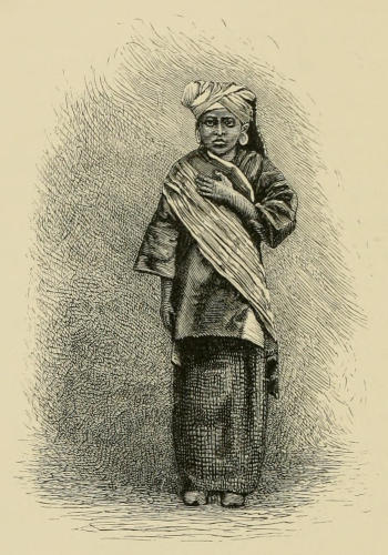
WOMAN OF THE PADANG PLATEAU.
PADANG PLATEAU WOMAN.
The dress of the men here is not very different from that of the Malays of Java, but the costume[395] of the women is remarkable. On the head is worn a long scarf, wound round like a turban, one end being allowed to hang down, sometimes over the forehead, and sometimes on one side, or on the back of the head. The upper part of the body is clothed in a baju of the common pattern, and passing over one shoulder, across the breast, and under the opposite arm is a long, bright-colored scarf. The ends of this, as well as that worn on the head, are ornamented with imitations of leaves and fruit, very tastefully wrought with gold thread. At the waist is fastened the sarong, which is not sewn up at the ends as in other parts of the archipelago. It is therefore nothing but a piece of calico, about a yard long, wound round the body, and the two ends gathered on the right hip, where they are twisted together, and tucked under, so as to form a rude knot. As the sarong is thus open on the right side, it is thrown apart higher than the knee at every step, like the statues representing the goddess Diana in hunting-costume. Their most remarkable custom, however, is distending the lobe of the ear, as seen in the accompanying cut from a photograph of one of the women at the kampong here at Fort de Kock. When young, an incision is made in the lobe, and a stiff leaf is rolled up, and thrust into it, in such a way that the tendency of the leaf to unroll will stretch the incision. When one leaf has lost its elasticity it is exchanged for another, and, in this way, the opening increases until it is an inch in diameter. This must be a very painful process, judging from the degree to which the ears of the young girls are inflamed and[396] swollen. A saucer-shaped ornament, with a groove in its rim, is then put into the ear, exactly as a stud is put into a gentleman’s shirt-bosom. It is generally made of gold, and the central part consists of a very fine open work, so that it is very light, yet the opening in the ear continues to increase until it is frequently an inch and a half in diameter, and almost large enough for the wearer to pass one of her hands through. The front part of the loop is then only attached to the head by a round bundle of muscles, smaller than a pipe-stem, and the individual is obliged to lay aside her ornaments or have the lower part of her ears changed into long, dangling strings. While these ornaments (for it is not proper to call such a saucer-shaped article a ring) can be worn in the ear, the appearance of the native women, as seen in the cut, is like that of the other Malay women; but as soon as these ornaments are taken out, and the lobes of their ears are seen to be nothing but long loops, their appearance then becomes very repulsive. The men are never guilty of this loathsome practice. A similar habit of distending the lobe of the ear prevails in Borneo, among the Dyak women. It is also seen in all the Chinese and Japanese images of Buddha, The native women of India are accustomed to wear several small rings, not only all round in the edge of the ear, but in the nostrils. A large number of rings are shown in the ear of the cut of a Dyak or head-hunter of Borneo. Even in the most civilized lands this same barbaric idea—that a lady is made more prepossessing by[397] having some foreign substance thrust through, and dangling from, each ear—still prevails.
The men's clothing here isn't much different from that of the Malays in Java, but the women's outfits are quite striking. They wear a long scarf wrapped around their heads like a turban, with one end hanging down, sometimes over the forehead, on one side, or at the back of the head. The upper body is dressed in a standard baju, and a long, brightly colored scarf crosses over one shoulder, across the chest, and under the opposite arm. The ends of this scarf, along with the one worn on the head, have decorative designs of leaves and fruits, skillfully made with gold thread. At the waist, they fasten a sarong, which isn't sewn at the ends like in other parts of the archipelago. It's simply a piece of calico, about a yard long, wrapped around the body, with the two ends gathered at the right hip, twisted together, and tucked under to form a rough knot. Since the sarong is open on the right side, it gets thrown apart above the knee with every step, resembling statues of the goddess Diana in hunting attire. Their most distinctive custom, however, is elongating the earlobe, as shown in the accompanying photograph of one of the women here in Fort de Kock. When they're young, an incision is made in the lobe, and a stiff leaf is rolled up and inserted into it in such a way that the leaf's tendency to unroll stretches the incision. When one leaf loses its elasticity, it's swapped for another, gradually increasing the size of the opening until it's about an inch in diameter. This must be quite painful, given how inflamed and swollen the earlobes of the young girls appear. They then insert a saucer-shaped ornament with a groove in its rim into the ear, much like a stud in a man’s shirt. It's usually made of gold, and the center features fine openwork, making it lightweight, yet the opening in the ear continues to grow, sometimes reaching an inch and a half in diameter, nearly big enough for the wearer to put her hand through. At that point, the front of the loop is only attached to the head by a small bundle of tissues, smaller than a pipe stem, and the individual has to either remove her ornaments or let the lower part of her ears hang down as long, dangling loops. While these ornaments (which shouldn’t be called rings) can be worn in the ear, the native women look similar to other Malay women; however, once the ornaments are removed and their earlobes are revealed as long loops, they can appear quite unappealing. Men never partake in this unappealing practice. A similar habit of elongating earlobes is present in Borneo among the Dyak women. It's also seen in images of Buddha in Chinese and Japanese art. Native Indian women wear several small rings, not just around the edges of the ear but also in their nostrils. Many rings can be seen in the ear of the Dyak or headhunter from Borneo in the illustration. Even in the most civilized countries, this same primitive idea persists—that a woman is seen as more attractive by having some foreign object inserted and hanging from each ear.
After we had rested from our ride, the Resident took us through the adjoining kampong. The houses were like those already described in the Cleft. Our attention was particularly drawn to the magnificent bamboos by the roadside, many of which attain a height of forty or fifty feet.
After we had caught our breath from our ride, the Resident led us through the nearby village. The houses were similar to those we had previously seen in the Cleft. We were particularly struck by the impressive bamboos by the roadside, many of which reach heights of forty or fifty feet.
February 24th.—The inspector, having travelled for some time, prefers to rest to-day, and as I am anxious to see the lake of Manindyu, which is some distance off our route, I avail myself of the opportunity. The Resident kindly gave me a very fine saddle-horse, and early this morning we started in a northwesterly direction for Matua. Our path at once led down from the high plateau into a series of deep valleys with perpendicular sides, composed of stratified sand and clay, formed by the disintegration and decomposition of pumice-stone. These deep valleys have been wholly formed by the action of the rapid streams which flow in their bottoms, and which, by changing their courses from one side of the valley to the other, have carried away the talus that has formed at the bases of the cliffs. These cliffs, therefore, are perpendicular, whether the valleys be wide or narrow. The strata of the sand and clay are so horizontal that we are warranted in considering them deposited in a lake of fresh or salt water. No fossils of any kind, so far as I can learn, have ever been seen in these late deposits, to determine whether they are of lacustrine or marine origin. The upper edges of the sides of these deep valleys are so sharply[398] defined that the buffaloes, feeding on the grass-lands above, unconsciously venture too far, and of course are instantly killed by such a high fall, and, for this reason, the Dutch call them “buffalo holes.”
February 24th.—The inspector, after traveling for a while, prefers to rest today. Since I'm eager to see Lake Manindyu, which is a bit off our route, I take this opportunity. The Resident kindly provided me with a great saddle-horse, and early this morning, we set off northwest towards Matua. Our path led down from the high plateau into a series of deep valleys with steep sides, made up of layered sand and clay, created by the breakdown of pumice stone. These deep valleys have been completely formed by the swift streams flowing at the bottom, which, by shifting their courses from one side of the valley to the other, have eroded the debris that formed at the bases of the cliffs. Consequently, these cliffs are vertical, regardless of whether the valleys are wide or narrow. The layers of sand and clay are so level that we can reasonably assume they were deposited in a body of fresh or salt water. So far as I know, no fossils have been found in these recent deposits to indicate if they come from lake or sea origin. The upper edges of these deep valleys are so sharply defined that the buffaloes grazing on the grasslands above unknowingly venture too far, and inevitably fall to their deaths, which is why the Dutch refer to them as “buffalo holes.”
At several places small tributaries come in as branches to the main stream, which here flows to the northwest, and the tongue of land in the acute angle of such branches rises up like a perpendicular wall with a sharp edge. These deep valleys resemble the cañons of the Colorado, which were also formed by the erosive action of running water; but here the scenery is on a small scale compared to those deep, dark, gloomy chasms. Two or three times we climbed the zigzag path that led up the sides of one valley, and then went down again into the next valley. The bottoms of these cañons, being well watered, are admirably suited for the cultivation of rice, and here were some plats still overflowed where the rice was only a few inches high, and not far from them others, where the natives were collecting the ripe, golden blades. Such a mingling of planting the seed, and gathering in the ripe grain, appeared the more strange when I thought of our temperate climate, where we are obliged to sow at a certain time in the year or reap no harvest. The higher lands between these valleys form a plateau, which, from Fort de Kock to Matua, is very sterile when compared to the high land farther south.
At several places, small tributaries flow into the main stream, which heads northwest. The strips of land in the sharp angles of these tributaries rise like steep walls with sharp edges. These deep valleys are similar to the canyons of the Colorado, formed by the erosion from flowing water; however, the scenery here is on a smaller scale compared to those deep, dark canyons. We climbed the winding path up the sides of one valley a few times, then went back down into the next valley. The bottoms of these canyons are well-watered, making them perfect for growing rice. There were some fields still flooded with rice only a few inches high nearby, and others where locals were gathering the ripe, golden stalks. This mix of planting seeds and harvesting ripe grain seemed particularly strange to me compared to our temperate climate, where we have to sow at specific times of the year or risk not harvesting anything. The higher lands between these valleys create a plateau that, from Fort de Kock to Matua, is quite barren compared to the highland further south.
From Matua our course changed to the west and lay through broad sawas filled with half-grown rice. It slowly ascended, until we found ourselves on the edge of a crater of most enormous dimensions. Thick[399] rain-clouds gathered and began pouring down heavy showers, which obscured every thing about us, and I could only see that we stood on the edge of a vast yawning gulf. Our way now rapidly descended first to the right and then to the left, and, as I looked down into the deep abyss which we were descending, such thick vapors enveloped us that every thing was hidden from our view at the distance of a hundred yards, and it seemed as if we must be going down into the Bottomless Pit. Down and down we went, until at last I became quite discouraged, and seriously began to think of explaining to my native guide that the wisest heads which lived in my land believe that the centre of the earth is nothing but a mass of molten rock, and to inquire of him whether he was sure we should stop short of such an uncomfortable place, when the thick mist which enshrouded us cleared away, and I beheld far, far beneath me a large lake, and above me the steep, overhanging crater-wall which I had descended; but I was only half-way down, yet I had the satisfaction of knowing there was an end to the way, and, besides, the road was not so steep, and consequently not so slippery as the half we had already come. So we slipped and plodded on, and early in the afternoon I came to the residence of the controleur of that region, at the village of Manindyu, on the east side of the lake.
From Matua, we changed our direction to the west and traveled through wide rice fields filled with half-grown rice. The path gradually climbed until we found ourselves at the edge of a massive crater. Thick rain clouds gathered and started pouring down heavy showers, obscuring everything around us, and I could only see that we were standing on the edge of a vast, gaping abyss. Our descent now took a sharp turn first to the right and then to the left, and as I looked down into the deep void we were entering, thick fog enveloped us, making everything hidden from view even a hundred yards away. It felt like we were descending into a Bottomless Pit. Down we went, and I eventually felt quite discouraged, seriously considering telling my native guide that the smartest minds back home believe the earth's center is just a mass of molten rock, and I wanted to ask him if he was sure we wouldn't reach such an uncomfortable place. Just then, the thick mist that surrounded us cleared, and I saw far beneath me a large lake and above me the steep, overhanging wall of the crater I had descended; I was only halfway down, but I felt relieved knowing there was an end to the descent, and the path ahead was not as steep or slippery as what we had already traveled. So we continued to slip and trudge along, and early in the afternoon, I arrived at the residence of the controleur in the village of Manindyu, on the east side of the lake.
The height of the edge of the crater where we began to descend is thirty-six hundred feet, and that of the lake fifteen hundred and forty above the sea. The perpendicular distance that we had come down, therefore, was over two thousand feet; but to come[400] that distance, our road had zigzagged so continually to the right and left, that we had travelled five miles. Toward evening the rain ceased, and the controleur conducted me a short distance north of the kampong to a hot spring, where the natives have a square pool for bathing, and covered it with a small house, for they ascribe all sorts of healing virtues to this warm water. I found the water to be perfectly pure to the eye, and free from any sensible escape of gas. Its temperature was 102½° Fahrenheit, and an abundance of algæ was seen on the rocks beneath its surface.
The top of the crater where we started our descent is 3,600 feet high, and the lake sits at 1,540 feet above sea level. So, the vertical distance we descended was over 2,000 feet; however, due to the constant zigzagging of our path, we traveled five miles to cover that distance. By evening, the rain stopped, and the controleur took me a short way north of the village to a hot spring, where the locals have a square pool for bathing and have built a small shelter over it because they believe this warm water has all sorts of healing properties. I found the water to be completely clear and showed no noticeable gas bubbles. Its temperature was 102½° Fahrenheit, and there was plenty of algae visible on the rocks beneath the surface.
At sunset, the heavy clouds that had filled the crater during the day slowly rose upward, but not so high at first as to allow us to see the tops of the peaks in the serrated crest of the crater-wall opposite. The bright sunlight, therefore, shone in through the triangular openings between the lower surface of the level clouds, and the bottoms of the sharp valleys, and these oblique bands of golden light fell on the water at some distance from the opposite shore, and then came over the lake and illuminated the place where we sat watching this unique and magnificent view.
At sunset, the thick clouds that had filled the crater during the day gradually lifted, but not high enough at first to let us see the peaks on the jagged edge of the crater wall across from us. The bright sunlight streamed in through the triangular gaps between the lower surface of the clouds and the depths of the sharp valleys, with these angled rays of golden light shining on the water some distance from the opposite shore, then spreading across the lake and lighting up the spot where we sat, taking in this unique and breathtaking view.
After the sunlight had faded, the clouds rose higher, and I could look round and behold all sides of the largest crater it has been my privilege to see, and indeed one of the largest in the world. The general height of the wall does not vary much from that point where I crossed it coming down, and is very steep, except at that place, and in many parts nearly perpendicular. It is not circular, but composed of two circles of unequal diameter, which[401] unite on one side, and leave a tongue of land projecting from the east and west sides. Each of these circles is a crater, and the tongues of land that project from either side of the lake mark the boundaries between them. The width of the larger crater at the level of the lake, as given on the best maps I have been able to consult, is three geographical miles; that of the smaller crater, at the same level, two and a quarter miles; and the length of the lake, which lies in a northerly and southerly direction, and is approximately parallel to the great Barizan chain in which it is found, is no less than six geographical miles. These two craters, I believe, were not formed at the same time. The larger crater, which is on the north, is older, and the smaller one to the south is the later, the eruptive force which formed the larger having lost some of its power, as well as having slightly changed its position when it formed the smaller. This gigantic crater is the more interesting to us, because it is as large as the one we supposed formerly existed in the Banda Islands, when we regarded Great Banda, Pulo Pisang, and Pulo Kapal, as parts of the walls of that crater, if, as was then suggested, that crater was not circular, but nearly elliptical, like this great one of Manindyu. Even the famous crater of the Tenger Mountains becomes of moderate dimensions, when compared to this.
After the sunlight faded, the clouds rose higher, and I could look around and see all sides of the largest crater I've ever had the privilege to witness, and indeed one of the largest in the world. The height of the wall doesn’t change much from the point where I crossed it coming down, and it’s very steep, except at that spot; in many areas, it’s almost vertical. It’s not circular but made up of two circles of different sizes that connect on one side, leaving a strip of land jutting out from the east and west sides. Each of these circles is a crater, and the strips of land extending from either side of the lake mark their boundaries. The width of the larger crater at the level of the lake, according to the best maps I've found, is three geographical miles; the smaller crater, at the same level, is two and a quarter miles; and the length of the lake, which runs north and south and is roughly parallel to the great Barizan chain it’s located in, is no less than six geographical miles. I believe these two craters were not formed at the same time. The larger crater to the north is older, while the smaller one to the south is newer, with the eruptive force that created the larger one having lost some of its power and slightly shifted its position when it formed the smaller one. This gigantic crater is more interesting to us because it’s as large as the one we previously thought existed in the Banda Islands, when we considered Great Banda, Pulo Pisang, and Pulo Kapal as parts of the walls of that crater, if, as was suggested back then, that crater wasn't circular but almost elliptical, like this great one in Manindyu. Even the famous crater of the Tenger Mountains seems small in comparison to this one.
In the western side of the larger crater is a cleft or deep ravine that conducts the superfluous waters to the sea. This split, it may be noticed, has occurred on the side toward the sea, where, of course, the wall of the crater was thinnest and weakest. This region[402] is considered quite valuable, because coffee-trees flourish here remarkably well. The coffee obtained is brought over the lake in boats to the mouth of the outlet, and thence transported to the village of Tiku, on the coast.
On the western side of the larger crater, there's a deep ravine that channels the excess water to the sea. This gap has formed on the side facing the sea, where the wall of the crater was the thinnest and weakest. This area[402] is seen as quite valuable because coffee trees thrive here exceptionally well. The coffee harvested is transported across the lake in boats to the outlet and then taken to the village of Tiku on the coast.
The controleur also showed me a quantity of the edible birds’-nests obtained in the neighboring cliffs, that were considered of a superior quality, that is, by Chinese palates, for, if the Celestials had not taken a fancy that these should be regarded as dainties, I do not believe that Europeans would have ever thought of tasting them.
The controleur also showed me a lot of the edible birds’ nests collected from the nearby cliffs, which were considered top-notch, at least by Chinese standards. If the Chinese hadn’t decided these should be viewed as delicacies, I don’t think Europeans would have ever thought to try them.
February 25th.—At eight o’clock rode back with the controleur up the crater wall, by the way I came down yesterday. The road is built on the spur or projecting ridge that forms the boundary between the two craters on the east side, and zigzags to the right and left in such a manner that, when viewed from beneath, it reminds one of the way, usually pictured, that the people of Babel climbed their lofty tower. To shorten the distance, we went over a number of steep places, instead of going round by the road. The clay and wet grass, however, were so slippery that such climbing was exceedingly dangerous; but the rider had the satisfaction of knowing that, if his horse did lose his footing altogether, they would both go down so many hundred feet that neither would suffer pain for many moments after their descent was ended.
February 25th.—At eight o’clock, I rode back up the crater wall with the controleur, following the same path I took down yesterday. The road is built on the ridge that separates the two craters on the east side and zigzags back and forth in a way that, from below, it looks like the path people imagined the folks of Babel took to climb their tall tower. To cut down the distance, we tackled several steep sections instead of taking the longer route. However, the clay and wet grass were so slippery that climbing was really dangerous; but the rider could take comfort in knowing that if his horse completely lost its footing, they would both fall several hundred feet, and neither would feel pain for many moments after hitting the ground.
The heavy rain of yesterday had wholly cleared away, and when we reached the crater rim we enjoyed a perfect view of this enormous gulf, six miles long[403] and four miles broad, and more than two thousand feet deep. Apparently the crater had ceased its action a long time ago, and now the hot springs on the borders of the lake are the only reminders of the causes that formed it ages and ages ago. As we looked down from our high point, clouds were seen floating beneath us, and on the opposite wall of the crater long, narrow, vertical strips of naked earth marked the places where land-slides had come down its precipitous declivities.
The heavy rain from yesterday had completely cleared up, and when we got to the rim of the crater, we had a stunning view of this massive gulf, six miles long[403] and four miles wide, and more than two thousand feet deep. It seemed that the crater had stopped its activity a long time ago, and now the hot springs around the lake are the only reminders of the forces that created it ages ago. As we looked down from our high vantage point, we saw clouds floating below us, and on the opposite wall of the crater, long, narrow strips of bare earth indicated where landslides had come down its steep slopes.
Soon after we reached Matua, the inspector arrived from Fort de Kock, and we went on together toward the northwest. The road was exceedingly rough, and, after riding five miles, our little pony became so worn out that I got out and walked to Palimbayang, the next station, a distance of nine miles, in the scorching, tropical sun. The road from Matua is built on the side of the Barizan chain, and we had on our right a deep valley, in the bottom of which coursed the stream that we had previously crossed in the deep cañons near Fort de Kock. Several small streams came down from the mountains on our left, and in the side valleys, where those streams entered the main one, the natives had formed many terraces.
Soon after we got to Matua, the inspector showed up from Fort de Kock, and we headed northwest together. The road was really rough, and after riding for five miles, our little pony got so tired that I decided to get off and walk to Palimbayang, the next stop, which was nine miles away, under the blazing tropical sun. The road from Matua goes along the side of the Barizan mountain range, and to our right was a deep valley with a stream flowing at the bottom, which we had crossed earlier in the deep canyons near Fort de Kock. Several small streams were coming down from the mountains on our left, and in the side valleys where those streams met the main one, the locals had created numerous terraces.
A number of these smaller valleys had the form of an ellipse, cut in two at its minor axis. In the distance they looked like immense amphitheatres, the horizontal terraces forming the seats for the imaginary spectators—amphitheatres of such ample dimensions that, in comparison with them, even the great Coliseum at Rome dwindles into insignificance.
Some of these smaller valleys were shaped like an ellipse, split in half at the minor axis. From a distance, they resembled massive amphitheaters, with the horizontal terraces serving as seats for imaginary spectators—amphitheaters so large that, in comparison, even the grand Coliseum in Rome seems tiny.
The height of this point is a little less than that at Matua, and all the way from Fort de Kock to this place I have been able to keep in sight the remains of the plateau which begins on the south with the col between the Singalang and Mérapi. The horizontal layers, that once filled the whole valley west of us, have been carried away by the streams until only a narrow margin is left on the Barizan, and its parallel chain; it forcibly reminds me of the terraces seen along the upper part of some of our own New-England rivers—for instance, those in the upper part of the Connecticut Valley.
The height of this point is slightly lower than that at Matua, and all the way from Fort de Kock to here, I’ve been able to see the remnants of the plateau that starts in the south with the col between Singalang and Mérapi. The horizontal layers that once filled the entire valley to the west have been eroded by the streams until only a narrow strip remains on the Barizan and its parallel range; it strongly reminds me of the terraces seen along the upper parts of some of our New England rivers—like those in the upper Connecticut Valley.
Here, at Palimbayang, I have had the first opportunity of enjoying a view of that magnificent mountain, Ophir, nine thousand seven hundred and seventy feet in height. Its truncated summit indicates that its highest parts are the ruins of an old crater, and this thought reminds us of the volcanic action to which the mountain owes its birth. The name of this mountain is not of native origin, but was given it by the Portuguese, because they fancied that at last they had found the place where the ships of Solomon obtained the enormous quantities of gold that he used in adorning the magnificent temple of Jerusalem. The same name they also gave to another, but a much smaller mountain, on the Malay Peninsula, forty miles north of the city of Malacca.
Here at Palimbayang, I’ve had my first chance to enjoy a view of the magnificent mountain, Ophir, which stands nine thousand seven hundred and seventy feet tall. Its flat summit suggests that its highest points are remnants of an old crater, reminding us of the volcanic activity that brought this mountain into existence. The name of this mountain isn’t of local origin; it was given by the Portuguese because they believed they had finally found the place where Solomon's ships obtained the vast amounts of gold he used to decorate the grand temple in Jerusalem. They also gave the same name to another, much smaller mountain located on the Malay Peninsula, forty miles north of Malacca.

A SCENE IN THE INTERIOR OF SUMATRA.
A Scene in Sumatra.
In the vicinity of both of these mountains much gold had been obtained for centuries before Europeans ever came to this region. The idea entertained by the Portuguese, that a part of the gold which reached Jerusalem came from this island and[405] the peninsula, has been the subject of much ridicule, but, nevertheless, there may be considerable evidence in favor of such an hypothesis.
In the area around these two mountains, a lot of gold had been mined for centuries before Europeans arrived. The Portuguese believed that some of the gold that made its way to Jerusalem came from this island and[405] the peninsula. While this idea has been mocked, there might actually be significant evidence supporting it.
No one region is known in that part of the east that could have furnished all the different articles brought by Solomon’s fleet; and Ophir has therefore been considered the name of an emporium, situated near the entrance of the Red Sea, or, more probably, near the head of the Arabian Sea, at the mouth of the Indus. The names in the Hebrew of the articles thus brought, show that they are all of foreign origin, having been evidently adopted from some other language, and probably from the Sanscrit.[52] The name for peacock appears to have been derived from the word in Tamil, a language spoken on the Malabar coast by the Telingas, or “Klings,” who visited this island and the Malay Peninsula long before the time of Solomon, 1015 to 975 B. C., for the tin used by the Egyptians in making their implements of bronze, as early as 2000 B. C., doubtless came from the Malacca, and the Klings were the people who took it as far toward Egypt as the eastern shore of India. Tin and gold are both obtained in the same manner, namely, by washing alluvial deposits.
No one region is known in that part of the east that could have furnished all the different articles brought by Solomon’s fleet; and Ophir has therefore been considered the name of an emporium, situated near the entrance of the Red Sea, or, more probably, near the head of the Arabian Sea, at the mouth of the Indus. The names in the Hebrew of the articles thus brought, show that they are all of foreign origin, having been evidently adopted from some other language, and probably from the Sanscrit.[52] The name for peacock appears to have been derived from the word in Tamil, a language spoken on the Malabar coast by the Telingas, or “Klings,” who visited this island and the Malay Peninsula long before the time of Solomon, 1015 to 975 B. C., for the tin used by the Egyptians in making their implements of bronze, as early as 2000 B. C., doubtless came from the Malacca, and the Klings were the people who took it as far toward Egypt as the eastern shore of India. Tin and gold are both obtained in the same manner, namely, by washing alluvial deposits.
Gold is found in small quantities over a very considerable part of the Malay Peninsula. It has always been more highly valued than tin, and it is, therefore, by all means probable that it was an article of commerce, and was exported to India[406] as early as tin, or at least five hundred years before Solomon commenced building his splendid temple.
Gold is also found in the western and southern parts of Borneo, and in some places on Luzon and Magindanao, in the Philippine Archipelago. As we have already noticed, it is found on Bachian, and, in the northern and southern peninsulas of Celebes. It is indeed one of the most widely-distributed metals obtained in the archipelago. It is not only found on many of the islands that are not wholly of volcanic origin, between Asia and Australia, but also from place to place over both of those continents. The quantity obtained here, on Sumatra, is wholly unknown, but, judging from what is used in ornaments, it must be very considerable. It is always bought and sold in the form of “dust,” and has never been coined for money in any part of the archipelago, except at Achin.
Gold is also found in the western and southern parts of Borneo, as well as in some areas on Luzon and Magindanao in the Philippine Archipelago. As we've already noted, it's located on Bachian and in the northern and southern peninsulas of Celebes. It is indeed one of the most widely distributed metals found in the archipelago. It's not only present on many islands that aren't entirely volcanic between Asia and Australia, but also sporadically across both continents. The amount found here in Sumatra is completely unknown, but judging by what is used in jewelry, it must be quite significant. It is always traded in the form of “dust” and has never been minted as currency anywhere in the archipelago, except in Achin.
February 26th.—At 7 A. M. rode down the edge of the plateau to the bottom of a deep ravine, and then climbed up the opposite ridge. Here we met all the rajahs and their attendants in the vicinity, and again descended to the bottom of a second ravine to the little village of Pisang. As the way was exceedingly rough, I preferred to ride a nice horse the controleur had given me, to being jolted in the carriage. Beyond Pisang our road lay in a narrow valley, and, as the sky was clear and the neighboring hills prevented any breeze from reaching us, we seemed to be at the focus of a great burning lens. In the thick woods on either hand troops of large, black monkeys kept up a hooting or trumpeting, their prolonged cries sounding exactly like a score of amateurs practising on trombones. In some places the din they made was quite deafening. In one place the road passed through a deep cut through strata, composed of sand and conglomerate, which probably once filled the whole valley. From Pisang, which is at an elevation of seventeen hundred feet, we continued to descend until we came to the small valley of Bondyol, which is only seven hundred and forty feet above the[408] sea. On the way we met the controleur superintending the construction of a bridge, for the officials in these small places have to plan buildings and bridges and be at the same time judges, architects, and masons. The residence of this officer was located on a hill rising on one side of the small valley. It was nicely shaded, and commanded a view over the adjoining lowlands, which were all sawas. At this place I saw some of the beautiful little musk-deer of this region—a deer that is only about a foot and a half high, without antlers, and weighs less than a rabbit.
February 26th.—At 7 A. M., I rode down the edge of the plateau to the bottom of a deep ravine, then climbed up the opposite ridge. Here we met all the local rajahs and their attendants, and then descended to the bottom of a second ravine to the small village of Pisang. Since the path was extremely rough, I preferred to ride a nice horse that the controleur had given me instead of being jolted around in the carriage. Beyond Pisang, our route took us through a narrow valley, and with the clear sky and the surrounding hills blocking any breeze, it felt like we were at the center of a massive burning lens. In the dense woods on either side, groups of large, black monkeys were hooting and trumpeting, their prolonged calls sounding just like a bunch of amateurs practicing on trombones. At times, the noise they made was quite deafening. In one spot, the road went through a deep cut in layers of sand and conglomerate, which likely once filled the entire valley. From Pisang, which is at an elevation of seventeen hundred feet, we continued to descend until we reached the small valley of Bondyol, which is only seven hundred and forty feet above the [408] sea. Along the way, we encountered the controleur overseeing the construction of a bridge, as the officials in these small towns have to plan buildings and bridges while also being judges, architects, and masons. The residence of this officer was situated on a hill on one side of the small valley. It was well shaded and offered a view over the surrounding lowlands, which were all sawas. At this spot, I saw some of the beautiful little musk deer native to this area—a deer that stands only about a foot and a half tall, has no antlers, and weighs less than a rabbit.
There were more than a dozen monkeys in the backyard. Some of them were of the dog-like species, others with long tails and long limbs. Some of them were extremely restless, while others sat still and looked so grave and dignified as to be more comical than their mischievous companions. There are ten species on this island, none of which are found in Java, while the four species of Java are never seen here, such a limit does the Strait of Sunda form to the faunæ of these two islands, although it is only fifteen miles wide in some places, and islands are nearly midway from either shore. The most remarkable of the apes found on the island is the orang-utan, which lives in the lowlands in the northern and eastern parts of the island. The governor at Padang had a live one that had been sent him from that region. She was more than three feet high and very strong. Escaping one time from the box where she was fastened, she climbed a neighboring shade-tree and commenced breaking off large limbs and placing[409] them in a fork of the tree until she had made herself a nice resting-place. That, however, not being high enough, she climbed up nearly to the top of the tree and then broke all the twigs near her, and thus formed a second couch. She did not sway to and fro continually, as many monkeys do, but used to sit quietly picking off all the foliage within her reach, and then took up another position and demolished the foliage there in the same manner. It is very singular this animal is found on Sumatra and Borneo, and has never been seen on the Malay Peninsula, which almost lies between them.
There were over a dozen monkeys in the backyard. Some were dog-like species, while others had long tails and limbs. Some were really restless, while others sat quietly, looking so serious and dignified that they seemed more comical than their mischievous counterparts. There are ten species on this island, none of which can be found in Java, and the four species from Java are never seen here. Such is the boundary the Strait of Sunda creates for the wildlife of these two islands, even though it’s only fifteen miles wide in some spots, and the islands are nearly equidistant from either shore. The most notable of the apes found on the island is the orangutan, which lives in the lowlands in the northern and eastern parts. The governor in Padang had a live one sent to him from that area. She was over three feet tall and very strong. One time, after escaping from the box where she was secured, she climbed a nearby shade tree and started breaking off large branches, placing them in a fork of the tree to create a cozy resting spot. However, that wasn’t high enough for her, so she climbed nearly to the top of the tree and broke off all the twigs around her, creating a second bed. Unlike many monkeys, she didn’t sway back and forth constantly; instead, she sat quietly picking off all the leaves within reach, then moved to another spot and did the same thing. It’s quite strange that this animal is found on Sumatra and Borneo but has never been seen on the Malay Peninsula, which is almost located between them.
February 27th.—At 7.30 A. M. started on horseback for Lubu Siképing. At first the road led through the lowland near Bondyol, and then crossing a rapid stream began to ascend a narrow winding valley. My little pony took me up the steep places apparently with as little exertion as if we were ascending a gentle acclivity. Like all the saddle and carriage horses used in the archipelago, he was a stallion, it being considered among all these islands as disgraceful for a man to ride or drive a mare as it would be in our land for a farmer to plough with a yoke of cows. Even geldings are never seen, and, as would naturally be expected, the stallions, unless remarkably well-trained, are very vicious, and, worse than all, extremely capricious, springing, or kicking, or halting, without any provocation, and without giving their rider the slightest warning; but, when they are perfectly trained, they are among the finest saddle-horses in the world, they are so fleet and so sure-footed. In a short time the narrow valley[410] changed into a deep ravine, and the road continued to ascend along one of its steep sides, and became so narrow that I was afraid my horse would lose his footing in the soft clay, and that we should both go down to certain destruction on the rocks that raised their ragged jaws above the spray of the foaming torrent below. A dark forest of primeval, gigantic trees covered the sides of the mountains above us, and crossing a rickety bridge we found many of their huge trunks lying across our path. They had lived to their allotted age and had not fallen by the hand of man. This road has been lately made, and already great fissures in its outer edge show that it is quite ready to slide down the mountain.
February 27th.—At 7:30 A.M., I set off on horseback for Lubu Siképing. Initially, the road took me through the lowland near Bondyol, and then, after crossing a fast stream, began to rise up a narrow, winding valley. My little pony effortlessly carried me up the steep sections as if we were climbing a gentle slope. Like all the saddle and riding horses in the archipelago, he was a stallion; it's considered shameful for a man to ride or drive a mare in these islands, similar to how it would be viewed back home for a farmer to plow with a pair of cows. Geldings are rarely seen, and, as one might expect, the stallions, unless exceptionally well-trained, can be quite fierce and, worse, extremely unpredictable, suddenly rearing, kicking, or stopping without any provocation or warning. However, when they are perfectly trained, they rank among the finest saddle horses in the world—quick and sure-footed. Before long, the narrow valley[410] transformed into a deep ravine, and the path continued to climb along one of its steep sides, becoming so narrow that I feared my horse would slip in the soft clay, sending us both crashing onto the rocks that loomed above the foaming torrent below. A dark forest of ancient, massive trees towered over us, and after crossing a shaky bridge, we encountered many of their enormous trunks blocking our way. They had reached their natural lifespan and hadn't fallen to human hands. This road has been recently constructed, but already large cracks along its edge indicated it was on the verge of sliding down the mountain.
Large troops of monkeys have established themselves in this dark gorge, and just when I was in the most dangerous place they made a frightful noise, some trumpeting, some screeching, and some making a prolonged shrill whistling, yet I could only see one or two, though the natives who were building the road assured me that the tops of the trees were full of them. While in this deep ravine I crossed the equator for the third time since I entered the archipelago.
Large groups of monkeys have set up in this dark gorge, and just as I found myself in the most dangerous spot, they made a terrifying racket—some trumpeting, some screeching, and others whistling in a high pitch for a long time. I could only see one or two, but the locals working on the road assured me that the tops of the trees were teeming with them. While in this deep ravine, I crossed the equator for the third time since I entered the archipelago.
I had now climbed up one thousand four hundred feet during my short ride, and was therefore two thousand one hundred feet above the sea. To the northwest there now opened out before me a long, narrow, gently descending valley, like the one I had left behind; in fact, this water-shed is merely a transverse ridge which unites the Barizan chain with the chain parallel to it, in the same way as it is done by[411] the transverse ranges in which the Mérapi and the Sago rise. This appears to be naturally as fruitful a region as the Menangkabau country proper, and was undoubtedly included within the limits of that empire during its most flourishing period. This valley is generally very poorly cultivated, on account of the small numbers of its population. By the wayside were a number of coffee-gardens. The trees were well filled with fruit, but they had been greatly neglected, and the tall grass was rapidly choking them.
I had now climbed up 1,400 feet during my short ride, so I was 2,100 feet above sea level. To the northwest, a long, narrow, gently descending valley stretched out before me, similar to the one I had just left; in fact, this water-shed is just a cross ridge that connects the Barizan range with the parallel one, just like the transverse ranges where Mérapi and Sago rise. This area seems to be just as fertile as the Menangkabau region itself and was definitely part of that empire during its peak. This valley is generally not very well cultivated due to the small population. Along the roadside, there were several coffee gardens. The trees were full of fruit, but they had been poorly maintained, and the tall grass was quickly overwhelming them.
A few miles farther on I came to Lubu Siképing, where we were to rest until the next day. A native opziener, or “overseer,” was stationed here to receive the coffee from the adjoining plantations. He had not heard of our coming, and was quite surprised to see a stranger here in such a remote spot among the mountains, and not the less so when I informed him that the inspector was just behind me, and that I only chanced to be in advance because, from what I had heard of the road in the gorge, I had no fancy to ride through it in a wide carriage. He received us, however, like all the other officials, in the most polite manner, and was evidently glad that something had occurred to break up the dull routine of such a life of exile. It was market-day here, and, as soon as I met some of the natives returning to their homes, I saw that they were a different people from those of the Menangkabau country, and the overseer told me that they are not natives of this particular region, but belong to the wild tribe of Lubus, which I should see farther up the valley, and that it is for this reason[412] that this place is called Lubu Siképing. They now build houses like those of other Malays. They are better-formed people than the Javanese, and closely resemble in their features the Oranglaut, or common Malays of the coast regions. Their favorite holiday-dress is chiefly a bright scarlet. Half an hour after I arrived here the inspector came. He had found the road so narrow in one or two places that the natives had to push out planks beyond the outer edge of the road to support the outside wheels of the carriage, and I was glad that I came on horseback, though, when I led the vicious brute, I had to keep a constant watch to prevent him from seizing my wrist in his teeth.
A few miles later, I arrived at Lubu Siképing, where we were supposed to rest until the next day. A local opziener, or "overseer," was there to receive the coffee from nearby plantations. He hadn’t heard about our arrival and was quite surprised to see a stranger in such a remote area among the mountains. He was even more surprised when I told him that the inspector was just behind me and that I happened to be ahead because, based on what I heard about the road in the gorge, I didn’t want to ride through it in a wide carriage. He welcomed us politely, like all the other officials, and seemed genuinely happy that something had broken the monotony of his isolated life. It was market day, and as soon as I encountered some locals returning to their homes, I noticed they were different from the people in the Menangkabau region. The overseer explained that they are not natives of this specific area but come from the wild tribe of Lubus, which I would see further up the valley, and that’s why this place is called Lubu Siképing. They now build houses like other Malays. They are better-looking than the Javanese and closely resemble the Oranglaut, or common Malays of the coastal regions. Their favorite festive attire is mostly bright scarlet. About half an hour after I got here, the inspector arrived. He had found the road so narrow in a couple of spots that the locals had to push out planks beyond the outer edge of the road to support the outside wheels of the carriage, and I was relieved that I came on horseback. However, while I was leading the stubborn horse, I had to keep a close eye on him to prevent him from biting my wrist.
At 5 P. M. we walked out to enjoy the grand scenery in the vicinity. The level plateau here, which is one thousand five hundred feet above the sea, is bounded on the northeast side by an exceedingly steep, almost overhanging range of mountains, whose several crests appear to be five thousand feet above us. It was one of the most imposing sights I witnessed on that island of high mountains. Mount Ophir is just west of this place, and at sunset we saw it through a gap in the mountains near us, resting its lofty purple summit against the golden sky.
At 5 P.M., we stepped outside to take in the stunning scenery around us. The flat plateau here, which is one thousand five hundred feet above sea level, is bordered on the northeast by a very steep, almost overhanging mountain range, with several peaks that are about five thousand feet above us. It was one of the most striking views I saw on that island of towering mountains. Mount Ophir is just west of this spot, and at sunset, we caught a glimpse of it through a gap in the nearby mountains, its high purple summit set against the golden sky.
February 28th.—I find it much more agreeable to ride on horseback most of the time, because I can stop or turn round when I please, and the opziener has therefore given me a horse to go the next ten paals. For all that distance the scenery was much like that described last night, except that the valley kept widening as we progressed northward, and, therefore, the[413] mountains, being farther from us, were not so imposing. When we had come to the limit of the overseer’s territory, another living in the next district met us and travelled with us to his little house, where we dined on venison while he entertained us with tiger-stories. Only a few days before we arrived he had seen a tiger in the road but little more than a rifle-shot from his house; and, indeed, the deer that supplied the venison we were eating had been shot in his own garden, where it had evidently been chased by one of those ferocious beasts. At the opziener’s houses there is a regular price for every thing furnished, and you order what you please, though one can seldom feast on venison, and must generally satisfy his hunger on chickens and eggs, and, to receive both of these different articles, he needs only to order the latter. In the houses of all officials of a higher rank than opzieners it would be considered no less than an insult to offer to pay for your lodging. From this place I rode with the inspector a distance of twenty-five miles to Rau, the chief village in this valley. We had not gone far before we came into herds of buffaloes, which are more than half-wild and said to be very dangerous, but the natives that accompanied us kept up a loud shouting, and the herd leaped to the right and left into the jungle and tall grass, and allowed us to pass on unmolested. The people here sometimes shoot them, but consider it a most dangerous kind of sport, for they say that when one is wounded, but not fatally, he will certainly turn and pursue the hunter, and, if he can overtake him, will quickly gore him to death.
February 28th.—I find it much more enjoyable to ride on horseback most of the time because I can stop or change direction whenever I want. So, the overseer has given me a horse for the next ten miles. For that distance, the scenery was pretty similar to what I saw last night, except the valley kept widening as we headed north, making the mountains look less impressive since they were farther away. When we reached the edge of the overseer’s territory, another guy from the next district met us and traveled with us to his small house, where we had venison for dinner while he entertained us with stories about tigers. Just days before we arrived, he had spotted a tiger on the road, not much more than a rifle shot from his house. In fact, the deer we were eating had been hunted in his own garden, where it had clearly been chased by one of those fierce animals. At the overseer’s houses, there’s a standard price for everything provided, and you can order whatever you like, though you can rarely feast on venison and usually have to settle for chicken and eggs. To get both, you only need to order the eggs. In the houses of officials ranked higher than overseers, it would be considered very rude to offer to pay for your lodging. From here, I rode with the inspector for twenty-five miles to Rau, the main village in this valley. We hadn’t gone far before we encountered herds of buffaloes, which are mostly wild and said to be very dangerous, but the locals with us kept shouting loudly, causing the herd to scatter into the jungle and tall grass, letting us pass without any trouble. The people here sometimes hunt them, but they consider it a very risky sport because they say if a buffalo is wounded but not killed, it will definitely turn and chase the hunter, and if it catches up, it will quickly gore him to death.
On our way we crossed several long, covered bridges, one of which was so low and our horse so unmanageable, that we came near losing the top of our carriage before we could throw it back. Two or three of them were so bent down in the middle by only a buffalo and a native occasionally crossing them, that I was unwilling to risk myself in the carriage, and jumped out and crossed them on foot. One vibrated up and down in such a manner that I certainly expected at the next moment I should see the inspector, horse, bridge, and all, in the midst of the stream below. This stream begins at Lubu Siképing, and, after flowing northwest to Rau, where it is called Sumpur, it curves to the northeast, and, receiving tributaries during its course, flows on till it empties into the Strait of Malacca. The coffee raised in this valley is transported in padatis from Lunda, a small village south of this place, over a high, difficult way to Ayar Bangis, on the west coast. Sometimes a hot simoom sweeps up the valley from the south, parching up the vegetation and causing a severe illness to those foreigners who are exposed to it. The mountains here are much lower on the east than on the west, and, as there are no deep clefts in the Barizan chain here, as in the Menangkabau country, the Sumpur is obliged to find its outlet to the east.
On our way, we crossed several long, covered bridges. One was so low and our horse so difficult to control that we almost lost the top of our carriage before we managed to push it back. Two or three of them sagged in the middle, worn down by only a buffalo and a local person crossing occasionally, so I didn’t want to risk riding in the carriage and jumped out to cross on foot. One bridge shook up and down so much that I honestly expected to see the inspector, horse, bridge, and all, fall into the stream below at any moment. This stream starts at Lubu Siképing and flows northwest to Rau, where it's called Sumpur. Then it curves northeast, picking up tributaries along the way and eventually empties into the Strait of Malacca. The coffee grown in this valley is transported in padatis from Lunda, a small village south of here, via a high, challenging route to Ayar Bangis on the west coast. Sometimes, a hot wind from the south sweeps up the valley, drying out the vegetation and causing serious illness to foreigners exposed to it. The mountains here are much lower on the east than on the west, and since there are no deep gaps in the Barizan chain like there are in the Menangkabau region, the Sumpur has to find its way out to the east.
The soil here is not as fertile as farther to the north, where it is somewhat higher, the elevation of this point being only one thousand feet. Here we see the benefit of the transverse ranges that connect the Barizan to its parallel chain. At Bondyol, in the next valley to the south, where we were yesterday,[415] we found the bottom of the valley abounding in rich vegetation, though that was three hundred feet lower than this place, because that valley is so short that the air has no room to become heated to a dry simoom, which can wither the vegetation as it sweeps along. It is, therefore, in this valley that the simoom is formed, not on the high mountains that border it or on the adjacent ocean.
The soil here isn't as rich as it is further north, where the land is a bit higher, with this spot being only a thousand feet above sea level. Here, we can see the advantage of the transverse ranges that link the Barizan to its parallel chain. In Bondyol, the next valley to the south, where we were yesterday,[415] the valley floor was full of lush vegetation, even though it’s three hundred feet lower than here. This is because that valley is so short that the air doesn’t have room to heat up into a dry simoom, which can dry out the plants as it blows through. So, it’s in this valley that the simoom develops, not on the high mountains surrounding it or the nearby ocean.
March 1st.—Left Rau at 6 A. M., for we have another long day’s journey before us. As yesterday, the road led along the bottom of the valley, but soon a range of mountains appeared before us, and we began to ascend along the side of a deep ravine. The rock here was exposed, and proved to be a soft sandstone covered with clay. Here we came to a third water-shed two thousand one hundred and fifty feet high, and could look back down the valley of Rau to the southeast. Its length in a right line, from this water-shed to that at the gorge near Lubu Siképing, is thirty geographical miles, but, instead of being straight, it curves to the northeast, and is of a crescent form, widest in the middle, and gradually narrowing toward the extremities. In its broadest part it is not more than six or eight miles wide. We now turned to the northwest, and began to descend into another valley, that of Mandéling. Here the mountains are quite devoid of forests, and only covered with a tall, rank, useless grass, the Andropogon caricosum.
March 1st.—Left Rau at 6 A.M. because we have another long day ahead of us. Like yesterday, the road ran along the bottom of the valley, but soon a range of mountains came into view, and we started climbing up the side of a deep ravine. The rock here was exposed and turned out to be soft sandstone coated with clay. We reached a third water-shed that was two thousand one hundred and fifty feet high, and we could look back down the valley of Rau to the southeast. Its straight-line distance from this water-shed to the one at the gorge near Lubu Siképing is thirty geographical miles, but instead of being straight, it curves to the northeast, forming a crescent shape, widest in the middle and gradually narrowing at the ends. In its widest part, it's no more than six or eight miles across. We then turned northwest and started descending into another valley, that of Mandéling. Here, the mountains lack forests and are covered only with tall, rank, useless grass, the Andropogon caricosum.
At Marisipongi, the first village we came to in this valley, we found we were among an entirely new people, the Battas or Bataks. They also belong to[416] the Malay race, but have an alphabet and a language of their own. Each of their villages usually consists of only a single street, which is straight, and not necessarily parallel to the road. Here it was market-day, and, while we stopped to rest, I had a good opportunity of observing them. The women generally wore only a sarong fastened at the waist and descending to the knee, the upper part of the body being wholly uncovered. As we passed, the younger women made up for this deficiency to the best of their ability with the scarf in which they were carrying their children. These young women have the odd custom of wearing from fifteen to twenty iron rings in each ear, and as many more on their arms above the wrist.
At Marisipongi, the first village we reached in this valley, we discovered we were among a completely new group of people, the Battas or Bataks. They are also part of the Malay race, but they have their own alphabet and language. Typically, each of their villages consists of just a single street, which is straight and doesn’t have to run parallel to the road. It was market day there, and while we took a break, I had a great chance to observe them. The women generally wore just a sarong tied at the waist, going down to the knee, with their upper bodies completely bare. As we walked by, the younger women tried to cover up as best as they could with the scarves they used to carry their children. These young women have the unique custom of wearing fifteen to twenty iron rings in each ear, and just as many on their arms above the wrist.
A great many persons of both sexes, and even some children, were afflicted with that unsightly malady, goitre, and had large swellings, generally on the neck, though I noticed one at the lower end of the breastbone. The cause assigned here by the Dutch officials for this disease is that these people have been accustomed to use very little salt, the iodine contained in that condiment being supposed to act as a preventive to the development of the disease. It is said to seldom or never appear among those Malays who have lived on the sea-coast for several generations, and I do not remember to have seen a single case in such a locality.
A lot of people, both men and women, and even some kids, were suffering from the unsightly condition called goitre, which caused large swellings, mostly on the neck, though I did notice one at the bottom of the breastbone. The Dutch officials here attributed this disease to the fact that these people have been used to using very little salt, as the iodine in salt is believed to help prevent the development of the condition. It’s said to hardly ever appear among Malays who have lived on the coast for several generations, and I don’t recall seeing a single case in such an area.
The market-place was nothing but a shed, and here a few Chinese and Arabs were displaying cotton cloth, knives, and ornaments, and the natives had brought dried and smoked fish, which they catch in[417] these mountain-streams, also bananas, jambus or rose-apples, and a kind of fruit like that from which the guava jelly is made.
The marketplace was just a shed, where a few Chinese and Arabs were showcasing cotton fabric, knives, and jewelry. The locals had brought in dried and smoked fish that they catch in[417] these mountain streams, along with bananas, jambus or rose apples, and a type of fruit similar to what guava jelly is made from.
Rice is the chief article of food of the natives here, with dried fish and bananas, and a few eggs and chickens. From this village we rode to Kotanopan, our way again descending along a large foaming brook, in which the opziener of that district assured me the natives were accustomed to wash for gold, which they still obtain, though only in small quantities.
Rice is the main food for the locals here, along with dried fish, bananas, and a few eggs and chickens. From this village, we rode to Kotanopan, following a path that descended alongside a large, rushing brook. The local supervisor told me that the natives used to wash for gold in that brook, which they still do, although only in small amounts.
Here we passed the grave of a Batta. It consisted of a rectangular mound, with a wooden image of a horse’s head on one end, and a part of a horse’s tail fastened to the other—the mound forming his body. At each of the four corners was an image of a nude man or woman. Over the whole was a rude roof supported on four posts, and around the whole was placed a row of sticks four feet high, and a foot or two apart, bearing on their tops small flags of white cloth. This tendency to ornament graves we have already noticed among the aborigines of the Minahassa. It is also seen, but in a more revolting form, in the Papuan temple at Dorey.
Here we saw the grave of a Batta. It was a rectangular mound with a wooden horse's head at one end and a piece of a horse's tail attached to the other, making the mound look like its body. At each of the four corners, there was a figure of either a nude man or woman. A rough roof covered the entire structure, held up by four posts, and around it was a row of sticks, about four feet high and a foot or two apart, with small white cloth flags on top. We've already observed this tendency to decorate graves among the indigenous people of Minahassa. It appears there as well, but in a more disturbing form, in the Papuan temple at Dorey.
March 2d.—From Kotanopan we have come to Fort Elout, after a journey of more than ordinary danger. For the first five miles our road was very good, but then we found it completely overgrown with tall grass. So long as it was over the level lands there was little danger, but soon it changed to the flanks of a spur, thrown out by the chain that formed the northeastern boundary of the valley. There it became very narrow, and the tall grass completely[418] hid its outer edge. Besides, our horse was wholly unaccustomed to a carriage, and only half-trained, and every few moments took it into his head to stop so short that we had to hold on to the carriage all the time, or at an unexpected moment find ourselves going over the fender. The road was now taking us out toward the end of the spur, the ravine was growing deeper and deeper with an alarming rapidity, and I began to wish myself out of the carriage, but the inspector was unwilling to stop the horse for fear we could not get him started again. A Malay was guiding our wild steed by the bit, and away we were dashing at full gallop, when suddenly, as we rounded the spur, the road, which was cut in the rock, was so narrow that the outside wheels of the carriage were just on its outer edge, and from that verge the rock descended in such a perpendicular precipice that I could look from my seat in the carriage down fully two hundred feet, with a boiling torrent beneath me. It was evidently too late to jump then, so I seized hold of the carriage, determined not to go off before my companion, the inspector, who, realizing at once our great danger, and perceiving that the only thing that we could do was to keep the horse going at the top of his speed, shouted to the horse, and, in the same breath, threatened to take off the Malay’s head if he should let go of the bridle. Some fragments of rock had fallen down into the road, and our fore-wheel, on the inner side, struck these with such violence that I thought certainly we should be thrown off the narrow shelf down the precipice. For two minutes we[419] seemed to hang in the air, and then the road widened. I drew a long breath of relief, and then bounded out over the wheel on to the solid ground, before I could fully satisfy myself that, thanks to a kind Providence and the force of gravitation, I was really safe.
March 2nd.—We traveled from Kotanopan to Fort Elout, facing a journey filled with more than usual danger. The first five miles had a pretty good road, but then it became completely overgrown with tall grass. While it was level, we felt relatively safe, but soon it turned into a narrow path along the side of a ridge that marked the northeastern edge of the valley. It got very narrow, and the tall grass completely hid the outer edge. To make matters worse, our horse was not used to a carriage and was only half-trained, so it frequently stopped suddenly, forcing us to cling to the carriage or risk going over the fender. The road was leading us toward the end of the ridge, the ravine was dropping deeper at a frightening speed, and I wished I could get out of the carriage. But the inspector didn’t want to stop the horse, fearing we wouldn't be able to get him going again. A Malay was leading our wild horse by the bit, and we were racing at full speed when suddenly, as we rounded the ridge, the road cut into the rock became so narrow that the outside wheels of the carriage were almost off the edge, with a sheer drop of about two hundred feet below, where a raging torrent flowed. It was clearly too late to jump, so I grabbed onto the carriage, determined not to go over before my companion, the inspector, who quickly grasped our peril and realized our only option was to keep the horse at full speed. He yelled at the horse and, at the same time, threatened to take the Malay's head off if he let go of the bridle. Some rocks had fallen onto the road, and our front wheel hit them so hard that I really thought we’d be thrown off the narrow ledge into the abyss. For two minutes, it felt like we were hanging in mid-air, and then the road widened. I let out a huge sigh of relief and jumped over the wheel onto solid ground before I could fully convince myself that, thanks to some divine intervention and gravity, I was actually safe.

RIDING ALONG A PRECIPICE.
Riding along a cliff edge.
The inspector said that he had travelled many thousand miles in Java, in all manners of ways, and through all manners of dangers, but was never so frightened before, and that he would not go back that way in a carriage for ten thousand guilders. If we had only known what we were coming to, we could have got out and walked, but it was already too late when we saw the danger. I determined to ride no farther in the carriage that day, and made our guide exchange places with me, and give me his horse. This dangerous place the natives call Kabawjatu, “where-the-buffaloes-fall.” Only a short time before, a Malay was driving a single buffalo to market along this way, when he shied a little, went off headlong, and was dashed in pieces on the rocks beneath.
The inspector said he had traveled thousands of miles in Java, in every possible way and through all kinds of dangers, but he had never been so scared before, and he wouldn't take that route in a carriage for ten thousand guilders. If we had known what we were heading into, we could have gotten out and walked, but it was too late by the time we realized the danger. I decided I wouldn’t ride in the carriage any longer that day and swapped places with our guide to take his horse. The locals call this dangerous spot Kabawjatu, which means “where the buffaloes fall.” Not long ago, a Malay was driving a single buffalo to market along this path when the buffalo got startled, went off course, and was crushed against the rocks below.
A short distance beyond this place we changed horses, at a little settlement of the Lubus. Their houses are scattered over the mountain-side, and not gathered into one place. They are ten or fifteen feet long, and eight or ten wide, and perched on high poles. The walls are made of bamboo, and the roofs are thatched with straw, like all that we have seen since leaving Lubu Siképing, instead of atap, which is used by all the natives farther south. The officials here informed me that these people eat bananas, and probably most fruits, maize, dogs, monkeys, and even snakes, but never rice; and this is the more strange[420] because it is the staple article of food among their neighbors. They are yet slaves to their rajah, just as the people of all the tribes in this vicinity were before they were conquered by the Dutch, for the Lubus, so far as we know, remain as they were in the most ancient times. Here I enjoyed a magnificent view of the active volcano Seret Mérapi, the summit of which is five thousand nine hundred feet above the sea. It is not a separate mountain like the Mérapi of the Menangkabau country, but merely a peak in the Barizan chain. From its top a jet of opaque gas rose into the clear, blue sky, while small cumuli came up behind the coast-chain from the ocean, and seemed to settle on its highest summits, as if weary, and wishing to rest, before they continued their endless flight through the sky.
A short distance beyond this spot, we switched horses at a small settlement of the Lubus. Their houses are scattered across the mountainside, rather than grouped together. They are about ten to fifteen feet long and eight to ten feet wide, raised on tall poles. The walls are made of bamboo, and the roofs are thatched with straw, similar to everything we’ve seen since leaving Lubu Siképing, instead of the atap used by the native people further south. The officials here told me that these people eat bananas and probably most fruits, maize, dogs, monkeys, and even snakes, but never rice; and this is particularly strange[420] because rice is the staple food among their neighbors. They are still under the control of their rajah, just as all the tribes in this area were before they were conquered by the Dutch, as the Lubus, to our knowledge, have remained unchanged from ancient times. Here, I took in a breathtaking view of the active volcano Seret Mérapi, which rises five thousand nine hundred feet above sea level. It isn’t a separate mountain like the Mérapi in the Menangkabau region but just a peak in the Barizan range. From its summit, a plume of opaque gas rose into the clear, blue sky, while small clouds emerged from behind the coastal mountains, seemingly settling on the highest peaks, as if tired and wanting to rest before continuing their endless journey across the sky.
When we again came to the bottom of the valley, we found what seemed to us a wonder—a smooth, well-graded road, bordered on either side with a row of beautiful shade-trees. All the low land in this vicinity is used for sawas, and the rice, which was mostly two-thirds grown, waved most charmingly in the light wind, that reminded me of our summer-breezes. The inspector, who was an old gentleman, felt somewhat worn out with such incessant jolting, and, as I had been travelling without stopping for eight days, I was only too glad to have one day of rest also.
When we reached the bottom of the valley again, we found something that amazed us—a smooth, well-maintained road, lined on both sides with beautiful shade trees. All the low land around here is used for fields, and the rice, which was mostly two-thirds grown, swayed charmingly in the light breeze, reminding me of our summer winds. The inspector, who was an older gentleman, was feeling a bit worn out from all the constant bumpiness, and after traveling nonstop for eight days, I was more than happy to have a day of rest as well.
At sunset, as is always the custom in these tropical lands, we took an evening walk. The many fires now raging in the tall grass that covers the lower flanks of the mountains have so filled the air with[421] smoke, that when the sun had sunk behind the serrated crest of the Barizan, the whole horizon for twenty degrees and to a considerable height was lighted up with one unvarying golden glow. Here the Barizan is composed of four or five parallel ranges, which rise successively one above the other until the last forms the highest elevation in that chain. These different ranges were of various shades of color; that the nearest to us, or the lowest, being the darkest, and those above it of a lighter and lighter hue up to the highest range, which had a bright border of gold along its crest; and from that line to where we stood the air seemed filled with a purple dust. As the daylight faded, the fires in the tall grass on the hill-sides became more distinct; sometimes advancing in a broad, continuous band, and sometimes breaking up into an irregular, beaded line. Soon afterward the moon rose as charmingly in the east as the sun just gloriously set in the west. First a diffuse light appeared along the mountain-tops and whitened the fleecy cumuli hovering over their summits. Then that part of the sky grew brighter and brighter until the light of the full moon fell like a silver cascade over the serrated edge of the high mountains and rested on the tops of the hills below. An assistant resident is stationed here at Fort Elout, who has charge of this fruitful valley of Mandéling, which is wholly inhabited by the Battas. The territory between this valley and the west coast is also inhabited by this rude people. The Resident explained to us the trouble taken by the government and the expense it was incurring, in order to teach[422] them to read and write, and cultivate the land. One time the older children burned all the books given them by the government, supposing that, of course if they had no books, they would not be required to go to school. Earthquakes are frequent here, and, but a short time since, seven shocks occurred in one day. All came from the south, exactly from the direction where the Seret Mérapi is seen burning. Most of them were accompanied by a noise, which preceded the shock long enough for the Resident to remark to a friend, “there comes another,” before the shock itself was perceived. Here we saw many hanging birds’-nests, most ingeniously constructed. They were made of fine grass, woven into a mass having the form of a pear or gourd, from eight inches to a foot long. The smaller part is attached to the end of a drooping twig, and on the bottom at one side is the opening of a tube about an inch and a half in diameter. This rises vertically for four or five inches and then curves over and descends like a syphon. At the end of the short part of this syphon the tube is enlarged to a spherical cavity, and here the ingenious bird lays her eggs. In order to appreciate the remarkable skill required to make the nest, it would be necessary for one to see a series of them, from those which have been just begun to those that are nearly finished, for the tube which is to lead to the nest is not formed by blades of grass wound into rings or a helix, but is built up from a single direction until the two curving sides meet. Among the sawas are small artificial pools, where fish are raised as in China; a custom probably introduced by the[423] Chinese themselves. After these shallow pools have been used for this purpose a year or two, the fish are taken out, the larger ones sent to market, and the smaller ones transferred to another pond. The water in the first pool is then drained off, and its bottom becomes a fruitful rice-field. In this manner the natives allow their land to lie fallow, and at the same time make it yield a good crop.
At sunset, as is the tradition in these tropical regions, we went for an evening walk. The numerous fires blazing in the tall grass on the lower slopes of the mountains have filled the air with[421] smoke, so that when the sun set behind the jagged peak of the Barizan, the entire horizon for about twenty degrees and up high was bathed in a constant golden glow. Here, the Barizan is made up of four or five parallel ranges that rise one above the other, with the last being the tallest in the chain. These ranges displayed different shades of color; the one closest to us, or the lowest, was the darkest, while those above it gradually lightened in hue up to the highest range, which had a bright golden edge along its peak; and from that line to where we stood, the air looked filled with a purple haze. As daylight faded, the fires in the tall grass on the hillsides became clearer; sometimes they spread in a broad, continuous band, and at other times broke into an irregular, beaded line. Soon after, the moon rose in the east just as beautifully as the sun had set in the west. First, a soft light appeared along the mountain tops, illuminating the fluffy clouds floating above. Then, that part of the sky brightened more and more until the full moon's light fell like a silver waterfall over the jagged edges of the high mountains and rested on the hills below. An assistant resident is stationed at Fort Elout, overseeing this fertile Mandéling valley, which is entirely populated by the Battas. The area between this valley and the west coast is also inhabited by these simple people. The Resident outlined the government’s efforts and expenses to teach[422] them to read and write, as well as to farm the land. At one point, the older children burned all the books given to them by the government, thinking that if they had no books, they wouldn't have to go to school. Earthquakes are common here, and not long ago, there were seven tremors in a single day. All came from the south, directly from the area where the Seret Mérapi volcano can be seen erupting. Most were accompanied by a sound that arrived long enough before the tremor for the Resident to say to a friend, “Here comes another,” just before feeling the shake itself. Here, we saw many hanging birds’ nests, expertly crafted. They were made of fine grass, woven into a pear or gourd shape, varying from eight inches to a foot long. The smaller end is attached to the tip of a drooping twig, and there’s an opening on the bottom at one side with a tube about an inch and a half in diameter. This rises vertically for four or five inches, then curves over and descends like a siphon. At the end of the short part of this siphon, the tube widens into a spherical cavity where the clever bird lays her eggs. To fully appreciate the remarkable skill involved in building the nest, one would need to see a series of them, from those just starting to those almost complete, because the tube leading to the nest isn’t made from strips of grass wound into rings or a spiral, but is constructed from a single direction until the two curved sides meet. Among the sawas, there are small artificial pools where fish are raised, similar to practices in China; a tradition likely introduced by the[423] Chinese themselves. After these shallow pools have been used for a year or two, the fish are removed, larger ones sent to the market, and smaller ones moved to another pond. The water in the first pool is then drained, and its bottom becomes a productive rice field. In this way, the locals keep their land fallow while still getting good crops.
March 4th.—At 6 A. M., started from Rau for Padang Sidempuan, at the northern end of this valley, which begins on the south at Marisipongi, where we first saw the Battas. All day our route has been in the bottom of the valley, at a general elevation of one thousand feet. Sometimes we passed over gentle undulations, but usually over one monotonous level area covered with tall grass, in which were interspersed large clumps of shrubbery. In one village there were two most enormous waringin-trees, under which the villagers had prepared a rude table. On this they had spread young cocoa-nuts, and bananas, apparently the only kinds of fruit they had to offer.
March 4th.—At 6 A. M., we left Rau for Padang Sidempuan, located at the northern end of this valley, which starts in the south at Marisipongi, where we first encountered the Battas. All day, we traveled through the valley floor, generally at an elevation of one thousand feet. Sometimes we crossed gentle hills, but mostly we navigated one flat expanse covered with tall grass, dotted with large clumps of shrubs. In one village, there were two massive waringin trees, where the villagers had set up a makeshift table. On this table, they displayed young coconuts and bananas, seemingly the only fruits they had to offer.
As we advanced, the mountains on our right dwindled until they formed hills, whose tops were only five or six hundred feet above the plateau in which we were travelling. Before us rose another great transverse ridge, in which towered up the peak of Lubu Rajah to a height of over six thousand two hundred feet above the sea. It is the highest mountain in the Batta Lands, as the Dutch call the high plateaus of Silindong and Toba which lie north of this transverse ridge, and are beyond the limits of the territory subject to the government of the Netherlands[424] India. Soon after we arrived, the controleur received a letter from a Batta chief. It was nothing but a piece of young bamboo a couple of inches in diameter and about six inches long. On this had been scratched, with a blunt needle, characters of various shapes, quite intricate, but not having by any means the barbarous appearance of those used by the Chinese. The object of this letter was to inform the controleur that during a recent rain a bridge near the rajah’s village had been washed away. Unlike the Chinese language, where every character is a word, the Batta is an alphabetic language, and one of their own invention. As spoken by the various branches of this tribe it differs only to the degree of dialects, and the language is, therefore, a unit. The religion of this people is a belief in evil spirits and omens. The place where their aboriginal civilization sprang up was probably in the neighboring plateau of Silindong and on the borders of Lake Toba. Thence they seem to have spread over all the area they now occupy in the interior and to the sea-coast on either side. In later times the people of Menangkabau, or Malays proper, extended their power along the coast and made the Battas an inland people.
As we moved forward, the mountains on our right shrank until they became hills, with their peaks rising only five or six hundred feet above the plateau we were traveling on. Ahead, we saw another major ridge, with the peak of Lubu Rajah soaring over six thousand two hundred feet above sea level. It’s the tallest mountain in the Batta Lands, which the Dutch refer to as the high plateaus of Silindong and Toba, located north of this ridge and outside the jurisdiction of the Dutch East Indies[424]. Soon after we arrived, the controleur received a letter from a Batta chief. It was simply a piece of young bamboo, about two inches in diameter and six inches long. Intricate characters had been scratched onto it with a blunt needle, which didn’t look as barbaric as those used by the Chinese. The purpose of this letter was to inform the controleur that a bridge near the rajah’s village had been washed away during a recent rain. Unlike the Chinese language, where each character represents a word, Batta is an alphabetic language of their own design. Spoken among various branches of this tribe, it varies only as dialects do, making the language a unified system. The religion of these people centers around a belief in evil spirits and omens. Their original civilization likely began on the nearby plateau of Silindong and along the shores of Lake Toba. From there, they appear to have spread across their current territory in the interior and along the coastline on both sides. In later times, the people of Menangkabau, or Malays, extended their influence along the coast and rendered the Battas an inland people.
The strangest fact concerning this people, who have come to such a state of civilization as to invent an alphabet of their own, is, that all of them, beyond the territory under the Dutch Government, are cannibals. Those living on this plain also feasted on human flesh until the Dutch conquered them, and obliged them to give up such a fiendish custom. The rajah of Sipirok assured the governor at Padang[425] that he had eaten human flesh between thirty and forty times, and that he had never in all his life tasted any thing that he relished half as well. This custom has prevailed among the Battas from time immemorial.
The strangest thing about these people, who have reached a level of civilization where they've created their own alphabet, is that everyone outside the territory governed by the Dutch are cannibals. Those living on this plain also consumed human flesh until the Dutch took control and forced them to abandon this horrific practice. The rajah of Sipirok told the governor at Padang[425] that he had eaten human flesh between thirty and forty times and that he had never enjoyed anything as much as that. This practice has been common among the Battas for a very long time.
From Marco Polo’s writings we learn that, as early at least as in 1290, they were addicted to their present revolting habits.
From Marco Polo’s writings, we learn that, at least as early as 1290, they were hooked on their current disgusting habits.
Sir Stamford Raffles, who visited Tapanuli Bay in 1820, was informed that any one who should be convicted of the following five crimes must be cut up alive: For adultery; midnight robbery; in wars, where prisoners were taken; intermarrying in the same tribe; and for a treacherous attack on any house, village, or person. The facts which came to my knowledge while in this region, and the statements of the Dutch officials and of the natives themselves, entirely confirm this account of their customs and laws, except in regard to that against intermarrying. Such are yet the practices of the people in this immediate vicinity, and such, not many years ago, were those of all the people among whom we had been travelling for the last four days.
Sir Stamford Raffles, who visited Tapanuli Bay in 1820, was informed that anyone convicted of the following five crimes would be cut up alive: adultery; midnight robbery; capturing prisoners during wars; marrying within the same tribe; and launching a treacherous attack on any house, village, or person. The information I gathered while in this area, along with statements from Dutch officials and the locals themselves, fully supports this account of their customs and laws, except for the one about intermarriage. These practices are still present among the people in this immediate area, and not many years ago, they were also commonplace among all the communities we had been traveling through for the last four days.
Here, and at several other places in the interior, I have seen young trees of a species of cinnamon, kayu manis, or “sweet wood” of the Malays. Its leaves and bark have a considerable aroma, but it is not the true cinnamon of Ceylon, nor that of Cochin China nor China. Cinnamons of one or more species occur also in Java, Borneo, Luzon, and Magindanao. As our carriage needed repairing, and both the inspector[426] and I were becoming fatigued, we therefore rested at this place for a day.
Here, and in a few other spots in the interior, I have seen young trees of a type of cinnamon, kayu manis, or “sweet wood” as the Malays call it. Its leaves and bark have a strong aroma, but it’s not the true cinnamon from Ceylon, nor that from Cochin China or China. There are various species of cinnamon found in Java, Borneo, Luzon, and Magindanao. Since our carriage needed repairs and both the inspector[426] and I were getting tired, we decided to stop and rest here for a day.
March 6th.—Started early in the carriage for Lumut, in a westerly direction. Our road continued to ascend until we reached the water-shed formed by the Barizan, and were two thousand five hundred feet above the sea. We now passed out of the great valley of Mandéling, which is fifty-five miles long in a right line, but only from six to ten miles broad.
March 6th.—We set out early in the carriage heading west to Lumut. The road kept going up until we reached the Barizan water-shed, standing two thousand five hundred feet above sea level. We then exited the vast Mandéling valley, which stretches fifty-five miles in a straight line but only ranges from six to ten miles wide.
The descent from the water-shed toward the sea is gradual, but the road is execrable and exceedingly narrow at best, and wholly covered, except a narrow footpath, with tall grass. Besides, our horses had never been harnessed to a carriage before, and, after many fruitless attempts to guide them, I said to the inspector that the only way we should be able to proceed would be to make the wild natives, who gathered to look on, haul us themselves. He replied that that would be perfectly impossible, for they respect no one but the governor. However, I noticed that they recognized our “American” as the one the governor had used in travelling that way once before—the only time a carriage had ever been seen on the road—and jumping out, directed our Malay attendants, who could speak their language, to say to them the governor wished us to take the “American” through to Siboga, and every man must help us obey his command. This chanced to strike them favorably, and their rajahs detailed some twenty to haul us as far as the next village. I selected three of the tallest and fleetest and placed them between the thills, and ranged others outside to haul, by means of long rattans[427] fastened to the forward axle, and a suitable proportion behind to hold back by a rattan secured to the hind part of the carriage as we went down-hill. All being in their places, I jumped into the carriage. A wild yell was raised, and away we dashed down a gradual descent, as if we were drawn by a race-horse; the road became steeper and steeper, and we flew faster and faster; those behind had evidently forgotten what was expected of them. Those in front, who were outside of the thills, dropped the rattan and leaped aside for fear of the rattling wheels behind them, and those in the thills shouted out all sorts of implorings and execrations against those behind, who seemed to enjoy the discomfiture of their fellows too much to hold back at all. When we reached the bottom of the long hill, the men in the thills were the only ones near the carriage. The others were scattered at intervals all the way down the hill, but were coming on as fast as they could. All seemed in the best of temper, except those in the thills, who gave a spirited lecture to the others; but at once all formed as before, and took us up the succeeding hill. The inspector was in constant apprehension of some mishap, but I thought we might as well be drawn by wild men as wild horses.
The slope down from the high ground to the sea is gradual, but the road is terrible and very narrow at best, completely covered with tall grass, except for a narrow footpath. Additionally, our horses had never been hitched to a carriage before, and after many unsuccessful attempts to steer them, I told the inspector that the only way we could move forward would be to have the local natives, who had gathered to watch, pull us themselves. He replied that this would be completely impossible, as they only respect the governor. However, I noticed they recognized our “American” as the one the governor had previously used when traveling that way—the first time a carriage had ever been seen on that road—and I jumped out and instructed our Malay attendants, who spoke their language, to tell them that the governor wanted us to take the “American” through to Siboga, and that every man must help us follow his command. This seemed to resonate with them, and their leaders assigned about twenty to pull us to the next village. I picked three of the tallest and fastest and placed them between the shafts, arranging others outside to pull with long rattan ropes fastened to the front axle, and a suitable number in the back to help hold back using a rattan secured to the rear of the carriage as we went downhill. Once everyone was in place, I jumped into the carriage. A wild cheer went up, and we took off down the slope as if we were being pulled by a racehorse; the incline got steeper and steeper, and we sped up faster and faster; those behind clearly forgot what they were supposed to do. Those at the front, who were outside the shafts, dropped the rattan and jumped aside to avoid the rattling wheels behind them, while those in the shafts shouted all sorts of pleas and curses at those behind, who seemed to enjoy their fellow's chaos too much to slow down. By the time we reached the bottom of the long hill, the men in the shafts were the only ones close to the carriage. The others were scattered at intervals all the way down the hill, but they were running back as fast as they could. Everyone seemed to be in good spirits, except those in the shafts, who gave an impassioned lecture to the others; but soon everyone formed back up as before and helped us up the next hill. The inspector was constantly worried about some accident, but I thought we might as well be pulled by wild men as by wild horses.
Just before we arrived at each village, the rajah of that place met us with men enough to take us on to the next kampong, and sometimes we had forty or fifty of them drawing us at a time. On the level lands they usually took us along at a fast canter, shouting, and screaming, and leaping, as if they were half mad.
Just before we got to each village, the local rajah met us with enough people to take us to the next kampong, and sometimes we had forty or fifty of them pulling us along at once. On the flat lands, they usually took us at a fast canter, shouting, screaming, and jumping around as if they were half crazy.
At noon we came to the famous suspension bridge of rattan, of which I had been hearing the most frightful accounts for the last hundred miles. At once I took off my shoes to avoid slipping, and hastened down the airy, oscillating way, without allowing myself to look down and become giddy at the fearful depth beneath me. At the middle it rests on the tops of tall trees, which grow up from a small island in the torrent far below. It has been constructed by first stretching across three large rattans. On them narrow strips of boards are placed transversely, and fastened at each end by strips of common rattan. Other rattans, starting from the ground at a little distance back of the bank, pass above the branches of high camphor-trees that grow on the edge of the chasm in which the torrent flows. Descending from these branches in a sharp curve, they rise again steeply at the farther end of the bridge. From these rattans vertical lines are fastened to the rattans below them, exactly as in our suspension bridges, and thus all parts are made to aid in supporting the weight. At each bank the bridge is some eight feet wide, but it narrows toward the middle until it is only two feet, where it vibrates the most. I had been directed to go over, if possible, at a hurried walk, and thus break up the oscillating motion, and particularly cautioned against seizing the side of the bridge, lest it might swing to the opposite side and throw me off into the abyss beneath. When I had gone half-way across the first span I found that one of the cross-boards, on which I was just in the act of placing my foot, had become[429] loose and slipped over to one side, so that, if I had stepped as I had intended, I should have put my foot through, if indeed I had not fallen headlong and been dashed on the rocks in the torrent more than a hundred feet beneath me. I therefore stopped instantly, and allowed myself to swing with the bridge until it came to a state of rest, and then again went on slowly, and safely reached the opposite bank. My companions, who stood on the bank behind me, became greatly alarmed when they saw me stop in the midst of the long span, and were sure that I had either become giddy, or was frightened, and that, in either case, I would grasp hold of the side of the bridge contrary to their express orders.
At noon, we arrived at the famous rattan suspension bridge, about which I had heard some terrifying stories for the last hundred miles. I quickly took off my shoes to avoid slipping and hurried down the airy, swaying path, trying not to look down and get dizzy from the terrifying height beneath me. In the middle, the bridge rests on the tops of tall trees that rise from a small island in the rushing water far below. It's built by first stretching three large rattan strands across. Narrow strips of wood are laid across them and secured at each end with more rattan strips. Additional rattan strands, starting from the ground a little back from the bank, go above the branches of tall camphor trees that grow on the edge of the chasm where the torrent flows. These strands curve sharply down from the branches and then rise steeply at the far end of the bridge. Vertical lines are attached from these rattan strands to the ones below, similar to our suspension bridges, helping to support the weight. The bridge is about eight feet wide at each end but narrows to just two feet in the middle, where it sways the most. I was advised to cross quickly to break the swaying motion and was specifically warned not to grab the sides of the bridge, as it could swing to the opposite side and throw me into the abyss below. When I was halfway across the first span, I discovered that one of the cross-boards I was about to step on had become loose and had slipped to one side, so if I had stepped as planned, I would have stumbled through it and possibly fallen headfirst onto the rocks in the torrent over a hundred feet below. So, I stopped immediately and let myself swing with the bridge until it stabilized, then continued slowly and safely reached the other side. My companions on the bank behind me were very alarmed when they saw me stop in the middle of the long span, thinking I had either lost my balance or was scared, and that in either case, I would grab the side of the bridge, going against their clear instructions.

HANGING BRIDGE OF BAMBOO; SUMATRA.
Bamboo Suspension Bridge; Sumatra.
The difficulty in crossing this bridge, which is as flexible as Manilla rope, is so great, not only because it oscillates to the right and left, but because there is a vertical motion, and its whole floor, instead of moving in one piece, is continually rolling in a series of waves. An official, who had taken very careful measurements of it in order to make an estimate of the cost of erecting a true bridge, for this airy way does not deserve such a substantial name, gave me the following figures: total length, 374 feet; height of the middle and lowest part of the first span above the torrent, 108 feet; height of the middle and lowest part of the second span, 137.5 feet. The inspector then came over safely, and we walked a short distance to a neighboring village while the natives were taking our carriage to pieces and bringing them over one at a time.
The challenge of crossing this bridge, which is as flexible as Manila rope, is significant, not only because it sways side to side but also due to its vertical motion. Its entire surface doesn’t move as a single unit but instead rolls in a wave-like pattern. An official who carefully measured it to estimate the cost of building a proper bridge—because this makeshift path hardly deserves such a solid name—provided me with the following details: total length, 374 feet; height of the center and lowest part of the first span above the torrent, 108 feet; height of the center and lowest part of the second span, 137.5 feet. The inspector then crossed safely, and we walked a short distance to a nearby village while the locals dismantled our carriage and brought it over one piece at a time.
Although I am not one of those who allow themselves[430] to be constantly tortured by presentiments and omens, I could not rid myself of an impression that some accident was going to happen to those who were bringing over the carriage, and went back to see for myself what they were doing. The wheels and top were over, and six natives were bringing the body, which, though quite large, was very light. They had already crossed the long span, and were coming on to the short one. “Is it possible,” I said to myself, “that such a slight structure can hold such a weight at such a great leverage? We shall soon see, for they are rapidly coming to the middle of the second span.” At the next instant there was a loud, sharp crack, like the report of a pistol. One of the large rattans that went over the high branches of the camphor-trees and supported the sides, had parted at one of its joints. The officer who had charge of the bridge, and was standing by my side, seized me by the shoulder in his fright. As soon as the rattan on one side broke, the bridge gave a fearful lurch in the opposite direction, but the natives all knew they must keep perfectly quiet and allow themselves to swing, and, finally, when it had become still, they came on carefully and safely reached the bank. The officer and I both believed that the moment one of the rattans broke, the others, having of course to support a much greater weight, would also break, and that we should hear a few more similar crackings, and see all the natives fall headlong down nearly one hundred and forty feet into the boiling torrent beneath, which is so rapid that only a few days ago a buffalo, that was standing in the side of the stream above the[431] bridge, lost his footing and was carried down without being able to reach either bank.
Although I'm not someone who lets myself be constantly stressed by bad feelings and signs, I couldn't shake the feeling that something was going to happen to the people who were bringing over the carriage, so I went back to check on what they were doing. The wheels and top were upside down, and six locals were carrying the body, which, although quite large, was very light. They had already crossed the long section and were approaching the short one. “Is it possible,” I thought to myself, “that such a light structure can bear such a weight with so much leverage? We'll find out soon, as they're quickly coming to the middle of the second span.” In the next moment, there was a loud, sharp crack, like a gunshot. One of the large rattan poles that stretched over the high branches of the camphor trees and supported the sides had snapped at one of its joints. The officer in charge of the bridge, standing next to me, grabbed my shoulder in fright. Once one of the rattan poles broke, the bridge lurched violently in the opposite direction, but the locals all knew they had to stay perfectly still and let themselves sway, and eventually, when it stabilized, they continued carefully and safely reached the bank. The officer and I both thought that when one of the rattan poles broke, the others, which would have to support a much heavier load, would break too, and we expected to hear a few more cracks and see all the locals fall straight down about one hundred and forty feet into the raging torrent below, which was so fast that just a few days ago a buffalo standing on the edge of the stream above the[431] bridge lost its footing and was swept away without being able to reach either bank.
The carriage was soon put together again, and a good number of natives detailed to haul us to the next village, and away we dashed along, and that fearful place was soon hidden from our view. From this point to Lumut our road extended over a hilly, undulating country, in which we crossed a number of small streams on rafts of bamboo.
The carriage was soon reassembled, and a good number of locals were assigned to pull us to the next village. We took off quickly, leaving that scary place behind us. From here to Lumut, our route went over a hilly, rolling landscape, where we crossed several small streams on bamboo rafts.
Lumut we found to be only an opziener’s station. A Malay teacher is also employed here by the government, but the general appearance of the people has changed little since they were accustomed to enjoy their cannibal feasts, and this is true of all the natives we have seen this side of Padang Sidempuan.
Lumut turned out to be just an observer's station. A Malay teacher is also hired here by the government, but the overall look of the people hasn’t changed much since they used to have their cannibal feasts, and this is the case for all the locals we’ve seen on this side of Padang Sidempuan.
Most of the rajahs we have seen to-day have worn garments profusely ornamented with gold. The headdress of each usually consisted of a short turban so wound around the head that the two ends hung down in front, and to these were fastened small, thin pieces of gold of a diamond or circular form. They also wear short jackets which are usually trimmed with a broad band of gold, though a few had silver instead. At the waist is worn a belt on which is worn in front a large diamond-shaped ornament four or five inches long, made of thin gold and ornamented with flowers and scrolls. When at Rau, we visited a native who was famous for his skill in manufacturing such golden ornaments. The leaves which he made on them were remarkably well-proportioned, and the details very correctly wrought in; and we admired his skill the more when he came to show us his tools, which consisted[432] of a flat stone for an anvil, a hammer, and two or three large, blunt awls. Having beaten the gold out into thin sheets of the desired form, he made the leaves rise in relief by forming a corresponding groove on the opposite or inner side. In other cases he had formed the gold into small wire, which was bent into helices for ornaments to be placed on the front of such articles as buttons. At Fort de Kock this business is carried on so extensively as to form an important branch of the internal trade. The metal generally used there is silver, the coin imported by the Dutch, for we have no reason to suppose that that metal is found on this island. They make models of their houses, of leaves, flowers, and all the principal fruits, which are sent to Padang, where they find a ready demand among the foreigners, who send them as presents to their friends in Europe.
Most of the rajahs we saw today wore outfits heavily decorated with gold. Each of them typically had a short turban wrapped around their heads, with the ends hanging down in front, to which small, thin pieces of gold in a diamond or circular shape were attached. They also wore short jackets, usually trimmed with a wide band of gold, although a few had silver instead. Around their waists, they wore belts with a large diamond-shaped ornament in front, about four or five inches long, made of thin gold and decorated with flowers and scrolls. When we were in Rau, we visited a local artisan renowned for his ability to craft such gold ornaments. The leaves he made were beautifully proportioned, and the details were very intricately designed; we admired his skill even more when he showed us his tools, which included a flat stone for an anvil, a hammer, and two or three large, blunt awls. After he flattened the gold into thin sheets of the desired shape, he raised the leaves in relief by creating a corresponding groove on the opposite or inner side. In some instances, he shaped the gold into small wire, which he bent into spirals for decorations to be placed on items like buttons. At Fort de Kock, this craft is so widespread that it constitutes a significant part of local trade. The primary metal used there is silver, which is imported by the Dutch, as we have no reason to believe that silver is found on this island. They create models of their houses, leaves, flowers, and all the main fruits, which are sent to Padang, where there is a strong demand among foreigners who send them as gifts to their friends in Europe.
We have just been honored by a call from the two rajahs of this little village of Lumut. The bands of gold on their jackets were two inches broad—an indication that the precious metal must be obtained in all this region in very considerable quantities. Ever since entering the southern end of the valley of Mandéling, I have been repeatedly informed that the natives obtained gold by washing in their vicinity. At Fort Elout the Resident showed me a nugget, as large as a pigeon’s egg, which a native had just found in a neighboring stream where they had certainly been at work for centuries. Washing seems to be almost the only mode adopted by the natives for obtaining gold, and I heard of only one place where they have ever attempted to take it[433] from the rock. That place is in the mountains west of Rau.
We just received a call from the two rajahs of the small village of Lumut. The gold bands on their jackets were two inches wide—this suggests that the precious metal must be found in significant amounts in this area. Since entering the southern part of the Mandéling valley, I've heard repeatedly that the locals extract gold by panning in their surroundings. At Fort Elout, the Resident showed me a nugget the size of a pigeon’s egg that a local had just found in a nearby stream where they’ve likely been mining for centuries. Panning appears to be the main method the locals use to obtain gold, and I only heard of one spot where they’ve ever tried to mine it[433] from the rock. That place is in the mountains west of Rau.
March 7th.—Early this morning continued on for Siboga, with the satisfactory feeling that this day would be the last of our long and difficult journey. The road for ten miles led through a deep forest of gigantic camphor-trees, Dryobalanops camphora, the tall, straight trunks of which rose up like lofty columns. From their high branches hung down hundreds of the cord-like roots of a parasite. The “camphor-oil” is obtained from these trees by making a small cavity in the trunk near the ground, and the fluid dripping into this cavity is the “oil.” After a tree has been dead for a long time, it is cut down and split up, and layers of pure camphor are found crystallized in thin plates in the fissures, where the wood in dying has slightly split open. This is known as “camphor barus,” from Barus, a village on the coast a short distance to the north, because such crystallized camphor was formerly exported from that place. The Chinese and Japanese, who suppose it possesses the most extravagant healing properties, pay enormous prices for it, while, except that it is somewhat purer, it is probably not any better than that they make themselves by distillation from the wood of the Cinnamon camphora. The camphor-tree is not only valuable for the camphor it yields, but also for its timber, which is very straight and free from knots and other imperfections. This is a favorite region for tigers, and I have seen one or more skins at the house of each official. A short time since, an elephant came down here from the interior,[434] but the natives failed to secure so valuable a prize. Herds of them are said to frequently appear in the Silindong plateau. The tusks of one taken here lately were sold for one thousand guilders (four hundred Mexican dollars). On our way we passed eight or ten houses of Battas, who had come down from the mountains. They were placed on posts like those we have been seeing; but the gable-ends, instead of being perpendicular, slant outward, so that the ridge-pole, which comes up high at each end, is much longer than the floor. Over a number of these streams we found long suspension bridges, but none were high as that over the Batang Taroh. Ascending to the crest of a mountain-range, some six or eight hundred feet in height, we found before us a grand view of the high mountains, stretching in a semicircle around the bay of Tapanuli; of the low land at their feet, and of a part of the bay itself. A steep, zigzag way took us down nearly to the level of the sea, and led us over the low land to the village of Siboga, a small Dutch settlement and military station at the head of the bay.
March 7th.—Early this morning we continued on to Siboga, feeling satisfied that today would mark the end of our long and challenging journey. The road for ten miles passed through a deep forest of huge camphor trees, Dryobalanops camphora, whose tall, straight trunks rose like lofty columns. From their high branches hung hundreds of cord-like roots from a parasite. The “camphor oil” is extracted from these trees by creating a small cavity in the trunk near the ground, allowing the fluid to drip into it. Once a tree has been dead for a long time, it is cut down and split open, where layers of pure camphor can be found crystallized in thin plates in the cracks caused by the tree dying. This is called “camphor barus,” named after Barus, a village on the coast just a bit north, since that crystallized camphor was once exported from there. The Chinese and Japanese, who believe it has remarkable healing properties, pay high prices for it, though it’s likely not better than what they produce themselves through distillation from the wood of Cinnamon camphora. The camphor tree is not only important for the camphor it produces, but also for its timber, which is very straight and lacks knots or other flaws. This area is a common habitat for tigers, and I’ve seen one or more skins at the homes of every official. Not long ago, an elephant came down here from the interior, but the locals couldn’t catch such a valuable prize. Herds of them are said to often appear on the Silindong plateau. The tusks of one recently captured here were sold for one thousand guilders (four hundred Mexican dollars). On our way, we passed eight or ten houses of Battas who had come down from the mountains. They were built on posts like those we have seen, but the gable-ends slant outward instead of being vertical, which makes the ridge-pole, that rises high at each end, much longer than the floor. Over several streams, we noticed long suspension bridges, but none were as high as the one over the Batang Taroh. Climbing to the top of a mountain range about six or eight hundred feet high, we were greeted by a stunning view of the tall mountains forming a semicircle around Tapanuli Bay; below them lay low land and part of the bay itself. A steep, zigzag path brought us down nearly to sea level and led us across the low land to the village of Siboga, a small Dutch settlement and military post at the head of the bay.
Back of Siboga rises a high peak, and from its summit I was confident that I could enjoy a magnificent view over the whole bay. A native engaged to show me the way to its top, but after we had travelled a long distance I found he had even less idea of how we were to reach the desired spot than I had myself. Other natives gave me directions, but that day was too far spent for such a journey, and I therefore made my pretended guide travel with me the next day for nothing, as a punishment for his lying. Following up a stream back of the settlement, we took a minor valley to the south, and discovered a narrow path by which the Battas sometimes come down from the interior. This led up through a thick forest to a large place where that people had partially cleared the land by burning down the trees. In the irregular spaces between the stumps they had planted pine-apples and yams, which were both thriving remarkably well. When we had gained that place I found the desired peak still above us. My attendant now begged me not to attempt to reach it, less, as I afterward learned, from his fear of the Battas than from his fear of the evil spirit who is[436] said to inhabit that high point, and whom he believed we should certainly meet. But we gained the summit without meeting any unearthly intruders. There I found the whole bay and its shores spread out before me like a map. The broad coral banks bordering several of the points and islands were of a light-clay color in the dark-blue water, which was only here and there ruffled by the light morning breezes then moving over its limpid surface. This bay is said to closely resemble the bay of Rio Janeiro by those who have seen both. To the north it has a long arm, but on the south its boundary is sharply defined when viewed from the lofty point where I stood, while off the mouth of the bay was the high island of Mensalla, its hills making a sharply-serrated line against the sky.
At the back of Siboga, there's a high peak, and I was sure that from the top, I could enjoy a stunning view of the entire bay. A local offered to guide me to the summit, but after we traveled quite a distance, I realized he had even less idea of how to get there than I did. Other locals gave me directions, but by that time, it was too late in the day for such a trek, so I decided to make my fake guide come with me the next day for free, as a punishment for misleading me. Following a stream behind the settlement, we took a smaller valley to the south and found a narrow path that the Battas sometimes use to come down from the interior. This path led us through a dense forest to a large area where that group had partially cleared the land by burning down the trees. In the uneven patches between the stumps, they had planted pineapples and yams, both of which were thriving remarkably well. Once we reached that spot, I realized the peak I wanted was still above us. My guide then begged me not to try to reach it, not so much because he feared the Battas, but because he was scared of the evil spirit said to live on that high point, whom he believed we would definitely encounter. However, we made it to the summit without encountering any supernatural beings. From there, I could see the entire bay and its shores spread out before me like a map. The wide coral banks surrounding several points and islands appeared light-clay colored against the dark blue water, which was only occasionally disturbed by the gentle morning breezes moving across its clear surface. People who have seen both say this bay looks a lot like the bay of Rio de Janeiro. To the north, it extends into a long arm, but to the south, its boundary is sharply defined when viewed from the high point where I stood, with the tall island of Mensalla off the mouth of the bay, its hills creating a jagged line against the sky.
On another occasion I made an excursion in a boat some six miles toward the northern end of the bay to look at some layers of coal. Leaving the boat we went a short distance up the side of a range of hills on the northwest side of the bay, and, crossing two small ridges that ran down to the shore, found the bed of a brook, which at that season was dry. In one of its sides were seen the layers of coal, approximately parallel to the surface of the hills, and resting on clay schists, to which they appeared perfectly conformable. Crossing another low ridge, we came down into the bed of another brook, where the same strata were again seen. The coal here is very impure, except near the middle layers, and appears to be of little commercial value; neither is the prospect flattering for finding other strata of a better quality[437] beneath those seen at the surface. Although I looked carefully, I could detect no leaves or stems of plants, or any organic remains, by which the geological age of this coal could be determined; but the position of the layers parallel to the surface, or last folding the strata have undergone, agrees with its mineral characters in placing it, like the other coals of Sumatra, in the tertiary period.
On another occasion, I took a boat trip about six miles up to the northern end of the bay to check out some coal seams. After leaving the boat, we hiked a short distance up the northwest side of the bay, crossing two small ridges that led down to the shore. There, we found the bed of a brook that was dry at that time of year. On one side, we could see the coal layers, which were roughly parallel to the hills and resting on clay schists that appeared to fit perfectly. After crossing another low ridge, we descended into the bed of another brook, where we saw the same layers again. The coal here is quite impure, except for the middle layers, and seems to have little commercial value; plus, the chances of finding other layers of better quality beneath the ones at the surface aren't promising. Although I searched carefully, I couldn't find any leaves, stems, or organic remains that could help determine the geological age of this coal. However, the position of the layers being parallel to the surface, along with the last folding of the strata, aligns with its mineral characteristics, placing it, like the other coals of Sumatra, in the tertiary period.[437]
As I came to Siboga from the south, over the low land around the bay, I noticed on my right a high, perpendicular cliff composed of recent strata that were horizontal, and which must have been deposited beneath the ocean, because the opposite side of the valley is open to the sea, with only hills at intervals along its shore, and even their forms indicate that they are of the same sedimentary origin. This cliff the natives call in Malay the Ruma Satan, or “the Devil’s Dwelling.” It was on the western declivity of the mountains which sweep round parallel to the shore. The Resident gave orders to the rajah of Sibuluan, a native village about four miles south of Siboga, to go with me and show me the way. When I came to that village I found the rajah was a young man, and evidently afraid of such an undertaking. In the first place, we must be exposed to the cannibal Battas, and even travel among them; but I assured him that that, so far from making me desire to turn back, only made me the more anxious to go on, for I liked to see all kinds of people, and I had no fear that the Battas would eat me. Finding he could not induce me to give up what he evidently considered a most venturesome journey, he summoned[438] the largest man in his kampong and armed him with a long, rusty sword. Several others were also ordered to accompany us, though the rajah seemed to rely chiefly on the brave who carried his arms. As for me, the only weapon with which I was provided was a pocket-knife, but I think now that I underrated the danger then, and that if I were going on the same excursion again I should take a revolver at least. From Sibuluan our course was along a large stream. Soon we came to a Batta village, where a capala and two men joined us, to act as our guides and also to increase my body-guard, which, even then, would have been far from formidable if any real danger had presented itself, and they had had a good opportunity to run away. The rough path that we were following came to a stream which I was compelled to wade, and found so deep that it rose to my arms. Besides, the current was so strong that I was glad to have the assistance of a native on either side. The sand and sharp gravel were thus washed into my shoes; and as I learned we should have to cross that stream some ten times, for such a road do these wild cannibals use, I quickly prepared myself to go barefoot.
As I arrived at Siboga from the south, over the low land around the bay, I noticed a tall, vertical cliff on my right made up of recent horizontal layers that must have been deposited underwater since the opposite side of the valley opens to the sea, with only hills scattered along the shore. Their shapes suggest they are made from the same sedimentary materials. The locals refer to this cliff in Malay as the Ruma Satan, or “the Devil’s Dwelling.” It was located on the western slope of the mountains that curve parallel to the shore. The Resident instructed the rajah of Sibuluan, a native village about four miles south of Siboga, to accompany me and guide me. When I reached that village, I found the rajah was a young man who clearly felt apprehensive about this journey. Firstly, we would have to pass through territories inhabited by the cannibal Battas, and even travel among them; however, I assured him that rather than making me want to turn back, that only heightened my desire to continue, as I enjoyed seeing people from all walks of life and had no fear that the Battas would harm me. Finding that he couldn't convince me to abandon what he clearly thought was a very risky journey, he called in the biggest man in his kampong and armed him with a long, rusty sword. Several others were also ordered to join us, though the rajah seemed to mainly trust the brave man with the weapon. As for me, the only weapon I had was a pocket knife, but I now realize I probably underestimated the danger back then, and if I were to take the same trip again, I would at least bring a revolver. From Sibuluan, we followed a large stream. Soon, we reached a Batta village, where a capala and two men joined us as our guides and added to my bodyguard, which even then wouldn’t have been very intimidating if any serious threat had arisen, and they might have easily run away. The rough path we were on led to a stream that I had to wade through, and it was so deep that the water came up to my arms. The current was so strong that I was grateful for the help of a local on each side. The sand and sharp gravel were now washing into my shoes, and when I learned we would have to cross that stream about ten times, as that’s the kind of road these wild cannibals used, I quickly got ready to go barefoot.
We had now come into a deep gorge; the sun poured down his most scorching rays; the rocks and sand were so hot that it seemed they would blister my feet, and even the Malays complained. The next ford was just above a series of rapids. I was clad in a suit of blue flannel, which absorbed so much water that I found I was in great danger of being swept away by the torrent. I concluded that I had better adopt the costumes of the Malays. The rajah wore[439] a new pair of chilanas, of the prevailing pattern, made in Achin. They are short-legged trousers, fastened at the waist and reaching nearly to the knee. I proposed that we exchange, but he declined to do that, and insisted on my keeping possession of my own habit, and using the article I desired, and in that costume I travelled till I came back to his village. In one place the torrent rolled up against a high precipice, but there chanced to be a horizontal crevice some distance above the water, and there, where scarcely a monkey would think of venturing, we were obliged to crawl along as best we could. This danger passed, we had to cross back and forth over rapids by leaping from rock to rock, some of which were above and some just beneath the surface of the boiling torrent. Then we came to an area of high grass. The tall native, in accordance with the rajah’s orders, marching ahead with the sword grasped in his right hand, and its naked, rusty blade resting on his bare arm, was, indeed, the personification of bravery; but, as I had little faith in the necessity of such a doughty warrior, I began to ridicule his appearance to the rajah, when suddenly our brave gave an ugly nasal grunt, and, brandishing his sword high over his head, brought it down with a heavy cutting stroke on some object in front of him. “What is the matter?” every one asked. “A great snake was crossing the road!” an agreeable thing to hear, considering that I had no clothing on below the knee; but, while he was flourishing his weapon and getting ready to strike, the reptile had glided away in the tall grass.
We had now entered a deep gorge; the sun was blasting us with its hottest rays; the rocks and sand were so hot that it felt like they would burn my feet, and even the Malays were complaining. The next ford was just above a series of rapids. I was wearing a blue flannel suit that soaked up so much water that I was in serious danger of being swept away by the current. I decided it would be better to wear the Malays' clothing. The rajah had on a new pair of chilanas, the common style made in Achin. They are short trousers that fasten at the waist and come nearly to the knee. I suggested we trade outfits, but he refused and insisted I keep my own clothes and use what I wanted, and I wore that outfit until I returned to his village. At one point, the torrent crashed against a high cliff, but there was a horizontal crevice some distance above the water, and there, where hardly a monkey would dare to go, we had to crawl along as best we could. After we got past that danger, we had to jump back and forth over rapids by leaping from rock to rock, some of which were above and some just below the surface of the boiling water. Then we reached an area filled with tall grass. The tall native, following the rajah’s orders, marched ahead with his sword in his right hand, the naked, rusty blade resting on his bare arm, truly the picture of bravery; however, as I had little faith in the need for such a fierce warrior, I started to make fun of how he looked to the rajah, when suddenly our brave warrior made an ugly grunt and, raising his sword high above his head, struck down hard on something in front of him. “What’s going on?” everyone asked. “A huge snake was crossing the path!” Not exactly comforting to hear, especially since I had no clothes below my knees; but by the time he was swinging his weapon and preparing to attack, the snake had already slithered away into the tall grass.
The rajah now showed me a spot by the wayside where a Batta, who had been guilty of adultery, had been killed and eaten by his fellows not long before. All the others in the party confirmed the story in every particular. A little farther on was a Batta village consisting of four houses on high posts. One was small and stood apart from the others, and in that they stored their rice. To prevent the mice from reaching it, large projecting pieces of planks were placed on the tops of the posts. The walls, floor, and gable-ends of the dwelling-houses were made of plank, and the roof was a thatching of grass or straw. Having some curiosity to see the internal arrangements of a Batta house, I climbed up a ladder of five or six rounds at one end of the building, and took a place assigned me on the floor. There was no bench nor stool, nor any thing of the kind, so, according to Batta etiquette, I rested my back against the side of the house. The whole building was in one room, without a shadow of any partition. From the number of the inmates, I saw that probably four families dwelt in this single apartment, and this suspicion was strengthened when I noticed a rude fire-place, without any chimney, in each corner. On inquiry, I was informed that my conjectures were true. “But how do you know,” I asked, “what part belongs to one family and what to another? Where is your partition?” One of them, who could understand a little Malay, gravely rose, and, coming to my side in answer to my query, pointed to a crack in the floor.
The rajah showed me a spot by the side of the road where a Batta, who had committed adultery, had recently been killed and eaten by his peers. Everyone else in the group confirmed the story in every detail. A bit further along was a Batta village made up of four houses on tall posts. One was small and stood apart from the others, and that’s where they stored their rice. To keep mice away, they put large planks sticking out from the tops of the posts. The walls, floor, and gable ends of the houses were made of planks, and the roof was thatched with grass or straw. Curious to see the inside of a Batta house, I climbed up a ladder with five or six rungs at one end of the building and took a seat on the floor. There were no benches or stools, so, following Batta customs, I rested my back against the side of the house. The entire building was one open space, with no partitions at all. From the number of people there, I figured that probably four families lived in this single room, and I was further convinced when I noticed a simple fireplace, without a chimney, in each corner. When I asked about it, they confirmed my guess. “But how do you know,” I asked, “which space belongs to which family? Where are your partitions?” One of them, who understood a little Malay, stood up seriously and came to my side to answer my question, pointing to a crack in the floor.
From this place the rajah had said I could obtain[441] an unobstructed view of the cliff, but when we arrived there a neighboring hill completely hid it from view. He then excused himself by saying that he had never been there before; and, when I informed him that I must go on until I could see it perfectly, the tears actually stood in his eyes from fear, he was so certain we should meet with the Evil Spirit. One of the Battas, who knew the way, offered to be my guide, and I released the rajah from the Resident’s order to accompany me as far as I wished to go, and continued on, for I had no fear of meeting Apollyon in the next valley.
From this spot, the rajah had told me I could get[441] a clear view of the cliff, but when we got there, a nearby hill completely blocked our line of sight. He then apologized, saying he had never been there before; and when I told him I had to keep going until I could see it clearly, tears filled his eyes out of fear, as he was convinced we would encounter the Evil Spirit. One of the Battas, who knew the way, offered to guide me, and I let the rajah out of the Resident’s order to come as far as I wanted, and I pressed on, as I had no fear of running into Apollyon in the next valley.
Two sections at right angles showed that the strata of this cliff were nearly horizontal, and composed of a light-colored clay, containing many coarse crystals of quartz. These materials had recently been formed by the decomposition of the adjoining syenitic rocks, and had been arranged into layers by the action of water. The height to the top of the cliff from the bed of the brook I judge to be eight hundred feet, and that is at least fifty feet above the level of the sea, making the whole elevation which this part of the island has recently undergone to be eight hundred and fifty feet.
Two intersecting sections showed that the layers of this cliff were almost horizontal and made up of a light-colored clay with many coarse quartz crystals. These materials had recently formed from the breakdown of nearby syenitic rocks and had been layered by water activity. I estimate the height from the brook bed to the top of the cliff to be eight hundred feet, which is at least fifty feet above sea level, making the total elevation that this part of the island has recently experienced eight hundred and fifty feet.
When we returned to the Batta village, the rajah seemed greatly relieved, for he declared that he believed he should never see us again. Such are the superstitious terrors that constantly torture the imaginations of these ignorant people. On our return, a heavy rain set in, which completely drenched us and swelled the brook. Again and again the strong current came near sweeping us off the slippery[442] rocks, while the lightning flashed in broad sheets and the thunders echoed and reëchoed in the deep ravine. The Malays who formed my guard then began to discuss in an undertone, without thinking that I overheard them, whether the Evil Spirit would not, after all, bring some dreadful misfortune on the white gentleman for daring to visit his abode. One suggested that the Battas might yet capture him on one of his dangerous excursions. Another said he would probably have an attack of fever (which I confess I myself considered probable), for after such exposure to the hot sun, and such a drenching, any man, even a native, is likely to find a keen burning in his veins the next morning. The rajah, however, replied to these unfavorable suggestions, that Tuan Allah would take pity on him, and not allow even the rain to harm him, for he was a good man, and it could not be very wicked in any one simply to go and see where the Evil Spirit lived. My feet and ankles had become so bruised from treading on the rough rocks in the bed of the torrent, and so cut from walking through the tall grass, that as soon as I reached my room I went to bed, and did not rise for thirty hours; but the rajah’s predictions proved true, and I escaped without even an attack of fever.
When we got back to the Batta village, the rajah looked really relieved, saying he thought he would never see us again. That’s how superstitious fears constantly haunt the minds of these uneducated people. On our way back, a heavy rain started, soaking us completely and swelling the stream. The strong current repeatedly almost swept us off the slippery [442] rocks, while lightning flashed across the sky and thunder echoed in the deep ravine. The Malays in my guard began to quietly discuss, not realizing I could hear them, whether the Evil Spirit would bring some terrible misfortune upon the white gentleman for daring to visit his home. One suggested that the Battas might capture him during one of his risky excursions. Another mentioned he would probably get a fever (which I honestly thought was likely), because after such exposure to the hot sun and a soaking, anyone, even a native, could feel a sharp burning in their veins the next morning. However, the rajah responded to these negative comments that Tuan Allah would have compassion on him and wouldn’t let the rain harm him, as he was a good man, and it couldn’t be very wrong for anyone to simply go and see where the Evil Spirit lived. My feet and ankles had gotten so bruised from walking on the rough rocks in the stream, and so cut from moving through the tall grass, that as soon as I reached my room, I went to bed and didn’t get up for thirty hours. But the rajah’s predictions turned out to be right, and I went without even getting a fever.
A few days afterward, a rajah came from his village on the coast near Barus, or Barros, a small port about thirty miles toward Achin. He said that some neighboring Battas had taken two of his men, and had already eaten one of them, and were keeping the other to eat him also, and that he came to Siboga to ask the Resident that soldiers be sent to compel[443] those cannibals to deliver up their intended victim. Such a request, of course, it was not possible for the Resident to grant, however much he might wish to do so, for the whole country is extremely mountainous, and covered with a dense, impenetrable forest; and the moment these Battas have finished their attack, they instantly retreat into the interior without allowing the Dutch the possibility of punishing them, except by subjugating the entire country, and that would be a work of the greatest difficulty, and one that would require much time, and money, and bring no adequate recompense. It is such a common thing for the foreigners here at Siboga to hear that one or more natives have been eaten in the neighboring mountains, that no one thinks of speaking of it as any thing strange or even incredible. In the Silindong valley two missionaries have been living for some time, trying to educate and convert the Battas. I met one of them with his bride at the governor’s residence when I arrived at Padang. The lady had arrived but a short time before from Holland, and they were just then starting on their wedding tour to their future residence among the cannibals. The other missionary is now at this village, and I have just been present at his wedding. His wife is a young lady of not more than seventeen summers, and what is stranger than all in both of these matches is, that neither of these gentlemen had seen his betrothed before she arrived, except in a miniature, which of course might or might not be a good likeness. It may relieve the curious for me to state that all parties are entirely satisfied.
A few days later, a rajah arrived from his coastal village near Barus, or Barros, a small port about thirty miles toward Achin. He reported that some nearby Battas had captured two of his men, had already eaten one of them, and were keeping the other to eat as well. He came to Siboga to ask the Resident to send soldiers to force those cannibals to release their intended victim. It was, of course, impossible for the Resident to fulfill such a request, no matter how much he might want to, because the entire region is extremely mountainous and covered with dense, impenetrable forest. As soon as the Battas finish their attack, they quickly retreat into the interior, leaving the Dutch with no chance to punish them except by conquering the whole country, which would be extremely difficult, time-consuming, and costly, with no adequate return. It’s so common for foreigners here in Siboga to hear about one or more natives being eaten in the nearby mountains that nobody finds it strange or even unbelievable. In the Silindong valley, two missionaries have been living for some time, trying to educate and convert the Battas. I met one of them with his bride at the governor’s residence when I arrived in Padang. The lady had just come over from Holland, and they were about to start their honeymoon tour to their future home among the cannibals. The other missionary is currently in this village, and I just attended his wedding. His wife is a young lady of no more than seventeen, and what's even stranger about both of these matches is that neither gentleman had met his fiancée before she arrived, except in a miniature portrait, which may or may not have been a true likeness. It may satisfy the curious to know that all parties are completely happy.
This missionary tells me that he knew of a Batta who had been guilty of stealing an article of only very little value according to their ideas of wealth, yet he was seized, his arms extended at full length and fastened to a bamboo, a sharpened prop placed under his chin, so that he could not move his head, and in this condition he was bound fast to a tree. The knife was then handed to the native who had lost the article, and he was ordered to step forward and cut out of the living man what piece he preferred. This he did promptly; the rajah took the second choice, and then the people finished the cold-blooded butchery, and thus their victim died. This revolting feast, he assures me, took place but a short distance from the village where he resides. How any lady can think of going to live among such dangers I cannot conceive; but Madame Pfeiffer, according to her account, went considerably farther than the place where these missionaries reside, and even reached the northern end of the Silindong valley; but I am assured here, and she states nearly the same thing in her book, that the Battas only permitted her to return because they regarded her as a witch. Three years after she performed that journey, three French priests were butchered and devoured, before they had come near to the farthest place she had reached alone. No Malay would have ever escaped who had gone so far into their country.
This missionary tells me that he knew a Batta who had stolen something of minimal value according to their standards of wealth. Still, he was caught, his arms stretched out completely and tied to a bamboo pole, a sharpened stick placed under his chin so he couldn't move his head. In this position, he was tied to a tree. The knife was then given to the native who had lost the item, and he was ordered to step forward and cut out whichever piece he wanted from the living man. He did this quickly; the rajah took the next choice, and then the people completed the gruesome butchery, and that’s how their victim died. This horrifying feast, he assures me, occurred not far from the village where he lives. I can't understand how any lady could consider living among such dangers, but Madame Pfeiffer, according to her account, traveled much farther than where these missionaries are located and even reached the northern end of the Silindong valley. However, I'm told here, and she mentions something similar in her book, that the Battas only allowed her to return because they saw her as a witch. Three years after her journey, three French priests were killed and eaten before they even got near the farthest point she had reached alone. No Malay would have ever survived going that deep into their territory.

A NATIVE OF THE ISLAND OF NIAS.
A NATIVE OF THE ISLAND OF NIAS.
The parts that are esteemed the greatest delicacies are the palms of the hands, and, after them, the eyes. As soon as a piece is cut out it is dipped, still warm and steaming, in sambal, a common condiment,[445] composed of red or Chili peppers and a few grains of coarse salt, ground up between two flat stones. Formerly it appears to have been the custom to broil the human flesh, for Mr. Marsden states that, in December, 1780, a native of Nias, who stabbed a Batta at Batang Taroh, the river I crossed on the suspension bridge, was seized at six one morning, and, without any judicial process, was tied to a stake, cut in pieces with the utmost eagerness while yet alive, and eaten upon the spot, partly broiled, but mostly raw.
The parts that are considered the greatest delicacies are the palms of the hands, and after that, the eyes. As soon as a piece is cut out, it's dipped, still warm and steaming, in sambal, a common condiment,[445] made from red or chili peppers and a few grains of coarse salt, ground up between two flat stones. It seems that in the past, people used to roast human flesh, as Mr. Marsden notes that in December 1780, a native of Nias, who stabbed a Batta at Batang Taroh, the river I crossed on the suspension bridge, was seized at six in the morning and, without any trial, was tied to a stake, cut into pieces with great eagerness while still alive, and eaten on the spot, partly broiled, but mostly raw.
It is probably on account of the difficulty of penetrating their inland and elevated country, and from the natural ferocity of these people, that the Mohammedan priests of the neighboring country of Menangkabau have failed to induce the Battas to adopt their religion. The first white men who went up far into the interior appear to have been Mr. Ward and Mr. Burton, two English missionaries, about the year 1820.
It’s likely due to the challenges of accessing their high and remote regions, along with the natural aggressiveness of these people, that the Muslim priests from the nearby area of Menangkabau have been unsuccessful in getting the Battas to embrace their faith. The first white men who ventured deep into the interior seemed to be Mr. Ward and Mr. Burton, two English missionaries, around the year 1820.
They started from this place, and reached the Silindong valley. Their object was to reach Lake Toba, but they were only obliged to return on account of their becoming seriously ill. The kindly manner in which they were treated is very different from the reception all other white men have received at the hands of these cannibals.
They set out from this place and arrived at the Silindong Valley. Their goal was to get to Lake Toba, but they had to turn back because they fell seriously ill. The friendly way they were treated is very different from how other white men have been received by these cannibals.
It appears that the next white men who went up into the interior of this country were two American missionaries, Henry Lyman and Samuel Munson, graduates of Amherst College, and natives of Massachusetts. In 1835 they sailed from Batavia to Padang,[446] and thence came directly up the coast to the Batu Islands, Pulo Nias, and this bay. From this village they went up into the interior toward Lake Toba, and when about fifty miles distant they were attacked and killed by the Battas.
It seems that the next white men to venture into the interior of this country were two American missionaries, Henry Lyman and Samuel Munson, graduates of Amherst College and natives of Massachusetts. In 1835, they sailed from Batavia to Padang,[446] and then headed directly up the coast to the Batu Islands, Pulo Nias, and this bay. From this village, they went into the interior toward Lake Toba, and when they were about fifty miles away, they were attacked and killed by the Battas.
Considering the friendly reception given the former missionaries, I do not think this journey promised such an unhappy issue.
Considering the warm welcome the former missionaries received, I don't believe this journey was destined for such an unfortunate outcome.
The Battas certainly do not eat human flesh for lack of food, nor wholly to satisfy revenge, but chiefly to gratify their appetites. The governor at Padang informed me that these people gave him this odd origin of their cannibal customs: Many years ago one of their rajahs committed a great crime, and it was evident to all that, exalted as he was, he ought to be punished, but no one would take upon himself the responsibility to punish a prince. After much consultation they at last hit upon the happy idea that he should be put to death, but they would all eat a piece of his body, and in this way all would share in punishing him. During this feast each one, to his astonishment, found the portion assigned him a most palatable morsel, and they all agreed that whenever another convict was to be put to death they would allow themselves to gratify their appetites again in the same manner, and thus arose the custom which has been handed down from one generation to another till the present day.
The Battas definitely don’t eat human flesh out of a lack of food or just to seek revenge, but mainly to satisfy their appetites. The governor in Padang told me about this strange origin of their cannibalistic customs: Many years ago, one of their rajahs committed a serious crime, and everyone knew that, no matter his high status, he deserved punishment, but no one wanted to take on the responsibility of punishing a prince. After much discussion, they finally came up with the idea that he should be executed, and everyone would eat a piece of his body, so they all participated in the punishment. During this feast, each person was surprised to find their portion incredibly tasty, leading them to agree that whenever another criminal was to be executed, they would indulge their appetites in the same way. This practice has been passed down through generations to this day.
For many years after the discovery of a passage to the East by sea, pepper formed the principal article of trade, and even Vasco de Gama, who made[447] this great discovery, appears not to have been satisfied with the results and prospects of his voyage until he had fully loaded his ships with it. At that time it was worth about seventy-five cents per pound in Europe. For a century afterward, so completely was this trade monopolized by the Portuguese and Dutch Governments, that it constantly commanded even a higher price. Except salt, perhaps no other condiment is so universally used; and yet the natives, who cultivate it for the rest of the world, never use it themselves, just as we have already seen is the case with those Malays who raise cloves and nutmeg and mace.
For many years after the discovery of a sea route to the East, pepper was the main item of trade, and even Vasco de Gama, who made[447] this significant discovery, didn’t seem satisfied with the results and opportunities of his voyage until his ships were completely loaded with it. Back then, it was worth about seventy-five cents per pound in Europe. For a century afterwards, this trade was so completely controlled by the Portuguese and Dutch Governments that it often sold for an even higher price. Besides salt, perhaps no other spice is as widely used; yet the locals, who grow it for the rest of the world, never use it themselves, just as we've seen is true for those Malays who cultivate cloves, nutmeg, and mace.
It was used by the Romans more than two thousand years ago; and Pliny is surprised that people should go all the way to India to obtain a condiment that had nothing to recommend it but its pungency (amaritudo).
It was used by the Romans over two thousand years ago, and Pliny was amazed that people would travel all the way to India to get a spice that only had its sharpness to recommend it (amaritudo).
In the early part of this century a very considerable trade in pepper was carried on by American vessels, chiefly from Boston and Salem, with this island, especially between this place and Achin, a region generally known to our sailors as “The Pepper Coast.” Serious troubles often arose between their crews and the natives, and in 1830 nearly all the officers and crew of the ship Friendship, of Salem, were overpowered and murdered but a little farther north.
In the early 2000s, a significant trade in pepper was conducted by American ships, mainly from Boston and Salem, with this island, especially between here and Achin, an area commonly referred to by our sailors as “The Pepper Coast.” There were often serious issues between their crews and the locals, and in 1830, almost all the officers and crew of the ship Friendship from Salem were overwhelmed and killed not far to the north.
The region where the pepper-vine is now mostly cultivated is south of Palembang, on the banks of the river Ogan. In the archipelago it does not grow wild, and is only cultivated on Sumatra[448] and a few of the Philippines. Its Javanese name, maricha, is pure Sanscrit, and this as well as its distribution indicates that it was introduced from India.
The area where pepper vines are now primarily grown is south of Palembang, along the banks of the Ogan River. In the archipelago, it doesn't grow wild and is only cultivated in Sumatra[448] and a few parts of the Philippines. Its Javanese name, maricha, is derived from pure Sanskrit, and both this name and its distribution suggest that it was brought over from India.
Here, at Tapanuli, are many natives of Achin, and their darker color and greater stature at once mark them as another people, and indicate that they are the descendants of natives of India and Malays, and this is completely in accordance with what we know of their history. The village of Achin is situated at the northwestern extremity of the island, on a small river two miles from where it empties into a bay, which is well sheltered by islands from the wind and sea in all seasons. On account of its good roadstead, and its being the nearest point to India in the whole archipelago, Achin appears to have been, for ages before the arrival of Europeans, the great mart for the Telinga traders from the eastern shores of the southern part of India.
Here in Tapanuli, there are many natives from Achin, and their darker skin and taller stature clearly identify them as a distinct group. They trace their ancestry back to the indigenous people of India and Malays, which aligns perfectly with what we know about their history. The village of Achin is located at the northwestern tip of the island, along a small river two miles from where it flows into a sheltered bay, protected by islands from the wind and the sea year-round. Due to its good anchorage and its proximity as the closest point to India in the entire archipelago, Achin has historically been a major trading hub for Telinga traders from the eastern shores of southern India, long before the Europeans arrived.
There they brought cotton fabrics, salt, and opium, and obtained in exchange tin, gold, pepper, cloves, nutmegs, mace, betel-nuts, sulphur, camphor, and benzoin. When the Portuguese first arrived, in 1509, under Sequiera, at the neighboring city of Pedir, Achin was tributary to that city, but in 1521 an energetic prince came to the throne; in eighteen years he had conquered all the neighboring kingdoms, and his city became the great commercial emporium for all the western part of the archipelago. This prosperity it continued to enjoy for a hundred and fifty years. Its fame even reached Europe, and the proudest sovereigns were anxious to obtain the[449] favor of the King of Achin, and make commercial treaties with him.
There they brought cotton fabrics, salt, and opium, and in return, they received tin, gold, pepper, cloves, nutmeg, mace, betel nuts, sulfur, camphor, and benzoin. When the Portuguese first arrived in 1509, under Sequiera, at the nearby city of Pedir, Achin was a tributary to that city. However, in 1521, an energetic prince ascended to the throne; within eighteen years, he had conquered all the surrounding kingdoms, and his city became the main commercial hub for all the western part of the archipelago. This prosperity continued for one hundred and fifty years. Its reputation even reached Europe, and the most prestigious sovereigns eagerly sought to gain the favor of the King of Achin and establish trade agreements with him.
Here the English first appeared, in 1602, under Sir James Lancaster, who commanded a squadron of four ships, and was furnished with a letter from Queen Elizabeth[53] to the king, who had been a fisherman, and had only obtained the throne by murdering the prince who would have lawfully inherited[450] it. Such was the humble appearance of the English in the East two centuries and a half ago.
Here the English first appeared, in 1602, under Sir James Lancaster, who commanded a squadron of four ships, and was furnished with a letter from Queen Elizabeth[53] to the king, who had been a fisherman, and had only obtained the throne by murdering the prince who would have lawfully inherited[450] it. Such was the humble appearance of the English in the East two centuries and a half ago.
Little probably could even the far-seeing queen herself have imagined that one of her successors should reign over the hundred and fifty millions of Hindustan; that her Eastern merchants would soon give up the trade in pepper with Sumatra, and in spices with the Moluccas, for the far more lucrative commerce in silks and teas with China, and especially that to the then unexplored continent of Australia citizens of her own kingdom would migrate, and there lay the foundation of the most enterprising, flourishing, and, what promises to be within the next century, the greatest power in all the East.
Little could even the most foresighted queen have imagined that one of her successors would rule over the one hundred and fifty million people of Hindustan; that her Eastern merchants would soon abandon the trade in pepper from Sumatra and spices from the Moluccas for the much more profitable commerce in silks and teas from China; and especially that citizens from her own kingdom would migrate to the then-unexplored continent of Australia, laying the foundation of what would become the most enterprising, flourishing, and, within the next century, potentially the greatest power in all the East.
When we started from Padang it was planned that a man-of-war should come to Siboga and take us back; but we have been obliged to wait here ten days, and now she has come only to take the Resident, and go to Singkel, the farthest point up the coast held by the Dutch.
When we left Padang, the plan was for a warship to come to Siboga and take us back; however, we've had to wait here for ten days, and now it has arrived just to take the Resident and head to Singkel, the northernmost point on the coast controlled by the Dutch.
The captain of the steamer on which I came from Surabaya to Batavia, however, has chanced to arrive in a little prau, in which he has been visiting several places along the coast for the purpose of ascertaining the facilities for obtaining timber to be used in constructing some government buildings at Padang. He is now on the point of sailing to the Batu Islands and thence to Padang, and proposes that I share the dangers of such a voyage in his little boat, an offer which I gladly accept, but Mr. Terville, the inspector, prefers to wait for the return of the steamship. Our boat is about thirty feet long by eight broad, and instead[451] of being covered by a flat deck, has a steep roof, which descends on either side to the railing like the Javanese junks. Aft, where the tiller sweeps round, the deck is horizontal, but, as the stern is nearly as sharply-pointed as the bow, there is little room to sit. We have one mast, with a large, tattered mainsail and two jibs.
The captain of the steamer I took from Surabaya to Batavia has happened to arrive in a small prau, where he's been checking out several spots along the coast to see what timber is available for building some government buildings in Padang. He’s about to set sail for the Batu Islands and then to Padang, and he’s invited me to join him on this risky journey in his little boat, which I gladly accept. However, Mr. Terville, the inspector, prefers to wait for the steamship to return. Our boat is about thirty feet long and eight feet wide, and instead of having a flat deck, it has a steeply sloping roof that goes down to the railing on both sides, like the Javanese junks. At the back, where the tiller moves, the deck is flat, but since the stern is almost as pointed as the bow, there isn’t much room to sit. We have one mast with a big, worn mainsail and two jibs.[451]
At midnight there was a little breeze from the land and we weighed anchor and stood to sea. In the morning we found ourselves becalmed about five miles from Tunkus Nasi, a sharp, conical island, which forms the southern extremity of Tapanuli Bay. Somewhat more to the west was the high plateau-like island of Mensalla. On its northwestern shore there is a waterfall, where the water leaps down some two hundred feet directly into the sea. It is so high that when I was at Siboga, people who have been at Barus assured me they have been able to see it when the sun shone on it, though the distance is some sixteen miles. At sunset we were so far down the coast that it was time for us to change our course to the south if we would visit the Batu Islands.
At midnight, there was a slight breeze coming from the land, so we weighed anchor and set out to sea. In the morning, we found ourselves stuck in calm waters about five miles from Tunkus Nasi, a sharp, cone-shaped island that marks the southern tip of Tapanuli Bay. A bit further west was the high, flat island of Mensalla. On its northwestern shore, there’s a waterfall that plunges about two hundred feet straight into the ocean. It’s so tall that when I was at Siboga, people who had been to Barus told me they could see it glistening in the sunlight, even from sixteen miles away. By sunset, we had traveled down the coast far enough that it was time for us to head south if we wanted to visit the Batu Islands.
Our Malay captain was anxious that we should keep on our course to Padang; my friend said he cared very little to go to those islands, and when I looked at the ragged mainsail and realized that it would probably disappear in a moment if a heavy squall chanced to strike us, I gave my vote to continue on near the shore. Besides, the sky looked threatening, and we were evidently in a miserable vessel to live out a fresh gale and a heavy sea. Near midnight I was aroused by our boat pitching and rolling heavily, and the captain[452] shouting out to his Malay crew all sorts of orders in rapid succession. Soon he came down to inform us, in the most trembling tones, it was so dark that it was not possible to see any thing, and in a few moments we should all be drowned. I hurried on deck, more from a habit of always wishing to see what is going to happen, than from fear. A thick, black mass of clouds was rolling up from seaward and spreading over the sky with alarming rapidity. The mainsail was taken in and only the main-jib was set, when the first gust struck us. Immediately, as if rolled over by a gigantic hand, our boat careened until her lee-rail was completely under water, and I thought, for a moment, she would certainly capsize. The main-jib burst into ribbons, and at last we righted. The flying-jib was then set, when she came near upsetting again. We were then only about a mile from the land, and the wind was directly on shore, so that it was impossible to save ourselves by running before it. Nothing could be done to keep off the rocks excepting to heave-to and trust to our anchor. All the cable possible was paid out, and yet the tempest continued to drive us toward the land. Another gust came, and as the lightning flashed I could see that we were not half a mile from a high island with precipitous shores, encircled by a coral reef, where the heavy swell rolling directly in from the ocean was breaking apparently twelve or fifteen feet high. I knew that at the rate we were drifting we must strike on it in fifteen minutes, and that to a certainty our frail boat would be broken into fragments in an instant. There was no possibility of escape,[453] for the most expert swimmer could not possibly have saved himself in such a frightful surf. I coolly concluded that that would be the last of my dangers and resigned myself to my fate. Soon, however, the horizon became somewhat clearer, and, better than all, our anchor had evidently struck into good holding-ground and was keeping us from drifting. In an hour more the tempest was over, though the heavy swell continued to roll in as before. In the morning we found ourselves not far from Ayar Bangis, and put in there while our crew mended the sails. This is the port to which the coffee raised in the valley of Rau, in the interior, is brought down, to be hence shipped in praus to Padang, where it is placed in the government storehouse and sold at auction four times a year, viz., in March, June, September, and December. Natal, about twenty-five miles north of here, is the chief port to which is brought the valuable coffee raised in the fertile valley of Mandéling, of which Fort Elout is the capital. All this part of Sumatra abounds in very valuable timber, and the Resident here showed us some magnificent logs which his natives are sawing into planks. If we had such timber in our country we would use it for the nicest kinds of veneering.
Our Malay captain was anxious for us to keep heading to Padang; my friend didn’t care much about going to those islands, and when I looked at the tattered mainsail and realized it would probably tear apart if a heavy squall hit us, I decided to vote for continuing along the shore. Plus, the sky looked threatening, and we were clearly in a poor vessel to withstand a fresh gale and a rough sea. Near midnight, I was jolted awake by our boat pitching and rolling heavily, with the captain[452] yelling a bunch of orders to his Malay crew in quick succession. Soon, he came down to tell us, in shaky tones, that it was so dark we couldn’t see anything, and that within moments we’d all be drowned. I hurried on deck, more from a habit of wanting to see what was happening than from fear. A thick, black mass of clouds was rolling in from the sea and quickly spreading across the sky. The mainsail was taken in, and only the main-jib was set when the first gust hit us. Immediately, as if pushed over by a gigantic hand, our boat tipped until her side was completely underwater, and for a moment, I thought she would definitely capsize. The main-jib ripped apart, and finally, we righted ourselves. The flying-jib was then set, just as we nearly tipped over again. We were only about a mile from land, and the wind was blowing directly onshore, making it impossible to escape by running before it. There was nothing we could do to avoid the rocks except to heave-to and trust our anchor. We let out all the cable we could, yet the storm kept pushing us toward the land. Another gust hit, and as lightning flashed, I could see we were less than half a mile from a high island with steep shores, surrounded by a coral reef, where the heavy swell crashing in from the ocean was breaking around twelve to fifteen feet high. I realized that at the rate we were drifting, we would hit it in fifteen minutes, and without a doubt, our fragile boat would be destroyed in an instant. There was no chance of escape,[453] as even the best swimmer couldn’t survive such a terrifying surf. I calmly accepted that this would be the end of my dangers and resigned myself to my fate. Soon, however, the horizon started to clear up a bit, and best of all, our anchor had clearly hooked onto solid ground and was keeping us from drifting. After about an hour, the storm passed, though the heavy swell continued to roll in like before. In the morning, we found ourselves not far from Ayar Bangis and docked there while our crew repaired the sails. This is the port where coffee raised in the Rau valley, inland, is brought down to be shipped in praus to Padang, where it’s stored in the government warehouse and sold at auction four times a year: March, June, September, and December. Natal, about twenty-five miles north of here, is the main port for the valuable coffee from the fertile Mandéling valley, where Fort Elout is the capital. This part of Sumatra is rich in valuable timber, and the Resident here showed us some magnificent logs that his locals are sawing into planks. If we had such timber in our country, we would use it for the finest types of veneering.
As the storm continued, we remained for a day among the islands off Ayar Bangis. They are mostly low, and nearly all composed of coral rock. The natives live on fish and the cocoa-nuts which they raise in great numbers on these low coral islands.
As the storm kept going, we stayed for a day among the islands off Ayar Bangis. They’re mostly low and made up of coral rock. The locals live off the fish and the coconuts they grow in large quantities on these low coral islands.
At sunset, next day, we were near Pasaman, a small place on the coast, west of the lofty peak of Ophir. Thousands of small, fleecy cumuli at that time covered the sky, and, as the sun neared the horizon, all these clouds were changed into the brightest gold. Indeed, the whole sky seemed literally paved with small blocks of gold, most of which were bordered with a narrow margin of purple. One end of this great arch seemed to rest on the distant horizon, the other on the crests of the lofty mountains east of us, but especially on the top of Mount Ophir, whose western side was lighted up with tints of gold and purple of surpassing richness.
At sunset the next day, we were close to Pasaman, a small place on the coast, west of the tall peak of Ophir. Thousands of fluffy, white clouds filled the sky, and as the sun approached the horizon, all those clouds transformed into the brightest gold. In fact, the entire sky looked like it was covered with tiny blocks of gold, most of which had a thin purple border. One end of this massive arch appeared to touch the distant horizon, while the other rested on the peaks of the tall mountains to our east, especially on the summit of Mount Ophir, whose western side glowed with rich shades of gold and purple.
All this glorious display in the heavens was so perfectly repeated, even to the minutest details, on the calm sea, that it was difficult to tell which to admire more, the sky or the ocean. Of all the rich sunsets I enjoyed while in the tropical East, this was by far the most magnificent, and never did I imagine it was possible for any one, while here on earth, to behold a scene that would so nearly approach the splendor of the Celestial City, described in the apocalyptic vision as being “of pure gold, like unto clear glass.”
All this amazing display in the sky was so perfectly mirrored, even in the tiniest details, on the calm sea that it was hard to decide whether to admire the sky or the ocean more. Of all the beautiful sunsets I experienced while in the tropical East, this was by far the most stunning, and I never thought it was possible for anyone on earth to witness a scene that could come so close to the beauty of the Celestial City, described in the apocalyptic vision as being “of pure gold, like unto clear glass.”
The next morning we were near Tiku, a village at the mouth of the small stream that flows out from the lake in the bottom of the great crater of Manindyu. The circular mountain-range which forms the walls of this great crater was clearly[455] seen, and the deep rent through it, by which the waters collected in the bottom of the crater find a passage out to the sea. Twenty miles south of Tiku is Priaman, the place to which most of the coffee from the Menangkabau, or, as the Dutch prefer to call it, the Padang plateau, is brought to be sent in praus to Padang. On the evening of the fifth day the Apenburg, on Ape Hill, which marks the approach to Padang, and the shipping in the road, near by, were in full view. One large and very fine ship was flying the American ensign. In a few hours more I found myself again in the palace of the governor, and thus the expedition through the land of cannibals was safely over.
The next morning we were close to Tiku, a village at the mouth of the small stream that runs out from the lake at the bottom of the great crater of Manindyu. The circular mountain range forming the walls of this huge crater was clearly visible, along with the deep break in it, which lets the waters collected at the bottom of the crater flow out to the sea. Twenty miles south of Tiku is Priaman, where most of the coffee from the Menangkabau, or as the Dutch like to call it, the Padang plateau, is brought to be shipped in boats to Padang. On the evening of the fifth day, I could see Apenburg on Ape Hill, which marks the approach to Padang, and the nearby shipping in the harbor. One large and impressive ship was flying the American flag. A few hours later, I found myself back in the governor’s palace, marking the end of the expedition through the land of cannibals.
The American ship was owned by one of the largest and most enterprising firms in Boston. Her captain and his lady were on shore, and I soon hurried to their boarding-place; and, at once, we almost felt ourselves back in New England, and forgot that we were far from America, in a land of palms, and of one long, endless summer.
The American ship was owned by one of the biggest and most ambitious companies in Boston. Her captain and his wife were on shore, and I quickly rushed to where they were staying; as soon as we met, we almost felt like we were back in New England, forgetting that we were far from America, in a land of palm trees and an endless summer.
The chief article exported from this place to the United States is coffee. It is a very variable crop. During the last nine years it has varied in quantity from six thousand piculs (eight hundred thousand pounds) in 1857, to seventy-two thousand piculs (nine million six hundred thousand pounds) in 1858.[54]
The chief article exported from this place to the United States is coffee. It is a very variable crop. During the last nine years it has varied in quantity from six thousand piculs (eight hundred thousand pounds) in 1857, to seventy-two thousand piculs (nine million six hundred thousand pounds) in 1858.[54]
The king’s birthday—the great national holiday with the Dutch—now occurred. In the morning[456] there was a grand parade on the lawn, in front of the governor’s palace, of all the European and native troops, numbering in all some four or five thousand, but many others are stationed in small bodies at various places in the interior. They were organized in battalions on the French plan, and their appearance and manœuvring were very creditable. There was a small mounted force, much like our flying artillery. This, I was informed, proved to be one of the most efficient parts of the army in their contests with the natives—the paths in the interior always being so narrow and so extremely uneven that only very light cannon can be brought into use. After the parade the governor, as the representative of the king, received the congratulations of all the officials in that region. The day ended with a grand ball, to which, I may add, the mestizo belles were not only invited, but came, and took as prominent a part as the ladies who had the envied fortune to be born in Europe. At every little post the highest official receives the congratulations of his brother-officers in similar manner, and all are required to appear in full dress with cocked hats.
The king’s birthday—the major national holiday celebrated by the Dutch—was now taking place. In the morning[456] there was a grand parade on the lawn in front of the governor’s palace, featuring all the European and local troops, totaling around four or five thousand. Many others were stationed in small groups at various locations in the interior. They were organized into battalions following the French model, and their appearance and maneuvers were quite impressive. There was a small mounted unit, similar to our flying artillery. I was told this was one of the most effective parts of the army in their battles with the locals, as the paths in the interior were always narrow and extremely uneven, meaning only very light cannons could be used. After the parade, the governor, acting on behalf of the king, accepted congratulations from all the officials in the area. The day wrapped up with a grand ball, where, I should note, the mestizo beauties were not only invited but also played as significant a role as the women who were fortunate enough to be born in Europe. At every small post, the highest official receives congratulations from his fellow officers in a similar way, and all are required to appear in full dress with cocked hats.
After having served in our own gigantic war, where a sash, a pair of small shoulder-straps, a few bright buttons, and a gold cord round a slouched hat, were sufficient to indicate the rank of even a major-general, I was quite dazzled by the brilliant uniforms of even the most petty officials in the Dutch service. The army officers wear epaulets, and broad bands of gold lace on the pantaloons, collars, and cuffs. The backs of their coats are figured[457] over in the most extravagant fashion. The civil officers present a similar gaudy display in silver. The object of all this is to impress the natives with a high idea of the wealth and power of the Dutch Government, and of the great dignity of those who are honored by being selected to administer it; and exactly these ideas are conveyed to the minds of the natives by such displays. Their own rajahs and princes never appear in public without making the most dazzling show possible; and the mass of the people, therefore, have come to think that their rulers must be weak and poor, and even more worthy of their contempt than their respect, if they do not make a most imposing appearance on all great occasions.
After serving in our own massive war, where a sash, some small shoulder straps, a few shiny buttons, and a gold cord around a slouched hat were enough to show the rank of even a major general, I was pretty amazed by the flashy uniforms of even the lowliest officials in the Dutch service. The army officers wear epaulets and wide bands of gold lace on their pants, collars, and cuffs. The backs of their coats are designed in the most extravagant ways. The civil officers put on a similar flashy display but in silver. The goal of all this is to impress the locals with a strong sense of the wealth and power of the Dutch Government and the high status of those chosen to administer it; and this is exactly what such displays communicate to the locals. Their own rajahs and princes never show themselves in public without making the most stunning appearance possible; as a result, the general populace has come to believe that their leaders must be weak and poor, and even more deserving of disdain than respect, if they don’t make a very impressive appearance on important occasions.
As I had seen only a small portion of the Padangsche Bovenlanden, or Padang plateau, I again set off for the interior, following the same route that I had taken before, namely, north, over low lands to the left of the Barizan chain. As the governor’s “American” had not arrived from Saboga, he kindly borrowed for me a “bendy,” that is, a small, heavy, two-wheeled chaise. He gave me an order allowing me to use two horses if I pleased; and, by the time I had travelled twenty miles, I was glad to avail myself of the privilege. A bamboo was fastened across the thills and allowed to project four or five feet on one side, and the additional horse was then placed beside the other, the usual mode of driving tandem in this country. To complete the odd style of harnessing these half-tamed steeds, the natives arranged the reins so that I was obliged to hold two in the left hand and but one in the right. The result was, that the outer horse was as loose as those harnessed in a similar manner in Russia, and altogether beyond my control. Whenever we came to a slight descent, he would always spring into a full gallop, and the one in the thills would follow his example.[459] Then came a few severe shocks against the large stones in the road, and we found ourselves at the bottom of the hill One time the shocks were so severe that my footman, who had a seat behind, and a good place to hold on with both hands, was missing when I reached the bottom of the hill, and, on looking round, I found the bendy had flung him off some distance upon the rough stones. When we reached Kayu Tanam, thick clouds, that had been gathering on the adjacent lofty peaks, rolled down and poured out a perfect flood of rain. The drops were so large, and fell with such momentum, that it seemed like standing under a heavy shower-bath. The lightning gleamed as it only does in tropical lands, and the thunder roared as if the great Barizan chain on my right was splitting open again, and forming another immense “cleft.” I was wondering that my horses were not frightened amid such terrific peals, when suddenly a piercing flash dazzled my eyes, and the same instant came a sharp crash like the sudden breaking of a thousand heavy timbers, and for a moment I was quite bewildered. Both horses reared until they nearly stood on their hind feet, and then plunged forward in a perfect state of fright. The road there chanced to be straight, and I let them go at the top of their speed for a mile or two, when they again became somewhat manageable, and in this way we flew along high up the side of a great ravine and came into the deep cleft. Ascending the cañon, we came to Padang Panjang, and the next day to Fort de Kock. The waterfall opposite where we entered the cleft was considerably swollen by the[460] heavy rains, and a small stream, separate from the main fall, was shooting over the high edge of the precipice. On a steep declivity near by, a small stream had coursed part way down, completely hidden from view by the thick sheet of vegetation that covered the rocks, until, striking some obstacle, it flew off into the air in a great jet, which appeared to come out of the solid rock.
As I had only seen a small part of the Padangsche Bovenlanden, or Padang plateau, I set off again for the interior, taking the same route I had followed before, heading north over the lowlands next to the Barizan mountain range. Since the governor’s “American” hadn’t arrived from Saboga, he kindly lent me a “bendy,” which is a small, heavy, two-wheeled carriage. He gave me a pass that allowed me to use two horses if I wanted; by the time I had traveled twenty miles, I was glad to take advantage of that. A bamboo pole was tied across the shafts and extended four or five feet on one side, and an additional horse was placed alongside the other one, which is the usual way to drive horses in tandem in this country. To complete the unusual harnessing of these half-tamed horses, the locals arranged the reins so that I had to hold two in my left hand and just one in my right. The result was that the outer horse was as loose as those harnessed in a similar way in Russia, and completely out of my control. Whenever we hit a slight decline, he would always take off at a full gallop, and the one in the shafts would follow suit.[459] Then came a few hard jolts against the large stones in the road, and we found ourselves at the bottom of the hill. Once, the jolts were so strong that my footman, who had a seat behind and a good place to hang on with both hands, was missing when I reached the bottom of the hill, and upon looking back, I discovered the bendy had thrown him off some distance onto the rough stones. When we arrived at Kayu Tanam, thick clouds that had been forming on the nearby tall peaks rolled down and unleashed a torrential downpour. The raindrops were so large and fell with such force that it felt like being under a heavy shower. The lightning flashed as it only can in tropical areas, and the thunder roared as if the massive Barizan range on my right was splitting open again, creating another huge “cleft.” I was surprised that my horses weren’t scared by such terrifying rumbles when suddenly a blinding flash struck, and at that same moment, there was a loud crash like the sudden breaking of a thousand heavy timbers, leaving me momentarily dazed. Both horses reared up until they nearly stood on their hind legs and then bolted forward in a complete state of panic. The road happened to be straight there, and I let them run at full speed for a mile or two until they became a bit more manageable, which is how we sped up the steep side of a great ravine and entered the deep cleft. As we ascended the canyon, we reached Padang Panjang, and the next day, Fort de Kock. The waterfall opposite where we entered the cleft was significantly swollen by the[460] heavy rains, and a small stream, separate from the main fall, was shooting over the edge of the precipice. On a steep slope nearby, a small stream had flowed partway down, completely concealed from view by the thick vegetation covering the rocks, until it hit an obstruction and shot into the air in a great jet that seemed to spring from the solid rock.
From Fort de Kock my course was nearly west a day’s ride to Paya Kombo. At first the road led over a level or slightly undulating land which abounds in villages, and is highly cultivated. A number of small streams that rise on the northern flanks of the great Mérapi, flow northward across the plain, and then turn to the east and join to form the Batang Agam. Nine miles out we came to a range of jagged hills, the scanty soil on their sides only serving to make their sharp, projecting rocks more conspicuous and unsightly, like a tattered garment thrown over a skeleton. This rock I found to be a highly crystalline marble of a blue color, completely split up by joints and fissures into cubical blocks, whose outer surfaces have everywhere become greatly roughened by the action of rain and heat. Subsequently I had an opportunity of learning that it makes a very valuable kind of white lime.
From Fort de Kock, I headed nearly west for a day's ride to Paya Kombo. At first, the road went over flat or slightly rolling land filled with villages and well-cultivated land. Several small streams that rise on the northern slopes of the great Mérapi flow northward across the plain before turning east to combine and form the Batang Agam. Nine miles in, we reached a range of jagged hills, with their sparse soil only highlighting the sharp, protruding rocks, resembling a tattered garment over a skeleton. I discovered that the rock was a highly crystalline blue marble, completely fractured by joints and fissures into cubical blocks, with roughened outer surfaces due to the effects of rain and heat. Later, I learned that it makes a very valuable type of white lime.
We presently found ourselves descending into a beautiful valley, through which the Agam, already a considerable stream, courses rapidly along. The road immediately approached its banks, crossed it over a high stone bridge, and then ran along a narrow terrace cut in a high precipice of the limestone[461] cliff, whose feet were bathed in the small river. On the level land and hills in this region, the only rock which outcropped was a red sandstone, composed of strata that have been considerably plicated in many places; but they are evidently of a recent formation and unconformable to the older crystalline limestone on which they rest. Passing the Mérapi, we rode down a gradually descending plain that lies on the north of Mount Sago.
We currently found ourselves going down into a beautiful valley, through which the Agam, already a significant stream, flows quickly. The road moved closer to its banks, crossed over a high stone bridge, and then ran along a narrow terrace carved into a high limestone cliff, with the river flowing at its base. In this area, the only exposed rock on the flat land and hills was red sandstone, made up of layers that are significantly folded in many places; however, they are clearly of a more recent origin and not aligned with the older crystalline limestone beneath them. After passing the Mérapi, we rode down a gently sloping plain located to the north of Mount Sago.[461]
Early in the afternoon we came to Paya Kombo, where an assistant resident is stationed. His residence is the finest building I have seen in Sumatra. He greeted me kindly, and introduced me to the assistant resident stationed at Fort Van der Capellan, the next chief place I was designing to visit. Thus I found a pleasant companion, and one who could explain the peculiarities of the country I should see during the next two days.
Early in the afternoon, we arrived at Paya Kombo, where an assistant resident is stationed. His residence is the most impressive building I've seen in Sumatra. He greeted me warmly and introduced me to the assistant resident at Fort Van der Capellan, the next main place I planned to visit. This way, I found a great companion who could explain the unique aspects of the country I would explore over the next two days.
April 2d.—Rode from Paya Kombo to Bua with the Resident of this district. A short distance from Paya Kombo we crossed a large and very beautiful stone bridge that had been planned and superintended by a government official who had never received the slightest training in architecture. Our course was nearly southwest, and the road slowly ascended, for we were really coming upon the flanks of Mount Sago. It then changes to the east, and again to the south, as we made a circuit round the eastern side of the mountain. This part of the road was built on a steep acclivity, that descended to the deep valley of the Sinamu on our left. The higher hills on the opposite side of the valley are probably[462] of limestone. When we came round to the south side of Mount Sago, before us lay the charming valley of Bua, perhaps the most beautiful valley in Sumatra. On our left was a range of hundreds of sharp peaks, a continuation of the limestone chain noticed yesterday between Fort de Kock and Paya Kombo. Near their feet is the Sinamu, now a small river, flowing away to the southeast. At Paya Kombo this stream flows to the southeast, which is its general course for about twenty-five miles after it passes Mount Sago; it then changes to the east, and is known as the Indragiri. It is a fair sample of the tortuous course of all the streams in the mountainous parts of Sumatra. They wind to and fro so abruptly, that sometimes the traveller comes to the banks of a river without suspecting for a moment that it is the very one which he was following in a wholly different direction the day before. The only way it is possible to realize the irregularities of these streams, is to examine a map of this region on a very large scale. On our left was another high range walling in the narrow valley, the bottom of which curves gradually upward as it approaches either side. The level parts of the valley are all changed into beautiful sawas, which are now filled with young rice-blades of a bright green. Riding down the valley for four or five miles, we came to the controleur’s house at Bua. It is situated near the west side of the valley, facing the north. Thick clouds, that had been hiding the top of Mount Sago, now vanished into pure air, and the old crater-walls came grandly into view. They are[463] so deeply notched on the southern side, that I could look directly up into the crater from the controleur’s residence in the valley. The sharp limestone needles, on the east side of the valley, also were more distinct. They were only three miles away, and yet I counted no less than twenty separate peaks in a straight line, at right angles with my vision, in fifteen degrees along the horizon. Looking up from the village of Bua toward Mount Sago, the view has a charming ideal effect—such as one might expect to see in a composite painting, where wonderful details of scenery from different localities are harmoniously combined.
April 2nd.—I rode from Paya Kombo to Bua with the local Resident. Not far from Paya Kombo, we crossed a large and beautiful stone bridge that had been designed and overseen by a government official with no formal training in architecture. We headed almost southwest, slowly ascending since we were approaching the slopes of Mount Sago. The route then turned east and again south as we made a loop around the eastern side of the mountain. This section of the road was built on a steep slope, dropping down to the deep Sinamu valley on our left. The higher hills across the valley are likely[462] limestone. When we rounded the south side of Mount Sago, we were greeted by the lovely valley of Bua, possibly the prettiest valley in Sumatra. To our left was a line of hundreds of sharp peaks, which continued the limestone ridge we noticed yesterday between Fort de Kock and Paya Kombo. At their base is the Sinamu, now a small river flowing southeast. At Paya Kombo, the stream flows southeast, which is its general direction for about twenty-five miles after passing Mount Sago; it then turns east and is called the Indragiri. This is typical of the winding paths of all the rivers in the mountainous regions of Sumatra. They meander so sharply that sometimes a traveler can find themselves at a riverbank without realizing it’s the same river they were following in a completely different direction the day before. To truly grasp the irregular paths of these rivers, one needs to look at a very large-scale map of the area. On our left was another tall mountain range enclosing the narrow valley, the bottom of which slopes gently upward toward either side. The flat areas of the valley have all been transformed into beautiful rice paddies, now filled with young rice plants of bright green. After riding down the valley for four or five miles, we reached the controleur’s house in Bua. It’s located on the west side of the valley, facing north. Thick clouds that had concealed the top of Mount Sago now cleared away, revealing the old crater walls in all their glory. They are[463] so deeply carved on the southern side that I could look straight up into the crater from the controleur’s house in the valley. The sharp limestone peaks on the east side of the valley were also clearer. They were just three miles away, yet I counted at least twenty distinct peaks in a straight line, perpendicular to my line of sight, spanning fifteen degrees along the horizon. Looking up from Bua toward Mount Sago, the scene creates a charming ideal effect—like something you’d expect in a composite painting, where stunning scenic details from different places are beautifully blended.
April 3d.—At 6 A. M. went with the controleur and rajah, and about forty natives, to a large cave west of Bua, in the limestone range that forms the western boundary of the valley. Coming to a small stream that flows out of this chain, we followed its course upward, until we found it issuing from beneath a high arch that opened into a large cavern. Here the strata of the limestone were more distinct than I have seen elsewhere. They have a dip of about 20° west, their strike being northwest and southeast, the general direction of the chain. Immediately within the arch the roof of the cave rose into a dome, apparently more than one hundred feet high at the centre. Flocks of swallows had made this their building-place, and, disturbed by the smoke of our torches, they made the cavern resound with their sharp chirping. On the walls were many stalactites that closely resembled the luxuriant orchids and parasites of tropical forests, as if Nature[464] were here reproducing in stone the wonders of the vegetable kingdom. After crossing the stream two or three times we came to the end of this grand hall, and climbed up what appeared to be a waterfall, but was, in reality, solid stone. The water, flowing over the steep ledge of limestone, had in time deposited over its rough edges an incrustation, which, of course, took exactly the form of the running water that made it.
April 3rd.—At 6 AM, I went with the controleur and the rajah, along with about forty locals, to a large cave west of Bua, located in the limestone range that marks the western border of the valley. We came across a small stream flowing from this range, and we followed its path upstream until we found it emerging from beneath a high arch that led into a large cavern. The layers of limestone here were more defined than I have seen anywhere else. They sloped about 20° to the west, with their orientation being northwest to southeast, which is the general direction of the range. Just inside the arch, the ceiling of the cave rose into a dome, seemingly over one hundred feet high at the center. Flocks of swallows had made this their nesting spot, and as they were disturbed by the smoke from our torches, the cavern filled with their sharp chirping. The walls featured numerous stalactites that closely resembled the lush orchids and parasites found in tropical forests, as if Nature[464] was replicating the wonders of the plant kingdom in stone. After crossing the stream two or three times, we reached the end of this magnificent hall, and climbed up what seemed to be a waterfall but was actually solid stone. The water, cascading over the steep limestone edge, had over time left behind a layer that took the exact shape of the flowing water that created it.
Having reached the top of this petrified fall, we passed on our hands and knees through a small hole, and found ourselves in another large hall of an elliptical form. At the farther end was a small rivulet gurgling its way among the large rocks that covered the floor of the cave. I had been told that this water was so hot that a man could not hold his hand in it; but, on trying it with the thermometer, I found the mercury only rose to 92° Fahrenheit, not quite up to blood-heat (98°). It abounded, however, in small fish about four inches long, several of which the natives caught with their hands. They all had eyes that were apparently well formed, though this place seemed to us absolutely cut off from daylight.
Having reached the top of this petrified waterfall, we crawled through a small opening and found ourselves in another large, elliptical room. At the far end was a small stream bubbling its way among the large rocks covering the cave floor. I had been told that this water was so hot a person couldn’t keep their hand in it, but when I checked with a thermometer, I found the mercury only rose to 92° Fahrenheit, not quite at blood heat (98°). However, it was full of small fish about four inches long, several of which the locals caught with their hands. They all had eyes that seemed well-formed, even though this place felt completely cut off from daylight.
Returning to the outer cave, we proceeded a short way by wading in the bed of the stream, but the cavern now diminished into an irregular tunnel, and the water that flowed through it was too deep for us to go on in safety, and we were therefore obliged to return. The controleur informed me that one of his predecessors had gone on and come out again in the plain near Fort Van der Capellen, so that the cave is really a tunnel, which passes completely through the[465] whole chain; and the distance from its mouth at this place to the opening at its opposite end must be at least five miles in an air line. While the natives were in the water, and each held a blazing torch, I ordered them to range themselves a few feet apart in a long line. The light reflected from the changing surface of the flowing stream beneath, and the wide irregular rocks and stalactites above, and the dark half-naked bodies of the natives themselves, made it appear as if I had come into the abode of evil demons; and this delusion became complete when one shouted, and the rest joining in prolonged their cry into a wild yell that echoed and reëchoed again and again, coming back to us like the answering, remorseful shriek of hundreds of evil spirits that were imprisoned forever deep within the bowels of the mountain.
Returning to the outer cave, we made our way a short distance by wading in the stream bed, but the cave now shrank into an irregular tunnel, and the water flowing through it was too deep for us to continue safely, so we had to turn back. The controleur told me that one of his predecessors had gone further and emerged again in the plains near Fort Van der Capellen, indicating that the cave is actually a tunnel that runs completely through the[465] entire mountain range; the distance from its entrance at this spot to the exit on the other end must be at least five miles in a straight line. While the locals were in the water, each holding a flaming torch, I directed them to line up a few feet apart in a long line. The light reflected off the shifting surface of the flowing stream below, the wide irregular rocks and stalactites above, and the dark, half-naked bodies of the locals themselves, making it seem as though I had entered the home of evil demons; this illusion was intensified when one shouted, and the rest joined in, prolonging their cry into a wild yell that echoed and re-echoed, coming back to us like the answering, remorseful shriek of countless evil spirits trapped forever deep within the mountain's depths.
In the inner part of the larger cave I was directed to look up in a certain direction, when soon a long, narrow band of yellow light gleamed from an opening, and, darting into the cave, partially lighted up some of the long stalactites that hung from the roof. Then came two bright flames waving to and fro, which showed me the forms of two natives who had climbed up some other chamber, and had come out through an aperture far above us into the apartment where we were standing.
In the deeper part of the larger cave, I was told to look up in a specific direction, and soon a long, narrow beam of yellow light shone from an opening, streaming into the cave and partially illuminating some of the long stalactites hanging from the ceiling. Then, two bright flames flickered back and forth, revealing the shapes of two locals who had climbed up into another chamber and emerged through an opening high above us into the room where we were standing.
The Resident was travelling to inspect the coffee-gardens, and would go back up the valley to Suka Rajah, the “Rajah’s Delight,” a large coffee-garden in the ravine that leads up into the old crater of the Sago. I therefore hired coolies to haul my bendy over the mountain to Fort Van der Capellen, and[466] thence to Padang Panjang, while I accompanied the Resident and controleur on horseback. After we had rested awhile at a small summer-house, I continued on foot up the ravine as far as coffee-trees are planted, a coolie from the valley following me, and continually begging me to return, for fear we might be attacked by a tiger. I told him to go back and let me proceed alone; but we were already so far away that he did not dare to leave me. The whole interior of this crater is covered with a dense forest, in which there are many trees, showing that it has constantly remained inactive for many years, and this is corroborated by what we know of the history of this part of Menangkabau; for, when “the volcano” is spoken of, it is probable that the Mérapi is meant, and not the Sago, on the one side, nor the Singalang on the other.
The Resident was traveling to check on the coffee plantations and would head back up the valley to Suka Rajah, the “Rajah’s Delight,” a large coffee garden in the ravine that leads up into the old crater of the Sago. So, I hired coolies to carry my bendy over the mountain to Fort Van der Capellen, and from there to Padang Panjang, while I rode with the Resident and controleur on horseback. After we took a break at a small summer house, I continued on foot up the ravine as far as the coffee trees were planted, with a coolie from the valley following me, constantly urging me to turn back for fear of a tiger attack. I told him to return and let me go on alone, but we were already far enough in that he didn’t dare leave me. The entire interior of this crater is covered with dense forest, filled with many trees, indicating that it has been inactive for many years. This is supported by what we know about the history of this part of Menangkabau; when “the volcano” is mentioned, it likely refers to the Mérapi and not the Sago on one side or the Singalang on the other.
As I could not reach to the bottom of the crater by following up the ravine, I determined to try to ascend one of the ridges on its sides, and possibly look down into it from an elevated point. That part of the steep mountain-side was covered with tall grass, and the “tufa,” or red clay, formed by the decomposition of the volcanic rock, ejected from this vent, was very slippery after the recent shower. Yet, by grasping the grass and small shrubbery, I made my way up nearly to the rim of the crater, but did not get the unobstructed view I wished. To obtain this, it is necessary to ascend the mountain on the north side. I was, however, far more than repaid for my labor, by the magnificent landscape spread out before me to the south and southeast. At my feet[467] began the Bua Valley, which, at a distance of ten or twelve miles, expanded into a plain bordered on the west by the high mountains of the Barizan chain, and on the east by that of the Padang Lawas, which yet farther on curved round to the southwest and united with the Barizan in the gigantic peak of Mount Talang. Winding to and fro down the Bua Valley, was occasionally seen the silver surface of the Sinamu, and beside that and the other streams were many broad overflowed sawas, which gave the valleys the appearance of abounding with hundreds of little lakes. This is the grandest and most comprehensive view I have enjoyed in Sumatra, and this spot is well named “The Rajah’s Delight.” At an elevation of about four thousand five hundred feet we found it very chilly by night, not so much from the difference of temperature, as indicated by the thermometer, as on account of a strong wind and a thick mist that enveloped us. This coffee-garden is considered the best in this region; but the Resident informs me that there are one or two at the same, or a somewhat greater elevation, on the Mérapi, which are finer. The large crops raised here are probably due to the elevation and to the soil, which has been formed from decomposing volcanic rock, and enriched by the vegetable mould that has accumulated for centuries.
As I couldn't reach the bottom of the crater by following the ravine, I decided to try climbing one of the ridges on its sides, hoping to get a view from a higher point. That section of the steep mountainside was covered in tall grass, and the "tufa," or red clay formed by the breakdown of volcanic rock ejected from this vent, was very slippery after the recent rain. Still, by grabbing onto the grass and small shrubs, I managed to make my way almost to the rim of the crater, but I didn't get the clear view I wanted. To achieve that, I needed to climb the mountain on the north side. However, I was more than compensated for my effort by the stunning landscape laid out before me to the south and southeast. Below me began the Bua Valley, which, about ten to twelve miles away, opened up into a plain bordered on the west by the high mountains of the Barizan range and on the east by the Padang Lawas, which further curved around to the southwest and joined the Barizan at the towering peak of Mount Talang. Winding through the Bua Valley, I could occasionally see the glimmering surface of the Sinamu River, and alongside it and other streams were many wide, flooded rice fields, giving the valleys the look of being filled with hundreds of small lakes. This is the most breathtaking and expansive view I've experienced in Sumatra, and this spot is rightly called "The Rajah’s Delight." At an elevation of about four thousand five hundred feet, it was quite chilly at night, not just because of the temperature indicated by the thermometer, but due to a strong wind and thick mist that surrounded us. This coffee garden is regarded as the best in the area; however, the Resident tells me that there are one or two at the same height or slightly higher on the Mérapi that are even better. The large crops grown here are likely due to the elevation and the soil, which has formed from decomposed volcanic rock and has been enriched by the organic matter that has built up over centuries.
April 4th.—Continued on horseback along the southern flanks of Mount Sago to its western side, when we came to the head of a valley bounded by steep acclivities. A thick mist unfortunately concealed the view from this point, the finest, it is said, in the whole region. A steep, zigzag path brought us down to a[468] small stream, and, ten miles in a southwesterly direction, we came to the Resident’s house at Fort Van der Capellen. The more direct and frequented road between Paya Kombo and this place lies between Mount Sago and Mount Mérapi; and those two great elevations are so separate that Tangjong Allam, the highest point on the road, is only three thousand four hundred feet, about two hundred feet above Fort de Kock. Four miles beyond, we passed through a village where there is a waringin-tree of enormous dimensions. Its trunk is so large that I found it required eight natives to embrace it by joining hands! It is not, however, a single, compact trunk, like that of a pine, but is composed of an irregular bundle of them bound together. Besides this, there are three other great trunks which support the larger limbs, this species of Ficus being very closely allied to the banyan-tree of India.
April 4th.—We continued on horseback along the southern slopes of Mount Sago to its western side, where we reached the top of a valley surrounded by steep hills. Unfortunately, a thick mist hid the view from this spot, which is said to be the best in the whole area. A steep, winding path led us down to a[468] small stream, and after ten miles heading southwest, we arrived at the Resident’s house at Fort van der Capellen. The more direct and commonly used route between Paya Kombo and this location runs between Mount Sago and Mount Mérapi; these two great peaks are so far apart that Tangjong Allam, the highest point on the road, is only three thousand four hundred feet high, about two hundred feet above Fort de Kock. Four miles further, we passed through a village featuring an enormous waringin-tree. Its trunk is so massive that it took eight locals holding hands to wrap around it! However, it’s not a single, solid trunk like a pine, but rather a collection of irregular trunks bundled together. In addition, there are three other large trunks supporting the bigger branches, as this type of Ficus is very closely related to the banyan tree of India.
Two miles west of this place, on the acclivity of one of the limestone ranges already described, lies Pagaruyong, now a small kampong, but in ancient times one of the capitals of the great Malay kingdom of Menangkabau. Its early history only comes down to us in obscure legends. One is that Noah and his “forty companions” in the ark discovered dry land at Lankapura, near the present city of Palembang, by seeing a bird which had escaped from their vessel alight at that place. From that spot two brothers, Papati-si-batang (a name of Sanscrit origin), and Kayi Tumangung (a name of Javanese origin), who were included in the forty that had escaped the deluge, came to a mountain named Siguntang-guntang,[469] which was described as dividing Palembang from Jambi, and thence to Priangan, a word in Javanese signifying “the land of wood-spirits,” or fairies, and at present the name of a kampong on the road from this place to Padang Panjang, and situated on the flanks of the Mérapi, near the wooded region. There is little doubt that this kampong is the same as the ancient one of the same name, for that was described as being “near the great volcano.”
Two miles west of here, on the slope of one of the limestone ranges previously mentioned, lies Pagaruyong, now a small village, but in ancient times it was one of the capitals of the great Malay kingdom of Menangkabau. Its early history is known to us only through obscure legends. One story is that Noah and his “forty companions” in the ark found dry land at Lankapura, near the modern city of Palembang, after seeing a bird that had escaped from their ship land there. From that location, two brothers, Papati-si-batang (a name of Sanskrit origin) and Kayi Tumangung (a name of Javanese origin), who were part of the forty that survived the flood, traveled to a mountain called Siguntang-guntang,[469] which was said to separate Palembang from Jambi, and then to Priangan, a Javanese word meaning “the land of wood-spirits” or fairies, which is now the name of a village on the route from here to Padang Panjang, located on the slopes of the Mérapi, near the forested area. There is little doubt that this village is the same as the ancient one of the same name, as that was described as being “near the great volcano.”
Another legend represents the founder of the Menangkabau empire to have been Sang Sapurba (a name compounded of both Sanscrit and Javanese words), who is also said to have come from Palembang, which we know was a Javanese colony. The Javanese and Sanscrit origins of these names at once suggest the probability that a larger part of the civilization which rendered this empire so superior to all others in Sumatra, was not indigenous, but introduced from Java, and at a period subsequent to the introduction into that island of Hinduism and its accompanying Sanscrit names from India. The names of many of the most remarkable mountains and localities in this region are also found to be of similar origin, and greatly strengthen this probability. The word Menangkabau itself signifies in Javanese “the victory of the buffalo;” and, as it has been one of the favorite sports of the Javanese from time immemorial to make buffaloes fight with tigers, we may presume this locality acquired its name from its being the frequent scene of such a bloody pastime.
Another legend suggests that the founder of the Menangkabau empire was Sang Sapurba (a name that combines both Sanskrit and Javanese words), who is also said to have come from Palembang, which we know was a Javanese colony. The Javanese and Sanskrit origins of these names indicate that a significant part of the civilization that made this empire superior to all others in Sumatra was not local but introduced from Java, and at a time after Hinduism and its accompanying Sanskrit names were brought to that island from India. The names of many notable mountains and locations in this region also have similar origins, further supporting this idea. The word Menangkabau itself means "the victory of the buffalo" in Javanese; since it has been a popular Javanese pastime for ages to have buffaloes fight tigers, we can assume this area got its name from being a common site for such a brutal sport.
When Europeans first arrived on the northern[470] coast of the island, in 1509, this empire was evidently in its decline; and though the rajahs of Achin, Pedir, and Pasé, acknowledged the sultan of this country as their superior, they only paid him a small tribute, and were really independent princes. The empire at that time included on the east coast the area between the rivers of Palembang and Siak, and on the west coast from Manjuta, near Indrapura, as far north as Singkel, at the mouth of the river of that name, which is the outlet of the great Lake Aik Däu, in the Batta Lands.[55] Afterward the Rajah of Achin, whose daughter the sultan had married and slighted, took possession of the west coast, as far south as Bencoolen. In 1613 his successor claimed no farther south than Padang, and he actually governed no place south of Barus.
When Europeans first arrived on the northern[470] coast of the island, in 1509, this empire was evidently in its decline; and though the rajahs of Achin, Pedir, and Pasé, acknowledged the sultan of this country as their superior, they only paid him a small tribute, and were really independent princes. The empire at that time included on the east coast the area between the rivers of Palembang and Siak, and on the west coast from Manjuta, near Indrapura, as far north as Singkel, at the mouth of the river of that name, which is the outlet of the great Lake Aik Däu, in the Batta Lands.[55] Afterward the Rajah of Achin, whose daughter the sultan had married and slighted, took possession of the west coast, as far south as Bencoolen. In 1613 his successor claimed no farther south than Padang, and he actually governed no place south of Barus.
In 1680 the Sultan Alif died, leaving no heir. Dissensions at once arose, and the empire was ultimately divided between three princes, who each claimed to be the regular successor to the throne, and assumed all the extravagant titles of the previous sultans. These princes severally resided at Suruasa (on the Dutch maps Soeroeasso), which is situated two miles south of Pagaruyong, on the banks of a small stream that flows southward and empties into the Ombiling, at Pagaruyong (on the Dutch maps Pager Oedjoeng), and at Sungtarap (in Dutch Soeng Tarap), a kampong three miles north of Fort Van der Capellen. The Dutch treated the Prince of Suruasa with the greatest distinction, but[471] whether that place or Pagaruyong was the more ancient site is undecided.
In 1680, Sultan Alif died without leaving an heir. Immediately, conflicts broke out, and the empire was eventually divided among three princes, each claiming to be the rightful successor to the throne and taking on all the extravagant titles of the previous sultans. These princes lived in Suruasa (which is shown as Soeroeasso on Dutch maps), located two miles south of Pagaruyong, along the banks of a small stream that flows southward and empties into the Ombiling at Pagaruyong (shown as Pager Oedjoeng on Dutch maps), and in Sungtarap (listed as Soeng Tarap in Dutch), a kampong three miles north of Fort Van der Capellen. The Dutch treated the Prince of Suruasa with great respect, but[471] it remains unclear whether Suruasa or Pagaruyong is the older site.
The first European who reached this region was Sir Stamford Raffles in 1818. He had the good fortune to discover at Suruasa two inscriptions on stone in the Kawi, or ancient Javanese character, thereby proving that the early civilization of Java was transplanted to this land. At Pagaruyong he also discovered a Hindu image, “chastely and beautifully carved, corresponding with those discovered in Java, and evidently the work of similar artists and the object of a similar worship.” Thus the ancient religion, as well as the ancient language of Java, was adopted to some extent by the early inhabitants of this country.
The first European to reach this area was Sir Stamford Raffles in 1818. He was lucky enough to find two stone inscriptions in Kawi, or ancient Javanese script, at Suruasa, which proved that early Javanese civilization had been brought to this land. At Pagaruyong, he also found a Hindu statue, "tastefully and beautifully carved, similar to those found in Java, and clearly made by the same craftsmen, serving the same worship." This indicates that the ancient religion, as well as the ancient language of Java, was somewhat embraced by the early inhabitants of this country.
There appears to be no reason why we should suppose that Mohammedanism was first introduced into Java and thence brought to this land, as there is in the case of the Hinduism that prevailed here centuries ago. We may rather infer that soon after that religion had found followers on the north coast, its teachers were not long in making their way into the Menangkabau country, the influence and reputed wealth of which must have been pictured to them in the most glowing colors as soon as they first landed at Achin.
There seems to be no reason to believe that Islam was first introduced in Java and then brought to this country, unlike the case with Hinduism that existed here centuries ago. Instead, we can suggest that shortly after the religion gained followers on the north coast, its teachers quickly made their way into the Menangkabau region, its influence and rumored wealth must have seemed incredibly appealing to them as soon as they arrived in Achin.
About the year 1807 three native pilgrims returned from Mecca to their homes on the shores of Lake Korinchi, which is situated about thirty miles southeast of the great mountain of Talang. As they had just left the grave of their prophet, they burned with zeal to discipline their lax countrymen, and to[472] make them conform more nearly to the rigid requirements of the faith they had pretended to adopt. Believing, like true Mohammedans, that no argument is so convincing as the sword, these zealots began a warfare as well as a reform. This religion is the more remarkable, because, so far as we know, it is the only one that has ever been originated in the whole archipelago.
Around 1807, three local pilgrims returned from Mecca to their homes by Lake Korinchi, which is about thirty miles southeast of the great mountain Talang. Having just left the grave of their prophet, they were eager to discipline their complacent fellow countrymen and push them to adhere more closely to the strict tenets of the faith they claimed to follow. Believing, like true Muslims, that no argument is as convincing as the sword, these fervent individuals started a campaign of both warfare and reform. This religion is particularly notable because, as far as we know, it is the only one that has ever been founded in the entire archipelago.
In 1837 these religious conquerors came into collision with the Dutch, and, after a severe contest of three years, were completely conquered, and not a vestige of their rigorous laws can now be discerned. Such harsh measures were evidently distasteful to the lax Malays, and now on all market-days and festive occasions they array themselves in as gaudy colors as they did before the zealous pilgrims of Korinchi came back from Mecca.
In 1837, these religious conquerors clashed with the Dutch, and after a tough battle that lasted three years, they were completely defeated. Now, there’s no trace of their strict laws left. These harsh rules were clearly unpopular with the relaxed Malays, who now dress in as bright colors on market days and holidays as they did before the passionate pilgrims of Korinchi returned from Mecca.
The skilful work of these people in silver and gold has already been described. This they did not learn from foreigners, but have practised for ages. They were also very skilful in the manufacture of kris-blades, cannon, and matchlocks—mining, smelting, and forging the iron entirely themselves. Marsden says their principal mine was at Padang Luar, probably Padang Luwa or Lawa, a kampong on the level land near Fort de Kock, and about a mile north of that place. It was taken to Selimpuwong (on the Dutch maps Salimpawang), a small kampong between Mount Mérapi and Mount Sago, on the road leading northward from this place to Paya Kombo, where it was smelted and manufactured. Their cannon were often mentioned by the earliest Portuguese navigators.[473] They were manufactured here and sold to the more warlike nations at the northern end of the island. The barrels of their matchlocks were made by winding a flat bar of iron spirally around a circular rod and welding it into one piece; and Marsden, who probably saw some of these guns, describes them as being of the “justest bore.” They also manufactured an inferior kind of powder. These arts they may have learned from the Chinese, who practised them long before they were known in Europe, and who probably came down the coast to the Malay peninsula and this island centuries before the Portuguese sailed around the Cape of Good Hope.
The skilled craftsmanship of these people in silver and gold has already been noted. They didn't learn this from foreigners; they have been practicing it for generations. They were also very skilled at making kris blades, cannons, and matchlocks, handling the mining, smelting, and forging of iron all by themselves. Marsden mentions that their main mine was at Padang Luar, likely Padang Luwa or Lawa, a village on flat land near Fort de Kock and about a mile north of that location. It was transported to Selimpuwong (on Dutch maps referred to as Salimpawang), a small village situated between Mount Mérapi and Mount Sago, on the road that leads north from this area to Paya Kombo, where it was smelted and processed. Their cannons were frequently mentioned by some of the earliest Portuguese navigators. They were made here and sold to the more militaristic nations at the northern end of the island. The barrels of their matchlocks were created by spirally wrapping a flat bar of iron around a circular rod and welding it together into one piece; Marsden, who likely witnessed some of these guns, describes them as having a "perfect bore." They also produced a lesser quality of gunpowder. They may have learned these skills from the Chinese, who practiced them long before they became known in Europe and who likely traveled down the coast to the Malay Peninsula and this island centuries before the Portuguese navigated around the Cape of Good Hope.[473]
At present, all the natives, except the militia, within the limits of the Dutch territory, are absolutely forbidden by the Dutch Government to have powder or fire-arms of any description in their possession, and the penalty against importing them and selling them to the natives is very severe. Without such a law, no foreigner would be safe in any part of the archipelago. The iron that these people now use appears to be wholly imported from Europe. They need little except for knives, and the steel for those comes mostly from Padang.
Currently, all locals, except for the militia, within the boundaries of Dutch territory, are completely prohibited by the Dutch Government from having any gunpowder or firearms of any kind in their possession, and the punishment for importing and selling these items to the locals is very harsh. Without this law, no foreigner would feel safe anywhere in the archipelago. The iron that these people now use seems to be entirely imported from Europe. They need little except for knives, and the steel for those mainly comes from Padang.
This evening the guard reported a fire in a neighboring kampong, and a bright light was seen some miles off on the flanks of the Mérapi. Although I have now been in the archipelago nearly a year, it is the first fire I have seen; and this appears the more remarkable, when we consider the highly inflammable materials of which the native huts are built, the walls being of bamboo and the roof of atap. However,[474] when they do take fire, they blaze up and disappear like a bundle of straw.
This evening the guard reported a fire in a nearby village, and a bright light was spotted a few miles away on the slopes of the Mérapi. Even though I’ve been in the archipelago for almost a year now, this is the first fire I’ve seen. It’s even more notable considering how easily the native huts can catch fire, with walls made of bamboo and roofs made of thatch. However,[474] when they do catch fire, they flare up and vanish like a bundle of straw.
April 6th.—The Resident gave me a span of horses and a covered carriage to drive to the banks of a stream flowing to the southeast, and a servant followed with another horse for me to use in fording the stream and continuing my journey southward to the southern end of Lake Sinkara. There has been much rain during the past week, and coming to the river we found it so swollen and rapid that the moment a horse or man stepped into it he would certainly be swept away. I was, therefore, obliged to follow up its course a mile or two, till I came to a village where the natives had made a rude bridge between two high trees that leaned toward each other from the opposite banks of the torrent. The bottom of the bridge consisted of only two large bamboos, but there was another on either side to enable one to maintain his balance while crossing. No place could be found where it was possible to bring over the horse, and I was obliged, therefore, to send him back and finish that day’s journey of twenty miles on foot.
April 6th.—The Resident gave me a team of horses and a covered carriage to drive to the banks of a stream flowing southeast, and a servant followed with another horse for me to use for crossing the stream and continuing my journey south to the southern end of Lake Sinkara. It had rained a lot in the past week, and when I reached the river, it was so swollen and fast that as soon as a horse or a person stepped into it, they would definitely be swept away. So, I had to follow its path for a mile or two until I got to a village where the locals had built a makeshift bridge between two tall trees that leaned towards each other from opposite sides of the torrent. The bridge was just two large bamboos on the bottom, but there were others on either side to help maintain balance while crossing. There was no spot where I could bring the horse across, so I had to send him back and complete that day's twenty-mile journey on foot.
After crossing the stream I turned to the eastward, and, passing over a number of sharp ridges, came down to the road we had left. This conducted us along a small, rapid river, which we found to be the Ombiling, the only outlet of Lake Sinkara. At several places I noticed large wheels for raising water to inundate the rice-fields. On the rim were fastened pieces of bamboo at a slight angle, which filled as they touched the surface of the stream and poured out their contents when they came to the highest[475] point. In all particulars these wheels are exactly like those used in China for the same purpose, and perhaps were introduced by immigrants or merchants from that land. We crossed the foaming Ombiling on a bridge near where the lake pours out its surplus water down a ravine and forms that stream. Before the Dutch came up into this region the natives had made a suspension bridge here, near Samawang, similar to the one I crossed over the Batang Taroh. Governor Raffles has described it in his memoirs, and has also noticed the water-wheels just described, so that they must have been in use for a long time, and could not have been introduced by Europeans nor by the Chinamen who have established themselves at the principal places in this region since it became subject to the Dutch.
After crossing the stream, I turned eastward and, after crossing several sharp ridges, arrived back at the road we had left. This road took us alongside a small, fast-moving river, which we discovered was the Ombiling, the only outlet of Lake Sinkara. At several spots, I saw large wheels used for raising water to flood the rice fields. Bamboo pieces were attached to the rim at a slight angle, filling up as they touched the water's surface and spilling their contents when they reached the highest point. These wheels are identical to those used in China for the same purpose, possibly brought in by immigrants or merchants from there. We crossed the rushing Ombiling on a bridge located near where the lake drains its excess water down a ravine and forms that stream. Before the Dutch arrived in this area, the locals had constructed a suspension bridge here, near Samawang, similar to the one I crossed over the Batang Taroh. Governor Raffles described it in his memoirs and also noted the water-wheels mentioned earlier, indicating they must have been in use for a long time and were not introduced by Europeans or by the Chinese who settled in the main areas since this region came under Dutch control.
Mid-day was passed when I reached the kampong of Samawang, near the bridge, and I was so worn out with my long walk over the mountains and fording the swollen streams, that I was glad to crawl into a little dirty hut and beg an old Malay woman to cook me a little rice, for I had yet ten miles farther to go, and pouring showers frequently came over the lake. My repast consisted of rice, a smoked fish, a few grains of coarse salt and some red pepper ground up together between two flat stones. As I satisfied my hunger, I could but contrast my simple meal with the royal feasts I had been taking with the governor at his residence at Padang less than a week before, but, as Shakespeare says, “Hunger is the best sauce,” and I enjoyed my hard fare more than many pampered princes do the choicest viands. From this place there[476] is a well-built road along the eastern side of the lake to the kampong of Sinkara on the southern shore. The lake is ten miles long and about three miles wide. It is parallel to the Barizan chain in this place, and extends in a northwest and southeast direction. Its surface is about seventeen hundred feet above the sea. Its most remarkable character is its great depth at one place, near the cleft of Paningahan, where the plummet runs down eleven hundred and eighty-two feet, nearly a quarter of a mile, so that its bottom, at that spot, is only about five hundred feet above the level of the sea. West of the Sinkara is the great Barizan chain, with its acclivities rising immediately from the margin of the lake, and its peaks generally attaining an elevation of fifteen hundred feet above the lake, or three thousand two hundred feet above the sea. On the eastern side, and on the northern end of the lake, are hills of less than half that height, mostly composed of syenite. The Barizan chain, as shown in the cleft of Paningahan, is composed of chloritic schists interstratified with marble, and overlaid in most places with lava, pumice-stone, and volcanic sand or ashes. These strata of schists and limestone undoubtedly rest on gigantic rocks, for such are found outcropping on the opposite or coast side of the range. The basin of Lake Sinkara, therefore, occurs where a great fault has taken place. Five miles east of the lake, and a short distance south of the kampong Pasilian, is Mount Sibumbun, which, as well as the cleft of Paningahan, has been carefully examined by Mr. Van Dijk, of the Government Mining Corps, on account of the[477] copper-mines they contain. Sibumbun is a peak of greenstone rising out of syenite. Westward, one passes from the granite into marble, and then on to a sandstone of a late formation, which contains layers of coal that is probably of the same age as that I saw at Siboga.
Midday had passed when I arrived at the village of Samawang, near the bridge. I was so exhausted from my long walk over the mountains and crossing the swollen streams that I was relieved to crawl into a small dirty hut and ask an old Malay woman to cook me some rice. I still had ten more miles to go, and heavy rain showers were frequently pouring over the lake. My meal consisted of rice, a smoked fish, a few grains of coarse salt, and some red pepper ground together between two flat stones. As I satisfied my hunger, I couldn’t help but compare my simple meal to the lavish feasts I had enjoyed with the governor at his residence in Padang less than a week ago. But as Shakespeare says, “Hunger is the best sauce,” and I enjoyed my humble food more than many spoiled princes do the finest dishes. From this spot, there[476] is a well-built road along the eastern side of the lake leading to the village of Sinkara on the southern shore. The lake is ten miles long and about three miles wide. It runs parallel to the Barizan mountain range in this area and stretches in a northwest and southeast direction. Its surface is about seventeen hundred feet above sea level. The lake's most notable feature is its great depth at one point near the cleft of Paningahan, where a plumb line goes down eleven hundred and eighty-two feet, nearly a quarter of a mile, so that the bottom at that spot is only about five hundred feet above sea level. West of Sinkara is the great Barizan mountain range, with its slopes rising directly from the edge of the lake, and its peaks generally reaching an elevation of fifteen hundred feet above the lake or three thousand two hundred feet above sea level. On the eastern side and at the northern end of the lake, there are hills less than half that height, mostly made of syenite. The Barizan range, as seen in the cleft of Paningahan, is made up of chloritic schists interlayered with marble and mostly covered with lava, pumice-stone, and volcanic sand or ash. These layers of schists and limestone undoubtedly rest on giant rocks, as such are found outcropping on the opposite coast side of the range. Thus, the basin of Lake Sinkara occurs where a significant fault has taken place. Five miles east of the lake, and just south of the village of Pasilian, is Mount Sibumbun, which, along with the cleft of Paningahan, has been carefully examined by Mr. Van Dijk of the Government Mining Corps due to the[477] copper mines found there. Sibumbun is a greenstone peak rising out of syenite. To the west, one transitions from granite to marble, and then to a newer sandstone formation, which contains layers of coal likely from the same period as that seen at Siboga.
The whole geological history of this part of Sumatra may be summed up as follows: On the syenite and granite, layers of mud and coral were deposited; then the whole was raised and plicated; and after this period was deposited the sandstone, the strata of which we have already noted as being unconformable to the rocks on which they rest, and more nearly horizontal. If, as Mr. Van Dijk thinks, and is very probable, the marble in the cleft of Padang Pangjang is formed from corals, at least not older than the eocene age, it follows that the mountain-ranges of Sumatra have been formed within a comparatively recent period. The process of covering these strata by lava, pumice-stone, and volcanic sand and ashes, has been going on since historic time.
The entire geological history of this part of Sumatra can be summarized like this: On top of the syenite and granite, layers of mud and coral were laid down; then the entire area was lifted and folded; after this, sandstone was deposited, which we have already pointed out as being not aligned with the underlying rocks and more horizontally oriented. If, as Mr. Van Dijk believes, and it seems quite likely, the marble in the crevice of Padang Pangjang originated from corals no older than the Eocene age, it indicates that the mountain ranges of Sumatra were formed relatively recently. The process of covering these layers with lava, pumice, and volcanic sand and ash has been happening since historical times.
The most remarkable thing in this kampong of Sinkara, is the bali, or town-hall. Either end, on the inside, is built up into a series of successive platforms, one rising over the other. On the outside these elevated ends resemble the stern of the old three and four decked frigates which the Dutch generally used when they first became masters of these seas, and such as can yet be seen used as hulks in the ports of the British colonies. The exterior of the bali, as well as the better private houses, are painted red, and ornamented with flowers and scroll-work in white and black.
The most impressive thing in this village of Sinkara is the bali, or town hall. Each end on the inside is built up with a series of platforms, one on top of the other. On the outside, these elevated ends look like the back of the old three and four-deck frigates that the Dutch used when they first took control of these waters, similar to those still seen as hulks in the ports of the British colonies. The exterior of the bali, along with the nicer private houses, is painted red and decorated with white and black flowers and designs.
While at this village I noticed a native leading a large dog-like monkey from place to place. On inquiring, the servants told me that he was trained to pick off cocoa-nuts from the bunches in the trees, but I doubted whether he could know what ones to select, and therefore watched him myself. His master brought him to the foot of the tree, gave a peculiar jerk to the rope, and at once he began to climb up. Reaching the top, he seated himself on the base of a leaf and immediately began wrenching off those nuts that were fully grown, by partially twisting them. After he had taken off all the ripe nuts on one side of the tree, he went round to the opposite side and broke off the ripe ones there also, without once attempting to pull off those that were partly grown. This selecting the ripe nuts from the large clusters seemed to be the result of his own instinct, and not of any signal from his master, so far as I could detect.
While at this village, I saw a local person leading a large dog-like monkey around. When I asked my servants about it, they told me that the monkey was trained to pick coconuts from the trees. However, I was skeptical that he could actually know which ones to choose, so I watched him closely. His owner took him to the base of a tree, gave a specific tug on the rope, and right away, the monkey started to climb. Once he reached the top, he sat on a leaf and immediately began to twist off the fully ripe coconuts. After he picked all the ripe nuts from one side of the tree, he moved to the other side and broke off the ripe ones there too, without ever trying to pull off the ones that were still growing. It seemed that his ability to select the ripe nuts from the clusters was based on his own instinct, rather than any signals from his owner, at least as far as I could tell.
The shore at the southern end of the lake is very low and marshy, and wholly devoted to rice-fields. Here were enormous flocks of herons, that made the sawas perfectly white wherever they alighted. Over these low lands is built the road that leads to Solok, six miles distant in a southeasterly direction.
The shore at the southern end of the lake is very low and swampy, completely dedicated to rice fields. There were huge flocks of herons that turned the rice paddies completely white wherever they landed. A road runs over these lowlands, leading to Solok, which is six miles away in a southeast direction.
April 8th.—Rode to Solok. On the way passed twenty-seven women going to the burial of a native prince. Their costume was peculiar, even in this land. It consisted simply of the common sarong open at the right hip, and fastened at the waist to a narrow scarf about the neck, and a turban around the head. About three miles from Sinkara, the way[479] passed over a slight elevation, and again I came down into a low land which was one great fertile sawa. Rice here is abundant and very cheap, and the Resident states that many of the natives prefer to use that which is at least a year old, and that a few have small quantities which they have kept for several years. The kernels of this rice are smaller than those of the kind grown in our Carolinas; but that has been tried here, and found to yield less by a considerable number of pounds per acre than the native variety.
April 8th.—I rode to Solok. On the way, I passed twenty-seven women heading to the funeral of a local prince. Their outfits were unique, even for this region. They wore a typical sarong open at the right hip, secured at the waist with a narrow scarf around the neck, and a turban on their heads. About three miles from Sinkara, the path[479] went over a slight rise, and then I descended into a vast, fertile lowland filled with rice fields. Rice is plentiful and very cheap here, and the Resident mentions that many locals prefer to use rice that is at least a year old, while a few even have small stocks they've kept for several years. The grains of this rice are smaller than those grown in our Carolinas, but that variety has been tested here, and it produces significantly fewer pounds per acre than the local type.
This region was known, before it was conquered by the Dutch, as the Tiga Blas country, or the country of the “Thirteen Confederate Towns,” because the thirteen villages in this vicinity had entered into a compact to afford mutual aid and protection. In a similar manner all the territory that previously belonged to the single kingdom of Menangkabau was divided up into petty confederacies when the Dutch conquered the country, and the several areas thus ruled are now marked on the Dutch maps as the district of the “Five, Ten, or Twenty Kottas.” At present, though most of the natives live in villages, many houses are scattered over the cultivated lands. Before the conquest they all lived in villages that were generally surrounded by a stockade and a thick hedge of bamboos. The Dutch generals who subdued them destroyed these rude fortifications, that the villagers might have no defences and less facilities to revolt.
This area was known, before the Dutch took it over, as the Tiga Blas country, or the land of the “Thirteen Confederate Towns,” because thirteen villages in the area had formed an agreement to provide mutual support and protection. In the same way, all the land that was once part of the single kingdom of Menangkabau was split into smaller confederacies when the Dutch conquered it, and the different regions are now labeled on Dutch maps as the district of the “Five, Ten, or Twenty Kottas.” Today, even though most of the locals live in villages, many houses are scattered across the farmlands. Before the conquest, they all lived in villages that were typically surrounded by a stockade and a thick bamboo hedge. The Dutch generals who defeated them destroyed these basic fortifications so that the villagers would have no defenses and less ability to rebel.
Many of the kampongs in this region were then situated on the hills, but have since been removed to[480] the plains for the same reason. Near Solok, the inner range that forms the western buttress of the plateau rises up above the surrounding plain like a great wall, that curves round to the west and unites with the Barizan chain in the great Talang, which attains an elevation of about eight thousand five hundred feet. A short distance north of it is a cleft, through which the Resident is now building a road to Padang. About twelve miles to the north are two other clefts, near Paningahan, formed by the throes of a volcano near that kampong; and farther north is the cleft at Padang Panjang, all four occurring within less than thirty miles in a straight line.
Many of the villages in this area used to be located in the hills but have since been moved to the plains for the same reason. Near Solok, the inner range that acts as the western edge of the plateau rises above the surrounding plain like a giant wall that curves to the west and connects with the Barizan mountain range at the great Talang, which reaches about eight thousand five hundred feet in height. A short distance north of it is a gap through which the Resident is currently building a road to Padang. About twelve miles to the north are two more gaps near Paningahan, created by volcanic activity near that village; and further north is the gap at Padang Panjang, all four located within less than thirty miles in a straight line.
On the southeastern declivity of Talang, at the height of six thousand feet, is a small tarn, whence issues the Solok River, that empties into Lake Sinkara, the source of the Ombiling, which curves to the east and southeast, and unites with the Sinamu, that we have already traced from Paya Kombo down the Bua Valley. From their juncture begins the Indragiri, which, pursuing an easterly course over the low lands that form the eastern side of Sumatra, empties into the Java Sea nearly opposite the Linga Islands. This tarn, therefore, may be regarded as the source of the Indragiri; and within a circle of half a mile radius rise three streams that flow in wholly different directions—two, the Indragiri and Jambi, emptying into the Java Sea, and the third mingling its waters with those of the Indian Ocean.
On the southeastern slope of Talang, at an elevation of six thousand feet, there's a small lake, from which the Solok River flows, leading into Lake Sinkara, the source of the Ombiling. This river curves to the east and southeast, then merges with the Sinamu, which we've already followed from Paya Kombo down the Bua Valley. From their confluence, the Indragiri begins, moving eastward across the lowlands on the eastern side of Sumatra before emptying into the Java Sea, right across from the Linga Islands. So, this lake can be seen as the source of the Indragiri; within a half-mile radius, three streams emerge, each flowing in completely different directions—two, the Indragiri and Jambi, flow into the Java Sea, while the third combines its waters with the Indian Ocean.
On the west side of the lake, from the mouths of the deep ravines, extend bands of naked stones, which form, as it were, paved highways—the highways, indeed, that Nature has made for man to go up among her sublime mountains.
On the west side of the lake, from the openings of the deep ravines, stretch bands of bare stones that create, so to speak, paved roads—the roads, in fact, that Nature has created for people to travel among her majestic mountains.
Between Samawang and Batu Bragon I crossed several beds of these dry torrents. The boulders in them were mostly of lava, and rapidly falling apart into a coarse, sharp-edged shingle. Fragments of syenite also appeared. These stones had been washed down from the neighboring hills, and were piled up in long winrows, as if they had been as light as chaff—so great is the transporting power of these mountain torrents, that only exist during the heavy rains.
Between Samawang and Batu Bragon, I crossed several dry riverbeds. The boulders there were mostly made of lava and were quickly breaking down into coarse, sharp-edged gravel. Fragments of syenite could also be seen. These stones had been washed down from the nearby hills and were stacked up in long rows, as if they were as light as chaff—such is the powerful force of these mountain torrents, which only flow during heavy rains.
From Batu Bragon the road ascended the flanks of the Mérapi, which are under the highest state of cultivation—most of them terraced for rice, but some sugar-cane is also raised here. To press out its juices, two cylinders of wood are placed perpendicularly in a wooden frame, and several spirals are made on each, so that they will exactly fit into each other like the cogs of two wheels. One of these is turned round by a long lever drawn by a buffalo, the other cylinder revolving at the same time, but, of course, in the opposite direction. The stalks of the cane are put in on one side, and the juices are gathered in a large vessel beneath. This they boil into a syrup, and, some say, crystallize it into sugar.
From Batu Bragon, the road climbs up the slopes of the Mérapi, which are highly cultivated—mostly terraced for rice, but some sugar cane is also grown here. To extract its juice, two wooden cylinders are positioned vertically in a wooden frame, with several spirals carved into each so they interlock perfectly like the teeth of two gears. One cylinder is turned by a long lever pulled by a buffalo, while the other cylinder rotates simultaneously, but in the opposite direction. The cane stalks are fed in on one side, and the juice collects in a large vessel underneath. They boil this down into syrup, and some say they crystallize it into sugar.
Again and again, as I was ascending to Padang Panjang, I turned to enjoy once more the magnificent[482] view to the south. Near me were green rice-fields waving in the sunshine, and far beneath these was the large blue lake surrounded by high dark mountains; on their lofty peaks were gathering black clouds, from which occasionally a heavy, suppressed muttering rolled along, betokening the severity of the coming storm. The next day I returned to the governor’s residence at Padang.
Again and again, as I was climbing to Padang Panjang, I stopped to admire the stunning view to the south. Nearby were lush green rice fields swaying in the sunlight, and far below was the large blue lake framed by tall dark mountains; on their high peaks, black clouds were starting to gather, occasionally rumbling ominously, signaling the intensity of the approaching storm. The next day, I went back to the governor’s residence at Padang.
Some time before I came from Java, a Malay prau, in the employ of Chinamen, had visited the Pagi Islands, to purchase cocoa-nut oil and tortoise-shell, and had induced a man and woman, represented in the accompanying illustration, to go with them to Padang. The sarong of the woman was made of the leaves of the cocoa-nut palm and banana, torn up into strips, and fastened at one end to a long rattan, which was wound several times round the waist. When these leaves are green, they form a respectable covering, but, in the hot, tropical sun, they soon wither into mere strings. For a baju a similar garment of banana-leaves was used. The headdress was yet more peculiar. It was made of banana-leaves, folded, as shown in the engraving, into the form of a cocked hat. This is usually ornamented at the top with a tuft of grass, and it is always worn crosswise. The only clothing of the man was a strip of bark, about four inches wide, and ten or twelve feet long, passing round the waist, and covering the loins, as shown in the cut. Boys go entirely naked until they are about eight years old. Neither the man nor woman cared for rice, but they were fond of bread, though they had never seen any before. Their[483] usual food at home was sago, boiled in salt water, and covered with grated cocoa-nut. When the governor gave the man a fowl, and asked him to cook it after his own fashion, he built a small fire in the back yard, and, as soon as it was well blazing, tied the bird’s wings and legs, and thrust it alive into the flames, in order to burn off the feathers. The governor provided them with many presents for their rajahs and friends, and, at the first opportunity, sent them back to their islands. Soon after their return, another native came to Padang in the same way. He was there when I came back from the interior, and, at the governor’s invitation, he made us a visit. He was of the pure Malay type, not differing to a marked degree in stature or general proportions from the Sumatran Malays who came with him. His breast and abdomen and the backs of his hands were tattooed. Both sexes are ornamented in this way. The process is begun when they are six or seven years old, and continued at intervals for a long time. This man said that each village had a style of its own. It is done with a sharpened copper wire, and the substance pricked in is said to be the smoke of a gum, mingled with the sap of some plant, as the juice of the sugar-cane. He had no idea of the origin of this custom; nor of its use, except to distinguish the people of the various villages.
Some time before I came from Java, a Malay boat, hired by Chinese traders, visited the Pagi Islands to buy coconut oil and tortoiseshell. They persuaded a man and woman, shown in the picture, to accompany them to Padang. The woman's sarong was made of strips from coconut palm and banana leaves, tied at one end to a long rattan that was wrapped several times around her waist. When the leaves are green, they provide decent coverage, but in the hot, tropical sun, they quickly turn into mere strings. For a shirt, a similar garment made of banana leaves was used. The headdress was even more unique. Made of banana leaves, it was folded into the shape of a cocked hat, often topped with a tuft of grass and always worn sideways. The man wore only a strip of bark about four inches wide and ten to twelve feet long, tied around his waist to cover his loins, as shown in the picture. Boys remain entirely naked until they are around eight years old. Neither the man nor woman liked rice, but they were fond of bread, even though they had never seen any before. Their usual food at home was sago, boiled in saltwater and topped with grated coconut. When the governor gave the man a chicken and asked him to cook it his way, he made a small fire in the backyard and, once it was blazing, tied the bird's wings and legs and threw it in alive to burn off the feathers. The governor also provided them with many gifts for their chiefs and friends, and sent them back to their islands as soon as he could. Shortly after their return, another native arrived in Padang the same way. He was there when I came back from the interior, and at the governor’s invitation, he paid us a visit. He was of pure Malay descent, not noticeably different in height or build from the Sumatran Malays who accompanied him. His chest, abdomen, and the backs of his hands were tattooed. Both men and women are decorated this way. The process starts when they are six or seven years old and continues over time. This man said each village has its own style. It is done with a sharpened copper wire, and the ink used is said to be a mixture of smoke from a resin and sap from a plant, like sugarcane juice. He had no idea where this custom came from or why it is done, except to differentiate between the people of various villages.

NATIVES OF THE PAGI ISLANDS.
Natives of the Pagi Islands.
Some time before I set out on my last journey, the governor had offered to give me a small gun-boat, somewhat larger than a pilot-boat, but manned with nearly twenty Malays, to go off to these islands, taking[484] this man, who had learned some Malay during his stay at Padang with me as an interpreter. An unexpected event, however, made it necessary to send that boat up the coast, and it would be some days before another would come; so I concluded to take the mail-boat for Bencoolen, and commence a long journey directly across the island to Palembang, and, reaching Banca, go up to Singapore on the steamer which touches at that island while on her way to Singapore from Batavia.
Some time before I set out on my last journey, the governor offered to provide me with a small gunboat, slightly larger than a pilot boat, but crewed by nearly twenty Malays, to head to these islands, taking[484] this man, who had picked up some Malay during his time at Padang with me as an interpreter. However, an unexpected event made it necessary to send that boat up the coast, and it would be several days before another one arrived; so I decided to take the mail boat to Bencoolen and start a long journey directly across the island to Palembang, and then, upon reaching Banca, take the steamer that stops at that island on its way to Singapore from Batavia.
While travelling in the interior of Sumatra, we have seen that the mountains, which extend from one end of the island to the other, range themselves, generally, in two parallel chains, that wall in a long, narrow plateau. The island of Engano is the summit of the southeastern peak in another similar mountain-chain, extending in a northwesterly direction, parallel to those already described. After sinking beneath the level of the sea, this chain reappears in the Pagi, Mantawi, and Batu groups, Pulo Nias, Pulo Babi, and the Cocos Islands.
While traveling in the interior of Sumatra, we noticed that the mountains, which stretch from one end of the island to the other, generally form two parallel ranges that enclose a long, narrow plateau. The island of Engano is the peak of the southeastern mountain range in another similar chain that extends northwestward, parallel to the ones we've just mentioned. After going beneath sea level, this range reemerges in the Pagi, Mantawai, and Batu groups, Pulo Nias, Pulo Babi, and the Cocos Islands.
The plateau in the interior, we have also found, is divided into a number of separate valleys, by transverse ranges, which yoke together the principal chains. In a similar manner transverse ranges appear in Pulo Kapini, one of the Batu Islands, and in the Banyak Islands. These transverse ranges are seen also in the high and well-marked promontories which jut out from the Barizan, or coast-chain of Sumatra, at those places. A third projecting part of the coast is seen at Indrapura. As the valleys in the interior become plateaus, when we compare them[485] to the present sea-level, so is the long, narrow area between these islands and Sumatra a plateau, when compared with the bed of the unfathomable ocean outside of them. In the same manner, then, as the Kurile and Japan Islands, the Lew-Chews, and Formosa, are but the more elevated parts of a great mountain-chain that rises on the eastern edge of the continent of Asia, so these islands are only the tops of another great chain which rises on a part of the southern border of the same continent, and indicates where the wide and deep basin of the Indian Ocean commences.
The interior plateau is also divided into several separate valleys by transverse ranges that connect the main mountain chains. Likewise, transverse ranges can be found in Pulo Kapini, one of the Batu Islands, and in the Banyak Islands. These ranges are also visible in the high and distinct promontories that extend from the Barizan, or the coastal chain of Sumatra, in those areas. A third protruding section of the coast is located at Indrapura. As the interior valleys rise to form plateaus compared to the current sea level, the long, narrow stretch between these islands and Sumatra is also a plateau when measured against the depths of the vast ocean beyond them. Similarly, just as the Kurile and Japan Islands, the Lew-Chews, and Formosa are the higher parts of a large mountain range that rises along Asia’s eastern edge, these islands represent the peaks of another significant range that rises along the southern border of the same continent and indicates where the expansive and deep basin of the Indian Ocean begins.
April 17th.—Took the steamer at Padang for Bencoolen. Nearly all the way we had a heavy wind from the southeast, though the southeastern monsoon has not yet begun in the Java Sea. The western limit of this monsoon region, I judge, after many inquiries, may be considered to be the Cape of Indrapura, but both monsoon winds prevail occasionally as far north as Padang. Farther north the winds are constantly variable. At Tapanuli Bay I was informed that heavy “northers” occasionally prevail for several days; and I was earnestly advised not to go off to the adjacent island of Mensalla in a ship’s boat, though the sea was calm for two or three days at a time.
April 17th.—I took the steamer from Padang to Bencoolen. We faced a strong wind coming from the southeast for most of the journey, even though the southeastern monsoon hasn’t started yet in the Java Sea. Based on numerous inquiries, I believe the western boundary of this monsoon region can be considered the Cape of Indrapura, although both monsoon winds can sometimes reach as far north as Padang. Further north, the winds are always changing. In Tapanuli Bay, I was told that strong “northers” can dominate for several days, and I was strongly advised against taking a ship’s boat to the nearby island of Mensalla, even though the sea would be calm for a couple of days at a time.
April 18th.—At 2 P. M. we entered Bencoolen Bay. It is an open roadstead, and the swell raised by the steady southeast trades of the Indian Ocean rolls in and breaks for the first time on the shore, there being no chain of islands to the seaward to protect this part of the coast, as there is farther north. We were able, however, to anchor in the bay off the city. Landing here is difficult, on account of the surf, and[487] especially as the shores are mostly fringed with coral reefs. The city is located on a low bluff, on the south side of the bay.
April 18th.—At 2 PM we entered Bencoolen Bay. It’s an open harbor, and the waves kicked up by the steady southeast winds of the Indian Ocean roll in and crash on the shore for the first time, as there isn’t a chain of islands out to sea to protect this part of the coast like there is further north. However, we managed to anchor in the bay off the city. Getting ashore is tricky due to the surf, and[487] especially since the shores are mostly lined with coral reefs. The city is situated on a low bluff on the south side of the bay.
By a treaty with the Dutch in 1824 this territory was ceded them by the English, in exchange for Malacca and the adjoining country. It is at present under a Resident, who is appointed by the government at Batavia, and is not under the Governor of Padang. The residency commences at the southeastern extremity of the island, and includes the area between the Barizan chain and the sea-coast, from that point as far north as Mokomoko. Its population numbers one hundred and twenty thousand five hundred and fourteen, and is divided as follows:—Europeans, one hundred and seventy-four; natives, one hundred and nineteen thousand six hundred and ninety-one; Chinese, five hundred and ninety-six; Arabs, six; other Eastern nations, forty-seven.
By a treaty with the Dutch in 1824, the English ceded this territory to them in exchange for Malacca and the surrounding area. It is currently governed by a Resident appointed by the government in Batavia and is not under the Governor of Padang. The residency starts at the southeastern tip of the island and covers the region between the Barizan mountain range and the coastline, extending north to Mokomoko. The population is one hundred twenty thousand five hundred fourteen, divided as follows: Europeans, one hundred seventy-four; natives, one hundred nineteen thousand six hundred ninety-one; Chinese, five hundred ninety-six; Arabs, six; and other Eastern nations, forty-seven.
April 19th.—The Resident gave me a large prau to go to Pulo Tikus or Rat Island, a small coral island, about six miles off Bencoolen. On its shore-side the reef curves in at one place, and forms a little bay. All round it, on the edges of the reef, were a number of old anchors, heavy enough for the largest frigates. They had been placed there by the English, who moored their ships at that place, and carried off the pepper from Bencoolen in praus. If Bencoolen had a good harbor or roadstead, it would be an important place, but it has none, and there is no good opportunity to make one.
April 19th.—The Resident provided me with a large boat to travel to Rat Island, a small coral island about six miles from Bencoolen. On the shore side, the reef curves in at one point, creating a small bay. Surrounding it, at the edges of the reef, were several old anchors, heavy enough for the largest frigates. These were placed there by the English, who docked their ships and transported the pepper from Bencoolen in boats. If Bencoolen had a decent harbor or safe anchorage, it would be a significant location, but it doesn’t, and there’s no real chance to create one.
On Pulo Tikus we found a few fishermen, from[488] whom I obtained a number of the same species of shells that I had gathered before at the Spice Islands and other places in the eastern part of the archipelago. The common nautilus-shell is occasionally found there, and a very perfect one was given me that had been brought from Engano. It is, however, probable that the animal does not live in these seas, and that these shells have floated from the vicinity of the island of Rotti, off the southern end of Timur, where, as already noticed, these rare mollusks are said to live in abundance.
On Pulo Tikus, we came across a few fishermen, from[488] whom I got several shells of the same species that I had collected earlier at the Spice Islands and other locations in the eastern part of the archipelago. The common nautilus shell can occasionally be found there, and someone gave me a very nice one that had been brought from Engano. However, it's likely that the animal doesn’t actually live in these waters, and that these shells have drifted from near the island of Rotti, located at the southern end of Timur, where, as previously mentioned, these rare mollusks are said to exist in great numbers.
Bencoolen is also well known throughout the archipelago as having been the residence of Sir Stamford Raffles, who was governor of the English possessions, on this coast, from 1818 to 1824. From 1811 to 1816, while the whole archipelago was under the English, Sir Stamford was governor-general, and resided near Batavia, and it was contrary to his most earnest representations that Java and its dependencies were ceded back to the Dutch; and the great, direct revenue which those islands have yielded to Holland, since that time, has proved, in an emphatic manner, the correctness of his foresight. Ever since I arrived at Batavia, I have frequently heard his name mentioned by the Dutch officials, and always with the greatest respect.
Bencoolen is also well known across the archipelago as the former home of Sir Stamford Raffles, who was the governor of British territories on this coast from 1818 to 1824. From 1811 to 1816, when the entire archipelago was under British control, Sir Stamford served as governor-general and lived near Batavia. It was against his most passionate appeals that Java and its territories were handed back to the Dutch, and the significant revenue those islands have generated for Holland since then has strongly validated his insight. Ever since I arrived in Batavia, I have often heard his name mentioned by Dutch officials, always with the utmost respect.
Governor Raffles’s taste for natural history was very marked. During his visit to London, before coming here, he founded the Zoological Society, and began the Zoological Gardens, which now form one of the chief inducements to strangers to visit that great and wealthy metropolis. When he sailed from[489] this port, his ship was nearly loaded with the animals of the region, living and mounted, but, the same evening, when not more than fifty miles from the coast, she took fire, and her crew and passengers barely escaped with their lives. Not only all Sir Stamford’s specimens, but all his official documents, and the many private papers he had been gathering during twelve years, were irreparably lost. Such a strange fatality seems to attend the shipment of specimens in natural history from the East, but I trust that mine may be an exception to this rule.[56]
Governor Raffles’s taste for natural history was very marked. During his visit to London, before coming here, he founded the Zoological Society, and began the Zoological Gardens, which now form one of the chief inducements to strangers to visit that great and wealthy metropolis. When he sailed from[489] this port, his ship was nearly loaded with the animals of the region, living and mounted, but, the same evening, when not more than fifty miles from the coast, she took fire, and her crew and passengers barely escaped with their lives. Not only all Sir Stamford’s specimens, but all his official documents, and the many private papers he had been gathering during twelve years, were irreparably lost. Such a strange fatality seems to attend the shipment of specimens in natural history from the East, but I trust that mine may be an exception to this rule.[56]
April 20th.—Rode to Ujang Padang, a low bluff about twenty feet high, on the north side of Bencoolen Bay. It is composed of a stiff, red clay, resting on other layers of lead-colored clay, which are stratified, and contain many fossils of recent shells, a few of which appeared in the lower strata of the red clay. These fossiliferous strata probably extend for some distance north and south, but are concealed by the overlying strata of red clay, for they reappear again at the foot of a bluff between this point and Bencoolen.
April 20th.—I rode to Ujang Padang, a low bluff about twenty feet high, on the north side of Bencoolen Bay. It's made of stiff, red clay sitting on top of other layers of dark gray clay, which are layered and contain many fossils of recent shells, a few of which showed up in the lower levels of the red clay. These fossil-bearing layers probably stretch some distance north and south but are covered by the red clay above, as they reappear again at the bottom of a bluff between this spot and Bencoolen.
From Cape Indrapura southward, a strip of low, comparatively level land borders the shore, but north of that point the ocean comes up to the bases of the hills and mountains. South of that point there are a few small islands near the shore, but north of it[490] the sea is studded with them; and especially north of Padang there are very many shallow, dangerous coral reefs, not indicated on most maps. South of Indrapura the coast has either been elevated more than the area north of it, which has remained beneath the sea, or the northern part of the coast has been depressed, while the southern part has nearly maintained its former level. The sand and clays of which this strip of low alluvial land is composed came from the disintegration and decomposition of the rocks that form the Barizan chain. They have been transported to their present position by the many small streams that flow down the southwestern flanks of those mountains to the sea. The transporting power of a stream depends, of course, chiefly on its volume, and the rapidity with which it flows. A glance at the maps of Sumatra will show that the larger streams are north of Cape Indrapura. Again, as the streams south of that point flow, for a part of their course, through level lands, they are not as rapid as those north of it, which empty at once into the sea, without making a circuitous or zigzag course through the alluvial lands, or deltas, which they themselves have formed.
From Cape Indrapura going south, there's a stretch of low, fairly flat land along the shore, but north of that point, the ocean reaches the bases of the hills and mountains. South of that point, there are a few small islands close to the shore, but north of it[490] the sea is filled with them; especially north of Padang, there are many shallow and dangerous coral reefs that aren’t marked on most maps. South of Indrapura, the coast has either been raised more than the area to the north, which has stayed underwater, or the northern part of the coast has sunk, while the southern part has mostly kept its original level. The sand and clay that make up this low alluvial land came from the breakdown and decay of the rocks that compose the Barizan mountain range. They've been carried to their current location by the many small streams that flow down the southwestern slopes of those mountains to the sea. The strength of a stream’s flow mainly depends on its size and speed. A look at the maps of Sumatra reveals that the larger streams are situated north of Cape Indrapura. Additionally, since the streams south of that point travel, for part of their journey, through flat land, they aren’t as fast as those to the north, which flow directly into the sea without taking a winding or zigzag route through the alluvial lands or deltas they’ve created.
April 21st.—Commenced my overland journey on horseback, the only mode of travelling in this region. Our company to-day consists of the Resident, a rajah, and many attendants; and we have come here to Suban, to look at the deposits of coal in this vicinity. From Bencoolen to Taba Pananjong, at the foot of the Barizan, the road is nearly level, being over the strip of low land that we followed[491] along the Bencoolen River, having the sharply-pointed Sugar-Loaf Mountain on our right, until we came to a second pointed hill belonging to the same eruptive formation. In one place we saw the recent tracks of an elephant, and the natives, who are good judges, think they were probably made yesterday. Soon after, a spot was pointed out to me where, not long before, were found fragments of the clothing, and a part of the body of a native, who, while travelling along this, the most frequented road in this region, had been torn to pieces by the tigers. Near by is a rude trap for these destructive beasts. It consists of a small place, enclosed by a paling, with two large trees placed horizontally, the one above the other, so that when the tiger puts his head between them to seize the kid within the paling, the upper beam falls on him and holds him fast by its great weight. The natives then, hearing his roaring, come up and quickly dispatch him with their lances. When eighteen paals (about seventeen miles) from Bencoolen, we left the main road, which is well built, and followed a narrow footpath for six paals over a succession of small ridges that jut out from the main coast-chains. They were so near together that we were continually either scrambling down a steep declivity to the bottom of a little valley, or climbing up the opposite side. The soil is a red clay, like that noticed in the cliffs at Ujang Padang, and has been formed by the decomposition of the volcanic rocks which it covers. Heavy showers have occurred in this vicinity to-day, and descending or ascending these declivities is very difficult. It would[492] be dangerous to travel here with any but these active and sure-footed ponies. With men on their backs they will climb up places that our horses at home, which are accustomed to level roads, would not like to ascend alone. In certain spots along this path were many piles of the excrements of elephants, where they came to feed on the branches of young trees. Half an hour before sunset we arrived here, at Suban, a village of four houses, and were glad to rest and take some food after a very fatiguing day’s journey. Near by is a large stony brook, where I have enjoyed a refreshing bath in the cool, clear mountain-stream.
April 21st.—Started my overland journey on horseback, the only way to travel in this area. Our group today includes the Resident, a rajah, and several attendants; we have come to Suban to check out the coal deposits around here. The road from Bencoolen to Taba Pananjong, at the foot of the Barizan, is mostly flat, following a lowland path along the Bencoolen River, with the sharply-pointed Sugar-Loaf Mountain on our right until we reached another pointed hill from the same volcanic formation. At one point, we spotted fresh elephant tracks, and the locals, who are pretty good at judging, think they were made just yesterday. Shortly after, I was shown a spot where, not long ago, fragments of clothing and part of a native body were found. This person had been traveling on the busiest road in the area and tragically was torn apart by tigers. Nearby, there's a crude trap for these dangerous animals. It consists of a small area enclosed by a fence, with two large trees laid horizontally, one above the other, so when a tiger tries to grab the kid inside, the upper beam falls and traps it with its weight. The locals hear the tiger's roar and quickly come to kill it with their lances. Eighteen paals (about seventeen miles) from Bencoolen, we left the main road, which is well-constructed, and took a narrow footpath for six paals over a series of small ridges jutting out from the main coastal chains. They are so close together that we were always either scrambling down a steep slope into a little valley or climbing up the other side. The soil is a red clay, similar to what I've seen at Ujang Padang, formed by the breakdown of the volcanic rocks above. Heavy rains have fallen in this area today, making it very challenging to go up or down these slopes. It would be risky to travel here with anything but these agile, sure-footed ponies. With riders, they can tackle places that our horses back home, used to flat roads, wouldn’t even attempt alone. In some parts along this path, there were many piles of elephant dung, indicating where they’d come to feed on the branches of young trees. Half an hour before sunset, we arrived in Suban, a village made up of four houses, and were thankful to rest and eat after a very tiring day. Nearby is a large rocky stream where I enjoyed a refreshing bath in the cool, clear mountain water.
April 22d.—Early this morning we walked about half a mile up the stream, making our way over the huge boulders in its bed. Soon we came to strata of coal, associated with layers of clay and sandstone. I was searching particularly for a limestone mentioned by Van Dijk, who has examined the geology of this region, as being of the same age as the coal, and containing fossils of a recent period. Not finding it in this direction, I returned and continued down the stream for half a mile, crossing from side to side over the slippery rocks and through the torrent until the banks became high, perpendicular walls, and the water was deeper than the waist.
April 22nd.—Early this morning, we walked about half a mile up the stream, carefully navigating over the huge boulders in its bed. Soon, we found layers of coal mixed with clay and sandstone. I was specifically looking for a limestone that Van Dijk, who has studied the geology of this area, mentioned as being the same age as the coal and containing recent fossils. Not finding it in this direction, I turned back and continued down the stream for another half mile, hopping from side to side over the slippery rocks and through the rushing water until the banks rose high into vertical walls, and the water became deeper than my waist.
Finding I could proceed no farther without a raft of bamboo, I returned a quarter of a mile, ascended the steep bank, and followed down the stream for about a mile, but could not find any outcropping of the rock I was seeking. When I reached Suban again, I felt a peculiar smarting and itching sensation[493] at the ankles, and found my stockings red with blood. Turning them down, I found both ankles perfectly fringed with blood-suckers, some of which had filled themselves until they seemed ready to burst. One had even crawled down to my foot, and made an incision which allowed the blood to pour out through my canvas shoe. All this day we have suffered from these disgusting pests. Our horses became quite striped with their own blood, and a dog that followed us looked as if he had run through a pool of clotted gore before we reached the highway again. Of all the pests I have experienced in the tropics, or in any land, whether mosquitoes, black flies, ants, snakes, or viler vermin, these are the most annoying and disgusting. There is something almost unendurable in the thought that these slimy worms are lancing you and sucking out your life-blood, yet the Resident informs me that he has travelled many times through the forests in this region when these animals were far more numerous and tormenting than they have been to-day. Sometimes he has known them to drop from the leaves upon the heads and into the necks of all who chanced to pass that way.
Finding I couldn’t continue without a raft of bamboo, I went back a quarter of a mile, climbed the steep bank, and followed the stream for about a mile but couldn’t find any sign of the rock I was looking for. When I got back to Suban, I felt a strange stinging and itching sensation at my ankles and saw my socks were stained red with blood. When I rolled them down, I found both ankles teeming with leeches, some of which had gorged themselves to the point of bursting. One had even crawled down to my foot and made a cut that let blood seep out through my canvas shoe. All day we’ve been suffering from these disgusting pests. Our horses were covered in their own blood, and a dog that followed us looked like it had rolled in a pool of clotted gore by the time we got back to the highway. Of all the pests I’ve dealt with in the tropics, or anywhere else, whether it’s mosquitoes, black flies, ants, snakes, or even worse vermin, these are the most annoying and revolting. It’s almost unbearable to think that these slimy worms are piercing you and sucking out your life’s blood, yet the Resident tells me he has traveled through the forests in this area many times when these creatures were far more numerous and torturous than they are today. Sometimes he’s seen them fall from the leaves onto the heads and necks of anyone passing by.
Returning two paals toward the highway, we took a path through a magnificent forest in a more easterly direction, for about the same distance, to Ayar Sumpur, a brook where the coal again appears on its sides and in its bed. The layers seen at Suban were not more than two or three feet thick, but here they are from six to ten. Between this place and Suban coal again outcrops on the banks of the Kamuning.[494] In all these places it is near the surface, being only covered with a few feet of red clay. That at Ayar Sumpur appears decidedly better than that found near Siboga.[57] From this place to where the coal could be taken down the Bencoolen River is a distance of only four Java paals. From there it could be transported to Bencoolen on bamboo rafts, the distance by the river being twenty-six and a half paals. The enormous quantity found here is estimated at over 200,000,000 cubic yards. The quantity and the quality of this deposit will make it of value, in case the government owning this part of the island should have its supply from Europe cut off by a war, but the disadvantage of not having a good roadstead at Bencoolen, where this coal could be taken on board vessels, renders it doubtful whether it would be found profitable to work this mine, except in case of great emergency, and then it might be found preferable to bring it from Borneo. Coal is also found at Dusun Baru, in the district of Palajou, on the banks of the Ketaun River, in the district of Mokomoko, and again in the district of Indrapura. At all these places it agrees in its mineral characteristics and outcrops very regularly at a distance of about ten miles from the sea-coast. About five miles farther inland, at Bukit Sunnur and at Suban, another and superior kind of coal appears, which maybe somewhat older than the former. This latter coal agrees in its mineral characteristics with that found a few[495] miles east of the lake of Sinkara. All the coal in the vicinity of Suban is near the surface, sometimes only covered with four or five feet of red clay. Any private company who would like to work this mine would receive every assistance from the general and local governments.
Returning two paals toward the highway, we took a path through a magnificent forest in a more easterly direction, for about the same distance, to Ayar Sumpur, a brook where the coal again appears on its sides and in its bed. The layers seen at Suban were not more than two or three feet thick, but here they are from six to ten. Between this place and Suban coal again outcrops on the banks of the Kamuning.[494] In all these places it is near the surface, being only covered with a few feet of red clay. That at Ayar Sumpur appears decidedly better than that found near Siboga.[57] From this place to where the coal could be taken down the Bencoolen River is a distance of only four Java paals. From there it could be transported to Bencoolen on bamboo rafts, the distance by the river being twenty-six and a half paals. The enormous quantity found here is estimated at over 200,000,000 cubic yards. The quantity and the quality of this deposit will make it of value, in case the government owning this part of the island should have its supply from Europe cut off by a war, but the disadvantage of not having a good roadstead at Bencoolen, where this coal could be taken on board vessels, renders it doubtful whether it would be found profitable to work this mine, except in case of great emergency, and then it might be found preferable to bring it from Borneo. Coal is also found at Dusun Baru, in the district of Palajou, on the banks of the Ketaun River, in the district of Mokomoko, and again in the district of Indrapura. At all these places it agrees in its mineral characteristics and outcrops very regularly at a distance of about ten miles from the sea-coast. About five miles farther inland, at Bukit Sunnur and at Suban, another and superior kind of coal appears, which maybe somewhat older than the former. This latter coal agrees in its mineral characteristics with that found a few[495] miles east of the lake of Sinkara. All the coal in the vicinity of Suban is near the surface, sometimes only covered with four or five feet of red clay. Any private company who would like to work this mine would receive every assistance from the general and local governments.
On our return from Agar Sumpur we noticed the tracks of a rhinoceros, tiger, and deer, which had all passed along that way last night. In the path, from place to place, the natives had made pits eight or ten feet long, and about three wide and five or six deep. Each was covered over with sticks, on which dirt was laid, and dry leaves were scattered over the whole so as to perfectly conceal all appearance of danger. It is so nearly of the proportions of the rhinoceros, for whom it is made, and so deep, and the clay in which it is made is so slippery, that he generally fails to extricate himself, and the natives then dispatch him with their spears. The Resident tells me that the natives have also killed elephants by watching near a place where they come often to feed, and when one is walking and partly sliding down a steep declivity they spring up behind him and give a heavy blow with a cleaver on the after-part of the hind-legs, six or eight inches above the foot, but that this dangerous feat is very rarely attempted.
On our way back from Agar Sumpur, we spotted tracks of a rhinoceros, tiger, and deer that had all passed by last night. Along the path, the locals had dug pits that were eight or ten feet long and about three feet wide and five or six feet deep. Each pit was covered with sticks, topped with dirt, and scattered with dry leaves to completely hide any signs of danger. The pits are nearly the right size for the rhinoceros they are intended for, and since they are so deep and the clay is slippery, the animals usually can’t get out. The locals then take them down with their spears. The Resident mentioned that they have also killed elephants by waiting near places where the elephants frequently feed. When an elephant is walking and partly sliding down a steep slope, they jump out from behind and deliver a heavy blow with a cleaver to the back of its hind legs, about six or eight inches above the foot, although this risky tactic is rarely attempted.
Reaching the main road, we soon arrived at Taba Pananjong. All the kampongs in this region are small, frequently consisting of only eight or ten houses, but they are all very neat and regularly arranged in one row on each side of the road, which is usually bordered with a line of cocoa-nut-trees.[496] The natives are called Rejangs, and form a distinct nation from the Malays of Menangkabau. They have an alphabet and language peculiar to themselves, but belong to the same Malay race as all the others in the island of Sumatra. In order that I might see them dance, the Resident invited the rajah to come to the house of the controleur in the evening and bring with him the “anak gadis,” literally “the virgins,” of the village, but really the unmarried females. They were all clad in a sarong, fastened high round the waist, and over the shoulders was thrown a sort of scarf, which was so folded that one end would hang down behind, between the shoulders. Their dance consisted in little more than stretching both arms back until the backs of the hands nearly touched each other, and holding the edges of the scarf between the fingers. This peculiar figure they take in order to give their busts the fullest appearance possible, and captivate some one of the young men looking on. From this position they changed their hands to near the shoulders, the arms being extended and the forearms being turned back toward the head. The hands were then twisted round, with the wrist for a pivot.
Reaching the main road, we quickly arrived at Taba Pananjong. All the villages in this area are small, often made up of just eight or ten houses, but they are all very tidy and lined up neatly on both sides of the road, which is typically lined with a row of coconut trees.[496] The locals are known as Rejangs and are a separate group from the Malays of Menangkabau. They have their own alphabet and language, but they are part of the same Malay ethnic group as all the others on the island of Sumatra. To see them dance, the Resident invited the rajah to come to the house of the controleur in the evening and bring along the “anak gadis,” literally “the virgins” of the village, meaning the unmarried females. They were all dressed in a sarong tied high around the waist, and over their shoulders, they wore a type of scarf that was arranged so that one end hung down their back between their shoulders. Their dance mainly involved stretching both arms back until the backs of their hands almost touched and holding the edges of the scarf between their fingers. This unique pose was meant to accentuate their busts as much as possible to attract the attention of some young men watching. From this position, they would bring their hands closer to their shoulders, extending their arms and turning their forearms back toward their heads. Then, they twisted their hands around, pivoting at the wrist.
Several young men appeared quite charmed and eagerly joined in the dance. The postures they assumed were quite similar. It is on such festive occasions that marriage contracts are generally made. The price of a bride, jujur, is fixed by the Dutch Government at twenty guilders, eight Mexican dollars, that is, the parents cannot now recover more than that sum for their daughter in case their son-in-law[497] is unwilling to pay a larger sum. When the English were here in the beginning of this century, the jujur was as high as a hundred or a hundred and twenty dollars. Some of the “virgin children” I noticed had reached middle age, but the rajah explained to me that no man is willing to part with his daughters at a less price than the twenty guilders his neighbor receives for each of his, for fear of appearing to acknowledge that he thought his neighbor’s daughters were more fascinating than his own; and a young man, being obliged to pay the same sum for any bride, of course chooses one who, according to his fancy, possesses the greatest charms, and no one who is not young is supposed to be charming.
Several young men seemed quite taken with the festivities and eagerly joined in the dance. The poses they struck were quite alike. It's during such joyful events that marriage agreements are usually made. The bride price, jujur, is set by the Dutch Government at twenty guilders, eight Mexican dollars, meaning parents can no longer demand more than that for their daughter if their son-in-law is unwilling to pay a higher amount. When the English were here at the start of this century, the jujur was as high as a hundred or a hundred and twenty dollars. Some of the “virgin children” I noticed were already middle-aged, but the rajah explained to me that no man is willing to let go of his daughters for less than the twenty guilders his neighbor gets for each of his, fearing it would seem like he thinks his neighbor’s daughters are more appealing than his own; and since a young man has to pay the same price for any bride, he naturally chooses one whom he finds most attractive, and no one who isn’t young is considered captivating.
Another common mode of marrying among these people is termed umbil anak, “taking a child.” A father chooses a husband for his daughter and takes the young man to live in his family. When this young man can pay a certain sum to the father, he removes his wife and family to his own house, but until that time he and his family are regarded as servants or debtors. As tokens of their virginity, the anak gadis wear silver on their forearms, and broad bands of silver on their wrists. In the Lampong country to the south, instead of small, solid rings, they wear large rings made of hollow tubes, sometimes in such a number as to cover both arms from the wrist to the elbow. Here they occasionally have silver chains on their necks, and in their ears ornaments somewhat similar in form to those worn in the Menangkabau country, but much smaller, and the part that passes through the ear is no larger than a quill.[498] These natives also make many fine imitations of fruit and flowers in silver, like those of the Padang plateau. Their sarongs and scarfs they manufacture themselves, and ornament very skilfully with figures and leaves wrought in with silver-thread.
Another common way of getting married among these people is called umbil anak, “taking a child.” A father picks a husband for his daughter and brings the young man to live with his family. When this young man can pay a certain amount to the father, he moves his wife and family into his own house, but until that happens, he and his family are treated as servants or debtors. As signs of their virginity, the anak gadis wear silver on their forearms and wide silver bands on their wrists. In the Lampong country to the south, instead of small, solid rings, they wear large rings made from hollow tubes, sometimes so many that they cover both arms from the wrist to the elbow. Here, they sometimes have silver chains around their necks, and in their ears, they wear ornaments similar in shape to those worn in the Menangkabau country, but much smaller, with the part that goes through the ear being no bigger than a quill.[498] These natives also create many fine replicas of fruit and flowers in silver, like those from the Padang plateau. They make their own sarongs and scarves, skillfully decorating them with designs and leaves worked in with silver thread.
April 20th.—Rode this morning from Taba Pananjong over the Barizan or Coast Range, which here, as elsewhere, is generally higher than the ranges parallel to it on the east, and therefore forms the water-shed between the east and west coasts. The road had been well built, but was extremely muddy and badly washed away in some places by the heavy rains which have lately occurred in this vicinity. It is, however, sufficiently good for the natives to use their padatis, or carts drawn by buffaloes, but most of the men I met were carrying their produce to market on their backs.
April 20th.—This morning, I rode from Taba Pananjong across the Barizan or Coast Range, which, like in other areas, is generally higher than the ranges parallel to it on the east, creating a watershed between the east and west coasts. The road was well constructed but extremely muddy and damaged in some spots due to the heavy rains that have recently hit this area. Nonetheless, it's good enough for the locals to use their padatis, or carts pulled by buffaloes, though most of the men I encountered were carrying their goods to market on their backs.
All the mountains are covered with a most dense forest, but the low lands which spread from their bases to the sea appear quite unfertile, especially when compared with the low lands of Java. The morning air was still and clear, and troops of large black monkeys made the valleys and ravines continually resound with their loud trumpeting. From the top of the pass, which is from two thousand five hundred to three thousand feet in height, a magnificent view is obtained, to the southwest, of the low lands extending to Bencoolen, and also of Pulo Tikus in the distance, and the heavy surf breaking on its coral reefs and sparkling brightly in the sunshine. On the opposite or interior side of the chain was spread out before me the lovely and highly fertile[499] valley of the River Musi, which takes its rise a little farther to the north. In the midst of this valley was the kampong and Dutch post Kopaiyong. Beyond the valley rose an active volcano, Mount Ulu Musi, with three peaks. The largest and the oldest was quiet, and beyond it was a second and somewhat smaller cone, evidently of a more recent origin than the former, but also inactive. Beyond this cone was a third, yet smaller, from the top of which great quantities of steam and other gases were ascending in dense volumes.
All the mountains are covered with a thick forest, but the lowlands that stretch from their bases to the sea seem pretty barren, especially when compared to the lowlands of Java. The morning air was still and clear, and groups of large black monkeys made the valleys and ravines echo with their loud calls. From the top of the pass, which rises between two thousand five hundred to three thousand feet, there’s a stunning view to the southwest of the lowlands reaching towards Bencoolen, as well as Pulo Tikus in the distance, with heavy waves crashing on its coral reefs, sparkling brightly in the sunlight. On the opposite side of the mountain range was the beautiful and fertile valley of the River Musi, which starts a little further to the north. In the middle of this valley was the village and Dutch post Kopaiyong. Beyond the valley was an active volcano, Mount Ulu Musi, with three peaks. The largest and oldest was calm, and beyond it was a second, slightly smaller cone that was clearly younger but also dormant. Beyond this cone was a third, even smaller one, from which large amounts of steam and other gases were rising in thick clouds.
From this pass our descent was as rapid as our ascent had been on the coast side, until we came down to the banks of the Musi, and the valley in which the village of Kopaiyong is situated. The height of this plateau above the sea is from fifteen to eighteen hundred feet. It is a complete analogue of the plateau about the lake of Sinkara, and all the others between the Barizan and its parallel chains to the northward. Its soil is a fine, black loam. Its chief products are tobacco and coffee, which both thrive here very well. This is considered, and no doubt rightly, a very healthy place. There are no “wet or dry seasons,” as in Java, but showers occur here every few days, generally in the afternoon. Although the soil and climate of this valley are so favorable for the development of civilization, yet the natives in all this region, until a few years ago, only clothed themselves with the bark of trees. This plateau has lacked, however, one inducement toward promoting industry and civilization which that of Menangkabau possesses, and that is gold. In the coast region, the houses of the natives have high, sharp[500] roofs, and are covered with atap, but here they are larger and lower; and the roofs are nearly flat, and covered with bamboos split into halves and placed side by side, with the concave side upward. Over the edges of these are placed other pieces of bamboo, with the concave side downward. This is the only place in the archipelago where I have seen this simple and easy mode of making a roof.
From this pass, our descent was as quick as our ascent had been on the coastal side, until we reached the banks of the Musi and the valley where the village of Kopaiyong is located. The height of this plateau above sea level is between fifteen to eighteen hundred feet. It is a complete counterpart of the plateau around the lake of Sinkara and all the others between the Barizan and its parallel ranges to the north. Its soil is a rich, black loam. Its main products are tobacco and coffee, both of which thrive here quite well. This area is considered, and rightly so, a very healthy place. There aren't "wet or dry seasons" like in Java, but showers happen every few days, usually in the afternoon. Although the soil and climate of this valley are so conducive to the development of civilization, the natives in this region, until a few years ago, only wore clothing made from tree bark. However, this plateau has been missing one incentive for promoting industry and civilization that Menangkabau has, which is gold. In the coastal region, the native houses have high, pointed roofs made of atap, but here they are larger and lower; the roofs are nearly flat and covered with bamboos split in half and placed side by side, concave side up. Over the edges, other pieces of bamboo are laid, with the concave side down. This is the only place in the archipelago where I've seen this simple and efficient way of constructing a roof.
April 24th.—Finding myself very ill from over-exertion during the past two days, and that the next two days’ journeys must be long and fatiguing, I rest here and enjoy the cool, refreshing air of Kopaiyong for a day. The controleur informs me that the volcanic cone northeast of us was formed during an eruption which took place only a year ago, and that, for some time previous to the eruption, heavy earthquakes occurred here very frequently; but since the gases that were pent up beneath the mountain have found a vent, only one earthquake has been experienced, and that was very slight. This is the most active volcano I have seen. A great quantity of white gas is now rising most grandly. At one moment it appears like a great sheaf, and at the next instant slowly changes into a perpendicular column, and this again becomes an immense inverted cone, which seems supported in the sky by resting its apex on the summit of the volcano beneath it. The whole amount of trade at this place in a year amounts to one hundred thousand guilders (forty thousand dollars). The traders are Chinamen, Arabs, and a few Dutchmen. They obtain from the natives coffee and tobacco, and give them in return cotton goods, knives,[501] and various kinds of trinkets. The population of this region appears to be only a small fraction of what it is on the Padang plateau; if it were as large and industrious, the upper valley of the Musi would soon be transformed into one great garden, and Bencoolen, to which its products must be taken to be shipped abroad, would immediately become a port of the first importance. I had seriously contemplated undertaking the journey from Solok to this place, and if it had not been necessary for me to return to Padang, I should have attempted it, notwithstanding it would have been necessary to have travelled the whole distance on foot, and to have met constant hinderances and annoyances from the natives, who are extremely jealous of all foreigners. The distance from Solok, in a straight line, is nearly two hundred geographical miles, but by the zigzag and circuitous route which I would have been obliged to take, it would have been nearly three hundred.
April 24th.—I've become quite ill from pushing myself too hard over the last couple of days, and since the next two days of travel are going to be long and exhausting, I'm taking a break here to enjoy the cool, refreshing air of Kopaiyong for a day. The controleur tells me that the volcanic cone to the northeast was formed during an eruption that happened just a year ago, and that prior to the eruption, there were frequent heavy earthquakes in this area. However, now that the gases trapped beneath the mountain have found a way out, there has only been one minor earthquake, and it was very slight. This is the most active volcano I've seen. A large amount of white gas is currently pouring out impressively. One moment, it looks like a huge bundle, and the next moment, it slowly transforms into a vertical column, which then becomes a massive inverted cone, seemingly held up in the sky with its peak resting on the summit of the volcano below it. The total trade here in a year is about one hundred thousand guilders (forty thousand dollars). The traders here are Chinese, Arabs, and a few Dutchmen. They buy coffee and tobacco from the locals and in return, they offer cotton goods, knives,[501] and various trinkets. The population of this area seems to be only a small fraction of what it is on the Padang plateau; if it were as large and industrious, the upper valley of the Musi would soon turn into one big garden, and Bencoolen, where these products would need to be sent for export, would quickly become a major port. I had seriously considered making the journey from Solok to this place, and if I hadn't needed to go back to Padang, I would have tried it, even though it would have meant walking the whole distance and dealing with constant obstacles and annoyances from the locals, who are very protective of all outsiders. The straight-line distance from Solok is nearly two hundred geographic miles, but with the winding and indirect route I would have had to take, it would have been close to three hundred.
The house of the controleur at this place is covered with an atap of bamboo splints, made in the same way as the common atap of palm-leaves, but it is much neater, and said to be far more durable.
The house of the controleur here has a roof made of bamboo strips, crafted similarly to the typical palm-leaf roofing, but it's much tidier and is said to last much longer.
April 25th.—As there are no white people at the place where I am to lodge to-night, the controleur was so kind as to send a servant yesterday with an ample supply of eatables, and orders to the rajahs on the way to receive me kindly when I reached their respective villages.
April 25th.—Since there aren't any white people where I'm staying tonight, the controleur kindly sent a servant yesterday with plenty of food and instructions for the rajahs to treat me well when I arrived at their villages.
At 6 A. M. started with a guide and a coolie for Kaban Agong, a distance of nine paals in a southeasterly direction, along the Musi, which, in this part of[502] its course, is only a small stream with slight falls at short distances. The valley south of Kopaiyong may be quite wide, but we soon passed into such a dense jungle that I was unable to obtain any view of the mountains on either hand. Kaban Agong is a small kampong of twenty or twenty-five houses, and, except the two or three occasionally seen near each other in the cleared places, or ladangs, the whole country is an unbroken wilderness.
At 6 A.M., I set off with a guide and a porter toward Kaban Agong, which is nine paals away in a southeasterly direction along the Musi river. In this section, the river is just a small stream with minor waterfalls at short intervals. While the valley south of Kopaiyong might be quite spacious, we quickly entered such a thick jungle that I couldn’t see the mountains on either side. Kaban Agong is a small village with around twenty to twenty-five houses, and aside from the two or three that might be spotted together in the cleared areas, or ladangs, the entire area is an uninterrupted wilderness.
The houses of the village were quite regularly arranged in two rows, and in the middle of the street between them is a small circular house, with open sides, and seats around it for the coolies, who are travelling to and fro, to stop and rest under a shelter from the sunshine. Here the rajah received me, and brought such fruits as his people raised. The coolie, who marched beside my horse, carried my Spencer’s breech-loader, which I had been careful to have ready loaded and capped. It caused the natives to manifest the greatest respect for us, especially when my servants declared that I needed only to put it to my shoulder, pull the trigger, and there would be a constant stream of bullets. From Kaban Agong to Tanjong Agong (eight paals) we passed over a more open and hilly country. The road here diverged from the left bank of the Musi, and took a more easterly course. Here more sawas appeared, but the people are in great poverty. Many of the hills are covered with the common rank prairie-grass, which we saw covering large areas in the northwest part of the Mandéling Valley, and in many other places.
The village houses were arranged in two neat rows, and in the center of the street between them was a small circular house with open sides, featuring seats around it for the coolies traveling back and forth to stop and rest in the shade from the sun. This is where the rajah welcomed me and offered fruits grown by his people. The coolie walking alongside my horse carried my Spencer breech-loader, which I had made sure was ready to fire. It made the locals show us a lot of respect, especially when my servants claimed that I just needed to aim it, pull the trigger, and there would be a steady stream of bullets. From Kaban Agong to Tanjong Agong (about eight paals), we traveled through a more open and hilly landscape. The road here veered away from the left bank of the Musi and took a more easterly direction. More sawas emerged, but the people were living in significant poverty. Many hills were covered with common, tall prairie grass, which we also saw sprawling across large areas in the northwest part of the Mandéling Valley and in many other locations.
In such open prairies the sun poured down a most[503] scorching heat, and even my Malay attendants complained bitterly; indeed, I find I can bear such excessive heat better than they. From the tops of the low hills I enjoyed fine views of the Barizan or coast chain. The outline of many of its peaks shows that they were formerly eruptive cones, but now they are more or less washed down or changed in form by rains and streams. As we came near this village, Tanjong Agong, the road was filled with the tracks and excrements of a herd of elephants that passed this way yesterday or the day before. Two days ago two of these beasts came into the sawas, near this place, and the natives succeeded in shooting one. Tanjong Agong is a small village, of only eighteen or twenty small houses, each of which is placed on posts six or eight feet high. A ladder leads up to a landing, which is enclosed by a fence and a gate, to prevent the tigers from entering their houses. The natives keep hens, and would have dogs, but they are all destroyed by the tigers. These ravenous beasts infest the whole region in such numbers, and are so daring, that the rajah, who can speak Malay very well, assures me that, during last year, five of the people of this little village were torn to pieces by them while working in the sawas, or while travelling to the neighboring kampongs. No native here ever thinks of going even the shortest distance by night, except when sent on the most urgent business; and it is chiefly for this reason that I always commence my day’s journey so early.
In the wide-open prairies, the sun beat down with an intense heat, and even my Malay helpers grumbled about it. Honestly, I can handle this extreme heat better than they can. From the tops of the low hills, I enjoyed great views of the Barizan, or coast range. The shape of many of its peaks suggests they used to be volcanic cones, but now they’re more eroded or have changed shape due to rain and rivers. As we approached the village of Tanjong Agong, the road was littered with the tracks and droppings of an elephant herd that passed through a day or two ago. Just two days earlier, two of these animals entered the fields nearby, and the locals managed to shoot one. Tanjong Agong is a small village, with only eighteen or twenty tiny houses, each raised on posts six or eight feet high. A ladder leads up to a landing enclosed by a fence and a gate to keep tigers out of their homes. The villagers keep chickens, but they would have dogs if it weren't for the tigers, which have killed them all. These ferocious animals infest the area in such large numbers and are so bold that the rajah, who speaks Malay very well, told me that last year, five people from this small village were attacked and killed by them while working in the fields or traveling to nearby kampongs. No local ever thinks of going even a short distance at night unless it’s absolutely necessary; that’s why I always start my journeys so early in the day.
The house in which I lodge is built of bamboo, and surrounded with a paling of sharpened stakes,[504] which also include the stable. It has lately been built by order of the Dutch Government for the accommodation of any official or other foreigner travelling in this country. Before the paling was completed, the controleur of the district visited this place, and put his horse into the stable. At midnight he heard a loud howling and neighing, and the natives shouting out to each other to come with their arms. A tiger had come out of the adjoining forest, and had sprung upon his horse from behind, and the natives were attacking him with their lances. He lost his horse, but had the privilege of carrying away the tiger’s skin. Those who complain of the scarcity of game ought to come here. It is not by any means inaccessible, and both tigers and elephants are exceedingly abundant.
The house where I stay is made of bamboo and surrounded by a fence of sharpened stakes,[504] which also includes the stable. It was recently built by the Dutch Government to accommodate any official or foreign traveler in this country. Before the fence was finished, the district controleur visited this place and put his horse in the stable. At midnight, he heard loud howling and neighing, along with the locals shouting to each other to come with their weapons. A tiger had come out of the nearby forest and pounced on his horse from behind, while the locals were attacking it with their lances. He lost his horse but got to take home the tiger’s skin. Those who complain about the lack of game should come here. It’s not hard to reach, and both tigers and elephants are extremely plentiful.
April 26th.—At 6½ A. M. continued on through a more open and somewhat cultivated country. The Musi here makes a great bend to the southwest, and the path leads eastward over a gently-rising elevation, on the top of which is a large and most thriving coffee-garden, and near by are rice-fields which yield abundantly. This garden has been very lately planted, and yet all the trees that are old enough to bear are nearly loaded down with fruit. The rice-fields show that an abundance of food could be raised here, and the only thing that is wanting is people to do the work. The elevated situation of this country makes it very healthy for foreigners. If any one could obtain a grant of land here, and also the privilege of bringing a large number of Chinamen, he would certainly realize a fortune, for[505] coffee can be here cultivated with little care, and rice, the staple article of food among that people, can be raised in any quantity. Such a privilege could not be obtained at present, but the liberal tendency of the government of the Netherlands India promises that it may be, at no distant time in the future. Such an enterprise would not have the character of an experiment, for the facility with which coffee and rice can be grown has already been shown on this plantation, and the cost of transporting it to Padang or Palembang would be very light. Sumatra undoubtedly contains large quantities of gold, but the true source of her wealth is not the precious metal she possesses, but the crops of coffee she produces.
April 26th.—At 6:30 A.M. we continued through a more open and somewhat cultivated area. The Musi River makes a significant bend to the southwest here, and the path goes east over a gently rising hill, at the top of which is a large and flourishing coffee plantation, with rice fields nearby that yield abundantly. This garden was recently planted, yet all the trees old enough to bear fruit are almost weighed down with it. The rice fields demonstrate that a lot of food could be produced here, and the only thing needed is workers to do the labor. The elevation of this area makes it very healthy for foreigners. If someone could secure a land grant here and also be allowed to bring in a large number of Chinese laborers, they would definitely make a fortune, because [505] coffee can be grown here with minimal effort, and rice, a staple food for that community, can be grown in large quantities. While such a privilege can't be obtained at the moment, the progressive nature of the Dutch East Indies government suggests it could happen in the near future. This venture wouldn’t be considered an experiment, as the ease of growing coffee and rice has already been demonstrated on this plantation, and the cost of transporting the goods to Padang or Palembang would be quite low. Sumatra undoubtedly has substantial gold reserves, but the real source of its wealth lies not in the precious metal, but in the coffee crops it produces.
From the top of this mountain I took my last view of the Barizan chain, which had been constantly in sight since I passed through the Strait of Sunda on my way to Padang. In the ladangs in this region the walls of the huts of the natives are mostly made of bark. While coming down from this low mountain-range, we had a splendid view up a valley to the southward, and of the low but sharply-crested chain which limits on the south the area drained by the Musi. At the foot of this elevation a stream courses southward to the Musi, and on its banks are a native village, and a Dutch post and fort. Here, as elsewhere, I rode up to the house of the controleur, whom I had previously notified of my coming. He had gone a number of miles southward, to the limit of his district and the Pasuma country, where I now learned a war was going on. His good lady was at home, and to my great surprise, welcomed me in[506] pure English. To be able to converse in the interior of Sumatra, in my native tongue, was indeed a pleasure I had not anticipated. The distance from Tanjong Agong to this place is eleven paals, about ten miles.
From the top of this mountain, I got my last look at the Barizan range, which had been in sight ever since I crossed the Strait of Sunda on my way to Padang. In the fields here, the walls of the local huts are mostly made of bark. As we descended from this low mountain range, we had an amazing view of a valley to the south and the low but sharply-crested range that marks the southern boundary of the area drained by the Musi River. At the base of this elevation, a stream flows southward towards the Musi, with a local village and a Dutch post and fort along its banks. As usual, I rode up to the residence of the controleur, whom I had previously informed about my visit. He had traveled several miles to the south, to the edge of his district and the Pasuma area, where I learned a war was happening. His lovely wife was at home and, to my surprise, welcomed me in pure English. Being able to converse in my native language in the interior of Sumatra was a pleasure I hadn't expected. The distance from Tanjong Agong to this place is eleven paals, about ten miles.
April 27th.—Continued down the north bank of the Musi, which here flows to the northwest. For three or four paals the path (for it cannot properly be styled a road) was very narrow, and built on the steep side of a mountain, at the foot of which the Musi boils in a series of rapids. When within six or seven miles of Tebing Tingi, we found the valley much broken, and soon it became flat, and changed in many places into morasses. Here we came to a small stream, over which was a bamboo bridge, supported by rattans fastened to the limbs of two high, overhanging trees. This was so weak that my guide directed me to dismount and pass on foot. At 2 A. M. we arrived at Tebing Tingi, where an assistant resident is stationed, who received me politely, and urged me to remain with him several days. Distance made to-day, seventeen paals. The whole distance from Kopaiyong to this place, forty-five paals, I have travelled with the single horse given me by the controleur of that village. Such is the generous manner in which the Dutch officials treat those who come to them properly recommended by the higher authorities.
April 27th.—I continued along the north bank of the Musi, which flows northwest here. For three or four paals, the path (if it can really be called a road) was very narrow and built on the steep side of a mountain, where the Musi rages through rapids at its base. When we were about six or seven miles from Tebing Tingi, we found the valley quite rough, and soon it flattened out, turning into swamps in many areas. We reached a small stream, where there was a bamboo bridge held up by rattans tied to the branches of two tall, overhanging trees. This bridge was so weak that my guide told me to get off and cross on foot. At 2 A.M., we arrived at Tebing Tingi, where an assistant resident greeted me kindly and encouraged me to stay with him for several days. We traveled a total of seventeen paals today. The entire journey from Kopaiyong to this place was forty-five paals, accomplished on the single horse given to me by the controleur of that village. This shows the generous way the Dutch officials treat those who arrive with proper recommendations from higher authorities.
After crossing the Barizan chain, and coming down into this valley of the Musi, I have noticed that the natives are of a lighter color, taller, and more gracefully formed than those seen in the vicinity[507] of Bencoolen. The men always carry a kris or a lance when they go from one kampong to another. The same laws and customs prevail here as in the vicinity of Bencoolen, except that the jugur, or price of a bride, is considerably higher. The anak gadis here also wear many rings of large silver wire on the forearm, and gold beads on the wrist, in token of their virginity. The Resident states to me that the native population does not appear to increase in this region, and that the high price of the brides is the chief reason. As the price is paid to the girl’s parents, and not to herself, she has less inducement to conduct herself in accordance with their wishes; and, to avoid the natural consequences of their habits, the anak gadis are accustomed to take very large doses of pepper, which is mixed with salt, in order to be swallowed more easily. Many are never married, and most of those who are, bear but two or three children, after they have subjected themselves to such severe treatment in their youth.
After crossing the Barizan mountain range and arriving in the Musi valley, I've noticed that the locals are lighter-skinned, taller, and more elegantly built than those around Bencoolen. The men always carry a kris or a spear when traveling between villages. The same laws and customs exist here as in the Bencoolen area, except that the bride price, or jugur, is significantly higher. The local girls also wear large silver wire rings on their forearms and gold beads on their wrists to signify their virginity. The Resident tells me that the local population doesn't seem to be increasing in this area, with the high bride price being the main factor. Since the price is paid to the girl's parents rather than to her, she has less motivation to behave in line with their expectations. To avoid the natural consequences of their habits, young girls often take very large doses of pepper mixed with salt so that it's easier to swallow. Many never marry, and most of those who do have only two or three children after they’ve gone through such harsh treatment in their youth.
April 27th.—Rode five or six paals up the Musi, and then crossed it at the foot of a rapid on a “racket,” or raft of bamboo, the usual mode of ferrying in this island. In the centre of the raft is a kind of platform, where the passenger sits. One native stands at the bow, and one at the stern, each having a long bamboo. The racket is then drawn up close to the foot of the rapids, and a man keeps her head to the stream, while the other pushes her over. As soon as she leaves the bank, away she shoots down the current, despite the shouts and exertions of both. We were carried down so swiftly,[508] that I began to fear we should come into another rapid, where our frail raft would have been washed to pieces among the foaming rocks in a moment; but at last they succeeded in stopping her, and we gained the opposite bank. Thence my guide took me through a morass, which was covered with a dense jungle, an admirable place for crocodiles, and they do not fail to frequent it in large numbers; but the thousands of leeches formed a worse pest. In one place, about a foot square, in the path, I think I saw as many as twenty, all stretching and twisting themselves in every direction in search of prey. They are small, being about an inch long, and a tenth of an inch in diameter, before they gorge themselves with the blood of some unfortunate animal that chances to pass. They tormented me in a most shocking manner. Every ten or fifteen minutes I had to stop and rid myself of perfect anklets of them.
April 27th.—I rode five or six miles up the Musi and then crossed it at the base of a rapid on a “racket,” or raft made of bamboo, which is the usual way of crossing rivers on this island. In the middle of the raft is a platform for passengers to sit on. One local guides at the front, and another at the back, each holding a long bamboo pole. The raft is pulled up close to the edge of the rapids, and one person keeps the raft facing upstream while the other pushes it out. As soon as we leave the bank, we shoot down the current quickly, no matter how much both men shout and struggle to control it. We were carried down so fast that I started to worry we were heading toward another rapid where our flimsy raft could easily break apart among the crashing rocks. But eventually, they managed to stop us, and we reached the other side. From there, my guide led me through a wetland covered in thick jungle, a perfect spot for crocodiles, which are abundant there; however, the thousands of leeches were an even worse nuisance. In one part of the path, I spotted about twenty leeches in a square foot area, all stretching and wriggling in every direction looking for something to latch onto. They're small, about an inch long and a tenth of an inch wide, before they fill up with the blood of some unlucky animal that happens by. They were extremely bothersome. Every ten or fifteen minutes, I had to stop and remove complete rings of them from my ankles.
I was in search of a coral-stone, which the natives of this region burn for lime. My attendants, as well as myself, were so tormented with the leeches, that we could not remain long in that region, but I saw it was nothing but a raised reef, chiefly composed of comminuted coral, in which were many large hemispherical meandrinas. The strata, where they could be distinguished, were seen to be nearly horizontal. Large blocks of coral are scattered about, just as on the present reefs, but the jungle was too thick to travel in far, and, as soon as we had gathered a few shells, we hurried to the Musi, and rode back seven miles in a heavy, drenching rain.
I was looking for a coral stone that the locals in this area use to make lime. My companions and I were so bothered by the leeches that we couldn’t stay there long, but I noticed it was just a raised reef mostly made up of crushed coral, with many large, rounded meandrinas. The layers, where we could see them, were almost flat. Big blocks of coral were scattered around, like on the reefs we see now, but the jungle was too dense to travel far, and as soon as we collected a few shells, we quickly headed to the Musi and rode back seven miles in a heavy, soaking rain.
All the region we have been travelling in to-day[509] abounds in rhinoceroses, elephants, and deer. If the leeches attack them as they did a dog that followed us, they must prove one of the most efficient means of destroying those large animals. It is at least fortunate for the elephant and rhinoceros that they are pachyderms. While passing through the places where the jungle is mostly composed of bamboos, we saw several large troops of small, slate-colored monkeys, and, among the taller trees, troops of another species of a light-yellow color, with long arms and long tails. On the morning that I left Tanjong Agong, as we passed a tall tree by the roadside, the natives cautioned me to keep quiet, for it was “full of monkeys,” and, when we were just under it, they all set up a loud shout, and at once a whole troop sprang out of its high branches like a flock of birds. Some came down twenty-five or thirty feet before they struck on the tops of the small trees beneath them, and yet each would recover, and go off through the jungle, with the speed of an arrow, in a moment.
All the areas we've been traveling through today[509] are full of rhinoceroses, elephants, and deer. If the leeches attack them like they did the dog that followed us, they could be one of the most effective ways to take down those large animals. At least it's a good thing for the elephant and rhinoceros that they are thick-skinned. While passing through spots where the jungle is mostly made up of bamboo, we saw several large groups of small, slate-colored monkeys, and among the taller trees, groups of another species that were light yellow, with long arms and tails. On the morning I left Tanjong Agong, as we walked by a tall tree along the road, the locals warned me to stay quiet because it was “full of monkeys.” Just as we were right under it, they all let out a loud shout, and suddenly a whole group sprang from the high branches like a flock of birds. Some fell down twenty-five or thirty feet before landing on the tops of the smaller trees below, yet each one would recover and dart off through the jungle like an arrow in no time.
While nearly all animals have a particular area which they frequent—as the low coast region, the plateaus of these tropical lands, or the higher parts of the mountains—the rhinoceros lives indifferently anywhere between the sea-shores and the tops of the highest peaks. This species has two “horns,” the first being the longer and more sharply pointed, but the Java species has only one. The natives here know nothing of the frequent combats between these animals and elephants, that are so frequently pictured in popular works on natural history. The Resident has, however,[510] told me of a combat between two other rivals of these forests that is more remarkable. When he was controleur at a small post, a short distance north of this place, a native came to him one morning, and asked, if he should find a dead tiger and bring its head, whether he would receive the usual bounty given by the government. The Resident assured him that he would, and the native then explained that there had evidently been a battle between two tigers in the woods, near his kampong, for all had heard their howls and cries, and they were fighting so long that, he had no doubt, one was left dead on the spot. A party at once began a hunt for the expected prize, and soon they found the battle had not been between two tigers, as they had supposed, but between a tiger and a bear, and that both were dead. The bear was still hugging the tiger, and the tiger had reached round, and fastened his teeth in the side of the bear’s neck. The natives then gathered some rattan, wound it round them, just as they were, strung them to a long bamboo, and brought them to the office of the Resident, who gave a full account of this strange combat in his next official report.
While almost all animals stick to certain areas—like the low coastal regions, the plateaus of these tropical lands, or the higher parts of the mountains—the rhinoceros roams anywhere from the seashore to the highest peaks without a care. This species has two "horns," with the first being longer and more sharply pointed, but the Java species has only one. The locals here are unaware of the frequent battles between these animals and elephants, often depicted in popular natural history books. However, the Resident has told me about a more remarkable fight between two other rivals in these forests. When he was a controleur at a small post just north of here, a native approached him one morning and asked if he would receive the usual government bounty if he found a dead tiger and brought its head. The Resident confirmed he would, and the native explained that there had clearly been a battle between two tigers in the woods near his village, as everyone had heard their howls and cries, and they fought for so long that he was certain one of them was left dead. A team quickly set out to search for the expected prize, and soon they discovered that the battle hadn’t been between two tigers as they thought, but between a tiger and a bear, both of which were dead. The bear was still clutching the tiger, and the tiger had its teeth sunk into the bear's neck. The locals then gathered some rattan, wrapped it around them just as they were, strung them up on a long bamboo pole, and brought them to the Resident's office, where he included a full account of this strange fight in his next official report.
These bears are popularly called “sun” bears, Helarctos Malayanus, from their habit of basking in the hot sunshine, while other bears slink away from the full light of day into some shady place. The Resident at Bencoolen had a young cub that was very tame. Its fur was short, fine, and glossy. It was entirely black, except a crescent-shaped spot of white on its breast, which characterizes the species.
These bears are commonly known as “sun” bears, Helarctos Malayanus, because they like to bask in the hot sun, while other bears hide away in the shade. The Resident at Bencoolen had a young cub that was very friendly. Its fur was short, smooth, and shiny. It was completely black, except for a crescent-shaped white spot on its chest, which is a defining feature of the species.
Governor Raffles, while at Bencoolen, also had a[511] tame one, which was very fond of mangostins, and only lost its good-nature when it came to the table, and was not treated with champagne. When fully grown, it is only four and a half feet long. It is herbivorous, and particularly fond of the young leaves of the cocoa-nut palm, and is said to destroy many of those valuable trees to gratify its appetite.
Governor Raffles, while at Bencoolen, also had a[511] pet that was very fond of mangosteen and only lost its good nature when it came to the dinner table and wasn’t given champagne. When fully grown, it is only four and a half feet long. It is herbivorous and particularly enjoys the young leaves of the coconut palm, and it’s said to destroy many of those valuable trees to satisfy its hunger.
April 30th.—At 6 A. M. commenced the last stage of my journey on horseback. My course now was from Tebing Tingi, on the Musi, in a southeasterly direction, to Lahat, the head of navigation on the Limatang. The distance between these two places is about forty paals, considerably farther than it would be from Tebing Tingi down the Musi to the head of navigation on that river; but I prefer to take this route, in order to learn something of the localities of coal on the Limatang and its branches, and of the unexplored Pasuma country. We crossed the Musi on a raft, and at once the road took us into a forest, which continued with little interruption all the way to Bunga Mas, a distance of twenty-four paals. Most of this forest rises out of a dense undergrowth, in which the creeping stems and prickly leaves of rattans were seen. These are various species of Calamus, a genus of palms that has small, reed-like, trailing stems, which are in strange contrast to the erect and rigid trunks of the cocoa-nut, the areca, the palmetto, and other palms. It seems paradoxical to call this a palm, and the high, rigid bamboo a species of grass. When they are growing, the stem is sheathed in the bases of so many leaves that it is half an inch in diameter. When these are stripped off, a smooth, reed-like[512] stem of a straw-color is found within, which becomes yellow as it dries. The first half-mile of the road we travelled to-day was completely ploughed up by elephants which passed along two days ago during a heavy rain. The piles of their excrements were so numerous that it seems they use it as a stall. Every few moments we came upon their tracks. In one place they had completely brushed away the bridge over a small stream, where they went down to ford it; for, though they always try to avail themselves of the cleared road when they travel to and fro among these forests, they are too sagacious to trust themselves on the frail bridges.
April 30th.—At 6 A.M., I started the final leg of my journey on horseback. My route was now from Tebing Tingi, on the Musi, heading southeast to Lahat, the farthest point navigable on the Limatang. The distance between these two locations is about forty paals, much farther than traveling from Tebing Tingi down the Musi to the navigable head of that river; however, I chose this path to gather information about coal deposits on the Limatang and its branches, as well as the unexplored Pasuma region. We crossed the Musi on a raft, and immediately the road led us into a forest that continued mostly uninterrupted all the way to Bunga Mas, a distance of twenty-four paals. Most of this forest emerged from a dense undergrowth, where the creeping stems and thorny leaves of rattans were visible. These are various species of Calamus, a type of palm characterized by small, reed-like, trailing stems, which strikingly contrast with the upright and sturdy trunks of coconuts, areca palms, palmettos, and other types of palms. It seems contradictory to label this a palm while considering the tall, sturdy bamboo a type of grass. When they grow, their stems are covered by the bases of many leaves, making them about half an inch in diameter. Once these leaves are removed, a smooth, reed-like[512] straw-colored stem is revealed inside, which turns yellow as it dries. The first half-mile of the road we traveled today was completely churned up by elephants that had passed through two days ago during heavy rain. The piles of their dung were so numerous that it seemed like they used it as a resting spot. We frequently encountered their tracks. In one spot, they had completely swept away the bridge over a small stream as they crossed; although they usually try to use the cleared paths while navigating these forests, they are wise enough not to rely on the fragile bridges.
In the afternoon, the small boughs which they had lately broken off became more numerous as we advanced, and their leaves were of a livelier green. We were evidently near a herd, for leaves wilt in a short time under this tropical sun. Soon after, we came into a thicker part of the forest, where many tall trees threw out high, overarching branches, which effectually shielded us from the scorching sun, while the dry leaves they had shed quite covered the road.
In the afternoon, the small branches we had recently broken off became more plentiful as we moved forward, and their leaves were a brighter green. We were clearly close to a herd, since leaves quickly wilt under this tropical sun. Soon after, we entered a denser part of the forest, where many tall trees spread out their high, arching branches, effectively protecting us from the intense sun, while the dry leaves they had shed completely covered the path.
Several natives had joined us, for they always travel in company through fear of the tigers. While we were passing through the dark wood, suddenly a heavy crashing began in the thick jungle about twenty paces from where I was riding. A native, who was walking beside my horse with my rifle capped and cocked, handed it to me in an instant, but the jungle was so thick that it was impossible to see any thing, and I did not propose to fire until[513] I could see the forehead of my game. All set up a loud, prolonged yell, and the beast slowly retreated, and allowed us to proceed unmolested. The natives are not afraid of whole herds of elephants, but they dislike to come near a single one. The larger and stronger males sometimes drive off all their weaker rivals, which are apt to wreak their vengeance on any one they chance to meet. Beyond this was a more open country, and in the road were scattered many small trees that had been torn up by a herd, apparently this very morning.
Several locals had joined us, as they always travel together out of fear of the tigers. While we were going through the dark woods, there was suddenly a loud crashing noise about twenty steps from where I was riding. A local who was walking beside my horse handed me my rifle, which was ready to fire, in an instant, but the jungle was so thick that I couldn’t see anything, and I didn’t want to shoot until[513] I could see the animal clearly. We all let out a loud, drawn-out yell, and the beast slowly backed off, allowing us to move forward without any trouble. The locals aren’t afraid of entire herds of elephants, but they don’t like getting close to a single one. The larger and stronger males sometimes chase off their weaker rivals, who then tend to take out their anger on anyone they encounter. Beyond this, we entered a more open area, where we saw many small trees scattered on the road, uprooted by a herd, apparently just that morning.
Although they are so abundant here in Sumatra, there are none found in Java. They occur in large numbers on the Malay Peninsula, and there is good reason to suppose they exist in the wild state in the northern parts of Borneo. This is regarded as distinct from the Asiatic and African species, and has been named Elephas Sumatrensis.
Although they are so common here in Sumatra, they aren’t found in Java. They appear in large numbers on the Malay Peninsula, and there’s good reason to believe they exist in the wild in the northern regions of Borneo. This is considered separate from the Asian and African species and has been named Elephas Sumatrensis.
Three paals before we came to Bunga Mas, a heavy rain set in and continued until we reached that place. Our road crossed a number of streams that had their sources on the flanks of the mountains on our right, and in a short time their torrents were so swollen that my horse could scarcely ford them. Bunga Mas is a dusun, or village, on a cliff by a small river which flows toward the north. Near the village is a stockade fort, where we arrived at half-past six. The captain gave me comfortable quarters, and I was truly thankful to escape the storm and the tigers without, and to rest after more than twelve hours in the saddle.
Three miles before we reached Bunga Mas, a heavy rain started and didn't let up until we got there. Our path crossed several streams that began on the slopes of the mountains to our right, and soon their waters were so high that my horse could barely get across. Bunga Mas is a village on a cliff by a small river that flows north. Close to the village is a stockade fort, where we arrived at 6:30. The captain provided me with comfortable accommodations, and I was really grateful to get away from the storm and the tigers outside, and to finally rest after more than twelve hours in the saddle.
This evening the captain has shown me the skin[514] of a large tiger, which, a short time since, killed three natives in four nights at this place. The village is surrounded by a stockade to keep out these ravenous beasts, and the gate is guarded at night by a native armed with a musket. One evening this tiger stole up behind the guard, sprang upon him, and, as a native said who chanced to see it, killed him instantly with a blow of her paw on the back of his neck. She then caught him up and ran away with him. The next day the body was found partly eaten, and was buried very deeply to keep it out of her reach. The second evening she seized and carried off a native who was bathing in the stream at the foot of the cliff. The captain now found he must try to destroy her, and therefore loaded a musket with a very heavy charge of powder and two bullets. The gun was then lashed firmly to a tree, and a large piece of fresh meat was fastened to the muzzle, so that when she attempted to take it away she would discharge the piece, and receive both bullets. The next morning they found a piece of her tongue on the ground near the muzzle of the gun, and the same trap was set again; but the next night she came back and took away a second man on guard at the gate of the dusun. The captain now started with a corporal and eight men, determined to hunt her down. They tracked her to a place filled with tall grass, and closing round that, slowly advanced, until two or three of them heard a growl, when they all fired and killed her instantly. It proved to be a female, and she had evidently been so daring for the purpose of procuring food for her young.
This evening, the captain showed me the skin[514] of a large tiger that recently killed three villagers in four nights here. The village is surrounded by a stockade to keep out these hungry beasts, and at night, a local armed with a musket guards the gate. One evening, this tiger snuck up behind the guard, pounced on him, and, according to a local who witnessed it, killed him instantly with a swipe of her paw to the back of his neck. She then picked him up and ran away. The next day, the body was found partially eaten and was buried deep to keep it away from her. The following evening, she grabbed another villager who was bathing in the stream at the foot of the cliff. The captain realized he had to eliminate her, so he loaded a musket with a heavy charge of powder and two bullets. The gun was then secured to a tree, and a large piece of fresh meat was attached to the muzzle, ensuring that when she tried to take it, the gun would fire, hitting her with both bullets. The next morning, they found a piece of her tongue on the ground near the gun, and the same trap was reset. However, that night she returned and took a second man who was guarding the gate of the dusun. The captain then set out with a corporal and eight men, determined to track her down. They followed her to an area filled with tall grass and closed in, advancing slowly until a couple of them heard a growl, at which point they all fired and killed her instantly. It turned out to be a female, and she had evidently been bold in her actions to find food for her young.
May 1st.—The rain continued through the night, and only cleared away at daylight. In two hours I started, though I found myself ill from such continued exertion and exposure to a burning sun and drenching rains, and, more than all, from drinking so many different kinds of water in a single day. I was accompanied by a soldier who was one of the eight who went out to hunt the tiger that killed so many natives in such a short time. He repeated to me all the details of the whole matter, and assured me that a piece of the brute’s tongue was found on the ground just as the captain said, and that, when they had secured her, they found that a part of her tongue was gone.
May 1st.—The rain kept going all night and only stopped at dawn. After two hours, I set off, but I felt sick from the constant effort and exposure to the scorching sun and heavy rains, and, more than anything, from drinking so many different types of water in just one day. I was with a soldier who was one of the eight who went out to track the tiger that had killed so many locals in such a short time. He told me all the details of what happened and assured me that a piece of the beast's tongue was found on the ground just like the captain had said, and that when they captured her, they discovered a part of her tongue was missing.
We had not travelled more than half a mile before we came upon the tracks of two tigers, a large one and a small one, probably a female and her young, which had passed along the road in the same way we were going. The perfect impressions left by their feet showed they had walked along that road since the rain had ceased, and therefore not more than two hours before us, and possibly not more than ten minutes. We expected to see them at almost every turn in the road, and we all kept together and proceeded with the greatest caution till the sun was high and it was again scorching hot. At such times these dangerous beasts always retreat into the cool jungle.
We had barely traveled half a mile when we stumbled upon the tracks of two tigers, a large one and a small one, likely a female and her cub, that had walked along the road in the same direction we were headed. The clear impressions left by their paws indicated they had passed by not long after the rain stopped, so it had to be within the last two hours, and possibly as recently as ten minutes ago. We were on the lookout for them at almost every bend in the road, sticking together and moving with extreme caution until the sun was high and it turned scorching hot again. During those times, these dangerous animals usually retreat into the cooler jungle.
For eight paals from Bunga Mas the road was more hilly than it was yesterday. In many places the sides of the little valley between the ridges were so steep that steps were made in the slippery clay for the natives, who always travel on foot. Seven paals[516] out, we had a fine view of the Pasuma country. It is a plateau which spreads out to the southeast and east from the feet of the great Dempo, the highest and most magnificent mountain in all this region. The lower part of this volcano appeared in all its details, but thick clouds unfortunately concealed its summit. Considerable quantities of opaque gases are said to have poured out of its crater, but it does not appear to have undergone any great eruption since the Dutch established themselves in this region. It is the most southern and eastern of the many active volcanoes on this island. Like the Mérapi in the Padang plateau, the Dempo does not rise in the Barizan chain nor in one parallel to it, but in a transverse range. Here there is no high chain parallel to the Barizan, as there is at Kopaiyong, where the Musi takes its rise, and also north of Mount Ulu Musi continuously through the Korinchi country all the way to the Batta Lands. Another and a longer transverse elevation appears in the chain which forms the boundary between this residency of Palembang and that of Lampong, and which is the water-shed, extending in a northeasterly direction from Lake Ranau to the Java Sea. The height of Mount Dempo has been variously estimated at from ten thousand to twelve thousand feet, but I judge that it is not higher than the Mérapi, and that its summit therefore is not more than nine thousand five hundred feet above the level of the sea.
For eight paals from Bunga Mas, the road was hillier than it was yesterday. In many places, the sides of the small valley between the ridges were so steep that steps were made in the slippery clay for the locals, who always travel on foot. Seven paals[516] out, we had a great view of the Pasuma country. It's a plateau that stretches southeast and east from the base of the great Dempo, the highest and most impressive mountain in the area. The lower part of this volcano was clearly visible, but thick clouds unfortunately hid its summit. It’s said that large amounts of opaque gases have poured out of its crater, but it doesn’t seem to have had any major eruptions since the Dutch settled in this region. It’s the southernmost and easternmost of the many active volcanoes on this island. Like the Mérapi in the Padang plateau, the Dempo doesn't rise in the Barizan chain or in a parallel one; instead, it’s located in a crosswise range. There’s no high chain parallel to the Barizan here, unlike at Kopaiyong, where the Musi begins, and north of Mount Ulu Musi, it continues through the Korinchi area all the way to the Batta Lands. Another longer crosswise elevation appears in the chain that forms the border between this residency of Palembang and that of Lampong, which also acts as the watershed, stretching northeast from Lake Ranau to the Java Sea. Mount Dempo's height has been variously estimated between ten thousand to twelve thousand feet, but I believe it’s not taller than the Mérapi and that its summit is therefore no more than nine thousand five hundred feet above sea level.
The Pasuma plateau is undoubtedly the most densely-peopled area in this part of the island. Its soil is described to me, by those who have seen it, as exceedingly fertile, and quite like that of the Musi[517] valley at Kopaiyong, but the natives of that country were extremely poor, while the Pasumas raise an abundance of rice and keep many fowls. During the past few years they have raised potatoes and many sorts of European vegetables, which they sold to the Dutch before the war began. The cause of the present difficulty was a demand made by the Dutch Government that the Pasuma chiefs should acknowledge its supremacy, which they have all refused to do. The villages or fortified places of the Pasumas are located on the tops of hills, and they fight with so much determination that they have already repulsed the Dutch once from one of their forts with a very considerable loss. No one, however, entertains a doubt of the final result of this campaign, for their fortifications are poor defences against the mortars and other ordnance of the Dutch.
The Pasuma plateau is clearly the most populated area in this part of the island. People who have seen it describe the soil as incredibly fertile, similar to that of the Musi[517] valley at Kopaiyong. However, the locals there were very poor, while the Pasumas grow a lot of rice and raise plenty of chickens. In recent years, they've also grown potatoes and various European vegetables, which they sold to the Dutch before the war started. The current trouble arose from a demand by the Dutch Government for the Pasuma chiefs to recognize its authority, which they have all declined to do. The Pasuma villages or forts are situated on hilltops, and they fight so fiercely that they've already driven the Dutch back from one of their forts, inflicting significant losses. However, no one doubts the ultimate outcome of this campaign, as their fortifications are inadequate against the mortars and other artillery of the Dutch.
Soon after the tracks of the two tigers disappeared, we came to a kind of rude stockade fort, where a guard of native militia are stationed. The paling, however, is more for a protection against the tigers than the neighboring Pasumas. A number of the guard told me that they hear the tigers howl here every night, and that frequently they come up on the hill and walk round the paling, looking for a chance to enter; and I have no doubt their assertions were entirely true, for when we had come to the foot of the hill the whole road was covered with tracks. The natives, who, from long experience, have remarkable skill in tracing these beasts, said that three different ones had been there since the rain ceased; but one who has not been accustomed to examine such[518] tracks would have judged that half a dozen tigers had passed that way. There are but a few native houses here at a distance from the villages in the ladangs, and those are all perched on posts twelve or fifteen feet high, and reached by a ladder or notched stick, in order that those dwelling in them may be safer from the tigers.
Soon after the tracks of the two tigers faded away, we reached a sort of rough stockade fort where a group of local militia is stationed. The fence is mainly there to protect against the tigers rather than the nearby Pasumas. Several guards told me they hear the tigers howling here every night and that they often come up the hill and walk around the fence, looking for a way in. I have no doubt their claims were completely true because when we arrived at the foot of the hill, the entire road was covered in tracks. The locals, who have developed impressive skills in tracking these animals through experience, said that three different tigers had been there since the rain stopped. However, someone untrained in recognizing such tracks might have thought that half a dozen tigers had passed through. There are only a few local houses here, set away from the villages in the ladangs, and they are all raised on posts about twelve to fifteen feet high, accessible by a ladder or notched stick, so that the people living in them can stay safer from the tigers.
At noon we came down into a fertile valley surrounded with mountains in the distance, and at 2 P. M. arrived at Lahat, a pretty native village on the banks of the Limatang. The controleur stationed here received me politely, and engaged a boat to take me down the Limatang to Palembang. The Limatang takes its rise up in the Pasuma country, and Lahat, being at the head of navigation on this river, is an important point. A strong fort has been built here, and is constantly garrisoned with one or two companies of soldiers. One night while I was there, there was a general alarm that a strong body of Pasumas had been discovered reconnoitring the village, and immediately every possible preparation was made to receive them. The cause of the alarm proved to be, that one of the Javanese soldiers stationed outside the fort stated that he saw two natives skulking in the shrubbery near him, and that he heard them consulting whether it was best to attack him, because, as was true, his gun was not loaded. The mode of attack that the Pasumas adopt is to send forward a few of their braves to set fire to a village, while the main body remains near by to make attack as soon as the confusion caused by the fire begins. This is undoubtedly the safest and most effectual mode of attacking[519] a kampong, as the houses of the natives are mostly of bamboo, and if there is a fresh breeze and one or two huts can be fired to windward, the whole village will soon be in a blaze. Though this seems to us a dastardly mode of warfare, the Pasumas are justly famed for their high sense of honor, their bitterest enemy being safe when he comes and intrusts himself entirely to their protection. When the Dutch troops arrived here, an official, who had frequently been up into their country, volunteered to visit the various kampongs and try to induce them to submit, and in every place he was well received and all his wants cared for, though none of the chiefs would, for a moment, entertain his proposals.
At noon, we descended into a fertile valley surrounded by mountains in the distance, and at 2 Pm. arrived in Lahat, a charming native village on the banks of the Limatang. The controleur stationed there greeted me warmly and arranged for a boat to take me down the Limatang to Palembang. The Limatang originates from the Pasuma region, and since Lahat is at the head of navigation on this river, it is a significant location. A strong fort has been constructed here and is continuously garrisoned by one or two companies of soldiers. One night while I was there, there was a general alarm as a large group of Pasumas was reported scouting the village, and immediately preparations were made to defend against them. The alarm turned out to be caused by a Javanese soldier posted outside the fort who claimed to have seen two locals lurking in the bushes nearby, overhearing them debating whether to attack him because, as it happened, his gun wasn’t loaded. The method of attack that the Pasumas use involves sending a few of their warriors ahead to set fire to a village while the main group remains close by to launch an attack as soon as the chaos caused by the fire ensues. This is undoubtedly the safest and most effective way to attack [519] a kampong, as the natives' houses are mostly made of bamboo, and if there is a fresh breeze, one or two huts can be ignited, quickly engulfing the entire village in flames. Although this seems like a cowardly way of warfare to us, the Pasumas are rightly renowned for their strong sense of honor; even their bitterest enemy can be safe when he comes and puts himself completely in their protection. When the Dutch troops arrived here, an official who had frequently visited their region volunteered to go to the various kampongs to try to persuade them to surrender, and he was well received everywhere, with all his needs attended to, although none of the chiefs would consider his proposals for even a moment.
My journey on horseback was finished. The distance by the route taken from Bencoolen is about one hundred and twenty paals, or one hundred and twelve miles, but I had travelled considerably farther to particular localities that were off the direct route. I had chanced to make the journey at just the right time of year. The road is good enough for padatis and to transport light artillery. For most of the time a tall, rank grass fills the whole road except a narrow footpath, but the government obliges the natives living near this highway to cut off the grass and repair the bridges once a year, and I chanced to begin my journey just as most of this work was finished. The bridges are generally made of bamboo, and can therefore be used for only a short time after they are repaired. Indeed, in many places, they are frequently swept away altogether, and are not rebuilt until the next year. From what I have already recorded,[520] those who glory in hunting dangerous game may conclude that they cannot do better than to visit this part of Sumatra. To reach it they should come from Singapore to Muntok on the island of Banca, and thence over to Palembang, where the Resident of all this region resides, and obtain from him letters to his sub-officers in this vicinity. From Palembang they should come up the Musi and Limatang to Lahat, when they will find themselves in a most magnificent and healthy country, and one literally abounding in game.
My horseback journey was over. The distance I traveled from Bencoolen was about one hundred and twenty paals, or one hundred and twelve miles, but I went quite a bit farther to specific places that were off the main route. I happened to make the trip at the perfect time of year. The road is good enough for foot soldiers and light artillery transport. Most of the way, tall, thick grass covers the entire road except for a narrow footpath, but the government requires the locals living near this highway to cut the grass and fix the bridges once a year, and I started my journey just as most of this work was done. The bridges are usually made of bamboo, so they can only be used for a short time after repairs. In many places, they are often completely washed away and aren't rebuilt until the following year. From what I've already recorded,[520] those who take pride in hunting dangerous game might find that there's no better destination than this part of Sumatra. To get there, they should travel from Singapore to Muntok on the island of Banca, and then over to Palembang, where the Resident of this region is located. They can obtain letters from him to his officers nearby. From Palembang, they should head up the Musi and Limatang Rivers to Lahat, where they'll discover a truly stunning and healthy country, brimming with game.

SINGAPORE.
SINGAPORE.
May 4th.—At 7 A. M. I bade my host, the controleur, good-by, and began to glide down the Limatang for Palembang.
May 4th.—At 7 A.M. I said goodbye to my host, the controleur, and started to drift down the Limatang towards Palembang.
It was a cool, clear morning, and I enjoyed a fine view of Mount Dempo and the other high peaks near it. The current at first was so rapid that the only care of my men was, to keep the boat from striking on the many bars of sand and shingle. To do this, one stood forward and one aft, each provided with a long bamboo. We soon shot into a series of foaming rapids, and here the river bent so abruptly to the right and left that I thought we should certainly be dashed against a ragged, precipitous wall of rock that formed the right bank at that place, but we passed safely by, though the stern of the boat only passed clear by a few inches. My boat was about twenty feet long and five broad, flat-bottomed, and made of thin plank. Its central part was covered over with roof of atap, like the sampans in China, and on this was another sliding roof, which could be hauled forward to protect the rowers from rain or sunshine. From Lahat to the mouth of the Inem River relays of[522] natives stood ready on the bank to guide our boat. This service they render the Dutch Government instead of paying a direct tax in money.
It was a cool, clear morning, and I enjoyed a great view of Mount Dempo and the other tall peaks nearby. The current was so strong at first that my men only focused on keeping the boat from hitting the various sandbars and pebbly areas. To manage this, one person stood at the front and another at the back, each armed with a long bamboo pole. We soon dove into a series of wild rapids, and here the river turned so sharply to the right and left that I thought we would surely crash into a jagged, steep rock wall that lined the right bank, but we passed by safely; the back of the boat cleared it by just a few inches. My boat was about twenty feet long and five feet wide, flat-bottomed, and made of thin planks. Its middle section was covered with a thatched roof, similar to the sampans in China, and on top of that was another sliding roof that could be pulled forward to shield the rowers from rain or sun. From Lahat to the mouth of the Inem River, groups of [522] locals were ready on the bank to guide our boat. They provide this service to the Dutch Government instead of paying a direct cash tax.
A short distance below Lahat, on the right bank, is a remarkably needle-like peak called Bukit Sirilo. Near this hill the Limatang makes a long bend to the north, and after we had left it two or three miles behind us I was quite surprised to find we had turned sharply round, and that it was now two or three miles before us. A short distance above the Sirilo we passed a fine outcropping of coal in the left bank. The government engineers have examined it, and found it to be soft and bituminous, but containing too large a proportion of incombustible matter to be of any great value. The strata dip toward the coast. The Resident of Tebing Tingi informed me that a similar coal is found on the Musi below that place. I believe that strata of recent limestone, containing corals, which I observed above Tebing Tingi, underlie this coal, and that it is, therefore, of very recent geological age. At 4 P. M. we came to Muara Inem, a large kampong of two thousand souls, on the Inem, at its juncture with the Limatang. Here I had the pleasure of meeting the controleur, whom I had met in the Minahassa, and who had been my fellow-traveller from Celebes to Java. During the latter third of my way down the Limatang to this point, the country is well peopled, and forms a marked contrast with the sparsely-populated regions through which I have been travelling since leaving Bencoolen.
A short distance below Lahat, on the right bank, is a remarkably needle-like peak called Bukit Sirilo. Near this hill, the Limatang makes a long bend to the north, and after we left it two or three miles behind us, I was quite surprised to find we had turned sharply around, and that it was now two or three miles in front of us. A short distance above Sirilo, we passed a nice outcrop of coal on the left bank. The government engineers have examined it and found it to be soft and bituminous, but with too much incombustible material to be of any significant value. The layers dip toward the coast. The Resident of Tebing Tingi told me that a similar coal is found on the Musi below that place. I believe that layers of recent limestone containing corals, which I observed above Tebing Tngi, lie beneath this coal, indicating that it is of a very recent geological age. At 4 PM, we arrived at Muara Inem, a large kampong of two thousand people, located at the confluence of the Inem and Limatang rivers. Here I had the pleasure of meeting the controleur, whom I had previously encountered in the Minahassa, and who had been my travel companion from Celebes to Java. During the latter part of my journey down the Limatang to this point, the country is quite populated, providing a stark contrast to the sparsely populated areas I had been traveling through since leaving Bencoolen.
At one kampong we saw three women in a small, flat-bottomed canoe, each sitting erect and paddling[523] with both hands. In this way they crossed the river with a surprising rapidity, considering the simple apparatus they used. The readiness with which they paddled indicated that this is no very uncommon mode of crossing rivers in this land.
At one village, we saw three women in a small, flat-bottomed canoe, each sitting upright and paddling with both hands. They crossed the river surprisingly quickly, given the simplicity of their canoe. The ease with which they paddled showed that this isn’t an uncommon way to cross rivers in this region.
As the villages became larger and more frequent, more and more cocoa-nut trees appeared, and soon we passed several large bamboo rafts, bearing sheds that were filled with this fruit, and in one place two natives were seen quietly floating down the river on a great pile of these nuts in the most complacent manner. At first I expected to see the nuts fly off in all directions and the men disappear beneath the surface of the river, but as we came nearer I saw the nuts were fastened together in small bunches by strips of their own husks, and these bunches were bound into a hemispherical mass large enough to float the two men. The nuts on the raft were to be taken down to Palembang, where the cocoa-palms do not flourish. During the day we saw two or three large troops of monkeys. This is a very pleasant time to pass down these rivers, because they are now high, and instead of seeing only walls and bluffs of naked mud on either hand, the banks are covered with grass down to the water’s edge, and the bamboos and trees, that grow here in tropical luxuriance, lean over gracefully toward the rapid river, and lave the tips of their lowest branches in the passing current.
As the villages grew bigger and more frequent, more and more coconut trees appeared, and soon we passed several large bamboo rafts filled with this fruit. At one point, we spotted two locals calmly floating down the river on a big pile of these nuts, looking quite pleased. At first, I thought the nuts would scatter everywhere and the men would disappear beneath the surface of the river, but as we got closer, I noticed that the nuts were tied together in small bunches with strips of their own husks, and these bunches were secured into a rounded mass large enough to support both men. The nuts on the raft were headed to Palembang, where coconut palms don’t thrive. Throughout the day, we saw a few large groups of monkeys. This is a lovely time to travel down these rivers because they are high right now, and instead of just seeing walls and cliffs of bare mud on either side, the banks are covered in grass down to the water's edge. The bamboos and trees, which grow here in tropical abundance, lean gracefully over the fast river, their lowest branches dipping into the flowing current.
May 5th.—The controleur kindly took me in his large barge, with twenty men to paddle and two men to steer, some five miles up the Inem River to Lingga,[524] where there is an outcropping of coal in the river bank. The coal found there is very light, almost as soft as charcoal, and evidently of a very recent geological age. A similar but somewhat better coal is found five or six miles farther up this river. At Karang Tingi, three miles up the river from Muara Inem, the rajah of that district gave me a bottle of petroleum, which is about as thick as tar, and, according to the examinations of the Dutch chemists, does not contain much paraffine, naphtha, nor material suitable for burning in lamps. It is found about six miles back from the river. At Karang Tingi we noticed a number of boys enjoying an odd kind of sport. They were sliding down the high slippery bank on their naked backs.
May 5th.—The controller kindly took me in his large boat, with twenty men paddling and two steering, about five miles up the Inem River to Lingga,[524] where there is a coal outcrop on the riverbank. The coal found there is very light, almost as soft as charcoal, and clearly of a very recent geological age. A similar but slightly better quality coal is found five or six miles further up the river. At Karang Tingi, three miles up from Muara Inem, the local rajah gave me a bottle of petroleum, which is about as thick as tar, and, according to Dutch chemists’ analyses, doesn’t contain much paraffin, naphtha, or materials suitable for lighting lamps. It's located about six miles away from the river. At Karang Tingi, we saw a bunch of boys engaging in an unusual kind of fun. They were sliding down the steep, slippery bank on their bare backs.
At Muara Inem the controleur showed me a large garden filled with trees, from which the “palm-oil” is manufactured. It is a low palm, and the fruit is not much larger than the betel-nut. I understood him to say that it was the Elais Guineensis, and had been introduced from the Dutch possessions on the west coast of Africa. The oil is contained in the husk, and is used in manufacturing soap and candles.
At Muara Inem, the controller showed me a large garden filled with trees that produce palm oil. It's a small palm tree, and the fruit is only slightly bigger than a betel nut. I gathered that it was the Elais Guineensis, which was brought over from the Dutch territories on the west coast of Africa. The oil is found in the husk and is used to make soap and candles.

A VIEW ON THE RIVER LIMATANG, SUMATRA.
A VIEW OF THE LIMATANG RIVER, SUMATRA.
May 6th.—Very early this morning started with the controleur down the Limatang in his barge, with twenty men. During last night the river rose here four or five feet, and the current is now unusually strong. From Muara Inem, to where it empties into the Musi, it is very crooked, constantly bending to the right in nearly equal curves, the current, of course, being strongest in the middle of each bend. This constant curving gives an endless variety to its scenery.[525] The water, being high, enabled us to see the cleared places that occurred from time to time on the bank; though generally only a thick wood or dense jungle appeared on either hand, yet I never for a moment was weary of watching the graceful bending of the reeds and tall bamboos, and of the varied grouping of these with large trees. In two places the river makes such long bends, that artificial canals have been made across the tongues of land thus formed. One of these cuts, which was less than a hundred yards long, saved us going round half a mile by the river. Every four or five miles we came to a large kampong, and exchanged our boatmen for new ones, so that all day long we swiftly glided down the smooth stream, one relay of men not getting weary before they were relieved by another, and the strong current also helping us onward. The kampongs here are free from the filth seen in those farther up in the interior. The houses are all placed on posts five or six feet high, for sometimes the whole country is completely flooded. Many of them are built of well-planed boards, and have a roofing of tiles. When the sun had become low, we came to the large kampong of Baruaiyu. At all these villages there is a raft with a house upon it, where the boatmen waited for us. Fastening our boat to one of these, we took up our quarters in the rajah’s house. Like those built by our Puritan forefathers, it had one long roof and one short one, but it was so low that a tall man could scarcely stand up in it anywhere. The floor, instead of being level, rose in four broad steps, and the whole building formed but one[526] large apartment with two small rooms at the rear end.
May 6th.—Very early this morning, we set off with the controleur down the Limatang in his barge, accompanied by twenty men. Last night, the river rose here by about four or five feet, and the current is now unusually strong. From Muara Inem to where it flows into the Musi, the river is very winding, constantly curving to the right in nearly equal arcs, with the strongest current in the middle of each bend. This constant curving offers an endless variety of scenery.[525] The high water level allowed us to see the clearings that appear occasionally along the banks; while most of the time there were only thick woods or dense jungle on either side, I never got tired of observing the graceful swaying of the reeds and tall bamboos, as well as their varied groupings with large trees. In two places, the river bends so much that artificial canals have been constructed across the sections of land created. One of these cuts, which was less than a hundred yards long, saved us from going around half a mile by the river. Every four or five miles, we reached a large kampong and swapped our boatmen for new ones, allowing us to glide swiftly down the smooth stream, with each set of men not growing tired before being replaced by the next, and the strong current also pushing us along. The kampongs here are clean, unlike those farther upstream in the interior. The houses are all built on stilts five or six feet high, as the whole area can sometimes be completely flooded. Many of them are made of well-finished boards and have tiled roofs. When the sun was low, we arrived at the large kampong of Baruaiyu. At each of these villages, there is a raft with a house on it where the boatmen waited for us. After securing our boat to one of these, we settled in the rajah’s house. Similar to those built by our Puritan ancestors, it had one long roof and one short one, but it was so low that a tall man could hardly stand up inside. The floor wasn’t level; it rose in four broad steps, and the whole structure formed just one[526] large room with two small rooms at the back.
May 7th.—A severe toothache and the bites and buzzing of thousands of mosquitoes made me glad to see the dawn once more, and again be floating down the river. Before we came to the chief village of each district, where we were to exchange boatmen, we always met the boat of the rajah of that place, and were greeted with shouts and a great din from tifas and gongs.
May 7th.—A bad toothache and the bites and buzzing of countless mosquitoes made me relieved to see the sunrise again and to be drifting down the river. Before we reached the main village of each district, where we were supposed to swap boatmen, we always encountered the boat of the local rajah and were welcomed with loud shouts and a cacophony of tifas and gongs.
The rajahs in this region are divided into three grades, and their ranks are shown by the small hemispherical caps they wear. Those of the highest rank have theirs completely covered with figures wrought with gold thread; those of the second rank have theirs mostly covered with such ornaments; and those of the third rank wear only a gold band. They all carry krises of the common serpentine form. Those that have the wavy lines alike on each side of the blade are regarded as the most valuable. The handles are usually made of whale’s-teeth, and very nicely carved; and the scabbards are frequently overlaid with gold. Those that have been used by famous chiefs are valued at all sorts of enormous prices, but are never sold. They also frequently wear a belt covered with large diamond-shaped plates of silver, on which are inscribed verses of the Koran, for the natives of this region are probably the most zealous and most rigid Mohammedans in the archipelago.
The rajahs in this area are divided into three tiers, and their ranks are indicated by the small hemispherical caps they wear. The highest-ranking rajahs have their caps fully adorned with figures made of gold thread; those of the middle rank have theirs mostly decorated with similar embellishments; and the lowest rank wears only a gold band. They all carry krises of the typical serpentine shape. The ones that have wavy lines on both sides of the blade are considered the most valuable. The handles are usually made from whale's teeth, intricately carved, and the scabbards are often covered in gold. Those that have been used by renowned chiefs are valued at extremely high prices, but they are never sold. They also often wear a belt embellished with large diamond-shaped silver plates, inscribed with verses from the Koran, as the locals in this area are likely the most devout and strict Muslims in the archipelago.
The staple article of food here is rice. They also raise much cotton from seed imported from our[527] Southern States. Having gathered it from the ripe bolls, they take out the seeds by running it between two wooden or iron cylinders, which are made to revolve by a treadle, and are so near together, that the seeds, which are saved for the next season, cannot pass through. The fibres are very short, compared to the average product raised in our country, but it serves a good purpose here, where they make it into a coarse thread, which they weave by hand into a cloth for kabayas and chilanas.
The main food staple here is rice. They also grow a lot of cotton from seeds brought in from our[527] Southern States. Once they’ve harvested it from the ripe bolls, they extract the seeds by passing it between two wooden or iron rollers, which are turned by a foot pedal and are spaced so closely that the seeds, which are kept for the next season, can’t get through. The fibers are quite short compared to the average cotton produced in our country, but they serve their purpose here, where people turn them into coarse thread and weave it by hand into fabric for kabayas and chilanas.
The marriage rites and laws here are nearly the same as those I have already described at Taba Pananjong, except that the price of a bride here is just that of a buffalo, or about eighty guilders (thirty-two dollars). Unless a young man has a buffalo or other possessions of equal value, therefore, he cannot purchase a wife. Near Baruaiyu there is a peculiar people known as the Rembang people, who live in four or five villages at some distance from the river. They are very willing to learn to read and write their own language, but will not allow themselves to be taught Dutch or Malay. Last night the river rose still higher, and now it has overflowed its banks, which appear much lower than they are between Lamat and Muara Inem. During the day we have had several showers. At 5 P. M. we arrived at Sungi Rotan, the last village on the Lamatang before its confluence with the Musi. It is a small and poor village, the land here being generally too low for rice, and the cocoa-nut palms yielding but little compared to what they do higher up. Farther down toward Palembang they yield still less. This[528] is the limit of the controleur’s district in this direction. It extends but a short distance up the Inem and up the Limatang above Muara Inem, and yet it contains no less that ninety-one thousand souls.
The marriage customs and laws here are almost the same as those I’ve already described at Taba Pananjong, except that the bride price here is simply that of a buffalo, or about eighty guilders (thirty-two dollars). Therefore, unless a young man has a buffalo or other possessions of equal value, he can’t buy a wife. Near Baruaiyu, there’s a unique group known as the Rembang people, who live in four or five villages a bit away from the river. They are very eager to learn to read and write in their own language but won’t let themselves be taught Dutch or Malay. Last night, the river rose even higher, and now it has overflowed its banks, which seem much lower than they actually are between Lamat and Muara Inem. During the daytime, we have had several showers. At 5 PM, we arrived at Sungi Rotan, the last village on the Lamatang before it merges with the Musi. It’s a small and poor village, as the land here is generally too low for rice, and the coconut palms yield much less compared to those farther up. Even further down towards Palembang, they produce even less. This[528] is the limit of the controleur’s district in this direction. It extends only a short distance up the Inem and up the Limatang above Muara Inem, yet it has no less than ninety-one thousand people.
The controleur came here to settle a difficulty between the people of this and a neighboring village. The other party had occupied a portion of the rice-lands belonging to this people, and the trouble had risen to such a pitch, that the government had to interfere, to prevent them from beginning a war. I said to the rajah that, beyond Lamat, I had passed for miles through a beautiful country, and that it seemed to me he would do well to migrate there; but he evidently disliked such a suggestion, and the controleur asked me not to urge him to adopt my view, for fear that he might think the government designed sending him there, and because he and all his people would rather die than go to live in any distant region.
The controleur came here to resolve a conflict between the people of this village and a neighboring one. The other side had taken over part of the rice fields that belonged to these people, and the situation had escalated to the point where the government had to step in to prevent a war. I told the rajah that, beyond Lamat, I had traveled for miles through beautiful land, and I thought it might be a good idea for him to move there. However, he clearly didn't like that suggestion, and the controleur asked me not to push him to consider my opinion, fearing he might think the government intended to send him there, since he and his people would rather die than move to a distant area.
May 8th.—At 6½ A. M. started for Palembang. My own boat, which I sent on directly from Muara Inem, arrived here yesterday a few hours before us, having been three days in coming down the same distance that we have made in two. We soon stopped at the request of one of the boatmen to examine a small bamboo box which he had set in a neighboring bayou for crawfish. Several were found in it. Their eyes seemed to emit flashes of light, and appeared to be spherical jewels of a light-scarlet hue. I found them palatable when roasted. The boatmen also found some Ampullariæ, which they said they were accustomed to eat, and I found them palatable also[529] We soon floated out of the narrow Limatang into the wide and sluggish Musi, and changed our course from north to east. There are great quantities of rattan along the lower part of the Limatang and the Musi, and the natives gather only a small fraction of what they might if they were not so indolent. Last night, at Sungi Rotan, the mosquitoes proved a worse pest than the night before, and they have continued to annoy us all day.
May 8th.—At 6:30 A.M., I set off for Palembang. My own boat, which I had sent ahead from Muara Inem, arrived here yesterday a few hours before us, taking three days to cover the same distance that we managed in two. We soon stopped because one of the boatmen wanted to check a small bamboo box he had placed in a nearby bayou for crawfish. We found several in it. Their eyes seemed to flash light and looked like small, round gems of a light-scarlet color. I thought they were tasty when roasted. The boatmen also found some Ampullariæ, which they said they usually eat, and I found those tasty as well.[529] We quickly drifted out of the narrow Limatang into the wide and sluggish Musi, changing our direction from north to east. There’s a lot of rattan along the lower part of the Limatang and the Musi, but the locals only collect a small amount of what they could if they weren’t so lazy. Last night, at Sungi Rotan, the mosquitoes were even worse than the night before, and they’ve been bothering us all day.
In the afternoon I had a slight attack of fever, almost the only one I have had since I was ill immediately after my arrival in Batavia, a few days more than a year ago. After three large doses of quinine I fell asleep, my boatmen saying that we should not reach Palembang till morning, which entirely agreed with my own wishes, as I did not care to call during the evening on the assistant Resident, whom I had already notified of my coming. When the last dose had disappeared I soon became oblivious to all real things, and was only troubled with the torturing images seen in a fever-dream. While these hideous forms were still before my mind’s eye, I was suddenly aroused by a loud noise, and, while yet half awake, was dazzled by a bright light on the water, and, on looking out, saw that we were near a large house. On the brilliantly-lighted portico above us were festoons of flowers, and, while I was yet gazing in wonder, inspiriting music sprang up and couple after couple whirled by in the mazy waltz. I put my hand up to my head to assure myself that I was not the victim of some hallucination, and my boatmen, apparently perceiving my state of mind, informed[530] me that we had arrived at Palembang, and that a sister of one of the officials had lately been married, and her brother was celebrating the happy occasion by giving a grand “feast,” or, as we should say, a ball.
In the afternoon, I had a mild fever, almost the only one I’ve experienced since I got sick right after arriving in Batavia just over a year ago. After taking three large doses of quinine, I fell asleep. My boatmen mentioned that we wouldn’t reach Palembang until morning, which suited me perfectly since I didn’t want to visit the assistant Resident in the evening, even though I had already let him know I was coming. Once the last dose kicked in, I quickly lost touch with reality and was plagued by the disturbing images of a fever-dream. While those horrifying shapes still danced in my mind, I was abruptly woken up by a loud noise. Half-awake, I was dazzled by a bright light reflecting on the water, and when I looked out, I saw that we were near a large house. The brightly lit porch above us was decorated with flowers, and as I marveled at the sight, lively music started playing, and couples began swirling past us in a lively waltz. I raised my hand to my head to make sure I wasn't dreaming, and my boatmen, noticing my confusion, told me that we had arrived in Palembang and that a sister of one of the officials had recently gotten married, and her brother was celebrating this joyful event with a grand “feast,” or what we’d call a ball.
The bright light, the enlivening music, and the constant hum of happy voices, instantly banished all possibility of my entertaining the thought of remaining for the night in my dark, narrow cabin; and at once, with no other light whatever than that reflected on the water from the bright ballroom, I prepared myself to meet the Resident in full dress. He was greatly surprised to see me at such a late hour, but received me in a most cordial manner, and at once commenced introducing me to the host and hostess, the bride and bridegroom, and all the assembled guests. The chills and burning fever, from which I had been suffering, vanished, and in a moment I found myself transferred from a real purgatory into a perfect paradise.
The bright lights, upbeat music, and the constant buzz of happy voices immediately made it impossible for me to think about staying in my dark, cramped cabin for the night. Without any light other than what was reflected on the water from the dazzling ballroom, I got ready to meet the Resident in formal attire. He was really surprised to see me so late, but welcomed me warmly and immediately started introducing me to the host and hostess, the bride and groom, and all the guests. The chills and fever I had been feeling disappeared, and in an instant, I felt like I had been moved from a real purgatory to a perfect paradise.

WOMEN OF PALEMBANG.
Palembang Women.

PALEMBANG—HIGH WATER.
Palembang—Flooded.
Palembang occupies both banks of the Musi for four or five miles, but there are only three or four rows of houses on each bank. Many of these houses were built on bamboo rafts, and, when the tide is high, the city seems to be built on a plain, but at low water it appears to be built in a valley. The tide here usually rises and falls nine or ten feet, but in spring fourteen feet. This is the greatest rise and fall that I have seen in the archipelago. It is said that in the river Rakan, which empties into the Strait of Malacca, at spring tides the water comes in with a bore and rises thirty feet. The principal part of Palembang[531] is built on the left bank. There are a large and well-constructed fort, and the houses of the Resident, assistant Resident, and other officials. The Resident and the colonel commanding the fort are now in the Pasuma country. On the left bank is the Chinese quarter, and very fine imitations of the more common tropical fruits are made there in lacquer-ware by those people. Below the fort, on the right bank, is the large market, where we saw a magnificent display of krises, and enormous quantities of fruit. The name Palembang, or, more correctly, Palimbangan, is of Javanese origin, and signifies “the place where the draining off was done.” The “draining off” is the same phrase as that used to describe water running out of the open-work baskets, in which gold is washed, and the word Palembang is regarded generally as equivalent to “gold-washing” in our language. The Javanese origin of the first settlers in this region is farther shown by the title of the native officials and the names of various localities in the vicinity. The natives have a tradition that Palembang was founded by the Javanese government of Majapahit, but the Portuguese state that it was founded two hundred and fifty years before their arrival, or about A. D. 1250.
Palembang stretches along both sides of the Musi River for about four or five miles, but there are only three or four rows of houses on each side. Many of these houses are built on bamboo rafts, and when the tide is high, the city looks like it's on a flat plain, but at low tide, it appears to be in a valley. The tide here usually rises and falls by nine or ten feet, but during spring, it can go up to fourteen feet. This is the largest tide variation I've seen in the archipelago. It's said that in the Rakan River, which flows into the Strait of Malacca, the water rises dramatically with a bore, reaching thirty feet during spring tides. The main part of Palembang[531] is situated on the left bank. There’s a large and well-built fort, as well as the residences of the Resident, the assistant Resident, and other officials. Currently, the Resident and the colonel in charge of the fort are in the Pasuma region. The left bank is home to the Chinese quarter, where skilled artisans create impressive replicas of various tropical fruits in lacquer ware. Below the fort, on the right bank, is a large market, where we saw an amazing display of krises and a vast amount of fruit. The name Palembang, or more accurately, Palimbangan, comes from Javanese and means "the place where the draining off was done." This “draining off” refers to what happens when water flows out of the open-work baskets used for washing gold, making the term Palembang generally synonymous with “gold-washing” in our language. The Javanese roots of the region's first settlers are further evidenced by the titles of local officials and the names of various nearby places. The locals believe that Palembang was established by the Javanese government of Majapahit, but the Portuguese record that it was founded about two hundred and fifty years before they arrived, around A.D. 1250.
Back of the Resident’s house is a mosque with pilasters and a dome, and near by a minaret, about fifty feet high, with a winding external staircase. It is by far the finest piece of native architecture that I have seen in these islands, and is said to be decidedly superior to any of the old temples in Java. Its history appears to be lost, but I judge it was built not[532] long after the arrival of the Portuguese. The architects were probably not natives, but the Arabs, who have not only traded with this people, but succeeded in converting them to Mohammedanism. Palembang Lama, or Old Palembang, is situated on the left bank, a mile or two below the fort. Landing with the natives under a waringin-tree, I followed a narrow path over the low land for a mile, and came to the grave of a native queen. All possible virtues are ascribed to her by the natives, and many were on their way to this shrine to make vows and repeat their Mohammedan formulas, or were already returning homeward. Those who were going stopped at a little village by the way to purchase bunches of a kind of balm which they placed in the tomb. After meeting with many worshippers, I was quite surprised to find the grave was only protected by an old wooden building. The coffin was a rectangular piece of wood, about a foot and a half wide, and five feet long, in which was inserted at the head and foot a small square post, about two feet high. Near the grave of the queen were those of her nearest relatives. This is regarded as the oldest grave that can be identified in this vicinity. It is supposed to have the power to shield its worshippers from sickness and all kinds of misfortune. The Mohammedanism of this people, therefore, even when it is purest, is largely mingled with their previous superstitions.
At the back of the Resident's house is a mosque with pillars and a dome, and nearby is a minaret, about fifty feet tall, featuring a winding staircase on the outside. It’s the most impressive example of local architecture I've seen in these islands and is said to be clearly better than any of the old temples in Java. Its history seems to be lost, but I assume it was built not[532] long after the Portuguese arrived. The architects were probably not locals, but Arabs, who not only traded with this community but also managed to convert them to Islam. Palembang Lama, or Old Palembang, is located on the left bank, a mile or two downstream from the fort. After landing with the locals under a waringin tree, I followed a narrow path over the low land for a mile and reached the grave of a native queen. The locals attribute all sorts of virtues to her, and many were on their way to this shrine to make vows and recite their Islamic prayers, or were already heading back home. Those who were going stopped at a small village along the way to buy bunches of a type of balm that they placed on the tomb. After encountering many worshippers, I was quite surprised to find the grave was only protected by an old wooden structure. The coffin was a rectangular piece of wood, about a foot and a half wide and five feet long, with a small square post, about two feet tall, inserted at the head and foot. Close to the queen's grave were the graves of her closest relatives. This grave is considered the oldest one that can be identified in the area. It’s believed to have the power to protect its worshippers from illness and all sorts of misfortunes. Thus, the Islam of these people, even when it's at its purest, is largely mixed with their earlier superstitions.
Nearer Palembang we visited the tombs of later princes. A high wall encloses several separate buildings from twenty to thirty feet square, and surmounted by domes, and within are the coffins, much like[533] that already described. Other massive rectangular tombs are seen outside. None of these appear to be very old.
Near Palembang, we visited the tombs of later princes. A tall wall surrounds several separate buildings that are about twenty to thirty feet square, topped with domes. Inside are the coffins, similar to[533]those already described. There are also large rectangular tombs outside. None of these seem very old.
From Palembang to the mouth of the Musi is about fifty miles, and yet there is plenty of water for the largest steamers to come to the city. The Musi is therefore the largest river in Sumatra; and Palembang gains its importance from its position as the head of navigation on this river, which receives into itself streams navigable for small boats for many miles. On the south is the Ogan, which, in its upper part, flows through a very fertile and well-peopled region, and which, from the descriptions given me, I judge is a plateau analogous to that at Kopaiyong, near the source of the Musi. This region of the Ogan produces much pepper. North of the Musi is the country of the Kubus, who have been described to me here and at Tebing-Tingi as belonging to the Malay race. They are said to clothe themselves with bark-cloth, and to eat monkeys and reptiles of all kinds. They shun all foreigners and other natives, and are very rarely seen. They appear to be very similar in their personal appearance and habits to the Lubus that I saw north of Padang, and perhaps form but a branch of that people.[58] It was to this place that the author of the “Prisoner of Weltevreden” came on his filibustering expedition, and was seized and carried to Batavia, whence he escaped. The open-hearted and generous manner in[534] which I have been everywhere received and aided, both by the government and by private persons, as has constantly appeared on these pages, convinces me that any American, whose character and mission are above suspicion, will be treated with no greater kindness and consideration by any nation than by the Dutch in the East Indian Archipelago.
From Palembang to the mouth of the Musi is about fifty miles, and yet there is plenty of water for the largest steamers to come to the city. The Musi is therefore the largest river in Sumatra; and Palembang gains its importance from its position as the head of navigation on this river, which receives into itself streams navigable for small boats for many miles. On the south is the Ogan, which, in its upper part, flows through a very fertile and well-peopled region, and which, from the descriptions given me, I judge is a plateau analogous to that at Kopaiyong, near the source of the Musi. This region of the Ogan produces much pepper. North of the Musi is the country of the Kubus, who have been described to me here and at Tebing-Tingi as belonging to the Malay race. They are said to clothe themselves with bark-cloth, and to eat monkeys and reptiles of all kinds. They shun all foreigners and other natives, and are very rarely seen. They appear to be very similar in their personal appearance and habits to the Lubus that I saw north of Padang, and perhaps form but a branch of that people.[58] It was to this place that the author of the “Prisoner of Weltevreden” came on his filibustering expedition, and was seized and carried to Batavia, whence he escaped. The open-hearted and generous manner in[534] which I have been everywhere received and aided, both by the government and by private persons, as has constantly appeared on these pages, convinces me that any American, whose character and mission are above suspicion, will be treated with no greater kindness and consideration by any nation than by the Dutch in the East Indian Archipelago.
May 13th.—Took a small steamer for Muntok, on the island of Banca, where the mail-boat from Batavia touches while on her way to Singapore. Muntok is a very pretty village. The houses, which mostly belong to Chinamen, are neatly built and well painted. The streets are kept in good repair, and the whole place has an air of enterprise and thrift. Here I had the pleasure of making the acquaintance of the chief mining engineer on the island. One morning we rode out a few miles to a granite hill, from the top of which I had a fine view over the Strait of Banca to the low, monotonous coast of Sumatra. There are but few elevations on Banca, and none of any considerable height. All are covered with a thick forest. The rocks of which Banca is composed are chiefly granite, and a red, compact sandstone or grit. The tin is disseminated in small particles through the whole mass of granite, which has slowly disintegrated and decomposed, and the clay and sand thus formed have been washed into the nearest depressions. The tin, being the heaviest of these materials, has settled near the bottom of each basin, when they have been somewhat assorted by the action of water. The upper strata being removed, the particles of tin are found in the lower[535] strata, and obtained by washing, just as in the process of washing similar alluvial deposits for gold. When the beds of all the basins on the island have been thoroughly washed, the yield of tin will be at an end, because it does not occur, as at Cornwall, in veins in the granite, but only in small scattered grains. The washing is almost wholly done by Chinese, who chiefly come from Amoy.
May 13th.—I took a small steamer to Muntok on the island of Banca, where the mail boat from Batavia stops on its way to Singapore. Muntok is a really charming village. The houses, mostly owned by Chinese, are well-built and nicely painted. The streets are well-maintained, and the whole place has a vibe of ambition and frugality. Here, I enjoyed meeting the chief mining engineer on the island. One morning, we rode a few miles to a granite hill, where I had a great view over the Strait of Banca to the flat, unchanging coast of Sumatra. There are very few high points on Banca, and none are significantly tall. All are covered by dense forests. Banca is made up mostly of granite and a red, hard sandstone or grit. The tin is spread in tiny particles throughout the granite, which has slowly broken down and decomposed, with the clay and sand formed being washed into the nearby low areas. The tin, being the heaviest of these materials, settles at the bottom of each basin, once they've been partially sorted by water action. After the upper layers are removed, tin particles are found in the lower layers and collected by washing, similar to how alluvial deposits are washed for gold. Once all the basins on the island have been thoroughly washed out, tin extraction will end because it doesn't occur, like in Cornwall, in veins in the granite but only in small, scattered grains. Most of the washing is done by Chinese workers, primarily from Amoy.
The income of Banca[59] has been for some time over three million guilders per year, after deducting the salaries of all the officials on the island, and the annual expense of the garrison. The chief engineer thinks that about two-thirds of all the tin on the island has now been taken out, but that the present yield will continue for some years, and a less one for many years after. This tin-bearing range of granite begins as far north on the west coast of the peninsula of Malacca as Tavoy. It has been obtained at Tenasserim, and on the island of Junk Ceylon, and large quantities are annually taken out at Malacca. It is also found on the Sumatra side of the strait, in the district of Kampar. The range reappears in the islands of Banca and Billiton, and again in Bali, at the eastern end of Java.
The income of Banca[59] has been for some time over three million guilders per year, after deducting the salaries of all the officials on the island, and the annual expense of the garrison. The chief engineer thinks that about two-thirds of all the tin on the island has now been taken out, but that the present yield will continue for some years, and a less one for many years after. This tin-bearing range of granite begins as far north on the west coast of the peninsula of Malacca as Tavoy. It has been obtained at Tenasserim, and on the island of Junk Ceylon, and large quantities are annually taken out at Malacca. It is also found on the Sumatra side of the strait, in the district of Kampar. The range reappears in the islands of Banca and Billiton, and again in Bali, at the eastern end of Java.
May 14th.—In the evening the steamer arrived from Batavia. For fellow-passengers I found the captain and doctor of an English ship that had lately been burned in the Strait of Sunda while bound from Amoy to Demarara with a cargo of coolies. A passenger from her was also on board, who had written[536] a book on Cochin China, giving his experience while a captive in that land.
May 14th.—In the evening, the steamer arrived from Batavia. For fellow passengers, I met the captain and doctor of an English ship that had recently burned in the Strait of Sunda while heading from Amoy to Demarara with a load of coolies. A passenger from that ship was also on board; he had written[536] a book about Cochin China, sharing his experiences while he was held captive there.
May 18th.—We continue, this morning, to pass small islands, and now, by degrees, we are able to make out many ships and steamers at anchor in a bay, and soon the houses by the bund or street bordering the shore begin to appear. We are nearing Singapore. A year and fourteen days have passed since I landed in Java. During that time I have travelled six thousand miles over the archipelago, and yet I have not once set foot on any other soil than that possessed by the Dutch, so great is the extent of their Eastern possessions.
May 18th.—This morning, we keep passing small islands, and gradually, we can see many ships and steamers anchored in a bay. Soon, we start to notice the houses along the waterfront. We are getting closer to Singapore. It's been a year and fourteen days since I arrived in Java. During that time, I've traveled six thousand miles across the archipelago, yet I haven't set foot on any land other than what the Dutch own, so vast are their Eastern territories.
The activity and enterprise which characterize this city are very striking to one who has been living so long among the phlegmatic Dutchmen. Singapore, or, more correctly, Singapura, “the lion city,” is situated on an island of the same name, which is about twenty-five miles long from east to west, and fourteen miles wide from north to south.
The energy and drive that define this city are really noticeable to someone who has spent a long time around the reserved Dutch. Singapore, or more accurately, Singapura, "the lion city," is located on an island with the same name, which is about twenty-five miles long from east to west and fourteen miles wide from north to south.
When the English, in 1817, restored the archipelago to the Dutch, they felt the need of some port to protect their commerce; and in 1819, by the foresight of Sir Stamford Raffles, the present site of Singapore was chosen for a free city. In seven years from that time its population numbered 13,000; but has since risen to 90,000. Its imports have risen from $5,808,000 in 1823 to $31,460,000 in 1863, and its exports from $4,598,000 in 1823 to $26,620,000 in 1863.
When the English returned the archipelago to the Dutch in 1817, they recognized the need for a port to safeguard their trade. In 1819, thanks to the vision of Sir Stamford Raffles, the current location of Singapore was selected as a free city. Within seven years, its population grew to 13,000, and it has since increased to 90,000. Its imports rose from $5,808,000 in 1823 to $31,460,000 in 1863, while its exports grew from $4,598,000 in 1823 to $26,620,000 in 1863.
As soon as I landed, I found myself among American friends, and one of them kindly introduced me[537] to the Governor of the Straits Settlements, who received me in the most polite manner and kindly offered to assist me in any way in his power. At my request, he gave me notes of introduction to the Governor of Hong Kong and the admiral commanding her Majesty’s fleet in the seas of China and Japan. A few days of rest after my long journeys over Sumatra soon glided by, and I was ready to continue my travels.
As soon as I landed, I found myself among American friends, and one of them kindly introduced me[537] to the Governor of the Straits Settlements, who welcomed me in a very polite way and generously offered to help me in any way he could. At my request, he provided me with letters of introduction to the Governor of Hong Kong and the admiral in charge of Her Majesty’s fleet in the waters of China and Japan. A few days of rest after my long journeys through Sumatra quickly passed, and I was ready to continue my travels.
From Singapore my plan was to proceed directly to China, but finding in port a French ship which was bound for Hong Kong, via Saigon, the capital of Cochin China, I engaged a passage on her in order to see something also of the French possessions in the East. Just as we were ready to sail I met a gentleman who had lately returned from a long journey to Cambodia, whither he had gone to photograph the ruins of the wonderful temples in that land. He had a specimen for me, he said, which I must accept before I knew what it was, a condition I readily complied with, but when the “specimen” appeared I must confess I was not a little surprised to find it was an enormous python. It had been caught by the natives of Bankok after it had gorged itself on some unfortunate beast, but that was some time before, and the brute was evidently ready for another feast. My cans containing alcohol were already on board the ship, but I took the monster with me when I went off to her late in the evening, designing to drown it in its box and then transfer his snakeship to a can. The captain, with the greatest politeness, met me at the rail, and showed me my state-room in the after-cabin,[538] and the sailors began to bring my baggage, when first of all appeared the box containing the python! I shouted out to the cabin-boy that that box must be left out on deck, and then, in a low tone, explained to the captain that it contained an enormous snake. “Un serpent? un serpent?” he exclaimed, raising up both hands in horror, in such an expressive way as only a Frenchman can, and proceeding to declare that he ought to have known that a passenger who was a naturalist would be sure to fill the whole ship with all sorts of venomous beasts. All the others were little less startled, and shunned me in the half-lighted cabin, as if I were in league with evil spirits, but I quieted their fears by ordering a sailor to put the box into a large boat that was placed right side up on the main deck and promising to kill the great reptile to-morrow.
From Singapore, I planned to head straight to China, but when I found a French ship in port heading for Hong Kong via Saigon, the capital of Cochin China, I decided to book a passage to check out the French territories in the East. Just as we were about to set sail, I met a gentleman who had just returned from a lengthy trip to Cambodia, where he had gone to photograph the ruins of its spectacular temples. He offered me a specimen that I needed to take before I even knew what it was, a condition I readily accepted. However, when the “specimen” arrived, I was quite surprised to see that it was a massive python. It had been caught by the locals in Bangkok after it had eaten some unfortunate animal, but that was some time ago, and the creature was clearly ready for another meal. My alcohol cans were already loaded onto the ship, but I took the snake with me when I headed to the vessel later that evening, planning to drown it in its box and then transfer it to a can. The captain greeted me politely at the rail and showed me to my state room in the after-cabin,[538] while the sailors started bringing my baggage on board, and first up was the box with the python! I yelled to the cabin-boy that the box had to stay on deck, and then quietly told the captain that it contained a huge snake. “Un serpent? un serpent?” he exclaimed, throwing up both hands in horror, in a way only a Frenchman could, and began to insist he should’ve known a naturalist passenger would surely fill the ship with all kinds of venomous creatures. The others were equally startled and kept their distance from me in the dimly lit cabin as if I were in cahoots with evil spirits, but I calmed their worries by telling a sailor to put the box into a large boat that was upright on the main deck and promising to deal with the giant reptile the next day.
May 24th.—Early this morning we made sail, and I concluded to let my troublesome specimen remain until we were out of the harbor, but now, in the changing of the monsoons, the winds are light and baffling and we finally came to anchor once more; and a sailor who got up into the boat said something about “le serpent.” I was on the quarter-deck at the time, and determining at once not to be troubled more with it, jumped down on the main-deck, ran to the side of the boat, and seizing the box gave it a toss into the sea, but just as it was leaving my hands I thought to myself, “How light it is!” and the sailor said, “Le serpent n’est pas encore!—pas encore!” We all looked over the ship’s side and there was the box floating quietly away, and it was evident[539] that the monster had escaped. Every one then asked, “Where is he?” but no one could tell. I assured the captain that he was in the box when I put it on the sampan to come off to the ship. “Is he on board?” was the next question from the mouths of all. We looked carefully in the boat and round the deck, but could detect no trace of him whatever, and all, except myself, came to the conclusion that he was not brought on board, and then went back to their work. The box in which he had been confined was about a foot and a half long by a foot high and a foot wide, and over the top were four or five strips of board, each fastened at either end with a single nail. On inquiring more closely, the sailor told me that before I seized the box, the side with the slats was one of the perpendicular sides, and had not been placed uppermost, as it ought to have been. “Then,” I reasoned, “he is here on board somewhere beyond a doubt, and I brought him here, and it’s my duty to find him and kill him.”
May 24th.—Early this morning we set sail, and I decided to leave my annoying specimen until we were out of the harbor. However, with the changing of the monsoons, the winds are light and unpredictable, so we ended up anchoring again. A sailor who climbed into the boat mentioned something about “le serpent.” I was on the quarter-deck at the time and, determined not to deal with it any longer, jumped down to the main deck, hurried to the side of the boat, grabbed the box, and tossed it into the sea. Just as it slipped from my hands, I thought, “How light it is!” and the sailor exclaimed, “Le serpent n’est pas encore!—pas encore!” We all leaned over the side of the ship and saw the box floating away, making it clear[539] that the monster had escaped. Everyone then asked, “Where is he?” but no one had an answer. I reassured the captain that he was in the box when I put it on the sampan to come to the ship. “Is he on board?” was the next question on everyone's lips. We searched the boat and the deck carefully but found no trace of him, and everyone, except me, concluded that he hadn’t come on board, then returned to their tasks. The box he had been kept in was about a foot and a half long, a foot high, and a foot wide, with four or five strips of wood nailed down on top. Upon closer inquiry, the sailor told me that before I grabbed the box, the side with the slats was standing upright and hadn’t been positioned correctly on top. “Then,” I reasoned, “he must definitely be here on board somewhere, and I brought him here, so it’s my responsibility to find him and eliminate him.”

KILLING THE PYTHON.
Killing the Python.
We had four horses on deck, and the middle of the boat was filled with hay for them, and under that it was probable the great reptile had crawled away. In the bottom of the boat, aft, was a triangular deck, and, as I climbed up a second time, I noticed that the board which formed the apex of the triangle was loose, and moved a little to one side. Carefully raising this, I espied, to my horror, the great python closely coiled away beneath, the place being so small that the loose board rested on one of his coils. I wore a thin suit, a Chinese baju, or loose blouse, a pair of canvas shoes, and a large sun-hat.[540] Throwing off my hat, that I might go into the dreadful struggle unimpeded, I shouted out for a long knife, knowing well that what I must try to do was to cut him in two, and that he would attempt to catch my hand in his jaws, and, if he should succeed in doing that, he would wind himself around me as quick as a man could wind the lash of a long whip around a fixed stick, and certainly he was large enough and strong enough to crush the largest horse. The cook handed me a sharp knife, more than a foot long, and, holding the board down with my feet, I thrust the blade through the crack, and, wrenching with all my might, tried to break the great reptile’s back-bone, and thus render all that part of the body behind the fracture helpless. Despite my utmost efforts, he pulled away the knife, and escaped two or three feet forward, where there was more room under the deck. By this time there was the greatest confusion. The captain, evidently believing that discretion is the better part of valor, ran below the moment he was satisfied that I had indeed discovered the monster, seized a brace of revolvers, and, perching himself upon the monkey-rail, leaned his back against the mizzen-rigging, and held one in each hand, ready to fire into the boat at the slightest alarm. The sailors all gathered round the boat, and stood perfectly still, apparently half-stupified, and not knowing whether it would be safest for them to stand still, climb up in the rigging, or jump overboard. The first mate armed himself with a revolver, and climbed on to the stern of the boat. Indeed, every moment I expected to hear a report, and find[541] myself shot by some of the brave ones behind me. The second mate, who was the only real man among them all, seized a large sheath-knife, and climbed into the boat to help me. I knew it would not do to attempt to strike the monster with a knife where he had room enough to defend himself; I therefore threw it down, and seized a short handspike of iron-wood, the only weapon within my reach, and told the second mate to raise the deck, and I would attempt to finish my antagonist with the club, for the thought of escaping while I could, and leave for others to do what belonged to me, never entered my mind. As the deck rose I beheld him coiled up about two feet and a half from my right foot. Suffering the acutest agony from the deep wound I had already given him, he raised his head high out of the midst of his huge coil, his red jaws wide open, and his eyes flashing fire like live coals. I felt the blood chill in my veins as, for an instant, we glanced into each other’s eyes, and both instinctively realized that one of us two must die on that spot. He darted at my foot, hoping to fasten his fangs in my canvas shoe, but I was too quick for him, and gave him such a blow over the head and neck that he was glad to coil up again. This gave me time to prepare to deal him another blow, and thus for about fifteen minutes I continued to strike with all my might, and three or four times his jaws came within two or three inches of my canvas shoe. I began now to feel my strength failing, and that I could not hold out more than a moment longer, yet, in that moment, fortunately, the carpenter got his wits[542] together, and thought of his broad-axe, and, bringing it to the side of the boat, held up the handle, so that I could seize it while the reptile was coiling up from the last stunning blow. The next time he darted at me I gave him a heavy cut about fifteen inches behind his head, severing the body completely off, except about an inch on the under side, and, as he coiled up, this part fell over, and he fastened his teeth into his own coils. One cut more, and I seized a rope, and, in an instant, I tugged him over the boat’s side, across the deck, and over the ship’s rail into the sea. The long trail of his blood on the deck assured me that I was indeed safe, and, drawing a long breath of relief, I thanked the Giver of all our blessings.
We had four horses on deck, and the middle of the boat was filled with hay for them, likely hiding the huge snake underneath. At the back of the boat was a triangular deck, and as I climbed up for the second time, I noticed that the board forming the apex of the triangle was loose and shifted slightly to one side. Carefully lifting it, I was horrified to see the massive python tightly coiled beneath, the space so small that the loose board rested on one of its coils. I wore a thin outfit, a Chinese baju, or loose blouse, a pair of canvas shoes, and a big sun hat.[540] I threw off my hat to fight without any hindrance and shouted for a long knife, knowing I needed to cut it in half, also aware it would try to catch my hand in its jaws. If it succeeded, it would wrap around me quickly like a whip around a fixed post, and it was definitely big and strong enough to crush the largest horse. The cook handed me a sharp knife, over a foot long, and while I held the board down with my feet, I thrust the blade through the gap and, with all my strength, tried to break the massive reptile's backbone to immobilize the part of its body behind the break. Despite my best efforts, it yanked the knife away and escaped a few feet forward, where there was more room under the deck. By this time, there was total chaos. The captain, clearly believing that discretion is the better part of valor, dashed below as soon as he was convinced I had discovered the monster; he grabbed a pair of revolvers, positioned himself on the monkey-rail, leaned against the mizzen-rigging, and held one in each hand, ready to fire at the slightest sign of trouble. The sailors gathered around the boat, standing completely still, seemingly half-stunned, unsure whether to stay put, climb into the rigging, or jump overboard. The first mate armed himself with a revolver and climbed onto the back of the boat. I honestly expected to hear a gunshot at any moment and find myself shot by one of the brave ones behind me. The second mate, the only real man among them, grabbed a large sheath knife and climbed into the boat to help me. I knew trying to strike the monster with a knife where it had room to defend itself wouldn’t work, so I discarded it and grabbed a short ironwood handspike, the only weapon available, and told the second mate to lift the deck while I planned to finish off my foe with the club, as the thought of fleeing and leaving the work for someone else never crossed my mind. As the deck was lifted, I saw him coiled up about two and a half feet from my right foot. In acute agony from the deep wound I had already inflicted, he raised his head high from his huge coil, his red jaws wide open, and his eyes glowing like live coals. My blood ran cold in my veins as, for a brief moment, we locked eyes and both instinctively understood that one of us had to die right there. He lunged for my foot, trying to sink his fangs into my canvas shoe, but I was quicker, striking him hard across the head and neck, making him coil up again. This gave me time to prepare for another strike, and for about fifteen minutes I continued to hit him with all my strength, while three or four times, his jaws came within an inch or two of my canvas shoe. I began to feel my strength wane and realized I couldn’t hold out much longer, yet, at that moment, the carpenter got his head straight and remembered his broad axe. He brought it to the side of the boat and raised the handle so I could grab it while the snake was re-coiling from the last stunning blow. The next time it lunged at me, I landed a heavy cut about fifteen inches behind its head, nearly severing the body completely, except for an inch on the underside. As it coiled up, this part fell over, and it sank its teeth into its own coils. One more cut, and I grabbed a rope, and in an instant, I pulled it over the boat's side, across the deck, and over the ship's rail into the sea. The long trail of its blood on the deck assured me I was safe, and drawing a deep breath of relief, I thanked the Giver of all our blessings.
This was my last experience in the tropical East. A breeze sprang up, and the ship took me rapidly away toward the great empire of China, where I travelled for a year, and passed through more continued dangers and yet greater hardships than in the East Indian Archipelago.
This was my final experience in the tropical East. A breeze picked up, and the ship quickly took me away toward the vast empire of China, where I traveled for a year and faced more ongoing dangers and even greater hardships than in the East Indian Archipelago.
Transcriber’s Note: Map is clickable for a larger version.
Transcriber’s Note: The map is clickable for a larger version.

Map
To Illustrate Mr. Bickmore’s Travels
IN THE EASTERN ARCHIPELAGO
Map
To Illustrate Mr. Bickmore’s Travels
IN THE EASTERN ARCHIPELAGO
Edwᵈ Weller
Ed Weller
| Square English geographical miles. |
|
|---|---|
| Java and Madura | 38,251.2 |
| Sumatra | 128,560.0 |
| Pulo Nias | 1,200.0 |
| Babi | 480.0 |
| Pagi | 560.0 |
| Banca | 3,568.0 |
| Billiton | 1,904.0 |
| Borneo | 203,888.0 |
| Celebes | 57,248.0 |
| Buton | 1,379.2 |
| Bali | 16,848.0 |
| Lombok | 16,560.0 |
| Sumbawa | 4,448.0 |
| Floris | 4,032.0 |
| Timur | 9,808.0 |
| Sandal-wood Island | 3,784.0 |
| Tenimber Islands | 2,400.0 |
| Aru Islands | 1,040.0 |
| Islands of Banda | 17.6 |
| Ceram | 4,944.0 |
| Buru | 2,624.0 |
| Gilolo | 5,016.0 |
| Bachian | 800.0 |
| Ternate | 11.2 |
| Amboina | 2,128.0 |
| Total area of the Netherlands India | 445,411.2 |
APPENDIX B.
Population of the Netherlands India, 1865.
| ISLANDS. | Europeans. | Natives. | Chinese. | Arabs. | Other Eastern nations. | Total. |
|---|---|---|---|---|---|---|
| Java and Madura | 27,105 | 13,704,535 | 156,192 | 6,764 | 22,772 | 13,917,368 |
| “West Coast” of Sumatra, including the islands from Nias to the Pagis | 1,188 | 872,173 | 3,172 | 54 | 1,110 | 877,703 |
| Residency of Bencoolen | 174 | 119,691 | 596 | 6 | 47 | 120,514 |
| ” Lampong | 52 | 88,113 | 180 | 8 | 4,666 | 93,019 |
| "” Palembang | 182 | 622,345 | 2,790 | 1,716 | 67 | 527,050 |
| Banca | 116 | 37,070 | 17,097 | 56 | 54,339 | |
| Billiton | 34 | 12,786 | 1,781 | 1,223 | 15,824 | |
| Rhio | 136 | 10,454 | 19,972 | 2 | 119 | 30,683 |
| Borneo (the parts under the Dutch Government) | 328 | 802,889 | 26,393 | 1,736 | 597 | 931,843 |
| Celebes | 1,176 | 292,619 | 4,385 | 42 | 298,222 | |
| Residency of Amboina | 1,219 | 104,841 | 311 | 85 | 817 | 107,273 |
| ” Banda | 545 | 5,876 | 153 | 12 | 6,586 | |
| ” Ternate | 732 | 2,062 | 427 | 70 | 3,291 | |
| The Minahassa | 550 | 102,423 | 1,437 | 11 | 104,418 | |
| Timur | 190 | Unknown. | 752 | 3 | 945 | |
| Bali and Lombok | 863,725 | 863,725 | ||||
| Total | 33,677 | 17,641,602 | 235,535 | 10,565 | 31,424 | 17,952,803 |
APPENDIX D.
Coffee sold by the government in Padang.
| YEAR. | Total quantity. | Exported to U. S. | Average price. |
|---|---|---|---|
| Piculs. | Piculs. | Guilders. | |
| 1856 | 125,000 | 65,521 | 30.84 |
| 1857 | 150,000 | 6,037 | 33.78 |
| 1858 | 185,000 | 72,010 | 25.25 |
| 1859 | 145,000 | 46,285 | 32.09 |
| 1860 | 151,000 | 19,536 | 34.59 |
| 1861 | 150,000 | 18,715 | 34.67 |
| 1862 | 135,000 | 15,971 | 41.15 |
| 1863 | 23,745 | ||
| 1864 | 164,400 | 48,543 | 39.56 |
| Countries. | No. of ships. | Tonnage. |
|---|---|---|
| ARRIVALS. | ||
| From Holland | 197 | 143,250 |
| From other parts of Europe | 69 | 34,193 |
| From the United States | 24 | 12,610 |
| From the Cape of Good Hope | 7 | 4,132 |
| From India | 18 | 9,060 |
| From China, Manilla, and Siam | 128 | 45,067 |
| From Mauritius | 4 | 1,034 |
| From Japan | 4 | 843 |
| From Australia | 68 | 29,548 |
| From the eastern parts of the archipelago | 2,138 | 141,462½ |
| Total | 2,657 | 423,083½ |
| DEPARTURES. | ||
| For Holland | 396 | 267,260 |
| For other parts of Europe | 9 | 3,338 |
| For the United States | 3 | 2,258 |
| For India | 8 | 4,755 |
| For China, Manilla, and Siam | 73 | 22,508 |
| For Japan | 5 | 1,878 |
| For Australia | 20 | 4,338 |
| For the eastern parts of the archipelago | 2,245 | 151,066½ |
| Total | 2,759 | 577,401½ |

TOMB OF THE SULTAN—PALEMBANG.
Sultan's Tomb—Palembang.
- Pandion leucocephalus, Gould, B. of Aust., vol. i., pl. 6.
- Baza Rheinwardtii, Schleg. and Müll., P.Z.S.,[60] 1860, p. 342.
- Tinnunculus moluccensis, Hornb. and Jacq., P.Z.S., 1860, p. 343.
- Ephialtes leucoapila, Gray, P.Z.S., 1860, p. 344.
- Caprimulgus macrourus, Horsf., P.Z.S., 1863, p. 22.
- Hirundo javanica, Sath., P.Z.S., 1860, p. 345.
- Cypselus mystaceus, Sess., P.Z.S., 1863, p. 22.
- Eurystomus pacificus, Gray, P.Z.S., 1863, p. 25.
- Todiramphus collaris, Bon., P.Z.S., 1863, p. 23.
- Todiramphus sanctus, Bon., P.Z.S., 1863, p. 23.
- Alcyone pusilla, Gould, B. of Aust., vol. ii., pl. 26.
- Nectarinia zenobia, Gray, P.Z.S., 1863, p. 32.
- Nectarinia proserpina, Wall., P.Z.S., 1863, p. 32.
- Dicæum erythothorax, Sess., P.Z.S., 1863, p. 32.
- Tropidorynchus bouruensis, Wall., P.Z.S., 1863, p. 31.
- Acrocephalus australis, Gould, B. of Aust., vol. iii., pl. 37.
- Sylvia flavescens, Gray, P.Z.S., 1860, p. 349.
- Cysticola rustica, Wall., P.Z.S., 1863, p. 25.
- Cysticola ruficeps, Gould, B. of Aust., vol. iii., pl. 45.
- Motacilla flavescens, Shaw, P.Z.S., 1860, p. 350.
- Criniger mysticalis, Wall., P.Z.S., 1863, p. 28.
- Mimeta bouruensis, Wall., P.Z.S., 1863, p. 26.
- Rhipidura tricolor, Gray, P.Z.S., 1860, p. 351.
- Rhipidura bouruensis, Wall., P.Z.S., 1863, p. 29.
- Rhipidura, sp.
- Monarcha loricata, Wall., P.Z.S., 1863, p. 29.
- Musicapa, sp.
- Camphega marginata, Wall., P.Z.S., 1863, p. 31.
- Artaurus leucogaster, Gray, P.Z.S., 1860, p. 354.
- Dicrurus amboinensis, Gray, P.Z.S., 1860, p. 354.
- Calornis obscura, Gray, P.Z.S., 1860, p. 355.
- Calornis metallica, Bon., P.Z.S., 1860, p. 355.
- Munia molucca, Blyth, P.Z.S., 1860, p. 355.
- Platycercus dorsalis, Quoy and Gaim, (P. hypophonius, Gray) P.Z.S., 1860, p. 356.
- Eos rubra, Wagl., P.Z.S., 1860, p. 356.
- Trichoglossus cyanogrammus, Wagl., P.Z.S., 1860, p. 357.
- Eclectus puniceus, Gm., P.Z.S., 1860, p. 357.
- Eclectus polychlorus, Scop., P.Z.S., 1860, p. 358.
- Tanygnathus affinis, Wall., P.Z.S., 1863, p. 20.
- Geoffroius personatus, Gray, P.Z.S., 1860, p. 358.
- Eudynornis ramsomi, Bon., P.Z.S., 1860, p. 359.
- Centropus medius, Müll., P.Z.S., 1863, p. 23.
- Cuculus caroides, Müll., P.Z.S., 1860, p. 359.
- Cuculus assimilis, Gray, P.Z.S., 1858, p. 184.
- Cacaomantis sepulchris, Bon., P.Z.S., 1860, p. 359.
- Ptilonopus superbus, Steph., P.Z.S., 1858, p. 184.
- Ptilonopus prassinorrhous, Gray, P.Z.S., 1858, p. 185.
- Ptilonopus viridis, Gm., P.Z.S., 1863, p. 34.
- Treron aromatica, Gray, P.Z.S., 1863, p. 33.
- Carpophaga perspicillata, Gray, P.Z.S., 1860, p. 360.
- Carpophaga melanura, Gray, P.Z.S., 1860, p. 361.
- Macropygia amboinensis, Gray, P.Z.S., 1860, p. 361.
- Macropygia, sp.
- Chalcophaps moluccensis, Gray, P.Z.S., 1860, p. 361.
- Megapodius Forsteri, Temm., P.Z.S., 1860, p. 362.
- Megapodius Wallacii, Gray, P.Z.S., 1860, p. 362.
- Glareola grallaria, Temm., P.Z.S., 1863, p. 35.
- Ardetta flavicollis, Sath., Gould, B. of Aust., vol. vi., pl. 65.
- Ardea novæ-hollandiæ, Sath., Gould, B. of Aust., vol. vi., pl. 53.
- Herodias immaculata, Gould, B. of Aust., vol. vi., pl. 58.
- Butorides javanica, Blyth, P.Z.S., 1863, p. 35.
- Limosa uropygialis, Gould, B. of Aust., vol. vi., pl. 29.
- Sphoeniculus magnus, Gould, B. of Aust., vol. vi., pl. 33.
- Sphoeniculus subarquatus, Gould, B. of Aust., vol. vi., pl. 32.
- Sphoeniculus albescens, Gould, B. of Aust., vol. vi., pl. 31.
- Actitis empusa, Gould, B. of Aust., vol. vi., pl. 31.
- Totanus griseopygius, Gould, B. of Aust., vol. vi., pl. 38.
- Numenius uropygialis, Gould, B. of Aust., vol. vi., pl. 43.
- Gallinula mystacina, Temm.
- Rallus pectoralis, Cuv., Gould, B. of Aust., vol. vi., pl. 76.
- Rallus, sp.
- Dendrocygna guttulata. Gray, P.Z.S., 1863, p. 36.
- Sterna velox, Rüpp., P.Z.S., 1860, p. 366.
- Sula fusca, Gould, B. of Aust., vol. vii., pl. 78.
Note.—For lists of birds collected on the Banda Isles, Ternate, and Celebes, see ‘Proceedings of the Boston Society of Natural History.’ For a list of the shells collected in the Moluccas and other scientific papers, see ‘Memoirs and Proceedings of the Boston Society of Natural History,’ and the ‘American Journal of Science for 1868,’ et seq.
Note.—For lists of birds collected on the Banda Islands, Ternate, and Sulawesi, check the ‘Proceedings of the Boston Society of Natural History.’ For a list of the shells collected in the Moluccas and other scientific papers, see the ‘Memoirs and Proceedings of the Boston Society of Natural History’ and the ‘American Journal of Science for 1868,’ et seq.
FOOTNOTES
[1] Valentyn, “History of the Moluccas.”
__A_TAG_PLACEHOLDER_0__ Valentyn, “History of the Moluccas.”
[2] The population of the Residency of Samarang, which includes the city, is 1,020,275. Of these 5,162 are Europeans, 1,001,252 are natives, 11,441 are Chinese, 438 are Arabs, and 1,982 are from other Eastern nations. In these figures the military are not included.
[2] The population of the Residency of Samarang, which includes the city, is 1,020,275. Of these 5,162 are Europeans, 1,001,252 are natives, 11,441 are Chinese, 438 are Arabs, and 1,982 are from other Eastern nations. In these figures the military are not included.
[3] The population of the Residency of Surabaya, which also includes that of the city of the same name, is 1,278,600. Of these, 5,124 are Europeans, 1,261,271 are natives, 7,603 are Chinese, 1,477 are Arabs, and 3,125 are from other Eastern nations.
[3] The population of the Residency of Surabaya, which also includes that of the city of the same name, is 1,278,600. Of these, 5,124 are Europeans, 1,261,271 are natives, 7,603 are Chinese, 1,477 are Arabs, and 3,125 are from other Eastern nations.
[4] Crawfurd’s Dict. Ind. Arch.
__A_TAG_PLACEHOLDER_0__ Crawfurd’s Dictionary of Indian Architecture
[5] Crawfurd’s Dict. Ind. Arch., “Hindustan.”
__A_TAG_PLACEHOLDER_0__ Crawfurd’s Dictionary of Indian Architecture, “Hindustan.”
[8] Our word sugar comes from the Arabic sakar, and that from the Sanscrit sarkara, thus indicating in its name how it first came to be known to Europeans.
[8] Our word sugar comes from the Arabic sakar, and that from the Sanscrit sarkara, thus indicating in its name how it first came to be known to Europeans.
[9] Mr. Crawfurd states that it is a similar product made from the sap of the Palmyra palm (Borassus flabelliformis), and not the sugar of the cane, that forms the saccharine consumption of tropical Asia, i. e., among the Cochin-Chinese, the Siamese, the Burmese, and the inhabitants of Southern India, including the Telinga nation who introduced Hinduism and Sanscrit names among these people, and probably were the first to teach them how to obtain sugar from the sap of palm-trees.
[9] Mr. Crawfurd states that it is a similar product made from the sap of the Palmyra palm (Borassus flabelliformis), and not the sugar of the cane, that forms the saccharine consumption of tropical Asia, i. e., among the Cochin-Chinese, the Siamese, the Burmese, and the inhabitants of Southern India, including the Telinga nation who introduced Hinduism and Sanscrit names among these people, and probably were the first to teach them how to obtain sugar from the sap of palm-trees.
[10] The prices obtained for it are established as follows: On Madura and the north coast of Java, 6.92 guilders; on the south coast, 5.92 gl.; at Bencoolen, Padang, and Priaman, on the west coast of Sumatra, 6.66¾ gl.; Ayar Bangis and Natal, 6 gl.; Palembang, 5.10 gl.; Banca, 6.72 gl.; Bandyermassin, 6.66 gl.; Sambas and Pontianak, 5.10 gl.
[10] The prices obtained for it are established as follows: On Madura and the north coast of Java, 6.92 guilders; on the south coast, 5.92 gl.; at Bencoolen, Padang, and Priaman, on the west coast of Sumatra, 6.66¾ gl.; Ayar Bangis and Natal, 6 gl.; Palembang, 5.10 gl.; Banca, 6.72 gl.; Bandyermassin, 6.66 gl.; Sambas and Pontianak, 5.10 gl.
[11] Of this number 27,105 are Europeans; 13,704,535 are natives; 156,192 are Chinese; 6,764 are Arabs; and 22,772 are from other Eastern nations. See Appendix B.
[11] Of this number 27,105 are Europeans; 13,704,535 are natives; 156,192 are Chinese; 6,764 are Arabs; and 22,772 are from other Eastern nations. See Appendix B.
[12] For a list of the number of ships that arrived during 1864, their tonnage, and the countries from which they came, see Appendix E.
[12] For a list of the number of ships that arrived during 1864, their tonnage, and the countries from which they came, see Appendix E.
[13] Albinos are occasionally found among these animals. For a long time previous to 1840 there was a famous “white deer” on the coast at Antju, in the vicinity of Batavia. Many attempts were made to shoot it, and these invariably proved so unsuccessful, that the natives, finding they had an opportunity to give way to their insatiable love for the marvellous, were all fully convinced that this animal was invulnerable. It was, however, shot at last, and proved to be of a gray, rather than a pure white. In 1845 a young one of a pure white color was caught at Macassar.
[13] Albinos are occasionally found among these animals. For a long time previous to 1840 there was a famous “white deer” on the coast at Antju, in the vicinity of Batavia. Many attempts were made to shoot it, and these invariably proved so unsuccessful, that the natives, finding they had an opportunity to give way to their insatiable love for the marvellous, were all fully convinced that this animal was invulnerable. It was, however, shot at last, and proved to be of a gray, rather than a pure white. In 1845 a young one of a pure white color was caught at Macassar.
[14] Jão de Barros, who wrote a classical history of the regions discovered and conquered by the Portuguese in the East, was born in 1496, and died in 1570. He never visited the Indies, but carefully and faithfully compiled his descriptions from the official records, which were all intrusted to his care, in 1532. The first decade of his work was published in 1552, the second in 1553, the third in 1563, and the fourth after his death. He was, therefore, a contemporary of most of the early navigators whose history he narrates.
[14] Jão de Barros, who wrote a classical history of the regions discovered and conquered by the Portuguese in the East, was born in 1496, and died in 1570. He never visited the Indies, but carefully and faithfully compiled his descriptions from the official records, which were all intrusted to his care, in 1532. The first decade of his work was published in 1552, the second in 1553, the third in 1563, and the fourth after his death. He was, therefore, a contemporary of most of the early navigators whose history he narrates.
[15] Diogo de Cauto, who wrote the “Asia Portuguesa,” was born in Lisbon in 1542, and died at Goa, the Portuguese capital of India, in 1616, at the age of seventy-four. It is believed that he went to India at the age of fourteen, and, after having lived there in the army ten years, returned to Portugal, but soon after went back, and continued there till his death. It is probable that he never visited any part of the archipelago himself, but obtained from others the information he gives us.
[15] Diogo de Cauto, who wrote the “Asia Portuguesa,” was born in Lisbon in 1542, and died at Goa, the Portuguese capital of India, in 1616, at the age of seventy-four. It is believed that he went to India at the age of fourteen, and, after having lived there in the army ten years, returned to Portugal, but soon after went back, and continued there till his death. It is probable that he never visited any part of the archipelago himself, but obtained from others the information he gives us.
[16] The early kings of Macassar boasted that they descended from the Tormanurong, who, according to their legends, had this miraculous history as given in Pinkerton’s “Voyages,” vol. ii., p. 216. In the earliest times, it happened that a beautiful woman, adorned with a chain of gold, descended from heaven, and was acknowledged by the Macassars as their queen. Upon hearing of the appearance on earth of this celestial beauty, the King of Bantam made a long voyage to that land, and sought her hand in marriage, though he had before wedded a princess of Bontain. His suit was granted, and a son was begotten in this marriage, who was two or three years old before he was born, so that he could both walk and talk immediately after his birth, but he was very much distorted in shape. When he was grown up, he broke the chain of gold which his mother had brought from heaven into two pieces, after which she, together with her husband, vanished in a moment, taking with her one half the chain, and leaving the other half and the empire to her son. This chain, which the Macassars say is sometimes heavy and sometimes light, at one time dark colored and at another bright, was ever afterward one of the regalia of the kings until it was lost in a great revolution.
[16] The early kings of Macassar boasted that they descended from the Tormanurong, who, according to their legends, had this miraculous history as given in Pinkerton’s “Voyages,” vol. ii., p. 216. In the earliest times, it happened that a beautiful woman, adorned with a chain of gold, descended from heaven, and was acknowledged by the Macassars as their queen. Upon hearing of the appearance on earth of this celestial beauty, the King of Bantam made a long voyage to that land, and sought her hand in marriage, though he had before wedded a princess of Bontain. His suit was granted, and a son was begotten in this marriage, who was two or three years old before he was born, so that he could both walk and talk immediately after his birth, but he was very much distorted in shape. When he was grown up, he broke the chain of gold which his mother had brought from heaven into two pieces, after which she, together with her husband, vanished in a moment, taking with her one half the chain, and leaving the other half and the empire to her son. This chain, which the Macassars say is sometimes heavy and sometimes light, at one time dark colored and at another bright, was ever afterward one of the regalia of the kings until it was lost in a great revolution.
[17] Odoardo Barbosa (in Spanish, Balbosa) was a gentleman of Lisbon, who travelled in the East during his youth. From his writings it appears probable that he visited Malacca before it was conquered by the Portuguese in 1511. His work appeared in 1516. In 1519 he joined Magellan, and was treacherously murdered by the natives of Zebu, one of the Philippines, in 1521, four days after the great navigator, whom he accompanied, had suffered a like fate.
[17] Odoardo Barbosa (in Spanish, Balbosa) was a gentleman of Lisbon, who travelled in the East during his youth. From his writings it appears probable that he visited Malacca before it was conquered by the Portuguese in 1511. His work appeared in 1516. In 1519 he joined Magellan, and was treacherously murdered by the natives of Zebu, one of the Philippines, in 1521, four days after the great navigator, whom he accompanied, had suffered a like fate.
[18] Mr. Wallace estimated the value of the goods carried there from Macassar alone at 200,000 guilders (80,000 dollars), and those brought from other places at 50,000 guilders (20,000 dollars) more.
[18] Mr. Wallace estimated the value of the goods carried there from Macassar alone at 200,000 guilders (80,000 dollars), and those brought from other places at 50,000 guilders (20,000 dollars) more.
[20] The Rajah of Sangir, a village from twelve to fifteen miles southeast of the volcano, was an eye-witness of this fearful phenomenon, and thus describes it: “About 7 P. M., on the 10th of April, three distinct columns of flame burst forth, near the top of Tomboro Mountain, all of them apparently within the verge of the crater; and, after ascending separately to a very great height, their tops united in the air in a troubled, confused manner. In a short time the whole mountain next Sangir appeared like a body of liquid fire, extending itself in every direction. The fire and columns of flame continued to rage with unabated fury until the darkness, caused by the quantity of falling matter, obscured it at about 8 P. M. Stones at this time fell very thick at Sangir, some of them as large as a man’s two fists, but generally not larger than walnuts. Between 9 and 10 P. M. ashes began to fall; and soon after, a violent whirlwind ensued, which blew down nearly every house in the village of Sangir, carrying their tops and light parts along with it. In that part of the district of Sangir adjoining Tomboro, its effects were much more violent, tearing up by the roots the largest trees, and carrying them into the air, together with men, houses, cattle, and whatever else came within its influence. The sea rose nearly twelve feet higher than it had ever been known to do before, and completely spoiled the only small spots of rice-lands in Sangir, sweeping away houses and every thing within its reach.”
[20] The Rajah of Sangir, a village from twelve to fifteen miles southeast of the volcano, was an eye-witness of this fearful phenomenon, and thus describes it: “About 7 P.M., on the 10th of April, three distinct columns of flame burst forth, near the top of Tomboro Mountain, all of them apparently within the verge of the crater; and, after ascending separately to a very great height, their tops united in the air in a troubled, confused manner. In a short time the whole mountain next Sangir appeared like a body of liquid fire, extending itself in every direction. The fire and columns of flame continued to rage with unabated fury until the darkness, caused by the quantity of falling matter, obscured it at about 8 P.M. Stones at this time fell very thick at Sangir, some of them as large as a man’s two fists, but generally not larger than walnuts. Between 9 and 10 PM ashes began to fall; and soon after, a violent whirlwind ensued, which blew down nearly every house in the village of Sangir, carrying their tops and light parts along with it. In that part of the district of Sangir adjoining Tomboro, its effects were much more violent, tearing up by the roots the largest trees, and carrying them into the air, together with men, houses, cattle, and whatever else came within its influence. The sea rose nearly twelve feet higher than it had ever been known to do before, and completely spoiled the only small spots of rice-lands in Sangir, sweeping away houses and every thing within its reach.”
[22] Possibly the “spots,” of which Mr. Earl speaks, may have been caused by some disease, for spots of a lighter hue than the general color of the body are often seen among all Malays. Both the straight-haired Malaysians and the frizzled-haired Melanesians have the odd custom of rubbing lime into their hair, which gives it a dull-yellowish or reddish tinge. Mr. Earl, however, states that he has seen one native whose hair was naturally red, a kind of partial albinoism.
[22] Possibly the “spots,” of which Mr. Earl speaks, may have been caused by some disease, for spots of a lighter hue than the general color of the body are often seen among all Malays. Both the straight-haired Malaysians and the frizzled-haired Melanesians have the odd custom of rubbing lime into their hair, which gives it a dull-yellowish or reddish tinge. Mr. Earl, however, states that he has seen one native whose hair was naturally red, a kind of partial albinoism.
[23] Mr. Jukes remarks, and I believe, most correctly, that “if the term ‘jura kalk’ is applied lithologically to these tertiary rocks, it is to a certain extent applicable, as they have a concretionary and oölitic structure. If, however, it is meant to have a chronological meaning, it is either incorrectly applied, or the formation is incorrectly extended on the map to the neighborhood of Kupang.”
[23] Mr. Jukes remarks, and I believe, most correctly, that “if the term ‘jura kalk’ is applied lithologically to these tertiary rocks, it is to a certain extent applicable, as they have a concretionary and oölitic structure. If, however, it is meant to have a chronological meaning, it is either incorrectly applied, or the formation is incorrectly extended on the map to the neighborhood of Kupang.”
[26] The Dutch name for this tree and its fruit is cacao. Our word chocolate comes from the Spanish “chocolate,” which was a mixture of the fruit of this tree with Indian corn. These were ground up together, and some honey was usually added. After sugar-cane was introduced, that was also added to neutralize the bitter qualities of the cocoa.
[26] The Dutch name for this tree and its fruit is cacao. Our word chocolate comes from the Spanish “chocolate,” which was a mixture of the fruit of this tree with Indian corn. These were ground up together, and some honey was usually added. After sugar-cane was introduced, that was also added to neutralize the bitter qualities of the cocoa.
[27] This name must not be confounded with that of the cocoa-nut-tree, or Cocos nucifera, which is a palm. The word cocoa is supposed to have been derived from the Portuguese word macoco or macaco, a monkey, and to have been applied to the cocoa-nut palm, from a fancied resemblance between the end of the shell, where the three black scars occur, and the face of a monkey.
[27] This name must not be confounded with that of the cocoa-nut-tree, or Cocos nucifera, which is a palm. The word cocoa is supposed to have been derived from the Portuguese word macoco or macaco, a monkey, and to have been applied to the cocoa-nut palm, from a fancied resemblance between the end of the shell, where the three black scars occur, and the face of a monkey.
[28] Francis Valentyn, the author of the most comprehensive and accurate history and description of the Dutch possessions in all the East, was a Lutheran clergyman. He was born at Dordrecht, about the year 1660. In 1686 he arrived at Data via as a minister, and having resided some time at Japara, near Samarang, he was transferred to Amboina, the future field of his ministry and literary labors. After a residence of twelve years in the Spice Islands, he was obliged to return home on account of ill-health. Having remained in Holland for eleven years, he sailed a second time for India in 1705. Arriving at Java, he remained on that island for two years, and then proceeded to the Spice Islands, where he resided for seven years, and in 1714 he returned again to Holland. Immediately after his arrival he devoted himself to arranging his copious notes for publication. His first volume was published in 1724; this was followed by seven others, all fully illustrated, the last appearing in 1726. They embrace a complete description and history of all the Dutch possessions from the Cape of Good Hope to Japan. The date of the death of this eminent man is not known, but he must have been in his sixty-sixth year when he finished his great work.
[28] Francis Valentyn, the author of the most comprehensive and accurate history and description of the Dutch possessions in all the East, was a Lutheran clergyman. He was born at Dordrecht, about the year 1660. In 1686 he arrived at Data via as a minister, and having resided some time at Japara, near Samarang, he was transferred to Amboina, the future field of his ministry and literary labors. After a residence of twelve years in the Spice Islands, he was obliged to return home on account of ill-health. Having remained in Holland for eleven years, he sailed a second time for India in 1705. Arriving at Java, he remained on that island for two years, and then proceeded to the Spice Islands, where he resided for seven years, and in 1714 he returned again to Holland. Immediately after his arrival he devoted himself to arranging his copious notes for publication. His first volume was published in 1724; this was followed by seven others, all fully illustrated, the last appearing in 1726. They embrace a complete description and history of all the Dutch possessions from the Cape of Good Hope to Japan. The date of the death of this eminent man is not known, but he must have been in his sixty-sixth year when he finished his great work.
[30] De Cauto, who visited these islands in 1540, says: “The Persians call the clove calafur, and speaking on this matter, with permission of the physicians, it appears to us that the carofilum of the Latin is corrupted from the calafur of the Moors (Arabs), for they have some resemblance. And as this drug passed into Europe through the hands of the Moors with the name calafur, it appears the Europeans did not change it. The Castilians (Spaniards) called cloves gilope, because they came from the island of Gilolo (probably one of the chief sources of this article at that time). The people of the Moluccas call them chanqué. The Brahmin physicians first called them lavanga, but afterward gave them the Moorish name. Generally all nations give them a name of their own, as we have done; for the first of us (the Portuguese) that reached these islands (the Moluccas), taking them in their hands, and observing their resemblance to iron nails, called them cravo, by which they are now so well known in the world.”
[30] De Cauto, who visited these islands in 1540, says: “The Persians call the clove calafur, and speaking on this matter, with permission of the physicians, it appears to us that the carofilum of the Latin is corrupted from the calafur of the Moors (Arabs), for they have some resemblance. And as this drug passed into Europe through the hands of the Moors with the name calafur, it appears the Europeans did not change it. The Castilians (Spaniards) called cloves gilope, because they came from the island of Gilolo (probably one of the chief sources of this article at that time). The people of the Moluccas call them chanqué. The Brahmin physicians first called them lavanga, but afterward gave them the Moorish name. Generally all nations give them a name of their own, as we have done; for the first of us (the Portuguese) that reached these islands (the Moluccas), taking them in their hands, and observing their resemblance to iron nails, called them cravo, by which they are now so well known in the world.”
[31] In 1855 the population of the islands east of Amboina was thus divided, and so little change has occurred that these figures closely represent the relative numbers of each class at the present time:
[31] In 1855 the population of the islands east of Amboina was thus divided, and so little change has occurred that these figures closely represent the relative numbers of each class at the present time:
| Islands. | Mestizoes. | Burgers. | Villagers. | Slaves. | Total. | |
|---|---|---|---|---|---|---|
| Christians. | Mohammedans. | |||||
| Haruku | 88 | 288 | 3,204 | 3,544 | 64 | 7,188 |
| Saparua | 162 | 2,912 | 7,340 | 1,154 | 97 | 11,665 |
| Nusalaut | 4 | 63 | 3,386 | 26 | 3,479 | |
[32] In 1854 the western part that is included in the residency of Hila was supposed to contain a population of two thousand four hundred and sixty-eight; the middle peninsula and the bay visited on this voyage, twenty-four thousand one hundred and ninety-four; the northern coast under Wahai, forty thousand nine hundred and twenty-five; and, in the great area east of Elpaputi Bay, it was supposed that there dwelt between twenty-one and twenty-two thousand; making a total of eighty-nine thousand and eighty-seven, about ninety thousand; but Dr. Bleeker, who gives these figures, thinks there are half as many more people among the mountains, and that the whole population of the island should be put down at one hundred and fifty thousand. He gives the population of these islands for 1855 in round numbers as follows:
[32] In 1854 the western part that is included in the residency of Hila was supposed to contain a population of two thousand four hundred and sixty-eight; the middle peninsula and the bay visited on this voyage, twenty-four thousand one hundred and ninety-four; the northern coast under Wahai, forty thousand nine hundred and twenty-five; and, in the great area east of Elpaputi Bay, it was supposed that there dwelt between twenty-one and twenty-two thousand; making a total of eighty-nine thousand and eighty-seven, about ninety thousand; but Dr. Bleeker, who gives these figures, thinks there are half as many more people among the mountains, and that the whole population of the island should be put down at one hundred and fifty thousand. He gives the population of these islands for 1855 in round numbers as follows:
| Amboina | 29,500 |
| Haruku | 7,900 |
| Buru | 9,200 |
| Amblau | 1,000 |
| Bonoa | 1,500 |
| Nusalaut | 3,500 |
| Manipa | 700 |
| Saparua | 11,600 |
| Ceram | 150,000 |
| Total | 214,200 |
These figures may be regarded as good estimates of the population at the present time.
These numbers can be seen as accurate estimates of the current population.
[33] This name Alfura, in Dutch Alfoera, is also written Alfora, Alafora, Arafura, and Halafora. Mr. Crawford finds that it is composed of the Arabic articles alor, el, and the preposition fora, without; and was simply a general denomination given by the Portuguese when they were supreme in the Moluccas to all the native inhabitants who were without the pale of their authority.
[33] This name Alfura, in Dutch Alfoera, is also written Alfora, Alafora, Arafura, and Halafora. Mr. Crawford finds that it is composed of the Arabic articles alor, el, and the preposition fora, without; and was simply a general denomination given by the Portuguese when they were supreme in the Moluccas to all the native inhabitants who were without the pale of their authority.
[34] This Gunong Api most not be confounded with another similar volcano of the same name north of Wetta, and still another near the western end of Sumbawa, at the northern entrance to the Sapi Strait.
[34] This Gunong Api most not be confounded with another similar volcano of the same name north of Wetta, and still another near the western end of Sumbawa, at the northern entrance to the Sapi Strait.
[37] From Valentyn and later writers we learn that eruptions have occurred in the following years: 1586, 1598, 1609, 1615, 1632, 1690, 1696, 1712, 1765, 1775, 1778, 1820, and 1824.
[37] From Valentyn and later writers we learn that eruptions have occurred in the following years: 1586, 1598, 1609, 1615, 1632, 1690, 1696, 1712, 1765, 1775, 1778, 1820, and 1824.
[39] In this case the facts that the water in the roads did not pour out into the sea, and that the “flood” did not come until half an hour after the shock had occurred, indicate that this wave had its origin elsewhere, and that there is no need of supposing, as in accounting for the great wave of 1852, that any part of the group was raised or depressed.
[39] In this case the facts that the water in the roads did not pour out into the sea, and that the “flood” did not come until half an hour after the shock had occurred, indicate that this wave had its origin elsewhere, and that there is no need of supposing, as in accounting for the great wave of 1852, that any part of the group was raised or depressed.
[43] A similar cause produces the rainless district of Peru, but there the prevailing wind throughout the year, at least in the upper strata of the atmosphere, is from the southeast.
[43] A similar cause produces the rainless district of Peru, but there the prevailing wind throughout the year, at least in the upper strata of the atmosphere, is from the southeast.
[44] This date is corroborated by Pigafetta, who wrote in 1521, and remarks in regard to this point: “Hardly fifty years have elapsed since the Moors (Arabs) conquered (converted) Malucco (the Moluccas), and dwelt there. Previously these islands were peopled with Gentiles (i. e., heathen) only.”
[44] This date is corroborated by Pigafetta, who wrote in 1521, and remarks in regard to this point: “Hardly fifty years have elapsed since the Moors (Arabs) conquered (converted) Malucco (the Moluccas), and dwelt there. Previously these islands were peopled with Gentiles (i. e., heathen) only.”
[47] Mr. A. R. Wallace, who has travelled more widely than any other naturalist over the region where these magnificent birds are found, gives the following complete list of the species now known, and the places they inhabit: Arru Islands, P. apoda and P. regia; Misol, P. regia and P. magnifica; Wagiu, P. rubra; Salwatti, P. regia, P. magnifica, Epimachus albus, and Sericulus aureus; coast regions of New Guinea generally, Epimachus albus, and Sericulus aureus; central and mountainous regions of the northern peninsula of New Guinea, Lophorina superba, Parotia sexsetacea, Astrapia nigra, Epimachus magnus, Craspedophora magnifica, and probably Diphylloides Wilsonii and Paradigalla carunculata.
[47] Mr. A. R. Wallace, who has travelled more widely than any other naturalist over the region where these magnificent birds are found, gives the following complete list of the species now known, and the places they inhabit: Arru Islands, P. apoda and P. regia; Misol, P. regia and P. magnifica; Wagiu, P. rubra; Salwatti, P. regia, P. magnifica, Epimachus albus, and Sericulus aureus; coast regions of New Guinea generally, Epimachus albus, and Sericulus aureus; central and mountainous regions of the northern peninsula of New Guinea, Lophorina superba, Parotia sexsetacea, Astrapia nigra, Epimachus magnus, Craspedophora magnifica, and probably Diphylloides Wilsonii and Paradigalla carunculata.
[51] I had little idea, when the above was written, that this ship was no other than the Hartford, made so famous by Admiral Farragut’s brave and successful assault on the forts below Mobile, and that Rear-Admiral H. H. Bell, then commanding our Asiatic squadron, was on board; and that during that same year (1866) it would be my privilege to meet him, and receive from him and the other officers of our United States ships so much kind assistance in making long voyages on the coasts of China, Corea, and Japan.
[51] I had little idea, when the above was written, that this ship was no other than the Hartford, made so famous by Admiral Farragut’s brave and successful assault on the forts below Mobile, and that Rear-Admiral H. H. Bell, then commanding our Asiatic squadron, was on board; and that during that same year (1866) it would be my privilege to meet him, and receive from him and the other officers of our United States ships so much kind assistance in making long voyages on the coasts of China, Corea, and Japan.
[53] Queen Elizabeth’s letter is as follows: “We for them” (the East India Company) “do promise, that in no time hereafter you shall have cause to repent thereof, but rather to rejoice much, for their dealing shall be true and their conversation sure, and we hope that they will give such good proof thereof that this beginning shall be a perpetual confirmation of love betwixt our subjects in both parts, by carrying from us such things and merchandise as you have need of there. So that your highness shall be very well served, and better contented, than you have heretofore been with the Portugals and Spaniards, our enemies, who only and none else of these regions have frequented those your and the other kingdoms of the East, not suffering that the other natives should do it, pretending themselves to be monarchs and absolute lords of all those kingdoms and provinces, as their own conquest and inheritance, as appears by their lofty titles in their writings. The contrary whereof hath very lately appeared unto us. That your highness, and your royal family, fathers and grandfathers, have, by the grace of God, and their valor, known, not only to defend your own kingdoms, but also to give war unto the Portugals in the land which they possess, as namely: in Malacca, in the year of human redemption, 1575, under the conduct of your valliant Captain Ragamacota (Rajah makuta) with their great loss and the perpetual honor of your highness’ crown and kingdom. And now, if your highness shall be pleased to accept unto your favor and grace and under your royal protection and defence, these our subjects, that they may freely do their business now and continue yearly hereafter, this bearer, who goeth chief of the fleet of four ships, hath order, with your highness’ license, to leave certain factors with a settled house or factory in your kingdom, until the going thither of another fleet, which shall go thither on the return of this—which left factors shall learn the language and customs of your subjects, whereby the better and more lovingly to converse with them.”
[53] Queen Elizabeth’s letter is as follows: “We for them” (the East India Company) “do promise, that in no time hereafter you shall have cause to repent thereof, but rather to rejoice much, for their dealing shall be true and their conversation sure, and we hope that they will give such good proof thereof that this beginning shall be a perpetual confirmation of love betwixt our subjects in both parts, by carrying from us such things and merchandise as you have need of there. So that your highness shall be very well served, and better contented, than you have heretofore been with the Portugals and Spaniards, our enemies, who only and none else of these regions have frequented those your and the other kingdoms of the East, not suffering that the other natives should do it, pretending themselves to be monarchs and absolute lords of all those kingdoms and provinces, as their own conquest and inheritance, as appears by their lofty titles in their writings. The contrary whereof hath very lately appeared unto us. That your highness, and your royal family, fathers and grandfathers, have, by the grace of God, and their valor, known, not only to defend your own kingdoms, but also to give war unto the Portugals in the land which they possess, as namely: in Malacca, in the year of human redemption, 1575, under the conduct of your valliant Captain Ragamacota (Rajah makuta) with their great loss and the perpetual honor of your highness’ crown and kingdom. And now, if your highness shall be pleased to accept unto your favor and grace and under your royal protection and defence, these our subjects, that they may freely do their business now and continue yearly hereafter, this bearer, who goeth chief of the fleet of four ships, hath order, with your highness’ license, to leave certain factors with a settled house or factory in your kingdom, until the going thither of another fleet, which shall go thither on the return of this—which left factors shall learn the language and customs of your subjects, whereby the better and more lovingly to converse with them.”
[54] For a detailed list of the quantities exported each year, and the average price, see Appendix D.
[54] For a detailed list of the quantities exported each year, and the average price, see Appendix D.
[56] While this work is going to the press, the specimens referred to have all arrived in perfect order, though the ship that brought them was obliged to put in twice in distress, having one time been nearly dismasted by a cyclone, that kept her on her beam ends for eight hours.
[56] While this work is going to the press, the specimens referred to have all arrived in perfect order, though the ship that brought them was obliged to put in twice in distress, having one time been nearly dismasted by a cyclone, that kept her on her beam ends for eight hours.
[57] This accords with Van Dijk’s statement, that while the purity of English coals is represented by 81.08, that of the Orange-Nassau mines in Borneo would be represented by 98.46, and this by 69.47.
[57] This accords with Van Dijk’s statement, that while the purity of English coals is represented by 81.08, that of the Orange-Nassau mines in Borneo would be represented by 98.46, and this by 69.47.
[58] The total population of this residency is estimated at 527,050, of which 132 are Europeans; about 522,345 natives; 2,790 Chinese; 1,716 Arabs; and 67 from other Eastern nations.
[58] The total population of this residency is estimated at 527,050, of which 132 are Europeans; about 522,345 natives; 2,790 Chinese; 1,716 Arabs; and 67 from other Eastern nations.
- A.
- Abreu, Antonio d’, sent to search for the Spice Islands, 23;
- is the first to reach the Bandas, 215;
- pillars of discovery erected by, 256.
- Achin, country, people, and trade, 448;
- English appear at, 449.
- Alfura, name whence derived and its signification, 203, and note;
- bloody laws of, in Ceram, 205;
- of Kaibobo, 207;
- drunken revels of, 209, 210;
- of Buru, their customs and belief, 271-273;
- of the Minahassa, 365.
- Amahai, bay of, described, 202;
- village of, ib.
- Amboina, residence of Rumphius, 13;
- island and city described, 130-132;
- famous for its shells, 133;
- life of foreigners at, 211;
- trade of, 249.
- Amuk, defined, 383.
- Anak gadis, or virgin children, 497, 507.
- Anon depressicornis, an antelope, 325.
- Ants, abundance of and trouble caused by, 288, 289.
- Army, headquarters of Javanese, 43;
- Dutch, in Sumatra, 456.
- Arrack, how made, 68.
- Arriens, governor of the Moluccas, 213;
- kind invitation given the author, ib.;
- visits Banda, 213 et seq.
- Aru Islands, account of, 244.
- Assilulu, visit to the village of, 149-161.
- Ayar Bangis, port of, 453.
- B.
- Baba, island of, described, 127.
- Babirusa, skulls of, 150;
- distribution of, ib.;
- young one seen at Kayéli, 292;
- author hunts for, on Limbi, 325;
- one commits suicide, 331.
- Bachian, island of, described, 299;
- great python killed on, 334;
- fauna of, 380.
- Baju, a, described, 34.
- Bali, described, 93;
- fauna of, ib.;
- separation from Java, 93, 94;
- fauna of, 94;
- religion of, 95, 96.
- Bali, a town hall, 477.
- Bamboo, used by the Malays, 86.
- Banana, tree and fruit described, 84, 85;
- native name for, 159;
- different kinds, ib.
- Banca, description and geology of, 534;
- income of, 535.
- Banda, author arrives at, 128;
- and revisits, 214;
- description of the group, 214, 215;
- early inhabitants of, 216;
- religion of, ib.;
- natives of, exterminated by the Dutch, 217;
- convicts banished to, 217, 218;
- the group only walls of a crater, 224;
- compared with that of the Tenger Mountains, ib.;
- nutmeg parks on, 227;
- residency of, 242.
- Banteng, the Bos sondaicus, 72.
- Bantiks, a people near Menado, 343.
- Barros, Jão de, history of, 97, note;
- his description of Celebes, 97;
- describes the many languages spoken in the Moluccas, 163;
- his description of the Bandas, 215, 216.
- Barus, a port in Sumatra, 442.
- Batavia, purpose of going to, 13;
- foundation of, 24;
- police of, 383.
- Batta, grave of a, 417;
- Lands, a description of, 423;
- are cannibals, 424;
- referred to by Marco Polo, 425;
- by Sir Stamford Raffles, ib.;
- draw the author’s carriage, 426, 427;
- author visits a village of, 440;
- houses of, ib.;
- eat a man, 442;
- missionaries among, 443;
- Madame Pfeiffer among, 444;
- [550]kill two American missionaries, 445;
- origin of their cannibal customs, 446.
- Barbosa, Odoardo, cited, 63;
- history of, 100, note;
- describes the natives of Celebes, 100.
- Bears, of Sumatra, 510, 511.
- Bencoolen, bay of, 486;
- history of, 487, 489.
- Benzoin, a resin, 63.
- Betel-nut; tree described, 180;
- mode of chewing the, 181.
- Birds.—
- Bird that guarded the double cocoa-nut tree, 15;
- of Java, 80, 81;
- trade in, on the coast of New Guinea, 242;
- luris, ib.;
- crown pigeons (Megapodiideæ), 242;
- doves (Columba ænea and Columba perspicillata), fruit planted by, 243;
- of paradise found at Aru Islands, 244;
- Pigafetta’s account of, ib.;
- kingfishers at the Bandas, 246;
- Pitta vigorsi, a rare species, ib.;
- Carpophaga luctuosa, a white dove, 255, 268;
- the prince parrot (Platycercus hypophonius), description of, ib.;
- luris, red (Eos rubra), 256, 259;
- kingfishers at Buru, 258;
- hunting luris, 259;
- parrakeets, ib.;
- Trichoglossus cyanogrammus, ib.;
- luris, Moore’s description of, 260;
- Tanygnathus macrorynchus, a large, green parrot, 268;
- Carpophaga perspicillata, a long-tailed dove, ib.;
- Muscicapidæ, ib.;
- Monarcha loricata, ib.;
- Tropidorynchus bouruensis, 269;
- Anas rajah, or “prince duck,” 283;
- author incurs great danger in procuring, ib.;
- castori rajah, 289;
- Megapodius Forsteni, ib.;
- M. Wallacei, ib.;
- mode of shooting, skinning, and preserving, 288, 289;
- Corvus enka, 335;
- Dicrurus, ib.
- Birgos latro, the great hermit crab, 148.
- Bleeker, Dr., on the geology of Laitimur, 247;
- on the ichthyology of Lake Linu, 344.
- Blood-suckers, author tortured by, 492, 493, 508.
- Boats, with outriggers, 57;
- see also leper-leper.
- Bonang, the, described, 190.
- Bonoa, situation of, 253.
- Bosche, Governor Van den; entertains the author at Padang, 387.
- Bos sondaicus; the ox of Madura, 72.
- Bread-fruit, tree and fruit described, 92.
- Breech-loader, Sharpe’s, 43.
- Bridge, suspension, made of rattan, 428, 430;
- of bamboo, 474;
- of rattan, 475.
- Bua, valley of, 462;
- cave of, 463, 464.
- Buffalo, the, described, 35;
- habits of, 35, 36;
- color of, 36;
- fights with tigers, 36;
- wild ones in Sumatra, 413.
- Buru, described, 256;
- history of, 270, 271;
- Alfura of, and their customs and belief, 271-273;
- alternation of seasons in, 298.
- Buton, description and geology of, 380, 381.
- C.
- Camphor-trees, described, 433;
- kinds of, ib.
- Cannibals; mode of eating men, 444;
- see also Battas.
- Cassowary, eggs of, 150;
- habitat of the, ib.
- Cauto, Diogo de, history of, 98, note;
- his description of Celebes, 98, 99.
- Celebes; description and history of, 97-100;
- northern peninsula of, 322;
- gold-mines in, 379;
- fauna of, 380.
- Cemetery, Chinese, at Batavia, 35.
- Ceram, described, 201, 202;
- head-hunters of, 203;
- Alfura, ib.;
- landing on the south coast of, 207;
- alternation of seasons in, 298.
- Ceram-laut, natives of, 242;
- elevation of, 243.
- Cervus rufa, 80;
- mantjac, ib.
- Chair, to travel in, described, 141, 142.
- Chilachap, port of, 57.
- Christmas Island, passed, 13.
- Cinnamon, kinds of, and their distribution, 425.
- Cleft, of Padang Panjang, 390-392, 459, 460.
- Clove, tree and fruit described, 153;
- distribution of, 153, 154;
- quantities obtained in previous years, 153;
- mode of gathering the, 155;
- names for, 156;
- history of, 157;
- yield of, in Saparua, Haruku, and Nusalaut, 197.
- Clypeastridæ, abundant at Saparua, 186.
- Coal, near Siboga, 436;
- near Bencoolen, 492-495;
- abundance of, 494;
- on the Limatang, 521;
- on the Inem, 524.
- Cock-fighting, Malay passion for, 61.
- Cocoa-nut, the double, 14;
- [551]palm, described, 81-83;
- oil, mode of making, 83;
- kind eaten by Malays, 82, 83;
- importance of, 84;
- beaches lined with trees of, 149;
- a portable fountain, ib.;
- abundance of, on the upper Limatang, 523;
- rafts of, ib.
- Cocoa-trees at Amboina, 138;
- history of, 138, 139.
- Coffee, store-houses for, at Menado, 346;
- history of, 347-349;
- how brought to Padang and when sold, 453;
- exports to the United States, 455, and Appendix D.;
- where large quantities could be profitably raised, 504, 505.
- Coir, a rope made of gomuti fibres, 370.
- Controleur, duties of, 67;
- in Ceram summons the head-hunters, 203.
- Cooking, Eastern mode of, 31.
- Coral, Meandrinas, or “brain corals,” 285;
- different kinds of, and appearance beneath the sea, 286-287;
- Fungidæ, Gorgonias, raised reefs, 508.
- Cotton, raised by the natives on the Limatang, 527.
- Crawfurd, Mr. John, cited, 96;
- in regard to Mount Tomboro, 108.
- D.
- Damma, described, 126;
- hot springs in, 126, 127.
- Deer, author hunts, on Buru, 290-292;
- their venison smoked and made into dinding, 292;
- Axis maculata, 387;
- hunted by tigers, 413.
- Dias, Bartholomew, his discovery of southern extremity of Africa, 22.
- Dilli, city of, 122;
- name whence derived, 124.
- Diving, skilful, 103.
- Draco volans, described, 144.
- Dugong found at Aru Islands, 244.
- Duku, the, described, 90.
- Durian tree and fruit described, 91, 92.
- E.
- Earl, Mr., cited in regard to a plateau, 95;
- people near Dilli, 116.
- Earthquake, experienced by the author at Amboina, 167-169;
- diseases caused by several, 169, 170.
- Elephants, native mode of killing, 495;
- author comes near a stray one, 513;
- distribution of, ib.
- Elizabeth, Queen; her letter to the rajah of Achin, 449, note.
- Eugene Sue, describes Rahden Saleh, 38.
- Exquisite, an Eastern, described, 42.
- F.
- Feest Kakian, a revel of the head-hunters, 210.
- Fever, Batavia, described, 39.
- Fishes; large one caught at Limbi, 332;
- Ophiocephalus striatus, 354;
- Anabas scandens, ib.;
- Anguilla Elphinstonei, ib.
- Fishing, boats used by Malays, 52;
- Malay mode of, 329.
- Floris described, 111;
- cannibals of, ib.
- Flying-fish, 106;
- can fly during a calm, 122.
- Forest, home in a tropical, 261;
- nature’s highway through, 263.
- Fountain, “youth’s radiant,” quoted from Moore, 297.
- Fringilla oryzivora, the rice-bird, 80.
- G.
- Gallus bankiva, 60, 61;
- other species of, 60.
- Galunggong, Mount; eruption of, 75, 76;
- compared with the Tenger Mountains, 77.
- Gambang, of Java, 190.
- Gambling, Malay vice of, 61.
- Geology, of Timur, near Kupang, 119, 120;
- of the Banda group, 241;
- of Amboina, 247;
- of Buru, 263, 293;
- of Bachian, 299;
- of the Minahassa, 376;
- of Gorontalo, 379;
- of Buton, 381;
- of a cliff at Tapanuli Bay, 441;
- of the Padang plateau, 477;
- of the cliffs of Bencoolen Bay, 489, 490;
- of the region near Tebing Tingi, 508;
- of the region of the upper Limatang, 522;
- of Banca, 534.
- Gillibanta, passed, 187.
- Gilolo, west coast of, 310;
- Alfura of, 311;
- “the bloodhounds” of, ib.
- Goitre, prevalent in the interior of Sumatra, 416;
- probable cause of, ib.
- Gold-mines in Celebes, 379;
- geological age of, ib.;
- mines in Sumatra, 404-406;
- distribution of, 406;
- ornaments of, 431, 432;
- mode of obtaining, 432.
- Gomuti palm, fibres of, 360;
- made into a rope, 370;
- tuak or wine of, 371.
- [552]Goram, situation of, 243.
- Gorontalo, bay of, 377;
- country and tribes near, 378.
- Gresik, village of, 56.
- Gunong Api, of Sapi Strait, 106, 107;
- of Banda, 214-219;
- author ascends, 228;
- description of, 228-234;
- account of eruptions of, 237;
- the one near Wetta, 245;
- of Banda compared to Ternate, 317.
- H.
- Haruku, one of the Uliassers, 178;
- north coast of, 182;
- population and description of, ib.
- Head-hunters, of Ceram, 203;
- clothing, 203, 204;
- dance of, ib.;
- of Sawai Bay, 205, 206.
- Hinduism, history of, 62.
- Hitu, a part of Amboina, 130;
- remarkable appearance of hills on, 131;
- excursion along the coast of, 141.
- Horse, author thrown from a, 341;
- of Sumatra, 409.
- Hospital, at Batavia, 39.
- Houtman, commander of first Dutch fleet to the East, 24;
- arrives at Ternate, 307.
- Hukom, Biza, Kadua, Tua, and Kachil, meaning of, 338.
- Hunting in the tropics, 139.
- I.
- Ice, used in the East, 31;
- whence brought, and where manufactured, 31.
- Inkfish, an Octopus, author dines on, 172.
- J.
- Java, Sea, 19;
- meaning of the word, 21;
- described by Ludovico Barthema, 23;
- compared with Cuba, 77-79;
- description of, 77, 78;
- population of, 78;
- imports and exports, 79;
- forests, ib.;
- fauna, 79-81;
- flora, 81-89;
- separated from Sumatra and Bali, 93, 94.
- Jewels, from the heads of wild boars, 151;
- Rumphius’s account of, 152.
- Jukes, Mr., cited on the geology of Sandal-wood Island, 112;
- Timur, 119.
- Junghuhn, Dr., cited, 52, 53, 109.
- K.
- Kampong, a, described, 132.
- Kayéli, bay of, 256;
- village of, 257;
- description of, 269;
- history of, 270;
- a threatening fleet arrives off, 283.
- Kayu-puti, trees and oil described, 282, 283;
- distribution of, 283.
- Kema, village of, 323;
- great python killed near, 334.
- Ki, some account of the group, 243.
- Kissa, described, 125.
- Klings, whence their name, 63;
- early voyages of, to the archipelago, 405.
- Kloff, Captain; describes the natives of Kissa, 125.
- Korinchi, reformers of, 471.
- Kubus, the tribe of, described, 533.
- Kupang, village of, 113;
- bay of, ib.;
- population of, 114;
- oranges of, ib.
- L.
- Ladangs, native gardens, 264.
- Lepers, author visits a village of, 343;
- description of the, 343-346;
- description of the disease, 345.
- Leper-leper, a native boat, 165;
- dangerous voyage in, 165, 166.
- Letti, described, 125.
- Limatang, river of, 518, 520, 521;
- author descends, 521-533.
- Limbi, an island near Kema, 324;
- author visits for Babirusa, 324-332.
- Living, Eastern mode of, 32.
- Lombok, the, described, 264.
- Lombok, island of, separated from Bali, 93;
- fauna of, 94;
- flora, ib.
- Lontar, one of the Banda Islands, 214;
- shores of, 219;
- author visits it, 223-227;
- beautiful nutmeg-groves of, 225.
- Lotus, fragrant, 358;
- land of, by Tennyson, 366.
- Lubus, tribe of, 411;
- habits, 419.
- M.
- Macassar, harbor of, 100;
- praus of, 100, 101;
- city of, 103-105;
- tombs of princes near, 105.
- Madura, a low island, 55;
- Strait of, 56;
- cattle of, 60;
- south coast of, 71;
- whence its name, ib.;
- coffee-trees on, 72;
- manufacture of salt on, 72.
- Magellan, Ferdinand, his discovery of the Spice Islands, 305-307.
- Maize, history of, 265-267.
- Makian, island of, described, 299;
- eruptions of, 299, 300.
- Malabrathrum, a gum, 62.
- Malay, first sight of, 18;
- language of, 20;
- [553]physical characteristics of, 33, 34;
- passion for gambling, ib.;
- are mostly Mohammedans, ib.;
- language affected by the Portuguese, 122;
- speak many dialects, 162, 163;
- migrations of, from Gilolo, 313.
- Mango, tree and fruit described, 89, 90, 148.
- Mangostin, described, 88, 89.
- Manindyu, lake of, 397;
- crater of, 399, 401;
- village of, ib.
- Marco Polo, his account of Java, 21.
- Marriage, feast at Kayéli, 274;
- Mohammedan laws in regard to, 275;
- at Amboina, 275-278;
- Malay ideas of, 279.
- Matabella, situation of group, 243;
- Wallace’s description of, ib.
- Menado, village of, 342;
- bay of, 346, 351;
- Tua, an island, 346.
- Menangkabau, kingdom of, 394;
- former capitals of, 468;
- history of, 469-474;
- arts in, 472, 473.
- Minahassa; the most beautiful spot on the globe, 316;
- mode of travelling in, 335;
- population of, and area, 339;
- cataract in, 356;
- mud-wells and hot springs in, 358-364;
- Alfura of, 365;
- most charming view in, 369;
- products of, 370, 375;
- graves of the aborigines of, 373;
- Christianity and education in, 375;
- geology of, 376.
- Mitarra; small island near Ternate, 317.
- Mohammedan religion, first converts to, 51;
- at Gresik, 56;
- jealousy, 159;
- requires the shaving of the head, 273;
- filing the teeth, 274.
- Moluccas, history of the, 146;
- population and how divided, 195;
- Catholicism in, 307, 308;
- Christianity introduced, 308;
- of what islands composed, 309.
- Monkeys, of Sumatra and Java, 408, 409;
- large troops of, 410;
- sagacity of, 478;
- a flock of, 509.
- Monsoons, calms during the changing of, 16;
- name whence derived, 44;
- east and west, ib.;
- rainy, 45;
- sky thick in the eastern, 120;
- eastern at Amboina, Ceram, Buru, and New Guinea, 128, 129;
- western boundary of, 486.
- Mosque, Mohammedan, in Samarang, 50.
- Mount, Ungarung, 45;
- Slamat, ib.;
- Sumbing, 46;
- Prau, residence of the gods, 46-48;
- Japura, 48;
- Tenger, 73;
- Bromo, 74;
- Tomboro, eruption of, 108-110;
- Tompasso, 357;
- Singalang, 393;
- Mérapi, ib.;
- Ophir, 404;
- Seret Mérapi, 420, 422;
- Lubu Rajah, 423;
- Sago, 461-468;
- Talang, 480;
- Ulu Musi, 499;
- Dempo, 516.
- Mud-wells, in the Minahassa, 359-364.
- Müller, Dr. S., ascended Gunong Api of Banda in 1828, 236.
- Musa paradisiaca, the banana-tree, 85;
- textilis, 340.
- N.
- Natal, port of, 453.
- Nautilus, shells of, purchased at Kupang, 119;
- said to be common on Rotti, ib.;
- those secured at Amboina, 134, 135.
- Navigating mud-flats, 57.
- Nusalaut, name whence derived, 178;
- author visits, 187;
- surrounded by a platform of coral, 187;
- natives of, in ancient costume, ib.;
- description and population of, 188.
- Nutmeg-tree, when found, 215;
- gathered by the natives, 216;
- description of tree and fruit, 222;
- mode of curing the fruit, 222, 223.
- O.
- Orangbai, an, described, 136.
- Orang-utan, habits of, 408, 409.
- Ophir, whence the gold of, 405.
- Opium, mode of selling and smoking, 279-282;
- history of, 280.
- P.
- Padang, city of, 385;
- Panjang, 392;
- Sidempuan, 423.
- Padangsche Bovenlanden, or Padang plateau, 390;
- native houses in, 393;
- dress of the natives of, 394;
- author travels in, Chap. XV.;
- geology of, 477.
- Paddy, described, 66.
- Pagi Islands; natives of, and their habits, 482, 483.
- Palembang, author arrives at, 529;
- description and history of, 530, 531;
- mosque of, 531;
- Lama, 532.
- Pandanus, a screw-pine, 84.
- Papandayang, Mount, eruption of, 74, 75.
- Papaw, tree and fruit described, 85.
- Papua, natives of, 311, 312;
- taxes levied on, 314;
- [554]author thinks of going to, 315.
- Pasuma, plateau and people of, 516-519.
- Pedatis, described, 68.
- Pepper, an article of trade, 446-448;
- distribution of and native names for, 447, 448.
- Periplus of the Erythræan Sea, 62.
- Pigafetta, his account of birds of paradise, 244;
- account of the Philippines, 308.
- Pinã-cloth, how made, 143.
- Pine-apples, introduction and history of, 142.
- Piper betel, leaves of, chewed by the Malays, 181.
- Pirates, in the Moluccas, 318;
- from China, ib.;
- from Mindanao, 319;
- Malays escape from, 320;
- a surprise of, ib.;
- praus of, 321;
- a challenge from, ib.;
- Dutch cruise for, 322.
- Plough, kind used by Malays, 36;
- mode of using, 36, 37.
- Pompelmus, a gigantic orange, 19.
- Ponies, Javanese, 65.
- Post-coaches of Java, 64.
- Pumice-stone, great quantities of, 110.
- Python, one seen near Kema, 333;
- stories concerning, 333-336;
- author presented with one, 537;
- it escapes, 539;
- author has a deadly struggle with, 541.
- R.
- Raffles, Sir Stamford, history of, 488.
- Railroads in Java, 49.
- Rambutan, described, 89.
- Ranjaus, 86.
- Rattan, kinds of, 511;
- how gathered, 511, 512.
- Reef, first coral, visited, 123;
- author’s boat strikes on one, 183;
- waves breaking on a, 199.
- Reinwardt, Professor, cited, 53;
- ascended Gunong Api of Banda, in 1821, 236;
- predicts an eruption, 312.
- Rejangs, customs and laws, 496-498.
- Reynst, Gerard, arrival at Banda, 236.
- Rhinoceros, native pits for, 495;
- distribution of, 509.
- Rice, manner of gathering in Java, 66.
- Rivers; Musi and its valley, 499;
- Inem, 521, 522.
- Roads, post, in Java, 64.
- Roma, described, 126.
- Roses, abundance of, in the Minahassa, 352, 366.
- Rotti, island of, 116;
- people of, ib.
- Ruma négri, a public house, 355;
- beautiful one, 366.
- Ruma, Satan, or Devil’s Dwelling, author visits, 437-442.
- Rumphius; his “Rariteit Kamer” referred to by Linnæus, 13;
- grave of, 260;
- sketch of life of, 251.
- S.
- Saccharum, sinensis, 69;
- officinarum, ib.;
- violaceum, ib.
- Sacrifice, human, 117.
- Saleh, Rahden, palace of, 37, 38;
- manners and acquirements of, 38;
- described by Eugene Sue, ib.
- Salt, manufacture in Madura, 72;
- Java, 72, 73;
- Borneo and Philippines, 73;
- quantity of, ib.;
- prices of, 73, note.
- Samarang, arrive at, 45;
- described, 48.
- Sambal, described, 32.
- Sandal-wood Island, description of, 113;
- horses of, ib.
- Sandy Sea, the, 74.
- Saparua, name whence derived, 178;
- island described, 184;
- history, ib.;
- town of, 184, 185;
- bay of, 186.
- Sapi, described, 60.
- Sarong, description of the, 18, 34.
- Sawai bay, people of, 205.
- Sawas, described, 66;
- fertility of, 67.
- Schneider, Dr., cited, 120, 247.
- Schools, in the Spice Islands, 193;
- how supported, ib.;
- welcome to the Resident, 194;
- classes of, 195.
- Sclater, Mr., cited, 94.
- Semao, island of, 113.
- Sequiera, first brings Portuguese into Eastern Archipelago, 23.
- Shells, collecting, at Kupang, 117-119;
- Trochus marmoratus, 175;
- Strombus latissimus, 176;
- Scalaria preciosa, 185;
- Cypræa moneta, 186;
- best place in the Spice Islands to gather, 198;
- harp, ib.;
- Mitra episcopalis and papalis, 199;
- Tridacna gigas, found on hills, 248;
- Auricula in Ceram, 255;
- Rostellaria rectirostris, ib.
- Siboga, author comes to the village of, 434;
- country about, 435 et seq.;
- coal near, 436.
- Singapore, history and description of, 536.
- Sinkara, lake of, 476;
- kampong, ib.
- Siri, Malay name for the Piper betel, 181.
- Snakes, swimming, 14.
- Springs, Damma, 126;
- in Java, 127;
- [555]hot, in the Minahassa, 360-364.
- Strait, Sunda, 13-19;
- Sapi, passed through, 106-108.
- Styrax benzoin, described, 63.
- Sugar-cane, kinds of, 69;
- history of, 69, 70.
- Sugar-Loaf Island, passed, 121.
- Sulphur, from volcanoes, 53.
- Sumatra, grand mountains of, 43;
- author travels in, 384-532;
- Dutch army in, 456;
- Hinduism in, 471;
- Mohammedanism in, 471;
- unimproved areas in, 502;
- true source of the wealth of, 505.
- Sumbawa, seen, 107;
- Mount Tomboro in, 108.
- Sundanese, a language of Java, 25.
- Surabaya; business of, 56;
- shipping at, ib.;
- harbor of, 57;
- situation of, ib.;
- population of, ib.;
- dock-yard, 58;
- machine-shops, ib.;
- artillery works, 59;
- streets of, 60.
- Surakarta, residence of Javanese princes, 26.
- Surf, on south coast of Ceram, 208;
- revolt in, 257.
- T.
- Tandu, a, described, 49.
- Tanjong O, feared by the natives, 200;
- Flasco, beautiful sunset seen at, 377.
- Tapanuli, bay of, 434, 436;
- geology of a cliff near, 441;
- natives that come to the bay of, 448.
- Teak, durability of, and different purposes used for, 59;
- abundant in Java, 79;
- distribution of, 267.
- Telegraph-lines in Java and Sumatra, 65.
- Tenger Mountains, seen, 73;
- Sandy Sea in, 74;
- Bromo in, ib.;
- compared with the Bandas, 241.
- Ternate, island and village of, described, 300, 303, 304;
- history and account of the eruptions of, 300-309;
- the prince of, and his territory, 309, 310;
- trade of, 315;
- author experiences four earthquakes at, in four days, 316;
- houses of foreigners at, 317.
- Tidore, peak and village of, 312, 313;
- prince of, 313.
- Tifa; a kind of drum, 137;
- discordant sounds of, 179;
- mode of beating, 180.
- Tigers, ravages of, 413;
- native traps for, 491;
- natives destroyed, 503, 504;
- fight with a bear, 510;
- abundance of, 513-517.
- Timur, different races on, 115;
- southeast monsoon in, ib.;
- northwestern coast of, 121.
- Timur-laut, described, 127;
- natives of, at Banda, 218.
- Tin, distribution of, 535.
- Tobacco, history of, 265, 266.
- Tondano, lake of, 367, 368;
- village of, 368;
- Klabat, mantled with clouds, 369;
- tragedy occurred near, 372.
- Trees.—
- Upas, 54;
- Antiaris toxicaria, 54, 55;
- anchar, 55;
- Artocarpus incisa, and integrifolia, 92, 93;
- Carophyllus aromaticus, the clove, 153;
- Palmyra palm, 222;
- Borassus flabelliformis, ib.;
- Myristica moschata, the nutmeg, ib.;
- Tectona grandis, the teak, 267.
- Tripang, described, 101-103.
- U.
- Uliassers described, 178.
- V.
- Valentyn, his description of an earthquake wave, 240;
- history of Buru, 270;
- history of Ternate, 304;
- describes the eruption of Mount Kemaas, 336, 337.
- Valley of Poison, 53.
- Van Dijk, cited, 476, 492, 494.
- Vidua, Carlo de, sinks in a solfatara, 354.
- Viverra musanga, 79, 80.
- W.
- Wakasihu, visit to the village of, 161-164;
- rajah of, 161;
- shells gathered at, 162.
- Wallace, A. R., cited, 94, 95;
- list of the birds of paradise, 314, note.
- Wetta, described, 124.
- Wilkinson, Sir Gardner, cited, 62.
- X.
- Xavier, St. Francis, visits the Moluccas, 307.
- Z.
- Zoological gardens, at Batavia, 38;
- at Samarang, 60.
THE END.
THE END.
THE ART OF TRAVEL; or, Shifts and Contrivances available in Wild Countries. By Francis Galton, F.R.G.S. 4th Edition. Woodcuts Small 8vo. 7s. 6d.
THE ART OF TRAVEL; or, Tricks and Techniques for Exploring Wild Places. By Francis Galton, F.R.G.S. 4th Edition. Illustrations Small 8vo. 7s. 6d.
A MANUAL OF SCIENTIFIC INQUIRY, prepared for the Use of Officers in H. M. Navy and Travellers in general. Originally edited by Sir John Herschel, Bart. 3rd Edition, revised by Rev. Robert Main, M.A., Radcliffe Observer. Post 8vo. 9s. (Published by Order of the Lords of the Admiralty.)
A MANUAL OF SCIENTIFIC INQUIRY, created for the use of officers in Her Majesty's Navy and travelers in general. Originally edited by Sir John Herschel, Bart. 3rd Edition, revised by Rev. Robert Main, M.A., Radcliffe Observer. Post 8vo. 9s. (Published by Order of the Lords of the Admiralty.)
THE NATURALIST ON THE RIVER AMAZONS; a Record of Adventures, Habits of Animals, Sketches of Brazilian and Indian Life, and Aspects of Nature under the Equator, during Eleven Years of Travel and Adventure. By H. W. Bates. With 40 Illustrations. 2nd Edition. Post 8vo. 12s.
THE NATURALIST ON THE RIVER AMAZONS; a Record of Adventures, Habits of Animals, Sketches of Brazilian and Indian Life, and Aspects of Nature under the Equator, during Eleven Years of Travel and Adventure. By H.W. Bates. With 40 Illustrations. 2nd Edition. Post 8vo. 12s.
JOURNAL OF RESEARCHES INTO THE NATURAL HISTORY AND GEOLOGY OF THE COUNTRIES VISITED DURING A VOYAGE ROUND THE WORLD. By Charles Darwin, F.R.S. 10th Edition. Post 8vo. 9s.
JOURNAL OF RESEARCHES INTO THE NATURAL HISTORY AND GEOLOGY OF THE COUNTRIES VISITED DURING A VOYAGE AROUND THE WORLD. By Charles Darwin, F.R.S. 10th Edition. Post 8vo. 9s.
RAMBLES OF A NATURALIST ON THE SHORES AND WATERS OF THE CHINA SEA. Being Observations in Natural History during a Voyage to China, Formosa, Borneo, Singapore, &c., in 1866-7. By Dr. Cuthbert Collingwood. Illustrations. 8vo. 16s.
RAMBLES OF A NATURALIST ON THE SHORES AND WATERS OF THE CHINA SEA. Observations in Natural History during a Voyage to China, Formosa, Borneo, Singapore, etc., in 1866-7. By Dr. Cuthbert Collingwood. Illustrations. 8vo. 16s.
TRAVELS OF A FRENCH NATURALIST IN THE CENTRAL PARTS OF INDO-CHINA (SIAM), CAMBODIA, AND LAOS. During the years 1858-60. By Henri Mouhot, F.R.G.S. With 90 Illustrations. 2 vols. 8vo. 32s.
TRAVELS OF A FRENCH NATURALIST IN THE CENTRAL PARTS OF INDO-CHINA (SIAM), CAMBODIA, AND LAOS. During the years 1858-60. By Henri Mouhot, F.R.G.S. With 90 Illustrations. 2 vols. 8vo. 32s.
NARRATIVE OF A JOURNEY TO YEDO AND PEKIN: With Notices of the Natural Productions, Agriculture, Horticulture, and Trade of those Countries. By Robert Fortune, Honorary Member of the Agri.-Horti. Society of India. With 20 Illustrations. 8vo. 16s.
NARRATIVE OF A JOURNEY TO YEDO AND PEKIN: With Insights on the Natural Resources, Agriculture, Horticulture, and Trade of Those Countries. By Robert Fortune, Honorary Member of the Agri.-Horti. Society of India. With 20 Illustrations. 8vo. 16s.
THE GREAT SAHARA. Wanderings South of the Atlas Mountains. By Rev. H. B. Tristram, M.A., F.L.S. With 30 Illustrations. Post 8vo. 15s.
THE GREAT SAHARA. Travels South of the Atlas Mountains. By Rev. H. B. Tristram, M.A., F.L.S. With 30 Illustrations. Post 8vo. 15s.
THE NILE AND ITS BANKS; a Journal of Travels in Egypt and Nubia, showing their Attractions to the Archæologist, the Naturalist, and General Tourist. By Rev. A. C. Smith, M.A. With Illustrations. 2 vols. Post 8vo. 18s.
THE NILE AND ITS BANKS; a Journal of Travels in Egypt and Nubia, highlighting their appeal to archaeologists, naturalists, and general tourists. By Rev. A.C. Smith, M.A. With Illustrations. 2 vols. Post 8vo. 18s.
TRAVELS IN PERU AND INDIA, while superintending the Collection of Cinchona Plants and Seeds in South America, and their Introduction into India. By Clements R. Markham, M.A., F.R.G.S. With Map and Illustrations. 8vo. 16s.
TRAVELS IN PERU AND INDIA, while overseeing the Collection of Cinchona Plants and Seeds in South America, and their Introduction into India. By Clements R. Markham, M.A., F.R.G.S. With Map and Illustrations. 8vo. 16s.
JOHN MURRAY, ALBEMARLE STREET.
JOHN MURRAY, ALBEMARLE STREET.
AIDS TO FAITH; a Series of Theological Essays. By Various Writers. Edited by William Thomson, D.D., Lord Archbishop of York. 8vo. 9s.
AIDS TO FAITH; a Series of Theological Essays. By Various Authors. Edited by Will Thomson, D.D., Lord Archbishop of York. 8vo. 9s.
AUSTIN’S GENERAL COURSE OF JURISPRUDENCE; or, the Philosophy of Positive Law. 2 vols., 8vo. [Nearly ready.
AUSTIN'S GENERAL COURSE OF JURISPRUDENCE; or, the Philosophy of Positive Law. 2 vols., 8vo. [Almost ready.
BIRCH’S HISTORY OF ANCIENT POTTERY AND PORCELAIN: Egyptian, Assyrian, Greek, Roman, and Etruscan. With 200 Illustrations. 2 vols., medium 8vo. 42s.
BIRCH’S HISTORY OF ANCIENT POTTERY AND PORCELAIN: Egyptian, Assyrian, Greek, Roman, and Etruscan. With 200 Illustrations. 2 vols., medium 8vo. 42s.
BLUNTS LECTURES ON THE EARLY FATHERS. 8vo. 15s.
BLUNTS LECTURES ON THE EARLY FATHERS. 8vo. 15s.
BYRON’S POETICAL WORKS. Edited with Notes. Portrait. 6 vols., 8vo. 45s.
BYRON’S POETICAL WORKS. Edited with Notes. Portrait. 6 vols., 8vo. 45s.
CAMPBELL’S LIVES OF THE LORD CHANCELLORS OF ENGLAND; from the Earliest Times to 1838. 10 vols., crown 8vo. 6s. each.
CAMPBELL’S LIVES OF THE LORD CHANCELLORS OF ENGLAND; from the Earliest Times to 1838. 10 vols., crown 8vo. 6s. each.
CHURTON AND JONES’S NEW TESTAMENT. Edited with Notes, and Illustrated by 100 Panoramic and other Views of Localities mentioned. 2 vols., 8vo. 21s.
CHURTON AND JONES’S NEW TESTAMENT. Edited with Notes and Illustrated by 100 Panoramic and other Views of Locations mentioned. 2 vols., 8vo. 21s.
CROWE AND CAVELCASELLE’S HISTORY OF PAINTING IN ITALY; from the Second to Sixteenth Century. First Series. With 100 Illustrations. 3 vols., 8vo. 63s.
CROWE AND CAVELCASELLE’S HISTORY OF PAINTING IN ITALY; from the Second to Sixteenth Century. First Series. With 100 Illustrations. 3 vols., 8vo. 63s.
DARWIN ON THE ORIGIN OF SPECIES BY NATURAL SELECTION. Post 8vo. 15s.
DARWIN ON THE ORIGIN OF SPECIES BY NATURAL SELECTION. Post 8vo. 15s.
DARWIN ON THE VARIATION OF ANIMALS AND PLANTS UNDER DOMESTICATION. Illustrations. 2 vols., 8vo. 28s.
DARWIN ON THE VARIATION OF ANIMALS AND PLANTS UNDER DOMESTICATION. Illustrations. 2 vols., 8vo. 28s.
DYER’S HISTORY OF MODERN EUROPE; from the Taking of Constantinople to the Close of the Crimean War. 4 vols., 8vo.
DYER’S HISTORY OF MODERN EUROPE; from the Taking of Constantinople to the End of the Crimean War. 4 vols., 8vo.
ELPHINSTONE’S HISTORY OF INDIA; the Hindoo and Mahomedan Period. Map. 8vo. 18s.
ELPHINSTONE’S HISTORY OF INDIA; the Hindu and Muslim Period. Map. 8vo. 18s.
FERGUSSON’S HISTORY OF ARCHITECTURE; from the Earliest Times to the Present Day. With 1500 Illustrations and Index. 3 vols., 8vo. 5l. 15s. 6d.
FERGUSSON’S HISTORY OF ARCHITECTURE; from the Earliest Times to Today. With 1500 Illustrations and Index. 3 vols., 8vo. 5l. 15s. 6d.
FORSTER’S HISTORY OF THE GRAND REMONSTRANCE, 1641. 8vo. 12s.
FORSTER’S HISTORY OF THE GRAND REMONSTRANCE, 1641. 8vo. 12s.
FORSTER’S LIFE OF SIR JOHN ELIOT. 1590-1632. Portraits. 2 vols., 8vo. 30s.
FORSTER’S LIFE OF SIR JOHN ELIOT. 1590-1632. Portraits. 2 vols., 8vo. 30s.
FORSYTH’S LIFE OF CICERO. With a Selection from his Correspondence and Orations. Illustrations. 8vo. 16s.
FORSYTH’S LIFE OF CICERO. With a selection from his correspondence and speeches. Illustrations. 8vo. 16s.
FOSS’S JUDGES OF ENGLAND. With Sketches of their Lives, and Notices of the Courts at Westminster; from the Time of the Conquest to the Present Time. 9 vols., 8vo.
FOSS’S JUDGES OF ENGLAND. With Sketches of their Lives, and Notices of the Courts at Westminster; from the Time of the Conquest to Today. 9 vols., 8vo.
GIBBON’S HISTORY OF THE DECLINE AND FALL OF THE ROMAN EMPIRE. Edited with Notes by Milman, Guizot, and Dr. Wm. Smith. Maps. 8 vols., 8vo. 60s.
GIBBON’S HISTORY OF THE DECLINE AND FALL OF THE ROMAN EMPIRE. Edited with Notes by Milman, Guizot, and Dr. William Smith. Maps. 8 volumes, 8vo. 60s.
GOLDSMITH’S WORKS. Edited with Notes. 4 vols., 8vo. 30s.
GOLDSMITH’S WORKS. Edited with Notes. 4 volumes, 8vo. 30s.
GROTE’S HISTORY OF GREECE; from the Earliest Period to the Close of the Generation contemporary with Alexander the Great. Maps. 8 vols., 8vo. 112s.
GROTE’S HISTORY OF GREECE; from the Earliest Period to the End of the Generation Alive During Alexander the Great. Maps. 8 volumes, hardcover. 112s.
GROTE’S PLATO, AND THE OTHER COMPANIONS OF SOKRATES. 3 vols., 8vo. 45s.
GROTE’S PLATO, AND THE OTHER COMPANIONS OF SOCRATES. 3 volumes, 8vo. 45s.
HALLAM’S HISTORY OF EUROPE DURING THE MIDDLE AGES. 3 vols., 8vo., 30s.; or 3 vols., post 8vo., 18s.
HALLAM’S HISTORY OF EUROPE DURING THE MIDDLE AGES. 3 vols., 8vo., £30; or 3 vols., post 8vo., £18.
HALLAM’S CONSTITUTIONAL HISTORY OF ENGLAND; from the Accession of Henry VII. to the Death of George II. 3 vols., 8vo., 30s.; or 3 vols., post 8vo., 18s.
HALLAM’S CONSTITUTIONAL HISTORY OF ENGLAND; from the Accession of Henry VII. to the Death of George II. 3 vols., 8vo., 30s.; or 3 vols., post 8vo., 18s.
HALLAM’S LITERARY HISTORY OF EUROPE. 3 vols., 8vo., 36s.; or 4 vols., post 8vo., 24s.
HALLAM’S LITERARY HISTORY OF EUROPE. 3 vols., 8vo., 36s.; or 4 vols., post 8vo., 24s.
HOOK’S CHURCH DICTIONARY. 8vo. 16s.
HOOK’S CHURCH DICTIONARY. 8vo. 16s.
HOMER’S ILIAD, rendered into English Blank Verse. By Lord Derby. 2 vols., 8vo., 24s.; or 2 vols., post 8vo., 10s.
HOMER’S ILIAD, translated into English Blank Verse. By Lord Derby. 2 vols., 8vo., £24; or 2 vols., post 8vo., £10
JOHNSON’S LIVES OF THE ENGLISH POETS. Edited with Notes. 3 vols., 8vo. 22s. 6d.
JOHNSON’S LIVES OF THE ENGLISH POETS. Edited with Notes. 3 volumes, 8vo. 22s. 6d.
LAYARD’S NINEVEH AND ITS REMAINS; a Popular Narrative of an Expedition to Assyria during the Years 1845-7. With Illustrations. Post 8vo. 7s. 6d.
LAYARD’S NINEVEH AND ITS REMAINS; a Popular Narrative of an Expedition to Assyria during the Years 1845-7. With Illustrations. Post 8vo. 7s. 6d.
LAYARD’S NINEVEH AND BABYLON: a Popular Narrative of a Second Expedition to Assyria, during the Years 1849-51. With Illustrations. Post 8vo. 7s. 6d.
LAYARD’S NINEVEH AND BABYLON: a Popular Narrative of a Second Expedition to Assyria, during the Years 1849-51. With Illustrations. Post 8vo. 7s. 6d.
LIDDELL’S HISTORY OF ROME; from the Earliest Times to the Establishment of the Empire. 2 vols., 8vo. 28s.
LIDDELL’S HISTORY OF ROME; from the Earliest Times to the Establishment of the Empire. 2 vols., 8vo. 28shillings.
LYELL’S ELEMENTS OF GEOLOGY; or, The Ancient Changes of the Earth and its Inhabitants. Woodcuts. 8vo. 18s.
LYELL’S ELEMENTS OF GEOLOGY; or, The Ancient Changes of the Earth and its Inhabitants. Illustrations. 8vo. 18s.
LYELL’S PRINCIPLES OF GEOLOGY; or, The Modern Changes of the Earth and its Inhabitants. Illustrations. 2 vols., 8vo. 32s.
LYELL’S PRINCIPLES OF GEOLOGY; or, The Modern Changes of the Earth and its Inhabitants. Illustrations. 2 vols., 8vo. 32s.
LYELL’S ANTIQUITY OF MAN, FROM GEOLOGICAL EVIDENCES. With Remarks on Theories of the Origin of Species by Variation. Illustrations. 8vo. 14s.
LYELL’S ANTIQUITY OF MAN, FROM GEOLOGICAL EVIDENCES. With Comments on Theories of the Origin of Species by Variation. Illustrations. 8vo. 14s.
LINDSAY’S LIVES OF THE LINDSAYS; or, a Memoir of the Houses of Crawford and Balcarres. With Extracts from Official Papers and Personal Narratives. 3 vols., 8vo. 24s.
LINDSAY’S LIVES OF THE LINDSAYS; or, a Memoir of the Houses of Crawford and Balcarres. With Extracts from Official Papers and Personal Narratives. 3 vols., 8vo. 24s.
MAHON’S HISTORY OF ENGLAND; from the Peace of Utrecht to the Peace of Versailles, 1713-1783. 7 vols., 8vo., 93s.; or 7 vols., post 8vo., 35s.
MAHON’S HISTORY OF ENGLAND; from the Peace of Utrecht to the Peace of Versailles, 1713-1783. 7 volumes, 8vo, £93; or 7 volumes, post 8vo, £35.
MAINE ON ANCIENT LAW: its Connection with the Early History of Society, and its Relation to Modern Ideas. 8vo. 12s.
MAINE ON ANCIENT LAW: its Connection with the Early History of Society, and its Relation to Modern Ideas. 8vo. 12s.
MANSEL’S BAMPTON LECTURES.—THE LIMITS OF RELIGIOUS THOUGHT EXAMINED. Post 8vo. 8s. 6d.
MANSEL’S BAMPTON LECTURES.—THE LIMITS OF RELIGIOUS THOUGHT EXAMINED. Post 8vo. 8s. 6d.
MARRYAT’S HISTORY OF POTTERY AND PORCELAIN, MEDIÆVAL AND MODERN. With Plates and Woodcuts. Medium 8vo. 42s.
MARRYAT’S HISTORY OF POTTERY AND PORCELAIN, MEDIEVAL AND MODERN. With Plates and Woodcuts. Medium 8vo. 42s.
MILMAN’S HISTORY OF THE JEWS; from the Earliest Period to Modern Times. With New Preface and Notes. 3 vols., post 8vo. 18s.
MILMAN’S HISTORY OF THE JEWS; from the Earliest Period to Modern Times. With New Preface and Notes. 3 vols., post 8vo. 18.
MILMAN’S HISTORY OF CHRISTIANITY; from the Birth of Christ to the Abolition of Paganism in the Roman Empire. 3 vols., post 8vo. 18s.
MILMAN’S HISTORY OF CHRISTIANITY; from the Birth of Christ to the End of Paganism in the Roman Empire. 3 vols., post 8vo. 18.
MILMAN’S HISTORY OF LATIN CHRISTIANITY AND OF THE POPES DOWN TO NICHOLAS V. 9 vols. post 8vo. 54s.
MILMAN’S HISTORY OF LATIN CHRISTIANITY AND OF THE POPES DOWN TO NICHOLAS V. 9 vols. post 8vo. 54s.
MILMAN’S ANNALS OF ST. PAUL’S CATHEDRAL. Portrait and Illustrations. 8vo. 18s.
MILMAN’S ANNALS OF ST. PAUL’S CATHEDRAL. Portrait and Illustrations. 8vo. 18s.
MOTLEY’S HISTORY OF THE UNITED NETHERLANDS; from the Death of William the Silent to the Twelve Years’ Truce, 1609. Portraits. 4 vols. 8vo., 60s.; or 4 vols. crown 8vo., 24s.
MOTLEY’S HISTORY OF THE UNITED NETHERLANDS; from the Death of William the Silent to the Twelve Years’ Truce, 1609. Portraits. 4 vols. 8vo., 60s.; or 4 vols. crown 8vo., 24s.
MURCHISON’S SILURIA: a History of the Oldest Rocks in the British Isles and other Countries. Map and Illustrations. 8vo. 30s.
MURCHISON’S SILURIA: a History of the Oldest Rocks in the British Isles and other Countries. Map and Illustrations. 8vo. 30£.
NICHOLAS’S HISTORIC PEERAGE OF ENGLAND exhibiting the Origin and Descent of every Title of Peerage since the Conquest. 8vo. 30s.
NICHOLAS’S HISTORIC PEERAGE OF ENGLAND showing the Origin and Descent of every Title of Peerage since the Conquest. 8vo. 30s.
PERCY’S METALLURGY: or, the Art of Extracting Metals from their Ores, and Adapting them to Various Purposes of Manufacture.
PERCY’S METALLURGY: or, the Art of Extracting Metals from their Ores and Adapting them to Various Manufacturing Processes.
Vol. I.—Fuel, Wood, Peat. Coal, Charcoal, Coke. Fireclays. Copper, Zinc, and Brass. With 150 Illustrations. 8vo. 21s.
Vol. 1.—Gas, Wood, Peat. Coal, Charcoal, Coke. Fireclays. Copper, Zinc, and Brass. With 150 Illustrations. 8vo. 21s.
Vol. II.—Iron and Steel. With 220 Illustrations. 8vo. 42s.
Vol. 2.—Iron and Steel. With 220 Illustrations. 8vo. £42.
Vol. III.—Lead, Silver, Gold, Platinum, Tin, Nickel, Cobalt, Antimony, Bismuth, Arsenic, and other Metals. With Illustrations. 8vo. [In the press.
Vol. 3.—Lead, Silver, Gold, Platinum, Tin, Nickel, Cobalt, Antimony, Bismuth, Arsenic, and other Metals. With Illustrations. 8vo. [In the press.]
PRINCIPLES AT STAKE. Essays on Church Questions of the Day. By various Writers. Edited by George Henry Sumner, M.A. 8vo. 12s.
PRINCIPLES AT STAKE. Essays on Current Church Issues by Various Authors. Edited by George H. Sumner, M.A. 8vo. 12s.
RAWLINSON’S ANCIENT EASTERN MONARCHIES. Illustrations. 4 vols., 8vo. 16s. each.
RAWLINSON’S ANCIENT EASTERN MONARCHIES. Illustrations. 4 volumes, 8vo. 16s. each.
RAWLINSON’S HERODOTUS. Edited with Notes and Essays. Maps and Illustrations. 4 vols., 8vo. 48s.
RAWLINSON’S HERODOTUS. Edited with Notes and Essays. Maps and Illustrations. 4 vols., 8vo. 48s.
REED’S PRACTICAL TREATISE ON SHIP-BUILDING IN IRON AND STEEL. With 5 Plates and 250 Woodcuts. 8vo. 30s.
REED’S PRACTICAL TREATISE ON SHIP-BUILDING IN IRON AND STEEL. With 5 Plates and 250 Woodcuts. 8vo. 30s.
ROBERTSON’S HISTORY OF THE CHRISTIAN CHURCH; from the Apostolic Age to the Death of Boniface VIII., A.D. 64-1303. 3 vols., 8vo. 56s.
ROBERTSON’S HISTORY OF THE CHRISTIAN CHURCH; from the Apostolic Age to the Death of Boniface VIII., CE 64-1303. 3 vols., 8vo. 56s.
SMILES’S LIVES OF BRITISH ENGINEERS; from the Earliest Period. With a History of the Invention and Introduction of the Steam Engine and Railway Locomotive. With 9 Portraits and 350 Illustrations. 4 vols., 8vo. 21s. each.
SMILES’S LIVES OF BRITISH ENGINEERS; from the Earliest Period. With a History of the Invention and Introduction of the Steam Engine and Railway Locomotive. With 9 Portraits and 350 Illustrations. 4 vols., 8vo. 21s. each.
SMITH’S DICTIONARY OF THE BIBLE: its Antiquities, Biography, Geography, and Natural History. Illustrations. By Various Writers. 3 vols., 8vo. 5l. 5s.
SMITH’S DICTIONARY OF THE BIBLE: its Antiquities, Biography, Geography, and Natural History. Illustrations. By Various Authors. 3 vols., 8vo. 5l. 5s.
STANLEY’S HISTORY OF THE JEWISH CHURCH. 2 Vols., 8vo. 32s.
STANLEY’S HISTORY OF THE JEWISH CHURCH. 2 Vols., 8vo. 32shillings.
STANLEY’S HISTORY OF THE EASTERN CHURCH. 8vo. 12s.
STANLEY’S HISTORY OF THE EASTERN CHURCH. 8vo. 12shillings.
STANLEY’S COMMENTARY ON THE EPISTLES OF ST. PAUL TO THE CORINTHIANS. 8vo. 18s.
STANLEY’S COMMENTARY ON THE EPISTLES OF ST. PAUL TO THE CORINTHIANS. 8vo. 18s.
STANLEY’S SINAI AND PALESTINE, in connection with their History. Plans. 8vo. 14s.
STANLEY’S SINAI AND PALESTINE, along with their History. Plans. 8vo. 14s.
STANLEY’S HISTORICAL MEMORIALS OF WESTMINSTER ABBEY. Illustrations. 8vo. 18s.
STANLEY’S HISTORICAL MEMORIALS OF WESTMINSTER ABBEY. Illustrations. 8vo. 18s.
SYBEL’S (Von) HISTORY OF EUROPE DURING THE FRENCH REVOLUTION. 4 vols. 8vo.
SYBEL’S (Von) HISTORY OF EUROPE DURING THE FRENCH REVOLUTION. 4 vols. 8vo.
WORDSWORTH’S GREECE: Pictorial, Descriptive, and Historical. With 600 Illustrations. Royal 8vo. 21s.
WORDSWORTH’S GREECE: Pictorial, Descriptive, and Historical. With 600 Illustrations. Royal 8vo. 21shillings.
LONDON: PRINTED BY W. CLOWES AND SONS, DUKE STREET, STAMFORD STREET,
AND CHARING CROSS.
LONDON: PRINTED BY W. CLOWES AND SONS, DUKE STREET, STAMFORD STREET,
AND CHARING CROSS.
Download ePUB
If you like this ebook, consider a donation!