This is a modern-English version of The Mediterranean : Seaports and sea routes including Madeira, the Canary Islands, the coast of Morocco, Algeria, and Tunisia; handbook for travellers, originally written by Karl Baedeker (Firm).
It has been thoroughly updated, including changes to sentence structure, words, spelling,
and grammar—to ensure clarity for contemporary readers, while preserving the original spirit and nuance. If
you click on a paragraph, you will see the original text that we modified, and you can toggle between the two versions.
Scroll to the bottom of this page and you will find a free ePUB download link for this book.
Transcriber’s Note:
Note from the Transcriber:
Austria-Hungary, including Dalmatia, Bosnia, Bucharest, Belgrade, and Montenegro. With 71 Maps, 77 Plans, and 2 Panoramas. Eleventh edition. 1911
Austria-Hungary, which includes Dalmatia, Bosnia, Bucharest, Belgrade, and Montenegro. Featuring 71 maps, 77 plans, and 2 panoramas. Eleventh edition. 1911
The Eastern Alps, including the Bavarian Highlands, Tyrol, Salzburg, Upper and Lower Austria, Styria, Carinthia, and Carniola. With 73 Maps, 16 Plans, and 11 Panoramas. Twelfth edition. 1911
The Eastern Alps, which includes the Bavarian Highlands, Tyrol, Salzburg, Upper and Lower Austria, Styria, Carinthia, and Carniola. Featuring 73 maps, 16 plans, and 11 panoramas. Twelfth edition. 1911
Belgium and Holland, including the Grand-Duchy of Luxembourg. With 19 Maps and 45 Plans. Fifteenth edition. 1910
Belgium and Holland, including the Grand-Duchy of Luxembourg. With 19 Maps and 45 Plans. Fifteenth edition. 1910
The Dominion of Canada, with Newfoundland and an Excursion to Alaska. With 14 Maps and 12 Plans. Fourth edition. 1922
The Dominion of Canada, with Newfoundland and a trip to Alaska. With 14 maps and 12 plans. Fourth edition. 1922
Constantinople and Asia Minor, in German only:
Constantinople and Asia Minor, in German only:
Konstantinopel und Kleinasien, Balkanstaaten, Archipel, Cypern. Mit 18 Karten und 65 Plänen. 2. Aufl. 1914
Constantinople and Asia Minor, Balkan states, archipelago, Cyprus. With 18 maps and 65 plans. 2nd ed. 1914
Czechoslovakia, see Austria-Hungary.
Czech Republic, see Austria-Hungary.
Denmark, see Norway, Sweden and Denmark.
Denmark, see Norway, Sweden, and Denmark.
Egypt and the Sûdân. With 22 Maps, 85 Plans, and 55 Vignettes. Seventh edition. 1914
Egypt and the Sudan. With 22 Maps, 85 Plans, and 55 Illustrations. Seventh edition. 1914
England, see Great Britain.
England, see Great Britain.
France:
France
Paris and its Environs, with Routes from London to Paris. With 66 Maps and Plans. Nineteenth edition. 1924
Paris and its Surroundings, with Routes from London to Paris. With 66 Maps and Plans. Nineteenth edition. 1924
Northern France from Belgium and the English Channel to the Loire excluding Paris and its Environs. With 16 Maps and 55 Plans. Fifth edition. 1909
Northern France from Belgium and the English Channel to the Loire, excluding Paris and its surroundings. With 16 maps and 55 plans. Fifth edition. 1909
Southern France from the Loire to the Pyrenees, Auvergne, the Cévennes, the French Alps, the Rhone Valley, Provence, the French Riviera, and Corsica. With 42 Maps, 63 Plans, and 1 Panorama. Sixth edition. 1914
Southern France from the Loire to the Pyrenees, Auvergne, the Cévennes, the French Alps, the Rhone Valley, Provence, the French Riviera, and Corsica. With 42 Maps, 63 Plans, and 1 Panorama. Sixth edition. 1914
Algeria and Tunisia, see The Mediterranean.
Algeria and Tunisia, check out The Mediterranean.
Germany:
Germany
Berlin and its Environs. With 30 Maps and Plans. Sixth edition. 1923
Berlin and its Surroundings. With 30 Maps and Plans. Sixth edition. 1923
Northern Germany, excluding the Rhineland. With 165 Maps and Plans. Seventeenth edition. 1925
Northern Germany, excluding the Rhineland. With 165 maps and plans. Seventeenth edition. 1925
Southern Germany (Wurtemberg and Bavaria). With 37 Maps and 50 Plans. Twelfth edition. 1914
Southern Germany (Wurtemberg and Bavaria). With 37 maps and 50 plans. Twelfth edition. 1914
The Rhine including the Moselle, the Volcanic Eifel, the Taunus, the Odenwald, the Vosges Mountains, the Black Forest, etc. With 128 Maps and Plans. Seventeenth edition. 1911
The Rhine including the Moselle, the Volcanic Eifel, the Taunus, the Odenwald, the Vosges Mountains, the Black Forest, etc. With 128 Maps and Plans. Seventeenth edition. 1911
Great Britain. England, Wales, and Scotland. With 28 Maps, 65 Plans, and a Panorama. Seventh edition. 1910
Great Britain. England, Wales, and Scotland. With 28 Maps, 65 Plans, and a Panorama. Seventh edition. 1910
London and its Environs. With 45 Maps and Plans. Eighteenth edition. 1923
London and its Surroundings. With 45 Maps and Plans. Eighteenth edition. 1923
Greece, the Greek Islands, and an Excursion to Crete. With 16 Maps, 30 Plans, and a Panorama of Athens. Fourth edition. 1909
Greece, the Greek Islands, and a Trip to Crete. With 16 Maps, 30 Plans, and a Panorama of Athens. Fourth edition. 1909
Holland, see Belgium and Holland.
Netherlands, see Belgium and Netherlands.
India, in German only:
India, nur auf Deutsch:
Indien, Ceylon, Vorderindien, Birma, die malayische Halbinsel, Siam, Java. Mit 22 Karten, 33 Plänen und 8 Grundrissen. 1914
India, Ceylon, Indochina, Burma, the Malay Peninsula, Siam, Java. With 22 maps, 33 plans, and 8 floor plans. 1914
Italy: I. Northern Italy, including Leghorn, Florence, Ravenna, and Routes through France, Switzerland, and Austria. With 36 Maps, 45 Plans, and a Panorama. Fourteenth edition. 1913
Italy: I. Northern Italy, including Livorno, Florence, Ravenna, and Routes through France, Switzerland, and Austria. With 36 Maps, 45 Plans, and a Panorama. Fourteenth edition. 1913
II. Central Italy and Rome. With 19 Maps, 55 Plans and Views, and the Arms of the Popes since 1417. Fifteenth edition. 1909
II. Central Italy and Rome. With 19 Maps, 55 Plans and Views, and the Arms of the Popes since 1417. Fifteenth edition. 1909
III. Southern Italy and Sicily, including Malta, Sardinia, Tunis, and Corfu. With 64 Maps and Plans. Sixteenth edition. 1912
III. Southern Italy and Sicily, including Malta, Sardinia, Tunisia, and Corfu. With 64 maps and plans. Sixteenth edition. 1912
Italy from the Alps to Naples. With 25 Maps and 52 Plans and Sketches. Second edition. 1909
Italy from the Alps to Naples. With 25 Maps and 52 Plans and Sketches. Second edition. 1909
The Mediterranean. Seaports and Sea Routes, including Madeira, the Canary Islands, the Coast of Morocco, Algeria, and Tunisia. With 38 Maps and 49 Plans. 1911
The Mediterranean. Seaports and Sea Routes, including Madeira, the Canary Islands, the Coast of Morocco, Algeria, and Tunisia. With 38 Maps and 49 Plans. 1911
Norway, Sweden, and Denmark, with Excursions to Iceland and Spitzbergen. With 104 Maps and Plans. Tenth edition. 1912
Norway, Sweden, and Denmark, including trips to Iceland and Spitzbergen. Featuring 104 maps and plans. Tenth edition. 1912
Palestine and Syria, including the principal routes through Mesopotamia and Babylonia. With 21 Maps, 56 Plans, and a Panorama of Jerusalem. Fifth edition. 1912
Palestine and Syria, including the main routes through Mesopotamia and Babylonia. Featuring 21 maps, 56 plans, and a panorama of Jerusalem. Fifth edition. 1912
Portugal, see Spain and Portugal.
Portugal, see Spain and Portugal.
Riviera, see Southern France.
Riviera, see South of France.
Russia, with Teheran, Port Arthur, and Peking. With 40 Maps and 78 Plans. 1914
Russia, along with Tehran, Port Arthur, and Beijing. With 40 maps and 78 plans. 1914
Manual of the Russian Language, with Vocabulary and List of Phrases. 1914
Manual of the Russian Language, with Vocabulary and List of Phrases. 1914
Scotland, see Great Britain.
Scotland, see United Kingdom.
Spain and Portugal, with Excursions to Tangier and the Balearic Islands. With 20 Maps and 59 Plans. Fourth edition. 1913
Spain and Portugal, with Trips to Tangier and the Balearic Islands. Featuring 20 Maps and 59 Plans. Fourth edition. 1913
Sweden, see Norway, Sweden, and Denmark.
Sweden, see Norway, Sweden, and Denmark.
Switzerland, together with Chamonix and the Italian Lakes. With 80 Maps, 21 Plans, and 14 Panoramas. Twenty-sixth edition. 1922
Switzerland, along with Chamonix and the Italian Lakes. With 80 maps, 21 plans, and 14 panoramas. Twenty-sixth edition. 1922
Tyrol, see The Eastern Alps.
Tyrol, check out The Eastern Alps.
The United States, with Excursions to Mexico, Cuba, Porto Rico and Alaska. With 33 Maps and 48 Plans. Fourth edition. 1909
The United States, with trips to Mexico, Cuba, Puerto Rico and Alaska. Featuring 33 maps and 48 plans. Fourth edition. 1909
Wales, see Great Britain.
Wales, see Great Britain.

THE MEDITERRANEAN
Ports and shipping routes
including
MADEIRA, THE CANARY ISLANDS, THE COAST OF MOROCCO, ALGERIA, AND TUNISIA
PREFACE.
The present Handbook to the Mediterranean describes the chief routes along the Mediterranean coasts. In his endeavour to unite within a single volume the chief points of interest in so vast a region the Editor has naturally been confronted by peculiar difficulties. These points are so numerous that little space could be afforded for more subordinate matters, so that many details have necessarily been omitted. Again as regards the selection of routes, and of places to be described, opinions frequently differ. The Editor ventures, however, to hope that on the whole he has satisfied the requirements of most of his readers. As many of the regions which are here grouped historically and geographically[1] have already been treated of in several of his other Handbooks, the Editor would respectfully refer the traveller to these for fuller details[2]. The new subjects comprise Madeira and the Canary Islands, the coast of Morocco, and Algeria and Tunisia, the materials for describing which have been collected, in the course of much travel, by several of the Editor’s friends and fellow-workers. The chief Author of the German edition, which appeared in 1909, was Dr. F. Propping, of Godesberg on the Rhine, who personally visited most of the places described. The present English edition has been prepared by the Editor’s old friend, emeritus Professor John Kirkpatrick, formerly of Edinburgh University, who fifty years viago (1861) translated the Handbook for the Rhine, and thus introduced ‘Baedeker’s guidebooks’ to the English public. In bringing the information contained in the new Mediterranean volume up to date the Editor has received valuable aid from British and United States consuls and ministers, and from other authorities, who have shown the utmost courtesy and willingness to assist. To all of these the Editor expresses his grateful acknowledgments. Many readers will be interested also in the geographical sketch by the late Professor Theobald Fischer (d. 1910), one of the great authorities on the Mediterranean coast-lands.
The present Handbook to the Mediterranean describes the chief routes along the Mediterranean coasts. In his endeavour to unite within a single volume the chief points of interest in so vast a region the Editor has naturally been confronted by peculiar difficulties. These points are so numerous that little space could be afforded for more subordinate matters, so that many details have necessarily been omitted. Again as regards the selection of routes, and of places to be described, opinions frequently differ. The Editor ventures, however, to hope that on the whole he has satisfied the requirements of most of his readers. As many of the regions which are here grouped historically and geographically[1] have already been treated of in several of his other Handbooks, the Editor would respectfully refer the traveller to these for fuller details[2]. The new subjects comprise Madeira and the Canary Islands, the coast of Morocco, and Algeria and Tunisia, the materials for describing which have been collected, in the course of much travel, by several of the Editor’s friends and fellow-workers. The chief Author of the German edition, which appeared in 1909, was Dr. F. Propping, of Godesberg on the Rhine, who personally visited most of the places described. The present English edition has been prepared by the Editor’s old friend, emeritus Professor John Kirkpatrick, formerly of Edinburgh University, who fifty years viago (1861) translated the Handbook for the Rhine, and thus introduced ‘Baedeker’s guidebooks’ to the English public. In bringing the information contained in the new Mediterranean volume up to date the Editor has received valuable aid from British and United States consuls and ministers, and from other authorities, who have shown the utmost courtesy and willingness to assist. To all of these the Editor expresses his grateful acknowledgments. Many readers will be interested also in the geographical sketch by the late Professor Theobald Fischer (d. 1910), one of the great authorities on the Mediterranean coast-lands.
1. The volume contains six separable Sections. First: Introduction; From England to the Mediterranean by the Portuguese Coast; Madeira and the Canary Islands (pp. i-xxxvi and 1–48).—Second: Andalusia; Morocco (pp. 49–110).—Third: Sea Routes in the W. Mediterranean (pp. 111–166).—Fourth: Algeria (pp. 167–318).—Fifth: Tunisia (pp. 319–394).—Sixth: Sea Routes in the E. Mediterranean; the Black Sea (p. 395 to the end of the volume).
1. The volume contains six separable Sections. First: Introduction; From England to the Mediterranean by the Portuguese Coast; Madeira and the Canary Islands (pp. i-xxxvi and 1–48).—Second: Andalusia; Morocco (pp. 49–110).—Third: Sea Routes in the W. Mediterranean (pp. 111–166).—Fourth: Algeria (pp. 167–318).—Fifth: Tunisia (pp. 319–394).—Sixth: Sea Routes in the E. Mediterranean; the Black Sea (p. 395 to the end of the volume).
2. Comp. for the W. Mediterranean Baedeker’s ‘Southern France’, ‘Northern Italy’, ‘Central Italy and Rome’, ‘Southern Italy, Sicily, and Sardinia’, ‘Italy from the Alps to Naples’, and ‘Spain and Portugal’; for Trieste and Dalmatia, ‘Austria-Hungary’; for the E. Mediterranean, ‘Egypt’, ‘Palestine and Syria’, ‘Greece’, and ‘Konstantinopel und Kleinasien’ (at present in German only); for the Black Sea, ‘Russland’ or ‘Russie’.
2. Comp. for the W. Mediterranean Baedeker’s ‘Southern France’, ‘Northern Italy’, ‘Central Italy and Rome’, ‘Southern Italy, Sicily, and Sardinia’, ‘Italy from the Alps to Naples’, and ‘Spain and Portugal’; for Trieste and Dalmatia, ‘Austria-Hungary’; for the E. Mediterranean, ‘Egypt’, ‘Palestine and Syria’, ‘Greece’, and ‘Konstantinopel und Kleinasien’ (at present in German only); for the Black Sea, ‘Russland’ or ‘Russie’.
Special care has been bestowed on the Maps and Plans with which the Handbook is furnished. Several of these are based on materials hitherto unpublished, and others have been locally revised and improved for the special benefit of the Handbook. In the case of Algeria and Tunisia the French spelling has been adopted in the letter-press as well as in the maps[3].
Special care has been bestowed on the Maps and Plans with which the Handbook is furnished. Several of these are based on materials hitherto unpublished, and others have been locally revised and improved for the special benefit of the Handbook. In the case of Algeria and Tunisia the French spelling has been adopted in the letter-press as well as in the maps[3].
3. Note, however, that in the letter-press the English j is used in preference to the French dj (as in jebel, mountain), and that the German or Italian u is preferred to the French ou or the English oo (as in sûk, market). So too, as a general rule, all the other vowel-sounds in the proper names follow the Italian pronunciation.
3. Note, however, that in the letter-press the English j is used in preference to the French dj (as in jebel, mountain), and that the German or Italian u is preferred to the French ou or the English oo (as in sûk, market). So too, as a general rule, all the other vowel-sounds in the proper names follow the Italian pronunciation.
Hotels. As in all his Handbooks the Editor has taken the utmost care to recommend none but comfortable and respectable hotels. From this, as from all his other Handbooks, advertisements, direct and indirect, are absolutely excluded. Persons calling themselves agents for Baedeker’s Handbooks are impostors and should be handed over to the police.
Hotels. As in all his Handbooks, the Editor has put in great effort to recommend only comfortable and reputable hotels. Advertisements, whether direct or indirect, are completely excluded from this and all his other Handbooks. Anyone claiming to be an agent for Baedeker’s Handbooks is a fraud and should be reported to the police.
As many matters treated of in the Handbook are liable to frequent change and as, in the Orient particularly, trustworthy sources of information are too often lacking, the Editor will warmly appreciate any communications with which travellers may kindly favour him.
As many topics discussed in the Handbook are subject to frequent changes and, especially in the East, reliable sources of information are often unavailable, the Editor would greatly appreciate any feedback or updates that travelers can provide.
CONTENTS.
| Page | ||
|---|---|---|
| Introduction | xiii | |
| I. From England to the Mediterranean by the Portuguese Coast. | ||
| Route | ||
| 1. | From England viâ Oporto and Lisbon to Gibraltar or Tangier (Marseilles and Genoa) | 1 |
| 2. | Lisbon | 6 |
| II. Madeira and the Canary Islands. | ||
| 3. | Madeira | 17 |
| 4. | The Canary Islands | 28 |
| III. Andalusia. | ||
| 5. | Gibraltar | 52 |
| 6. | From Gibraltar to Seville | 56 |
| 7. | Seville | 59 |
| 8. | From Seville to Cordova | 68 |
| 9. | From Cordova viâ Bobadilla to Granada | 72 |
| 10. | Granada | 73 |
| 11. | From Granada viâ Bobadilla to Málaga | 88 |
| IV. Morocco. | ||
| 12. | Tangier | 98 |
| 13. | From Tangier to Tetuán (Ceuta) | 102 |
| 14. | From Tangier to Mogador by Sea | 104 |
| V. Sea Routes in the W. Mediterranean. | ||
| 15. | From Gibraltar to Genoa | 111 |
| 16. | From Gibraltar to Naples | 118 |
| 17. | From (Lisbon) Tangier, and from Gibraltar, to Marseilles | 119 |
| 18. | From Tangier and Cartagena to Oran | 123 |
| 19. | From Marseilles to Oran | 126 |
| 20. | From Marseilles to Algiers, Bougie, Philippeville, and Bona | 126 |
| 21. | From Marseilles to Tunis | 128 |
| viii22. | From Algiers to Tunis by Sea | 130 |
| 23. | From Marseilles to Naples | 132 |
| 24. | From Genoa to Naples | 134 |
| 25. | From Genoa to Tunis viâ Leghorn and Cagliari | 142 |
| 26. | From Naples to Tunis viâ Palermo | 146 |
| 27. | From Naples to Syracuse (Malta, Tunis, Tripoli) viâ Messina and Catania | 154 |
| VI. Algeria. | ||
| 28. | Oran | 175 |
| 29. | From Oran to Tlemcen | 185 |
| 30. | Tlemcen | 187 |
| 31. | From Tlemcen to Nemours viâ Lalla-Marnia | 197 |
| 32. | From Oran to Beni-Ounif de Figuig (Colomb-Béchar) viâ Damesme and Perrégaux | 199 |
| 33. | From Oran to Algiers | 206 |
| 34. | Algiers | 217 |
| 35. | From Algiers to Tipaza and Cherchell | 236 |
| 36. | From Algiers to Cape Matifou and to Aïn-Taya viâ Maison-Carrée | 247 |
| 37. | From Algiers to Bougie viâ Beni-Mansour | 249 |
| 38. | From Algiers to Tizi-Ouzou. From Camp-du-Maréchal to Tigzirt | 252 |
| 39. | From Tizi-Ouzou viâ Fort-National to Maillot or Tazmalt | 256 |
| 40. | From Fort-National viâ Azazga to Bougie | 260 |
| 41. | Bougie | 262 |
| 42. | From Bougie through the Chabet el-Akra to Sétif | 265 |
| 43. | From Algiers to Constantine viâ Beni-Mansour, Sétif, and El-Guerrah | 269 |
| 44. | From Constantine to Biskra viâ El-Guerrah and Batna | 274 |
| 45. | From Batna viâ Lambèse to Timgad | 286 |
| 46. | Constantine | 297 |
| 47. | From Constantine to Philippeville | 303 |
| 48. | From Constantine to Bona viâ Duvivier | 306 |
| 49. | From Constantine or Bona viâ Duvivier to Souk-Ahras (Tebessa, Tunis) | 312 |
| 50. | From Souk-Ahras to Tebessa | 313 |
| VII. Tunisia. | ||
| 51. | From (Constantine, Bona) Souk-Ahras to Tunis | 325 |
| 52. | Tunis | 329 |
| 53. | Carthage | 343 |
| 54. | From Tunis to Bizerta | 351 |
| 55. | From Tunis to Dougga (Le Kef) | 354 |
| 56. | From Tunis to Le Kef and Kalaâ-Djerda | 358 |
| ix57. | From Tunis to Susa | 363 |
| 58. | From Susa to Kairwan | 370 |
| 59. | From Susa to Sfax | 378 |
| 60. | From Sfax to Metlaoui viâ Gafsa | 383 |
| 61. | From Metlaoui to the Djerid | 386 |
| 62. | From (Sfax) Graïba to Djerba viâ Gabes and Médenine | 388 |
| VIII. Sea Routes in the E. Mediterranean. | ||
| 63. | From Tunis to Malta (Syracuse) | 396 |
| 64. | From Tunis to Syracuse viâ Sfax, Tripoli, and Malta | 404 |
| 65. | From Tripoli to Alexandria viâ Benghazi and Derna | 412 |
| 66. | From Tripoli to Constantinople viâ Derna and Crete | 415 |
| 67. | From (Marseilles, Genoa) Naples to Alexandria and Port Said | 417 |
| 68. | From Venice or Trieste to Alexandria and Port Said viâ Brindisi | 418 |
| 69. | Alexandria | 431 |
| 70. | Port Said | 436 |
| 71. | From Alexandria or Port Said to Cairo | 437 |
| 72. | From Alexandria or Port Said to Beirut (Smyrna, Constantinople) viâ Jaffa | 466 |
| 73. | From Jaffa to Jerusalem | 470 |
| 74. | Beirut. Excursion to Damascus | 481 |
| 75. | From Beirut to Smyrna (and Constantinople) | 489 |
| 76. | From Alexandria to Athens and Smyrna (and Constantinople) | 491 |
| 77. | From (Marseilles, Genoa) Naples to Athens (and Constantinople) | 493 |
| 78. | From Venice or Trieste to Athens (and Constantinople) viâ Brindisi and Patras | 496 |
| 79. | Athens | 502 |
| 80. | From Athens viâ Smyrna to Constantinople | 529 |
| 81. | Constantinople | 536 |
| IX. The Black Sea. | ||
| 82. | From Constantinople to Constantza | 561 |
| 83. | From Constantinople to Odessa | 563 |
| 84. | From Odessa to Batum | 568 |
| 85. | From Batum to Constantinople | 571 |
Maps.
(The Maps and Plans are oriented in the usual way, with the North at the top, unless otherwise indicated.)
(The Maps and Plans are oriented the usual way, with North at the top, unless stated otherwise.)
- 1.
- General Map of the Mediterranean (1 : 8,250,000) before the title-page.
- 2.
- Environs of Lisbon (1 : 250,000), p. 14.
- 3.
- Madeira (1 : 400,000), p. 17.
- 4.
- Environs of Funchal (1 : 120,000), p. 21.
- 5.
- The Canary Islands (1 : 7,500,000), p. 28.
- 6.
- Teneriffe (1 : 450,000), p. 28.
- 7.
- Environs of Puerto Orotava (1 : 100,000), p. 28.
- 8.
- Environs of Las Palmas (1 : 250,000), p. 46.
- 9.
- Andalusia and the Straits of Gibraltar (1 : 2,750,000), p. 49.
- 10.
- Environs of Tangier (1 : 40,000), p. 98.
- 11.
- Environs of Naples (1 : 500,000), p. 141.
- 12.
- Straits of Messina (1 : 200,000), p. 155.
- 13.
- Environs of Syracuse (1 : 50,000), p. 162.
- 14.
- Algeria and Tunisia (1 : 8,250,000), W. part, p. 167.
- 15.
- Environs of Oran (1 : 150,000), p. 175.
- 16.
- Environs of Tlemcen (1 : 50,000), p. 187.
- 17.
- Environs of Blida (1 : 250,000), p. 213.
- 18.
- Nearer Environs of Algiers (1 : 100,000), p. 233.
- 19.
- Remoter Environs of Algiers (1 : 500,000), p. 233.
- 20.
- Environs of Bougie (1 : 50,000), p. 262.
- 21.
- Environs of Biskra (1 : 100,000), p. 279.
- 22.
- Environs of Lambèse and Timgad (1 : 500,000), p. 289.
- 23.
- Environs of Philippeville (1 : 150,000), p. 304.
- 24.
- Environs of Bona (1 : 200,000), p. 309.
- 25.
- Algeria and Tunisia (1 : 8,250,000), E. part, p. 319.
- 26.
- Environs of Tunis (1 : 250,000), p. 338.
- 27.
- Environs of Susa (1 : 50,000), p. 366.
- 28.
- Environs of Sfax (1 : 50,000), p. 380.
- 29.
- The Island of Malta (1 : 320,000), p. 399.
- 30.
- Environs of Tripoli in Barbary (1 : 80,000), p. 406.
- 31.
- The Lagoons of Venice (1 : 340,100), p. 419.
- 32.
- Environs of Cairo (1 : 250,000), p. 458.
- 33.
- The Island of Corfu (1 : 300,000), p. 497.
- 34.
- Environs of the Town of Corfu (1 : 60,000), p. 497.
- 35.
- Environs of Athens (1 : 150,000), p. 528.
- 36.
- Environs of Constantinople (1 : 140,000), p. 537.
- 37.
- The Bosporus (1 : 200,000), p. 557.
- 38.
- Environs of Yalta (1 : 166,000), p. 569.
Plans.
| Page | ||
|---|---|---|
| 1. | Alexandria (1 : 18,000) | 431 |
| 2. | Algiers (1 : 20,000) | 217 |
| 3. | Athens (1 : 10,000) | 503 |
| 4. | Beirut, General Plan (1 : 25,000) | 481 |
| 5. | Beirut, Old Town (1 : 10,000) | 481 |
| 6. | Biskra (1 : 12,000) | 279 |
| 7. | Blida (1 : 12,000) | 213 |
| 8. | Bona (1 : 15,000) | 309 |
| 9. | Bougie (1 : 15,000) | 262 |
| 10. | Cairo (1 : 12,300) | 439 |
| 11. | Carthage (1 : 25,000) | 343 |
| 12. | Catania (1 : 16,700) | 160 |
| 13. | Constantine (1 : 14,000) | 297 |
| 14. | Constantinople (1 : 20,000) | 537 |
| 15. | Cordova (1 : 15,000) | 68 |
| 16. | Town of Corfu (1 : 15,000) | 497 |
| 17. | Funchal (1 : 30,000) | 21 |
| 18. | Genoa (1 : 10,000) | 113 |
| 19. | Gibraltar (1 : 25,000) | 53 |
| 20. | Granada (1 : 8700) | 73 |
| 21. | Jerusalem (1 : 8350) | 471 |
| 22. | Kairwan (1 : 12,000) | 372 |
| 23. | Lisbon (1 : 15,000) | 7 |
| 24. | Málaga (1 : 13,000) | 89 |
| 25. | Marseilles (1 : 14,000) | 119 |
| 26. | Naples (1 : 20,000) | 135 |
| 27. | Odessa (1 : 35,000) | 565 |
| 28. | Oran (1 : 18,000) | 175 |
| 29. | Palermo (1 : 13,000) | 147 |
| 30. | Las Palmas (1 : 15,000) | 44 |
| 31. | Philippeville (1 : 15,000) | 304 |
| 32. | Port Said, Harbour (1 : 50,000) | 437 |
| 33. | Port Said, Town (1 : 25,000) | 437 |
| 34. | Puerto de la Luz and Las Palmas (1 : 60,000) | 46 |
| 35. | Santa Cruz de Tenerife (1 : 25,000) | 33 |
| 36. | Seville (1 : 10,000) | 59 |
| 37. | Sfax (1 : 14,000) | 380 |
| 38. | Smyrna (1 : 18,000) | 531 |
| 39. | Susa (1 : 12,000) | 366 |
| 40. | Tangier (1 : 8000) | 98 |
| 41. | Timgad (1 : 6000) | 289 |
| 42. | Tlemcen (1 : 12,000) | 187 |
| 43. | Trebizond (1 : 30,000) | 573 |
| 44. | Trieste (1 : 16,700) | 425 |
| 45. | Tripoli in Barbary (1 : 12,500) | 406 |
| 46. | Tunis (1 : 16,000) | 329 |
| 47. | Valletta (1 : 64,000) | 399 |
| 48. | Venice (1 : 12,500) | 419 |
| 49. | Yalta (1 : 25,200) | 569 |
Abbreviations.
Hôt., Hot. = hotel.
Hôtel, Hot. = hotel.
Alb. = albergo (hotel).
Alb. = hotel.
Restaur. = restaurant.
restaurant
R. = room with one bed, usually incl. light and attendance.
R. = room with one bed, usually including light and service.
B. = breakfast (coffee, etc.).
B. = breakfast (coffee, etc.).
déj. = déjeuner, hot lunch.
lunch, hot meal.
D. = dinner.
D. = dinner.
pens. = pension, board incl. R. unless contrary stated.
pens. = pension, board included. R. unless otherwise stated.
rfmts. = refreshments.
refreshments.
omn. = omnibus.
omn. = omnibus.
N., S., E., W. = north, northern, south, southern, etc.
N., S., E., W. = north, northern, south, southern, etc.
r. = right, l. = left.
r. = right, l. = left.
M. = mile; sq. M. = square mile; ft. = foot, feet; yd. = yard, etc.
M. = mile; sq. M. = square mile; ft. = foot, feet; yd. = yard, etc.
min. = minute; hr. = hour.
min. = minute; hr. = hour.
R. = route. Pl. = plan.
R. = route. Pl. = plan.
dr., l. = drachme, lepta.
dr., l. = drachma, lepta.
fr., c. = franc, centime; Ital. lira, centesimo.
fr., c. = franc, cent; Ital. lira, cent.
K, h = krone, heller (Austrian currency).
K, h = krone, cent (Austrian currency).
xiil., s., d. = pound sterling, shilling, pence, g. = guinea.
xiil., s., d. = British pound, shilling, penny, g. = guinea.
mej. = mejidieh.
mej. = mejidieh.
p., c. = peseta, centimo.
p., c. = peseta, céntimo.
pias., mill. = piastre, millième.
pias., mill. = piastre, millième.
s. pias. = silver piastre.
s. pias. = silver piastre.
roub., cop. = rouble, copeck.
roub., cop. = ruble, kopeck.
comp. = compare.
comp. = compare.
adm. = admission, admittance.
adm. = admission, access.
Asterisks (*) denote objects of special interest and hotels that are believed to be worthy of special commendation.
Asterisks (*) indicate notable places and hotels that are considered deserving of special recognition.
The number of ft. (1 Engl. ft. = 0.3048 mètre; 1 mètre = 3.281 Engl. ft. or about 3 ft. 3⅓ in.) given after the name of a place shows its height above the sea-level.
The number of ft. (1 Engl. ft. = 0.3048 m; 1 m = 3.281 Engl. ft. or about 3 ft. 3⅓ in.) listed after a place name indicates its height above sea level.
The number of M. (1 Engl. mile = 1.6093 kilomètres; 1 kilomètre = 0.6214 M.) placed before the principal places of a route indicates their distance from the starting-point of the route.
The number of M. (1 Engl. mile = 1.6093 kilometers; 1 kilometer = 0.6214 M.) listed before the main locations on a route shows how far they are from the starting point of the route.
International Hotel Telegraphic Code.
The international association of hotel-keepers has agreed on the following code: Alba, room with single bed; albaduo, room with double bed; arab, room with two beds; abec, room with three beds; belab, two rooms and two beds; birac, two rooms and three beds; bonad, two rooms and four beds; ciroc, three rooms and three beds; carid, three rooms and four beds; calde, three rooms and five beds; caduf, three rooms and six beds; casag, three rooms and seven beds; danid, four rooms and four beds; dalme, four rooms and five beds; danof, four rooms and six beds; dalag, four rooms and seven beds; dirich, four rooms and eight beds; durbi, four rooms and nine beds; kind, child’s bed; sal, saloon, private sitting-room; bat, private bathroom; serv, servant’s room. The class of room may be indicated by best, bon, or plain. Day and hour of arrival must be notified (granmatin is midnight to 7 a.m., matin is 7–12, sera 12–7, and gransera 7 to midnight), and also duration of stay (pass means one night, stop means several days, but is not binding). Name and address of applicant must be given; if prevented from coming, ‘cancel‘, with his signature, suffices.
The international association of hotel owners has agreed on the following code: Alba, room with a single bed; albaduo, room with a double bed; arab, room with two beds; abec, room with three beds; belab, two rooms with two beds; birac, two rooms with three beds; bonad, two rooms with four beds; ciroc, three rooms with three beds; carid, three rooms with four beds; calde, three rooms with five beds; caduf, three rooms with six beds; casag, three rooms with seven beds; danid, four rooms with four beds; dalme, four rooms with five beds; danof, four rooms with six beds; dalag, four rooms with seven beds; dirich, four rooms with eight beds; durbi, four rooms with nine beds; kind, child’s bed; sal, lounge, private sitting room; bat, private bathroom; serv, staff room. The room class may be indicated by best, bon, or plain. The date and time of arrival must be confirmed (granmatin is midnight to 7 a.m., matin is 7 a.m. to 12 p.m., sera is 12 p.m. to 7 p.m., and gransera is 7 p.m. to midnight), as well as the duration of stay (pass means one night, stop means several days, but is not binding). The name and address of the applicant must be provided; if unable to come, ‘cancel‘ with their signature will suffice.
Bibliography.
‘Mediterranean Winter Resorts’ by E. Reynolds-Ball (6th ed., London, 1908; price 6s.) although far from exhaustive, contains much useful and practical information. The art of the Orient is admirably treated of in the ‘Manuel d’Art Musulman’ by H. Saladin and G. Migeon (Paris, 1907; 30 fr.). Among excellent German books are Theob. Fischer’s ‘Mittelmeerbilder’ (2 vols., Leipzig, 1906, 1908; each 6 marks), and A. Philippson’s ‘Mittelmeergebiet’ (Leipzig, 1907; 7 marks).
‘Mediterranean Winter Resorts’ by E. Reynolds-Ball (6th ed., London, 1908; price 6s.) may not be comprehensive, but it offers a lot of useful and practical information. The art of the Orient is excellently covered in the ‘Manuel d’Art Musulman’ by H. Saladin and G. Migeon (Paris, 1907; 30 fr.). Among the excellent German books are Theob. Fischer’s ‘Mittelmeerbilder’ (2 vols., Leipzig, 1906, 1908; each 6 marks), and A. Philippson’s ‘Mittelmeergebiet’ (Leipzig, 1907; 7 marks).
Books on Algeria, see p. 175; on Athens, see p. 508; on Cairo, see p. 444; on the Canary Islands, see p. 32; on Carthage, see p. 343; on Constantinople, see p. 542; on Cordova, see p. 69; on Granada and the Alhambra, see pp. 65, 80; on Jerusalem, see p. 473; on Madeira, see p. 20; on Morocco, see pp. 97, 98; on Seville, see p. 61; on Tebessa, see p. 315; on Timgad, see p. 289; on Tunisia, see p. 325.
Books on Algeria, see p. 175; on Athens, see p. 508; on Cairo, see p. 444; on the Canary Islands, see p. 32; on Carthage, see p. 343; on Constantinople, see p. 542; on Cordova, see p. 69; on Granada and the Alhambra, see pp. 65, 80; on Jerusalem, see p. 473; on Madeira, see p. 20; on Morocco, see pp. 97, 98; on Seville, see p. 61; on Tebessa, see p. 315; on Timgad, see p. 289; on Tunisia, see p. 325.
INTRODUCTION.
| Page | ||
|---|---|---|
| I. | Season and Plan of Tour. Health | xiii |
| II. | Money, Passport, Custom House | xvi |
| III. | Steamboats | xvii |
| IV. | Intercourse with Orientals | xxv |
| The Mediterranean Sea and adjoining Lands, a geographical Sketch by Theobald Fischer | xxvii |
I. Season and Plan of Tour. Health.
Season of Tour. The mildness of the climate (p. xxxv) makes travelling pleasant in the Mediterranean lands at almost any season. Even in the height of summer travellers who can stand a little heat will find residence in many of the islands and seaside resorts quite agreeable. Winter begins here much later and ends much earlier than in Northern or Central Europe, but until the end of March few regions are quite exempt from wintry days and falls of snow. March is considered also the windiest month in the year on the Mediterranean.
Tour Season. The mild climate (p. xxxv) makes traveling enjoyable in the Mediterranean at nearly any time of year. Even in the peak of summer, travelers who can handle some heat will find staying in many of the islands and coastal resorts quite nice. Winter starts much later and ends much sooner here than in Northern or Central Europe, but until the end of March, few areas are completely free from chilly days and snowfalls. March is also seen as the windiest month of the year in the Mediterranean.
For the Portuguese coast, Andalusia, and Northern Morocco (Tangier) the best seasons are from the middle of March to the middle of May and the months of October and November. Granada, which lies high, is suitable for a prolonged stay from April till the middle of June. Seville and Cordova are often uncomfortably cold in December and January owing to lack of heating appliances. At Lisbon and Tangier winter is the season of the fertilizing rains, which often last till the middle of March. With regard to the best season for Madeira and the Canary Islands, see pp. 19, 32.
For the Portuguese coast, Andalusia, and Northern Morocco (Tangier) the best seasons are from the middle of March to the middle of May and the months of October and November. Granada, which lies high, is suitable for a prolonged stay from April till the middle of June. Seville and Cordova are often uncomfortably cold in December and January owing to lack of heating appliances. At Lisbon and Tangier winter is the season of the fertilizing rains, which often last till the middle of March. With regard to the best season for Madeira and the Canary Islands, see pp. 19, 32.
The weather is generally bright and genial in Algeria, Tunisia, and Tripolitania in late autumn, till the end of November, and also in March and April, though less settled. Winter is a dry season only on the E. coast of Tunisia and in the Sahara, but is sometimes cool and windy (see also pp. 170, 172, 321). It is still hot in October in Sicily, in Barbary, and in Egypt, where the sirocco (p. 321) is specially disagreeable in the early autumn, while health is endangered by malaria (p. xvi).
The weather is generally bright and genial in Algeria, Tunisia, and Tripolitania in late autumn, till the end of November, and also in March and April, though less settled. Winter is a dry season only on the E. coast of Tunisia and in the Sahara, but is sometimes cool and windy (see also pp. 170, 172, 321). It is still hot in October in Sicily, in Barbary, and in Egypt, where the sirocco (p. 321) is specially disagreeable in the early autumn, while health is endangered by malaria (p. xvi).
xivOf all the Mediterranean regions Egypt alone offers a dry, settled, and genial climate in winter. The traveller on the Eastern Mediterranean who wishes to avoid extremes of cold and heat should make his first stay at Cairo in January or February, start for the Syrian coast at the end of February or early in March, proceed to Palestine and Damascus after March has commenced, and visit Asia Minor and Greece in April, and Constantinople and the Black Sea in May. In autumn, from the end of September onwards, the above order should be reversed.
xivAmong all the Mediterranean regions, only Egypt has a dry, comfortable, and pleasant winter climate. A traveler in the Eastern Mediterranean looking to avoid extreme cold and heat should plan to stay in Cairo during January or February, head to the Syrian coast at the end of February or early March, then continue to Palestine and Damascus after March begins, and visit Asia Minor and Greece in April, followed by Constantinople and the Black Sea in May. In the fall, starting from the end of September, the order of travel should be reversed.
Plan of Tour. The traveller is advised to draw up a careful programme of his tour before starting. All the places described in the Handbook may be reached by steamer, or partly overland, at any time of the year, but during the winter season (from about the end of October to the middle of May) much greater facilities are offered by excursion-steamers (see pp. xviii, 1, 2), circular tickets, and combined tickets. American travellers may sail direct from New York or Boston to some of the Mediterranean ports (see p. xviii). Travellers from Great Britain may start from London, Liverpool, Southampton, or Dover, or if they dread a long sea-voyage may proceed overland to Marseilles, to Genoa, to Naples, to Brindisi, to Venice, or to Trieste (comp. p. xxiv), and begin their Mediterranean tour from one of these points. Some may prefer the overland route to Spain and Gibraltar, while others again may find it more convenient to travel all the way to Constantinople (Orient Express), to Constantza (Ostend-Vienna Express), or to Odessa (viâ Vienna and Cracow) by railway, and thence explore the Mediterranean from east to west. The railway routes will be found in ‘Bradshaw’s Continental Railway Guide’ or in the German ‘Reichskursbuch’. For the ‘trains de luxe’ services tickets must be obtained from the International Sleeping Car Co. (London, 20 Cockspur St., S.W.; Paris, 3 Place de l’Opéra; New York, 281 Fifth Ave.; Berlin, 69 Unter den Linden). For the sea-routes, see p. xvii; for particulars application should be made to the various companies or their handbooks consulted. Excursion, circular, and combined tickets are issued by Messrs. Thos. Cook & Son, Ludgate Circus, and by other tourist-agents. It may be noted here that the ‘pleasure-cruises’ organized by many of the companies offer great attractions at moderate cost, but at the almost entire sacrifice of personal independence, while the fellow-passengers with whom one is associated for weeks may not always be congenial.
Tour Itinerary. Travelers are advised to create a detailed itinerary for their trip before they leave. All the destinations mentioned in the Handbook can be accessed by boat or partly by land at any time of the year. However, during the winter season (from about late October to mid-May), there are significantly more options available through excursion boats (see pp. xviii, 1, 2), as well as circular and combined tickets. American travelers can sail directly from New York or Boston to some Mediterranean ports (see p. xviii). Travelers from Great Britain can depart from London, Liverpool, Southampton, or Dover, or if they want to avoid a long sea journey, they can travel overland to Marseilles, Genoa, Naples, Brindisi, Venice, or Trieste (see p. xxiv) and start their Mediterranean tour from one of those locations. Some may prefer the overland route to Spain and Gibraltar, while others might find it easier to travel all the way to Constantinople (on the Orient Express), to Constanța (on the Ostend-Vienna Express), or to Odessa (via Vienna and Krakow) by train, and then explore the Mediterranean from east to west. The train routes can be found in 'Bradshaw's Continental Railway Guide' or in the German 'Reichskursbuch.' For 'luxury train' services, tickets must be purchased from the International Sleeping Car Co. (London, 20 Cockspur St., S.W.; Paris, 3 Place de l’Opéra; New York, 281 Fifth Ave.; Berlin, 69 Unter den Linden). For sea routes, see p. xvii; for details, inquiries should be directed to the various companies or their handbooks consulted. Excursion, circular, and combined tickets are available through Thos. Cook & Son at Ludgate Circus and other travel agents. It’s worth mentioning that the 'pleasure cruises' organized by many companies can be quite appealing at a reasonable price, but they often come at the expense of personal freedom, and the fellow passengers you are with for weeks may not always be amicable.
As a general rule it is pleasanter and less expensive to travel with one or more companions than alone. Apart from hotel charges and railway and steamboat fares, the cost for two or three persons is often no greater than for one. Moreover, when off the beaten track the traveller thus escapes from monotonous and monosyllabic conversation with native guides or drivers (comp. pp. xxv, xxvi), xvand in case of illness or accident he is far more certain of obtaining assistance and relief.
As a general rule, it's more enjoyable and less expensive to travel with one or more friends rather than alone. Aside from hotel costs and train or boat fares, the expenses for two or three people are often not much higher than for just one. Plus, when traveling off the beaten path, you can avoid boring and one-word conversations with local guides or drivers (comp. pp. xxv, xxvi), xv and if something happens, like an illness or an accident, you're much more likely to get help and support.
The most useful language in most parts of the Mediterranean is French. In Portugal, Madeira, and the Canary Islands English is much spoken, in Egypt it is the leading language. Italian is very useful in Tunisia, on the coast of Tripolitania and Barca, in Malta, throughout the Levant, in Greece, and at Constantinople. On the other hand a slight knowledge of Arabic will be found most useful throughout the whole of N. Africa, from Morocco to Egypt, and in Palestine and Syria.
The most useful language in most areas of the Mediterranean is French. In Portugal, Madeira, and the Canary Islands, English is widely spoken; in Egypt, it is the primary language. Italian is very helpful in Tunisia, along the coast of Tripolitania and Barca, in Malta, throughout the Levant, in Greece, and in Constantinople. On the other hand, a basic understanding of Arabic will be extremely useful throughout all of North Africa, from Morocco to Egypt, as well as in Palestine and Syria.
Some Hints on Health may be of advantage to the inexperienced traveller from the north. As a rule an overcoat or extra wraps should be put on at sundown, though they may often be dispensed with an hour or two later. When heated with walking the traveller should not rest in the shade. In hot climates like those of Egypt and the Sahara he should never remove his pith-helmet or other headgear in the sun. Grey spectacles or grey veils shield the eyes alike from the glare of the sun and from dust. Sunshades also are very desirable in hot weather. As a rule it is advisable to stay within doors during the heat of the day. On the other hand many places on the Mediterranean are cold in winter, Lower Egypt and Cairo being no exceptions. Steamboat passengers, too, will generally find warm clothing very desirable between October and the middle of May. An extra coat or shawl should be donned in museums, churches, mosques, and other buildings with stone pavement, as the air is often very chilly.
Some Health Tips might be helpful for inexperienced travelers from the north. Generally, an overcoat or extra layers should be worn at sunset, although they can often be taken off an hour or two later. When feeling hot from walking, travelers shouldn't rest in the shade. In hot climates like Egypt and the Sahara, they should never take off their pith helmet or other headgear in the sun. Gray sunglasses or gray veils protect the eyes from both the sun's glare and dust. Sunshades are also very useful in hot weather. It's usually best to stay indoors during the heat of the day. Conversely, many places around the Mediterranean are cold in winter, including Lower Egypt and Cairo. Steamboat passengers will generally find warm clothing very necessary between October and mid-May. An extra coat or shawl should be worn in museums, churches, mosques, and other buildings with stone floors, as the air can often be quite chilly.
When engaging rooms visitors should insist on a southern aspect, which is almost essential for the delicate and highly desirable for the robust. In every case, especially if the rooms do not face due south, they should have a fireplace or else central heating. In the Mediterranean regions, where many of the plainer hotels have stone or brick floors, carpets are essential to comfort.
When hosting guests, it's important to choose rooms with a southern view, which is crucial for the delicate and highly desirable for the more robust. In every case, especially if the rooms aren't facing directly south, they should have a fireplace or central heating. In Mediterranean areas, where many simpler hotels have stone or brick floors, carpets are key for comfort.
With regard to diet also a few general hints may be serviceable. Oysters, fish, salads, and tinned meats should be absolutely avoided. Raw fruit, except perhaps oranges and grapes, should be partaken of very sparingly. Ices and iced drinks also are apt to be upsetting. The contents of siphons, lemonade, and other ‘refreshing beverages’ are not unfrequently composed of polluted water. The safest liquids are boiled water, natural mineral waters, tea, coffee, good red wine, and, in moderation, sound English or German beer. Fairly good cognac or even whiskey may be obtained almost everywhere, but for the time-honoured ‘soda’ or ‘potash’ it is safer to substitute boiled or mineral water.
When it comes to diet, a few general tips can be helpful. Avoid oysters, fish, salads, and canned meats entirely. Eat raw fruit sparingly, except maybe for oranges and grapes. Ices and iced drinks can also upset your stomach. The contents of soda siphons, lemonade, and other “refreshing beverages” are often made with contaminated water. The safest drinks are boiled water, natural mineral waters, tea, coffee, good red wine, and, in moderation, quality English or German beer. Decent cognac or whiskey can be found almost everywhere, but it's safer to replace traditional “soda” or “potash” with boiled or mineral water.
Colds, errors in diet, malaria, and over-exertion are the chief sources of the sharp attacks of illness to which even the hardiest travellers from the north are liable in the ‘sunny south’. Sunstroke xviis another danger. Against all these the traveller requires to be more on his guard than at home, where his nerves and his digestion are much less liable to be overtaxed. Care and moderation in sight-seeing and touring are therefore hardly less important than attention to diet.
Colds, dietary mistakes, malaria, and overexertion are the main causes of sudden illnesses that even the toughest travelers from the north can experience in the ‘sunny south’. Sunstroke is another risk. Travelers need to be more cautious about these issues than they do at home, where their nerves and digestion are not as easily strained. So, being careful and moderate while sightseeing and touring is almost as important as paying attention to diet.
Before the journey is begun a supply of a few simple remedies (see below) may be prepared with the advice of the traveller’s physician. In cases of serious illness one of the properly qualified doctors mentioned in the text should be consulted.
Before the trip starts, it's a good idea to prepare a few basic remedies (see below) with guidance from the traveler’s doctor. If there’s a serious illness, one of the qualified doctors mentioned in the text should be consulted.
Diarrhoea, which may develop into dysentery, one of the commonest complaints, generally results from catching cold or from eating unwholesome food. The patient should first take a slight aperient and afterwards several doses of bismuth. The diet should be arrowroot (which should always accompany the traveller), rice or some other farinaceous food, and milk; fruit, meat, fatty substances, and alcohol should be avoided. In obstinate cases a change of climate is sometimes the only remedy.
Diarrhea, which can lead to dysentery and is one of the most common issues, usually happens due to getting cold or eating unhealthy food. The patient should first take a mild laxative and then several doses of bismuth. The diet should consist of arrowroot (which should always be packed for travelers), rice or other starchy foods, and milk; they should avoid fruit, meat, fatty foods, and alcohol. In stubborn cases, a change of climate can sometimes be the only solution.
Sprains are best treated with cold compresses; the injured part should be tightly bandaged and given perfect rest. In the case of a snake bite or scorpion sting the wound should be immediately treated with ammonia, or better still, cauterized. Sunstroke is not common in winter, but may easily occur as late as November or as early as April. The usual remedies are rest and shade; cold appliances are used for the head and neck; in case of high temperature these should be iced. The best protection for the head is either a pith-helmet, or a tall perforated straw-hat, with several folds of gauze round it and hanging down over the back of the neck. When the eyes are irritated with glare or dust frequent washing with a weak boracic or zinc lotion affords relief (comp. also p. xv).
Sprains are best treated with cold compresses; the injured area should be tightly bandaged and given complete rest. In the case of a snake bite or scorpion sting, the wound should be immediately treated with ammonia, or even better, cauterized. Sunstroke isn’t common in winter, but can easily happen as late as November or as early as April. The usual remedies are rest and shade; cold treatments should be applied to the head and neck; if there's a high temperature, these should be iced. The best protection for the head is either a pith helmet or a tall perforated straw hat, with several layers of gauze around it and hanging down over the back of the neck. When the eyes are irritated by glare or dust, frequent washing with a weak boracic or zinc lotion offers relief (comp. also p. xv).
Lastly a few simple and well-known remedies, most of which may be obtained in a tabloid form, may be mentioned for other common ailments: cascara sagrada, castor-oil, ‘Tamar Indien’, or Epsom salts for constipation; a zinc or starch dusting-powder for chafed sores due to riding; tincture of arnica, or Elliman’s embrocation, antiseptic wool, collodion, and sticking-plaster, for bruises and wounds; ammonia (sal-ammoniac) or other antidote (muscatol) to stings or bites; disinfectants, carbolic acid, insect-powder; chlorodyne for neuralgia; quinine for cases of fever. Fever, be it noted, especially in malarious regions (Sardinia, Sicily, Algeria, Tunisia, Greece) is propagated by mosquitoes, especially by the female of the Anopheles Claviger. Light curtains round the beds should therefore be used to ward off the attacks of these troublesome insects. At dusk, and at night when the room is lighted, the windows should always be carefully closed. When a bite has been received the inflamed part should be at once rubbed with ammonia.
Lastly, here are a few simple and well-known remedies, most of which can be found in tablet form, for other common ailments: cascara sagrada, castor oil, ‘Tamar Indien,’ or Epsom salts for constipation; a zinc or starch dusting powder for chafed sores from riding; tincture of arnica, or Elliman’s embrocation, antiseptic wool, collodion, and adhesive bandages for bruises and wounds; ammonia (sal-ammoniac) or another antidote (muscatol) for stings or bites; disinfectants, carbolic acid, insect powder; chlorodyne for neuralgia; quinine for cases of fever. It's important to note that fever, especially in malarial areas (Sardinia, Sicily, Algeria, Tunisia, Greece), is spread by mosquitoes, particularly the female Anopheles claviger. Light curtains around the beds should be used to keep these annoying insects away. At dusk and at night when the room is lit, windows should always be securely closed. If bitten, the inflamed area should be immediately rubbed with ammonia.
It should, however, be added, in order to reassure the timid or nervous traveller, that few of these elaborate precautions are necessary except for enterprising explorers who often leave the beaten track or whose tour extends beyond the usual winter season.
It should, however, be added, to reassure the timid or nervous traveler, that few of these elaborate precautions are necessary except for adventurous explorers who often stray from the beaten path or whose trips extend beyond the typical winter season.
II. Money, Passport, Custom House.
Money. A small sum of money to start with should be taken in English or French gold, but large sums should always be carried in the form of circular notes, care being observed to keep the notes and the ‘letter of indication’ quite separate. These notes are issued by the London and the Scottish banks and by Messrs. Thos. Cook xvii& Son (Ludgate Circus). The cheques issued by the American Express Companies, by the American Bankers Association, and by the International Mercantile Marine Co. are also convenient. Wherever the traveller lands he will find an ample supply of the small change of the country very needful.
Cash. Start with a small amount of money in English or French gold, but for larger amounts, it's best to carry circular notes. Make sure to keep the notes and the ‘letter of indication’ separate. These notes are available from the London and Scottish banks, as well as from Thos. Cook & Son (Ludgate Circus). Cheques from the American Express Companies, the American Bankers Association, and the International Mercantile Marine Co. are also handy. Wherever you travel, you'll find plenty of the local currency for small purchases, which is essential.
Passports are not absolutely necessary, except in Turkey and in Russia; but consuls, and sometimes bankers, require more convincing proof of identity than a visiting-card. Passports must be shown at the post-offices also in order to obtain delivery of registered letters.
Passports aren't strictly necessary, except in Turkey and Russia; however, consuls and occasionally bankers may ask for more convincing proof of identity than just a business card. You also need to show your passport at post offices to collect registered letters.
Passports may be procured in England direct from the Passport Department of the Foreign Office, Whitehall (fee 2 s.), or through any tourist-agent.—In the United States they are obtained from the Bureau of Citizenship, State Department, Washington, D.C.—Travellers may generally get their passports visés for Turkey or Russia through one of the steamboat-companies or by applying to their consulate at one of the chief seaports, if they have omitted to take this step before leaving home.
Passports can be obtained in England directly from the Passport Department of the Foreign Office, Whitehall (fee 2 s.), or through any travel agent. In the United States, they are acquired from the Bureau of Citizenship, State Department, Washington, D.C. Travelers can usually get their passport visés for Turkey or Russia through one of the shipping companies or by applying to their consulate at one of the main seaports if they forgot to do this before leaving home.
The Custom House Examination at the various seaports and frontiers is seldom very rigorous; but the traveller should be careful to declare every new article not intended for personal use; and he should note particularly that cigars, tobacco, and cigarettes, weapons and ammunition (the import of the last four articles being entirely prohibited in Turkey), playing-cards, matches, etc. are liable to a heavy duty almost everywhere. These should therefore be carried in very small quantities or dispensed with altogether. It is rarely worth while carrying large supplies of any dutiable article, as the formalities are tedious and the expenses heavy.
The Customs Inspection at various seaports and borders isn't usually very strict; however, travelers should make sure to declare any new items not meant for personal use. It's also important to remember that cigars, tobacco, cigarettes, weapons, and ammunition (which are completely banned from being imported into Turkey), as well as playing cards, matches, and similar items, can have high duties almost everywhere. Therefore, it’s best to carry these in very small amounts or skip them altogether. It rarely makes sense to bring large quantities of any product that’s subject to duty, since the processes can be tedious and the costs can add up.
In Turkey a second custom-house examination of luggage takes place when the traveller leaves the country, a small duty being levied on exports, while the export of antiques without the authority of government is forbidden. In Spain, Italy, and Greece also permission must be obtained to carry away works of art. Persons who have made large purchases, or have a superfluity of baggage to send home, had better employ a goods-agent.
In Turkey, a second customs check of luggage happens when travelers leave the country, with a small duty charged on exports, while exporting antiques without government permission is prohibited. In Spain, Italy, and Greece, you also need to get permission to take works of art out of the country. People who have made big purchases or have a lot of luggage to send home should consider hiring a freight agent.
III. Steamboats.
All the leading steamboat-companies are mentioned in the Handbook in connection with the different routes. The great Oriental, Australian, and other liners, of 5–12,000 tons’ burden and upwards, touch at very few Mediterranean ports (Gibraltar, Marseilles, Genoa, Naples, Port Said). Travellers desirous of visiting the Portuguese coast, Madeira and the Canary Islands, Algiers, Sardinia, Sicily, Tunisia, Athens, Constantinople, and many other places of interest must generally be content with smaller and often very inferior vessels. The sections of the following brief summary of the chief lines correspond with those into which the Handbook is divided.
All the major steamboat companies are listed in the Handbook based on their various routes. The large Oriental, Australian, and other liners, which weigh between 5,000 and 12,000 tons or more, stop at very few Mediterranean ports (Gibraltar, Marseilles, Genoa, Naples, Port Said). Travelers who want to explore the Portuguese coast, Madeira and the Canary Islands, Algiers, Sardinia, Sicily, Tunisia, Athens, Constantinople, and many other interesting places usually have to settle for smaller and often less reliable ships. The sections of the following brief summary of the main lines match those in which the Handbook is organized.
xviiiFrom the United States to the Mediterranean.—White Star Line. From Boston about every three weeks to Gibraltar, Algiers, Naples, and Genoa, in 14–15 days. From New York at irregular intervals to Gibraltar, Naples, and Genoa, in 15–16 days. From Genoa viâ Naples to New York or Boston at irregular intervals. Fares: 1st cl. from New York to Gibraltar, Genoa, or Naples, from 16l., according to steamer; from Boston to Gibraltar, Algiers, Genoa, or Naples, from 16l. 10s.; from New York to Villefranche, from 19l. 10s.; 2nd cl. 13l.
xviiiFrom the U.S. to the Mediterranean.—White Star Line. From Boston approximately every three weeks to Gibraltar, Algiers, Naples, and Genoa, taking 14–15 days. From New York at irregular times to Gibraltar, Naples, and Genoa, taking 15–16 days. From Genoa via Naples to New York or Boston at irregular times. Fares: 1st class from New York to Gibraltar, Genoa, or Naples, starting at 16l., depending on the ship; from Boston to Gibraltar, Algiers, Genoa, or Naples, starting at 16l. 10s.; from New York to Villefranche, starting at 19l. 10s.; 2nd class 13l.
Hamburg-American Line. From New York at irregular intervals to Gibraltar, Algiers, Naples (or Palermo), and Genoa, in 13 days, and vice versâ. Fares: 1st cl. from 17l. 10s., 2nd cl. 13l.
Hamburg-American Line. From New York at unpredictable times to Gibraltar, Algiers, Naples (or Palermo), and Genoa, in 13 days, and vice versa. Fares: 1st class from £17 10s, 2nd class £13.
North German Lloyd Line. From New York on most Sat. to Gibraltar, Algiers (not in summer), Naples, and Genoa, in 13 days, returning on most Thursdays. Fares: 1st cl. from $87½, 2nd cl. from $65.
North German Lloyd Line. From New York on most Saturdays to Gibraltar, Algiers (not in summer), Naples, and Genoa, in 13 days, returning on most Thursdays. Fares: 1st class from $87.50, 2nd class from $65.
Cunard Line. From New York at irregular intervals to Gibraltar, Genoa, Naples, Trieste, and Fiume, in about 20 days, returning viâ Palermo, Naples, and Gibraltar. Fares to Trieste or Fiume, 1st cl. from 16l. 10s.; to Gibraltar, Genoa, or Naples from 14l. 10s.; 2nd cl. fares from 12l.
Cunard Line. From New York at varying times to Gibraltar, Genoa, Naples, Trieste, and Fiume, taking about 20 days, returning via Palermo, Naples, and Gibraltar. Fares to Trieste or Fiume, 1st class from £16 10s; to Gibraltar, Genoa, or Naples from £14 10s; 2nd class fares starting at £12.
Among the regular pleasure-cruises from the United States to the Mediterranean may be mentioned those from Boston organized by the Bureau of University Travel; for excursion-steamers from England to the Mediterranean, see pp. 1, 2.
Among the regular pleasure-cruises from the United States to the Mediterranean may be mentioned those from Boston organized by the Bureau of University Travel; for excursion-steamers from England to the Mediterranean, see pp. 1, 2.
(1). Portugal's Coast (R. 1).
Pacific Line from Liverpool (31 James St.) fortnightly, for La Rochelle-Pallice (for Bordeaux), Corunna, Vigo, Leixões (for Oporto), Lisbon, and St. Vincent (Cape Verde), and thence to S. America. Passengers for Madeira, the Canary Islands, and the Mediterranean must of course tranship at Lisbon or St. Vincent.
Pacific Line from Liverpool (31 James St.) every two weeks, for La Rochelle-Pallice (for Bordeaux), Corunna, Vigo, Leixões (for Oporto), Lisbon, and St. Vincent (Cape Verde), and then to South America. Passengers heading to Madeira, the Canary Islands, and the Mediterranean will need to transfer at Lisbon or St. Vincent.
Royal Mail Steam Packet Co., see p. xix.
Royal Mail Steam Packet Co., see p. xix.
Nederland Royal Mail Steamers (London office, 2 King William St., E.C.) and Rotterdam Lloyd, both fortnightly from Southampton to Lisbon, Tangier, etc.
Nederland Royal Mail Steamers (London office, 2 King William St., E.C.) and Rotterdam Lloyd, both bi-weekly from Southampton to Lisbon, Tangier, and more.
Yeoward Bros. Line, see p. xix.
Yeoward Bros. Line, see p. xix.
Hall Line, see p. xx.
Hall Line, see p. xx.
Booth Line thrice monthly from Liverpool (office in the Tower Building) to Havre, Vigo, Leixões (for Oporto), Lisbon, and Madeira.
Booth Line operates three times a month from Liverpool (office located in the Tower Building) to Havre, Vigo, Leixões (for Oporto), Lisbon, and Madeira.
Ellerman Line weekly from Liverpool to Lisbon and Oporto.
Ellerman Line weekly service from Liverpool to Lisbon and Oporto.
Peninsular & Oriental Co., see p. xx.
Peninsular & Oriental Co., see p. xx.
German East African Line (London office, 14 St. Mary Axe, E.C.) once every three weeks from Southampton to Lisbon, Tangier, Marseilles, Naples, etc.
German East African Line (London office, 14 St. Mary Axe, E.C.) operates once every three weeks from Southampton to Lisbon, Tangier, Marseille, Naples, etc.
Hamburg-American Line (London office, 22 Cockspur St., S.W.) and Hamburg & South American Co. several times monthly from Southampton, calling occasionally at Lisbon.
Hamburg-American Line (London office, 22 Cockspur St., S.W.) and Hamburg & South American Co. several times a month from Southampton, occasionally stopping at Lisbon.
Royal Holland Lloyd monthly from Dover to Boulogne, Corunna, Vigo, Lisbon, etc.
Royal Holland Lloyd operates monthly trips from Dover to Boulogne, Corunna, Vigo, Lisbon, and more.
Compañía Trasatlántica (Philippines Line) monthly from Liverpool to Corunna, Vigo, Lisbon, Cadiz, etc.
Compañía Trasatlántica (Philippines Line) operates monthly from Liverpool to Corunna, Vigo, Lisbon, Cadiz, and more.
(2). Madeira and Canary Islands (RR. 3, 4).
Union Castle Line (London office, 3 Fenchurch St., E.C.) weekly from Southampton to Madeira; also fortnightly from London and Southampton touching alternately at Las Palmas and Teneriffe; also summer tours to Madeira, Las Palmas, and Teneriffe.
Union Castle Line (London office, 3 Fenchurch St., E.C.) weekly departures from Southampton to Madeira; also every two weeks from London and Southampton, stopping alternately at Las Palmas and Tenerife; plus summer tours to Madeira, Las Palmas, and Tenerife.
Royal Mail Steam Packet Co. (London office, 18 Moorgate St., E.C.) fortnightly from Southampton to Vigo, Lisbon, and Madeira; also round voyages from London, see p. xx.
Royal Mail Steam Packet Co. (London office, 18 Moorgate St., E.C.) every two weeks from Southampton to Vigo, Lisbon, and Madeira; also round trips from London, see p. xx.
Peninsular & Oriental Branch Service monthly from London (office, 3 East India Ave., E.C.) to Las Palmas.
Peninsular & Oriental Branch Service monthly from London (office, 3 East India Ave., E.C.) to Las Palmas.
Booth Line, see p. xviii.
Booth Line, see p. 18.
Bucknall Line monthly from London (office, 23 Leadenhall St., E.C.) to Teneriffe.
Bucknall Line offers monthly service from London (office, 23 Leadenhall St., E.C.) to Tenerife.
Aberdeen (Thompson’s) Line monthly from London (office, 7 Billiter Square, E.C.) and Plymouth to Teneriffe.
Aberdeen (Thompson’s) Line operates monthly from London (office, 7 Billiter Square, E.C.) and Plymouth to Tenerife.
Aberdeen (Rennie’s) Line about once every ten days from London (office, 4 East India Ave., E.C.) to Las Palmas and Teneriffe alternately.
Aberdeen (Rennie’s) Line operates about once every ten days from London (office, 4 East India Ave., E.C.) to Las Palmas and Tenerife on alternate trips.
German East African Line (London office, see p. xviii) once every three weeks from Southampton for Las Palmas and Teneriffe.
German East African Line (London office, see p. xviii) departs every three weeks from Southampton to Las Palmas and Tenerife.
Woermann Line monthly from Dover to Las Palmas and Teneriffe.
Woermann Line runs monthly from Dover to Las Palmas and Tenerife.
New Zealand Line (London office, 138 Leadenhall St., E.C.) and Shaw, Savill, & Albion Line (London office, 34 Leadenhall St., E.C.), each monthly from London and Plymouth to Teneriffe.
New Zealand Line (London office, 138 Leadenhall St., E.C.) and Shaw, Savill, & Albion Line (London office, 34 Leadenhall St., E.C.) each operate monthly services from London and Plymouth to Teneriffe.
Yeoward Bros. Line weekly from Liverpool (office, 27 Stanley St.) to Lisbon, Teneriffe, and Grand Canary, calling on alternate voyages at Madeira.
Yeoward Bros. Line offers weekly trips from Liverpool (office, 27 Stanley St.) to Lisbon, Tenerife, and Gran Canaria, stopping at Madeira on alternate voyages.
Federal, Houlder, & Shire Lines fortnightly from Liverpool, calling at Madeira, Las Palmas, or Teneriffe.
Federal, Houlder, & Shire Lines every two weeks from Liverpool, stopping at Madeira, Las Palmas, or Tenerife.
Natal Line fortnightly from London (office, 14 St. Mary Axe, E.C.) to Las Palmas.
Natal Line ships leave every two weeks from London (office, 14 St. Mary Axe, E.C.) to Las Palmas.
Empreza Nacional de Navegação twice monthly, and Empreza Insulana once monthly from Lisbon to Madeira.
Empreza Nacional de Navegação two times a month, and Empreza Insulana once a month from Lisbon to Madeira.
(3). Gibraltar and Andalusia (RR. 1, 5, 6 b, 11).
Peninsular & Oriental Co. once weekly from London (office, 122 Leadenhall St., E.C.) to Gibraltar, etc. Comp. also p. xx.
Peninsular & Oriental Co. operates once a week from London (office, 122 Leadenhall St., E.C.) to Gibraltar, and more. See also p. xx.
Orient Royal Line fortnightly from London (office, 5 Fenchurch St., E.C.) to Gibraltar, etc.
Orient Royal Line every two weeks from London (office, 5 Fenchurch St., E.C.) to Gibraltar, etc.
North German Lloyd fortnightly from Southampton (London office, 26 Cockspur St., S.W.).
North German Lloyd every two weeks from Southampton (London office, 26 Cockspur St., S.W.).
Anchor Line almost weekly from Liverpool (office, 17 Water St.) or Glasgow (Anchor Line Buildings) to Gibraltar.
Anchor Line operates almost weekly from Liverpool (office, 17 Water St.) or Glasgow (Anchor Line Buildings) to Gibraltar.
xxHall Line weekly from London (office, 31 Crutched Friars, E.C.) to Lisbon, Gibraltar, Málaga, and Cadiz.
xxHall Line operates weekly from London (office at 31 Crutched Friars, E.C.) to Lisbon, Gibraltar, Málaga, and Cádiz.
Royal Mail Steam Packet Co., see below.
Royal Mail Steam Packet Co., see below.
Moss Line fortnightly (office, 31 James St.) and Papayanni Line (office, 22 Water St.) occasionally from Liverpool to Gibraltar.
Moss Line every two weeks (office, 31 James St.) and Papayanni Line (office, 22 Water St.) irregularly from Liverpool to Gibraltar.
Vapores Correos de Africa from Algeciras to Tangier, Cadiz, and Ceuta.
Vapores Correos de Africa from Algeciras to Tangier, Cadiz, and Ceuta.
(4). Morocco (RR. 13, 14).
Royal Mail Steam Packet Co. fortnightly from London (office, see p. xix) to Gibraltar, Tangier, etc., returning viâ Las Palmas, Teneriffe, and Madeira.
Royal Mail Steam Packet Co. every two weeks from London (office, see p. xix) to Gibraltar, Tangier, etc., returning via Las Palmas, Tenerife, and Madeira.
Nederland Royal Mail and Rotterdam Lloyd, see p. xviii.
Nederland Royal Mail and Rotterdam Lloyd, see p. xviii.
German East African Line, see p. xviii.
German East African Line, see p. xviii.
Peninsular & Oriental Co. sends ‘Vectis’ or other excursion steamer from London (office, see p. xix) several times in spring and summer to Lisbon, Gibraltar, and Tangier.
Peninsular & Oriental Co. sends the ‘Vectis’ or other excursion boats from London (office, see p. xix) multiple times in spring and summer to Lisbon, Gibraltar, and Tangier.
Compañía Trasatlántica (Canary Line) calls at Tangier (if required also at Casablanca and Mazagan) once a month on the voyage to and from Barcelona.
Compañía Trasatlántica (Canary Line) stops at Tangier (and also at Casablanca and Mazagan if needed) once a month on the trip to and from Barcelona.
Bland Line, small cargo-boats thrice weekly from Gibraltar to Tangier; also steamers from Tangier to Tetuán and Larash.
Bland Line, small cargo boats three times a week from Gibraltar to Tangier; also ferries from Tangier to Tetuán and Larash.
Oldenburg Portuguese Line fortnightly from Tangier to Rabât, Mogador, etc.
Oldenburg Portuguese Line every two weeks from Tangier to Rabat, Mogador, etc.
Vapores Correos de Africa twice monthly from Tangier to Larash, Rabât, Casablanca, Mazagan, Saffi, and Mogador.
Vapores Correos de Africa sails twice a month from Tangier to Larash, Rabât, Casablanca, Mazagan, Saffi, and Mogador.
N. Paquet & Co. weekly from Tangier to Rabât and Mogador.
N. Paquet & Co. operates weekly from Tangier to Rabat and Mogador.
Navigation Mixte weekly from Tangier for Melilla, Málaga, and Oran.
Navigation Mixte operates weekly from Tangier to Melilla, Málaga, and Oran.
Hungarian Adria monthly from Gibraltar to Tangier and Oran.
Hungarian Adria monthly from Gibraltar to Tangier and Oran.
(5). W. Med.
From Gibraltar to Genoa (R. 15a):—White Star Line (from New York or Boston) 2–3 times monthly; North German Lloyd (from Southampton) monthly; Cunard Line (from New York) occasionally; Lloyd Sabaudo (from S. America) once monthly.
From Gibraltar to Genoa (R. 15a):—White Star Line (from New York or Boston) 2–3 times a month; North German Lloyd (from Southampton) once a month; Cunard Line (from New York) occasionally; Lloyd Sabaudo (from South America) once a month.
From Gibraltar to Algiers (R. 15b):—North German Lloyd fortnightly; the Hamburg-American, the Austrian Lloyd, and the German Levant, all less regularly; Navigation Mixte (Touache Co.) to Oran (thence to Algiers by rail).
From Gibraltar to Algiers (R. 15b):—North German Lloyd every two weeks; the Hamburg-American, Austrian Lloyd, and German Levant, all on a less regular schedule; Navigation Mixte (Touache Co.) to Oran (then to Algiers by train).
From Gibraltar to Marseilles (R. 17):—Peninsular & Oriental (from London) weekly; Orient Royal (from London) fortnightly.
From Gibraltar to Marseilles (R. 17):—Peninsular & Oriental (from London) weekly; Orient Royal (from London) every two weeks.
From Gibraltar to Naples (R. 16):—Orient Royal (from London) fortnightly; North German Lloyd (from Southampton) twice, also (from New York) once or twice monthly; Cunard and White xxiStar (from New York or Boston), each two or three times a month; Hamburg-American (from New York) once or twice a month.
From Gibraltar to Naples (R. 16):—Orient Royal (from London) every two weeks; North German Lloyd (from Southampton) twice, also (from New York) once or twice a month; Cunard and White Star (from New York or Boston), each two or three times a month; Hamburg-American (from New York) once or twice a month.
From Marseilles to Naples (R. 23):—Orient Royal (from London) fortnightly; North German Lloyd (from Southampton) fortnightly; German East African Line once in three weeks; Messageries Maritimes fortnightly; Hungarian Adria (cargo-boats) twice weekly.
From Marseilles to Naples (R. 23):—Orient Royal (from London) every two weeks; North German Lloyd (from Southampton) every two weeks; German East African Line every three weeks; Messageries Maritimes every two weeks; Hungarian Adria (cargo boats) twice a week.
From Marseilles to Algiers (R. 20):—Générale Transatlantique four times weekly; Transports Maritimes, twice weekly; Navigation Mixte (Touache Co.) weekly, also cargo-boat weekly.
From Marseilles to Algiers (R. 20):—Générale Transatlantique four times a week; Transports Maritimes, twice a week; Navigation Mixte (Touache Co.) weekly, and a cargo boat also weekly.
From Marseilles to Tunis (R. 21):—North German Lloyd fortnightly (to Goletta only); Générale Transatlantique once weekly (and thence on to Malta), and viâ Bizerta once weekly; Navigation Mixte (Touache Co.) once weekly, and cargo-boats viâ Bizerta once weekly.
From Marseilles to Tunis (R. 21):—North German Lloyd every two weeks (to Goletta only); Générale Transatlantique once a week (and then on to Malta), and via Bizerta once a week; Navigation Mixte (Touache Co.) once a week, and cargo boats via Bizerta once a week.
From Genoa to Naples (R. 24):—North German Lloyd (from Southampton) two or three times a month; Hamburg-American once or twice monthly; Cunard and White Star, each once monthly; Società Nazionale three or four times weekly; Italian Lloyd once, twice, or thrice monthly; La Veloce and Lloyd Sabaudo, each once monthly; Hungarian Adria twice weekly.
From Genoa to Naples (R. 24):—North German Lloyd (from Southampton) two or three times a month; Hamburg-American once or twice a month; Cunard and White Star, each once a month; Società Nazionale three or four times a week; Italian Lloyd once, twice, or three times a month; La Veloce and Lloyd Sabaudo, each once a month; Hungarian Adria twice a week.
From Genoa to Tunis (R. 25):—Società Nazionale weekly; North German Lloyd fortnightly to Bizerta.
From Genoa to Tunis (R. 25):—Società Nazionale weekly; North German Lloyd every two weeks to Bizerta.
From Naples to Palermo (R. 26):—Steamers of the Ferrovie dello Stato daily; Società Nazionale weekly; Hungarian Adria twice weekly; Lloyd Sabaudo monthly.
From Naples to Palermo (R. 26):—Steamers of the Ferrovie dello Stato run daily; Società Nazionale operates weekly; Hungarian Adria sails twice a week; Lloyd Sabaudo goes monthly.
From Palermo to Tunis (R. 26):—Società Nazionale weekly, also small cargo-boats weekly; Navigation Mixte (Touache Co.), cargo-boats weekly.
From Palermo to Tunis (R. 26):—Società Nazionale weekly, also small cargo boats weekly; Navigation Mixte (Touache Co.), cargo boats weekly.
From Naples to Messina and Syracuse (R. 27):—Società Nazionale thrice weekly to Messina, and once weekly thence to Syracuse; also steamers of the Ferrovie dello Stato weekly from Naples to Messina, and of the North German Lloyd fortnightly from Naples to Catania.
From Naples to Messina and Syracuse (R. 27):—Società Nazionale operates three times a week to Messina, and once a week from there to Syracuse; also, there are weekly ferries from Naples to Messina by the Ferrovie dello Stato, and biweekly ferries from Naples to Catania by North German Lloyd.
From Tunis or Syracuse to Malta (R. 64):—Società Nazionale six times monthly; Hungarian Adria six times weekly. From London to Malta: Peninsular & Oriental usually weekly. From Liverpool to Naples and Malta: City Line about once monthly.
From Tunis or Syracuse to Malta (R. 64):—Società Nazionale six times a month; Hungarian Adria six times a week. From London to Malta: Peninsular & Oriental usually once a week. From Liverpool to Naples and Malta: City Line about once a month.
(6). Ferries to Algeria.
From Southampton to Algiers:—North German Lloyd once or twice monthly direct; Nederland Royal Mail fortnightly viâ Lisbon and Tangier.
From Southampton to Algiers:—North German Lloyd offers direct service once or twice a month; Nederland Royal Mail operates biweekly via Lisbon and Tangier.
From Marseilles to Oran (R. 19):—Générale Transatlantique twice weekly; Transports Maritimes once, and cargo-boat once xxiiweekly; Navigation Mixte (Touache Co.) once weekly (also weekly steamers from Cette to Oran).
From Marseilles to Oran (R. 19):—Générale Transatlantique twice a week; Transports Maritimes once a week, and cargo ship once a week xxii ; Navigation Mixte (Touache Co.) once a week (also weekly ferries from Cette to Oran).
From Marseilles to Algiers, see p. xxi.
From Marseille to Algiers, see p. xxi.
From Gibraltar to Algiers, see p. xx.
From Gibraltar to Algiers, see p. xx.
From Cartagena to Oran (R. 18):—Générale Transatlantique once weekly.
From Cartagena to Oran (R. 18):—Générale Transatlantique once a week.
From Tangier to Oran (R. 18):—Navigation Mixte (Touache Co.) weekly, also cargo-boats fortnightly; Hungarian Adria once monthly.
From Tangier to Oran (R. 18):—Mixed Navigation (Touache Co.) weekly, also cargo boats every two weeks; Hungarian Adriatic once a month.
(7). Boats to Tunis.
From Algiers to Tunis (R. 22):—Générale Transatlantique, coasting cargo-boats, once weekly; German Levant Line two or three times a month; Hungarian Adria once monthly to Tunis direct. Several other lines are available for sections of the route.
From Algiers to Tunis (R. 22):—Générale Transatlantique, cargo ships along the coast, once a week; German Levant Line two or three times a month; Hungarian Adria once a month directly to Tunis. Several other companies operate parts of the route.
From Marseilles to Tunis, see p. xxi; from Naples to Palermo, and from Palermo to Tunis, see p. xxi; from Naples to Syracuse, and from Syracuse to Malta and Tunis, see p. xxi.
From Marseille to Tunis, see p. xxi; from Naples to Palermo, and from Palermo to Tunis, see p. xxi; from Naples to Syracuse, and from Syracuse to Malta and Tunis, see p. xxi.
(8). Eastern Med.
From Tunis to Malta, see p. xxi.
From Tunis to Malta, see p. xxi.
From Tunis to Tripoli (R. 64):—Società Nazionale weekly, and Navigation Mixte (Touache Co.) weekly, both coasting. (From Algiers to Tripoli direct or viâ Malta, cargo-steamers of the German Levant Line.)
From Tunis to Tripoli (R. 64):—Società Nazionale weekly, and Navigation Mixte (Touache Co.) weekly, both along the coast. (Directly from Algiers to Tripoli or via Malta, cargo steamers from the German Levant Line.)
From Tripoli to Malta and Syracuse (R. 64):—Società Nazionale weekly, other boats fortnightly.
From Tripoli to Malta and Syracuse (R. 64):—Società Nazionale weekly, other boats every two weeks.
From Tripoli to Alexandria (R. 65):—German Levant Line, cargo-boats, thrice monthly; Banco di Roma fortnightly.
From Tripoli to Alexandria (R. 65):—German Levant Line, cargo boats, three times a month; Banco di Roma every two weeks.
From Tripoli to Constantinople (R. 66):—Società Nazionale fortnightly.
From Tripoli to Constantinople (R. 66):—Società Nazionale biweekly.
From Marseilles, Genoa, and Naples to Alexandria (R. 67):—North German Lloyd weekly from Marseilles to Naples and Alexandria; Messageries Maritimes from Marseilles weekly to Alexandria direct; Società Nazionale weekly from Genoa to Leghorn, Naples, and Alexandria.
From Marseilles, Genoa, and Naples to Alexandria (R. 67):—North German Lloyd offers weekly service from Marseilles to Naples and Alexandria; Messageries Maritimes provides direct weekly service from Marseilles to Alexandria; Società Nazionale runs weekly service from Genoa to Leghorn, Naples, and Alexandria.
From Venice to Alexandria (R. 68):—Società Nazionale fortnightly, viâ Ancona, Bari, and Brindisi.
From Venice to Alexandria (R. 68):—Società Nazionale biweekly, via Ancona, Bari, and Brindisi.
From Trieste to Alexandria (R. 68):—Austrian Lloyd weekly viâ Brindisi, and weekly viâ Gravosa and Brindisi.
From Trieste to Alexandria (R. 68):—Austrian Lloyd weekly via Brindisi, and weekly via Gravosa and Brindisi.
Steamers to Port Said (RR. 67, 68):—All the great liners already mentioned and others besides converge at Port Said. Of the companies despatching vessels almost daily from British ports the following are the chief: Peninsular & Oriental (calling at Gibraltar, Marseilles, and Brindisi); Orient Royal and North German Lloyd xxiii(calling at Gibraltar, Marseilles, and Naples); Bibby (calling at Marseilles); City Line (calling at Naples and Malta); British India Line (calling occasionally at Marseilles, Genoa, or Naples); Nederland Royal Mail (viâ Genoa); Rotterdam Lloyd (viâ Marseilles); Queensland Line; Japan Mail (viâ Marseilles); and Compañía Trasatlántica (viâ Genoa).
Steamers to Port Said (RR. 67, 68):—All the major liners mentioned earlier and others as well converge at Port Said. Among the companies that send out ships almost daily from British ports, the following are the main ones: Peninsular & Oriental (stopping at Gibraltar, Marseilles, and Brindisi); Orient Royal and North German Lloyd xxiii (stopping at Gibraltar, Marseilles, and Naples); Bibby (stopping at Marseilles); City Line (stopping at Naples and Malta); British India Line (occasionally stopping at Marseilles, Genoa, or Naples); Nederland Royal Mail (via Genoa); Rotterdam Lloyd (via Marseilles); Queensland Line; Japan Mail (via Marseilles); and Compañía Trasatlántica (via Genoa).
Steamers to Palestine and Syria (R. 72):—Khedivial Mail, Austrian Lloyd, Russian Steam Navigation & Trading Co., Società Nazionale, all weekly from Alexandria to Port Said, Jaffa, Haifa, and Beirut; Messageries Maritimes fortnightly from Alexandria and Port Said to Beirut direct, and fortnightly calling at Jaffa; German Levant, cargo-boats, twice monthly from Alexandria to Jaffa, Haifa, and Beirut.
Steamers to Palestine and Syria (R. 72):—Khedivial Mail, Austrian Lloyd, Russian Steam Navigation & Trading Co., Società Nazionale, all operate weekly from Alexandria to Port Said, Jaffa, Haifa, and Beirut; Messageries Maritimes travels fortnightly from Alexandria and Port Said directly to Beirut, and also fortnightly stopping at Jaffa; German Levant, cargo boats, run twice a month from Alexandria to Jaffa, Haifa, and Beirut.
From Alexandria and Beirut to Smyrna and Constantinople (RR. 72, 75, 76):—Khedivial Mail fortnightly from Alexandria to Port Said, Beirut, Smyrna, and Constantinople; Russian Steam Navigation & Trading Co., similar route, weekly; Messageries Maritimes fortnightly from Beirut; La Phocéenne weekly from Alexandria to Smyrna (Constantinople).
From Alexandria and Beirut to Smyrna and Constantinople (RR. 72, 75, 76):—Khedivial Mail operates every two weeks from Alexandria to Port Said, Beirut, Smyrna, and Constantinople; Russian Steam Navigation & Trading Co. has a similar route that runs weekly; Messageries Maritimes also runs every two weeks from Beirut; La Phocéenne runs weekly from Alexandria to Smyrna (Constantinople).
Steamers to the Piræus (Athens; RR. 76, 77, 78):—Khedivial Mail, Rumanian Mail, Russian Steam Navigation & Trading Co., all weekly from Alexandria to the Piræus; North German Lloyd fortnightly from Marseilles to Genoa, Naples, Catania, and the Piræus; Messageries Maritimes fortnightly from Marseilles to the Piræus; Società Nazionale weekly from Genoa to Leghorn, Naples, Palermo, Messina, and the Piræus; Società Nazionale also weekly from Venice to Brindisi, Patras, and the Piræus; Austrian Lloyd weekly from Trieste to Patras and the Piræus; also Greek-Oriental and Thessalian lines of the same company, each weekly from Trieste to the Piræus; Greek Panhellenios Co. weekly from Trieste to Patras and the Piræus; Austro-Americana, New York line (quickest), weekly from Trieste to Patras (for Athens).
Steamers to the Piraeus (Athens; RR. 76, 77, 78):—Khedivial Mail, Rumanian Mail, and Russian Steam Navigation & Trading Co. all sail weekly from Alexandria to Piraeus; North German Lloyd goes biweekly from Marseilles to Genoa, Naples, Catania, and Piraeus; Messageries Maritimes sails biweekly from Marseilles to Piraeus; Società Nazionale operates weekly from Genoa to Livorno, Naples, Palermo, Messina, and Piraeus; Società Nazionale also sails weekly from Venice to Brindisi, Patras, and Piraeus; Austrian Lloyd sails weekly from Trieste to Patras and Piraeus; also, the Greek-Oriental and Thessalian lines of the same company run weekly from Trieste to Piraeus; Greek Panhellenios Co. operates weekly from Trieste to Patras and Piraeus; Austro-Americana, New York line (the fastest), sails weekly from Trieste to Patras (for Athens).
From the Piræus (Athens) viâ Smyrna to Constantinople (R. 80):—Khedivial Mail weekly; North German Lloyd, Messageries Maritimes, both fortnightly; Austrian Lloyd weekly; also Rumanian Mail, Società Nazionale, and Austrian Lloyd (the three quickest routes), each weekly to Constantinople direct.
From the Piraeus (Athens) via Smyrna to Constantinople (R. 80):—Khedivial Mail weekly; North German Lloyd, Messageries Maritimes, both biweekly; Austrian Lloyd weekly; also Rumanian Mail, Società Nazionale, and Austrian Lloyd (the three fastest routes), each weekly direct to Constantinople.
(9). Black Sea.
From Constantinople to Constantza (R. 82):—Rumanian Mail (quickest) twice weekly; Austrian Lloyd alternate Fridays and alternate Saturdays; Società Nazionale weekly.
From Constantinople to Constantza (R. 82):—Rumanian Mail (fastest) twice a week; Austrian Lloyd every other Friday and every other Saturday; Società Nazionale once a week.
From Constantinople to Odessa (R. 83):—North German Lloyd fortnightly; Russian Steam Navigation & Trading Co., direct line, weekly; Syria and Egypt lines fortnightly; Anatolian line fortnightly; xxivAustrian Lloyd fortnightly; Società Nazionale weekly; Messageries Maritimes weekly.
From Constantinople to Odessa (R. 83):—North German Lloyd every two weeks; Russian Steam Navigation & Trading Co., direct line, weekly; Syria and Egypt lines every two weeks; Anatolian line every two weeks; xxivAustrian Lloyd every two weeks; Società Nazionale weekly; Messageries Maritimes weekly.
From Odessa to Batum (R. 84):—Russian Steam Navigation & Trading Co. weekly; North German Lloyd monthly.
From Odessa to Batum (R. 84):—Russian Steam Navigation & Trading Co. weekly; North German Lloyd monthly.
From Batum to Constantinople (R. 85):—North German Lloyd alternate Saturdays; Russian Steam Navigation & Trading Co. alternate Thursdays; Austrian Lloyd weekly; Messageries Maritimes, N. Paquet & Co., and Società Nazionale all fortnightly.
From Batum to Constantinople (R. 85):—North German Lloyd every other Saturday; Russian Steam Navigation & Trading Co. every other Thursday; Austrian Lloyd weekly; Messageries Maritimes, N. Paquet & Co., and Società Nazionale all every two weeks.
Overland Routes. Travellers bound for the Central or Eastern Mediterranean, and in particular those who wish to avoid the long voyage to Gibraltar and thus to save five, six, or more days, will choose an overland route to one or other of the Mediterranean ports. Marseilles is reached from London by the ‘P. & O. Express’, starting on Thursdays, or by the ‘Calais-Mediterranean Express’, daily in winter, in 20–20¼ hrs., or by ordinary express in 22½ hrs.—Genoa is 27 hrs. from London, viâ Paris and Mont Cenis.—Venice is 32¼ hrs. from London viâ Bâle and the St. Gotthard.—Trieste is reached in 43½ hrs. from London viâ Milan.—Naples is 46 hrs. from London viâ Paris and Rome.—Brindisi is reached in 45¼ hrs. by the ‘P. & O. Brindisi Express’, starting on Friday mornings, or by ordinary express, viâ Boulogne and Paris, in 54½ hrs.
Overland Routes. Travelers heading to the Central or Eastern Mediterranean, especially those who want to skip the long journey to Gibraltar and save five, six, or more days, will opt for an overland route to one of the Mediterranean ports. Marseilles can be reached from London via the ‘P. & O. Express,’ which departs on Thursdays, or the ‘Calais-Mediterranean Express,’ which runs daily in winter, taking 20–20¼ hours, or by regular express in 22½ hours.—Genoa is 27 hours from London, via Paris and Mont Cenis.—Venice takes 32¼ hours from London via Bâle and the St. Gotthard.—Trieste can be reached in 43½ hours from London via Milan.—Naples is 46 hours from London via Paris and Rome.—Brindisi can be reached in 45¼ hours by the ‘P. & O. Brindisi Express,’ which departs on Friday mornings, or via regular express, passing through Boulogne and Paris, in 54½ hours.
Lastly, the traveller who proposes to explore the Mediterranean from east to west, and who desires to economize time, should consult Bradshaw’s Continental Railway Time Tables, or the German Reichskursbuch, or Hendschel’s Telegraph, as to the great Oriental expresses to Constantinople and the Black Sea.
Lastly, the traveler who plans to explore the Mediterranean from east to west and wants to save time should check out Bradshaw’s Continental Railway Time Tables, the German Reichskursbuch, or Hendschel’s Telegraph for information on the major express trains to Constantinople and the Black Sea.
Hints to Steamboat Passengers. During the height of the season (in Egypt Jan. and Feb., in other parts of the Mediterranean March, April and even May) passages often have to be booked a month or six weeks in advance. Holders of return-tickets or combined tickets must secure berths for the return-voyage also long beforehand.
Tips for Steamboat Passengers. During peak season (in Egypt January and February, in other parts of the Mediterranean March, April, and even May) tickets often need to be booked a month or six weeks in advance. People with return tickets or combined tickets should make sure to reserve their return trip seats well in advance as well.
Heavy Baggage, to be stowed away in the hold, should be sent on board at least one or two days beforehand. Each passenger should endeavour, for his own sake and that of others, to limit his requirements for the voyage to one or two cabin-trunks of moderate size. Private cabins should, as a rule, be kept locked, and small articles should not be left lying about on deck unwatched.
Heavy Baggage should be checked in at least one or two days before departure. Each passenger should try, for their own benefit and the sake of others, to limit their luggage for the trip to one or two reasonably sized cabin trunks. Private cabins should generally be kept locked, and small items shouldn’t be left unattended on deck.
Landing or Embarkation by small boat is often an unpleasant proceeding, as the boatmen are apt to be extortionate in their demands, especially when the sea is rough. The charge for each passenger with his baggage should be ascertained beforehand and only paid at the end of the trip, or the whole transaction may be entrusted to one of the hotel-agents. Small articles carried in the hand should not be allowed out of sight.
Landing or Embarkation by small boat can often be an uncomfortable experience, as the boatmen tend to be greedy in what they charge, especially when the sea is rough. It's important to confirm the fee for each passenger and their baggage in advance and to pay only at the end of the trip, or you can let one of the hotel agents handle the whole process. Small items that you carry should not be out of your sight.
The Food is generally good. Coffee is served between 8 and 10, lunch at 1 or earlier, dinner at 6 or 7. First-class passengers in the British and German steamers dress for dinner.
The Food is usually good. Coffee is available from 8 to 10, lunch at 1 or earlier, and dinner at 6 or 7. First-class passengers on the British and German ships dress up for dinner.
The Fees vary according to circumstances. They are of course higher if the passenger has been ill and has required much attention. The chief xxvsteward or stewardess usually expects at least 1 fr. per day, and the other attendants receive fees proportioned to the services rendered.
The Fees vary based on circumstances. They are obviously higher if the passenger has been sick and needed a lot of care. The head xxvsteward or stewardess typically expects at least 1 fr. per day, and the other attendants receive fees based on the services provided.
Medical Attendance and medicines, in case of illness, are nominally free, but a reasonable fee is usually paid. Baths in the larger steamboats are free, fixed hours being allotted to passengers on application. Passengers may bring their own Deck Chairs or hire them from the chief steward.
Medical attendance and medications in case of illness are technically free, but a small fee is usually charged. Baths on the larger steamboats are free, with specific hours assigned to passengers upon request. Passengers can bring their own deck chairs or rent them from the chief steward.
IV. Intercourse with Orientals.
The objects and pleasures of travel are so unintelligible to most Orientals that they are apt to regard the European traveller as a lunatic, or at all events as a Crœsus, and therefore to be exploited on every possible occasion. Hence their constant demands for ‘bakshîsh’ (‘a gift’). To check this demoralizing cupidity the traveller should never give bakshish except for services rendered, unless occasionally to aged or crippled beggars.
The things and joys of travel are so confusing to most people from the East that they often see the European traveler as insane or, at the very least, as someone wealthy, and therefore as a target to take advantage of at every opportunity. This explains their ongoing requests for 'bakshîsh' ('a gift'). To curb this discouraging greed, travelers should only give bakshish for services provided, and maybe occasionally to elderly or disabled beggars.
Small fees are, however, not unreasonably expected by drivers, guides, donkey-boys, and others, over and above their stipulated hire. Excursionists should therefore always be well provided with small change. If no previous bargain has been made the charges and fees stated in the Handbook are usually ample.
Small tips are, however, not unreasonably expected by drivers, guides, porters, and others, in addition to their agreed-upon fees. Travelers should always carry plenty of small change. If no prior agreement has been made, the prices and fees listed in the Handbook are usually sufficient.
While the traveller should be both cautious and firm in his dealings with the natives, he should avoid being too exacting or suspicious. Many of those he meets with are like mere children and often show much kindliness of disposition. In most cases their attempts at extortion are comparatively trifling; but if serious, the matter may be referred to the police or to the traveller’s consul.
While the traveler should be both careful and assertive in his interactions with the locals, he should avoid being overly demanding or distrustful. Many of the people he encounters are like young children and often display a lot of kindness. In most cases, their attempts at getting extra money are relatively minor; but if they are more serious, the issue can be taken to the police or to the traveler’s consul.
On the other hand exaggerated professions of friendship should be distrusted, loyalty towards strangers being still rarer in the East than elsewhere. The natives are apt to make common cause against European visitors. While their religion usually requires them to address each other as ‘yâ akhûya’ (my brother), their brotherhood does not extend to outsiders.
On the other hand, you should be cautious of over-the-top claims of friendship since loyalty to strangers is even rarer in the East than in other places. Locals tend to unite against European visitors. Even though their religion usually has them address each other as ‘yâ akhûya’ (my brother), that sense of brotherhood doesn’t extend to outsiders.
As the Orientals are often remarkably dignified and punctilious in their bearing, the traveller should show corresponding respect and consideration for their customs and prejudices. He should never, for example, photograph a Mohammedan without his leave, nor look too curiously at the veiled women, nor don Oriental costume. Sacred places, such as mosques, chapels, and religious houses and their schools, must not be entered without removing one’s shoes or putting on slippers, lest the carpets and mats on which prayer is offered be polluted. Korans must never be touched; and when prayers are being recited, strangers must keep carefully aloof. In every part of the Orient the traveller meets with ‘saints’ (often imbecile or insane), who go about in fantastic rags and sometimes stark naked. Needless to say he will give them a wide berth.
As people from the East often carry themselves with great dignity and attention to detail, travelers should show them the same level of respect and consideration for their customs and beliefs. For instance, you should never take a photo of a Muslim without their permission, stare too intently at veiled women, or wear traditional Eastern clothing. Sacred sites like mosques, chapels, and religious schools require visitors to remove their shoes or wear slippers to avoid disrespecting the carpets and mats used for prayer. You should never touch a Quran, and when prayers are being said, it's important to keep a respectful distance. Throughout the East, travelers will encounter 'saints'—who may appear mentally ill or strange—dressed in outlandish rags or sometimes completely naked. It's best to steer clear of them.
xxviThe traveller may least obtrusively observe the various phases of Oriental life by visiting the native quarters of the towns, the bazaars and markets, and the popular festivals and recreations of the Moslems. Story-tellers at the native cafés (reminiscent of the Arabian Nights), jugglers, wrestlers, snake-charmers, barbers’ shops, and native schools are all objects of interest. In Turkey and in Egypt the popular theatres with their shadow-scenes (kara göz) are curious. Ladies may sometimes, by special introduction, obtain admission to a private dwelling-house and get a glimpse of the manners and customs of Oriental women. On Fridays they may see the Moslem women raising their veils in the cemeteries (comp. p. 220).
xxviThe traveller may least obtrusively observe the various phases of Oriental life by visiting the native quarters of the towns, the bazaars and markets, and the popular festivals and recreations of the Moslems. Story-tellers at the native cafés (reminiscent of the Arabian Nights), jugglers, wrestlers, snake-charmers, barbers’ shops, and native schools are all objects of interest. In Turkey and in Egypt the popular theatres with their shadow-scenes (kara göz) are curious. Ladies may sometimes, by special introduction, obtain admission to a private dwelling-house and get a glimpse of the manners and customs of Oriental women. On Fridays they may see the Moslem women raising their veils in the cemeteries (comp. p. 220).
Gentlemen, when visiting an Oriental, knock at the door with an iron ring. From within is asked the question ‘mîn’ (who is there)? On being admitted, after the ladies who happen to be in the court have retired, he removes his shoes lest the costly carpets be sullied, and uncovers his head. The host approaches to meet him, one step or more according to the honour he desires to do his visitor. The latter salutes him in Oriental fashion by placing his right hand on his heart and then moving it up to his forehead. Questions as to health are first asked, but no allusion must be made to the ladies of the family, who are regarded as under a veil (sitr). Coffee is always offered. The servant with his left hand on his heart, hands round the little cups to the guests in order of their rank. The guest holds the cup in his hand till it is taken back by the servant. If the host wishes his guest to pay a long visit he delays his order for coffee, and the guest must not leave before then.
Gentlemen, when visiting someone from the East, knock on the door using an iron ring. From inside, you’ll be asked, ‘mîn’ (who is there)? Once you're let in, after the ladies present have left the courtyard, you take off your shoes to avoid dirtying the expensive carpets and uncover your head. The host steps toward you, adjusting how far he goes based on the respect he wants to show his guest. The visitor greets him in the Eastern manner by placing his right hand on his heart and then moving it up to his forehead. Initial questions are about health, but no mention should be made of the women in the family, who are considered to be behind a veil (sitr). Coffee is always served. The servant, with his left hand on his heart, serves small cups to the guests in order of their rank. The guest holds the cup until the servant takes it back. If the host wants the guest to stay for a longer visit, he delays the coffee service, and the guest should not leave before then.
It is considered highly impolite to decline a visit, and each visit must of course be returned.
It’s seen as very rude to turn down a visit, and every visit must definitely be reciprocated.
The Guides who proffer their services everywhere may generally be dispensed with, except by novices or by travellers pressed for time. Most of those at Constantinople and in Asia Minor are native Jews, who speak a little English, Italian, French, or German. All, as a rule, are ignorant and uneducated, and their ‘explanations’ of antiquities or works of art are worthless. When, as sometimes happens, they assume a patronizing or a familiar manner, they should be promptly checked and kept in their proper place. If a purchase has to be made, or a carriage or horse to be hired, the aid of a guide should be declined, as the sum demanded is then considerably raised, and part of it given to the guide as commission. On short excursions the guide usually walks, and it is quite unnecessary to provide him with a mount.
The Guides offering their services everywhere can usually be avoided, except by beginners or travelers short on time. Most of those in Constantinople and Asia Minor are local Jews who speak a bit of English, Italian, French, or German. Generally, they are uninformed and uneducated, and their ‘explanations’ of historical sites or works of art aren't valuable. When they sometimes act in a condescending or overly casual way, it's important to correct them and maintain boundaries. If you need to make a purchase or hire a carriage or horse, it's better to skip the guide’s help because the prices increase significantly, and they get a commission from it. For short trips, the guide usually walks, so there's no need to arrange for them a horse.
In the large towns the guides and commissionaires are sometimes in the pay of gambling-rooms or low places of entertainment. Against such, especially at night, the traveller should be on his guard.
In the big cities, the guides and commission agents are sometimes paid by gambling spots or shady entertainment venues. Travelers should be careful of these, especially at night.
The Mediterranean Sea and adjoining Lands.
Geographical Sketch by the late Prof. Theobald Fischer.
Geographical Sketch by the late Prof. Theobald Fischer.
The shores of the Mediterranean, formerly visited in part only and imperfectly known, now most deservedly attract, throughout their whole extent, an ever increasing number of travellers and explorers. No part of the earth’s surface can offer so marvellous an intellectual feast. Land where he may, the traveller is almost invariably struck with the beauty of the scenery, the richness of the vegetation, and the wealth of historical memories. For three thousand years the Mediterranean was the theatre of all history, the cradle of all culture, to which the whole of humanity more or less directly owes its modern civilization. It was here for the first time that the nearness of the opposite coasts and the numerous island stepping-stones, coupled with winds blowing gently for months at a time, deprived the sea of its terrors and gave birth to a hardy race of mariners. The stagnation of the continental peoples was thus powerfully stirred and their ignorance gradually dispelled. It was first in Egypt, and then above all in Greece and in Italy, that those mighty intellectual weapons were forged which were to conquer the whole earth, while from Palestine came the mightiest of all religious and moral influences. The Mediterranean was the school of almost all the mediæval geographers and navigators, such as Toscanelli, Columbus, Vespucci, the Gabotti (the ‘Cabots’ employed by Henry VII.), and others, who added a New World to the old, and who brought Europe into touch with the great Asiatic cradles of culture. The Italians were the first to educate the Spanish, Portuguese, French, and even English mariners, and to introduce them to that Ocean which was to become the world’s commercial and intellectual highway.
The shores of the Mediterranean, once only partially visited and not well-known, now rightfully attract more and more travelers and explorers across their entire span. No other place on Earth offers such a remarkable intellectual experience. Wherever he goes, the traveler is usually taken aback by the beauty of the scenery, the lush vegetation, and the abundance of historical memories. For three thousand years, the Mediterranean was the stage for all history and the birthplace of all culture, to which humanity owes its modern civilization in one way or another. Here, for the first time, the proximity of opposite coasts and the many islands, combined with gentle winds that blew for months at a time, eased the fears of the sea and gave rise to a resilient breed of sailors. The stagnation of the continental peoples was thus stirred up, and their ignorance gradually faded. It was first in Egypt, and then especially in Greece and Italy, that the powerful intellectual tools were created that would conquer the entire earth, while from Palestine came the strongest religious and moral influences. The Mediterranean was the classroom for nearly all medieval geographers and navigators, like Toscanelli, Columbus, Vespucci, the Cabots employed by Henry VII., and others, who added a New World to the old and connected Europe with the great cultural centers of Asia. The Italians were the first to train Spanish, Portuguese, French, and even English sailors, introducing them to the Ocean that would become the world’s commercial and intellectual highway.
The ancient Romans were fully aware, from a very early period, that they could maintain their empire on land only by securing their supremacy at sea also. Favoured by the central situation of Italy, they gradually subjected the whole of the Mediterranean lands to their sway, thus imparting to them a certain social and political unity. The name of ‘sea in the middle of the land’, though of late-Roman origin, still suggests the idea that both sea and land belonged to Rome. But this unity was afterwards destroyed by the repeated incursions of Germanic tribes from the north, followed by Arabs and Turks from the south and east. Owing to the discovery of the great ocean highways the Mediterranean was almost entirely neglected in the 16–19th centuries, but since the opening of the Suez Canal in 1869 it has become one of the world’s most important xxviiiarteries of traffic. The establishment of the French in Algeria (1830) and Tunisia (1881) and that of the British in Egypt (1884) have still more effectually reunited Europe and Africa and promoted the progress of civilization and commerce. With Asia also Europe has been brought into closer touch since the Crimean war of 1854–6, when the Black Sea was opened up, and new avenues to the Orient were thus rendered available. While nominally belonging to three different quarters of the globe, the Mediterranean with its shores, being bounded on the north by a long wall of high mountains and on the south by a vast and even more impenetrable expanse of desert, possesses quite a unique individuality of its own.
The ancient Romans understood early on that they could only maintain their empire on land if they also secured dominance at sea. Thanks to Italy's central location, they gradually brought the entire Mediterranean region under their control, creating a certain level of social and political unity. The term 'sea in the middle of the land,' though of late-Roman origin, still implies that both sea and land belonged to Rome. However, this unity was later shattered by repeated invasions from Germanic tribes in the north, followed by Arabs and Turks from the south and east. Due to the discovery of the great ocean routes, the Mediterranean was largely overlooked during the 16th to 19th centuries, but since the Suez Canal opened in 1869, it has become one of the world's major trade routes. The establishment of the French in Algeria (1830) and Tunisia (1881) and the British in Egypt (1884) have further reconnected Europe and Africa, promoting the advancement of civilization and commerce. Since the Crimean War of 1854–56, Asia has also been linked more closely with Europe, as the opening of the Black Sea created new access points to the East. While nominally part of three different regions of the globe, the Mediterranean, with its shores bordered to the north by a long stretch of high mountains and to the south by a vast and even more impenetrable desert, has a unique character of its own.
Geologically considered the Mediterranean forms part of an immense depression girdling the whole of the earth’s crust and separating the northern from the southern parts. This depression probably existed during the earlier geological periods, but in its depths has not yet assumed a settled character, as is evidenced by frequent earthquakes, mostly tectonic, and by continuous volcanic activity. This great depression is believed by geologists to have extended in the mesozoic period into Central Asia, far beyond the limits of the present Mediterranean, forming an immense sea to which the name of Tethys has been given. In its depths were deposited those strata, chiefly calcareous and argillaceous, which were afterwards raised and converted into dry land by means of the centripetal motion of the earlier masses of rock and by lateral pressure. In proof of this it may be noted that some two-thirds of Italy and four-fifths of Sicily consist of subaqueous formations of the tertiary or even a later period.
Geologically speaking, the Mediterranean is part of a huge depression that wraps around the entire earth's crust, separating the northern and southern regions. This depression likely existed during earlier geological periods, but it hasn’t stabilized yet, as shown by the frequent earthquakes, mostly tectonic, and ongoing volcanic activity. Geologists believe this great depression extended into Central Asia during the Mesozoic era, well beyond what we now call the Mediterranean, forming a massive sea known as Tethys. In its depths, layers were deposited, mainly made of limestone and clay, which were later raised and turned into dry land due to the inward motion of earlier rock masses and lateral pressure. To support this, it's worth noting that about two-thirds of Italy and four-fifths of Sicily consist of underwater formations from the Tertiary period or even later.
In the midst of this vast ‘Eurasian’ (European-Asiatic) region of folded rock formation, some 930 miles in length, bounded on the north by the solid primæval rocks of the continent of Europe, and on the south by the great plateau of the desert, lies the Chief Basin of the Mediterranean, embracing the Adriatic and the Greek Archipelago, where the highly indented coast and the numerous islands and peninsulas display a most striking variety of picturesque scenery. On the other hand the smaller part of the sea, lying to the south of a line drawn from the Lesser Syrtis, past the south coasts of Crete and Cyprus, to North Syria, has been formed by encroachment on the plateau of the desert (p. xxxiii), and is almost entirely destitute of attraction. In the geological history of the Mediterranean it is important to note also that three great rock-masses of the earliest periods still survive. These are the Iberian mass to the west, once probably connected with the kindred rocks of the Atlas in Morocco; then the Tyrrhenian mass, in the centre, and the Rumelian to the east. These three belong to the archæan and palæozoic periods. Once towering to Alpine peaks, they were gradually undermined by the action of the waves and by the subsidence xxixof the land. Their bases were thus partly covered with their débris, built up in new formations. By later movements of the earth’s crust, however, these shapeless primæval masses were again broken up, and by the pressure and counter-pressure of the fragments were piled up anew into smaller mountain-ranges of considerable height. Thus from the Iberian primæval rock sprang up, in the Castilian range (Sierra de Gredos), peaks to a height of nearly 9000 feet; in the Rhodope of Rumelia rise similar peaks to nearly 10,000 feet high; and even amid the ruins of the Tyrrhenis (p. xxxi) still towers the granitic Monte Cinto in Corsica to a height of 8900 feet.
In the middle of this huge ‘Eurasian’ (European-Asian) area, which stretches about 930 miles, the northern boundary is marked by the ancient rocks of Europe, while the southern edge is defined by the vast desert plateau. Here lies the Chief Basin of the Mediterranean, which includes the Adriatic Sea and the Greek Archipelago. This region features a highly broken coastline with many islands and peninsulas, showcasing a stunning variety of beautiful landscapes. On the other side, the smaller part of the sea, located south of a line that runs from the Lesser Syrtis, past the southern coasts of Crete and Cyprus, to North Syria, has formed through the erosion of the desert plateau (p. xxxiii) and has very little appeal. It's also crucial to recognize that in the geological history of the Mediterranean, three significant rock masses from ancient times still exist. These are the Iberian mass to the west, which was likely once linked to the similar rocks of the Atlas Mountains in Morocco; the Tyrrhenian mass in the center; and the Rumelian mass to the east. These three rock formations belong to the archaic and Paleozoic eras. Once towering as high as the Alps, they were gradually eroded by wave action and land subsidence. Their bases became partially covered by debris that formed new structures. However, due to later movements in the earth’s crust, these shapeless ancient masses were once again broken apart and, through the pressure and push of the fragments, were reformed into smaller but still considerable mountain ranges. From the Iberian ancient rock, peaks nearly 9000 feet high rose in the Castilian range (Sierra de Gredos); in the Rhodope mountains of Rumelia, similar peaks reach nearly 10,000 feet; and even among the remnants of Tyrrhenis (p. xxxi), the granitic Monte Cinto in Corsica still reaches a height of 8900 feet.
Around these great primæval masses, deeply rooted in the earth’s crust, were gradually built up the recent folded mountains, out of materials forced aside and upwards by the débris of earlier rock as it sank into the sea. Thus on the Iberian Pedestal, from the north side, out of the depths of the great Biscay abyss, arose the Pyrenaean-Cantabrian Folded Chain (culminating in the Aneto or Maladetta, 11,168 ft.), the fan-like structure of which has been due to lateral pressure coming from the Ebro depression also. By similar pressure from the south side the Andalusian Folded Mountains were piled up against the Iberian nucleus (Meseta Mts.), and, though only 23 miles distant from the Mediterranean, they tower in the Mulhacén of the Sierra Nevada to a height of 11,424 feet, the greatest altitude in Europe apart from the Alps. As the Pyrenees are fringed on the east, on the frontier of Spain and France (near Port Vendres), with a deeply indented coast, so too the Andalusian range is strongly marked by transverse fissures, the eastmost of which have severed the Balearic Islands from the mainland. Still more striking is the great westmost fissure or cleavage, where the girdle of mountains takes a sharp turn from west to east, where the action of tides and waves has hollowed out the Straits of Gibraltar, and has further widened them within the historic period. The Mediterranean is here separated from the Atlantic by a submarine bar or threshold, at a depth averaging only 650 feet, extending from Cape Trafalgar to Cape Spartel, a distance of 27½ miles, and forming the boundary between the inner Alboran basin or depression and the outer or Andalusian. Thus, on north and south alike the Iberian central bed-rock is bordered with lofty mountains, whose seaboard almost everywhere repels human traffic, and seems barred against Europe by the Pyrenees and against Africa by the mountains of Andalusia. On the east side, however, between the Pyrenees and Cabo de la Nao (p. 112), the original rock-nucleus slopes gradually down to the Mediterranean. Still more important is the western slope down to the Atlantic, whose waves have penetrated into the lower estuaries of primæval rock on the coast, thus forming a number of excellent harbours, such as in particular that of Lisbon at the mouth of the xxxTagus. Towards the Atlantic descend also the plains of Lower Andalusia, the so-called Guadalquivir Basin, which lies between the Iberian central pedestal and the Andalusian sedimentary and contorted formations. In this basin lie Spain’s chief seaports for traffic with Africa and America, the island-harbour of Cadiz, the estuary-harbour of Huelva, the starting-point of Columbus, and the river-harbour of Seville, accessible to large vessels at high-tide.
Around these great primæval masses, deeply rooted in the earth’s crust, were gradually built up the recent folded mountains, out of materials forced aside and upwards by the débris of earlier rock as it sank into the sea. Thus on the Iberian Stand, from the north side, out of the depths of the great Biscay abyss, arose the Pyrenaean-Cantabrian Folded Chain (culminating in the Aneto or Maladetta, 11,168 ft.), the fan-like structure of which has been due to lateral pressure coming from the Ebro depression also. By similar pressure from the south side the Andalusian Folded Mountains were piled up against the Iberian nucleus (Meseta Mts.), and, though only 23 miles distant from the Mediterranean, they tower in the Mulhacén of the Sierra Nevada to a height of 11,424 feet, the greatest altitude in Europe apart from the Alps. As the Pyrenees are fringed on the east, on the frontier of Spain and France (near Port Vendres), with a deeply indented coast, so too the Andalusian range is strongly marked by transverse fissures, the eastmost of which have severed the Balearic Islands from the mainland. Still more striking is the great westmost fissure or cleavage, where the girdle of mountains takes a sharp turn from west to east, where the action of tides and waves has hollowed out the Straits of Gibraltar, and has further widened them within the historic period. The Mediterranean is here separated from the Atlantic by a submarine bar or threshold, at a depth averaging only 650 feet, extending from Cape Trafalgar to Cape Spartel, a distance of 27½ miles, and forming the boundary between the inner Alboran basin or depression and the outer or Andalusian. Thus, on north and south alike the Iberian central bed-rock is bordered with lofty mountains, whose seaboard almost everywhere repels human traffic, and seems barred against Europe by the Pyrenees and against Africa by the mountains of Andalusia. On the east side, however, between the Pyrenees and Cabo de la Nao (p. 112), the original rock-nucleus slopes gradually down to the Mediterranean. Still more important is the western slope down to the Atlantic, whose waves have penetrated into the lower estuaries of primæval rock on the coast, thus forming a number of excellent harbours, such as in particular that of Lisbon at the mouth of the xxxTagus. Towards the Atlantic descend also the plains of Lower Andalusia, the so-called Guadalquivir Basin, which lies between the Iberian central pedestal and the Andalusian sedimentary and contorted formations. In this basin lie Spain’s chief seaports for traffic with Africa and America, the island-harbour of Cadiz, the estuary-harbour of Huelva, the starting-point of Columbus, and the river-harbour of Seville, accessible to large vessels at high-tide.
In North-Western Africa the Andalusian contorted formation is continued by the Rîf Mts. of Morocco (p. 93) and by the Tell Atlas (p. 169), extending to the south and then turning eastwards. These ranges are characterized by deep fissures, formed by prehistoric volcanic action and descending abruptly to the Mediterranean. The whole northern coast of Morocco, Algeria, and Tunisia, apart from numerous wave-worn beaches, is completely rock-bound, forbidding all approach. Even the artificial harbours like that of Algiers are maintained with difficulty. At the east end of this long stretch of coast comes at last the welcome haven offered by the Gulf of Tunis which runs inland at the mouth of the depression between the Tell Atlas and the Sahara Atlas (p. 320), and on which the Medjerda and other streams and several important roads converge. Here, as in Lower Andalusia, a great avenue to the interior was thus opened up. This favoured spot therefore became a great focus of traffic, and as it lay on the Straits of Pantelleria (p. 396) it was also of great political importance. The ancient Utica (p. 353) was succeeded by the ‘new city’ of Carthage (p. 344), the predecessors of the modern Tunis. From this base the Carthaginians, the Vandals, and the Moors ruled Sicily and Sardinia. With such a base as the admirable naval harbour of Bizerta, lately constructed by the French, they in turn may perhaps some day become masters of the Mediterranean.
In Northwest Africa the Andalusian contorted formation is continued by the Rîf Mts. of Morocco (p. 93) and by the Tell Atlas (p. 169), extending to the south and then turning eastwards. These ranges are characterized by deep fissures, formed by prehistoric volcanic action and descending abruptly to the Mediterranean. The whole northern coast of Morocco, Algeria, and Tunisia, apart from numerous wave-worn beaches, is completely rock-bound, forbidding all approach. Even the artificial harbours like that of Algiers are maintained with difficulty. At the east end of this long stretch of coast comes at last the welcome haven offered by the Gulf of Tunis which runs inland at the mouth of the depression between the Tell Atlas and the Sahara Atlas (p. 320), and on which the Medjerda and other streams and several important roads converge. Here, as in Lower Andalusia, a great avenue to the interior was thus opened up. This favoured spot therefore became a great focus of traffic, and as it lay on the Straits of Pantelleria (p. 396) it was also of great political importance. The ancient Utica (p. 353) was succeeded by the ‘new city’ of Carthage (p. 344), the predecessors of the modern Tunis. From this base the Carthaginians, the Vandals, and the Moors ruled Sicily and Sardinia. With such a base as the admirable naval harbour of Bizerta, lately constructed by the French, they in turn may perhaps some day become masters of the Mediterranean.
The Straits of Pantellería, leading from the western to the eastern basin of the Mediterranean and separating the Atlas from the Apennines, have been formed, like those of Gibraltar and the narrow side-portal of Messina, by transverse cleavage. Owing to the subsidence of the flat offshoots of the Apennines and to the erosive action of the waves the straits have been gradually widened to about 90 miles. The Maltese Islands are fragments, now broken up by fissures, of what was once a tableland, but they too are being rapidly washed away by the action of the surf. On the other hand the island of Pantellería, which has given its name to the straits, rising to a height of 2743 ft. from the verge of the central abyss and 3900 ft. in depth, is of volcanic origin. These transverse fissures are indeed generally the scenes of volcanic action, and they are usually situated at points where the mountains of recent contorted formation take a sudden bend (as is notably the case in the lower valley of the Danube).
The Straits of Pantellería connect the western and eastern basins of the Mediterranean, separating the Atlas Mountains from the Apennines. Similar to the straits of Gibraltar and the narrow entrance to Messina, they were created by transverse splitting. Due to the sinking of the flat extensions of the Apennines and the erosion caused by waves, the straits have gradually widened to about 90 miles. The Maltese Islands are remnants, now fragmented by cracks, of what used to be a flatland, but they are also quickly eroding due to wave action. In contrast, the island of Pantellería, which gives its name to the straits, rises to 2,743 feet above the edge of the central abyss and is 3,900 feet deep; it is of volcanic origin. These transverse cracks are often sites of volcanic activity and are typically located where recently formed mountains make a sharp turn (as notably seen in the lower valley of the Danube).
xxxiItaly forms an immense bridge across the trough of the Mediterranean, extending to Cape Bon in Tunisia. Like a lofty embankment, rising over 18,000 ft. from the bottom of the sea, Calabria, culminating in the Aspromonte (6424 ft. above sea-level), separates the Tyrrhenian Sea (12,000 ft. deep, though of recent formation) from the Ionian Sea. The latter is the deepest basin in the Mediterranean, attaining a depth of 14,500 feet. The Apennines, deviating in their southern course from the usual ‘Eurasian’ direction, were probably influenced by the primæval Tyrrhenis. This ancient nucleus of the Italian continent has been broken up by movements of the earth’s crust which began in the mesozoic period, were still more marked in the later tertiary period, and continue to this day. Some of the solid blocks, as in Tuscany, Calabria, and Sicily (the Monti Peloritani near Messina), have been incorporated in the later rock structure of the Apennines; others again rise as isolated masses from the abysses of the Tyrrhenian Sea, such as Corsica, Sardinia, and Elba. The lines of cleavage, especially between Cosenza and Palermo, were marked by great volcanic activity. In a curve, parallel with the abrupt ramparts of Calabria and Sicily, rise the volcanoes of the Lipari Islands (Stromboli) and Ustica in succession. To the north the series is continued by Vesuvius, the Epomeo, and the Ponza Islands near Naples, and by the Alban Mts. near Rome. All these lie on the inner declivity of the Apennines. To the south the series is continued by Mt. Ætna in Sicily, lying outside of the Apennines. In the quaternary period the new Apennine formations underwent an upheaval which imparted to the range its present orographical unity. The result was that the straits which once intersected Southern Italy, connecting the Tyrrhenian with the Ionian basin, were filled up, with the exception of those of Messina, while these last were narrowed to 2 miles and shoaled at the north end, where they are only 335 ft. deep. The intensity of the upheaval is evidenced by the fact that quaternary deposits cover the terraces of the Aspromonte in Calabria to a height of 3900 feet above the sea-level. That these movements of the earth’s crust still continue is proved by the variations of level in the Bay of Naples observed within historic times. The most striking instance of this is the great subsidence in the island of Capri which has taken place within the Christian era. In the Blue Grotto there we find remains of a flight of steps of the time of Tiberius, descending to the water, but the lowest step is now 19 feet below the surface.
xxxiItaly forms a giant bridge across the Mediterranean, stretching to Cape Bon in Tunisia. Rising over 18,000 ft. from the seabed, Calabria, topped by the Aspromonte (6,424 ft. above sea level), separates the Tyrrhenian Sea (12,000 ft. deep, though recently formed) from the Ionian Sea. The Ionian is the deepest part of the Mediterranean, reaching a depth of 14,500 feet. The Apennines, changing direction in their southern path from the usual ‘Eurasian’ route, were likely shaped by the ancient Tyrrhenis. This old core of the Italian continent has been disrupted by movements of the earth’s crust that started in the Mesozoic era, became more prominent during the later Tertiary period, and are still happening today. Some of the solid blocks, like those in Tuscany, Calabria, and Sicily (the Monti Peloritani near Messina), have been incorporated into the later rock formations of the Apennines; others stand alone as isolated masses from the depths of the Tyrrhenian Sea, such as Corsica, Sardinia, and Elba. The lines of separation, especially between Cosenza and Palermo, were marked by significant volcanic activity. In a curve alongside the steep slopes of Calabria and Sicily, the volcanoes of the Lipari Islands (Stromboli) and Ustica rise in succession. To the north, this series continues with Vesuvius, Epomeo, and the Ponza Islands near Naples, as well as the Alban Mountains near Rome. All of these are situated on the inner slope of the Apennines. To the south, the series continues with Mt. Ætna in Sicily, which lies outside the Apennines. During the Quaternary period, the new formations of the Apennines experienced an uplift that gave the range its current geographical shape. As a result, the straits that used to cut through Southern Italy, connecting the Tyrrhenian with the Ionian basin, were filled in, except for those at Messina, which were narrowed to 2 miles and became shallower at the north end, where they are only 335 ft. deep. The intensity of the uplift is demonstrated by the fact that Quaternary deposits cover the terraces of the Aspromonte in Calabria to a height of 3,900 feet above sea level. Ongoing movements of the earth’s crust are evidenced by changes in level in the Bay of Naples observed throughout history. A notable example of this is the significant sinking of the island of Capri that has occurred during the Christian era. In the Blue Grotto, there are remnants of a flight of steps from the time of Tiberius leading down to the water, but the lowest step is now 19 feet below the water's surface.
Italy opens towards the west. On the west side lie its picturesque bays and islands, as well as most of its great centres of culture, Rome and Florence, Genoa and Naples, besides many others. But the east side also is important owing to its close connection with the south-eastern basin of the Mediterranean. The chief outlets xxxiiin this direction are the lagoon-harbour of Venice, as great a portal of continental commerce in the middle ages as Genoa is at the present day, and the excellent harbours of Brindisi, Taranto, Messina, and Syracuse. Were geographical advantages alone decisive, Italy might again become mistress of the Mediterranean. Ethnographically also she is highly favoured. Her population, densest on the coasts, is about one-third of the scattered and heterogeneous hundred million inhabitants of the whole of the Mediterranean lands.
Italy opens up to the west. On the western side are its stunning bays and islands, along with most of its major cultural centers, including Rome, Florence, Genoa, and Naples, among others. However, the eastern side is also significant due to its close ties with the southeastern basin of the Mediterranean. The main exits in this direction are the lagoon harbor of Venice, which was as vital to continental trade in the Middle Ages as Genoa is today, and the excellent ports of Brindisi, Taranto, Messina, and Syracuse. If geographical advantages were the only factor, Italy could once again dominate the Mediterranean. Ethnographically, it is also quite fortunate. Its population, mainly concentrated on the coasts, forms about one-third of the diverse and scattered hundred million people across all Mediterranean lands.
Almost all along the coast of the north-western basin of the Mediterranean the recent stratified and contorted headlands abut most picturesquely on the sea. On the north-west only, on each side of the Pyrenees, the basin is bounded by a coast of the primæval bed-rock formation, and is easily accessible from the Iberian mountains by the valleys of the Ebro, Jucar, and other rivers. Still more important are the avenues afforded by the Aquitanian Plains and the Rhone Valley. Hence it was that from a very early period the streams of Roman culture flowed through Marseilles and Narbonne to western and central Europe. But these, like the Straits of Gibraltar on the west, the Carso or Karst near Trieste on the north, and the Bosporus on the east, afford inlets also for the cold winds which sometimes pour into the warm mountain-girdled basin of the Mediterranean and force back the zone of southern vegetation (p. xxxv).
Almost all along the coast of the north-western part of the Mediterranean, the recently shaped and twisted headlands meet the sea in a very picturesque way. Only on the north-west, on both sides of the Pyrenees, the basin is bordered by a coast of ancient bedrock, and it's easily accessible from the Iberian mountains through the valleys of the Ebro, Jucar, and other rivers. Even more significant are the routes provided by the Aquitanian Plains and the Rhone Valley. Because of this, from a very early time, the flow of Roman culture moved through Marseilles and Narbonne to western and central Europe. However, these areas, like the Straits of Gibraltar to the west, the Carso or Karst near Trieste to the north, and the Bosporus to the east, also allow cold winds to sweep into the warm, mountain-surrounded basin of the Mediterranean, pushing back the southern vegetation zone (p. xxxv).
The southern margin of the north-western basin of the Mediterranean lies in the same latitude (36°) as the northern margin of the south-eastern basin (Cape Tænaron, on the south coast of Asia Minor). This less favoured south-eastern basin sends two great branches towards central Europe, the Adriatic and the Greek Archipelago, both of which open out in the direction of the Suez Canal and the Red Sea. From these branches run important roads leading to the heart of Europe, in particular those from Venice and Trieste into Austria, and that from Saloniki to Belgrade and up the Danube. This last, as also the road from Belgrade to Sofia, Adrianople, and Constantinople, traverses the Rumelian Primary Formation, to which the greater part of the south-eastern European peninsula belongs (Thrace and Macedonia, extending into Servia). To the same period probably once belonged also the north-western part of Asia Minor and Ægaeis, of which last the only surviving relics are the islands of the Cyclades. Here, too, over the primæval bed-rock, recent folded mountains have been gradually built up. The Balkan is one of these ranges. Another is the Illyrian-Greek Range, running in a different direction, which with its broad girdle gives the peninsula its southern trend, while shutting it off from the Adriatic and barring direct access to the north-west. As the Balearic Islands belong to the Andalusian stratified formation, and as Sicily and its adjoining islands form part of the Apennines, so the western stratified girdle of the south-eastern European peninsula xxxiiicrumbled, even within the historic period, into peninsulas and islands, formed chiefly by very recent subsidence. Thus arose Greece, a hill-country with an extensive seaboard, a new and unique region which was one day to reign supreme in the intellectual world. It is probable that the Greek range of hills was once prolonged eastwards, as appears to be indicated by the lie of the Cretan mountains, and that these in their turn were connected with the similarly stratified Taurus Mountains in Asia Minor. Just as the south-eastern peninsula of Europe, with Asia Minor, thus formed the great stepping-stones of traffic which brought the ancient culture of Europe into contact with that of Mesopotamia and Syria, so when the railway from Constantinople to Bagdad is completed a great future may yet be in store for the Orient.
The southern edge of the northwestern Mediterranean basin is at the same latitude (36°) as the northern edge of the southeastern basin (Cape Tænaron, on the southern coast of Asia Minor). This less favored southeastern basin has two main branches reaching into central Europe: the Adriatic and the Greek Archipelago, both of which lead towards the Suez Canal and the Red Sea. These branches have significant routes that connect to the heart of Europe, especially those from Venice and Trieste into Austria, and from Saloniki to Belgrade and up the Danube. The route from Belgrade to Sofia, Adrianople, and Constantinople also crosses the Rumelian Primary Formation, which makes up most of the southeastern European peninsula (including Thrace and Macedonia, extending into Serbia). It's likely that the northwestern part of Asia Minor and Ægaeis, of which only the islands of the Cyclades remain, also belonged to this period. Here, over the ancient bedrock, new folded mountains have gradually formed. The Balkan is one of these mountain ranges. Another is the Illyrian-Greek Range, which runs in a different direction, giving the peninsula its southern shape while blocking access to the Adriatic and the northwest. Just as the Balearic Islands are part of the Andalusian stratified formation, and Sicily and its nearby islands are part of the Apennines, the western stratified band of the southeastern European peninsula xxxiii eroded, even during historical times, into peninsulas and islands primarily due to recent subsidence. This led to the emergence of Greece, a mountainous country with a vast coastline, becoming a new and unique region destined to dominate the intellectual world. It's likely that the Greek mountain range once extended eastward, as suggested by the layout of the Cretan mountains, and that these were connected to the similarly stratified Taurus Mountains in Asia Minor. Just as the southeastern peninsula of Europe and Asia Minor created significant trade routes that brought ancient European culture into contact with that of Mesopotamia and Syria, the completion of the railway from Constantinople to Baghdad may open up a significant future for the East.
The Eastern Mediterranean, the smaller south-eastern basin to the south of Malta, Crete, and Cyprus (p. xxviii), lies within the region of the great primæval desert-plateau of northern Africa (apart from the Atlas regions), of Arabia, and Syria, and has been formed by the subsidence of part of that plateau. In contrast to the richly varied shores of the western and central basins its coasts, as may even be seen from a glance at the map, are monotonous. Their formation, whether perpendicular or horizontal, is featureless, and there is an almost entire lack of islands, harbours, and rivers. The Nile greatly relieves this monotony, but its sources lie within tropical regions far beyond the limits of the desert. Alexandria possesses almost the only natural harbour on this flat coast of early formation. The old-world characteristics of the land, its inhabitants, and their language at once strike the traveller on landing at Tripoli. Yet even this part of the Mediterranean, especially the Levant Basin, beyond the passage between Crete and Barca, contains recent formations. The hill-region of Barca, the ancient Cyrenaica (p. 413), averaging 1600 feet in height, is composed of miocene marine strata. The bay now filled up by the Nile delta, and at one time connected with the Red Sea, is of even later origin, dating perhaps from the pluvial or glacial era. That the mouth of the Nile once lay much farther to the north and watered Palestine is evidenced by the identity of its fauna with that of the Jordan and the Lake of Tiberias (crocodiles, for instance, occurring in the Nahr ez-Zerkâ, to the south of Mt. Carmel; p. 468). Movements of the earth’s crust also account for the peculiar conformation of that part of the great desert-plateau which we call Syria. It is only differentiated from the monotonous North Arabian desert by the great Syrian Valley or trough, running from north to south, and ending at the Gulf of Akaba in the Erythræan depression (the Red Sea), which dates from about the same epoch. On each side of this long narrow furrow, descending to a depth of some 2500 feet below the sea-level, strips of land have been forced upwards so as to form lofty xxxivmountains. These, in spite of subsidences and erosion, still attain a height of about 10,000 feet in the twin-giants of Lebanon and Anti-Lebanon in Central Syria. It is to this highly picturesque mountain-wall, which condenses the vapours from the sea and remains snow-clad till late in summer, that the Syrian seaboard, 10–16 miles in breadth, owes its luxuriant subtropical vegetation, and Palestine its cultivability as far as its southern borders. Syria, which may be regarded geographically and anthropologically as a kind of peninsula of the Mediterranean, thus forms a bridge between north and south, connecting Asia Minor and Mesopotamia with Arabia and Egypt, and bounded by the sea on the west and by the desert, only some 60 miles distant, on the east.
The Eastern Mediterranean, the smaller south-eastern basin to the south of Malta, Crete, and Cyprus (p. xxviii), lies within the region of the great primæval desert-plateau of northern Africa (apart from the Atlas regions), of Arabia, and Syria, and has been formed by the subsidence of part of that plateau. In contrast to the richly varied shores of the western and central basins its coasts, as may even be seen from a glance at the map, are monotonous. Their formation, whether perpendicular or horizontal, is featureless, and there is an almost entire lack of islands, harbours, and rivers. The Nile greatly relieves this monotony, but its sources lie within tropical regions far beyond the limits of the desert. Alexandria possesses almost the only natural harbour on this flat coast of early formation. The old-world characteristics of the land, its inhabitants, and their language at once strike the traveller on landing at Tripoli. Yet even this part of the Mediterranean, especially the Levant Basin, beyond the passage between Crete and Barca, contains recent formations. The hill-region of Barca, the ancient Cyrenaica (p. 413), averaging 1600 feet in height, is composed of miocene marine strata. The bay now filled up by the Nile delta, and at one time connected with the Red Sea, is of even later origin, dating perhaps from the pluvial or glacial era. That the mouth of the Nile once lay much farther to the north and watered Palestine is evidenced by the identity of its fauna with that of the Jordan and the Lake of Tiberias (crocodiles, for instance, occurring in the Nahr ez-Zerkâ, to the south of Mt. Carmel; p. 468). Movements of the earth’s crust also account for the peculiar conformation of that part of the great desert-plateau which we call Syria. It is only differentiated from the monotonous North Arabian desert by the great Syrian Valley or trough, running from north to south, and ending at the Gulf of Akaba in the Erythræan depression (the Red Sea), which dates from about the same epoch. On each side of this long narrow furrow, descending to a depth of some 2500 feet below the sea-level, strips of land have been forced upwards so as to form lofty xxxivmountains. These, in spite of subsidences and erosion, still attain a height of about 10,000 feet in the twin-giants of Lebanon and Anti-Lebanon in Central Syria. It is to this highly picturesque mountain-wall, which condenses the vapours from the sea and remains snow-clad till late in summer, that the Syrian seaboard, 10–16 miles in breadth, owes its luxuriant subtropical vegetation, and Palestine its cultivability as far as its southern borders. Syria, which may be regarded geographically and anthropologically as a kind of peninsula of the Mediterranean, thus forms a bridge between north and south, connecting Asia Minor and Mesopotamia with Arabia and Egypt, and bounded by the sea on the west and by the desert, only some 60 miles distant, on the east.
The Black Sea, which from the north-eastern angle of the Archipelago runs far into the interior of the Old World, lies outside of the Mediterranean regions. Like the inland Caspian Sea it is a relic of the tertiary Sarmatic Sea, which was afterwards broken up into lakes of brackish water. It was not till the diluvial epoch that those subsidences which created the Sea of Marmora brought the Black Sea also into connection with the Mediterranean. Through the Sea of Marmora there must once have flowed a great river, into whose valley the sea afterwards penetrated from the south, forming the Dardanelles and the Bosporus of the present day. Travellers on the Rhine will observe an interesting resemblance between these straits and the Rhine Valley between Bingen and Coblenz. Like these straits the Black Sea also is a great trough hollowed out between lofty stratified mountains. On three sides its bold rocky coasts are inhospitable and forbidding. On the north it is bounded by the ‘steppe’, a plateau of primitive formation, no less monotonous than the desert-plateau on the south side of the Mediterranean, yet cultivable owing to its more northern situation. At two places on this side, through gaps in the mountain rampart, the sea has overflowed the plateau, forming the shallow Gulf of Odessa and Sea of Azov. Two great routes of traffic were thus opened up from the Black Sea into the heart of Eastern Europe and even of Central Asia, enriching the world’s commerce with the products of these regions, and at the same time forming the portal through which Byzantine culture and Greek Christianity found their way into Russia. Through these passages great masses of cold northern air are poured into the Black Sea; but between them the Peninsula of the Crimea, a relic of the broken-down mountain-girdle, still stands boldly forth, giving shelter to an almost Mediterranean vegetation on its southern coast. On that coast lies the admirable harbour of Sebastopol. Nearer the Sea of Azov once lay the flourishing Greek colonies of Pantikapaeon and Phanagoria, and in the middle ages the Genoese settlements of Sudak (Kertch) and Kaffa (Theodosia or Feodossiya). As the corn of Southern xxxvRussia is now the chief export from Odessa to London and Antwerp, so, from the 14th century onwards, quantities of Russian caviare were brought by Italian merchants from Kaffa to Bruges, which was then one of the world’s greatest markets.
The Black Sea, stretching out from the northeastern tip of the Archipelago deep into the heart of the Old World, lies beyond the Mediterranean areas. Similar to the inland Caspian Sea, it’s a remnant of the ancient Sarmatic Sea, which later fragmented into lakes of salty water. It wasn’t until the last great ice age that the geological shifts that formed the Sea of Marmora connected the Black Sea with the Mediterranean. A significant river must have once flowed through the Sea of Marmora, allowing the sea to push in from the south and create the modern Dardanelles and Bosporus. Travelers on the Rhine will notice a striking similarity between these straits and the Rhine Valley between Bingen and Coblenz. Like those straits, the Black Sea is also a large trough carved between towering layered mountains. Its rugged, rocky shores are harsh and unwelcoming on three sides. To the north, it borders the ‘steppe,’ a plateau formed from ancient rock, just as monotonous as the desert plateau to the south of the Mediterranean, but more suitable for farming due to its northern location. On this side, the sea spills over the plateau through mountain gaps, creating the shallow Gulf of Odessa and the Sea of Azov. This opened up two major trade routes from the Black Sea into the core of Eastern Europe and even Central Asia, enriching global commerce with goods from these areas, while also serving as the gateway for Byzantine culture and Greek Christianity to enter Russia. Through these channels, large amounts of cold northern air flow into the Black Sea; yet between them stands the Peninsula of the Crimea, a remnant of the eroded mountain range, which provides refuge for almost Mediterranean-like vegetation along its southern coast. That coast is home to the impressive harbor of Sebastopol. Closer to the Sea of Azov once lay the thriving Greek colonies of Pantikapaeon and Phanagoria, and in the Middle Ages, the Genoese settlements of Sudak (Kertch) and Kaffa (Theodosia or Feodossiya). Just as the grain from Southern xxxv Russia is now primarily exported from Odessa to London and Antwerp, from the 14th century onward, large quantities of Russian caviar were transported by Italian traders from Kaffa to Bruges, which was then one of the world’s largest markets.
The Climate of the Mediterranean is very equable. In every age northerners have been attracted by the mildness of the winters, when the occasional storms and heavy rains are of short duration and are soon succeeded by bright sunshine. The heat of summer is tempered everywhere, especially on the more southern coasts, by refreshing sea-breezes. The farther south one goes, the longer the dry season lasts. At Tripoli, for example, it lasts for seven months and at Alexandria for ten. The subtropical maximum air-pressure over the eastern Atlantic, by which rainfall and wind-movements are determined, is usually continued in winter past the southern limit of the Mediterranean (comp. p. 29), thus bringing the whole of that sea within the zone of the changeable and rainy winds of Central Europe. In summer the pressure lies farther to the north, producing in most parts of the Mediterranean steady northerly currents of air. The climate is tempered also by the warmth of the sea itself. The bar at the west entrance of the Straits of Gibraltar (p. xxix) keeps out the cold water of the deep Atlantic, but allows the influx of the warmer surface-water to compensate for what the Mediterranean loses by evaporation. This loss would otherwise amount to a depth of 10–15 ft. per annum. The influx of water from the Atlantic causes a current to flow along the North African coast from west to east, but its thermal effects are soon lost. In summer the surface of the Mediterranean is heated by the sun up to 75–82° Fahr.; but the temperature diminishes rapidly down to a depth of about 1000 feet, where it reaches a uniform minimum corresponding with the surface temperature of February, the coolest month in the year. This in the north-western basin is 55° Fahr. only, and in the south-eastern 56¼°, but it suffices to temper the cold winds of winter, while additional warmth is brought from time to time by the hot sirocco from the interior of Africa (comp. p. 321). It may be stated generally that the winter temperature on the Mediterranean averages 14° Fahr. above that of almost all other regions in the same latitude. The warmest places are of course those on the coasts facing the south and sheltered from the north, while the average temperature rises gradually from south-east to north-west.
The Climate of the Mediterranean is very equable. In every age northerners have been attracted by the mildness of the winters, when the occasional storms and heavy rains are of short duration and are soon succeeded by bright sunshine. The heat of summer is tempered everywhere, especially on the more southern coasts, by refreshing sea-breezes. The farther south one goes, the longer the dry season lasts. At Tripoli, for example, it lasts for seven months and at Alexandria for ten. The subtropical maximum air-pressure over the eastern Atlantic, by which rainfall and wind-movements are determined, is usually continued in winter past the southern limit of the Mediterranean (comp. p. 29), thus bringing the whole of that sea within the zone of the changeable and rainy winds of Central Europe. In summer the pressure lies farther to the north, producing in most parts of the Mediterranean steady northerly currents of air. The climate is tempered also by the warmth of the sea itself. The bar at the west entrance of the Straits of Gibraltar (p. xxix) keeps out the cold water of the deep Atlantic, but allows the influx of the warmer surface-water to compensate for what the Mediterranean loses by evaporation. This loss would otherwise amount to a depth of 10–15 ft. per annum. The influx of water from the Atlantic causes a current to flow along the North African coast from west to east, but its thermal effects are soon lost. In summer the surface of the Mediterranean is heated by the sun up to 75–82° Fahr.; but the temperature diminishes rapidly down to a depth of about 1000 feet, where it reaches a uniform minimum corresponding with the surface temperature of February, the coolest month in the year. This in the north-western basin is 55° Fahr. only, and in the south-eastern 56¼°, but it suffices to temper the cold winds of winter, while additional warmth is brought from time to time by the hot sirocco from the interior of Africa (comp. p. 321). It may be stated generally that the winter temperature on the Mediterranean averages 14° Fahr. above that of almost all other regions in the same latitude. The warmest places are of course those on the coasts facing the south and sheltered from the north, while the average temperature rises gradually from south-east to north-west.
The Vegetation is rich and varied. Evergreens abound, being better able to stand the long droughts than deciduous trees and shrubs. Among the forest-trees in the warmer regions the commonest are pines, including stone-pines, and oaks of the evergreen and other varieties. The underwood (macchia, maquis, or garrigue, Grk. phrýgana) is composed of mastic-bushes (Pistacia xxxvilentiscus), myrtles, arbutus-trees (Arbutus unĕdo), broom, tree-like heaths (Erica arborea and scoparia), resinous and aromatic cistus-shrubs with large blossoms resembling wild roses, and climbing-plants of many varieties. Most prominent among trees in the cultivated lands is the silver-grey olive, which, as well as the vine and the fig-tree, has thriven here from the earliest times and is the most characteristic feature in every Mediterranean landscape. Most of the other fruit-trees also have been known here since remote antiquity. The fruit of the date-palm attains perfection in the oases of North Africa only (comp. p. 171), but the tree bears fruit on the Spanish coast, and is very popular as an ornamental tree on the French and Italian Riviera and in other sheltered situations. Lemons were introduced by the Arabs, and oranges were brought from southern China by the Portuguese about the middle of the 16th century. Many other foreign trees and plants have been introduced since then. Aloes and opuntias, which now grow wild and are often regarded as characteristic of the Mediterranean, were introduced from America. In the beautiful and luxuriant gardens, especially in Italy, on the French Riviera, and in Algeria, the flora of almost every quarter of the globe is represented.
The Vegetation is rich and varied. Evergreens abound, being better able to stand the long droughts than deciduous trees and shrubs. Among the forest-trees in the warmer regions the commonest are pines, including stone-pines, and oaks of the evergreen and other varieties. The underwood (macchia, maquis, or garrigue, Grk. phrýgana) is composed of mastic-bushes (Pistacia xxxvilentiscus), myrtles, arbutus-trees (Arbutus unĕdo), broom, tree-like heaths (Erica arborea and scoparia), resinous and aromatic cistus-shrubs with large blossoms resembling wild roses, and climbing-plants of many varieties. Most prominent among trees in the cultivated lands is the silver-grey olive, which, as well as the vine and the fig-tree, has thriven here from the earliest times and is the most characteristic feature in every Mediterranean landscape. Most of the other fruit-trees also have been known here since remote antiquity. The fruit of the date-palm attains perfection in the oases of North Africa only (comp. p. 171), but the tree bears fruit on the Spanish coast, and is very popular as an ornamental tree on the French and Italian Riviera and in other sheltered situations. Lemons were introduced by the Arabs, and oranges were brought from southern China by the Portuguese about the middle of the 16th century. Many other foreign trees and plants have been introduced since then. Aloes and opuntias, which now grow wild and are often regarded as characteristic of the Mediterranean, were introduced from America. In the beautiful and luxuriant gardens, especially in Italy, on the French Riviera, and in Algeria, the flora of almost every quarter of the globe is represented.
No less varied and interesting are the Inhabitants of the Mediterranean lands, who belong to three distinct continents, and who differ widely in race and language, in religion and culture. In remote mountain-regions there still exist peoples, like the Basques and the Albanians, who belong to the oldest races in Europe. In the south and the east dwell Arabs and Turks, comparatively recent immigrants from the steppes of Asia. On one side, as in Southern France, is witnessed the height of civilization; on the other, as in Albania and many parts of Northern Africa, the population is sunk in the depths of ignorance. The dwellers in the west profess the Roman Catholic faith, those in the east belong to the Greek Catholic church, while they differ materially in culture also. Christianity again is antagonistic to Islam, which prevails in Turkey, Asia Minor, Syria, and North Africa. The inhabitants of the Atlas regions, of Tripolitania, and of Barca are Berbers (p. 94), who are neither Arabs nor Turks, but are more akin to the Europeans. The Osman Turks of the Balkan Peninsula and Asia Minor have been so blended with Mediterranean races that they now retain little of their original Mongolian character. Entirely distinct again from the Arabs are the Aramaic Syrians, although they speak Arabic, and so too are the Fellahin of Egypt. Most mixed perhaps of all is the blood of the Modern Greeks.
No less varied and interesting are the Inhabitants of the Mediterranean lands, who belong to three distinct continents, and who differ widely in race and language, in religion and culture. In remote mountain-regions there still exist peoples, like the Basques and the Albanians, who belong to the oldest races in Europe. In the south and the east dwell Arabs and Turks, comparatively recent immigrants from the steppes of Asia. On one side, as in Southern France, is witnessed the height of civilization; on the other, as in Albania and many parts of Northern Africa, the population is sunk in the depths of ignorance. The dwellers in the west profess the Roman Catholic faith, those in the east belong to the Greek Catholic church, while they differ materially in culture also. Christianity again is antagonistic to Islam, which prevails in Turkey, Asia Minor, Syria, and North Africa. The inhabitants of the Atlas regions, of Tripolitania, and of Barca are Berbers (p. 94), who are neither Arabs nor Turks, but are more akin to the Europeans. The Osman Turks of the Balkan Peninsula and Asia Minor have been so blended with Mediterranean races that they now retain little of their original Mongolian character. Entirely distinct again from the Arabs are the Aramaic Syrians, although they speak Arabic, and so too are the Fellahin of Egypt. Most mixed perhaps of all is the blood of the Modern Greeks.
I. FROM ENGLAND TO THE MEDITERRANEAN BY THE PORTUGUESE COAST.
| Route | Page | |
|---|---|---|
| 1. | From England viâ Oporto and Lisbon to Gibraltar or Tangier (Marseilles and Genoa) | 1 |
| 2. | Lisbon | 6 |
| a. Cidade Baixa, Lisboa Occidental and Oriental, 10.—b. The Streets on the Tagus. Belem, 13.—c. Excursion to Cintra, 15. |
1. From England viâ Oporto and Lisbon to Gibraltar or Tangier (Marseilles and Genoa).
1. To Gibraltar Direct. The chief Steamboat Lines (offices, comp. pp. xviii-xx) are the Peninsular & Oriental Co., once weekly from London to Gibraltar, Marseilles, Port Said, etc.; the Orient Royal Line, fortnightly from London to Gibraltar, Marseilles, Naples, Port Said, etc.; the North German Lloyd, fortnightly from Southampton to Gibraltar, Algiers, Genoa, Naples, Port Said, etc.; the Anchor Line almost weekly from Liverpool or Glasgow for Gibraltar, Marseilles, Genoa, Leghorn, Naples, Palermo, Port Said, etc.; fares to Gibraltar in all these from 12l. 2s. downwards. Less expensive are the Royal Mail Steam Packet Co.’s steamers, fortnightly from London; and from Liverpool, the Moss Line fortnightly and the Papayanni Line occasionally; fares in all these range from 6l. to 8l.
1. To Gibraltar Direct. The main Steamboat Lines (offices, comp. pp. xviii-xx) include the Peninsular & Oriental Co., running weekly from London to Gibraltar, Marseilles, Port Said, and more; the Orient Royal Line, which travels biweekly from London to Gibraltar, Marseilles, Naples, Port Said, etc.; the North German Lloyd, operating biweekly from Southampton to Gibraltar, Algiers, Genoa, Naples, Port Said, etc.; and the Anchor Line, which operates almost weekly from Liverpool or Glasgow to Gibraltar, Marseilles, Genoa, Leghorn, Naples, Palermo, Port Said, etc. Fares to Gibraltar on all these start from 12l. 2s. For cheaper options, there are the Royal Mail Steam Packet Co.’s steamers, sailing biweekly from London; and from Liverpool, the Moss Line sails biweekly and the Papayanni Line occasionally, with fares on these ranging from 6l. to 8l.
2. Coasting Steamers. Hall Line, weekly from London to Lisbon, Gibraltar, Málaga, and Cadiz; the Pacific Line, fortnightly from Liverpool to La Rochelle-Pallice (for Bordeaux), Corunna, Vigo, Leixões (for Oporto), Lisbon, and St. Vincent (Cape Verde), and thence to S. America (passengers for the Mediterranean requiring of course to tranship at Lisbon or St. Vincent); the Nederland Royal Mail Steamers, fortnightly from Southampton for the Mediterranean and Batavia, touch at Lisbon, and so also those of the Rotterdam Lloyd, fortnightly from Southampton, for Tangier, the Mediterranean, and Batavia; Yeoward Bros. Line, weekly from Liverpool to Lisbon; Booth Line, thrice monthly from Liverpool to Havre, Vigo, Leixões (for Oporto), etc.; Ellerman Line, weekly from Liverpool to Lisbon and Oporto; the steamers of the German East African Line, once every three weeks from Southampton, call at Lisbon, Tangier, Marseilles, and Naples, on their way to Port Said; the Atlantic liners of the Hamburg-American and Hamburg & South American Cos., calling several times monthly at Southampton, also touch occasionally at Lisbon; Royal Holland Lloyd, monthly from Dover to Boulogne, Corunna, Vigo, Lisbon, etc.; the vessels of the Compañía Trasatlántica, monthly from Liverpool, call at Corunna, Vigo, Lisbon, Cadiz, Cartagena, Valencia, Barcelona, and Genoa, on their voyages to Colombo and Manila.
2. Coastal Steamers. Hall Line, weekly service from London to Lisbon, Gibraltar, Málaga, and Cadiz; the Pacific Line, every two weeks from Liverpool to La Rochelle-Pallice (for Bordeaux), Corunna, Vigo, Leixões (for Oporto), Lisbon, and St. Vincent (Cape Verde), and then to South America (passengers heading to the Mediterranean will need to switch at Lisbon or St. Vincent); the Nederland Royal Mail Steamers, every two weeks from Southampton to the Mediterranean and Batavia, also stop at Lisbon, as do the Rotterdam Lloyd steamers, which run every two weeks from Southampton to Tangier, the Mediterranean, and Batavia; Yeoward Bros. Line, weekly from Liverpool to Lisbon; Booth Line, three times a month from Liverpool to Havre, Vigo, Leixões (for Oporto), etc.; Ellerman Line, weekly from Liverpool to Lisbon and Oporto; the steamers of the German East African Line, every three weeks from Southampton, stop at Lisbon, Tangier, Marseilles, and Naples on their route to Port Said; the Atlantic liners of the Hamburg-American and Hamburg & South American Cos., which call at Southampton several times a month, also occasionally stop at Lisbon; Royal Holland Lloyd, monthly from Dover to Boulogne, Corunna, Vigo, Lisbon, etc.; the ships of the Compañía Trasatlántica, monthly from Liverpool, stop at Corunna, Vigo, Lisbon, Cadiz, Cartagena, Valencia, Barcelona, and Genoa on their journeys to Colombo and Manila.
3. Excursion Steamers. Many of the above companies and others besides organize Mediterranean cruises and circular tours at very reasonable fares, whereby everything is made easy and comfortable; but the 2more enterprising and independent traveller will greatly prefer to piece his tour together for himself, combining the various routes to suit his own convenience, and often lingering for days in profoundly impressive historic places or amid glorious scenery, where the hurriedly conducted tourist can spend a few hours only. Among the excursion steamers may be mentioned the ‘Vectis’ of the Peninsular & Oriental Co., which offers a trip of 10 days from London to Lisbon, Gibraltar, Tangier, Málaga, and Marseilles for 10–15 guineas, and another, of 21 days, from Marseilles to Palermo, Constantinople, the Piræus, Naples, and Marseilles, for 21–40 gs. Similar cruises are offered by the Cunard Line, starting from Liverpool for the Mediterranean and Adriatic, the Orient Royal Line from London (20 days; fares from 18 gs.), and by ‘Continental Travel’ (5 Endsleigh Gardens, London), some of the last-named (either from Southampton or from Marseilles) extending to Egypt and the Holy Land, and lasting from 13 to 34 days (fares 10–26 gs.).—The voyage from London to Lisbon (about 1170 M.) usually takes 3½ days, and thence to Gibraltar (about 350 M.) one day more; but some of the steamers take longer, while much of course depends on the number of ports called at and on the length of stay made at each. For details as to the sailings, which, as well as fares, are liable to frequent alteration, application should be made to the various companies, or to Messrs. Thos. Cook & Son (Ludgate Circus, London, E.C.) or other tourist-agencies.
3. Sightseeing Boats. Many of the companies mentioned and others also organize Mediterranean cruises and circular tours at very affordable prices, making everything easy and comfortable; however, the 2more adventurous and independent traveler will prefer to customize his trip, mixing and matching various routes to fit his own schedule, often spending days in deeply impressive historic sites or beautiful scenery, while the rushed tourist can only stay a few hours. Among the excursion steamers is the ‘Vectis’ from the Peninsular & Oriental Co., which offers a 10-day trip from London to Lisbon, Gibraltar, Tangier, Málaga, and Marseilles for 10–15 guineas, and another 21-day journey from Marseilles to Palermo, Constantinople, the Piræus, Naples, and back to Marseilles, for 21–40 gs. Similar cruises are offered by the Cunard Line, departing from Liverpool for the Mediterranean and Adriatic, the Orient Royal Line from London (20 days; prices starting at 18 gs.), and by ‘Continental Travel’ (5 Endsleigh Gardens, London), some of which (either from Southampton or from Marseilles) go as far as Egypt and the Holy Land, lasting from 13 to 34 days (prices 10–26 gs.).—The trip from London to Lisbon (about 1170 miles) usually takes 3½ days, and then to Gibraltar (about 350 miles) takes one more day; however, some steamers take longer, and of course, it depends on how many ports are stopped at and how long is spent at each. For details on sailing schedules, which can change frequently, and fares, inquiries should be made to the various companies, or to Messrs. Thos. Cook & Son (Ludgate Circus, London, E.C.) or other travel agencies.
To Gibraltar Direct. As indicated at p. 1, most of the great steamers bound for Port Said, India, Australia, and other distant parts steer for Gibraltar direct.
To Gibraltar Now. As indicated at p. 1, most of the great steamers bound for Port Said, India, Australia, and other distant parts steer for Gibraltar direct.
Of the Coasting Steamers to Gibraltar some touch at Lisbon only, others at Leixões (or Oporto) and Lisbon, and others again at various additional stations. All the important stations are here mentioned in their order.
Of the Coastal Ferries to Gibraltar, some stop at Lisbon only, others at Leixões (or Oporto) and Lisbon, and still others at different additional stops. All the key stations are listed here in their order.
The Hamburg-American steamers call at Boulogne (see Baedeker’s N. France) to take up passengers for Lisbon and America. Most of the vessels pass the Cap de la Hague, a little to the N.W. of Cherbourg, and the Channel Islands, which belong to Great Britain. The first of these is Alderney (Fr. Aurigny); next comes the islet of Burhou; beyond it, behind the dangerous rocks called the Casquets, marked by a triple flashing light, lies Guernsey (‘green island’), and farther away, to the left, is Jersey. The coast of Brittany or Bretagne is visible in clear weather only.
The Hamburg-American steamers stop at Boulogne (see Baedeker’s N. France) to pick up passengers for Lisbon and America. Most of the ships pass by the Cap de la Hague, a bit northwest of Cherbourg, and the Channel Islands, which are part of Great Britain. The first one is Alderney (Fr. Aurigny); next is the small island of Burhou; beyond that, behind the hazardous rocks known as the Casquets, which have a triple flashing light, lies Guernsey (‘green island’), and further away, to the left, is Jersey. The coast of Brittany or Bretagne can only be seen in clear weather.
All the steamers leave the English Channel near Ushant (Ouessant; lighthouse), an island near the coast of Brittany, and steer to the S.S.W. across the Bay of Biscay (Viscaya), where, even in fine weather, the heavy swell of the open Atlantic is distinctly felt. The steamers of the Pacific Line and of the Rotterdam Lloyd touch at La Pallice, 3 M. from La Rochelle. From La Rochelle, an interesting historic town, by railway to (145 M.) Bordeaux, see Baedeker’s Southern France. The Bay of Biscay is bounded on the S. by the N. coast of Spain, with which the W. coast of France forms a right angle. In this angle, far to the E. of the steamer’s course, lie Bayonne and the famous health resort of Biarritz. To the S.W. of the latter is (8 M.) St. Jean de Luz, and 8 M. farther is Hendaye, on the Spanish frontier (see Baedeker’s S. France).
All the steamers leave the English Channel near Ushant (Ouessant; lighthouse), an island close to the Brittany coast, and head to the S.S.W. across the Bay of Biscay (Viscaya), where even in good weather, the strong swell of the open Atlantic is clearly felt. The steamers from the Pacific Line and Rotterdam Lloyd stop at La Pallice, 3 miles from La Rochelle. From La Rochelle, a fascinating historic town, you can take a train to Bordeaux, 145 miles away; see Baedeker’s Southern France for more details. The Bay of Biscay is bordered to the south by the northern coast of Spain, which forms a right angle with the western coast of France. In this angle, well east of the steamer's route, you’ll find Bayonne and the renowned health resort of Biarritz. To the southwest of Biarritz is St. Jean de Luz, 8 miles away, and another 8 miles further is Hendaye, on the Spanish border (see Baedeker’s S. France).
3In Spain, 12 M. to the W. of the frontier, is situated San Sebastián, a strikingly picturesque town and fashionable seaside resort; 71½ M. farther to the W. lies Bilbao, famed for its iron and steel, 74 M. beyond which is Santandér, with its important harbour. About 280 M. farther to the W. are the N.W. headlands of Spain which mark the S.W. end of the Bay of Biscay.
3In Spain, 12 miles west of the border, is San Sebastián, a beautifully picturesque town and trendy beach destination; 71.5 miles further west is Bilbao, known for its iron and steel industry, and another 74 miles beyond that is Santander, which has a significant harbor. About 280 miles further west are the northwestern headlands of Spain, marking the southwestern end of the Bay of Biscay.
The steamers of the Pacific Line, the Compañía Trasatlántica, and some others next call at Corunna, Span. La Coruña, a picturesque and important seaport famed in history, and the chief arsenal of N. Spain (see Baedeker’s Spain and Portugal; debarkation or embarkation 1 peseta). Time permitting, passengers may spend an hour or two on shore in walking through the new town (Pescadería) and the loftily situated old town (Ciudad Vieja), and in ascending to the Torre de Hércules (185 ft.; lighthouse), about 1 M. to the N. of the town, for the sake of the splendid view it affords. Some 35 M. to the W. of Corunna lie the small Sisargas Islands, beyond which all the vessels steer to the S., past Cabo Villano (lighthouse), Cabo Toriñana (lighthouse), and Cape Finisterre. To the E., in clear weather, we may descry the long outlines of the Galician mountain-range (‘sierra’). Beyond Cape Finisterre we pass a number of far-penetrating inlets (rias) which abound on the W. coast of Galicia. Many steamers touch also at Vigo, a seaport and sea-bathing place most picturesquely situated on the Ria de Vigo, the southmost inlet of Galicia, which runs 19 M. inland (debarkation or embarkation 1 peseta). Fine view near the lofty Castillo del Castro, to the S. of the town. Some eight or nine hours’ steaming carries us from Vigo, past the mouth of the Minho, the boundary between Spain and Portugal, to—
The steamers of the Pacific Line, the Compañía Trasatlántica, and a few others next stop at Corunna, Spain. La Coruña is a charming and significant seaport known for its historical importance and is the main arsenal of Northern Spain (see Baedeker’s Spain and Portugal; disembarkation or embarkation 1 peseta). If time allows, passengers can spend an hour or two on land exploring the new town (Pescadería) and the elevated old town (Ciudad Vieja), and climb up to the Torre de Hércules (185 ft.; lighthouse), located about 1 mile north of the town, to enjoy the fantastic view it offers. Approximately 35 miles west of Corunna are the small Sisargas Islands, after which all the vessels head south, passing Cabo Villano (lighthouse), Cabo Toriñana (lighthouse), and Cape Finisterre. To the east, in clear weather, we can see the long silhouettes of the Galician mountain range (‘sierra’). Beyond Cape Finisterre, we navigate through several deep inlets (rias) that are abundant along the western coast of Galicia. Many steamers also stop at Vigo, a seaport and popular beach resort beautifully situated on the Ria de Vigo, the southernmost inlet of Galicia, which stretches 19 miles inland (disembarkation or embarkation 1 peseta). There are great views near the towering Castillo del Castro, south of the town. About eight or nine hours of steaming takes us from Vigo, past the mouth of the Minho, the border between Spain and Portugal, to—
Leixões (pron. layshŏengsh; Brit. vice-consul, T. Coverley), the first Portuguese port, lying at the mouth of the little river Leça and forming the outer harbour of Oporto. About 2½ M. farther to the S. is the mouth of the Douro, usually entered by the smaller steamers bound for (3½ M.) Oporto itself.
Leixões (pron. layshŏengsh; Brit. vice-consul, T. Coverley) is the first Portuguese port, located at the mouth of the small river Leça and making up the outer harbor of Oporto. About 2½ miles further south is the mouth of the Douro, which is typically used by smaller steamers heading to (3½ miles) Oporto itself.
Passengers who wish to go ashore at Leixões are conveyed by motor-boat or rowing-boat (about 225 reis or 1s., and half as much more for luggage) to the custom-house. Visitors with heavy luggage require to take the train (Leça station, near the Alfándega or custom-house) to Oporto (Estacão da Boa Vista, in the N. of the town); others may take the electric tramway (120 rs.), running from Leixões through the villa-suburb of Leça da Palmeira and the watering-places of Mattosinhos and São João da Foz, and up the right bank of the Douro, to Oporto (about 5 M., in 1 hr.). It goes as far as the Praça de Dom Pedro; but those in haste will alight in the Rua do Infante Dom Henrique (comp. p. 4).
Passengers who wish to go ashore at Leixões are conveyed by motor-boat or rowing-boat (about 225 reis or 1s., and half as much more for luggage) to the custom-house. Visitors with heavy luggage require to take the train (Leça station, near the Alfándega or custom-house) to Oporto (Estacão da Boa Vista, in the N. of the town); others may take the electric tramway (120 rs.), running from Leixões through the villa-suburb of Leça da Palmeira and the watering-places of Mattosinhos and São João da Foz, and up the right bank of the Douro, to Oporto (about 5 M., in 1 hr.). It goes as far as the Praça de Dom Pedro; but those in haste will alight in the Rua do Infante Dom Henrique (comp. p. 4).
Oporto.—Hotels. *Hot. do Porto, Hôt. de Paris, Hôt. de Francfort, etc.—Café-Restaurant International, Praça de Dom Pedro 14; Café Suisse, same square, No. 122; Café Marques, in the Crystal Palace.
Oporto.—Hotels. *Hotel do Porto, Hotel de Paris, Hotel de Francfort, etc.—Café-Restaurant International, Dom Pedro Square 14; Café Suisse, same square, No. 122; Café Marques, in the Crystal Palace.
Cab 500 rs., or about 2s. 3d., per hour.
Taxi 500 Rs., or about 2s. 3d., per hour.
Consuls. British, H. Grant.—United States Consular Agent, W. Stüve.—English Church (St. James’s), in the Campo Pequeno, to the N. of the Crystal Palace.
Consuls. British, H. Grant.—United States Consular Agent, W. Stüve.—Church of England (St. James’s), in the Campo Pequeno, to the north of the Crystal Palace.
4Oporto, or briefly Porto (‘harbour’) in Portuguese, is a busy commercial town of 172,400 inhab., the industrial capital of N. Portugal, and the place from which the famous wines of the upper valley of the Douro are chiefly exported. It lies 3½ M. from the sea, on the lofty right bank of the Douro, which has forced its passage here through the granite rock. The old town, with its quaint balconied houses, whose walls are often faced with coloured tiles, rises in terraces on the rocky slopes. The new town lies on a lofty plateau to the N., E., and W. of the old.
4Oporto, or simply Porto (‘harbour’) in Portuguese, is a bustling commercial town with a population of 172,400, serving as the industrial capital of Northern Portugal and the main hub for exporting the famous wines from the upper valley of the Douro. It's located 3½ miles from the sea, on the high right bank of the Douro River, which carves its way through the granite rock here. The old town, featuring charming houses with balconies, often adorned with colorful tiles, rises in terraces along the rocky slopes. The new town sits on a high plateau to the north, east, and west of the old town.
To the N. of the Rua do Infante Dom Henrique is the Exchange (Bolsa), with its showy hall in the Moorish style. To the E. of it stands the Monument of Prince Henry the Navigator (p. 5). Adjoining the exchange is the Gothic church of São Francisco (entrance on the W. side), containing elaborate gilt wood-carving of the 17–18th centuries. Near the E. end of the Rua do Infante Dom Henrique is the so-called English Factory House (Associação Britannica), an imposing building erected by an Englishman in 1785 and now used as a kind of club. The nearest tramway-car conveys us to the Praça de Dom Pedro, the business centre of the city, with an Equestrian Statue of Pedro IV. (p. 11) commemorating the granting of the constitution (1826). We ascend to the W. by the steep Calçada dos Clérigos to the church of Igreja dos Clérigos (427 ft.), the tower of which (246 ft.; ticket of admission 100 rs.) commands a panoramic view of the city, the river, and the coast. Adjoining the church on the W. is the Campo dos Martyres da Patria, with the beautiful grounds of the Jardim da Cordoaria. We next proceed by the electric tramway ‘Palacio’ to the Crystal Palace (adm. 20, 50 or 100 rs.) with its beautiful pleasure-grounds and superb view of the city, the river, and the sea. The same electric tramway, now entitled the ‘Praça de Dom Pedro’, returns viâ the Rua da Cedofeita to the Praça de Dom Pedro; we, however, change tramway-cars in the former and proceed by the tramway ‘Campanha’ viâ the Praça de Dom Pedro to the pretty Jardim de São Lázaro. From the S.W. angle of the garden the Rua das Fontainhas descends to the Passeio das Fontainhas with a view of the river, its S. bank, and both bridges. Following this promenade to the W. we reach the Largo da Policia with a fountain, where remains of the City Walls are to be seen. Hence the Rua de Saraiva de Carvalho leads us, before it descends in an abrupt curve to the left, into the vicinity of the Sé, or Cathedral, now almost entirely modernized. We may now traverse the upper roadway (toll 5 rs.; tramway-car if desired) of the magnificent Ponte de Dom Luiz Primeiro, spanning the Douro with a single iron arch of 564 ft. On the S. bank, on an eminence immediately to the left, lies the ruinous Augustine convent of Nossa Senhora da Serra do Pilar where Wellington effected his celebrated passage of the Douro against the French (1809). The view, especially from the dome of the church, is very fine. We make our way, at first by steps, then by a steep descent, to the lower roadway of the bridge. Returning to the N. bank of the Douro we follow the Rua Cima do Muro to the Praça da Ribeira which affords an insight into popular life and commands a striking retrospect of the Ponte de Dom Luiz. In the neighbourhood we may take the electric tramway ‘Leça’ which conveys us back to Leixões. In the reverse direction we regain the Praça de Dom Pedro.—Comp. Baedeker’s Spain and Portugal.
To the N. of the Rua do Infante Dom Henrique is the Exchange (Bolsa), with its showy hall in the Moorish style. To the E. of it stands the Monument of Prince Henry the Navigator (p. 5). Adjoining the exchange is the Gothic church of São Francisco (entrance on the W. side), containing elaborate gilt wood-carving of the 17–18th centuries. Near the E. end of the Rua do Infante Dom Henrique is the so-called English Factory House (Associação Britannica), an imposing building erected by an Englishman in 1785 and now used as a kind of club. The nearest tramway-car conveys us to the Praça de Dom Pedro, the business centre of the city, with an Equestrian Statue of Pedro IV. (p. 11) commemorating the granting of the constitution (1826). We ascend to the W. by the steep Calçada dos Clérigos to the church of Igreja dos Clérigos (427 ft.), the tower of which (246 ft.; ticket of admission 100 rs.) commands a panoramic view of the city, the river, and the coast. Adjoining the church on the W. is the Campo dos Martyres da Patria, with the beautiful grounds of the Jardim da Cordoaria. We next proceed by the electric tramway ‘Palacio’ to the Crystal Palace (adm. 20, 50 or 100 rs.) with its beautiful pleasure-grounds and superb view of the city, the river, and the sea. The same electric tramway, now entitled the ‘Praça de Dom Pedro’, returns viâ the Rua da Cedofeita to the Praça de Dom Pedro; we, however, change tramway-cars in the former and proceed by the tramway ‘Campanha’ viâ the Praça de Dom Pedro to the pretty Jardim de São Lázaro. From the S.W. angle of the garden the Rua das Fontainhas descends to the Passeio das Fontainhas with a view of the river, its S. bank, and both bridges. Following this promenade to the W. we reach the Largo da Policia with a fountain, where remains of the City Walls are to be seen. Hence the Rua de Saraiva de Carvalho leads us, before it descends in an abrupt curve to the left, into the vicinity of the Sé, or Cathedral, now almost entirely modernized. We may now traverse the upper roadway (toll 5 rs.; tramway-car if desired) of the magnificent Ponte de Dom Luiz Primeiro, spanning the Douro with a single iron arch of 564 ft. On the S. bank, on an eminence immediately to the left, lies the ruinous Augustine convent of Nossa Senhora da Serra do Pilar where Wellington effected his celebrated passage of the Douro against the French (1809). The view, especially from the dome of the church, is very fine. We make our way, at first by steps, then by a steep descent, to the lower roadway of the bridge. Returning to the N. bank of the Douro we follow the Rua Cima do Muro to the Praça da Ribeira which affords an insight into popular life and commands a striking retrospect of the Ponte de Dom Luiz. In the neighbourhood we may take the electric tramway ‘Leça’ which conveys us back to Leixões. In the reverse direction we regain the Praça de Dom Pedro.—Comp. Baedeker’s Spain and Portugal.
While the greater Ocean Steamers rarely sight the land, those bound for Lisbon skirt the flat Portuguese coast for some 150 M., from Oporto to Cabo Carvoeiro, steering past the Berlengas Islands (lighthouse), and then rounding the Serra de Cintra (p. 15), which ends in the Cabo da Roca (472 ft.), the westmost point of Europe, with its great lighthouse. Passing the Cabo Raso, we now steer due E. into the Bay of Cascaes, the ‘Riviera’ of Portugal, 5and enter the month of the Tagus (Tejo), where the lighthouses of Torre de São Julião and Torre de Bugio rise conspicuously. On the left we next observe the Torre de Belem and the extensive streets of Lisbon (see R. 2).
While the greater Ocean Liners rarely sight the land, those bound for Lisbon skirt the flat Portuguese coast for some 150 M., from Oporto to Cabo Carvoeiro, steering past the Berlengas Islands (lighthouse), and then rounding the Serra de Cintra (p. 15), which ends in the Cabo da Roca (472 ft.), the westmost point of Europe, with its great lighthouse. Passing the Cabo Raso, we now steer due E. into the Bay of Cascaes, the ‘Riviera’ of Portugal, 5and enter the month of the Tagus (Tejo), where the lighthouses of Torre de São Julião and Torre de Bugio rise conspicuously. On the left we next observe the Torre de Belem and the extensive streets of Lisbon (see R. 2).
Leaving Lisbon, several of the great liners steer due W. across the Atlantic to America. Other vessels head to the S.W. for Madeira (p. 17), and others again due S., past the Cabo de Espichel, on their way to Gibraltar or Tangier. About 120 M. to the S. of Lisbon we are off *Cape St. Vincent (Cabo de São Vicente), the ancient Promontorium Sacrum. This huge rocky plateau, with its reddish-brown precipices rising sheer above the sea, presents an imposing appearance. Just beyond it are an old monastery and a lighthouse and then the Cabo Sagres. Between these capes we obtain a glimpse of the dreary and sunburnt interior of the country, with its few poor villages. Beyond the Cabo Sagres lies the little town of Sagres, founded by Henry the Navigator (1421) as headquarters for his voyages of exploration. Both before and after rounding these two capes we sometimes obtain a pleasant view of the Serra de Monchique (2963 ft.), and before leaving the coast of Algarve we may distinguish the little towns of Lagos and Albufeira and the Cabo de Santa Maria. Steering now due E., the smaller trading-vessels call at Huelva, a little beyond the Spanish frontier, noted as the shipping-port for the great Tharsis and Rio Tinto mines, and as the starting-point of Columbus (pp. 115, 64) for his voyage to America in 1492, while other vessels call at Cadiz (p. 58); all the larger steamers however proceed direct across the Bay of Cadiz to the S.E. to the Straits of Gibraltar, and either call at Gibraltar itself, or pass it on their eastward voyage without stopping; a certain number touch at Tangier (p. 98).
Leaving Lisbon, several of the great liners steer due W. across the Atlantic to America. Other vessels head to the S.W. for Madeira (p. 17), and others again due S., past the Cabo de Espichel, on their way to Gibraltar or Tangier. About 120 M. to the S. of Lisbon we are off *Cape St. Vincent (Cabo de São Vicente), the ancient Promontorium Sacrum. This huge rocky plateau, with its reddish-brown precipices rising sheer above the sea, presents an imposing appearance. Just beyond it are an old monastery and a lighthouse and then the Cabo Sagres. Between these capes we obtain a glimpse of the dreary and sunburnt interior of the country, with its few poor villages. Beyond the Cabo Sagres lies the little town of Sagres, founded by Henry the Navigator (1421) as headquarters for his voyages of exploration. Both before and after rounding these two capes we sometimes obtain a pleasant view of the Serra de Monchique (2963 ft.), and before leaving the coast of Algarve we may distinguish the little towns of Lagos and Albufeira and the Cabo de Santa Maria. Steering now due E., the smaller trading-vessels call at Huelva, a little beyond the Spanish frontier, noted as the shipping-port for the great Tharsis and Rio Tinto mines, and as the starting-point of Columbus (pp. 115, 64) for his voyage to America in 1492, while other vessels call at Cadiz (p. 58); all the larger steamers however proceed direct across the Bay of Cadiz to the S.E. to the Straits of Gibraltar, and either call at Gibraltar itself, or pass it on their eastward voyage without stopping; a certain number touch at Tangier (p. 98).
The *Straits of Gibraltar, anciently called Fretum Gaditanum or Herculeum (comp. Map, p. 49), from Gades (p. 58) or from the Pillars of Hercules (p. 54), date from the pliocene age, when the action of tides and waves forced a passage from the Atlantic into the great inland cavity of the Mediterranean. The straits are widest at the W. entrance, between Cape Trafalgar (p. 58) on the left, and Cape Spartel (p. 102) on the right. The narrowest part (8 M.) is between the Punta Canales (p. 6) and Cape Ciris (p. 123). The E. entrance, between Europa Point (p. 55) and the Punta Santa Catalina (p. 123), is 12½ M. in breadth. Between the ocean and the inland sea run strong currents, the upper and lighter, from W. to E., sometimes setting at the rate of 5 M. an hour, while the lower, being more strongly impregnated with salt and therefore heavier, flows in the opposite direction. These currents, coupled with the conflict of winds at the meeting of the waters, often cause serious trouble to sailing-vessels.
The *Straits of Gibraltar, anciently called Fretum Gaditanum or Herculeum (comp. Map, p. 49), from Gades (p. 58) or from the Pillars of Hercules (p. 54), date from the pliocene age, when the action of tides and waves forced a passage from the Atlantic into the great inland cavity of the Mediterranean. The straits are widest at the W. entrance, between Cape Trafalgar (p. 58) on the left, and Cape Spartel (p. 102) on the right. The narrowest part (8 M.) is between the Punta Canales (p. 6) and Cape Ciris (p. 123). The E. entrance, between Europa Point (p. 55) and the Punta Santa Catalina (p. 123), is 12½ M. in breadth. Between the ocean and the inland sea run strong currents, the upper and lighter, from W. to E., sometimes setting at the rate of 5 M. an hour, while the lower, being more strongly impregnated with salt and therefore heavier, flows in the opposite direction. These currents, coupled with the conflict of winds at the meeting of the waters, often cause serious trouble to sailing-vessels.
To the right, far to the S.E. as we steer into the straits, appears 6the lighthouse on Cape Spartel, to the E. of which opens the bay of Tangier (p. 98), bounded on the E. by Cape Malabata. To the left, on the treeless coast of Andalusia enlivened only by the numerous ancient watch-towers, lies the town of Tarifa, preceded by an isthmus ending in the Punta Marroquí, the southmost point of the mainland of Europe (36° N. lat.).
To the right, far to the S.E. as we steer into the straits, appears 6the lighthouse on Cape Spartel, to the E. of which opens the bay of Tangier (p. 98), bounded on the E. by Cape Malabata. To the left, on the treeless coast of Andalusia enlivened only by the numerous ancient watch-towers, lies the town of Tarifa, preceded by an isthmus ending in the Punta Marroquí, the southmost point of the mainland of Europe (36° N. lat.).
The steamers then pass the Punta Canales and Punta del Fraile, round the Punta Carnero, the southmost spur of the Sierra de los Gazules, and enter the broad Bay of Algeciras or Gibraltar, where they usually anchor in the open roads of Gibraltar (p. 52), to the N.W. of the government harbour.
The steamers then pass the Punta Canales and Punta del Fraile, round the Punta Carnero, the southmost spur of the Sierra de los Gazules, and enter the broad Bay of Algeciras or Gibraltar, where they usually anchor in the open roads of Gibraltar (p. 52), to the N.W. of the government harbour.
From Gibraltar to Tangier and Mogador, see RR. 6 b and 14; to Genoa, see R. 15; to Naples, see R. 16; to Marseilles, see R. 17.
From Gibraltar to Tangier and Mogador, see RR. 6 b and 14; to Genoa, see R. 15; to Naples, see R. 16; to Marseilles, see R. 17.
2. Lisbon.[4]
Arrival by Sea. Steamers arriving from Europe (comp. R. 1) usually anchor in the Tagus (Tejo) near the custom-house (Alfándega; Pl. F, G, 5). Landing or embarking by boat (bote) ca. 500 rs., and 100–200 rs. for each trunk or package, including transport to the custom-house (bargaining necessary). Steamers from the South (Madeira and Brazil), cast anchor opposite the quarantine station (Posto Maritimo de Desinfecção; Pl. B, 5); passengers are landed in tenders (1600 rs.); for conveyance of luggage to the custom-house each piece 200 rs. As soiled linen is sometimes asked for, it should be packed in a separate bundle and given up in exchange for a metal token. A declaration has to be filled up at the custom-house (100 rs.); tobacco and unused articles only are dutiable. In the case of the larger liners the through-passengers (passageiros em transito) are conveyed without luggage to land, and thence back, by tender; the place and time of return should be ascertained. Special tenders are provided for the landing of travellers going no farther, and for their luggage. As a rule, fully half a day is spent in landing and other formalities prior to settling down in a hotel. Hotel-employés are not permitted to convey passengers from the steamers. As the custom-house is closed at sunset, passengers arriving by steamer in the evening must stay on board till next morning.
Arrival by Sea. Steamers arriving from Europe (see R. 1) usually anchor in the Tagus (Tejo) near the customs house (Alfándega; Pl. F, G, 5). Landing or boarding by boat costs around 500 rs., and 100–200 rs. for each trunk or package, which includes transport to the customs house (bargaining is necessary). Steamers from the South (Madeira and Brazil) anchor near the quarantine station (Posto Maritimo de Desinfecção; Pl. B, 5); passengers are taken ashore in smaller boats (1600 rs.); each piece of luggage to the customs house costs 200 rs. Since soiled linen may sometimes be requested, it should be packed separately and given up in exchange for a metal token. A declaration must be filled out at the customs house (100 rs.); only tobacco and unused items incur duties. For larger liners, transit passengers (passageiros em transito) are taken ashore without luggage and then returned by tender; the location and timing of the return should be confirmed. Special tenders are available for passengers disembarking here and for their luggage. Typically, it takes about half a day to complete the landing and other formalities before settling into a hotel. Hotel staff are not allowed to escort passengers from the steamers. If the customs house is closed at sunset, passengers arriving by steamer in the evening must stay on board until the next morning.
4. Money. The monetary unit in Portugal is the real (equal to 0.549 of a centime, or roughly ¹⁄₂₀ of a penny or ⅒ of a cent), which is used, however, in multiples (reis) only. The copper coins are 5 rs., 10 rs., and 20 rs. (vintem, pl. vintens). In nickel there are pieces of 50 and 100 rs. (tostão, pl. tostões). In silver there are coins of 200, 500 (corõa), and 1000 rs. (um milreis, worth about 5 fr. or 4s. 2d. or $1). Gold is never met with in ordinary traffic. The banknotes are for 5000 rs., 10,000 rs., and 20,000 rs. A sum of 1000 milreis is called um conto da reis.—Small amounts are often reckoned in tostões and vintens.
4. Cash. The monetary unit in Portugal is the real (equal to 0.549 of a centime, or roughly ¹⁄₂₀ of a penny or ⅒ of a cent), which is used, however, in multiples (reis) only. The copper coins are 5 rs., 10 rs., and 20 rs. (vintem, pl. vintens). In nickel there are pieces of 50 and 100 rs. (tostão, pl. tostões). In silver there are coins of 200, 500 (corõa), and 1000 rs. (um milreis, worth about 5 fr. or 4s. 2d. or $1). Gold is never met with in ordinary traffic. The banknotes are for 5000 rs., 10,000 rs., and 20,000 rs. A sum of 1000 milreis is called um conto da reis.—Small amounts are often reckoned in tostões and vintens.
The Central Railway Station (Estação Central or Lisboa Rocio, Pl. F, 3; no restaurant), in the Rua Magalhães Lima, a little to the N.W. of the Rocio (p. 11), is the station for all the through-trains and expresses to Paris, Madrid, etc. Lisbon time is 37 min. behind Greenwich time, and 1 hr. 36 min. slower than mid-European.—Office of the International Sleeping Carriage Co. (Companhia Internacional dos Wagons-Lits dos Grandes Expressos Europeus) in the Avenida Palace Hotel (see below).
The Central Railway Station (Estação Central or Lisboa Rocio, Pl. F, 3; no restaurant), in the Rua Magalhães Lima, a little to the N.W. of the Rocio (p. 11), is the station for all the through-trains and expresses to Paris, Madrid, etc. Lisbon time is 37 min. behind Greenwich time, and 1 hr. 36 min. slower than mid-European.—Office of the International Sleeping Carriage Co. (Companhia Internacional dos Wagons-Lits dos Grandes Expressos Europeus) in the Avenida Palace Hotel (see below).

7Hotels (advisable to engage rooms beforehand). *Avenida Palace Hotel (Pl. a; F, 3), adjoining the Central Station, pens. from 3000 rs. upwards; *Hot. Bragança (Pl b; E, 5), Rua Victor Cordon, in a high site, R. from 1200 rs., B. 350, déj. 800, D. 1100 rs.—Hot. de Inglaterra (Pl. i; F, 3), Praça dos Restauradores 45, well spoken of; Hot. Central (Pl. c; E, 5), in the lower town, commercial, déj. 800, D. 1000, pens. from 2600 rs.; Hôt. de l’Europe, Rua do Carmo 16 (Pl. F, 4), pens. from 2000 rs.—Hôt. Durand (Pl. k; E, 4), Rua das Flores 71, an English family hotel in a quiet situation, pens. 2400–3000 rs.—Avenida Hotel (Pl. h; F, 2), Avenida da Liberdade 67, good second-class house.
7Hotels (it's advisable to book rooms in advance). *Avenida Palace Hotel (Pl. a; F, 3), right next to the Central Station, rates starting from 3000 rs. upwards; *Bragança Hotel (Pl b; E, 5), Rua Victor Cordon, located on a high site, prices from 1200 rs., breakfast 350, lunch 800, dinner 1100 rs.—Hotel de Inglaterra (Pl. i; F, 3), Praça dos Restauradores 45, highly recommended; Hotel Central (Pl. c; E, 5), in the lower town, popular with business travelers, lunch 800, dinner 1000, rates starting from 2600 rs.; Hotel de l'Europe, Rua do Carmo 16 (Pl. F, 4), rates starting from 2000 rs.—Durand Hotel (Pl. k; E, 4), Rua das Flores 71, a family-friendly English hotel in a quiet area, rates between 2400–3000 rs.—Avenue Hotel (Pl. h; F, 2), Avenida da Liberdade 67, a good second-class option.
Cafés-Restaurants. *Tavares, Rua do Mundo 37 (Pl. E, F, 3), D. 800 and 1000 rs.; Impérial, Rua Magalhães Lima 124, opposite the Avenida Palace Hotel, also superior, D. 700 rs.; Suisso, Largo de Camões 8, opposite the E. side of the Central Station.—Beer. Cervejaria Jansen, entr. near the Hot. Bragança (see above; side-entrance Rua do Alecrim 30); Cervejaria Trindade, Rua da Trindade 110.
Cafés-Restaurants. *Tavares, Rua do Mundo 37 (Pl. E, F, 3), D. 800 and 1000 rs.; Impérial, Rua Magalhães Lima 124, across from the Avenida Palace Hotel, also top-notch, D. 700 rs.; Suisso, Largo de Camões 8, opposite the east side of the Central Station.—Beer. Cervejaria Jansen, entrance near the Hot. Bragança (see above; side entrance Rua do Alecrim 30); Cervejaria Trindade, Rua da Trindade 110.
Post and Telegraph Office (Correio e Telegrapho; Pl. F, 5) in the Praça do Commercio, corner of Rua do Arsenal, in which last is the entrance to the poste-restante office. Also numerous branch-offices (estações auxiliares). Postage of letters (cartas) for Portugal and Spain 20 rs.; post-cards (bilhete postal) 10 rs.; for abroad (para o estrangeiro) 50 and 20 rs. respectively; registration-fee (registado) 50 rs.
Post and Telegraph Office (Correio e Telegrapho; Pl. F, 5) in the Praça do Commercio, at the corner of Rua do Arsenal, where the entrance to the poste-restante office is located. There are also several branch offices (estações auxiliares). Postage for letters (cartas) to Portugal and Spain is 20 rs.; post cards (bilhete postal) cost 10 rs.; for international mail (para o estrangeiro) it’s 50 and 20 rs. respectively; the registration fee (registado) is 50 rs.
Cabs (Trens de Praça) in the principal squares, elegant vehicles with two horses for 2 or 4 pers., but the tariff is high. The hirer should ask the driver (cocheiro) for a ticket or token (senha). The tariff is called tabella. ‘Impedido’ means engaged.
Cabs (Trens de Praça) in the main squares are stylish carriages pulled by two horses, suitable for 2 or 4 people, but the fare is expensive. The person hiring the cab should ask the driver (cocheiro) for a ticket or token (senha). The fare is referred to as tabella. ‘Impedido’ means occupied.
| In the old town | To the suburbs | |||
|---|---|---|---|---|
| 1–2 pers. | 3–4 pers. | 1–2 pers. | 3–4 pers. | |
| Per drive (por corrida) | 400 rs. | 500 rs. | 1000 rs. | 1200 rs. |
| Per hour (ás horas) | 600 „ | 700 „ | 600 „ | 700 „ |
| Two hours | 1200 „ | 1400 „ | 1200 „ | 1400 „ |
| Three hours | 1500 „ | 1800 „ | 1500 „ | 1800 „ |
| Four hours | 1800 „ | 2200 „ | 1800 „ | 2200 „ |
The city boundary is the Estrada da Circumvallação (p. 9), and for the W. suburbs Algés (beyond Belem). After the first hour the time is reckoned by ¼ hours. If the cab is dismissed outside the town the driver is entitled to a return-fare. At night (1 a.m. till sunrise) the fares are doubled. Luggage up to 30 kilos (66 lbs.) free, up to 50 kilos (110 lbs.) 200 rs., over 50 kilos 400 rs.
The city boundary is the Estrada da Circumvallação (p. 9), and for the W. suburbs Algés (beyond Belem). After the first hour the time is reckoned by ¼ hours. If the cab is dismissed outside the town the driver is entitled to a return-fare. At night (1 a.m. till sunrise) the fares are doubled. Luggage up to 30 kilos (66 lbs.) free, up to 50 kilos (110 lbs.) 200 rs., over 50 kilos 400 rs.
Taximeter Cabs (Trens com Taximeter) are rather cheaper.—Motor Taximeters (Automovies da Praça), stand in the Rocio (Pl. F, 3, 4), comp. the tariff written in French.
Rideshare Cabs (Trens com Taximeter) are quite affordable.—Taxi Meters (Automovies da Praça), are located in the Rocio (Pl. F, 3, 4), showing the fare listed in French.
Lifts and Cable Tramways (Ascensores or Elevadores), mostly every 3 min., from 8 a.m. to 1 a.m. The fare up is called subida, down descida, return ida e volta.
Lifts and Cable Tramways (Ascensores or Elevadores), run mostly every 3 minutes from 8 a.m. to 1 a.m. The fare for going up is called subida, for going down descida, and for a round trip ida e volta.
1. From the Rua da Santa Justa (Pl. F, 4; near the Rua Aurea) to the Largo do Carmo (Pl. F, 4). Fare up 20, down 10, return 20 rs.
1. From Rua da Santa Justa (Pl. F, 4; near Rua Aurea) to Largo do Carmo (Pl. F, 4). Fare up 20, down 10, return 20 rs.
2. From the Calçada da Gloria (Pl. F, 3; W. side of the Avenida da Liberdade) to the Alameda de São Pedro de Alcántara (Pl. E, F, 3), 20 rs.
2. From Calçada da Gloria (Pl. F, 3; W. side of Avenida da Liberdade) to Alameda de São Pedro de Alcántara (Pl. E, F, 3), 20 rs.
3. From the Praça de Camões (Pl. E, 4) to São Bento (Pl. D, 3) and the Largo da Estrella (Pl. C, 2, 3), 50 rs.
3. From Praça de Camões (Pl. E, 4) to São Bento (Pl. D, 3) and Largo da Estrella (Pl. C, 2, 3), 50 rs.
4. From the Rua da Palma (near the Theatro Apollo; Pl. G, 3) to the Largo da Graça (Pl. H, 3, 4); up 10, down 20 rs.
4. From Rua da Palma (close to Theatro Apollo; Pl. G, 3) to Largo da Graça (Pl. H, 3, 4); up 10, down 20 rs.
5. From the Calçada da Lavra (Pl. F, 3) to the Travessa do Thorel (Pl. F, 2, 3), near the S. end of the Campo dos Martyres da Patria, 20 rs.
5. From Calçada da Lavra (Pl. F, 3) to Travessa do Thorel (Pl. F, 2, 3), close to the south end of Campo dos Martyres da Patria, 20 rs.
Tramways (Carris de Ferro) are to be preferred to cabs owing to the hilly nature of the town and the badly paved streets. The starting point of the tramway-lines important to the traveller is the Rocio (Pl. F, 3, 4); cars proceeding hence to the S. viâ the Rua Augusta return viâ the Rua Aurea. To the W. cars follow the narrow Rua do Arsenal to the Largo 8do Corpo Santo (Pl. E, 5), where the line forks into an outer line skirting the quay, and an inner line (comp. the Plan); on the latter the ‘Santo Amaro Pampueha’ car alone passes the museum (p. 14). On both lines the ‘Belem’, ‘Algés’, or ‘Dafundo’ cars proceed to Belem (p. 14).—The terminus of the route is indicated on the boards at either end of the cars. On the return-journey, or, in the case of circular tramways, in the reverse direction, cars have different name-boards (given below in brackets). Boards in the streets bearing the word ‘paragem’ indicate stopping-places (beckoning necessary).—Fare, within the first zone, 30 rs.; for every addit. zone 10 rs. extra.—The three following circular lines are of special importance.
Tramways (Carris de Ferro) are to be preferred to cabs owing to the hilly nature of the town and the badly paved streets. The starting point of the tramway-lines important to the traveller is the Rocio (Pl. F, 3, 4); cars proceeding hence to the S. viâ the Rua Augusta return viâ the Rua Aurea. To the W. cars follow the narrow Rua do Arsenal to the Largo 8do Corpo Santo (Pl. E, 5), where the line forks into an outer line skirting the quay, and an inner line (comp. the Plan); on the latter the ‘Santo Amaro Pampueha’ car alone passes the museum (p. 14). On both lines the ‘Belem’, ‘Algés’, or ‘Dafundo’ cars proceed to Belem (p. 14).—The terminus of the route is indicated on the boards at either end of the cars. On the return-journey, or, in the case of circular tramways, in the reverse direction, cars have different name-boards (given below in brackets). Boards in the streets bearing the word ‘paragem’ indicate stopping-places (beckoning necessary).—Fare, within the first zone, 30 rs.; for every addit. zone 10 rs. extra.—The three following circular lines are of special importance.
1. ‘Rio de Janeiro’ Car [‘Rocio’]: Rocio-Avenida da Liberdade (Pl. F, E, 3–1; p. 11) - Rua Alexandre Herculano (Pl. E, 1) - Travessa São Mamede (Pl. E, 2) - Rua da Escola Polytechnica (Pl. E, 2) - Jardim Botanico (p. 11) - Praça do Rio de Janeiro (Pl. E, 2, 3) - Alameda de São Pedro de Alcántara (Pl. E, F, 3; p. 11) - Rua do Mundo (Pl. E, F, 3, 4) - Rua do Alecrim (Pl. E, 4, 5) - Rua do Arsenal (Pl. E, F, 5) - Rua Aurea (Pl. F, 5, 4) - Rocio. Fare all the way (Circulação completa) 50 rs.
1. ‘Rio de Janeiro’ Ride [‘Rocio’]: Rocio-Avenida da Liberdade (Pl. F, E, 3–1; p. 11) - Rua Alexandre Herculano (Pl. E, 1) - Travessa São Mamede (Pl. E, 2) - Rua da Escola Polytechnica (Pl. E, 2) - Jardim Botanico (p. 11) - Praça do Rio de Janeiro (Pl. E, 2, 3) - Alameda de São Pedro de Alcántara (Pl. E, F, 3; p. 11) - Rua do Mundo (Pl. E, F, 3, 4) - Rua do Alecrim (Pl. E, 4, 5) - Rua do Arsenal (Pl. E, F, 5) - Rua Aurea (Pl. F, 5, 4) - Rocio. Fare all the way (Circulação completa) 50 rs.
2. ‘Rua Gomes Freire’ Car [‘Graça’]: Rocio - Rua Augusta (Pl. F, 4) - Rua da Conceição (Pl. F, 5) - Sé (Pl. G, 5; p. 13) - Largo do Contador Mór (Pl. G, 4; comp. p. 13) - São Vicente de Fora (Pl. H, 4; p. 13) - Rua da Graça (Pl. H, 3) - Largo dos Quatro Caminhos (Pl. H, 3), returning by the same route as far as the Rua da Conceição (see above), thence viâ Rua Aurea, Rocio, Rua da Palma, Rua de São Lazaro (Pl. G, 3, 2), Rua Gomes Freire (Pl. G, 2, 1), Rua Conde de Redondo (Pl. F, 1), and the Avenida (p. 11) to the Rocio. Fare 80 rs.
2. ‘Rua Gomes Freire’ Vehicle [‘Grace’]: Rocio - Rua Augusta (Pl. F, 4) - Rua da Conceição (Pl. F, 5) - Sé (Pl. G, 5; p. 13) - Largo do Contador Mór (Pl. G, 4; comp. p. 13) - São Vicente de Fora (Pl. H, 4; p. 13) - Rua da Graça (Pl. H, 3) - Largo dos Quatro Caminhos (Pl. H, 3), returning by the same route as far as the Rua da Conceição (see above), thence viâ Rua Aurea, Rocio, Rua da Palma, Rua de São Lazaro (Pl. G, 3, 2), Rua Gomes Freire (Pl. G, 2, 1), Rua Conde de Redondo (Pl. F, 1), and the Avenida (p. 11) to the Rocio. Fare 80 rs.
3. ‘Largo das Duas Egrejas’ Car [‘Estrella’]: Upper end of Rua Garrett (Pl. E, F, 4) - Rua do Alecrim (Pl. E, 4, 5) - Rua Vinte e Quatro de Julho (Pl. E, D, 5, 4) - Largo de Santos (Pl. C, 4) - Rua de São Domingos (Pl. C, 4, 3) - Rua de Buenos Ayres (Pl C, 3) - Largo da Estrella (Pl. C, 3, 2) - Rua Domingos Sequeira (Pl. C, 2) - Rua Ferreira Borges (Pl. C, 2, 1) - Rua do Campo de Ourique (Pl. C, 1) - Rua São João dos Bem Casados (Pl. C, D, 1) - Rua das Amoreiras (Pl. D, 1) - Largo do Rato (Pl. D, 1) - Rua da Escola Polytechnica (Pl. D, E, 2, 3) - Jardim Botanico (p. 11) - Alameda de São Pedro de Alcántara (p. 11) - Rua do Mundo (Pl. E, F, 3, 4) - Rua Garrett.
3. ‘Largo das Duas Egrejas’ Car [‘Star’]: Upper end of Rua Garrett (Pl. E, F, 4) - Rua do Alecrim (Pl. E, 4, 5) - Rua Vinte e Quatro de Julho (Pl. E, D, 5, 4) - Largo de Santos (Pl. C, 4) - Rua de São Domingos (Pl. C, 4, 3) - Rua de Buenos Ayres (Pl C, 3) - Largo da Estrella (Pl. C, 3, 2) - Rua Domingos Sequeira (Pl. C, 2) - Rua Ferreira Borges (Pl. C, 2, 1) - Rua do Campo de Ourique (Pl. C, 1) - Rua São João dos Bem Casados (Pl. C, D, 1) - Rua das Amoreiras (Pl. D, 1) - Largo do Rato (Pl. D, 1) - Rua da Escola Polytechnica (Pl. D, E, 2, 3) - Jardim Botanico (p. 11) - Alameda de São Pedro de Alcántara (p. 11) - Rua do Mundo (Pl. E, F, 3, 4) - Rua Garrett.
Steamers to and from London, Liverpool, Southampton, S. America, etc. (comp. pp. xviii-xx and R. 1). Also the Messageries Maritimes from Bordeaux to Lisbon; the Empreza Nacional de Navegação for Madeira, and the Empreza Insulana de Navegação for the Azores (comp. also R. 3). Agent for the Rotterdam Lloyd, German East African, Hamburg-American, and Hamburg & S. American Lines, E. George (p. 9); for the Compañía Trasatlántica, H. Burnay & Co.
Steamers to and from London, Liverpool, Southampton, S. America, etc. (comp. pp. xviii-xx and R. 1). Also the Messageries Maritimes from Bordeaux to Lisbon; the Empreza Nacional de Navegação for Madeira, and the Empreza Insulana de Navegação for the Azores (comp. also R. 3). Agent for the Rotterdam Lloyd, German East African, Hamburg-American, and Hamburg & S. American Lines, E. George (p. 9); for the Compañía Trasatlántica, H. Burnay & Co.
Banks. London & Brazilian, Rua do Commercio 96; Crédit Franco-Portugais, Rua Augusta 61; Banco de Portugal, Rua Aurea (entr. Rua do Commercio 148); Weinstein & Co., Rua do Commercio 49 (1st floor).
Banks. London & Brazilian, 96 Rua do Commercio; Crédit Franco-Portugais, 61 Rua Augusta; Banco de Portugal, Rua Aurea (entrance at 148 Rua do Commercio); Weinstein & Co., 49 Rua do Commercio (1st floor).
Theatres (from end of Oct. to March; boxes are called camarotes, stalls cadeiras, the pit platéa géral). Theatro de São Carlos (Pl. F, 4), Largo de São Carlos, for Italian operas and ballet; Theatro da Republica (Pl. E, F, 4, 5), Rua Antonio Maria Cardoso, for Spanish, Italian, or French plays and operettas; Nacional (Pl. F, 3), Praça de Dom Pedro, for Portuguese plays; also several places for variety entertainments.
Theatres (from the end of October to March; boxes are called camarotes, stalls cadeiras, and the pit platéa géral). Theatro de São Carlos (Pl. F, 4), Largo de São Carlos, is for Italian operas and ballet; Theatro da Republica (Pl. E, F, 4, 5), Rua Antonio Maria Cardoso, showcases Spanish, Italian, or French plays and operettas; Nacional (Pl. F, 3), Praça de Dom Pedro, features Portuguese plays; there are also several venues for variety shows.
Bull Ring (Praça de Touros; Pl. G, 1), reached from the Rocio by the ‘Campo Pequeno’ or ‘Lumiar’ tramway-cars; parties should charter cabs in good time (return-fare ca. 3000 rs.). Bull-fights, less cruel than in Spain, Sun. and holidays (Easter to the end of June); tickets at Praça dos Restauradores 18.
Bull Ring (Praça de Touros; Pl. G, 1), accessible from the Rocio via the ‘Campo Pequeno’ or ‘Lumiar’ trams; groups should book cabs in advance (round-trip fare approx. 3000 rs.). Bullfights, which are less brutal than in Spain, take place on Sundays and holidays (Easter through the end of June); tickets available at Praça dos Restauradores 18.
British Minister, Hon. Sir Francis H. Villiers, Rua São Francisco de Borja 63 (Pl. B, 4).—U. S. Minister, Henry T. Gage, Largo do Carino 18 (Pl. P, 4).
British Minister, Hon. Sir Francis H. Villiers, Rua São Francisco de Borja 63 (Pl. B, 4).—U. S. Minister, Henry T. Gage, Largo do Carino 18 (Pl. P, 4).
Consuls. British, P. A. Somers Cocks, Travessa da Ribeira Nova 26; vice-consul, H. E. Jones.—U. S. Consul-General, Louis H. Aymé, Avenida 9da Liberdade 196 (Pl. F, 1); vice-consul, H. E. Bradford.—Lloyd’s Agents, Rawes & Co., Rua do Commercio 31 (Pl. F, 5).
Consuls. British, P. A. Somers Cocks, Travessa da Ribeira Nova 26; vice-consul, H. E. Jones.—U.S. Consul-General, Louis H. Aymé, Avenida 9da Liberdade 196 (Pl. F, 1); vice-consul, H. E. Bradford.—Lloyd's Agents, Rawes & Co., Rua do Commercio 31 (Pl. F, 5).
Goods Agent. E. George, Rua da Prata 8 (Pl. F, 5).—Tourist Agents, Thos. Cook & Son, Rua Aurea 52 (Pl. F, 5).
Goods Agent. E. George, Rua da Prata 8 (Pl. F, 5).—Travel Agents, Thos. Cook & Son, Rua Aurea 52 (Pl. F, 5).
Churches. English (St. George’s), with cemetery (Pl. C, 2), Rua da Estrella; services at 11 & 7; chaplain, Rev. E. P. Lewis, D. D.—Presbyterian (Pl. B, 4), Rua da Arriaga 13; services at 11 & 7.30; minister, Rev. R. M. Lithgow.
Churches. English (St. George’s), with cemetery (Pl. C, 2), Rua da Estrella; services at 11 AM & 7 PM; chaplain, Rev. E. P. Lewis, D. D.—Presbyterian (Pl. B, 4), Rua da Arriaga 13; services at 11 AM & 7:30 PM; minister, Rev. R. M. Lithgow.
Club. Royal British Club, Rua de São Francisco de Paula 1 (Pl. B, 4), also for temporary members.
Club. Royal British Club, 1 São Francisco de Paula Street (Pl. B, 4), also open to temporary members.
Sights. The Churches, few of which are interesting, are open from 7 to 10 a.m., the Cathedral till 1 p.m.
Sights. The Churches, most of which are not very interesting, are open from 7 to 10 a.m., and the Cathedral stays open until 1 p.m.
Museu d’Artilheria (p. 14), on week-days 10–3, free.
Museu d’Artilheria (p. 14), on week-days 10–3, free.
Museu Nacional das Bellas Artes (p. 14), Sun., Thurs., and holidays, 11–4, free; on other days 12–2, by leave of the director obtained through the attendant. When the main door is closed the entrance is to the left, through the gateway of the barracks and the garden.
Museu Nacional das Bellas Artes (p. 14), Sun., Thurs., and holidays, 11–4, free; on other days 12–2, by leave of the director obtained through the attendant. When the main door is closed the entrance is to the left, through the gateway of the barracks and the garden.
Museu Nacional dos Coches (p. 14), daily, exc. Frid., 12–5, free.
Museu Nacional dos Coches (p. 14), daily, exc. Frid., 12–5, free.
Visitors having only a few hours at their disposal on land should avail themselves of one of the circular tramway-lines (p. 7) to obtain a general survey of the town. The Graça Church (p. 13; *View) should be visited in the morning (‘Graça’ tramway); in the afternoon, Alameda de São Pedro de Alcántara (p. 11) or Estrella Church (p. 12). The trip to Belem (p. 14) should on no account be omitted.
Visitors having only a few hours at their disposal on land should avail themselves of one of the circular tramway-lines (p. 7) to obtain a general survey of the town. The Graça Church (p. 13; *View) should be visited in the morning (‘Graça’ tramway); in the afternoon, Alameda de São Pedro de Alcántara (p. 11) or Estrella Church (p. 12). The trip to Belem (p. 14) should on no account be omitted.
Two Days. 1st. Forenoon: Praça do Commercio and Rocio (pp. 10, 11); Avenida da Liberdade (p. 11); *Alameda de São Pedro de Alcántara (p. 11); *Botanic Garden (p. 11); Estrella Church (p. 12; *View). Afternoon: Belem (p. 14).—2nd. Excursion to *Cintra (p. 15), requiring at least half a day.—Bull-fights, see p. 8.
2 Days. 1st. Forenoon: Praça do Commercio and Rocio (pp. 10, 11); Avenida da Liberdade (p. 11); *Alameda de São Pedro de Alcántara (p. 11); *Botanic Garden (p. 11); Estrella Church (p. 12; *View). Afternoon: Belem (p. 14).—2nd. Excursion to *Cintra (p. 15), requiring at least half a day.—Bull-fights, see p. 8.
Lisbon, Portuguese Lisbóa, the capital of the new republic of Portugal (comp. p. 10), the see of an archbishop, a fortress, and also an important commercial city, with 357,700 inhab., lies in 38° 42′ N. lat. and 9° 11′ W. long., on the broad Bay of the Tagus, which forms an excellent harbour just above the comparatively narrow (1–2 M.) mouth of the river (see p. xxix). The town rises in picturesque terraces, affording many charming views, while the luxuriance of its public gardens is almost unrivalled in Europe. Lisbon is certainly a very beautiful city, and its ardent admirers have compared it even with Naples and Constantinople.
Lisbon, Portuguese Lisbóa, the capital of the new republic of Portugal (comp. p. 10), the see of an archbishop, a fortress, and also an important commercial city, with 357,700 inhab., lies in 38° 42′ N. lat. and 9° 11′ W. long., on the broad Bay of the Tagus, which forms an excellent harbour just above the comparatively narrow (1–2 M.) mouth of the river (see p. xxix). The town rises in picturesque terraces, affording many charming views, while the luxuriance of its public gardens is almost unrivalled in Europe. Lisbon is certainly a very beautiful city, and its ardent admirers have compared it even with Naples and Constantinople.
The town, which is girdled by the Estrada da Circumvallação, a road 5 M. long, consists of several quarters. On the E. lies the old town, or Lisboa Oriental, on the slope of the Collina do Castello. On the low ground between the old town and the new is the Cidade Baixa, which has sprung up since the earthquake of 1755. To the W. is Lisboa Occidental, the modern quarter. Along the Tagus extend quays and docks, constructed in 1887, and, after a serious collapse, restored in 1894–1905. The harbour is entered by 5000 vessels annually, one-third of them being under the British flag, one-tenth under the French, and one tenth under the German. The Portuguese vessels are chiefly engaged in trading with the country’s African colonies and with S. America.
The town, surrounded by the Estrada da Circumvallação, a road 5 miles long, consists of several districts. To the east lies the old town, or Lisboa Oriental, on the slope of the Collina do Castello. In the low ground between the old town and the new is the Cidade Baixa, which has developed since the earthquake of 1755. To the west is Lisboa Occidental, the modern district. Along the Tagus River are quays and docks built in 1887, and after a significant collapse, they were restored from 1894 to 1905. The harbor sees 5,000 vessels enter each year, a third of which are British-flagged, one-tenth are French, and another tenth are German. Portuguese ships mainly trade with the country’s African colonies and South America.
The ancient name of Lisbon was Ulisipo or Olisipo, which led early Greek travellers and scholars to connect the place, but erroneously, with 10the legends of Ulysses. Under the Romans, thanks to its splendid harbour, it ranked as the second city in Lusitania, and alternately with Mérida, the capital, was frequently the residence of the Roman governors. From 407 to 585 it was occupied by the Alans, and from 585 to 715 by the Visigoths, and after the battle of Veger de la Frontera (711) it fell into the hands of the Moors, who called it Aloshbuna or Lishbuna. In 1147 it was retaken by king Affonso Henriques, aided by an army of Crusaders. The bulk of these were Englishmen; and thus the siege of Lisbon is doubly interesting as it was ‘the first instance of the close connection between the two nations (England and Portugal) which has lasted down to the present century’ (H. M. Stephens).
The ancient name of Lisbon was Ulisipo or Olisipo, which led early Greek travelers and scholars to mistakenly link the city with the legends of Ulysses. Under Roman rule, thanks to its impressive harbor, it was the second-largest city in Lusitania and, along with Mérida, the capital, frequently served as the residence of Roman governors. From 407 to 585, it was occupied by the Alans, and from 585 to 715 by the Visigoths. After the battle of Veger de la Frontera in 711, it came under the control of the Moors, who renamed it Aloshbuna or Lishbuna. In 1147, it was reclaimed by King Affonso Henriques, with the help of an army of Crusaders, mostly Englishmen. The siege of Lisbon is particularly interesting as it marks the first strong connection between England and Portugal, a relationship that has continued to this day (H. M. Stephens).
The importance of Lisbon began under Affonso III. (1248–79), who transferred the royal residence hither from Coimbra (1260). The great discoveries made by the Portuguese at the end of the 15th cent., and the conquest of India by Francisco d’Almeida (d. 1510) and Affonso de Albuquerque (d. 1515), greatly benefited the capital, which soon became the richest town in Europe, and recovered rapidly even from the effects of the earthquakes of 1531 and 1575. But the sixty years of Spanish dominion (1580–1640), the defeats of the Spanish and Portuguese fleets in the war with Holland, and the loss of India were severe trials. The earthquake of 1755 laid half the city in ruins. The beginning of the 19th cent. brought the French invasion, the removal of the royal residence to Rio de Janeiro, the Peninsular War, the loss of Brazil, and the utter decadence of Lisbon. Since the period of revolutions, and since the partial bankruptcy of the country in 1892, Lisbon has again risen from a state of decay to be a great and handsome city, thanks largely to the initiative of the German Prince Ferdinand of Saxe-Coburg-Kohary, consort of Queen Maria II., and to his sons, Pedro V. (1853–61) and Luis I. (1861–89). Party strife in the next reign led to the dictatorship of the minister João Franco, and on 1st Feb. 1908 Lisbon witnessed the assassination of Carlos I. and the crown-prince Luis Philippe (comp. p. 14). Carlos’s second son then ascended the throne as Manuel II. He had, however, only reigned two years when the establishment of the Republic forced him to go into exile (5th Oct., 1910). President of the provisional government Theophilo Braga. The republican colours are green and red.
The importance of Lisbon began under Affonso III. (1248–79), who transferred the royal residence hither from Coimbra (1260). The great discoveries made by the Portuguese at the end of the 15th cent., and the conquest of India by Francisco d’Almeida (d. 1510) and Affonso de Albuquerque (d. 1515), greatly benefited the capital, which soon became the richest town in Europe, and recovered rapidly even from the effects of the earthquakes of 1531 and 1575. But the sixty years of Spanish dominion (1580–1640), the defeats of the Spanish and Portuguese fleets in the war with Holland, and the loss of India were severe trials. The earthquake of 1755 laid half the city in ruins. The beginning of the 19th cent. brought the French invasion, the removal of the royal residence to Rio de Janeiro, the Peninsular War, the loss of Brazil, and the utter decadence of Lisbon. Since the period of revolutions, and since the partial bankruptcy of the country in 1892, Lisbon has again risen from a state of decay to be a great and handsome city, thanks largely to the initiative of the German Prince Ferdinand of Saxe-Coburg-Kohary, consort of Queen Maria II., and to his sons, Pedro V. (1853–61) and Luis I. (1861–89). Party strife in the next reign led to the dictatorship of the minister João Franco, and on 1st Feb. 1908 Lisbon witnessed the assassination of Carlos I. and the crown-prince Luis Philippe (comp. p. 14). Carlos’s second son then ascended the throne as Manuel II. He had, however, only reigned two years when the establishment of the Republic forced him to go into exile (5th Oct., 1910). President of the provisional government Theophilo Braga. The republican colours are green and red.
a. Cidade Baixa, Lisboa Occidental and Oriental.
Most of the public buildings in Lisbon, erected almost exclusively after the earthquake of 1755, are situated in the Praça do Commercio (Pl. F, 5). In the centre of the square rises an Equestrian Statue of Joseph I. (1750–77); on the S. side is the Caes das Columnas, a quay affording a superb view of the bay of the Tagus, with its busy shipping, and of the S. bank (Outra Banda), with the castle-hill of Palmella in the distance.
Most of the public buildings in Lisbon, built almost entirely after the earthquake of 1755, are located in the Praça do Commercio (Pl. F, 5). In the center of the square stands an Equestrian Statue of Joseph I. (1750–77); on the south side is the Caes das Columnas, a quay offering a fantastic view of the Tagus Bay, with its bustling shipping, and of the southern bank (Outra Banda), featuring the castle hill of Palmella in the distance.
To the N. of this square begins the rectangularly planned Cidade Baixa (‘lower city’), once a bay of the Tagus, the three chief streets of which, running to the N., are the Rua Augusta, spanned by a triumphal arch, the Rua d’Ouro or Aurea (to the left), and the Rua da Prata (to the right). These streets afford interesting glimpses of the towering masses of the houses of Lisboa Occidental (to the left), with the Carmo church, and of Lisboa Oriental (to the right), with the cathedral and the castle of St. George. At the N. end of the Rua Augusta and the Rua Aurea lies the—
To the north of this square begins the rectangularly designed Cidade Baixa ('lower city'), which was once a bay of the Tagus River. The three main streets that run northward are Rua Augusta, marked by a triumphal arch; Rua d’Ouro or Aurea (to the left); and Rua da Prata (to the right). These streets provide fascinating views of the towering buildings of Lisboa Occidental (to the left), featuring the Carmo church, and Lisboa Oriental (to the right), showcasing the cathedral and the castle of St. George. At the north end of Rua Augusta and Rua Aurea lies the—
Praça de Dom Pedro Quarto (Pl. F, 3, 4), commonly called 11O Rocío, one of the chief tramway stations (p. 7). Owing to the peculiar wavy pattern of its mosaic pavement the Rocio has received from the British sailors the nickname ‘Roly-poly Square’. The square is adorned with two bronze fountains and a marble column bearing a bronze Statue of Pedro IV. (d. 1834; emperor of Brazil, 1826–31). Above the S.W. corner of the square rises on massive substructures the picturesque ruined church of Igreja do Carmo, destroyed by the earthquake of 1755. We may reach it by the ‘ascensor’ No. 1 (p. 7). On the N. side rises the Theatro Nacional (p. 8). The Market in the adjacent Praça da Figueira (Pl. F, 4), to the E., deserves a visit in the early morning.
Dom Pedro IV Square (Pl. F, 3, 4), commonly called 11O Rocío, one of the chief tramway stations (p. 7). Owing to the peculiar wavy pattern of its mosaic pavement the Rocio has received from the British sailors the nickname ‘Roly-poly Square’. The square is adorned with two bronze fountains and a marble column bearing a bronze Statue of Pedro IV. (d. 1834; emperor of Brazil, 1826–31). Above the S.W. corner of the square rises on massive substructures the picturesque ruined church of Igreja do Carmo, destroyed by the earthquake of 1755. We may reach it by the ‘ascensor’ No. 1 (p. 7). On the N. side rises the Theatro Nacional (p. 8). The Market in the adjacent Praça da Figueira (Pl. F, 4), to the E., deserves a visit in the early morning.
From the W. side of the theatre we proceed past the Central Station (p. 6) to the *Avenida da Liberdade (Pl. F, E, 3–1), a magnificent promenade, 100 yds. wide and more than ½ M. long, with luxuriant vegetation, especially palms, and affording charming views. It is most frequented on Sundays and holidays towards evening, when the fashionable world may be seen driving and riding. At the beginning of the Avenida is the Praça dos Restauradores, with the Monumento dos Restauradores de Portugal, recalling the revolt of 1640, when the yoke of the Spanish ‘Intrusos’ was shaken off.
From the W. side of the theatre we proceed past the Central Station (p. 6) to the *Avenida da Liberdade (Pl. F, E, 3–1), a magnificent promenade, 100 yds. wide and more than ½ M. long, with luxuriant vegetation, especially palms, and affording charming views. It is most frequented on Sundays and holidays towards evening, when the fashionable world may be seen driving and riding. At the beginning of the Avenida is the Praça dos Restauradores, with the Monumento dos Restauradores de Portugal, recalling the revolt of 1640, when the yoke of the Spanish ‘Intrusos’ was shaken off.
To the left, at the beginning of the Avenida Promenade, is the steep Calçada da Gloria, through which a funicular tramway (No. 2; p. 7) ascends to the *Alameda de São Pedro de Alcántara (Pl. E, F, 3), where we enjoy a magnificent view of the bay, to the S., and of Lisboa Oriental, with St. George’s Castle and the churches of Graça and do Monte (p. 13), to the E. Far below lie the Avenida da Liberdade, the Central Station, the Rocio, and the Baixa.
To the left, at the beginning of the Avenida Promenade, is the steep Calçada da Gloria, through which a funicular tramway (No. 2; p. 7) ascends to the *Alameda de São Pedro de Alcántara (Pl. E, F, 3), where we enjoy a magnificent view of the bay, to the S., and of Lisboa Oriental, with St. George’s Castle and the churches of Graça and do Monte (p. 13), to the E. Far below lie the Avenida da Liberdade, the Central Station, the Rocio, and the Baixa.
From the S. angle of the gardens the Rua do Mundo (Pl. E, F, 3, 4) descends to the Largo da Misericordia, and past the Jesuit church of São Roque, a sumptuous late-Renaissance edifice by Fil. Terzi, an Italian architect (1566), to the Praça de Luis de Camões (p. 12). We proceed, however, to the N.W. of the Alameda and follow the Rua de Dom Pedro Quinto to the—
From the S. angle of the gardens the Rua do Mundo (Pl. E, F, 3, 4) descends to the Largo da Misericordia, and past the Jesuit church of São Roque, a sumptuous late-Renaissance edifice by Fil. Terzi, an Italian architect (1566), to the Praça de Luis de Camões (p. 12). We proceed, however, to the N.W. of the Alameda and follow the Rua de Dom Pedro Quinto to the—
Praça do Rio de Janeiro (Pl. E, 2, 3), with a fountain and attractive pleasure-grounds, occupying the highest site in Lisboa Occidental. From the W. angle of the grounds we obtain a fine view of the Estrella church (p. 12) and the Tagus.
Rio de Janeiro Square (Pl. E, 2, 3), with a fountain and attractive pleasure-grounds, occupying the highest site in Lisboa Occidental. From the W. angle of the grounds we obtain a fine view of the Estrella church (p. 12) and the Tagus.
Proceeding in the same direction we next follow the Rua da Escola Polytechnica to the Polytechnic School (Pl. E, 2), which comprises an interesting Natural History Museum (entrance on the N.W. side), an Observatory, and a Meteorological Station. To the Polytechnic belongs also the—
Proceeding in the same direction, we next follow the Rua da Escola Polytechnica to the Tech School (Pl. E, 2), which includes an interesting Natural History Museum (entrance on the N.W. side), an Observatory, and a Meteorological Station. The Polytechnic also has—
*Botanic Garden (Pl. E, 2; open to the public), founded in 1875, and for luxuriance of vegetation the finest in Europe. The lower part of the garden contains a magnificent avenue of palms and numerous southern plants. It is reached by a road from the S.E. 12angle of the Polytechnic, and there is a side-entrance in the Rua Nova da Alegria. In the upper part are the Estufas or greenhouses.
Botanic Garden (Pl. E, 2; open to the public), established in 1875, is the most vibrant garden in Europe. The lower part features a stunning row of palm trees and many southern plants. You can get there via a road from the southeast corner of the Polytechnic, and there’s also a side entrance on Rua Nova da Alegria. In the upper section, you’ll find the Estufas or greenhouses.
We descend to a lower exit of the garden opening into the Avenida, cross the latter and ascend by the Ascensor da Lavra (p. 7) to the E. town. From the Campo dos Martyres da Patria (Pl. F, G, 2), the terminus of the funicular, the tramway ‘Santo André’ (infrequent service), or the circular line ‘Graça’ below its E. side, lead to the Rua da Palma (funicular No. 4, p. 7). Thereafter through Lisboa Oriental, see below.
We descend to a lower exit of the garden opening into the Avenida, cross the latter and ascend by the Ascensor da Lavra (p. 7) to the E. town. From the Campo dos Martyres da Patria (Pl. F, G, 2), the terminus of the funicular, the tramway ‘Santo André’ (infrequent service), or the circular line ‘Graça’ below its E. side, lead to the Rua da Palma (funicular No. 4, p. 7). Thereafter through Lisboa Oriental, see below.
We may travel also by the ‘Graça’ tramway (in returning called ‘Rua Gomes Freire’) in the reverse direction, starting from the Sé Patriarchal and proceeding to the Nossa Senhora da Graça church on the way out, and descend by the funicular.
We can also take the ‘Graça’ tram (on the way back, it’s called ‘Rua Gomes Freire’) in the opposite direction, starting from the Sé Patriarchal and heading to the Nossa Senhora da Graça church on our way out, then go down by the funicular.
From the Botanic Garden the ‘Estrella’ tramway brings us viâ the Largo do Rato (Pl. D, 1) to the Aqueducto das Aguas Livres, constructed in 1729–49. It leads us farther to Buenos Ayres, the high-lying W. quarter of the city, to the vicinity of the cemeteries, and to the Jardim da Estrella (Pl. C, 2).
From the Botanic Garden, the ‘Estrella’ tramway takes us via the Largo do Rato (Pl. D, 1) to the Aqueducto das Aguas Livres, built between 1729 and 1749. It continues on to Buenos Ayres, the elevated western part of the city, near the cemeteries, and to the Jardim da Estrella (Pl. C, 2).
The Estrella Church (Pl. C, 3), officially known as the Basilica do Santissimo Coração de Jesús, was built in 1779–96. It is crowned with a lofty dome over the crossing, and its interior is sumptuously fitted up.
The Estrella Church (Pl. C, 3), officially called the Basilica do Santissimo Coração de Jesús, was constructed between 1779 and 1796. It features a grand dome above the crossing, and its interior is richly decorated.
The *Ascent of the Dome (entrance by 5th door on the right; fee 100 rs.) amply repays the fatigue. The stairs in the N.W. tower ascend first to the flat roof of the church, where we already have a fine view. We then pass through the double lining of the dome into a gallery surrounding its interior. A ladder finally leads to the Lantern, the view from which (best in the afternoon) is the most extensive in Lisbon and includes the whole of the city, the S. bank of the estuary, and the ocean.
The *Climbing the Dome (entry through the 5th door on the right; admission 100 rs.) is definitely worth the effort. The stairs in the N.W. tower first take us to the flat roof of the church, where we already have a great view. Then we go through the double lining of the dome into a gallery that surrounds its interior. A ladder finally leads to the Lantern, and the view from there (best in the afternoon) is the most expansive in Lisbon, encompassing the entire city, the southern bank of the estuary, and the ocean.
The Jardim da Estrella is flanked on the W. by the Rua da Estrella which ascends to the English Cemetery (Cemiterio dos Inglezes; Pl. C, 2; visitors ring; fee 50–100 rs.), laid out in 1717, the oldest Protestant burial-ground in Portugal. It contains the grave of Henry Fielding (1707–54), author of the immortal ‘Tom Jones’. Here too is the English Church (p. 9).
The Jardim da Estrella is flanked on the W. by the Rua da Estrella which ascends to the English Cemetery (Cemiterio dos Inglezes; Pl. C, 2; visitors ring; fee 50–100 rs.), laid out in 1717, the oldest Protestant burial-ground in Portugal. It contains the grave of Henry Fielding (1707–54), author of the immortal ‘Tom Jones’. Here too is the English Church (p. 9).
To return from this point we take the funicular No. 3 (p. 7), past the Palacio das Côrtes (Pl. D, 3; Chamber of Deputies), to the Praça de Luis de Camões (Pl. E, 4; pron. Kamŏengsh), which is embellished with a monument of the famous poet Camões (1524–80), the author of the Lusiads, a great national epic celebrating the noble deeds of his countrymen.
To return from this point we take the funicular No. 3 (p. 7), past the Palacio das Côrtes (Pl. D, 3; Chamber of Deputies), to the Praça Luís de Camões (Pl. E, 4; pron. Kamŏengsh), which is embellished with a monument of the famous poet Camões (1524–80), the author of the Lusiads, a great national epic celebrating the noble deeds of his countrymen.
From the Praça de Camões we return through the Rua Garrett and the Rua do Carmo (Pl. F, 4), the busiest streets in the town, with the best shops, to the Rocio (p. 11).
From the Praça de Camões we return through the Garrett Street and the Rua do Carmo (Pl. F, 4), the busiest streets in the town, with the best shops, to the Rocio (p. 11).
Time permitting, we may now pay a short visit to Lisboa Oriental, which is best reached by the funicular line No. 4 (p. 7). 13From the terminus in the Largo da Graça (Pl. H, 3, 4) we pass round the old Graça monastery (now barracks) to the church of—
Time permitting, we may now pay a short visit to Lisboa Oriental, which is best reached by the funicular line No. 4 (p. 7). 13From the terminus in the Largo da Graça (Pl. H, 3, 4) we pass round the old Graça monastery (now barracks) to the church of—
Nossa Senhora da Graça (Pl. G, H, 3, 4; 262 ft.), situated on a hill which affords a fine view of Lisboa Occidental and the lower town, while the harbour is concealed by St. George’s Castle (see below).
Our Lady of Grace (Pl. G, H, 3, 4; 262 ft.), located on a hill that offers a great view of Western Lisbon and the downtown area, while the harbor is hidden by St. George’s Castle (see below).
We now return to the barracks just mentioned and enter the Rua da Graça to the N., whence the Travessa do Monte leads immediately to the left to the (5 min.) chapel of Nossa Senhora do Monte (Pl. G, H, 3; 328 ft.). The extensive *View from this point embraces the greater part of Lisbon, the harbour, the S. bank, and the region to the N.E. as far as Santarém.
We now go back to the barracks mentioned earlier and head to Rua da Graça to the north, where Travessa do Monte leads immediately to the left to the (5 min.) chapel of Our Lady of the Mountain (Pl. G, H, 3; 328 ft.). The wide *View from here covers most of Lisbon, the harbor, the south bank, and the area to the northeast all the way to Santarém.
From the Rua da Graça the circular tramway ‘Rua Gomes Freire’ descends to the old Augustinian monastery of São Vicente de Fóra (Pl. H, 4), now the seat of the Patriarch of Lisbon. The church, a late-Renaissance building of 1582, lost its dome in the earthquake of 1755. The cloisters contain the Pantheon Real, the burial-place of the Portuguese monarchs of the House of Braganza from the time of John IV. (d. 1656) onwards.
From Rua da Graça, the circular tram route ‘Rua Gomes Freire’ goes down to the old Augustinian monastery of São Vicente de Fóra (Pl. H, 4), which is now home to the Patriarch of Lisbon. The church, a late-Renaissance building from 1582, lost its dome in the earthquake of 1755. The cloisters hold the Pantheon Real, the burial site of Portuguese monarchs from the House of Braganza starting with John IV (d. 1656).
We take the same circular tramway-line as far as the Largo do Contador Mór (Pl. G, 4). Thence we walk through the Travessa do Funil to the Rua do Chão de Feira, and through the St. George’s Gateway to the Castello de São Jorge (Pl. G, 4), an ancient Moorish stronghold and once a royal residence, but now used as barracks and a military prison, where we apply at the guard-house for leave to see the fine view from the S. Terrace. If so disposed we may descend to the cathedral, which stands about halfway up the castle-hill and is known as the—
We take the same circular tram line to Largo do Contador Mór (Pl. G, 4). From there, we walk through Travessa do Funil to Rua do Chão de Feira, and then through St. George’s Gateway to the St. George's Castle (Pl. G, 4), an old Moorish fortress that used to be a royal residence but is now a barracks and military prison. We check in at the guardhouse to get permission to see the beautiful view from the S. Terrace. If we want, we can head down to the cathedral, which is located about halfway up the castle hill and is known as the—
Sé Patriarchal (Pl. G, 5), the oldest church in Lisbon, founded in 1150, but rebuilt in the Gothic style in the 14th cent., and almost entirely modernized after the earthquake of 1755. From the cathedral the Rua da Conceição brings us back to the lower town.
Sé Patriarchal (Pl. G, 5), the oldest church in Lisbon, was founded in 1150, but it was rebuilt in the Gothic style in the 14th century and almost completely modernized after the earthquake of 1755. From the cathedral, Rua da Conceição leads us back to the lower town.
b. The Streets on the Tagus. Belem.
In the Rua da Alfándega, a few paces to the E. of the Praça do Commercio (p. 10), rises the church of—
In the Rua da Alfándega, a few paces to the E. of the Praça do Commercio (p. 10), rises the church of—
Nossa Senhora da Conceição Velha (Pl. ‘C.V.’; G, 5). The *Façade, in the richest ‘Emmanuel style’ (see p. 14), is a relic of the church of Nossa Senhora da Misericordia, which was destroyed by the earthquake of 1755. A little farther on, between Nos. 42 and 44 we get a glimpse of the Casa dos Bicos, built in the 16th cent. by Braz, a son of Affonso de Albuquerque (p. 10). It derives its name from the facetted stones of the façade (‘bico’ meaning beak or point). All the electric tramways proceed farther 14to the Arsenal do Exército (Pl. H, 4, 5), containing the Artillery Museum on the first floor (adm., see p. 9).
Nossa Senhora da Conceição Velha (Pl. ‘C.V.’; G, 5). The *Façade, in the richest ‘Emmanuel style’ (see p. 14), is a relic of the church of Nossa Senhora da Misericordia, which was destroyed by the earthquake of 1755. A little farther on, between Nos. 42 and 44 we get a glimpse of the Casa dos Bicos, built in the 16th cent. by Braz, a son of Affonso de Albuquerque (p. 10). It derives its name from the facetted stones of the façade (‘bico’ meaning beak or point). All the electric tramways proceed farther 14to the Arsenal do Exército (Pl. H, 4, 5), containing the Artillery Museum on the first floor (adm., see p. 9).
From the N.W. corner of the Praça do Commercio, where king Carlos and the crown-prince were brutally assassinated in 1908, the Rua do Arsenal leads to the Largo do Municipio (Pl. F, 5), in the centre of which stands a so-called Pelourinho, or pillory, as a symbol of the civic jurisdiction.
From the northwest corner of Praça do Commercio, where King Carlos and the crown prince were brutally assassinated in 1908, Rua do Arsenal leads to Largo do Municipio (Pl. F, 5), in the center of which stands a so-called Pelourinho, or pillory, as a symbol of civic authority.
The tramway ‘Santo Amaro Pampueha’ passes the Museu Nacional das Bellas Artes (Pl. B, C, 4; adm., see p. 9), Rua das Janellas Verdes 57, which contains art-industrial collections and a picture-gallery. (Note in Room G, on the N. wall, No. 282, St. Jerome, by Alb. Dürer.)
The tramway ‘Santo Amaro Pampueha’ passes the Museu Nacional das Bellas Artes (Pl. B, C, 4; adm., see p. 9), Rua das Janellas Verdes 57, which contains art-industrial collections and a picture-gallery. (Note in Room G, on the N. wall, No. 282, St. Jerome, by Alb. Dürer.)
The outer line, skirting the Tagus and affording fine views, passes the Mercado, or fish-market (Pl. E, 5), which is worth seeing in the early morning.
The outer path, following the Tagus and offering great views, passes by the Mercado, or fish market (Pl. E, 5), which is definitely worth a visit in the early morning.
The two ‘Belem’ tramway-lines (Algés and Dafundo) lead through the suburb of Junqueira to that of Belem (Brit. vice-consul, C. J. F. Duff). The Praça de Dom Fernando with a bronze statue, 13 ft. in height, of Affonso de Albuquerque (p. 10) is adjoined on the N. by the Paço de Belem. In the S.E. corner of the building is the Museu Nacional dos Coches (adm., see p. 9), with about thirty historical state-carriages.
The two ‘Belem’ tramway-lines (Algés and Dafundo) lead through the suburb of Junqueira to that of Belem (Brit. vice-consul, C. J. F. Duff). The Praça de Dom Fernando with a bronze statue, 13 ft. in height, of Affonso de Albuquerque (p. 10) is adjoined on the N. by the Belém Palace. In the S.E. corner of the building is the Museu Nacional dos Coches (adm., see p. 9), with about thirty historical state-carriages.
Farther to the W. we reach in 5 min. the Praça de Vasco da Gama, with the famous—
Farther to the W. we reach in 5 min. the Vasco da Gama Square, with the famous—
**Convento dos Jeronymos de Belem (Bethlehem; tramway from the Praça do Commercio, Pl. F5, in ca. ½ hr.). This Hieronymite monastery, founded in 1499 in memory of Vasco da Gama’s voyage of discovery, but used as an orphanage (Casa Pia) since 1834, is still, in spite of infelicitous alterations, the most brilliant example of the fantastic ‘Emmanuel style’ (Arte Manuelina), of the time of Emmanuel I. the Great, a picturesque blend of late-Gothic, Moorish, and Renaissance features with motifs from the gorgeous edifices of the East Indies.
**Convento dos Jeronymos de Belem (Bethlehem; tram from Praça do Commercio, Pl. F5, in about ½ hr.). This Hieronymite monastery, established in 1499 to commemorate Vasco da Gama’s journey of discovery, has served as an orphanage (Casa Pia) since 1834. Despite some unfortunate changes, it remains the most stunning example of the incredible ‘Emmanuel style’ (Arte Manuelina) from the time of Emmanuel I the Great, showcasing a picturesque mix of late Gothic, Moorish, and Renaissance elements along with motifs from the beautiful buildings of the East Indies.
The church of Santa Maria, at the S.E. angle of the monastery, the burial-place of king Emmanuel and his successors, has a superb portal by João de Castilho (sculptured by Nicholas ‘the Frenchman’), which, according to Mr. Fergusson, resembles in design and detail the chapel at Roslin (see Baedeker’s Great Britain). The church is open from early morning till 9, and also after 2.30 p.m.—Adjoining the W. portal of the church is the entrance (where we ring; fee 100–150 rs.) to the orphanage and to the grand *Cloisters, the master-work of João de Castilho.
The church of Santa Maria, located at the southeast corner of the monastery, is the burial place of King Emmanuel and his successors. It features a stunning entrance designed by João de Castilho (sculpted by Nicholas ‘the Frenchman’), which, according to Mr. Fergusson, has a design and details similar to the chapel at Roslin (see Baedeker’s Great Britain). The church is open from early morning until 9 AM, and also after 2:30 PM. Next to the west entrance of the church is the entrance (where we ring; fee 100–150 rs.) to the orphanage and to the impressive *Cloisters, a masterpiece by João de Castilho.
On the Tagus, about ½ M. to the S.W. of the monastery, rises the *Tower of Belem (Torre de Belem), erected in 1520 to guard the mouth of the river (best viewed at a distance).
On the Tagus, about ½ mile to the southwest of the monastery, stands the *Tower of Belem (Torre de Belem), built in 1520 to protect the river's entrance (best seen from a distance).


c. Excursion to Cintra.
17½ M. Railway (in ¾–1 hr.). Nine expresses in summer, besides several slow trains (tranvias), but fewer in winter (fares 530, 360, 230 rs.), starting from the Central Station (p. 6).
17½ M. Rail (in ¾–1 hr.). Nine expresses in summer, besides several slow trains (tranvias), but fewer in winter (fares 530, 360, 230 rs.), starting from the Central Station (p. 6).
The train passes through a tunnel 1½ M. long to (3¾ M.) Campolide in the valley of the Alcántara. To the left are the arches of the aqueduct (p. 12). At (13 M.) Cacem our line diverges to the left from the railway to Alfarellos (Coimbra and Oporto).
The train passes through a tunnel 1½ M. long to (3¾ M.) Campolide in the valley of the Alcántara. To the left are the arches of the aqueduct (p. 12). At (13 M.) Cacem our line diverges to the left from the railway to Alfarellos (Coimbra and Oporto).
The country becomes more hilly; eucalypti, pines, and olives abound. To the left rise the hills of Cintra.
The land grows hillier; eucalyptus trees, pines, and olive trees are everywhere. On the left, the hills of Cintra rise up.
17½ M. Cintra.—Hotels. *Gr.-Hôt. Costa, Netto, Lawrence, Nunes, Central, déj. or D. 800 rs., some closed in winter.
17½ M. Cintra.—Accommodations. *Gr.-Hôt. Costa, Netto, Lawrence, Nunes, Central, breakfast or dinner 800 rs., some are closed in winter.
Tramway from the station (to the left of the exit) to the Praça da Republica (20 rs.).—Cabs (good; with two horses) to the Castello da Pena 2500 rs.; to the Quinta do Monserrate and back, 2000 rs.; but lower fares are often accepted on application to the cab-owner himself.
Train from the station (to the left of the exit) to the Praça da Republica (20 rs.).—Rideshares (nice; with two horses) to the Castello da Pena 2500 rs.; to the Quinta do Monserrate and back, 2000 rs.; but lower fares are often negotiated directly with the cab driver.
If time presses, we may visit both the Castello da Pena and the Quinta de Monserrate in 4–5 hrs. (cab 4500 rs., bargaining advisable). Energetic pedestrians require scarcely more time. Donkeys, only to be recommended to gentlemen travelling alone, are a doubtful advantage, nor will those in haste find the services of drivers or guides of much avail; the usual price, after bargaining, is 400–500 rs. But it is more enjoyable to devote a forenoon to the Castello da Pena, and the afternoon to the Paço de Cintra and the Quinta.
If you're short on time, we can visit both the Pena Palace and the Monserrate Palace in 4–5 hours (taxi costs around 4500 rs., and it's a good idea to negotiate). Active walkers will need hardly any more time. Donkeys, which are only recommended for men traveling alone, aren't really that helpful, and those in a rush won't benefit much from the services of drivers or guides; the usual price, after negotiating, is 400–500 rs. However, it's more enjoyable to spend the morning at Pena Palace and the afternoon at the Cintra Palace and Monserrate.
Cintra (680 ft.; pop. 5000), a favourite summer resort, lies at the N. base of the granitic Serra de Cintra, on a spur between two ravines, amidst groves of evergreen oaks and pines, and surrounded by charming country-houses. Immediately above the little town rises a steep rock, crowned by the Moorish castle. Beyond this rises the Pena with the palace.
Cintra (680 ft.; pop. 5000), a popular summer getaway, is located at the northern base of the granite Serra de Cintra, on a ridge between two valleys, surrounded by groves of evergreen oaks and pines, and scattered with lovely country homes. Right above the small town is a steep cliff topped by the Moorish castle. Beyond that stands the Pena with its palace.
The centre of traffic is the Praça da Republica, with its late-Gothic Pelourinho (p. 14) and the main entrance to the palace.
The centre of traffic is the Praça da Republica, with its late-Gothic Pelourinho (p. 14) and the main entrance to the palace.
The *Paço de Cintra, formerly the Royal Palace, was begun by John I. (1383–1433) on the foundations of a Moorish palace and completed early in the 16th cent. by Emmanuel the Great. The older parts, built by Moorish hands, show a mingling of Moorish and late-Gothic elements, while the newer parts, particularly the E. wing, are in the ‘Emmanuel style’ (p. 14). The most characteristic features of the exterior are two conspicuous conical kitchen-chimneys, the horseshoe and toothed arches of the Moorish windows, and the Moorish battlemented parapet. The mural tiles and the honeycombed wooden ceilings in the interior are other survivals of the Moorish period. Visitors are shown round by the castellan.
The *Paço de Cintra, formerly the Royal Palace, was begun by John I. (1383–1433) on the foundations of a Moorish palace and completed early in the 16th cent. by Emmanuel the Great. The older parts, built by Moorish hands, show a mingling of Moorish and late-Gothic elements, while the newer parts, particularly the E. wing, are in the ‘Emmanuel style’ (p. 14). The most characteristic features of the exterior are two conspicuous conical kitchen-chimneys, the horseshoe and toothed arches of the Moorish windows, and the Moorish battlemented parapet. The mural tiles and the honeycombed wooden ceilings in the interior are other survivals of the Moorish period. Visitors are shown round by the castellan.
The Avenida Candido dos Reis, the road leading to the S. from the Largo of that name, brings us in ¾ hr. to the Castello dos Mouros (1408 ft.). The castle consists of two parts, to which a 16double wall, much modernized, ascends. A visit to it takes more time than travellers in a hurry can afford.
The Avenida Candido dos Reis, the road heading south from the Largo of the same name, takes us about 45 minutes to the Castello dos Mouros (1408 ft.). The castle has two sections, which are connected by a double wall that has been significantly updated. Exploring it takes longer than what rushed travelers can spare.
About ¼ hr. farther on we reach the Porta Principal of the Park of Pena, where we alight (cameras must be given up). The officials are not allowed to act as guides; the services of others should be declined. The park contains over 400 species of trees and shrubs.
About 15 minutes further on, we arrive at the Main Gate of the Pena Park, where we get off (cameras must be surrendered). The staff aren’t allowed to act as guides; you should decline the services of others. The park has over 400 species of trees and shrubs.
The *Castello da Pena (1732 ft.), perched on a steep rocky hill, was built in 1840–50 in the style of a mediæval castle, partly within an old monastery, by the Prince-Consort Ferd. of Coburg. The main tower is a copy of the tower of Belem (p. 14). The castle is approached by two gates and a cutting in the rock (‘corredor’). The ‘galeria’ of the castle affords delightful views.
The *Castello da Pena (1732 ft.), perched on a steep rocky hill, was built in 1840–50 in the style of a mediæval castle, partly within an old monastery, by the Prince-Consort Ferd. of Coburg. The main tower is a copy of the tower of Belem (p. 14). The castle is approached by two gates and a cutting in the rock (‘corredor’). The ‘galeria’ of the castle affords delightful views.
In the Interior (adm. free) we pass through the Vestibule, with a pyramidal tower, into the old Convent Church, with its superb Renaissance altar brought from Belem, and into the two-storied cloisters. The apartments contain many pictures (including an example of Adr. Brouwer) and costly Hispano-Moorish majolicas. The ‘Sala de Veados’ is embellished with stags’ antlers. The *Dome above it is perhaps the finest point of view in the Serra de Cintra, but its ascent requires a steady head. The eye ranges over Estremadura, from Cape Espichel on the S.E. to the Berlengas Islands (p. 4) on the N. To the N.E. rises the huge façade of the palace of Mafra. To the E. we obtain glimpses of Lisbon and the plain to the S. of the Tagus. To the S. rises the summit of the Cruz Alta, and to the W. lies the boundless Atlantic.
In the Interior (adm. free) we pass through the Vestibule, with a pyramidal tower, into the old Convent Church, with its superb Renaissance altar brought from Belem, and into the two-storied cloisters. The apartments contain many pictures (including an example of Adr. Brouwer) and costly Hispano-Moorish majolicas. The ‘Sala de Veados’ is embellished with stags’ antlers. The *Dome above it is perhaps the finest point of view in the Serra de Cintra, but its ascent requires a steady head. The eye ranges over Estremadura, from Cape Espichel on the S.E. to the Berlengas Islands (p. 4) on the N. To the N.E. rises the huge façade of the palace of Mafra. To the E. we obtain glimpses of Lisbon and the plain to the S. of the Tagus. To the S. rises the summit of the Cruz Alta, and to the W. lies the boundless Atlantic.
We now enter the Jardim das Camelias or castle-garden, where the camellias, rhododendrons, and azaleas present a marvellous wealth of blossom in spring; then, passing a well and several fish-ponds, we soon reach a side-exit from the grounds, where the carriage should be ordered to meet us.
We now enter the Jardim das Camelias or castle-garden, where the camellias, rhododendrons, and azaleas showcase a stunning display of blooms in the spring. After passing a well and a few fish-ponds, we quickly reach a side exit from the grounds, where we should arrange for the carriage to meet us.
The *Cruz Alta (1736 ft.), the highest of the Cintra hills, which affords a view similar to that from the dome of the castle, may be ascended in 20 min. by a path diverging in the park to the S., near the Porta Principal, and passing the Statue of Vasco da Gama.
The *Cruz Alta (1736 ft.), the tallest of the Cintra hills, offers a view similar to the one from the castle dome. You can reach it in about 20 minutes by taking a path that branches off to the south in the park, near the Porta Principal, and passing by the Statue of Vasco da Gama.
A favourite walk near Cintra is the *Caminho de Collares skirting the hills. This road, bordered with beautiful evergreens, leads past charming country-houses (the Penha Verde and others). On the right, about 2 M. from Cintra, is the famous—
A favorite walk near Sintra is the *Caminho de Collares that goes around the hills. This road, lined with beautiful evergreens, passes by lovely country houses (the Penha Verde and others). To the right, about 2 miles from Sintra, is the famous—
**Quinta de Monserrate (adm. 200, on Sun. and holidays 300 rs.), the property of Sir Fred. Cook, Visconde de Monserrate. The grounds, a visit to which takes 1–2 hrs., extend far over hill and dale, and are unique in Europe in magnificence of vegetation. From the entrance we turn to the left, cross a brook, and follow its left bank, where we enjoy a delightful view of the palace beyond the lofty tree-ferns. We then pass an artificial ruin, walk round the palace (no adm.), and re-ascend to the entrance.
**Quinta de Monserrate (admission: 200 on Sundays and holidays 300 rs.), owned by Sir Fred. Cook, Viscount of Monserrate. The grounds, which take about 1–2 hours to explore, stretch far across hills and valleys and are uniquely magnificent in Europe for their vegetation. From the entrance, we turn left, cross a stream, and follow its left bank, where we enjoy a lovely view of the palace beyond the tall tree ferns. We then pass by an artificial ruin, walk around the palace (admission not allowed), and head back up to the entrance.
See also Baedeker’s Spain and Portugal.
See also Baedeker’s Spain & Portugal.

II. MADEIRA AND THE CANARY ISLANDS.
| Route | Page | |
|---|---|---|
| 3. | Madeira | 17 |
| Excursions from Funchal, 24. | ||
| 4. | The Canary Islands | 28 |
| Teneriffe, 32.—Gran Canaria, 43.—Palma, 47. |
3. Madeira.
Steamboat Lines. 1. Union Castle Line, steamers weekly from Southampton to Madeira in 3½ days (on their way to S. and E. Africa); fares, 1st cl. 15–17 guineas, 2nd 10–12 gs. (return in each case about ⅔ more); also summer tours to Madeira, Las Palmas, or Teneriffe and back, 18 or 12 gs., or, with a week’s board in one of the islands, 20 or 14 gs.—2. Royal Mail Steam Packet Co., fortnightly from Southampton (for Brazil) viâ Vigo and Lisbon to Madeira (fares 11l. 10s. or 8l.); also fortnightly from London round voyage to Gibraltar, Tangier, Casablanca, Mazagan, Saffi, and Mogador, returning viâ Las Palmas, Teneriffe, and Madeira (fare from 22 gs.; single to Madeira or Canary Islands from 15 gs.).—3. Booth Line (for Brazil), thrice monthly from Liverpool to Madeira; 10l., return 16l. 10s.—4. Yeoward Bros. Line, weekly from Liverpool to the Canaries calling on alternate voyages at Madeira; comp. p. 28.—5. Federal, Houlder, & Shire Lines, from Liverpool fortnightly, for Australia or New Zealand, calling at Madeira, Las Palmas, or Teneriffe, 10 gs.—6. Empreza Nacional de Navegação, from Lisbon to Madeira, 1st and 7th of each month; 5l. 6s. 3d. or 3l. 12s. 3d., return 9l. 0s. 8d. or 6l. 3s.—7. Empreza Insulana, from Lisbon to Madeira, 20th of each month; 4l. 5s. or 3l. 3s. 9d., return 7l. 13s. or 5l. 14s. 9d.—During the winter season the Mediterranean steamers of the White Star and Cunard Lines (p. 118) call once monthly at Madeira, and the Transports Maritimes (p. 120) occasionally touch at Madeira.
Boat Services. 1. Union Castle Line, steamers weekly from Southampton to Madeira in 3½ days (on their way to S. and E. Africa); fares, 1st cl. 15–17 guineas, 2nd 10–12 gs. (return in each case about ⅔ more); also summer tours to Madeira, Las Palmas, or Teneriffe and back, 18 or 12 gs., or, with a week’s board in one of the islands, 20 or 14 gs.—2. Royal Mail Steam Packet Co., fortnightly from Southampton (for Brazil) viâ Vigo and Lisbon to Madeira (fares 11l. 10s. or 8l.); also fortnightly from London round voyage to Gibraltar, Tangier, Casablanca, Mazagan, Saffi, and Mogador, returning viâ Las Palmas, Teneriffe, and Madeira (fare from 22 gs.; single to Madeira or Canary Islands from 15 gs.).—3. Booth Line (for Brazil), thrice monthly from Liverpool to Madeira; 10l., return 16l. 10s.—4. Yeoward Bros. Line, weekly from Liverpool to the Canaries calling on alternate voyages at Madeira; comp. p. 28.—5. Federal, Houlder, & Shire Lines, from Liverpool fortnightly, for Australia or New Zealand, calling at Madeira, Las Palmas, or Teneriffe, 10 gs.—6. Empreza Nacional de Navegação, from Lisbon to Madeira, 1st and 7th of each month; 5l. 6s. 3d. or 3l. 12s. 3d., return 9l. 0s. 8d. or 6l. 3s.—7. Empreza Insulana, from Lisbon to Madeira, 20th of each month; 4l. 5s. or 3l. 3s. 9d., return 7l. 13s. or 5l. 14s. 9d.—During the winter season the Mediterranean steamers of the White Star and Cunard Lines (p. 118) call once monthly at Madeira, and the Transports Maritimes (p. 120) occasionally touch at Madeira.
The communication between Madeira and the Canary Islands (R. 4) is very defective.
The communication between Madeira and the Canary Islands (R. 4) is very poor.
The Archipelago da Madeira, or Madeira group of islands, consists of Madeira itself, the largest of the group, 37 by 14 M., Porto Santo (rising 1663 ft. above the sea), 6½ by 3 M., which lies 26½ M. to the N.E. of Madeira, and the three uninhabited Desertas. These are the islets of Chão (341 ft.), 12½ M. to the S.E. of Madeira, Deserta Grande (1611 ft.), and Bugio (1349 ft.). Madeira lies in 33° N. lat., between the Azores and the Canary Islands (R. 4), 620 M. to the S.W. of Lisbon, 370 M. to the N.W. of Cape Juby (p. 104), and 275 M. to the N. of Teneriffe (p. 32). The population of the islands, which are said to have been uninhabited when discovered by the Portuguese in 1419, is now, in an area of 314 sq. M., about 150,000. All the islands are of volcanic origin. In Madeira, above the primæval diabase rock (p. 29), numerous 18eruptions since the miocene epoch have formed a number of extinct craters (lagoas), and as in the Canaries have raised the soil 1150 ft. above its original level. The main ridge of the island, running from W. to E., and culminating in the Pico Ruivo (‘red peak’; 6060 ft.), frequently rises in rocky pinnacles. In examining the geological structure of the island one is struck with ‘the constant mingling of solid masses of basalt and lava with strata of loose tufa and ashes, the whole being interspersed with upright dykes of lava’. The only tablelands are the Paul da Serra, on the W., and the smaller Santo Antonio da Serra, on the E. On the S. and N. slopes of the central range we observe a series of very curious and grand basins (curraes, sing. curral), which are enclosed by high rocks, and are connected with the sea by deep ravines, testifying to the enormous erosion caused by water and wind. Narrow strips of coast, strewn with rounded fragments of basalt, occur only at the mouths of the few streams, and on the largest of these lies Funchal, the capital of the island, on its S.W. margin.
The Archipelago da Madeira, or Madeira group of islands, consists of Madeira itself, the largest of the group, 37 by 14 M., Porto Santo (rising 1663 ft. above the sea), 6½ by 3 M., which lies 26½ M. to the N.E. of Madeira, and the three uninhabited Desertas. These are the islets of Chão (341 ft.), 12½ M. to the S.E. of Madeira, Deserta Grande (1611 ft.), and Bugio (1349 ft.). Madeira lies in 33° N. lat., between the Azores and the Canary Islands (R. 4), 620 M. to the S.W. of Lisbon, 370 M. to the N.W. of Cape Juby (p. 104), and 275 M. to the N. of Teneriffe (p. 32). The population of the islands, which are said to have been uninhabited when discovered by the Portuguese in 1419, is now, in an area of 314 sq. M., about 150,000. All the islands are of volcanic origin. In Madeira, above the primæval diabase rock (p. 29), numerous 18eruptions since the miocene epoch have formed a number of extinct craters (lagoas), and as in the Canaries have raised the soil 1150 ft. above its original level. The main ridge of the island, running from W. to E., and culminating in the Pico Ruivo (‘red peak’; 6060 ft.), frequently rises in rocky pinnacles. In examining the geological structure of the island one is struck with ‘the constant mingling of solid masses of basalt and lava with strata of loose tufa and ashes, the whole being interspersed with upright dykes of lava’. The only tablelands are the Paul da Serra, on the W., and the smaller Santo Antonio da Serra, on the E. On the S. and N. slopes of the central range we observe a series of very curious and grand basins (curraes, sing. curral), which are enclosed by high rocks, and are connected with the sea by deep ravines, testifying to the enormous erosion caused by water and wind. Narrow strips of coast, strewn with rounded fragments of basalt, occur only at the mouths of the few streams, and on the largest of these lies Funchal, the capital of the island, on its S.W. margin.
The mild and wonderfully equable climate of Madeira which since 1850 has attracted numberless invalids, chiefly English, to its shores, is due partly to its southern position, tempered by the surrounding ocean, but mainly to the influence of the Gulf Stream, which sends from the Azores an offshoot, known as the Canary branch, towards the African coast. On the sunny S. coast in particular, which is free from fog and is sheltered from the prevailing N.W. wind by the above-mentioned main ridge, the mean and almost unvarying temperature of the three winter months (at Funchal 61° Fahr.; minimum 50°) is considerably higher than that of the favourite Mediterranean resorts (Nice 48° Fahr., Ajaccio 52°, Algiers 54½°, Málaga 55°), while the summer temperature is lower (at Funchal in Aug. 70½°, maximum 92°). Dust is almost unknown. The rainfall (at Funchal 27½ inches; but more in the mountains and on the N. coast), chiefly in sudden and heavy showers, occurs mostly between October and February or March. The lowest snow-line is 1970 ft. above the sea. The relative moisture of the air (67 per cent) at Funchal is moderate, notwithstanding the proximity of the sea. As in the Canaries, the mountains are generally cloud-capped about midday, except during the prevalence of the Leste, the wind blowing from the African desert (p. 29), which in Madeira is not specially unpleasant.
The mild and wonderfully equable climate of Madeira which since 1850 has attracted numberless invalids, chiefly English, to its shores, is due partly to its southern position, tempered by the surrounding ocean, but mainly to the influence of the Gulf Stream, which sends from the Azores an offshoot, known as the Canary branch, towards the African coast. On the sunny S. coast in particular, which is free from fog and is sheltered from the prevailing N.W. wind by the above-mentioned main ridge, the mean and almost unvarying temperature of the three winter months (at Funchal 61° Fahr.; minimum 50°) is considerably higher than that of the favourite Mediterranean resorts (Nice 48° Fahr., Ajaccio 52°, Algiers 54½°, Málaga 55°), while the summer temperature is lower (at Funchal in Aug. 70½°, maximum 92°). Dust is almost unknown. The rainfall (at Funchal 27½ inches; but more in the mountains and on the N. coast), chiefly in sudden and heavy showers, occurs mostly between October and February or March. The lowest snow-line is 1970 ft. above the sea. The relative moisture of the air (67 per cent) at Funchal is moderate, notwithstanding the proximity of the sea. As in the Canaries, the mountains are generally cloud-capped about midday, except during the prevalence of the Leste, the wind blowing from the African desert (p. 29), which in Madeira is not specially unpleasant.
Thanks to the genial climate, the abundant winter rains, and the system of irrigation by means of open channels (levadas), whereby water is brought down, partly through tunnels (furos), from its mountain sources, the fields and gardens of Madeira, ‘Flor do Océano’, show an almost tropical luxuriance of vegetation. Side by side with pines, junipers, and deciduous European trees, such as the plane, the chestnut, the maple, the oak, and the walnut, of 19which there are many splendid specimens, are seen countless evergreen trees and shrubs of tropical and subtropical origin. Among these are palms, araucarias, hickory-trees, cork-trees, camphor-trees, figs, palm-lilies (yuccas; p. 233), magnolias, eucalypti, bamboos, papyrus-bushes, tree-ferns, and aloes. A few isolated dragon-trees (p. 30), the laurel (vinhatico), and the tilwood tree (Oreodaphne fœtens), a kind of bay-tree scarcely occurring elsewhere, are survivals of the primæval forest destroyed by the Portuguese discoverers, and now lingering only in the remote ravines and on the slopes of the N. coast. To that forest the island owes its name (madeira, ‘wood’; Isŏla di Legname on old Italian charts). The hill-sides are now largely clothed with tree-like erica and broom (Genista madeirense, G. virgata, furze, etc.), large bilberry-bushes (Vaccinium madeirense), stemless ferns, and box, forming a kind of evergreen underwood. In the gardens of Funchal, enclosed by high walls, the traveller feasts his eyes, especially in May, on a most exuberant flora, comprising roses, rhododendrons, azaleas, camellias, callas, bignonias, daturas, fuchsias, hydrangeas, honeysuckle, and a superb red and purple bougainvillea. The garden-walls, field-roads, and hill-terraces are everywhere overgrown with vines, but, as in the Canary Islands, the wine-culture has suffered since 1852 from the grape-disease (Oïdium Tuckeri) and from the competition of port-wine (p. 4). Among favourite brands are Malvasia or Malmsey, a sweet dessert-wine, Boal, and the astringent Sercial. Like the Vega of Málaga (p. 89), the S. coast of Madeira yields the sugar-cane, which forms the chief crop of the island, bananas, sweet potatoes (p. 89; Portug. batata doce), cherimolias, coffee-plants, yams (Dioscorea batatas; Portug. inhame), and early vegetables, which last are exported chiefly to England. Pine-apples thrive in hot-houses only. The natives live mostly on maize and the fruit of a kind of cactus (Opuntia Tuna) which grows abundantly on all the rocks.
Thanks to the genial climate, the abundant winter rains, and the system of irrigation by means of open channels (levadas), whereby water is brought down, partly through tunnels (furos), from its mountain sources, the fields and gardens of Madeira, ‘Flor do Océano’, show an almost tropical luxuriance of vegetation. Side by side with pines, junipers, and deciduous European trees, such as the plane, the chestnut, the maple, the oak, and the walnut, of 19which there are many splendid specimens, are seen countless evergreen trees and shrubs of tropical and subtropical origin. Among these are palms, araucarias, hickory-trees, cork-trees, camphor-trees, figs, palm-lilies (yuccas; p. 233), magnolias, eucalypti, bamboos, papyrus-bushes, tree-ferns, and aloes. A few isolated dragon-trees (p. 30), the laurel (vinhatico), and the tilwood tree (Oreodaphne fœtens), a kind of bay-tree scarcely occurring elsewhere, are survivals of the primæval forest destroyed by the Portuguese discoverers, and now lingering only in the remote ravines and on the slopes of the N. coast. To that forest the island owes its name (madeira, ‘wood’; Isŏla di Legname on old Italian charts). The hill-sides are now largely clothed with tree-like erica and broom (Genista madeirense, G. virgata, furze, etc.), large bilberry-bushes (Vaccinium madeirense), stemless ferns, and box, forming a kind of evergreen underwood. In the gardens of Funchal, enclosed by high walls, the traveller feasts his eyes, especially in May, on a most exuberant flora, comprising roses, rhododendrons, azaleas, camellias, callas, bignonias, daturas, fuchsias, hydrangeas, honeysuckle, and a superb red and purple bougainvillea. The garden-walls, field-roads, and hill-terraces are everywhere overgrown with vines, but, as in the Canary Islands, the wine-culture has suffered since 1852 from the grape-disease (Oïdium Tuckeri) and from the competition of port-wine (p. 4). Among favourite brands are Malvasia or Malmsey, a sweet dessert-wine, Boal, and the astringent Sercial. Like the Vega of Málaga (p. 89), the S. coast of Madeira yields the sugar-cane, which forms the chief crop of the island, bananas, sweet potatoes (p. 89; Portug. batata doce), cherimolias, coffee-plants, yams (Dioscorea batatas; Portug. inhame), and early vegetables, which last are exported chiefly to England. Pine-apples thrive in hot-houses only. The natives live mostly on maize and the fruit of a kind of cactus (Opuntia Tuna) which grows abundantly on all the rocks.
Madeira also possesses several charming home-industries, producing embroidery, lace, silk shawls, basket-work, inlaid laurel-wood, and feather-flowers. Funchal, the only considerable harbour in the island, is an important coaling and provisioning station for steamers bound for S. Africa and for America. The heavy customs-dues, which render living dear, the over-population of the island, and the poverty of the peasantry cause a considerable emigration, chiefly to S. America.
Madeira also has several charming local industries that produce embroidery, lace, silk shawls, basket weaving, inlaid laurel wood, and feather flowers. Funchal, the only significant harbor on the island, serves as an important coaling and supply station for steamers heading to South Africa and America. The high customs duties that make living expensive, the island's overpopulation, and the poverty of the local farmers lead to a considerable amount of emigration, mainly to South America.
Season and Mode of Travel. Madeira is an admirable health and rest resort at all seasons, except perhaps for sufferers from neurasthenia or gastric disorders; but in summer the Monte (p. 24) and Camacha are preferable to the lower sites. Tourists, on the other hand, will find July, Aug., and Sept, the best months for their purpose, as the hotels are cheaper and less crowded, the days are long, and the dry weather favours excursions into the interior. At Funchal English, French, and in the larger hotels German are much spoken, but in the interior 20Portuguese only. Those unacquainted with the language of the natives are then dependent on the help of their horse-attendants (arrieiros) or guides (guias or chapas), many of whom speak a little English. At the principal hotels and shops English money is readily received, but small Portuguese change is required for fees and other minor outlays. Beggars abound, but their importunities should invariably be disregarded (comp. also p. xxv).
Season and Mode of Travel. Madeira is an admirable health and rest resort at all seasons, except perhaps for sufferers from neurasthenia or gastric disorders; but in summer the Monte (p. 24) and Camacha are preferable to the lower sites. Tourists, on the other hand, will find July, Aug., and Sept, the best months for their purpose, as the hotels are cheaper and less crowded, the days are long, and the dry weather favours excursions into the interior. At Funchal English, French, and in the larger hotels German are much spoken, but in the interior 20Portuguese only. Those unacquainted with the language of the natives are then dependent on the help of their horse-attendants (arrieiros) or guides (guias or chapas), many of whom speak a little English. At the principal hotels and shops English money is readily received, but small Portuguese change is required for fees and other minor outlays. Beggars abound, but their importunities should invariably be disregarded (comp. also p. xxv).
The streets of Funchal and the hill-roads are paved with round and slippery cobbles of basalt, against which india-rubber heels afford protection. The most popular vehicles are the bullock-cars (carros de bois; seated for 4 persons; 400–1000 rs. per hour). For steep descents the carro do monte or carrinho, a kind of running sledge, is employed (400–1200 rs. per drive). The longer excursions on the extremely hilly routes so characteristic of Madeira are best taken on horseback. The horses of Andalusian race are wonderfully wiry and sure-footed (per hour 500 rs.; arrieiro, or attendant, 800–1000 rs. per day). Ladies and invalids use the hammock or litter (rede), a costly conveyance (2–4 bearers, at 500–600 rs. each per hour). Finger-posts are entirely lacking.
The streets of Funchal and the hilly roads are paved with round, slippery basalt cobblestones, and rubber-soled shoes provide some grip. The most common vehicles are bullock-carts (carros de bois; seating for 4 people; 400–1000 rs. per hour). For steep declines, the carro do monte or carrinho, a type of sled, is used (400–1200 rs. per ride). Longer trips on the extremely hilly routes typical of Madeira are best made on horseback. The Andalusian horses are impressively strong and sure-footed (500 rs. per hour; arrieiro, or attendant, 800–1000 rs. per day). Ladies and those with health issues use the hammock or litter (rede), which is an expensive form of transport (2–4 bearers, at 500–600 rs. each per hour). There are no finger-posts at all.
The few Vendas, or country-inns, and the houses of the mountain engineers (to which travellers are admitted by leave from the office of the Obras Publicas at Funchal, Rua do Conselheiro Vieira 80) afford very primitive quarters. Travellers should therefore be provided with rugs, preserved meats, candles, insect-powder, and good drinking-water. As in the Alps, strong boots with nails and a hasta or bordão, a long stick with an iron spike, are desirable for mountaineering.
The few Vendas, or country inns, and the homes of the mountain engineers (where travelers are allowed to stay with permission from the office of the Obras Publicas at Funchal, Rua do Conselheiro Vieira 80) offer very basic accommodations. Travelers should therefore bring their own rugs, canned meats, candles, insect spray, and clean drinking water. Just like in the Alps, sturdy boots with nails and a hasta or bordão, a long stick with a metal spike, are recommended for hiking in the mountains.
Among Books on Madeira may be mentioned A. Samler Brown’s Guide to Madeira, the Canary Islands, and the Azores (10th ed., London, 1910; 2s. 6d.); Leaves from a Madeira Garden, by Chas. Thomas-Stanford (London, 1910; 5s.); Yate Johnson’s Handbook of Madeira (London, 1885); Madeira, by Ellen M. Taylor (2nd ed., London, 1889); Madeira Islands, by A. J. D. Biddle (2nd ed., London, 1900; 2 vols.); Madeira, Old and New, by W. H. Koebel (London, 1909; 10s. 6d.); The Flowers and Gardens of Madeira, by the Misses Du Cane (London, 1909; 7s. 6d.).
Among books on Madeira, you can find A. Samler Brown’s Guide to Madeira, the Canary Islands, and the Azores (10th ed., London, 1910; 2s. 6d.); Leaves from a Madeira Garden, by Chas. Thomas-Stanford (London, 1910; 5s.); Yate Johnson’s Handbook of Madeira (London, 1885); Madeira, by Ellen M. Taylor (2nd ed., London, 1889); Madeira Islands, by A. J. D. Biddle (2nd ed., London, 1900; 2 vols.); Madeira, Old and New, by W. H. Koebel (London, 1909; 10s. 6d.); The Flowers and Gardens of Madeira, by the Misses Du Cane (London, 1909; 7s. 6d.).
The Steamers arriving from the N. skirt the W. coast of Porto Santo (p. 17), an island in the form of a tableland, surrounded by five reef-islets; its inhabitants (about 2300) live mostly in the little town of Villa Baleira. Beyond Porto Santo we obtain a superb view of the abrupt and furrowed N. coast of Madeira, with the curiously shaped Penha d’Aguia (p. 27).
The Steamers arriving from the N. skirt the W. coast of Porto Santo (p. 17), an island in the form of a tableland, surrounded by five reef-islets; its inhabitants (about 2300) live mostly in the little town of Villa Baleira. Beyond Porto Santo we obtain a superb view of the abrupt and furrowed N. coast of Madeira, with the curiously shaped Penha d’Aguia (p. 27).
Farther on appears the long E. promontory of Madeira, a rocky peninsula worn by the surf, and connected with the islet of Ponta de São Lourenço by a grand rocky gateway called the Ponta do Furado. We steer round the Ilheo de Fora, an outlying islet with a lighthouse (Farol; 348 ft.), visible from a distance of 28 M., towards which the steamers from Lisbon, Gibraltar, and Morocco direct their course, passing to the S. of Porto Santo.
Farther ahead is the long E. promontory of Madeira, a rocky peninsula shaped by the waves, connected to the islet of Ponta de São Lourenço by a stunning rocky gateway known as the Ponta do Furado. We navigate around the Ilheo de Fora, a distant islet with a lighthouse (Farol; 348 ft.), which can be seen from 28 miles away, towards which the steamers from Lisbon, Gibraltar, and Morocco head, passing to the south of Porto Santo.
To the S., beyond the low island of Chão, rise the Deserta Grande and Bugio, the largest of the Desertas (p. 17), a group of islands deserted for lack of water, and now owned by Mr. C. J. Cossart, of Madeira. British sportsmen desiring to shoot wild goats there or hunt seals (Monachus albiventer) in the ocean-caves of the Deserta Grande must obtain permission from the owner.
To the S., beyond the low island of Chão, rise the Deserta Grande and Bugio, the largest of the Desertas (p. 17), a group of islands deserted for lack of water, and now owned by Mr. C. J. Cossart, of Madeira. British sportsmen desiring to shoot wild goats there or hunt seals (Monachus albiventer) in the ocean-caves of the Deserta Grande must obtain permission from the owner.

21The thinly peopled and somewhat bare S.E. coast of Madeira, with the three little harbours of Caniçal, Machico, and Santa Cruz, shows clearly the geological formation of the island (comp. pp. 17, 18). Off Porto Novo, in particular, we are struck with the rich colouring of the Pico dos Iroses, where the sombre basaltic and lava rock contrasts with brick-red strata of ashes and blood-red masses of slag.
21The thinly peopled and somewhat bare S.E. coast of Madeira, with the three little harbours of Caniçal, Machico, and Santa Cruz, shows clearly the geological formation of the island (comp. pp. 17, 18). Off Porto Novo, in particular, we are struck with the rich colouring of the Pico dos Iroses, where the sombre basaltic and lava rock contrasts with brick-red strata of ashes and blood-red masses of slag.
Very beautiful is the approach to the *Bay of Funchal, which is bounded on the E. by the bold Cabo do Garajão, and on the W. by the Ponta da Cruz, a spur of the Pico da Ponta da Cruz (p. 25). From the narrow strip of coast the lanes of the old town mount the steep hill-side between the three river-beds (which are generally dry), while several groups of houses extend up to the Pico Fort (p. 23) and the Levada de Santa Luzia (p. 24). Farther up, stretching to the terrace of the Monte (p. 24), are gardens and vineyards, from which peep many white quintas or country-houses. On the plateau behind Forte Ilheo (p. 24) are seen the charming gardens, with their tall araucarias, belonging to the W. suburb of Funchal, the finest residential quarter. Of the barren mountains in the background the highest peak visible from the sea is the Pico de Santo Antonio (p. 25), to the N.W. of the town.
Very beautiful is the approach to the *Bay of Funchal, which is bounded on the E. by the bold Cabo do Garajão, and on the W. by the Ponta da Cruz, a spur of the Pico da Ponta da Cruz (p. 25). From the narrow strip of coast the lanes of the old town mount the steep hill-side between the three river-beds (which are generally dry), while several groups of houses extend up to the Pico Fort (p. 23) and the Levada de Santa Luzia (p. 24). Farther up, stretching to the terrace of the Monte (p. 24), are gardens and vineyards, from which peep many white quintas or country-houses. On the plateau behind Forte Ilheo (p. 24) are seen the charming gardens, with their tall araucarias, belonging to the W. suburb of Funchal, the finest residential quarter. Of the barren mountains in the background the highest peak visible from the sea is the Pico de Santo Antonio (p. 25), to the N.W. of the town.
Funchál.—Arrival. The steamers cast anchor in the open roads, which are much exposed to the surf when the wind is from the S. or S.W. The passenger’s luggage, including hand-bags and small packages, is conveyed from the steamer, in charge of a guarda fiscal, direct to the Alfándega, or custom-house (Pl. 1; C, D, 2). Tobacco, spirits, and unused articles are specially dutiable. The charge for landing is about 500 rs. for each person, but should be ascertained beforehand, with the aid of the hotel-porter if necessary. In stormy weather passengers are landed at the Pontinha (Pl. B, 3), a small pier beyond the Forte Ilheo. At the custom-house a declaration has to be filled up, for which the fee is 50 rs.; the luggage is then usually retained till midday, and when it is finally cleared the passenger gives a receipt for it (250–300 rs. more). For the transport of luggage to the hotel by bullock-car not more than 1000 rs. should be paid (an agreement should be made beforehand). The Madeira clock is 59 min. behind Greenwich time.
Funchál.—Arrival. The steamers anchor in the open roads, which are quite exposed to the waves when the wind comes from the south or southwest. Passengers' luggage, including hand-bags and small packages, is taken from the steamer, overseen by a guarda fiscal, directly to the customs office (Pl. 1; C, D, 2). Tobacco, alcohol, and new items are subject to special duties. The landing fee is about 500 rs. per person, but it's best to confirm this in advance, possibly with the help of the hotel porter. In bad weather, passengers are landed at the Pontinha (Pl. B, 3), a small pier beyond Forte Ilheo. At customs, a declaration must be filled out, and there is a fee of 50 rs.; the luggage is usually held until midday, and when it is finally released, the passenger has to sign a receipt for it (an additional 250–300 rs.). For transporting luggage to the hotel by bullock cart, no more than 1000 rs. should be paid (it’s best to agree on this beforehand). The time in Madeira is 59 minutes behind Greenwich Mean Time.
Hotels (mostly in the English style; almost all with beautiful gardens; crowded from Dec. to April). In the W. suburb *Reid’s Palace Hotel (Pl. a; A, 3), situated on a basalt rock and commanding fine views, with sea-baths, etc., pens. 10–25s. (or in the dépendance, Villa Victoria, 8s. 6d.–18s.); Hot. Bella Vista (Pl. b, B 2; Jones’s), above the Rua da Imperatriz Dona Maria, pens. from 8s.; Hot. Royal (Pl. c, A 3; Adams’s), Rua da Imperatriz Dona Amelia, pens. from 8s.; Pension Quisisana (Reuter’s), Estrada Monumental (Pl. A, 3), 8–12s.; Pension Almeida (Pl. f; A, 3), by the Redondo.—In the old town, Reid’s Carmo Hotel (Pl. d; D, 1), Rua do Carmo, 8s. 6d.–18s.; Gr.-Hôt. Central (Swiss landlady), near the pier (Caes; Pl. C, 2); Hot. Universal (Pl. e; C, 2), Largo da Sé, pens. 1200 rs., a Portug. house.—On the Monte (p. 24; comp. inset plan), with splendid views, Monte Palace Hotel (Pl. g); Hot. Belmonte (Pl. h); Reid’s Mount Park Hotel (Pl. i), pens. 7s. 6d.–10s.; all three near the terminus. Wine, always an extra, is dear. The Agua Minero-Natural of Porto Santo is a good table-water (60 rs. per small bottle).
Hotels (mostly in the English style; almost all with beautiful gardens; crowded from Dec. to April). In the W. suburb *Reid's Palace Hotel (Pl. a; A, 3), situated on a basalt rock and commanding fine views, with sea-baths, etc., pens. 10–25s. (or in the dépendance, Villa Victoria, 8s. 6d.–18s.); Hot. Bella Vista (Pl. b, B 2; Jones’s), above the Rua da Imperatriz Dona Maria, pens. from 8s.; Hot. Regal (Pl. c, A 3; Adams’s), Rua da Imperatriz Dona Amelia, pens. from 8s.; Quisisana Pension (Reuter’s), Estrada Monumental (Pl. A, 3), 8–12s.; Almeida Pension (Pl. f; A, 3), by the Redondo.—In the old town, Reid's Carmo Hotel (Pl. d; D, 1), Rua do Carmo, 8s. 6d.–18s.; Central Hotel (Swiss landlady), near the pier (Caes; Pl. C, 2); Hot. Everywhere (Pl. e; C, 2), Largo da Sé, pens. 1200 rs., a Portug. house.—On the Monte (p. 24; comp. inset plan), with splendid views, Monte Palace Hotel (Pl. g); Hot. Belmonte (Pl. h); Reid's Mount Park Hotel (Pl. i), pens. 7s. 6d.–10s.; all three near the terminus. Wine, always an extra, is dear. The Agua Minero-Natural of Porto Santo is a good table-water (60 rs. per small bottle).
Apartments for the winter in numerous quintas or villas, furnished, but without bed or table linen; from Oct. to June 40l. and upwards.
Apartments for the winter in various quintas or villas, furnished, but without bed or table linens; from October to June 40l. and up.
22Restaurants. Phenix, Praça da Rainha (Pl. C, 2); Golden Gate, Entrada da Cidade 7 (Pl. C, 2; with American bar).—English Tea Rooms, Café Monaco.—Wine. Vaccaria do Souza, Rua de João Tavira.
22Restaurants. Phenix, Praça da Rainha (Pl. C, 2); Golden Gate, Entrada da Cidade 7 (Pl. C, 2; with American bar).—British Tea Rooms, Café Monaco.—Wine. Vaccaria do Souza, Rua de João Tavira.
Post & Telegraph Office (Estação Telegrapho-Postal; Pl. 5, C, 2), Entrada da Cidade.
Post & Telegraph Office (Telegraph and Post Station; Pl. 5, C, 2), City Entrance.
Theatre. Theatro de Dona Maria Pia (Pl. 16; C, 2), opposite the Jardim Municipal.—Evening Concerts twice a week in the Jardim Municipal, etc.
Theatre. Theatro de Dona Maria Pia (Pl. 16; C, 2), across from the Jardim Municipal.—Evening Live shows twice a week in the Jardim Municipal, etc.
Shops in the Praça da Constituição, Rua do Aljube, Rua do Conselheiro Vieira, etc.; bargaining necessary; the prices are higher when the purchaser is attended by a guide. Pedlars often charge more than the shops.—Embroidery, etc., at Ad. v. Breymann’s, Rua do Conselheiro Vieira 77.—Wines, etc., sold at Breymann’s; also by Blandy Bros. & Co. (see below); Cossart, Gordon, & Co., Rua do Principe 78; Krohn Bros. & Co. (see below).—Photographic Materials, Bazar do Povo, Largo de São Sebastião.
Shops in Praça da Constituição, Rua do Aljube, Rua do Conselheiro Vieira, etc.; haggling is necessary; prices are higher when a guide is with the buyer. Vendors often charge more than the shops.—Embroidery, etc., at Ad. v. Breymann’s, Rua do Conselheiro Vieira 77.—Wines, etc., available at Breymann’s; also by Blandy Bros. & Co. (see below); Cossart, Gordon, & Co., Rua do Principe 78; Krohn Bros. & Co. (see below).—Photo Supplies, Bazar do Povo, Largo de São Sebastião.
Banks. Blandy Bros. & Co., Rua da Alfándega 26; Reid, Castro, & Co., Largo de São Sebastião 5; Banco de Portugal, Largo da Sé; Krohn Bros. & Co., Rua do Carmo 2; L. da Rocha Machado, Rua da Alfándega 27.
Banks. Blandy Bros. & Co., 26 Alfândega Street; Reid, Castro, & Co., 5 São Sebastião Square; Banco de Portugal, Sé Square; Krohn Bros. & Co., 2 Carmo Street; L. da Rocha Machado, 27 Alfândega Street.
Physicians. Dr. Grabham, Valle Formoso; Dr. Scott, Quinta Perestrello; Dr. Machado, Rua das Mercês 1 (Pl. C, 1); Dr. Stevens, Villa Ramose.—Chemists. Pharmacia Central, Rua Bettencourt 2; Botica dos Dois Amigos, Largo do Collegio.
Doctors. Dr. Grabham, Valle Formoso; Dr. Scott, Quinta Perestrello; Dr. Machado, Rua das Mercês 1 (Pl. C, 1); Dr. Stevens, Villa Ramose.—Drugstores. Pharmacy Central, Rua Bettencourt 2; Pharmacy of Two Friends, Largo do Collegio.
Motor Cabs in the Entrada da Cidade (tariff by zones; per drive 90–500 rs.; to Camara de Lobos and back 800 rs.).
Taxi Cabs in the City Entrance (fare by zones; per ride 90–500 rs.; to Camara de Lobos and back 800 rs.).
Horse Tramway (electric line projected) from the Praça da Constituição to the railway-station of Pombal (starting ¼ hr. before each train; 50 rs.).—Rack & Pinion Railway (Caminho de Ferro do Monte) from the Estação do Pombal (Pl. C, 1) viâ Levada, Livramento, Sant’ Anna, and Flamengo, to the Monte (p. 24); 7 trains daily in 20 min.; fare 300, return 400 rs.
Horse Tramway (electric line projected) from the Praça da Constituição to the railway-station of Pombal (starting ¼ hr. before each train; 50 rs.).—Rack and Pinion Railway (Caminho de Ferro do Monte) from the Estação do Pombal (Pl. C, 1) viâ Levada, Livramento, Sant’ Anna, and Flamengo, to the Monte (p. 24); 7 trains daily in 20 min.; fare 300, return 400 rs.
British Consul, Capt. J. Boyle, Reid’s Palace Hotel (p. 21); vice-consul, E. Sarsfield.—Lloyd’s Agents, Blandy Bros. & Co. (see above).
British Consul, Capt. J. Boyle, Reid’s Palace Hotel (p. 21); vice-consul, E. Sarsfield.—Lloyd's Agents, Blandy Bros. & Co. (see above).
Steamboat Agents. Blandy Bros. & Co. (see above) for the Union Castle, Royal Mail Steam Packet Co., Booth, Hamburg-American, and Woermann Lines, the Empreza Nacional de Navegação and the Empreza Insulana de Navegação; Leça, Gomes, & Co. for Yeowards Bros. Line; Gonçalves & Co., Rua do Conselheiro Silvestre Ribeira 2, for the Hamburg & South American Line; J. de Freitas Martins, Rua da Alfándega 52, for the North German Lloyd.—For the coasting service (Serviço costeiro) and pleasure-trips (Viagens de Recreio), see newspapers.
Steamboat Agents. Blandy Bros. & Co. (see above) for the Union Castle, Royal Mail Steam Packet Co., Booth, Hamburg-American, and Woermann Lines, Empreza Nacional de Navegação, and Empreza Insulana de Navegação; Leça, Gomes, & Co. for Yeowards Bros. Line; Gonçalves & Co., Rua do Conselheiro Silvestre Ribeira 2, for the Hamburg & South American Line; J. de Freitas Martins, Rua da Alfándega 52, for the North German Lloyd.—For the coastal service (Serviço costeiro) and recreational trips (Viagens de Recreio), check the newspapers.
Churches. English (Pl. 4; B, 1), Rua da Bella Vista (Rev. C. Jones Bateman, M. A.), services on Sun. at 8 and 11 a.m., and 5.30 p.m.; Presbyterian (Pl. 15; C, 2), Rua do Conselheiro; American (Pl. 8; C, 2), same street, lower down.
Churches. English (Pl. 4; B, 1), Bella Vista Street (Rev. C. Jones Bateman, M. A.), services on Sunday at 8 and 11 a.m., and 5:30 p.m.; Presbyterian (Pl. 15; C, 2), Counselor Street; American (Pl. 8; C, 2), same street, further down.
Club. English Rooms, in the Rua da Praia, overlooking the sea, with library and billiard-rooms. Adm. on introduction.
Club. English Rooms, on Rua da Praia, with a view of the sea, featuring a library and billiard rooms. Admission by introduction only.
Funchal (‘place of fennel’; pop. 25,800), situated in 32° 38′ N. lat. and 16° 55′ W. long., the capital of Madeira and the seat of the Portuguese governor and a bishop, is remarkable for the luxuriant subtropical verdure of its public grounds and private gardens.
Funchal (‘place of fennel’; pop. 25,800), located at 32° 38′ N. lat. and 16° 55′ W. long., is the capital of Madeira and the residence of the Portuguese governor and a bishop. It is notable for the lush subtropical greenery found in its public parks and private gardens.
23On the Praça da Rainha (Pl. C, 2), the sea-promenade, where we have a view of the Desertas (p. 20), rise the Palacio de São Lourenço (Pl. 10; the governor’s residence), several Club Houses, and a signalling tower called the Pilar de Benger (Pl. 11; ‘Benger’s Folly’). The Varadoures Gate (Pl. 12; D, 2), to the E. of the custom-house, is the sole survival of a town-wall built by the Spaniards early in the 17th cent.; adjacent is the Fruit and Fish Market (Mercado; Pl. D, 2).
23On the Queen's Square (Pl. C, 2), the sea-promenade, where we have a view of the Desertas (p. 20), rise the Palacio de São Lourenço (Pl. 10; the governor’s residence), several Club Houses, and a signalling tower called the Pilar de Benger (Pl. 11; ‘Benger’s Folly’). The Varadoures Gate (Pl. 12; D, 2), to the E. of the custom-house, is the sole survival of a town-wall built by the Spaniards early in the 17th cent.; adjacent is the Fruit and Fish Market (Mercado; Pl. D, 2).
Opposite the pier (Caes; Pl. C, 2) the Entrada da Cidade, an avenue of planes, leads to the Praça da Constituição (Pl. 13; C, 2), adorned with pleasure-grounds, in the centre of the town.
Opposite the pier (Caes; Pl. C, 2), the Entrada da Cidade, a tree-lined avenue, leads to the Constitution Square (Pl. 13; C, 2), surrounded by parks and gardens, in the center of the town.
Adjacent on the W. is the *Jardim Municipal (public park; Pl. C, 2; evening concerts twice weekly, otherwise closed in the evening), with its exuberant wealth of vegetation and flowers. On the S. side is the Theatre (p. 22).—To the E., in the Largo da Sé, rises the insignificant Cathedral (Sé; Pl. C, 2), with a fine ceiling of Spanish juniper (Portuguese cedro).
Adjacent on the W. is the *Jardim Municipal (public park; Pl. C, 2; evening concerts twice weekly, otherwise closed in the evening), with its exuberant wealth of vegetation and flowers. On the S. side is the Theatre (p. 22).—To the E., in the Largo da Sé, rises the insignificant Cathedral (Sé; Pl. C, 2), with a fine ceiling of Spanish juniper (Portuguese cedro).
On the E. side of the park runs the Rua de São Francisco, leading to the long Rua do Conselheiro Vieira (Pl. B, C, 1, 2), or Rua da Carreira the busiest street, at the N.W. end of which (on the left) is the entrance to the Protestant Cemetery (Cemiterio Britanico; Pl. 3, B 2).
On the east side of the park is Rua de São Francisco, which leads to the long Conselheiro Vieira Street (Pl. B, C, 1, 2), also known as Rua da Carreira, the busiest street. At the northwest end of this street (on the left) is the entrance to the Protestant Cemetery (Cemiterio Britanico; Pl. 3, B 2).
From the N. side of the Rua do Conselheiro Vieira we ascend past the church of São Pedro (Pl. C, 1) and through the steep Calçada de Santa Clara to the convent-church of Santa Clara (Pl. B, C, 1), where Zarco, the discoverer of Madeira, is buried.—Farther to the N. is the Calçada do Pico, whence the Rua do Castello to the left leads to the old Spanish Pico Fort (Forte de São João do Pico; Pl. B, 1), dating from 1632, famed for its *View.
From the north side of Rua do Conselheiro Vieira, we head up past the church of São Pedro (Pl. C, 1) and along the steep Calçada de Santa Clara to the convent-church of Santa Clara (Pl. B, C, 1), where Zarco, the discoverer of Madeira, is buried. To the north is Calçada do Pico, and to the left, Rua do Castello leads to the old Spanish Pico Fort (Forte de São João do Pico; Pl. B, 1), built in 1632, famous for its *view.
From the E. end of the Rua do Conselheiro Vieira we may now cross the Largo do Collegio, with the Jesuit Church of that name (Pl. C, 1), to the Camara Municipal, or town-hall (Pl. 2; C, 1), in the Rua dos Ferreiros. At the lower end of the same street, not far from the Cathedral, is the Largo de São Sebastião (Pl. 7; C, 2), where the Saturday market is held.
From the east end of Rua do Conselheiro Vieira, we can now cross Largo do Colégio to the Jesuit Church (Pl. C, 1) and then head to the Camara Municipal, or town hall (Pl. 2; C, 1), located on Rua dos Ferreiros. At the lower end of the same street, not far from the Cathedral, is Largo de São Sebastião (Pl. 7; C, 2), where the Saturday market takes place.
Crossing the neighbouring Ribeira de Santa Luzia we soon reach the Carmo Church (Pl. 6; D, 1).—Along the Ribeira de Santa Luzia ascends the horse-tramway (p. 22) to the station of the Monte railway, near which, to the E. (reached by the Rua do Pombal, Pl. C 1), is the Museum, containing valuable natural history collections and a large relief-map of the island. (Adm. on application; donation to poor-box.)
Crossing the neighbouring Ribeira de Santa Luzia we soon reach the Carmo Church (Pl. 6; D, 1).—Along the Ribeira de Santa Luzia ascends the horse-tramway (p. 22) to the station of the Monte railway, near which, to the E. (reached by the Rua do Pombal, Pl. C 1), is the Museum, containing valuable natural history collections and a large relief-map of the island. (Adm. on application; donation to poor-box.)
In the E. suburb of Santa Maria Maior, beyond the Ribeira de Santa Luzia and the Ribeira de João Gomes, is the Campo de Dom Carlos Primeiro (Pl. D, E, 2; drilling-ground), skirting the sea, and partly planted with trees. The Spanish Forte de São Thiago 24(Pl. E, 2; now barracks), built in 1614, was dedicated to St. James the Less (São Thiago Menor), the patron saint of Funchal. Near it is the church of Nossa Senhora do Soccorro (Pl. E, 2), the scene of a great procession on 1st May.
In the eastern suburb of Santa Maria Maior, beyond the Ribeira de Santa Luzia and the Ribeira de João Gomes, is the Campo de Dom Carlos Primeiro (Pl. D, E, 2; drilling-ground), which borders the sea and is partly filled with trees. The Spanish Forte de São Thiago 24 (Pl. E, 2; now barracks), built in 1614, was dedicated to St. James the Less (São Thiago Menor), the patron saint of Funchal. Nearby is the church of Nossa Senhora do Soccorro (Pl. E, 2), which hosts a significant procession on May 1st.
The chief streets of the W. Suburb, beyond the Ribeira de São João, flanked with pretty villas, are the Rua da Imperatriz Dona Maria (Pl. B, 2) and the Rua da Imperatriz Dona Amelia (Pl. A, B, 3), which last ends at the Redondo (‘round space’) near the Ribeiro Secco. On the S. side of the road are the Cemetery (Cemiterio das Angustias; Pl. B, 2) and the Casino Pavão (Pl. B, 3), with a beautiful garden extending to the abrupt coast, frequented by English and American visitors. By the sea runs the Caminho da Pontinha, leading to the Pontinha (p. 21) and the harbour-battery of Forte Ilheo (Pl. B, 3; ‘island fort’, Engl. Loo Rock).
The chief streets of the W. Suburb, beyond the Ribeira de São João, flanked with pretty villas, are the Imperatriz Street Dona Maria (Pl. B, 2) and the Empress Dona Amelia Street (Pl. A, B, 3), which last ends at the Redondo (‘round space’) near the Ribeiro Secco. On the S. side of the road are the Cemetery (Cemiterio das Angustias; Pl. B, 2) and the Casino Pavão (Pl. B, 3), with a beautiful garden extending to the abrupt coast, frequented by English and American visitors. By the sea runs the Caminho da Pontinha, leading to the Pontinha (p. 21) and the harbour-battery of Forte Ilheo (Pl. B, 3; ‘island fort’, Engl. Loo Rock).
Excursions. The Rack & Pinion Railway (p. 22), which at Levada station crosses the Levada de Santa Luzia and the beautiful hill-promenade of that name, connects Funchal with the *Monte (hotels, see p. 21), a village on the hill at the back of the town, with numerous villas nestling amidst beautiful groves of planes and oaks. On a spur of the hill, close to the terminus of the railway (extension projected), rises the pilgrimage-church of Nossa Senhora do Monte, known by English visitors as the ‘Mount Church’ (1962 ft.). It is the scene of the Novena, a great nine-days’ church-festival held in summer. The terrace of the church (68 steps) commands a glorious *View of Funchal, the coast as far as the Cabo Girão (p. 25), and the blue ocean enlivened by its passing ships. A little below the church is a sacred well.
Outings. The Rack and Pinion Railway (p. 22), which at Levada station crosses the Levada de Santa Luzia and the beautiful hill-promenade of that name, connects Funchal with the *Monte (hotels, see p. 21), a village on the hill at the back of the town, with numerous villas nestling amidst beautiful groves of planes and oaks. On a spur of the hill, close to the terminus of the railway (extension projected), rises the pilgrimage-church of Nossa Senhora do Monte, known by English visitors as the ‘Mount Church’ (1962 ft.). It is the scene of the Novena, a great nine-days’ church-festival held in summer. The terrace of the church (68 steps) commands a glorious *View of Funchal, the coast as far as the Cabo Girão (p. 25), and the blue ocean enlivened by its passing ships. A little below the church is a sacred well.
A little to the E. of the Monte is the Curralinho (‘little curral’), or Curral dos Romeiros (‘pilgrims’ ravine’), overgrown with erica and vaccinium (p. 19). This miniature curral, a gorge of the Ribeira de João Gomes (p. 23), gives a very imperfect idea of the grandeur of the rocky ravines (p. 18) of Madeira.
A little to the E. of the Monte is the Curralinho (‘little curral’), or Curral dos Romeiros (‘pilgrims’ ravine’), overgrown with erica and vaccinium (p. 19). This miniature curral, a gorge of the Ribeira de João Gomes (p. 23), gives a very imperfect idea of the grandeur of the rocky ravines (p. 18) of Madeira.
Those who are pressed for time may descend to the town in 10–12 min. in a running sledge (p. 20), by the Caminho do Monte; but it is preferable to walk back (in 1½ hr.) by the level *Caminho das Tilias which we reach by turning to the left above the church. After about ¼ M., at the beautiful Quinta Machado (with a view-tower), we descend to the left by the steep Caminho dos Saltos (if desired, by running sledge ordered beforehand; 600 rs.). The route leads to the S.W., past the Quinta Olavo, the Levada de Santa Luzia (see above), and the Quinta do Deão, and then descends to the S.E. through the plane-avenue on the Ribeira de Santa Luzia (p. 23).
Those who are pressed for time may descend to the town in 10–12 min. in a running sledge (p. 20), by the Caminho do Monte; but it is preferable to walk back (in 1½ hr.) by the level *Caminho das Tilias which we reach by turning to the left above the church. After about ¼ M., at the beautiful Quinta Machado (with a view-tower), we descend to the left by the steep Caminho dos Saltos (if desired, by running sledge ordered beforehand; 600 rs.). The route leads to the S.W., past the Quinta Olavo, the Levada de Santa Luzia (see above), and the Quinta do Deão, and then descends to the S.E. through the plane-avenue on the Ribeira de Santa Luzia (p. 23).
A *Side-path leads, above the Quinta Olavo, to the right, across the river-bed, to the church of São Roque (1139 ft.; view; bullock-car from Funchal 800 rs.), whence we may descend by the steep Caminho de São Roque to the Pico Fort and the Clara Nunnery (p. 23).
A *Side-path leads, above the Quinta Olavo, to the right, across the river-bed, to the church of São Roque (1139 ft.; view; bullock-car from Funchal 800 rs.), whence we may descend by the steep Caminho de São Roque to the Pico Fort and the Clara Nunnery (p. 23).
25The Rua da Imperatriz Dona Amelia (p. 24) is continued by the *Estrada Monumental, a road which affords delightful views. It leads from the Ponte Monumental (Pl. A, 3), a bridge across the Ribeiro Secco, past a number of sugar-cane plantations and vineyards, and, leaving the shore, proceeds to the S.W. above the ocean-cave of Forja and the rocky islets of Forja and Gorgolho. It then crosses the S. slope of the Pico da Ponta da Cruz (863 ft.; *View), an old crater, near the promontory of that name (p. 21), and skirts the beautiful, but not very safe bathing-beach of Praia Formosa. Farther to the W., in full view of the bold central range backing the Gran Curral (see below), we cross the lower bridge of the Ribeira dos Soccorridos and an old lava-stream to (5½ M.) Camara de Lobos (which may be reached by motor-cab, p. 22), a strikingly picturesque fishing-village (pop. 6200) at the E. base of the almost perpendicular *Cabo Girão, with a small natural harbour (Bahia). The best wine in the island is yielded by the slopes in the vicinity. Route to the Gran Curral by Jardim da Serra, see p. 26.
25The Rua da Imperatriz Dona Amelia (p. 24) is continued by the *Estrada Monumental, a road which affords delightful views. It leads from the Ponte Monumental (Pl. A, 3), a bridge across the Ribeiro Secco, past a number of sugar-cane plantations and vineyards, and, leaving the shore, proceeds to the S.W. above the ocean-cave of Forja and the rocky islets of Forja and Gorgolho. It then crosses the S. slope of the Pico da Ponta da Cruz (863 ft.; *View), an old crater, near the promontory of that name (p. 21), and skirts the beautiful, but not very safe bathing-beach of Praia Formosa. Farther to the W., in full view of the bold central range backing the Gran Curral (see below), we cross the lower bridge of the Ribeira dos Soccorridos and an old lava-stream to (5½ M.) Camara de Lobos (which may be reached by motor-cab, p. 22), a strikingly picturesque fishing-village (pop. 6200) at the E. base of the almost perpendicular *Cabo Girão, with a small natural harbour (Bahia). The best wine in the island is yielded by the slopes in the vicinity. Route to the Gran Curral by Jardim da Serra, see p. 26.
The Excursion to the Gran Curral, on horseback or by litter (p. 20), takes nearly a whole day. We start early and take provisions with us. From the W. suburb (p. 24) we follow the Rua das Maravilhas and the Caminho de Santo Antonio (Pl. A, 1, 2), between garden-walls and vineyards, to the N.W. to the finely situated village of (2 M.) Santo Antonio (985 ft.; bullock-car from Funchal 800 rs.). We descend thence to the N.W. into the side-valley of the Ribeira do Vasco Gil, with its pine-woods and rich pastures, and soon obtain a view towards the W., extending to the Cabo Girão (see above) and the Pico da Cruz (p. 26). We next ascend the steep side-valley of the Ribeira da Lapa to the (11 M.) Serrado Saddle (Eira do Serrado; about 2900 ft.), on the N.E. margin of the Pico Serrado (see below). From the top of the pass we have a grand view into the great and well-watered basin of the *Gran Curral, or Curral das Freiras (‘nuns’ valley’; once a pasture belonging to the convent of Santa Clara), enclosed by the lofty rocks of the central mountains. Far below us, above the rock-strewn bed of the Ribeira dos Soccorridos, we descry the village of Livramento (2018 ft.), with its little church and cypress-shaded churchyard.
The Trip to the Gran Curral, on horseback or by litter (p. 20), takes nearly a whole day. We start early and take provisions with us. From the W. suburb (p. 24) we follow the Rua das Maravilhas and the Caminho de Santo Antonio (Pl. A, 1, 2), between garden-walls and vineyards, to the N.W. to the finely situated village of (2 M.) Santo Antonio (985 ft.; bullock-car from Funchal 800 rs.). We descend thence to the N.W. into the side-valley of the Ribeira do Vasco Gil, with its pine-woods and rich pastures, and soon obtain a view towards the W., extending to the Cabo Girão (see above) and the Pico da Cruz (p. 26). We next ascend the steep side-valley of the Ribeira da Lapa to the (11 M.) Serrado Saddle (Eira do Serrado; about 2900 ft.), on the N.E. margin of the Pico Serrado (see below). From the top of the pass we have a grand view into the great and well-watered basin of the *Gran Curral, or Curral das Freiras (‘nuns’ valley’; once a pasture belonging to the convent of Santa Clara), enclosed by the lofty rocks of the central mountains. Far below us, above the rock-strewn bed of the Ribeira dos Soccorridos, we descry the village of Livramento (2018 ft.), with its little church and cypress-shaded churchyard.
Those who do not care to face the rugged descent to Livramento, and the steep clamber thence to the Bocca dos Namorados (p. 26), should now ascend the *Pico Serrado (3347 ft.; ‘sawn-off peak’), whence we survey the mountain-range from the Pico de Santo Antonio (5725 ft.) and Pico Cidrão (5551 ft.) to the Pico Ruivo (p. 27), the Pico Canario (5500 ft.), and the Pico Grande (p. 26).
Those who do not care to face the rugged descent to Livramento, and the steep clamber thence to the Bocca dos Namorados (p. 26), should now ascend the *Pico Serrado (3347 ft.; ‘sawn-off peak’), whence we survey the mountain-range from the Pico de Santo Antonio (5725 ft.) and Pico Cidrão (5551 ft.) to the Pico Ruivo (p. 27), the Pico Canario (5500 ft.), and the Pico Grande (p. 26).
Longer, but still grander, is the excursion to the W. margin of the Gran Curral. From the Estrada Monumental (see above) we turn 26to the N.W. past the Quinta Nazareh, nestling amidst araucarias, to the (2 M.) village of São Martinho (765 ft.; bullock-car from Funchal 800 rs.), situated among several old craters; we then cross, to the W., the ravine of the Ribeira dos Soccorridos by the upper bridge and mount in zigzags to the (7 M.) village of Estreito (1510 ft.). Our route now ascends to the N. to the (8½ M.) *Bocca dos Namorados (3445 ft.), with its beautiful chestnut-wood, where we enjoy a superb view of the Gran Curral, and skirts the W. margin of the Pico dos Bodes (3718 ft.) to the (10 M.) Cova da Cevada, a basin affording a similar view. We next follow the top of the hill to the N.W., between the Gran Curral and the E. side-valleys of the Ribeira Brava (see below), to (13 M.) the *Bocca dos Corregos (4466 ft.), a narrow ridge at the foot of the perpendicular rocks of the Pico Grande or Rocha Alta (5420 ft.). An interesting return-route is afforded by descending from the Cova da Cevada across Jardim da Serra (2523 ft.) and past the Pico da Cruz (3288 ft.) to Camara de Lobos (p. 25).
Longer, but still grander, is the excursion to the W. margin of the Gran Curral. From the Estrada Monumental (see above) we turn 26to the N.W. past the Quinta Nazareh, nestling amidst araucarias, to the (2 M.) village of São Martinho (765 ft.; bullock-car from Funchal 800 rs.), situated among several old craters; we then cross, to the W., the ravine of the Ribeira dos Soccorridos by the upper bridge and mount in zigzags to the (7 M.) village of Estreito (1510 ft.). Our route now ascends to the N. to the (8½ M.) *Bocca dos Namorados (3445 ft.), with its beautiful chestnut-wood, where we enjoy a superb view of the Gran Curral, and skirts the W. margin of the Pico dos Bodes (3718 ft.) to the (10 M.) Cova da Cevada, a basin affording a similar view. We next follow the top of the hill to the N.W., between the Gran Curral and the E. side-valleys of the Ribeira Brava (see below), to (13 M.) the *Bocca dos Corregos (4466 ft.), a narrow ridge at the foot of the perpendicular rocks of the Pico Grande or Rocha Alta (5420 ft.). An interesting return-route is afforded by descending from the Cova da Cevada across Jardim da Serra (2523 ft.) and past the Pico da Cruz (3288 ft.) to Camara de Lobos (p. 25).
The Excursion to Rabaçal can, if time presses, be accomplished in one day. It is best to go by steamboat to Calheta (3 times weekly, in 1½–2 hrs.; or a small private steamer may be hired of Messrs. Blandy Bros., p. 22). The steamer calls first at Camara de Lobos (p. 25), then skirts the sombre rocky slopes of Cabo Girão and steers past Fajãa dos Padres, a village famed for its wine, to the village of Ribeira Brava (inn), where we obtain, through the curral of that name, a very striking glimpse of the Serra d’Agua (4610 ft.) and the Pico Grande (see above). We next pass the beach of Lugar de Baixo, formed by a landslip in 1803, the beautiful cape, Ponta do Sol, and the village of Magdalena, peeping out of vines and bananas amidst the grandest scenery of the S. coast.
The Trip to Rabaçal can, if time presses, be accomplished in one day. It is best to go by steamboat to Calheta (3 times weekly, in 1½–2 hrs.; or a small private steamer may be hired of Messrs. Blandy Bros., p. 22). The steamer calls first at Camara de Lobos (p. 25), then skirts the sombre rocky slopes of Cabo Girão and steers past Fajãa dos Padres, a village famed for its wine, to the village of Ribeira Brava (inn), where we obtain, through the curral of that name, a very striking glimpse of the Serra d’Agua (4610 ft.) and the Pico Grande (see above). We next pass the beach of Lugar de Baixo, formed by a landslip in 1803, the beautiful cape, Ponta do Sol, and the village of Magdalena, peeping out of vines and bananas amidst the grandest scenery of the S. coast.
At the village of Calheta (bad landing-place; no inn) we may find litters if desired (each man 800–1000 rs. per day), and we obtain provisions and torches (fachos, at 50 rs.). We now walk chiefly through pine-wood viâ Salão to the (1½ hr.) narrow and wet tunnel (about 650 yds. in length) of the lower Levada Nova do Rabaçal. At the N. end of it we obtain a very striking view of the highest part of the valley of the Ribeira da Janella, richly wooded with evergreen, oaks and laurels. A path over the rocks (which needs a steady head) connects this levada (or conduit) with the upper Levada Velha, constructed in 1836–60, and with (9½ M.) the engineers’ houses of Rabaçal (3750 ft.; adm., see p. 20; fee). A little to the N.E., on the so-called Balcão, we enjoy an excellent survey of the *Waterfall of the Risco, which plunges from a rock, 330 ft. high, into a ravine overgrown with climbing plants and ferns, and a little lower down provides the water for the old conduit. Crossing the viaduct of the latter, we skirt the new conduit, and in a few minutes reach another luxuriantly overgrown ravine, that of the *Vinte e Cinco Fontes, where no fewer than twenty-five waterfalls issue from a narrow basin.
At the village of Calheta (bad landing-place; no inn) we may find litters if desired (each man 800–1000 rs. per day), and we obtain provisions and torches (fachos, at 50 rs.). We now walk chiefly through pine-wood viâ Salão to the (1½ hr.) narrow and wet tunnel (about 650 yds. in length) of the lower Levada Nova do Rabaçal. At the N. end of it we obtain a very striking view of the highest part of the valley of the Ribeira da Janella, richly wooded with evergreen, oaks and laurels. A path over the rocks (which needs a steady head) connects this levada (or conduit) with the upper Levada Velha, constructed in 1836–60, and with (9½ M.) the engineers’ houses of Rabaçal (3750 ft.; adm., see p. 20; fee). A little to the N.E., on the so-called Balcão, we enjoy an excellent survey of the *Waterfall of the Risco, which plunges from a rock, 330 ft. high, into a ravine overgrown with climbing plants and ferns, and a little lower down provides the water for the old conduit. Crossing the viaduct of the latter, we skirt the new conduit, and in a few minutes reach another luxuriantly overgrown ravine, that of the *Vinte e Cinco Fontes, where no fewer than twenty-five waterfalls issue from a narrow basin.
From Rabaçal we may ascend towards the E. (with a guide) to the (2 hrs.) plateau of Paul da Serra (4656 ft.; ‘mountain swamp’), where fogs often prevail, and the two Tanquinhos Houses (about 4900 ft.; used by the engineers; poor quarters). Near them rise the Pico dos Tanquinhos (5260 ft.) and the *Pico Ruivo do Paul (5388 ft.), both of which afford grand views of the mountains.
From Rabaçal, we can head east (with a guide) to the plateau of Paul da Serra (4656 ft.; ‘mountain swamp’), where fogs are often present, and the two Tanquinhos Houses (about 4900 ft.; used by the engineers; basic accommodations). Nearby are the Pico dos Tanquinhos (5260 ft.) and the *Pico Ruivo do Paul (5388 ft.), both offering spectacular views of the mountains.
Scarcely less repaying is the two days’ Excursion to Santa Anna on the N. coast, to which a third day may be added for the ascent of the Pico Ruivo or the Pico Areeiro. We start from the Campo da Barca at Funchal (Pl. D, 1) and follow the Estrada do Conde Carvalhal (Pl. E, 1), 27which ascends to the N.E. in windings to (3¾ M.) Palheiro do Ferreiro (1857 ft.; bullock-car from Funchal 1200 rs.), the finest quinta in the island, the property of Mr. John Blandy of Funchal (adm. on application). Farther on we follow the road, uphill and downhill, to (6 M.) Camacha (2369 ft.; no inn; bullock-car 2500 rs.), a well-to-do village of basket-makers in a charming wooded region, with many villas owned by English residents in Funchal. Beyond the Pico dos Iroses (p. 21) the road, now less attractive, crosses the gorges of the Ribeira de Porto Novo and Ribeira de Santa Cruz, and then, turning to the N., reaches (13 M.) Santo Antonio da Serra (2320 ft.), a poor village on a grassy tableland. We descend thence to the N.W. into a sequestered valley carpeted with flowers (Amaryllis Belladonna, etc.), where a rough path leads to the (15½ M.) Portella Pass (2021 ft.), which commands a superb *View of the mountains at the head of the Metade Valley (see below), of the N.E. coast from the Penha d’Aguia (see below) to the Ponta de São Lourenço (p. 20), and of the island of Porto Santo (p. 20). We now descend, at first by a zigzag path, through vineyards and sugar-cane plantations, to (18 M.) Porto da Cruz (no inn), a picturesque little seaport at the S.E. base of the abrupt *Penha d’Aguia (1949 ft.; ‘eagle-rock’), the most curiously shaped hill in the island. We next ascend the saddle to the S. of the Penha d’Aguia, noteworthy for its marvellously rich vegetation, and descend the ravine of the Ribeiro Frio (see below) to Fayal, a village not far from the charming Pescaria, a little bay to the N.W. of the Penha d’Aguia. The church-terrace here affords a grand survey of the valleys of the Ribeiro Frio, the Ribeiro da Metade, and the Ribeiro Secco (all mentioned below). From Fayal we then cross the Cortadas Pass, or Bocca do Cortado (1985 ft.), to (24 M.) Santa Anna (1408 ft.; Hot. Figueira, very fair; pop. 3200), a village well adapted for some stay, the capital of the Comarca de Santa Anna, the most fertile region in the island (sugar-cane, sweet potatoes, yams, etc.). From Santa Anna a rough mule-track, very indistinct at places, ascends past the curious basaltic Homem em Pé (‘man on foot’), and lastly over the saddle by the Encumeada Alta (5948 ft.), to the top of the Pico Ruivo (6060 ft.; p. 18), which commands a most imposing, but seldom very clear panorama of the central chain, part of the Gran Curral (p. 25), and the E. half of the island.
Scarcely less repaying is the two days’ Trip to Santa Anna on the N. coast, to which a third day may be added for the ascent of the Pico Ruivo or the Pico Areeiro. We start from the Campo da Barca at Funchal (Pl. D, 1) and follow the Estrada do Conde Carvalhal (Pl. E, 1), 27which ascends to the N.E. in windings to (3¾ M.) Palheiro do Ferreiro (1857 ft.; bullock-car from Funchal 1200 rs.), the finest quinta in the island, the property of Mr. John Blandy of Funchal (adm. on application). Farther on we follow the road, uphill and downhill, to (6 M.) Camacha (2369 ft.; no inn; bullock-car 2500 rs.), a well-to-do village of basket-makers in a charming wooded region, with many villas owned by English residents in Funchal. Beyond the Pico dos Iroses (p. 21) the road, now less attractive, crosses the gorges of the Ribeira de Porto Novo and Ribeira de Santa Cruz, and then, turning to the N., reaches (13 M.) Santo Antonio da Serra (2320 ft.), a poor village on a grassy tableland. We descend thence to the N.W. into a sequestered valley carpeted with flowers (Amaryllis Belladonna, etc.), where a rough path leads to the (15½ M.) Portella Pass (2021 ft.), which commands a superb *View of the mountains at the head of the Metade Valley (see below), of the N.E. coast from the Penha d’Aguia (see below) to the Ponta de São Lourenço (p. 20), and of the island of Porto Santo (p. 20). We now descend, at first by a zigzag path, through vineyards and sugar-cane plantations, to (18 M.) Porto da Cruz (no inn), a picturesque little seaport at the S.E. base of the abrupt *Penha d’Aguia (1949 ft.; ‘eagle-rock’), the most curiously shaped hill in the island. We next ascend the saddle to the S. of the Penha d’Aguia, noteworthy for its marvellously rich vegetation, and descend the ravine of the Ribeiro Frio (see below) to Fayal, a village not far from the charming Pescaria, a little bay to the N.W. of the Penha d’Aguia. The church-terrace here affords a grand survey of the valleys of the Ribeiro Frio, the Ribeiro da Metade, and the Ribeiro Secco (all mentioned below). From Fayal we then cross the Cortadas Pass, or Bocca do Cortado (1985 ft.), to (24 M.) Santa Anna (1408 ft.; Hot. Figueira, very fair; pop. 3200), a village well adapted for some stay, the capital of the Comarca de Santa Anna, the most fertile region in the island (sugar-cane, sweet potatoes, yams, etc.). From Santa Anna a rough mule-track, very indistinct at places, ascends past the curious basaltic Homem em Pé (‘man on foot’), and lastly over the saddle by the Encumeada Alta (5948 ft.), to the top of the Pico Ruivo (6060 ft.; p. 18), which commands a most imposing, but seldom very clear panorama of the central chain, part of the Gran Curral (p. 25), and the E. half of the island.
Turning back from Santa Anna, we first wend our way towards the S. to the Cova da Roda, where we again overlook the N.E. coast as far as the Portella Pass and the Porto da Cruz; we then cross the Ribeiro Secco and the (29½ M.) Cruzinhas Ridge, and descend into the valley of the *Ribeiro da Metade, a gorge vying in grandeur with the Gran Curral. A zigzag path (‘Quatorze Voltas’) ascends thence to the little venda (inn) of Cedro Gordo, and then crosses the Serra de Caramuja into the (33 M.) valley of the Ribeiro Frio, with its splendid groves of tilwood trees (see p. 19), laurel, and erica. Above the village of that name rises the Balcão, a rock of basalt (near the not easily accessible Levada do Furado), where we have a grand *View of the Metade Valley with mountain-background. Our route winds up the rocks of the Feiteiras (‘ferns’) and the Pouso Saddle, with its fine views, to the (34½ M.) Pouso or Poïzo Refuge (4603 ft.), situated on a dreary plateau. From the Pouso Refuge we may without difficulty climb the Pico Areeiro (5893 ft.; 1¼–1½ hr.), a famous point of view, but almost always capped with clouds. The bridle-path ascends past the Observatorio; we may then descend direct to the Vista dos Navios.
Turning back from Santa Anna, we first wend our way towards the S. to the Cova da Roda, where we again overlook the N.E. coast as far as the Portella Pass and the Porto da Cruz; we then cross the Ribeiro Secco and the (29½ M.) Cruzinhas Ridge, and descend into the valley of the *Ribeiro da Metade, a gorge vying in grandeur with the Gran Curral. A zigzag path (‘Quatorze Voltas’) ascends thence to the little venda (inn) of Cedro Gordo, and then crosses the Serra de Caramuja into the (33 M.) valley of the Ribeiro Frio, with its splendid groves of tilwood trees (see p. 19), laurel, and erica. Above the village of that name rises the Balcão, a rock of basalt (near the not easily accessible Levada do Furado), where we have a grand *View of the Metade Valley with mountain-background. Our route winds up the rocks of the Feiteiras (‘ferns’) and the Pouso Saddle, with its fine views, to the (34½ M.) Pouso or Poïzo Refuge (4603 ft.), situated on a dreary plateau. From the Pouso Refuge we may without difficulty climb the Pico Areeiro (5893 ft.; 1¼–1½ hr.), a famous point of view, but almost always capped with clouds. The bridle-path ascends past the Observatorio; we may then descend direct to the Vista dos Navios.
The next part of our route, from the Pouso Refuge to the Monte (p. 24), is uninteresting. From the Vista dos Navios (‘view of ships’), whence the bay of Funchal is visible, the track descends to the head of the valley of the Ribeira de João Gomes (p. 23), rounds the E. slope of the Pico do Arrebentão (3842 ft.), to which point a running sledge (p. 20) may be ordered from Funchal, and then descends rapidly, partly in windings, to the (39 M.) Monte. Thence to (41½ M.) Funchal, see p. 24.
The next part of our route, from the Pouso Refuge to the Monte (p. 24), is uninteresting. From the Vista dos Navios (‘view of ships’), whence the bay of Funchal is visible, the track descends to the head of the valley of the Ribeira de João Gomes (p. 23), rounds the E. slope of the Pico do Arrebentão (3842 ft.), to which point a running sledge (p. 20) may be ordered from Funchal, and then descends rapidly, partly in windings, to the (39 M.) Monte. Thence to (41½ M.) Funchal, see p. 24.
4. The Canary Islands.
Steamboat Lines. 1. Union Castle Line, fortnightly from London and Southampton, touching alternately at Las Palmas and Teneriffe; fares to either, 1st cl. 14–16, 2nd 9–11 gs. (return about ⅔ more). For summer tours, comp. p. 17.—2. Royal Mail Steam Packet Co., see p. 17.—3. Peninsular & Oriental Branch Service, from London monthly for Australia, calling at Las Palmas; 12l., return (tickets interchangeable with No. 5 from Teneriffe) 20l.—4. Bucknall Line, monthly from London to Teneriffe; 10l., return 18l.—5. Aberdeen (Thompson’s) Line, from London and Plymouth monthly for Australia, calling at Teneriffe; 13l., return (also valid for No. 3) 22l.—6. Aberdeen (Rennie’s) Line, from London, about once every 10 days, for S. and E. Africa, calling alternately at Las Palmas and Teneriffe; 10 or 8l., return 18 or 14l.—7. German East African Line, once every 3 weeks from Southampton for S. Africa, calling at Las Palmas and Teneriffe, 12l. 10s. or 7l. 10s.; no return-fares, but an abatement of 20 per cent is allowed on the fare back to Southampton, either by this line, by the Woermann, or by the Hamburg-American Line.—8. Woermann Line, monthly from Dover to Las Palmas, and monthly to Teneriffe; fares and abatement for return, same as No. 7.—9, 10. New Zealand Line and Shaw, Savill, & Albion, each monthly from London and Plymouth for Teneriffe, 14l. or 11l. 10s.; interchangeable return-ticket 22 or 17l.—11. Yeoward Bros. Line, from Liverpool, weekly pleasure cruises to Teneriffe, Grand Canary, and back (10–12 gs.), also single tickets (6–8 gs.).—12. Natal Line, from London fortnightly for S. Africa calling at Las Palmas, fare 8 gs., return 15l. 2s. 6d.—13. Federal, Houlder, & Shire Lines, see p. 17.—There are also steamers to the Canary Islands from Cadiz (see p. 58), Genoa (see p. 114), Naples, and Trieste (see p. 425).—It should be noted that almost all the British lines have recently raised their fares by ten per cent in consequence, it is said, of a rise in the price of coal. Inquiry as to this ‘surtax’ should therefore be made in every case.—The direct steamers perform the voyage (1707 M. from Southampton to Teneriffe) in 5–6 days; the coasting steamers (viâ Oporto, Lisbon, etc.; about 2250 M.) take much longer.
Steamboat Companies. 1. Union Castle Line, fortnightly from London and Southampton, touching alternately at Las Palmas and Teneriffe; fares to either, 1st cl. 14–16, 2nd 9–11 gs. (return about ⅔ more). For summer tours, comp. p. 17.—2. Royal Mail Steam Packet Co., see p. 17.—3. Peninsular & Oriental Branch Service, from London monthly for Australia, calling at Las Palmas; 12l., return (tickets interchangeable with No. 5 from Teneriffe) 20l.—4. Bucknall Line, monthly from London to Teneriffe; 10l., return 18l.—5. Aberdeen (Thompson’s) Line, from London and Plymouth monthly for Australia, calling at Teneriffe; 13l., return (also valid for No. 3) 22l.—6. Aberdeen (Rennie’s) Line, from London, about once every 10 days, for S. and E. Africa, calling alternately at Las Palmas and Teneriffe; 10 or 8l., return 18 or 14l.—7. German East African Line, once every 3 weeks from Southampton for S. Africa, calling at Las Palmas and Teneriffe, 12l. 10s. or 7l. 10s.; no return-fares, but an abatement of 20 per cent is allowed on the fare back to Southampton, either by this line, by the Woermann, or by the Hamburg-American Line.—8. Woermann Line, monthly from Dover to Las Palmas, and monthly to Teneriffe; fares and abatement for return, same as No. 7.—9, 10. New Zealand Line and Shaw, Savill, & Albion, each monthly from London and Plymouth for Teneriffe, 14l. or 11l. 10s.; interchangeable return-ticket 22 or 17l.—11. Yeoward Bros. Line, from Liverpool, weekly pleasure cruises to Teneriffe, Grand Canary, and back (10–12 gs.), also single tickets (6–8 gs.).—12. Natal Line, from London fortnightly for S. Africa calling at Las Palmas, fare 8 gs., return 15l. 2s. 6d.—13. Federal, Houlder, & Shire Lines, see p. 17.—There are also steamers to the Canary Islands from Cadiz (see p. 58), Genoa (see p. 114), Naples, and Trieste (see p. 425).—It should be noted that almost all the British lines have recently raised their fares by ten per cent in consequence, it is said, of a rise in the price of coal. Inquiry as to this ‘surtax’ should therefore be made in every case.—The direct steamers perform the voyage (1707 M. from Southampton to Teneriffe) in 5–6 days; the coasting steamers (viâ Oporto, Lisbon, etc.; about 2250 M.) take much longer.
In addition to the above-mentioned steamers communication among the islands themselves is effected by the small cargo-boats of the Compañía de Vapores Correos Interinsulares Canarios which ply 9 times monthly between Teneriffe and Las Palmas in 6 hrs. (fare 20 or 15 pesetas); and by those of the Servicio de Pailebotes which ply weekly from Teneriffe to Las Palmas, and weekly to Santa Cruz de la Palma. Inquiry as to the sailings, which often vary, should be made on the spot. The Spanish cuisine on board these local boats is not very inviting.
In addition to the steamers mentioned earlier, communication among the islands is handled by the small cargo boats of the Compañía de Vapores Correos Interinsulares Canarios, which operate 9 times a month between Tenerife and Las Palmas in 6 hours (fare 20 or 15 pesetas); and by the Servicio de Pailebotes, which runs weekly trips from Tenerife to Las Palmas and weekly to Santa Cruz de la Palma. For sailing schedules, which can change often, it's best to ask in person. The Spanish food served on these local boats isn't very appealing.
The Canary Islands (Islas Canarias or Afortunadas, i.e. ‘fortunate islands’), the Makáron Nésoi or Insulae Fortunatae of antiquity, in 27° 30′ to 29° 26′ N. lat., and 13° 15′ to 18° 2′ W. long., lie off the coast of Mauretania, the nearest point being Cape Juby (p. 104). There are in all thirteen islands, forming a Spanish province of a total area of 3305 sq. M., with a population of 364,000. They consist of two groups. The E. group is composed of Lanzarote (rising to 2231 ft. above the sea), Fuerteventura (2789 ft.), and five smaller islands (Alegranza, Graciosa, etc.); to the W. group belong Gran Canaria (6400 ft.), Teneriffe (12,175 ft.; once the meridian used by the Spaniards and the Dutch), Gomera (4366 ft.), Palma (7737 ft.), and Hierro or Ferro (4643 ft.), the meridian used by France since the time of Louis XIII. (1634). Teneriffe, Gran Canaria, and sometimes Palma are the islands usually visited by tourists; the others chiefly attract botanists and geologists.
The Canary Islands (Islas Canarias or Afortunadas, i.e. ‘fortunate islands’), the Makáron Nésoi or Insulae Fortunatae of antiquity, in 27° 30′ to 29° 26′ N. lat., and 13° 15′ to 18° 2′ W. long., lie off the coast of Mauretania, the nearest point being Cape Juby (p. 104). There are in all thirteen islands, forming a Spanish province of a total area of 3305 sq. M., with a population of 364,000. They consist of two groups. The E. group is composed of Lanzarote (rising to 2231 ft. above the sea), Fuerteventura (2789 ft.), and five smaller islands (Alegranza, Graciosa, etc.); to the W. group belong Gran Canaria (6400 ft.), Teneriffe (12,175 ft.; once the meridian used by the Spaniards and the Dutch), Gomera (4366 ft.), Palma (7737 ft.), and Hierro or Ferro (4643 ft.), the meridian used by France since the time of Louis XIII. (1634). Teneriffe, Gran Canaria, and sometimes Palma are the islands usually visited by tourists; the others chiefly attract botanists and geologists.


29The Canaries, supposed by some geographers to form part of the submerged continent of Atlantis, and by others to have been outlying spurs of the Atlas of Morocco (p. 93), have the same geological formation as Madeira (see pp. 17, 18, 19). ‘In Fuerteventura especially there occur masses of slag and lava, thrown up by countless eruptions, superimposed on the diabase formation, which is still visible in many places; and in Teneriffe we find phonolithic and trachytic rocks as well as the basaltic. Grand old craters (calderas) exist in Ferro, Gran Canaria, and most of all in Palma and Teneriffe. The enormous basin of the Cañadas in Teneriffe has been almost entirely filled up with later streams of lava and scoriæ, which have formed a distinct volcanic cone, the great Pico de Teide, 12,175 ft. in height.’ The last considerable eruptions were those of 1677 in Palma, of 1730–36 and 1824 in Lanzarote, and of 1705, 1706, 1796, and 1798 on the N.W. coast of Teneriffe, all of which caused great havoc. On the occasion of the eruption of 1909 in Teneriffe a large lava-stream, accompanied by the emission of vapour and stones from the central crater (see p. 41), burst forth near the foot of the Chahorra (p. 42) and advanced in a N.W. direction towards Santiago and El Tanque but came to rest before reaching these villages. There was little damage and no loss of human life. In the W. islands, which like Madeira rise very abruptly from the sea, the effects of erosion in the broad valleys, with their rich soil, as well as in the deep ravines (barrancos) of more recent origin, are specially noticeable.
29The Canaries, supposed by some geographers to form part of the submerged continent of Atlantis, and by others to have been outlying spurs of the Atlas of Morocco (p. 93), have the same geological formation as Madeira (see pp. 17, 18, 19). ‘In Fuerteventura especially there occur masses of slag and lava, thrown up by countless eruptions, superimposed on the diabase formation, which is still visible in many places; and in Teneriffe we find phonolithic and trachytic rocks as well as the basaltic. Grand old craters (calderas) exist in Ferro, Gran Canaria, and most of all in Palma and Teneriffe. The enormous basin of the Cañadas in Teneriffe has been almost entirely filled up with later streams of lava and scoriæ, which have formed a distinct volcanic cone, the great Pico de Teide, 12,175 ft. in height.’ The last considerable eruptions were those of 1677 in Palma, of 1730–36 and 1824 in Lanzarote, and of 1705, 1706, 1796, and 1798 on the N.W. coast of Teneriffe, all of which caused great havoc. On the occasion of the eruption of 1909 in Teneriffe a large lava-stream, accompanied by the emission of vapour and stones from the central crater (see p. 41), burst forth near the foot of the Chahorra (p. 42) and advanced in a N.W. direction towards Santiago and El Tanque but came to rest before reaching these villages. There was little damage and no loss of human life. In the W. islands, which like Madeira rise very abruptly from the sea, the effects of erosion in the broad valleys, with their rich soil, as well as in the deep ravines (barrancos) of more recent origin, are specially noticeable.
The climate of the Canaries is remarkable for the striking contrasts prevailing between the E. and the W. groups on the one hand, and between the lower and the higher levels on the other. In the almost treeless islands of Lanzarote and Fuerteventura (62 M. to the N.W. of Cape Juby) years sometimes elapse without rainfall, while the dreaded tiempo del sur, the hot and extremely dry wind from the Sahara, covers them with dust and sand and often brings swarms of locusts. Even more disastrous for agriculture are the sandy dunes or coast-hills, thrown up by the currents off the African shores, the sand of which is driven inland by violent N. winds. The Gran Canaria, on the other hand, though by no means free from the locust pest, holds an intermediate position in point of climate and scenery between the more continental E. group of islands and the almost wholly oceanic W. group. Owing to the influence of the gulf-stream (p. 18) and the zone of high air-pressure prevalent in the W. Canaries in winter, the N. coast of Teneriffe and the islands of Gomera and Palma enjoy a remarkably mild and equable winter climate (the mean temperature of winter at Puerto Orotava being 60° Fahr. and the minimum 51°). 30In the region tempered by the trade-wind clouds, which gather at a height varying from 2300 to 5000 ft. above the sea, even the summer temperature is quite bearable; but on the high mountains, above the cloud-zone, the air is extremely dry, and the burning heat of the day is suddenly followed, as in the tropics, by a severe chill. The rainfall at Santa Cruz de Tenerife averages 12 inches, at Santa Cruz de la Palma 14 in., at Puerto Orotava 17 in., at Laguna 22 inches. The lowest snow-line is about 3300 ft.
The climate of the Canaries is remarkable for the striking contrasts prevailing between the E. and the W. groups on the one hand, and between the lower and the higher levels on the other. In the almost treeless islands of Lanzarote and Fuerteventura (62 M. to the N.W. of Cape Juby) years sometimes elapse without rainfall, while the dreaded tiempo del sur, the hot and extremely dry wind from the Sahara, covers them with dust and sand and often brings swarms of locusts. Even more disastrous for agriculture are the sandy dunes or coast-hills, thrown up by the currents off the African shores, the sand of which is driven inland by violent N. winds. The Gran Canaria, on the other hand, though by no means free from the locust pest, holds an intermediate position in point of climate and scenery between the more continental E. group of islands and the almost wholly oceanic W. group. Owing to the influence of the gulf-stream (p. 18) and the zone of high air-pressure prevalent in the W. Canaries in winter, the N. coast of Teneriffe and the islands of Gomera and Palma enjoy a remarkably mild and equable winter climate (the mean temperature of winter at Puerto Orotava being 60° Fahr. and the minimum 51°). 30In the region tempered by the trade-wind clouds, which gather at a height varying from 2300 to 5000 ft. above the sea, even the summer temperature is quite bearable; but on the high mountains, above the cloud-zone, the air is extremely dry, and the burning heat of the day is suddenly followed, as in the tropics, by a severe chill. The rainfall at Santa Cruz de Tenerife averages 12 inches, at Santa Cruz de la Palma 14 in., at Puerto Orotava 17 in., at Laguna 22 inches. The lowest snow-line is about 3300 ft.
The vegetation of the W. islands, the Eldorado of botanists, surpasses that of Madeira in variety, though not in luxuriance; but it is confined to the forest-zone in the region of the trade-wind clouds, and to the low ground irrigated with the aid of these clouds, where the soil consists of disintegrated diabase, tufa, and lava. On the other hand large tracts of land, especially in the Gran Canaria and on the S. and E. coasts of Teneriffe, are entirely destitute of vegetation, even in winter, while in summer the verdure of the cultivated land is often covered with a mantle of grey dust.
The vegetation of the Western islands, a paradise for botanists, has more variety than Madeira, though it’s not as lush. It's mostly found in the forest zone where the trade-wind clouds are, and in the low areas that benefit from these clouds, where the soil is made up of broken diabase, tufa, and lava. On the flip side, large areas, especially in Gran Canaria and along the southern and eastern coasts of Tenerife, are completely bare of vegetation, even in winter. In summer, the green of the cultivated land is often covered with a layer of gray dust.
The Canary Islands, together with Madeira and the Azores, have been described as a region ‘where the tertiary flora, destroyed in Europe during the glacier epoch, has survived and developed, at least since the pliocene age, in insular solitude’. To the primæval African flora, the same as that of the original ‘diabasic Canaries’, belong in particular the stately Canary pine (Pinus canariensis), several species of laurel, such as the Laurus canariensis, the viñatigo (Persea indica), the aloe, the oleander-leaved Kleinia neriifolia, the cactus-like euphorbias, the balo (Plocama pendula), and the famous dragon-tree (Dracæna Draco). Besides the endemic trees and plants are others of very early origin, the seeds of which were originally brought over from India or America by the gulf-stream. During the Spanish period countless other plants, now cosmopolitan, were imported from America, fruit-trees from Europe, and shrubs from the Mediterranean, which last, favoured by the climate, develop into bushy trees. In the gardens, which are mostly enclosed by high walls, we are struck with the gorgeous wealth of bougainvilleas, gloxinias, poinsettias, bignonias, daturas, walbergias, passifloras, and many other flowers. In the lower and more tropical districts grow, side by side, bananas (plátanos), tomatoes, sugar-cane (caña de azúcar), yams (Span. ñame), tobacco, oranges and lemons, prickly-pear (Opuntia Tuna), coffee-plants, Peruvian pepper-trees (pimenteros), E. Indian bread-fruit, mango and camphor trees, eucalypti, cork-trees, tamarisks (tarajales), araucarias, magnolias, fig-trees, Japanese medlars, palms (about 25 varieties), notably the superb Canary palm (Phœnix canariensis or Jubæ Webb), the date-palm (p. 171), the royal palm (Oreodoxa regia), and, in Palma, the cocoa-nut palm. The vineyards, yielding the famous Malmsey (p. 19) and Vidueño wines, rise on the S. side of Teneriffe from 31the lower land to a height of 4070 ft. above the sea-level. In the upper cultivated regions the chief crops and fruits are wheat, potatoes, lupins, maize, chestnuts, walnuts, and, among other European fruits, peaches. On the rocky sides of the barrancos occur everywhere the aloe, the cactus-like Euphorbia canariensis (Span. cardón), the tabayba (Euphorbia Regis Jubæ), the orchilla lichen (Roccella tinctoria; woad), and Sempervivum (house-leek; some 60 varieties). At the bottom of the barrancos and in the cloud-region we encounter beautiful underwood, composed of evergreen myrtles and laurels, the strawberry-tree (Arbutus canariensis), ericas, stemless ferns, and a few climbing plants. Above the level of the trade-wind clouds we may still meet with the cistus, the Canary pine (up to 7050 ft. above the sea), the white Cytisus proliferus (Span. escobón), and the Adenocarpus frankenoides (Span. codeso), a kind of gorse. The Alpine retama (Spartocytisus supranubius; Span. retama blanca), a kind of broom, the commonest plant in the Cañadas, grows on the Peak up to a height of 10,300 ft.; but a few mosses and lichens alone reach the summit.
The Canary Islands, together with Madeira and the Azores, have been described as a region ‘where the tertiary flora, destroyed in Europe during the glacier epoch, has survived and developed, at least since the pliocene age, in insular solitude’. To the primæval African flora, the same as that of the original ‘diabasic Canaries’, belong in particular the stately Canary pine (Pinus canariensis), several species of laurel, such as the Laurus canariensis, the viñatigo (Persea indica), the aloe, the oleander-leaved Kleinia neriifolia, the cactus-like euphorbias, the balo (Plocama pendula), and the famous dragon-tree (Dracæna Draco). Besides the endemic trees and plants are others of very early origin, the seeds of which were originally brought over from India or America by the gulf-stream. During the Spanish period countless other plants, now cosmopolitan, were imported from America, fruit-trees from Europe, and shrubs from the Mediterranean, which last, favoured by the climate, develop into bushy trees. In the gardens, which are mostly enclosed by high walls, we are struck with the gorgeous wealth of bougainvilleas, gloxinias, poinsettias, bignonias, daturas, walbergias, passifloras, and many other flowers. In the lower and more tropical districts grow, side by side, bananas (plátanos), tomatoes, sugar-cane (caña de azúcar), yams (Span. ñame), tobacco, oranges and lemons, prickly-pear (Opuntia Tuna), coffee-plants, Peruvian pepper-trees (pimenteros), E. Indian bread-fruit, mango and camphor trees, eucalypti, cork-trees, tamarisks (tarajales), araucarias, magnolias, fig-trees, Japanese medlars, palms (about 25 varieties), notably the superb Canary palm (Phœnix canariensis or Jubæ Webb), the date-palm (p. 171), the royal palm (Oreodoxa regia), and, in Palma, the cocoa-nut palm. The vineyards, yielding the famous Malmsey (p. 19) and Vidueño wines, rise on the S. side of Teneriffe from 31the lower land to a height of 4070 ft. above the sea-level. In the upper cultivated regions the chief crops and fruits are wheat, potatoes, lupins, maize, chestnuts, walnuts, and, among other European fruits, peaches. On the rocky sides of the barrancos occur everywhere the aloe, the cactus-like Euphorbia canariensis (Span. cardón), the tabayba (Euphorbia Regis Jubæ), the orchilla lichen (Roccella tinctoria; woad), and Sempervivum (house-leek; some 60 varieties). At the bottom of the barrancos and in the cloud-region we encounter beautiful underwood, composed of evergreen myrtles and laurels, the strawberry-tree (Arbutus canariensis), ericas, stemless ferns, and a few climbing plants. Above the level of the trade-wind clouds we may still meet with the cistus, the Canary pine (up to 7050 ft. above the sea), the white Cytisus proliferus (Span. escobón), and the Adenocarpus frankenoides (Span. codeso), a kind of gorse. The Alpine retama (Spartocytisus supranubius; Span. retama blanca), a kind of broom, the commonest plant in the Cañadas, grows on the Peak up to a height of 10,300 ft.; but a few mosses and lichens alone reach the summit.
The fauna of the Canaries is remarkably poor. The characteristic bird is the canary (Serinus canariensis), which, as in Madeira, is of a greenish-grey colour, while the yellow canaries are imported. Mosquitoes, especially on the E. and S. coasts of the islands, fleas, and flies, including some whose bite is very unpleasant, abound in summer. The more important fish are cod, tunny, and sardines. Chief among domestic animals is the goat. Camels were introduced from the continent in 1405.
The wildlife in the Canaries is surprisingly limited. The main bird is the canary (Serinus canariensis), which, like in Madeira, is a greenish-grey color, while the yellow canaries are brought in from elsewhere. Mosquitoes, especially on the eastern and southern coasts of the islands, as well as fleas and flies, are plentiful in the summer, with some having quite an unpleasant bite. The key fish species include cod, tuna, and sardines. The most common domestic animal is the goat. Camels were brought over from the continent in 1405.
The islands, which were probably known to the Carthaginians and Greeks, were for a time occupied by king Juba II. (p. 244) with a view to the manufacture of purple dye from the juice of the Orchilla (see above). At that period the population consisted chiefly of the so-called Guanches (from guan, son, and Chenerfe, Teneriffe), whose culture down to the middle ages was still that of the flint age, while their inscriptions are Libyan in character. In 1402–96 the islands were conquered, first by the Normans, under Jean de Betancourt, at the instance of the kings of Castile, and later by the Spaniards, with the result that the Guanches, in spite of their heroic resistance, were largely exterminated or sold into slavery. A few survivors still lingered in their cave-dwellings, as at Atalaya (p. 46) and Artenara (p. 46), but others intermarried with Moorish immigrants (1405), and, in the Spanish period, with Norman, S. Spanish, and Irish settlers. Their language has been extinct since the 17th century. A few peculiarities of the present population, which somewhat resembles that of S. Spain and of the W. Indies, survive in the costume of the peasants, consisting of a white blanket (matta) wrapped round the body like a shepherd’s cloak, in their quaint old pottery, in the whistling language of 32Gomera, and in the national gofio, a kind of porridge of maize and wheat. The Grand Canary contains also several villages of negroes, descendants of the slaves on the sugar-plantations. Among the foreigners there are 2100 English, 600 French, and 600 Germans.
The islands, which were probably known to the Carthaginians and Greeks, were for a time occupied by king Juba II. (p. 244) with a view to the manufacture of purple dye from the juice of the Orchilla (see above). At that period the population consisted chiefly of the so-called Guanches (from guan, son, and Chenerfe, Teneriffe), whose culture down to the middle ages was still that of the flint age, while their inscriptions are Libyan in character. In 1402–96 the islands were conquered, first by the Normans, under Jean de Betancourt, at the instance of the kings of Castile, and later by the Spaniards, with the result that the Guanches, in spite of their heroic resistance, were largely exterminated or sold into slavery. A few survivors still lingered in their cave-dwellings, as at Atalaya (p. 46) and Artenara (p. 46), but others intermarried with Moorish immigrants (1405), and, in the Spanish period, with Norman, S. Spanish, and Irish settlers. Their language has been extinct since the 17th century. A few peculiarities of the present population, which somewhat resembles that of S. Spain and of the W. Indies, survive in the costume of the peasants, consisting of a white blanket (matta) wrapped round the body like a shepherd’s cloak, in their quaint old pottery, in the whistling language of 32Gomera, and in the national gofio, a kind of porridge of maize and wheat. The Grand Canary contains also several villages of negroes, descendants of the slaves on the sugar-plantations. Among the foreigners there are 2100 English, 600 French, and 600 Germans.
Santa Cruz de Tenerife and Puerto de la Luz near Las Palmas, the chief ports of the Canaries, as also Puerto Orotava (p. 39), Santa Cruz de la Palma, and others, all declared free harbours in 1852, are rising places and compete with Madeira in provisioning the ocean steamers. The trade is in British, Spanish, and German hands. The chief exports are bananas, tomatoes, early potatoes and other vegetables, and wine. The only industry of any importance is the embroidery and lace-making of Teneriffe (‘calado’ embroidery after Mexican patterns, rosette-work introduced from Paraguay, the rich Vilaflor lace, and embroidery in relief from Venetian and Irish models). The cochineal insect (living on the prickly-pear plant) was introduced from Honduras in 1826, and for many years its culture yielded large profits to the islanders, but the discovery of aniline dyes has well-nigh ruined this industry.
Santa Cruz de Tenerife and Puerto de la Luz near Las Palmas, the chief ports of the Canaries, as also Puerto Orotava (p. 39), Santa Cruz de la Palma, and others, all declared free harbours in 1852, are rising places and compete with Madeira in provisioning the ocean steamers. The trade is in British, Spanish, and German hands. The chief exports are bananas, tomatoes, early potatoes and other vegetables, and wine. The only industry of any importance is the embroidery and lace-making of Teneriffe (‘calado’ embroidery after Mexican patterns, rosette-work introduced from Paraguay, the rich Vilaflor lace, and embroidery in relief from Venetian and Irish models). The cochineal insect (living on the prickly-pear plant) was introduced from Honduras in 1826, and for many years its culture yielded large profits to the islanders, but the discovery of aniline dyes has well-nigh ruined this industry.
The best Season for a tour in the Canaries is from the beginning of March to the end of May. The best winter-quarters for invalids are to be found at Puerto Orotava or the more remote Güimar in Teneriffe, and at the Monte in the Grand Canary. Good quarters are obtainable also at Santa Cruz and Laguna in Teneriffe, and at Las Palmas in the Grand Canary, where most of the best hotels are in the English style, and English money circulates freely. The Spanish ‘fondas’, where the national currency is in vogue, fall short of modern requirements, while the country inns are mostly wretched taverns.
The best Season for a trip to the Canaries is from early March to the end of May. The best winter spots for those needing recovery are in Puerto Orotava or the more remote Güimar in Tenerife, and at the Monte in Gran Canaria. Good accommodations can also be found in Santa Cruz and Laguna in Tenerife, and in Las Palmas in Gran Canaria, where most of the top hotels are in the English style, and British currency is widely accepted. The Spanish ‘fondas,’ where the local currency is used, don’t meet modern standards, while the country inns tend to be pretty poor taverns.
The chief public conveyances in the islands are, in Teneriffe, the electric tramway from Santa Cruz to Tacoronte, and in the Grand Canary the harbour tramway at Las Palmas; the only others are the dirty and often crowded coches públicos, the very expensive four-seated vehicles, and the tartanas or gigs. For mountain excursions horses or mules are used, the arriero or attendant serving as a guide.
The main public transport options on the islands are, in Tenerife, the electric tram from Santa Cruz to Tacoronte, and in Gran Canaria, the harbor tram in Las Palmas; the only other options are the dirty and often overcrowded coches públicos, the very pricey four-seater vehicles, and the tartanas or carriages. For mountain trips, horses or mules are used, with the arriero or attendant acting as a guide.
Among numerous Books on the Canary Islands are Samler Brown’s guide (see p. 20); Whitford’s The Canary Islands as a Winter Resort (London, 1890; 7s. 6d.); Ward’s Vale of Orotava (London, 1903); C. Piazzi Smyth’s Teneriffe, an Astronomer’s Experiment (London, 1858); and Olivia Stone’s Tenerife and its Six Satellites (London, 1889).
Among numerous Books on the Canary Islands are Samler Brown’s guide (see p. 20); Whitford’s The Canary Islands as a Winter Resort (London, 1890; 7s. 6d.); Ward’s Vale of Orotava (London, 1903); C. Piazzi Smyth’s Teneriffe, an Astronomer’s Experiment (London, 1858); and Olivia Stone’s Tenerife and its Six Satellites (London, 1889).
Teneriffe, Span. Tenerife, the largest and most populous of the islands, 51½ M. long, 31 M. in breadth, and 781 sq. M. in area, contains about 140,000 inhab., mostly living on the N. coast. The island is composed of three mountain-ranges, chiefly of eruptive rock of a basaltic character, which have been welded together, probably since the miocene period, by great phonolithic and trachytic eruptions. These are the Anaga Mts. on the N.E., the Teno Mts. on the N.W., and the Adeje Mts. in the Bandas del Sur. Beyond the lofty plain of Laguna the Anaga range is prolonged to the Llano de la Maja by the massive Cumbre. In the centre of the island, from the enormous crater-ring of Las Cañadas, and high 33above the trade-wind clouds, towers the mighty Peak of Teneriffe, or Pico de Teide (12,175 ft.), visible for 100 M. around.
Teneriffe, Span. Tenerife, the largest and most populated of the islands, is 51½ miles long, 31 miles wide, and covers an area of 781 square miles, with about 140,000 residents mainly living on the north coast. The island consists of three mountain ranges, primarily made up of eruptive basaltic rock, which have likely fused together since the Miocene period due to significant phonolithic and trachytic eruptions. These are the Anaga Mts. in the northeast, the Teno Mts. in the northwest, and the Adeje Mts. in the southern Bandas del Sur. Beyond the high plain of Laguna, the Anaga range extends to the Llano de la Maja through the impressive Cumbre. In the center of the island, from the huge crater ring of Las Cañadas, rises the massive Peak of Teneriffe, or Pico de Teide (12,175 ft.), which can be seen from 100 miles away.
Approaching the island from the N., we first sight the sombre and wildly fissured Anaga Mts. (3406 ft.). We steer past the lighthouse (Faro; 811 ft.) a little to the N.W. of the Punta del Drago, whose light is visible for 40 M., then skirt the rocky E. coast, with the Punta de Anaga and Punta Antequera, and at length cast anchor in the open roads of the bay of Santa Cruz.
Approaching the island from the north, we first see the dark and rugged Anaga Mountains (3,406 ft.). We navigate past the lighthouse (Faro; 811 ft.) a bit northwest of the Punta del Drago, whose light can be seen from 40 miles away, then we hug the rocky eastern coast, passing the Punta de Anaga and Punta Antequera, and eventually drop anchor in the open waters of the bay of Santa Cruz.

Santa Cruz de Tenerife.—Arrival. Passengers are conveyed in steam-launches (falúas) or in rowing-boats to the pier (Muelle; Pl. C, 2; landing or embarkation 1 peseta, each trunk 75 c.). The hotels, which send their porters on board, charge 3–5 shillings for the landing and conveyance to the hotel of each passenger and his luggage.
Santa Cruz de Tenerife.—Arrival. Passengers are taken to the pier (Muelle; Pl. C, 2) in steam launches (called falúas) or in rowing boats (landing or boarding fee is 1 peseta, each trunk is 75 cents). The hotels, which send their porters on board, charge between 3 to 5 shillings for the landing and transfer of each passenger and their luggage to the hotel.
Hotels (often crowded in Feb., March, and April; mostly closed in summer). *Grand-Hôt. Quisisana (Pl. a; A, 1), on the hill-side (about 330 ft.) to the N.W. of the town, 1 M. from the pier, with fine views, R. from 3s., B. 2, déj. 3, D. 5, pens. 12½–15s. (but more in Feb. and March); *Pino de Oro (Pl. b; B, 1), to the N. of the town, ¾ M. from the pier, also finely situated, with a beautiful old park, pens. 8–12s.; Hot. Battenberg (Pl. c; A, 2), in the Paseo de Ronda, below Quisisana. pens. from 9s.—Camacho’s English Hotel (Pl. d; B, 2), Calle San Francisco 11, pens. 9–12s.; Hot. Orotaya (dépendance of the ‘Humboldt Kurhaus’ 34at Puerto Orotava, p. 39), Plaza de la Constitución, R. 3–6, B. 1, déj. 3, D. 4½, pens. 8–12½s.; Alexandra (Pl. e, B2; Olsen’s), Calle de Alfonso Treceno, pens. from 7½s., commended; Victoria (Pl. f, B 2; Holmström’s), Plaza de la Constitución, pens. 6–8s.; the last four rather plain; wine is always an extra. Table-water, Agua Firgas.
Hotels (often crowded in Feb., March, and April; mostly closed in summer). *Grand Hotel Quisisana (Pl. a; A, 1), on the hill-side (about 330 ft.) to the N.W. of the town, 1 M. from the pier, with fine views, R. from 3s., B. 2, déj. 3, D. 5, pens. 12½–15s. (but more in Feb. and March); *Pine of Gold (Pl. b; B, 1), to the N. of the town, ¾ M. from the pier, also finely situated, with a beautiful old park, pens. 8–12s.; Hot. Battenberg cake. (Pl. c; A, 2), in the Paseo de Ronda, below Quisisana. pens. from 9s.—Camacho’s English Inn (Pl. d; B, 2), Calle San Francisco 11, pens. 9–12s.; Hot. Orotaya (dépendance of the ‘Humboldt Kurhaus’ 34at Puerto Orotava, p. 39), Plaza de la Constitución, R. 3–6, B. 1, déj. 3, D. 4½, pens. 8–12½s.; Alex (Pl. e, B2; Olsen’s), Calle de Alfonso Treceno, pens. from 7½s., commended; Victoria (Pl. f, B 2; Holmström’s), Plaza de la Constitución, pens. 6–8s.; the last four rather plain; wine is always an extra. Table-water, Agua Firgas.
Cafés. Cuatro Naciones, Europa, and Belge, all in the Plaza de la Constitución.
Cafés. Cuatro Naciones, Europa, and Belge, all located in the Plaza de la Constitución.
Theatre. Teatro Isabel Segunda (Pl. B, 3), adjoining the market.—Bull Ring (Plaza de Toros; Pl. A, 2), in the Paseo de Ronda; ‘corridas’. mostly in May.—Music in the Plaza de la Constitución (Pl. B, C, 3) and the Plaza del Príncipe Alfonso (Pl. B, 2) alternately, thrice weekly, 8.30 to 10.30 p.m.
Theatre. Teatro Isabel Segunda (Pl. B, 3), next to the market.—Bull Ring (Plaza de Toros; Pl. A, 2), on the Paseo de Ronda; ‘bullfights’ mostly in May.—Music in the Plaza de la Constitución (Pl. B, C, 3) and the Plaza del Príncipe Alfonso (Pl. B, 2) alternately, three times a week, 8:30 to 10:30 p.m.
Shops. Teneriffe Handiwork (p. 32): Bazar Nivaria, Calle San Francisco 11; Bazar Taoro, corner of Calle San Francisco and Calle San José. Indian dealers offer defective goods (bargaining necessary).—Bookseller: Benítez, Calle San Francisco 6.—Tinned Foods: Quintero & Co., Calle San Francisco 2.—Photographic Materials: Lohr, Calle San Francisco 34; Espinosa, Plaza de la Constitución.
Shops. Tenerife Crafts (p. 32): Bazar Nivaria, Calle San Francisco 11; Bazar Taoro, corner of Calle San Francisco and Calle San José. Indian dealers offer defective goods (bargaining necessary).—Bookstore: Benítez, Calle San Francisco 6.—Canned Foods: Quintero & Co., Calle San Francisco 2.—Photo Supplies: Lohr, Calle San Francisco 34; Espinosa, Plaza de la Constitución.
Bankers. Hamilton & Co., Calle de la Marina 15; Miller, Wolfson, & Co., same street, No. 1; Ahlers, same street, No. 31; Dehesa, Calle de Alfonso Treceno 64.
Bankers. Hamilton & Co., 15 Marina Street; Miller, Wolfson, & Co., same street, No. 1; Ahlers, same street, No. 31; Dehesa, 64 Alfonso Treceno Street.
Steamboat Agents. Hamilton & Co. (see above), for the Peninsular & Oriental Co., Union Castle, Aberdeen (Rennie’s), Aberdeen (Thompson’s), Shaw, Savill, & Albion, New Zealand, Hamburg-American, White Star, and other lines; Teneriffe Coaling Co., for the Royal Mail Steam Packet Co.; Ahlers (see above), for the Hamburg & South American, German East African, and Woermann lines; Elder, Dempster, & Co., Calle de Alfonso Treceno 84, for the Belge Maritime du Congo, the Italian ‘La Veloce’, the Société de Transports Maritimes, and the Vapores Correos Interinsulares Canarios; Viuda é Hijos de Juan de la Roche, Calle de Alfonso Treceno 35, for the Compañía Trasatlántica; Miller, Wolfson, & Co. (see above), for the Servicio de Pailebotes.
Steamboat Agents. Hamilton & Co. (see above), representing the Peninsular & Oriental Co., Union Castle, Aberdeen (Rennie’s), Aberdeen (Thompson’s), Shaw, Savill, & Albion, New Zealand, Hamburg-American, White Star, and other lines; Teneriffe Coaling Co., for the Royal Mail Steam Packet Co.; Ahlers (see above), for the Hamburg & South American, German East African, and Woermann lines; Elder, Dempster, & Co., Calle de Alfonso Treceno 84, for the Belge Maritime du Congo, the Italian ‘La Veloce’, the Société de Transports Maritimes, and the Vapores Correos Interinsulares Canarios; Viuda é Hijos de Juan de la Roche, Calle de Alfonso Treceno 35, for the Compañía Trasatlántica; Miller, Wolfson, & Co. (see above), for the Servicio de Pailebotes.
Post & Telegraph Office (Correos y Telégrafos; Pl. 3, C, 2), Marina.
Post & Telegraph Office (Correos y Telégrafos; Pl. 3, C, 2), Marina.
Physicians. Dr. Otto, Santa Rita, and others.—Chemist. Serra, Calle de Alfonso Treceno 7.—Baths (baños), Plaza de la Constitución.—Sea Baths (poor) at the pier; better at the Club Tinerfeño.
Doctors. Dr. Otto, Santa Rita, and others.—Pharmacy tech. Serra, Alfonso Treceno Street 7.—Bathtubs (baths), Constitution Square.—Ocean Pools (not great) at the pier; better ones at Club Tinerfeño.
Cabs (‘coches de punta’; stands in the Plaza de la Constitución and the Plaza San Francisco): drive in the town, each pers. 50 c. (at night one-half more); per hour 1–2 pers. 2 pesetas, each addit. pers. 50 c.; to San Andrés 10 p., to Tegueste or Tacoronte 20, to Güimar 30, to Puerto Orotava 35, to Icod de los Vinos 60 p. (but bargain advisable).
Cabs (‘coches de punta’; located in Plaza de la Constitución and Plaza San Francisco): travel around the town, each person 50 cents (at night it's 75 cents); per hour for 1-2 people it's 2 pesetas, and for each additional person, it's 50 cents; to San Andrés 10 pesetas, to Tegueste or Tacoronte 20, to Güimar 30, to Puerto Orotava 35, to Icod de los Vinos 60 pesetas (but it's best to negotiate).
Electric Tramway from the Alameda de la Marina (Pl. C, 2) through the Calle de Alfonso Treceno, viâ Cuesta and Laguna (1 hr.; fare 1 p. 30 c.; change carriages), to Tacoronte (1¾ hr.; fare 2 p. 60 c.). Cars for Laguna hourly from 7 a.m. to 8 p.m.; to Tacoronte every two hours till 5 p.m. The cars starting at 7 and 3, in connection with the diligence mentioned at p. 37, are usually crowded; motor-omnibus from Tacoronte to Puerto Orotava, see p. 37.
Electric Tramway from the Alameda de la Marina (Pl. C, 2) through the Calle de Alfonso Treceno, viâ Cuesta and Laguna (1 hr.; fare 1 p. 30 c.; change carriages), to Tacoronte (1¾ hr.; fare 2 p. 60 c.). Cars for Laguna hourly from 7 a.m. to 8 p.m.; to Tacoronte every two hours till 5 p.m. The cars starting at 7 and 3, in connection with the diligence mentioned at p. 37, are usually crowded; motor-omnibus from Tacoronte to Puerto Orotava, see p. 37.
Consuls. British, J. E. Crocker; vice-consul, R. C. Griffiths.—United States, S. Berliner.
Consuls. British, J. E. Crocker; vice-consul, R. C. Griffiths.—United States, S. Berliner.
English Church in the upper part of the town; service in winter.
Church of England in the upper part of the town; service during winter.
English Club (also for temporary members), adjoining the Governor’s Palace (p. 35).
English Club (also for temporary members), adjoining the Governor’s Palace (p. 35).
Santa Cruz de Tenerife, a fortified seaport with 30,300 inhab., and the capital of the island since 1821 when it superseded Laguna, lies picturesquely in 28° 28′ N. lat. and 16° 15′ W. long., on a bay 3 M. broad between the Valle del Bufadero (p. 36) and 35the Barranco de Santos, below the spurs of the Anaga Mts. and the plateau of Laguna. Its beautiful patios, or courtyards, recall those of Seville and the flat roofs with their miradores, or belvederes, are reminiscent of Cadiz. The harbour is entered by 3500–4000 vessels per annum. At Regla, to the S. of the town, is a wireless telegraph station.
Santa Cruz de Tenerife, a fortified seaport with 30,300 inhab., and the capital of the island since 1821 when it superseded Laguna, lies picturesquely in 28° 28′ N. lat. and 16° 15′ W. long., on a bay 3 M. broad between the Valle del Bufadero (p. 36) and 35the Barranco de Santos, below the spurs of the Anaga Mts. and the plateau of Laguna. Its beautiful patios, or courtyards, recall those of Seville and the flat roofs with their miradores, or belvederes, are reminiscent of Cadiz. The harbour is entered by 3500–4000 vessels per annum. At Regla, to the S. of the town, is a wireless telegraph station.
The town was heroically defended in 1797 against the British fleet under Nelson, who lost his arm here and had to retire after heavy loss. Near the old Citadel (now Cuartel Almeida; Pl. C, 1) stands the saluting battery. The old Castillo de San Cristóbal (Pl. C, 2, 3) now contains public offices.
The town was bravely defended in 1797 against the British fleet led by Nelson, who lost his arm here and had to withdraw after suffering heavy losses. Close to the old Citadel (now Cuartel Almeida; Pl. C, 1) stands the saluting battery. The old Castillo de San Cristóbal (Pl. C, 2, 3) now houses public offices.
From the Alameda de la Marina (Pl. C, 2), near the landing-place, we soon reach the Plaza de la Constitución (Pl. B, C, 3) to the S.W., with the Governor’s Palace (Gobierno Civil; Pl. 5, B 2; fine patio), the club-houses, and the cafés (p. 34). On the side next the sea rises the Triunfo de la Candelaria, a column in honour of the Virgin, the tutelary saint of the Canaries (p. 36), erected by the Spaniards as a memorial of their victories, with four Guanche kings as worshippers.
From the Alameda de la Marina (Pl. C, 2), near the landing-place, we soon reach the Constitution Square (Pl. B, C, 3) to the S.W., with the Governor’s Palace (Gobierno Civil; Pl. 5, B 2; fine patio), the club-houses, and the cafés (p. 34). On the side next the sea rises the Triunfo de la Candelaria, a column in honour of the Virgin, the tutelary saint of the Canaries (p. 36), erected by the Spaniards as a memorial of their victories, with four Guanche kings as worshippers.
From the S. side of the Plaza de la Constitución the Calle de la Cruz Verde leads to the Iglesia de la Concepción (Pl. B, 3), the principal church in the town, consisting of a nave with double aisles, and situated close to the Barranco de Santos. It was founded early in the 16th cent., but was rebuilt after a fire in 1652. The tower, 181 ft. high, affords an extensive panorama.
From the south side of the Plaza de la Constitución, Calle de la Cruz Verde leads to the Iglesia de la Concepción (Pl. B, 3), the main church in town, featuring a nave with double aisles, and located near the Barranco de Santos. It was founded in the early 16th century but was rebuilt after a fire in 1652. The tower, standing 181 feet high, offers a wide view of the area.
Interior. The central chapel of the aisle on the left contains two flags captured from Nelson’s fleet (see above), of which the town is very proud. Here too, by the high-altar, is a stone cross originally erected outside by Al. Fernandez de Lugo (p. 37) in 1494 as a memorial of his victories. The pulpit, in Italian marble, is by Matias Rodriguez (18th cent.). The burial chapel of the artist (entered to the right of the high-altar) contains several pretty, but unfinished carvings in juniper-wood.
Inside. The central chapel of the aisle on the left contains two flags captured from Nelson’s fleet (see above), of which the town is very proud. Here too, by the high-altar, is a stone cross originally erected outside by Al. Fernandez de Lugo (p. 37) in 1494 as a memorial of his victories. The pulpit, in Italian marble, is by Matias Rodriguez (18th cent.). The burial chapel of the artist (entered to the right of the high-altar) contains several pretty, but unfinished carvings in juniper-wood.
Near this is the Mercado (Pl. B, 3), a covered market for fruit and other commodities (worth visiting in the early morning).
Near this is the Mercado (Pl. B, 3), a covered market for fruit and other goods (worth a visit in the early morning).
From the N.W. angle of the Plaza de la Constitución the Calle San Francisco leads, a few yards farther on, to the church of San Francisco (Pl. 6, B, 2), built in 1680. The tower, inlaid with azulejos, or ornamental tiles, dates from 1777.
From the northwest corner of the Plaza de la Constitución, Calle San Francisco leads a short distance to the church of San Francisco (Pl. 6, B, 2), which was built in 1680. The tower, decorated with azulejos, or decorative tiles, is from 1777.
The old Franciscan monastery contains at present the Museum with fine art and anthropological collections (new building being erected near the Ayuntamiento, Pl. 1, B 2). Beyond it lies the Plaza del Príncipe Alfonso (Pl. B, 2).
The old Franciscan monastery currently houses the Museum featuring fine art and anthropology collections (a new building is being built near the Ayuntamiento, Pl. 1, B 2). Beyond that is the Plaza del Príncipe Alfonso (Pl. B, 2).
The long Calle de Alfonso Treceno (Pl. B, A, 2), or Calle de Castillo, the main street, connects the Plaza de la Constitución with the pretty Plaza de Weyler (Pl. A, 2). The Paseo de los Coches and the Paseo de Ronda (Pl. A, B, 2, 1), a charming promenade bordered with pepper-trees, oleanders, and geraniums, lead thence to the N. through the villa quarter (Barrio de Ensanche).
The long Calle Alfonso Treceno (Pl. B, A, 2), also known as Calle de Castillo, is the main street that connects the Plaza de la Constitución with the beautiful Plaza de Weyler (Pl. A, 2). The Paseo de los Coches and the Paseo de Ronda (Pl. A, B, 2, 1), a lovely walkway lined with pepper trees, oleanders, and geraniums, lead north through the villa quarter (Barrio de Ensanche).
36Excursions on the E. Coast (cabs, see p. 34). From the Paseo de Ronda we may go past the Pino de Oro Hotel (p. 33), or by the Hotel Quisisana, to the Conduit (llevada), skirt this and the right bank of the Barranco de Almeida, and thus reach the (1 hr.) tunnels, or we may continue our walk to the (3 hrs.) Aguere Springs.—Starting from the harbour the fine coast-road leads to the N.E. to the mouth of the Valle del Bufadero, which lies at the foot of the Anaga Mts. and is defended by a fort; from here we may go on, crossing some barrancos and skirting the rocks, to the dirty fishing-village of (5 M.) San Andrés (poor inn). Thence to the Cruz de Taganana, see p. 37.—Drive from Cuesta (see below) by the Carretera del Sur, a road shaded by tamarisks, to the S.W., along the slope of the bare sunburnt Cumbre (p. 33), up and down hill, through many barrancos, viâ (8 M.) San Isidro to (10½ M.) the so-called Halfway House (tavern; good wine); then through the deep Barranco Hondo, below the village of that name (1310 ft.), mostly through pine-woods (pinal). To our right, on the hill, lies the village of Igueste; to our left, on the Ladera de Candelaria, is the village of Candelaria, with the famous pilgrimage-church of the Virgen de la Candelaria. Lastly we cross a lava-stream from the Garganta de Güimar (p. 40) to (20 M.) Güimar (975 ft.; Hot. El Buen Retiro, with a fine garden, pens. 8–10s., English, good; Pens. Sunnyside, pens. 7s.), a village of 2000 inhab. in a sunny and sheltered site, in the Valle de Güimar. This fertile valley, 3¾ M. in breadth, bounded on the S. by the Ladera de Güimar, and on the W. by the ash-cone of the Arafo and the Monte de Izaña (7380 ft.), yields sugar-cane, oranges, and bananas. Luxuriant vegetation, including gigantic arbutus-trees, is seen also in the Barranco del Rio, to the W., above the village. From the S. end of the village we may reach (ca. 1½ hr.) two cave-dwellings of Guanches (p. 31), now empty, in the upland valley of the Barranco de Badajoz. Route over the Pedro Gil Pass to Orotava, see p. 40; ascent of the Peak of Teneriffe, see p. 41.
36Trips on the East Coast (cabs, see p. 34). From the Paseo de Ronda we may go past the Pino de Oro Hotel (p. 33), or by the Hotel Quisisana, to the Conduit (llevada), skirt this and the right bank of the Barranco de Almeida, and thus reach the (1 hr.) tunnels, or we may continue our walk to the (3 hrs.) Aguere Springs.—Starting from the harbour the fine coast-road leads to the N.E. to the mouth of the Valle del Bufadero, which lies at the foot of the Anaga Mts. and is defended by a fort; from here we may go on, crossing some barrancos and skirting the rocks, to the dirty fishing-village of (5 M.) San Andrés (poor inn). Thence to the Cruz de Taganana, see p. 37.—Drive from Cuesta (see below) by the Carretera del Sur, a road shaded by tamarisks, to the S.W., along the slope of the bare sunburnt Cumbre (p. 33), up and down hill, through many barrancos, viâ (8 M.) San Isidro to (10½ M.) the so-called Halfway House (tavern; good wine); then through the deep Barranco Hondo, below the village of that name (1310 ft.), mostly through pine-woods (pinal). To our right, on the hill, lies the village of Igueste; to our left, on the Ladera de Candelaria, is the village of Candelaria, with the famous pilgrimage-church of the Virgen de la Candelaria. Lastly we cross a lava-stream from the Garganta de Güimar (p. 40) to (20 M.) Güimar (975 ft.; Hot. El Buen Retiro, with a fine garden, pens. 8–10s., English, good; Pens. Sunnyside, pens. 7s.), a village of 2000 inhab. in a sunny and sheltered site, in the Valle de Güimar. This fertile valley, 3¾ M. in breadth, bounded on the S. by the Ladera de Güimar, and on the W. by the ash-cone of the Arafo and the Monte de Izaña (7380 ft.), yields sugar-cane, oranges, and bananas. Luxuriant vegetation, including gigantic arbutus-trees, is seen also in the Barranco del Rio, to the W., above the village. From the S. end of the village we may reach (ca. 1½ hr.) two cave-dwellings of Guanches (p. 31), now empty, in the upland valley of the Barranco de Badajoz. Route over the Pedro Gil Pass to Orotava, see p. 40; ascent of the Peak of Teneriffe, see p. 41.
The shadeless and generally very dusty Carretera del Norte, the continuation of the Calle de Alfonso Treceno (p. 35) and Rambla de Pulido, crosses the Barranco de Santos and ascends the N.W. slope of the Plateau of Laguna in windings affording several fine views. The country is parched and scorched in spite of the numerous reservoirs (estanques), but corn-fields, tamarisks, fruit-trees, and relics of prickly-pear plantations are occasionally seen.
The shadeless and generally very dusty Carretera del Norte, the continuation of the Calle de Alfonso Treceno (p. 35) and Rambla de Pulido, crosses the Barranco de Santos and ascends the N.W. slope of the Plateau of Laguna in windings affording several fine views. The country is parched and scorched in spite of the numerous reservoirs (estanques), but corn-fields, tamarisks, fruit-trees, and relics of prickly-pear plantations are occasionally seen.
3 M. Cuesta (962 ft.; inn). The road to Güimar (see above) diverges here. Farther on, as we approach the cooler and better watered tableland, the vegetation becomes richer.
3 M. Cuesta (962 ft.; inn). The road to Güimar (see above) branches off here. Further along, as we get closer to the cooler and more fertile highland, the plant life grows more abundant.
6¼ M. Laguna.—Hotel. Hot. Aguere & Continental, Carrera 57, pens. 10–12s., good.
6¼ M. Laguna.—Hotel. Hot. Aguere & Continental, Carrera 57, pens. 10–12s., good.
Laguna or La Laguna (1740 ft.), once the capital of the Canaries (see p. 34), now a quiet little country-town (pop. 4900), is a favourite summer residence of the wealthier families of Santa Cruz. The old-fashioned houses, as at Villa Orotava, often have pretty, carved balconies; their unglazed windows, closed with shutters only, generally have a postígo, or flap, from which the inmates can view the street.
Laguna or La Laguna (1740 ft.), once the capital of the Canaries (see p. 34), now a quiet little country-town (pop. 4900), is a favourite summer residence of the wealthier families of Santa Cruz. The old-fashioned houses, as at Villa Orotava, often have pretty, carved balconies; their unglazed windows, closed with shutters only, generally have a postígo, or flap, from which the inmates can view the street.
37The Cathedral, founded in 1513 and since 1908 in course of reconstruction, contains the tomb of Alonso Fernandez de Lugo, the conqueror of Teneriffe (1493–6). From the Calle Juan de Vera, diverging to the N., we follow the first side-street, the Calle de San Agustín, to the left, to the old Augustinian monastery, once the university, and now the Instituto de Canarias, which contains the Biblioteca Pública (26,000 vols.) and a small natural history collection. To the right, in the same street (No. 28), is the Palacio Episcopal, whose patio is richly adorned with flowers.
37The Cathedral, established in 1513 and undergoing reconstruction since 1908, houses the tomb of Alonso Fernandez de Lugo, the conqueror of Teneriffe (1493–6). From Calle Juan de Vera, which branches off to the north, we take the first side street, Calle de San Agustín, to the left, leading to the old Augustinian monastery, which used to be a university and is now the Instituto de Canarias, featuring the Biblioteca Pública (26,000 volumes) and a small natural history collection. To the right, on the same street (No. 28), is the Palacio Episcopal, whose courtyard is beautifully decorated with flowers.
From the E. end of the street a few paces bring us to the Plaza de Adelantado, No. 1 in which is the old Palace of the Nava family.
From the east end of the street, a few steps take us to the Plaza de Adelantado, where No. 1 is the old Palace of the Nava family.
From the S. side of the Plaza the Calle de Santo Domingo leads to the Priests’ Seminary (Seminario Conciliar), once a Dominican monastery. In the side-street opposite No. 30 the second door on the left leads into the garden of a Farm Building (finca) which contains a venerable dragon-tree (p. 30; fee).
From the S. side of the Plaza the Calle de Santo Domingo leads to the Priests’ Seminary (Seminario Conciliar), once a Dominican monastery. In the side-street opposite No. 30 the second door on the left leads into the garden of a Farm Building (finca) which contains a venerable dragon-tree (p. 30; fee).
The Iglesia de la Concepción, at the W. end of the town, contains a fine carved pulpit.
The Iglesia de la Concepción, located at the west end of the town, has a beautifully carved pulpit.
Excursions. A fine drive (12–15 p.) may be taken viâ (4½ M.) Tegueste and (5½ M.) Tejina, not far from the gloomy Barranco de las Palmas, to (10½ M.) the fishing-village of Bajamar, near the Punta del Hidalgo, a headland which affords a splendid survey of the precipitous N. coast of the island.—We may also hire a mule (6 p.) to take us to the laurel forests of Las Mercedes or La Mina. From Las Mercedes we may ascend past the Cruz el Carmen (about 2950 ft.) with its rich thicket of bushes (Erica scoparia), and past the Cruz de Afur (3405 ft.) to the (3½ hrs.) *Cruz de Taganana (3068 ft.), a splendid point for surveying the great Peak and the E. coast as far as Santa Cruz. We may then descend to the N., through a magnificent old *Forest of Canary laurel, viñatigo (p. 30), tree-heath (Erica arborea), and Pleiomeris, to the village of Taganana (689 ft.), near which the tall pinnacles of the Hombres de Taganana tower above the abrupt rocky coast. Or we may go on to the N.E. to the Cruz del Draguillo (2205 ft.) and descend thence to Igueste and San Andrés (p. 36) on the E. coast.—Another excursion from Laguna is to the (2 hrs.) ancient Forest of Agua García (p. 38) to the W.
Outings. A fine drive (12–15 p.) may be taken viâ (4½ M.) Tegueste and (5½ M.) Tejina, not far from the gloomy Barranco de las Palmas, to (10½ M.) the fishing-village of Bajamar, near the Punta del Hidalgo, a headland which affords a splendid survey of the precipitous N. coast of the island.—We may also hire a mule (6 p.) to take us to the laurel forests of Las Mercedes or La Mina. From Las Mercedes we may ascend past the Cruz el Carmen (about 2950 ft.) with its rich thicket of bushes (Erica scoparia), and past the Cruz de Afur (3405 ft.) to the (3½ hrs.) *Cruz de Taganana (3068 ft.), a splendid point for surveying the great Peak and the E. coast as far as Santa Cruz. We may then descend to the N., through a magnificent old *Forest of Canary laurel, viñatigo (p. 30), tree-heath (Erica arborea), and Pleiomeris, to the village of Taganana (689 ft.), near which the tall pinnacles of the Hombres de Taganana tower above the abrupt rocky coast. Or we may go on to the N.E. to the Cruz del Draguillo (2205 ft.) and descend thence to Igueste and San Andrés (p. 36) on the E. coast.—Another excursion from Laguna is to the (2 hrs.) ancient Forest of Agua García (p. 38) to the W.
Beyond Laguna the High Road, bordered at first with eucalypti, now crosses the plateau of the Rodeos to the Laguna Saddle (2008 ft.; watershed), and descends thence, affording fine *Views of the Cumbre (p. 33), the Peak itself, and its spurs, and passing the hills of Guamaza famed for their view of Tacoronte, to the Bandas del Norte, the far cooler and greener N. coast of the island.
Beyond Laguna the Main Road, bordered at first with eucalypti, now crosses the plateau of the Rodeos to the Laguna Saddle (2008 ft.; watershed), and descends thence, affording fine *Views of the Cumbre (p. 33), the Peak itself, and its spurs, and passing the hills of Guamaza famed for their view of Tacoronte, to the Bandas del Norte, the far cooler and greener N. coast of the island.
12 M. Tacoronte (1762 ft.; Camacho’s Tacoronte Hotel, on the road above the town, pens. from 9s., good; pop. 4200), beautifully situated, is well adapted for a longer stay. Near it is produced the best wine in the island, and its orange-groves are famous.
12 M. Tacoronte (1762 ft.; Camacho’s Tacoronte Hotel, on the road above the town, pens. from 9s., good; pop. 4200), beautifully located, is perfect for a longer stay. Nearby, the best wine on the island is produced, and its orange groves are renowned.
From Tacoronte to Puerto Orotava a motor-omnibus of the Grand Hotel (p. 39) plies daily at noon in connection with the tramway mentioned at p. 34 (½ hr.; fare 12 s.); cab, ordered by telephone from Santa Cruz, in 2–2½ hrs., 20–25 p.; diligence (dirty) at 9 and 5, viâ Villa Orotava (3 hrs.; fare 3 p.), to Puerto Orotava (4 hrs.; 4 p.).
From Tacoronte to Puerto Orotava a motor-omnibus of the Grand Hotel (p. 39) plies daily at noon in connection with the tramway mentioned at p. 34 (½ hr.; fare 12 s.); cab, ordered by telephone from Santa Cruz, in 2–2½ hrs., 20–25 p.; diligence (dirty) at 9 and 5, viâ Villa Orotava (3 hrs.; fare 3 p.), to Puerto Orotava (4 hrs.; 4 p.).
38Excursions. The road to the N.E. leads past the slopes of the Montaña del Picón, and through the Valle de Guerra, to (7 M.) Tejina (p. 37).—To the N. we may descend (1½ hr.) the precipitous rocks on the Coast (650–980 ft.), where the numerous caves are said to have once been inhabited by the Guanches (p. 31).—To the S.E. lies the (1½ hr.) primæval *Forest of Agua García (2588 ft.), the finest in Teneriffe, with its huge erica trees overgrown with creepers, its venerable laurels, and superb tree-ferns. Specially charming is a sequestered nook at the Madre d’Agua, the source of the water-conduit.
38Outings. The road to the N.E. leads past the slopes of the Montaña del Picón, and through the Valle de Guerra, to (7 M.) Tejina (p. 37).—To the N. we may descend (1½ hr.) the precipitous rocks on the Coast (650–980 ft.), where the numerous caves are said to have once been inhabited by the Guanches (p. 31).—To the S.E. lies the (1½ hr.) primæval *Forest of Agua García (2588 ft.), the finest in Teneriffe, with its huge erica trees overgrown with creepers, its venerable laurels, and superb tree-ferns. Specially charming is a sequestered nook at the Madre d’Agua, the source of the water-conduit.
The Puerto Orotava road (conveyance, see p. 37), whence the route to Sauzal diverges to the right a little farther on, passes through wheat-fields, vineyards, and orchards, and is bordered with tamarisks, Canary palms, oleanders, aloes, and hedges of geranium. The steep slopes of the Cumbre are carefully cultivated in terraces up to the evergreen zone of the cloud-region. Fine view of the rock-bound coast and the blue ocean to the right.
The Puerto Orotava road (conveyance, see p. 37), whence the route to Sauzal diverges to the right a little farther on, passes through wheat-fields, vineyards, and orchards, and is bordered with tamarisks, Canary palms, oleanders, aloes, and hedges of geranium. The steep slopes of the Cumbre are carefully cultivated in terraces up to the evergreen zone of the cloud-region. Fine view of the rock-bound coast and the blue ocean to the right.
15 M. Matanza (1585 ft.; ‘slaughter’), the scene of the last defeat of the Spanish invaders (1494), is now a village of 2000 inhabitants.
15 M. Matanza (1585 ft.; ‘slaughter’), the location of the final defeat of the Spanish invaders (1494), is currently a village with 2000 residents.
Beyond (17 M.) the little town of Victoria (1240 ft.), where the Guanches sustained a decisive defeat in 1494, the road forks. The new road, to the left, crosses the Barranco Hondo, a ravine about 330 ft. deep, by a viaduct (1909); the old road winds down into the Barranco Hondo. The two roads unite at the church of (20 M.) Santa Ursula, a palm-girt village (886 ft.; 2200 inhab.), on the crest of the Ladera de Santa Ursula, noted for its wine. About 1 hr. above it is the farm of La Florida (p. 40).
Beyond (17 M.) the little town of Victoria (1240 ft.), where the Guanches sustained a decisive defeat in 1494, the road forks. The new road, to the left, crosses the Barranco Hondo, a ravine about 330 ft. deep, by a viaduct (1909); the old road winds down into the Barranco Hondo. The two roads unite at the church of (20 M.) Santa Ursula, a palm-girt village (886 ft.; 2200 inhab.), on the crest of the Ladera de Santa Ursula, noted for its wine. About 1 hr. above it is the farm of La Florida (p. 40).
Beyond the village we obtain a glimpse, and then, at the Humboldt Corner, a full and glorious view of the **Orotava Valley, the Taoro Valley of the Guanches, famed at once for its harmonious outlines, for its superb colouring, and for its luxuriant vegetation. The valley, about 7 M. long by 6 M. wide, probably formed by subsidence, and descending rather rapidly to the sea in terraces, is sprinkled with smiling villages and countless white country-houses, embosomed among palms, pines, orange-trees, rosebushes, and climbing plants, which are abundantly watered by cuttings and conduits descending from the cloud-region. The tropical character of the landscape is enhanced by the extensive plantations of bananas. On the E. and W. the valley is flanked by the lava slopes, about 1000 ft. in height, of the Ladera de Santa Ursula and the Ladera de Tigaiga, and on the S. it is bounded by the Cumbre, with the ‘organ-pipes’ at the S.E. angle (p. 40). Far above its steep banks, but most often concealed by the trade-wind clouds, towers the majestic pyramid of the Peak. In the middle of the valley rise three eruptive cones of recent origin, the Montaña de la Horca (833 ft.; p. 39), the Montaña de Chaves (p. 42), and the Montaña de las Gañanias, which have sent forth lava-streams descending to the sea.
Beyond the village we obtain a glimpse, and then, at the Humboldt Corner, a full and glorious view of the **Orotava Valley, the Taoro Valley of the Guanches, famed at once for its harmonious outlines, for its superb colouring, and for its luxuriant vegetation. The valley, about 7 M. long by 6 M. wide, probably formed by subsidence, and descending rather rapidly to the sea in terraces, is sprinkled with smiling villages and countless white country-houses, embosomed among palms, pines, orange-trees, rosebushes, and climbing plants, which are abundantly watered by cuttings and conduits descending from the cloud-region. The tropical character of the landscape is enhanced by the extensive plantations of bananas. On the E. and W. the valley is flanked by the lava slopes, about 1000 ft. in height, of the Ladera de Santa Ursula and the Ladera de Tigaiga, and on the S. it is bounded by the Cumbre, with the ‘organ-pipes’ at the S.E. angle (p. 40). Far above its steep banks, but most often concealed by the trade-wind clouds, towers the majestic pyramid of the Peak. In the middle of the valley rise three eruptive cones of recent origin, the Montaña de la Horca (833 ft.; p. 39), the Montaña de Chaves (p. 42), and the Montaña de las Gañanias, which have sent forth lava-streams descending to the sea.
39Beyond the Barranco del Pinito the direct road to (24½ M.) Villa Orotava (p. 40) branches off to the left, and 1 M. farther on another road from that town joins ours. We are next carried through deep barrancos by means of cuttings, with their surprising variety of layers of slag and beds of lava, and at the Montaña de la Horca we come to a point where a new road diverges, to the left, for Realejo Bajo (p. 42) and Icod de los Vinos (p. 43). We descend to the right to Puerto Orotava, passing a private entrance to the Grand Hotel on our right.
39Beyond the Barranco del Pinito the direct road to (24½ M.) Villa Orotava (p. 40) branches off to the left, and 1 M. farther on another road from that town joins ours. We are next carried through deep barrancos by means of cuttings, with their surprising variety of layers of slag and beds of lava, and at the Montaña de la Horca we come to a point where a new road diverges, to the left, for Realejo Bajo (p. 42) and Icod de los Vinos (p. 43). We descend to the right to Puerto Orotava, passing a private entrance to the Grand Hotel on our right.
27½ M. Puerto Orotava.—Hotels (often crowded in March and April). *Grand Hotel (or ‘Kurhaus Humboldt’; about 330 ft.), in a fine open situation on the N. slope of the Montaña de la Horca, with splendid views from the roof-terrace, beautiful grounds, and sea-baths on the Martianez beach (see below), R. from 4s., pens. 12s. 6d.–20s.; for guests ascending the Peak the hotel provides mule, guide, porter, accommodation in the Alta Vista hut, and food for two days for an inclusive sum of 30s. *Hot. Martianez, at the E. end of the town, not far from the sea, once a nobleman’s château, with a charming garden, pens. 12–15s.; Hot. Monopol, Plaza de la Iglesia, R. 2s. 6d.–3s., pens. 8–10s., good (all three under German management); Hot. Marquesa, Plaza de la Iglesia, pens. 5–6s., Spanish, well spoken of.
27½ M. Puerto Orotava.—Accommodations (often busy in March and April). *Grand Hotel (or ‘Kurhaus Humboldt’; about 330 ft.), in a great location on the north slope of Montaña de la Horca, with amazing views from the rooftop terrace, beautiful grounds, and sea baths on Martianez beach (see below), rooms from 4s., meals 12s. 6d.–20s.; for guests planning to hike the Peak, the hotel offers a mule, guide, porter, accommodation in the Alta Vista hut, and food for two days for a total of 30s.. *Hot. Martianez, at the east end of town, close to the sea, once a nobleman’s château, with a lovely garden, meals 12–15s.; Hot. Monopol, Plaza de la Iglesia, rooms 2s. 6d.–3s., meals 8–10s., good (all three managed by Germans); Hot. Marquesa, Plaza de la Iglesia, meals 5–6s., Spanish, well-reviewed.
Post & Telegraph Office, Calle de Quintana, near the Plaza de la Iglesia.
Post and Telecommunication Office, Quintana Street, close to the Church Square.
Banker. T. M. Reid, Calle San Juan.—Photographer. Baeza, Calle de la Hoya.—Teneriffe Work. Franken, Calle de Santo Domingo 10.
Banker. T. M. Reid, San Juan Street.—Photographer. Baeza, Hoya Street.—Tenerife Job. Franken, Santo Domingo Street 10.
Physicians. Dr. Lishman, Casa Montaña; Dr. Perez.—Chemist. R. Gomez, Calle de Santo Domingo.
Physicians. Dr. Lishman, Casa Montaña; Dr. Perez.—Chemistry expert. R. Gomez, Santo Domingo Street.
Music in the Plaza de la Constitución.—Sortija Riding (tilting at the ring) in the grounds of the Grand Hotel.
Music in the Constitution Square.—Ring Toss in the grounds of the Grand Hotel.
Carriages. To Villa Orotava or Realejo 10 p.; to Tacoronte 20–25 p.; to Icod de los Vinos 25 p.—Omnibus to Villa Orotava twice daily, 1 p.—Mule (mulo) to Agua Mansa 10 p., to Güimar 12½, to the Peak 20 p.—Donkey (burro), 5 p. per day (according to bargain).—Guide to the Peak 20 p.
Carriages. To Villa Orotava or Realejo 10 p.; to Tacoronte 20–25 p.; to Icod de los Vinos 25 p.—Bus to Villa Orotava twice a day, 1 p.—Mule (mulo) to Agua Mansa 10 p., to Güimar 12½, to the Peak 20 p.—Donkey (burro), 5 p. per day (based on negotiation).—Guide to the Peak 20 p.
English Church (resident chaplain) in the grounds above the Grand Hotel.—English Cemetery and others to the W. of the town.
Church of England (resident chaplain) in the area above the Grand Hotel.—English Cemetery and others to the west of the town.
Puerto Orotava, officially called Puerto de la Cruz, the most popular invalid resort in the Canaries, a poor little seaport with 3100 inhab., lies on a delta formed by lava-streams. The Calle San Juan, the main street, in continuation of the highroad, descends, passing near the Plaza de la Constitución, with its garden-grounds, to the Pier (Muelle), whence the produce of the Orotava Valley is conveyed by small boats to the vessels in the roads.
Puerto Orotava, now officially known as Puerto de la Cruz, is the most popular disability-friendly resort in the Canaries. This small, struggling seaport has a population of 3,100 and is located on a delta created by lava flows. The main street, Calle San Juan, continues from the highway and descends, passing close to the Plaza de la Constitución, which has its garden area, down to the Pier (Muelle), where the products from the Orotava Valley are transported by small boats to larger vessels anchored in the bay.
In the Plaza de la Iglesia, to the E. of the Plaza de la Constitución, are the Iglesia de la Peña de Santa Francisca, with its new tower, and the Casas Consistoriales or town-hall, with its old-fashioned wooden balcony.—Mr. R. Gomez, the chemist (see above), possesses a small Guanche Museum (adm. 1 p.).
In the Plaza de la Iglesia, to the east of the Plaza de la Constitución, are the Iglesia de la Peña de Santa Francisca with its new tower, and the Casas Consistoriales or town hall, featuring its old wooden balcony. Mr. R. Gomez, the chemist (see above), has a small Guanche Museum (adm. 1 p.).
To the E. of the town a palm-avenue leads along the Barranco de Martianez to the bathing beach (Playa de Martianez). Beyond the ravine, about halfway up the abrupt coast-hill, is the spring 40called Fuente de Martianez.—A zigzag path ascends to the Sitio de la Paz (492 ft.), once occupied by Alex. von Humboldt (1814), and now containing several memorials of that savant. A cypress-avenue is the sole relic of the old garden (fee).—A beautiful walk may be taken to the Barranco de las Arenas, 1½ hr. to the E.
To the east of the town, a palm-lined avenue leads along the Barranco de Martianez to the bathing beach (Playa de Martianez). Just past the ravine, about halfway up the steep coastal hill, is the spring 40 called Fuente de Martianez. A zigzag path climbs up to the Sitio de la Paz (492 ft.), which was once visited by Alexander von Humboldt (1814) and now features several memorials dedicated to that scientist. A cypress-lined avenue is the only remaining part of the old garden (fee).—A beautiful walk can be taken to the Barranco de las Arenas, 1½ hours to the east.
To the S. the Camino del Puerto (see below) leads past the Observatorio (belonging to the nautical observatory of Hamburg) to the *Botanic Garden (Jardín Botánico or de Aclimatación), laid out in 1788, which, though sadly neglected, contains exquisite flowers, superb magnolias, and fine specimens of royal, Canary, and exotic palms, dragon-trees (p. 30), and fig-trees (Ficus imperialis and Ficus nitida; p. 233).
To the S. the Camino del Puerto (see below) leads past the Observatorio (belonging to the nautical observatory of Hamburg) to the *Botanic Garden (Jardín Botánico or de Aclimatación), laid out in 1788, which, though sadly neglected, contains exquisite flowers, superb magnolias, and fine specimens of royal, Canary, and exotic palms, dragon-trees (p. 30), and fig-trees (Ficus imperialis and Ficus nitida; p. 233).
A dusty road (donkey 3 p.) leads from the cemetery at the W. end of the town to the Finca los Frailes of Dr. Perez, with its splendid avenue of palms. The road ends at the Risco do Burgado, with its fissured lava cliffs, washed by huge breakers.
A dusty road (donkey 3 p.) stretches from the cemetery at the west end of town to the Finca los Frailes of Dr. Perez, featuring a beautiful palm-lined avenue. The road concludes at the Risco do Burgado, with its cracked lava cliffs, pounded by massive waves.
From Puerto Orotava the dusty roads mentioned on p. 39, besides the Camino del Puerto, the old bridle-path, lead through a garden-like region in 1¼–1½ hr. to Villa Orotava (1080–1480 ft.; Hot. Suizo, pens. 6–8 p., good; Hot. Victoria, same charges; 3600 inhab.) the Arautápala of the Guanches, now the capital of the Orotava Valley. The antiquated little town, which has fallen into great poverty since the decline of the cochineal culture (p. 32), occupies almost the loveliest site in the whole island.
From Puerto Orotava the dusty roads mentioned on p. 39, besides the Camino del Puerto, the old bridle-path, lead through a garden-like region in 1¼–1½ hr. to Villa Orotava (1080–1480 ft.; Hot. Suizo, pens. 6–8 p., good; Hot. Victoria, same charges; 3600 inhab.) the Arautápala of the Guanches, now the capital of the Orotava Valley. The antiquated little town, which has fallen into great poverty since the decline of the cochineal culture (p. 32), occupies almost the loveliest site in the whole island.
At the E. entrance is the Plaza de San Agustín, with the old Iglesia de San Agustín and a band-stand, whence we have a fine view of Puerto Orotava and the sea. Near it is the Villa of Marquesa Quinta, now owned by Dr. Perez (p. 39), with its beautiful park; on the highest terrace is a marble mausoleum (adm. to both 1 p.).
At the E. entrance is the Plaza de San Agustín, with the old Iglesia de San Agustín and a band-stand, whence we have a fine view of Puerto Orotava and the sea. Near it is the Villa of Marquesa Quinta, now owned by Dr. Perez (p. 39), with its beautiful park; on the highest terrace is a marble mausoleum (adm. to both 1 p.).
In the quarter above the Iglesia de la Concepción are several châteaux of the noblesse. On the S.W. side of the town, near the monastery of San Francisco (now a hospital), are two old mansions with very handsome carved balconies (comp. p. 36).
In the quarter above the Iglesia de la Concepción are several châteaux of the noblesse. On the S.W. side of the town, near the monastery of San Francisco (now a hospital), are two old mansions with very handsome carved balconies (comp. p. 36).
An excursion, attractive in clear weather only, may be made to the farm of Aqua Mansa (3491 ft.), in the S.E. angle of the Orotava Valley, within the cloud-region, 1½ hr. to the S.E. of Villa Orotava. Steep bridle-path; mule, see p. 39. The chestnut and erica woods are succeeded in the Barranco de la Arena by primæval *Pine Forest, near which is an abrupt slope with huge columns of basalt, known as the Organos (organ-pipes). From Agua Mansa we may either ride back by the W. margin of the Ladera de Santa Ursula (p. 38) and the farm of La Florida, or we may cross the Pedro Gil Pass (6522 ft.; the top of the Cumbre, to the S.W., commands a striking view of the E. coast and the Grand Canary) to the grand basin of the *Garganta de Güimar, and along the lava-stream of 1705, past Arafo, to (6–7 hrs.) Güimar (p. 36).
An excursion, attractive in clear weather only, may be made to the farm of Aqua Mansa (3491 ft.), in the S.E. angle of the Orotava Valley, within the cloud-region, 1½ hr. to the S.E. of Villa Orotava. Steep bridle-path; mule, see p. 39. The chestnut and erica woods are succeeded in the Barranco de la Arena by primæval *Pine Forest, near which is an abrupt slope with huge columns of basalt, known as the Organos (organ-pipes). From Agua Mansa we may either ride back by the W. margin of the Ladera de Santa Ursula (p. 38) and the farm of La Florida, or we may cross the Pedro Gil Pass (6522 ft.; the top of the Cumbre, to the S.W., commands a striking view of the E. coast and the Grand Canary) to the grand basin of the *Garganta de Güimar, and along the lava-stream of 1705, past Arafo, to (6–7 hrs.) Güimar (p. 36).
41The Ascent of the Peak of Teneriffe, which is fatiguing but without danger, takes two days and should be made in the warmer season (hotel arrangement for the ascent, see p. 39; tariffs for mule and guide, also see p. 39). The excursion affords an admirable insight into the geological structure of the island, while the view in clear weather is of unparallelled grandeur. The equipment most needed consists of riding leggings, an Alpenstock (lanza), stout boots, a lantern, rugs, drinking-water, abundant provisions, grey spectacles or goggles, and lanoline for the face. In the Cañadas (see below) the guides and mule-drivers often refuse their services when snow is falling. The shortest way to the peak is by the bridle-path from Puerto Orotava, viâ Cruz Santa, to the Portillo. In about 10 hrs. we reach the refuge-hut of Alta Vista, the keys of which are brought by the guide. We may afterwards descend to Icod Alto and Realejo Alto (p. 42; about 8 hrs.), where a vehicle may be ordered to meet us; or we may descend viâ the Llano de la Maja to Güimar (p. 36; 10 hrs.).
41The Climbing the Peak of Teneriffe, which is fatiguing but without danger, takes two days and should be made in the warmer season (hotel arrangement for the ascent, see p. 39; tariffs for mule and guide, also see p. 39). The excursion affords an admirable insight into the geological structure of the island, while the view in clear weather is of unparallelled grandeur. The equipment most needed consists of riding leggings, an Alpenstock (lanza), stout boots, a lantern, rugs, drinking-water, abundant provisions, grey spectacles or goggles, and lanoline for the face. In the Cañadas (see below) the guides and mule-drivers often refuse their services when snow is falling. The shortest way to the peak is by the bridle-path from Puerto Orotava, viâ Cruz Santa, to the Portillo. In about 10 hrs. we reach the refuge-hut of Alta Vista, the keys of which are brought by the guide. We may afterwards descend to Icod Alto and Realejo Alto (p. 42; about 8 hrs.), where a vehicle may be ordered to meet us; or we may descend viâ the Llano de la Maja to Güimar (p. 36; 10 hrs.).
Our route ascends through every climatic zone in the world. From the tropical region of Puerto Orotava we pass, beyond Cruz Santa (1500 ft.), through the Taoro Basin into the temperate zone, the region of maize and cereals, where numerous cottages are shaded by chestnut-trees. Leaving behind the thickets of Monte Verde and following the Camino del Brezal with its view of the sombre Ladera de Tigaiga (p. 38), we mount, beyond the cloud-region, a wilderness of lava. A most striking change of scenery is observed at the Portillo (6611 ft.), lying a little to the E. of the Fortaleza (p. 42), and forming the entrance to the *Montañas de las Cañadas, the lowest and oldest crater. This enormous basin, 6–12½ M. in diameter, girdles the base of the Peak with its ring-shaped wall of lava rocks (650–1650 ft. high), the continuity of which has, however, been broken by later eruptions. The summit of the Peak is rarely free from snow except in August and September. We now ride across the Cañadas Plateau (midday-rest; view of the Peak), a desolate expanse of pumice-stone, overgrown with scanty Retama (p. 31), and in summer enlivened by a few goats. Here and there it is intersected by huge lava-streams and covered with isolated eruptive cones. The sky is generally cloudless, the sun intensely hot, and the air marvellously clear. At the foot of the lower portion of the Peak, not far from the spur of Los Rastrojos (7562 ft.), begins the toilsome ascent over the grey-white pumice-stone of the Montaña Blanca (8691 ft.) to the saddle adjoining the pyramid-like peak. The zigzag path now mounts the slopes of slag, inhabited by rabbits, mostly between streams of black obsidian, to the Lomo Tiezo. In the midst of the expanse of slag shady resting-places are formed here and there by great blocks of lava, such as the Estancia de los Ingleses (9711 ft.) and the Estancia de los Alemanes (10,018 ft.). Below the spot where the lava-streams unite to form the sickle-shaped Piedras Negras stands the refuge-hut of Alta Vista (10,728 ft.; accommodation for 15 pers. at the utmost, at 5 p. each). From this point we already enjoy, in clear weather, an imposing view of the E. half of the island, of the Grand Canary (p. 43), and even of Fuerteventura and Lanzarote (p. 28), a glorious spectacle more particularly at sunset, when the Peak gradually casts its shadow over the sea as far as the Grand Canary.
Our route ascends through every climatic zone in the world. From the tropical region of Puerto Orotava we pass, beyond Cruz Santa (1500 ft.), through the Taoro Basin into the temperate zone, the region of maize and cereals, where numerous cottages are shaded by chestnut-trees. Leaving behind the thickets of Monte Verde and following the Camino del Brezal with its view of the sombre Ladera de Tigaiga (p. 38), we mount, beyond the cloud-region, a wilderness of lava. A most striking change of scenery is observed at the Portillo (6611 ft.), lying a little to the E. of the Fortaleza (p. 42), and forming the entrance to the *Montañas de las Cañadas, the lowest and oldest crater. This enormous basin, 6–12½ M. in diameter, girdles the base of the Peak with its ring-shaped wall of lava rocks (650–1650 ft. high), the continuity of which has, however, been broken by later eruptions. The summit of the Peak is rarely free from snow except in August and September. We now ride across the Cañadas Plateau (midday-rest; view of the Peak), a desolate expanse of pumice-stone, overgrown with scanty Retama (p. 31), and in summer enlivened by a few goats. Here and there it is intersected by huge lava-streams and covered with isolated eruptive cones. The sky is generally cloudless, the sun intensely hot, and the air marvellously clear. At the foot of the lower portion of the Peak, not far from the spur of Los Rastrojos (7562 ft.), begins the toilsome ascent over the grey-white pumice-stone of the Montaña Blanca (8691 ft.) to the saddle adjoining the pyramid-like peak. The zigzag path now mounts the slopes of slag, inhabited by rabbits, mostly between streams of black obsidian, to the Lomo Tiezo. In the midst of the expanse of slag shady resting-places are formed here and there by great blocks of lava, such as the Estancia de los Ingleses (9711 ft.) and the Estancia de los Alemanes (10,018 ft.). Below the spot where the lava-streams unite to form the sickle-shaped Piedras Negras stands the refuge-hut of Alta Vista (10,728 ft.; accommodation for 15 pers. at the utmost, at 5 p. each). From this point we already enjoy, in clear weather, an imposing view of the E. half of the island, of the Grand Canary (p. 43), and even of Fuerteventura and Lanzarote (p. 28), a glorious spectacle more particularly at sunset, when the Peak gradually casts its shadow over the sea as far as the Grand Canary.
Next morning we start early. The winding path ascends a field of lava to (1 hr.) the Rambleta (11,713 ft.), the central crater-basin, out of which towers the trachytic cone, covered with pumice-stone, of the Pitón or Pan de Azúcar (‘sugar-loaf’), the summit of the **Peak of Teneriffe, or Pico de Teide (12,175 ft.; ‘peak of hell’). In ½¾ hr. we climb its slopes to the Corona, the very narrow margin of the Caldera, the insignificant highest crater (77 by 110 yds.; 130 ft. in depth), which was still active in the middle ages, but now emits a few jets of steam only from its fumaroles (comp. p. 29). When the horizon is perfectly clear, the eye ranges over an area of some 2200 sq. M.; floating, as it were, in the midst of the boundless expanse of the ocean, the blue of which seems to blend on the horizon with the blue of the sky, we can sometimes see the whole 42of the Canaries, from Palma, Hierro, and Gomera on the W. to the far-distant E. group. To the W. we look down upon the grand crater of the Pico Viejo (see below), the Chahorra, and the Talus de Bilma, studded with countless coloured cinder-cones. We survey, from the Fortaleza on the N.E. to the Morro del Cedro on the S.W., the ring-shaped wall of the Cañadas, with the pumice-stone wilderness of the Cañadas Plateau and the coloured lava-masses of the Azulejos (see below). The older serrated mountains in the island (pp. 32, 33) and the green basins of Orotava and Icod are generally shrouded by a sea of clouds of dazzling whiteness.
Next morning we start early. The winding path ascends a field of lava to (1 hr.) the Rambleta (11,713 ft.), the central crater-basin, out of which towers the trachytic cone, covered with pumice-stone, of the Pitón or Pan de Azúcar (‘sugar-loaf’), the summit of the **Peak of Teneriffe, or Pico de Teide (12,175 ft.; ‘peak of hell’). In ½¾ hr. we climb its slopes to the Corona, the very narrow margin of the Caldera, the insignificant highest crater (77 by 110 yds.; 130 ft. in depth), which was still active in the middle ages, but now emits a few jets of steam only from its fumaroles (comp. p. 29). When the horizon is perfectly clear, the eye ranges over an area of some 2200 sq. M.; floating, as it were, in the midst of the boundless expanse of the ocean, the blue of which seems to blend on the horizon with the blue of the sky, we can sometimes see the whole 42of the Canaries, from Palma, Hierro, and Gomera on the W. to the far-distant E. group. To the W. we look down upon the grand crater of the Pico Viejo (see below), the Chahorra, and the Talus de Bilma, studded with countless coloured cinder-cones. We survey, from the Fortaleza on the N.E. to the Morro del Cedro on the S.W., the ring-shaped wall of the Cañadas, with the pumice-stone wilderness of the Cañadas Plateau and the coloured lava-masses of the Azulejos (see below). The older serrated mountains in the island (pp. 32, 33) and the green basins of Orotava and Icod are generally shrouded by a sea of clouds of dazzling whiteness.
On the Descent, which experts may shorten at first by glissading down the cinder-slopes, we may visit the Cueva del Hielo (11,044 ft.), a fine lava cavern a little below the Rambleta, always filled with ice and water. From the Montaña Blanca (p. 41) we then turn to the N. to the Fortaleza (8300 ft.), the only considerable height on the N. margin of the Cañadas wall. The bridle-path, very steep and rough, next descends to the Corona de Icod (about 2900 ft.), the highest point of the Ladera de Tigaiga (p. 38), falling away to the E. in a huge rocky slope, and again offering a glorious view of the Vale of Orotava. From Icod Alto (1716 ft.) we may descend rapidly to the N.E. to Realejo Alto (see below), or we may wend our way due W. to Icod de los Vinos (p. 43).
On the Downward Journey, which experts may shorten at first by glissading down the cinder-slopes, we may visit the Cueva del Hielo (11,044 ft.), a fine lava cavern a little below the Rambleta, always filled with ice and water. From the Montaña Blanca (p. 41) we then turn to the N. to the Fortaleza (8300 ft.), the only considerable height on the N. margin of the Cañadas wall. The bridle-path, very steep and rough, next descends to the Corona de Icod (about 2900 ft.), the highest point of the Ladera de Tigaiga (p. 38), falling away to the E. in a huge rocky slope, and again offering a glorious view of the Vale of Orotava. From Icod Alto (1716 ft.) we may descend rapidly to the N.E. to Realejo Alto (see below), or we may wend our way due W. to Icod de los Vinos (p. 43).
Round the Cañadas is an interesting but toilsome excursion. From the Portillo (p. 41) we strike to the S. across the Cañadas Plateau to the rocks of the Risco Verde (7130 ft.), on the E. margin of the encircling wall, where a lava cavern serves for night-quarters. The path then leads to the S.W., skirting the basaltic rock of Las Pilas (7228 ft.), passing below the Espigón Hill, and along the wildly fissured and variegated Roques de la Grieta (7211 ft.), where a new Observatorio has been built near a spring (1909). This brings us to the Guajara Hill (8908 ft.), near the Guajara Pass (see below). Our route, now running to the W., crosses the so-called Azulejos (9400 ft.), a lava wall consisting partly of blue-green rock, and at the Boca de Tauze (7021 ft.) surmounts the huge lava-streams (of 1798 and 1909, comp. p. 29) of the Chahorra (7743 ft.) and the Pico Viejo (10,289 ft.). To the left rises the Morro del Cedro (8000 ft.), the highest hill on the W. side of the crater-wall. From the N.W. side of the Cañadas, whose girdle-wall was here almost entirely destroyed by the numerous cones thrown up in 1705 and 1706, we next reach the *Pinal de la Guancha, the finest pine-forest in the island. Thence we traverse the huge lava slopes of the Lomo de Vega (5168 ft.) to the basin of Icod de los Vinos (p. 43).
Round the Cañadas is an interesting but toilsome excursion. From the Portillo (p. 41) we strike to the S. across the Cañadas Plateau to the rocks of the Risco Verde (7130 ft.), on the E. margin of the encircling wall, where a lava cavern serves for night-quarters. The path then leads to the S.W., skirting the basaltic rock of Las Pilas (7228 ft.), passing below the Espigón Hill, and along the wildly fissured and variegated Roques de la Grieta (7211 ft.), where a new Observatorio has been built near a spring (1909). This brings us to the Guajara Hill (8908 ft.), near the Guajara Pass (see below). Our route, now running to the W., crosses the so-called Azulejos (9400 ft.), a lava wall consisting partly of blue-green rock, and at the Boca de Tauze (7021 ft.) surmounts the huge lava-streams (of 1798 and 1909, comp. p. 29) of the Chahorra (7743 ft.) and the Pico Viejo (10,289 ft.). To the left rises the Morro del Cedro (8000 ft.), the highest hill on the W. side of the crater-wall. From the N.W. side of the Cañadas, whose girdle-wall was here almost entirely destroyed by the numerous cones thrown up in 1705 and 1706, we next reach the *Pinal de la Guancha, the finest pine-forest in the island. Thence we traverse the huge lava slopes of the Lomo de Vega (5168 ft.) to the basin of Icod de los Vinos (p. 43).
A somewhat shorter path from the Portillo, crossing the saddle between the Rastrojos and the Montaña Blanca (p. 41), leads to the S.W., in 3½ hrs., direct to the Guajara Pass (7992 ft.), which gives access to the village of Vilaflor (4842 ft.; inn), finely situated on the S. slope of the girdle-wall of the Cañadas amid pine-woods and luxuriant orchards, and noted for the ‘Vilaflor embroidery’ (p. 32). From the brow of the Llano de los Quemados we overlook the late-volcanic terraces of the Bandas del Sur, which are bare and thinly peopled. A fine excursion from Vilaflor is made viâ Escalona (3750 ft.) and Arona (2198 ft.), with views, towards the W., of the islands of Gomera and Hierro, to the little town of Adeje (935 ft.), situated behind the Adeje Mts. (p. 32; Roque del Carasco, etc.), the ancient Guanche capital of the island. Near it is the *Barranco del Infierno, the upper half of which is the grandest ravine in Teneriffe.
A somewhat shorter path from the Portillo, crossing the saddle between the Rastrojos and the Montaña Blanca (p. 41), leads to the S.W., in 3½ hrs., direct to the Guajara Pass (7992 ft.), which gives access to the village of Vilaflor (4842 ft.; inn), finely situated on the S. slope of the girdle-wall of the Cañadas amid pine-woods and luxuriant orchards, and noted for the ‘Vilaflor embroidery’ (p. 32). From the brow of the Llano de los Quemados we overlook the late-volcanic terraces of the Bandas del Sur, which are bare and thinly peopled. A fine excursion from Vilaflor is made viâ Escalona (3750 ft.) and Arona (2198 ft.), with views, towards the W., of the islands of Gomera and Hierro, to the little town of Adeje (935 ft.), situated behind the Adeje Mts. (p. 32; Roque del Carasco, etc.), the ancient Guanche capital of the island. Near it is the *Barranco del Infierno, the upper half of which is the grandest ravine in Teneriffe.
The *High Road, which at the foot of the Montaña de Chaves (p. 38) sends off a by-road to the village of Realejo Alto (1158 ft.), nears the sea at the rocky headland of Rambla de Castro.
The *Main Road, which at the foot of the Montaña de Chaves (p. 38) sends off a by-road to the village of Realejo Alto (1158 ft.), nears the sea at the rocky headland of Rambla de Castro.
At (27½ M. from Santa Cruz) Realejo Bajo (883 ft.) the Ladera de Tigaiga (p. 38) comes close down to the coast. The next stretch of road, as far as (32½ M.) San Juan de la Rambla 43(2000 inhab.), situated on a recent lava-stream, is particularly fine. It leads past abrupt rocks and through sombre gorges (Barranco de la Torre, Barranco Ruiz), and often through banana plantations and vineyards extending to the cliffs of the coast.
At (27½ M. from Santa Cruz) Realejo Bajo (883 ft.) the Ladera de Tigaiga (p. 38) comes close down to the coast. The next stretch of road, as far as (32½ M.) San Juan de la Rambla 43(2000 inhab.), situated on a recent lava-stream, is particularly fine. It leads past abrupt rocks and through sombre gorges (Barranco de la Torre, Barranco Ruiz), and often through banana plantations and vineyards extending to the cliffs of the coast.
37½ M. Icod de los Vinos (755 ft.; Hot. Inglés, poor), a small town with 2000 inhab., is the chief place in the *Vale of Icod, which is bounded by the Ladera de Tigaiga, the Lomo de Vega, and the Pinal de la Guancha (p. 42), rivalling the Vale of Orotava in fertility and beauty. We enjoy here a magnificent *View of the Peak, towering almost immediately above the coast, between the Fortaleza and the Pico Viejo (p. 42). A garden near the Iglesia Parroquial contains an old dragon-tree. The Guanches’ Cave below the village is not worth visiting (fee 2 p.).
37½ M. Icod de los Vinos (755 ft.; Hot. Inglés, poor), a small town with 2000 inhab., is the chief place in the *Vale of Icod, which is bounded by the Ladera de Tigaiga, the Lomo de Vega, and the Pinal de la Guancha (p. 42), rivalling the Vale of Orotava in fertility and beauty. We enjoy here a magnificent *View of the Peak, towering almost immediately above the coast, between the Fortaleza and the Pico Viejo (p. 42). A garden near the Iglesia Parroquial contains an old dragon-tree. The Guanches’ Cave below the village is not worth visiting (fee 2 p.).
The Gran Canaria or ‘Grand Canary‘, the second-largest island in the archipelago, nearly circular in form, with 127,000 inhab. in an area of 626 sq. M., lies about 66 M. to the S.E. of Teneriffe. The best-watered and most fertile parts are the environs of Las Palmas, the capital, and the N. coast. The barren brown mountains in the interior, with their sharp outlines, culminate in the Pico de las Nieves (6400 ft.). On every side deep barrancos or ravines descend to the coast, conspicuous among which, as we near the island from Teneriffe, is the Barranco de Tejeda.
The Gran Canaria or ‘Grand Canary‘, the second-largest island in the archipelago, is almost circular in shape, with a population of 127,000 across an area of 626 sq. miles, located about 66 miles southeast of Tenerife. The best-watered and most fertile areas are around Las Palmas, the capital, and the northern coast. The dry brown mountains in the interior, with their sharp contours, rise to the Pico de las Nieves (6,400 ft.). Deep ravines, known as barrancos, drop down to the coast from all sides, with the Barranco de Tejeda being particularly noticeable as we approach the island from Tenerife.
The Isleta (748 ft.), the N.E. promontory of Gran Canaria, once a separate island, has gradually been united to the greater island by deposits of sea-sand which form the Istmo de Guanarteme. The Lighthouse (Faro) on the Punta Morro de la Vieja, on the N. side of the Isleta, is the chief landmark for steamers coming from Teneriffe or the N.
The Isleta (748 ft.), the northeast point of Gran Canaria, used to be a separate island but has gradually connected to the larger island due to sand deposits that form the Istmo de Guanarteme. The Lighthouse (Faro) located at Punta Morro de la Vieja on the north side of the Isleta is the main landmark for ships arriving from Tenerife or the north.
Beyond the Isleta, in the Confital Bay opening to the W., lies Puerto de la Luz (Hot. Rayo, with café, pens. 6 p., a very fair Spanish inn; comp. Plan, p. 46), a rapidly rising place, the chief port of Gran Canaria, and the best harbour in the islands. The entrance to it is protected by a breakwater (rompeolas), about 1100 yds. long, and by the Muelle (mole) de Santa Catalina (landing or embarking in steam-launches or small boats, 1 p., trunk 50 c.). The hotel-agents from Las Palmas come on board.
Beyond the Isleta, in the Confital Bay opening to the W., lies Puerto de la Luz (Hot. Rayo, with café, pens. 6 p., a very fair Spanish inn; comp. Plan, p. 46), a rapidly rising place, the chief port of Gran Canaria, and the best harbour in the islands. The entrance to it is protected by a breakwater (rompeolas), about 1100 yds. long, and by the Muelle (mole) de Santa Catalina (landing or embarking in steam-launches or small boats, 1 p., trunk 50 c.). The hotel-agents from Las Palmas come on board.
A dusty Road leads from Puerto de la Luz, passing many new buildings, the mineral baths of Fuente de Santa Catalina (near which is the English Church, p. 45), and the large hotels named at p. 44, to (4½ M.) Las Palmas. (Tramway in about 40 min.; fares 20–40 c.; tartana, a kind of dog-cart, 2, with luggage 3–4 p.)
A dusty Road leads from Puerto de la Luz, passing many new buildings, the mineral baths of Fuente de Santa Catalina (near which is the English Church, p. 45), and the large hotels named at p. 44, to (4½ M.) Las Palmas. (Tramway in about 40 min.; fares 20–40 c.; tartana, a kind of dog-cart, 2, with luggage 3–4 p.)
44Las Palmas.—Hotels. Santa Catalina, pens. 10–16s., and Métropole, pens. 10–12s., both on the road to the harbour (comp. Plan, p. 46), ca. ¾ M. to the N. of the town, with beautiful gardens towards the sea, tennis-courts, etc.; both closed in summer.—In the town: Hôt. Continental (Pl. c; B, 2), with American bar and pretty garden, pens, from 8s. 6d., and Quiney’s English Hotel (Pl. d; B, 2), R. 4–6, B. 1, D. 5, pens. 10–15s., both in the Plaza de San Bernardo (p. 45), in a quiet and pleasant situation.—Catalan Hotel (Pl. e; B, 3), Calle de los Remedios 8, pens. 6 p., and Cuatro Naciones (Pl. f; B, 4), Alameda de Colón, with café, pens. 6 p., both quite Spanish.—The best table-water is Agua Firgas.
44Las Palmas.—Hotels. Santa Catalina, pens. 10–16s., and Métropole, pens. 10–12s., both on the road to the harbour (comp. Plan, p. 46), ca. ¾ M. to the N. of the town, with beautiful gardens towards the sea, tennis-courts, etc.; both closed in summer.—In the town: Hôt. Continental (Pl. c; B, 2), with American bar and pretty garden, pens, from 8s. 6d., and Quiney’s English Hotel (Pl. d; B, 2), R. 4–6, B. 1, D. 5, pens. 10–15s., both in the Plaza de San Bernardo (p. 45), in a quiet and pleasant situation.—Catalan Hotel (Pl. e; B, 3), Calle de los Remedios 8, pens. 6 p., and Cuatro Naciones (Pl. f; B, 4), Alameda de Colón, with café, pens. 6 p., both quite Spanish.—The best table-water is Agua Firgas.

Post Office (Correos; Pl. 1, B 4), Plaza de Santa Ana (best hours 12–4). Telegraph Office (Telégrafo; Pl. 5, A, 2), Calle de Domingo J. Navarro 36.
Postal Service (Correos; Pl. 1, B 4), Plaza de Santa Ana (best hours 12 PM – 4 PM). Telegraph Office (Telégrafo; Pl. 5, A, 2), Calle de Domingo J. Navarro 36.
45Theatre (Pl. C, 3), at the month of the Barranco Guiniguada.—Music in the Alameda de Colón.
45Theater (Pl. C, 3), at the mouth of the Barranco Guiniguada.—Music in the Alameda de Colón.
Bankers. Miller & Co., Muelle de Santa Catalina, in Puerto de la Luz; Blandy Bros. & Co., Calle Mayor de Triana 68, and others.
Bankers. Miller & Co., Santa Catalina Dock, in Port of Light; Blandy Bros. & Co., 68 Main Street of Triana, and others.
Steamboat Agents. Miller & Co. (see above), for the Union Castle, the Austro-Americana, Aberdeen (Rennie’s), Bucknall, and other lines; Grand Canary Coaling Co., for the Peninsular & Oriental Co. and the Royal Mail Steam Packet Co.; Behrens, at Puerto de la Luz, to the N. of the Muelle de Santa Catalina, for the German East African, Woermann, and Hamburg-American Lines; Elder, Dempster, & Co., Calle Mayor de Triana 93, for the Vapores Correos Interinsulares Canarios; M. Curbelo & Co., Calle de Muro, for the Compañía Trasatlántica.
Boat Agents. Miller & Co. (see above), for the Union Castle, the Austro-Americana, Aberdeen (Rennie’s), Bucknall, and other lines; Grand Canary Coaling Co., for the Peninsular & Oriental Co. and the Royal Mail Steam Packet Co.; Behrens, at Puerto de la Luz, north of the Muelle de Santa Catalina, for the German East African, Woermann, and Hamburg-American Lines; Elder, Dempster, & Co., Calle Mayor de Triana 93, for the Vapores Correos Interinsulares Canarios; M. Curbelo & Co., Calle de Muro, for the Compañía Trasatlántica.
Carriages (stands in the Plaza de Cairasco, in the Plaza de San Bernardo, and near the theatre). Drive in the town for 1–3 pers. 1½p., for 4 pers. 2 p.; per hour 2½ (or for a tartana or dog-cart 2) p.; to Puerto de la Luz 5 (tartana 2) p.; to the Monte, Telde, or Arucas 15 (tartana 12½) p.; to Atalaya, San Mateo, or Teror 20 (tartana 15) p.
Cars (located in Plaza de Cairasco, Plaza de San Bernardo, and near the theater). Rates: for 1–3 people, 1½p; for 4 people, 2p; per hour, 2½p (or 2p for a tartana or dog-cart); to Puerto de la Luz, 5p (2p for a tartana); to Monte, Telde, or Arucas, 15p (12½p for a tartana); to Atalaya, San Mateo, or Teror, 20p (15p for a tartana).
English Church, near the Hôt. Métropole, on the road to Puerto de la Luz (comp. Plan, p. 46).—English Club at Puerto de la Luz.
Church of England, near the Hôt. Métropole, on the road to Puerto de la Luz (comp. Plan, p. 46).—English Club at Puerto de la Luz.
Las Palmas, a town of 28,600 inhab., of a S. Spanish type like Santa Cruz (comp. p. 35), the seat of the bishop of Gran Canaria, situated in 28° 6′ N. lat. and 15° 12′ W. long., is the busiest and wealthiest town in the whole archipelago. The houses of the well-to-do townspeople, built of pale-grey tufa or blue lava-basalt, often enclose beautiful patios filled with plants, which are watered by means of pipes conducted from the roofs. On the hills at the back of the town, which have been fortified since the Spanish and American war, are sprinkled many gaily painted country-houses.
Las Palmas, a town of 28,600 inhab., of a S. Spanish type like Santa Cruz (comp. p. 35), the seat of the bishop of Gran Canaria, situated in 28° 6′ N. lat. and 15° 12′ W. long., is the busiest and wealthiest town in the whole archipelago. The houses of the well-to-do townspeople, built of pale-grey tufa or blue lava-basalt, often enclose beautiful patios filled with plants, which are watered by means of pipes conducted from the roofs. On the hills at the back of the town, which have been fortified since the Spanish and American war, are sprinkled many gaily painted country-houses.
Las Palmas is divided into two parts (barrios) by the Barranco de Guiniguada: on the N. Triana, and on the S. Vegueta.
Las Palmas is divided into two parts (barrios) by the Barranco de Guiniguada: to the north Triana, and to the south Vegueta.
The main street of Triana, with its numerous shops, in line with the road from Puerto de la Luz, is called Calle Mayor de Triana (Pl. B, C, 1–3). Beyond the Baranquillo de Mata it intersects the Plaza San Telmo (Pl. B, 1), in which rises the Gobierno Militar (Pl. 2; B, 1).
The main street of Triana, lined with various shops and aligned with the road from Puerto de la Luz, is called Calle Mayor de Triana (Pl. B, C, 1–3). Beyond the Baranquillo de Mata, it meets Plaza San Telmo (Pl. B, 1), where the Gobierno Militar stands (Pl. 2; B, 1).
The Paseo de Bravo Murillo (Pl. B, A, 1) ascends the gorge to the right to the Carretera del Norte (p. 47). On the left is the Harbour (Pl. B, C, 1), with the pier (Muelle), where the sea-breezes may be enjoyed in hot weather.
The Paseo de Bravo Murillo (Pl. B, A, 1) ascends the gorge to the right to the Carretera del Norte (p. 47). On the left is the Harbour (Pl. B, C, 1), with the pier (Muelle), where the sea-breezes may be enjoyed in hot weather.
From the Calle Mayor de Triana, farther on, the Calle Constantino diverges to the right to the Plaza de San Bernardo (Pl. A, B, 2), a square planted with Indian laurels. Near the S. end of the street the Calle del General Bravo leads to the Alameda de Colón (Pl. B, 3), which is embellished with a bust of Columbus and fine royal and date palms (p. 30). In this square rise the Iglesia de San Francisco (1689) and the Casino.
From the Calle Mayor de Triana, farther on, the Calle Constantino diverges to the right to the Plaza de San Bernardo (Pl. A, B, 2), a square planted with Indian laurels. Near the S. end of the street the Calle del General Bravo leads to the Alameda de Colón (Pl. B, 3), which is embellished with a bust of Columbus and fine royal and date palms (p. 30). In this square rise the Iglesia de San Francisco (1689) and the Casino.
The central point of Vegueta is the Plaza de Santa Ana (Pl. B, 4), where the guides lie in wait for strangers. The bronze dogs at the lower end of the plaza, as well as those in the arms of the town, recall the tradition that Juba II. (p. 31) carried away some dogs (canes) from the island, and that their name is derived thence.
The central point of Vegueta is the Plaza de Santa Ana (Pl. B, 4), where the guides lie in wait for strangers. The bronze dogs at the lower end of the plaza, as well as those in the arms of the town, recall the tradition that Juba II. (p. 31) carried away some dogs (canes) from the island, and that their name is derived thence.
46The Cathedral (Pl. B, C, 4; San Christóbal), founded in 1497 and restored in 1781, with its heavy façade flanked with towers 184 ft. high, contains, in the first chapel of the left aisle, the tombstone of the native poet Bart. Cairasco de Figueroa (1540–1610), and in the crypt the tomb of Viera y Clavijo (1731–1802), the historian of the Canaries.
46The Cathedral (Pl. B, C, 4; San Christóbal), established in 1497 and renovated in 1781, features a sturdy façade flanked by towers rising 184 ft. high. Inside, the first chapel on the left side holds the tombstone of the native poet Bart. Cairasco de Figueroa (1540–1610), and in the crypt lies the tomb of Viera y Clavijo (1731–1802), the historian of the Canaries.
The Town Hall (Palacio Municipal; Pl. B, 4), built in 1842, contains, on the third floor, the Museo Canario, consisting of natural history collections and of curiosities from the Guanche caverns of the Isleta (p. 43) and other places (implements, weapons, and tools in basalt, obsidian, horn, wood, and clay, leather-work, and mummies). Adm. free, daily 11–3.
The City Hall (Palacio Municipal; Pl. B, 4), built in 1842, contains, on the third floor, the Museo Canario, consisting of natural history collections and of curiosities from the Guanche caverns of the Isleta (p. 43) and other places (implements, weapons, and tools in basalt, obsidian, horn, wood, and clay, leather-work, and mummies). Adm. free, daily 11–3.
For a prolonged stay the Monte is preferable to Las Palmas. It is reached by the Carretera del Centro (comp. Pl. A, 5), the best road in the island. Ascending from the suburb of San Roque, and soon affording splendid views, the road at first follows the Barranco de Guiniguada (p. 45), and then winds up the slopes of the Pico del Viento (820 ft.).
For a prolonged stay the Monte is preferable to Las Palmas. It is reached by the Carretera del Centro (comp. Pl. A, 5), the best road in the island. Ascending from the suburb of San Roque, and soon affording splendid views, the road at first follows the Barranco de Guiniguada (p. 45), and then winds up the slopes of the Pico del Viento (820 ft.).
3¾ M. Tafira (1230 ft.; Hotel Victoria; James’s Boarding House), the first village on the *Monte, a colony of villas and a favourite winter resort of the English.
3¾ M. Tafira (1230 ft.; Hotel Victoria; James’s Boarding House), the first village on the *Monte, a cluster of villas and a popular winter getaway for the English.
8 M. Santa Brígida (1572 ft.; Hot. Santa Brígida, in a fine open situation with a beautiful park, pens. from 10s. 6d.; Quiney’s Bella Vista, ½ M. below the other, pens. 8–10s.), a finely situated village with 500 inhabitants.
8 M. Santa Brígida (1572 ft.; Hot. Santa Brígida, in a great open location with a beautiful park, rates from 10s. 6d.; Quiney’s Bella Vista, ½ M. below the other, rates 8–10s.), a well-placed village with 500 residents.
The road, still unfinished, goes on to Telde (p. 47), passing the curious cave-village of Atalaya (1720 ft.), which rises in terraces on the hill-side. The tufa walls of the cave-dwellings are hung with mats. The industry of the place is the manufacture of pottery, notably the porous water-jars so common in N. Africa.
The road, still unfinished, goes on to Telde (p. 47), passing the curious cave-village of Atalaya (1720 ft.), which rises in terraces on the hill-side. The tufa walls of the cave-dwellings are hung with mats. The industry of the place is the manufacture of pottery, notably the porous water-jars so common in N. Africa.
The ascent of the *Pico de Vandama (1838 ft.) may be made from Atalaya or direct from Santa Brígida (there and back 2 hrs.; mule 3 p.). This hill, overgrown with pines and tree-like broom, overlooks the grand mountain landscape of the E. coast. Very striking is the view of the *Caldera de Vandama, a huge crater-basin of about 550 yds. in diameter and 683 ft. in depth. Its floor is planted with vines and cereals, and it is worth while to ride down into it.
The climb to the *Pico de Vandama (1838 ft.) can start from Atalaya or directly from Santa Brígida (2 hours round trip; 3 hours with a mule). This hill, covered with pines and broom-like trees, overlooks the stunning mountain views of the eastern coast. The sight of the *Caldera de Vandama, a massive crater-basin roughly 550 yards in diameter and 683 ft. deep, is particularly impressive. Its floor is cultivated with vines and grains, and it's definitely worth riding down into it.
The Carretera del Centro leads, beyond the bifurcation for Atalaya, to (13 M.) the little town of San Mateo (2575 ft.; fair inn), superbly situated among the mountains. Rough mule-tracks lead thence to the Pico de las Nieves (6400 ft.), to the village of Tejeda (3160 ft.) in the *Barranco de Tejeda (p. 43), and to the cave-village of Artenara.
The Carretera del Centro leads, beyond the bifurcation for Atalaya, to (13 M.) the little town of San Mateo (2575 ft.; fair inn), superbly situated among the mountains. Rough mule-tracks lead thence to the Pico de las Nieves (6400 ft.), to the village of Tejeda (3160 ft.) in the *Barranco de Tejeda (p. 43), and to the cave-village of Artenara.
Scarcely less attractive than the Monte road is the *Carretera del Sur, which leads from Las Palmas, at first passing the cemeteries, then skirting the rocks of the E. coast, and at length turning inland, piercing the lava-rock by a tunnel, to Ginámar and (8 M.) Telde (394 ft.; inn; pop. 4000), a picturesque little town amidst beautiful orange-groves.
Scarcely less attractive than the Monte road is the *Carretera del Sur, which starts from Las Palmas, initially passing the cemeteries, then hugging the rocks of the eastern coast, and ultimately turning inland, cutting through the lava-rock via a tunnel, to Ginámar and (8 M.) Telde (394 ft.; inn; pop. 4000), a charming little town surrounded by lovely orange groves.

47The Carretera del Norte, crossing the Barranco de San Lorenzo and the road from Puerto de la Luz (p. 43) at Tamaraceite, and farther on, beyond a long tunnel, the Barranco de Tenoya above the village of that name, leads to (10 M.) Arucas (1017 ft.; two inns), an industrial little town of 2900 inhab., at the foot of the Montaña de Arucas, a hill affording fine views. The sugar-cane is cultivated in the vicinity.
47The Carretera del Norte, crossing the Barranco de San Lorenzo and the road from Puerto de la Luz (p. 43) at Tamaraceite, and farther on, beyond a long tunnel, the Barranco de Tenoya above the village of that name, leads to (10 M.) Arucas (1017 ft.; two inns), an industrial little town of 2900 inhab., at the foot of the Montaña de Arucas, a hill affording fine views. The sugar-cane is cultivated in the vicinity.
A by-road diverges from this carretera, beyond the Barranco de San Lorenzo, to (12½ M.) Teror (1936 ft.; dirty inn), a little town with the famous pilgrimage-church of the Virgen del Pino (16th cent.).
A side road branches off from this highway, past the Barranco de San Lorenzo, to (12½ M.) Teror (1936 ft.; run-down inn), a small town known for the famous pilgrimage church of the Virgen del Pino (16th century).
The island of Palma, or La Palma, in the extreme N.W. of the archipelago, 28½ M. long and 17 M. broad, lying about 16½ M. to the W. of Teneriffe, is remarkable for its fine scenery and superb forests, but is as yet rarely visited by tourists. The famous Caldera, the largest and deepest of all the crater-basins in the islands, opens towards the W. in the huge Barranco de las Angustias, while many smaller gorges render the N. coast in particular very difficult of access. The whole of the S. part of the island is of recent volcanic origin and therefore poorly watered. The population (42,000, in an area of 280 sq. M.) is confined to the S.E. margin of the island and the middle of the W. slopes Many of the natives emigrate, especially to Cuba.
The island of Palma, or La Palma, located in the far northwest of the archipelago, is about 28½ miles long and 17 miles wide, sitting roughly 16½ miles west of Teneriffe. It's known for its beautiful scenery and impressive forests, but it’s still not very popular with tourists. The famous Caldera, which is the largest and deepest crater basin in the islands, opens to the west into the vast Barranco de las Angustias, while numerous smaller gorges make the northern coast particularly hard to access. The entire southern part of the island is of recent volcanic origin and, as a result, has limited water supply. The population, which is around 42,000 across an area of 280 square miles, mainly resides along the southeastern edge of the island and in the central western slopes. Many locals emigrate, especially to Cuba.
Starting from Santa Cruz de Tenerife (p. 33) the steamer rounds the Anaga Mts., with the lighthouse already named (p. 33), and steers to the W. from the Punta del Hidalgo (p. 37) to Palma. The lighthouse on the Punta de Teno (23 ft.), the N.W. point of Teneriffe, remains visible for some time. The bold coast of Palma presents a grand appearance as we approach.
Starting from Santa Cruz de Tenerife (p. 33) the steamer rounds the Anaga Mts., with the lighthouse already named (p. 33), and steers to the W. from the Punta del Hidalgo (p. 37) to Palma. The lighthouse on the Punta de Teno (23 ft.), the N.W. point of Teneriffe, remains visible for some time. The bold coast of Palma presents a grand appearance as we approach.
Santa Cruz de la Palma.—Hotels. Hot. Miramar; Hot. Español; Hot. Internacional; Fonda Verbena, pens. 4–5 p.—Carriage to Los Llanos 45 p. (also motor-omnibus).—Mule per day 5–6, to Los Llanos 7½ p.
Santa Cruz de la Palma.—Hotels. Hotel Miramar; Hotel Español; Hotel Internacional; Fonda Verbena, rates 4–5 p.—Carriage to Los Llanos 45 p. (also bus service).—Mule rental per day 5–6, to Los Llanos 7½ p.
Santa Cruz de la Palma, the only considerable port (5700 inhab.) in the island, lies on the E. coast, on an open bay which is much exposed to sand-drifts. The houses rise in terraces on the steep hill-side, overtopped by tall Canary palms. The chief export is tobacco, which is little inferior to that of Havana. Cigar-factory of J. Cabrera Martín.
Santa Cruz de la Palma, the only significant port (5700 inhabitants) on the island, is located on the east coast, on an open bay that is quite vulnerable to sand drifts. The houses are built in terraces on the steep hillside, topped by tall Canary palms. The main export is tobacco, which is only slightly less superior than that of Havana. Cigar factory of J. Cabrera Martín.
The main street, in which rises the Town Hall (Ayuntamiento) of 1563, leads to a picturesque triangular plaza with the church of San Salvador and several handsome houses. Close by is the small Museum (Museo de Historia Natural y Etnográfico). A beautiful palm-avenue leads through the upper part of the town.
The main street, where the Town Hall (Ayuntamiento) from 1563 stands, leads to a charming triangular plaza featuring the church of San Salvador and several attractive houses. Nearby is the small Museum (Museo de Historia Natural y Etnográfico). A lovely palm-lined avenue runs through the upper part of the town.
Excursions. To the N.W. we may ascend through the Barranco de la Madera, with its cave-dwellings (Cuevas de los Guanches) to the loftily situated pilgrimage-church of the Virgen de las Nieves (16th cent.); 48thence either to the Montaña de Tagoje (about 3300 ft.; with grand view of the E. coast, of Gomera and Teneriffe), or to the Pico del Cedro (7471 ft.) on the E. margin of the Caldera (see below), round which we may ride to the Roque de los Muchachos (7693 ft.) on the N. side.—To the S.W., following the old bridle-path which cuts off the windings of the road, we may walk or ride to (1 hr.) Buena Vista (about 660 ft.), whence a rough mule-track ascends to the (2 hrs.) Cumbre Nueva (4593 ft.), the chief mountain-pass in the island, where we have a grand *View of the abrupt rocks and the pine-woods of the central chain, of the fertile plains to the W., and of the distant Peak of Teneriffe. Then we proceed through pine-forest, past the venerable ‘Pino de la Virgen’, to El Paso (2060 ft.; inn), whence we may ascend the Cumbrecita (4445 ft.) and the Idafe, the sacred mount of the Guanches, on the S. margin of the Caldera. Finally we descend to the (3 hrs.) little town of Los Llanos (1000 ft.; poor inn, bargaining advisable). From Los Llanos it takes a day (7–8 hrs., there and back) to visit the *Caldera, a vast basin, nearly 5900 ft. deep and 3–4½ M. in diameter, situated in the heart of the island and rarely quite cloudless. A tedious ride up the Barranco de las Angustias brings us to the farm-building of Tenera (3642 ft.), whence we look down on the floor of the Caldera, which is partly clothed with pines. The best way to return from Los Llanos to Santa Cruz is to drive (34½ M.) by the road passing Las Manchas, Fuencaliente (2297 ft.), Mazo (1312 ft.), and Breña Baja; or we may ride across the Cumbre Vieja (6660 ft.), the pass between Las Manchas and the Barranco Aduares.
Trips. To the northwest, we can climb through the Barranco de la Madera, featuring its cave dwellings (Cuevas de los Guanches) to the high-up pilgrimage church of the Virgen de las Nieves (16th century); 48 from there, we can either head to the Montaña de Tagoje (about 3300 ft.; offering an amazing view of the east coast, Gomera, and Teneriffe), or to the Pico del Cedro (7471 ft.) on the eastern edge of the Caldera (see below), around which we can ride to the Roque de los Muchachos (7693 ft.) on the northern side.—To the southwest, by following the old bridle path that cuts across the twists of the road, we can walk or ride to Buena Vista (about 660 ft., 1 hr.), from where a rough mule track leads us to the Cumbre Nueva (4593 ft., about 2 hrs.), the main mountain pass on the island, where we enjoy a stunning view of the steep rocks and the pine forests of the central range, the fertile plains to the west, and the distant Peak of Teneriffe. Then we continue through the pine forest, passing the ancient ‘Pino de la Virgen’, to El Paso (2060 ft.; inn), from where we can climb to the Cumbrecita (4445 ft.) and the Idafe, the sacred mountain of the Guanches, on the southern rim of the Caldera. Finally, we descend to the small town of Los Llanos (1000 ft.; modest inn, haggling recommended), which takes about 3 hours. From Los Llanos, it takes a day (7–8 hours round trip) to visit the *Caldera, a huge basin nearly 5900 ft. deep and 3–4½ miles in diameter, located in the heart of the island and rarely completely clear of clouds. A long ride up the Barranco de las Angustias leads us to the farm of Tenera (3642 ft.), from where we can look down on the Caldera floor, which is partially covered with pines. The best way to return from Los Llanos to Santa Cruz is to drive (34½ miles) along the road that goes through Las Manchas, Fuencaliente (2297 ft.), Mazo (1312 ft.), and Breña Baja; alternatively, we can ride across the Cumbre Vieja (6660 ft.), the pass between Las Manchas and the Barranco Aduares.

III. ANDALUSIA.[5]
| Route | Page | |
|---|---|---|
| Geographical and Historical Sketch. Preliminary Notes | 49 | |
| 5. | Gibraltar | 52 |
| 6. | From Gibraltar to Seville | 56 |
| a. Viâ Bobadilla and Utrera | 56 | |
| b. Viâ Tangier and Cadiz | 57 | |
| 7. | Seville | 59 |
| a. The Plaza del Triunfo with the Alcázar and the Cathedral, 61.—b. The Central and Eastern Quarters (Casa del Ayuntamiento, Casa de Pilatos, University), 65.—c. The Western and South-Western Quarters (Museo Provincial, Hospital de la Caridad, Public Gardens), 66. | ||
| 8. | From Seville to Cordova | 68 |
| 9. | From Cordova viâ Bobadilla to Granada | 72 |
| 10. | Granada | 73 |
| a. The Lower Town, 75.—b. Darro Valley and Albaicín, 78.—c. The Alhambra, 79.—d. The Generalife, 87. | ||
| 11. | From Granada viâ Bobadilla to Málaga | 88 |
Andalusia, the southmost region of Spain, is geologically of somewhat recent origin. In the tertiary period the sea still washed the southern shores of the Iberian tableland, until a pressure acting in a direction from S. to N. gradually lifted up a new coast in long parallel folds, while the Mediterranean forced a new passage to the ocean through the Straits of Gibraltar (comp. p. xxix). Latest of all appeared the Guadalquivir Bay, the highest point of whose coast scarcely rises 490 ft. above the sea. The coast-hills, which have their counterpart in the Rîf Mts. on the African side (p. 93), stretch in the main from E. to W., descending abruptly to the sea. Transverse fissures, in which volcanic activity is still indicated by frequent earthquakes, divide the coast into several different chains, which culminate in the Sierra Nevada (11,421 ft.; ‘snow-mountain’), the highest peak in Spain. The W. chain (Serranía de Ronda) trends round to the N. In contrast to the Andalucía Alta, the folded region facing the Mediterranean, the Andalucía Baja, the basin of the Guadalquivir, opens towards the Atlantic. 50The Guadalquivir (Arabic Wâd al-Kebîr, ‘the great river’), the Bætis of antiquity, rises indeed in the Sierra de Cazorla, apart from the coast-mountains, but receives its more copious affluents, particularly the Guadiana Menor, from the Sierra Nevada. After a wild career it enters the plain beyond Montoro, becomes navigable at Cordova, and even carries sea-going vessels at Seville.
Andalusia, the southmost region of Spain, is geologically of somewhat recent origin. In the tertiary period the sea still washed the southern shores of the Iberian tableland, until a pressure acting in a direction from S. to N. gradually lifted up a new coast in long parallel folds, while the Mediterranean forced a new passage to the ocean through the Straits of Gibraltar (comp. p. xxix). Latest of all appeared the Guadalquivir Bay, the highest point of whose coast scarcely rises 490 ft. above the sea. The coast-hills, which have their counterpart in the Rîf Mts. on the African side (p. 93), stretch in the main from E. to W., descending abruptly to the sea. Transverse fissures, in which volcanic activity is still indicated by frequent earthquakes, divide the coast into several different chains, which culminate in the Sierra Nevada (11,421 ft.; ‘snow-mountain’), the highest peak in Spain. The W. chain (Serranía de Ronda) trends round to the N. In contrast to the Andalucía Alta, the folded region facing the Mediterranean, the Andalucía Baja, the basin of the Guadalquivir, opens towards the Atlantic. 50The Guadalquivir (Arabic Wâd al-Kebîr, ‘the great river’), the Bætis of antiquity, rises indeed in the Sierra de Cazorla, apart from the coast-mountains, but receives its more copious affluents, particularly the Guadiana Menor, from the Sierra Nevada. After a wild career it enters the plain beyond Montoro, becomes navigable at Cordova, and even carries sea-going vessels at Seville.
The History of the country dates from hoar antiquity. It was the Tarshish of the Bible, being already named in the generations of Noah (Gen. x. 4), and was called by the Greeks Tartessós, the home of precious metals, especially of silver, the source of the wealth of Tyre. Here, too, are the rich copper mines of Rio Tinto and Tharsis, which were already worked in the ancient Iberian age. The Mediterranean peoples contented themselves with visiting the harbours established in the bays of the coast, leaving it to the natives to bring the produce of the interior down to them across the mountains or by the river Bætis. Thus arose, probably even before the foundation of Cadiz, the Phœnician towns of Málaca (Málaga) and Kalpe (Gibraltar), besides other small settlements. About 1100 B.C. Gadîr or Gades, the westmost of these, appears in history, and afterwards became dependent on Carthage. The art of writing, the first and most potent aid to commerce, was propagated from Gades, which thereby laid the foundation of the higher civilization of the peninsula. Summoned to their aid by the Gaditanians, the Carthaginians, who had already gained possession of the Balearic Islands, invaded Iberia. After the Punic Wars (p. 345) came the domination of the Romans, who in 27 A.D. gave the whole of S. Spain the name of Provincia Baetica. On the break-up of the Roman Empire Andalusia was overrun by the Vandals (p. 322), the Suevi, and the Visigoths. At length the Arabs and the Berbers of Morocco obtained a footing here, after they had crossed the Straits of Gibraltar under Târik (p. 54). By them this region, and afterwards the whole peninsula which they conquered, were named El-Andalûs (‘land of the West’). Down to the 13th cent. the Moors occupied Andalusia, and it was not till 1492 that Granada was captured by Ferdinand V., the Catholic.
The History of the country dates from hoar antiquity. It was the Tarshish of the Bible, being already named in the generations of Noah (Gen. x. 4), and was called by the Greeks Tartessós, the home of precious metals, especially of silver, the source of the wealth of Tyre. Here, too, are the rich copper mines of Rio Tinto and Tharsis, which were already worked in the ancient Iberian age. The Mediterranean peoples contented themselves with visiting the harbours established in the bays of the coast, leaving it to the natives to bring the produce of the interior down to them across the mountains or by the river Bætis. Thus arose, probably even before the foundation of Cadiz, the Phœnician towns of Málaca (Málaga) and Kalpe (Gibraltar), besides other small settlements. About 1100 B.C. Gadîr or Gades, the westmost of these, appears in history, and afterwards became dependent on Carthage. The art of writing, the first and most potent aid to commerce, was propagated from Gades, which thereby laid the foundation of the higher civilization of the peninsula. Summoned to their aid by the Gaditanians, the Carthaginians, who had already gained possession of the Balearic Islands, invaded Iberia. After the Punic Wars (p. 345) came the domination of the Romans, who in 27 A.D. gave the whole of S. Spain the name of Provincia Baetica. On the break-up of the Roman Empire Andalusia was overrun by the Vandals (p. 322), the Suevi, and the Visigoths. At length the Arabs and the Berbers of Morocco obtained a footing here, after they had crossed the Straits of Gibraltar under Târik (p. 54). By them this region, and afterwards the whole peninsula which they conquered, were named El-Andalûs (‘land of the West’). Down to the 13th cent. the Moors occupied Andalusia, and it was not till 1492 that Granada was captured by Ferdinand V., the Catholic.
These vicissitudes in the country’s history are still reflected in its present Inhabitants. Half African, half European, like the Maltese, the Sicilians, and the Sardinians, the Andalusians have inherited something of the character, the customs, and the language of all the nations that once held sway in this region. To this day the Andalusian dialect swarms with Arabic words; almost all the terms used in agriculture and irrigation are Arabic. The popular dances and music are of Oriental origin. To their Oriental ancestry the Andalusian (Andaluz, Andaluza) also owes his exuberant imagination. There can be no greater contrast than that which the calm and proud Old-Castilian presents to the volatile 51and excitable Andalusian, who is apt to substitute fancy for fact, who sees everything as through a magnifying glass, and who is therefore much given to exaggeration (fanfarronadas). On the other hand nothing can be more charming than the bearing of an Andalusian ‘maja’, who is admired rather for her wit, her grace, and her power of repartee than for her beauty. The Sal Andaluza is as proverbial as the Attic ‘salt’ of the ancients.
These ups and downs in the country’s history are still evident in its current inhabitants. Half African and half European, similar to the Maltese, Sicilians, and Sardinians, the Andalusians have inherited traits, customs, and language from all the nations that once ruled this region. Even today, the Andalusian dialect is full of Arabic words; nearly all the terms related to agriculture and irrigation are Arabic. The popular dances and music have Eastern origins. The Andalusian (Andaluz, Andaluza) also owes his vibrant imagination to his Eastern ancestry. There’s a striking contrast between the calm and proud Old-Castilian and the lively and excitable Andalusian, who often trades reality for imagination, viewing everything through a magnifying glass, which leads to a tendency for exaggeration (fanfarronadas). On the flip side, nothing is more charming than the presence of an Andalusian 'maja', who garners admiration more for her wit, grace, and quick comebacks than for her beauty. The Sal Andaluza is as well-known as the Attic 'salt' of the ancients.
Andalusia can boast of possessing, not only some of the finest and most interesting Moorish Buildings in Spain, such as the mosque at Cordova, the Giralda and Alhambra at Granada, but also several of the grandest monuments of the ‘reconquista’ period. Among these are the Alcázar of Seville, one of the most brilliant creations of the so-called Mudejar, or Moorish-Christian style, and the grand cathedrals of Seville and Granada in the Gothic and ‘plateresque’, or Spanish early-Renaissance, styles.—Nor is the Scenery of this region less attractive. Andalusia may be said to stand in the same relation to Spain as Sicily to Italy, or as Provence to the rest of France. It combines all that the rest of the peninsula possesses locally or partially. To the E. are vast plateaux and steppes, frozen in winter and parched in summer; to the S. rise snow-clad mountains; on the S.W. are the sand-dunes of the Atlantic coast; olive-groves thrive on the Guadalquivir; and on the shores of the Mediterranean are well-watered vegas where the cotton-plant, the banana, and the sugar-cane flourish.
Andalusia can proudly claim to have not only some of the finest and most interesting Moorish Structures in Spain, like the mosque in Cordoba, the Giralda and Alhambra in Granada, but also several of the most impressive monuments from the ‘reconquista’ period. Among these are the Alcázar of Seville, one of the brightest examples of the Mudejar, or Moorish-Christian style, along with the grand cathedrals of Seville and Granada, which showcase Gothic and ‘plateresque’, or early Spanish Renaissance, styles. The Views in this region is equally attractive. Andalusia relates to Spain much like Sicily relates to Italy or Provence does to the rest of France. It encompasses everything that the rest of the peninsula offers in a local or partial sense. To the east, there are vast plateaus and steppes, frozen in winter and scorched in summer; to the south rise snow-capped mountains; to the southwest lie the sand dunes of the Atlantic coast; olive groves flourish along the Guadalquivir; and along the Mediterranean coast, you’ll find well-watered fields where cotton, bananas, and sugarcane thrive.
Mediterranean Travellers will hardly have time for more than a circular tour from Gibraltar to Tangier, Cadiz, Seville, Cordova, Granada, and back to Gibraltar, or, in unfavourable weather, to Algeciras, Bobadilla, and Seville only. The Spanish railways (see the Guía general de Ferrocarriles; 1 p., smaller edition 75 c.) are far inferior to the British or to the French, and their speed is very low. The natives travel mostly in the second or third class, but the carriages cannot be recommended. The first class often has a berlina, or coupé-carriage with four seats, which affords an unimpeded view (higher fare).
Mediterranean Travelers will hardly have time for more than a round trip from Gibraltar to Tangier, Cadiz, Seville, Cordoba, Granada, and back to Gibraltar, or, in bad weather, to Algeciras, Bobadilla, and just Seville. The Spanish railways (see the Guía general de Ferrocarriles; 1 p., smaller edition 75 c.) are much worse than the British or French ones, and they are very slow. The locals usually travel in second or third class, but the carriages aren't recommended. First class often includes a berlina, or coupé-carriage with four seats, which offers an unobstructed view (higher fare).
In the larger towns one may book luggage (facturar el equipaje) 1–2 hrs. before the departure of the train, at the despacho central, or town-office. Booking it at the station itself is a very slow process. As in France luggage up to 30 kilos (66 lbs.) is free. The ticket for it is called a talón or boletín de equipaje. The porter (mozo), often most importunate, receives 30–50 c. or more.
In larger towns, you can check your luggage 1–2 hours before your train departs at the central office. Checking it at the station is a slow process. As in France, luggage up to 30 kilos (66 lbs.) is free. The ticket for it is called a baggage tag. The porter, who can be quite persistent, typically receives 30–50 cents or more.
Andalusia possesses few first-class hotels. The better second-class inns are similar to the French and Italian. Even for a stay of a single day it is usual to pay an inclusive charge for bed and board (pupilaje, from 6 to 20 p.). Déjeuner or lunch (11–1 o’clock) is called almuerzo; dinner, comida (at or after 7); table-wine, vino común or de mesa. No allowance is made for meals omitted. An extra charge is often made for breakfast (coffee, etc.), which Spanish travellers usually take in their own rooms. Notice of departure should be given as early as possible, lest a whole additional day be charged for. The usual fee to the servants (camarero, waiter; muchacha, chamber-maid; mozo, boots), who are apt to be lazy and inattentive, is 1 p. per day, divided among them, or more in proportion for families.
Andalusia has a limited number of top-notch hotels. The better second-tier inns are similar to those in France and Italy. Even for a one-day stay, it’s common to pay a flat rate for bed and meals (pupilaje, from 6 to 20 p.). Lunch (11 AM – 1 PM) is referred to as almuerzo; dinner, comida (at or after 7 PM); and house wine is called vino común or de mesa. No adjustments are made for missed meals. There is often an extra charge for breakfast (coffee, etc.), which Spanish travelers usually take in their own rooms. It's advisable to give notice of departure as soon as possible to avoid being charged for an extra day. The standard tip for the staff (camarero, waiter; muchacha, chamber-maid; mozo, bootboy), who tend to be lazy and inattentive, is 1 p. per day, shared among them, or more in proportion for families.
The beer-houses are called cervecerías. The cafés are usually open in the afternoon and evening only. Café con leche is coffee with milk; 52café solo is without milk. Newspapers (periódicos) are not provided by the cafés. Tobacco and cigars are a government monopoly; the shop is called estanco; there are also special shops for the better Havana cigars.
The beer places are called cervecerías. The cafés usually open in the afternoon and evening only. Café con leche is coffee with milk; 52café solo is without milk. Cafés don’t provide newspapers (periódicos). Tobacco and cigars are a government monopoly; the store is called estanco; there are also specialty shops for the premium Havana cigars.
The post-offices (correo), even in the larger towns, are often open for a few hours only. The hours for obtaining poste-restante (cartas en lista) or registered letters (cartas certificadas) are often changed; the addressee must show his visiting-card (tarjeta) at the office. Stamps (sellos de correo; for the town 10, country 15, abroad 25 c.) and post-cards (tarjetas postales, 10 c.) are obtainable at the tobacco-shops only. Telegrams (telegramas) must be prepaid with special stamps (sellos de telégrafos), for the sale of which there are separate offices.
The post offices (correo), even in larger towns, are usually open for only a few hours. The hours for picking up poste-restante (cartas en lista) or registered letters (cartas certificadas) often change; the recipient must show their visiting card (tarjeta) at the office. Stamps (sellos de correo; 10 c. for local, 15 c. for national, 25 c. for international) and postcards (tarjetas postales, 10 c.) are only available at tobacco shops. Telegrams (telegramas) need to be prepaid with special stamps (sellos de telégrafos), which are sold at separate offices.
The Spanish peseta (p.), divided into 100 centimos (c.), is scarcely equal to the franc in value. The only valid banknotes are those of the Madrid Banco de España. The 5 p. piece is popularly called a duro; the 10 c. and 5 c. copper coins are often termed perro grande and perro chico (‘big and little dog’) in jocular allusion to the lions in the coat-of-arms. Change should be examined carefully, as base coin is common.—At Gibraltar the currency is English, but Spanish money is received, except at the post and telegraph office.
The Spanish peseta (p.), divided into 100 centimos (c.), is hardly equal in value to the franc. The only accepted banknotes come from the Madrid Banco de España. The 5 p. coin is commonly referred to as a duro; the 10 c. and 5 c. copper coins are often called perro grande and perro chico (‘big and little dog’) in a playful reference to the lions in the coat of arms. Make sure to check your change carefully, as counterfeit coins are common. In Gibraltar, the currency is British, but Spanish money is accepted except at the post and telegraph office.
5. Gibraltar.
Arrival. The ocean-going steamers land and embark their passengers in their own steam-tenders at any time before sunset at the Commercial Pier (fare for each pers. 1s. either way). The tariff for small boats is 1s. 6d. for a row in the harbour, or to or from the steamboats, for 1–2 pers., and 1s. for each addit. person; luggage up to 56 lbs. free; excess, 6d. per 56 lbs.; or a bargain may be made (l–2s. for passenger, incl. luggage). In bad weather the tariff is raised, in accordance with the signals (red, blue, bluish-white), to one-third more, or double, or triple fare. The porters are notorious for their extortionate demands. The charge for conveying luggage to the hotel should be fixed beforehand.—The Custom House Examination at the harbour-gate is confined to tobacco, spirits, and weapons. Foreigners require a permit from the Police Office (Pl. 2) to spend the day on shore, and if they intend to spend the night the permit must be renewed by their landlord. Between 5.30 and 8.15, according to the season, a cannon-shot (gun-fire) announces the closing of the Land Port (p. 55). The other gates remain open till 11.
Arrival. The ocean-going steamers land and embark their passengers in their own steam-tenders at any time before sunset at the Commercial Pier (fare for each pers. 1s. either way). The tariff for small boats is 1s. 6d. for a row in the harbour, or to or from the steamboats, for 1–2 pers., and 1s. for each addit. person; luggage up to 56 lbs. free; excess, 6d. per 56 lbs.; or a bargain may be made (l–2s. for passenger, incl. luggage). In bad weather the tariff is raised, in accordance with the signals (red, blue, bluish-white), to one-third more, or double, or triple fare. The porters are notorious for their extortionate demands. The charge for conveying luggage to the hotel should be fixed beforehand.—The Custom House Examination at the harbour-gate is confined to tobacco, spirits, and weapons. Foreigners require a permit from the Police Office (Pl. 2) to spend the day on shore, and if they intend to spend the night the permit must be renewed by their landlord. Between 5.30 and 8.15, according to the season, a cannon-shot (gun-fire) announces the closing of the Land Port (p. 55). The other gates remain open till 11.
Hotels (the inclusive charge for the day should be ascertained). Hôt. Bristol (Pl. a), Cathedral Square, quiet and pleasant; Grand Hotel (Pl. b) and Hôt. Cecil (Pl. c), both in Waterport St.; these three have high charges, from 10–12s. a day and upwards; Hôt. Paris (Pl. f), opposite the post-office, new, pens. 8–15 fr.—Plainer: Hôt. Continental (Pl. d), Turnbull’s Lane; Hôt. Victoria, Church St., café-restaur.; Nuevo Hot. Español (Pl. e), Irish Town, pens. 8s., tolerable.—The drinking-water (rain-water from cisterns) is not good.—Cafés. Universal, Church St.; also at the Assembly Rooms (p. 53).
Hotels (the inclusive charge for the day should be ascertained). Hotel. Bristol (Pl. a), Cathedral Square, quiet and pleasant; Grand Hotel (Pl. b) and Hotel Cecil (Pl. c), both in Waterport St.; these three have high charges, from 10–12s. a day and upwards; Hotel. Paris (Pl. f), opposite the post-office, new, pens. 8–15 fr.—Plainer: Hotel. Continental (Pl. d), Turnbull’s Lane; Hotel Victoria, Church St., café-restaur.; New Hot. Spanish (Pl. e), Irish Town, pens. 8s., tolerable.—The drinking-water (rain-water from cisterns) is not good.—Cafés. Universal, Church St.; also at the Assembly Rooms (p. 53).
Cabs (stands at Waterport Gate, Commercial Sq., and Cathedral Sq.). Drive for 1–2 pers. in the lower town, between Waterport Gate and Alameda, 6d.; in the upper quarters (Governor’s St.) 9d.; to Catalan Bay 1s. 3d.; to the lighthouse 1s. 4d.; to Governor’s Cottage 1s. 9d.—Per hour, for 1–2 pers., 1s. 6d.; for each addit. ½ hr. 6d.; 3d. extra for each addit. pers., or 5d. extra for the longer drives (lighthouse, Governor’s Cottage, etc.).—Each trunk 2d.—The tariff is in force only from daybreak till midnight. A bargain should be made beforehand.
Cabs (located at Waterport Gate, Commercial Square, and Cathedral Square). Rates for 1–2 people in the lower town, between Waterport Gate and Alameda, are 6d.; in the upper area (Governor’s Street) 9d.; to Catalan Bay 1s. 3d.; to the lighthouse 1s. 4d.; to Governor’s Cottage 1s. 9d.. —Per hour, for 1–2 people, it’s 1s. 6d.; for each additional half hour, 6d.; 3d. extra for each additional person, or 5d. extra for longer trips (lighthouse, Governor’s Cottage, etc.). —Each trunk costs 2d.. —These rates apply only from dawn until midnight. You should negotiate the fare in advance.
Post Office (Pl. 1), Waterport St.; week-days 7 a.m.–8 p.m. (on Sun. 8–10 a.m.). The overland English mail closes at 6.45 a.m.—Telegraph Office, same place; 6 a.m. till midnight. Tariff to England 3d. or (viâ Malta) 6d. per word; to the United States 1s. 4d.–1s. 11d. per word.
Post Office (Pl. 1), Waterport St.; open weekdays 7 a.m.–8 p.m. (on Sundays 8–10 a.m.). The overland English mail closes at 6:45 a.m.—Telegraph Office, same location; 6 a.m. until midnight. The rate to England is 3d. or (via Malta) 6d. per word; to the United States, it’s 1s. 4d.–1s. 11d. per word.

53Banks. Anglo-Egyptian, Market St., opposite Police Station; Larios Hermanos, Irish Town; Thos. Cook & Son (tourist-agents), Waterport St.—Numerous money-changers.
53Banks. Anglo-Egyptian, Market St., across from the Police Station; Larios Hermanos, Irish Town; Thos. Cook & Son (tourist agents), Waterport St.—Many money changers.
United States Consul, R. L. Sprague; vice-consul, A. D. Hayden.—Lloyd’s Agents, Smith, Imossi, & Co., Irish Town.
United States Consul, R. L. Sprague; vice-consul, A. D. Hayden.—Lloyd’s Agents, Smith, Imossi, & Co., Irish Town.
Theatre. Assembly Rooms (Pl. 8), in the Alameda, with open-air café.
Theater. Assembly Rooms (Pl. 8), in the Alameda, featuring an outdoor café.
Steamboat Lines (comp. ‘Gibraltar Chronicle’). Peninsular & Oriental (Smith, Imossi, & Co., Irish Town), weekly between London, Marseilles, and Port Said (for Australia and China; comp. RR. 17, 67); Orient Royal (Smith, Imossi, & Co.), fortnightly between London, Marseilles, and Port Said (for Australia; comp. RR. 17, 67); Cunard (M. H. Bland & Co., Cloister Bdg.), between New York and Trieste (RR. 15a, 16); White Star (Th. Morsley & Co., Irish Town 11), 2 or 3 times monthly to Naples (and Genoa; RR. 16, 15a), or viâ Algiers to Genoa; North German Lloyd (J. Onetti & Sons, Engineer Lane), fortnightly to Algiers, Genoa, Naples, and Port Said (comp. RR. 1, 15b, 24, 67), also fortnightly between New York, Algiers, Naples, and Genoa (comp. RR. 16, 24); the Hamburg-American (J. Carrara & Sons, Waterport St.) has excursion-steamers only; German Levant (J. Rugeroni & Son, Commercial Sq.), occasionally to Algiers; Hall Line (W. J. S. Smith, Bomb House Lane), weekly between London, Lisbon, Cadiz, and Málaga (comp. RR. 1, 6b); Royal Mail Steam Packet (Bland & Co., see above), every other Wed. for Tangier, Mogador, Teneriffe, etc. (RR. 14, 3, 4); Transports Maritimes (Imossi & Son), 21st of each month for Madeira and S. America; Oldenburg-Portuguese (A. Mateos & Sons, Pitman’s Alley) twice monthly to Tangier and Mogador (R. 14); Navigation Mixte (A. Mateos & Sons), every other Wed. night to Tangier, Oran, and Marseilles (RR. 18, 19); Vapores Correos de Africa (J. Onetti & Sons; at Algeciras, A. Gil Pineda), from Algeciras to Tangier and Cadiz (see R. 6b).—Local steamers to Algeciras and Tangier, comp. R. 6.
Steamboat Lines (compiled from ‘Gibraltar Chronicle’). Peninsular & Oriental (Smith, Imossi, & Co., Irish Town), weekly between London, Marseilles, and Port Said (for Australia and China; see RR. 17, 67); Orient Royal (Smith, Imossi, & Co.), biweekly between London, Marseilles, and Port Said (for Australia; see RR. 17, 67); Cunard (M. H. Bland & Co., Cloister Bdg.), between New York and Trieste (RR. 15a, 16); White Star (Th. Morsley & Co., Irish Town 11), 2 or 3 times a month to Naples (and Genoa; RR. 16, 15a), or via Algiers to Genoa; North German Lloyd (J. Onetti & Sons, Engineer Lane), biweekly to Algiers, Genoa, Naples, and Port Said (see RR. 1, 15b, 24, 67), also biweekly between New York, Algiers, Naples, and Genoa (see RR. 16, 24); the Hamburg-American (J. Carrara & Sons, Waterport St.) operates only excursion steamers; German Levant (J. Rugeroni & Son, Commercial Sq.), occasional trips to Algiers; Hall Line (W. J. S. Smith, Bomb House Lane), weekly between London, Lisbon, Cadiz, and Málaga (see RR. 1, 6b); Royal Mail Steam Packet (Bland & Co., see above), every other Wednesday for Tangier, Mogador, Teneriffe, etc. (RR. 14, 3, 4); Transports Maritimes (Imossi & Son), on the 21st of each month for Madeira and South America; Oldenburg-Portuguese (A. Mateos & Sons, Pitman’s Alley) twice a month to Tangier and Mogador (R. 14); Navigation Mixte (A. Mateos & Sons), every other Wednesday night to Tangier, Oran, and Marseilles (RR. 18, 19); Vapores Correos de Africa (J. Onetti & Sons; at Algeciras, A. Gil Pineda), from Algeciras to Tangier and Cadiz (see R. 6b).—Local steamers to Algeciras and Tangier, see R. 6.
Gibraltar, a town of 23,450 inhab. (incl. the garrison of 5100 men), the key of the Mediterranean, and one of the most important coast-fortresses in the world, in British possession since 1704, and headquarters of the Atlantic Fleet, lies on the W. slope of a huge rock, which is connected with the Spanish mainland by a sandy isthmus only. The famous rock bounds the Bay of Algeciras or Gibraltar on the E. ‘It is the very image of an enormous lion, crouched between the Atlantic and the Mediterranean, and set there to guard the passage for its British mistress’ (Thackeray).
Gibraltar, a town with a population of 23,450 (including a garrison of 5,100 soldiers), is the gateway to the Mediterranean and one of the world's most crucial coastal fortresses. It has been under British control since 1704 and serves as the headquarters of the Atlantic Fleet. The town is located on the western slope of a massive rock that is only connected to the Spanish mainland by a sandy isthmus. The famous rock overlooks the Bay of Algeciras or Gibraltar to the east. ‘It looks just like a massive lion, lying between the Atlantic and the Mediterranean, guarding the passage for its British ruler’ (Thackeray).
The rock is composed of Jurassic limestone, overlying Silurian slate, and extending from N. to S.; it is 3 M. long and ¾ M. in breadth, with a saddle separating Mt. Rockgun (1356 ft.), the lower hill on the N., from the Signal Station, the Highest Point (1396 ft.), and the Sugar Loaf Hill (O’ Hara’s Tower, 1361 ft.) on the S. Its grey masses ascend gradually in terraces on the W. and S. sides, and rise almost perpendicularly on the E. and N. sides.
The rock is made up of Jurassic limestone sitting on top of Silurian slate, stretching from north to south; it is 3 miles long and ¾ mile wide, with a saddle that separates Mt. Rockgun (1356 ft.), the lower hill to the north, from the Signal Station, the Highest Point (1396 ft.), and Sugar Loaf Hill (O’ Hara’s Tower, 1361 ft.) to the south. Its gray formations rise gradually in terraces on the west and south sides, while they rise almost straight up on the east and north sides.
The Town of Gibraltar (‘North Town’) covers a third of the W. slope to the N., while the remaining two-thirds are occupied by the Alameda, numerous pretty villas, the barracks of the South Town, and the Lighthouse on Europa Point. The houses rise in 54terraces to a height of 260 ft.; the streets are narrow and dark, and are relieved by few squares. The natives are chiefly Spaniards and descendants of many different Mediterranean races. The numerous Moroccans, mostly dealers from Tangier, indicate the proximity of the African coast. The cleanness of the town and the absence of beggars produce a pleasant impression. The Coal Stores on the South Mole (along with those of Algiers and Malta) supply the vessels bound for the Suez Canal (about 1200 annually). There is little other trade except the import of cattle and provisions from Galicia and Morocco.
The Gibraltar Town (‘North Town’) covers one-third of the west slope to the north, while the other two-thirds are taken up by the Alameda, many charming villas, the barracks of the South Town, and the Lighthouse at Europa Point. The houses are built in terraces rising to a height of 260 ft.; the streets are narrow and dark, with only a few squares to break up the space. The locals are mainly Spaniards and descendants of various Mediterranean races. The many Moroccans, primarily traders from Tangier, reflect the closeness to the African coast. The town is clean with no beggars, which creates a positive impression. The Coal Stores on the South Mole (along with those in Algiers and Malta) supply ships heading for the Suez Canal (about 1200 each year). There isn’t much other trade aside from importing cattle and food from Galicia and Morocco.
The ancient name of the rock was Kalpe, while the hills on the African side were called Abyla (now Sierra Bullones; p. 103). Together they were known as the ‘Pillars of Hercules’, the entrance to the ocean. Under the protection of the divine Hercules-Melkarth, the Phœnicians ventured through the straits, even as far as Britain, whence they brought the earliest tidings from the North and also cargoes of tin, which they mixed with copper to produce bronze. Kalpe was also the name of the first Phœnician settlement on the bay of Gibraltar, while Carteia, on the inner part of the bay, was probably of ancient Iberian origin. Carteia was still an important harbour under the Carthaginians, and in 171 B. C. it became the first Roman colony in the whole peninsula. Nothing is recorded of the period which succeeded the invasion of the Vandals (p. 322). At length in 711 the bay re-appears in history, when Mûsa, the governor appointed by the Caliph of Damascus, sent the Berber Târik ibn Ziyâd across from Ceuta to the bay of Algeciras on an expedition against Spain, in which he defeated the Visigoths at Veger de la Frontera, near Cape Trafalgar (p. 58). Impressed by the commanding position of the rock of Gibraltar, Târik afterwards erected a fort upon it, which formed the nucleus of the Moorish castle (p. 55). From him is derived the name of Jebel Târik, ‘mountain of Târik’, corrupted into Gibraltar. In 1309 Gibraltar was captured by Al. Pérez de Guzmán (el Bueno) for Ferdinand IV. of Castile; the Moors recaptured it in 1333, but in 1462 lost it again to the Spaniards. In consequence of the plundering of Gibraltar by Algerian pirates under Kheireddin (p. 221), Charles V. ordered the fortifications to be reconstructed and new ramparts to be built from the S. side of the town to the crest of the hill. In 1610 the Spanish Admiral Mendoza caused the last Moriscoes of Andalusia to be sent back to Morocco from this very port, where their ancestors had so long held sway, and whence they had gone forth to conquer the whole peninsula. After having undergone ten sieges at various periods, the fortress was surprised and captured by the British fleet under Adm. George Rooke and Prince George of Hesse-Darmstadt in 1704, during the Spanish War of Succession, and was stoutly and successfully defended by them during a six months’ bombardment by the Spaniards and the French (1704–5). The thirteenth siege (1727) and the ‘great siege’ by the French and the Spaniards (1779–83) were also unsuccessful, the British commander then being Gen. Eliott, afterwards Lord Heathfield. By the Peace of Versailles, in 1783, Great Britain was confirmed in her possession of the historic rock.
The ancient name of the rock was Kalpe, while the hills on the African side were called Abyla (now Sierra Bullones; p. 103). Together they were known as the ‘Pillars of Hercules’, the entrance to the ocean. Under the protection of the divine Hercules-Melkarth, the Phœnicians ventured through the straits, even as far as Britain, whence they brought the earliest tidings from the North and also cargoes of tin, which they mixed with copper to produce bronze. Kalpe was also the name of the first Phœnician settlement on the bay of Gibraltar, while Carteia, on the inner part of the bay, was probably of ancient Iberian origin. Carteia was still an important harbour under the Carthaginians, and in 171 B. C. it became the first Roman colony in the whole peninsula. Nothing is recorded of the period which succeeded the invasion of the Vandals (p. 322). At length in 711 the bay re-appears in history, when Mûsa, the governor appointed by the Caliph of Damascus, sent the Berber Târik ibn Ziyâd across from Ceuta to the bay of Algeciras on an expedition against Spain, in which he defeated the Visigoths at Veger de la Frontera, near Cape Trafalgar (p. 58). Impressed by the commanding position of the rock of Gibraltar, Târik afterwards erected a fort upon it, which formed the nucleus of the Moorish castle (p. 55). From him is derived the name of Jebel Târik, ‘mountain of Târik’, corrupted into Gibraltar. In 1309 Gibraltar was captured by Al. Pérez de Guzmán (el Bueno) for Ferdinand IV. of Castile; the Moors recaptured it in 1333, but in 1462 lost it again to the Spaniards. In consequence of the plundering of Gibraltar by Algerian pirates under Kheireddin (p. 221), Charles V. ordered the fortifications to be reconstructed and new ramparts to be built from the S. side of the town to the crest of the hill. In 1610 the Spanish Admiral Mendoza caused the last Moriscoes of Andalusia to be sent back to Morocco from this very port, where their ancestors had so long held sway, and whence they had gone forth to conquer the whole peninsula. After having undergone ten sieges at various periods, the fortress was surprised and captured by the British fleet under Adm. George Rooke and Prince George of Hesse-Darmstadt in 1704, during the Spanish War of Succession, and was stoutly and successfully defended by them during a six months’ bombardment by the Spaniards and the French (1704–5). The thirteenth siege (1727) and the ‘great siege’ by the French and the Spaniards (1779–83) were also unsuccessful, the British commander then being Gen. Eliott, afterwards Lord Heathfield. By the Peace of Versailles, in 1783, Great Britain was confirmed in her possession of the historic rock.
The older Fortifications on the coast, from Land Port on the N. to Europa Point on the S., those on the S. slope of the rock above Europa Point, and those on the N. side (the famous underground galleries, p. 55) have in late years been strengthened by the construction of a fort on the summit of the hill, armed with guns of the largest calibre.
The older Defenses on the coast, from Land Port on the N. to Europa Point on the S., those on the S. slope of the rock above Europa Point, and those on the N. side (the famous underground galleries, p. 55) have in late years been strengthened by the construction of a fort on the summit of the hill, armed with guns of the largest calibre.
From the Old Mole, dating from 1309, and lately prolonged by the North Mole, we pass through the Old Mole Gate (the outer gate of the harbour), and then, beyond the Market, through the 55inner Waterport Gate, which stands on the site of the old Moorish wharf. This brings us to the S. E. to Casemates Square.
From the Old Mole, which dates back to 1309 and recently extended by the North Mole, we go through the Old Mole Gate (the outer gate of the harbor), and then, past the Market, we enter through the 55inner Waterport Gate, located where the old Moorish wharf used to be. This leads us southeast to Casemates Square.
Adjacent, on the S., is Waterport Street, with the chief buildings, forming, together with the parallel street to the W. called Irish Town, the chief business quarter.
Adjacent, to the south, is Waterport St., which has the main buildings, along with the street to the west called Irish Town, making up the primary business district.
Waterport Street is prolonged to the S. by Church Street. Beyond Commercial Square and the Exchange (Pl. 3) we come to the Catholic Cathedral (Pl. 4), on the left, originally a mosque, but restored by the ‘Catholic kings’ (p. 75) after 1502; there now remains little worth seeing except the Moorish orange-court.—A little farther on, on the same side is the Supreme Court (Pl. 7), with its pretty garden. To the right, in Cathedral Square, stands the Anglican Cathedral (Pl. 6), built in the Moorish style.
Waterport Street is prolonged to the S. by Church St.. Beyond Commercial Square and the Exchange (Pl. 3) we come to the Catholic Cathedral (Pl. 4), on the left, originally a mosque, but restored by the ‘Catholic kings’ (p. 75) after 1502; there now remains little worth seeing except the Moorish orange-court.—A little farther on, on the same side is the Supreme Court (Pl. 7), with its pretty garden. To the right, in Cathedral Square, stands the Anglican Cathedral (Pl. 6), built in the Moorish style.
The southmost part of this line of streets is Southport Street, where, on the right, rises the Convent, once a Franciscan establishment, now the Government House (governor, Sir Arch. Hunter), the garden of which contains a venerable dragon-tree (p. 30). At the S. end of this street is Southport Gate, which is always open, dating from the time of Charles V., but restored in 1883. Outside the gate, on the left, is the small Trafalgar Cemetery, where the British who fell at the battle of Trafalgar (p. 58) are buried.
The southmost part of this line of streets is Southport St., where, on the right, rises the Convent, once a Franciscan establishment, now the Government House (governor, Sir Arch. Hunter), the garden of which contains a venerable dragon-tree (p. 30). At the S. end of this street is Southport Gate, which is always open, dating from the time of Charles V., but restored in 1883. Outside the gate, on the left, is the small Trafalgar Cemetery, where the British who fell at the battle of Trafalgar (p. 58) are buried.
The Alameda, beyond the gate, a fine promenade with rich subtropical vegetation, was laid out by Governor George Don in 1814. A military band plays near the Assembly Rooms (p. 53) on Sun. and Wed. from 3–5, or in summer in the evening. To the W. we overlook the Naval Harbour, with its dockyard, quays, and long South Mole.
The Alameda, beyond the gate, a fine promenade with rich subtropical vegetation, was laid out by Governor George Don in 1814. A military band plays near the Assembly Rooms (p. 53) on Sun. and Wed. from 3–5, or in summer in the evening. To the W. we overlook the Naval Harbour, with its dockyard, quays, and long South Mole.
A little to the E. of the Southport Gate is Prince Edward’s Gate, a second exit to the S. from the town, whence the *Europa Main Road ascends gently along the W. slope of the rock, above the Alameda Gardens, between gardens and villas. Below it, on the right, farther on, are the Naval Hospital and the Buena Vista Barracks. Lastly, a little way short of a signal-station, we descend between the fissured rocks of the Europa Pass to (1½ M.) Europa Point, with its great Lighthouse, the much-eroded S. extremity of the peninsula. The road then turns to the N., soon affording a view of the Spanish Mediterranean coast, to the Governor’s Cottage and the Monkeys’ Cave hidden among the rocks.
A little to the east of the Southport Gate is Prince Edward’s Gate, a second exit to the south from the town, where the *Europa Main Road gently climbs along the western slope of the rock, above the Alameda Gardens, amidst gardens and villas. Below it, to the right, further along, are the Naval Hospital and the Buena Vista Barracks. Finally, just before reaching a signal station, we go down between the jagged rocks of the Europa Pass to (1½ M.) Europa Point, with its impressive Lighthouse, the heavily eroded southern tip of the peninsula. The road then veers north, soon offering a view of the Spanish Mediterranean coast, the Governor’s Cottage, and the Monkeys’ Cave hidden among the rocks.
The Moorish Castle, above the artillery barracks, begun by Târik in 713 and completed in 742, is entered through the Civil Prison (verbal permission required by foreigners). Access to the Subterranean Galleries of the fortress, lying below the castle and dating from 1782 (comp. p. 54), is now limited to British subjects.
The Moorish Castle, above the artillery barracks, begun by Târik in 713 and completed in 742, is entered through the Civil Prison (verbal permission required by foreigners). Access to the Subterranean Galleries of the fortress, lying below the castle and dating from 1782 (comp. p. 54), is now limited to British subjects.
From the Market (p. 54) we may walk to the N. E. to the Land Port (notice as to closing should be observed; comp. p. 52), and past the Inundation, a space which may be flooded for defensive 56purposes (made in 1705), to the North Front, which forms part of the low neck of land below the N. slopes of the rock. From this point the Devil’s Tower Road leads to the S.E., past the Cemeteries, to the Devil’s Tower (10 min. from the Land Fort), probably an old Genoese watch-tower. The road then turns to the S. to Catalan Bay, below the E. flank of the rock, just allowing room for the little fishing-village of Caleta. The rocks contain several caves.
From the Market (p. 54) we may walk to the N. E. to the Land Port (notice as to closing should be observed; comp. p. 52), and past the Inundation, a space which may be flooded for defensive 56purposes (made in 1705), to the North Front, which forms part of the low neck of land below the N. slopes of the rock. From this point the Devil’s Tower Road leads to the S.E., past the Cemeteries, to the Devil’s Tower (10 min. from the Land Fort), probably an old Genoese watch-tower. The road then turns to the S. to Catalan Bay, below the E. flank of the rock, just allowing room for the little fishing-village of Caleta. The rocks contain several caves.
Beyond the Neutral Ground, 550 yds. in breadth, we come to the Spanish town of Linea de la Concepción (29,600 inhab.), 1¼ M. to the N. of Gibraltar, which owes its origin to the old Spanish lines of defence, long since demolished. The place is uninteresting.
Beyond the Neutral Ground, 550 yards wide, we reach the Spanish town of Linea de la Concepción (29,600 residents), 1¼ miles north of Gibraltar, which was established due to the old Spanish defense lines that have long been torn down. The area is not particularly interesting.
6. From Gibraltar to Seville.
a. Viâ Bobadilla and Utrera.
Steamboat from Gibraltar (Commercial Pier) to Algeciras Puerto in ½ hr. (fare 1½ or 1 p.; passengers with through-tickets have their luggage conveyed gratis).—Railway from Algeciras Puerto to Seville, 214 M., in 10½ hrs. (54 p. 20, 40 p. 20, 24 p. 85 c.); carriages are changed at Bobadilla, La Roda, and Utrera. Rail. Restaurants at Ronda, Bobadilla, and Utrera. There are through-expresses from Granada to Seville (thrice weekly, in 7¾ hrs.), but they do not correspond with the Algeciras trains.
Steamboat from Gibraltar (Commercial Pier) to Algeciras Puerto in ½ hr. (fare 1½ or 1 p.; passengers with through-tickets have their luggage conveyed gratis).—Train line from Algeciras Puerto to Seville, 214 M., in 10½ hrs. (54 p. 20, 40 p. 20, 24 p. 85 c.); carriages are changed at Bobadilla, La Roda, and Utrera. Rail. Restaurants at Ronda, Bobadilla, and Utrera. There are through-expresses from Granada to Seville (thrice weekly, in 7¾ hrs.), but they do not correspond with the Algeciras trains.
Algeciras (Hot. Reina Cristina, first-class; Hot. Anglo-Hispano; Hot. Marina; Brit, vice-cons., W. J. Smith; pop. 13,300), a small town on the W. margin of the bay of that name, is a winter resort of English and American visitors. The famous Morocco Conference (comp. p. 96) of 1906 was held in the Casa Consistorial or town-hall.—Local steamer to Ceuta, see p. 102.
Algeciras (Hot. Reina Cristina, first-class; Hot. Anglo-Hispano; Hot. Marina; Brit, vice-cons., W. J. Smith; pop. 13,300), a small town on the W. margin of the bay of that name, is a winter resort of English and American visitors. The famous Morocco Conference (comp. p. 96) of 1906 was held in the Casa Consistorial or town-hall.—Local steamer to Ceuta, see p. 102.
The train for Bobadilla, soon after starting, crosses the rivers Palmones and Guadarranque. To the right we have a final view of the Bay of Algeciras and the African coast. Beyond (8¾ M.) San Roque we traverse extensive plantations of cork-trees (p. 171). 26 M. Jimena; 36 M. Gaucin, in the Guadiaro Valley, the station for the little town high up on the hills, 5½ M. to the E.—We next pass through the romantic Guadiaro Ravine, and through many tunnels under the slopes of the Sierra de Ronda, and skirt the foot of the barren limestone slopes of the Sierra de Libar.
The train for Bobadilla, soon after starting, crosses the rivers Palmones and Guadarranque. To the right we have a final view of the Bay of Algeciras and the African coast. Beyond (8¾ M.) San Roque we traverse extensive plantations of cork-trees (p. 171). 26 M. Jimena; 36 M. Gaucin, in the Guadiaro Valley, the station for the little town high up on the hills, 5½ M. to the E.—We next pass through the romantic Guadiaro Ravine, and through many tunnels under the slopes of the Sierra de Ronda, and skirt the foot of the barren limestone slopes of the Sierra de Libar.
65½ M. Ronda (2460 ft.; Rail. Restaur.; Hot. Reina Victoria, first-class, pens. from 17½ or 20 p.; Hot. Royal, in the new town, English, pens. from 12½ p., good; pop. 19,000), one of the most interesting towns in Spain, occupying a plateau girdled by grand mountains. From the station we follow the Carrera de Espinel to the W. to the Calle de Castelar, the main street of the new town, and the Plaza de Toros (bull-ring). From the railed-in platforms of the Paseo de la Merced, a park a little to the N.W. of the plaza, we enjoy a fine view, with the foaming Guadalevin, or Guadiaro, some 660 ft, below us. The Puente Nuevo, crossing at the S. end 57of the main street (p. 56) from the new town to the old town, affords a splendid view of the *Ravine of the Guadalevin (El Tajo, ‘the cutting’), about 330 ft. deep and filled with the spray of the river. The bed of the latter is strewn with rocks and the abrupt sides of the gorge are thickly overgrown with cactus.
65½ M. Ronda (2460 ft.; Rail. Restaur.; Hot. Reina Victoria, first-class, pens. from 17½ or 20 p.; Hot. Royal, in the new town, English, pens. from 12½ p., good; pop. 19,000), one of the most interesting towns in Spain, occupying a plateau girdled by grand mountains. From the station we follow the Carrera de Espinel to the W. to the Calle de Castelar, the main street of the new town, and the Plaza de Toros (bull-ring). From the railed-in platforms of the Paseo de la Merced, a park a little to the N.W. of the plaza, we enjoy a fine view, with the foaming Guadalevin, or Guadiaro, some 660 ft, below us. The Puente Nuevo, crossing at the S. end 57of the main street (p. 56) from the new town to the old town, affords a splendid view of the *Ravine of the Guadalevin (El Tajo, ‘the cutting’), about 330 ft. deep and filled with the spray of the river. The bed of the latter is strewn with rocks and the abrupt sides of the gorge are thickly overgrown with cactus.
The train descends between olives and cork-trees into the valley of the Guadalete (p. 59), and then cuts through the last N. spurs of the S. Andalusian Mts.
The train descends between olives and cork-trees into the valley of the Guadalete (p. 59), and then cuts through the last N. spurs of the S. Andalusian Mts.
110 M. Bobadilla (1240 ft.; Rail. Restaur.) is the junction for Cordova (see R. 9), Granada (see R. 9), and Málaga (R. 11).
110 M. Bobadilla (1240 ft.; Rail. Restaur.) is the connection point for Cordova (see R. 9), Granada (see R. 9), and Málaga (R. 11).
We follow the Cordova line as far as (124½ M.) La Roda (comp. p. 72; change carr.), and then turn to the W. to (147 M.) Osuna and (166½ M.) Marchena, junction of the Utrera and Cordova line (p. 59). We next cross the Guadaira (p. 59) and pass (184 M.) Empalme de Morón. At (194 M.) Utrera (Rail. Restaur.; change carr.) we join the Cadiz and Seville line (R. 6 b).
We follow the Cordova line as far as (124½ M.) La Roda (comp. p. 72; change carr.), and then turn to the W. to (147 M.) Osuna and (166½ M.) Marchena, junction of the Utrera and Cordova line (p. 59). We next cross the Guadaira (p. 59) and pass (184 M.) Empalme de Morón. At (194 M.) Utrera (Rail. Restaur.; change carr.) we join the Cadiz and Seville line (R. 6 b).
The train now runs to the N.W., mostly through fertile land (oranges, pomegranates, olives), and crosses the Guadaira.
The train now travels to the northwest, mostly through fertile land (oranges, pomegranates, olives), and crosses the Guadaira.
214 M. Seville (Estación San Bernardo or de Cádiz), see p. 59.
214 M. Seville (Estación San Bernardo or de Cádiz), see p. 59.
b. Viâ Tangier and Cadiz.
From (Gibraltar) Algeciras to Cadiz. Steamers of the Vapores Correos de Africa (agents at Gibraltar and Algeciras, see p. 53; at Tangier, p. 98; at Cadiz, p. 58) from Algeciras (steamboats from Gibraltar, see p. 56) every morning except on Mon. & Frid. (from Cadiz daily except on Sun. & Thurs.) to (3 hrs.) Tangier and (9 hrs.) Cadiz (fares 1st cl. 30 p., 2nd cl. 23 p.; to Tangier only 15 or 12 p.). From Gibraltar to Tangier there ply on Tues., Thurs., and Wed. the small cargo-steamers of the Bland Line (about 2¼ hrs.; 10 or 5 p.). Steamers of the Hall Line ply weekly and those of the Royal Mail Steam Packet and the Oldenburg-Portuguese lines mentioned at p. 104, as well as of the Navigation Mixte, ply occasionally to Cadiz. The voyage to Cadiz viâ Tangier is picturesque in itself, and it affords also a most interesting glimpse of Moorish-Mohammedan life at Tangier. On the other hand the steamboat communication is uncertain in stormy weather, and to many travellers the voyage, especially in the smaller vessels, is very trying.
From Algeciras to Cádiz. Steamers of the Vapores Correos de Africa (agents at Gibraltar and Algeciras, see p. 53; at Tangier, p. 98; at Cadiz, p. 58) from Algeciras (steamboats from Gibraltar, see p. 56) every morning except on Mon. & Frid. (from Cadiz daily except on Sun. & Thurs.) to (3 hrs.) Tangier and (9 hrs.) Cadiz (fares 1st cl. 30 p., 2nd cl. 23 p.; to Tangier only 15 or 12 p.). From Gibraltar to Tangier there ply on Tues., Thurs., and Wed. the small cargo-steamers of the Bland Line (about 2¼ hrs.; 10 or 5 p.). Steamers of the Hall Line ply weekly and those of the Royal Mail Steam Packet and the Oldenburg-Portuguese lines mentioned at p. 104, as well as of the Navigation Mixte, ply occasionally to Cadiz. The voyage to Cadiz viâ Tangier is picturesque in itself, and it affords also a most interesting glimpse of Moorish-Mohammedan life at Tangier. On the other hand the steamboat communication is uncertain in stormy weather, and to many travellers the voyage, especially in the smaller vessels, is very trying.
For Algeciras and the voyage through the Straits, see pp. 56, 5. As far as Tarifa the steamers usually skirt the Andalusian coast, and then strike across the straits to the semicircular Bay of Tangier, which is bounded on the E. by Cape Malabata.
For Algeciras and the voyage through the Straits, see pp. 56, 5. As far as Tarifa the steamers usually skirt the Andalusian coast, and then strike across the straits to the semicircular Bay of Tangier, which is bounded on the E. by Cape Malabata.
Tangier, see p. 98.
Tangier, see page __A_TAG_PLACEHOLDER_0__.
After leaving the Bay of Tangier we sight Cape Spartel (p. 102) on the coast of Morocco. In clear weather we command a beautiful retrospect of the mountainous coast, as far as the Sierra Bullones (p. 103). Opposite, on the Spanish coast, where the hills gradually recede, at the N.W. end of the shallow Bay of Barbate, rises Cape 58Trafalgar, the Promontorium Junonis of the Romans and Taraf al-Ghâr (‘cape of caverns’) of the Moors. The tall lighthouse on the cape is visible at night from a distance of 22 M. It was here, on 21st Oct. 1805, that Nelson won the brilliant victory over the combined French and Spanish fleets under Villeneuve and Gravina that cost him his life and made Britain mistress of the seas.
After leaving the Bay of Tangier we sight Cape Spartel (p. 102) on the coast of Morocco. In clear weather we command a beautiful retrospect of the mountainous coast, as far as the Sierra Bullones (p. 103). Opposite, on the Spanish coast, where the hills gradually recede, at the N.W. end of the shallow Bay of Barbate, rises Cape 58Trafalgar, the Promontorium Junonis of the Romans and Taraf al-Ghâr (‘cape of caverns’) of the Moors. The tall lighthouse on the cape is visible at night from a distance of 22 M. It was here, on 21st Oct. 1805, that Nelson won the brilliant victory over the combined French and Spanish fleets under Villeneuve and Gravina that cost him his life and made Britain mistress of the seas.
Farther along the sandy coast, are the little town of Conil and the insignificant Cape Roche, beyond which we sight San Fernando (p. 59). At length, rising out of the blue sea, appear the lofty quays and the white houses of Cadiz, overtopped by the cathedral, a beautiful sight in sunny weather. We steer round Fort San Sebastián, skirt the cliffs of Los Cochinos and Las Puercas, and enter the broad Bay of Cadiz.
Farther along the sandy coast, are the little town of Conil and the insignificant Cape Roche, beyond which we sight San Fernando (p. 59). At length, rising out of the blue sea, appear the lofty quays and the white houses of Cadiz, overtopped by the cathedral, a beautiful sight in sunny weather. We steer round Fort San Sebastián, skirt the cliffs of Los Cochinos and Las Puercas, and enter the broad Bay of Cadiz.
Cadiz.—Arrival. Passengers of the Vapores Correos de Africa steamers are landed in tenders gratis, but heavy luggage is taken ashore by special boats according to tariff. The mandadero, or porter, usually gets ½–1 p. for taking luggage to the Aduana (custom-house) or to the hotel.—The Railway Station (Estación) lies at the harbour.
Cadiz.—Arrival. Passengers of the Vapores Correos de Africa steamers are transferred to shore for free using tenders, but heavy luggage is taken ashore by special boats for a fee. The mandadero, or porter, typically receives ½–1 p. for carrying luggage to the Aduana (customs) or to the hotel.—The Train Station (Estación) is located at the harbor.
Hotels (comp. p. 51). Hôt. de France, Plaza de Loreto, pens. from 12½ p.; Hôt. Continental, Calle del Duque de Tetuán 23; Hôt. de Cadiz, Plaza de la Constitución, pens. from 10 p.
Hotels (comp. p. 51). Hôt. de France, Plaza de Loreto, pens. from 12½ p.; Hôt. Continental, Calle del Duque de Tetuán 23; Hôt. de Cadiz, Plaza de la Constitución, pens. from 10 p.
Cafés. Cervecería Inglesa, Plaza de la Constitución, corner of Calle del Duque de Tetuán; Café Imperial, Calle del Duque de Tetuán 6; Cervecería Alemana, Calle Zorrilla 2.
Cafés. English Brewery, Constitution Square, corner of Duke of Tetuán Street; Imperial Café, Duke of Tetuán Street 6; German Brewery, Zorrilla Street 2.
Post Office (Correo), Calle del Sacramento 1.—Telegraph Office, Alameda de Apodaca 20.
Postal Service (Correo), Calle del Sacramento 1.—Telegraph Station, Alameda de Apodaca 20.
Bankers. Ant. Sicre & Co. (Agents of Crédit Lyonnais), Calle Diego de Cádiz 5; Amaro Duarte & Co., Plaza de Mina 18.—Money Changers. Casa de Cambio, Calle de San Francisco 8 and 16.
Bankers. Ant. Sicre & Co. (Agents of Crédit Lyonnais), 5 Calle Diego de Cádiz; Amaro Duarte & Co., 18 Plaza de Mina.—Currency Exchange Services. Casa de Cambio, 8 and 16 Calle de San Francisco.
Consuls. British Vice-Consul, R. A. Calvert, Alameda 20.—U. S. Consular Agent, J. Sanderson, Alameda 12.—Lloyd’s Agent, H. MacPherson, San Ginés 6.
Consuls. British Vice-Consul, R. A. Calvert, Alameda 20.—U. S. Consular Agent, J. Sanderson, Alameda 12.—Lloyd's Agent, H. MacPherson, San Ginés 6.
Steamboat Lines. Hall Line, weekly from London to Lisbon, Cadiz, Gibraltar, and Málaga (comp. pp. 1, 89); the Compañía Trasatlántica (office in the Calle Isabel la Católica) has a Philippine Line (monthly from Liverpool to Lisbon, etc.; comp. p. 1), a Canary Line, and several others; Vapores Correos de Africa (agent, Antonio Millán), comp. p. 57; steamers of the Austro-American Line (office, Viuda de R. Alcon) ply between Trieste, Almería, Las Palmas, and Buenos Ayres; Navegación é Industria (Viuda de R. Alcon), for the Canaries.
Steamboat Services. Hall Line, weekly from London to Lisbon, Cadiz, Gibraltar, and Málaga (comp. pp. 1, 89); the Compañía Trasatlántica (office in the Calle Isabel la Católica) has a Philippine Line (monthly from Liverpool to Lisbon, etc.; comp. p. 1), a Canary Line, and several others; Vapores Correos de Africa (agent, Antonio Millán), comp. p. 57; steamers of the Austro-American Line (office, Viuda de R. Alcon) ply between Trieste, Almería, Las Palmas, and Buenos Ayres; Navegación é Industria (Viuda de R. Alcon), for the Canaries.
Cadiz, Span. Cádiz, the Gadîr of the Phœnicians and Gades of the Romans, now a provincial capital of 64,100 inhab., and a fortress, is most picturesquely situated on a low limestone rock, which was once an island, on the W. side of the Bay of Cadiz.
Cadiz, Spain. Cádiz, the Gadîr of the Phoenicians and Gades of the Romans, is now a provincial capital with a population of 64,100 and a fortress. It is beautifully located on a low limestone rock that was once an island, on the west side of the Bay of Cadiz.
From the harbour or from the railway-station we cross the Plaza Isabel Segunda either to the Calle Alonso el Sábio and the Cathedral (Catedral Nueva), or to the Calle del Sacramento, leading to the Torre del Vigía or de Tavira, 102 ft. high, which is accessible only by special permission of the Capitania del Puerto (Calle de Aduana). The top (151 steps; fee 30–50 c.) commands an excellent survey of the town, surrounded almost entirely by the sea, with its flat-roofed houses and their miradores or belvederes.
From the harbor or the train station, we cross Plaza Isabel Segunda either to Calle Alonso el Sábio and the Cathedral (Catedral Nueva), or to Calle del Sacramento, which leads to the Torre del Vigía or de Tavira, standing 102 ft. tall, accessible only with special permission from the Capitania del Puerto (Calle de Aduana). The top (151 steps; fee 30–50 c.) offers a fantastic view of the town, which is almost entirely surrounded by the sea, featuring its flat-roofed houses and miradores or viewpoints.

59The Calle Sagasta, the second side-street off the Calle del Sacramento, leads to the right into the Calle del Duque de Tetuán, the chief artery of traffic, which ends in the busy Plaza de la Constitución to the N.W. A little to the N.E., in the pretty Plaza de Mina, is the Academia de Bellas Artes, the picture-gallery of which contains several admirable works by Murillo, Zurbarán, and other masters. (Adm. 9–3, in summer 7–4; Sun. and holidays 10–3.)
59The Calle Sagasta, the second side street off the Calle del Sacramento, turns right into the Calle del Duque de Tetuán, the main road of traffic, which leads to the bustling Plaza de la Constitución to the northwest. A little to the northeast, in the beautiful Plaza de Mina, is the Academia de Bellas Artes, which houses several impressive works by Murillo, Zurbarán, and other masters. (Open 9 AM – 3 PM, in summer 7 AM – 4 PM; Sundays and holidays 10 AM – 3 PM.)
On the N. outskirts of the town are the beautiful *Gardens of the Alameda de Apodaca and the Parque Genovés, with their fine palms. On the S. side of the town, not far from the W. end of the shadeless Paseo del Sur, rises the former Capuchin convent-church of Santa Catalina (ring on the left in the adjacent court; adm. 20 c.), containing Murillo’s last work, the *Betrothal of St. Catharine.
On the northern outskirts of the town are the beautiful *Gardens of the Alameda de Apodaca and the Parque Genovés, with their stunning palm trees. On the southern side of the town, not far from the western end of the sun-exposed Paseo del Sur, stands the former Capuchin convent-church of Santa Catalina (ring the bell on the left in the nearby courtyard; admission 20 cents), which houses Murillo’s last work, the *Betrothal of St. Catharine.
The Railway to Seville runs along the narrow neck of land which connects Cadiz with the mainland, rounds the Bay of Cadiz, passing between salt-marshes, where salt is obtained by evaporation, and then strikes across the delta of the Guadalete. The chief stations are the naval harbour of San Fernando, the sea-baths of Puerto Real, and the Puerto de Santa María (‘El Puerto’). Turning to the N.E., the train now runs through a hilly country to (30½ M.) Jerez (or Xeres) de la Frontera, the third-richest town in Spain, with 52,500 inhab., far-famed for its ‘sherry’.
The Train to Seville travels along the narrow strip of land that connects Cadiz to the mainland, curves around the Bay of Cadiz, and passes through salt marshes where salt is harvested through evaporation. It then crosses the delta of the Guadalete. The main stops are the naval port of San Fernando, the beach resort of Puerto Real, and Puerto de Santa María (‘El Puerto’). Heading northeast, the train continues through a hilly region to (30½ M.) Jerez (or Xeres) de la Frontera, the third-wealthiest town in Spain, with a population of 52,500 and famous for its ‘sherry’.
Our next run is through moor, alternating with fertile tracts, to (75 M.) Utrera (p. 57), junction for La Roda (and Bobadilla, R. 6 a), and also for the direct line to Cordova. Lastly, we cross the Guadaira to (95 M.) Seville (Estación de Cádiz, see below).
Our next run is through moor, alternating with fertile tracts, to (75 M.) Utrera (p. 57), junction for La Roda (and Bobadilla, R. 6 a), and also for the direct line to Cordova. Lastly, we cross the Guadaira to (95 M.) Seville (Estación de Cádiz, see below).
7. Seville.
Railway Stations. 1. Estación San Bernardo or de Cádiz (Pl. F, G, 1; Rail. Restaur.), for the line to Utrera (Cadiz, Granada, Málaga).—2. Estación de Córdoba or de Madrid (Pl. D, 5, 6; Restaur.), near the Guadalquivir. Hotel carriages and cabs at both. Tariff, see p. 60.
Railway Stations. 1. Estación San Bernardo or de Cádiz (Pl. F, G, 1; Rail. Restaur.), for the line to Utrera (Cadiz, Granada, Málaga).—2. Estación de Córdoba or de Madrid (Pl. D, 5, 6; Restaur.), near the Guadalquivir. Hotel carriages and cabs at both. Tariff, see p. 60.
Hotels (comp. p. 51). *Hot. de Madrid (Pl. a; D, E, 4), Calle de Méndez Núñes 2, with dépendance (Pl. b; D, 4), in the Plaza del Pacífico, pens. from 12½ (in spring 15) p.; *Hot. de Inglaterra (Pl. f; E, 4), Plaza Nueva 13, newly fitted up, pens. from 12½ p.; Hôt. de Paris (Pl. c; D, 4), Plaza del Pacífico, with two dépendances (Pl. d), similar charges; these three claim to be first-class.—Hot. de Roma (Pl. e; D, 4), Plaza del Duque de la Victoria 6, pens. from 9 p.; Hot. de Oriente (Pl. i; E, 4), Plaza Nueva 8, pens. 7–10 p.; Pensión la Peninsular (Pl. g; E, 4), Plaza Nueva 20; Cecil Hotel (Pl. h; E, 4), Calle de Méndez Núñez 18 & 23; Hôt. de la Paix (Pl. k; E, 4), same street, No. 11; Hot. Simón (Pl. n; D, 4), Calle O’Donnell 25, pens. 7 p.; Hôt. Restaur. Alhambra, Calle Santa María de Gracia (Pl. D, 4).—During Holy Week (semana santa) and the Feria (p. 60) charges are doubled almost everywhere, and rooms should be secured long beforehand.
Hotels (comp. p. 51). *Hot. from Madrid (Pl. a; D, E, 4), Calle de Méndez Núñes 2, with dépendance (Pl. b; D, 4), in the Plaza del Pacífico, pens. from 12½ (in spring 15) p.; *Hot. from England (Pl. f; E, 4), Plaza Nueva 13, newly fitted up, pens. from 12½ p.; Hotel de Paris (Pl. c; D, 4), Plaza del Pacífico, with two dépendances (Pl. d), similar charges; these three claim to be first-class.—Hot in Rome (Pl. e; D, 4), Plaza del Duque de la Victoria 6, pens. from 9 p.; Hot from the East (Pl. i; E, 4), Plaza Nueva 8, pens. 7–10 p.; Pension La Peninsular (Pl. g; E, 4), Plaza Nueva 20; Cecil Hotel (Pl. h; E, 4), Calle de Méndez Núñez 18 & 23; Hotel de la Paix (Pl. k; E, 4), same street, No. 11; Hot. Simón (Pl. n; D, 4), Calle O’Donnell 25, pens. 7 p.; Hotel Restaurant Alhambra, Calle Santa María de Gracia (Pl. D, 4).—During Holy Week (semana santa) and the Feria (p. 60) charges are doubled almost everywhere, and rooms should be secured long beforehand.
Cafés. Pasaje de Oriente (see below); Cervecería Inglesa (Engl. beer) and Café de Paris, both in the Calle de la Campana; Perla Chica, near the Ayuntamiento (p. 65).—Restaurant. *Pasaje de Oriente, Calle de las Sierpes.
Cafés. Pasaje de Oriente (see below); Cervecería Inglesa (Engl. beer) and Café de Paris, both in the Calle de la Campana; Perla Chica, near the Ayuntamiento (p. 65).—Restaurant. *Pasaje de Oriente, Calle de las Sierpes.
60The Tramways (Tranvías; cars stop where required; passengers ring to alight) all start from the Plaza de la Constitución (Pl. E, 3). For a general view of the city the circular lines ‘Constitución, Roario, Macarena’ (red cross) and ‘Constitución, Puerta Real, Puerta de Jerez’ (green cross) are recommended. The ‘Línea del Parque’ runs to the park on fine afternoons only.
60The Tramways (Tranvías; cars stop wherever needed; passengers press the button to get off) all begin at Plaza de la Constitución (Pl. E, 3). For a general overview of the city, the circular lines ‘Constitución, Roario, Macarena’ (red cross) and ‘Constitución, Puerta Real, Puerta de Jerez’ (green cross) are recommended. The ‘Línea del Parque’ operates to the park only on nice afternoons.
| Cabs. | 1–2 pers. | 3–4 pers. | |||
|---|---|---|---|---|---|
| by day | at night | by day | at night | ||
| One-horse, | per drive | 1 p. | 2 p. | 1½ p. | 2½ p. |
| „ | per hour | 2 „ | 3 „ | 2½ „ | 4 „ |
| Two-horse, | per drive | 2 „ | 4 „ | 2 „ | 4 „ |
| „ | per hour | 3 „ | 5 „ | 3 „ | 5 „ |
The night hours are from midnight to sunrise. Small articles 25 c.; trunk under 66 lbs. (30 kilos) 50 c., heavier 1 p.—During the Semana Santa and the Feria fares are about double (but not for baggage), and bargaining is advisable. Driving on Holy Thursday and Good Friday is prohibited.
The night hours are from midnight to sunrise. Small items cost 25 cents; trunks under 66 lbs. (30 kilos) cost 50 cents, and heavier ones cost 1 peso. During Semana Santa and the Feria, fares are about double (but not for luggage), and it's a good idea to negotiate. Driving on Holy Thursday and Good Friday is not allowed.
Post & Telegraph Office (Correos y Telégrafos; Pl. D, 4), Calle de las Sierpes. Poste-restante hours are from 8.15 to 9.45, from 12.15 to 2.15, and 6–7 p.m.
Post & Telegraph Office (Correos y Telégrafos; Pl. D, 4), Calle de las Sierpes. Poste-restante hours are from 8:15 to 9:45 AM, 12:15 to 2:15 PM, and 6:00 to 7:00 PM.
Banks. Crédit Lyonnais, Calle de las Sierpes 87; Banco Hispano-Americano, same street, No. 91; Banco de Cartagena, Calle Rioja 18.
Banks. Crédit Lyonnais, 87 Sierpes Street; Banco Hispano-Americano, same street, No. 91; Banco de Cartagena, 18 Rioja Street.
Consuls. British, A. L. Keyser, Chicarreros 10 (to the E. of the Audiencia, Pl. E, 3); vice-consul, A. Henderson.—United States, Ch. S. Vinans, Mercaderes 50 (Pl. E, 3); vice-consul, C. Karminski.—Lloyd’s Agent, José Dunipe, Marqués de Santa Ana 14.
Consuls. British, A. L. Keyser, Chicarreros 10 (east of the Audiencia, Pl. E, 3); vice-consul, A. Henderson.—United States, Ch. S. Vinans, Mercaderes 50 (Pl. E, 3); vice-consul, C. Karminski.—Lloyd’s Agent, José Dunipe, Marqués de Santa Ana 14.
English Church, Plaza del Museo (Pl. D, 5). Services in winter.
English Church, Museum Square (Pl. D, 5). Winter services.
Theatres. *Teatro de San Fernando (Pl. D, E, 4), Calle de Tetuán, for operas and ballet; Teatro de Cervantes (Pl. C, 4), Calle Amor de Dios, for short dramas, etc.—Bull Ring (Plaza de Toros; Pl. F, 4, 5). Famous ‘corridas’ on Easter Sunday and during the Feria.
Theatres. *Teatro de San Fernando (Pl. D, E, 4), Calle de Tetuán, for operas and ballet; Teatro de Cervantes (Pl. C, 4), Calle Amor de Dios, for short plays, etc.—Bull Ring (Plaza de Toros; Pl. F, 4, 5). Famous bullfights on Easter Sunday and during the Feria.
Church Festivals. Most curious among these are the *Processions (pasos) of the brotherhoods during Holy Week, which attract crowds of spectators. They are best witnessed from the stand in front of the town-hall (seat for the 4 days 10 p.).—The *Feria (18–20th April), a picturesque popular festival, founded in 1847, is held in the Prado de San Sebastián (Pl. G, 1, 2), where wealthy families have their own tents.
Church Festivals. One of the most interesting aspects are the *Processions (pasos) of the brotherhoods during Holy Week, which draw large crowds of onlookers. The best view is from the stand in front of the town hall (seats for 4 days cost 10 p.).—The *Feria (April 18–20), a colorful popular festival founded in 1847, takes place in the Prado de San Sebastián (Pl. G, 1, 2), where affluent families set up their own tents.
Sights. Most of the churches are open in the morning only; the Cathedral (p. 63) till 12 and after 3.30. In the Sacristía de los Cálices (p. 64) a ticket (permiso) for this sacristia, for the Sacristía Mayor, the Sala Capitular, and the closed chapels is obtained for 2 p. The Capilla Real is open in the forenoon only (fee ½–1 p.). The services of the importunate guides to the Cathedral and the Giralda may be dispensed with. During Holy Week, when the churches are open all day, the inspection of their art-treasures is scarcely possible. Admission to collections in private houses and charitable institutions is readily granted as a rule, but seldom without difficulty on Sundays and holidays and during Holy Week. The usual days and hours of admission are—
Sights. Most of the churches are open in the morning only; the Cathedral (p. 63) till 12 and after 3.30. In the Sacristía de los Cálices (p. 64) a ticket (permiso) for this sacristia, for the Sacristía Mayor, the Sala Capitular, and the closed chapels is obtained for 2 p. The Capilla Real is open in the forenoon only (fee ½–1 p.). The services of the importunate guides to the Cathedral and the Giralda may be dispensed with. During Holy Week, when the churches are open all day, the inspection of their art-treasures is scarcely possible. Admission to collections in private houses and charitable institutions is readily granted as a rule, but seldom without difficulty on Sundays and holidays and during Holy Week. The usual days and hours of admission are—
*Alcázar (p. 61), week-days 11–4; tickets (1 p.) are issued at the office at the back of the Patio de las Banderas (door No. 11).
*Alcázar (p. 61), week-days 11–4; tickets (1 p.) are issued at the office at the back of the Patio de las Banderas (door No. 11).
Casa de Pilatos (p. 65), daily (50 c., for the poor).
Casa de Pilatos (p. 65), daily (50 c., for the poor).
*Giralda (p. 62), daily (25 c.); no one allowed to ascend alone.
*Giralda (p. 62), daily (25 c.); no one allowed to ascend alone.
*Hospital de la Caridad (p. 67), daily (fee ½–1 p.); clear weather indispensable; afternoon light best.
*Hospital de la Caridad (p. 67), daily (fee ½–1 p.); clear weather indispensable; afternoon light best.
*Museo Provincial (p. 66), daily 10–3 (in summer 10–4). On Sun. the Archæological Museum is open till 1 only.
*Museo Provincial (p. 66), daily 10–3 (in summer 10–4). On Sun. the Archæological Museum is open till 1 only.
Two Days (when time is limited). 1st. Forenoon, Plaza de la Constitución (p. 65), Cathedral (p. 63), Alcázar (p. 61); afternoon, Calle de las 61Sierpes (p. 65), Casa de Pilatos (p. 65); towards evening, ascent of the Giralda (p. 62).—2nd. Forenoon, Museum (p. 66); afternoon, Caridad (p. 67), Paseo de las Delicias (p. 67), and Parque María Luisa (p. 68).
Two Days (when time is limited). 1st. Forenoon, Plaza de la Constitución (p. 65), Cathedral (p. 63), Alcázar (p. 61); afternoon, Calle de las 61Sierpes (p. 65), Casa de Pilatos (p. 65); towards evening, ascent of the Giralda (p. 62).—2nd. Forenoon, Museum (p. 66); afternoon, Caridad (p. 67), Paseo de las Delicias (p. 67), and Parque María Luisa (p. 68).
Seville, Span. Sevilla (33 ft.), a city of 145,300 inhab., the capital of Andalusia and of the province of Sevilla, the seat of an Archbishop and of a University, lies in a broad plain on the left bank of the tawny Guadalquivir, opposite the suburb of Triana. At flood-tide sea-going vessels of 23 ft. draught can ascend the river to the quays of Seville, which, though 54½ M. from the sea, can thus claim to be a seaport. The harbour is annually entered by about 1000 vessels, of 1¼ millions aggregate tonnage. The city combines the features of a seaport with gay scenes of popular life and a wealth of treasures of art. The houses in the narrow winding streets, the heritage of the Moorish period, often contain charming inner courts, called pátios, where the inhabitants spend most of their time in summer. The larger plazas or squares are mostly planted with oranges or palm-trees.
Seville, Spain. Sevilla (33 ft.), a city with a population of 145,300, is the capital of Andalusia and the province of Sevilla, home to an Archbishop and a University. It sits in a wide plain on the left bank of the brown Guadalquivir, across from the suburb of Triana. At high tide, sea-going vessels with a 23 ft. draft can navigate the river up to the docks of Seville, which, despite being 54½ miles from the sea, can therefore be considered a seaport. Around 1,000 vessels with a total tonnage of 1¼ million enter the harbor each year. The city mixes seaport features with vibrant scenes of local life and a rich collection of art treasures. The houses along the narrow winding streets, a legacy of the Moorish period, often have lovely inner courtyards, known as pátios, where residents spend most of their time in the summer. The larger plazas or squares are typically lined with orange or palm trees.
Seville, as its ancient name Hispalis indicates, was originally an Iberian settlement. Ever since the 2nd cent. B. C. its navigable river has made Seville a place of importance. In 411 it became the capital of the Vandals (p. 322), and in 441 the seat of the Visigoth kings, who however migrated in 567 to the more central Toledo. During the Moorish period Seville, alternately with Marakesh, was a favourite residence of the Almoravides and Almohades (p. 95); and particularly under Yûsuf Abû Yakûb (1163–84) and under Yakûb ibn Yûsuf (1184–98), surnamed Al-Mansûr (‘the victorious’), it was embellished with many sumptuous buildings, and for a time it even surpassed Cordova in population. The Christian period begins with Frederick III. (‘the saint’) of Castile, who captured the city in 1248 and made it his residence. Among his descendants was Pedro I. (1350–69), surnamed ‘the Cruel’, of whom many anecdotes are still current. Since the discovery of America Seville has prospered greatly and vies with Cadiz as one of the chief ports of Spain.
Seville, as its ancient name Hispalis indicates, was originally an Iberian settlement. Ever since the 2nd cent. B. C. its navigable river has made Seville a place of importance. In 411 it became the capital of the Vandals (p. 322), and in 441 the seat of the Visigoth kings, who however migrated in 567 to the more central Toledo. During the Moorish period Seville, alternately with Marakesh, was a favourite residence of the Almoravides and Almohades (p. 95); and particularly under Yûsuf Abû Yakûb (1163–84) and under Yakûb ibn Yûsuf (1184–98), surnamed Al-Mansûr (‘the victorious’), it was embellished with many sumptuous buildings, and for a time it even surpassed Cordova in population. The Christian period begins with Frederick III. (‘the saint’) of Castile, who captured the city in 1248 and made it his residence. Among his descendants was Pedro I. (1350–69), surnamed ‘the Cruel’, of whom many anecdotes are still current. Since the discovery of America Seville has prospered greatly and vies with Cadiz as one of the chief ports of Spain.
At Seville were born Spain’s two greatest painters, Velázquez (1599–1660; court-painter at Madrid from 1623 onwards) and Murillo (1617–82). Here too is laid the scene of several famous operas: Mozart’s Don Juan and Figaro, Rossini’s Barber of Seville, and Bizet’s Carmen.
At Seville were born Spain’s two greatest painters, Velázquez (1599–1660; court painter in Madrid from 1623 onwards) and Murillo (1617–82). This city is also the backdrop for several famous operas: Mozart’s Don Giovanni and The Marriage of Figaro, Rossini’s The Barber of Seville, and Bizet’s Carmen.
See ‘Seville’, by W. M. Gallichan, in the ‘Mediæval Towns Series’ (London, 1903); and ‘Seville’, by A. J. Calvert (London, 1907).
See ‘Seville,’ by W. M. Gallichan, in the ‘Medieval Towns Series’ (London, 1903); and ‘Seville,’ by A. J. Calvert (London, 1907).
a. The Plaza del Triunfo with the Alcázar and the Cathedral.
We begin our walk at the Plaza del Triunfo (Pl. F, 3), which is bounded by three imposing edifices, the Lonja on the W. side, the Alcázar on the S., and the Cathedral on the N.
We start our walk at the Triumph Plaza (Pl. F, 3), which is surrounded by three impressive buildings: the Lonja on the west side, the Alcázar to the south, and the Cathedral to the north.
The Casa Lonja (Pl. F, 3), the Exchange, built in the high-Renaissance style in 1583–98, contains on the upper floor the Archivo General de Indias, with the Spanish charters and deeds relating to the discovery and government of America and the Philippines. Fine view from the roof, especially of the Cathedral.
The Casa Lonja (Pl. F, 3), the Exchange, built in the late Renaissance style between 1583 and 1598, houses on the top floor the Archivo General de Indias, which has the Spanish documents and deeds related to the discovery and administration of America and the Philippines. There's a great view from the roof, especially of the Cathedral.
The *Alcázar (Pl. F, 3; adm., see p. 60), originally a castle of the Almohade Yûsuf Abû Yakûb (1181; see above), dates in its 62present form mainly from the time of kings Pedro I. (p. 61) and Henry II. (1369–79), who caused the castle to be restored by Moorish architects in the Mudejar style (p. 51). Later alterations date from the reigns of Charles V. (1526), Philip II. (1569), and Philip IV. (1624), while modern restorations (1857–89) have materially changed the character of the interior.
The *Alcázar (Pl. F, 3; adm., see p. 60), originally a castle of the Almohade Yûsuf Abû Yakûb (1181; see above), dates in its 62present form mainly from the time of kings Pedro I. (p. 61) and Henry II. (1369–79), who caused the castle to be restored by Moorish architects in the Mudejar style (p. 51). Later alterations date from the reigns of Charles V. (1526), Philip II. (1569), and Philip IV. (1624), while modern restorations (1857–89) have materially changed the character of the interior.
The Exterior with its pinnacled corner-towers, still has the character of a mediæval castle. From the entrance in the S.E. angle of the Plaza del Triunfo we first cross the large Patio de las Banderas, in which are the ticket-office and a vaulted gateway (‘apeadero’). Thence we may proceed straight to the garden (see below), or to the right to the Patio de la Montería, the inner court, planted with oranges and palms. Very striking is the splendid *Chief Façade of the inner Alcázar. The beautiful windows and side-entrances are framed with toothed arches; above them runs a rich stalactite frieze crowned with a far-projecting timber roof resting on quaint corbels. Arabic inscriptions in Cufic characters (p. 150) serve for decoration.
The Outside with its pinnacled corner-towers, still has the character of a mediæval castle. From the entrance in the S.E. angle of the Plaza del Triunfo we first cross the large Patio de las Banderas, in which are the ticket-office and a vaulted gateway (‘apeadero’). Thence we may proceed straight to the garden (see below), or to the right to the Patio de la Montería, the inner court, planted with oranges and palms. Very striking is the splendid *Chief Appearance of the inner Alcázar. The beautiful windows and side-entrances are framed with toothed arches; above them runs a rich stalactite frieze crowned with a far-projecting timber roof resting on quaint corbels. Arabic inscriptions in Cufic characters (p. 150) serve for decoration.
The Apartments in the interior are grouped round the Patio de las Doncellas (‘court of the maidens’), erected in 1369–79, but almost entirely rebuilt under Charles V. and Philip II. The lower story is preceded by superb Moorish arcades resting on coupled Renaissance columns. The upper walls in open-work are richly embellished with stucco. The chief rooms on the groundfloor are, on the S.E., the Salón de Carlos Quinto with its fine ‘azulejos’ (or tiles) and timber ceiling; on the S.W., the quadrangular domed *Salón de Embajadores, also richly decorated with azulejos, and the Patio de las Muñecas (dolls’ court), modern in its upper parts, so called from the figures which adorn it.
The Apartments inside are arranged around the Patio de las Doncellas (‘court of the maidens’), built between 1369 and 1379, but mostly rebuilt during the reigns of Charles V and Philip II. The ground level features stunning Moorish arcades supported by paired Renaissance columns. The upper walls, designed with openwork, are beautifully decorated with stucco. The main rooms on the ground floor include, to the southeast, the Salón de Carlos Quinto, known for its beautiful tiles (azulejos) and wooden ceiling; to the southwest, the square domed Salón de Embajadores, which is also richly adorned with azulejos, and the Patio de las Muñecas (dolls’ court), which is modern in its upper sections, named for the figures that decorate it.
From the Apeadero (see above) we may lastly visit the Garden of the Alcázar, with its luxuriant vegetation, a pavilion of the time of Charles V., a grotto, and fountains.
From the Apeadero (see above) we can finally visit the Yard of the Alcázar, with its lush greenery, a pavilion from the time of Charles V, a grotto, and fountains.
Returning to the Plaza del Triunfo, we face the Cathedral, with the Capilla Real (p. 64), projecting on the E., and the clock-tower at the N.E. angle of the church, the famous—
Returning to the Plaza del Triunfo, we face the Cathedral, with the Capilla Real (p. 64), projecting on the E., and the clock-tower at the N.E. angle of the church, the famous—
**Giralda (Pl. F, 3), the conspicuous landmark of the city. It was originally the minaret of the principal Moorish mosque, built in brick by the architect Jâbir for Yakûb ibn Yûsuf (p. 61) in 1184–96. The tower tapers slightly towards the top and is remarkable for its harmonious proportions. It is square in form, each side being 45 ft. long, and its walls are 7 ft. thick. The upper wall-surfaces adjoining the windows, at a height of about 80 ft. above the ground, are diapered with a network of Arabesque-like sunken panels, and are further enlivened with niches. Instead of being crowned with a pinnacled platform (see altar-piece, p. 64), the tower now has a belfry (1568), capped by a small dome (305 ft.), on which stands the Girardillo, or vane, a bronze female figure representing Faith.
**Giralda (Pl. F, 3), the conspicuous landmark of the city. It was originally the minaret of the principal Moorish mosque, built in brick by the architect Jâbir for Yakûb ibn Yûsuf (p. 61) in 1184–96. The tower tapers slightly towards the top and is remarkable for its harmonious proportions. It is square in form, each side being 45 ft. long, and its walls are 7 ft. thick. The upper wall-surfaces adjoining the windows, at a height of about 80 ft. above the ground, are diapered with a network of Arabesque-like sunken panels, and are further enlivened with niches. Instead of being crowned with a pinnacled platform (see altar-piece, p. 64), the tower now has a belfry (1568), capped by a small dome (305 ft.), on which stands the Girardillo, or vane, a bronze female figure representing Faith.
The *Ascent (p. 60) is most enjoyable towards evening. Entrance by the door in the S.E. angle. An easy inclined plane, in 35 sections, and ending in 16 steps, ascends to the first gallery, where the bells are hung, and where we enjoy a very extensive view.
The *Ascent (p. 60) is most enjoyable towards evening. Entrance by the door in the S.E. angle. An easy inclined plane, in 35 sections, and ending in 16 steps, ascends to the first gallery, where the bells are hung, and where we enjoy a very extensive view.
In the Calle de Alemanes, on the N. side of the Cathedral, is the main entrance to the *Patio de los Naranjos (Pl. F, 3; 63‘orange-court’), once the court of the mosque. The handsome entrance-gateway, called Puerta del Perdón, dates from the Moorish period. The bronze-mounted *Doors and the knockers, in the Mudejar style, and the sculptures (1519) are additions of the Christian period. The old artesonado or coffered ceiling was replaced in 1833 by a tower.
In Calle de Alemanes, on the north side of the Cathedral, you'll find the main entrance to the *Patio de los Naranjos (Pl. F, 3; 63 'orange court'), which used to be part of the mosque. The beautiful entrance gate, known as Puerta del Perdón, is from the Moorish period. The bronze-mounted *doors and knockers, featuring Mudejar style, along with the sculptures from 1519, are additions from the Christian period. The old coffered ceiling was replaced by a tower in 1833.
In this picturesque court, where the faithful used to perform their ablutions at a fountain (al-mîdâ) before entering the sacred precincts, we stand opposite the Cathedral; on the right is the Sagrario (p. 65); on the left is the Biblioteca Colombina, or cathedral library, founded in 1539 by Fernando Colón, Columbus’s son, above which towers the Giralda.
In this picturesque court, where the faithful used to perform their ablutions at a fountain (al-mîdâ) before entering the sacred precincts, we stand opposite the Cathedral; on the right is the Sagrario (p. 65); on the left is the Biblioteca Colombina, or cathedral library, founded in 1539 by Fernando Colón, Columbus’s son, above which towers the Giralda.
From the orange-court the cathedral may be entered by the Puerta de los Naranjos or (on the left) by the Puerta del Lagarto. It is preferable, however, to enter on the W. side, from the Calle del Gran Capitán.
From the orange courtyard, you can enter the cathedral through the Puerta de los Naranjos or (on the left) through the Puerta del Lagarto. However, it's better to enter on the west side from Calle del Gran Capitán.
The **Cathedral (Pl. F, 3; adm., see p. 60), one of the grandest and most sumptuous Gothic churches in the whole of Christendom, occupies the site of the principal Moorish mosque, which was erected by Yûsuf Abû Yakûb in 1171. It was begun by unknown architects in 1402, and in its chief parts was completed in 1506. The dome having collapsed in 1511, it was rebuilt from designs by Juan Gil de Ontañón in 1517, and having in 1888 again fallen in it was restored by Casanova.
The **Cathedral (Pl. F, 3; adm., see p. 60), one of the grandest and most sumptuous Gothic churches in the whole of Christendom, occupies the site of the principal Moorish mosque, which was erected by Yûsuf Abû Yakûb in 1171. It was begun by unknown architects in 1402, and in its chief parts was completed in 1506. The dome having collapsed in 1511, it was rebuilt from designs by Juan Gil de Ontañón in 1517, and having in 1888 again fallen in it was restored by Casanova.
The W. Façade, which was not completed till 1827, as well as the E. façade, is remarkable for the wealth of sculpture on its portals. On the two lateral gateways in particular, the Puerta del Bautismo (left) and the Puerta del Nacimiento (right), we note the beautiful terracotta figures by Pedro Millán (about 1500), of semi-northern character.
The W. Facade, which wasn't finished until 1827, along with the E. façade, is notable for the impressive amount of sculpture on its doorways. Especially on the two side entrances, the Puerta del Bautismo (left) and the Puerta del Nacimiento (right), we can see the beautiful terracotta figures by Pedro Millán (around 1500), which have a semi-northern style.
The *Interior has a nave with double aisles, two rows of side-chapels, a transept which does not project beyond the main walls, a choir in the centre, and a Capilla Mayor containing the high-altar. Exclusive of the Capilla Real, the church is 383 ft. long and 249 ft. in width. The nave is 53 ft. wide and 132 ft. high, the aisles are each 36 ft. wide and 85 ft. in height. The marble pavement is of the 18th cent., the fine stained glass of the 16th–19th centuries. The screen (reja) and the Gothic stalls (sillería) of the choir were almost entirely destroyed by the last collapse of the dome. The huge high-altar (retablo) in the Capilla Mayor is a masterpiece of Gothic wood-carving (1482–1564).
The *Inside features a nave with double aisles, two rows of side chapels, a transept that doesn't extend beyond the main walls, a central choir, and a Capilla Mayor with the high altar. Excluding the Capilla Real, the church is 383 ft. long and 249 ft. wide. The nave measures 53 ft. wide and 132 ft. high, while each aisle is 36 ft. wide and 85 ft. tall. The marble flooring is from the 18th century, and the beautiful stained glass dates from the 16th to the 19th centuries. The screen (reja) and the Gothic choir stalls (sillería) were nearly completely destroyed during the last dome collapse. The massive high altar (retablo) in the Capilla Mayor is a stunning example of Gothic wood carving, created between 1482 and 1564.
The Side Chapels and the Sacristies form a veritable museum of sculpture and painting, but are very badly lighted.
The Side Chapels and the Sacristies are like a real museum of sculpture and painting, but the lighting is really poor.
Adjoining the Puerta Mayor, the chief portal of the W. façade, are the Altar del Santo Angel, with a picture by Murillo (the ‘Angel de la Guarda’ or guardian angel), and the small Altar del 64Nacimiento, containing admirable pictures by Luis de Vargas (1502–68; ‘Adoration of the Child’ and the ‘Four Evangelists’).
Adjoining the Puerta Mayor, the main entrance on the west side, are the Altar del Santo Angel, featuring a painting by Murillo (the ‘Guardian Angel’), and the small Altar del 64Nacimiento, which holds impressive paintings by Luis de Vargas (1502–68; ‘Adoration of the Child’ and the ‘Four Evangelists’).
The fourth chapel in the S. aisle, the Capilla de Hermenegildo, contains the fine Gothic monument of Archbp. Juan de Cervantes (d. 1453), by Lorenzo Mercadante de Bretaña.—In the S. transept rises the very curious sarcophagus of Columbus, placed in the cathedral of Havana in 1892 and brought to Spain in 1899. To the right stands the Altar de la Gamba, with the famous painting by Luis de Vargas, the so-called Generación, or Adoration of the Immaculate Conception by Adam and Eve, generally known as ‘La Gamba’, from the finely drawn and painted leg of Adam.
The fourth chapel in the south aisle, the Capilla de Hermenegildo, features the impressive Gothic monument of Archbishop Juan de Cervantes (d. 1453), created by Lorenzo Mercadante de Bretaña. In the south transept, you'll find the intriguing sarcophagus of Columbus, which was placed in the cathedral of Havana in 1892 and brought back to Spain in 1899. To the right is the Altar de la Gamba, showcasing the famous painting by Luis de Vargas, known as the Generación, or Adoration of the Immaculate Conception by Adam and Eve, commonly referred to as ‘La Gamba’ due to the delicately rendered and painted leg of Adam.
Through the Capilla de los Dolores we pass into the Sacristía de los Cálices, built in the late-Gothic style by Diego de Riaño (d. 1533) and Martin Gainza (d. 1566), where we obtain tickets of admission to the closed chapels, etc. (see p. 60). In front of us is a famous *Crucifix, by Martínez Montañés (d. 1649), the most typical of Andalusian sculptors; on the left are a SS. Justa and Rufina, by Goya (1817), and St. Dorothea by Murillo. On the window-wall is St. John the Evangelist, by Zurbarán.
Through the Capilla de los Dolores we pass into the Chalice Sacristy, built in the late-Gothic style by Diego de Riaño (d. 1533) and Martin Gainza (d. 1566), where we obtain tickets of admission to the closed chapels, etc. (see p. 60). In front of us is a famous *Crucifix, by Martínez Montañés (d. 1649), the most typical of Andalusian sculptors; on the left are a SS. Justa and Rufina, by Goya (1817), and St. Dorothea by Murillo. On the window-wall is St. John the Evangelist, by Zurbarán.
Adjacent to the Antesala is the *Sacristía Mayor, a magnificent room in the plateresque style, also built, after 1532, by Riaño and Gainza, containing the rich treasury of the cathedral and three valuable pictures, a Descent from the Cross, by Pedro Campaña (1548), and SS. Leander and Isidore by Murillo.
Adjacent to the Antesala is the *Main Sacristy, a stunning room in the plateresque style, also built, after 1532, by Riaño and Gainza. It holds the cathedral's rich treasury and features three valuable paintings: a Descent from the Cross by Pedro Campaña (1548) and SS. Leander and Isidore by Murillo.
The Capilla del Mariscal possesses an altar-piece in ten sections, the Presentation in the Temple, by Pedro Campaña.
The Capilla del Mariscal has an altarpiece made up of ten sections, the Presentation in the Temple, by Pedro Campaña.
The elliptical *Sala Capitular, begun by Riaño and Gainza in 1530 but not finished till after 1582, has a Doric entablature resting on Ionic mural columns, while the decoration is plateresque (Span. Renaissance). The eight ovals between the windows and the fine picture of the Immaculate Conception are by Murillo.
The elliptical *Chapter House, started by Riaño and Gainza in 1530 but completed after 1582, features a Doric entablature supported by Ionic wall columns, with plateresque (Spanish Renaissance) decoration. The eight ovals between the windows and the beautiful painting of the Immaculate Conception are by Murillo.
On the E. side of the church we pass through a high railing (1773) into the Capilla Real (adm., see p. 60), a Renaissance edifice by Gainza and others (1551–75), on the site of the old royal vaults. By the entrance, right and left, are the tombs of Alfonso the Wise (d. 1284) and his mother Queen Beatrice of Swabia. In the apse is preserved the reliquary of St. Ferdinand (Ferdinand III. of Castile; p. 69), who, as well as Pedro I., is interred in the ‘Panteón’ under the chapel.
On the E. side of the church we pass through a high railing (1773) into the Royal Chapel (adm., see p. 60), a Renaissance edifice by Gainza and others (1551–75), on the site of the old royal vaults. By the entrance, right and left, are the tombs of Alfonso the Wise (d. 1284) and his mother Queen Beatrice of Swabia. In the apse is preserved the reliquary of St. Ferdinand (Ferdinand III. of Castile; p. 69), who, as well as Pedro I., is interred in the ‘Panteón’ under the chapel.
In the N. aisle, beyond the Puerta del Lagarto (p. 63) is the Capilla de los Evangelistas, whose altar-piece is by Ferd. Sturm (1559); on the predella, to the left, below, are SS. Justa and Rufina with the Giralda in its original form (p. 62). In the Capilla de Santiago (St. James) is a *Picture of that saint, by Juan de las Roelas (1609). Most famous of all is a **Murillo in the Capilla 65del Bautisterio (forenoon light best), the Infant Christ appearing to St. Antony of Padua (1656).
In the N. aisle, beyond the Puerta del Lagarto (p. 63) is the Capilla de los Evangelistas, whose altar-piece is by Ferd. Sturm (1559); on the predella, to the left, below, are SS. Justa and Rufina with the Giralda in its original form (p. 62). In the Capilla de Santiago (St. James) is a *Picture of that saint, by Juan de las Roelas (1609). Most famous of all is a **Murillo in the Capilla 65del Bautisterio (forenoon light best), the Infant Christ appearing to St. Antony of Padua (1656).
The Puerta del Sagrario, the last door on the N. side of the cathedral, leads into the Sagrario, built as a parish-church in the baroque style in 1618–62, with a single vault 75 ft. high. The altar-piece on the left is a fine half-figure of the Mater Dolorosa by Montañés.
The Puerta del Sagrario, the last door on the north side of the cathedral, leads into the Sagrario, which was built as a parish church in the baroque style between 1618 and 1662, featuring a single vault that rises 75 feet high. The altar piece on the left displays a beautiful half-figure of the Mater Dolorosa by Montañés.
b. The Central and Eastern Quarters.
The lively Calle Génova or Cánovas del Castillo leads from the Cathedral to the Plaza de la Constitución (Pl. E, 3), the focus of the city traffic. On the right is the Audiencia, containing the law-courts; on the left, between this plaza and the large Plaza Nueva or de San Fernando (Pl. E, 4), rises the—
The bustling Calle Génova or Cánovas del Castillo runs from the Cathedral to the Constitution Square (Pl. E, 3), which is the center of the city’s traffic. To the right is the Audiencia, home to the law courts; to the left, between this plaza and the larger Plaza Nueva or de San Fernando (Pl. E, 4), stands the—
*Casa del Ayuntamiento (Pl. E, 4), or town-hall, a Renaissance edifice (1526–64) designed by Diego de Riaño (p. 64). The richly decorated S. part is one of the most charming creations of the plateresque style.
*Casa del Ayuntamiento (Pl. E, 4), or town-hall, a Renaissance edifice (1526–64) designed by Diego de Riaño (p. 64). The richly decorated S. part is one of the most charming creations of the plateresque style.
At the Audiencia begins the *Calle de las Sierpes (Pl. E, D, 3), or ‘street of serpents’, so named after the sign-board of an old inn. It contains the chief cafés and clubs and the largest shops, and it presents a very lively scene in the evening.
At the Audiencia starts the *Sierpes Street (Pl. E, D, 3), or ‘street of serpents’, named after the sign of an old inn. It has the main cafés and clubs and the biggest shops, creating a very vibrant atmosphere in the evening.
This street forms the best starting-point for a walk through the E. quarters of the town. The first lateral street on the right, the Calle Sagasta, leads to the church of San Salvador (Pl. D, E, 3), which contains a statue of Christ by Montañés (2nd altar on the right). From the S.E. angle of that church the Cuesta del Rosario leads to—
This street is the perfect starting point for a walk through the eastern neighborhoods of the town. The first side street on the right, Calle Sagasta, takes you to the church of San Salvador (Pl. D, E, 3), which has a statue of Christ by Montañés (2nd altar on the right). From the southeast corner of that church, the Cuesta del Rosario leads to—
San Isidoro (Pl. E, 3), where at the high-altar a celebrated masterpiece by Roelas, the Death of St. Isidore (El Tránsito), was once closely studied by Murillo.—From San Isidoro the Calle Almirante Hoyos and Calle de Aguilas, which contain several fine patios, lead to the Plaza de Pilatos.
San Isidoro (Pl. E, 3), where at the main altar there’s a famous masterpiece by Roelas, the Death of St. Isidore (El Tránsito), that Murillo once studied closely.—From San Isidoro, Calle Almirante Hoyos and Calle de Aguilas, which have several beautiful patios, lead to Plaza de Pilatos.
The *Casa de Pilatos (Pl. E, 2; adm., see p. 60), the property of the Duque de Medinaceli, was probably begun early in the 16th cent. by Christian-Moorish architects for the Ribera family. As a member of that family had been to Jerusalem, the building was popularly supposed to be a copy of Pilate’s house. The architecture shows a curious but harmonious blend of Moorish, Gothic, and Renaissance elements.
The *Casa de Pilatos (Pl. E, 2; adm., see p. 60), the property of the Duque de Medinaceli, was probably begun early in the 16th cent. by Christian-Moorish architects for the Ribera family. As a member of that family had been to Jerusalem, the building was popularly supposed to be a copy of Pilate’s house. The architecture shows a curious but harmonious blend of Moorish, Gothic, and Renaissance elements.
The beautiful Patio, with its colonnade and fountain, contains several antiques; in the angles are two excellent replicas of a statue of Athena, of the time of Phidias.—Adjoining the court, on the right, is the so-called Prætorium of Pilate, and straight in front are the Vestibule, with its superb azulejos, and the Chapel, with its charming Gothic-Moorish decoration. To the left of the vestibule is a room with azulejos and a rich 66artesonado ceiling.—A magnificent staircase, roofed by a much admired dome, ascends to the upper floor, which is not accessible.
The beautiful patio, with its colonnade and fountain, features several antiques; in the corners are two excellent replicas of a statue of Athena from the time of Phidias. Next to the courtyard, on the right, is what’s known as the Prætorium of Pilate, and directly in front are the vestibule, showcasing its stunning azulejos, and the chapel, with its lovely Gothic-Moorish decoration. To the left of the vestibule is a room with azulejos and a lavish artesonado ceiling. A magnificent staircase, topped by a much-admired dome, leads up to the upper floor, which isn’t open to the public.
From the Plaza de Pilatos we follow the Calle de Caballerizas and Calle Descalzos to the N.W. to the pretty Plaza de Argüelles (Pl. D, 2, 3). Here rises San Pedro, a Gothic church of the 14th cent., containing a fine timber ceiling and pictures by Pedro Campaña and Roelas (sacristan, Calle Doña María Coronel 1).
From the Plaza de Pilatos, we head northwest along Calle de Caballerizas and Calle Descalzos to the charming Plaza de Argüelles (Pl. D, 2, 3). Here stands San Pedro, a Gothic church from the 14th century, featuring a beautiful wooden ceiling and paintings by Pedro Campaña and Roelas (sacristan, Calle Doña María Coronel 1).
Following the Calle de la Imagen, and crossing the Mercado (Pl. D, 3), we reach the Calle Laraña.
Following Calle de la Imagen and crossing the Mercado (Pl. D, 3), we arrive at Calle Laraña.
The University (Pl. D, 3) now occupies an old Jesuit convent. The University Church (entered from the quadrangle; fee ½–1 p.), built in 1565–79 by Bartolomé Bustamante (?) for the Jesuits, in the Renaissance style, contains fine Renaissance monuments and several sculptures and paintings by Montañés, Alonso Cano, Roelas, and others.
The University (Pl. D, 3) now takes up space in an old Jesuit convent. The University Church (accessible from the quad; entrance fee ½–1 p.), which was built between 1565 and 1579 by Bartolomé Bustamante (?) for the Jesuits in the Renaissance style, features impressive Renaissance monuments along with various sculptures and paintings by Montañés, Alonso Cano, Roelas, and others.
The churches in the N.E. Quarter, such as Omnium Sanctorum (Pl. B, 3), San Marcos (Pl. C, 2), and Santa Marina (Pl. B, 2) still possess towers in the Moorish style, which were once the minarets of mosques.—The so-called Casa del Duque de Alba (Pl. C, 2), Calle de las Dueñas 5, a palace built for the Riberas (p. 65) in the Mudejar style after 1483, contains a court planted with palms and a staircase richly adorned with azulejos, but the house itself is not shown.
The churches in the Northeast Quarter, such as Omnium Sanctorum (Pl. B, 3), San Marcos (Pl. C, 2), and Santa Marina (Pl. B, 2) still possess towers in the Moorish style, which were once the minarets of mosques.—The so-called Casa del Duque de Alba (Pl. C, 2), Calle de las Dueñas 5, a palace built for the Riberas (p. 65) in the Mudejar style after 1483, contains a court planted with palms and a staircase richly adorned with azulejos, but the house itself is not shown.
In the Calle de Santa Paula, a little to the E. of San Marcos, is the Convento de Santa Paula (Pl. C, 1, 2), a nunnery founded in 1476. The forecourt has a superb Gothic portal, with terracotta ornamentation by Franc. Nicoluso of Pisa and reliefs of saints by Pedro Millán (p. 63). The rich mural azulejos (16th cent.) in the church’ are well worth seeing.
In the Calle de Santa Paula, a little to the E. of San Marcos, is the Convento de Santa Paula (Pl. C, 1, 2), a nunnery founded in 1476. The forecourt has a superb Gothic portal, with terracotta ornamentation by Franc. Nicoluso of Pisa and reliefs of saints by Pedro Millán (p. 63). The rich mural azulejos (16th cent.) in the church’ are well worth seeing.
In the Ronda de Capuchinos (Pl. A, 1, 2) there are considerable remains of the ancient City Wall, with its external towers and low parapet (‘barbacana’, after Byzantine models).
In the Ronda de Capuchinos (Pl. A, 1, 2), there are significant remnants of the ancient City Wall, featuring its external towers and low parapet (‘barbacana’, modeled after Byzantine styles).
c. The Western and South-Western Quarters.
Starting from the small Plaza del Pacífico (Pl. D, 4), planted with orange-trees, we follow the Calle de San Pablo to the S.W. as far as the church of Santa Magdalena (Pl. D, 4) and then turn to the right into the Calle de Bailén. From this in turn we again diverge to the right and follow the Calle de Miguel de Carvajal to the Plaza del Museo (Pl. D, 5; officially, Plaza de la Condesa de Casa Galindo), in which rises a Bronze Statue of Murillo.
Starting from the small Pacific Plaza (Pl. D, 4), filled with orange trees, we head southwest along the Calle de San Pablo until we reach the church of Santa Magdalena (Pl. D, 4) and then turn right onto Calle de Bailén. From there, we take another right and follow Calle de Miguel de Carvajal to the Museum Plaza (Pl. D, 5; officially, Plaza de la Condesa de Casa Galindo), where there's a Bronze Statue of Murillo.
The *Museo Provincial (Pl. D, 5; adm., see p. 60), occupying an old monastery of Mercenarii (Convento de la Merced), contains the small Museo Arqueológico and the Museo de Pinturas, a famous picture-gallery. The gallery contains several valuable sculptures, but its chief treasure consists in 23 Murillos, mostly from the old Capuchin monastery (Pl. A, B, 1), depicting the legend of St. Francis of Assisi and the foundation of the Franciscan order.
The *Museo Provincial (Pl. D, 5; adm., see p. 60), occupying an old monastery of Mercenarii (Convento de la Merced), contains the small Museo Arqueológico and the Museo de Pinturas, a famous picture-gallery. The gallery contains several valuable sculptures, but its chief treasure consists in 23 Murillos, mostly from the old Capuchin monastery (Pl. A, B, 1), depicting the legend of St. Francis of Assisi and the foundation of the Franciscan order.
A small court leads to the N. Cloisters, where the antiques (Roman, Visigothic, Moorish), along with some modern works, are exhibited. From the nearer aisle of the cloisters an azulejos-portal leads straight into the—
A small courtyard leads to the N. Cloisters, where antiques (Roman, Visigothic, Moorish), along with some modern pieces, are displayed. From the closer aisle of the cloisters, a tile portal leads directly into the—
67Great Hall of the picture-gallery, once the convent-church. The **Murillos are all hung on the walls of the nave. On the S. wall, by the entrance, note specially the Concepción, the Annunciation, SS. Leander and Bonaventura, and the ‘Virgen de la Servilleta’, said to have been painted on a table-napkin. On the N. wall we note St. Felix of Cantalicio with the Infant Jesus, the *Almsgiving of St. Thomas of Villanueva, the great Conception, the Adoration or the Shepherds, and Christ on the Cross embracing St. Francis.
67Main Hall of the picture gallery, which used to be the convent church. The **Murillos are all displayed on the walls of the nave. On the south wall, near the entrance, pay special attention to the Concepción, the Annunciation, SS. Leander and Bonaventura, and the ‘Virgen de la Servilleta’, which is said to have been painted on a table napkin. On the north wall, we see St. Felix of Cantalicio with the Infant Jesus, the *Almsgiving of St. Thomas of Villanueva, the great Conception, the Adoration of the Shepherds, and Christ on the Cross embracing St. Francis.
On the end-wall of the church is the Martyrdom of St. Andrew by Roelas. The transept and choir are hung with numerous pictures by Zurbarán (notably the Triumph of St. Thomas Aquinas, in the choir). Here, too, are several *Sculptures: Pietro Torrigiani, Virgin and Child, with the penitent St. Jerome (in terracotta); Montañés, wooden figures of the Virgin and Child, John the Baptist, and St. Dominicus.
On the back wall of the church is the Martyrdom of St. Andrew by Roelas. The transept and choir are adorned with many paintings by Zurbarán (especially the Triumph of St. Thomas Aquinas, located in the choir). Here, there are also several *Sculptures: Pietro Torrigiani, Virgin and Child, along with the penitent St. Jerome (in terracotta); Montañés, wooden figures of the Virgin and Child, John the Baptist, and St. Dominicus.
A room on the Upper Floor contains modern pictures.
A room on the Upper Level has modern pictures.
The Calle de los Reyes Católicos, in line with the Calle de San Pablo (p. 66), ends at the Puente de Isabel Segunda (Pl. F, 6), the chief bridge crossing to the suburb of Triana.
The Calle de los Reyes Católicos, in line with the Calle de San Pablo (p. 66), ends at the Puente de Isabel Segunda (Pl. F, 6), the chief bridge crossing to the suburb of Triana.
A little short of the bridge we turn to the left and follow the Paseo de Cristóbal Colón (Pl. E, F, 5, 4), skirting the left bank of the Guadalquivir and the quays. On the left lie the Bull Ring (Pl. F, 4, 5); then the pretty Plaza de Atarazanas (Pl. F, 4; Arabic Dâr as-San῾a, ‘arsenal’, ‘place of work’), on the site of the old Moorish wharf, where the great Artillery Arsenal (Maestranza), the Hospital de la Caridad, and the Custom House (Aduana), are now situated.
Just before the bridge, we take a left and follow the Cristóbal Colón Avenue (Pl. E, F, 5, 4), along the left bank of the Guadalquivir and the docks. To the left is the Bull Ring (Pl. F, 4, 5); next is the charming Atarazanas Square (Pl. F, 4; Arabic Dâr as-San῾a, ‘arsenal’, ‘place of work’), located on the site of the old Moorish wharf, where the grand Artillery Arsenal (Maestranza), the Hospital de la Caridad, and the Custom House (Aduana) can now be found.
The Hospital de la Caridad (Pl. F, 4; adm., see p. 60), erected for the ‘brotherhood of charity’ (Hermandad de la Caridad) in 1661–4, possesses, in its baroque church, six far-famed **Murillos (1660–74). Two of these in particular are the delight and admiration of every beholder: Moses striking the Rock (Cuadro de las Aguas, or La Sed, ‘the thirst’) and the Feeding of the Five Thousand (Pan y Peces, ‘bread and fishes’). Besides these pictures there are, on the left, the Infant Christ, the Annunciation, and San Juan de Dios carrying sick persons into the hospital; on the right, the young John the Baptist. By tho high-choir are two singular but repulsive pictures by Juan Valdés Leal (1630–91), the Raising of the Cross and the Triumph of Death.
The Hospital de la Caridad (Pl. F, 4; adm., see p. 60), erected for the ‘brotherhood of charity’ (Hermandad de la Caridad) in 1661–4, possesses, in its baroque church, six far-famed **Murillos (1660–74). Two of these in particular are the delight and admiration of every beholder: Moses striking the Rock (Cuadro de las Aguas, or La Sed, ‘the thirst’) and the Feeding of the Five Thousand (Pan y Peces, ‘bread and fishes’). Besides these pictures there are, on the left, the Infant Christ, the Annunciation, and San Juan de Dios carrying sick persons into the hospital; on the right, the young John the Baptist. By tho high-choir are two singular but repulsive pictures by Juan Valdés Leal (1630–91), the Raising of the Cross and the Triumph of Death.
Near the S. angle of the Plaza, close to the river, rises the Torre del Oro (Pl. G, 4), once a fortified tower of the Moorish Alcázar (p. 61), and ever since called the ‘tower of gold’ on account of its brilliant azulejos. The upper part of the tower dates from the Christian period only; the window openings and the balconies were constructed in 1760.
Near the S. angle of the Plaza, close to the river, rises the Torre del Oro (Pl. G, 4), once a fortified tower of the Moorish Alcázar (p. 61), and ever since called the ‘tower of gold’ on account of its brilliant azulejos. The upper part of the tower dates from the Christian period only; the window openings and the balconies were constructed in 1760.
Near the Torre del Oro begin the *Public Gardens of Seville, which, particularly in spring, when roses, camellias, and orange-blossom are in their glory, afford a delightful promenade. The favourite part is the Paseo de las Delicias (Pl. H, 3), beginning at the Palacio de Santelmo (Pl. G, 3; now a priests’ seminary), 68where the people of fashion drive on fine afternoons. On the way back we may walk through the Parque María Luisa (Pl. H, 2), once part of the Santelmo gardens, and regain the town by the Calle San Fernando, passing the great Tobacco Factory (Pl. G, 3), a huge baroque building of 1757.
Near the Torre del Oro are the *Public Gardens of Seville, which especially in spring, when roses, camellias, and orange blossoms are in full bloom, offer a lovely place to walk. The favorite spot is the Paseo de las Delicias (Pl. H, 3), starting at the Palacio de Santelmo (Pl. G, 3; now a seminary for priests), where fashionable people drive on nice afternoons. On the way back, we can stroll through the Parque María Luisa (Pl. H, 2), once part of the Santelmo gardens, and return to the town via Calle San Fernando, passing the large Tobacco Factory (Pl. G, 3), a massive baroque building from 1757.
8. From Seville to Cordova.
Seville, see p. 59. We follow the Guadalquivir upstream, at some distance from its lofty reddish banks, which are visible at times. Nearing (13½ M.) Brenes we enjoy a last retrospect of the cathedral of Seville with the Giralda.
Seville, see p. 59. We follow the Guadalquivir upstream, at some distance from its lofty reddish banks, which are visible at times. Nearing (13½ M.) Brenes we enjoy a last retrospect of the cathedral of Seville with the Giralda.
22 M. Tocina, the junction for Mérida and Lisbon. Beyond (25½ M.) Guadajoz we cross to the right bank of the Guadalquivir. 46½ M. Peñaflor, adjoining rapids of the river which drive large mills. 49 M. Palma del Río, at the confluence of the Guadalquivir with the Genil (p. 74). 67½ M. Almodóvar, with a loftily situated Moorish castle, now being restored.
22 M. Tocina, the junction for Mérida and Lisbon. Beyond (25½ M.) Guadajoz we cross to the right bank of the Guadalquivir. 46½ M. Peñaflor, adjoining rapids of the river which drive large mills. 49 M. Palma del Río, at the confluence of the Guadalquivir with the Genil (p. 74). 67½ M. Almodóvar, with a loftily situated Moorish castle, now being restored.
81½ M. Cordova.—At the Station (Estación de Madrid, Sevilla y Málaga; Pl. B, C, 1; Rail. Restaur.) are omnibuses from the chief hotels.
81½ M. Cordova.—At the Station (Estación de Madrid, Sevilla y Málaga; Pl. B, C, 1; Rail. Restaur.) there are buses from the main hotels.
Hotels (comp. p. 51; charges should be arranged beforehand). Hot. Suizo (Pl. a; C, 2), corner of Calle Duque de Hornachuelos and the narrow Calle Diego León, pens, from 12½ p., variously judged.—Less expensive: Hot. de Oriente (Pl. c; C, 2), pens. 8–10 p.; Hot. de España & Francia (Pl. b; C, 2), pens. 8 p.; Hot. Simón (Pl. d; C, 2), pens. 5–6 p., very fair; these three are in the Paseo del Gran Capitán; Cuatro Naciones, Calle San Miguel 4.
Hotels (comp. p. 51; charges should be arranged beforehand). Hot. Suizo (Pl. a; C, 2), corner of Calle Duque de Hornachuelos and the narrow Calle Diego León, pens, from 12½ p., variously judged.—Less expensive: Hot. de Oriente (Pl. c; C, 2), pens. 8–10 p.; Hot. de España & Francia (Pl. b; C, 2), pens. 8 p.; Hot. Simón (Pl. d; C, 2), pens. 5–6 p., very fair; these three are in the Paseo del Gran Capitán; Cuatro Naciones, Calle San Miguel 4.
Cafés. Café-Restaur. Suizo, Calle Ambrosio de Morales (Pl. D, 3); La Perla, Calle del Conde de Gondomar No. 1, Cervecería Alemana No. 8.
Cafés. Café-Restaur. Suizo, Ambrosio de Morales Street (Pl. D, 3); La Perla, Conde de Gondomar Street No. 1, Cervecería Alemana No. 8.
Post & Telegraph Office (Pl. D, 3), Plazuela de Seneca.
Post and Telegraph Office (Pl. D, 3), Plazuela de Seneca.
British Vice-Consul, Richard Eshott Carr.
British Vice-Consul, Richard Eshott Carr.
Half-a-Day, when time presses: Cathedral (open all day, except 12–2; closes 2 hrs. before sunset); visit to the Mihrâb, Renaissance choir, Mudejar chapel, etc., for which a permiso (2 p.) is obtained at the Oficina de la Obrería, adjoining the Puerta del Perdón; then the Guadalquivir Bridge, with the Calahorra; the Paseo del Gran Capitán and Jardines de la Victoria.
Half a day, when time is tight: Cathedral (open all day, except 12–2; closes 2 hours before sunset); visit the Mihrâb, Renaissance choir, Mudejar chapel, etc., for which a permit (2 p.) is obtained at the Oficina de la Obrería, next to the Puerta del Perdón; then the Guadalquivir Bridge, with the Calahorra; the Paseo del Gran Capitán and Jardines de la Victoria.
Cordŏva, Span. Córdoba (391 ft.), a provincial capital and the seat of a bishop, with 60,000 inhab., lies at the foot of the Sierra de Córdoba, a spur of the Sierra Morena, in a plain sloping gently down to the Guadalquivir. The town, whose ancient glory has long departed, now contains little or nothing to interest the expectant traveller except the mosque, now the Cathedral, which in spite of many later additions and disfigurements, is still the grandest monument in Spain of the Moorish period. Other memorials of this Mecca of the Occident, once famous as a patroness of science also, now survive only in several portals and inscriptions.
Cordŏva, Span. Córdoba (391 ft.), is a provincial capital and the seat of a bishop, with a population of 60,000. It sits at the foot of the Sierra de Córdoba, a branch of the Sierra Morena, on a plain that gently slopes down to the Guadalquivir. The town, whose former glory has long faded, offers little to interest the eager traveler except for the mosque, which is now the Cathedral. Despite numerous later additions and alterations, it remains the grandest monument in Spain from the Moorish period. Other reminders of this once-celebrated center of science now exist only in a few portals and inscriptions.


69Corduba, the most important of the ancient Iberian towns on the upper course of the Bætis, became a Roman colony in 152 B.C., and was noted for its commerce and its wealth. The Visigothic king Leovigild wrested it in 571 from the Byzantines and made it an episcopal see. After the decisive battle of 711 (p. 51) Cordova was captured by the Moors, aided by the Jews who were alienated by the arrogance of the Visigoths. With the Moorish sway begins the world-wide fame of the city, especially from the time when the emir Abderrahmân I., of the house of the Omaiyades (p. 485), on his escape from the massacre of his family at Damascus, settled at Cordova in 756 and declared his independence of the Oriental caliphate. As the capital of the Spanish or western caliphate, Cordova soon became the wealthiest city in Spain, and even for a short time the richest in Europe, notably under Abderrahmân II. (822–52) and Abderrahmân III. (912–61), the greatest of the Omaiyades, and also under the governor (hâjib) Al-Mansûr (d. 1002). It even rivalled Bagdad and Fez as a brilliant centre of Mohammedan culture, to which students flocked from every part of the Occident. At length, after the Almoravides and Almohades (p. 95), who had been summoned to aid the citizens against the Christians, had vainly attempted to arrest the decay of the city, Cordova fell, in 1236, into the hands of Ferdinand III. of Castile, who expelled the Moorish inhabitants and in 1248 made Seville his residence. The city afterwards fell into decay and poverty, and the once highly extolled Campiña became a desolate wilderness.
69Corduba, the most important of the ancient Iberian towns on the upper course of the Bætis, became a Roman colony in 152 B.C., and was noted for its commerce and its wealth. The Visigothic king Leovigild wrested it in 571 from the Byzantines and made it an episcopal see. After the decisive battle of 711 (p. 51) Cordova was captured by the Moors, aided by the Jews who were alienated by the arrogance of the Visigoths. With the Moorish sway begins the world-wide fame of the city, especially from the time when the emir Abderrahmân I., of the house of the Omaiyades (p. 485), on his escape from the massacre of his family at Damascus, settled at Cordova in 756 and declared his independence of the Oriental caliphate. As the capital of the Spanish or western caliphate, Cordova soon became the wealthiest city in Spain, and even for a short time the richest in Europe, notably under Abderrahmân II. (822–52) and Abderrahmân III. (912–61), the greatest of the Omaiyades, and also under the governor (hâjib) Al-Mansûr (d. 1002). It even rivalled Bagdad and Fez as a brilliant centre of Mohammedan culture, to which students flocked from every part of the Occident. At length, after the Almoravides and Almohades (p. 95), who had been summoned to aid the citizens against the Christians, had vainly attempted to arrest the decay of the city, Cordova fell, in 1236, into the hands of Ferdinand III. of Castile, who expelled the Moorish inhabitants and in 1248 made Seville his residence. The city afterwards fell into decay and poverty, and the once highly extolled Campiña became a desolate wilderness.
See ‘Cordova’, by A. F. Calvert and W. M. Gallichan (London, 1907).
See ‘Cordova’, by A. F. Calvert and W. M. Gallichan (London, 1907).
From the Carrera de la Estación, or ‘station street’, bearing a little to the left, we enter the Paseo del Gran Capitán (Pl. C, 1, 2), the favourite promenade of the townsfolk on summer evenings.
From the Carrera de la Estación, or ‘station street’, slightly to the left, we enter the Paseo del Gran Capitán (Pl. C, 1, 2), the favorite spot for locals to stroll during summer evenings.
At the S. end of the Paseo, near the church of San Nicolás de la Villa (Pl. C, 2), with its octagonal tower, once a minaret, we take the Calle del Conde de Gondomar to the left, and then, just short of the Hotel Suizo, follow the Calle de Jesús María (Pl. C, 2, 3) to the right. This street, continued by the Calle de Angel de Saavedra, the Calle Pedregosa, and the Calle Céspedes, leads to the S. to the cathedral.
At the south end of the Paseo, near the church of San Nicolás de la Villa (Pl. C, 2), with its octagonal tower that used to be a minaret, we turn left onto Calle del Conde de Gondomar, then just before reaching the Hotel Suizo, we take a right onto Calle de Jesús María (Pl. C, 2, 3). This street, which continues as Calle de Angel de Saavedra, Calle Pedregosa, and Calle Céspedes, leads south to the cathedral.
The **Cathedral (Pl. C, 3, 4; adm., see p. 68), once the Mesjid al-Jâmia, or ‘chief mosque’ of the city, one of the greatest in the world, and still called La Mezquita, is the grandest and noblest creation of Moorish architecture in Spain. The mosque was founded by Abderrahmân I. in 785, on the site of a Christian church, and was intended to form a great religious centre for all believers in Spain, and to induce the great stream of western pilgrims to repair to Cordova instead of to Mecca. A model for the edifice was found in the arcaded courts and colonnaded halls of the Egyptian mosques (such as the Amru Mosque, p. 460). The original edifice contained only ten rows of columns, which formed eleven longitudinal and twelve transverse aisles. The central aisle was a little wider than the others and ended in a Mihrâb, or prayer-recess, designed to mark the direction of Mecca (Kibla). As the building soon proved inadequate for the population, which was rapidly increased by accessions from the East, Abderrahmân II., in 833–48, added seven transepts on the S. side and erected a new mihrâb. A further prolongation by fourteen transepts was effected by AlHâkim 70II. (961–76), after which the magnificent third mihrâb (mihrâb nuevo) formed the termination of the building. Though the mosque was now considered the finest in the Occident, rivalling the Kairuin mosque at Fez, it failed to satisfy the ambition of Al-Mansûr (p. 69). As the sloping ground on the S. side precluded extension in that direction, this governor, in 987–90, caused seven new rows of columns to be raised on the E. side, thus increasing the number of aisles to nineteen, but destroying the symmetrical plan of the building, which required the mihrâb, or holy of holies, to be in line with the main axis of the building.
The **Cathedral (Pl. C, 3, 4; adm., see p. 68), once the Mesjid al-Jâmia, or ‘chief mosque’ of the city, one of the greatest in the world, and still called La Mezquita, is the grandest and noblest creation of Moorish architecture in Spain. The mosque was founded by Abderrahmân I. in 785, on the site of a Christian church, and was intended to form a great religious centre for all believers in Spain, and to induce the great stream of western pilgrims to repair to Cordova instead of to Mecca. A model for the edifice was found in the arcaded courts and colonnaded halls of the Egyptian mosques (such as the Amru Mosque, p. 460). The original edifice contained only ten rows of columns, which formed eleven longitudinal and twelve transverse aisles. The central aisle was a little wider than the others and ended in a Mihrâb, or prayer-recess, designed to mark the direction of Mecca (Kibla). As the building soon proved inadequate for the population, which was rapidly increased by accessions from the East, Abderrahmân II., in 833–48, added seven transepts on the S. side and erected a new mihrâb. A further prolongation by fourteen transepts was effected by AlHâkim 70II. (961–76), after which the magnificent third mihrâb (mihrâb nuevo) formed the termination of the building. Though the mosque was now considered the finest in the Occident, rivalling the Kairuin mosque at Fez, it failed to satisfy the ambition of Al-Mansûr (p. 69). As the sloping ground on the S. side precluded extension in that direction, this governor, in 987–90, caused seven new rows of columns to be raised on the E. side, thus increasing the number of aisles to nineteen, but destroying the symmetrical plan of the building, which required the mihrâb, or holy of holies, to be in line with the main axis of the building.
After the conquest of Cordova by the Christians in 1236 (p. 69) the mosque was dedicated to the Virgin (Virgen de la Asunción). The Spaniards at first confined their operations to walling up most of the doors and then fitting up side-chapels along the walls. As the needs of the Christian ritual, however, soon demanded the construction of a choir (primitivo coro), part of the second mihrâb and the adjoining aisles had in 1260 to be demolished. Still greater damage was done by the insertion of the Renaissance choir in the centre of the building, and of the Sala Capitular, or sacristy, in the middle of the S. wall.
After the conquest of Cordova by the Christians in 1236 (p. 69) the mosque was dedicated to the Virgin (Virgen de la Asunción). The Spaniards at first confined their operations to walling up most of the doors and then fitting up side-chapels along the walls. As the needs of the Christian ritual, however, soon demanded the construction of a choir (primitivo coro), part of the second mihrâb and the adjoining aisles had in 1260 to be demolished. Still greater damage was done by the insertion of the Renaissance choir in the centre of the building, and of the Sala Capitular, or sacristy, in the middle of the S. wall.
The Ground Plan forms an immense rectangle of about 575 by 427 ft., of which fully a third is occupied by the court. Court and church are surrounded by a fortress-like battlemented wall which, on three sides, rests on massive substructions. Nothing indicates the object of the building except the rich portals, flanked with niches and windows, and, on the N. side, adjoining the Calle del Obispo Herrero, the Campanario or bell-tower (305 ft. high), which was substituted for the Moorish minaret in 1593. Ascent of the tower interesting (adm. 25 c.; 255 steps).
The Floor Plan is a huge rectangle measuring about 575 by 427 ft., with nearly a third of that space taken up by the courtyard. The courtyard and church are enclosed by a fortified wall that, on three sides, rests on solid foundations. The only clues about the purpose of the building are the ornate entrances, which are flanked by niches and windows, and on the north side, next to Calle del Obispo Herrero, is the Campanario or bell tower (305 ft. tall), which replaced the Moorish minaret in 1593. Climbing the tower is intriguing (admission 25 cents; 255 steps).
The *Puerta del Perdón, the main gateway, restored in 1377 on the model of the gate of that name at Seville (p. 63), adjoins the clock-tower and leads into the—
The *Puerta del Perdón, the main gateway, restored in 1377 on the model of the gate of that name at Seville (p. 63), adjoins the clock-tower and leads into the—
*Patio de los Naranjos (‘orange-court’), once the court of the mosque, where the faithful performed their ablutions. Light and spacious, yet well-shaded by orange and palm-trees, watered by five fountains, and always enlivened with groups of quiet visitors, it presents a typical scene of Oriental repose. The avenues were originally laid out in line with the colonnades in the interior of the mosque. The old arcades of the court (claustro) are now walled up on the N. side. Of the nineteen gates on the S. side, two only, the Puerta de las Palmas, the chief entrance to the cathedral, and the small doorway of the eastmost colonnade are now open.
*i>Patio de los Naranjos ('orange courtyard'), once the area of the mosque where worshippers washed their hands and feet. It’s bright and spacious, yet nicely shaded by orange and palm trees, fed by five fountains, and always filled with groups of quiet visitors, creating a scene typical of Oriental relaxation. The pathways were originally aligned with the colonnades inside the mosque. The old arcades of the courtyard (claustro) are now closed off on the north side. Of the nineteen gates on the south side, only two remain open: the Puerta de las Palmas, the main entrance to the cathedral, and the small door of the easternmost colonnade.
The *Interior of the Cathedral, in spite of its moderate height (37 ft.), and in spite of much disfigurement, is singularly impressive. In the subdued light the forest of columns seems endless. They average 13 ft. only in height, and are of the most diverse 71materials, many of them having been brought from late-Roman buildings or from Christian churches. The capitals show a marvellous wealth of design; their bases are buried in the pavement, the level of which has been raised by 11–14 inches in the course of centuries. The vast number of horseshoe arches which connect the columns, in the direction of the length of the church, and the upper semicircular arches resting on projecting pillars impart peculiar life to the building. The painted timber-ceilings of the different roofs have been restored in their original style. The sumptuous mosaic pavement has disappeared, and so too have the countless chandeliers and lamps which burned perpetually during the Moorish period.
The *Cathedral Interior may not be very tall (37 ft.), and it has suffered a lot of damage, but it’s still incredibly impressive. In the soft light, the rows of columns seem to go on forever. They only average 13 ft. in height and are made of many different 71materials, with many brought in from late-Roman buildings or Christian churches. The capitals are beautifully designed, while their bases are sunk into the pavement, which has been raised by 11–14 inches over the centuries. The numerous horseshoe arches that connect the columns along the length of the church and the upper semicircular arches resting on jutting pillars give the building a unique sense of life. The painted wooden ceilings of the various roofs have been restored to their original style. The lavish mosaic floor has vanished, along with the numerous chandeliers and lamps that burned continuously during the Moorish period.
The wealth of artistic decoration was lavished chiefly on the mihrâbs, the first of which has been entirely destroyed. The second and third were each provided with a vestibule and two side-rooms, part of which was formerly shut off to form the Caliph’s maksûra (or court-platform). The vestibule of the *Second Mihrâb, with its superb shell-vaulting, still exists.
The abundance of artistic decoration was mainly focused on the mihrâbs, the first of which has been completely destroyed. The second and third each had a vestibule and two side rooms, some of which were previously closed off to create the Caliph’s maksûra (or court platform). The vestibule of the Second Mihrâb, with its beautiful shell-vaulting, still remains.
The **Third Mihrâb is considered a marvel of art. The front is adorned with two rows of columns, one above the other, and with double toothed arches. The vestibule, now Capilla de San Pedro, and the prayer-niche itself, a kind of heptagonal chapel of barely 13 ft. in diameter, exhibit the most elaborate efforts of early-Moorish art, especially in the rich marble plinth and in the coloured glass mosaics executed by Byzantine artists. The toothed arches of the windows and the boldly interlacing arches of the superb dome point to a later high development of Moorish art.
The **Third Mihrab is seen as a masterpiece of art. The front features two rows of columns stacked on top of each other, along with double toothed arches. The vestibule, now known as Capilla de San Pedro, and the prayer-niche itself, which is a type of heptagonal chapel measuring just 13 ft. in diameter, showcase the most intricate examples of early-Moorish art, particularly in the detailed marble base and in the colorful glass mosaics created by Byzantine artists. The toothed arches of the windows and the boldly intertwining arches of the stunning dome indicate a more advanced stage of Moorish art.
Of the Christian Additions to the church one of the most noteworthy is the sumptuous Capilla Mudéjar de San Fernando, to the left of the second mihrâb, erected over the old royal vault. The *Renaissance Choir (Coro and Capilla Mayor), designed by Hernán Ruiz the Elder in 1523, was completed, with many alterations, in 1627. Though only 256 by 79 ft. in size, it is crowded with no less than 63 columns, and it rises high above the roof of the mosque. It is considered a masterpiece of the plateresque style, but has ruined the original symmetry of the mosque.
Of the Christian Additions to the church, one of the most remarkable is the impressive Capilla Mudéjar de San Fernando, located to the left of the second mihrâb, built over the old royal vault. The *Renaissance Choir (Coro and Capilla Mayor), designed by Hernán Ruiz the Elder in 1523, was finished, with many modifications, in 1627. Although it's only 256 by 79 feet in size, it's filled with no less than 63 columns and rises high above the mosque's roof. It's regarded as a masterpiece of the plateresque style, but it has disrupted the original symmetry of the mosque.
The Alcázar (Pl. C, 4; now a prison), erected in 1328, contains but scanty relics of the ancient Moorish castle.
The Alcázar (Pl. C, 4; now a prison), built in 1328, has only a few remnants of the old Moorish castle.
The Calle Torrijos, on the W. side of the cathedral, descends to the Puerta del Puente, a triumphal arch of the time of Philip II., on the site of the Moorish bridge gateway. The Moorish *Bridge (Pl. C, D, 4) of sixteen arches, resting on Roman foundations, here unites Cordova with the S. suburb of Campo de la Verdad. Halfway across we have a fine view of the cathedral, and of a dam, up the river, with Moorish mills. The massive tête-de-pont, Calahorra (Iberian Calagurris), also is of Moorish origin.
The Calle Torrijos, on the west side of the cathedral, leads down to the Puerta del Puente, a triumphal arch from the time of Philip II, located where the Moorish bridge gateway once stood. The Moorish *Bridge (Pl. C, D, 4), with its sixteen arches supported by Roman foundations, connects Cordova to the southern suburb of Campo de la Verdad. Halfway across, there's a great view of the cathedral and a dam upstream with Moorish watermills. The large fortification, Calahorra (Iberian Calagurris), also has Moorish origins.
72Returning into the town from the bridge, we may next visit the Puerta Almodóvar (Pl. B, 3), a relic of the Moorish city-wall, and then walk through the Jardines de la Victoria to the station.
72 Coming back into town from the bridge, we can next check out the Puerta Almodóvar (Pl. B, 3), which is a remnant of the Moorish city wall, and then stroll through the Jardines de la Victoria to the station.
9. From Cordova viâ Bobadilla to Granada.
47 M. Puente Genil (Rail. Restaur.). The town lies 2 M. to the N.W., and is seen to the right as we cross a lofty bridge over the Genil (see below). The train ascends to the plateau of the Sierra de Yeguas, in view, farther on, of abrupt Jurassic mountains.
47 M. Puente Genil (Rail. Restaur.). The town is located 2 miles to the northwest and can be seen to the right as we cross a tall bridge over the Genil (see below). The train climbs up to the plateau of the Sierra de Yeguas, with steep Jurassic mountains visible ahead.
62 M. La Roda, junction for Utrera. (Lines to Cadiz and Seville, see R. 6.)
62 M. La Roda, junction for Utrera. (Routes to Cadiz and Seville, see R. 6.)
Running to the S.W. the train soon reaches the watershed (1477 ft.) between the Guadalquivir and the Guadalhorce. Beyond (69½ M.) Fuente Piedra we observe on the right the Laguna Salada, a salt-lake resembling the shotts of N. Africa (p. 169).
Running to the S.W. the train soon reaches the watershed (1477 ft.) between the Guadalquivir and the Guadalhorce. Beyond (69½ M.) Fuente Piedra we observe on the right the Laguna Salada, a salt-lake resembling the shotts of N. Africa (p. 169).
77 M. Bobadilla, see p. 57.
77 M. Bobadilla, see p. __A_TAG_PLACEHOLDER_0__.
The Granada train diverges to the N.E. from the Málaga line (R. 11), and ascends the broad valley of the Guadalhorce. On the right soon appears the Sierra de Abdalajis.
The Granada train splits off to the northeast from the Málaga line (R. 11) and climbs the wide valley of the Guadalhorce. On the right, the Sierra de Abdalajis soon comes into view.
87 M. Antequera (1346 ft.; Fonda de la Castaña and others), the Roman Anticaria, lies picturesquely at the N. base of the hills, with a ruined Moorish castle. The Cueva de Menga, 10 min. to the E. of the town, is one of the largest dolmens in Spain.
87 M. Antequera (1346 ft.; Fonda de la Castaña and others), the Roman Anticaria, is beautifully situated at the northern base of the hills, featuring a ruined Moorish castle. The Cueva de Menga, located 10 minutes east of the town, is one of the largest dolmens in Spain.
99½ M. Archidona; the town lies on a hill, 3¾ M. to the S.—We next cross the watershed between the Guadalhorce and the Genil and descend through several tunnels. After the third the snow-covered Sierra Nevada suddenly appears towards the E.
99½ M. Archidona; the town is located on a hill, 3¾ M. to the south. We then cross the watershed between the Guadalhorce and the Genil and descend through several tunnels. After the third tunnel, the snow-covered Sierra Nevada suddenly comes into view towards the east.
121 M. Loga, the Lôsha of the Moors, together with Alhama, a little town on the hill 12½ M. to the S.E., once ‘the keys of Granada’, were captured by the Catholic kings (p. 75) in 1488.
121 M. Loga, the Lôsha of the Moors, together with Alhama, a little town on the hill 12½ M. to the S.E., once ‘the keys of Granada’, were captured by the Catholic kings (p. 75) in 1488.

73The country is now hilly and at places sandy; the Genil with its Vega (p. 73) remains on the right. 132 M. Tocón, at the foot of the Sierra de Prugo, On the left rises the bare Sierra de Parapanda, which the natives of Granada regard as a barometer. 144 M. Pinos Puente, at the foot of the barren Sierra de Elvira.
73The country is now hilly and at places sandy; the Genil with its Vega (p. 73) remains on the right. 132 M. Tocón, at the foot of the Sierra de Prugo, On the left rises the bare Sierra de Parapanda, which the natives of Granada regard as a barometer. 144 M. Pinos Puente, at the foot of the barren Sierra de Elvira.
We next enter the fertile Vega, enclosed by olive-clad hills. 148 M. Atarfe, station for Santa Fe, 3 M. to the S.W., on the left bank of the Genil, built in the form of a Roman camp by Isabella the Catholic during the siege of Granada. The capitulation was signed here in 1491 (p. 75), and so too, in 1492, was the contract with Columbus regarding his voyage of discovery (p. 5).
We next enter the fertile Vega, enclosed by olive-clad hills. 148 M. Atarfe, station for Santa Fe, 3 M. to the S.W., on the left bank of the Genil, built in the form of a Roman camp by Isabella the Catholic during the siege of Granada. The capitulation was signed here in 1491 (p. 75), and so too, in 1492, was the contract with Columbus regarding his voyage of discovery (p. 5).
In the foreground appears the lofty Albaicín (p. 74); then, overtopped by the Sierra Nevada, (153 M.) Granada (see below).
In the foreground appears the lofty Albaicín (p. 74); then, overtopped by the Sierra Nevada, (153 M.) Granada (see below).
10. Granada.
The Station (Estación de los Ferrocarriles Andaluces; Pl. B, 6; no buffet) is 1¾ M. from the hotels in the Puerta Real and nearly 2 M. from those near the Alhambra. Hotel-omnibus to the former 1, to the latter 2 p.; an ‘omnibus general’ (50 c. each pers. or each trunk) plies to the Despacho Central (p. 51), opposite the Hot. Victoria.
The Station (Estación de los Ferrocarriles Andaluces; Pl. B, 6; no buffet) is 1¾ M. from the hotels in the Puerta Real and nearly 2 M. from those near the Alhambra. Hotel-omnibus to the former 1, to the latter 2 p.; an ‘omnibus general’ (50 c. each pers. or each trunk) plies to the Despacho Central (p. 51), opposite the Hot. Victoria.
Hotels (comp. p. 51). Near the Alhambra, in the Alhambra Park, a beautiful, but in winter a cold situation, ¾ M. above the town (2–3 min. from the hill-tramway station; see below): Hot. Washington Irving (Pl. b; F, 2), with the dépendance Siete Suelos (Pl. c; F, 2), patronized by English and Americans; Alhambra Palace Hotel (Pl. a; F, 3), new, R. 6–12½, pens. 20–35 p.; *Pens. Miss Laird, Carmen de Bella Vista, with garden, 8½–12 p. per day; Hot. del Bosque de la Alhambra, at the N. base of the Alhambra Hill, below the Torre de Comares (Pl. E, 2), pens. 8–15 p., well spoken of.—In the Town (ca. 1¾ M. from the Alhambra): *Hot. Alameda (Pl. d; F, 5), adjoining the shady Carrera del Genil, with view of the Sierra Nevada, pens. 8–20 p.; Hot. de Paris (Pl. e; E, 4), Gran Via de Colón 5, with terrace, restaurant, etc., pens. 9–20 p.; Hot. Victoria, on the W. side of the Puerta Real, with fine view, pens. from 8 p., Spanish, quite good; Hot. Nuevo Oriente (Pl. g; E, 5), Plaza de Cánovas del Castillo 8, pens. 7 p., quite Spanish, very fair; Fonda Navío, Calle Martínez Campos (Pl. E, 5), with a favourite restaurant.—Drinking-water not good.
Hotels (comp. p. 51). Near the Alhambra, in the Alhambra Park, a beautiful, but in winter a cold situation, ¾ M. above the town (2–3 min. from the hill-tramway station; see below): Hot. Washington Irving (Pl. b; F, 2), with the dépendance Seven Soils (Pl. c; F, 2), patronized by English and Americans; Alhambra Palace Hotel (Pl. a; F, 3), new, R. 6–12½, pens. 20–35 p.; *Pens. Ms. Laird, Carmen de Bella Vista, with garden, 8½–12 p. per day; Hot. The Forest of the Alhambra, at the N. base of the Alhambra Hill, below the Torre de Comares (Pl. E, 2), pens. 8–15 p., well spoken of.—In the Town (ca. 1¾ M. from the Alhambra): *Alameda is hot. (Pl. d; F, 5), adjoining the shady Carrera del Genil, with view of the Sierra Nevada, pens. 8–20 p.; Hot in Paris (Pl. e; E, 4), Gran Via de Colón 5, with terrace, restaurant, etc., pens. 9–20 p.; Hot. Vic., on the W. side of the Puerta Real, with fine view, pens. from 8 p., Spanish, quite good; Hot. New East (Pl. g; E, 5), Plaza de Cánovas del Castillo 8, pens. 7 p., quite Spanish, very fair; Fonda Navío, Calle Martínez Campos (Pl. E, 5), with a favourite restaurant.—Drinking-water not good.
Cafés. Café Colón, Calle de los Reyes Católicos (Pl. E, 4); Imperial, Carrera del Genil (Pl. F, 5).
Cafés. Café Colón, Calle de los Reyes Católicos (Pl. E, 4); Imperial, Carrera del Genil (Pl. F, 5).
Tramways. 1. Plaza Nueva (Pl. E, 4)-Cocheras (red disc): through the Calle de los Reyes Católicos (Pl. E, 4, 5) to the Puerta Real, the University (Pl. D, 5), and the Rail. Station (Pl. B, A, 6).—2. Plaza Nueva-Cervantes (yellow): viâ the Puerta Real and the Carrera del Genil to the Paseo de la Bomba (Pl. G, H, 4).—3. Puerta Real (Pl. E, 5)-Vistillas-Alhambra (green): viâ the Plaza Nueva to the Puerta de los Molinos (Pl. G, 3; change), then by the hill-tramway (rack-and-pinion) to the Alhambra Park (Cuesta de las Cruces; Pl. F, 2, 3), in ¼ hr.; fare 30 c.
Tramways. 1. Plaza Nueva (Pl. E, 4)-Cocheras (red disc): via Calle de los Reyes Católicos (Pl. E, 4, 5) to Puerta Real, the University (Pl. D, 5), and the Train Station (Pl. B, A, 6).—2. Plaza Nueva-Cervantes (yellow): through the Puerta Real and Carrera del Genil to the Paseo de la Bomba (Pl. G, H, 4).—3. Puerta Real (Pl. E, 5)-Vistillas-Alhambra (green): via Plaza Nueva to Puerta de los Molinos (Pl. G, 3; change), then by the hill-tramway (rack-and-pinion) to Alhambra Park (Cuesta de las Cruces; Pl. F, 2, 3), in ¼ hr.; fare 30 c.
Cabs (stationed in the Carrera del Genil). Drive in the town, with one horse 1, with two horses 2½ p.; per hour 2 or 3 p.—To the Alhambra, Albaicín (p. 79), and Sacro Monte (p. 78) 5 p. extra (but bargain advisable). Carr. and pair may be had also from the Despacho Central or the Alhambra hotels (3 p. per hour).
Cabs (stationed in the Carrera del Genil). Drive in the town, with one horse 1, with two horses 2½ p.; per hour 2 or 3 p.—To the Alhambra, Albaicín (p. 79), and Sacro Monte (p. 78) 5 p. extra (but bargain advisable). Carr. and pair may be had also from the Despacho Central or the Alhambra hotels (3 p. per hour).
Post & Telegraph Office (Correo; Pl. E, 4), Calle de los Reyes Católicos. Post-office open 10–12 and after 2; poste restante letters delivered 1 hr. after arrival of trains.
Post & Telegraph Office (Correo; Pl. E, 4), Calle de los Reyes Católicos. The post office is open from 10 AM to 12 PM and after 2 PM; general delivery letters are available 1 hour after trains arrive.
British Vice-Consul, Chas. E. S. Davenhill.
British Vice-Consul, Chas. E. S. Davenhill.
74Sights. Alhambra (p. 79), daily, 9–12 and 1–6, adm. 50 c.–1 p., on Sun. free; some rooms specially shown by the custodian.—Generalife (p. 87), best by morning light; tickets (papeletas) at the Casa de los Tiros (p. 77), on week-days, 9–11, free.—The Cathedral (p. 76), daily, closed between 11 and 2.30; the Capilla Real (p. 76), either in the morning before high-mass (in winter at 10, in summer at 9), or 2.30 to 4, in summer 3–5 p.m.—The smaller churches are usually open from an early hour till 8.30 or 9 only, but are shown later by the sacristan (fee).—The usual hours for other sights are 8–12 and 2–6; between 12 and 2 a substantial fee is exacted.
74Sights. Alhambra (p. 79), daily, 9–12 and 1–6, adm. 50 c.–1 p., on Sun. free; some rooms specially shown by the custodian.—Generalife (p. 87), best by morning light; tickets (papeletas) at the Casa de los Tiros (p. 77), on week-days, 9–11, free.—The Cathedral (p. 76), daily, closed between 11 and 2.30; the Capilla Real (p. 76), either in the morning before high-mass (in winter at 10, in summer at 9), or 2.30 to 4, in summer 3–5 p.m.—The smaller churches are usually open from an early hour till 8.30 or 9 only, but are shown later by the sacristan (fee).—The usual hours for other sights are 8–12 and 2–6; between 12 and 2 a substantial fee is exacted.
Guides at the hotels, needless except when time presses. Those who pester strangers in the streets and at the entrance to the Alhambra, as well as gipsy beggars, should be disregarded.
Guides at the hotels are unnecessary unless you're short on time. You should ignore those who hassle strangers on the streets and at the entrance to the Alhambra, along with the gypsy beggars.
Chief Attractions (two days). 1st. Forenoon: the Cathedral (p. 76); Placeta de la Lonja (p. 77); Casa de los Tiros (p. 77); Carrera del Genil; *Paseo del Salón; afternoon: Alameda del Darro (p. 78); *View from San Nicolás (p. 79) or from San Miguel el Alto (p. 79).—2nd. *Alhambra (p. 79) and Generalife (p. 87).
Main Attractions (two days). 1st. Forenoon: the Cathedral (p. 76); Placeta de la Lonja (p. 77); Casa de los Tiros (p. 77); Carrera del Genil; *Paseo del Salón; afternoon: Alameda del Darro (p. 78); *View from San Nicolás (p. 79) or from San Miguel el Alto (p. 79).—2nd. *Alhambra (p. 79) and Generalife (p. 87).
Granáda (2195 ft.; pop. 69,000), once the capital of the Moorish kingdom, and now that of the province of Granada, the residence of an archbishop and seat of a university, lies most picturesquely at the foot of two hills (about 490 ft. high), which gradually slope to the E. up to the Cerro del Sol, and descend abruptly to the fertile, well-watered river-plain of the Vega. The Albaicín, the northmost of the two hills, the oldest quarter of Granada, once the residence of the Moorish aristocracy, but now inhabited chiefly by gipsies, forms a town by itself. The deep ravine of the Darro, which is generally dry as its water is much diverted for irrigation purposes, separates the Albaicín from the Monte de la Assabica, or Alhambra Hill to the S. (comp. p. 79). The Darro, descending from the N.E., turns to the S. near the Alhambra Hill and falls into the more important Genil.
Granáda (2195 ft.; pop. 69,000), once the capital of the Moorish kingdom, and now that of the province of Granada, the residence of an archbishop and seat of a university, lies most picturesquely at the foot of two hills (about 490 ft. high), which gradually slope to the E. up to the Cerro del Sol, and descend abruptly to the fertile, well-watered river-plain of the Vega. The Albaicín, the northmost of the two hills, the oldest quarter of Granada, once the residence of the Moorish aristocracy, but now inhabited chiefly by gipsies, forms a town by itself. The deep ravine of the Darro, which is generally dry as its water is much diverted for irrigation purposes, separates the Albaicín from the Monte de la Assabica, or Alhambra Hill to the S. (comp. p. 79). The Darro, descending from the N.E., turns to the S. near the Alhambra Hill and falls into the more important Genil.
The two hills were once occupied by Iberian and then by Roman settlements, the one on the Albaicín having perhaps already borne the name of Garnata. Soon after 711 the Moors built the ‘Old Castle’ (Al-Kasaba al-Kadîma) on the site of Garnata. After the decline of the caliphate of Cordova (p. 69) Zâwi ibn Zîri, the governor of Granada, declared himself independent in 1031, and founded here the dynasty of the Zirites, which, however, was overthrown by the Almoravides (p. 95) in 1090. As the power of the Almohades (p. 95) declined the native governors revolted anew. At length in 1246 Granada became the seat of the Nasride Dynasty founded by Al-Ahmar (‘Mohammed I.‘), which, after the fall of Seville, succeeded, in alliance alternately with the Castilians and the Merinides (p. 95), in retaining possession of Granada, Málaga, and Almería for nearly 250 years. Mohammed I. offered an asylum in Granada to the Moors who were expelled from Cordova, Valencia, and Seville, and began the building of the ‘New 75Castle’ (Al-Kasaba al-Jedîda) on the hill of the Alhambra. His successors afterwards created the Alhambra Palace, the most sumptuous of royal residences. Thanks to their fostering care for agriculture and industry, for science, art and architecture, Granada attained such brilliant prosperity as even to eclipse the fame of the old caliphate of Cordova.
The two hills were once occupied by Iberian and then by Roman settlements, the one on the Albaicín having perhaps already borne the name of Garnata. Soon after 711 the Moors built the ‘Old Castle’ (Al-Kasaba al-Kadîma) on the site of Garnata. After the decline of the caliphate of Cordova (p. 69) Zâwi ibn Zîri, the governor of Granada, declared himself independent in 1031, and founded here the dynasty of the Zirites, which, however, was overthrown by the Almoravides (p. 95) in 1090. As the power of the Almohades (p. 95) declined the native governors revolted anew. At length in 1246 Granada became the seat of the Nasride Dynasty founded by Al-Ahmar (‘Mohammed I.‘), which, after the fall of Seville, succeeded, in alliance alternately with the Castilians and the Merinides (p. 95), in retaining possession of Granada, Málaga, and Almería for nearly 250 years. Mohammed I. offered an asylum in Granada to the Moors who were expelled from Cordova, Valencia, and Seville, and began the building of the ‘New 75Castle’ (Al-Kasaba al-Jedîda) on the hill of the Alhambra. His successors afterwards created the Alhambra Palace, the most sumptuous of royal residences. Thanks to their fostering care for agriculture and industry, for science, art and architecture, Granada attained such brilliant prosperity as even to eclipse the fame of the old caliphate of Cordova.
The downfall of the kingdom of Granada was at length brought about by party struggles between the Zegri, the Beni Serrâj (the Abencerrages of legend; comp. p. 84), and other noble families, and by quarrels between king Mulei Abu’l-Hasan (d. 1485) and his son Boabdil; a welcome opportunity was thus afforded to Ferdinand and Isabella, the so-called ‘Catholic Kings’, of intervening and thus gaining their life-long object of destroying the last Moorish kingdom in Spain. After the death of his father Boabdil remained inactive when Ferdinand proceeded to besiege Málaga (p. 90); he made one despairing attempt at resistance when the Spaniards demanded the evacuation of Granada, but in 1491 had to conclude a humiliating peace. He soon afterwards crossed the Sierra Nevada and retired to Tlemcen in N. Africa (p. 187), where he ended his inglorious career. With the Spanish domination began the decay of the city; it was depopulated by the decrees of the Catholic Kings, the Inquisition held fearful sway here, and ere long Granada became a ‘living ruin’. Within the last few years, however, the busy tourist traffic, the establishment of sugar-factories, and the prosperous mining industry of the Sierra Nevada have somewhat repaired the fortunes of the city, and several of the old quarters have been entirely modernized. But its picturesque history, its memorials of the most glorious period of Moorish culture and art, and the striking view of the snow-mountains it affords will ever render it the most fascinating goal of travellers in Andalusia.
The downfall of the kingdom of Granada was at length brought about by party struggles between the Zegri, the Beni Serrâj (the Abencerrages of legend; comp. p. 84), and other noble families, and by quarrels between king Mulei Abu’l-Hasan (d. 1485) and his son Boabdil; a welcome opportunity was thus afforded to Ferdinand and Isabella, the so-called ‘Catholic Kings’, of intervening and thus gaining their life-long object of destroying the last Moorish kingdom in Spain. After the death of his father Boabdil remained inactive when Ferdinand proceeded to besiege Málaga (p. 90); he made one despairing attempt at resistance when the Spaniards demanded the evacuation of Granada, but in 1491 had to conclude a humiliating peace. He soon afterwards crossed the Sierra Nevada and retired to Tlemcen in N. Africa (p. 187), where he ended his inglorious career. With the Spanish domination began the decay of the city; it was depopulated by the decrees of the Catholic Kings, the Inquisition held fearful sway here, and ere long Granada became a ‘living ruin’. Within the last few years, however, the busy tourist traffic, the establishment of sugar-factories, and the prosperous mining industry of the Sierra Nevada have somewhat repaired the fortunes of the city, and several of the old quarters have been entirely modernized. But its picturesque history, its memorials of the most glorious period of Moorish culture and art, and the striking view of the snow-mountains it affords will ever render it the most fascinating goal of travellers in Andalusia.
See ‘Granada: Memories, Adventures, Studies, and Impressions’, by Leonard Williams (London, 1906); and ‘Granada and the Alhambra’, by A. F. Calvert (London, 1907).
See ‘Granada: Memories, Adventures, Studies, and Impressions’, by Leonard Williams (London, 1906); and ‘Granada and the Alhambra’, by A. F. Calvert (London, 1907).
a. The Lower Town.
Leaving the railway-station (Pl. B, 6; tramway No. 1, see p. 73), we follow the Calle Real de San Lázaro to the S.E. to the Paseo del Triunfo (Pl. C, 4), so named from the column in honour of the Virgin (triunfo). Here, by the half-ruined Puerta de Elvira (Pl. C, 4), begin the old Calle de Elvira and the new Gran Via de Colón (Pl. C-E, 4), both leading to the chief artery of traffic, the narrow—
Leaving the railway-station (Pl. B, 6; tramway No. 1, see p. 73), we follow the Calle Real de San Lázaro to the S.E. to the Paseo del Triunfo (Pl. C, 4), so named from the column in honour of the Virgin (triunfo). Here, by the half-ruined Puerta de Elvira (Pl. C, 4), begin the old Calle de Elvira and the new Gran Via de Colón (Pl. C-E, 4), both leading to the chief artery of traffic, the narrow—
Calle de los Reyes Católicos (Pl. E, 4, 5), which is built above the Darro, and connects the busy Puerta Real (Pl. E, 5), to the S.W., with the Plaza Nueva (Pl. E, 4; officially, Plaza Rodriguez Bolivar), to the N.E., at the foot of the Alhambra Hill (p. 79).
Calle de los Reyes Católicos (Pl. E, 4, 5), which is built above the Darro, and connects the busy Puerta Real (Pl. E, 5), to the S.W., with the Plaza Nueva (Pl. E, 4; officially, Plaza Rodriguez Bolivar), to the N.E., at the foot of the Alhambra Hill (p. 79).
76In the Calle de Lopez Rubio, a side-street, is the so-called Casa del Carbón, once a Moorish granary, with picturesque horseshoe arches and stalactite vaulting. To the S.W. of it is the modern town-hall (Ayuntamiento).
76On Calle de Lopez Rubio, a side street, is the so-called Casa del Carbón, which used to be a Moorish granary, featuring charming horseshoe arches and stalactite ceilings. To the southwest of it is the modern town hall (Ayuntamiento).
The short streets on the opposite side lead to the Alcaicería, (Pl. E, 4, 5), with its numerous columns, which was burned down in 1843, once a Moorish market-hall (Al-Kaisariya), resembling the Oriental sûks (p. 335), and to the modernized Plaza de Bibarrambla (Pl. E, 5), named after a Moorish city-gate which once stood here. A few paces from these lies the Placeta de las Pasiegas. Here, surrounded by buildings which mar its effect, rises the—
The short streets on the opposite side lead to the Alcaicería, (Pl. E, 4, 5), with its numerous columns, which was burned down in 1843, once a Moorish market-hall (Al-Kaisariya), resembling the Oriental sûks (p. 335), and to the modernized Plaza de Bibarrambla (Pl. E, 5), named after a Moorish city-gate which once stood here. A few paces from these lies the Pasiegas Square. Here, surrounded by buildings which mar its effect, rises the—
*Cathedral (Pl. D, E, 4, 5), an imposing memorial of the conquest of Spain, and the finest Renaissance church in the kingdom. It was begun in 1523 by Enrique de Egas in the Gothic style, continued in 1525 by Diego de Siloe (d. 1533) in the plateresque style (p. 51), and consecrated, while still unfinished, in 1561. The N. tower only, which is now 187 ft. high, has been erected; the huge façade was begun in 1667 by Alonso Cano, who was also the chief author of the sculpture and painting in the church; the interior was not completed till 1703.
*Cathedral (Pl. D, E, 4, 5), an imposing memorial of the conquest of Spain, and the finest Renaissance church in the kingdom. It was begun in 1523 by Enrique de Egas in the Gothic style, continued in 1525 by Diego de Siloe (d. 1533) in the plateresque style (p. 51), and consecrated, while still unfinished, in 1561. The N. tower only, which is now 187 ft. high, has been erected; the huge façade was begun in 1667 by Alonso Cano, who was also the chief author of the sculpture and painting in the church; the interior was not completed till 1703.
Two of the Side Portals, the Puerta de San Jerónimo, the first entrance to the N. in the Calle de Jiménez de Cisneros, and the Puerta del Colegio, on the E. side of the ambulatory, are adorned with sculptures by Siloe and others. The *Puerta del Perdón, the second portal to the N., also owes the beautiful ornamentation of its lower part to Siloe.
Two of the Side Doors, the Puerta de San Jerónimo, the first entrance to the north on Calle de Jiménez de Cisneros, and the Puerta del Colegio, on the east side of the ambulatory, are decorated with sculptures by Siloe and others. The *Puerta del Perdón, the second portal to the north, also has its stunning ornamentation in the lower part thanks to Siloe.
The *Interior (adm., see p. 74) has double aisles with two rows of chapels, a lofty transept which does not project beyond the side-walls, a central choir, and a Capilla Mayor with ambulatory. The vaulting, 100 ft. in height, is borne by massive pillars and half-columns. Total length 380, breadth 220 ft. The decoration in white and gold harmonizes well with the fine marble pavement (1775).
The *Indoors (adm., see p. 74) has double aisles with two rows of chapels, a lofty transept which does not project beyond the side-walls, a central choir, and a Capilla Mayor with ambulatory. The vaulting, 100 ft. in height, is borne by massive pillars and half-columns. Total length 380, breadth 220 ft. The decoration in white and gold harmonizes well with the fine marble pavement (1775).
The *Capilla Mayor, 148 ft. long and 154 ft. high, is crowned with a dome resting on Corinthian columns. On the pillars in front of the marble high-altar are kneeling statues of the ‘Catholic Kings’, by Pedro de Mena and Medrano (1677); above them are painted *Busts of Adam and Eve, in oak, by Alonso Cano, who painted also the representation of the Seven Joys of Mary.
The *Main Chapel, 148 ft. long and 154 ft. high, is topped with a dome supported by Corinthian columns. In front of the marble high altar, there are kneeling statues of the ‘Catholic Kings’ by Pedro de Mena and Medrano (1677); above them are painted *Busts of Adam and Eve, made of oak, by Alonso Cano, who also painted the depiction of the Seven Joys of Mary.
Side Chapels. The Capilla de San Miguel, on the right, lavishly decorated in 1807, contains a picture by Al. Cano, the Mater Dolorosa (after Gasp. Becerra).—In the Capilla de la Trinidad, beyond the door of the Sagrario (p. 77), is a painting of the Trinity by Al. Cano.—The Altar de Jesús Nazareno contains *Pictures by Dom. Theotocópuli (St. Francis) and Ribera; the fine Bearing of the Cross is by Al. Cano.—By the same artist are also the fine oaken busts of St. Paul and John the Baptist in the Capilla de Nuestra Señora del Carmen, adjoining the N. aisles.
Side Chapels. The Capilla de San Miguel, on the right, lavishly decorated in 1807, contains a picture by Al. Cano, the Mater Dolorosa (after Gasp. Becerra).—In the Capilla de la Trinidad, beyond the door of the Sagrario (p. 77), is a painting of the Trinity by Al. Cano.—The Altar de Jesús Nazareno contains *Pictures by Dom. Theotocópuli (St. Francis) and Ribera; the fine Bearing of the Cross is by Al. Cano.—By the same artist are also the fine oaken busts of St. Paul and John the Baptist in the Capilla de Nuestra Señora del Carmen, adjoining the N. aisles.
From the first chapel in the ambulatory, to the right of the Puerta del Colegio, a portal by Siloe leads through an ante-room (antesacristía) into the Sacristy (18th cent.), containing a crucifix by Montañés (p. 61) and an Annunciation and a Conception (a sculpture) by Al. Cano.
From the first chapel in the ambulatory, to the right of the Puerta del Colegio, a portal by Siloe leads through an ante-room (antesacristía) into the Narthex (18th cent.), containing a crucifix by Montañés (p. 61) and an Annunciation and a Conception (a sculpture) by Al. Cano.
A handsome portal leads from the right transept into the late-Gothic *Capilla Real, the burial-chapel of the ‘Catholic Kings’, where Charles V. caused his parents Philip of Austria and Juana the Insane also to be interred. The marble *Monuments are in the Italian early-Renaissance style: on the right those of Ferdinand and Isabella, by the Florentine Domenico 77Fancelli; on the left, Philip and Juana, by Bartolomé Ordóñez. The high-altar, with the kneeling statuettes of the ‘Catholic Kings’, is by Philip Vigarní, a Burgundian; the reliefs in wood, historically interesting, represent (left) the surrender of the Alhambra keys and (right) the compulsory baptism of the Moors. Behind the reliquary altars, which are opened on four festival-days only, are hung Madonnas by Dierick Bouts, altar-wings by Roger van der Weyden, a Madonna and a Descent from the Cross by Memling, and other pictures. Over an altar in the right aisle is a *Winged Picture by D. Bouts.
A beautiful portal leads from the right transept into the late-Gothic *Capilla Real, the burial chapel of the ‘Catholic Kings’, where Charles V had his parents Philip of Austria and Juana the Insane also buried. The marble *Monuments are in the early Renaissance Italian style: on the right are those of Ferdinand and Isabella, made by the Florentine Domenico 77Fancelli; on the left, Philip and Juana, created by Bartolomé Ordóñez. The high altar, featuring the kneeling statuettes of the ‘Catholic Kings’, was made by Philip Vigarní, a Burgundian; the wooden reliefs, which are historically interesting, show (left) the surrender of the Alhambra keys and (right) the forced baptism of the Moors. Behind the reliquary altars, which are opened only on four festival days, are hung Madonnas by Dierick Bouts, altar wings by Roger van der Weyden, a Madonna, and a Descent from the Cross by Memling, along with other paintings. Over an altar in the right aisle is a *Winged Picture by D. Bouts.
The third great addition to the cathedral, the Sagrario, erected as a parish church in 1705–59, occupies the site of the ancient mosque, with its eleven aisles, which was used for Christian worship down to 1661.
The third major addition to the cathedral, the Sagrario, built as a parish church from 1705 to 1759, stands where the old mosque was located, featuring eleven aisles that were used for Christian worship until 1661.
The picturesque Placeta de la Lonja (Pl. E, 4), on the S. side of the cathedral, affords a good view of the Lonja (Exchange), built in 1518–22, which stands before the Sagrario, of the rich architecture of the Capilla Real, and of the—
The charming Lonja Square (Pl. E, 4), on the south side of the cathedral, offers a great view of the Lonja (Exchange), constructed between 1518 and 1522, which is located in front of the Sagrario, showcasing the impressive architecture of the Capilla Real, and of the—
Casa del Cabildo Antigua, once the seat of the Moorish university founded here after the downfall of Cordova and Seville, afterwards the residence of the ‘Catholic Kings’, and now a cloth magazine. Its fantastic exterior dates from the 18th cent.; in the interior are two interesting rooms of the Moorish period (fee 50 c.).
Casa del Cabildo Antigua, which used to be the home of the Moorish university established here after the fall of Cordova and Seville, later became the residence of the 'Catholic Kings', and is now a textile store. Its stunning exterior is from the 18th century; inside, there are two interesting rooms from the Moorish period (entrance fee 50 c.).
From the E. end of the Calle de los Reyes Católicos (p. 75) the Calle Castro y Serrano and Calle Doctor Eximio lead to the right to the Casa de los Tiros (Pl. E, 4), a building in the Moorish castellated style, dating from the 15th cent., and now owned by the Marquesa de Campotéjar. The court contains a venerable tree-like vine. Tickets for the Generalife (comp. p. 74) are issued here.
From the E. end of the Calle de los Reyes Católicos (p. 75) the Calle Castro y Serrano and Calle Doctor Eximio lead to the right to the Casa de los Tiros (Pl. E, 4), a building in the Moorish castellated style, dating from the 15th cent., and now owned by the Marquesa de Campotéjar. The court contains a venerable tree-like vine. Tickets for the Generalife (comp. p. 74) are issued here.
The Calle de Santa Escolástica leads hence to the Plaza de Santo Domingo (Pl. F, 4) and the old monastery of Santo Domingo (now a military school), with its pleasing church (15–17th cent.).—A little to the S.W. is the—
The Calle de Santa Escolástica leads to the Plaza de Santo Domingo (Pl. F, 4) and the old monastery of Santo Domingo (now a military school), with its charming church (15–17th century).—A little to the S.W. is the—
Cuarto Real de Santa Domingo (Pl. F, 4; admittance seldom granted), the Al-Majarra of the Moors, now named after a tower of the 13th cent., a superb villa with a Moorish portal and a hall whose charming decoration is older than the Alhambra. The beautiful garden is said to have been laid out in Moorish times.
Cuarto Real de Santa Domingo (Pl. F, 4; entry is rarely allowed), the Al-Majarra of the Moors, now named after a 13th-century tower, is an impressive villa featuring a Moorish entrance and a hall with decorations that predate the Alhambra. The stunning garden is believed to have been designed during the Moorish era.
*Paseo del Salón (Pl. G, 5, 4). planted with elms and adorned with a bronze statue of Isabella the Catholic. Delightful view to the N.E. of Monte Mauror with the Torres Bermejas (p. 80); to the S.E. towers the majestic Sierra Nevada, from whose rocky crest the Picacho de la Veleta (11,148 ft.), the grandest point of view in all Andalusia, alone rises conspicuously.
*Paseo del Salón (Pl. G, 5, 4). planted with elms and adorned with a bronze statue of Isabella the Catholic. Delightful view to the N.E. of Monte Mauror with the Torres Bermejas (p. 80); to the S.E. towers the majestic Sierra Nevada, from whose rocky crest the Picacho de la Veleta (11,148 ft.), the grandest point of view in all Andalusia, alone rises conspicuously.
b. Darro Valley and Albaicín.
At the mouth of the Darro Valley lies the Plaza Nueva (Pl. E, 4; p. 75), another focus of traffic (tramways, see p. 73). On the left is the Audiencia, formerly the Chancilleria, built in 1531–87 for the Capitán General or governor. The pretty arcaded court was probably designed by Diego de Siloe (p. 76).
At the mouth of the Darro Valley lies the New Square (Pl. E, 4; p. 75), another focus of traffic (tramways, see p. 73). On the left is the Audiencia, formerly the Chancilleria, built in 1531–87 for the Capitán General or governor. The pretty arcaded court was probably designed by Diego de Siloe (p. 76).
A few paces farther to the E. the Darro is not covered in. Here, on the right, on the site of an old mosque, is the church of Santa Ana (Pl. E, 3), a Renaissance building, perhaps designed by Diego de Siloe in 1541, with a fine plateresque portal and an admirable timber ceiling. The tower, built by Juan Castellar in 1561–3, with its azulejos and jutting roof resting on corbels, resembles a minaret.
A few steps further east, the Darro is open. Here, on the right, on the site of an old mosque, is the church of Santa Ana (Pl. E, 3), a Renaissance building, possibly designed by Diego de Siloe in 1541, featuring a beautiful plateresque entrance and an impressive wooden ceiling. The tower, built by Juan Castellar between 1561 and 1563, adorned with azulejos and a protruding roof supported by corbels, resembles a minaret.
Opposite the church, on the right bank of the Darro, begins the Carrera del Darro (Pl. E, 3, 2), one of the oldest parts of Granada, affording picturesque views, notably of the towers and walls of the Alhambra, which had its oldest approach from this quarter. (Part of a horseshoe arch of the bridge is seen on the left bank.) The Bañuelo, at No. 37, now occupied by poor families, is a Moorish bath, dating perhaps from the 11th century.
Opposite the church, on the right side of the Darro River, starts the Carrera del Darro (Pl. E, 3, 2), one of the oldest areas of Granada, offering scenic views, especially of the towers and walls of the Alhambra, which had its oldest access from this neighborhood. (A part of a horseshoe arch of the bridge can be seen on the left side.) The Bañuelo, at No. 37, currently home to low-income families, is a Moorish bath that dates back to the 11th century.
On the right side of the street we come to the church of San Pedro y San Pablo (Pl. E, 3, 2), with its fine timber ceiling. On the opposite bank of the Darro we observe traces of the landslip under the N.E. corner of the Alcazaba (p. 81), below which are the arches of an aqueduct. To the N. of the church is the Casa de Castril, a curious Renaissance building with an ornate portal by a pupil of Siloe.
On the right side of the street we come to the church of San Pedro y San Pablo (Pl. E, 3, 2), with its fine timber ceiling. On the opposite bank of the Darro we observe traces of the landslip under the N.E. corner of the Alcazaba (p. 81), below which are the arches of an aqueduct. To the N. of the church is the Casa de Castril, a curious Renaissance building with an ornate portal by a pupil of Siloe.
We next reach the Alameda del Darro (Pl. E, 2), planted with elms; above us, on the right, is the Generalife (p. 87); on the left, Albaicín (p. 79). Crossing the bridge to the right we enter the steep Cuesta del Rey Chico (Pl. F, 2), which leads through the ravine mentioned at p. 79, and past the Moorish towers of the Alhambra, to the Puerta de Hierro (p. 87), the E. gate of the Alhambra, and to the Generalife.
We next reach the Alameda del Darro (Pl. E, 2), planted with elms; above us, on the right, is the Generalife (p. 87); on the left, Albaicín (p. 79). Crossing the bridge to the right we enter the steep Cuesta del Rey Chico (Pl. F, 2), which leads through the ravine mentioned at p. 79, and past the Moorish towers of the Alhambra, to the Puerta de Hierro (p. 87), the E. gate of the Alhambra, and to the Generalife.
From the Darro the Cuesta del Chapiz (Pl. E, D, 2) ascends to the N. to the old suburb of Albaida. The street is named after the Casa del Chapiz, erected early in the 16th cent. in the Mudejar style for two Morisco nobles, with two separate patios. The house, now a bakery, is entered from No. 14, at the corner of the Camino del Sacro Monte.
From the Darro, the Cuesta del Chapiz (Pl. E, D, 2) rises to the north to the old neighborhood of Albaida. The street is named after the Casa del Chapiz, built in the early 16th century in the Mudejar style for two Morisco nobles, featuring two separate patios. The house, which is now a bakery, can be accessed from No. 14, located at the corner of the Camino del Sacro Monte.
From this point the Camino del Sacro Monte (Pl. D, 2, 1) ascends the cactus-grown slope. The numerous poor Cuevas, or cave-dwellings, are chiefly occupied by gipsies (gitanos). The path ends at the (25 min.) Sacro Monte (to the N.E. of Pl. D, E, 1), a Benedictine monastery of the 17th cent., now a divinity and law school. 79The view of the Alhambra across the Darro valley, of the town and the Vega, is one of the finest near Granada.
From this point, the Sacro Monte Trail (Pl. D, 2, 1) climbs the slope covered in cacti. The many simple Cuevas, or cave homes, are mostly inhabited by gypsies (gitanos). The path leads to the (25 min.) Sacro Monte (to the N.E. of Pl. D, E, 1), a 17th-century Benedictine monastery that is now a school for divinity and law. 79 The view of the Alhambra across the Darro valley, along with the town and the Vega, is one of the most stunning sights near Granada.
Footpaths ascend from the Cuesta del Chapiz in 25 min., and from the Sacro Monte in ¾ hr., partly through deep gorges, to the chapel of San Miguel el Alto (Pl. D, 1), in the midst of aloes and cacti, where we enjoy a grand *View of the Alhambra, the town, the Vega, and the Sierra Nevada.
Footpaths lead up from the Cuesta del Chapiz in 25 minutes, and from the Sacro Monte in 45 minutes, partly through deep gorges, to the chapel of San Miguel el Alto (Pl. D, 1), surrounded by aloes and cacti, where we can take in a stunning *View of the Alhambra, the town, the Vega, and the Sierra Nevada.
Above this church, and of like date, is the Gothic church of San Nicolás (Pl. D, 2), also built on Moorish foundations, and containing a fine timber ceiling. The famous *View of the Alhambra and the Sierra Nevada is a favourite subject with artists. The Puerta de los Estandartes (Pl. D, 3), close by, is a relic of the Moorish Castle Wall, which runs down hence to the Puerta Monáita (Pl. C, 3, 4). On the N. side the Cuesta de la Alacaba (Pl. D, C, 3, 4) descends to the Paseo del Triunfo (p. 75).
Above this church, and of like date, is the Gothic church of San Nicolás (Pl. D, 2), also built on Moorish foundations, and containing a fine timber ceiling. The famous *View of the Alhambra and the Sierra Nevada is a favourite subject with artists. The Puerta de los Estandartes (Pl. D, 3), close by, is a relic of the Moorish Castle Wall, which runs down hence to the Puerta Monáita (Pl. C, 3, 4). On the N. side the Cuesta de la Alacaba (Pl. D, C, 3, 4) descends to the Paseo del Triunfo (p. 75).
On the way back to the Plaza Nueva we pass the Franciscan nunnery of Santa Isabel la Real (Pl. D, 3), whose church has a tasteful late-Gothic portal by Enrique de Egas.
On the way back to the Plaza Nueva, we pass the Franciscan nunnery of Santa Isabel la Real (Pl. D, 3), which features an elegant late-Gothic entrance designed by Enrique de Egas.
c. The Alhambra.
The Alhambra occupies the plateau, 795 by 195 yds., of the Monte de la Assabica (p. 74), which rises abruptly from the Darro on the N. side, while on the S. it is separated by a gorge, the Assabica of the Moors, from the lower spur of the Monte Mauror (Pl. F, 3; p. 80). The axis of this range of hills is abruptly intersected by a second gorge, the Cuesta del Rey Chico (p. 78), separating it on the E. side from the Cerro del Sol (p. 87), at the foot of which lies the Generalife (p. 87). On the narrow W. point of the plateau stands the castle of Alcazaba. Beyond the small glacis on its E. side, and beyond the Plaza de los Aljibes, rises the Alhambra itself, adjoining which, on the S.E., lies the Alta Alhambra, once quite a little town, where the retinue and servants of the court resided. The whole of these buildings, enclosed by a wall with numerous towers, were called by the Moors Medînat al-Hamrâ, literally ‘red city’, from the colour of its stone.
The Alhambra occupies the plateau, 795 by 195 yds., of the Monte de la Assabica (p. 74), which rises abruptly from the Darro on the N. side, while on the S. it is separated by a gorge, the Assabica of the Moors, from the lower spur of the Monte Mauror (Pl. F, 3; p. 80). The axis of this range of hills is abruptly intersected by a second gorge, the Cuesta del Rey Chico (p. 78), separating it on the E. side from the Cerro del Sol (p. 87), at the foot of which lies the Generalife (p. 87). On the narrow W. point of the plateau stands the castle of Alcazaba. Beyond the small glacis on its E. side, and beyond the Plaza de los Aljibes, rises the Alhambra itself, adjoining which, on the S.E., lies the Alta Alhambra, once quite a little town, where the retinue and servants of the court resided. The whole of these buildings, enclosed by a wall with numerous towers, were called by the Moors Medînat al-Hamrâ, literally ‘red city’, from the colour of its stone.
The History of the Alhambra begins with Mohammed I. (1232–72), the first Nasride sovereign. While the Zirites resided on the Albaicín hill (comp. p. 74), Mohammed chose the Alhambra Hill as a site for his 80palace. The building was continued by his son Mohammed II. (1272–1302), and the Alhambra mosque (p. 86) was erected by Mohammed III. (1302–9). Abu’l-Walîd Ismaîl (1309–25) was the first to erect a small palace outside of the Alcazaba, but this, with the exception of the Patio del Mexuar (p. 85), was taken down by Yûsuf I. (1333–54). Yûsuf began the stately Comares or myrtle-court palace, with its throne and audience room; to him are ascribed also the Comares tower (p. 83), the baths (p. 85), and the enclosing wall of the Alhambra Hill, with 23 additional towers. For the more sumptuous part of the pile Mohammed V. (1354–91) was chiefly responsible. To him was due the completion of the Myrtle Court, the erection of the Cuarto de Machuca, the summer abode of part of the family, and of the luxurious lion-court palace, the winter dwelling of the court and of the sovereign’s harem. The last Moorish king who made additions to the Alhambra was Mohammed VII. (1392–1408).
The History of the Alhambra begins with Mohammed I. (1232–72), the first Nasride sovereign. While the Zirites resided on the Albaicín hill (comp. p. 74), Mohammed chose the Alhambra Hill as a site for his 80palace. The building was continued by his son Mohammed II. (1272–1302), and the Alhambra mosque (p. 86) was erected by Mohammed III. (1302–9). Abu’l-Walîd Ismaîl (1309–25) was the first to erect a small palace outside of the Alcazaba, but this, with the exception of the Patio del Mexuar (p. 85), was taken down by Yûsuf I. (1333–54). Yûsuf began the stately Comares or myrtle-court palace, with its throne and audience room; to him are ascribed also the Comares tower (p. 83), the baths (p. 85), and the enclosing wall of the Alhambra Hill, with 23 additional towers. For the more sumptuous part of the pile Mohammed V. (1354–91) was chiefly responsible. To him was due the completion of the Myrtle Court, the erection of the Cuarto de Machuca, the summer abode of part of the family, and of the luxurious lion-court palace, the winter dwelling of the court and of the sovereign’s harem. The last Moorish king who made additions to the Alhambra was Mohammed VII. (1392–1408).
The ‘Catholic Kings’, as Ferdinand and Isabella are styled, took a great interest in the Alhambra; they restored the decorations of the interior and strengthened the walls. Charles V. visited Granada in 1526, but with less satisfactory results. Although an enthusiastic admirer of Moorish art, he caused many outbuildings of the Alhambra to be removed to make way for his new palace (p. 86). At length, after 1718, when Philip V. discontinued the payment of money for the upkeep of the buildings, they rapidly fell into decay, and in 1812 the French, on their retreat, blew up several of the towers. Since 1830, however, the work of restoration, though sometimes in doubtful taste, has been resumed.
The ‘Catholic Kings’, as Ferdinand and Isabella are styled, took a great interest in the Alhambra; they restored the decorations of the interior and strengthened the walls. Charles V. visited Granada in 1526, but with less satisfactory results. Although an enthusiastic admirer of Moorish art, he caused many outbuildings of the Alhambra to be removed to make way for his new palace (p. 86). At length, after 1718, when Philip V. discontinued the payment of money for the upkeep of the buildings, they rapidly fell into decay, and in 1812 the French, on their retreat, blew up several of the towers. Since 1830, however, the work of restoration, though sometimes in doubtful taste, has been resumed.
It is hardly necessary to remind our readers of Washington Irving’s delightful ‘Tales of the Alhambra’, which were partly written on the spot. A series of magnificent views of the Alhambra is given in the monumental work of Jules Goury and Owen Jones, published at London in 1842. See also ‘The Alhambra’ by A. F. Calvert (2nd ed., London, 1907).
It’s hardly necessary to remind our readers of Washington Irving’s delightful ‘Tales of the Alhambra,’ which were partly written on-site. A series of stunning views of the Alhambra is presented in the monumental work by Jules Goury and Owen Jones, published in London in 1842. Also check out ‘The Alhambra’ by A. F. Calvert (2nd ed., London, 1907).
The Hill Tramway (rack-and-pinion; p. 73) ascends from the Puerta de los Molinos (Pl. G, 3) on the S. slope of Monte Mauror, affording a splendid view of Granada, the Vega, and the Sierra Nevada on the left, to the Cuesta de las Cruces (p. 81) in the Alhambra Park, a few minutes’ walk from the entrance of the Alhambra.
The Hill Funicular (rack-and-pinion; p. 73) ascends from the Puerta de los Molinos (Pl. G, 3) on the S. slope of Monte Mauror, affording a splendid view of Granada, the Vega, and the Sierra Nevada on the left, to the Cuesta de las Cruces (p. 81) in the Alhambra Park, a few minutes’ walk from the entrance of the Alhambra.
The shortest Road to the Alhambra is the Calle de Gomeres (Pl. E, 4, 3), which ascends steeply from the Plaza Nueva to the S.E., between the hills of the Alcazaba and the Torres Bermejas, to the Puerta de las Granadas, the present chief entrance to the Alhambra Park.
The quickest Road to the Alhambra is the Calle de Gomeres (Pl. E, 4, 3), which climbs sharply from the Plaza Nueva to the southeast, nestled between the Alcazaba hills and the Torres Bermejas, leading to the Puerta de las Granadas, the main entrance to the Alhambra Park today.
The Puerta de las Granadas (Pl. 1; E, 3), erected by Pedro Machuca (p. 86), in the form of a triumphal arch, on the site of the Moorish Bîb Alaujar, occupied the centre of the wall connecting the Alcazaba with the Torres Bermejas, the fortifications on the W. point of the Monte Mauror, which were built at the same period as the Alcazaba, but have been frequently restored.
The Puerta de las Granadas (Pl. 1; E, 3), erected by Pedro Machuca (p. 86), in the form of a triumphal arch, on the site of the Moorish Bîb Alaujar, occupied the centre of the wall connecting the Alcazaba with the Torres Bermejas, the fortifications on the W. point of the Monte Mauror, which were built at the same period as the Alcazaba, but have been frequently restored.
The *Torres Bermejas (Pl. F, 3; ‘red towers’), now a military prison, deserve a visit, which may be best paid on the way back from the Alhambra or the Generalife. The path diverges from the Cuesta de las Cruces (p. 81) a few paces to the E. of the Puerta de las Granadas. Adm. on application at the guard-house. The extensive buildings, with their underground stabling, the cistern, and the casemates, convey an excellent idea of an ancient Moorish fortress. Stairs, rather steep, ascend to the platform (azotea) on the chief tower, where we obtain a most picturesque view.
The *Torres Bermejas (Pl. F, 3; ‘red towers’), now a military prison, deserve a visit, which may be best paid on the way back from the Alhambra or the Generalife. The path diverges from the Cuesta de las Cruces (p. 81) a few paces to the E. of the Puerta de las Granadas. Adm. on application at the guard-house. The extensive buildings, with their underground stabling, the cistern, and the casemates, convey an excellent idea of an ancient Moorish fortress. Stairs, rather steep, ascend to the platform (azotea) on the chief tower, where we obtain a most picturesque view.
The *Alhambra Park (Alameda de la Alhambra; Pl. F, 3, 2), a ‘sacred grove’ unique of its kind, occupies the Assabica Valley 81(p. 79), reaching far up its slopes. It was planted at the end of the 18th cent. with elms exclusively, placed so close together as to form one dense roof of leafage, the home of countless nightingales. In March, when the sun shines through the leafless branches, the soil is temporarily covered with rich vegetation.
The *Alhambra Park (Alameda de la Alhambra; Pl. F, 3, 2), a ‘sacred grove’ unique of its kind, occupies the Assabica Valley 81(p. 79), reaching far up its slopes. It was planted at the end of the 18th cent. with elms exclusively, placed so close together as to form one dense roof of leafage, the home of countless nightingales. In March, when the sun shines through the leafless branches, the soil is temporarily covered with rich vegetation.
From the Puerta de las Granadas three roads ascend to the Alhambra. To the right is the Cuesta de las Cruces, leading up the S. side of the park to the hill-tramway and the Alhambra Hotels (p. 73); to the left is the rather fatiguing Cuesta Empedrada, the old route to the castle, ending at the Puerta Judiciaria (see below); between these is the easy Main Road, passing three fountains, and also leading to the hotels, but connected by side-paths with the Puerta Judiciaria. Carriages use this road and pass through the Puerta del Carril (Pl. 6; F, 2).
From the Puerta de las Granadas three roads ascend to the Alhambra. To the right is the Cuesta de las Cruces, leading up the S. side of the park to the hill-tramway and the Alhambra Hotels (p. 73); to the left is the rather fatiguing Rocky Path, the old route to the castle, ending at the Puerta Judiciaria (see below); between these is the easy Main Street, passing three fountains, and also leading to the hotels, but connected by side-paths with the Puerta Judiciaria. Carriages use this road and pass through the Puerta del Carril (Pl. 6; F, 2).
The entrance-tower, with the *Puerta Judiciaria (Pl. 5; E, F, 3), which, according to the inscription, was erected in the reign of Yûsuf I. in 1348, and was called by the Moors Bîbush-Sheria (‘gate of justice’), deserves special attention. Like many of the Alhambra towers, this was really an independent building, the road between the gates of which was made tortuous for defensive purposes. About halfway up is the horseshoe-shaped Outer Gate, above which is seen a hand with outstretched fingers, a symbol often used in the East and in S. Europe to avert the evil eye. The Inner Gateway still has its old Moorish doors studded with iron.
The entrance tower, with the *Puerta Judiciaria (Pl. 5; E, F, 3), which, according to the inscription, was built during the reign of Yûsuf I in 1348, and was referred to by the Moors as Bîbush-Sheria (‘gate of justice’), deserves special attention. Like many of the Alhambra towers, this one was actually a standalone building, and the road between the gates was designed to be winding for defensive reasons. About halfway up is the horseshoe-shaped Outer Gate, above which is depicted a hand with outstretched fingers, a symbol commonly used in the East and Southern Europe to ward off the evil eye. The Inner Gateway still has its old Moorish doors, which are studded with iron.
A narrow passage ascends thence to the House of Gómes Tortosa (on the right; Pl. 7, E, 3), the conservator of the Alhambra. Into the N. wing is built the *Puerta del Vino, probably once the main W. entrance of the Alta Alhambra (p. 86). This gate seems to have been once connected by a wall with the Puerta de Hierro (p. 87), so as to shut off the Alcazaba, the palace, and the mosque from the Alhambra suburb.
A narrow passage ascends thence to the House of Gómes Tortosa (on the right; Pl. 7, E, 3), the conservator of the Alhambra. Into the N. wing is built the *Puerta del Vino, probably once the main W. entrance of the Alta Alhambra (p. 86). This gate seems to have been once connected by a wall with the Puerta de Hierro (p. 87), so as to shut off the Alcazaba, the palace, and the mosque from the Alhambra suburb.
At the top of the hill we enter the broad Plaza de los Aljibes (Pl. 8; E, 3), so named from the cistern (al-jibb) filled with water from the Darro. The level of the plaza was raised about 16 ft. when Charles V. built his palace, and it is now adorned with hedges of myrtle. On the E. side rise the Moorish palace (p. 82) and the handsome building erected by the emperor (p. 86); on our left is the E. front of the Alcazaba with two towers, the Torre Quebrada and the Torre del Homenaje, 85 ft. in height (Pl. 10, 11; E, 3); to the N. we look down into the Darro Valley.
At the top of the hill we enter the broad Plaza of the Aljibes (Pl. 8; E, 3), so named from the cistern (al-jibb) filled with water from the Darro. The level of the plaza was raised about 16 ft. when Charles V. built his palace, and it is now adorned with hedges of myrtle. On the E. side rise the Moorish palace (p. 82) and the handsome building erected by the emperor (p. 86); on our left is the E. front of the Alcazaba with two towers, the Torre Quebrada and the Torre del Homenaje, 85 ft. in height (Pl. 10, 11; E, 3); to the N. we look down into the Darro Valley.
The Alcazaba (Pl. E, 3; Arabic Al-Kasaba, ‘the citadel’) stands about 460 ft. above the Plaza Nueva (p. 78). Except on the E. the hill falls away abruptly on all sides, and so suddenly on the N.E., in consequence of a landslip, that the castle-wall seems endangered. The only entrance to the castle is now the Puerta de la Alcazaba (Pl. 9; E, 3), at the S.W. angle of the Plaza de los Aljibes. The 82interior of the castle is now occupied by gardens. Of the original building scarcely anything remains except the ruined enclosing wall, with its huge towers and external terraces (Adarves). At several points the masonry resembles the concrete work of the Romans (p. 290).
The Alcazaba (Pl. E, 3; Arabic Al-Kasaba, ‘the citadel’) stands about 460 ft. above the Plaza Nueva (p. 78). Except on the E. the hill falls away abruptly on all sides, and so suddenly on the N.E., in consequence of a landslip, that the castle-wall seems endangered. The only entrance to the castle is now the Puerta de la Alcazaba (Pl. 9; E, 3), at the S.W. angle of the Plaza de los Aljibes. The 82interior of the castle is now occupied by gardens. Of the original building scarcely anything remains except the ruined enclosing wall, with its huge towers and external terraces (Adarves). At several points the masonry resembles the concrete work of the Romans (p. 290).
At the W. extremity of the Alcazaba stands the ‘watch-tower’, the *Torre de la Vela (Pl. 13; E, 3), the Ghafar of the Moors, on which the three ‘pendones’ of Ferdinand and Isabella were displayed for the first time on 2nd Jan., 1492.
At the western end of the Alcazaba is the 'watchtower', the *Vela Tower (Pl. 13; E, 3), the Ghafar of the Moors, where the three 'pendones' of Ferdinand and Isabella were shown for the first time on January 2, 1492.
The Vela Tower commands a very extensive *View (doorkeeper 30 c.). At our feet lies the entire city; to the left, beyond the Alhambra Park, rise the Torres Bermejas; to the right, beyond the Darro, is the Albaicín; in front of us extends the almost circular green Vega, enclosed by brown and sun-scorched ranges of hills; to the S.E. towers the Sierra Nevada; to the S. and S.W. rise the Sierra de Almijara, Sierra Tejea, and Sierra de Alhama; to the W. are Santa Fe (p. 73) and the hills of Loja (p. 72); then, to the N.W., are the Sierra de Parapanda (p. 73), Sierra de Elvira, and other hills. Lastly, to the E., we see the Moorish Alhambra and the palace of Charles V., the church of Santa María (p. 86), the Generalife (p. 87), and the Silla del Moro (p. 88).
The Vela Tower commands a very extensive *See (doorkeeper 30 c.). At our feet lies the entire city; to the left, beyond the Alhambra Park, rise the Torres Bermejas; to the right, beyond the Darro, is the Albaicín; in front of us extends the almost circular green Vega, enclosed by brown and sun-scorched ranges of hills; to the S.E. towers the Sierra Nevada; to the S. and S.W. rise the Sierra de Almijara, Sierra Tejea, and Sierra de Alhama; to the W. are Santa Fe (p. 73) and the hills of Loja (p. 72); then, to the N.W., are the Sierra de Parapanda (p. 73), Sierra de Elvira, and other hills. Lastly, to the E., we see the Moorish Alhambra and the palace of Charles V., the church of Santa María (p. 86), the Generalife (p. 87), and the Silla del Moro (p. 88).
The *Jardín de los Adarves (Pl. 15; E, 3), the S. terrace, overgrown with venerable ivy and vines, is entered by a small door (recognized by the iron scallop-shells on it) to the left of the Alcazaba gate. The view is most picturesque, especially towards evening.
The *Adarves Garden (Pl. 15; E, 3), the southern terrace, covered in old ivy and vines, can be accessed through a small door (marked by the iron scallop shells on it) to the left of the Alcazaba gate. The view is really charming, especially in the evening.
The Moorish **Alhambra Palace (adm., see p. 74), commonly known as the Casa Real, adjoins the N.E. angle of the Plaza de los Aljibes. Like other Moorish secular buildings it is externally insignificant, and it is quite eclipsed by the huge palace of Charles V. (p. 86). Like the ancient Greek and Roman dwelling-houses it is entirely closed on the outside, while all the rooms open on an internal court as a common centre. When the house was enlarged a new court had to be added, and so too the kings of Granada built palace after palace, each with its own court and separate entrance.
The Moorish **Alhambra Palace (adm., see p. 74), commonly known as the Casa Real, adjoins the N.E. angle of the Plaza de los Aljibes. Like other Moorish secular buildings it is externally insignificant, and it is quite eclipsed by the huge palace of Charles V. (p. 86). Like the ancient Greek and Roman dwelling-houses it is entirely closed on the outside, while all the rooms open on an internal court as a common centre. When the house was enlarged a new court had to be added, and so too the kings of Granada built palace after palace, each with its own court and separate entrance.
On these buildings the highest efforts of Moorish art have been expended. Their structural value is small; the materials, chiefly wood and plaster, lack solidity, being often used for effect only; while architectural rules are constantly violated. But the ingenious disposition of the rooms and their sumptuous ornamentation, whose fairy-like effect is too often marred by decay or by faulty restoration, are unrivalled. The slender marble columns by which the light walls are supported recall the tent-poles of the nomads, while the mural decoration with its arabesques and flourishes reminds one of an Oriental carpet. Very curious too is the ‘stalactite’ vaulting, formed by minute and countless projections of the walls, ranged one above the other without visible support. The Semitic abhorrence of any representation of living beings accounts 83for the absence of sculpture, but some food for reflection was afforded by the inscriptions with which all the wall-spaces are framed, partly in the venerable Cufic characters (p. 150), partly in Andalusian flowing letters, extolling Allah and the reigning family.
On these buildings the highest efforts of Moorish art have been expended. Their structural value is small; the materials, chiefly wood and plaster, lack solidity, being often used for effect only; while architectural rules are constantly violated. But the ingenious disposition of the rooms and their sumptuous ornamentation, whose fairy-like effect is too often marred by decay or by faulty restoration, are unrivalled. The slender marble columns by which the light walls are supported recall the tent-poles of the nomads, while the mural decoration with its arabesques and flourishes reminds one of an Oriental carpet. Very curious too is the ‘stalactite’ vaulting, formed by minute and countless projections of the walls, ranged one above the other without visible support. The Semitic abhorrence of any representation of living beings accounts 83for the absence of sculpture, but some food for reflection was afforded by the inscriptions with which all the wall-spaces are framed, partly in the venerable Cufic characters (p. 150), partly in Andalusian flowing letters, extolling Allah and the reigning family.
The present low-lying Entrance (Entrada Moderna), adjacent to the emperor’s palace, leads into the—
The current low-lying Entry (Entrada Moderna), next to the emperor’s palace, opens into the—
*Myrtle Court (Patio de la Alberca or de los Arrayanes), which belongs to the Comares palace (p. 80), and derives its name from the myrtle-hedges (mesas de arrayanes) around its pond (alberca). The court is 121 ft. long and 75 ft. in breadth. At its N.E. end rises the Comares tower (see below); to the S.W. it is overlooked by Charles V.’s palace, which stands about 16 ft. higher. At each end of the court is a beautiful arcade, borne by six slender marble columns and paved with marble; that at the S.W. end, with its upper gallery, open at the top, deserves special admiration. At the N.E. end the arcades terminate in curious niches (Arabic ar-hanîya) with stalactite vaulting, once coloured blue.
*Myrtle Court (Patio de la Alberca or de los Arrayanes), which belongs to the Comares palace (p. 80), and derives its name from the myrtle-hedges (mesas de arrayanes) around its pond (alberca). The court is 121 ft. long and 75 ft. in breadth. At its N.E. end rises the Comares tower (see below); to the S.W. it is overlooked by Charles V.’s palace, which stands about 16 ft. higher. At each end of the court is a beautiful arcade, borne by six slender marble columns and paved with marble; that at the S.W. end, with its upper gallery, open at the top, deserves special admiration. At the N.E. end the arcades terminate in curious niches (Arabic ar-hanîya) with stalactite vaulting, once coloured blue.
The first door on the N.W. side of the court leads into the custodian’s rooms, and the next but one into the Patio del Mexuar (p. 85); opposite the latter door, from the S.E. wall of the court, stairs (generally closed) descend to the Baths (p. 85). Opposite the entrance of the palace is a door leading into the Sala de los Mocárabes (p. 84) and the Lions’ Court (p. 81). The stairs in the S.W. angle of the court lead into the interior of Charles V.’s palace (p. 86).
The first door on the N.W. side of the court leads into the custodian’s rooms, and the next but one into the Patio del Mexuar (p. 85); opposite the latter door, from the S.E. wall of the court, stairs (generally closed) descend to the Baths (p. 85). Opposite the entrance of the palace is a door leading into the Sala de los Mocárabes (p. 84) and the Lions’ Court (p. 81). The stairs in the S.W. angle of the court lead into the interior of Charles V.’s palace (p. 86).
An ornate horseshoe arch at the N.E. end of the court gives access to the ante-room of the Comares Tower, the Sala de la Barca, whose barrel-vaulting was destroyed by a fire in 1899. By the entrance are two niches for water-vessels. The wall of the tower is pierced with a superb archway, right and left of which are two other fine niches.
An elaborate horseshoe arch at the northeast end of the courtyard leads into the ante-room of the Comares Tower, the Sala de la Barca, whose barrel-vaulting was destroyed by a fire in 1899. Next to the entrance are two niches for water vessels. The wall of the tower features a stunning archway, with two other beautiful niches on either side.
The ruinous Torre de Comares, 148 ft. in height, built, it is said, by workmen from Comares, and crowned, with modern pinnacles, contains the—
The decaying Torre de Comares, 148 ft. tall, said to be built by workers from Comares, and topped with modern spires, houses the—
**Hall of the Ambassadors (Sala de los Embajadores), a room in two stories, 36 ft. square and 59 ft. high, once the royal reception room. The last meeting of the Moors under Boabdil, before the capitulation of Granada, was held here in 1491. Inscriptions record that Yûsuf I. was the builder. The larch-wood dome of the hall has been compared to the facetted surface of a cut diamond. The immense thickness of the walls is apparent from the depth of the window-niches, each of which affords a different view. The central windows (so-called Ajimez, Arabic khamsîya) are each divided into two by a slender column. This hall is one of the most richly decorated in the Alhambra.
**Hall of the Ambassadors (Sala de los Embajadores), a two-story room, 36 ft. square and 59 ft. high, was once the royal reception area. The last meeting of the Moors under Boabdil before Granada's surrender took place here in 1491. Inscriptions note that Yûsuf I was the builder. The larch-wood dome of the hall resembles the faceted surface of a cut diamond. The thickness of the walls is evident from the depth of the window-niches, each offering a different view. The central windows (known as Ajimez, Arabic khamsîya) are each divided by a slender column. This hall is one of the most richly decorated in the Alhambra.
From the first window-niche on the right in the S.E. wall a passage leads to the Peinador de la Reina (p. 86) and to the lower floor.
From the first window-niche on the right in the S.E. wall a passage leads to the Peinador de la Reina (p. 86) and to the lower floor.
We return to the Myrtle Court and (as indicated above) pass through the Sala de los Mocárabes into the—
We head back to Myrtle Court and (as mentioned earlier) go through the Sala de los Mocárabes into the—
84**Court of the Lions (Patio de Los Leones), which owes its name to the Fuente de los Leones, a famous fountain borne by twelve lions. The building was begun by Mohammed V. in 1377. The court, 92 by 52 ft., is bordered all round with a colonnade, from which at each end protrudes a superb domed pavilion. The columns are alternately single and grouped. The tasteful elegance of this court, originally shaded by six orange-trees, contrasts strikingly with the showy pomp of the Myrtle Court. The fretwork decoration in stucco looks like carved ivory. Besides the lion-fountain, the court contains, at the ends of the arcade, eight flat marble fountain-basins. The fountains play on a few festival-days only.
84**Court of the Lions (Patio de Los Leones), named after the Fuente de los Leones, a well-known fountain supported by twelve lions. Construction began under Mohammed V in 1377. The court measures 92 by 52 ft and is surrounded by a colonnade, with a stunning domed pavilion protruding at each end. The columns are alternately single and grouped. The stylish elegance of this court, which was originally shaded by six orange trees, stands in striking contrast to the ostentatious splendor of the Myrtle Court. The stucco fretwork decoration resembles carved ivory. In addition to the lion fountain, the court features, at either end of the arcade, eight flat marble fountain basins. The fountains operate only on a few festival days.
The Court of the Lions, whose upper floor contained the women’s apartments, restored in 1907, is adjoined by handsome rooms all round. On the N.W. side is the present ante-room of the court, called the—
The Court of the Lions, which had the women’s apartments on the upper floor and was restored in 1907, is surrounded by beautiful rooms on all sides. On the northwest side is the current anteroom of the court, known as the—
Sala de los Mocárabes, 72 ft. long, but only 13 ft. wide. The handsome barrel-vaulting in the Renaissance style was added after an explosion of gunpowder in 1614, but remains of the old dome and mural decoration have been brought to light.
Sala de los Mocárabes, 72 ft. long, but only 13 ft. wide. The beautiful barrel-vaulting in the Renaissance style was added after a gunpowder explosion in 1614, but remnants of the old dome and mural decoration have been uncovered.
The *Hall of the Abencerrages, to the S.W. of the Lions’ Court, derives its name from a noble family (p. 75), whose leading members, as the story goes, were beheaded at the fountain in the centre of this hall on account of an intrigue of Hamet, their chief, with king Boabdil’s wife. We note specially the magnificent door of entrance, and the curious way in which it is fitted to the doorposts. The central part of the hall rises in three stories, upon which open two lower alcoves with beautiful toothed arches and coffered ceilings. Over the gallery of the second story eight stalactite pendentives form the transition to the sixteen-sided third story, whose windows diffuse a subdued light. Lastly, the hall is roofed with massive stalactite vaulting.
The *Hall of the Abencerrages, to the S.W. of the Lions’ Court, derives its name from a noble family (p. 75), whose leading members, as the story goes, were beheaded at the fountain in the centre of this hall on account of an intrigue of Hamet, their chief, with king Boabdil’s wife. We note specially the magnificent door of entrance, and the curious way in which it is fitted to the doorposts. The central part of the hall rises in three stories, upon which open two lower alcoves with beautiful toothed arches and coffered ceilings. Over the gallery of the second story eight stalactite pendentives form the transition to the sixteen-sided third story, whose windows diffuse a subdued light. Lastly, the hall is roofed with massive stalactite vaulting.
Adjoining the Hall of the Abencerrages, on the left and right, are the Patinillo and the Aljibe or cistern.
Adjoining the Hall of the Abencerrages, on the left and right, are the Patinillo and the Aljibe or cistern.
The *Sala de la Justicia (also called Sala del Tribunal or de los Reyes), on the S.E. side of the Court of the Lions, is a hall in seven sections, with three arched entrances from the court, each divided by two columns. Between these open sections, which are roofed with lofty domes lighted from above, are two lower chambers. Adjoining the ends and the E. side are side-rooms or alcoves, some of them dark. The whole of this hall, with its honeycomb vaulting and stalactite arches, presents the appearance of some fantastic grotto.
The *Sala de la Justicia (also known as Sala del Tribunal or de los Reyes), located on the southeast side of the Court of the Lions, is a hall divided into seven sections, featuring three arched entrances from the court, each separated by two columns. Between these open sections, which are topped with tall domes lit from above, are two lower chambers. Adjacent to the ends and the east side are side rooms or alcoves, some of which are dimly lit. The entire hall, with its honeycomb vaulting and stalactite arches, looks like a fantastical grotto.
The three larger side-rooms have ceiling-paintings of the early 15th century. The central picture, which has given rise to the different names of the hall (‘hall of justice’, ‘hall of the kings’, etc.), probably represents the first ten kings of Granada, beginning with Mohammed I., or, according to others, a meeting of council, or a court of justice. The paintings in the two other alcoves depict hunting and jousting scenes.
The three larger side rooms have ceiling paintings from the early 15th century. The central image, which has led to the various names of the hall (‘hall of justice’, ‘hall of the kings’, etc.), likely represents the first ten kings of Granada, starting with Mohammed I. Alternatively, some believe it shows a council meeting or a court of justice. The paintings in the other two alcoves show scenes of hunting and jousting.
85In the central alcove is a Moorish Trough (pila) of 1306, with curious reliefs of lions devouring stags, of eagles, etc.—The alabaster Tombstones in the alcove at the S.W. end of the hall are from the Rauda, the dilapidated royal vault of the Alhambra.
85In the central alcove is a Moorish Trough (pila) from 1306, featuring interesting reliefs of lions eating stags, eagles, and more. The alabaster Tombstones in the alcove at the southwest end of the hall are from the Rauda, the crumbling royal vault of the Alhambra.
Opposite the Hall of the Abencerrages we ascend from the N.E. side of the Court of the Lions by a narrow passage (pasadizo) to the—
Opposite the Hall of the Abencerrages, we go up from the northeast side of the Court of the Lions through a narrow passage (pasadizo) to the—
**Sala de las Dos Hermanas (Hall of the Two Sisters), which lies in the same axis as the Sala de los Ajimeces and Mirador de Daraxa, two other rooms situated at a higher level. This suite of rooms seems to have formed the winter residence of the ruler’s harem. The chief of these, whose ornamentation is perhaps the most exquisite in the Alhambra, has its name from the two marble slabs in the pavement. In particular we admire the beautiful doors, the mural decoration in stucco, and above all the honeycomb vaulting, the largest of all Arab roofs of the kind.
**Sala de las Dos Hermanas (Hall of the Two Sisters)** is aligned with the Sala de los Ajimeces and Mirador de Daraxa, which are located at a higher level. This group of rooms appears to have served as the winter residence for the ruler’s harem. The main room, possibly the most beautifully decorated in the Alhambra, gets its name from the two marble slabs in the floor. We especially admire the stunning doors, the stucco wall decorations, and, most importantly, the honeycomb vaulting, which is the largest of its kind in Arab architecture.
In a corner of the hall stands the *Alhambra Vase (‘el jarro de la Alhambra’), 4 ft. 5 in. in height, dating from 1320, and adorned with enamel, figures of animals (gazelles?), etc.
In a corner of the hall stands the *Alhambra Vase ('el jarro de la Alhambra'), 4 ft. 5 in. tall, made in 1320, and decorated with enamel, animal figures (gazelles?), and more.
*Mirador de Daraxa (‘entrance-room’). This charming bay has three windows, reaching nearly to the ground and overlooking the Patio de Daraxa (p. 86).
*Mirador de Daraxa (‘entrance-room’). This charming bay has three windows, reaching nearly to the ground and overlooking the Patio de Daraxa (p. 86).
We may now return through the Court of the Lions to the Myrtle Court, and from the N.W. side (as indicated at p. 83) of the latter descend through the Zaguán or forecourt to the Patio del Mexuar, lying 13 ft. lower. This is the oldest part of the Alhambra. On the N.E. side of the court is a pleasing Atrium, with columns and a horseshoe arch of 1522. The adjacent Cuarto Dorado also has Mudejar decoration of the time of Charles V.
We may now return through the Court of the Lions to the Myrtle Court, and from the N.W. side (as indicated at p. 83) of the latter descend through the Zaguán or forecourt to the Patio del Mexuar, lying 13 ft. lower. This is the oldest part of the Alhambra. On the N.E. side of the court is a pleasing Atrium, with columns and a horseshoe arch of 1522. The adjacent Cuarto Dorado also has Mudejar decoration of the time of Charles V.
The Mexuar (Arabic meshwâr, council-chamber), now the Capilla, was fitted up as such in 1537–44, but not used as the palace chapel till 1629. During the Moorish period it perhaps served as an audience chamber or law-court, and the gallery as a meeting-place for the council of state.—A modern door leads into the Mosala, the Moorish chapel built by Mohammed V., which belonged to the old Cuarto de Machuca (p. 80), now almost entirely occupied by gardens.
The Mexuar (Arabic meshwâr, council-chamber), now the Capilla, was fitted up as such in 1537–44, but not used as the palace chapel till 1629. During the Moorish period it perhaps served as an audience chamber or law-court, and the gallery as a meeting-place for the council of state.—A modern door leads into the Mosala, the Moorish chapel built by Mohammed V., which belonged to the old Cuarto de Machuca (p. 80), now almost entirely occupied by gardens.
Nearly opposite the Christian Chapel in the Mexuar Court is the underground Viaduct leading to the Baths (right) and to the Patio de la Reja.
Nearly opposite the Christian Chapel in the Mexuar Court is the underground Viaduct leading to the Baths (on the right) and to the Patio de la Reja.
The extensive subterranean *Baths (Baños), to the N.E. of the Myrtle Court, in the style of those of ancient Rome (comp. p. 290), date from the time of Yûsuf I. The first room, now freely restored, 86resembling an Apodyterium, is the Sala de las Camas or de los Divanes, with two niches for couches, and is remarkable for its graceful superstructure. The gallery was destined for the singing girls. The chief bath-chamber (cuartos y sudoríficos) corresponds to the Tepidarium, and marble baths still exist. The heating apparatus (calorífero) has been destroyed.
The extensive subterranean *Baths (Baños), to the N.E. of the Myrtle Court, in the style of those of ancient Rome (comp. p. 290), date from the time of Yûsuf I. The first room, now freely restored, 86resembling an Apodyterium, is the Sala de las Camas or de los Divanes, with two niches for couches, and is remarkable for its graceful superstructure. The gallery was destined for the singing girls. The chief bath-chamber (cuartos y sudoríficos) corresponds to the Tepidarium, and marble baths still exist. The heating apparatus (calorífero) has been destroyed.
From the Sala de las Camas we enter the *Patio de Daraxa (p. 85), planted with cypresses, formerly the inner garden of the palace, but altered by Charles V. Only the upper basin of the fountain is Moorish. The rooms on the upper floor (Aposentos de Carlos Quinto) contain the Alhambra archives.
From the Sala de las Camas we enter the *Patio de Daraxa (p. 85), planted with cypresses, formerly the inner garden of the palace, but altered by Charles V. Only the upper basin of the fountain is Moorish. The rooms on the upper floor (Aposentos de Carlos Quinto) contain the Alhambra archives.
The small Patio de la Reja, with its fountain and four cypresses, so called from its window-gratings, dates only from 1654–55.—The stairs at the N.E. corner lead (left) to the Hall of the Ambassadors (p. 83), and (right) to a new corridor which brings us to the—
The small Patio de la Reja, with its fountain and four cypresses, so called from its window-gratings, dates only from 1654–55.—The stairs at the N.E. corner lead (left) to the Hall of the Ambassadors (p. 83), and (right) to a new corridor which brings us to the—
*Peinador de la Reina (the ‘Queen’s Dressing-room’), on the upper floor of the Torre del Peinador erected by Yûsuf I. The ‘grotesque’ paintings, in the style of the Vatican logge, and the scenes from Charles V.’s expedition to Tunis (p. 323) are by Julio de Aquilés and Alex. Mayner.
*Peinador de la Reina (the ‘Queen’s Dressing-room’), on the upper floor of the Torre del Peinador erected by Yûsuf I. The ‘grotesque’ paintings, in the style of the Vatican logge, and the scenes from Charles V.’s expedition to Tunis (p. 323) are by Julio de Aquilés and Alex. Mayner.
The *Palace of Charles V. (Pl. 17, E, 2; entrance, see p. 83) is a massive square pile of 207 ft. each way and 57 ft. in height, with a heavy rustica groundfloor and an upper story of the Ionic order, terminating in a Doric cornice. The building was designed by Pedro Machuca in the Italian high-Renaissance style, in 1526, and its cost was defrayed out of the tribute paid by the Moors. The only completed parts are the façades, the superb circular colonnaded court, of the Doric order below and the Ionic above, and the main staircase, which was not finished till 1635. The richly sculptured W. and S. portals, executed by many different masters, are specially attractive.
The *Palace of Charles V. (Pl. 17, E, 2; entrance, see p. 83) is a massive square pile of 207 ft. each way and 57 ft. in height, with a heavy rustica groundfloor and an upper story of the Ionic order, terminating in a Doric cornice. The building was designed by Pedro Machuca in the Italian high-Renaissance style, in 1526, and its cost was defrayed out of the tribute paid by the Moors. The only completed parts are the façades, the superb circular colonnaded court, of the Doric order below and the Ionic above, and the main staircase, which was not finished till 1635. The richly sculptured W. and S. portals, executed by many different masters, are specially attractive.
Passing round the S. side of the palace of Charles V., we cross the Plaza de los Alămos to the church of Santa María (Pl. 18; E, F, 2), which stands on the site of the Mezquita Real or Alhambra mosque.
Passing around the south side of Charles V's palace, we cross the Plaza de los Alamos to the church of Santa María (Pl. 18; E, F, 2), which is located where the Mezquita Real or Alhambra mosque used to be.
The buildings of the Alta Alhambra (p. 79) also present several features of interest. To the N. of Santa María we cross the Alameda, pass (on the left) the ruins of the Rauda (p. 85) and the outside of the Court of the Lions, and then descend to the left to the Torre de las Damas (Pl. 20; E, 2), a fortified tower of the time of Yûsuf I., restored in 1907–8, with a sumptuous interior. Fine view from the Mirador (p. 87).—A few paces to the E. lies the Carmen de Arratía, a private house with a charming garden (above the gate is the inscription ‘Mezquita árabe de la Alhambra’). The house contains a Moorish Chapel, also dating from the time of Yûsuf I., with an elegant mihrâb or prayer-niche.
The buildings of the Alta Alhambra (p. 79) also present several features of interest. To the N. of Santa María we cross the Alameda, pass (on the left) the ruins of the Rauda (p. 85) and the outside of the Court of the Lions, and then descend to the left to the Torre de las Damas (Pl. 20; E, 2), a fortified tower of the time of Yûsuf I., restored in 1907–8, with a sumptuous interior. Fine view from the Mirador (p. 87).—A few paces to the E. lies the Carmen de Arratía, a private house with a charming garden (above the gate is the inscription ‘Mezquita árabe de la Alhambra’). The house contains a Moorish Chapel, also dating from the time of Yûsuf I., with an elegant mihrâb or prayer-niche.
87Farther on in the same direction we come to the Torre de los Picos (Pl. 21; F, 2) and cross a bastion (baluarte) to the Puerta de Hierro (Pl. 22; F, 2), restored by the ‘Catholic kings’, which forms the entrance to the Alhambra from the Cuesta del Rey Chico (p. 78).
87Farther on in the same direction we come to the Torre de los Picos (Pl. 21; F, 2) and cross a bastion (baluarte) to the Puerta de Hierro (Pl. 22; F, 2), restored by the ‘Catholic kings’, which forms the entrance to the Alhambra from the Cuesta del Rey Chico (p. 78).
On the margin of the plateau above this road are four towers, the two finest of which, time permitting, we may visit under the guidance of the custodian, who lives in the Torre de la Pólvora. These are the Torre de la Cautiva (Pl. 23; F, 2), the chief room in which vies with the sumptuous halls of the Alhambra palace itself, and the Torre de las Infantas (Pl. 24; F, 2), an excellent point of view.
On the edge of the plateau above this road are four towers, two of which are particularly impressive. If we have enough time, we can visit them with the help of the custodian who lives in the Torre de la Pólvora. These include the Torre de la Cautiva (Pl. 23; F, 2), whose main room rivals the luxurious halls of the Alhambra palace, and the Torre de las Infantas (Pl. 24; F, 2), which offers a fantastic view.
On the S.W. margin of the plateau, beyond the Torre del Agua (Pl. 25; F, 2), where towards evening we have a splendid view of the town, the Vega, and the Sierra Nevada, is a bastion above which rises the Puerta de los Siete Suelos (Pl. 26; F, 2). By this gate Boabdil, the last of the Moorish kings (p. 75), made his final exit from the Alhambra.
On the S.W. margin of the plateau, beyond the Torre del Agua (Pl. 25; F, 2), where towards evening we have a splendid view of the town, the Vega, and the Sierra Nevada, is a bastion above which rises the Puerta de los Siete Suelos (Pl. 26; F, 2). By this gate Boabdil, the last of the Moorish kings (p. 75), made his final exit from the Alhambra.
d. The Generalife.
At the foot of the Cerro del Sol, to the E. of the Alhambra, about 160 ft. above the Alhambra Hill, rises the *Palacio de Generalife (Pl. E, F, 1), once the famous summer residence of the Moorish kings, and now owned by the Marquesa de Campotéjar (p. 77). The name is a corruption of the Arabic Jennat al-Arîf, ‘garden of Arîf’, the original owner. According to the inscription it was redecorated by order of Abu’l-Walîd Ismaîl in 1319, but in 1494 it was altered and enlarged by Queen Isabella. The interior is very dilapidated; the ornamentation, which is about half-a-century earlier than that of the chief apartments in the Alhambra, is mostly whitewashed.
At the foot of the Cerro del Sol, to the E. of the Alhambra, about 160 ft. above the Alhambra Hill, rises the *Palacio de Generalife (Pl. E, F, 1), once the famous summer residence of the Moorish kings, and now owned by the Marquesa de Campotéjar (p. 77). The name is a corruption of the Arabic Jennat al-Arîf, ‘garden of Arîf’, the original owner. According to the inscription it was redecorated by order of Abu’l-Walîd Ismaîl in 1319, but in 1494 it was altered and enlarged by Queen Isabella. The interior is very dilapidated; the ornamentation, which is about half-a-century earlier than that of the chief apartments in the Alhambra, is mostly whitewashed.
We ascend by the Camino del Cementerio, a continuation of the three Alhambra Park routes (p. 81), and by the Cuesta del Rey Chico (p. 78), and ring at the Outer Gate (Pl. 27, F, 2; adm., see p. 74; fee to the porter, also to the gardener): A cypress-avenue leads thence to the N. to the Entrance (Pl. 28; F, 1).
We ascend by the Camino del Cementerio, a continuation of the three Alhambra Park routes (p. 81), and by the Cuesta del Rey Chico (p. 78), and ring at the Outer Gate (Pl. 27, F, 2; adm., see p. 74; fee to the porter, also to the gardener): A cypress-avenue leads thence to the N. to the Entrance (Pl. 28; F, 1).
The picturesque Court is still, as in Moorish times, planted with myrtle-hedges and orange-trees and intersected by a water-conduit. The buildings on the E. side date from the 16th cent.; along the W. side runs a Colonnade with pointed arches, the central door of which opens on a Mirador (Arabic manzar, i.e. belvedere), which is now a chapel. On the N. side we pass through a five-arched Gallery, and then through a three-arched Portal into a quadrangular Hall with two alcoves. Beyond this is a square room with a balcony commanding a splendid view of the Darro Valley. The modern side-rooms are uninteresting.
The beautiful Courtroom is still, like in Moorish times, filled with myrtle hedges and orange trees and has a water conduit running through it. The buildings on the east side are from the 16th century; along the west side, there’s a Colonnade with pointed arches, and the central door leads to a Mirador (Arabic manzar, i.e. lookout), which is now a chapel. On the north side, we go through a five-arched Gallery, then through a three-arched Portal into a rectangular Hall with two alcoves. Beyond that is a square room with a balcony that offers a fantastic view of the Darro Valley. The modern side rooms are not very interesting.
The *Park, to the E. of the main building and above it, was laid out in Moorish times. We first enter the Patio de los Cipreses, with a gallery built in 1584–6, and shaded with venerable cypresses. A Moorish flight of steps, with grooves for water on the balustrades, ascends to a Mirador (Pl. 29; F, 1), where we enjoy a glorious *View of Granada, the Alhambra, and the valley of the Darro.
The *Park, to the east of the main building and elevated above it, was designed during Moorish times. We first enter the Patio de los Cipreses, featuring a gallery built between 1584 and 1586, shaded by ancient cypress trees. A Moorish staircase, with channels for water on the railings, leads up to a Mirador (Pl. 29; F, 1), where we enjoy a stunning *view of Granada, the Alhambra, and the Darro valley.
88A good survey of the Alhambra and of the whole Sierra Nevada is obtained from the Silla del Moro (Pl. F, 1), a spur of the Cerro del Sol. It is reached in 12 min. from the Cementerio road (p. 87) by a path diverging halfway between the gate of the Generalife and the cemetery, and then crossing a gorge.
88A good survey of the Alhambra and of the whole Sierra Nevada is obtained from the Silla del Moro (Pl. F, 1), a spur of the Cerro del Sol. It is reached in 12 min. from the Cementerio road (p. 87) by a path diverging halfway between the gate of the Generalife and the cemetery, and then crossing a gorge.
11. From Granada viâ Bobadilla to Málaga.
From Granada to (76 M.) Bobadilla, see pp. 73, 72. The train then continues to follow the Guadalhorce Valley.
From Granada to (76 M.) Bobadilla, see pp. 73, 72. The train then continues to follow the Guadalhorce Valley.
At (84½ M.) Gobantes begins the *Hoyo de Chorro, a ravine, inaccessible before the railway was made, where the Guadalhorce forces its passage through the limestone slate rock of the coast-hills. The train is carried along the left bank by means of tunnels and of high bridges crossing lateral gorges. Little, however, of the grand rocky landscape, or of the interesting construction of the line, is seen from the train on its rapid descent.
At (84½ M.) Gobantes starts the *Hoyo de Chorro, a ravine that was unreachable before the railway was built, where the Guadalhorce River pushes through the limestone slate rock of the coastal hills. The train travels along the left bank using tunnels and high bridges that span the side gorges. However, very little of the stunning rocky scenery or the fascinating construction of the line can be seen from the train during its quick descent.
Beyond (89 M.) Chorro are seen the first oranges, lemons, palms, and cypresses. On the short run to Málaga we are carried with more startling suddenness than anywhere else in Europe into the midst of an almost tropical vegetation, and finally to the coast-region of sugar-cane, cotton, and bananas (comp. p. 89).
Beyond (89 M.) Chorro are seen the first oranges, lemons, palms, and cypresses. On the short run to Málaga we are carried with more startling suddenness than anywhere else in Europe into the midst of an almost tropical vegetation, and finally to the coast-region of sugar-cane, cotton, and bananas (comp. p. 89).
96 M. Alora (328 ft.; pop. 10,300), the ancient Iluro, lies to the right at the foot of the Sierra del Hacho. The ‘huertas’, or garden-like fields, are watered by numerous runlets from the Guadalhorce. Beyond the last tunnel the valley expands. 101½ M. Pizarra. To the S. rises the Sierra de Mijas.
96 M. Alora (328 ft.; pop. 10,300), the ancient Iluro, is located to the right at the base of the Sierra del Hacho. The ‘huertas’, or garden-like fields, are irrigated by several small streams from the Guadalhorce. After the last tunnel, the valley opens up. 101½ M. Pizarra. To the south, the Sierra de Mijas rises.
109 M. Cártama. The village, the Roman Cartima, lies 2½ M. to the S.W., on the right bank of the Guadalhorce, which was once navigable up to this point. The loftily situated castle is Moorish.
109 M. Cártama. The village, known as the Roman Cartima, is located 2½ miles to the southwest, on the right bank of the Guadalhorce, which used to be navigable up to this spot. The castle, perched high up, is of Moorish origin.
112½ M. Campanillas lies on the stream of that name, which waters the hilly wine-country of Axarquía to the N., and falls into the Guadalhorce. The valley broadens down into the plain, the Hoya de Málaga (p. 89). We now leave the Guadalhorce, which turns to the S.E.; to the S. we sight the Mediterranean.
112½ M. Campanillas lies on the stream of that name, which waters the hilly wine-country of Axarquía to the N., and falls into the Guadalhorce. The valley broadens down into the plain, the Hoya de Málaga (p. 89). We now leave the Guadalhorce, which turns to the S.E.; to the S. we sight the Mediterranean.
119½ M. Málaga.—Arrival. At the Railway Station (Estación del Ferrocarril; Pl. A, 5) we find hotel-omnibuses, cabs (see p. 89), and an ‘omnibus general’ (¼ p.), which last goes to the Despacho Central, or town-office of the railway, by the so-called Puerta del Mar (Calle de Carvajal; Pl. C, 4).—Travellers arriving by Steamer pay for landing ½ p. for each person and ½ p. for each trunk; or a bargain may be made to convey luggage to the custom-house (Aduana) and to the hotel for 1–2 p.—The coasting steamers only are berthed at the quay.
119½ M. Málaga.—Arrival. At the Train Station (Estación del Ferrocarril; Pl. A, 5) we find hotel-omnibuses, cabs (see p. 89), and an ‘omnibus general’ (¼ p.), which last goes to the Despacho Central, or town-office of the railway, by the so-called Puerta del Mar (Calle de Carvajal; Pl. C, 4).—Travellers arriving by Steam boiler pay for landing ½ p. for each person and ½ p. for each trunk; or a bargain may be made to convey luggage to the custom-house (Aduana) and to the hotel for 1–2 p.—The coasting steamers only are berthed at the quay.

89Hotels (comp. p. 51). *Regina Hotel (Pl. a; C, 4), on the N. side of the Alameda, pens. 12–20 p.—*Hot. Colón (Pl. d; C, 3), Plaza de la Constitución; Hot. Victoria (Pl. b; C, 4), pens. 6–12 p., Hot. Niza (Pl. c; C, 3), Hot. Inglés (Pl. e; C, 3), pens. 7 p., Hot. Alhambra (Pl. f; C, 3), pens, from 7 fr., good, all in the Calle del Marqués de Larios; Hacienda de Giró (Engl. landlady, Mrs. Cooper), above La Caleta, with garden, pens. 8–15 p.
89Hotels (comp. p. 51). *Regina Hotel (Pl. a; C, 4), on the N. side of the Alameda, pens. 12–20 p.—*Hot. Colón (Pl. d; C, 3), Plaza de la Constitución; Hot. Victoria (Pl. b; C, 4), pens. 6–12 p., Hot. Niza (Pl. c; C, 3), Hot. Inglés (Pl. e; C, 3), pens. 7 p., Hot. Alhambra (Pl. f; C, 3), pens, from 7 fr., good, all in the Calle del Marqués de Larios; Hacienda de Giró (Engl. landlady, Mrs. Cooper), above La Caleta, with garden, pens. 8–15 p.
Cafés. Imperial, Inglés, and La Vinícola, all in the Calle del Marqués de Larios.—Beer. Gambrinus, same street; Cervecería de Munich, Plaza de la Constitución; Maier, Pasaje de Heredia, N. side of same plaza.
Cafés. Imperial, Inglés, and La Vinícola, all on Calle del Marqués de Larios.—Beer. Gambrinus, same street; Cervecería de Munich, Plaza de la Constitución; Maier, Pasaje de Heredia, north side of the same plaza.
Cabs. Within the town, and to the E. to Hot. Hernán Cortés (p. 92): cab with two seats, per drive 1, per hr. 2 p., at night 2 and 2½ p.; with four seats, per drive 1½, per hr. 2½, at night per drive or hour 3 p. Bargain advisable, also as to luggage.—Outside the town according to bargain: to Palo (p. 92) about 5, to San José and La Concepción (p. 92) 8–9 p.—On certain festivals fares are raised.
Rideshares. Within the town, and to the E. to Hot. Hernán Cortés (p. 92): cab with two seats, per drive 1, per hr. 2 p., at night 2 and 2½ p.; with four seats, per drive 1½, per hr. 2½, at night per drive or hour 3 p. Bargain advisable, also as to luggage.—Outside the town according to bargain: to Palo (p. 92) about 5, to San José and La Concepción (p. 92) 8–9 p.—On certain festivals fares are raised.
Post & Telegraph Office (Correos y Telégrafos; Pl. D, 3), Calle del Cister.
Post and Telecommunication Office (Correos y Telégrafos; Pl. D, 3), Street of the Cister.
Banks. Banco Hispano-Americano, Calle del Marqués de Larios; Hijos de Alvárez Fonseca, Calle Nueva; Rein & Co., Alameda de Carlos Haes 4.
Banks. Banco Hispano-Americano, Marqués de Larios Street; Hijos de Alvárez Fonseca, New Street; Rein & Co., Carlos Haes Avenue 4.
Consuls. British, P. Staniforth; vice-consul, E. R. Thornton.—United States, E. J. Norton; vice-consul, T. R. Geary.—Lloyd’s Agent, Chas. Farguharson, Cortina del Muelle 69.
Consuls. British, P. Staniforth; vice-consul, E. R. Thornton.—United States, E. J. Norton; vice-consul, T. R. Geary.—Lloyd's Representative, Chas. Farguharson, Cortina del Muelle 69.
English Church in the Protestant Cemetery (Pl. F, 3).
Church of England in the Protestant Cemetery (Pl. F, 3).
Steamboat Lines. Hall Line (agent, Ign. Morales Hurtado, Alameda de Colón 13), weekly to Cadiz, Lisbon, and London; Compañía Trasatlántica (office, Viuda de Ant. Duarte), thrice monthly to Cadiz; Transports Maritimes (P. G. Chaix, Calle de Josefa de Ugarte Barrientos 26), on 20th of each month to Gibraltar, Madeira, etc. (comp. also p. 120 and R. 3); Navigation Mixte (P. G. Chaix), from Tangier viâ Málaga and Melilla to Oran (and Marseilles), see p. 123; also Sloman’s Line and others.
Boat Services. Hall Line (agent, Ign. Morales Hurtado, Alameda de Colón 13), weekly to Cadiz, Lisbon, and London; Compañía Trasatlántica (office, Viuda de Ant. Duarte), thrice monthly to Cadiz; Transports Maritimes (P. G. Chaix, Calle de Josefa de Ugarte Barrientos 26), on 20th of each month to Gibraltar, Madeira, etc. (comp. also p. 120 and R. 3); Navigation Mixte (P. G. Chaix), from Tangier viâ Málaga and Melilla to Oran (and Marseilles), see p. 123; also Sloman’s Line and others.
Málaga, the capital of a province and seat of a bishop, one of the oldest and most famous of Mediterranean ports, with 111,900 inhab., lies picturesquely on the last spurs of a circus of hills, 47 M. long, the Sierra Tejea, S. de Alhama, S. de Abdalajis, and S. de Mijas, which enclose the broad Bahía de Málaga. The inner part of this bay is bounded on the E. by the Punta de los Cántales, and on the W. by the Torre de Pimentel, near Torremolinos; between these rises the Gibralfaro, the castle-hill of Málaga, abutting on the harbour. The coast-line is gradually being extended seawards by the alluvial deposits of the Guadalmedina (Arabic ‘town-river’), whose bed, generally dry (Rambla), separates the old town from the W. suburbs. To the W. stretches the wonderfully fertile Vega or Hoya de Málaga, where even the sugar-cane, cotton, sweet potatoes (Convolvulus batatas), and cherimolias (Anona cherimolia) are cultivated. Most famous among the products of this luxuriant region are the raisins (pasas) and the wines of Málaga, which are yielded by the Axarquía (p. 88), to the N.W., and by the Montes de Málaga and the hill of Colmenar, to the N.E., and which are chiefly exported by British and German firms. In the W. suburbs are several sugar, cotton, and iron factories, a rare phenomenon in Andalusia. To the E. are the villa-suburbs, the strangers’ quarter. Málaga is much resorted to as a winter residence, chiefly by British 90and Spanish visitors, on account of the mildness of its climate, the mean temperature of the three winter months being 55° Fahr.
Málaga, the capital of a province and seat of a bishop, one of the oldest and most famous of Mediterranean ports, with 111,900 inhab., lies picturesquely on the last spurs of a circus of hills, 47 M. long, the Sierra Tejea, S. de Alhama, S. de Abdalajis, and S. de Mijas, which enclose the broad Bahía de Málaga. The inner part of this bay is bounded on the E. by the Punta de los Cántales, and on the W. by the Torre de Pimentel, near Torremolinos; between these rises the Gibralfaro, the castle-hill of Málaga, abutting on the harbour. The coast-line is gradually being extended seawards by the alluvial deposits of the Guadalmedina (Arabic ‘town-river’), whose bed, generally dry (Rambla), separates the old town from the W. suburbs. To the W. stretches the wonderfully fertile Vega or Hoya de Málaga, where even the sugar-cane, cotton, sweet potatoes (Convolvulus batatas), and cherimolias (Anona cherimolia) are cultivated. Most famous among the products of this luxuriant region are the raisins (pasas) and the wines of Málaga, which are yielded by the Axarquía (p. 88), to the N.W., and by the Montes de Málaga and the hill of Colmenar, to the N.E., and which are chiefly exported by British and German firms. In the W. suburbs are several sugar, cotton, and iron factories, a rare phenomenon in Andalusia. To the E. are the villa-suburbs, the strangers’ quarter. Málaga is much resorted to as a winter residence, chiefly by British 90and Spanish visitors, on account of the mildness of its climate, the mean temperature of the three winter months being 55° Fahr.
The History of Málaga, the Malaca of antiquity, begins with the Phœnicians (p. 50), who gave the town its name. Down to the time of Posidonius, the contemporary of Pompey and Cicero, it retained its Punic character (Strabo III, 4), differing therein from the towns of Iberian or of Greek origin. The Syrian and other Asiatic merchants who settled here formed distinct guilds. Although the port was of some importance in ancient times, it now contains no memorials of either the Phœnician (except a few coins) or of the Roman period. In 571 Leovigild, the Visigoth (p. 69), wrested the town from the Byzantines. In 711 it was captured by the Moors, who regarded it as an earthly paradise, and whose Arabic writers vie with each other in extolling it. After 1246, along with Almería, it became one of the chief ports of the kingdom of Granada, but its mediæval glory ended with its conquest by Ferdinand and Isabella in 1487. For centuries Málaga remained utterly insignificant; but of late, in spite of the growing competition of Seville and Almería, its trade has improved considerably.
The History of Málaga, the Malaca of antiquity, begins with the Phœnicians (p. 50), who gave the town its name. Down to the time of Posidonius, the contemporary of Pompey and Cicero, it retained its Punic character (Strabo III, 4), differing therein from the towns of Iberian or of Greek origin. The Syrian and other Asiatic merchants who settled here formed distinct guilds. Although the port was of some importance in ancient times, it now contains no memorials of either the Phœnician (except a few coins) or of the Roman period. In 571 Leovigild, the Visigoth (p. 69), wrested the town from the Byzantines. In 711 it was captured by the Moors, who regarded it as an earthly paradise, and whose Arabic writers vie with each other in extolling it. After 1246, along with Almería, it became one of the chief ports of the kingdom of Granada, but its mediæval glory ended with its conquest by Ferdinand and Isabella in 1487. For centuries Málaga remained utterly insignificant; but of late, in spite of the growing competition of Seville and Almería, its trade has improved considerably.
From the station we follow the tramway line and cross the Puente de Tetuán (Pl. B, 4) to the Paseo de la Alameda (Pl. B, C, 4), a promenade ¼ M. long and 138 ft. wide, planted with planes. At its W. end it is adorned with a marble Fountain executed in Genoa in 1560, and at the E. end with a statue of the Marqués de Larios. Adjoining this Paseo on the E. is the Plaza de Alfonso Suárez de Figueroa (Pl. C, 4), with a tasteful fountain, which leads to the new—
From the station, we follow the tram line and cross the Puente de Tetuán (Pl. B, 4) to the Alameda Walkway (Pl. B, C, 4), a promenade that’s ¼ mile long and 138 feet wide, lined with plane trees. At the west end, it features a marble Fountain created in Genoa in 1560, and at the east end, there’s a statue of the Marqués de Larios. Next to this Paseo on the east side is the Alfonso Suárez de Figueroa Square (Pl. C, 4), which has a lovely fountain that leads to the new—
*Park (Parque or Jardines de Enrique Crooke Larios; Pl. C-E, 4, 3), planted with six rows of planes and palms and with fine flower-beds. View of the harbour, part of the cathedral, the Alcazaba, and the Gibralfaro.—The Paseo de Heredia (Pl. C, 5, 4) also, to the W. of the harbour, is planted with planes and palms.
Park (Parque or Jardines de Enrique Crooke Larios; Pl. C-E, 4, 3), features six rows of plane trees and palm trees, along with beautiful flower beds. You can see the harbour, part of the cathedral, the Alcazaba, and the Gibralfaro from here.—The Paseo de Heredia (Pl. C, 5, 4) is also located to the west of the harbour and is lined with plane trees and palm trees.
The Harbour (Puerto; Pl. C, D, 4, 5) has been much improved since 1881. The E. pier, with the Lighthouse (Faro; Pl. D, 5), was already built in 1588. On the sand-hills behind the pier a poor suburb has sprung up, called the Barrio de Malagueta (Pl. E, F, 4, 3). On its N. side are the Plaza de Toros (Bull Ring; Pl. E, 3) and the Hospital Noble, erected for seamen by Dr. Noble, an English physician.—To the Caleta, see p. 92.
The Harbour (Puerto; Pl. C, D, 4, 5) has been much improved since 1881. The E. pier, with the Lighthouse (Faro; Pl. D, 5), was already built in 1588. On the sand-hills behind the pier a poor suburb has sprung up, called the Barrio de Malagueta (Pl. E, F, 4, 3). On its N. side are the Plaza de Toros (Bull Ring; Pl. E, 3) and the Hospital Noble, erected for seamen by Dr. Noble, an English physician.—To the Caleta, see p. 92.
The Mercado (market-hall; Pl. B, C, 4), to the N. of the Alameda, deserves an early morning visit; the fish-stalls also are worth seeing. The horseshoe arch of the chief portal, with the motto of the Nasride dynasty (p. 74), is a relic of the Moorish wharf, the Atarazana (Arabic Dâr as-San῾a, ‘arsenal’ or ‘place of work’).
The Mercado (market-hall; Pl. B, C, 4), to the N. of the Alameda, deserves an early morning visit; the fish-stalls also are worth seeing. The horseshoe arch of the chief portal, with the motto of the Nasride dynasty (p. 74), is a relic of the Moorish wharf, the Atarazana (Arabic Dâr as-San῾a, ‘arsenal’ or ‘place of work’).
From the Alameda issues the Calle del Marqués de Larios (Pl. C, 4, 3), the chief business street of Málaga (many cafés) and also a favourite resort of the fashionable and leisured classes. Another important commercial thoroughfare, to the N.E. of the Plaza de la Constitución, is the Calle de Granada (Pl. C, D, 3), officially called Calle de Salvador Solier, from which the Calle de Molina Larios leads to the cathedral.
From the Alameda, you’ll find the Larios Street (Pl. C, 4, 3), the main shopping street in Málaga (lots of cafés) and a popular spot for the trendy and leisure crowd. Another key shopping street, located to the N.E. of the Plaza de la Constitución, is the Granada Street (Pl. C, D, 3), officially known as Calle de Salvador Solier, which connects to the Calle de Molina Larios that leads to the cathedral.
91The *Cathedral (Pl. C, D, 3; open 7–11 and 3 to 4.30, in summer 4 to 5.30), a massive edifice, marred, however, by the buildings on the E. side, occupies the site of a Moorish mosque, which was converted in 1487 into the Gothic Church of the Incarnation (Encarnación). The present church, which is built entirely of white limestone, was probably planned by Diego de Siloe (p. 76) in 1538. The building progressed slowly, but in 1554 it already showed the arms of Philip II. of Spain and Queen Mary of England. In 1680 it was partly destroyed by an earthquake, but in 1719 the work was resumed with greater energy. It has, however, never been completed.
91The *Cathedral (Pl. C, D, 3; open 7–11 and 3 to 4.30, in summer 4 to 5.30), a massive edifice, marred, however, by the buildings on the E. side, occupies the site of a Moorish mosque, which was converted in 1487 into the Gothic Church of the Incarnation (Encarnación). The present church, which is built entirely of white limestone, was probably planned by Diego de Siloe (p. 76) in 1538. The building progressed slowly, but in 1554 it already showed the arms of Philip II. of Spain and Queen Mary of England. In 1680 it was partly destroyed by an earthquake, but in 1719 the work was resumed with greater energy. It has, however, never been completed.
The chief W. façade, approached by a fine flight of marble steps and flanked with two projecting towers, rises opposite the Plaza del Obispo in two stories, articulated with Corinthian columns. Corresponding with the three portals are the round-arched windows of the second story. The N. tower, 280 ft. high, has a third story with Corinthian columns, surmounted by an octagon with a dome and lantern. The S. tower, like the central part of the façade, shows only the beginnings of a third story. The portals of the transept also are flanked with towers.
The main west façade, which you reach by a beautiful flight of marble steps and is flanked by two projecting towers, stands across from the Plaza del Obispo in two stories, decorated with Corinthian columns. Matching the three doorways are the round-arched windows on the second floor. The north tower, 280 feet tall, has a third story with Corinthian columns, topped by an octagon with a dome and lantern. The south tower, like the middle part of the façade, only shows the beginnings of a third story. The portals of the transept are also flanked by towers.
The Interior, with its nave and aisles and two rows of chapels, measures 377 by 246 ft. and is 131 ft. in height. The transept and the ambulatory are grandly proportioned. The round arches of the ornate vaulting are borne by two sets of pillars, one above the other, the lower being enriched with Corinthian pilasters.
The Interior, with its main nave and aisles along with two rows of chapels, measures 377 x 246 ft. and reaches a height of 131 ft. The transept and ambulatory are impressively spacious. The rounded arches of the decorative vaulting are supported by two tiers of pillars, one on top of the other, with the lower tier featuring Corinthian pilasters.
In the nave is the Choir, with its admirable stalls (16–17th cent.). The carved *Statues of saints and other figures are by Pedro de Mena (d. 1693).
In the main part of the church is the Chorus, featuring its impressive stalls (16th–17th century). The carved *Statues of saints and other figures are by Pedro de Mena (d. 1693).
In the Right Aisle is the Capilla del Rosario (the 3rd), which contains a Madonna of the Rosary with six saints, by Alonso Cano.—In the 1st chapel of the Ambulatory, the Capilla de los Reyes, are kneeling statues of the ‘Catholic kings’ (p. 75) and an image of the Virgin which they always carried with them on their crusades.
In the Right Side is the Capilla del Rosario (the 3rd), which contains a Madonna of the Rosary with six saints, by Alonso Cano.—In the 1st chapel of the Mobile, the Capilla de los Reyes, are kneeling statues of the ‘Catholic kings’ (p. 75) and an image of the Virgin which they always carried with them on their crusades.
The Capilla Mayor, designed by Al. Cano, is formed by a semicircle of light detached pillars. The handsome altar, in the form of a domed temple with four façades, is modern.
The Main Chapel, designed by Al. Cano, consists of a semicircle of separated pillars that let in light. The beautiful altar, resembling a domed temple with four sides, has a contemporary style.
The N. Tower (entered from outside; over 200 steps; custodian 30–40 c.) commands a strikingly picturesque *View.
The N. Tower (entered from the outside; over 200 steps; custodian 30–40 c.) offers a stunningly beautiful *View.
The Sagrario, the parish church to the N.W. of the cathedral, has a rich Gothic N. portal from the older cathedral.
The Sagrario, the parish church to the northwest of the cathedral, features a stunning Gothic north portal from the older cathedral.
The Calle de San Agustín, passing the Ayuntamiento (Pl. D, 3), leads back to the Calle de Granada (p. 90). At the N.E. end of the latter, on the right, near the Plaza de Riego (Pl. D, 2, 3), rises the church of Santiago el Mayor (Pl. D, 3), built on the site of a mosque in 1490, with a tower whose lower part is still Moorish.
The Calle de San Agustín, passing the Ayuntamiento (Pl. D, 3), leads back to the Calle de Granada (p. 90). At the N.E. end of the latter, on the right, near the Plaza de Riego (Pl. D, 2, 3), rises the church of Santiago el Mayor (Pl. D, 3), built on the site of a mosque in 1490, with a tower whose lower part is still Moorish.
If the traveller is undeterred by dirty streets and begging children, he may ascend from the Plaza de Riego to the S.E. viâ the Calle del Mundo Nuevo to the saddle of the Coracha and the Moorish castle of Alcazaba (Pl. D, 3; p. 81), the scanty ruins of which are chiefly inhabited by gipsies. This hill-town, once connected with 92the Gibralfaro by double walls, probably stands on the site of the earliest Phœnician settlement.
If the traveller is undeterred by dirty streets and begging children, he may ascend from the Plaza de Riego to the S.E. viâ the Calle del Mundo Nuevo to the saddle of the Coracha and the Moorish castle of Alcazaba (Pl. D, 3; p. 81), the scanty ruins of which are chiefly inhabited by gipsies. This hill-town, once connected with 92the Gibralfaro by double walls, probably stands on the site of the earliest Phœnician settlement.
The *Gibralfaro (Pl. E, 2, 3; 558 ft.; from jebel, mountain, and pharos, lighthouse), whose original fortifications date back to the 13th cent., affords an extensive view, ranging to the S., in very clear weather, as far as the Monte Melila in Africa (p. 124). The ascent from the Coracha (p. 91) is fairly easy. Leave to see the castle must be obtained beforehand from the commandant, at the Gobierno Militar, Alameda de Colón 2. The same views may be obtained by walking round the old enclosing walls, but this is fatiguing.
The *Gibralfaro (Pl. E, 2, 3; 558 ft.; from jebel, mountain, and pharos, lighthouse), whose original fortifications date back to the 13th cent., affords an extensive view, ranging to the S., in very clear weather, as far as the Monte Melila in Africa (p. 124). The ascent from the Coracha (p. 91) is fairly easy. Leave to see the castle must be obtained beforehand from the commandant, at the Gobierno Militar, Alameda de Colón 2. The same views may be obtained by walking round the old enclosing walls, but this is fatiguing.
At the foot of the Gibralfaro runs the Avenida de Pries (Pl. F, 3), leading to the villa-quarter of Caleta (Pl. F, G, 3), where are several pensions and many superb gardens. (Electric tramway from the Paseo de Alameda to Palo; also steam-tramway from the harbour to Vélez-Málaga.) Immediately on the left is the pretty Protestant cemetery, or Cementerio Inglés, founded in 1830 by the British consul W. Mark (usually open). The little English Church here was built in 1891. At the E. end of Caleta, beyond the Hot.-Restaurant Hernán Cortés (Pl. k; G, 3), roads diverge to the left for the Limonar Valley (Pl. G, 2, 1), where lie the residential suburbs of Limonar, Higueral, and Miramar.—We may follow the highroad, which affords charming views, but is generally very dusty, to the fishing-village of Palo, 2 M. beyond the Hot. Hernán Cortés.
At the base of Gibralfaro is Avenida de Pries (Pl. F, 3), which leads to the villa area of Caleta (Pl. F, G, 3), where you'll find several guesthouses and many beautiful gardens. (There's an electric tram from Paseo de Alameda to Palo; also a steam tram from the harbor to Vélez-Málaga.) Immediately to the left is the lovely Protestant cemetery, or Cementerio Inglés, established in 1830 by British consul W. Mark (usually open). The small English Church here was built in 1891. At the eastern end of Caleta, just past the Hot.-Restaurant Hernán Cortés (Pl. k; G, 3), roads split to the left toward the Limonar Valley (Pl. G, 2, 1), where the residential neighborhoods of Limonar, Higueral, and Miramar are located.—We can take the main road, which offers lovely views but is usually quite dusty, to the fishing village of Palo, 2 miles beyond the Hot. Hernán Cortés.
A delightful excursion may be taken to the beautiful park of the Hacienda de San José, 2½ M. to the N. of Málaga, and to the villa of *La Concepción, a little beyond it. The latter contains an elegant modern temple with Roman antiquities. The road (carr., see p. 89) leads from the Plaza de Capuchinos up the Guadalmedina. From the Cementerio de San Miguel (comp. Pl. D, 1; tramway) walkers may wander along the water-conduit, halfway up the slope (40 min.), and then descend the avenue of plane-trees to the left to the highroad.
A delightful excursion may be taken to the beautiful park of the Hacienda de San José, 2½ M. to the N. of Málaga, and to the villa of *La Concepción, a little beyond it. The latter contains an elegant modern temple with Roman antiquities. The road (carr., see p. 89) leads from the Plaza de Capuchinos up the Guadalmedina. From the Cementerio de San Miguel (comp. Pl. D, 1; tramway) walkers may wander along the water-conduit, halfway up the slope (40 min.), and then descend the avenue of plane-trees to the left to the highroad.
IV. MOROCCO.
| Route | Page | |
|---|---|---|
| Geographical and Historical Sketch. Practical Hints | 93 | |
| 12. | Tangier | 98 |
| 13. | From Tangier to Tetuán (Ceuta) | 102 |
| 14. | From Tangier to Mogador by Sea | 104 |
Morocco, a region 270,000 sq. M. in area, extends from the Straits of Gibraltar on the N. to the Sahara on the S., and is bounded by the Atlantic Ocean on the W. and by the French colony of Algiers on the E. It is called by the Arabs El-Gharb or Maghreb el-Aksâ (‘the extreme West-land’), being the westmost part of the ancient Barbary (Arabic Jezirat el-Maghreb, ‘island of the West’), the long coast-land of N. Africa between the Libyan desert and the ocean. The backbone of this region, whose population is estimated at from six to eight millions, is formed by the Morocco Atlas, the highest mountains in N. Africa, a folded rock-formation, mostly of early origin. The range consists of three main chains: the barren Great Atlas, an enormous wall of rock culminating in the Tamyurt and Likumpt (about 14,800 ft.); then the Lesser Atlas to the N., rising in the territory of the Beni Waraïn tribe to over 13,000 ft., and separated from the Great Atlas by the Wâd el-Abid and the Mulûya; and lastly the Anti-Atlas and Jebel Sarro or Saghro, parallel with the Great Atlas, and about 6500 ft. in height. A low range of hills, called the Jebel Bani, between the Anti-Atlas and the river Draa, forms the boundary between Morocco and the Sahara. On the N.W. side of these mountains, between them and the ocean, lies an extensive intermediate tableland called the Tell, steppe-like in character, with a girdle of oases, whence protrude the Jebilet, the Jebel el-Hadid, the Jebel Akhdar or Lakhdar, and several smaller isolated heights, which are evidently relics of an ancient range of mountains. The seaboard itself consists of the plain between the rivers Tensift and Sebu (rendered extremely fertile by its mantle of black soil, Tuaress or Tîrs), and of the marshy flats on the lower course of the Sebu (ancient Subur), the most copious stream in Barbary. These occupy a district once penetrated by the sea, and geologically resembling the basin of the Guadalquivir (p. 49). The entire Mediterranean coast, on the other hand, from the Straits of Gibraltar to the Mulûya valley (p. 124), is bordered by the Rîf Mts. (p. 104), a range culminating 94in the Jebel Mulaï Abd es-Slam (p. 102; 5742 ft.) and the Jebel Tiziren (ca. 8200 ft.), these being folded mountains of recent formation, clothed with extensive forests of Atlas cedar (p. 210) and arar (Callitris quadrivalvis L.). The Rîf Mts. and the Atlas are sharply separated by a deep depression watered by the Sebu and its tributary the Innaûen on the W., and by the Msûn, an affluent of the Mulûya, on the E., a valley which once formed the most important route between Morocco and Algeria. Both of these mountain-ranges are said to contain great mineral wealth (iron, copper, zinc, silver, gold, etc.), but as yet it has only been tapped to a small extent by the natives, chiefly in the Sûs, the region between the Great and the Anti-Atlas, and near Ujda (p. 197).
Morocco, a region 270,000 sq. M. in area, extends from the Straits of Gibraltar on the N. to the Sahara on the S., and is bounded by the Atlantic Ocean on the W. and by the French colony of Algiers on the E. It is called by the Arabs El-Gharb or Maghreb el-Aksâ (‘the extreme West-land’), being the westmost part of the ancient Barbary (Arabic Jezirat el-Maghreb, ‘island of the West’), the long coast-land of N. Africa between the Libyan desert and the ocean. The backbone of this region, whose population is estimated at from six to eight millions, is formed by the Morocco Atlas, the highest mountains in N. Africa, a folded rock-formation, mostly of early origin. The range consists of three main chains: the barren Great Atlas, an enormous wall of rock culminating in the Tamyurt and Likumpt (about 14,800 ft.); then the Lesser Atlas to the N., rising in the territory of the Beni Waraïn tribe to over 13,000 ft., and separated from the Great Atlas by the Wâd el-Abid and the Mulûya; and lastly the Anti-Atlas and Jebel Sarro or Saghro, parallel with the Great Atlas, and about 6500 ft. in height. A low range of hills, called the Jebel Bani, between the Anti-Atlas and the river Draa, forms the boundary between Morocco and the Sahara. On the N.W. side of these mountains, between them and the ocean, lies an extensive intermediate tableland called the Tell, steppe-like in character, with a girdle of oases, whence protrude the Jebilet, the Jebel el-Hadid, the Jebel Akhdar or Lakhdar, and several smaller isolated heights, which are evidently relics of an ancient range of mountains. The seaboard itself consists of the plain between the rivers Tensift and Sebu (rendered extremely fertile by its mantle of black soil, Tuaress or Tîrs), and of the marshy flats on the lower course of the Sebu (ancient Subur), the most copious stream in Barbary. These occupy a district once penetrated by the sea, and geologically resembling the basin of the Guadalquivir (p. 49). The entire Mediterranean coast, on the other hand, from the Straits of Gibraltar to the Mulûya valley (p. 124), is bordered by the Rîf Mts. (p. 104), a range culminating 94in the Jebel Mulaï Abd es-Slam (p. 102; 5742 ft.) and the Jebel Tiziren (ca. 8200 ft.), these being folded mountains of recent formation, clothed with extensive forests of Atlas cedar (p. 210) and arar (Callitris quadrivalvis L.). The Rîf Mts. and the Atlas are sharply separated by a deep depression watered by the Sebu and its tributary the Innaûen on the W., and by the Msûn, an affluent of the Mulûya, on the E., a valley which once formed the most important route between Morocco and Algeria. Both of these mountain-ranges are said to contain great mineral wealth (iron, copper, zinc, silver, gold, etc.), but as yet it has only been tapped to a small extent by the natives, chiefly in the Sûs, the region between the Great and the Anti-Atlas, and near Ujda (p. 197).
The Great and the Lesser Atlas, whose chief peaks are covered with perpetual snow, afford also an abundant supply of water, which is utilized for irrigation, though as yet very inadequately, by means of open cuttings (sakhiâ) or underground conduits (foggâra or khattâra). The rainfall in Morocco diminishes as we proceed southwards from the Straits of Gibraltar; at Tangier it is 32 in.; at Mogador, 16 in.; while in the interior (as at Marakesh, 11 in.), and particularly on the S. margin of the Great Atlas, it becomes very insignificant. In the interior the climate may be described as continental (as at Marakesh, where the mean temperature of January is 51½° Fahr., and that of July 84½°), while that of the S. part of the ocean seaboard, thanks to the prevalent N.W. winds and the N. to S. ocean currents, vies with that of Madeira in mildness and equableness. Thus at Rabât the mean of January is 55°, that of August 75°; at Mogador 61° and 72°, respectively. The variations are greater near the Straits (as at Tangier, 50° and 75°) and particularly on the Rîf seaboard.
The Great and Lesser Atlas mountains, with their highest peaks covered in snow year-round, also provide a significant water supply, which is used for irrigation, although it's still quite limited, through open ditches (sakhiâ) or underground channels (foggâra or khattâra). Rainfall in Morocco decreases as you go south from the Straits of Gibraltar; it measures 32 inches at Tangier, 16 inches at Mogador, and drops to only 11 inches in the interior (like in Marakesh), especially on the southern edge of the Great Atlas where it becomes very scarce. The interior has a continental climate (for example, in Marakesh, the average temperature in January is 51½°F, and in July it's 84½°F), while the southern part of the ocean coastline, thanks to the prevailing northwest winds and the north-to-south ocean currents, has a mild and stable climate similar to Madeira. In Rabât, the average temperature in January is 55°F and in August it's 75°F; at Mogador, it's 61°F and 72°F, respectively. Temperature variations are greater near the Straits (for instance, in Tangier, it's 50°F in January and 75°F in August), particularly along the Rîf coastline.
Morocco is inhabited chiefly by Berbers, the white Hamitic indigenous race of N. Africa; of these the Amâziges live in the N.W., the Berâbs in the Atlas, and the Shilluh or Shluh on the ocean coast. Some of them retain their ancient languages (Tamâzirt, or Shelha, and Berbri), which are akin to early Egyptian, but many, especially the dwellers in the low country, have spoken Arabic since the middle ages. Pure Arab Tribes, mostly survivors of the Beni Hilal and Beni Soleïm immigrants (p. 323), are chiefly met with in the Sebu plain and in the S.W. steppe-region. Many of the dwellers in the towns are Moors (Andalûsi) of Spanish origin, while numerous Jews are settled, usually in a walled ghetto (Mellah), under the direct protection of the sultan. Negroes, too, most of whom were originally slaves, imported from the Sudan by way of the Tafilet, abound in the southern districts of Morocco. The S.W. provinces of Sûs, Wâd Draa, and Wâd Nûn, which are interesting on account of their primæval African flora (p. 30), are mostly inhabited by the despised Harrâtin (sing. Hartâni), the hybrid 95offspring of negroes and Berbers, or, according to others, descendants of the indigenous population of N. Africa.
Morocco is inhabited chiefly by Berbers, the white Hamitic indigenous race of N. Africa; of these the Amâziges live in the N.W., the Berâbs in the Atlas, and the Shilluh or Shluh on the ocean coast. Some of them retain their ancient languages (Tamâzirt, or Shelha, and Berbri), which are akin to early Egyptian, but many, especially the dwellers in the low country, have spoken Arabic since the middle ages. Pure Arab Tribes, mostly survivors of the Beni Hilal and Beni Soleïm immigrants (p. 323), are chiefly met with in the Sebu plain and in the S.W. steppe-region. Many of the dwellers in the towns are Moors (Andalûsi) of Spanish origin, while numerous Jews are settled, usually in a walled ghetto (Mellah), under the direct protection of the sultan. Negroes, too, most of whom were originally slaves, imported from the Sudan by way of the Tafilet, abound in the southern districts of Morocco. The S.W. provinces of Sûs, Wâd Draa, and Wâd Nûn, which are interesting on account of their primæval African flora (p. 30), are mostly inhabited by the despised Harrâtin (sing. Hartâni), the hybrid 95offspring of negroes and Berbers, or, according to others, descendants of the indigenous population of N. Africa.
Owing to the inaccessibility of its mountains and the natives’ passionate love of independence, coupled with their hatred of foreigners, Morocco has ever been one of the least explored regions. The settlements of the Phœnicians and Carthaginians were limited to a few places on the coast, such as Rusaddir (Melilla?) and Ceuta, and also, beyond the pillars of Hercules (p. 54), Tingis (?), Zilis (Arzila), Lixus (p. 105), and Sala (Salee). The Romans also seem to have shunned the Rîf region, and scarcely ever to have penetrated into the interior beyond Meknes (Mequinez) in the Zerhun Mts. From the time of Emp. Claudius (42 A. D.) Morocco, with Tingis as its capital, formed the Provincia Mauretania Tingitana (comp. p. 124); and after the reign of Diocletian it became part of the Spanish Provincia Ulterior. In the early Christian period also the coast of Morocco, whose inhabitants had joined the Donatists (p. 172), shared the fortunes of Spain, belonging successively to the Vandals (p. 322), the Eastern Romans, and (after 620) the Visigoths, until in 682 it fell into the hands of the Arabs under Sidi Okba (p. 322), and then after long struggles was united with the caliphate of Damascus (p. 485). Although the Berber tribes of Morocco were thenceforth among the most zealous champions of Islam, and in 711, at the instance of Mûsa, the governor, had undertaken their victorious expedition against Spain under Târik (p. 54), yet they afterwards took part in the Kharijite movement against the Arabs (comp. p. 323). In 788 Idris I. (d. 793), an Arab refugee and a descendant of the Prophet (‘sherif’), founded the oldest Moroccan dynasty, that of the Idrisides, and under Idris II. (793–828) Fez became their new capital in 807 instead of Volubilis in the Zerhun Mts. After the fall of the Idrisides the country was divided among Berber princes, and its independence was threatened by Omaiyades (p. 69) and Fatimites (p. 323) alternately. At length in 1055 it succumbed to the attacks of the Almoravides (Morabitîn, comp. p. 368), a Berber sect from the W. Sahara, who under Abu Bekr’s lead converted the inhabitants of the interior as far as the Sudan to Islam. Under Yûsuf ibn Têshufîn they took possession of Agâdir in 1081 (p. 188) and of Ceuta in 1084, and in 1086 took the lead in the struggle against the unbelievers in the Iberian peninsula. Morocco became still more powerful under the Almohades, a Berber sect formed in 1181 in the district now called Oran (p. 169), especially under the gifted caliph Abd el-Mûmen (1130–63), who, after the battle of Tlemcen (p. 188), extended his sway over the Moorish states of Spain, and in 1160 as far as Barca (p. 414). After the overthrow of the Almohades in 1212 there arose in Barbary the three new kingdoms of the Merinides at Fez, the Abdelwadites (p. 188) at Tlemcen, and the 96Hafsides (p. 323) in Tunis, whose strength was exhausted by sanguinary internecine struggles which lasted for centuries.
Owing to the inaccessibility of its mountains and the natives’ passionate love of independence, coupled with their hatred of foreigners, Morocco has ever been one of the least explored regions. The settlements of the Phœnicians and Carthaginians were limited to a few places on the coast, such as Rusaddir (Melilla?) and Ceuta, and also, beyond the pillars of Hercules (p. 54), Tingis (?), Zilis (Arzila), Lixus (p. 105), and Sala (Salee). The Romans also seem to have shunned the Rîf region, and scarcely ever to have penetrated into the interior beyond Meknes (Mequinez) in the Zerhun Mts. From the time of Emp. Claudius (42 A. D.) Morocco, with Tingis as its capital, formed the Provincia Mauretania Tingitana (comp. p. 124); and after the reign of Diocletian it became part of the Spanish Provincia Ulterior. In the early Christian period also the coast of Morocco, whose inhabitants had joined the Donatists (p. 172), shared the fortunes of Spain, belonging successively to the Vandals (p. 322), the Eastern Romans, and (after 620) the Visigoths, until in 682 it fell into the hands of the Arabs under Sidi Okba (p. 322), and then after long struggles was united with the caliphate of Damascus (p. 485). Although the Berber tribes of Morocco were thenceforth among the most zealous champions of Islam, and in 711, at the instance of Mûsa, the governor, had undertaken their victorious expedition against Spain under Târik (p. 54), yet they afterwards took part in the Kharijite movement against the Arabs (comp. p. 323). In 788 Idris I. (d. 793), an Arab refugee and a descendant of the Prophet (‘sherif’), founded the oldest Moroccan dynasty, that of the Idrisides, and under Idris II. (793–828) Fez became their new capital in 807 instead of Volubilis in the Zerhun Mts. After the fall of the Idrisides the country was divided among Berber princes, and its independence was threatened by Omaiyades (p. 69) and Fatimites (p. 323) alternately. At length in 1055 it succumbed to the attacks of the Almoravides (Morabitîn, comp. p. 368), a Berber sect from the W. Sahara, who under Abu Bekr’s lead converted the inhabitants of the interior as far as the Sudan to Islam. Under Yûsuf ibn Têshufîn they took possession of Agâdir in 1081 (p. 188) and of Ceuta in 1084, and in 1086 took the lead in the struggle against the unbelievers in the Iberian peninsula. Morocco became still more powerful under the Almohades, a Berber sect formed in 1181 in the district now called Oran (p. 169), especially under the gifted caliph Abd el-Mûmen (1130–63), who, after the battle of Tlemcen (p. 188), extended his sway over the Moorish states of Spain, and in 1160 as far as Barca (p. 414). After the overthrow of the Almohades in 1212 there arose in Barbary the three new kingdoms of the Merinides at Fez, the Abdelwadites (p. 188) at Tlemcen, and the 96Hafsides (p. 323) in Tunis, whose strength was exhausted by sanguinary internecine struggles which lasted for centuries.
The attacks of the Portuguese, who took Ceuta in 1415, occupied Arzila and Tangier in 1471, and after 1500 even threatened Marakesh from their base on the ocean seaboard, coupled with the advance of the Spaniards, who after the fall of Granada (p. 75) had conquered Melilla, called forth the new counter-movement of the Saadites of the Draa. To this new dynasty, after the conquest of Marakesh in 1520 and of Fez in 1550, tho feeble dynasty of the Merinides succumbed in 1554. Morocco was afterwards torn by sanguinary family feuds, yet owing to the destruction of the Portuguese army in the ‘battle of the three kings’ at Alcázar (Ksar el-Kebîr), and the influx of well-educated Moors expelled from Spain, the kingdom was greatly strengthened and obtained a new lease of life. It prospered once more, after 1649, under the sixth dynasty, that of the Filali, a family from the Tafilet (see below), and notably under the cruel Mulaï Ismail (1672–1727), one of the most powerful princes of his age, who even fought against the Turks in Oran (comp. p. 206) and led a campaign against Timbuktu.
The attacks of the Portuguese, who took Ceuta in 1415, occupied Arzila and Tangier in 1471, and after 1500 even threatened Marakesh from their base on the ocean seaboard, coupled with the advance of the Spaniards, who after the fall of Granada (p. 75) had conquered Melilla, called forth the new counter-movement of the Saadites of the Draa. To this new dynasty, after the conquest of Marakesh in 1520 and of Fez in 1550, tho feeble dynasty of the Merinides succumbed in 1554. Morocco was afterwards torn by sanguinary family feuds, yet owing to the destruction of the Portuguese army in the ‘battle of the three kings’ at Alcázar (Ksar el-Kebîr), and the influx of well-educated Moors expelled from Spain, the kingdom was greatly strengthened and obtained a new lease of life. It prospered once more, after 1649, under the sixth dynasty, that of the Filali, a family from the Tafilet (see below), and notably under the cruel Mulaï Ismail (1672–1727), one of the most powerful princes of his age, who even fought against the Turks in Oran (comp. p. 206) and led a campaign against Timbuktu.
After the defeat of the Portuguese the pirates of Larash (p. 104) and Salee (p. 106), vying with the Rîf pirates and the ‘Barbaresques’ (p. 221), had seriously hampered European trade for two centuries or more, but by the occupation of Algeria by the French and the expedition of the Spaniards against Tetuán in 1859–60 the seaboard of Morocco was at length opened up to European influence and to commercial enterprise. In 1906 the Algeciras Conference (p. 56) prevented the French from advancing towards Fez and obtaining a passage from the Oran and Sahara railway through the Tafilet or Tafilelt, the richest group of oases in S. Morocco, to the ocean seaboard. In 1907, however, the unrest at Casablanca (p. 107), and also on the Algerian frontier, led to the French occupation of that important seaport along with the adjacent Shâuya, of Ujda (p. 197), and of Berguent and Bu Denib in S.E. Morocco. After the deposition of Mulaï Abdul-Aziz (1894–1907), who was favourable to the French influence, Mulaï Hafid was proclaimed sultan in 1908.
After the defeat of the Portuguese the pirates of Larash (p. 104) and Salee (p. 106), vying with the Rîf pirates and the ‘Barbaresques’ (p. 221), had seriously hampered European trade for two centuries or more, but by the occupation of Algeria by the French and the expedition of the Spaniards against Tetuán in 1859–60 the seaboard of Morocco was at length opened up to European influence and to commercial enterprise. In 1906 the Algeciras Conference (p. 56) prevented the French from advancing towards Fez and obtaining a passage from the Oran and Sahara railway through the Tafilet or Tafilelt, the richest group of oases in S. Morocco, to the ocean seaboard. In 1907, however, the unrest at Casablanca (p. 107), and also on the Algerian frontier, led to the French occupation of that important seaport along with the adjacent Shâuya, of Ujda (p. 197), and of Berguent and Bu Denib in S.E. Morocco. After the deposition of Mulaï Abdul-Aziz (1894–1907), who was favourable to the French influence, Mulaï Hafid was proclaimed sultan in 1908.
The Morocco of to-day, whose institutions, manners, and customs are still quite mediæval, consists of the so-called Blad el-Makhzen (‘government land’), the dominion of the sultan, and the far larger Blad es-Siba (‘outer land’), occupied by independent tribes. These tribes recognize the sultan, or the grand sherif of Wazzân, a descendant of the Idrisides, as their spiritual chief only, but usually deny the sultan a right of way through their territory between the capital towns of Fez and Marakesh.
The Morocco of today, whose institutions, customs, and traditions still feel quite medieval, is made up of the so-called Blad el-Makhzen (‘government land’), which is the sultan's territory, and the much larger Blad es-Siba (‘outer land’), which is inhabited by independent tribes. These tribes acknowledge the sultan, or the grand sherif of Wazzân, a descendant of the Idrisides, as their spiritual leader only, but they typically deny the sultan the right to pass through their land between the capital cities of Fez and Marrakesh.
The foreign trade of Morocco is confined to the eight ‘open’ ports of Tangier, Larash, Rabât, Casablanca, Mazagan, Saffi, Mogador, 97and Tetuán, to the capitals of Fez and Marakesh, and has lately extended to Ujda and the Spanish Melilla (p. 124). In 1909 its total volume amounted to 132,612,000 fr. of which were ascribed to Great Britain 52,339,000 fr., to France 51,255,000 fr., to Germany 13,582,000 fr., to Spain 6,456,000 fr., and to the United States 1,111,000 fr. From France Morocco imports sugar, flour, and silk, from England cotton goods, tea, rice, and candles, from Germany iron wares, cloth, and sugar, and from Italy flour and wax-matches. The exports (to Marseilles, Gibraltar, Spain, England, Hamburg, etc., and also to Algeria and America) consist of goats’ and sheep’s hides, fruit (almonds, oranges, etc.), eggs, cattle, chick-pease, wheat, barley, and maize. The Morocco-leather slippers (belra, yellow for men and red for women) go to Egypt, Algeria, and Senegal. Besides the breeding of cattle, that of horses and mules also is important. Sardines and other fish abound off the ocean coasts.
The foreign trade of Morocco is confined to the eight ‘open’ ports of Tangier, Larash, Rabât, Casablanca, Mazagan, Saffi, Mogador, 97and Tetuán, to the capitals of Fez and Marakesh, and has lately extended to Ujda and the Spanish Melilla (p. 124). In 1909 its total volume amounted to 132,612,000 fr. of which were ascribed to Great Britain 52,339,000 fr., to France 51,255,000 fr., to Germany 13,582,000 fr., to Spain 6,456,000 fr., and to the United States 1,111,000 fr. From France Morocco imports sugar, flour, and silk, from England cotton goods, tea, rice, and candles, from Germany iron wares, cloth, and sugar, and from Italy flour and wax-matches. The exports (to Marseilles, Gibraltar, Spain, England, Hamburg, etc., and also to Algeria and America) consist of goats’ and sheep’s hides, fruit (almonds, oranges, etc.), eggs, cattle, chick-pease, wheat, barley, and maize. The Morocco-leather slippers (belra, yellow for men and red for women) go to Egypt, Algeria, and Senegal. Besides the breeding of cattle, that of horses and mules also is important. Sardines and other fish abound off the ocean coasts.
Most travellers are satisfied with a visit to Tangier, an excursion to Tetuán, and the interesting coasting voyage (best in April-Sept.) to Rabât or Mogador. Europeans rarely travel in the interior, except perhaps in Blad el-Makhzen, while in N. Morocco they should avoid the rainy winter season. As roads, bridges, and inns are lacking, a costly equipment for such expeditions is required, including tents, camp-beds, cooking utensils, provisions, drinking-water, candles, medicines, insect-powder, etc. A guide or mule-driver, a cook, an interpreter, and a soldier as an escort (mekhazni) also are usually engaged. Lastly a mule (incl. attendant and fodder, 4–5 pesetas per day) is preferable to a horse (5 p. or upwards), being more sure-footed and enduring. Before starting, the traveller should apply for information and assistance to a consul or other experienced resident, and obtain from them introductions to the local authorities (caid, pasha, or amel) or to so-called protégés (semsar, mokhâlat). Persons of distinction have a right to a formal reception by the authorities and to the mûna (free provisions, like the ancient ‘purveyance’), for which, as also for hospitality, a return is made either in kind (as firearms, telescopes, watches, trinkets) or in money. In the country it is advisable to put up at the village caravanserais (nzalas), where a night-watchman is provided (fee) and where offerings by the peasants (milk, oranges, etc.; small fee) should not be declined. At towns early arrival is essential, as all the gates are closed at sunset. As to dealings with Mohammedans, comp. p. xxv. Travellers are specially warned against photographing or even entering their mosques, saints’ tombs, or burial-grounds.
Most travelers are happy with a visit to Tangier, a trip to Tetuán, and the enjoyable coastal journey (best from April to September) to Rabât or Mogador. Europeans seldom venture into the interior, except maybe in Blad el-Makhzen, and in Northern Morocco, they should steer clear of the rainy winter season. Since there are no roads, bridges, or inns, an expensive setup for such trips is necessary, including tents, camp beds, cooking gear, food, drinking water, candles, medicines, insect repellent, etc. It’s common to hire a guide or mule driver, a cook, an interpreter, and a soldier for protection (mekhazni). Finally, a mule (including handler and feed, 4–5 pesetas per day) is preferable to a horse (5 pesetas or more), as it is steadier and more durable. Before leaving, travelers should seek information and help from a consul or another experienced local and get introductions to the local authorities (caid, pasha, or amel) or so-called protégés (semsar, mokhâlat). Distinguished individuals are entitled to a formal welcome from the authorities and the mûna (free provisions, similar to the ancient ‘purveyance’), for which they return a favor either with gifts (like firearms, telescopes, watches, trinkets) or in cash. In the countryside, it’s wise to stay at village caravanserais (nzalas), where a night watchman is available (for a fee) and where offerings from villagers (milk, oranges, etc.; small fee) should be accepted. In towns, it’s crucial to arrive early, as all the gates close at sunset. When it comes to interactions with Muslims, see p. xxv. Travelers are specifically warned against taking photos or even entering their mosques, shrines, or burial sites.
In the seaport-towns Spanish silver (p. 52) and English or French gold are current, but in the interior Spanish and Morocco money only (silver coins of 5, 2½, 1¼, ½, and ¼ p.). In the interior letters of credit addressed to Jewish or other firms are convenient.
In the seaport-towns Spanish silver (p. 52) and English or French gold are current, but in the interior Spanish and Morocco money only (silver coins of 5, 2½, 1¼, ½, and ¼ p.). In the interior letters of credit addressed to Jewish or other firms are convenient.
Books. R. L. Playfair and R. Brown, Bibliography of Morocco (London, 1892); Budgett Meakin, The Moorish Empire (London, 1899), The Land of the Moors (London, 1901), The Moors (London, 1902), and Life in Morocco and Glimpses Beyond (London, 1905); J. Thomson, Travels in the Atlas and Southern Morocco (London, 1889); W. B. Harris, Tafilet (London, 1895); A. S. Forrest and S. L. Bensusan, Morocco (London, 1904, illus.); D. Mackenzie, The Khalifate of the West (London, 1910; illus.; 10 s. 6 d.); E. Ashmead-Bartlett, The Passing of the Shereefian Empire (Edinburgh, 1910; illus.; 15 s.); H. J. B. Ward, Mysterious Morocco and how to appreciate it (London, 1910; 2 s. 6 d.); A. Brives, Voyages au Maroc, 1901–7 (Algiers, 1909; illus.) and Aperçu géologique et agricole sur le Maroc occidental; Ch. de Foucauld, Reconnaissance au Maroc, 1883–4 (Paris, 1888); Marq. de Segonzac, Voyages au Maroc (Paris, 1903; 27 fr.); Eug. Aubin, 98Le Maroc d’Aujourd’hui (Paris, 1904; 5 fr.; also Engl, trans., ‘Morocco of To-day’, London, 1906); H. Lorin, L’Afrique du Nord (Paris, 1908).
Books. R. L. Playfair and R. Brown, Bibliography of Morocco (London, 1892); Budgett Meakin, The Moorish Empire (London, 1899), The Land of the Moors (London, 1901), The Moors (London, 1902), and Life in Morocco and Glimpses Beyond (London, 1905); J. Thomson, Travels in the Atlas and Southern Morocco (London, 1889); W. B. Harris, Tafilet (London, 1895); A. S. Forrest and S. L. Bensusan, Morocco (London, 1904, illus.); D. Mackenzie, The Khalifate of the West (London, 1910; illus.; 10 s. 6 d.); E. Ashmead-Bartlett, The Passing of the Shereefian Empire (Edinburgh, 1910; illus.; 15 s.); H. J. B. Ward, Mysterious Morocco and How to Appreciate It (London, 1910; 2 s. 6 d.); A. Brives, Voyages au Maroc, 1901–7 (Algiers, 1909; illus.) and Aperçu géologique et agricole sur le Maroc occidental; Ch. de Foucauld, Reconnaissance au Maroc, 1883–4 (Paris, 1888); Marq. de Segonzac, Voyages au Maroc (Paris, 1903; 27 fr.); Eug. Aubin, 98Le Maroc d’Aujourd’hui (Paris, 1904; 5 fr.; also Engl, trans., ‘Morocco of Today’, London, 1906); H. Lorin, L’Afrique du Nord (Paris, 1908).
The best Map of Morocco (1:500,000) is that published by the Service Géographique de l’Armée (Paris; 1 fr. each sheet).
The best Map of Morocco (1:500,000) is the one published by the Service Géographique de l’Armée (Paris; 1 fr. per sheet).
12. Tangier.
Arrival. The steamers (see below) anchor in the open roads, and passengers are conveyed to the pier in small boats. The German companies furnish landing-tickets (1 s. for landing or embarking), otherwise the tariff is 1 peseta (from the larger steamers 1¼ p.) each person; trunk ½, hand-luggage ¼ p. When the sea is rough a blue flag is hoisted on the pier and fares are doubled; in stormy weather (yellow flag) a bargain must be made, provided landing be at all possible. It is advisable to stipulate for the landing of luggage and its transport to the hotel for an inclusive sum (¾–1 p.) and to disregard the noisy importunities of the boatmen and porters. If need be, the help of the hotel-agents may be invoked. The traveller should be on his guard against pilfering also. Guides, who represent themselves as agents for the hotels, also proffer their services, even during the crossing from Gibraltar, but their attendance generally makes everything dearer. Besides the fares mentioned, pier-dues are levied (25 c.; for each package 5 c.).—The custom-house examination at the town-gate is lenient. A passport is unnecessary.
Arrival. The steamers (see below) anchor in the open waters, and passengers are taken to the pier in small boats. The German companies provide landing tickets (1 s. for landing or embarking), otherwise the fee is 1 peseta (1¼ p. from the larger steamers) per person; trunk ½, hand luggage ¼ p. When the sea is rough, a blue flag is raised on the pier, and fares are doubled; in stormy weather (yellow flag), a deal must be negotiated, if landing is even possible. It's smart to agree on the landing of luggage and its delivery to the hotel for a flat rate (¾–1 p.) and to ignore the loud demands of the boatmen and porters. If necessary, the assistance of hotel agents can be requested. Travelers should also be cautious of theft. Guides who claim to be hotel agents may offer their services, even during the crossing from Gibraltar, but their involvement usually makes everything more expensive. In addition to the mentioned fares, pier fees are charged (25 c.; 5 c. for each package).—The customs inspection at the town gate is lenient. A passport is not required.
Hotels. Hôt. Continental (Pl. a; D, 1), in a quiet site, not far from the pier, with a fine sea-view, patronized by Americans, pens. from 10s.; *Hôt. Cecil (Pl. b; E, 4, 5), on the Playa Grande, with a terrace and sea-view, pens. 10–12s.; *Hot. Villa Valentina (Pl. c; C, 5), on the Fez road, pens. 8–10s., 8 min. from the Outer Market; Hôt. Villa de France (Pl. d; B, 4), on a height behind the Outer Market, with fine view, 12 min. from the quay, an old-established French house, pens. from 10s.—Hôt. Bristol (Pl. e; D, 2), in the Inner Market (p. 100), pens. 8–10s., good; Hôt. Cavilla, pens. 8–10 p., well spoken of, and Hôt. Maclean, pens. 6–8 p., both in the Outer Market; Hôt. Oriental (Pl. f; D, 2), pens. from 8½ fr., near the Great Mosque.—Wine is usually an extra.
Hotels. Hotel. Continental (Pl. a; D, 1), in a quiet site, not far from the pier, with a fine sea-view, patronized by Americans, pens. from 10s.; *Hotel Cecil (Pl. b; E, 4, 5), on the Playa Grande, with a terrace and sea-view, pens. 10–12s.; *Hot. Villa Valentina (Pl. c; C, 5), on the Fez road, pens. 8–10s., 8 min. from the Outer Market; Hotel Villa de France (Pl. d; B, 4), on a height behind the Outer Market, with fine view, 12 min. from the quay, an old-established French house, pens. from 10s.—Hot. Bristol (Pl. e; D, 2), in the Inner Market (p. 100), pens. 8–10s., good; Hôtel Cavilla, pens. 8–10 p., well spoken of, and Hotel Maclean, pens. 6–8 p., both in the Outer Market; Hotel. Oriental (Pl. f; D, 2), pens. from 8½ fr., near the Great Mosque.—Wine is usually an extra.
Cafés. Café-Restaurant Central, Inner Market, déj. 2½, D. 3 p.; Lion d’Or and Café du Commerce near the French post-office. The Arab Cafés, mostly conducted by the guides, are a kind of Moorish cafés-chantants (cup of ‘Arab coffee’ in the evening 1 p.).
Cafés. Café-Restaurant Central, Inner Market, lunch 2½, dinner 3 p.; Lion d’Or and Café du Commerce close to the French post office. The Arab Cafés, mostly run by guides, are similar to Moorish cafés-chantants (a cup of ‘Arab coffee’ in the evening 1 p.).
Post Offices. British, German, and Spanish (Pl. 3, 1, 2; D, 2), all in the Inner Market; French (Pl. 4; D, 2, 3), behind the Great Mosque. Postage on letters to Great Britain, France, Germany, or Spain 10 c., if posted at the respective office, otherwise 25 c.; post-cards 10 c.—British Telegraph (Pl. 6; B, 2), on the old road from the outer market to the Marshan; French, to Oran, at the French post-office; Spanish (Pl. 5; D, 3), not far from the inner market.
Post Offices. British, German, and Spanish (Pl. 3, 1, 2; D, 2), all in the Inner Market; French (Pl. 4; D, 2, 3), behind the Great Mosque. Postage for letters to Great Britain, France, Germany, or Spain is 10 cents if posted at the respective office, otherwise it’s 25 cents; post cards are 10 cents.—The Telegraph (Pl. 6; B, 2), on the old road from the outer market to the Marshan; French, to Oran, at the French post-office; Spanish (Pl. 5; D, 3), not far from the inner market.
Steamers. Royal Mail Steam Packet Co. (E. Chappory), from London fortnightly for Tangier, Mogador, the Canaries, and Madeira (RR. 14, 4, 3); Bland Line (M. Pariente), for Gibraltar (R. 6 b), Tetuán (R. 13), and Larash (R. 14); N. Paguet & Co., for Marseilles, and for Rabât and Mogador (R. 14); Trasatlántica (Ortenbach), Canary Line to Casablanca, Mazagan, etc. (R. 14); Vapores Correos de Africa (Romany y Miquel), for Cadiz and Algeciras (R. 6 b), Ceuta (R. 13), Larash, Rabât, etc. (R. 14); Navigation Mixte (C. Touache; R. Buzenet), for Melilla, Málaga, and Oran (R. 18); Oldenburg-Portuguese (Renschhausen & Co.), for Mogador, etc. (R. 14); Rotterdam Lloyd (Lalaurie & de Testa), from Southampton fortnightly for Lisbon, Tangier, Marseilles, etc.; Nederland Royal Mail, from Southampton fortnightly for Tangier, Algiers, etc.; German East African Line (Jahn & Toledano), from Southampton every three weeks for Tangier, Marseilles, etc.; also excursion-steamers of the Peninsular & Oriental Co., etc. (see p. 2).
Steamers. Royal Mail Steam Packet Co. (E. Chappory), from London fortnightly for Tangier, Mogador, the Canaries, and Madeira (RR. 14, 4, 3); Bland Line (M. Pariente), for Gibraltar (R. 6 b), Tetuán (R. 13), and Larash (R. 14); N. Paguet & Co., for Marseilles, and for Rabât and Mogador (R. 14); Trasatlántica (Ortenbach), Canary Line to Casablanca, Mazagan, etc. (R. 14); Vapores Correos de Africa (Romany y Miquel), for Cadiz and Algeciras (R. 6 b), Ceuta (R. 13), Larash, Rabât, etc. (R. 14); Navigation Mixte (C. Touache; R. Buzenet), for Melilla, Málaga, and Oran (R. 18); Oldenburg-Portuguese (Renschhausen & Co.), for Mogador, etc. (R. 14); Rotterdam Lloyd (Lalaurie & de Testa), from Southampton fortnightly for Lisbon, Tangier, Marseilles, etc.; Nederland Royal Mail, from Southampton fortnightly for Tangier, Algiers, etc.; German East African Line (Jahn & Toledano), from Southampton every three weeks for Tangier, Marseilles, etc.; also excursion-steamers of the Peninsular & Oriental Co., etc. (see p. 2).


99Physicians. Dr. Wilson (English); Dr. Herzen, Casa Dahl; Dr. Steiner, Hôt. Villa de France.—Chemists. British Pharmacy; Bouich & Ibbanez; Bouchard, Céreze, both in the main street.—British Hospital on the Marshan (comp. Map).
99Doctors. Dr. Wilson (English); Dr. Herzen, Casa Dahl; Dr. Steiner, Hôt. Villa de France.—Pharmacy Services. British Pharmacy; Bouich & Ibbanez; Bouchard, Céreze, both on the main street.—UK Hospital on the Marshan (see Map).
Banks. M. Pariente (English); Banque d’Etat du Maroc (Pl. 12; D, 2), Inner Market; Comp. Algérienne, main street; German Orient Bank (Pl. 11; D, 2), near the Great Mosque; Jahn & Toledano; Renschhausen & Co., on the shore.
Banks. M. Pariente (English); Banque d’État du Maroc (Pl. 12; D, 2), Inner Market; Comp. Algérienne, main street; German Orient Bank (Pl. 11; D, 2), near the Great Mosque; Jahn & Toledano; Renschhausen & Co., on the shore.
Newspapers. El Moghreb el-Akhza, English; La Dépêche Marocaine, El Porvenir, El Eco Mauritano, etc.
Newspapers. El Moghreb el-Akhza, English; La Dépêche Marocaine, El Porvenir, El Eco Mauritano, etc.
Horses, mules, and donkeys (‘borricos’) at Benmergui’s, coast-road, and Pedro’s, Outer Market, near the German Embassy. Donkey, with attendant, per ride ½–1 p., per day 1½–2½ p.; mule, ½ day 2–3, day 3–5 p.; horse a little more (comp. p. 97).
Horses, mules, and donkeys (‘borricos’) at Benmergui’s, coast-road, and Pedro’s, Outer Market, near the German Embassy. Donkey, with attendant, per ride ½–1 p., per day 1½–2½ p.; mule, ½ day 2–3, day 3–5 p.; horse a little more (comp. p. 97).
Sea Baths. Delicias de la Playa and Paraíso de la Playa on the Playa Grande (Pl. E, 3, 4), with fine beach, from May to Oct.; bath 25, with towels, etc. 50 c.
Sea Baths. Delicias de la Playa and Paraíso de la Playa on the Playa Grande (Pl. E, 3, 4), featuring a beautiful beach, available from May to October; entry 25, with towels and other amenities 50 cents.
Legations and Consulates. Great Britain. Minister, Hon. Reginald Lister (office, Pl. A, B, 4). Consul-General, H. E. White (office, Pl. D, 2); vice-consul, E. Bristow.—United States. Minister, W. Carpenter (office, Pl. D, 3). Acting Consul-General, G. E. Holt.—Lloyd’s Agent, Eugene Chappory, in the main street.
Legations and Consulates. United Kingdom. Minister, Hon. Reginald Lister (office, Pl. A, B, 4). Consul-General, H. E. White (office, Pl. D, 2); vice-consul, E. Bristow.—USA. Minister, W. Carpenter (office, Pl. D, 3). Acting Consul-General, G. E. Holt.—Lloyd’s Agent, Eugene Chappory, on the main street.
English Church Service, in the church in the Outer Market (Pl. B, 3), every Sun. (from Dec. till end of April) at 8 and 11 a.m., and at 3 p.m.—Spanish Catholic, at the church in the main street (p. 100).
English Church Service, in the church in the Outer Market (Pl. B, 3), every Sun. (from Dec. till end of April) at 8 and 11 a.m., and at 3 p.m.—Spanish Catholic, at the church in the main street (p. 100).
Races in spring and summer on the beach.—Arabian ‘Fantasias’ (Laab el-Barood) on horseback on the Mohammedan festivals, in the Inner Market or the Marshan.
Races in spring and summer on the beach.—Arabian ‘Fantasias’ (Laab el-Barood) on horseback during the Muslim festivals, in the Inner Market or the Marshan.
Tangier, Spanish or French Tanger, Arabic Tanja, capital of the Moroccan province of El-Fahs or Fahass, the largest commercial town in the whole country, and the seat of legations from the great powers, lies picturesquely on the hilly W. bank of a shallow bay of the Atlantic. Of the 46,270 inhab. 25,000 are Mohammedans, 12,000 Moroccan Jews, and 9270 foreigners (incl. 7000 Spaniards). The rough and extremely dirty streets of the old town, above whose white sea of houses peeps here and there the minaret of a mosque, afford a genuine picture of Oriental life. Amid the noisy crowds are seen the most widely divergent types, from the pale yellow Moorish aristocrat to the dark-brown Moroccans of the south and the black negroes of the Sudan. Their costumes also are very various. The Mohammedans wear white or coloured burnous, brown jellâbas, yellow slippers (p. 97), and a coloured turban or red fez (tarbûsh). The Jews wear either European garb or the regulation black kaftan and fez. Most of the streets are impracticable for vehicles. The commonest beast of 100burden is the donkey; the frequent shout of ‘bâlek’ (take care) warns foot-passengers to make room. The busiest places are the quay, whence cattle from the interior are shipped for Gibraltar and Ceuta, and in the morning the three markets.
Tangier, Spanish or French Tanger, Arabic Tanja, capital of the Moroccan province of El-Fahs or Fahass, the largest commercial town in the whole country, and the seat of legations from the great powers, lies picturesquely on the hilly W. bank of a shallow bay of the Atlantic. Of the 46,270 inhab. 25,000 are Mohammedans, 12,000 Moroccan Jews, and 9270 foreigners (incl. 7000 Spaniards). The rough and extremely dirty streets of the old town, above whose white sea of houses peeps here and there the minaret of a mosque, afford a genuine picture of Oriental life. Amid the noisy crowds are seen the most widely divergent types, from the pale yellow Moorish aristocrat to the dark-brown Moroccans of the south and the black negroes of the Sudan. Their costumes also are very various. The Mohammedans wear white or coloured burnous, brown jellâbas, yellow slippers (p. 97), and a coloured turban or red fez (tarbûsh). The Jews wear either European garb or the regulation black kaftan and fez. Most of the streets are impracticable for vehicles. The commonest beast of 100burden is the donkey; the frequent shout of ‘bâlek’ (take care) warns foot-passengers to make room. The busiest places are the quay, whence cattle from the interior are shipped for Gibraltar and Ceuta, and in the morning the three markets.
Although already a Phœnician settlement, Tingis (p. 101) first appears in history in the Roman period, when it vied with Oppidum Novum (Ksar el-Kebîr) and Volubilis as one of the chief places in this region. Augustus conferred on its inhabitants the right of citizenship, and Claudius made the town a Roman colony. It is unknown when Tangier was founded, but in the middle ages it fell behind the thriving seaports of Ceuta, Ksar es-Serîr (p. 123), and Arzila. According to Moorish tradition it was founded by Mulaï Abd es-Slam Buarakia, the patron saint of the town. In 1471 it fell into the hands of the Portuguese, and it belonged to Spain from 1580 to 1640. In 1662 it formed part of the dowry of Catharine of Braganza, consort of prince Charles (afterwards Charles II. of England), and thus came into the possession of the English. In 1664, however, the English were signally defeated by the Moors on the ‘Jews’ River’ (pp. 101, 102), and in 1684 evacuated the town, after demolishing the fortifications and the pier. Since then the town has belonged to Morocco. The present fortifications, constructed by English engineers, are mounted with antiquated guns, and the town-walls date partly from the Portuguese period.
Although already a Phœnician settlement, Tingis (p. 101) first appears in history in the Roman period, when it vied with Oppidum Novum (Ksar el-Kebîr) and Volubilis as one of the chief places in this region. Augustus conferred on its inhabitants the right of citizenship, and Claudius made the town a Roman colony. It is unknown when Tangier was founded, but in the middle ages it fell behind the thriving seaports of Ceuta, Ksar es-Serîr (p. 123), and Arzila. According to Moorish tradition it was founded by Mulaï Abd es-Slam Buarakia, the patron saint of the town. In 1471 it fell into the hands of the Portuguese, and it belonged to Spain from 1580 to 1640. In 1662 it formed part of the dowry of Catharine of Braganza, consort of prince Charles (afterwards Charles II. of England), and thus came into the possession of the English. In 1664, however, the English were signally defeated by the Moors on the ‘Jews’ River’ (pp. 101, 102), and in 1684 evacuated the town, after demolishing the fortifications and the pier. Since then the town has belonged to Morocco. The present fortifications, constructed by English engineers, are mounted with antiquated guns, and the town-walls date partly from the Portuguese period.
From the Muelle Nuevo (Pl. E, 1; new pier, 1907; adm. 25 c.), we walk past the new harbour for lighters and the granary (Almacen), and then to the S.W. through the harbour-gate (Bâb el-Marsâ) into the Main Street (Pl. D, C, 2, 3), which ascends the hill-side in a curve to the Outer Market. Passing the Great Mosque or Jâma el-Kebîr (Pl. D, 2), with its pretty gateway and lofty minaret inlaid with tiles, we reach the Inner Market (Sok ed-Dáyel; Pl. D, 2; Arabic Sûk ed-Dakhl), the centre of traffic, with the European post-offices (p. 98). Higher up, where the street takes the name of Siiaguin, are situated on the left the Spanish Catholic Church (Iglesia Español; Pl. C, 3) and the Morocco Ministry of Foreign Affairs.
From the Muelle Nuevo (Pl. E, 1; new pier, 1907; adm. 25 c.), we walk past the new harbour for lighters and the granary (Almacen), and then to the S.W. through the harbour-gate (Bâb el-Marsâ) into the Main St. (Pl. D, C, 2, 3), which ascends the hill-side in a curve to the Outer Market. Passing the Great Mosque or Jâma el-Kebîr (Pl. D, 2), with its pretty gateway and lofty minaret inlaid with tiles, we reach the Inner Market (Sok ed-Dáyel; Pl. D, 2; Arabic Sûk ed-Dakhl), the centre of traffic, with the European post-offices (p. 98). Higher up, where the street takes the name of Siiaguin, are situated on the left the Spanish Catholic Church (Iglesia Español; Pl. C, 3) and the Morocco Ministry of Foreign Affairs.
At the end of the street is the upper gate of the inner town (Bâb ed-Dakhl), leading into Los Herradores (Farriers’ Square; Pl. 8, C, 3), to the left of which, and also connected with the Outer Market by a gateway, lies the Meat and Vegetable Market (Plaza de Abastos; Pl. C, 3). From the Farriers’ Square a second gate on the right leads to the Mercado (Pl. C, 2, 3), an intermediate market-place, with rows of booths and a caravanserai (Fondak). Passing through the N. gate (Bâb el-Marshan; Pl. C, 3) and skirting the town-walls and the Christian Cemetery (Pl. B, 2), we reach, on the left, the Paseo de Cenarro (Pl. B, A, 2), the new Marshan road, and (straight on) the Kasba and the old Marshan route (see p. 101).
At the end of the street is the upper gate of the inner town (Bâb ed-Dakhl), leading into Los Herradores (Farriers’ Square; Pl. 8, C, 3), to the left of which, and also connected with the Outer Market by a gateway, lies the Meat and Vegetable Market (Plaza de Abastos; Pl. C, 3). From the Farriers’ Square a second gate on the right leads to the Mercado (Pl. C, 2, 3), an intermediate market-place, with rows of booths and a caravanserai (Fondak). Passing through the N. gate (Bâb el-Marshan; Pl. C, 3) and skirting the town-walls and the Christian Cemetery (Pl. B, 2), we reach, on the left, the Paseo de Cenarro (Pl. B, A, 2), the new Marshan road, and (straight on) the Kasba and the old Marshan route (see p. 101).
The Fez Gate (Bâb el-Fahs; Pl. C, 3) leads into the Outer Market (Sûk el-Barra; Pl. B, C, 3), which deserves a visit on market-days (Thursdays and particularly Sundays). In this great and very uneven plot of ground, adorned with the shrine of Sidi Makhfî (Meyfi), the patron-saint of the market, we witness a strange and indescribable scene. Between the rows of salesmen and saleswomen, 101the latter veiled and clad in white, moves a motley throng of bargaining and jostling customers, while smaller groups gather round the jugglers, story-tellers, and snake-charmers (members of the sect of the Aïssaouas; p. 373).
The Fez Gate (Bâb el-Fahs; Pl. C, 3) leads into the Outer Market (Sûk el-Barra; Pl. B, C, 3), which deserves a visit on market-days (Thursdays and particularly Sundays). In this great and very uneven plot of ground, adorned with the shrine of Sidi Makhfî (Meyfi), the patron-saint of the market, we witness a strange and indescribable scene. Between the rows of salesmen and saleswomen, 101the latter veiled and clad in white, moves a motley throng of bargaining and jostling customers, while smaller groups gather round the jugglers, story-tellers, and snake-charmers (members of the sect of the Aïssaouas; p. 373).
On the N. side of the Outer Market the Monte Road (Camino del Monte; Pl. B, A, 3; p. 101) leads to the W., past two Mohammedan Cemeteries (Cementerio de los Moros; Pl. B, A, 2–4) and the Portuguese Legation (Pl. A, 3), to the (¼ hr.) Villa Sicsu (comp. Map), with its pretty garden (gate-keeper ½–1 p.).
On the N. side of the Outer Market the Monte Road (Camino del Monte; Pl. B, A, 3; p. 101) leads to the W., past two Mohammedan Cemeteries (Cementerio de los Moros; Pl. B, A, 2–4) and the Portuguese Legation (Pl. A, 3), to the (¼ hr.) Villa Sicsu (comp. Map), with its pretty garden (gate-keeper ½–1 p.).
From the gate of this villa a by-road ascends in a curve to the right to the Marshan (El Marxán; 341 ft.), a plateau to the N.W. of the town. At the W. end of it, above the Bubana Valley (see below), lie an estate of the Sherif of Wazzân (Xerif de Uazán) and a Mohammedan Cemetery. Farther to the E., beyond the Austrian Legation, we come to a number of square Phœnician Rock Tombs, now partly used as cisterns, situated on the steep margin of the coast, which is undermined by the sea.
From the gate of this villa, a side road curves to the right up to the Marshan (El Marxán; 341 ft.), a plateau to the northwest of the town. At the western end, above the Bubana Valley (see below), you'll find the estate of the Sherif of Wazzân (Xerif de Uazán) and a Mohammedan Cemetery. Further east, beyond the Austrian Legation, there are several square Phœnician Rock Tombs, which are now partly used as cisterns, located on the steep edge of the coast that the sea is eroding.
The walled Kasba (Pl. B, C, 1), on the E. slope of the Marshan, is the highest and the most curious quarter of the town. Entering it by the upper gate (Bâb ed-Doulah or Bâb el-Marshan; Pl. B, 1), we first come to the barracks and the Naham Battery (Pl. B, 1), where we have a splendid view of the Straits of Gibraltar. Opposite us is the Rauda, or burial-chapel of the patron saint of the town (p. 100). A little below is seen the Sultan’s Palace (Pl. B, C, 1), a good example of late-Moorish architecture, with a fine colonnaded court, a mosque, and a garden. The square at the lower end of the Kasba is bordered by the Tesoro (Pl. 10; treasury), the Mexuar (Pl. 9; law-courts), at the entrance to which the cadi administers justice from 8 to 11 in the morning, and the State Prison (Cárcel; visitors admitted), where male prisoners are employed in basket-making and other work. Near this is a smaller prison for women.
The walled Kasba (Pl. B, C, 1), on the E. slope of the Marshan, is the highest and the most curious quarter of the town. Entering it by the upper gate (Bâb ed-Doulah or Bâb el-Marshan; Pl. B, 1), we first come to the barracks and the Naham Battery (Pl. B, 1), where we have a splendid view of the Straits of Gibraltar. Opposite us is the Rauda, or burial-chapel of the patron saint of the town (p. 100). A little below is seen the Sultan’s Palace (Pl. B, C, 1), a good example of late-Moorish architecture, with a fine colonnaded court, a mosque, and a garden. The square at the lower end of the Kasba is bordered by the Tesoro (Pl. 10; treasury), the Mexuar (Pl. 9; law-courts), at the entrance to which the cadi administers justice from 8 to 11 in the morning, and the State Prison (Cárcel; visitors admitted), where male prisoners are employed in basket-making and other work. Near this is a smaller prison for women.
From the Bâb el-Assa, the lower Kasba gate (Pl. C, 1), a steep footpath, which soon offers a striking *View of the white houses of Tangier and of the beach, descends to the town.
From the Bâb el-Assa, the lower Kasba gate (Pl. C, 1), a steep footpath, which soon offers a stunning view of the white houses of Tangier and the beach, leads down to the town.
Excursions. We may walk or ride to the S.E., past the Sea Baths (p. 99), along the beach, which forms an excellent riding-course at low tide, to the (¾–1 hr.) Roman Bridge across the brook Galeres (Wâd el-Mogoga), and thence a little inland over the sand-hills (100 ft.) to the Ruins of Tingis (Arabic Tanja el-Bâlia), where the Roman seaward gateway is still well preserved. The road then makes a long bend to the N. to the Torre Blanquilla (243 ft.), an old Moorish battery on Cape Malabata (p. 6), 2½–3½ hrs. from Tangier.—Another pleasant ride may be taken from the shore to the S.W., inland, through orange-groves to (1¼ hr.) the village of Es-Suani, where we strike the Fez Road (p. 102), by which we may return to the Outer Market.
Trips. We may walk or ride to the S.E., past the Sea Baths (p. 99), along the beach, which forms an excellent riding-course at low tide, to the (¾–1 hr.) Roman Bridge across the brook Galeres (Wâd el-Mogoga), and thence a little inland over the sand-hills (100 ft.) to the Ruins of Tingis (Arabic Tanja el-Bâlia), where the Roman seaward gateway is still well preserved. The road then makes a long bend to the N. to the Torre Blanquilla (243 ft.), an old Moorish battery on Cape Malabata (p. 6), 2½–3½ hrs. from Tangier.—Another pleasant ride may be taken from the shore to the S.W., inland, through orange-groves to (1¼ hr.) the village of Es-Suani, where we strike the Fez Road (p. 102), by which we may return to the Outer Market.
The *Excursion to Cape Spartel, 7½ M. to the W. of Tangier, takes nearly a day (horses, etc., see p. 99; bargain advisable; provisions should be taken). From the Villa Sicsu (see above) we descend the Monte road to the Bubana Valley, watered by the little Wâd el-Ihûd (‘Jews’ 102River’), ¾ hr. to the W. of Tangier. From the bridge we may go straight on, and mount direct to the top of the Jebel Kebîr (1070 ft.), which is overgrown with low underwood, or (more attractive) we may follow the Monte road to Monte Washington, a colony of charming villas immediately overlooking the sea, and then, ¾ hr. farther on, rejoin the direct route. On both routes we enjoy a splendid view of the sea and the Spanish coast with Cape Trafalgar (p. 58). The main road at length descends to the W. margin of Cape Spartel (Arabic Râs Ishberdil), the ancient Promontorium Ampelusia, the north-westmost point of Africa. The lighthouse (312 ft.), built and maintained by the European great powers, at present the only one on the coast of Morocco (others are projected at Melilla, Casablanca, Mazagan, Saffi, and Mogador), is visible at sea from a distance of about 30 M. Near it are a signal-station and a meteorological station belonging to the nautical observatory of Hamburg.
The *Excursion to Cape Spartel, 7½ M. to the W. of Tangier, takes nearly a day (horses, etc., see p. 99; bargain advisable; provisions should be taken). From the Villa Sicsu (see above) we descend the Monte road to the Bubana Valley, watered by the little Wâd el-Ihûd (‘Jews’ 102River’), ¾ hr. to the W. of Tangier. From the bridge we may go straight on, and mount direct to the top of the Jebel Kebîr (1070 ft.), which is overgrown with low underwood, or (more attractive) we may follow the Monte road to Monte Washington, a colony of charming villas immediately overlooking the sea, and then, ¾ hr. farther on, rejoin the direct route. On both routes we enjoy a splendid view of the sea and the Spanish coast with Cape Trafalgar (p. 58). The main road at length descends to the W. margin of Cape Spartel (Arabic Râs Ishberdil), the ancient Promontorium Ampelusia, the north-westmost point of Africa. The lighthouse (312 ft.), built and maintained by the European great powers, at present the only one on the coast of Morocco (others are projected at Melilla, Casablanca, Mazagan, Saffi, and Mogador), is visible at sea from a distance of about 30 M. Near it are a signal-station and a meteorological station belonging to the nautical observatory of Hamburg.
From the cape we may ride along the coast to the (2½ M.) Hercules Grotto, where excellent grindstones and millstones have been quarried from time immemorial, or, in returning to Tangier, we may diverge from the Bubana Valley to visit the Olive Groves, between the Jews’ River and the Fez road (see below).
From the cape, we can ride along the coast to the (2½ M.) Hercules Grotto, where high-quality grindstones and millstones have been mined for a very long time. On our way back to Tangier, we can take a detour from the Bubana Valley to check out the Olive Groves, located between the Jews' River and the Fez road (see below).
13. From Tangier to Tetuán (Ceuta).
The journey to Tetuán, about 37 M., may be performed (on horseback or by mule) in one day, but travellers wishing to break their journey may spend a night at a fondak (see below) where, considering the rough accommodation, it is best to camp outside (tents and camping-utensils should be taken from Tangier). An escort is advisable. Or we may go to Tetuán by a steamer of the Bland Line (usually on Sat. even., in 3 hrs.; $4), and return thence to Tangier or Gibraltar by the Navigation Mixte (p. 123; every second Tues.; agent at Tetuán, Salvador Hassan). From Tangier to Ceuta direct there is a weekly steamer (on Thurs.) of the Vapores Correos de Africa. For the excursion to Ceuta a passport visé by the Spanish consul at Tangier or Tetuán is required. A local boat crosses daily from Ceuta to Algeciras (p. 56) in 2 hrs.
The journey to Tetuán, about 37 M., may be performed (on horseback or by mule) in one day, but travellers wishing to break their journey may spend a night at a fondak (see below) where, considering the rough accommodation, it is best to camp outside (tents and camping-utensils should be taken from Tangier). An escort is advisable. Or we may go to Tetuán by a steamer of the Bland Line (usually on Sat. even., in 3 hrs.; $4), and return thence to Tangier or Gibraltar by the Navigation Mixte (p. 123; every second Tues.; agent at Tetuán, Salvador Hassan). From Tangier to Ceuta direct there is a weekly steamer (on Thurs.) of the Vapores Correos de Africa. For the excursion to Ceuta a passport visé by the Spanish consul at Tangier or Tetuán is required. A local boat crosses daily from Ceuta to Algeciras (p. 56) in 2 hrs.
From the Outer Market we follow the Fez road (Pl. C, 3–5; Camino de Fez) to the S., passing at some distance from the stone huts of the Berber villages (Duâr) in the fertile hill-country of the province of El-Fahs. Nearing the village of Aïn-Dalia, we pass below it, ride to the S.E. in view of the steep peak of Jebel Zinat, crowned with the ruined house of Raisuli, and ascend in the fertile valley of the Wâd Marhar (Tahaddart). Here, on the right, beyond the hills inhabited by the Berber tribe of the Beni Msaur, we can sometimes descry in clear weather the distant Jebel Mulaï Abd es-Slam (5742 ft.), the most sacred mountain in N. Morocco.
From the Outer Market, we head down the Fez road (Pl. C, 3–5; Camino de Fez) to the south, passing not too closely to the stone huts of the Berber villages (Duâr) in the fertile hilly region of the province of El-Fahs. As we approach the village of Aïn-Dalia, we go by it, moving southeast while catching sight of the steep peak of Jebel Zinat, topped with the ruins of Raisuli's house, and we climb into the fertile valley of the Wâd Marhar (Tahaddart). Here, on our right, beyond the hills where the Berber tribe of the Beni Msaur lives, we can sometimes spot in clear weather the distant Jebel Mulaï Abd es-Slam (5742 ft.), the holiest mountain in northern Morocco.
The track then ascends through remains of cork-tree forest in the beautiful hill-region of the Wâd Râs. At the top of the pass (1476 ft.), the watershed between the Atlantic and the Mediterranean, stands the fondak of Aïn el-Jedida, the largest caravanserai in N. Morocco (comp. above). The roof-terrace commands a fine view of the hills around.
The track then climbs through the remnants of a cork-tree forest in the beautiful hills of the Wâd Râs. At the top of the pass (1476 ft.), which marks the divide between the Atlantic and the Mediterranean, is the fondak of Aïn el-Jedida, the largest caravanserai in northern Morocco (see above). The rooftop terrace offers a great view of the surrounding hills.
The track, which soon affords a beautiful *View of Tetuán, now descends the stony slope to the E. into the valley of the River Martín, a stream rising on the Jebel Mulaï Abd es-Slam.
The path quickly offers a beautiful *View of Tetuán, then descends the rocky slope to the E. into the valley of the River Martín, a stream that originates from the Jebel Mulaï Abd es-Slam.
103Tetuán (197 ft.; Hot. Dersa, pens. 10 p.; Hot. Calpe, R. 3, pens. 10 p., plain but good; Hot. Victoria, pens. 6–8 p.; Brit. vice-cons., W. S. Bewicke), Arabic Titawân, Berber Tettawên, an interesting town, containing among its 30,450 inhab. 6000 Jews, 400 Spaniards, and about 500 immigrants from Algeria, lies 7 M. from the Mediterranean and above the left bank of the River Martín, not far from the ancient Roman Thamuda. The garden-like environs are fertile and well watered. With its numerous minarets, its domed tombs of saints, its town-walls garnished with many towers, and its loftily placed citadel (Kasba) overshadowed on the N. by the red sandstone rocks of the Jebel Dersa, it presents a most charming picture of an Oriental town entirely free from European disfigurement. The narrow, winding streets recall the ancient part of Cordova, and the colonnaded courts of the externally plain Moorish houses resemble the patios of Seville (p. 61). In the more regularly built Mellah (Jewish quarter) one is often struck with the beauty of the Jewish girls and the women’s gold-embroidered festive attire. Some parts of the town still show traces of the Spanish siege of 1859–60, which gained for the victorious Marshal O’Donnell the title of ‘Duke of Tetuán’.
103Tetuán (197 ft.; Hot. Dersa, pens. 10 p.; Hot. Calpe, R. 3, pens. 10 p., plain but good; Hot. Victoria, pens. 6–8 p.; Brit. vice-cons., W. S. Bewicke), Arabic Titawân, Berber Tettawên, an interesting town, containing among its 30,450 inhab. 6000 Jews, 400 Spaniards, and about 500 immigrants from Algeria, lies 7 M. from the Mediterranean and above the left bank of the River Martín, not far from the ancient Roman Thamuda. The garden-like environs are fertile and well watered. With its numerous minarets, its domed tombs of saints, its town-walls garnished with many towers, and its loftily placed citadel (Kasba) overshadowed on the N. by the red sandstone rocks of the Jebel Dersa, it presents a most charming picture of an Oriental town entirely free from European disfigurement. The narrow, winding streets recall the ancient part of Cordova, and the colonnaded courts of the externally plain Moorish houses resemble the patios of Seville (p. 61). In the more regularly built Mellah (Jewish quarter) one is often struck with the beauty of the Jewish girls and the women’s gold-embroidered festive attire. Some parts of the town still show traces of the Spanish siege of 1859–60, which gained for the victorious Marshal O’Donnell the title of ‘Duke of Tetuán’.
The graves in the Jewish Cemetery are sometimes not unlike the anthropoid sarcophagi of the Phœnicians (comp. p. 347).
The graves in the Jewish Cemetery are sometimes not unlike the anthropoid sarcophagi of the Phœnicians (comp. p. 347).
The old Portuguese Watch Tower at Kilallin affords a superb panorama.
The old Portuguese Watch Tower at Kilallin offers an amazing view.
The mouth of the River Martín, which is much choked with sand, forms the harbour of Tetuán, but sea-going vessels have to anchor in the open roads. The trade of the place is unimportant.
The mouth of the River Martín, which is heavily blocked with sand, creates the harbor of Tetuán, but ocean-going vessels have to anchor in the open roads. The trade here is not significant.
A coast-road was constructed by the Spaniards during the Morocco campaign, connecting Tetuán with Ceuta (23 M.), but now only a track remains. It leads at first through the coast-plain at the E. base of Jebel Dersa (see above), and then, beyond the Cabo Negro or Cape Negron (886 ft.; Arabic Râs et-Tarf), skirts the fertile spurs of the Anjera Mts. Beyond the Moroccan frontier guard-house, we enter Spanish territory, protected by a chain of block-houses, and skirt the E. slope of the Jurassic Sierra Bullones or Apes’ Hill (2809 ft.; Arabic Jebel Mûsa, i. e. Hill of Moses), where apes abound. This is the highest peak of the Anjera Mts. and was famed in antiquity as one of the pillars of Hercules (p. 54).
A coast-road was constructed by the Spaniards during the Morocco campaign, connecting Tetuán with Ceuta (23 M.), but now only a track remains. It leads at first through the coast-plain at the E. base of Jebel Dersa (see above), and then, beyond the Cabo Negro or Cape Negron (886 ft.; Arabic Râs et-Tarf), skirts the fertile spurs of the Anjera Mts. Beyond the Moroccan frontier guard-house, we enter Spanish territory, protected by a chain of block-houses, and skirt the E. slope of the Jurassic Sierra Bullones or Apes’ Hill (2809 ft.; Arabic Jebel Mûsa, i. e. Hill of Moses), where apes abound. This is the highest peak of the Anjera Mts. and was famed in antiquity as one of the pillars of Hercules (p. 54).
Ceuta (several small Spanish inns; no photographing allowed), Arabic Sebta, a town of 10,000 inhab. (of whom 3000 are soldiers), the only important Spanish possession in Morocco besides Melilla (p. 124), lies on a narrow, flat tongue of land between a spur of the Sierra Bullones, crowned with the white tomb of a saint, and the strongly fortified peninsula of Almina, which culminates in the Monte del Acho (637 ft.). Originally Phœnician, it became a Roman colony, under the name of Ad Septem Fratres (later Septon or Septa Emporia), and in the middle ages was the most important and prosperous seaport of N. Morocco. In 1169 it was the seat, of a Genoese trading station, and in 1415 it fell into the hands of the Portuguese, from whose time date the ruins of Ceuta la Vieja (old Ceuta). Since 1580, in spite of repeated attacks by the Moroccans (1694–1720, 1732), it has remained in the uninterrupted possession of Spain, and it now presents a sadly decayed appearance. The tunny and sardine fisheries here are very thriving.
Ceuta (several small Spanish inns; no photographing allowed), Arabic Sebta, a town of 10,000 inhab. (of whom 3000 are soldiers), the only important Spanish possession in Morocco besides Melilla (p. 124), lies on a narrow, flat tongue of land between a spur of the Sierra Bullones, crowned with the white tomb of a saint, and the strongly fortified peninsula of Almina, which culminates in the Monte del Acho (637 ft.). Originally Phœnician, it became a Roman colony, under the name of Ad Septem Fratres (later Septon or Septa Emporia), and in the middle ages was the most important and prosperous seaport of N. Morocco. In 1169 it was the seat, of a Genoese trading station, and in 1415 it fell into the hands of the Portuguese, from whose time date the ruins of Ceuta la Vieja (old Ceuta). Since 1580, in spite of repeated attacks by the Moroccans (1694–1720, 1732), it has remained in the uninterrupted possession of Spain, and it now presents a sadly decayed appearance. The tunny and sardine fisheries here are very thriving.
14. From Tangier to Mogador by Sea.
411 M. Steamboats. 1. Royal Mail Steam Packet Co. (see RR. 5, 4, 3; often full all the way from London), every other Friday, viâ Casablanca, Mazagan, and Saffi to Mogador in 5 days (agents at Tangier, Eug. Chappory; at Casablanca and Saffi, Murdoch, Butler, & Co.; at Mazagan, J. de Maria; and at Mogador, R. Yuly & Co.).—2. Oldenburg-Portuguese Line fortnightly to Mogador, calling at intermediate ports (agents at Tangier and Larash, Renschhausen & Co.; at Rabât, Weickert & Enke; at Casablanca and Saffi, Lamb Bros.; at Mazagan, Ch. Balestrino; at Mogador, Borgeaud, Reutemann, & Co.).—3. N. Paquet & Co. (p. 120), Monday evenings (returning on Frid.), to Rabât, intermediate ports, and Mogador in 4 days.—4. Vapores Correos de Africa twice monthly to Mogador viâ, Larash, Rabât, Casablanca, Mazagan, and Saffi in 5½ days. There are also the small cargo-boats of the Genoese Servizio Italo-Spagnuolo, of Rius & Torres of Barcelona, and others. The small boats of the Bland Line ply between Tangier and Larash once or twice weekly. The Canary Line of the Compañía Trasatlántica touches once monthly at Tangier (if required also at Casablanca and Mazagan).—Landing and embarkation in lighters at most of the intermediate ports is often impracticable for weeks together, especially in winter. Harbours are in course of construction at Larash and Casablanca, and one at Saffi is projected.—Tangier, Rabât, Casablanca, and Mogador have wireless telegraph stations.
411 M. Riverboats. 1. Royal Mail Steam Packet Co. (see RR. 5, 4, 3; often full all the way from London), every other Friday, viâ Casablanca, Mazagan, and Saffi to Mogador in 5 days (agents at Tangier, Eug. Chappory; at Casablanca and Saffi, Murdoch, Butler, & Co.; at Mazagan, J. de Maria; and at Mogador, R. Yuly & Co.).—2. Oldenburg-Portuguese Line fortnightly to Mogador, calling at intermediate ports (agents at Tangier and Larash, Renschhausen & Co.; at Rabât, Weickert & Enke; at Casablanca and Saffi, Lamb Bros.; at Mazagan, Ch. Balestrino; at Mogador, Borgeaud, Reutemann, & Co.).—3. N. Paquet & Co. (p. 120), Monday evenings (returning on Frid.), to Rabât, intermediate ports, and Mogador in 4 days.—4. Vapores Correos de Africa twice monthly to Mogador viâ, Larash, Rabât, Casablanca, Mazagan, and Saffi in 5½ days. There are also the small cargo-boats of the Genoese Servizio Italo-Spagnuolo, of Rius & Torres of Barcelona, and others. The small boats of the Bland Line ply between Tangier and Larash once or twice weekly. The Canary Line of the Compañía Trasatlántica touches once monthly at Tangier (if required also at Casablanca and Mazagan).—Landing and embarkation in lighters at most of the intermediate ports is often impracticable for weeks together, especially in winter. Harbours are in course of construction at Larash and Casablanca, and one at Saffi is projected.—Tangier, Rabât, Casablanca, and Mogador have wireless telegraph stations.
Along the Ocean Seaboard of Morocco (about 835 M. to Cape Juby) navigation is often impeded by gales, sandbanks, and fogs. The seaports lie mostly at the mouths of rivers or in small and shallow open bays.
Along the Ocean Seaboard of Morocco (about 835 miles to Cape Juby), navigation is often hindered by strong winds, sandbanks, and fog. The seaports are mainly located at the river mouths or in small, shallow open bays.
In the coast-plain of El-Gharbia we next observe, on a terrace abraded by the sea, the decayed little seaport-town of Arzila, the Phœnician Zilis, Rom. Colonia Zilis Constantia, with a ruinous town-wall of the Portuguese period.
In the coastal plain of El-Gharbia, we next see, on a terrace worn down by the sea, the faded little seaport town of Arzila, the Phoenician Zilis, Roman Colonia Zilis Constantia, featuring a crumbling town wall from the Portuguese era.
Beyond the Haffet el-Beida, a spur of the hill-region of Sahel, once famed for its cork-tree groves and its fertility, we near the broad mouth of the Lukkus or El-Kus, the Lix of antiquity, and obtain a splendid view of the white sandstone walls and the castellated Kasba of Larash.
Beyond the Haffet el-Beida, a ridge of the hill-country of Sahel, once known for its cork oak forests and rich soil, we approach the wide entrance of the Lukkus or El-Kus, the ancient Lix, and get a stunning view of the white sandstone walls and the castle-like Kasba of Larash.
Larash, also called Larache or Laraiche, Arabic El-Araïsh (Hot. Lukkus, on the river-bank; landing or embarkation 1 p.; Brit. vice-cons., L. Forde), a somewhat dirty town of 13,220 inhab. (incl. 3000 Jews and 200 Europeans), one of the chief seaports of Morocco, lies on the left bank of the Lukkus, about 100 ft. above the river. The total exports and imports are valued at 18 million francs. In the 16th cent. the town was an important Portuguese centre of trade, and in 1580–1689 it belonged to Spain. It then became a war-harbour and the headquarters of the pirates of Morocco, and was fruitlessly attacked by the French in their disastrous expedition 105of 1765, and by an Austrian squadron in 1829. The former harbour, which was rendered inaccessible to vessels of larger draught by the bar obstructing it and the shallowness of the river-mouth, is being superseded by a new harbour now under construction. The town-walls, the moats, the coast-batteries, and the small fortifications on the S. bank of the river date from the Spanish occupation.
Larash, also known as Larache or Laraiche, Arabic El-Araïsh (Hot. Lukkus, on the riverbank; landing or embarkation 1 p.; Brit. vice-cons., L. Forde), is a somewhat dirty town with a population of 13,220 (including 3,000 Jews and 200 Europeans), and is one of Morocco's main seaports. It sits on the left bank of the Lukkus River, about 100 ft. above the water. The total value of exports and imports is estimated at 18 million francs. In the 16th century, it was an important Portuguese trade center, and from 1580 to 1689, it was under Spanish control. Later, it became a harbor for military ships and the base for Moroccan pirates. The town was unsuccessfully attacked by the French during their disastrous expedition 105in 1765 and by an Austrian squadron in 1829. The old harbor, which was made unusable for larger ships due to a bar blocking it and the shallow river mouth, is being replaced by a new harbor currently under construction. The town walls, moats, coastal batteries, and small fortifications on the south bank of the river date back to the Spanish occupation.
From the landing-place on the N.E. margin of the town we pass through the harbour-gate into the spacious Inner Market (Sûk ed-Dakhl), with the old Spanish Merchants’ Hall (Fondak el-Essbenyoli) and arcades lined with shops. Gateways lead thence to the N.W. to the picturesque Kasba (no admission), and to the S.E. to the Government Palace (Dâr el-Makhzen). The Chief Mosque was once the Spanish cathedral, and several of the dwelling-houses are still Spanish in character.
From the landing area on the northeast edge of the town, we go through the harbor gate into the spacious Inner Market (Sûk ed-Dakhl), featuring the old Spanish Merchants’ Hall (Fondak el-Essbenyoli) and arcades filled with shops. There are gateways leading northwest to the picturesque Kasba (no entry), and southeast to the Government Palace (Dâr el-Makhzen). The Chief Mosque was originally the Spanish cathedral, and many of the houses still have a Spanish style.
Outside the Bâb el-Khemis lies the extensive Outer Market (Thurs.). Excellent oranges and other fruit are grown in the beautiful gardens around.
Outside the Bâb el-Khemis is the large Outer Market (Thurs.). Amazing oranges and other fruit are produced in the lovely gardens nearby.
Some Roman ruins, relics of the old town of Lixus (p. 95), now overgrown with brushwood, lie on the Jebel Tshemmish, a low hill on the right bank of the Lukkus, about 1½ hr. from Larash (best reached by boat).
Some Roman ruins, relics of the old town of Lixus (p. 95), now overgrown with brushwood, lie on the Jebel Tshemmish, a low hill on the right bank of the Lukkus, about 1½ hr. from Larash (best reached by boat).
As the Steamer proceeds there appears on the horizon a range of sand-hills, 31 M. long, which separates the Sebu bay from the sea. This bay (p. 93) is now dry land, with the exception of two shallow lakes (Merja ez-Zerga and Merja Râs ed-Dôra) and large tracts of swamp. To the E. rises the Jebel Sarsar (1805 ft.), near Ksar el-Kebîr. On the left bank of the Sebu (ancient Subur), near the Mamora Forest, the largest plantation of cork-trees in Morocco, lies Mehedia or Mehdiya (pop. 500), a thriving seaport during the sway of the Almohades, but now fallen to utter decay. A fine Moorish town-gate of the 12th cent. and many ruins of the Portuguese period may be visited.
As the Steam appliance proceeds there appears on the horizon a range of sand-hills, 31 M. long, which separates the Sebu bay from the sea. This bay (p. 93) is now dry land, with the exception of two shallow lakes (Merja ez-Zerga and Merja Râs ed-Dôra) and large tracts of swamp. To the E. rises the Jebel Sarsar (1805 ft.), near Ksar el-Kebîr. On the left bank of the Sebu (ancient Subur), near the Mamora Forest, the largest plantation of cork-trees in Morocco, lies Mehedia or Mehdiya (pop. 500), a thriving seaport during the sway of the Almohades, but now fallen to utter decay. A fine Moorish town-gate of the 12th cent. and many ruins of the Portuguese period may be visited.
Rabât (Hot. Ignace, R. 2, pens. 10 fr., Hot. Alegría, Spanish, both unpretending; Brit. vice-cons., A. H. Cross; Engl. Church service), or Rbât, situated in the Tell (p. 93) on the left bank of the Bu Regreg, 138 M. from Tangier, is one of the sultan’s residences and vies with Tetuán (p. 102) as a most interesting coast-town. Its population together with that of Salee (p. 106) is 47,140 inhab., incl. 3000 Jews and 100 Europeans. As it is the ‘key of Morocco’, where the caravan routes from Tangier, Fez, and Casablanca (Marakesh) converge, and is also exposed to the attacks of the turbulent inland tribes of the Zemmûr and Zaïr, it has been fortified with an inner and two outer walls. A Fort, built in 1888–92, defends the entrance to the harbour, now much choked with sand. The difficulty of landing (charge for each passenger 2½ p.) has caused the trade of the place (imports and exports about 8 million 106francs) to decline and to fall behind that of Tangier, Larash, and Mogador. Several of the industries have long been famous (carpet-making, wool-weaving, woodwork, saffian leather, etc.).
Rabât (Hot. Ignace, R. 2, pens. 10 fr., Hot. Alegría, Spanish, both unpretending; Brit. vice-cons., A. H. Cross; Engl. Church service), or Rbât, situated in the Tell (p. 93) on the left bank of the Bu Regreg, 138 M. from Tangier, is one of the sultan’s residences and vies with Tetuán (p. 102) as a most interesting coast-town. Its population together with that of Salee (p. 106) is 47,140 inhab., incl. 3000 Jews and 100 Europeans. As it is the ‘key of Morocco’, where the caravan routes from Tangier, Fez, and Casablanca (Marakesh) converge, and is also exposed to the attacks of the turbulent inland tribes of the Zemmûr and Zaïr, it has been fortified with an inner and two outer walls. A Fort, built in 1888–92, defends the entrance to the harbour, now much choked with sand. The difficulty of landing (charge for each passenger 2½ p.) has caused the trade of the place (imports and exports about 8 million 106francs) to decline and to fall behind that of Tangier, Larash, and Mogador. Several of the industries have long been famous (carpet-making, wool-weaving, woodwork, saffian leather, etc.).
Founded in 1197, opposite to Salee (see below), by the Almohade Yakûb ibn Yûsuf (p. 61), the still prosperous town is noted for its well-educated population, mostly Moorish, and its genuine Moroccan character. The dwelling-houses, in the Andalusian-Moorish style, vie in their internal architecture with those of Tetuán. Noteworthy are also the old town-gates, the portal of the Kasba, with the barracks of the Udaia, and the decayed Medersa (school of the learned), with its picturesque colonnaded *Court. At the S.E. angle of the town, not far from the harbour-gate and the Mohammedan cemetery, is the Mellah or Jews’ quarter.
Founded in 1197, opposite to Salee (see below), by the Almohade Yakûb ibn Yûsuf (p. 61), the still prosperous town is noted for its well-educated population, mostly Moorish, and its genuine Moroccan character. The dwelling-houses, in the Andalusian-Moorish style, vie in their internal architecture with those of Tetuán. Noteworthy are also the old town-gates, the portal of the Kasba, with the barracks of the Udaia, and the decayed Medersa (school of the learned), with its picturesque colonnaded *Court. At the S.E. angle of the town, not far from the harbour-gate and the Mohammedan cemetery, is the Mellah or Jews’ quarter.
Outside the Bâb el-Hâd, on the W. side of the inner town-wall, is the Jewish burial-ground, adjoining the Sûk el-Hâd, or Sunday market, the most important cattle-market in the whole country, supplied chiefly by the Zemmûr, Zaïr, and Zaiân tribes.—On the terrace of the coast, by the W. outer wall (reached also from the Bâb el-Alû by the road past the Christian cemetery), stands the handsome, but now disused sultan’s palace of El-Kebibât.
Outside the Bâb el-Hâd, on the west side of the inner town wall, is the Jewish cemetery, next to the Sûk el-Hâd, or Sunday market, which is the largest cattle market in the entire country, mainly supplied by the Zemmûr, Zaïr, and Zaiân tribes. On the terrace by the western outer wall (which can also be accessed from the Bâb el-Alû by the road past the Christian cemetery), stands the impressive, but now unused, sultan’s palace of El-Kebibât.
Beyond the Jews’ quarter, and not far from the *Bâb Shellah (1178–84) with its two octagonal towers, we see rising amidst orchards, above the Bu Regreg, the conspicuous *Hassan Tower, the great landmark of Rabât. This was once the minaret of a mosque, erected, according to tradition, by Jâbir (p. 62) for Yakûb ibn Yûsuf in 1197, but now entirely destroyed saving a few columns and fragments of masonry. The unfinished tower, with its notched arches and ornamentation in relief style, is 145 ft. high.
Beyond the Jews’ quarter, and not far from the *Bâb Shellah (1178–84) with its two octagonal towers, we see rising amidst orchards, above the Bu Regreg, the conspicuous *Hassan Tower, the great landmark of Rabât. This was once the minaret of a mosque, erected, according to tradition, by Jâbir (p. 62) for Yakûb ibn Yûsuf in 1197, but now entirely destroyed saving a few columns and fragments of masonry. The unfinished tower, with its notched arches and ornamentation in relief style, is 145 ft. high.
About 1 M. to the S. of the town, near the outer walls, is the Dâr el-Makhzen, a second palace of the sultan, with the burial-mosque of Mohammed XVII. and Mulaï Hassan (1873–94), and a beautiful garden.
About 1 mile south of the town, near the outer walls, is the Dâr el-Makhzen, a second palace of the sultan, which includes the burial mosque of Mohammed XVII and Mulaï Hassan (1873–94), along with a beautiful garden.
Near this is the S.E. outer gateway. Among the neighbouring hills, beyond a small Mohammedan burial-ground, is a walled and turreted square enclosing the ancient town of *Shellah, the mouldering ruins of which are overgrown with rank vegetation; we find here an excellent well. In the dilapidated burial-mosque repose the Almohade Abû Yakûb (p. 61), the Merinide Ali V. (d. 1351), and other sovereigns.—A little way off, on the S. margin of the swampy and malarious river-flats, are famous orange-gardens.
Near this is the S.E. outer gateway. Among the neighbouring hills, beyond a small Mohammedan burial-ground, is a walled and turreted square enclosing the ancient town of *Shellah, the mouldering ruins of which are overgrown with rank vegetation; we find here an excellent well. In the dilapidated burial-mosque repose the Almohade Abû Yakûb (p. 61), the Merinide Ali V. (d. 1351), and other sovereigns.—A little way off, on the S. margin of the swampy and malarious river-flats, are famous orange-gardens.
A ferry connects Rabât with the antiquated town of Salee, Saleh, or Slâ, the Sala of the Carthaginians and Romans, which, down to recent times, was like Larash one of the most dreaded haunts of pirates (‘Salee rovers’) and one of the worst slave-markets in all Morocco. The town shows every sign of decay; but its gates, especially the Bâb el-Ansera (now walled up), with its two 107towers, the ruinous gate of the cemetery, and the domed tombs of saints, all present a most fascinating architectural picture.
A ferry connects Rabat with the old town of Sale, which was known as Sala to the Carthaginians and Romans. Until recently, it was as feared as Larache, being one of the most notorious pirate hideouts (the "Salee rovers") and a major slave market in all of Morocco. The town shows signs of decline, but its gates—especially the Bâb el-Ansera (now sealed off), with its two towers, the crumbling gate of the cemetery, and the domed tombs of saints—create a captivating architectural scene.
Proceeding on her course the Steamer skirts a monotonous, treeless coast, broken only by the mouths of a few small rivers, with here and there a poor village. One of these villages is Fedalah (in the middle ages Afdalah), once a thriving little seaport, which was temporarily occupied by the Spaniards in 1773. On a headland much exposed to N. winds, 190 M. from Tangier, lies—
Proceeding on her route, the Steam cooker runs along a dull, treeless coast, interrupted only by the mouths of a few small rivers and the occasional poor village. One of these villages is Fedalah (formerly Afdalah in the Middle Ages), which was once a bustling little seaport and was briefly occupied by the Spaniards in 1773. On a headland that is very exposed to north winds, 190 miles from Tangier, lies—
Casablanca.—Passengers are conveyed from the steamers, which anchor in the open roads to the N.E. of the town, to the new quay by boat (2½ p. each person).
Casablanca.—Passengers are transported from the steamers, which anchor in the open waters to the northeast of the town, to the new dock by boat ($2.50 per person).
Hotels. Hôt. Central, R. 4–5, B. 1, D. 2, pens. 10–12 fr., Hôt. de France, pens. 8–10 fr., both good; Hôt. Moderne, pens. 8–10 fr.; Hôt. de l’Univers; Hôt. de l’Europe; Hôt. Continental; Hôt. de Cuba, outside the town, Spanish.
Hotels. Hôt. Central, R. 4–5, B. 1, D. 2, rates 10–12 fr., Hôt. de France, rates 8–10 fr., both are good; Hôt. Moderne, rates 8–10 fr.; Hôt. de l’Univers; Hôt. de l’Europe; Hôt. Continental; Hôt. de Cuba, located outside the town, Spanish.
Consuls. British, A. M. Madden; vice-consuls, E. G. Lomas, R. H. Broome.—United States Consular Agent, H. Toel.
Consuls. British, A. M. Madden; vice-consuls, E. G. Lomas, R. H. Broome.—United States Consular Agent, H. Toel.
English Church. St. John the Evangelist’s, outside the town; service every Sun. at 11 a.m.
Church of England. St. John the Evangelist’s, on the outskirts of town; service every Sunday at 11 a.m.
Casablanca, Arabic Dâr el-Beida (‘the white house’), a town of 31,700 inhab. (incl. 2500 French and as many Spaniards), was founded in the 16th cent. by the Portuguese as Casa Branca on the ruins of the ancient (Phœnician?) town of Anfa. The place appears in mediæval Venetian charts as Níffe or Anafe, but it was abandoned by the Moors in 1468. The town was destroyed in 1755 by an earthquake simultaneous with that of Lisbon; it was not rebuilt till the 19th cent., and is now the most important outlet in the country for Moroccan commodities (exports and imports in 1909 ca. 25½ million fr.). To this centre are brought cattle from the neighbouring provinces, from the remoter districts of Tadla (or Tedla), and from the steppes of the Central Atlas, while the fertile region of Shâuya supplies it with grain and wool. Thanks to the peace and security which the French troops of occupation have restored trade has steadily increased.
Casablanca, Arabic Dâr el-Beida (‘the white house’), is a town with a population of 31,700 (including 2,500 French and just as many Spaniards). It was founded in the 16th century by the Portuguese as Casa Branca on the ruins of the ancient (possibly Phoenician) town of Anfa. The town appears on medieval Venetian maps as Níffe or Anafe, but it was abandoned by the Moors in 1468. It was destroyed in 1755 by an earthquake that coincided with the one in Lisbon; it wasn’t rebuilt until the 19th century and is now the most important hub in the country for Moroccan goods (exports and imports around 25½ million francs in 1909). Cattle from nearby provinces, distant areas of Tadla (or Tedla), and the steppes of the Central Atlas are brought here, while the fertile region of Shâuya provides grain and wool. Due to the peace and security restored by the French occupying forces, trade has steadily increased.
The town, which is still enclosed by a wall of defence built in the Portuguese period, lies on a terrace of Devonian sandstone (E. side) and slate (W. side), in which the surf has worn a small shallow bay. The harbour thus formed is to be protected by a breakwater (in course of construction) which will make landing and embarking in all weathers possible (comp. above).—From the harbour we pass through the Waterport Gate into the main street of the Medina or Mohammedan business quarter. Most of the foreign consulates and banks and the international Anfa Club are situated in this street. Just off it are the British Consulate and the British Post Office, while higher up is the new French post-office. The Mellah, or Jewish quarter, lies on the S. side of the town.
The town, still surrounded by a defensive wall built during the Portuguese period, sits on a terrace of Devonian sandstone (east side) and slate (west side), where the surf has created a small shallow bay. The harbor formed here is being protected by a breakwater (currently under construction), which will allow for landing and embarking in any weather (see above). From the harbor, we go through the Waterport Gate into the main street of the Medina or the Mohammedan business district. Most of the foreign consulates, banks, and the international Anfa Club are located on this street. Just off of it are the British Consulate and the British Post Office, while further up is the new French post office. The Mellah, or Jewish quarter, is on the south side of the town.
108Near the Bâb es-Sûk, or S.E. gate, is the *Market (Sûk; comp, p. 335), and a little beyond it are the warehouses of the foreign merchants.
108Near the Bâb es-Sûk, or S.E. gate, is the *Market (Sûk; comp, p. 335), and a little beyond it are the warehouses of the foreign merchants.
In the W. quarter (Tnaquer), which down to 1907 consisted chiefly of the reed-huts of the lower-class workmen, similar to those outside the S.W. gate (Bâb Marâkesh), modern stone dwellings have sprung up and public grounds also have been laid out. Farther out are the wooden barracks of the French and Spanish troops of occupation. On the low hills to the E. and S.E. are the new French forts ‘Provost’ and ‘Ihler’.
In the western part of the city (Tnaquer), which until 1907 was mainly made up of the reed huts of lower-class workers, similar to those outside the southwestern gate (Bâb Marâkesh), modern stone houses have been built along with public spaces. Further out, there are wooden barracks for the French and Spanish occupation troops. On the low hills to the east and southeast are the new French forts ‘Provost’ and ‘Ihler’.
A considerable way beyond Casablanca the Steamer passes the mouth of the Um er-Rebîa (see below), on the left bank of which is Asimmûr, and a little farther on it casts anchor in the open roads of Mazagan, far outside the little harbour, which dates from the Portuguese period. (Landing or embarkation 3 p.)
A significant distance beyond Casablanca, the Steam cooker goes past the mouth of the Um er-Rebîa (see below), where Asimmûr is located on the left bank. A bit further along, it drops anchor in the open waters of Mazagan, far outside the small harbor that comes from the Portuguese era. (Landing or embarkation 3 p.)
Mazagan (Hôt. de l’Univers, pens. 6–8 fr.; Hôt. du Commerce, same charges; Brit. vice-cons., T. G. Spinney; pop. 25,500, incl. 3000 Jews and about 500 Europeans), formerly called El-Brîja by the Moroccans, now El-Jedida (‘the new’), 250 M. from Tangier, lies on a terrace on the W. shore of a large bay which is now much choked with sand. It was founded by the Portuguese in 1506, held by them down to 1769, and was their last possession in Morocco; but it long remained a place of no importance. The old town, square in shape, protected from the surf by a chain of cliffs, and altered after 1769, is still enclosed by its Portuguese wall of defence, which is 29 ft. thick at places. Several houses bearing Portuguese coats-of-arms and the Palace of the Inquisition in the N. angle of the town recall the Christian domination. In recent times Mazagan has developed into the chief seaport of Marakesh. The great Thursday market, held on the W. side of the town, and the granaries on the S. side afford an idea of the extent of its trade (imports and exports being estimated, when crops are good, at 20 million fr. per annum). The climate is considered very healthy.
Mazagan (Hôt. de l’Univers, rates 6–8 fr.; Hôt. du Commerce, same rates; British vice-consulate, T. G. Spinney; population 25,500, including 3,000 Jews and about 500 Europeans), formerly known as El-Brîja by the Moroccans, now El-Jedida (‘the new’), located 250 miles from Tangier, sits on a terrace on the west shore of a large bay that is now largely filled with sand. It was established by the Portuguese in 1506 and was held by them until 1769, making it their last territory in Morocco; however, it remained relatively unimportant for a long time. The old town, which is square-shaped, protected from the waves by a chain of cliffs and modified after 1769, is still surrounded by its Portuguese defensive wall, which is up to 29 feet thick in some places. Several buildings featuring Portuguese coats of arms and the Palace of the Inquisition in the northern corner of the town serve as reminders of the Christian rule. Recently, Mazagan has become the main seaport for Marakesh. The large Thursday market, held on the west side of the town, and the granaries on the south side provide an idea of the scale of its trade (imports and exports are estimated, when crops are good, at 20 million fr. annually). The climate is regarded as very healthy.
The alcanna shrub (Lawsonia inermis) abounds in the environs. From its leaves is prepared the brownish-red henna, used for colouring the finger-nails. This ancient custom still prevails among both Mohammedans and Jews in N. Africa.
The alcanna shrub (Lawsonia inermis) is plentiful in the area. Its leaves are used to make the brownish-red henna, which is used for coloring fingernails. This ancient tradition is still common among both Muslims and Jews in North Africa.
Excursions. The picturesquely situated town of Azimmûr, about 12½ M. to the E., lies on the Um er-Rebîa or Morbêya, the Asama of antiquity, a stream which separates the Shâuya region from the Dukkâla The town, with its 10,000 inhab., incl. 1000 Jews, contains the shrine of Mulaï bu Shaïb, much visited by pilgrims, and is environed with beautiful gardens of pomegranates, oranges, and figs. On the same river lie the orange-groves of Mhiula.—To the S.W. one may ride along the coast, past the Zâuya Mulaï Abdallah and the ruins of the Roman town of Tit, to Cabo Blanco (see below).
Trips. The charming town of Azimmûr, located about 12½ miles to the east, sits on the Um er-Rebîa or Morbêya, known in ancient times as the Asama, a river that divides the Shâuya region from the Dukkâla. The town, which has a population of 10,000, including 1,000 Jews, is home to the shrine of Mulaï bu Shaïb, a popular site for pilgrims, and is surrounded by lovely gardens filled with pomegranates, oranges, and figs. Along the same river, you'll find the orange groves of Mhiula. — To the southwest, you can ride along the coast, passing by the Zâuya Mulaï Abdallah and the ruins of the Roman town of Tit, all the way to Cabo Blanco (see below).
Leaving Mazagan we pass the Cabo Blanco (230 ft.; Arabic Jerf el-Asfâr) and then the Walediya Lake, ca. 40 M. long. Farther on, from the abrupt coast juts out Cape Cantin (450 ft.; Arabic Râs el-Hûdik), well known to mariners as a landmark, whence the coast runs S. to the Tensift (p. 109). We call next at—
Leaving Mazagan we pass the Cabo Blanco (230 ft.; Arabic Jerf el-Asfâr) and then the Walediya Lake, ca. 40 M. long. Farther on, from the abrupt coast juts out Cape Cantin (450 ft.; Arabic Râs el-Hûdik), well known to mariners as a landmark, whence the coast runs S. to the Tensift (p. 109). We call next at—
109Saffi (Hot. Llamas; Brit. vice-cons., G. B. Hunot; pop. 19,750, incl. 2500 Jews), called also Safi or Asfi, 350 M. from Tangier. The harbour is inadequately sheltered from the W. and S.W. gales by a narrow neck of land and two cliffs, and its entrance is obstructed by a sandbank. (Landing or embarkation 1 p.) Saffi is the capital of the fertile region of Abda, noted for its horse-breeding, and girdled with black soil (comp. p. 93) fertile to a breadth of 37 M. at places. It lies picturesquely on a lofty chalk plateau, in an almost semicircular bay, amidst woods and green pastures, but is haunted by fever in summer. Prior to the foundation of Mazagan and Mogador it was the chief port of Marakesh, and like Agâdir (p. 110) was one of the most important harbours of S. Morocco, but its trade, mostly in European hands, has now fallen off (total about 10 million francs). The chief industry of the place, which has given its name to Saffian leather, is now the manufacture of pottery.
109Saffi (Hot. Llamas; Brit. vice-cons., G. B. Hunot; pop. 19,750, incl. 2500 Jews), called also Safi or Asfi, 350 M. from Tangier. The harbour is inadequately sheltered from the W. and S.W. gales by a narrow neck of land and two cliffs, and its entrance is obstructed by a sandbank. (Landing or embarkation 1 p.) Saffi is the capital of the fertile region of Abda, noted for its horse-breeding, and girdled with black soil (comp. p. 93) fertile to a breadth of 37 M. at places. It lies picturesquely on a lofty chalk plateau, in an almost semicircular bay, amidst woods and green pastures, but is haunted by fever in summer. Prior to the foundation of Mazagan and Mogador it was the chief port of Marakesh, and like Agâdir (p. 110) was one of the most important harbours of S. Morocco, but its trade, mostly in European hands, has now fallen off (total about 10 million francs). The chief industry of the place, which has given its name to Saffian leather, is now the manufacture of pottery.
Close to the harbour lies the Jewish Quarter, and behind it is the Medina or Mohammedan quarter, both squalid. Adjoining the latter is the Spanish Catholic church. The picturesque Citadel at the E. end of the old town and the town-walls are of Portuguese origin. The Sûk, or market, is in the S. suburb of Rabbât.
Close to the harbor is the Jewish Quarter, and behind it is the Medina or Muslim quarter, both in poor condition. Next to the latter is the Spanish Catholic church. The scenic Citadel at the east end of the old town and the town walls are of Portuguese origin. The Sûk, or market, is located in the southern suburb of Rabbât.
The Steamer next sights, near the mouth of the Tensift, the Jebel el-Hadid (2182 ft.; ‘iron-mountain’; p. 110), already famed in Punic times for its iron-ore, the only considerable hill on the coast between this and Mogador. The vessel rounds Cape Hadid, the S. limit of the fertile coast-plain, sighting in the distance the spurs of the Great Atlas (p. 93), and soon reaches (410 M. from Tangier; landing or embarkation 2½ p.) the seaport of—
The Steamer next sights, near the mouth of the Tensift, the Jebel el-Hadid (2182 ft.; ‘iron-mountain’; p. 110), already famed in Punic times for its iron-ore, the only considerable hill on the coast between this and Mogador. The vessel rounds Cape Hadid, the S. limit of the fertile coast-plain, sighting in the distance the spurs of the Great Atlas (p. 93), and soon reaches (410 M. from Tangier; landing or embarkation 2½ p.) the seaport of—
Mogador (Hôt. Royal, English; Palm Tree Hotel, 2½ M. to the S. of the town, prettily situated, good; Brit. vice-cons., H. B. Johnstone; U. S. cons. agent, G. Broome; Engl. Church service), called in Arabic Es-Sueïra also, with 24,350 inhab., incl. 12,000 Jews and a good many French, English, Spanish, and other Europeans. The new town with its straight lines of streets was erected in 1760–70 under Sultan Mulaï Sidi Mohammed on the site of Mogator, which was destroyed in 1755 by the same earthquake as that of Lisbon. In 1844 the town was stormed by French marines.
Mogador (Royal Hotel, English; Palm Tree Hotel, 2½ miles south of the town, nicely located, good; British vice-consul, H. B. Johnstone; U.S. consular agent, G. Broome; English Church service), also known in Arabic as Es-Sueïra, has a population of 24,350, including 12,000 Jews and many French, English, Spanish, and other Europeans. The new town, with its straight streets, was built between 1760 and 1770 under Sultan Mulaï Sidi Mohammed on the site of Mogator, which was destroyed in 1755 by the same earthquake that impacted Lisbon. In 1844, the town was attacked by French marines.
Mogador lies in 31° 31′ N. lat. and 9° 60′ W. long., on a flat spit of land, bounded on the W. by a small lake, beyond which rises a great range of sand-hills, at places 427 ft. high and 3¼ M. in breadth. To the S.W. a chain of cliffs and the rocky islet of Mogador, the only island on the coast of Morocco, form the harbour, which is much exposed to the sea-winds. The N. entrance to the harbour, between the town and the island, is about 825 yds. broad and 45 ft. deep; the broad S. entrance, opposite the mouth of the Wâd Kseb, is only 13 ft. in depth. Mogador serves as a port for 110the adjacent provinces of Shiâdma (or Shedma), Haha, and Mtûga, as well as a mart for goods from the Sûs (see below). It is the stronghold of Judaism in Morocco, as the Jews control the inland trade with Marakesh, and it is only of late that they have had European rivals in the ocean traffic. The total exports and imports amount to about 17 million francs.
Mogador is located at 31° 31′ N latitude and 9° 60′ W longitude, on a flat strip of land, bordered to the west by a small lake, beyond which a large range of sand dunes rises, reaching heights of 427 feet and spanning 3¼ miles wide in some areas. To the southwest, a chain of cliffs and the rocky islet of Mogador, the only island along the Moroccan coast, create the harbor, which is quite exposed to sea winds. The northern entrance to the harbor, which lies between the town and the island, is about 825 yards wide and 45 feet deep; the wider southern entrance, across from the mouth of the Wâd Kseb, has a depth of only 13 feet. Mogador functions as a port for the neighboring provinces of Shiâdma (or Shedma), Haha, and Mtûga, as well as a marketplace for goods from the Sûs (see below). It is a significant center for Judaism in Morocco, as the Jewish community manages the inland trade with Marakesh, and only recently have they faced European competition in maritime commerce. The total value of exports and imports is around 17 million francs.
We land not far from the Harbour Battery, mounted with antiquated guns, and proceed first to the Kasba quarter, where the governor’s house, the chief mosque, a synagogue, and the Spanish church are situated. From the Meshwâr, the principal square in the Kasba, a broad street leads to the Medina, the Mohammedan quarter, where a number of Europeans and wealthy Jews also reside. Here, in the centre of the town, is the Sûk, famed for the native copper wares, besides various goods from Marakesh, which are sold there. Beyond the market, in the N.E. angle of the town, is the Mellah, an extremely dirty quarter, with narrow streets, inhabited by the poorer Jews.
We land not far from the Harbour Battery, equipped with old guns, and head first to the Kasba district, where the governor’s house, the main mosque, a synagogue, and the Spanish church are located. From the Meshwâr, the main square in the Kasba, a wide street leads to the Medina, the Muslim quarter, where several Europeans and wealthy Jews also live. Here, at the heart of the town, is the Sûk, known for its native copper goods, along with various items from Marakesh that are sold here. Beyond the market, in the northeast corner of the town, is the Mellah, a very dirty area with narrow streets, home to the poorer Jewish community.
From the Bâb Marâkesh, the S.E. gate, we may follow the conduit, at first along the embankment between the bay of the harbour and the lake, and then past the Kubba of Sidi Mogdul, the local saint, to the winding valley of the Wâd Kseb. Here rises a ruinous Palace of the Sultan, and beyond the sand-hills lies the sadly neglected Sultan’s Garden.
From the Bâb Marâkesh, the southeast gate, we can follow the path, starting along the embankment between the harbor bay and the lake, and then past the Kubba of Sidi Mogdul, the local saint, into the winding valley of the Wâd Kseb. Here stands a crumbling Palace of the Sultan, and beyond the sand dunes is the sadly neglected Sultan’s Garden.
The finest point in the wooded inland region near Mogador, which abounds in game, is the valley of Aïn el-Hajar (‘rock-spring’), 15½ M. to the N.E. From the Bâb Asfi, the N.E. town-gate, the route leads past the Christian and the large Jewish cemeteries, and follows the Saffi caravan-track along the coast, where at low tide it is pleasanter to ride on the beach. After about 2 hrs. we cross the hill to the E., where in the extensive growth of underwood are seen numerous argan-trees (Argania sideroxylon), the kernels of whose fruit yield a table-oil resembling that of the olive.—From Aïn el-Hajar we may in clear weather ascend the Jebel el-Hadid (p. 109), which rises to the N.; on the summit (2182 ft.) is a chapel dedicated to Sidi Yakûb, whence in the far distance we may descry the Great Atlas.
The finest point in the wooded inland region near Mogador, which abounds in game, is the valley of Aïn el-Hajar (‘rock-spring’), 15½ M. to the N.E. From the Bâb Asfi, the N.E. town-gate, the route leads past the Christian and the large Jewish cemeteries, and follows the Saffi caravan-track along the coast, where at low tide it is pleasanter to ride on the beach. After about 2 hrs. we cross the hill to the E., where in the extensive growth of underwood are seen numerous argan-trees (Argania sideroxylon), the kernels of whose fruit yield a table-oil resembling that of the olive.—From Aïn el-Hajar we may in clear weather ascend the Jebel el-Hadid (p. 109), which rises to the N.; on the summit (2182 ft.) is a chapel dedicated to Sidi Yakûb, whence in the far distance we may descry the Great Atlas.
To the S. of Mogador lies the hilly region of Haha, skirting the base of the Great Atlas, and rich in olives and argan-trees, through which a rough caravan-route, running inland from Cape Tafetneh and passing Cape Gîr, leads to Agâdir (pop. 2500). This was formerly the seaport for the region of Sûs (p. 94), and was even the goal of caravans from the Sudan district, but since the building of Mogador has lost all European trade. In the 16th cent. Agâdir, under the name of Santa Cruz, was the southmost possession of the Portuguese in Morocco.
To the S. of Mogador lies the hilly region of Haha, skirting the base of the Great Atlas, and rich in olives and argan-trees, through which a rough caravan-route, running inland from Cape Tafetneh and passing Cape Gîr, leads to Agâdir (pop. 2500). This was formerly the seaport for the region of Sûs (p. 94), and was even the goal of caravans from the Sudan district, but since the building of Mogador has lost all European trade. In the 16th cent. Agâdir, under the name of Santa Cruz, was the southmost possession of the Portuguese in Morocco.
V. SEA ROUTES IN THE WESTERN MEDITERRANEAN.
| Route | Page | |
|---|---|---|
| 15. | From Gibraltar to Genoa | 111 |
| a. Through the Balearic Sea | 111 | |
| b. Viâ Algiers | 117 | |
| 16. | From Gibraltar to Naples | 118 |
| 17. | From (Lisbon) Tangier, and from Gibraltar, to Marseilles | 119 |
| 18. | From Tangier and Cartagena to Oran | 123 |
| 19. | From Marseilles to Oran | 126 |
| 20. | From Marseilles to Algiers, Bougie, Philippeville, and Bona | 126 |
| 21. | From Marseilles to Tunis | 128 |
| 22. | From Algiers to Tunis by Sea | 130 |
| 23. | From Marseilles to Naples | 132 |
| 24. | From Genoa to Naples | 134 |
| 25. | From Genoa to Tunis viâ Leghorn and Cagliari | 142 |
| 26. | From Naples to Tunis viâ Palermo | 146 |
| 27. | From Naples to Syracuse (Malta, Tunis, Tripoli) viâ Messina and Catania | 154 |
| From Messina to Syracuse, 158. |
15. From Gibraltar to Genoa.
a. Through the Balearic Sea.
1000 M. Steamboats (see ‘Gibraltar Chronicle’, and comp. pp. 53, 114). White Star Line (from New York or Boston), two or three times monthly; North German Lloyd (from Southampton), monthly; Cunard Line (from New York), occasionally; Lloyd Sabaudo (from S. America), monthly.
1000 M. Boats (see ‘Gibraltar Chronicle’, and comp. pp. 53, 114). White Star Line (from New York or Boston), two or three times monthly; North German Lloyd (from Southampton), monthly; Cunard Line (from New York), occasionally; Lloyd Sabaudo (from S. America), monthly.
On leaving Gibraltar (p. 52) the steamer enters the open Mediterranean and steers to the E.N.E., generally at an accelerated speed, as far as Cape Palos, owing to the strong current flowing in from the Atlantic (p. 5). Looking back, farther on, we enjoy in clear weather a splendid *View of the Straits, and especially of the coast of Morocco from Cape Spartel to the Punta de la Almina (p. 123), from which peep the white houses of Ceuta. The Rîf Mts. (Jebel Beni Hassan, p. 123) also remain visible for a time.
On leaving Gibraltar (p. 52) the steamer enters the open Mediterranean and steers to the E.N.E., generally at an accelerated speed, as far as Cape Palos, owing to the strong current flowing in from the Atlantic (p. 5). Looking back, farther on, we enjoy in clear weather a splendid *View of the Straits, and especially of the coast of Morocco from Cape Spartel to the Punta de la Almina (p. 123), from which peep the white houses of Ceuta. The Rîf Mts. (Jebel Beni Hassan, p. 123) also remain visible for a time.
The Spanish coast with the Sierra Bermeja, the Sierra de Mijas, and the Punta de Calaburras (lighthouse) gradually recedes 112Far away to the left is the bay of Málaga. Off Cape Sacratif, with its lighthouse, we obtain a grand *View of the Sierra Nevada (p. 49), in front of which rise the almost entirely barren Sierra de Almijara, Sierra Contraviesa, and Sierra de Gádor. Near the Punta del Sabinal (lighthouse) opens the broad semicircular bay of Almería; in the foreground rise the bare hills of Cabo de Gata (1683 ft.; lighthouse), with the Puerto Genovés beyond.
The Spanish coast with the Sierra Bermeja, the Sierra de Mijas, and the Punta de Calaburras (lighthouse) gradually recedes 112Far away to the left is the bay of Málaga. Off Cape Sacratif, with its lighthouse, we obtain a grand *View of the Sierra Nevada (p. 49), in front of which rise the almost entirely barren Sierra de Almijara, Sierra Contraviesa, and Sierra de Gádor. Near the Punta del Sabinal (lighthouse) opens the broad semicircular bay of Almería; in the foreground rise the bare hills of Cabo de Gata (1683 ft.; lighthouse), with the Puerto Genovés beyond.
Steering now to the N.E., we pass the Punta de Loma Pelada, backed by the Frailes (‘monks’), two huge pyramids of rock; then the Mesa de Roldán, the bay of Cartagena (p. 125), the Cabo Tiñoso, Cape Palos, and the island of Hormiga Grande, all with lighthouses. Nearing the Balearic Islands, we may descry to the left, in very clear weather, the coast-plain of Murcia and even the distant hills of Alicante, as far as Cabo de la Nao and Mongó. The vessel now steers round the Balearic Islands (see Baedeker’s Spain and Portugal), on the S.E. side if storms in the Gulf of Lions are expected, but usually through the bay of Valencia and the Balearic Sea. In this case we pass close to the island of Iviza, which is flanked on the S.W. (in front of the Atalayasa; 1559 ft.) by the bold rocky islet of Vedrá, and on the W. by the Bleda Islets and Conejera (with a lighthouse). On the N.E. point of Iviza is the lighthouse of Punta Grosa. In the foreground, farther on, appear the bold limestone slopes of the island of Dragonera, with a lighthouse (1191 ft.) visible for 40 M. round. Beyond it is Mallorca, or Majorca, the largest of the Balearic Islands, whose barren mountains, culminating in the Puig Mayor (4741 ft.) in the centre, are visible to their full extent beyond the little port of Soller.
Steering now to the N.E., we pass the Punta de Loma Pelada, backed by the Frailes (‘monks’), two huge pyramids of rock; then the Mesa de Roldán, the bay of Cartagena (p. 125), the Cabo Tiñoso, Cape Palos, and the island of Hormiga Grande, all with lighthouses. Nearing the Balearic Islands, we may descry to the left, in very clear weather, the coast-plain of Murcia and even the distant hills of Alicante, as far as Cabo de la Nao and Mongó. The vessel now steers round the Balearic Islands (see Baedeker’s Spain and Portugal), on the S.E. side if storms in the Gulf of Lions are expected, but usually through the bay of Valencia and the Balearic Sea. In this case we pass close to the island of Iviza, which is flanked on the S.W. (in front of the Atalayasa; 1559 ft.) by the bold rocky islet of Vedrá, and on the W. by the Bleda Islets and Conejera (with a lighthouse). On the N.E. point of Iviza is the lighthouse of Punta Grosa. In the foreground, farther on, appear the bold limestone slopes of the island of Dragonera, with a lighthouse (1191 ft.) visible for 40 M. round. Beyond it is Mallorca, or Majorca, the largest of the Balearic Islands, whose barren mountains, culminating in the Puig Mayor (4741 ft.) in the centre, are visible to their full extent beyond the little port of Soller.
From Cape Formentor (lighthouse), at the N.E. point of Majorca, the steamer proceeds due N.E. to the Ile du Levant or du Titan (lighthouse, visible for nearly 40 M. round), the eastmost of the Iles d’Hyères (p. 133), which flank the coast of Provence. The island of Porquerolles also, the westmost of the group, is visible. In favourable weather the *Voyage through the Ligurian Sea affords delightful views. The steamers vary their course, but usually steer towards Cape Ferrat near Villefranche, past Cape Camarat (lighthouse), the beautiful double bay of Cannes (with the Iles de Lérins opposite to it), and the Cap d’Antibes. On a clear day Nice is visible in the distance. We then skirt the Riviera di Ponente (p. 118), passing Ventimiglia, Oneglia, and Albenga, backed by the Maritime and the Ligurian Alps, snow-clad in winter and spring. On the picturesque coast between Nice and Bordighera the scenery changes rapidly. After the little bay of Villefranche (Villafranca), with Cape Ferrat (lighthouse), come Beaulieu, the grey rock village of Eze, close under the Grande-Corniche, and La Turbie, overtopped by the forts behind. We next sight the rock of Monaco, with its cathedral and huge marine museum, while among the houses of the little principality may be seen the less conspicuous casino of Monte Carlo. Beyond the olive-clad Cape Martin appears the bay of Mentone, with its superb circus of mountains, then Cape Mórtola, the Italian frontier-town of Ventimiglia, and, beyond the ravine of the Roja, the little town of Bordighera, with its cape and its dense olive and palm groves. Next come Ospedaletti, overlooked by the loftily-situated little town of Coldirodi, and San Remo, on a broad bay bounded by Capo Nero and Capo Verde. The coast is now less attractive till we are off Porto Maurizio, a provincial capital picturesquely situated on a headland, and approach Oneglia.
From Cape Formentor (lighthouse), at the N.E. point of Majorca, the steamer proceeds due N.E. to the Ile du Levant or du Titan (lighthouse, visible for nearly 40 M. round), the eastmost of the Iles d’Hyères (p. 133), which flank the coast of Provence. The island of Porquerolles also, the westmost of the group, is visible. In favourable weather the *Voyage through the Ligurian Sea affords delightful views. The steamers vary their course, but usually steer towards Cape Ferrat near Villefranche, past Cape Camarat (lighthouse), the beautiful double bay of Cannes (with the Iles de Lérins opposite to it), and the Cap d’Antibes. On a clear day Nice is visible in the distance. We then skirt the Riviera di Ponente (p. 118), passing Ventimiglia, Oneglia, and Albenga, backed by the Maritime and the Ligurian Alps, snow-clad in winter and spring. On the picturesque coast between Nice and Bordighera the scenery changes rapidly. After the little bay of Villefranche (Villafranca), with Cape Ferrat (lighthouse), come Beaulieu, the grey rock village of Eze, close under the Grande-Corniche, and La Turbie, overtopped by the forts behind. We next sight the rock of Monaco, with its cathedral and huge marine museum, while among the houses of the little principality may be seen the less conspicuous casino of Monte Carlo. Beyond the olive-clad Cape Martin appears the bay of Mentone, with its superb circus of mountains, then Cape Mórtola, the Italian frontier-town of Ventimiglia, and, beyond the ravine of the Roja, the little town of Bordighera, with its cape and its dense olive and palm groves. Next come Ospedaletti, overlooked by the loftily-situated little town of Coldirodi, and San Remo, on a broad bay bounded by Capo Nero and Capo Verde. The coast is now less attractive till we are off Porto Maurizio, a provincial capital picturesquely situated on a headland, and approach Oneglia.

113Near Cape Berta we gradually leave the coast, pass Cape Mele, with its lighthouse (742 ft.) and Marconi station for wireless telegraphy, and steer across the *Gulf of Genoa. On the left lie Laigueglia, Alassio, and, beyond the fissured island of Gallinaria, the little town of Albenga. Next, on a semicircular coast-plain, lie the villages of Loano and Finale Marina, and a little beyond them rises the Capo di Noli. Beyond Cape Vado we overlook the bay of the industrial seaport of Savona, as far as the headland of Portofino (p. 134). In the background rise the Apennines and the Apuan Alps (p. 134), snow-capped in winter.
113Near Cape Berta we gradually leave the coast, pass Cape Mele, with its lighthouse (742 ft.) and Marconi station for wireless telegraphy, and steer across the *Gulf of Genoa. On the left lie Laigueglia, Alassio, and, beyond the fissured island of Gallinaria, the little town of Albenga. Next, on a semicircular coast-plain, lie the villages of Loano and Finale Marina, and a little beyond them rises the Capo di Noli. Beyond Cape Vado we overlook the bay of the industrial seaport of Savona, as far as the headland of Portofino (p. 134). In the background rise the Apennines and the Apuan Alps (p. 134), snow-capped in winter.
Steering through the Avamporto and the Porto Nuovo, we obtain a superb *View of Genoa, rising in a semicircle on the hill-side.
Steering through the Avamporto and the Porto Nuovo, we get a fantastic *view of Genoa, rising in a semicircle on the hillside.
Genoa.—Arrival by Sea. The passenger-steamers land at the Ponte Federico Guglielmo (Pl. A, B, 3; with custom-house, post, telegraph, and railway offices) in the Porto or inner harbour. Failing room at that pier, they anchor near it (landing by boat, with luggage, 1 fr.; embarkation 30, at night 50 c.), or they are berthed at the Ponte Andrea Doria (Pl. A, 3).—At the custom-house examination the facchino of the dogana expects 20–30 c.
Genoa.—Arrival by Sea. The passenger ships dock at the Ponte Federico Guglielmo (Pl. A, B, 3; which has customs, post, telegraph, and train offices) in the Porto or inner harbor. If there's no space at that dock, they anchor nearby (landing by boat, with luggage, 1 euro; boarding 30 cents, at night 50 cents), or they are moored at the Ponte Andrea Doria (Pl. A, 3).—At the customs inspection, the baggage handler expects 20–30 cents.
Railway Stations. 1. Stazione Piazza Principe (Pl. B, 2; Rail. Restaur., déj. 2–3, D. 3–4 fr.), in the Piazza Acquaverde, the chief station for all trains, where cabs (p. 114) and omnibuses are in waiting.—2. Stazione di Brignole or Orientale (Pl. H, I, 6), the E. station, Piazza Giuseppe Verdi, a subsidiary station for Pisa, Florence, Rome, etc.—Railway-tickets may be obtained also of the Fratelli Gondrand, Via Venti Settembre 35, and of Thos. Cook & Son (p. 114).
Railway Stations. 1. Stazione Piazza Principe (Pl. B, 2; Rail. Restaur., déj. 2–3, D. 3–4 fr.), in the Piazza Acquaverde, the chief station for all trains, where cabs (p. 114) and omnibuses are in waiting.—2. Stazione di Brignole or Orientale (Pl. H, I, 6), the E. station, Piazza Giuseppe Verdi, a subsidiary station for Pisa, Florence, Rome, etc.—Railway-tickets may be obtained also of the Fratelli Gondrand, Via Venti Settembre 35, and of Thos. Cook & Son (p. 114).
Hotels (mostly in noisy situations and variously judged). *Grand-Hôt. Miramare (Pl. mi; A, 2), Via Pagano Doria, above the principal station, with terrace, R. from 6, D. 6, omn. 2 fr.; Bertolini’s Bristol Hot. (Pl. p; F, 6), Via Venti Settembre 35, R. from 7, D. 7, omn. 1½ fr.; Gr.-Hôt. de Gênes (Pl. f; E, 5), R. from 5, D. 6–7, omn. 1 fr.; Eden Palace (Pl. b; G, 5), Via Serra 6–8, R. from 6, D. 5–7 fr.; Gr.-Hôt. Savoie (Pl. s: C, 2), above Piazza Acquaverde, R. from 4, D. 5–6, omn. ½ fr.; Gr.-Hôt. Isotta (Pl. a; F, 5), Via Roma 5–7, R. from 5, D. 6, omn. 1½ fr.—Hôt. de la Ville (Pl. d; D, 4), Via Carlo Alberto, R. from 4, D. 5, omn. 1 fr.; Britannia (Pl. y; C, 2), R. from 3 fr.; Modern Hot. (Pl. v; F, 6), R. from 4, D. 5, omn. 1 fr.; Continental (Pl. 1; E, 4), R. 4–10, D. 5, omn. 1–1¼ fr.—Less pretending: Hôt. de France (Pl. g; D, 5), R. 3–4, D. 4, omn. 1 fr.; Hot. Smith (Pl. e, D, 5; Engl. landlord), R. from 2½, D. 4, omn. 1 fr., good; Central (Pl. c; F, 5), R. 2–4½ fr.; Royal Aquila (Pl. k; C, 2), near the principal station, R. 3–5, D. 5, omn. ½ fr., 114good for passing tourists; Impérial (Pl. im; F, 6), R. from 3½ fr.; Regina (Pl. q; F, 6).—Hôtels Garnis. Splendide (Pl. x; F, 6), Bavaria (Pl. z; F, 5), Excelsior (Pl. w; E, 5), R. in all these from 3 or 4 fr.
Hotels (mostly in noisy areas and rated differently). *Miramare Grand Hotel (Pl. mi; A, 2), Via Pagano Doria, above the main station, with terrace, Rooms from 6, Dinner 6, breakfast 2 fr.; Bertolini's Bristol Hotel (Pl. p; F, 6), Via Venti Settembre 35, Rooms from 7, Dinner 7, breakfast 1½ fr.; Grand Hotel de Gênes (Pl. f; E, 5), Rooms from 5, Dinner 6–7, breakfast 1 fr.; Eden Palace (Pl. b; G, 5), Via Serra 6–8, Rooms from 6, Dinner 5–7 fr.; Grand Hotel Savoie (Pl. s: C, 2), above Piazza Acquaverde, Rooms from 4, Dinner 5–6, breakfast ½ fr.; Isotta Grand Hotel (Pl. a; F, 5), Via Roma 5–7, Rooms from 5, Dinner 6, breakfast 1½ fr.—Hotel de la Ville (Pl. d; D, 4), Via Carlo Alberto, Rooms from 4, Dinner 5, breakfast 1 fr.; Britain (Pl. y; C, 2), Rooms from 3 fr.; Contemporary Hotel (Pl. v; F, 6), Rooms from 4, Dinner 5, breakfast 1 fr.; Continental (Pl. 1; E, 4), Rooms 4–10, Dinner 5, breakfast 1–1¼ fr.—Less fancy: Hotel de France (Pl. g; D, 5), Rooms 3–4, Dinner 4, breakfast 1 fr.; Smith Hotel (Pl. e, D, 5; English landlord), Rooms from 2½, Dinner 4, breakfast 1 fr., good; Central (Pl. c; F, 5), Rooms 2–4½ fr.; Royal Eagle (Pl. k; C, 2), near the main station, Rooms 3–5, Dinner 5, breakfast ½ fr., good for passing tourists; Imperial (Pl. im; F, 6), Rooms from 3½ fr.; Regina (Pl. q; F, 6).—Furnished Hotels. Splendid (Pl. x; F, 6), Bavaria (Pl. z; F, 5), Onward and upward (Pl. w; E, 5), Rooms in all these from 3 or 4 fr.
Cafés. Roma, Via Roma 15; Milano, Galleria Mazzini; both are also restaurants.—Restaurants (Italian cookery). Trattoria del Teatro Carlo Felice (Pl. E, F, 5), good; Cairo, Via Venti Settembre 36; Ristorante della Posta, Galleria Mazzini, moderate, often crowded.—Beer. Giardino d’Italia and Peyer, both in Piazza Corvetto (Pl. F, G, 5); Gambrinus, Via San Sebastiano (Pl. F, 5).
Cafés. Roma, 15 Via Roma; Milano, Galleria Mazzini; both are also restaurants.—Restaurants (Italian cuisine). Trattoria del Teatro Carlo Felice (Pl. E, F, 5), good; Cairo, 36 Via Venti Settembre; Ristorante della Posta, Galleria Mazzini, reasonably priced, often crowded.—Beer. Giardino d’Italia and Peyer, both in Piazza Corvetto (Pl. F, G, 5); Gambrinus, Via San Sebastiano (Pl. F, 5).
Cabs. One-horse, per drive (to the E. as far as the Bisagno, to the W. to the lighthouse) 1, at night 1½ fr.; per hr. 2 or 2½ fr.; each addit. ½ hr. 1 or 1¼ fr.; to Nervi or Pegli 5, there and back, with ½ hr. stay, 7½ fr.—With two horses, ½ fr. extra in each case.—Night is from 9 (in winter from 7) till sunrise.—Small packages inside cab are free; each trunk 20 c.—Motor Cabs (taximeter) per drive of 1200 met. (⅔ M.) 1 fr. 20 c., each addit. 300 met. 20 c.; at night (10 or 8 to dawn) one-fourth extra. Trunk 25 c.
Cabs. For a ride with one horse, it costs 1 fr. to the east as far as the Bisagno and to the west to the lighthouse; at night, it's 1½ fr. For each hour, the fare is 2 or 2½ fr.; for each additional half hour, it's 1 or 1¼ fr. To Nervi or Pegli it's 5 fr. for a round trip with a ½ hour stop, totaling 7½ fr. With two horses, there's an extra ½ fr. in each case. Nighttime is from 9 PM (7 PM in winter) until sunrise. Small packages inside the cab are free; each trunk costs 20 c. Ride-hailing cars (metered) charge 1 fr. 20 c. for a drive of 1200 meters (⅔ mile), and each additional 300 meters costs 20 c.; at night (from 10 PM or 8 PM until dawn) there's a 25% surcharge. Trunk fees are 25 c.
Tramways (6 or 7 a.m. till midnight). The chief lines are: 1. Piazza Principe (Pl. B, 2), Piazza Acquaverde (Pl. B, C, 2), Piazza Zecca (Pl. D, E, 3; funicular to Castellaccio), Piazza Corvetto (Pl. F, G, 5), and Piazza Deferrari (Pl. E, 6; 10 c.).—2. Piazza Principe, Piazza Acquaverde, Via di Circonvallazione a Monte (station for Castellaccio at San Nicolò, Pl. E, 1), Piazza Manin (Pl. I, 4), Piazza Corvetto, and Piazza Deferrari (25 c.).—3. Piazza Caricamento (Pl. D, 5), Piazza Principe, Via Milano (Pl. A, 2), Lighthouse (p. 117), San Pier d’Arena, Sestri Ponente, and Pegli (p. 117; 55 c.).—4. Piazza Raibetta (Pl. D, 5), Via di Circonvallazione a Mare (p. 116), and Stazione Orientale (Pl. H, I, 6; 10 c.).—5. Piazza Deferrari, Piazza Manin, Via Montaldo (Pl. I, 1), and Campo Santo (p. 117; 15 c.).—6. Piazza Deferrari, Via Venti Settembre, Ponte Pila (Pl. H, I, 7), and Nervi (p. 117; every ¼ hr., in 50 min., 45 c.); branch to the Lido d’Albaro (p. 117).
Tramways (6 or 7 a.m. till midnight). The chief lines are: 1. Piazza Principe (Pl. B, 2), Piazza Acquaverde (Pl. B, C, 2), Piazza Zecca (Pl. D, E, 3; funicular to Castellaccio), Piazza Corvetto (Pl. F, G, 5), and Piazza Deferrari (Pl. E, 6; 10 c.).—2. Piazza Principe, Piazza Acquaverde, Via di Circonvallazione a Monte (station for Castellaccio at San Nicolò, Pl. E, 1), Piazza Manin (Pl. I, 4), Piazza Corvetto, and Piazza Deferrari (25 c.).—3. Piazza Caricamento (Pl. D, 5), Piazza Principe, Via Milano (Pl. A, 2), Lighthouse (p. 117), San Pier d’Arena, Sestri Ponente, and Pegli (p. 117; 55 c.).—4. Piazza Raibetta (Pl. D, 5), Via di Circonvallazione a Mare (p. 116), and Stazione Orientale (Pl. H, I, 6; 10 c.).—5. Piazza Deferrari, Piazza Manin, Via Montaldo (Pl. I, 1), and Campo Santo (p. 117; 15 c.).—6. Piazza Deferrari, Via Venti Settembre, Ponte Pila (Pl. H, I, 7), and Nervi (p. 117; every ¼ hr., in 50 min., 45 c.); branch to the Lido d’Albaro (p. 117).
Post Office (Pl. F, 5), Galleria Mazzini (new building in the Piazza Deferrari, Pl. E, 6; see p. 116), open 8 a.m. to 9 p.m.—Telegraph Office (Pl. E, 6), Palazzo Ducale, Piazza Deferrari.
Post Office (Pl. F, 5), Galleria Mazzini (new building in the Piazza Deferrari, Pl. E, 6; see p. 116), open 8 a.m. to 9 p.m.—Telegraph Office (Pl. E, 6), Palazzo Ducale, Piazza Deferrari.
Steamers. Cunard Line (C. Figoli, Piazza San Marcellino 6), from New York, Gibraltar, and Genoa to Trieste; White Star Line (Piazza Annunziata 18), to Naples, Gibraltar, and New York or Boston; Nederland Royal Mail (Agenzia Olandese, Piazza Deferrari), from Southampton to Genoa, Port Said, and Batavia; North German Lloyd (Leupold Bros., Via Garibaldi 5), for Algiers and Gibraltar, for Naples and Port Said, for Marseilles and Barcelona, for Naples, Catania, the Piræus, Smyrna, Constantinople, etc.; Hamburg-American Line (Piazza Annunziata 18), to Naples and New York, also excursion-boats; Società Nazionale (Via Balbi 40), for Naples and New York (comp. R. 24); also circular tours to Cagliari, Tunis, Tripoli, Malta, Syracuse, Messina, Naples, and back to Genoa (RR. 25, 64, 27, 24); also to Palermo, Trapani, and Syracuse; to Palermo, Messina, the Piræus, Constantinople (Odessa and Batum); to Smyrna and Constantinople (RR. 27, 80); to Leghorn, Naples, Messina, and Alexandria (R. 67); to Naples and Port Said (R. 67); La Veloce (Via Garibaldi 2), to Naples and Teneriffe (for Brazil), and viâ Marseilles and Barcelona to Teneriffe (Colón); Italia (Via Venti Settembre 34) to Teneriffe and Buenos Ayres; Lloyd Italiano (Palazzo Doria, Via Andrea Doria), for Naples and New York (R. 24); Lloyd Sabaudo (Piazza San Siro), for Naples, Palermo, and New York (RR. 24, 26), and for Tarragona, Gibraltar, and Buenos Ayres; Compañía Trasatlántica (Giovanelli, Via Balbi, Salita Santa Brigida 2), for Barcelona, Lisbon, and Liverpool, for Port Said and Manila, and for Barcelona, Málaga, Teneriffe, and Buenos Ayres.
Steamers. Cunard Line (C. Figoli, Piazza San Marcellino 6), operates from New York to Gibraltar and Genoa to Trieste; White Star Line (Piazza Annunziata 18), travels to Naples, Gibraltar, and New York or Boston; Nederland Royal Mail (Agenzia Olandese, Piazza Deferrari), runs from Southampton to Genoa, Port Said, and Batavia; North German Lloyd (Leupold Bros., Via Garibaldi 5), services Algiers and Gibraltar, Naples and Port Said, Marseilles and Barcelona, Naples, Catania, Piraeus, Smyrna, Constantinople, etc.; Hamburg-American Line (Piazza Annunziata 18), connects Naples and New York, also offers excursion boats; Società Nazionale (Via Balbi 40), travels to Naples and New York (comp. R. 24); also provides circular tours to Cagliari, Tunis, Tripoli, Malta, Syracuse, Messina, Naples, and back to Genoa (RR. 25, 64, 27, 24); additionally to Palermo, Trapani, and Syracuse; to Palermo, Messina, Piraeus, Constantinople (Odessa and Batum); to Smyrna and Constantinople (RR. 27, 80); to Leghorn, Naples, Messina, and Alexandria (R. 67); to Naples and Port Said (R. 67); La Veloce (Via Garibaldi 2), goes to Naples and Teneriffe (for Brazil), and via Marseilles and Barcelona to Teneriffe (Colón); Italia (Via Venti Settembre 34) travels to Teneriffe and Buenos Aires; Lloyd Italiano (Palazzo Doria, Via Andrea Doria), connects Naples and New York (R. 24); Lloyd Sabaudo (Piazza San Siro), serves Naples, Palermo, and New York (RR. 24, 26), and travels to Tarragona, Gibraltar, and Buenos Aires; Compañía Trasatlántica (Giovanelli, Via Balbi, Salita Santa Brigida 2), operates routes to Barcelona, Lisbon, and Liverpool, to Port Said and Manila, and also to Barcelona, Málaga, Teneriffe, and Buenos Aires.
Bankers. Kirby & Le Mesurier, Via Carlo Felice 7; Thos. Cook & Son, Piazza della Meridiana, cor. of Via Cairóli (Pl. E, 4); Credito Italiano, Via San Luca 4; Banca Commerciale Italiana, Piazza Banchi 11 (Pl. D, 5).—Money Changers abound near the Borsa.—Bookseller. A. Donath, Via Luccoli 33.
Bankers. Kirby & Le Mesurier, Via Carlo Felice 7; Thos. Cook & Son, Piazza della Meridiana, corner of Via Cairóli (Pl. E, 4); Credito Italiano, Via San Luca 4; Banca Commerciale Italiana, Piazza Banchi 11 (Pl. D, 5).—Money Exchangers are plentiful near the Borsa.—Bookstore. A. Donath, Via Luccoli 33.
115Consuls. British Consul-General, William Keene, Via Assarotti 11; vice-consul, A. Turton.—U. S. Consul-General, J. A. Smith, Via Venti Settembre 42; vice-consul, J. W. Dye.
115Consuls. British Consul-General, William Keene, Via Assarotti 11; vice-consul, A. Turton.—U.S. Consul-General, J. A. Smith, Via Venti Settembre 42; vice-consul, J. W. Dye.
Churches. English (Church of the Holy Ghost), Via Goito (Pl. G, 4; services at 8:15 and 11 a.m., occasionally also at 4 p.m.); Presbyterian, Via Peschiera 4 (service at 11 a.m.).
Churches. English (Church of the Holy Ghost), Via Goito (Pl. G, 4; services at 8:15 and 11 a.m., sometimes also at 4 p.m.); Presbyterian, Via Peschiera 4 (service at 11 a.m.).
Sights. Museo Chiossone (p. 116), daily except Mon., 10–3, adm. 1 fr.; Palazzo Bianco (p. 116), daily, Oct.-March 11–4, April-Sept. 10–4, Sun. and Thurs. ¼ fr., other days ½ fr., free on last Sun. of each month; Palazzo Durazzo-Pallavicini (see below), daily 11–4, fee ½–1 fr.; Palazzo Rosso (p. 116), free daily, 11–4, except on Tues., Sun., and holidays.
Sights. Museo Chiossone (p. 116), daily except Mon., 10–3, adm. 1 fr.; Palazzo Bianco (p. 116), daily, Oct.-March 11–4, April-Sept. 10–4, Sun. and Thurs. ¼ fr., other days ½ fr., free on last Sun. of each month; Palazzo Durazzo-Pallavicini (see below), daily 11–4, fee ½–1 fr.; Palazzo Rosso (p. 116), free daily, 11–4, except on Tues., Sun., and holidays.
Genoa, Ital. Genŏva, French Gênes, a city of 156,000 inhab., was a republic and a great naval power in the middle ages, rivalling Venice, but declined after the 16th cent.; in 1797 it became the capital of Napoleon’s ‘Ligurian Republic’, and since 1815 has belonged to the kingdom of Sardinia which is now merged in that of Italy. Next to Marseilles it is the greatest of Mediterranean seaports. The exports and imports in 1908 amounted to 6.4 million tons, and the tonnage of shipping to 14.4 millions.
Genoa, Ital. Genŏva, French Gênes, a city with 156,000 residents, was once a republic and a major naval power in the Middle Ages, rivaling Venice, but declined after the 16th century. In 1797, it became the capital of Napoleon’s ‘Ligurian Republic,’ and since 1815, it has been part of the Kingdom of Sardinia, which is now merged into Italy. Next to Marseilles, it is the largest Mediterranean seaport. The exports and imports in 1908 totaled 6.4 million tons, and the shipping tonnage reached 14.4 million tons.
From the pier, either the Ponte Federico Guglielmo or the Ponte Andrea Doria (p. 113), we cross the harbour-rails to the Palazzo Doria (Pl. A, B, 2), once presented by the republic to Andrea Doria (1468–1560), the famous admiral of Charles V., and enter the Piazza del Principe (Pl. B, 2; tramway, see p. 114), with its handsome bronze monument to the Marchese Deferrari, Duke of Galliera (d. 1876), to whose generosity Genoa is partly indebted for its new quays (1877–95).
From the pier, either the Ponte Federico Guglielmo or the Ponte Andrea Doria (p. 113), we cross the harbour-rails to the Palazzo Doria (Pl. A, B, 2), once presented by the republic to Andrea Doria (1468–1560), the famous admiral of Charles V., and enter the Piazza del Principe (Pl. B, 2; tramway, see p. 114), with its handsome bronze monument to the Marchese Deferrari, Duke of Galliera (d. 1876), to whose generosity Genoa is partly indebted for its new quays (1877–95).
The Via Andrea Doria leads hence to the E. to the Piazza Acquaverde (Pl. B, C, 2), the square in front of the Railway Station, where, amid palms, rises a monument to Columbus, who was probably born at Genoa in 1451 (d. at Valladolid in 1506).
The Via Andrea Doria leads east to the Acquaverde Square (Pl. B, C, 2), the square in front of the Railway Station, where a monument to Columbus stands among palm trees. He was likely born in Genoa in 1451 and died in Valladolid in 1506.
To the S.E. from this piazza runs a narrow line of streets, the chief artery of traffic, adorned with superb late-Renaissance edifices, built chiefly by Galeazzo Alessi (1512–72), named Via Balbi, Via Cairóli, and Via Garibaldi, and ending at the Piazza Fontane Marose. Several of the palaces are well worth seeing, especially for the sake of their grand staircases.
To the southeast from this square runs a narrow line of streets, the main route of traffic, featuring stunning late-Renaissance buildings, mostly constructed by Galeazzo Alessi (1512–72), called Via Balbi, Via Cairóli, and Via Garibaldi, ending at the Piazza Fontane Marose. Several of the palaces are definitely worth a visit, especially for their impressive staircases.
No. 10, on the right side of the Via Balbi, is the Palazzo Reale (Pl. C, 3), built after 1650 for the Durazzo family, and purchased in 1817 for the royal house of Sardinia. No. 5, on the left, is the Palazzo dell’Università (Pl. D, 2, 3), begun by Bart. Bianco in 1623 as a Jesuit school. The *Court and the staircases are considered the finest in Genoa.
No. 10, on the right side of the Via Balbi, is the Palazzo Reale (Pl. C, 3), built after 1650 for the Durazzo family and bought in 1817 for the royal house of Sardinia. No. 5, on the left, is the Palazzo dell’Università (Pl. D, 2, 3), which was started by Bart. Bianco in 1623 as a Jesuit school. The *Court and the staircases are regarded as the best in Genoa.
Farther on, to the right, No. 4 is the Palazzo Balbi Senárega; No. 1, on the left, is the Palazzo Durazzo-Pallavicini (Pl. D, 3), both by Bart. Bianco. The picture-gallery in the latter (adm., see above) contains portraits by Rubens and Van Dyck, painted during their visits to Genoa.
Farther ahead, on the right, No. 4 is the Palazzo Balbi Senárega; No. 1, on the left, is the Durazzo-Pallavicini Palace (Pl. D, 3), both designed by Bart. Bianco. The art gallery in the latter (adm., see above) features portraits by Rubens and Van Dyck, created during their visits to Genoa.
116We cross the Piazza dell’Annunziata (Pl. D, 3) with the handsome baroque church of that name on the left, and the small Piazza della Zecca (Pl. D, E, 3; funicular to Castellaccio, p. 117), and then follow the Via Cairóli (Pl. D, E, 4) to the—
116We cross the Piazza dell’Annunziata (Pl. D, 3) with the handsome baroque church of that name on the left, and the small Piazza della Zecca (Pl. D, E, 3; funicular to Castellaccio, p. 117), and then follow the Via Cairóli (Pl. D, E, 4) to the—
*Via Garibaldi (Pl. E, 4), which is flanked with numerous palaces. No. 13, on the left, is the Palazzo Bianco; No. 18, on the right, the Palazzo Rosso; both once belonged to the Brignole-Sale family, but were bequeathed to the city by the Marchesa Brignole-Sale (d. 1889), widow of the Duca di Galliera (p. 115), and converted into the two galleries named Brignole-Sale (adm., see p. 115). Most of the other palaces were designed by Gal. Alessi.
*Garibaldi Street (Pl. E, 4), which is flanked with numerous palaces. No. 13, on the left, is the Palazzo Bianco; No. 18, on the right, the Palazzo Rosso; both once belonged to the Brignole-Sale family, but were bequeathed to the city by the Marchesa Brignole-Sale (d. 1889), widow of the Duca di Galliera (p. 115), and converted into the two galleries named Brignole-Sale (adm., see p. 115). Most of the other palaces were designed by Gal. Alessi.
From the Piazza Fontane Marose (Pl. F, 4, 5) the short Via Carlo Felice leads to the S.W. to the Piazza Deferrari (Pl. E, 5, 6), the centre of the city and focus of most of the tramway-lines (p. 114). The Accadémia di Belle Arti (Pl. E, F, 6), on the E. side of the Piazza, contains the valuable Museo Chiossone (adm., see p. 115), a collection of Japanese and Chinese works of art.
From the Piazza Fontane Marose (Pl. F, 4, 5) the short Via Carlo Felice leads to the S.W. to the Piazza De Ferrari (Pl. E, 5, 6), the centre of the city and focus of most of the tramway-lines (p. 114). The Academy of Fine Arts (Pl. E, F, 6), on the E. side of the Piazza, contains the valuable Museo Chiossone (adm., see p. 115), a collection of Japanese and Chinese works of art.
The busy Via Roma (Pl. F, 5) leads to the N.E. from the Piazza Deferrari, past (right) the Galleria Mazzini, to the Piazza Corvetto (Pl. F, G, 5), adjoining which, on the left, on an old bastion is the Villetta Dinegro (Pl. F, 4; 242 ft.; fine views), a beautiful public park.
The busy Rome Street (Pl. F, 5) heads northeast from Piazza Deferrari, passing (on the right) the Galleria Mazzini, to Piazza Corvetto (Pl. F, G, 5). Next to it, on the left, on an old bastion, is the Villetta Dinegro (Pl. F, 4; 242 ft.; great views), a lovely public park.
From the S.E. side of the Piazza Deferrari, where the new buildings of the Exchange (Borsa) and the Post Office are in progress (Pl. E, F, 6), runs the broad new Via Venti Settembre (Pl. F-H, 6, 7), the favourite promenade of the citizens, leading to the Bisagno Valley and the Stazione Orientate (p. 113). Immediately before we reach the street-viaduct we may turn to the right, cross the Piazza Ponticello (Pl. F, 6, 7), and ascend the Via Fieschi to *Santa Maria di Carignano (Pl. E, 8; 172 ft.), built by Gal. Alessi. The gallery of the dome (249 steps; sacristan 25 c.) is a splendid point of view. The Via Nino Bixio and Via Corsica (Pl. E, F, 8, 9) lead thence to the—
From the S.E. side of the Piazza Deferrari, where the new buildings of the Exchange (Borsa) and the Post Office are in progress (Pl. E, F, 6), runs the broad new Through September 20th (Pl. F-H, 6, 7), the favourite promenade of the citizens, leading to the Bisagno Valley and the Stazione Orientate (p. 113). Immediately before we reach the street-viaduct we may turn to the right, cross the Piazza Ponticello (Pl. F, 6, 7), and ascend the Via Fieschi to *Santa Maria di Carignano (Pl. E, 8; 172 ft.), built by Gal. Alessi. The gallery of the dome (249 steps; sacristan 25 c.) is a splendid point of view. The Via Nino Bixio and Via Corsica (Pl. E, F, 8, 9) lead thence to the—
*Via di Circonvallazione a Mare, skirting the coast on the site of the old town-ramparts, named Via Odone and Corso Aurelio Saffi (Pl. E-H, 9, 10; tramway No. 4, see p. 114).
*Via di Circonvallazione a Mare, skirting the coast on the site of the old town-ramparts, named Via Odone and Corso Aurelio Saffi (Pl. E-H, 9, 10; tramway No. 4, see p. 114).
From the S.W. angle of the Piazza Deferrari the short Via Sellai leads to the Piazza Umberto Primo (Pl. E, 6). On its N. side rises the old Palazzo Ducale, or palace of the doges (telegraph-office), approached by a handsome flight of steps. On the S.E. side is the ornate Jesuit church of Sant’ Ambrogio, containing a Presentation in the Temple and the Miracles of St. Ignatius by Rubens.
From the southwest corner of Piazza Deferrari, the short Via Sellai leads to the Piazza Umberto I (Pl. E, 6). On the north side stands the old Palazzo Ducale, or palace of the doges (telegraph office), which you can access via a beautiful staircase. On the southeast side is the ornate Jesuit church of Sant’ Ambrogio, featuring a Presentation in the Temple and the Miracles of St. Ignatius by Rubens.
From the Piazza Umberto Primo the busy Via San Lorenzo leads to the N.W., past the Cathedral (Pl. E, 5, 6; San Lorenzo), dating from the 12–17th cent. (in the left aisle the fine early-Renaissance chapel of San Giovanni Battista), back to the—
From Piazza Umberto Primo, the bustling San Lorenzo Street heads northwest, passing by the Cathedral (Pl. E, 5, 6; San Lorenzo), which dates from the 12th to 17th centuries. Inside the left aisle, you’ll find the beautiful early-Renaissance chapel of San Giovanni Battista, leading back to the—
Harbour. Following the tramway to the right to the Piazza Raibetta, we observe on the left, between that piazza and the Piazza Caricamento, the Gothic Palazzo di San Giorgio, once the seat of the great merchants’ bank of that name. Beyond the Piazza Caricamento 117the noisy Via Carlo Alberto (Pl. D, C, 4–2) leads to the N. past the Darsena, once the naval harbour, to the Piazza Principe and to the piers, affording a glimpse at the harbour traffic.
Harbor. Following the tramway to the right toward Piazza Raibetta, we see on the left, between that piazza and Piazza Caricamento, the Gothic Palazzo di San Giorgio, which used to be the headquarters of the famous merchants’ bank by that name. Beyond Piazza Caricamento, the bustling Via Carlo Alberto (Pl. D, C, 4–2) leads north past the Darsena, which was once the naval harbor, to Piazza Principe and the piers, giving us a view of the harbor activity.
From the Piazza della Zecca (p. 116) a Funicular Tramway (50 c.) ascends every 10 min. to San Nicolò (Pl. E, 1; change cars) and *Castellaccio, loftily situated. At the terminus (about 1025 ft.; Ristorante Beregardo, déj. 2½, D. 4 fr., commended) there is a splendid view of the Bisagno Valley with the Campo Santo (see below). About ½ M. to the N.W. rises the old fort of Castellaccio (1254 ft.), which commands an admirable survey of Genoa and the coast from Savona (p. 113) to the headland of Portofino (p. 134).
From the Piazza della Zecca (p. 116) a Funicular Railway (50 c.) ascends every 10 min. to San Nicolò (Pl. E, 1; change cars) and *Castellaccio, loftily situated. At the terminus (about 1025 ft.; Ristorante Beregardo, déj. 2½, D. 4 fr., commended) there is a splendid view of the Bisagno Valley with the Campo Santo (see below). About ½ M. to the N.W. rises the old fort of Castellaccio (1254 ft.), which commands an admirable survey of Genoa and the coast from Savona (p. 113) to the headland of Portofino (p. 134).
On the rocky Capo del Faro, between Genoa and San Pier d’Arena, rises the Lanterna, a great Lighthouse, 230 ft. high, from the foot of which we obtain another extensive *View. Tramway as far as the tunnel (No. 3; p. 114).
On the rocky Capo del Faro, between Genoa and San Pier d’Arena, rises the Lanterna, a great Lighthouse, 230 ft. high, from the foot of which we obtain another extensive *View. Tramway as far as the tunnel (No. 3; p. 114).
From the Piazza Deferrari a tramway (No. 5) leads by the Piazza Manin (Pl. I, 4) to the N.E. to the Campo Santo or Cimitero di Staglieno; which rises above the Val Bisagno on the N. bank.—We may take the tramway or a motor-omnibus also to the Lido d’Albáro, a popular resort and sea-bathing place below the road to Sturla and Nervi.
From Piazza Deferrari, tram No. 5 takes you northeast through Piazza Manin (Pl. I, 4) to the Campo Santo or Cimitero di Staglieno, which sits above the Val Bisagno on the north bank. We can also take the tram or a bus to the Lido d’Albáro, a popular beach spot and swimming area located below the road to Sturla and Nervi.
Favourite excursions from Genoa are (tramways Nos. 6 and 3) to Nervi, 7½ M. to the E., on the Pisa line, and to Pegli, 6¼ M. to the W., on the Ventimiglia line. Nervi has a beautiful marine parade, and at Pegli is the Villa Pallavicini. (The entrance of the villa is immediately to the left of the exit from the rail. station; adm. on week-days except Frid. and festivals, 10–3; on Sun. and holidays 9–2; fee 1 fr.)—A superb view is obtained from the Portofino-Kulm (1477 ft.; Hôt.-Restaur., déj. 5, D. 7 fr.), on the Monte di Portofino (p. 134). Motor-omn. direct from Genoa, Piazza Deferrari; also 4 times daily from Recco station, 13 M. to the E., on the Pisa line.
Favourite excursions from Genoa are (tramways Nos. 6 and 3) to Nervi, 7½ M. to the E., on the Pisa line, and to Pegli, 6¼ M. to the W., on the Ventimiglia line. Nervi has a beautiful marine parade, and at Pegli is the Villa Pallavicini. (The entrance of the villa is immediately to the left of the exit from the rail. station; adm. on week-days except Frid. and festivals, 10–3; on Sun. and holidays 9–2; fee 1 fr.)—A superb view is obtained from the Portofino-Kulm (1477 ft.; Hôt.-Restaur., déj. 5, D. 7 fr.), on the Monte di Portofino (p. 134). Motor-omn. direct from Genoa, Piazza Deferrari; also 4 times daily from Recco station, 13 M. to the E., on the Pisa line.
See also Baedeker’s Northern Italy.
See also Baedeker's Northern Italy.
b. Viâ Algiers.
1086 M. North German Lloyd on alternate Saturdays, in 3 days (to Algiers in 25 hrs., fare 66 or 44 marks; thence to Genoa 33 hrs., fare 77 or 55 marks). The Hamburg-American and the Austrian Lloyd steamers sometimes ply between Gibraltar and Algiers. The Navigation Mixte usually sends steamers from Gibraltar to Oran (hence to Algiers by railway). Steamers of the German Levant Line and others also are available as far as Algiers.—Agents at Gibraltar, see p. 53; at Algiers, p. 219; at Genoa, p. 114. See also ‘Gibraltar Chronicle’.
1086 M. North German Lloyd on alternate Saturdays, in 3 days (to Algiers in 25 hrs., fare 66 or 44 marks; thence to Genoa 33 hrs., fare 77 or 55 marks). The Hamburg-American and the Austrian Lloyd steamers sometimes ply between Gibraltar and Algiers. The Navigation Mixte usually sends steamers from Gibraltar to Oran (hence to Algiers by railway). Steamers of the German Levant Line and others also are available as far as Algiers.—Agents at Gibraltar, see p. 53; at Algiers, p. 219; at Genoa, p. 114. See also ‘Gibraltar Chronicle’.
The vessel steers to the E. from Gibraltar, between the Spanish coast, which remains in sight as far as the Cabo de Gata (comp. R. 15 a), and the flat volcanic island of Alborán (48 ft.), the ancient Drinaupa, now belonging to Spain. The distant Sierra Nevada (p. 49) peeps here and there above the horizon.
The vessel steers to the E. from Gibraltar, between the Spanish coast, which remains in sight as far as the Cabo de Gata (comp. R. 15 a), and the flat volcanic island of Alborán (48 ft.), the ancient Drinaupa, now belonging to Spain. The distant Sierra Nevada (p. 49) peeps here and there above the horizon.
118Off Cape Ivi (lighthouse), beyond the mouth of the Chélif (p. 208), we sight the Tell Atlas (p. 169) on the Algerian coast. We then pass the very prominent Cape Ténès (p. 209) and, beyond Cherchell (p. 244), the massive Jebel Chenoua (p. 242), near which we survey the beautiful Bay of Castiglione (p. 237), backed by the hills of Sahel and extending to Mont Bouzaréah (p. 235).
118Off Cape Ivi (lighthouse), beyond the mouth of the Chélif (p. 208), we sight the Tell Atlas (p. 169) on the Algerian coast. We then pass the very prominent Cape Ténès (p. 209) and, beyond Cherchell (p. 244), the massive Jebel Chenoua (p. 242), near which we survey the beautiful Bay of Castiglione (p. 237), backed by the hills of Sahel and extending to Mont Bouzaréah (p. 235).
Leaving Algiers for Genoa the vessel steers to the N.N.E., affording a fine parting view of the Bay of Algiers and the coast as far as Cape Bengut (p. 127). Corsica (p. 143) is visible in clear weather only. We near the Riviera di Ponente off Porto Maurizio (p. 113) and soon enter the harbour of Genoa (comp. p. 113).
Leaving Algiers for Genoa the vessel steers to the N.N.E., affording a fine parting view of the Bay of Algiers and the coast as far as Cape Bengut (p. 127). Corsica (p. 143) is visible in clear weather only. We near the Riviera di Ponente off Porto Maurizio (p. 113) and soon enter the harbour of Genoa (comp. p. 113).
16. From Gibraltar to Naples.
1118 M. Cunard Line (from New York) and White Star (from New York or Boston), each two or three times a month, in 3 days (fare 5l. 10s.); Orient Royal (from London), fortnightly; North German Lloyd (from New York or Southampton), three or four times a month (120 or 88 marks); Hamburg-American Line (from New York), once or twice a month.
1118 M. Cunard Line (from New York) and White Star (from New York or Boston), each two or three times a month, in 3 days (fare £5 10s); Orient Royal (from London), every two weeks; North German Lloyd (from New York or Southampton), three or four times a month (£120 or £88); Hamburg-American Line (from New York), once or twice a month.
After many hours’ steaming we next sight the uninhabited rocky islet of Il Toro, off the S.W. coast of Sardinia, and the Golfo di Palmas (p. 129), between the island of San Antioco and the bold Cape Teulada, the ancient Chersonesus Promontorium, the southmost point of Sardinia. We pass the Isola Rossa Bay at some distance; then Cape Spartivento (lighthouse), at the S. end of the broad Bay of Cagliari (p. 144), which is only distinguishable in clear weather, and the granitic Isola dei Cavoli (lighthouse), lying off Cape Carbonara (p. 144). The Sardinian coast now rapidly disappears.
After many hours’ steaming we next sight the uninhabited rocky islet of Il Toro, off the S.W. coast of Sardinia, and the Golfo di Palmas (p. 129), between the island of San Antioco and the bold Cape Teulada, the ancient Chersonesus Promontorium, the southmost point of Sardinia. We pass the Isola Rossa Bay at some distance; then Cape Spartivento (lighthouse), at the S. end of the broad Bay of Cagliari (p. 144), which is only distinguishable in clear weather, and the granitic Isola dei Cavoli (lighthouse), lying off Cape Carbonara (p. 144). The Sardinian coast now rapidly disappears.
The steamer at length nears the Bocca Grande, 15 M. in width, the chief entrance to the *Bay of Naples (p. 135), between the islands of Ischia (left) and Capri (right), with Vesuvius in the distance. The S.W. point of Ischia is the picturesque Punta Imperatore (lighthouse). We steer past the S. side of the island, about 3 M. from the Punta Sant’ Angelo and the Punta San Pancrazio, then past the island of Procida and the hill of Posilipo, into the harbour of Naples (p. 135).
The steamer at length nears the Bocca Grande, 15 M. in width, the chief entrance to the *Bay of Naples (p. 135), between the islands of Ischia (left) and Capri (right), with Vesuvius in the distance. The S.W. point of Ischia is the picturesque Punta Imperatore (lighthouse). We steer past the S. side of the island, about 3 M. from the Punta Sant’ Angelo and the Punta San Pancrazio, then past the island of Procida and the hill of Posilipo, into the harbour of Naples (p. 135).
From Naples to Genoa, see R. 24.
From Naples to Genoa, see R. 24.

17. From (Lisbon) Tangier, and from Gibraltar, to Marseilles.
From Lisbon to Tangier and (1150 M.) Marseilles (Naples, and Port Said) there are regular steamboat services (from Tangier or Gibraltar to Marseilles in 3 days) by the German East African Line (E. circular tour), once in three weeks, and the Rotterdam Lloyd, fortnightly.—From Gibraltar to Marseilles there are the Peninsular & Oriental, the Orient Royal, and other lines.—Steamboat-agents at Lisbon, Tangier, Gibraltar, and Marseilles, see pp. 8, 98, 53, 120.
From Lisbon to Tangier and (1150 M.) Marseille (Naples, and Port Said) there are regular steamboat services (from Tangier or Gibraltar to Marseilles in 3 days) by the German East African Line (E. circular tour), once in three weeks, and the Rotterdam Lloyd, fortnightly.—From Gibraltar to Marseille there are the Peninsular & Oriental, the Orient Royal, and other lines.—Steamboat-agents at Lisbon, Tangier, Gibraltar, and Marseilles, see pp. 8, 98, 53, 120.
The steamer skirts the Spanish coast from Gibraltar to Iviza (p. 112). The direct route to Marseilles is through the Balearic Sea (p. 112) and the Gulf of Lions, where storms often prevail; but when the mistral, or N. wind, blows a more westerly course is chosen, past the volcanic Columbretes islets (lighthouse) and along the coast of Catalonia.
The steamer skirts the Spanish coast from Gibraltar to Iviza (p. 112). The direct route to Marseilles is through the Balearic Sea (p. 112) and the Gulf of Lions, where storms often prevail; but when the mistral, or N. wind, blows a more westerly course is chosen, past the volcanic Columbretes islets (lighthouse) and along the coast of Catalonia.
At length, to the S.E. of the Rhone Delta, and flanked with bare limestone hills, we sight the Bay of Marseilles, bounded by the Cap Couronne, on the left, and the Cap Croisette, on the right. We pass the island of Planier (lighthouse) and the islands of Ratonneau, Pomègue, and If, and obtain a fine view of the church of Notre Dame de la Garde (p. 122) overlooking the city. The vessels usually steer through the Avant-Port Nord and the large new Bassin National into the Bassin de la Gare Maritime.
At length, to the S.E. of the Rhone Delta, and flanked with bare limestone hills, we sight the Bay of Marseilles, bounded by the Cap Couronne, on the left, and the Cap Croisette, on the right. We pass the island of Planier (lighthouse) and the islands of Ratonneau, Pomègue, and If, and obtain a fine view of the church of Notre Dame de la Garde (p. 122) overlooking the city. The vessels usually steer through the Avant-Port Nord and the large new Bassin National into the Bassin de la Gare Maritime.
Marseilles.—Arrival by Sea. The North German Lloyd and German East African steamers anchor in the Bassin du Lazaret (Pl. B, 1). Those of the Générale Transatlantique Co. and Messageries Maritimes start from the Bassin de la Joliette (Pl. B, 2, 3). Most of the great British lines (P. & O., Orient Royal, Bibby, British India, etc.) have their own berths, as to which careful inquiry should be made. Note that most of these are a long way from the principal railway-station (1–1½ M.).
Marseilles.—Arrival by Sea. The North German Lloyd and German East African ships dock in the Bassin du Lazaret (Pl. B, 1). Those from the Générale Transatlantique Co. and Messageries Maritimes depart from the Bassin de la Joliette (Pl. B, 2, 3). Most of the major British lines (P. & O., Orient Royal, Bibby, British India, etc.) have their own docks, so it's a good idea to ask about them in advance. Keep in mind that most of these are quite far from the main railway station (1–1½ M.).
Railway Stations. The Gare St. Charles (Pl. F, 2), the main station, is the only one for through-passenger traffic. See the French Indicateur as to trains, several of which run in winter only; others correspond with the P. & O. and other steamers for Egypt, India, Australia, etc.
Railway Stations. The Gare St. Charles (Pl. F, 2), the main station, is the only one for through-passenger traffic. Check the French Indicateur for train schedules, several of which only operate in winter; others sync with the P. & O. and other steamers heading to Egypt, India, Australia, etc.
Hotels (mostly in noisy situations). *Regina (Pl. f; D, 3), Place Sadi-Carnot; *Louvre & de la Paix (Pl. a; E, 4), *Noailles & Métropole (Pl. c; E, 4), and Grand (Pl. b; F, 4), all in the Rue Noailles; Bristol (Pl. w; E, 4), Rue Cannebière, new. These five are of the first class (R. from 4 or 5, B. 1½, déj. 4–4½, D. 5–6 fr.).—Petit-Louvre (Pl. d; E, 4), Rue Cannebière 16; Genève (Pl. m; D, 4), Rue des Templiers 3, R. from 3½, B. 1½, déj. 3, D. 4 fr., well spoken of; Castille & Luxembourg (Pl. e; E, 5), Rue St. Ferréol, R. from 3, B. 1¼, déj. 3, D. 4 fr.; Des Phocéens (Pl. i; E, 4), Rue Thubaneau 4, R. from 3, B. 1, déj. 3, D. 4 fr., good; Continental (Pl. j; D, 4), Rue Beauvau 6, R. from 2½, B. 1, déj. 3, D. 3½ fr.—Near the Railway Station: Terminus Hotel (Pl. g; F, 2), R. 5–10 fr.; *Russie & Angleterre, Boul. d’Athènes 31 (Pl. E, 3), R. from 4, B. 1¼, déj. 3, D. 4 fr.; Bordeaux & Orient (Pl. k; E, 3), same boulevard, No. 11, R. from 3, B. 1½, déj. 3, D. 3½ fr.—Hôtels Garnis (R. 3–4, B. 1½ fr.): Gr. Nouvel Hôtel (Pl. u; F, 4), Boul. du Musée 10, good; Modern Hotel (Pl. s; D, 4), Rue Cannebière 50; Riche et du Vingtième Siècle (Pl. v; E, 4), same street, No. 1.
Hotels (mostly in loud areas). *Regina (Pl. f; D, 3), Place Sadi-Carnot; *Louvre & de la Paix (Pl. a; E, 4), *Noailles & Métropole (Pl. c; E, 4), and Great (Pl. b; F, 4), all on Rue Noailles; Bristol (Pl. w; E, 4), Rue Cannebière, new. These five are top-notch (R. from 4 or 5, B. 1½, déj. 4–4½, D. 5–6 fr.).—Little Louvre (Pl. d; E, 4), Rue Cannebière 16; Geneva (Pl. m; D, 4), Rue des Templiers 3, R. from 3½, B. 1½, déj. 3, D. 4 fr., highly recommended; Castile & Luxembourg (Pl. e; E, 5), Rue St. Ferréol, R. from 3, B. 1¼, déj. 3, D. 4 fr.; The Phoceans (Pl. i; E, 4), Rue Thubaneau 4, R. from 3, B. 1, déj. 3, D. 4 fr., good; Continental (Pl. j; D, 4), Rue Beauvau 6, R. from 2½, B. 1, déj. 3, D. 3½ fr.—Near the Railway Station: Terminus Hotel (Pl. g; F, 2), R. 5–10 fr.; *Russia & England, Boul. d’Athènes 31 (Pl. E, 3), R. from 4, B. 1¼, déj. 3, D. 4 fr.; Bordeaux & Orient (Pl. k; E, 3), same boulevard, No. 11, R. from 3, B. 1½, déj. 3, D. 3½ fr.—Hôtels Garnis (R. 3–4, B. 1½ fr.): Gr. New Hotel (Pl. u; F, 4), Boul. du Musée 10, good; Contemporary Hotel (Pl. s; D, 4), Rue Cannebière 50; Rich and of the 20th Century (Pl. v; E, 4), same street, No. 1.
Cabs (voitures de place, same fares by day or night). In the inner city, to the Traverse de la Joliette (Pl. B, 2) in the N., and to Boul. de la Corderie and Boul. Notre Dame in the S.W.: one-horse carriage (2 seats) per drive, 1½, per hour 2½ fr.; two-horse carr. (4 seats) 2 or 3 fr.; trunk 25 c. per drive, 50 c. per hour.—As overcharges are frequent, the tariff should be asked for.—Motor Cabs (taximeters for 3 pers.), 1 fr. for the first 800 metres (ca. ½ M.), 20 c. each addit. 400 m.; 3 fr. per hour.
Cabs (voitures de place, same fares day or night). In the city center, to the Traverse de la Joliette (Pl. B, 2) in the north, and to Boul. de la Corderie and Boul. Notre Dame in the southwest: one-horse carriage (2 seats) per trip, 1.5 fr., per hour 2.5 fr.; two-horse carriage (4 seats) 2 or 3 fr.; luggage 25 c. per trip, 50 c. per hour.—Since overcharges happen often, you should ask for the fare list.—Motor Cabs (taximeters for 3 people), 1 fr. for the first 800 meters (about ½ mile), 20 c. for each additional 400 m.; 3 fr. per hour.
Tramways (in the town, 10 c.; no transfer tickets). Among the chief are: from Place de la Joliette (Pl. C, 2) to Boul. Vauban (Pl. D, 7; Notre Dame de la Garde, p. 122); from Quai de la Joliette to the Zoological Garden (Pl. H, 2; Palais de Longchamp, p. 122); from Zoological Garden to Boul. Notre Dame (Pl. D, 6, 7; lift to Notre Dame de la Garde) and Boul. Vauban (Pl. D, 7); from the Cours St. Louis (Pl. E, 4) viâ the Prado (p. 122), the Corniche (p. 122), and Endoume, back to the Cours St. Louis (15 c.).
Tramways (in the town, 10 c.; no transfer tickets). Among the chief are: from Place de la Joliette (Pl. C, 2) to Boul. Vauban (Pl. D, 7; Notre Dame de la Garde, p. 122); from Quai de la Joliette to the Zoological Garden (Pl. H, 2; Palais de Longchamp, p. 122); from Zoological Garden to Boul. Notre Dame (Pl. D, 6, 7; lift to Notre Dame de la Garde) and Boul. Vauban (Pl. D, 7); from the Cours St. Louis (Pl. E, 4) viâ the Prado (p. 122), the Corniche (p. 122), and Endoume, back to the Cours St. Louis (15 c.).
Transporter Bridge (Pont Transbordeur; Pl. B, 4, 5; p. 121), between Quai de la Tourette and Boul. du Pharo, in 2 min. (5 c.).
Transporter Bridge (Pont Transbordeur; Pl. B, 4, 5; p. 121), between Quai de la Tourette and Boul. du Pharo, in 2 min. (5 c.).
Steamboat Lines. Peninsular & Oriental (Estrine & Co., Rue Colbert 18), from London to Gibraltar, Marseilles, and Port Said (RR. 1, 17, 67); Orient Royal (Worms & Co., Rue Grignan 28), from London to Gibraltar, Marseilles, Naples, and Port Said (RR. 1, 17, 23, 67); North German Lloyd (W. Carr, Rue Beauvau 16), to Goletta (Tunis) and Alexandria, to Naples and Alexandria, also to Genoa, Naples, Catania, the Piræus, Constantinople, etc. (RR. 22, 23, 24, 67, 77, 80); German East African (W. Carr), from Southampton to Lisbon, Tangier, Marseilles, Naples, and Port Said (RR. 1, 23, 67); Bibby (Watson & Parker, Rue Beauvau 8), from Liverpool to Marseilles, Port Said, etc. (R. 67); British India (G. Budd, Rue Beauvau 8), from Port Said to Genoa, Marseilles, and London; Rotterdam Lloyd (Ruys & Co., Rue de la République 29), to Port Said (R. 67); Messageries Maritimes (Place Sadi-Carnot 3), to Naples, Piræus, Constantinople, and Beirut (RR. 77, 75), also to Constantinople, Odessa, and Batum (RR. 83, 85), also to Alexandria, Port Said, and Beirut (RR. 67, 72); Générale Transatlantique (Rue Noailles 15), to Oran and Cartagena (RR. 19, 18), also to Algiers, Bougie, Philippeville, and Bona (R. 20), also to Tunis and Malta (R. 21, 63), and to Sfax and Susa (RR. 21, 64); Transports Maritimes (Rue de la République 70), to Gibraltar and Madeira (R. 3), to Oran (R. 19), to Algiers, Philippeville, and Bona (R. 20), and to Tunis (Susa; RR. 22, 64); Navigation Mixte (Touache Co., Rue Cannebière 54), to Oran (R. 19), to Tangier viâ Oran (RR. 19, 18), to Algiers and Philippeville (R. 20), to Tunis, Sfax, and Tripoli (RR. 21, 64), and to Palermo (RR. 21, 26); Chargeurs Réunis (Worms & Co., see above), from Dunkirk to Marseilles, Genoa, and Naples (for E. Indies, S. America, etc.); Fraissinet & Co. (Place de la Bourse 6), to Ajaccio and Bastia (and Leghorn); N. Paquet & Co. (Place Sadi-Carnot 4), to Oran (if required), Tangier, and the Moroccan ocean-coast (R. 14); Compañía Mallorquina, to Palma (Majorca).
Steamboat Lines. Peninsular & Oriental (Estrine & Co., 18 Rue Colbert), from London to Gibraltar, Marseilles, and Port Said (RR. 1, 17, 67); Orient Royal (Worms & Co., 28 Rue Grignan), from London to Gibraltar, Marseilles, Naples, and Port Said (RR. 1, 17, 23, 67); North German Lloyd (W. Carr, 16 Rue Beauvau), to Goletta (Tunis) and Alexandria, to Naples and Alexandria, also to Genoa, Naples, Catania, the Piræus, Constantinople, etc. (RR. 22, 23, 24, 67, 77, 80); German East African (W. Carr), from Southampton to Lisbon, Tangier, Marseilles, Naples, and Port Said (RR. 1, 23, 67); Bibby (Watson & Parker, 8 Rue Beauvau), from Liverpool to Marseilles, Port Said, etc. (R. 67); British India (G. Budd, 8 Rue Beauvau), from Port Said to Genoa, Marseilles, and London; Rotterdam Lloyd (Ruys & Co., 29 Rue de la République), to Port Said (R. 67); Messageries Maritimes (3 Place Sadi-Carnot), to Naples, Piræus, Constantinople, and Beirut (RR. 77, 75), also to Constantinople, Odessa, and Batum (RR. 83, 85), also to Alexandria, Port Said, and Beirut (RR. 67, 72); Générale Transatlantique (15 Rue Noailles), to Oran and Cartagena (RR. 19, 18), also to Algiers, Bougie, Philippeville, and Bona (R. 20), also to Tunis and Malta (R. 21, 63), and to Sfax and Susa (RR. 21, 64); Transports Maritimes (70 Rue de la République), to Gibraltar and Madeira (R. 3), to Oran (R. 19), to Algiers, Philippeville, and Bona (R. 20), and to Tunis (Susa; RR. 22, 64); Navigation Mixte (Touache Co., 54 Rue Cannebière), to Oran (R. 19), to Tangier via Oran (RR. 19, 18), to Algiers and Philippeville (R. 20), to Tunis, Sfax, and Tripoli (RR. 21, 64), and to Palermo (RR. 21, 26); Chargeurs Réunis (Worms & Co., see above), from Dunkirk to Marseilles, Genoa, and Naples (for E. Indies, S. America, etc.); Fraissinet & Co. (6 Place de la Bourse), to Ajaccio and Bastia (and Leghorn); N. Paquet & Co. (4 Place Sadi-Carnot), to Oran (if needed), Tangier, and the Moroccan ocean-coast (R. 14); Compañía Mallorquina, to Palma (Majorca).
Post & Telegraph Office. Hôtel des Postes (Pl. D, 3), Rue Colbert; branches at the railway-station (p. 119), at the Bourse (Pl. D, E, 4), etc.
Post & Telegraph Office. Hôtel des Postes (Pl. D, 3), Rue Colbert; branches at the railway-station (p. 119), at the Bourse (Pl. D, E, 4), etc.
Tourist Agents. Thos. Cook & Son, Rue Noailles 11 bis; Lubin, Rue des Feuillants 14.—Banks. Banque de France (Pl. E, 6), Place Estrangin-Pastré; Crédit Lyonnais, Rue St. Ferréol 25 (Pl. E, 4, 5).
Travel Agents. Thos. Cook & Son, 11 bis Rue Noailles; Lubin, 14 Rue des Feuillants.—Banks. Banque de France (Pl. E, 6), Place Estrangin-Pastré; Crédit Lyonnais, 25 Rue St. Ferréol (Pl. E, 4, 5).
Consuls. British Consul-General, M. C. Gurney, Rue des Princes 8; vice-consuls, T. Broadwood, F. J. Hamling.—U. S. Consul-General, A. Gaulin, Cours Pierre-Puget 10; vice-consul, P. H. Cram.
Consuls. British Consul-General, M. C. Gurney, 8 Rue des Princes; vice-consuls, T. Broadwood, F. J. Hamling.—U.S. Consul-General, A. Gaulin, 10 Cours Pierre-Puget; vice-consul, P. H. Cram.
English Church, Rue de Bellois 4; services at 10.30 and 3.30.
English Church, 4 Rue de Bellois; services at 10:30 AM and 3:30 PM.
Marseilles, Fr. Marseille, the second-largest city in France, with 517,500 inhab., the Massalia of the Greeks and Massilia 121of the Romans, was founded by Greeks from Phocæa (p. 530) in Asia Minor about 600 B. C., and soon became one of the greatest seaports on the Mediterranean. During the Roman period it vied with Athens as a seat of Greek culture; in the middle ages it belonged to the kingdom of Arelate, and later to the county of Provence, and in 1481 it was at length annexed to France. Being situated at the mouth of the great and time-honoured route through the Rhone Valley to N.W. Europe, it is the most important of French and of all Mediterranean seaports. The total exports and imports are estimated at 2926 million francs, and nearly 17 million tons of shipping enter and clear annually. The city is now almost entirely modern and destitute of historical memorials.
Marseilles, Fr. Marseille, the second-largest city in France, with 517,500 inhab., the Massalia of the Greeks and Massilia 121of the Romans, was founded by Greeks from Phocæa (p. 530) in Asia Minor about 600 B. C., and soon became one of the greatest seaports on the Mediterranean. During the Roman period it vied with Athens as a seat of Greek culture; in the middle ages it belonged to the kingdom of Arelate, and later to the county of Provence, and in 1481 it was at length annexed to France. Being situated at the mouth of the great and time-honoured route through the Rhone Valley to N.W. Europe, it is the most important of French and of all Mediterranean seaports. The total exports and imports are estimated at 2926 million francs, and nearly 17 million tons of shipping enter and clear annually. The city is now almost entirely modern and destitute of historical memorials.
From the Bassin du Lazaret (Pl. B, 1) and Bassin de la Joliette (Pl. B, 2, 3), the southmost of the docks constructed since 1850 to the N.W. of the old town, we follow the Quai de la Joliette to the—
From the Bassin du Lazaret (Pl. B, 1) and Bassin de la Joliette (Pl. B, 2, 3), the southernmost docks built since 1850 to the northwest of the old town, we follow the Quai de la Joliette to the—
*Cathedral (Pl. B, C, 3; Ste. Marie Majeure or La Major), situated on a terrace. This is one of the largest and finest churches of the 19th cent.; it was built by Vaudoyer, in a mixed Byzantine and Romanesque style, in 1852–93. Adjacent is the Old Cathedral of St. Lazare, which is shown by the sacristan of the new church.
*Cathedral (Pl. B, C, 3; Ste. Marie Majeure or La Major), situated on a terrace. This is one of the largest and most impressive churches of the 19th century; it was built by Vaudoyer in a blend of Byzantine and Romanesque styles between 1852 and 1893. Next to it is the Old Cathedral of St. Lazare, which is shown by the sacristan of the new church.*
From the Place de la Major the Esplanade de la Tourette leads to the S. to the *Vieux Port (Pl. C, D, 4, 5), the Lakydon of the Phocæans, a deeply indented creek, where smaller craft only are now berthed. The entrance to it is guarded by the old forts of Grasse-Tilly and Entrecasteaux. Just inside the entrance the harbour is crossed by the Pont Transbordeur or Transporter Bridge (p. 120); for the sake of the view we may ascend either to the trolley-way (buffet-restaurant) or to the top of the N. tower (steps up and down 50 c.; lift up 60, up and down 75 c.).
From the Place de la Major the Esplanade de la Tourette leads to the S. to the *Vieux Port (Pl. C, D, 4, 5), the Lakydon of the Phocæans, a deeply indented creek, where smaller craft only are now berthed. The entrance to it is guarded by the old forts of Grasse-Tilly and Entrecasteaux. Just inside the entrance the harbour is crossed by the Pont Transbordeur or Transporter Bridge (p. 120); for the sake of the view we may ascend either to the trolley-way (buffet-restaurant) or to the top of the N. tower (steps up and down 50 c.; lift up 60, up and down 75 c.).
On the N. side of the Quai du Port (Pl. C, D, 4), the scene of motley popular traffic (pickpockets not uncommon), lies the Old Town, with its narrow and dirty streets, inhabited by the lower classes, including numerous Italians of whom the city contains about 100,000. This quay leads past the Hôtel de Ville (Pl. C, 4), an interesting building of the 17th cent., to the E. end of the Vieux Port, where begins the—
On the north side of the Quai du Port (Pl. C, D, 4), there's a bustling mix of people (with pickpockets not being rare), which is the Downtown, characterized by its narrow, dirty streets populated by the lower classes, including a large number of Italians—about 100,000 in total. This quay runs past the Hôtel de Ville (Pl. C, 4), an interesting building from the 17th century, leading to the eastern end of the Vieux Port, where it begins the—
*Rue Cannebière (Pl. D, E, 4), which for ages has been the chief boast of the city. Here, on the left, is the Bourse (Pl. E, 4), erected by Coste in 1852–60.
*Rue Cannebière (Pl. D, E, 4), which has long been the pride of the city. On the left, you'll find the Bourse (Pl. E, 4), built by Coste between 1852 and 1860.
This street, prolonged by the Rue Noailles, the Allées de Meilhan, etc., intersects the city from S.W. to N.E., and at the Cours St. Louis (Pl. E, 4), the chief centre of traffic, it is crossed by a straight line of streets running from N.W. to S.E., the Cours Belsunce, Rue de Rome, and Promenade du Prado, to the Rond Point (p. 122), being in all nearly 3 M. long.
This street, prolonged by the Rue Noailles, the Allées de Meilhan, etc., intersects the city from S.W. to N.E., and at the St. Louis Street (Pl. E, 4), the chief centre of traffic, it is crossed by a straight line of streets running from N.W. to S.E., the Cours Belsunce, Rue de Rome, and Promenade du Prado, to the Rond Point (p. 122), being in all nearly 3 M. long.
122The Rue Noailles (Pl. E, 4), from the end of which the Boulevard Dugommier ascends to the railway-station, and the pretty Allées de Meilhan (Pl. F, 4) lead to the modern-Gothic church of St. Vincent de Paul (Pl. F, 3), with its two towers commanding a great part of the city.
122The Rue Noailles (Pl. E, 4), at the end of which the Boulevard Dugommier rises to the train station, and the lovely Allées de Meilhan (Pl. F, 4) lead to the modern Gothic church of St. Vincent de Paul (Pl. F, 3), with its two towers overlooking a large part of the city.
A little to the left is the Cours du Chapitre, leading into the Boulevard Longchamp (Pl. G, H, 3, 2), a street ascending steeply to the *Palais de Longchamp (Pl. H, 2). This imposing Renaissance edifice was designed by Espérandieu, the architect (1862–9). The Ionic colonnade, with a lofty triumphal arch in the centre, where a picturesque cascade has been introduced, is flanked with two wings, the right containing the Natural History Museum, and the left the Museum of Fine Art (adm. daily except Mon. and Frid., 8–12 and 2–5 or in winter 9–12 and 2–4; closed 20th–31st Jan. and 20th–31st July).
A little to the left is the Cours du Chapitre, which leads into Boulevard Longchamp (Pl. G, H, 3, 2), a street that climbs steeply up to the *Palais de Longchamp (Pl. H, 2). This impressive Renaissance building was designed by Espérandieu, the architect (1862–9). The Ionic colonnade, featuring a grand triumphal arch in the center with a beautiful waterfall, is flanked by two wings: the right side houses the Natural History Museum, and the left side contains the Museum of Fine Art (open daily except Mon. and Fri., 8–12 and 2–5 or in winter 9–12 and 2–4; closed 20th–31st Jan. and 20th–31st July).
The groundfloor contains sculptures. In the centre is the principal hall. The room on the left contains works by the Marseillais master Pierre Puget (1622–94); in that on the right is a model of the Monument to the Dead in Père Lachaise at Paris, by Bartholomé. The staircase is adorned with a wall-painting by Puvis de Chavannes (1869).
The ground floor features sculptures. In the center is the main hall. The room on the left showcases works by the Marseillais master Pierre Puget (1622–94); the room on the right holds a model of the Monument to the Dead in Père Lachaise in Paris, created by Bartholomé. The staircase is decorated with a wall painting by Puvis de Chavannes (1869).
On the first floor is the picture-gallery. Among the older pictures in the central room are: 361. Nattier, Duchesse de Châteauroux; 788. Pietro Perugino, Holy Family; 914. Rubens, Boar-hunt (about 1615). In the modern department, in the room on the left: 430. J. Fr. Millet, Mother and child (1860).
On the first floor is the picture gallery. In the main room with older paintings, you'll find: 361. Nattier, Duchesse de Châteauroux; 788. Pietro Perugino, Holy Family; 914. Rubens, Boar-hunt (around 1615). In the modern section, in the room on the left: 430. J. Fr. Millet, Mother and child (1860).
The main streets of the S. quarter of the town are the Rue de Rome, which begins at the Cours St. Louis (p. 121), and a little to the W. of it the handsome Cours Pierre-Puget (Pl. E, D, 5, 6), ending in the Promenade of that name.
The main streets of the S. quarter of the town are the Rue de Rome, which begins at the Cours St. Louis (p. 121), and a little to the W. of it the handsome Cours Pierre-Puget (Pl. E, D, 5, 6), ending in the Promenade of that name.
A little to the S., on a bold rock of white limestone, is enthroned the church of *Notre Dame de la Garde (Pl. D, 7; 532 ft.), a great landmark for mariners, where we obtain the finest view of the city and its environs. Lift (Ascenseur; Pl. D, 7) from the Rue Cherchell (up 60, down 30, return 80 c.; on Sun. and before 9 a.m., 40, 20, or 50 c.).
A little to the south, on a prominent white limestone rock, sits the church of *Notre Dame de la Garde (Pl. D, 7; 532 ft.), a major landmark for sailors, where we get the best view of the city and its surroundings. There’s a lift (Ascenseur; Pl. D, 7) from Rue Cherchell (up 60, down 30, return 80 c.; on Sundays and before 9 a.m., 40, 20, or 50 c.).
On a fine day the traveller will be repaid by a visit to the *Chemin de la Corniche (comp. Pl. A, 6; tramway, p. 120). From Notre Dame de la Garde it may be reached direct in about 40 min. by the Chemin du Roucas-Blanc. This road, partly hewn in the rock, and shadeless, affords fine views. It ends, near the Château Borély, which stands in a park and now contains the Musée d’Archéologie, at the—
On a fine day the traveller will be repaid by a visit to the *Chemin de la Corniche (comp. Pl. A, 6; tramway, p. 120). From Notre Dame de la Garde it may be reached direct in about 40 min. by the Chemin du Roucas-Blanc. This road, partly hewn in the rock, and shadeless, affords fine views. It ends, near the Château Borély, which stands in a park and now contains the Musée d’Archéologie, at the—
Promenade du Prado, a favourite resort of the Marseillais, planted with plane-trees. A gay throng may be seen here on Sunday afternoons and every fine evening. We may return thence to the town by the Rond Point du Prado.
Prado Promenade, a popular spot for the people of Marseille, lined with plane trees. A lively crowd can be seen here on Sunday afternoons and every nice evening. From there, we can head back to the town via the Rond Point du Prado.
See also Baedeker’s Southern France.
See also Baedeker's Southern France.
From Marseilles to Naples, see R. 23.
From Marseilles to Naples, see R. 23.
18. From Tangier and Cartagena to Oran.
From Tangier to Oran (301 M.). Mail steamers of the Navigation Mixte, every Wed. afternoon, in 52½ hrs. (fares, without food, 80 and 60 fr.), viâ Melilla and Nemours (returning viâ Beni-Saf, Nemours, Melilla, and Tetuán); also cargo-steamers viâ Málaga, Melilla, and Nemours, in 3–4 days, leaving Tangier every second Tuesday (Málaga Wed.). Also steamers of the Hungarian Adria (fare, without food, 30 fr.). Agents at Tangier, see p. 98; at Málaga, p. 89; at Oran, p. 176.
From Tangier to Oran (301 M.). Mail steamers of the Navigation Mixte, every Wed. afternoon, in 52½ hrs. (fares, without food, 80 and 60 fr.), viâ Melilla and Nemours (returning viâ Beni-Saf, Nemours, Melilla, and Tetuán); also cargo-steamers viâ Málaga, Melilla, and Nemours, in 3–4 days, leaving Tangier every second Tuesday (Málaga Wed.). Also steamers of the Hungarian Adria (fare, without food, 30 fr.). Agents at Tangier, see p. 98; at Málaga, p. 89; at Oran, p. 176.
From Cartagena to Oran (132 M.). Comp. Générale Transatlantique every Tues. in 9 hrs. (fares, without food, 50 and 35 fr.; pier-dues at Cartagena 3 or 2 fr.; agent J. M. Pelegrin, Plaza de la Aduana 1; at Oran, p. 176). This is the shortest sea-route to Algiers and is recommended to those who are bad sailors. Passport necessary.
From Cartagena to Oran (132 M.). Comp. Générale Transatlantique every Tues. in 9 hrs. (fares, without food, 50 and 35 fr.; pier-dues at Cartagena 3 or 2 fr.; agent J. M. Pelegrin, Plaza de la Aduana 1; at Oran, p. 176). This is the shortest sea-route to Algiers and is recommended to those who are bad sailors. Passport necessary.
Steering from Tangier (p. 98) to the E.N.E. through the Straits of Gibraltar, the vessel passes Cape Malabata (p. 57), Cape Alboasa, and the fine shore of the Cala Grande, to which the Rio de las Ostras descends from the Sierra San Simonito, a branch of the Anjera Mts. (p. 103). In the little bay on the E. side of the Punta Alcázar, scarcely visible from the sea, lie the ruins of Ksar es-Serîr, a small seaport founded by Yakûb ibn Yûsuf (p. 61), which prospered in the later middle ages, and belonged to the Portuguese from 1448 to 1540.
Steering from Tangier (p. 98) to the E.N.E. through the Straits of Gibraltar, the vessel passes Cape Malabata (p. 57), Cape Alboasa, and the fine shore of the Cala Grande, to which the Rio de las Ostras descends from the Sierra San Simonito, a branch of the Anjera Mts. (p. 103). In the little bay on the E. side of the Punta Alcázar, scarcely visible from the sea, lie the ruins of Ksar es-Serîr, a small seaport founded by Yakûb ibn Yûsuf (p. 61), which prospered in the later middle ages, and belonged to the Portuguese from 1448 to 1540.
Off Cape Ciris (p. 5) the steamer nears the abrupt slopes of the Sierra Bullones (p. 103) and then passes the Isla del Peregil (243 ft.), which is overgrown with underwood and contains a large grotto (Grotta de las Palomas, visited from Ceuta). Beyond Cape Leona and the Bay of Benzus the region of Ceuta (p. 103) is reached. Fine view of the bay of Algeciras (p. 56) and the rock of Gibraltar to the N.
Off Cape Ciris (p. 5) the steamer nears the abrupt slopes of the Sierra Bullones (p. 103) and then passes the Isla del Peregil (243 ft.), which is overgrown with underwood and contains a large grotto (Grotta de las Palomas, visited from Ceuta). Beyond Cape Leona and the Bay of Benzus the region of Ceuta (p. 103) is reached. Fine view of the bay of Algeciras (p. 56) and the rock of Gibraltar to the N.
After passing the bay of Ceuta and the N. and E. headlands of the peninsula of Almina (p. 103), the Punta Santa Catalina (p. 5) and the Punta de la Almina (lighthouse), we obtain an admirable view of the Moroccan coast, extending from the Sierra Bullones (p. 103) to the finely shaped Jebel Beni Hassan. In the centre, between Cabo Negro (p. 103) and Cabo Mazari, is the deep depression of the plain of Tetuán (p. 102), where the steamers of the Navigation Mixte call on their voyage to Tangier only.
After passing the bay of Ceuta and the N. and E. headlands of the peninsula of Almina (p. 103), the Punta Santa Catalina (p. 5) and the Punta de la Almina (lighthouse), we obtain an admirable view of the Moroccan coast, extending from the Sierra Bullones (p. 103) to the finely shaped Jebel Beni Hassan. In the centre, between Cabo Negro (p. 103) and Cabo Mazari, is the deep depression of the plain of Tetuán (p. 102), where the steamers of the Navigation Mixte call on their voyage to Tangier only.
The vessel now steers to the E.S.E. towards Cape Tres Forcas, quite apart from the Rîf Coast, a hill-region inhabited by the Ruâfa (sing. Rîfi) and still forming part of the Blad es-Siba (p. 96). It lies between the Wâd Waringa, the river bounding the province of Tetuán, and Cape Tres Forcas. In the bay of Alhucemas rise the rocky islets of Peñón de Vélez de la Gomera and Islas de Alhucema, with two Spanish ‘presidios’. The Betoya, the stretch of coast with its numerous creeks between Cape Quilates, on the E. side of the Alhucemas Bay, and Cape Tres Forcas, was for centuries the favourite haunt of the Rîf pirates (p. 96).
The vessel now steers to the E.S.E. towards Cape Tres Forcas, quite apart from the Rîf Coast, a hill-region inhabited by the Ruâfa (sing. Rîfi) and still forming part of the Blad es-Siba (p. 96). It lies between the Wâd Waringa, the river bounding the province of Tetuán, and Cape Tres Forcas. In the bay of Alhucemas rise the rocky islets of Peñón de Vélez de la Gomera and Islas de Alhucema, with two Spanish ‘presidios’. The Betoya, the stretch of coast with its numerous creeks between Cape Quilates, on the E. side of the Alhucemas Bay, and Cape Tres Forcas, was for centuries the favourite haunt of the Rîf pirates (p. 96).
124Beyond the wedge-like Cape Tres Forcas, the ancient Sestiaria Promontorium (Arabic Râs Wark), jutting out 12½ M. seaward, we sight the long coast-line of the Bay of Melilla, into which the steamers from Málaga, passing some 20 M. to the W. of the island of Alborán (p. 117), steer direct.
124Beyond the wedge-like Cape Tres Forcas, the ancient Sestiaria Promontorium (Arabic Râs Wark), jutting out 12½ M. seaward, we sight the long coast-line of the Bay of Melilla, into which the steamers from Málaga, passing some 20 M. to the W. of the island of Alborán (p. 117), steer direct.
Melilla (Hot. de Asia, Fonda la Africana, both at the harbour and plain), or Melila, a town of 9000 inhab., the only Mediterranean port on the Morocco coast besides Ceuta and Tetuán lies most picturesquely on the spurs of Monte Melila or Caramu (3235 ft.), a little to the N. of the marshy, fever-stricken mouth of the Rio del Oro. Its site is probably that of the ancient Rusaddir (p. 95), where ended the great Roman military road, about 1430 M. long, which connected Carthage with Mauretania. Melilla is the oldest Spanish possession in Morocco, having been captured in 1496. In 1774 it was unsuccessfully besieged by a Moroccan army, and in 1893 it resisted an attack by the Berbers of the Rîf. Being a free port, it carries on a brisk trade with the coast-towns of the Algerian province of Oran, and many Moroccans from the interior embark here on their way to the harvesting in Algeria. The larger steamers anchor in the roads, which are tolerably sheltered from the W. winds only (landing or embarkation 50 c.). New harbour-works, however, are now under construction. The drinking-water of Melilla is not good.
Melilla (Hot. de Asia, Fonda la Africana, both at the harbour and plain), or Melila, a town of 9000 inhab., the only Mediterranean port on the Morocco coast besides Ceuta and Tetuán lies most picturesquely on the spurs of Monte Melila or Caramu (3235 ft.), a little to the N. of the marshy, fever-stricken mouth of the Rio del Oro. Its site is probably that of the ancient Rusaddir (p. 95), where ended the great Roman military road, about 1430 M. long, which connected Carthage with Mauretania. Melilla is the oldest Spanish possession in Morocco, having been captured in 1496. In 1774 it was unsuccessfully besieged by a Moroccan army, and in 1893 it resisted an attack by the Berbers of the Rîf. Being a free port, it carries on a brisk trade with the coast-towns of the Algerian province of Oran, and many Moroccans from the interior embark here on their way to the harvesting in Algeria. The larger steamers anchor in the roads, which are tolerably sheltered from the W. winds only (landing or embarkation 50 c.). New harbour-works, however, are now under construction. The drinking-water of Melilla is not good.
Melilla consists of the small and tidy new town which has been built near the harbour since 1893 and contains a covered market, the shops of the Spanish-Jewish and Moorish tradesmen, and the promenade, and of the remarkably clean old town, enclosed by lofty walls, and occupying the nearly square plateau of a rocky headland. From projecting parts of the town-wall a fine view is obtained of the Fort Rosario, which is separated from the old town by the small Galápago Bay, and of the broad bay extending to the Chafarinas Islands (see below); in the background, beyond the Mar Chica or Lago de Puerto Nuevo (Arabic Sebkha Bu-Erg), a shallow lake 13 M. long, appears the lofty chain of Jebel Kebdana with the Monte de Tessan (3275 ft.).
Melilla consists of a small, neat new town that has been built near the harbor since 1893. It features a covered market, shops run by Spanish-Jewish and Moorish traders, and a promenade. There's also the remarkably clean old town, which is surrounded by tall walls and sits on a nearly square plateau of rocky land. From the protruding sections of the town wall, you can get a great view of Fort Rosario, which is separated from the old town by the small Galápago Bay, as well as the wide bay that leads to the Chafarinas Islands (see below). In the background, across the Mar Chica or Lago de Puerto Nuevo (Arabic Sebkha Bu-Erg), a shallow lake that's 13 kilometers long, you can see the towering Jebel Kebdana mountain range along with Monte de Tessan (3,275 ft).
Continuing our Voyage, we pass the Chafarinas Islands (French Iles Zafarines), occupied by the Spanish since 1848, which lie off the Cabo del Agua and form the only safe harbour on this coast as far as Oran. On the Isla Isabel Segunda, the central island, rises a lighthouse visible at a distance of 20 M.
Continuing our Trip, we pass the Chafarinas Islands (French Iles Zafarines), held by the Spanish since 1848, which are located off the Cabo del Agua and provide the only safe harbor on this coast up to Oran. On Isla Isabel Segunda, the central island, there is a lighthouse that can be seen from 20 nautical miles away.
We pass the mouth of the Mulûya (p. 93), the ancient Malucha (or Muluchath), which separated the provinces of Mauretania Tingitana and Mauretania Cæsariensis (p. 244), and was in the middle ages the boundary between the kingdoms of Fez and Tlemcen (p. 188). Beyond it, rising above the thickly peopled 125coast-plain of Tazagraret, rises the chain of Jebel Beni Snassen (p. 197), which belongs geologically to the Algerian Tell Atlas (p. 169). The political frontier between Morocco and Algeria is formed by the brook Oued Kiss or Adjeroud (comp. p. 169), near which, on the little Baie d’Adjeroud, and not far from Cape Milonia, lies the French seaport of Port-Say or Adjeroud.
We pass the mouth of the Mulûya (p. 93), the ancient Malucha (or Muluchath), which separated the provinces of Mauretania Tingitana and Mauretania Cæsariensis (p. 244), and was in the middle ages the boundary between the kingdoms of Fez and Tlemcen (p. 188). Beyond it, rising above the thickly peopled 125coast-plain of Tazagraret, rises the chain of Jebel Beni Snassen (p. 197), which belongs geologically to the Algerian Tell Atlas (p. 169). The political frontier between Morocco and Algeria is formed by the brook Oued Kiss or Adjeroud (comp. p. 169), near which, on the little Baie d’Adjeroud, and not far from Cape Milonia, lies the French seaport of Port-Say or Adjeroud.
In calm weather the steamers call at the bay of Nemours (p. 198), enclosed by the spurs of the Traras Mts. (p. 198; landing or embarkation 1 fr.). They then pass Cape Torsa and Cape Noé, where the plateau of Mont Tadjera (2592 ft.) is sighted, and steer to the N.E. towards Cape Figalo, at some distance from the little port of Honeïn (here the iron-ore of Rhar el-Maden is exported), the lighthouse on the island of Rachgoun (opposite the mouth of the Tafna, p. 185), and the port of Beni-Saf (p. 185). To the N.E., beyond Cape Figalo, appear the Isles Habibas (lighthouse), surrounded by reefs, and then, beyond Cape Lindless, the uninhabited little Ile Plane.
In calm weather the steamers call at the bay of Nemours (p. 198), enclosed by the spurs of the Traras Mts. (p. 198; landing or embarkation 1 fr.). They then pass Cape Torsa and Cape Noé, where the plateau of Mont Tadjera (2592 ft.) is sighted, and steer to the N.E. towards Cape Figalo, at some distance from the little port of Honeïn (here the iron-ore of Rhar el-Maden is exported), the lighthouse on the island of Rachgoun (opposite the mouth of the Tafna, p. 185), and the port of Beni-Saf (p. 185). To the N.E., beyond Cape Figalo, appear the Isles Habibas (lighthouse), surrounded by reefs, and then, beyond Cape Lindless, the uninhabited little Ile Plane.
Beyond Cape Falcon (lighthouse; p. 184) we survey the broad Gulf of Oran (p. 126), as far as the Pointe de l’Aiguille. Immediately to the right, in the fertile Plaine des Andalouses, lies the village of Aïn et-Turk (p. 184); then, beyond the spurs of the Jebel Santon, the harbour of Mers el-Kébir (p. 183), with a fort and lighthouse. Entrance to the harbour of Oran, comp. p. 175.
Beyond Cape Falcon (lighthouse; p. 184) we survey the broad Gulf of Oran (p. 126), as far as the Pointe de l’Aiguille. Immediately to the right, in the fertile Plaine des Andalouses, lies the village of Aïn et-Turk (p. 184); then, beyond the spurs of the Jebel Santon, the harbour of Mers el-Kébir (p. 183), with a fort and lighthouse. Entrance to the harbour of Oran, comp. p. 175.
Cartagena (Hot. de Francia y de Paris, Calle de Osuna and Plaza de la Aduana; Hot. Ramos, Plaza de Prefumo 8; Brit, vice-cons. J. C. Gray; U. S. cons. agent, A. J. Marks; pop. 41,300), founded by Hasdrubal in 221 B.C., the best natural harbour on the Spanish Mediterranean coast, is now the chief harbour of the Spanish navy. (It is reached by express from Madrid in 14 hrs.; sleeping-car on Mon., Wed., and Frid., 21 p. 25 c. extra.) The railway-station lies to the N.E. of the town, not far from Muelle de Alfonso Duodecimo, the quay, where the steamers are berthed. A charming view of the town and the bay is obtained from the Castillo de la Concepción (230 ft.), a ruined castle on a hill.
Cartagena (Hot. de Francia y de Paris, Calle de Osuna and Plaza de la Aduana; Hot. Ramos, Plaza de Prefumo 8; Brit, vice-cons. J. C. Gray; U. S. cons. agent, A. J. Marks; pop. 41,300), founded by Hasdrubal in 221 B.C., the best natural harbour on the Spanish Mediterranean coast, is now the chief harbour of the Spanish navy. (It is reached by express from Madrid in 14 hrs.; sleeping-car on Mon., Wed., and Frid., 21 p. 25 c. extra.) The railway-station lies to the N.E. of the town, not far from Muelle de Alfonso Duodecimo, the quay, where the steamers are berthed. A charming view of the town and the bay is obtained from the Castillo de la Concepción (230 ft.), a ruined castle on a hill.
The entrance to the inner harbour, which is closed by the Dique de la Curra (lighthouse), is guarded by two forts situated on bold volcanic rocks, the Castillo de las Galeras (656 ft.) on the W., and the Castillo de San Julián on the E. (919 ft.). The outer bay is protected on the S.E. by the little island of Escombrera, the ancient Scombraria.
The entrance to the inner harbor, which is blocked by the Dique de la Curra (lighthouse), is watched over by two forts located on striking volcanic rocks: the Castillo de las Galeras (656 ft.) to the west, and the Castillo de San Julián to the east (919 ft.). The outer bay is shielded on the southeast by the small island of Escombrera, the historic Scombraria.
19. From Marseilles to Oran.
615 M. Steamboat Lines (agents at Marseilles, see p. 120; at Oran, p. 176). Comp. Générale Transatlantique, rapide on Thurs. and Sat. aft. (in reverse direction Tues. and Thurs.), in 41 hrs., fare 81 or 59 fr.; Transports Maritimes, Tues. (returning Sat.), in 38 hrs., 75 or 55 fr.; cargo-boat Frid. (returning Tues.), in 46 hrs., 60 or 40 fr.; Navigation Mixte (Touache Co.), Wed. (returning Sat.), in 54 hrs., 60 or 40 fr.
615 M. Steamboat Services (agents at Marseilles, see p. 120; at Oran, p. 176). Comp. Générale Transatlantique, rapide on Thurs. and Sat. aft. (in reverse direction Tues. and Thurs.), in 41 hrs., fare 81 or 59 fr.; Transports Maritimes, Tues. (returning Sat.), in 38 hrs., 75 or 55 fr.; cargo-boat Frid. (returning Tues.), in 46 hrs., 60 or 40 fr.; Navigation Mixte (Touache Co.), Wed. (returning Sat.), in 54 hrs., 60 or 40 fr.
Travellers in S. France may take a steamer of the Navigation Mixte from Cette (a seaport 90 M. to the W. of Marseilles) to Porte Vendres and Oran (Thurs. night), in 45 hrs., fare 90 or 65 fr.
Travellers in Southern France can take a steamer from Cette (a seaport 90 miles west of Marseilles) to Porte Vendres and Oran (Thursday night), in 45 hours, with fares of 90 or 65 francs.
Marseilles and its harbour, see p. 119.
Marseille and its harbor, see p. __A_TAG_PLACEHOLDER_0__.
Steering out into the Gulf of Lions and the Balearic Sea, the steamers at first either follow the same course as those to Gibraltar (R. 17), or a more easterly course, past Majorca and Dragonera (p. 112), towards the rock-bound strait between Iviza (p. 112) and the flat island of Formentera, the southmost of the Balearic group. In passing we obtain a fine view of the town of Iviza, with its old castle and loftily situated cathedral (see Baedeker’s Spain and Portugal).
Steering out into the Gulf of Lions and the Balearic Sea, the steamers at first either follow the same course as those to Gibraltar (R. 17), or a more easterly course, past Majorca and Dragonera (p. 112), towards the rock-bound strait between Iviza (p. 112) and the flat island of Formentera, the southmost of the Balearic group. In passing we obtain a fine view of the town of Iviza, with its old castle and loftily situated cathedral (see Baedeker’s Spain and Portugal).
Nearing the Algerian coast, we first sight the range of hills culminating in Jebel Orouze (p. 199), which separates the bays of Arzew (p. 199) and Oran. Entering the outer *Gulf of Oran, we survey its full extent from the Pointe de l’Aiguille to Cape Carbon (p. 264). On the left, rises the curiously shaped Jebel Kahar or Montagne des Lions (p. 184). In the foreground, in the inner bay bounded by Pointe Canastel and the headland of Mers el-Kébir (p. 183), lies the town of Oran, with the old fort of Santa Cruz rising high above it (p. 175).
Nearing the Algerian coast, we first sight the range of hills culminating in Jebel Orouze (p. 199), which separates the bays of Arzew (p. 199) and Oran. Entering the outer *Gulf of Oran, we survey its full extent from the Pointe de l’Aiguille to Cape Carbon (p. 264). On the left, rises the curiously shaped Jebel Kahar or Montagne des Lions (p. 184). In the foreground, in the inner bay bounded by Pointe Canastel and the headland of Mers el-Kébir (p. 183), lies the town of Oran, with the old fort of Santa Cruz rising high above it (p. 175).
20. Prom Marseilles to Algiers, Bougie, Philippeville, and Bona.
Steamers (agents at Marseilles, see p. 120; at Algiers, p. 219; at Bougie, p. 262; at Philippeville, p. 304; at Bona, p. 309). 1. Comp. Générale Transatlantique from Marseilles to Algiers (463 M.), rapide mail-steamers on Sun., Tues., Wed., and Frid. at noon (returning Sun., Tues., Thurs., Frid. at noon), in 26½ hrs.; from Marseilles to Bougie (455 M.), Tues. noon (returning Sat. evening), in 37½ hrs.; from Marseilles to Philippeville (455 M.), Sat. noon (returning Frid. noon), in 30 hrs.; from Marseilles to Bona (462 M.), Tues. aft. (returning Tues. night), in 31 hrs.; fares by the mail-steamers to Algiers 96 or 69 fr.; for the other three routes 81 or 59 fr.—2. Transports Maritimes, from Marseilles to Algiers (and back), Wed. and Sat. aft., in 35 hrs., fare 70 or 45 fr.; to Philippeville (Bougie), Sat. aft. (returning Wed. noon) in 36 hrs., fare 60 or 40 fr.; to Bona, Mon. (returning Thurs.) aft., in 37 hrs., fare 60 or 40 fr.—3. Navigation Mixte (Touache Co.), from Marseilles to Algiers, rapide on Thurs. noon (returning Sat. noon), in 32 hrs., fare 75 or 50 fr.; direct cargo-boat on Mon. aft. (returning Frid. noon), in 36 hrs., fare 60 or 40 fr.; to Philippeville (Bona), mail-steamer on Thurs. noon (returning Mon. noon), in 33 hrs., fare 75 or 50 fr.
Steamers (agents at Marseilles, see p. 120; at Algiers, p. 219; at Bougie, p. 262; at Philippeville, p. 304; at Bona, p. 309). 1. Comp. Générale Transatlantique from Marseilles to Algiers (463 M.), rapide mail-steamers on Sun., Tues., Wed., and Frid. at noon (returning Sun., Tues., Thurs., Frid. at noon), in 26½ hrs.; from Marseilles to Bougie (455 M.), Tues. noon (returning Sat. evening), in 37½ hrs.; from Marseilles to Philippeville (455 M.), Sat. noon (returning Frid. noon), in 30 hrs.; from Marseilles to Bona (462 M.), Tues. aft. (returning Tues. night), in 31 hrs.; fares by the mail-steamers to Algiers 96 or 69 fr.; for the other three routes 81 or 59 fr.—2. Transports Maritimes, from Marseilles to Algiers (and back), Wed. and Sat. aft., in 35 hrs., fare 70 or 45 fr.; to Philippeville (Bougie), Sat. aft. (returning Wed. noon) in 36 hrs., fare 60 or 40 fr.; to Bona, Mon. (returning Thurs.) aft., in 37 hrs., fare 60 or 40 fr.—3. Navigation Mixte (Touache Co.), from Marseilles to Algiers, rapide on Thurs. noon (returning Sat. noon), in 32 hrs., fare 75 or 50 fr.; direct cargo-boat on Mon. aft. (returning Frid. noon), in 36 hrs., fare 60 or 40 fr.; to Philippeville (Bona), mail-steamer on Thurs. noon (returning Mon. noon), in 33 hrs., fare 75 or 50 fr.
127Cheap steamers to Algiers are the cargo-boats of Caillol & Duvillard (50 or 30 fr.) and of Prosper Durand (40 or 25 fr.).
127Budget steamers to Algiers are the cargo ships of Caillol & Duvillard (50 or 30 fr.) and Prosper Durand (40 or 25 fr.).
Less frequented routes are those of the Navigation Mixte from Cette (90 M. to the W. of Marseilles) to Port Vendres and Algiers (Sat. night; 42 hrs.; 90 or 65 fr.); the Spanish Compañía Mallorquina (p. 120) from Marseilles and Barcelona to Palma and Algiers (twice monthly; passport necessary); and the Comp. Générale Transatlantique (cargo-boats), between Ajaccio and Bona (Thurs. evening; in 30–38 hrs.; 60 or 50 fr.).
Less frequented routes are those of the Navigation Mixte from Cette (90 M. to the W. of Marseilles) to Port Vendres and Algiers (Sat. night; 42 hrs.; 90 or 65 fr.); the Spanish Compañía Mallorquina (p. 120) from Marseilles and Barcelona to Palma and Algiers (twice monthly; passport necessary); and the Comp. Générale Transatlantique (cargo-boats), between Ajaccio and Bona (Thurs. evening; in 30–38 hrs.; 60 or 50 fr.).
Marseilles, see p. 119.
Marseilles, see page __A_TAG_PLACEHOLDER_0__.
The Algiers steamer usually passes close to the E. side of the island of Minorca, the eastmost of the Balearic group, where, in daylight, the deeply indented natural harbour of Mahon, the chief town, specially attracts attention. When the sea is rough the course is sometimes more westerly, past Cape Minorca (lighthouse), the W. extremity of the island, while inland on the flat coast lies the town of Ciudadela; the vessel then passes at some distance from the Cabo de Pera (lighthouse), and from the hilly S.E. coast of Majorca, which is famed for its stalactite caverns (see Baedeker’s Spain and Portugal).
The Algiers steamer typically sails close to the east side of the island of Minorca, the easternmost of the Balearic Islands, where during the day, the deeply indented natural harbor of Mahon, the main town, notably catches the eye. When the sea is rough, the route sometimes shifts more to the west, passing by Cape Minorca (lighthouse), the western tip of the island, while inland on the flat coast is the town of Ciudadela; the vessel then navigates at some distance from Cabo de Pera (lighthouse) and from the hilly southeast coast of Majorca, which is famous for its stalactite caves (see Baedeker’s Spain and Portugal).
At length, in clear weather, we obtain a glorious *View of the Algerian coast, from the hills of Cape Bengut (lighthouse) to the E., and the Jurjura Chain and the Tell Atlas to the S.E., both snow-clad in winter, to the wooded hill-country of Sahel, culminating in Mont Bouzaréah, and Cape Caxine (lighthouse) to the W. We now enter the fine *Bay of Algiers (p. 221), bounded by Cape Matifou (lighthouse) on the N.E. and the cliffs of the Pointe Pescade on the N.W., and survey its whole expanse. To the left, in the Mitidja Plain, between Cape Matifou and the sand-hills at the mouth of the Harrach, lies Fort-de-l’Eau, a sea-bathing place; beyond the Harrach, on the hill, stands the church of Kouba; farther along the coast, among the houses of Hussein-Dey and Belcourt, lies the Jardin d’Essai, backed by the gardens of Mustapha-Supérieur; behind the harbour of Algiers rises the high terrace-wall of the boulevards; then, above the new town, the white houses and lanes of the Kasba on the spurs of the hill crowned with the Fort l’Empereur; lastly, on the slope of the Bouzaréah hill, between the N.W. suburbs Bab el-Oued and St. Eugène, appears Notre-Dame d’Afrique, the mariners’ church.—Arrival in the harbour, see p. 217.
At length, in clear weather, we obtain a glorious *View of the Algerian coast, from the hills of Cape Bengut (lighthouse) to the E., and the Jurjura Chain and the Tell Atlas to the S.E., both snow-clad in winter, to the wooded hill-country of Sahel, culminating in Mont Bouzaréah, and Cape Caxine (lighthouse) to the W. We now enter the fine *Bay of Algiers (p. 221), bounded by Cape Matifou (lighthouse) on the N.E. and the cliffs of the Pointe Pescade on the N.W., and survey its whole expanse. To the left, in the Mitidja Plain, between Cape Matifou and the sand-hills at the mouth of the Harrach, lies Fort-de-l’Eau, a sea-bathing place; beyond the Harrach, on the hill, stands the church of Kouba; farther along the coast, among the houses of Hussein-Dey and Belcourt, lies the Jardin d’Essai, backed by the gardens of Mustapha-Supérieur; behind the harbour of Algiers rises the high terrace-wall of the boulevards; then, above the new town, the white houses and lanes of the Kasba on the spurs of the hill crowned with the Fort l’Empereur; lastly, on the slope of the Bouzaréah hill, between the N.W. suburbs Bab el-Oued and St. Eugène, appears Notre-Dame d’Afrique, the mariners’ church.—Arrival in the harbour, see p. 217.
On the voyage from Marseilles to Bougie the course is more easterly, out of sight of the Balearic Islands. The tedium of the voyage is at length compensated for near the Algerian coast by an imposing *View of the mountains of Kabylia, which after a snowfall in winter have quite an Alpine charm. To the W., between Cape Sigli and Cape Carbon (p. 264) lies the abrupt and almost uninhabited coast of Great Kabylia, overtopped by the lofty Jebel Arbalou (p. 262). To the S., behind the fine curved outline 128of the Gulf of Bougie (p. 130), and beyond the plain of the Soumane Valley, rise the heights of Little Kabylia, with the deep depression of the Agrioun Valley, and, to the S.E., the serrated range of Jebel Tababor (6460 ft.). To the E., beyond Cape Cavallo, stretches the hill-region of Djidjelli. In the N.E. angle of the bay, on the S. slope of the Jebel Gouraya, but long concealed by the three spurs of that mountain (Cape Carbon, p. 264, Cape Noir, and Cape Bouak, with its lighthouse), lies most picturesquely the quiet seaport of Bougie, embosomed in luxuriant evergreen vegetation (p. 262).
On the voyage from Marseilles to Bougie the course is more easterly, out of sight of the Balearic Islands. The tedium of the voyage is at length compensated for near the Algerian coast by an imposing *View of the mountains of Kabylia, which after a snowfall in winter have quite an Alpine charm. To the W., between Cape Sigli and Cape Carbon (p. 264) lies the abrupt and almost uninhabited coast of Great Kabylia, overtopped by the lofty Jebel Arbalou (p. 262). To the S., behind the fine curved outline 128of the Gulf of Bougie (p. 130), and beyond the plain of the Soumane Valley, rise the heights of Little Kabylia, with the deep depression of the Agrioun Valley, and, to the S.E., the serrated range of Jebel Tababor (6460 ft.). To the E., beyond Cape Cavallo, stretches the hill-region of Djidjelli. In the N.E. angle of the bay, on the S. slope of the Jebel Gouraya, but long concealed by the three spurs of that mountain (Cape Carbon, p. 264, Cape Noir, and Cape Bouak, with its lighthouse), lies most picturesquely the quiet seaport of Bougie, embosomed in luxuriant evergreen vegetation (p. 262).
The crossing to Philippeville is specially recommended to travellers bound for Biskra direct, as they thus avoid the long railway journey from Algiers. The broad Gulf of Stora, with its numerous headlands and creeks and its beautiful wooded hills, presents a charming picture, especially in spring. In the background, in a pleasant creek, lies Philippeville (p. 304). In passing through the outer harbour we obtain a good view of the town.
The crossing to Philippeville is specially recommended to travellers bound for Biskra direct, as they thus avoid the long railway journey from Algiers. The broad Gulf of Stora, with its numerous headlands and creeks and its beautiful wooded hills, presents a charming picture, especially in spring. In the background, in a pleasant creek, lies Philippeville (p. 304). In passing through the outer harbour we obtain a good view of the town.
On the voyage to Bona the first land sighted on the Algerian coast is the lofty Mount Edough (3307 ft.; p. 169), the spurs of which extend to the N.W. to the Cap de Fer (p. 131). The steamers then enter the Gulf of Bona, bounded on the W. by the Cap de Garde (lighthouse), the N.E. spur of Mt. Edough, and on the E. by Cape Rosa (p. 131). On the S. margin of the bay, above the marshy alluvial plain of the Seybouse and the Oued Mafrag, rise the peaks of the Tell Atlas.
On the voyage to Bona the first land sighted on the Algerian coast is the lofty Mount Edough (3307 ft.; p. 169), the spurs of which extend to the N.W. to the Cap de Fer (p. 131). The steamers then enter the Gulf of Bona, bounded on the W. by the Cap de Garde (lighthouse), the N.E. spur of Mt. Edough, and on the E. by Cape Rosa (p. 131). On the S. margin of the bay, above the marshy alluvial plain of the Seybouse and the Oued Mafrag, rise the peaks of the Tell Atlas.
On the W. side of the gulf, between the spurs of the Edough, lies Bona (p. 309), one of the most important and most beautiful seaports of Barbary, with rich verdure all around. Before entering the grand harbour, commanded by the hill of the Kasba, we view the Corniche Road (p. 311), while on the low hill of Hippo, to the S. of the town, rises the church of St. Augustine (p. 312).
On the W. side of the gulf, between the spurs of the Edough, lies Bona (p. 309), one of the most important and most beautiful seaports of Barbary, with rich verdure all around. Before entering the grand harbour, commanded by the hill of the Kasba, we view the Corniche Road (p. 311), while on the low hill of Hippo, to the S. of the town, rises the church of St. Augustine (p. 312).
21. From Marseilles to Tunis.
555 M. Steamboats (agents at Marseilles, see p. 120; at Tunis, p. 331). 1. North German Lloyd from Marseilles to Goletta (Alexandria) every second Wed. foren. (returning Sat. even.), in 30½ hrs. (90–150 or 60 marks).—2. Comp. Générale Transatlantique from Marseilles to Tunis direct (Malta, R. 63), Mon. at noon (returning Frid. aft.), in 31½ hrs. (96 or 69 fr.); viâ Bizerta to Tunis (Sfax and Susa, R. 64), Frid. at noon (returning Wed.), in 41 hrs. (81 or 59 fr.).—3. Navigation Mixte (Touache Co.) from Marseilles to Tunis direct (Sfax and Tripoli, R. 64), rapide mail-steamer Wed. at noon (returning Mon. afternoon), in 39 hrs. (75 or 50 fr.); cargo-boat viâ Bizerta to Tunis (Palermo, R. 26), Sat. evening (returning Thurs. at noon), in 49 hrs. (60 or 40 fr.).
555 M. Steam boats (agents at Marseilles, see p. 120; at Tunis, p. 331). 1. North German Lloyd from Marseilles to Goletta (Alexandria) every second Wed. foren. (returning Sat. even.), in 30½ hrs. (90–150 or 60 marks).—2. Comp. Générale Transatlantique from Marseilles to Tunis direct (Malta, R. 63), Mon. at noon (returning Frid. aft.), in 31½ hrs. (96 or 69 fr.); viâ Bizerta to Tunis (Sfax and Susa, R. 64), Frid. at noon (returning Wed.), in 41 hrs. (81 or 59 fr.).—3. Navigation Mixte (Touache Co.) from Marseilles to Tunis direct (Sfax and Tripoli, R. 64), rapide mail-steamer Wed. at noon (returning Mon. afternoon), in 39 hrs. (75 or 50 fr.); cargo-boat viâ Bizerta to Tunis (Palermo, R. 26), Sat. evening (returning Thurs. at noon), in 49 hrs. (60 or 40 fr.).
129Off the Isola di Mal di Ventre we may catch a glimpse of the peninsula of Sinis, which lies on the N. side of the large Gulf of Oristano, on the W. coast of Sardinia, and at whose S. end once lay the Phœnician colony of Tharros. The bare and monotonous hills of the S.W. coast, with the well-known lead and zinc mines of the Iglesiente, the region round Iglesias, are only visible in clear weather. The steamer rounds the islands of San Pietro and San Antioco (p. 118), with its capital of the same name on the E. coast, occupying the site of the Phœnician Sulci. We pass the Golfo di Palmas, with the uninhabited islets of La Vacca, Il Vitello, and Il Toro (p. 118), and then Cape Teulada (p. 118), after which Sardinia is soon lost to view.
129Off the Isola di Mal di Ventre we may catch a glimpse of the peninsula of Sinis, which lies on the N. side of the large Gulf of Oristano, on the W. coast of Sardinia, and at whose S. end once lay the Phœnician colony of Tharros. The bare and monotonous hills of the S.W. coast, with the well-known lead and zinc mines of the Iglesiente, the region round Iglesias, are only visible in clear weather. The steamer rounds the islands of San Pietro and San Antioco (p. 118), with its capital of the same name on the E. coast, occupying the site of the Phœnician Sulci. We pass the Golfo di Palmas, with the uninhabited islets of La Vacca, Il Vitello, and Il Toro (p. 118), and then Cape Teulada (p. 118), after which Sardinia is soon lost to view.
To the S.W. appears the distant Ile de la Galite (p. 132); then, on the coast of Tunisia, we descry the low spurs of the Tell Atlas (p. 320), with the headlands of Râs el-Koran, Râs Engelah (lighthouse; the northmost point of the African continent), Cap Blanc (lighthouse; the Promontorium Candidum of antiquity), and Cap de Bizerte or Cap Guardia (853 ft.; lighthouse). To the S.E. another lighthouse marks the rocks of ‘I Cani‘.
To the S.W. appears the distant Ile de la Galite (p. 132); then, on the coast of Tunisia, we descry the low spurs of the Tell Atlas (p. 320), with the headlands of Râs el-Koran, Râs Engelah (lighthouse; the northmost point of the African continent), Cap Blanc (lighthouse; the Promontorium Candidum of antiquity), and Cap de Bizerte or Cap Guardia (853 ft.; lighthouse). To the S.E. another lighthouse marks the rocks of ‘I Cani‘.
Some steamers call at Bizerta (p. 352); the others steer to the left, past the Cani and the island of Pilau (p. 132), towards the little Ile Plane (lighthouse), which lies off Cape Farina (Arabic Râs Tarf; the ancient Promontorium Apollinis), where we come in sight of the broad Gulf of Tunis, with the island of Zembra (p. 153) in the background.
Some steamers call at Bizerta (p. 352); the others steer to the left, past the Cani and the island of Pilau (p. 132), towards the little Ile Plane (lighthouse), which lies off Cape Farina (Arabic Râs Tarf; the ancient Promontorium Apollinis), where we come in sight of the broad Gulf of Tunis, with the island of Zembra (p. 153) in the background.
We now cross the Bay of Utica (p. 353) to the S., which since ancient times has been largely filled up with the deposits of the Medjerda (p. 320), pass Cape Kamart (p. 351) and La Marsa (p. 351), and then reach the picturesque Cape Carthage (p. 351), with its lighthouse and the sea-baths and white houses of Sidi Bou-Saïd. We now enter the *Inner Bay of Tunis, commanded on the E. by Jebel Korbous (p. 364) and on the S. by Jebel Bou-Kornin (p. 363), Jebel Ressas (p. 358), and Jebel Zaghouan (p. 359); we pass close to the castle-hill of Carthage (p. 344), crowned with the cathedral, the sea-baths of Le Kram, Khéreddine, and Goulette Neuve (p. 344), and reach Goletta (or La Goulette; p. 343), a small seaport, situated on the tongue of land separating the Lac de Tunis or Lac Bahira (p. 332) from the open sea.
We now cross the Bay of Utica (p. 353) to the S., which since ancient times has been largely filled up with the deposits of the Medjerda (p. 320), pass Cape Kamart (p. 351) and La Marsa (p. 351), and then reach the picturesque Cape Carthage (p. 351), with its lighthouse and the sea-baths and white houses of Sidi Bou-Saïd. We now enter the *Inner Bay of Tunis, commanded on the E. by Jebel Korbous (p. 364) and on the S. by Jebel Bou-Kornin (p. 363), Jebel Ressas (p. 358), and Jebel Zaghouan (p. 359); we pass close to the castle-hill of Carthage (p. 344), crowned with the cathedral, the sea-baths of Le Kram, Khéreddine, and Goulette Neuve (p. 344), and reach Goletta (or La Goulette; p. 343), a small seaport, situated on the tongue of land separating the Lac de Tunis or Lac Bahira (p. 332) from the open sea.
The steamer here enters the canal, 5½ M. long, 110 yds. wide, and about 20 ft. deep, constructed across the lake in 1893, where we have a good view of the white houses of Tunis. On the right lies the island of Chikly, with relics of a castle built by Emp. Charles V. The surface of the lake is sometimes enlivened by flamingoes. The steamer, at half-speed, takes another hour to reach Tunis (p. 329).
The steamer here enters the canal, 5½ M. long, 110 yds. wide, and about 20 ft. deep, constructed across the lake in 1893, where we have a good view of the white houses of Tunis. On the right lies the island of Chikly, with relics of a castle built by Emp. Charles V. The surface of the lake is sometimes enlivened by flamingoes. The steamer, at half-speed, takes another hour to reach Tunis (p. 329).
22. From Algiers to Tunis by Sea.
432 M. Steamers (touching at intermediate ports, 469 M.; agents at Algiers, see p. 219; at Bougie, p. 262; at Philippeville, p. 304; at Tunis, p. 331). 1. Comp. Générale Transatlantique, cargo-boat Wed. evening, viâ Bougie, Djidjelli, Collo, Philippeville, Bona, La Calle, Tabarca, and Bizerta, arrives at Tunis Sun. aft. (returning Sat. noon, arrives at Algiers Wed. morn.); 100 or 80 fr.; pier-dues at Tunis 4 or 3 fr.—2. German Levant Line, twice or thrice a month, generally calling at La Calle.—3. Hungarian Adria Co., cargo-boat twice a month to Tunis direct.
432 M. Steamers (touching at intermediate ports, 469 M.; agents at Algiers, see p. 219; at Bougie, p. 262; at Philippeville, p. 304; at Tunis, p. 331). 1. Comp. Générale Transatlantique, cargo-boat Wed. evening, viâ Bougie, Djidjelli, Collo, Philippeville, Bona, La Calle, Tabarca, and Bizerta, arrives at Tunis Sun. aft. (returning Sat. noon, arrives at Algiers Wed. morn.); 100 or 80 fr.; pier-dues at Tunis 4 or 3 fr.—2. German Levant Line, twice or thrice a month, generally calling at La Calle.—3. Hungarian Adria Co., cargo-boat twice a month to Tunis direct.
Or the voyage may be pleasantly divided as follows: Marseilles steamer of Comp. Gén. Transatlantique from Algiers to Bougie (Frid. evening; in 10 hrs.; 25 or 18 fr.); Marseilles steamer of Transports Maritimes Co. from Bougie to Philippeville (Tues. afternoon; in 12 hrs.; 18 or 12 fr.); Marseilles steamer of Navigation Mixte from Philippeville to Bona (Sat. forenoon; in 5 hrs.; 10 or 8 fr.); from Bona to Bizerta, by cargo-boat as above, or by railway; from Bizerta to Tunis by Marseilles steamer of the Comp. Gén. Transatlantique (p. 128; Sat. night; in 5 hrs.; 15 or 12 fr.).—The small coasting steamers of Prosper Durand of Marseilles and of the Lignes Cotières Algériennes, which call at most of the ports as far as Bona, can only be recommended for short voyages by daylight.
Or the voyage may be pleasantly divided as follows: Marseilles steamer of Comp. Gén. Transatlantique from Algiers to Bougie (Frid. evening; in 10 hrs.; 25 or 18 fr.); Marseilles steamer of Transports Maritimes Co. from Bougie to Philippeville (Tues. afternoon; in 12 hrs.; 18 or 12 fr.); Marseilles steamer of Navigation Mixte from Philippeville to Bona (Sat. forenoon; in 5 hrs.; 10 or 8 fr.); from Bona to Bizerta, by cargo-boat as above, or by railway; from Bizerta to Tunis by Marseilles steamer of the Comp. Gén. Transatlantique (p. 128; Sat. night; in 5 hrs.; 15 or 12 fr.).—The small coasting steamers of Prosper Durand of Marseilles and of the Lignes Cotières Algériennes, which call at most of the ports as far as Bona, can only be recommended for short voyages by daylight.
The coast scenery between Algiers and Tunis is exceedingly picturesque and varied, but the voyage is often very trying for bad sailors. Storms are most frequent between Djidjelli and Collo, and between La Calle and Bizerta, and fogs are not uncommon, even in summer.
The coastal views between Algiers and Tunis are incredibly beautiful and diverse, but the trip can be quite challenging for poor sailors. Storms are most common between Djidjelli and Collo, as well as between La Calle and Bizerta, and fogs are not unusual, even in the summer.
We pass the mouth of the Sebaou (p. 253), the largest stream in Kabylia, and Cape Bengut (p. 254), which affords scanty protection against the W. winds to the port of Dellys (p. 254); then Tigzirt (p. 255), Cape Tedless, and Port Gueydon or Azeffoun (lighthouse), with its roadstead open towards the W. Next comes the wildest and loneliest part of the coast, between Cape Corbelin and Cape Carbon; we pass Cape Sigli, the Pointe Timri n’Tguerfa, where Jebel Arbalou (p. 262) comes in sight, and Cape Boulima.
We pass the mouth of the Sebaou (p. 253), the largest stream in Kabylia, and Cape Bengut (p. 254), which affords scanty protection against the W. winds to the port of Dellys (p. 254); then Tigzirt (p. 255), Cape Tedless, and Port Gueydon or Azeffoun (lighthouse), with its roadstead open towards the W. Next comes the wildest and loneliest part of the coast, between Cape Corbelin and Cape Carbon; we pass Cape Sigli, the Pointe Timri n’Tguerfa, where Jebel Arbalou (p. 262) comes in sight, and Cape Boulima.
The *Gulf of Bougie, in winter the finest part of this coast, presents many superb scenes (comp. 128), notably as we look back at the town of Bougie climbing the slope of Jebel Gouraya.
The *Gulf of Bougie, in winter the best part of this coast, showcases many beautiful views (comp. 128), especially when we look back at the town of Bougie ascending the slope of Jebel Gouraya.
Near Cape Cavallo, in the E. part of Little Kabylia, the summits 131of Jebel Hadid (4780 ft.) and Msid Echta (5072 ft.) are specially prominent. We next pass the curiously shaped hill in the Ile du Grand-Cavallo, the Petit-Cavallo, and the headland Râs Afia (lighthouse), and reach the little seaport of—
Near Cape Cavallo, in the eastern part of Little Kabylia, the peaks of Jebel Hadid (4780 ft.) and Msid Echta (5072 ft.) stand out prominently. Next, we pass the uniquely shaped hill on Ile du Grand-Cavallo, then Petit-Cavallo, and the headland Râs Afia (lighthouse), and arrive at the small seaport of—
Djidjelli (p. 267), pleasantly situated at the foot of green hills, where the steamers anchor in the open roads (landing or embarkation ½ fr.). If time permit, the Vigie should be visited.
Djidjelli (p. 267), pleasantly situated at the foot of green hills, where the steamers anchor in the open roads (landing or embarkation ½ fr.). If time permit, the Vigie should be visited.
The vessel now steers to the N.E. at some distance from the coast; we pass the mouths of the Oued Nil and the Oued el-Kébir, the ancient boundary between Mauretania and Numidia, and then the Râs Atia (lighthouse): Fine view of the Bougaroun Mts., commonly called Sahel de Collo, famed for their forest of cork-trees.
The ship is now heading northeast, away from the coast. We pass the mouths of the Oued Nil and the Oued el-Kébir, which used to be the ancient border between Mauretania and Numidia, and then we see the Râs Atia (lighthouse). There's a great view of the Bougaroun Mts., often referred to as Sahel de Collo, known for their cork tree forest.
Near Cape Bougaroun or Bougaroni (lighthouse), the northmost point of Algeria, opens the broad Gulf of Stora (p. 128), bounded on the E. by the Cap de Fer (see below). On the W. bank of the gulf, in the little Bay of Collo, and between the peninsula of Djerda (lighthouse) and the Râs Frao, lies the small seaport of—
Near Cape Bougaroun or Bougaroni (lighthouse), the northmost point of Algeria, opens the broad Gulf of Stora (p. 128), bounded on the E. by the Cap de Fer (see below). On the W. bank of the gulf, in the little Bay of Collo, and between the peninsula of Djerda (lighthouse) and the Râs Frao, lies the small seaport of—
Collo (Grand-Hôtel, poor), important only for the export of cork, the ancient Chullu or Colonia Minervia Chullu, one of the four Coloniæ Cirtenses (p. 298), in a fertile hill-region. From the harbour (landing or embarkation 30 c.) we walk round the *Peninsula, planted with vines and cacti, and overgrown on the N. side with underwood, and affording splendid views of the gulf.
Collo (Grand-Hôtel, poor), important only for the export of cork, the ancient Chullu or Colonia Minervia Chullu, one of the four Coloniæ Cirtenses (p. 298), in a fertile hill-region. From the harbour (landing or embarkation 30 c.) we walk round the *Peninsula, planted with vines and cacti, and overgrown on the N. side with underwood, and affording splendid views of the gulf.
Steering to the E. we now skirt the coast, where the Cape El-Kalaa or Râs Bibi (535 ft.), rising abruptly on both sides, specially strikes the eye, and pass the Pointe Esrah and the bay of that name. By the islet of Sgrigina (lighthouse), which lies in front of the Pointe Akmês or Sgrigina, opens the Inner Bay of Stora, bounded by Jebel Filfila, a mountain rich in marble, while in the background lies the harbour of Philippeville (p. 304).
Steering to the E. we now skirt the coast, where the Cape El-Kalaa or Râs Bibi (535 ft.), rising abruptly on both sides, specially strikes the eye, and pass the Pointe Esrah and the bay of that name. By the islet of Sgrigina (lighthouse), which lies in front of the Pointe Akmês or Sgrigina, opens the Inner Bay of Stora, bounded by Jebel Filfila, a mountain rich in marble, while in the background lies the harbour of Philippeville (p. 304).
On the N.E. margin of the gulf, beyond the plain of the Oued el-Kébir, with its border of sand-hills, rise the spurs of Mont Edough (p. 128). The steamer next rounds the almost insular Cap de Fer (1148 ft.; lighthouse), where we again view the whole expanse of the gulf, and passes Cape Toukouch, which shelters the bay of Herbillon (lighthouse) from the W. and N.W. winds. We now steer to the E.S.E., past the bare Jebel Gouari (1880 ft.), Cape Axin, and the dark rock of the Voile Noire (213 ft.), towards the Cap de Garde (p. 128), which projects in front of the gulf of Bona.
On the N.E. margin of the gulf, beyond the plain of the Oued el-Kébir, with its border of sand-hills, rise the spurs of Mont Edough (p. 128). The steamer next rounds the almost insular Cap de Fer (1148 ft.; lighthouse), where we again view the whole expanse of the gulf, and passes Cape Toukouch, which shelters the bay of Herbillon (lighthouse) from the W. and N.W. winds. We now steer to the E.S.E., past the bare Jebel Gouari (1880 ft.), Cape Axin, and the dark rock of the Voile Noire (213 ft.), towards the Cap de Garde (p. 128), which projects in front of the gulf of Bona.
Three hours’ steaming from Bona, past the low Cape Rosa, whose light is seen 30 M. away, brings us to the open roads of La Calle (hotel), where landing is impossible in rough weather.
Three hours of steaming from Bona, past the low Cape Rosa, whose light can be seen 30 miles away, takes us to the open roads of La Calle (hotel), where landing is impossible in bad weather.
Beyond the rock of Kef Mechtob (591 ft.), and a little short of Cape Roux, which is crowned with a ruined tower, and like Cape 132Rosa was once famed for its coral-reefs, runs the frontier of Tunisia. The wooded hills rising abruptly from the sea belong to the region of the Kroumirie (p. 326), so often mentioned in the recent history of the country.
Beyond the rock of Kef Mechtob (591 ft.), and a little short of Cape Roux, which is crowned with a ruined tower, and like Cape 132Rosa was once famed for its coral-reefs, runs the frontier of Tunisia. The wooded hills rising abruptly from the sea belong to the region of the Kroumirie (p. 326), so often mentioned in the recent history of the country.
Tabarca (p. 327), the next port, lies picturesquely in a bay behind the island of Tabarca with its ruined Genoese castle.
Tabarca (p. 327), the next port, lies picturesquely in a bay behind the island of Tabarca with its ruined Genoese castle.
Again steering to the N.E. we pass a range of high sand-hills and the mouth of the Oued Zouara, where we have a glimpse of the Nefza Mts. (p. 328).
Again steering to the N.E. we pass a range of high sand-hills and the mouth of the Oued Zouara, where we have a glimpse of the Nefza Mts. (p. 328).
Off Cape Negro appears in clear weather the coral-girt Ile de la Galite (1290 ft.), the Calatha of antiquity, about 24 M. to the N.W. of Cape Serrat (lighthouse), where the ramifications of the Mogod Mts. approach the coast.
Off Cape Negro, in clear weather, you can see the coral-surrounded Ile de la Galite (1290 ft.), the ancient Calatha, about 24 miles northwest of Cape Serrat (lighthouse), where the branches of the Mogod Mountains come near the coast.
Beyond the cliffs of the two Fratelli and the Râs al-Dukara we round the Bizerta Hills, the northmost part of the African coast, with the four headlands Râs el-Koran, Râs Engelah, Cape Blanc, and Cape de Bizerte (p. 129). As we near the bay of Bizerta (p. 352), fringed with low olive-clad hills, we descry, far to the S.W., the Jebel Ichkeul (p. 352).
Beyond the cliffs of the two Fratelli and the Râs al-Dukara we round the Bizerta Hills, the northmost part of the African coast, with the four headlands Râs el-Koran, Râs Engelah, Cape Blanc, and Cape de Bizerte (p. 129). As we near the bay of Bizerta (p. 352), fringed with low olive-clad hills, we descry, far to the S.W., the Jebel Ichkeul (p. 352).
Steaming farther to the E., we observe the Cani (p. 129) on the left, and pass Râs Zebib, where the green island of Pilau (377 ft.) becomes visible in the foreground. To the right, on the N. slope of Jebel Nadour (p. 354), covered far up with sea-sand, lies the highly picturesque Arab village of Metlineh.
Steaming farther to the E., we observe the Cani (p. 129) on the left, and pass Râs Zebib, where the green island of Pilau (377 ft.) becomes visible in the foreground. To the right, on the N. slope of Jebel Nadour (p. 354), covered far up with sea-sand, lies the highly picturesque Arab village of Metlineh.
For the voyage from Cape Farina to Tunis, see p. 129.
For the voyage from Cape Farina to Tunis, see p. 129.
23. From Marseilles to Naples.
512 (viâ Genoa 615) M. Steamboat Lines. 1. Orient Royal Mail fortnightly, on the way from London to Port Said.—2. North German Lloyd, for Naples and Alexandria, Wed. afternoon, in 33 hrs. (100 or 70 marks); for Genoa, Naples, Catania, Piræus, Smyrna, Constantinople (Odessa, Batum) every other Frid. afternoon, in 3 days (80 or 56 marks).—3. German East African, to Naples (and Port Said) every third Sat. in 2 days, returning from Naples every third Wed. (80 or 60 marks).—4. Messageries Maritimes, to Naples (Piræus, Smyrna, Constantinople, Beirut, RR. 77, 80, 75) every second Thurs. (100 or 70 fr.).—5. Chargeurs Réunis (Tour du Monde), twice quarterly vîa Genoa to Naples (Colombo, E. Asia, San Francisco, etc.).—6. Hungarian Adria Co., cargo-boats, Sun. forenoon, vîa Genoa to Naples in 4 days (Palermo, Malta); also Wed. afternoon to Nice, Genoa, and Naples in 4½ days (Palermo, Messina); fare, without food, 42 fr.—The steamers of the P. & O. and Rotterdam Lloyd companies go from Marseilles to Port Said direct.
512 (via Genoa 615) M. Steamboat services. 1. Orient Royal Mail runs every two weeks from London to Port Said.—2. North German Lloyd departs for Naples and Alexandria on Wednesday afternoons, taking 33 hours (100 or 70 marks); for Genoa, Naples, Catania, Piraeus, Smyrna, and Constantinople (Odessa, Batum) every other Friday afternoon, in 3 days (80 or 56 marks).—3. German East African goes to Naples (and Port Said) every third Saturday in 2 days, returning from Naples every third Wednesday (80 or 60 marks).—4. Messageries Maritimes travels to Naples (Piraeus, Smyrna, Constantinople, Beirut, RR. 77, 80, 75) every second Thursday (100 or 70 fr.).—5. Chargeurs Réunis (Tour du Monde) sails twice a quarter via Genoa to Naples (Colombo, E. Asia, San Francisco, etc.).—6. Hungarian Adria Co., cargo ships, operate Sunday mornings via Genoa to Naples in 4 days (Palermo, Malta); also on Wednesday afternoons to Nice, Genoa, and Naples in 4½ days (Palermo, Messina); fare, excluding meals, is 42 fr.—The steamers from the P. & O. and Rotterdam Lloyd companies travel directly from Marseilles to Port Said.
Marseilles, and departure from its harbour, see p. 119.
Marseilles, and departure from its harbour, see p. 119.
The steamers run to the E.S.E., between Cap Croisette and the Ile du Planier (p. 119), past the Ile Maire, Ile Jarros, and Ile Rio to the Straits of Bonifacio. Fine view of the richly varied coast of Provence, as far as the peninsula of Cape Sicié, with the bays of Cassis and La Ciotat, the latter of which is overlooked by the 133rock called the Bec de l’Aigle. In the background, beyond the bare limestone rocks on the coast, appears the Chaîne de la Ste. Baume (3786 ft.), famed for its ancient forest, the property of the state. Beyond Cape Sicié and the Bay of Toulon, we pass the steep rocky S. coast of Porquerolles (lighthouse), the largest and westmost of the Iles d’Hyères, the ancient Stoechades Insulae.
The steamers run to the E.S.E., between Cap Croisette and the Ile du Planier (p. 119), past the Ile Maire, Ile Jarros, and Ile Rio to the Straits of Bonifacio. Fine view of the richly varied coast of Provence, as far as the peninsula of Cape Sicié, with the bays of Cassis and La Ciotat, the latter of which is overlooked by the 133rock called the Bec de l’Aigle. In the background, beyond the bare limestone rocks on the coast, appears the Chaîne de la Ste. Baume (3786 ft.), famed for its ancient forest, the property of the state. Beyond Cape Sicié and the Bay of Toulon, we pass the steep rocky S. coast of Porquerolles (lighthouse), the largest and westmost of the Iles d’Hyères, the ancient Stoechades Insulae.
After a sail of several hours more Corsica (p. 143), with its high mountains, is sighted towards the E. In the distance lies the Bay of Ajaccio, where at night the lights on the Iles Sanguinaires may be descried. We next pass the Gulf of Valinco, and at Cape Aquila or Senetosa (lighthouse) we approach the S.W. coast of Corsica, fringed with numerous bays and creeks. Off the rocks called Les Moines (Monaci) we sight, to the left, the Montagne de Cagna (4518 ft.), which is usually covered with snow in winter.
After a sail of several hours more Corsica (p. 143), with its high mountains, is sighted towards the E. In the distance lies the Bay of Ajaccio, where at night the lights on the Iles Sanguinaires may be descried. We next pass the Gulf of Valinco, and at Cape Aquila or Senetosa (lighthouse) we approach the S.W. coast of Corsica, fringed with numerous bays and creeks. Off the rocks called Les Moines (Monaci) we sight, to the left, the Montagne de Cagna (4518 ft.), which is usually covered with snow in winter.
The passage of the *Straits of Bonifacio, between Corsica and Sardinia, is very beautiful when the light is favourable. At the narrowest part, between Cape Pertusato and Punta del Falcone, they are 7 M. wide. Between the lighthouses of Capo di Feno and Capo Pertusato, amid fissured limestone rocks honeycombed with caverns, rises a headland crowned with the grey old Genoese citadel and the white houses of Bonifacio. Opposite to it, on the N. coast of Sardinia, is the peninsula of Capo Testa, and near the Punta del Falcone lies the narrow Bay of Longo Sardo, with the little port of Santa Teresa di Gallura. Beyond the town rise the hills of the Gallura in terraces, stretching far away to the Monti di Limbara (4469 ft.). On the S.E. the horizon is bounded by a girdle of granitic islands and rocks, the Insulae Cuniculariae (‘rabbit-islands’) of Pliny, which imperil navigation, especially as they are washed with a strong current from the Tyrrhenian Sea.
The passage through the *Straits of Bonifacio, located between Corsica and Sardinia, is stunning when the light is just right. At its narrowest point, between Cape Pertusato and Punta del Falcone, the strait is 7 nautical miles wide. Between the lighthouses of Capo di Feno and Capo Pertusato, there’s a headland with fascinating limestone rocks filled with caves, topped by the old grey Genoese citadel and the white homes of Bonifacio. On the opposite side, along the northern coast of Sardinia, is the peninsula of Capo Testa, and near Punta del Falcone is the narrow Bay of Longo Sardo, which features the small port of Santa Teresa di Gallura. Beyond the town, the hills of the Gallura rise in terraces, stretching out toward the Monti di Limbara (4,469 feet). To the southeast, the horizon is lined with a collection of granitic islands and rocks known as the Insulae Cuniculariae (‘rabbit islands’) from Pliny, which pose a threat to navigation, especially due to the strong current from the Tyrrhenian Sea.
The steamers pass through the Bocca Grande, between the lighthouses on the French island of Lavezzi and the Italian Isola dei Razzoli. To the right, beyond the islets of Santa Maria and Isola dei Budelli, appears the island of Maddalena, on which rise a signalling station and the fort of Guardia Vecchia (545 ft.). This island, the largest of the group, is connected with its neighbours Santo Stefano and Caprera (696 ft.; once the residence of Garibaldi; d. 1882) by roads built on embankments, and has been converted into one of the strongest fortresses on the Mediterranean in emulation of Porto Vecchio in Corsica and of Bizerta. Beyond Caprera, and adjoining the deeply indented Bay of Arsachena, appears the reddish Capo di Ferro, the N.W. point of Sardinia.
The steamers travel through the Bocca Grande, nestled between the lighthouses on the French island of Lavezzi and the Italian Isola dei Razzoli. To the right, past the islets of Santa Maria and Isola dei Budelli, the island of Maddalena comes into view, featuring a signaling station and the fort of Guardia Vecchia (545 ft.). This island, the largest in the group, is linked to its neighboring islands Santo Stefano and Caprera (696 ft.; once the home of Garibaldi; d. 1882) by roads built on embankments, and has been turned into one of the strongest fortresses in the Mediterranean, modeled after Porto Vecchio in Corsica and Bizerta. Beyond Caprera, adjacent to the deeply indented Bay of Arsachena, is the reddish Capo di Ferro, the northwest point of Sardinia.
We now steer across the Tyrrhenian Sea to the E.S.E. towards the Ponza Islands (p. xxxi). We first pass the volcanic N.W. group, Palmarola (the ancient Palmaria), Ponza (929 ft.; Pontiae, once a Roman colony), with the lighthouse of Punta della Guardia, and Zannone (Sinonia). Beyond La Botte, a rock dreaded by sailors, 134begins the S.E. group, first Ventotene, the well-known Pandateria of the Romans, to which Julia, Agrippina, and Octavia were banished, and then the islet of Santo Stefano (lighthouse).
We now head across the Tyrrhenian Sea to the southeast towards the Ponza Islands (p. xxxi). We first pass the volcanic northwest group, Palmarola (the ancient Palmaria), Ponza (929 ft.; Pontiae, once a Roman colony), with the lighthouse at Punta della Guardia, and Zannone (Sinonia). Beyond La Botte, a rock feared by sailors, 134 begins the southeast group, first Ventotene, the famous Pandateria of the Romans, where Julia, Agrippina, and Octavia were exiled, and then the small island of Santo Stefano (lighthouse).
From Naples to Alexandria and Port Said, see R. 67; to Athens (Smyrna, and Constantinople), see R. 77.
From Naples to Alexandria and Port Said, see R. 67; to Athens (Smyrna, and Constantinople), see R. 77.
24. From Genoa to Naples.
387 M. Steamboat Lines (agents at Genoa, see p. 114; at Naples, p. 137). 1. Cunard (New York and Trieste Line), once monthly to Naples.—2. White Star (for New York or Boston), once monthly to Naples (3l. 5s.).—3. North German Lloyd (for New York), two or three times a month, in 21 hrs.; also (for Port Said) every second Thurs. to Naples, in about 24 hrs.; also Mediterranean-Levant Service (for Catania, Piræus, Smyrna, Constantinople; RR. 23, 27, 77, 80), every second Sat., in about 26 hrs. (70.40 or 48.20 marks).—4. Hamburg-American (for New York), once or twice monthly to Naples (80 fr.).—5. Società Nazionale: Line XX every Wed. night to Naples (and Messina, etc.; circular trip, comp. p. 142) in 33 hrs. (52 or 34 fr.); Lines V, X, & XI every Mon. and Tues. to Leghorn and Naples in 42–48 hrs. (63 or 42 fr.); Line I monthly to Naples (for Port Said and Bombay).—6. La Veloce, to Naples (for Teneriffe and S. America), comp. p. 114.—7. Lloyd Sabaudo, 1–3 times monthly to Naples (Palermo and New York).—8. Italian Lloyd, 1–3 times monthly to Naples and New York.—9. Hungarian Adria Co. (comp. R. 23), Tues. and Sat., to Naples in 36 hrs.; fare, without food, 24 fr.
387 M. Riverboat Services (agents at Genoa, see p. 114; at Naples, p. 137). 1. Cunard (New York and Trieste Line), once monthly to Naples.—2. White Star (for New York or Boston), once monthly to Naples (3l. 5s.).—3. North German Lloyd (for New York), two or three times a month, in 21 hrs.; also (for Port Said) every second Thurs. to Naples, in about 24 hrs.; also Mediterranean-Levant Service (for Catania, Piræus, Smyrna, Constantinople; RR. 23, 27, 77, 80), every second Sat., in about 26 hrs. (70.40 or 48.20 marks).—4. Hamburg-American (for New York), once or twice monthly to Naples (80 fr.).—5. Società Nazionale: Line XX every Wed. night to Naples (and Messina, etc.; circular trip, comp. p. 142) in 33 hrs. (52 or 34 fr.); Lines V, X, & XI every Mon. and Tues. to Leghorn and Naples in 42–48 hrs. (63 or 42 fr.); Line I monthly to Naples (for Port Said and Bombay).—6. La Veloce, to Naples (for Teneriffe and S. America), comp. p. 114.—7. Lloyd Sabaudo, 1–3 times monthly to Naples (Palermo and New York).—8. Italian Lloyd, 1–3 times monthly to Naples and New York.—9. Hungarian Adria Co. (comp. R. 23), Tues. and Sat., to Naples in 36 hrs.; fare, without food, 24 fr.
Genoa, see p. 113. In departing we survey in clear weather the whole of the *Gulf of Genoa. On the left lies the Riviera di Levante, as far as the Monte di Portofino (2000 ft.; p. 117); on the right are the Ligurian Alps, snow-capped in winter, and the Riviera di Ponente as far as Cape Mele (p. 113).
Genoa, see p. 113. In departing we survey in clear weather the whole of the *Gulf of Genoa. On the left lies the Riviera di Levante, as far as the Monte di Portofino (2000 ft.; p. 117); on the right are the Ligurian Alps, snow-capped in winter, and the Riviera di Ponente as far as Cape Mele (p. 113).
The vessel steers for the island of Gorgona (see below), passing Monte di Portofino at a distance of 6 or 7 M., and then gradually leaves the coast; the last place visible is Chiavari on the beautiful Bay of Rapallo. Beyond the headland of Punta del Mesco, where the slopes of the Cinque Terre, a famous wine-country, descend abruptly to the sea, appear the rocky islet of Tino (302 ft.; lighthouse) and the fortified island of Palmária (614 ft.), at the S. point of the Gulf of Spezia. The distant pinnacles of the Apuan Alps are seen in clear weather. Of Leghorn (p. 143), where some of the Italian steamers call, the lights only are visible at night.
The vessel steers for the island of Gorgona (see below), passing Monte di Portofino at a distance of 6 or 7 M., and then gradually leaves the coast; the last place visible is Chiavari on the beautiful Bay of Rapallo. Beyond the headland of Punta del Mesco, where the slopes of the Cinque Terre, a famous wine-country, descend abruptly to the sea, appear the rocky islet of Tino (302 ft.; lighthouse) and the fortified island of Palmária (614 ft.), at the S. point of the Gulf of Spezia. The distant pinnacles of the Apuan Alps are seen in clear weather. Of Leghorn (p. 143), where some of the Italian steamers call, the lights only are visible at night.
The islands of Gorgona and Capraia (p. 143) lie on the right; behind the latter sometimes peep the mountains of Corsica (p. 143). From the Ligurian we now pass into the Tyrrhenian Sea, either through the Strait of Piombino, between the port of Piombino and the rocky islet of Palmaiola, or through the Palmaiola Strait, between that islet (lighthouse) and Elba (p. 143). By Follónica, near Piombino, some furnaces, where iron from Elba is smelted, gleam through the night. Beyond the Bay of Portoferraio and Capo della Vita, the N.E. point of Elba, are seen near Rio Marina the reddish-black hills where the iron-ore comes to the surface. Farther to the S. is seen the depression of the bay of Porto Longone.
The islands of Gorgona and Capraia (p. 143) lie on the right; behind the latter sometimes peep the mountains of Corsica (p. 143). From the Ligurian we now pass into the Tyrrhenian Sea, either through the Strait of Piombino, between the port of Piombino and the rocky islet of Palmaiola, or through the Palmaiola Strait, between that islet (lighthouse) and Elba (p. 143). By Follónica, near Piombino, some furnaces, where iron from Elba is smelted, gleam through the night. Beyond the Bay of Portoferraio and Capo della Vita, the N.E. point of Elba, are seen near Rio Marina the reddish-black hills where the iron-ore comes to the surface. Farther to the S. is seen the depression of the bay of Porto Longone.

135The Promontory of Castiglione, in the midst of the marshy Maremma Toscana, and the small group of the islands of Formíche di Grosseto remain some way to the left. The steamer then passes through a strait between the steep headland of Monte Argentario (2083 ft.) and the island of Giglio (1634 ft.), each with its lighthouse. On the right lies the islet of Giannutri (305 ft.).
135The Promontory of Castiglione, located in the marshy area of the Maremma Toscana, along with the small group of islands known as Formíche di Grosseto, stays off to the left. The steamer then navigates a narrow passage between the steep headland of Monte Argentario (2083 ft.) and the island of Giglio (1634 ft.), both of which have their own lighthouses. On the right is the islet of Giannutri (305 ft.).
Steering towards the seaport of Civitavecchia and Cape Linaro, we see the distant Maremma di Roma, backed by the volcanic Tolfa Mts. (2011 ft.). Above the Roman Campagna rise the Sabine and Alban Mts., followed by the Volscian Mts. (Monti Lepini) and the Monte Circeo (1775 ft.) in the Pontine Marshes. Farther on, we obtain a glimpse of Terracina, the distant hills on the Gulf of Gaëta, and, to the S.W., the Ponza Islands (p. 133).
Steering towards the seaport of Civitavecchia and Cape Linaro, we see the distant Maremma di Roma, backed by the volcanic Tolfa Mts. (2011 ft.). Above the Roman Campagna rise the Sabine and Alban Mts., followed by the Volscian Mts. (Monti Lepini) and the Monte Circeo (1775 ft.) in the Pontine Marshes. Farther on, we obtain a glimpse of Terracina, the distant hills on the Gulf of Gaëta, and, to the S.W., the Ponza Islands (p. 133).
In the foreground we next sight Vesuvius and the island of Ischia with Monte Epomeo (2589 ft.), by which Capri is at first concealed. The steamers usually pass between Ischia and Procida, but sometimes through the Strait of Procida, between that island and Cape Miseno. The *Bay of Naples, which we now survey in its full expanse, from the Bay of Pozzuoli and the hill of Posilipo to the Peninsula of Sorrento (p. 154), is strikingly picturesque.
In the foreground we next sight Vesuvius and the island of Ischia with Monte Epomeo (2589 ft.), by which Capri is at first concealed. The steamers usually pass between Ischia and Procida, but sometimes through the Strait of Procida, between that island and Cape Miseno. The *Bay of Naples, which we now survey in its full expanse, from the Bay of Pozzuoli and the hill of Posilipo to the Peninsula of Sorrento (p. 154), is strikingly picturesque.
Naples.—Arrival by Sea. The Mediterranean and New York steamers of the North German Lloyd and those of the Società Nazionale are berthed at the Immacolatella Nuova (Pl. G, H, 5). Passengers by other steamers are landed at that quay by boat, those from the Lloyd and Orient Royal Lines free of charge by steam-tender or boat respectively, from others by rowing-boat (1 fr., with luggage, but bargain advisable). Travellers should be on their guard against boatmen wearing the jerseys of well-known steamboat-lines though not employed by these companies. Porter (facchino) for small valise 40, trunk 80 c.
Naples.—Arrival by Sea. The Mediterranean and New York steamers from the North German Lloyd and the Società Nazionale are docked at Immacolatella Nuova (Pl. G, H, 5). Passengers arriving on other steamers are brought to that dock by boat. Those from the Lloyd and Orient Royal Lines are transferred for free by steam tender or boat, while others are taken by rowboat (1 euro, including luggage, though it's best to negotiate the price). Travelers should be cautious of boatmen wearing jerseys of well-known steamship lines who are not actually employed by those companies. A porter (facchino) will charge 40 cents for a small suitcase and 80 cents for a trunk.
The Railway Station (Stazione Centrale, Pl. H, 3) lies at the E. end of the city, 12 min. from the Immacolatella Nuova (see above), and ½¾ M. from most of the hotels. Here arrive all the express trains from the north, such as those from Verona (18½–20¼ hrs.), from Milan (17 hrs.), from Turin (17½–22½ hrs.), and from Venice (20 hrs.). As the delivery of luggage is a slow process, the traveller who is willing to pay somewhat more may drive straight to his hotel without it, and have it sent later. Porter (facchino) for each small package 15, for each trunk 25 c.
The Railway Station (Stazione Centrale, Pl. H, 3) is located at the eastern end of the city, just 12 minutes from Immacolatella Nuova (see above) and about ¾ mile from most hotels. All express trains from the north arrive here, including those from Verona (18½–20¼ hours), Milan (17 hours), Turin (17½–22½ hours), and Venice (20 hours). Since luggage delivery can take some time, travelers who are willing to pay a little extra can head straight to their hotel without their bags and have them sent later. The cost for a porter (facchino) is 15 cents for each small package and 25 cents for each trunk.
Hotels (often full in spring). Of the very first class: *Bertolini’s Palace Hotel (Pl. p; C, 6), in the Parco Grifeo (with lift from the Corso Vittorio Emanuele; 245 ft.), R. from 6 (Jan.–May 10) fr., B. 2, déj. 5, D. 8 fr.; *Excelsior (Pl. o; F, 7), Via Partenope 24, R. from 6, B. 2, déj. 5, D. 7 fr., new; *Grand-Hôtel (Pl. d; B, 7), Piazza Principe di Napoli, near the sea, at the W. end of the Villa Nazionale (p. 141), R. from 6, B. 1¾, déj. 4½, D. 7 fr.—In the higher quarters, with beautiful views: Corso Vittorio Emanuele 168, *Bristol (Pl. a; D, 6), R. from 4, B. 1½, déj. 4, D. 6 fr.; No. 135, *Parker’s (Pl. b; C, 6), R. 5–10, B. 1½, déj. 3½, D. 5½ fr.; adjacent, No. 133, *Macpherson’s Hôt. Britannique (Pl. q; C, 6), R. 4–6 (Jan.-April, 5–8) fr., B. 1½, déj. 3½, D. 5 fr.; *Grand Eden (Pl. u; C, 6), Parco Margherita 1, R. from 5, B. 1½, déj. 4, D. 5½ fr.; Bellevue (Pl. t; C, 6), Corso Vittorio Emanuele 142, R. 3½–4½, B. 1½, déj. 3, D. 4 fr.
Hotels (often full in spring). Of the very first class: *Bertolini's Palace Hotel (Pl. p; C, 6), in the Parco Grifeo (with lift from the Corso Vittorio Emanuele; 245 ft.), R. from 6 (Jan.–May 10) fr., B. 2, déj. 5, D. 8 fr.; *Onward and upward (Pl. o; F, 7), Via Partenope 24, R. from 6, B. 2, déj. 5, D. 7 fr., new; *Grand Hotel (Pl. d; B, 7), Piazza Principe di Napoli, near the sea, at the W. end of the Villa Nazionale (p. 141), R. from 6, B. 1¾, déj. 4½, D. 7 fr.—In the higher quarters, with beautiful views: Corso Vittorio Emanuele 168, *Bristol (Pl. a; D, 6), R. from 4, B. 1½, déj. 4, D. 6 fr.; No. 135, *Parker's (Pl. b; C, 6), R. 5–10, B. 1½, déj. 3½, D. 5½ fr.; adjacent, No. 133, *Macpherson’s Hotel Britannique (Pl. q; C, 6), R. 4–6 (Jan.-April, 5–8) fr., B. 1½, déj. 3½, D. 5 fr.; *Grand Eden (Pl. u; C, 6), Parco Margherita 1, R. from 5, B. 1½, déj. 4, D. 5½ fr.; Bellevue (Pl. t; C, 6), Corso Vittorio Emanuele 142, R. 3½–4½, B. 1½, déj. 3, D. 4 fr.
136In the lower quarters.—Via Partenope, facing the sea: No. 23, *Gr.-Hôt. Santa Lucia (Pl. m; F, 7), R. from 5, B. 1½, déj. 4, D. 6 fr.; No. 22, *Gr.-Hôt. du Vésuve (Pl. g; E, 7), R. from 6, B. 1½, déj. 4, D. 6 fr.; *Gr.-Hôt. Victoria (Pl. v; E, 7), R. from 5, B. 1½, déj. 4, D. 6 fr.; No. 14, *Royal des Etrangers (Pl. i; E, 7), R. from 6, B. 1½, déj. 4, D. 6 fr. Piazza del Municipio (convenient for passing travellers): *Gr.-Hôt. de Londres (Pl. l; F, 6), R. from 5, B. 1½, déj. 3½, D. 5 fr. Overlooking the sea, Via Partenope and Strada Chiatamone 55, Hassler (Pl. k; E, 7), R. 5–10, B. 1½, déj. 3½, D. 5 fr., good; Via Caracciolo 15, Savoy (Pl. r; B, 7), R. from 4, B. 1½, déj. 4, D. 5 fr. Riviera di Chiaia (Pl. D, C, B, 7), with view of the Villa Nazionale and the sea: No. 276, *Gr. Bretagne & Angleterre (Pl. e; D, 7), R. from 4, B. 1½, déj. 3½, D. 5 fr.—By the sea, Via Partenope 20, *Continental (Pl. c; E, 7), R. 3½–7, B. 1½, déj. 3, D. 4½ fr. Strada Medina 76 (convenient for passing travellers), Isotta & Genève (Pl. s; F, 5), R. 4½–6, B. 1½, déj. 3, D. 4½ fr. By the sea, entrance Strada Chiatamone 59, Métropole & Ville (Pl. h; E, 7), R. from 4, B. 1¼, déj. 3½, D. 3–4½ fr., good. Riviera di Chiaia 127, with view of the Villa Nazionale and the sea, Riviera (Pl. f; C, 7), R. 3–4, B. 1½, déj. 3½, D. 5 fr., good. Strada Santa Lucia 37, Eldorado Modérn (Pl. x; E, 7), R. from 3, B. 1½, déj. 3, D. 4 fr.
136In the lower quarters.—Via Partenope, facing the sea: No. 23, *Grand Hotel Santa Lucia (Pl. m; F, 7), Rooms from 5, Breakfast 1½, Lunch 4, Dinner 6 fr.; No. 22, *Grand Hotel Vésuve (Pl. g; E, 7), Rooms from 6, Breakfast 1½, Lunch 4, Dinner 6 fr.; *Grand Hotel Victoria (Pl. v; E, 7), Rooms from 5, Breakfast 1½, Lunch 4, Dinner 6 fr.; No. 14, *Royal of Foreigners (Pl. i; E, 7), Rooms from 6, Breakfast 1½, Lunch 4, Dinner 6 fr. Piazza del Municipio (convenient for passing travelers): *Grand Hotel of London (Pl. l; F, 6), Rooms from 5, Breakfast 1½, Lunch 3½, Dinner 5 fr. Overlooking the sea, Via Partenope and Strada Chiatamone 55, Hassler (Pl. k; E, 7), Rooms 5–10, Breakfast 1½, Lunch 3½, Dinner 5 fr., good; Via Caracciolo 15, Savoy (Pl. r; B, 7), Rooms from 4, Breakfast 1½, Lunch 4, Dinner 5 fr. Riviera di Chiaia (Pl. D, C, B, 7), with a view of the Villa Nazionale and the sea: No. 276, *Grand Bretagne & Angleterre (Pl. e; D, 7), Rooms from 4, Breakfast 1½, Lunch 3½, Dinner 5 fr.—By the sea, Via Partenope 20, *Continental (Pl. c; E, 7), Rooms 3½–7, Breakfast 1½, Lunch 3, Dinner 4½ fr. Strada Medina 76 (convenient for passing travelers), Isotta & Genève (Pl. s; F, 5), Rooms 4½–6, Breakfast 1½, Lunch 3, Dinner 4½ fr. By the sea, entrance Strada Chiatamone 59, Metropolis & City (Pl. h; E, 7), Rooms from 4, Breakfast 1¼, Lunch 3½, Dinner 3–4½ fr., good. Riviera di Chiaia 127, with a view of the Villa Nazionale and the sea, Riviera (Pl. f; C, 7), Rooms 3–4, Breakfast 1½, Lunch 3½, Dinner 5 fr., good. Strada Santa Lucia 37, Eldorado Now (Pl. x; E, 7), Rooms from 3, Breakfast 1½, Lunch 3, Dinner 4 fr.
Unpretending: La Patria (Pl. w; F, 5) Via Guglielmo Sanfelice 47, R. 3½–5 fr., good; Hôt. de Naples, Corso Umberto Primo 55, R. 4–5 fr.; Hôt. Milan & Schweizerhof, Piazza del Municipio 84, R. 3–4 fr., Russie (Pl. n; F, 7), Strada Santa Lucia 82, R. 2½–3½ fr., both plain.
Unpretentious: The Homeland (Pl. w; F, 5) Via Guglielmo Sanfelice 47, R. 3½–5 fr., decent; Hotel Naples, Corso Umberto Primo 55, R. 4–5 fr.; Hotel. Milan & Schweizerhof, Piazza del Municipio 84, R. 3–4 fr., Russia (Pl. n; F, 7), Strada Santa Lucia 82, R. 2½–3½ fr., both simple.
Restaurants (Ristoranti, Trattorie; Italian style, à la carte). Giardini Internazionali, Via Roma, entrance Vico Tre Re 60, good cuisine; Giardini di Torino, Via Roma 292; Ristorante Milanese, Galleria Umberto Primo, N. Italian cookery; Scotto Jonno, Galleria Principe di Napoli (Pl. F, 3), déj. 2 fr., Nic. Esposito, Salita del Museo 62 (these two suitable for visitors to the Museum); Renzo e Lucia, Mira Napoli, both at the terminus of tramway-line Nr. 7 (for visitors to San Martino); Ristorante Bella Vista (p. 142), on the hill of Posilipo.—Beer. *Pilsener Urquell, Strada Santa Brigida 36; Bavaria, Galleria Umberto Primo, opposite the Teatro San Carlo, good.
Restaurants (Ristoranti, Trattorie; Italian style, à la carte). Giardini Internazionali, Via Roma, entrance Vico Tre Re 60, good cuisine; Giardini di Torino, Via Roma 292; Ristorante Milanese, Galleria Umberto Primo, N. Italian cookery; Scotto Jonno, Galleria Principe di Napoli (Pl. F, 3), déj. 2 fr., Nic. Esposito, Salita del Museo 62 (these two suitable for visitors to the Museum); Renzo e Lucia, Mira Napoli, both at the terminus of tramway-line Nr. 7 (for visitors to San Martino); Ristorante Bella Vista (p. 142), on the hill of Posilipo.—Beer. *Pilsener Urquell, Strada Santa Brigida 36; Bavaria, Galleria Umberto Primo, opposite the Teatro San Carlo, good.
Cafés. Gambrinus, Piazza San Ferdinando, also restaurant, Calzona, Galleria Umberto Primo, at both evening concerts; Nazionale, Villa Nazionale (p. 141), near the Aquarium.—Tea Rooms. Galleria Vittoria (Pl. E, 7). open 3–8 p.m. only, fashionable; Via Domenico Morelli 8 (Pl. E, 7); Strada di Chiaia 143 (Caflish, confectioner).—Bars, numerous in Via Roma.
Cafés. Gambrinus, Piazza San Ferdinando, also restaurant, Calzona, Galleria Umberto Primo, at both evening concerts; Nazionale, Villa Nazionale (p. 141), near the Aquarium.—Tea Rooms. Galleria Vittoria (Pl. E, 7). open 3–8 p.m. only, fashionable; Via Domenico Morelli 8 (Pl. E, 7); Strada di Chiaia 143 (Caflish, confectioner).—Bars, numerous in Via Roma.
Taximeter Cabs. All the fares given below are for drives within the city; charges for drives outside the city at any time of day are the same as the night-fares given below.
Taximeter Cabs. All the fares listed below are for rides within the city; the charges for rides outside the city, at any time of day, are the same as the night fares provided below.
a. By Day: Open one-horse carriage (for 2 pers., or 3 at most), for the first 1500 metres (ca. 1 M.) or 12 min. waiting 40 c., for each additional 500 m. or 4 min. waiting 10 c. (two-horse carr., for 4–6 pers., 60 and 20 c.). Closed one-horse carriage (‘coupé’), for the first 1200 m. (ca. ¾ M.) or 12 min. waiting 50 c., each addit. 400 m. or 4 min. waiting 10 c. Motor Cab, for the first 1000 m. or 12½ min. waiting 80 c., each addit. 200 m. or 2½ min. waiting 10 c.; each addit. pers. above three 40 c.—b. By Night (midnight to dawn): Open one-horse carriage for the first 1200 m. or 12 min. waiting 40 c., each addit. 400 m. or 4 min. waiting 10 c. (two-horse carr. 60 and 20 c.). Closed one-horse carriage for the first 1000 m. or 12 min. waiting 50 c., each addit. 333⅓ m. (ca. 365 yds.) or 4 min. waiting 10 c. Motor Cab, for the first 1000 m. or 12½ min. waiting 80 c., each addit. 100 m. (ca. 110 yds.) or 2 min. waiting 10 c.; each pers. above three 80 c.
a. During the Day: Open one-horse carriage (for 2 people, or 3 at most), for the first 1500 meters (about 1 mile) or 12 minutes waiting 40 cents, for each additional 500 meters or 4 minutes waiting 10 cents. (Two-horse carriage, for 4–6 people, 60 and 20 cents). Closed one-horse carriage (‘coupé’), for the first 1200 meters (about ¾ mile) or 12 minutes waiting 50 cents, each additional 400 meters or 4 minutes waiting 10 cents. Motor cab, for the first 1000 meters or 12½ minutes waiting 80 cents, each additional 200 meters or 2½ minutes waiting 10 cents; each additional person above three 40 cents.—b. At Night (midnight to dawn): Open one-horse carriage for the first 1200 meters or 12 minutes waiting 40 cents, each additional 400 meters or 4 minutes waiting 10 cents. (Two-horse carriage 60 and 20 cents). Closed one-horse carriage for the first 1000 meters or 12 minutes waiting 50 cents, each additional 333⅓ meters (about 365 yards) or 4 minutes waiting 10 cents. Motor cab, for the first 1000 meters or 12½ minutes waiting 80 cents, each additional 100 meters (about 110 yards) or 2 minutes waiting 10 cents; each person above three 80 cents.
Luggage up to 25 kilos (55 lbs.) 10 c., up to 50 kilos 20 c.; small articles free.—In order to avoid misunderstandings the driver should be asked to repeat the given direction before starting. The numerous tramways and omnibuses will generally enable the traveller to dispense with cabs.
Luggage up to 25 kilos (55 lbs.) costs 10 cents, and up to 50 kilos costs 20 cents; small items are free. To avoid any confusion, the driver should be asked to repeat the directions before starting. The many trams and buses usually allow travelers to skip taking taxis.
137Tramways (numbered; fare 15–40 c., 5 c. less in 2nd class; cars stop regularly at stations called sezione, and when required at those bearing the name fermata).
137Trams (numbered; fare 15–40 cents, 5 cents less in 2nd class; trams stop regularly at stations called sezione, and on request at those marked fermata).
Chief lines: 1. Piazza Sette Settembre (in front of Spirito Santo; Pl. E, 4; Via Roma, p. 139) to the Posta (Pl. F, 5), Piazza del Municipio, Piazza San Ferdinando, Largo della Vittoria (Pl. D, 7), Torretta (Pl. B, 7), and Strada Nuova di Posilipo (p. 142).—4. National Museum (Pl. E, F, 3; p. 139) to the Piazza Cavour, Central Station (Pl. H, 3; p. 135), Castel del Carmine (Pl. H, 4), Strada Nuova (Pl. G, H, 5), Strada del Piliero, and Piazza del Municipio; thence as No. 1 to the Torretta.—6. Piazza Dante (Pl. E, F, 4; p. 139) to National Museum, Via Salvator Rosa (Pl. E, 3), Corso Vittorio Emanuele (p. 141), and Torretta (Pl. B, 7).—7. Piazza Dante to National Museum, Via Salvator Rosa, Antignano (Pl. B, C, 4; p. 142), and Castel Sant’ Elmo (Pl. D, 5; by San Martino, p. 141).—11. Piazza San Ferdinando (Pl. E, 6), to Strada del Piliero, Strada Nuova (Pl. F, G, 5, 6; harbour), Via del Duomo (Pl. G, F, 4, 3), and Strada delle Vérgini (Pl. F, 3).
Chief lines: 1. Piazza Sette Settembre (in front of Spirito Santo; Pl. E, 4; Via Roma, p. 139) to the Posta (Pl. F, 5), Piazza del Municipio, Piazza San Ferdinando, Largo della Vittoria (Pl. D, 7), Torretta (Pl. B, 7), and Strada Nuova di Posilipo (p. 142).—4. National Museum (Pl. E, F, 3; p. 139) to the Piazza Cavour, Central Station (Pl. H, 3; p. 135), Castel del Carmine (Pl. H, 4), Strada Nuova (Pl. G, H, 5), Strada del Piliero, and Piazza del Municipio; thence as No. 1 to the Torretta.—6. Piazza Dante (Pl. E, F, 4; p. 139) to National Museum, Via Salvator Rosa (Pl. E, 3), Corso Vittorio Emanuele (p. 141), and Torretta (Pl. B, 7).—7. Piazza Dante to National Museum, Via Salvator Rosa, Antignano (Pl. B, C, 4; p. 142), and Castel Sant’ Elmo (Pl. D, 5; by San Martino, p. 141).—11. Piazza San Ferdinando (Pl. E, 6), to Strada del Piliero, Strada Nuova (Pl. F, G, 5, 6; harbour), Via del Duomo (Pl. G, F, 4, 3), and Strada delle Vérgini (Pl. F, 3).
Funiculars (every 10–20 min.; up 20 or 15, down 15 or 10 c.). 1. Funicolare di Chiaia, Parco Margherita (Pl. C, 6), to Corso Vittorio Emanuele and Via Cimarosa (Pl. C, 5).—2. Funicolare di Monte Santo to Strada Monte Santo (Pl. E, 4; 4 min. from Piazza Dante), Corso Vittorio Emanuele, and Castel Sant’Elmo (Pl. D, 5).
Funiculars (every 10–20 minutes; up 20 or 15, down 15 or 10 cents). 1. Funiculare di Chiaia, Parco Margherita (Pl. C, 6), to Corso Vittorio Emanuele and Via Cimarosa (Pl. C, 5).—2. Funicolare di Monte Santo to Strada Monte Santo (Pl. E, 4; 4 minutes from Piazza Dante), Corso Vittorio Emanuele, and Castel Sant’Elmo (Pl. D, 5).
Omnibuses (10 c.), among others, from Piazza San Ferdinando (Pl. E, 6) and from Largo della Vittoria (Pl. D, 7) to the National Museum.
Omnibuses (10 c.), among others, from Piazza San Ferdinando (Pl. E, 6) and from Largo della Vittoria (Pl. D, 7) to the National Museum.
Steamboat Agents. Cunard, Nic. Ferolla, Via Guglielmo Sanfelice 59; Union Castle, Anchor Line, Orient, and Hungarian Adria, Holme & Co. (see below); White Star and Hamburg-American, Piazza della Borsa 21; North German Lloyd, Aselmeyer & Co., Corso Umberto Primo 6 (goods-office, Piazza della Borsa 33); German East African, Kellner & Lampe, Piazza della Borsa 8; Austro-Americana, Fornari & Massara, Via Francesco Denza 2; Messageries Maritimes, Fratelli Gondrand, Corso Umberto Primo 128; Società Nazionale, Via Agostino Depretis 18; Peninsular & Oriental, Thomson Line, Ferrovie dello Stato (steamer service), Spanier, Piazza della Borsa 9; Navigazione Generale, Via Agostino Depretis; La Veloce, same street, No. 26.
Steamboat Agents. Cunard, Nic. Ferolla, Via Guglielmo Sanfelice 59; Union Castle, Anchor Line, Orient, and Hungarian Adria, Holme & Co. (see below); White Star and Hamburg-American, Piazza della Borsa 21; North German Lloyd, Aselmeyer & Co., Corso Umberto Primo 6 (goods-office, Piazza della Borsa 33); German East African, Kellner & Lampe, Piazza della Borsa 8; Austro-Americana, Fornari & Massara, Via Francesco Denza 2; Messageries Maritimes, Fratelli Gondrand, Corso Umberto Primo 128; Società Nazionale, Via Agostino Depretis 18; Peninsular & Oriental, Thomson Line, Ferrovie dello Stato (steamer service), Spanier, Piazza della Borsa 9; Navigazione Generale, Via Agostino Depretis; La Veloce, same street, No. 26.
Post & Telegraph Office (Pl. F, 5), Palazzo Gravina, Strada Monteoliveto.
Post & Telegraph Office (Pl. F, 5), Palazzo Gravina, Strada Monteoliveto.
Consuls. British Consul-General, S. J. A. Churchill, Via dei Mille 40 (Pl. D, 6); vice-consul, A. Napier.—U. S. Consul, A. H. Byington, Piazza del Municipio 4 (Pl. F, 6).
Consuls. British Consul-General, S. J. A. Churchill, Via dei Mille 40 (Pl. D, 6); vice-consul, A. Napier.—U. S. Consul, A. H. Byington, Piazza del Municipio 4 (Pl. F, 6).
Tourist Agents. Thos. Cook & Son, Galleria Vittoria (Pl. E, 7).—Goods Agents. American Express, Via Vittoria 27; Elefante & Co., Piazza del Municipio 66; Fratelli Gondrand, Corso Umberto Primo 128.—Lloyd’s Agents. Holme & Co., Via Guglielmo Sanfelice 24.
Tourist Agents. Thos. Cook & Son, Galleria Vittoria (Pl. E, 7).—Goods Agents. American Express, Via Vittoria 27; Elefante & Co., Piazza del Municipio 66; Fratelli Gondrand, Corso Umberto Primo 128.—Lloyd’s Agents. Holme & Co., Via Guglielmo Sanfelice 24.
Churches. English (Christ Church; ‘Chiesa Inglese’; Pl. D, 7), Strada San Pasquale; Presbyterian (‘Chiesa Scozzese’), Vico Cappella Vecchia 2; American, Viale Principessa Elena 15.
Churches. English (Christ Church; ‘Chiesa Inglese’; Pl. D, 7), San Pasquale Street; Presbyterian (‘Chiesa Scozzese’), Vico Cappella Vecchia 2; American, Princess Elena Avenue 15.
Sights. (The churches are usually open in the morning and towards evening. The Museums are closed on great festivals.) Museo Nazionale (p. 139), week-days 10–4, May-Oct. 9–3, adm. 1 fr.; Sun. 9–1 free.—San Martino (p. 141), week-days 10–4, 1 fr.; Sun. 9–1, free.—Aquarium (p. 141), daily, 2 fr.; Sun. and holidays 1 fr.
Sights. (The churches are usually open in the morning and towards evening. The Museums are closed on great festivals.) Museo Nazionale (p. 139), week-days 10–4, May-Oct. 9–3, adm. 1 fr.; Sun. 9–1 free.—San Martino (p. 141), week-days 10–4, 1 fr.; Sun. 9–1, free.—Aquarium (p. 141), daily, 2 fr.; Sun. and holidays 1 fr.
Naples, Ital. Napoli, once the capital of the kingdom of Naples, and now that of a province, is the most important seaport and after Milan the most populous city of Italy (492,000 inhab.). It lies in 40°51′ N. lat. and 14°15′ E. long., on the N. side of the bay named after it, at the foot and on the slopes of several hills. Its site and environs are among the most beautiful in the world. The vicissitudes of its history are as remarkable as those of its volcanic soil. Here in hoar antiquity Greeks from Kyme (Cumæ) 138founded Parthenope, afterwards called Palaeopolis or ‘old town’, and Neapolis, or ‘new town’. Here, too, Ostrogoths, Byzantines, Normans, and Hohenstaufen held sway. Charles of Anjou (1266–85) made Naples his capital, which was much extended by Ferdinand I. of Aragon (1458–94), by the Spanish viceroy Don Pedro de Toledo (1532–53), and by the Bourbon Charles III. (1748–59). At length in 1860 the kingdom and city were united to the kingdom of Italy. In historic and artistic monuments Naples is far poorer than the towns of Northern and Central Italy; but the matchless treasures from Pompeii and Herculaneum preserved in the Museum, which present a new and fascinating picture of ancient life, afford ample compensation.
Naples, Ital. Napoli, once the capital of the Kingdom of Naples and now the capital of a province, is the most important seaport and, after Milan, the most populous city in Italy (492,000 residents). It is located at 40°51′ N. latitude and 14°15′ E. longitude, on the north side of the bay that bears its name, at the foot and on the slopes of several hills. Its location and surroundings are among the most beautiful in the world. The ups and downs of its history are as notable as its volcanic soil. In ancient times, Greeks from Kyme (Cumæ) founded Parthenope, which was later called Palaeopolis or 'old town,' and Neapolis, or 'new town.' Here, too, Ostrogoths, Byzantines, Normans, and Hohenstaufen ruled. Charles of Anjou (1266–85) made Naples his capital, which was further expanded by Ferdinand I of Aragon (1458–94), the Spanish viceroy Don Pedro de Toledo (1532–53), and Bourbon Charles III (1748–59). Finally, in 1860, the kingdom and city were united with the Kingdom of Italy. In terms of historic and artistic monuments, Naples is much less rich than the towns of Northern and Central Italy; however, the unique treasures from Pompeii and Herculaneum preserved in the Museum, which offer a fascinating glimpse into ancient life, provide significant compensation.
A line drawn from the Castel Sant’Elmo (Pl. D, 5; p. 141) to the Pizzofalcone (Pl. E, 7), a height which terminates in the narrow rock of the Castello dell’Ovo, divides the city into two parts. To the E. lie the oldest and busiest quarters, of which the long Via Roma (p. 139) is the main street. The smaller part of the town, the strangers’ quarter, extends along the shore to the W. from the Pizzofalcone and up the slopes of Sant’Elmo and Posilipo (p. 142).
A line drawn from the Castel Sant’Elmo (Pl. D, 5; p. 141) to the Pizzofalcone (Pl. E, 7), a height which terminates in the narrow rock of the Castello dell’Ovo, divides the city into two parts. To the E. lie the oldest and busiest quarters, of which the long Via Roma (p. 139) is the main street. The smaller part of the town, the strangers’ quarter, extends along the shore to the W. from the Pizzofalcone and up the slopes of Sant’Elmo and Posilipo (p. 142).
The Harbour Quarter, and particularly the lanes between the Strada Nuova (Pl. G, H, 5) and the broad Corso Umberto Primo (Pl. F-H, 5, 4), which leads to the station, still present diverse scenes of popular life. Through this quarter the Strada del Duomo (p. 140) leads to the Strada Foria and the Museum (p. 139).
The Harbor Quarter, and particularly the lanes between the Strada Nuova (Pl. G, H, 5) and the broad Corso Umberto Primo (Pl. F-H, 5, 4), which leads to the station, still present diverse scenes of popular life. Through this quarter the Strada del Duomo (p. 140) leads to the Strada Foria and the Museum (p. 139).
Passing the Immacolatella Vecchia (Pl. G, 5), we follow the Strada del Piliero (Pl. G, F, 5, 6; tramways Nos. 4 and 11; see p. 137) to the Molo Angioino (Pl. F, G, 6), the old quay which separates the Porto Mercantile from the Porto Militare.
Passing the Immacolatella Vecchia (Pl. G, 5), we follow the Strada del Piliero (Pl. G, F, 5, 6; tramways Nos. 4 and 11; see p. 137) to the Molo Angioino (Pl. F, G, 6), the old quay which separates the Porto Mercantile from the Porto Militare.
Adjacent, on the W., lies the Piazza del Municipio (Pl. F, 6), with the Municipio or town-hall at its W. end. On the S.E. side of this piazza is the approach to the—
Adjacent, on the west side, is the Municipal Square (Pl. F, 6), with the Municipio or town hall at its west end. On the southeast side of this piazza is the approach to the—
Castel Nuovo (Pl. F, 6), built for Charles I. of Anjou in 1279–83, and afterwards much enlarged. It was the residence successively of the kings of the houses of Anjou and Aragon and the Spanish viceroys, but is now used as barracks. The inner gateway of the castle (adm. free) consists of a *Triumphal Arch, flanked with two towers, in the early Renaissance style, erected in 1451–70 in memory of the entry of Alphonso I. of Aragon (1442).
Castel Nuovo (Pl. F, 6), built for Charles I of Anjou between 1279 and 1283, was later expanded significantly. It served as the residence for the kings from the houses of Anjou and Aragon, as well as the Spanish viceroys, but is now used as barracks. The inner gateway of the castle (admission free) features a *Triumphal Arch, flanked by two towers, designed in the early Renaissance style and constructed from 1451 to 1470 to commemorate the entrance of Alphonso I of Aragon in 1442.
From the Piazza del Municipio the Strada San Carlo leads to the S.W. to the Galleria Umberto Primo (Pl. E, F, 6), built in 1887–90, and vying with the grand arcade at Milan, and to the—
From the Piazza del Municipio, the Strada San Carlo heads southwest to the Galleria Umberto Primo (Pl. E, F, 6), built between 1887 and 1890, and competing with the grand arcade in Milan, and to the—
Piazza San Ferdinando (Pl. E, 6), the business centre of the city. (Tramcars and omnibuses, see p. 137.) On the E. side rises the Teatro San Carlo (Pl. F, 6), dating from 1737, one of the largest in Europe. Adjacent, in the large Piazza del Plebiscito, rises the Palazzo Reale (Pl. F, 6), begun in 1600.
San Ferdinando Square (Pl. E, 6), the business centre of the city. (Tramcars and omnibuses, see p. 137.) On the E. side rises the Teatro San Carlo (Pl. F, 6), dating from 1737, one of the largest in Europe. Adjacent, in the large Piazza del Plebiscito, rises the Palazzo Reale (Pl. F, 6), begun in 1600.
139At the Piazza San Ferdinando begins the Via Roma, the chief artery of traffic, named the Toledo down to 1870, after its founder Don Pedro de Toledo (1540). With its continuation the Salita del Museo Nazionale it ascends for over a mile, between the lanes on the slope of the Sant’Elmo hill, on the left, and the chief business part of the city, on the right, to the National Museum. This long line of streets, poor architecturally, is broken only by the small Largo della Carità (Pl. E, 5) and the Piazza Dante (Pl. E, F, 4). About halfway between these the Via Domenico Capitelli diverges to the right to the church of—
139At Piazza San Ferdinando starts the Rome Street, the main road for traffic, previously known as Toledo until 1870, named after its founder Don Pedro de Toledo (1540). This street continues as the Salita del Museo Nazionale and climbs for over a mile, nestled between the paths on the slope of Sant’Elmo hill on the left and the city's main business area on the right, leading to the National Museum. This long stretch of streets lacks architectural charm and is interrupted only by the small Largo della Carità (Pl. E, 5) and the Piazza Dante (Pl. E, F, 4). About halfway along, Via Domenico Capitelli branches off to the right, leading to the church of—
Santa Chiara (Pl. F, 4), the Pantheon of Naples, built in 1310–40, but tastelessly restored in 1742–57. The interior, planned in the French Gothic style, resembles a great public hall. Behind the high-altar is the Gothic *Monument of Robert the Wise (d. 1343), the founder of the church. The transepts contain the monuments of other Angevin kings.
Santa Chiara (Pl. F, 4), the Pantheon of Naples, built between 1310 and 1340, but poorly renovated from 1742 to 1757. The interior, designed in the French Gothic style, looks like a large public hall. Behind the high altar is the Gothic *Monument of Robert the Wise (d. 1343), the church's founder. The transepts house the monuments of other Angevin kings.
The **Museo Nazionale (Pl. E, F, 3), built in 1586 as cavalry barracks, was the seat of the University from 1616 to 1780, but since 1790 has been occupied by the royal art-collections, which are among the finest in the world. Adm., see p. 137.
The **Museo Nazionale (Pl. E, F, 3), built in 1586 as cavalry barracks, was the seat of the University from 1616 to 1780, but since 1790 has been occupied by the royal art-collections, which are among the finest in the world. Adm., see p. 137.
On the Ground Floor, in the E. wing on the right of the vestibule, are the *Greek Sculptures in marble. Entering by the first door, we begin our visit with the colonnade of the archaic sculptures (Marmi Arcáici). In the centre: 6009, 6010. Harmodios and Aristogeiton (p. 506).—Turning to the right, we enter the rooms on the S. side of the building, which contain sculptures of the First Golden Age of Greek art (5th cent.). In the central room, 6322. Bust of Athena, probably after Cephisodotus (father of Praxiteles); by the window, two statues of Aphrodite (after Alcamenes?); I. Room on the right, 6005. So-called Hera Farnese; II. Room on the left, *6727. The famous Orpheus relief; *6024. Statue of Athena (after Phidias?). Also, in II. R. on the right, fine Mosaics.
On the Ground Level, in the E. wing on the right of the vestibule, are the *Greek Sculptures in marble. Entering by the first door, we begin our visit with the colonnade of the archaic sculptures (Marmi Arcáici). In the centre: 6009, 6010. Harmodios and Aristogeiton (p. 506).—Turning to the right, we enter the rooms on the S. side of the building, which contain sculptures of the First Golden Age of Greek art (5th cent.). In the central room, 6322. Bust of Athena, probably after Cephisodotus (father of Praxiteles); by the window, two statues of Aphrodite (after Alcamenes?); I. Room on the right, 6005. So-called Hera Farnese; II. Room on the left, *6727. The famous Orpheus relief; *6024. Statue of Athena (after Phidias?). Also, in II. R. on the right, fine Mosaics.
From the colonnade of the archaic sculptures we pass through R. II into the Flora colonnade, the rooms on the right of which contain the sculptures of the Second Golden Age of Greek art (4th cent.) and of the later Greek or Hellenistic period. In the central room, 6306. Bearded Dionysus, after Praxiteles. I. Side-Room on the right, *6035. Torso of Aphrodite; without a number, Torso of a man sitting, a replica of the so-called Ares Ludovisi, after Lysippus. II. Side-Room, Farnese Hercules, after Lysippus, but coarsened. III. Side-Room on the left, Farnese Bull, a colossal group, after Apollonius and Tauriscus of Rhodes.
From the colonnade of the ancient sculptures, we move through R. II into the Flora colonnade, with rooms on the right featuring sculptures from the Second Golden Age of Greek art (4th century) and later Greek or Hellenistic periods. In the central room, we find the Bearded Dionysus, 6306, after Praxiteles. In the first side room on the right, there's the Torso of Aphrodite, *6035; without a number, a torso of a seated man, a replica of the so-called Ares Ludovisi, after Lysippus. In the second side room, we have the Farnese Hercules, after Lysippus, but in a rougher style. In the third side room on the left, there's the Farnese Bull, a colossal group, after Apollonius and Tauriscus of Rhodes.
The third colonnade contains coloured sculptures. In the side-rooms are fragments of sculptures and buildings. Crossing the vestibule to the W. wing, we enter the—
The third colonnade features colored sculptures. In the side rooms are pieces of sculptures and buildings. Crossing the vestibule to the west wing, we enter the—
Colonnade of the Greek portrait-statues (Portico Iconográfico). On the right, *6018. Æschines, the Athenian orator; 6023. Homer; 6135. Euripides.—Straight on, we next come to the Portico degli Imperatori, containing Greek and Roman portraits. In the centre, *Hermes of a Greek philosopher. In the side-rooms, Roman sculptures and architectural fragments. The central of these rooms contains the celebrated *Mosaic of the Battle of Alexander.
Colonnade of the Greek portrait statues (Portico Iconográfico). On the right, *6018. Æschines, the Athenian orator; 6023. Homer; 6135. Euripides.—Directly ahead, we arrive at the Portico degli Imperatori, which features Greek and Roman portraits. In the center, *Hermes of a Greek philosopher. In the side rooms, there are Roman sculptures and architectural fragments. The central room holds the famous *Mosaic of the Battle of Alexander.
The remaining rooms contain the *Collection of the larger antique bronzes. The chief rooms (I, II Bronzes from Pompeii, III-V from Herculaneum) are on the S. front of the Museum. Room I. 5003. Young Dionysos (so-called Narcissus). Room II. 5630. Archaic statue of Apollo playing on the lyre; 4997. Victory. Room III. 5625. Hermes reposing, 140School of Lysippus; 5633. Boy’s head (end of 5th cent.); *4885. Bust of the Doryphorus (spear-bearer), after Polycletus; *5618. Head of bearded Dionysus, after a work of the School of Myron (5th cent.). Room V. 5616. Hellenistic poet (the so-called Seneca).
The remaining rooms hold the *Collection of larger antique bronzes. The main rooms (I, II Bronzes from Pompeii, III-V from Herculaneum) are located in the southern part of the Museum. Room I. 5003. Young Dionysos (also known as Narcissus). Room II. 5630. Archaic statue of Apollo playing the lyre; 4997. Victory. Room III. 5625. Hermes resting, 140School of Lysippus; 5633. Boy’s head (late 5th century); *4885. Bust of the Doryphorus (spear-bearer), after Polycletus; *5618. Head of bearded Dionysus, after a work from the School of Myron (5th century). Room V. 5616. Hellenistic poet (the so-called Seneca).
In the Mezzanino (entresol), on the right, is the *Collection of ancient wall-paintings (Affreschi Pompeiani) from Pompeii, Herculaneum, etc.—Room I. 9105. Briseis carried off from the tent of Achilles; 9559. Nuptials of Zeus and Hera. Room II. 8976. Medea about to slay her children; 9286. Dionysus and the sleeping Ariadne. Passage to R. V, 9180. ‘Cupids for sale’. Room V. 8834. Girl gathering flowers; 9295. Bacchantes and Satyrs; 9133. Centaurs; 9118–21. Rope-dancing satyrs.
In the Mezzanine (entresol), to the right, is the *Collection of ancient wall paintings (Affreschi Pompeiani) from Pompeii, Herculaneum, etc.—Room I. 9105. Briseis taken from the tent of Achilles; 9559. The wedding of Zeus and Hera. Room II. 8976. Medea about to kill her children; 9286. Dionysus and the sleeping Ariadne. Passage to Room V, 9180. ‘Cupids for sale’. Room V. 8834. Girl picking flowers; 9295. Bacchantes and Satyrs; 9133. Centaurs; 9118–21. Rope-dancing satyrs.
The First Floor (Primo Piano) contains, in the E. wing, to the left of the staircase, the two Sale dei Commestibili, devoted to provisions, textiles, pigments, etc. from Pompeii; also seven rooms on the N. side of the building, occupied by the *Collection of the smaller bronzes (Piccoli Bronzi), and by interesting domestic furniture from Pompeii, affording an admirable idea of the ancient style of living.
The Ground Floor (Primo Piano) features, on the east wing to the left of the staircase, two Sale dei Commestibili, which showcase supplies, textiles, pigments, and more from Pompeii. There are also seven rooms on the north side of the building, housing the *Collection of smaller bronzes (Piccoli Bronzi) and fascinating domestic furniture from Pompeii, providing a great insight into the ancient lifestyle.
The whole of the W. wing is occupied by the Pinacotéca or picture-gallery, chiefly of Italian works. Room I. Correggio, Betrothal of St. Catharine. Room II. *Titian, Danae (1545), Pope Paul III. Farnese (1543 and 1545), and Philip II. of Spain. Room III. Sebast. del Piombo, Holy Family, Popes Hadrian VI. and Clement VII. Room IV. Raphael, Holy Family (Madonna del divino Amore). Room V. Sandro Botticelli, Madonna.
The entire W. wing is filled with the Pinacoteca or picture gallery, mostly featuring Italian artworks. Room I. Correggio, Betrothal of St. Catharine. Room II. *Titian, Danae (1545), Pope Paul III. Farnese (1543 and 1545), and Philip II. of Spain. Room III. Sebast. del Piombo, Holy Family, Popes Hadrian VI. and Clement VII. Room IV. Raphael, Holy Family (Madonna del divino Amore). Room V. Sandro Botticelli, Madonna.
The other rooms contain Renaissance objects (Oggetti del Cinquecento), the Engravings, and the National Library.
The other rooms have Renaissance objects (Oggetti del Cinquecento), the Engravings, and the National Library.
The Second Floor (Secondo Piano) is dedicated to antique glass, gold and silver plate, cut gems, etc., a most interesting and extensive collection, one of the finest of its kind.
The 2nd Floor (Secondo Piano) is dedicated to antique glass, gold and silver plates, cut gems, and more—a truly fascinating and extensive collection, one of the best of its kind.
The N.E. Quarter, between the Museum and the Central Station (tramways Nos. 4 and 11; p. 137), also boasts of its sights.
The Northeast Quarter, between the Museum and the Central Station (tramways Nos. 4 and 11; p. 137), also boasts of its sights.
We follow the long Piazza Cavour (Pl. F, 3) to the N.E. from the Museum, and at the beginning of the Via Foria descend the Strada del Duomo to the right to the (4 min.)—
We head along the long Piazza Cavour (Pl. F, 3) to the northeast from the Museum, and at the start of Via Foria, we take a right down Strada del Duomo for about 4 minutes—
Cathedral (Pl. G, 3; San Gennaro; best seen about noon), a Gothic edifice, built in 1272–1323, but repeatedly modernized. The third chapel in the right aisle is the famous Cappella di San Gennaro or Cappella del Tesoro, added to the church in 1608–37; the altar contains two phials of the blood of St. Januarius, which is miraculously liquefied thrice yearly. The crypt, below the high-altar, shows the finest example of Renaissance decoration in Naples (1497–1507). From the left aisle is entered the basilica of Santa Restituta, the old cathedral, founded in the 7th century.
Cathedral (Pl. G, 3; San Gennaro; best seen around noon), a Gothic building, constructed between 1272 and 1323, but updated several times. The third chapel in the right aisle is the well-known Cappella di San Gennaro or Cappella del Tesoro, added to the church between 1608 and 1637; the altar holds two vials of the blood of St. Januarius, which miraculously liquefies three times a year. The crypt, located beneath the high altar, features the finest example of Renaissance decoration in Naples (1497–1507). From the left aisle, you can enter the basilica of Santa Restituta, the old cathedral, established in the 7th century.
The church of San Giovanni a Carbonara (Pl. G, 3), in the street of that name, a little way to the N.E. of the cathedral, contains, at the back of the high-altar (1746), the late-Gothic *Monument of king Ladislaus (d. 1414), by Andreas de Florentia.
The church of San Giovanni a Carbonara (Pl. G, 3), located on the street of the same name, just northeast of the cathedral, features, behind the high altar (1746), the late-Gothic *Monument of King Ladislaus (d. 1414), created by Andreas de Florentia.
At the end of the street, opposite the Castel Capuano (Pl. G, 3; now law-courts), built by Emp. Frederick II. in 1231, rises the—
At the end of the street, across from the Castel Capuano (Pl. G, 3; now law courts), built by Emperor Frederick II in 1231, stands the—
*Porta Capuana (Pl. G, H, 3), one of the finest of Renaissance gateways, built by the Florentine Giuliano da Maiano (1485), with sculptures by Giovanni da Nola (1535).
*Porta Capuana (Pl. G, H, 3), one of the most impressive Renaissance gateways, designed by the Florentine Giuliano da Maiano (1485), featuring sculptures by Giovanni da Nola (1535).

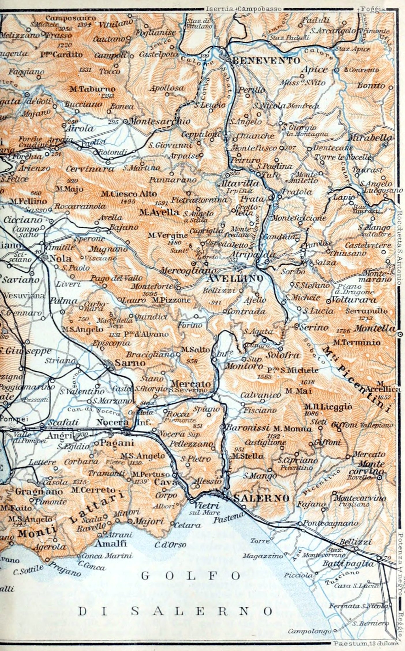
141The chief approach from the Piazza San Ferdinando (p. 138) to the W. quarters is by the animated Strada di Chiaia (Pl. E, 6). From its W. end we proceed along the Strada Santa Caterina, bearing to the left, cross the Piazza dei Martiri, and follow the Via Calabritto, with its numerous shops, to the—
141The chief approach from the Piazza San Ferdinando (p. 138) to the W. quarters is by the animated Chiaia Street (Pl. E, 6). From its W. end we proceed along the Strada Santa Caterina, bearing to the left, cross the Piazza dei Martiri, and follow the Via Calabritto, with its numerous shops, to the—
Largo della Vittoria (Pl. D, 7; tramways, Nos. 1 and 4, and omnibus, see p. 137). This piazza may be reached also from the Rione Santa Lucia on the E. side by the Via Parténope (Pl. F, E, 7), which leads along the coast, past the Costello dell’Ovo (p. 138), and affords fine views. On the W. side of the Largo lies the—
Victory Square (Pl. D, 7; tramways, Nos. 1 and 4, and omnibus, see p. 137). This piazza may be reached also from the Rione Santa Lucia on the E. side by the Via Parténope (Pl. F, E, 7), which leads along the coast, past the Costello dell’Ovo (p. 138), and affords fine views. On the W. side of the Largo lies the—
*Villa Nazionale (Pl. C, D, 7), usually called La Villa, a beautiful public garden planted with palms, bounded on the seaside by the Via Caracciolo, the fashionable promenade of Naples, and on the side next the town by the Riviera di Chiaia. A band plays here on Sun., Tues., and Thurs., 2–4 o’clock (June-Oct. 9–11 p.m.). In the middle of these grounds is the—
*Villa Nazionale (Pl. C, D, 7), commonly known as La Villa, is a lovely public garden filled with palm trees, located by the seaside along the Via Caracciolo, the popular promenade in Naples, and bordered by the Riviera di Chiaia on the town side. A band performs here on Sundays, Tuesdays, and Thursdays from 2 to 4 PM (June to October 9 to 11 PM). In the center of this area is the—
Zoological Station, founded in 1872 by the German naturalist A. Dohrn (d. 1909). The central building contains the *Aquarium (Pl. D, 7; adm., see p. 137), which presents an unrivalled and most interesting picture of submarine life.
Zoological Station, founded in 1872 by the German naturalist A. Dohrn (d. 1909). The central building contains the *Aquarium (Pl. D, 7; adm., see p. 137), which presents an unrivalled and most interesting picture of submarine life.
The winding Corso Vittorio Emanuele, over 2½ M. long, ascends from the coast a little way beyond the Villa Nazionale, or it may be reached from the Museum by the Via Salvator Rosa (Pl. E, 3; tramway No. 6, see p. 137). Above the ‘Villa’, on the S. slope of the Sant’ Elmo Hill, are situated the best hotels.
The winding Corso Vittorio Emanuele, over 2½ M. long, ascends from the coast a little way beyond the Villa Nazionale, or it may be reached from the Museum by the Via Salvator Rosa (Pl. E, 3; tramway No. 6, see p. 137). Above the ‘Villa’, on the S. slope of the Sant’ Elmo Hill, are situated the best hotels.
On the hills to which the two funiculars and tramway No. 7 (p. 137) ascend from the lower town lies the new quarter of Rione Vómero (Pl. C, D, 5). On its E. side rises the old Castel Sant’ Elmo (Pl. D, 5; 817 ft.), fortified with huge walls and with passages hewn in the tufa rock, and now used as a military prison. From the outer gate of the castle, at the tramway-terminus, we descend to the E. to the suppressed Carthusian monastery of—
On the hills to which the two funiculars and tramway No. 7 (p. 137) ascend from the lower town lies the new quarter of Rione Vómero (Pl. C, D, 5). On its E. side rises the old Castel Sant’ Elmo (Pl. D, 5; 817 ft.), fortified with huge walls and with passages hewn in the tufa rock, and now used as a military prison. From the outer gate of the castle, at the tramway-terminus, we descend to the E. to the suppressed Carthusian monastery of—
*San Martino (Pl. D, 5; adm., see p. 137), a Gothic building of the 14th cent., tastefully restored in the baroque style about 1650. The church, the old farmacía (Room III), and the cloisters are interesting. The other rooms contain Neapolitan memorials and art-industry collections. Rooms XV and XVI (once the library) are filled with Neapolitan majolicas and porcelain. From Room XXX, to the right, we enter a *Belvedere (XXXII), whose balconies offer a superb view of the city, Vesuvius, the bay, and the fertile plain extending to the Apennines (best by afternoon light).
*San Martino (Pl. D, 5; adm., see p. 137), a Gothic building of the 14th cent., tastefully restored in the baroque style about 1650. The church, the old farmacía (Room III), and the cloisters are interesting. The other rooms contain Neapolitan memorials and art-industry collections. Rooms XV and XVI (once the library) are filled with Neapolitan majolicas and porcelain. From Room XXX, to the right, we enter a *Belvedere (XXXII), whose balconies offer a superb view of the city, Vesuvius, the bay, and the fertile plain extending to the Apennines (best by afternoon light).
A famous view (clear weather necessary) is obtained from the old monastery of **Camaldoli (1503 ft.), founded in 1585 on the highest of the hills to the N.W. of Sant’ Elmo. The rough road to it (carr. about 6, with two horses 9–10 fr.; there and back 4½ hrs.) leaves the city near the Porta San Martino (Pl. A, B, 2), the N.W. gate of the Cinta Daziaria or wall of the octroi (town-customs). If on foot or on donkey back (2–2½ fr. and fee to attendant; 5–6 hrs.), we go from Rione Vomero (see above) through 142the suburb of Antignano (Pl. B, C, 4, 5) to the little customs-office of l’Archetiello (Pl. B, 4), near which the bridle-path begins.
A famous view (clear weather necessary) can be enjoyed from the old monastery of **Camaldoli (1503 ft.), established in 1585 on the highest hill to the N.W. of Sant’ Elmo. The rough road to it (carriage about 6, with two horses 9–10 fr.; there and back 4½ hrs.) starts near the Porta San Martino (Pl. A, B, 2), the N.W. gate of the Cinta Daziaria or wall of the octroi (town-customs). If traveling on foot or by donkey (2–2½ fr. plus a tip for the attendant; 5–6 hrs.), we go from Rione Vomero (see above) through the suburb of Antignano (Pl. B, C, 4, 5) to the small customs-office of l’Archetiello (Pl. B, 4), near which the bridle-path begins.
The monastery (suppressed, and now private property, but still occupied by several monks; fee 30–50 c.; ladies not admitted) offers little attraction. Straight through the garden we reach a point of view which commands the bays of Naples and Pozzuoli, the Phlegræan plain with its numerous extinct craters, and the Bay of Gaëta as far as the distant Ponza Islands (p. 133).
The monastery (suppressed, and now private property, but still occupied by several monks; fee 30–50 c.; ladies not admitted) offers little attraction. Straight through the garden we reach a point of view which commands the bays of Naples and Pozzuoli, the Phlegræan plain with its numerous extinct craters, and the Bay of Gaëta as far as the distant Ponza Islands (p. 133).
When ladies are of the party we turn to the right, near the N.W. angle of the monastery-wall, and descend a little to the (8 min.) gate of the Veduta Pagliana (adm. 20 c.), where the view is similar.
When there are ladies in the group, we turn to the right, close to the northwest corner of the monastery wall, and go down a bit to the (8 min.) gate of the Veduta Pagliana (adm. 20 c.), where the view is similar.
Travellers whose time is limited may at least visit the *Strada Nuova di Posílipo (tramway No. 1; p. 137). It is approached, beyond the Villa Nazionale (p. 141), by the Strada di Mergellina (Pl. B, 7), from which the Corso Vittorio Emanuele (p. 141) diverges. The Strada Nuova di Posilipo, gradually ascending from the sea, leads between villas with luxuriant gardens round the broad hill of Posílipo, which bounds the Bay of Naples on the W., and offers, especially by evening light, superb views of Mt. Vesuvius, the peninsula of Sorrento (p. 154), and the island of Capri. A walk of 10 min. straight on from the tramway-terminus brings us through a cutting to the Bella Vista, a point of view near the restaurant of that name (p. 136), where we have an unimpeded view of the bay of Pozzuoli and of the islands of Procida and Ischia (p. 135).
Travellers whose time is limited may at least visit the *Strada Nuova di Posílipo (tramway No. 1; p. 137). It is approached, beyond the Villa Nazionale (p. 141), by the Strada di Mergellina (Pl. B, 7), from which the Corso Vittorio Emanuele (p. 141) diverges. The Strada Nuova di Posilipo, gradually ascending from the sea, leads between villas with luxuriant gardens round the broad hill of Posílipo, which bounds the Bay of Naples on the W., and offers, especially by evening light, superb views of Mt. Vesuvius, the peninsula of Sorrento (p. 154), and the island of Capri. A walk of 10 min. straight on from the tramway-terminus brings us through a cutting to the Bella Vista, a point of view near the restaurant of that name (p. 136), where we have an unimpeded view of the bay of Pozzuoli and of the islands of Procida and Ischia (p. 135).
An interesting circular trip may be made from the Corso Vittorio Emanuele (p. 141), up the Via Tasso (Pl. C, B, 6), with its fine points of view, to the top of Posilipo, then along the crest of the hill to the S.W. to the tramway-terminus, and back by the Posilipo road (a walk of 3½–4 hrs., or a drive of 1½ hr.; a cab should be taken by the hour).
An interesting circular trip may be made from the Corso Vittorio Emanuele (p. 141), up the Via Tasso (Pl. C, B, 6), with its fine points of view, to the top of Posilipo, then along the crest of the hill to the S.W. to the tramway-terminus, and back by the Posilipo road (a walk of 3½–4 hrs., or a drive of 1½ hr.; a cab should be taken by the hour).
For Naples and its Environs comp. also Baedeker’s Southern Italy, or Italy from the Alps to Naples.
For Naples and its surrounding areas, check out Baedeker’s Southern Italy or Italy from the Alps to Naples.
25. From Genoa to Tunis viâ Leghorn and Cagliari.
620 M. This route forms part of the ‘Linea Circolare della Tunisia e Tripolitania’ (Lines XVIII-XX) of the Società Nazionale, a circular tour which offers interesting glimpses of Sardinia, Malta, and the E. coast of Sicily, as well as of Oriental life at the N. African ports (RR. 64, 27, 24). The steamers usually leave Genoa on Frid. evening, Leghorn on Sat. night, and Cagliari on Mon. evening, and arrive at Tunis on Tues. forenoon. (In the reverse direction they leave Tunis on Mon. at noon and reach Genoa on Thurs. evening.) Fare 111 or 83 fr. (or for the whole round 303 or 212 fr.). As some of the steamers are hardly up to date, inquiry as to the best should be made beforehand. Office at Genoa, see p. 114; at Leghorn, Piazza Micheli (p. 143); at Tunis, p. 331.
620 M. This route forms part of the ‘Linea Circolare della Tunisia e Tripolitania’ (Lines XVIII-XX) of the Società Nazionale, a circular tour which offers interesting glimpses of Sardinia, Malta, and the E. coast of Sicily, as well as of Oriental life at the N. African ports (RR. 64, 27, 24). The steamers usually leave Genoa on Frid. evening, Leghorn on Sat. night, and Cagliari on Mon. evening, and arrive at Tunis on Tues. forenoon. (In the reverse direction they leave Tunis on Mon. at noon and reach Genoa on Thurs. evening.) Fare 111 or 83 fr. (or for the whole round 303 or 212 fr.). As some of the steamers are hardly up to date, inquiry as to the best should be made beforehand. Office at Genoa, see p. 114; at Leghorn, Piazza Micheli (p. 143); at Tunis, p. 331.
Genoa, and voyage to (92 M.) Leghorn, comp. pp. 113, 134. We pass Melória, a cliff 4 M. to the W. of Leghorn, off which the Genoese destroyed the fleet of Pisa in 1284.
Genoa, and voyage to (92 M.) Leghorn, comp. pp. 113, 134. We pass Melória, a cliff 4 M. to the W. of Leghorn, off which the Genoese destroyed the fleet of Pisa in 1284.
143Leghorn, Ital. Livorno (Marble Palace Hotel; Hôt. d’Angleterre & Campari, Hôt. Giappone, both in Via Vittorio Emanuele, with restaurants, good Italian houses for passing travellers; Brit, cons., M. Carmichael; U. S. cons., E. A. Man; pop. 78,000), a provincial capital, one of the chief seaports of Italy, and a sea-bathing place, is quite a modern town. The harbour consists of the Porto Nuovo, sheltered by a semicircular mole (diga curvilinea) and the new Molo Vegliaia, and the old Porto Mediceo, or inner harbour. (Landing or embarkation 1 fr.; trunk 30 c.).
143Leghorn, Italy Livorno (Marble Palace Hotel; Hotel d’Angleterre & Campari, Hotel Giappone, both on Via Vittorio Emanuele, featuring good Italian restaurants for travelers; British Consulate, M. Carmichael; U.S. Consulate, E. A. Man; population 78,000) is a provincial capital and one of Italy's main seaports, as well as a popular beach destination, and it has a modern vibe. The harbor includes the Porto Nuovo, protected by a semicircular pier (diga curvilinea), the new Molo Vegliaia, and the old Porto Mediceo, which is the inner harbor. (Landing or embarking costs 1 franc; trunk 30 cents.)
Near the harbour is the Piazza Micheli, adorned with a curious monument of the grand-duke Ferdinand I. of Tuscany (1587–1609). Straight on runs the Via Vittorio Emanuele, the main street, lined with shops. It leads across the large Piazza Vittorio Emanuele, which is flanked by the Cathedral, the Municipio, and other public buildings, to the Piazza Carlo Alberto, whence the Via Garibaldi and Via Palestro lead to the left to the railway-station.
Near the harbor is Piazza Micheli, featuring an interesting monument of Grand Duke Ferdinand I of Tuscany (1587–1609). Straight ahead is Via Vittorio Emanuele, the main street, filled with shops. It leads across the large Piazza Vittorio Emanuele, which is bordered by the Cathedral, the Municipio, and other public buildings, to Piazza Carlo Alberto, where Via Garibaldi and Via Palestro branch off to the left toward the train station.
A pleasant walk (or tramway from the station to Antignano) is offered by the Viale Regina Margherita, about 2 M. in length, the seaside promenade to the S. of the town, in summer enlivened by numerous bathers. Between it and the harbour, and adjoining the Piazza Mazzini, is the Cantiere Orlando, the dockyards where iron-clads and other vessels are built for the Italian navy.
A nice walk (or tram ride from the station to Antignano) is provided by the Viale Regina Margherita, which is about 2 miles long, along the seaside promenade south of the town, lively with many bathers in the summer. Between this promenade and the harbor, next to Piazza Mazzini, is the Cantiere Orlando, the shipyard where ironclads and other ships are constructed for the Italian navy.
At the S. end of the sea-promenade lie the villa-suburbs of Ardenza and Antignano, which have sea-baths also.
At the southern end of the seaside promenade are the villa suburbs of Ardenza and Antignano, both of which have beach baths as well.
On the fine Voyage from Leghorn to (339 M.) Cagliari we at first obtain a good view of the Tuscan Archipelago, relics of the primæval Tyrrhenis (p. xxxi). These islands are composed mainly of granite, with slate and limestone strata overlying it in places.
On the nice Journey from Leghorn to (339 M.) Cagliari, we initially get a good view of the Tuscan Archipelago, remnants of the ancient Tyrrhenis (p. xxxi). These islands are mostly made of granite, with slate and limestone layers on top in some areas.
Passing at some distance from the barren fisher-island of Gorgona (837 ft.) and from Capraia, the Capraria (goats’ island) of antiquity, we steer to the S.S.W. towards the W. coast of Elba, enjoying in clear weather a fine distant *View of the peninsula of Cape Corse, the N. extremity of Corsica, and of Monte Cinto (8892 ft.), the highest mountain in the interior of that island.
Passing at some distance from the desolate fisher island of Gorgona (837 ft.) and from Capraia, the ancient Capraria (goats’ island), we head southwest toward the western coast of Elba, enjoying a great distant view of the peninsula of Cape Corse, the northern tip of Corsica, and Monte Cinto (8892 ft.), the tallest mountain in the interior of that island.
We next skirt the island of Elba, the Æthalia of the Greeks and Ilva of the Romans, the largest island in the archipelago, 19 M. long, famous as the scene of the first exile of Napoleon I. (1814–5). The valuable iron-mines here (comp. pp. 134, 135), worked from very ancient times, are an important factor in the industries of Italy. We pass the rocky N. coast of the island, which is visible as far as the Capo della Vita (p. 135), and on its W. side we observe the massive granitic Monte Capanne (3343 ft.).
We next skirt the island of Elba, the Æthalia of the Greeks and Ilva of the Romans, the largest island in the archipelago, 19 M. long, famous as the scene of the first exile of Napoleon I. (1814–5). The valuable iron-mines here (comp. pp. 134, 135), worked from very ancient times, are an important factor in the industries of Italy. We pass the rocky N. coast of the island, which is visible as far as the Capo della Vita (p. 135), and on its W. side we observe the massive granitic Monte Capanne (3343 ft.).
The steamer passes between the hardly less steep S. coast of Elba and the flat island of Pianosa (85 ft.; the ancient Planasia), and steers to the S.S.W. towards the S. coast of Sardinia. On the left, about 26 M. from Elba, appears the bold granitic island 144of Montecristo (2126 ft.), the ancient Oglasa, the scene of the well-known novel ‘The Count of Monte Cristo’, by Alex. Dumas.
The steamer sails between the steep southern coast of Elba and the flat island of Pianosa (85 ft.; the ancient Planasia), heading south-southwest towards the southern coast of Sardinia. To the left, about 26 miles from Elba, the striking granitic island of 144 Montecristo (2126 ft.), the ancient Oglasa, comes into view, famously known as the setting for the novel ‘The Count of Monte Cristo’ by Alexandre Dumas.
The Straits of Bonifacio (p. 133) lie far to the W. of the steamer’s course. Off the N.E. coast of Sardinia we first sight the massive rocky island of Tavolara (1821 ft.), the Bucina of the Romans, masking the Bay of Terranova; then, when off Capo Comino, the eastmost point of Sardinia, we see Monte Alvo (3701 ft.), a little inland. The somewhat monotonous S.E. coast of the island is backed by sterile mountains. We pass the little port of Arbatax (Tortolì Marina), the Capo di Bellavista, the Capo Sferra Cavallo, the Monte Ferrau (2878 ft.), the Capo Ferrato, and lastly the islet of Serpentara.
The Straits of Bonifacio (p. 133) lie far to the W. of the steamer’s course. Off the N.E. coast of Sardinia we first sight the massive rocky island of Tavolara (1821 ft.), the Bucina of the Romans, masking the Bay of Terranova; then, when off Capo Comino, the eastmost point of Sardinia, we see Monte Alvo (3701 ft.), a little inland. The somewhat monotonous S.E. coast of the island is backed by sterile mountains. We pass the little port of Arbatax (Tortolì Marina), the Capo di Bellavista, the Capo Sferra Cavallo, the Monte Ferrau (2878 ft.), the Capo Ferrato, and lastly the islet of Serpentara.
Beyond Capo Carbonara, the S.E. point of Sardinia, and the Isola dei Cavoli (p. 118), opens the broad Gulf of Cagliari on the flat S. coast of the island. On the hill-side at the head of the gulf, beyond the fortified Cape Sant’Elia, which shuts off the inner Golfo di Quarto, lies the town of Cagliari. Around it are several large coast-lakes, the Stagno di Molentargius, on the E., the Stagno di Cagliari, on the W., and others, which yield quantities of salt. The latter has been separated from the gulf only since the middle ages by a neck of land called the Plaia.
Beyond Capo Carbonara, the S.E. point of Sardinia, and the Isola dei Cavoli (p. 118), opens the broad Gulf of Cagliari on the flat S. coast of the island. On the hill-side at the head of the gulf, beyond the fortified Cape Sant’Elia, which shuts off the inner Golfo di Quarto, lies the town of Cagliari. Around it are several large coast-lakes, the Stagno di Molentargius, on the E., the Stagno di Cagliari, on the W., and others, which yield quantities of salt. The latter has been separated from the gulf only since the middle ages by a neck of land called the Plaia.
Cágliări.—The Steamer is moored in the Darsena. Landing or embarkation 40, with baggage 60 c.
Cágliări.—The Steamer is docked in the Darsena. Disembarking or boarding 40, with luggage 60 c.
Hotels. Scala di Ferro, Viale Regina Margherita 5, with good restaurant, R. 2½–3 fr.; Quattro Mori, Largo Carlo Felice, R. from 2 fr., also restaurant.—Café Torino, Via Roma.
Hotels. Scala di Ferro, Viale Regina Margherita 5, featuring a good restaurant, R. 2½–3 fr.; Quattro Mori, Largo Carlo Felice, R. starting from 2 fr., also has a restaurant.—Café Torino, Via Roma.
Post & Telegraph Office, Via Lodovico Baille 22.—Cab (bargaining advisable) 1, at night ½ fr. per drive; baggage 20 c.
Post and Telecommunications Office, Via Lodovico Baille 22.—Taxi (negotiating is advisable) 1, at night ½ fr. per ride; luggage 20 c.
British Consul (also Lloyd’s Agent), R. E. Pernis.
UK Consul (also Lloyd’s Agent), R. E. Pernis.
Cagliari, Sardin. Casteddu, the Roman Carales, a very ancient town, having been founded by the Phœnicians, now the seat of a university and of an archbishop, with 48,000 inhab., lies in one of the hottest and driest regions in Italy. At the foot of the Castello or old town (290 ft.) lie the new quarters of Villanova, Marina, and Stampace, adjoined on the W. by the suburb of Sant’Avendrace.
Cagliari, Sardinia. Casteddu, the Roman Carales, is a very ancient town founded by the Phoenicians. It is now home to a university and an archbishop, with a population of 48,000. The town is located in one of the hottest and driest regions of Italy. At the base of the Castello or old town (290 ft.) are the modern neighborhoods of Villanova, Marina, and Stampace, next to the suburb of Sant’Avendrace to the west.
The Via Roma, an avenue skirting the sea, the fashionable corso in the evening, leads from the Palazzo Comunale to the Largo Carlo Felice. On the right are two covered Markets, which are worth seeing in the forenoon. This largo leads to the Piazza Yenne, the business centre of the modern town.
The Via Roma, a seaside avenue, the trendy main street in the evening, runs from the Palazzo Comunale to Largo Carlo Felice. On the right, there are two covered Markets that are worth visiting in the morning. This square leads to Piazza Yenne, the commercial hub of the modern town.
At the N. end of the Largo Carlo Felice rises a statue of Charles Felix I. (1821–31), and in the Piazza Yenne an antique column. Between these passes the main thoroughfare of the town: to the left the Corso Vittorio Emanuele, ending near a group of ancient Roman houses recently excavated, now called Casa di Tigellio; to the right, leading to the upper town, the animated Via Manno (popularly ‘La Costa‘), with numerous shops, where among other 145things the gold ornaments commonly worn by the country-people should be noticed.
At the north end of Largo Carlo Felice stands a statue of Charles Felix I. (1821–31), and in Piazza Yenne, there's an ancient column. The main road of the town runs between these two: to the left is Corso Vittorio Emanuele, which ends near a group of recently excavated ancient Roman houses known as Casa di Tigellio; to the right, leading up to the higher part of town, is the lively Through Manno (commonly referred to as ‘La Costa‘), filled with numerous shops, where you can find various things, including the gold jewelry typically worn by the locals.
From the Piazza della Costituzione, at the S.E. end of the Via Manno, the *Viale Regina Elena runs to the N., beneath the precipitous E. side of the abrupt Castello. It affords a fine view of the ancient town-wall, of the cathedral, and of the picturesque rear of the castle-buildings; below, on the right, lies Villanova, with its quaint tiled roofs, while beyond it we have a splendid view of Cape Sant’ Elia and across the wide plain of Quarto to the mountains.
From the Piazza della Costituzione, at the southeast end of Via Manno, the *Queen Elena Avenue runs north, beneath the steep eastern side of the abrupt castle. It offers a great view of the old town wall, the cathedral, and the charming back of the castle buildings; below, to the right, is Villanova, with its charming tiled roofs, and beyond it, there’s a stunning view of Cape Sant’ Elia and across the vast Quarto plain to the mountains.
From the Giardino Pubblico, at the N. end of the promenade, we mount to the W. to the Passeggiata Buon Cammino (see below).
From the Giardino Pubblico, at the north end of the promenade, we head west to the Passeggiata Buon Cammino (see below).
Adjoining the Via Manno (p. 144) is the small Piazzetta de’Martiri d’Italia, whence the Via Giuseppe Mazzini ascends in two bends to the *Castello, still fortified in mediæval style. At the top is the new Passeggiata Coperta, one of the finest points in the town. The Via dell’Università leads hence to the left to the University and to the ponderous Torre dell’Elefante, which, according to the inscription, was erected by the Pisans in 1307.
Adjoining the Via Manno (p. 144) is the small Piazzetta de’Martiri d’Italia, whence the Via Giuseppe Mazzini ascends in two bends to the *Castello, still fortified in mediæval style. At the top is the new Passeggiata Coperta, one of the finest points in the town. The Via dell’Università leads hence to the left to the University and to the ponderous Torre dell’Elefante, which, according to the inscription, was erected by the Pisans in 1307.
Straight on we pass through the Torre dell’Aquila, an old gateway now enclosed within the Palazzo Boyl, to the Via Lamarmora, the main street in the Castello, which is connected with the parallel streets by steep lanes, dark vaulted passages, and steps.
Straight ahead, we go through the Torre dell’Aquila, an old gateway now surrounded by the Palazzo Boyl, to Via Lamarmora, the main street in the Castello, which connects to the parallel streets through steep lanes, dark vaulted passages, and steps.
From the terraced little Piazza del Municipio, with the council-hall of the old town, a flight of steps to the right ascends to the Cathedral (Santa Cecilia), completed by the Pisans in 1312, but since then frequently altered. A new façade, in keeping with the old building, is now under construction.
From the small, tiered Piazza del Municipio, where the town hall of the old town is located, a set of steps to the right leads up to the Cathedral (Santa Cecilia), finished by the Pisans in 1312 but often modified since then. A new façade, in line with the original structure, is currently being built.
Farther to the N., in the Piazza dell’ Indipendenza, is the Pisan Torre San Pancrazio (14th cent.), a modern addition to which contains the very notable Museum of Antiquities (if closed apply to the director, Sig. Nissardi). Besides Phœnician and Roman antiquities we may note the cork model of a nuraghe, one of the conical fortresses built by the aboriginal Iberian inhabitants.
Farther north, in Piazza dell’Indipendenza, is the Pisan Torre San Pancrazio (14th century), a modern addition that houses the impressive Antiquities Museum (if it's closed, contact the director, Mr. Nissardi). Along with Phoenician and Roman artifacts, we can highlight the cork model of a nuraghe, one of the cone-shaped fortresses built by the original Iberian people.
Going through the Citadel, which bounds the Castello on the N., we follow the Passeggiata Buon Cammino to the Piazza d’Armi. Just beyond the barracks a road to the left leads to the Roman—
Going through the Citadel, which borders the Castello on the north side, we take the Passeggiata Buon Cammino to the Piazza d’Armi. Just past the barracks, a road on the left goes to the Roman—
Amphitheatre (greater diameter 97, smaller 80 yds.; arena 55 by 37 yds.), with tiers of seats mostly hewn in the rock.
Amphitheater (greater diameter 97, smaller 80 yds.; arena 55 by 37 yds.), with rows of seats mostly carved into the rock.
Below the amphitheatre lie the garden of the Poor House (Ricovero di Mendicità) and the Botanic Garden (Thurs. 4–7), both containing remains of antique Irrigation Works, which are continued on the cliffs to the N.W. of the old town. Close by is the ancient Necropolis of Carales. Nearest the town are the Punic tomb-chambers, sunk perpendicularly in the rock (care should be taken here), and farther to the W. are the mostly horizontal Roman tombs.
Below the amphitheater are the gardens of the Poor House (Ricovero di Mendicità) and the Botanic Garden (Thurs. 4–7), both featuring remnants of ancient Irrigation Works, which continue on the cliffs to the northwest of the old town. Nearby is the ancient City of the Dead of Carales. Closest to the town are the Punic tomb chambers, which are cut straight into the rock (beware here), and further west are the mostly horizontal Roman tombs.
From the ruined castle of San Michele, at the top of a hill about 2 M. 146to the N. of the Piazza d’Armi (p. 145), we overlook the Stagno di Cagliari (p. 144) and the Campidano, a fruitful, but fever-stricken plain between the bays of Cagliari and Oristano (p. 129), where the clay-built villages and the cactus hedges recall N. Africa.
From the ruined castle of San Michele, at the top of a hill about 2 M. 146to the N. of the Piazza d’Armi (p. 145), we overlook the Stagno di Cagliari (p. 144) and the Campidano, a fruitful, but fever-stricken plain between the bays of Cagliari and Oristano (p. 129), where the clay-built villages and the cactus hedges recall N. Africa.
See also Baedeker’s Southern Italy.
See also *Baedeker’s Southern Italy.*
Voyage from Tunis to Algiers, see R. 22; to Tripoli, see R. 64.
Voyage from Tunis to Algiers, see R. 22; to Tripoli, see R. 64.
26. From Naples to Tunis viâ Palermo.
From Naples to Palermo (193 M.). 1. Steamers of the Ferrovie dello Stato (Line C) daily in 9 hrs., at 10.45 p.m. (returning at 8.30 p.m.); fare 25 fr. 5 or 15 fr. 65 c.—2. Società Nazionale, Line XVI (see below) every Mon. evening in 12 hrs., and Lines X & XI every second Frid. aft. in 17¾ hrs. (fares 25 fr. 5, 15 fr. 65 c.).—3. Adria Co. (RR. 23, 24) every Thurs. afternoon, in 15 hrs.; fare 18 fr., without food.—4. Lloyd Sabaudo 1–3 times monthly (comp. R. 24). Passengers, both going and coming, should rise early in order to enjoy the superb approaches to the bays of Palermo and Naples.
From Naples to Palermo (193 M.). 1. Ferries from Ferrovie dello Stato (Line C) operate daily in 9 hours, leaving at 10:45 p.m. (returning at 8:30 p.m.); fare 25 fr. 5 or 15 fr. 65 c.—2. Società Nazionale, Line XVI (see below) every Monday evening in 12 hours, and Lines X & XI every second Friday afternoon in 17¾ hours (fares 25 fr. 5, 15 fr. 65 c.).—3. Adria Co. (RR. 23, 24) every Thursday afternoon in 15 hours; fare 18 fr., no food included.—4. Lloyd Sabaudo runs 1–3 times monthly (comp. R. 24). Passengers, both departing and arriving, should wake up early to enjoy the stunning approaches to the bays of Palermo and Naples.
From Genoa to Palermo direct (494 M.) every Thurs. (returning on Wed.) by Line XXII (for Palermo, Trapani, Syracuse, and Catania) of the Società Nazionale (fare 80 or 55 fr.).
Direct from Genoa to Palermo (494 M.) every Thursday (returning on Wednesday) by Line XXII (for Palermo, Trapani, Syracuse, and Catania) of the Società Nazionale (fare 80 or 55 fr.).
From Palermo to Tunis (217 M.). 1. Società Nazionale: a. Line XVI (from Naples, see above), leaving Palermo Tues. aft., Trapani Tues. evening, arrives at Tunis Wed. morning (returning from Tunis Wed. night, from Trapani Thurs. morning, from Palermo Thurs. evening, arr. at Naples Frid. morning); fare from Palermo to Tunis 64 fr. 25 or 43 fr. 25 c.; b. Line XVII, from Palermo to Pantelleria and Tunis (small cargo-boats), calling at Castellammare del Golfo, Trapani, Favignana, Marsala, Mazzara, Sciacca, and the island of Pantelleria; dep. from Palermo Thurs. morning, from Mazzara (reached also by railway, 89 M. in 4¼ hrs.; 18 fr. 25, 12 fr. 80, or 8 fr. 30 c.) Frid. afternoon (landing or embarkation in fine weather only), arr. at Tunis Sat. evening (returning from Tunis on Sun. evening, arr. at Mazzara on Mon. evening, and at Palermo Tues. night; fare from Mazzara 73 fr. or 50 fr. 35 c.)—2. Navigation Mixte (Touache Co.), cargo-steamer from Palermo to Tunis direct (coming from Marseilles, R. 21), on Wed. noon, in 18 hrs. (returning Thurs. at noon); fare 60 or 40 fr.—Combined tickets (Naples-Palermo-Tunis) are available by either of the two companies’ boats.
From Palermo to Tunis (217 km). 1. National Company: a. Line XVI (from Naples, see above), leaving Palermo Tuesday afternoon, Trapani Tuesday evening, arrives in Tunis Wednesday morning (returns from Tunis Wednesday night, from Trapani Thursday morning, from Palermo Thursday evening, arriving in Naples Friday morning); fare from Palermo to Tunis 64 fr. 25 or 43 fr. 25 c.; b. Line XVII, from Palermo to Pantelleria and Tunis (small cargo boats), stopping at Castellammare del Golfo, Trapani, Favignana, Marsala, Mazzara, Sciacca, and the island of Pantelleria; departs from Palermo Thursday morning, from Mazzara (accessible by train, 89 km in 4¼ hours; 18 fr. 25, 12 fr. 80, or 8 fr. 30 c.) Friday afternoon (landing or boarding in good weather only), arrives in Tunis Saturday evening (returns from Tunis on Sunday evening, arriving in Mazzara on Monday evening, and in Palermo Tuesday night; fare from Mazzara 73 fr. or 50 fr. 35 c.)—2. Mixed Navigation (Touache Co.), cargo steamer from Palermo to Tunis directly (coming from Marseille, R. 21), on Wednesday noon, in 18 hours (returning Thursday at noon); fare 60 or 40 fr.—Combined tickets (Naples-Palermo-Tunis) are available on either of the two companies’ boats.
Agents at Naples, Palermo, and Tunis, see pp. 137, 148, 331.
Agents at Naples, Palermo, and Tunis, see pp. 137, 148, 331.
Towards morning appears to the S.W. the island of Ustĭca (784 ft.), which was visited by an earthquake in March 1906; to the S.E. in clear weather are seen Filicuri (2543 ft.; Greek Phoinikusa) and Alicuri (2175 ft.; the ancient Ericusa), the westmost of the Lipari Islands (p. 155); beyond lies the N. coast of Sicily, from Cape Gallo (p. 152) and the finely shaped Monte Pellegrino (p. 151) to the Madoníe Mts. (6480 ft.), snow-clad in winter.
Towards morning appears to the S.W. the island of Ustĭca (784 ft.), which was visited by an earthquake in March 1906; to the S.E. in clear weather are seen Filicuri (2543 ft.; Greek Phoinikusa) and Alicuri (2175 ft.; the ancient Ericusa), the westmost of the Lipari Islands (p. 155); beyond lies the N. coast of Sicily, from Cape Gallo (p. 152) and the finely shaped Monte Pellegrino (p. 151) to the Madoníe Mts. (6480 ft.), snow-clad in winter.

147A scene of striking beauty is revealed as we steam into the *Bay of Palermo, which opens towards the E., between Monte Pellegrino and the smaller pointed headland of Monte Catalfano (1237 ft.), backed by a circus of grand mountains, Monte Cuccio (3448 ft.), Monte Grifone (2550 ft.), and others. After passing between the harbour piers, the Antemurale on the S. and the Molo (lighthouse) on the N., we observe on the left the shallow old harbour of La Cala (p. 149) with the ruined fort of Castellammare.
147A scene of striking beauty is revealed as we steam into the *Bay of Palermo, which opens towards the E., between Monte Pellegrino and the smaller pointed headland of Monte Catalfano (1237 ft.), backed by a circus of grand mountains, Monte Cuccio (3448 ft.), Monte Grifone (2550 ft.), and others. After passing between the harbour piers, the Antemurale on the S. and the Molo (lighthouse) on the N., we observe on the left the shallow old harbour of La Cala (p. 149) with the ruined fort of Castellammare.
Palermo.—Arrival. The steamers from Naples are berthed at the new Santa Lucia Pier (Pl. G, 4, 5); in the case of the others landing or embarkation is effected by boat (60 c.; with baggage 1 fr.). The custom-house examination is slight. Porter (facchino) for hand-bag 10, trunk 50 c.—From the pier to the town ca. ¾ M. (tramway No. 1, see below). Omnibuses or motor-cars from the hotels await steamers at the pier. Cabs, see below.
Palermo.—Arrival. The boats from Naples are docked at the new Santa Lucia Pier (Pl. G, 4, 5); for other arrivals, boarding is done via boat (60 cents; with luggage 1 franc). The customs check is minimal. A porter for a hand bag costs 10 cents, and for a trunk, it's 50 cents. From the pier to the city is about ¾ mile (tram No. 1, see below). Buses or cars from hotels are waiting for boats at the pier. Taxis, see below.
Hotels (most frequented Feb.-April). *Villa Igiea, ¼ hr. to the N. of the quay, at the Acquasanta terminus of tramways Nos. 1 & 7, near the sea, with park, casino, and fine view, R. from 8, B. 2, déj. 5, D. 7, omn. 3 fr.; *Excelsior Palace (Pl. e; G, 2), Via della Libertà, near the Giardino Inglese, good restaur., R. from 4, B. 1½, D. 6, omn. 1½ fr.; *Hôt. des Palmes (Pl. a; E, 3), Via Stabile 103, R. 4–12, B. 1½, D. 6, omn. 1½ fr.; three houses of the first class, closed in summer. The following, also of the first class, are open throughout the year. *Hôt. de France (Pl. c; C, 5), near the Giardino Garibaldi, R. 4–10, B. 1½, D. 5, omn. 1½ fr.; *Trinacria (Pl. b; C, 5), with sea view, entrance in Via Butera, R. from 4, B. 1½, D. 5, omn. 1½ fr.; Savoy (Pl. g; E, 3), Via Cavour, R. from 3, D. 4½, omn. 1–1½ fr.; Panormus (Pl. k; E, 3, 4), Via Michele Amari 11, R. from 2½, B. 1¼, déj. 2½, D. 3½ fr.—Less pretending (open all the year round): Milano (Pl. f; F, 3), Via Emerico Amari 114, R. from 3½, omn. 1 fr., well spoken of; Albergo Vittoria (Pl. h; D, 4), Via Bandiera 31, and Central (Pl. d; C, 3), Corso Vittorio Emanuele 343, R. from 2 fr., both with restaurant; Patria (Pl. i; B, 4), Via Alloro 96 (view from roof-terrace), Cavour, Corso Vittorio Emanuele 330, both hôtels garnis (R. from 1½ fr.).
Hotels (most popular Feb.-April). *Villa Igiea, 15 min. north of the quay, at the Acquasanta terminus of tramlines 1 & 7, near the sea, featuring a park, casino, and great views; rooms from 8, breakfast 2, lunch 5, dinner 7, service 3 fr.; *Excelsior Palace Hotel (Pl. e; G, 2), Via della Libertà, close to Giardino Inglese, good restaurant; rooms from 4, breakfast 1½, dinner 6, service 1½ fr.; *Hotel des Palmes (Pl. a; E, 3), Via Stabile 103, rooms 4–12, breakfast 1½, dinner 6, service 1½ fr.; three first-class hotels, closed in summer. The following first-class hotels are open year-round: *Hotel de France (Pl. c; C, 5), near Giardino Garibaldi, rooms 4–10, breakfast 1½, dinner 5, service 1½ fr.; *Sicily (Pl. b; C, 5), with a sea view, entrance on Via Butera, rooms from 4, breakfast 1½, dinner 5, service 1½ fr.; Savoy Hotel (Pl. g; E, 3), Via Cavour, rooms from 3, dinner 4½, service 1–1½ fr.; Panormus (Pl. k; E, 3, 4), Via Michele Amari 11, rooms from 2½, breakfast 1¼, lunch 2½, dinner 3½ fr.—Less upscale (open year-round): Milan (Pl. f; F, 3), Via Emerico Amari 114, rooms from 3½, service 1 fr., well-reviewed; Hotel Vittoria (Pl. h; D, 4), Via Bandiera 31, and Main (Pl. d; C, 3), Corso Vittorio Emanuele 343, rooms from 2 fr., both with a restaurant; Country (Pl. i; B, 4), Via Alloro 96 (view from roof terrace), Cavour, Corso Vittorio Emanuele 330, both hotels garnis (rooms from 1½ fr.).
Restaurants (Italian cooking; à la carte). Gran Caffè Nuovo, in the Teatro Biondo (Pl. C, 4), Restaurant de Paris, Via Maqueda 200, both good. Plainer: Vanini, Corso Vittorio Emanuele 405; Ristorante Napoli, same street, No. 265; Ristorante Bologni, same street, No. 381.
Restaurants (Italian food; à la carte). Gran Caffè Nuovo, in the Teatro Biondo (Pl. C, 4), Restaurant de Paris, Via Maqueda 200, both excellent. Simpler options: Vanini, Corso Vittorio Emanuele 405; Ristorante Napoli, same street, No. 265; Ristorante Bologni, same street, No. 381.
Cafés (rarely frequented in the morning). Caffè del Teatro Massimo (p. 151); Trinacria, Quattro Canti di Campagna (Pl. E, 3); Caflisch, Via Maqueda 250; Café Italia, Via Cavour.—English Tea Rooms, Piazza Marina 41.—Beer. Gran Caffè Nuovo (see above); Trinacria (see above); Gambrinus, Teatro Massimo.
Cafés (rarely frequented in the morning). Caffè del Teatro Massimo (p. 151); Trinacria, Quattro Canti di Campagna (Pl. E, 3); Caflisch, Via Maqueda 250; Café Italia, Via Cavour.—English Tea Rooms, Piazza Marina 41.—Beer. Gran Caffè Nuovo (see above); Trinacria (see above); Gambrinus, Teatro Massimo.
Cabs. For 1–4 pers., within Via Lincoln, Corso Tukery, Piazza dell’ Indipendenza, and Piazza Ucciardone, per drive 50 c., from midnight to dawn 1 fr.; to outer quarters, drive under ½ hr., also to the quay or the railway-stations 1 fr.; from midnight to dawn 1 fr. 50 c.: one hour 1 fr. 80 c., each addit. ¼ hr. 40 c.—Hand-bag 20, trunk 40 c.—Driving in the inner city on Good Friday prohibited.—For long drives a bargain should be made; thus, to Monreale (p. 152), with stay of 1½ hr., 7–8 (or out of season 4–6) fr.
Cabs. For 1–4 pers., within Via Lincoln, Corso Tukery, Piazza dell’ Indipendenza, and Piazza Ucciardone, per drive 50 c., from midnight to dawn 1 fr.; to outer quarters, drive under ½ hr., also to the quay or the railway-stations 1 fr.; from midnight to dawn 1 fr. 50 c.: one hour 1 fr. 80 c., each addit. ¼ hr. 40 c.—Hand-bag 20, trunk 40 c.—Driving in the inner city on Good Friday prohibited.—For long drives a bargain should be made; thus, to Monreale (p. 152), with stay of 1½ hr., 7–8 (or out of season 4–6) fr.
Tramways (within the city 10, transfer 15 c.). Among the chief are: 1. From Piazza Marina (Pl. C, 5) to Via Francesco Crispi (Pl. E, F, 4), Piazza Ucciardone (Pl. G, 4), and Acquasanta (Villa Igiea).—4. From Porta Maqueda (Pl. D, E, 3), to Via Francesco Crispi, Piazza Ucciardone, and Falde (p. 151).—7. From Piazza Marina to Via Lincoln (Pl. B, A, 6–4; Central Station), Corso Tukery, Piazza dell’ Indipendenza (Pl. B, 1), Corso Alberto Amedeo (Pl. B-D, 1), Politeama Garibaldi (Pl. F, 3), and Acquasanta 148(Villa Igiea).—9. From Piazza Bologni (Pl. C, 3) to Piazza dell’ Indipendenza, Rocca (p. 152), and Monreale (p. 152), every ½ hr., in 35 min.; fare 40 (back 30) c.—Above Rocca (gradient ca. 1 in 8) there is a funicular section 1100 yds. long.
Tramways (within the city 10, transfer 15 c.). Among the chief are: 1. From Piazza Marina (Pl. C, 5) to Via Francesco Crispi (Pl. E, F, 4), Piazza Ucciardone (Pl. G, 4), and Acquasanta (Villa Igiea).—4. From Porta Maqueda (Pl. D, E, 3), to Via Francesco Crispi, Piazza Ucciardone, and Falde (p. 151).—7. From Piazza Marina to Via Lincoln (Pl. B, A, 6–4; Central Station), Corso Tukery, Piazza dell’ Indipendenza (Pl. B, 1), Corso Alberto Amedeo (Pl. B-D, 1), Politeama Garibaldi (Pl. F, 3), and Acquasanta 148(Villa Igiea).—9. From Piazza Bologni (Pl. C, 3) to Piazza dell’ Indipendenza, Rocca (p. 152), and Monreale (p. 152), every ½ hr., in 35 min.; fare 40 (back 30) c.—Above Rocca (gradient ca. 1 in 8) there is a funicular section 1100 yds. long.
Post Office. (Pl. C, 3), Piazza Bologni.—Telegraph. Office (Pl. C, 3), Via Maqueda 222; also in the Piazza Marina.
Post Office. (Pl. C, 3), Piazza Bologni.—Telegraph Office (Pl. C, 3), Via Maqueda 222; also in the Piazza Marina.
Steamboat Lines. Società Nazionale, Corso Vittorio Emanuele 96, corner of Piazza Marina; Ferrovie dello Stato (steamer service), J. & V. Florio, Via Roma; Navigation Mixte and White Star, A. Tagliavia, same street, No. 51; Austro-American (p. 425), A. Lauria; Cunard, Piazza Marina 13; Anchor Line, E. G. Orr (see below).
Steamboat Lines. Società Nazionale, Corso Vittorio Emanuele 96, corner of Piazza Marina; Ferrovie dello Stato (steamer service), J. & V. Florio, Via Roma; Navigation Mixte and White Star, A. Tagliavia, same street, No. 51; Austro-American (p. 425), A. Lauria; Cunard, Piazza Marina 13; Anchor Line, E. G. Orr (see below).
Banks. Banca Commerciale, d’Italia, and di Sicilia, all in Corso Vittorio Emanuele.—Thos. Cook & Son, same street, No. 155.
Banks. Commercial Bank, of Italy, and of Sicily, all on Corso Vittorio Emanuele.—Thomas Cook & Son, same street, No. 155.
Consuls. British, R. G. Macbean, Via Francesco Crispi; vice-consul, W. A. Morrison.—United States, H. De Soto, Piazza Castelnuovo 44.—Lloyd’s Agent, E. G. Orr, Piazza Marina.
Consuls. British, R. G. Macbean, Via Francesco Crispi; vice-consul, W. A. Morrison.—United States, H. De Soto, Piazza Castelnuovo 44.—Lloyd’s Agent, E. G. Orr, Piazza Marina.
English Church. Holy Cross (‘Anglicana’; Pl. E, 3, 4), Via Stabile; services every Sun. at 11 a.m. and 7 p.m. in winter.
English Church. Holy Cross (‘Anglicana’; Pl. E, 3, 4), Via Stabile; services every Sunday at 11 a.m. and 7 p.m. in winter.
One Day and a Half is the minimum time for a glance at the sights. 1st. In the forenoon, Cappella Palatina (p. 149), San Giovanni degli Eremiti (p. 150); Cathedral (p. 149), Martorana (p. 150), Museum (p. 150); in the afternoon (best in the early morning in summer), Monte Pellegrino (p. 151); in summer, towards evening, Villa Giulia and the Marina (p. 151).—2nd. In the forenoon, Monreale (p. 152).
One and a Half Days is the minimum time for a glance at the sights. 1st. In the forenoon, Cappella Palatina (p. 149), San Giovanni degli Eremiti (p. 150); Cathedral (p. 149), Martorana (p. 150), Museum (p. 150); in the afternoon (best in the early morning in summer), Monte Pellegrino (p. 151); in summer, towards evening, Villa Giulia and the Marina (p. 151).—2nd. In the forenoon, Monreale (p. 152).
Palermo, the capital of Sicily, with 250,000 inhab., the seat of an archbishop and a university, lies on the beautiful bay named after it, in the midst of the Conca d’Oro, a fertile plain artificially watered, and yielding oranges, lemons, mandarins, and other fruits in profusion. Palermo is also the chief seaport in the island, whence fruit, wine, sumach, and the sulphur of S. Sicily (79% of the world’s consumption) are largely exported.
Palermo, the capital of Sicily, with a population of 250,000, is home to an archbishop and a university. It is located on the beautiful bay that shares its name, in the heart of the Conca d’Oro, a fertile plain that is irrigated and produces an abundance of oranges, lemons, mandarins, and other fruits. Palermo is also the main seaport of the island, from which fruit, wine, sumac, and sulfur from Southern Sicily (79% of the world's consumption) are widely exported.
The city, the Panormus of antiquity, began its career as a Phœnician colony; it next became the capital of the island under the Carthaginian domination, but was conquered by the Romans in 254 B. C. Next came the Ostrogoths and the Byzantines, who were succeeded by the Aglabides and Fatimites (p. 323), who again made the town the capital of the island under the name of Balerm, and opened up Sicily to Moorish culture. When Palermo became the residence of its Norman conquerors (1072–1194) they erected castles and churches, partly employing Arabian architects and artificers, whose work shows a charming blend of Byzantine, Arabian, and Oriental features. Later, as the favourite seat of the Hohenstaufen (1194–1266), Palermo attained the zenith of its glory. The old town, however, owes its architectural character to the Spanish viceroys (16–17th cent.), who chose it as their residence in spite of the protests of Messina. Since the union of Sicily with the kingdom of Italy (1860) there has been a great revival of building enterprise, with the result that broad streets and villa-suburbs have sprung up, particularly on the N. side of the old town.
The city, the Panormus of antiquity, began its career as a Phœnician colony; it next became the capital of the island under the Carthaginian domination, but was conquered by the Romans in 254 B. C. Next came the Ostrogoths and the Byzantines, who were succeeded by the Aglabides and Fatimites (p. 323), who again made the town the capital of the island under the name of Balerm, and opened up Sicily to Moorish culture. When Palermo became the residence of its Norman conquerors (1072–1194) they erected castles and churches, partly employing Arabian architects and artificers, whose work shows a charming blend of Byzantine, Arabian, and Oriental features. Later, as the favourite seat of the Hohenstaufen (1194–1266), Palermo attained the zenith of its glory. The old town, however, owes its architectural character to the Spanish viceroys (16–17th cent.), who chose it as their residence in spite of the protests of Messina. Since the union of Sicily with the kingdom of Italy (1860) there has been a great revival of building enterprise, with the result that broad streets and villa-suburbs have sprung up, particularly on the N. side of the old town.
From the Santa Lucia Pier (Pl. G, 4, 5) we enter the old town by the Via Francesco Crispi (Pl. F, E, 4; tramway No. 1, see p. 147), leading to the old Porta San Giorgio (Pl. E, 4). The Via Cavour 149diverges here to the right to the old Porta Maqueda (p. 151); we turn to the left, cross the Piazza del Castello (Pl. D, 5), pass the old Fort Castellammare, and skirt the Cala (p. 147), or old harbour, a little beyond which is the—
From the Santa Lucia Pier (Pl. G, 4, 5) we enter the old town by the Via Francesco Crispi (Pl. F, E, 4; tramway No. 1, see p. 147), leading to the old Porta San Giorgio (Pl. E, 4). The Via Cavour 149diverges here to the right to the old Porta Maqueda (p. 151); we turn to the left, cross the Piazza del Castello (Pl. D, 5), pass the old Fort Castellammare, and skirt the Cala (p. 147), or old harbour, a little beyond which is the—
Piazza Marina (Pl. C, 5), where the beautiful *Giardino Garibaldi recalls the tropics with its luxuriant vegetation.
Marina Square (Pl. C, 5), where the lovely *Giardino Garibaldi brings to mind the tropics with its lush greenery.
A little to the N.E. of the Giardino is the Porta Felice (Pl. C, 5, 6; p. 151), from which to the Porta Nuova (Pl. B, 1; p. 150), over 1 M. distant, runs the Corso Vittorio Emanuele, intersecting the whole of the old town. This long street owes its present form to Don Pedro de Toledo (p. 138), but having been for centuries the route from the harbour to the castle, it has retained its old popular name of Cássaro (from the Arabic kasr, castle).
A little to the N.E. of the Giardino is the Porta Felice (Pl. C, 5, 6; p. 151), from which to the Porta Nuova (Pl. B, 1; p. 150), over 1 M. distant, runs the Vittorio Emanuele Course, intersecting the whole of the old town. This long street owes its present form to Don Pedro de Toledo (p. 138), but having been for centuries the route from the harbour to the castle, it has retained its old popular name of Cássaro (from the Arabic kasr, castle).
At the Quattro Canti (Pl. C, 3), the old business centre of the city, the Corso is crossed by the Via Maqueda (Pl. A-D, 4, 3; p. 151), begun by the viceroy Marqués de Villena in 1609, and now a second important artery of the old town.
At the Quattro Canti (Pl. C, 3), the old business centre of the city, the Corso is crossed by the Via Maqueda (Pl. A-D, 4, 3; p. 151), begun by the viceroy Marqués de Villena in 1609, and now a second important artery of the old town.
The Corso leads to the Piazza del Duomo, on the N. side of which rises the—
The Corso leads to the Piazza del Duomo, on the north side of which rises the—
*Cathedral (Pl. C, 2), dedicated to the Assunta, on the site of an older church which the Moors had converted into a mosque. The original Romanesque building, erected by Archbishop Walter of the Mill (Gualterio Offamilio) after 1185, has been entirely transformed in the course of centuries, with the exception of the lower part of the clock-tower and the external decoration of the choir niche. The handsome W. façade with the two towers which date from 1300–59, the incongruous dome, and the modernized internal decorations are the work of the Florentine Fern. Fuga (1781–1801). The right aisle, on the left of the S. portal, contains the *Monuments of Norman and Hohenstaufen monarchs.
Cathedral (Pl. C, 2), dedicated to the Assunta, is located on the site of an older church that the Moors turned into a mosque. The original Romanesque structure, built by Archbishop Walter of the Mill (Gualterio Offamilio) after 1185, has been completely changed over the centuries, except for the lower part of the clock tower and the external decoration of the choir niche. The beautiful western façade with the two towers that were constructed between 1300 and 1359, the mismatched dome, and the updated interior decorations were created by the Florentine Fern. Fuga (1781–1801). The right aisle, to the left of the southern portal, features the *Monuments of Norman and Hohenstaufen monarchs.
At the S.W. end of the Corso Vittorio Emanuele, beyond the Piazza della Vittoria (Pl. B, 2), on a slight eminence, which from the earliest times has been the site of the castle, rises the—
At the southwest end of Corso Vittorio Emanuele, past Piazza della Vittoria (Pl. B, 2), on a small hill that has been the location of the castle since ancient times, stands the—
Palazzo Reale (Pl. B, 1), which still bears traces of its original fortified character, although the foundation walls alone are Arabian, and the central tower with the pointed arch (Santa Ninfa, p. 150) is the only relic of the Norman part of the building.
Palazzo Reale (Pl. B, 1), which still bears traces of its original fortified character, although the foundation walls alone are Arabian, and the central tower with the pointed arch (Santa Ninfa, p. 150) is the only relic of the Norman part of the building.
The last door on the left, opposite the monument of Philip V., leads into the palace-yard (sticks and umbrellas are left with the porter; guide ½ fr., but quite unnecessary). We ascend the stairs to the left, on the first floor turn to the right, and pass through the arcaded passage to the—
The last door on the left, across from the statue of Philip V., leads into the palace courtyard (you can leave sticks and umbrellas with the porter; a guide is 50 cents, but it's really not needed). We go up the stairs to the left, turn right on the first floor, and walk through the arched passage to the—
**Cappella Palatina, a perfect gem of mediæval art, built by king Roger II. in 1132–40 in the Arabic-Norman style (adm. daily 7 to 10.30 free; later, week-days till 4, Sun. till 3, fee; best light in the morning). In the interior the chapel is a basilica with 150two aisles; including the choir and apse it is 36 yds. long and 14 yds. in breadth. The Arabian pointed arches are borne by ten antique columns; the central dome, 59 ft. high, is adorned with Greek and Latin inscriptions. The beautiful Arabian timber ceiling in the nave, with its Cufic (early Arabic) inscription, is joined to the walls by stalactite vaulting. All the walls are incrusted with glass-mosaics on a gold ground.
**Cappella Palatina**, a stunning example of medieval art, was built by King Roger II between 1132 and 1140 in the Arabic-Norman style (open daily from 7 to 10:30 AM for free; later on, weekdays until 4 PM, Sundays until 3 PM, admission fee; best light in the morning). Inside, the chapel is designed as a basilica with two aisles; including the choir and apse, it is 36 yards long and 14 yards wide. The Arabian pointed arches are supported by ten ancient columns; the central dome, standing 59 feet high, features Greek and Latin inscriptions. The beautiful Arabian wooden ceiling in the nave, with its Cufic (early Arabic) inscription, connects to the walls via stalactite vaulting. All the walls are adorned with glass mosaics set against a gold background.
The palace-tower, Santa Ninfa, now an observatory, is famed for the delightful panorama it affords (fee ½–1 fr.; not always accessible). The top of the Porta Nuova (Pl. B, 1), close by, also overlooks the city and the Conca d’Oro.
The palace-tower, Santa Ninfa, now an observatory, is known for its beautiful view (fee ½–1 fr.; not always open). The top of the Porta Nuova (Pl. B, 1), nearby, also overlooks the city and the Conca d’Oro.
Descending the steps by the monument of Philip V., we now follow the Via del Bastione a Porta di Castro and the Via dei Benedettini to the ruined church of *San Giovanni degli Eremiti (Pl. A, B, 1, 2; adm. by the garden-gate; fee 25 c.). The interior is in the form of a so-called Egyptian cross (p. 376), with three apses. The nave is divided into two squares by a pointed arch. Quite an Oriental effect is produced by the five unadorned domes, which are best viewed from the pretty cloisters (now a garden). Adjoining the S. side of the church is a dilapidated little mosque.
Descending the steps by the monument of Philip V., we now follow the Via del Bastione a Porta di Castro and the Via dei Benedettini to the ruined church of *San Giovanni degli Eremiti (Pl. A, B, 1, 2; adm. by the garden-gate; fee 25 c.). The interior is in the form of a so-called Egyptian cross (p. 376), with three apses. The nave is divided into two squares by a pointed arch. Quite an Oriental effect is produced by the five unadorned domes, which are best viewed from the pretty cloisters (now a garden). Adjoining the S. side of the church is a dilapidated little mosque.
We now return to the Quattro Canti (p. 149) and turn to the right into the Via Maqueda. Here, immediately on the right, is the University (Pl. C, 3); on the left is the Palazzo di Città or Municipio. Just beyond the latter is the small Piazza Bellini, whence steps ascend to two old Norman churches (adm. daily 9–4, 1 fr.; Sun. free). The smaller, San Cataldo, of 1161, is crowned with Arabian pinnacles. Still more curious is the larger church—
We now return to the Quattro Canti (p. 149) and turn to the right into the Via Maqueda. Here, immediately on the right, is the University (Pl. C, 3); on the left is the Palazzo di Città or Municipio. Just beyond the latter is the small Piazza Bellini, whence steps ascend to two old Norman churches (adm. daily 9–4, 1 fr.; Sun. free). The smaller, San Cataldo, of 1161, is crowned with Arabian pinnacles. Still more curious is the larger church—
*La Martorana (Pl. B, C, 4), named after its founder, the Greek admiral of Roger I. (1143), and known also as Santa Maria dell’ Ammiraglio, a Byzantine edifice with Norman additions, now suitably restored. The two lower stories of the clock-tower are part of the original church.
*La Martorana (Pl. B, C, 4), named after its founder, the Greek admiral of Roger I. (1143), and also known as Santa Maria dell’ Ammiraglio, is a Byzantine building with Norman enhancements, now properly restored. The two lower levels of the clock tower are part of the original church.
From the Corso Vittorio Emanuele, a little to the E. of the Quattro Canti, runs the new Via Roma (Pl. C, D, 4) to the N.N.W. to the Piazza San Domenico. On the E. side of this piazza rises the large church of San Domenico (Pl. D, 4), containing monuments to many eminent Sicilians.—Behind the church, in the Via Bambinai, is the Oratorio del Santissimo Rosario (keys at No. 16, adjacent), containing a fine Madonna del Rosario by A. van Dyck.
From Corso Vittorio Emanuele, a bit east of Quattro Canti, the new Via Roma (Pl. C, D, 4) stretches northwest to Piazza San Domenico. On the east side of this square stands the large church of San Domenico (Pl. D, 4), which has monuments dedicated to many notable Sicilians. Behind the church, on Via Bambinai, is the Oratorio del Santissimo Rosario (keys at No. 16, next door), featuring a beautiful Madonna del Rosario by A. van Dyck.
From the Piazza San Domenico the Via Monteleone leads to the N.W. to the Piazza dell’ Olivella, where an old monastery on the right contains the—
From Piazza San Domenico, Via Monteleone heads northwest to Piazza dell'Olivella, where an old monastery on the right contains the—
Museo Nazionale (Pl. D, 3; week-days 10–3, 1 fr.; Sun. 11–3, free, but not fully shown; closed on high festivals, on the last three days of the Carnival, and in Holy Week).
Museo Nazionale (Pl. D, 3; weekdays 10 AM–3 PM, 1 franc; Sunday 11 AM–3 PM, free entry, but not everything is on display; closed on major holidays, on the last three days of Carnival, and during Holy Week).
151Ground Floor. From the Primo Cortile, containing mediæval and Renaissance portals, sculptures, and inscriptions, we enter the Secondo Cortile (once the cloisters), where ancient sculptures and inscriptions are exhibited, on the left Sicilian, on the right those of foreign or uncertain origin.
151First Floor. From the First Courtyard, featuring medieval and Renaissance doorways, sculptures, and inscriptions, we enter the Second Courtyard (previously the cloisters), where ancient sculptures and inscriptions are displayed, with Sicilian pieces on the left and those of foreign or unclear origin on the right.
From the vestibule, beyond the cloisters, we pass through a small room, containing two Phœnician sarcophagi found near Palermo, to the Sala di Panormo, with mosaics and inscriptions from Panormus, and opposite to it the Sala del Fauno, so named from the fine satyr in the style of Praxiteles which it contains.
From the entrance hall, past the covered walkways, we move through a small room that has two Phoenician sarcophagi discovered near Palermo, to the Sala di Panormo, featuring mosaics and inscriptions from Panormus, and across from it is the Sala del Fauno, named after the beautiful satyr in the style of Praxiteles that it holds.
The adjoining Sala di Selinunte contains the celebrated *Metopes of Selinus (p. 154). On the left, between parts of the ponderous entablature of the oldest temple, are three rude and primitive metopes of the beginning of the 6th cent. B. C. (quadriga, beheading of Medusa, Hercules and the Cercopes); then the lower halves of two metopes, dating from about the middle of the 6th cent. (battle of the gods and the giants); on the back-wall four metopes of the early 5th cent., a period just before the prime of Greek art (Hercules slaying the queen of the Amazons, Hera unveiling herself before Zeus, Actæon torn to pieces by the dogs of Artemis, Athene slaying a giant).
The adjoining Sala di Selinunte contains the celebrated *Metopes of Selinus (p. 154). On the left, between parts of the ponderous entablature of the oldest temple, are three rude and primitive metopes of the beginning of the 6th cent. B. C. (quadriga, beheading of Medusa, Hercules and the Cercopes); then the lower halves of two metopes, dating from about the middle of the 6th cent. (battle of the gods and the giants); on the back-wall four metopes of the early 5th cent., a period just before the prime of Greek art (Hercules slaying the queen of the Amazons, Hera unveiling herself before Zeus, Actæon torn to pieces by the dogs of Artemis, Athene slaying a giant).
The stairs in the forecourt ascend to the—
The stairs in the front yard lead up to the—
First Floor. The steps to the left lead to the Sala Arăba, which contains Arabian and Arab-Norman antiquities found in Sicily (door-frame from the Martorana monastery, earthenware vase from Mazzara) and early Arabian objects from Cairo. The Corridoio di Ponente contains painted female figures (4th–3rd cent. B. C.), similar to the terracottas of Tanagra. Beyond the cloisters is the room of the ancient bronzes, among which we note a fountain-group of Hercules and the Cerynæan hind, from Pompeii, and a ram marvellously lifelike. Next come two rooms on the left with Greek vases. From the corridor on the opposite side we enter the Gabinetto di Numismatica, an admirable collection of the ancient coins of Sicily and of antique trinkets. The last room contains gorgeous church vestments.
1st Floor. The steps to the left lead to the Sala Arăba, which holds Arabian and Arab-Norman artifacts discovered in Sicily (the door frame from the Martorana monastery, an earthenware vase from Mazzara) and early Arabian items from Cairo. The Corridoio di Ponente features painted female figures (4th–3rd century B.C.), similar to the terracottas of Tanagra. Beyond the cloisters is the room of ancient bronzes, where we can see a fountain sculpture of Hercules and the Cerynæan hind from Pompeii, and a remarkably lifelike ram. Next are two rooms on the left filled with Greek vases. From the corridor on the opposite side, we enter the Gabinetto di Numismatica, an impressive collection of ancient coins from Sicily and antique jewelry. The last room contains stunning church vestments.
On the Second Floor is the Gallery of Pictures, chiefly by Sicilian masters (Pietro Novelli and others); a small winged altar-piece by Jan Mabuse (1501?), a gem of Netherlandish art, should, however, be noted.
On the Second Floor is the Picture Gallery, mostly featuring works by Sicilian masters (Pietro Novelli and others); however, a small winged altarpiece by Jan Mabuse (1501?), which is a gem of Netherlandish art, should also be highlighted.
From the Museum the Via della Bara leads to the W. to the Piazza Giuseppe Verdi (Pl. D, 3), in which rises the Teatro Massimo or Vittorio Emanuele, the largest in Italy.—At the N. end of the Via Maqueda (p. 149) is the old Porta Maqueda (Pl. D, E, 3), whence the Via Ruggiero Settimo leads into the broad—
From the Museum the Via della Bara leads to the W. to the Giuseppe Verdi Square (Pl. D, 3), in which rises the Teatro Massimo or Vittorio Emanuele, the largest in Italy.—At the N. end of the Via Maqueda (p. 149) is the old Porta Maqueda (Pl. D, E, 3), whence the Via Ruggiero Settimo leads into the broad—
Via della Libertà (Pl. F, G, 3, 2), a fashionable evening promenade, ending at the pretty Giardino Inglese (Pl. G, H, 2).
Liberty Street (Pl. F, G, 3, 2), a trendy evening stroll, ends at the lovely Giardino Inglese (Pl. G, H, 2).
The Marina, officially named Foro Umberto Primo (Pl. C, B, 6), which begins at the Porta Felice (Pl. C, 5, 6; p. 149), near the harbour, affords a superb walk and is a favourite resort on summer evenings after 6 (music at 9).
The Marina, officially named Foro Umberto Primo (Pl. C, B, 6), which begins at the Porta Felice (Pl. C, 5, 6; p. 149), near the harbour, affords a superb walk and is a favourite resort on summer evenings after 6 (music at 9).
At the S. end of the Marina lies the *Villa Giulia or Flora (Pl. A, B, 6), one of the most beautiful public gardens in Italy, where the blossoming trees diffuse their fragrance in spring far around. It is adjoined on the W. by the *Botanic Garden (Pl. A, B, 6; gardener 25–50 c.), almost vying with the famous Jardin d’Essai at Algiers (p. 232).
At the S. end of the Marina lies the *Villa Giulia or Flora (Pl. A, B, 6), one of the most beautiful public gardens in Italy, where the blossoming trees diffuse their fragrance in spring far around. It is adjoined on the W. by the *Botanic Garden (Pl. A, B, 6; gardener 25–50 c.), almost vying with the famous Jardin d’Essai at Algiers (p. 232).
A visit to *Monte Pellegrino (1968 ft.), the ancient Heirkte, a bare limestone hill to the N. of Palermo, should not be omitted in clear weather. (Tramway No. 4 to Falde, near the S. foot of 152the hill, see p. 147; donkey, ordered in the town beforehand, with attendant, 4 fr.)
A visit to *Monte Pellegrino (1968 ft.), the ancient Heirkte, a bare limestone hill to the N. of Palermo, should not be omitted in clear weather. (Tramway No. 4 to Falde, near the S. foot of 152the hill, see p. 147; donkey, ordered in the town beforehand, with attendant, 4 fr.)
The zigzag path, visible from the town, ascends in about 1½ hr. from the Punta di Bersaglio, 5 min. to the N. of Falde, to the Grotto of St. Rosalia (d. about 1170), which has been well described by Goethe. Near it are a cottage, where bread and wine may be obtained (bargaining advisable), and the restaurant Argos-Eden (open only on Sun.).
The winding path, visible from the town, takes about 1½ hours to climb from the Punta di Bersaglio, 5 minutes north of Falde, to the Grotto of St. Rosalia (who died around 1170), which Goethe described well. Close by, there's a cottage where you can get bread and wine (negotiating prices is recommended), and the restaurant Argos-Eden (open only on Sundays).
A steep footpath ascends thence in ½ hr. to the Telégrafo, the signal-station on the summit, where we enjoy a *View of the beautiful basin of Palermo, of the indented N. coast of Sicily, and of the Lipari Islands (p. 146). To the E., beyond the Madoníe (p. 146) and the distant Nebrodian Mts., towers Mt. Ætna.
A steep footpath ascends thence in ½ hr. to the Telégrafo, the signal-station on the summit, where we enjoy a *View of the beautiful basin of Palermo, of the indented N. coast of Sicily, and of the Lipari Islands (p. 146). To the E., beyond the Madoníe (p. 146) and the distant Nebrodian Mts., towers Mt. Ætna.
Monreale (tramway No. 9 and carr., see pp. 147, 148) is reached from the Porta Nuova (Pl. B, 1; p. 150) by the Corso Calatafími. Beyond (3 M.) La Rocca the road ascends to the (¾ hr.) top of the ‘royal hill’ (1148 ft.). The town of Monreale (Restaur. Savoy, Eden; pop. 24,000) owes its origin to a Benedictine abbey, founded by William II. (1174), and to the famous cathedral (1174–89) built here as the seat of the second archbishopric in the island.
Monreale (tramway No. 9 and carr., see pp. 147, 148) is reached from the Porta Nuova (Pl. B, 1; p. 150) by the Corso Calatafími. Beyond (3 M.) La Rocca the road ascends to the (¾ hr.) top of the ‘royal hill’ (1148 ft.). The town of Monreale (Restaur. Savoy, Eden; pop. 24,000) owes its origin to a Benedictine abbey, founded by William II. (1174), and to the famous cathedral (1174–89) built here as the seat of the second archbishopric in the island.
The **Cathedral is a Norman Romanesque basilica consisting of nave, aisles, and three apses, 335 ft. long and 131 ft. wide. Externally the choir end of the church, with its Arabian pointed arches and mosaic decoration, is particularly fine. The magnificent main portal, flanked in northern style with two square towers, has two admirable bronze doors by ‘Bonannus Civis Pisanus’ (1186). The doors of the side-portal are by Barisano. The pointed arches of the nave rest on granite columns, and all the walls are lavishly decorated with glass mosaics. The roof (172 steps; verger, who shows the chapels also, 50–75 c.) commands a splendid view.
The **Cathedral is a Norman Romanesque basilica featuring a nave, aisles, and three apses, measuring 335 ft. long and 131 ft. wide. The choir end of the church, with its Arabic pointed arches and mosaic decoration, is particularly impressive. The stunning main entrance, flanked in northern style by two square towers, boasts two remarkable bronze doors by ‘Bonannus Civis Pisanus’ (1186). The side-portal doors are created by Barisano. The pointed arches of the nave are supported by granite columns, and the walls are richly adorned with glass mosaics. The roof (172 steps; verger, who also shows the chapels, 50–75 c.) offers a fantastic view.
Of the Benedictine monastery nothing is now left except the *Cloisters, the pointed arches of which are adorned with mosaics and borne by 216 columns in pairs, remarkable for the variety of their capitals and for the inlaid ornamentation of their shafts (date ca. 1200). Entrance (1 fr.) from the Piazza del Duomo by the side-door to the left. The custodian shows also the garden of the monastery, where we have a charming view of Palermo.
Of the Benedictine monastery, only the *Cloisters remain, featuring pointed arches decorated with mosaics and supported by 216 paired columns, notable for the diversity of their capitals and the intricate designs on their shafts (around 1200). Entrance (1 fr.) is through the side door to the left from the Piazza del Duomo. The custodian also shows the monastery's garden, where we can enjoy a lovely view of Palermo.
See also Baedeker’s Southern Italy.
See also Baedeker’s Southern Italy.
Pursuing our Voyage to Tunis we soon obtain a fine view of the bold limestone rocks of Monte Pellegrino (p. 151). We next pass the beautiful Bay of Mondello and the Cape Gallo and steer to the W., away from the Sicilian coast and the Gulf of Castellammare. That spacious gulf is bounded on the E. by the Punta di Raisi, a spur of Monte Orso (2900 ft.), and on the W. by the mountains of San Vito (Monte Sparagio and others).
Pursuing our Trip to Tunis we soon obtain a fine view of the bold limestone rocks of Monte Pellegrino (p. 151). We next pass the beautiful Bay of Mondello and the Cape Gallo and steer to the W., away from the Sicilian coast and the Gulf of Castellammare. That spacious gulf is bounded on the E. by the Punta di Raisi, a spur of Monte Orso (2900 ft.), and on the W. by the mountains of San Vito (Monte Sparagio and others).
153Beyond Cape San Vito (lighthouse) appear to the S.W. Monte San Giuliano (see below) and the Ægadean Islands. The French steamers bound for Tunis direct pass near these islands; first Lévanzo (951 ft.; ancient Phorbantia), beyond which to the S. is Favignana (1070 ft.; ancient Ægusa), the largest of the group; then Marittimo (ancient Hiera), with Monte Falcone (2245 ft.).
153Beyond Cape San Vito (lighthouse) are visible to the S.W. Monte San Giuliano (see below) and the Ægadean Islands. The French steamers heading to Tunis pass directly by these islands; first Lévanzo (951 ft.; ancient Phorbantia), followed by Favignana (1070 ft.; ancient Ægusa), the largest of the group; and then Marittimo (ancient Hiera), featuring Monte Falcone (2245 ft.).
The Italian steamer coming from Naples rounds Monte San Giuliano (2464 ft.), a solitary mass of Jurassic rock, the ancient Eryx, famed for its temple of Venus Erycina, and highly revered by all the Mediterranean peoples, and next calls at—
The Italian steamer coming from Naples rounds Monte San Giuliano (2464 ft.), a solitary mass of Jurassic rock, the ancient Eryx, known for its temple of Venus Erycina, and greatly honored by all the Mediterranean peoples, and then next calls at—
Trápani (Grand-Hôtel, on the quay; landing or embarkation, without baggage, 60 c.; Brit. vice-consul, G. Marino), the ancient Drepana (from drepanon, a sickle), so called from the form of the peninsula. Down to the first Punic war this was merely the port of the ancient Eryx, but it is now a thriving commercial place (pop. 38,000). The chief export is the sea-salt yielded by the extensive evaporation grounds on the W. coast, towards Marsala. The coral-fishery also is an important industry.
Trapani (Grand Hotel on the quay; landing or boarding without luggage costs 60 cents; British vice-consul, G. Marino) was the ancient Drepana (from drepanon, meaning sickle), named for the shape of the peninsula. Until the first Punic War, it was just the port of the ancient Eryx, but now it's a bustling commercial hub with a population of 38,000. The main export is sea salt from the large evaporation ponds on the west coast near Marsala. The coral fishery is also a key industry.
The Naples steamer next passes through the strait between the islands of Levanzo and Favignana (see above) and the flat W. coast of Sicily, and then steers to the S.W. through the Straits of Pantelleria (p. 396), between Favignana and the Isola Grande, towards Cape Bon (Arabic Râs Addar, the Roman Promontorium Mercurii), the E. boundary of the Bay of Tunis (p. 129). High up on this bold headland stands a lighthouse (410 ft.), visible for 32 M. around, one of the most important landmarks for mariners between Gibraltar and Egypt. Beyond the cape rises Jebel Abiod (1273 ft.), with its semaphore. The islands to the W. are Zembretta and Zembra or Jamur (1420 ft.; the ancient Ægimurus).
The Naples steamer next passes through the strait between the islands of Levanzo and Favignana (see above) and the flat W. coast of Sicily, and then steers to the S.W. through the Straits of Pantelleria (p. 396), between Favignana and the Isola Grande, towards Cape Bon (Arabic Râs Addar, the Roman Promontorium Mercurii), the E. boundary of the Bay of Tunis (p. 129). High up on this bold headland stands a lighthouse (410 ft.), visible for 32 M. around, one of the most important landmarks for mariners between Gibraltar and Egypt. Beyond the cape rises Jebel Abiod (1273 ft.), with its semaphore. The islands to the W. are Zembretta and Zembra or Jamur (1420 ft.; the ancient Ægimurus).
The great quarries near El-Aouaria (the ancient Aquilaria), between Cape Bon and the Râs el-Ahmar (318 ft.) yielded the Phœnicians the material for building Carthage. We next pass the Anse de Thonaire, with its important tunny-fishery (Ital. tonnara), and the Râs al-Fortas.
The large quarries near El-Aouaria (the ancient Aquilaria), located between Cape Bon and the Râs el-Ahmar (318 ft.), provided the Phoenicians with the materials needed to build Carthage. Next, we move on to the Anse de Thonaire, known for its significant tuna fishery (Ital. tonnara), and the Râs al-Fortas.
The steamers usually enter the Inner Bay of Tunis and Lake Bahira in the early morning. Tunis, see p. 329.
The steamers usually enter the Inner Bay of Tunis and Lake Bahira in the early morning. Tunis, see p. 329.
The Italian Cargo-Steamers (p. 146) first touch at Castellammare del Golfo, then proceed to Trapani (see above), where they spend the night. They next pass Favignana (see above), Isola Grande, the lagoon of Lo Stagnone, and Capo Boeo or Lilibeo, the W. extremity of Sicily.
The Italian Cargo Ships (p. 146) first touch at Castellammare del Golfo, then proceed to Trapani (see above), where they spend the night. They next pass Favignana (see above), Isola Grande, the lagoon of Lo Stagnone, and Capo Boeo or Lilibeo, the W. extremity of Sicily.
Marsála (Albergo Centrale; Leone; Stella d’Italia; landing or embarkation 60 c.; with heavy baggage 1½ fr.; Brit. vice-consul, Chas. F. Gray; pop. 58,000) is a busy trading town, well known for its fiery wines. It occupies the site of Lilybaeum, the chief fortress of Carthage in Sicily. The modern name is of Moorish origin (Marsa-Ali, harbour of Ali).
Marsála (Albergo Centrale; Leone; Stella d’Italia; landing or embarkation 60 c.; with heavy baggage 1½ fr.; British vice-consul, Chas. F. Gray; pop. 58,000) is a bustling trading town, famous for its bold wines. It sits on the site of Lilybaeum, the main fortress of Carthage in Sicily. The modern name has Moorish roots (Marsa-Ali, meaning harbour of Ali).
Skirting the monotonous S.W. coast of Sicily the vessel next calls at Mazzara del Vallo (Alb. Centrale; Alb. Stella; Brit. vice-consul, O. Favara), founded as Mazara by the Greeks of Selinus, but destroyed along with its mother-city by the Carthaginians in 409 B. C.
Skirting the dull southwestern coast of Sicily, the ship then stops at Mazzara del Vallo (Alb. Centrale; Alb. Stella; Brit. vice-consul, O. Favara), originally established as Mazara by the Greeks from Selinus, but was destroyed along with its parent city by the Carthaginians in 409 B.C.
154Beyond Mazzara we pass the Punta di Granítola, the Râs el-Belât of the Moors, who in 827 began their victorious progress through the island, and the broad bay of Selinunte (Selinus), where the grandest ruined temples in Europe are situated. Beyond Cape San Marco we come to—
154Beyond Mazzara, we pass the Punta di Granítola, the Râs el-Belât of the Moors, who began their successful conquest of the island in 827, and the wide bay of Selinunte (Selinus), home to some of the most impressive ruined temples in Europe. After Cape San Marco, we arrive at—
Sciacca (Nuova Italia; pop. 25,000), a seaport situated on a steep hill, 262 ft. above the sea, with its mouldering castles of mediæval nobility. The name was originally Arabic, Shâkkah. In ancient times it was called Thermae Selinuntiae, from the already famous vapour-baths in the caverns at the foot of Monte San Calógero (1272 ft.) and the hot salt-springs (132° Fahr.).
Sciacca (Nuova Italia; pop. 25,000) is a seaport located on a steep hill, 262 ft. above sea level, with its crumbling castles from medieval times. The name originally came from Arabic, Shâkkah. In ancient times, it was known as Thermae Selinuntiae, referencing the already famous vapor baths in the caverns at the base of Monte San Calógero (1272 ft.) and the hot salt springs (132° F).
The steamer next steers to the W.S.W. through the Straits of Pantelleria (p. 396), at a little distance from the shallows where the volcanic Isola Ferdinandea, 4–5 M. in circumference, rose from the sea with a crater, on 18th July, 1831, but disappeared on 12th Jan., 1832.
The steamer next steers to the W.S.W. through the Straits of Pantelleria (p. 396), at a little distance from the shallows where the volcanic Isola Ferdinandea, 4–5 M. in circumference, rose from the sea with a crater, on 18th July, 1831, but disappeared on 12th Jan., 1832.
On the margin of the shallower water, in a great submarine basin 3900 ft. deep, lies the island of Pantelleria, also belonging to Italy. Its chief town, off which the steamer anchors for some hours, is on the N.W. side. This volcanic island, 32 sq. M. in area, culminates in an extinct crater 2743 ft. in height, while numerous ‘fumaroli’, or smoking and steaming fissures, and hot mineral springs testify to a continuous volcanic activity. This was further indicated by a submarine eruption which occurred in 1891, within 3 M. of the island to the N.W.
On the edge of the shallower water, in a large underwater basin that’s 3,900 feet deep, lies the island of Pantelleria, which also belongs to Italy. Its main town, where the steamer anchors for several hours, is on the northwest side. This volcanic island, covering an area of 32 square miles, peaks at an extinct crater that is 2,743 feet tall, while many fumaroles, or smoking and steaming cracks, and hot mineral springs show ongoing volcanic activity. This was further confirmed by a submarine eruption that happened in 1891, just 3 miles north of the island.
The steamer afterwards rounds Cape Bon (p. 153) and follows the same course to Tunis as the larger passenger steamers.
The steamer afterwards rounds Cape Bon (p. 153) and follows the same course to Tunis as the larger passenger steamers.
27. From Naples to Syracuse (Malta, Tunis, Tripoli) viâ Messina and Catania.
From Naples to Messina (204 M.). 1. Steamers of the Ferrovie dello Stato (Line D), leave Naples Sun. evening, arr. at Messina Mon. morning (at Reggio at noon; returning from Reggio same afternoon and from Messina same evening); fares 22 fr. 85, 14 fr. 70 c.—2. Società Nazionale: a. Line XX (Linea Circolare, see pp. 134, 142), dep. from Naples Sat. aft., arr. at Messina Sun. morning (returning from Messina Wed. aft.); b. Line V (Genoa-Alexandria; p. 134), dep. from Naples Thurs. aft., arr. at Messina Frid. morning (returning from Messina Sun. evening); fares by these two lines 22 fr. 85, 14 fr. 70 c.; c. Lines X & XI, fortnightly from Naples viâ Palermo (comp. p. 146) to Messina (fares 50 fr. 10, 33 fr. 40 c.).
From Naples to Messina (204 M.). 1. Steamers of the Ferrovie dello Stato (Line D), leave Naples Sun. evening, arr. at Messina Mon. morning (at Reggio at noon; returning from Reggio same afternoon and from Messina same evening); fares 22 fr. 85, 14 fr. 70 c.—2. Società Nazionale: a. Line XX (Linea Circolare, see pp. 134, 142), dep. from Naples Sat. aft., arr. at Messina Sun. morning (returning from Messina Wed. aft.); b. Line V (Genoa-Alexandria; p. 134), dep. from Naples Thurs. aft., arr. at Messina Frid. morning (returning from Messina Sun. evening); fares by these two lines 22 fr. 85, 14 fr. 70 c.; c. Lines X & XI, fortnightly from Naples viâ Palermo (comp. p. 146) to Messina (fares 50 fr. 10, 33 fr. 40 c.).
From Naples to Catania (258 M.), the Linea Circolare (see below); also the North German Lloyd (Mediterranean-Levant; RR. 23, 24) every second Mon. (from Catania Tues.) in 16 hrs.; fare 36 or 24 marks.
From Naples to Catania (258 miles), the Linea Circolare (see below); also the North German Lloyd (Mediterranean-Levant; RR. 23, 24) every other Monday (from Catania Tuesday) in 16 hours; fare 36 or 24 marks.
From Messina to Syracuse (93 M.), only the Linea Circolare, dep. from Messina Sun. morning, arr. at Reggio same morning, at Catania Sun. afternoon, at Syracuse Mon. evening (returning from Syracuse Tues. forenoon, from Catania Tues. midnight, and leaving Messina for Naples on Wed. aft.). This steamer may be overtaken at Syracuse if we go by train from Messina to Syracuse (comp. p. 158), in which case there will be time to spend a night at Taormina and see the sunset and sunrise. At Syracuse a drive through the old town should not be omitted (comp. p. 162).
From Messina to Siracusa (93 M.), only the Linea Circolare, dep. from Messina Sun. morning, arr. at Reggio same morning, at Catania Sun. afternoon, at Syracuse Mon. evening (returning from Syracuse Tues. forenoon, from Catania Tues. midnight, and leaving Messina for Naples on Wed. aft.). This steamer may be overtaken at Syracuse if we go by train from Messina to Syracuse (comp. p. 158), in which case there will be time to spend a night at Taormina and see the sunset and sunrise. At Syracuse a drive through the old town should not be omitted (comp. p. 162).
Naples, see p. 135. Steering across the bay towards the Peninsula of Sorrento, we enjoy a delightful retrospect of Mt. Vesuvius and the hills around Naples. Farther on we admire the bold rocky N. coast of the island of Capri.
Naples, see p. 135. Steering across the bay towards the Peninsula of Sorrento, we enjoy a delightful retrospect of Mt. Vesuvius and the hills around Naples. Farther on we admire the bold rocky N. coast of the island of Capri.
After 1¼ hr. we pass through the Bocca Piccola, a strait 3 M. in breadth, between the huge cliffs of Lo Capo, the N.E. point of Capri, and the Punta di Campanella (154 ft.; lighthouse), the extremity of the peninsula of Sorrento.
After 1¼ hours, we go through the Bocca Piccola, a strait 3 miles wide, between the massive cliffs of Lo Capo, the northeast point of Capri, and the Punta di Campanella (154 feet; lighthouse), the tip of the Sorrento peninsula.

155The steamboat now proceeds to the S.S.E. towards the straits of Messina. We have a fine view, in passing, of the Punta Tragara, the S.E. headland of Capri, with the cliffs of the Faraglioni, and of the precipitous Monte Soláro (1920 ft.), the highest hill in the island. On our left lies the broad Gulf of Salerno, with the bays of Positano and Amalfi on the S. side of the peninsula of Sorrento. Conspicuous among the Neapolitan Apennines are the spurs of Monte Stella (3708 ft.) with the Punta Licosa, and of Monte Bulgheria (4016 ft.) with Cape Palinuro (lighthouse).
155The steamboat is now heading southeast toward the straits of Messina. We get a great view as we pass by the Punta Tragara, the southeastern point of Capri, with the cliffs of the Faraglioni and the steep Monte Soláro (1920 ft.), the tallest hill on the island. To our left is the wide Gulf of Salerno, with the bays of Positano and Amalfi on the southern side of the Sorrento peninsula. Standing out among the Neapolitan Apennines are the foothills of Monte Stella (3708 ft.) with Punta Licosa, and Monte Bulgheria (4016 ft.) with Cape Palinuro (lighthouse).
At length, far off the coast of Calabria, we sight to the S. the volcanic Lipari or Æolian Islands, the ancient Liparaeae or Æoliae. We pass close to Strómboli, the Strongyle of the Greeks, which the ancients regarded as the seat of Æolus, god of the winds. This island culminates in a peak (3038 ft.) with a crater on its N. side, often shrouded in smoke, which is one of the few constantly active volcanoes in Europe. To the S.W. we descry in clear weather Panária (1381 ft.), with its archipelago of smaller islands; Lípari, the largest of the group with Monte Sant’Angelo (1955 ft.); and Vulcano with its ever smoking crater (1638 ft.).
At last, far off the coast of Calabria, we see to the south the volcanic Lipari or Æolian Islands, the ancient Liparaeae or Æoliae. We pass close to Strómboli, the Strongyle of the Greeks, which the ancients thought was the home of Æolus, the god of the winds. This island peaks at 3038 ft., with a crater on its northern side, often covered in smoke, making it one of the few constantly active volcanoes in Europe. To the southwest, in clear weather, we catch sight of Panária (1381 ft.), along with its group of smaller islands; Lípari, the largest of the group with Monte Sant’Angelo (1955 ft.); and Vulcano with its smoking crater (1638 ft.).
Off Cape Vaticano (lighthouse), a spur of the Calabrian coast-hills between the bays of Sant’Eufemia and Gioia, we sight the N. coast of Sicily, with the Monti Peloritani, the Myconius Mons or Mons Neptuni of the Romans, overtopped by Mt. Ætna (p. 159). On the Calabrian coast, near the strait which was the chief scene of the earthquake of 1908 (p. 156), appear the ruins of the little town of Palmi, halfway up Monte Elia (1900 ft.; a famous point of view), and those of Bagnara and of Scilla with its castle-rock.
Off Cape Vaticano (lighthouse), a spur of the Calabrian coast-hills between the bays of Sant’Eufemia and Gioia, we sight the N. coast of Sicily, with the Monti Peloritani, the Myconius Mons or Mons Neptuni of the Romans, overtopped by Mt. Ætna (p. 159). On the Calabrian coast, near the strait which was the chief scene of the earthquake of 1908 (p. 156), appear the ruins of the little town of Palmi, halfway up Monte Elia (1900 ft.; a famous point of view), and those of Bagnara and of Scilla with its castle-rock.
The *Voyage through the Straits of Messina (Faro or Stretto di Messina), the Fretum Siculum of antiquity, is one of the most beautiful in the Mediterranean. Both banks are luxuriantly fertile, shaded with palms, and yielding oranges, pomegranates, and prickly pears. The Calabrian coast, thickly studded with villages, partly in ruins, culminates in Montalto (5424 ft.), the highest peak of the wooded Aspromonte, the ancient Sila, while we survey the Sicilian coast as far as Mt. Ætna. The narrowest part of the straits, 2 M., is between the Punta del Faro (p. 158) and the Punta Pezzo, where they are entered from the Tyrrhenian Sea; between Messina and Villa San Giovanni (p. 159) they are 4½ M., and between Capo di Scaletta (p. 158) and the Punta di Péllaro (p. 159) in the Ionian Sea 8¾ M. wide. The currents which sweep past the headland of Scilla (see above) and cause strong eddies near the harbour of Messina, sometimes augmented by gales, gave rise at a very early period to the legend of Scylla and Charybdis, and Homer has described Scylla as a roaring, all-devouring sea-monster.
The *Voyage through the Straits of Messina (Faro or Stretto di Messina), the Fretum Siculum of antiquity, is one of the most beautiful in the Mediterranean. Both banks are luxuriantly fertile, shaded with palms, and yielding oranges, pomegranates, and prickly pears. The Calabrian coast, thickly studded with villages, partly in ruins, culminates in Montalto (5424 ft.), the highest peak of the wooded Aspromonte, the ancient Sila, while we survey the Sicilian coast as far as Mt. Ætna. The narrowest part of the straits, 2 M., is between the Punta del Faro (p. 158) and the Punta Pezzo, where they are entered from the Tyrrhenian Sea; between Messina and Villa San Giovanni (p. 159) they are 4½ M., and between Capo di Scaletta (p. 158) and the Punta di Péllaro (p. 159) in the Ionian Sea 8¾ M. wide. The currents which sweep past the headland of Scilla (see above) and cause strong eddies near the harbour of Messina, sometimes augmented by gales, gave rise at a very early period to the legend of Scylla and Charybdis, and Homer has described Scylla as a roaring, all-devouring sea-monster.
We pass the lighthouses of the Punta del Faro and the Punta di Pezzo. Nearing the Harbour of Messina, in a bay formed by 156a sickle-shaped peninsula, we survey the ruins of the city on the green slopes of the Monti Peloritani (p. 155), whose fissured peaks tower above the sea of houses, once so picturesque.
We pass the lighthouses of the Punta del Faro and the Punta di Pezzo. Nearing the Harbour of Messina, in a bay formed by 156a sickle-shaped peninsula, we survey the ruins of the city on the green slopes of the Monti Peloritani (p. 155), whose fissured peaks tower above the sea of houses, once so picturesque.
The central point of the earthquake of Messina (28th Dec., 1908), caused by dislocation or subsidence, was the strait and the W. slope of Aspromonte (p. 155). The first terrific shock at 5 a.m. was followed almost immediately by a great tidal wave caused by a submarine earthquake, and aggravating the calamity in the lower parts of the coast towns and villages. The effects of the earthquake were disastrous also in Calabria as far to the N. as Cosenza, and in Sicily as far to the S. as Pachino (near Cape Passero; p. 411). At Messina the sea-wave rose to a height of 8–9 ft., at Reggio 11½ ft., and at Giardini and Riposto 19½–20 ft. The area of the seismic disturbance extended to the N.E. to Pizzo on the bay of Sant’Eufemia (p. 155), to the E. to the mouth of the Amendolea, near Cape Spartivento and the small town of Ferruzzano, the scene of the earthquake of 1907, and to the S. to Riposto (p. 158). It was estimated that 96,000 persons lost their lives. The value of the buildings destroyed amounted to about 6,500,000l.
The central point of the earthquake of Messina (28th Dec., 1908), caused by dislocation or subsidence, was the strait and the W. slope of Aspromonte (p. 155). The first terrific shock at 5 a.m. was followed almost immediately by a great tidal wave caused by a submarine earthquake, and aggravating the calamity in the lower parts of the coast towns and villages. The effects of the earthquake were disastrous also in Calabria as far to the N. as Cosenza, and in Sicily as far to the S. as Pachino (near Cape Passero; p. 411). At Messina the sea-wave rose to a height of 8–9 ft., at Reggio 11½ ft., and at Giardini and Riposto 19½–20 ft. The area of the seismic disturbance extended to the N.E. to Pizzo on the bay of Sant’Eufemia (p. 155), to the E. to the mouth of the Amendolea, near Cape Spartivento and the small town of Ferruzzano, the scene of the earthquake of 1907, and to the S. to Riposto (p. 158). It was estimated that 96,000 persons lost their lives. The value of the buildings destroyed amounted to about 6,500,000l.
Messina.—Arrival. Landing or embarkation 1 fr., or without baggage 50 c., but bargain advisable. Passengers are landed at the quay (Approdo Ferry-boats) adjoining the old Stazione Porto, where, in connection with the express from Naples (steam-ferry from Villa San Giovanni), express trains to Catania and Palermo are in waiting.
Messina.—Arrival. Landing or boarding costs 1 franc, or 50 cents without luggage, but it's best to negotiate. Passengers disembark at the quay (Approdo Ferry-boats) next to the old Stazione Porto, where, in connection with the express from Naples (steam-ferry from Villa San Giovanni), express trains to Catania and Palermo are ready and waiting.
Hotels (inquiries should be made as to prices), all with the exception of the Excelsior built of wood and very fair. Gr.-Hôt. Regina Elena, Viale Roosevelt, to the E. of Viale San Martino, in an open situation commanding fine views, to be opened in 1911; Grand-Hôtel, R. 4½–5, B. 1¼ fr.; Excelsior, R. 4–10, B. 1½ fr.; Belvedere, R. 2½–3½ fr., these three in the Viale San Martino; Venezia, Piazza Cavallotti.
Hotels (check for prices), all except the Excelsior, which is built of wood and is quite nice. Gr.-Hôt. Regina Elena, Viale Roosevelt, to the east of Viale San Martino, in a location with great views, set to open in 1911; Grand-Hôtel, R. 4½–5, B. 1¼ fr.; Excelsior, R. 4–10, B. 1½ fr.; Belvedere, R. 2½–3½ fr., these three located on Viale San Martino; Venezia, Piazza Cavallotti.
Cab per drive 60 (with luggage 80) c., at night 1 fr.; by time, 2 fr. for the first hour, and 1 fr. 50 c. for each addit. hour; to the Punta del Faro 6–7 fr.
Taxi fare is 60 cents per ride (80 cents with luggage), 1 franc at night; by time, 2 francs for the first hour, and 1 franc 50 cents for each additional hour; to Punta del Faro, it’s 6–7 francs.
Post Office, Viale San Martino.—Telegraph Office in the piazza of the chief station.
Post Office, Viale San Martino.—Telecom Office in the square at the main station.
Tourist Agency. Mrs. Pearce, Via Primo Settembre, opposite the railway-station.
Travel Agency. Mrs. Pearce, Via Primo Settembre, across from the train station.
British Vice-Consul, J. B. Heynes.
British Vice-Consul J. B. Heynes.
The town of Messina was like Reggio completely destroyed by the earthquake of 1908 (comp. above) and has now only 80,000 inhab. as against 110,000 in 1908. Notwithstanding this catastrophe it was finally decided in autumn 1909 to rebuild the town on its former site. Its harbour, one of the best in the Mediterranean, the third in importance in Sicily, sustained no damage and has even now a very brisk trade (1908: 3589 vessels of 2,598,647 tons burden; 1910: 3148 vessels of 2,050,733 tons burden). The great charm of Messina consists in the beauty of its environs and the views they afford, particularly of the Calabrian coast by evening light.
The town of Messina was completely destroyed, just like Reggio, by the earthquake of 1908 (see above) and now has only 80,000 residents compared to 110,000 in 1908. Despite this tragedy, it was finally decided in the fall of 1909 to rebuild the town on its original site. Its harbor, one of the best in the Mediterranean and the third most important in Sicily, suffered no damage and even now has a very active trade (1908: 3,589 vessels weighing 2,598,647 tons; 1910: 3,148 vessels weighing 2,050,733 tons). The great appeal of Messina lies in the beauty of its surroundings and the stunning views they offer, especially of the Calabrian coast in the evening light.
157Originally named Zancle (i.e. sickle), Messina was one of the earliest of the Greek colonies in Sicily, having been founded about 730 B.C. Early in the 5th cent. it was occupied by new colonists from the Messenian Reggio (p. 159) and called Messana. From the earliest times the Messenians took a leading part in almost all the political agitations in the island. In 228 the Mamertines, disbanded mercenaries of Agathocles (p. 163), treacherously seized the town and soon afterwards invoked the aid of the Romans against Hannibal, thus directly giving rise to the first Punic war. For a time Messina enjoyed the special favour of the Romans, and even of Verres, the notorious proconsul, but when it became the naval base of Pompey, in 36 B.C., it was plundered by the soldiers of Octavian. From the period of the Crusades, by which Sicily was partly affected, date the privileges which made Messina a kind of free city and the seat of the Sicilian opposition to foreign domination. The failure of its war against Spain (1672–8), notwithstanding the help of French troops sent by Louis XIV. and two naval victories won by Admiral Duquesne over the Spanish-Dutch fleet under De Ruyter (1676), caused the downfall of the city. Terrible pestilences (the plague in 1740 and cholera in 1854), severe earthquakes (in 1783 and 1894), and the bombardment of the town by the Neapolitan fleet (in 1818) had already seriously injured Messina prior to its recent appalling calamity.
157Originally named Zancle (i.e. sickle), Messina was one of the earliest of the Greek colonies in Sicily, having been founded about 730 B.C. Early in the 5th cent. it was occupied by new colonists from the Messenian Reggio (p. 159) and called Messana. From the earliest times the Messenians took a leading part in almost all the political agitations in the island. In 228 the Mamertines, disbanded mercenaries of Agathocles (p. 163), treacherously seized the town and soon afterwards invoked the aid of the Romans against Hannibal, thus directly giving rise to the first Punic war. For a time Messina enjoyed the special favour of the Romans, and even of Verres, the notorious proconsul, but when it became the naval base of Pompey, in 36 B.C., it was plundered by the soldiers of Octavian. From the period of the Crusades, by which Sicily was partly affected, date the privileges which made Messina a kind of free city and the seat of the Sicilian opposition to foreign domination. The failure of its war against Spain (1672–8), notwithstanding the help of French troops sent by Louis XIV. and two naval victories won by Admiral Duquesne over the Spanish-Dutch fleet under De Ruyter (1676), caused the downfall of the city. Terrible pestilences (the plague in 1740 and cholera in 1854), severe earthquakes (in 1783 and 1894), and the bombardment of the town by the Neapolitan fleet (in 1818) had already seriously injured Messina prior to its recent appalling calamity.
The ruins extend along the shore to the N., from the ‘sickle’ of the harbour and the citadel, to the Giardino a Mare, under whose plane-trees is a Camp for the destitute. The Citadel itself, with its broad moats and its bastions, is still standing.
The ruins stretch along the northern shore, from the ‘sickle’ of the harbor and the citadel to the Giardino a Mare, where there is a Camp for the homeless under the shade of the plane trees. The Citadel itself, with its wide moats and bastions, still stands strong.
On the Marina or Corso Vittorio Emanuele (formerly called also La Palazzata) are still seen several palatial façades, interrupted by archways and passages leading to the parallel Via Garibaldi. These are mostly relics of a uniform row of palaces, erected after the earthquake of 1783. Opposite the ruined Palazzo Municipale rises the Neptune Fountain, by Montorsoli, a pupil of Michael Angelo (1557), with a colossal statue of Neptune between Scylla and Charybdis.
On the Marina or Corso Vittorio Emanuele (previously known as La Palazzata), you can still see several grand façades, broken up by archways and passages that lead to the parallel Via Garibaldi. These are mostly remnants of a uniform row of palaces built after the earthquake of 1783. Across from the ruins of the Palazzo Municipale stands the Neptune Fountain, created by Montorsoli, a student of Michelangelo (1557), featuring a massive statue of Neptune between Scylla and Charybdis.
Beyond the Via Garibaldi lies the Piazza del Duomo, with the almost intact Orion Fountain by Montorsoli (1547–51), a point which may be reached direct from the Dogana by the Via Primo Settembre. The Cathedral (la Matrice), founded by the Normans in 1098, is now, with the exception of the choir niche, a mass of ruins. The short Via Università degli Studi led to the S.E. from this piazza to the University, now also destroyed.
Beyond Via Garibaldi is Piazza del Duomo, featuring the nearly intact Orion Fountain by Montorsoli (1547–51), which can be accessed directly from the Dogana via Via Primo Settembre. The Cathedral (la Matrice), established by the Normans in 1098, is now mostly in ruins except for the choir niche. The short Via Università degli Studi extends southeast from this square to the University, which is also now in ruins.
A few paces to the S. of the University, in the coast-plain called the Mosella, between the Torrente Portalegni and the Torrente Zaera, and beyond the ruins of the new quarters of the town, lies the main Camp of wooden barracks for the homeless, flanking the Viale San Martino.
A short walk south of the University, in the coastal plain known as the Mosella, between the Torrente Portalegni and the Torrente Zaera, and past the ruins of the new parts of town, you'll find the main Camp of wooden barracks for the homeless, along the Viale San Martino.
A good survey of the ruins, as well as a superb view of the straits, is obtained from the old Forte Castellaccio, which, along with the modern forts, the barracks of the mountain-artillery, and the powder-magazine, has escaped destruction. The way to it (35–40 min.) is up the Torrente Portalegni close to ruined houses; we then skirt the Botanic Garden, cross the Piazza Venti Settembre occupied by barracks, and ascend straight on the steep Via Castellaccio.
A great view of the ruins and an amazing perspective of the straits can be seen from the old Forte Castellaccio, which, along with the newer forts, the mountain artillery barracks, and the powder magazine, has survived destruction. The path to it takes about 35 to 40 minutes and goes up the Torrente Portalegni next to some abandoned houses; then, we pass by the Botanic Garden, cross the Piazza Venti Settembre, where the barracks are located, and climb directly up the steep Via Castellaccio.
158The beautiful Excursion to the Punta del Faro (cab, see p. 156; bargain advisable) affords a good survey of the devastated environs. The road leads from the Giardino a Mare (p. 157) and the camp called Villaggio Regina Elena, along the foot of the hills, past luxuriant orchards, and through the ruined fishing-villages of Salvatore dei Greci, Paradiso, and Pace; it then skirts two lagoons, the Pantano Grande, or Lago di Ganzirri, below the ruins of Faro Superiore, a village famed for its wine, and the Pantano Piccolo. On the Punta del Faro or Capo Peloro (once Promontorium Pelorum), the N.E. point of Sicily, are the ruins of the fishing-village of Faro or Torre del Faro, and near it the quite intact Lighthouse (200 steps; keeper 50 c.), which commands a splendid *View of the Lipari Islands and the Calabrian coast as far as Cape Vaticano (comp. p. 155).
158The beautiful Trip to Punta del Faro (cab, see p. 156; bargain advisable) affords a good survey of the devastated environs. The road leads from the Giardino a Mare (p. 157) and the camp called Villaggio Regina Elena, along the foot of the hills, past luxuriant orchards, and through the ruined fishing-villages of Salvatore dei Greci, Paradiso, and Pace; it then skirts two lagoons, the Pantano Grande, or Lago di Ganzirri, below the ruins of Faro Superiore, a village famed for its wine, and the Pantano Piccolo. On the Punta del Faro or Capo Peloro (once Promontorium Pelorum), the N.E. point of Sicily, are the ruins of the fishing-village of Faro or Torre del Faro, and near it the quite intact Lighthouse (200 steps; keeper 50 c.), which commands a splendid *View of the Lipari Islands and the Calabrian coast as far as Cape Vaticano (comp. p. 155).
From Messina to Syracuse, 115 M., railway in 6¼–7 hrs.; fares 22 fr. 60, 15 fr. 85, 10 fr. 25 c. (journey may be broken once; to Giardini-Taormina, 30½ M., in 1½–2 hrs.). The quick trains start from Messina harbour (comp. p. 156); the morning train, which runs to Syracuse harbour, has a dining-car (déj. 2½ fr.). The train skirts the coast, affording fine views; it crosses the stony channels of several torrenti or flumare, which are generally dry, and pierces a number of headlands by means of tunnels.
From Messina to Syracuse, 115 M., railway in 6¼–7 hrs.; fares 22 fr. 60, 15 fr. 85, 10 fr. 25 c. (journey may be broken once; to Giardini-Taormina, 30½ M., in 1½–2 hrs.). The quick trains start from Messina harbour (comp. p. 156); the morning train, which runs to Syracuse harbour, has a dining-car (déj. 2½ fr.). The train skirts the coast, affording fine views; it crosses the stony channels of several torrenti or flumare, which are generally dry, and pierces a number of headlands by means of tunnels.
7½ M. Galati; 12 M. Scaletta Zanclea, with a picturesque castle, not far from the Capo di Scaletta; 15½ M. Alì, with sulphur-baths. Beyond the (23 M.) beautiful cape of Sant’ Alessio, with a deserted castle, we sight the headland of Taormina.
7½ M. Galati; 12 M. Scaletta Zanclea, featuring a charming castle, not far from the Capo di Scaletta; 15½ M. Alì, known for its sulfur baths. Past the (23 M.) stunning cape of Sant’ Alessio, with an abandoned castle, we can see the headland of Taormina.
30½ M. Giardini-Taormina. The village of Giardini lies in a small bay, in a malarious region, 1¼ M. beyond the Capo di Taormina. Taormina is reached by road (3 M.), by a bridle-path, or by a steep footpath. (Diligence 1 fr.; down, 50 c.; carr. according to number of party, 2–5 fr.; heavy luggage had better be left at the station.)
30½ M. Giardini-Taormina. The village of Giardini is located in a small bay in a marshy area, 1¼ M. past the Capo di Taormina. You can get to Taormina by road (3 M.), on a bridle-path, or via a steep footpath. (Coach fare is 1 fr.; return is 50 c.; carriage prices depend on the size of your group, 2–5 fr.; it's best to leave heavy luggage at the station.)
Taormina (673 ft.; San Domenico Palace Hotel, Hotel Castello a Mare, Timeo, International, Villa San Pancrazio, Metropole, all often crowded from 15th Jan. to April and closed in summer; plainer, San Giorgio, Victoria, Naumachia, etc.; Brit. vice-cons., Dr. S. Cacciola-Cartella; pop. 4000), the ancient Tauromenium, a highly picturesque little town, lies on the S.E. spurs of Monte Venere (2900 ft.), and is overlooked by a ruined Castle (1300 ft.) and by the village of Mola (2083 ft.). Its chief attraction is the *Ancient Theatre, at the E. end of the town, which is open daily till dusk. Originally Greek it was entirely remodelled in the Roman period. The spectators’ area (cavea), almost wholly hewn in the rock, is 357 ft. in diameter, and the orchestra (seats for persons of distinction) 115 ft.; the stage (pulpitum) is particularly well preserved. The *View from the site of the theatre is one of the most beautiful in Italy, especially in the morning, when the sun rises above Calabria or, in winter, from the sea, imparting a rosy hue to the snowy peak of Mt. Ætna (p. 159), and gilding the rocky heights beyond the theatre.
Taormina (673 ft.; San Domenico Palace Hotel, Hotel Castello a Mare, Timeo, International, Villa San Pancrazio, Metropole, all often crowded from 15th Jan. to April and closed in summer; plainer, San Giorgio, Victoria, Naumachia, etc.; Brit. vice-cons., Dr. S. Cacciola-Cartella; pop. 4000), the ancient Tauromenium, a highly picturesque little town, lies on the S.E. spurs of Monte Venere (2900 ft.), and is overlooked by a ruined Castle (1300 ft.) and by the village of Mola (2083 ft.). Its chief attraction is the *Ancient Theatre, at the E. end of the town, which is open daily till dusk. Originally Greek it was entirely remodelled in the Roman period. The spectators’ area (cavea), almost wholly hewn in the rock, is 357 ft. in diameter, and the orchestra (seats for persons of distinction) 115 ft.; the stage (pulpitum) is particularly well preserved. The *View from the site of the theatre is one of the most beautiful in Italy, especially in the morning, when the sun rises above Calabria or, in winter, from the sea, imparting a rosy hue to the snowy peak of Mt. Ætna (p. 159), and gilding the rocky heights beyond the theatre.
Between Taormina and Catania the train crosses a number of the lava-streams descending from Mt. Ætna. On the northmost of these, near Schisò, between the bay of Giardini and the mouth of the Alcántara (Arabic al-kántara, the bridge), lay Naxos, founded in 735 B. C., the oldest Greek colony in Sicily.
Between Taormina and Catania, the train passes over several lava flows from Mt. Ætna. On the northernmost of these, near Schisò, situated between the bay of Giardini and the mouth of the Alcántara (Arabic al-kántara, meaning the bridge), lies Naxos, established in 735 B.C., which is the oldest Greek colony in Sicily.
41 M. Giarre-Riposto, the station for the country-town of Giarre and for the seaport of Riposto which has a brisk trade in wine. It is also the starting-point of the railway round the W. side of Mt. Ætna (‘Ferrovia Circumetnéa’; 68½ M. in length).
41 M. Giarre-Riposto, the station for the town of Giarre and the port of Riposto, which has a lively wine trade. It’s also the starting point for the railway that goes around the west side of Mt. Ætna (‘Ferrovia Circumetnéa’; 68½ M. long).
51 M. Acireale (525 ft.; Sicil. Iaci), a wealthy country-town built on 159several lava-streams and much frequented as a bathing-place on account of its mineral springs (sulphur, salt, and iodine).—Near (55½ M.) Aci Castello we perceive on the left in the sea seven cliffs of columnar basalt, the Scogli de’ Ciclopi or Islands of Cyclops, the rocks which according to Greek myth the blinded Polyphemus hurled after the crafty Ulysses.
51 M. Acireale (525 ft.; Sicil. Iaci) is a wealthy country town built on several lava flows and popular as a bathing destination because of its mineral springs (sulfur, salt, and iodine).—Near (55½ M.) Aci Castello, we can see on the left in the sea seven cliffs of columnar basalt, the Scogli de’ Ciclopi or Islands of Cyclops, the rocks that, according to Greek mythology, the blinded Polyphemus threw after the clever Ulysses.
59½ M. Catania, see p. 160.
59½ M. Catania, see p. __A_TAG_PLACEHOLDER_0__.
Running inland the train enters the Piana di Catania, the plain of the rivers Simeto and Gornalunga, which is often flooded in winter. This was the region of the Laestrygonian Fields of antiquity, extolled by Cicero as the ‘uberrima Siciliæ pars’, and still the granary of the island. To the right, beyond the Monti Cartina, in a malarious district lies the Lago di Lentini, the largest lake in Sicily. On the left, beyond (77½ M.) Lentini, Greek Leontinoi, is the swampy lagoon Pantano di Carlentini. We pass numerous salt-works and snow-white pyramids of sea-salt.
Running inland, the train enters the Piana di Catania, the plain of the rivers Simeto and Gornalunga, which often floods in the winter. This region was known as the Laestrygonian Fields in ancient times, praised by Cicero as the ‘most fertile part of Sicily,’ and it still serves as the island's granary. To the right, beyond the Monti Cartina, in a malaria-prone area, lies the Lago di Lentini, the largest lake in Sicily. On the left, beyond (77½ M.) Lentini, the Greek Leontinoi, is the marshy lagoon Pantano di Carlentini. We pass numerous salt works and bright white piles of sea salt.
94 M. Augusta (the ancient Xiphonia), a seaport with 16,000 inhab., lies in a site similar to that of Syracuse, on the N. margin of the Bay of Megara, which is bounded by the headlands of Santa Croce and Santa Panagia (p. 162). 98½ M. Mégara Iblea, not far from the site of the Greek colony of Megara Hyblea. On the left is the Penisola Magnisi, the ancient Thapsos, on the N. side of which lay the fleet of the Athenians during their expedition against Syracuse (p. 163).
94 M. Augusta (the ancient Xiphonia), a seaport with 16,000 inhab., lies in a site similar to that of Syracuse, on the N. margin of the Bay of Megara, which is bounded by the headlands of Santa Croce and Santa Panagia (p. 162). 98½ M. Mégara Iblea, not far from the site of the Greek colony of Megara Hyblea. On the left is the Penisola Magnisi, the ancient Thapsos, on the N. side of which lay the fleet of the Athenians during their expedition against Syracuse (p. 163).
The train passes the small bay of Trogilos, where the fleet of Marcellus once anchored (p. 163), and a tunny-fishery (tonnara), runs through a cutting, and skirts the limestone plateau near Cape Santa Panagia. To the left we have a fine view of the sea and the modern town, and at length reach the (115 M.) harbour-station of Syracuse (p. 162).
The train passes the small bay of Trogilos, where the fleet of Marcellus once anchored (p. 163), and a tunny-fishery (tonnara), runs through a cutting, and skirts the limestone plateau near Cape Santa Panagia. To the left we have a fine view of the sea and the modern town, and at length reach the (115 M.) harbour-station of Syracuse (p. 162).
From Messina to (8 M.) Reggio, a delightful trip, especially by morning light, either by one of the steamers mentioned at p. 154 or by one of the ferry-boats (comp. p. 156). To the left, nearly opposite Messina, is the little town of Villa San Giovanni (p. 155), now in ruins, as are also the villages of Catona, Gallico, Archi, and others farther to the S.
From Messina to (8 M.) Reggio Emilia, a delightful trip, especially by morning light, either by one of the steamers mentioned at p. 154 or by one of the ferry-boats (comp. p. 156). To the left, nearly opposite Messina, is the little town of Villa San Giovanni (p. 155), now in ruins, as are also the villages of Catona, Gallico, Archi, and others farther to the S.
Reggio (Alb. Veneto-Trentino, a temporary hotel-restaurant), before the earthquake of 1908 a town of 35,000 inhab., called Reggio Calabria to distinguish it from Reggio in the Emilia, lies at the W. base of the Aspromonte (p. 155). The ancient Rhegium, originally a Eubœan colony, but occupied by new Messenian settlers in 723 B.C., has been destroyed eight times in war and twice by earthquakes (1783 and 1908). Its last disaster was most appalling in the upper quarters. Along the shore and in the piazzas the survivors are now living in huts. The Strada Reggio Campi above the town offers a beautiful view especially towards evening.
Reggio (Alb. Veneto-Trentino, a temporary hotel-restaurant), before the earthquake of 1908 a town of 35,000 inhab., called Reggio Calabria to distinguish it from Reggio in the Emilia, lies at the W. base of the Aspromonte (p. 155). The ancient Rhegium, originally a Eubœan colony, but occupied by new Messenian settlers in 723 B.C., has been destroyed eight times in war and twice by earthquakes (1783 and 1908). Its last disaster was most appalling in the upper quarters. Along the shore and in the piazzas the survivors are now living in huts. The Strada Reggio Campi above the town offers a beautiful view especially towards evening.
On the Voyage to Catania we enjoy a splendid view of the whole of the straits as far as the Punta del Faro (p. 158), and later of the coast of Calabria from the Punta di Pellaro (p. 155) to the Capo dell’ Armi. On the Sicilian coast rise the Monti Peloritani (p. 155) and the majestic Mt. Ætna (10,958 ft.; Ital. Etna), the highest volcano in Europe, with its countless minor craters and the great Valle del Bove, the remains of the enormous oldest crater, 3 M. broad, bounded by rocky slopes of 1900–3900 ft. in height. The view is specially striking beyond Taormina (p. 158), and we 160obtain also a good idea of the volume and the direction of the old lava-streams. After sixteen years’ quiescence fresh flows of lava were emitted in the Valle del Bove in 1908 and from the volcano’s S. slope in 1910.
On the Trip to Catania we enjoy a splendid view of the whole of the straits as far as the Punta del Faro (p. 158), and later of the coast of Calabria from the Punta di Pellaro (p. 155) to the Capo dell’ Armi. On the Sicilian coast rise the Monti Peloritani (p. 155) and the majestic Mt. Ætna (10,958 ft.; Ital. Etna), the highest volcano in Europe, with its countless minor craters and the great Valle del Bove, the remains of the enormous oldest crater, 3 M. broad, bounded by rocky slopes of 1900–3900 ft. in height. The view is specially striking beyond Taormina (p. 158), and we 160obtain also a good idea of the volume and the direction of the old lava-streams. After sixteen years’ quiescence fresh flows of lava were emitted in the Valle del Bove in 1908 and from the volcano’s S. slope in 1910.
Catania.—Arrival. The steamers anchor in the Nuovo Porto (Pl. F, G, 6), whence passengers are rowed (60 c.; with baggage 1 fr.) to the Dogana (Pl. F, G, 5) in the Porto Vecchio, a harbour very much contracted by the lava-stream of 1669 (see below).
Catania.—Arrival. The steamers drop anchor in the Nuovo Porto (Pl. F, G, 6), where passengers are rowed (60 cents; 1 franc with baggage) to the Dogana (Pl. F, G, 5) in the Porto Vecchio, a harbor significantly narrowed by the lava flow from 1669 (see below).
Hotels. *Grande Bretagne (Pl. a; F, 4), Via Lincoln, R. 3½–6, B. 1½, déj. 3½, D. 5½ fr.; *Bristol & du Globe (Pl. c; E, 4), Via Santa Maria del Rosario, R. 3½–6 B. 1½ déj. 3, D. 4½ fr.; Centrale Europa (Pl. d; E, 5), cor. of the Piazza del Duomo and Via Raddusa, R. 2½–4, omn. ¾ fr., well spoken of; and others.
Hotels. *Grande Bretagne (Pl. a; F, 4), Via Lincoln, R. 3.5–6, B. 1.5, breakfast 3.5, dinner 5.5 fr.; *Bristol & du Globe (Pl. c; E, 4), Via Santa Maria del Rosario, R. 3.5–6, B. 1.5, breakfast 3, dinner 4.5 fr.; Centrale Europa (Pl. d; E, 5), corner of Piazza del Duomo and Via Raddusa, R. 2.5–4, shuttle 0.75 fr., well-recommended; and others.
Restaurants. Marconi, Piazza Università 15, good; Savoia, Via Marletta 15, behind the Municipio.—Caffè Tricomi, Via Stesicoro Etnea 30; Caffè Amato, Via Stesicoro Etnea 151.—Birreria Svizzera, Via Stesicoro Etnea 139 (déj. 2½, D. 3 fr.), music in the evening, good.
Restaurants. Marconi, Piazza Università 15, good; Savoia, Via Marletta 15, behind the Municipio.—Caffè Tricomi, Via Stesicoro Etnea 30; Caffè Amato, Via Stesicoro Etnea 151.—Birreria Svizzera, Via Stesicoro Etnea 139 (breakfast 2.5, lunch 3 fr.), live music in the evening, good.
Steamboat Agents. Società Nazionale, Piazza Duca di Genova 18 (Pl. F, 5); North German Lloyd, Munzone, Mineo, & Co., same piazza, No. 3.
Steamboat reps. National Society, Duca di Genova Square 18 (Pl. F, 5); North German Lloyd, Munzone, Mineo, & Co., same square, No. 3.
British Vice-Consul, W. A. Franck.—Post & Telegraph Office (Pl. E, 4), Via Manzoni.—English Church Services.
UK Vice-Consul, W. A. Franck.—Post and Telegraph Office (Pl. E, 4), Via Manzoni.—Church Services in English.
Tramways. The chief line is from the railway-station (Stazione Sicula; Pl. H, 4) through Corso Vittorio Emanuele to the Piazza del Duomo (Pl. E, 5); then to the N. through Via Stesicoro Etnea to the ‘Ingresso’ of Villa Bellini (Pl. E, 2) and Piazza Gioeni.—Cab 40 (at night 50) c. per drive; first hour 1½ fr. (two-horse 2 fr. 30 c.).
Trams. The main line runs from the train station (Stazione Sicula; Pl. H, 4) through Corso Vittorio Emanuele to the Piazza del Duomo (Pl. E, 5); then it heads north along Via Stesicoro Etnea to the ‘Ingresso’ of Villa Bellini (Pl. E, 2) and Piazza Gioeni.—Taxi 40 cents (50 cents at night) per trip; first hour 1.5 francs (two-horse 2.3 francs).
Catania, a wealthy town of 162,000 inhab., the largest in Sicily after Palermo, the seat of a university, a bishop, and a natural science academy, has lately become the chief outlet for the products of the island, especially those of the extremely fertile environs. Katana, founded like Naxos by Eubœans, about 729 B. C., became famous as the home of Charondas, the framer of the earliest Greek code of law (about 640). In the Athenian and Syracusan war (p. 163) it formed the Athenian base of attack. Katana was one of the first places in Sicily occupied by the Romans, and under their sway became one of the most populous towns in the island. In the middle ages it vied for a time with Palermo and Messina as a favourite residence of the Aragon sovereigns. It has repeatedly suffered severely from the eruptions of Mt. Ætna (especially in 122 B. C. and in 1669) and from earthquakes (1169 and 1693), and the present town has been built almost entirely since 1693.
Catania, a wealthy town of 162,000 inhab., the largest in Sicily after Palermo, the seat of a university, a bishop, and a natural science academy, has lately become the chief outlet for the products of the island, especially those of the extremely fertile environs. Katana, founded like Naxos by Eubœans, about 729 B. C., became famous as the home of Charondas, the framer of the earliest Greek code of law (about 640). In the Athenian and Syracusan war (p. 163) it formed the Athenian base of attack. Katana was one of the first places in Sicily occupied by the Romans, and under their sway became one of the most populous towns in the island. In the middle ages it vied for a time with Palermo and Messina as a favourite residence of the Aragon sovereigns. It has repeatedly suffered severely from the eruptions of Mt. Ætna (especially in 122 B. C. and in 1669) and from earthquakes (1169 and 1693), and the present town has been built almost entirely since 1693.
From the Porto Vecchio, into which falls the brook Amenana after passing through the lava under the town, we walk through the Peschería (fish and provision market) to the—
From the Porto Vecchio, where the stream Amenana flows after passing through the lava beneath the town, we stroll through the Peschería (fish and supply market) to the—


161Cathedral (Pl. E, 5; visible from the sea), begun by the Norman Roger I. with materials from the ancient theatre (p. 161), but almost entirely destroyed by the earthquake of 1169. In the choir repose the Aragon sovereigns of the 14th cent.; in the right side-apse are treasured the remains of St. Agatha, who, like St. Rosalia (p. 152), was one of the most famous saints of Sicily, and whose veil is said to have diverted the lava-stream of 1669 (Pl. B, 1–3) from the city at a point near the Benedictine monastery (see below). Opposite, on the right, is the monument of the viceroy Acuña (d. 1494), quite Spanish in style. By the second pillar on the right is the tomb of Vinc. Bellini, the composer, a native of Catania (1802–35).
161Cathedral (Pl. E, 5; visible from the sea), begun by the Norman Roger I. with materials from the ancient theatre (p. 161), but almost entirely destroyed by the earthquake of 1169. In the choir repose the Aragon sovereigns of the 14th cent.; in the right side-apse are treasured the remains of St. Agatha, who, like St. Rosalia (p. 152), was one of the most famous saints of Sicily, and whose veil is said to have diverted the lava-stream of 1669 (Pl. B, 1–3) from the city at a point near the Benedictine monastery (see below). Opposite, on the right, is the monument of the viceroy Acuña (d. 1494), quite Spanish in style. By the second pillar on the right is the tomb of Vinc. Bellini, the composer, a native of Catania (1802–35).
In the Piazza del Duomo rises a fountain with an antique elephant in lava, bearing an Egyptian obelisk of granite. Past its N. side runs the Corso Vittorio Emanuele, with the Piazza dei Martiri and the statue of St. Agatha at its E. end (Pl. G, 5). We follow the Corso to the W. to the Via Sant’Agostino, by the church of that name (Pl. D, 5), and here turn to the N. past the entirely altered Roman Odeum (comp. p. 349) to the Via del Teatro Greco. Here, near the corner on the right, at No. 37, is the entrance to the—
In the Cathedral Square rises a fountain with an antique elephant in lava, bearing an Egyptian obelisk of granite. Past its N. side runs the Vittorio Emanuele Course, with the Piazza dei Martiri and the statue of St. Agatha at its E. end (Pl. G, 5). We follow the Corso to the W. to the Via Sant’Agostino, by the church of that name (Pl. D, 5), and here turn to the N. past the entirely altered Roman Odeum (comp. p. 349) to the Via del Teatro Greco. Here, near the corner on the right, at No. 37, is the entrance to the—
Ancient Theatre (Pl. D, 4, 5; custodian at No. 33; fee 50 c.), once a fine structure, but now so buried in lava that some parts of it can be explored only by candle-light. The foundations alone date from the Greek period.—In the Piazza Dante, a little to the N.W., is the suppressed Benedictine monastery of—
Ancient Theatre (Pl. D, 4, 5; custodian at No. 33; fee 50 c.), once an impressive building, but now so buried in lava that some areas can only be explored with candlelight. The foundations alone date back to the Greek period.—In Piazza Dante, a bit to the N.W., is the suppressed Benedictine monastery of—
San Nicolò (Pl. C, D, 4), or San Benedetto, dating in its present form from the early 18th cent., with an imposing baroque church. The extensive buildings now contain barracks, a school, the civic museum, the library, and the observatory. The church-tower (entr. through the portal to the S. of the façade; gratuity) commands a panoramic *View of the town, Mt. Ætna, and the Sicilian and Calabrian coasts, which is finest before 9 a.m.
San Nicolò (Pl. C, D, 4), also known as San Benedetto, dates back to the early 18th century in its current form, featuring an impressive baroque church. The large buildings now house barracks, a school, a civic museum, a library, and an observatory. The church tower (accessible through the entrance at the south side of the façade; free entry) offers a panoramic *view of the town, Mt. Ætna, and the coasts of Sicily and Calabria, best seen before 9 a.m.
At the Piazza Dante begins the Via Lincoln (Pl. D-F, 4), the second great thoroughfare of the town running W. to E., partly hewn through the lava-stream of 1669. This street is crossed by the—
At Piazza Dante starts the Through Lincoln (Pl. D-F, 4), the second major road in town stretching from west to east, partially cut through the lava flow of 1669. This street intersects with the—
Via Stesicoro Etnea (Pl. E, 5–1), which intersects the whole town, from the Piazza del Duomo (see above) to the N. end. Here rise the chief public buildings of Catania, the Municipio (Pl. E, 5), the University, and the Prefettura (Pl. E, 4).
Via Stesicoro Etnea (Pl. E, 5–1) runs through the entire town, from the Piazza del Duomo (see above) to the northern end. This is where the main public buildings of Catania are located, including the Municipio (Pl. E, 5), the University, and the Prefettura (Pl. E, 4).
Farther to the N. is the Piazza Stesicoro; on its left side is the church of San Cárcere (Pl. E, 3), with an interesting Norman portal brought from the cathedral. Close by the N. part of a Roman Amphitheatre has been laid bare (greater diameter 138, smaller 116 yds.); the unusually large arena (77 by 55 yds.) is second only to that of the Colosseum (94 by 59 yds.).
Farther to the north is Piazza Stesicoro; on its left side is the church of San Cárcere (Pl. E, 3), featuring an interesting Norman portal taken from the cathedral. Nearby, the northern part of a Roman Amphitheatre has been uncovered (larger diameter 138, smaller 116 yards); the arena is notably large (77 by 55 yards) and is second only to the Colosseum (94 by 59 yards).
Still farther to the N., on the left, is the entrance to the Villa Bellini (Pl. E, 2), a public park with fine views.
Still further to the north, on the left, is the entrance to the Villa Bellini (Pl. E, 2), a public park with great views.
After returning to the Porto Vecchio we may follow the Via 162Scuto to the picturesque Castello Ursino (Pl. D, 6), dating from the time of Emp. Frederick II. (after 1239). The quarter to the E. of the castle is almost the only relic of the old town.
After getting back to Porto Vecchio, we can take Via 162 Scuto to the beautiful Castello Ursino (Pl. D, 6), which was built during the time of Emperor Frederick II (after 1239). The area to the east of the castle is nearly the only remnant of the old town.
As we enter the Bay of Syracuse, bounded on the N. by the plateau of Capo Santa Panagia (p. 159), and on the S.E. by the low Penisola della Maddalena (177 ft.), the ancient Plemmyrion, we obtain an excellent idea of the site of the present island-city, and of the vast extent of the ancient city on the mainland to the N.W., stretching up the hill to the village of Belvedere (p. 166).
As we enter the Bay of Syracuse, bounded on the N. by the plateau of Capo Santa Panagia (p. 159), and on the S.E. by the low Penisola della Maddalena (177 ft.), the ancient Plemmyrion, we obtain an excellent idea of the site of the present island-city, and of the vast extent of the ancient city on the mainland to the N.W., stretching up the hill to the village of Belvedere (p. 166).
The entrance to the inner bay of the Porto Grande, now much choked with sand, between the lighthouse at the end of the island and that of the peninsula, behind the cliff of La Galera, is only 1312 yds. across. In the swampy and in summer malarious plain on the W. bank of the harbour are the mouths of the rivers Anăpo and Ciani, the ancient Anapos and Kyane.
The entrance to the inner bay of the Porto Grande, now severely clogged with sand, lies only 1312 yards wide between the lighthouse at the end of the island and the one on the peninsula, behind the cliff of La Galera. In the swampy, malaria-prone plain on the west bank of the harbor are the mouths of the rivers Anăpo and Ciani, the ancient Anapos and Kyane.
Syracuse.—Arrival by Sea. The steamers anchor near the landing-place at the Porta Marina (Scalo; comp. Map). Landing or embarkation 50 c., with baggage 1 fr.
Syracuse.—Arrival by Water. The steamers dock close to the landing area at the Porta Marina (Scalo; see Map). Landing or boarding costs 50 cents; with baggage, it's 1 franc.
Railway Stations. The Central Station (Stazione, see Map) is on the Floridia road (p. 165), 1 M. to the N.W. of the town. The expresses run down to the Stazione Porto.
Train Stations. The Central Station (Stazione, see Map) is on the Floridia road (p. 165), 1 M. to the N.W. of the town. The expresses run down to the Stazione Porto.
Hotels (advisable to ask charges beforehand). *Grand-Hôt. Villa Politi (V. P. on the Map), on the mainland, near and in the Latomia dei Cappuccini (p. 165), with beautiful garden and fine views, R. 4–8, B. 1½, déj. 3½, D. 5, pens. 10–16, omn. 1½ fr; *Hôt. des Etrangers (formerly Casa Politi), near the Arethusa Fountain, similar charges; *Grand-Hôtel, Piazza Mazzini, close to the busy harbour, similar charges.—Second-class: Alb. Roma, Via Roma 64, R. 1¾–3 fr., well spoken of; Alb. Firenze, Via Roma 73, R. from 1½ fr; Alb. Cavour, Via Savoia, behind the Dogana, R. 1½–3 fr.; these three with restaurants (Ital. cuisine).
Hotels (advisable to ask charges beforehand). *Grand-Hôt. Villa Politi (V. P. on the Map), on the mainland, near and in the Latomia dei Cappuccini (p. 165), with beautiful garden and fine views, R. 4–8, B. 1½, déj. 3½, D. 5, pens. 10–16, omn. 1½ fr; *Hôt. des Etrangers (formerly Casa Politi), near the Arethusa Fountain, similar charges; *Grand-Hôtel, Piazza Mazzini, close to the busy harbour, similar charges.—Second-class: Alb. Roma, Via Roma 64, R. 1¾–3 fr., well spoken of; Alb. Firenze, Via Roma 73, R. from 1½ fr; Alb. Cavour, Via Savoia, behind the Dogana, R. 1½–3 fr.; these three with restaurants (Ital. cuisine).
Café. Croce di Savoia, Piazza del Duomo.
Cafe. Croce di Savoia, Duomo Square.
Cabs. (Night fares from ½ hr. after sunset till sunrise. Fares should be ascertained before starting.) Per drive in the town (incl. harbour-station) 40 c., with pair 1 fr., at night 70 c. or 1½ fr.; to or from chief station 65 c. or 1½ fr., at night 90 c. or 1 fr. 90 c. (luggage over 25 kilos or 55 lbs. 25, over 50 kilos or 1 cwt. 50 c.); first hour 1½ or 2½ fr., each addit. ½ hr. 60 c. or 1½ fr.—For a long drive it is best to choose one’s own vehicle in the Piazza del Duomo. For an afternoon (noon till ½ hr. after sundown) 5 or 10 fr., whole day 10 or 20 fr. Cheaper fares may generally be agreed upon out of the season.
Taxis. (Night fares apply from half an hour after sunset until sunrise. Always confirm the fare before starting.) A drive within the town (including the harbor station) costs 40 cents, with a pair of passengers 1 franc; at night, it's 70 cents or 1.5 francs. To or from the main station, it's 65 cents or 1.5 francs, at night 90 cents or 1 franc 90 cents (luggage fees: over 25 kilos or 55 lbs. is 25 cents, over 50 kilos or 1 cwt. is 50 cents); the first hour is 1.5 or 2.5 francs, each additional half hour is 60 cents or 1.5 francs. For a long drive, it's best to choose your own vehicle in the Piazza del Duomo. For an afternoon (from noon until half an hour after sunset) the cost is 5 or 10 francs, and for a whole day, it's 10 or 20 francs. Cheaper fares can usually be negotiated during the off-season.
Steamboat Agents.—Società Nazionale, Via Ruggiero Settimo 38, close to the Dogana; Hungarian Adria Co., also Lloyd’s Agents, Gaet. Bozzanca & Figlio.
Boat Agents.—National Society, 38 Ruggiero Settimo Street, near the Customs House; Hungarian Adria Company, also Lloyd’s Agents, Gaet. Bozzanca & Sons.
British Vice-Consul, Joseph Lobb.—Post & Telegraph Office, Via Roma.
UK Vice-Consul, Joseph Lobb.—Post and Telegraph Office, Via Roma.
English Church Service in winter.
English Church Service in winter.


163One Day. The chief sights in the modern town are the Cathedral, the Museum, and the Arethusa Fountain (p. 164). The greater part of the day should be devoted to the ancient town. The most interesting places there (the Euryelus excepted) may be visited by carriage in 3–4 hrs.: Latomia dei Cappuccini (p. 165), Catacombs of San Giovanni (p. 165), Amphitheatre (p. 166), Hiero’s Altar (p. 166), Greek Theatre (p. 166; best towards sunset for the sake of the view). Walkers should ferry direct from the Prigioni in the town to the N. bank of the Porto Piccolo (10 c.).
163One Day. The chief sights in the modern town are the Cathedral, the Museum, and the Arethusa Fountain (p. 164). The greater part of the day should be devoted to the ancient town. The most interesting places there (the Euryelus excepted) may be visited by carriage in 3–4 hrs.: Latomia dei Cappuccini (p. 165), Catacombs of San Giovanni (p. 165), Amphitheatre (p. 166), Hiero’s Altar (p. 166), Greek Theatre (p. 166; best towards sunset for the sake of the view). Walkers should ferry direct from the Prigioni in the town to the N. bank of the Porto Piccolo (10 c.).
Syracuse, Ital. Siracusa, the most populous town in Sicily in ancient times, and indeed the most important of all the Hellenic cities, now a mere shadow of its glorious past, with 27,000 inhab. only, lies on an island separated from the mainland by a narrow strait. It was founded under the name of Syracusae by Corinthians, in 734 B. C., on the island then called Ortygia, where a Phœnician settlement had perhaps already existed. Endless party conflicts between the nobles and the townspeople led in 485 to the intervention of the tyrant Gelon of Gela, who made Syracuse his residence. In alliance with Theron of Acragas (Girgenti) he defeated the Carthaginians at the battle of Himera in 480, the same year in which the victory of Salamis (p. 506) saved the mother-country from destruction. The Syracusans thereafter gradually extended their sway over the greater part of Sicily till the year 415 when to their dismay the Athenians, instigated by Alcibiades, intervened in Sicilian politics, and with the aid of the neighbouring towns of Catana and Leontinoi (p. 159) proceeded to besiege the city. In 413 the might of Athens was for ever shattered before the walls of Syracuse, but the dread of being attacked anew by the Carthaginians induced the Syracusans to entrust their government to the tyrant Dionysius I. (406–367), next to the Persian monarchs the most powerful prince of his age, who refortified and embellished the city. The tyrant Agathocles (317–289) conducted a brilliant expedition against Carthage, but without permanent success. The last phase of the glory of Syracuse was witnessed in the long reign of Hiero II. (275–216). As the Syracusans, after his death, allied themselves with Hannibal, their city was besieged by Marcellus in 214–212, and after its capture was sacked and destroyed. Since then it has never again taken any part in political life, but in spite of its downfall it is still one of the most interesting places in the whole of Sicily, while the beauty of its environs is hardly less fascinating than the monuments of its glorious past.
Syracuse, Ital. Siracusa, the most populous town in Sicily in ancient times, and indeed the most important of all the Hellenic cities, now a mere shadow of its glorious past, with 27,000 inhab. only, lies on an island separated from the mainland by a narrow strait. It was founded under the name of Syracusae by Corinthians, in 734 B. C., on the island then called Ortygia, where a Phœnician settlement had perhaps already existed. Endless party conflicts between the nobles and the townspeople led in 485 to the intervention of the tyrant Gelon of Gela, who made Syracuse his residence. In alliance with Theron of Acragas (Girgenti) he defeated the Carthaginians at the battle of Himera in 480, the same year in which the victory of Salamis (p. 506) saved the mother-country from destruction. The Syracusans thereafter gradually extended their sway over the greater part of Sicily till the year 415 when to their dismay the Athenians, instigated by Alcibiades, intervened in Sicilian politics, and with the aid of the neighbouring towns of Catana and Leontinoi (p. 159) proceeded to besiege the city. In 413 the might of Athens was for ever shattered before the walls of Syracuse, but the dread of being attacked anew by the Carthaginians induced the Syracusans to entrust their government to the tyrant Dionysius I. (406–367), next to the Persian monarchs the most powerful prince of his age, who refortified and embellished the city. The tyrant Agathocles (317–289) conducted a brilliant expedition against Carthage, but without permanent success. The last phase of the glory of Syracuse was witnessed in the long reign of Hiero II. (275–216). As the Syracusans, after his death, allied themselves with Hannibal, their city was besieged by Marcellus in 214–212, and after its capture was sacked and destroyed. Since then it has never again taken any part in political life, but in spite of its downfall it is still one of the most interesting places in the whole of Sicily, while the beauty of its environs is hardly less fascinating than the monuments of its glorious past.
a. The Modern Town.
From the harbour-station (p. 162) the broad Corso Umberto Primo (p. 165) crosses the strait to the island on which lies the Modern Town, whose narrow winding streets are still of mediæval type. A pleasant walk, with a view of Mt. Ætna, is by the Foro Vittorio Emanuele Secondo and Passeggio Aretusa, leading from the Piazza Mazzini and the landing-place (p. 162) along the harbour.
From the harbour-station (p. 162) the broad Corso Umberto Primo (p. 165) crosses the strait to the island on which lies the Modern City, whose narrow winding streets are still of mediæval type. A pleasant walk, with a view of Mt. Ætna, is by the Foro Vittorio Emanuele Secondo and Passeggio Aretusa, leading from the Piazza Mazzini and the landing-place (p. 162) along the harbour.
164In the grounds at the S. end of the promenade is a statue of the famous mathematician Archimedes, who defended his native city against Marcellus. Near it is the Fontana Aretusa, enclosed by papyrus-shrubs. From this point the Via Maniace leads to the S.E. to the Castello Maniace, a Hohenstaufen castle at the S. end of the island, completed under Emp. Frederick II. in 1239, but now modernized. To the N. of the Fontana lies the Piazza del Duomo.
164At the southern end of the promenade, there's a statue of the famous mathematician Archimedes, who defended his hometown against Marcellus. Nearby is the Fontana Aretusa, surrounded by papyrus plants. From this point, the Via Maniace heads southeast to the Castello Maniace, a Hohenstaufen castle located at the southern tip of the island, completed under Emperor Frederick II in 1239, but now updated. To the north of the Fontana lies the Piazza del Duomo.
The Cathedral is built into a Doric temple, probably of Minerva, the beauty of which was extolled by Cicero in his oration against Verres (p. 157). It stood on a basement of three steps, about 61 yds. long and 24 yds. broad. The ancient columns with their entablature still project on the N. side, and in the interior nineteen columns also are visible.
The Cathedral is built into a Doric temple, probably of Minerva, the beauty of which was extolled by Cicero in his oration against Verres (p. 157). It stood on a basement of three steps, about 61 yds. long and 24 yds. broad. The ancient columns with their entablature still project on the N. side, and in the interior nineteen columns also are visible.
The Archæological Museum, opposite the cathedral, to the N.W., contains valuable antiquities, mostly Sicilian, from the earliest ages down to the Christian period. Adm. on week-days, Oct.–June 9–3, July-Sept. 8–2, 1 fr.; Sun. (not all rooms accessible) 10–2, free.
The Archaeological Museum, located across from the cathedral to the northwest, has a collection of valuable artifacts, mainly from Sicily, spanning from ancient times to the Christian era. Open on weekdays, October to June from 9 AM to 3 PM, and July to September from 8 AM to 2 PM, entry is 1 euro; on Sundays (not all rooms available) it’s open from 10 AM to 2 PM, free admission.
Ground Floor. In Room I, Early-Christian inscriptions and the sarcophagus of Adelfia (5th cent.) from the catacombs of San Giovanni (p. 165). In Rooms III-V, Greek inscriptions, sarcophagi, cinerary urns, and architectural fragments. Room VI. Earthenware sarcophagi from Gela (6–5th cent. B. C.), Hellenistic and Roman sculptures. Room VII. Chiefly Greek sculptures. In Room VIII, a fine Venus Anadyomene (Hellenistic).
Ground Floor. In Room I, Early-Christian inscriptions and the sarcophagus of Adelfia (5th cent.) from the catacombs of San Giovanni (p. 165). In Rooms III-V, Greek inscriptions, sarcophagi, cinerary urns, and architectural fragments. Room VI. Earthenware sarcophagi from Gela (6–5th cent. B. C.), Hellenistic and Roman sculptures. Room VII. Chiefly Greek sculptures. In Room VIII, a fine Venus Anadyomene (Hellenistic).
The Staircase and First Floor (Rooms XI and XVII-XIX) contain the ancient historical collection, showing the progress of Sicilian culture from the pre-Greek period (from the 15th cent.) down to the 5th cent. B. C.—Rooms XII, XIII. Greek vases from Sicily and Lower Italy, archaic bronzes and coins from ancient Sicily. Rooms XIV-XVI. Terracottas.
The Stairs and 1st Floor (Rooms XI and XVII-XIX) feature the ancient historical collection, showcasing the development of Sicilian culture from the pre-Greek period (from the 15th century) to the 5th century B.C.—Rooms XII, XIII. Greek vases from Sicily and Lower Italy, archaic bronzes, and coins from ancient Sicily. Rooms XIV-XVI. Terracottas.
The mediæval and modern collections of the Museum are to be transferred to the Palazzo Bellomo, a building of the 15th cent., in the Via Capodieci running to the E. from the Fontana Aretusa.
The medieval and modern collections of the Museum will be moved to the Palazzo Bellomo, a 15th-century building on Via Capodieci, which runs east from the Fontana Aretusa.
The Via Cavour leads to the N. from the Piazza del Duomo to the Via Diana, where on the left are the ruins of the so-called Temple of Diana (keys at the barber’s opposite; fee 30 c.), but now believed to have been dedicated to Apollo. This is one of the most curious of Greek temples. In front stood two rows of six columns each. The side-walls were of unusual length and were each probably flanked by nineteen columns.
The Via Cavour runs north from the Piazza del Duomo to the Via Diana, where on the left are the remains of the so-called Temple of Diana (keys available at the barber's across the street; fee 30 cents), but it’s now thought to have been dedicated to Apollo. This is one of the most interesting Greek temples. In front, there were two rows of six columns each. The side walls were unusually long and were likely flanked by nineteen columns each.
b. The Ancient City.
Long before the Athenian campaign (p. 163) Ancient Syracuse had extended her boundaries far beyond her island of Ortygia and across the high plateau to the N. to the bay of Trogilos and the present tonnara near Cape Santa Panagia (p. 159). The earliest extension consisted in the Achradina, the smaller half of which lay between the great harbour and the plateau, while the larger half occupied the E. margin of the latter, and was enclosed by a 165wall whose ruins still exist. Adjoining the Achradina on the W. were the Neapolis, or new city, on a terrace above the great harbour, and the quarter named Tyche after a temple of the goddess of Fortune. The Epipolae, the fifth and highest quarter, on the W. side of the plateau, was the chief base of the Athenian besiegers; but it was only completed after Dionysius I. had (about 402–385) enclosed the entire half of the plateau stretching from the Achradina wall westwards, with a huge city-wall, and had built the fortress of Euryelus at its W. end. The circumference of the city, which however embraced a good deal of unoccupied land, was thus no less than 17 M. Of the enclosing wall 10½ M. still exist.
Long before the Athenian campaign (p. 163) Old Syracuse had extended her boundaries far beyond her island of Ortygia and across the high plateau to the N. to the bay of Trogilos and the present tonnara near Cape Santa Panagia (p. 159). The earliest extension consisted in the Achradina, the smaller half of which lay between the great harbour and the plateau, while the larger half occupied the E. margin of the latter, and was enclosed by a 165wall whose ruins still exist. Adjoining the Achradina on the W. were the Neapolis, or new city, on a terrace above the great harbour, and the quarter named Tyche after a temple of the goddess of Fortune. The Epipolae, the fifth and highest quarter, on the W. side of the plateau, was the chief base of the Athenian besiegers; but it was only completed after Dionysius I. had (about 402–385) enclosed the entire half of the plateau stretching from the Achradina wall westwards, with a huge city-wall, and had built the fortress of Euryelus at its W. end. The circumference of the city, which however embraced a good deal of unoccupied land, was thus no less than 17 M. Of the enclosing wall 10½ M. still exist.
We begin with the Achradina. The Corso Umberto Primo (p. 163), the main street of the new suburb on the mainland, leads in 10 min. to a round piazza whence radiate the Floridia road, passing the central station, and the Catania and Noto roads. The remains of columns on the drilling-ground between this piazza and the small harbour probably belonged to a superb Agora or market-place.
We begin with the Achradina. The Corso Umberto Primo (p. 163), the main street of the new suburb on the mainland, leads in 10 min. to a round piazza whence radiate the Floridia road, passing the central station, and the Catania and Noto roads. The remains of columns on the drilling-ground between this piazza and the small harbour probably belonged to a superb Agora or market-place.
From this point we follow the Catania road to the N., whence an avenue soon diverges to the right to the Porto Piccolo (ferry, see p. 163), now choked with sand, and leads along the shore, below the suburb of Santa Lucia, and across a railway cutting, to (25 min.) the Capuchin Monastery (now a poor-house). Close by, on the right, is the entrance to the—
From this point we follow the Catania road to the N., whence an avenue soon diverges to the right to the Porto Piccolo (ferry, see p. 163), now choked with sand, and leads along the shore, below the suburb of Santa Lucia, and across a railway cutting, to (25 min.) the Capuchin Monastery (now a poor-house). Close by, on the right, is the entrance to the—
*Latomía dei Cappuccino (adm. 30 c.), one of the wildest and grandest of the old quarries of Syracuse, now clothed with rich vegetation. It was here probably that the 7000 Athenian prisoners of war languished in 413 B. C.
*Latomía dei Cappuccino (adm. 30 c.), one of the wildest and most impressive of the old quarries in Syracuse, now covered in lush vegetation. It was likely here that the 7,000 Athenian prisoners of war suffered in 413 B.C.
Following the road to the W. we skirt the plateau and pass the Cimitero to (10 min.) the road coming from the upper Achradina, and go on by a cart-road, whence, by the Latomia del Casale, we see the Catania road before us and the church of San Giovanni below, on the left.
Following the road to the west, we go around the plateau and pass the Cimitero to reach the road coming from upper Achradina in about 10 minutes. We continue along a cart-road, where we see the Catania road ahead of us and the church of San Giovanni below to the left.
San Giovanni occupies the W. part of an old Norman basilica; steps in the N.E. corner lead to the crypt of St. Marcian (4th cent.). A monk, who shows the church also if desired (fee ½–l fr.; ring, on the S. side, door to the E. of the vestibule), conducts us to the—
San Giovanni is located in the western part of an old Norman basilica; steps in the northeast corner lead down to the crypt of St. Marcian (4th century). A monk, who can also show you around the church if you want (fee of ½–1 fr.; ring the bell on the south side, door to the east of the vestibule), guides us to the—
*Catacombs of San Giovanni, which like most of the catacombs of Syracuse and its environs, far surpass those of Rome in extent. The main passage of this great burial-place (4–7th cent. A. D.), 10 ft. high and 6 ft. wide, runs through the rock from W. to E. for 116 yds., and from it diverge short lateral passages ending in circular chambers. Of the mural decoration little is now left.
*Catacombs of San Giovanni, which, like most catacombs in Syracuse and the surrounding area, are much larger than those in Rome. The main passage of this vast burial site (4th–7th century A.D.), is 10 feet high and 6 feet wide, extending through the rock from west to east for 116 yards, with short side passages that lead to circular chambers. There’s very little of the wall decoration left now.*
A little farther to the W. we cross the Catania road to the region of Neapolis, and follow the road leading to the Greek theatre. To the left, in 5 min., we reach the house of the custodian (½ fr.) of the Roman—
A little further to the west, we cross the Catania road into the area of Neapolis, and follow the road that leads to the Greek theatre. To the left, in 5 minutes, we arrive at the house of the custodian (½ fr.) of the Roman—
166Amphitheatre, constructed in the time of Augustus, 153 by 130 yds. in area. In the arena lie many blocks of the marble parapet belonging to a restoration of the 3rd century.
166Amphitheatre, built during the time of Augustus, measuring 153 by 130 yards in area. In the arena, there are many pieces of the marble parapet from a restoration in the 3rd century.
About 120 yds. farther to the W. is the entrance, also on the left, to the great Altar of Hiero II. (30–50 c.). On this vast altar, 219 yds. long and 25 yds. broad and originally rising in two huge steps to a height of 34½ ft., were probably sacrificed the annual hecatombs of 450 bulls in memory of the expulsion of the tyrant Thrasybulus (466).
About 120 yards further to the west is the entrance, also on the left, to the great Altar of Hiero II. (30–50 c.). This massive altar, 219 yards long and 25 yards wide, originally rose in two huge steps to a height of 34½ feet, and likely hosted the annual sacrifice of 450 bulls in memory of the expulsion of the tyrant Thrasybulus (466).
Opposite we see the Latomia del Paradiso, an ancient quarry 95–130 ft. deep, so-named from the most luxuriant vegetation which now clothes it (entrance through the gateway on the left). In its W. slope is the so-called Ear of Dionysius (entrance below, on the left), an S-shaped cavern, 71 yds. deep, 6–12 yds. wide, and 76 ft. high, tapering at the top, with remarkable acoustic properties. As the tyrant is said to have had prisons where from a certain spot he could hear every whisper, the tradition has been arbitrarily associated with this cavern.
Opposite, we see the Latomia del Paradiso, an ancient quarry that is 95–130 ft. deep, named for the lush vegetation that now covers it (entrance through the gateway on the left). On its western slope is the so-called Ear of Dionysius (entrance below, on the left), an S-shaped cave that is 71 yards deep, 6–12 yards wide, and 76 ft. high, narrowing at the top, with amazing acoustic properties. Since the tyrant supposedly had prisons where he could hear every whisper from a specific spot, this legend has been randomly connected to this cave.
The road next passes under the modern arches of the aqueduct and reaches, on the right, the *Greek Theatre (5th cent. B. C.), one of the largest in the Hellenic world. It is hewn in the rock, forming more than a semicircle. Its diameter is 147 yds.; 46 tiers of seats are still preserved; the eleven lower rows were covered with marble. Towards sunset we have a delightful *View of the town, the Porto Grande, the headland of Plemmyrion, and the sea.
The road goes under the modern arches of the aqueduct and reaches, on the right, the *Greek Theatre (5th century B.C.), one of the largest in the Hellenic world. It’s carved into the rock, forming more than a semicircle. Its diameter is 147 yards; 46 rows of seats are still intact; the eleven lower rows were covered in marble. Towards sunset, we have a lovely *See of the town, the Porto Grande, the headland of Plemmyrion, and the sea.
Above the theatre is the so-called Nymphaeum, a grotto into which the aqueduct (see below) was led. On its left side the Via delle Tombe, hewn in the rock, ascends in a curve for 165 yds., with many lateral cuttings and tomb-chambers of the late-Roman age.
Above the theater is the so-called Nymphaeum, a grotto where the aqueduct (see below) was directed. On its left side, the Via delle Tombe, carved into the rock, curves upward for 165 yards, featuring numerous side cuttings and tomb chambers from the late Roman period.
From the Catania road, ¼ M. to the N. of the branch-road to the Greek theatre, diverges to the left the New Euryelus Road, 3 M. long. It leads to the W., soon passing the Casa dei Gesuiti, to which walkers may ascend direct from the Nymphæum. It runs parallel with an Ancient Aqueduct (‘Acquedotto Galermi’), crosses the desolate plateau, very hot in summer, once the site of the Greek Neapolis and of Epipolae (p. 165), and joins the old Euryelus road beyond the S. wall of Dionysius I. A little farther, where the road diverges to the left to the village of Belvedere and the Posto Semafórico or Telégrafo (617 ft.; fine view), is the Casa dei Viaggiatori (rfmts.; open from 15th Jan. to 15th May). Our road ends on the W. side of Euryelus, 130 yds. from the custodian’s house.
From the Catania road, ¼ M. to the N. of the branch-road to the Greek theatre, diverges to the left the New Euryelus Avenue, 3 M. long. It leads to the W., soon passing the Casa dei Gesuiti, to which walkers may ascend direct from the Nymphæum. It runs parallel with an Ancient Aqueduct (‘Acquedotto Galermi’), crosses the desolate plateau, very hot in summer, once the site of the Greek Neapolis and of Epipolae (p. 165), and joins the old Euryelus road beyond the S. wall of Dionysius I. A little farther, where the road diverges to the left to the village of Belvedere and the Posto Semafórico or Telégrafo (617 ft.; fine view), is the Casa dei Viaggiatori (rfmts.; open from 15th Jan. to 15th May). Our road ends on the W. side of Euryelus, 130 yds. from the custodian’s house.
The *Euryelus (adm. 50 c.), the ‘outer fort’ of the Epipolæ, built about 400 B.C., at the junction of the N. and S. walls of Dionysius, is one of the best-preserved of ancient Greek fortifications. The five massive towers on the W. side, whence we survey the whole site of ancient Syracuse and enjoy a fine view ranging from Mt. Ætna to Calabria, are flanked with two deep moats hewn in the rock. In the first of these are subterranean apertures for sallying purposes.
The *Euryelus (adm. 50 c.), the ‘outer fort’ of the Epipolæ, built around 400 B.C. at the intersection of the North and South walls of Dionysius, is one of the best-preserved ancient Greek fortifications. The five massive towers on the West side allow us to see the entire site of ancient Syracuse and offer a great view stretching from Mt. Ætna to Calabria. These towers are surrounded by two deep moats carved into the rock. The first moat has underground openings for surprise attacks.
We may return to Syracuse by the Old Euryelus Road. On the S. side of the plateau it joins the Floridia road, 1¼ M. from the station.
We can go back to Syracuse via the Euryelus Road. On the south side of the plateau, it connects with the Floridia road, 1¼ miles from the station.

VI. ALGERIA.
| Route | Page | |
|---|---|---|
| Geographical and Historical Sketch. Preliminary Information | 168 | |
| 28. | Oran | 175 |
| a. The Harbour and the Old Town, 178.—b. The New Town, 180.—c. Environs (Fort Santa Cruz, Belvédère, Mers el-Kébir, Promenade des Falaises), 182.—From Oran to Hammam Bou-Hadjar, 184. | ||
| 29. | From Oran to Tlemcen | 185 |
| From Oran to Aïn-Temouchent. From Aïn-Temouchent to Tlemcen viâ Pont-de-l’Isser or Beni-Saf, 185. | ||
| 30. | Tlemcen | 187 |
| Mansura, 193.—Sidi Bou-Médine, 194.—Agâdir, 196. | ||
| 31. | From Tlemcen to Nemours viâ Lalla-Marnia | 197 |
| Oudjda, 197. | ||
| 32. | From Oran to Beni-Ounif de Figuig (Colomb-Béchar) viâ Damesme and Perrégaux | 199 |
| From Damesme to Arzew, 199.—From Tizi to Mascara, 200.—From Aïn-Sefra to Tiout, 202. | ||
| 33. | From Oran to Algiers | 206 |
| Kalàa. From Relizane to Mostaganem; to Tiaret, 207.—Mazouna, 208.—From Orléansville to Ténès, 209.—From Affreville to the Cedar Forest of Teniet el-Haâd, 210.—From Miliana to Margueritte. From Bou-Medfa to Hammam Rhira, 212.—From Blida to Berrouaghia. From Boghari to Ghardaïa viâ Djelfa and Laghouat, 215. | ||
| 34. | Algiers | 217 |
| a. Lower Quarter of the Old Town (Harbour, Mosquée de la Pêcherie, Great Mosque, Jardin Marengo, Archevêché, Cathedral, National Library), 222.—b. The Kasba, 226.—c. Mustapha-Supérieur and Environs (Museum, Chemin du Télemly, Birmandreis), 228.—d. The S.E. Suburbs (Jardin d’Essai, Hussein-Dey, Kouba), 232.—e. El-Biar and Bouzaréah (Forêt de Baïnem), 233.—f. Notre-Dame d’Afrique and St. Eugène, 235. | ||
| 35. | From Algiers to Tipaza and Cherchell | 236 |
| a. Viâ Castiglione | 236 | |
| Jebel Chenoua, 242. | ||
| b. Viâ El-Affroun and Marengo | 243 | |
| 36. | From Algiers to Cape Matifou and to Aïn-Taya viâ Maison-Carrée | 247 |
| L’Arba, 247.—Rovigo, 248. | ||
| 37. | From Algiers to Bougie viâ Beni-Mansour | 249 |
| Aumale, 250.—Thubusuctu, 252. | ||
| 16838. | From Algiers to Tizi-Ouzou. From Camp-du-Maréchal to Tigzirt | 252 |
| Port-aux-Poules. From Mirabeau to Boghni, 253.—From Mirabeau to Dra el-Mizan, 254.—Taksept, 256. | ||
| 39. | From Tizi-Ouzou viâ Fort-National to Maillot or Tazmalt | 256 |
| From Fort-National through the Djemâa Valley to Michelet; to Boghni, 257.—The Jurjura Mts. Icherridène, 258.—The Lalla Khedidja, 259. | ||
| 40. | From Fort-National viâ Azazga to Bougie | 260 |
| Toudja, 262. | ||
| 41. | Bougie | 262 |
| Cape Carbon, 264.—Anse des Aiguades. Jebel Gouraya, 265. | ||
| 42. | From Bougie through the Chabet el-Akra to Sétif | 265 |
| From Souk et-Tenine to Djidjelli. Mila, 267.—From Kerrata viâ Aïn-Abessa to Sétif, 268.—Périgotville, 269. | ||
| 43. | From Algiers to Constantine viâ Beni-Mansour, Sétif, and El-Guerrah | 269 |
| From Bordj-Bou-Arréridj to Bou-Saâda, 270.—Djemila. From Ouled-Rahmoun to Aïn-Beïda and Khenchela, 272.—Aïn-el-Hammam, 273. | ||
| 44. | From Constantine to Biskra viâ El-Guerrah and Batna | 274 |
| The Medracen, 274.—Zana. Jebel Touggour, 275.—Jebel Metlili. Gorges de Tilatou, 277.—The Aurès Mts., 278.—Environs of Biskra, 281.—From Biskra to Sidi-Okba, 283.—From Biskra to M’chounech; to Touggourt, 284.—The Oued Rhir. From Touggourt to Nefta viâ El-Oued. The Souf, 285. | ||
| 45. | From Batna viâ Lambèse to Timgad | 286 |
| Ichoukkân, 296. | ||
| 46. | Constantine | 297 |
| 47. | From Constantine to Philippeville | 303 |
| From St. Charles to Bona, 303. | ||
| 48. | From Constantine to Bona viâ Duvivier | 306 |
| Announa (Thibilis), 307.—Bugeaud, 311. | ||
| 49. | From Constantine or Bona viâ Duvivier to Souk-Ahras (Tebessa, Tunis) | 312 |
| From Souk-Ahras to Khamissa, 313. | ||
| 50. | From Souk-Ahras to Tebessa | 313 |
| Madaura. Vasampus, 314. | ||
Algeria, the central part of Barbary (Arab. Jezirat el-Maghreb) and since 1830 a French colony, covers an area of about 77,500 sq. M., or, including the S. territories (p. 170), about 342,500 sq. M., and contains 5,232,000 inhab. (4½ million Mohammedans and 730,000 Europeans, mostly of French, Spanish, and Italian origin). 169It extends from Oued Kiss, which was substituted for the Mulûya (p. 93) by the Morocco treaty of 1845, to Cape Roux (p. 131), the boundary of Tunisia, and from the Mediterranean to the Highlands of Ahaggar in the interior of the Sahara. The arbitrary division of N. Algeria into the three départements of Oran, Alger, and Constantine is a survival of the Turkish administration. The orographical regions, sharply defined except towards the E., are the Tell Atlas (p. xxx), the E. prolongation of the Rîf Mts. (p. 93), the Great Steppe, and the Sahara Atlas.
Algeria, the central part of Barbary (Arab. Jezirat el-Maghreb) and since 1830 a French colony, covers an area of about 77,500 sq. M., or, including the S. territories (p. 170), about 342,500 sq. M., and contains 5,232,000 inhab. (4½ million Mohammedans and 730,000 Europeans, mostly of French, Spanish, and Italian origin). 169It extends from Oued Kiss, which was substituted for the Mulûya (p. 93) by the Morocco treaty of 1845, to Cape Roux (p. 131), the boundary of Tunisia, and from the Mediterranean to the Highlands of Ahaggar in the interior of the Sahara. The arbitrary division of N. Algeria into the three départements of Oran, Alger, and Constantine is a survival of the Turkish administration. The orographical regions, sharply defined except towards the E., are the Tell Atlas (p. xxx), the E. prolongation of the Rîf Mts. (p. 93), the Great Steppe, and the Sahara Atlas.
The Tell Atlas (Atlas Tellien), the most important part of this vast territory, consists of two parallel ranges of folded hills of recent origin, which intersect a great basin stretching from the Atlantic to the bay of Tunis. The highest points of the range next the coast are the Traras (3727 ft.), the Dahra (5181 ft.), the Atlas of Blida (5345 ft.), the Jurjura Chain (7572 ft.) in Great Kabylia, and the Babor Range (6575 ft.) in Little Kabylia. In the interior rise the Tlemcen Group (6047 ft.), the Ouarsenis (6512 ft.), the Jebel Dira (5938 ft.), and the Hodna Mts. (6112 ft.), which last form the only considerable link between the Tell and the Sahara Atlas. The Littoral, 842 M. in length, with long, precipitous, and almost inaccessible stretches, has ever been dreaded on account of its storms; it is broken by the bays of Oran, Arzew, Algiers, Bougie, Philippeville, and Bona, but does not possess a single good natural harbour. Flanking the coast, in front of the Tell Atlas, are several ranges of lower hills (Sahel), as the Sahel of Oran, between Lourmel and the mouth of the Chélif, the Sahel of Algiers, and the Sahel of Collo, while the Edough Group (3307 ft.), composed of crystalline rock, forms an independent mountain. The extensive plains behind the Sahels, which at Oran are marshy (Marais de la Macta) and have besides the remains of great salt lagoons (Sebkha d’Oran and Salines d’Arzew), and especially the Mitidja near Algiers, once a bay of the sea, and the Plaine de Bône, are the most fertile and richly cultivated parts of Algeria.
The Tell Atlas (Atlas Tellien), the most significant part of this large region, consists of two parallel ranges of recently formed folded hills that intersect a huge basin stretching from the Atlantic to the bay of Tunis. The highest points of the coastal range include the Traras (3727 ft.), the Dahra (5181 ft.), the Atlas of Blida (5345 ft.), the Jurjura Chain (7572 ft.) in Greater Kabylia, and the Babor Range (6575 ft.) in Lesser Kabylia. In the interior, you'll find the Tlemcen Group (6047 ft.), the Ouarsenis (6512 ft.), the Jebel Dira (5938 ft.), and the Hodna Mountains (6112 ft.), which form the only significant link between the Tell and the Sahara Atlas. The Littoral, 842 miles long, with its long, steep, and nearly inaccessible sections, has always been feared due to its storms; it features the bays of Oran, Arzew, Algiers, Bougie, Philippeville, and Bona, but lacks a single good natural harbor. Along the coast, in front of the Tell Atlas, there are several lower hill ranges (Sahel), like the Sahel of Oran, between Lourmel and the mouth of the Chélif, the Sahel of Algiers, and the Sahel of Collo, while the Edough Group (3307 ft.), made of crystalline rock, stands as an independent mountain. The extensive plains behind the Sahels, which are marshy at Oran (Marais de la Macta) and include remains of large salt lagoons (Sebkha d’Oran and Salines d’Arzew), especially the Mitidja near Algiers, once a sea bay, and the Plaine de Bône, are the most fertile and well-cultivated areas of Algeria.
The Hauts-Plateaux or Great Steppe, an almost unwatered region, was originally a deep depression between the Tell and the Sahara Atlas, which in the course of thousands of years was gradually filled up with the alluvial deposits of mountain-torrents, and thus converted into a great and monotonous undulating plain, 2300–3300 ft. above the sea-level. The saline and gipseous soil is very sterile and is only at a few places adapted for the culture of grain, but has proved suitable for sheep-grazing. In the depressions of the steppe lie a number of extensive shotts or salt-lakes, which in summer are dry and recognizable only by their dazzling snow-white incrustation. Among these are the Chott Gharbi (Rharbi) and the Chott ech-Chergui in Oran, the Zahrès Gharbi and Zahrès Chergui in Algiers, and the Chott el-Hodna at Constantine.
The High Plateaus or Great Steppe, a nearly dry region, was originally a deep depression between the Tell and the Sahara Atlas. Over thousands of years, it gradually filled with alluvial deposits from mountain torrents, transforming into a vast, monotonous, undulating plain, standing 2300–3300 ft. above sea level. The saline and gypsum-rich soil is quite barren and only a few areas are suitable for grain cultivation, although it has proven to be good for sheep grazing. In the low-lying areas of the steppe, there are several large salt lakes, which dry up in summer and can only be recognized by their bright white crusts. Among these are the Chott Gharbi (Rharbi) and the Chott ech-Chergui in Oran, the Zahrès Gharbi and Zahrès Chergui in Algiers, and the Chott el-Hodna at Constantine.
170The Sahara Atlas (Atlas Saharien) forms the great barrier between Algeria and the desert. It is ‘a region of grand and wildly fissured gorges, partly caused by erosion in the pluvial period, of valleys worn by torrents, of lofty plains converted into mountains, and of marine basins now filled up’ (Theob. Fischer). The chief heights are the Montagnes des Ksour (7004 ft.), a prolongation of the much higher Morocco Atlas (p. 93), Jebel Amour (6467 ft.), the Monts des Ouled-Naïl (5295 ft.), and, beyond the depression of the Monts du Zab (4304 ft.), the Aurès Mts. (7634 ft.), which are wooded in their N. half, and next to Great Kabylia have the finest hill-scenery in Algeria.
170The Sahara Mountains (Atlas Saharien) forms the great barrier between Algeria and the desert. It is ‘a region of grand and wildly fissured gorges, partly caused by erosion in the pluvial period, of valleys worn by torrents, of lofty plains converted into mountains, and of marine basins now filled up’ (Theob. Fischer). The chief heights are the Montagnes des Ksour (7004 ft.), a prolongation of the much higher Morocco Atlas (p. 93), Jebel Amour (6467 ft.), the Monts des Ouled-Naïl (5295 ft.), and, beyond the depression of the Monts du Zab (4304 ft.), the Aurès Mts. (7634 ft.), which are wooded in their N. half, and next to Great Kabylia have the finest hill-scenery in Algeria.
The Sahara, which belongs to the Territoires du Sud or de Commandement, governed by the military ‘Bureaux Arabes’, consists of the Bassin du Gourara or Bassin de l’Oued Saoura on the W., a plateau 330–2600 ft. above the sea, and of the Bassin du Melrir, named after the Chott Melrir, on the E., lying partly below the sea-level. Within this desert region, which is divided by the limestone plateau of the Mzab, are distinguished the Hammadas, or lofty plateaux, with rocky or hard clay-soil, entirely waterless and sterile, and the Areg (sing. Erg), the extensive sand-hills rising a few hundred feet above the plains. From the Sahara Atlas and from the hills of the S. Sahara descend numerous water-courses, mostly subterranean, towards the plains, enabling the natives by means of irrigation to form a girdle of oases, which like the coast-plains are apt to be malarious in summer.
The Sahara Desert, part of the Territoires du Sud or de Commandement, is managed by the military ‘Bureaux Arabes’. It includes the Bassin du Gourara or Bassin de l’Oued Saoura to the west, a plateau that rises between 330 and 2600 feet above sea level, and the Bassin du Melrir, named after the Chott Melrir, to the east, which is partially below sea level. This desert area is split by the limestone plateau of the Mzab, featuring Hammadas, or high plateaus, with rocky or hard clay soil that is completely devoid of water and sterile, as well as the Areg (sing. Erg), which are extensive sand dunes rising a few hundred feet above the plains. Numerous watercourses, mostly underground, flow from the Sahara Atlas and the hills of the southern Sahara into the plains, allowing local inhabitants to create a network of oases through irrigation, which, like the coastal plains, can be prone to malaria in the summer.
Climatically also Algeria is a land of striking contrasts. The rainfall in the provinces of Algiers and Constantine, on the coast, and especially in the higher parts of the Tell Atlas, is abundant (thus at Algiers 25 inches, at Blida 37, Bougie 41½, Fort-National 45 inches). Being partly sheltered from the rainy N.W. winds by the Tell Atlas, the Hauts-Plateaux have a lower rainfall (16–20 inches), which as in the Tell often takes the form of snowstorms. In the Sahara Atlas and the Sahara itself, where the dry trade-winds prevail during the greater part of the year, the rainfall diminishes considerably as we go southwards (thus at Biskra 7, at Goléa 2¾ inches). Even in the coast-lands, however, the prolonged drought of summer necessitates the use of artificial irrigation by means of barrages across the valleys. The temperature on the coast varies comparatively little (thus at Algiers 54½° Fahr. in winter, 74° in summer), but the moisture of the air renders it almost unbearably hot in summer. On the Hauts-Plateaux, on the other hand, in the Sahara Atlas, and notably in the Sahara, there are great extremes of heat and cold, the variations not only between summer and winter, but also between day and night (in consequence of the great evaporation after hot, cloudless days) being very marked (thus, minimum at Constantine 16° Fahr., at Aïn-Sefra 17½° at 171Géryville 8½° Touggourt 19½°; maximum at Géryville 109°, at Biskra 118°, at Touggourt 122°).
Climatically, Algeria is a land of striking contrasts. The rainfall in the provinces of Algiers and Constantine, along the coast, and especially in the higher areas of the Tell Atlas, is abundant (for example, Algiers receives 25 inches, Blida 37, Bougie 41½, and Fort-National 45 inches). The Hauts-Plateaux, partly sheltered from the rainy northwest winds by the Tell Atlas, experience lower rainfall (16–20 inches), which, like in the Tell, often results in snowstorms. In the Sahara Atlas and the Sahara itself, where dry trade winds dominate most of the year, rainfall drops significantly as you head south (for instance, Biskra gets 7 inches, and Goléa only 2¾ inches). Even along the coast, the prolonged summer drought requires the use of artificial irrigation through barrages across the valleys. The temperature on the coast varies little (for example, in Algiers, it is 54½°F in winter and 74°F in summer), but the humidity makes it feel almost unbearably hot in summer. In contrast, the Hauts-Plateaux, the Sahara Atlas, and particularly the Sahara have extreme fluctuations in heat and cold, with significant variations not just between summer and winter, but also between day and night (due to high evaporation after hot, clear days) being very noticeable (for instance, minimum temperatures at Constantine are 16°F, at Aïn-Sefra 17½°F, at Géryville 8½°F, and at Touggourt 19½°F; maximum temperatures reach 109°F at Géryville, 118°F at Biskra, and 122°F at Touggourt).
The fauna of Algeria is comparatively poor. The Barbary lion and the ostrich have been exterminated, and the panther is now rare; but we occasionally see camels, hyænas, jackals, maned sheep (p. 277), one species of ape (Magot, Macacus ecaudatus), a few poisonous snakes, and the unduly dreaded scorpion. The flora on the other hand is strikingly rich and varied. In the coast-zone occur all the usual Mediterranean plants. In the Tell Atlas there still exist, in spite of the wanton destruction of trees by the natives, remains of ancient forests of cork-trees (Quercus suber), evergreen oaks (Quercus Ilex and Quercus cenis), Aleppo pines, and occasionally of cedars (p. 210). In marked contrast to this vegetation is that of the great steppes, where the saline plants, the meagre dwarf-palms (Chamærops humilis), and particularly the alfa (halfa) or esparto grass (Macrochloa tenacissima), of which immense quantities are exported chiefly from the province of Oran, proclaim the proximity of the sterile and dreary desert. At Bou-Saâda (p. 270), in the hottest S. valleys of the Sahara Atlas, and in the oases of the Sahara we find the home of the date-palm (Phœnix dactylifera, Arabic nakhl), whose fruit is the chief food of the poorer classes and also an important article of commerce, whose sap yields palmwine, whose trunks afford building material, and with whose leaves are made the mats and bedding of the natives.
The fauna of Algeria is comparatively poor. The Barbary lion and the ostrich have been exterminated, and the panther is now rare; but we occasionally see camels, hyænas, jackals, maned sheep (p. 277), one species of ape (Magot, Macacus ecaudatus), a few poisonous snakes, and the unduly dreaded scorpion. The flora on the other hand is strikingly rich and varied. In the coast-zone occur all the usual Mediterranean plants. In the Tell Atlas there still exist, in spite of the wanton destruction of trees by the natives, remains of ancient forests of cork-trees (Quercus suber), evergreen oaks (Quercus Ilex and Quercus cenis), Aleppo pines, and occasionally of cedars (p. 210). In marked contrast to this vegetation is that of the great steppes, where the saline plants, the meagre dwarf-palms (Chamærops humilis), and particularly the alfa (halfa) or esparto grass (Macrochloa tenacissima), of which immense quantities are exported chiefly from the province of Oran, proclaim the proximity of the sterile and dreary desert. At Bou-Saâda (p. 270), in the hottest S. valleys of the Sahara Atlas, and in the oases of the Sahara we find the home of the date-palm (Phœnix dactylifera, Arabic nakhl), whose fruit is the chief food of the poorer classes and also an important article of commerce, whose sap yields palmwine, whose trunks afford building material, and with whose leaves are made the mats and bedding of the natives.
The majority of the native inhabitants, who in the S. regions, away from the oases, are chiefly nomadic, are Berbers (p. 94). These, however, since the immigration of the Beni Hilal and Beni Soleïm (p. 323), have mingled with Arabs much more than in Morocco, and outside of their mountain fastnesses have completely exchanged their own individuality for that of the Arab. The town populations, especially in the province of Algiers, are composed of a motley assemblage of Moors, descended from Spanish Moriscoes or from pirates (largely Christian apostates), of Kabyles (p. 252), Mozabites (p. 216), Biskris (p. 280), and lastly of Kuluglis, descended from Turks and Moorish women. The Jews, partly settled in Barbary since ancient times, partly immigrants from Spain, have enjoyed, unlike the Mohammedans, the full rights of citizenship since 1870, but, though thriving materially, they are hardly superior in culture to the less favoured inhabitants.
The majority of the native inhabitants, who in the S. regions, away from the oases, are chiefly nomadic, are Berbers (p. 94). These, however, since the immigration of the Beni Hilal and Beni Soleïm (p. 323), have mingled with Arabs much more than in Morocco, and outside of their mountain fastnesses have completely exchanged their own individuality for that of the Arab. The town populations, especially in the province of Algiers, are composed of a motley assemblage of Moors, descended from Spanish Moriscoes or from pirates (largely Christian apostates), of Kabyles (p. 252), Mozabites (p. 216), Biskris (p. 280), and lastly of Kuluglis, descended from Turks and Moorish women. The Jews, partly settled in Barbary since ancient times, partly immigrants from Spain, have enjoyed, unlike the Mohammedans, the full rights of citizenship since 1870, but, though thriving materially, they are hardly superior in culture to the less favoured inhabitants.
Down to the end of the middle ages Algeria was historically inseparable from Tunisia and Morocco (see pp. 95, 187, 188, 322). After the whole coast as far as the Atlantic had been colonized by the Carthaginians, and the whole of S. Algeria by the Romans, but with diminishing energy as they proceeded from E. to W., a period of decadence set in. Troubles began with the revolt of the Circumcelliones, and were succeeded by the party strife between Catholics 172and Donatists, by the religious persecutions under the Arian Vandal kings (p. 322), by the misgovernment of the Byzantines (534–698), and by the irruption of the Arabs (p. 322). During the Moorish period, as Algeria only formed an independent state for a time under the Ibadites (p. 323) and the Hammadites (p. 263), while in the W. regions the kingdom of Tlemcen (p. 188) was afterwards founded, it proved a constant apple of discord between the powerful dynasties of Morocco and Tunisia. The intrusion of the Spaniards (p. 178) next led to the intervention of the Turks and to the establishment of a piratical state by Horuk Barbarossa (comp. p. 221). Under the sway of France great improvements have been introduced; many of the most fertile regions on the coast and in the Tell Atlas have become state property and that of French companies or of industrious colonists (mostly Spaniards, S. French, Alsatians, and Lorrainers), and the long neglected seaports have awoke to new life. The whole country has been opened up by a network of excellent roads, and railways have been carried to the confines of the Sahara. In the towns, with the exception of Tlemcen and Constantine, most of the old Moorish and Turkish buildings have been superseded by French. While but few specimens of Moorish architecture have been spared by enthusiasts for improvement, there still survive in the Hauts-Plateaux some interesting relics of Roman buildings, recently unearthed from the oblivion of centuries, and now carefully preserved from further destruction.
Down to the end of the middle ages Algeria was historically inseparable from Tunisia and Morocco (see pp. 95, 187, 188, 322). After the whole coast as far as the Atlantic had been colonized by the Carthaginians, and the whole of S. Algeria by the Romans, but with diminishing energy as they proceeded from E. to W., a period of decadence set in. Troubles began with the revolt of the Circumcelliones, and were succeeded by the party strife between Catholics 172and Donatists, by the religious persecutions under the Arian Vandal kings (p. 322), by the misgovernment of the Byzantines (534–698), and by the irruption of the Arabs (p. 322). During the Moorish period, as Algeria only formed an independent state for a time under the Ibadites (p. 323) and the Hammadites (p. 263), while in the W. regions the kingdom of Tlemcen (p. 188) was afterwards founded, it proved a constant apple of discord between the powerful dynasties of Morocco and Tunisia. The intrusion of the Spaniards (p. 178) next led to the intervention of the Turks and to the establishment of a piratical state by Horuk Barbarossa (comp. p. 221). Under the sway of France great improvements have been introduced; many of the most fertile regions on the coast and in the Tell Atlas have become state property and that of French companies or of industrious colonists (mostly Spaniards, S. French, Alsatians, and Lorrainers), and the long neglected seaports have awoke to new life. The whole country has been opened up by a network of excellent roads, and railways have been carried to the confines of the Sahara. In the towns, with the exception of Tlemcen and Constantine, most of the old Moorish and Turkish buildings have been superseded by French. While but few specimens of Moorish architecture have been spared by enthusiasts for improvement, there still survive in the Hauts-Plateaux some interesting relics of Roman buildings, recently unearthed from the oblivion of centuries, and now carefully preserved from further destruction.
For much fatigue and privation the traveller in Algeria will be compensated by many a glimpse of picturesque Oriental manners and costumes and by the varied scenery of the peaceful and luxuriantly fertile plains, the wild mountains, and the stony and sandy wastes of steppe and desert. Most striking of all are the wonderful effects of light and shade on land, sea, and sky, under the glorious African sunshine. Amid the manifold green hues of the rich subtropical vegetation, enlivened by a wealth of flowers and blossom, gleam the dazzling white Moorish country-houses and Mohammedan shrines (kubbas or marabouts) and the red-tiled roofs of the mountain villages and the European settlements. Travellers penetrating from the coast to the Sahara will marvel, especially in winter, at the extraordinary clearness of the atmosphere and the gorgeous sunsets, such as neither Italy nor Greece can boast of, awakening in every beholder an enthusiastic admiration for the desert.
After enduring a lot of tiredness and hardship, travelers in Algeria will be rewarded with many views of beautiful Eastern customs and attire, as well as the diverse landscapes of serene and lush fertile plains, rugged mountains, and the rocky and sandy stretches of steppes and deserts. The most remarkable are the stunning effects of light and shadow on the land, sea, and sky, all under the brilliant African sun. Among the various shades of green from the rich subtropical vegetation, brightened by an abundance of flowers, shine the dazzling white Moorish country houses and Islamic shrines (kubbas or marabouts), along with the red-tiled roofs of the mountain villages and European settlements. Travelers moving from the coast to the Sahara will be amazed, especially in winter, by the incredible clarity of the atmosphere and the breathtaking sunsets, which neither Italy nor Greece can claim, inspiring in everyone a deep admiration for the desert.
Notwithstanding the considerable rainfall (p. 170) and the occasional gales to which it is exposed, the town of Algiers is a favourite winter resort. The best months for travelling on the seaboard and the Hauts-Plateaux are April, May, and November, and for the Sahara February and March. The favourite goals are, in the province of Oran: Oran, Tlemcen, and Figuig; in the province of Algiers: Teniet el-Haâd, Miliana, Hammam Rhira, Blida, Fort-National, and Michelet; and in the province of Constantine: Bougie, the Chabet el-Akra, Constantine, Timgad, El-Kantara, Biskra, and Tebessa.
Notwithstanding the considerable rainfall (p. 170) and the occasional gales to which it is exposed, the town of Algiers is a favourite winter resort. The best months for travelling on the seaboard and the Hauts-Plateaux are April, May, and November, and for the Sahara February and March. The favourite goals are, in the province of Oran: Oran, Tlemcen, and Figuig; in the province of Algiers: Teniet el-Haâd, Miliana, Hammam Rhira, Blida, Fort-National, and Michelet; and in the province of Constantine: Bougie, the Chabet el-Akra, Constantine, Timgad, El-Kantara, Biskra, and Tebessa.
173The Railways, with the exception of the Chemins de Fer Algériens de l’Etat, belong to three private companies, the Paris-Lyon-Méditerranée Algérien, the Ouest Algérien, and the Bône-Guelma (et prolongements). They are all single lines. The express on the chief line, that from Algiers to Oran, travels 26¾ M. an hour only; the speed of the ordinary trains is 12–19 M. per hour. On all the main lines dining and sleeping cars are provided. On the branch-lines the trains often have one first-class carriage only. For night journeys in the Hauts-Plateaux the heating by means of foot-warmers is inadequate. In E. Algeria the traffic is sometimes stopped for several days in winter by snow-drifts and cloud-bursts.
173The Trains, except for the Chemins de Fer Algériens de l’Etat, are run by three private companies: the Paris-Lyon-Méditerranée Algérien, the Ouest Algérien, and the Bône-Guelma (and its extensions). They all operate single tracks. The express train on the main route from Algiers to Oran only reaches a speed of 26¾ miles an hour; regular trains travel at 12–19 miles per hour. Dining and sleeping cars are available on all major lines. On branch lines, trains often have only one first-class carriage. During night travel in the Hauts-Plateaux, foot-warmers don't provide enough heat. In Eastern Algeria, heavy snowfall and sudden downpours can stop traffic for several days in winter.
The time-tables are to be found in the Livret A. Jourdan (Indicateur des Chemins de Fer, de la Navigation, etc.; 50 c.), in the Livret-Chaix (Guide pour les Chemins de Fer de l’Algérie, de la Tunisie et de la Corse; 50 c.), or in the Indicateur Officiel (Guide-poche Algérien par L. Chappuis; 60 c.). Greenwich time (ca. 59 min. behind mid-European time), which has been recently introduced in France, is observed everywhere. Travellers should go to the ticket-office early, as the officials have much writing to do and their proceedings are slow. In the larger towns tickets may usually be taken and luggage booked beforehand at the town-office of the railway company. As in France each passenger is allowed 30 kilos (about 66 lbs.) of luggage. Return-tickets (billets d’aller et retour) for a distance of 50 kilomètres (31 M.) are valid for two days, for distances over 400 kilom. (248 M.) for at least seven days. The Indicateurs above named contain further information as to return-tickets ‘collectifs pour families’, ‘collectifs d’excursion’, and ‘demi-places’, which last only benefit those who make a stay of several months in the colony.
The timetables can be found in the Livret A. Jourdan (Guide to Railways, Navigation, etc.; 50 cents), in the Livret-Chaix (Guide for the Railways of Algeria, Tunisia, and Corsica; 50 cents), or in the Indicateur Officiel (Pocket Guide to Algeria by L. Chappuis; 60 cents). Greenwich Mean Time (about 59 minutes behind Central European Time), which has just been introduced in France, is now observed everywhere. Travelers should arrive at the ticket office early, as the staff has a lot of paperwork to complete and the process can be slow. In larger cities, tickets can usually be purchased and luggage checked in advance at the railway company's local office. In France, each passenger is allowed 30 kilograms (about 66 lbs.) of luggage. Return tickets (billets d’aller et retour) for journeys up to 50 kilometers (31 miles) are valid for two days, while those for journeys over 400 kilometers (248 miles) are valid for at least seven days. The aforementioned guides provide additional information about return tickets for families, group excursions, and half-fares, which mainly benefit those staying for several months in the colony.
As the roads are good and the trains slow, those who can bear the expense will often find a Motor Car the swiftest and pleasantest kind of conveyance. Among fine motoring trips may specially be noted those from Oran to Tlemcen (comp. p. 184); from Algiers to Castiglione, Tipaza, Hammam Rhira, Affreville, and Teniet el-Haâd, returning viâ Blida and Boufarik; from Algiers to Cape Matifou, Ménerville, Tizi-Ouzou, Fort-National, and Michelet (Tazmalt); from Bougie through the Chabet el-Akra to Kerrata, or viâ Djidjelli and Mila to Constantine; also from Algiers or Constantine to Biskra. The maximum speed allowed in towns and villages is 15 kilomètres (9½ M.) an hour, on highroads 30 kilom. (19 M.) per hour. The cars offered for hire in the larger towns are generally good machines of 15–60 horse-power.
As the roads are good and the trains slow, those who can bear the expense will often find a Car the swiftest and pleasantest kind of conveyance. Among fine motoring trips may specially be noted those from Oran to Tlemcen (comp. p. 184); from Algiers to Castiglione, Tipaza, Hammam Rhira, Affreville, and Teniet el-Haâd, returning viâ Blida and Boufarik; from Algiers to Cape Matifou, Ménerville, Tizi-Ouzou, Fort-National, and Michelet (Tazmalt); from Bougie through the Chabet el-Akra to Kerrata, or viâ Djidjelli and Mila to Constantine; also from Algiers or Constantine to Biskra. The maximum speed allowed in towns and villages is 15 kilomètres (9½ M.) an hour, on highroads 30 kilom. (19 M.) per hour. The cars offered for hire in the larger towns are generally good machines of 15–60 horse-power.
Where neither railways nor motor-omnibuses are available persons of limited means travel by Diligence (see time-tables in Jourdan’s Indicateur, mentioned above). Besides the ‘Courrier’, or postal diligence, there is sometimes a ‘Concurrence’, an inferior and cheaper vehicle. Careful inquiry as to time-table and fares should be made, and front seats secured beforehand. The officials sometimes charge strangers more than the legitimate fare. If the passenger prefers to walk or ride part of the way, he may arrange with the driver as to the carriage of his luggage.
Where there are no railways or buses available, people with limited means travel by Hard work (see time-tables in Jourdan’s Indicateur, mentioned above). In addition to the ‘Courrier’, or postal diligence, there is occasionally a ‘Concurrence’, which is a lower quality and cheaper option. It's important to carefully check the time-table and fares, and to secure front seats in advance. The officials sometimes charge tourists more than the standard fare. If a passenger prefers to walk or ride part of the way, they can make arrangements with the driver for transporting their luggage.
Off the highroads and for mountain excursions Riding is often preferable to walking. A mule (mulet) or a donkey (bourricot) is more commonly used than a horse. The Arabian saddle with its high cantle and pommel gives a certain sense of security to the novice, but the experienced rider will prefer an English saddle, which may be obtained in the larger towns. The animals are badly kept by the natives, but are quiet and sure-footed. Instead of a saddle, mules and donkeys often have a kind of sack thrown over their backs, into which the rider thrusts his feet. The attendant has to provide food for himself and his beast, and he is always expected to walk except on very long excursions.
Off the main roads and for mountain trips, riding is often better than walking. Mules or donkeys are more commonly used than horses. The Arabian saddle, with its high back and front, offers a sense of security for beginners, but experienced riders prefer an English saddle, which is available in larger towns. The animals are poorly cared for by the locals, but they are calm and sure-footed. Instead of a saddle, mules and donkeys often just have a type of sack thrown over their backs, where the rider places their feet. The guide has to bring food for themselves and the animal, and they are usually expected to walk unless it’s a very long trip.
For excursions of any length in the Sahara the traveller must have recourse to the camel, the ‘ship of the desert’. The superior trotting camel (mehara) must be distinguished from the ordinary beast of burden, which only walks about 2½ M. per hour, but has wonderful powers of endurance, even in the most trying weather. In the case of the trotting 174camel the rider sits on a narrow saddle and crosses his feet (with shoes removed) on the animal’s neck. On the broad pack-saddle of the camel of burden is a seat for men, and right and left are others for ladies, for whom a kind of litter (attatouch) also is provided. While the rider mounts the kneeling animal the attendant usually puts his foot on one of its fore-legs to prevent it from rising too suddenly, as it is very apt to do. As the camel rises on its hind-legs first, tilting the rider forwards, it is advisable to lean well back at first, and then forwards, and to keep firm hold of the saddle. Practice alone will enable the rider to get used to the peculiar gait of the animal. The rider’s head should be well protected by a pith-helmet or other efficient covering. Luggage is best carried in two saddle-bags (gibera) of leather or carpet, for which the natives ask 20 fr., or even in ordinary sacks. As to provisions, see p. 97. Intending travellers are expected to present themselves at the Bureau Arabe before starting, where they may apply for a Saharien or Cavalier du Maghzen (p. 390) to accompany them. In some cases an escort is considered indispensable.
For excursions of any length in the Sahara the traveller must have recourse to the camel, the ‘ship of the desert’. The superior trotting camel (mehara) must be distinguished from the ordinary beast of burden, which only walks about 2½ M. per hour, but has wonderful powers of endurance, even in the most trying weather. In the case of the trotting 174camel the rider sits on a narrow saddle and crosses his feet (with shoes removed) on the animal’s neck. On the broad pack-saddle of the camel of burden is a seat for men, and right and left are others for ladies, for whom a kind of litter (attatouch) also is provided. While the rider mounts the kneeling animal the attendant usually puts his foot on one of its fore-legs to prevent it from rising too suddenly, as it is very apt to do. As the camel rises on its hind-legs first, tilting the rider forwards, it is advisable to lean well back at first, and then forwards, and to keep firm hold of the saddle. Practice alone will enable the rider to get used to the peculiar gait of the animal. The rider’s head should be well protected by a pith-helmet or other efficient covering. Luggage is best carried in two saddle-bags (gibera) of leather or carpet, for which the natives ask 20 fr., or even in ordinary sacks. As to provisions, see p. 97. Intending travellers are expected to present themselves at the Bureau Arabe before starting, where they may apply for a Saharien or Cavalier du Maghzen (p. 390) to accompany them. In some cases an escort is considered indispensable.
The Money for a tour in Algeria had better be taken in the form of notes of the Banque de France or the Banque de l’Algérie (for Algeria and Tunisia only) or in gold of the Latin monetary union. Bank of England notes and sovereigns are always readily exchanged in the larger towns and tourist-resorts. Circular notes are less convenient, but have the merit of being safer. Letters of credit addressed to the Compagnie Algérienne or the Crédit Lyonnais also form a safe vehicle for large sums, but the branch-offices sometimes require a week’s notice before paying. The banks and public offices are mostly open at 9–11 and 2–5 only, but the cashier’s office usually closes at 3.
The Cash for a tour in Algeria is best taken in the form of notes from the Banque de France or the Banque de l’Algérie (for Algeria and Tunisia only) or in gold from the Latin monetary union. Bank of England notes and sovereigns can be easily exchanged in larger towns and tourist spots. Circular notes are less convenient, but they are safer. Letters of credit addressed to the Compagnie Algérienne or Crédit Lyonnais are also a secure way to handle large sums, but the branch offices sometimes require a week's notice before making payments. Most banks and public offices are open from 9–11 and 2–5, but the cashier’s office usually closes at 3.
Comfortable first-class Hotels, owned chiefly by French, Swiss, or German proprietors, are to be found at Algiers, Oran, Hammam Rhira, and Biskra. Those of the second class usually make a fixed charge (5 to 12 fr. per day) for room, déjeuner, and dinner. Charges vary greatly, however, according to the season and to the traveller’s nationality. The beds are very good as a rule, and the rooms fairly clean, but the sanitation is often defective and the servants inefficient. Under these circumstances the scale of gratuities is lower than in Europe.
Comfortable first-class Hotels, mostly owned by French, Swiss, or German owners, can be found in Algiers, Oran, Hammam Rhira, and Biskra. The second-class hotels typically charge a fixed rate (5 to 12 fr. per day) for a room, lunch, and dinner. However, prices can vary significantly depending on the season and the traveler’s nationality. Generally, the beds are comfortable and the rooms are relatively clean, but the sanitation is often lacking and the staff is not very efficient. Because of this, tipping is usually less than in Europe.
As for food, the staple of almost every repast in Algeria is mutton. The wheaten bread is generally excellent. Among the best wines are the white of Médéa and Mascara, the red and the white of Tlemcen and Staouéli, and the red of Miliana, Margueritte, and Hammam Rhira. At the Cafés, which are often beset by shoe-blacks (cireurs; 10 c.), we may try a cup of ‘Nossi-Bey’ (50 c.), considered a specially good coffee. A cup of coffee or tea at the Moorish cafés costs one sou, but strangers are often charged two (no gratuities). A few good Restaurants are to be found in the larger towns, and food also is provided by the better brasseries. Tobacco and cigars are much cheaper than in France, there being no government monopoly here, but there is a duty of 36 fr. per kilogramme (2⅕ lbs.) on imported cigars.
As for food, the main dish at nearly every meal in Algeria is mutton. The wheat bread is usually excellent. Some of the best wines include the white from Médéa and Mascara, the red and white from Tlemcen and Staouéli, and the red from Miliana, Margueritte, and Hammam Rhira. At the Coffee shops, which are often crowded with shoe shiners (cireurs; 10 c.), you can try a cup of ‘Nossi-Bey’ (50 c.), known for being especially good coffee. A cup of coffee or tea at the Moorish cafés costs one sou, but tourists are often charged two (no tips allowed). A few decent Restaurants can be found in the larger towns, and better brasseries also serve food. Tobacco and cigars are much cheaper than in France since there’s no government monopoly here, though there is a tax of 36 fr. per kilogram (2⅕ lbs.) on imported cigars.
The Post Office arrangements are the same as in France. A favourite way of sending small parcels is by sample-post (‘échantillons sans valeur’; 12–15 days from Algiers to England), up to 350 grammes (about 12¼ oz.). Inland postage for letters of 20 grammes (not quite ¾ oz.) or post-cards 10 c., foreign 25 c. (for 20 gr.) or 10 c.—Senders of registered letters and telegrams must fill up a form giving their name and address. Postal orders and parcel-post are not recommended.
The Postal Service arrangements are the same as in France. A popular way to send small packages is through sample-post (‘échantillons sans valeur’; 12–15 days from Algiers to England), with a weight limit of 350 grams (about 12¼ oz.). The domestic postage for letters weighing 20 grams (just under ¾ oz.) is 10 c., while for foreign mail it’s 25 c. (for 20 g.) or 10 c. — Senders of registered letters and telegrams need to fill out a form with their name and address. Postal orders and parcel-post aren’t recommended.
Drawing or Photographing in fortified places, if not expressly forbidden, is at least inadvisable, nor should maps or plans be too closely studied in public places. With regard to intercourse with the natives, see p. xxv. The police arrangements are generally as good as in Europe.
Taking Images or Photography in secure areas, unless clearly prohibited, is at least not recommended, and maps or plans shouldn't be examined too closely in public spaces. For information about interactions with the locals, refer to p. xxv. The police arrangements are usually as effective as those in Europe.

175The Mosques (p. xxv) in Algeria are all state property and may therefore be visited at any time except during prayer. A fee (20–50 c.) need only be given to the custodian for providing slippers or rendering special services. Smoking is forbidden in the forecourts, and of course in the buildings themselves.
175The Mosques (p. xxv) in Algeria are all owned by the state, so they can be visited at any time except during prayer. A fee (20–50 c.) only needs to be paid to the custodian for providing slippers or any special services. Smoking is not allowed in the courtyard or inside the buildings.
The Moorish Baths (ladies’ hours 12–6) may be glanced at in passing.
The Moorish Baths (women's hours 12–6) can be caught in a quick look.
Books (comp. also pp. vi, 325). Sir R. L. Playfair’s Bibliography of Algeria (London, 2 vols.) goes no further than 1895. Among works on the history of Algeria and its development may be mentioned: M. Wahl, L’Algérie (5th ed., Paris, 1908; 5 fr.); Hanoteau et Letourneux, La Kabylie (2nd ed., 3 vols., Paris, 1893; 25 fr.); R. L. Playfair, The Scourge of Christendom (London, 1884); Graham, Roman Africa, History of the Roman Occupation (London, 1902); Randall Maciver and Wilkin, Libyan Notes (London, 1901). For the history of art: Stéphane Gsell, Les Monuments antiques de l’Algérie (2 vols., Paris, 1901; 20 fr.); W. et G. Marçais, Les Monuments Arabes de Tlemcen (Paris, 1903; out of print). Delightful descriptions of the country and its inhabitants are contained in R. S. Hichens’s The Garden of Allah (London, 1904); Frances E. Nesbitt’s Algeria and Tunis (London, 1906; 20s.); Irene Osgood’s novel ‘Servitude’; Guy de Maupassant’s novel Au Soleil (nouv. éd., Paris, 1894; 3½ fr.); E. Fromentin’s Un été dans le Sahara (Paris, 1857) and Une Année dans le Sahel (Paris, 1859); Col. Pein’s Lettres familières sur l’Algérie (Châlons-sur-Marne, 1871; 3 fr.).
Books (see also pp. vi, 325). Sir R. L. Playfair’s Bibliography of Algeria (London, 2 vols.) only covers up to 1895. Some notable works on the history of Algeria and its development include: M. Wahl, L’Algérie (5th ed., Paris, 1908; 5 fr.); Hanoteau et Letourneux, La Kabylie (2nd ed., 3 vols., Paris, 1893; 25 fr.); R. L. Playfair, The Scourge of Christendom (London, 1884); Graham, Roman Africa, History of the Roman Occupation (London, 1902); Randall Maciver and Wilkin, Libyan Notes (London, 1901). For art history: Stéphane Gsell, Les Monuments antiques de l’Algérie (2 vols., Paris, 1901; 20 fr.); W. et G. Marçais, Les Monuments Arabes de Tlemcen (Paris, 1903; out of print). Charming descriptions of the country and its people are found in R. S. Hichens’s The Garden of Allah (London, 1904); Frances E. Nesbitt’s Algeria and Tunis (London, 1906; 20s.); Irene Osgood’s novel ‘Servitude’; Guy de Maupassant’s novel Au Soleil (new ed., Paris, 1894; 3½ fr.); E. Fromentin’s Un été dans le Sahara (Paris, 1857) and Une Année dans le Sahel (Paris, 1859); Col. Pein’s Lettres familières sur l’Algérie (Châlons-sur-Marne, 1871; 3 fr.).
The French Carte de l’Algérie (of the ‘Service Géographique de l’Armée’) is completed for the N. districts only. Each sheet on the scale of 1:50,000 costs 1½ fr.; sheets on the scale of 1:200,000 cost 90 c. each. Since 1908 M. Jourdan, of Algiers, has been bringing out a new official map for the north (1:200,000) and the south (1:400,000) at 1 fr. per sheet.
The French Carte de l’Algérie (from the ‘Service Géographique de l’Armée’) is finished for the northern districts only. Each sheet at a scale of 1:50,000 costs 1.5 francs; sheets at a scale of 1:200,000 cost 90 cents each. Since 1908, M. Jourdan in Algiers has been publishing a new official map for the north (1:200,000) and the south (1:400,000) for 1 franc per sheet.
28. Oran.
Arrival by Sea. The steamers of the Compagnie Générale Transatlantique (RR. 19, 18) are berthed at the Quai Bougainville (Pl. C, 1), those of the Transport Maritimes (R. 19) at the Quai de la Gare (Pl. C, D, 2), those of the Navigation Mixte (RR. 19, 18) at the Quai Lamoune (Pl. B, 1). Baggage is conveyed to the custom-house (Douane; Pl. B, 2), and thence to the cabs or hotel-omnibuses. The porters (portefaix), mostly natives, are notorious for their extortionate demands. Charges should be agreed upon beforehand.
Arrival by Boat. The steamers of the Compagnie Générale Transatlantique (RR. 19, 18) are docked at the Quai Bougainville (Pl. C, 1), those of the Transport Maritimes (R. 19) at the Quai de la Gare (Pl. C, D, 2), and those of the Navigation Mixte (RR. 19, 18) at the Quai Lamoune (Pl. B, 1). Baggage is taken to the customs office (Douane; Pl. B, 2), and then to the taxis or hotel shuttles. The porters (portefaix), mostly locals, are known for their high demands. Charges should be negotiated in advance.
Railway Stations. 1. Gare Centrale or du P. L. M. et de l’Ouest Algérien (Pl. E, 4; p. 173), Boul. Marceau (p. 181), for Perrégaux and Algiers (R. 33), Tlemcen (R. 29), and Aïn-Témouchent (p. 185).—2. Gare d’Arzew (Pl. F, 5), 1 M. from the hotels, for the line viâ Damesme (Arzew) and Perrégaux to Beni-Ounif de Figuig (R. 32).—The Gare de la Marine (Pl. C, 2) is the terminus of the harbour goods-line.—Town Office of the P. L. M. and Ouest Algérien railways, Boul. du Lycée 5.
Railway Stations. 1. Gare Centrale or du P. L. M. et de l’Ouest Algérien (Pl. E, 4; p. 173), Boul. Marceau (p. 181), for Perrégaux and Algiers (R. 33), Tlemcen (R. 29), and Aïn-Témouchent (p. 185).—2. Gare d’Arzew (Pl. F, 5), 1 M. from the hotels, for the line viâ Damesme (Arzew) and Perrégaux to Beni-Ounif de Figuig (R. 32).—The Gare de la Marine (Pl. C, 2) is the terminus of the harbour goods-line.—Town Hall of the P. L. M. and Ouest Algérien railways, Boul. du Lycée 5.
Hotels. *Hôt. Continental (Pl. a; D, 3), Boul. Séguin 1, corner of Place des Armes, fine open site, with restaurant, R. 4–6, B. 1½, déj. 4, D. 5, pens. 11–15, omn. 1 fr.—Hôt. Victor (Pl. b; D, 3), Rue d’Arzew 5 and Rue de la Bastille 8, R. 2½–5, B. ½¾, D. 3, pens. 7½–8½, omn. ½–1 fr., plain but good; Hôt. du Théâtre, Rue Bosquet, next the theatre (Pl. C, 3), new; Hôt. d’Europe (Pl. d; D, 3), Boul. Charlemagne 16, Hôt. du Progrès (Pl. f; D, 3), Rue de Belleville 14, both with restaurants, very unpretending.—Hôtels Garnis. *Royal (Pl. g; D, 3), Boul. du Lycée 3, with restaurant, R. 3–8, omn. 1 fr.; Central (Pl. h; D, 3), Rue de Belleville 13, R. 2½–4 fr.
Hotels. *Continental Hotel (Pl. a; D, 3), Boul. Séguin 1, at the corner of Place des Armes, has a nice open area, with a restaurant, Rooms 4–6, Breakfast 1.5, Dinner 5, rates 11–15, shuttle 1 euro.—Hotel Victor (Pl. b; D, 3), Rue d’Arzew 5 and Rue de la Bastille 8, Rooms 2.5–5, Breakfast 0.75, Dinner 3, rates 7.5–8.5, shuttle 0.5–1 euro, simple but decent; Theater Hotel, Rue Bosquet, next to the theater (Pl. C, 3), new; Hotel d'Europe (Pl. d; D, 3), Boul. Charlemagne 16, Hotel du Progrès (Pl. f; D, 3), Rue de Belleville 14, both with restaurants, very modest.—Furnished Hotels. *Royalty (Pl. g; D, 3), Boul. du Lycée 3, with a restaurant, Rooms 3–8, shuttle 1 euro; Central (Pl. h; D, 3), Rue de Belleville 13, Rooms 2.5–4 euros.
Cafés. Continental (at the hotel), Riche, and de la Mosquée, all in Boul. Séguin (Nos. 1, 22, 19); du Théâtre, Place d’Armes 11; Nouvel Aquarium (p. 182), Promenade de Létang; Glacier, Place Kléber 3.
Cafés. Continental (at the hotel), Riche, and de la Mosquée, all in Boul. Séguin (Nos. 1, 22, 19); du Théâtre, Place d’Armes 11; Nouvel Aquarium (p. 182), Promenade de Létang; Glacier, Place Kléber 3.
Restaurants at the hotels; also Nouvel Aquarium (p. 182); Brasserie 176Guill. Tell, in the Hôt. Royal, Boul. du Lycée 3, good; Brasserie de l’Etoile, Rue de Belleville 11; Brasserie Alsacienne, Boul. Séguin 18.
Restaurants at the hotels; also Nouvel Aquarium (p. 182); Brasserie 176Guill. Tell, in the Hôt. Royal, Boul. du Lycée 3, good; Brasserie de l’Etoile, Rue de Belleville 11; Brasserie Alsacienne, Boul. Séguin 18.
| Cabs (voitures de place): | By day | At night |
|---|---|---|
| Drive within the town-walls | 1.— | 1.50 |
| „ to the suburbs (banlieue) | 1.50 | 2.— |
| Course double (there and back, with stay of ¼ hr.) | 1.50 | 2.— |
| Same to the suburbs | 2.— | 2.50 |
| Per hour, in the town | 2.— | 3.— |
| „ „ within 8 kilomètres (5 M.) around | 2.50 | 3.50 |
| Excursion of a whole day (50 kilom. or 31 M.) | 16.— | |
| To Mers el-Kébir and back | 4.— | |
| Same drive, with stay of ½ hr. | 5.— |
Night is reckoned from 11 to 6 (in summer to 5). Fares raised on Easter Monday and on race-days (see tariff). Luggage under 15 kilos (ca. 33 lbs.) free; trunk 25 c., over 40 kilos (ca. 88 lbs.) 50 c.
Night is counted from 11 PM to 6 AM (in summer until 5 AM). Fares go up on Easter Monday and on race days (see tariff). Luggage under 15 kilos (about 33 lbs.) is free; a trunk is 25 cents, and anything over 40 kilos (about 88 lbs.) costs 50 cents.
Motor Cars and Bicycles. Serviès, Boul. Magenta 28; L’Universelle (Schmitt & Co.), Rue d’Arzew 60; Palace Auto, Rue d’Alsace-Lorraine.
Motor Cars and Bicycles. Serviès, Boulevard Magenta 28; L’Universelle (Schmitt & Co.), Rue d’Arzew 60; Palace Auto, Rue d’Alsace-Lorraine.
Tramways (from 6, in winter 7 a.m. to 9 p.m.; 1st cl. 15, 2nd cl. 10 c.; transfer 20 or 15 c.). 1. From Quai de la Douane (Pl. B, 1) to Rue d’Orléans, Place Kléber (Pl. C, 3), Boul. Malakoff, Rue des Jardins, and Place d’Armes (Pl. C, D, 3).—2. From Quai Ste. Thérèse (Pl. D, 1, 2) to Rue Charles-Quint, Place Kléber, Rue de Turin, Rue Philippe, and Place d’Armes.—From Place d’Armes: 3. to Boul. Séguin, Rue d’Arzew (Pl. D-F, 3), and Gambetta (Pl. H, 2); 4. to Boul. Séguin, Rue de Mostaganem (Pl. D-G, 4), and St. Eugène (Pl. H, 4); 5. to Boul. National, Boul. Magenta (Pl. D, 4), Boul. Marceau (Pl. E, F, 4, 5); 6. to Boul. National, Boul. Sébastopol (Pl. C, D, 4), Rue Dutertre (Pl. D, 5), and Cimetière Tamazhouet (Pl. E, F, 5); 7. to Boul. National, Porte de Tlemcen (Pl. C, 5), and Eckmühl (Pl. B, 5).
Trams (from 6 a.m. in winter to 9 p.m.; 1st class 15, 2nd class 10 cents; transfer 20 or 15 cents). 1. From Quai de la Douane (Pl. B, 1) to Rue d’Orléans, Place Kléber (Pl. C, 3), Boul. Malakoff, Rue des Jardins, and Place d’Armes (Pl. C, D, 3).—2. From Quai Ste. Thérèse (Pl. D, 1, 2) to Rue Charles-Quint, Place Kléber, Rue de Turin, Rue Philippe, and Place d’Armes.—From Place d'Armes: 3. to Boul. Séguin, Rue d’Arzew (Pl. D-F, 3), and Gambetta (Pl. H, 2); 4. to Boul. Séguin, Rue de Mostaganem (Pl. D-G, 4), and St. Eugène (Pl. H, 4); 5. to Boul. National, Boul. Magenta (Pl. D, 4), Boul. Marceau (Pl. E, F, 4, 5); 6. to Boul. National, Boul. Sébastopol (Pl. C, D, 4), Rue Dutertre (Pl. D, 5), and Cimetière Tamazhouet (Pl. E, F, 5); 7. to Boul. National, Porte de Tlemcen (Pl. C, 5), and Eckmühl (Pl. B, 5).
Steam Tramway to Hammam Bou-Hadjar, see p. 184.
Steam Tram to Hammam Bou-Hadjar, see p. __A_TAG_PLACEHOLDER_0__.
Post & Telegraph Office (Pl. 9; D, 3), Rue d’Alsace-Lorraine 7; branches in the Dock No. 4, Quai du Sénégal, at No. 17 Boul. Malakoff, etc.
Post & Telegraph Office (Pl. 9; D, 3), 7 Rue d’Alsace-Lorraine; branches in Dock No. 4, Quai du Sénégal, at 17 Boul. Malakoff, etc.
Steamboat Offices. Générale Transatlantique, Boul. Malakoff 28; Transports Maritimes, Place de la République 9; Navigation Mixte (Touache Co.), Rue Séguin 1.
Steamboat Offices. Générale Transatlantique, 28 Malakoff Boulevard; Transports Maritimes, 9 Republic Square; Navigation Mixte (Touache Co.), 1 Séguin Street.
Boats. For a row in the harbour (as far as the lighthouse), 1 pers. 50, 2–3 pers. 25 c. each, 4 pers. 20 c. each (there and back with stay of ¼ hr., 70, 35, or 30 c.); one hour for 1 or more pers. 1½, each addit. hour 1 fr.—Sailing Boat to Kristel (p. 184) about 6–8 fr. (according to bargain; should be ordered at the harbour in good time).
Boats. For a row in the harbour (as far as the lighthouse), 1 pers. 50, 2–3 pers. 25 c. each, 4 pers. 20 c. each (there and back with stay of ¼ hr., 70, 35, or 30 c.); one hour for 1 or more pers. 1½, each addit. hour 1 fr.—Sailboat to Kristel (p. 184) about 6–8 fr. (according to bargain; should be ordered at the harbour in good time).
Baths. Beth, Boul. Séguin 1 (seaside of Hôt. Continental) and Rue d’Arzew 48; Dussap, Boul. Oudinot 22.—Moorish (p. 175): Bains Maures, Rue de la Mosquée 5, etc.—Sea Baths. Bains de la Plage Ste. Thérèse; Bains Flottants, Grande Jetée (Pl. D, 1), opposite the Quai Ste. Thérèse (ferry); Bains de la Reine (p. 183); also at Roseville (p. 183), St. André de Mers el-Kébir (p. 183), and Aïn-et-Turk (p. 184).
Baths. Beth, Boul. Séguin 1 (seaside of Hôt. Continental) and Rue d’Arzew 48; Dussap, Boul. Oudinot 22.—Moorish (p. 175): Bains Maures, Rue de la Mosquée 5, etc.—Ocean Pools. Bains de la Plage Ste. Thérèse; Bains Flottants, Grande Jetée (Pl. D, 1), opposite the Quai Ste. Thérèse (ferry); Bains de la Reine (p. 183); also at Roseville (p. 183), St. André de Mers el-Kébir (p. 183), and Aïn-et-Turk (p. 184).
Banks (comp. p. 174). Banque de l’Algérie (Pl. 1; D, 3), Boul. Séguin; Comp. Algérienne, Rue d’Alsace-Lorraine; Crédit Lyonnais, Boul. Séguin 3; Crédit Agricole et Commercial Algérien (J. Thibaud), same street, No. 7.
Banks (comp. p. 174). Banque de l’Algérie (Pl. 1; D, 3), Boul. Séguin; Comp. Algérienne, Rue d’Alsace-Lorraine; Crédit Lyonnais, Boul. Séguin 3; Crédit Agricole et Commercial Algérien (J. Thibaud), same street, No. 7.
Booksellers. Heintz, Boul. Séguin 4; Perrier, Rue de l’Hôtel de Ville 10; Fouque, Boul. Séguin 26.—Newspapers (5 c.). L’Echo d’Oran, Le Libéral, El Correo Español.
Booksellers. Heintz, Boulevard Séguin 4; Perrier, 10 Hotel de Ville Street; Fouque, Boulevard Séguin 26.—Newspapers (5 cents). L’Echo d’Oran, Le Libéral, El Correo Español.
Shops. Maison Universelle, Boul. Séguin 27; Gradvohl, same boulevard, 177No. 20bis (Oriental goods).—Photographic Requisites. Luck, Rue de Belleville 9; Schnell, Boul. Séguin 14.—Picture Post Cards. Caspari, Rue d’Arzew 24; Craveya, same street, No. 20.
Shops. Maison Universelle, Boul. Séguin 27; Gradvohl, same boulevard, 177No. 20bis (Oriental goods).—Camera Gear. Luck, Rue de Belleville 9; Schnell, Boul. Séguin 14.—Cards. Caspari, Rue d’Arzew 24; Craveya, same street, No. 20.
Tourist Offices. Lubin, Galerie Perez, Boul. Séguin; Syndicat d’Initiative, Hôt. de Ville (p. 180); R. Heckmann, Place de la République 7.
Tourist Offices. Lubin, Galerie Perez, Boul. Séguin; Syndicat d’Initiative, Hôt. de Ville (p. 180); R. Heckmann, Place de la République 7.
Consuls. British Vice-Consul, Thos. A. Barber, Quai Ste. Marie 4 (Pl. B, 2).—U. S. Consular Agent, A. H. Elford, Rue Charles Quint 14.
Consuls. British Vice-Consul, Thos. A. Barber, Quai Ste. Marie 4 (Pl. B, 2).—U. S. Consular Agent, A. H. Elford, Rue Charles Quint 14.
French Prot. Church (Temple; Pl. 13, C, 3), Rue de la Révolution; service on Sun. at 9.30 a.m.
French Prot. Church (Temple; Pl. 13, C, 3), Rue de la Révolution; service on Sunday at 9:30 a.m.
Theatres. Grand Théâtre Municipal (Pl. C, 3), Place d’Armes; Théâtre-Casino (Pl. 14; C, 2), Rue Philippe; Cirque-Théâtre des Nouveautés (Pl. C, 4), Boul. National; Alhambra (Pl. D, E, 3), Rue d’Arzew 38bis.
Theatres. Grand Théâtre Municipal (Pl. C, 3), Place d’Armes; Théâtre-Casino (Pl. 14; C, 2), Rue Philippe; Cirque-Théâtre des Nouveautés (Pl. C, 4), Boul. National; Alhambra (Pl. D, E, 3), Rue d’Arzew 38bis.
Music (in winter, 4–5 p.m.). Sun., Promenade de Létang (p. 181), near the Restaur. Aquarium; Tues., at the Cercle Militaire (p. 180); Thurs. (fortnightly in both), Place de la République and Square du Palais de Justice; Sat., at the Hôpital Militaire (Pl. C, 2).—Concerts in the Salle Musicale (Pl. D, 3), Rue de Paixhans.
Music (in winter, 4–5 p.m.). Sun., Promenade de Létang (p. 181), near the Restaur. Aquarium; Tues., at the Cercle Militaire (p. 180); Thurs. (fortnightly in both), Place de la République and Square du Palais de Justice; Sat., at the Hôpital Militaire (Pl. C, 2).—Live shows in the Salle Musicale (Pl. D, 3), Rue de Paixhans.
Two Days. 1st. In the forenoon, Place d’Armes (p. 180), Grande Mosquée (p. 180), Promenade de Létang (p. 181), Old Town (p. 179); afternoon, Belvédère (p. 182) or Plateau du Marabout (p. 183).—2nd. Forenoon, Mers el-Kébir (p. 183); afternoon, Promenade des Falaises (p. 184).—As to visiting the mosques, see p. 174.
2 Days. 1st. In the forenoon, Place d’Armes (p. 180), Grande Mosquée (p. 180), Promenade de Létang (p. 181), Old Town (p. 179); afternoon, Belvédère (p. 182) or Plateau du Marabout (p. 183).—2nd. Forenoon, Mers el-Kébir (p. 183); afternoon, Promenade des Falaises (p. 184).—As to visiting the mosques, see p. 174.
Oran, Arabic Warân, the capital of the province of that name, with 110,000 inhab. (29,700 being foreigners, mostly Spaniards, 16,000 Mohammedans, and 13,200 Jews), is a strongly fortified place, the headquarters of an army corps and a torpedo-boat station, and has been an episcopal see since 1867. Next to Algiers it is now the greatest seaport and commercial place in Barbary. The town lies in 35° 44′ N. lat. and 0° 58′ W. long., on a bay of the spacious Gulf of Oran (p. 126), between Jebel Santon (1043 ft.; p. 183) on the W. and the Pointe Canastel (784 ft.; p. 184) on the E. side. At the W. end the quiet streets of the old town, overlooked by the bare limestone rocks of the Pic d’Aidour or Montagne de Santa Cruz (1221 ft.), ascend the ravine of the small brook Raz el-Aïn or Oued Rehhi to the hill of the Kasba, the ancient Moorish castle. The modern industrial quarters lie to the E. of the hill of Château-Neuf and beyond the ravine of the Aïn Rouina, extending far over the plateau of Karguentah (about 250–390 ft.), a tableland which descends abruptly to the sea and slopes gradually to the S. E. down to the plain of the Daya Morselli and the Plaine du Figuier (p. 185). The town is defended by several old forts of the Spanish period and by a number of modern coast-batteries, and, like most of the Algerian towns, is enclosed by a wall for protection against the natives. The chief suburbs outside the gates are Gambetta, St. Eugène, Lamur, and Eckmühl-Noiseux.
Oran, Arabic Warân, the capital of the province of that name, with 110,000 inhab. (29,700 being foreigners, mostly Spaniards, 16,000 Mohammedans, and 13,200 Jews), is a strongly fortified place, the headquarters of an army corps and a torpedo-boat station, and has been an episcopal see since 1867. Next to Algiers it is now the greatest seaport and commercial place in Barbary. The town lies in 35° 44′ N. lat. and 0° 58′ W. long., on a bay of the spacious Gulf of Oran (p. 126), between Jebel Santon (1043 ft.; p. 183) on the W. and the Pointe Canastel (784 ft.; p. 184) on the E. side. At the W. end the quiet streets of the old town, overlooked by the bare limestone rocks of the Pic d’Aidour or Montagne de Santa Cruz (1221 ft.), ascend the ravine of the small brook Raz el-Aïn or Oued Rehhi to the hill of the Kasba, the ancient Moorish castle. The modern industrial quarters lie to the E. of the hill of Château-Neuf and beyond the ravine of the Aïn Rouina, extending far over the plateau of Karguentah (about 250–390 ft.), a tableland which descends abruptly to the sea and slopes gradually to the S. E. down to the plain of the Daya Morselli and the Plaine du Figuier (p. 185). The town is defended by several old forts of the Spanish period and by a number of modern coast-batteries, and, like most of the Algerian towns, is enclosed by a wall for protection against the natives. The chief suburbs outside the gates are Gambetta, St. Eugène, Lamur, and Eckmühl-Noiseux.
Oran is essentially a modern town, which is being extended and embellished with feverish zeal, but notwithstanding its French veneer it derives a certain individuality from the preponderating Spanish element in its population. The Mohammedan element is diminishing here even more rapidly than in Algiers. Owing to the scantiness of the rainfall the environs and their vegetation are 178quite African in character, and the neighbouring shotts, or salt-lakes, resemble those of the Hauts-Plateaux (p. 169).
Oran is essentially a modern town, which is being extended and embellished with feverish zeal, but notwithstanding its French veneer it derives a certain individuality from the preponderating Spanish element in its population. The Mohammedan element is diminishing here even more rapidly than in Algiers. Owing to the scantiness of the rainfall the environs and their vegetation are 178quite African in character, and the neighbouring shotts, or salt-lakes, resemble those of the Hauts-Plateaux (p. 169).
The Gulf of Oran, where the Portus Divinus (Mers el-Kébir, p. 183) was the only Roman settlement, was unimportant in ancient times. Native tradition ascribes the foundation of the town of Oran to Moorish merchants of Andalusia in 902, but it was not till the late middle ages that the town began to thrive. After the rise of the kingdom of Tlemcen (p. 188) Oran superseded the neighbouring ports of Rachgoun (p. 185), Honeïn (p. 125), and Arzew (p. 199) as the chief staple of the W. Algerian coast, its trade being chiefly carried on by Italians.
The Gulf of Oran, where the Portus Divinus (Mers el-Kébir, p. 183) was the only Roman settlement, was unimportant in ancient times. Native tradition ascribes the foundation of the town of Oran to Moorish merchants of Andalusia in 902, but it was not till the late middle ages that the town began to thrive. After the rise of the kingdom of Tlemcen (p. 188) Oran superseded the neighbouring ports of Rachgoun (p. 185), Honeïn (p. 125), and Arzew (p. 199) as the chief staple of the W. Algerian coast, its trade being chiefly carried on by Italians.
Jealous of the successes of Portugal in Morocco (p. 96), and eager, after the capture of Granada (p. 75), to carry their crusade against Islam into African territory, the Spaniards sent an expedition against Melilla (p. 124) in 1496, while the all-powerful Card. Ximenez, archbishop of Toledo, proceeded to attack the Ziyanides (p. 188). In 1505 Mers el-Kébir, which had been twice occupied by the Portuguese in the 15th cent., was attacked and after a brave defence captured, and in 1509, on a second expedition, Oran fell into the hands of the cardinal. Thenceforth Oran formed the base of the further campaigns of the Spaniards, who in their victorious career soon captured all the important towns on the seaboard as far as Tripoli, and penetrated inland to Tlemcen. The Spanish governors succeeded in defending Oran against all the attacks of the barbarescos down to 1708, when the Bey Bu-Chlar’em bombarded the Spanish forts from Jebel Murjajo, captured them, and slew the entire garrison. A Spanish army under the Count of Montemar gained a brilliant victory over the Moors at Aïn et-Turk (p. 184) and recaptured the town in 1732, but the Spaniards soon found themselves again overmatched by their enemies. In 1790 the town was almost entirely destroyed by an earthquake, and in 1792 the Spaniards at length withdrew their garrison.
Jealous of the successes of Portugal in Morocco (p. 96), and eager, after the capture of Granada (p. 75), to carry their crusade against Islam into African territory, the Spaniards sent an expedition against Melilla (p. 124) in 1496, while the all-powerful Card. Ximenez, archbishop of Toledo, proceeded to attack the Ziyanides (p. 188). In 1505 Mers el-Kébir, which had been twice occupied by the Portuguese in the 15th cent., was attacked and after a brave defence captured, and in 1509, on a second expedition, Oran fell into the hands of the cardinal. Thenceforth Oran formed the base of the further campaigns of the Spaniards, who in their victorious career soon captured all the important towns on the seaboard as far as Tripoli, and penetrated inland to Tlemcen. The Spanish governors succeeded in defending Oran against all the attacks of the barbarescos down to 1708, when the Bey Bu-Chlar’em bombarded the Spanish forts from Jebel Murjajo, captured them, and slew the entire garrison. A Spanish army under the Count of Montemar gained a brilliant victory over the Moors at Aïn et-Turk (p. 184) and recaptured the town in 1732, but the Spaniards soon found themselves again overmatched by their enemies. In 1790 the town was almost entirely destroyed by an earthquake, and in 1792 the Spaniards at length withdrew their garrison.
Under the bey Mohammed el-Kebîr the town was erected into the capital of the province of W. Algeria; but in consequence of the earthquake, the interminable wars, and its entire separation from the inland regions during the centuries of the Spanish occupation, Oran had declined so lamentably that when it was occupied by French troops in 1831 it scarcely numbered 4000 inhabitants. Its rapid recovery since that period has been due to its favourable situation, its proximity to the Spanish coast and to the rich inland district of Tlemcen, and particularly to the extension of the Algerian railway system as far as the Sahara and to the promotion of trade with Morocco by the opening of free marts at Lalla-Marnia (p. 197), Aïn-Sefra (p. 202), and Beni-Ounif de Figuig (p. 203).
Under the bey Mohammed el-Kebîr the town was erected into the capital of the province of W. Algeria; but in consequence of the earthquake, the interminable wars, and its entire separation from the inland regions during the centuries of the Spanish occupation, Oran had declined so lamentably that when it was occupied by French troops in 1831 it scarcely numbered 4000 inhabitants. Its rapid recovery since that period has been due to its favourable situation, its proximity to the Spanish coast and to the rich inland district of Tlemcen, and particularly to the extension of the Algerian railway system as far as the Sahara and to the promotion of trade with Morocco by the opening of free marts at Lalla-Marnia (p. 197), Aïn-Sefra (p. 202), and Beni-Ounif de Figuig (p. 203).
a. The Harbour and the Old Town.
The Harbour (Pl. B-D, 1, 2), 72 acres in area, is bounded on the E. side by the Quai Ste. Thérèse, 330 yds. long, and is sheltered on the N. by the Grande Jetée or Jetée du Large, a pier 1200 yds. in length, with a lighthouse at the end (Phare; Pl. D, 1). The shallow Vieux Port (Pl. B, C, 1, 2), now the S.W. bay of the new harbour bounded on the N. by the Quai Bougainville, was the harbour of the Moorish and Spanish periods. The rapid increase of the shipping trade (now exceeding 4 million tons annually) is being met by the construction of an outer harbour (Pl. D-G, 1, 2). The chief imports are sugar, coffee, rice, English coal, timber, petroleum, candles, and paper; the chief exports wine, grain, flour, fruit, early vegetables, alfa, ‘crin végétal’ (dwarf-palm fibre), tobacco, cattle, hides, wool, marble, and onyx.
The Harbour (Pl. B-D, 1, 2), covering 72 acres, is bordered on the east side by the Quai Ste. Thérèse, which is 330 yards long, and is protected on the north by the Grande Jetée or Jetée du Large, a pier that stretches 1200 yards, complete with a lighthouse at the end (Phare; Pl. D, 1). The shallow Vieux Port (Pl. B, C, 1, 2), now the southwest bay of the new harbour that lies to the north of the Quai Bougainville, was the harbour during the Moorish and Spanish periods. The rapid growth of the shipping trade (currently over 4 million tons annually) is being accommodated by the construction of an outer harbour (Pl. D-G, 1, 2). The main imports include sugar, coffee, rice, English coal, timber, petroleum, candles, and paper; the primary exports are wine, grain, flour, fruit, early vegetables, alfa, ‘crin végétal’ (dwarf-palm fiber), tobacco, cattle, hides, wool, marble, and onyx.
179From the Douane (Pl. B, 2) the Rue d’Orléans (Pl. B, C, 2; tramway No. 1, see p. 176) ascends in a curve, skirting the Quartier de la Marine and the Quartier de la Calère, the Spanish quarters, to the upper part of the town. Halfway up, to the right, on the parapet of the small Place d’Orléans (Pl. B, 2) are seen the Spanish Armorial Bearings (1789).
179From the Douane (Pl. B, 2) the Orléans Street (Pl. B, C, 2; tramway No. 1, see p. 176) ascends in a curve, skirting the Quartier de la Marine and the Quartier de la Calère, the Spanish quarters, to the upper part of the town. Halfway up, to the right, on the parapet of the small Place d’Orléans (Pl. B, 2) are seen the Spanish Armorial Bearings (1789).
Beyond the Palais Consulaire (Pl. 8, C 2; Chamber of Commerce and Commercial Court) the street reaches the two chief squares of the old French part of the town, the Place de la République, with the Fontaine Aucour (Pl. C, 2; concerts, see p. 177), and the Place Kléber (Pl. C, 3). Adjoining the latter is the Boulevard Malakoff (Pl. C, 3), constructed over the vaulted channel of the Raz el-Aïn (p. 177), with a fine avenue of planes.
Beyond the Palais Consulaire (Pl. 8, C 2; Chamber of Commerce and Commercial Court) the street reaches the two chief squares of the old French part of the town, the Place de la République, with the Fontaine Aucour (Pl. C, 2; concerts, see p. 177), and the Kléber Square (Pl. C, 3). Adjoining the latter is the Boulevard Malakoff (Pl. C, 3), constructed over the vaulted channel of the Raz el-Aïn (p. 177), with a fine avenue of planes.
On the S.W. side of the Place Kléber, between Boul. Malakoff and Boul. Oudinot, rises the Préfecture (Pl. C, 3), the seat of the provincial government.
On the southwest side of Place Kléber, between Boulevard Malakoff and Boulevard Oudinot, stands the Préfecture (Pl. C, 3), the headquarters of the provincial government.
The Boul. Oudinot leads to the Magasin du Campement (Pl. C, 3; military stores; adm. by leave of the military authorities), in the garden of which we perceive the minaret of a Mosque (about 1800) dedicated to Sidi el-Hawâri, the chief saint of Oran.
The Boul. Oudinot leads to the Magasin du Campement (Pl. C, 3; military stores; accessible with permission from the military authorities), in the garden of which we can see the minaret of a Mosque (around 1800) dedicated to Sidi el-Hawâri, the chief saint of Oran.
The Rue Larrey leads past the E. side of the military stores to a terrace above the harbour-quarter, on which rises the—
The Rue Larrey goes past the east side of the military supply area to a terrace overlooking the harbor district, where stands the—
We return to the Boul. Oudinot and glance at the Quartier de la Kasba, the oldest quarter of Oran, lying on the hill-side below the Kasba (Pl. B, C, 3; adm. on application at the guard-house), the old citadel. The old Moorish castle on this site was succeeded in the 16th cent. by the Spanish Castillo Viejo, the nucleus of the Spanish fortifications, and now occupied by French barracks. Above the Porte d’Espagne, a side-entrance at the end of the narrow Rue du Vieux-Château (Pl. C, 3), are still seen the arms of Spain.
We head back to Boul. Oudinot and take a look at the Quartier de la Kasba, the oldest part of Oran, situated on the hillside beneath the Kasba (Pl. B, C, 3; admission by request at the guardhouse), the old fortress. The original Moorish castle here was replaced in the 16th century by the Spanish Castillo Viejo, which became the core of the Spanish fortifications and is now used as French barracks. Above the Porte d’Espagne, a side entrance at the end of the narrow Rue du Vieux-Château (Pl. C, 3), you can still see the arms of Spain.
The Rue de Madrid (Pl. C, 3, 2), a side-street of the Rue Larrey (see above), and the steps in the Rue d’Orléans near the S.W. angle of the Place de la République lead to the small public—
The Rue de Madrid (Pl. C, 3, 2), a side street off the Rue Larrey (see above), and the steps on the Rue d’Orléans near the southwest corner of the Place de la République lead to the small public—
Musée Demaeght (Pl. 7; C, 2), Rue Montebello 9, founded in 1886 and named after its founder. Admittance, except on great festivals, daily 1–5, free. Catalogues of the antiquities and the ancient coins, 1¾ fr. each. Curator, Prof. A. Mouliéras.
Musée Demaeght (Pl. 7; C, 2), 9 Rue Montebello, established in 1886 and named after its founder. Open daily from 1 PM to 5 PM, free entry except on major holidays. Catalogs of the antiquities and ancient coins cost 1¾ fr. each. Curator: Prof. A. Mouliéras.
In the vestibule are Roman mosaics from a dwelling-house at Portus Magnus (Saint-Leu, p. 199), freely restored in parts; Roman stelæ, milestones, inscriptions, etc. from the province of Oran.
In the vestibule are Roman mosaics from a dwelling-house at Portus Magnus (Saint-Leu, p. 199), freely restored in parts; Roman stelæ, milestones, inscriptions, etc. from the province of Oran.
First Floor. On the left, in Room C, natural history collections, 180including specimens of marble and onyx from the province of Oran.—On the right, in Room D, prehistoric relics from Barbary and ethnographical collections.
1st Floor. On the left, in Room C, you’ll find collections of natural history, 180including samples of marble and onyx from the province of Oran. On the right, in Room D, there are prehistoric artifacts from Barbary and ethnographic collections.
Second Floor. On the left, in Room E, casts from the antique; Moorish ornaments from Toledo and Granada; and a graphic collection.—On the right, in Room F, modern paintings.
2nd Floor. On the left, in Room E, there are casts from the past; Moorish decorations from Toledo and Granada; and a graphic collection. On the right, in Room F, you'll find modern paintings.
Third Floor. On the left, in Room G, natural history collections.—On the right, in Room H, a fine collection of coins, Numidian, Mauretanian, Roman, Byzantine, Moorish, old Spanish, etc.; in the wall-cases small relics from Portus Magnus.
Third Floor. On the left, in Room G, you'll find natural history collections. —On the right, in Room H, there's a great collection of coins from Numidia, Mauretania, Rome, Byzantium, the Moors, old Spain, and more; in the wall cases, there are small relics from Portus Magnus.
b. The New Town.
The loftily situated New Town is reached from the Place Kléber (Pl. C, 3; p. 179) by several steep lanes in steps (Rue de Gênes, etc.), but more easily by the Boulevard Malakoff (p. 179) and the Rue des Jardins (Pl. C, 3; tramway No. 1, see p. 176), or by the Rue de Turin (Pl. C, 3, 2) and Rue Philippe (tramway No. 2).
The loftily situated New Town is reached from the Place Kléber (Pl. C, 3; p. 179) by several steep lanes in steps (Rue de Gênes, etc.), but more easily by the Boulevard Malakoff (p. 179) and the Rue des Jardins (Pl. C, 3; tramway No. 1, see p. 176), or by the Rue de Turin (Pl. C, 3, 2) and Rue Philippe (tramway No. 2).
The Rue de Turin leads in a bend past the Marché Bastrana (Pl. 5; C, 3) and the Promenade de Létang (p. 181).
The Rue de Turin leads in a bend past the Marché Bastrana (Pl. 5; C, 3) and the Promenade de Létang (p. 181).
The Rue Philippe, which ascends direct, passes on the right the elegant Demeure de Hassan (Pl. 2; C, 3), which, apart from the fortifications, is the sole relic of old Oran. According to the inscription, it was built in 1700 and restored in 1900, and is named after one of its later owners, a tobacco-merchant who became Bey of Oran in 1812.
The Rue Philippe, which goes straight up, passes on the right the stylish Demeure de Hassan (Pl. 2; C, 3), which, aside from the fortifications, is the only remnant of old Oran. According to the inscription, it was built in 1700 and restored in 1900, and it's named after one of its later owners, a tobacco merchant who became Bey of Oran in 1812.
The adjacent Grande Mosquée, or Mosquée du Pacha (Pl. 4, C, 3; Arabic Jâma el-Pasha), erected by order of the Dey of Algiers after the withdrawal of the Spaniards in 1792, is now the only mosque in the town used for divine service.
The nearby Grande Mosquée, or Mosquée du Pacha (Pl. 4, C, 3; Arabic Jâma el-Pasha), built on the order of the Dey of Algiers after the Spaniards left in 1792, is now the only mosque in town that serves for worship.
The front building, erected in the form of a kubba, or saint’s shrine, at the sharp bend of the Rue Philippe, dates only from the French period (1864). The pretty Sahn, or court of the mosque, enclosed by a pinnacled wall, is planted with palms and bananas.
The front building, built like a kubba, or saint’s shrine, at the sharp bend of Rue Philippe, is from the French period (1864). The nice Sahn, or courtyard of the mosque, surrounded by a wall with pinnacles, is filled with palm and banana trees.
In the mosque itself, whose vaulting rests alternately on short pillars and clustered columns, is the Sedda or stage, under the great central dome, where at the Friday service the Mosammi, or leader of prayer, repeats the words of the priest (Imâm) for the benefit of worshippers at a distance. On the right, by the plain mihrâb or prayer-niche, is the mimbar, the pulpit for the Friday sermon.
In the mosque itself, which features a ceiling supported by short pillars and grouped columns, there is the Sedda or stage, located under the large central dome. During the Friday service, the Mosammi, or prayer leader, repeats the priest's (Imâm) words for the benefit of worshippers who are farther away. To the right, next to the simple mihrâb or prayer niche, is the mimbar, the pulpit for the Friday sermon.
At the back of the mosque, in the Rue de la Mosquée, rises the octagonal Minaret (Sauma), the tower from which the muezzin summons the faithful to prayer five times daily.
At the back of the mosque, on Rue de la Mosquée, stands the octagonal Minaret (Sauma), the tower where the muezzin calls the faithful to prayer five times a day.
On the S. side of the square rises the Hôtel de Ville, or Mairie (Pl. C, 3), a building in the French Renaissance style, approached by a high flight of steps. On the W. side is the Grand Théâtre Municipal (p. 177), opened in 1908. The grounds of the Cercle 181Militaire (Pl. C, D, 3; concerts, see p. 177), on the N. side of the square, extend to the S. bastions of the Château-Neuf (p. 182).
On the S. side of the square rises the City Hall, or Mairie (Pl. C, 3), a building in the French Renaissance style, approached by a high flight of steps. On the W. side is the Grand Théâtre Municipal (p. 177), opened in 1908. The grounds of the Cercle 181Militaire (Pl. C, D, 3; concerts, see p. 177), on the N. side of the square, extend to the S. bastions of the Château-Neuf (p. 182).
On the margin of the plateau, to the S.W. of the Place d’Armes and W. of the Rue de la Révolution, lies the poor Jewish Quarter, with its dirty streets, of which the chief is the Rue d’Austerlitz (Pl. C, 3, 4). Here an interesting fruit and vegetable market takes place daily (Sat. excepted). The best time for a glance at the Jewish quarter is a Saturday morning, between 8.30 and 9, when the women in all their finery go to the synagogues (in the Rue de Ratisbonne, etc.).
On the edge of the plateau, southwest of Place d'Armes and west of Rue de la Révolution, is the poor Jewish Quarter, with its dirty streets, the main one being Rue d'Austerlitz (Pl. C, 3, 4). Here, a lively fruit and vegetable market happens every day (except Saturday). The best time to check out the Jewish quarter is Saturday morning, between 8:30 and 9, when women dress up in their finest to go to the synagogues (on Rue de Ratisbonne, etc.).
At the N.E. angle of the Place d’Armes begins the Boulevard Séguin (Pl. D, 3, 4), now the main street, with the chief banks, shops, and cafés, a favourite evening resort.—In a side-street, the Boul. du Deuxième-Zouaves, rises the new Cathedral (Pl. D, 3, 4), begun in 1905 and now nearly completed. To the S. of it is the Palais de Justice (Pl. D, 4) in the pleasant square named after it (music, see p. 177).—From the S. end of the Boul. Séguin the Rue de Mostaganem and Boul. Marceau (Pl. D-F, 4, 5) lead to the new Gare Centrale (Pl. E, 4; p. 175), in the modern Moorish style (1907–9).
At the N.E. angle of the Place d’Armes begins the Boulevard Séguin (Pl. D, 3, 4), now the main street, with the chief banks, shops, and cafés, a favourite evening resort.—In a side-street, the Boul. du Deuxième-Zouaves, rises the new Cathedral (Pl. D, 3, 4), begun in 1905 and now nearly completed. To the S. of it is the Palais de Justice (Pl. D, 4) in the pleasant square named after it (music, see p. 177).—From the S. end of the Boul. Séguin the Rue de Mostaganem and Boul. Marceau (Pl. D-F, 4, 5) lead to the new Gare Centrale (Pl. E, 4; p. 175), in the modern Moorish style (1907–9).
The S. quarter of the town, between the Barracks (Pl. C, D, 4, 5), built in the charming neo-Moorish style, and the town-walls, is the so-called Village-Nègre (Pl. C, D, 5), a growth of the French period. It consists chiefly of small one-storied houses, occupied by the natives, the working classes, and the poorer Mohammedans, with the Marché Arabe as its nucleus. A visit may be paid to it in the morning, or better on a Friday or Sunday afternoon. In an open site on the E. side of this quarter, near the Rue Dutertre (tramway No. 6, see p. 176), is the picturesque Marabout Sidi el-Bachir (Pl. D, 5; p. 172).
The S. quarter of the town, between the Barracks (Pl. C, D, 4, 5), built in the charming neo-Moorish style, and the town-walls, is the so-called Village-Nègre (Pl. C, D, 5), a growth of the French period. It consists chiefly of small one-storied houses, occupied by the natives, the working classes, and the poorer Mohammedans, with the Marché Arabe as its nucleus. A visit may be paid to it in the morning, or better on a Friday or Sunday afternoon. In an open site on the E. side of this quarter, near the Rue Dutertre (tramway No. 6, see p. 176), is the picturesque Marabout Sidi el-Bachir (Pl. D, 5; p. 172).
Near this is the Porte du Cimetière, leading to the Jewish Burial Ground (Pl. D, 5), to the Christian Cimetière Tamazhouet (Pl. E, F, 5), and to the suburb of Lamur occupied by natives.
Near this is the Porte du Cimetière, leading to the Jewish Burial Ground (Pl. D, 5), to the Christian Cimetière Tamazhouet (Pl. E, F, 5), and to the suburb of Lamur where locals live.
The E. part of the new town is intersected by the Rue d’Arzew, passing the new Gallerie Audéoud with its row of shops, a little beyond which the Boul. de Tivoli diverges to the N. (left). In an open site at the end of this street rises the Vieille Mosquée (Pl. F, 3), built at the end of the 18th cent. (now being restored), with a minaret resembling that of the El-Hawâri mosque (p. 179).
The E. part of the new town is intersected by the Rue d’Arzew, passing the new Gallerie Audéoud with its row of shops, a little beyond which the Boul. de Tivoli diverges to the N. (left). In an open site at the end of this street rises the Vieille Mosquée (Pl. F, 3), built at the end of the 18th cent. (now being restored), with a minaret resembling that of the El-Hawâri mosque (p. 179).
The chief boast of Oran is the *Promenade de Létang (Pl. C, D, 2), the delightful grounds, shaded with palms, which flank the N. and W. sides of the Château-Neuf. They are reached from the Place d’Armes, either to the N.W. by the Rue Philippe, or to the N.E. by a road beginning between the Cercle Militaire and the Hôtel Continental. (To the E. of this road lies the Lycée, 182Pl. D, 3, a road to which crosses the ravine of the Aïn Rouina.) The two N.E. platforms, above the Fort Ste. Thérèse (Pl. D, 2), command a glorious view, especially towards evening, of the bold coast as far as the Pointe Canastel (p. 184) and of the double-peaked Jebel Kahar (p. 184). The terrace on the N.W. side, near the Nouvel Aquarium (music, see p. 177), affords a good view of the harbour, of Jebel Murjajo with the Plateau du Marabout and Fort Santa Cruz (see below), and of the bay of Mers el-Kébir (p. 183).
The chief boast of Oran is the *Promenade de Létang (Pl. C, D, 2), the delightful grounds, shaded with palms, which flank the N. and W. sides of the Château-Neuf. They are reached from the Place d’Armes, either to the N.W. by the Rue Philippe, or to the N.E. by a road beginning between the Cercle Militaire and the Hôtel Continental. (To the E. of this road lies the Lycée, 182Pl. D, 3, a road to which crosses the ravine of the Aïn Rouina.) The two N.E. platforms, above the Fort Ste. Thérèse (Pl. D, 2), command a glorious view, especially towards evening, of the bold coast as far as the Pointe Canastel (p. 184) and of the double-peaked Jebel Kahar (p. 184). The terrace on the N.W. side, near the Nouvel Aquarium (music, see p. 177), affords a good view of the harbour, of Jebel Murjajo with the Plateau du Marabout and Fort Santa Cruz (see below), and of the bay of Mers el-Kébir (p. 183).
The Château-Neuf (Pl. C, D, 2; now military headquarters and barracks) was the Bordj el-Ahmar (red castle) of Moorish times, the chief fort of the town next to the Kasba, the Rosalcázar of the Spanish period, seat of the governor, and in 1792–1831 the residence of the Bey of the province of Oran. Admittance on application at the guard-house. The inconsiderable buildings date partly from the Spanish occupation; on the outer walls and the entrance gateway are an Arabic and several Spanish inscriptions.
The Château-Neuf (Pl. C, D, 2; now military headquarters and barracks) was the Bordj el-Ahmar (red castle) during Moorish times, serving as the main fort of the town next to the Kasba, known as the Rosalcázar in the Spanish period, and it was the governor's seat and the residence of the Bey of the province of Oran from 1792 to 1831. You can enter by applying at the guardhouse. The unremarkable buildings are partly from the Spanish occupation; there are Arabic and several Spanish inscriptions on the outer walls and the entrance gate.
c. Environs.
(1). The old Fort Santa Cruz (Pl. A, 2; 1221 ft.; now an observatory), on the Pic d’Aidour, the E. spur of the Jebel Murjajo, is reached by the Rue de Berlin (p. 179) and the Porte de Santa Cruz or du Santon (1¼ hr.). A very rough, shadeless path ascends to it, beginning on a stony slope to the right above the drilling-ground, crossing the road to Fort St. Grégoire, and passing the chapel of the Vierge de Santa Cruz (Pl. A, 1; 1024 ft.; view). It may be reached also by a bridle-path through the Ravin des Planteurs (Pl. A, B, 2, 3), the gorge at the beginning of the Bois des Planteurs. The fort was built in 1700, nearly destroyed by the barbarescos in 1708 and 1792, and restored in 1856. It has always been connected with the Château-Neuf (see above) by an underground passage, 3 M. long. The platform commands a fine view of Oran and the bay of Mers el-Kébir (custodian 30–50 c.).
(1). The old Fort Santa Cruz (Pl. A, 2; 1221 ft.; now an observatory), on the Pic d’Aidour, the E. spur of the Jebel Murjajo, is reached by the Rue de Berlin (p. 179) and the Porte de Santa Cruz or du Santon (1¼ hr.). A very rough, shadeless path ascends to it, beginning on a stony slope to the right above the drilling-ground, crossing the road to Fort St. Grégoire, and passing the chapel of the Vierge de Santa Cruz (Pl. A, 1; 1024 ft.; view). It may be reached also by a bridle-path through the Ravin des Planteurs (Pl. A, B, 2, 3), the gorge at the beginning of the Bois des Planteurs. The fort was built in 1700, nearly destroyed by the barbarescos in 1708 and 1792, and restored in 1856. It has always been connected with the Château-Neuf (see above) by an underground passage, 3 M. long. The platform commands a fine view of Oran and the bay of Mers el-Kébir (custodian 30–50 c.).
The Belvédère is a more interesting point. We follow the road from the Porte du Santon (see above), passing the drilling-ground, and crossing the (8 min.) Ravin des Planteurs. Now called the Chemin des Planteurs (Pl. B, A, 3), the road ascends in windings through the Bois des Planteurs, a pleasant pine-grove on the S. slope of Jebel Murjajo, where jackals are sometimes seen. To the right, halfway up, a path (finger-post) diverges to the (10 min.) *Belvédère (Pl. A, 3; rfmts.), a kind of temple where we enjoy a superb view of Oran. We may now either go on to the Plateau du Marabout, or else return to the town by the very attractive S. branch of the Chemin des Planteurs (Pl. A, B, 4), which descends to the valley of Raz el-Aïn (p. 177) and leads along its left bank to the Porte du Ravin (Pl. B, C, 3).
The Viewpoint is a more interesting point. We follow the road from the Porte du Santon (see above), passing the drilling-ground, and crossing the (8 min.) Ravin des Planteurs. Now called the Chemin des Planteurs (Pl. B, A, 3), the road ascends in windings through the Bois des Planteurs, a pleasant pine-grove on the S. slope of Jebel Murjajo, where jackals are sometimes seen. To the right, halfway up, a path (finger-post) diverges to the (10 min.) *Belvédère (Pl. A, 3; rfmts.), a kind of temple where we enjoy a superb view of Oran. We may now either go on to the Plateau du Marabout, or else return to the town by the very attractive S. branch of the Chemin des Planteurs (Pl. A, B, 4), which descends to the valley of Raz el-Aïn (p. 177) and leads along its left bank to the Porte du Ravin (Pl. B, C, 3).
183The road to the Plateau du Marabout (about 1360 ft.; carr. in about 1¾ hr., 6–8 fr., according to bargain) ascends through the Bois des Planteurs (p. 182). From the end of the road a walk of 10 min. to the N.E. along the crest of the hill, through meagre brushwood, and offering a glimpse of the bay of Mers el-Kébir to the left, brings us to the Marabout Sidi Abd el-Kâder el-Djilâni, the chapel of a Persian saint much revered throughout Barbary as the founder of the Kadria brotherhood (p. 361). From this point, especially towards evening, we obtain a splendid *View of Oran, of Jebel Kahar and Jebel Orouze (p. 184) to the N.E., of the salt-lake and the bay of Arzew (p. 199). To the S. we see part of the Sebkha d’Oran (p. 185), backed by Jebel Tessala (p. 186).
183The road to the Plateau du Marabout (about 1360 ft.; carr. in about 1¾ hr., 6–8 fr., according to bargain) ascends through the Bois des Planteurs (p. 182). From the end of the road a walk of 10 min. to the N.E. along the crest of the hill, through meagre brushwood, and offering a glimpse of the bay of Mers el-Kébir to the left, brings us to the Marabout Sidi Abd el-Kâder el-Djilâni, the chapel of a Persian saint much revered throughout Barbary as the founder of the Kadria brotherhood (p. 361). From this point, especially towards evening, we obtain a splendid *View of Oran, of Jebel Kahar and Jebel Orouze (p. 184) to the N.E., of the salt-lake and the bay of Arzew (p. 199). To the S. we see part of the Sebkha d’Oran (p. 185), backed by Jebel Tessala (p. 186).
From the plateau we may either descend, a few minutes’ walk beyond the Marabout, to the left to Ste. Clotilde (see below), or we may go straight on, across the saddle between the Jebel Murjajo and the Pic d’Aidour, to the (40 min.) Chapelle de la Vierge and the Fort Santa Cruz (p. 182).
From the plateau we may either descend, a few minutes’ walk beyond the Marabout, to the left to Ste. Clotilde (see below), or we may go straight on, across the saddle between the Jebel Murjajo and the Pic d’Aidour, to the (40 min.) Chapelle de la Vierge and the Fort Santa Cruz (p. 182).
(2). The excursion to Mers el-Kébir (motor-omnibus and carr., see p. 176; tramway to Aïn-et-Turk projected) is specially attractive in the morning. We leave Oran near the Douane (Pl. B, 2) and above Fort Lamoune (Pl. B, 1) skirt the bold E. slope of the Pic d’Aidour (p. 182). On the wooded N. slope of the hill we reach (2 M.) the Bains de la Reine, which have been in use since the time of the Ziyanides (p. 188), but owe their name to a visit paid them by Juana the Insane (p. 76). The plain bath-hotel lies on the road above; the saline spring (130° Fahr.) and the bath-house lie behind the rocks lower down. The baths are frequented, chiefly in spring, both by Europeans and natives.
(2). The excursion to Mers el-Kebir (motor-omnibus and carr., see p. 176; tramway to Aïn-et-Turk projected) is specially attractive in the morning. We leave Oran near the Douane (Pl. B, 2) and above Fort Lamoune (Pl. B, 1) skirt the bold E. slope of the Pic d’Aidour (p. 182). On the wooded N. slope of the hill we reach (2 M.) the Bains de la Reine, which have been in use since the time of the Ziyanides (p. 188), but owe their name to a visit paid them by Juana the Insane (p. 76). The plain bath-hotel lies on the road above; the saline spring (130° Fahr.) and the bath-house lie behind the rocks lower down. The baths are frequented, chiefly in spring, both by Europeans and natives.
The road next passes below (2½ M. from Oran) the villa-suburb of Ste. Clotilde (197 ft.; Hôt. Ste. Clotilde), with its charming gardens in the shade of the hill (path to the Plateau du Marabout, see above). Just beyond Ste. Clotilde, in the ravine of Salto del Cavallo, is the spot where Tâkhfîn ben-Ali (p. 188) is said to have been slain when attempting to escape.
The road next passes below (2½ M. from Oran) the villa-suburb of Ste. Clotilde (197 ft.; Hôt. Ste. Clotilde), with its charming gardens in the shade of the hill (path to the Plateau du Marabout, see above). Just beyond Ste. Clotilde, in the ravine of Salto del Cavallo, is the spot where Tâkhfîn ben-Ali (p. 188) is said to have been slain when attempting to escape.
3¾ M. Roseville (99 ft.; not visible from the road) has a good bathing-beach. 4½ M. St. André de Mers el-Kébir (55 ft.; Hôt. National, on the shore), a poor village, inhabited almost entirely by Spaniards and Italians, lies at the S. base of the fortified Jebel Santon (1043 ft.), the N. spur of Jebel Murjajo.
3¾ M. Roseville (99 ft.; not visible from the road) has a nice beach for swimming. 4½ M. St. André de Mers el-Kébir (55 ft.; Hôt. National, right by the shore), a small village mainly populated by Spaniards and Italians, is located at the south base of the fortified Jebel Santon (1043 ft.), which is the northern spur of Jebel Murjajo.
The open roads of Mers el-Kébir (Arabic Mersa el-Kebîr, the great harbour), famed in Spanish military annals as Mazalquivir, now the naval harbour of Oran, are admirably sheltered from the W. and N. winds by Jebel Santon and by a rocky headland (lighthouse). Beyond the (5 M.) little fishing-village (Hôt. de l’Escadre, humble) rises a huge Fort, the outer walls of which date partly from the Spanish period.
The open roads of Mers el-Kébir (Arabic Mersa el-Kebîr, the great harbor), known in Spanish military history as Mazalquivir, and currently the naval harbor of Oran, are well-protected from the west and north winds by Jebel Santon and a rocky headland (lighthouse). Beyond the small fishing village (Hôt. de l’Escadre, modest) rises a massive Fort, with its outer walls partly dating back to the Spanish era.
184To Aïn-et-Turk and Bou-Sfer (a day’s excursion from Oran; omn. and carr., see p. 176; provisions should be taken), an interesting drive, especially in spring, affording a good idea of the progress of agriculture in this coast-region. Beyond the headland of Mers el-Kébir the road is carried round the Jebel Santon, high above the sea, by means of cuttings, and then descends to the fertile Plaine des Andalouses, which is now inhabited chiefly by S. Spanish peasants. Its name recalls the landing here of the Moors expelled from Andalusia.
184To Ain et Turk and Bou Sfer (a day’s excursion from Oran; omn. and carr., see p. 176; provisions should be taken), an interesting drive, especially in spring, affording a good idea of the progress of agriculture in this coast-region. Beyond the headland of Mers el-Kébir the road is carried round the Jebel Santon, high above the sea, by means of cuttings, and then descends to the fertile Plaine des Andalouses, which is now inhabited chiefly by S. Spanish peasants. Its name recalls the landing here of the Moors expelled from Andalusia.
9½ M. (from Oran) Aïn-et-Turk (65 ft.; ‘Turkish well’), a little village, to which sea-bathers resort in summer, with a church on the hill (177 ft.), 2½ M. to the S.E. of Cape Falcon (p. 125), from which it is separated by a chain of sand-hills rising to a height of 397 ft.
9½ M. (from Oran) Aïn-et-Turk (65 ft.; ‘Turkish well’), a little village, to which sea-bathers resort in summer, with a church on the hill (177 ft.), 2½ M. to the S.E. of Cape Falcon (p. 125), from which it is separated by a chain of sand-hills rising to a height of 397 ft.
The road, now perfectly straight, ascends to the S.W., through vineyards and corn-fields, to (13 M.) the large village of Bou-Sfer (486 ft.), on the well-watered N. slope of Jebel Murjajo, with its thriving farms where vegetables are largely grown. To Bou-Tlélis, see p. 185.
The road, now perfectly straight, ascends to the S.W., through vineyards and corn-fields, to (13 M.) the large village of Bou-Sfer (486 ft.), on the well-watered N. slope of Jebel Murjajo, with its thriving farms where vegetables are largely grown. To Bou-Tlélis, see p. 185.
From Bou-Sfer a road, with fine views, leads along the hill-side, and then across the saddle (768 ft.) between Jebel Murjajo and Jebel Santon, back to (22 M.) St. André de Mers el-Kébir.
From Bou-Sfer, a road with great views runs along the hillside and then crosses the saddle (768 ft.) between Jebel Murjajo and Jebel Santon, returning to (22 M.) St. André de Mers el-Kébir.
(3). A splendid walk, especially by evening light, is offered by the *Promenade des Falaises (Pl. G, H, 1), to the N.E. of Oran. Tramway No. 3 (p. 176) should be taken to the station outside the Porte d’Arzew (Pl. F, G, 3). Here we go to the left, skirting the town-walls, then to the N.E. across the harbour goods-line (p. 175), through the Ravin Blanc at a distance from the battery of that name, and up the fields to the (20 min.) highly picturesque margin of the plateau, whence we survey the whole coast from Mers el-Kébir on the W. to the Pointe de l’Aiguille and Jebel Orouze to the N.E. A little farther on we reach an avenue of palms which leads in a curve to the (¼ hr.) tramway-terminus in the suburb of Gambetta (Pl. H, 2).
(3). A splendid walk, especially by evening light, is offered by the *Promenade des Falaises (Pl. G, H, 1), to the N.E. of Oran. Tramway No. 3 (p. 176) should be taken to the station outside the Porte d’Arzew (Pl. F, G, 3). Here we go to the left, skirting the town-walls, then to the N.E. across the harbour goods-line (p. 175), through the Ravin Blanc at a distance from the battery of that name, and up the fields to the (20 min.) highly picturesque margin of the plateau, whence we survey the whole coast from Mers el-Kébir on the W. to the Pointe de l’Aiguille and Jebel Orouze to the N.E. A little farther on we reach an avenue of palms which leads in a curve to the (¼ hr.) tramway-terminus in the suburb of Gambetta (Pl. H, 2).
Good walkers, starting very early, may extend their excursion from the Promenade des Falaises to the Pointe Canastel (784 ft.), near which ends the road coming from Gambetta (4 M.), and thence along the slope of Jebel Kahar or Montagne des Lions (2008 ft.), in 4–4½ hrs., to the Moorish village of Kristel (poor cafés), finely situated amid rich orange groves. Or, in calm weather, we may take a sailing-boat (see p. 176) from Oran to Kristel. We may now walk or ride (donkey 2½–3 fr.) up the steep hill to the saddle between Jebel Kahar and Jebel Kristel (1970 ft.); then past the Ferme Tazout (1105 ft.; to the left the iron and lead mines on Jebel Borosse, a spur of Jebel Orouze; p. 199) to the S.E., partly through underwood, and down to the (2½ hrs.) railway-station of Saint-Cloud (p. 199). We may there take the train viâ Damesme to Arzew (p. 199) and return to Oran in the evening.
Good walkers, starting very early, may extend their excursion from the Promenade des Falaises to the Pointe Canastel (784 ft.), near which ends the road coming from Gambetta (4 M.), and thence along the slope of Jebel Kahar or Montagne des Lions (2008 ft.), in 4–4½ hrs., to the Moorish village of Kristel (poor cafés), finely situated amid rich orange groves. Or, in calm weather, we may take a sailing-boat (see p. 176) from Oran to Kristel. We may now walk or ride (donkey 2½–3 fr.) up the steep hill to the saddle between Jebel Kahar and Jebel Kristel (1970 ft.); then past the Ferme Tazout (1105 ft.; to the left the iron and lead mines on Jebel Borosse, a spur of Jebel Orouze; p. 199) to the S.E., partly through underwood, and down to the (2½ hrs.) railway-station of Saint-Cloud (p. 199). We may there take the train viâ Damesme to Arzew (p. 199) and return to Oran in the evening.
From Oran to Hammam Bou-Hadjar, 45 M., steam-tramway twice daily (thrice on Sun., Mon., and Tues.) in 3¾–4¾ hrs. (fares 5 fr. 40, 3 fr. 95 c.). The line starts from the N. end of the Boul. Mascara (Pl. C, 4) and proceeds to the S.E. viâ (4 M.) La Sénia (p. 185) to (7½ M.) Valmy (p. 185), some distance beyond which it turns to the S.W. and runs parallel to the S. shore of the Sebkha d’Oran (p. 185). 12 M. Arbal, on the N. spurs of Jebel Tessala (p. 186); 25 M. St. Maur; 39 M. Aïn el-Arba. 45 M. Hammam Bou-Hadjar (574 ft.), near which are the baths of that name (Hôt. des Bains, plain but good). The hot mineral water (135–167° Fahr.), resembling that of Ems, rises among the calc-sinter terraces of the Fer à Cheval. A cool spring (64° Fahr.), strongly impregnated with iron, is used for drinking.
From Oran to Hammam Bou-Hadjar, 45 M., steam-tramway twice daily (thrice on Sun., Mon., and Tues.) in 3¾–4¾ hrs. (fares 5 fr. 40, 3 fr. 95 c.). The line starts from the N. end of the Boul. Mascara (Pl. C, 4) and proceeds to the S.E. viâ (4 M.) La Sénia (p. 185) to (7½ M.) Valmy (p. 185), some distance beyond which it turns to the S.W. and runs parallel to the S. shore of the Sebkha d’Oran (p. 185). 12 M. Arbal, on the N. spurs of Jebel Tessala (p. 186); 25 M. St. Maur; 39 M. Aïn el-Arba. 45 M. Hammam Bou-Hadjar (574 ft.), near which are the baths of that name (Hôt. des Bains, plain but good). The hot mineral water (135–167° Fahr.), resembling that of Ems, rises among the calc-sinter terraces of the Fer à Cheval. A cool spring (64° Fahr.), strongly impregnated with iron, is used for drinking.
Excursion to Misserghin, see p. 185.
Trip to Misserghin, see p. __A_TAG_PLACEHOLDER_0__.
29. From Oran to Tlemcen.
Motor Trip (p. 173) from Oran viâ Misserghin, Aïn-Temouchent, and Pont-de-l’Isser to (82½ M.) Tlemcen, returning viâ Sidi Bel-Abbès (128 M.), interesting; good road.
Road Trip (p. 173) from Oran viâ Misserghin, Aïn-Temouchent, and Pont-de-l’Isser to (82½ M.) Tlemcen, returning viâ Sidi Bel-Abbès (128 M.), interesting; good road.
Between Lamur (p. 181) and Victor-Hugo, suburbs of Oran, the train crosses the Damesme and Perrégaux line (R. 32). Beyond the small salt-lake Daya Morselli, on the left, we enter the Plaine du Figuier, on the N. side of the Sebkha d’Oran, one of the largest salt-lakes in the Tell Atlas, 26 M. long and 6 M. broad.
Between Lamur (p. 181) and Victor-Hugo, suburbs of Oran, the train crosses the Damesme and Perrégaux line (R. 32). Beyond the small salt-lake Daya Morselli, on the left, we enter the Plaine du Figuier, on the N. side of the Sebkha d’Oran, one of the largest salt-lakes in the Tell Atlas, 26 M. long and 6 M. broad.
3 M. La Sénia (325 ft.), a Spanish village, with productive vegetable-gardens and vineyards; also a station on the steam-tramway from Oran to Hammam Bou-Hadjar (p. 184).
3 M. La Sénia (325 ft.), a Spanish village, with productive vegetable-gardens and vineyards; also a station on the steam-tramway from Oran to Hammam Bou-Hadjar (p. 184).
To the S.W. from La Sénia diverges the Oran and Aïn-Temouchent Line (from Oran 47½ M., in 2¼–3 hrs.; fares 8 fr. 60, 6 fr. 15, 4 fr. 60 c.). The train skirts the S. base of Jebel Murjajo (p. 182), near the Sebkha d’Oran. 12½ M. Misserghin (360 ft.; Hôt. des Voyageurs, Hôt. de la Paix, both poor; pop. 4400), situated 9½ M. to the S.W. of Oran by the Tlemcen road, a spot much visited from Oran, possessing a large pépinière or nursery, and several monastic foundations; charming walk to the (2½ M.) Ravin de la Vierge through luxuriant orange, lemon, mandarin, and banana groves.—22½ M. Bou-Tlélis (295 ft.), whence a road leads viâ the Forêt M’Sila and El-Ançor to Bou-Sfer (p. 184). 29½ M. Lourmel (300 ft.), near the W. end of the salt-lake. 35 M. Er-Rahel (450 ft.), connected by road (6¼ M.) with Hammam Bou-Hadjar (p. 184). We cross the Rio Salado (Arabic Oued Malah) to (40 M.) Rio Salado (279 ft.), famed for its wine.—47½ M. Aïn-Temouchent (847 ft.; Royal Hotel; Hôt. de Londres; Hôt. de la Poste; pop. 7500), founded in 1851 on the site of the Roman Albulae, chiefly inhabited by Spaniards, lies amidst vineyards and orchards in the narrow valley of the Oued Senane, into which the Oued Temouchent falls here. The Thurs. market is worth seeing.
To the S.W. from La Sénia diverges the Oran and Aïn Temouchent (from Oran 47½ M., in 2¼–3 hrs.; fares 8 fr. 60, 6 fr. 15, 4 fr. 60 c.). The train skirts the S. base of Jebel Murjajo (p. 182), near the Sebkha d’Oran. 12½ M. Misserghin (360 ft.; Hôt. des Voyageurs, Hôt. de la Paix, both poor; pop. 4400), situated 9½ M. to the S.W. of Oran by the Tlemcen road, a spot much visited from Oran, possessing a large pépinière or nursery, and several monastic foundations; charming walk to the (2½ M.) Ravin de la Vierge through luxuriant orange, lemon, mandarin, and banana groves.—22½ M. Bou-Tlélis (295 ft.), whence a road leads viâ the Forêt M’Sila and El-Ançor to Bou-Sfer (p. 184). 29½ M. Lourmel (300 ft.), near the W. end of the salt-lake. 35 M. Er-Rahel (450 ft.), connected by road (6¼ M.) with Hammam Bou-Hadjar (p. 184). We cross the Rio Salado (Arabic Oued Malah) to (40 M.) Rio Salado (279 ft.), famed for its wine.—47½ M. Aïn-Temouchent (847 ft.; Royal Hotel; Hôt. de Londres; Hôt. de la Poste; pop. 7500), founded in 1851 on the site of the Roman Albulae, chiefly inhabited by Spaniards, lies amidst vineyards and orchards in the narrow valley of the Oued Senane, into which the Oued Temouchent falls here. The Thurs. market is worth seeing.
The Road to Tlemcen, 41 M. (diligence at 7 p.m. in 9 hrs., returning from Tlemcen at 9 p.m.; coupé 6 fr.) leads to the S.W. from Aïn-Temouchent through a hill-region, composed mainly of eruptive rock, and well-watered, to the thriving village of Aïn-Kial (1477 ft.; noted for its cattle), crosses the pass (1998 ft.; fine views) of Jebel Sebaa-Chioukh, and then descends past the onyx-quarries of the hill-village of Tekbalet to the Isser Valley. 20½ M. Pont-de-l’Isser (807 ft.; Hôt. Pomarès, humble), a village amid orange-gardens and olive-groves, is almost purely Mohammedan. The road, now shadeless, affording fine glimpses of Tlemcen, ascends for a long time in the valley of the Oued el-Guettara, and reaches (37½ M.) Safsaf (2493 ft.) and (41 M.) Tlemcen (2658 ft.; p. 187).
The Road to Tlemcen, 41 M. (diligence at 7 p.m. in 9 hrs., returning from Tlemcen at 9 p.m.; coupé 6 fr.) leads to the S.W. from Aïn-Temouchent through a hill-region, composed mainly of eruptive rock, and well-watered, to the thriving village of Aïn-Kial (1477 ft.; noted for its cattle), crosses the pass (1998 ft.; fine views) of Jebel Sebaa-Chioukh, and then descends past the onyx-quarries of the hill-village of Tekbalet to the Isser Valley. 20½ M. Pont-de-l’Isser (807 ft.; Hôt. Pomarès, humble), a village amid orange-gardens and olive-groves, is almost purely Mohammedan. The road, now shadeless, affording fine glimpses of Tlemcen, ascends for a long time in the valley of the Oued el-Guettara, and reaches (37½ M.) Safsaf (2493 ft.) and (41 M.) Tlemcen (2658 ft.; p. 187).
Another road (23 M.; omn. at 9 a.m.) leads to the W. from Aïn-Temouchent to the little seaport of Beni-Saf, the outlet for the iron-ores of the Comp. du Mokta el-Hadid (p. 303). From Beni-Saf a road (omn. at 6.45 a.m., in 9 hrs.; 5 fr.) leads viâ (5½ M.) Rachgoun (opposite the island mentioned at p. 125) into the fertile valley of the Tafna, the ancient Siga, and to (8¾ M.) Takembrit, the modern name for the ruins of the once important Roman town of Siga. Then, beyond the confluence of the Isser with the Tafna, the road reaches (27½ M.) Montagnac (735 ft.) and (36 M.) Hennaya (1346 ft.), whence it ascends to (42½ M.) Tlemcen (2658 ft.).
Another road (23 M.; omn. at 9 a.m.) leads to the W. from Aïn-Temouchent to the little seaport of Beni-Saf, the outlet for the iron-ores of the Comp. du Mokta el-Hadid (p. 303). From Beni-Saf a road (omn. at 6.45 a.m., in 9 hrs.; 5 fr.) leads viâ (5½ M.) Rachgoun (opposite the island mentioned at p. 125) into the fertile valley of the Tafna, the ancient Siga, and to (8¾ M.) Takembrit, the modern name for the ruins of the once important Roman town of Siga. Then, beyond the confluence of the Isser with the Tafna, the road reaches (27½ M.) Montagnac (735 ft.) and (36 M.) Hennaya (1346 ft.), whence it ascends to (42½ M.) Tlemcen (2658 ft.).
Our train here diverges to the S.E. from the line to Perrégaux and Algiers (R. 33), and follows the vine-clad valley of the Oued Tlélat. Beyond (20 M.) St. Lucien we pass a barrage or reservoir. 26 M. Les Lauriers-Roses lies on the N.E. spurs of Jebel Tessala (3481 ft.), the mountain which separates the great and fertile tableland of Sidi Bel-Abbès, one of the granaries of the province, from the basin of the Sebkha d’Oran.
Our train here turns southeast from the route to Perrégaux and Algiers (R. 33) and follows the vine-covered valley of the Oued Tlélat. After 20 miles, we pass a dam or reservoir beyond St. Lucien. 26 miles ahead, Les Lauriers-Roses is situated on the northeast slopes of Jebel Tessala (3481 ft.), the mountain that separates the large and fertile plateau of Sidi Bel-Abbès, one of the province's granaries, from the basin of the Sebkha d’Oran.
The train crosses the Col des Ouled-Ali and the Oued Imbert (1578 ft.) in the fertile valley of that name, and reaches the top of the tableland. 38½ M. Les Trembles (1375 ft.); the village lies on a height to the left, between the Oued Mekerra (Sig, p. 206) and its affluent Oued Sarno. We then ascend the Mekerra valley to (42½ M.) Prudon (1477 ft.), where many of the wine-growers are Germans, old soldiers of the French foreign legion.
The train crosses the Col des Ouled-Ali and the Oued Imbert (1578 ft.) in the fertile valley of that name, and reaches the top of the tableland. 38½ M. Les Trembles (1375 ft.); the village lies on a height to the left, between the Oued Mekerra (Sig, p. 206) and its affluent Oued Sarno. We then ascend the Mekerra valley to (42½ M.) Prudon (1477 ft.), where many of the wine-growers are Germans, old soldiers of the French foreign legion.
48½ M. Sidi Bel-Abbès (1542 ft.; Hôt. d’Orient & Continental; Hôt. des Voyageurs; pop. 29,080), a prosperous agricultural town, was founded in 1849 on the plan of a Roman camp, with streets at right angles, and is surrounded by suburbs occupied mainly by Spanish immigrants. This is the headquarters of the Légion Etrangère, composed mainly of adventurers and deserters from Germany and other countries, the first regiment of whom is located here and the second at Saïda (p. 201). The legion is for the most part stationed on the Sahara railway (p. 199), in Morocco, or in the colonies. Great market on Thursdays. Outside the S. gate, the Porte de Tlemcen, are pleasant public grounds (concerts).
48½ M. Sidi Bel-Abbès (1542 ft.; Hôt. d’Orient & Continental; Hôt. des Voyageurs; pop. 29,080), a prosperous agricultural town, was founded in 1849 on the plan of a Roman camp, with streets at right angles, and is surrounded by suburbs occupied mainly by Spanish immigrants. This is the headquarters of the Légion Etrangère, composed mainly of adventurers and deserters from Germany and other countries, the first regiment of whom is located here and the second at Saïda (p. 201). The legion is for the most part stationed on the Sahara railway (p. 199), in Morocco, or in the colonies. Great market on Thursdays. Outside the S. gate, the Porte de Tlemcen, are pleasant public grounds (concerts).
A. E. W. Mason’s novel ‘The Truants’ (London, 1904) deals with the Foreign Legion.
A. E. W. Mason’s novel ‘The Truants’ (London, 1904) is about the Foreign Legion.
62½ M. Tabia (2035 ft.), the next important station, is the junction for a line to (48 M.) Crampel (Ras el-Ma), used chiefly for the esparto traffic (p. 171).
62½ M. Tabia (2035 ft.), the next important station, is the junction for a line to (48 M.) Crampel (Ras el-Ma), used chiefly for the esparto traffic (p. 171).
We now near the main chain of the Tell Atlas of Oran. 77½ M. Aïn-Tellout, with the spring of that name and a waterfall. 83 M. Lamoricière (2349 ft.), in a fertile tract, on the Isser. Near Hadjar-Roum, to the E. of the station, lay the Roman Altava.
We are now approaching the main chain of the Tell Atlas of Oran. 77½ M. Aïn-Tellout, with the spring that shares its name and a waterfall. 83 M. Lamoricière (2349 ft.), in a fertile area, on the Isser. Close to Hadjar-Roum, to the east of the station, lies the Roman site of Altava.
89½ M. Oued-Chouly, on the brook of that name, which bursts forth in cascades from a ravine to join the Isser. Near this, at Sidi-Hamza, are considerable onyx-quarries. The train now ascends rapidly to (97 M.) Aïn-Fezza (2855 ft.).
89½ M. Oued-Chouly, on the stream of the same name, which flows in cascades from a gorge to meet the Isser. Near here, at Sidi-Hamza, there are significant onyx quarries. The train now climbs quickly to (97 M.) Aïn-Fezza (2855 ft.).
We next enter the upper *Safsaf Valley, enclosed by the high limestone slopes of Jebel Hanif (3928 ft.) and Jebel Chouka (3786 ft.), and in a sharp bend, passing through several tunnels, sweep round the gorge of El-Ourit (p. 196), with its waterfalls. We skirt the foot of Sidi Bou-Médine (p. 194), obtaining a beautiful view of the fertile hill-country to the right, and run through olive-groves to (102½ M.) Tlemcen (see p. 187).
We next enter the upper *Safsaf Valley, enclosed by the high limestone slopes of Jebel Hanif (3928 ft.) and Jebel Chouka (3786 ft.), and in a sharp bend, passing through several tunnels, sweep round the gorge of El-Ourit (p. 196), with its waterfalls. We skirt the foot of Sidi Bou-Médine (p. 194), obtaining a beautiful view of the fertile hill-country to the right, and run through olive-groves to (102½ M.) Tlemcen (see p. 187).

30. Tlemcen.
The Station lies to the E., 6 min. beyond the Porte de Sidi Bou-Médine (Pl. D, 2, 3).
The Station is located to the east, 6 minutes past the Porte de Sidi Bou-Médine (Pl. D, 2, 3).
Hotels. Hôtel de France (Pl. b; C, 3), Rue de Fez, R. 2½–4, B. 1¼, déj. 3. D. 4, pens. 9–12, omn. 1 fr.; Hôtel Charles (Pl. a; C, 2), Place des Victoires, R. 3, B. ¾, déj. or D. 3, pens. 7½, omn. 1 fr., good, though plain, with restaurant.—Cafés in the Place de la Mairie, Place des Victoires, etc.
Hotels. Hôtel de France (Pl. b; C, 3), Rue de Fez, R. 2½–4, B. 1¼, breakfast 3. Dinner 4, full board 9–12, transport 1 fr.; Hôtel Charles (Pl. a; C, 2), Place des Victoires, R. 3, B. ¾, breakfast or dinner 3, full board 7½, transport 1 fr., decent, although simple, with a restaurant.—Cafés in the Place de la Mairie, Place des Victoires, etc.
Carriages (mostly with three horses, poor but not dear; fares according to bargain) in the Place des Victoires and Esplanade du Méchouar.
Carts (mostly with three horses, cheap but not expensive; prices according to negotiation) in the Place des Victoires and Esplanade du Méchouar.
Post & Telegraph Office (Pl. B, 2), Boulevard National.
Post and Telegraph Office (Pl. B, 2), Boulevard National.
One Day and a Half. 1st. Forenoon, *Great Mosque (p. 189), Museum (p. 190), *Sidi el-Haloui Mosque (p. 191), Agâdir (p. 196); afternoon, *Mansura (p. 193).—2nd. *Sidi Bou-Médine (p. 194). Mosques open daily 8–11 a.m.; at other times a permit of the sub-prefect (see Pl. B, 2) is required (comp. also p. 174).
One and a half days. 1st. Forenoon, *Great Mosque (p. 189), Museum (p. 190), *Sidi el-Haloui Mosque (p. 191), Agâdir (p. 196); afternoon, *Mansura (p. 193).—2nd. *Sidi Bou-Médine (p. 194). Mosques open daily 8–11 a.m.; at other times a permit of the sub-prefect (see Pl. B, 2) is required (comp. also p. 174).
Tlemcen (2658 ft.), the old capital of the central Maghreb (Maghreb el-Oust), was in the middle ages, along with Fez, one of the great trading stations between the W. Sahara and the Mediterranean, and had a factory of the Genoese and the Venetians. It is now, after Oran, the most important town in the province, with 37,300 inhab. (including 25,500 Mohammedans, chiefly Berbers and Moors, and 5000 Jews); it possesses the only Medersa (p. 228) in the province of Oran, founded in 1904, and is the chief military post on the W. frontier of Algeria. The town is very charmingly situated on a flat hill at the base of a ridge crowned with the Kubba Lalla-Setti (3363 ft.), a spur of the Jebel Terni or Massif de Tlemcen. Beyond the extensive hilly region to the N., sloping steeply down to the valleys of the Isser and the Tafna (p. 185), we descry the bold mountains of the Traras group (p. 198) and of Jebel Sebaa-Chioukh (p. 185). The nearer environs of the town, on the upper margin of the plateau, are exuberantly fertile. Luxuriant fruit-bearing hedges are interspersed with groves of gigantic olive, carob, and pistachio trees, from whose shade peep forth the white domes of numerous tombs of saints (p. 172).
Tlemcen (2658 ft.), the old capital of the central Maghreb (Maghreb el-Oust), was in the middle ages, along with Fez, one of the great trading stations between the W. Sahara and the Mediterranean, and had a factory of the Genoese and the Venetians. It is now, after Oran, the most important town in the province, with 37,300 inhab. (including 25,500 Mohammedans, chiefly Berbers and Moors, and 5000 Jews); it possesses the only Medersa (p. 228) in the province of Oran, founded in 1904, and is the chief military post on the W. frontier of Algeria. The town is very charmingly situated on a flat hill at the base of a ridge crowned with the Kubba Lalla-Setti (3363 ft.), a spur of the Jebel Terni or Massif de Tlemcen. Beyond the extensive hilly region to the N., sloping steeply down to the valleys of the Isser and the Tafna (p. 185), we descry the bold mountains of the Traras group (p. 198) and of Jebel Sebaa-Chioukh (p. 185). The nearer environs of the town, on the upper margin of the plateau, are exuberantly fertile. Luxuriant fruit-bearing hedges are interspersed with groves of gigantic olive, carob, and pistachio trees, from whose shade peep forth the white domes of numerous tombs of saints (p. 172).
Tlemcen still contains historic memorials of its mediæval prime and a number of Moorish works of art, mostly of the Abdelwadite and Merinide periods (p. 188). These last, like the buildings of Fez and Kairwan (p. 372), are among the most interesting in Barbary. Their great charm consists in the fact that their native characteristics have been preserved in a picturesque environment where customs and dress differ but slightly from those of the ancient East.
Tlemcen still contains historic memorials of its mediæval prime and a number of Moorish works of art, mostly of the Abdelwadite and Merinide periods (p. 188). These last, like the buildings of Fez and Kairwan (p. 372), are among the most interesting in Barbary. Their great charm consists in the fact that their native characteristics have been preserved in a picturesque environment where customs and dress differ but slightly from those of the ancient East.
Pomaria, the earliest settlement in this region, was once, like Altava (p. 186) and Numerus Syrorum (p. 197), a Roman camp for the defence of the most important military road in Mauretania Cæsariensis (p. 244), but in Roman times, notwithstanding its favourable position, it was outstripped by Siga (p. 185). On its site, by the time of Sidi Okba (p. 322), there had already sprung up the Berber settlement of Agâdir, which, 188under Idris I. (p. 95) in 790, became the fortified capital of the E. province of Morocco for defence against the Kharijite kingdom in Tiaret (p. 208). For seven centuries from that time onwards it was involved in all the party struggles for the possession of Barbary. During the conflicts of Omaiyades (p. 69) and Fatimites (p. 323), the governors of Agâdir, descendants of Solaïmân ben-Abdallah, brother of Idris I., maintained their position as vassals of one or other of these dynasties, but in 973 the town was sacked by Bologgîn ez-Ziri (p. 323) in the course of a war against the Omaiyades.
Pomaria, the earliest settlement in this region, was once, like Altava (p. 186) and Numerus Syrorum (p. 197), a Roman camp for the defence of the most important military road in Mauretania Cæsariensis (p. 244), but in Roman times, notwithstanding its favourable position, it was outstripped by Siga (p. 185). On its site, by the time of Sidi Okba (p. 322), there had already sprung up the Berber settlement of Agâdir, which, 188under Idris I. (p. 95) in 790, became the fortified capital of the E. province of Morocco for defence against the Kharijite kingdom in Tiaret (p. 208). For seven centuries from that time onwards it was involved in all the party struggles for the possession of Barbary. During the conflicts of Omaiyades (p. 69) and Fatimites (p. 323), the governors of Agâdir, descendants of Solaïmân ben-Abdallah, brother of Idris I., maintained their position as vassals of one or other of these dynasties, but in 973 the town was sacked by Bologgîn ez-Ziri (p. 323) in the course of a war against the Omaiyades.
In 1081 the Almoravide Yûsuf ibn Têshufîn (p. 95) appeared before the gates of Agâdir, and on the site of his camp (Berber ‘tagrârt’) founded the new town of Tagrârt, afterwards the Telensîn or Tlimsân of the Moors, and united W. Algeria with Morocco. In 1145 the vicinity of Tagrârt witnessed the decisive battle between Tâkhfîn ben-Ali (p. 183) and Abd el-Mûmen (p. 95) which sealed the fate of the Almoravide kingdom. Since then Tagrârt appears in history as the seat of Almohade governors of the family of Abd el-Wâd, settled near Tlemcen, a branch of the powerful Berber tribe of the Zenata, and also as a military camp, while the lower classes only inhabited Agâdir.
In 1081 the Almoravide Yûsuf ibn Têshufîn (p. 95) appeared before the gates of Agâdir, and on the site of his camp (Berber ‘tagrârt’) founded the new town of Tagrârt, afterwards the Telensîn or Tlimsân of the Moors, and united W. Algeria with Morocco. In 1145 the vicinity of Tagrârt witnessed the decisive battle between Tâkhfîn ben-Ali (p. 183) and Abd el-Mûmen (p. 95) which sealed the fate of the Almoravide kingdom. Since then Tagrârt appears in history as the seat of Almohade governors of the family of Abd el-Wâd, settled near Tlemcen, a branch of the powerful Berber tribe of the Zenata, and also as a military camp, while the lower classes only inhabited Agâdir.
The fall of the Almohades (p. 95) gave rise to the kingdom of Tlemcen, which was soon extended to the W. to the Mulûya (p. 124) and to the E. to Bougie (p. 262). The first independent monarch was Yarmorâsen ben-Zeiyân (1239–82), of the Abdelwadites, who, with the aid of Moorish artists from Andalusia, transformed Tlemcen, his capital, into a rival of Fez as one of the most brilliant art-centres in Barbary.
The fall of the Almohades (p. 95) gave rise to the kingdom of Tlemcen, which was soon extended to the W. to the Mulûya (p. 124) and to the E. to Bougie (p. 262). The first independent monarch was Yarmorâsen ben-Zeiyân (1239–82), of the Abdelwadites, who, with the aid of Moorish artists from Andalusia, transformed Tlemcen, his capital, into a rival of Fez as one of the most brilliant art-centres in Barbary.
Embellished in legend and in poetry, and most famous among episodes in the annals or the Maghreb were the two sieges of Tlemcen by the Merinides (p. 95). The first siege by Abû Yakûb and his grandson Abû-Tsâbit Omar (1299–1307) commenced with the foundation of the fortified town of El-Mahalla el-Mansura, which, saving the mosque, was razed to the ground by the Abdelwadites after the withdrawal of the Moroccan army, but was rebuilt by Abû’l-Hasen Ali (1335–7) on the occasion of the second, and this time successful, siege of Tlemcen.
Embellished in legend and in poetry, and most famous among episodes in the annals or the Maghreb were the two sieges of Tlemcen by the Merinides (p. 95). The first siege by Abû Yakûb and his grandson Abû-Tsâbit Omar (1299–1307) commenced with the foundation of the fortified town of El-Mahalla el-Mansura, which, saving the mosque, was razed to the ground by the Abdelwadites after the withdrawal of the Moroccan army, but was rebuilt by Abû’l-Hasen Ali (1335–7) on the occasion of the second, and this time successful, siege of Tlemcen.
To the brief sway of the Merinides (1337–59) Tlemcen is indebted for almost all the important buildings outside of its walls. The chief residence of Abû’l-Hasen Ali (d. 1348), next to Fez, was Mansura, where he erected a new ‘palace of victory’ as his kasba; but the place was abandoned under Abû Inân Fâres (1348–58), and from that time down to the French period it merely served as a stone-quarry.
To the brief influence of the Merinides (1337–59), Tlemcen owes nearly all the significant buildings outside its walls. The main residence of Abû’l-Hasen Ali (d. 1348), alongside Fez, was Mansura, where he built a new ‘palace of victory’ as his kasba; however, the place was abandoned under Abû Inân Fâres (1348–58), and from then until the French period, it essentially functioned as a stone quarry.
During the brilliant reign of Abû Hammu Mûsa II. (1359–89), the first of the Ziyanides (1359–1517), the younger Abdelwadite dynasty, his court vied with that of Granada as a resort of artists, poets, and scholars; but from that time onwards Tlemcen shared the general decadence of Barbary. It was not only the chief scene of all the conflicts between the Merinides and Hafsides (p. 323), but was grievously torn by internal dissensions also, so that it soon lost all importance. After the overthrow of the Ziyanides by Horuk Barbarossa (p. 221), and after a short occupation by the Spaniards (1518), Tlemcen became a poor provincial town in the beylic of Oran. The present town-walls (1855–6) and a whole new quarter are creations of the French régime, under which, in 1842, Tlemcen was incorporated with their new colony of Algeria.
During the brilliant reign of Abû Hammu Mûsa II. (1359–89), the first of the Ziyanides (1359–1517), the younger Abdelwadite dynasty, his court vied with that of Granada as a resort of artists, poets, and scholars; but from that time onwards Tlemcen shared the general decadence of Barbary. It was not only the chief scene of all the conflicts between the Merinides and Hafsides (p. 323), but was grievously torn by internal dissensions also, so that it soon lost all importance. After the overthrow of the Ziyanides by Horuk Barbarossa (p. 221), and after a short occupation by the Spaniards (1518), Tlemcen became a poor provincial town in the beylic of Oran. The present town-walls (1855–6) and a whole new quarter are creations of the French régime, under which, in 1842, Tlemcen was incorporated with their new colony of Algeria.
Comp. Marçais’s book on Tlemcen mentioned at p. 175 and A. Bel’s ‘Tlemcen et ses Environs’ (Oran, 1909).
Comp. Marçais’s book on Tlemcen mentioned at p. 175 and A. Bel’s ‘Tlemcen et ses Environs’ (Oran, 1909).
From the Porte de Sidi Bou-Médine (Pl. D, 2, 3), the chief gate of the town, the Rue de Sidi Bel-Abbès leads in 2 min. to the Esplanade du Méchouar (Pl. C, 3), planted with fine plane-trees. On the left rises the—
From the Porte de Sidi Bou-Médine (Pl. D, 2, 3), the main entrance of the town, the Rue de Sidi Bel-Abbès takes you in 2 minutes to the Méchouar Esplanade (Pl. C, 3), lined with beautiful plane trees. To the left stands the—
Méchouar (Arabic meshwâr, the king’s castle), the residence of the Abdelwadites and Ziyanides, erected by Yarmorâsen about 1891255, a great quadrangular pile, forming like the Alhambra a complete quarter of the town. The building was largely destroyed during a revolt against Hassan, Bey of Mascara, in 1670, and in 1842 was replaced by French barracks. The only relics of the original edifice are the Castle Wall, built by Abû’l-Abbâs Ahmed, the thirteenth Ziyanide, with its modern clock-tower of 1843, and the Castle Mosque, founded in 1317, which was long used as a storehouse. The latter, having been converted into a chapel for the military hospital, has lost its original character in the interior (adm. on application).
Méchouar (Arabic meshwâr, the king’s castle), the home of the Abdelwadites and Ziyanides, built by Yarmorâsen around 1891255, is a massive quadrangular structure that, like the Alhambra, forms a complete part of the town. The building was mostly destroyed during a revolt against Hassan, Bey of Mascara, in 1670, and in 1842 it was replaced by French barracks. The only remnants of the original structure are the Castle Wall, constructed by Abû’l-Abbâs Ahmed, the thirteenth Ziyanide, along with its modern clock tower from 1843, and the Castle Mosque, established in 1317, which was long used as a storage area. The mosque has since been turned into a chapel for the military hospital, losing its original interior character (adm. on application).
From the E. end of the Esplanade the Rue du Théâtre leads to the Place des Victoires (Pl. C, D, 2), planted with trees, from the parapet of which we look down on the E. Mohammedan quarter (p. 191) and the hills of the Safsaf valley.
From the E. end of the Esplanade the Rue du Théâtre leads to the Place des Victoires (Pl. C, D, 2), planted with trees, from the parapet of which we look down on the E. Mohammedan quarter (p. 191) and the hills of the Safsaf valley.
A little to the N.W. is the Place de la Mairie (Pl. C, 2), which, together with the Place d’Alger (p. 190) on its W. side, forms the business centre of the town. On its S. side rises the Mairie (Pl. C, 2), erected in 1843. In the court are two onyx columns from Mansura, bearing two huge stone balls which were thrown into the town during one of the Merinide sieges.
A little to the N.W. is the Mairie Square (Pl. C, 2), which, together with the Place d’Alger (p. 190) on its W. side, forms the business centre of the town. On its S. side rises the Mairie (Pl. C, 2), erected in 1843. In the court are two onyx columns from Mansura, bearing two huge stone balls which were thrown into the town during one of the Merinide sieges.
The *Great Mosque (Pl. C, 2; Arabic Jâma el-Kebîr), the back of which bounds the N. side of the square, now the only edifice of the Almoravide period at Tlemcen, is very important in art-history as one of the few Moorish buildings of the 12th cent. that have survived without alteration. The inscription on the frieze of the drum of the mihrâb dome records the name of the founder, the caliph Ali ibn Yûsuf, who with the aid of Andalusian artists erected the court and the house of prayer adjacent to the Kasr el-Kadîm, or royal castle, in 1135–8. The minaret was not added till the reign of Yarmorâsen (after 1250). The kubba at the S.W. angle, adjoining the Rue de France, once perhaps the tomb of Yarmorâsen and several of the Ziyanides, now contains the vault of Mohammed ben-Merzûg. On the E. side of the mosque, near the old vine in the side-street, is a second saint’s tomb, the kubba of Ahmed Bel-Hasen el-Ghomari (d. 1466). The library, a later addition next to the minaret, has been removed by the French.
The *Great Mosque (Pl. C, 2; Arabic Jâma el-Kebîr), which borders the north side of the square, is currently the only building from the Almoravide period in Tlemcen. It's significant in art history as one of the few Moorish structures from the 12th century that has remained unchanged. The inscription on the frieze of the dome above the mihrâb mentions the founder, Caliph Ali ibn Yûsuf, who, with the help of Andalusian artists, built the courtyard and prayer hall next to the Kasr el-Kadîm, or royal castle, between 1135 and 1138. The minaret was only added during Yarmorâsen's rule (after 1250). The kubba at the southwest corner, next to Rue de France, possibly once the tomb of Yarmorâsen and several Ziyanides, now holds the vault of Mohammed ben-Merzûg. On the east side of the mosque, near the old vine in the side street, there’s another saint’s tomb, the kubba of Ahmed Bel-Hasen el-Ghomari (d. 1466). The library, a later addition next to the minaret, has been removed by the French.
The square court of the mosque, which we enter on the E. side, is flanked on three sides by triple or quadruple arcades; the two aisles of the N. arcade, which precede the minaret, are of later date. The irregular plan of the arcades and of the main portal leading into the nave of the mosque was probably due to the situation of the castle. The onyx pavement of the court is preserved in part only.
The square courtyard of the mosque, which we enter from the east side, is bordered on three sides by triple or quadruple arcades. The two aisles of the north arcade, which are in front of the minaret, were added later. The uneven layout of the arcades and the main entrance leading into the nave of the mosque was likely shaped by the location of the castle. Only part of the onyx pavement in the courtyard has been preserved.
The Interior, consisting of a central nave (15 by 10½ ft.) with twelve narrower aisles, is entered by five portals on the S. side of the court, whose arches are of round or pointed horseshoe form or 190multifoil, and also by two E. portals. The arcades, whose arches are mostly horseshoe-shaped, but in a few cases pointed, rest on short pillars. The open roof is well preserved. The nave is crowned with two domes, the nearer rising behind the sedda (p. 180), while the second, over the mihrâb chapel, shows beginnings of stalactite vaulting. The great candelabrum under the central dome is modern and is for the most part an imitation of the old one said to have been presented by Yarmorâsen and now in the Museum (see below). The mimbar and kursi (p. 451) are of no artistic value, and the maksûra (p. 71) has disappeared. The elegant stucco ornamentation of the *Mihrâb, which even extends to the exterior, where the stone slabs are framed with multifoil arches, recalls the mosque of Cordova. The prayer-niche is lighted by three perforated windows of plaster. Behind the mihrâb is the sacristy.
The Inside, consisting of a central nave (15 by 10½ ft.) with twelve narrower aisles, is entered by five portals on the S. side of the court, whose arches are of round or pointed horseshoe form or 190multifoil, and also by two E. portals. The arcades, whose arches are mostly horseshoe-shaped, but in a few cases pointed, rest on short pillars. The open roof is well preserved. The nave is crowned with two domes, the nearer rising behind the sedda (p. 180), while the second, over the mihrâb chapel, shows beginnings of stalactite vaulting. The great candelabrum under the central dome is modern and is for the most part an imitation of the old one said to have been presented by Yarmorâsen and now in the Museum (see below). The mimbar and kursi (p. 451) are of no artistic value, and the maksûra (p. 71) has disappeared. The elegant stucco ornamentation of the *Mihrâb, which even extends to the exterior, where the stone slabs are framed with multifoil arches, recalls the mosque of Cordova. The prayer-niche is lighted by three perforated windows of plaster. Behind the mihrâb is the sacristy.
The Minaret, 115 ft. high, resembling the tower of Agâdir (p. 196), affords a beautiful view of the town and environs.
The Minaret, 115 ft. high, resembling the tower of Agâdir (p. 196), affords a beautiful view of the town and environs.
On the W. side of the Place d’Alger (Pl. C, 2), where the ruins of the famous Medersa Jadîda or Tâkhfînîya, a school for the learned erected by the Abdelwadite Abû Tâkhfîn (1322–37), existed down to 1876, rises the—
On the west side of the Alger Place (Pl. C, 2), where the ruins of the famous Medersa Jadîda or Tâkhfînîya, a school for scholars built by Abû Tâkhfîn of the Abdelwadite dynasty (1322–37), remained until 1876, stands the—
*Sidi Bel-Hassen Mosque, now the Museum (Pl. 2, B, C, 2; custodian in the court of the Mairie; fee ½ fr.), erected in 1296 by the Abdelwadite Abû Saïd Otsmân. It consists of nave and two aisles, with a low minaret. Used by the French successively as a storehouse and a school, it was carefully restored in 1900, and is now a perfect gem in the interior. The stucco *Decoration of the walls, preserved in part only, with its rich and graceful arabesques (p. 445), and the geometrical ornamentation of the round-arched plaster windows, recall the sumptuous rooms of the Alcázar at Seville and the Alhambra of Granada. The half-dome of the **Mihrâb, whose horseshoe mural arch rests on two small columns of onyx, is borne by stalactite or honeycomb vaulting. The ancient roof of cedar is well preserved in the left aisle only.
*Sidi Bel-Hassen Mosque, now the Museum (Pl. 2, B, C, 2; custodian in the court of the Mairie; fee ½ fr.), erected in 1296 by the Abdelwadite Abû Saïd Otsmân. It consists of nave and two aisles, with a low minaret. Used by the French successively as a storehouse and a school, it was carefully restored in 1900, and is now a perfect gem in the interior. The stucco *Decoration of the walls, preserved in part only, with its rich and graceful arabesques (p. 445), and the geometrical ornamentation of the round-arched plaster windows, recall the sumptuous rooms of the Alcázar at Seville and the Alhambra of Granada. The half-dome of the **Mihrâb, whose horseshoe mural arch rests on two small columns of onyx, is borne by stalactite or honeycomb vaulting. The ancient roof of cedar is well preserved in the left aisle only.
Below the two friezes with Cufic inscriptions adjoining the Mihrâb are fragments, built into the wall, of fayence tiles from the old Medersa Tâkhfînîya and the Méchouar. The beautiful onyx basin once belonged to the latrine-court of the Great Mosque. Along the walls are several Roman and numerous Mohammedan tombstones, some of them belonging to kings of Tlemcen. Near the entrance is the so-called Coudée Royale, a marble slab from the Kessaria (comp. p. 191), bearing an ell-measure and regulations for the trade of Christian merchants with the natives (1328). In the second room are the old candelabrum and remains of the old maksûra of the Great Mosque (comp. above), Moorish and Turkish tiles, etc. On the first floor is the Geological Museum.
Below the two friezes with Cufic inscriptions adjoining the Mihrâb are fragments, built into the wall, of fayence tiles from the old Medersa Tâkhfînîya and the Méchouar. The beautiful onyx basin once belonged to the latrine-court of the Great Mosque. Along the walls are several Roman and numerous Mohammedan tombstones, some of them belonging to kings of Tlemcen. Near the entrance is the so-called Coudée Royale, a marble slab from the Kessaria (comp. p. 191), bearing an ell-measure and regulations for the trade of Christian merchants with the natives (1328). In the second room are the old candelabrum and remains of the old maksûra of the Great Mosque (comp. above), Moorish and Turkish tiles, etc. On the first floor is the Geological Museum.
The dirty streets to the S. of the Place de la Mairie and the Place d’Alger, which have been laid out in straight lines under the French régime, belong to the Jewish Quarter, where, however, a few of the old one-storied houses with a kind of sunken flat, still survive.
The dirty streets south of the Place de la Mairie and the Place d’Alger, which were designed in straight lines during the French rule, are part of the Jewish Quarter, where a few of the old single-story houses with a kind of sunken flat still remain.
191A pleasanter walk may be taken through the Mohammedan Quarters, especially that to the E. of the Place de la Mairie, where we may witness, especially on market-day (Mon.), the most lively and picturesque scenes of native life. The busiest points are the Marché Couvert (Pl. C, 2) in the Place du Kessaria, where the Italian merchants had their offices in the middle ages, and also the Rue de Mascara (Pl. C, D, 2, 1) and the Rue Kaldoun (Pl. C, D, 1). Adjoining the Rue de Mascara, once the Sûk el-Berada’in (saddlers’ market), is an impasse called the Derb el-Msoufa, in which is situated the little Mosque of Sidi Senoussi (Pl. D, 2; his tomb is near Sidi Bou-Médine, p. 194), with a graceful minaret inlaid with tiles and a small house of prayer on the first floor.
191A pleasanter walk may be taken through the Mohammedan Quarters, especially that to the E. of the Place de la Mairie, where we may witness, especially on market-day (Mon.), the most lively and picturesque scenes of native life. The busiest points are the Marché Couvert (Pl. C, 2) in the Place du Kessaria, where the Italian merchants had their offices in the middle ages, and also the Rue de Mascara (Pl. C, D, 2, 1) and the Rue Kaldoun (Pl. C, D, 1). Adjoining the Rue de Mascara, once the Sûk el-Berada’in (saddlers’ market), is an impasse called the Derb el-Msoufa, in which is situated the little Mosque of Sidi Senoussi (Pl. D, 2; his tomb is near Sidi Bou-Médine, p. 194), with a graceful minaret inlaid with tiles and a small house of prayer on the first floor.
In the street between the Rue de Mascara and the Rue Kaldoun are the so-called Bains des Teinturiers (Pl. D, 1; Hammâm es-Sebbâghîn), an ancient Moorish bath-house (12th cent.?), the plan of which seems to have been an exact copy of the Roman bath.
In the street between Rue de Mascara and Rue Kaldoun are the so-called Dyer's Baths (Pl. D, 1; Hammâm es-Sebbâghîn), an old Moorish bathhouse (12th century?), which appears to be a direct copy of the Roman bath.
The ante-room, now much altered, was apparently the tepidarium. Straight on we come to the apodyterium, a domed room on twelve short mediæval columns, with a gallery running round it. To the left of this room is the caldarium in three sections, with the heating apparatus on the E. side. The S. side-room is the frigidarium.
The anteroom, now significantly changed, was apparently the tepidarium. Straight ahead, we arrive at the apodyterium, a domed room supported by twelve short medieval columns, with a gallery circling around it. To the left of this room is the caldarium, which has three sections and the heating system located on the east side. The south side room is the frigidarium.
At the end of the Rue Kaldoun we leave the town by the Porte de l’Abattoir (Pl. D, 1; road to Agâdir, see p. 196), and turn to the left, skirting the town-walls, above the dilapidated Sidi Lahsen Mosque, built by Abû’l-Abbâs Ahmed (p. 189), which has an elegant minaret and an interior restored in the Turkish period.
At the end of the Rue Kaldoun we leave the town by the Porte de l’Abattoir (Pl. D, 1; road to Agâdir, see p. 196), and turn to the left, skirting the town-walls, above the dilapidated Sidi Lahsen Mosque, built by Abû’l-Abbâs Ahmed (p. 189), which has an elegant minaret and an interior restored in the Turkish period.
On a slope near the N.E. angle of the town-walls, below the railway, and formerly below the Bâb Sidi’l-Haloui, is the tomb of the saint of that name (d. 1307), adjoined by the—
On a slope near the northeast corner of the town walls, below the railway and previously below the Bâb Sidi’l-Haloui, is the tomb of the saint with that name (d. 1307), next to the—
*Sidi el-Haloui Mosque, a creation of the Merinide Abû Inân Fâres (p. 188). The pinnacled outer gateway leads to the now freely restored chief portal, with its fine inlaid mosaic tiles, two friezes with inscriptions, and a projecting timber roof.
*Sidi el-Haloui Mosque, a creation of the Merinide Abû Inân Fâres (p. 188). The pinnacled outer gateway leads to the now freely restored chief portal, with its fine inlaid mosaic tiles, two friezes with inscriptions, and a projecting timber roof.
The ground-plan of this mosque is similar to that of the slightly earlier mosque of Sidi Bou-Médine (p. 194). From the court, enclosed by a single arcade, we enter the house of prayer with its nave (11 ft. broad), double aisles (10 ft.), and transept. The square mihrâb chapel is covered by a slightly elevated tiled roof instead of a dome. The old timber ceiling of the interior has recently been much restored, and remains of the superb stucco decoration have lately been brought to light from under the whitewash. The mihrâb has lost all its rich ornamentation save the stalactite vaulting. The eight onyx *Columns, brought from Mansura, which support the pointed horseshoe arches of the arcades, are remarkable for their beautiful capitals in the Moorish style.
The ground-plan of this mosque is similar to that of the slightly earlier mosque of Sidi Bou-Médine (p. 194). From the court, enclosed by a single arcade, we enter the house of prayer with its nave (11 ft. broad), double aisles (10 ft.), and transept. The square mihrâb chapel is covered by a slightly elevated tiled roof instead of a dome. The old timber ceiling of the interior has recently been much restored, and remains of the superb stucco decoration have lately been brought to light from under the whitewash. The mihrâb has lost all its rich ornamentation save the stalactite vaulting. The eight onyx *Columns, brought from Mansura, which support the pointed horseshoe arches of the arcades, are remarkable for their beautiful capitals in the Moorish style.
The minaret added at the W. angle of the court, with its multifoil arched niches in the two lower stories and reticulated work on 192the upper, resembles that of the mosque of Sidi Bou-Médine. A portal opposite with a projecting roof leads to the domed Latrines.
The minaret added at the west corner of the courtyard, featuring its multi-arched niches in the two lower levels and intricate designs on the upper level, looks similar to the one at the mosque of Sidi Bou-Médine. A doorway across from it with an overhanging roof leads to the domed Latrines.
We now follow the path to the W., skirting the town-walls, and affording fine views, to the Porte du Nord (Pl. B, 1), through which we enter the Rue de France. From this street the Boulevard National soon diverges to the right to the large Place Cavaignac (Pl. B, 1, 2), the chief square in the uniformly built French quarter. The font in the church of St. Michel (Pl. B, 2) came from the mosque of Mansura.
We now take the path to the W., going around the town walls, which offers great views, to the Porte du Nord (Pl. B, 1), where we enter Rue de France. From this street, Boulevard National quickly branches off to the right towards the large Cavaignac Square (Pl. B, 1, 2), the main square in the consistently built French quarter. The font in the church of St. Michel (Pl. B, 2) came from the mosque of Mansura.
On the E. side of the church runs the Rue Ximénès, intersecting the whole town. This street, or the Rue de la Victoire (Pl. C, B, 2), which begins at the Place d’Algier, forms the chief approach to the S. W. Mohammedan Quarter, which was inhabited in the Turkish period mainly by Kuluglis (p. 171). At the S. end of the Rue Ximénès, on the left, is the interesting Ecole Professionnelle Indigène de Tapis (Pl. C, 4; adm. daily 8–11 and 2–5, except on Sun., Frid., and great festivals).
On the E. side of the church runs the Rue Ximénès, intersecting the whole town. This street, or the Rue de la Victoire (Pl. C, B, 2), which begins at the Place d’Algier, forms the chief approach to the S. W. Mohammedan Quarter, which was inhabited in the Turkish period mainly by Kuluglis (p. 171). At the S. end of the Rue Ximénès, on the left, is the interesting Ecole Professionnelle Indigène de Tapis (Pl. C, 4; adm. daily 8–11 and 2–5, except on Sun., Frid., and great festivals).
The busy Rue Haëdo, prolonging the Rue de la Victoire, leads to the S.W. to the Porte de Fez (Pl. A, 4). In the Rue Sidi-Brahim, the first side-street on the left, is the—
The busy Rue Haëdo, extending from the Rue de la Victoire, leads southwest to the Porte de Fez (Pl. A, 4). In the Rue Sidi-Brahim, the first side street on the left, is the—
Sidi Brahim Mosque (Pl. B, 3), formerly belonging to the Medersa Yakûbîya. The Medersa was built in 1362 by Abû Hammu Mûsa II. (p. 188), and named after his father, but the last vestiges of it were removed in 1846. This small mosque, with nave and double aisles, received its present decoration in the Turkish period. The mihrâb, adorned with the Turkish crescent, has mural tiles with gold lustre in the Gubbio style. The present pulpit, from which the Friday prayer was recited for the Kuluglis, was executed by the Turkish artist Mohammed Ben-Hasen Ben-Ferfara (1831–2), and the door of the old sacristy was carved by Sâlim Bu-Jenân Ben-Ferfara. The Kubba of Sidi Brahim (d. 1401), adjoining the mosque, still contains its old geometric stucco decoration and mosaic tiles.
Sidi Brahim Mosque (Pl. B, 3), formerly belonging to the Medersa Yakûbîya. The Medersa was built in 1362 by Abû Hammu Mûsa II. (p. 188), and named after his father, but the last vestiges of it were removed in 1846. This small mosque, with nave and double aisles, received its present decoration in the Turkish period. The mihrâb, adorned with the Turkish crescent, has mural tiles with gold lustre in the Gubbio style. The present pulpit, from which the Friday prayer was recited for the Kuluglis, was executed by the Turkish artist Mohammed Ben-Hasen Ben-Ferfara (1831–2), and the door of the old sacristy was carved by Sâlim Bu-Jenân Ben-Ferfara. The Kubba of Sidi Brahim (d. 1401), adjoining the mosque, still contains its old geometric stucco decoration and mosaic tiles.
The Oulâd el-Imâm Mosque (Pl. B, 3), to the N. of the Rue Haëdo, was built about 1310 by the Abdelwadite Abû Hammu I. as a chapel for the Medersa el-Kadîma, the oldest school of the learned at Tlemcen, but is now in a sad state of ruin. The minaret still shows traces of fayence mosaics. The fine mihrâb was probably redecorated under the Ziyanides.
The Oulâd el-Imâm Mosque (Pl. B, 3), located to the north of Rue Haëdo, was built around 1310 by Abdelwadite Abû Hammu I as a chapel for the Medersa el-Kadîma, the oldest school in Tlemcen. However, it is now in a state of disrepair. The minaret still has remnants of beautiful mosaic tiles. The elegant mihrâb was probably renovated during the Ziyanides period.
In the Rue d’Hennaya, near the Fez Gate, rises the modern Medersa (Pl. A, B, 3), a tasteful new-Moorish edifice (visitors admitted).
In the Rue d’Hennaya, close to the Fez Gate, stands the modern Medersa (Pl. A, B, 3), a stylish new-Moorish building (visitors allowed).
To the W. of the modern town-walls, between the Porte de Fez and the Porte d’Oran, lies the Grand Bassin (Pl. A, 3; Arabic Sahrîj el-Kebîr or ben-Bedda), a large reservoir, similar to the reservoirs of Kairwan and Marakesh, constructed of concrete, 220 yds. long, 110 yds. broad, and 10 ft. deep, now used as a drill-ground. 193It is said to have been made by Abû Tâkhfîn (p. 190). According to a tradition the last of the Ziyanide dynasty were drowned here by Horuk Barbarossa (p. 221) in 1517.
To the W. of the modern town-walls, between the Porte de Fez and the Porte d’Oran, lies the Grand Bassin (Pl. A, 3; Arabic Sahrîj el-Kebîr or ben-Bedda), a large reservoir, similar to the reservoirs of Kairwan and Marakesh, constructed of concrete, 220 yds. long, 110 yds. broad, and 10 ft. deep, now used as a drill-ground. 193It is said to have been made by Abû Tâkhfîn (p. 190). According to a tradition the last of the Ziyanide dynasty were drowned here by Horuk Barbarossa (p. 221) in 1517.
To the N.W. of the French town-walls, between the Porte d’Oran and the Porte du Nord (p. 192), rises the *Bâb el-Kermâdîn (Pl. A, 1; potters’ gate), which already existed in the time of Yarmorâsen (p. 188), so named from the potsherds contained in its concrete masonry. The gateway, with its four towers and quadrangle, resembles the propugnaculum of late-Roman town fortifications.
To the N.W. of the French town-walls, between the Porte d’Oran and the Porte du Nord (p. 192), rises the *Bâb el-Kermâdîn (Pl. A, 1; potters’ gate), which already existed in the time of Yarmorâsen (p. 188), so named from the potsherds contained in its concrete masonry. The gateway, with its four towers and quadrangle, resembles the propugnaculum of late-Roman town fortifications.
The *Ruins of Mansura, the old entrenched town of the Merinides (p. 188), are reached from the Porte de Fez (p. 192) by the road to Lalla-Marnia (p. 197), to the S.W., in 20–25 min. (carr. there and back 2½–3 fr.), The road passes (¼ hr.) the so-called Bâb el-Khemîs, a brick structure of unknown use, now much restored. A little above it are the ruins of a second building of uncertain origin (possibly the ancient Mosalla).
The *Ruins of Mansura, the old entrenched town of the Merinides (p. 188), are reached from the Porte de Fez (p. 192) by the road to Lalla-Marnia (p. 197), to the S.W., in 20–25 min. (carr. there and back 2½–3 fr.), The road passes (¼ hr.) the so-called Bâb el-Khemîs, a brick structure of unknown use, now much restored. A little above it are the ruins of a second building of uncertain origin (possibly the ancient Mosalla).
In 6 min. more we reach the old *Town Wall of Mansura, near the former E. gate of the town, within the precincts of which, to the left, above the road, is ensconced the modern agricultural village of Mansura amid luxuriant vegetation. The walls, 40 ft. high, constructed of concrete, enclose a great irregular quadrilateral space of about 4400 yds. in length, and are still largely preserved on the N.W. and S.W. sides. Of the towers, about 80 in number, connected by a crenellated passage, most are rectangular in form, but the four far-projecting corner-towers, like the eight gate-towers, are quadrangular.
In 6 more minutes, we’ll arrive at the old *Town Wall* of Mansura, near the former east gate of the town. To the left, above the road, sits the modern agricultural village of Mansura, surrounded by lush vegetation. The walls rise 40 feet high, made of concrete, enclosing a large, irregular quadrilateral area that’s about 4400 yards long. They are still mostly intact on the northwest and southwest sides. There are around 80 towers, connected by a crenellated walkway; most are rectangular, but the four corner towers that stick out and the eight gate towers are square.
Near the old E. gate, above the road, are a Bridge and remains of a rudely paved Street of the Merinide period. Of the old Palace of Victory, the Kasba of Abû’l-Hasen Ali (p. 188), once sumptuously fitted up, there are now, on the highest ground in the town precincts, at the S.E. angle of the present village, a few scanty relics only, the chief of which is the inner court, resembling the myrtle court of the Alhambra (p. 83).
Near the old E. gate, above the road, are a Bridge and remains of a rudely paved Street of the Merinide period. Of the old Palace of Victory, the Kasba of Abû’l-Hasen Ali (p. 188), once sumptuously fitted up, there are now, on the highest ground in the town precincts, at the S.E. angle of the present village, a few scanty relics only, the chief of which is the inner court, resembling the myrtle court of the Alhambra (p. 83).
Close to the old W. gate, on a plateau above the road, rises the **Mansura Tower (130 ft.), the minaret of the chief mosque, founded by Abû Yakûb (p. 188). The back-wall, the staircase, the upper platform, and the muezzin’s turret have fallen in, but the ruin, with its golden-toned masonry glowing in the sunshine, its peaceful surroundings, and the superb view from its base, has an indescribable charm. The ruin was restored in 1877.
Close to the old W. gate, on a plateau above the road, rises the **Mansura Tower (130 ft.), the minaret of the chief mosque, founded by Abû Yakûb (p. 188). The back-wall, the staircase, the upper platform, and the muezzin’s turret have fallen in, but the ruin, with its golden-toned masonry glowing in the sunshine, its peaceful surroundings, and the superb view from its base, has an indescribable charm. The ruin was restored in 1877.
The portal of the minaret formed the central entrance to the court of the mosque. Of the three concentric gateway arches the inmost horseshoe arch, resting on two onyx columns, has been entirely renewed. The first story here, as in no other Moorish minaret, is adorned with a balcony, borne by corner brackets and stalactite pendentives, now without columns. The second story, relieved by narrow window openings, has the usual reticulated ornamentation, while the upper story is adorned 194with multifoil arched niches. Remains of the fayence mosaics are still visible at places.
The minaret's entrance served as the main gateway to the mosque's courtyard. Among the three concentric gateway arches, the innermost horseshoe arch, supported by two onyx columns, has been completely rebuilt. The first level here, unlike any other Moorish minaret, features a balcony held up by corner brackets and stalactite pendentives, now without columns. The second level, marked by narrow window openings, showcases the typical reticulated ornamentation, while the upper level is decorated with multifoil arched niches. Fragments of the faience mosaics can still be seen in some areas.
The custodian, who has generally to be asked for in the village, shows the ruins of the court and of the mosque itself, which once had thirteen arcades.
The custodian, who usually needs to be called upon in the village, shows the remains of the court and the mosque itself, which used to have thirteen arches.
The hill-village of Sidi Bou-Médine (2841 ft.), picturesquely situated amid olive-groves on the slopes of Jebel Mefroûch, 20 min. to the E. of Tlemcen, contains, like Mansura, some of the finest existing memorials of the Merinide period. It was once named Eubbâd el-Fûki (‘upper Eubbâd’), and at a very early period belonged to a monastery, the Ribât el-Eubbâd, but it derives its present name from Sidi Abû-Median, a scholar from Seville (about 1126–97), who was buried here by order of the Almohade Mohammed en-Nâsir (1198–1213). Around the kubba of that great scholar and saint, which for centuries attracted countless pilgrims, are grouped the buildings of the Merinide sovereigns.
The hill village of Sidi Bou-Médine (2841 ft.), beautifully located among olive groves on the slopes of Jebel Mefroûch, 20 minutes east of Tlemcen, features some of the finest existing memorials from the Merinide period, like Mansura. It was formerly called Eubbâd el-Fûki (‘upper Eubbâd’) and, in its early days, was part of a monastery, the Ribât el-Eubbâd. Its current name comes from Sidi Abû-Median, a scholar from Seville (around 1126–97), who was buried here by the Almohade Mohammed en-Nâsir (1198–1213). Surrounding the kubba of that great scholar and saint, which has drawn countless pilgrims for centuries, are the buildings of the Merinide rulers.
The road to Sidi Bou-Médine, only the lower half of which is fit for driving, branches to the right from the Sidi Bel-Abbès and Aïn-Temouchent road, 2 min. from the Porte de Sidi Bou-Médine, and passes below the Mohammedan Cemetery (makbara), with its wealth of cypresses. By the wayside are a number of saints’ tombs, mostly in ruins, among which is the kubba of Sidi Senoussi (d. 1490), with its green-tiled roof. We pass also the remains of mosque walls and a ruined minaret, which belonged to the village of Eubbâd es-Sefli (‘lower Eubbâd’) once situated here.
The road to Sidi Bou-Médine, where only the lower half is suitable for driving, branches off to the right from the Sidi Bel-Abbès and Aïn-Temouchent road, just 2 minutes from the Porte de Sidi Bou-Médine. It passes beneath the Mohammedan Cemetery (makbara), filled with cypress trees. Along the roadside, there are several saints’ tombs, many in ruins, including the kubba of Sidi Senoussi (d. 1490), which has a green-tiled roof. We also see the remnants of mosque walls and a dilapidated minaret that once belonged to the village of Eubbâd es-Sefli (‘lower Eubbâd’) that was located here.
We ascend through a defile shaded with fine old fig and cherry trees, and soon reach the lower entrance of the village, whence we go straight on to the mosque, with its conspicuous minaret, and the kubba of the saint (guide quite needless). The outer gateway, decorated anew in the later Turkish period, with its clumsy wooden penthouse in front, is the entrance to a forecourt, within which are the two sacred edifices and the Maison de l’Oukil (now the works-office), a building of the time of Mohammed el-Kebîr (p. 178), on the site of the ancient Zaouïa or pilgrims’ hospice.
We ascend through a defile shaded with fine old fig and cherry trees, and soon reach the lower entrance of the village, whence we go straight on to the mosque, with its conspicuous minaret, and the kubba of the saint (guide quite needless). The outer gateway, decorated anew in the later Turkish period, with its clumsy wooden penthouse in front, is the entrance to a forecourt, within which are the two sacred edifices and the Maison de l’Oukil (now the works-office), a building of the time of Mohammed el-Kebîr (p. 178), on the site of the ancient Zaouïa or pilgrims’ hospice.
The Kubba of Sidi Bou-Médine, to which steps descend to the left under the penthouse, was restored by the Merinide Abû’l-Hasen Ali (p. 188), and towards the end of the 18th cent. was injured by a fire. It owes its present decoration, save the four onyx columns from Mansura and the sacred fountain in the vestibule, to Mohammed el-Kebîr, whose artist, named in the inscription on the frieze of the gateway, was El-Hâshmi ben-Sarmashîk (1793). The vault, richly garnished with flags, ostrich-eggs, votive offerings, etc., contains the coffins of Sidi Abû-Median and the Tunisian saint Sidi Abd es-Selâm side by side (custodian 20–30 c.).
The Kubba of Sidi Bou-Médine, to which steps descend to the left under the penthouse, was restored by the Merinide Abû’l-Hasen Ali (p. 188), and towards the end of the 18th cent. was injured by a fire. It owes its present decoration, save the four onyx columns from Mansura and the sacred fountain in the vestibule, to Mohammed el-Kebîr, whose artist, named in the inscription on the frieze of the gateway, was El-Hâshmi ben-Sarmashîk (1793). The vault, richly garnished with flags, ostrich-eggs, votive offerings, etc., contains the coffins of Sidi Abû-Median and the Tunisian saint Sidi Abd es-Selâm side by side (custodian 20–30 c.).
The *Mosque, erected in 1339 by Abû’l-Hasen Ali, about the same date as the myrtle-court palace of the Alhambra (comp. p. 80), 195is one of the most brilliant creations of the exuberant Moorish art of the 14th cent.; and, thanks to the sanctity of its site, it has survived the wars of the Ziyanide age and resisted the decadence of the Turkish period without serious damage. The custodian is usually to be found in the vestibule of the gateway.
The *Mosque, erected in 1339 by Abû’l-Hasen Ali, about the same date as the myrtle-court palace of the Alhambra (comp. p. 80), 195is one of the most brilliant creations of the exuberant Moorish art of the 14th cent.; and, thanks to the sanctity of its site, it has survived the wars of the Ziyanide age and resisted the decadence of the Turkish period without serious damage. The custodian is usually to be found in the vestibule of the gateway.
The **Chief Portal, now skilfully restored, is a masterpiece of artistic decoration. The superb outer gateway, whose lofty horseshoe arch opens into the vestibule, is lavishly enriched with fayence mosaics, which show beautiful arabesque patterns in the rectangular stonework of the doorway, and geometrical designs above the frieze with the inscriptions. The gateway is crowned by a tiled roof resting on narrow brackets.
The **Chief Portal, now expertly restored, is a stunning work of art. The impressive outer entrance, featuring a tall horseshoe arch leading into the entrance hall, is richly adorned with ceramic mosaics that display beautiful arabesque patterns in the rectangular stone of the doorway, along with geometric designs above the frieze with the inscriptions. The entrance is topped with a tiled roof supported by slender brackets.
Eleven steps ascend to the vestibule, where the stucco decoration of the upper wall-surfaces vies in beauty with the stalactites of the dome. At the inner gateway the lower part of the doors of cedar-wood has been skilfully encrusted anew with bronze. The door-knockers resemble those of the present Puerta del Perdón at Cordova (p. 70).
Eleven steps ascend to the vestibule, where the stucco decoration of the upper wall-surfaces vies in beauty with the stalactites of the dome. At the inner gateway the lower part of the doors of cedar-wood has been skilfully encrusted anew with bronze. The door-knockers resemble those of the present Puerta del Perdón at Cordova (p. 70).
We now cross the simple Court of the Mosque, flanked with single arcades, to the Mosque itself, with its nave and double aisles. The somewhat broader nave and the transept by the wall of the mihrâb recall the ground-plan of Sidi Okba’s Mosque at Kairwan (p. 374). The arcades, whose horseshoe arches, like those in the court, rest on pillars of masonry, and all the wall-surfaces are encrusted with stucco. The richly coffered stucco ceiling of the aisles is well preserved, but the perforated dome of the mihrâb chapel was tastelessly restored in the later Turkish period. The *Mihrâb, with its stalactite half-dome, its friezes with Cufic inscriptions, and the three perforated plaster windows, deserves special attention. The capitals of the two onyx columns which support the horseshoe arch of the niche are the finest at Tlemcen. The pulpit is modern.
We now cross the simple Court of the Mosque, flanked with single arcades, to the Mosque itself, with its nave and double aisles. The somewhat broader nave and the transept by the wall of the mihrâb recall the ground-plan of Sidi Okba’s Mosque at Kairwan (p. 374). The arcades, whose horseshoe arches, like those in the court, rest on pillars of masonry, and all the wall-surfaces are encrusted with stucco. The richly coffered stucco ceiling of the aisles is well preserved, but the perforated dome of the mihrâb chapel was tastelessly restored in the later Turkish period. The *Mihrâb, with its stalactite half-dome, its friezes with Cufic inscriptions, and the three perforated plaster windows, deserves special attention. The capitals of the two onyx columns which support the horseshoe arch of the niche are the finest at Tlemcen. The pulpit is modern.
The *Minaret, like the Kutubia at Marakesh, which it resembles in its lowest story, still shows the three copper balls on its muezzin-turret. The rosette ornamentation under the platform is peculiar. The ascent is recommended for the sake of the fine survey we obtain of the village and the beautiful view of the hilly plain of Tlemcen with the minarets of Agâdir (p. 196) and Mansura.
The *Minaret, like the Kutubia at Marakesh, which it resembles in its lowest story, still shows the three copper balls on its muezzin-turret. The rosette ornamentation under the platform is peculiar. The ascent is recommended for the sake of the fine survey we obtain of the village and the beautiful view of the hilly plain of Tlemcen with the minarets of Agâdir (p. 196) and Mansura.
A few paces above the outer gateway of the mosque court a flight of steps on the right ascends to the old Medersa, now a national school. This edifice, erected by Abû’l-Hasen Ali in 1347, is the only learned school of the kind still preserved in Barbary, besides that of Marakesh; but it has been almost entirely restored, first by Mohammed el-Kebîr about 1793, and lately by the French government. The building is usually shown by the teacher (50 c.).
A few steps above the entrance to the mosque courtyard, a staircase on the right leads up to the old Medersa, now a national school. This building, constructed by Abû’l-Hasen Ali in 1347, is the only academic institution of its kind still intact in Barbary, apart from the one in Marakesh; however, it has been almost completely restored, first by Mohammed el-Kebîr around 1793, and more recently by the French government. The teacher typically gives tours of the building for 50 c.
The portal, ornamented with fayence mosaics and surmounted by a projecting roof like the chief door of the neighbouring mosque, opens 196into a court, adorned with a fountain and flanked with an arcade. On each side are six cells for the students (tholba, sing. thaleb); and there are four others in the small court adjoining the S.E. angle. The niches in the walls for the books and lamps of the students should be noticed. In the centre of the S. wall of the court is the entrance to the old room for study and prayer, with a mihrâb and a wooden dome which was probably restored in the time of Mohammed el-Kebîr. The stucco enrichment of the walls is best preserved on the entrance side. The old court of ablutions adjoins the N.W. angle of the main quadrangle.
The entrance, decorated with ceramic mosaics and topped with a protruding roof like the main door of the nearby mosque, leads into a courtyard featuring a fountain and lined with an arcade. On each side, there are six cells for the students (tholba, singular thaleb), and four more in the small courtyard next to the southeast corner. The niches in the walls for the students' books and lamps are worth noting. In the center of the south wall of the courtyard is the entrance to the old study and prayer room, which includes a mihrâb and a wooden dome that was likely restored during the time of Mohammed el-Kebîr. The stucco detailing on the walls is best preserved on the entrance side. The old ablution courtyard is next to the northwest corner of the main quadrangle.
The platform of the upper floor of the court, where there are twelve more cells, affords the best view of the minaret of the mosque.
The upper floor of the court has a platform with twelve additional cells, offering the best view of the mosque's minaret.
At a small house near the Medersa we obtain the key (fee 30 c.) of the so-called Petit Palais d’el-Eubbâd, a ruin popularly called Dâr es-Soltân (palace of the sultan), situated below the Kubba of Sidi Bou-Médine. The building, which also dates from the Merinide period, was more probably a hospice for the richer pilgrims. It comprises three courts with small side-rooms or alcoves, like those of the Alhambra, and remains of baths and latrines. A visit to it hardly repays if time is limited.
At a small house near the Medersa, we get the key (fee 30 c.) to the so-called Petit Palais d’el-Eubbâd, a ruin commonly referred to as Dâr es-Soltân (palace of the sultan), located below the Kubba of Sidi Bou-Médine. The building, which also dates back to the Merinide period, was most likely a hospice for wealthier pilgrims. It includes three courtyards with small side rooms or alcoves, similar to those in the Alhambra, along with remnants of baths and latrines. A visit to this site isn't worth it if you're short on time.
On the way to the ‘Dâr es-Soltân’ we pass the Latrine Court of the mosque and the so-called Kubba of Sidi el-Eubbâd. From (2 min. farther) the E. end of the village we may descend, and cross the railway, to (6 min.) the Sidi Bel-Abbès road.
On the way to the ‘Dâr es-Soltân,’ we pass the Latrine Court of the mosque and the so-called Kubba of Sidi el-Eubbâd. From (2 min. farther) the E. end of the village, we can go down and cross the railway to (6 min.) the Sidi Bel-Abbès road.
This road leads to the E. through olive-groves, and then, turning to the S., through the Safsaf Valley to (¾ hr., or from Tlemcen 1 hr.) the gorge of *El-Ourit (p. 186; carr. there and back 4–5 fr.). The bridge across it affords a fine view of the valley and the lower waterfalls. (Rfmts.)
This road leads to the E. through olive-groves, and then, turning to the S., through the Safsaf Valley to (¾ hr., or from Tlemcen 1 hr.) the gorge of *El-Ourit (p. 186; carr. there and back 4–5 fr.). The bridge across it affords a fine view of the valley and the lower waterfalls. (Rfmts.)
The road to Aïn-Temouchent (p. 185) diverges to the left from the Sidi Bel-Abbès road, at a point 10 min. from the Porte de Sidi Bou-Médine (p. 188), and about ½ M. farther passes near the gorge of the Oued Metchkâna, which lies a little to the left. Here, beneath superb old terebinths (p. 202), on the site of the old Cemetery of Agadîr (‘Cimetière de Sidi Yacoub’), are situated the pretty kubba of Sidi Wahhâb, the oldest saint of this region, said to have been a companion of the prophet, and the so-called Tombeau de la Sultane, a dilapidated octagonal domed building (12th cent.?), which served in 1412 as a tomb for a Ziyanide princess.
The road to Aïn-Temouchent (p. 185) diverges to the left from the Sidi Bel-Abbès road, at a point 10 min. from the Porte de Sidi Bou-Médine (p. 188), and about ½ M. farther passes near the gorge of the Oued Metchkâna, which lies a little to the left. Here, beneath superb old terebinths (p. 202), on the site of the old Cemetery of Agadîr (‘Cimetière de Sidi Yacoub’), are situated the pretty kubba of Sidi Wahhâb, the oldest saint of this region, said to have been a companion of the prophet, and the so-called Tombeau de la Sultane, a dilapidated octagonal domed building (12th cent.?), which served in 1412 as a tomb for a Ziyanide princess.
The ruins of Agâdir (p. 187) may be reached in about 10 min. from the Porte de l’Abattoir (Pl. D, 1; p. 191) by the old Safsaf road to the N.E. (p. 185). Of the chief mosque founded here by Idris I. (p. 95) the only relic is the elegant *Minaret, 105 ft. in height, erected by Yarmorâsen at the same time as the tower of the Great Mosque (p. 190). The substructures, 19 ft. high, composed of Roman blocks of stone from the ancient Pomaria, and with Roman inscriptions built into them outside and in the staircase, probably belonged to an earlier minaret.—A little to the E., beyond the ravine, are preserved a few fragments of the E. Wall of Agâdir 197built by the Berbers. A few paces to the N. of the road rises the handsome Kubba of Sidi’d-Dâoudi (d. 1011); the present building is probably of the Merinide period.
The ruins of Agâdir (p. 187) may be reached in about 10 min. from the Porte de l’Abattoir (Pl. D, 1; p. 191) by the old Safsaf road to the N.E. (p. 185). Of the chief mosque founded here by Idris I. (p. 95) the only relic is the elegant *Minaret, 105 ft. in height, erected by Yarmorâsen at the same time as the tower of the Great Mosque (p. 190). The substructures, 19 ft. high, composed of Roman blocks of stone from the ancient Pomaria, and with Roman inscriptions built into them outside and in the staircase, probably belonged to an earlier minaret.—A little to the E., beyond the ravine, are preserved a few fragments of the E. Wall of Agâdir 197built by the Berbers. A few paces to the N. of the road rises the handsome Kubba of Sidi’d-Dâoudi (d. 1011); the present building is probably of the Merinide period.
31. Prom Tlemcen to Nemours viâ Lalla-Marnia.
64 M. Railway to (36½ M.) Lalla-Marnia (two trains daily in ca. 2¼ hrs.; fares 6 fr. 65, 4 fr. 75, 3 fr. 55 c.), going on thence to (43 M.) Zoudj-el-Beghal, the terminus on the Moroccan frontier.
64 M. Train system to (36½ M.) Lalla-Marnia (two trains daily in about 2¼ hrs.; fares 6 fr. 65, 4 fr. 75, 3 fr. 55 c.), continuing on to (43 M.) Zoudj-el-Beghal, the endpoint on the Moroccan border.
The Railway, admirably engineered, skirts the N. side of Tlemcen, and then, near the Bâb el-Kermâdîn (p. 193), turns to the S.E. to (3 M.) Mansura (p. 193) and crosses the Col du Juif (2664 ft.). Behind us there is a fine view of Tlemcen, while the distant view extends to the Plaine des Angad and Jebel Beni Snassen (see below). We next skirt the N. spurs of the Jebel Terni group (p. 187) and pass through superb valleys and ravines.
The Train system, admirably engineered, skirts the N. side of Tlemcen, and then, near the Bâb el-Kermâdîn (p. 193), turns to the S.E. to (3 M.) Mansura (p. 193) and crosses the Col du Juif (2664 ft.). Behind us there is a fine view of Tlemcen, while the distant view extends to the Plaine des Angad and Jebel Beni Snassen (see below). We next skirt the N. spurs of the Jebel Terni group (p. 187) and pass through superb valleys and ravines.
7½ M. Aïn-Douz. Beyond (9½ M.) Zelboun we are carried through the valley of the Oued Zitoun, one of the chief tributaries of the Tafna (p. 185).
7½ M. Aïn-Douz. Beyond (9½ M.) Zelboun we are carried through the valley of the Oued Zitoun, one of the chief tributaries of the Tafna (p. 185).
18½ M. Turenne (1969 ft.; Hôt. Fournier and Hôt. Leclerc, poor), a thriving village in a well-watered region. Esparto is the chief export.
18½ M. Turenne (1969 ft.; Hôt. Fournier and Hôt. Leclerc, not great), a flourishing village in a well-watered area. Esparto is the main export.
28½ M. Sidi-Medjahed, with a camp of wedded spahis (p. 390). 31 M. Tralimet.
28½ M. Sidi-Medjahed, with a camp of wedded spahis (p. 390). 31 M. Tralimet.
36½ M. Lalla-Marnia (1197 ft.; Hôt. de France; Hôt. de la Renaissance), properly Lalla-Maghrnia, on the site of the Roman castle of Numerus Syrorum, was founded in 1844 on the occasion of the campaign against Morocco, and named after the tomb of a female saint. It is now the most important frontier-town of the province of Oran; it was made a free mart in 1895, and holds a great Sunday *Market, much frequented by Moroccans. Lalla-Marnia forms the portal of the Plaine des Angad or Plaine d’Oudjda. This great plateau is bounded on the N. by the Traras Group (p. 198) and the fertile Jebel Beni Snassen (4659 ft.), both inhabited by Berber tribes only, and on the S. by the main chain of the Tell Atlas. The old caravan route to Fez by Tâza, the key to N. Morocco, has been the scene of all the expeditions of the Arabs against Morocco ever since that of Sidi Okba in the 7th century.
36½ M. Lalla-Marnia (1197 ft.; Hôt. de France; Hôt. de la Renaissance), properly Lalla-Maghrnia, on the site of the Roman castle of Numerus Syrorum, was founded in 1844 on the occasion of the campaign against Morocco, and named after the tomb of a female saint. It is now the most important frontier-town of the province of Oran; it was made a free mart in 1895, and holds a great Sunday *Market, much frequented by Moroccans. Lalla-Marnia forms the portal of the Plaine des Angad or Plaine d’Oudjda. This great plateau is bounded on the N. by the Traras Group (p. 198) and the fertile Jebel Beni Snassen (4659 ft.), both inhabited by Berber tribes only, and on the S. by the main chain of the Tell Atlas. The old caravan route to Fez by Tâza, the key to N. Morocco, has been the scene of all the expeditions of the Arabs against Morocco ever since that of Sidi Okba in the 7th century.
From Lalla-Marnia a new road (motor-omnibus twice daily) leads to the S.W., crossing the frontier of Morocco halfway, to (ca. 15 M.) Oudjda or Ujda (2241 ft.; Hôt. Figari, good, quarters should be engaged by telegraph; pop. ca. 8000), the chief town of E. Morocco, which is said to have been founded by the governors of Tlemcen in the 10th cent., and was occupied by the French in 1814, 1859, and 1907. The picturesque town, the most fertile oasis in the Angad steppe, lies amidst orchards and olive-groves, not far from the Oued Isly, the battle-field of 1844 (p. 221). We enter the town, passing the kubba of Oudjda, by the N. gate (Bâb el-Khemis). Straight on is the French Consulate in a pretty garden, while 198to the left are the Custom House and Post Office. In the S. quarter of the town rises the Kasba or Dâr el-Makhzen, the seat of the Moroccan Amel or governor. At the N. angle of the Kasba is the Chief Mosque, dedicated to Sidi Okba, to the N.E. of which lies the Sûk (p. 335). Behind the mosque is the new Ecole Franco-Arabe. Outside the E. gate, the Bâb Sidi Abd el-Wahhâb, is the camping-ground of the caravans; and outside the S. gate (Bâb Oulad Amran), on a slight eminence 10 min. from the town, are the quarters of the French troops of occupation. The Thursday market is important. Famous horse-races in October, in connection with those of Lalla-Marnia.
From Lalla-Marnia a new road (motor-omnibus twice daily) leads to the S.W., crossing the frontier of Morocco halfway, to (ca. 15 M.) Oudjda or Ujda (2241 ft.; Hôt. Figari, good, quarters should be engaged by telegraph; pop. ca. 8000), the chief town of E. Morocco, which is said to have been founded by the governors of Tlemcen in the 10th cent., and was occupied by the French in 1814, 1859, and 1907. The picturesque town, the most fertile oasis in the Angad steppe, lies amidst orchards and olive-groves, not far from the Oued Isly, the battle-field of 1844 (p. 221). We enter the town, passing the kubba of Oudjda, by the N. gate (Bâb el-Khemis). Straight on is the French Consulate in a pretty garden, while 198to the left are the Custom House and Post Office. In the S. quarter of the town rises the Kasba or Dâr el-Makhzen, the seat of the Moroccan Amel or governor. At the N. angle of the Kasba is the Chief Mosque, dedicated to Sidi Okba, to the N.E. of which lies the Sûk (p. 335). Behind the mosque is the new Ecole Franco-Arabe. Outside the E. gate, the Bâb Sidi Abd el-Wahhâb, is the camping-ground of the caravans; and outside the S. gate (Bâb Oulad Amran), on a slight eminence 10 min. from the town, are the quarters of the French troops of occupation. The Thursday market is important. Famous horse-races in October, in connection with those of Lalla-Marnia.
For a visit to Oudjda travellers may use also the railway as far as Zoudj-el-Beghal (comp. p. 197) on the Moroccan frontier, whence Oudjda is about 8 M. distant.
For a visit to Oudjda travellers may use also the railway as far as Zoudj-el-Beghal (comp. p. 197) on the Moroccan frontier, whence Oudjda is about 8 M. distant.
The Road to Nemours (diligence) leads to the N. from Lalla-Marnia through a hilly region, crosses the Oued Mouïlah, a tributary of the Tafna, near the Hammam Sidi-Cheikh, a small bath with saline springs (91° Fahr.), and then winds up, past the Kubba Sidi-Abdallah (on the left), towards the Traras Mts., which are famed for the beauty of their outlines. In the Jebel Masser, near the top of the pass, the Col de Bab-Taza (2664 ft.), is a cadmium mine, worked like the neighbouring mines of Jebel Maaziz by a Belgian company.—We now descend to the N.E. in many windings, passing not far from the onyx-quarries near the Kubba Sidi-Brahim, into the valley of the Oued Zebaïr.
The Road to Nemours (diligence) goes north from Lalla-Marnia through a hilly area, crosses the Oued Mouïlah, a tributary of the Tafna, near the Hammam Sidi-Cheikh, a small bath with saline springs (91° Fahr.), and then winds up, past the Kubba Sidi-Abdallah (on the left), towards the Traras Mts., known for their beautiful outlines. In the Jebel Masser, near the top of the pass, there is a cadmium mine at the Col de Bab-Taza (2664 ft.), operated by a Belgian company, similar to the nearby mines of Jebel Maaziz. We now descend to the N.E. in many twists and turns, passing close to the onyx-quarries near the Kubba Sidi-Brahim, into the valley of the Oued Zebaïr.
53½ M. (from Tlemcen) Nédroma (1312 ft.; inn; pop. 4900), superbly situated in a fertile basin, is an antiquated little Berber town, with fine mediæval mosques. The *Market (Mon. and Thurs.) is worth seeing for the sake of the picturesque costumes of the peasants who flock to it from the mountains around. Home-industries are much in vogue in the environs.
53½ M. (from Tlemcen) Nédroma (1312 ft.; inn; pop. 4900), beautifully located in a fertile valley, is an old Berber town with impressive medieval mosques. The *Market (Mon. and Thurs.) is worth visiting for the colorful costumes of the peasants who come from the surrounding mountains. Local crafts are very popular in the area.
The Jebel Fillaoussen (3727 ft.), the highest of the Traras group, to the E. of Nédroma, commands an extensive view, embracing in very clear weather the Sierra Nevada in the far N.
The Jebel Fillaoussen (3727 ft.), the tallest of the Traras group, east of Nédroma, offers a wide view, and on clear days, you can see the Sierra Nevada far to the north.
The road soon leaves the Oued Zebaïr and turns to the N.W. to the lower course of the brook, which takes the name of Oued Tléta farther on, and from the influx of the Oued Taïma to the sea that of Oued el-Mersa.
The road quickly veers away from the Oued Zebaïr and heads northwest toward the lower section of the brook, which is called Oued Tléta further along, and from the confluence with the Oued Taïma to the sea, it becomes known as Oued el-Mersa.
In the upper valley of the Taïma, on the slope of Jebel Kerkour (1884 ft.), are the Kubba Sidi-Brahim, where a small French force under Col. de Montagnac was almost entirely cut to pieces in 1845, and the Kubba Sidi-Tahar, where Abd el-Kâder (p. 221) surrendered in 1847. The former event is recalled by a monument in the Vallée des Jardins, ¾M. to the S. of Nemours.
In the upper valley of the Taïma, on the slope of Jebel Kerkour (1884 ft.), are the Kubba Sidi-Brahim, where a small French force under Col. de Montagnac was almost entirely cut to pieces in 1845, and the Kubba Sidi-Tahar, where Abd el-Kâder (p. 221) surrendered in 1847. The former event is recalled by a monument in the Vallée des Jardins, ¾M. to the S. of Nemours.
64 M. (from Tlemcen) Nemours (Hôt. de France; pop. 3900), a pleasant little town, noted for its mild and healthy climate, was founded in 1844 on the site of the Roman Ad Fratres, a name derived from two rocks near the beach. The banana culture thrives in the environs. On the Plateau de Taount (407 ft.), to the N.E. of the town, are the ruins of Djemâa el-Ghazaouât (‘marauders’ community’), once a Berber village, but afterwards a notorious den of pirates (p. 221).—Nemours is a steamboat station (comp. R. 18).
64 M. (from Tlemcen) Nemours (Hôt. de France; pop. 3900), a pleasant little town, noted for its mild and healthy climate, was founded in 1844 on the site of the Roman Ad Fratres, a name derived from two rocks near the beach. The banana culture thrives in the environs. On the Plateau de Taount (407 ft.), to the N.E. of the town, are the ruins of Djemâa el-Ghazaouât (‘marauders’ community’), once a Berber village, but afterwards a notorious den of pirates (p. 221).—Nemours is a steamboat station (comp. R. 18).
32. From Oran to Beni-Ounif de Figuig (Colomb-Béchar) viâ Damesme and Perrégaux.
396 M. State Railway. Direct communication with dining-car (déj. 3, D. 3½ fr.) and sleeping-car (12 fr. extra) three times a week only (Tues., Thurs., and Sat.; returning Sun., Wed., and Frid.); express viâ (129½ M.) Saïda to (305½ M.) Aïn-Sefra in 16 hrs.; thence by ordinary train to Beni-Ounif in 5¼ hrs.; trains start from the Gare d’Arzew at Oran (p. 175). As far as (55½ M.) Perrégaux we may travel by the Oran and Algiers train on the main-line (R. 33), noting that the stations there are 550 yds. apart (omn. 25 c.). Fares to Aïn-Sefra 39 fr. 35, 29 fr. 50 c. (sleeping-car, 1st cl. only, 12 fr. extra; 2nd cl. similar to Engl. 3rd); to Beni-Ounif 50 fr. 95, 38 fr. 20 c. (return-ticket, valid 16 days, 71 fr. 30 or 53 fr. 50 c.).—A good supply of copper coins will be found very useful.
396 M. National Railway. Direct communication with dining-car (déj. 3, D. 3½ fr.) and sleeping-car (12 fr. extra) three times a week only (Tues., Thurs., and Sat.; returning Sun., Wed., and Frid.); express viâ (129½ M.) Saïda to (305½ M.) Aïn-Sefra in 16 hrs.; thence by ordinary train to Beni-Ounif in 5¼ hrs.; trains start from the Gare d’Arzew at Oran (p. 175). As far as (55½ M.) Perrégaux we may travel by the Oran and Algiers train on the main-line (R. 33), noting that the stations there are 550 yds. apart (omn. 25 c.). Fares to Aïn-Sefra 39 fr. 35, 29 fr. 50 c. (sleeping-car, 1st cl. only, 12 fr. extra; 2nd cl. similar to Engl. 3rd); to Beni-Ounif 50 fr. 95, 38 fr. 20 c. (return-ticket, valid 16 days, 71 fr. 30 or 53 fr. 50 c.).—A good supply of copper coins will be found very useful.
The journey from Oran to the Sahara is most interesting, as it carries the traveller from the seaboard through a cultivated region, across the Tell Atlas to the Hauts-Plateaux, and then over the Sahara Atlas to the margin of the desert. The only good intermediate resting-place is Aïn-Sefra. A stay of several days at Beni-Ounif will be found pleasant, especially in spring. The oasis of Tiout is now eclipsed by that of Figuig, one of the most beautiful in the Sahara. The line goes on from Beni-Ounif to Colomb-Béchar, its present terminus.
The trip from Oran to the Sahara is really fascinating, taking travelers from the coast through a farming area, over the Tell Atlas to the Hauts-Plateaux, and then across the Sahara Atlas to the edge of the desert. The only decent place to rest along the way is Aïn-Sefra. Spending a few days at Beni-Ounif is quite enjoyable, especially in spring. The oasis of Tiout is now overshadowed by Figuig, one of the most stunning oases in the Sahara. The route continues from Beni-Ounif to Colomb-Béchar, its current endpoint.
17½ M. St. Cloud (502 ft.; hotel) lies pleasantly on the spurs of Jebel Kristel, 6¼ M. to the S.E. of Kristel (p. 184). 21 M. Renan-Kléber (433 ft.). The village of Kléber (505 ft.; Hôt. Voinson) lies 2 M. to the N.W., at the foot of Jebel Orouze (2070 ft.; semaphore), with its large quarries of white, yellow, and red marble (‘rosso antico’).
17½ M. St. Cloud (502 ft.; hotel) lies pleasantly on the spurs of Jebel Kristel, 6¼ M. to the S.E. of Kristel (p. 184). 21 M. Renan-Kléber (433 ft.). The village of Kléber (505 ft.; Hôt. Voinson) lies 2 M. to the N.W., at the foot of Jebel Orouze (2070 ft.; semaphore), with its large quarries of white, yellow, and red marble (‘rosso antico’).
26 M. Damesme, on the Bay of Arzew, the ancient Laturus Sinus. The village lies above the station, to the S.
26 M. Damesme, on the Bay of Arzew, the ancient Laturus Sinus. The village is located above the station, to the south.
A Branch Line (3 M., in 12–15 min.) connects Damesme with Arzew or Arzeu (7 ft.; Hôt. de la Nièvre; Hôt. des Bains; Brit. vice-consul, A. Gautray; pop. 6000), a small seaport at the foot of Jebel Sicioun (532 ft.), whence a goods-line runs to the S. to the (9 M.) salt-works on the Lac Salin d’Arzew, or El-Mellaha. The harbour, naturally one of the best and most sheltered in Algeria, but as yet little used, has been improved since 1906. From here chiefly alfa (p. 171) is exported to Great Britain and Germany.
A Branch Line (3 M., in 12–15 min.) connects Damesme with Arzew or Arzeu (7 ft.; Hôt. de la Nièvre; Hôt. des Bains; Brit. vice-consul, A. Gautray; pop. 6000), a small seaport at the foot of Jebel Sicioun (532 ft.), whence a goods-line runs to the S. to the (9 M.) salt-works on the Lac Salin d’Arzew, or El-Mellaha. The harbour, naturally one of the best and most sheltered in Algeria, but as yet little used, has been improved since 1906. From here chiefly alfa (p. 171) is exported to Great Britain and Germany.
From Damesme the train runs to the S.E., close to the shore. 28 M. St. Leu (177 ft.; Hôt. de l’Europe). To the S.E. of the village of St. Leu, and 1 M. from the station, is the Berber village of Bettioua, near which are the scanty ruins of Portus Magnus, the only Roman settlement on the bay of Arzew.
From Damesme, the train travels southeast, near the coast. 28 miles St. Leu (177 ft.; Hôt. de l’Europe). Southeast of the village of St. Leu, and 1 mile from the station, is the Berber village of Bettioua, where you can find the remains of Portus Magnus, the only Roman settlement on the bay of Arzew.
34½ M. Port-aux-Poules (Etablissement Thermal), with sulphur-baths, a sea-bathing place in summer. The train skirts the narrow strip of sand-hills and passes the mouth of the Macta.
34½ M. Port-aux-Poules (Thermal Facility), featuring sulfur baths, a spot for swimming in the ocean during the summer. The train runs alongside the narrow stretch of sand dunes and goes past the mouth of the Macta.
The train now runs inland, past the E. margin of the morasses, to (48½ M.) Debrousseville, in the broad Plaine de l’Habra. The village belongs to the Domaine de l’Habra et de la Macta, the largest estate in Algeria, watered by a network of cuttings (276 M. in length) from the reservoir of the Oued Fergoug (see below). Since the failure of two private companies the estate has been owned by the Crédit Foncier de France. Of its 70,000 acres 44,000 are pasture-land, and the rest is devoted to grain and fruit. Its headquarters are at La Ferme-Blanche, near the railway.
The train now goes inland, past the eastern edge of the wetlands, to (48½ M.) Debrousseville, in the wide Plaine de l’Habra. The village is part of the Domaine de l’Habra et de la Macta, the largest estate in Algeria, served by a network of channels (276 M. long) from the Oued Fergoug reservoir (see below). Since the collapse of two private companies, the estate has been owned by the Crédit Foncier de France. Of its 70,000 acres, 44,000 are used for pasture, and the rest is allocated to grain and fruit. Its headquarters are at La Ferme-Blanche, near the railway.
At (55½ M.) Perrégaux we cross the Oran-Algiers line (p. 206).
At (55½ M.) Perrégaux we cross the Oran-Algiers line (p. 206).
Ascending the valley of the Habra, here called Oued el-Hammam (‘bath-river’), we now penetrate the Beni Chougrane Mts., the N. marginal chain of the Tell Atlas. On the left, just before (61½ M.) Barrage, lies the *Barrage de Perrégaux or de l’Oued Fergoug, the largest reservoir in Algeria, which irrigates some 90,000 acres of land. The embankment, is 550 yds. long, 130 ft. high, and from 130 ft. thick at the bottom to 12½ ft. at the top. The reservoir once contained 33 million tons of water, but the quantity is constantly being diminished by the deposits of the stream.
Ascending the valley of the Habra, now known as Oued el-Hammam (‘bath-river’), we enter the Beni Chougrane Mts., the northern edge of the Tell Atlas. To the left, just before (61½ M.) Barrage, is the *Barrage de Perrégaux or de l’Oued Fergoug, the largest reservoir in Algeria, which irrigates about 90,000 acres of land. The embankment is 550 yards long, 130 feet high, and tapers from 130 feet thick at the bottom to 12½ feet at the top. The reservoir once held 33 million tons of water, but the amount is constantly decreasing due to sediment buildup from the stream.
67½ M. Dublineau (443 ft.). 78 M. Bou-Hanifia is the station for the small baths of Hammam Bou-Hanifia, on the right bank of the Habra, 2½ M. to the S.W. (Bath Hotel). The eight saline springs (136° Fahr.) are the Aquae Sirenses of antiquity.
67½ M. Dublineau (443 ft.). 78 M. Bou-Hanifia is the station for the small baths of Hammam Bou-Hanifia, located on the right bank of the Habra, 2½ M. to the S.W. (Bath Hotel). The eight saline springs (136° F) are the Aquae Sirenses of ancient times.
86 M. Tizi or Thizi (1490 ft.; Rail. Restaur.) in the Plaine d’Eghris, a lofty and fertile tract between the N. lateral chain and the main range of the Tell Atlas.
86 M. Tizi or Thizi (1490 ft.; Rail. Restaur.) in the Plaine d’Eghris, a high and fertile area between the northern side range and the main range of the Tell Atlas.
Branch Line (7½ M., in ca. ½ hr.) from Tizi to Mascara (1903 ft.; Hôt. Bourelly, Rue de Dalmatie, R. 2½, B. 1, déj. 2½ omn. ½ fr., quite good; Hôt. du Luxembourg, Rue Victor-Hugo; Café de la Brasserie, Place Gambetta; pop. 22,930), beautifully situated on a chain of hills on the N. margin of the Eghris plain. This was the capital of the beylic of Oran in 1701–92, and in 1832–41 was the residence and chief stronghold of Abd el-Kâder (p. 221). The chief quarter of the town, with the Place Gambetta as its centre, has a Mosque (18th cent.) in the Place Nationale, and a Beylic (now military offices), built by Mohammed el-Kebîr (p. 178), in the street of that name. This quarter is separated by the ravine of the Oued Toudman, now a public park, from the spacious Place de l’Argoub (market on Thurs. and Frid.) and from the barracks quarter. Outside the Porte d’Oran, the W. gate, we have a delightful view. Outside the Bâb-Ali, the N. gate, lies the Mohammedan quarter of that name (where burnouses are woven). Mascara is famed for its wine.
Branch Line (7½ M., in ca. ½ hr.) from Tizi to Mascara (1903 ft.; Hôt. Bourelly, Rue de Dalmatie, R. 2½, B. 1, déj. 2½ omn. ½ fr., quite good; Hôt. du Luxembourg, Rue Victor-Hugo; Café de la Brasserie, Place Gambetta; pop. 22,930), beautifully situated on a chain of hills on the N. margin of the Eghris plain. This was the capital of the beylic of Oran in 1701–92, and in 1832–41 was the residence and chief stronghold of Abd el-Kâder (p. 221). The chief quarter of the town, with the Place Gambetta as its centre, has a Mosque (18th cent.) in the Place Nationale, and a Beylic (now military offices), built by Mohammed el-Kebîr (p. 178), in the street of that name. This quarter is separated by the ravine of the Oued Toudman, now a public park, from the spacious Place de l’Argoub (market on Thurs. and Frid.) and from the barracks quarter. Outside the Porte d’Oran, the W. gate, we have a delightful view. Outside the Bâb-Ali, the N. gate, lies the Mohammedan quarter of that name (where burnouses are woven). Mascara is famed for its wine.
At (93½ M.) Thiersville (1601 ft.) the train crosses a range of hills to the stony tableland of Guerdjoum (much overgrown with dwarf-palms). Beyond (102½ M.) Oued-Taria (1618 ft.) it 201crosses the brook of that name, the chief feeder of the Habra, and at (110½ M.) Charrier (1792 ft.), in the fertile valley of the Oued Saïda, reaches the main chain of the Tell Atlas. 122 M. Les Eaux-Chaudes, Arabic Hammâm Ouled-Khaled, with saline springs (113° Fahr.); 126½ M. Nazereg (2625 ft.).
At (93½ M.) Thiersville (1601 ft.), the train crosses a range of hills to the rocky plateau of Guerdjoum (which is heavily covered with dwarf palms). Beyond (102½ M.) Oued-Taria (1618 ft.), it crosses the stream of that name, which is the main tributary of the Habra, and at (110½ M.) Charrier (1792 ft.), in the fertile valley of the Oued Saïda, it reaches the main range of the Tell Atlas. At 122 M. Les Eaux-Chaudes, Arabic Hammâm Ouled-Khaled, with salty springs (113° F.); at 126½ M. Nazereg (2625 ft.).
129½ M. Saïda (2746 ft.; Hôt. Lugan or Riu, in the market-place, 10 min. from the station, R. 2, D. 3, pens. 7, omn. ½ fr.; Hôt. Vergnon; Hôt. de la Paix; pop. 8100), the southmost town in the Tell Atlas of Oran, founded in 1854, lies in an uninteresting region. In front of the Mairie rises an imposing Monument (1910) to the soldiers of the Foreign Legion who fell in S. Oran. From the Place du Marché Arabe (market on Mon.), where the Mosque is situated, the Rue Thiers and the Rue Nationale lead to the S.W. to the high-lying barracks of the Foreign Legion (p. 186). Above the market-place lies the Native Quarter.
129½ M. Saïda (2746 ft.; Hôt. Lugan or Riu, in the market-place, 10 min. from the station, R. 2, D. 3, pens. 7, omn. ½ fr.; Hôt. Vergnon; Hôt. de la Paix; pop. 8100), the southmost town in the Tell Atlas of Oran, founded in 1854, lies in an uninteresting region. In front of the Mairie rises an imposing Monument (1910) to the soldiers of the Foreign Legion who fell in S. Oran. From the Place du Marché Arabe (market on Mon.), where the Mosque is situated, the Rue Thiers and the Rue Nationale lead to the S.W. to the high-lying barracks of the Foreign Legion (p. 186). Above the market-place lies the Native Quarter.
The train next passes (on the left) the scanty ruins of the last Fortress built by Abd el-Kâder affording a view of Saïda as we look back, and ascends between barren hills to the tableland on the S. margin of the Tell Atlas. 136½ M. Aïn-el-Hadjar (3360 ft.; ‘rock-spring’), a village of 1500 inhab. in a fertile well-watered district, with a military prison.
The train then passes (on the left) the sparse ruins of the last Fortress built by Abd el-Kâder, offering a view of Saïda as we look back, and climbs between barren hills to the tableland on the southern edge of the Tell Atlas. 136½ M. Aïn-el-Hadjar (3360 ft.; ‘rock-spring’), a village of 1500 inhabitants in a fertile, well-watered area, which includes a military prison.
On the bleak tableland, between the region of the Hassasna on the N.E. and the Maalif Plain on the S.W., we pass several small stations. 157 M. Kralfallah (3638 ft.), with great stacks of esparto grass, was the scene of the massacre of the Spaniards at the hands of Bou-Amama (p. 222) in 1881.
On the bleak tableland, between the region of the Hassasna on the N.E. and the Maalif Plain on the S.W., we pass several small stations. 157 M. Kralfallah (3638 ft.), with great stacks of esparto grass, was the scene of the massacre of the Spaniards at the hands of Bou-Amama (p. 222) in 1881.
The train now descends to the Hauts-Plateaux (p. 169), where an occasional caravan or a few grazing camels only are seen, while the vegetation is limited to saline plants and patches of esparto grass (p. 171). 166 M. El-Beïda (3497 ft.), the first fortified station. 171 M. Modzbah (3471 ft.), with its great stacks of esparto grass and the goods-station of a branch-line to (22 M.) Marhoum, used solely for the esparto traffic.
The train now descends to the Hauts-Plateaux (p. 169), where an occasional caravan or a few grazing camels only are seen, while the vegetation is limited to saline plants and patches of esparto grass (p. 171). 166 M. El-Beïda (3497 ft.), the first fortified station. 171 M. Modzbah (3471 ft.), with its great stacks of esparto grass and the goods-station of a branch-line to (22 M.) Marhoum, used solely for the esparto traffic.
192 M. Le Kreider (3241 ft.; Hôt. de Paris, R. 2, déj. 1½, D. 2 fr.), on the N. bank of the Chott ech-Chergui (p. 169). commanded by a small fort on the hill above it, was founded in 1881 as a military base of defence against the partisans of Bou-Amama. The barracks, in the neo-Moorish style, are surrounded with plantations which are watered by means of a wind-pump.
192 M. Le Kreider (3241 ft.; Hôt. de Paris, R. 2, déj. 1½, D. 2 fr.), on the N. bank of the Chott ech-Chergui (p. 169). commanded by a small fort on the hill above it, was founded in 1881 as a military base of defence against the partisans of Bou-Amama. The barracks, in the neo-Moorish style, are surrounded with plantations which are watered by means of a wind-pump.
We at length reach the salt-marshes, pass between low sand-hills, and are carried through the masses of mud by means of a short embankment to (201 M.) Bou-Ktoub or Bou-Guetoub (3264 ft.), the starting-point of a road to Géryville (66 M.; diligence). We then mount gradually to the N. spurs of the Sahara Atlas (p. 170). Stations uninteresting.
We at length reach the salt-marshes, pass between low sand-hills, and are carried through the masses of mud by means of a short embankment to (201 M.) Bou-Ktoub or Bou-Guetoub (3264 ft.), the starting-point of a road to Géryville (66 M.; diligence). We then mount gradually to the N. spurs of the Sahara Atlas (p. 170). Stations uninteresting.
202242 M. Méchéria (3806 ft.; Hôt. des Voyageurs; pop. 700), at the foot of the Jebel Antar range, contains barracks for convicts of the foreign legion and a small mosque.—The train again traverses the Hauts-Plateaux. To the left rises the distant Jebel el-Malha. Near (262½ M.) Naâma (3825 ft.) is the salt-lake of that name, not visible from the train.
202242 M. Méchéria (3806 ft.; Hôt. des Voyageurs; pop. 700), located at the base of the Jebel Antar mountains, has barracks for foreign legion convicts and a small mosque.—The train continues through the Hauts-Plateaux. To the left, the distant Jebel el-Malha rises. Near (262½ M.) Naâma (3825 ft.) is the salt lake of the same name, which isn't visible from the train.
384 M. Mékalis (4311 ft.), the highest point on the line, with a few fruit-trees. The train now crosses the watershed between the Hauts-Plateaux and the Sahara, and descends into the Faïdjet el-Betoum, a broad valley so named after its terebinths (Pistacia Terebinthus L.; Arabic b’tom or betoum). The valley is flanked on the E. by Jebel Aïssa (7336 ft.), and on the W. by Jebel Morghad (7008 ft.), the two highest of the Montagnes des Ksour, as the Sahara Atlas is usually called here. Beyond (299 M.) Tirkount appear in the foreground Jebel Mekter (6762 ft.), with a Poste Optique or signal-station, used at the time of the conflicts with Bou-Amama, and the long chain of sand-hills near Aïn-Sefra.
384 M. Mékalis (4311 ft.), the highest point on the route, has a few fruit trees. The train now crosses the divide between the Hauts-Plateaux and the Sahara and descends into the Faïdjet el-Betoum, a wide valley named after its terebinths (Pistacia Terebinthus L.; Arabic b’tom or betoum). The valley is bordered on the east by Jebel Aïssa (7336 ft.) and on the west by Jebel Morghad (7008 ft.), the two tallest peaks of the Montagnes des Ksour, which is how the Sahara Atlas is often referred to here. Beyond (299 M.) Tirkount, Jebel Mekter (6762 ft.) emerges in the foreground, along with a Poste Optique or signal station that was used during the conflicts with Bou-Amama, and the long line of sand hills near Aïn-Sefra.
305½ M. Aïn-Sefra (3577 ft.; Hôt. de France or Plasse, R. 3, déj. 3, D. 3½ fr.; 5 Hôt. des Voyageurs, both in the chief square, very plain; Café Bienvenu), not founded until 1881, with a strong garrison and about 1400 inhab., is grandly situated in a broad valley between Jebel Aïssa and Jebel Mekter. The village, lying on the left bank of the Oued Aïn-Sefra (‘yellow spring’), was devastated by an inundation in 1904. A market (Mon.) is held here for the Berbers of the environs, who still speak Tamâzirt (p. 94). An iron bridge crosses to the Barracks, a neo-Moorish building. Through the Berber Village (ksar, p. 281) behind the barracks we may climb in ¾ hr. to the top of the reddish-brown *Sand Hills, formed by disintegration of the rock, which give the landscape its very peculiar character, and whose shifting sands threaten to overwhelm Aïn-Sefra in spite of the sheltering plantations.
305½ M. Aïn-Sefra (3577 ft.; Hôt. de France or Plasse, R. 3, déj. 3, D. 3½ fr.; 5 Hôt. des Voyageurs, both in the chief square, very plain; Café Bienvenu), not founded until 1881, with a strong garrison and about 1400 inhab., is grandly situated in a broad valley between Jebel Aïssa and Jebel Mekter. The village, lying on the left bank of the Oued Aïn-Sefra (‘yellow spring’), was devastated by an inundation in 1904. A market (Mon.) is held here for the Berbers of the environs, who still speak Tamâzirt (p. 94). An iron bridge crosses to the Barracks, a neo-Moorish building. Through the Berber Village (ksar, p. 281) behind the barracks we may climb in ¾ hr. to the top of the reddish-brown *Sand Hills, formed by disintegration of the rock, which give the landscape its very peculiar character, and whose shifting sands threaten to overwhelm Aïn-Sefra in spite of the sheltering plantations.
The famous oasis of Tiout, 10½ M. to the E. of Aïn-Sefra and 3 M. to the N. of the railway-station of Tiout (p. 203), is a favourite goal of tourists. A horse or mule should be ordered in good time, cheapest at the ‘Subdivision’ (2 fr.; attendant 1½–2 fr.); the traveller may shorten the long ride by returning from Tiout by train. The track leads through the broad, shadeless valley, some way from the brook Aïn-Sefra; we have a fine retrospect of Aïn-Sefra and its sand-hills. We pass several red-sandstone rocks. About halfway the rail. station of Tiout and the oasis beyond it come in sight.
The famous oasis of Tiout, 10½ M. to the E. of Aïn-Sefra and 3 M. to the N. of the railway-station of Tiout (p. 203), is a favourite goal of tourists. A horse or mule should be ordered in good time, cheapest at the ‘Subdivision’ (2 fr.; attendant 1½–2 fr.); the traveller may shorten the long ride by returning from Tiout by train. The track leads through the broad, shadeless valley, some way from the brook Aïn-Sefra; we have a fine retrospect of Aïn-Sefra and its sand-hills. We pass several red-sandstone rocks. About halfway the rail. station of Tiout and the oasis beyond it come in sight.
In this little oasis (3445 ft.), one of the highest palm-oases in the Atlas, lies an interesting Berber Village (pop. 400). The low-lying gardens, protected by high mud-walls, yield fruit and vegetables under the shade of the well-kept date-palms. Their irrigation is provided by a small Reservoir to the N. of the village, a charming spot, where we may rest under the palms on the bank of the brook. A few minutes’ walk from this point, to the N.E. of the village, rises a reddish rock, on which, about 65 ft. above the valley, protected by a grating, are traced figures of animals and hunters (archers), a prehistoric curiosity, called the Hadjra Mektouba, with later Libyan-Berber and Arabic inscriptions.
In this little oasis (3445 ft.), one of the highest palm oases in the Atlas, you'll find an interesting Berber Village (pop. 400). The low gardens, protected by tall mud walls, grow fruits and vegetables under the shade of the well-maintained date palms. They're watered by a small Reservoir to the north of the village, a charming spot where we can relax under the palms by the brook. A short walk from there, to the northeast of the village, rises a reddish rock, about 65 ft. above the valley, featuring figures of animals and hunters (archers) protected by a grille. This prehistoric curiosity is known as the Hadjra Mektouba, with later Libyan-Berber and Arabic inscriptions.
203About 8 M. to the W. of Aïn-Sefra, on the road to Aïn-Sfissifa (4176 ft.) and the Moroccan oasis of Ich (3724 ft.), is the copper-mine of Hasi-ben-Hedjir.
203About 8 miles west of Aïn-Sefra, on the road to Aïn-Sfissifa (4176 ft.) and the Moroccan oasis of Ich (3724 ft.), is the copper mine of Hasi-ben-Hedjir.
Beyond Aïn-Sefra the train (with the engine now at the other end) follows the valley of that name and rounds the Jebel Mekter group in a long curve to the E. Beyond (312½ M.) Tiout (oasis, p. 202, visible on the left) it descends to the S., lastly through masses of débris and rock-cuttings, to (321 M.) Aïn-el-Hadjadj. We then pass through a defile between Jebel Mekter and Jebel Djara. To the left, framed by rocks, lies a low reddish-brown sand-hill.
Beyond Aïn-Sefra the train (with the engine now at the other end) follows the valley of that name and rounds the Jebel Mekter group in a long curve to the E. Beyond (312½ M.) Tiout (oasis, p. 202, visible on the left) it descends to the S., lastly through masses of débris and rock-cuttings, to (321 M.) Aïn-el-Hadjadj. We then pass through a defile between Jebel Mekter and Jebel Djara. To the left, framed by rocks, lies a low reddish-brown sand-hill.
Farther on, to the left, between Jebel Djara and Jebel BouLeghfad (5545 ft.), opens the broad mountain-valley of the Rouïba, which at (328 M.) Rouïba joins the Aïn-Sefra to form the Oued en-Namous. The train turns to the S.W., at the S. base of Jebel Mekter, a little to the right of the palm-oasis of Moghrar-Tahtâni (2710 ft.; ‘lower Moghrar’), famed for its prehistoric rock-drawings. 340 M. Moghrar-Foukâni (‘upper Moghrar’), beyond which we pass its *Palm Oasis, overlooked by a kubba on a low hill.
Farther on, to the left, between Jebel Djara and Jebel BouLeghfad (5545 ft.), lies the wide mountain valley of the Rouïba, which at (328 M.) Rouïba meets the Aïn-Sefra to form the Oued en-Namous. The train turns to the southwest, at the south base of Jebel Mekter, just to the right of the palm oasis of Moghrar-Tahtâni (2710 ft.; ‘lower Moghrar’), known for its prehistoric rock drawings. 340 M. Moghrar-Foukâni (‘upper Moghrar’), beyond which we pass its *Palm Oasis, watched over by a kubba on a low hill.
We next pass through the Gorges de Moghrar, a sandstone ravine full of rocky débris, into El-Faïdja, a valley at the S. base of the Mir el-Jebel (6790 ft.) and Jebel Mezi (6988 ft.). 359 M Djenien-bou-Resg (3254 ft.) has a Redoute, or fortified camp (on the left), in the style of a Roman camp, a small palm-oasis, and a pretty military club in the Moorish style, shaded with palms.
We then go through the Gorges de Moghrar, a sandstone ravine filled with rocky debris, into El-Faïdja, a valley at the southern base of Mir el-Jebel (6790 ft.) and Jebel Mezi (6988 ft.). 359 M Djenien-bou-Resg (3254 ft.) features a Redoute, or fortified camp (on the left), designed like a Roman camp, a small palm oasis, and a charming military club in Moorish style, shaded by palms.
The train enters the valley of the Oued Dermel, one of the sources of the Oued Zousfana. In the distance we sight Jebel Beni Smir and Jebel el-Maïz (p. 204). An iron bridge carries the train across the Dermel, usually dry, to the ruins of (379 M.) Duveyrier, at the mouth of the Oued Douis, which has been deserted since an inundation in 1904. We then descend between low ranges of hills, Jebel Tamednaïa (2953 ft.) on the left, on the margin of the desert, and Djermân-Tahtâni and Jebel el-Haïmer on the right, to the Zousfana (beyond rises the old fort of Campo), where the palms of Beni-Ounif become visible.
The train enters the valley of the Oued Dermel, one of the sources of the Oued Zousfana. In the distance we sight Jebel Beni Smir and Jebel el-Maïz (p. 204). An iron bridge carries the train across the Dermel, usually dry, to the ruins of (379 M.) Duveyrier, at the mouth of the Oued Douis, which has been deserted since an inundation in 1904. We then descend between low ranges of hills, Jebel Tamednaïa (2953 ft.) on the left, on the margin of the desert, and Djermân-Tahtâni and Jebel el-Haïmer on the right, to the Zousfana (beyond rises the old fort of Campo), where the palms of Beni-Ounif become visible.
396 M. Beni-Ounif de Figuig (2707 ft.; Hôt. du Sahara, B. 1½, déj. 3, D. 3½, pens. 12 fr., plain but good; advisable to secure rooms beforehand by telegraph; 1300 inhab.), founded in 1903, as being then the terminus of the railway, adjacent to a ksar, or Berber village (ât ouinîfi), and a Camp Militaire, is now a free mart, rapidly growing in importance. Its total trade with Morocco and the Tuat oases amounts to about 4 million francs. The few and quiet streets, planted with palms, present a marked contrast to those of Biskra, which is now overrun with tourists. The white domed building near the railway-station serves at once as a church, a town-hall, and a law-court. Behind it is a fondouk (p. 281).
396 M. Beni-Ounif de Figuig (2707 ft.; Hôt. du Sahara, B. 1½, déj. 3, D. 3½, pens. 12 fr., plain but good; advisable to secure rooms beforehand by telegraph; 1300 inhab.), founded in 1903, as being then the terminus of the railway, adjacent to a ksar, or Berber village (ât ouinîfi), and a Camp Militaire, is now a free mart, rapidly growing in importance. Its total trade with Morocco and the Tuat oases amounts to about 4 million francs. The few and quiet streets, planted with palms, present a marked contrast to those of Biskra, which is now overrun with tourists. The white domed building near the railway-station serves at once as a church, a town-hall, and a law-court. Behind it is a fondouk (p. 281).
Beni-Ounif, situated in a rocky wilderness, commanded on the N. and W. by jagged and fissured mountains, Jebel Beni Smir (6857 ft.), Jebel el-Maïz (6037 ft.), and Jebel Grouz (5328 ft.), and separated from Figuig by a chain of low barren hills, possesses to the full the fascination of a Sahara landscape (p. 172). The most striking view, especially towards evening, of Beni-Ounif, the palm-oasis, and the village of Figuig, as well as of the spurs of the Sahara Atlas, is obtained from Jebel Melias (3986 ft.), a spur of Jebel Grouz, 2 hrs. to the N. of the little town. For this ascent, and for all the longer excursions, travellers must procure an escort of Cavaliers du Maghzen (p. 390), who usually provide horses for the journey (horse for half-a-day 2½–3, whole day 5 fr.; fee to each ‘cavalier’ 2 fr.). Application for the escort has to be made at the Bureau Arabe (p. 174) in the Camp Militaire.
Beni-Ounif, situated in a rocky wilderness, commanded on the N. and W. by jagged and fissured mountains, Jebel Beni Smir (6857 ft.), Jebel el-Maïz (6037 ft.), and Jebel Grouz (5328 ft.), and separated from Figuig by a chain of low barren hills, possesses to the full the fascination of a Sahara landscape (p. 172). The most striking view, especially towards evening, of Beni-Ounif, the palm-oasis, and the village of Figuig, as well as of the spurs of the Sahara Atlas, is obtained from Jebel Melias (3986 ft.), a spur of Jebel Grouz, 2 hrs. to the N. of the little town. For this ascent, and for all the longer excursions, travellers must procure an escort of Cavaliers du Maghzen (p. 390), who usually provide horses for the journey (horse for half-a-day 2½–3, whole day 5 fr.; fee to each ‘cavalier’ 2 fr.). Application for the escort has to be made at the Bureau Arabe (p. 174) in the Camp Militaire.
*Figuig, to the N. of Beni-Ounif, first visited by a European, Gerh. Rohlfs, in 1862, is the largest and most fertile oasis in the Sahara Atlas of Oran (containing about 400,000 date-palms). According to the treaty of 1845 it belongs to Morocco, but only nominally since its bombardment by French troops in 1903. From the earliest times the oasis has been in high repute. It embraces seven villages (ksûr), in three groups, the Feghiha castra tria of antiquity. In the early 16th cent. Leo Africanus extols the artistic skill of the inhabitants; their industries, however, are now limited to the weaving of burnouses and carpets (similar to the knot-worked carpets of Fez) and to the manufacture of small articles in leather. The place is inhabited by Berbers, besides a large number of Jews, the Harrâtin, and a few negro slaves. Tamâzirt (p. 94) is their chief language, but Arabic also is spoken at places.
*Figuig, to the N. of Beni-Ounif, first visited by a European, Gerh. Rohlfs, in 1862, is the largest and most fertile oasis in the Sahara Atlas of Oran (containing about 400,000 date-palms). According to the treaty of 1845 it belongs to Morocco, but only nominally since its bombardment by French troops in 1903. From the earliest times the oasis has been in high repute. It embraces seven villages (ksûr), in three groups, the Feghiha castra tria of antiquity. In the early 16th cent. Leo Africanus extols the artistic skill of the inhabitants; their industries, however, are now limited to the weaving of burnouses and carpets (similar to the knot-worked carpets of Fez) and to the manufacture of small articles in leather. The place is inhabited by Berbers, besides a large number of Jews, the Harrâtin, and a few negro slaves. Tamâzirt (p. 94) is their chief language, but Arabic also is spoken at places.
The S. margin of the oasis, and its boundary towards Beni-Ounif, is formed by a range of hills running from Jebel Melias (see above), W. to E., to Jebel el-Haïmer (p. 203), and crossed by four passes, the Col des Moudjâhdine, the Col de la Juive (Arabic Teniet el-Ihûdia), the Col de Zenâga, and the Col de Taghla or Tarla. The shortest route is viâ the Col de Zenâga, commonly called El-Kheneg (‘the pass’). By this route the whole excursion, there and back, takes 5–6 hrs.; but, time permitting, it is preferable to go by the Col de Taghla, watered by the Zousfana, and bounded on the E. by the sombre rocks of Jebel Sidi-Youssef (3484 ft.), and to return by the Col de Zenâga or the Col de la Juive, a full day’s expedition. The ascent of one of the hills adjoining these passes (stout boots advisable) in the company of an escort is to be recommended on account of the fine view.
The S. margin of the oasis, and its boundary towards Beni-Ounif, is formed by a range of hills running from Jebel Melias (see above), W. to E., to Jebel el-Haïmer (p. 203), and crossed by four passes, the Col des Moudjâhdine, the Col de la Juive (Arabic Teniet el-Ihûdia), the Col de Zenâga, and the Col de Taghla or Tarla. The shortest route is viâ the Col de Zenâga, commonly called El-Kheneg (‘the pass’). By this route the whole excursion, there and back, takes 5–6 hrs.; but, time permitting, it is preferable to go by the Col de Taghla, watered by the Zousfana, and bounded on the E. by the sombre rocks of Jebel Sidi-Youssef (3484 ft.), and to return by the Col de Zenâga or the Col de la Juive, a full day’s expedition. The ascent of one of the hills adjoining these passes (stout boots advisable) in the company of an escort is to be recommended on account of the fine view.
205The route over a stony plain to the (½ hr.) Zenâga Pass crosses the Oued Melias, the bed of which is generally dry, near the frontier of Morocco, indicated by heaps of stones. The vegetation here is limited to a few thorn-bushes—jujubes (Zizyphus vulgaris; Arabic sedra; French jujubier) and the prickly Anabasis arietoïdes (Arabic ajerem), the ‘chou-fleur du Sahara’ of the soldiers, which is much used in this part of the Sahara as fuel. At the entrance to the pass, about 200 yds. in breadth, we may observe to the left, on the stony slope of Jebel Zenâga (3435 ft.), several graffiti, or rudely engraved sketches on the rock (comp. p. 202), but not very distinguishable under the black patina. Beyond the first palms of the oasis, at the exit of the pass, rise the Kubba Sidi-Fedel, surrounded with numerous votive stones (kerkours, rĕ-yems), and the Haouïta Sidi-Tifour, an open walled rectangle. We have here a good survey of the lower part of the oasis, with the village of Zenâga (p. 206) and numerous bordjs (round watch-towers), backed by the Jebel Grouz range, while on the edge of the plateau of the six upper villages gleams the conspicuous Kubba Sidi ben-Aïssa l’Aredj.
205The route over a stony plain to the (½ hr.) Zenâga Pass crosses the Oued Melias, the bed of which is generally dry, near the frontier of Morocco, indicated by heaps of stones. The vegetation here is limited to a few thorn-bushes—jujubes (Zizyphus vulgaris; Arabic sedra; French jujubier) and the prickly Anabasis arietoïdes (Arabic ajerem), the ‘chou-fleur du Sahara’ of the soldiers, which is much used in this part of the Sahara as fuel. At the entrance to the pass, about 200 yds. in breadth, we may observe to the left, on the stony slope of Jebel Zenâga (3435 ft.), several graffiti, or rudely engraved sketches on the rock (comp. p. 202), but not very distinguishable under the black patina. Beyond the first palms of the oasis, at the exit of the pass, rise the Kubba Sidi-Fedel, surrounded with numerous votive stones (kerkours, rĕ-yems), and the Haouïta Sidi-Tifour, an open walled rectangle. We have here a good survey of the lower part of the oasis, with the village of Zenâga (p. 206) and numerous bordjs (round watch-towers), backed by the Jebel Grouz range, while on the edge of the plateau of the six upper villages gleams the conspicuous Kubba Sidi ben-Aïssa l’Aredj.
Our route now leads to the N.E. across the barren, dazzling white Plaine de Bagdbâd (2818 ft.). We may first visit El-Hammâmin, the two E. villages, Hammâm-Tahtâni, on the slope of the high plateau, and Hammâm-Foukâni (2950 ft.), where Bou-Amama was encamped in 1900–2 (p. 222); but it is more usual to go direct to the four W. villages, at first through small fields of barley and vegetable-gardens, and then between the high mud-walls of the palm-gardens.
Our route now leads to the N.E. across the barren, dazzling white Plaine de Bagdbâd (2818 ft.). We may first visit El-Hammâmin, the two E. villages, Hammâm-Tahtâni, on the slope of the high plateau, and Hammâm-Foukâni (2950 ft.), where Bou-Amama was encamped in 1900–2 (p. 222); but it is more usual to go direct to the four W. villages, at first through small fields of barley and vegetable-gardens, and then between the high mud-walls of the palm-gardens.
We ascend through a picturesque defile on the rocky and fissured slope of the upper plateau, whence the water flows down in open cuttings (see p. 94) to the village of El-Maïz. We note here the quaint architecture and the lanes arched over with palm-wood beams, under which the natives take their siesta on stone benches in the hot season. Some of the little houses of the Mellah, or Jewish quarter, are owned by Morocco leather-workers.
We ascend through a picturesque defile on the rocky and fissured slope of the upper plateau, whence the water flows down in open cuttings (see p. 94) to the village of El-Maïz. We note here the quaint architecture and the lanes arched over with palm-wood beams, under which the natives take their siesta on stone benches in the hot season. Some of the little houses of the Mellah, or Jewish quarter, are owned by Morocco leather-workers.
Through the contiguous village of Ouled-Slîmân we pass to El-Oûdâghîr (Berber ât a’addi), the largest village in Figuig next to Zenâga. Since 1902 this has been the seat of a Moroccan Amel, or governor, who with his few soldiers occupies the dilapidated Dâr el-Beïda (‘white house’) on the barren H’sen, as the upper plateau is called (2940–3000 ft.). The mud-built houses of the village, mostly consisting of two or more stories, are overlooked by the new square minaret of the Chief Mosque, where the governor attends the Friday prayers. A second mosque has a very old and graceful octagonal minaret. The Prison (visitors admitted), the tents of the Amouriât, the girls of the nomad tribe of the Amour, whose habits resemble those of the Ouled Naïl (p. 215), and the 206Mellah, where the escort prepare tea in their own peculiar manner, also may be visited with interest.
Through the contiguous village of Ouled-Slîmân we pass to El-Oûdâghîr (Berber ât a’addi), the largest village in Figuig next to Zenâga. Since 1902 this has been the seat of a Moroccan Amel, or governor, who with his few soldiers occupies the dilapidated Dâr el-Beïda (‘white house’) on the barren H’sen, as the upper plateau is called (2940–3000 ft.). The mud-built houses of the village, mostly consisting of two or more stories, are overlooked by the new square minaret of the Chief Mosque, where the governor attends the Friday prayers. A second mosque has a very old and graceful octagonal minaret. The Prison (visitors admitted), the tents of the Amouriât, the girls of the nomad tribe of the Amour, whose habits resemble those of the Ouled Naïl (p. 215), and the 206Mellah, where the escort prepare tea in their own peculiar manner, also may be visited with interest.
To the W. of El-Oûdâghîr is the basin of the Aïn-Tzadert, a spring which supplies Zenâga also and has often given rise to bitter quarrels between the two villages. From the massive Bordj belonging to the villagers of El-Oûdâghîr, adjoining the basin, we obtain a splendid *Panorama of the oasis and the girdle of mountains around it. At our feet lies El-Abîd (ât enneï), with its many towers, the westmost village, now dilapidated and partly deserted.
To the west of El-Oûdâghîr is the basin of the Aïn-Tzadert, a spring that also supplies Zenâga and has often caused heated disputes between the two villages. From the large Bordj belonging to the villagers of El-Oûdâghîr, which is next to the basin, we get a stunning *Panorama of the oasis and the mountains surrounding it. Below us lies El-Abîd (ât enneï), with its numerous towers, the westernmost village, now in ruins and partly abandoned.
On our way back, passing the underground Aïn-Meslout, with two vaulted baths (hammâm), we come suddenly to the precipitous brink of the plateau (here about 100 ft. high), where we enjoy a beautiful view of the forest of palms around Zenâga.
On our way back, passing the underground Aïn-Meslout, with two arched baths (hammâm), we suddenly arrive at the steep edge of the plateau (here about 100 ft. high), where we enjoy a stunning view of the palm forest surrounding Zenâga.
The village of Zenâga (Berber iznâïn), 1¼ M. to the S. of El-Oûdâghîr, and 4¼ M. to the N. of Beni-Ounif, with its one-storied mud-built houses, its massive towers, its mellah, and many vaulted lanes, has for its centre the chief mosque and the square in front of it. A smaller mosque lies outside the village. The large basin is fed by underground conduits (p. 94) from the Aïn-Tzadert.
The village of Zenâga (Berber iznâïn), 1¼ M. to the S. of El-Oûdâghîr, and 4¼ M. to the N. of Beni-Ounif, with its one-storied mud-built houses, its massive towers, its mellah, and many vaulted lanes, has for its centre the chief mosque and the square in front of it. A smaller mosque lies outside the village. The large basin is fed by underground conduits (p. 94) from the Aïn-Tzadert.
33. From Oran to Algiers.
262½ M. Railway. Day-train, with 1st and 2nd cl. saloon carriages and ‘wagon-restaurant’ (déj. 4, D. 4½ fr.), in 11½ hrs. (fares 35 fr. 5, 26 fr. 5 c., 19 fr.); night-express in 9¾ hrs. (‘lit-salon’ 12 fr. more than 1st cl. fare; sleeping-carriage 12 fr. extra). Scenery as far as Affreville uninteresting. The best places for breaking the journey are Miliana, Hammam Rhira, and Blida. At Perrégaux this line is crossed by the line from Oran to Damesme and Beni-Ounif de Figuig (R. 32).
262½ M. Train system. Day train, with 1st and 2nd class seating and a ‘dining car’ (breakfast 4, lunch 4½ fr.), in 11½ hours (fares 35 fr. 5, 26 fr. 5 c., 19 fr.); night express in 9¾ hours (‘sleeping cabin’ 12 fr. more than 1st class fare; sleeper carriage 12 fr. extra). The scenery up to Affreville is not very interesting. The best stops to break the journey are Miliana, Hammam Rhira, and Blida. At Perrégaux, this line intersects with the one from Oran to Damesme and Beni-Ounif de Figuig (R. 32).
From Oran to (16 M.) Ste. Barbe-du-Tlélat, see pp. 185, 186. Our train now crosses the Tlélat (p. 186) and the flat saddle between the Tell Atlas and (left) the chain of Jebel Djira (1083 ft.). On the S. slope of these hills lies the Forêt de Mouley-Ismael, an expanse of 11,000 acres of underwood, where Sultan Mulaï Ismail of Morocco (p. 96) was signally defeated by the Bey of Mascara (p. 200) in 1707.
From Oran to (16 M.) Ste. Barbe-du-Tlélat, see pp. 185, 186. Our train now crosses the Tlélat (p. 186) and the flat saddle between the Tell Atlas and (left) the chain of Jebel Djira (1083 ft.). On the S. slope of these hills lies the Forêt de Mouley-Ismael, an expanse of 11,000 acres of underwood, where Sultan Mulaï Ismail of Morocco (p. 96) was signally defeated by the Bey of Mascara (p. 200) in 1707.
32 M. St. Denis-du-Sig (177 ft.; Hôt. du Louvre; pop. 11,900) lies in the fruitful plain of the Sig (called Mekerra in its upper course, p. 186). The environs are watered by the great Barrage du Sig. Cattle-market on Sundays (‘marché arabe’).—38 M. Bou-Henni (Habra; 66 ft.), at the foot of the Beni Chougrane Mts. (p. 200), not far from the marshes of the Macta (p. 200). Melons are much cultivated here.—The train crosses the Habra (p. 200).
32 M. St. Denis-du-Sig (177 ft.; Hôt. du Louvre; pop. 11,900) lies in the fruitful plain of the Sig (called Mekerra in its upper course, p. 186). The environs are watered by the great Barrage du Sig. Cattle-market on Sundays (‘marché arabe’).—38 M. Bou-Henni (Habra; 66 ft.), at the foot of the Beni Chougrane Mts. (p. 200), not far from the marshes of the Macta (p. 200). Melons are much cultivated here.—The train crosses the Habra (p. 200).
47½ M. Perrégaux (148 ft.; Hôt. des Colonies, Rue de Mostaganem, R. 2½, B. ½ fr., quite good; Hôt. des Voyageurs, near the station for Beni-Ounif; pop. 10,100, largely Spanish), is a pleasant 207town with a pretty Jardin Public and a detachment of the Foreign Legion (p. 186). Wednesday market.
47½ M. Perrégaux (148 ft.; Hôt. des Colonies, Rue de Mostaganem, R. 2½, B. ½ fr., quite good; Hôt. des Voyageurs, near the station for Beni-Ounif; pop. 10,100, largely Spanish), is a pleasant 207town with a pretty Jardin Public and a detachment of the Foreign Legion (p. 186). Wednesday market.
Railway to Oran viâ Damesme (Arzew), and to Beni-Ounif, see R. 32.
Railway to Oran via Damesme (Arzew), and to Beni-Ounif, see R. 32.
To the left stretches the Plaine de l’Habra (p. 200); in the distance rise the hills near La Stidia (p. 200) and Mostaganem (see below). Beyond (55½ M.) Nouvion-Oued-Malah (420 ft.) the train crosses the hill-region between the main chain of the Tell Atlas and Jebel Bel-Hacel (see below), and at (65½ M.) L’Hillil (410 ft.) enters the Plaine de la Mina, adjoining the plain of the Chélif (p. 208), one of the hottest regions of Algeria in summer.
To the left stretches the Plaine de l’Habra (p. 200); in the distance rise the hills near La Stidia (p. 200) and Mostaganem (see below). Beyond (55½ M.) Nouvion-Oued-Malah (420 ft.) the train crosses the hill-region between the main chain of the Tell Atlas and Jebel Bel-Hacel (see below), and at (65½ M.) L’Hillil (410 ft.) enters the Plaine de la Mina, adjoining the plain of the Chélif (p. 208), one of the hottest regions of Algeria in summer.
A Road (12½ M.; omn. in winter at 1.30, in summer at 8.30) leads to the S. from L’Hillil to the interesting and purely Mohammedan hill-town of Kalàa (pop. 4800; Sat. market), once famous for its carpet industry.
A Road (12½ M.; bus in winter at 1:30, in summer at 8:30) runs south from L’Hillil to the fascinating and distinctly Muslim hill-town of Kalàa (pop. 4800; Saturday market), which was once well-known for its carpet industry.
We cross the Mina, 2½ M. below the Barrage de la Mina, which waters some 25,000 acres of land.
We cross the Mina, 2½ miles below the Barrage de la Mina, which irrigates around 25,000 acres of land.
77½ M. Relizane (289 ft.; Rail. Restaur.; Hôt. de la Paix; Hôt. de Paris, R. 2, B. ½, déj. 2, D. 2½, pens. 7 fr.; pop. 9000, half Mohammedan) is a small town amidst rich orchards. Our line is crossed here by the Mostaganem and Tiaret line.
77½ M. Relizane (289 ft.; Rail. Restaur.; Hôt. de la Paix; Hôt. de Paris, R. 2, B. ½, déj. 2, D. 2½, pens. 7 fr.; pop. 9000, half Muslim) is a small town surrounded by beautiful orchards. Our route is intersected here by the Mostaganem and Tiaret line.
From Relizane to Mostaganem, 47½ M., railway in 2¾–3 hrs. (fare 6 fr. 10 or 4 fr. 55 c.). The train crosses the Mina before (7½ M.) Bel-Hacel, and then in a long bend to the N.E. skirts Jebel Bel-Hacel (1694 ft.). It next turns sharply to the S.W. to (18 M.) Mekalia, crosses the hills of the Forêt de Laktoube (1552 ft.), affording fine views of the Chélif valley and of the Dahra range (p. 208), and then descends to (27½ M.) Oued-el-Kheir. From (34½ M.) Aïn-Tédelès (657 ft.; Hôt. Bellocq; pop. 2900, chiefly Mohammedan), surrounded with olive-groves and orchards, a road leads to (4½ M.) Pont du Chélif (66 ft.) which, situated near the ancient Roman town of Quiza, is named from the bridge built by Spanish prisoners from Mazagran (see below) and rebuilt in 1850. Beyond (45 M.) Pélissier we pass through the charming Vallée des Jardins.
From Relizane to Mostaganem, 47½ M., railway in 2¾–3 hrs. (fare 6 fr. 10 or 4 fr. 55 c.). The train crosses the Mina before (7½ M.) Bel-Hacel, and then in a long bend to the N.E. skirts Jebel Bel-Hacel (1694 ft.). It next turns sharply to the S.W. to (18 M.) Mekalia, crosses the hills of the Forêt de Laktoube (1552 ft.), affording fine views of the Chélif valley and of the Dahra range (p. 208), and then descends to (27½ M.) Oued-el-Kheir. From (34½ M.) Aïn-Tédelès (657 ft.; Hôt. Bellocq; pop. 2900, chiefly Mohammedan), surrounded with olive-groves and orchards, a road leads to (4½ M.) Pont du Chélif (66 ft.) which, situated near the ancient Roman town of Quiza, is named from the bridge built by Spanish prisoners from Mazagran (see below) and rebuilt in 1850. Beyond (45 M.) Pélissier we pass through the charming Vallée des Jardins.
47½ M. Mostaganem (341 ft.; Grand-Hôtel, near the Place de la République; Hôt. du Louvre; Hôt. de la Gare; pop. 22,000, incl. 10,900 Mohammedans and 1100 Jews), a seaport on the E. shore of the Bay of Arzew (p. 199), situated on an old coast-terrace rising abruptly from the sea (perhaps the site of the Roman Murustuga), owes its foundation, under the name of Bordj el-Mehal, to the Almoravide Yûsuf ibn Têshufîn (p. 95). It is the oldest garrison of the Tirailleurs Indigènes, a native regiment formed in 1847, and well known as Turcos in the Franco-German war (1870–1). The main quarter of the town, with the station, the fine Jardin Public, the Place de la République, a fine point of view, the Market, and the Chief Mosque, founded by the Merinide Abû’l-Hasen Ali (p. 188) in 1342, lies on the left bank of the Aïn-Sefra, fully ½ M. above the harbour quarter. On the lofty right bank of the ravine are a second European quarter and (outside the Porte des Medjes) the interesting Mohammedan suburb of Tidjit. The Harbour, now choked with sand and inadequately protected from N. and N.W. winds by two piers, lies between two small tongues of land, La Salamandre on the S.W., and Karouba (266 ft.), with its sacred grove, on the N.E.—The railway from Mostaganem to La Stidia and La Macta (p. 200) passes (2 M.) Mazagran (459 ft.; Hôt. Pujol), old-Berber Tamazaran, where the Spaniards sustained a severe defeat in 1558, and where a small French force in 1840 repelled the attacks of 15,000 adherents of Abd el-Kâder (p. 221; monument).
47½ M. Mostaganem (341 ft.; Grand-Hôtel, near the Place de la République; Hôt. du Louvre; Hôt. de la Gare; pop. 22,000, incl. 10,900 Mohammedans and 1100 Jews), a seaport on the E. shore of the Bay of Arzew (p. 199), situated on an old coast-terrace rising abruptly from the sea (perhaps the site of the Roman Murustuga), owes its foundation, under the name of Bordj el-Mehal, to the Almoravide Yûsuf ibn Têshufîn (p. 95). It is the oldest garrison of the Tirailleurs Indigènes, a native regiment formed in 1847, and well known as Turcos in the Franco-German war (1870–1). The main quarter of the town, with the station, the fine Jardin Public, the Place de la République, a fine point of view, the Market, and the Chief Mosque, founded by the Merinide Abû’l-Hasen Ali (p. 188) in 1342, lies on the left bank of the Aïn-Sefra, fully ½ M. above the harbour quarter. On the lofty right bank of the ravine are a second European quarter and (outside the Porte des Medjes) the interesting Mohammedan suburb of Tidjit. The Harbour, now choked with sand and inadequately protected from N. and N.W. winds by two piers, lies between two small tongues of land, La Salamandre on the S.W., and Karouba (266 ft.), with its sacred grove, on the N.E.—The railway from Mostaganem to La Stidia and La Macta (p. 200) passes (2 M.) Mazagran (459 ft.; Hôt. Pujol), old-Berber Tamazaran, where the Spaniards sustained a severe defeat in 1558, and where a small French force in 1840 repelled the attacks of 15,000 adherents of Abd el-Kâder (p. 221; monument).
From Relizane to Tiaret, 75 M., railway in 4¾ hrs. (fare 9 fr. 65 or 7 fr. 25 c.). Scenery unattractive. Beyond (5½ M.) Oued-Khelloug the 208train follows the course of the Mina (p. 207), which separates the Beni Chougrane (p. 200) from the Ouarsenis Mts. (p. 209). 12 M. Sidi-Mohammed-Benaouda (417 ft.), noted for the strange cult of the local saint of that name, in whose zaouïa sacred lions were once kept; the loftily situated kubba, a great resort of pilgrims, is guarded by negroes who are said to be descendants of a servant of the saint (popular festivals in Aug. and Oct.).—27 M. Uzès-le-Duc or Fortassa (840 ft.).—54 M. Méchéra-Sfa-Prévost-Paradol. Near Méchéra-Sfa, on the Mina, are two cemeteries, with several dolmens, of the 4th cent., the sole relics of an ancient Berber town.—69 M. Takdempt, with a ruined arsenal of Abd el-Kâder.
From Relizane to Tiaret, 75 M., railway in 4¾ hrs. (fare 9 fr. 65 or 7 fr. 25 c.). Scenery unattractive. Beyond (5½ M.) Oued-Khelloug the 208train follows the course of the Mina (p. 207), which separates the Beni Chougrane (p. 200) from the Ouarsenis Mts. (p. 209). 12 M. Sidi-Mohammed-Benaouda (417 ft.), noted for the strange cult of the local saint of that name, in whose zaouïa sacred lions were once kept; the loftily situated kubba, a great resort of pilgrims, is guarded by negroes who are said to be descendants of a servant of the saint (popular festivals in Aug. and Oct.).—27 M. Uzès-le-Duc or Fortassa (840 ft.).—54 M. Méchéra-Sfa-Prévost-Paradol. Near Méchéra-Sfa, on the Mina, are two cemeteries, with several dolmens, of the 4th cent., the sole relics of an ancient Berber town.—69 M. Takdempt, with a ruined arsenal of Abd el-Kâder.
75 M. Tiaret (3577 ft.; Hôt. d’Orient or Lecat; Hôt. des Colonies, R. 1½–3, déj. or D. 1½–3, pens. 4–6 fr.; pop. 7200; Mon. market) lies on a mountain-pass not far from the fertile Plateaux du Sersou, on the S. margin of the Tell Atlas, a cold but healthy site, once occupied by Tingartia, the capital of W. Algeria in the Byzantine period. New Tiaret, the capital of the Kharijite sect of the Ibadites (p. 323), probably lay below the present town, in the direction of Takdempt.—About halfway on the road from Tiaret to (35 M.) Frenda, among the hills to the S. of Tiaret, are the *Djedar, step-pyramids in the style of the ‘Tombeau de la Chrétienne’ (p. 238), but on square foundations, tombs apparently of forgotten Christian Berber princes of the 6–7th cent., composed partly of materials from 5th cent. buildings. Three of these, all in a very ruinous condition, are on Jebel Hadjar; ten, including the largest (52 by 49 yds.), lie on the Colline de Ternaten, 3¾ M. farther to the S.
75 M. Tiaret (3577 ft.; Hôt. d’Orient or Lecat; Hôt. des Colonies, R. 1½–3, déj. or D. 1½–3, pens. 4–6 fr.; pop. 7200; Mon. market) lies on a mountain-pass not far from the fertile Plateaux du Sersou, on the S. margin of the Tell Atlas, a cold but healthy site, once occupied by Tingartia, the capital of W. Algeria in the Byzantine period. New Tiaret, the capital of the Kharijite sect of the Ibadites (p. 323), probably lay below the present town, in the direction of Takdempt.—About halfway on the road from Tiaret to (35 M.) Frenda, among the hills to the S. of Tiaret, are the *Djedar, step-pyramids in the style of the ‘Tombeau de la Chrétienne’ (p. 238), but on square foundations, tombs apparently of forgotten Christian Berber princes of the 6–7th cent., composed partly of materials from 5th cent. buildings. Three of these, all in a very ruinous condition, are on Jebel Hadjar; ten, including the largest (52 by 49 yds.), lie on the Colline de Ternaten, 3¾ M. farther to the S.
The Algiers Railway, running to the N.E., at some distance from the Sebkha de Relizane or de Sidi Bou Chiane, enters the desolate lower plain of the Chélif (p. 215), the ancient Chylimath (Arabic Kelmitu). 98 M. St. Aimé or Djidiouïa (243 ft.), with a petroleum-refinery for the oil-springs of Aïn-Zeft (Taghia), lies on the Dahra, the coast-hills to the N. of the Chélif. The train crosses the Oued Djidiouïa.
The Algiers Train Station, running to the N.E., at some distance from the Sebkha de Relizane or de Sidi Bou Chiane, enters the desolate lower plain of the Chélif (p. 215), the ancient Chylimath (Arabic Kelmitu). 98 M. St. Aimé or Djidiouïa (243 ft.), with a petroleum-refinery for the oil-springs of Aïn-Zeft (Taghia), lies on the Dahra, the coast-hills to the N. of the Chélif. The train crosses the Oued Djidiouïa.
104 M. Inkermann or Oued-Riou (263 ft.; Hôt. des Voyageurs; Hôt. d’Inkermann; pop. 5200, of whom 4200 are Mohammedans), with large quarries and a Wednesday market.
104 M. Inkermann or Oued-Riou (263 ft.; Hôt. des Voyageurs; Hôt. d’Inkermann; pop. 5200, of which 4200 are Muslims), featuring large quarries and a market on Wednesdays.
The little Berber town of Mazouna, 18 M. to the N. of Inkermann, on a branch of the road to Renault, superbly situated, the capital of the W. Algerian beylic before Mascara (p. 200), is one of the quaintest places in the Algerian Tell Atlas. Home industries (burnouses, haiks, etc.) are much in vogue. Interesting Thursday market.
The little Berber town of Mazouna, 18 M. to the N. of Inkermann, on a branch of the road to Renault, superbly situated, the capital of the W. Algerian beylic before Mascara (p. 200), is one of the quaintest places in the Algerian Tell Atlas. Home industries (burnouses, haiks, etc.) are much in vogue. Interesting Thursday market.
The train crosses the Oued Riou. 110½ M. Le Merdja, the last station in the province of Oran.
The train crosses the Oued Riou. 110½ M. Le Merdja, the last station in the Oran province.
117½ M. Charon or Bou-Kader, a little town of 5200 inhab., almost all Mohammedans, lies in the province of Algiers (Thurs. market). On a low hill, 2 M. to the N., are Roman ruins, called El-Aouna by the natives. At Touchaïd, 3 M. to the S.W., is a cavern in the rock, 330 ft. long, consisting of a number of low passages, and containing huge layers of bats’ guano. The Trou du Diable, 4 M. to the S. of Charon, is another object of interest.
117½ M. Charon or Bou-Kader, a small town with 5,200 residents, mostly Muslims, is located in the province of Algiers (Thursday market). On a low hill, 2 M. to the north, there are Roman ruins known as El-Aouna by the locals. At Touchaïd, 3 M. to the southwest, there's a cave in the rock that is 330 ft. long, featuring several low passages filled with large deposits of bat guano. The Trou du Diable, 4 M. south of Charon, is another notable site.
We cross the Oued Sly, with its barrage, to (122 M.) Malakoff or Oued-Sly, and then pass through a wood of Aleppo pines and carob-trees.
We cross the Oued Sly with its dam, to (122 M.) Malakoff or Oued-Sly, and then walk through a grove of Aleppo pines and carob trees.
131½ M. Orléansville (410 ft.; Hôt. du Palais, pens. 5 fr.; Hôt. des Voyageurs; pop. 4900, of whom 2300 are Mohammedans), 209founded in 1843 on the site of the Roman Castellum Tingitanum, is a smiling oasis, irrigated by a conduit from the Chélif, but one of the hottest places in Algeria (maximum 125½° Fahr.). The chief sight is the early-Christian Basilica in the Place de la Mosaique, discovered in 1843, and recently further excavated. It was built in 324, and is the oldest Christian church in Algeria. The foundation walls are alone preserved. It consisted of a nave and double aisles, without a transept, with two entrances from the outer aisles and a rounded W. apse, to which was added in 475 a second choir-recess at the E. end, containing the tomb of Bishop Reparatus. Considerable fragments of the mosaic pavement also have been preserved. The town has also a Mosque (1894) and a Carpet Making School. The Saturday market is important. From the N. ramparts we have a fine view of the Chélif ravine and the Dahra Mts.
131½ M. Orléansville (410 ft.; Hôt. du Palais, meals included 5 fr.; Hôt. des Voyageurs; pop. 4900, of whom 2300 are Muslims), 209was founded in 1843 on the site of the Roman Castellum Tingitanum. It's a pleasant oasis, watered by a channel from the Chélif, yet one of the hottest places in Algeria (maximum 125½° F). The main attraction is the early-Christian Basilica in the Place de la Mosaique, discovered in 1843 and recently further excavated. Built in 324, it is the oldest Christian church in Algeria. Only the foundation walls remain. It featured a nave and double aisles, without a transept, with two entrances from the outer aisles and a rounded W. apse, to which a second choir-recess was added at the E. end in 475, containing the tomb of Bishop Reparatus. Considerable fragments of the mosaic pavement have also been preserved. The town has a Mosque (1894) and a Carpet Making School. The Saturday market is significant. From the N. ramparts, we get a great view of the Chélif ravine and the Dahra Mts.
A Road (railway in course of construction) leads from Orléansville to Ténès (33 M.; diligence in 6 hrs., at 2, from Ténès at 6 p.m.). It crosses the Chélif and beyond the suburb of La Ferme, hidden among trees, leads through a eucalyptus avenue, and then to the N.W. across a plain to (8½ M.) Warnier (394 ft.), at the mouth of the Oued Ouahran Valley. Then to the N., through the Dahra Mts., inhabited almost solely by Berbers, to (17 M.) Les Trois-Palmiers (525 ft.), with its gypsum quarries, and across the (19½ M.) Col de Kirba (1476 ft.) to the valley of the Oued Allala and (30 M.) Montenotte, with its orchards and iron-mines. 32½ M. Vieux-Ténès, picturesquely situated above the gorge of the Allala, said to have been founded by S. Spanish Moors in 875, was notorious as a den of pirates in the Turkish period. 33 M. Ténès (164 ft.; Hôt. des Arts; Hôt. de l’Univers, etc.; pop. 5000, Berbers 3300), founded in 1843, is perched like Mostaganem on the edge of a plateau rising above its little frequented harbour, which is fairly sheltered on the E. only by the huge rocky Cape Ténès (2093 ft.; lighthouse visible for 40 M.). Of Cartenna, the earliest settlement here, originally founded by Phœnicians, a few Roman cisterns only have been preserved. At the W. end of Ténès there are also some rock-tombs belonging to an early-Christian cemetery.
A Road (railway under construction) goes from Orléansville to Ténès (33 miles; coach takes 6 hours, departing from Ténès at 6 p.m.). It crosses the Chélif and, after passing the suburb of La Ferme, which is tucked away among trees, proceeds through a eucalyptus-lined avenue, then heads northwest across a plain to (8½ miles) Warnier (394 ft.), at the entrance of the Oued Ouahran Valley. Next, it continues north through the Dahra Mountains, mostly populated by Berbers, to (17 miles) Les Trois-Palmiers (525 ft.), known for its gypsum quarries, and across the (19½ miles) Col de Kirba (1476 ft.) into the valley of the Oued Allala and (30 miles) Montenotte, recognized for its orchards and iron mines. 32½ miles Vieux-Ténès, charmingly located above the Allala gorge and believed to have been founded by Spanish Moors in 875, was infamous as a pirate stronghold during the Turkish era. 33 miles Ténès (164 ft.; Hôt. des Arts; Hôt. de l’Univers, etc.; population 5000, Berbers 3300), established in 1843, is positioned like Mostaganem on the edge of a plateau that rises above its scarcely visited harbor, which is reasonably sheltered to the east by the massive rocky Cape Ténès (2093 ft.; lighthouse visible for 40 miles). Of Cartenna, the earliest settlement here originally established by Phoenicians, only a few Roman cisterns remain. At the western end of Ténès, there are also some rock tombs from an early Christian cemetery.
A second Road (36 M.; ‘courrier’ on Mon., Wed., and Frid. at 6 a.m., in 8 hrs.) leads from Orléansville to the S.E., through the Ouarsenis Mts., viâ (33 M.) Boucaïd, with the zinc and galena mines of the Belgian Vieille-Montagne Co., to (36 M.) Beni-Hindel (3825 ft.) at the S. base of the triple-peaked Ouarsenis (6512 ft.). To Teniet el-Haâd, see p. 211, 210.
A second Road (36 M.; ‘courrier’ on Mon., Wed., and Frid. at 6 a.m., in 8 hrs.) leads from Orléansville to the S.E., through the Ouarsenis Mts., viâ (33 M.) Boucaïd, with the zinc and galena mines of the Belgian Vieille-Montagne Co., to (36 M.) Beni-Hindel (3825 ft.) at the S. base of the triple-peaked Ouarsenis (6512 ft.). To Teniet el-Haâd, see p. 211, 210.
Leaving Orléansville, the train runs to the N.E., near the Chélif, to (135 M.) Pontéba. Fine view, to the left, of the hill-region on the E. margin of the lower plain of the Chélif. 140 M. Le Barrage, near the largest reservoir of the Chélif. The train sweeps round to the S., away from the river, and traverses a fertile and well shaded plain to (146 M.) Oued-Fodda (522 ft.), a small town of 5300 inhab., near the left bank of the Oued Fodda, through whose valley peeps the three-peaked Ouarsenis (see above).
Leaving Orléansville, the train heads northeast, close to the Chélif, to (135 M.) Pontéba. There's a great view on the left of the hilly region along the eastern edge of the lower Chélif plain. At 140 M. we reach Le Barrage, near the largest reservoir of the Chélif. The train then curves to the south, away from the river, passing through a lush, well-shaded plain until it arrives at (146 M.) Oued-Fodda (522 ft.), a small town with 5,300 residents, near the left bank of the Oued Fodda, with the three-peaked Ouarsenis visible in the valley beyond (see above).
In the Plaine des Attafs, as the very monotonous central plain of the Chélif is called, we next come to (148 M.) Temoulga-Vauban, at the foot of the bare Jebel Temoulga (1749 ft.; with iron-mines), to (162 M.) Oued-Rouïna, and (166 M.) Kherba, the station for a village 3 M. to the N., on the margin of the Dahra Mts.—To the right, in the foreground, rises the range of Jebel Doui (3409 ft.), 210whose spurs bound the central Chélif plain. To the left, for a short time, we have a *View of Jebel Bou Maad (4643 ft.), generally snow-clad in winter, and of Jebel Zaccar Gharbi (p. 212). 171 M. Duperré (820 ft.), at the foot of Jebel Doui, near the ancient Roman Oppidum Novum.
In the Plaine des Attafs, as the very monotonous central plain of the Chélif is called, we next come to (148 M.) Temoulga-Vauban, at the foot of the bare Jebel Temoulga (1749 ft.; with iron-mines), to (162 M.) Oued-Rouïna, and (166 M.) Kherba, the station for a village 3 M. to the N., on the margin of the Dahra Mts.—To the right, in the foreground, rises the range of Jebel Doui (3409 ft.), 210whose spurs bound the central Chélif plain. To the left, for a short time, we have a *View of Jebel Bou Maad (4643 ft.), generally snow-clad in winter, and of Jebel Zaccar Gharbi (p. 212). 171 M. Duperré (820 ft.), at the foot of Jebel Doui, near the ancient Roman Oppidum Novum.
The train crosses the Chélif above the influx of the Oued Ebda. To the left, in the river-bed, is the pier of a bridge on the old Roman military road. We now pass through a defile between barren hills; to the right we have a glimpse of the broad upper plain of the Chélif. 178½ M. Littré or Les Arib (853 ft.), in the Plaine des Aribs, at the foot of the Dahra. 184 M. Lavarande (945 ft.), on the spurs of the Zaccar range.
The train crosses the Chélif above where the Oued Ebda flows in. On the left, in the riverbed, there’s the remains of a bridge from the old Roman military road. We now go through a narrow pass between dry hills; on the right, we catch a glimpse of the wide upper plain of the Chélif. 178½ M. Littré or Les Arib (853 ft.), in the Plaine des Aribs, at the base of the Dahra. 184 M. Lavarande (945 ft.), on the slopes of the Zaccar range.
186½ M. Affreville (1020 ft.; Rail. Restaurant, with rooms, good; Hôt. de l’Univers, in the village, next to the diligence-office, R. 2, B. ½, D. 2 fr.; Hôt. du Haut-Chélif; Hôt. de Vaucluse, near the station, well spoken of; pop. 2000), at the foot of Jebel Zaccar Gharbi, is one of the stations (Miliana-Margueritte being the other, see p. 211) for Miliana (6¼ M.; diligence 3 times daily, 1 fr.; carr. 10–12 fr.), and the starting-point for Teniet el-Haâd.
186½ M. Affreville (1020 ft.; Rail. Restaurant, with rooms, good; Hôt. de l’Univers, in the village, next to the diligence-office, R. 2, B. ½, D. 2 fr.; Hôt. du Haut-Chélif; Hôt. de Vaucluse, near the station, well spoken of; pop. 2000), at the foot of Jebel Zaccar Gharbi, is one of the stations (Miliana-Margueritte being the other, see p. 211) for Miliana (6¼ M.; diligence 3 times daily, 1 fr.; carr. 10–12 fr.), and the starting-point for Teniet el-Haâd.
The Excursion to the Cedar Forest of Teniet el-Haâd takes a day-and-a-half (motor-omnibus, 5 or 6 fr., in ca. 3 hrs.; diligence, leaving at 11 a.m., returning at 9.40 a.m., in 8 hrs.; carriage 50 fr. or more, hardly recommended). To the E. of Affreville, beyond the market (Thurs.) and the Oued Souffay, our rather featureless road diverges to the S. from the Dolfusville road; it leads among eucalyptus trees to the (2¾ M.) Chélif, and then, beyond (7½ M.) Le Puits (971 ft.), ascends by the Oued Massin through an almost uninhabited part of the Tell Atlas, between hills thinly clad with pines. 10½ M. Pont-du-Caïd (1329 ft.); 16½ M. Caravansérail de l’Oued-Massin; 22 M. Marbot (2287 ft.). Beyond the 39th kilomètre-stone (24½ M.) we observe on the right the curiously shaped sandstone rock of Jebel Hadjra Touïla. We then cross a pass (2920 ft.), whence We have a pleasing view of the valley of the Massin behind us, to (27½ M.) Dutertre on the Oued Rouïna.
The Trip to the Cedar Forest of Teniet el-Haâd takes about a day and a half (motorbus, 5 or 6 francs, in about 3 hours; coach, leaving at 11 a.m. and returning at 9:40 a.m., in 8 hours; carriage for 50 francs or more, not recommended). East of Affreville, past the market (Thurs.) and the Oued Souffay, our rather plain road branches off to the south from the Dolfusville road; it winds through eucalyptus trees to the (2¾ M.) Chélif, and then, past (7½ M.) Le Puits (971 ft.), rises by the Oued Massin through a mostly uninhabited part of the Tell Atlas, nestled between hills sparsely covered with pines. At 10½ M. we reach Pont-du-Caïd (1329 ft.); at 16½ M. the Caravansérail de l’Oued-Massin; and at 22 M. Marbot (2287 ft.). Beyond the 39th kilometer stone (24½ M.), we see on the right the oddly shaped sandstone rock of Jebel Hadjra Touïla. We then cross a pass (2920 ft.), from which we have a nice view of the Massin valley behind us, leading to (27½ M.) Dutertre on the Oued Rouïna.
36 M. Teniet el-Haâd (3806 ft.; Hôt. du Commerce, R. 2, déj. 2, D. 2½ fr., tolerable; Hôt. de la Colonie, humble; pop. 2100), the starting-point of caravan-routes to Tiaret (p. 208) and to Chellala and Laghouat (p. 215), situated on one of the most important passes of the Tell Atlas, owes its name (‘Sunday Pass’) to its Sunday market, attended chiefly by the inhabitants of the Plateaux du Sersou (p. 208). On the E. side of the little town lies the poor ‘Village-Nègre’ (comp. p. 181).
36 M. Teniet el-Haâd (3806 ft.; Hôt. du Commerce, R. 2, déj. 2, D. 2½ fr., tolerable; Hôt. de la Colonie, humble; pop. 2100), the starting-point of caravan-routes to Tiaret (p. 208) and to Chellala and Laghouat (p. 215), situated on one of the most important passes of the Tell Atlas, owes its name (‘Sunday Pass’) to its Sunday market, attended chiefly by the inhabitants of the Plateaux du Sersou (p. 208). On the E. side of the little town lies the poor ‘Village-Nègre’ (comp. p. 181).
The *Cedar Forest of Teniet el-Haâd, on the slopes of Jebel el-Meddad (5863 ft.; ‘cedar-mountain’), to the W. of the town, is still the finest in Algeria, although largely cut down of late and bereft of its primæval character. The Atlas cedar (Cedrus Atlantica Manetti), with its silvery and very short needles, and of gnarled and often fan-like growth, is smaller and less showy than the Himalaya cedar (Cedrus Deodora Roxburg) and the cedar of Lebanon (Cedrus Libani), but in a few cases attains a circumference of 30 ft. The cedars are mingled, particularly in the lower parts of the forest, with evergreen or holm oaks and cork-trees (Quercus ilex, cenis, and suber). The excursion to the forest, as far as the Rond-Point and back, takes 4½–5 hrs., or including Kef Siga 6–7 hrs. (Mule, obtained from the natives, or horse, from the Bureau des Messageries, 5 fr.; carr. from the latter, 20–25 fr., hardly advisable as the road is bad.) The road to the (8¾ M.) Rond-Point leaves the highroad to the S. of the town, but riders and walkers take a short-cut from the 211W. side of the town, thus saving about 1¼ M. In about 40 min. we come to the Parapluie, on the right side of the carriage-road, an umbrella-shaped cedar on a rocky height on the N. slope of the Kef Sachi (5134 ft.), and in 25 min. more to the forester’s hut (gourbi forestier) of Pré-Maigrat. The finest parts of the forest are near the forester’s house at the Rond-Point des Cèdres (4889 ft.; rfmts. if required), on the N. margin of the Jebel el-Meddad, where the Sultane, one of the grandest of the cedars is pointed out. From the Rond-Point a steep zigzag path ascends to a saddle with a pasture in a clearing (on the right), where we dismount, and whence we climb over the rocks to the top of the Kef Siga (5624 ft.), the N.W. peak of the ‘cedar-mountain’. The *View embraces the whole of the Ouarsenis group (p. 209); to the E. rise the mountains of Boghar; to the N. the Zaccar range with Miliana. To the S. we survey the Hauts-Plateaux, with the bare hills of Chellala, as far as the distant Jebel Amour (p. 170) in the Sahara Atlas.
The *Cedar Forest of Teniet el-Haâd, on the slopes of Jebel el-Meddad (5863 ft.; ‘cedar-mountain’), to the W. of the town, is still the finest in Algeria, although largely cut down of late and bereft of its primæval character. The Atlas cedar (Cedrus Atlantica Manetti), with its silvery and very short needles, and of gnarled and often fan-like growth, is smaller and less showy than the Himalaya cedar (Cedrus Deodora Roxburg) and the cedar of Lebanon (Cedrus Libani), but in a few cases attains a circumference of 30 ft. The cedars are mingled, particularly in the lower parts of the forest, with evergreen or holm oaks and cork-trees (Quercus ilex, cenis, and suber). The excursion to the forest, as far as the Rond-Point and back, takes 4½–5 hrs., or including Kef Siga 6–7 hrs. (Mule, obtained from the natives, or horse, from the Bureau des Messageries, 5 fr.; carr. from the latter, 20–25 fr., hardly advisable as the road is bad.) The road to the (8¾ M.) Rond-Point leaves the highroad to the S. of the town, but riders and walkers take a short-cut from the 211W. side of the town, thus saving about 1¼ M. In about 40 min. we come to the Parapluie, on the right side of the carriage-road, an umbrella-shaped cedar on a rocky height on the N. slope of the Kef Sachi (5134 ft.), and in 25 min. more to the forester’s hut (gourbi forestier) of Pré-Maigrat. The finest parts of the forest are near the forester’s house at the Rond-Point des Cèdres (4889 ft.; rfmts. if required), on the N. margin of the Jebel el-Meddad, where the Sultane, one of the grandest of the cedars is pointed out. From the Rond-Point a steep zigzag path ascends to a saddle with a pasture in a clearing (on the right), where we dismount, and whence we climb over the rocks to the top of the Kef Siga (5624 ft.), the N.W. peak of the ‘cedar-mountain’. The *View embraces the whole of the Ouarsenis group (p. 209); to the E. rise the mountains of Boghar; to the N. the Zaccar range with Miliana. To the S. we survey the Hauts-Plateaux, with the bare hills of Chellala, as far as the distant Jebel Amour (p. 170) in the Sahara Atlas.
From the Rond-Point we may ride on to the W. to (5–6 hrs.) Beni-Hindel (p. 209).
From the Rond-Point we may ride on to the W. to (5–6 hrs.) Beni-Hindel (p. 209).
The train crosses the Oued Boutan. It then runs to the N.E., soon with a retrospect of the Ouarsenis Mts., and ascends the luxuriantly fertile valley of the Oued Souffay, between the Zaccar range and Jebel Gontas (2858 ft.), to (193½ M.) Miliana-Margueritte or Adélia (about 1700 ft.), the station for Miliana, 5½ M. to the W. (reached by steam-tramway, in connection with the trains, in ¾ hr.), and for Margueritte (p. 212; diligence).
The train crosses the Oued Boutan. It then runs to the N.E., soon with a retrospect of the Ouarsenis Mts., and ascends the luxuriantly fertile valley of the Oued Souffay, between the Zaccar range and Jebel Gontas (2858 ft.), to (193½ M.) Miliana-Margueritte or Adélia (about 1700 ft.), the station for Miliana, 5½ M. to the W. (reached by steam-tramway, in connection with the trains, in ¾ hr.), and for Margueritte (p. 212; diligence).
Miliana.—Hotels. *Hôtel du Commerce & d’Isly, Rue de Constantine, near Place Carnot; Hôt. Valentin, Place Carnot, next the diligence-office, with dépendance (Hôt. d’Europe) in Rue Fontenoy, R. 2 fr., B. 40 c., déj. or D. 2, pens. 6 fr., unpretending, attentive landlord.—Diligence to Affreville (in the morning in connection with the motor-omnibus to Teniet el-Haâd), see p. 210.
Miliana.—Hotels. *Hôtel du Commerce & d’Isly, Rue de Constantine, near Place Carnot; Hôt. Valentin, Place Carnot, next the diligence-office, with dépendance (Hôt. d’Europe) in Rue Fontenoy, R. 2 fr., B. 40 c., déj. or D. 2, pens. 6 fr., unpretending, attentive landlord.—Hard work to Affreville (in the morning in connection with the motor-omnibus to Teniet el-Haâd), see p. 210.
Miliana (2428 ft.; pop. 8400, incl. 5300 Mohammedans), which is said to have been founded by Bologgîn ez-Ziri (comp. p. 221) on the site of the Roman Zucchabar, lies most romantically on a terrace on the S. slope of Jebel Zaccar Gharbi, amidst luxuriant gardens, and is particularly charming in April when the fruit-trees are in blossom.
Miliana (2428 ft.; pop. 8400, incl. 5300 Mohammedans), which is said to have been founded by Bologgîn ez-Ziri (comp. p. 221) on the site of the Roman Zucchabar, lies most romantically on a terrace on the S. slope of Jebel Zaccar Gharbi, amidst luxuriant gardens, and is particularly charming in April when the fruit-trees are in blossom.
The chief gate, the N. gate of the modern town-walls, is the Porte du Zaccar, near the tramway-terminus, a few paces from the small public Jardin Magenta.
The main entrance, the north gate of the modern town walls, is the Porte du Zaccar, located near the tram terminal, just a short walk from the small public Jardin Magenta.
Passing the covered Marché Arabe the Rue St. Paul, a beautiful avenue of planes, leads in 3 min. to the Place Carnot, in the centre of which rises an ivy-clad Minaret (now a clock-tower), a relic of the chief mosque, which was destroyed during the war with Abd el-Kâder (p. 221).
Passing the covered Marché Arabe the Rue St. Paul, a beautiful avenue of planes, leads in 3 min. to the Place Carnot, in the centre of which rises an ivy-clad Minaret (now a clock-tower), a relic of the chief mosque, which was destroyed during the war with Abd el-Kâder (p. 221).
Near the S.W. angle of the Place Carnot passes the Rue St. Jean, also planted with plane-trees, leading to the S. to the Esplanade de la Casbah (nicknamed Pointe aux Blagueurs), which affords a delightful view of the Chélif plain and the Ouarsenis Mts. The orchards around and the cascades of the Oued Boutan (see above) are better seen from the rampart promenade on the E. side of the town.
Near the southwest corner of Place Carnot, Rue St. Jean runs southward, lined with plane trees, leading to the Esplanade de la Casbah (nicknamed Pointe aux Blagueurs), which offers a beautiful view of the Chélif plain and the Ouarsenis Mountains. The orchards nearby and the waterfalls of the Oued Boutan (see above) are better viewed from the rampart promenade on the east side of the town.
212The *Jebel Zaccar Gharbi (5181 ft.; ‘Western Zaccar’) is ascended by a good mule-path in 2½–3 hrs. (mule 4–5 fr.). The view of the wooded Dahra Mts., of the Chenoua (p. 242), of part of the Mitidja, and of the S. Tell Atlas, is one of the finest in Algeria.
212The *Jebel Zaccar Gharbi (5181 ft.; ‘Western Zaccar’) is ascended by a good mule-path in 2½–3 hrs. (mule 4–5 fr.). The view of the wooded Dahra Mts., of the Chenoua (p. 242), of part of the Mitidja, and of the S. Tell Atlas, is one of the finest in Algeria.
A delightful *Excursion, by carriage or on foot, especially in spring, may be taken to (6¼ M.) Margueritte, the road to it being part of that from Affreville to Blida and Algiers (comp. p. 214). The road branches to the left, a few minutes to the N.E. of the Porte du Zaccar, from the Adélia road, and soon passes close below the iron and copper mines of the Société des Mines du Zaccar, which are connected by a line of rails with the road tramway. Farther on, ascending gradually through orchards, a perfect sea of blossom in spring, we reach the gorge of the Oued Righas or Rirhas, between Jebel Zaccar Gharbi and Jebel Zaccar Chergui (5027 ft.; ‘Eastern Zaccar’), which also is famed for its view.
A delightful *Excursion, by carriage or on foot, especially in spring, may be taken to (6¼ M.) Margueritte, the road to it being part of that from Affreville to Blida and Algiers (comp. p. 214). The road branches to the left, a few minutes to the N.E. of the Porte du Zaccar, from the Adélia road, and soon passes close below the iron and copper mines of the Société des Mines du Zaccar, which are connected by a line of rails with the road tramway. Farther on, ascending gradually through orchards, a perfect sea of blossom in spring, we reach the gorge of the Oued Righas or Rirhas, between Jebel Zaccar Gharbi and Jebel Zaccar Chergui (5027 ft.; ‘Eastern Zaccar’), which also is famed for its view.
Margueritte (2395 ft.; Hôt. du Zaccar, poor) lies picturesquely on the S.E. slope of the hill, 3 M. above the rail. station of Miliana-Margueritte (p. 211), with a fine view of the valley of the Oued Souffay, and yields one of the best red wines in Algeria.—Farther on the road skirts the E. slope of the Zaccar Chergui, rounds the gorge of the Oued Tizi-Ouchir, and then descends in windings across the Col des Oliviers (1834 ft.; beyond this a rough road to the left diverges to Hammam-Rhira, see below), aside from the village of Vesoul-Benian (1653 ft.; 4½ M. to the N. of the rail. station, see below), to (9 M.) the Pont de l’Oued el-Hammam (see below).
Margueritte (2395 ft.; Hôt. du Zaccar, poor) lies picturesquely on the S.E. slope of the hill, 3 M. above the rail. station of Miliana-Margueritte (p. 211), with a fine view of the valley of the Oued Souffay, and yields one of the best red wines in Algeria.—Farther on the road skirts the E. slope of the Zaccar Chergui, rounds the gorge of the Oued Tizi-Ouchir, and then descends in windings across the Col des Oliviers (1834 ft.; beyond this a rough road to the left diverges to Hammam-Rhira, see below), aside from the village of Vesoul-Benian (1653 ft.; 4½ M. to the N. of the rail. station, see below), to (9 M.) the Pont de l’Oued el-Hammam (see below).
Just beyond Miliana-Margueritte the Railway passes through a tunnel (2525 yds.) into the bleak valley of the Oued Zeboudj. 200½ M. Vesoul-Benian, station for the village (see above).
Just past Miliana-Margueritte, the Train station goes through a tunnel (2525 yds.) into the desolate valley of the Oued Zeboudj. 200½ M. Vesoul-Benian, the station for the village (see above).
205 M. Bou-Medfa (797 ft.), about 1 M. to the W. of the village of that name, is the station for the baths of Hammam Rhira. (Hotel-omnibus meeting every train, up in 1, down in ¾ hr.; trunk ½–1½ fr.)
205 M. Bou-Medfa (797 ft.), about 1 M. to the W. of the village of that name, is the station for the baths of Hammam Rhira. (Hotel shuttle meets every train, taking you up in 1 hour, down in ¾ hour; trunk ½–1½ fr.)
The road ascends to the W. from the station in the valley of the Oued el-Hammam, which at Bou-Medfa joins the Oued Zeboudj to form the Oued Djer (p. 213). 2 M. Pont de l’Oued el-Hammam (883 ft.), at the junction of our road with that leading from Affreville and Miliana to Bourkika (p. 243), Blida, and Algiers. We follow the latter into the side-valley of the Oued Djir, whence we ascend to the S.W. in windings to the (7 M.) village of Hammam Rhira (1542 ft.; Hôt. d’Orient, poor).
The road ascends to the W. from the station in the valley of the Oued el-Hammam, which at Bou-Medfa joins the Oued Zeboudj to form the Oued Djer (p. 213). 2 M. Pont de l’Oued el-Hammam (883 ft.), at the junction of our road with that leading from Affreville and Miliana to Bourkika (p. 243), Blida, and Algiers. We follow the latter into the side-valley of the Oued Djir, whence we ascend to the S.W. in windings to the (7 M.) village of Hammam Rhira (1542 ft.; Hôt. d’Orient, poor).
7½ M. Hammam Rhira (1706 ft.; *Grand-Hôt. des Bains, of the first class, with beautiful grounds shaded with palms, and baths including two hot swimming-baths, R. 4–8, B. 1½, déj. 3½, D. 5, pens. 10–18 fr., open 15th Dec.–15th May only; Hôt. Bellevue, dépendance of the former and below it, also with baths, plainer, pens. 7–9 fr., open May-Dec.), the Aquae Calidae of antiquity, Arabic Hammâm Sidi-Slîmân (Solomon’s Bath), is the most fashionable watering-place in Algeria. It lies on a barren terrace descending abruptly to the S.E. to the Oued el-Hammam, affording a fine view of Jebel Zaccar Chergui to the W., and of Jebel Gontas (p. 211), Jebel Louhe (4751 ft.), and Jebel Mouzaïa (p. 213) to the S. The hot springs (113–166° Fahr.), which are strongly impregnated with carbonate and hydrated sulphate of lime, are used as a cure for rheumatism, gout, etc., while the water of a cold chalybeate spring is drunk by anæmic and dyspeptic patients. The chief season for foreign visitors is from the middle of Feb. to the middle of April; in summer the military hospital, which contains three restored ancient piscinæ, and the Mohammedan and Jewish baths below the Hôt. Bellevue are much frequented by Algerians. The Allée des Ruines in the public grounds contains a few relics from the ancient Aquæ Calidæ. We may walk thence to the W., between vineyards which yield excellent red wine, in ¼ hr. to the Forêt de Chaïba, a pine-forest of 2000 acres, in which the ‘petit tour’ of 2½ or the ‘grand tour’ of 5 M. may be taken. The Samsam (2800 ft.) commands a fine view of the Mitidja and the Sahel (p. 221). Pleasant drives (carr. 15–40 fr. per day; driver and horses to be fed by the hirer) viâ (12½ M.) Margueritte to (18½ M.) Miliana (comp. p. 212); viâ Bourkika and Marengo to (23 M.) Tipaza or to Cherchell (see pp. 243, 244).
7½ M. Hammam Rhira (1706 ft.; *Grand-Hôt. des Bains, of the first class, with beautiful grounds shaded with palms, and baths including two hot swimming-baths, R. 4–8, B. 1½, déj. 3½, D. 5, pens. 10–18 fr., open 15th Dec.–15th May only; Hôt. Bellevue, dépendance of the former and below it, also with baths, plainer, pens. 7–9 fr., open May-Dec.), the Aquae Calidae of antiquity, Arabic Hammâm Sidi-Slîmân (Solomon’s Bath), is the most fashionable watering-place in Algeria. It lies on a barren terrace descending abruptly to the S.E. to the Oued el-Hammam, affording a fine view of Jebel Zaccar Chergui to the W., and of Jebel Gontas (p. 211), Jebel Louhe (4751 ft.), and Jebel Mouzaïa (p. 213) to the S. The hot springs (113–166° Fahr.), which are strongly impregnated with carbonate and hydrated sulphate of lime, are used as a cure for rheumatism, gout, etc., while the water of a cold chalybeate spring is drunk by anæmic and dyspeptic patients. The chief season for foreign visitors is from the middle of Feb. to the middle of April; in summer the military hospital, which contains three restored ancient piscinæ, and the Mohammedan and Jewish baths below the Hôt. Bellevue are much frequented by Algerians. The Allée des Ruines in the public grounds contains a few relics from the ancient Aquæ Calidæ. We may walk thence to the W., between vineyards which yield excellent red wine, in ¼ hr. to the Forêt de Chaïba, a pine-forest of 2000 acres, in which the ‘petit tour’ of 2½ or the ‘grand tour’ of 5 M. may be taken. The Samsam (2800 ft.) commands a fine view of the Mitidja and the Sahel (p. 221). Pleasant drives (carr. 15–40 fr. per day; driver and horses to be fed by the hirer) viâ (12½ M.) Margueritte to (18½ M.) Miliana (comp. p. 212); viâ Bourkika and Marengo to (23 M.) Tipaza or to Cherchell (see pp. 243, 244).

213From Bou-Medfa the train descends to the N.E., skirting the Oued Djer, and through a defile, overgrown with underwood, at the foot of the Nador des Soumata (2507 ft.), to (214 M.) Oued-Djer, and then to the E. into the broad plain of the Mitidja (p. 221). To the left in the distance rises the Chenoua (p. 242), and on the Sahel range (p. 221) may be seen the ‘Tombeau de la Chrétienne’ (p. 238).
213From Bou-Medfa the train descends to the N.E., skirting the Oued Djer, and through a defile, overgrown with underwood, at the foot of the Nador des Soumata (2507 ft.), to (214 M.) Oued-Djer, and then to the E. into the broad plain of the Mitidja (p. 221). To the left in the distance rises the Chenoua (p. 242), and on the Sahel range (p. 221) may be seen the ‘Tombeau de la Chrétienne’ (p. 238).
222½ M. Mouzaïaville (368 ft.; pop. 5000) lies near the spurs of the wooded Jebel Mouzaïa, inhabited by the Berber tribe of that name. 225½ M. Chiffa (364 ft.), near the left bank of the Chiffa (see p. 238), and nearly 4 M. from the entrance to the ravine (by the Rocher Blanc, p. 215).—We cross the stony bed of the Chiffa, opposite the influx of the Oued el-Kébir (see below), and then ascend through fields, vineyards, and cactus-hedges to—
222½ M. Mouzaïaville (368 ft.; pop. 5000) lies near the spurs of the wooded Jebel Mouzaïa, inhabited by the Berber tribe of that name. 225½ M. Chiffa (364 ft.), near the left bank of the Chiffa (see p. 238), and nearly 4 M. from the entrance to the ravine (by the Rocher Blanc, p. 215).—We cross the stony bed of the Chiffa, opposite the influx of the Oued el-Kébir (see below), and then ascend through fields, vineyards, and cactus-hedges to—
230 M. Blida.—The Station (689 ft.) lies about ¾ M. below the town, to the N.W., 18–20 min. from the chief hotels. Omnibus to the Place d’Armes, with luggage, 10 (at night 20) c.; cab 50 c.
230 M. Blida.—The Station (689 ft.) is located about ¾ mile northwest of the town, 18–20 minutes from the main hotels. Bus to Place d’Armes, with luggage, costs 10 (20 at night) cents; taxi 50 cents.
Hotels. Hôt. d’Orient (Pl. a; C, 3), Rue d’Alger and Place d’Armes, R. 3–5, B. 1–12, déj. 3½, D. 4, pens. 12, omn. ½ fr. good; Hôt. Géronde (Pl. b; B, 2), Rue Lamy, plainer; Hôt. de la Mitidja (Pl. c; B, 2), Rue Flatters, corner of Rue Pélissier, R. 2, déj. or D. 2 fr., plain but good; Hôt. de la Gare, near the station, déj. 1½, D. 2 fr., humble.—Café d’Orient, in the hotel, and Brasserie Lyonnaise, both in the Place d’Armes.
Hotels. Hôt. d’Orient (Pl. a; C, 3), Rue d’Alger and Place d’Armes, R. 3–5, B. 1–12, breakfast 3½, dinner 4, full board 12, shuttle ½ fr. good; Hôt. Géronde (Pl. b; B, 2), Rue Lamy, more basic; Hôt. de la Mitidja (Pl. c; B, 2), Rue Flatters, at the corner of Rue Pélissier, R. 2, breakfast or dinner 2 fr., simple but good; Hôt. de la Gare, close to the station, breakfast 1½, dinner 2 fr., modest.—Café d’Orient, in the hotel, and Brasserie Lyonnaise, both in the Place d’Armes.
Post & Telegraph Office (Pl. 5; C, 3), Place d’Armes.
Post and Telegraph Office (Pl. 5; C, 3), Place d’Armes.
Cabs (stand in the Rue de l’Hôpital, behind the Place d’Armes). In town ½, to Sid-el-Kébir 3–5, Chiffa Ravine 8–12 fr. (according to bargain).
Rideshares (stand in the Rue de l’Hôpital, behind the Place d’Armes). In town ½, to Sid-el-Kébir 3–5, Chiffa Ravine 8–12 fr. (depending on negotiation).
Sights. Forenoon, Jardin Bizot, Bois Sacré, cemetery of Sid-el-Kébir, and Stud Farm (‘la Remonte’); afternoon, trip to the Chiffa Ravine, either from Sidi-Madani or Camp-des-Chênes (p. 215). If desired Algiers may be reached by train the same evening. The attractive mountain tours (Les Glacières, etc.) are feasible in summer only.
Views. Forenoon, Jardin Bizot, Bois Sacré, cemetery of Sid-el-Kébir, and Stud Farm (‘la Remonte’); afternoon, trip to the Chiffa Ravine, either from Sidi-Madani or Camp-des-Chênes (p. 215). If desired Algiers may be reached by train the same evening. The attractive mountain tours (Les Glacières, etc.) are feasible in summer only.
Blida (886 ft.; pop. 18,400, incl. 10,700 Mohammedans), one of the pleasantest provincial towns in Algeria, with a strong garrison, is charmingly situated at the N. base of the Tell Atlas, on the right bank of the Oued el-Kébir. To this so-called ‘great river’, as well as to the considerable rainfall in winter, the town is indebted for the splendid timber in its public grounds and the luxuriant vegetation of its orchards, notably the orange-groves between the N. suburbs of Joinville and Montpensier. The town is said to have been founded by Andalusian Moors in 1535; in 1825 it was destroyed by an earthquake; it has been rebuilt since 1838, but in 1867 was again much damaged by an earthquake.
Blida (886 ft.; pop. 18,400, including 10,700 Muslims) is one of the nicest provincial towns in Algeria, with a strong military presence. It's beautifully located at the northern base of the Tell Atlas, on the right bank of the Oued el-Kébir. Thanks to this so-called 'great river' and the significant rainfall in winter, the town has impressive timber in its public spaces and lush vegetation in its orchards, especially the orange groves between the northern suburbs of Joinville and Montpensier. The town is believed to have been founded by Andalusian Moors in 1535; it was destroyed by an earthquake in 1825 and has been rebuilt since 1838, but suffered considerable damage again from an earthquake in 1867.
214From the station we proceed viâ the Avenue de la Gare to the Bab el-Sebt (Pl. A, B, 2), 5 min. to the N.E. of the Bois Sacré (see below), and within the town-walls we follow the Rue Lamy, called also Boulevard Trumelet, to the—
214From the station, we head through the Avenue de la Gare to the Bab el-Sebt (Pl. A, B, 2), which is 5 minutes northeast of the Bois Sacré (see below). Inside the town walls, we take the Rue Lamy, also known as Boulevard Trumelet, to the—
Place d’Armes (Pl. C, 3), which, with the adjoining Rue d’Alger (Pl. C, 3, 2), is the centre of traffic. This pleasant square is planted with plane-trees and has a fountain in the centre shaded by a great date-palm (a band plays here in winter). Adjacent is the Place Lavigerie with the Catholic church of St. Charles (Pl. C, 4).
Place d'Armes (Pl. C, 3), along with the nearby Rue d’Alger (Pl. C, 3, 2), is the hub of activity. This charming square is lined with plane trees and features a fountain in the center, shaded by a large date palm (a band plays here during the winter). Next to it is Place Lavigerie, which has the Catholic church of St. Charles (Pl. C, 4).
The streets to the N. of the Place d’Armes, with the two small Mosques (Pl. 3 & 4; C, 3, 2), and the lanes near the Place du Marché-Indigène (Pl. C, D, 3; interesting Friday market) are inhabited mainly by Mohammedans and Jews. From the Place d’Alger, at the end of the Rue d’Alger, the Rue Zaouïa leads to the left to the large Stud Farm (Dépôt de Remonte; Pl. C, 1), where fine horses of the Arab and Barb breeds may be seen.
The streets north of the Place d’Armes, with the two small Mosques (Pl. 3 & 4; C, 3, 2), and the alleys near the Place du Marché-Indigène (Pl. C, D, 3; interesting Friday market) are mainly home to Muslims and Jews. From the Place d’Alger, at the end of the Rue d’Alger, the Rue Zaouïa goes left to the large Stud Farm (Dépôt de Remonte; Pl. C, 1), where you can see fine horses of the Arab and Barb breeds.
From the Place d’Armes the Rue and Porte Bizot lead to the S.W. to the *Jardin Bizot (Pl. B, 4), containing fine araucarias, palms, and magnolias. On the N. side of the Avenue du Champ-de-Manœuvres, 5 min. to the W. of the Porte Bizot, lies the famous Bois Sacré (Pl. A, 3, 4), where two picturesque tombs of saints are shaded by superb groups of Aleppo pines, araucarias, and olive-trees.
From the Place d’Armes, the Rue and Porte Bizot head southwest to the *Jardin Bizot (Pl. B, 4), which features beautiful araucarias, palms, and magnolias. On the north side of the Avenue du Champ-de-Manœuvres, 5 minutes west of the Porte Bizot, you'll find the famous Bois Sacré (Pl. A, 3, 4), where two scenic tombs of saints are shaded by impressive groups of Aleppo pines, araucarias, and olive trees.
The Avenue du Champ-de-Manœuvres joins, near the drill-ground, the highroad to Boukirka (and Affreville; comp. p. 212), from which, just before Chiffa (p. 213), 5 M. to the W. of Blida, the road to the Chiffa Ravine and Médéa (p. 215) diverges to the left. This route to the Rocher Blanc (p. 215) is uninteresting and in summer extremely dusty (cabs, see p. 213).
The Avenue du Champ-de-Manœuvres joins, near the drill-ground, the highroad to Boukirka (and Affreville; comp. p. 212), from which, just before Chiffa (p. 213), 5 M. to the W. of Blida, the road to the Chiffa Ravine and Médéa (p. 215) diverges to the left. This route to the Rocher Blanc (p. 215) is uninteresting and in summer extremely dusty (cabs, see p. 213).
From Porte Bizot we may turn to the E. and walk round the town-walls through an avenue of carob-trees to the Bab el-Rabah (Pl. D, 4), the S.E. town-gate, which is reached also from the Place d’Armes by the busy Rue Tirman. To the S. of this gate the Avenue des Moulins, a broad avenue of planes, leads along a conduit with several mills into the pretty valley of the Oued el-Kébir. After 10 min. we diverge to the right by a shadeless road, passing pleasant orange-groves and crossing the stream twice, and then, just beyond (½ hr.) a mill, ascend a path to the left to the poor village of Sid-el-Kébir. Above the village are the Zaouïa and the picturesque Cemetery of Sid-el-Kébir, with the tombs of Ahmed el-Kebîr (d. 1560), the founder of Blida, and his two sons, to which on great Mohammedan festivals pilgrims flock from far and near. A second footpath to the N. descends hence into the valley.
From Porte Bizot, we can head east and walk around the town walls through an avenue of carob trees to the Bab el-Rabah (Pl. D, 4), the southeast town gate, which can also be reached from the Place d’Armes by the busy Rue Tirman. South of this gate, the Avenue des Moulins, a wide street lined with plane trees, runs alongside a canal with several mills into the lovely valley of the Oued el-Kébir. After about 10 minutes, we take a right onto a path without shade, passing through pleasant orange groves and crossing the stream twice. Then, just beyond a mill (in about half an hour), we climb a path to the left that leads to the small village of Sid-el-Kébir. Above the village are the Zaouïa and the picturesque Cemetery of Sid-el-Kébir, which contains the tombs of Ahmed el-Kebîr (d. 1560), the founder of Blida, and his two sons. During major Muslim festivals, pilgrims travel from far and wide to visit. Another footpath to the north goes down into the valley.
The highest mountains of Blida, the Jebel Mouzaïa (p. 213) and the *Pic des Beni-Salah or Jebel Sidi Abd el-Kâder (5345 ft.), are famed for their cedar-forests, where the natives, however, have made sad havoc, and for the grand panorama they command. The distant view embraces the Tell Atlas from the Ouarsenis (p. 209) to Jebel Dira (p. 250), the Dahra (p. 208), and the whole of the 215Mitidja with the Sahel and the Jurjura chain (p. 258). The ascent of the Jebel Sidi Abd el-Kâder viâ Aïn-Talazit takes 4 hrs.—Hardly less repaying is the ascent of the Kef Chrea (5085 ft.), to the S.E. of Blida, to which a bridle-path (mule 4–5 fr.) leads from the Avenue des Moulins (p. 214), viâ the village of Les Glacières (3957 ft.; Hôt. d’Altitude, déj. 3 fr., good) in 4 hrs.
The highest mountains of Blida, the Jebel Mouzaïa (p. 213) and the *Pic des Beni-Salah or Jebel Sidi Abd el-Kâder (5345 ft.), are famed for their cedar-forests, where the natives, however, have made sad havoc, and for the grand panorama they command. The distant view embraces the Tell Atlas from the Ouarsenis (p. 209) to Jebel Dira (p. 250), the Dahra (p. 208), and the whole of the 215Mitidja with the Sahel and the Jurjura chain (p. 258). The ascent of the Jebel Sidi Abd el-Kâder viâ Aïn-Talazit takes 4 hrs.—Hardly less repaying is the ascent of the Kef Chrea (5085 ft.), to the S.E. of Blida, to which a bridle-path (mule 4–5 fr.) leads from the Avenue des Moulins (p. 214), viâ the village of Les Glacières (3957 ft.; Hôt. d’Altitude, déj. 3 fr., good) in 4 hrs.
From Blida to Berrouaghia, 52 M., railway in 4 hrs. (fares 9 fr. 40, 6 fr. 70, 5 fr. 5 c.). The train diverges to the S.W. from the Oran and Algiers line, crosses the Oued el-Kébir and the Chiffa (p. 213), and beyond the Rocher Blanc (466 ft.; inn) enters the Gorges de la Chiffa, a grand defile, flanked with the slopes of the Pic des Beni-Salah and Jebel Mouzaïa, here over 3000 ft. high. At (7½ M.) Sidi-Madani (597 ft.) begins the finest part of the ravine; the grandest scenery is around the Hôt. du Ruisseau-des-Singes (738 ft.; déj. 1¾–3, D. 3 fr.), at the mouth of the side-valley of the Oued Tamesguida, and at the waterfalls beyond the inn. The numerous apes (p. 171) that dwell in the rocks here sometimes descend to the bottom of the valley.—12 M. Camp-des-Chênes (1253 ft.; inn), beyond the lateral valley of the Oued Merdja. Following the valley of the Oued Mouzaïa the train leads round the S. slope of Jebel Mouzaïa to (19½ M.) Mouzaïa-les-Mines (1640 ft.), with its deserted copper and iron mines, and then, in numerous windings, ascends the W. slope of Jebel Nador (3675 ft.; fine views) to (28 M.) Lodi (3042 ft.).—31 M. Médéa (3019 ft.; Hôt. d’Orient; Hôt. du Commerce; pop. 3800, incl. 1900 Mohammedans and 1200 Jews), a small town, perhaps on the site of the Roman Lambdia (Tirinadis?), was founded by Bologgîn ez-Ziri (comp. p. 221), and was the capital of a beylic in the Turkish period under the name of Titteri. Great native markets (Thurs. and Frid.). The environs yield excellent white wine, but it is often adulterated.—The train next ascends to the S.E., in numerous windings, to (44½ M.) Ben-Chicao (3790 ft.), the highest station on the line.—52½ M. Berrouaghia (2953 ft.; Hôt. de France; Hôt. des Voyageurs), a small town of 2300 inhab., is the present terminus of the line, which is being continued to Djelfa.
From Blida to Berrouaghia, 52 M., railway in 4 hrs. (fares 9 fr. 40, 6 fr. 70, 5 fr. 5 c.). The train diverges to the S.W. from the Oran and Algiers line, crosses the Oued el-Kébir and the Chiffa (p. 213), and beyond the Rocher Blanc (466 ft.; inn) enters the Gorges de la Chiffa, a grand defile, flanked with the slopes of the Pic des Beni-Salah and Jebel Mouzaïa, here over 3000 ft. high. At (7½ M.) Sidi-Madani (597 ft.) begins the finest part of the ravine; the grandest scenery is around the Hôt. du Ruisseau-des-Singes (738 ft.; déj. 1¾–3, D. 3 fr.), at the mouth of the side-valley of the Oued Tamesguida, and at the waterfalls beyond the inn. The numerous apes (p. 171) that dwell in the rocks here sometimes descend to the bottom of the valley.—12 M. Camp-des-Chênes (1253 ft.; inn), beyond the lateral valley of the Oued Merdja. Following the valley of the Oued Mouzaïa the train leads round the S. slope of Jebel Mouzaïa to (19½ M.) Mouzaïa-les-Mines (1640 ft.), with its deserted copper and iron mines, and then, in numerous windings, ascends the W. slope of Jebel Nador (3675 ft.; fine views) to (28 M.) Lodi (3042 ft.).—31 M. Médéa (3019 ft.; Hôt. d’Orient; Hôt. du Commerce; pop. 3800, incl. 1900 Mohammedans and 1200 Jews), a small town, perhaps on the site of the Roman Lambdia (Tirinadis?), was founded by Bologgîn ez-Ziri (comp. p. 221), and was the capital of a beylic in the Turkish period under the name of Titteri. Great native markets (Thurs. and Frid.). The environs yield excellent white wine, but it is often adulterated.—The train next ascends to the S.E., in numerous windings, to (44½ M.) Ben-Chicao (3790 ft.), the highest station on the line.—52½ M. Berrouaghia (2953 ft.; Hôt. de France; Hôt. des Voyageurs), a small town of 2300 inhab., is the present terminus of the line, which is being continued to Djelfa.
A diligence runs daily in 5½ hrs. (at 1 p.m., returning at 9.35 a.m.) to (27½ M.) Boghari (2077 ft.; Hôt. Célestin, R. 2, déj. or D. 2½ fr.), a small trading town of some importance on the upper Chélif (p. 208), with a Monday market and a picturesque Ksar on a hill (evening dances by girls of the Ouled Naïl tribe; see below).
A diligence runs daily in 5½ hrs. (at 1 p.m., returning at 9.35 a.m.) to (27½ M.) Boghari (2077 ft.; Hôt. Célestin, R. 2, déj. or D. 2½ fr.), a small trading town of some importance on the upper Chélif (p. 208), with a Monday market and a picturesque Ksar on a hill (evening dances by girls of the Ouled Naïl tribe; see below).
Boghari is the starting-point of the important caravan-route to the Sahara oases of Laghouat and Ghardaïa. Diligence every other day at 3 a.m. vîa Aïn-Oussara and Djelfa (night-station) to Laghouat in 58 hrs. (also motor-omnibus sometimes); most of the stopping-places have very fair inns or caravanserais (R. usually 2, déj. or D. 2½ fr.). 13 M. Boughzoul or Bou-Guezoul (2100 ft.); 32½ M. Aïn-Oussara (2330 ft.); 57 M. Guelt es-Stel (all three in the Hauts-Plateaux, p. 169); 85 M. Zmila (good drinking-water); 96 M. Djelfa (3803 ft.; Hôt. de France, quite good; Hôt. du Roulage; pop. 2200), in the midst of the Sahara Atlas. This little town, situated in the valley of the Oued Djelfa or Melah, where dolmens abound, and at the junction of our road with the caravan-route to Bou-Saâda (p. 270), is the capital of the nomad tribe of the Ouled Naïl, whose daughters usually lead an evil life in the S. Algerian towns before marriage. (Their valuable trinkets are noticeable.) 118 M. Aïn-el-Ibel (3412 ft.); 137 M. Sidi-Maklouf (3019 ft.).—177½ M. Laghouat (2461 ft.; Hôt. Storace, good; Hôt. Mendane; pop. 5700, incl 5000 Mohammedans and 400 Jews). This picturesque little town, on the S. slope of the Sahara Atlas, with its military headquarters and brisk trade, lies on the Oued Mzi (called Oued Djedi lower down; p. 284), amidst the fruit-trees of a palm-oasis. It has a pretty Jardin Public. The native quarters present a curious and lively scene.
Boghari is the starting-point of the important caravan-route to the Sahara oases of Laghouat and Ghardaïa. Diligence every other day at 3 a.m. vîa Aïn-Oussara and Djelfa (night-station) to Laghouat in 58 hrs. (also motor-omnibus sometimes); most of the stopping-places have very fair inns or caravanserais (R. usually 2, déj. or D. 2½ fr.). 13 M. Boughzoul or Bou-Guezoul (2100 ft.); 32½ M. Aïn-Oussara (2330 ft.); 57 M. Guelt es-Stel (all three in the Hauts-Plateaux, p. 169); 85 M. Zmila (good drinking-water); 96 M. Djelfa (3803 ft.; Hôt. de France, quite good; Hôt. du Roulage; pop. 2200), in the midst of the Sahara Atlas. This little town, situated in the valley of the Oued Djelfa or Melah, where dolmens abound, and at the junction of our road with the caravan-route to Bou-Saâda (p. 270), is the capital of the nomad tribe of the Ouled Naïl, whose daughters usually lead an evil life in the S. Algerian towns before marriage. (Their valuable trinkets are noticeable.) 118 M. Aïn-el-Ibel (3412 ft.); 137 M. Sidi-Maklouf (3019 ft.).—177½ M. Laghouat (2461 ft.; Hôt. Storace, good; Hôt. Mendane; pop. 5700, incl 5000 Mohammedans and 400 Jews). This picturesque little town, on the S. slope of the Sahara Atlas, with its military headquarters and brisk trade, lies on the Oued Mzi (called Oued Djedi lower down; p. 284), amidst the fruit-trees of a palm-oasis. It has a pretty Jardin Public. The native quarters present a curious and lively scene.
The journey from Laghouat to (130½ M.) Ghardaïa by the rough 216Sahara road is very fatiguing. (Diligence every second day, in winter at 4 a.m., in summer at 5 p.m., in 30 hrs.; fare 30 or 25 fr.; motor-omnibus projected.) The chief stages are: 220½ M. (from Boghari) Tilghemt or Tilrempt (quarters), in an oasis of terebinths (p. 202); 265 M. Berrian (1936 ft.), a little town of 3800 inhab., the northmost settlement of the Mozabites (17th cent.), lying on the chalky limestone plateau of the Chebka, with a palm-oasis on the Oued Bir.
The journey from Laghouat to (130½ M.) Ghardaïa by the rough 216Sahara road is very fatiguing. (Diligence every second day, in winter at 4 a.m., in summer at 5 p.m., in 30 hrs.; fare 30 or 25 fr.; motor-omnibus projected.) The chief stages are: 220½ M. (from Boghari) Tilghemt or Tilrempt (quarters), in an oasis of terebinths (p. 202); 265 M. Berrian (1936 ft.), a little town of 3800 inhab., the northmost settlement of the Mozabites (17th cent.), lying on the chalky limestone plateau of the Chebka, with a palm-oasis on the Oued Bir.
308 M. (from Boghari; 130½ from Laghouat) Ghardaïa (1805 ft.; Hôt. du Sud; pop. 8200, incl. 5400 Mozabites), a free market, is one of the most picturesque and interesting places in the Sahara. Situated on the Oued Mzab, in a beautiful oasis, with 64,000 palms, the town is enclosed by a lofty wall defended with towers, and is dominated by the great minaret of the chief mosque. It holds high market on Fridays, and has two places of amusement (for Arabian music and dances). Ghardaïa is the headquarters of the Mzab, a small republic of towns which was founded in the 11th cent. by fugitive Berber Ibadites (p. 208) after the destruction of Tiaret, was presided over by a priestly caste (tholbas), and in 1852 became a protectorate of the French who annexed it in 1882. The Mozabites or Mzabites, who hold aloof from the other Mohammedans, are often met with as artisans and small traders in the towns of the Tell Atlas and in the oases of the E. Sahara, but in their old age they always return to their original home. Their manners and customs are still somewhat mediæval; their mosques with minarets in the form of blunted pyramids, their curious cemeteries and tombs with votive offerings, and their schools will be found interesting. Their language is a Berber dialect akin to those of the Kabyles (p. 252) and the Tuâreg, but Arabic and French also are generally spoken.
308 M. (from Boghari; 130½ from Laghouat) Ghardaïa (1805 ft.; Hôt. du Sud; pop. 8200, incl. 5400 Mozabites), a free market, is one of the most picturesque and interesting places in the Sahara. Situated on the Oued Mzab, in a beautiful oasis, with 64,000 palms, the town is enclosed by a lofty wall defended with towers, and is dominated by the great minaret of the chief mosque. It holds high market on Fridays, and has two places of amusement (for Arabian music and dances). Ghardaïa is the headquarters of the Mzab, a small republic of towns which was founded in the 11th cent. by fugitive Berber Ibadites (p. 208) after the destruction of Tiaret, was presided over by a priestly caste (tholbas), and in 1852 became a protectorate of the French who annexed it in 1882. The Mozabites or Mzabites, who hold aloof from the other Mohammedans, are often met with as artisans and small traders in the towns of the Tell Atlas and in the oases of the E. Sahara, but in their old age they always return to their original home. Their manners and customs are still somewhat mediæval; their mosques with minarets in the form of blunted pyramids, their curious cemeteries and tombs with votive offerings, and their schools will be found interesting. Their language is a Berber dialect akin to those of the Kabyles (p. 252) and the Tuâreg, but Arabic and French also are generally spoken.
Among places worth seeing near Ghardaïa are (¾ M.) Mélika, with its black inhabitants and large cemeteries, and (1¼ M.) Beni-Isguen, a wealthy place of 5400 inhab., the sacred town of the Mozabite league, from which Arabs and Jews are excluded, with a massive town-wall, clean streets (smoking forbidden), and a loftily situated castle. The oldest town of the league is El-Ateuf, founded in 1012, with 2000 inhab., 5½ M. to the E. of Ghardaïa, on the caravan-route to (55½ M.) the Mozabite colony of Guerrara. Other caravan-routes lead from Ghardaïa to the S.W. viâ (166 M.) El-Goléa (1280 ft.), with its small oasis, to In Salah and the Tuat Oases, and to the S.E. to (112 M.) Ouargla (p. 285).
Among places worth seeing near Ghardaïa are (¾ M.) Mélika, with its black inhabitants and large cemeteries, and (1¼ M.) Beni-Isguen, a wealthy place of 5400 inhab., the sacred town of the Mozabite league, from which Arabs and Jews are excluded, with a massive town-wall, clean streets (smoking forbidden), and a loftily situated castle. The oldest town of the league is El-Ateuf, founded in 1012, with 2000 inhab., 5½ M. to the E. of Ghardaïa, on the caravan-route to (55½ M.) the Mozabite colony of Guerrara. Other caravan-routes lead from Ghardaïa to the S.W. viâ (166 M.) El-Goléa (1280 ft.), with its small oasis, to In Salah and the Tuat Oases, and to the S.E. to (112 M.) Ouargla (p. 285).
Beyond Blida the train, running to the N.E., through orange-groves and fields of vegetables, again descends to the Mitidja. 234 M. Beni-Mered (459 ft.), with fertile gardens.
Beyond Blida, the train, heading northeast through orange groves and vegetable fields, descends again to the Mitidja. 234 M. Beni-Mered (459 ft.), featuring fertile gardens.
239 M. Boufarik (164 ft.; Hôt. Benoît, Boul. National; Hôt. Nemoz, Place Mazagran, D. 2 fr., quite good; Hôt. de la Gare, humble; omn. to the Place Mazagran; pop. 6000), once a fever-stricken village of peasants, is now the centre of trade for the produce of the Mitidja. Around it are admirably irrigated vineyards and orchards (oranges, mandarins, etc.), sheltered from the prevailing winds by planes, thujas (arbor vitæ), or cypresses. Near it are factories of perfume and immense wine-cellars. To the W. of the town is the large Marché Arabe (cattle-market; Monday), 12 min. from the Place Mazagran, or reached by a road direct from the station.
239 M. Boufarik (164 ft.; Hôt. Benoît, Boul. National; Hôt. Nemoz, Place Mazagran, D. 2 fr., quite good; Hôt. de la Gare, basic; bus to Place Mazagran; pop. 6000), once a fever-ridden village of farmers, is now the center of trade for the produce of the Mitidja region. Surrounding it are well-irrigated vineyards and orchards (oranges, mandarins, etc.), protected from the prevailing winds by plane trees, thujas (arbor vitæ), or cypresses. Nearby are perfume factories and large wine cellars. To the west of the town is the large Marché Arabe (cattle market; Monday), 12 minutes from Place Mazagran, or accessible via a direct road from the station.
On the right, farther on, we observe the hill-ranges of Rovigo and L’Arba (pp. 248, 247) and the Jebel Bou-Zegza (p. 249). Beyond (245½ M.) Birtouta-Chebli we near the low spurs of the Sahel (p. 221). 252½ M. Gué-de-Constantine, in the plain of the brook Harrach (p. 247), where the eucalyptus abounds.
On the right, farther on, we observe the hill-ranges of Rovigo and L’Arba (pp. 248, 247) and the Jebel Bou-Zegza (p. 249). Beyond (245½ M.) Birtouta-Chebli we near the low spurs of the Sahel (p. 221). 252½ M. Gué-de-Constantine, in the plain of the brook Harrach (p. 247), where the eucalyptus abounds.

34. Algiers.
Arrival by Sea. The French steamboat lines (RR. 20, 22) have their own piers. The fare for landing by boat from other steamers is 30 c. (trunk 20 c.; small articles free). The tariff of the porters (portefaix-commissionnaires, largely natives, mostly exorbitant) to the lower part of the old town is 25 c. for a trunk of 25 kilos (55 lbs.), 50 c. up to 50 kilos, and 1 fr. up to 100 kilos; for porterage to the custom-house (Douane; where baggage is not cleared on Sun. or festivals) 25–50 c., according to bargain. The numbered porters of the steamboat companies had better be employed; or the matter may be entrusted to the hotel-agents. The services of guides, interpreters, and the like should be declined.
Arrival by Sea. The French steamboat lines (RR. 20, 22) have their own docks. The fee for getting off at the dock from other boats is 30 cents (trunks are 20 cents; small items are free). The rates for porters (largely locals, mostly overpriced) to the lower part of the old town are 25 cents for a trunk weighing up to 25 kilos (55 lbs.), 50 cents for up to 50 kilos, and 1 franc for up to 100 kilos; for carrying bags to the customs house (Douane; baggage isn’t cleared on Sundays or holidays) it’s 25–50 cents, depending on the agreement. It’s better to use the numbered porters from the steamboat companies; you can also leave it to the hotel agents. It's advisable to decline the services of guides, interpreters, and similar workers.
Railway Stations. 1. Chief Station (Gare; Pl. C, 3), Quai Sud, below the Rampes Magenta (p. 223) and Boul. Carnot, 5–15 min. from the hotels in the town, ¾–1 hr. from those at Mustapha-Supérieur: station for all the hotel-omnibuses (no tramway; cabs, see p. 218).—2. Gare de l’Agha (Pl. C, 5, 6; also goods-station), Rue Sadi-Carnot, at Agha-Inférieur (p. 232), a subordinate station for the S. quarters of the town.—Town-offices of the railways, Boul. Carnot 2 and at the Agence Lubin (p. 219).
Railway Stations. 1. Chief Station (Gare; Pl. C, 3), Quai Sud, below the Rampes Magenta (p. 223) and Boul. Carnot, 5–15 min. from the hotels in the town, ¾–1 hr. from those at Mustapha-Supérieur: station for all the hotel-omnibuses (no tramway; cabs, see p. 218).—2. Gare de l’Agha (Pl. C, 5, 6; also goods-station), Rue Sadi-Carnot, at Agha-Inférieur (p. 232), a subordinate station for the S. quarters of the town.—Town-offices of the railways, Boul. Carnot 2 and at the Agence Lubin (p. 219).
Hotels (comp. p. 174; in Feb. and March rooms should be ordered in advance). In the Villa Quarter (Mustapha-Supérieur and Quartier d’lsly; mostly closed in summer), suitable for some stay, clientèle largely English and American: *Hôt. Continental (Pl. c; A, 6), Chemin du Télemly and Boul. Bon-Accueil (entered also from the Station Sanitaire, p. 228), on a high site, with fine views and garden, R. 5–20, B. 1½, déj. 4–5, D. 6–8, pens. from 13, omn. 3 fr.; *Hôt. St. George (Pl. a; A, 8), Rue Michelet, with beautiful grounds, R. 5–15, B. 1½, déj. 4–4½, D. 6–7, pens. 13–25, omn. 3 fr.; Alexandra (Hôt. Kirsch; Pl. b, A 8), same street, with garden and small terrace, R. 4–18, B. 2, déj. 3½–4½, D. 5–6, pens. 12–25, omn. 3 fr., good cuisine; these three are of the first class.—Hôt. Oriental (Pl. f; A, 6), Boul. Bon-Accueil (entrance from Station Sanitaire), with garden, R. 5–10, B. 1¼, déj. 3, D. 4, pens. from 9 fr., good cuisine; Grand-Hôtel (Pl. g; A, 7), above Rue Michelet, with fine grounds, pens. 9–12 fr.; Hôt. Beau-séjour (Pl. e; A, 6), Rue Michelet, below the Museum Terrace (p. 228), R. 3–8, B. 1, déj. or D. 3, pens. 8–10, omn. 2½ fr., open throughout the year; Pens. Villa Olivage, beyond the Bois de Boulogne (p. 230), good; Pens. Victoria, Rue Michelet, near the Colonne Voirol.
Hotels (comp. p. 174; in Feb. and March rooms should be ordered in advance). In the Villa Quarter (Mustapha-Supérieur and Quartier d’lsly; mostly closed in summer), suitable for some stay, clientèle largely English and American: *Hotel. Continental (Pl. c; A, 6), Chemin du Télemly and Boul. Bon-Accueil (entered also from the Station Sanitaire, p. 228), on a high site, with fine views and garden, R. 5–20, B. 1½, déj. 4–5, D. 6–8, pens. from 13, omn. 3 fr.; *Hotel St. George (Pl. a; A, 8), Rue Michelet, with beautiful grounds, R. 5–15, B. 1½, déj. 4–4½, D. 6–7, pens. 13–25, omn. 3 fr.; Alex (Hôt. Kirsch; Pl. b, A 8), same street, with garden and small terrace, R. 4–18, B. 2, déj. 3½–4½, D. 5–6, pens. 12–25, omn. 3 fr., good cuisine; these three are of the first class.—Hotel. Oriental (Pl. f; A, 6), Boul. Bon-Accueil (entrance from Station Sanitaire), with garden, R. 5–10, B. 1¼, déj. 3, D. 4, pens. from 9 fr., good cuisine; Grand Hotel (Pl. g; A, 7), above Rue Michelet, with fine grounds, pens. 9–12 fr.; Hotel Beau-Séjour (Pl. e; A, 6), Rue Michelet, below the Museum Terrace (p. 228), R. 3–8, B. 1, déj. or D. 3, pens. 8–10, omn. 2½ fr., open throughout the year; Pens. Villa Olivage, beyond the Bois de Boulogne (p. 230), good; Pens. Victoria, Rue Michelet, near the Colonne Voirol.
In the Town, nearer the sights, more convenient for excursions: *Hôt. Excelsior (Pl. h; C, 4, 5), Boul. Laferrière, 8 min. from the Gare de l’Agha, well fitted up, with restaurant, R. 1–30, B. 1¼, déj. 3½, D. 5, board 8, omn. (also from the Agha station) 1 fr.; *Hôt. de l’Oasis (Pl. k; C, 3), Rue du Laurier 2 and Boul. de la République 9, with fine views, restaurant, and American bar, R. 3–18, B. 1½, pens. from 10, omn. 1¼ fr.; Hôt. de la Regence (Pl. 1; C, 2), Place du Gouvernement 3, R. 4–10, B. 1½, déj. 3½, D. 4½, pens. 12–20, omn. 1½ fr.; Gr.-Hôt. Arago & du Palmier 218(Pl. m; C, 3), Rue Arago 6, quiet; Hôt. de Nice (Pl. n; C, 8), Rue Garibaldi 2 and Place de la République (Square Bresson).
In the Town, closer to the attractions and more convenient for trips: *Hotel Excelsior (Pl. h; C, 4, 5), Boul. Laferrière, 8 min. from the Gare de l’Agha, well-equipped, with restaurant, R. 1–30, B. 1¼, breakfast 3½, dinner 5, board 8, shuttle (also from the Agha station) 1 fr.; *Oasis Hotel (Pl. k; C, 3), Rue du Laurier 2 and Boul. de la République 9, with great views, restaurant, and American bar, R. 3–18, B. 1½, rates starting at 10, shuttle 1¼ fr.; Regency Hotel (Pl. 1; C, 2), Place du Gouvernement 3, R. 4–10, B. 1½, breakfast 3½, dinner 4½, rates 12–20, shuttle 1½ fr.; Grand Hotel Arago & du Palmier 218 (Pl. m; C, 3), Rue Arago 6, quiet; Hotel de Nice (Pl. n; C, 8), Rue Garibaldi 2 and Place de la République (Square Bresson).
Hôtels Garnis. Hôt. des Etrangers (Pl. i; C, 3), Rue Dumont-d’Urville 1, near the Place de la République, R. 3½–7½, B. 1½, Hôt. d’Europe & Terminus (Pl. o; C, 3), Rue Garibaldi, corner of Boul. Carnot (R. 3–7, B. 1 fr.), Royal Hotel (Pl. p; C, 3), Boul. de la République 10 (R. from 2½ fr.), both with fine views; Hôt. Regina, Boul. Bugeaud.
Hotels. Hotel des Etrangers (Pl. i; C, 3), 1 Rue Dumont-d’Urville, near the Place de la République, R. 3½–7½, B. 1½, Hotel d’Europe & Terminus (Pl. o; C, 3), Rue Garibaldi, corner of Boul. Carnot (R. 3–7, B. 1 fr.), Royal Hotel (Pl. p; C, 3), 10 Boul. de la République (R. from 2½ fr.), both offering great views; Hotel Regina, Boul. Bugeaud.
Cafés. Café Continental (Brasserie Maxéville), Café d’Alger (Brass. de Tantonville), both Place de la République; Café de Bordeaux, Boul. de la République 1, corner of Place du Gouvernement; Café d’Apollon, Place du Gouvernement 4.—Confectioner. Maison Fille, Rue Bab-Azoun 2.
Cafés. Café Continental (Brasserie Maxéville), Café d’Alger (Brass. de Tantonville), both located at Place de la République; Café de Bordeaux, 1 Boul. de la République, at the corner of Place du Gouvernement; Café d’Apollon, 4 Place du Gouvernement.—Candy maker. Maison Fille, 2 Rue Bab-Azoun.
Restaurants. At the Hôtel Excelsior (p. 217); London House, at the Hôt. de l’Oasis, Boul. de la République 9, déj. 3, D. 4 fr.; *Taverne Gruber, same boulevard, No. 7, a favourite resort (music in the afternoon and evening); Jaumon, Rue Dumont-d’Urville, déj. 2, D. 2½ fr., plain but good.—For Luncheon (fish, sea-crayfish, shell-fish, etc.): *Restaur. Cassar and Restaur. de la Pêcherie, Rampe de la Pêcherie.—Beer at the *Brasserie Terminus, Boul. Carnot 1 (in Hôt. de l’Europe), D. 3 fr.; also, Rue de la Liberté 6, Brass. de l’Etoile (music in the afternoon and evening) No. 11, Brass. Suisse; No. 8, Brass. du Phénix; No. 1, Brass. Lorraine.
Restaurants. At the Hôtel Excelsior (p. 217); London House, at the Hôt. de l’Oasis, Boul. de la République 9, déj. 3, D. 4 fr.; *Taverne Gruber, same boulevard, No. 7, a favourite resort (music in the afternoon and evening); Jaumon, Rue Dumont-d’Urville, déj. 2, D. 2½ fr., plain but good.—For Lunch (fish, sea-crayfish, shell-fish, etc.): *Restaur. Cassar and Restaur. de la Pêcherie, Rampe de la Pêcherie.—Beer at the *Brasserie Terminus, Boul. Carnot 1 (in Hôt. de l’Europe), D. 3 fr.; also, Rue de la Liberté 6, Brass. de l’Etoile (music in the afternoon and evening) No. 11, Brass. Suisse; No. 8, Brass. du Phénix; No. 1, Brass. Lorraine.
Cabs (voitures de place).
Rideshare cars.
| ‘Double courses’ (there and back):— | per hr. | ||
| a) | within the First Zone, extending as far as the European cemetery of St. Eugène (beyond Pl. B, 1) to the N. and as the beginning of the Champ de Manœuvres (Pl. C, 7) to the S. | 1.50 | 2.— |
| Each ¼ hr. | —.50 | ||
| b) | within the Second Zone, including the W. margin of the town (Prison Civile, Télemly, Palais d’Eté at Mustapha, etc.) and extending as far as Deux-Moulins beyond St. Eugène (comp. Map, at p. 233) to the N. and the Cimetière Musulman (Pl. D, 9) at | 2.— | 2.— |
| Belcourt to the S. To the Jardin d’Essai (and back) | 2.50 | ||
| Each ¼ hr. | —.75 | ||
| Within the Third Zone comprising the regions beyond those just named: | |||
| Half-day (6 hrs.), within a radius of 15 kilometers (9½ M.) | 11.— | ||
| Whole day (12 hrs.), within a radius of 25 kilomètres (15½ M.) | 20.— | ||
During the night-hours (12–6 a.m.) a fare and a half is charged.—For waiting, ½ fr. extra for each ¼ hr.—Hand-luggage up to 20 kilos (44 lbs.) free; each piece exceeding that 50 c.
During the night (12–6 a.m.), a fare and a half is charged. For waiting, an additional 50 cents for every 15 minutes. Hand luggage up to 20 kilos (44 lbs.) is free; each piece over that costs 50 cents.
Motor Cabs (Automobiles de place; stand, Rue Garibaldi). Drive under 900 mètres (984 yds.) 1 fr. 50 c.; for each addit. 300 m. 20 c.; small articles free; trunk 50 c.
Taxi Cabs (Automobiles de place; stand, Rue Garibaldi). Drive under 900 meters (984 yards) 1.50 francs; for each additional 300 meters, 20 cents; small items are free; trunk 50 cents.
Carriages (cabs and ‘voitures de grande remise’; fares raised on Sun. and holidays). Vitoz & Co., Rue Michelet 105, Mustapha-Supérieur; Sanino, Rue de Strasbourg 3, and Rue Michelet 117; Comp. Générale des Voitures, Rue de Strasbourg 7.—Saddle Horses let by Vitoz and Sanino.—
Carriages (taxis and luxury car services; fares increased on Sundays and holidays). Vitoz & Co., 105 Rue Michelet, Mustapha-Supérieur; Sanino, 3 Rue de Strasbourg, and 117 Rue Michelet; Comp. Générale des Voitures, 7 Rue de Strasbourg.—Saddle horses available for rent from Vitoz and Sanino.—
Motor Cars for excursions: Metrot, Marcé, both Rue d’Isly 39; Anglo-American Garage, Chemin du Télemly; E. Paul, Rue d’Isly 73.
Cars for trips: Metrot, Marcé, both at 39 Isly Street; Anglo-American Garage, Telemly Road; E. Paul, 73 Isly Street.
Tramways (1st and 2nd cl.). 1 (without name-board). From Hôpital du Dey (Pl. A, B, 1) to Rue Bab el-Oued (Pl. C, 1, 2), Place du Gouvernement (Pl. C, 2), Rue Bab-Azoun (Pl. C, 2, 3), Rue d’Isly (Pl. C, 3, 4), Rue Michelet, and Station Sanitaire (Pl. A, 6), every 5 min. (but 5–6 a.m. and 10–12 p.m. every 10 min. only); fare 5–20 c.—2 (red name-board). From Place du Gouvernement to Rue d’Isly, Rue Michelet, and Colonne 219Voirol (comp. Pl. A, 8), every ½ hr. (from 6 a.m., last car at 8.5 p.m.), in 40 min.; fare 30 or 20 c.—3 (blue). From Place du Gouvernement to Rue d’Isly, Rue Michelet, and Boul. Bru (Pl. A-C, 8, 9), every ½ hr. (last car 7.50), in ½ hr.; 30 or 20 c.—4 (green). From Place du Gouvernement to Boul. Carnot (Pl. C, 3), Rue de Constantine (Pl. C, 4), Rue Sadi-Carnot (Pl. B, 5, 6), Rue de Lyon (Pl. B-E, 7–9), Le Ruisseau, and Kouba; as far as Marabout (Cimetière Musulman de Belcourt) every 5 min.; to Les Platanes (Jardin d’Essai) every 10 min.; to Kouba every 40 min.; fare 35 or 30 c.—5 (red). From Place du Gouvernement to Boul. Carnot, Rue Sadi-Carnot, Jardin d’Essai (Oasis des Palmiers, in 27 min.), Nouvel Ambert, Maison-Carrée (in 1 hr.); as far as Nouvel Ambert every 10 min., to Maison-Carrée every 20 min.; fare 60 or 45 c.—6. From Place du Gouvernement to Rue de la Lyre (Pl. C, 2, 3), Rue Rovigo (Pl. C, 3), Prison Civile (Pl. B, C, 2; 20 or 15 c.), El-Biar (comp. Pl. A, 4; 40 or 35 c.), and Château-Neuf (in 50 min.; 50 or 40 c.); as far as Prison Civile every ¼ hr., to El-Biar every ½ hr., to Château-Neuf once every hr. (Sun. every ½ hr.).—7. From Place du Gouvernement to Boul. de France (Pl. D, 2), Esplanade (Pl. C, 1), Bab el-Oued (Pl. B, 1), St. Eugène (comp. Pl. B, 1), and Deux Moulins, every 9 min.; 30 or 20 c.
Tramways (1st and 2nd class). 1 (without name board). From Hôpital du Dey (Pl. A, B, 1) to Rue Bab el-Oued (Pl. C, 1, 2), Place du Gouvernement (Pl. C, 2), Rue Bab-Azoun (Pl. C, 2, 3), Rue d’Isly (Pl. C, 3, 4), Rue Michelet, and Station Sanitaire (Pl. A, 6) , every 5 minutes (but from 5–6 a.m. and 10–12 p.m. every 10 minutes only); fare 5–20 cents.—2 (red name board). From Place du Gouvernement to Rue d’Isly, Rue Michelet, and Colonne Voirol (comp. Pl. A, 8), every 30 minutes (from 6 a.m., last car at 8:30 p.m.), in 40 minutes; fare 30 or 20 cents.—3 (blue). From Place du Gouvernement to Rue d’Isly, Rue Michelet, and Boul. Bru (Pl. A-C, 8, 9), every 30 minutes (last car at 7:50), in 30 minutes; fare 30 or 20 cents.—4 (green). From Place du Gouvernement to Boul. Carnot (Pl. C, 3), Rue de Constantine (Pl. C, 4), Rue Sadi-Carnot (Pl. B, 5, 6), Rue de Lyon (Pl. B-E, 7–9), Le Ruisseau, and Kouba; as far as Marabout (Cimetière Musulman de Belcourt) every 5 minutes; to Les Platanes (Jardin d’Essai) every 10 minutes; to Kouba every 40 minutes; fare 35 or 30 cents.—5 (red). From Place du Gouvernement to Boul. Carnot, Rue Sadi-Carnot, Jardin d’Essai (Oasis des Palmiers, in 27 minutes), Nouvel Ambert, Maison-Carrée (in 1 hour); as far as Nouvel Ambert every 10 minutes, to Maison-Carrée every 20 minutes; fare 60 or 45 cents.—6. From Place du Gouvernement to Rue de la Lyre (Pl. C, 2, 3), Rue Rovigo (Pl. C, 3), Prison Civile (Pl. B, C, 2; 20 or 15 cents), El-Biar (comp. Pl. A, 4; 40 or 35 cents), and Château-Neuf (in 50 minutes; 50 or 40 cents); as far as Prison Civile every 15 minutes, to El-Biar every 30 minutes, to Château-Neuf once every hour (Sundays every 30 minutes).—7. From Place du Gouvernement to Boul. de France (Pl. D, 2), Esplanade (Pl. C, 1), Bab el-Oued (Pl. B, 1), St. Eugène (comp. Pl. B, 1), and Deux Moulins, every 9 minutes; 30 or 20 cents.
Steam Tramways from the Place du Gouvernement: to (7½ M.) Maison-Carrée (p. 247), and thence either to (4½ M.) Fort-de-l’Eau (p. 248) and (12½ M.) Aïn-Taya (p. 248), or to (10½ M.) L’Arba (p. 247) and (15½ M.) Rovigo (p. 248); to (22 M.) Mazafran (p. 238), and thence either to (6¼ M.) Koléa (p. 238), or to (6½ M.) Castiglione (p. 238).
Steam Tramways from the Place du Gouvernement: to (7½ M.) Maison-Carrée (p. 247), and thence either to (4½ M.) Fort-de-l’Eau (p. 248) and (12½ M.) Aïn-Taya (p. 248), or to (10½ M.) L’Arba (p. 247) and (15½ M.) Rovigo (p. 248); to (22 M.) Mazafran (p. 238), and thence either to (6¼ M.) Koléa (p. 238), or to (6½ M.) Castiglione (p. 238).
Steamboat Agents. Cunard, North German Lloyd (R. 15b), Hamburg-American, German Levant (RR. 15b. 22), and Hungarian Adria (R. 22). R. Heckmann, Rue Colbert 1; Comp. Générale Transatlantique (RR. 20, 22), Boul. Carnot 6 and Quai de la Marine; Soc. de Transports Maritimes (R. 20), Boul. de la République 2 and Quai de la Marine; Comp. de Navigation Mixte (R. 20), Boul. Carnot 2 and Quai do la Marine; White Star Line, Austro-American Line, J. Crispo, Boul. de la République 3; Nederland Royal Mail, J. Bergeret, Boul. Carnot; Compañía Mallorquina de Vapores (R. 20), J. J. Sitges Frères, Quai Nord 40.
Steamboat Agents. Cunard, North German Lloyd (R. 15b), Hamburg-American, German Levant (RR. 15b. 22), and Hungarian Adria (R. 22). R. Heckmann, Rue Colbert 1; Comp. Générale Transatlantique (RR. 20, 22), Boul. Carnot 6 and Quai de la Marine; Soc. de Transports Maritimes (R. 20), Boul. de la République 2 and Quai de la Marine; Comp. de Navigation Mixte (R. 20), Boul. Carnot 2 and Quai de la Marine; White Star Line, Austro-American Line, J. Crispo, Boul. de la République 3; Nederland Royal Mail, J. Bergeret, Boul. Carnot; Compañía Mallorquina de Vapores (R. 20), J. J. Sitges Frères, Quai Nord 40.
Tourist Agents. R. Heckmann (Universal Tourist Office), Boul. de la République 11; Agence Lubin, Rue de la Liberté 7; Agence Duchemin, same street, No. 4.—Information obtainable also from the Comité d’Hivernage, Rue Combe 2. 8–11 and 2–6 (Sun. 8–11).—Club Alpin Français (section de l’Atlas), Palais Consulaire (p. 223).
Tourist Agents. R. Heckmann (Universal Tourist Office), Boul. de la République 11; Agence Lubin, Rue de la Liberté 7; Agence Duchemin, same street, No. 4.—Information obtainable also from the Comité d’Hivernage, Rue Combe 2. 8–11 and 2–6 (Sun. 8–11).—Club Alpin Français (section de l’Atlas), Palais Consulaire (p. 223).
Consuls. British Consul-General, B. S. Cave, Boul. Carnot 6; vice-consuls, L. G. C. Graham, L. Graeme Scott.—U. S. Consul, A. W. Robert, Rue d’Isly 64.
Consuls. British Consul-General, B. S. Cave, Boul. Carnot 6; vice-consuls, L. G. C. Graham, L. Graeme Scott.—U.S. Consul, A. W. Robert, Rue d’Isly 64.
Physicians. Dr. Dangerfield, Kent House, Colonne Voirol; Dr. Gubb, Mustapha, Chemin des Glycines; Dr. Nissen, Mustapha-Supérieur, Villa Bey, Rue Michelet.—Chemists. Grandmont (Obrecht), Rue Bab-Azoun 28; Licht, Rue Michelet 85; Brenta, Rue Bab-Azoun 3.
Doctors. Dr. Dangerfield, Kent House, Voirol Street; Dr. Gubb, Mustapha, Glycine Path; Dr. Nissen, Mustapha-Supérieur, Bey Villa, Michelet Street.—Drugstores. Grandmont (Obrecht), 28 Bab-Azoun Street; Licht, 85 Michelet Street; Brenta, 3 Bab-Azoun Street.
Baths. Bains du Palmier, Rue Arago 6 (Gr.-Hôt. Arago & du Palmier); Bains du Hamma, Rue du Hamma 1 (near the Théâtre Municipal); Bains Michelet, Rue de Richelieu 25.—Moorish Baths (comp. p. 175): Bains de l’Alhambra, Rue Marengo 4.—Sea Baths (June-Oct.; plainly fitted up; costume 50 c.): Bains du Jardin d’Essai (p. 233); Bains Nelson, Avenue Malakoff.
Baths. Bains du Palmier, Rue Arago 6 (Gr.-Hôt. Arago & du Palmier); Bains du Hamma, Rue du Hamma 1 (near the Théâtre Municipal); Bains Michelet, Rue de Richelieu 25.—Moorish Baths (comp. p. 175): Bains de l’Alhambra, Rue Marengo 4.—Ocean Baths (June-Oct.; plainly fitted up; costume 50 c.): Bains du Jardin d’Essai (p. 233); Bains Nelson, Avenue Malakoff.
Banks (comp. p. 174). Crédit Lyonnais, Boul. de la République 6; Comp. Algérienne, Rue Dumont-d’Urville; Banque de l’Algérie, Crédit Foncier et Agricole d’Algérie, Crédit Agricole et Commerciel Algérien (J. Thibaud), all three in the Boul. de la République (Nos. 5, 8, & 4).
Banks (comp. p. 174). Crédit Lyonnais, Boul. de la République 6; Comp. Algérienne, Rue Dumont-d’Urville; Banque de l’Algérie, Crédit Foncier et Agricole d’Algérie, Crédit Agricole et Commerciel Algérien (J. Thibaud), all three in the Boul. de la République (Nos. 5, 8, & 4).
220Booksellers. Jourdan, Place du Gouvernement and Rue Cléopâtre 1; Chaix, Rue d’Isly 11bis; Relin, Rue d’Isly 11; Ruff, Rue Bab-Azoun 10; Carbonnel, Ledoux, both Boul. de la République (Nos. 2 & 7).—Newspapers (5 c.). La Dépêche Algérienne (morning); Les Nouvelles, Le Cri d’Alger (evening). For strangers, The North African News (Sat.; 25 c.).
220Booksellers. Jourdan, Place du Gouvernement and Rue Cléopâtre 1; Chaix, Rue d’Isly 11bis; Relin, Rue d’Isly 11; Ruff, Rue Bab-Azoun 10; Carbonnel, Ledoux, both Boul. de la République (Nos. 2 & 7).—Newspapers (5 c.). La Dépêche Algérienne (morning); Les Nouvelles, Le Cri d’Alger (evening). For visitors, The North African News (Saturday; 25 c.).
Shops (caution almost as necessary as at Tunis; comp. p. 331). Photographs and Views. Geiser, Place de Chartres 2; A. Wollenweider, Rue du Divan 4; Hyam, Station Sanitaire (Pl. A, 6).—Oriental Articles (partly made in France and Germany; also Indian, Japanese, and Turkish wares). Ratto (goldsmith), Rue Socgémah 12; Pohoomull Frères, Rue Bab-Azoun 11; Ratto-Magana, Rue de l’Etat Major 5; Miss Jockyl, English Club Buildings, Mustapha-Supérieur.—Embroidery. Mme. Hémery, Rue Michelet 89, Mustapha-Supérieur.—Copper and Brass Work. Zagha (from Damascus), Rue Bruce 27; Nassan, Place Malakoff.
Shops (caution almost as necessary as at Tunis; comp. p. 331). Photos and Views. Geiser, Place de Chartres 2; A. Wollenweider, Rue du Divan 4; Hyam, Station Sanitaire (Pl. A, 6).—Asian Articles (partly made in France and Germany; also Indian, Japanese, and Turkish wares). Ratto (goldsmith), Rue Socgémah 12; Pohoomull Frères, Rue Bab-Azoun 11; Ratto-Magana, Rue de l’Etat Major 5; Miss Jockyl, English Club Buildings, Mustapha-Supérieur.—Embroidery. Mme. Hémery, Rue Michelet 89, Mustapha-Supérieur.—Copper and Brass Crafts. Zagha (from Damascus), Rue Bruce 27; Nassan, Place Malakoff.
Theatres. Théâtre Municipal (Pl. 26; C, 3), Place de la République, for operas, operettas, and dramas, closed in summer; Kursaal (Pl. C, 1), Esplanade de Bab-el-Oued (tickets sold in advance at 4 Boul. de la République.—Casino Music Hall), Rue d’Isly 9 (fauteuil 2½ fr.).—Fêtes Mauresques at the Kasba, arranged by the Comité d’Hivernage (p. 219), with native musicians and dancers (adm. 5 fr.).
Theatres. Théâtre Municipal (Pl. 26; C, 3), Place de la République, for operas, operettas, and dramas, closed in summer; Kursaal (Pl. C, 1), Esplanade de Bab-el-Oued (tickets sold in advance at 4 Boul. de la République.—Casino Music Hall), Rue d’Isly 9 (fauteuil 2½ fr.).—Fêtes Mauresques at the Kasba, arranged by the Comité d’Hivernage (p. 219), with native musicians and dancers (adm. 5 fr.).
Band plays in winter, Sun. and Thurs., 4–5, in the Place du Gouvernement; in summer (May-Oct.), on Mon., Wed., and Sat., from 8 to 10.30, in the Place de la République (Square Bresson), and on Sun., Tues., and Thurs., from 8 to 10.30, in the Place du Gouvernement.
Band performs during winter on Sundays and Thursdays from 4 to 5 PM in the Place du Gouvernement; in summer (May to October), it plays on Mondays, Wednesdays, and Saturdays from 8 to 10:30 PM in the Place de la République (Square Bresson), and on Sundays, Tuesdays, and Thursdays from 8 to 10:30 PM in the Place du Gouvernement.
Golf Club, with good nine hole course, near the Pens. Villa Olivage (p. 217).—Skating Rink at the corner of Boul. Carnot and Rue Waïsse (Pl. C, 4).
Golf Club, with good nine hole course, near the Pens. Villa Olivage (p. 217).—Ice Skating Rink at the corner of Boul. Carnot and Rue Waïsse (Pl. C, 4).
Churches. English (Ch. of the Holy Ghost; p. 230), Rue Michelet (Pl. A, 7), to the N. of the Alexandra Hotel (p. 217); Sun. services at 8 and 11.30 or 9.45 a.m.; chaplain, Rev. A. P. Cronyn, M. A.—Presbyterian (St. Andrew’s; Pl. 7, A 6) also Rue Michelet, Sun. service at 10.30 a.m.; minister, Rev. T. E. Jubb, M. A.
Churches. English (Ch. of the Holy Ghost; p. 230), Rue Michelet (Pl. A, 7), to the N. of the Alexandra Hotel (p. 217); Sun. services at 8 and 11.30 or 9.45 a.m.; chaplain, Rev. A. P. Cronyn, M. A.—Presbyterian (St. Andrew’s; Pl. 7, A 6) also Rue Michelet, Sun. service at 10.30 a.m.; minister, Rev. T. E. Jubb, M. A.
Sights, with days and hours of admission:—
Sights, with their days and hours of operation:—
Bibliothèque Nationale (p. 225), week-days 1–6; closed Aug. and Sept.
Bibliothèque Nationale (p. 225), week-days 1–6; closed Aug. and Sept.
Conseil Général (p. 224), apply to secretary; week-days 8–11 and 1–5.
Conseil Général (p. 224), apply to secretary; week-days 8–11 and 1–5.
Jardin d’Essai (p. 232), all day (Zoologie 50 c.).
Jardin d’Essai (p. 232), all day (Zoologie 50 c.).
Kasba Barracks (p. 227), apply to Etat-Major, Rue de la Marine 11.
Kasba Barracks (p. 227), apply to Etat-Major, Rue de la Marine 11.
Medersa (p. 228), except during lectures; closed Sun., Frid., and on great Mohammedan festivals.
Medersa (p. 228), except during lectures; closed Sun., Frid., and on great Mohammedan festivals.
Mosquée de la Pêcherie (p. 223), at any time except during prayers.
Mosquée de la Pêcherie (p. 223), at any time except during prayers.
Mosque, Great (p. 224), as above.
Great Mosque (p. __A_TAG_PLACEHOLDER_0__), as above.
Mosque of Sidi Abderrahmân (p. 228), Sun., Mon., Tues., 8–12 and 2–3; closed on the chief Mohammedan holidays.
Mosque of Sidi Abderrahmân (p. 228), Sun., Mon., Tues., 8–12 and 2–3; closed on the chief Mohammedan holidays.
Musée Municipal des Beaux-Arts (p. 226), daily, except Friday.
Musée Municipal des Beaux-Arts (p. 226), daily, except Friday.
Museum (p. 229), daily, except Mon., 1–4 (1st April to 15th July 2–5; closed 16th July to 30th Sept.).
Museum (p. 229), daily, except Mon., 1–4 (1st April to 15th July 2–5; closed 16th July to 30th Sept.).
Palais d’Eté du Gouverneur (p. 230), in his absence; fee ½–1 fr.
Palais d’Eté du Gouverneur (p. 230), in his absence; fee ½–1 fr.
Synagogue (p. 227), all Frid., Sat. after 12, at other times apply to keeper, 30–50 c.
Synagogue (p. 227), all Frid., Sat. after 12, at other times apply to keeper, 30–50 c.
As to visiting the Mosques, see p. 174.—Men are not admitted to the Mohammedan Cemeteries (p. xxvi) on Frid. and holidays 12–6.
Two Days. 1st. Forenoon, Place de la République, Boul. de la République, Place du Gouvernement, Great Mosque, Archevêché (pp. 222–224), *Kasba Quarter (pp. 226, 227), *Mosque of Sidi-Abderrahmân (p. 228), and *Jardin Marengo (p. 224). Afternoon, Mustapha-Supérieur with the *Museum (pp. 228–230).—2nd. Forenoon, Mohammedan Cemetery at Belcourt (p. 232), *Jardin d’Essai (p. 232). Afternoon, Notre-Dame d’Afrique (p. 236) or Bouzaréah (p. 235).
Two Days. 1st. Forenoon, Place de la République, Boul. de la République, Place du Gouvernement, Great Mosque, Archevêché (pp. 222–224), *Kasba Quarter (pp. 226, 227), *Mosque of Sidi-Abderrahmân (p. 228), and *Jardin Marengo (p. 224). Afternoon, Mustapha-Supérieur with the *Museum (pp. 228–230).—2nd. Forenoon, Mohammedan Cemetery at Belcourt (p. 232), *Jardin d’Essai (p. 232). Afternoon, Notre-Dame d’Afrique (p. 236) or Bouzaréah (p. 235).
221Algiers, French Alger, Ital. Algéri, the capital of the French colony of Algeria, with 154,000 inhab. (incl. 35,200 foreigners, mostly Italians and Spaniards, 33,200 Mohammedans, and 12,500 Jews), seat of the archbishop of Algeria, a fortress, and a naval harbour, lies in 36°47′ N. lat. and 3°2′ E. long., on the W. side of the nearly semicircular *Baie d’Alger, which is bounded on the W. by the Pointe Pescade (p. 237), and on the E. by Cape Matifou (p. 248). It is the most important coaling-station on the whole coast, and shares with Oran the chief trade of Algeria. The town extends along the slopes of the Sahel of Algiers, a range of hills about 44 M. long, culminating in Mt. Bouzaréah (p. 235), continued beyond the mouth of the Oued el-Harrach by low sand-hills, and separated from the Tell Atlas by the Mitidja (p. 169). With regard to climate, see pp. 170, 172.
221Algiers, French Alger, Ital. Algéri, the capital of the French colony of Algeria, with 154,000 inhab. (incl. 35,200 foreigners, mostly Italians and Spaniards, 33,200 Mohammedans, and 12,500 Jews), seat of the archbishop of Algeria, a fortress, and a naval harbour, lies in 36°47′ N. lat. and 3°2′ E. long., on the W. side of the nearly semicircular *Baie d’Alger, which is bounded on the W. by the Pointe Pescade (p. 237), and on the E. by Cape Matifou (p. 248). It is the most important coaling-station on the whole coast, and shares with Oran the chief trade of Algeria. The town extends along the slopes of the Sahel of Algiers, a range of hills about 44 M. long, culminating in Mt. Bouzaréah (p. 235), continued beyond the mouth of the Oued el-Harrach by low sand-hills, and separated from the Tell Atlas by the Mitidja (p. 169). With regard to climate, see pp. 170, 172.
On the site of the Roman Icosium, an unimportant place on the road to Tipasa and Cæsarea (Cherchell, p. 244), Bologgîn ez-Ziri (p. 323), about 940 (about the same date as the foundation of Miliana and Médéa) founded the new colony of Al-Jezaïr Beni Mezghanna, so called from the adjacent coast-islands (jezîra, pl. jezaïr) and from the Berber tribe of the Beni Mezghanna who dwelt in this region. It is recorded that in the 11th cent. the inhabitants of the new settlement used the old Roman baths, of which there is now no trace, for their amusements and an old Christian basilica for their worship. From that time the history of Al-Jezaïr is a blank down to the end of the 15th cent., when it began to serve the Moorish exiles from Spain (afterwards called Tagarins here) as a base of their retaliatory expeditions against Spain. In 1509 or 1510 the Spaniards, in the course of their victorious career, occupied the largest of the coast-islands, where they erected the fortress of El-Peñón, and conquered the Mitidja which had recently been colonized by the Arabian tribe of the Tsaliba. The little town, called Argel by the Spaniards, was inhabited by Mohammedans, who in 1516 summoned to their aid, from Djidjelli, Horuk (Arudj) Barbarossa, a Turkish pirate of Christian descent. Horuk complied with the request and established himself at Al-Jezaïr, where, after repelling a Spanish expedition under Diego de Vera (1516), he erected the Jenina as his residence and the Kasba as his citadel.
On the site of the Roman Icosium, an unimportant place on the road to Tipasa and Cæsarea (Cherchell, p. 244), Bologgîn ez-Ziri (p. 323), about 940 (about the same date as the foundation of Miliana and Médéa) founded the new colony of Al-Jezaïr Beni Mezghanna, so called from the adjacent coast-islands (jezîra, pl. jezaïr) and from the Berber tribe of the Beni Mezghanna who dwelt in this region. It is recorded that in the 11th cent. the inhabitants of the new settlement used the old Roman baths, of which there is now no trace, for their amusements and an old Christian basilica for their worship. From that time the history of Al-Jezaïr is a blank down to the end of the 15th cent., when it began to serve the Moorish exiles from Spain (afterwards called Tagarins here) as a base of their retaliatory expeditions against Spain. In 1509 or 1510 the Spaniards, in the course of their victorious career, occupied the largest of the coast-islands, where they erected the fortress of El-Peñón, and conquered the Mitidja which had recently been colonized by the Arabian tribe of the Tsaliba. The little town, called Argel by the Spaniards, was inhabited by Mohammedans, who in 1516 summoned to their aid, from Djidjelli, Horuk (Arudj) Barbarossa, a Turkish pirate of Christian descent. Horuk complied with the request and established himself at Al-Jezaïr, where, after repelling a Spanish expedition under Diego de Vera (1516), he erected the Jenina as his residence and the Kasba as his citadel.
Having fallen in a battle with the Spaniards near Tlemcen (p. 187), Horuk was succeeded by his brother Kheireddin Barbarossa (1518–36), who became the real founder of the new barbaresco or piratical state. As a vassal of the sultan of Turkey he extended his sway over the greater part of Algeria. He defeated Hugo de Moncada, the Spanish viceroy, in 1519, and in 1530, after having stormed the fortress of Peñón, he constructed the Jetée de Kheireddin with its materials and with others from Rusguniæ (p. 248) and Tipasa, thus creating the first harbour of Algiers. Thenceforwards for three centuries the ‘Algerian pirates’ were the terror of the seas, to whom, for protection of their trade, England, Holland, the Hanseatic towns, and other maritime countries ignominiously consented to pay tribute. Fourteen times the European powers, from the time of the fruitless campaign of Charles V. in 1541 to the British expedition of 1824, had besieged and bombarded Algiers in vain. The beys (or, after 1600, deys) had succeeded in maintaining their position, and in 1627 had even carried their piratical expeditions as far as Iceland. It was not till 1830 that these barbarous piracies were put a stop to by the French, and that the way was thus paved for conquest of the whole of Algeria.
Having fallen in a battle with the Spaniards near Tlemcen (p. 187), Horuk was succeeded by his brother Kheireddin Barbarossa (1518–36), who became the real founder of the new barbaresco or piratical state. As a vassal of the sultan of Turkey he extended his sway over the greater part of Algeria. He defeated Hugo de Moncada, the Spanish viceroy, in 1519, and in 1530, after having stormed the fortress of Peñón, he constructed the Jetée de Kheireddin with its materials and with others from Rusguniæ (p. 248) and Tipasa, thus creating the first harbour of Algiers. Thenceforwards for three centuries the ‘Algerian pirates’ were the terror of the seas, to whom, for protection of their trade, England, Holland, the Hanseatic towns, and other maritime countries ignominiously consented to pay tribute. Fourteen times the European powers, from the time of the fruitless campaign of Charles V. in 1541 to the British expedition of 1824, had besieged and bombarded Algiers in vain. The beys (or, after 1600, deys) had succeeded in maintaining their position, and in 1627 had even carried their piratical expeditions as far as Iceland. It was not till 1830 that these barbarous piracies were put a stop to by the French, and that the way was thus paved for conquest of the whole of Algeria.
The most stirring events in the recent history of Algeria were the conquest of Constantine (1837), the protracted struggles against Abd el-Kâder (1839–47), the defeat of his Moroccan allies on the Oued Isly (1844), 222the subjection of Great Kabylia (1856–7), the revolts of the natives in 1871–2, the rising of Bou-Amama in S. Oran (1881), the occupation of the Sahara as far as Tidikelt and the Tuat oases (1892–1901), and lastly the French advance towards Morocco (comp. p. 96).
The most stirring events in the recent history of Algeria were the conquest of Constantine (1837), the protracted struggles against Abd el-Kâder (1839–47), the defeat of his Moroccan allies on the Oued Isly (1844), 222the subjection of Great Kabylia (1856–7), the revolts of the natives in 1871–2, the rising of Bou-Amama in S. Oran (1881), the occupation of the Sahara as far as Tidikelt and the Tuat oases (1892–1901), and lastly the French advance towards Morocco (comp. p. 96).
The Algiers of the Turkish period consisted solely of the triangular quarter on the slope of the Kasba Hill, between the old landward gates, Bab Azoun on the S. and Bab el-Oued on the N., with the Sûk or Market Street (now Rue Bab-Azoun and Rue Bab el-Oued) as its nucleus. Between these two gates ran the old Turkish wall, on whose site lie the Boul. Gambetta (Pl. B, C, 3), on the S., and the Boul. Valée (Pl. C, 2), on the N. The French ramparts constructed in 1845 extended the town as far as the present Boul. Laferrière (Pl. C, 4, 5) to the S., and to the Boul. du Général Farre to the N. (Pl. C, 1). Since the demolition of these fortifications in 1904 the industrial suburbs on the coast and the lofty villa-suburbs, Quartier d’Isly (Pl. B, 4, 5), Télemly (Pl. A, 5, 6), and Mustapha-Supérieur (Pl. A, 7, 8), which last is little frequented except in winter, have all been brought within the precincts of the town.
The Algiers during the Turkish period was just the triangular area on the slope of Kasba Hill, situated between the old land gates, Bab Azoun to the south and Bab el-Oued to the north, with the Sûk or Market Street (today known as Rue Bab-Azoun and Rue Bab el-Oued) at its center. Between these two gates was the old Turkish wall, where the Boul. Gambetta (Pl. B, C, 3) is now located to the south, and the Boul. Valée (Pl. C, 2) to the north. The French ramparts built in 1845 expanded the town to the current Boul. Laferrière (Pl. C, 4, 5) on the south and to the Boul. du Général Farre on the north (Pl. C, 1). Since the fortifications were torn down in 1904, the coastal industrial suburbs and the upscale villa neighborhoods, Quartier d’Isly (Pl. B, 4, 5), Télemly (Pl. A, 5, 6), and Mustapha-Supérieur (Pl. A, 7, 8), which is mostly visited in winter, have all become part of the city.
a. Lower Quarter of the Old Town.
The chief business parts of the town are the arcades, with their numerous shops, in the Rue Bab-Azoun (Pl. C, 2, 3) and Rue Bab el-Oued (Pl. C, 2; p. 224), the Place du Gouvernement (Pl. C, 2; p. 223), the focus of all the tramways, and above all the spacious Place de la République (Pl. C, 3), with the gardens of Square Bresson (band, see p. 220), adorned with bamboos and magnolias, the Théâtre Municipal (p. 220), and the most showy cafés. Between these two places and the sea, at a height of 65 ft. above the quay and its warehouses, run the uniform rows of houses of the Boulevard de France (Pl. D, 2; p. 223), the Boulevard de la République, completed in 1866, and the Boulevard Carnot (Pl. C, 3, 4), with the new Préfecture (Pl. 23; C, 4) in the Moorish style (1910). These streets, together 1 M. long, form a coast-promenade, whence in clear weather we enjoy a splendid *View of the blue bay, the Atlas Mts. of Blida, and the distant Jurjura chain (p. 258). In stormy weather, however, the Rampe de l’Amirauté (Pl. D, 2; p. 223) and the Boul. Amiral Pierre (Pl. C, D, 1, 2; p. 224) attract many walkers.
The chief business parts of the town are the arcades, with their numerous shops, in the Rue Bab-Azoun (Pl. C, 2, 3) and Rue Bab el-Oued (Pl. C, 2; p. 224), the Place du Gouvernement (Pl. C, 2; p. 223), the focus of all the tramways, and above all the spacious Place de la République (Pl. C, 3), with the gardens of Square Bresson (band, see p. 220), adorned with bamboos and magnolias, the Théâtre Municipal (p. 220), and the most showy cafés. Between these two places and the sea, at a height of 65 ft. above the quay and its warehouses, run the uniform rows of houses of the Boulevard in France (Pl. D, 2; p. 223), the Boulevard Republic, completed in 1866, and the Boulevard Carnot (Pl. C, 3, 4), with the new Préfecture (Pl. 23; C, 4) in the Moorish style (1910). These streets, together 1 M. long, form a coast-promenade, whence in clear weather we enjoy a splendid *View of the blue bay, the Atlas Mts. of Blida, and the distant Jurjura chain (p. 258). In stormy weather, however, the Rampe de l’Amirauté (Pl. D, 2; p. 223) and the Boul. Amiral Pierre (Pl. C, D, 1, 2; p. 224) attract many walkers.
The sole Harbour, prior to the French period, was the Ancien Port, or Darse de l’Amirauté (Pl. D, 2), constructed by Kheireddin Barbarossa, once a nest of piratical vessels, and now a torpedo-boat station and anchorage for yachts and fishing-boats. The new Port de Commerce and Port Militaire, 213 acres in area, with the Quai de la Marine, which was extended in 1908, have been formed since 1848 at a cost of 46 million francs. They are protected by the wave-beaten Jetée du Nord, 984 yds. long, the prolongation of the old Jetée of Kheireddin (comp. p. 221), and by the Jetée du 223Sud, 1350 yds. in length. The entrance is 268 yds. in breadth. A second commercial harbour, the Arrière-Port (Pl. C, D, 5, 6), was begun in 1898, but is still uncompleted.
The sole Harbour, prior to the French period, was the Ancien Port, or Darse de l’Amirauté (Pl. D, 2), constructed by Kheireddin Barbarossa, once a nest of piratical vessels, and now a torpedo-boat station and anchorage for yachts and fishing-boats. The new Port de Commerce and Port Militaire, 213 acres in area, with the Quai de la Marine, which was extended in 1908, have been formed since 1848 at a cost of 46 million francs. They are protected by the wave-beaten Jetée du Nord, 984 yds. long, the prolongation of the old Jetée of Kheireddin (comp. p. 221), and by the Jetée du 223Sud, 1350 yds. in length. The entrance is 268 yds. in breadth. A second commercial harbour, the Arrière-Port (Pl. C, D, 5, 6), was begun in 1898, but is still uncompleted.
The harbour is approached by the Rampes Magenta, descending from Boul. Carnot to the principal railway-station (p. 217), by the Rampes Chasseloup-Laubat, connecting the Boul. de la République with the Douane (Pl. D, 3) and with the warehouses and offices of the French steamboat-companies, and by the Rampe de l’Amirauté (Pl. D, 2), on the old Jetée of Kheireddin. This jetty or quay, the oldest of all, connects the old Porte de France on the mainland (once the Turkish sea-gate) with what was once the island of Peñón (p. 221), now the Presqu’île de l’Amirauté. Walkers may descend also by the Escaliers du Bastion Central, opposite the Square Bresson (p. 222), or from the Place du Gouvernement by the Escaliers de la Pêcherie, past the mosque of that name and the Fish Market, which is worth seeing in the early morning.
The harbour is approached by the Rampes Magenta, descending from Boul. Carnot to the principal railway-station (p. 217), by the Rampes Chasseloup-Laubat, connecting the Boul. de la République with the Douane (Pl. D, 3) and with the warehouses and offices of the French steamboat-companies, and by the Rampe de l’Amirauté (Pl. D, 2), on the old Jetée of Kheireddin. This jetty or quay, the oldest of all, connects the old Porte de France on the mainland (once the Turkish sea-gate) with what was once the island of Peñón (p. 221), now the Presqu’île de l’Amirauté. Walkers may descend also by the Escaliers du Bastion Central, opposite the Square Bresson (p. 222), or from the Place du Gouvernement by the Escaliers de la Pêcherie, past the mosque of that name and the Fish Market, which is worth seeing in the early morning.
On the Quai du Nord, between the approach to the fish-market and the old Porte de France, a pretty Turkish Fountain has been preserved. Adjoining the neo-Moorish Palais de l’Amirauté (Pl. D, 2) is the Turkish Gate, with two heraldic animals (panthers?), an interesting relic of the Bordj Ras el-Moul which was burned down in 1816. We notice also several muzzle-loading guns built into the wall, now serving as bulkheads or as posts for mooring vessels. Visitors are not admitted to the Phare (Pl. D, 2; lighthouse), a relic of the Turkish fort erected in 1544 on the site of the Spanish castle of Peñón, nor to the small Station Zoologique (Pl. D, 2).
On the Quai du Nord, between the entrance to the fish market and the old Porte de France, a lovely Turkish Fountain has been preserved. Next to the neo-Moorish Palais de l’Amirauté (Pl. D, 2) is the Turkish Gate, featuring two heraldic animals (panthers?), an interesting remnant of the Bordj Ras el-Moul which was burned down in 1816. We also notice several muzzle-loading guns built into the wall, now used as bulkheads or as posts for mooring boats. Visitors are not allowed in the Phare (Pl. D, 2; lighthouse), a remnant of the Turkish fort built in 1544 on the site of the Spanish castle of Peñón, nor to the small Station Zoologique (Pl. D, 2).
We now follow the Boul. de France, past the handsome Palais Consulaire (Pl. 19, D 2; chamber of commerce, exchange, etc.), to the—
We now continue along the Boulevard de France, past the beautiful Palais Consulaire (Pl. 19, D 2; chamber of commerce, exchange, etc.), to the—
Place du Gouvernement, the noisiest place in the town, crowded with natives at all hours (concerts, see p. 220). The equestrian statue, in bronze, of the Duke of Orleans (1810–42), a distinguished general in the Algerian campaigns, is by the Piedmontese Carlo Marocchetti (1845). Behind the statue, and half concealed by the Boul. de France, is the curiously incongruous—
Government Square, the noisiest place in the town, crowded with natives at all hours (concerts, see p. 220). The equestrian statue, in bronze, of the Duke of Orleans (1810–42), a distinguished general in the Algerian campaigns, is by the Piedmontese Carlo Marocchetti (1845). Behind the statue, and half concealed by the Boul. de France, is the curiously incongruous—
Mosquée de la Pêcherie (Pl. 16, D 2; Arabic Jâma el-Jedid, new mosque), erected by Turkish architects in 1660 for adherents of the Hanefite ritual (p. 445). It is a cruciform building with nave and aisles, a huge central dome tastelessly painted inside, a rich marble pulpit of Italian workmanship, and a square minaret (now clock-tower). Entrance in the Rampe de la Pêcherie (adm., see p. 220).
Mosquée de la Pêcherie (Pl. 16, D 2; Arabic Jâma el-Jedid, new mosque), erected by Turkish architects in 1660 for adherents of the Hanefite ritual (p. 445). It is a cruciform building with nave and aisles, a huge central dome tastelessly painted inside, a rich marble pulpit of Italian workmanship, and a square minaret (now clock-tower). Entrance in the Rampe de la Pêcherie (adm., see p. 220).
A few paces to the E. of the Place du Gouvernement, adjoining the Rue de la Marine (Pl. D, 2), the harbour-street of the Turkish and early French period, is the small Place de la Pêcherie, the site of the pirates’ Slave Market.
A few steps east of the Place du Gouvernement, next to the Rue de la Marine (Pl. D, 2), the harbor street from the Turkish and early French period, is the small Place de la Pêcherie, the location of the pirates’ Slave Market.
224Close by is the Great Mosque (Pl. 15, D 2; Arabic Jâma el-Kebîr), the oldest and largest mosque in the town, founded in 1018 for believers in the Malekite ritual, but often altered since then. Both the mosque and its minaret, originally built by the Abdelwadite Abû Tâkhfîn (p. 190) in 1322–3, have now been modernized. The entrance is by a portico in the Rue de la Marine, erected in 1837 with materials from a mosque of the Jenina (p. 225), leading into a court, embellished with a Turkish fountain, and to the unadorned sacred building itself, with its eleven aisles or arcades and horseshoe arches resting on low pillars.
224Close by is the Great Mosque (Pl. 15, D 2; Arabic Jâma el-Kebîr), the oldest and largest mosque in the town, founded in 1018 for believers in the Malekite ritual, but often altered since then. Both the mosque and its minaret, originally built by the Abdelwadite Abû Tâkhfîn (p. 190) in 1322–3, have now been modernized. The entrance is by a portico in the Rue de la Marine, erected in 1837 with materials from a mosque of the Jenina (p. 225), leading into a court, embellished with a Turkish fountain, and to the unadorned sacred building itself, with its eleven aisles or arcades and horseshoe arches resting on low pillars.
The quarter to the N.W. of the Rue de la Marine, between Boul. Amiral-Pierre (Pl. C, D, 1, 2) and Rue Bab el-Oued (see below), is inhabited mainly by Italians and natives and still contains many mediæval features in its sombre lanes and passages. Soon after entering it, we come to a pleasing Turkish House, Rue Duquesne, No. 15, in the small square of that name, with a marble portal and a two-storied court.
The area northwest of Rue de la Marine, between Boul. Amiral-Pierre (Pl. C, D, 1, 2) and Rue Bab el-Oued (see below), is mostly home to Italians and locals and still has many medieval features in its dark streets and alleys. Shortly after entering, we arrive at a charming Turkish House at Rue Duquesne, No. 15, in the small square of the same name, which has a marble entrance and a two-story courtyard.
The building of the Conseil Général (Pl. 5a, D 2; adm., see p. 220), close by, Rue de la Charte No. 5, a good example of Moorish-Turkish architecture, with its Renaissance portal, was the British consulate in the Turkish period. No. 29, in the adjoining Rue d’Orléans, has a remarkably rich Italian Renaissance portal.
The building of the Conseil Général (Pl. 5a, D 2; adm., see p. 220), close by, Rue de la Charte No. 5, a good example of Moorish-Turkish architecture, with its Renaissance portal, was the British consulate in the Turkish period. No. 29, in the adjoining Rue d’Orléans, has a remarkably rich Italian Renaissance portal.
The short Rue du Quatorze-Juin, the last houses in the Rue des Consuls (Pl. D, 2), occupied by the other European consuls in the Turkish period, and the adjacent narrow Rue Navarin and Rue Jean-Bart, all have the character of the Kasba quarter (p. 227).
The short Rue du Quatorze-Juin, the last houses in the Rue des Consuls (Pl. D, 2), occupied by the other European consuls in the Turkish period, and the adjacent narrow Rue Navarin and Rue Jean-Bart, all have the character of the Kasba quarter (p. 227).
The narrow passage called Rue des Postes leads here to the Rue Volland (Pl. C, 1), the cross-street between Boul. Amiral-Pierre and the Avenue Bab el-Oued (Pl. C, 1). Here, on the right, are the barracks and the Kursaal Theatre (p. 220), and on the left the Lycée National, on the site of the Turkish janissaries’ barracks.
The narrow passage called Rue des Postes leads here to the Rue Volland (Pl. C, 1), the cross-street between Boul. Amiral-Pierre and the Bab el-Oued Avenue (Pl. C, 1). Here, on the right, are the barracks and the Kursaal Theatre (p. 220), and on the left the Lycée National, on the site of the Turkish janissaries’ barracks.
The Rampe Valée ascending hence to the Kasba quarter skirts the *Jardin Marengo (Pl. C, 1), a public park, laid out in 1834–47 on the site of the Mohammedan cemetery; the grounds, with their wealth of palms, yuccas, and bamboos, climb the hill-side as far as the mosque of Sidi Abderrahmân (p. 228).
The Rampe Valée ascending hence to the Kasba quarter skirts the *Jardin Marengo (Pl. C, 1), a public park, laid out in 1834–47 on the site of the Mohammedan cemetery; the grounds, with their wealth of palms, yuccas, and bamboos, climb the hill-side as far as the mosque of Sidi Abderrahmân (p. 228).
From the W. side of the Place du Gouvernement (p. 223) the Rue du Divan and Rue du Soudan lead to the small Place Malakoff, on the E. side of which, between these streets, rises the—
From the W. side of the Place du Gouvernement (p. 223) the Rue du Divan and Rue du Soudan lead to the small Place Malakoff, on the E. side of which, between these streets, rises the—
*Archevêché (Pl. 1, C 2; archbishop’s palace), the finest and but little modernized relic of the Jenina founded by Horuk Barbarossa (p. 221) in 1516. In the course of centuries this residence of 225the beys was gradually extended to the Rue Jenina and the Rue Socgémah, and in 1816 was at length superseded by the Kasba (p. 227). The entrance is by the Renaissance portal (adm., see p. 220; apply to the concierge).
*Archevêché (Pl. 1, C 2; archbishop’s palace), the finest and but little modernized relic of the Jenina founded by Horuk Barbarossa (p. 221) in 1516. In the course of centuries this residence of 225the beys was gradually extended to the Rue Jenina and the Rue Socgémah, and in 1816 was at length superseded by the Kasba (p. 227). The entrance is by the Renaissance portal (adm., see p. 220; apply to the concierge).
The fine court, with its two stories and horseshoe arches resting on slender winding columns, is remarkable for its harmonious proportions. The walls are adorned with tiles of little value, but the rich wrought-iron gratings of the windows deserve notice. The upper story, whose galleries have small domed chambers at the four corners, is adjoined by rooms sumptuously decorated like those of the Alcázar at Seville (p. 61). We note in particular the lavish ornamentation in stucco, the elegant window-shutters, restored in part, and the beautiful ceilings in cedar and oak panelling. The room converted into a chapel has been materially altered.
The fine court, with its two stories and horseshoe arches resting on slender winding columns, is remarkable for its harmonious proportions. The walls are adorned with tiles of little value, but the rich wrought-iron gratings of the windows deserve notice. The upper story, whose galleries have small domed chambers at the four corners, is adjoined by rooms sumptuously decorated like those of the Alcázar at Seville (p. 61). We note in particular the lavish ornamentation in stucco, the elegant window-shutters, restored in part, and the beautiful ceilings in cedar and oak panelling. The room converted into a chapel has been materially altered.
The Cathedral (Pl. 3, C 2; St. Philippe), on the W. side of the same Place, built since 1843 in a strangely mingled Moorish and Romanesque style, occupies the site of the Ketshâwa Mosque erected by Hassan Pasha in 1791 (see below). The façade is adorned with two towers resembling minarets. The first chapel contains the bones of the so-called Gerónimo, a Christian Arab (comp. p. 230), who is said to have been immured alive in 1569.
The Cathedral (Pl. 3, C 2; St. Philippe), on the W. side of the same Place, built since 1843 in a strangely mingled Moorish and Romanesque style, occupies the site of the Ketshâwa Mosque erected by Hassan Pasha in 1791 (see below). The façade is adorned with two towers resembling minarets. The first chapel contains the bones of the so-called Gerónimo, a Christian Arab (comp. p. 230), who is said to have been immured alive in 1569.
The Palais d’Hiver du Gouverneur (Pl. 21, C 2; adm., see p. 220), built by Hassan Pasha (1791–9), like the National Library (see below), is one of the latest specimens of Moorish-Turkish architecture in Algeria; but it has been entirely remodelled to suit its present purpose and has been provided with a new façade. Above the old portal, Rue du Soudan No. 5 (now Bureau Arabe; see p. 174), is a pretty carved projecting roof. No. 7, next door, has a rich marble portal. The roof affords a good survey of the whole of the Jenina buildings.
The Palais d’Hiver du Gouverneur (Pl. 21, C 2; adm., see p. 220), built by Hassan Pasha (1791–9), like the National Library (see below), is one of the latest specimens of Moorish-Turkish architecture in Algeria; but it has been entirely remodelled to suit its present purpose and has been provided with a new façade. Above the old portal, Rue du Soudan No. 5 (now Bureau Arabe; see p. 174), is a pretty carved projecting roof. No. 7, next door, has a rich marble portal. The roof affords a good survey of the whole of the Jenina buildings.
To the N. of the Place Malakoff, in the Rue de l’Etat-Major, No. 12, on the left, is the—
To the north of Place Malakoff, at 12 Rue de l’Etat-Major, on the left, is the—
National Library (Pl. 2; C, 2), in the old palace of Mustapha Pasha (1799–1805), containing about 40,000 vols. and 2000 MSS. Adm., see p. 220. Librarian, M. E. Maupas.
National Library (Pl. 2; C, 2), in the old palace of Mustapha Pasha (1799–1805), containing about 40,000 vols. and 2000 MSS. Adm., see p. 220. Librarian, M. E. Maupas.
Adjoining the vestibule (skiffa), adorned with clustered columns and Delft fayence, on the left, is the two-storied *Quadrangle, similar to that of the archiepiscopal palace. In the gallery of the first floor are views of Old Algiers (including the bombardment by the British fleet in 1824). Adjacent are two small reading-rooms containing a valuable collection of Arabic, Berber, and Turkish MSS. (shown only on application to the curator M. Abdeltif). The charters of the Turkish period also are important.
Adjoining the foyer, decorated with grouped columns and Delft tiles, on the left, is the two-story Quadrangle, which resembles that of the archbishop's palace. In the gallery on the first floor, there are views of Old Algiers, including the bombardment by the British fleet in 1824. Next to this are two small reading rooms that hold a valuable collection of Arabic, Berber, and Turkish manuscripts (available for viewing only upon request to the curator, Mr. Abdeltif). The documents from the Turkish period are also significant.
The Bureaux du Gouvernement, Rue Bruce 10, which once belonged to the Jenina buildings, also are worth seeing (apply to the governor’s secretary). So, too, is the pleasing Dwelling House, Rue Socgémah 12 (now owned by M. Ratto, goldsmith; p. 220).—The old Dâr Soof (wool-exchange), Rue de l’Intendance 1, one of the most ornate Mauro-Turkish buildings in the town, is now a private house and can be seen only by special introduction.
The Bureaux du Gouvernement, Rue Bruce 10, which once belonged to the Jenina buildings, also are worth seeing (apply to the governor’s secretary). So, too, is the pleasing Dwelling House, Rue Socgémah 12 (now owned by M. Ratto, goldsmith; p. 220).—The old Dâr Soof (wool-exchange), Rue de l’Intendance 1, one of the most ornate Mauro-Turkish buildings in the town, is now a private house and can be seen only by special introduction.
226We now turn to the E. to visit the Rue de Chartres or the Rue de la Lyre (Pl. C, 2, 3), which, like the neighbouring Rue Randon in the Kasba quarter (p. 227), contain countless little shops kept by Jews and Mozabites (p. 216). The Marché de Chartres and the Marché de la Lyre (Pl. 14; C, 3) are the chief provision markets. In the afternoon the former is devoted to the sale of second-hand goods. The Rue de Chartres and the two flights of steps in the Place de la Lyre, next to the theatre, lead back to the Place de la République (p. 222).
226We now turn to the E. to visit the Rue de Chartres or the Rue de la Lyre (Pl. C, 2, 3), which, like the neighbouring Rue Randon in the Kasba quarter (p. 227), contain countless little shops kept by Jews and Mozabites (p. 216). The Marché de Chartres and the Marché de la Lyre (Pl. 14; C, 3) are the chief provision markets. In the afternoon the former is devoted to the sale of second-hand goods. The Rue de Chartres and the two flights of steps in the Place de la Lyre, next to the theatre, lead back to the Place de la République (p. 222).
To the S. of the Place de la République are the new quarters of the town. At the beginning of the Rue de Constantine (Pl. C, 3, 4), on the left, is the new Palais de Justice (Pl. 20; C, 3), in the pseudo-classical style. On the right is the new-Romanesque church of St. Augustin (Pl. 9; C, 3).
To the south of the Place de la République are the new parts of the town. At the start of the Rue de Constantine (Pl. C, 3, 4), on the left, is the new Palais de Justice (Pl. 20; C, 3), in a pseudo-classical style. On the right is the new Romanesque church of St. Augustin (Pl. 9; C, 3).
At the back of this church runs the Rue Dumont-d’Urville (Pl. C, 3), passing almost immediately on the left the Rue de Tanger, in which rises the small Mosque of the Mozabites (p. 216), and leading to the long and monotonous Rue d’Isly (Pl. C, 4). The latter crosses the Place d’Isly. (Pl. C, 4), where a monument has been erected to Marshal Bugeaud (1784–1849), the conqueror of Abd el-Kâder (p. 221).
At the back of this church runs the Rue Dumont-d’Urville (Pl. C, 3), passing almost immediately on the left the Rue de Tanger, in which rises the small Mosque of the Mozabites (p. 216), and leading to the long and monotonous Rue d'Isly (Pl. C, 4). The latter crosses the Place d’Isly. (Pl. C, 4), where a monument has been erected to Marshal Bugeaud (1784–1849), the conqueror of Abd el-Kâder (p. 221).
Farther on in the Rue de Constantine, on the left, at No. 32 is the Musée Municipal des Beaux-Arts (adm., see p. 220), containing a small collection of pictures mostly by French painters.
Farther on in the Rue de Constantine, on the left, at No. 32 is the Musée Municipal des Beaux-Arts (adm., see p. 220), containing a small collection of pictures mostly by French painters.
The Rue de Constantine and Rue d’Isly reach the boundary of the old town at the new Post Office (Pl. 22, C, 4; p. 219), a neo-Moorish building (1910), on the N. side of the Boulevard Laferrière (Pl. C, 4, 5; p. 222), or Boul. Militaire Sud. To the right, above, are the handsome offices of the Dépêche Algérienne (p. 220), in the neo-Moorish style. The open space on the left, down by the sea, is destined for the future Central Station.
The Rue de Constantine and Rue d’Isly reach the boundary of the old town at the new Post Office (Pl. 22, C, 4; p. 219), a neo-Moorish building (1910), on the N. side of the Laferrière Boulevard (Pl. C, 4, 5; p. 222), or Boul. Militaire Sud. To the right, above, are the handsome offices of the Dépêche Algérienne (p. 220), in the neo-Moorish style. The open space on the left, down by the sea, is destined for the future Central Station.
b. The Kasba.
To avoid the steep ascents in the Kasba Quarter we take the tramway (No. 6, p. 219) to the Prison Civile, glance at the Mohammedan Cemetery and the Kasba Barracks, and then descend from the Boul. de la Victoire by one or other of the streets (very slippery in wet weather) between the Rue de la Kasba (Pl. C, 2) and Boul. Gambetta (Pl. B, C, 3). It should be noted that all the ascending streets lead to the Boulevard de la Victoire, and the descending streets to Rue Randon or Rue Marengo. Ladies in particular may sometimes gain admission to one of the better Moorish houses (comp. p. xxvi), where they should not omit to see the view from the roof. A walk through the Kasba quarter by moonlight is delightful, but safe only for a considerable party.
To avoid the steep ascents in the Kasba Quarter we take the tramway (No. 6, p. 219) to the Prison Civile, glance at the Mohammedan Cemetery and the Kasba Barracks, and then descend from the Boul. de la Victoire by one or other of the streets (very slippery in wet weather) between the Rue de la Kasba (Pl. C, 2) and Boul. Gambetta (Pl. B, C, 3). It should be noted that all the ascending streets lead to the Boulevard de la Victoire, and the descending streets to Rue Randon or Rue Marengo. Ladies in particular may sometimes gain admission to one of the better Moorish houses (comp. p. xxvi), where they should not omit to see the view from the roof. A walk through the Kasba quarter by moonlight is delightful, but safe only for a considerable party.
227The *Kasba Quarter (Pl. B, C, 2, 3), the almost unaltered main portion of old Algiers, bounded by the Rue Randon, Rue Marengo, and Boul. de la Victoire, lies on the hill-side below the Kasba, the old castle and afterwards the residence of the Turkish rulers, and still presents a highly attractive picture of Oriental life, though partly inhabited by Maltese and Spaniards as well as by Mohammedans of various races and creeds (p. 171). A few streets only, with small mosques, coffee-houses, and shops, show signs of life in the daytime, and that chiefly on Fridays and Sundays. Most of the streets, however, often only 6–7 ft. wide, with their jutting upper stories and balconies supported by brackets of beams, and the numerous blind alleys and sombre vaulted passages are shrouded in silence, while their bare, almost windowless walls and their closed doors, marked with the sign of the warning hand (p. 81), enhance their impenetrable mystery.
227The *Kasba Quarter (Pl. B, C, 2, 3), the almost unaltered main portion of old Algiers, bounded by the Rue Randon, Rue Marengo, and Boul. de la Victoire, lies on the hill-side below the Kasba, the old castle and afterwards the residence of the Turkish rulers, and still presents a highly attractive picture of Oriental life, though partly inhabited by Maltese and Spaniards as well as by Mohammedans of various races and creeds (p. 171). A few streets only, with small mosques, coffee-houses, and shops, show signs of life in the daytime, and that chiefly on Fridays and Sundays. Most of the streets, however, often only 6–7 ft. wide, with their jutting upper stories and balconies supported by brackets of beams, and the numerous blind alleys and sombre vaulted passages are shrouded in silence, while their bare, almost windowless walls and their closed doors, marked with the sign of the warning hand (p. 81), enhance their impenetrable mystery.
The Rue de la Girafe and Rue Caton, the last two side-streets before the Synagogue, ascend to the Rue Kléber (Pl. C, 2), where, at the crossing of the Rue d’Anfreville and Rue du Palmier, opposite an Arabian coffee-house, rises the small Mosque of Sidi Mohammed ech-Chériff (Pl. 17; C, 2).
The Rue de la Girafe and Rue Caton, the last two side streets before the Synagogue, lead up to the Kléber Street (Pl. C, 2), where, at the intersection of Rue d’Anfreville and Rue du Palmier, across from an Arabian coffee house, stands the small Mosque of Sidi Mohammed ech-Chériff (Pl. 17; C, 2).
The Rue d’Anfreville leads to the left to the long Rue de la Porte-Neuve (Pl. C, 2, 3), a street starting from the Rue de la Lyre (p. 226). A little way down we may visit its side-streets, Rue des Dattes and Rue Médée, and then return by the Rue de la Mer Rouge to the upper part of the Rue Kléber. We may next follow the Rue du Palmier (see above) and the Rue Annibal, or its side-street Rue Tombouctou, to the long and steep Rue de la Kasba (Pl. C, 2), which ascends in steps from the Rue Bab el-Oued (p. 224) to the Kasba barracks.
The Rue d’Anfreville leads to the left to the long Rue de la Porte-Neuve (Pl. C, 2, 3), a street starting from the Rue de la Lyre (p. 226). A little way down we may visit its side-streets, Rue des Dattes and Rue Médée, and then return by the Rue de la Mer Rouge to the upper part of the Rue Kléber. We may next follow the Rue du Palmier (see above) and the Rue Annibal, or its side-street Rue Tombouctou, to the long and steep Kasbah Street (Pl. C, 2), which ascends in steps from the Rue Bab el-Oued (p. 224) to the Kasba barracks.
The small square at the top of the Rue de la Kasba, adjoining the Boulevard de la Victoire (Pl. B, C, 2), is a resort of jugglers and story-tellers, with their admiring audience.
The small square at the top of the Rue de la Kasba, next to the Victory Boulevard (Pl. B, C, 2), is a gathering place for jugglers and storytellers, along with their captivated audience.
Passing the Prison Civile (Pl. B, C, 2; on the right), and crossing the moat, we may now visit the Mohammedan Cimetière d’el-Kettar (Pl. B, 2), prettily situated on the slope above the Frais-Vallon (p. 234).
Passing the Prison Civile (Pl. B, C, 2; on the right), and crossing the moat, we may now visit the Mohammedan Cimetière d’el-Kettar (Pl. B, 2), prettily situated on the slope above the Frais-Vallon (p. 234).
The Kasba (Pl. B, 2; 427 ft.), originally an octagonal pile of buildings, surrounded by large gardens, was erected by Horuk Barbarossa in 1516, but was afterwards much altered. In 1816–30 it was the residence of the deys (comp. p. 221), and now serves as the 228Zouave barracks. The large two-storied quadrangle in the Mauro-Turkish style is a relic of the original building. The old mosque is now used as a storehouse. Adm., see p. 220.
The Kasba (Pl. B, 2; 427 ft.), originally an octagonal pile of buildings, surrounded by large gardens, was erected by Horuk Barbarossa in 1516, but was afterwards much altered. In 1816–30 it was the residence of the deys (comp. p. 221), and now serves as the 228Zouave barracks. The large two-storied quadrangle in the Mauro-Turkish style is a relic of the original building. The old mosque is now used as a storehouse. Adm., see p. 220.
From the Prison Civile the steep Boulevard Valée (Pl. C, 2; p. 222) leads back to the town, the lower part commanding a superb *View of Algiers and its bay.
From the Prison Civile the steep Vallee Boulevard (Pl. C, 2; p. 222) leads back to the town, the lower part commanding a superb *View of Algiers and its bay.
This boulevard joins the Rue Marengo, opposite the Medersa (Pl. C, 2; adm., see p. 220), opened in 1904, one of the three recently founded Mohammedan colleges of Algeria, a building in an appropriate neo-Moorish style. No. 46, nearly opposite, is the pretty little Medersa of the Turkish period.
This boulevard joins the Marengo Street, opposite the Madrasah (Pl. C, 2; adm., see p. 220), opened in 1904, one of the three recently founded Mohammedan colleges of Algeria, a building in an appropriate neo-Moorish style. No. 46, nearly opposite, is the pretty little Medersa of the Turkish period.
The *Mosque of Sidi Abderrahmân (Pl. 18, C 2; adm., see p. 220), built in 1696 and dedicated to the learned marabout Sidi Abderrahmân et-Tsalbi (1387–1468), the chief saint of the Tsaliba (p. 221), has no attraction beyond its elegant minaret, adorned with coloured tiles; but its situation near the Jardin Marengo (p. 224), and the charming view it commands, are most impressive. The kubba of the saint is bedecked, as is usual in the case of such tombs, with flags, ostrich-eggs, and other offerings. The small burial-grounds attached are relics of the chief Mohammedan cemetery (p. 224).
The *Mosque of Sidi Abderrahmân (Pl. 18, C 2; adm., see p. 220), built in 1696 and dedicated to the learned marabout Sidi Abderrahmân et-Tsalbi (1387–1468), the chief saint of the Tsaliba (p. 221), has no attraction beyond its elegant minaret, adorned with coloured tiles; but its situation near the Jardin Marengo (p. 224), and the charming view it commands, are most impressive. The kubba of the saint is bedecked, as is usual in the case of such tombs, with flags, ostrich-eggs, and other offerings. The small burial-grounds attached are relics of the chief Mohammedan cemetery (p. 224).
c. Mustapha-Supérieur and Environs.
The narrow coast-plain, here called Plaine de Mustapha, is the somewhat abrupt margin of the Sahel, to the S. of the old town, on which lie the Quartier d’Isly, Télemly, and Mustapha-Supérieur, where the white villas dating from the Turkish period, with their superb gardens and luxuriant orchards, are occupied chiefly by English and American residents. This is the favourite promenade of foreign visitors. Tramways Nos. 1, 2, and 3, see pp. 218, 219. To avoid ascents the traveller had better begin his walk at the terminus of line No. 2 or No. 3.
The narrow coast-plain, here called Plaine de Mustapha, is the somewhat abrupt margin of the Sahel, to the S. of the old town, on which lie the Quartier d’Isly, Télemly, and Mustapha-Supérieur, where the white villas dating from the Turkish period, with their superb gardens and luxuriant orchards, are occupied chiefly by English and American residents. This is the favourite promenade of foreign visitors. Tramways Nos. 1, 2, and 3, see pp. 218, 219. To avoid ascents the traveller had better begin his walk at the terminus of line No. 2 or No. 3.
The main street of *Mustapha-Supérieur is the Rue Michelet (Pl. B, A, 5–8), a street nearly 2½ M. long, in line with the Rue d’Isly. The first third of it is uninteresting. It passes the former Académie (Pl. B, 5), situated on a high terrace below the Quartier d’Isly, which was converted into a university in 1909 (1442 students). Farther on the road leads through the suburb of Agha-Supérieur to the (½ M.) so-called Plateau Saulière (Pl. B, 6, 7; tramway-terminus, Station Sanitaire; p. 218).
The main street of *Mustapha-Supérieur is the Michelet Street (Pl. B, A, 5–8), a street nearly 2½ M. long, in line with the Rue d’Isly. The first third of it is uninteresting. It passes the former Académie (Pl. B, 5), situated on a high terrace below the Quartier d’Isly, which was converted into a university in 1909 (1442 students). Farther on the road leads through the suburb of Agha-Supérieur to the (½ M.) so-called Plateau Saulière (Pl. B, 6, 7; tramway-terminus, Station Sanitaire; p. 218).
The upper Rue Michelet, which, in spite of its steep hills, is the most fashionable drive in Algiers, ascends, partly in windings, past the hotels (p. 217), a number of handsome villas, and several charming points of view, to the top of the Sahel. Beyond the Scottish Church (p. 220) at the first sharp bend in the road, rises, behind the view-terrace of the Museum Garden, the—
The upper Rue Michelet, which, in spite of its steep hills, is the most fashionable drive in Algiers, ascends, partly in windings, past the hotels (p. 217), a number of handsome villas, and several charming points of view, to the top of the Sahel. Beyond the Scottish Church (p. 220) at the first sharp bend in the road, rises, behind the view-terrace of the Museum Garden, the—
229*Museum (Musée National des Antiquités Algériennes; Pl. A, 6, 7), opened in 1897, containing the finest collection of the kind in Algeria. Adm., see p. 220. Catalogue rather old (1899). Director, M. Stéphane Gsell.
229*Museum (Musée National des Antiquités Algériennes; Pl. A, 6, 7), opened in 1897, containing the finest collection of the kind in Algeria. Adm., see p. 220. Catalogue rather old (1899). Director, M. Stéphane Gsell.
The Garden contains a dolmen (of the Beni-Messous) from Guyotville (p. 237), Roman tombstones, vases, etc.
The Yard contains a dolmen (of the Beni-Messous) from Guyotville (p. 237), Roman tombstones, vases, etc.
In the Vestibule are views of Old Algiers, from the 17th cent. onwards. Over the inner door is an early-Christian mosaic from Rusguniæ (p. 248) representing Christ as the Good Shepherd.—The Court contains modern views of Algiers and Arabic, Jewish, and Turkish inscriptions. In the centre is a Roman mosaic from Sila, representing Scylla (p. 155) and marine deities.—On the right is—
In the Entryway are views of Old Algiers, from the 17th cent. onwards. Over the inner door is an early-Christian mosaic from Rusguniæ (p. 248) representing Christ as the Good Shepherd.—The Courtroom contains modern views of Algiers and Arabic, Jewish, and Turkish inscriptions. In the centre is a Roman mosaic from Sila, representing Scylla (p. 155) and marine deities.—On the right is—
Room I. The cases in the middle and most of the wall-presses contain prehistoric antiquities from the provinces of Algeria and Oran and from the Sahara, including the Flamand collection (1889–90). Along the walls are ranged casts and copies of the graffiti or rock-drawings of Tiout (p. 202), Moghrar-Tahtàni (p. 203), etc.; Libyan (early Berber) tomb-stelæ; on the end-wall to the right, a warrior on horseback, from Abizar in Great Kabylia; two cases with relics from Phœnician tombs at Gouraya (some of them imported from Greece); also Punic tomb-stelæ, etc.—In the centre are a fine mosaic from Aïn-Babouch and models of the mausoleum of Le Khroub (p. 273), of the so-called Tombeau de la Chrétienne (p. 238), and of the Medracen (p. 274).—We now pass through R. IV into—
Room 1. The cases in the middle and most of the wall-presses contain prehistoric antiquities from the provinces of Algeria and Oran and from the Sahara, including the Flamand collection (1889–90). Along the walls are ranged casts and copies of the graffiti or rock-drawings of Tiout (p. 202), Moghrar-Tahtàni (p. 203), etc.; Libyan (early Berber) tomb-stelæ; on the end-wall to the right, a warrior on horseback, from Abizar in Great Kabylia; two cases with relics from Phœnician tombs at Gouraya (some of them imported from Greece); also Punic tomb-stelæ, etc.—In the centre are a fine mosaic from Aïn-Babouch and models of the mausoleum of Le Khroub (p. 273), of the so-called Tombeau de la Chrétienne (p. 238), and of the Medracen (p. 274).—We now pass through R. IV into—
Room II. In the centre are antique marbles: *Torso of a Venus (in the style of the Capitoline Venus), draped female *Statue (replica of a work of the age of Phidias; the head added later), colossal statue of Poseidon (after a Greek original of the 4th cent.), torso of Bacchus, Satyr and Hermaphrodite (after a group of the Hellenistic period; a torso), two elegant decorative pillars, all of these coming from the so-called museum of king Juba at Cherchell (p. 244); then a colossal bust of Minerva from Khamissa; bronze *Figure of a boy with an eagle, from Lambèse. By the wall next the court is a fragment of a sarcophagus-relief, Warrior with wounded Amazon (Achilles and Penthesilea?). By the back-wall are casts of the chief antiques of Cherchell, marble busts, including Jupiter Serapis and a god of the lower regions, both from Carthage. The wall-cabinets contain Greek and Etruscan vases and fragments of Roman sculptures and inscriptions. Around are mosaics: Boar and panther hunt from Orléansville; fragment of a representation of the Four Seasons, from Lambèse; Europa with the bull, Jupiter and Antiope, Oceanus and Nereids. In the centre is a relief-plan of Timgad (p. 289).—We next pass through R. V into—
Room 2. In the centre are antique marbles: *Torso of a Venus (in the style of the Capitoline Venus), draped female *Statue (replica of a work of the age of Phidias; the head added later), colossal statue of Poseidon (after a Greek original of the 4th cent.), torso of Bacchus, Satyr and Hermaphrodite (after a group of the Hellenistic period; a torso), two elegant decorative pillars, all of these coming from the so-called museum of king Juba at Cherchell (p. 244); then a colossal bust of Minerva from Khamissa; bronze *Figure of a boy with an eagle, from Lambèse. By the wall next the court is a fragment of a sarcophagus-relief, Warrior with wounded Amazon (Achilles and Penthesilea?). By the back-wall are casts of the chief antiques of Cherchell, marble busts, including Jupiter Serapis and a god of the lower regions, both from Carthage. The wall-cabinets contain Greek and Etruscan vases and fragments of Roman sculptures and inscriptions. Around are mosaics: Boar and panther hunt from Orléansville; fragment of a representation of the Four Seasons, from Lambèse; Europa with the bull, Jupiter and Antiope, Oceanus and Nereids. In the centre is a relief-plan of Timgad (p. 289).—We next pass through R. V into—
Room III. Among the bronzes in the first case are a mask (3rd cent. B. C.) from El-Grimidi; a statuette of Venus untying her sandal, from Cherchell; adjacent, an early-Christian bronze lamp (5th cent.). Then come cases with Greek, Roman, and Mauretanian coins, lamps, etc. The case by the wall next the court contains early-Christian reliquaries (in terracotta). Along the walls are ranged Roman and early-Christian inscriptions, reliefs, and architectural fragments; by the entrance-wall is the tombstone of a bishop from Mouzaïaville (5th cent.); by the end-wall Roman busts (incl. Hadrian); a slab bearing regulations as to rights of using water, from Lamasba (Mérouana); early-Christian sarcophagus from Dellys (4th cent.).
Room 3. In the first display case, you'll find a mask (3rd century B.C.) from El-Grimidi; a statuette of Venus taking off her sandal from Cherchell; and next to it, an early Christian bronze lamp (5th century). After that, there are cases filled with Greek, Roman, and Mauretanian coins, lamps, and more. The case by the wall next to the court holds early Christian reliquaries (in terracotta). Along the walls, there are Roman and early Christian inscriptions, reliefs, and architectural fragments; the entrance wall features the tombstone of a bishop from Mouzaïaville (5th century); on the end wall, you'll see Roman busts (including Hadrian); a slab detailing water usage rights from Lamasba (Mérouana); and an early Christian sarcophagus from Dellys (4th century).
The corner-rooms (IV and V) contain the Oriental Section (Art of Islam), which has received considerable additions and for which five new rooms are being prepared.
The corner rooms (IV and V) hold the Asian Section (Art of Islam), which has seen significant expansions and for which five new rooms are being set up.
Room IV. Berber and early Moorish works of art. In the ante-room Berber vases, tissues, and wood-carving from Great Kabylia, etc., incl. an ancient Kabylian cradle. In the central case are Berber trinkets, chiefly from Great Kabylia (Dra el-Mizan; work of the Beni-Yenni), and 230Tunisian vases. Cases with Algerian bronzes and curiosities from Kalâa des Beni-Hammad (p. 270; stucco-work, fragments of vases). Cases and two wall-presses containing superb Moroccan embroidery (some showing Spanish-Moorish influence), mostly from the region of Fez. A large majolica vase from Palma (Majorca). Also, on the walls, *Carpets from the district of Jebel Amour, from Kalâa (p. 207), Kairwan, Rabât, and of the tribe of the Rirha (near Sétif).
Room 4. Berber and early Moorish works of art. In the ante-room Berber vases, tissues, and wood-carving from Great Kabylia, etc., incl. an ancient Kabylian cradle. In the central case are Berber trinkets, chiefly from Great Kabylia (Dra el-Mizan; work of the Beni-Yenni), and 230Tunisian vases. Cases with Algerian bronzes and curiosities from Kalâa des Beni-Hammad (p. 270; stucco-work, fragments of vases). Cases and two wall-presses containing superb Moroccan embroidery (some showing Spanish-Moorish influence), mostly from the region of Fez. A large majolica vase from Palma (Majorca). Also, on the walls, *Carpets from the district of Jebel Amour, from Kalâa (p. 207), Kairwan, Rabât, and of the tribe of the Rirha (near Sétif).
Room V, devoted mainly to the Mauro-Turkish art of the barbaresques. At the entrance is a marble portal of Italian workmanship. Stands with weapons (some of them in the Louis XVI. style), trinkets, richly embroidered slippers, pistol-cases, cartridge-belts, etc., and also gorgeous feminine apparel. On a stand, with gold embroidery from mosques and saints’ tombs, is placed the cast of the so-called Gerónimo (p. 225). By the walls are two superb saddles, copper vessels, furniture inlaid with mother-of-pearl, etc.; presses with Algerian *Embroidery (curtains of ladies’ chambers, bath-veils, etc.). By the back-wall, Jewesses’ costumes from Constantine. In the gallery are Smyrna carpets.
Room V, devoted mainly to the Mauro-Turkish art of the barbaresques. At the entrance is a marble portal of Italian workmanship. Stands with weapons (some of them in the Louis XVI. style), trinkets, richly embroidered slippers, pistol-cases, cartridge-belts, etc., and also gorgeous feminine apparel. On a stand, with gold embroidery from mosques and saints’ tombs, is placed the cast of the so-called Gerónimo (p. 225). By the walls are two superb saddles, copper vessels, furniture inlaid with mother-of-pearl, etc.; presses with Algerian *Embroidery (curtains of ladies’ chambers, bath-veils, etc.). By the back-wall, Jewesses’ costumes from Constantine. In the gallery are Smyrna carpets.
In the Rue Michelet, a few paces farther, beyond the Chemin du Télemly (see below), is a small round space with a marble Statue of Mac Mahon (1808–93; governor of Algeria in 1864–70). Opposite, to the left, is the—
In Rue Michelet, just a short walk further, past Chemin du Télemly (see below), there's a small round area featuring a marble Statue of Mac Mahon (1808–93; governor of Algeria from 1864 to 1870). On the opposite side, to the left, is the—
Palais d’Eté du Gouverneur (Pl. A, 7), a fine neo-Moorish building with beautiful grounds. Adm., see p. 220.
Palais d’Eté du Gouverneur (Pl. A, 7), a fine neo-Moorish building with beautiful grounds. Adm., see p. 220.
Farther on we cross the Chemin de Gascogne or Chemin Romain, the shortest route from Mustapha-Inférieur (p. 232) to the Colonne Voirol (see below). Near the lower half of that road is the Orphelinat St. Vincent-de-Paul (Pl. A, 7), on the site of a villa of Mustapha Pasha (p. 225), to whom this quarter owes its name.
Farther on we cross the Chemin de Gascogne or Chemin Romain, the shortest route from Mustapha-Inférieur (p. 232) to the Colonne Voirol (see below). Near the lower half of that road is the Orphelinat St. Vincent-de-Paul (Pl. A, 7), on the site of a villa of Mustapha Pasha (p. 225), to whom this quarter owes its name.
Following the Rue Michelet farther to the S. we pass, on the right, the new English Church (p. 220), in the Moorish style. The cost of building, which amounted to 7000l., was defrayed by the French Government in compensation for the site of the former English church which was required for the new post-office (p. 226).
Following the Rue Michelet farther to the S. we pass, on the right, the new English Church (p. 220), in the Moorish style. The cost of building, which amounted to 7000l., was defrayed by the French Government in compensation for the site of the former English church which was required for the new post-office (p. 226).
One of the finest and easiest walks at Mustapha-Supérieur is the *Chemin du Télemly (Pl. A, B, 6–4), which diverges to the right from the Rue Michelet just beyond the Museum garden (p. 228) and leads along the slope of the Sahel, halfway up, passing through several verdant ravines (Ravin des Sept-Sources, etc.), to the (1¾ M.) Quartier d’Isly (Pl. B, 4, 5), a charming, loftily-situated villa-quarter. This road affords several splendid views of the bay.
One of the finest and easiest walks at Mustapha-Supérieur is the *Chemin du Télemly (Pl. A, B, 6–4), which diverges to the right from the Rue Michelet just beyond the Museum garden (p. 228) and leads along the slope of the Sahel, halfway up, passing through several verdant ravines (Ravin des Sept-Sources, etc.), to the (1¾ M.) Quartier d’Isly (Pl. B, 4, 5), a charming, loftily-situated villa-quarter. This road affords several splendid views of the bay.
Side-roads connect the Chemin du Télemly with the Campagne Bellevue (see below) on one side, and with St. Raphaël (p. 234) on the other.
Side-roads connect the Chemin du Télemly with the Campagne Bellevue (see below) on one side, and with St. Raphaël (p. 234) on the other.
As the road, mostly bordered with hedges, which leads from the Colonne Voirol (p. 230) to (1¼ M.) El-Biar (p. 234), passing the Campagne Bellevue (794 ft.) halfway, is monotonous, the Chemin de Maclay, leading from the Colonne Voirol to (1¾ M.) Château-Neuf (p. 234), is far preferable. It passes through the upper valley of the Oued Knis (see below), verdant with fruit-trees, eucalypti, and pines, runs to the N.W. to the (½ M.) Café d’Hydra, and at the (½ M.) Café-Restaurant du Retour de la Chasse joins the highroad coming from Blida.
As the road, mostly bordered with hedges, which leads from the Colonne Voirol (p. 230) to (1¼ M.) El-Biar (p. 234), passing the Campagne Bellevue (794 ft.) halfway, is monotonous, the Chemin de Maclay, leading from the Colonne Voirol to (1¾ M.) Château-Neuf (p. 234), is far preferable. It passes through the upper valley of the Oued Knis (see below), verdant with fruit-trees, eucalypti, and pines, runs to the N.W. to the (½ M.) Café d’Hydra, and at the (½ M.) Café-Restaurant du Retour de la Chasse joins the highroad coming from Blida.
A little way to the S.W. of the Colonne Voirol, on the road from Algiers to Douéra and Boufarik (p. 216), is the beautiful Château d’Hydra, once a country-seat of the Deys, but now private property.
A little way to the S.W. of the Colonne Voirol, on the road from Algiers to Douéra and Boufarik (p. 216), is the beautiful Château d’Hydra, once a country-seat of the Deys, but now private property.
From the Colonne Voirol we may now walk through the Bois de Boulogne (p. 230), or follow the road to the S.E. in the valley of the Oued Knis, past the sanatorium of Dr. Verhaeren and the Villa des Grottes (curious rock sculptures, among others the expulsion of Adam and Eve from Paradise), to (1 M.) the poor agricultural village of Birmandreis (354 ft.; Café-Restaur. des Platanes). From Birmandreis we have the choice of two routes. We may walk through the Ravin de la Femme Sauvage (to the N.E. and E.), as the cool and shady lower Oued Knis valley is popularly called, to (1¾ M.) the village of Le Ruisseau (tramway No. 4, p. 219), ½ M. beyond the Jardin d’Essai (p. 232). Or we may take the road (to the S.E. and E.), through orchards and market-gardens, and across a fine open hill, to the (1¼ M.) poor village of Vieux-Kouba and (½ M.) Kouba (p. 233).
From the Colonne Voirol we may now walk through the Bois de Boulogne (p. 230), or follow the road to the S.E. in the valley of the Oued Knis, past the sanatorium of Dr. Verhaeren and the Villa des Grottes (curious rock sculptures, among others the expulsion of Adam and Eve from Paradise), to (1 M.) the poor agricultural village of Birmandreis (354 ft.; Café-Restaur. des Platanes). From Birmandreis we have the choice of two routes. We may walk through the Ravin de la Femme Sauvage (to the N.E. and E.), as the cool and shady lower Oued Knis valley is popularly called, to (1¾ M.) the village of Le Ruisseau (tramway No. 4, p. 219), ½ M. beyond the Jardin d’Essai (p. 232). Or we may take the road (to the S.E. and E.), through orchards and market-gardens, and across a fine open hill, to the (1¼ M.) poor village of Vieux-Kouba and (½ M.) Kouba (p. 233).
From the Rue Michelet the Boulevard Bru (Pl. A-C, 8, 9; p. 230; tramway No. 3, see p. 219) leads between villas, affording near the farther end a beautiful view of Algiers, to (¾ M.) the Cimetière de Mustapha (Pl. C, 9), incorporating the English Cemetery. Here at the tramway-terminus the Boul. Bru joins the Chemin de Fontaine-Bleue, a road coming up from Mustapha-Inférieur (p. 232). We follow the latter road straight on to its junction with the Chemin Shakespeare or des Crêtes, beyond which, in the same direction, the Rue Laurent-Pichat brings us to the (¼ M.) Villa Sesini (Pl. D, 9), superbly situated above Belcourt (p. 232). Straight on we follow the Rue de Béhagle, a narrow field-road diverging from the Rue Laurent-Pichat; this road after 5 min. leads to the left, through a small oak-copse and past the Fort des Arcades (Pl. D, 9), to the verge of the plateau (*Bench with view) and then, taking the name of Chemin des Arcades, goes on to the hill-garden of the Jardin d’Essai (see p. 232).
From the Rue Michelet the Boulevard Bru (Pl. A-C, 8, 9; p. 230; tramway No. 3, see p. 219) leads between villas, affording near the farther end a beautiful view of Algiers, to (¾ M.) the Cimetière de Mustapha (Pl. C, 9), incorporating the English Cemetery. Here at the tramway-terminus the Boul. Bru joins the Chemin de Fontaine-Bleue, a road coming up from Mustapha-Inférieur (p. 232). We follow the latter road straight on to its junction with the Chemin Shakespeare or des Crêtes, beyond which, in the same direction, the Rue Laurent-Pichat brings us to the (¼ M.) Villa Sesini (Pl. D, 9), superbly situated above Belcourt (p. 232). Straight on we follow the Rue de Béhagle, a narrow field-road diverging from the Rue Laurent-Pichat; this road after 5 min. leads to the left, through a small oak-copse and past the Fort des Arcades (Pl. D, 9), to the verge of the plateau (*Bench with view) and then, taking the name of Chemin des Arcades, goes on to the hill-garden of the Jardin d’Essai (see p. 232).
d. The S.E. Suburbs.
The only attractions here are the Mohammedan Cemetery at Belcourt (near the Marabout station of tramway No. 4; p. 219) and the Jardin d’Essai. It is best to go to the latter by the inner line, just mentioned, and to return by No. 5, the outer line.
The only attractions here are the Mohammedan Cemetery at Belcourt (near the Marabout station of tramway No. 4; p. 219) and the Jardin d’Essai. It is best to go to the latter by the inner line, just mentioned, and to return by No. 5, the outer line.
Along the coast, beyond Boul. Laferrière (p. 226), run the Rue Baudin (Pl. C, 5), in line with the Rue de Constantine (p. 226), and the Rue Sadi-Carnot (Pl. B-E, 5–8), over 2½ M. long, from which, at the N.E. angle of the Champ de Manœuvres (Pl. C, 7; also a race-course), diverges the Rue de Lyon (Pl. B-E, 7–9), 2 M. in length, the route of the inner tramway-line (No. 4).
Along the coast, beyond Boul. Laferrière (p. 226), run the Rue Baudin (Pl. C, 5), in line with the Rue de Constantine (p. 226), and the Rue Sadi-Carnot (Pl. B-E, 5–8), over 2½ M. long, from which, at the N.E. angle of the Champ de Manœuvres (Pl. C, 7; also a race-course), diverges the Rue de Lyon (Pl. B-E, 7–9), 2 M. in length, the route of the inner tramway-line (No. 4).
The unattractive Rue de Lyon leads to (about ¾ M.) the Cimetière Musulman de Belcourt (Pl. D, 9), the finest Mohammedan burial-ground in Algiers, containing a number of handsome monuments and the picturesque Kubba of Sidi Abderrahmân Bu-Kobrin (d. 1793), a famous Algerian saint, a native of Great Kabylia. Adm., see p. 220. As a rule only the side-entrance in the Rue Colonel-Combes is open.
The unattractive Rue de Lyon leads to (about ¾ M.) the Cimetière Musulman de Belcourt (Pl. D, 9), the finest Mohammedan burial-ground in Algiers, containing a number of handsome monuments and the picturesque Kubba of Sidi Abderrahmân Bu-Kobrin (d. 1793), a famous Algerian saint, a native of Great Kabylia. Adm., see p. 220. As a rule only the side-entrance in the Rue Colonel-Combes is open.
The so-called Grotte de Cervantes (Pl. D, 9), with a bust and memorial tablet of the famous Spanish author, who lived in captivity at Algiers in 1575–80, is said to have been his hiding-place when attempting to escape. Ascending a road from the end of the Rue Col. Combes beyond the cemetery, we follow a (5 min.) path to the left, and turning to the left again, somewhat downhill, we reach the (9 min.) grotto.
The so-called Grotte de Cervantes (Pl. D, 9), which features a bust and memorial plaque of the famous Spanish author who was held captive in Algiers from 1575 to 1580, is believed to have been his hiding spot when he tried to escape. If we take the road from the end of Rue Col. Combes past the cemetery, we follow a (5 min.) path to the left, and then turn left again, going slightly downhill, until we arrive at the (9 min.) grotto.
The Rue de Lyon next leads through the suburb of Le Hamma to the (½ M.) *Jardin d’Essai (Pl. E, 9; adm., see p. 220), or Jardin du Hamma, the botanic garden of Algiers and at the same time a nursery-garden and public promenade. Founded by government in 1832 and frequently extended, it became the property of the Compagnie Algérienne (p. 219) in 1878. In wealth of vegetation it vies with the botanic gardens of Palermo and Lisbon, which, however, have been more advantageously laid out. It consists of two sections: a hill-garden on the verge of the Sahel plateau and the main garden in the once marshy, but now extremely fertile coast-plain.
The Rue de Lyon next leads through the suburb of Le Hamma to the (½ M.) *Jardin d’Essai (Pl. E, 9; adm., see p. 220), or Jardin du Hamma, the botanic garden of Algiers and at the same time a nursery-garden and public promenade. Founded by government in 1832 and frequently extended, it became the property of the Compagnie Algérienne (p. 219) in 1878. In wealth of vegetation it vies with the botanic gardens of Palermo and Lisbon, which, however, have been more advantageously laid out. It consists of two sections: a hill-garden on the verge of the Sahel plateau and the main garden in the once marshy, but now extremely fertile coast-plain.
Opposite the S. Entrance of the main garden, in the Rue de Lyon, is the dilapidated Mauro-Turkish Fontaine du Hamma (16th cent.). From this point, near the small Hôt.-Restaurant du Château Rouge, the Chemin des Arcades (p. 231) ascends to the Hill Garden, a wooded park, with tall araucarias, huge eucalypti, and other trees.
Opposite the S. Entrance of the main garden, in the Rue de Lyon, is the dilapidated Mauro-Turkish Fontaine du Hamma (16th cent.). From this point, near the small Hôt.-Restaurant du Château Rouge, the Chemin des Arcades (p. 231) ascends to the Hill Garden, a wooded park, with tall araucarias, huge eucalypti, and other trees.
Through the Main Garden a magnificent avenue of planes runs from the chief entrance towards the sea. Halfway is a circular space with a café. The W. half of the garden, to the left of the avenue, is occupied by the less interesting nursery-garden.
Through the Main Garden a grand avenue of planes stretches from the main entrance toward the sea. At the halfway point, there’s a circular area with a café. The western half of the garden, to the left of the avenue, is taken up by the less appealing nursery garden.


233The E. half of the garden is intersected by shady walks at right angles to each other. Parallel with the main avenue are the narrower dragon-tree and palm avenue and the magnolia and fig-tree avenue. The chief cross-walks, parallel with the Rue de Lyon, are the date-palm, the bamboo, and the dwarf-palm and rose avenues. From the S. entrance we turn at once to the right into the date-palm avenue, where, from the steps opposite the offices (‘administration’), we have a charming view of the dragon-tree and palm avenue. Then, passing the magnolia and fig-tree avenue, we go straight to the S. angle of the garden, where we are struck with the profusion of tropical plants, outstanding among which are the huge Ficus nitida with its exposed roots and a group of yuccas (the rare Yucca draconis and other palm-lilies). A little lower down, near the artificial island with its aquatic plants, are a group of *Strelitzias and (beyond a tall Livistona australis) a beautiful little palm-grove. We next follow the *Bamboo walk, and from it turn to the right into the *Dragon-tree (p. 30) and palm avenue, which leads towards the sea. Farther on, to the left, beyond the dwarf-palm (Chamærops excelsa) and rose avenue, is the small Zoologie (adm., see p. 220), with a few specimens of Algerian animals.
233The E. half of the garden is intersected by shady walks at right angles to each other. Parallel with the main avenue are the narrower dragon-tree and palm avenue and the magnolia and fig-tree avenue. The chief cross-walks, parallel with the Rue de Lyon, are the date-palm, the bamboo, and the dwarf-palm and rose avenues. From the S. entrance we turn at once to the right into the date-palm avenue, where, from the steps opposite the offices (‘administration’), we have a charming view of the dragon-tree and palm avenue. Then, passing the magnolia and fig-tree avenue, we go straight to the S. angle of the garden, where we are struck with the profusion of tropical plants, outstanding among which are the huge Ficus nitida with its exposed roots and a group of yuccas (the rare Yucca draconis and other palm-lilies). A little lower down, near the artificial island with its aquatic plants, are a group of *Strelitzias and (beyond a tall Livistona australis) a beautiful little palm-grove. We next follow the *Bamboo walk, and from it turn to the right into the *Dragon-tree (p. 30) and palm avenue, which leads towards the sea. Farther on, to the left, beyond the dwarf-palm (Chamærops excelsa) and rose avenue, is the small Zoologie (adm., see p. 220), with a few specimens of Algerian animals.
Opposite the N. Entrance, in the Rue Sadi-Carnot, at the station of the outer tramway-line, rises a group of date-palms, where the cafés Oasis des Palmiers and Closerie des Palmiers are much frequented by the citizens in the afternoon (déj. 2½, D. 3 fr.). Beyond the railway line, from the shore near the sea-baths (p. 219; restaur.), we obtain a delightful *View of Algiers. When the wind is to the N. or N.W. the breakers here are grander than at the Rampe de l’Amirauté (p. 223).
Opposite the N. Entrance, in the Rue Sadi-Carnot, at the station of the outer tramway-line, rises a group of date-palms, where the cafés Oasis des Palmiers and Closerie des Palmiers are much frequented by the citizens in the afternoon (déj. 2½, D. 3 fr.). Beyond the railway line, from the shore near the sea-baths (p. 219; restaur.), we obtain a delightful *View of Algiers. When the wind is to the N. or N.W. the breakers here are grander than at the Rampe de l’Amirauté (p. 223).
The Rue Sadi-Carnot ends at the Oued Knis (p. 231), on the outskirts of the small town of Hussein-Dey (Hôt. de la Gare; railway and tramway station; see pp. 217, 247), where the Tobacco Factory has swallowed up the villa of the last deys of Algeria. The inhabitants (5700) are mostly Spaniards from the Balearic Islands (‘Mahonnais’), who grow early vegetables.
The Rue Sadi-Carnot ends at the Oued Knis (p. 231), on the outskirts of the small town of Hussein-Dey (Hôt. de la Gare; railway and tramway station; see pp. 217, 247), where the Tobacco Factory has swallowed up the villa of the last deys of Algeria. The inhabitants (5700) are mostly Spaniards from the Balearic Islands (‘Mahonnais’), who grow early vegetables.
From Hussein-Dey to Maison-Carrée, see p. 247.
From Hussein-Dey to Maison-Carrée, see p. __A_TAG_PLACEHOLDER_0__.
From the village of Le Ruisseau (p. 231), at the end of the Rue de Lyon and at the mouth of the Ravin de la Femme Sauvage, a road ascends in windings to the (1¼ M.) village of Kouba (427 ft.; tramway No. 4, see p. 219), in a charming, well-wooded site. At the entrance to the village, on the site of a kubba, stands a Church with a long flight of steps. The flat roof of the Grand Séminaire, a training-college for priests founded by Card. Lavigerie (p. 346; adm. by leave of the Superior), commands an extensive *Panorama of the Mitidja, the Atlas of Blida, and the Jurjura range.
From the village of Le Ruisseau (p. 231), at the end of the Rue de Lyon and at the mouth of the Ravin de la Femme Sauvage, a road ascends in windings to the (1¼ M.) village of Kouba (427 ft.; tramway No. 4, see p. 219), in a charming, well-wooded site. At the entrance to the village, on the site of a kubba, stands a Church with a long flight of steps. The flat roof of the Grand Séminaire, a training-college for priests founded by Card. Lavigerie (p. 346; adm. by leave of the Superior), commands an extensive *Panorama of the Mitidja, the Atlas of Blida, and the Jurjura range.
From Kouba vià Vieux-Kouba to Birmandreis, see p. 231.
From Kouba via Vieux-Kouba to Birmandreis, see p. __A_TAG_PLACEHOLDER_0__.
e. El-Biar and Bouzaréah.
Tramway (No. 6, p. 219) to El-Biar and Château-Neuf. From Château-Neuf diligence several times daily to Chéraga and six times daily to Bouzaréah (notices are posted in the Place du Gouvernement, at the corner of Rue Bab-Azoun).
Tram (No. 6, p. 219) to El-Biar and Château-Neuf. From Château-Neuf diligence several times daily to Chéraga and six times daily to Bouzaréah (notices are posted in the Place du Gouvernement, at the corner of Rue Bab-Azoun).
A favourite circular trip for one day (motor-cars and carriages, see p. 218) embraces El-Biar, Château-Neuf, Chéraga, Staouéli-Trappe, Sidi-Ferruch (p. 237), Guyotville (p. 237), Pointe-Pescade (p. 237), St. Eugène (p. 236), and Algiers. A popular drive for half-a-day includes Bouzaréah, Forêt de Baïnem, Bains Romains (p. 237), Pointe Pescade, and Algiers.
A favourite circular trip for one day (motor-cars and carriages, see p. 218) embraces El-Biar, Château-Neuf, Chéraga, Staouéli-Trappe, Sidi-Ferruch (p. 237), Guyotville (p. 237), Pointe-Pescade (p. 237), St. Eugène (p. 236), and Algiers. A popular drive for half-a-day includes Bouzaréah, Forêt de Baïnem, Bains Romains (p. 237), Pointe Pescade, and Algiers.
(1). The road to El-Biar leads from the old town through the Kasba and the Porte du Sahel (Pl. B, 3; comp. p. 228). Walkers 234may note two possible digressions. To the left, just outside the gate, a path descends in 10 min. to Boul. Laferrière (p. 226). To the right, 2 min. farther, diverges the Chemin de Fontaine-Fraîche (Pl. A, 3, 4), the road to (10 min.) the charmingly situated village of Birtraria, whence one may either ascend to the S.W. in 20 min. to El-Biar (see below), or walk to the N.E. through the pretty Frais-Vallon and then descend the Avenue du Frais-Vallon (Pl. A, B, 2, 1), on the right bank of the Oued M’Kacel, to (½ hr.) the Quartier Bab el-Oued (see below).
(1). The road to El-Biar leads from the old town through the Kasba and the Porte du Sahel (Pl. B, 3; comp. p. 228). Walkers 234may note two possible digressions. To the left, just outside the gate, a path descends in 10 min. to Boul. Laferrière (p. 226). To the right, 2 min. farther, diverges the Chemin de Fontaine-Fraîche (Pl. A, 3, 4), the road to (10 min.) the charmingly situated village of Birtraria, whence one may either ascend to the S.W. in 20 min. to El-Biar (see below), or walk to the N.E. through the pretty Frais-Vallon and then descend the Avenue du Frais-Vallon (Pl. A, B, 2, 1), on the right bank of the Oued M’Kacel, to (½ hr.) the Quartier Bab el-Oued (see below).
The highroad passes near the foot of the Fort l’Empereur (Pl. A, 4; 689 ft.), almost hidden by trees. This was the site of the camp of Charles V. (p. 221), and on it was built the Mulaï Hassan Fort (1545), which was partly blown up by its Turkish defenders when bombarded by the French in 1830. The road then winds up to the tramway station of St. Raphaël (788 ft.), whence a charming road branches off to (1¼ M.) Mustapha-Supérieur (to the left, and after 3 min. to the left again, joining the Chemin du Télemly close to the Hôt. Continental).
The highroad passes near the foot of the Fort l’Empereur (Pl. A, 4; 689 ft.), almost hidden by trees. This was the site of the camp of Charles V. (p. 221), and on it was built the Mulaï Hassan Fort (1545), which was partly blown up by its Turkish defenders when bombarded by the French in 1830. The road then winds up to the tramway station of St. Raphaël (788 ft.), whence a charming road branches off to (1¼ M.) Mustapha-Supérieur (to the left, and after 3 min. to the left again, joining the Chemin du Télemly close to the Hôt. Continental).
The large village of El-Biar (784 ft.), 2 M. to the S.W. of the Porte du Sahel, and the village of Château-Neuf (*Hôt.-Restaur. Mallard, pens. from 6 fr.; a favourite Sunday afternoon resort), lying on the monotonous plateau ½ M. beyond El-Biar, uninteresting in themselves, are the starting-points of the roads to the Colonne Voirol and to Bouzaréah (p. 235).
The large village of El-Biar (784 ft.), 2 M. to the S.W. of the Porte du Sahel, and the village of Château-Neuf (*Hôt.-Restaur. Mallard, pens. from 6 fr.; a favourite Sunday afternoon resort), lying on the monotonous plateau ½ M. beyond El-Biar, uninteresting in themselves, are the starting-points of the roads to the Colonne Voirol and to Bouzaréah (p. 235).
A road leads from Château-Neuf to (5½ M. from the Porte du Sahel) Chéraga (650 ft.; Hôt. des Voyageurs, humble), a pleasant village among fruit-trees, and (3 M.) Staouéli-Trappe (p. 237), situated on a shelf-like terrace above the coast, where the French first encountered the troops of the dey in 1830. The old Trappist monastery founded here in 1843 was purchased in 1904 by the Swiss Consul Borgeaud, who has converted the abbey-lands of about 3000 acres into a model farm (no admittance). The burial-ground contains the tomb of Col. Marengo (1787–1862).
A road leads from Château-Neuf to (5½ M. from the Porte du Sahel) Chéraga (650 ft.; Hôt. des Voyageurs, humble), a pleasant village among fruit-trees, and (3 M.) Staouéli-Trappe (p. 237), situated on a shelf-like terrace above the coast, where the French first encountered the troops of the dey in 1830. The old Trappist monastery founded here in 1843 was purchased in 1904 by the Swiss Consul Borgeaud, who has converted the abbey-lands of about 3000 acres into a model farm (no admittance). The burial-ground contains the tomb of Col. Marengo (1787–1862).
(2). To Bouzaréah a new road (2½ M.) leads to the N.W. from El-Biar (see above), through the pretty valley of the Oued bel-Elzar, one of the feeders of the Oued M’Kacel (see above), while the old road (2 M.) leads to it from Château-Neuf (see above), crossing an uninteresting plateau and, about ½ M. short of Bouzaréah, passing the Ecole Normale Primaire.
(2). To Bouzaréah, a new road (2½ M.) goes northwest from El-Biar (see above), through the beautiful valley of the Oued bel-Elzar, which feeds into the Oued M’Kacel (see above). Meanwhile, the old road (2 M.) comes from Château-Neuf (see above), crossing a dull plateau and, about ½ M. before reaching Bouzaréah, passing the Ecole Normale Primaire.
A more interesting route to (5 M.) Bouzaréah is from the Quartier Bab el-Oued (Pl. B, 1), formerly the N.W. suburb of Algiers, inhabited chiefly by Spaniards. From the Boul. du Général-Farre or Boul. Militaire Nord (Pl. C, 1; p. 222) we follow the Avenue de la Bouzaréah (Pl. C, B, 1) and the Avenue Beau-Fraisier, in the old suburb of Cité Bugeaud, to the Pont du Beau-Fraisier crossing 235the Oued M’Kacel. We thence ascend the fine Chemin des Carrières, passing near the blue-limestone quarries on the spurs of Mont Bouzaréah, then through a side-valley of the Frais-Vallon (p. 234), with its luxuriant vegetation, and lastly mount in windings past the Hospice des Vieillards.
A more interesting route to (5 M.) Bouzaréah is from the Quartier Bab el-Oued (Pl. B, 1), formerly the N.W. suburb of Algiers, inhabited chiefly by Spaniards. From the Boul. du Général-Farre or Boul. Militaire Nord (Pl. C, 1; p. 222) we follow the Avenue de la Bouzaréah (Pl. C, B, 1) and the Avenue Beau-Fraisier, in the old suburb of Cité Bugeaud, to the Pont du Beau-Fraisier crossing 235the Oued M’Kacel. We thence ascend the fine Chemin des Carrières, passing near the blue-limestone quarries on the spurs of Mont Bouzaréah, then through a side-valley of the Frais-Vallon (p. 234), with its luxuriant vegetation, and lastly mount in windings past the Hospice des Vieillards.
The village of Bouzaréah (1230 ft.; Hôt. de France, humble; pop. 2500), in an open site on the crest of Mont Bouzaréah (1335 ft.), the culminating point of the Sahel, is a favourite goal for excursionists in summer. A road leads to the N.E. from the village, past the Fort de la Bouzaréah, on the left, and the Christian Cemetery, on the right, to (¾ M.) the Observatoire d’Alger (1148 ft.). The roof of the observatory affords a fine view of the Bay of Algiers and of the hills of Great Kabylia as far as Cape Bengut (p. 254).
The village of Bouzaréah (1230 ft.; Hôt. de France, humble; pop. 2500), in an open site on the crest of Mont Bouzaréah (1335 ft.), the culminating point of the Sahel, is a favourite goal for excursionists in summer. A road leads to the N.E. from the village, past the Fort de la Bouzaréah, on the left, and the Christian Cemetery, on the right, to (¾ M.) the Observatoire d’Alger (1148 ft.). The roof of the observatory affords a fine view of the Bay of Algiers and of the hills of Great Kabylia as far as Cape Bengut (p. 254).
From the Observatory we may descend either to the E. by the steep Chemin Sidi Ben-Nour, passing the fort of that name, to the Avenue des Consulats (see below), or to the N. by a steep and stony path to the Vallée des Consuls (p. 236).
From the Observatory we may descend either to the E. by the steep Chemin Sidi Ben-Nour, passing the fort of that name, to the Avenue des Consulats (see below), or to the N. by a steep and stony path to the Vallée des Consuls (p. 236).
A road leads to the N.W. from Bouzaréah in ¼ hr. to the poor huts of the Village Arabe de la Bouzaréah, on the slope of a flat hill (1178 ft.), overgrown with cacti and dwarf-palms, where we have a splendid *View of the forest of Baïnem, Cape Caxine (p. 237), the S.W. chain of the Sahel, with the ‘Tombeau de la Chrétienne’ (p. 238), and Jebel Chenoua (p. 242), as also of the Blida Atlas with the deep incision of the Chiffa Ravine (p. 215).
A road leads to the N.W. from Bouzaréah in ¼ hr. to the poor huts of the Village Arabe de la Bouzaréah, on the slope of a flat hill (1178 ft.), overgrown with cacti and dwarf-palms, where we have a splendid *View of the forest of Baïnem, Cape Caxine (p. 237), the S.W. chain of the Sahel, with the ‘Tombeau de la Chrétienne’ (p. 238), and Jebel Chenoua (p. 242), as also of the Blida Atlas with the deep incision of the Chiffa Ravine (p. 215).
From the Arab village the road descends to the W. to the (1¼ M.) Forêt de Baïnem, the largest wood (1250 acres) near Algiers. We follow the ‘Route Forestière Wendling’, high on the slope of the Sahel, with a fine view of the coast between Pointe Pescade (p. 237) and Cape Caxine, at first through underwood, richly carpeted with flowers in spring. We then pass through the remains of a pine-forest to the (1¾ M.) Rond des Eucalyptus, a bifurcation in a small eucalyptus grove (straight on is the Route Forestière Mignerot leading to Guyotville, 3¼ M.; p. 237). We follow, to the right, the beautiful Route Forestière Combe (2 M.), which descends through groups of cork-trees, pines, and eucalypti, past a ravine, to the Maison Forestière, whence it is continued by a eucalyptus and mimosa avenue down to Villas (p. 237), on the Castiglione road, a station on the steam-tramway.
From the Arab village the road descends to the W. to the (1¼ M.) Forêt de Baïnem, the largest wood (1250 acres) near Algiers. We follow the ‘Route Forestière Wendling’, high on the slope of the Sahel, with a fine view of the coast between Pointe Pescade (p. 237) and Cape Caxine, at first through underwood, richly carpeted with flowers in spring. We then pass through the remains of a pine-forest to the (1¾ M.) Rond des Eucalyptus, a bifurcation in a small eucalyptus grove (straight on is the Route Forestière Mignerot leading to Guyotville, 3¼ M.; p. 237). We follow, to the right, the beautiful Route Forestière Combe (2 M.), which descends through groups of cork-trees, pines, and eucalypti, past a ravine, to the Maison Forestière, whence it is continued by a eucalyptus and mimosa avenue down to Villas (p. 237), on the Castiglione road, a station on the steam-tramway.
f. Notre-Dame d’Afrique and St. Eugène.
Tramway (No. 1, p. 218) to the Hôpital du Dey; thence an omnibus every ½ hr. (1–4 pers. 1 fr. 20 c.; each addit. pers. 30 c.) to the church of Notre-Dame d’Afrique.—Tramway (No. 7, p. 219) to St. Eugène. The terminus ‘Deux-Moulins’ is only a few paces from the station of the steam-tramway to Castiglione (R. 35).
Tram (No. 1, p. 218) to the Hôpital du Dey; thence an omnibus every ½ hr. (1–4 pers. 1 fr. 20 c.; each addit. pers. 30 c.) to the church of Notre-Dame d’Afrique.—Streetcar (No. 7, p. 219) to St. Eugène. The terminus ‘Deux-Moulins’ is only a few paces from the station of the steam-tramway to Castiglione (R. 35).
The tramway through the Avenue des Consulats ends at the Hôpital Militaire du Dey (Pl. A, B, 1), which, with its gardens, occupies the site of a villa of Hassan Pasha (p. 225). We follow the Boul. de Champagne, and then diverge to the right by the Route de Notre-Dame d’Afrique (½ hr.), a narrow road, shady towards evening, affording splendid *Views of the Bay of Algiers.
The tramway through the Avenue des Consulats ends at the Hôpital Militaire du Dey (Pl. A, B, 1), which, with its gardens, occupies the site of a villa of Hassan Pasha (p. 225). We follow the Boul. de Champagne, and then diverge to the right by the Route de Notre-Dame d’Afrique (½ hr.), a narrow road, shady towards evening, affording splendid *Views of the Bay of Algiers.
236The large domed church of Notre-Dame d’Afrique (443 ft.), a pilgrimage-church for sick persons and mariners, founded by Card. Lavigerie in 1872, rises conspicuously on a spur of the N.E. slope of Mont Bouzaréah (p. 235), above the Christian and the Jewish burial-grounds (see below). From the terrace in front of the church, where the blessing of the sea by the clergy every Sunday at 3.30 attracts many spectators, we survey the coast as far as the Pointe Pescade (p. 237). Behind the church is the Hôt. Bompard.
236The large domed church of Notre-Dame d’Afrique (443 ft.), a pilgrimage-church for sick persons and mariners, founded by Card. Lavigerie in 1872, rises conspicuously on a spur of the N.E. slope of Mont Bouzaréah (p. 235), above the Christian and the Jewish burial-grounds (see below). From the terrace in front of the church, where the blessing of the sea by the clergy every Sunday at 3.30 attracts many spectators, we survey the coast as far as the Pointe Pescade (p. 237). Behind the church is the Hôt. Bompard.
The Vallée des Consuls, which has its name from the villas of the European consuls of the Turkish period, a shady and extremely fertile vale above St. Eugène (see below), affords charming walks. A pleasant road leads through it from Notre-Dame d’Afrique, shaded by gnarled old olive-trees. We may thence mount to the Observatory (comp. p. 235), or else descend in 20 min. to St. Eugène; but the descent viâ Fort Duperré to Deux-Moulins (p. 237) is very rough and fatiguing.
The Vallée des Consuls, which has its name from the villas of the European consuls of the Turkish period, a shady and extremely fertile vale above St. Eugène (see below), affords charming walks. A pleasant road leads through it from Notre-Dame d’Afrique, shaded by gnarled old olive-trees. We may thence mount to the Observatory (comp. p. 235), or else descend in 20 min. to St. Eugène; but the descent viâ Fort Duperré to Deux-Moulins (p. 237) is very rough and fatiguing.
From the lower end of the Boul. du Général-Farre (p. 234), beyond the still uncompleted Quartier de l’Esplanade (Pl. C, 1), runs the Avenue Malakoff (Pl. C, B, 1), close to the shore and protected against the breakers by a high limestone wall, leading to the Fort des Anglais, an old Turkish fort on a rocky headland. Opposite, to the left, on the spurs of Mont Bouzaréah, lie the Christian Cemetery and the interesting Jewish Cemetery of Algiers.
From the lower end of the Boul. du Général-Farre (p. 234), beyond the still uncompleted Quartier de l’Esplanade (Pl. C, 1), runs the Malakoff Avenue (Pl. C, B, 1), close to the shore and protected against the breakers by a high limestone wall, leading to the Fort des Anglais, an old Turkish fort on a rocky headland. Opposite, to the left, on the spurs of Mont Bouzaréah, lie the Christian Cemetery and the interesting Jewish Cemetery of Algiers.
Beyond the cemeteries we come to the little town of St. Eugène (Hôt.-Restaur, du Château-Vert, déj. 2½, D. 3 fr.; Restaur. Deux-Moulins; pop. 4800, incl. 500 Jews), with several factories and pretty villas. The tramway-terminus, Deux-Moulins, at the N.W. end of the town, is the starting-point for walks to the Pointe Pescade (p. 237), the Forêt de Baïnem (p. 235), and other places.
Beyond the cemeteries we come to the little town of St. Eugène (Hôt.-Restaur, du Château-Vert, déj. 2½, D. 3 fr.; Restaur. Deux-Moulins; pop. 4800, incl. 500 Jews), with several factories and pretty villas. The tramway-terminus, Deux-Moulins, at the N.W. end of the town, is the starting-point for walks to the Pointe Pescade (p. 237), the Forêt de Baïnem (p. 235), and other places.
35. From Algiers to Tipaza and Cherchell.
a. Viâ Castiglione.
Steam Tramway (p. 219) from the station in the Quartier Bab el-Oued (Pl. B, 1 ; in connection with the electric tramway from Rue Waisse, Pl. C, 4) to (28½ M.) Castiglione; four trains daily in 2¾–3½ hrs. (fares 3 fr. 15, 2 fr. 30 c.).—Diligence from Castiglione three times daily to (5 M.) Bérard and twice daily viâ (43½ M.) Tipaza to (60½ M.) Cherchell. In order to visit the Tombeau de la Chrétienne we have to take a private vehicle (costing, from Castiglione to Tipaza, with a stay of 2–3 hours at the Ferme Seuillet or the Ferme du Rocher-Plat, about 12–15 fr.).
Steam Tram (p. 219) from the station in the Quartier Bab el-Oued (Pl. B, 1 ; in connection with the electric tramway from Rue Waisse, Pl. C, 4) to (28½ M.) Castiglione; four trains daily in 2¾–3½ hrs. (fares 3 fr. 15, 2 fr. 30 c.).—Hard work from Castiglione three times daily to (5 M.) Bérard and twice daily viâ (43½ M.) Tipaza to (60½ M.) Cherchell. In order to visit the Tombeau de la Chrétienne we have to take a private vehicle (costing, from Castiglione to Tipaza, with a stay of 2–3 hours at the Ferme Seuillet or the Ferme du Rocher-Plat, about 12–15 fr.).
Interesting Round of Three Days: 1st. By early train to Castiglione; drive (taking provisions) to Ferme Seuillet (walk to Tombeau de la Chrétienne) and to Tipaza (see pp. 238, 239); there visit the E. hill, sending carr. on to the hotel.—2nd. Visit lighthouse and W. hill of Tipaza early; drive to Cherchell about noon (see pp. 242, 243).—3rd. Drive about noon to Marengo (see pp. 244, 243; lunch); take afternoon train to Blida, and evening train thence to Algiers.—Attractive but more costly, Four Days’ 237Round: 1st. By early train to Blida; by midday or evening train to Bou-Medfa; by omnibus to Hammam Rhira (p. 212).—2nd. By carr. from hotel to (16 M.) Marengo, and thence by steam-tramway (see pp. 243, 244) or by carr. to Cherchell.—3rd. Drive about noon to Tipaza (see pp. 243, 242).—4th. Tombeau de la Chrétienne; towards evening by steam-tramway from Castiglione back to Algiers.—Tours by Motor Car, comp. p. 173.
Interesting Three-Day Round: 1st. By early train to Castiglione; drive (taking provisions) to Ferme Seuillet (walk to Tombeau de la Chrétienne) and to Tipaza (see pp. 238, 239); there visit the E. hill, sending carr. on to the hotel.—2nd. Visit lighthouse and W. hill of Tipaza early; drive to Cherchell about noon (see pp. 242, 243).—3rd. Drive about noon to Marengo (see pp. 244, 243; lunch); take afternoon train to Blida, and evening train thence to Algiers.—Attractive but more costly, Four Days’ Round: 1st. By early train to Blida; by midday or evening train to Bou-Medfa; by omnibus to Hammam Rhira (p. 212).—2nd. By carr. from hotel to (16 M.) Marengo, and thence by steam-tramway (see pp. 243, 244) or by carr. to Cherchell.—3rd. Drive about noon to Tipaza (see pp. 243, 242).—4th. Tombeau de la Chrétienne; towards evening by steam-tramway from Castiglione back to Algiers.—Tours by Car, comp. p. 173.
From Algiers to (3¾ M.) Deux-Moulins (St. Eugène), see pp. 235, 236. Here begins the finest part of the coast-road, which will repay walkers as far as Cape Caxine or Guyotville. The spurs of Mont Bouzaréah (p. 235), furrowed by many little ravines, come close down to the sea. The coast, undermined at places by the surf, presents a picturesque series of small headlands, bold cliffs, and rocky islets.
From Algiers to (3¾ M.) Deux-Moulins (St. Eugène), see pp. 235, 236. Here begins the finest part of the coast-road, which will repay walkers as far as Cape Caxine or Guyotville. The spurs of Mont Bouzaréah (p. 235), furrowed by many little ravines, come close down to the sea. The coast, undermined at places by the surf, presents a picturesque series of small headlands, bold cliffs, and rocky islets.
The most striking spot is the (5 M.) *Pointe Pescade (Restaurant), a headland crowned with the mouldering walls of a Turkish fort (1671), overlooking the blue sea and the coast as far as Cape Matifou and beyond.
The most stunning place is the (5 M.) *Pointe Pescade (Restaurant), a headland topped with the crumbling walls of a Turkish fort (1671), looking out over the blue sea and the coastline all the way to Cape Matifou and beyond.
By road and railway we next come to the (5½ M.) Bains Romains (Hôt.-Restaur.) and the Hôt. de la Fontaine Romaine, both sea-bathing places in summer, to (7 M.) Villas, lying below the Forêt de Baïnem (p. 235), and to (8 M.) Cape Caxine, on the gneiss rocks of which rises a Lighthouse (210 ft.; visible 24 M. round).
By road and railway we next come to the (5½ M.) Bains Romains (Hôt.-Restaur.) and the Hôt. de la Fontaine Romaine, both sea-bathing places in summer, to (7 M.) Villas, lying below the Forêt de Baïnem (p. 235), and to (8 M.) Cape Caxine, on the gneiss rocks of which rises a Lighthouse (210 ft.; visible 24 M. round).
Beyond the precipitous Grand Rocher lies (9½ M.) St. Cloud-sur-Mer, a sea-bathing place. The coast now grows flatter.
Beyond the steep Grand Rocher is (9½ M.) St. Cloud-sur-Mer, a beach destination. The coast is now becoming flatter.
10 M. Guyotville (82 ft.; Hôt. des Touristes, humble), a village of 3500 inhab., with a colony of Italian peasants, who cultivate early vegetables and grapes on the sandy soil, protected from the sea-winds by plantations of Spanish reeds (Arundo donax) and in spring by narrow fields of rye. On the plateau to the S. of the village, in the territory of the tribe of Beni-Messous, a number of dolmens (see pp. 324, 229) still exist.
10 M. Guyotville (82 ft.; Hôt. des Touristes, humble), a village of 3500 inhab., with a colony of Italian peasants, who cultivate early vegetables and grapes on the sandy soil, protected from the sea-winds by plantations of Spanish reeds (Arundo donax) and in spring by narrow fields of rye. On the plateau to the S. of the village, in the territory of the tribe of Beni-Messous, a number of dolmens (see pp. 324, 229) still exist.
From Guyotville to the Forêt de Baïnem, see p. 235.
From Guyotville to the Forêt de Baïnem, see p. 235.
Near the low headland of Râs Acrata the road reaches the broad *Bay of Castiglione, much exposed to N.W. gales, which extends in a slight curve to Jebel Chenoua (p. 242), a hill we sighted soon after leaving Guyotville. We have a view also of the pretty adjoining bay of Sidi-Ferruch. To the right, near (12½ M.) Les Dunes, part of the sand-hills is cultivated.
Near the low headland of Râs Acrata the road reaches the broad *Bay of Castiglione, much exposed to N.W. gales, which extends in a slight curve to Jebel Chenoua (p. 242), a hill we sighted soon after leaving Guyotville. We have a view also of the pretty adjoining bay of Sidi-Ferruch. To the right, near (12½ M.) Les Dunes, part of the sand-hills is cultivated.
13 M. La Trappe and (14½ M.) Staouéli (Hôt. Malakoff, quite good) are stations for Staouéli-Trappe (p. 234).
13 M. La Trappe and (14½ M.) Staouéli (Hôt. Malakoff, quite good) are stations for Staouéli-Trappe (p. 234).
From Staouéli and from the (15½ M.) Station Sidi-Ferruch roads lead to the N.W. (one 2¼, the other 2 M.) to the small sea-bathing village of Sidi-Ferruch (49 ft.; Hôt. de la Plage, plain), at the end of a sandy tongue of land formed by the surf and by the deposits of the Oued Mazafran (p. 238). It attracts also jackal-hunters and anglers from Algiers in winter. An inscription at the entrance to the Fort recalls the landing of French troops here in 2381830 (comp. p. 234). A little to the N.W. are the scanty remains of an Early Christian Church, with baptistery, etc.
From Staouéli and from the (15½ M.) Station Sidi-Ferruch roads lead to the N.W. (one 2¼, the other 2 M.) to the small sea-bathing village of Sidi-Ferruch (49 ft.; Hôt. de la Plage, plain), at the end of a sandy tongue of land formed by the surf and by the deposits of the Oued Mazafran (p. 238). It attracts also jackal-hunters and anglers from Algiers in winter. An inscription at the entrance to the Fort recalls the landing of French troops here in 2381830 (comp. p. 234). A little to the N.W. are the scanty remains of an Early Christian Church, with baptistery, etc.
As we proceed, the Atlas of Blida (p. 169) is visible for a time. 18 M. Zéralda (62 ft.; Hôt. de Zéralda), an agricultural village, lies in a broad coast-plain, the lowest of four old beach-terraces which mount to the N.E. in gigantic steps to Staouéli-Trappe.
As we proceed, the Atlas of Blida (p. 169) is visible for a time. 18 M. Zéralda (62 ft.; Hôt. de Zéralda), an agricultural village, lies in a broad coast-plain, the lowest of four old beach-terraces which mount to the N.E. in gigantic steps to Staouéli-Trappe.
The road now leads between low sand-hills, with pines and underwood, to the Oued Mazafran (called in its upper course Oued Chiffa, p. 213), through whose valley, deeply furrowing the Sahel, we have another glimpse of the Atlas of Blida.
The road now leads between low sand-hills, with pines and underwood, to the Oued Mazafran (called in its upper course Oued Chiffa, p. 213), through whose valley, deeply furrowing the Sahel, we have another glimpse of the Atlas of Blida.
22 M. Mazafran, on the left bank of the stream, is the junction of a branch-line to (6¼ M.) the little town of Koléa (460 ft.; Hôt. de France; Hôt. du Commerce), founded by Andalusian Moors in 1550, finely situated on the S. slope of the Sahel, and noted for its fruit-culture. The Jardin des Zouaves deserves a visit.
22 M. Mazafran, on the left bank of the stream, is where a branch line connects to the small town of Koléa (6¼ M.; 460 ft.; Hôt. de France; Hôt. du Commerce), which was established by Andalusian Moors in 1550. It is beautifully located on the southern slope of the Sahel and is known for its fruit cultivation. The Jardin des Zouaves is worth a visit.
The next stations are for the use of villages situated above the line, on the N. margin of the Sahel plateau. 23½ M. Douaouda-les-Bains, 25½ M. Fouka-Marine, two small sea-bathing places. In the distance, on the crest of the Sahel, appears the Tombeau de la Chrétienne, resembling a haystack.
The next stops are for the villages located above the line, on the northern edge of the Sahel plateau. 23½ M. Douaouda-les-Bains, 25½ M. Fouka-Marine, which are two small beach resorts. In the distance, on the top of the Sahel, you can see the Tombeau de la Chrétienne, which looks like a haystack.
28½ M. Castiglione (128 ft.; Hôt. du Tapis-Vert, good; Hôt. de Paris; Hôt. de l’Oasis, humble) is a large village of 2000 inhab., on the vine-clad slope of the Sahel. Below are the unpretending sea-baths, where lodgings may be procured.
28½ M. Castiglione (128 ft.; Hôt. du Tapis-Vert, good; Hôt. de Paris; Hôt. de l’Oasis, modest) is a large village with 2000 residents, located on the vine-covered hillside of the Sahel. Below are the simple sea baths, where accommodations can be found.
The High Road to (43½ M.) Tipaza, affording at first a beautiful view of the coast, of Jebel Chenoua, and the hills of the Dahra (p. 209) beyond Marengo, leads viâ the fishing-villages of (30 M.) Chiffalo (founded by Sicilian fishermen from Cefalù) and (31 M.) Bou-Haroun, whose inhabitants are engaged in the anchovy and sardine fishery, to (33½ M.) Bérard (66 ft.; Café-Hôt. Bérard, poor), a banana-growing village.
The High Road to (43½ M.) Tipaza, affording at first a beautiful view of the coast, of Jebel Chenoua, and the hills of the Dahra (p. 209) beyond Marengo, leads viâ the fishing-villages of (30 M.) Chiffalo (founded by Sicilian fishermen from Cefalù) and (31 M.) Bou-Haroun, whose inhabitants are engaged in the anchovy and sardine fishery, to (33½ M.) Bérard (66 ft.; Café-Hôt. Bérard, poor), a banana-growing village.
36 M. Ferme Seuillet (102 ft.), a large farm, is the starting-point for the Tombeau de la Chrétienne. The rough road to the tomb (2½ M.) ascends in windings (partly avoided, after 10 min., by a short-cut to the left), at first through underwood, and then to the S.W. through vineyards.
36 M. Ferme Seuillet (102 ft.), a large farm, is the starting point for the Tombeau de la Chrétienne. The bumpy road to the tomb (2½ M.) winds up the hill (partly avoided, after 10 min., by a shortcut to the left), initially through brush and then to the S.W. through vineyards.
The so-called *Tombeau de la Chrétienne (856 ft.; Arabic Kbûr er-Rûmia), the largest tomb in the Atlas regions and one of the most conspicuous of sailors’ landmarks on the whole coast of Algeria, stands on one of the highest points of the S.W. range of the Sahel. It was probably erected by Juba II. (p. 244), in imitation of the Medracen (p. 274), as a tomb for his family. The building consists of a low square pedestal, of about 70 yds. each way, and a circular substructure relieved by sixty Ionic half-columns and four blind portals, crowned with a pyramid rising in steps, of which 33 still exist. The present name is derived from the cruciform 239mouldings of the door-panels. The monument, originally 130 ft. in height, but now 108 ft. only, has suffered severely from the vandalism of native treasure-hunters, who bored two tunnels into it, and from bombardment by two deys of Algiers, bent on the same quest. Further damage was done by earthquakes in 1825 and 1867, and the masonry also has been loosened by the removal of its leaden cramps. The building is surrounded by dense underwood and is partly overgrown by it on the N. side. Key and candles at the keeper’s hut on the N.E. side (fee 50 c.).
The so-called *Tombeau de la Chrétienne (856 ft.; Arabic Kbûr er-Rûmia), the largest tomb in the Atlas regions and one of the most conspicuous of sailors’ landmarks on the whole coast of Algeria, stands on one of the highest points of the S.W. range of the Sahel. It was probably erected by Juba II. (p. 244), in imitation of the Medracen (p. 274), as a tomb for his family. The building consists of a low square pedestal, of about 70 yds. each way, and a circular substructure relieved by sixty Ionic half-columns and four blind portals, crowned with a pyramid rising in steps, of which 33 still exist. The present name is derived from the cruciform 239mouldings of the door-panels. The monument, originally 130 ft. in height, but now 108 ft. only, has suffered severely from the vandalism of native treasure-hunters, who bored two tunnels into it, and from bombardment by two deys of Algiers, bent on the same quest. Further damage was done by earthquakes in 1825 and 1867, and the masonry also has been loosened by the removal of its leaden cramps. The building is surrounded by dense underwood and is partly overgrown by it on the N. side. Key and candles at the keeper’s hut on the N.E. side (fee 50 c.).
The Entrance is under the blind portal on the E. side, where the original vestibule has almost disappeared. A short passage leads to the antechamber; in the wall on the right, near two rude reliefs (lion and lioness), is a passage, once closed by stone slabs, with a flight of seven steps. Beyond this is a winding gallery, about 165 yds. long, probably destined for funeral processions, with small wall-niches for lamps. The gallery leads to the two inner chambers, an ante-room, and the larger chamber, with three wall-niches, in the centre of the monument, probably the tomb of the kings, but now quite empty.
The Entry is located under the blind portal on the east side, where the original vestibule has nearly vanished. A short hallway leads to the antechamber; on the right wall, near two rough reliefs (a lion and a lioness), there’s a passage that was once blocked by stone slabs, featuring a staircase of seven steps. Beyond this is a winding gallery, about 165 yards long, likely meant for funeral processions, with small wall niches for lamps. The gallery leads to two inner rooms, an anteroom and a larger chamber, which has three wall niches in the center of the monument, likely the tomb of the kings, but it is now completely empty.
The Ascent of the monument, from the S. side, rather a toilsome climb, conveys a still more striking idea of its grandeur than the long groping in the inside. The *Panorama from the top embraces the coast, from Sidi-Ferruch to Jebel Chenoua; the hills of the Dahra, with Jebel Zaccar Chergui (p. 212) to the S.W.; the broad Mitidja plain to the S.; and the Atlas of Blida with the ravine of the Chiffa.
The Climbing of the monument, from the S. side, rather a toilsome climb, conveys a still more striking idea of its grandeur than the long groping in the inside. The *Panorama from the top embraces the coast, from Sidi-Ferruch to Jebel Chenoua; the hills of the Dahra, with Jebel Zaccar Chergui (p. 212) to the S.W.; the broad Mitidja plain to the S.; and the Atlas of Blida with the ravine of the Chiffa.
We return to the Ferme Seuillet by the same route, or descend to the N.W. by the steep road to (37½ M.) the Ferme du Rocher-Plat (85 ft.).
We head back to the Ferme Seuillet the same way, or we can take the steep road down to the N.W. to the Ferme du Rocher-Plat (85 ft.).
The highroad next passes the (42 M.) Ferme Demonchy, intersects a beautiful eucalyptus-grove, and passes the E. hill of Tipaza (p. 242). In approaching Tipaza we obtain a charming view of its little bay and the lighthouse.
The highroad next passes the (42 M.) Ferme Demonchy, intersects a beautiful eucalyptus-grove, and passes the E. hill of Tipaza (p. 242). In approaching Tipaza we obtain a charming view of its little bay and the lighthouse.
43½ M. Tipaza.—Hotel. Hôtel du Rivage, prettily situated at the S. base of the lighthouse hill, with a small garden, R. 2½, B. ½, déj. or D. 2½–3, pens. 7 fr.
43½ M. Tipaza.—Hotel. Hôtel du Rivage, beautifully located at the south base of the lighthouse hill, featuring a small garden, rooms at 2½, breakfast at ½, lunch or dinner at 2½–3, and full board at 7 fr.
Tipaza, a small seaport of 2000 inhab., mostly Mohammedans, founded in 1854, stands on the ruins of Tipasa, a place with a Berber name, but originally an ancient Phœnician settlement, and from the time of Emp. Claudius (about 40 A. D.) a Roman colony. Thanks to its advantageous site near the Nador valley, the main outlet in Roman times of the densely-populated W. Mitidja, Tipasa became in the 2nd cent. one of the most prosperous seaports of Mauretania. The most glorious period in its history was at the close of the 4th cent. when Tipasa, famed for its staunch adherence to the Catholic faith, repelled the attacks of Firmus, the Berber prince (p. 244); but after a century of prosperity most of the inhabitants fled to Spain in 484 in order to escape from the persecutions of Hunerich, king of the Vandals. Since its occupation by the Arabs the old town, already much impoverished, has disappeared from the page of history.
Tipaza, a small seaport of 2000 inhab., mostly Mohammedans, founded in 1854, stands on the ruins of Tipasa, a place with a Berber name, but originally an ancient Phœnician settlement, and from the time of Emp. Claudius (about 40 A. D.) a Roman colony. Thanks to its advantageous site near the Nador valley, the main outlet in Roman times of the densely-populated W. Mitidja, Tipasa became in the 2nd cent. one of the most prosperous seaports of Mauretania. The most glorious period in its history was at the close of the 4th cent. when Tipasa, famed for its staunch adherence to the Catholic faith, repelled the attacks of Firmus, the Berber prince (p. 244); but after a century of prosperity most of the inhabitants fled to Spain in 484 in order to escape from the persecutions of Hunerich, king of the Vandals. Since its occupation by the Arabs the old town, already much impoverished, has disappeared from the page of history.
240The site of Tipaza, secluded and peaceful, is strikingly picturesque. The adjoining coast is richly varied, and close by rise the great limestone rocks of Mt. Chenoua. At the same time there are remains of numerous Roman and early-Christian buildings around, all in complete ruin, and partly overgrown with luxuriant vegetation.
240The location of Tipaza is quiet and beautiful, offering breathtaking views. The nearby coastline is diverse, and the impressive limestone cliffs of Mt. Chenoua stand nearby. Additionally, there are remnants of many Roman and early-Christian structures scattered around, all in ruins and partially covered with lush greenery.
Ancient Tipasa, originally occupying only the central castle-hill, which now bears the lighthouse (see below), gradually extended over the coast-plain to the S. of the bay, and also along the slopes of the W. and E. hills. The late-Roman Town Walls, 2410 yds. in length, are still traceable at places. The busy trade of the port led, probably at an early period, to the construction of a broad Landing Place with substantial quays, the space for which was obtained by the levelling of the rocky terrace on the coast. The Roman Outer Harbour, behind the rock-islets near the E. hill, probably served as a place of refuge in stormy weather only. Since the middle ages the coast-line has been much modified by the encroachments of the sea.
Ancient Tipasa, which originally just covered the central castle hill where the lighthouse now stands (see below), gradually expanded over the coastal plain to the south of the bay and also along the slopes of the western and eastern hills. The late Roman Town Walls, which are 2,410 yards long, can still be seen in some areas. The bustling trade of the port likely led to the early development of a wide Landing Place with sturdy quays, created by leveling the rocky terrace along the coast. The Roman Outer Harbour, located behind the rock islets near the eastern hill, probably served as a refuge during storms. Since the Middle Ages, the coastline has changed significantly due to the sea's encroachment.
We begin our walk on the N. side of the village, at the present Harbour, which occupies the site of the now submerged Roman landing-place. The huge rock (possibly used as a mausoleum), undermined by the sea, which rises in the middle of the harbour, was left untouched by the Roman engineers. During the construction of the new harbour the remains of a Roman Cistern and underground Conduits were unearthed.
We start our walk on the north side of the village, at the current Harbour, which sits on the location of the now-submerged Roman landing spot. The massive rock (possibly a mausoleum), eroded by the sea, that stands in the middle of the harbor, was left alone by the Roman engineers. While building the new harbor, the remains of a Roman Cistern and underground Conduits were discovered.
From the harbour we walk to the N., round a small bay, to the Lighthouse Hill (112 ft.), gorgeous with flowers in spring, where a few vestiges of Roman streets, cisterns, and a temple are traceable (see above). At the Lighthouse (phare) we obtain a delightful view. Near it, on the N. margin of the hill, a precipice has been formed by a landslip.
From the harbor, we walk north around a small bay to Lighthouse Hill (112 ft.), which is beautiful with flowers in spring. There are a few remnants of Roman streets, cisterns, and a temple that can still be seen (see above). At the Lighthouse (phare), we get a lovely view. Close by, on the northern edge of the hill, there's a cliff that was created by a landslide.
The road connecting the highroad with the harbour and the lighthouse hill leads past the Hôtel du Rivage and through the *Thermæ, a grand bath-house of the 2nd or 3rd cent., rivalling the W. baths of Cherchell (p. 246). Among the ruins, still 30 ft. high in places, extending into the Jardin Trémaux, the frigidarium on the E. side is still quite recognizable.
The road connecting the highroad with the harbour and the lighthouse hill leads past the Hôtel du Rivage and through the *Thermæ, a grand bath-house of the 2nd or 3rd cent., rivalling the W. baths of Cherchell (p. 246). Among the ruins, still 30 ft. high in places, extending into the Jardin Trémaux, the frigidarium on the E. side is still quite recognizable.
Near the hotel, to the left, we enter the Jardin Trémaux (adm. kindly granted), the garden of a private estate, adorned with antique and early-Christian relics. On the E. side, near the baths, we observe, protected by a roof, a fine late-Roman sarcophagus, bearing nuptial and sacrificial scenes. Near it is an old Christian sarcophagus, with Christ, the Good Shepherd (beardless); on the sides are lions tearing a gazelle to pieces.
Near the hotel, to the left, we enter the Jardin Trémaux (adm. kindly granted), the garden of a private estate, decorated with antique and early Christian relics. On the east side, close to the baths, we see a beautiful late Roman sarcophagus, protected by a roof, featuring wedding and sacrifice scenes. Next to it is an old Christian sarcophagus, with Christ as the Good Shepherd (beardless); on the sides, there are lions tearing apart a gazelle.
In the middle of the grounds, to the left of the road, are a few relics of a Roman Amphitheatre (3rd cent.?), which even during the French period has served as a quarry.
In the middle of the grounds, to the left of the road, there are a few remains of a Roman Amphitheatre (3rd century?), which even during the French period was used as a quarry.
241The road, farther on, passes the Nymphæum (on the left), a sumptuous late-Roman fountain (3rd or 4th cent.), 26 yds. in breadth, backed with a semicircular wall. In front of it is a platform 6½ ft. high, once bedecked with Corinthian columns and with statues, over which the water descended into a narrow trough or basin.
241The road ahead leads to the Nymphæum (to the left), an extravagant late-Roman fountain from the 3rd or 4th century, measuring 26 yards wide, set against a semicircular wall. In front of it is a platform that stands 6½ feet high, which was once decorated with Corinthian columns and statues, and from which the water flowed down into a narrow trough or basin.
Immediately behind the fountain is a well-preserved vault, once the Reservoir for the water brought to Tipasa by an underground conduit, 5½ M. long, from the valley of the Nador. A few paces away are the noteworthy ruins of a Roman Mausoleum (1st cent.?).
Immediately behind the fountain is a well-preserved vault, once the Reservoir for the water brought to Tipasa by an underground conduit, 5½ M. long, from the valley of the Nador. A few steps away are the impressive ruins of a Roman Mausoleum (1st cent.?).
The Roman Theatre, at the exit of the gardens, to the right of the park-road, yielded the materials for building the hospital of Marengo. Several tiers of seats are still traceable.
The Roman Theatre, located at the entrance of the gardens, to the right of the park road, provided the materials for constructing the Marengo hospital. Several tiers of seats are still visible.
From the W. Gate, of whose round towers alone a few relics remain, we follow the vestiges of the town-walls to the N. W. to the (5 min.) West Hill (about 100 ft.), the Râs el-Knissa (‘church promontory’) of the natives.
From the W. Gate, of which only a few remnants of the round towers still exist, we follow the traces of the town walls to the N.W. to the (5 min.) West Hill (about 100 ft.), the Râs el-Knissa (‘church promontory’) as called by the locals.
A few paces to the right of the town-walls, just above the undermined margin of the coast-terrace, some fragments of a wall and two arcades of an aisle mark the site of the Bishop’s Church of Tipasa. Erected in the 4th cent., the church was a basilica, 57 yds. by 49 yds., with nave and triple aisles; the nave, 14½ yds. in breadth, was afterwards trisected by the addition of two rows of columns; little remains of the semicircular choir-recess.
A few steps to the right of the town walls, just above the eroded edge of the coastal terrace, some pieces of a wall and two arches of an aisle indicate the location of the Bishop’s Church of Tipasa. Built in the 4th century, the church was a basilica, measuring 57 yards by 49 yards, with a nave and three aisles; the nave, 14.5 yards wide, was later divided into three sections by adding two rows of columns; not much is left of the semicircular choir area.
Of the square Baptistery, on the N. side of the church, there remain the round font, with three steps, and fragments of the external walls. An adjoining chamber has a fine mosaic pavement; several other rooms show traces of a heating apparatus.
Of the square Baptistery, on the north side of the church, there are still the round font, which has three steps, and remnants of the outer walls. An adjacent room features a beautiful mosaic floor; several other rooms display signs of a heating system.
On the left, to the W. of the town-walls, lay the early-Christian Western Cemetery, with countless rock-tombs, sarcophagi, and monuments sadly desecrated by herds of cattle. About a hundred paces to the N. of the church, in the rocks rising above the sea, are several Grottes Funéraires. Near them is a large round Mausoleum, once adorned externally with sixteen half-columns, containing fourteen wall-niches (arcosolia) for coffins and the slab of a table for love-feasts (agapai).
On the left, west of the town walls, was the early-Christian Western Cemetery, filled with countless rock tombs, sarcophagi, and monuments that had been unfortunately damaged by herds of cattle. About a hundred paces north of the church, in the rocks that rise above the sea, are several Grottes Funéraires. Nearby is a large round Mausoleum, which used to be decorated on the outside with sixteen half-columns and contained fourteen wall-niches (arcosolia) for coffins and a slab for love feasts (agapai).
About 2 min. to the S. W. is the Burial Church of Bishop Alexander, built at the end of the 4th cent., a small basilica with nave and aisles, of irregular shape, of which the foundations only remain. On the E. side is a rectangular altar-niche with nine sarcophagi, containing, as the eulogistic inscription in the nave declares, the remains of ‘the nine righteous men’ (probably the nine predecessors of Alexander). The right aisle contains many sarcophagi and a semicircular table for love-feasts. At the W. end of the nave are a mosaic with fish in seven rows and an inscription in memory of the founder, who was probably buried in the W. apse, added later, and accessible by a narrow portal only.
About 2 minutes to the southwest is the Burial Church of Bishop Alexander, built at the end of the 4th century. It's a small basilica with a nave and aisles, shaped irregularly, with only the foundations remaining. On the east side, there's a rectangular altar-niche with nine sarcophagi, which, as the inscription in the nave states, hold the remains of "the nine righteous men" (likely the nine predecessors of Alexander). The right aisle features many sarcophagi along with a semicircular table for love-feasts. At the west end of the nave, there's a mosaic with fish arranged in seven rows and an inscription honoring the founder, who was likely buried in the west apse, which was added later and can only be accessed through a narrow portal.
242We now return to the harbour, and ascend thence, close to the sea, past the remains of a small Roman Burial Ground, to the (10 min.) East Hill (115 ft.), outside the town-walls where thousands of graves indicate the great extent of the early-Christian Eastern Cemetery.
242We now head back to the harbor and make our way up, close to the sea, past the remnants of a small Roman Burial Ground, to the (10 min.) East Hill (115 ft.), just outside the town walls where thousands of graves show how large the early-Christian Eastern Cemetery really was.
Here, beyond a few peasants’ huts, we reach the best-preserved ruin at Tipasa, the *Basilica of St. Salsa, the patron saint of the town. This church, built in the first half of the 4th cent, over the heathen sarcophagus of Fabia Salsa, was a square burial-chapel, about 16 yds. each way, with nave and aisles, but in the 5th or 6th cent. was prolonged westwards into a basilica 33½ yds. long, with a vestibule and with galleries over the aisles. At the same time the remains of the saint were transferred to a Roman sarcophagus, which was placed on a high pedestal in the old nave, now the choir of the enlarged church. The rows of clumsy columns in the nave are a later addition. The walls between the choir-pillars belong to a restoration of the 7th or 8th century. Among the ruins of the walls, still 10–12 ft. high at places, lie Ionic capitals and other fragments in picturesque confusion. Near the façade are preserved relics of the old stairs to the galleries.
Here, past a few peasant huts, we arrive at the best-preserved ruin in Tipasa, the *Basilica of St. Salsa, the town’s patron saint. This church, built in the first half of the 4th century over the pagan sarcophagus of Fabia Salsa, was originally a square burial chapel, about 16 yards on each side, with a nave and aisles. In the 5th or 6th century, it was extended westward into a basilica that’s 33½ yards long, featuring a vestibule and galleries above the aisles. At the same time, the saint's remains were moved to a Roman sarcophagus that was placed on a high pedestal in the old nave, which is now the choir of the enlarged church. The rows of bulky columns in the nave are a later addition. The walls between the choir pillars are from a restoration done in the 7th or 8th century. Among the wall ruins, still standing 10 to 12 feet high in places, are Ionic capitals and other fragments in a striking disarray. Near the façade, remnants of the old stairs to the galleries are still visible.
The small Chapel and the square Hall (later a burial-place) on the S. side of the church date perhaps from the 4th century.
The small Chapel and the square Hall (later a burial place) on the south side of the church date back to around the 4th century.
An *Excursion to Cape Chenoua will be found attractive. We first follow the Cherchell road for 1 M.; we then turn, beyond the Ferme Trémaux (p. 244), to the right and cross the Nador valley to the small sea-baths of Chenoua-Plage, at the E. base of Mt. Chenoua. A narrow road leads thence, up and down hill, along the beautiful Baie du Chenoua to the Anse des Grottes, which owes its name to the numerous caves in the limestone rocks (Grottes du Nador). On the narrow coast-terrace between (7½ M.) Cape Chenoua and the Râs el-Amouch is the secluded settlement of a French contractor, who with a staff of Spanish hands carries on a cement-factory and quarries the red marble of the cape, which was already known to the Romans.
An *Trip to Cape Chenoua will be found attractive. We first follow the Cherchell road for 1 M.; we then turn, beyond the Ferme Trémaux (p. 244), to the right and cross the Nador valley to the small sea-baths of Chenoua-Plage, at the E. base of Mt. Chenoua. A narrow road leads thence, up and down hill, along the beautiful Baie du Chenoua to the Anse des Grottes, which owes its name to the numerous caves in the limestone rocks (Grottes du Nador). On the narrow coast-terrace between (7½ M.) Cape Chenoua and the Râs el-Amouch is the secluded settlement of a French contractor, who with a staff of Spanish hands carries on a cement-factory and quarries the red marble of the cape, which was already known to the Romans.
The ascent of *Jebel Chenoua is interesting, both for the sake of the view from the top and for the glimpse it affords of its peculiar, purely Berber inhabitants. From the hilly coast-road just mentioned the route ascends to Tenzirt and (2–2¼ hrs.) a Pass (about 2300 ft.) between the two chief heights of the Chenoua. Thence in 40 min. more we reach the E. peak (2976 ft.), crowned with the kubba of Lalla Tefouredj (Berber Lalla Tzaforalz). The path descending from the pass to Desaix (see below) will be found convenient.
The climb up *Jebel Chenoua is fascinating, not just for the view at the top but also for the chance to see its unique, purely Berber residents. From the previously mentioned hilly coastal road, the route leads up to Tenzirt and then to a Pass (about 2300 ft.) between the two main peaks of the Chenoua in about 2 to 2¼ hours. After that, it takes another 40 minutes to reach the eastern peak (2976 ft.), which is topped by the kubba of Lalla Tefouredj (Berber Lalla Tzaforalz). The path that descends from the pass to Desaix (see below) is quite handy.
5½ M. Castellum du Nador, a late-Roman fortified country-seat (3rd or 4th cent.), was originally a quadrangular walled enclosure of 55 by 47 yds.; immediately to the left of the road there now remain the ruins of two round corner-towers and of a handsome gateway flanked with two square towers.
5½ M. Castellum du Nador, a late-Roman fortified country estate (3rd or 4th century), was originally a rectangular walled enclosure measuring 55 by 47 yards. Right next to the road, you can still see the ruins of two round corner towers and an elegant gateway that has two square towers on either side.
243The road leads on to the watershed, from which one has a view of the Atlas of Blida behind and the Dahra mountain spurs (p. 208) in front. Thence it dips into the valley of the Oued el-Hachem.
243The road leads on to the watershed, from which one has a view of the Atlas of Blida behind and the Dahra mountain spurs (p. 208) in front. Thence it dips into the valley of the Oued el-Hachem.
9½ M. Marabout Sidi-Ameur (164 ft.), on the left bank of the stream, at the junction of the Marengo road (p. 244).
9½ M. Marabout Sidi-Ameur (164 ft.), on the left bank of the stream, at the junction of the Marengo road (p. 244).
About ¾ M. farther on we observe, on the left, the *Cherchell Aqueduct, coming from the village of Marceau, the largest Roman work of the kind in Algeria, which, rising in three tiers to a height of over 100 ft., here bridges a side-valley.
About ¾ mile farther along, we notice, to the left, the *Cherchell Aqueduct, originating from the village of Marceau. This is the largest Roman structure of its kind in Algeria, and it rises in three tiers to a height of over 100 feet, spanning a side valley.
Passing several hill-farms, owned by French families, the road next turns to the N.W. into the valley of the Oued Bellah. Beyond the (14 M.) Café de l’Oasis we pass under the aqueduct, of which twenty pillars and five arches, built of great blocks of limestone, are still standing here at the foot of the beautiful pine-wood.
Passing several hill farms owned by French families, the road then turns northwest into the valley of the Oued Bellah. After the (14 M.) Café de l’Oasis, we pass under the aqueduct, where twenty pillars and five arches made of large limestone blocks still stand here at the base of the beautiful pine forest.
Beyond the aqueduct begins the finest part of the road. At first it skirts a pine-clad slope and then, leaving Cap Blanc to the N. E., leads to the W., up and down hill, along the coast. Lastly it passes the fissured Cape Zizerin and two saints’ tombs.
Beyond the aqueduct starts the best part of the road. Initially, it runs alongside a pine-covered slope, then, leaving Cap Blanc to the northeast, it heads west, going up and down hills along the coast. Finally, it goes past the broken Cape Zizerin and two saints’ tombs.
17 M. Cherchell, see p. 244.
17 M. Cherchell, see p. __A_TAG_PLACEHOLDER_0__.
b. Viâ El-Affroun and Marengo.
Railway (Algiers and Oran Line, R. 33) viâ (31½ M.) Blida (p. 213) to (43 M.) El-Affroun, six trains daily, in l–3/4–2¾ hrs. (7 fr. 75, 5 fr. 80, 4 fr. 25 c.).—Steam Tramway from El-Affroun viâ (12½ M.) Marengo to (30½ M.) Cherchell, two (as far as Marengo three) trains daily, in ca. 2¾ hrs.; fare 3 fr. 70 or 2 fr. 70 c.—For the combined visit to Tipaza and Cherchell, comp. also the diary on pp. 236, 237.
Train system (Algiers and Oran Line, R. 33) viâ (31½ M.) Blida (p. 213) to (43 M.) El-Affroun, six trains daily, in l–3/4–2¾ hrs. (7 fr. 75, 5 fr. 80, 4 fr. 25 c.).—Steam Tram from El-Affroun viâ (12½ M.) Marengo to (30½ M.) Cherchell, two (as far as Marengo three) trains daily, in ca. 2¾ hrs.; fare 3 fr. 70 or 2 fr. 70 c.—For the combined visit to Tipaza and Cherchell, comp. also the diary on pp. 236, 237.
From Algiers to (43 M.) El-Affroun, see pp. 217–213. From the railway-station at El-Affroun the Steam Tramway runs to the W., at the foot of a range of low hills, through the plain of Mitidja, which is here very monotonous. To the right, on the crest of the Sahel, is the Tombeau de la Chrétienne (p. 238); in front of us rises Jebel Chenoua (p. 242). We pass the two poor villages of (3½ M.) Ameur-el-Aïn, and (8½ M.) Bourkika (345 ft.), where the road from Miliana and Hammam Rhira (p. 212) joins ours.
From Algiers to (43 M.) El-Affroun, see pp. 217–213. From the railway-station at El-Affroun the Steam Tram runs to the W., at the foot of a range of low hills, through the plain of Mitidja, which is here very monotonous. To the right, on the crest of the Sahel, is the Tombeau de la Chrétienne (p. 238); in front of us rises Jebel Chenoua (p. 242). We pass the two poor villages of (3½ M.) Ameur-el-Aïn, and (8½ M.) Bourkika (345 ft.), where the road from Miliana and Hammam Rhira (p. 212) joins ours.
12½ M. Marengo (305 ft.; Hôt. d’Orient, Hôt. Marengo, both unpretending; carriages at the inns only; pop. 4300), a large agricultural village, has an important Wednesday *Market. About 5½ M. to the S. is the reservoir of the Oued Meurad.
12½ M. Marengo (305 ft.; Hôt. d’Orient, Hôt. Marengo, both simple; carriages at the inns only; pop. 4300), a large farming village, hosts a significant Wednesday *Market. About 5½ M. to the S. is the reservoir of the Oued Meurad.
The Road from Marengo to (8 M.) Tipaza (carr. 6–8 fr.) crosses the Oued Meurad and intersects the fine *Forêt de Sidi-Slîmân (‘Solomon’s Forest’), still primæval in character, with dense underwood and luxuriant ivy climbing to the tops of the trees.
The Road from Marengo to (8 M.) Tipasa (car 6–8 fr.) crosses the Oued Meurad and goes through the beautiful *Forêt de Sidi-Slîmân (‘Solomon’s Forest’), which still has a primeval feel, featuring dense underbrush and lush ivy climbing up to the tops of the trees.
244The highroad (carr. 12–15 fr.) from Marengo to (16 M.) Cherchell (see below) ascends to the W. from the Mitidja through a hilly region and after about 6 M. turns to the N. It joins the road from Tipaza to Cherchell at (10 M.) Marabout Sidi-Ameur (see p. 243).
244The highroad (carr. 12–15 fr.) from Marengo to (16 M.) Cherchell (see below) ascends to the W. from the Mitidja through a hilly region and after about 6 M. turns to the N. It joins the road from Tipaza to Cherchell at (10 M.) Marabout Sidi-Ameur (see p. 243).
20 M. Ruines Romaines. We cross the Oued el-Hachem (p. 243).
20 M. Ruines Romaines. We cross the Oued el-Hachem (p. 243).
23 M. Zurich (263 ft.). The thriving village of that name, with a fine avenue of plane-trees, lies about 1½ M. to the S. of the station and is inhabited chiefly by natives, who cultivate oranges and vines. The great Thursday market is well attended by the Beni Menasser (see below).
23 M. Zurich (263 ft.). The bustling village by that name, featuring a beautiful avenue of plane trees, is located about 1½ M. to the south of the station and is mainly home to locals who grow oranges and grapes. The large Thursday market attracts a lot of visitors from the Beni Menasser (see below).
Beyond Zurich the train runs to the W. of the Cherchell highroad. To the left lies the Cherchell Aqueduct (p. 243), while to the right Jebel Chenoua may be seen. 24 M. Bled Bakora; 25½ M. Bou-Hamoud; 27½ M. Oued-Bellah.
Beyond Zurich the train runs to the W. of the Cherchell highroad. To the left lies the Cherchell Aqueduct (p. 243), while to the right Jebel Chenoua may be seen. 24 M. Bled Bakora; 25½ M. Bou-Hamoud; 27½ M. Oued-Bellah.
30½ M. Cherchell or Cherchel (108 ft.; Grand-Hôtel or Hôt. Nicolas, R. 2½, déj. or D. 2½ fr., plain but good, Hôt. Juba, humble, both in the Place Romaine; Hôt. de Valence; pop. 6800, incl. 4700 Mohammedans), a pleasant little seaport, lies on a narrow limestone plateau, an old coast-terrace, at the foot of green hills (750–800 ft.). Behind these hills rises a mountainous region, once well wooded, inhabited by the Berber tribe of the Beni Menasser.
30½ M. Cherchell or Cherchel (108 ft.; Grand Hotel or Hôt. Nicolas, R. 2½, breakfast or dinner 2½ fr., simple but good, Hôt. Juba, modest, both in the Place Romaine; Hôt. de Valence; population 6800, including 4700 Muslims), is a charming little seaport located on a narrow limestone plateau, an old coastal terrace, at the base of green hills (750–800 ft.). Behind these hills is a mountainous area, once well-forested, home to the Berber tribe of the Beni Menasser.
Cherchell occupies the site of the ancient Phœnician colony of Iol. From the year 25 B. C. it took the name of Caesarea, and in the Roman imperial age it became the capital of Mauretania and residence of Juba II. (25 B. C. to 22 A. D.), one of the most learned and enlightened men of his time, under whom it rapidly rose to importance. Under Emp. Claudius it became the provincial capital, under the name of Colonia Claudia Caesarea, of Mauretania Cæsariensis, and in rivalry with Carthage and Hippo Regius (p. 309) grew to be one of the greatest and wealthiest cities of N. Africa. After the erection of Mauretania Sitifensis (p. 271) into a new province the prosperity of Cæsarea began to wane. About 371 its art and industry were almost annihilated by its capture and pillage by the Donatists (p. 172) under the Berber prince Firmus, and it lost the last vestige of its ancient glory when the Vandals transferred their residence to Carthage. In the 10th cent. the town is mentioned under the name of Cherchell, but from the 11th cent. onwards it was entirely deserted. At length, at the end of the 15th cent., it was revived by Andalusian Moors, who brought with them their famed potter’s art. In 1516 it was occupied by Horuk Barbarossa (p. 221), in 1531 it was unsuccessfully attacked by Admiral Andrea Doria (p. 115), and lastly, after being taken by the French, it was enclosed by a wall in 1843. As the harbour affords but little shelter the town has now little or no trade.
Cherchell occupies the site of the ancient Phœnician colony of Iol. From the year 25 B. C. it took the name of Caesarea, and in the Roman imperial age it became the capital of Mauretania and residence of Juba II. (25 B. C. to 22 A. D.), one of the most learned and enlightened men of his time, under whom it rapidly rose to importance. Under Emp. Claudius it became the provincial capital, under the name of Colonia Claudia Caesarea, of Mauretania Cæsariensis, and in rivalry with Carthage and Hippo Regius (p. 309) grew to be one of the greatest and wealthiest cities of N. Africa. After the erection of Mauretania Sitifensis (p. 271) into a new province the prosperity of Cæsarea began to wane. About 371 its art and industry were almost annihilated by its capture and pillage by the Donatists (p. 172) under the Berber prince Firmus, and it lost the last vestige of its ancient glory when the Vandals transferred their residence to Carthage. In the 10th cent. the town is mentioned under the name of Cherchell, but from the 11th cent. onwards it was entirely deserted. At length, at the end of the 15th cent., it was revived by Andalusian Moors, who brought with them their famed potter’s art. In 1516 it was occupied by Horuk Barbarossa (p. 221), in 1531 it was unsuccessfully attacked by Admiral Andrea Doria (p. 115), and lastly, after being taken by the French, it was enclosed by a wall in 1843. As the harbour affords but little shelter the town has now little or no trade.
Archæologists may like to examine the scanty remains of the Roman Fortifications (2735 by 1640 yds.), which extend over the crest of the hill-range with its fine views; but the chief attraction is the Museum of sculptures of the period of Juba II., which form the only certain memorials of ancient Cæsarea, ‘an oasis of Greek culture in the midst of the Berbers’.
Archaeologists might want to check out the limited remains of the Roman Fortifications (2735 by 1640 yards), which stretch across the top of the hill range and offer great views; however, the main draw is the museum showcasing sculptures from the time of Juba II, which are the only sure reminders of ancient Cæsarea, ‘an oasis of Greek culture in the midst of the Berbers’.
245The Place Romaine or Esplanade forms the nucleus of the little town. Among the trees here rises a Marble Fountain, composed of Roman architectural fragments found in the environs, remains perhaps of a palace of king Juba’s era (the four colossal masks are copies; see below). The Corinthian column and fragments of other columns at the back of the fountain were excavated in the Roman theatre (p. 246). The parapet of the Place Romaine affords a survey of the harbour (p. 247).
245The Romaine Lettuce or Promenade forms the nucleus of the little town. Among the trees here rises a Marble Fountain, composed of Roman architectural fragments found in the environs, remains perhaps of a palace of king Juba’s era (the four colossal masks are copies; see below). The Corinthian column and fragments of other columns at the back of the fountain were excavated in the Roman theatre (p. 246). The parapet of the Place Romaine affords a survey of the harbour (p. 247).
On the E. side of the Place Romaine rises the new *Museum, which consists of four galleries enclosing a central court. Among the sculptures exhibited here are admirable replicas of famous Greek works of the archaic and of the culminating periods of Greek art (5–4th cent.), which were executed by Greek masters for the adornment of king Juba’s residence. Adm. at any time; the custodian (½–1 fr.) shows also the Thermes de l’Ouest (see below). Catalogue (1902), 3 fr.; conservator, M. A. Munkel.
On the east side of Place Romaine stands the new *Museum, which features four galleries surrounding a central courtyard. Among the sculptures displayed here are impressive replicas of famous Greek works from the archaic and peak periods of Greek art (5th–4th century), created by Greek masters for the decoration of King Juba’s residence. Open for visits at any time; the custodian (50 cents to 1 franc) also shows the Thermes de l’Ouest (see below). Catalogue (1902), 3 francs; curator, M. A. Munkel.
Passing through the Entrance Room (S.W. Pavilion; busts, statues, etc.) we enter the—
Passing through the Entryway (S.W. Pavilion; busts, statues, etc.) we enter the—
Salle Berbrugger (S. Gallery). 31. Marble statue of Venus; *1. Athena (torso), a copy in marble of a famous bronze by Alcamenes (5th cent.); 46. Torso of a youth or Dionysus, probably after a marble statue of the School of Praxiteles; 10, 13. Two torsos of Diana; 39 B. Female statue with the attributes of Ceres; 33 B. Aphrodite (or Proserpine); several draped female statues.—In the middle of this gallery are several marble heads on brackets: *64. Apollo, after an archaic Attic original (early 5th cent.); 69. Juba II. as a youth; without number, Agrippina.
Berbrugger Room (S. Gallery). 31. Marble statue of Venus; *1. Athena (torso), a marble copy of a famous bronze by Alcamenes (5th century); 46. Torso of a youth or Dionysus, likely based on a marble statue from the School of Praxiteles; 10, 13. Two torsos of Diana; 39 B. Female statue with the symbols of Ceres; 33 B. Aphrodite (or Proserpine); several clothed female statues.—In the center of this gallery are several marble heads on brackets: *64. Apollo, based on an archaic Attic original (early 5th century); 69. Juba II. as a youth; without number, Agrippina.
South-East Pavilion. On the walls, mosaics (hunting-scenes, three Graces, etc.). In the centre, 11. Onyx statuette of Diana hunting; 109. Egyptian basalt statue of a king Thutmosis; 23. Marble group of Pan and a Satyr; 34. Venus.
Southeast Pavilion. On the walls, mosaics (hunting scenes, three Graces, etc.). In the center, 11. Onyx statuette of Diana hunting; 109. Egyptian basalt statue of King Thutmosis; 23. Marble group of Pan and a Satyr; 34. Venus.
The Salle Jonnart (E. Gallery) contains in glass-cases pottery, lamps, bronzes, glass, coins, etc. In the middle, casts of statues found at Cherchell but now in the Museum of Algiers.—We now cross the Central Court, with interesting architectural specimens, to the—
The Jonnart Hall (E. Gallery) displays pottery, lamps, bronzes, glass, coins, and more in glass cases. In the center, there are casts of statues that were found in Cherchell but are now in the Museum of Algiers.—We now cross the Main Court, which features interesting architectural specimens, to the—
Salle Victor Waille (W. Gallery). 19. Hercules, after an original of the 5th cent.; *7. Dionysus; 19. Æsculapius, both after originals of the 4th cent.; *17G. Shepherd, replica of a work of Praxiteles; 21, 22. Two torsos of Hermes; *47. Torso of a youth.
Victor Waille Room (W. Gallery). 19. Hercules, based on an original from the 5th century; *7. Dionysus; 19. Æsculapius, both based on originals from the 4th century; *17G. Shepherd, a replica of a work by Praxiteles; 21, 22. Two torsos of Hermes; *47. Torso of a youth.
North-West Pavilion. In the middle, draped female statue (Muse?), found in the theatre; numerous inscriptions; fragments of sculpture and architecture.
Northwest Pavilion. In the center, a draped female statue (Muse?), discovered in the theater; many inscriptions; pieces of sculpture and architecture.
Salle Cagnat (N. Gallery). *39. Colossal female statue after a model by Phidias; 37. Canephor (archaic); 38. Hermaphrodite and a Satyr (Hellenistic). On the N. wall on brackets: Four colossal masks from king Juba’s palace mentioned above (Pergamenian School; 1st cent.).
Cagnat Hall (N. Gallery). *39. Giant female statue based on a model by Phidias; 37. Canephor (archaic); 38. Hermaphrodite and a Satyr (Hellenistic). On the N. wall on brackets: Four giant masks from King Juba’s palace mentioned earlier (Pergamenian School; 1st cent.).
North-East Pavilion. Inscriptions; several objects of Punic origin. In the centre, 68. Bust of Augustus; 49B. Muse.—Leaving this room by a door in the N. wall we enter a—
North-East Pavilion. Inscriptions; several objects of Punic origin. In the center, 68. Bust of Augustus; 49B. Muse.—Leaving this room through a door in the north wall, we enter a—
Court containing sarcophagi and numerous architectural fragments.
Courtroom with sarcophagi and many architectural pieces.
Leaving the Museum we cross the Place Romaine to its W. side, where we follow the third side-street (from the N.) to the W. and soon reach on the right, nearly opposite a little mosque, the *Thermes de l’Ouest (W. Baths), dating from the 2nd or 3rd 246cent., the grandest Roman ruins in the town, with walls still rising to a height of 10–13 ft. (concrete faced with brick) and bits of old mosaic pavement. Most of the antiques in the museum were found in these baths, in which they seem to have been collected in the early-Christian period.
Leaving the museum, we cross Place Romaine to the west side, where we take the third side street (coming from the north) to the west. Soon, we arrive on the right, nearly across from a small mosque, at the *Thermes de l’Ouest (W. Baths), which dates back to the 2nd or 3rd century. These are the most impressive Roman ruins in town, with walls still standing at heights of 10 to 13 feet (concrete faced with brick) and fragments of ancient mosaic pavement. Most of the artifacts in the museum were discovered in these baths, where they seem to have been collected during the early Christian period.
The ancient Portico, on the E. side of the baths, once with granite columns 26 ft. high, is now embedded in the building of the Manutention, and on the S. side are several chambers hidden under the Prison Civile.
The old Portico, on the east side of the baths, which used to have granite columns 26 feet tall, is now incorporated into the structure of the Manutention, and on the south side, there are several rooms concealed beneath the Prison Civile.
From the present entrance on the S. E. side we first come to a suite of five important chambers. The central hall, 26 by 16 yds., was probably the Frigidarium, which was flanked on three sides with smaller basins (piscinæ). The two narrow passages behind the S. and the N. basins show traces of the stairs that once ascended to the upper story.
From the current entrance on the southeast side, we first encounter a series of five significant rooms. The central hall, measuring 26 by 16 yards, was likely the Frigidarium, which was bordered on three sides by smaller basins (piscinæ). The two narrow passages behind the south and north basins reveal evidence of the stairs that once led up to the upper floor.
On the W. side of the frigidarium is a room supposed to have been the Tepidarium, which, like its side-rooms, is accessible only by climbing over the walls. The hall behind the tepidarium, with its semicircular niche, was apparently the Caldarium.
On the west side of the frigidarium is a room believed to be the Tepidarium, which, like the adjacent rooms, can only be accessed by climbing over the walls. The hall behind the tepidarium, featuring its semicircular niche, was likely the Caldarium.
The Baths command a delightful view of the sea and of the coast to the W., as far as Cape Ténès (p. 209).
The Baths command a delightful view of the sea and of the coast to the W., as far as Cape Ténès (p. 209).
Proceeding from the Thermes de l’Ouest we take the side-street at the mosque mentioned at p. 245 to the S. and reach the Rue de Ténès, the principal street of the town which leads to the W. (right) to the Porte de Ténès (see below). We, however, turn to the E. (left) and then follow the Rue du Centre, the first S. side-street. In the first side-street of the last, on the right, is the entrance to the famous old Chief Mosque ‘of the hundred columns’, completed in 1573, now the Military Hospital. Into the original ‘house of prayer’ a corridor and four hospital dormitories have been built; the antique columns, which are said to have been brought from the W. Baths, have been disfigured by a coating of paint.
Proceeding from the Thermes de l’Ouest we take the side-street at the mosque mentioned at p. 245 to the S. and reach the Rue de Ténès, the principal street of the town which leads to the W. (right) to the Porte de Ténès (see below). We, however, turn to the E. (left) and then follow the Rue du Centre, the first S. side-street. In the first side-street of the last, on the right, is the entrance to the famous old Main Mosque ‘of the hundred columns’, completed in 1573, now the Military Hospital. Into the original ‘house of prayer’ a corridor and four hospital dormitories have been built; the antique columns, which are said to have been brought from the W. Baths, have been disfigured by a coating of paint.
At the S. end of the Rue du Centre, on the right, is a brick wall, the sole relic of the Roman Thermes du Centre.
At the south end of Rue du Centre, on the right, there's a brick wall, the only remnant of the Roman Thermes du Centre.
A few paces to the left, on the hill-side above the Rue du Caire, are the remains of the Roman Theatre, unearthed in 1905. The E. side-entrance (parodos), between the stage and the auditorium, still exists, but the 27 tiers of seats were used for building the neighbouring barracks in 1845.
A few steps to the left, on the hillside above the Rue du Caire, are the remains of the Roman Theatre, discovered in 1905. The east side entrance (parodos), located between the stage and the auditorium, still stands, but the 27 rows of seats were repurposed to build the nearby barracks in 1845.
The Barracks of the Tirailleurs, on the hill above the theatre, stand on six antique Cisterns, once fed by the Cherchell aqueduct (p. 243). Passing through the Porte de Miliana, the S. gate behind the barracks, we may now follow a path through the fields to the ruined walls of the Roman Circus, once over 435 yds. long, which still lay within the ancient town-walls.
The Barracks of the Tirailleurs, on the hill above the theatre, stand on six antique Cisterns, once fed by the Cherchell aqueduct (p. 243). Passing through the Porte de Miliana, the S. gate behind the barracks, we may now follow a path through the fields to the ruined walls of the Roman Circus, once over 435 yds. long, which still lay within the ancient town-walls.
Outside the Porte de Ténès (comp. above), the W. town-gate, on the old Gunugu (Gouraya) road, lay several Roman Burial Grounds. A collection of objects unearthed here has been made by the commandant, M. Archambeau, at his country-seat ½ M. from the gate.
Outside the Porte de Ténès (see above), the west town gate, on the old Gunugu (Gouraya) road, there were several Roman Burial Grounds. A collection of items found here has been gathered by the commandant, M. Archambeau, at his country house half a mile from the gate.
From the Roman Theatre we follow the winding street to the N. and reach the S. side of the Place Romaine at the Catholic Church, built in the pseudo-classical style. In front of the high-altar and at the end of the left aisle are two early-Christian mosaics.
From the Roman Theatre, we follow the winding street north and reach the south side of Place Romaine at the Catholic Church, which is built in a pseudo-classical style. In front of the high altar and at the end of the left aisle, there are two early Christian mosaics.
The very shallow harbour, scarcely 5 acres in area, lying behind the fortified Ilot Joinville with its lighthouse, is probably identical with the Roman Naval Harbour, where part of the Alexandrian and Syrian fleet was always stationed to defend the coast against pirates. The short pier at the point of the lighthouse-island and an old embankment on the cliffs on the E. side of the bay protected the ancient Commercial Harbour.
The very shallow harbor, only about 5 acres in size, located behind the fortified Ilot Joinville with its lighthouse, is likely the same as the Roman Naval Harbour, where part of the Alexandrian and Syrian fleet was consistently stationed to protect the coast from pirates. The short pier at the tip of the lighthouse island and an old embankment on the eastern cliffs of the bay safeguarded the ancient Commercial Harbour.
To the E. of the Place Romaine and the Porte d’Alger, at the S.E. angle of the Champ de Manœuvres, are relics of the Thermes de l’Est (E. Baths), including part of the chief hall, 22 by 13 yds., with two niches.
To the east of Place Romaine and the Porte d’Alger, at the southeast corner of Champ de Manœuvres, are remnants of the Thermes de l’Est (East Baths), which include part of the main hall, measuring 22 by 13 yards, with two niches.
From the highroad, 5 min. to the E. of the drilling-ground, a short path to the right leads to the foundation walls of the Roman Amphitheatre, overgrown with dense scrub. Since 1845 the ruins have served as a quarry.
From the main road, 5 minutes east of the drilling site, a short path to the right leads to the foundation walls of the Roman Amphitheatre, which are covered in thick brush. Since 1845, the ruins have been used as a quarry.
36. From Algiers to Cape Matifou and to Aïn-Taya viâ Maison-Carrée.
7½ M. Maison-Carrée (66 ft.; Hôt. du Roulage, Hôt. de l’Harrach, both humble; pop. 7300, incl. 2700 Mohammedans and 3200 foreigners, mostly Spaniards), prettily situated on the right bank of the Harrach, amidst hills rising some 200 ft. above the stream, possesses an agricultural school and an interesting cattle-market (Frid.). It owes its name to the square Turkish Citadel, built in 1746, now the Prison de l’Harrach, used for native convicts.
7½ M. Maison-Carrée (66 ft.; Hôt. du Roulage, Hôt. de l’Harrach, both modest; pop. 7300, including 2700 Muslims and 3200 foreigners, mostly Spaniards), beautifully located on the right bank of the Harrach, among hills that rise about 200 ft. above the river, has an agricultural school and a notable cattle market (Frid.). It gets its name from the square Turkish Citadel, built in 1746, which is now the Prison de l’Harrach, used for local convicts.
About 1¼ M. to the N. of Maison-Carrée, near the sea, lies the Monastère St. Joseph, the headquarters of the Missions d’Afrique founded by Card. Lavigerie (p. 346), whose members owe their name of White Fathers (Pères Blancs) to their white gowns Arabian in appearance. The monastery owns an ethnographical collection from the interior of Africa.
About 1¼ M. to the N. of Maison-Carrée, near the sea, lies the Monastère St. Joseph, the headquarters of the Missions d’Afrique founded by Card. Lavigerie (p. 346), whose members owe their name of White Fathers (Pères Blancs) to their white gowns Arabian in appearance. The monastery owns an ethnographical collection from the interior of Africa.
From Maison-Carrée the steam-tramway mentioned at p. 219 runs across the Mitidja to (19 M.) L’Arba (335 ft.; Hôt. des Etrangers; Hôt. de l’Arba), a small town of 2300 inhab., with an important Wednesday market (Arabic arbáa), and then along the foot of the Atlas, partly through 248orange-groves, to (23 M.) Rovigo (361 ft.; Hôt. des Eaux-Thermales; Hôt. du Commerce; pop. 4200, chiefly Mohammedan). This is the station for (4½ M.) Hammam-Melouan (about 720 ft.), a small watering-place with hot saline springs, chiefly patronized by natives, in the narrow ravine of the Harrach.
From Maison-Carrée the steam-tramway mentioned at p. 219 runs across the Mitidja to (19 M.) L’Arba (335 ft.; Hôt. des Etrangers; Hôt. de l’Arba), a small town of 2300 inhab., with an important Wednesday market (Arabic arbáa), and then along the foot of the Atlas, partly through 248orange-groves, to (23 M.) Rovigo (361 ft.; Hôt. des Eaux-Thermales; Hôt. du Commerce; pop. 4200, chiefly Mohammedan). This is the station for (4½ M.) Hammam-Melouan (about 720 ft.), a small watering-place with hot saline springs, chiefly patronized by natives, in the narrow ravine of the Harrach.
A picturesque hill-road leads from L’Arba to (59 M.) Aumale (p. 250; diligence in 12 hrs.) viâ (14½ M.) Sakamody (2585 ft.), (47½ M.) Bir-Rabalou (2106 ft.), and (50½ M.) Les Trembles.
A picturesque hill-road leads from L’Arba to (59 M.) Aumale (p. 250; diligence in 12 hrs.) viâ (14½ M.) Sakamody (2585 ft.), (47½ M.) Bir-Rabalou (2106 ft.), and (50½ M.) Les Trembles.
The Steam Tramway follows the direct road from Maison-Carrée to the N.E. to (12 M.) Fort-de-l’Eau (16 ft.; Hôt.-Restaur. du Casino, on the shore; Hôt. de la Plage and others, plain), a small sea-bathing place with many villas and a fine beach. Fine view of Algiers and the spurs of Mont Bouzaréah. The old Turkish coast-fort, Bordj el-Kifan, of 1581, stormed by the Foreign Legion in 1833, is now the Caserne de Douaniers. The village, noted for its banana-culture, is inhabited chiefly by ‘Mahonnais’ (p. 233).
The Steam Tram follows the direct road from Maison-Carrée to the N.E. to (12 M.) Fort-de-l’Eau (16 ft.; Hôt.-Restaur. du Casino, on the shore; Hôt. de la Plage and others, plain), a small sea-bathing place with many villas and a fine beach. Fine view of Algiers and the spurs of Mont Bouzaréah. The old Turkish coast-fort, Bordj el-Kifan, of 1581, stormed by the Foreign Legion in 1833, is now the Caserne de Douaniers. The village, noted for its banana-culture, is inhabited chiefly by ‘Mahonnais’ (p. 233).
From the village we proceed to the N.E., a little inland from the bay, which is now much choked with sand, through tame fields and underwood, to the Oued el-Hamiz. Here we turn to the N., soon obtaining a view of the broad Bay of Algiers and the distant Atlas of Blida, and traverse the extensive plateau of Cape Matifou (236 ft.; Arabic Râs Temendfus).
From the village, we head northeast, a bit inland from the bay, which is now heavily filled with sand, through flat fields and brush, to the Oued el-Hamiz. Here, we turn north, soon getting a view of the wide Bay of Algiers and the far-off Atlas of Blida, and cross the large plateau of Cape Matifou (236 ft.; Arabic Râs Temendfus).
17 M. Matifou (210 ft.), a poor village, lies about 1½ M. to the E. of the site of the Roman town of Rusguniae, where, under the dense brushwood, the remains of baths and the foundations of an early-Christian basilica have been discovered. The church, originally with nave and aisles, was rebuilt in the Byzantine period with double aisles and a W. apse.
17 M. Matifou (210 ft.), a small village, is located about 1½ miles to the east of the site of the Roman town of Rusguniae, where, beneath dense underbrush, the remains of baths and the foundations of an early Christian basilica have been found. The church, originally featuring a nave and aisles, was reconstructed during the Byzantine period with double aisles and a western apse.
The small Harbour beyond the village, where Emp. Charles V. embarked the remnant of his army in 1541 (comp. p. 221), is now a quarantine station for vessels and a port for pilgrims (Mers el-Hadjadjeh). The Mohammedans returning from Mecca, usually including many Moroccans, have to spend several days here in the large Lazaretto built in 1884.
The small Harbour beyond the village, where Emp. Charles V. embarked the remnant of his army in 1541 (comp. p. 221), is now a quarantine station for vessels and a port for pilgrims (Mers el-Hadjadjeh). The Mohammedans returning from Mecca, usually including many Moroccans, have to spend several days here in the large Lazaretto built in 1884.
Besides the Bordj Temendfous, the interesting old Turkish fort, there are also on the peninsula the French Fort d’Estrées, a Lighthouse (207 ft.), visible from 32 M., and a Semaphore. On the shore, where there are traces of a breakwater, a large tunny-net (madrague) is set in summer. The fishermen are mostly Corsicans and S. Italians from the villages of La Pérouse and Jean-Bart.
Besides the Bordj Temendfous, the old Turkish fort that’s quite fascinating, there are also the French Fort d’Estrées, a Lighthouse (207 ft.), which can be seen from 32 miles away, and a Semaphore on the peninsula. On the shore, where remnants of a breakwater can be found, a large tunny-net (madrague) is set up during the summer. The fishermen are mostly Corsicans and Southern Italians from the villages of La Pérouse and Jean-Bart.
Beyond Matifou we skirt the E. margin of the peninsula, soon sighting the fine coast of Great Kabylia as far as Cape Bengut (p. 254), and run to the S.E., past some Roman ruins, to the village of Aïn-Beïda.
Beyond Matifou we skirt the E. margin of the peninsula, soon sighting the fine coast of Great Kabylia as far as Cape Bengut (p. 254), and run to the S.E., past some Roman ruins, to the village of Aïn-Beïda.
20 M. Aïn-Taya (131 ft.; Hôt. du Figuier, R. 2–4, B. ¾, déj. or D. 2½–3, pens. 6–7 fr., quite good), a pleasant agricultural village, is inhabited chiefly by Spaniards. From the chief place 249a short avenue of plane-trees and palms leads to the N.E. to the steep edge of the coast and the fine bathing-beach.
20 M. Aïn-Taya (131 ft.; Hôt. du Figuier, R. 2–4, B. ¾, breakfast or dinner 2½–3, lodging 6–7 fr., quite good), a charming agricultural village, is mainly populated by Spaniards. From the main area, a short avenue lined with plane trees and palms heads northeast to the steep edge of the coast and the beautiful beach.
From the S. margin of the plateau, on the highroad beyond Aïn-Taya, we obtain a delightful *View of the E. Mitidja with its girdle of mountains. The road then descends to (24½ M.) Rouïba (see below), whence we may take the train back to Algiers or else to Menerville (p. 250).
From the S. margin of the plateau, on the highroad beyond Aïn-Taya, we obtain a delightful *View of the E. Mitidja with its girdle of mountains. The road then descends to (24½ M.) Rouïba (see below), whence we may take the train back to Algiers or else to Menerville (p. 250).
37. From Algiers to Bougie viâ Beni-Mansour.
162 M. Railway, in 7¾. hrs. By the Constantine morning-express (p. 269) in 4¾ hrs. to Beni-Mansour (Rail. Restaurant; meals at Bouïra or at Bougie should be ordered beforehand) where carriages are changed; thence by ordinary train to (3 hrs.) Bougie (fares 29 fr. 20, 20 fr. 85, 15 fr. 65 c.). The Constantine night-express (p. 269) may be taken as far as Bouïra, where in this case the rest of the night must be spent.—Or we may take the Motor Omnibus from Algiers to Bouïra.—Sea Voyage from Algiers to Bougie, comp. R. 22.
162 M. Train service, in 7¾. hrs. By the Constantine morning-express (p. 269) in 4¾ hrs. to Beni-Mansour (Rail. Restaurant; meals at Bouïra or at Bougie should be ordered beforehand) where carriages are changed; thence by ordinary train to (3 hrs.) Bougie (fares 29 fr. 20, 20 fr. 85, 15 fr. 65 c.). The Constantine night-express (p. 269) may be taken as far as Bouïra, where in this case the rest of the night must be spent.—Or we may take the Motorbus from Algiers to Bouïra.—Ocean Trip from Algiers to Bougie, comp. R. 22.
From Algiers to (7½ M.) Maison-Carrée, see p. 247. Here our line, which forms part of the main E. Algerian line to Constantine (R. 43) and Biskra (R. 44) diverges from the Oran line (R. 33) to the S.E. The train crosses the Harrach and skirts the S. side of the hills near Maison-Carrée. View, to the right, of the Tell Atlas and the serrated Jebel Bou-Zegza (3386 ft.).
From Algiers to (7½ M.) Maison-Carrée, see p. 247. Here our line, which forms part of the main E. Algerian line to Constantine (R. 43) and Biskra (R. 44) diverges from the Oran line (R. 33) to the S.E. The train crosses the Harrach and skirts the S. side of the hills near Maison-Carrée. View, to the right, of the Tell Atlas and the serrated Jebel Bou-Zegza (3386 ft.).
Beyond (12 M.) Maison-Blanche (36 ft.) the plateau adjoining Cape Matifou (p. 248) appears on the left. We cross the Oued el-Hamiz.
Beyond (12 M.) Maison-Blanche (36 ft.) the plateau adjoining Cape Matifou (p. 248) appears on the left. We cross the Oued el-Hamiz.
16 M. Rouïba (60 ft.; Hôt. Glacier; Hôt. de France), a large village in the most fertile part of the E. Mitidja, with many vineyards. Diligence to (4½ M.) Aïn-Taya, see pp. 247, 248.
16 M. Rouïba (60 ft.; Hôt. Glacier; Hôt. de France), a large village in the most fertile part of the E. Mitidja, with many vineyards. Diligence to (4½ M.) Aïn-Taya, see pp. 247, 248.
20 M. Réghaïa. We cross the Oued Réghaïa and pass through the so-called Forêt de la Réghaïa, with its sparse cork-trees.
20 M. Réghaïa. We cross the Oued Réghaïa and go through the so-called Forêt de la Réghaïa, featuring its scattered cork trees.
24½ M. Alma (66 ft.; Hôt. du Cheval-Blanc; Hôt. d’Europe, etc.), ¾ M. to the S. of the station, occupies an idyllic site among hills on the left bank of the Oued Boudouahou.
24½ M. Alma (66 ft.; Hôt. du Cheval-Blanc; Hôt. d’Europe, etc.), ¾ M. to the S. of the station, is situated in a beautiful location among hills on the left bank of the Oued Boudouahou.
The High Road leads from the right bank of the Boudouahou in long windings through the beautiful hill-country of the Sahel, which flanks the N. side of the Tell Atlas. Passing mostly through underwood it crosses the Oued Corso, and leads viâ the villages of Ste. Marie-du-Corso (125 ft.) and Belle-Fontaine (p. 250), on the left, to Ménerville (p. 250).
The Main Road leads from the right bank of the Boudouahou in long windings through the beautiful hill-country of the Sahel, which flanks the N. side of the Tell Atlas. Passing mostly through underwood it crosses the Oued Corso, and leads viâ the villages of Ste. Marie-du-Corso (125 ft.) and Belle-Fontaine (p. 250), on the left, to Ménerville (p. 250).
The railway, carried partly through cuttings, intersects the Sahel to the N.E. 26 M. Corso-Tahtâni (118 ft.), ¾ M. from the sea, near the mouth of the Oued Corso. To the left we have a brief outlook towards the sea. In the foreground rise the hills of the Sahel as far as Cape Djinet (p. 253).
The railway, carried partly through cuttings, intersects the Sahel to the N.E. 26 M. Corso-Tahtâni (118 ft.), ¾ M. from the sea, near the mouth of the Oued Corso. To the left we have a brief outlook towards the sea. In the foreground rise the hills of the Sahel as far as Cape Djinet (p. 253).
The train leaves the coast, passing at places through cuttings and between pleasant hills planted with mimosa, and enters, to the 250S.E., the vale of the Oued Bou Merdès, resplendent in spring with its mantle of golden broom.
The train departs from the coast, traveling through tunnels and between charming hills adorned with mimosa, and heads southeast into the valley of the Oued Bou Merdès, glowing in spring with its blanket of golden broom.
30½ M. Belle-Fontaine (167 ft.); the village lies on a fine open hill to the right (466 ft.). We next pass between mimosa-clad hills, backed by wooded mountains, and through a defile which forms the portal of the Isser valley and Great Kabylia (p. 252).
30½ M. Belle-Fontaine (167 ft.); the village lies on a fine open hill to the right (466 ft.). We next pass between mimosa-clad hills, backed by wooded mountains, and through a defile which forms the portal of the Isser valley and Great Kabylia (p. 252).
34 M. Ménerville (492 ft.; Hôt. Blanchard, plain but good), on the Col des Beni-Aïcha, a dirty village of 3000 inhab., is the junction for Tizi-Ouzou (R. 38).
34 M. Ménerville (492 ft.; Hôt. Blanchard, simple but decent), located at the Col des Beni-Aïcha, is a rundown village with 3000 residents and serves as the junction for Tizi-Ouzou (R. 38).
Our line descends to the S.E. into the valley of the Isser, and then ascends on its left bank. 38 M. Souk el-Haad (230 ft.).
Our line goes down to the southeast into the valley of the Isser, and then rises on its left bank. 38 M. Souk el-Haad (230 ft.).
Beyond (40½ M.) Beni-Amran (420 ft.) begins the grand Ravine of the Isser (Gorges de Palestro or des Beni-Hinni), which pierces the Massif des Beni-Kalfoun, 4½ M. long, rivalling the gorge of the Chiffa (p. 215). Views chiefly to the right; but owing to the numerous tunnels we see little of the bold limestone rocks.
Beyond (40½ M.) Beni-Amran (420 ft.) begins the grand Ravine of the Isser (Gorges de Palestro or des Beni-Hinni), which pierces the Massif des Beni-Kalfoun, 4½ M. long, rivalling the gorge of the Chiffa (p. 215). Views chiefly to the right; but owing to the numerous tunnels we see little of the bold limestone rocks.
48 M. Palestro (525 ft.; Hôt. de France, déj. 2 fr., Hôt. du Commerce, both humble), a poor village of 600 inhab. (with Wednesday market), defended by a fort, lies in the fertile central section of the Isser valley. Near it rises Jebel Tegrimoun or Tegrimont (3373 ft.), the highest of the Massif des Beni-Kalfoun (see above), commanding the famous view of the Jurjura Mts. (p. 258).
48 M. Palestro (525 ft.; Hôt. de France, déj. 2 fr., Hôt. du Commerce, both humble), a poor village of 600 inhab. (with Wednesday market), defended by a fort, lies in the fertile central section of the Isser valley. Near it rises Jebel Tegrimoun or Tegrimont (3373 ft.), the highest of the Massif des Beni-Kalfoun (see above), commanding the famous view of the Jurjura Mts. (p. 258).
Beyond (55 M.) Thiers (624 ft.) the train leaves the Isser, offering a glimpse of the head of its valley to the right, and turns to the E. into the tame valley of its tributary Oued Djemâa.
Beyond (55 M.) Thiers (624 ft.), the train leaves the Isser, providing a view of the upper part of its valley on the right, and turns east into the gentle valley of its tributary Oued Djemâa.
61½ M. Aomar-Dra el-Mizan (778 ft.), station for Aomar (1266 ft.) and (7½ M.) Dra el-Mizan (p. 254; diligence).
61½ M. Aomar-Dra el-Mizan (778 ft.), station for Aomar (1266 ft.) and (7½ M.) Dra el-Mizan (p. 254; diligence).
The train runs to the S. E. along the foot of the Beni Smaïl Mts. (p. 254), and then, curving far round to the E., ascends rapidly to the head of the valley of the Djemâa, here called Oued Bezzit, and to the Col de Dra el-Khemis (1962 ft.), the saddle between the W. Jurjura range and the hills of Aïn-Bessem (see below). Threading a tunnel the train then descends to the S. to the Plaine du Hamza, the upper region of the Oued Eddous valley (called Oued Sahel lower down; p. 251).
The train runs to the S. E. along the foot of the Beni Smaïl Mts. (p. 254), and then, curving far round to the E., ascends rapidly to the head of the valley of the Djemâa, here called Oued Bezzit, and to the Col de Dra el-Khemis (1962 ft.), the saddle between the W. Jurjura range and the hills of Aïn-Bessem (see below). Threading a tunnel the train then descends to the S. to the Plaine du Hamza, the upper region of the Oued Eddous valley (called Oued Sahel lower down; p. 251).
76½ M. Bouïra (1722 ft.; Rail. Restaur.; Hôt. de la Colonie, R. 2–3, B. ¾–1, déj. 2½, D. 3 fr.; Hôt. des Voyageurs; pop. 7500), a small town with an old Turkish fort and a great Saturday market largely attended by Kabyles (p. 252), is connected by hill-paths with Boghni (p. 254) and Fort-National (p. 257).
76½ M. Bouïra (1722 ft.; Rail. Restaur.; Hôt. de la Colonie, R. 2–3, B. ¾–1, déj. 2½, D. 3 fr.; Hôt. des Voyageurs; pop. 7500), a small town with an old Turkish fort and a great Saturday market largely attended by Kabyles (p. 252), is connected by hill-paths with Boghni (p. 254) and Fort-National (p. 257).
A Road (diligence twice daily) leads to the S.W. from Bouïra through the valley of the Oued Lekhal to (15½ M.) Aïn-Bessem (2221 ft.) in the Plaine des Aribs, and thence to the S. to (29 M.) Aumale (2907 ft.; Hôt. Grossat, R. 2½, déj. 3, D. 3½, pens. 10–12 fr.; Hôt. Raveu; pop. 6100), a little town on the N.E. spurs of Jebel Dira (5938 ft.). This was the ancient Auzia, an important station on the Roman road to Mauretania (p. 124), of which numerous epigraphical monuments are now in the Museum.
A Road (diligence twice daily) leads to the S.W. from Bouïra through the valley of the Oued Lekhal to (15½ M.) Aïn-Bessem (2221 ft.) in the Plaine des Aribs, and thence to the S. to (29 M.) Aumale (2907 ft.; Hôt. Grossat, R. 2½, déj. 3, D. 3½, pens. 10–12 fr.; Hôt. Raveu; pop. 6100), a little town on the N.E. spurs of Jebel Dira (5938 ft.). This was the ancient Auzia, an important station on the Roman road to Mauretania (p. 124), of which numerous epigraphical monuments are now in the Museum.
The train now descends to the E., on the right bank of the Oued Eddous; on the left tower the rocks of the Jurjura (Jebel Haïzer and Jebel Akouker, p. 258). 85 M. El-Esnam. 93½ M. El-Adjiba (1247 ft.), near the influx of the Oued Zaïane into the Eddous, which now takes the name of Oued Sahel (the ancient Navasath).
The train now descends to the E., on the right bank of the Oued Eddous; on the left tower the rocks of the Jurjura (Jebel Haïzer and Jebel Akouker, p. 258). 85 M. El-Esnam. 93½ M. El-Adjiba (1247 ft.), near the influx of the Oued Zaïane into the Eddous, which now takes the name of Oued Sahel (the ancient Navasath).
From El-Adjiba across the Tizi n-Assoual to Fort-National, see p. 258.
From El-Adjiba across the Tizi n-Assoual to Fort-National, see p. 258.
100½ M. Maillot (1477 ft.; Hôt. des Voyageurs, R. 2 fr., déj. or D. 2 fr., Hôt. de la Poste, Hôt. de l’Union, all poor), a small village 2½ M. to the N. of the station (about 1050 ft.; diligence meets some of the trains), lies on the slope of the Lalla Khedidja (7572 ft.; p. 259), the highest peak of the Jurjura, famed for its cedar-forests (comp. p. 210).
100½ M. Maillot (1477 ft.; Hôt. des Voyageurs, R. 2 fr., déj. or D. 2 fr., Hôt. de la Poste, Hôt. de l’Union, all poor), a small village 2½ M. to the N. of the station (about 1050 ft.; diligence meets some of the trains), lies on the slope of the Lalla Khedidja (7572 ft.; p. 259), the highest peak of the Jurjura, famed for its cedar-forests (comp. p. 210).
From Maillot viâ the Tirourda Pass to Michelet, Fort-National, and Tizi-Ouzou, see R. 39; viâ Fort-National to Azazga (Bougie), R. 40.
From Maillot via the Tirourda Pass to Michelet, Fort-National, and Tizi-Ouzou, see R. 39; via Fort-National to Azazga (Bougie), R. 40.
107 M. Beni-Mansour (948 ft.; Rail. Restaurant, déj. or D. 3 fr., good), junction of the main line to Constantine and Biskra (RR. 43, 44) with the Bougie branch, lies on the boundary between the provinces of Algiers and Constantine. Near it is the finely situated old French fort, Bordj de Beni-Mansour, now a school. Sunday market near the station.
107 M. Beni-Mansour (948 ft.; Rail. Restaurant, lunch or dinner 3 fr., good), is the junction of the main line to Constantine and Biskra (RR. 43, 44) with the Bougie branch, located on the border between the provinces of Algiers and Constantine. Close by is the well-placed old French fort, Bordj de Beni-Mansour, which is now a school. There’s a Sunday market near the station.
112 M. Tazmalt (902 ft.; Hôt. des Voyageurs), ½ M. to the N.W. of the station, the first village in the province of Constantine, with extensive olive-groves, lies near the Oued Beni Mellikeuch. This, like Maillot, is a station for the Tirourda Pass (R. 39).—To the S. of the railway rise the Beni Abbès Mts.
112 M. Tazmalt (902 ft.; Hôt. des Voyageurs), ½ M. to the N.W. of the station, is the first village in the province of Constantine, surrounded by extensive olive groves, located near the Oued Beni Mellikeuch. This village, like Maillot, is a stop for the Tirourda Pass (R. 39).—To the S. of the railway are the Beni Abbès Mts.
Below (115 M.) Allaghan (774 ft.) the Sahel valley contracts. On the left rises the Piton d’Akbou, crowned with a late-Roman tomb of the 3rd cent, (a step-pyramid on a square base), but not visible from the train. On the right, beyond the mouth of the copious Oued Bou Sellam (p. 269), which rises in the mountains of Little Kabylia (p. 266), the serrated Jebel Gueldaman (2638 ft.) juts far into the valley.
Below (115 M.) Allaghan (774 ft.) the Sahel valley contracts. On the left rises the Piton d’Akbou, crowned with a late-Roman tomb of the 3rd cent, (a step-pyramid on a square base), but not visible from the train. On the right, beyond the mouth of the copious Oued Bou Sellam (p. 269), which rises in the mountains of Little Kabylia (p. 266), the serrated Jebel Gueldaman (2638 ft.) juts far into the valley.
122 M. Akbou (1050 ft.; Hôt. du Sahel; Hôt. Bellevue; pop. 1200; Mon. market), a large village, is the starting-point of a path to the Col de Chellata (p. 260). Grand eucalypti in the environs.
122 M. Akbou (1050 ft.; Hôt. du Sahel; Hôt. Bellevue; pop. 1200; Mon. market), a large village, is the starting-point of a path to the Col de Chellata (p. 260). Grand eucalypti in the environs.
Far away to the left as we proceed towers Jebel Arbalou (p. 262). 126 M. Azib-ben-Ali-Chérif (512 ft.); 128½, M. Ighzer-Amokran, at the mouth of the brook of that name. The broad floor of the valley is clothed with meagre underwood.
Far away to the left as we proceed towers Jebel Arbalou (p. 262). 126 M. Azib-ben-Ali-Chérif (512 ft.); 128½, M. Ighzer-Amokran, at the mouth of the brook of that name. The broad floor of the valley is clothed with meagre underwood.
133 M. Takritz, or Takriets (364 ft.), is the station also for Seddouk, 5½ M. to the S.E.; 136 M. Sidi-Aïch (295 ft.) has a 252Wednesday market well attended by the neighbouring Fenaïa (p. 261) and Beni Himmel tribes. Olives abound on the hill-sides farther on; in the valley below is a small grove of fig-trees.
133 M. Takritz, or Takriets (364 ft.), is the station also for Seddouk, 5½ M. to the S.E.; 136 M. Sidi-Aïch (295 ft.) has a 252Wednesday market well attended by the neighbouring Fenaïa (p. 261) and Beni Himmel tribes. Olives abound on the hill-sides farther on; in the valley below is a small grove of fig-trees.
142 M. Il-Maten (361 ft.), on the left bank of the Sahel, whose valley, now called La Soummam, is fever-stricken lower down.
142 M. Il-Maten (361 ft.), on the left bank of the Sahel, whose valley, now called La Soummam, is affected by fever further downstream.
On the left bank of the Sahel, near Tiklat, a village about halfway between Il-Maten and El-Kseur, are the interesting ruins of the Roman town of Thubusuctu or Thubusuptus. Fragments of the walls of the baths, 33 ft. high, are still standing; the great Cisternes d’El-Arouia are 83 yds. long and 41 yds. wide; and there are relics of two aqueducts besides many tombs.
On the left bank of the Sahel, near Tiklat, a village situated about halfway between Il-Maten and El-Kseur, are the fascinating ruins of the Roman town of Thubusuctu or Thubusuptus. Fragments of the walls of the baths, standing 33 ft. high, are still intact; the large Cisternes d’El-Arouia measure 83 yds. long and 41 yds. wide; and there are remnants of two aqueducts along with many tombs.
147 M. El-Kseur-Amizour. The village of El-Kseur (p. 261) lies ½ M. to the N., on the Azazga road; that of Oued-Amizour is 3¾ M. to the S.E. of the station. 149½ M. Tombeau de la Neige.
147 M. El-Kseur-Amizour. The village of El-Kseur (p. 261) lies ½ M. to the N., on the Azazga road; that of Oued-Amizour is 3¾ M. to the S.E. of the station. 149½ M. Tombeau de la Neige.
154½ M. La Réunion (53 ft.), on the slope to the left, is near the mouth of the Oued Rhir or Ghir. Road (8 M.) to Toudja (p. 262).
154½ M. La Réunion (53 ft.), on the slope to the left, is near the mouth of the Oued Rhir or Ghir. Road (8 M.) to Toudja (p. 262).
The train, running to the N.E., now enters the plain at the mouth of the Sahel. Fine view, to the right, of the Gulf of Bougie and the hills of Little Kabylia. In the foreground, beyond the wooded and fertile Plaine, watered by the Oued Srir, appears Jebel Gouraya (p. 265).
The train, running to the N.E., now enters the plain at the mouth of the Sahel. Fine view, to the right, of the Gulf of Bougie and the hills of Little Kabylia. In the foreground, beyond the wooded and fertile Plaine, watered by the Oued Srir, appears Jebel Gouraya (p. 265).
162 M. Bougie, see p. 262.
162 M. Bougie, see p. __A_TAG_PLACEHOLDER_0__.
38. From Algiers to Tizi-Ouzou. From Camp-du-Maréchal to Tigzirt.
From Algiers to Tizi-Ouzou, 66½ M., railway in 3½–6¾ hrs.; fares 12 fr., 8 fr. 55, 6 fr. 45 c.; 1st cl. return 16 fr. 90 c. (to Camp-du-Maréchal, 56 M., in 3–5¾ hrs.; fares 10 fr. 10, 7 fr. 20, 5 fr. 40 c.).—From Camp-du-Maréchal to Dellys, 19½ M., light railway in ca. 1¾ hr. (2 fr. 35 or 1 fr. 70 c.).—From Dellys to Tigzirt, 16 M., diligence in 3 hrs. (at night only).—Motoring Tours, comp. p. 173.
From Algiers to Tizi-Ouzou, 66½ M., railway in 3½–6¾ hrs.; fares 12 fr., 8 fr. 55, 6 fr. 45 c.; 1st cl. return 16 fr. 90 c. (to Camp-du-Maréchal, 56 M., in 3–5¾ hrs.; fares 10 fr. 10, 7 fr. 20, 5 fr. 40 c.).—From Camp-du-Maréchal to Dellys, 19½ M., light railway in ca. 1¾ hr. (2 fr. 35 or 1 fr. 70 c.).—From Dellys to Tigzirt, 16 M., diligence in 3 hrs. (at night only).—Driving Tours, comp. p. 173.
The railway to Tizi-Ouzou forms the chief approach to Great Kabylia or Grande Kabylie, for which the best season is April or May, when the bare limestone peaks of the Jurjura (p. 258) are still capped with their winter snow, while the lower hills are clothed with the fresh verdure of spring. Most travellers are satisfied with a visit to Fort-National and Michelet and the drive across the Tirourda Pass (R. 39) but the long route from Fort-National to Bougie viâ Azazga and Taourirt-Ighil (R. 40) also is quite interesting. Beautiful coast scenery between Dellys and Tigzirt. The ruins at the latter will interest archæologists. The hotel-charges are everywhere disproportionate to the services rendered, and the cuisine is generally indifferent. Fairly good quarters are to be found only at Tizi-Ouzou, Tigzirt, Michelet, Azazga, and Taourirt-Ighil.
The railway to Tizi-Ouzou forms the chief approach to Great Kabylia or Grande Kabylie, for which the best season is April or May, when the bare limestone peaks of the Jurjura (p. 258) are still capped with their winter snow, while the lower hills are clothed with the fresh verdure of spring. Most travellers are satisfied with a visit to Fort-National and Michelet and the drive across the Tirourda Pass (R. 39) but the long route from Fort-National to Bougie viâ Azazga and Taourirt-Ighil (R. 40) also is quite interesting. Beautiful coast scenery between Dellys and Tigzirt. The ruins at the latter will interest archæologists. The hotel-charges are everywhere disproportionate to the services rendered, and the cuisine is generally indifferent. Fairly good quarters are to be found only at Tizi-Ouzou, Tigzirt, Michelet, Azazga, and Taourirt-Ighil.
The so-called Kabyles (from the Arabic kebila, tribe) consisted, as far back as the Roman period, of five Berber tribes, united to form a state with a democratic constitution. In their remote mountain villages (thaddart) they successively repelled the attacks of the Romans, the Arabs, and the Turks, and it was not till 1852–7 that the French after protracted struggles succeeded in subduing them. During the Turkish period they were called Zuawas, whence the modern French Zouaves derive their name. Their language is a Berber dialect mingled with Latin and Arabic words. The men in the over-peopled W. and S. regions often migrate 253to the Algerian towns and even to foreign countries as hawkers (iattaren), or to the Mitidja as harvest labourers. The women, who are unveiled and often adorned with valuable trinkets, are seen to advantage at the wells. Many of the girls have pretty faces and good figures.
The so-called Kabyles (from the Arabic kebila, meaning tribe) were made up, dating back to the Roman period, of five Berber tribes that came together to create a state with a democratic constitution. In their isolated mountain villages (thaddart), they successfully fought off attacks from the Romans, Arabs, and Turks, and it wasn't until 1852–7 that the French finally managed to conquer them after lengthy battles. During the Turkish period, they were referred to as Zuawas, which is the origin of the modern French term Zouaves. Their language is a Berber dialect mixed with Latin and Arabic words. The men in the densely populated western and southern regions often migrate to Algerian towns and even to other countries as hawkers (iattaren) or to the Mitidja as harvest workers. The women, who do not wear veils and are often adorned with valuable jewelry, stand out at the wells. Many of the girls have attractive faces and good figures.
From Algiers to (34 M.) Ménerville, see pp. 249, 250. To the left of the train, halfway to Félix-Faure, is the so-called Mausolée de Blad-Guitoun, the sadly dilapidated tomb, originally 33 ft. high, of a Christian Berber prince (4th or 5th cent.), in the style of the later Djedar (p. 208), but with an octagonal base. The interior, like that of the Tombeau de la Chrétienne (p. 238), contains a lion in relief, a winding gallery, and a tomb-chamber. The pyramid with its steps has disappeared.
From Algiers to (34 M.) Ménerville, see pp. 249, 250. To the left of the train, halfway to Félix-Faure, is the so-called Mausolée de Blad-Guitoun, the sadly dilapidated tomb, originally 33 ft. high, of a Christian Berber prince (4th or 5th cent.), in the style of the later Djedar (p. 208), but with an octagonal base. The interior, like that of the Tombeau de la Chrétienne (p. 238), contains a lion in relief, a winding gallery, and a tomb-chamber. The pyramid with its steps has disappeared.
38 M. Félix-Faure-Courbet. From the village of Félix-Faure (236 ft.), formerly called Blad-Guitoun, near the station, a road (diligence twice daily) leads to the N. through the hilly Sahel to (4½ M.) Zaatra and (5½ M.) Courbet (253 ft.), two villages chiefly inhabited by settlers from Alsace and Lorraine.
38 M. Félix-Faure-Courbet. From the village of Félix-Faure (236 ft.), which was previously known as Blad-Guitoun, there's a road (with a stagecoach twice daily) that goes north through the hilly Sahel to (4½ M.) Zaatra and (5½ M.) Courbet (253 ft.), two villages mainly populated by settlers from Alsace and Lorraine.
The road ends at (8¾ M.) Port-aux-Poules or Mers el-Hadjadjeh (p. 248), a decayed seaport on the site of the Roman Rusubricari, the ruins of which have been almost entirely swept away by the waves.
The road ends at (8¾ M.) Port-aux-Poules or Mers el-Hadjadjeh (p. 248), a decayed seaport on the site of the Roman Rusubricari, the ruins of which have been almost entirely swept away by the waves.
The train crosses the Isser by viaducts of 110 and 160 yds. in length. 40½ M. Les Issers (82 ft.; Hôt. du Marché, Hôt. des Issers, both humble) is the station for Isserville (213 ft.; Hôt. Sigé), which holds a busy Thursday market. Diligence to (24½ M.) Dra el-Mizan (p. 254).
The train crosses the Isser by viaducts of 110 and 160 yds. in length. 40½ M. Les Issers (82 ft.; Hôt. du Marché, Hôt. des Issers, both humble) is the station for Isserville (213 ft.; Hôt. Sigé), which holds a busy Thursday market. Diligence to (24½ M.) Dra el-Mizan (p. 254).
43½ M. Bordj-Ménaïel (53 ft.; Hôt. du Roulage; pop. 1100) holds market on Fridays.
43½ M. Bordj-Ménaïel (53 ft.; Hôt. du Roulage; pop. 1100) has a market on Fridays.
A Road leads to the N. from Bordj-Ménaïel through the Isser valley, avoiding the sand-hills at the mouth of the stream, and then skirting Jebel Djinet, the ‘frontier pillar’ of Great Kabylia, to (10 M.) the small bay, opening towards the W., of Mersa Djinet, near Cape Djinet (164 ft.), whose basalt-quarries have yielded paving-stones for Algiers.
A Road heads north from Bordj-Ménaïel through the Isser valley, steering clear of the sand dunes at the stream's entrance, and then bypassing Jebel Djinet, the 'border marker' of Great Kabylia, to reach the small bay, facing west, of Mersa Djinet, close to Cape Djinet (164 ft.), where basalt quarries have produced paving stones for Algiers.
The train leaves the Isser and ascends to the E. in the valley of the Oued Chender to (51 M.) Haussonvillers (492 ft.; Hôt. des Postes), peopled by settlers from Alsace-Lorraine. We are now carried over four viaducts, each over 100 ft. high, and through tunnels on the N. slope of the finely-shaped Beni Mekla hills (2920 ft.), down to the Sebaou Valley, the chief valley of Great Kabylia. In the distance appears Jebel Belloua (p. 254).
The train leaves the Isser and ascends to the E. in the valley of the Oued Chender to (51 M.) Haussonvillers (492 ft.; Hôt. des Postes), peopled by settlers from Alsace-Lorraine. We are now carried over four viaducts, each over 100 ft. high, and through tunnels on the N. slope of the finely-shaped Beni Mekla hills (2920 ft.), down to the Sebaou Valley, the chief valley of Great Kabylia. In the distance appears Jebel Belloua (p. 254).
56 M. Camp-du-Maréchal (184 ft.; Hôt. Frœliger), peopled by Alsace-Lorrainers, has a Tuesday and a Thursday market. Cork-tree woods in the environs.
56 M. Camp-du-Maréchal (184 ft.; Hôt. Frœliger), inhabited by people from Alsace-Lorraine, holds markets on Tuesdays and Thursdays. There are cork tree forests in the surrounding area.
From Camp-du-Maréchal to Dellys and Tigzirt, see pp. 254, 255.
From Camp-du-Maréchal to Dellys and Tigzirt, see pp. 254, 255.
We cross the Bougdoura. 60½ M. Mirabeau (154 ft.; Hôt. Caratero, humble).
We cross the Bougdoura. 60½ M. Mirabeau (154 ft.; Hôt. Caratero, basic).
From Mirabeau to Boghni, 18¾ M., light railway (continuation of the line from Dellys), in ca. 1¾ hr. (2 fr. 25 or 1 fr. 65 c.). The train at first runs to the S. on the Dra el-Mizan road (p. 254), through a eucalyptus avenue in the broad and featureless lower valley of the Bougdoura, to beyond (4½ M.) Tléta. A little farther on it leaves the highroad and penetrates 254very narrow cuttings up the winding upper Bougdoura valley, past (12 M.) Maatkas, in the territory of the tribe of that name, to (18¾ M.) Boghni (755 ft.; Hôt. Ricard, Hôt. Grossiard, both humble). The little village lies in the fertile green valley of the stream, here called Oued Boghni, between the lower hills and Jebel Haïzer or Haïzeur, the chief peaks of which are Râs Tachgagalt or Pic Ficheur (7044 ft.) to the E. and Tamgout Haïzer (6965 ft.) to the W. From Boghni to Aïn-Sultan and Fort-National, see pp. 258, 257.
From Mirabeau to Boghni, 18¾ M., light railway (continuation of the line from Dellys), in ca. 1¾ hr. (2 fr. 25 or 1 fr. 65 c.). The train at first runs to the S. on the Dra el-Mizan road (p. 254), through a eucalyptus avenue in the broad and featureless lower valley of the Bougdoura, to beyond (4½ M.) Tléta. A little farther on it leaves the highroad and penetrates 254very narrow cuttings up the winding upper Bougdoura valley, past (12 M.) Maatkas, in the territory of the tribe of that name, to (18¾ M.) Boghni (755 ft.; Hôt. Ricard, Hôt. Grossiard, both humble). The little village lies in the fertile green valley of the stream, here called Oued Boghni, between the lower hills and Jebel Haïzer or Haïzeur, the chief peaks of which are Râs Tachgagalt or Pic Ficheur (7044 ft.) to the E. and Tamgout Haïzer (6965 ft.) to the W. From Boghni to Aïn-Sultan and Fort-National, see pp. 258, 257.
From Mirabeau to Dra el-Mizan (26 M.). The highroad, beyond the cuttings near Tléta (p. 253), crosses the Bougdoura and runs to the W. for a short time in the valley of the Oued Aguergoun, in view of the fine S. slopes of the Beni Mekla Mts. (p. 253). It then bends to the S.W. into the pretty and secluded valley of the Acif Tléta or Oued Kessari, which here intersects the lower hills and for a distance of 17 M. contains not a single human habitation. The hill-sides, however, are carefully cultivated by the neighbouring villagers, and are well planted with fig and olive-trees, eucalypti, and cork-oaks. We then ascend a high plateau, with a superb view of Jebel Haïzer (see above), to the village of (26 M.) Dra el-Mizan (1525 ft.; Hôt. Bellevue, Hôt. du Commerce, both humble), once famed for its textile fabrics, situated on the N.W. spurs of the Beni Smaïl Mts. (p. 250; 10 M. to the W. of Boghni; diligence). A picturesque road (7½ M.; diligence) leads from Dra el-Mizan, to the S.W., across the Tizi el-Arba (beyond this, another view of Jebel Haïzer), to the rail. station of Aomar-Dra el-Mizan (p. 250).
From Mirabeau to Dra el-Mizan (26 M.). The highroad, beyond the cuttings near Tléta (p. 253), crosses the Bougdoura and runs to the W. for a short time in the valley of the Oued Aguergoun, in view of the fine S. slopes of the Beni Mekla Mts. (p. 253). It then bends to the S.W. into the pretty and secluded valley of the Acif Tléta or Oued Kessari, which here intersects the lower hills and for a distance of 17 M. contains not a single human habitation. The hill-sides, however, are carefully cultivated by the neighbouring villagers, and are well planted with fig and olive-trees, eucalypti, and cork-oaks. We then ascend a high plateau, with a superb view of Jebel Haïzer (see above), to the village of (26 M.) Dra el-Mizan (1525 ft.; Hôt. Bellevue, Hôt. du Commerce, both humble), once famed for its textile fabrics, situated on the N.W. spurs of the Beni Smaïl Mts. (p. 250; 10 M. to the W. of Boghni; diligence). A picturesque road (7½ M.; diligence) leads from Dra el-Mizan, to the S.W., across the Tizi el-Arba (beyond this, another view of Jebel Haïzer), to the rail. station of Aomar-Dra el-Mizan (p. 250).
The train next crosses the Oued Sebt, approaches the Sebaou after a long bend to the N., and then ascends past the Alsatian village of (64½ M.) Bou-Khalfa (161 ft.), near the wooded W. slope of the finely situated Jebel Belloua (2280 ft.).
The train then crosses the Oued Sebt, heads towards the Sebaou after a long curve to the north, and climbs past the Alsatian village of (64½ M.) Bou-Khalfa (161 ft.), close to the wooded west slope of the beautifully located Jebel Belloua (2280 ft.).
66½ M. Tizi-Ouzou (620 ft.; Hôt. Lagarde, R. 3–5, B. 1¼, déj. 3, D. 3½, omn. ½ fr., quite good; Hôt. du Square and Hôt. du Roulage, unpretending; pop. 29,620), the chief town and market (Sat.) in the interior of Great Kabylia. Jebel Belloua may be ascended hence, and the poor and dirty Kabyle village at the N. end of the little town may be visited by the curious.
66½ M. Tizi-Ouzou (620 ft.; Hotel Lagarde, R. 3–5, B. 1¼, breakfast 3, dinner 3½, taxi ½ fr., pretty good; Hotel du Square and Hotel du Roulage, basic; pop. 29,620), the main town and market (Sat.) in the interior of Greater Kabylia. You can climb Jebel Belloua from here, and the rundown and dirty Kabyle village at the northern end of the small town can be visited by those who are curious.
From Tizi-Ouzou to Fort National and Michelet (Tirourda Pass), see R. 39.
From Tizi-Ouzou to Fort National and Michelet (Tirourda Pass), see R. 39.
The Light Railway to Dellys (19½ M.; p. 252) descends to the N. from Camp-du-Maréchal (p. 253) through the broad Sebaou Valley, past unimportant stations; then, near the mouth of the stream, it turns to the N.E., away from the highroad, and skirts the coast, which is at first flat and sandy and afterwards bold, and abrupt. To the left rises the lighthouse, famed for its view, on Cape Bengut (207 ft.), a spur of Jebel Ouamri (1227 ft.), composed partly of basalt and other eruptive rocks.
The Light Rail to Dellys (19½ M.; p. 252) descends to the N. from Camp-du-Maréchal (p. 253) through the broad Sebaou Valley, past unimportant stations; then, near the mouth of the stream, it turns to the N.E., away from the highroad, and skirts the coast, which is at first flat and sandy and afterwards bold, and abrupt. To the left rises the lighthouse, famed for its view, on Cape Bengut (207 ft.), a spur of Jebel Ouamri (1227 ft.), composed partly of basalt and other eruptive rocks.
We now proceed to the E., at first through orchards and then on an embankment 26 ft. high, on the brink of a grand abraded terrace, 1 M. long, flanked with narrow perpendicular ledges of sandstone. We then pass through a short tunnel under the ‘dagger-pointed’ Cape Dellys.
We now head to the E., first passing through orchards and then along a 26 ft. high embankment, at the edge of a large eroded terrace, 1 M. long, bordered by narrow vertical ledges of sandstone. We then go through a short tunnel beneath the ‘dagger-pointed’ Cape Dellys.
19½ M. Dellys (203 ft.; Hôt. de la Colonie; pop. 3000, of 255whom 2000 are Mohammedans, mostly Berbers of the Arab type), a quiet little seaport, the W. sea-gate of Great Kabylia, probably on the site of the Roman Cissi, rises in terraces with luxuriant gardens on the E. slope of Cape Dellys, at the end of which is a small lighthouse. The deserted harbour is fairly protected against N. and N.W. winds only; the unfinished works at the end of the headland have been destroyed by the waves. Dellys offers little attraction beyond the strikingly beautiful view, stretching as far as Cape Tedlès (p. 256). A few relics of Roman Cisterns and Thermae also may be visited. The Native Quarter is very picturesque. The Ecole Nationale d’Apprentissage des Arts et Métiers, numbering many Kabyle pupils, was transferred hither from Fort-National (p. 257) in 1871.
19½ M. Dellys (203 ft.; Hôt. de la Colonie; pop. 3000, of 255whom 2000 are Mohammedans, mostly Berbers of the Arab type), a quiet little seaport, the W. sea-gate of Great Kabylia, probably on the site of the Roman Cissi, rises in terraces with luxuriant gardens on the E. slope of Cape Dellys, at the end of which is a small lighthouse. The deserted harbour is fairly protected against N. and N.W. winds only; the unfinished works at the end of the headland have been destroyed by the waves. Dellys offers little attraction beyond the strikingly beautiful view, stretching as far as Cape Tedlès (p. 256). A few relics of Roman Cisterns and Thermae also may be visited. The Native Quarter is very picturesque. The Ecole Nationale d’Apprentissage des Arts et Métiers, numbering many Kabyle pupils, was transferred hither from Fort-National (p. 257) in 1871.
The *Coast Road to Tigzirt (16 M.; diligence, see p. 252) leads to the E. from Dellys, up and down hill, in many windings, past small headlands and bays and the estuaries of torrents. At first we observe isolated European settlements, but farther on we pass through underwood and the fields and fig-groves of the Kabyle hill-folk. The latter half of the route leads through remains of the Forêt de Mizrana.
The *Coast Road to Tigzirt (16 M.; diligence, see p. 252) leads to the E. from Dellys, up and down hill, in many windings, past small headlands and bays and the estuaries of torrents. At first we observe isolated European settlements, but farther on we pass through underwood and the fields and fig-groves of the Kabyle hill-folk. The latter half of the route leads through remains of the Forêt de Mizrana.
16 M. Tigzirt (66 ft.; Hôt. des Ruines-Romaines, plain; pop. barely 200), a poor little agricultural village founded in 1888, with a lively Wednesday market, occupies part of the site of the ancient Rusuccuru. This, as the name indicates, was originally a Berber settlement; it afterwards became a Phœnician seaport. In the late-Roman period it vied with Saldæ (p. 263) as one of the most populous places on this part of the coast, and under the Byzantines it was still fairly prosperous.
16 M. Tigzirt (66 ft.; Hôt. des Ruines-Romaines, plain; pop. barely 200), a poor little agricultural village founded in 1888, with a lively Wednesday market, occupies part of the site of the ancient Rusuccuru. This, as the name indicates, was originally a Berber settlement; it afterwards became a Phœnician seaport. In the late-Roman period it vied with Saldæ (p. 263) as one of the most populous places on this part of the coast, and under the Byzantines it was still fairly prosperous.
The village lies on a low coast-terrace behind Cape Tigzirt, a small headland, running out to a storm-beaten rocky island, with which in the Roman period it was connected by a quay. The Roman Town Wall extended from one shore to the other, as did also the shorter Byzantine Wall, which was nearer the promontory. The new buildings erected by the Byzantines, now a mass of ruins overgrown by bushes, superseded most of the Roman edifices on the promontory. The sole relic of the latter is a small *Temple (14¾ by 7 yds.) of the time of Septimius Severus, of unusually heavy and massive form, which, according to the inscription, was dedicated to the genius of the municipium of Rusuccuru. The lofty front-wall of the cella, borne by two columns, immediately adjoins the small court of the temple without an intervening vestibule.
The village sits on a low coastal terrace behind Cape Tigzirt, a small headland that extends to a storm-battered rocky island. In Roman times, it was linked to the mainland by a quay. The Roman Town Wall stretched from one shore to the other, and there was also the shorter Byzantine Wall, which was closer to the promontory. The new structures built by the Byzantines, now a collection of ruins covered in bushes, replaced most of the Roman buildings on the promontory. The only surviving remnant of the Romans is a small *Temple (14¾ by 7 yds.) from the time of Septimius Severus, unusual for its heavy and solid design. According to the inscription, it was dedicated to the spirit of the municipium of Rusuccuru. The tall front wall of the cella, supported by two columns, directly connects to the small temple courtyard without a separate entrance.
The Roman ruins between the two town-walls, on the inland side, have been mostly either destroyed or built over by the modern villagers.
The Roman ruins between the two town walls, on the inland side, have mostly been destroyed or covered up by the modern villagers.
The most important of the old buildings at Rusuccuru is the *Bishop’s Church, situated close to the Roman town-wall in the 256E. part of the village. Originally a columnar basilica, 44 by 23 yds., probably of the 5th cent., it is now a picturesque chaos of ruins, with remains of the old mosaic pavement.
The most important of the old buildings at Rusuccuru is the *Bishop's Church, located near the Roman town wall in the 256E part of the village. Originally a column-style basilica, measuring 44 by 23 yards, probably from the 5th century, it now stands as a charming jumble of ruins, with remnants of the old mosaic floor.
The entrances were through the chief portal in the narrow W. vestibule and by three smaller doorways in the wall of the façade, leading into an inner vestibule built into the nave. There are still traces of the two arcades of the nave, borne by clustered columns, all brought from ancient buildings, which rested without bases on stone pedestals. The rich plastic decoration of the imposts, with a touch of the Punic style, is noteworthy. The galleries over the aisles, accessible by outside stairs on the N.E. side only, were ruined by fire at an early period.
The entrances were through the main door in the narrow west vestibule and by three smaller doorways in the façade's wall, leading into an inner vestibule that connected to the nave. You can still see traces of the two arcades of the nave, supported by clustered columns, all taken from ancient buildings, which sat directly on stone pedestals without bases. The intricate decorative details of the imposts, showing some influences of Punic style, are quite remarkable. The galleries above the aisles, which could only be accessed by outside stairs on the northeast side, were destroyed by fire early on.
On each side of the oldest altar-table at the end of the nave four steps ascended to the choir-recess, where remains of the columns of the later ciborium altar still exist. Two small doors led from the apse into the sacristies, which were shut off from the aisles. The diaconicon, on the left, was adjoined by the quatrefoil-shaped baptistery, also on the left, containing fragments of the old font. The W. portal of the baptistery led into a rectangular hall.
On each side of the oldest altar table at the end of the nave, four steps led up to the choir area, where the remnants of the columns from the later ciborium altar can still be found. Two small doors connected the apse to the sacristies, which were separated from the aisles. The diaconicon, on the left, was next to the quatrefoil-shaped baptistery, also on the left, which contained pieces of the old font. The west portal of the baptistery opened into a rectangular hall.
In the late Byzantine period the E. half of the nave was walled off for the use of the greatly reduced congregation, while the old aisles and the sacristies were converted into burial-places.
In the late Byzantine period, the eastern half of the nave was enclosed for the smaller congregation, while the old aisles and sacristies were turned into burial places.
A few paces to the S. of the bishop’s church, above part of the ancient Roman baths, are relics of a smaller early-Christian Basilica, ending in a trilateral apse. Outside of the town lay the E. burial-ground, with an early-Christian Chapel of similar design.
A few steps south of the bishop’s church, above part of the ancient Roman baths, are remnants of a smaller early-Christian Basilica with a three-sided apse. Just outside the town is the eastern burial ground, featuring an early-Christian Chapel of a similar design.
From Tigzirt we may climb, 1 hr. to the N. E., through underwood, to the Berber village of Taksept, on the crest of the abrupt Cape Tedlès (870 ft.). Among the stone huts of the villagers are many fragments of Roman buildings, hardly now recognizable, probably the ruins of Iomnium, whose harbour lay on the E. side of the promontory. On the highest point of the cape stands the chief landmark of this part of the coast, the so-called Phare or Mausolée de Taksept, a late-Roman tomb, still about 29 ft. high, with an octagonal substructure adorned with eight Corinthian columns, above which probably once rose a step-pyramid.
From Tigzirt, we can hike for about an hour to the northeast through the woods to the Berber village of Taksept, located at the top of the steep Cape Tedlès (870 ft.). Among the stone huts of the villagers, there are many remnants of Roman structures, which are now barely recognizable, likely the ruins of Iomnium, whose harbor was located on the eastern side of the promontory. At the highest point of the cape stands the main landmark of this area, the so-called Phare or Mausolée de Taksept, a late-Roman tomb that still stands about 29 ft. tall, featuring an octagonal base embellished with eight Corinthian columns, above which there probably once was a step-pyramid.
39. From Tizi-Ouzou viâ Fort-National to Maillot or Tazmalt.
65 or 63½ M. Road. From Tizi-Ouzou to Fort-National 17 M. (diligence in 4 hrs., at 5 a.m. and 12.30 p.m.; returning at 8.45 and 1.15). From Fort-National to Michelet 12½ M. (diligence in 2½ hrs., at 5.15 p m., returning 6 a.m.). From Michelet to Maillot 35½ M., to Tazmalt 34 M. (no diligence). Carriage from Hôt. Lagarde at Tizi-Ouzou to Fort-National 25–45, to Michelet (two days) 50–75, to Maillot or Tazmalt 125–175 fr.; cheaper at the diligence office of Aug. Passicos (p. 257), who will send a carriage to the Tizi-Ouzou station if ordered by letter or telegram. Mules also may be hired at Michelet (on Frid. they must be ordered in advance). The Tirourda Pass is seldom fit for driving before the end of April.
65 or 63½ M. Road. From Tizi-Ouzou to Fort-National 17 M. (diligence in 4 hrs., at 5 a.m. and 12.30 p.m.; returning at 8.45 and 1.15). From Fort-National to Michelet 12½ M. (diligence in 2½ hrs., at 5.15 p m., returning 6 a.m.). From Michelet to Maillot 35½ M., to Tazmalt 34 M. (no diligence). Carriage from Hôt. Lagarde at Tizi-Ouzou to Fort-National 25–45, to Michelet (two days) 50–75, to Maillot or Tazmalt 125–175 fr.; cheaper at the diligence office of Aug. Passicos (p. 257), who will send a carriage to the Tizi-Ouzou station if ordered by letter or telegram. Mules also may be hired at Michelet (on Frid. they must be ordered in advance). The Tirourda Pass is seldom fit for driving before the end of April.
Tizi-Ouzou, see p. 254. The Fort-National Road descends to the E. into the valley of the Sebaou, where, at the bridge (259 ft.) across its affluent Oued Aïssi, we enjoy a splendid *View of the Jurjura Mts. (p. 258). It then branches off to the S.E., a little before the village of Sikh ou Meddour, from the Azazga road on the left bank (p. 260), and begins to ascend rapidly to the long 257Massif de Fort-National, the most important branch of the *Massif Kabyle, which extends from the Sebaou to the base of the Azerou-Tidjer (p. 259).
Tizi-Ouzou, see p. 254. The Fort-National Road descends to the E. into the valley of the Sebaou, where, at the bridge (259 ft.) across its affluent Oued Aïssi, we enjoy a splendid *View of the Jurjura Mts. (p. 258). It then branches off to the S.E., a little before the village of Sikh ou Meddour, from the Azazga road on the left bank (p. 260), and begins to ascend rapidly to the long 257Massif de Fort-National, the most important branch of the *Massif Kabyle, which extends from the Sebaou to the base of the Azerou-Tidjer (p. 259).
The road ascends in short windings, dangerous for motorists descending, at one time following the S.W. slope of the hill above the Oued Aïssi, where we have splendid mountain views, at another running along the N.E. slope, above a second side-valley of the Sebaou. On every side we see countless fig-trees, the favourite fruit-trees of the natives. We pass isolated cottages and a few small Kabyle villages (Adeni, Tamâzirt, and others), where the curious may obtain access to one or other of the poor and uninviting huts. Lastly, the road ascends by a long bend (cut off by a mule-track) to the N. to the top of the hill.
The road winds upward in short curves, which can be risky for drivers coming down. At one point, it follows the southwest slope of the hill above the Oued Aïssi, offering stunning mountain views, and at another, it runs along the northeast slope above a side valley of the Sebaou. All around, we see numerous fig trees, the favorite fruit trees of the locals. We pass by isolated cottages and a few small Kabyle villages (Adeni, Tamâzirt, and others), where the curious can enter some of the modest and uninviting huts. Finally, the road curves up a long bend (shortcut by a mule track) to the north, leading to the top of the hill.
17 M. Fort-National.—Hotels (comp. p. 174). Hôtel des Touristes, R. 3, déj. 3, D. 3½ fr., food tolerable; Hôt. Bellevue, humble.—Carriages at the diligence-office, kept by Aug. Passicos.—Picture post-cards at Boussuge’s, photographer.
17 M. Fort-National.—Hotels (comp. p. 174). Hôtel des Touristes, R. 3, déj. 3, D. 3½ fr., food tolerable; Hôt. Bellevue, humble.—Cars at the diligence-office, kept by Aug. Passicos.—Picture post-cards at Boussuge’s, photographer.
Fort-National (3035 ft.; pop. 1000), in the territory of the Beni Raten or Iraten tribe, was built in 1857, to overawe the natives, on the site of a Kabyle village, and is now the capital of the Massif Kabyle, with a busy Wednesday market, and like Michelet (p. 258), is a favourite centre for excursions. It consists of little more than a single main street between the two town-gates. Several shops contain Kabylian pottery and wood-carvings. The trinkets sold here are often of Moroccan manufacture. The ‘cavalier’ or high bastion of the Citadel (3153 ft.; adm. only by leave of the commandant) is a fine point of view, reached from the N.W. town-gate by the short Rue Maréchal. A similar distant view is obtained by walking round the Town Walls on the N.E. side, and also from the Michelet road (p. 258).
Fort-National (3035 ft.; pop. 1000), in the territory of the Beni Raten or Iraten tribe, was built in 1857, to overawe the natives, on the site of a Kabyle village, and is now the capital of the Massif Kabyle, with a busy Wednesday market, and like Michelet (p. 258), is a favourite centre for excursions. It consists of little more than a single main street between the two town-gates. Several shops contain Kabylian pottery and wood-carvings. The trinkets sold here are often of Moroccan manufacture. The ‘cavalier’ or high bastion of the Citadel (3153 ft.; adm. only by leave of the commandant) is a fine point of view, reached from the N.W. town-gate by the short Rue Maréchal. A similar distant view is obtained by walking round the Town Walls on the N.E. side, and also from the Michelet road (p. 258).
Excursions. The best insight into the character of the people and their land is afforded by the interesting, but rather fatiguing walk or ride through the Djemâa Valley to Michelet (5–6 hrs.; mule 4–6 fr.; path unfit for riding at places). We leave the road a few hundred paces outside the S.E. gate of Fort-National, pass the large village of Taourirt-Amokran (2424 ft.), the capital of the Aït Ousammeur tribe, a place noted for its quaint old-fashioned pottery, and then descend abruptly to the S. to the (1 hr.) Djemâa Bridge (about 1300 ft.). On the left bank of the brook we ascend through the territory of the Beni Yenni, well known for their various art-industries, to the village of Aït-Larbâa (2166 ft.; mission-house of the White Fathers in the vicinity; p. 247), and then to the S.E. to (9½ M.) Taourirt-Mimoun (2435 ft.), whose white school-house is conspicuous from a distance. The main track now leads to the S.E. on the crest of the Beni Yenni Mts. viâ Taourirt el-Hadjadj (2598 ft.) to Tassaft ou Guemoun (2545 ft.), and thence down steep zigzags to Souk el-Djemâa (1477 ft.), where we reach the steep road ascending to Menguellet (3350 ft.) and Hôpital Ste. Eugénie (p. 258). Shorter, but often impassable after rain, is the mule-track from Taourirt-Mimoun to the (¾ hr.) Djemâa Ford (about 1395 ft.), and thence through a side-valley to (1¼ hr.) Menguellet.
Outings. The best insight into the character of the people and their land is afforded by the interesting, but rather fatiguing walk or ride through the Djemâa Valley to Michelet (5–6 hrs.; mule 4–6 fr.; path unfit for riding at places). We leave the road a few hundred paces outside the S.E. gate of Fort-National, pass the large village of Taourirt-Amokran (2424 ft.), the capital of the Aït Ousammeur tribe, a place noted for its quaint old-fashioned pottery, and then descend abruptly to the S. to the (1 hr.) Djemâa Bridge (about 1300 ft.). On the left bank of the brook we ascend through the territory of the Beni Yenni, well known for their various art-industries, to the village of Aït-Larbâa (2166 ft.; mission-house of the White Fathers in the vicinity; p. 247), and then to the S.E. to (9½ M.) Taourirt-Mimoun (2435 ft.), whose white school-house is conspicuous from a distance. The main track now leads to the S.E. on the crest of the Beni Yenni Mts. viâ Taourirt el-Hadjadj (2598 ft.) to Tassaft ou Guemoun (2545 ft.), and thence down steep zigzags to Souk el-Djemâa (1477 ft.), where we reach the steep road ascending to Menguellet (3350 ft.) and Hôpital Ste. Eugénie (p. 258). Shorter, but often impassable after rain, is the mule-track from Taourirt-Mimoun to the (¾ hr.) Djemâa Ford (about 1395 ft.), and thence through a side-valley to (1¼ hr.) Menguellet.
To Boghni (8–9 hrs.; mule 8–10 fr.), a pleasant day’s excursion. From Fort-National we first follow, to the S.W., the fine open road to the village 258of Aït-Atelli (2648 ft.), and then descend viâ Aït-Frah (2126 ft.) to the Lowest Djemâa Ford (about 900 ft.). Thence we follow the right bank of the Oued Aïssi (p. 256) and go through the side-valley of the Acif Djerra to Souk el-Haad (about 1300 ft.), the chief market of the Ouadhia. We then skirt the S. slope of Jebel Iril ou Moula, crowned with the village of that name, and reach Aïn-Sultan (1313 ft.), a copious spring shaded by huge nettle-trees (Celtis australis L.), 3¾ M. from Boghni (p. 254).
To Boghni (8–9 hrs.; mule 8–10 fr.), a pleasant day’s excursion. From Fort-National we first follow, to the S.W., the fine open road to the village 258of Aït-Atelli (2648 ft.), and then descend viâ Aït-Frah (2126 ft.) to the Lowest Djemâa Ford (about 900 ft.). Thence we follow the right bank of the Oued Aïssi (p. 256) and go through the side-valley of the Acif Djerra to Souk el-Haad (about 1300 ft.), the chief market of the Ouadhia. We then skirt the S. slope of Jebel Iril ou Moula, crowned with the village of that name, and reach Aïn-Sultan (1313 ft.), a copious spring shaded by huge nettle-trees (Celtis australis L.), 3¾ M. from Boghni (p. 254).
Good climbers, properly equipped, may in the warmer season explore some of the fine passes among the *Jurjura or Djurdjura Mts., the Roman Mons Ferratus, and ascend some of the higher peaks. Provisions and guides necessary; night-quarters are obtainable at the school-houses. 1. To Souk el-Haad, see p. 257 and above; then viâ Aït-Krelifa (2230 ft.), along the W. spurs of the Chenacha Mts., and through the wild valley of the Beni Bou Addou to the Lac de Tizi-Koulmin, one of the few mountain-lakes in the Atlas. The lake lies at the foot of the pass (5813 ft.) of that name, which separates the Râs Tachgagalt or Pic Ficheur (p. 254) from the Azerou-Ncennad or Pic de Galland (7002 ft.), the westmost peak of Jebel Akouker. From the pass we descend to the S.W. through remains of a fine cedar-forest to Bouïra (p. 250).—2. From Fort-National viâ Taourirt-Amokran (p. 257) to Aït-Lahssen (2851 ft.), the north-westmost village of the Beni Yenni (p. 257); then viâ Souk el-Arba (1221 ft.), a market-village in the valley of the Acif el-Arba, to Aït-Touddeurt (2271 ft.) and Taguemoun (3852 ft.), on the S. slope of Jebel Kouriet (5027 ft.), one of the Chenacha Mts. (see above); thence across three passes, the Col de Taguemoun (3681 ft.), the Tizi Guessig, on the E. side of the Azerou es-Guessig, one of the Akouker group, and the Tizi Boulma (5532 ft.), between the Azerou-Ncennad (see above) and the Râs Timedouine (7563 ft.), the highest peak of Jebel Akouker; thence down to Bouïra.—3. Viâ Souk el-Arba (see above) to the village of Tiroual (2664 ft.), on the spurs of the Azerou ou Gougane (7080 ft.) and Azerou Thaltatt; next across the Tizi n-Assoual (5683 ft.) to Ansor el-Akhal or Ansor Lekhal (about 2950 ft.), and through the valley of the Oued Beurd to El-Adjiba (p. 251).
Good climbers, properly equipped, may in the warmer season explore some of the fine passes among the *Jurjura or Djurdjura Mts., the Roman Mons Ferratus, and ascend some of the higher peaks. Provisions and guides necessary; night-quarters are obtainable at the school-houses. 1. To Souk el-Haad, see p. 257 and above; then viâ Aït-Krelifa (2230 ft.), along the W. spurs of the Chenacha Mts., and through the wild valley of the Beni Bou Addou to the Lac de Tizi-Koulmin, one of the few mountain-lakes in the Atlas. The lake lies at the foot of the pass (5813 ft.) of that name, which separates the Râs Tachgagalt or Pic Ficheur (p. 254) from the Azerou-Ncennad or Pic de Galland (7002 ft.), the westmost peak of Jebel Akouker. From the pass we descend to the S.W. through remains of a fine cedar-forest to Bouïra (p. 250).—2. From Fort-National viâ Taourirt-Amokran (p. 257) to Aït-Lahssen (2851 ft.), the north-westmost village of the Beni Yenni (p. 257); then viâ Souk el-Arba (1221 ft.), a market-village in the valley of the Acif el-Arba, to Aït-Touddeurt (2271 ft.) and Taguemoun (3852 ft.), on the S. slope of Jebel Kouriet (5027 ft.), one of the Chenacha Mts. (see above); thence across three passes, the Col de Taguemoun (3681 ft.), the Tizi Guessig, on the E. side of the Azerou es-Guessig, one of the Akouker group, and the Tizi Boulma (5532 ft.), between the Azerou-Ncennad (see above) and the Râs Timedouine (7563 ft.), the highest peak of Jebel Akouker; thence down to Bouïra.—3. Viâ Souk el-Arba (see above) to the village of Tiroual (2664 ft.), on the spurs of the Azerou ou Gougane (7080 ft.) and Azerou Thaltatt; next across the Tizi n-Assoual (5683 ft.) to Ansor el-Akhal or Ansor Lekhal (about 2950 ft.), and through the valley of the Oued Beurd to El-Adjiba (p. 251).
The Road to Michelet (29½ M.; diligence, see p. 256), starting from the S.E. gate of Fort-National, leads at first along the S.W. slope of the Massif de Fort-National, soon affording a superb *View of the Jurjura Mts., from Jebel Haïzer (p. 254), on the W., and from Jebel Akouker (see above) to the Lalla Khedidja (p. 259). To the right, in the valley, lies the village of Taourirt-Amokran (p. 257); opposite us, beyond the deep ravine of the Oued Djemâa (see p. 257), rise the Beni Yenni Mts. (p. 257).
The Michelet Road (29½ M.; diligence, see p. 256), starting from the S.E. gate of Fort-National, leads at first along the S.W. slope of the Massif de Fort-National, soon affording a superb *View of the Jurjura Mts., from Jebel Haïzer (p. 254), on the W., and from Jebel Akouker (see above) to the Lalla Khedidja (p. 259). To the right, in the valley, lies the village of Taourirt-Amokran (p. 257); opposite us, beyond the deep ravine of the Oued Djemâa (see p. 257), rise the Beni Yenni Mts. (p. 257).
About 4½ M. beyond Fort-National a rough road diverges to the left to (20 min.) the small hill-village of Icherridêne (3494 ft.) and the Monument d’Icherridêne, erected by the French in memory of the decisive battles of 1857 and 1871. Near the pyramid we obtain a splendid distant *View. We may descend to the highroad on the other side.
About 4½ miles beyond Fort-National, a rough road branches off to the left, leading to the small hill village of Icherridêne (3494 ft.) and the Monument d’Icherridêne, built by the French to commemorate the key battles of 1857 and 1871. Close to the pyramid, we can enjoy a stunning view from a distance. We can also head down to the highway on the other side.
For a short distance the road skirts the E. margin of the hills and overlooks the hill-country of the Aït Yahia. It then ascends in windings, passing near the villages of Azerou-Kellat and Taskenfout on the right, to a height where the road to (20 min.) Hôpital Ste. Eugénie and Menguellet (p. 257) branches off to the right.
For a short distance the road skirts the E. margin of the hills and overlooks the hill-country of the Aït Yahia. It then ascends in windings, passing near the villages of Azerou-Kellat and Taskenfout on the right, to a height where the road to (20 min.) Hôpital Ste. Eugénie and Menguellet (p. 257) branches off to the right.
29½ M. Michelet (3543 ft.; Hôt. des Touristes or Calanchini, R. 3–3½, B. 1–1½, déj. 3, D. 3½ fr., clean and quite good; mule to the Tirourda Pass 4–5, to Tazmalt 6 fr.; pop. 200, chiefly French), the capital of the Canton du Djurdjura, one of the most thickly 259peopled districts in Algeria, is prettily situated, on the partly vine-clad S.W. slope of the hills, with fine views all around.
29½ M. Michelet (3543 ft.; Hôt. des Touristes or Calanchini, R. 3–3½, B. 1–1½, déj. 3, D. 3½ fr., clean and quite good; mule to the Tirourda Pass 4–5, to Tazmalt 6 fr.; pop. 200, mostly French), the capital of the Canton du Djurdjura, one of the most densely populated areas in Algeria, is nicely located on the partly vine-covered southwest slope of the hills, offering great views all around.
From (½ hr.) the crest of the hill (4042 ft.), to which a path ascends to the left from the Hôtel des Touristes, we have an extensive *Panorama of the neighbouring Jurjura Mts., among which the Lalla Khedidja (see below) stands forth grandly, of the Massif Kabyle, the depression of the Sebaou Valley, and the distant coast hills. The view is peculiarly impressive in the early morning, when the snow-capped Jurjura and the green lower hills with their countless Kabylian villages protrude like islands from the sea of mist in the valleys.
From the top of the hill (4042 ft.), which you can reach by taking a path to the left from the Hôtel des Touristes, we have a wide *Panorama of the nearby Jurjura Mountains, with the impressive Lalla Khedidja (see below) standing out, the Massif Kabyle, the dip of the Sebaou Valley, and the distant coastal hills. The view is especially stunning in the early morning when the snow-covered Jurjura and the lush lower hills dotted with countless Kabylian villages rise up like islands from the sea of mist in the valleys.
The *Lalla Khedidja (7572 ft.), the highest of the Jurjura Mts., may be ascended from Michelet by one of two different routes. One route is viâ Souk el-Djemâa (p. 257), the hill-villages of Aït-Saada (3055 ft.) and Darna (3314 ft.; night-quarters), and the passes Tizi Tirkabin (4587 ft.) and Tizi n-Kouïlal (5178 ft.), near the sources of the Oued el-Hammam. The other route is viâ the Tirourda Pass (p. 260), the village of Aït-Ouabane (about 3380 ft.), in the basin between the offshoots of the Azerou Tidjer (see below) and the Azerou Madène (6401 ft.), and across the Tizi n-Kouïlal, where the mules are left behind. The ascent is, however, easier and shorter from Maillot (p. 251). A bridle-path leads thence to the (4½ hrs.) village of Tala Rana (4508 ft.; night-quarters). Then 1 hr. through cedar-forest (see p. 210), and lastly an ascent on foot, over loose stones, in 2 hrs. more to the top, where three ruinous stone huts afford some shelter. The imposing view embraces the whole mountain region of Great Kabylia, the main ranges of Little Kabylia (p. 266), the Sahel valley (p. 266), the Chaîne des Biban (p. 270), and the extensive Hauts-Plateaux (p. 169). Early in the morning in clear weather we may descry, with the aid of a telescope, the white houses of Algiers, while the sea is visible in the direction of Bougie. In the height of summer, on seven Thursdays, hundreds of the neighbouring Kabyles make this ascent.
The *Lalla Khedidja (7572 ft.), the highest of the Jurjura Mts., may be ascended from Michelet by one of two different routes. One route is viâ Souk el-Djemâa (p. 257), the hill-villages of Aït-Saada (3055 ft.) and Darna (3314 ft.; night-quarters), and the passes Tizi Tirkabin (4587 ft.) and Tizi n-Kouïlal (5178 ft.), near the sources of the Oued el-Hammam. The other route is viâ the Tirourda Pass (p. 260), the village of Aït-Ouabane (about 3380 ft.), in the basin between the offshoots of the Azerou Tidjer (see below) and the Azerou Madène (6401 ft.), and across the Tizi n-Kouïlal, where the mules are left behind. The ascent is, however, easier and shorter from Maillot (p. 251). A bridle-path leads thence to the (4½ hrs.) village of Tala Rana (4508 ft.; night-quarters). Then 1 hr. through cedar-forest (see p. 210), and lastly an ascent on foot, over loose stones, in 2 hrs. more to the top, where three ruinous stone huts afford some shelter. The imposing view embraces the whole mountain region of Great Kabylia, the main ranges of Little Kabylia (p. 266), the Sahel valley (p. 266), the Chaîne des Biban (p. 270), and the extensive Hauts-Plateaux (p. 169). Early in the morning in clear weather we may descry, with the aid of a telescope, the white houses of Algiers, while the sea is visible in the direction of Bougie. In the height of summer, on seven Thursdays, hundreds of the neighbouring Kabyles make this ascent.
Beyond Michelet begins the finest part of the road, which now rapidly nears the Jurjura range. After ½ hr. it skirts for a short time the E. slope of the range, where a path to the left diverges to the village of Aït-Mellal; then, returning to the W. slope, it passes close below the villages of Tifferdout (3927 ft.) and Tazerout (3884 ft.). The *View is particularly grand at a bend near the 53rd kilomètre-stone (33 M.), whence we observe a road-mender’s house in the foreground, at the foot of the bare Azerou Tidjer (5745 ft.), which conceals the Lalla Khedidja. Opposite, on the hill beyond the head of the Oued Djemâa valley (p. 257), lie the three large villages of the Beni Akbil.
Beyond Michelet begins the finest part of the road, which now rapidly nears the Jurjura range. After ½ hr. it skirts for a short time the E. slope of the range, where a path to the left diverges to the village of Aït-Mellal; then, returning to the W. slope, it passes close below the villages of Tifferdout (3927 ft.) and Tazerout (3884 ft.). The *View is particularly grand at a bend near the 53rd kilomètre-stone (33 M.), whence we observe a road-mender’s house in the foreground, at the foot of the bare Azerou Tidjer (5745 ft.), which conceals the Lalla Khedidja. Opposite, on the hill beyond the head of the Oued Djemâa valley (p. 257), lie the three large villages of the Beni Akbil.
35 M. Maison Cantonnière (4111 ft.; closed in winter). The road soon crosses (7 min.) the narrow saddle between the lower hills and the Azerou Tidjer, and is then carried along the abrupt E. slope of the latter by means of numerous embankments, galleries, and two short tunnels. On the left lies the deep-set Tirourda Valley, enlivened by herds of cattle in summer, with the village of Tirourda (about 3870 ft.), viâ which the pass may sometimes be reached when the road is blocked with snow. Behind it rise the four bare peaks of Jebel Tizibert (5754 ft.) and the pointed cone of the Azerou n-Tohor (p. 260).
35 M. Maison Cantonnière (4111 ft.; closed in winter). The road soon crosses (7 min.) the narrow saddle between the lower hills and the Azerou Tidjer, and is then carried along the abrupt E. slope of the latter by means of numerous embankments, galleries, and two short tunnels. On the left lies the deep-set Tirourda Valley, enlivened by herds of cattle in summer, with the village of Tirourda (about 3870 ft.), viâ which the pass may sometimes be reached when the road is blocked with snow. Behind it rise the four bare peaks of Jebel Tizibert (5754 ft.) and the pointed cone of the Azerou n-Tohor (p. 260).
The road at length pierces the E. margin of the Azerou n-Tirourda 260(6437 ft.) by means of a cutting called the Porte Civili after its engineer, and ascends in a curve to the pass.
The road finally cuts through the eastern edge of the Azerou n-Tirourda 260(6437 ft.) via a passage known as the Porte Civili, named after its engineer, and rises in a curve to the pass.
Most travellers are satisfied with the ascent of the slight hill on the right of the road. The view is, however, much more extensive from the Azerou n-Tirourda (see p. 259 and above), and still more so from the marabout on the Azerou n-Tohor (6181 ft.), which may be scaled in ½ hr. from the Piste de Chellata, the road to the Col de Chellata (4806 ft.; p. 251).
Most travellers are satisfied with the ascent of the slight hill on the right of the road. The view is, however, much more extensive from the Azerou n-Tirourda (see p. 259 and above), and still more so from the marabout on the Azerou n-Tohor (6181 ft.), which may be scaled in ½ hr. from the Piste de Chellata, the road to the Col de Chellata (4806 ft.; p. 251).
The road descends from the pass in many windings into the valley of the Oued Aghbalou, called Oued Tixiriden lower down, and beyond the (44½ M.) Maison Cantonnière d’Aïn-Zebda crosses to the right bank. The small villages of Selloum (about 2630 ft.) and Tixiriden (about 1970 ft.) lie a little to the right. Near the 94th kilomètre-stone (58½ M.) we reach the road in the valley, above the left bank of the Sahel, about halfway between (65 M.) Maillot and (63½ M.) Tazmalt (p. 251). The direct descent to Tazmalt by the bridle-path is preferable to the long drive round by the road.
The road descends from the pass in many windings into the valley of the Oued Aghbalou, called Oued Tixiriden lower down, and beyond the (44½ M.) Maison Cantonnière d’Aïn-Zebda crosses to the right bank. The small villages of Selloum (about 2630 ft.) and Tixiriden (about 1970 ft.) lie a little to the right. Near the 94th kilomètre-stone (58½ M.) we reach the road in the valley, above the left bank of the Sahel, about halfway between (65 M.) Maillot and (63½ M.) Tazmalt (p. 251). The direct descent to Tazmalt by the bridle-path is preferable to the long drive round by the road.
40. From Fort-National viâ Azazga to Bougie.
77½ M. Road. From Fort-National to Azazga 22 M. (no diligence); from Azazga to Yakouren 7½ M. (diligence at 10.30 a.m., in 1½ hr.); from Yakouren vià Taourirt-Ighil to Bougie about 48 M. (no conveyances). Carr. from Hôt. Lagarde (p. 254), at Tizi-Ouzou, viâ Fort-National to Bougie 150–275 fr.; from Tizi-Ouzou to the Tirourda Pass (R. 39), returning viâ Fort-National to Bougie 175–300 fr.—Carr. hired from Aug. Passicos (comp. p. 257) and those also in the opposite direction, from Bougie (p. 262), when hired to Azazga or Fort-National only are rather cheaper.
77½ M. Road. From Fort-National to Azazga 22 M. (no diligence); from Azazga to Yakouren 7½ M. (diligence at 10.30 a.m., in 1½ hr.); from Yakouren vià Taourirt-Ighil to Bougie about 48 M. (no conveyances). Carr. from Hôt. Lagarde (p. 254), at Tizi-Ouzou, viâ Fort-National to Bougie 150–275 fr.; from Tizi-Ouzou to the Tirourda Pass (R. 39), returning viâ Fort-National to Bougie 175–300 fr.—Carr. hired from Aug. Passicos (comp. p. 257) and those also in the opposite direction, from Bougie (p. 262), when hired to Azazga or Fort-National only are rather cheaper.
The Azazga road between Fort-National and the Sebaou Valley is hardly less attractive, especially in the reverse direction, than that between Tizi-Ouzou and Fort-National, although lacking the mountain view. Between Azazga and Bougie our route leads partly through the forests of the Algerian Tell Atlas (cork-trees, evergreen oaks, etc.), now sadly thinned.
The Azazga road between Fort-National and the Sebaou Valley is just as appealing, especially when going the other way, as the one between Tizi-Ouzou and Fort-National, even though it doesn't have the mountain scenery. Our route between Azazga and Bougie takes us partly through the forests of the Algerian Tell Atlas (cork trees, evergreen oaks, etc.), which are now sadly depleted.
Fort-National, see p. 257. The Azazga Road branches to the left from the Michelet road (R. 39) a few hundred yards from the S.E. gate of the town, and leads through vineyards into the picturesque valley of the Oued Bou Aïmeur, the deep incision between the hills inhabited by the Oumalou, on the E., and the Aït-Akerma Mts. on the W., on the crest of which stand a series of five villages. Behind us is a fine view of Fort-National, which remains in sight as far as (6¼ M.) Fontaine-Fraîche.
Fort-National, see p. 257. The Azazga Road branches to the left from the Michelet road (R. 39) a few hundred yards from the S.E. gate of the town, and leads through vineyards into the picturesque valley of the Oued Bou Aïmeur, the deep incision between the hills inhabited by the Oumalou, on the E., and the Aït-Akerma Mts. on the W., on the crest of which stand a series of five villages. Behind us is a fine view of Fort-National, which remains in sight as far as (6¼ M.) Fontaine-Fraîche.
The road now runs on the E. slope of the hill, through fig-gardens and olive-groves, soon in full view of the beautiful wooded 261valley of the Oued Rabta to the right, and descends in short windings to the saddle between the Oumalou hills and the Takorrabt Bou Achbatzene (981 ft.), crowned with a saint’s tomb. Sweeping round to the W. our road next enters the featureless Sebaou Valley (p. 254), where it joins that on the left bank coming from Tizi-Ouzou. A branch to Mékla diverges ½ M. farther on.
The road now runs on the E. slope of the hill, through fig-gardens and olive-groves, soon in full view of the beautiful wooded 261valley of the Oued Rabta to the right, and descends in short windings to the saddle between the Oumalou hills and the Takorrabt Bou Achbatzene (981 ft.), crowned with a saint’s tomb. Sweeping round to the W. our road next enters the featureless Sebaou Valley (p. 254), where it joins that on the left bank coming from Tizi-Ouzou. A branch to Mékla diverges ½ M. farther on.
About 5½ M. farther we cross the Sebaou and then pass through a eucalyptus avenue to the Tizi-Ouzou and Azazga road on the right bank, where we ascend rapidly through underwood and fields to—
About 5½ miles further, we cross the Sebaou and then go through a eucalyptus-lined path to the Tizi-Ouzou and Azazga road on the right bank, where we climb quickly through bushes and fields to—
22 M. Azazga (1418 ft.; Hôt. Gebhardt, R. 3, B. 1½, déj. or D. 3 fr.; Hôt. Vayssières, plainer, good cuisine; pop. largely Alsatian), a large village on the N.W. spurs of the wooded Jebel Bou Hini (3327 ft.).
22 M. Azazga (1418 ft.; Hotel Gebhardt, Room 3, Bed and Breakfast 1½, breakfast or Dinner 3 francs; Hotel Vayssières, simpler, good food; population mostly Alsatian), a large village on the northwest slopes of the forested Jebel Bou Hini (3327 ft.).
The road ascends, soon affording a pleasant view as we look back to the Sebaou plain, through beautiful woods in the territory of the Beni Ghobri, to the saddle between Jebel Bou Hini on the right and Jebel Zraïb (3061 ft.) on the left.
The road goes uphill, soon giving us a nice view as we look back at the Sebaou plain, through beautiful forests in the area of the Beni Ghobri, towards the pass between Jebel Bou Hini on the right and Jebel Zraïb (3061 ft.) on the left.
29½ M. Yakouren (about 2460 ft.; tavern), a small French settlement, near the Kabyle village of that name. As we ascend to the (35 M.) Col de Tagma (3094 ft.) we look back for the last time to a great part of the Massif Kabyle (p. 257) and the Jurjura Mts. Beyond the pass we enter the Province of Constantine and descend through oak-forest and underwood, and then through fields and orchards, skirting for many miles the N. slope of the hills of the Forêt de Tizi Oufellah (4285 ft.). The road runs high above the valley of the Oued el-Hammam, where many Kabylian villages are perched on hills or ensconced among rocks. These and the small baths of Acif el-Hammam lie on the left.
29½ M. Yakouren (about 2460 ft.; tavern), a small French settlement, near the Kabyle village of that name. As we ascend to the (35 M.) Col de Tagma (3094 ft.) we look back for the last time to a great part of the Massif Kabyle (p. 257) and the Jurjura Mts. Beyond the pass we enter the Province of Constantine and descend through oak-forest and underwood, and then through fields and orchards, skirting for many miles the N. slope of the hills of the Forêt de Tizi Oufellah (4285 ft.). The road runs high above the valley of the Oued el-Hammam, where many Kabylian villages are perched on hills or ensconced among rocks. These and the small baths of Acif el-Hammam lie on the left.
Passing at some distance from the Forêt d’Akfadou, the most famous of the oak-forests of Great Kabylia, the road next skirts the N. slope of Jebel Toukra (4806 ft.). Then, affording a distant view of the fine hill-region of the Oued Dahs to the left, it passes close to the large village of K’Bouch on a hill and approaches the neglected oak-woods of the Forêt de Taourirt-Ighil.
Passing at some distance from the Forêt d’Akfadou, the most famous oak forest in Great Kabylia, the road then runs along the north slope of Jebel Toukra (4806 ft.). It offers a distant view of the beautiful hill region of the Oued Dahs on the left and passes close to the large village of K’Bouch on a hill before approaching the neglected oak woods of the Forêt de Taourirt-Ighil.
50½ M. Chalet de Taourirt-Ighil (about 2950 ft.; rustic but good, R. 2, déj. 3–4 fr.), a resort of sportsmen.
50½ M. Chalet de Taourirt-Ighil (about 2950 ft.; simple but nice, R. 2, breakfast 3–4 fr.), a spot for sports enthusiasts.
Beyond the hamlet of Taourirt-Ighil the old road descends to the S.E., in wide curves, overlooking on the right the valley of the Fenaïa and the hills of the Sahel Valley (p. 266), to the (54 M.) Col de Talmetz (2703 ft.; road-mender’s house). A little below the pass we survey the upper valley of the Oued el-Kseur (p. 262). In the distance rises Jebel Arbalou (p. 262). Besides oak-forest we pass also through beautiful underwood, where the fragrant erica abounds, vying in spring with the macchia of Corsica.
Beyond the hamlet of Taourirt-Ighil the old road descends to the S.E., in wide curves, overlooking on the right the valley of the Fenaïa and the hills of the Sahel Valley (p. 266), to the (54 M.) Col de Talmetz (2703 ft.; road-mender’s house). A little below the pass we survey the upper valley of the Oued el-Kseur (p. 262). In the distance rises Jebel Arbalou (p. 262). Besides oak-forest we pass also through beautiful underwood, where the fragrant erica abounds, vying in spring with the macchia of Corsica.
Next to the forest-zone comes the fertile hill-region above the Sahel valley, beyond which are seen the mountains of Little Kabylia (p. 266). Passing several Kabylian villages, the road descends in many windings to (64½ M.) the village of El-Kseur (295 ft.; Hôt. de l’Union, rustic).
Next to the forest-zone comes the fertile hill-region above the Sahel valley, beyond which are seen the mountains of Little Kabylia (p. 266). Passing several Kabylian villages, the road descends in many windings to (64½ M.) the village of El-Kseur (295 ft.; Hôt. de l’Union, rustic).
65 M. El-Kseur-Amizour, and thence to (80 M.) Bougie, see p. 252.
65 M. El-Kseur-Amizour, and thence to (80 M.) Bougie, see p. 252.
262The new Bougie road reaches, on the S. slope of Jebel ou Chiouen (3289 ft.), the upper valley of the Oued el-Kseur, a dull, uninhabited forest region, and then nears the S. base of the bare Jebel Arbalou.
262The new Bougie road arrives at the southern slope of Jebel ou Chiouen (3289 ft.), reaching the upper valley of the Oued el-Kseur, an uninteresting, unpopulated forest area, and then approaches the southern base of the barren Jebel Arbalou.
Farther on, in the vale of the Oued Rhir, we cross the La Réunion and Toudja road (p. 252).
Farther on, in the vale of the Oued Rhir, we cross the La Réunion and Toudja road (p. 252).
Toudja (650–1000 ft.) is a group of Kabylian villages in the abundantly watered upper valley of the Oued Rhir and on the S.E. slope of Jebel Toudja (1998 ft.), the E. spur of Jebel Arbalou (4291 ft.), the latter of which may be scaled in 3–3½ hrs. Toudja is famed for its oranges. The modern Bougie, like the ancient Saldæ (p. 263), is supplied with water from the springs of Toudja. The Roman Aqueduct was 13 M. long; remains of its pillars are still to be seen on the Col d’El-Hanaïat (about 1475 ft.), ½ hr. to the N.E. of Toudja.
Toudja (650–1000 ft.) is a group of Kabylian villages in the abundantly watered upper valley of the Oued Rhir and on the S.E. slope of Jebel Toudja (1998 ft.), the E. spur of Jebel Arbalou (4291 ft.), the latter of which may be scaled in 3–3½ hrs. Toudja is famed for its oranges. The modern Bougie, like the ancient Saldæ (p. 263), is supplied with water from the springs of Toudja. The Roman Aqueduct was 13 M. long; remains of its pillars are still to be seen on the Col d’El-Hanaïat (about 1475 ft.), ½ hr. to the N.E. of Toudja.
Lastly we descend into the vale of the Oued Srir (p. 252) and reach (77½ M.) Bougie (see below).
Lastly we descend into the vale of the Oued Srir (p. 252) and reach (77½ M.) Bougie (see below).
41. Bougie.
Railway Station (Pl. B, 3), in the plain, to the W. of the old town, not far from the Kasba hill.
Train Station (Pl. B, 3), in the plain, to the west of the old town, not far from the Kasba hill.
Arrival by Sea. The steamers of the Comp. Générale Transatlantique (RR. 20, 22; office on the quay) anchor close to the Jetée Abd el-Kader (Pl. D, 3). Landing or embarkation 30, trunk 30–60 c.; small articles free.
Arriving by Sea. The ships of the Comp. Générale Transatlantique (RR. 20, 22; office on the dock) anchor near the Jetée Abd el-Kader (Pl. D, 3). Disembarking or boarding costs 30, luggage 30–60 c.; small items are free.
Hotels (comp. p. 174). Hôt. de France & Royal (Pl. a; C, 2), Chemin de l’Hôpital, quiet, R. 4–6, B. 1½, déj. 3½, D. 4, pens. 12–14, omn. 1 fr.—Hôt. d’Orient (Pl. b; C, 2), R. 3–6, B. 1, déj. 3, D. 3½, pens. 10½–13½, omn. ½ fr.; Hôt. des Voyageurs (Pl. c; C, 2), poor; these two in Rue Trézel, with splendid view.
Hotels (comp. p. 174). Hôt. de France & Royal (Pl. a; C, 2), Chemin de l’Hôpital, quiet, R. 4–6, B. 1½, déj. 3½, D. 4, pens. 12–14, omn. 1 fr.—Hôt. d’Orient (Pl. b; C, 2), R. 3–6, B. 1, déj. 3, D. 3½, pens. 10½–13½, omn. ½ fr.; Hôt. des Voyageurs (Pl. c; C, 2), poor; these two in Rue Trézel, with splendid view.
Café. Richelieu, with terrace, Rue Trézel.
Café. Richelieu, with outdoor seating, Rue Trézel.
Post & Telegraph Office (Pl. 3; B, 3), Place Gueydon, corner of Rue Trézel.—Banks. Banque de l’Algérie, next to the post-office; Comp. Algérienne, etc.
Post and Telegraph Office (Pl. 3; B, 3), Place Gueydon, at the corner of Rue Trézel.—Banks. Banque de l’Algérie, next to the post office; Comp. Algérienne, etc.
Carriages let out by Spiteri, Pacce, and Ali ben Abdelkrim Frères. Arrangements should be made personally with these or the drivers.—Motor Cars let out by Vogelweith, Rue Jeanne d’Arc.—Motor Omnibus, Messageries Automobiles Djidjelliennes.—Diligence Offices, Place Gueydon and Rue Trézel.
Carts available from Spiteri, Pacce, and Ali ben Abdelkrim Frères. You should arrange rides directly with these companies or their drivers. — Cars available from Vogelweith, Rue Jeanne d’Arc. — Bus, Messageries Automobiles Djidjelliennes. — Diligence Offices, Place Gueydon and Rue Trézel.
One Day (when time is limited). In the morning, visit to Cape Carbon (p. 264); in the afternoon, walk round the town and the bay of Sidi Yahia. Photographing and sketching in or around Bougie are prohibited.
One Day (when time is limited). In the morning, visit to Cape Carbon (p. 264); in the afternoon, walk round the town and the bay of Sidi Yahia. Photographing and sketching in or around Bougie are prohibited.
The quiet seaport-town of Bougie (pop. 11,000, of whom 6000 are Mohammedans and 600 Jews), defended by several forts, rises in terraces on the W. shore of the bay of that name, at the S. base of the steep Jebel Gouraya (p. 265). The Anse de Bougie or d’Abd el-Kader, a small bay between two headlands, the Kasba Hill to the W. and the Bridja Hill to the E., forms the harbour. The so-called Darsenâa (see p. 90), the ancient Roman and Moorish harbour adjoining the plain to the W. of the Kasba Hill, and near the industrial suburb close to the station, is now choked with the deposits of the Oued Sahel (p. 251). The upper part of the Kasba Hill to the N., above the new French quarters, is the Ville Indigène or Kabylian quarter (Pl. A, B, 1, 2), whose red-tiled stone huts resemble those of the villages of Great Kabylia (p. 252). A second native quarter, the Faubourg des Cinq-Fontaines (Pl. B, C, 1), lies in the upper part of the valley, between the two hills.
The quiet seaport-town of Bougie (pop. 11,000, of whom 6000 are Mohammedans and 600 Jews), defended by several forts, rises in terraces on the W. shore of the bay of that name, at the S. base of the steep Jebel Gouraya (p. 265). The Anse de Bougie or d’Abd el-Kader, a small bay between two headlands, the Kasba Hill to the W. and the Bridja Hill to the E., forms the harbour. The so-called Darsenâa (see p. 90), the ancient Roman and Moorish harbour adjoining the plain to the W. of the Kasba Hill, and near the industrial suburb close to the station, is now choked with the deposits of the Oued Sahel (p. 251). The upper part of the Kasba Hill to the N., above the new French quarters, is the Ville Indigène or Kabylian quarter (Pl. A, B, 1, 2), whose red-tiled stone huts resemble those of the villages of Great Kabylia (p. 252). A second native quarter, the Faubourg des Cinq-Fontaines (Pl. B, C, 1), lies in the upper part of the valley, between the two hills.

263The environs of Bougie, owing to the copious winter rainfall (p. 170), are remarkable for their luxuriant vegetation and their splendid timber. The town is most beautiful in spring, when the gardens don their freshest verdure and the terraces and slopes are gorgeously carpeted with bougainvilleas. In winter the blue bay contrasts most picturesquely with the snow-clad mountains of Little Kabylia (p. 266).
263The environs of Bougie, owing to the copious winter rainfall (p. 170), are remarkable for their luxuriant vegetation and their splendid timber. The town is most beautiful in spring, when the gardens don their freshest verdure and the terraces and slopes are gorgeously carpeted with bougainvilleas. In winter the blue bay contrasts most picturesquely with the snow-clad mountains of Little Kabylia (p. 266).
Under the Carthaginians Bougie, like Igilgili (Djidjelli), was probably one of the chief seaports on this part of the coast, but its Punic name is unknown. In the Roman period, under the name of Saldae, it was the principal town on the bay. Its present name (Ital. and Span. Bugia) is derived from the Berber tribe of the Bejaïa or Bujaïa, who settled in the vicinity in the 10th century. The town attained its brief prime in the middle ages, and was one of the most flourishing of the minor Moorish principalities when under the sway of the Hammadites (1090–1152), fugitives from Kalàa des Beni-Hammad (p. 270). The Pisans, the Genoese, and the Venetians had their factories here. Wax being the chief export, the French still call their wax-candles bougies (originally, in Ital., candele di Bugia). From the 15th cent. down to the French occupation, save during the Spanish period (1510–55), when it afforded an asylum to Emp. Charles V. on his retreat from Algeria (1541; comp. p. 221), it was a notorious haunt of the barbaresque pirates. The recent improvement of the harbour is expected to revive the ancient prosperity of the place.
Under the Carthaginians Bougie, like Igilgili (Djidjelli), was probably one of the chief seaports on this part of the coast, but its Punic name is unknown. In the Roman period, under the name of Saldae, it was the principal town on the bay. Its present name (Ital. and Span. Bugia) is derived from the Berber tribe of the Bejaïa or Bujaïa, who settled in the vicinity in the 10th century. The town attained its brief prime in the middle ages, and was one of the most flourishing of the minor Moorish principalities when under the sway of the Hammadites (1090–1152), fugitives from Kalàa des Beni-Hammad (p. 270). The Pisans, the Genoese, and the Venetians had their factories here. Wax being the chief export, the French still call their wax-candles bougies (originally, in Ital., candele di Bugia). From the 15th cent. down to the French occupation, save during the Spanish period (1510–55), when it afforded an asylum to Emp. Charles V. on his retreat from Algeria (1541; comp. p. 221), it was a notorious haunt of the barbaresque pirates. The recent improvement of the harbour is expected to revive the ancient prosperity of the place.
The finest mediæval building in the town is the dilapidated Porte Sarrasine (Pl. C, 2; Arabic Bâb el-Bahar, sea-gate), probably a relic of the town-walls erected by the governor En-Nasr, in 1067, extending along the top of the two headlands, up to the Plateau des Ruines (p. 265).
The finest mediæval building in the town is the dilapidated Porte Sarrasine (Pl. C, 2; Arabic Bâb el-Bahar, sea-gate), probably a relic of the town-walls erected by the governor En-Nasr, in 1067, extending along the top of the two headlands, up to the Plateau des Ruines (p. 265).
Since the 16th cent. the bay has been commanded by the Kasba (Pl. B, 3), a fortification of the Spanish period, and the ruinous (originally Turkish?) Fort Abd el-Kader (Pl. D, 2, 3) on the rocky summit of the Bridja Hill. Both are now barracks (no adm.).
Since the 16th century, the bay has been dominated by the Kasba (Pl. B, 3), a fortress from the Spanish period, and the crumbling (originally Turkish?) Fort Abd el-Kader (Pl. D, 2, 3) on the rocky peak of Bridja Hill. Both are now used as barracks (no adm.).
The Harbour, exposed to the infrequent N. and N.E. winds only, one of the ‘least bad’ in Algeria, and now 65 acres in area, was improved in 1905–9 by the extension of the Jetée Abd el-Kader (Pl. D, 3; a fine point of view), by the formation of a quay at the Pointe de la Kasba, and by the construction of the Jetée du Large, an outer breakwater, 525 yds. long.
The Harbour, which only faces the occasional North and Northeast winds, is one of the 'least bad' in Algeria, now covering 65 acres. It was upgraded between 1905 and 1909 by extending the Jetée Abd el-Kader (Pl. D, 3; a great viewpoint), creating a quay at the Pointe de la Kasba, and building the Jetée du Large, an outer breakwater that is 525 yards long.
The town is entered from the harbour either by the Boul. des Cinq-Fontaines (Pl. C, 2, 1) or by the Rue de la Marine (Pl. C, 2) and Rue Duvivier, all ascending to the Rue Trézel. From the railway-station we ascend to the Place de l’Arsenal by the Rampe of that name (Pl. A, B, 2).
The town can be accessed from the harbor via either the Boulevard des Cinq-Fontaines (Pl. C, 2, 1) or the Rue de la Marine (Pl. C, 2) and Rue Duvivier, all leading up to the Rue Trézel. From the train station, we go up to the Place de l’Arsenal by the Ramp of the same name (Pl. A, B, 2).
The Rue Trézel (Pl. B, C, 2), which ascends to the S.W. from the lower ground to the Kasba Hill, is the only fairly animated street 264in the town. On the left is the Hôtel de Ville (Pl. 2; C, 2), which contains a few antiquities, including a Roman mosaic (Oceanus and the Nereids) found near the hospital. The Fountain in front of the Hôtel de Ville has a hexagonal column with a Roman inscription in three parts recording the building of the aqueduct (p. 262).
The Rue Trézel (Pl. B, C, 2), which ascends to the S.W. from the lower ground to the Kasba Hill, is the only fairly animated street 264in the town. On the left is the Hôtel de Ville (Pl. 2; C, 2), which contains a few antiquities, including a Roman mosaic (Oceanus and the Nereids) found near the hospital. The Fountain in front of the Hôtel de Ville has a hexagonal column with a Roman inscription in three parts recording the building of the aqueduct (p. 262).
The Place Gueydon (Pl. B, 2, 3), the focus of traffic, named after Admiral Gueydon (governor of Algeria, 1870–3), and adorned with a Monument (a genius in bronze), affords a splendid *View of the bay from the parapet.
The Gueydon Square (Pl. B, 2, 3), a hub of activity, is named after Admiral Gueydon (governor of Algeria, 1870–3) and features a Monument (a bronze statue), offering a stunning *View of the bay from the parapet.
From the Rue Trézel we cross the Place de l’Arsenal (Pl. B, 2) and ascend the Rue Fatima to the booths of the Kabylian Market and to the Kabylian quarter, the chief boast of which is the pretty Mosque (Pl. A, B, 2), completed in 1902. Close by is the Porte Fouka (Pl. A, 2), the substructions of which are ancient.
From Rue Trézel, we cross Place de l’Arsenal (Pl. B, 2) and go up Rue Fatima to the stalls of the Kabylian Market and into the Kabylian quarter, which is mainly proud of its beautiful Mosque (Pl. A, B, 2), finished in 1902. Nearby is the Porte Fouka (Pl. A, 2), whose foundations are old.
Fort Barral (Pl. B, 2; formerly Fort Moussa), to the E. of the Rue du Gouraya (p. 265), dates from the Spanish period. Behind the Hôpital Civil are the Citernes Romaines (Pl. B, 1; 509 ft.), which have been frequently altered. These and a few fragments of the Roman Town Walls are the sole memorials of antiquity.
Fort Barral (Pl. B, 2; formerly Fort Moussa), to the E. of the Rue du Gouraya (p. 265), dates from the Spanish period. Behind the Hôpital Civil are the Citernes Romaines (Pl. B, 1; 509 ft.), which have been frequently altered. These and a few fragments of the Roman Town Walls are the sole memorials of antiquity.
The Rampe des Spahis (Pl. B, 2, 1) descends to the Cinq-Fontaines (Pl. C, 1), a Mauro-Turkish fountain in the valley, whence the Chemin de Bridja leads to the Porte du Cimetière (Pl. C, 1), the town-gate on the Bridja Hill.
The Rampe des Spahis (Pl. B, 2, 1) goes down to the Cinq-Fontaines (Pl. C, 1), a Mauro-Turkish fountain in the valley, from where the Chemin de Bridja leads to the Porte du Cimetière (Pl. C, 1), the town gate on Bridja Hill.
A charming walk is afforded by the road from the gate just named, passing the Jewish Burial Ground (Pl. D, 1), and descending in windings through olive and carob groves and ruins of old fortifications, to the beautiful Anse de Sidi-Yahia. Thence, at the lime-kiln and cement-works, we may either turn to the right and go through the tunnel under Fort Abd el-Kader (p. 263) back to the harbour, or we may follow the coast-road (p. 265) leading to the E. to the bay of Les Aiguades.
A charming walk is afforded by the road from the gate just named, passing the Jewish Burial Ground (Pl. D, 1), and descending in windings through olive and carob groves and ruins of old fortifications, to the beautiful Anse de Sidi-Yahia. Thence, at the lime-kiln and cement-works, we may either turn to the right and go through the tunnel under Fort Abd el-Kader (p. 263) back to the harbour, or we may follow the coast-road (p. 265) leading to the E. to the bay of Les Aiguades.
The *Excursion to Cape Carbon (there and back 3½–4 hrs.) is best made on foot or by mule (3 fr., attendant 1 fr.). We leave the town by the Porte du Cimetière and follow the rough road to the N.E., passing (on the left) the Catholic Cemetery (Pl. C, D, 1), and ascending amidst rich vegetation on the E. slope of Jebel Gouraya (p. 265).
The *Trip to Cape Carbon (there and back 3½–4 hrs.) is best made on foot or by mule (3 fr., attendant 1 fr.). We leave the town by the Porte du Cimetière and follow the rough road to the N.E., passing (on the left) the Catholic Cemetery (Pl. C, D, 1), and ascending amidst rich vegetation on the E. slope of Jebel Gouraya (p. 265).
Passing the pleasant path which diverges to the Petit Phare (482 ft.) on Cape Bouak, we soon reach the Vallée des Singes, whence we look down on the peaceful Anse des Aiguades (p. 265), and the (1 hr.) Pic des Singes, on whose steep rocky slopes we may often see monkeys disporting themselves (comp. p. 171). Just beyond the short rock-tunnel, where the road ends, we obtain a superb **View of Cape Carbon (722 ft.), whose limestone precipices, 265descending sheer on every side, are crowned with a semaphore and the old lighthouse. We cross the low saddle between the Anse des Salines (see below) on the left and the bay bounded by Cape Carbon and the Cape Noir (p. 130) on the right, and ascend past the Old Lighthouse to the (20 min.) *Semaphore, from whose flat roof we have a splendid survey of the bay and of the bold coast of Great Kabylia as far as the Ile Pisan (p. 130).
Passing the pleasant path which diverges to the Petit Phare (482 ft.) on Cape Bouak, we soon reach the Vallée des Singes, whence we look down on the peaceful Anse des Aiguades (p. 265), and the (1 hr.) Pic des Singes, on whose steep rocky slopes we may often see monkeys disporting themselves (comp. p. 171). Just beyond the short rock-tunnel, where the road ends, we obtain a superb **View of Cape Carbon (722 ft.), whose limestone precipices, 265descending sheer on every side, are crowned with a semaphore and the old lighthouse. We cross the low saddle between the Anse des Salines (see below) on the left and the bay bounded by Cape Carbon and the Cape Noir (p. 130) on the right, and ascend past the Old Lighthouse to the (20 min.) *Semaphore, from whose flat roof we have a splendid survey of the bay and of the bold coast of Great Kabylia as far as the Ile Pisan (p. 130).
From the saddle just mentioned a path descends to the New Lighthouse at the foot of Cape Carbon.
From the saddle mentioned earlier, a path leads down to the New Lighthouse at the base of Cape Carbon.
The beautiful new *Coast Road leads round the Anse de Sidi-Yahia (p. 264), passing the marabout of that name and the large quarries and skirting the abrupt slopes of Cape Bouak (p. 264). It pierces the point of the cape by means of a short tunnel, and ends, beyond the old pumping-works, at the *Anse des Aiguades. Its extension to the new lighthouse at Cape Carbon is projected.—When the sea is calm we may row from the harbour of Bougie (4–5 fr.; bargain necessary), past Cape Bouak and through the Roche Percée at Cape Carbon, to the Anse and the Pointe des Salines, with the Grotte Ste. Anne. On the return we may for variety land in the Anse des Aiguades and walk back to Bougie by the coast-road.
The beautiful new *Coastal Road leads round the Anse de Sidi-Yahia (p. 264), passing the marabout of that name and the large quarries and skirting the abrupt slopes of Cape Bouak (p. 264). It pierces the point of the cape by means of a short tunnel, and ends, beyond the old pumping-works, at the *Anse des Aiguades. Its extension to the new lighthouse at Cape Carbon is projected.—When the sea is calm we may row from the harbour of Bougie (4–5 fr.; bargain necessary), past Cape Bouak and through the Roche Percée at Cape Carbon, to the Anse and the Pointe des Salines, with the Grotte Ste. Anne. On the return we may for variety land in the Anse des Aiguades and walk back to Bougie by the coast-road.
The ascent of Jebel Gouraya (2166 ft.) takes 2–2½ hrs. on foot or 1¾ hr. by mule (3 fr., and fee of 1 fr.). We first follow the Rue du Gouraya and Chemin du Gouraya, or else a road on the Bridja Hill above the Faubourg des Cinq-Fontaines, to the Porte du Grand Ravin (Pl. B, 1). A steep road ascends thence in windings, through underwood, to the Plateau des Ruines, where there is a Pénitencier for military convicts. Hence a path leads in ½ hr. to the small Fort du Gouraya, within which is the shrine of Lalla Gouraya. We then ascend to the right, round the fort, to the cairn on the W. peak, where we are rewarded with a charming view of the bay, the lower Sahel valley, the coast of Great Kabylia as far as Cape Sigli (p. 130), and Jebel Arbalou (p. 262).
The ascent of Jebel Gouraya (2166 ft.) takes 2–2½ hrs. on foot or 1¾ hr. by mule (3 fr., and fee of 1 fr.). We first follow the Rue du Gouraya and Chemin du Gouraya, or else a road on the Bridja Hill above the Faubourg des Cinq-Fontaines, to the Porte du Grand Ravin (Pl. B, 1). A steep road ascends thence in windings, through underwood, to the Plateau des Ruines, where there is a Pénitencier for military convicts. Hence a path leads in ½ hr. to the small Fort du Gouraya, within which is the shrine of Lalla Gouraya. We then ascend to the right, round the fort, to the cairn on the W. peak, where we are rewarded with a charming view of the bay, the lower Sahel valley, the coast of Great Kabylia as far as Cape Sigli (p. 130), and Jebel Arbalou (p. 262).
Excursion to Toudja (carr. 20–30 fr.), and drive viâ Taourirt-Ighil to Azazga (and Fort-National), see pp. 262, 261.
Excursion to Toudja (carr. 20–30 fr.), and drive viâ Taourirt-Ighil to Azazga (and Fort-National), see pp. 262, 261.
42. From Bougie through the Chabet el-Akra to Sétif.
72 M. Road. Motor-omnibus (p. 262) from Bougie at 6 a.m., in 7½ hrs. (to Kerrata, déjeuner station, in 4¾ hrs.); from Sétif at 7 a.m., in 6½ hrs.; fare 25 fr. 20 or 12 fr. 20 c. (to Kerrata 11 or 4 fr.); luggage at the rate of 10 fr. per 100 kilos (220 lbs.) for every 100 kilomètres (62 M.). Also a diligence to Kerrata, both from Bougie and from Sétif: from Bougie at 3.30 a.m., in 7½ hrs., from Sétif, at 5 a.m., in 6 hrs. (allowing an hour for lunch at Kerrata, 11–12); fare for the whole journey 15 fr. (intérieur 8 fr.). Those who do not care for the unattractive drive from Kerrata to Sétif, where there is direct correspondence in the direction of Constantine and Biskra only, or who are bound for Djidjelli, will return at once from Kerrata to Bougie.—Private carr. from one of the hirers at Bougie (p. 262) to Sétif about 100–140 fr. (or to Kerrata and back 50–60 fr.). Motor-car at Vogelweith’s (p. 262) ½ fr. per kilomètre 266Carr. from Sétif to Bougie 120, half-open (calaffe) 100 fr.; it is possible to drive all the way in one day, but in the reverse direction (Bougie to Sétif) it is best to spend a night at Oued-Marsa or Kerrata.
72 M. Street. Motor-omnibus (p. 262) from Bougie at 6 a.m., in 7½ hrs. (to Kerrata, déjeuner station, in 4¾ hrs.); from Sétif at 7 a.m., in 6½ hrs.; fare 25 fr. 20 or 12 fr. 20 c. (to Kerrata 11 or 4 fr.); luggage at the rate of 10 fr. per 100 kilos (220 lbs.) for every 100 kilomètres (62 M.). Also a diligence to Kerrata, both from Bougie and from Sétif: from Bougie at 3.30 a.m., in 7½ hrs., from Sétif, at 5 a.m., in 6 hrs. (allowing an hour for lunch at Kerrata, 11–12); fare for the whole journey 15 fr. (intérieur 8 fr.). Those who do not care for the unattractive drive from Kerrata to Sétif, where there is direct correspondence in the direction of Constantine and Biskra only, or who are bound for Djidjelli, will return at once from Kerrata to Bougie.—Private carr. from one of the hirers at Bougie (p. 262) to Sétif about 100–140 fr. (or to Kerrata and back 50–60 fr.). Motor-car at Vogelweith’s (p. 262) ½ fr. per kilomètre 266Carr. from Sétif to Bougie 120, half-open (calaffe) 100 fr.; it is possible to drive all the way in one day, but in the reverse direction (Bougie to Sétif) it is best to spend a night at Oued-Marsa or Kerrata.
The road skirts the gulf of Bougie (p. 130) all the way to the deep depression of the Agrioun Valley. Between Bougie and Kerrata it passes through the finest scenery of Little Kabylia or Petite Kabylie, a wooded hill-region, thinly peopled by Berber tribes. The Chaîne des Babors, the higher mountains, unlike those of the Jurjura (p. 258), rise but little over the intermediate hills. The Chabet el-Akra is the grandest mountain-defile in Algeria.
The road skirts the gulf of Bougie (p. 130) all the way to the deep depression of the Agrioun Valley. Between Bougie and Kerrata it passes through the finest scenery of Little Kabylia or Petite Kabylie, a wooded hill-region, thinly peopled by Berber tribes. The Chaîne des Babors, the higher mountains, unlike those of the Jurjura (p. 258), rise but little over the intermediate hills. The Chabet el-Akra is the grandest mountain-defile in Algeria.
Passing through the featureless plain on the right bank of the Oued Sahel (p. 251), we obtain retrospects, growing finer as we advance, of Bougie and Cape Bouak and then of Cape Noir and Cape Carbon also. We soon reach the vine-clad coast-plain on the verge of the wooded hills of Little Kabylia, where the cork-oak abounds, and for a time turn away from the sea.
Passing through the featureless plain on the right bank of the Oued Sahel (p. 251), we obtain retrospects, growing finer as we advance, of Bougie and Cape Bouak and then of Cape Noir and Cape Carbon also. We soon reach the vine-clad coast-plain on the verge of the wooded hills of Little Kabylia, where the cork-oak abounds, and for a time turn away from the sea.
Halfway between Bougie and Cape Aokas the coast-plain narrows. High above the rocky shore the road mounts a spur of the Beni Mimoun Djoua Mts., and then the (10½ M.) Pointe Tichi, an offshoot of the Beni Amrous hills, beyond which it descends, in view of the picturesque Cape Aokas and the coast as far as Cape Cavallo (p. 267), into the vine-clad valley of the Oued Djemâa. At the (12½ M.) bridge over the stony bed of the stream, we observe up the valley the Beni Slimane Mts. (4160 ft.) and those of Beni Bou Aïssi, with the lofty Jebel Imoulentaour (5715 ft.).
Halfway between Bougie and Cape Aokas the coast-plain narrows. High above the rocky shore the road mounts a spur of the Beni Mimoun Djoua Mts., and then the (10½ M.) Pointe Tichi, an offshoot of the Beni Amrous hills, beyond which it descends, in view of the picturesque Cape Aokas and the coast as far as Cape Cavallo (p. 267), into the vine-clad valley of the Oued Djemâa. At the (12½ M.) bridge over the stony bed of the stream, we observe up the valley the Beni Slimane Mts. (4160 ft.) and those of Beni Bou Aïssi, with the lofty Jebel Imoulentaour (5715 ft.).
Beyond the Djemâa valley begins one of the finest parts of the coast. The hills again come down close to the shore. The road passes the handsome Villa Poizat, with its great wine-cellars, and crosses the wild Oued Zitoun. On the slope above the torrent is a pretty farm-dwelling, nestling among eucalypti, bananas, and bamboos. We next round the Cône d’Aokas (1519 ft.), precipitous all round, and come to a bend in the road at (15 M.) Cape Aokas, where we have a beautiful *View of the whole bay.
Beyond the Djemâa valley starts one of the most beautiful parts of the coast. The hills curve back down close to the shore. The road goes past the lovely Villa Poizat, known for its large wine cellars, and crosses the wild Oued Zitoun. On the slope above the stream is a charming farmhouse, tucked among eucalyptus trees, banana plants, and bamboos. Next, we round the Cône d’Aokas (1519 ft.), steep on all sides, and reach a curve in the road at (15 M.) Cape Aokas, where we are treated to a stunning *view of the entire bay.
Just before the village of Oued-Marsa, 6 min. beyond the cape, is the prettily situated little Hôt. du Cap Aokas (R. 2½–3, B. 1, déj. or D. 3½ fr., quite good). The road now enters the broad coast-plain between the Oued Marsa and the Oued Agrioun, lately brought under cultivation, overlooked by the Beni Hassain Mts. (4567 ft.), and still showing a few vestiges of the primæval Forêt d’Acherit, a swampy region notorious for malaria.
Just before the village of Oued-Marsa, 6 minutes beyond the cape, is the charming little Hôt. du Cap Aokas (R. 2½–3, B. 1, breakfast or dinner 3½ fr., pretty good). The road now goes into the wide coastal plain between the Oued Marsa and the Oued Agrioun, which has recently been cultivated, overlooked by the Beni Hassain Mts. (4567 ft.), and still showing a few traces of the ancient Forêt d’Acherit, a swampy area known for malaria.
We cross the Oued Sidi Réhane and pass the village of that name, with its kubba shaded by venerable trees. A double tunnel under the bed of the torrential Oued Sidi Resgoun next brings us to the broad mouth of the Oued Agrioun.
We cross the Oued Sidi Réhane and go past the village of the same name, with its kubba shaded by ancient trees. A double tunnel beneath the roaring Oued Sidi Resgoun then takes us to the wide mouth of the Oued Agrioun.
22 M. Souk et-Tenine (Hôt. des Voyageurs, déj. 1½ fr., poor), 267the Monday market of the Beni Hassain, lies on a low hill at the entrance to the Agrioun valley. The road ascends on the left bank of the valley, flanked with cork-trees and beautiful underwood.
22 M. Souk et-Tenine (Hôt. des Voyageurs, breakfast 1½ fr., not great), 267the Monday market of the Beni Hassain, is situated on a low hill at the entrance to the Agrioun valley. The road climbs along the left side of the valley, bordered by cork trees and lovely underbrush.
The road to Djidjelli diverges at the 36th kilomètre-stone (22½ M.) to the left from the Sétif road.
The road to Djidjelli splits off to the left from the Sétif road at the 36th kilometer marker (22½ miles).
The beautiful Djidjelli Road (from Bougie 60 M.; motor-omnibus daily, fare 14 fr. 30 or 10 fr. 30 c.; diligence daily at 5 a.m., in the reverse direction at 4 a.m., in 12 hrs., fare 10 or 7 fr.; provisions should be taken for the journey) continues to skirt the bay of Bougie, passing at places through fine old forest of cork-trees, pines, etc., thickly overgrown with creepers. It crosses the Oued Agrioun beyond the 36th kilomètre-stone and the Oued Boulzazène, and then returns, to the N.E., to the coast.
The beautiful Djidjelli Road (from Bougie 60 km; there’s a daily bus, fare 14.30 fr. or 10.30 fr.; a stagecoach leaves daily at 5 a.m., coming back at 4 a.m., taking about 12 hours, fare 10 or 7 fr.; it's best to bring supplies for the trip) runs along the bay of Bougie, sometimes passing through stunning old forests of cork trees, pines, and more, thick with vines. It crosses the Oued Agrioun after the 36th kilometer marker and the Oued Boulzazène, then heads back northeast towards the coast.
Near the 42nd kilomètre-stone (26 M.) begin the *Grandes Falaises, a series of bold cliffs, extending along the coast for 1¼ M., through which the road is tunnelled at places. Fine view of the bay behind us, as far as Jebel Gouraya. We next skirt two secluded bays, separated by Jebel Afoerer (473 ft.), pass the Pointe Ziama (450 ft.), and cross the Oued Ziama.
Near the 42nd milestone (26 miles), the *Grandes Falaises* start, a series of striking cliffs that stretch along the coast for 1¼ miles, with the road tunneling through in places. There's a great view of the bay behind us, all the way to Jebel Gouraya. Next, we pass by two secluded bays, separated by Jebel Afoerer (473 ft.), then we go by the Pointe Ziama (450 ft.) and cross the Oued Ziama.
32 M. Ziama consists of a group of settlers’ dwellings near the site of Choba, a Roman seaport, where there are still considerable remains of the Roman town-walls, of baths dating from 196 A. D., and of the Byzantine ramparts.
32 M. Ziama is made up of a cluster of settlers' homes close to the location of Choba, a Roman port, where there are still significant remnants of the Roman town walls, baths from 196 A.D., and the Byzantine fortifications.
Beyond the cliffs of Pointe Mansouria (hotel), off which rises the rocky islet of that name, we come to (37½ M.) the mouth of the Oued Guelil or Dar el-Oued, near the stalactite Grottes de Mansouria or de Dar el-Oued, discovered in 1901. The chief grotto, 165 yds. long and 16 ft. high, is lighted with acetylene (adm. 1 fr.).
Beyond the cliffs of Pointe Mansouria (hotel), off which the rocky islet of the same name rises, we arrive at (37½ M.) the mouth of the Oued Guelil or Dar el-Oued, near the stalactite Grottes de Mansouria or de Dar el-Oued, discovered in 1901. The main grotto, 165 yards long and 16 feet high, is illuminated with acetylene (admission 1 franc).
Passing several caverns on the coast, we next skirt the small Anse de Taza, at the mouth of the Oued Taza, which, farther up, has carved out a grand defile through the S. margin of Jebel Taounnart (2546 ft.). Partly through cuttings and tunnels, the road now leads to (47½ M.) the village of Cavallo, near Cape Cavallo (p. 130), the E. limit of the bay of Bougie. Near it are large granite-quarries.
Passing several caverns on the coast, we next skirt the small Anse de Taza, at the mouth of the Oued Taza, which, farther up, has carved out a grand defile through the S. margin of Jebel Taounnart (2546 ft.). Partly through cuttings and tunnels, the road now leads to (47½ M.) the village of Cavallo, near Cape Cavallo (p. 130), the E. limit of the bay of Bougie. Near it are large granite-quarries.
Off the rocky coast lie on the left the islets of Grand and Petit Cavallo (p. 131). 50½ M. Montaigne or Agadie is the only European settlement on this part of the coast. A little beyond the Oued Kissir a road diverges to the left to the lighthouse on the Râs Afla (p. 131). Our road skirts the wooded flanks of Jebel Mes Ritan or Mezritane (1294 ft.), and at the Anse el-Kalâa sweeps round to the S., inland. Lastly, passing the small Anse des Beni-Caïd (see below), it reaches the Porte de Bougie, the W. gate of—
Off the rocky coast lie on the left the islets of Grand and Petit Cavallo (p. 131). 50½ M. Montaigne or Agadie is the only European settlement on this part of the coast. A little beyond the Oued Kissir a road diverges to the left to the lighthouse on the Râs Afla (p. 131). Our road skirts the wooded flanks of Jebel Mes Ritan or Mezritane (1294 ft.), and at the Anse el-Kalâa sweeps round to the S., inland. Lastly, passing the small Anse des Beni-Caïd (see below), it reaches the Porte de Bougie, the W. gate of—
60 M. Djidjelli (Café de France, R. 2 fr., déj. or D. 2 fr., quite good; pop. 6400, incl. 5000 Mohammedans), a poor seaport, consisting mainly of two streets planted with fine plane-trees. This was the ancient Igilgili, once an important mart of the Carthaginians, which in the middle ages long retained its trade as the seat of a Genoese factory, but after its occupation by Horuk Barbarossa (p. 221) became a mere den of pirates. The small Harbour, open towards the E., and inadequately sheltered on the N. and N.E. sides, admits lighters and fishing-boats only. On the adjacent Crique de l’Ouest rise the Citadel and the Poudrière, an old fort. At the Vigie, the clock-tower on the neighbouring aloe-clad hill, we enjoy a charming view of the hill-region around, noted in spring for its gorgeous wealth of flowers, backed by Jebel Sedderts (3153 ft.) to the E. and by the inland hills of Little Kabylia. To the W. of the town, particularly on the headland between the Anse des Beni-Caïd and the Anse el-Kalâa (see above), are many Punic Rock Tombs, now empty.
60 M. Djidjelli (Café de France, R. 2 fr., déj. or D. 2 fr., quite good; pop. 6400, incl. 5000 Mohammedans), a poor seaport, consisting mainly of two streets planted with fine plane-trees. This was the ancient Igilgili, once an important mart of the Carthaginians, which in the middle ages long retained its trade as the seat of a Genoese factory, but after its occupation by Horuk Barbarossa (p. 221) became a mere den of pirates. The small Harbour, open towards the E., and inadequately sheltered on the N. and N.E. sides, admits lighters and fishing-boats only. On the adjacent Crique de l’Ouest rise the Citadel and the Poudrière, an old fort. At the Vigie, the clock-tower on the neighbouring aloe-clad hill, we enjoy a charming view of the hill-region around, noted in spring for its gorgeous wealth of flowers, backed by Jebel Sedderts (3153 ft.) to the E. and by the inland hills of Little Kabylia. To the W. of the town, particularly on the headland between the Anse des Beni-Caïd and the Anse el-Kalâa (see above), are many Punic Rock Tombs, now empty.
A highroad leads from Djidjelli to (42½ M.) El-Milia, (84½ M.) Collo (p. 131), and (95½ M.) Robertville (p. 303; motor-omnibus in 10 hrs., fare 25 fr. 30 or 20 fr. 30 c.); another viâ (66 M.) Mila (Hôt. du Commerce, 268R. 2 fr., déj. or D. 2 fr., tolerable), the Roman Mileum (with an interesting, well-preserved Byzantine town-wall), to (102½ M.) Constantine (p. 297).—Railway viâ El-Milia and Mila to Constantine projected.
A highroad leads from Djidjelli to (42½ M.) El-Milia, (84½ M.) Collo (p. 131), and (95½ M.) Robertville (p. 303; motor-omnibus in 10 hrs., fare 25 fr. 30 or 20 fr. 30 c.); another viâ (66 M.) Mila (Hôt. du Commerce, 268R. 2 fr., déj. or D. 2 fr., tolerable), the Roman Mileum (with an interesting, well-preserved Byzantine town-wall), to (102½ M.) Constantine (p. 297).—Railway viâ El-Milia and Mila to Constantine projected.
The Sétif Road ascends gradually to the S., on the left bank of the wooded Agrioun valley, at the E. base of the hills of the Beni Hassain (p. 266). On the opposite bank, on the slope of the finely shaped Jebel Beni Bou Youssef (3061 ft.), runs the new mineral railway of Tadergount (see below). 25 M. Aux Deux-Fontaines (about 410 ft.; inn).
The Setif Road ascends gradually to the S., on the left bank of the wooded Agrioun valley, at the E. base of the hills of the Beni Hassain (p. 266). On the opposite bank, on the slope of the finely shaped Jebel Beni Bou Youssef (3061 ft.), runs the new mineral railway of Tadergount (see below). 25 M. Aux Deux-Fontaines (about 410 ft.; inn).
The road ascends more steeply, high above the river-bed. At a bend just before the 43rd kilomètre-stone we have a splendid survey of the central Agrioun valley, enclosed in a semicircle by the lofty and barren crests of the Chaîne des Babors. The road then descends to the S.W. into the valley again. To the left we look into the lateral valley of the Oued Tiraz, with the iron-glance mines of Tadergount, on the slope of Jebel Beni Felkaï (4452 ft.). Wild oleanders abound in the bed of the Agrioun. On the wayside are several Kabylian huts with orange and fig-gardens.
The road climbs more steeply, high above the riverbed. At a bend just before the 43rd kilometer marker, we get a stunning view of the central Agrioun valley, surrounded in a semicircle by the high and barren peaks of the Chaîne des Babors. The road then dips southwest back into the valley. On the left, we overlook the side valley of the Oued Tiraz, with the iron ore mines of Tadergount on the slope of Jebel Beni Felkaï (4452 ft.). Wild oleanders flourish in the Agrioun riverbed. Along the roadside, there are several Kabylian huts with orange and fig gardens.
Beyond the 50th kilomètre-stone (31 M.) two massive pillars of rock mark the lower end (about 590 ft.) of the **Chabet el-Akra, the grand ‘ravine of death’ (4½ M. long), between the bold and partly bush-clad Jurassic rocks of Jebel Takoucht, on the W., and Jebel Adrar Amellal (5817 ft.) and Kef Randek, on the E. An inscription on the rock to the right records the construction of the extremely costly road (1863–70). Monkeys (p. 171) are sometimes seen on the hill-sides.
Beyond the 50th kilomètre-stone (31 M.) two massive pillars of rock mark the lower end (about 590 ft.) of the **Chabet el-Akra, the grand ‘ravine of death’ (4½ M. long), between the bold and partly bush-clad Jurassic rocks of Jebel Takoucht, on the W., and Jebel Adrar Amellal (5817 ft.) and Kef Randek, on the E. An inscription on the rock to the right records the construction of the extremely costly road (1863–70). Monkeys (p. 171) are sometimes seen on the hill-sides.
Near the 54th kilomètre-stone (33½ M.) the road crosses the stream, which dashes over huge rocks far below the bridge, whence we have a fine view down the valley. About ½ M. farther the valley again contracts to a narrow defile. An inscription on a slab of rock in the bed of the stream recalls the first march of French troops through the gorge (1864). In the foreground rises a great rocky cone called the *Pain de Sucre (Arabic Drâ-Kalawi), apparently closing the valley. Passing some strange rock-dislocations, with vertical strata, we reach (35½ M.) the upper end of the gorge.
Near the 54th milestone (33½ M.), the road crosses the stream, which rushes over large rocks far below the bridge, giving us a great view down the valley. About half a mile farther, the valley narrows again into a tight gorge. An inscription on a slab of rock in the stream bed remembers the first march of French troops through the gorge (1864). In the foreground stands a large rocky peak called the *Pain de Sucre (Arabic Drâ-Kalawi), seemingly blocking the valley. After passing some unusual rock formations with vertical layers, we reach (35½ M.) the upper end of the gorge.
37½ M. Kerrata (1575 ft.; Hôt. du Chabet, R., déj., D., each 2½–4 fr., very fair; Hôt. de Kerrata, humble; Tues. market), a village of the Beni Meraï tribe, lies in a bleak hill-plain, adjoining the stony S. slope of the Chaîne des Babors.
37½ M. Kerrata (1575 ft.; Hôt. du Chabet, R., breakfast, dinner, each 2½–4 fr., quite good; Hôt. de Kerrata, basic; Tuesday market), a village of the Beni Meraï tribe, is situated in a barren hillside area, next to the rocky southern slope of the Chaîne des Babors.
From Kerrata viâ Aïn-Abessa to Sétif, 34 M., pleasanter, by carr. or cycle, than the main road viâ El-Ouricia, particularly in the reverse direction. This road leaves the highroad near (3¾ M.) the mouth of the 269Oued Atteba, one of the sources of the Agrioun, ascends its valley, and crosses a pass to (17½ M.) Aïn-Talaouart. Here to the right diverges the so-called Route des Caravansérails to the little town of Aïn-Roua (3806 ft.), at the foot of Jebel Anini (5243 ft.), noted for its mineral wealth, and to the sulphur-baths of Hammam-Guergour or Sidi el-Djoudi, in the Massif de Guergour, which were already known to the Romans. From Aïn-Talaouart our road turns to the S.E. and ascends past the (20½ M.) village of Aïn-Abessa (3616 ft.; Hôt. Copel) to the saddle (4019 ft.) between Jebel Megriss (5700 ft.) and Jebel Matrona (4679 ft.). Descending to the Oued Bou Sellam (p. 251) the road here rejoins, a little before (30 M.) Fermatou (see below), the main road to (34 M.) Sétif.
From Kerrata via Aïn-Abessa to Sétif, 34 M., pleasanter, by carr. or cycle, than the main road viâ El-Ouricia, particularly in the reverse direction. This road leaves the highroad near (3¾ M.) the mouth of the 269Oued Atteba, one of the sources of the Agrioun, ascends its valley, and crosses a pass to (17½ M.) Aïn-Talaouart. Here to the right diverges the so-called Route des Caravansérails to the little town of Aïn-Roua (3806 ft.), at the foot of Jebel Anini (5243 ft.), noted for its mineral wealth, and to the sulphur-baths of Hammam-Guergour or Sidi el-Djoudi, in the Massif de Guergour, which were already known to the Romans. From Aïn-Talaouart our road turns to the S.E. and ascends past the (20½ M.) village of Aïn-Abessa (3616 ft.; Hôt. Copel) to the saddle (4019 ft.) between Jebel Megriss (5700 ft.) and Jebel Matrona (4679 ft.). Descending to the Oued Bou Sellam (p. 251) the road here rejoins, a little before (30 M.) Fermatou (see below), the main road to (34 M.) Sétif.
The highroad ascends out of the Agrioun valley, soon offering a glimpse of Jebel Babor (6575 ft.) on the left, and mounts in windings, to the S.E., through a once wooded hill-region to the (48 M.) Tizi N’Béchar (2910 ft.), 1¼ M. below the large Berber village of Takitount (3448 ft.), and 2 M. to the W. of Aïn el-Hamda, a village noted for its mineral water, known as ‘eau de Takitount’. We descend from the pass to (52½ M.) Amoucha (Hôt. des Voyageurs, déj. 3½ fr.), in the upper valley of the Agrioun.
The main road climbs out of the Agrioun valley, soon revealing Jebel Babor (6575 ft.) on the left, and winds southeast through what used to be a forested area to the (48 M.) Tizi N’Béchar (2910 ft.), 1¼ M. below the large Berber village of Takitount (3448 ft.), and 2 M. west of Aïn el-Hamda, a village famous for its mineral water, known as ‘eau de Takitount’. We descend from the pass to (52½ M.) Amoucha (Hôt. des Voyageurs, breakfast 3½ fr.), in the upper Agrioun valley.
A road leads to the S.E. from Amoucha to (7½ M.) Périgotville, the chief village in the Canton de Takitount, on the Oued Aïn-Kebira. It lies on the site of the small Roman town of Satafis. The school-yard contains a few antiquities. Diligence viâ El-Ouricia (see below) to Sétif (p. 271).
A road leads to the S.E. from Amoucha to (7½ M.) Périgotville, the chief village in the Canton de Takitount, on the Oued Aïn-Kebira. It lies on the site of the small Roman town of Satafis. The school-yard contains a few antiquities. Diligence viâ El-Ouricia (see below) to Sétif (p. 271).
As the road ascends we have another view of Jebel Babor. It winds up to the S. to the (59½ M.) Teniet et-Tine (3806 ft.), a pass on the N. margin of the plateau of Sétif (p. 271) commanding fine views, and then descends to (64½ M.) El-Ouricia (3543 ft.), a village near the head of the Oued Bou Sellam valley (p. 251), with a few vineyards. 68 M. Fermatou, at the mouth of the brook of that name.
As the road ascends we have another view of Jebel Babor. It winds up to the S. to the (59½ M.) Teniet et-Tine (3806 ft.), a pass on the N. margin of the plateau of Sétif (p. 271) commanding fine views, and then descends to (64½ M.) El-Ouricia (3543 ft.), a village near the head of the Oued Bou Sellam valley (p. 251), with a few vineyards. 68 M. Fermatou, at the mouth of the brook of that name.
72 M. Sétif, see p. 271.
72 M. Sétif, see p. __A_TAG_PLACEHOLDER_0__.
43. From Algiers to Constantine viâ Beni-Mansour, Sétif, and El-Guerrah.
288½ M. Railway (comp. p. 173). Two express trains daily in 12¼–12¾ hrs. (fares 51 fr. 95, 37 fr. 10, 27 fr. 85 c.), one in the morning (with dining-car), the other in the evening (sleeping-berth 15 fr. extra). El-Guerrah is the junction for Biskra (R. 44); Le Khroub for Bona (R. 48) and Souk-Ahras (and Tunis; RR. 49, 51). Railway Restaurants at Bouïra, Beni-Mansour, Sétif, El-Guerrah, and Le Khroub.
288½ M. Train system (comp. p. 173). Two express trains daily in 12¼–12¾ hrs. (fares 51 fr. 95, 37 fr. 10, 27 fr. 85 c.), one in the morning (with dining-car), the other in the evening (sleeping-berth 15 fr. extra). El-Guerrah is the junction for Biskra (R. 44); Le Khroub for Bona (R. 48) and Souk-Ahras (and Tunis; RR. 49, 51). Railway Restaurants at Bouïra, Beni-Mansour, Sétif, El-Guerrah, and Le Khroub.
From Algiers to (107 M.) Beni-Mansour, see R. 37. The train now leaves the Sahel valley (p. 251), enters, to the S., the valley of the Oued Mahrir, and passes through a series of gorges flanked with blackish limestone rocks, between the hills of the Beni Abbès on the left and the Beni Mansour on the right, here almost uninhabited. To the left we have a final glimpse of the Jurjura range (p. 258) behind us.
From Algiers to (107 M.) Beni-Mansour, see R. 37. The train now leaves the Sahel valley (p. 251), enters, to the S., the valley of the Oued Mahrir, and passes through a series of gorges flanked with blackish limestone rocks, between the hills of the Beni Abbès on the left and the Beni Mansour on the right, here almost uninhabited. To the left we have a final glimpse of the Jurjura range (p. 258) behind us.
270115 M. Les Portes-de-Fer, the first station in the province of Constantine, with a Sunday market, lies at the entrance of the two passes over the Chaîne des Biban (pl. of bâb, gate) or Chabet es-Sétif. These are the *Grande-Porte (Arabic Bâb el-Kebîr), through which flows the Oued Chebba, the main branch of the Oued Mahrir, and the Petite-Porte (Bâb es-Serîr), the ravine of its tributary the Oued Bou-Ketoun. The train runs through the former of these passes, a grand defile, where the rocks are curiously stratified.
270115 M. Les Portes-de-Fer, the first station in the province of Constantine, features a Sunday market and is located at the entrance of the two passes over the Chaîne des Biban (plural of bâb, meaning gate) or Chabet es-Sétif. These are the *Grande-Porte (Arabic Bâb el-Kebîr), through which the Oued Chebba, the main branch of the Oued Mahrir, flows, and the Petite-Porte (Bâb es-Serîr), the ravine of its tributary, the Oued Bou-Ketoun. The train travels through the former of these passes, a grand gorge where the rocks are uniquely layered.
125 M. Mzita (1811 ft.) lies in a bleak plain on the S. margin of the Chaîne des Biban. The train now ascends rapidly to the S.E., between Jebel Mzita (4813 ft.) on the left and Jebel Kteuf (6109 ft.) on the right, to (130 M.) Mansoura (2297 ft.), a village of immigrant peasants, with a sulphur-spring.
125 M. Mzita (1811 ft.) is situated in a desolate plain on the southern edge of the Chaîne des Biban. The train now climbs quickly to the southeast, between Jebel Mzita (4813 ft.) on the left and Jebel Kteuf (6109 ft.) on the right, reaching (130 M.) Mansoura (2297 ft.), a village of immigrant farmers, featuring a sulfur spring.
Leaving the Chebba valley, we next pass, to the E., through a tunnel of 2405 yds. (5 min.) into the Medjana, a lofty and unattractive plain on the N. borders of the Monts du Hodna (see below).
Leaving the Chebba valley, we then go east through a tunnel of 2405 yards (5 min.) into the Medjana, a high and unremarkable plain on the northern borders of the Monts du Hodna (see below).
149 M. Bordj-Bou-Arréridj (3002 ft.; Hôt. des Voyageurs, unpretentious; pop. 3500, incl. many Alsatian settlers; Wed. market), a small town adjoined by a large Berber village.
149 M. Bordj-Bou-Arréridj (3002 ft.; Hôt. des Voyageurs, casual; pop. 3500, including a lot of Alsatian settlers; Wed. market), a small town next to a large Berber village.
This is the best starting-point for the highly attractive Tour to Bou-Saâda, which vies in interest with the excursions to Figuig (p. 204), Ghardaïa (p. 216), and Biskra (p. 279). The road (78 M.; diligence at 4.30 a.m., in 17 hrs.; fare 10 fr. 10 or 6 fr. 60 c.; returning from Bou-Sâada at 5 p.m.) turns to the S. into the valley of the Oued Ksob, flanked on the W. and E. by Jebel Gourin (3400 ft.) and Jebel Mâadid (6112 ft.). The stream, having forced a passage through the Monts du Hodna, the N. borders of the lofty steppe, where phosphates abound, is afterwards called Oued M’Sila and falls into the Chott el-Hodna (see below). In the E. side-valley of the Oued Oucedjiit, 2 M. off the road, and 8 M. from Bordj-Bou-Arréridj, lies Lecourbe or Ouled-Agla, with scanty vestiges of the Roman Equizetum (?). On the S. edge of Jebel Mâadid, about 9½ M. to the E. of the road, or reached from Bordj-Bou-Arréridj by diligence viâ (19 M.) Bordj-R’dir (very poor inn), lie the extensive ruins (palaces, minaret, etc.) of the Berber town of Kalâa des Beni-Hammad, the residence of the Hammadites in 1001–90 (p. 263).
This is the best starting-point for the highly attractive Trip to Bou-Saâda, which vies in interest with the excursions to Figuig (p. 204), Ghardaïa (p. 216), and Biskra (p. 279). The road (78 M.; diligence at 4.30 a.m., in 17 hrs.; fare 10 fr. 10 or 6 fr. 60 c.; returning from Bou-Sâada at 5 p.m.) turns to the S. into the valley of the Oued Ksob, flanked on the W. and E. by Jebel Gourin (3400 ft.) and Jebel Mâadid (6112 ft.). The stream, having forced a passage through the Monts du Hodna, the N. borders of the lofty steppe, where phosphates abound, is afterwards called Oued M’Sila and falls into the Chott el-Hodna (see below). In the E. side-valley of the Oued Oucedjiit, 2 M. off the road, and 8 M. from Bordj-Bou-Arréridj, lies Lecourbe or Ouled-Agla, with scanty vestiges of the Roman Equizetum (?). On the S. edge of Jebel Mâadid, about 9½ M. to the E. of the road, or reached from Bordj-Bou-Arréridj by diligence viâ (19 M.) Bordj-R’dir (very poor inn), lie the extensive ruins (palaces, minaret, etc.) of the Berber town of Kalâa des Beni-Hammad, the residence of the Hammadites in 1001–90 (p. 263).
At (36 M.) the little town of M’Sila (1539 ft.; Hôt. Duhoux, Hôt. Reyre, both poor) we reach the Plaine du Hodna, a vast steppe, very hot in summer, notable for its abundance of game and the thousands of camels which browse on the extensive pastures. We cross several river-beds, where curious rose-shaped crystals, ‘roses of the desert’, are often found, and descend gradually past several artesian wells to the S.E. to the Chott el-Hodna (1312 ft.), a vast salt-lake, 44 M. long and 12½ M. broad at its widest part, whose swampy shores are enlivened by countless water-fowl. Between this lake and Bou-Saâda we pass several shifting sand-hills.
At (36 M.) the small town of M’Sila (1539 ft.; Hôt. Duhoux, Hôt. Reyre, both not great) we arrive at the Plaine du Hodna, a large steppe that gets very hot in the summer, known for its abundance of wildlife and the thousands of camels grazing on the vast pastures. We cross several dry riverbeds, where you can often find unusual rose-shaped crystals, known as ‘roses of the desert’, and gradually descend past several artesian wells to the S.E. towards the Chott el-Hodna (1312 ft.), a huge salt lake, 44 M. long and 12½ M. wide at its broadest point, whose marshy shores are bustling with countless waterfowl. Between this lake and Bou-Saâda, we navigate through several shifting sand dunes.
78 M. Bou-Saâda (1903 ft.; cafés-hotels: Bailly, R. 2½–3, B. ¾–1, déj. or D. 2½–3, pens. from 5 fr., all according to bargain; Aragonés; pop. 7000, mostly Arabs, Mozabites, as to whom see p. 216, and Jews), the chief scene of the ‘lettres familières’ of Col. Pein (p. 175) and for ages a favourite resort of French painters of Oriental subjects, is most charmingly grouped round the Kasba hill (a fine point of view). The dates of its little *Palm Oasis rival those of the Sahara. Busy Monday and Tuesday markets.
78 M. Bou-Saâda (1903 ft.; cafés-hotels: Bailly, R. 2½–3, B. ¾–1, déj. or D. 2½–3, pens. from 5 fr., all according to bargain; Aragonés; pop. 7000, mostly Arabs, Mozabites, as to whom see p. 216, and Jews), the chief scene of the ‘lettres familières’ of Col. Pein (p. 175) and for ages a favourite resort of French painters of Oriental subjects, is most charmingly grouped round the Kasba hill (a fine point of view). The dates of its little *Palm Oasis rival those of the Sahara. Busy Monday and Tuesday markets.
An important caravan-route (69½ M.; diligence every other day in 15 hrs.; 12 or 10 fr.; provisions necessary) connects Bou-Saâda with Djelfa 271(p. 215). To the E. of the road, 9½ M. to the S. of Bou-Saâda, on the Oued Bou-Saâda, lies the zaouïa of El-Hamel, a famous seminary for priests, where good quarters are obtainable.
An important caravan-route (69½ M.; diligence every other day in 15 hrs.; 12 or 10 fr.; provisions necessary) connects Bou-Saâda with Djelfa 271(p. 215). To the E. of the road, 9½ M. to the S. of Bou-Saâda, on the Oued Bou-Saâda, lies the zaouïa of El-Hamel, a famous seminary for priests, where good quarters are obtainable.
164 M. Aïn-Tassera (3395 ft.). Thence to the N.E. to (168 M.) Tixter-Tocqueville, the station for Tocqueville (Arabic Râs el-Oued), 8½ M. to the S., the ancient Roman Thamalla, with remains of a Byzantine fortress, and beds of phosphate near it.
164 M. Aïn-Tassera (3395 ft.). From there, head northeast to (168 M.) Tixter-Tocqueville, the station for Tocqueville (Arabic Râs el-Oued), located 8½ miles to the south, the site of the ancient Roman Thamalla, which has remains of a Byzantine fortress and phosphate deposits nearby.
191½ M. Sétif.—Rail. Restaurant.—Hotels (comp. p. 174), all in the Rue de Constantine: Hôt, de France, R. 3½–4, B. 1½, déj. 3½, D. 4, omn. 1 fr., well spoken of; Hôt. de Paris, R. from 2, déj. or D. 2 fr., plain but quite good; Hôt. d’Orient, similar charges.—Brasserie Gambrinus, in the Hôt. de France.—Motor Omnibus viâ Kerrata to Bougie (comp. p. 265).—Diligences to Bougie, to Hammam-Guergour (p. 269) viâ Aïn-Roua, and to Périgotville (p. 269).
191½ M. Sétif.—Rail. Restaurant.—Hotels (comp. p. 174), all in the Rue de Constantine: Hôt, de France, R. 3½–4, B. 1½, déj. 3½, D. 4, omn. 1 fr., well spoken of; Hôt. de Paris, R. from 2, déj. or D. 2 fr., plain but quite good; Hôt. d’Orient, similar charges.—Brasserie Gambrinus, in the Hôt. de France.—Bus viâ Kerrata to Bougie (comp. p. 265).—Duties to Bougie, to Hammam-Guergour (p. 269) viâ Aïn-Roua, and to Périgotville (p. 269).
Sétif (3596 ft.; pop. 21,790, incl. 7800 Mohammedans and 1800 Jews), on one of the highest sites in Algeria, stands on a slight eminence to the N.W. of the station. It was the Sitifis of the Romans, which became the capital of the new province of Mauretania Sitifensis in 297 (comp. p. 244), but after the irruption of the Arabs it lost all importance. Horse-breeding is one of the chief resources of the natives, and the horse-races are famous.
Sétif (3596 ft.; pop. 21,790, incl. 7800 Mohammedans and 1800 Jews), on one of the highest sites in Algeria, stands on a slight eminence to the N.W. of the station. It was the Sitifis of the Romans, which became the capital of the new province of Mauretania Sitifensis in 297 (comp. p. 244), but after the irruption of the Arabs it lost all importance. Horse-breeding is one of the chief resources of the natives, and the horse-races are famous.
From the suburb near the station we enter the town through the Porte de Constantine. Near the Porte d’Alger, in the Place Nationale, adorned with a fountain, rise the Hôtel de Ville and the new Mosque. In the Jardin d’Orléans, outside the Porte d’Alger, are a few Roman antiquities (altars, tombstones, etc.). The old Byzantine fortress with its eleven towers, to the N. of the town, has been converted into the Quartier Militaire. Outside the Porte de Biskra, where the Marché Arabe is held daily, lies a large Berber Village with thatched houses.
From the suburb near the station, we enter the town through the Porte de Constantine. Near the Porte d’Alger, in the Place Nationale, decorated with a fountain, stand the Hôtel de Ville and the new Mosque. In the Jardin d’Orléans, just outside the Porte d’Alger, there are a few Roman antiquities (altars, tombstones, etc.). The old Byzantine fortress with its eleven towers, to the north of the town, has been turned into the Quartier Militaire. Outside the Porte de Biskra, where the Marché Arabe is held daily, is a large Berber Village with thatched houses.
On the old Roman road to Saldæ (Bougie), which runs past the E. side of the Jardin d’Orléans (see above), about 1 M. to the N.W. of the town, rises the Mausolée de Sétif (popularly called Tombeau de Scipion), a rectangular edifice, 10 by 8 yds., on a basement with two steps, one of the best-preserved Roman tombs in Algeria.
On the old Roman road to Saldæ (Bougie), which goes along the east side of the Jardin d’Orléans (see above), about 1 mile northwest of the town, stands the Mausolée de Sétif (commonly known as the Tombeau de Scipion), a rectangular structure measuring 10 by 8 yards, sitting on a base with two steps, and is one of the best-preserved Roman tombs in Algeria.
From Sétif through the Chabet el-Akra to Bougie, see R. 42.
From Sétif through the Chabet el-Akra to Bougie, see R. 42.
The region between Sétif and El-Guerrah is one of the dreariest in Algeria. 200 M. Chasseloup-Laubat (3445 ft.).
The area between Sétif and El-Guerrah is one of the bleakest in Algeria. 200 M. Chasseloup-Laubat (3445 ft.).
210½ M. St. Arnaud (3117 ft.; Hôt, de la Gare, poor), a small town of 2100 inhab., on the N. border of the barren Plaine des 272Eulmas, with its small salt-lakes, continued to the N.E. by the Plateau des Sbakh (p. 274).
210½ M. St. Arnaud (3117 ft.; Hôt, de la Gare, poor), a small town of 2100 inhab., on the N. border of the barren Plaine des 272Eulmas, with its small salt-lakes, continued to the N.E. by the Plateau des Sbakh (p. 274).
The Excursion to Djemila, 19 M. to the N. of St. Arnaud, toilsome but very repaying, is best made in one day, as there are no good night-quarters on the route. We start very early, by mule, carrying a supply of food. We follow the highroad to Sillègue (diligence in the aft.) as far as the (12 M.) crossing of the bridle-path from Sétif, and ride thence to the N.E. in about 2 hrs. to Djemila, a poor Berber village on a narrow and lofty plateau amid barren mountains. This was once the Roman Cuicul, whose ruins, partially excavated of late, are the finest memorials in Algeria of the late-Roman epoch. The W. entrance to the forum was the Arch of Caracalla, a single gateway 40 ft. high, of the year 216, recently marred by a buttress for its support. On the S.E. side of the forum is a Temple, of which part of the peribolos (55 by 37 yds.) and the walls of the cella alone survive. To the N.W. of the forum are remains of a Fountain. In the S.W. part of the ancient town are the ruins of Thermae. The *Theatre, which originally had 24 tiers of seats, is remarkable for its well-preserved stage, 37 by 8 yds., and still 19 ft. in height, the front-wall being similar to that of Timgad (p. 293) or of Khamissa, etc.
The Trip to Djemila, 19 M. to the N. of St. Arnaud, toilsome but very repaying, is best made in one day, as there are no good night-quarters on the route. We start very early, by mule, carrying a supply of food. We follow the highroad to Sillègue (diligence in the aft.) as far as the (12 M.) crossing of the bridle-path from Sétif, and ride thence to the N.E. in about 2 hrs. to Djemila, a poor Berber village on a narrow and lofty plateau amid barren mountains. This was once the Roman Cuicul, whose ruins, partially excavated of late, are the finest memorials in Algeria of the late-Roman epoch. The W. entrance to the forum was the Arch of Caracalla, a single gateway 40 ft. high, of the year 216, recently marred by a buttress for its support. On the S.E. side of the forum is a Temple, of which part of the peribolos (55 by 37 yds.) and the walls of the cella alone survive. To the N.W. of the forum are remains of a Fountain. In the S.W. part of the ancient town are the ruins of Thermae. The *Theatre, which originally had 24 tiers of seats, is remarkable for its well-preserved stage, 37 by 8 yds., and still 19 ft. in height, the front-wall being similar to that of Timgad (p. 293) or of Khamissa, etc.
220 M. Navarin (3170 ft.; Arabic Bîr el-Arkh); 228 M. St. Donat (2812 ft.), on the Rhumel (p. 297).
220 M. Navarin (3170 ft.; Arabic Bîr el-Arkh); 228 M. St. Donat (2812 ft.), on the Rhumel (p. 297).
239 M. Mechta-Châteaudun, station for Châteaudun-du-Rhumel (2625 ft.), a small town 5½ M. to the N., on the Sétif and Constantine road, with a great Thursday cattle-market. Near it are extensive pastures, enlivened in summer by thousands of Sahara nomads with their herds of camels.
239 M. Mechta-Châteaudun, station for Châteaudun-du-Rhumel (2625 ft.), a small town 5½ miles to the north, on the Sétif and Constantine road, known for its big cattle market on Thursdays. Nearby are vast pastures, lively in the summer with thousands of nomads from the Sahara and their herds of camels.
250½ M. Oued-Séguin-Télergma (2480 ft.), in the Plaine de Télergma, where the neighbouring garrisons have their summer training. It is the station for (5½ M.) the little town of Oued-Séguin (2474 ft.), on the river of that name, a tributary of the Rhumel, and for Oued-Athménia, with the splendid thermæ of the Roman villa of Pompeianus, and Aïn-Smara, with its marble quarries, two villages on the Sétif and Constantine road.
250½ M. Oued-Séguin-Télergma (2480 ft.), in the Plaine de Télergma, where the nearby garrisons conduct their summer training. It serves as the station for (5½ M.) the small town of Oued-Séguin (2474 ft.), located on the river of the same name, a tributary of the Rhumel, and for Oued-Athménia, featuring the impressive thermal baths of the Roman villa of Pompeianus, and Aïn-Smara, known for its marble quarries, both villages along the Sétif and Constantine road.
265½ M. El-Guerrah (2412 ft.; Rail. Restaurant; Hôt. de la Gare, R. 3, D. 3½ fr., quite good), junction of the line from Constantine to Batna and Biskra (R. 44), lies on the Garah or Guerrah, one of the sources of the Oued Bou Merzoug (see below). The station occupies an isolated site on a steppe enclosed by barren mountains. Extensive view to the S.W. towards Batna.
265½ M. El-Guerrah (2412 ft.; Railway Restaurant; Hotel de la Gare, R. 3, D. 3½ fr., fairly good), is the junction for the line from Constantine to Batna and Biskra (R. 44), located on the Garah or Guerrah, one of the sources of the Oued Bou Merzoug (see below). The station is situated in a remote area on a steppe surrounded by dry mountains. There’s a wide view to the S.W. toward Batna.
The Constantine train descends to the N.E. into the Oued Bou Merzoug valley.
The Constantine train heads northeast into the Oued Bou Merzoug valley.
271½ M. Ouled-Rahmoun (2264 ft.; Rail. Restaurant, plain), around which are many megalithic tombs.
271½ M. Ouled-Rahmoun (2264 ft.; Rail. Restaurant, simple), with many megalithic tombs nearby.
From Ouled-Rahmoun to Aïn-Beïda and Khenchela, 91½ M., narrow-gauge line in 5¾–6¼ hrs.; fares 15 fr. 80, 11 fr. 75, 8 fr. 85 c. (change at Aïn-Beïda). The line traverses a hilly steppe, ascending to the S.E. along the Oued Bou Merzoug, the main stream of which is called Oued Kleb farther up. 7½ M. Sigus (2523 ft.), on the site of the Roman town of that name, with scanty relics of a forum-basilica with three halls. Near it are a Roman and a contemporaneous Berber burial-ground, the latter containing many dolmens (p. 324) and also remains of old quarries. Beyond (20½ M.) Aïn-Fakroun (3032 ft.) we ascend rapidly to the Col d’Ourkis (about 3480 ft.), 273which crosses one of the offshoots of the Plateau des Sbakh (p. 274). 41 M. Canrobert (3041 ft.; Arabic Um el-Buaghi), at the S. base of Jebel Sidi R’gheïss (5341 ft.; with argentiferous lead-mines). The line runs to the E., across an upland plain where ruins abound.
From Ouled-Rahmoun to Aïn-Beïda and Khenchela, 91½ M., narrow-gauge line in 5¾–6¼ hrs.; fares 15 fr. 80, 11 fr. 75, 8 fr. 85 c. (change at Aïn-Beïda). The line traverses a hilly steppe, ascending to the S.E. along the Oued Bou Merzoug, the main stream of which is called Oued Kleb farther up. 7½ M. Sigus (2523 ft.), on the site of the Roman town of that name, with scanty relics of a forum-basilica with three halls. Near it are a Roman and a contemporaneous Berber burial-ground, the latter containing many dolmens (p. 324) and also remains of old quarries. Beyond (20½ M.) Aïn-Fakroun (3032 ft.) we ascend rapidly to the Col d’Ourkis (about 3480 ft.), 273which crosses one of the offshoots of the Plateau des Sbakh (p. 274). 41 M. Canrobert (3041 ft.; Arabic Um el-Buaghi), at the S. base of Jebel Sidi R’gheïss (5341 ft.; with argentiferous lead-mines). The line runs to the E., across an upland plain where ruins abound.
58 M. Aïn-Beïda (3307 ft.; Hôt. d’Orient, Hôt. de Paris, both rustic; pop. 2400), in the territory of the Haractas, a large Berber tribe differing but slightly from Arabs, is the starting-point of a road (diligence in 11 hrs.; railway under construction) viâ (20 M.) Meskiana to (52½ M.) Tebessa (p. 315). The Jardin Public contains several Roman inscriptions.
58 M. Aïn-Beïda (3307 ft.; Hôt. d’Orient, Hôt. de Paris, both rustic; pop. 2400), in the territory of the Haractas, a large Berber tribe differing but slightly from Arabs, is the starting-point of a road (diligence in 11 hrs.; railway under construction) viâ (20 M.) Meskiana to (52½ M.) Tebessa (p. 315). The Jardin Public contains several Roman inscriptions.
From Aïn-Beïda the line turns to the S.W. towards the spurs of the Aurès Mts. (p. 278). Stations unimportant. 72½ M. Tarf, near the salt-works of the great salt-lake Garaet et-Tarf (2723 ft.). Far to the left rises Jebel Tafrent, rich in phosphates. 83 M. Baghaï (2914 ft.), on the Oued Baghaï, formerly Bagai, was one of the chief towns of the Donatists in the 4th cent. (Thamugadi being the other, p. 289), where in 394 a council of 310 Donatist bishops was held, but after the 12th cent. it fell to decay. The only memorial of its ancient importance is the ruinous Ksar Baghaï, a Byzantine fortress (built in the time of Justinian, after 539), 360 by 335 yds., with 25 towers. On the N.W. side is a castle dominated by a keep 84 ft. high.—The line then winds up to—
From Aïn-Beïda the line turns to the S.W. towards the spurs of the Aurès Mts. (p. 278). Stations unimportant. 72½ M. Tarf, near the salt-works of the great salt-lake Garaet et-Tarf (2723 ft.). Far to the left rises Jebel Tafrent, rich in phosphates. 83 M. Baghaï (2914 ft.), on the Oued Baghaï, formerly Bagai, was one of the chief towns of the Donatists in the 4th cent. (Thamugadi being the other, p. 289), where in 394 a council of 310 Donatist bishops was held, but after the 12th cent. it fell to decay. The only memorial of its ancient importance is the ruinous Ksar Baghaï, a Byzantine fortress (built in the time of Justinian, after 539), 360 by 335 yds., with 25 towers. On the N.W. side is a castle dominated by a keep 84 ft. high.—The line then winds up to—
91½ M. Khenchela (3730 ft.; Hôt. de France, Hôt. du Square, both poor), a little town of 2900 inhab., once the Roman Mascula, the key of the E. Aurès passes, and still the starting-point of important caravan-routes to the Sahara. It carries on a thriving art-industry (manufacture of trinkets, etc.) and holds a busy Tuesday market. The Roman ruins were swept away when the present town was founded about 1860; but there is a small collection of antiquities (conservator M. Catalogne).
91½ M. Khenchela (3730 ft.; Hotel de France, Hotel du Square, both not great), a small town with 2900 residents, was once the Roman Mascula, the key point for the Eastern Aurès passes, and still serves as the starting point for important caravan routes to the Sahara. It has a thriving art industry (making trinkets, etc.) and hosts a busy market every Tuesday. The Roman ruins were destroyed when the current town was established around 1860; however, there is a small collection of antiquities (curated by M. Catalogne).
Road to Timgad, Lambèse, and Batna, see p. 286. From that road another diverges to the left to (4½ M.) Aïn-el-Hammam (about 3940 ft.), prettily situated in the wooded valley of the brook of that name, with a hot chalybeate spring (158° Fahr.). This was the Aquae Flavianae of the Romans, whose *Thermae, probably erected under Vespasian, and restored under Septimius Severus in 208, the best-preserved in Barbary, are now again in use. We note specially the round hall, once domed, with its circular piscina 26 ft. in diameter, and the large open piscina, 45 by 33 ft., with two vaulted lateral passages, flanked with side-rooms and basins.—A bridle-path leads to the S.W. from Aïn-el-Hammam to (12½ M.) the forester’s house of Aïn-Mimoun (4413 ft.), amidst fine cedar-woods (p. 210), whence we may descend to the N.E. to Foum-Tizourit on the Batna road.
Road to Timgad, Lambèse, and Batna, see p. 286. From that road another diverges to the left to (4½ M.) Aïn-el-Hammam (about 3940 ft.), prettily situated in the wooded valley of the brook of that name, with a hot chalybeate spring (158° Fahr.). This was the Aquae Flavianae of the Romans, whose *Thermae, probably erected under Vespasian, and restored under Septimius Severus in 208, the best-preserved in Barbary, are now again in use. We note specially the round hall, once domed, with its circular piscina 26 ft. in diameter, and the large open piscina, 45 by 33 ft., with two vaulted lateral passages, flanked with side-rooms and basins.—A bridle-path leads to the S.W. from Aïn-el-Hammam to (12½ M.) the forester’s house of Aïn-Mimoun (4413 ft.), amidst fine cedar-woods (p. 210), whence we may descend to the N.E. to Foum-Tizourit on the Batna road.
278½ M. Le Khroub (2051 ft.; Rail. Restaurant; Hôt. Victoria, near the station; Hôt. d’Orient; pop. 9700, all Mohammedans but 500), the next station on the Constantine railway, has an important cattle-market. On a stony hill to the E. of the town (2527 ft.), about 1 hr. from the railway, rises the Mausolée du Khroub, called by the natives Sauma (tower), the tomb of a Berber prince of pre-Roman times, built of huge blocks of stone in the Græco-Punic style. The square pedestal, resting on a basement in three steps, and part of the groundfloor adorned with round shields still exist. The upper story, which consisted of a hall resting on eight Doric columns with a grooved cornice, and the conical (?) summit were probably destroyed by an earthquake.
278½ M. Le Khroub (2051 ft.; Rail. Restaurant; Hôt. Victoria, near the station; Hôt. d’Orient; pop. 9700, all Muslims except 500) is the next stop on the Constantine railway and has an important cattle market. On a rocky hill to the east of the town (2527 ft.), about 1 hour from the railway, stands the Mausolée du Khroub, known locally as Sauma (tower), which is the tomb of a Berber prince from pre-Roman times, made from large stone blocks in the Græco-Punic style. The square pedestal, which sits on a three-step base, and some of the ground floor decorated with round shields still remain. The upper level, which featured a hall supported by eight Doric columns with a grooved cornice, and the conical (?) top were likely destroyed by an earthquake.
From (Constantine) Le Khroub to Bona, see R. 48; to Souk-Ahras (Tebessa, Tunis), see R. 49.
From (Constantine) Le Khroub to Bona, see R. 48; to Souk-Ahras (Tebessa, Tunis), see R. 49.
Near (281½ M.) Oued-Hamimin we sight the suburbs of Constantine to the left. To the left rises also Jebel Chettaba (p. 297). 286 M. Hippodrome, station for the Constantine race-course.
Near (281½ M.) Oued-Hamimin we sight the suburbs of Constantine to the left. To the left rises also Jebel Chettaba (p. 297). 286 M. Hippodrome, station for the Constantine race-course.
At the foot of the Plateau de Mansoura (2303 ft.) the train enters the Rhumel Valley. On the left are the blue-washed houses of the native quarter of (288½ M.) Constantine (p. 297).
At the foot of the Plateau de Mansoura (2303 ft.) the train enters the Rhumel Valley. On the left are the blue-washed houses of the native quarter of (288½ M.) Constantine (p. 297).
44. From Constantine to Biskra viâ El-Guerrah and Batna.
149 M. Railway. Through-train, including a 1st class saloon carriage (10 fr. extra) with ‘wagon-restaurant’ in winter, in 7 hrs.; ordinary train in 8¾ hrs. (fares 26 fr. 85, 19 fr. 20, 14 fr. 40 c.). Views to the right as far as Fontaine des Gazelles. Railway Restaurants at El-Guerrah, Batna, and El-Kantara.
149 M. Train system. Direct train, including a 1st class lounge car (10 fr. extra) with a dining car in winter, takes 7 hours; regular train takes 8¾ hours. (fares 26 fr. 85, 19 fr. 20, 14 fr. 40 c.). Scenic views to the right extending to Fontaine des Gazelles. Train restaurants available at El-Guerrah, Batna, and El-Kantara.
Among the intermediate stations Batna is important only as the starting-point for Lambèse and Timgad (R. 45). El-Kantara deserves a stay of some days for the sake of its own scenery and as a base for excursions to Tilatou, the Maâfa valley, etc.
Among the intermediate stations, Batna is significant mainly as the starting point for Lambèse and Timgad (R. 45). El-Kantara is worth spending a few days in, thanks to its beautiful scenery and as a base for trips to Tilatou, the Maâfa valley, and more.
From Constantine to (23 M.) El-Guerrah, see above and pp. 273, 272. Passing (31 M.) Aïn-M’Lila (2527 ft.), we reach the Plateau des Sbakh, the great steppe of E. Algeria, with its numerous salt-lakes, ‘dreary in the extreme, yet grand in its motionless repose, with tufts of grey-green alfa growing here and there on the salt soil, backed by the bold precipices and pinnacles of bare rocky mountains’. Appropriate accessories are, however, furnished now and then by the huts or tents of nomadic tribes with their herds.
From Constantine to (23 M.) El-Guerrah, see above and pp. 273, 272. Passing (31 M.) Aïn-M’Lila (2527 ft.), we reach the Plateau des Sbakh, the great steppe of E. Algeria, with its numerous salt-lakes, ‘dreary in the extreme, yet grand in its motionless repose, with tufts of grey-green alfa growing here and there on the salt soil, backed by the bold precipices and pinnacles of bare rocky mountains’. Appropriate accessories are, however, furnished now and then by the huts or tents of nomadic tribes with their herds.
On the right rises the bare Jebel Nif-Ensser. Farther on we obtain, especially by morning light, a fine view of the salt-lake of Tinsilt, backed by the spurs of the Sahara Atlas (p. 170).
On the right rises the bare Jebel Nif-Ensser. Farther on we obtain, especially by morning light, a fine view of the salt-lake of Tinsilt, backed by the spurs of the Sahara Atlas (p. 170).
42½ M. Les Lacs (2592 ft.), on the neck of land between Lake Tinsilt and (on the left) Chott Mzouri. We now traverse a long embankment crossing Lake Tinsilt, which is often enlivened by flamingoes and wild-duck. 53 M. Aïn-Yagout (2891 ft.).
42½ M. Les Lacs (2592 ft.) is located on the strip of land between Lake Tinsilt and (on the left) Chott Mzouri. We are now crossing a long embankment over Lake Tinsilt, which is often lively with flamingoes and wild ducks. 53 M. Aïn-Yagout (2891 ft.).
58 M. Fontaine-Chaude (about 2790 ft.), with a few tents of nomads, near the small Oued Mader.
58 M. Fontaine-Chaude (about 2790 ft.), with a few tents of nomads, near the small Oued Mader.
Just before the station we observe on the left the Medracen (Arabic Madghasen), a pre-Roman royal tomb (of Masinissa?), the finest of the kind in Algeria after the Tombeau de la Chrétienne (p. 238). The huge monument (reached by a field-road from the station in 1¼ hr.) stands in an ancient Berber burial-ground on the flat saddle between two low, bare ranges of hills, about halfway between Fontaine-Chaude and the (6 M.) Sebkha Djendeli, the ancient Lacus Regius. The Medracen, one of the few existing tumulus-tombs in the Græco-Punic style, consists of a massive cylindrical basement, 64 yds. in diameter and only 14½ ft. high, on which rises a conical pyramid in twenty-four steps, crowned with a platform of 12½ yds. in diameter (the total height being 60 ft.). The sixty unfluted Doric half-columns recall the oldest Greek temples of Sicily, while the concave moulding above the architrave is Egyptian in character. 275The rude engravings on the basement, as well as the Libyan and late-Punic inscriptions, are ancient. Of the vestibule, 26 by 16 yds., but few vestiges are left. The straight passage leading to the two small tomb-chambers in the centre of the building collapsed in 1865. The two other shafts were bored by treasure-hunting natives.
Just before the station we observe on the left the Medracen (Arabic Madghasen), a pre-Roman royal tomb (of Masinissa?), the finest of the kind in Algeria after the Tombeau de la Chrétienne (p. 238). The huge monument (reached by a field-road from the station in 1¼ hr.) stands in an ancient Berber burial-ground on the flat saddle between two low, bare ranges of hills, about halfway between Fontaine-Chaude and the (6 M.) Sebkha Djendeli, the ancient Lacus Regius. The Medracen, one of the few existing tumulus-tombs in the Græco-Punic style, consists of a massive cylindrical basement, 64 yds. in diameter and only 14½ ft. high, on which rises a conical pyramid in twenty-four steps, crowned with a platform of 12½ yds. in diameter (the total height being 60 ft.). The sixty unfluted Doric half-columns recall the oldest Greek temples of Sicily, while the concave moulding above the architrave is Egyptian in character. 275The rude engravings on the basement, as well as the Libyan and late-Punic inscriptions, are ancient. Of the vestibule, 26 by 16 yds., but few vestiges are left. The straight passage leading to the two small tomb-chambers in the centre of the building collapsed in 1865. The two other shafts were bored by treasure-hunting natives.
In the lofty valley of the Oued Mader we now reach the N. fringe of the Sahara Atlas, between the spurs of the Bellezma Mts. on the W. and Jebel Bou Arif (5728 ft.), a range parallel on the N. with the Aurès Mts. (p. 278).
In the lofty valley of the Oued Mader we now reach the N. fringe of the Sahara Atlas, between the spurs of the Bellezma Mts. on the W. and Jebel Bou Arif (5728 ft.), a range parallel on the N. with the Aurès Mts. (p. 278).
62½ M. El-Mader-Pasteur (2851 ft.) is the station for El-Mader, the Roman Casae, a village with a little Byzantine fortress, situated 5 M. to the S.E., at the foot of Jebel Bou Arif. A road leads from this station also to (8 M.) Pasteur and (19 M.) Zana.
62½ M. El-Mader-Pasteur (2851 ft.) is the station for El-Mader, the Roman Casae, a village with a small Byzantine fortress, located 5 M. to the S.E., at the base of Jebel Bou Arif. A road also connects this station to (8 M.) Pasteur and (19 M.) Zana.
The village of Pasteur (two inns), on the Oued Seriana, was the ancient Lamiggiga. In the market are Roman and early-Christian relics.
The village of Pasteur (two inns), on the Oued Seriana, was the ancient Lamiggiga. In the market, there are Roman and early Christian relics.
Zana (no inn), the Roman Diana Veteranorum, a considerable colony of veterans, has several interesting ancient buildings. A triumphal arch of 165 A. D. is well preserved with the exception of the attica. An arch of Macrinus (217 A. D.) formed afterwards part of a small Byzantine fortress. The portal of a temple is still standing. The ruined Byzantine church in the forum was built chiefly of materials from Roman ruins.
Zana (no inn), the Roman Diana Veteranorum, is a significant settlement of veterans and features several fascinating ancient structures. A triumphal arch from 165 A.D. is well preserved, except for the upper section. An arch from Macrinus (217 A.D.) later became part of a small Byzantine fortress. The entrance to a temple is still intact. The destroyed Byzantine church in the forum was mainly constructed from materials taken from Roman ruins.
The train mounts a steep gradient to (66½ M.) Fesdis (3032 ft.), in a defile scantily overgrown with bushes, between Jebel Azeb (4485 ft.; on the left) and the Bellezma Mts.
The train climbs a steep hill to (66½ M.) Fesdis (3032 ft.), in a narrow pass that’s barely covered with bushes, between Jebel Azeb (4485 ft.; on the left) and the Bellezma Mountains.
73 M. Batna.—Rail. Restaurant, déj. 3, D. 3½ fr., good.—Hotels (sometimes crowded in the season): Hôt. des Etrangers, Rue de Sétif. R. 3–4, B. 1½, déj. 3–3½, D. 3½–4, omn. ¾–1 fr.; Hôt. de Paris, Rue de Constantine, next the town-hall, R. 2½, B. 1¼, déj. 2½, D. 3, omn. ½ fr., plain but good; St. Georges, Rue de Sétif, unpretending (attentive host).
73 M. Batna.—Rail. Restaurant, breakfast 3, dinner 3½ fr., good.—Hotels (sometimes busy during the season): Hôtel des Etrangers, Rue de Sétif. Room 3–4, breakfast 1½, lunch 3–3½, dinner 3½–4, transportation ¾–1 fr.; Hôtel de Paris, Rue de Constantine, next to the town hall, Room 2½, breakfast 1¼, lunch 2½, dinner 3, transportation ½ fr., simple but good; St. Georges, Rue de Sétif, modest (helpful host).
Batna (3412 ft.; pop. 7500, incl. 2400 Mohammedans and 700 Jews), founded in 1844 as a military base for the advance upon Biskra, and now the chief military station in S. Constantine and the key to the important Sahara pass of El-Kantara, is a peaceful country-town with regularly-built streets, and offers no attraction save perhaps the ‘Village-Nègre’ (comp. p. 181), to the S.E. of the Quartier Militaire. It lies near the sources of the Oued Mader in a broad valley, often very cold in winter, between the wooded Bellezma Mts. on the W., Jebel Azeb (see above) on the N.E., and the spurs of the Aurès Mts. (p. 278) on the S.
Batna (3412 ft.; pop. 7500, incl. 2400 Mohammedans and 700 Jews), founded in 1844 as a military base for the advance upon Biskra, and now the chief military station in S. Constantine and the key to the important Sahara pass of El-Kantara, is a peaceful country-town with regularly-built streets, and offers no attraction save perhaps the ‘Village-Nègre’ (comp. p. 181), to the S.E. of the Quartier Militaire. It lies near the sources of the Oued Mader in a broad valley, often very cold in winter, between the wooded Bellezma Mts. on the W., Jebel Azeb (see above) on the N.E., and the spurs of the Aurès Mts. (p. 278) on the S.
Tho finest point of view is Jebel Touggour or Pic des Cèdres (6870 ft.), to the W. of tho town, a grand pyramid belonging to the Bellezma group. A rough road (mule 4–5 fr.), leading close past the station, ascends the valley to the W. and then the Ravin des Gardes, between Jebel Touggour and Jebel Bou Merzoug (5840 ft.), to (7½ M.) the Maison Forestière Oued Hamla. Thence a bridle-path on the richly wooded S. slope of Jebel Touggour; lastly a climb, towards the N.E., through ancient but neglected cedar-forest (p. 210), to the (4 hrs.) summit. The immense panorama embraces tho Bellezma group and the distant Hodna Mts. (p. 270) to the W., the Plateau des Sbakh and the Tell Atlas near Constantine to the N.E., the long range of the Aurès Mts. to the S.E. and S., and part of the Sahara to the S.W.
Tho finest point of view is Jebel Touggour or Pic des Cèdres (6870 ft.), to the W. of tho town, a grand pyramid belonging to the Bellezma group. A rough road (mule 4–5 fr.), leading close past the station, ascends the valley to the W. and then the Ravin des Gardes, between Jebel Touggour and Jebel Bou Merzoug (5840 ft.), to (7½ M.) the Maison Forestière Oued Hamla. Thence a bridle-path on the richly wooded S. slope of Jebel Touggour; lastly a climb, towards the N.E., through ancient but neglected cedar-forest (p. 210), to the (4 hrs.) summit. The immense panorama embraces tho Bellezma group and the distant Hodna Mts. (p. 270) to the W., the Plateau des Sbakh and the Tell Atlas near Constantine to the N.E., the long range of the Aurès Mts. to the S.E. and S., and part of the Sahara to the S.W.
From Batna to Lambèse and Timgad, see R. 45.
From Batna to Lambèse and Timgad, see R. 45.
276Beyond Batna the train crosses the watershed (3543 ft.) between the Plateau des Sbakh and the Sahara. Far away to the S.W. are seen Jebel Metlili and the depression of the pass of El-Kantara (see below). 80 M. Lambiridi (3527 ft.), near the scanty ruins of the Roman town of that name.
276Beyond Batna, the train crosses the watershed (3543 ft.) between the Plateau des Sbakh and the Sahara. In the distance, to the southwest, you can see Jebel Metlili and the low area of the El-Kantara pass (see below). 80 M. Lambiridi (3527 ft.), close to the sparse remains of the Roman town of the same name.
We descend the broad valley of the Oued el-Ksour or Oued Aïn Touta, one of the sources of the Oued Biskra (p. 279), to (94 M.) Mac-Mahon (3002 ft.; Arabic Aïn-Tuta), a poplar-shaded oasis and alfa station (p. 171), originally founded by Alsatians. The next part of the line, through a steppe furrowed by the brook and the winter rains, is curious and interesting.
We descend the broad valley of the Oued el-Ksour or Oued Aïn Touta, one of the sources of the Oued Biskra (p. 279), to (94 M.) Mac-Mahon (3002 ft.; Arabic Aïn-Tuta), a poplar-shaded oasis and alfa station (p. 171), originally founded by Alsatians. The next part of the line, through a steppe furrowed by the brook and the winter rains, is curious and interesting.
99 M. Les Tamarins (about 2460 ft.) is not far from the famous gorge of the stream, here called Oued Tilatou (comp. p. 277).
99 M. Les Tamarins (about 2460 ft.) is not far from the famous gorge of the stream, here called Oued Tilatou (comp. p. 277).
The train next threads tunnels and cuttings through the saddle between the Tilatou valley and that of the Oued Fedhala or Guebli, the second feeder of the Oued Biskra, whence we descend in a wide bend to the E. to (103 M.) Maâfa (about 2130 ft.), at the influx of the brook Maâfa into the Fedhala (excursion to the Maâfa valley, see pp. 277, 278).
The train next threads tunnels and cuttings through the saddle between the Tilatou valley and that of the Oued Fedhala or Guebli, the second feeder of the Oued Biskra, whence we descend in a wide bend to the E. to (103 M.) Maâfa (about 2130 ft.), at the influx of the brook Maâfa into the Fedhala (excursion to the Maâfa valley, see pp. 277, 278).
In the foreground we again sight the bold rocky slopes of El-Kantara. We recross the Oued Guebli, which, below the mouth of the Tilatou (see above), is named Oued el-Kantara, skirt the S.E. base of the Metlili (p. 277), and cross the stream to—
In the foreground we again sight the bold rocky slopes of El-Kantara. We recross the Oued Guebli, which, below the mouth of the Tilatou (see above), is named Oued el-Kantara, skirt the S.E. base of the Metlili (p. 277), and cross the stream to—
114 M. El-Kantara.—Rail. Restaurant.—Hotel (comp. p. 174). *Hôt. Bertrand, with view, R. 3–3½, B. 1, déj. 3–3½, pens. 10, omn. ½ fr.—Post Office, opposite the hotel.—Carriage 2½ fr. per hour.—Mule with English saddle, per day 5 fr., with Arabian saddle 3½ fr. (in the villages of the oasis 2½ fr., when not ordered through a guide).
114 M. El-Kantara.—Rail. Restaurant.—Hotel (comp. p. 174). *Hôt. Bertrand, with view, R. 3–3½, B. 1, déj. 3–3½, pens. 10, omn. ½ fr.—Post Office, opposite the hotel.—Carriage 2½ fr. per hour.—Mule with English saddle, per day 5 fr., with Arabian saddle 3½ fr. (in the villages of the oasis 2½ fr., when not ordered through a guide).
El-Kántara (1772 ft.; ‘the bridge’, so named from its Roman bridge), the Roman Calceus Herculis, one of the most important caravan-stations in E. Algeria prior to the opening of the railway, owes its fame to the grand gorge of the Oued el-Kantara, called by the natives Fumm es-Sahara (‘mouth of the desert’). The river here suddenly emerges from a wild Alpine region, flanked by the red limestone rocks of Jebel Gaous and Jebel Essor, into a highly picturesque palm-oasis, below which it skirts the spurs of the Aurès Mts. (p. 278) and careers rapidly down to the Sahara.
El-Kántara (1772 ft.; ‘the bridge’, so named from its Roman bridge), the Roman Calceus Herculis, one of the most important caravan-stations in E. Algeria prior to the opening of the railway, owes its fame to the grand gorge of the Oued el-Kantara, called by the natives Fumm es-Sahara (‘mouth of the desert’). The river here suddenly emerges from a wild Alpine region, flanked by the red limestone rocks of Jebel Gaous and Jebel Essor, into a highly picturesque palm-oasis, below which it skirts the spurs of the Aurès Mts. (p. 278) and careers rapidly down to the Sahara.
From the station the road on the left bank, overlooking the river-bed, with its profusion of wild oleanders, and the charming orchards on the floor of the valley, descends in 10 min. to the Hôtel Bertrand, situated at the finest and wildest point of the ravine, in a basin almost entirely shut in by grey rocky slopes. A few hundred paces farther, just before the mouth of the *Gorge (here barely 45 yds. wide), is the Roman Bridge, which was too thoroughly restored in 1862 under Napoleon III., carrying the old road, now partly destroyed by a landslip, from the right bank of the river to 277the left. From the bridge we enjoy a peculiar and striking view across the palm-oasis to the red weather-worn rocks of the Montagne d’Albâtre (p. 278). A similar view is offered by the Iron Bridge, 8 min. lower down, whence we may look back also into the ravine with Jebel Metlili rising behind it.
From the station the road on the left bank, overlooking the river-bed, with its profusion of wild oleanders, and the charming orchards on the floor of the valley, descends in 10 min. to the Hôtel Bertrand, situated at the finest and wildest point of the ravine, in a basin almost entirely shut in by grey rocky slopes. A few hundred paces farther, just before the mouth of the *Gorge (here barely 45 yds. wide), is the Roman Bridge, which was too thoroughly restored in 1862 under Napoleon III., carrying the old road, now partly destroyed by a landslip, from the right bank of the river to 277the left. From the bridge we enjoy a peculiar and striking view across the palm-oasis to the red weather-worn rocks of the Montagne d’Albâtre (p. 278). A similar view is offered by the Iron Bridge, 8 min. lower down, whence we may look back also into the ravine with Jebel Metlili rising behind it.
The neighbouring *Oasis (pop. 3500), with its three mud-built villages, inhabited exclusively by natives of Berber descent, is, next to Bou Saâda (p. 270), the northmost palm-oasis in Barbary. From the iron bridge the road leads past a kubba and cactus-gardens to (12 min.) Dahraouïa, the only village at the foot of the red rocks of the right bank of the stream, named also Village Rouge from the red mud-walls of the houses at its W. end, below the old burial-ground. The flat roof of the lower mosque, situated on the steep bank of the stream, affords a splendid view of the village and of the oasis as far as the Village Noir (see below).
The neighbouring *Oasis (pop. 3500), with its three mud-built villages, inhabited exclusively by natives of Berber descent, is, next to Bou Saâda (p. 270), the northmost palm-oasis in Barbary. From the iron bridge the road leads past a kubba and cactus-gardens to (12 min.) Dahraouïa, the only village at the foot of the red rocks of the right bank of the stream, named also Village Rouge from the red mud-walls of the houses at its W. end, below the old burial-ground. The flat roof of the lower mosque, situated on the steep bank of the stream, affords a splendid view of the village and of the oasis as far as the Village Noir (see below).
We now descend through luxuriant gardens to the right bank of the El-Kantara, above which the village extends picturesquely, cross the stream 10 min. lower down (by mule, or wading, or carried by a native), and then, from the generally dry bed of the Rivière Blanche (p. 278), mount to the right to Bourabès or Village Noir. From the N. end of this village we ascend the valley in 8 min. to Gueraguère or Khrekar, known also as the Village Blanc, the largest village in the oasis. We may walk through it and regain the hotel in 20–25 minutes.
We now descend through luxuriant gardens to the right bank of the El-Kantara, above which the village extends picturesquely, cross the stream 10 min. lower down (by mule, or wading, or carried by a native), and then, from the generally dry bed of the Rivière Blanche (p. 278), mount to the right to Bourabès or Village Noir. From the N. end of this village we ascend the valley in 8 min. to Gueraguère or Khrekar, known also as the Village Blanc, the largest village in the oasis. We may walk through it and regain the hotel in 20–25 minutes.
If the El-Kantara is swollen we must return from Dahraouïa to the iron bridge and visit Gueraguère and Bourabès from the left bank. By carriage (7½ M., in 1½ hr.) we drive viâ Dahraouïa to the S. end of the oasis, and return on the left bank viâ Bourabès and Gueraguère. In the villages themselves we alight that we may better appreciate the novelty of the scene.
If the El-Kantara is high, we need to go back from Dahraouïa to the iron bridge and check out Gueraguère and Bourabès from the left bank. By carriage (7½ miles, in 1½ hours), we ride through Dahraouïa to the south end of the oasis, then return along the left bank through Bourabès and Gueraguère. We get off in the villages so we can fully take in the new experiences around us.
The *Jebel Metlili (4900 ft.), a range of hills to the N.W. of El-Kantara, scantily overgrown with scrub and alfa-grass (p. 171), commands a splendid view of the steppe of El-Outaya (p. 278) and the Sahara, as well as of the fringes of the Sahara Atlas as far as Jebel Ahmar-Khaddou (p. 284). The clearness of the air and the wonderful effects of light and shade enhance the fascination of the scene. The mule-track (2½–3 hrs.) leads to the W. through the valley of the generally dry Oued Chebba and then winds up through a gorge and over the hill-side to the summit. On the way are sometimes seen gazelles and aoudads or maned sheep (Ovis tragelaphus, Arabic arwi; occasionally even at El-Kantara).
The *Jebel Metlili (4900 ft.), a range of hills to the N.W. of El-Kantara, scantily overgrown with scrub and alfa-grass (p. 171), commands a splendid view of the steppe of El-Outaya (p. 278) and the Sahara, as well as of the fringes of the Sahara Atlas as far as Jebel Ahmar-Khaddou (p. 284). The clearness of the air and the wonderful effects of light and shade enhance the fascination of the scene. The mule-track (2½–3 hrs.) leads to the W. through the valley of the generally dry Oued Chebba and then winds up through a gorge and over the hill-side to the summit. On the way are sometimes seen gazelles and aoudads or maned sheep (Ovis tragelaphus, Arabic arwi; occasionally even at El-Kantara).
The excursion to the *Gorges de Tilatou takes a whole day, or about 5–6 hrs. only if we go by train to Les Tamarins (p. 276), sending mules thither beforehand (provisions should be taken). Travellers from Biskra should go by the morning train to El-Kantara and proceed thence on mule-back to Les Tamarins, where they arrive in time for the afternoon train to Constantine.—The very picturesque entrance to the Tilatou valley is about 3 M. to the N.W. of El-Kantara. The grandest part of the gorge is at the Berber village (dasbera) of Tilatou, with its curious, still partly inhabited rock-dwellings. The village lies about halfway between the mouth of the river and the station of Les Tamarins.
The excursion to the *Gorges de Tilatou takes a whole day, or about 5–6 hrs. only if we go by train to Les Tamarins (p. 276), sending mules thither beforehand (provisions should be taken). Travellers from Biskra should go by the morning train to El-Kantara and proceed thence on mule-back to Les Tamarins, where they arrive in time for the afternoon train to Constantine.—The very picturesque entrance to the Tilatou valley is about 3 M. to the N.W. of El-Kantara. The grandest part of the gorge is at the Berber village (dasbera) of Tilatou, with its curious, still partly inhabited rock-dwellings. The village lies about halfway between the mouth of the river and the station of Les Tamarins.
A visit to the Maâfa Valley takes a whole day from El-Kantara, 278or from the Maâfa station (p. 276), with the ride back to El-Kantara, 6–7 hrs. at least. The mule-track leads past the S. base of Jebel Groun (3905 ft.) and the small mosque of Sidi Yahia to the rock-villages of Fetatcha and Ameradsa, inhabited by the Chaouïa (see below), at the entrance to the wildest parts of the ravine. Good riders may return to El-Kantara viâ Beni-Ferah (see below).
A visit to the Maâfa Valley takes a whole day from El-Kantara, 278or from the Maâfa station (p. 276), with the ride back to El-Kantara, 6–7 hrs. at least. The mule-track leads past the S. base of Jebel Groun (3905 ft.) and the small mosque of Sidi Yahia to the rock-villages of Fetatcha and Ameradsa, inhabited by the Chaouïa (see below), at the entrance to the wildest parts of the ravine. Good riders may return to El-Kantara viâ Beni-Ferah (see below).
The Aurès Mts., the Mons Aurasius of antiquity (Arabic Auras), inhabited almost exclusively by the Chaouïa (‘shepherds’), a Berber tribe, not subdued by the French until 1845, rise to the E. of El-Kantara, culminating in Jebel Chelia (7634 ft.) and Kef Mahmel (7615 ft.), the two highest peaks in Algeria. This grand mountain-region, with the wild and interesting valleys of the Oued Abdi and the Oued el-Abiod, is as yet almost inaccessible to tourists, no quarters being obtainable except by the courtesy of the French officials or of the natives. A tour here, especially in winter, necessitates almost as tedious and costly preparations as travelling in Morocco (comp. p. 97). Better communication will, however, be provided by the new, still unfinished road from Markouna (p. 289) to Biskra (p. 279), by way of Medina (4780 ft.) and Aris (3842 ft.), opening up the head of the Oued el-Abiod valley, thence following the line of the ancient Roman road through the grand Ravine of Tighanimine, and descending from the zone of the cedar-forests to M’chounech and Droh, the palm-oases on the Ahmar-Khaddou (p. 284).
The Aurès Mts., the Mons Aurasius of antiquity (Arabic Auras), inhabited almost exclusively by the Chaouïa (‘shepherds’), a Berber tribe, not subdued by the French until 1845, rise to the E. of El-Kantara, culminating in Jebel Chelia (7634 ft.) and Kef Mahmel (7615 ft.), the two highest peaks in Algeria. This grand mountain-region, with the wild and interesting valleys of the Oued Abdi and the Oued el-Abiod, is as yet almost inaccessible to tourists, no quarters being obtainable except by the courtesy of the French officials or of the natives. A tour here, especially in winter, necessitates almost as tedious and costly preparations as travelling in Morocco (comp. p. 97). Better communication will, however, be provided by the new, still unfinished road from Markouna (p. 289) to Biskra (p. 279), by way of Medina (4780 ft.) and Aris (3842 ft.), opening up the head of the Oued el-Abiod valley, thence following the line of the ancient Roman road through the grand Ravine of Tighanimine, and descending from the zone of the cedar-forests to M’chounech and Droh, the palm-oases on the Ahmar-Khaddou (p. 284).
A glance at the wild scenery of the Aurès Mts. is obtained by riding past the Jebel Haouidja (see below) to (10 M.) Aïn-Zatout or Beni-Ferah (about 2950 ft.), a picturesque hill-village of the Beni Ferah tribe. Strength permitting, we may ride thence to the S. to (17½ M.) *Djemmorah (quarters at the sheikh’s) and (29 M.) Branis (988 ft.), two palm-oases in the lower Oued Abdi valley, belonging to the Ouled Ziane, the only Arab tribe in the Aurès, and to (42½ M.) Biskra (p. 279).
A glance at the wild scenery of the Aurès Mts. is obtained by riding past the Jebel Haouidja (see below) to (10 M.) Aïn-Zatout or Beni-Ferah (about 2950 ft.), a picturesque hill-village of the Beni Ferah tribe. Strength permitting, we may ride thence to the S. to (17½ M.) *Djemmorah (quarters at the sheikh’s) and (29 M.) Branis (988 ft.), two palm-oases in the lower Oued Abdi valley, belonging to the Ouled Ziane, the only Arab tribe in the Aurès, and to (42½ M.) Biskra (p. 279).
After leaving El-Kantara the Railway passes through three short tunnels into the Gorge of El-Kantara (p. 276). Near the Roman bridge we obtain a striking glimpse of the Palm Oasis, which, farther on, beyond the bed of the Rivière Blanche, we survey in its full extent. Looking back, on the right, we have a fine view of the red rocks in the gorge.
After leaving El-Kantara the Train station passes through three short tunnels into the Gorge of El-Kantara (p. 276). Near the Roman bridge we obtain a striking glimpse of the Palm Oasis, which, farther on, beyond the bed of the Rivière Blanche, we survey in its full extent. Looking back, on the right, we have a fine view of the red rocks in the gorge.
Running to the S.W., generally close to the Oued el-Kantara, the train skirts the slopes of the Montagne d’Albâtre or Kef ed-Darsa, a spur of Jebel Haouidja or Jebel Kteuf, which are geologically interesting and have a splendid red glow in the sunshine.
Running to the southwest, usually near the Oued el-Kantara, the train runs along the slopes of the Montagne d’Albâtre or Kef ed-Darsa, a ridge of Jebel Haouidja or Jebel Kteuf, which are geologically fascinating and have a beautiful red glow in the sunlight.
125 M. Fontaine des Gazelles (1280 ft.) lies in a stony waste between Jebel Selloum (2569 ft.), the S.W. buttress of Jebel Haouidja, and the singular Jebel Kroubset. The small sulphur-baths of Hammam Sidi el-Hadj, ½ hr. to the S.E. of the station, used by the natives only, occupy the site of the Roman Aquae Herculis; an elliptical Roman piscina, 107 yds. in circumference, still serves as a bath. The spring (97° Fahr.) rises at the N. base of Jebel el-Melah or Gharribou (2057 ft.), noted for its rock-salt.
125 M. Fontaine des Gazelles (1280 ft.) is situated in a rocky area between Jebel Selloum (2569 ft.), the southwest extension of Jebel Haouidja, and the unique Jebel Kroubset. The small sulfur baths at Hammam Sidi el-Hadj, located half an hour to the southeast of the station and used only by locals, sit on the site of the Roman Aquae Herculis; an oval-shaped Roman pool, 107 yards in circumference, is still in use as a bath. The spring (97° Fahr.) emerges at the northern base of Jebel el-Melah or Gharribou (2057 ft.), which is known for its rock salt.
Nearing (131 M.) El-Outaya (905 ft.), we survey on the right the extensive steppe of El-Outaya (‘the plain’), a kind of forecourt of the Sahara, bounded on the S. by the Chaîne de Sfa (p. 282) and Jebel Matraf. The soil is white with saltpetre in places. To the left, beyond the station is a small palm-grove.
Nearing (131 M.) El-Outaya (905 ft.), we survey on the right the extensive steppe of El-Outaya (‘the plain’), a kind of forecourt of the Sahara, bounded on the S. by the Chaîne de Sfa (p. 282) and Jebel Matraf. The soil is white with saltpetre in places. To the left, beyond the station is a small palm-grove.

279A little before (138 M.) Ferme Dufourg, the station for a modelfarm 2½ M. to the W., on the right bank of the stream, we sight on the left the hills of Ahmar-Khaddou (p. 284), sometimes snow-clad in winter, the landmark of Biskra.
279A little before (138 M.) Ferme Dufourg, the station for a modelfarm 2½ M. to the W., on the right bank of the stream, we sight on the left the hills of Ahmar-Khaddou (p. 284), sometimes snow-clad in winter, the landmark of Biskra.
We cross the Plaine de Dar-Raous or Dar el-Aroussa, often enlivened by gazelles; it lies between the Aurès streams Oued Bou Gatou and Oued Abdi (p. 278), which here fall into the El-Kantara, now called Oued Biskra.
We cross the Plaine de Dar-Raous or Dar el-Aroussa, often enlivened by gazelles; it lies between the Aurès streams Oued Bou Gatou and Oued Abdi (p. 278), which here fall into the El-Kantara, now called Oued Biskra.
Beyond the ‘Col des Chiens‘, a barren gorge at the foot of Jebel el-Mlaga (p. 282), we observe on the left the Barrage of the Oued Biskra, constructed in 1897 and guarded by a block-house. On the right lies the Catholic cemetery and in the distance are the palm-oases of—
Beyond the ‘Col des Chiens‘, a barren gorge at the foot of Jebel el-Mlaga (p. 282), we observe on the left the Barrage of the Oued Biskra, constructed in 1897 and guarded by a block-house. On the right lies the Catholic cemetery and in the distance are the palm-oases of—
149 M. Biskra. The Station (Pl. A, 1) is at the N.W. end of the town, 8–12 min. from most of the hotels. Sleeping-car office at Bouillard & Simon’s, Rue Berthe.
149 M. Biskra. The Station (Pl. A, 1) is at the northwest end of the town, 8–12 minutes from most of the hotels. The sleeping-car office is at Bouillard & Simon’s, Rue Berthe.
Hotels (comp. p. 174; often crowded in Feb. and March). *Royal Hotel (Pl. a; C, 3), Avenue Delacroix, at the S. end of the town, with garden-court, terrace, belvedere (p. 281), and restaurant, R. 4–20, B. 1½–2, déj. 3½–4, D. 5–7, pens. 13–25, omn. 1 fr., closed May-Oct.; *Palace Hotel (Pl. b; B, C, 4), next the Casino (see below), well situated, with pretty garden, R. 6–20, pens. 16–25 fr., closed 16th April to 30th Nov.; Grand-Hôtel Excelsior (Pl. g; B, C, 4), with garden, R. 3–10, B. 1½, déj. 3–4, D. 4–5, pens. 12½–25 fr., closed 16th May–31st Oct., well spoken of.—*Hôt. Victoria (Pl. c; A, 2), Boul. Gambetta, with small garden, R. 3–6, B. 1½, déj. 3, D. 4, pens. 11–15, omn. ¾ fr., closed 16th May to 14th Oct.; *Hôt. du Sahara (Pl. e; B, 2), Rue Berthe, with restaurant and garden-court, R. 3–7, B. 1¼, déj. 3½, D. 4, pens. 9–10, omn. ¾ fr.; Hôt. de l’Oasis (Pl. d; C, 2), Rue du Card. Lavigerie, with restaurant, R. 3–5, B. 1, déj. or D. 3, pens. 9–12, omn. 1 fr., patronized by the French, open the whole year, good; Hôt. des Zibans (Pl. f; C, 2), Rue du Card. Lavigerie, R. 2½–5, B. 1, D. 2½, pens. 8½–10 fr., plain.
Hotels (comp. p. 174; often crowded in Feb. and March). *Royal Hotel (Pl. a; C, 3), Avenue Delacroix, at the S. end of the town, with garden-court, terrace, belvedere (p. 281), and restaurant, R. 4–20, B. 1½–2, déj. 3½–4, D. 5–7, pens. 13–25, omn. 1 fr., closed May-Oct.; *Palace Hotel (Pl. b; B, C, 4), next the Casino (see below), well situated, with pretty garden, R. 6–20, pens. 16–25 fr., closed 16th April to 30th Nov.; Grand Hotel Excelsior (Pl. g; B, C, 4), with garden, R. 3–10, B. 1½, déj. 3–4, D. 4–5, pens. 12½–25 fr., closed 16th May–31st Oct., well spoken of.—*Hotel Victoria (Pl. c; A, 2), Boul. Gambetta, with small garden, R. 3–6, B. 1½, déj. 3, D. 4, pens. 11–15, omn. ¾ fr., closed 16th May to 14th Oct.; *Hotel du Sahara (Pl. e; B, 2), Rue Berthe, with restaurant and garden-court, R. 3–7, B. 1¼, déj. 3½, D. 4, pens. 9–10, omn. ¾ fr.; Oasis Hotel (Pl. d; C, 2), Rue du Card. Lavigerie, with restaurant, R. 3–5, B. 1, déj. or D. 3, pens. 9–12, omn. 1 fr., patronized by the French, open the whole year, good; Hôtel des Zibans (Pl. f; C, 2), Rue du Card. Lavigerie, R. 2½–5, B. 1, D. 2½, pens. 8½–10 fr., plain.
Cafés. At the Casino (see below); Glacier, Rue du Card. Lavigerie.
Cafés. At the Casino (see below); Glacier, Rue du Card. Lavigerie.
Carriages (stand in Square Dufourg; Pl. C, 3). From station to town with luggage 1½, per hour 2½, to Chetma or the Dunes of Oumache 10, to Sidi-Okba or Droh 20, to Oumache or Bordj Saâda 25 fr.—The tariff is high, but a bargain may often be made for much less, if without the intervention of hotel-porters or guides.
Carriages (stand in Square Dufourg; Pl. C, 3). From the station to the town with luggage costs 1½, per hour 2½, to Chetma or the Dunes of Oumache 10, to Sidi-Okba or Droh 20, to Oumache or Bordj Saâda 25 fr.—The rates are high, but you can often negotiate a much lower price if you avoid using hotel-porters or guides.
Horse or Mule, 3–6 fr., according to distance.—Camel, with attatouch (p. 174) for ladies, 4 fr. per day; attendant ½–1 fr.
Horse or Mule, 3–6 fr., according to distance.—Camel, with attatouch (p. 174) for ladies, 4 fr. per day; attendant ½–1 fr.
Tramway from the Casino (see below) every ½–1 hr. on the Route de Touggourt (Pl. C, 4, 5) to Old Biskra (in 12 min.; 10 c.; terminus near the Kasba Hill); also four times daily viâ Beni-Mora to Hammam es-Salahin (in 50 min.; 50 c.)—Diligence to Sidi-Okba (at 8.30 a.m.; returning at 3 p.m.); also to Touggourt (comp. p. 284).
Tramway from the Casino (see below) every ½–1 hr. on the Route de Touggourt (Pl. C, 4, 5) to Old Biskra (in 12 min.; 10 c.; terminus near the Kasba Hill); also four times daily viâ Beni-Mora to Hammam es-Salahin (in 50 min.; 50 c.)—Hard work to Sidi-Okba (at 8.30 a.m.; returning at 3 p.m.); also to Touggourt (comp. p. 284).
Physicians. Dr. Couillaud, Rue Malakoff 15 (2–4 o’cl.); Dr. Dicquemare, at the Gr.-Hôt. Excelsior.—Chemist. G. Isaac, Rue Berthe.—Moorish Bath (Pl. C, 4), Route de Touggourt.—Photographs at Fréchon’s, Bougault’s, and Maure’s, all in Rue Berthe.
Doctors. Dr. Couillaud, 15 Malakoff Street (2–4 PM); Dr. Dicquemare, at the Grand Hotel Excelsior.—Pharmacy. G. Isaac, Berthe Street.—Moorish Spa (Pl. C, 4), Touggourt Road.—Pictures at Fréchon’s, Bougault’s, and Maure’s, all located on Berthe Street.
Post & Telegraph Office (Pl. B, 2), Rue Saad 3.
Post & Telegraph Office (Pl. B, 2), Rue Saad 3.
English Church Service (Jan.-April) at the former Cercle Civil (Pl. 1; B, C, 2), Rue Graillet.
English Church Service (Jan.-April) at the old Cercle Civil (Pl. 1; B, C, 2), Rue Graillet.
Amusements. Casino Dar-Diaf (Pl. B, C, 4; p. 281), Route de Touggourt, with theatre and concert-room; varieties, dances of the Ouled Naïl, etc.—Ouled Naïl dancing-girls (originally of the nomadic tribe mentioned at p. 215), and other native artists perform at the small native cafés in 280the Rue Arcelin and Rue Lapeyrouse (Pl. B, C, 3); visitors pay 1 fr. (incl. cup of Arabian tea or coffee).
Amusements. Casino Dar-Diaf (Pl. B, C, 4; p. 281), Route de Touggourt, with theatre and concert-room; varieties, dances of the Ouled Naïl, etc.—Ouled Naïl dancing-girls (originally of the nomadic tribe mentioned at p. 215), and other native artists perform at the small native cafés in 280the Rue Arcelin and Rue Lapeyrouse (Pl. B, C, 3); visitors pay 1 fr. (incl. cup of Arabian tea or coffee).
Festivals. The Courses de Biskra, held for three days between 1st and 20th Feb., comprise camel-races (courses sahariennes de mehara), horse-races in the hippodrome of Beni-Mora (p. 283), ‘Fantasia Arabe’ (equestrian performances, p. 99), and processions of the natives.—The ‘grande prière’ on the Kasba Hill at the end of the fasting-month of Ramadan attracts many spectators.—To join the Falcon Hunts of an agha (see below) special permission is required.
Festivals. The Courses de Biskra, held for three days between 1st and 20th Feb., comprise camel-races (courses sahariennes de mehara), horse-races in the hippodrome of Beni-Mora (p. 283), ‘Fantasia Arabe’ (equestrian performances, p. 99), and processions of the natives.—The ‘grande prière’ on the Kasba Hill at the end of the fasting-month of Ramadan attracts many spectators.—To join the Falcon Hunts of an agha (see below) special permission is required.
Guides (p. xxvi; 4–5 fr. a day; 2 fr. for an evening only), like hawkers and beggars, are a local pest, but their services are entirely superfluous, even for drives or rides in the environs, where the drivers or attendants give information.
Guides (p. xxvi; 4–5 fr. a day; 2 fr. for an evening only) are like street vendors and beggars, a nuisance in the area, but their help is completely unnecessary, even for trips or rides around the local area, where the drivers or attendants provide all the information needed.
Climate. The season is Nov.–April. Lying at the S. base of the Sahara Atlas and on the margin of the desert, Biskra has all the characteristics of the Sahara climate (pp. 170, 171). The great fluctuations of temperature (mean winter maximum 65° Fahr., mean minimum 45°) are comparatively little felt, even by invalids, owing to the remarkable dryness of the air. The rainfall is very slight and sunless days are quite the exception. The dust, however, is sometimes troublesome, even in winter, and sand-storms, especially during the sirocco (S.E. wind), may occur at any season. When a cold N. or N.W. wind blows from the Sahara Atlas, the palm-oasis alone affords some shelter. As yet no special arrangements for invalids exist at Biskra.
Climate. The season is Nov.–April. Lying at the S. base of the Sahara Atlas and on the margin of the desert, Biskra has all the characteristics of the Sahara climate (pp. 170, 171). The great fluctuations of temperature (mean winter maximum 65° Fahr., mean minimum 45°) are comparatively little felt, even by invalids, owing to the remarkable dryness of the air. The rainfall is very slight and sunless days are quite the exception. The dust, however, is sometimes troublesome, even in winter, and sand-storms, especially during the sirocco (S.E. wind), may occur at any season. When a cold N. or N.W. wind blows from the Sahara Atlas, the palm-oasis alone affords some shelter. As yet no special arrangements for invalids exist at Biskra.
The little town of Biskra (400 ft.; pop. 7400, of whom 6300 are Mohammedans, incl. Old Biskra) lies at the S. base of the low Chaîne de Sfa (p. 282), on the right bank of the Oued Biskra, generally a very poor stream below the Barrage (p. 279). Owing to its convenient situation at the end of the E. Algerian Sahara railway, and to its fine climate, it has grown into great favour of late as a winter resort and the ‘Nice’ of Algeria. The present town, with streets regularly built as in all the modern Algerian towns, has sprung up only since the French occupation of 1844. The mediæval Biskra, named after the small Roman settlement of Bescĕra, lay in the midst of the palm-oasis (p. 281), on the top and on the slopes of a low hill, where, after the destruction of the town by Sala Reïs (1553), a Turkish fort (kasba) was built. The natives then settled anew in the still existing seven villages of the oasis.
The little town of Biskra (400 ft.; pop. 7400, of whom 6300 are Mohammedans, incl. Old Biskra) lies at the S. base of the low Chaîne de Sfa (p. 282), on the right bank of the Oued Biskra, generally a very poor stream below the Barrage (p. 279). Owing to its convenient situation at the end of the E. Algerian Sahara railway, and to its fine climate, it has grown into great favour of late as a winter resort and the ‘Nice’ of Algeria. The present town, with streets regularly built as in all the modern Algerian towns, has sprung up only since the French occupation of 1844. The mediæval Biskra, named after the small Roman settlement of Bescĕra, lay in the midst of the palm-oasis (p. 281), on the top and on the slopes of a low hill, where, after the destruction of the town by Sala Reïs (1553), a Turkish fort (kasba) was built. The natives then settled anew in the still existing seven villages of the oasis.
Biskra is the capital and administrative centre of the Zab (‘oasis’, pl. ziban), the extensive girdle of oases on the S. fringes of the Monts du Zab (p. 170) and the Aurès Mts. In accordance with their sites these oases are named Zab Dahraoui (N. Zab), on the margin of the Monts du Zab, Zab Guebli (S. Zab), on the Oued Djedi (p. 284), and Zab Chergui (E. Zab), between the Aurès Mts. and the Chott Melrir (p. 284). The natives of the Zab, who are under an ‘agha’ or chief, are mostly Berbers with a large infusion of Arabian and in some cases Turkish blood. Many of them, under the name of Biskris, are met with in the coast-towns as small traders.
Biskra is the capital and administrative centre of the Zab (‘oasis’, pl. ziban), the extensive girdle of oases on the S. fringes of the Monts du Zab (p. 170) and the Aurès Mts. In accordance with their sites these oases are named Zab Dahraoui (N. Zab), on the margin of the Monts du Zab, Zab Guebli (S. Zab), on the Oued Djedi (p. 284), and Zab Chergui (E. Zab), between the Aurès Mts. and the Chott Melrir (p. 284). The natives of the Zab, who are under an ‘agha’ or chief, are mostly Berbers with a large infusion of Arabian and in some cases Turkish blood. Many of them, under the name of Biskris, are met with in the coast-towns as small traders.
The only business street is the Rue Berthe (Pl. B, C, 1–3), in the S. part of which there are a few small European shops. It intersects the whole town and connects the railway-station with the strangers’ quarter on the S. side.
The only commercial street is the Berthe Street (Pl. B, C, 1–3), where you’ll find a few small European shops in the southern part. It runs through the entire town and links the train station with the visitors' area on the south side.
281Between the Rue Berthe and Fort St. Germain (Pl. B, C, 1, 2), the nucleus of the town, built in 1849–51, runs the Grande Allée past the Jardin Public, which, on its N.E. side, is adjoined by the Jardins de la Garnison.
281Between Rue Berthe and Fort St. Germain (Pl. B, C, 1, 2), the center of the town, built between 1849 and 1851, is the Grande Allée, which runs past the Jardin Public. On its northeast side, it is connected to the Jardins de la Garnison.
The Rue Berthe leads to the Avenue Delacroix (Pl. C, 3), the favourite haunt of guides and hawkers, where, at its junction with the Square Dufourg, rises a bronze statue of Card. Lavigerie (Pl. 2, C, 3; p. 346), the benefactor of Biskra.
The Rue Berthe leads to the Delacroix Avenue (Pl. C, 3), the favourite haunt of guides and hawkers, where, at its junction with the Square Dufourg, rises a bronze statue of Card. Lavigerie (Pl. 2, C, 3; p. 346), the benefactor of Biskra.
The Casino Dar-Diaf (Pl. B, C, 4; ‘house of the guests’), built by A. Ballu (p. 289) in the neo-Moorish style in 1892–3, is the fashionable evening resort.
The Casino Dar-Diaf (Pl. B, C, 4; ‘house of the guests’), built by A. Ballu (p. 289) in the neo-Moorish style in 1892–3, is the fashionable evening resort.
The Mairie (Pl. B, 2), the small Mosque (Pl. B, 3), and other public buildings are situated between the Rue Berthe and the quiet Boul. Carnot (Pl. A, B, 2, 3), which joins the Avenue Delacroix at the Casino.
The Mairie (Pl. B, 2), the small Mosque (Pl. B, 3), and other public buildings are located between Rue Berthe and the calm Boul. Carnot (Pl. A, B, 2, 3), which connects to Avenue Delacroix at the Casino.
The Marché (Pl. B, 3) presents a busy and picturesque scene, especially in the early morning, which will interest new-comers. The motley throng of traders, many of them Mozabites (p. 216), offer the art-industrial products of the Berber tribes of the Aurès and the Sahara, besides Moroccan wares and ‘Oriental’ articles made in Europe, at unduly high prices. The fruit and vegetable market affords evidence of the fertility of the oases. The Marché aux Bestiaux is held in the Boul. Carnot on Mondays.
The Market (Pl. B, 3) presents a busy and picturesque scene, especially in the early morning, which will interest new-comers. The motley throng of traders, many of them Mozabites (p. 216), offer the art-industrial products of the Berber tribes of the Aurès and the Sahara, besides Moroccan wares and ‘Oriental’ articles made in Europe, at unduly high prices. The fruit and vegetable market affords evidence of the fertility of the oases. The Marché aux Bestiaux is held in the Boul. Carnot on Mondays.
Camel caravans from the Sahara may be seen at the Fondouks (Pl. A, 3), the inns of the natives on the Route des Zibans.
Camel caravans from the Sahara can be seen at the Fondouks (Pl. A, 3), the inns of the locals on the Route des Zibans.
The quite modern Village-Nègre (Pl. C, 4; comp. p. 181) is very dirty and uninteresting.
The quite modern Village-Nègre (Pl. C, 4; comp. p. 181) is very dirty and uninteresting.
A few hundred yards to the S. of the town, between the Route de Touggourt and the Route de Sidi-Okba, is the Villa de Bénévent or Jardin Landon (Pl. C, 5; adm. 2 fr.), a creation of Count Landon (p. 305), the beautiful *Grounds of which are stocked with a marvellous profusion of tropical and subtropical plants, and afford a delightful shady retreat in hot weather.
A few hundred yards to the S. of the town, between the Route de Touggourt and the Route de Sidi-Okba, is the Benevent Villa or Jardin Landon (Pl. C, 5; adm. 2 fr.), a creation of Count Landon (p. 305), the beautiful *Grounds of which are stocked with a marvellous profusion of tropical and subtropical plants, and afford a delightful shady retreat in hot weather.
The great attraction in the nearer environs is *Old Biskra (Vieux-Biskra; see inset Map, at p. 279), with its clay-built oasis-villages (ksar, pl. ksûr) inhabited by Biskris (p. 280), and its oasis 3 M. long by 110–550 yds. wide, with some 150,000 date-palms and 6000 fruit-trees (apricots, figs, oranges), besides corn-fields and small kitchen-gardens. The palms, being well watered from the Barrage (p. 279), are well grown and beautifully green; the dates, however, have less flavour than those of the Oued Rhir (p. 285), 282the Djerid (p. 386), and particularly those of the Souf (p. 285). The traveller may induce a native (20–30 c.) to show him one of the palm-gardens, or he may be satisfied with a glimpse at them over the low mud-walls or through gaps.
The great attraction in the nearer environs is *Old Biskra (Vieux-Biskra; see inset Map, at p. 279), with its clay-built oasis-villages (ksar, pl. ksûr) inhabited by Biskris (p. 280), and its oasis 3 M. long by 110–550 yds. wide, with some 150,000 date-palms and 6000 fruit-trees (apricots, figs, oranges), besides corn-fields and small kitchen-gardens. The palms, being well watered from the Barrage (p. 279), are well grown and beautifully green; the dates, however, have less flavour than those of the Oued Rhir (p. 285), 282the Djerid (p. 386), and particularly those of the Souf (p. 285). The traveller may induce a native (20–30 c.) to show him one of the palm-gardens, or he may be satisfied with a glimpse at them over the low mud-walls or through gaps.
From the Villa de Bénévent (p. 281) walkers follow the right bank of the Oued Biskra, in the bed of which stands the kubba of Sidi Zerzour, to the (20 min.) village of M’Cid, the eastmost in the oasis, with its tall cypress, 130 ft. high, and its pertinacious beggars. The lofty minaret of the small mosque of Sidi Moussa or Sidi Malek (muezzin, 30–50 c.) affords a fine survey of the oasis, backed on the N.E. by the distant and usually snow-clad Jebel Chelia (p. 278), and extending to the S.E. to Sidi-Okba (p. 283).
From the Villa de Bénévent (p. 281) walkers follow the right bank of the Oued Biskra, in the bed of which stands the kubba of Sidi Zerzour, to the (20 min.) village of M’Cid, the eastmost in the oasis, with its tall cypress, 130 ft. high, and its pertinacious beggars. The lofty minaret of the small mosque of Sidi Moussa or Sidi Malek (muezzin, 30–50 c.) affords a fine survey of the oasis, backed on the N.E. by the distant and usually snow-clad Jebel Chelia (p. 278), and extending to the S.E. to Sidi-Okba (p. 283).
About ¼ hr. to the S.W. of M’Cid is the picturesque village of Bab el-Dharb, infested by begging children, where, at the great lotus-tree near the two conduits, we enjoy a charming view of the palm-gardens. Close by is the mosque of Sidi Abd el-Moumen, whose minaret is another famous point of view (ascent toilsome).
About 15 minutes southwest of M’Cid is the charming village of Bab el-Dharb, filled with begging children. Here, by the large lotus tree near the two water conduits, we can take in a lovely view of the palm gardens. Nearby is the mosque of Sidi Abd el-Moumen, whose minaret offers another well-known viewpoint (the climb is challenging).
Between Bab el-Dharb and the tramway-terminus (p. 279; Café Petit Robinson) rises the Kasba Hill, crowned with the old mud-built Turkish fort, now partly washed away by rain, where the first French garrison was massacred by the natives in 1844. View limited.
Between Bab el-Dharb and the tramway-terminus (p. 279; Café Petit Robinson) rises the Kasba Hill, crowned with the old mud-built Turkish fort, now partly washed away by rain, where the first French garrison was massacred by the natives in 1844. View limited.
The village of Bab-Fath, to the S.W. of the Kasba Hill, has a picturesque shrine, the marabout of Sidi Lahsen.
The village of Bab-Fath, to the southwest of Kasba Hill, has a beautiful shrine, the marabout of Sidi Lahsen.
We return to Biskra by tramway on the Route de Touggourt, passing the poor Mohammedan Cemetery on the left and the Hôpital Lavigerie on the right; or we may choose the road (½ hr.) through the village of Ras el-Guéria, noted for the gaily coloured costumes of its inhabitants.
We head back to Biskra by tram on the Route de Touggourt, passing the rundown Mohammedan Cemetery on the left and the Hôpital Lavigerie on the right; or we can take the road (½ hr.) through the village of Ras el-Guéria, famous for the bright costumes of its residents.
For Carriages (tariff, see p. 279) the route prescribed for avoiding the narrow roads is viâ M’Cid to Bab el-Dharb, and back by the Route de Touggourt or viâ Ras el-Guéria. With this excursion may be combined a drive to the small oasis of Cora, with most characteristic Sahara surroundings, and to (6¼ M. from Biskra) the Dunes d’Oumache, or even to the (10 M.) Oase Oumache, where the ksar, defended by ancient moats, contains many remains of Roman buildings. Fine view at the marabout. The excursion to Oumache takes at least half a day. Provisions should be taken.
For Carriages (tariff, see p. 279) the route prescribed for avoiding the narrow roads is viâ M’Cid to Bab el-Dharb, and back by the Route de Touggourt or viâ Ras el-Guéria. With this excursion may be combined a drive to the small oasis of Cora, with most characteristic Sahara surroundings, and to (6¼ M. from Biskra) the Dunes d’Oumache, or even to the (10 M.) Oase Oumache, where the ksar, defended by ancient moats, contains many remains of Roman buildings. Fine view at the marabout. The excursion to Oumache takes at least half a day. Provisions should be taken.
The (5 M.) *Col de Sfa, which has long been famed for its view, is a depression in the Chaîne de Sfa, between Jebel Bou Rezel (1322 ft.) and Jebel el-Mlaga (1302 ft.), on the shadeless road to El-Kantara and Batna. We drive (by the hour, see p. 279), or (preferable) ride to the pass; in the latter case we may extend our trip from the pass to the (¼ hr.) ruinous Poste Optique, whence we survey the steppe of El-Outaya (p. 278) to the N., and to the S. the endless undulating expanse of the yellow Sahara, spotted like a panther’s hide, as Strabo has described it, with its green oases (Chetma, Biskra, Sidi-Okba, etc.). Finest light towards sunset.
The (5 M.) *Col de Sfa, which has long been famed for its view, is a depression in the Chaîne de Sfa, between Jebel Bou Rezel (1322 ft.) and Jebel el-Mlaga (1302 ft.), on the shadeless road to El-Kantara and Batna. We drive (by the hour, see p. 279), or (preferable) ride to the pass; in the latter case we may extend our trip from the pass to the (¼ hr.) ruinous Poste Optique, whence we survey the steppe of El-Outaya (p. 278) to the N., and to the S. the endless undulating expanse of the yellow Sahara, spotted like a panther’s hide, as Strabo has described it, with its green oases (Chetma, Biskra, Sidi-Okba, etc.). Finest light towards sunset.
283The (5 M.) Hammam es-Salahin (443 ft.; ‘bath of the saints’) or Fontaine-Chaude, the Roman Ad Piscinam, is most conveniently reached by tramway (p. 279). The car runs through the whole of the Boul. Carnot (p. 281), turns to the W. past a hill crowned with a disused Optic Telegraph (Pl. A, 3), and then passes the small oasis of Beni-Mora and crosses the streamlet Oued Zemour.
283The (5 M.) Hammam es-Salahin (443 ft.; ‘bath of the saints’) or Fontaine-Chaude, the Roman Ad Piscinam, is most conveniently reached by tramway (p. 279). The car runs through the whole of the Boul. Carnot (p. 281), turns to the W. past a hill crowned with a disused Optic Telegraph (Pl. A, 3), and then passes the small oasis of Beni-Mora and crosses the streamlet Oued Zemour.
The Bath House (pens. with baths 10 fr.) attracts many visitors from Biskra, especially in summer. It lies in a most dreary region between Jebel Bou Rezel (p. 282) and the sandy Jebel Maouya Gorah. The quadrangle, where the surprisingly copious salt and sulphur spring (115° Fahr.) bursts forth, is enclosed by cells for Europeans (1½ fr.) and men’s and women’s baths for the natives. The roof-terrace affords a good view of the environs. About 1 M. to the N. is a small mountain-lake of volcanic origin.
The Bath House (pens. with baths 10 fr.) attracts many visitors from Biskra, especially in summer. It lies in a most dreary region between Jebel Bou Rezel (p. 282) and the sandy Jebel Maouya Gorah. The quadrangle, where the surprisingly copious salt and sulphur spring (115° Fahr.) bursts forth, is enclosed by cells for Europeans (1½ fr.) and men’s and women’s baths for the natives. The roof-terrace affords a good view of the environs. About 1 M. to the N. is a small mountain-lake of volcanic origin.
Jebel Maouya Gorah, the E. spur of Jebel Matraf, is a good standpoint for surveying the girdle of oases formed by the Zab Dahraoui and Zab Guebli (p. 280), stretching to the distant Oued Djedi (p. 284). The S. base of this range, where the building and paving stones of Biskra are now quarried, is skirted by the Route des Zibans, much used by caravans.
Jebel Maouya Gorah, the E. spur of Jebel Matraf, is a good standpoint for surveying the girdle of oases formed by the Zab Dahraoui and Zab Guebli (p. 280), stretching to the distant Oued Djedi (p. 284). The S. base of this range, where the building and paving stones of Biskra are now quarried, is skirted by the Route des Zibans, much used by caravans.
The Excursion to Sidi-Okba (13 M.; diligence, see p. 279; carr. tariff, see p. 279, but 12–15 fr. is usually accepted) is the favourite among the longer trips from Biskra. The Route de Sidi-Okba (Pl. C, 4, 5) fords the Biskra (sometimes dangerous after winter rains) and skirts the small oases of Lalia and Filliache. Between these is the Nécropole, once a Berber burial-ground.
The Trip to Sidi-Okba (13 M.; diligence, see p. 279; carr. tariff, see p. 279, but 12–15 fr. is usually accepted) is the favourite among the longer trips from Biskra. The Route de Sidi-Okba (Pl. C, 4, 5) fords the Biskra (sometimes dangerous after winter rains) and skirts the small oases of Lalia and Filliache. Between these is the Nécropole, once a Berber burial-ground.
For the long drive through the dreary steppe at the S. foot of the Aurès Mts., enlivened only by the begging children of the nomads, we are repaid by the verdant Palm Oasis of Sidi-Okba, the most fertile of the Zab Chergui group (p. 280), watered by a network of conduits from the Oued el-Abiod (p. 278).
For the long drive through the dreary steppe at the S. foot of the Aurès Mts., enlivened only by the begging children of the nomads, we are repaid by the verdant Palm Oasis of Sidi-Okba, the most fertile of the Zab Chergui group (p. 280), watered by a network of conduits from the Oued el-Abiod (p. 278).
The small town of Sidi-Okba (144 ft.; restaurant, at the entrance to the town; pop. 4900), the religious centre of the Zab, owes its origin and its fame as a resort of pilgrims to the tomb of Sidi Okba (p. 322), who ended his victorious career in the adjacent oasis of Thouda. The now poor town, with its mud-built fortifications and houses, and its beggars, lepers, and importunate guides, vividly recalls a mediæval Sahara town.
The small town of Sidi-Okba (144 ft.; restaurant, at the entrance to the town; pop. 4900), the religious centre of the Zab, owes its origin and its fame as a resort of pilgrims to the tomb of Sidi Okba (p. 322), who ended his victorious career in the adjacent oasis of Thouda. The now poor town, with its mud-built fortifications and houses, and its beggars, lepers, and importunate guides, vividly recalls a mediæval Sahara town.
On alighting we walk straight on, then bear to the left, and soon reach a small square with the Maison du Kaïd and other picturesque houses. Turning here to the left we come to a second place, where on the left, preceded by a colonnade, rises the plain Mosque of Sidi-Okba, the oldest in Algeria, containing the tomb of the saint, which is shown on Fridays only. The main entrance to the court of the mosque consists of a carved *Door in the so-called Berber style (10th cent.). The minaret should be ascended for the sake of the excellent survey it affords of the town and the 284oasis (custodian 50 c.). Adjoining the mosque is the Zaouïa, with a Mohammedan law-school.
On getting off, we walk straight ahead, then turn left, and soon arrive at a small square with the Maison du Kaïd and other charming houses. Turning left here, we reach a second place where, on the left, a plain building rises with a colonnade: the Mosque of Sidi-Okba, the oldest in Algeria, which houses the tomb of the saint, shown only on Fridays. The main entrance to the mosque's courtyard features a beautifully carved *Door in the so-called Berber style (10th century). It's worth climbing the minaret for the fantastic view it provides of the town and the 284 oasis (custodian 50 c.). Next to the mosque is the Zaouïa, which includes a Mohammedan law school.
Passing through the gateway we now follow the first street on the right to the Market, with its quaint and busy crowd.
Passing through the gateway, we now take the first street on the right to the Market, with its charming and bustling crowd.
The steppe adjoining Aïn-Naga, 14½ M. to the E. of Sidi-Okba, on the caravan route to Négrine, which in late-Roman times was an important military road, is a favourite resort in winter of gazelle-stalkers from Biskra. Mirages (Fata Morgana) are often witnessed here.
The steppe next to Aïn-Naga, 14½ miles east of Sidi-Okba, along the caravan route to Négrine, which was a key military road during late Roman times, is a popular winter getaway for gazelle hunters from Biskra. Mirages (Fata Morgana) are often seen here.
The *Excursion to M’chounech, which is much grander than the last-named, is very fatiguing, but will be greatly facilitated by the opening of the new road through the Aurès Mts. (p. 278). We ride to the E., across the Biskra ford, to (5 M.) Chetma, a small palm-oasis on the outskirts of the Aurès, where the road at present ends. After a short rest in the village (ksar), with its mud-built houses, or beside the adjoining springs, we proceed viâ (10½ M.) Droh to (14 M.) El-Habel (778 ft.), where we reach the deep-set valley of the Oued el-Abiod (p. 278). We then ascend on the right bank of the stream to (19 M.) M’chounech (1083 ft.; quarters at the sheikh’s), a beautiful palm-oasis with 1300 inhab., at the foot of the Ahmar-Khaddou (6315 ft.).
The *Trip to M’chounech, which is much grander than the last-named, is very fatiguing, but will be greatly facilitated by the opening of the new road through the Aurès Mts. (p. 278). We ride to the E., across the Biskra ford, to (5 M.) Chetma, a small palm-oasis on the outskirts of the Aurès, where the road at present ends. After a short rest in the village (ksar), with its mud-built houses, or beside the adjoining springs, we proceed viâ (10½ M.) Droh to (14 M.) El-Habel (778 ft.), where we reach the deep-set valley of the Oued el-Abiod (p. 278). We then ascend on the right bank of the stream to (19 M.) M’chounech (1083 ft.; quarters at the sheikh’s), a beautiful palm-oasis with 1300 inhab., at the foot of the Ahmar-Khaddou (6315 ft.).
The hill on which the ksar stands affords a very curious and striking view of the neighbouring *Ravines (accessible in dry weather only) and the upper course of the stream with its oases, as far as Baniane; but we may obtain a still grander view by riding to the (24 M.) Poste Optique (3691 ft.), on the S. margin of the Ahmar-Khaddou, whence the most impressive desert panorama stretches as far as the Chott Melrir (see below). The summit of the mountain may be gained in 4–5 hrs. more, but few travellers will care to face the toilsome ascent.
The hill where the ksar is located offers a very interesting and striking view of the nearby *Ravines (which can only be accessed in dry weather) and the upper part of the stream with its oases, extending to Baniane. However, we can get an even more impressive view by riding to the (24 M.) Poste Optique (3691 ft.) on the southern edge of the Ahmar-Khaddou, from where a breathtaking desert panorama stretches all the way to the Chott Melrir (see below). You can reach the summit of the mountain in another 4–5 hours, but few travelers will want to tackle the strenuous climb.
Hardy and well-equipped (pp. 173, 174) travellers will be repaid by the interesting Sahara Route to Touggourt (127 M.; ‘courrier postal’, open omnibus with awning, on Mon., Wed., and Frid. at 3 a.m., in 28 hrs., excl. 10 hrs.’ halt for the night at M’raïer; fare 40 fr.; carr. from the hirers Viallard or Tourenq, 300–400 fr.; a driver that speaks French should be asked for). A railway from Biskra to Touggourt is now under construction.—The Route de Touggourt leads to the S.E. from Old Biskra (p. 281) through the steppe to (19 M.) Bordj Saâda (85 ft.), in the plain of the Oued Djedi (comp. p. 215), and thence to the S. to (32½ M.) Bordj Chegga, to the W. of the Chott Melrir (95 ft. below the sea-level), the largest salt-lake in Algeria. 45½ M. Bir Sethil, on the Oued Itel, across the bed of which, generally dry, the road is carried by an embankment over 100 yds. long, built of blocks of gypsum. 50 M. Kef ed-Door (374 ft.), a plateau affording fine views, with a Poste Optique communicating with Ahmar-Khaddou (see above), and said to be the southmost point reached by Sidi Okba (p. 322) in the course of his campaigns. 63½ M. Ourir, a small oasis near the Chott Merouan, the S. arm of Chott Melrir, contains the kubba of Sidi Makfi, a favourite resort of pilgrims.
Hardy and well-equipped (pp. 173, 174) travellers will be repaid by the interesting Sahara route to Touggourt (127 M.; ‘courrier postal’, open omnibus with awning, on Mon., Wed., and Frid. at 3 a.m., in 28 hrs., excl. 10 hrs.’ halt for the night at M’raïer; fare 40 fr.; carr. from the hirers Viallard or Tourenq, 300–400 fr.; a driver that speaks French should be asked for). A railway from Biskra to Touggourt is now under construction.—The Route de Touggourt leads to the S.E. from Old Biskra (p. 281) through the steppe to (19 M.) Bordj Saâda (85 ft.), in the plain of the Oued Djedi (comp. p. 215), and thence to the S. to (32½ M.) Bordj Chegga, to the W. of the Chott Melrir (95 ft. below the sea-level), the largest salt-lake in Algeria. 45½ M. Bir Sethil, on the Oued Itel, across the bed of which, generally dry, the road is carried by an embankment over 100 yds. long, built of blocks of gypsum. 50 M. Kef ed-Door (374 ft.), a plateau affording fine views, with a Poste Optique communicating with Ahmar-Khaddou (see above), and said to be the southmost point reached by Sidi Okba (p. 322) in the course of his campaigns. 63½ M. Ourir, a small oasis near the Chott Merouan, the S. arm of Chott Melrir, contains the kubba of Sidi Makfi, a favourite resort of pilgrims.
69 M. M’raïer or Merayer (13 ft. below sea-level; Caravansérail, R. 2–3, B. ½, D. 3½ fr.; pop. 1700), a thriving but fever-haunted village, with a luxuriant palm-oasis watered by artesian wells.
69 M. M’raïer or Merayer (13 ft. below sea-level; Caravansérail, R. 2–3, B. ½, D. 3½ fr.; pop. 1700), a flourishing but malaria-prone village, featuring a lush palm oasis irrigated by artesian wells.
285We next come to the region of the Oued Rhir, also malarious, with the largest girdle of oases in Algeria. These oases, artificially irrigated under the French régime by the sinking of numerous very costly artesian wells, have gained immensely in fertility, and their palms (about 950,000) supply the European markets with dates of the clear or pale variety (deglet en-nûr). Passing the posting-stations of Sidi-Khelil and El-Berd we come to Ourlana (69 ft.; pop. 4000), on the so-called Sea of Ourlana, a chain of lakes where the water of the Oued Rhir comes to the surface. 109½ M. Djemaâ (Caravansérail, R. 3, B. ¾, D. 3 fr., quite good), lies near the oasis of Tiguedidin, with its pretty lake in a palm-grove. Then Tamerna, with 1600 inhab., and Sidi-Rached. The swarthy complexion of the natives, mostly Rouaras, akin to the Harrâtin (p. 94), now indicates that we are nearing the Sudan.
285We next come to the region of the Oued Rhir, also malarious, with the largest girdle of oases in Algeria. These oases, artificially irrigated under the French régime by the sinking of numerous very costly artesian wells, have gained immensely in fertility, and their palms (about 950,000) supply the European markets with dates of the clear or pale variety (deglet en-nûr). Passing the posting-stations of Sidi-Khelil and El-Berd we come to Ourlana (69 ft.; pop. 4000), on the so-called Sea of Ourlana, a chain of lakes where the water of the Oued Rhir comes to the surface. 109½ M. Djemaâ (Caravansérail, R. 3, B. ¾, D. 3 fr., quite good), lies near the oasis of Tiguedidin, with its pretty lake in a palm-grove. Then Tamerna, with 1600 inhab., and Sidi-Rached. The swarthy complexion of the natives, mostly Rouaras, akin to the Harrâtin (p. 94), now indicates that we are nearing the Sudan.
127 M. Touggourt or Tougourt (259 ft.; Hôt. de l’Oasis, Grande Place, near the Bureau Arabe, R. 3, D. 3, pens. 12½ fr.; mule and attendant 5 fr. per day; pop. 7100), a rapidly increasing little town, with a great Friday market, is important as the junction of the caravan-routes to the Mzab (p. 216), Ouargla (or Wargla), and the Souf (see below). New Touggourt (T. el-Djedida) lies at the foot of a hill crowned with the ruins of Old Touggourt (T. el-Khedima). The distinguishing features of the town are two tall square towers, a minaret, and the clock-tower of the Kasba. The new gypsum-built houses, some of them in several stories, produce a striking effect. The inhabitants—Rouaras, many Mozabites (p. 216), and Jews and negroes who have embraced Islam—live in separate quarters (zgag) and in large suburbs. Their home-industries, especially weaving and carpet-making, are thriving. It is very interesting to ride through the *Oasis, or to make an excursion to the S. to the little oasis town of (8 M.) Temacin and the (9½ M.) Zaouïa of Tamelhat, one of the most influential monasteries in the Sahara, with a superb *Mosque.
127 M. Touggourt or Tougourt (259 ft.; Hôt. de l’Oasis, Grande Place, near the Bureau Arabe, R. 3, D. 3, pens. 12½ fr.; mule and attendant 5 fr. per day; pop. 7100), a rapidly increasing little town, with a great Friday market, is important as the junction of the caravan-routes to the Mzab (p. 216), Ouargla (or Wargla), and the Souf (see below). New Touggourt (T. el-Djedida) lies at the foot of a hill crowned with the ruins of Old Touggourt (T. el-Khedima). The distinguishing features of the town are two tall square towers, a minaret, and the clock-tower of the Kasba. The new gypsum-built houses, some of them in several stories, produce a striking effect. The inhabitants—Rouaras, many Mozabites (p. 216), and Jews and negroes who have embraced Islam—live in separate quarters (zgag) and in large suburbs. Their home-industries, especially weaving and carpet-making, are thriving. It is very interesting to ride through the *Oasis, or to make an excursion to the S. to the little oasis town of (8 M.) Temacin and the (9½ M.) Zaouïa of Tamelhat, one of the most influential monasteries in the Sahara, with a superb *Mosque.
In order to avoid the long route back to Biskra, and at the same time to see more of the Sahara, we may ride from Touggourt viâ El-Oued, to the N.E., in 4–5 days direct to Nefta (p. 387; trotting-camel to El-Oued 10, and for the ‘Saharien’ a fee of 3 fr. per day; comp. also p. 174). The caravan-route, marked only by pyramidal signals, crosses the great dunes of the Souf, where ‘desert-roses’ (p. 270) abound, one of the N. offshoots of the Erg Oriental, as the great E. desert of the Sahara is called. The only houses of call are (12½ M.) Bordj Mguitla, (24 M.) Bordj Mouiat Ferdjana, and (44½ M.) Bordj Mouiat el-Kaïd. The first village in the Souf is (53 M.) Ourmes.
In order to avoid the long route back to Biskra, and at the same time to see more of the Sahara, we may ride from Touggourt viâ El-Oued, to the N.E., in 4–5 days direct to Nefta (p. 387; trotting-camel to El-Oued 10, and for the ‘Saharien’ a fee of 3 fr. per day; comp. also p. 174). The caravan-route, marked only by pyramidal signals, crosses the great dunes of the Souf, where ‘desert-roses’ (p. 270) abound, one of the N. offshoots of the Erg Oriental, as the great E. desert of the Sahara is called. The only houses of call are (12½ M.) Bordj Mguitla, (24 M.) Bordj Mouiat Ferdjana, and (44½ M.) Bordj Mouiat el-Kaïd. The first village in the Souf is (53 M.) Ourmes.
61½ M. El-Oued (263 ft.; good quarters at the house of the merchant Sagnier, R. 3, déj. or D. 4¼ fr.; pop. 7400), the interesting capital of the Souf, with windowless houses covered with barrel-vaulting and small domes, is best viewed from the minaret or from the dune on the N. side. El-Oued and particularly the neighbouring oasis of Guémar are famed for their weaving; their wares are sent by the caravan-route to the S.E. viâ Bir er-Ressof (Beresof) to Ghadâmes in Tripolitania.
61½ M. El-Oued (263 ft.; good accommodations at the merchant Sagnier's house, R. 3, breakfast or dinner 4¼ fr.; pop. 7400), the fascinating capital of the Souf, features windowless houses topped with barrel vaults and small domes. The best views are from the minaret or from the dune on the north side. El-Oued, especially the nearby oasis of Guémar, is famous for its weaving; their products are transported via the caravan route southeast through Bir er-Ressof (Beresof) to Ghadâmes in Tripolitania.
The *Oases of the Souf, containing about 180,000 palm-trees, have quite a different system of cultivation from all others in Barbary. The remarkably thick and long-leaved palms stand in funnel-shaped hollows (entonnoirs, Arabic ritan), and are protected against sand-drift by palisades of palm-twigs. The irrigation is provided by surface-water collected in wells, from which the water is raised by means of long draw-beams. The dates, owing to the peculiar mode of culture and the great heat of the sun, are noted for their sweetness and fine flavour. They are usually exported to Europe by way of S. Tunis.
The *Oases of the Souf, which have around 180,000 palm trees, have a very different way of farming compared to the rest of Barbary. The unusually thick and long-leaved palms grow in funnel-shaped depressions (entonnoirs, Arabic ritan) and are protected from sand drift by barriers made of palm fronds. Irrigation comes from surface water collected in wells, from which the water is lifted using long beams. Due to the unique farming method and the intense heat of the sun, the dates are known for their sweetness and great flavor. They’re generally exported to Europe through S. Tunis.
Beyond (74½ M.) Debila, where the high dunes end, we ride to the Tunisian frontier across the pastures of the nomadic tribes, watered by artesian wells. A delightful scene is presented by the watering of the cattle, driven in from every direction, and indefatigably supplied by the swarthy herdsmen.
Beyond (74½ M.) Debila, where the tall dunes stop, we travel to the Tunisian border through the grazing lands of the nomadic tribes, supplied by artesian wells. A beautiful sight unfolds as the cattle are watered, coming in from all directions, tirelessly managed by the dark-skinned herdsmen.
286Beyond Choucht el-Ihoudi and Bir el-Asli, the first stages in Tunisia, we traverse the dreary steppe to the N.W. end of the Chott Djerid (p. 386), through which we ride for a short way on the Trik Douaria. 137 M. Nefta (p. 387), where we must announce our arrival at the custom-house.—From Nefta viâ Tozeur to Metlaoui (and Gafsa), see pp. 387, 386.
286Beyond Choucht el-Ihoudi and Bir el-Asli, the first stages in Tunisia, we traverse the dreary steppe to the N.W. end of the Chott Djerid (p. 386), through which we ride for a short way on the Trik Douaria. 137 M. Nefta (p. 387), where we must announce our arrival at the custom-house.—From Nefta viâ Tozeur to Metlaoui (and Gafsa), see pp. 387, 386.
45. From Batna viâ Lambèse to Timgad.
Road, to Lambèse 7 M. (diligence four times daily, in 1 hr.), to Timgad 23½ M.—The diligence from Batna to (67 M.) Khenchela (p. 273), starting at 4 a.m., reaches at 8 a.m., beyond the 35th kilomètre-stone (22 M.), the point where the Timgad road diverges. One may therefore alight there and walk in less than ½ hr. to Timgad. Returning from Khenchela the diligence passes this point about noon. During the season motor-omnibuses of the Hôt. des Etrangers run from Batna to Lambèse and Timgad (75 fr. for the whole vehicle; single seat 25 fr.). A motor-omnibus of the Hôt. Meille at Timgad also conveys travellers from the station at Batna to Timgad and back (20 fr. each person; best to order beforehand). Carriages (for one day 20–30, for two days 30–40 fr.) may be had at the hotels or through the Rail. Restaurant. The fares are rather lower when arranged with the drivers direct. Bicycles in the Square at Batna, 5 fr. per day.
Road, to Lambèse 7 M. (diligence four times daily, in 1 hr.), to Timgad 23½ M.—The diligence from Batna to (67 M.) Khenchela (p. 273), starting at 4 a.m., reaches at 8 a.m., beyond the 35th kilomètre-stone (22 M.), the point where the Timgad road diverges. One may therefore alight there and walk in less than ½ hr. to Timgad. Returning from Khenchela the diligence passes this point about noon. During the season motor-omnibuses of the Hôt. des Etrangers run from Batna to Lambèse and Timgad (75 fr. for the whole vehicle; single seat 25 fr.). A motor-omnibus of the Hôt. Meille at Timgad also conveys travellers from the station at Batna to Timgad and back (20 fr. each person; best to order beforehand). Carriages (for one day 20–30, for two days 30–40 fr.) may be had at the hotels or through the Rail. Restaurant. The fares are rather lower when arranged with the drivers direct. Bicycles in the Square at Batna, 5 fr. per day.
If pressed for time we may take the evening train from Constantine to Batna, visit Lambèse and Timgad next day, and go on to Biskra in the afternoon by train. Those who reach Batna from Biskra or El-Kantara about noon may take lunch at the station, go on to Lambèse, staying there for 1½–2 hrs., and thence to Timgad, whence they may return next morning to Batna in time for the afternoon train to Constantine.
If we're short on time, we can take the evening train from Constantine to Batna, check out Lambèse and Timgad the next day, and then head to Biskra in the afternoon by train. Those arriving in Batna from Biskra or El-Kantara around noon can grab lunch at the station, visit Lambèse for about 1½–2 hours, and then go on to Timgad, from where they can return to Batna the next morning in time for the afternoon train to Constantine.
Batna, see p. 275. The road leaves the town by the Quartier Militaire and ascends slightly, to the S.E., through the dreary upland plain, where it is sometimes bitterly cold in winter, and along the N. margin of the Aurès Mts. (p. 278). As we near the hill-region of Lambèse we sight the ‘Prætorium’ in the distance.
Batna, see p. 275. The road leaves the town by the Quartier Militaire and ascends slightly, to the S.E., through the dreary upland plain, where it is sometimes bitterly cold in winter, and along the N. margin of the Aurès Mts. (p. 278). As we near the hill-region of Lambèse we sight the ‘Prætorium’ in the distance.
7 M. Lambèse or Lambessa (3875 ft.; quarters at the poor cafés only), a village with a large Pénitencier, or Maison Centrale de Correction, was founded in 1848 as a prison for political offenders and partly built out of the ruins of the Roman Lambaesis.
7 M. Lambèse or Lambessa (3875 ft.; accommodations available at basic cafés only), is a village featuring a large Pénitencier, or Central Correctional Facility, which was established in 1848 as a prison for political prisoners and partially constructed from the remnants of the Roman Lambaesis.
Lambæsis was the headquarters of the famous Third Legion, the nucleus of the Roman forces in Numidia, transferred hither about 100 A. D. from Tebessa (p. 315) for the defence of the chief Aurès passes, those to the Oued Abdi and the Oued el-Abiod (p. 278). Their oldest camp, recently discovered, lay 1¼ M. to the W. of Lambèse; the newer camp, mentioned as early as 146 A. D., is now partly built over by the penitentiary and its garden. On a hill rising steeply from the plain, 1¼ M. to the S. of the later camp, lay a civilian settlement (canăbae), occupied at first by traders, artisans, and the soldiers’ families, but erected into a municipium under Marcus Aurelius (161–180). This became the seat of the governor of Numidia and for a short time prospered. But the punishment of the Third Legion by Gordian III. (238), who removed it to the Rhine for twenty-five years, the earthquake of 268, the extension of the military frontier under Diocletian (284–305) to the S. border of the Sahara Atlas, and the transference, under Constantine the Great, of the governor’s seat to Cirta (p. 298) were disasters from which Lambæsis never recovered, so that by the 5th cent. it was completely abandoned.
Lambæsis was the headquarters of the famous Third Legion, the nucleus of the Roman forces in Numidia, transferred hither about 100 A. D. from Tebessa (p. 315) for the defence of the chief Aurès passes, those to the Oued Abdi and the Oued el-Abiod (p. 278). Their oldest camp, recently discovered, lay 1¼ M. to the W. of Lambèse; the newer camp, mentioned as early as 146 A. D., is now partly built over by the penitentiary and its garden. On a hill rising steeply from the plain, 1¼ M. to the S. of the later camp, lay a civilian settlement (canăbae), occupied at first by traders, artisans, and the soldiers’ families, but erected into a municipium under Marcus Aurelius (161–180). This became the seat of the governor of Numidia and for a short time prospered. But the punishment of the Third Legion by Gordian III. (238), who removed it to the Rhine for twenty-five years, the earthquake of 268, the extension of the military frontier under Diocletian (284–305) to the S. border of the Sahara Atlas, and the transference, under Constantine the Great, of the governor’s seat to Cirta (p. 298) were disasters from which Lambæsis never recovered, so that by the 5th cent. it was completely abandoned.
The Roman *Camp, one of the best-preserved in existence, ‘the 287classic ruin of military occupation’ as it has been called, forms a rectangle of 547 by 460 yds., with the usual rounded corners, and four gates, between which ran the two main streets, the Cardo and the Decumanus.
The Roman *Camp, one of the best-preserved sites still around, known as ‘the 287classic ruin of military occupation,’ is laid out in a rectangle measuring 547 by 460 yards, featuring the typical rounded corners and four gates. The two main streets, the Cardo and the Decumanus, ran between these gates.
We alight at the ancient Porta Sinistra, the W. gate. Between this and the ‘Prætorium’ (see below) recent excavations have unearthed remains of the Decumanus and its three N. side-streets, all once flanked with colonnades, and the foundations of the barracks built of concrete (p. 290). The Porta Praetoria, the N. gate, at the end of the well-paved Cardo, with its two passages and the substructures of its two towers, is particularly well preserved. Near it, adjoining the relics of the camp-wall, are the ruins of several other towers.
We alight at the ancient Porta Sinistra, the W. gate. Between this and the ‘Prætorium’ (see below) recent excavations have unearthed remains of the Decumanus and its three N. side-streets, all once flanked with colonnades, and the foundations of the barracks built of concrete (p. 290). The Porta Praetoria, the N. gate, at the end of the well-paved Cardo, with its two passages and the substructures of its two towers, is particularly well preserved. Near it, adjoining the relics of the camp-wall, are the ruins of several other towers.
At the intersection of the Decumanus and the Cardo, 156 yds. from the N. gate, rises the so-called **Praetorium, probably rebuilt in 268, the monumental entrance-gateway of the residence of the legate (prætorium or principia), the only intact Roman building of the kind and the grandest Roman ruin in Algeria. This great rectangular pile of solid masonry in two stories, 33½ by 25 yds. in area and 49 ft. in height, is adorned outside with Corinthian columns on high pedestals and with Corinthian pilasters. The four great round-arched passages, of which the side and end ones are flanked, respectively, by three and two smaller archways, open into a central space, which, to judge from the four large bases of pillars, was once probably furnished with a roof and lighted by the four round-arched windows in the upper story.
At the intersection of the Decumanus and the Cardo, 156 yards from the north gate, stands the so-called **Praetorium, likely rebuilt in 268. This was the grand entrance gateway to the residence of the legate (prætorium or principia), the only intact Roman building of its kind and the most impressive Roman ruin in Algeria. This large rectangular structure, made of solid masonry and two stories tall, measures 33.5 by 25 yards in area and stands 49 feet high. It features Corinthian columns on tall pedestals and Corinthian pilasters on the outside. The four large round-arched openings, with the side and end ones flanked by three and two smaller archways respectively, lead into a central area that, judging by the four large pillar bases, probably had a roof and was illuminated by the four round-arched windows in the upper story.
Of the so-called Forum, the chief court of the Prætorium, there still exist remains of the colonnade and a number of side-chambers, once armouries. (In the so-called arsenal at the N.W. angle many cannon-balls and other missiles have been found.) To the S. of the forum is the Posticum, with its offices and Scholae, the club-rooms of the officers and sergeants (now ticketed), and the Chapel for the flags and insignia of the Legion, recognizable by its large niche. The cellars served as the Treasury.
Of the so-called Forum, the main court of the Prætorium, there are still remnants of the colonnade and several side rooms that used to be armouries. (In what is referred to as the arsenal at the northwest corner, many cannonballs and other projectiles have been discovered.) South of the forum is the Posticum, which includes its offices and Scholae, the club rooms for the officers and sergeants (now designated), along with the Chapel for the flags and insignia of the Legion, which is recognizable by its large niche. The cellars functioned as the Treasury.
The Thermes du Camp, the ancient baths, to the S.E. of the Prætorium, show remains of the heating apparatus (comp. p. 294).
The Thermes du Camp, the ancient baths, to the S.E. of the Prætorium, show remains of the heating apparatus (comp. p. 294).
From the E. gate, once the Porta Dextra, ran the road to Verecunda (p. 289) and Timgad and the Via Septimiana to the town-hill, 1¼ M. distant. In the open ground outside of it rises the ruinous single Arch of Commodus. Near this is the Amphitheatre, whose stones were used in building the penitentiary (p. 286).
From the E. gate, once the Porta Dextra, ran the road to Verecunda (p. 289) and Timgad and the Via Septimiana to the town-hill, 1¼ M. distant. In the open ground outside of it rises the ruinous single Arch of Commodus. Near this is the Amphitheatre, whose stones were used in building the penitentiary (p. 286).
We now drive to the S. from the S.E. angle of the camp, where carriages usually wait, to the Village. At the Mairie, mainly built with the stones of the Septizonium, a nymphæum or fountain, we find the museum attendant (fee ½ fr.), who if desired will show also the town-hill (fee).
We now drive south from the southeast corner of the camp, where carriages usually wait, to the Town. At the Mairie, mostly made from the stones of the Septizonium, we find the museum attendant (fee ½ fr.), who, if needed, will also show the town-hill (fee).
The small Musée Municipal, near the church, comprises, under a shed, some mediocre statues from the temple of Æsculapius and 288splendid *Mosaics found in 1905 (one with an inscription by a Greek artist), missiles, etc. The garden contains architectural fragments, inscriptions, etc.
The small Musée Municipal, near the church, includes, under a shed, some average statues from the temple of Æsculapius and 288beautiful *Mosaics discovered in 1905 (one with an inscription by a Greek artist), weapons, etc. The garden has architectural fragments, inscriptions, etc.
A road leads from the S. end of the village to the Town Hill, where excavators have not as yet discovered even the forum.
A road goes from the south end of the village to the Town Hill, where excavators haven't yet found even the forum.
Near the (¼ hr.) Aïn-Drinn, which now supplies the village with drinking-water, are the almost unrecognizable remains of the Temple of Neptune. From this point we walk to the N.E. past the ruins of the Aqueduct and the foundations of four Dwelling Houses to (10 min.) the chief temples.
Near the (¼ hr.) Aïn-Drinn, which now provides the village with drinking water, are the barely recognizable remains of the Temple of Neptune. From here, we walk to the N.E. past the ruins of the Aqueduct and the foundations of four Dwelling Houses to (10 min.) the main temples.
The *Temple of Æsculapius, at the W. end of the temple area, a curiously planned edifice dating from the time of Marcus Aurelius, consists of a cella, well-preserved in its foundations, with a large semicircular niche for the statues of Æsculapius and Salus (or Hygiea), and of a semicircular terrace (concave inwards), where a square basement in front bore a Doric portico, which collapsed in 1852. In front of the flight of six steps lie remains of the architrave, bearing the dedicatory inscription of the temple. Colonnades connected the temple with two semicircular projections, flanking the terrace, on which stood the ædiculæ or chapels of Jupiter Valens and Silvanus. Behind the cella are vestiges of the Thermae connected with the temple.
The *Temple of Æsculapius, located at the west end of the temple area, is an oddly designed building from the era of Marcus Aurelius. It has a well-preserved cella with a large semicircular niche for the statues of Æsculapius and Salus (or Hygiea), along with a semicircular terrace that curves inward. In front of this terrace was a square base that had a Doric portico, which collapsed in 1852. In front of the six steps are remains of the architrave that has the temple's dedicatory inscription. Colonnades connected the temple to two semicircular projections on either side of the terrace, where small chapels for Jupiter Valens and Silvanus stood. Behind the cella are remnants of the Thermae linked to the temple.
A straight ancient road leads to the S.E. from the temple of Æsculapius to the capitol, the distinctive feature of every Roman colony. On the left lie the substructures of Chapels dedicated to eight different gods (about 200 A. D.), all rectangular and each with its niche, usually rounded.
A straight ancient road heads southeast from the temple of Æsculapius to the Capitol, the defining feature of every Roman colony. On the left are the foundations of Chapels dedicated to eight different gods (around 200 A.D.), all rectangular and each with its niche, usually rounded.
The *Capitol, the largest temple of Lambæsis, dedicated to the cult of Jupiter, Juno, and Minerva, adjoins the W. wall of the ancient temple-court, a quadrangle of 66 by 60 yds., of whose colonnades eight columns only survive. A flight of twenty steps, most of which also have disappeared, ascended to the temple portico, with eight Corinthian columns in front and four at the back. The cella, still fairly preserved, 22½ by 12¼ yds., consists, exceptionally, of only two chambers, separated by a partition, with square niches for the sacred images. On the temple steps lie fragments of the dedicatory inscription of the ‘Respublica Lambæsis’.
The *Capitol, the largest temple of Lambæsis, dedicated to the worship of Jupiter, Juno, and Minerva, is next to the west wall of the ancient temple courtyard, which is a rectangular area measuring 66 by 60 yards, where only eight columns of the colonnades remain. A flight of twenty steps, most of which are now gone, led up to the temple's portico, featuring eight Corinthian columns in the front and four in the back. The cella, still relatively intact, measures 22½ by 12¼ yards and unusually contains only two chambers divided by a partition, each with square niches for the sacred images. Fragments of the dedicatory inscription of the ‘Respublica Lambæsis’ rest on the temple steps.
The capitol is adjoined on the E. by the court of a third Temple, 82 by 38 yds.
The capitol is connected on the east side by the courtyard of a third Temple, 82 by 38 yards.
We now follow the road on the hill to the E., leaving on the left the so-called Bains des Chasseurs, and in 3 min. reach the ruins of a Triumphal Arch with three gateways, on the old road to Verecunda (p. 289), and 3 min. farther a smaller Archway, to which point carriages should be ordered. We then drive back to the plain, to the N.W., by the Bertouli road, skirting the town-hill.
We now follow the road on the hill to the E., leaving on the left the so-called Bains des Chasseurs, and in 3 min. reach the ruins of a Triumphal Arch with three gateways, on the old road to Verecunda (p. 289), and 3 min. farther a smaller Archway, to which point carriages should be ordered. We then drive back to the plain, to the N.W., by the Bertouli road, skirting the town-hill.

289About halfway between this road and the highroad we pass the ruins of a building once erroneously called the Palais du Légat, and those of Latrinae. On the ancient Via Septimiana (p. 287), about a hundred yards farther, rises the *Arch of Septimius Severus, with its three passages, bereft of its columns and attica.
289About halfway between this road and the highroad we pass the ruins of a building once erroneously called the Palais du Légat, and those of Latrinae. On the ancient Via Septimiana (p. 287), about a hundred yards farther, rises the *Arch of Septimius Severus, with its three passages, bereft of its columns and attica.
The High Road ascends past the remains (on the left) of a Roman Burial Ground, with the substructures of an Early Christian Chapel, under the ciborium altar of which are two martyrs’ tombs. After a long bend to the N. it reaches (9 M. from Batna) Markouna (about 4260 ft.), a country-house surrounded by fruit-trees, cypresses, and pines, not far from the site of the little Roman town of Verecunda.
The Main Road climbs past the remains (on the left) of a Roman Burial Ground, featuring the foundations of an Early Christian Chapel, underneath which are two tombs of martyrs placed under the ciborium altar. After a long turn to the north, it arrives (9 miles from Batna) at Markouna (about 4260 ft.), a country house surrounded by fruit trees, cypress trees, and pines, not far from where the small Roman town of Verecunda used to be.
Beyond Markouna, just before the new road to Medina (and Biskra; see p. 278) diverges, rises the Arch of Marcus Aurelius (172 A. D.). A little way to the S.W., on the old Roman road coming from the town-hill of Lambæsis, stands another Archway, dedicated to the same emperor in 162.
Beyond Markouna, just before the new road to Medina (and Biskra; see p. 278) diverges, rises the Arch of Marcus Aurelius (172 A. D.). A little way to the S.W., on the old Roman road coming from the town-hill of Lambæsis, stands another Archway, dedicated to the same emperor in 162.
As the road now descends to the N.E. into the dreary valley of the Oued Mérien, we obtain on the right, beyond the 16th kilomètre-stone (10 M.), a fine view of the crest of the Kef Mahmel (p. 278), which is snow-clad in winter. Beyond the 24th kilomètre-stone (15 M.) we overlook a great part of the Aurès Mts. with Jebel Chelia (p. 278). On the left is Jebel Taguertine (4511 ft.).
As the road now descends to the N.E. into the dreary valley of the Oued Mérien, we obtain on the right, beyond the 16th kilomètre-stone (10 M.), a fine view of the crest of the Kef Mahmel (p. 278), which is snow-clad in winter. Beyond the 24th kilomètre-stone (15 M.) we overlook a great part of the Aurès Mts. with Jebel Chelia (p. 278). On the left is Jebel Taguertine (4511 ft.).
After the 27th kilomètre-stone (17 M.) we sight, far to the S.E., at the foot of the spurs of the Aurès, the ruins of Timgad, where the two tall columns of the capitol gradually grow more conspicuous. The road to (23½ M. from Batna) Timgad, which diverges to the right beyond the 35th kilomètre-stone (21½ M.), crosses the Oued Mérien and ends on the N. side of the ruins.
After the 27th kilometer marker (17 miles), we see, far to the southeast, at the base of the Aurès foothills, the ruins of Timgad, where the two tall columns of the capitol become more noticeable. The road to Timgad (23½ miles from Batna), which branches off to the right just past the 35th kilometer marker (21½ miles), crosses the Oued Mérien and ends on the north side of the ruins.
Timgad.—Hotel. Hôtel Meille, 4 min. to the N. of the ruins, opposite the Berber market (Thurs.), with a fine view of the Aurès Mts., R. 3–4, B. 1–1½, déj. 3½, D. 4 fr., plain but well spoken of.
Timgad.—Hotel. Hôtel Meille, 4 minutes north of the ruins, across from the Berber market (Thurs.), offering a great view of the Aurès Mountains, Rooms 3–4, Breakfast 1–1½, Lunch 3½, Dinner 4 francs, simple but well-reviewed.
The Ruins may be visited at any time. The chief sights, named in the text in heavy type, may be cursorily seen within 2–3 hrs. For closer study A. Ballu’s Guide Illustré de Timgad (at book-shops 2½, 3½ fr. at the Agence, p. 291, where photographs and picture post-cards also are sold) is valuable. Information as to recent excavations may be obtained from the inspector M. Barry.—Comp, also ‘Carthage, Timgad, Tébessa’, by R. Cagnat (Paris, 1909).
The Ruins may be visited at any time. The chief sights, named in the text in heavy type, may be cursorily seen within 2–3 hrs. For closer study A. Ballu’s Guide Illustré de Timgad (at book-shops 2½, 3½ fr. at the Agence, p. 291, where photographs and picture post-cards also are sold) is valuable. Information as to recent excavations may be obtained from the inspector M. Barry.—Comp, also ‘Carthage, Timgad, Tébessa’, by R. Cagnat (Paris, 1909).
Timgad (3520 ft.), known by the Berber name of Thamugadi in the late-Roman period and one of the most thriving towns in the E. Algerian highlands, dates from 100 A. D., when the legate P. Munatius Gallus, commander of the Third Legion (p. 286), was ordered by Trajan to found the Colonia Marciana Trajana Thamugadi, probably about the same time as Lambæsis, as the key of the Fount Ksantina (p. 296). The town saw its prime in the 290second half of the 2nd and in the 3rd cent., but in the 4th cent., like Bagai (p. 273), it was a centre of the Donatist movement and suffered severely in the wars of the period. After fruitless attempts by the Vandals to revive it, Thamugadi was destroyed by the hostile Berber tribes of the Aurès Mts. in 535. Having been finally abandoned at the close of the Byzantine domination, the ruins of the town, with the exception of Trajan’s Arch, were gradually buried under the deposits of torrents, and for twelve centuries the place was consigned to complete oblivion.
Timgad (3520 ft.), known by the Berber name of Thamugadi in the late-Roman period and one of the most thriving towns in the E. Algerian highlands, dates from 100 A. D., when the legate P. Munatius Gallus, commander of the Third Legion (p. 286), was ordered by Trajan to found the Colonia Marciana Trajana Thamugadi, probably about the same time as Lambæsis, as the key of the Fount Ksantina (p. 296). The town saw its prime in the 290second half of the 2nd and in the 3rd cent., but in the 4th cent., like Bagai (p. 273), it was a centre of the Donatist movement and suffered severely in the wars of the period. After fruitless attempts by the Vandals to revive it, Thamugadi was destroyed by the hostile Berber tribes of the Aurès Mts. in 535. Having been finally abandoned at the close of the Byzantine domination, the ruins of the town, with the exception of Trajan’s Arch, were gradually buried under the deposits of torrents, and for twelve centuries the place was consigned to complete oblivion.
The excavations begun by the French government in 1880, and recently conducted by the architect A. Ballu, have brought to light the most important parts of the town, including the Forum, two Markets, the Capitol, and no less than eleven Thermæ. While the private houses are mostly unpretending and very inferior to those of Pompeii, the public buildings afford most striking evidence of the ancient prosperity of this remote Roman provincial town.
The excavations started by the French government in 1880, and recently carried out by architect A. Ballu, have uncovered the most significant parts of the town, including the Forum, two Markets, the Capitol, and at least eleven Baths. Although the private houses are mostly simple and much less impressive than those in Pompeii, the public buildings clearly demonstrate the ancient prosperity of this distant Roman provincial town.
The oldest town, laid out as a square camp (comp. p. 286) of 384 yds. each way, in conformity with its original destination as a frontier-fortress, has four central gates, between which ran the two main streets, the Cardo Maximus and the Decumanus Maximus, intersecting each other at right angles. The ‘Cardo Maximus Nord’ opens into the Decumanus at the Forum, where it stops owing to the unevenness of the soil. Some 90 yds. farther to the W., however, the ‘Cardo Maximus Sud’ leads out of the Decumanus. The rapid increase of the population, especially on the E. and W. sides, on the busy roads to Tebessa (p. 315) and Lambæsis, led as early as the 2nd cent. to the construction or extensive new streets on a less regular plan. By the 5th cent. the population, which had greatly declined, withdrew from the suburbs into the ancient walled precincts, which by this time had been much built over at places.
The oldest town, laid out as a square camp (comp. p. 286) of 384 yds. each way, in conformity with its original destination as a frontier-fortress, has four central gates, between which ran the two main streets, the Cardo Maximus and the Decumanus Maximus, intersecting each other at right angles. The ‘Cardo Maximus Nord’ opens into the Decumanus at the Forum, where it stops owing to the unevenness of the soil. Some 90 yds. farther to the W., however, the ‘Cardo Maximus Sud’ leads out of the Decumanus. The rapid increase of the population, especially on the E. and W. sides, on the busy roads to Tebessa (p. 315) and Lambæsis, led as early as the 2nd cent. to the construction or extensive new streets on a less regular plan. By the 5th cent. the population, which had greatly declined, withdrew from the suburbs into the ancient walled precincts, which by this time had been much built over at places.
The main streets are bordered with Doric colonnades and paved with bluish limestone slabs; the smaller streets have sandstone pavement. The waggon-ruts are deep, especially in the Decumanus Maximus, and are slightly farther apart than at Pompeii (4 ft. 3 in. and 4 ft. 1 in.). The excellent drainage-system is now utilized anew, as may be seen from the gutters at the street-corners.
The main streets are lined with Doric columns and paved with bluish limestone slabs; the smaller streets are made of sandstone. The wagon ruts are deep, especially in the Decumanus Maximus, and are spaced a bit farther apart than in Pompeii (4 ft. 3 in. and 4 ft. 1 in.). The impressive drainage system is being used again, as shown by the gutters at the street corners.
The usual building material was concrete (opus incertum, small stones mixed with mortar), often faced with brick, or stone-framework (the interstices being filled with brick or rubble-work). The private houses usually occupy an Insula, as the square block enclosed by four streets was called. The shops (tabernae) in the main streets were all entered from the street, except when the trader lived in the same house. As a rule the houses, like modern Moorish houses, have their backs turned to the street, looking into an arcaded court (peristyle) in Oriental fashion, instead of opening into a roofed atrium in the ancient Roman style.
The typical building material was concrete (opus incertum, small stones mixed with mortar), often faced with brick or stone framework (with gaps filled with brick or rubble). Private houses usually occupied an Insula, which was a square block surrounded by four streets. The shops (tabernae) on the main streets had their entrances from the street, unless the shopkeeper lived in the same building. Generally, the houses, similar to modern Moorish homes, faced away from the street and looked into an arcade courtyard (peristyle) in an Eastern style, instead of opening into a covered atrium like traditional Roman homes.
We begin our walk at the N. end of the town. On the right, just outside the old town-wall, lie the—
We begin our walk at the northern end of the town. On the right, just outside the old town wall, are the—
*Grands Thermes du Nord (Pl. D, 1), the largest Roman baths in N. Africa. They form a rectangle of 88½ by 70½ yds., and contain thirty-five different chambers, all symmetrically constructed like others of the later Roman period. Parts of the walls are still 23 ft. in height.
*Grands Thermes du Nord (Pl. D, 1), the biggest Roman baths in North Africa. They are built in a rectangle measuring 88½ by 70½ yards and include thirty-five different rooms, all arranged symmetrically like other baths from the later Roman period. Some sections of the walls still stand at 23 feet tall.*
A flight of ten steps on the E. side of the building leads to the Vestibulum, the main entrance to the baths. The adjoining chamber on 291the left opens on to a suite of three spacious halls. The two outer ones were probably the Palaestra for gymnastics and games. In the corner, obliquely opposite the entrance-wall, is a kind of shaft or passage leading to the Apodyterium (undressing and dressing room). The central hall is the largest Frigidarium, containing three basins (piscinae). The chamber on the S. side, between the two smaller basins, served as a passage to the Tepidarium, for hot-air baths and massage. Adjoining the tepidarium on the S. is the largest Caldarium, with three hot-water basins (alvei). Two side-rooms were the Laconica or sweating-baths. Adjacent to them were two smaller Caldaria, to the N. of which, next to the palæstra, were two other Tepidaria. The two rooms at the S.E. and S.W. corners of the baths, each with an ante-room (apodyterium?) and large semicircular niche, are supposed to have been Frigidaria.—As to Heating Apparatus, comp. p. 294.
A flight of ten steps on the E. side of the building leads to the Vestibulum, the main entrance to the baths. The adjoining chamber on 291the left opens on to a suite of three spacious halls. The two outer ones were probably the Palaestra for gymnastics and games. In the corner, obliquely opposite the entrance-wall, is a kind of shaft or passage leading to the Apodyterium (undressing and dressing room). The central hall is the largest Frigidarium, containing three basins (piscinae). The chamber on the S. side, between the two smaller basins, served as a passage to the Tepidarium, for hot-air baths and massage. Adjoining the tepidarium on the S. is the largest Caldarium, with three hot-water basins (alvei). Two side-rooms were the Laconica or sweating-baths. Adjacent to them were two smaller Caldaria, to the N. of which, next to the palæstra, were two other Tepidaria. The two rooms at the S.E. and S.W. corners of the baths, each with an ante-room (apodyterium?) and large semicircular niche, are supposed to have been Frigidaria.—As to Heating Apparatus, comp. p. 294.
A little to the left of the main entrance to these Thermæ is the quaint Mannikin Fountain (Pl. D, 1), restored from ancient fragments.
A bit to the left of the main entrance to these baths is the charming Mannikin Fountain (Pl. D, 1), restored from ancient pieces.
The insignificant building on the E. side of the road is the Agence-Musée (Pl. D, E, 1), containing the offices of the directors of the excavations and a collection of objects found at Timgad. These, however, with the exception of some mosaics, the chief adornment of the African-Roman dwelling, show a provincial and mechanical style of art.
The unremarkable building on the east side of the road is the Agence-Musée (Pl. D, E, 1), which houses the offices of the excavation directors and a collection of artifacts discovered at Timgad. These items, with the exception of a few mosaics— the main decoration of the African-Roman home—display a provincial and mechanical art style.
Along the outside walls are ranged the larger sculptures, a great stone vase, fragments of buildings, and Saturn stelæ.
Along the outside walls are the larger sculptures, a big stone vase, bits of buildings, and Saturn steles.
The Entrance Room (I) contains pottery, including numerous lamps.—Room II. Smaller fragments of sculpture, bronze implements, etc.—Rooms III & IV. Desk-cases containing the most valuable finds, notably glass, clay-vases, small implements in bronze and bone. Under the cases are water-pines, etc.—Against the walls are placed mosaics: in R. III, Diana and Actæon, with the name of the artist (Selius), and Neptune in a quadriga; in R. IV, Jupiter and Antiope (inscription, ‘Filadelfis vita’), and Amphitrite on a marine centaur.
The Entrance Room (I) has pottery, including many lamps.—Room II. Smaller pieces of sculpture, bronze tools, etc.—Rooms III & IV. Display cases with the most valuable finds, especially glass, clay vases, and small tools made of bronze and bone. Under the cases are water pines, etc.—On the walls are mosaics: in Room III, Diana and Actæon, with the artist's name (Selius), and Neptune in a chariot; in Room IV, Jupiter and Antiope (inscription, ‘Filadelfis vita’), and Amphitrite on a sea centaur.
We now enter the oldest part of the town by the central Porte du Nord (Pl. D, 1), 13¼ by 5¾ yds., preserved only in its lower parts. Between the pillars of the gateway, once enriched with Corinthian half-columns and pilasters, are the ancient guard-rooms. On the floor are relics of an inscription of 149 A.D., which names Antoninus Pius as the restorer (or finisher) of the gateway.
We now enter the oldest part of the town through the central Porte du Nord (Pl. D, 1), which measures 13¼ by 5¾ yards and is only preserved in its lower sections. Between the pillars of the gateway, which used to be decorated with Corinthian half-columns and pilasters, are the ancient guard rooms. On the floor, you can see remnants of an inscription from 149 A.D., which names Antoninus Pius as the restorer (or finisher) of the gateway.
The first building on the left side of the Cardo Maximus Nord, a street ascending steeply for 185 yds., is that of the Petits Thermes du Nord (Pl. E, 1). On the left, beyond the fourth side-street, is the—
The first building on the left side of the Cardo Maximus North, a street that rises sharply for 185 yards, is the Petits Thermes du Nord (Pl. E, 1). On the left, past the fourth side street, is the—
*Library (Pl. E, 2), one of the most curious buildings in the town, resembling the library in the forum of Pompeii, which was once supposed to be a shrine of the Lares. The building is preceded by an open colonnade, with two small chambers on each side. Two side-doors lead into the rectangular book-rooms, while the central door, as in all antique libraries, opens into a kind of sanctuary, with a large central niche flanked by four recesses on each side (for the sacred images), and approached by a basement in three steps, with ornamental columns.
*Library (Pl. E, 2), one of the most intriguing buildings in town, resembles the library in the forum of Pompeii, which was once thought to be a shrine for the Lares. The structure is fronted by an open colonnade, featuring two small chambers on either side. Two side doors lead into the rectangular book rooms, while the central door, as in all ancient libraries, opens into a kind of sanctuary, with a large central niche flanked by four recesses on each side (for sacred images), and accessed by a three-step basement with decorative columns.
292The Cardo Maximus Nord leads to the main entrance to the Forum (see below) in the Decumanus Maximus, the chief thoroughfare of the town. To the right, at the W. end of the latter, rises Trajan’s Arch (p. 295). We descend to the left. On the left, near the old E. gate of the inner town, are the Grands Thermes de l’Est (Pl. F, 2), whose tepidarium contains remains of mosaic pavement. We turn back here, and in the third S. street off the Decumanus Maximus we come to the Petits Thermes de l’Est (Pl. F, 2), where two of the rooms contain restored marble benches.
292The Cardo Maximus Nord leads to the main entrance to the Forum (see below) in the Decumanus Maximus, the chief thoroughfare of the town. To the right, at the W. end of the latter, rises Trajan’s Arch (p. 295). We descend to the left. On the left, near the old E. gate of the inner town, are the Grands Thermes de l’Est (Pl. F, 2), whose tepidarium contains remains of mosaic pavement. We turn back here, and in the third S. street off the Decumanus Maximus we come to the Petits Thermes de l’Est (Pl. F, 2), where two of the rooms contain restored marble benches.
Next, on the same side of the Decumanus, comes the *Marché de l’Est or East Macellum (Pl. E, F, 2), the smaller town-market, very curiously planned.
Next, on the same side of the Decumanus, comes the *Marché de l’Est or East Macellum (Pl. E, F, 2), the smaller town market, designed in a very interesting way.
A flight of eight steps ascends to a semicircular vestibule occupying the middle of a platform 30 yds. wide and 2¼ yds. deep, on to the right and on to the left sides of which open six small shops, three of them facing the street and three the courtyard. The latter, really a double court, consists of two segments of a circle with a triangular fountain at their intersection. Adjacent, along the back-wall, right and left, are five stalls with the old stone counters. In the centre of each half-court is an open semicircular colonnade with water-runlets.
A flight of eight steps leads up to a semicircular foyer in the center of a platform that is 30 yards wide and 2¼ yards deep. On both the right and left sides, there are six small shops, three facing the street and three facing the courtyard. The courtyard actually consists of two segments of a circle with a triangular fountain at the point where they meet. Along the back wall, on both sides, there are five stalls with old stone counters. In the center of each half-court, there's an open semicircular colonnade with small water streams.
Almost immediately to the W. of the market-hall, a later addition, is the Maison aux Jardinières (Pl. 4; E, 2), a private house with a fine garden-court, once adorned with flower-beds. These were enclosed by high segment-shaped stone balustrades.
Almost immediately west of the market hall, a later addition, is the Maison aux Jardinières (Pl. 4; E, 2), a private house with a beautiful garden courtyard, once decorated with flower beds. These were surrounded by tall, curved stone balustrades.
Near the Fountain at the next street-corner, at the N.E. angle of the Forum, are the Latrinæ (Pl. 3; E, 2), the finest ancient building of the kind, with a washing-basin and excellent cleansing arrangements. The double seats (originally 25) have marble arms adorned with dolphins.
Near the Fountain at the next street corner, at the northeast corner of the Forum, are the Latrinæ (Pl. 3; E, 2), the best ancient building of its type, featuring a washing basin and great cleaning facilities. The double seats (originally 25) have marble arms decorated with dolphins.
A propylæum, with a vestibule (16 ft. wide) and twelve steps forms the main entrance to the *Forum (Pl. E, 2, 3), the focus of municipal life, to which foot-passengers only were admitted. It was completed in the reign of Trajan, and conforms pretty closely in plan to the rules laid down by Vitruvius. It forms a large rectangle, 110 by 65 yds.; the area or central space, 55 by 47 yds., is enclosed by Corinthian colonnades. The vestibule and area were once adorned by a crowd of equestrian statues of emperors and figures of distinguished governors of Numidia and eminent citizens. The so-called Marsyas, the symbol of civic liberty, marked Thamugadi as one of the most favoured colonies, whose inhabitants enjoyed the full rights of Roman citizenship. Besides the pedestals of thirty-two statues, we note also several representations of figures of a game (comp. p. 318) on the stone slabs of the pavement; among the inscriptions annexed is the light-hearted ‘venari lavari ludere ridere occ (hoc) est vivere’ (to hunt, bathe, play, and laugh is to live).
A propylæum, with a vestibule (16 ft. wide) and twelve steps forms the main entrance to the *Forum (Pl. E, 2, 3), the focus of municipal life, to which foot-passengers only were admitted. It was completed in the reign of Trajan, and conforms pretty closely in plan to the rules laid down by Vitruvius. It forms a large rectangle, 110 by 65 yds.; the area or central space, 55 by 47 yds., is enclosed by Corinthian colonnades. The vestibule and area were once adorned by a crowd of equestrian statues of emperors and figures of distinguished governors of Numidia and eminent citizens. The so-called Marsyas, the symbol of civic liberty, marked Thamugadi as one of the most favoured colonies, whose inhabitants enjoyed the full rights of Roman citizenship. Besides the pedestals of thirty-two statues, we note also several representations of figures of a game (comp. p. 318) on the stone slabs of the pavement; among the inscriptions annexed is the light-hearted ‘venari lavari ludere ridere occ (hoc) est vivere’ (to hunt, bathe, play, and laugh is to live).
The chambers on the N. side of the Forum were perhaps Club Rooms. The two-storied Shops on the S. side opened, on the upper floor, into the Theatre Street (p. 293).
The chambers on the N. side of the Forum were perhaps Club Rooms. The two-storied Shops on the S. side opened, on the upper floor, into the Theatre Street (p. 293).
293The only building on the E. side of the Forum is the very dilapidated Basilica (Pl. E, 3), once the exchange and court of justice. Unlike most other ancient edifices of the kind, it is a single hall (31 by 16 yds.), with three niches at the N. end and five small chambers on the E. side. The large square niche at the S. end, at the foot of the theatre hill, served as a law-court.
293The only building on the east side of the Forum is the very rundown Basilica (Pl. E, 3), which was once used for trade and as a courthouse. Unlike most other ancient buildings of this type, it consists of a single hall (31 by 16 yards), with three niches at the north end and five small rooms on the east side. The large square niche at the south end, at the base of the theatre hill, was used as a courtroom.
Of the buildings on the W. side of the Forum the two in the middle are the Curia (Pl. E, 3), where the town-council (ordo decurionum) met, a rectangle of 17 by 12 yds., with a colonnade in front and platform behind, and a small Temple (Pl. 8; E, 3), preceded by a speaker’s platform (rostra), 6¾ ft. high. The purpose of the other buildings is unknown.
Of the buildings on the west side of the Forum, the two in the middle are the Curia (Pl. E, 3), where the town council (ordo decurionum) met. It’s a rectangle measuring 17 by 12 yards, with a colonnade in front and a platform behind. There’s also a small Temple (Pl. 8; E, 3), which is preceded by a speaker’s platform (rostra) that stands 6¾ feet high. The purpose of the other buildings is unknown.
Near the Fountain at the N.W. angle of the Forum we turn to the S., out of the Decumanus into the Voie de la Curie, and thence to the left into the Voie du Théâtre (38 ft. wide), on the S. side of the Forum.
Near the Fountain at the northwest corner of the Forum, we turn south, exiting the Decumanus onto the Voie de la Curie, and then to the left onto the Voie du Théâtre (38 ft. wide) on the south side of the Forum.
The Theatre (Pl. E, 3), dating from 167, lies on the W. slope of an isolated hill. It held about 4000 spectators, but little of it is left, as the materials were used in building the Byzantine fortress (p. 296). The semicircular orchestra, with its three tiers for the places of honour (bisellia), allotted to the decuriones and other persons of distinction, is well preserved. The Cavea, or auditorium, 69½ yds. wide, rising on the hill-side, once had twenty-six tiers of seats, but of these the seven lowest only remain. The stage (pulpitum) has been destroyed with the exception of the front-wall, with its niches and steps, and the hyposcenium, consisting of brick pillars (29½ in. high), which supported the floor of the stage. The large colonnaded hall behind the former back-wall of the stage served as a promenade (‘foyer’).
The Theatre (Pl. E, 3), dating from 167, lies on the W. slope of an isolated hill. It held about 4000 spectators, but little of it is left, as the materials were used in building the Byzantine fortress (p. 296). The semicircular orchestra, with its three tiers for the places of honour (bisellia), allotted to the decuriones and other persons of distinction, is well preserved. The Cavea, or auditorium, 69½ yds. wide, rising on the hill-side, once had twenty-six tiers of seats, but of these the seven lowest only remain. The stage (pulpitum) has been destroyed with the exception of the front-wall, with its niches and steps, and the hyposcenium, consisting of brick pillars (29½ in. high), which supported the floor of the stage. The large colonnaded hall behind the former back-wall of the stage served as a promenade (‘foyer’).
The hill behind the cavea of the theatre, where the remains of a Temple Court have been unearthed, affords a splendid *Survey of the ruins. The view extends to the W. to the distant hills near Batna; to the S.E., beyond the great débris-strewn slopes of the lower hills, rise the Aurès Mts.
The hill behind the seating area of the theater, where the remains of a Temple Court have been uncovered, offers a great view of the ruins. You can see to the west towards the distant hills near Batna; and to the southeast, beyond the debris-covered slopes of the lower hills, the Aurès Mountains rise.
From the centre of the theatre colonnade we may walk to the W. to the Petits Thermes du Centre (Pl. E, 3), with admirably preserved heating apparatus in the caldarium and laconicum (p. 291) on the W. side.
From the centre of the theatre colonnade we may walk to the W. to the Petits Thermes du Centre (Pl. E, 3), with admirably preserved heating apparatus in the caldarium and laconicum (p. 291) on the W. side.
On the W. side of these baths runs the Cardo Maximus Sud, the finely paved main street of the S. quarter of the town, leading past the entirely ruined S. Gate (Pl. E, 4) and the house of the Sertii (on the right; p. 294), and ending at a Fountain in the Voie des Thermes.
On the W. side of these baths runs the Cardo Maximus South, the finely paved main street of the S. quarter of the town, leading past the entirely ruined S. Gate (Pl. E, 4) and the house of the Sertii (on the right; p. 294), and ending at a Fountain in the Voie des Thermes.
The *Thermes du Sud (Pl. E, 4), of the 2nd cent., extended in 198 and restored about the end of the 3rd cent., are the finest in the town next to the N. Thermæ.
The *Thermes du Sud (Pl. E, 4), from the 2nd century, expanded in 198 and renovated around the end of the 3rd century, are the best in the town after the N. Thermæ.
294A peculiarity of this building consists in the three great Exedræ, semicircular projections on the N.E. and S. sides. The semicircle near the S. entrance contained the Latrinæ, now almost entirely destroyed. The great colonnaded hall near the N. entrance served as a promenade. From the Palæstra, 26 by 10 yds., the largest hall in the baths, bathers could enter the Apodyterium as well as the Frigidarium, flanked by its two piscinæ. The small ante-rooms behind the Frigidarium opened into the heated rooms: on the right the Tepidarium, on the left the large Caldarium with its three hot-water basins, and, straight in front, a smaller Caldarium with two basins. The quadrangular space between the caldaria was the Laconicum.
294One unique feature of this building is the three large Exedræ, which are semicircular projections on the northeast and southwest sides. The semicircle near the south entrance used to house the Latrines, which are now mostly gone. The grand colonnaded hall near the north entrance functioned as a walking area. From the Palæstra, which measures 26 by 10 yards, the largest hall in the baths, bathers could access the Apodyterium as well as the Frigidarium, which had two pools beside it. The small rooms behind the Frigidarium led into the heated areas: to the right was the Tepidarium, to the left the large Caldarium with its three hot-water basins, and directly across was a smaller Caldarium with two basins. The square area between the caldaria was the Laconicum.
The cellars on the S. side were partly occupied by the Praefurnium (furnace room). Huge stoves (furnaces) heated the water in cylindrical boilers (testudines, no longer existing) and also the air, both for the Hypocaustum, or hollow floor resting on low brick pillars, and for the hollow tiles (tubuli) or nipple tiles (tegulae mammatae) with which the hollow walls of the hot rooms were lined.
The cellars on the south side were partly used by the Praefurnium (furnace room). Large stoves (furnaces) heated the water in cylindrical boilers (testudines, which no longer exist) and also warmed the air, both for the Hypocaustum, or hollow floor supported by low brick pillars, and for the hollow tiles (tubuli) or nipple tiles (tegulae mammatae) that lined the hollow walls of the hot rooms.
To the S.W. of the thermæ is an Artisan Quarter with a pottery and a bronze-foundry.
To the southwest of the baths is an Artisan Quarter with a pottery and a bronze foundry.
We may now visit the Byzantine Fortress (p. 296) or else go direct to the House of the Sertii (Pl. D, E, 4), one of the richest families in the town (comp. p. 295). This building, a great rectangle of 68 by 35½ yds., comprising no fewer than three insulæ or blocks, was built on the site of the ancient town-wall, and extends as far as the Voie du Capitole.
We may now visit the Byzantine Fortress (p. 296) or else go direct to the House of the Sertii (Pl. D, E, 4), one of the richest families in the town (comp. p. 295). This building, a great rectangle of 68 by 35½ yds., comprising no fewer than three insulæ or blocks, was built on the site of the ancient town-wall, and extends as far as the Voie du Capitole.
The colonnade in the Cardo Maximus Sud opens on a square Vestibulum. Adjacent, on the right, were a shop of the owner’s, the lodge of the porter (ostiarius), and the stairs ascending to the bath-rooms (balineum). Next to the vestibule came the Peristyle, a colonnaded court in the Doric style, off which opened the owner’s reception-room (tablinum), the dining-room (triclinium), and several bedrooms (cubicula). On the left there was a staircase to the upper story. A second peristyle, with a fountain-basin and a fish-pond (vivarium) was flanked by the offices. The large room at the back was the banqueting-room (oecus). On the W. side of the building were several shops for letting.
The colonnade in the Cardo Maximus Sud opens up to a square Vestibulum. Next to it, on the right, was a shop owned by the owner, the porter’s lodge (ostiarius), and the stairs leading up to the bathrooms (balineum). After the vestibule was the Peristyle, a colonnaded courtyard in the Doric style, which led to the owner's reception room (tablinum), the dining room (triclinium), and several bedrooms (cubicula). To the left, there was a staircase to the upper floor. A second peristyle, featuring a fountain basin and a fish pond (vivarium), was flanked by offices. The large room at the back served as the banqueting room (oecus). On the west side of the building were several shops available for rent.
On the W. side of the inner town, outside the town-wall, which has here been built over, runs the broad Voie du Capitole, at the upper end of which rises the—
On the west side of the inner town, outside the town wall, which has been built over here, runs the wide Capitol Street, at the upper end of which stands the—
*Capitol (Pl. C, D, 4; comp. p. 288), originally one of the grandest temples in the whole country. A flight of four steps ascends to the propylæum, a portico of twelve columns lately re-erected. The vast temple-court is an irregular quadrangle of about 98 by 68–73 yds.; the peribolos or enclosing wall was restored, according to an inscription, under Valentinian I. in 365. Still later the S. colonnade was converted into a closed corridor with shops. In the middle of the court is the basement of the ancient altar.
*Capitol (Pl. C, D, 4; comp. p. 288), originally one of the grandest temples in the whole country. A flight of four steps ascends to the propylæum, a portico of twelve columns lately re-erected. The vast temple-court is an irregular quadrangle of about 98 by 68–73 yds.; the peribolos or enclosing wall was restored, according to an inscription, under Valentinian I. in 365. Still later the S. colonnade was converted into a closed corridor with shops. In the middle of the court is the basement of the ancient altar.
A lofty flight of steps, originally 38, broken halfway up by a platform, formed the approach to the temple (58 by 25 yds.). The cella, now destroyed, had three niches, a portico of six columns, and lateral colonnades, while the back-wall was closed. Two of the gigantic columns of the portico, 44 ft. high, have been re-erected, while the huge drums and capitals of others lie around, notably on the S. side of the temple.
A tall flight of stairs, originally 38 steps, interrupted halfway by a platform, led up to the temple (58 by 25 yards). The cella, which is now gone, had three niches, a porch with six columns, and side colonnades, while the back wall was solid. Two of the massive columns of the porch, standing 44 feet high, have been put back up, while the large drums and capitals of other columns are scattered around, especially on the south side of the temple.
295We now walk down the Voie du Capitole to the Marché de l’Ouest (Pl. D, 3), or West Macellum, the largest covered market in the town, probably built by one of the Sertii (p. 294) early in the 3rd century.
295We now walk down the Voie du Capitole to the Marché de l’Ouest (Pl. D, 3), or West Macellum, the largest covered market in the town, probably built by one of the Sertii (p. 294) early in the 3rd century.
The entrance is in the small Place du Marché, on the S. side of the Decumanus Maximus. The entrance colonnade (chalcidicum) leads into the quadrangle, 37 by 27 yds., paved with large slabs of limestone and surrounded by colonnades. In the centre originally stood a square fountain (tholos). At the N. end, near the entrance, were two shops on each side and the stairs to the upper floor. The most curious feature of the building is the raised *Exedra, once roofed, on the S. side of the court, with seven deep recesses, closed, like those of the E. Market (p. 292), by the stone counters of the sellers. Remains of the entablature are exhibited on the outer wall.
The entrance is in the small Place du Marché, on the S. side of the Decumanus Maximus. The entrance colonnade (chalcidicum) leads into the quadrangle, 37 by 27 yds., paved with large slabs of limestone and surrounded by colonnades. In the centre originally stood a square fountain (tholos). At the N. end, near the entrance, were two shops on each side and the stairs to the upper floor. The most curious feature of the building is the raised *Exedra, once roofed, on the S. side of the court, with seven deep recesses, closed, like those of the E. Market (p. 292), by the stone counters of the sellers. Remains of the entablature are exhibited on the outer wall.
The rectangular ‘Marché aux Vêtements’ (Pl. C, D, 3), on the W. side of the Place du Marché, was probably a minor market.
The rectangular ‘Marché aux Vêtements’ (Pl. C, D, 3), on the west side of Place du Marché, was likely a small market.
Close by, on the N. side of the Decumanus Maximus, rises the small Temple du Génie de Timgad (Pl. C, D, 3, 4), ‘a miniature capitol’, dedicated in 151 to the genius of the colony. Three flights of steps ascend to the temple-court with relics of the altar. The temple, with its four Corinthian columns in front, is a mere ruin.
Close by, on the north side of the Decumanus Maximus, stands the small Temple du Génie de Timgad (Pl. C, D, 3, 4), known as 'a miniature capitol', dedicated in 151 to the spirit of the colony. Three flights of steps lead up to the temple courtyard with remains of the altar. The temple, featuring its four Corinthian columns in front, is just a ruin now.
We next visit *Trajan’s Arch (Pl. D, 3), the best-known triumphal arch in Algeria, an extremely massive structure, 40 ft. high, much restored in 1900. This was once the W. gate of the inner town (comp. p. 296). Instead of the usual corner-columns of the earlier triumphal arches, it has on each side four projecting Corinthian columns, whose entablature is relieved with rounded pediments in front of the attica. The two middle columns on the E. side terminate in eagles holding thunderbolts in their talons, instead of in volutes as in the usual capital. Of its three passages, which could be closed by means of portcullises, the central one was for vehicles, the two side-arches for foot-passengers. The square niches over the side-gateways, each crowned with an ædicula, were originally adorned with statues.
We next visit *Trajan’s Arch (Pl. D, 3), the best-known triumphal arch in Algeria, an extremely massive structure, 40 ft. high, much restored in 1900. This was once the W. gate of the inner town (comp. p. 296). Instead of the usual corner-columns of the earlier triumphal arches, it has on each side four projecting Corinthian columns, whose entablature is relieved with rounded pediments in front of the attica. The two middle columns on the E. side terminate in eagles holding thunderbolts in their talons, instead of in volutes as in the usual capital. Of its three passages, which could be closed by means of portcullises, the central one was for vehicles, the two side-arches for foot-passengers. The square niches over the side-gateways, each crowned with an ædicula, were originally adorned with statues.
We now return to the inner part of the town. Between the first and the second S. side-street of the Decumanus Maximus is the Maison de la Piscina (Pl. D, 3), a large dwelling-house occupying two insulæ, so named from the granite basin in the peristyle, adorned with nine little columns of red marble. The œcus, or festal hall, at the S. end, has a tasteful mosaic pavement.
We now return to the central area of the town. Between the first and second side street on the south side of the Decumanus Maximus is the Maison de la Piscina (Pl. D, 3), a large house that spans two blocks, named after the granite basin in the peristyle, which is decorated with nine small columns made of red marble. The reception hall, located at the south end, features a stylish mosaic floor.
Between the second and third S. side-streets of the Decumanus Maximus lies the open quadrangle of a Granary (horreum), containing numerous grindstones (pilons à blé; Pl. 7, D 3). The house beyond the third side-street contains a Cellar (hypogæum) resting on pillars and lighted by small windows.
Between the second and third side streets of the Decumanus Maximus is an open square of a Granary (horreum), featuring several grindstones (pilons à blé; Pl. 7, D 3). The building past the third side street has a Cellar (hypogæum) supported by pillars and illuminated by small windows.
The fourth N. side-street of the Decumanus Maximus, in a line with the Voie de la Curie, leads to the ruins of a Monastery of the Byzantine age, containing a balineum or bathroom. The Basilica (Pl. 2, D, 2) is 296a complete ruin. To the N.W. of it is the Baptistery (Pl. 1; D, 2), with relics of the font and its colonnade.
The fourth north-side street of the Decumanus Maximus, in line with the Voie de la Curie, leads to the ruins of a Monastery from the Byzantine era, which includes a balineum or bathroom. The Basilica (Pl. 2, D, 2) is in total ruin. To the northwest of it is the Baptistery (Pl. 1; D, 2), featuring remnants of the font and its colonnade.
The House of Januarius (Pl. 5; D, E 2), to the N.E. of the church, still has its balineum.
The House of Januarius (Pl. 5; D, E 2), located to the northeast of the church, still has its bathhouse.
Time permitting, we may visit the ruins outside the town.
If we have enough time, we might check out the ruins outside of town.
From the great N. Thermæ (p. 290) we may walk past the Dépôt des Tapis Indigènes, where the carpets made by the Berbers of the Aurès are sold (adm. free), to other remains of Thermes (Pl. C, 1).
From the great N. Thermæ (p. 290) we may walk past the Dépôt des Tapis Indigènes, where the carpets made by the Berbers of the Aurès are sold (adm. free), to other remains of Thermes (Pl. C, 1).
To the S. of this point lies the early-Christian Cathedral (Pl. C, 2), separated by a low hill from the outer Decumanus Maximus. This was a basilica with nave and two aisles, 42 by 18½ yds., with clustered columns and traces of the choirscreen and altar-basement. The sacristies (prothesis and diaconicon), adjoining the raised apse, seem to have been entered from the aisles only.
To the south of this point is the early Christian Cathedral (Pl. C, 2), which is separated by a small hill from the outer Decumanus Maximus. This was a basilica featuring a nave and two aisles, measuring 42 by 18½ yards, with grouped columns and remnants of the choir screen and altar base. The sacristies (prothesis and diaconicon), located next to the raised apse, appear to have been accessible only from the aisles.
We next cross the hill and descend to the S.W. to the outer Decumanus Maximus. Here, on the left, quite near the bed of a recently formed torrent, is the Château d’Eau (Pl. B, 3), the remains of an octagonal nymphæum or fountain.
We then cross the hill and head southwest to the outer Decumanus Maximus. Here, on the left, close to the bed of a recently formed stream, is the Château d’Eau (Pl. B, 3), the remains of an octagonal nymphæum or fountain.
Crossing the bed of the stream, and passing, on the left, the Thermes du Nord-Ouest (Pl. B, 2), we reach the outer Porte de l’Ouest (Pl. B, 2), a single gateway of the age of Marcus Aurelius, well preserved in its lower parts.
Crossing the streambed and passing the Thermes du Nord-Ouest (Pl. B, 2) on the left, we arrive at the outer Porte de l’Ouest (Pl. B, 2), a single gateway from the time of Marcus Aurelius, still well preserved in its lower sections.
From the Nymphæum we ascend on the right bank of the brook towards the Capitol (p. 294), past an early-Christian Chapel (Pl. C, 4), almost destroyed by the stream. Another early-Christian Basilica lies to the S.W. of the Capitol. In the vicinity a large Monastery, including a church and a baptistery containing a font with fine mosaics, has recently been discovered.
From the Nymphæum we ascend on the right bank of the brook towards the Capitol (p. 294), past an early-Christian Chapel (Pl. C, 4), almost destroyed by the stream. Another early-Christian Basilica lies to the S.W. of the Capitol. In the vicinity a large Monastery, including a church and a baptistery containing a font with fine mosaics, has recently been discovered.
Climbing over the hill to the S. of the Capitol, we have another survey of the extensive ruins, and then walk to the S. to the Byzantine fortress, 5 min. beyond the S. Thermæ (p. 293).
Climbing over the hill to the S. of the Capitol, we have another survey of the extensive ruins, and then walk to the S. to the Byzantine fortress, 5 min. beyond the S. Thermæ (p. 293).
The *Byzantine Fortress (beyond Pl. E, 4), erected under Justinian with stones from the theatre, the Capitol, and other Roman buildings for defence against the Aurès Berbers, forms a vast rectangle, 122 by 80 yds., with walls 8 ft. thick, still rising to a height of 23 ft. on the W. side. Four central and four corner towers, and on the S. side a sallying gate, have been preserved.
The *Byzantine Fortress (beyond Pl. E, 4), built under Justinian using stones from the theater, the Capitol, and other Roman structures for protection against the Aurès Berbers, forms a large rectangle measuring 122 by 80 yards, with walls 8 feet thick, still standing at a height of 23 feet on the west side. Four central towers, four corner towers, and a sallying gate on the south side have been preserved.
The so-called Gregory’s Basilica, on a hill 3 min. to the S.W. of the fortress, the latest building in the town, dates only from the time of the governor Gregory (7th cent.; p. 371).
The so-called Gregory’s Basilica, on a hill 3 min. to the S.W. of the fortress, the latest building in the town, dates only from the time of the governor Gregory (7th cent.; p. 371).
About 2 hrs. to the S.W. of Timgad lie the ruins of the ancient Berber town of Ichoukkàn, on a lofty plateau inaccessible on three sides, above the rock-gateway of Foum Ksantina (‘Constantine-Gate’), so called from the resemblance of its situation to that of Constantine. Near it are extensive burial-grounds with thousands of graves.
About 2 hours southwest of Timgad are the ruins of the ancient Berber town of Ichoukkàn, located on a high plateau that is steep on three sides, above the rock gateway of Foum Ksantina ('Constantine Gate'), named because its location resembles that of Constantine. Nearby, there are large burial grounds with thousands of graves.

46. Constantine.
The Station (Pl. D, 4; Rail. Restaurant) for Algiers (R. 43), Biskra (R. 44), Philippeville (R. 47), Bona (R. 48), and Souk-Ahras (Tebessa, Tunis; RR. 49–51) is in the Faubourg d’el-Kantara, on the right bank of the Rhumel, 15–18 min. from the hotels.
The Station (Pl. D, 4; Rail. Restaurant) for Algiers (R. 43), Biskra (R. 44), Philippeville (R. 47), Bona (R. 48), and Souk-Ahras (Tebessa, Tunis; RR. 49–51) is located in the Faubourg d’el-Kantara, on the right bank of the Rhumel, 15–18 minutes from the hotels.
Hotels (comp. p. 174). Grand-Hôtel (Pl. a; B, 4, 5), Rue Nationale 2, corner of Place de Nemours, with good restaurant, R. 3½–5, B. 1–1½, déj. 3½, D 4–5, pens. 10–12½ fr., omn. 1 fr.; Hôt. St. Georges & d’Orient (Pl. b; B, 4), Rue Caraman 9, R. 3, pens. 10, omn. ¾ fr., good cuisine; Hôt. de Paris & Royal (Pl. c; B, 4), Rue Nationale and Place de Nemours, R. 4, B. 1½, D. 4, pens. 9–11, omn. 1½ fr.—Hôt. Terminus, near the station, for a short stay, R. 3, déj. or D. 3 fr., plain but quite good; Hôt. Rouvière (Pl. e; B, 4), unpretending but well spoken of.
Lodging (comp. p. 174). Grand-Hôtel (Pl. a; B, 4, 5), Rue Nationale 2, corner of Place de Nemours, with good restaurant, R. 3½–5, B. 1–1½, déj. 3½, D 4–5, pens. 10–12½ fr., omn. 1 fr.; Hôt. St. Georges & d’Orient (Pl. b; B, 4), Rue Caraman 9, R. 3, pens. 10, omn. ¾ fr., good cuisine; Hôt. de Paris & Royal (Pl. c; B, 4), Rue Nationale and Place de Nemours, R. 4, B. 1½, D. 4, pens. 9–11, omn. 1½ fr.—Hôt. Terminus, near the station, for a short stay, R. 3, déj. or D. 3 fr., plain but quite good; Hôt. Rouvière (Pl. e; B, 4), unpretending but well spoken of.
Cafés. Café Germain, Place de Nemours; Café Glacier, Place du Palais 8; Café Honorat, in the Hôt. de Paris, Place de Nemours (music in the evening).—Restaurants (beer). Taverne Gambrinus, Rue Caraman 6; Brasserie de l’Etoile, Place de Nemours.
Cafés. Café Germain, Place de Nemours; Café Glacier, Place du Palais 8; Café Honorat, in the Hôt. de Paris, Place de Nemours (live music in the evening).—Eateries (beer). Taverne Gambrinus, Rue Caraman 6; Brasserie de l’Etoile, Place de Nemours.
Post & Telegraph Office (Pl. 10; B, 5), Place de Nemours.
Post and Telecom Office (Pl. 10; B, 5), Place de Nemours.
Cabs (stand, Place de Nemours), first ½ hr. 1¼ (after 10 p.m. 1½) fr.; for 1 hr. 2½, each addit. ½ hr. 1 fr.; half-day (6 hrs.) 10, whole day (12 hrs.) 20 fr.—Omnibus from the Place de Nemours to the Station 10, trunk 25 c.; also to the Faubourg St. Jean.
Taxis (stand, Place de Nemours), first 30 min. 1.25 (after 10 p.m. 1.50) euros; for 1 hr. 2.50, each additional 30 min. 1 euro; half-day (6 hrs.) 10, whole day (12 hrs.) 20 euros.—Bus from the Place de Nemours to the Station 10, trunk 25 cents; also to the Faubourg St. Jean.
Baths. Bains Lyonnais, Rue Damrémont; Bains Rémès, in the ravine of the Rhumel (p. 302).
Showers. Bains Lyonnais, Rue Damrémont; Bains Rémès, in the ravine of the Rhumel (p. 302).
Booksellers. Braham, Rue du Palais 4; Roubille, Rue Damrémont 37.—Newspaper. Dépêche de Constantine.
Bookstores. Braham, 4 Palais Street; Roubille, 37 Damrémont Street.—News app. Dépêche de Constantine.
Theatre. Théâtre Municipal (Pl. B, 5; Nov.–Feb. only), Place de Nemours.
Theater. Municipal Theatre (Pl. B, 5; Nov.–Feb. only), Nemours Square.
Constantine (1752–2113 ft.; pop. 55,000, incl. 28,300 Mohammedans and 8300 Jews), Arabic Ksantina or Blad el-Hawa (‘cité aérienne’, ‘town of air’), the capital of the province of that name and the seat of a bishop and of a medersa (Mohammedan college), is the third-largest town in Algeria. The old town, typically Berber in its difficulty of access, lies on a chalky limestone plateau, descending to the S.E. and N.E. almost perpendicularly to the Ravine of the Rhumel, and to the N.W. to the bed of a brook, while on the S.W. it is connected by a narrow saddle with the spurs of the long Jebel Chettaba (4313 ft.). The town has three suburbs, the small Faubourg d’el-Kantara near the station, and the faubourgs St. Jean and St. Antoine on the margin of the Coudiat-Aty (Pl. A, 5, 6), a hill recently almost levelled to form a building-site.
Constantine (1752–2113 ft.; pop. 55,000, including 28,300 Muslims and 8,300 Jews), Arabic Ksantina or Blad el-Hawa (‘air city’, ‘town of air’), is the capital of the province of the same name and is home to a bishop and a medersa (Muslim college). It is the third-largest city in Algeria. The old town, typically Berber in its challenging access, is situated on a chalky limestone plateau that drops almost straight down to the S.E. and N.E. towards the Ravine of the Rhumel, and to the N.W. down to a streambed, while on the S.W. it connects by a narrow ridge to the foothills of the long Jebel Chettaba (4313 ft.). The city has three suburbs: the small Faubourg d’el-Kantara near the station, along with the suburbs St. Jean and St. Antoine along the edge of the Coudiat-Aty (Pl. A, 5, 6), a hill that was recently almost leveled to create a building site.
Constantine is the centre of the Algerian grain-trade and has an important wool-exchange. Several manufactures too are very active (tanning, shoemaking, saddlery, and weaving). The chief centres of trade and manufacture are still the native quarters, resembling the Kasba of Algiers, the picturesque charm of which has so far been marred by the construction of but few new streets. The gay costumes of the Mohammedans and the mediæval attire of the Jewesses are specially interesting.
Constantine is the hub of the Algerian grain trade and has a significant wool market. There are also several thriving industries, including tanning, shoemaking, saddlery, and weaving. The main trade and manufacturing areas are still in the local neighborhoods, resembling the Kasba of Algiers, which still holds its picturesque charm despite the limited construction of new streets. The vibrant outfits of the Muslims and the medieval dresses of the Jewish women are particularly fascinating.
298Constantine has but a poor climate. Spring is the best season for visiting it. In winter the cold (p. 170) is very severe and the winds are often bitter, while in summer and autumn the hot sirocco is more prevalent than anywhere on the coast. The low ground flanking the Rhumel is malarious from June to October.
298Constantine has but a poor climate. Spring is the best season for visiting it. In winter the cold (p. 170) is very severe and the winds are often bitter, while in summer and autumn the hot sirocco is more prevalent than anywhere on the coast. The low ground flanking the Rhumel is malarious from June to October.
Constantine, originally the Phœnician Kartha (‘town’), afterwards called Cirta by the Romans, was the greatest inland centre of culture in the territory of the Numidian kings, and under Syphax became their residence. The first recorded conquest of the town was by Jugurtha (p. 321), in B.C. 112, who wrested it from his cousin Adherbal. Under the Roman empire Cirta, the chief of the four allied Coloniæ Cirtenses (Constantine, Milo, Philippeville, and Collo), belonged to the Diocesis Numidia, the domain of the legate of the Third Legion (p. 286). Having been destroyed by the troops of Emp. Maxentius in 311, the town sprang up anew from its ruins the following year; it then superseded Lambæsis as the capital of Numidia, and was named Constantina, in honour of its patron Constantine the Great. In 435 it was the only town in Barbary that repelled the attacks of the Vandal Genseric (p. 322), but it remained politically unimportant till the Moorish period, when it was occupied by the Hammadites (p. 263), and afterwards belonged in turn to the Almohades (p. 95), the Merinides (p. 95), and the Hafsides (p. 323). In the middle ages it rivalled Bougie as a seat of learning.
Constantine, originally the Phœnician Kartha (‘town’), afterwards called Cirta by the Romans, was the greatest inland centre of culture in the territory of the Numidian kings, and under Syphax became their residence. The first recorded conquest of the town was by Jugurtha (p. 321), in B.C. 112, who wrested it from his cousin Adherbal. Under the Roman empire Cirta, the chief of the four allied Coloniæ Cirtenses (Constantine, Milo, Philippeville, and Collo), belonged to the Diocesis Numidia, the domain of the legate of the Third Legion (p. 286). Having been destroyed by the troops of Emp. Maxentius in 311, the town sprang up anew from its ruins the following year; it then superseded Lambæsis as the capital of Numidia, and was named Constantina, in honour of its patron Constantine the Great. In 435 it was the only town in Barbary that repelled the attacks of the Vandal Genseric (p. 322), but it remained politically unimportant till the Moorish period, when it was occupied by the Hammadites (p. 263), and afterwards belonged in turn to the Almohades (p. 95), the Merinides (p. 95), and the Hafsides (p. 323). In the middle ages it rivalled Bougie as a seat of learning.
In the Turkish period Constantine was the capital of the E. Algerian beylic, and for centuries groaned under the despotism of the beys. In French military annals it was noted for its heroic defence by Ahmed Bey, who after the fall of Algiers had become the independent ruler of E. Algeria. In 1836 the first French attack upon the El-Kantara gate from the hill of Mansoura proved a disastrous failure, over five hundred of the besiegers being hurled into the ravine of the Rhumel. The capture of the town in 1837, effected from the Coudiat-Aty, was purchased with the death of generals Damrémont and Perrégaux.
During the Turkish period, Constantine served as the capital of the Eastern Algerian beylic and suffered for centuries under the tyranny of the beys. In French military history, it was noted for its heroic defense by Ahmed Bey, who became the independent ruler of Eastern Algeria after the fall of Algiers. In 1836, the first French assault on the El-Kantara gate from the hill of Mansoura ended in disastrous failure, with over five hundred besiegers being thrown into the ravine of the Rhumel. The town was captured in 1837 from the Coudiat-Aty at the cost of the lives of Generals Damrémont and Perrégaux.
The railway-station (Pl. D, 4) is at present connected with the old town by the iron bridge of *El-Kántara (Pl. D, 3; 1863), of one arch, 139 yds. long and 407 ft. above the Rhumel. Far below we see the Roman bridge (p. 301), and upstream we have a fine view of the S. part of the gorge. Much higher up is the New Bridge (comp. Pl. C, 6), a marvellous feat of engineering. It spans the Rhumel ravine, at a height of 330 ft. above the river, with a single arch of masonry, 230 ft. in width.
The railway-station (Pl. D, 4) is at present connected with the old town by the iron bridge of *El-Kántara (Pl. D, 3; 1863), of one arch, 139 yds. long and 407 ft. above the Rhumel. Far below we see the Roman bridge (p. 301), and upstream we have a fine view of the S. part of the gorge. Much higher up is the New Bridge (comp. Pl. C, 6), a marvellous feat of engineering. It spans the Rhumel ravine, at a height of 330 ft. above the river, with a single arch of masonry, 230 ft. in width.
From the former Porte d’el-Kantara runs the new Rue Nationale (Pl. C, B, 4), the chief thoroughfare of Constantine, leading through the whole town to (½ M.) the Place de Nemours. Halfway, where the street bends and is crossed by the Rue Perrégaux (p. 301), rises the new Medersa (Pl. 7, C 4; see p. 297) in the Turkish-Moorish style; from its staircase we enjoy an even finer view of the Rhumel ravine than from the crossroads.
From the former Porte d’el-Kantara runs the new National Street (Pl. C, B, 4), the chief thoroughfare of Constantine, leading through the whole town to (½ M.) the Place de Nemours. Halfway, where the street bends and is crossed by the Rue Perrégaux (p. 301), rises the new Medersa (Pl. 7, C 4; see p. 297) in the Turkish-Moorish style; from its staircase we enjoy an even finer view of the Rhumel ravine than from the crossroads.
Halfway along the upper part of the street, on the left, rises the Grande Mosquée (Pl. B, 4, 5; Arabic Jâma el-Kebîr), which received a new façade and minaret when the street was made. The 299very dissimilar columns which support the timber ceiling in the interior are partly from ancient buildings. Two antique Doric capitals recall the columns of the mausoleum of Le Khroub (p. 273).
Halfway along the upper part of the street, on the left, rises the Grande Mosquée (Pl. B, 4, 5; Arabic Jâma el-Kebîr), which received a new façade and minaret when the street was made. The 299very dissimilar columns which support the timber ceiling in the interior are partly from ancient buildings. Two antique Doric capitals recall the columns of the mausoleum of Le Khroub (p. 273).
The noisy and dusty Place de Nemours or Place de la Brèche (Pl. B, 4, 5; 2054 ft. above sea-level), on the site of the Bâb el-Djadia or Porte de la Brèche, is the chief scene of the town’s traffic. A few paces to the S.W., between the old town and the Coudiat-Aty (p. 297), are two public gardens. On the left, next the street leading to the new bridge, is the pretty Square No. 1 (Pl. A, B, 5), with a bronze statue of Valée; and on the right Square No. 2 (Pl. A, 5), with numerous Roman antiquities. The latter affords a splendid view of Jebel Chettaba (p. 297), of the lower valley of the Rhumel visible a long way down, and of the distant heights of El-Kantour (p. 303). The road between the two squares proceeds to the S.W. to the Monument of Gen. Lamoricière (Pl. A, 5) by Belloc (1909), in front of the Halle aux Grains.—From the latter the new Viaduct (comp. Pl. A-C, 5, 6; 490 yds.), now under construction, will eventually lead to the New Bridge (p. 298).
The noisy and dusty Place de Nemours or Place de la Brèche (Pl. B, 4, 5; 2054 ft. above sea-level), on the site of the Bâb el-Djadia or Porte de la Brèche, is the chief scene of the town’s traffic. A few paces to the S.W., between the old town and the Coudiat-Aty (p. 297), are two public gardens. On the left, next the street leading to the new bridge, is the pretty Square No. 1 (Pl. A, B, 5), with a bronze statue of Valée; and on the right Square No. 2 (Pl. A, 5), with numerous Roman antiquities. The latter affords a splendid view of Jebel Chettaba (p. 297), of the lower valley of the Rhumel visible a long way down, and of the distant heights of El-Kantour (p. 303). The road between the two squares proceeds to the S.W. to the Monument of Gen. Lamoricière (Pl. A, 5) by Belloc (1909), in front of the Halle aux Grains.—From the latter the new Viaduct (comp. Pl. A-C, 5, 6; 490 yds.), now under construction, will eventually lead to the New Bridge (p. 298).
Beneath the Hôtel de Paris et Royal (p. 297), at the E. corner of the Place de Nemours, a flight of 90 steps descends to some interesting Grottoes (adm. 1 fr.), whose sparkling, rose-shaped crystals of gypsum produce a very unique effect.—From the N. angle of the square the Boul. de l’Ouest leads along the town-wall to the Hôtel de Ville (Pl. 6; A, B, 4), of 1903, whose staircase and vestibule are enriched with onyx and six kinds of marble from Aïn-Smara (p. 272). The first floor contains the Town Library and behind it the—
Beneath the Hôtel de Paris et Royal (p. 297), at the E. corner of the Place de Nemours, a flight of 90 steps descends to some interesting Grottoes (adm. 1 fr.), whose sparkling, rose-shaped crystals of gypsum produce a very unique effect.—From the N. angle of the square the Boul. de l’Ouest leads along the town-wall to the City Hall (Pl. 6; A, B, 4), of 1903, whose staircase and vestibule are enriched with onyx and six kinds of marble from Aïn-Smara (p. 272). The first floor contains the Town Library and behind it the—
Musée de Constantine, comprising antiquities and natural history collections. Adm. (except Sun. and Tues.) 9–11 and 3–5, 50 c. Conservator, M. Ulysse Hinglais. Catalogue (1905) 1 or 5 fr.
Musée de Constantine, featuring collections of antiquities and natural history. Open (except Sunday and Tuesday) from 9–11 AM and 3–5 PM, 50 cents. Curator: M. Ulysse Hinglais. Catalogue (1905) 1 or 5 francs.
On the Staircase are Roman mosaics.
On the Staircase are Roman mosaics.
Room I. In the central cases are prehistoric finds from the Tell Atlas and the Oued Rhir (p. 285); Byzantine and early-Moorish antiquities from Morsott (p. 314) and Kalâa des Beni-Hammad (p. 270); natural history specimens (incl. vegetable fibres utilized industrially). The wall-presses contain fossils from the hill of Mansoura (p. 302) and Jebel Sidi M’Cid; Phœnician and Roman antiquities from the necropolises of the Coudiat-Aty, of Collo, Bulla Regia, etc. (clay vases, fine Roman bronzes, a glass cinerary urn, trinkets, cut gems). By the wall of exit are Spanish-Moorish, Italian, and Kabylian ceramics, Moorish fayence from Tlemcen, Nabeul (p. 365), etc.; a late-Moorish door; a Turkish executioner’s sword from Khenchela. Here too are a map of the artesian wells in the province of Constantine and a model of a boring apparatus.
Room 1. In the central cases are prehistoric finds from the Tell Atlas and the Oued Rhir (p. 285); Byzantine and early-Moorish antiquities from Morsott (p. 314) and Kalâa des Beni-Hammad (p. 270); natural history specimens (incl. vegetable fibres utilized industrially). The wall-presses contain fossils from the hill of Mansoura (p. 302) and Jebel Sidi M’Cid; Phœnician and Roman antiquities from the necropolises of the Coudiat-Aty, of Collo, Bulla Regia, etc. (clay vases, fine Roman bronzes, a glass cinerary urn, trinkets, cut gems). By the wall of exit are Spanish-Moorish, Italian, and Kabylian ceramics, Moorish fayence from Tlemcen, Nabeul (p. 365), etc.; a late-Moorish door; a Turkish executioner’s sword from Khenchela. Here too are a map of the artesian wells in the province of Constantine and a model of a boring apparatus.
Room II. The show-cases contain coins and medals. In the wall-presses, natural history specimens; marble and onyx from Aïn-Smara. On the walls, a small collection of pictures.
Room 2. The display cases hold coins and medals. In the wall displays, there are natural history specimens; marble and onyx from Aïn-Smara. On the walls, there’s a small collection of pictures.
Gallery (on the left of R. I). Large Roman clay vessels, neo-Punic and Roman stelæ, Roman sculptures, Moorish fragments, casts.
Gallery (on the left of R. I). Large Roman clay pots, neo-Punic and Roman stelae, Roman sculptures, Moorish fragments, casts.
From the Boul. de l’Ouest the Boul. du Nord (Pl. A, B, 4, 3; fine views) and (to the right) the Rue du Rocher lead to the Kasba (p. 300).
From the Boul. de l’Ouest the Boul. du Nord (Pl. A, B, 4, 3; fine views) and (to the right) the Rue du Rocher lead to the Kasba (p. 300).
300The busiest streets of the European quarter, where many of the inhabitants are Italians and Maltese, are the Rue Caraman (Pl. B, 4) with the Rue Chevalier, the Rue d’Aumale, and the Rue Damrémont (Pl. B, 4, 3), all to the N. of the Place de Nemours. Between these lines of streets lies the spacious Place du Palais (Pl. B, 4).
300The busiest streets in the European quarter, where a lot of the residents are Italians and Maltese, are the Rue Caraman (Pl. B, 4) alongside Rue Chevalier, Rue d’Aumale, and Rue Damrémont (Pl. B, 4, 3), all located north of the Place de Nemours. In between these streets is the spacious Palais Square (Pl. B, 4).
The Palais de Hadj Ahmed (Pl. B, 4; now military headquarters), on the N.E. side of the square, built by Ahmed Bey in 1828–35, contains four picturesque courts, adorned with tiles. The front court is decorated with clumsy frescoes depicting chief towns of the Orient. The interior is not shown. Concierge ½ fr.
The Palais de Hadj Ahmed (Pl. B, 4; now military headquarters), located on the northeast side of the square, was constructed by Ahmed Bey between 1828 and 1835. It features four charming courtyards, decorated with tiles. The front courtyard displays awkward frescoes illustrating the main cities of the East. The interior is not shown. Concierge ½ fr.
The Cathedral (Pl. 2, B 4; Notre-Dame des Sept-Douleurs), on the E. side of the Place du Palais, was once the Market Mosque (Jâma Sûk er-Rezel), with its nave and double aisles, built in 1707. The women’s galleries next the entrance-wall now contain the organ. The choir is a modern addition. In the outer right aisle, in the middle of the E. wall, with its well-preserved tile and stucco decoration, is the old mihrâb (p. 180), now a chapel. The mimbar in the inner left aisle is now the pulpit; behind it is a copy of the inscription on the Rocher des Martyrs (p. 301).
The Cathedral (Pl. 2, B 4; Notre-Dame des Sept-Douleurs), on the E. side of the Place du Palais, was once the Market Mosque (Jâma Sûk er-Rezel), with its nave and double aisles, built in 1707. The women’s galleries next the entrance-wall now contain the organ. The choir is a modern addition. In the outer right aisle, in the middle of the E. wall, with its well-preserved tile and stucco decoration, is the old mihrâb (p. 180), now a chapel. The mimbar in the inner left aisle is now the pulpit; behind it is a copy of the inscription on the Rocher des Martyrs (p. 301).
The Rue Caraman, continued by the Rue Chevalier, and the Rue de France (Pl. B, C, 4, 3) both lead to the N.E. to the Place Négrier (Pl. C, 3), in which rises the Mosque of Sidi el-Kettani (Pl. 8; B, C, 3), built by Sala-Bey. The first floor of the building contains a marble mimbar executed by Italian sculptors. On the N. side of the square is a new Synagogue (Pl. 11; C, 3).
The Rue Caraman, which continues into the Rue Chevalier and the Rue de France (Pl. B, C, 4, 3), both lead northeast to the Place Négrier (Pl. C, 3), where the Mosque of Sidi el-Kettani (Pl. 8; B, C, 3), built by Sala-Bey, stands. The first floor of this building features a marble mimbar created by Italian sculptors. On the north side of the square, there is a new Synagogue (Pl. 11; C, 3).
At the N. end of the town, partly on the site of the Roman capitol, is the old Kasba (Pl. B, 3; 2116 ft.; 666 ft. above the Rhumel), now a group of new buildings, including barracks and the military hospital. Of the Roman Cisterns, originally a quadrangle of 164 by 39 yds., about one-third has been preserved and is now again in use. The view from the garden of the Artillery Arsenal (Pl. B, C, 2, 3), at the N. end of the Kasba, immediately above the ravine of the Rhumel, is justly extolled. Adm. by leave of the military authorities (Palais de Hadj Ahmed; see above). Entrance in the Rue Damrémont (p. 299). From the Kasba the new Suspension Bridge (‘Pont Suspendu’; Pl. C, D, 2, 3) crosses the Rhumel at a height of 590 ft. to the Hôpital Civil (Pl. D, 2).
At the N. end of the town, partly on the site of the Roman capitol, is the old Kasba (Pl. B, 3; 2116 ft.; 666 ft. above the Rhumel), now a group of new buildings, including barracks and the military hospital. Of the Roman Cisterns, originally a quadrangle of 164 by 39 yds., about one-third has been preserved and is now again in use. The view from the garden of the Artillery Arsenal (Pl. B, C, 2, 3), at the N. end of the Kasba, immediately above the ravine of the Rhumel, is justly extolled. Adm. by leave of the military authorities (Palais de Hadj Ahmed; see above). Entrance in the Rue Damrémont (p. 299). From the Kasba the new Suspension Bridge (‘Pont Suspendu’; Pl. C, D, 2, 3) crosses the Rhumel at a height of 590 ft. to the Hôpital Civil (Pl. D, 2).
The *Native Quarters, intersected by the upper Rue Nationale, with their lively, picturesque, crooked streets, lie in the lower part of the town, between the Place de Nemours, Rue Caraman, Rue de France, and the Rhumel ravine (p. 301). The most interesting streets are those inhabited by Mohammedan artisans, largely Mozabites (p. 216), between the Rue Combes (Pl. B, 4) and the Rue Vieux (Pl. B, C, 4, 3), both of which lead to the N.E. to the Place Rahbet es Souf (‘wool-market’) or Place des Galettes (Pl. C, 4), with its Market Hall. Between this square and the Boul. de l’Est 301(Pl. C, 3), a fine point of view, lies the Jewish Quarter, which is worth seeing, especially on Saturdays.
The *Native Quarters, intersected by the upper Rue Nationale, with their lively, picturesque, crooked streets, lie in the lower part of the town, between the Place de Nemours, Rue Caraman, Rue de France, and the Rhumel ravine (p. 301). The most interesting streets are those inhabited by Mohammedan artisans, largely Mozabites (p. 216), between the Rue Combes (Pl. B, 4) and the Rue Vieux (Pl. B, C, 4, 3), both of which lead to the N.E. to the Place Rahbet es Souf (‘wool-market’) or Place des Galettes (Pl. C, 4), with its Market Hall. Between this square and the Boul. de l’Est 301(Pl. C, 3), a fine point of view, lies the Jewish Quarter, which is worth seeing, especially on Saturdays.
Still more picturesque than these quarters is the purely Mohammedan *Quartier Perrégaux, which descends the triangular S. part of the rocky plateau, often in steep steps, from the Rue Nationale to the Rhumel Ravine. Through this quarter runs the Rue Perrégaux (Pl. C, B, 4, 5), the chief thoroughfare between the Rue Nationale and the old Turkish Porte Djebia (Pl. B, 5). Near this gate, at the corner of the Rue Perrégaux and Rue des Tanneurs, is a Mosque Portal with charming tile-decoration.
Still more picturesque than these neighborhoods is the purely Muslim *Quartier Perrégaux, which descends the triangular southern part of the rocky plateau, often in steep steps, from the Rue Nationale to the Rhumel Ravine. Through this area runs the Rue Perrégaux (Pl. C, B, 4, 5), the main thoroughfare between the Rue Nationale and the old Turkish Porte Djebia (Pl. B, 5). Near this gate, at the corner of Rue Perrégaux and Rue des Tanneurs, is a Mosque Portal with beautiful tile decoration.
From the Rue Perrégaux we may descend by the Rue de l’Arc and (to the right) the Rue de l’Alma, or direct by the Rue Morland, under the new bridge, to the small kubba of Sidi-Rached (Pl. B, C, 6; 1752 ft.). From the adjacent rocky height we have a grand view of the upper Rhumel ravine. Opposite, near the old Pont du Diable (Pl. B, C, 6), is the Rocher des Martyrs, bearing an old inscription in memory of the Christian martyrs of 259.
From Rue Perrégaux, we can go down Rue de l’Arc and (to the right) Rue de l’Alma, or head directly down Rue Morland, under the new bridge, to the small kubba of Sidi-Rached (Pl. B, C, 6; 1752 ft.). From the nearby rocky height, we get a stunning view of the upper Rhumel ravine. Across from us, near the old Pont du Diable (Pl. B, C, 6), is the Rocher des Martyrs, which has an old inscription commemorating the Christian martyrs of 259.
The **Gorges du Rhumel, the grandest ravines in the Tell Atlas, present a most impressive scene, especially during the melting of the snow or after heavy rain, but in summer much of their charm is lost owing to the lowness of the stream and the stench of the tanneries. The gorge was first made accessible in 1895 by the Chemin des Touristes, a path 1¾ M. in length, constructed by the engineer Fr. Rémès. From the S. entrance (Pl. C, 6; 1811 ft.), near the new bridge, it descends parallel with the Chemin du Rhumel (10 min. above the station), close past the main entrance (see below) and under the El-Kantara bridge and the new Suspension Bridge to the lower end of the ravine (1512 ft). It is to be connected with the new N. entrance (Pl. B, 2), on the Corniche road (p. 302), by a side-branch. Tourists pressed for time may go direct from the station to the S. entrance, walk down the gorge as far as the grottoes, turn back there, and then leave by the main entrance. A ticket for the day (2 fr., or for repeated visits ½ fr. each time) admits also to a bath in the Bains Rémès.
The **Gorges du Rhumel, the grandest ravines in the Tell Atlas, present a most impressive scene, especially during the melting of the snow or after heavy rain, but in summer much of their charm is lost owing to the lowness of the stream and the stench of the tanneries. The gorge was first made accessible in 1895 by the Chemin des Touristes, a path 1¾ M. in length, constructed by the engineer Fr. Rémès. From the S. entrance (Pl. C, 6; 1811 ft.), near the new bridge, it descends parallel with the Chemin du Rhumel (10 min. above the station), close past the main entrance (see below) and under the El-Kantara bridge and the new Suspension Bridge to the lower end of the ravine (1512 ft). It is to be connected with the new N. entrance (Pl. B, 2), on the Corniche road (p. 302), by a side-branch. Tourists pressed for time may go direct from the station to the S. entrance, walk down the gorge as far as the grottoes, turn back there, and then leave by the main entrance. A ticket for the day (2 fr., or for repeated visits ½ fr. each time) admits also to a bath in the Bains Rémès.
The main-entrance, near the so-called Porte Vitruve (1730 ft.), is reached from the Boul. de l’Est, 45 yds. to the N. of the old El-Kantara gate (p. 298), by an uncomfortable path descending in steps; another descends from the Corniche road on the opposite side (‘Entrée’; Pl. D, 3), 3 min. below the bridge.
The main-entrance, near the so-called Porte Vitruve (1730 ft.), is reached from the Boul. de l’Est, 45 yds. to the N. of the old El-Kantara gate (p. 298), by an uncomfortable path descending in steps; another descends from the Corniche road on the opposite side (‘Entrée’; Pl. D, 3), 3 min. below the bridge.
Before entering the gorge we may glance at the remains of the Roman Bridge, which crosses the river at the narrowest part, 66 yds. across. The sculptures, two elephants and a weather-worn relief of Africa, belonged perhaps to a still older bridge.
Before entering the gorge, we can take a look at the remnants of the Roman Bridge, which spans the river at its narrowest point, 66 yards wide. The sculptures, featuring two elephants and a timeworn relief of Africa, likely originated from an even older bridge.
From the ticket-office we first walk upstream, on the right bank, 302by the Upper Path, often up and down steps. The rocky sides of the gorge are enlivened by numerous storks, pigeons, and hawks; far below us the river dashes down its stony bed. High above peep the picturesque houses of the native quarter. On the left bank are the Bains Rémès, with a hot spring (90° Fahr.), and remains of a Roman Aqueduct. They are reached by a side-path to the right, ca. 220 yds. beyond the ticket-office. The baths, or Piscinae, originally Roman, have been entirely renewed.
From the ticket office, we first walk upstream along the right bank, 302 following the Upper Path, which goes up and down steps frequently. The rocky sides of the gorge are filled with storks, pigeons, and hawks; far below, the river rushes down its stony bed. High above, you can see the charming houses of the local area. On the left bank are the Bains Rémès, featuring a hot spring (90° F) and the remains of a Roman Aqueduct. You can get there by a side path to the right, about 220 yards past the ticket office. The baths, or Piscinae, originally Roman, have been completely renovated.
Farther up (¼ hr.), a path in steps ascends to the left, under the new bridge, not far from the Pont du Diable and the Pointe de Sidi-Rached (comp. p. 301), to the S. entrance.
Farther up (¼ hr.), a path in steps ascends to the left, under the new bridge, not far from the Pont du Diable and the Pointe de Sidi-Rached (comp. p. 301), to the S. entrance.
We now return to the chief entrance, and near the office descend to the left, by a path with steps and iron stairs, to the *Grottoes, 230 ft. high at places, through which the river flows, mostly underground, for a distance of 330 yds.; the huge dome of rock is specially impressive when viewed from the middle of the iron footbridge. A winding staircase next descends to the Lower Path, with its wire-fence and benches. Passing below the new Suspension Bridge (p. 300) we reach the last arch of rock (retrospect of the grottoes) and in a few minutes the lower (N.W.) end of the gorge, above the Cascades (Pl. B, 2).
We now return to the chief entrance, and near the office descend to the left, by a path with steps and iron stairs, to the *Grottoes, 230 ft. high at places, through which the river flows, mostly underground, for a distance of 330 yds.; the huge dome of rock is specially impressive when viewed from the middle of the iron footbridge. A winding staircase next descends to the Lower Path, with its wire-fence and benches. Passing below the new Suspension Bridge (p. 300) we reach the last arch of rock (retrospect of the grottoes) and in a few minutes the lower (N.W.) end of the gorge, above the Cascades (Pl. B, 2).
Those who do not care to return to the El-Kantara bridge may ascend direct from the last archway to the Corniche road.
Those who don't want to go back to the El-Kantara bridge can head straight from the last archway to the Corniche road.
The Rhumel Fall, dashing over rock-terraces to a depth of 212 ft., the precipice below the Kasba, and the Rocher Sidi M’Cid (see below) are all admirably viewed from the Moulins Lavie (Pl. A, 2), on the left bank, 10 min. from Square No. 2 (p. 299).
The Rhumel Fall, dashing over rock-terraces to a depth of 212 ft., the precipice below the Kasba, and the Rocher Sidi M’Cid (see below) are all admirably viewed from the Moulins Lavie (Pl. A, 2), on the left bank, 10 min. from Square No. 2 (p. 299).
The traveller should not omit to take a short walk on the superb *Route de la Corniche (Pl. D-B, 3–1), starting from the El-Kantara bridge. Below the Hôpital Civil (p. 300) two short tunnels carry the road through the Rocher Sidi M’Cid, an offshoot of Jebel Sidi M’Cid (2575 ft). The finest point is (¼ hr.) a small projecting platform at a bend in the road, whence we look down on the Rhumel Fall and the baths of Sidi M’Cid.
The traveller should not omit to take a short walk on the superb *Route de la Corniche (Pl. D-B, 3–1), starting from the El-Kantara bridge. Below the Hôpital Civil (p. 300) two short tunnels carry the road through the Rocher Sidi M’Cid, an offshoot of Jebel Sidi M’Cid (2575 ft). The finest point is (¼ hr.) a small projecting platform at a bend in the road, whence we look down on the Rhumel Fall and the baths of Sidi M’Cid.
In a dale at the N. base of the Rocher Sidi M’Cid lies the pleasant Hammam Sidi M’Cid (Pl. B, 1), with saline springs and two large swimming-baths.
In a valley at the north base of the Rocher Sidi M’Cid, you'll find the nice Hammam Sidi M’Cid (Pl. B, 1), featuring saline springs and two large swimming pools.
The ‘Grand Tour’ (1–1¼ hr.; carr. 3–4 fr.; bargain advisable) is a favourite drive by the Route de Sétif (Pl. A, 5, 6; affording a fine retrospect of the Quartier Perrégaux), and across the uppermost Rhumel bridge, to the Roman Aqueduct (p. 274); thence from the Route de Batna to the right to the Pépinière, in a dale full of fruit-trees, and charming in spring; lastly over the pine-clad Mansoura Hill, crowned with a fort, and back by the Chemin de Mansoura (Pl. D, 5) to the bridge of El-Kantara.
The ‘Grand Tour’ (1–1¼ hr.; carr. 3–4 fr.; bargain advisable) is a favourite drive by the Route de Sétif (Pl. A, 5, 6; affording a fine retrospect of the Quartier Perrégaux), and across the uppermost Rhumel bridge, to the Roman Aqueduct (p. 274); thence from the Route de Batna to the right to the Pépinière, in a dale full of fruit-trees, and charming in spring; lastly over the pine-clad Mansoura Hill, crowned with a fort, and back by the Chemin de Mansoura (Pl. D, 5) to the bridge of El-Kantara.
From Constantine to Algiers, see R. 43; to Bona, see R. 48; to Biskra, see R. 44; to Philippeville, see R. 47; to Djidjelli (Bougie), see R. 42; to Souk-Ahras, see R. 49; to Tunis, see RR. 49, 51.
From Constantine to Algiers, see R. 43; to Bona, see R. 48; to Biskra, see R. 44; to Philippeville, see R. 47; to Djidjelli (Bougie), see R. 42; to Souk-Ahras, see R. 49; to Tunis, see RR. 49, 51.
47. From Constantine to Philippeville.
54 M. Railway in 3–4¾ hrs. (9 fr. 75, 7 fr. 30, 5 fr. 35 c.). Railway Restaurant at Col-des-Oliviers.
54 M. Train in 3–4¾ hrs. (9.75 fr, 7.30 fr, 5.35 fr). Train Restaurant at Col-des-Oliviers.
Constantine, see p. 297. Running to the N., the line pierces the Rocher Sidi M’Cid (p. 302) by tunnels, proceeds high above Hammam Sidi M’Cid (p. 302) and the Rhumel, with a splendid retrospect of Constantine, and then curves round to (4½ M.) Le Hamma (1614 ft.), station for the Oasis du Hamma, a luxuriantly fertile dale with countless fruit-trees, watered by the Hamma and several springs.
Constantine, see p. 297. Running to the N., the line pierces the Rocher Sidi M’Cid (p. 302) by tunnels, proceeds high above Hammam Sidi M’Cid (p. 302) and the Rhumel, with a splendid retrospect of Constantine, and then curves round to (4½ M.) Le Hamma (1614 ft.), station for the Oasis du Hamma, a luxuriantly fertile dale with countless fruit-trees, watered by the Hamma and several springs.
8 M. Bizot (1805 ft.). It then descends to the Oued Smendou, a tributary of the Rhumel, and ascends its right bank to (17 M.) Condé-Smendou (1838 ft.).
8 M. Bizot (1805 ft.). It then drops down to the Oued Smendou, a branch of the Rhumel, and climbs up its right bank to (17 M.) Condé-Smendou (1838 ft.).
We cross several feeders of the Oued Safsaf (see below) and pass through the Hills of El-Kantour in several tunnels, below the pass of that name, now called also Col-des-Oliviers.
We cross several tributaries of the Oued Safsaf (see below) and go through the Hills of El-Kantour in several tunnels, beneath the pass of the same name, which is now also called Col-des-Oliviers.
25½ M. Col-des-Oliviers (1365 ft.; Rail. Restaurant), station for a group of small villages inhabited by immigrant farmers. Thence a steep, winding descent, in a hill-region denuded of its forest, to (31 M.) Bougrina, like Robertville, a station for the large village of El-Arrouch.
25½ M. Col-des-Oliviers (1365 ft.; Rail. Restaurant), the station for a cluster of small villages home to immigrant farmers. From there, it’s a steep, winding descent through a hilly area that has lost its forest cover, leading to (31 M.) Bougrina, which serves the large village of El-Arrouch, similar to Robertville.
The train now descends into the valley of the Oued Safsaf, where wild olives, poplars, and cork-trees abound.
The train now goes down into the valley of the Oued Safsaf, where there are lots of wild olives, poplars, and cork trees.
42½ M. St. Charles (138 ft.; Hôt. du Lion d’Or), the oldest farming settlement in the district, founded by Germans and Belgians in 1840, was at first defended by four small forts.
42½ M. St. Charles (138 ft.; Hôt. du Lion d’Or), the oldest farming settlement in the area, established by Germans and Belgians in 1840, was initially protected by four small forts.
From St. Charles to Bona, 61½ M., railway in 4–5 hrs. (7 fr. 50, 5 fr. 5, 4 fr. 5 c.). 9 M. Râs el-Ma, with a quicksilver-mine; 15½ M. Jemmapes (312 ft.; Hôt. d’Orient; pop. 2800), on the Oued Fendek, a little town founded in 1848, the chief place on the roads from Philippeville to Bona and to Guelma (p. 308); 19½ M. Oued-Hammimine, a small bath-hotel (pens. with bath 6 fr.), with three hot sulphur-springs (95–115° Fahr.; season Sept.–Nov. only); 41 M. Aïn-Mokra (85 ft.), on a slope near the malarious flats of Lac Fetzara, a swamp of about 35,000 acres, and the now abandoned iron-mines of the Comp. du Mokta el-Hadid; 45½ M. Aïn-Daliah, for the new mine of Marouania belonging to the same company. 61½ M. Bona, see p. 309.
From St. Charles to Bona, 61½ M., railway in 4–5 hrs. (7 fr. 50, 5 fr. 5, 4 fr. 5 c.). 9 M. Râs el-Ma, with a quicksilver-mine; 15½ M. Jemmapes (312 ft.; Hôt. d’Orient; pop. 2800), on the Oued Fendek, a little town founded in 1848, the chief place on the roads from Philippeville to Bona and to Guelma (p. 308); 19½ M. Oued-Hammimine, a small bath-hotel (pens. with bath 6 fr.), with three hot sulphur-springs (95–115° Fahr.; season Sept.–Nov. only); 41 M. Aïn-Mokra (85 ft.), on a slope near the malarious flats of Lac Fetzara, a swamp of about 35,000 acres, and the now abandoned iron-mines of the Comp. du Mokta el-Hadid; 45½ M. Aïn-Daliah, for the new mine of Marouania belonging to the same company. 61½ M. Bona, see p. 309.
We descend the narrow Safsaf valley to (47½ M.) Safsaf. 50½ M. Damrémont (33 ft.) is the station also for Valée (122 ft.), a village on the vine-clad right bank, on the Bona and Guelma road (see above).—The train leaves the Safsaf, crosses its tributary Oued Zeramna (p. 305), and passes through a tunnel under the W. slope of Mont Skikda (p. 304).
We descend the narrow Safsaf valley to (47½ M.) Safsaf. 50½ M. Damrémont (33 ft.) is the station also for Valée (122 ft.), a village on the vine-clad right bank, on the Bona and Guelma road (see above).—The train leaves the Safsaf, crosses its tributary Oued Zeramna (p. 305), and passes through a tunnel under the W. slope of Mont Skikda (p. 304).
30454 M. Philippeville.—The Station (Pl. C, 2; no buffet) is not far from the quay, a few paces from Place de Marqué.
30454 M. Philippeville.—The Station (Pl. C, 2; no café) is located close to the quay, just a short walk from Place de Marqué.
Arrival by Sea (comp. RR. 20, 22). The steamers of the Gén. Transatlantique (agent, Fauré, Place de Marqué) moor at the quay; those of the Transports Maritimes (agent, Caffa) and of the Navigation Mixte (agents, Daprela & Campiglia, Place du Commerce) anchor in the Grande Darse (Pl. C, D, 1). Cab-fares, see below. Portefaix (porter) for articles under 20 kilos (44 lbs.) to the station 25, to the town 40 c.; trunk 50 or 75 c.
Arrival by Boat (comp. RR. 20, 22). The steamers of the Gén. Transatlantique (agent, Fauré, Place de Marqué) dock at the quay; those of Transports Maritimes (agent, Caffa) and Navigation Mixte (agents, Daprela & Campiglia, Place du Commerce) anchor in the Grande Darse (Pl. C, D, 1). For cab fares, see below. Porters for items under 20 kilos (44 lbs.) cost 25 cents to the station, 40 cents to the town; for trunks, 50 or 75 cents.
Hotels (comp. p. 174). Grand-Hôtel (Pl. a; C, 2), Place de Marqué, with fine views, R. 3–5, déj. 2½, D. 3, pens. 8½ fr., good; Hôt. Foy, same square (Pl. B, 2), new, R. 3–6 fr., B. 60 c., déj. or D. 2½, pens. from 8 fr.; Hôt. de France & de la Marine (Pl. b; B, 2), same square, No. 3, R. 2–3, B. ¾, déj. 2½, D. 3 fr.; Hôt. Léger, Rue Nationale, R. 2–5, B. ¾, déj. 2½, D. 3, pens. 6–7 fr., plain but good; Nouvelle Poste (Pl. d; B, 2), Place du Commerce, Cinq Nations (Pl. e; C, 3), Rue de Constantine, corner of Rue Gambetta, both plain.
Lodgings (comp. p. 174). Grand-Hôtel (Pl. a; C, 2), Place de Marqué, with fine views, R. 3–5, déj. 2½, D. 3, pens. 8½ fr., good; Hôt. Foy, same square (Pl. B, 2), new, R. 3–6 fr., B. 60 c., déj. or D. 2½, pens. from 8 fr.; Hôt. de France & de la Marine (Pl. b; B, 2), same square, No. 3, R. 2–3, B. ¾, déj. 2½, D. 3 fr.; Hôt. Léger, Rue Nationale, R. 2–5, B. ¾, déj. 2½, D. 3, pens. 6–7 fr., plain but good; Nouvelle Poste (Pl. d; B, 2), Place du Commerce, Cinq Nations (Pl. e; C, 3), Rue de Constantine, corner of Rue Gambetta, both plain.
Cafés-Restaurants. Café de Foy, at the hotel (see above); Boutin, Plage du Château-Vert (in summer).
Cafés and restaurants. Café de Foy, at the hotel (see above); Boutin, Plage du Château-Vert (in summer).
Post & Telegraph Office (Pl. 5; B, 2), Place du Commerce.
Post and Telegraph Office (Pl. 5; B, 2), Place du Commerce.
Banks. Banque de l’Algérie, Avenue du Troisième-Zouaves; Comp. Algérienne and Crédit Lyonnais, Rue Nationale 30 and 51.
Banks. Bank of Algeria, Avenue of the Third Zouaves; Algerian Company and Crédit Lyonnais, National Street 30 and 51.
Baths in the Grand-Hôtel; also Tenienski, Rue Buffon.—Sea Baths. Bassin du Château-Vert (see below); at Stora (p. 306), etc.
Bathtubs in the Grand-Hôtel; also Tenienski, Rue Buffon.—Ocean Baths. Bassin du Château-Vert (see below); at Stora (p. 306), etc.
Theatre. Théâtre Municipal (Pl. 7; B, C, 3), Place Corneille (sometimes Italian pieces).—Band on Sun. in the Place de Marqué.
Theater. Théâtre Municipal (Pl. 7; B, C, 3), Place Corneille (occasionally features Italian plays).—Group performing on Sundays in the Place de Marqué.
Cabs (stand, Place Corneille). Drive 1 fr.; first hr. 2½, each addit. hr. 2 fr.; half-day 10, whole day 18 fr.—Diligence to Stora (50 c.), St. Antoine (25 c.), etc.
Rideshares (stand, Place Corneille). Cost 1 franc for the first ride; 2.5 francs for the first hour, and 2 francs for each additional hour; half-day is 10 francs, full day is 18 francs.—Hard work to Stora (50 cents), St. Antoine (25 cents), etc.
British Vice-Consul, W. H. Miller, Rue Téophile Réguis.
UK Vice-Consul, W. H. Miller, Rue Téophile Réguis.
Philippeville (Arabic Skikda; pop. 26,000, incl. 16,000 Europeans, mostly Italians and Maltese, and 4800 Mohammedans), the youngest Algerian seaport, was founded by Marshal Valeé in 1838 as a harbour for Constantine. It lies on the fine Gulf of Stora (p. 128), about 1 M. to the W. of the mouth of the Safsaf (p. 303), in a ravine between Mont Skikda (548 ft.) to the E. and Jebel Bou Yala to the S.W. Its site is that of the ancient Rusicade, once a Phœnician town, but founded anew by the Romans in 45 B.C. Under the empire, as the Colonia Veneria Rusicade, it belonged to the league of Cirta (p. 298), but, according to local tradition, it had ceased to exist by 484. The chief harbour in the gulf, being well sheltered, was formerly the neighbouring Asthoret, now Stora (p. 306), but it has been superseded by that of Philippeville, constructed in 1860–80 at a cost of some 20 million francs.
Philippeville (Arabic Skikda; pop. 26,000, incl. 16,000 Europeans, mostly Italians and Maltese, and 4800 Mohammedans), the youngest Algerian seaport, was founded by Marshal Valeé in 1838 as a harbour for Constantine. It lies on the fine Gulf of Stora (p. 128), about 1 M. to the W. of the mouth of the Safsaf (p. 303), in a ravine between Mont Skikda (548 ft.) to the E. and Jebel Bou Yala to the S.W. Its site is that of the ancient Rusicade, once a Phœnician town, but founded anew by the Romans in 45 B.C. Under the empire, as the Colonia Veneria Rusicade, it belonged to the league of Cirta (p. 298), but, according to local tradition, it had ceased to exist by 484. The chief harbour in the gulf, being well sheltered, was formerly the neighbouring Asthoret, now Stora (p. 306), but it has been superseded by that of Philippeville, constructed in 1860–80 at a cost of some 20 million francs.
The Harbour, after Bona (p. 309) the chief outlet for the produce of the province of Constantine, consists of an excellent inner basin of 50 acres (Grande Darse; Pl. C, D, 1) and an Avant-Port (Pl. A, B, 1) of 75 acres. The Grande Jetée du Nord (Pl. D, 1), running out from Cape Skikda, is 1 M., the Jetée du Château-Vert (Pl. A, 1), on the W. side, ¼ M. in length.
The Harbour, after Bona (p. 309) the chief outlet for the produce of the province of Constantine, consists of an excellent inner basin of 50 acres (Grande Darse; Pl. C, D, 1) and an Avant-Port (Pl. A, B, 1) of 75 acres. The Grande Jetée du Nord (Pl. D, 1), running out from Cape Skikda, is 1 M., the Jetée du Château-Vert (Pl. A, 1), on the W. side, ¼ M. in length.
The best points for viewing the harbour and bay are the Place de Marqué (Pl. B, C, 2; popularly Pl. de la Marine), the pretty Petit Bois or Jardin de l’Hôpital (Pl. C, 2), adjacent on the E., and the lofty Place des Zouaves (Pl. D, 2, 3; drilling-ground).
The best spots to see the harbor and bay are the Place de Marqué (Pl. B, C, 2; commonly known as Pl. de la Marine), the lovely Petit Bois or Jardin de l’Hôpital (Pl. C, 2), which is next to it on the east, and the elevated Place des Zouaves (Pl. D, 2, 3; the drill ground).

305Past the Place de Marqué runs the Rue Nationale (Pl. B, C, 2–4), the main street, connecting the chief gates, the N.W. Porte de Stora (Pl. B, 2) and the S. Porte de Constantine (Pl. C, 4), whence issue the Constantine, Bona, and Guelma roads. The narrow gorge affords room for only a few parallel streets. The side-streets ascend the hill-sides partly in steps.
305Past the Place de Marqué is the National Street (Pl. B, C, 2–4), the main street that connects the main gates, the N.W. Porte de Stora (Pl. B, 2) and the S. Porte de Constantine (Pl. C, 4), leading to the roads to Constantine, Bona, and Guelma. The narrow gorge provides space for only a few parallel streets. The side streets climb the hillsides in places, resembling steps.
The Théâtre Municipal (Pl. 7; B, C, 3), in the narrow Place du Commerce, on the W. side of the Rue Nationale, stands on the foundations of a Roman temple. A little farther, on the E. side of the street, is the pretty Square Carnot (Pl. C, 3).—To the W. from this square the Rue Gambetta leads to the Collège Communal (Pl. B, 3). On the N.E. slope of Jebel Bou Yala, behind the school (apply to the concierge here, 30–50 c.) lies the—
The Théâtre Municipal (Pl. 7; B, C, 3), located in the narrow Place du Commerce on the west side of Rue Nationale, stands on the foundations of an ancient Roman temple. A short distance away, on the east side of the street, is the charming Square Carnot (Pl. C, 3). To the west of this square, Rue Gambetta leads to the Collège Communal (Pl. B, 3). On the northeast slope of Jebel Bou Yala, behind the school (check in with the concierge here, 30–50 cents), lies the—
Roman Theatre, the largest in Algeria, erected at the earliest under Hadrian; but as it was used as a quarry for building the modern town, little of it is now left. Of the cavea, 90 yds. wide, which held 5–6000 spectators, only a few steps, two passages, and relics of vaulting remain. The stage is below the school-building.
Roman Theatre, the largest in Algeria, was built during the time of Hadrian, but because it was used as a quarry for constructing the modern town, only a small portion remains today. Of the seating area, which was 90 yards wide and could accommodate 5,000 to 6,000 spectators, only a few steps, two passageways, and some remnants of the vaulting are left. The stage is located beneath the school building.
From the Rue Gambetta the Rue Valée (Pl. B, C, 3, 4) leads through the heart of the Mohammedan quarter to the Rue St. Augustin and the—
From Rue Gambetta, Rue Valée (Pl. B, C, 3, 4) runs through the center of the Muslim neighborhood to Rue St. Augustin and the—
Museum (Pl. 3; C, 4). The collections include some valuable Roman antiquities. Adm. daily, 8–6; Sun. and Thurs. free; on other days 1 fr.; catalogue (1901) 1 fr. 10 c.; curator, M. L. Bertrand.
Museum (Pl. 3; C, 4). The collections feature some valuable Roman artifacts. Open daily from 8 AM to 6 PM; free admission on Sundays and Thursdays; on other days, it's 1 franc; catalog (1901) costs 1 franc and 10 centimes; curator, M. L. Bertrand.
The Garden contains numerous Roman columns, statues, etc.
The Yard has many Roman columns, statues, and more.
The Pavillon Central has archæological collections on the groundfloor. In the centre, 173. Roman milestone, from Hadrian’s road from Rusicade to Cirta (p. 298); 151. Antoninus Pius, in marble. In the first wall-press are objects from Roman tombs, mostly from Rusicade; 687. Genius, a statuette in marble. Detached, 749. Punic tomb-stela. In the second wall-press, Roman vases and lamps; also, *805. Bust of a youth, after an Attic work of the age of Praxiteles; 806. Bust of Agrippina the Elder; 778. Punic stela of the goddess Tanit, from Carthage; 779. Mithras stone; 783. Boy’s head; 904. Clay statuette of a woman bathing; 968. Bust of Hadrian. By the following end-wall, Roman inscriptions and altars. At the other end, one early-Christian (293) and two late-Roman sarcophagi (224, 331), Roman inscriptions, etc.—The 1st Floor contains ethnographical and natural history collections and pictures.
The Central Pavilion has archæological collections on the groundfloor. In the centre, 173. Roman milestone, from Hadrian’s road from Rusicade to Cirta (p. 298); 151. Antoninus Pius, in marble. In the first wall-press are objects from Roman tombs, mostly from Rusicade; 687. Genius, a statuette in marble. Detached, 749. Punic tomb-stela. In the second wall-press, Roman vases and lamps; also, *805. Bust of a youth, after an Attic work of the age of Praxiteles; 806. Bust of Agrippina the Elder; 778. Punic stela of the goddess Tanit, from Carthage; 779. Mithras stone; 783. Boy’s head; 904. Clay statuette of a woman bathing; 968. Bust of Hadrian. By the following end-wall, Roman inscriptions and altars. At the other end, one early-Christian (293) and two late-Roman sarcophagi (224, 331), Roman inscriptions, etc.—The 1st Floor contains ethnographical and natural history collections and pictures.
The Pavillon Nord contains coins and medals, the Pavillon Sud a small collection of weapons and flags.
The North Pavilion has coins and medals, while the South Pavilion features a small collection of weapons and flags.
Excursions. Bearing a little to the left from the Porte de Constantine (see above), we cross the large Place des Chameaux (Pl. D, 4), where an interesting Cattle Market is held on Thursday mornings, and then follow the S. slope of Mont Skikda (p. 304), past the Cemetery, to (½ hr.) the Château Landon or Domaine des Lions, which has a beautiful garden. (Visitors require the permission of M. Gallard, the superintendent, Rue Galbois.)
Outings. Bearing a little to the left from the Porte de Constantine (see above), we cross the large Place des Chameaux (Pl. D, 4), where an interesting Cattle Market is held on Thursday mornings, and then follow the S. slope of Mont Skikda (p. 304), past the Cemetery, to (½ hr.) the Château Landon or Domaine des Lions, which has a beautiful garden. (Visitors require the permission of M. Gallard, the superintendent, Rue Galbois.)
The St. Charles (and Constantine) road leads through the Faubourg de l’Espérance in the fertile dale of the Oued Zeramna, 306past the (2½ M.) Ecole Pratique d’Agriculture, to the prettily situated village of (3¾ M.) St. Antoine (33 ft.; diligence 25 c.).
The St. Charles (and Constantine) road goes through the Faubourg de l’Espérance in the fertile valley of the Oued Zeramna, 306 past the (2½ M.) Ecole Pratique d’Agriculture, to the charming village of (3¾ M.) St. Antoine (33 ft.; bus fare 25 c.).
From St. Antoine we may visit, viâ the Route de Praxbourg, the Oued Amida, or upper valley of the Zeramna, a hill-region where cork-tree plantations abound, and a favourite resort of wild-boar and jackal hunters. Or we may follow the Chemin de la Carrière Romaine across the Col Chambœuf, on Jebel Soubouyou (1050 ft.), to Damrémont (p. 303).
From St. Antoine we may visit, viâ the Route de Praxbourg, the Oued Amida, or upper valley of the Zeramna, a hill-region where cork-tree plantations abound, and a favourite resort of wild-boar and jackal hunters. Or we may follow the Chemin de la Carrière Romaine across the Col Chambœuf, on Jebel Soubouyou (1050 ft.), to Damrémont (p. 303).
To the W. of the Porte de Constantine a picturesque road leads viâ Montplaisant to the dale of Beni Melek, famed for its wine. We may return thence viâ the Porte des Citernes (Pl. A, 3) and Rue d’Orléans, or descend the Chemin du Beni-Melek to the Route de Stora.
To the west of the Porte de Constantine, a scenic road goes through Montplaisant to the valley of Beni Melek, known for its wine. From there, we can return via the Porte des Citernes (Pl. A, 3) and Rue d’Orléans, or take the Chemin du Beni-Melek down to the Route de Stora.
For a visit to Stora we may take the *Route de la Corniche, the beautiful new shore-road which starts from the Place de Marqué (Pl. B, C, 2) and at places is tunnelled through the living rock (ca. 2 M.; diligence). Or we may follow the picturesque Route de Stora (2½ M.), the old upper road, beginning at the Stora Gate (p. 305). Stora, a fishing-village with sea-baths, is now inhabited chiefly by Italians. The fine view hence extends to Jebel Filfila and the Cap de Fer (p. 131). On the steep shore are fragments of an Aqueduct, partly underground, and several Cisterns (restored), relics of the Roman Asthoret (p. 304). A vault now used as a laundry probably belonged to a Nymphaeum or fountain.
For a visit to Stora we may take the *Route de la Corniche, the beautiful new shore-road which starts from the Place de Marqué (Pl. B, C, 2) and at places is tunnelled through the living rock (ca. 2 M.; diligence). Or we may follow the picturesque Route de Stora (2½ M.), the old upper road, beginning at the Stora Gate (p. 305). Stora, a fishing-village with sea-baths, is now inhabited chiefly by Italians. The fine view hence extends to Jebel Filfila and the Cap de Fer (p. 131). On the steep shore are fragments of an Aqueduct, partly underground, and several Cisterns (restored), relics of the Roman Asthoret (p. 304). A vault now used as a laundry probably belonged to a Nymphaeum or fountain.
48. From Constantine to Bona viâ Duvivier.
135½ M. Railway, in 7–8¾ hrs. (24 fr. 65, 17 fr. 60, 13 fr. 20 c.). The morning train has a dining-car between Le Khroub and Duvivier. Buffets at Le Khroub and Duvivier. The only intermediate station of interest is Hammam-Meskoutine.
135½ M. Train system, in 7–8¾ hrs. (24 fr. 65, 17 fr. 60, 13 fr. 20 c.). The morning train has a dining car between Le Khroub and Duvivier. There are buffets at Le Khroub and Duvivier. The only interesting stop along the way is Hammam-Meskoutine.
From Constantine to (10 M.) Le Khroub, see pp. 274, 273.
From Constantine to (10 M.) Le Khroub, see pp. 274, 273.
Our line diverges to the E. from those to Algiers and Biskra (RR. 43, 44) and ascends between low hills in the bleak valley of the Oued Berda, a tributary of the Oued Bou Merzoug (p. 272).
Our line diverges to the E. from those to Algiers and Biskra (RR. 43, 44) and ascends between low hills in the bleak valley of the Oued Berda, a tributary of the Oued Bou Merzoug (p. 272).
18 M. Bou-Nouara (2330 ft.) has an ancient Berber Necropolis, whose dolmens and rock-tombs, 1¼ M. to the N. of the railway, extend along the spurs of Jebel Mazela (3412 ft.).
18 M. Bou-Nouara (2330 ft.) has an ancient Berber Necropolis, whose dolmens and rock-tombs, 1¼ M. to the N. of the railway, extend along the spurs of Jebel Mazela (3412 ft.).
25½ M. Aïn-Abid (2822 ft.), the highest point on the line, lies on the watershed between the Oued Berda and the Oued Zenati, one of the feeders of the Seybouse (p. 308). 35 M. Aïn-Regada (2487 ft.), also in a dreary steppe.
25½ M. Aïn-Abid (2822 ft.), the highest point on the line, lies on the watershed between the Oued Berda and the Oued Zenati, one of the feeders of the Seybouse (p. 308). 35 M. Aïn-Regada (2487 ft.), also in a dreary steppe.
42 M. Oued-Zenati (2268 ft.; Hôt. de France), pleasantly situated on a partially wooded hill-side, the only large village before Guelma, has a busy market (Sun., Mon., Thurs.).
42 M. Oued-Zenati (2268 ft.; Hôt. de France), nicely located on a partly wooded hillside, is the only big village before Guelma and has a bustling market (Sun., Mon., Thurs.).
307Road and railway make a long bend to the W. round the hill-region of Bou Hamdan. Beyond (52 M.) Bordj Sabath (1759 ft.), where, below the influx of the Oued Sabath, the Zenati is called Oued Bou Hamdan, the scenery changes. The valley, whose slopes are richly overgrown with olive-trees and underwood, contracts. In the stony river-bed grow many wild oleanders.
307The road and railway take a long turn to the west around the hill region of Bou Hamdan. Beyond (52 miles) Bordj Sabath (1759 ft.), where the Zenati is referred to as Oued Bou Hamdan below the confluence with the Oued Sabath, the landscape shifts. The valley, with its slopes lush with olive trees and underbrush, narrows. Many wild oleanders grow in the rocky riverbed.
59 M. Taya (1312 ft.), a pleasant oasis with fruit-trees and eucalypti, lies near the stalactite grottoes, not easy of access, in the limestone hill of Jebel Taya (3963 ft.). The valley again contracts in the two Gorges de Taya.
59 M. Taya (1312 ft.) is a lovely oasis with fruit trees and eucalyptus, located near the not-so-easy-to-reach stalactite caves in the limestone hill of Jebel Taya (3963 ft.). The valley narrows again in the two Gorges de Taya.
68 M. Hammam-Meskoutine (1312 ft.; *Hôtel des Bains; R. 5–6, B. 1½, déj. 3½, D. 4, pens. 14, motor-omn. 1¼–1½ fr., open 15th Nov. to June), the Roman Aquae Thibilitanae, is now one of the most noted baths in Algeria. The ‘indifferent’ springs are strongly impregnated with chloride of sodium and sulphate of lime; one, containing iron, has a temperature of 187° Fahr., the others 226°. The latter form the *Grande Cascade, 5 min. from the station, on the way to the hotel, falling over a terrace of calc-sinter 42 ft. high, a miniature edition of the terraces of Yellowstone Park, or of Hierapolis (in Asia Minor). Below the terrace rise date-palms and splendid olive-trees, while the bed of the Oued Chedakra with its profusion of oleanders further enhances the peculiar charm of the scene. The curious limestone cones, a few paces to the E., relics of old eruptions, have given rise to the Arabian legend of the petrified wedding party, from which the place derives its name (‘Baths of the Petrified’). Smaller springs rise beyond these cones and also 3 min. to the E., near the railway.
68 M. Hammam-Meskoutine (1312 ft.; *Hôtel des Bains; R. 5–6, B. 1½, déj. 3½, D. 4, pens. 14, motor-omn. 1¼–1½ fr., open from November 15 to June), known as the Roman Aquae Thibilitanae, is now one of the most famous baths in Algeria. The ‘indifferent’ springs are heavily laced with sodium chloride and calcium sulfate; one spring, rich in iron, has a temperature of 187° F, while the others reach 226°. The latter create the *Grande Cascade, just a 5-minute walk from the station, on the way to the hotel, cascading over a 42 ft. high terrace of calc-sinter, resembling a smaller version of the terraces found in Yellowstone Park or Hierapolis (in Asia Minor). Below the terrace, date palms and beautiful olive trees thrive, while the bed of the Oued Chedakra, full of oleanders, adds to the unique appeal of the landscape. The interesting limestone cones, just a short walk to the east, remnants of ancient eruptions, have inspired the Arabian tale of the petrified wedding party, which is how the place got its name (‘Baths of the Petrified’). Smaller springs emerge beyond these cones and also 3 minutes to the east, near the railway.
Enclosed by the houses of the bath-hotel is a charming Garden Court, with orange and lemon trees. Most curious among the numerous Roman antiquities (stelæ, funerary inscriptions, etc.) placed here is the house-altar of the Antistii, from Thibilis (see below), on the S. terrace, shaded by a venerable terebinth. The ruined Piscinae are the only relics of Roman buildings.
Enclosed by the buildings of the bath-hotel is a lovely Garden Court, featuring orange and lemon trees. Most interesting among the many Roman antiquities (stelæ, funerary inscriptions, etc.) displayed here is the house-altar of the Antistii, from Thibilis (see below), located on the southern terrace, shaded by an ancient terebinth tree. The ruined Piscinae are the only remnants of Roman structures.
Excursions. To the S.W. lies the (¾ hr.) Lac Souterrain, a pond 88 ft. deep, in a cavern formed in 1878 by a landslip. In sunshine (best 2–4 p.m.) the water assumes a beautiful blue colour.—To the S., a little aside from the lake just mentioned, we may ride on mule-back, or walk, viâ Aïn-St. Charles and Aïn-Amara (see above) to (2 hrs.) Announa, the Roman Thibilis, lying on a narrow hill (ca. 2300 ft.), high above the Announa Valley, where excavations have been made since 1905. We note specially the East Gate, the Entrance Arch of the forum, vestiges of the Market Basilica, the house of Magister Pagus, and the sadly ruined South Gate, the only two-arched Roman gateway in Algeria. Outside the late-Byzantine town-walls, on the S.W. side of the little town, is the Byzantine Basilica built of fragments of Roman buildings; in the semicircular choir-recess are five rows of seats for the clergy, with the bishop’s place in the centre.—A new road (carr. 12 fr.) leads to the N.W. to (9½ M.) the ancient Berber Necropolis of Roknia, on the W. slope of Jebel Debar (3442 ft.), with many dolmens (p. 324) and rock-tombs, sadly damaged of late.
Trips. To the S.W. lies the (¾ hr.) Lac Souterrain, a pond 88 ft. deep, in a cavern formed in 1878 by a landslip. In sunshine (best 2–4 p.m.) the water assumes a beautiful blue colour.—To the S., a little aside from the lake just mentioned, we may ride on mule-back, or walk, viâ Aïn-St. Charles and Aïn-Amara (see above) to (2 hrs.) Announa, the Roman Thibilis, lying on a narrow hill (ca. 2300 ft.), high above the Announa Valley, where excavations have been made since 1905. We note specially the East Gate, the Entrance Arch of the forum, vestiges of the Market Basilica, the house of Magister Pagus, and the sadly ruined South Gate, the only two-arched Roman gateway in Algeria. Outside the late-Byzantine town-walls, on the S.W. side of the little town, is the Byzantine Basilica built of fragments of Roman buildings; in the semicircular choir-recess are five rows of seats for the clergy, with the bishop’s place in the centre.—A new road (carr. 12 fr.) leads to the N.W. to (9½ M.) the ancient Berber Necropolis of Roknia, on the W. slope of Jebel Debar (3442 ft.), with many dolmens (p. 324) and rock-tombs, sadly damaged of late.
308The train next makes a wide bend to the S., round the wooded hills of the Beni Addi, past the influx of the Oued Cherf into the Bou Hamdan, which now takes the name of Seybouse. 72 M. Medjez-Amar (958 ft.), amid fine hill scenery.
308The train then makes a wide curve to the south, around the wooded hills of the Beni Addi, past where the Oued Cherf flows into the Bou Hamdan, which now takes on the name Seybouse. 72 M. Medjez-Amar (958 ft.), surrounded by beautiful hilly landscapes.
80 M. Guelma (916 ft.; Hôt. d’Orient, Rue Sadi-Carnot, tolerable; Hôt. de l’Univers; pop. 10,200), a pleasant little town, in a broad olive-clad basin, was founded on the site of Calama, in 1836, when the Byzantine Town Walls of the time of Solomon (p. 315) were partly used to build the French camp. The striking ruins of the Roman Thermae (2nd cent. A. D.), with walls still about 33 ft. high, and the Jardin Public, with Roman antiquities, are worth seeing. There is a small collection of antiquities also at the Mairie. The restoration of the Roman Theatre was begun in 1907 but never finished.
80 M. Guelma (916 ft.; Hôt. d’Orient, Rue Sadi-Carnot, tolerable; Hôt. de l’Univers; pop. 10,200), a pleasant little town, in a broad olive-clad basin, was founded on the site of Calama, in 1836, when the Byzantine Town Walls of the time of Solomon (p. 315) were partly used to build the French camp. The striking ruins of the Roman Thermae (2nd cent. A. D.), with walls still about 33 ft. high, and the Jardin Public, with Roman antiquities, are worth seeing. There is a small collection of antiquities also at the Mairie. The restoration of the Roman Theatre was begun in 1907 but never finished.
Guelma holds the greatest Cattle Market in E. Algeria (Mondays; chief of all, last Sunday in April). The poor-looking oxen, mostly light-grey, of the E. districts as far as the Tunisian frontier, are known as Guelma cattle.
Guelma hosts the largest Cattle Market in Eastern Algeria (Mondays; the biggest, on the last Sunday in April). The somewhat shabby-looking oxen, mostly light grey, from the eastern districts all the way to the Tunisian border, are called Guelma cattle.
An interesting excursion may be made from Guelma by carriage (12 fr. whole day) to Thibilis (p. 307).
An interesting excursion may be made from Guelma by carriage (12 fr. whole day) to Thibilis (p. 307).
As the train proceeds, we have a fine view, to the right, of Jebel Mahouna (4630 ft.), often snow-clad in winter. 82½ M. Millésimo (755 ft.); 86 M. Petit, amidst pleasant wooded hills.
As the train moves along, we get a great view to the right of Jebel Mahouna (4630 ft.), which is often covered in snow during the winter. 82½ M. Millésimo (755 ft.); 86 M. Petit, located among nice wooded hills.
93 M. Nador (430 ft.), with the poor huts of the natives half-hidden by cactus-hedges, is the station for the zinc-mines on Jebel Nador (2418 ft.), owned by the Vieille-Montagne Company.—We next traverse the Gorges du Nador, clad with underwood.
93 M. Nador (430 ft.), with the rundown huts of the locals mostly obscured by cactus fences, is the station for the zinc mines on Jebel Nador (2418 ft.), owned by the Vieille-Montagne Company.—We then cross through the Gorges du Nador, covered in underbrush.
101 M. Duvivier (312 ft.; Rail. Restaur.; Hôt. Lagarde, poor; pop. 2000), below the mouth of the Oued Melah (p. 312), junction for Bona, Souk-Ahras (Tunis, Tebessa; RR. 49–51).
101 M. Duvivier (312 ft.; Rail. Restaur.; Hôt. Lagarde, poor; pop. 2000), below the mouth of the Oued Melah (p. 312), junction for Bona, Souk-Ahras (Tunis, Tebessa; RR. 49–51).
Our line now runs to the N. through the Seybouse valley. 103½ M. Boudaroua, 105½ M. Oued-Frarah, 110 M. St. Joseph, all on the W. border of the wooded hills of the Beni Salah.
Our line now goes north through the Seybouse valley. 103½ miles Boudaroua, 105½ miles Oued-Frarah, 110 miles St. Joseph, all on the west border of the wooded hills of the Beni Salah.
On the right, just before (117 M.) Barral, is the new reservoir of the Canal d’Irrigation de la Seybouse. The chief branch of the conduit runs on the left bank through the plain of Bona. A minor branch, along with the highroad, crosses to the right bank, below the picturesque village, by the iron Pont de Barral.
On the right, just before (117 M.) Barral, is the new reservoir of the Canal d’Irrigation de la Seybouse. The main branch of the water channel runs along the left bank through the Bona plain. A smaller branch, along with the main road, crosses to the right bank just below the charming village, by the iron Pont de Barral.
We now enter the Plaine de Bône, the broad, largely marshy flats of the Seybouse, a picture of luxuriant fertility in spring, with their extensive vineyards, flower-carpeted meadows, tall aloes, and picturesque clumps of trees.
We now enter the Plaine de Bône, the wide, mostly marshy plains of the Seybouse, a scene of lush fertility in spring, with its vast vineyards, flower-covered meadows, tall aloes, and charming clusters of trees.
120½ M. Mondovi (72 ft.; Hôt. Honorati), the agricultural centre of the district, with many thriving farms.
120½ M. Mondovi (72 ft.; Hôt. Honorati), the agricultural hub of the area, featuring numerous successful farms.

309124 M. St. Paul, junction of a branch-line to (7 M.) Randon. To the left appears the Massif du Beleliéta (876 ft.), in front of Jebel Edough (see below); then, between (127 M.) Duzerville and (130½ M.) Allélik, is seen the low Massif du Bou Hamra (499 ft.), with its very ancient iron-mines, now worked by the Mokta el-Hadid Company (p. 303).
309124 M. St. Paul, junction of a branch-line to (7 M.) Randon. To the left appears the Massif du Beleliéta (876 ft.), in front of Jebel Edough (see below); then, between (127 M.) Duzerville and (130½ M.) Allélik, is seen the low Massif du Bou Hamra (499 ft.), with its very ancient iron-mines, now worked by the Mokta el-Hadid Company (p. 303).
Skirting the fringes of the hills last named the train now runs close to the Seybouse, and beyond the castle-hill of Hippo Regius (p. 311), on the left, crosses the Oued Boudjimah.
Skirting the fringes of the hills last named the train now runs close to the Seybouse, and beyond the castle-hill of Hippo Regius (p. 311), on the left, crosses the Oued Boudjimah.
135½ M. Bona.—Stations. 1. Gare de la Comp. Bône-Guelma (Pl. A, 4), the chief station, for Constantine and for Souk-Ahras and Tunis (RR. 49, 51).—2. Gare de la Comp. du Mokta el-Hadid (Pl. A, B, 4), for the St. Charles line (p. 303).—3. Gare de la Calle (Pl. B, 4), for the light railway to La Calle (p. 131).
135½ M. Bona.—Stations. 1. Gare de la Comp. Bône-Guelma (Pl. A, 4), the chief station, for Constantine and for Souk-Ahras and Tunis (RR. 49, 51).—2. Gare de la Comp. du Mokta el-Hadid (Pl. A, B, 4), for the St. Charles line (p. 303).—3. Gare de la Calle (Pl. B, 4), for the light railway to La Calle (p. 131).
Arrival by Sea (comp. RR. 20, 22). The steamers of the Gén. Transatlantique (agent, De Pleurre), of the Transports Maritimes (agent, Teddé), and of the Navigation Mixte (agent, Fadda) are all berthed at the Quai Nord (Pl. B, C, 3), in the Petite Darse. Cabs, see below.
Arrival by Boat (comp. RR. 20, 22). The steamers of the Gén. Transatlantique (agent, De Pleurre), the Transports Maritimes (agent, Teddé), and the Navigation Mixte (agent, Fadda) are all docked at the Quai Nord (Pl. B, C, 3), in the Petite Darse. Taxis, see below.
Hotels (comp. p. 174). Hôtel d’Orient (Pl. a; B, 2), Cours Jérôme*-Bertagna, with frequented restaurant, well spoken of; Hôt. Cramet (Pl. b; B, 3), Rue Prosper-Dubourg; Hôt. Continental (Pl. c; B, 2), Passage des Thermopyles (entrance next the Hôt. d’Orient), with good restaurant, déj. 2, D. 2½ fr., plain; Hôt. Moderne, Rue des Volontaires, new.
Hotels (comp. p. 174). Hôtel d’Orient (Pl. a; B, 2), Cours Jérôme*-Bertagna, with frequented restaurant, well spoken of; Hôt. Cramet (Pl. b; B, 3), Rue Prosper-Dubourg; Hôt. Continental (Pl. c; B, 2), Passage des Thermopyles (entrance next the Hôt. d’Orient), with good restaurant, déj. 2, D. 2½ fr., plain; Hôt. Moderne, Rue des Volontaires, new.
Cafés. Café St. Martin, Cours Jérôme-Bertagna; Brasserie du Petit Gambrinus, Rue du Quatre Septembre.
Cafés. Café St. Martin, Cours Jérôme-Bertagna; Brasserie du Petit Gambrinus, Rue du Quatre Septembre.
Post & Telegraph Office (Pl. B, 3), Place de la Poste.
Post and Telegraph Office (Pl. B, 3), Place de la Poste.
Banks. Banque de l’Algérie, Comp. Algérienne, Crédit Lyonnais, and Crédit Foncier d’Algérie et Tunisie, all in the Cours Jérôme-Bertagna.—Booksellers. Faure (Legendre), cor. of Rue St. Augustin and Rue du Quatre Septembre; Borel & Langlade, Cours Jérôme-Bertagna.
Banks. Banque de l’Algérie, Comp. Algérienne, Crédit Lyonnais, and Crédit Foncier d’Algérie et Tunisie, all located on Cours Jérôme-Bertagna.—Booksellers. Faure (Legendre), at the corner of Rue St. Augustin and Rue du Quatre Septembre; Borel & Langlade, on Cours Jérôme-Bertagna.
Cabs (stand, Cours Jérôme-Bertagna). Drive 1 (and back 1½) fr.; first hr. 2, each addit. hr. 1½ fr; half-day 8, whole day 15 fr.—Omnibus from the Cours Jérôme-Bertagna to the Plage Chapuis, etc.
Taxis (stand, Cours Jérôme-Bertagna). Fare 1 (round trip 1½); first hour 2, each additional hour 1½; half-day 8, full day 15.—Bus from the Cours Jérôme-Bertagna to Plage Chapuis, etc.
Consuls. British Vice-Consul, H. A. Scratchley, Rue du Rempart 3.—U.S. Consular Agency, Rue Thiers.
Consuls. British Vice-Consul, H. A. Scratchley, 3 Rempart Street.—U.S. Consular Agency, Thiers Street.
Bona, French Bône, Arabic Enneba (pop. 42,900, incl. 28,300 Europeans, mostly French, 11,200 Mohammedans, and 1700 Jews), on the W. side of the Gulf of Bona (p. 128), a fortified town, is the chief seaport of Algeria after Oran and Algiers and the most important outlet for the produce of the département of Constantine, such as phosphates (p. 315), iron (comp. pp. 310, 314), zinc, cork, cattle, and cereals. Besides its fine harbour, the town offers no sights; but it deserves a visit especially in winter, for the sake of its pretty situation at the foot of Jebel Edough (3307 ft.; p. 169), not far from the picturesque Cap de Garde.
Bona, French Bône, Arabic Enneba (pop. 42,900, incl. 28,300 Europeans, mostly French, 11,200 Mohammedans, and 1700 Jews), on the W. side of the Gulf of Bona (p. 128), a fortified town, is the chief seaport of Algeria after Oran and Algiers and the most important outlet for the produce of the département of Constantine, such as phosphates (p. 315), iron (comp. pp. 310, 314), zinc, cork, cattle, and cereals. Besides its fine harbour, the town offers no sights; but it deserves a visit especially in winter, for the sake of its pretty situation at the foot of Jebel Edough (3307 ft.; p. 169), not far from the picturesque Cap de Garde.
Bona lies on the small Anse du Cassarin, about 1¼ M. to the N.E. of Hippo, which was one of the chief Phœnician colonies on the coast of N. Africa. Under Masinissa (p. 321) Hippo was the capital of Numidia, and under the Roman empire, when it was called Hippo Regius, it was the richest port on the N. coast next to Carthage and rivalled Cæsarea (p. 244). 310Here in 393 met a council of over three hundred bishops, who for the first time recognized the present canon of the New Testament. On that occasion St. Augustine (born in 354 at Thagaste, p. 313), attended as a presbyter and co-bishop. Chief among the four ‘Latin fathers’ and a keen opponent of the Donatists (p. 322), St. Augustine, after his conversion at Milan by St. Ambrose (387), settled at Hippo, where he was bishop from 395 to 430, and died there during the siege of the town by the Vandals. After its destruction by Genseric and the downfall of the Vandals, whose king Gelimer (p. 322) sought his last asylum on Mt. Edough, Hippo arose from its ruins once more under the Byzantines, but it succumbed to the assaults of the Arabs in 697 and was thenceforth entirely abandoned.
Bona lies on the small Anse du Cassarin, about 1¼ M. to the N.E. of Hippo, which was one of the chief Phœnician colonies on the coast of N. Africa. Under Masinissa (p. 321) Hippo was the capital of Numidia, and under the Roman empire, when it was called Hippo Regius, it was the richest port on the N. coast next to Carthage and rivalled Cæsarea (p. 244). 310Here in 393 met a council of over three hundred bishops, who for the first time recognized the present canon of the New Testament. On that occasion St. Augustine (born in 354 at Thagaste, p. 313), attended as a presbyter and co-bishop. Chief among the four ‘Latin fathers’ and a keen opponent of the Donatists (p. 322), St. Augustine, after his conversion at Milan by St. Ambrose (387), settled at Hippo, where he was bishop from 395 to 430, and died there during the siege of the town by the Vandals. After its destruction by Genseric and the downfall of the Vandals, whose king Gelimer (p. 322) sought his last asylum on Mt. Edough, Hippo arose from its ruins once more under the Byzantines, but it succumbed to the assaults of the Arabs in 697 and was thenceforth entirely abandoned.
The present town of Bona, founded later by the Arabs on the slope of the Kasba hill, was seized by the Genoese in the 15th cent. for the sake of its valuable coral-fishery. After the conquest of Tunis (p. 332), it was occupied for a short time by the Spaniards in 1535, and afterwards temporarily by the Compagnie d’Afrique from Marseilles. In 1837, soon after the entry of the French (1832), the old Kasba, built under Charles V., was blown up, and since then the native quarter has been modernized in French fashion.
The present town of Bona, founded later by the Arabs on the slope of the Kasba hill, was seized by the Genoese in the 15th cent. for the sake of its valuable coral-fishery. After the conquest of Tunis (p. 332), it was occupied for a short time by the Spaniards in 1535, and afterwards temporarily by the Compagnie d’Afrique from Marseilles. In 1837, soon after the entry of the French (1832), the old Kasba, built under Charles V., was blown up, and since then the native quarter has been modernized in French fashion.
The *Harbour, which has been so improved of late years as to rival that of Algiers, consists of three basins. The Petite Darse (Pl. B, C, 3), 27 acres in area, the old inner harbour, lies near the railway-stations and the mouth of the Seybouse; the Grande Darse (Pl. C, D, 3, 2; formerly the outer harbour), 170 acres in area, is a new basin between the Môle Cigogne (Pl. C, 3) and the small creek of Grenouillère (sea-baths); the Avant-Port is a new outer basin of nearly 100 acres adjoining the Pointe du Lion. The outer entrance to the harbour, 270 yds. wide, between the Jetée du Lion, 1200 yds. long, and the Jetée Sud (Pl. C, D, 4, 3), 1800 yds. long, is difficult of access during N. or N.E. gales. The inner entrances, through the Jetée Babayaud and at the Môle Cigogne (see above), are only 77 yds. wide. The Quai Nord (Pl. B, C, 3) in the Petite Darse is for the large French passenger-steamers, the Quai Ouest (Pl. B, 3) for phosphate, and the Quai Sud (Pl. B, C, 4) for the iron-ore from the mine near Aïn-Daliah (p. 303). Adjoining the last quay and bordering the new reclaimed lands (82 acres) is the new Quai aux Phosphates (Pl. C, D, 3, 4), to be used for the phosphate depots and for the Ouenza iron ores (comp. p. 314).
The *Harbour, which has been so improved of late years as to rival that of Algiers, consists of three basins. The Petite Darse (Pl. B, C, 3), 27 acres in area, the old inner harbour, lies near the railway-stations and the mouth of the Seybouse; the Grande Darse (Pl. C, D, 3, 2; formerly the outer harbour), 170 acres in area, is a new basin between the Môle Cigogne (Pl. C, 3) and the small creek of Grenouillère (sea-baths); the Avant-Port is a new outer basin of nearly 100 acres adjoining the Pointe du Lion. The outer entrance to the harbour, 270 yds. wide, between the Jetée du Lion, 1200 yds. long, and the Jetée Sud (Pl. C, D, 4, 3), 1800 yds. long, is difficult of access during N. or N.E. gales. The inner entrances, through the Jetée Babayaud and at the Môle Cigogne (see above), are only 77 yds. wide. The Quai Nord (Pl. B, C, 3) in the Petite Darse is for the large French passenger-steamers, the Quai Ouest (Pl. B, 3) for phosphate, and the Quai Sud (Pl. B, C, 4) for the iron-ore from the mine near Aïn-Daliah (p. 303). Adjoining the last quay and bordering the new reclaimed lands (82 acres) is the new Quai aux Phosphates (Pl. C, D, 3, 4), to be used for the phosphate depots and for the Ouenza iron ores (comp. p. 314).
The broad Cours Jérôme-Bertagna (Pl. B, 2, 3; formerly Cours National), the main street of the town, with the pretty grounds of the ‘Square’, skirts the W. side of the native quarter.
The wide Cours Jérôme-Bertagna (Pl. B, 2, 3; formerly Cours National), the town's main street, along with the beautiful grounds of the 'Square', runs along the west side of the local neighborhood.
To the W., in the European quarter, are the covered Marché (Pl. B, 2), the interesting Fondouk (Pl. 1, A 2; native market), and, in the Boul. des Jujubiers, the Marché aux Grains (Pl. A, 3).
To the W., in the European district, are the covered Marché (Pl. B, 2), the fascinating Fondouk (Pl. 1, A 2; local market), and, on Boul. des Jujubiers, the Marché aux Grains (Pl. A, 3).
Outside the W. gates, Porte des Karézas (Pl. A, 3) and Porte Randon (Pl. A, 1), are the Marché aux Bestiaux (Pl. A, 2; Thurs.) and the grounds of the Square Randon (Pl. A, 2).
Outside the W. gates, Porte des Karézas (Pl. A, 3) and Porte Randon (Pl. A, 1), are the Marché aux Bestiaux (Pl. A, 2; Thurs.) and the grounds of the Square Randon (Pl. A, 2).
The Native Quarter, where also the Jews reside, is intersected by the Rue St. Augustin (Pl. B, C, 2).
The Indigenous Neighborhood, which is also home to the Jewish community, is crossed by Rue St. Augustin (Pl. B, C, 2).
311From the Boul. Victor-Hugo (Pl. B, C, 2), on the N. side of this quarter, we may mount in 10 min. to the Colline de la Kasba, or Colline des Santons (358 ft.), crowned by the Kasba (Pl. C, D, 1; no admittance). The pine-clad slope is skirted by the pretty Boul. des Caroubiers (Pl. C, D, 2, 1).
311From Boul. Victor-Hugo (Pl. B, C, 2), on the north side of this area, we can hike up in 10 minutes to the Colline de la Kasba, or Colline des Santons (358 ft.), topped by the Kasba (Pl. C, D, 1; no entry allowed). The pine-covered slope is bordered by the lovely Boul. des Caroubiers (Pl. C, D, 2, 1).
A beautiful walk may be taken from the Porte des Caroubiers (Pl. D, 1) on the busy *Chemin de la Corniche, round the E. side of the Batterie du Lion, always skirting the shore and passing many villas with luxuriant gardens. It leads to the N.W. to the suburb of (2½ M.) St Cloud-les-Plages, on the Baie des Caroubiers, with its sea-baths (p. 309). In clear weather a pleasant drive may be taken past the little Baie des Corailleurs and the old Fort Génois to (7 M.) the Cap de Garde. At the Semaphore (519 ft.), above the lighthouse, we enjoy a delightful view of the bay.
A beautiful walk may be taken from the Porte des Caroubiers (Pl. D, 1) on the busy *Chemin de la Corniche, round the E. side of the Batterie du Lion, always skirting the shore and passing many villas with luxuriant gardens. It leads to the N.W. to the suburb of (2½ M.) St Cloud-les-Plages, on the Baie des Caroubiers, with its sea-baths (p. 309). In clear weather a pleasant drive may be taken past the little Baie des Corailleurs and the old Fort Génois to (7 M.) the Cap de Garde. At the Semaphore (519 ft.), above the lighthouse, we enjoy a delightful view of the bay.
From the Faubourg Ste. Anne (Pl. A, 1) a hill-road with fine views, but almost shadeless as far as the (5 M.) Col des Chacals (1578 ft.), ascends in windings to (9 M.) Bugeaud (2809 ft.; Hôt. Fuster, Hôt. Kittler, Hôt. Cronstadt, etc.), a favourite summer resort, beautifully situated among woods of cork-oaks. In clear weather the *Panorama from (1½ hr.) Kef Seba (3307 ft.), the summit of Mt. Edough, embraces the whole coast from the bay of Stora (p. 128) to the Kroumirie (p. 326).
From the Faubourg Ste. Anne (Pl. A, 1) a hill-road with fine views, but almost shadeless as far as the (5 M.) Col des Chacals (1578 ft.), ascends in windings to (9 M.) Bugeaud (2809 ft.; Hôt. Fuster, Hôt. Kittler, Hôt. Cronstadt, etc.), a favourite summer resort, beautifully situated among woods of cork-oaks. In clear weather the *Panorama from (1½ hr.) Kef Seba (3307 ft.), the summit of Mt. Edough, embraces the whole coast from the bay of Stora (p. 128) to the Kroumirie (p. 326).
The dusty Route de Constantine (Pl. A, 4) leads through the S. town-gate to a (12 min.) Bridge the foundations of which are Roman, spanning the Oued Boudjimah (p. 309). Between this brook and the Seybouse, whose mouth once lay farther to the S.E. and was used as a harbour, extended the site of Hippo Regius (p. 309). The road straight on, beyond the bridge, leads to the (ca. 5 min.) Fortin, which together with the castle-hill (see below) formed the nucleus of the Roman town. Here once lay the Roman villa quarter. Excavations in the former Jardin Chevillot (adm. 50 c.), now belonging to the town, have brought to light several Roman columns and mosaics (Apollo and the Muses, Triumph of Amphitrite, etc.), the foundations of a small early-Christian basilica, and notably a fragment of wall, about 22 yds. long, composed of enormous blocks of granite, 10–13 ft. long, 39 in. thick, and 27 in. high. This last is probably the oldest and most interesting specimen of Phœnician building in Barbary. In the adjoining property of Mme. Dufour part of the foundations of a Roman villa and superb mosaics have been laid bare. Among the latter are a very lifelike representation of a hunt, fishing-scenes, houses of a town, etc. (admission kindly granted). Of the Ancient Theatre a few steps only now exist.
The dusty Route de Constantine (Pl. A, 4) leads through the S. town-gate to a (12 min.) Bridge the foundations of which are Roman, spanning the Oued Boudjimah (p. 309). Between this brook and the Seybouse, whose mouth once lay farther to the S.E. and was used as a harbour, extended the site of Hippo Regius (p. 309). The road straight on, beyond the bridge, leads to the (ca. 5 min.) Fortin, which together with the castle-hill (see below) formed the nucleus of the Roman town. Here once lay the Roman villa quarter. Excavations in the former Jardin Chevillot (adm. 50 c.), now belonging to the town, have brought to light several Roman columns and mosaics (Apollo and the Muses, Triumph of Amphitrite, etc.), the foundations of a small early-Christian basilica, and notably a fragment of wall, about 22 yds. long, composed of enormous blocks of granite, 10–13 ft. long, 39 in. thick, and 27 in. high. This last is probably the oldest and most interesting specimen of Phœnician building in Barbary. In the adjoining property of Mme. Dufour part of the foundations of a Roman villa and superb mosaics have been laid bare. Among the latter are a very lifelike representation of a hunt, fishing-scenes, houses of a town, etc. (admission kindly granted). Of the Ancient Theatre a few steps only now exist.
To the right, just beyond the Boudjimah bridge (see above), diverges the Chemin de Beleliéta, whence after 9 min. a fine road leads to the right to the old Castle Hill (181 ft.). On its slope lie the Roman Cisterns of Hippo, resembling in plan those of Bordj el-Djedid (p. 350), but modernized in 1893 for the waterworks of Bona (small fee for admittance). As Lalla Bouna, a famous saint, 312is supposed to have been buried here, the spot attracts Mohammedan pilgrims on Fridays, when they may be seen picturesquely grouped round the bronze Statue of St. Augustine (1843).
To the right, just beyond the Boudjimah bridge (see above), diverges the Chemin de Beleliéta, whence after 9 min. a fine road leads to the right to the old Castle Hill (181 ft.). On its slope lie the Roman Cisterns of Hippo, resembling in plan those of Bordj el-Djedid (p. 350), but modernized in 1893 for the waterworks of Bona (small fee for admittance). As Lalla Bouna, a famous saint, 312is supposed to have been buried here, the spot attracts Mohammedan pilgrims on Fridays, when they may be seen picturesquely grouped round the bronze Statue of St. Augustine (1843).
The Interior is unfinished. Over the high-altar is preserved a highly-revered relic of St. Augustine, whose bones were carried in 496, during the Vandal period, by fugitive Catholic bishops to Sardinia, whence they were removed to Pavia by the Longobard king Liutprand in 722. In front of the church we have a fine view of the coast, with its dunes, as far as Cape Rosa (p. 131).
The Inside is unfinished. Over the high-altar is preserved a highly-revered relic of St. Augustine, whose bones were carried in 496, during the Vandal period, by fugitive Catholic bishops to Sardinia, whence they were removed to Pavia by the Longobard king Liutprand in 722. In front of the church we have a fine view of the coast, with its dunes, as far as Cape Rosa (p. 131).
From Bona to St. Charles (Constantine), see p. 303; to Souk-Ahras, see R. 49; to Tunis, see R. 51.
From Bona to St. Charles (Constantine), see p. 303; to Souk-Ahras, see R. 49; to Tunis, see R. 51.
49. From Constantine or Bona viâ Duvivier to Souk-Ahras (Tebessa, Tunis).
From Constantine to Souk-Ahras, 134 M., railway in 7–9¼ hrs. (24 fr. 30, 17 fr. 35 c., 13 fr.). Change at Duvivier. Railway Restaurants at Le Khroub, Duvivier, and Souk-Ahras.
From Constantine to Souk Ahras, 134 km, by train in 7–9¼ hours. (24.30 francs, 17.35 francs, 13 francs). Transfer at Duvivier. Train stations have restaurants at Le Khroub, Duvivier, and Souk-Ahras.
From Bona to Souk-Ahras, 66½ M., railway in 3¼–5¼ hrs. (11 fr. 95, 8 fr. 55, 6 fr. 40 c.).
From Annaba to Souk-Ahras, 66½ miles, train ride in 3¼–5¼ hours. (11.95 fr., 8.55 fr., 6.40 fr.)
We cross the Seybouse and follow the narrow dale of the Oued Melah to the S.E., with its fine growth of underwood. 107½ (or 40½) M. Medjez-Sfa (476 ft.); the village (758 ft.) lies to the right, on the Souk-Ahras road. We then mount to (113 or 46 M.) Aïn-Tahamimine (about 1100 ft.), with its eucalyptus groves.
We cross the Seybouse and follow the narrow valley of the Oued Melah to the southeast, surrounded by lush undergrowth. 107½ (or 40½) miles to Medjez-Sfa (476 ft.); the village (758 ft.) is off to the right, along the Souk-Ahras road. Next, we head up to (113 or 46 miles) Aïn-Tahamimine (around 1100 ft.), which features its eucalyptus trees.
The finest part of the line lies between this point and Laverdure. We cross the ravine of the Oued Cherf by a viaduct. 116 (or 49) M. Aïn-Affra (1739 ft.). We ascend the hill-side to the N.E., partly through plantations of young cork-trees and underwood, and then on the crest of the hill turn sharply back to the S.W. Below lies the line just traversed. At several points we obtain a splendid view of the distant hills of the Beni Salah (p. 308). Among the cork-trees appear the first evergreen oaks.
The finest part of the line lies between this point and Laverdure. We cross the ravine of the Oued Cherf by a viaduct. 116 (or 49) M. Aïn-Affra (1739 ft.). We ascend the hill-side to the N.E., partly through plantations of young cork-trees and underwood, and then on the crest of the hill turn sharply back to the S.W. Below lies the line just traversed. At several points we obtain a splendid view of the distant hills of the Beni Salah (p. 308). Among the cork-trees appear the first evergreen oaks.
124 (or 57) M. Laverdure (2369 ft.). The village (2526 ft.; Hôt. Arena; Hôt. Raschiero), 1 M. to the W., on the Souk-Ahras road, with its woods and beautiful views, attracts summer visitors.
124 (or 57) M. Laverdure (2369 ft.). The village (2526 ft.; Hôt. Arena; Hôt. Raschiero), 1 M. to the W., on the Souk-Ahras road, with its woods and stunning views, draws summer visitors.
To the left appears Jebel Mahabouba (4144 ft.), often snow-clad in winter. Passing through woods of cork and evergreen oak, fringes of the Forêt de Fedj el-Makta, we come to the Col de Fedj el-Makta (tunnel), the watershed between the Seybouse and the Medjerda (p. 325).
To the left appears Jebel Mahabouba (4144 ft.), often snow-clad in winter. Passing through woods of cork and evergreen oak, fringes of the Forêt de Fedj el-Makta, we come to the Col de Fedj el-Makta (tunnel), the watershed between the Seybouse and the Medjerda (p. 325).
127 (or 60) M. Aïn-Sennour (2552 ft.). The forest-zone is 313succeeded by a region of meadows, fields, and vineyards. To the left we sight the bare mountains to the N. of Souk-Ahras.
127 (or 60) M. Aïn-Sennour (2552 ft.). The forest area is 313followed by a landscape of meadows, fields, and vineyards. On the left, we see the barren mountains north of Souk-Ahras.
134 (or 66½) M. Souk-Ahras.—Railway Restaurant.—Hotels. Hôtel d’Orient, in the market-place, with good restaurant, R., déj., D., 2½ fr. each, pens. 7½ omn. 1 fr., quite good; Hôt. de l’Univers, similar charges; Hôt. de France.—Café de Marseille, in the market-place.
134 (or 66½) M. Souk-Ahras.—Railway Restaurant.—Hotels. Hôtel d’Orient, in the marketplace, with a good restaurant, breakfast, lunch, 2½ fr. each, and a 7½ fr. meal plan. 1 fr. for the shuttle service, quite good; Hôt. de l’Univers, similar prices; Hôt. de France.—Café de Marseille, in the marketplace.
Souk-Ahras (2297 ft.; pop. 9000) lies very prettily in a lofty, undulating plain enclosed by distant hills. It is a rapidly rising place, with quite a European aspect, and is one of the pleasantest provincial towns in Algeria. It dates only from 1852, when it was founded as a convenient centre for roads radiating to Constantine, Bona, and La Calle, and as a mart for the phosphates of Tebessa (p. 315). It stands on the site of Thagaste, the birthplace of St. Augustine (p. 310), who mentions it with affection in his Confessions. At the foot of the old castle-hill, an excellent point of view, are placed a few antiquities from Khamissa (see below). Cattle-breeding and vine-culture are the chief industries in the environs.
Souk-Ahras (2297 ft.; pop. 9000) lies very prettily in a lofty, undulating plain enclosed by distant hills. It is a rapidly rising place, with quite a European aspect, and is one of the pleasantest provincial towns in Algeria. It dates only from 1852, when it was founded as a convenient centre for roads radiating to Constantine, Bona, and La Calle, and as a mart for the phosphates of Tebessa (p. 315). It stands on the site of Thagaste, the birthplace of St. Augustine (p. 310), who mentions it with affection in his Confessions. At the foot of the old castle-hill, an excellent point of view, are placed a few antiquities from Khamissa (see below). Cattle-breeding and vine-culture are the chief industries in the environs.
The Excursion to Khamissa, about 23 M. from Souk-Ahras, is best made by motor-car as far as Ksar Tifech and thence on mule-back. We follow the Sedrata highroad to the S.W., soon crossing the Medjerda (p. 325). About halfway we enter the Plaine de Tifech, watered by the Oued Tifech and once fertile and populous. We then reach the Ksar Tifech (3150 ft.), on the slope of Jebel Tifech (3609 ft.), with the ruins of a Byzantine fortress, the most considerable relic of the Numidian Tipasa. Thence we ride to the N.W., in the direction of the ancient Roman road, to *Khamissa or Khemissa (3084 ft.; no inn), the interesting site of the Roman Thubursicum Numidarum, one of the oldest and most important towns in Inner Numidia. It lies on a hill high above the valley of the Medjerda, which rises a little to the N.W. on the Râs el-Alia (4321 ft.). Among the ruins may be noted the S.E. Gate, a triumphal arch with a single passage, on the Tipasa road; near it, the underground Columbarium (hypogæum); the Thermae; and also, in the Platea Vetus, the chief square in the E. quarter of the town, an unfinished Roman Temple besides other buildings. On the crest of the hill we come upon the foundations of a Byzantine Basilica and a small Byzantine Fortress (‘Ksar el-Kebîr’). On the N. hill-side is the Roman Theatre, with its fairly preserved stage-building (comp. p. 293). The Forum, on the W. margin of the hill, and a Triumphal Arch with three passages were afterwards incorporated with a second Byzantine Fortress. All around are extensive Burial Grounds, some of them with rock-tombs.
The Trip to Khamissa, about 23 M. from Souk-Ahras, is best made by motor-car as far as Ksar Tifech and thence on mule-back. We follow the Sedrata highroad to the S.W., soon crossing the Medjerda (p. 325). About halfway we enter the Plaine de Tifech, watered by the Oued Tifech and once fertile and populous. We then reach the Ksar Tifech (3150 ft.), on the slope of Jebel Tifech (3609 ft.), with the ruins of a Byzantine fortress, the most considerable relic of the Numidian Tipasa. Thence we ride to the N.W., in the direction of the ancient Roman road, to *Khamissa or Khemissa (3084 ft.; no inn), the interesting site of the Roman Thubursicum Numidarum, one of the oldest and most important towns in Inner Numidia. It lies on a hill high above the valley of the Medjerda, which rises a little to the N.W. on the Râs el-Alia (4321 ft.). Among the ruins may be noted the S.E. Gate, a triumphal arch with a single passage, on the Tipasa road; near it, the underground Columbarium (hypogæum); the Thermae; and also, in the Platea Vetus, the chief square in the E. quarter of the town, an unfinished Roman Temple besides other buildings. On the crest of the hill we come upon the foundations of a Byzantine Basilica and a small Byzantine Fortress (‘Ksar el-Kebîr’). On the N. hill-side is the Roman Theatre, with its fairly preserved stage-building (comp. p. 293). The Forum, on the W. margin of the hill, and a Triumphal Arch with three passages were afterwards incorporated with a second Byzantine Fortress. All around are extensive Burial Grounds, some of them with rock-tombs.
From Souk-Ahras to Tebessa, see R. 50; to Tunis, see R. 51.
From Souk-Ahras to Tebessa, see R. 50; to Tunis, see R. 51.
50. From Souk-Ahras to Tebessa.
79½ M. Narrow Gauge Railway, in 5½–6½ hrs. (14 fr. 35, 10 fr. 25, 7 fr. 70 c.; 1st cl. return 20 fr. 20 c.). Railway Restaurant at Clairefontaine only. Morsott is preferable to Tebessa for night-quarters.
79½ M. Narrow-Gauge Rail Line, in 5½–6½ hrs. (14 fr. 35, 10 fr. 25, 7 fr. 70 c.; 1st cl. return 20 fr. 20 c.). Railway Restaurant at Clairefontaine only. Morsott is better than Tebessa for overnight stays.
Souk-Ahras, see above. We cross the Tunis line (R. 51) by a viaduct, and descend to the S. into the valley of the Medjerda (p. 325), latterly through underwood and Aleppo pines. 5 M. Les Tuileries.
Souk-Ahras, see above. We cross the Tunis line (R. 51) by a viaduct, and descend to the S. into the valley of the Medjerda (p. 325), latterly through underwood and Aleppo pines. 5 M. Les Tuileries.
We next ascend the narrow and picturesque side-valley of the Oued Chouk, through pine and cork-oak woods. Beyond (9 M.) 314Oued-Chouk (1975 ft.) we skirt the upper course of the stream, now called Oued el-Hammam, in a barren hill-country, and at places through limestone gorges, bordered with Aleppo pines.
We then climb the narrow and scenic side valley of the Oued Chouk, passing through pine and cork-oak forests. Beyond (9 M.) 314Oued-Chouk (1975 ft.), we follow the upper part of the stream, now known as Oued el-Hammam, across a desolate hilly area, and at times through limestone gorges surrounded by Aleppo pines.
17½ M. Dréa (2634 ft.), an alfa (esparto grass) station.
17½ M. Dréa (2634 ft.), an alfa (esparto grass) station.
From Dréa we may visit the native village of Mdaourouch (3058 ft.), 3 M. to the S.E., on the N.W. slope of Jebel Bou Sessou (3566 ft.). This was the ancient Madaura or Madauros, the birthplace (about 125 A. D.) of the Roman author L. Apuleius. It was once the seat of a famous school of oratory, at which St. Augustine (p. 310) was educated. On its site, where there are relics of a Roman Mausoleum and the foundations of an early-Christian Basilica, rises the conspicuous Byzantine Castle, dating from the time of Solomon (p. 315), a building curiously irregular in plan, partly enclosed by later (Berber?) fortifications. Large Thermae also have been recently excavated.
From Dréa we may visit the native village of Mdaourouch (3058 ft.), 3 M. to the S.E., on the N.W. slope of Jebel Bou Sessou (3566 ft.). This was the ancient Madaura or Madauros, the birthplace (about 125 A. D.) of the Roman author L. Apuleius. It was once the seat of a famous school of oratory, at which St. Augustine (p. 310) was educated. On its site, where there are relics of a Roman Mausoleum and the foundations of an early-Christian Basilica, rises the conspicuous Byzantine Castle, dating from the time of Solomon (p. 315), a building curiously irregular in plan, partly enclosed by later (Berber?) fortifications. Large Thermae also have been recently excavated.
Beyond Dréa we traverse fields and poor pastures to the S.W.
Beyond Dréa, we cross fields and scrubby pastures to the southwest.
22½ M. Mdaourouch (2809 ft.; no inn), the highest point on the line, the watershed between the Medjerda and the Mellègue (see below). In the vicinity is the village of Montesquieu.
22½ M. Mdaourouch (2809 ft.; no inn), the highest point on the line, the divide between the Medjerda and the Mellègue (see below). Nearby is the village of Montesquieu.
A field-road leads to the E. from the station to (4½ M.) the village of Mdaourouch (see above).
A dirt road goes east from the station to the village of Mdaourouch (see above), which is 4.5 miles away.
Khamissa (p. 313) may be visited from Montesquieu (see above) or Mdaourouch if we are fortunate enough to find mules there. We follow the Sedrata highroad to the W. to (9 M.) the caravanserai (Bordj; 2756 ft.) in the Plaine de Tifech (p. 313), whence we turn to the N. to (13 M.) Ksar Tifech (p. 313) and thence go on to (16 M.) Khamissa.
Khamissa (p. 313) may be visited from Montesquieu (see above) or Mdaourouch if we are fortunate enough to find mules there. We follow the Sedrata highroad to the W. to (9 M.) the caravanserai (Bordj; 2756 ft.) in the Plaine de Tifech (p. 313), whence we turn to the N. to (13 M.) Ksar Tifech (p. 313) and thence go on to (16 M.) Khamissa.
Beyond Mdaourouch there are long stretches of bleak steppe-like country. The train descends to (30 M.) Oued-Damous (1982 ft.), in the valley of that name. It then skirts the Oued Kebarit and rounds the E. slope of Jebel Kréréga (3251 ft.), a tableland with scanty woods of pine and arbor vitæ. Far away to the left rises Jebel Ouenza (4229 ft.), with the largest iron-mines in Algeria, owned by the ‘Société d’Etudes de l’Ouenza’. (Mineral-line to Bona or to Nebeur projected; comp. p. 325.)
Beyond Mdaourouch there are long stretches of bleak steppe-like country. The train descends to (30 M.) Oued-Damous (1982 ft.), in the valley of that name. It then skirts the Oued Kebarit and rounds the E. slope of Jebel Kréréga (3251 ft.), a tableland with scanty woods of pine and arbor vitæ. Far away to the left rises Jebel Ouenza (4229 ft.), with the largest iron-mines in Algeria, owned by the ‘Société d’Etudes de l’Ouenza’. (Mineral-line to Bona or to Nebeur projected; comp. p. 325.)
We now ascend the valley of the Oued Mellègue. To the right appear the bare Kef Bou Djabeur (2504 ft.) and Kef Raghma (2700 ft.), similar in type to the hills fringing the Sahara.
We now climb up the valley of the Oued Mellègue. To the right are the bare Kef Bou Djabeur (2504 ft.) and Kef Raghma (2700 ft.), which resemble the hills along the Sahara.
38 M. Clairefontaine (2146 ft.; Buffet, D. 3 fr., very fair), an important alfa station, with artesian wells. Sunday market.
38 M. Clairefontaine (2146 ft.; Buffet, D. 3 fr., quite decent), an important alfa station, with artesian wells. Sunday market.
Passing between Jebel Mestoula (3488 ft.) on the right and Jebel el-Dzeroua (3432 ft.) on the left, we enter, to the S.E., the valley of the Oued Chabrou. To the S., above the steppe, which is overgrown with alfa and enlivened by browsing camels, rise the ranges of Jebel Metloug (4111 ft.) and Jebel Mzouzia (4514 ft.).
Passing between Jebel Mestoula (3488 ft.) on the right and Jebel el-Dzeroua (3432 ft.) on the left, we head southeast into the valley of the Oued Chabrou. To the south, above the steppe, which is lush with alfa grass and dotted with grazing camels, rise the mountain ranges of Jebel Metloug (4111 ft.) and Jebel Mzouzia (4514 ft.).
60 M. Morsott (2559 ft.; Hôt. de Lyon or Sivignon, good cuisine), below Jebel Hout es-Srir (3445 ft.), a thriving European settlement, with its Monday market and alfa trade, is the starting-point of the mineral-line to (9½ M.) Jebel Bou Kadra (4734 ft.) and the iron-mines of the Mokta el-Hadid Company (p. 303).
60 M. Morsott (2559 ft.; Hôt. de Lyon or Sivignon, good cuisine), below Jebel Hout es-Srir (3445 ft.), a thriving European settlement, with its Monday market and alfa trade, is the starting-point of the mineral-line to (9½ M.) Jebel Bou Kadra (4734 ft.) and the iron-mines of the Mokta el-Hadid Company (p. 303).
Here, partly seen from the train, are relics of the Roman Vasampus: a Gateway of solid masonry, perhaps that of a temple-court; Thermae, 315with unusually small chambers; and two Mausolea. There are also remains of the foundations of an early-Christian Basilica, curiously planned, 40½ by 16¾ yds. (three portals to the nave, apse with four side-recesses, baptistery behind the choir-recess).
Here, partly visible from the train, are remnants of the Roman Vasampus: a solid masonry Gateway, possibly part of a temple courtyard; Thermae, featuring unusually small rooms; and two Mausolea. There are also remains of an early Christian Basilica, uniquely designed, measuring 40½ by 16¾ yards (with three entrances to the nave, an apse with four side recesses, and a baptistery located behind the choir recess).
69½ M. Youks les Bains-Boulhaf le Dyr, station for the baths of Youks-les-Bains (p. 318), 7 M. to the S.W., and junction of the mineral-line to the phosphate-beds of Jebel Dyr (4977 ft.). On the right rises the ‘Chapeau de Gendarme’ (4393 ft.; Arabic Jebel bel-Khifeh), whose characteristic form we do not see until near Tebessa. A line of rails to the left leads to the phosphate-deposits of Aïn-Kissa.
69½ M. Youks les Bains-Boulhaf le Dyr, station for the baths of Youks-les-Bains (p. 318), 7 M. to the S.W., and junction of the mineral-line to the phosphate-beds of Jebel Dyr (4977 ft.). On the right rises the ‘Chapeau de Gendarme’ (4393 ft.; Arabic Jebel bel-Khifeh), whose characteristic form we do not see until near Tebessa. A line of rails to the left leads to the phosphate-deposits of Aïn-Kissa.
In the foreground appear the hills of Tebessa, to the S. Jebel Tenoukla and Jebel Osmor (p. 318), and S.W. the Jebel Doukkan range (5528 ft.). Tents of the nomads are often seen on the steppe. We cross the Oued el-Kébir, as the Oued Chabrou is called here.
In the foreground appear the hills of Tebessa, to the S. Jebel Tenoukla and Jebel Osmor (p. 318), and S.W. the Jebel Doukkan range (5528 ft.). Tents of the nomads are often seen on the steppe. We cross the Oued el-Kébir, as the Oued Chabrou is called here.
79½ M. Tebessa.—The Station lies to the W. of the town, outside the Porte de Constantine, 8 min. from the Place d’Armes. Omn. twice daily.
79½ M. Tebessa.—The Station is located to the west of the town, just outside the Porte de Constantine, 8 minutes from the Place d’Armes. Buses run twice daily.
Hôtels. Hôtel d’Orient & de la Métropole, Rue Caracalla, 2 min. from the Arch of Caracalla, R. 3–3½, B. ¾, déj. 2, D. 3, pens. 8–9½, omn. 1 fr.; Hôt. du Cours, Place d’Armes, unpretending, but very fair.
Hotels. Hôtel d’Orient & de la Métropole, Rue Caracalla, 2 mins. from the Arch of Caracalla, R. 3–3½, B. ¾, breakfast 2, dinner 3, half-board 8–9½, taxi 1 fr.; Hôt. du Cours, Place d’Armes, modest, but quite decent.
A hasty visit to the sights, in the following order, takes 2–3 hrs.—For the description of Tebessa comp. also Cagnat’s book mentioned at p. 289.
A hasty visit to the sights, in the following order, takes 2–3 hrs.—For the description of Tebessa comp. also Cagnat’s book mentioned at p. 289.
Tebessa (2717 ft.; pop. 5700, mostly Mohammedans), a poor town, now unimportant except as the centre of the E. Algerian phosphate trade, was the ancient Theveste, one of the most prosperous towns in Inner Numidia from the Punic period (about B.C. 250–200) onwards. It was the first headquarters of the Third Legion (p. 286); in 123 A. D. it was connected with Carthage by a Roman military road; and after its destruction by the Berbers it was re-founded in 535 by Solomon, the general of Justinian (p. 541). Its ruins of the late-Roman and Vandal periods are among the finest in Barbary, but as they lie off the beaten track they are almost forgotten.
Tebessa (2717 ft.; pop. 5700, mostly Mohammedans), a poor town, now unimportant except as the centre of the E. Algerian phosphate trade, was the ancient Theveste, one of the most prosperous towns in Inner Numidia from the Punic period (about B.C. 250–200) onwards. It was the first headquarters of the Third Legion (p. 286); in 123 A. D. it was connected with Carthage by a Roman military road; and after its destruction by the Berbers it was re-founded in 535 by Solomon, the general of Justinian (p. 541). Its ruins of the late-Roman and Vandal periods are among the finest in Barbary, but as they lie off the beaten track they are almost forgotten.
The town is still enclosed by the Byzantine Walls built by Solomon, forming a rectangle of 350 by 306 yds., with fourteen towers, two gates, and a sally-port on the S. side. The old upper gallery and the battlements were removed in 1852 when the walls were restored.
The town is still surrounded by the Byzantine Walls constructed by Solomon, creating a rectangle of 350 by 306 yards, with fourteen towers, two gates, and a sally-port on the south side. The old upper gallery and the battlements were taken down in 1852 when the walls were renovated.
The modern W. Gate, the Porte de Constantine, leads first to the pleasant Place d’Armes, the centre of traffic. Two minutes’ walk to the E. of this is the so-called Porte de Solomon, the most interesting part of the fortifications, with a round-arched passage and two square towers 56 ft. high. Outside of it the natives hold market on Tuesdays and Wednesdays.
The modern W. Gate, the Porte de Constantine, leads first to the pleasant Place d’Armes, the center of traffic. Just a two-minute walk to the east of this is the so-called Porte de Solomon, the most interesting part of the fortifications, featuring a round-arched passage and two square towers that are 56 ft. high. Outside of it, the locals hold a market on Tuesdays and Wednesdays.
The N. Gate, where the walls project a little on both sides, is formed by the *Arch of Caracalla, dating from 214 A. D., once in the middle of the far more populous Roman town, but now at the end of the main street coming from the Place d’Armes.
The N. Gate, where the walls extend slightly on both sides, is made up of the *Arch of Caracalla, which dates back to 214 A.D. It used to be in the center of the much busier Roman town, but now it's at the end of the main street leading from the Place d’Armes.
316This arch, resembling the Janus Quadrifrons at Rome, is the most imposing Roman monument of the kind in Algeria, rivalling those of Tripoli (p. 408) and Leptis Magna (p. 412). It forms a square of about 12 yds. each way, with four round-arched passages, 27 ft. high and 15 ft. wide. Each pillar is adorned on its two outer sides with two Corinthian pilasters and two projecting Corinthian columns, all on a common base. Of the sculptures on the keystones of the archways, under the lavishly decorated architrave, there are preserved, on the E. side, a medallion in high relief of Minerva and a Medusa, and on the W. side a Fortuna (goddess of the town) and an eagle holding a bundle of thunderbolts. On three sides, in the middle of the attica, which is 4 ft. high, there are Latin inscriptions referring to Caracalla and his parents, Septimius Severus and Julia Domna. On the N. side, when the arch was restored, there was added an inscription in honour of Solomon. On the S. side is still preserved an ædicula, one of the four destined for statues adjoining the central dome. On the inner side of two of the pillars are long inscriptions from the testament of C. Cornelius Egrilianus, the builder of the triumphal arch.
316This arch, resembling the Janus Quadrifrons at Rome, is the most imposing Roman monument of the kind in Algeria, rivalling those of Tripoli (p. 408) and Leptis Magna (p. 412). It forms a square of about 12 yds. each way, with four round-arched passages, 27 ft. high and 15 ft. wide. Each pillar is adorned on its two outer sides with two Corinthian pilasters and two projecting Corinthian columns, all on a common base. Of the sculptures on the keystones of the archways, under the lavishly decorated architrave, there are preserved, on the E. side, a medallion in high relief of Minerva and a Medusa, and on the W. side a Fortuna (goddess of the town) and an eagle holding a bundle of thunderbolts. On three sides, in the middle of the attica, which is 4 ft. high, there are Latin inscriptions referring to Caracalla and his parents, Septimius Severus and Julia Domna. On the N. side, when the arch was restored, there was added an inscription in honour of Solomon. On the S. side is still preserved an ædicula, one of the four destined for statues adjoining the central dome. On the inner side of two of the pillars are long inscriptions from the testament of C. Cornelius Egrilianus, the builder of the triumphal arch.
The highroad now descends to the N. to the (7 min.) so-called **Basilica, the most remarkable early-Christian ruin in Algeria, still in some respects an enigma to archæologists. Built mainly of Roman materials, and itself used for centuries as a quarry, it still forms an immense quadrilateral of about 213 by 88–115 yds., systematically excavated for the first time in 1888–92. The oldest parts of the edifice, perhaps of the late 4th cent., are believed to be the basilica and the memorial chapel; the main street, the court, and the ‘stable’ seem to belong to a second building period, perhaps also prior to the Vandal era. The monastery, with its fortifications, and the additions to the memorial chapel date probably from the Vandal period; the small ‘emergency chapel’ is perhaps a later Byzantine addition. The custodian (fee ½–1 fr.) is to be found at the little house near the E. gate.
The main road now leads down north to the **Basilica**, the most impressive early-Christian ruin in Algeria, which remains somewhat of a mystery to archaeologists. Primarily constructed from Roman materials and used as a quarry for centuries, it still forms a large rectangular area measuring about 213 by 88–115 yards, systematically excavated for the first time between 1888 and 1892. The oldest parts of the structure, possibly from the late 4th century, are thought to be the basilica and the memorial chapel; the main street, the courtyard, and the 'stable' seem to belong to a second construction phase, likely also before the Vandal period. The monastery, with its defensive structures, and the additions to the memorial chapel probably date from the Vandal period; the small 'emergency chapel' might be a later Byzantine addition. The custodian (fee ½–1 fr.) can be found at the small house near the eastern gate.
The E. Gate, the old main entrance, once adorned externally, in the style of a Roman triumphal arch, with Corinthian pilasters and jutting columns, is in fair preservation. Thence ran the paved Main Street, 8 yds. wide, without wheel-ruts, past the Basilica on the right and the court and ‘stable’ on the left, to the W. Gate, the ancient subsidiary entrance.
The E. Gate, the old main entrance, once decorated on the outside like a Roman victory arch, with Corinthian pilasters and projecting columns, is in decent shape. From there, the paved Main Street, 8 yards wide and without wheel ruts, ran past the Basilica on the right and the court and ‘stable’ on the left, leading to the W. Gate, the old secondary entrance.
From the N. side of the main street, formerly flanked with three colonnades, a flight of fourteen steps, 9½ ft. high in all, ascends to the portico of the Basilica, which was once preceded by eight columns. Three portals here opened into the Atrium, the square forecourt of the church, with remains of the Cantharus, or fountain of purification, in the centre. Near the entrance-wall are two side-rooms whence winding staircases ascended to the upper floor and the church galleries.
From the north side of the main street, which was once lined with three colonnades, a set of fourteen steps, about 9½ feet high, leads up to the portico of the Cathedral, which used to be in front of eight columns. Three doorways opened here into the Atrium, the square courtyard of the church, with remnants of the Cantharus, or purification fountain, in the center. Close to the entrance wall are two side rooms from which winding staircases lead up to the upper floor and the church galleries.
The Church, built of solid masonry, consisted of nave and two aisles, 50 by 24 yds. in all; but now nothing remains save the external wall of the left aisle, two arcades of the nave, and the choir-recess. The formation of the arcades, with low pillars and Corinthian columns in front, is peculiar. The site of the choirscreen 317and of the base of the altar is still traceable. Of the galleries, supposed to have been added on the occasion of a restoration of the church, there still lie fragments of the columns and imposts all around. The mosaic pavement is covered with earth.
The Church, built from solid stone, originally had a nave and two aisles, measuring 50 by 24 yards in total; but now all that remains is the outer wall of the left aisle, two arches from the nave, and the area behind the choir. The design of the arches, featuring low pillars and Corinthian columns in front, is unique. The spots where the choir screen and the base of the altar were located can still be seen. Fragments of the columns and supports from the galleries, which were likely added during a restoration of the church, are scattered all around. The mosaic floor is covered in dirt.
From the front part of the right aisle twelve steps descend into an almost square outer building (25½ by 22 yds.), contemporaneous with the church. The middle of this is occupied by the Trichorum, a trefoil-shaped hall, with three rounded apses, probably a Memorial Chapel, resembling the early-Christian cemetery-chapels, and dedicated to some martyr or bishop buried under the altar. The four corner-rooms served as Tomb Chambers.
From the front part of the right aisle, twelve steps lead down into an almost square outer building (25½ by 22 yards), built at the same time as the church. The center of this space features the Trichorum, a hall shaped like a trefoil, with three rounded apses, likely a Memorial Chapel, resembling the early Christian cemetery chapels, and dedicated to a martyr or bishop buried beneath the altar. The four corner rooms functioned as Tomb Chambers.
Among the later additions of the Vandal period are the Square Chamber on the S. side of the memorial chapel, which also was used as a burial-place, with its small ante-room, and the Baptistery, accessible only from the atrium by three steps, containing remains of the old font.
Among the later additions from the Vandal period are the Square Chamber on the S. side of the memorial chapel, which was also used as a burial site, along with its small ante-room, and the Baptistery, which can only be accessed from the atrium by three steps and contains remnants of the old font.
To the same period belong the other additions to the basilica. Extending round the church from the memorial chapel on the E. to the W. side of the atrium are twenty-seven square chambers, partly built of heathen tombstones, commonly supposed to have been the Monks’ Cells, though unusually large for that purpose. Between these and the castellated Monastery Wall, whose towers do not project externally in the usual Byzantine fashion, probably lay the Monastery Garden, which was used down to the Moorish period as a burial-ground.
To the same period belong the other additions to the basilica. Surrounding the church from the memorial chapel on the east to the west side of the atrium are twenty-seven square rooms, partially built from pagan tombstones, usually thought to be the Monks’ Cells, although they are unusually large for that purpose. Between these and the fortified Monastery Wall, whose towers do not stick out externally in the typical Byzantine style, probably lay the Monastery Garden, which was used as a burial ground until the Moorish period.
Lastly we note the small ‘Emergency Chapel’ on the N. side of the memorial chapel, a small church, probably hastily built subsequent to the irruption of the Berbers (p. 315), with nave and two aisles, portico, choirscreen, rounded apse, and a square sacristy added on the N. side.
Lastly we note the small ‘Emergency Chapel’ on the N. side of the memorial chapel, a small church, probably hastily built subsequent to the irruption of the Berbers (p. 315), with nave and two aisles, portico, choirscreen, rounded apse, and a square sacristy added on the N. side.
The Quadrangle, 60 by 46 yds., on the S. side of the main street, formerly called the forum, was once divided into four sections by two cross-ways bordered by marble balustrades. In spite of the unevenness of the ground these sections are supposed to have been basins (watering-places for cattle and horses?), the water being supplied from the square reservoir still existing at the S.E. corner of the quadrangle. From the cross-ways steps ascended to narrow terraces enclosing the quadrangle on three sides, that on the S. side being a porticus of twenty-two columns.
The Quad, measuring 60 by 46 yards, is located on the south side of the main street, which was previously known as the forum. It was once divided into four sections by two cross paths lined with marble railings. Despite the uneven ground, these sections are believed to have been basins (watering spots for cattle and horses?), with water coming from the square reservoir that still stands at the southeast corner of the quadrangle. Steps led up from the cross paths to narrow terraces that enclosed the quadrangle on three sides, with the southern side featuring a colonnade made up of twenty-two columns.
More enigmatical still is the West Building, 53 by 24 yds., a hall with three aisles borne by pillars. This was afterwards converted, by the insertion of two low partitions, into a central chamber of three aisles with eleven two-storied side-rooms on each side of the outer aisles. The curious stone boxes or troughs (mangers?) on the partitions, together with the holes in the walls, of a kind that recur in many Byzantine buildings (perhaps for the rings to which horses were attached), have led to the conjecture that the building was a stable.
More mysterious is the West Building, 53 by 24 yards, a hall with three aisles supported by pillars. This was later changed by adding two low partitions to create a central chamber with three aisles and eleven two-story side rooms on each side of the outer aisles. The intriguing stone boxes or troughs (mangers?) on the partitions, along with the holes in the walls, which are found in many Byzantine buildings (perhaps for the rings to tie up horses), have led to the speculation that the building might have been a stable.
The small building behind the Porticus of six columns on the N. side of the main street, opposite the so-called stables, contains similar stone boxes.
The small building behind the Porticus with six columns on the north side of the main street, across from the so-called stables, has similar stone boxes.
The Kubba Sidi Djaballah, about 5 min. to the N. of the Basilica, near the Catholic cemetery, is a Roman mausoleum with a Moorish dome.
The Kubba Sidi Djaballah, about 5 minutes north of the Basilica, near the Catholic cemetery, is a Roman mausoleum topped with a Moorish dome.
318On the way back to the town we call at the Bureau des Ponts et Chaussées, on the right, a little off the road, 2 min. before the Arch of Caracalla, to ask M. Coggia, the curator, for the key of the museum.
318On our way back to town, we stop at the Bureau des Ponts et Chaussées, which is a bit off the road to the right, just 2 minutes before the Arch of Caracalla, to ask M. Coggia, the curator, for the museum key.
The so-called *Temple of Minerva, the best-preserved Roman temple in Algeria, now used as a museum, dates from the 3rd cent. A.D. The only relic of the old temple-court is the gateway wall, adorned with Corinthian pilasters, now forming the façade of a zaouïa (Mohammedan school) in the main street, close to the Arch of Caracalla. The temple, a pseudo-peripteros of 19¾ by 10 yds., on a substructure 13 ft. high, is in a side-street, adjoining the N. town-wall. A new flight of twelve (once twenty) steps ascends to the portico, with four Corinthian columns in front. The structure of the temple shows many of the peculiarities of African provincial art. Instead of an architrave there is a frieze with bulls’ skulls and eagles grasping serpents; above it is an attica in similar style, overladen with reliefs but without a cornice. Instead of a pediment there was probably a flat terrace on the summit. The present roof and the whole front-wall of the cella are modern.
The *Temple of Minerva, the best-preserved Roman temple in Algeria that now serves as a museum, dates back to the 3rd century A.D. The only remnant of the old temple courtyard is the gateway wall, decorated with Corinthian pilasters, which now forms the front of a zaouïa (Islamic school) on the main street, near the Arch of Caracalla. The temple, a pseudo-peripteros measuring 19¾ by 10 yards, sits on a platform that is 13 feet high, located in a side street next to the northern town wall. A new set of twelve steps (originally twenty) leads up to the portico, which features four Corinthian columns at the front. The design of the temple reflects many characteristics of African provincial art. Instead of an architrave, there is a frieze with bull skulls and eagles holding serpents; above that is an attica in a similar style, heavily adorned with reliefs but lacking a cornice. Instead of a pediment, there was likely a flat terrace on top. The current roof and the entire front wall of the cella are modern.
The Town Museum contains antiquities from Tebessa, Morsott, etc. (catalogue for the use of visitors). In the court are relics of antique and early-Christian buildings, inscriptions, altars, Saturn-stelæ and tomb-stelæ, some of them with bowls on the pedestal for the repasts of the deceased. The cella contains bronzes, vessels and sculptures in clay, etc.; a sarcophagus with the Muses; two mosaics from the baths which were removed to make way for the cavalry barracks, one with Nereids and sea monsters, the other with a home-coming ship and numbered figures of a game (bull, ostrich, gazelle, boar, etc.; comp. p. 292).
The Town Museum contains antiquities from Tebessa, Morsott, etc. (catalogue for the use of visitors). In the court are relics of antique and early-Christian buildings, inscriptions, altars, Saturn-stelæ and tomb-stelæ, some of them with bowls on the pedestal for the repasts of the deceased. The cella contains bronzes, vessels and sculptures in clay, etc.; a sarcophagus with the Muses; two mosaics from the baths which were removed to make way for the cavalry barracks, one with Nereids and sea monsters, the other with a home-coming ship and numbered figures of a game (bull, ostrich, gazelle, boar, etc.; comp. p. 292).
The Catholic Church, at the N.W. angle of the town-wall, is adorned in the interior with a few fragments from the Basilica. Thus, over the high-altar, are remains of an early-Christian sarcophagus with three curious figures in relief (Christian Roma?).
The Catholic Church, at the northwest corner of the town wall, has some interior decorations that include fragments from the Basilica. Above the high altar, there are remnants of an early Christian sarcophagus featuring three intriguing figures in relief (Christian Roma?).
Environs. The Roman Aqueduct, 547 yds. long, restored in turn by the Moors, the Turks, and the French, still conveys water from the spring of Aïn el-Bled.—About 1¾ M. from the Porte de Constantine (p. 315) are the extensive late-Roman ruins of Tebessa Khalia (‘Old Tebessa’), the nature of which is still unexplained.
Surroundings. The Roman Aqueduct, 547 yds. long, restored in turn by the Moors, the Turks, and the French, still conveys water from the spring of Aïn el-Bled.—About 1¾ M. from the Porte de Constantine (p. 315) are the extensive late-Roman ruins of Tebessa Khalia (‘Old Tebessa’), the nature of which is still unexplained.
Diligence daily to (11 M.) Youks-les-Bains (2625 ft.), with ‘indifferent’ hot springs (95° Fahr.), 2 M. to the S.W. of the Meskiana and Aïn-Beïda road (p. 273).
Diligence daily to (11 M.) Youks-les-Bains (2625 ft.), with ‘indifferent’ hot springs (95° Fahr.), 2 M. to the S.W. of the Meskiana and Aïn-Beïda road (p. 273).
To avoid the long return-journey from Tebessa to Souk-Ahras, we may ride or drive to the N.W. viâ (26 M.) Haidra (p. 362) to (40½ M.) Thala (p. 362) or to (37½ M.) rail. stat. Kalaâ-Djerda (p. 362). A mineral-line also runs thence to the Algerian frontier and the phosphate-beds on Jebel Kouif (3871 ft.; leave to travel by it is usually granted by the manager).
To avoid the long return-journey from Tebessa to Souk-Ahras, we may ride or drive to the N.W. viâ (26 M.) Haidra (p. 362) to (40½ M.) Thala (p. 362) or to (37½ M.) rail. stat. Kalaâ-Djerda (p. 362). A mineral-line also runs thence to the Algerian frontier and the phosphate-beds on Jebel Kouif (3871 ft.; leave to travel by it is usually granted by the manager).
A road leads to the S.W., past Jebel Osmor (5052 ft.), noted for its Punic rock-tombs, then across the Tenoukla Pass, between Jebel Tenoukla (5118 ft.) on the right and Jebel Bou Roumane (p. 320) on the left, and past Bou-Chebka (caravanserai), to (47 M.) Feriana (p. 371). Diligence viâ Feriana to Gafsa (p. 383) in two days (fare 30 fr.).
A road leads to the S.W., past Jebel Osmor (5052 ft.), noted for its Punic rock-tombs, then across the Tenoukla Pass, between Jebel Tenoukla (5118 ft.) on the right and Jebel Bou Roumane (p. 320) on the left, and past Bou-Chebka (caravanserai), to (47 M.) Feriana (p. 371). Diligence viâ Feriana to Gafsa (p. 383) in two days (fare 30 fr.).

VII. TUNISIA.
| Route | Page | |
|---|---|---|
| Geographical and Historical Sketch. Preliminary Notes | 319 | |
| 51. | From (Constantine, Bona) Souk-Ahras to Tunis | 325 |
| Thuburnica, 325.—Simitthu. From Souk el-Arba, through the Kroumirie, to Tabarca, 326.—From Pont-de-Trajan to Béja. From Béja to Tabarca. Chaouach, 328. | ||
| 52. | Tunis | 329 |
| a. The New Town, 333.—b. The Old Town (Djamâa ez-Zitouna, Souks, Dâr el-Bey, Kasba, Mosque of Sidi Mahrez), 334.—c. Environs (Jardin du Belvédère, the Manoubia Hill, the Bardo, etc.), 338. | ||
| 53. | Carthage | 343 |
| Jebel Khaoui, 351. | ||
| 54. | From Tunis to Bizerta | 351 |
| Ferryville. Barrage des Pêcheries, 352.—From Tunis to Bizerta by road (Utica, Porto-Farina), 353. | ||
| 55. | From Tunis to Dougga (Le Kef) | 354 |
| Henchir Maâtria (Numluli), 355.—From Medjez el-Bab to Le Kef, 357. | ||
| 56. | From Tunis to Le Kef and Kalaâ-Djerda | 358 |
| From Bir-Kassa to La Laverie, 358.—From Smindja to Zaghouan. From Tunis to Zaghouan by road. Jebel Zaghouan, 359.—Maktar, 360.—Kalaât es-Senam. Haidra. From Kalaâ-Djerda to Kasserine viâ Thala, 362. | ||
| 57. | From Tunis to Susa | 363 |
| Jebel Bou-Kornin, 363.—From Fondouk Djedid to Menzel Bou-Zelfa. From Soliman to Korbous. From Bir Bou-Rekba to Nabeul, 364.—Takrouna. Hergla, 365.—From Susa to Mehdia viâ Moknine, 369.—Chebba, 370. | ||
| 58. | From Susa to Kairwan | 370 |
| From Aïn-Ghrasesia to Metlaoui (Sbeïtla, Kasserine, Thelepte, Feriana), 370. | ||
| 59. | From Susa to Sfax | 378 |
| 60. | From Sfax to Metlaoui viâ Gafsa | 383 |
| From Gafsa to El-Guettar, 385.—Gorges du Seldja, 386. | ||
| 61. | From Metlaoui to the Djerid | 386 |
| The Djerid, 386.—Kebilli. El-Hamma, 388. | ||
| 62. | From (Sfax) Graïba to Djerba viâ Gabes and Médenine | 388 |
| The Monts des Ksour, 390.—Tatahouine, 391.—The Island of Djerba, 393. |
Tunisia, the eastmost part of the Maghreb (p. 93), a territory of about 50,000 sq. M., has a population of ca. 1½–2 millions, the great majority being Mohammedans (Berbers, Arabs, Moors, Kuluglis, and negroes). Of the remainder about 60,000 are Jews 320(Arabic Ihûdi, pl. Ihûd), either natives or settlers (from Spain and the so-called Livornese), 105,680 Italians, 40,850 French, 12,200 Maltese (p. 397), and 4800 other Europeans. The coast, about 620 M. long, extends from Cape Roux (p. 131) to Râs Adjir (p. 406).
Tunisia, the eastmost part of the Maghreb (p. 93), a territory of about 50,000 sq. M., has a population of ca. 1½–2 millions, the great majority being Mohammedans (Berbers, Arabs, Moors, Kuluglis, and negroes). Of the remainder about 60,000 are Jews 320(Arabic Ihûdi, pl. Ihûd), either natives or settlers (from Spain and the so-called Livornese), 105,680 Italians, 40,850 French, 12,200 Maltese (p. 397), and 4800 other Europeans. The coast, about 620 M. long, extends from Cape Roux (p. 131) to Râs Adjir (p. 406).
The abrupt coast of the Tell Atlas (p. 169), which stretches from the Fedja Grandpré (3783 ft.) on the Algerian frontier to Cape Blanc (p. 129), and comprises the wooded hill-country of the Kroumirie, the Nefza and Mogod Mts., and several ranges of lower heights, is broken by the small coast-plain of Tabarca alone. The dunes to the E. of Bizerta, rising to 1033 ft., the greatest range of sand-hills on the Mediterranean, separate the Lake of Bizerta from the Gulf of Tunis (p. xxx), into which fall the Medjerda and the Oued Miliane, the two chief rivers of the country, forming a number of lagoons and tongues of land at their mouths.
The abrupt coast of the Tell Atlas (p. 169), which stretches from the Fedja Grandpré (3783 ft.) on the Algerian frontier to Cape Blanc (p. 129), and comprises the wooded hill-country of the Kroumirie, the Nefza and Mogod Mts., and several ranges of lower heights, is broken by the small coast-plain of Tabarca alone. The dunes to the E. of Bizerta, rising to 1033 ft., the greatest range of sand-hills on the Mediterranean, separate the Lake of Bizerta from the Gulf of Tunis (p. xxx), into which fall the Medjerda and the Oued Miliane, the two chief rivers of the country, forming a number of lagoons and tongues of land at their mouths.
The Algerian Sahara Atlas (p. 170) extends to the N.E. from Jebel Bou Roumane (5250 ft.) and Jebel Zebissa (4167 ft.) near Tebessa (p. 315) to Cape Bon (p. 153), broken by stony plateaux (Hammada, Kalaâ, Dyr), and finally descends abruptly to the sea. Its most important peaks in Tunisia are Jebel Chambi (5217 ft.), Jebel Bireno (4655 ft.), Jebel Rekaba (or Râs Ali Bou-Mouzine, 4987 ft.), Jebel Serd (4511 ft.), and, beyond the deep depression of Jebel Faroua (2362 ft.), Jebel Zaghouan (4249 ft.), which last is the most striking landmark for mariners in all Tunisia. The S. slope of the Sahara Atlas is remarkable for its terraced formation due to the action of water. The whole country consists mainly of great basins with floors of clay or sand of recent origin, separated from each other by elliptically shaped hills of more solid rock, chiefly of chalk formation. The Oued Hathob (pp. 362, 370) flows through no fewer than six basins of the kind.
The Algerian Sahara Atlas (p. 170) extends to the N.E. from Jebel Bou Roumane (5250 ft.) and Jebel Zebissa (4167 ft.) near Tebessa (p. 315) to Cape Bon (p. 153), broken by stony plateaux (Hammada, Kalaâ, Dyr), and finally descends abruptly to the sea. Its most important peaks in Tunisia are Jebel Chambi (5217 ft.), Jebel Bireno (4655 ft.), Jebel Rekaba (or Râs Ali Bou-Mouzine, 4987 ft.), Jebel Serd (4511 ft.), and, beyond the deep depression of Jebel Faroua (2362 ft.), Jebel Zaghouan (4249 ft.), which last is the most striking landmark for mariners in all Tunisia. The S. slope of the Sahara Atlas is remarkable for its terraced formation due to the action of water. The whole country consists mainly of great basins with floors of clay or sand of recent origin, separated from each other by elliptically shaped hills of more solid rock, chiefly of chalk formation. The Oued Hathob (pp. 362, 370) flows through no fewer than six basins of the kind.
From the Gulf of Hammamet, on the S. margin of the peninsula of Cape Bon, to the Lesser Syrtis, now the Gulf of Gabes, extends an alluvial plain of marine formation. This steppe-like tract, with its large fresh-water lake (Lac de Kelbia, p. 370) and many salt-marshes (Sebkha, comp. p. 169), is thinly peopled by nomads only, except on the strip of coast, with its lagoons, flanking the Sahel. To the W. of the Gulf of Gabes lies the region, 250 M. long, of the Shotts (Chotts el-Fedjedj, Djerid, and Rharsa), belonging to the great Bassin du Melrir (p. 170); it forms the N. fringe of the desert, lying largely below the sea-level, and contains the finest palm-oases in Barbary. The transition from the shotts to the highlands of Tripoli is formed by Jebel Tebaga (1608 ft.), and by the Monts des Ksour (2460 ft.), famed ever since the time of Herodotus for their troglodytes or cave-dwellers, and bounded on the S.W. by the Erg Oriental (p. 285).
From the Gulf of Hammamet, on the S. margin of the peninsula of Cape Bon, to the Lesser Syrtis, now the Gulf of Gabes, extends an alluvial plain of marine formation. This steppe-like tract, with its large fresh-water lake (Lac de Kelbia, p. 370) and many salt-marshes (Sebkha, comp. p. 169), is thinly peopled by nomads only, except on the strip of coast, with its lagoons, flanking the Sahel. To the W. of the Gulf of Gabes lies the region, 250 M. long, of the Shotts (Chotts el-Fedjedj, Djerid, and Rharsa), belonging to the great Bassin du Melrir (p. 170); it forms the N. fringe of the desert, lying largely below the sea-level, and contains the finest palm-oases in Barbary. The transition from the shotts to the highlands of Tripoli is formed by Jebel Tebaga (1608 ft.), and by the Monts des Ksour (2460 ft.), famed ever since the time of Herodotus for their troglodytes or cave-dwellers, and bounded on the S.W. by the Erg Oriental (p. 285).
Tunisia, unlike its neighbour Algeria, which is shut in all round by high mountains, covered with snow in winter, opens due E. upon 321the Mediterranean and enjoys a mild winter climate, but in summer and autumn is directly exposed to the sirocco (Arabic samûm), the burning wind from inland Africa, which is hotter and drier here than in Algeria. The mean temperature of January is at Tunis 51° Fahr. (minimum 28½°), at Aïn-Draham 42½° (min. 9½°), at Le Kef 45° (min. 23°), at Kairwan and Tozeur 50° (min. 25°), at Djerba 54½° (min. 35½°). The mean temperature of August at Tunis is 81° (maximum 122°), at Kairwan 85° (max. 120°), at Djerba 81° (max. 115°), and at Tozeur reaches 91° (max. 120°). The greatest rainfall in N. Africa is in the region of the Kroumirie (65 inches per annum at Aïn-Draham); to the S. of the Medjerda it decreases to 20–24 inches (at Le Kef 21½ in.); it is still lower at Tunis (17¾ in.), on the E. coast (Susa 16½, Sfax 9¾ in.), and particularly in the district of the shotts (at Tozeur 5 in.). The rain falls in short, torrential showers; owing to the destruction of the forests and the paucity of reservoirs the water rushes down unhindered to the salt-lakes and the sea, inundating the plains on its way. A few hours after each shower the thirsty soil is as dry as before, but the devastation caused by erosion is aggravated.
Tunisia, unlike its neighbor Algeria, which is completely surrounded by high snow-capped mountains in winter, opens directly to the east onto the Mediterranean and enjoys a mild winter climate. However, in summer and autumn, it is directly affected by the sirocco (Arabic samûm), the scorching wind from inland Africa, which is hotter and drier here than in Algeria. The average temperature in January is 51°F in Tunis (with a minimum of 28½°), 42½° in Aïn-Draham (min. 9½°), 45° in Le Kef (min. 23°), 50° in Kairwan and Tozeur (min. 25°), and 54½° in Djerba (min. 35½°). The average temperature in August is 81° in Tunis (with a maximum of 122°), 85° in Kairwan (max. 120°), 81° in Djerba (max. 115°), and in Tozeur it reaches 91° (max. 120°). The highest rainfall in North Africa is found in the Kroumirie region (65 inches per year at Aïn-Draham); south of the Medjerda River, it drops to 20–24 inches (21½ inches at Le Kef); it is even lower in Tunis (17¾ inches), along the eastern coast (Susa 16½ inches, Sfax 9¾ inches), and particularly in the area of the shotts (5 inches at Tozeur). Rain falls in brief, torrential showers; due to deforestation and the lack of reservoirs, the water flows uncontrollably toward the salt lakes and the sea, flooding the plains along the way. Just hours after each shower, the thirsty soil is as dry as it was before, but the damage from erosion worsens.
The fauna and flora are almost identical with those of Algeria (p. 171). The chief products of Tunisia are the tanner’s bark and cork of the Kroumirie, early vegetables from the environs of Tunis, cereals from the Medjerda valley and from the dales of the Sahara Atlas (here horse and cattle breeding also thrive), alfa or esparto grass (p. 171), olive-oil from the Sahel and from Sfax, and dates from the oases of the Sahara. Fish abound on the coast and the sponge fishery also is productive, while the coral-fishing has sunk into complete insignificance. The principal ores worked here are zinc, lead, iron, and copper. At Kalaât es-Senam, Kalaâ-Djerda, Metlaoui, Redeyef, and Aïn-Moularès there are immense deposits of phosphate, the yield of which has rapidly increased the traffic of Tunis and Sfax, and is expected greatly to augment that of Susa after the completion of its harbour.
The fauna and flora are almost identical with those of Algeria (p. 171). The chief products of Tunisia are the tanner’s bark and cork of the Kroumirie, early vegetables from the environs of Tunis, cereals from the Medjerda valley and from the dales of the Sahara Atlas (here horse and cattle breeding also thrive), alfa or esparto grass (p. 171), olive-oil from the Sahel and from Sfax, and dates from the oases of the Sahara. Fish abound on the coast and the sponge fishery also is productive, while the coral-fishing has sunk into complete insignificance. The principal ores worked here are zinc, lead, iron, and copper. At Kalaât es-Senam, Kalaâ-Djerda, Metlaoui, Redeyef, and Aïn-Moularès there are immense deposits of phosphate, the yield of which has rapidly increased the traffic of Tunis and Sfax, and is expected greatly to augment that of Susa after the completion of its harbour.
Tunisia owes its ancient culture, the earliest in Barbary, to its numerous Phœnician colonies, such as Utica, Kambe, Hadrumetum (Susa), Leptis Minor, and Carthage. The Carthaginians wisely introduced the irrigation system of Mesopotamia into N. Africa and promoted the corn and vine culture, but the agricultural prosperity of the country was confined chiefly to the littoral, inhabited by Libyan-Phœnicians, a mixed Berber and Phœnician race, and to the valley of the Medjerda. The contiguous region of Numidia was first opened up to Punic culture by Masinissa (B.C. 201–149), the most distinguished of the ancient Berber kings.
Tunisia's rich ancient culture, the oldest in Barbary, has its roots in the many Phoenician colonies like Utica, Kambe, Hadrumetum (Susa), Leptis Minor, and Carthage. The Carthaginians wisely brought the irrigation techniques from Mesopotamia to North Africa and encouraged the cultivation of corn and vines. However, the agricultural wealth of the region was mainly found along the coast, where the Libyan-Phoenicians, a mixed Berber and Phoenician population, lived, and in the Medjerda valley. The nearby area of Numidia was first introduced to Punic culture by Masinissa (B.C. 201–149), the most notable of the ancient Berber kings.
The Roman republican period was unfavourable for the development of the new province of Africa. The chief events were the war with Jugurtha (111–106), the grandson of Masinissa, and the 322battles between Pompey, whose adherents were aided by Juba I., and Cæsar, which, after the battle of Thapsus (p. 369), led to the annexation of Numidia as the province of Africa Nova. The marvellous progress of the country during the first centuries of the Roman empire is evidenced by the colonization of the central Tunisian and S. Algerian steppe, a triumph of Roman enterprise. A great network of roads was constructed, chiefly from the reign of Hadrian onwards, to connect Carthage, the new capital, and other towns with Tebessa, Hippo Regius (p. 309), Tripolitania, and even the distant Mauretania Tingitana (p. 95), and numerous towns were founded in the interior of Tunisia and Numidia. But soon (about 238) a period of decline set in. Its causes were manifold. The Berbers were constantly rebelling, the Roman soldiers quarrelled, advancing Christianity and expiring paganism were struggling fiercely for the mastery, and the Christians, at length victorious, persecuted with the greatest ferocity. To add to these troubles, the terrible peasant-war of the so-called Circumcelliones broke out in the 4th cent., followed in the 4th and 5th cent. by the religious wars between Catholics and Donatists.
The Roman republican period was unfavourable for the development of the new province of Africa. The chief events were the war with Jugurtha (111–106), the grandson of Masinissa, and the 322battles between Pompey, whose adherents were aided by Juba I., and Cæsar, which, after the battle of Thapsus (p. 369), led to the annexation of Numidia as the province of Africa Nova. The marvellous progress of the country during the first centuries of the Roman empire is evidenced by the colonization of the central Tunisian and S. Algerian steppe, a triumph of Roman enterprise. A great network of roads was constructed, chiefly from the reign of Hadrian onwards, to connect Carthage, the new capital, and other towns with Tebessa, Hippo Regius (p. 309), Tripolitania, and even the distant Mauretania Tingitana (p. 95), and numerous towns were founded in the interior of Tunisia and Numidia. But soon (about 238) a period of decline set in. Its causes were manifold. The Berbers were constantly rebelling, the Roman soldiers quarrelled, advancing Christianity and expiring paganism were struggling fiercely for the mastery, and the Christians, at length victorious, persecuted with the greatest ferocity. To add to these troubles, the terrible peasant-war of the so-called Circumcelliones broke out in the 4th cent., followed in the 4th and 5th cent. by the religious wars between Catholics and Donatists.
Once more, however, the ancient glory of Tunisia revived, though for but a brief period (439–77), under Genseric, the Arian king of the Vandals. After he had completed his victorious expedition from S. Spain to Carthage (429–39) he proceeded, in alliance with the Donatist Berbers and with the still Punic speaking inhabitants of the coast, to attack the effete western empire. With his newly formed fleet he conquered Sicily (440), Rome (455), Tripolitania, Malta (456), and Sardinia (458), and in 476, after the overthrow of the W. Roman empire, was recognized by Zeno, the E. Roman emperor, as lord of the whole western Mediterranean. But the incompetence and intolerance of his successors soon shattered this new empire, and in 533 king Gelimer was defeated by Justinian’s able general Belisarius. Even in Justinian’s time, however, the new rulers were incessantly attacked by the Berbers of the mountains, while the Byzantine governors (534–698) persecuted Donatists and Arians alike, with the result, according to Procopius’s estimate, that five millions of the inhabitants of N. Africa perished. The fate of the country was thus sealed and its conquest by Islam greatly facilitated.
Once again, the ancient glory of Tunisia was revived, though only for a short time (439–77), under Genseric, the Arian king of the Vandals. After completing his victorious campaign from Southern Spain to Carthage (429–39), he joined forces with the Donatist Berbers and the still-Punic speaking people along the coast to attack the weakened western empire. With his newly formed fleet, he conquered Sicily (440), Rome (455), Tripolitania, Malta (456), and Sardinia (458). In 476, following the fall of the Western Roman Empire, he was recognized by Zeno, the Eastern Roman emperor, as the lord of the entire western Mediterranean. However, the incompetence and intolerance of his successors quickly dismantled this new empire, and in 533, King Gelimer was defeated by Justinian’s capable general Belisarius. Even during Justinian’s reign, though, the new rulers were constantly attacked by the mountain Berbers, while the Byzantine governors (534–698) persecuted both Donatists and Arians, leading to Procopius estimating that five million people in North Africa perished. The fate of the country was thus sealed, making its conquest by Islam much easier.
After eight successive campaigns (647–98) the first Arabian governors (representing the caliphs), Abdallah ibn Saâd, Moauya ibn Hodeij, Sidi Okba ben-Nâfi (founder of Kairwan, p. 372), Zoheir ibn Kaïs, and Hassan ibn en-Nôman (destroyer of Carthage, p. 346), drove the Byzantines out of ‘Ifrikia’ and overcame the desperate resistance of the Berber mountaineers, thus sweeping Christianity from African soil and destroying the last vestiges of Punic and Roman culture. Ere long, however, their ineradicable love of independence led the Berbers, who after the conquest of 323Andalusia (p. 50) had formed the sect of the Kharijites and later that of the Shiites, to unite in opposing the orthodox Arabs and to found (about 740) several small states of their own, such as that of the Ibadites in Tiaret (p. 208) and that of the Sofrites in Sijilmassa (Tafilet, p. 96). In Tunisia the Aglabides (800–909), a Berber dynasty, who were originally governors under Hârûn er-Rashid, declared themselves independent, and in 827 they proceeded to conquer Sicily. Under the Fatimites, who also were Berbers, the seat of government was transferred in 916 from Kairwan to Mehdia (p. 369), and in 973, after the conquest of Egypt, it was removed to Cairo (comp. p. 443). The revolt of the Zirites, a new dynasty of Tunisian governors, named after Bologgîn ez-Ziri, led in 1045 to the fateful irruption of the Beni Hilal (Hilalides) and Beni Soleïm, two marauding tribes of nomadic Arabs. At the instigation of the Fatimites they overran Barbary like a swarm of locusts, defeated the allied Zirites and Hammadites (p. 270), destroyed Kairwan and many other towns, demolished most of the forests and the irrigation-works, and drove the Berbers back to their mountains. After a time the Zirites partly succeeded in subduing these hordes, but in 1148 the whole of the Sahel with its capital Mehdia was wrested from them by the Normans of Sicily (p. 148). In 1160 the Normans were expelled by Abd el-Mûmen (p. 95), and Tunisia was incorporated with the great empire of the Almohades. At length, under the Hafsides (1206–1573), Tunisia regained independence, with Tunis as the capital. Towards the end of this period troubles began anew. After interminable wars with the Merinides (p. 95) Tunis was captured by Kheireddin (p. 221) in 1534, and was attacked, though without permanent success, by the crusading Maltese knights (p. 398), by Emp. Charles V. (in 1535), by Juan de Vega (1551), and by Don John of Austria (1573). From 1574 to 1650 Tunisia was governed by Turkish officials (pashas, deys, beys), after which the dynasty of the Husseinites was founded by Hussein Ali ben-Turki. From 1705 onwards Tunisia, often only a nominal dependency of Turkey, degenerated into a mere pirate-state, which down to 1830 took an active part in the marauding expeditions of its barbaresque Algerian neighbours.
After eight successive campaigns (647–98) the first Arabian governors (representing the caliphs), Abdallah ibn Saâd, Moauya ibn Hodeij, Sidi Okba ben-Nâfi (founder of Kairwan, p. 372), Zoheir ibn Kaïs, and Hassan ibn en-Nôman (destroyer of Carthage, p. 346), drove the Byzantines out of ‘Ifrikia’ and overcame the desperate resistance of the Berber mountaineers, thus sweeping Christianity from African soil and destroying the last vestiges of Punic and Roman culture. Ere long, however, their ineradicable love of independence led the Berbers, who after the conquest of 323Andalusia (p. 50) had formed the sect of the Kharijites and later that of the Shiites, to unite in opposing the orthodox Arabs and to found (about 740) several small states of their own, such as that of the Ibadites in Tiaret (p. 208) and that of the Sofrites in Sijilmassa (Tafilet, p. 96). In Tunisia the Aglabides (800–909), a Berber dynasty, who were originally governors under Hârûn er-Rashid, declared themselves independent, and in 827 they proceeded to conquer Sicily. Under the Fatimites, who also were Berbers, the seat of government was transferred in 916 from Kairwan to Mehdia (p. 369), and in 973, after the conquest of Egypt, it was removed to Cairo (comp. p. 443). The revolt of the Zirites, a new dynasty of Tunisian governors, named after Bologgîn ez-Ziri, led in 1045 to the fateful irruption of the Beni Hilal (Hilalides) and Beni Soleïm, two marauding tribes of nomadic Arabs. At the instigation of the Fatimites they overran Barbary like a swarm of locusts, defeated the allied Zirites and Hammadites (p. 270), destroyed Kairwan and many other towns, demolished most of the forests and the irrigation-works, and drove the Berbers back to their mountains. After a time the Zirites partly succeeded in subduing these hordes, but in 1148 the whole of the Sahel with its capital Mehdia was wrested from them by the Normans of Sicily (p. 148). In 1160 the Normans were expelled by Abd el-Mûmen (p. 95), and Tunisia was incorporated with the great empire of the Almohades. At length, under the Hafsides (1206–1573), Tunisia regained independence, with Tunis as the capital. Towards the end of this period troubles began anew. After interminable wars with the Merinides (p. 95) Tunis was captured by Kheireddin (p. 221) in 1534, and was attacked, though without permanent success, by the crusading Maltese knights (p. 398), by Emp. Charles V. (in 1535), by Juan de Vega (1551), and by Don John of Austria (1573). From 1574 to 1650 Tunisia was governed by Turkish officials (pashas, deys, beys), after which the dynasty of the Husseinites was founded by Hussein Ali ben-Turki. From 1705 onwards Tunisia, often only a nominal dependency of Turkey, degenerated into a mere pirate-state, which down to 1830 took an active part in the marauding expeditions of its barbaresque Algerian neighbours.
Since 1881 the French protectorate has paved the way for a new period of prosperity and opened up the greatly impoverished and thinly peopled country to European trade and culture. The present bey is Sidi Mohammed en-Nasr (born in 1855). The minister for foreign affairs is the French resident-general, and the minister of war is the commandant of the French garrison. Finance, postal arrangements, public works, and education are all superintended by French officials, with whom are associated a Mohammedan prime minister and a secretary of state. Europeans and their dependents are under the jurisdiction of the French law-courts; 324the natives are dealt with by the courts of the Ouzara and the ‘Shaâra’. The bey is allowed a body-guard of 600 men of the infantry, cavalry, and artillery, uniformed like the Zouaves.
Since 1881, the French protectorate has led to a new era of prosperity and opened up the previously impoverished and sparsely populated country to European trade and culture. The current bey is Sidi Mohammed en-Nasr (born in 1855). The foreign affairs minister is the French resident-general, and the war minister is the commander of the French garrison. Finance, postal services, public works, and education are all managed by French officials, alongside a Muslim prime minister and a secretary of state. Europeans and their dependents are under the jurisdiction of French courts; 324 the locals are handled by the Ouzara and the ‘Shaâra’ courts. The bey is permitted a bodyguard of 600 men from the infantry, cavalry, and artillery, dressed like the Zouaves.
Lovers of art will find Tunisia a most attractive country. As in Algeria and Morocco, so here also the megalithic monuments (dolmens, basinas, etc.), built of huge blocks of stone, are the chief memorials of the Libyan (or ancient Berber) culture. The Punic art of Tunisia, at first under Assyrian, Egyptian, and Greek influence, but exclusively Greek after the first campaigns in Sicily, has become better known of late, especially since the rich yield of the rock-tombs of Carthage. Apart from the tomb at Dougga (p. 355), as little of Punic architecture remains as in Algeria. On the other hand no other country can boast of such a profusion of Roman ruins (called by the Mohammedans Henshir) as Tunisia.
Lovers of art will find Tunisia a most attractive country. As in Algeria and Morocco, so here also the megalithic monuments (dolmens, basinas, etc.), built of huge blocks of stone, are the chief memorials of the Libyan (or ancient Berber) culture. The Punic art of Tunisia, at first under Assyrian, Egyptian, and Greek influence, but exclusively Greek after the first campaigns in Sicily, has become better known of late, especially since the rich yield of the rock-tombs of Carthage. Apart from the tomb at Dougga (p. 355), as little of Punic architecture remains as in Algeria. On the other hand no other country can boast of such a profusion of Roman ruins (called by the Mohammedans Henshir) as Tunisia.
The early Moorish art of Tunisia, as in the whole of the Maghreb, betrays the influence of Andalusian masters, but most of the buildings are no earlier than the Turkish period. Contrary to their Algerian methods the French have preserved the Oriental character of the country, so that the seaports of the E. coast, Kairwan, and the oasis villages still contain fine Moorish buildings.
The early Moorish art of Tunisia, like that of the entire Maghreb, shows the influence of Andalusian masters, but most of the buildings date back to the Turkish period. Unlike their methods in Algeria, the French have maintained the Oriental character of the country, so the coastal seaports on the East coast, Kairwan, and the oasis villages still feature beautiful Moorish architecture.
Travellers may explore any part of the country in safety and without escort, but they should not enter Mohammedan burial-grounds or shrines (comp. p. xxv). The only mosques and zaouïas open to Christians (but not to Jews) are those of Le Kef, Kairwan, Gafsa, and Tozeur.
Travellers can explore any part of the country safely and without a guide, but they shouldn't enter Muslim burial grounds or shrines (see p. xxv). The only mosques and zaouïas open to Christians (but not to Jews) are in Le Kef, Kairwan, Gafsa, and Tozeur.
The means of communication are similar to those in Algeria (comp. p. 173). The network of Railways, mostly belonging to the company of the Chemins de Fer de Bône-Guelma (p. 173), extends to central Tunisia only. Between Susa and Sfax (until the opening of the new railway) and between Sfax or Graïba and Gabes the motor-omnibus or the diligence (p. 173) is at present the only conveyance. The shotts are visited by carriage from Metlaoui, or, if preferred, from Gabes. A visit to S.E. Tunisia (Monts des Ksour, Gightis, Djerba) is usually paid from Gabes, where introductions had better be obtained from the authorities of the Territoire Militaire. Susa, Sfax, Gabes, and Djerba are also steamboat-stations (comp. R. 64). In Tunisia mid-European time (1 hr. ahead of Greenwich time), which is observed also on the Italian steamers, has recently been introduced.
The means of communication are similar to those in Algeria (comp. p. 173). The network of Trains, mostly belonging to the company of the Chemins de Fer de Bône-Guelma (p. 173), extends to central Tunisia only. Between Susa and Sfax (until the opening of the new railway) and between Sfax or Graïba and Gabes the motor-omnibus or the diligence (p. 173) is at present the only conveyance. The shotts are visited by carriage from Metlaoui, or, if preferred, from Gabes. A visit to S.E. Tunisia (Monts des Ksour, Gightis, Djerba) is usually paid from Gabes, where introductions had better be obtained from the authorities of the Territoire Militaire. Susa, Sfax, Gabes, and Djerba are also steamboat-stations (comp. R. 64). In Tunisia mid-European time (1 hr. ahead of Greenwich time), which is observed also on the Italian steamers, has recently been introduced.
First-class Hotels are to be found in Tunis only. Those in country places are similar to the Algerian (p. 174), but still plainer and less up to date, apart from a few creditable exceptions. In the steppe and on the Sahara one must often have recourse to the fortified caravanserai or to the hospitality of the local authorities.
First-class Hotels are to be found in Tunis only. Those in country places are similar to the Algerian (p. 174), but still plainer and less up to date, apart from a few creditable exceptions. In the steppe and on the Sahara one must often have recourse to the fortified caravanserai or to the hospitality of the local authorities.
The Post Office of the regency of Tunis has its own stamps (letter-postage within Tunisia or to France 10, to Italy 20 c. etc.; post-cards 5 c.). A passport visé by the consul must be shown in order to obtain delivery of registered letters.
The Postal Service in the Tunis regency has its own stamps (letter postage within Tunisia or to France is 10 cents, to Italy is 20 cents, etc.; postcards cost 5 cents). A passport stamped by the consul must be presented to receive registered letters.
The Coinage, since the introduction of the gold standard (1891), has been French, with Arabic and French inscriptions. The gold coins are of 10 and 20 francs, the silver of ½, 1, and 2 francs, the copper of 5 and 10 centimes. Italian, Swiss, Belgian, and Greek silver coins (except 5 fr. pieces) and copper coins are rejected. English or American money should be exchanged for banknotes of the Banque de France or the Banque de l’Algérie (p. 174), or for gold of the Latin monetary union.
The Currency, since the introduction of the gold standard (1891), has been French, with Arabic and French inscriptions. The gold coins are of 10 and 20 francs, the silver of ½, 1, and 2 francs, the copper of 5 and 10 centimes. Italian, Swiss, Belgian, and Greek silver coins (except 5 fr. pieces) and copper coins are rejected. English or American money should be exchanged for banknotes of the Banque de France or the Banque de l’Algérie (p. 174), or for gold of the Latin monetary union.
325Books (comp. also pp. xii, 175). Douglas Sladen, Carthage and Tunis (2 vols., London, 1906; illus.); Frances E. Nesbitt, Algeria and Tunis (London, 1906; illus.); G. Petrie, Tunis, Kairouan, and Carthage (New York, 1909; $4.80); A. M. Broadley’s ‘Tunis, Past and Present’ (London, 1882) gives an interesting account of the French conquest of Tunisia. Of French books may be mentioned La Tunisie (Législation, Gouvernement, Administration) by D. Gaudiani et P. Thiaucourt (Paris, 1910; 12½ fr.); H. Lorin, L’Afrique du Nord (Paris, 1908); J. Toutain, Les Cités Romaines de la Tunisie (Paris, 1896; 12½ fr.); R. Cagnat et H. Saladin, Voyage en Tunisie (Paris, 1887); R. Cagnat, L’Armée Romaine d’Afrique (Paris, 1892; 40 fr.); Charles Diehl, L’Afrique Byzantine (Paris, 1896; 20 fr.); H. Saladin, Tunis et Kairouan (Paris, 1908; 4 fr.). Carthage is the scene of Gust. Flaubert’s historical novel Salammbô.
325Books (see also pp. xii, 175). Douglas Sladen, Carthage and Tunis (2 vols., London, 1906; illustrated); Frances E. Nesbitt, Algeria and Tunis (London, 1906; illustrated); G. Petrie, Tunis, Kairouan, and Carthage (New York, 1909; $4.80); A. M. Broadley’s ‘Tunis, Past and Present’ (London, 1882) offers an interesting account of the French conquest of Tunisia. Among French books, we can mention La Tunisie (Législation, Gouvernement, Administration) by D. Gaudiani et P. Thiaucourt (Paris, 1910; 12½ fr.); H. Lorin, L’Afrique du Nord (Paris, 1908); J. Toutain, Les Cités Romaines de la Tunisie (Paris, 1896; 12½ fr.); R. Cagnat et H. Saladin, Voyage en Tunisie (Paris, 1887); R. Cagnat, L’Armée Romaine d’Afrique (Paris, 1892; 40 fr.); Charles Diehl, L’Afrique Byzantine (Paris, 1896; 20 fr.); H. Saladin, Tunis et Kairouan (Paris, 1908; 4 fr.). Carthage is the setting for Gust. Flaubert’s historical novel Salammbô.
Maps of the Service Géographique de l’Armée (comp. p. 175): sheets on the scale of 1 : 50,000, each 1½ fr.; on the scale of 1 : 100,000, each 1 fr. 20 c.; and on the scale of 1 : 200,000, each 70 c.—A general survey is afforded by the Carte des Routes et des Chemins de Fer de la Tunisie, 1 : 500,000 (Tunis, 1908). See also Map, p. 319.
Maps of the Service Géographique de l’Armée (comp. p. 175): sheets on the scale of 1 : 50,000, each 1½ fr.; on the scale of 1 : 100,000, each 1 fr. 20 c.; and on the scale of 1 : 200,000, each 70 c.—A general survey is afforded by the Carte des Routes et des Chemins de Fer de la Tunisie, 1 : 500,000 (Tunis, 1908). See also Map, p. 319.
51. From (Constantine, Bona) Souk-Ahras to Tunis.
Railway from Souk-Ahras to Tunis, 154 M., direct train with dining-car between Ghardimaou and Tunis (déj. 4, D. 4½ fr.) in 7 hrs. (27 fr. 80, 20 fr. 85, 14 fr. 90 c.; from Constantine to Tunis 14¼ hrs.); also ordinary train in 11¼ hrs. on Mon., Wed., & Frid.—Custom-house examination at Ghardimaou, strict as to tobacco and cigars, which are a government monopoly in Tunisia. All luggage not accompanied by the owner will be detained at the custom-house.
Train system from Souk-Ahras to Tunis, 154 km, direct train with a dining car between Ghardimaou and Tunis (breakfast 4, dinner 4.5 dinars) in 7 hours (27.80 dinars, 20.85 dinars, 14.90 dinars; from Constantine to Tunis 14.25 hours); also an ordinary train in 11.25 hours on Monday, Wednesday, & Friday.—Customs inspection at Ghardimaou is strict regarding tobacco and cigars, which are a government monopoly in Tunisia. Any luggage not accompanied by the owner will be held at customs.
From Constantine to (134 M.) Souk-Ahras, see RR. 48, 49.—The line from Souk-Ahras to Tunis, opened in 1879 (before the establishment of the French protectorate), crosses the Tebessa line (R. 50) and then descends to the S. into the Medjerda Valley (pp. 313, 320), called by the Carthaginians Makar, and by the Romans Bagradas, the most fertile and most important in Tunisia.
From Constantine to (134 M.) Souk-Ahras, see RR. 48, 49.—The line from Souk-Ahras to Tunis, opened in 1879 (before the establishment of the French protectorate), crosses the Tebessa line (R. 50) and then descends to the S. into the Medjerda Valley (pp. 313, 320), called by the Carthaginians Makar, and by the Romans Bagradas, the most fertile and most important in Tunisia.
Beyond (5½ M.) Tarja (1611 ft.) the valley forms a short ravine. 10½ M. Sidi-Bader, in a meadowy dale, the future junction of the line from Bona to the mines on Jebel Ouenza (p. 314).
Beyond (5½ M.) Tarja (1611 ft.) the valley forms a short ravine. 10½ M. Sidi-Bader, in a meadowy dale, the future junction of the line from Bona to the mines on Jebel Ouenza (p. 314).
The train traverses a lonely mountain-region to (20½ M.) Oued-Mougras (1171 ft.), a finely situated village, and then runs through a narrow valley in the frontier-hills, with dense underwood, to (30½ M.) Sidi el-Hemessi (853 ft.), the last Algerian village.
The train travels through a remote mountain area to (20½ M.) Oued-Mougras (1171 ft.), a beautifully located village, and then moves through a narrow valley in the border hills, surrounded by thick underbrush, to (30½ M.) Sidi el-Hemessi (853 ft.), the final Algerian village.
37 M. Ghardimaou (673 ft.; Rail. Restaurant; Hôt. du Commerce; Algerian and Tunisian frontier, see above), a colonists’ village (Tues. market) at the entrance to the Regba, the upper plain of the Medjerda, which is fertile only in rainy seasons.
37 M. Ghardimaou (673 ft.; Rail. Restaurant; Hôt. du Commerce; Algerian and Tunisian border, see above), a settlers' village (Tues. market) at the entrance to the Regba, the upper plain of the Medjerda, which is only fertile during rainy seasons.
About 7 M. to the N. of Ghardimaou, beyond the Oued Raraï, lies Henchir Sidi Ali Bel-Kassem, on a hill between the Oued el-Hammam and the Oued Henja. This was the Roman town Thuburnica, among the ruins of which are the cellæ of two temples and a Byzantine fortress.
About 7 miles north of Ghardimaou, past the Oued Raraï, is Henchir Sidi Ali Bel-Kassem, located on a hill between the Oued el-Hammam and the Oued Henja. This was the Roman town Thuburnica, where you can find the remains of two temples and a Byzantine fortress.
32645 M. Oued-Meliz (584 ft.; Mon. corn-market), a village a little above the Oued Raraï (p. 325) and the mouth of the Oued Meliz.
32645 M. Oued-Meliz (584 ft.; Mon. corn-market), a village a little above the Oued Raraï (p. 325) and the mouth of the Oued Meliz.
Oued-Meliz is the station for the village of Chemtou (590 ft.), 2 M. to the N.E., at the influx of the Oued Melah into the Medjerda, the Simitthu of the Carthaginian and Roman periods. Its once famous quarries of yellowish red ‘Numidian’ marble are now abandoned. Among the ruins are a Roman bridge across the Medjerda, where the old road to Le Kef diverges (p. 360); also remains of the forum (44 by 27 yds.), of thermæ, cisterns, and an aqueduct; an interesting Roman wall on the bank of the Melah; the fairly preserved *Theatre; and, near the ancient Tabarca road, the burial-ground with its numerous tombstones. On the slope of the town-hill (830 ft.), which is crowned with a small Byzantine fortress, lies the so-called Temple des Boucliers, of the Punic and Roman periods.
Oued-Meliz is the station for the village of Chemtou (590 ft.), 2 M. to the N.E., at the influx of the Oued Melah into the Medjerda, the Simitthu of the Carthaginian and Roman periods. Its once famous quarries of yellowish red ‘Numidian’ marble are now abandoned. Among the ruins are a Roman bridge across the Medjerda, where the old road to Le Kef diverges (p. 360); also remains of the forum (44 by 27 yds.), of thermæ, cisterns, and an aqueduct; an interesting Roman wall on the bank of the Melah; the fairly preserved *Theatre; and, near the ancient Tabarca road, the burial-ground with its numerous tombstones. On the slope of the town-hill (830 ft.), which is crowned with a small Byzantine fortress, lies the so-called Temple des Boucliers, of the Punic and Roman periods.
50 M. Sidi-Meskine, at the mouth of the Regba, between Jebel el-Herrech (2277 ft.) on the left and Jebel Bou-Rebbah (2431 ft.) on the right. The train now enters the Dakla, the central plain of the Medjerda, about 25 M. long, partly swampy in winter and malarious and extremely hot in summer, which from ancient times till now has been the chief granary of Tunisia.
50 M. Sidi-Meskine, at the mouth of the Regba, between Jebel el-Herrech (2277 ft.) on the left and Jebel Bou-Rebbah (2431 ft.) on the right. The train now enters the Dakla, the central plain of the Medjerda, about 25 M. long, which becomes partly swampy in winter and is malarious and extremely hot in summer. This area has been the main granary of Tunisia from ancient times to the present.
57½ M. Souk el-Arba (470 ft.; Rail. Restaurant; Hôt. du Commerce; Hôt. de France; pop. 1500), a thriving village of immigrant farmers, partly built with materials from Bulla Regia, and named after its Wednesday (‘fourth day’) corn-market, the most important in N. Tunisia next to those of Béja and Mateur. Road to Le Kef (p. 360) viâ the small village of Nebeur, the terminus of the railway from Béja (p. 328), with important iron-ore mines.
57½ M. Souk el-Arba (470 ft.; Rail. Restaurant; Hôt. du Commerce; Hôt. de France; pop. 1500), a thriving village of immigrant farmers, partly built with materials from Bulla Regia, and named after its Wednesday (‘fourth day’) corn-market, the most important in N. Tunisia next to those of Béja and Mateur. Road to Le Kef (p. 360) viâ the small village of Nebeur, the terminus of the railway from Béja (p. 328), with important iron-ore mines.
From Souk el-Arba a field-road leads to the N., in the direction of the conduit, somewhat apart from the Tabarca road, to (4½ M.) Bulla Regia, the prosperous ancient capital of the Dakla in the Carthaginian period, and in 203 the scene of Scipio’s victory over Hasdrubal and Syphax. The village lies on a terrace on the S. slope of Jebel Rebia (2123 ft.) and owes its modern name Hammam-Darradji to its spring. Among the interesting Roman ruins are the large *Thermae; a *Nymphaeum, or fountain; a Temple of Apollo, an open court with three cellæ in the style of Punic sanctuaries (comp. p. 357); a *Dwelling House, with an almost intact groundfloor, a mosaic pavement, vaults, and stairs to the upper floor. The Cisterns now serve the natives as habitations and the old Byzantine Fortress is now a caravanserai. The ruins of the Amphitheatre are less important. Three well-preserved subterranean Palaces and a Punic Fortress have been recently excavated. The rock-tombs of the Necropolis date partly from the Punic period.
From Souk el-Arba a field-road leads to the N., in the direction of the conduit, somewhat apart from the Tabarca road, to (4½ M.) Bulla Regia, the prosperous ancient capital of the Dakla in the Carthaginian period, and in 203 the scene of Scipio’s victory over Hasdrubal and Syphax. The village lies on a terrace on the S. slope of Jebel Rebia (2123 ft.) and owes its modern name Hammam-Darradji to its spring. Among the interesting Roman ruins are the large *Thermae; a *Nymphaeum, or fountain; a Temple of Apollo, an open court with three cellæ in the style of Punic sanctuaries (comp. p. 357); a *Dwelling House, with an almost intact groundfloor, a mosaic pavement, vaults, and stairs to the upper floor. The Cisterns now serve the natives as habitations and the old Byzantine Fortress is now a caravanserai. The ruins of the Amphitheatre are less important. Three well-preserved subterranean Palaces and a Punic Fortress have been recently excavated. The rock-tombs of the Necropolis date partly from the Punic period.
From Souk el-Arba to Tabarca, 42 M., by the highroad. (Diligence to Aïn-Draham, in summer only, at 1 p.m., in 6 hrs.; from Aïn-Draham to Tabarca at 10.45 a.m., in 6 hrs., there and back 6 fr.) This excursion, only suitable for the warmer season, introduces us to the most beautiful parts of the *Kroumirie, which, thanks to its ample rainfall (p. 321), is the most richly wooded region in Barbary. Now and then we meet with an almost virgin forest of cork-trees, evergreen oaks, 327elms, ashes, and other trees, in whose shade grow luxuriant ferns, while babbling brooks refresh the wayfarer. It was owing to violations of the frontier and thefts of cattle committed by the Kroumirs that the French at length occupied Tunisia in 1881, but the natives are now peaceable herdsmen, wood-cutters, and charcoal-burners. The tombs of this Berber tribe still recall the ancient megalithic monuments of their ancestors.
From Souk el-Arba to Tabarca, 42 M., by the highroad. (Diligence to Aïn-Draham, in summer only, at 1 p.m., in 6 hrs.; from Aïn-Draham to Tabarca at 10.45 a.m., in 6 hrs., there and back 6 fr.) This excursion, only suitable for the warmer season, introduces us to the most beautiful parts of the *Kroumirie, which, thanks to its ample rainfall (p. 321), is the most richly wooded region in Barbary. Now and then we meet with an almost virgin forest of cork-trees, evergreen oaks, 327elms, ashes, and other trees, in whose shade grow luxuriant ferns, while babbling brooks refresh the wayfarer. It was owing to violations of the frontier and thefts of cattle committed by the Kroumirs that the French at length occupied Tunisia in 1881, but the natives are now peaceable herdsmen, wood-cutters, and charcoal-burners. The tombs of this Berber tribe still recall the ancient megalithic monuments of their ancestors.
The road ascends to the N.W. from the Dakla, through a depression between Jebel el-Herrech and Jebel Rebia (p. 326), to the saddle on the N.E. slope of Jebel Halloufa (1512 ft.), and then turns to the N. into the valley of the Oued Rzella, a feeder of the Oued Bou Heurtma (see below). It passes (13 M.) Fernana (820 ft.; Restaurants Dauteroche and Richetti) and ascends, soon more rapidly, to the (19½ M.) forester’s house of Camp de la Santé and (20½ M.) Les Chênes (2461 ft.; Hôt. des Chênes), a small summer resort superbly situated amid venerable evergreen oaks. The road descends in windings for a short time and then ascends again between Jebel Bir (see below) on the right and Kef Sidi Abdallah (2861 ft.) on the left, on whose slope is the kubba of Sidi Abdallah Ben-Djemel, the chief saint of the Kroumirs.—25½ M. Aïn-Draham (about 2625 ft.; Hôt. de France, Hôt. Serrières, both quite good; Mon. market), an agricultural village amidst cork-trees and evergreen oaks, lies in the heart of the Kroumirie, at the N. base of *Jebel Bir (3327 ft.), which commands a splendid survey of the Kroumirie and the Nefza Mts. (p. 328), stretching to the N. to the sea, to the N.W. to the lakes near La Calle (p. 131), and to the S. to the Dakla.
The road ascends to the N.W. from the Dakla, through a depression between Jebel el-Herrech and Jebel Rebia (p. 326), to the saddle on the N.E. slope of Jebel Halloufa (1512 ft.), and then turns to the N. into the valley of the Oued Rzella, a feeder of the Oued Bou Heurtma (see below). It passes (13 M.) Fernana (820 ft.; Restaurants Dauteroche and Richetti) and ascends, soon more rapidly, to the (19½ M.) forester’s house of Camp de la Santé and (20½ M.) Les Chênes (2461 ft.; Hôt. des Chênes), a small summer resort superbly situated amid venerable evergreen oaks. The road descends in windings for a short time and then ascends again between Jebel Bir (see below) on the right and Kef Sidi Abdallah (2861 ft.) on the left, on whose slope is the kubba of Sidi Abdallah Ben-Djemel, the chief saint of the Kroumirs.—25½ M. Aïn-Draham (about 2625 ft.; Hôt. de France, Hôt. Serrières, both quite good; Mon. market), an agricultural village amidst cork-trees and evergreen oaks, lies in the heart of the Kroumirie, at the N. base of *Jebel Bir (3327 ft.), which commands a splendid survey of the Kroumirie and the Nefza Mts. (p. 328), stretching to the N. to the sea, to the N.W. to the lakes near La Calle (p. 131), and to the S. to the Dakla.
The road now descends across the Col des Ruines (2382 ft.) in windings to (30½ M.) Babouch (1637 ft.; frontier custom-house), a village of immigrant farmers, where the road to La Calle diverges to the W. (22½ M. from Aïn-Draham; diligence 5 fr.). Our road, flanked at first by cork-trees and then passing through groves of olive and fig-trees, now descends the picturesque valley of the Oued el-Kébir, the ancient Tusca, the boundary between the Roman province of Africa (p. 321) and Numidia.
The road now descends across the Col des Ruines (2382 ft.) in windings to (30½ M.) Babouch (1637 ft.; frontier custom-house), a village of immigrant farmers, where the road to La Calle diverges to the W. (22½ M. from Aïn-Draham; diligence 5 fr.). Our road, flanked at first by cork-trees and then passing through groves of olive and fig-trees, now descends the picturesque valley of the Oued el-Kébir, the ancient Tusca, the boundary between the Roman province of Africa (p. 321) and Numidia.
42 M. Tabarca (Hôt. Tiret, plain but quite good; Hôt. de France; pop. 1300, of whom 1100 are Europeans; Frid. market), a quiet little seaport in the fertile coast-plain between the Oued el-Kébir and Cape Tabarca, was the Roman Thabraca, the busiest harbour on the coast-road between Utica (p. 353) and Hippo Regius (p. 309), the outlet for the marble of Simitthu (p. 326) and for the timber and the wild beasts of the Kroumirie. Hardly a trace of that period now exists. The loftily situated Turkish Bordj Djedid is now used as barracks. Opposite lies the bare island of Tabarca, rising abruptly on the N. side, with a picturesque old Genoese castle. Of the two, originally Carthaginian, quays connecting the island with the mainland the westmost has lately been restored, but the shallow harbour is scarcely used except by Sicilian fishermen. The steamers of the Comp. Gén. Transatlantique (p. 130) anchor in the open roads.—For the future railway to Mateur, see p. 352.
42 M. Tabarca (Hôt. Tiret, plain but quite good; Hôt. de France; pop. 1300, of whom 1100 are Europeans; Frid. market), a quiet little seaport in the fertile coast-plain between the Oued el-Kébir and Cape Tabarca, was the Roman Thabraca, the busiest harbour on the coast-road between Utica (p. 353) and Hippo Regius (p. 309), the outlet for the marble of Simitthu (p. 326) and for the timber and the wild beasts of the Kroumirie. Hardly a trace of that period now exists. The loftily situated Turkish Bordj Djedid is now used as barracks. Opposite lies the bare island of Tabarca, rising abruptly on the N. side, with a picturesque old Genoese castle. Of the two, originally Carthaginian, quays connecting the island with the mainland the westmost has lately been restored, but the shallow harbour is scarcely used except by Sicilian fishermen. The steamers of the Comp. Gén. Transatlantique (p. 130) anchor in the open roads.—For the future railway to Mateur, see p. 352.
From Tabarca to Béja, see p. 328.
From Tabarca to Béja, see p. __A_TAG_PLACEHOLDER_0__.
71½ M. Souk el-Khemis (427 ft.; ‘fifth-day market’), a thriving agricultural village, the largest at this end of the Dakla. The valley now contracts. 79½ M. Sidi-Zehili.
71½ M. Souk el-Khemis (427 ft.; ‘fifth-day market’), a bustling agricultural village, the biggest at this end of the Dakla. The valley now narrows. 79½ M. Sidi-Zehili.
87½ M. Pont-de-Trajan (Rail. Restaurant), misnamed after a three-arched *Bridge of the time of Tiberius, 99 yds. long and 8 yds. wide, one of the oldest Roman structures in Barbary.
87½ M. Pont-de-Trajan (Rail. Restaurant), incorrectly named after a three-arched *Bridge from the time of Tiberius, which is 99 yards long and 8 yards wide, one of the oldest Roman structures in North Africa.
328From Pont-de-Trajan to Béja, 9 M., branch-line in 24 min. (1 fr. 45, 1 fr. 10 c., 80 c.). The line ascends the bare valley of the Oued Béja, to the N.—9 M. Béja (715–1000 ft.; Hôt. de France, etc.; pop. 12,000, incl. 1600 Europeans), the Vaga of the Roman period, when it had a great market and was one of the most thriving places in the Medjerda valley, owes its present prosperity to the grain-trade and the culture of early vegetables. To the E., bordering the Avenue de la Gare, is the new quarter of the Italian and French farmers, with the Halle aux Grains. To the W., on the slope beyond the Oued Bou Zegdem, rises the picturesque old town. On its N.E. margin the Grande Rue leads to the Marché (cattle-market, Tues.) and to the Souks (p. 335). The Grande Mosquée, built in the form of an Egyptian cross (p. 376), one of the oldest in Tunisia, is famed for its borrowed wealth of ancient Roman capitals. The only Roman ruins are the Bâb el-Aïn (‘fountain-gate’) and relics of Thermae and of a Basin. The Town Walls, with their many towers, were originally Byzantine, but have been repeatedly restored. With the exception of the ‘keep’, the Byzantine fortress on the top of the hill has been superseded by the Kasba, built largely of Roman materials. On the Bou Hamdan (1047 ft.), a hill 1 M. to the N.W. of Béja, lies a large Punic Burial Ground, with rock-tombs.—Railways run from Béja to the N.E. to Mateur (p. 351) and to the S.W. to Nebeur (p. 326).
328From Pont-de-Trajan to Béja, 9 M., branch-line in 24 min. (1 fr. 45, 1 fr. 10 c., 80 c.). The line ascends the bare valley of the Oued Béja, to the N.—9 M. Béja (715–1000 ft.; Hôt. de France, etc.; pop. 12,000, incl. 1600 Europeans), the Vaga of the Roman period, when it had a great market and was one of the most thriving places in the Medjerda valley, owes its present prosperity to the grain-trade and the culture of early vegetables. To the E., bordering the Avenue de la Gare, is the new quarter of the Italian and French farmers, with the Halle aux Grains. To the W., on the slope beyond the Oued Bou Zegdem, rises the picturesque old town. On its N.E. margin the Grande Rue leads to the Marché (cattle-market, Tues.) and to the Souks (p. 335). The Grande Mosquée, built in the form of an Egyptian cross (p. 376), one of the oldest in Tunisia, is famed for its borrowed wealth of ancient Roman capitals. The only Roman ruins are the Bâb el-Aïn (‘fountain-gate’) and relics of Thermae and of a Basin. The Town Walls, with their many towers, were originally Byzantine, but have been repeatedly restored. With the exception of the ‘keep’, the Byzantine fortress on the top of the hill has been superseded by the Kasba, built largely of Roman materials. On the Bou Hamdan (1047 ft.), a hill 1 M. to the N.W. of Béja, lies a large Punic Burial Ground, with rock-tombs.—Railways run from Béja to the N.E. to Mateur (p. 351) and to the S.W. to Nebeur (p. 326).
The picturesque route to Tabarca (45 M.; motor-omnibus or diligence) leads to the N. from Béja, past the zinc-mines of Jebel Charra (1414 ft.), and through the now treeless valleys of the Oued Béja (Oued Djorfane in its upper course) and the Oued Sersar. It next passes the richest calamine or zinc-ore mines in Tunisia (Jebel Damous, Aïn-Roumi, Jebel Sidi Ahmed) and leads through the grand ravine of Khanguet Kef Tout into the valley of the Oued Maden. 25 M. Djebel-Abiod (Hôt. des Nefzas, quite good), a village in the Nefza Mts., famed for their cork-tree woods, their abundant game, and their great deposits of hæmatite. (Railway from Mateur to Djebel-Abiod, see p. 352; thence to Tabarca under construction.) We now drive to the W., between Jebel Kherouf (2035 ft.) on the left and a chain of *Dunes (650 ft.) on the right, to Râs er-Radjel, and cross the Oued el-Kébir to (45 M.) Tabarca (p. 327).
The picturesque route to Tabarca (45 M.; motor-omnibus or diligence) leads to the N. from Béja, past the zinc-mines of Jebel Charra (1414 ft.), and through the now treeless valleys of the Oued Béja (Oued Djorfane in its upper course) and the Oued Sersar. It next passes the richest calamine or zinc-ore mines in Tunisia (Jebel Damous, Aïn-Roumi, Jebel Sidi Ahmed) and leads through the grand ravine of Khanguet Kef Tout into the valley of the Oued Maden. 25 M. Djebel-Abiod (Hôt. des Nefzas, quite good), a village in the Nefza Mts., famed for their cork-tree woods, their abundant game, and their great deposits of hæmatite. (Railway from Mateur to Djebel-Abiod, see p. 352; thence to Tabarca under construction.) We now drive to the W., between Jebel Kherouf (2035 ft.) on the left and a chain of *Dunes (650 ft.) on the right, to Râs er-Radjel, and cross the Oued el-Kébir to (45 M.) Tabarca (p. 327).
From Pont-de-Trajan to Teboursouk (Dougga), see p. 355.
From Pont-de-Trajan to Teboursouk (Dougga), see p. __A_TAG_PLACEHOLDER_0__.
The Medjerda, in its sinuous course, then forces its way through the bare hill-country below Pont-de-Trajan. For a short distance the train runs to the N.E. into the side-valley of the Oued Zarga, stopping at (100½ M.) Oued-Zarga (322 ft.), and then returns to the E., through hilly country, and below Toukabeur and Chaouach (see below), into the valley of the Medjerda.
The Medjerda, winding its way through the dry hills below Pont-de-Trajan, then pushes its path onward. For a brief stretch, the train heads northeast into the side valley of the Oued Zarga, stopping at (100½ M.) Oued-Zarga (322 ft.), and then it turns back east, traveling through the hilly terrain below Toukabeur and Chaouach (see below), into the valley of the Medjerda.
113 M. Medjez el-Bab (197 ft.; Hôt. des Colons; omn. to the diligence office 30 c.), a considerable village on the right bank of the Medjerda, 1¼ M. to the S. of the station, was formerly Membressa, a busy place on the Roman road from Carthage to Tebessa (p. 315). The eight-arched Medjerda Bridge was built in the 18th cent. with the materials of the Roman bridge; and the Roman Triumphal Arch, to which the village owes its name (‘ford by the gateway’), has lately been almost entirely demolished for a similar purpose. Important corn-market on Mondays.
113 M. Medjez el-Bab (197 ft.; Hôt. des Colons; omn. to the diligence office 30 c.), a considerable village on the right bank of the Medjerda, 1¼ M. to the S. of the station, was formerly Membressa, a busy place on the Roman road from Carthage to Tebessa (p. 315). The eight-arched Medjerda Bridge was built in the 18th cent. with the materials of the Roman bridge; and the Roman Triumphal Arch, to which the village owes its name (‘ford by the gateway’), has lately been almost entirely demolished for a similar purpose. Important corn-market on Mondays.
On the slope of Jebel Chaouach (1778 ft.), some 5½ M. to the N.W. of Medjez el-Bab, lies Chaouach (1480 ft.), with the ruins of the small Roman town of Sua (triumphal arch, nymphæum, town-wall, etc.). About 1¼ M. to the W. of Chaouach are the ruins of Toukabeur (1221 ft.), the Roman Thuccabor, with its ancient cisterns, gateways, temple, etc.
On the slope of Jebel Chaouach (1778 ft.), about 5½ miles northwest of Medjez el-Bab, is Chaouach (1480 ft.), where you can find the remains of the small Roman town of Sua (including a triumphal arch, nymphæum, town wall, etc.). Approximately 1¼ miles west of Chaouach are the ruins of Toukabeur (1221 ft.), the Roman Thuccabor, featuring its ancient cisterns, gateways, temple, and more.
From Medjez el-Bab to Teboursouk and Dougga (Le Kef), see R. 55.
From Medjez el-Bab to Teboursouk and Dougga (Le Kef), see R. 55.
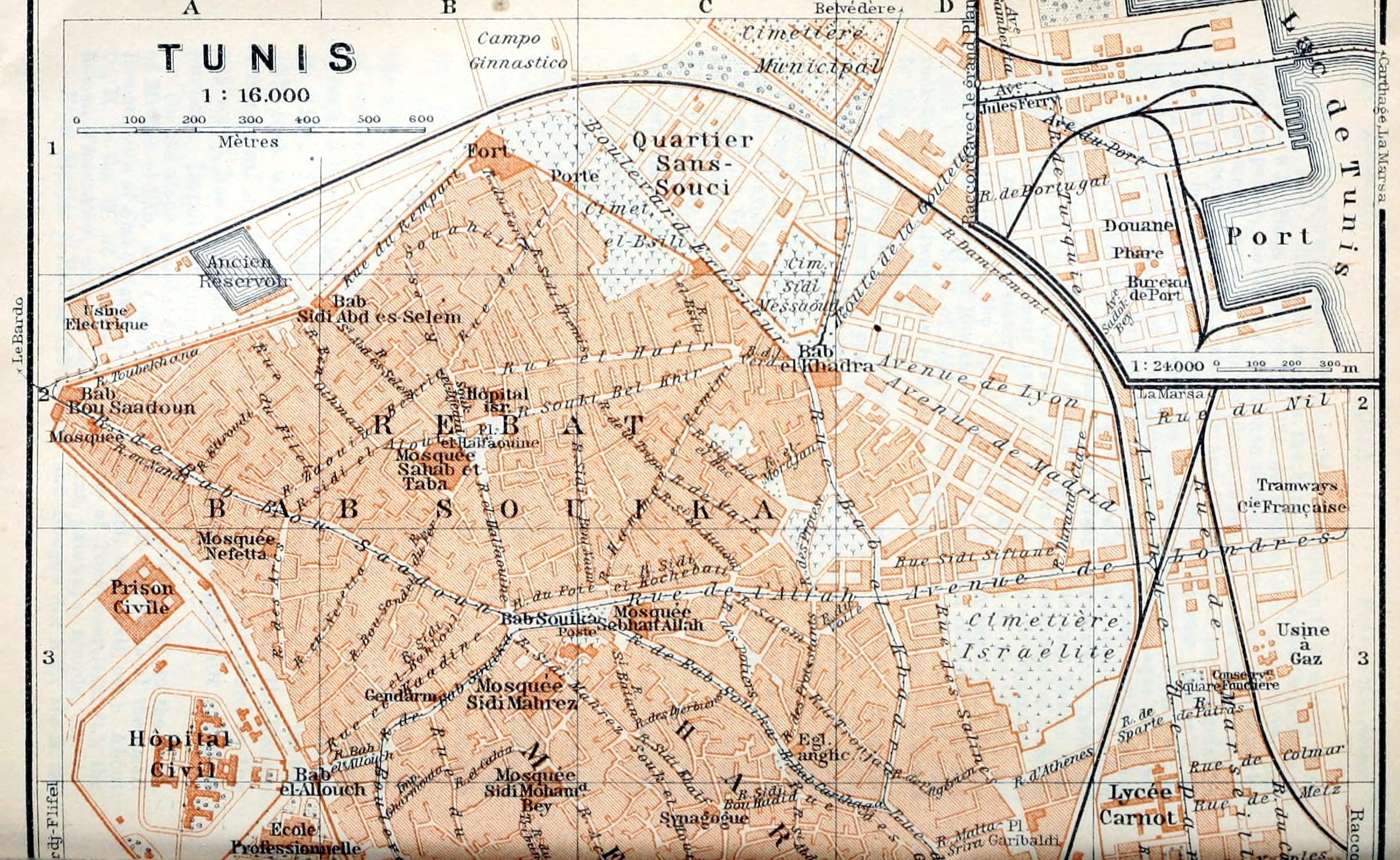

329The train now proceeds, generally somewhat apart from the tortuous stream, at the foot of bare hills (Jebel Heïdous, Jebel Lansarine, etc.), to (119 M.) El-Heri and (122½ M.) Bordj Toum.
329The train now moves forward, typically a bit away from the winding river, at the base of bare hills (Jebel Heïdous, Jebel Lansarine, etc.), to (119 M.) El-Heri and (122½ M.) Bordj Toum.
133 M. Tebourba (133 ft.; Hôt. Cafort, R. 2, B. ½, D. 2½, pens. 6 fr.; pop. 2000) is pleasantly situated among olive-groves. On a height (164 ft.) crowned with the kubba of Sidi Ras-Allah, between the village and the Medjerda, are the scanty ruins of the Roman town of Thuburbo Minus. About ½ hr. to the S. of Tebourba lies the dam or *Bridge of El-Bathan, originally Roman, but restored to form a reservoir for watering the olive-trees. Adjacent are a small manufactory of chechias (a kind of fez) and barracks. Near Tebourba are large quarries of gypsum.
133 M. Tebourba (133 ft.; Hôt. Cafort, R. 2, B. ½, D. 2½, pens. 6 fr.; pop. 2000) is nicely located among olive groves. On a rise (164 ft.) topped with the kubba of Sidi Ras-Allah, between the village and the Medjerda, are the sparse ruins of the Roman town of Thuburbo Minus. About a half-hour to the south of Tebourba lies the dam or *Bridge of El-Bathan, originally Roman, but restored to create a reservoir for irrigating the olive trees. Nearby, there's a small factory for chechias (a type of fez) and barracks. Close to Tebourba are large gypsum quarries.
139 M. Djedeïda, junction for Bizerta (R. 54), with a barrage and an agricultural school and farm of the Alliance Israélite.
139 M. Djedeïda, junction for Bizerte (R. 54), features a dam and an agricultural school and farm run by the Alliance Israélite.
The train crosses the Medjerda and, at the arches of the *Aqueduct of Carthage (p. 348), still 7½ M. long, the watershed between the Medjerda valley and the undulating plain of Tunis.
The train crosses the Medjerda and, at the arches of the *Aqueduct of Carthage (p. 348), still 7½ M. long, the watershed between the Medjerda valley and the undulating plain of Tunis.
148 M. La Manouba (p. 342). We then pass Kassar-Saïd (on the left; p. 342) and the (150½ M.) Bardo (p. 339), and for a short time skirt the N. side of the Sebkha es-Sedjoumi (p. 332). Lastly the train rounds the S. edge of the old town (Rebat Bab-Djazira, p. 337) and passes close to the Manoubia Hill (p. 339) and the Zaouïa Sidi Bel-Hassen (p. 339).
148 M. La Manouba (p. 342). We then pass Kassar-Saïd (on the left; p. 342) and the (150½ M.) Bardo (p. 339), and for a short time skirt the N. side of the Sebkha es-Sedjoumi (p. 332). Lastly the train rounds the S. edge of the old town (Rebat Bab-Djazira, p. 337) and passes close to the Manoubia Hill (p. 339) and the Zaouïa Sidi Bel-Hassen (p. 339).
154 M. Tunis (Gare du Sud, see below).
154 M. Tunis (Gare du Sud, see below).
52. Tunis.
Arrival by Sea. The Quay where almost all the steamers (p. 331) are berthed is 10–15 min. from the hotels. The Douane is close by. It is best to entrust luggage at once to the hotel servants; if a porter (hamal) is required his charge should be asked (usually 10 c. for small packages, and 25 c. for each trunk carried to the cab or omnibus). Cab (into the town 1 fr., each trunk 15 c.) and tramway (No. 1), see p. 330.
Arrival by Water. The Quay where almost all the steamers (p. 331) are berthed is 10–15 min. from the hotels. The Douane is close by. It is best to entrust luggage at once to the hotel servants; if a porter (hamal) is required his charge should be asked (usually 10 c. for small packages, and 25 c. for each trunk carried to the cab or omnibus). Cab (into the town 1 fr., each trunk 15 c.) and tramway (No. 1), see p. 330.
Railway Station. Gare du Sud (Pl. E, 5; Restaurant), Place de la Gare (Rue es-Sadikia).—Railway and sleeping-car office in the town, König & Co. (p. 331).
Railway Station. Gare du Sud (Pl. E, 5; Restaurant), Place de la Gare (Rue es-Sadikia).—Railway and sleeping-car office in the town, König & Co. (p. 331).
Hotels (comp. p. 324; often full in Feb.-April). *Tunisia Palace Hotel (Pl. c; E, 4, 5), Avenue de Carthage, behind the Casino Municipal (p. 331), with a small garden, R. 4–10, B. 1½, déj. 5, D. 7, pens. 13–20, omn. 1½–2 fr.; *Hôt. de Paris & Impérial (Pl. a; D, 5), Rue al-Djazira 23bis, R. 3–6, B. 1½, déj. 3½–4, D. 4–5, pens. 9–16, omn. without luggage 1 fr.—*Grand-Hôtel (Pl. b; D, 4), Avenue de France, R. 3½–6, B. 1½, déj. 3½, D. 4½, pens, from 10, omn. 1 fr.; *Hôt. St. Georges, Avenue de Paris (N. of Pl. E, 2), near the Belvedere Park (p. 338), suitable for some stay, R. 3–4, B. 1½, déj. 3, D. 4, pens. 9–12½ fr. (with dépendance Hôt. Suisse, moderate); Hôt. de France (Pl. d; D, 5), Rue Léon-Roches 8, quiet site, pens. 9–11, omn. 1 fr.—Plainer: Hôt. Eymon (Pl. e, D 4; ‘Gigino’), Rue de l’Eglise 1, corner of Place de la Bourse, R. 3–4, B. ¾, déj. or D. 2½, pens. 8 fr., good; Tunis Hotel & de Genève (Pl. f; D, 4, 5), Rue d’Italie 12, R. 2½–6, B. ¾, déj. 2–2½, D. 2½–3, omn. 1–1¼ fr.; Hôt. d’Angleterre, Ave. Jules-Ferry 37, R. 2½–5, B. ¾, déj. 2, D. 2½, pens. 7½, omn. 1¼ fr.; 330Hôt. Maison Dorée, Rue de Hollande 10 (Pl. E, 5), with restaurant, similar charges; Hôt. Moderne (Pl. g; D, 4), Rue de Constantine 12, corner of Rue de Bône, R. from 3½, déj. or D. 3, pens. from 9½ fr.; Hôt. de la Poste, Rue d’Espagne 5 (Pl. D, 5).—Hôtels Garnis. Hôt. Bellevue (Pl. h; D, 4), Rue es-Sadikia 1; Hôt. Régence (dépendance of the Hôt. Eymon), Ave. de France, R. 3–8, B. 1 fr.; Splendid Hotel, Ave. Jules-Ferry 74; Royal Hotel, Rue d’Espagne 19, R. from 3 fr.; Hôt. Central, Ave. de Paris 8; Family Hotel, Rue d’Allemagne 15 (Pl. D, 5), near the marché (p. 333), plain.—Furnished Rooms (20–70 fr. per month) abound.
Hotels (comp. p. 324; often full in Feb.-April). *Tunisia Palace Hotel (Pl. c; E, 4, 5), Avenue de Carthage, behind the Casino Municipal (p. 331), with a small garden, R. 4–10, B. 1½, déj. 5, D. 7, pens. 13–20, omn. 1½–2 fr.; *Hotel de Paris & Imperial (Pl. a; D, 5), Rue al-Djazira 23bis, R. 3–6, B. 1½, déj. 3½–4, D. 4–5, pens. 9–16, omn. without luggage 1 fr.—*Grand Hotel (Pl. b; D, 4), Avenue de France, R. 3½–6, B. 1½, déj. 3½, D. 4½, pens, from 10, omn. 1 fr.; *Hotel St. Georges, Avenue de Paris (N. of Pl. E, 2), near the Belvedere Park (p. 338), suitable for some stay, R. 3–4, B. 1½, déj. 3, D. 4, pens. 9–12½ fr. (with dépendance Hotel Switzerland, moderate); Hotel de France (Pl. d; D, 5), Rue Léon-Roches 8, quiet site, pens. 9–11, omn. 1 fr.—Plainer: Hôtel Eymon (Pl. e, D 4; ‘Gigino’), Rue de l’Eglise 1, corner of Place de la Bourse, R. 3–4, B. ¾, déj. or D. 2½, pens. 8 fr., good; Tunis Hotel & Geneva Hotel (Pl. f; D, 4, 5), Rue d’Italie 12, R. 2½–6, B. ¾, déj. 2–2½, D. 2½–3, omn. 1–1¼ fr.; Hotel d'Angleterre, Ave. Jules-Ferry 37, R. 2½–5, B. ¾, déj. 2, D. 2½, pens. 7½, omn. 1¼ fr.; 330Gold House, Rue de Hollande 10 (Pl. E, 5), with restaurant, similar charges; Hotel. Modern (Pl. g; D, 4), Rue de Constantine 12, corner of Rue de Bône, R. from 3½, déj. or D. 3, pens. from 9½ fr.; Post Office Hotel, Rue d’Espagne 5 (Pl. D, 5).—Hôtels Garnis. Hotel Bellevue (Pl. h; D, 4), Rue es-Sadikia 1; Hotel Regency (dépendance of the Hôt. Eymon), Ave. de France, R. 3–8, B. 1 fr.; Elegant Hotel, Ave. Jules-Ferry 74; Royal Hotel, Rue d’Espagne 19, R. from 3 fr.; Hotel. Central, Ave. de Paris 8; Family-Friendly Hotel, Rue d’Allemagne 15 (Pl. D, 5), near the marché (p. 333), plain.—Furnished Rooms (20–70 fr. per month) abound.
Cafés. Café du Casino, in the palmarium of the Casino Municipal (p. 331), with a summer terrace in the Ave. Jules-Ferry; Café-Restaurant de Tunis, Ave. de France 2, in the Hôt. Bellevue, much frequented; Café de Paris, same street, No. 16. Arabian cafés (p. 174) in the Halfaouine quarter (Pl. B, 2), at the Bab Djedid (Pl. C, 6), etc.—Confectioners. Engerer, Place de la Bourse 1; Wagner & Co., Rue d’Italie 24, and Ave. de Paris 8; Montelateci, Ave. de France 7.
Cafés. Café du Casino, in the palmarium of the Casino Municipal (p. 331), with a summer terrace in the Ave. Jules-Ferry; Café-Restaurant de Tunis, Ave. de France 2, in the Hôt. Bellevue, much frequented; Café de Paris, same street, No. 16. Arabian cafés (p. 174) in the Halfaouine quarter (Pl. B, 2), at the Bab Djedid (Pl. C, 6), etc.—Candy makers. Engerer, Place de la Bourse 1; Wagner & Co., Rue d’Italie 24, and Ave. de Paris 8; Montelateci, Ave. de France 7.
Restaurants. *Brasserie du Phénix, Ave. Jules-Ferry 74, in the Splendid Hotel (see above); Café-Restaurant de Tunis, see above; Salvarelli, Ave. de France, adjoining the Grand-Hôtel; Maxéville, Ave. Jules-Ferry 63 (déj. or D. 1½ fr.); Maison Dorée, in the hotel (see above); Restaurant du Rosbif, Ave. Jules-Ferry 56; Restaurant de la Poste, Rue d’Angleterre 8.
Restaurants. *Brasserie du Phénix, 74 Ave. Jules-Ferry, in the Splendid Hotel (see above); Café-Restaurant de Tunis, see above; Salvarelli, Ave. de France, next to the Grand-Hôtel; Maxéville, 63 Ave. Jules-Ferry (breakfast or dinner 1.50 fr.); Maison Dorée, in the hotel (see above); Restaurant du Rosbif, 56 Ave. Jules-Ferry; Restaurant de la Poste, 8 Rue d’Angleterre.
| Carriages. | Voiture de Place | Voiture de Remise | ||
|---|---|---|---|---|
| With one horse | With two horses | |||
| (2–3 pers.) | (4 pers.) | |||
| Drive (course) in the town (petite banlieue) | 0.80 | 0.90 | 1.— | 1.60 |
| Outside the town, up to 8 kilomètres (5 M.) | 2.50 | 2.70 | 3.— | 4.50 |
| Hour in the town | 1.30 | 1.50 | 1.80 | 2.40 |
| Hour outside the town | 1.80 | 2.— | 2.40 | 3.20 |
| Day (12 hrs.) | 12.— | 12.— | 15.— | 20.— |
The chief limits of the inner town are the Bardo and the Belvedere Park. From 10 p.m. to 7 a.m. (or in April-Sept. 11–5) a fare and a half is charged. During festivals and races, and also for long drives, bargain advisable. Small packages free; trunk 15 c.—There are also Taximeter Motor Cabs (comp. tariff).
The main boundaries of the inner city are the Bardo and Belvedere Park. From 10 p.m. to 7 a.m. (or from April to September, 11 a.m. to 5 p.m.), a fare and a half is charged. During festivals and races, and for long drives, it's a good idea to negotiate the price. Small packages are free; trunk is 15 c.—There are also Taxi Meter Cars (compare rates).
Motor Cars. Auto-Palace, Rue d’Autriche Prolongée 3; Garage Peyrard, Rue de Belgique 10; Tunisienne Automobile, Rue de Grèce.
Motor Cars. Auto-Palace, 3 Rue d’Autriche Prolongée; Garage Peyrard, 10 Rue de Belgique; Tunisienne Automobile, Rue de Grèce.
Tramways (fares by zones, from 5 c. upwards; also transfer-tickets), from 6 a.m. to 9 p.m.: 1. Porte de France (Pl. D, 4), Ave. Jules-Ferry (Pl. E, 4), Ave. du Port, Harbour.—2. Porte de France, Rue al-Djazira (Pl. D, 5, 6), Ave. Bab-Djedid (Pl. D, C, 6), Place de la Kasba (Pl. B, 5).—3. Porte de France, Rue des Maltais (Pl. D, 4), Place Bab-Souika (Pl. B, C, 3), Kasba.—4. Rue al-Djazira (Rue d’Algérie; Pl. D, 6), Rue es-Sadikia (Pl. D, 5; Gare du Sud), Rue de Rome (Pl. D, 4), Ave. de Paris (Pl. E, 4, 3), Place Bab-Souika, Bab Bou-Saâdoun (Pl. A, 2).—5. Place Bab-Souika (Pl. B, C, 3), Bab Bou-Saâdoun, Bardo (p. 339; every ¼ hr., 15 c.), La Manouba (p. 342; every ½ hr., 30 c.).—6. Porte de France, Rue des Maltais (Pl. D, 4), Bab el-Khadra (Pl. C, 2), Cimetière Municipal, Belvedere Park (p. 338; Ave. Carnot, 15 c.).—7. Rue de Rome (Pl. D, 4), Ave. de Paris (Pl. E, 4–2), Belvedere Park (Rond-Point; every 10 or 15 min., 15 c.; on week-days there and back 25 c.), Ariana (p. 338; every ½ hr., 30 c.).—8. Ave. de France (Pl. D, 4), Ave. de Carthage (Pl. E, 5–7), Bab Alleoua (Pl. E, 7), Abattoirs (to the S. of Pl. E, 7).—For the electric tramways to Carthage and La Marsa, see p. 343.
Tramways (fares by zones, from 5 c. upwards; also transfer-tickets), from 6 a.m. to 9 p.m.: 1. Porte de France (Pl. D, 4), Ave. Jules-Ferry (Pl. E, 4), Ave. du Port, Harbour.—2. Porte de France, Rue al-Djazira (Pl. D, 5, 6), Ave. Bab-Djedid (Pl. D, C, 6), Place de la Kasba (Pl. B, 5).—3. Porte de France, Rue des Maltais (Pl. D, 4), Place Bab-Souika (Pl. B, C, 3), Kasba.—4. Rue al-Djazira (Rue d’Algérie; Pl. D, 6), Rue es-Sadikia (Pl. D, 5; Gare du Sud), Rue de Rome (Pl. D, 4), Ave. de Paris (Pl. E, 4, 3), Place Bab-Souika, Bab Bou-Saâdoun (Pl. A, 2).—5. Place Bab-Souika (Pl. B, C, 3), Bab Bou-Saâdoun, Bardo (p. 339; every ¼ hr., 15 c.), La Manouba (p. 342; every ½ hr., 30 c.).—6. Porte de France, Rue des Maltais (Pl. D, 4), Bab el-Khadra (Pl. C, 2), Cimetière Municipal, Belvedere Park (p. 338; Ave. Carnot, 15 c.).—7. Rue de Rome (Pl. D, 4), Ave. de Paris (Pl. E, 4–2), Belvedere Park (Rond-Point; every 10 or 15 min., 15 c.; on week-days there and back 25 c.), Ariana (p. 338; every ½ hr., 30 c.).—8. Ave. de France (Pl. D, 4), Ave. de Carthage (Pl. E, 5–7), Bab Alleoua (Pl. E, 7), Abattoirs (to the S. of Pl. E, 7).—For the electric tramways to Carthage and La Marsa, see p. 343.
Post & Telegraph Office (Pl. D, 5), Rue d’Italie 30; branches on the quay and in the Place Bab-Souika.
Post & Telegraph Office (Pl. D, 5), 30 Italy Street; branches on the waterfront and in Bab-Souika Square.
331Steamboat Agents. For the Comp. Gén. Transatlantique (RR. 21, 22), Banque de Tunisie, Rue es-Sadikia 3, and on the Quai Ouest; for the Società Nazionale (RR. 25, 26, 64), Florio, Rue d’Alger 1; for the Comp. de Navigation Mixte (RR. 21, 26, 64), Ave. Jules-Ferry and Quai Ouest; for the Hamburg-American Line, the Hungarian Adria, and the German Levant Line, Siebert & Co., Rue d’Italie 5bis; for the North German Lloyd, Heckmann, see below.
331Steamboat Agents. For the Comp. Gén. Transatlantique (RR. 21, 22), Banque de Tunisie, 3 Rue es-Sadikia, and on Quai Ouest; for the Società Nazionale (RR. 25, 26, 64), Florio, 1 Rue d’Alger; for the Comp. de Navigation Mixte (RR. 21, 26, 64), Avenue Jules-Ferry and Quai Ouest; for the Hamburg-American Line, the Hungarian Adria, and the German Levant Line, Siebert & Co., 5bis Rue d’Italie; for the North German Lloyd, Heckmann, see below.
Tourist Offices. Eisen (travel and sport), Rue Léon-Roches 6; König & Co., Rue es-Sadikia; Pernull & Myddleton, Ave. Jules-Ferry 39; R. Heckmann (Universal Tourist Office), Ave. de Carthage, opposite Tunisia Palace Hotel; Lubin, Ave. de France 5.—Comité d’Hivernage, Ave. de Carthage 8.
Tourist Offices. Eisen (travel and sports), 6 Léon-Roches Street; König & Co., es-Sadikia Street; Pernull & Myddleton, 39 Jules-Ferry Avenue; R. Heckmann (Universal Tourist Office), Carthage Avenue, across from Tunisia Palace Hotel; Lubin, 5 France Avenue.—Comité d’Hivernage, 8 Carthage Avenue.
Consuls. British Consul-General, E. J. L. Berkeley, Place de la Bourse (Pl. D, 4); vice-consuls, Chas. A. Goodwin, R. Schembri.—U. S. Vice-Consul, A. J. Proux, Ave. de France.
Consuls. British Consul-General, E. J. L. Berkeley, Place de la Bourse (Pl. D, 4); vice-consuls, Chas. A. Goodwin, R. Schembri.—U.S. Vice-Consul, A. J. Proux, Ave. de France.
Physicians. Dr. Domela, Ave. Jules-Ferry 72; Dr. Valetta, Rue d’Espagne; Dr. Zammit, Rue Amilcar (all three speak English); Dr. Jaeggy, Rue d’Autriche; Mlle. Dr. Gordon, Rue de Rome 18.—Chemist. Heyler, Ave. Jules-Ferry 54 (Théâtre Rossini, Pl. E, 4).
Doctors. Dr. Domela, 72 Jules-Ferry Avenue; Dr. Valetta, Spain Street; Dr. Zammit, Amilcar Street (all three speak English); Dr. Jaeggy, Austria Street; Ms. Dr. Gordon, 18 Rome Street.—Pharmacy. Heyler, 54 Jules-Ferry Avenue (Rossini Theatre, Pl. E, 4).
Baths. Dublineau, Rue d’Allemagne 17 (Pl. D, 5; well fitted up; bath 1½, Turkish 3 fr.); Bains Français, Rue de Suisse 8; Bains Maures (comp. p. 175), Ave. Bab-Menara.
Baths. Dublineau, Rue d’Allemagne 17 (Pl. D, 5; well fitted up; bath 1½, Turkish 3 fr.); Bains Français, Rue de Suisse 8; Bains Maures (comp. p. 175), Ave. Bab-Menara.
Banks (comp. p. 174). Banque de l’Algérie, Rue de Rome 18; Comp. Algérienne, Rue de Rome; Banque de Tunisie, Rue es-Sadikia 3; Comptoir d’Escompte de Paris, Ave. de France; Cooperativa Italiana, Rue es-Sadikia 7; Krieger, Rue al-Djazira 45.
Banks (comp. p. 174). Banque de l’Algérie, Rue de Rome 18; Comp. Algérienne, Rue de Rome; Banque de Tunisie, Rue es-Sadikia 3; Comptoir d’Escompte de Paris, Ave. de France; Cooperativa Italiana, Rue es-Sadikia 7; Krieger, Rue al-Djazira 45.
Goods Agents. Meyer, Porte de France 35; Dana, Rue es-Sadikia 9.
Goods Agents. Meyer, 35 Porte de France; Dana, 9 Rue es-Sadikia.
Booksellers. Niérat & Fortin, Ave. de France 15, and Saliba, No. 17.—Photographs (and photographic materials). Lehnert & Landrock, Ave. de France 17, and Garrigues, No. 9; Neuer, Rue Léon-Roches 6; Vella, Rue d’Allemagne 4.—Newspapers. Dépêche Tunisienne, Tunisie Française, Unione (Ital. and Fr.).—Shop for European goods, Magasin Général, Ave. de France 22 (fixed prices). Oriental goods at the Musée Ahmed Djamal, Souk el-Attârîn 11 and Rue d’Autriche 108; Pohoomull Frères, Ave. de France 17. The Oriental articles in the Souks (pp. 335–337) and even the fezes (chechia) are mostly of European make and may be bought cheaper at home. Important purchases should not be made without the aid of a friend who knows the country and its ways (bargaining necessary). The services of touts, guides, and hotel servants should be declined, as they tend to raise prices.
Booksellers. Niérat & Fortin, Ave. de France 15, and Saliba, No. 17.—Photos (and photographic materials). Lehnert & Landrock, Ave. de France 17, and Garrigues, No. 9; Neuer, Rue Léon-Roches 6; Vella, Rue d’Allemagne 4.—News articles. Dépêche Tunisienne, Tunisie Française, Unione (Ital. and Fr.).—Store for European goods, Magasin Général, Ave. de France 22 (fixed prices). Oriental goods at the Musée Ahmed Djamal, Souk el-Attârîn 11 and Rue d’Autriche 108; Pohoomull Frères, Ave. de France 17. The Oriental articles in the Markets (pp. 335–337) and even the fezes (chechia) are mostly of European make and may be bought cheaper at home. Important purchases should not be made without the aid of a friend who knows the country and its ways (bargaining necessary). The services of touts, guides, and hotel servants should be declined, as they tend to raise prices.
Theatres. Théâtre du Casino Municipal, in the Casino Municipal (see below), entrance in the Ave. Jules-Ferry, for operas and operettas, 15th Nov. to 15th April; Théâtre Rossini (Pl. E, 4), Ave. Jules-Ferry 48, for Italian and French dramas.—Casino Municipal (Pl. E, 4), Ave. de Carthage 1, with hall for concerts and varieties (‘Palmarium’), a summer terrace, card-rooms, and American bar. The Pavillon du Belvédère, in the park of the Belvedere (p. 338), is the summer casino of the same company.—Band on Sun. and Thurs. afternoons, Place de la Résidence; on Wed. in front of the Cercle Militaire.
Theatres. Théâtre du Casino Municipal, in the Casino Municipal (see below), entrance in the Ave. Jules-Ferry, for operas and operettas, 15th Nov. to 15th April; Théâtre Rossini (Pl. E, 4), Ave. Jules-Ferry 48, for Italian and French dramas.—Municipal Casino (Pl. E, 4), Ave. de Carthage 1, with hall for concerts and varieties (‘Palmarium’), a summer terrace, card-rooms, and American bar. The Pavillon du Belvédère, in the park of the Belvedere (p. 338), is the summer casino of the same company.—Group on Sun. and Thurs. afternoons, Place de la Résidence; on Wed. in front of the Cercle Militaire.
English Church. St. George’s (‘Egl. anglic.’; Pl. C, 3), Rue Bab-Carthagène 39, service at 10.15 a.m.
English Church. St. George’s (‘Egl. anglic.’; Pl. C, 3), Rue Bab-Carthagène 39, service at 10:15 a.m.
Sights. Bardo Museum, same as Musée Alaoui, see below.
Sights. Bardo Museum, also known as Musée Alaoui, see below.
Bardo Palace (p. 340), week-days, at any hour; tickets at the Musée Alaoui (comp, below).
Bardo Palace (p. 340), week-days, at any hour; tickets at the Musée Alaoui (comp, below).
Bibliothèque Française (p. 333), week-days 9–11 and 2–4 (in summer 8–11 only).
Bibliothèque Française (p. 333), week-days 9–11 and 2–4 (in summer 8–11 only).
Dâr el-Bey (p. 336), daily, 9–11 and 3–5; fee ½–1 fr.
Dâr el-Bey (p. 336), daily, 9–11 and 3–5; fee ½–1 fr.
Jardin d’Essais (p. 338), daily 8–11 and 1–5 (April-Oct. 7–11 and 3–6).
Jardin d’Essais (p. 338), daily 8–11 and 1–5 (April-Oct. 7–11 and 3–6).
Musée Alaoui (p. 340), daily except Mon. and great Catholic festivals 9.30–11.30 and 1–4 (16th Feb. to 15th Oct. 2–5), 1 fr. (Sun. free); the same ticket admits to the Bardo Palace also, if visited on the same day.
Musée Alaoui (p. 340), daily except Mon. and great Catholic festivals 9.30–11.30 and 1–4 (16th Feb. to 15th Oct. 2–5), 1 fr. (Sun. free); the same ticket admits to the Bardo Palace also, if visited on the same day.
332Two Days. 1st. Forenoon, Ave. Jules-Ferry and Ave. de France (p. 333); walk through the Souks of the Medina (p. 335) and the adjoining Mohammedan Quarters (p. 334); visit to Place el-Halfaouine (p. 337). Afternoon, Bardo Museum (p. 340) or Belvedere Park (p. 338), or, by carriage, both.—2nd. Excursion to Carthage, see R. 53.
332Two Days. 1st. Forenoon, Ave. Jules-Ferry and Ave. de France (p. 333); walk through the Souks of the Medina (p. 335) and the adjoining Mohammedan Quarters (p. 334); visit to Place el-Halfaouine (p. 337). Afternoon, Bardo Museum (p. 340) or Belvedere Park (p. 338), or, by carriage, both.—2nd. Excursion to Carthage, see R. 53.
Tunis, Ital. Túnisi, capital of the Régence de Tunis, and seat of the French Resident-General (p. 323) and of the Mohammedan university, is the largest city in N. Africa after Cairo and Alexandria, and vies with Sfax as a most important harbour. Population about 200,000, of whom about 115,000 are Mohammedans, 22,500 Jews, 41,000 Italians, 14,000 French, 5400 Maltese, and 250 Greeks.
Tunis, Ital. Túnisi, capital of the Régence de Tunis, and seat of the French Resident-General (p. 323) and of the Mohammedan university, is the largest city in N. Africa after Cairo and Alexandria, and vies with Sfax as a most important harbour. Population about 200,000, of whom about 115,000 are Mohammedans, 22,500 Jews, 41,000 Italians, 14,000 French, 5400 Maltese, and 250 Greeks.
The town lies in 36°47′ N. lat. and 10°10′ W. long., on the E. margin of the narrow tongue of land (rising to 190 ft.) between the Lac de Tunis (or Lake Bahira, p. 129) and the small salt-lake Sebkha es-Sedjoumi, an old lagoon. The central part of the sea of houses composing the old town is the Medina, the oldest Moorish quarter, built largely out of the ruins of Thunes, Carthage, and Utica, and now the chief focus of trade and industry. Adjacent, to the N. and S., are two poor quarters, also chiefly Mohammedan, the Rebat Bab-Souika and Rebat Bab-Djazira, formerly N. and E. suburbs. The monotonous European new town in the low ground to the E. of the Medina, exposed in summer to the exhalations of Lake Bahira, is gradually extending from the Porte de France (formerly Bab el-Bahar, sea-gate) towards the harbour. On the brow of the hill to the W. of the old town are the old Kasba and most of the public buildings, almost all built under the French protectorate. Some of these lie outside the Turkish town-wall, once 6000 yds. long, erected in the 17th century.
The town lies in 36°47′ N. lat. and 10°10′ W. long., on the E. margin of the narrow tongue of land (rising to 190 ft.) between the Lac de Tunis (or Lake Bahira, p. 129) and the small salt-lake Sebkha es-Sedjoumi, an old lagoon. The central part of the sea of houses composing the old town is the Medina, the oldest Moorish quarter, built largely out of the ruins of Thunes, Carthage, and Utica, and now the chief focus of trade and industry. Adjacent, to the N. and S., are two poor quarters, also chiefly Mohammedan, the Rebat Bab-Souika and Rebat Bab-Djazira, formerly N. and E. suburbs. The monotonous European new town in the low ground to the E. of the Medina, exposed in summer to the exhalations of Lake Bahira, is gradually extending from the Porte de France (formerly Bab el-Bahar, sea-gate) towards the harbour. On the brow of the hill to the W. of the old town are the old Kasba and most of the public buildings, almost all built under the French protectorate. Some of these lie outside the Turkish town-wall, once 6000 yds. long, erected in the 17th century.
Tunis, the ancient Thunes, a Berber name given to an earlier Phœnician colony, appears in history in 508 B.C. as an ally of Carthage. In 395 it was destroyed by rebellious Berber tribes. It was from Thunes that Agathocles (p. 163) and Regulus (p. 345) advanced against Carthage, and here, after the first Punic war, the discontented mercenaries from Sicca Veneria (p. 360) established themselves. Tunis was probably destroyed by the Romans at the same time as Carthage (146 B.C.) and rebuilt later. After the downfall of Carthage Utica (p. 353) entered into the heritage of her proud neighbour, but for a short time only; for from 29 B.C. onwards Carthage resumed her ancient supremacy and continued to flourish down to her second destruction in 698 A.D. This time Tunis was her natural successor. But the nomadic Arabs, being ignorant of navigation, and the Aglabides (p. 323) preferred Kairwan (p. 372), which had recently been founded in the heart of the Tunisian steppe; and the succeeding Fatimite and Zirite dynasties favoured the Sahel, with Mehdia (p. 369) as their new capital, to the detriment of N. Tunisia. At length, under the Hafsides (1206–1573; p. 323), Tunis became the capital, and rapidly grew to be the greatest and fairest city in the land, as well as a zealous promoter of the glorious Moorish art and science of the 13th and 14th centuries. The most distinguished of the Hafside sovereigns was Abû Abdallah Mohammed el-Mostanser Billah, who in 1270 defended his capital successfully against Louis IX., the Saint (p. 346). After the decline of that dynasty at the close of the 15th cent. and the capture of Tunis by Kheireddin (p. 221) in 1534, the city was attacked by the Spaniards in three different campaigns (p. 323), and was conquered four times by the 333Turks and the Algerians (in 1569, 1573, 1689, and 1757); yet in the 17th and 18th centuries, thanks to its Oriental trade and the booty of its pirates, it again enjoyed great prosperity.
Tunis, the ancient Thunes, a Berber name given to an earlier Phœnician colony, appears in history in 508 B.C. as an ally of Carthage. In 395 it was destroyed by rebellious Berber tribes. It was from Thunes that Agathocles (p. 163) and Regulus (p. 345) advanced against Carthage, and here, after the first Punic war, the discontented mercenaries from Sicca Veneria (p. 360) established themselves. Tunis was probably destroyed by the Romans at the same time as Carthage (146 B.C.) and rebuilt later. After the downfall of Carthage Utica (p. 353) entered into the heritage of her proud neighbour, but for a short time only; for from 29 B.C. onwards Carthage resumed her ancient supremacy and continued to flourish down to her second destruction in 698 A.D. This time Tunis was her natural successor. But the nomadic Arabs, being ignorant of navigation, and the Aglabides (p. 323) preferred Kairwan (p. 372), which had recently been founded in the heart of the Tunisian steppe; and the succeeding Fatimite and Zirite dynasties favoured the Sahel, with Mehdia (p. 369) as their new capital, to the detriment of N. Tunisia. At length, under the Hafsides (1206–1573; p. 323), Tunis became the capital, and rapidly grew to be the greatest and fairest city in the land, as well as a zealous promoter of the glorious Moorish art and science of the 13th and 14th centuries. The most distinguished of the Hafside sovereigns was Abû Abdallah Mohammed el-Mostanser Billah, who in 1270 defended his capital successfully against Louis IX., the Saint (p. 346). After the decline of that dynasty at the close of the 15th cent. and the capture of Tunis by Kheireddin (p. 221) in 1534, the city was attacked by the Spaniards in three different campaigns (p. 323), and was conquered four times by the 333Turks and the Algerians (in 1569, 1573, 1689, and 1757); yet in the 17th and 18th centuries, thanks to its Oriental trade and the booty of its pirates, it again enjoyed great prosperity.
The only mediæval buildings in the old town which have survived all these vicissitudes are three mosques, now much modernized. The distinctive character of the present town is of Mauro-Turkish origin. Those who cross the threshold of the Orient here for the first time will be specially struck with the narrow and crooked lanes of the Mohammedan quarters, only 12–16 ft. wide, with the motley crowd in the Souks (p. 335), and with the picturesque concourse of all the tribes of N. Africa and the Sahara. The poor Jewish quarter (p. 337) is less interesting. The strange costume of the women, with their kufias or sugar-loaf hats, loose jackets, and tight-fitting trousers, is now rarely seen except on members of the older generation, while the pretty, old-fashioned costume of the girls is a thing of the past.
The only mediæval buildings in the old town which have survived all these vicissitudes are three mosques, now much modernized. The distinctive character of the present town is of Mauro-Turkish origin. Those who cross the threshold of the Orient here for the first time will be specially struck with the narrow and crooked lanes of the Mohammedan quarters, only 12–16 ft. wide, with the motley crowd in the Souks (p. 335), and with the picturesque concourse of all the tribes of N. Africa and the Sahara. The poor Jewish quarter (p. 337) is less interesting. The strange costume of the women, with their kufias or sugar-loaf hats, loose jackets, and tight-fitting trousers, is now rarely seen except on members of the older generation, while the pretty, old-fashioned costume of the girls is a thing of the past.
John Howard Payne (b. 1792), author of ‘Home, Sweet Home’, was United States consul at Tunis from 1842 until his death in 1852.
John Howard Payne (b. 1792), the writer of ‘Home, Sweet Home’, served as the United States consul in Tunis from 1842 until his death in 1852.
a. The New Town.
From the Harbour (Port; see inset map, Pl. E, 1), which together with the Bahira Canal (p. 129) was constructed in 1888–96, the short Avenue du Port (tramway No. 1, p. 330) leads through the Piccola Sicilia, a group of workmen’s huts, into the town, ending at the bronze statue of Jules Ferry (1832–93), the French statesman who brought about the occupation of Tunisia.
From the Harbour (Port; see inset map, Pl. E, 1), which together with the Bahira Canal (p. 129) was constructed in 1888–96, the short Avenue du Port (tramway No. 1, p. 330) leads through the Piccola Sicilia, a group of workmen’s huts, into the town, ending at the bronze statue of Jules Ferry (1832–93), the French statesman who brought about the occupation of Tunisia.
The Avenue Jules-Ferry (Pl. E, 4), or Avenue de la Marine, the finest street in the new town, 66 yds. wide and 710 yds. long, is planted with double avenues of fig-trees. On the left, just beyond the divergence, to the right and left, of the unfinished Avenue de Paris (p. 338) and Avenue de Carthage (Pl. E, 5–7), which together are 2¼ M. long, rises the Casino Municipal (Pl. E, 4; p. 331).
The Jules Ferry Avenue (Pl. E, 4), or Marine Avenue, the finest street in the new town, 66 yds. wide and 710 yds. long, is planted with double avenues of fig-trees. On the left, just beyond the divergence, to the right and left, of the unfinished Avenue de Paris (p. 338) and Avenue de Carthage (Pl. E, 5–7), which together are 2¼ M. long, rises the Casino Municipal (Pl. E, 4; p. 331).
The Ave. Jules-Ferry ends at the Place de la Résidence (Pl. D, 4; band, see p. 331), the centre of the new town. To the left, on the S. side, rises the Palais de la Résidence (Pl. D, E, 4), or Maison de France, built in 1856–60 for the French consulate (see p. 334), and tastefully remodelled in 1890–2 by Dupertuys as a dwelling for the resident-general. The beautiful garden is not accessible. Opposite the Residence is the Cathedral (Pl. D, 4); erected in 1893–7. The Rue es-Sadikia leads to the S. from the W. end of the square to the Gare du Sud (p. 329).
The Ave. Jules-Ferry ends at the Residence Square (Pl. D, 4; band, see p. 331), the centre of the new town. To the left, on the S. side, rises the Palais de la Résidence (Pl. D, E, 4), or Maison de France, built in 1856–60 for the French consulate (see p. 334), and tastefully remodelled in 1890–2 by Dupertuys as a dwelling for the resident-general. The beautiful garden is not accessible. Opposite the Residence is the Cathedral (Pl. D, 4); erected in 1893–7. The Rue es-Sadikia leads to the S. from the W. end of the square to the Gare du Sud (p. 329).
The Ave. Jules-Ferry is continued by the much narrower Avenue de France (Pl. D, 4), intersecting the older European quarter, the favourite promenade of the town. A little to the S. of it, in the Rue d’Italie, which leads to the Post and Telegraph Office (Pl. D, 5), is the Marché (Pl. D, 5; interesting from 7 to 10 a.m.).
The Avenue Jules-Ferry continues as the much narrower Avenue de France (Pl. D, 4), cutting through the older European quarter, which is the town's favorite walking area. A short distance to the south, on Rue d’Italie, which leads to the Post and Telegraph Office (Pl. D, 5), is the Marché (Pl. D, 5; interesting from 7 to 10 a.m.).
In the Rue de Russie, the southmost street in this quarter, is the Bibliothèque Française (Pl. D, 5; adm., see p. 331), which is well supplied with literature relating to N. Africa.
In the Rue de Russie, the southmost street in this quarter, is the Bibliothèque Française (Pl. D, 5; adm., see p. 331), which is well supplied with literature relating to N. Africa.
b. The Old Town.
At the W. end of the Ave. de France (p. 333), the starting-point of several tramway-lines (see p. 330), is the Porte de France (p. 332), and beyond it lies the Place de la Bourse (Pl. D, 4), which presents a busy scene all day. In and near this square are most of the Consulates (British among others), as during the Turkish period. The old French Consulate (about 1650 to 1860), which served also as a warehouse (fondouk), is at No. 15 Rue de l’Ancienne-Douane.
At the W. end of the Ave. de France (p. 333), the starting-point of several tramway-lines (see p. 330), is the Porte de France (p. 332), and beyond it lies the Bourse Square (Pl. D, 4), which presents a busy scene all day. In and near this square are most of the Consulates (British among others), as during the Turkish period. The old French Consulate (about 1650 to 1860), which served also as a warehouse (fondouk), is at No. 15 Rue de l’Ancienne-Douane.
To the W. from the Place de la Bourse run the two chief thoroughfares of the Medina. To the right is the Rue de la Kasba (Pl. D, C, 4, 5; p. 336), leading past the Jewish quarter (p. 337) and the Souk el-Grana (Pl. C, 4) to the upper boulevards (p. 336), to which it is the chief approach. To the left is the Rue de l’Eglise (Pl. D, C, 4, 5), leading direct to the Souks of the Medina, the main business street of the Christian merchants in the Turkish period.
To the W. from the Place de la Bourse run the two chief thoroughfares of the Medina. To the right is the Kasbah Street (Pl. D, C, 4, 5; p. 336), leading past the Jewish quarter (p. 337) and the Souk el-Grana (Pl. C, 4) to the upper boulevards (p. 336), to which it is the chief approach. To the left is the Church Street (Pl. D, C, 4, 5), leading direct to the Souks of the Medina, the main business street of the Christian merchants in the Turkish period.
We follow the Rue de l’Eglise. On the left is the small church of Ste. Croix (Pl. C, D, 4, 5; 1662), to which the street owes its name. Then, on the right, is the Administration des Habous, the headquarters of the Mohammedan pious foundations. Lastly we pass through a vaulted passage under the Direction des Antiquités.
We walk along Rue de l’Eglise. On the left is the small church of Ste. Croix (Pl. C, D, 4, 5; 1662), which is where the street gets its name. Then, on the right, is the Administration des Habous, the headquarters for the Muslim charitable foundations. Finally, we go through a vaulted passage under the Direction des Antiquités.
The Rue de l’Eglise ends at the Rue de Djamâa ez-Zitouna, on the E. side of the chief mosque, the Djamâa ez-Zitouna (Pl. C, 5), which is said to trace its origin to the tomb of St. Oliva of Palermo, a Christian saint revered even by many Mohammedans. The mosque was founded in 732 by Obeïd Allah ibn el-Habbab, enlarged by the Aglabide Sijadet Allah I. (p. 374), and repeatedly altered under the Hafsides. When Tunis was plundered by the troops of Emp. Charles V. the mosque was used as a stable. Since then the edifice has been much modernized, and is lavishly adorned with spoils from Carthage. The chief portal, behind the colonnade in the Rue de Djamâa ez-Zitouna, where on Fridays the clergy receive the Sheikh ul-Islam, or supreme pontiff, and the side-portal in the Souk des Etoffes (p. 335) have each an ornamental ancient pillar as a lintel. The many-aisled interior, with its 161 columns and two domes over the nave, is similar in plan to the Sidi Okba Mosque at Kairwan (p. 374). The new minaret, 145 ft. high, erected in the Andalusian style by Si Slîmân Ennigro in 1894, is a free copy of the old tower. The pile of buildings is best surveyed from the roof of the Dâr el-Bey (p. 336).
The Rue de l’Eglise ends at the Rue de Djamâa ez-Zitouna, on the E. side of the chief mosque, the Djamâa ez-Zitouna (Pl. C, 5), which is said to trace its origin to the tomb of St. Oliva of Palermo, a Christian saint revered even by many Mohammedans. The mosque was founded in 732 by Obeïd Allah ibn el-Habbab, enlarged by the Aglabide Sijadet Allah I. (p. 374), and repeatedly altered under the Hafsides. When Tunis was plundered by the troops of Emp. Charles V. the mosque was used as a stable. Since then the edifice has been much modernized, and is lavishly adorned with spoils from Carthage. The chief portal, behind the colonnade in the Rue de Djamâa ez-Zitouna, where on Fridays the clergy receive the Sheikh ul-Islam, or supreme pontiff, and the side-portal in the Souk des Etoffes (p. 335) have each an ornamental ancient pillar as a lintel. The many-aisled interior, with its 161 columns and two domes over the nave, is similar in plan to the Sidi Okba Mosque at Kairwan (p. 374). The new minaret, 145 ft. high, erected in the Andalusian style by Si Slîmân Ennigro in 1894, is a free copy of the old tower. The pile of buildings is best surveyed from the roof of the Dâr el-Bey (p. 336).
The mosque serves also as a lecture-room for the Mohammedan University. The instruction is under the direction of the Sheikh ul-Islam; there are about a hundred teachers and 400 students. Admittance to the twenty-two medersas, or colleges, for students 335from other parts of the country, and to the library famed for 7000 Oriental MSS. is granted to none but Mohammedans.
The mosque also functions as a lecture hall for the Mohammedan University. Instruction is overseen by the Sheikh ul-Islam; there are around a hundred teachers and 400 students. Entry to the twenty-two medersas, or colleges, for students from other regions of the country, and to the library known for its 7000 Oriental manuscripts, is allowed only for Mohammedans. 335
The Zitouna Mosque lies in the region of the *Souks (Pl. C, 5; Arabic sûk, market), the market quarter of the Medina, dating from the Hafside period (13th cent.). As usual in the East the lanes are roofed over. The small narrow shops are shut in by a counter, over which the trader swings himself into his seat with the aid of a rope. Most trades have their own streets. It is interesting to watch the people at work in those souks where the wares are made on the spot. The larger bazaars in some of the streets are designed solely to attract foreigners. The busiest time is the early morning. Friday is the Mohammedan, and Saturday the Jewish day of rest. As to purchases, see p. 331. In and near the Souks are many small Arab coffee-houses and barbers’ shops.
The Zitouna Mosque lies in the region of the *Souks (Pl. C, 5; Arabic sûk, market), the market quarter of the Medina, dating from the Hafside period (13th cent.). As usual in the East the lanes are roofed over. The small narrow shops are shut in by a counter, over which the trader swings himself into his seat with the aid of a rope. Most trades have their own streets. It is interesting to watch the people at work in those souks where the wares are made on the spot. The larger bazaars in some of the streets are designed solely to attract foreigners. The busiest time is the early morning. Friday is the Mohammedan, and Saturday the Jewish day of rest. As to purchases, see p. 331. In and near the Souks are many small Arab coffee-houses and barbers’ shops.
From the Rue de Djamâa ez-Zitouna we turn to the right to visit the Souk el-Attârîn, the spice-market, founded in 1249. Besides the spices and perfumes sold here (such as essence of jasmine and rose-geranium, sometimes palmed off on strangers as attar of roses), we observe amber, dried henna-leaves, henna-powder (p. 108), and the big candles, often branched, which are used at weddings and for the tombs of saints.—The side-street to the right, opposite the N. side of the mosque, is the Souk el-Blagdjia, for leather-wares.
From the Rue de Djamâa ez-Zitouna we turn to the right to visit the Souk el-Attârîn, the spice-market, founded in 1249. Besides the spices and perfumes sold here (such as essence of jasmine and rose-geranium, sometimes palmed off on strangers as attar of roses), we observe amber, dried henna-leaves, henna-powder (p. 108), and the big candles, often branched, which are used at weddings and for the tombs of saints.—The side-street to the right, opposite the N. side of the mosque, is the Souk el-Blagdjia, for leather-wares.
Adjoining the Souk des Etoffes is the busy Souk des Femmes, the only one frequented by Mohammedan women, where female apparel, trinkets, and slippers of Saffian leather (p. 109) are sold.
Adjoining the Souk des Etoffes is the busy Souk des Femmes, the only one frequented by Mohammedan women, where female apparel, trinkets, and slippers of Saffian leather (p. 109) are sold.
Between these two souks the Souk el-Leffa (Pl. C, 5), off which, on the right, is the Souk el-Kebabdjia (lace), leads to the *Souk Sekajine, the saddle-market, where, among gorgeous caparisons embroidered in gold and silver, we are specially struck with the ornaments worn by horses at the fantasias (p. 99).
Between these two souks the Souk el-Leffa (Pl. C, 5), off which, on the right, is the Souk el-Kebabdjia (lace), leads to the *Souk Sekajine, the saddle-market, where, among gorgeous caparisons embroidered in gold and silver, we are specially struck with the ornaments worn by horses at the fantasias (p. 99).
We return to the Souk el-Leffa. Thence, to the left, we follow the short Souk ed-Dziria, past the Hôpital Sadiki (Pl. B, C, 5), destined for natives, to the—
We go back to the Souk el-Leffa. From there, to the left, we take the short Souk ed-Dziria, passing the Hôpital Sadiki (Pl. B, C, 5), meant for locals, to the—
Rue Sidi Ben-Ziad, on the S. side of the Dâr el-Bey (p. 336). The small Sidi Youssef Mosque (‘Mosquée’; Pl. C, 5), belonging to the Hanefites (p. 445), with the handsome tomb of the founder and an octagonal minaret, dates from 1610–37.—At the lower end of the street, where the Souk el-Bey branches off to the left to the Place de la Kasba, we turn to the right into the—
Rue Sidi Ben-Ziad, on the S. side of the Dâr el-Bey (p. 336). The small Sidi Youssef Mosque (‘Mosquée’; Pl. C, 5), belonging to the Hanefites (p. 445), with the handsome tomb of the founder and an octagonal minaret, dates from 1610–37.—At the lower end of the street, where the Souk el-Bey branches off to the left to the Place de la Kasba, we turn to the right into the—
Souk el-Berka, the slave-market, which was abolished only in 1842. Down to 1816 Christians captured by the pirates were sold here by auction. This is now the seat of the silversmiths, goldsmiths, and dealers in antiquities, mostly Jews. The best of their gold trinkets are from Paris; the fine silver filigree is Genoese or Maltese; the ancient coins are often spurious.
Souk el-Berka, the slave market, which was closed down only in 1842. Up until 1816, Christians taken captive by pirates were sold here at auction. Now, this area is home to silversmiths, goldsmiths, and antique dealers, mostly Jewish. The best of their gold jewelry comes from Paris; the fine silver filigree is either from Genoa or Malta; and the ancient coins are often fake.
From the Souk el-Berka the Souk el-Trouk, the street of the tailors, almost all Jews, who make the rich costumes of the Moslems, leads back to the Souk el-Attârîn.
From the Souk el-Berka, the Souk el-Trouk, the street of the tailors, mostly Jewish, who create the lavish outfits for the Muslims, heads back to the Souk el-Attârîn.
From the N.W. angle of the Zitouna Mosque the Rue Sidi Ben-Arous leads into the Rue de la Kasba (p. 334). At the junction of these streets, adjoining the burial-chapel of Mohammed Murad 336Bey (d. 1705), is the Hanefite Mosque of Sidi ben-Arous (Pl. C, 5), of 1654, similar in plan to that of Sidi Youssef (p. 335), with an elegant minaret.
From the N.W. angle of the Zitouna Mosque the Rue Sidi Ben-Arous leads into the Rue de la Kasba (p. 334). At the junction of these streets, adjoining the burial-chapel of Mohammed Murad 336Bey (d. 1705), is the Hanefite Mosque of Sidi ben-Arous (Pl. C, 5), of 1654, similar in plan to that of Sidi Youssef (p. 335), with an elegant minaret.
The Rue de la Kasba ends at the Place de la Kasba (Pl. B, C, 5), with its charming grounds.
The Rue de la Kasba ends at the Kasbah Square (Pl. B, C, 5), with its lovely grounds.
On the S. side of this square rises the Dâr el-Bey (Pl. B, C, 5), the largest pile of buildings in the Medina, erected in 1810 on the foundations of a Roman theatre(?) by Moroccan architects under Hamuda Bey as his town-palace. It is now the seat of the French secretary-general and other authorities. The Bey usually comes hither on Monday mornings from La Marsa (p. 351) for the transaction of business. Admittance, see p. 331. The entrance is by the portal where a sentry is posted.
On the S. side of this square rises the Dâr el-Bey (Pl. B, C, 5), the largest pile of buildings in the Medina, erected in 1810 on the foundations of a Roman theatre(?) by Moroccan architects under Hamuda Bey as his town-palace. It is now the seat of the French secretary-general and other authorities. The Bey usually comes hither on Monday mornings from La Marsa (p. 351) for the transaction of business. Admittance, see p. 331. The entrance is by the portal where a sentry is posted.
The covered quadrangle (patio) on the first floor forms the centre of the palace. The fine timber ceiling in the dining-room is the only object of interest in the state apartments. The council-chamber of the ministers has a dome with remarkably fine stucco-work. Here, as in the Bardo and at Kassar-Saïd, the effect is marred by European gewgaws.
The covered courtyard (patio) on the first floor serves as the heart of the palace. The beautiful wooden ceiling in the dining room is the only interesting feature in the state apartments. The ministers' council chamber has a dome with exquisite stucco work. However, like in the Bardo and Kassar-Saïd, the overall effect is spoiled by European trinkets.
Fine *View from the flat roof over the white houses of the town, the Zitouna and many smaller mosques. Best light at and after noon.
Fine *View from the flat roof over the white houses of the town, the Zitouna and many smaller mosques. Best light at and after noon.
To the W. of the Place de la Kasba, at the junction of the two upper boulevards Bab-Benat (Pl. B, 4; p. 337) and Bab-Menara (Pl. B, C, 5, 6), the old town culminates in the Kasba (Pl. B, 5), an extensive group of barracks on the site of the palace of the Hafsides and the Turkish citadel. The Kasba Mosque, with its fine minaret, well restored in 1904, dates from 1231–5.
To the W. of the Place de la Kasba, at the junction of the two upper boulevards Bab-Benat (Pl. B, 4; p. 337) and Bab-Menara (Pl. B, C, 5, 6), the old town culminates in the Kasba (Pl. B, 5), an extensive group of barracks on the site of the palace of the Hafsides and the Turkish citadel. The Kasba Mosque, with its fine minaret, well restored in 1904, dates from 1231–5.
On the N. side of the mosque runs the Rue du Château. No. 3 is the Division d’Occupation (Pl. C, 5), the seat of the French commandant, formerly the *Dâr-Hussein (18th cent.; well restored in 1876), one of the finest Mauro-Turkish palaces in Tunis. (Adm. by special introduction only.)
On the north side of the mosque is Rue du Château. Number 3 is the Occupation Division (Pl. C, 5), the office of the French commandant, which used to be the *Dâr-Hussein (18th century; nicely restored in 1876), one of the best Mauro-Turkish palaces in Tunis. (Visits by special invitation only.)
The Rue des Andalous (Pl. C, 5), which begins here, and its side-street Rue du Riche are the aristocratic streets of the Medina. Many of the houses have elegant marble portals and artistically grated windows. Parallel, on the E., leading to the Avenue de Bab-Djedid, runs the long Rue Tourbet el-Bey, in which at No. 62, at the corner of the Rue Sidi-Zamouhl, rises the Tourbet el-Bey (Pl. C, 6), the domed tomb of the Husseinites (p. 323; ladies sometimes admitted).
The Rue des Andalous (Pl. C, 5), which begins here, and its side-street Rue du Riche are the aristocratic streets of the Medina. Many of the houses have elegant marble portals and artistically grated windows. Parallel, on the E., leading to the Avenue de Bab-Djedid, runs the long Rue Tourbet el-Bey, in which at No. 62, at the corner of the Rue Sidi-Zamouhl, rises the Tourbet el-Bey (Pl. C, 6), the domed tomb of the Husseinites (p. 323; ladies sometimes admitted).
337The open space near the dilapidated Bab Djedid (Pl. C, 6), dating from 1277, is an afternoon haunt of snake-charmers and story-tellers (5–10 c. to the boy soliciting money).
337The open area next to the rundown Bab Djedid (Pl. C, 6), which dates back to 1277, is a popular spot in the afternoon for snake charmers and storytellers (5–10 cents to the kid asking for money).
In the Boulevard Bab-Benat, in an old Moslem cemetery on the right, is the Tekia (Pl. B, 4, 5), a home for the aged (1905). On the left, founded in 1876, is the Collège Sadiki (Pl. B, 4), a high school for Moslems. Farther on rises the handsome Palais de Justice (Pl. B, 4; 1901). These two buildings are in the neo-Moorish style.
In the Boulevard Bab-Benat, there’s an old Moslem cemetery on the right, where you'll find the Tekia (Pl. B, 4, 5), a retirement home (1905). On the left is the Collège Sadiki (Pl. B, 4), a Muslim high school founded in 1876. Further along stands the impressive Palais de Justice (Pl. B, 4; 1901). Both of these buildings are designed in the neo-Moorish style.
We may now proceed direct to the Place Bab-Souika (see below; tramway No. 3, p. 330); but it is better to take the less direct route through the N.W. part of the Medina, by the Rue du Lutteur (diverging to the right from Boul. Bab-Benat, a little before the Palais de Justice), Rue du Pacha (Pl. B, 4), Rue de la Hafsia (Pl. B, C, 4), Rue Achour (Pl. C, B, 4, 3; with the Hanefite Mosque of Sidi Mohammed Bey on the left), Rue el-Monastiri, and Rue Sidi-Mahrez.
We may now proceed direct to the Place Bab-Souika (see below; tramway No. 3, p. 330); but it is better to take the less direct route through the N.W. part of the Medina, by the Rue du Lutteur (diverging to the right from Boul. Bab-Benat, a little before the Palais de Justice), Rue du Pacha (Pl. B, 4), Rue de la Hafsia (Pl. B, C, 4), Rue Achour (Pl. C, B, 4, 3; with the Hanefite Mosque of Sidi Mohammed Bey on the left), Rue el-Monastiri, and Rue Sidi-Mahrez.
On the left, in the last-named street, rises the *Mosque of Sidi Mahrez (Pl. B, 3), with several domes in the Turkish style, built in the latter half of the 17th cent., resembling in the interior the Ahmed Mosque of Constantinople (p. 550). The square minaret was added early in the 19th century.—On the right is the school or Zaouïa Sidi Mahrez.
On the left, in the last-named street, rises the *Mosque of Sidi Mahrez (Pl. B, 3), with several domes in the Turkish style, built in the latter half of the 17th cent., resembling in the interior the Ahmed Mosque of Constantinople (p. 550). The square minaret was added early in the 19th century.—On the right is the school or Zaouïa Sidi Mahrez.
The picturesque Place Bab-Souika (Pl. B, C, 3) lies between the Medina and the poor Rebat Bab-Souika (p. 332). Executions took place here in the Turkish period. The Rue el-Halfaouine (‘alfa street’), partly vaulted over, and lined with butchers’ shops, leads hence to the lively and industrious—
The picturesque Bab-Souika Place (Pl. B, C, 3) lies between the Medina and the poor Rebat Bab-Souika (p. 332). Executions took place here in the Turkish period. The Rue el-Halfaouine (‘alfa street’), partly vaulted over, and lined with butchers’ shops, leads hence to the lively and industrious—
Place el-Halfaouine (Pl. B, 2), with its numerous Arab cafés, where on Mohammedan festivals, such as Ramadan (p. 447) and Bairam, the evenings and nights are spent in mirth and frolic. On the W. side is the Djamâa Sahab et-Taba (Pl. B, 2), one of the largest mosques in Tunis, founded on blocks of stone from Carthage. The Souk el-Djedid on the N. side is for silk wares.
Place el-Halfaouine (Pl. B, 2), with its numerous Arab cafés, where on Mohammedan festivals, such as Ramadan (p. 447) and Bairam, the evenings and nights are spent in mirth and frolic. On the W. side is the Djamâa Sahab et-Taba (Pl. B, 2), one of the largest mosques in Tunis, founded on blocks of stone from Carthage. The Souk el-Djedid on the N. side is for silk wares.
Time permitting, we may glance at the Rue des Potiers (Pl. C, 3), seat of the once noted pottery of Tunis, or at the Jewish Quarter (Hara; Pl. C, 3, 4), in the N.E. part of the Medina. The chief Synagogues (visitors admitted) are in the Impasse es-Snadli, at the corner of Rue Sidi-Mardoun, in Rue Zarkoun (Pl. C, D, 4), etc.
Time allowing, we might take a look at the Rue des Potiers (Pl. C, 3), home to the once-famous pottery of Tunis, or at the Jewish Quarter (Hara; Pl. C, 3, 4), located in the northeast part of the Medina. The main Synagogues (visitors welcome) are in the Impasse es-Snadli, at the corner of Rue Sidi-Mardoun, on Rue Zarkoun (Pl. C, D, 4), and so on.
The interesting Old Jewish Cemetery (Pl. D, E, 3), just outside the old town, is entered from the Rue du Cimetière-Israélite.
The interesting Old Jewish Cemetery (Pl. D, E, 3), just outside the old town, is accessed from the Rue du Cimetière-Israélite.
c. Environs.
1. About 1¼ M. to the N. of Tunis lies the *Jardin du Belvédère, laid out in 1892, the most popular promenade in the environs, well shaded with palm-trees, but still unfinished. The grounds cover 250 acres on the slope of Belvedere Hill (269 ft.), which was fortified in the Turkish period. The chief entrance is at the Rond Point at the end of the Ave. de Paris (p. 333; tramway No. 7, p. 330), and there is a side-entrance (tramway No. 6) in the Ave. Carnot, near the Pépinière Municipale (nursery-ground) and the Cimetière Municipal (opened in 1883).
1. About 1¼ M. to the N. of Tunis lies the *Jardin du Belvédère, laid out in 1892, the most popular promenade in the environs, well shaded with palm-trees, but still unfinished. The grounds cover 250 acres on the slope of Belvedere Hill (269 ft.), which was fortified in the Turkish period. The chief entrance is at the Rond Point at the end of the Ave. de Paris (p. 333; tramway No. 7, p. 330), and there is a side-entrance (tramway No. 6) in the Ave. Carnot, near the Pépinière Municipale (nursery-ground) and the Cimetière Municipal (opened in 1883).
Halfway up, above the main entrance, rises the Pavillon du Belvédère (café; fine view from the terrace). On the S. slope of the hill, ¼ M. from the Avenue Carnot and concealed amid the thick vegetation, is the Mida, the ruin of a mosque-court brought from the souks of the Medina. Farther up is the *Pavillon de la Manouba, a freely restored Moorish garden-pavilion from the Palais de la Manouba (pp. 342, 343), with fine ornamentation in stucco and a charming view. The top of the hill affords a splendid *Panorama, especially towards evening. To the S. is the old town with the Kasba, the Manoubia Hill, and Fort Sidi Bel-Hassen; more to the right, beyond the Sebkha es-Sedjoumi, rise the distant hills of Zaghouan; to the E. lies Lake Bahira with the island of Chikly, the Ship Canal, and the little towns of Goletta and Rades, backed by the Gulf of Tunis and Cape Bon; then, more to the N.E., rise the hills of Carthage, with the cathedral and Sidi Bou-Saïd; a little to the left, in the plain, lie La Marsa and the Sebkha er-Riana; to the W. are seen the Bardo and the two aqueducts.
Halfway up, above the main entrance, rises the Pavillon du Belvédère (café; fine view from the terrace). On the S. slope of the hill, ¼ M. from the Avenue Carnot and concealed amid the thick vegetation, is the Mida, the ruin of a mosque-court brought from the souks of the Medina. Farther up is the *Pavillon de la Manouba, a freely restored Moorish garden-pavilion from the Palais de la Manouba (pp. 342, 343), with fine ornamentation in stucco and a charming view. The top of the hill affords a splendid *Panorama, especially towards evening. To the S. is the old town with the Kasba, the Manoubia Hill, and Fort Sidi Bel-Hassen; more to the right, beyond the Sebkha es-Sedjoumi, rise the distant hills of Zaghouan; to the E. lies Lake Bahira with the island of Chikly, the Ship Canal, and the little towns of Goletta and Rades, backed by the Gulf of Tunis and Cape Bon; then, more to the N.E., rise the hills of Carthage, with the cathedral and Sidi Bou-Saïd; a little to the left, in the plain, lie La Marsa and the Sebkha er-Riana; to the W. are seen the Bardo and the two aqueducts.
Adjoining the Institut Pasteur (1904), on the N. side of the Rond-Point, is the entrance to the Jardin d’Essais (adm., see p. 331), opened in 1892, with many tropical and subtropical plants. Connected with it is the Ecole Coloniale d’Agriculture, founded in 1898.
Adjoining the Institut Pasteur (1904), on the N. side of the Rond-Point, is the entrance to the Jardin d’Essais (adm., see p. 331), opened in 1892, with many tropical and subtropical plants. Connected with it is the Ecole Coloniale d’Agriculture, founded in 1898.
The tramway (No. 7) runs on through olive-groves to (3 M.) the village of El-Ariana, once famed for its Hafside palace of Abu Fehr, and now noteworthy for its beautiful roses. It is a favourite resort of the Jews of Tunis, especially on Saturday afternoons, when Jewish musicians and dancers perform at the cafés.
The tram (No. 7) goes on through olive groves to the village of El-Ariana, once known for its Hafside palace of Abu Fehr, and now celebrated for its stunning roses. It’s a popular spot for the Jewish community of Tunis, especially on Saturday afternoons, when Jewish musicians and dancers entertain at the cafés.
2. A less extensive but more picturesque *View than that from the Belvedere is obtained from the hill, to the W. of the old town, on which lie the decayed Turkish forts of Bordj Flifel and Bordj Rabta (193 ft.). The shortest way to the hill is by the Rue Bab el-Allouch (Pl. B, 3; see tramway No. 3, p. 330) and through the gate of that name. We then follow the Bardo road (comp. p. 339), straight on, between the garden of the Hôpital Civil (Pl. A, 3, 4), on the right, and the Ecole Professionnelle Loubet (Pl. A, 4), a technical school, on the left. About 6 min. from the gate we diverge to the right by a field-road, and we reach the top in 6 min. more. Near the forts are numerous dilapidated Silos (rabta), once the bey’s granaries.
2. A less extensive but more picturesque *View than that from the Belvedere is obtained from the hill, to the W. of the old town, on which lie the decayed Turkish forts of Bordj Flifel and Bordj Rabta (193 ft.). The shortest way to the hill is by the Rue Bab el-Allouch (Pl. B, 3; see tramway No. 3, p. 330) and through the gate of that name. We then follow the Bardo road (comp. p. 339), straight on, between the garden of the Hôpital Civil (Pl. A, 3, 4), on the right, and the Ecole Professionnelle Loubet (Pl. A, 4), a technical school, on the left. About 6 min. from the gate we diverge to the right by a field-road, and we reach the top in 6 min. more. Near the forts are numerous dilapidated Silos (rabta), once the bey’s granaries.

339The Bardo is about 1 M. farther on, but we now return to the crossroads (see above) and follow another road to the S., leaving the village of Mélassine on the right, to the Bab Sidi Abdallah (Pl. A, 5). Close to this gate is the Château d’Eau or Reservoir (Pl. A, B, 5; visitors admitted) of the waterworks of Tunis, which was substituted in 1859–62 for the Roman aqueduct of Carthage (p. 348). It is supplied by the main conduit from Zaghouan (p. 359), 58½ M. long, by an auxiliary branch from the Aïn Djouggar (1276 ft.), 23 M. distant, and (since 1905) by a new branch, 50 M. long, from Djebel Bargou, which flows partly through a tunnel 4 M. in length.
339The Bardo is about 1 M. farther on, but we now return to the crossroads (see above) and follow another road to the S., leaving the village of Mélassine on the right, to the Bab Sidi Abdallah (Pl. A, 5). Close to this gate is the Château d’Eau or Reservoir (Pl. A, B, 5; visitors admitted) of the waterworks of Tunis, which was substituted in 1859–62 for the Roman aqueduct of Carthage (p. 348). It is supplied by the main conduit from Zaghouan (p. 359), 58½ M. long, by an auxiliary branch from the Aïn Djouggar (1276 ft.), 23 M. distant, and (since 1905) by a new branch, 50 M. long, from Djebel Bargou, which flows partly through a tunnel 4 M. in length.
3. The Manoubia Hill (240 ft.) may be reached in ¼ hr. by a road to the S. from the Bab Sidi Kassem (Pl. A, 6), a town-gate 3 min. to the S. of the reservoir. Or we may start from the Place aux Chevaux (Pl. B, 6; p. 337), whence, near the Collège Alaoui (seminary for teachers), we have a good view of the city and of Lake Bahira, and then follow the Rue Bab el-Gorjani (Pl. B, C, 7). The hill offers a fine view, especially in the morning, of the city, Lake Bahira, the hills of Carthage and Cape Bon; at our feet lies the Sebkha es-Sedjoumi; to the S. rise the hills of La Mohamédia and Oudna, backed by the jagged mountains of Zaghouan.
3. The Manoubia Hill (240 ft.) may be reached in ¼ hr. by a road to the S. from the Bab Sidi Kassem (Pl. A, 6), a town-gate 3 min. to the S. of the reservoir. Or we may start from the Place aux Chevaux (Pl. B, 6; p. 337), whence, near the Collège Alaoui (seminary for teachers), we have a good view of the city and of Lake Bahira, and then follow the Rue Bab el-Gorjani (Pl. B, C, 7). The hill offers a fine view, especially in the morning, of the city, Lake Bahira, the hills of Carthage and Cape Bon; at our feet lies the Sebkha es-Sedjoumi; to the S. rise the hills of La Mohamédia and Oudna, backed by the jagged mountains of Zaghouan.
4. From the Bab Alleoua (Pl. E, 7; station of tramway No. 8, p. 330) diverge the roads to Rades (p. 363), Hammam-Lif (p. 363), and the Mornag (p. 358). We ascend across the Cimetière Sidi Bel-Hassen (Pl. E, 7), the largest Mohammedan cemetery of Tunis, now desecrated and therefore open to ‘unbelievers’, to the (12 min.) Zaouïa Sidi Bel-Hassen, where we enjoy a charming view of the city and Lake Bahira. The mosque, where many of the former beys’ wives are buried, stands on the site of a cavern which was for many years inhabited by the Moroccan saint Sidi Bel-Hassen ech-Chadly, the founder of the Chadlya brotherhood. The beautiful view from the top of the hill (240 ft.), a little apart from the small Fort Sidi Bel-Hassen, resembles that from the Manoubia Hill.
4. From the Bab Alleoua (Pl. E, 7; station of tramway No. 8, p. 330) diverge the roads to Rades (p. 363), Hammam-Lif (p. 363), and the Mornag (p. 358). We ascend across the Cimetière Sidi Bel-Hassen (Pl. E, 7), the largest Mohammedan cemetery of Tunis, now desecrated and therefore open to ‘unbelievers’, to the (12 min.) Zaouïa Sidi Bel-Hassen, where we enjoy a charming view of the city and Lake Bahira. The mosque, where many of the former beys’ wives are buried, stands on the site of a cavern which was for many years inhabited by the Moroccan saint Sidi Bel-Hassen ech-Chadly, the founder of the Chadlya brotherhood. The beautiful view from the top of the hill (240 ft.), a little apart from the small Fort Sidi Bel-Hassen, resembles that from the Manoubia Hill.
5. The Bardo, the former winter-residence of the beys, lies in the fertile plain to the W. of Tunis, 1¼ M. from Bab Bou-Saâdoun (Pl. A, 2), and 2 M. from Bab el-Allouch (Pl. A, B, 3, 4; see p. 338) or from Bab Sidi Abdallah (Pl. A, 5). Starting from the Porte de France, we may go by tramway No. 3 (p. 330; 5 c.) to Place Bab-Souika, and thence by tramway No. 5 (15 c.) to the Bardo. About halfway we cross the Aqueduc du Bardo, originally Roman, a branch of the Carthage aqueduct (p. 348), restored by Andalusian Moors in the 16th century.—Those who prefer to go by carriage should drive out past the Reservoir (see above), and return round the N. side of the old town, past the Feskia or Ancien Réservoir (Pl. A, 1, 2; for rain-water) and the Mohammedan Cimetière el-Bsili (Pl. B, C, 1, 2), to Bab el-Khadra (Pl. C, 2).
5. The Bardo, the former winter-residence of the beys, lies in the fertile plain to the W. of Tunis, 1¼ M. from Bab Bou-Saâdoun (Pl. A, 2), and 2 M. from Bab el-Allouch (Pl. A, B, 3, 4; see p. 338) or from Bab Sidi Abdallah (Pl. A, 5). Starting from the Porte de France, we may go by tramway No. 3 (p. 330; 5 c.) to Place Bab-Souika, and thence by tramway No. 5 (15 c.) to the Bardo. About halfway we cross the Aqueduc du Bardo, originally Roman, a branch of the Carthage aqueduct (p. 348), restored by Andalusian Moors in the 16th century.—Those who prefer to go by carriage should drive out past the Reservoir (see above), and return round the N. side of the old town, past the Feskia or Ancien Réservoir (Pl. A, 1, 2; for rain-water) and the Mohammedan Cimetière el-Bsili (Pl. B, C, 1, 2), to Bab el-Khadra (Pl. C, 2).
During the Turkish period the Bardo, like the Moroccan palaces 340of the present day, formed a little town by itself. It included several palaces of the beys and of the widows of deceased princes, a treasury, dwellings of the court officials, a mosque, baths, barracks, and a prison (zendala), and the whole group was enclosed by a massive rectangular wall. Most of the sadly ruined buildings have been utilized since 1900 as material for the new harbour-works. At the S. end the outer wall has disappeared. From the tramway station we enter the pretty grounds (1903) to the right. Immediately to the left is the way to the remains of the chief palace of the beys, and beyond it, on the left, to the Museum. Straight ahead rises the ruin of a domed building; beyond it are the mosque and the prison (now a reformatory for natives).
During the Turkish period, the Bardo, much like the Moroccan palaces of today, functioned as a small town on its own. It included several palaces for the beys and the widows of late princes, a treasury, residences for court officials, a mosque, baths, barracks, and a prison (zendala), all surrounded by a massive rectangular wall. Most of the sadly dilapidated buildings have been repurposed since 1900 for the new harbor construction. At the south end, the outer wall has vanished. From the tramway station, we enter the beautiful grounds (1903) to the right. Immediately to the left is the path to the remains of the main palace of the beys, and beyond that, on the left, is the Museum. Straight ahead stands the ruin of a domed structure; beyond it are the mosque and the prison (now a reformatory for locals).
We enter by a flight of steps, adorned with marble lions of mediocre Italian workmanship, and through a vestibule with delicate decoration in stucco. The anterior colonnaded court is adjoined on the right by the hall of justice, where the beys used to pronounce sentences of death which were immediately carried out close by; opposite to it is the reception-room. A passage to the left brings us to a second colonnaded court. A tasteful marble portal (Italian) leads thence into the Salle des Glaces, which has a fine ceiling and a valuable Kairwan carpet. We then mount the staircase to the First Floor, where the large festal hall is on the right.
We enter through a flight of steps, decorated with marble lions of average Italian quality, and into a foyer with delicate stucco details. To the right of the main colonnaded courtyard is the hall of justice, where the beys used to hand down death sentences that were immediately carried out nearby; across from it is the reception room. A corridor to the left leads us to a second colonnaded courtyard. A stylish marble doorway (Italian) opens into the Salle des Glaces, which features an impressive ceiling and a valuable Kairwan carpet. We then ascend the staircase to the First Floor, where the large banquet hall is on the right.
The old Palace of the Harem, a creation of the extravagant bey Sidi Mohammed (1855–9), rivalling the Alcázar of Seville (p. 61) in its wealth of decoration, was carefully restored in 1885–1888 and converted into a national museum.
The old Palace of the Harem, a creation of the extravagant bey Sidi Mohammed (1855–9), rivalling the Alcázar of Seville (p. 61) in its wealth of decoration, was carefully restored in 1885–1888 and converted into a national museum.
The *Musée du Bardo, or Musée Alaoui, named after Bey Ali Pasha (1882–1902), containing the rich yield of excavations in every part of Tunisia, is now the finest collection in Barbary. The Moorish and Turkish antiquities were arranged in 1900 in a pretty little adjoining palace under the name of Musée Arabe. Adm., see p. 331; catalogue (1897) 10 fr., supplement (1906–10) 27 fr.; director, M. Merlin.
The *Musée du Bardo, or Musée Alaoui, named after Bey Ali Pasha (1882–1902), containing the rich yield of excavations in every part of Tunisia, is now the finest collection in Barbary. The Moorish and Turkish antiquities were arranged in 1900 in a pretty little adjoining palace under the name of Musée Arabe. Adm., see p. 331; catalogue (1897) 10 fr., supplement (1906–10) 27 fr.; director, M. Merlin.
Ground Floor. The Entrance Room contains Roman mosaics from Henchir Sidi Djedidi, etc.; family tombstone of the imperial slave Optatus, from the burial-ground of the Officiales (p. 348). Also, on the right, votive stones from the temples of Saturn at Aïn-Tounga and on Jebel Bou-Kornin (p. 363), Roman milestones from the Tebessa road, etc.; on the left, Roman tomb-cippi and inscriptions. Then two altars bearing regulations in favour of farmers on the imperial estates: D441. from Henchir-Mettich near Testour (time of Trajan), and D 442. from Aïn-Ouassel (time of Septimius Severus); C 1030. Statue of Concordia from Djorf Bou-Grara (p. 392). At the end of the room, a much damaged Roman sarcophagus with the Muses.—On the right is—
Ground Floor. The Entryway contains Roman mosaics from Henchir Sidi Djedidi, etc.; family tombstone of the imperial slave Optatus, from the burial-ground of the Officiales (p. 348). Also, on the right, votive stones from the temples of Saturn at Aïn-Tounga and on Jebel Bou-Kornin (p. 363), Roman milestones from the Tebessa road, etc.; on the left, Roman tomb-cippi and inscriptions. Then two altars bearing regulations in favour of farmers on the imperial estates: D441. from Henchir-Mettich near Testour (time of Trajan), and D 442. from Aïn-Ouassel (time of Septimius Severus); C 1030. Statue of Concordia from Djorf Bou-Grara (p. 392). At the end of the room, a much damaged Roman sarcophagus with the Muses.—On the right is—
Room I (Pre-Roman Room). Along the walls are Punic and neo-Punic votive stones dedicated to Baal, Tanit (p. 356), and other deities; then tomb-stelæ, catapult-balls from an arsenal at Carthage, etc.—At the back-wall of the side-room is a stela from Maktar, nearly 7 ft. high, with a Libyan and neo-Punic inscription.—On the left of the Entrance Room is—
Room 1 (Pre-Roman Room). Along the walls are Punic and neo-Punic votive stones dedicated to Baal, Tanit (p. 356), and other deities; then tomb-stelæ, catapult-balls from an arsenal at Carthage, etc.—At the back-wall of the side-room is a stela from Maktar, nearly 7 ft. high, with a Libyan and neo-Punic inscription.—On the left of the Entrance Room is—
341Room III (Early-Christian Room). In the centre, B 53. Font from El-Kantara (p. 394). Along the walls are mosaics from Tabarca and other places, and sarcophagi. In the show-case, lamps and vessels in clay from Oudna (5–6th cent.).—In the passage to R. IV, terracotta slabs with reliefs, once the mural decoration of churches.
341Room 3 (Early-Christian Room). In the centre, B 53. Font from El-Kantara (p. 394). Along the walls are mosaics from Tabarca and other places, and sarcophagi. In the show-case, lamps and vessels in clay from Oudna (5–6th cent.).—In the passage to R. IV, terracotta slabs with reliefs, once the mural decoration of churches.
Room IV (Bulla Regia Room), containing finds from Hammam-Darradji (p. 326): Roman sculptures of the time of Antoninus Pius (138–161), incl. C 1017. A Minerva Polias in the style of a Parthenos with the cornucopia of Bonus Eventus and a mural crown; *C 1018. Torso of Athena; C 1014. Æsculapius, after a Greek original of the 4th cent.; C 1013. Colossal statue of Apollo, after the school of Scopas; C 1015. Ceres; Roman inscriptions.—In the adjoining Room V, terracotta figures from the temples of Baal and Tanit at Bir Bou-Rekba.
Room 4 (Bulla Regia Room), containing finds from Hammam-Darradji (p. 326): Roman sculptures of the time of Antoninus Pius (138–161), incl. C 1017. A Minerva Polias in the style of a Parthenos with the cornucopia of Bonus Eventus and a mural crown; *C 1018. Torso of Athena; C 1014. Æsculapius, after a Greek original of the 4th cent.; C 1013. Colossal statue of Apollo, after the school of Scopas; C 1015. Ceres; Roman inscriptions.—In the adjoining Room V, terracotta figures from the temples of Baal and Tanit at Bir Bou-Rekba.
On the Staircase, C 1033. Head of Hercules, Roman mosaics, etc.; on the upper landing, C 939. Statue of Apollo from the theatre at Carthage.
On the Stairs, C 1033. Head of Hercules, Roman mosaics, etc.; on the upper landing, C 939. Statue of Apollo from the theater at Carthage.
First Floor. Room VI, the old inner court (patio) of the palace. In the centre are two large Roman mosaics from Oudna (2nd cent. A. D.): A 103. Bacchus presenting the vine to the Attic king Icarius (A 104. Hare and fox hunt, in front); A 105. Representation of a country estate, with hunting scenes. Between the columns of the portico are Roman statues in marble from Carthage (C 944. Ganymede; C 979. Bacchus; C 924. Juno; C 982. Isis; and others). Along the walls are marble busts and heads, most of them from Carthage.—Adjoining this room on the N. is—
First Floor. Room 6, the old inner courtyard (patio) of the palace. In the center are two large Roman mosaics from Oudna (2nd cent. A.D.): A 103. Bacchus presenting the vine to the Attic king Icarius (A 104. Hare and fox hunt, in front); A 105. Depiction of a country estate, featuring hunting scenes. Between the columns of the portico are Roman marble statues from Carthage (C 944. Ganymede; C 979. Bacchus; C 924. Juno; C 982. Isis; and others). Along the walls are marble busts and heads, most of them from Carthage.—Next to this room on the N. is—
Room VII, formerly the banqueting-room, with superb *Dome carved in wood. In the centre, A 1 Mosaic pavement, about 150 sq. yds., from a Roman villa near Susa (‘Cortège de Neptune’). By the end-walls, A 25–27. Three semicircular mosaics from Tabarca (beginning of the 4th cent. A.D.) representing a country seat with park, stable, granary, sheds, and cellar. By the left side-wall are two Roman mosaics (A 7. Fishing; A 12. Head of Oceanus); A 19. Early-Christian relief with circus-scenes; old Christian *Sarcophagus Mosaics from Tabarca, mostly representing the deceased in the attitude of prayer, between two candles. The wall-presses contain Punic, Rhodian, Roman, and early-Christian lamps. By the back-wall are Roman pottery, and implements in bronze, ivory, and bone. Also a fine bust of Athena from Carthage.—Next comes—
Room 7, once the banquet hall, featuring a stunning *wood-carved dome. In the center, there’s a 1 mosaic floor, about 150 sq. yds., from a Roman villa near Susa (‘Cortège de Neptune’). Along the end walls, you’ll find A 25–27. Three semicircular mosaics from Tabarca (early 4th century A.D.) depict a country house with a park, stable, granary, sheds, and cellar. On the left side wall, there are two Roman mosaics (A 7. Fishing; A 12. Head of Oceanus); A 19. An early Christian relief featuring circus scenes; old Christian *sarcophagus mosaics from Tabarca, mainly showing the deceased in prayer, flanked by two candles. The wall presses hold Punic, Rhodian, Roman, and early Christian lamps. Against the back wall are Roman pottery and tools made of bronze, ivory, and bone. There’s also an impressive bust of Athena from Carthage.—Next comes—
Room VIII. In the centre, bronze armour of Campanian origin (end of 3rd cent. B.C.), found in a Punic tomb at Ksour-Essaf (p. 370): *E 3. A silver-gilt patera (sacrificial bowl) from Bizerta, weighing nearly 24 lbs., with reliefs (contest of Apollo and Marsyas, sacrifice to Dionysus, Bacchic scene).—In the side-cases are gold trinkets and cut gems, mostly from Carthage. In the window-cases are Mauretanian, Roman, and Byzantine coins. Along the walls are Roman mosaics from Dougga and from *Chebba (A 292. Neptune and the Four Seasons; A 293. Orpheus among the animals); C 1115. The Graces and the Four Seasons (front of a fine marble sarcophagus).
Room 8. In the centre, bronze armour of Campanian origin (end of 3rd cent. B.C.), found in a Punic tomb at Ksour-Essaf (p. 370): *E 3. A silver-gilt patera (sacrificial bowl) from Bizerta, weighing nearly 24 lbs., with reliefs (contest of Apollo and Marsyas, sacrifice to Dionysus, Bacchic scene).—In the side-cases are gold trinkets and cut gems, mostly from Carthage. In the window-cases are Mauretanian, Roman, and Byzantine coins. Along the walls are Roman mosaics from Dougga and from *Chebba (A 292. Neptune and the Four Seasons; A 293. Orpheus among the animals); C 1115. The Graces and the Four Seasons (front of a fine marble sarcophagus).
Room IX. In the centre, A 287. The Procession of Bacchus, a large mosaic from El-Djem. Along the walls are Roman mosaics from El-Djem (A 288. Hare-hunt; A 289. Nine Muses; etc.), from Thina (Thænæ), from Susa (A 6. Boat with quaint representation of the water), and from Djorf Bou-Grara (A 301, A 301 bis. Wrestlers). In the corners, C 1026. Torso of a draped woman, perhaps a Victoria, in black marble; C 72. Head of Augustus; C 1027. Head of Hercules (all from El-Djem). In the press on the left, three leaden urns and six admirably preserved glass cinerary urns from the burial-ground of the Officiales at Carthage (p. 348). In the press on the right, bronze utensils. In the wall-cases, leaden and bronze objects from Carthage and Hammam Darradji; also so-called ‘tabellæ defixionum’, rolls of lead with curses directed against enemies in the circus (found in tombs at Susa). Detached, C 16. Torso of a Bacchante from El-Djem.—We return to R. VI and thence, to the left, enter—
Room 9. In the centre, A 287. The Procession of Bacchus, a large mosaic from El-Djem. Along the walls are Roman mosaics from El-Djem (A 288. Hare-hunt; A 289. Nine Muses; etc.), from Thina (Thænæ), from Susa (A 6. Boat with quaint representation of the water), and from Djorf Bou-Grara (A 301, A 301 bis. Wrestlers). In the corners, C 1026. Torso of a draped woman, perhaps a Victoria, in black marble; C 72. Head of Augustus; C 1027. Head of Hercules (all from El-Djem). In the press on the left, three leaden urns and six admirably preserved glass cinerary urns from the burial-ground of the Officiales at Carthage (p. 348). In the press on the right, bronze utensils. In the wall-cases, leaden and bronze objects from Carthage and Hammam Darradji; also so-called ‘tabellæ defixionum’, rolls of lead with curses directed against enemies in the circus (found in tombs at Susa). Detached, C 16. Torso of a Bacchante from El-Djem.—We return to R. VI and thence, to the left, enter—
Room XI, formerly the concert-room, containing Roman mosaics. In the centre, A 166. Mosaic pavement from Medeïna, showing the different kinds of Roman trading vessels; also the heads of a river-god and of 342Oceanus. By the entrance-wall, A 171. Temple (containing statues of Apollo and Diana, and hunting scenes) from Carthage. By the wall opposite, A 162. A seriously damaged representation of a banquet (4th cent. A.D.) from Carthage.—The opposite—
Room 11, formerly the concert room, featuring Roman mosaics. In the center, A 166. Mosaic floor from Medeïna, depicting various types of Roman trading ships; also the heads of a river god and Oceanus. Near the entrance wall, A 171. Temple (which holds statues of Apollo and Diana, along with hunting scenes) from Carthage. On the opposite wall, A 162. A severely damaged depiction of a banquet (4th century A.D.) from Carthage.—The opposite—
Room XII was formerly the dining-room. The presses contain relics from Punic tombs (some of them imported, Egyptian, Greek, and Etruscan). In the two central cases, terracotta-masks (to avert evil spirits), which also were among the objects buried with the dead.—A door on the same (W.) side of R. VI as that to R. XII gives access to three rooms (XIV-XVI) containing objects discovered at the bottom of the sea near Mehdia (see p. 370) in 1907–10.
Room 12 was formerly the dining-room. The presses contain relics from Punic tombs (some of them imported, Egyptian, Greek, and Etruscan). In the two central cases, terracotta-masks (to avert evil spirits), which also were among the objects buried with the dead.—A door on the same (W.) side of R. VI as that to R. XII gives access to three rooms (XIV-XVI) containing objects discovered at the bottom of the sea near Mehdia (see p. 370) in 1907–10.
Room XIV. A bronze *Hermes of Dionysus, in an archaic style, by Boëthus of Chalcedon (according to the inscription; 2nd cent. B.C.). On a shelf are remains of a large bronze capital with two female heads. In the glass-cases are two bronze lamps with the figure of a runner; numerous bronze statuettes, among others an Eros playing a lyre, two female dancers, a buffoon, Satyr, and actors; bronze utensils.
Room 14. A bronze *Hermes of Dionysus, in an ancient style, by Boëthus of Chalcedon (according to the inscription; 2nd century B.C.). On a shelf are the remains of a large bronze capital featuring two female heads. In the glass cases, there are two bronze lamps with the image of a runner; numerous bronze statuettes, including an Eros playing a lyre, two female dancers, a jester, a Satyr, and actors; bronze utensils.
Room XV. In the centre, a bronze *Statue of a winged Eros (4½ ft. high). Along the walls, a leaden anchor; terracotta amphoræ, bars of lead with stamps in Latin, flour-mills; in the glass-case, a terracotta lamp with its wick still preserved.
Room 15. In the center, a bronze statue of a winged Eros (4½ ft. tall). Along the walls, a lead anchor; terracotta amphorae, lead bars stamped with Latin, flour mills; in the glass case, a terracotta lamp with its wick still intact.
Room XVI (marble objects). Large mixing bowls (‘crateræ’), adorned with Bacchic subjects; candelabra in the neo-Attic style; capitals; Greek inscriptions; busts and heads, among which should be noted, in the middle, a well-preserved Aphrodite; torsos and statuettes.
Room 16 (marble objects). Large mixing bowls (‘crateræ’), decorated with Bacchic themes; candelabra in the neo-Attic style; capitals; Greek inscriptions; busts and heads, including a notably well-preserved Aphrodite in the center; torsos and statuettes.
We return to R. VI and descend five steps into—
We go back to R. VI and go down five steps into—
Room XIII, an octagonal *Domed Chamber (formerly the bey’s bedroom), with four side-rooms richly adorned with stucco and tiles (once occupied by his four favourite wives). In the centre, A 10. Roman mosaic from Bir-Chana, with the gods of the seven days of the week and the signs of the zodiac. In the right wing, *A 266. Roman mosaic from Susa, Virgil writing the Æneid. In the wing opposite the entrance, C 4. Torso of a Satyr pouring out wine (after Praxiteles). In the left wing, *C 969. Ceres, from Carthage, with traces of painting; also C 970, C 971. Two draped female statues.—In the corner-room on the right, without number, Large alabaster vase from Carthage with haut-relief (head of Bacchus with vine-wreath).—In the corner-room on the left are terracotta figurines from Susa.
Room 13, an octagonal *Domed Chamber (formerly the bey’s bedroom), with four side-rooms beautifully decorated with stucco and tiles (once used by his four favorite wives). In the center, A 10. Roman mosaic from Bir-Chana, featuring the gods of the seven days of the week and the signs of the zodiac. In the right wing, *A 266. Roman mosaic from Susa, depicting Virgil writing the Æneid. In the wing opposite the entrance, C 4. Torso of a Satyr pouring out wine (after Praxiteles). In the left wing, *C 969. Ceres, from Carthage, with traces of painting; also C 970, C 971. Two draped female statues.—In the corner-room on the right, without number, a large alabaster vase from Carthage with haut-relief (head of Bacchus with vine-wreath).—In the corner-room on the left are terracotta figurines from Susa.
In the Gallery of R. VI (p. 341) are a relief-map of Carthage, models of buildings in Carthage, Dougga, Le Kef, Oudna, Sbeïtla, and Djorf Bou-Grara; also photographs of Tunisian monuments.
In the Gallery of R. VI (p. 341) are a relief-map of Carthage, models of buildings in Carthage, Dougga, Le Kef, Oudna, Sbeïtla, and Djorf Bou-Grara; also photographs of Tunisian monuments.
In the Court (patio) are mural tiles; in the small side-rooms on the left, costumed figures, national garbs, and models in stucco.
In the Courtroom (patio), there are mural tiles; in the small side-rooms on the left, there are costumed figures, national attire, and models made of stucco.
In Room II, furniture (incl. a sumptuous bed) and embroidery (incl. haïtis, velvet hangings with gold and silver embroidery). In the side-rooms are Tunisian (from Djerba and Moknine) and Algerian trinkets; also beautiful Kairwan carpets.
In Room 2, there's furniture (including a lavish bed) and embroidery (including haïtis, velvet drapes with gold and silver stitching). In the side rooms, you'll find Tunisian items (from Djerba and Moknine) and Algerian trinkets; also stunning Kairwan rugs.
Behind the Bardo is Kassar-Saïd, a château of the bey (no admittance). Here, in 1881, was concluded the Bardo Treaty, which ended the independence of Tunisia.
Behind the Bardo is Kassar-Saïd, a palace of the bey (no entry allowed). Here, in 1881, the Bardo Treaty was signed, which ended Tunisia's independence.
The highroad goes on, past the Hippodrome of Kassar-Saïd (races in spring), to (2½ M.) La Manouba (rail. station, see p. 329; tramway No. 5, see p. 330), a group of decayed Moorish country-houses with fine orange-gardens. The Palais de la Manouba (now cavalry-barracks) was once the country-seat of Hamuda Bey (p. 336). The kubba of Lalla Manouba attracts many pilgrims.
The highroad goes on, past the Hippodrome of Kassar-Saïd (races in spring), to (2½ M.) La Manouba (rail. station, see p. 329; tramway No. 5, see p. 330), a group of decayed Moorish country-houses with fine orange-gardens. The Palais de la Manouba (now cavalry-barracks) was once the country-seat of Hamuda Bey (p. 336). The kubba of Lalla Manouba attracts many pilgrims.

343From Tunis to Dougga, see R. 55; to Zaghouan, Le Kef, and Kalaâ-Djerda, see R. 56; to Rades, Hammam Lif, and Susa, see R. 57; to Bizerta, see R. 54; to Malta, see R. 63; to Tripoli (Syracuse), see R. 64.
343From Tunis to Dougga, see R. 55; to Zaghouan, Le Kef, and Kalaâ-Djerda, see R. 56; to Rades, Hammam Lif, and Susa, see R. 57; to Bizerta, see R. 54; to Malta, see R. 63; to Tripoli (Syracuse), see R. 64.
53. Carthage.
An Electric Tramway starts from Tunis Terminus, Ave. Jules-Ferry (Pl. E, 4), near the Casino, for Carthage and (¾ hr.) Marsa-Plage. The chief stations on this line are La Goulette, for the little town of Goletta; Carthage, for the castle-hill (St. Louis de Carthage), for the plateau of the Odéon, and for the cisterns at the Bordj el-Djedid; Ste. Monique, for Damous el-Karita; and Sidi Bou-Saïd, for the lighthouse. The terminus, Marsa-Plage, close to the shore, is connected by a branch-line (½ M.) with Marsa-Ville, which is the terminus of another electric tramway running from the Ave. de Paris (Pl. E, 3) at Tunis viâ El-Aouina.—Uniform fares from Tunis to Goletta, Carthage, Marsa-Plage, or Marsa-Ville single 1 fr. 20 or 65 c., return 1 fr. 75 c. or 1 fr.
An Electric Tram departs from Tunis Terminus, Ave. Jules-Ferry (Pl. E, 4), near the Casino, heading to Carthage and (¾ hr.) Marsa-Plage. The main stops on this route are La Goulette, for the small town of Goletta; Carthage, for the castle hill (St. Louis de Carthage), the plateau of the Odéon, and the cisterns at Bordj el-Djedid; Ste. Monique, for Damous el-Karita; and Sidi Bou-Saïd, for the lighthouse. The final stop, Marsa-Plage, is close to the beach and has a branch line (½ M.) connecting it to Marsa-Ville, which is the end point of another electric tramway that runs from Ave. de Paris (Pl. E, 3) in Tunis via El-Aouina.—Flat fares from Tunis to Goletta, Carthage, Marsa-Plage, or Marsa-Ville are 1 fr. 20 or 65 c. for a single trip and 1 fr. 75 c. or 1 fr. for a round trip.
A Drive (carr. 15 fr.) from Tunis to Sidi-Daoud, La Malga (amphitheatre and cisterns), La Marsa, Sidi Bou-Saïd, Carthage (cisterns at Bordj el-Djedid, theatre, and museum), Goletta, Maxula-Rades (p. 363), and back to Tunis is recommended. Luncheon (brought from Tunis) may be taken beside the lighthouse at Sidi Bou-Saïd or at Carthage. Good carriages are to be had also at Goletta and the stations of Carthage and Marsa-Ville (2 fr. per hr.; but the fare should be fixed beforehand).—In cool weather, especially in the forenoon, the Walk from La Marsa viâ Sidi Bou-Saïd to Carthage is very enjoyable.
A Ride (carr. 15 fr.) from Tunis to Sidi-Daoud, La Malga (amphitheatre and cisterns), La Marsa, Sidi Bou-Saïd, Carthage (cisterns at Bordj el-Djedid, theatre, and museum), Goletta, Maxula-Rades (p. 363), and back to Tunis is recommended. Luncheon (brought from Tunis) may be taken beside the lighthouse at Sidi Bou-Saïd or at Carthage. Good carriages are to be had also at Goletta and the stations of Carthage and Marsa-Ville (2 fr. per hr.; but the fare should be fixed beforehand).—In cool weather, especially in the forenoon, the Walk from La Marsa viâ Sidi Bou-Saïd to Carthage is very enjoyable.
Hotels at Carthage: Hôt. St. Louis de Carthage, on the castle-hill, tolerable, déj. or D. 3–3½ fr., wine dear; Pavillon Beau-Séjour, R. 3, B. 1¼, déj. 2½, D. 3 fr.; Hôt. des Citernes Romaines, near the cisterns of Bordj el-Djedid (p. 350), plain but good.
Hotels at Carthage: Hôt. St. Louis de Carthage, on the castle-hill, tolerable, déj. or D. 3–3½ fr., wine dear; Pavillon Beau-Séjour, R. 3, B. 1¼, déj. 2½, D. 3 fr.; Hôt. des Citernes Romaines, near the cisterns of Bordj el-Djedid (p. 350), plain but good.
For a short visit to the ruins the following description will suffice. For further study the traveller is referred to the Carte archéologique et topographique des Ruines de Carthage (Paris, 1907; three sheets, scale 1 : 5000) and to ‘Carthage autrefois, Carthage aujourd’hui’ (2½ fr.; to be had at the Musée Lavigerie), a full description, but partly out of date. Comp. also the chapters on Carthage in Cagnat’s book mentioned at p. 289.—The guides and beggars are very importunate. Native vendors offer spurious antiquities (cameos, coins, etc.), ‘just dug up’. It should be noted that the ruins abound in awkward cavities and fissures, and that, in summer especially, scorpions lurk under the loose stones.
For a short visit to the ruins the following description will suffice. For further study the traveller is referred to the Carte archéologique et topographique des Ruines de Carthage (Paris, 1907; three sheets, scale 1 : 5000) and to ‘Carthage autrefois, Carthage aujourd’hui’ (2½ fr.; to be had at the Musée Lavigerie), a full description, but partly out of date. Comp. also the chapters on Carthage in Cagnat’s book mentioned at p. 289.—The guides and beggars are very importunate. Native vendors offer spurious antiquities (cameos, coins, etc.), ‘just dug up’. It should be noted that the ruins abound in awkward cavities and fissures, and that, in summer especially, scorpions lurk under the loose stones.
6¼ M. Arrêt du Bac, station for the Goletta steam-ferry mentioned at p. 363.—7 M. La Goulette, on the W. side of the little town of—
6¼ M. Arrêt du Bac, station for the Goletta steam-ferry mentioned at p. 363.—7 M. La Goulette, on the W. side of the little town of—
Goletta, or La Goulette (Hôt. de la Gare, unpretending; pop. 5000, chiefly Sicilian and Maltese fisher-folk), the former little harbour of Tunis, deserted since the opening of the ship-canal. 344It was strongly fortified by Kheireddin (p. 221) in 1534 and transformed into a great naval station, but was soon captured by the Spaniards and formed the base whence they kept Tunis in check (1535–74).
Goletta, or La Goulette (Hôt. de la Gare, unpretending; pop. 5000, chiefly Sicilian and Maltese fisher-folk), the former little harbour of Tunis, deserted since the opening of the ship-canal. 344It was strongly fortified by Kheireddin (p. 221) in 1534 and transformed into a great naval station, but was soon captured by the Spaniards and formed the base whence they kept Tunis in check (1535–74).
On the island between the ship-canal and the two narrow inlets to the harbour are the Dâr el-Bey, an old palace of the beys, and the disused Marine Arsenal founded by Ahmed Bey (1837–55). On the shore, beyond the old harbour-mouth, which is only 6½ ft. deep, rises the Kasba, now barracks.
On the island between the ship canal and the two narrow inlets to the harbor are the Dâr el-Bey, an old palace of the beys, and the unused Marine Arsenal established by Ahmed Bey (1837–55). On the shore, beyond the old harbor entrance, which is only 6½ ft. deep, stands the Kasba, now serving as barracks.
Between old Goletta and the ancient harbour of Carthage stretches a tongue of land, the ancient Taenia or Ligula, between Lake Bahira and the open sea, where bathing-places abound: 7¼ M. La Goulette Neuve, with a long row of humble lodging-houses, chiefly patronized by the poorer Jewish families from Tunis; 8 M. Khéreddine, where the old palace of Khéreddine, once the all-powerful minister of Bey Mohammed es-Saddok (1859–82), is now a casino; 9 M. Le Kram, another favourite Jewish resort, on the small Baie du Kram.
Between old Goletta and the ancient harbor of Carthage lies a strip of land, the ancient Taenia or Ligula, between Lake Bahira and the open sea, where there are plenty of swimming spots: 7¼ M. La Goulette Neuve, featuring a long row of simple boarding houses, mainly visited by poorer Jewish families from Tunis; 8 M. Khéreddine, where the old palace of Khéreddine, who was once the powerful minister of Bey Mohammed es-Saddok (1859–82), is now a casino; 9 M. Le Kram, another popular Jewish hangout, located on the small Baie du Kram.
The next station is (9¾ M.) Salambo, a new colony of villas named after Flaubert’s novel; near it is the ‘Lazaret‘, an old palace of the beys’ harem, on the shore, between the two ancient harbours of Carthage (p. 345), used as a cholera hospital in 1884 (now barracks). 10 M. Douar ech-Chott, on the E. side of this picturesque native village (comp. p. 345).
The next station is (9¾ M.) Salambo, a new colony of villas named after Flaubert’s novel; near it is the ‘Lazaret‘, an old palace of the beys’ harem, on the shore, between the two ancient harbours of Carthage (p. 345), used as a cholera hospital in 1884 (now barracks). 10 M. Douar ech-Chott, on the E. side of this picturesque native village (comp. p. 345).
10¼ M. Dermèche, station for El-Kheraïb (‘the ruins’), supposed to have been once the market-place of Carthage (p. 345), on the S. side of the Kothon, and also for the Palais de Dermèche, once the palace of the minister Mustapha ben-Ismaïl, and now the property of the bey.
10¼ M. Dermèche, station for El-Kheraïb (‘the ruins’), supposed to have been once the market-place of Carthage (p. 345), on the S. side of the Kothon, and also for the Palais de Dermèche, once the palace of the minister Mustapha ben-Ismaïl, and now the property of the bey.
Passing Briqueterie, we ascend to (13 M.) Sidi Bou-Saïd (p. 351).
Passing Briqueterie, we ascend to (13 M.) Sidi Bou-Saïd (p. 351).
13¾ M. Arrêt de l’Archevêché, for the archiepiscopal palace; Arrêt de la Corniche, the last halt. We then descend to the N.W. to (14½ M.) La Marsa-Plage (p. 351).
13¾ M. Arrêt de l’Archevêché, for the archiepiscopal palace; Arrêt de la Corniche, the last halt. We then descend to the N.W. to (14½ M.) La Marsa-Plage (p. 351).
Carthage, once the proud queen of the seas, lay 10 M. to the E. of Tunis on a low range of hills culminating in Cape Carthage (p. 351). The cape was originally an island, but was probably united with the mainland by the deposits of the Medjerda before 345the foundation of the city (comp. p. 129). The neck of land between Lake Bahira on the S. and the Sebkha er-Riana on the N., where the army of Regulus was annihilated in 255 and where Scipio encamped in 146, was, according to Polybius, only 3000 paces (ca. 1½ M.) wide, but is now 3 M. at the narrowest part. In the middle ages Douar ech-Chott (p. 344; ‘village on the salt-lake’) lay on Lake Bahira. Carthage possessed two harbours. The outer or commercial harbour lay between the Baie du Kram (p. 344) and Bordj el-Djedid (p. 350), where considerable remains of its quays are preserved for a distance of nearly a mile. The inner or naval harbour (Kothon) was an artificial inland basin, probably on the same site as the two modern lagoons, with a rectangular entrance-basin and a circular main harbour. On an islet in the latter lay the naval arsenal.
Carthage, once the proud queen of the seas, lay 10 M. to the E. of Tunis on a low range of hills culminating in Cape Carthage (p. 351). The cape was originally an island, but was probably united with the mainland by the deposits of the Medjerda before 345the foundation of the city (comp. p. 129). The neck of land between Lake Bahira on the S. and the Sebkha er-Riana on the N., where the army of Regulus was annihilated in 255 and where Scipio encamped in 146, was, according to Polybius, only 3000 paces (ca. 1½ M.) wide, but is now 3 M. at the narrowest part. In the middle ages Douar ech-Chott (p. 344; ‘village on the salt-lake’) lay on Lake Bahira. Carthage possessed two harbours. The outer or commercial harbour lay between the Baie du Kram (p. 344) and Bordj el-Djedid (p. 350), where considerable remains of its quays are preserved for a distance of nearly a mile. The inner or naval harbour (Kothon) was an artificial inland basin, probably on the same site as the two modern lagoons, with a rectangular entrance-basin and a circular main harbour. On an islet in the latter lay the naval arsenal.
Between the two harbours ran the triple town-wall, which on one side extended from the Bordj el-Djedid to the plateau between the Odeon and Damous el-Karita (p. 349), and on the other side enclosed the castle-hill (see below) on the S. and W. sides. The market-place (p. 344), on the N. side of the naval harbour, was connected with the castle-hill by three narrow streets, the chief scene of contest during the storming by Scipio. To the N.W. of the city-wall, as early as the Punic period, lay the villa-suburb of Megara or Magalia (now La Malga).
Between the two harbours ran the triple town-wall, which on one side extended from the Bordj el-Djedid to the plateau between the Odeon and Damous el-Karita (p. 349), and on the other side enclosed the castle-hill (see below) on the S. and W. sides. The market-place (p. 344), on the N. side of the naval harbour, was connected with the castle-hill by three narrow streets, the chief scene of contest during the storming by Scipio. To the N.W. of the city-wall, as early as the Punic period, lay the villa-suburb of Megara or Magalia (now La Malga).
History. Carthage was founded about 880 B. C. by Phœnicians from Tyre, under the leadership, according to tradition, of Dido, adjacent to Kambe, a colony from Sidon. Under the name of Kart-hadasht (‘new town’) it extended gradually from the dale on the N.E. side of the Bordj el-Djedid up to the castle-hill. Thanks to its most advantageous site near the Sicilian straits and on the sea-route between Egypt and Spain, and to its proximity to the valleys of the Medjerda and the Oued Miliane (p. 363), the richest in the land, it soon surpassed Utica (p. 353) and the smaller Phœnician seaports in wealth and power. From the 6th cent. onwards Carthaginian fleets contended with the Greeks and with the Etruscans, from whom they wrested Corsica and Sardinia, for the mastery of the W. Mediterranean, and in 480 their army of mercenaries, in alliance with Xerxes, even attacked the Greeks of Sicily. After a great struggle of more than two centuries for the possession of Sicily, during which Agathocles (p. 163) carried the war into his enemies’ country (310–307), the intervention of Rome led to the three Punic wars (264–241, 218–201, and 149–146), to the occupation of Spain by the Carthaginians, and to the capture and destruction of Carthage, after a heroic resistance, by Scipio in 146 B. C. On its ruins, in 122, C. Gracchus attempted to found a Roman colony, but it was not till the year 44 that the far-seeing policy of Cæsar led to the firm establishment of the Colonia Julia Carthago. The despatch by Augustus of a colony of veterans and the erection of the city into the capital of the province in place of Utica (29 B. C.) paved the way for the renewed glory of Carthage, which soon became the greatest Mediterranean seaport next to Alexandria and the third-greatest city in the Roman empire. Far and wide its schools of rhetoric and philosophy were famous. Passionate champions of Christianity, like Tertullian (160 to about 245), founder of the sect called after him, and Cyprian (d. 258), who protested against the claim of Rome to precedence in the church, were residents in Carthage, the chief bishopric in N. Africa. 346In numerous councils (from 393 onwards) the dogmas of the Catholic church were here discussed and settled, and at the synod of the Gargilian Thermæ in 411 St. Augustine with fiery eloquence combated the doctrines of the Donatists (p. 322) and the Tertullianists.
History. Carthage was founded about 880 B. C. by Phœnicians from Tyre, under the leadership, according to tradition, of Dido, adjacent to Kambe, a colony from Sidon. Under the name of Kart-hadasht (‘new town’) it extended gradually from the dale on the N.E. side of the Bordj el-Djedid up to the castle-hill. Thanks to its most advantageous site near the Sicilian straits and on the sea-route between Egypt and Spain, and to its proximity to the valleys of the Medjerda and the Oued Miliane (p. 363), the richest in the land, it soon surpassed Utica (p. 353) and the smaller Phœnician seaports in wealth and power. From the 6th cent. onwards Carthaginian fleets contended with the Greeks and with the Etruscans, from whom they wrested Corsica and Sardinia, for the mastery of the W. Mediterranean, and in 480 their army of mercenaries, in alliance with Xerxes, even attacked the Greeks of Sicily. After a great struggle of more than two centuries for the possession of Sicily, during which Agathocles (p. 163) carried the war into his enemies’ country (310–307), the intervention of Rome led to the three Punic wars (264–241, 218–201, and 149–146), to the occupation of Spain by the Carthaginians, and to the capture and destruction of Carthage, after a heroic resistance, by Scipio in 146 B. C. On its ruins, in 122, C. Gracchus attempted to found a Roman colony, but it was not till the year 44 that the far-seeing policy of Cæsar led to the firm establishment of the Colonia Julia Carthago. The despatch by Augustus of a colony of veterans and the erection of the city into the capital of the province in place of Utica (29 B. C.) paved the way for the renewed glory of Carthage, which soon became the greatest Mediterranean seaport next to Alexandria and the third-greatest city in the Roman empire. Far and wide its schools of rhetoric and philosophy were famous. Passionate champions of Christianity, like Tertullian (160 to about 245), founder of the sect called after him, and Cyprian (d. 258), who protested against the claim of Rome to precedence in the church, were residents in Carthage, the chief bishopric in N. Africa. 346In numerous councils (from 393 onwards) the dogmas of the Catholic church were here discussed and settled, and at the synod of the Gargilian Thermæ in 411 St. Augustine with fiery eloquence combated the doctrines of the Donatists (p. 322) and the Tertullianists.
Genseric (p. 322) converted the old palace of the proconsuls into his royal residence and made Carthage the capital of the Vandal empire, and a little later the city became the residence of the Byzantine governors. After Hassan ibn en-Nôman (p. 322) had destroyed the city in 698, almost as completely as Scipio had done, and after he had even caused the harbours to be filled up, the ruins were used for centuries as a quarry for the building of Kairwan (p. 372), Tunis, Goletta, and the small towns around, while many of the Roman and Byzantine columns were carried off by the Moors to Cordova and by the Italians to Palermo, Amalfi, Pisa, and Genoa. The attempts of the Hafsides (p. 323) to resuscitate Carthage met with little success. To that dynasty belonged El-Mostanser-Billah, against whom Louis IX., the Saint, directed his last crusade. It was on the castle-hill of Carthage that Louis died of the plague in 1270, and it was from Carthage that Emp. Charles V. led his expedition against Tunis in 1535. Modern builders have again been busy, at the cost of the ancient ruins, since the time of Card. Lavigerie (1825–92), who made the Missions d’Afrique (see below) the centre of the catholic missions in N. Africa and succeeded in 1884 in obtaining the restoration of the old archbishopric.
Genseric (p. 322) converted the old palace of the proconsuls into his royal residence and made Carthage the capital of the Vandal empire, and a little later the city became the residence of the Byzantine governors. After Hassan ibn en-Nôman (p. 322) had destroyed the city in 698, almost as completely as Scipio had done, and after he had even caused the harbours to be filled up, the ruins were used for centuries as a quarry for the building of Kairwan (p. 372), Tunis, Goletta, and the small towns around, while many of the Roman and Byzantine columns were carried off by the Moors to Cordova and by the Italians to Palermo, Amalfi, Pisa, and Genoa. The attempts of the Hafsides (p. 323) to resuscitate Carthage met with little success. To that dynasty belonged El-Mostanser-Billah, against whom Louis IX., the Saint, directed his last crusade. It was on the castle-hill of Carthage that Louis died of the plague in 1270, and it was from Carthage that Emp. Charles V. led his expedition against Tunis in 1535. Modern builders have again been busy, at the cost of the ancient ruins, since the time of Card. Lavigerie (1825–92), who made the Missions d’Afrique (see below) the centre of the catholic missions in N. Africa and succeeded in 1884 in obtaining the restoration of the old archbishopric.
After all this endless havoc, and owing to constant alterations in the earth’s surface, it is now very difficult to trace the plan either of the Punic or of the Roman Carthage, which seems to have been laid out in chessboard fashion. Yet the beauty of the scenery and the wealth of historical memories amply compensates for the deplorable state of the ruins. The valuable yield of recent excavations is now preserved in the Musée Lavigerie (see below), in the Bardo Museum (p. 340), and in the Louvre.
After all this endless havoc, and owing to constant alterations in the earth’s surface, it is now very difficult to trace the plan either of the Punic or of the Roman Carthage, which seems to have been laid out in chessboard fashion. Yet the beauty of the scenery and the wealth of historical memories amply compensates for the deplorable state of the ruins. The valuable yield of recent excavations is now preserved in the Musée Lavigerie (see below), in the Bardo Museum (p. 340), and in the Louvre.
The Byrsa (194 ft.), the ancient castle-hill of Carthage, 660 yds. from the sea, was the site in the Punic period of a temple of Eshmun, and in the Roman period of a temple of Æsculapius and of the palace of the proconsul. It is now called the Colline de St. Louis de Carthage and is occupied by the chapel of St. Louis, the seminary, and the archiepiscopal cathedral. The terrace on the side next the sea, adjoining the Hôtel St. Louis de Carthage (p. 343), commands a delightful *View of the gulf of Tunis and the site of ancient Carthage.
The Byrsa (194 ft.), the ancient castle-hill of Carthage, 660 yds. from the sea, was the site in the Punic period of a temple of Eshmun, and in the Roman period of a temple of Æsculapius and of the palace of the proconsul. It is now called the Colline de St. Louis de Carthage and is occupied by the chapel of St. Louis, the seminary, and the archiepiscopal cathedral. The terrace on the side next the sea, adjoining the Hôtel St. Louis de Carthage (p. 343), commands a delightful *View of the gulf of Tunis and the site of ancient Carthage.
The Grand Séminaire de Carthage, founded in 1875 by Card. Lavigerie as a mission-house and seminary for the Pères Missionnaires d’Afrique (commonly called Pères Blancs from their white semi-Arab garb), contains the *Musée Lavigerie, dating from 1875, where the yield of the excavations made by Père Delattre, the learned principal of the seminary, is preserved. Adm. on Mon., Thurs., Frid., and Sat., 2 to 5.30; on Sun. and holidays 2–3 and 4 to 5.30; probably also before 11, and on other afternoons, on application (closed in Holy Week after Wed.). Visitors make a donation to the offertory-box. No catalogue.
The Grand Séminaire de Carthage, established in 1875 by Cardinal Lavigerie as a mission center and seminary for the Pères Missionnaires d’Afrique (commonly known as Pères Blancs because of their white semi-Arab clothing), houses the *Musée Lavigerie, which has been around since 1875. This museum holds artifacts from the excavations conducted by Père Delattre, the knowledgeable head of the seminary. It’s open on Mon., Thurs., Fri., and Sat. from 2 to 5:30 PM; on Sun. and holidays from 2 to 3 PM and 4 to 5:30 PM; likely also before 11 AM and on other afternoons by request (closed during Holy Week after Wed.). Visitors are asked to make a donation to the offertory box. There is no catalog available.
In the Seminary Garden, below the small Chapelle de St. Louis, built in 1845 to the memory of King Louis the Saint (see above), are preserved eight barrel-vaults, with semicircular niches, relics of some ancient edifice of unknown character. On the terrace in front of the chapel is a large Roman sarcophagus in marble. Around it are placed numerous 347Punic cinerary urns. In the grounds lie fragments of ancient buildings. Along the garden-walls are ranged Roman mosaics, inscriptions, and fragments of sculpture.
In the Seminary Garden, beneath the small Chapelle de St. Louis, built in 1845 in memory of King Louis the Saint (see above), are eight barrel-vaults with semicircular niches, remnants of some ancient structure of unknown origin. In front of the chapel, there's a large marble Roman sarcophagus. Surrounding it are several Punic cinerary urns. The grounds hold fragments of ancient buildings. Along the garden walls are Roman mosaics, inscriptions, and pieces of sculpture.
The Colonnade of the seminary is adorned with three colossal figures of Victory in high-relief, of the time of the proconsul Q. Aurelius Symmachus (373–5), one of the last champions of expiring paganism.—The Vestibule contains two sadly mutilated early-Christian reliefs, the Annunciation to the Shepherds and the Adoration of the Magi, from Damous el-Karita (p. 349).—To the left, in the Salle de la Croisade, are Punic, Roman, and early-Christian inscriptions.—On the right is the—
The Columned walkway of the seminary is adorned with three colossal figures of Victory in high-relief, of the time of the proconsul Q. Aurelius Symmachus (373–5), one of the last champions of expiring paganism.—The Lobby contains two sadly mutilated early-Christian reliefs, the Annunciation to the Shepherds and the Adoration of the Magi, from Damous el-Karita (p. 349).—To the left, in the Crusade Hall, are Punic, Roman, and early-Christian inscriptions.—On the right is the—
Punic Room, containing the most valuable collection, almost exclusively from Punic rock-tombs (8th–2nd cent. B.C.), unrivalled except in the museum of Iviza. In the 1st Case in the middle of the room are Egyptian scarabs and amulets, trinkets (some Egyptian), and weights. 2nd Case: lamps and vases in clay, gold trinkets, beautiful Greek ivory carving (swan bearing a goddess), an Etruscan inscription (the only one yet found in Africa), Egyptian signet-rings, etc. 3rd Case: necklaces composed of amulets, glass amulets with faces of iridescent glass, gold signet-rings with engraved figures, fragments of painted ostrich-eggs, toilet articles in lead, Cupid in terracotta resembling the Tanagra figurines, a Greek work. 4th Case: bronze mirrors and ‘little axes’ or razors, probably amulets.—In the wall-presses, on the left of the entrance, Punic vases and terracotta masks, iron and bronze weapons. By the left side-wall are statuettes in clay in the Egyptian and Cyprian style, Corinthian and Attic vases, an Etruscan vase (toilet scene), two bronze jugs with fine figures as handles. By the back-wall are terracottas.—At the end of the right side-wall, in the window-niche, cinerary urn of the priest Baalchelek, also that of another priest with a beautiful relief of the deceased. By the last window but one, on the right side, are five cinerary urns; in front of them stands a sarcophagus with two skeletons. Then, at the end of the room, are four anthropoid *Sarcophagi in the Greek style (end of 4th cent. B.C.); two bearded priests in the attitude of prayer (one of them a cast); a priestess, with remarkably well-preserved painting, holding a dove and a situla.
Punic Room, featuring the most valuable collection, mostly from Punic rock-tombs (8th–2nd century B.C.), unmatched except in the museum of Iviza. In the 1st Case at the center of the room are Egyptian scarabs and amulets, trinkets (some Egyptian), and weights. 2nd Case: clay lamps and vases, gold trinkets, a beautiful Greek ivory carving (a swan carrying a goddess), an Etruscan inscription (the only one found in Africa so far), Egyptian signet rings, etc. 3rd Case: necklaces made of amulets, glass amulets with faces of iridescent glass, gold signet rings with engraved figures, fragments of painted ostrich eggs, toilet items in lead, a terracotta Cupid resembling the Tanagra figurines, a Greek work. 4th Case: bronze mirrors and ‘little axes’ or razors, likely amulets.—In the wall niches, to the left of the entrance, are Punic vases and terracotta masks, iron and bronze weapons. By the left side wall are statuettes in clay in the Egyptian and Cyprian styles, Corinthian and Attic vases, an Etruscan vase (toilet scene), and two bronze jugs with fine figures as handles. By the back wall are terracottas.—At the end of the right side wall, in the window niche, is the cinerary urn of the priest Baalchelek, along with another priest’s urn featuring a beautiful relief of the deceased. Near the second-to-last window on the right side are five cinerary urns; in front of them stands a sarcophagus containing two skeletons. Finally, at the end of the room are four anthropoid *sarcophagi in the Greek style (late 4th century B.C.); two bearded priests in a prayer pose (one of them a cast); and a priestess, with exceptionally well-preserved painting, holding a dove and a situla.
Lastly we enter the Roman-Christian Room from the garden. By the end-wall on the left are early-Christian mosaics and lamps. By the back-wall, Roman mosaics (incl. Autumn and Winter); marble sculptures (Ceres, bust of Apollo, etc.). By the right end-wall are Roman terracottas, *Lamps with figure-compositions, and three reliefs in stucco from the tomb of a lady of rank. By the entrance-wall, Roman and Byzantine weights.—The 1st Case in the middle of the room contains early-Christian relics from the abbey-hill (p. 349), mostly of the Vandal period. 2nd Case: a bronze lamp and the clay statuette of an organ-player (upper part broken off). 3rd Case: Roman bronzes and glasses; rolls of lead inscribed with curses, from the burial-ground of the Officiales (p. 348); Byzantine and mediæval coins. 4th Case: coins of the Phœnician down to the Byzantine periods.
Lastly we enter the Roman-Christian Room from the garden. By the end-wall on the left are early-Christian mosaics and lamps. By the back-wall, Roman mosaics (incl. Autumn and Winter); marble sculptures (Ceres, bust of Apollo, etc.). By the right end-wall are Roman terracottas, *Lamps with figure-compositions, and three reliefs in stucco from the tomb of a lady of rank. By the entrance-wall, Roman and Byzantine weights.—The 1st Case in the middle of the room contains early-Christian relics from the abbey-hill (p. 349), mostly of the Vandal period. 2nd Case: a bronze lamp and the clay statuette of an organ-player (upper part broken off). 3rd Case: Roman bronzes and glasses; rolls of lead inscribed with curses, from the burial-ground of the Officiales (p. 348); Byzantine and mediæval coins. 4th Case: coins of the Phœnician down to the Byzantine periods.
The Cathedral (Primatiale de St. Cyprien et de St. Louis), a basilica with nave and two aisles, built in 1884–90 by Abbé Pougnet, in the Byzantine-Moorish style, contains (in the choir) the archiepiscopal throne and the tomb of Card. Lavigerie (p. 346). Over the high-altar is the valuable reliquary of St. Louis, executed by Armand Caillat, a goldsmith of Lyons. Adm. from 5 to 11.15 and 12.30 to 5.30 (in summer 6.45).
The Cathedral (Primatiale de St. Cyprien et de St. Louis), a basilica with nave and two aisles, built in 1884–90 by Abbé Pougnet, in the Byzantine-Moorish style, contains (in the choir) the archiepiscopal throne and the tomb of Card. Lavigerie (p. 346). Over the high-altar is the valuable reliquary of St. Louis, executed by Armand Caillat, a goldsmith of Lyons. Adm. from 5 to 11.15 and 12.30 to 5.30 (in summer 6.45).
The limestone blocks on the S.W. side of the cathedral, near the small eucalyptus grove, are remains of the stylobate of a Roman Temple. From the brow of the hill we obtain a good survey of 348the site of the ancient naval harbour (p. 345) and of the Roman circus (see below). The view of Lake Bahira is charming at sunset.
The limestone blocks on the S.W. side of the cathedral, near the small eucalyptus grove, are remains of the stylobate of a Roman Temple. From the brow of the hill we obtain a good survey of 348the site of the ancient naval harbour (p. 345) and of the Roman circus (see below). The view of Lake Bahira is charming at sunset.
Between the brow of the hill and the road descending to Douar ech-Chott (p. 344) Père Delattre’s excavations have brought to light a number of buildings a thousand years apart in date. Above, on the margin of the hill, is an interesting Punic Necropolis with rock-tombs; lower down are remains of the Town Walls, hastily restored under Theodosius II. (p. 541) in 424, and traces of the Roman Road leading to the harbour; then Punic tombs again, and below them the foundations of a Byzantine Dwelling House (a room here contains early-Moorish tombs).
Between the brow of the hill and the road descending to Douar ech-Chott (p. 344) Père Delattre’s excavations have brought to light a number of buildings a thousand years apart in date. Above, on the margin of the hill, is an interesting Punic Necropolis with rock-tombs; lower down are remains of the Town Walls, hastily restored under Theodosius II. (p. 541) in 424, and traces of the Roman Road leading to the harbour; then Punic tombs again, and below them the foundations of a Byzantine Dwelling House (a room here contains early-Moorish tombs).
Below the S. angle of the castle-hill we come upon ancient fortifications. Farther down is a wall or buttress composed of thousands of early-Roman earthenware amphoræ; also a rock-hewn Chapel (key at the Seminary) with remains of wall-paintings (saint bestowing a blessing) in the style of the catacomb frescoes.
Below the southeast corner of the castle hill, we find ancient fortifications. Further down is a wall or buttress made of thousands of early Roman earthenware amphorae; there’s also a rock-hewn Chapel (key available at the Seminary) featuring remnants of wall paintings (a saint giving a blessing) in the style of catacomb frescoes.
Time permitting, we follow the Sidi-Daoud road to the N.W. from the castle-hill, cross the Goletta and La Marsa highroad, and reach (¼ hr.) the Roman Amphitheatre, which has been broken up only since the 16th cent., and which Edrisi, the geographer (1154), has described as one of almost matchless splendour. All that is left of it consists of a few remains of substructures deeply imbedded in rubbish, several underground passages, and in the centre of the arena (where a chapel with a cross recalls the martyrs Perpetua and Felicitas, p. 350) three underground chambers, probably for the machinery used in theatrical performances.
Time permitting, we follow the Sidi-Daoud road to the N.W. from the castle-hill, cross the Goletta and La Marsa highroad, and reach (¼ hr.) the Roman Amphitheatre, which has been broken up only since the 16th cent., and which Edrisi, the geographer (1154), has described as one of almost matchless splendour. All that is left of it consists of a few remains of substructures deeply imbedded in rubbish, several underground passages, and in the centre of the arena (where a chapel with a cross recalls the martyrs Perpetua and Felicitas, p. 350) three underground chambers, probably for the machinery used in theatrical performances.
To the S., not far from Douar ech-Chott (p. 344), are a few vestiges of the Roman Circus. It measured 770 by 110 yds.; the Spina, or partition round which the racing chariots passed, was 380 yds. long.
To the S., not far from Douar ech-Chott (p. 344), are a few vestiges of the Roman Circus. It measured 770 by 110 yds.; the Spina, or partition round which the racing chariots passed, was 380 yds. long.
Scarcely a hundred paces to the N.W. of the amphitheatre, near a farm-building, is a Burial Ground of the Officiales (1st–2nd cent.), the imperial freedmen and slaves employed in the proconsul’s office (tabularium).—Beyond the amphitheatre the road passes a second Burial Ground of the same kind on the right and the foundations of the Villa of Scorpianus (identified by the inscription ‘Scorpianus in adamatu’) on the left.
Scarcely a hundred steps to the northwest of the amphitheater, close to a farm building, is a Burial Ground of the Officiales (1st–2nd century), where the imperial freedmen and slaves who worked in the proconsul’s office (tabularium) are buried. Beyond the amphitheater, the road passes another Burial Ground of the same type on the right, and the remains of the Villa of Scorpianus (identified by the inscription ‘Scorpianus in adamatu’) on the left.
To the W. of the highroad, 12 min. from the castle-hill, lies the dirty village of La Malga (82 ft.), which swarms with begging children. On the N.E. side of the village are scanty ruins of Roman Thermae. The Cisterns in the middle of the village, 15 (originally 24) barrel-vaults now in a very ruinous condition and partly used by the natives as dwellings or stables, once formed the chief reservoir fed by the Roman Aqueduct (pp. 329, 353, 358), begun under Hadrian in 117, but not completed till 163. The whole city was supplied thence by means of leaden pipes.
To the W. of the highroad, 12 min. from the castle-hill, lies the dirty village of La Malga (82 ft.), which swarms with begging children. On the N.E. side of the village are scanty ruins of Roman Thermae. The Rainwater tanks in the middle of the village, 15 (originally 24) barrel-vaults now in a very ruinous condition and partly used by the natives as dwellings or stables, once formed the chief reservoir fed by the Roman Aqueduct (pp. 329, 353, 358), begun under Hadrian in 117, but not completed till 163. The whole city was supplied thence by means of leaden pipes.
349From La Malga we follow the road to the S.E., past the Croix de St. Cyprien, a memorial of the famous bishop (pp. 345, 346), along the course of the old ‘Conduit Souterrain’, to the Abbey Hill (171 ft.), often groundlessly called Colline de Junon, rising to the N.E. of the castle-hill. Here are situated the Monastère du Carmel, a Carmelite nunnery, and the Petit Séminaire, the original mission-house of the White Fathers, now an orphanage presided over by the Sœurs Missionnaires d’Afrique, a sisterhood also instituted by Card. Lavigerie. On the roadside, between these buildings, remains of Roman Houses and Cisterns have been excavated.
349From La Malga we follow the road to the S.E., past the Croix de St. Cyprien, a memorial of the famous bishop (pp. 345, 346), along the course of the old ‘Conduit Souterrain’, to the Abbey Hill (171 ft.), often groundlessly called Colline de Junon, rising to the N.E. of the castle-hill. Here are situated the Monastère du Carmel, a Carmelite nunnery, and the Petit Séminaire, the original mission-house of the White Fathers, now an orphanage presided over by the Sœurs Missionnaires d’Afrique, a sisterhood also instituted by Card. Lavigerie. On the roadside, between these buildings, remains of Roman Houses and Cisterns have been excavated.
On the slope of the Odeon Plateau (181 ft.), the N.E. continuation of the abbey-hill, near the bridge of the electric tramway, and 3 min. to the left of the upper Carthage and Sidi Bou-Saïd road (p. 350), are relics of the Roman Theatre, including several rows of the seats of the cavea (p. 293) and parts of the stage-building. After the partial restoration of the theatre a grand performance took place here in 1908 and similar representations will be occasionally repeated.—A few paces to the S.W. of the stage we come to the foundations of a small Roman Temple Circulaire. To the N.E. of the theatre, on the S.E. slope of the plateau, are the more considerable remains of Roman Houses, but these have recently been threatened with demolition.
On the slope of the Odeon Plateau (181 ft.), the N.E. continuation of the abbey-hill, near the bridge of the electric tramway, and 3 min. to the left of the upper Carthage and Sidi Bou-Saïd road (p. 350), are relics of the Roman Theatre, including several rows of the seats of the cavea (p. 293) and parts of the stage-building. After the partial restoration of the theatre a grand performance took place here in 1908 and similar representations will be occasionally repeated.—A few paces to the S.W. of the stage we come to the foundations of a small Roman Temple Circulaire. To the N.E. of the theatre, on the S.E. slope of the plateau, are the more considerable remains of Roman Houses, but these have recently been threatened with demolition.
On the plateau itself, about a hundred paces above the theatre, in the midst of a Punic Necropolis (3rd cent. B.C.), are relics of pavement and several underground passages marking the site of the Odeon, a roofed theatre (theatrum tectum) for concerts, built under the proconsul Vigellius Saturninus (about 212 A.D.). Both the theatre and the odeon are said to have been destroyed by the Vandals in 439.
On the plateau, about a hundred steps above the theater, in the middle of a Punic Necropolis (3rd century B.C.), there are remnants of pavement and several underground passages indicating the location of the Odeon, a covered theater (theatrum tectum) for concerts, constructed under the proconsul Vigellius Saturninus (around 212 A.D.). Both the theater and the odeon are said to have been destroyed by the Vandals in 439.
Outside the old town-wall (p. 345), about 135 yds. to the N. of the Odeon, and 3 min. to the W. of station Ste. Monique (p. 344), lies an extensive early-Christian cemetery, in the centre of which lie the ruins of Damous el-Karita (domus caritatis?), a great basilica. This church, 71 by 49 yds., was built at different periods. The oldest basilica with its ten aisles (4th cent.) was orientated to the S.E., and the second, with eight aisles, probably of the Vandal period, was turned towards the S.W. A third building, again with ten aisles, evidenced by its reduced size the decline of Carthage in the Byzantine period, as it consisted only of the old transept converted into a nave and of the four N.W. aisles of the second basilica. Within the oldest nave, in the axis of the first choir-recess, a new apse was erected. The ⟙-shaped building thus resulting, with its very short and many-aisled body, seems to have been the model on which Hassan ibn en-Nôman built the Kairwan mosque, as well as the source of much of its material (comp. pp. 374, 376).
Outside the old town-wall (p. 345), about 135 yds. to the N. of the Odeon, and 3 min. to the W. of station Ste. Monique (p. 344), lies an extensive early-Christian cemetery, in the centre of which lie the ruins of Damous el-Karita (domus caritatis?), a great basilica. This church, 71 by 49 yds., was built at different periods. The oldest basilica with its ten aisles (4th cent.) was orientated to the S.E., and the second, with eight aisles, probably of the Vandal period, was turned towards the S.W. A third building, again with ten aisles, evidenced by its reduced size the decline of Carthage in the Byzantine period, as it consisted only of the old transept converted into a nave and of the four N.W. aisles of the second basilica. Within the oldest nave, in the axis of the first choir-recess, a new apse was erected. The ⟙-shaped building thus resulting, with its very short and many-aisled body, seems to have been the model on which Hassan ibn en-Nôman built the Kairwan mosque, as well as the source of much of its material (comp. pp. 374, 376).
350Adjoining the basilica on the N.E. is a vast semicircular Atrium (see p. 316), belonging to one of the two earlier churches, with remains of the fountain of purification and of a trefoil-shaped memorial-chapel (comp. p. 317) built into the colonnade. On the S.W. side of the basilica lie the foundations of a Baptistery with an octagonal font.
350Adjoining the basilica on the N.E. is a vast semicircular Atrium (see p. 316), belonging to one of the two earlier churches, with remains of the fountain of purification and of a trefoil-shaped memorial-chapel (comp. p. 317) built into the colonnade. On the S.W. side of the basilica lie the foundations of a Baptistery with an octagonal font.
On the outskirts of a small olive-grove, reached either across the fields from Damous el-Karita (in 8 min.) or to the W. from the Arrêt de la Briqueterie (2 min.; p. 344), is the Basilica Maiorum, excavated in 1907. In the Vandal period this was the church of the Arian bishop. In the Confessio (10½ by 10¼ ft.), according to an inscription, the martyrs Perpetua and Felicitas (d. 203; see also below and p. 348) were buried. In the contiguous early-Christian cemetery bishops’ tombs and a cistern have been discovered.
On the outskirts of a small olive-grove, reached either across the fields from Damous el-Karita (in 8 min.) or to the W. from the Arrêt de la Briqueterie (2 min.; p. 344), is the Basilica Maiorum, excavated in 1907. In the Vandal period this was the church of the Arian bishop. In the Confessio (10½ by 10¼ ft.), according to an inscription, the martyrs Perpetua and Felicitas (d. 203; see also below and p. 348) were buried. In the contiguous early-Christian cemetery bishops’ tombs and a cistern have been discovered.
We conclude our visit with a glance at the ruins in the Plain by the sea.
We end our visit with a look at the ruins in the Simple by the sea.
On the slope of the Odeon plateau, between the two roads to Sidi Bou-Saïd, extends a large Punic Necropolis (Nécropole de Douïmès), containing many rock-tombs of the 7–5th centuries. Near it are remains of Punic Pottery Kilns and the foundations of the Basilica of Dermèche, a Byzantine church with double aisles and traces of a baptistery with its octagonal font. A few paces to the N. we come to a Roman Cistern, 85 ft. deep, and vestiges of an Early Christian Monastery (St. Stephen’s?).
On the slope of the Odeon plateau, between the two roads to Sidi Bou-Saïd, lies a large Punic Necropolis (Nécropole de Douïmès), which has many rock tombs from the 7th to 5th centuries. Nearby, there are remnants of Punic Pottery Kilns and the foundations of the Basilica of Dermèche, a Byzantine church featuring double aisles and traces of a baptistery with an octagonal font. A short walk to the north brings us to a Roman Cistern, 85 feet deep, along with remains of an Early Christian Monastery (possibly St. Stephen’s?).
Close by are the *Cisterns of Bordj el-Djedid, on a side-branch of the lower road, the largest in the ancient city after those of La Malga, whence they were supplied. They were restored in 1887 and utilized for the new waterworks of Tunis (p. 339). The building, once dreaded by the natives as the ‘devil’s cavern’ (Douames ech-Chiatinn), forms a rectangle of 147 by 44 yds., with seventeen parallel barrel-vaults of 33 by 8 yds., two filtering basins, and broad side-passages (keeper ½ fr.).
Close by are the *Cisterns of Bordj el-Djedid, on a side-branch of the lower road, the largest in the ancient city after those of La Malga, whence they were supplied. They were restored in 1887 and utilized for the new waterworks of Tunis (p. 339). The building, once dreaded by the natives as the ‘devil’s cavern’ (Douames ech-Chiatinn), forms a rectangle of 147 by 44 yds., with seventeen parallel barrel-vaults of 33 by 8 yds., two filtering basins, and broad side-passages (keeper ½ fr.).
Close to the sea, a little to the S.E., perhaps on the site of the harbour of Kambe (p. 345), lie the shapeless ruins of the Thermes d’Antonin, or Baths of Dermèche, re-erected under Antoninus Pius about 145, once perhaps the largest at Carthage.
Close to the sea, a little to the S.E., perhaps on the site of the harbour of Kambe (p. 345), lie the shapeless ruins of the Thermes d’Antonin, or Baths of Dermèche, re-erected under Antoninus Pius about 145, once perhaps the largest at Carthage.
Between the baths and the ruinous Turkish fort Bordj el-Djedid (49 ft.) lie the foundations of the superb Roman Stairs (Escalier Monumental) which once ascended from the quay to the Platea Nova, one of the largest squares in Roman Carthage. Their marble blocks were used in the building of the cathedral in 1884.
Between the baths and the crumbling Turkish fort Bordj el-Djedid (49 ft.) are the remnants of the amazing Roman Stairs (Escalier Monumental) that used to lead from the quay to the Platea Nova, one of the biggest squares in Roman Carthage. Their marble blocks were repurposed for the construction of the cathedral in 1884.
An underground Roman building, with a flight of twenty-five steps, to the N.E. of the Bordj el-Djedid, formerly called Fanum Cereris, but now termed Carcer Castrensis, is said to have been the prison of the martyrs Perpetua and Felicitas (see above).—Near it is a Roman Tower resembling a bastion, half in the sea.
An underground Roman building, with twenty-five steps leading down, is located to the northeast of Bordj el-Djedid, which used to be called Fanum Cereris but is now known as Carcer Castrensis. It's said to have been the prison of the martyrs Perpetua and Felicitas (see above). Close by is a Roman Tower that looks like a bastion, partially submerged in the sea.
On the new road from Bordj el-Djedid to station Ste. Monique (p. 344) is the ‘Kubba Bent el-Re‘, a number of underground chambers of unknown object, formerly called ‘Baths of Dido’.
On the new road from Bordj el-Djedid to station Ste. Monique (p. 344) is the ‘Kubba Bent el-Re‘, a number of underground chambers of unknown object, formerly called ‘Baths of Dido’.
351A picturesque rock-path skirting the abrupt coast, besides the two roads named on p. 350, leads from Carthage to Sidi Bou-Saïd, about 2¼ M. from the Byrsa. This wealthy and highly picturesque village, almost entirely Mohammedan, with the bey’s summer residence, a fine beach for bathing, and the shrine of the local saint (much frequented on Fridays), lies at the E. end of Cape Carthage or Cartagena (423 ft.; Arabic Râs Sluguia), which has kept its Punic name throughout the ages. From the entrance to the village (station and cab-stand) we ascend straight to a small square with several Arab cafés, then by a path in steps to the left, again to the left, and lastly to the right, to the round lighthouse (Phare; ½–1 fr.). From the top we enjoy an exquisite *View, which is finest by morning light, of the site of Carthage, the whole of the bay stretching to Cape Farina (p. 129), and Lake Bahira with its mountain background.
351A picturesque rock-path skirting the abrupt coast, besides the two roads named on p. 350, leads from Carthage to Sidi Bou-Saïd, about 2¼ M. from the Byrsa. This wealthy and highly picturesque village, almost entirely Mohammedan, with the bey’s summer residence, a fine beach for bathing, and the shrine of the local saint (much frequented on Fridays), lies at the E. end of Cape Carthage or Cartagena (423 ft.; Arabic Râs Sluguia), which has kept its Punic name throughout the ages. From the entrance to the village (station and cab-stand) we ascend straight to a small square with several Arab cafés, then by a path in steps to the left, again to the left, and lastly to the right, to the round lighthouse (Phare; ½–1 fr.). From the top we enjoy an exquisite *View, which is finest by morning light, of the site of Carthage, the whole of the bay stretching to Cape Farina (p. 129), and Lake Bahira with its mountain background.
From the lighthouse a beautiful path leads past the Poste Optique and behind the vineyards of the Archiepiscopal Palace, to the Arrêt de la Corniche (p. 344) and (½ hr.) La Marsa (Hôt. de la Régence), a village in the fertile plain between Cape Carthage and Jebel Khaoui (see below), with many country-houses and a bathing beach (dangerous currents). About halfway between the two stations (p. 343) is the Palais du Bey, where the present prince (p. 323) usually resides. (Adm. to the stables only, containing the state-carriages; fee 1 fr.)
From the lighthouse a beautiful path leads past the Poste Optique and behind the vineyards of the Archiepiscopal Palace, to the Arrêt de la Corniche (p. 344) and (½ hr.) La Marsa (Hôt. de la Régence), a village in the fertile plain between Cape Carthage and Jebel Khaoui (see below), with many country-houses and a bathing beach (dangerous currents). About halfway between the two stations (p. 343) is the Palais du Bey, where the present prince (p. 323) usually resides. (Adm. to the stables only, containing the state-carriages; fee 1 fr.)
To the N.W. of La Marsa extends Jebel Khaoui or Kraoui (345 ft.; ascent from La Marsa and back viâ Kamart ca. 2½ hrs.). On the top and the N. slope are many rock-tombs, remains of the Jewish Necropolis of Roman Carthage. Fine view, to the S. to Tunis, and to the N.W. over the Sebkha er-Riana to the Medjerda delta as far as Utica (p. 353). On the N. side of the hill, on the reddish Cape Kamart, lies the picturesque, palm-girt village of Kamart, with the ruined Bordj Ben-Aïed.
To the N.W. of La Marsa extends Jebel Khaoui or Kraoui (345 ft.; ascent from La Marsa and back viâ Kamart ca. 2½ hrs.). On the top and the N. slope are many rock-tombs, remains of the Jewish Necropolis of Roman Carthage. Fine view, to the S. to Tunis, and to the N.W. over the Sebkha er-Riana to the Medjerda delta as far as Utica (p. 353). On the N. side of the hill, on the reddish Cape Kamart, lies the picturesque, palm-girt village of Kamart, with the ruined Bordj Ben-Aïed.
54. From Tunis to Bizerta.
61 M. Railway. Express on Wed. only (back on Sat.), corresponding with the steamers of the Comp. Gén. Transatlantique (R. 21), in 2½, ordinary trains in 2½–3¾ hrs. (11 fr., 8 fr. 35, 5 fr. 90 c.).—The High Road (37½ M.) is recommended in the cool season only, as the Medjerda flats are malarious.
61 M. Train station. Express runs only on Wednesdays (returns on Saturdays), connecting with the ships of Comp. Gén. Transatlantique (R. 21), in 2½ hours. Regular trains take between 2½ to 3¾ hours (11 fr., 8 fr. 35, 5 fr. 90 c.).—The Main Road (37½ M.) is recommended only during the cooler months, as the Medjerda plains are prone to malaria.
From Tunis to (15 M.) Djedeïda, see p. 329. The train diverges here to the N. from the main line to Algeria.
From Tunis to (15 M.) Djedeïda, see p. 329. The train diverges here to the N. from the main line to Algeria.
19 M. Chaouat; 24 M. Sidi-Athman, near the Garaa Mabtouha, backed by the offshoots of Jebel Kechbata (p. 354). We then run through hilly country, to the W., to (31 M.) Aïn-Rhelal.
19 M. Chaouat; 24 M. Sidi-Athman, near the Garaa Mabtouha, backed by the offshoots of Jebel Kechbata (p. 354). We then run through hilly country, to the W., to (31 M.) Aïn-Rhelal.
40½ M. Mateur (Rail. Restaurant; Hôt. de France, etc.; pop. 5000, incl. 1600 Italians), a small town nearly 1 M. from the station, lies pleasantly on a hill beyond the influx of the Oued Tine into the Oued Jemine or Joumine, and is still enclosed by 352its old walls, built partly out of the ruins of the Roman Oppidum Matarense. It is the corn and cattle market for the fertile Plaines de Mateur, which were densely peopled in ancient times, and for the Berber tribes of the Bejaoua and Mogod Mts.
40½ M. Mateur (Rail. Restaurant; Hôt. de France, etc.; pop. 5000, including 1600 Italians), a small town almost 1 M. from the station, is nicely situated on a hill overlooking where the Oued Tine flows into the Oued Jemine or Joumine. It is still surrounded by its ancient walls, made partly from the ruins of the Roman Oppidum Matarense. Mateur serves as the corn and cattle market for the fertile Plaines de Mateur, which were heavily populated in ancient times, and for the Berber tribes of the Bejaoua and Mogod Mts.
The train crosses the plain, to the N., towards the Garaet Ichkeul or Achkel, the Sisara Lacus of the ancients, a freshwater-lake abounding in fish, but very shallow and rapidly filling up. On the S. side is a marshy tract where within the last few decades a large herd of half-wild Italian buffaloes has sprung up. Above it towers Jebel Ichkeul (1667 ft.), noted for its marble, the chief landmark of the bay of Bizerta.
The train crosses the plain to the north, heading towards Garaet Ichkeul or Achkel, the ancient Sisara Lacus, a freshwater lake full of fish but very shallow and filling up quickly. On the south side, there's a marshy area where, in the last few decades, a large herd of semi-wild Italian buffaloes has emerged. Towering above it is Jebel Ichkeul (1667 ft.), known for its marble, which is the main landmark of the bay of Bizerta.
50 M. Oued-Tindja (Hôt. de la Gare) lies on the strip of land, barely 2 M. broad, between Lake Ichkeul and the Lac de Bizerte (Arabic Garaet Tindja). The latter, the ancient Lacus Hipponensis, ca. 30,000 acres in area and 40 ft. deep at places, is now the chief French naval harbour on the Mediterranean next to Toulon.
50 M. Oued-Tindja (Train Station Hotel) is situated on a narrow piece of land, just 2 M. wide, between Lake Ichkeul and the Bizerte Lake (Arabic Garaet Tindja). The latter, known as the ancient Lacus Hipponensis, covers about 30,000 acres and reaches depths of up to 40 ft. in some areas. It is currently the primary French naval harbor on the Mediterranean, next to Toulon.
A strategic railway and a road (omn. 20 c.) lead to the E. from Oued-Tindja to (2 M.) Ferryville (Hôt. de l’Amirauté; Hôt. de l’Arsenal; pop. 3000, largely Italian dock-labourers), the youngest town in Tunisia, named after Jules Ferry (p. 333), and to (2¾ M.) the small bay of Sidi-Abdallah, on which, 9½ M. from the open sea, a Naval Arsenal, with five large dry-docks, was built in 1899–1908.
A strategic railway and a road (omn. 20 c.) lead to the E. from Oued-Tindja to (2 M.) Ferryville (Hôt. de l’Amirauté; Hôt. de l’Arsenal; pop. 3000, largely Italian dock-labourers), the youngest town in Tunisia, named after Jules Ferry (p. 333), and to (2¾ M.) the small bay of Sidi-Abdallah, on which, 9½ M. from the open sea, a Naval Arsenal, with five large dry-docks, was built in 1899–1908.
The train crosses the Oued Tindja, the sinuous effluent of Lake Ichkeul, and rounds the marshy W. bank of Lake Bizerta. 55½ M. Sidi-Ahmed, opposite Djezira el-Kebira, the largest island in the lake.
The train crosses the Oued Tindja, the winding outlet of Lake Ichkeul, and curves around the marshy west bank of Lake Bizerta. 55½ miles to Sidi-Ahmed, across from Djezira el-Kebira, the largest island in the lake.
59 M. La Pêcherie, on the Goulet, a narrow arm of the sea to the N., which, with the new harbour-canal (p. 353), connects the dockyard with the open sea. On the small Baie Ponty, now used as a torpedo-boat station, rise the Arsenal de la Défense-Mobile and the handsome Amirauté.
59 M. La Pêcherie, on the Goulet, a narrow arm of the sea to the N., which, with the new harbour-canal (p. 353), connects the dockyard with the open sea. On the small Baie Ponty, now used as a torpedo-boat station, rise the Arsenal de la Défense-Mobile and the handsome Amirauté.
A road leads to the S. from the station through olive-woods to (½ M.) the Barrage des Pêcheries, two fish-dams about 1000 yds. long, adjoining the S.W. end of the Goulet (here 55 yds. across), where the fish descending from the lakes to spawn in the sea are caught in great numbers. The yield, a few years ago ca. 580 tons, but now much reduced, is sent to Tunis and Marseilles.
A road heads south from the station through olive groves to the Barrage des Pêcheries, two fish dams about 1000 yards long, located at the southwest end of the Goulet (which is 55 yards wide here). This is where fish coming down from the lakes to spawn in the sea are caught in large quantities. A few years ago, the catch was around 580 tons, but it's much lower now and is sent to Tunis and Marseille.
We pass the Baie de Sebra, the inner harbour of Bizerta, as yet little used, and the Artillery Arsenal, intersect the new S. wall of the town and the garden-suburb of Bijouville, and reach the station of (61 M.) Bizerta, on the harbour-canal.
We pass the Baie de Sebra, the inner harbor of Bizerta, which is still not frequently utilized, and the Artillery Arsenal, cross the new south wall of the town and the garden-suburb of Bijouville, and arrive at the station of (61 M.) Bizerta, located on the harbor canal.
Bizerta.—Railway Restaurant.—Hotels (comp. p. 324). *Grand-Hotel, Place d’Europe, in an open site near the station, R. 3–6, B. 1, déj. 3, D. 3½, pens. 10–12, omn. ½ fr.; Hôt. de la Paix, Hôt. de France, etc.—Cab. Drive 30, for 3 pers. 40, with pair 50 c.; hour 1–1¼ or 1½–2 fr.; ½ day (6 hrs.) 4, 5, or 7 fr.; whole day (12 hrs.) 6, 7, 12, or 14 fr.
Bizerta.—Railway Restaurant.—Hotels (comp. p. 324). *Grand-Hotel, Place d’Europe, in an open site near the station, R. 3–6, B. 1, déj. 3, D. 3½, pens. 10–12, omn. ½ fr.; Hôt. de la Paix, Hôt. de France, etc.—Taxi. Drive 30, for 3 pers. 40, with pair 50 c.; hour 1–1¼ or 1½–2 fr.; ½ day (6 hrs.) 4, 5, or 7 fr.; whole day (12 hrs.) 6, 7, 12, or 14 fr.
British Vice-Consul, Hon. T. Bourke, Rue de Provence.
UK Vice-Consul, Hon. T. Bourke, Rue de Provence.
353Bizerta, Fr. Bizerte, Arabic Bent-Zert (pop. 17,300, of whom 9500 are Moslems, 5100 Italians and Maltese), a town strongly garrisoned with 7000 men, the ancient Hippo Diarrhytus (Zarytus), was one of the earliest Phœnician settlements on the Tunisian coast. It lies on the W. shore of the Bay of Bizerta, between a range of hills on the N.W., culminating in Jebel Kebir (900 ft.), and a strip of land (once bounding the Bizerta Lake, and also fortified), to the S.E., beyond the harbour-canal.
353Bizerta, Fr. Bizerte, Arabic Bent-Zert (pop. 17,300, with 9,500 Muslims, 5,100 Italians, and Maltese), is a heavily fortified town with a garrison of 7,000 men. This was the ancient Hippo Diarrhytus (Zarytus), one of the earliest Phoenician settlements on the Tunisian coast. It is located on the western shore of the Bay of Bizerta, nestled between a range of hills to the northwest, culminating in Jebel Kebir (900 ft.), and a strip of land (formerly bordering Bizerta Lake and also fortified) to the southeast, beyond the harbor canal.
The old town, to which many Moors flocked after the fall of Granada (p. 75), and which was occupied for a short time by Charles V. on his way back from Tunis in 1535 (p. 323) and was to a great extent destroyed by a Venetian fleet in 1785, rises on the hill-side between the ruined Kasba and the Fort d’Espagne, both originally built by the Spaniards. The Old Harbour, unimportant in ancient times, became in the 16th cent. a favourite haunt of pirates, but is now used by fishing-boats only. Of the Old Harbour Canal, completely choked up with the mud of centuries, the mouth alone now exists. The new town, with its busy market (Tues. and Thurs.), is still in embryo.
The old town, to which many Moors flocked after the fall of Granada (p. 75), and which was occupied for a short time by Charles V. on his way back from Tunis in 1535 (p. 323) and was to a great extent destroyed by a Venetian fleet in 1785, rises on the hill-side between the ruined Kasba and the Fort d’Espagne, both originally built by the Spaniards. The Old Harbour, unimportant in ancient times, became in the 16th cent. a favourite haunt of pirates, but is now used by fishing-boats only. Of the Old Harbour Canal, completely choked up with the mud of centuries, the mouth alone now exists. The new town, with its busy market (Tues. and Thurs.), is still in embryo.
The Avant-Port, 215 acres in area, constructed by the Compagnie du Port de Bizerte in 1890–5, is sheltered by two piers, the Jetée du Nord (1337 yds. long) and the Jetée du Sud (1041 yds.), and by a new mole or breakwater (670 yds.). The commercial harbour consists of the New Harbour Canal, 1 M. long, 263 yds. broad, and 33 ft. deep, the entrance to the Goulet (p. 352), and also of the Baie de Sebra (p. 352). Two steam-ferries (bacs à vapeur; passage free) cross to the N.E. bank of the canal, where there are large coal-stores near the village of Zarzouna.
The Avant-Port, 215 acres in area, constructed by the Compagnie du Port de Bizerte in 1890–5, is sheltered by two piers, the Jetée du Nord (1337 yds. long) and the Jetée du Sud (1041 yds.), and by a new mole or breakwater (670 yds.). The commercial harbour consists of the New Harbour Canal, 1 M. long, 263 yds. broad, and 33 ft. deep, the entrance to the Goulet (p. 352), and also of the Baie de Sebra (p. 352). Two steam-ferries (bacs à vapeur; passage free) cross to the N.E. bank of the canal, where there are large coal-stores near the village of Zarzouna.
The High Road from Tunis to (37½ M.) Bizerta diverges to the N., between the Bardo (p. 339) and Kassar-Saïd (p. 342), from the road connecting Tebourba with Medjez el-Bab (p. 328), intersects the Roman *Aqueduct of Carthage (p. 348), which was here restored in the 16th cent., and ascends through olive-woods to the saddle (269 ft.) between the hills of Ariana (p. 338), on the right, and Jebel Ahmar (1060 ft.), on the left.
The High Road from Tunis to (37½ M.) Bizerta diverges to the N., between the Bardo (p. 339) and Kassar-Saïd (p. 342), from the road connecting Tebourba with Medjez el-Bab (p. 328), intersects the Roman *Aqueduct of Carthage (p. 348), which was here restored in the 16th cent., and ascends through olive-woods to the saddle (269 ft.) between the hills of Ariana (p. 338), on the right, and Jebel Ahmar (1060 ft.), on the left.
10 M. La Sebala lies on the S. edge of the marshy Medjerda delta (p. 129), now called Sebala. 16 M. Fondouk el-Kantara, a caravanserai on the right bank of the Medjerda, near the old seven-arched bridge.
10 M. La Sebala lies on the S. edge of the marshy Medjerda delta (p. 129), now called Sebala. 16 M. Fondouk el-Kantara, a caravanserai on the right bank of the Medjerda, near the old seven-arched bridge.
Just beyond (19½ M.) Oued Cherchara a road branches off, to the N.E., past the spurs of Jebel Menzel Roul (541 ft.), once a cape, to (2 M.) the ruins of Utica, the earliest Phœnician settlement in this region. Before the rise of Carthage it was the richest trading town in Barbary, and from 146 to 29 B.C. it was the capital of the province of Africa and seat of the Roman proconsul. It was here that the younger Cato committed suicide (46 B.C.) on the overthrow of Pompey’s party in the civil war against Cæsar. The harbour, entirely silted up since the middle of the 3rd cent., lay between the cape and a small island off the coast. The sea is now 5½ M., and the mouth of the Medjerda, near the Porto-Farina lagoon (p. 354), is nearly 10 M. distant. The Roman town was destroyed by Hassan ibn en-Nôman (p. 322) in 698, at the same time as Carthage. The ruins, now called Henchir Bou-Chateur, consist chiefly of the aqueduct and cisterns, a theatre, a vast amphitheatre, and large thermæ.
Just beyond (19½ M.) Oued Cherchara a road branches off, to the N.E., past the spurs of Jebel Menzel Roul (541 ft.), once a cape, to (2 M.) the ruins of Utica, the earliest Phœnician settlement in this region. Before the rise of Carthage it was the richest trading town in Barbary, and from 146 to 29 B.C. it was the capital of the province of Africa and seat of the Roman proconsul. It was here that the younger Cato committed suicide (46 B.C.) on the overthrow of Pompey’s party in the civil war against Cæsar. The harbour, entirely silted up since the middle of the 3rd cent., lay between the cape and a small island off the coast. The sea is now 5½ M., and the mouth of the Medjerda, near the Porto-Farina lagoon (p. 354), is nearly 10 M. distant. The Roman town was destroyed by Hassan ibn en-Nôman (p. 322) in 698, at the same time as Carthage. The ruins, now called Henchir Bou-Chateur, consist chiefly of the aqueduct and cisterns, a theatre, a vast amphitheatre, and large thermæ.
354Beyond Jebel Menzel Roul the Bizerta road traverses a desolate plain, strewn with Roman ruins. On the S.E. side of Jebel Kechbata (1370 ft.), and also in the marshy plain beyond it, roads diverge to the right (one 12½, the other 15 M.) to Porto-Farina (pop. 1400, incl. 320 Europeans, mostly Maltese), the Ruscinona of antiquity, a notorious pirates’ harbour in the Turkish period. In 1665 it was destroyed by an English fleet, but it was restored and fortified by Ahmed Bey (1837–55). Potatoes are largely cultivated in the neighbourhood. The Lac de Porto-Farina, on the S. side of Jebel Nadour (883 ft.), once abounding in fish, has been filled up by the deposits of the Medjerda since the middle of last century.
354Beyond Jebel Menzel Roul, the Bizerta road goes through a barren plain scattered with Roman ruins. On the southeast side of Jebel Kechbata (1370 ft.), and also in the marshy area beyond, roads branch off to the right (one 12½ miles, the other 15 miles) to Porto-Farina (population 1400, including 320 Europeans, mostly Maltese), the ancient Ruscinona, a well-known pirate harbor during the Turkish period. In 1665, it was destroyed by an English fleet, but it was rebuilt and fortified by Ahmed Bey (1837–55). Potatoes are widely grown in the area. The Lac de Porto-Farina, on the south side of Jebel Nadour (883 ft.), which used to be full of fish, has been filled in by silt from the Medjerda since the middle of last century.
Beyond the dunes of Aïn Bou-Ras, where the new water-conduit of Bizerta, 8½ M. long, has its source, our road runs close to the lake of Bizerta, passes (34½ M.) Menzel Djemil, and ends on the old neck of land on the harbour-canal of (37½ M.) Bizerta (see p. 353).
Beyond the dunes of Aïn Bou-Ras, where the new water-conduit of Bizerta, 8½ M. long, has its source, our road runs close to the lake of Bizerta, passes (34½ M.) Menzel Djemil, and ends on the old neck of land on the harbour-canal of (37½ M.) Bizerta (see p. 353).
55. From Tunis to Dougga (Le Kef).
Excursionists to Dougga usually start from the station of Medjez el-Bab (Hôt. des Colons; p. 328), 41 M. by train from the S. Station at Tunis (in 1¼–2½ hrs.; fares 7 fr. 40, 5 fr. 60, 3 fr. 95, return 10 fr. 35, 7 fr. 85, 5 fr. 55 c.). Thence by motor-omnibus (starting every morning; 5 fr.) to Dougga direct. Or we may take a carriage (30 fr.; ordered in advance at the Hôt. des Colons) or the diligence (6 hrs.; 2½ fr.) from Medjez el-Bab to (28 M.) Teboursouk, whence we go on to (3¾ M.) Dougga by carr. (5–6 fr.) or on mule-back (3–4 fr.).—The journey may be made also from the station of Pont-de-Trajan (p. 327; 66½ M. by railway in 2¾–4 hrs.; fares 12 fr., 9 fr. 10, 6 fr. 40 c.); ride thence (mule being ordered beforehand at Béja, p. 328) viâ Henchir Maâtria to (17½ M.) Teboursouk; or from the station of Gaffour (p. 360; 75 M. in 4½–5½ hrs.; fares 13 fr. 55, 10 fr. 30, 7 fr. 25 c.); ride thence across Jebel Sidi Abdallah Ben-Cheid to (19 M.) Teboursouk.
Excursionists to Dougga usually start from the station of Medjez el-Bab (Hôt. des Colons; p. 328), 41 M. by train from the S. Station at Tunis (in 1¼–2½ hrs.; fares 7 fr. 40, 5 fr. 60, 3 fr. 95, return 10 fr. 35, 7 fr. 85, 5 fr. 55 c.). Thence by motor-omnibus (starting every morning; 5 fr.) to Dougga direct. Or we may take a carriage (30 fr.; ordered in advance at the Hôt. des Colons) or the diligence (6 hrs.; 2½ fr.) from Medjez el-Bab to (28 M.) Teboursouk, whence we go on to (3¾ M.) Dougga by carr. (5–6 fr.) or on mule-back (3–4 fr.).—The journey may be made also from the station of Pont-de-Trajan (p. 327; 66½ M. by railway in 2¾–4 hrs.; fares 12 fr., 9 fr. 10, 6 fr. 40 c.); ride thence (mule being ordered beforehand at Béja, p. 328) viâ Henchir Maâtria to (17½ M.) Teboursouk; or from the station of Gaffour (p. 360; 75 M. in 4½–5½ hrs.; fares 13 fr. 55, 10 fr. 30, 7 fr. 25 c.); ride thence across Jebel Sidi Abdallah Ben-Cheid to (19 M.) Teboursouk.
Our road leads from Medjez el-Bab in the same direction as the Roman road from Carthage to Tebessa (see p. 328), to the S.W., generally a little apart from the Medjerda, past a good many Roman ruins. 9 M. Slouguia (299 ft.; the ancient Chidibbia), a village with a slender minaret, lies on a hill on the right bank.
Our road leads from Medjez el-Bab in the same direction as the Roman road from Carthage to Tebessa (see p. 328), to the S.W., generally a little apart from the Medjerda, past a good many Roman ruins. 9 M. Slouguia (299 ft.; the ancient Chidibbia), a village with a slender minaret, lies on a hill on the right bank.
The road then leads through olive-woods and vineyards to (12 M.) Testour, on the site of the Roman Tichilla, now a little town of 3500 inhab., mostly descendants of Andalusian Moors, with thriving potteries and a large Friday market.
The road then goes through olive groves and vineyards to (12 M.) Testour, located where the Roman Tichilla used to be. It's now a small town with 3,500 residents, mostly descendants of Andalusian Moors, featuring active pottery shops and a large Friday market.
We cross the Oued Siliana, not far from its influx into the Medjerda, and then ascend in long windings above the valley of the Oued Khalled, a tributary of the Medjerda.
We cross the Oued Siliana, not far from where it flows into the Medjerda, and then wind our way up above the valley of the Oued Khalled, a tributary of the Medjerda.
18 M. Aïn-Tounga (821 ft.; no inn), on the N. slope of Jebel Tounga (1575 ft.), the site of the small Roman town of Thignica, has 355the ruins of two triumphal arches, a temple of Mercury (170 A.D.), and a Byzantine fortress.
18 M. Aïn-Tounga (821 ft.; no inn), on the north slope of Jebel Tounga (1575 ft.), the location of the small Roman town of Thignica, has 355 the ruins of two triumphal arches, a temple of Mercury (170 A.D.), and a Byzantine fortress.
We descend, in sight of Teboursouk and the distant capitol of Dougga, into the valley of the Oued Khalled. We pass through many side-valleys, cross the river, and then ascend a branch of the road to the right, soon joining the Gaffour road (p. 360).
We descend, in sight of Teboursouk and the distant capitol of Dougga, into the valley of the Oued Khalled. We pass through many side-valleys, cross the river, and then ascend a branch of the road to the right, soon joining the Gaffour road (p. 360).
28 M. Teboursouk (1378 ft.; Hôt. International, R. 3½) B. ½, déj. 3, D. 3½, pens. 10 fr., quite good, but charges should be agreed upon beforehand; Hôt. de la Poste, humble; pop. 3000, (incl. 300 Europeans) has a fine open site on the olive-clad slope of Kef Teboursouk, high above the valley of the Oued Zebbès. Into the walls of the narrow and picturesque streets are built many fragments from the ruins of the once considerable town of Thubursicum Bure. We note also the Byzantine Fortress (with remains of a Roman triumphal arch in its N. wall) and the Neo-Punic Burial Ground, to the S.W. of the town. A superb distant view is obtained at the ruined tower at the upper end of the town.
28 M. Teboursouk (1378 ft.; Hôt. International, R. 3½) B. ½, breakfast 3, dinner 3½, full board 10 fr., quite good, but prices should be confirmed in advance; Hôt. de la Poste, basic; population 3000, (including 300 Europeans) has a nice open area on the olive-covered slope of Kef Teboursouk, high above the valley of the Oued Zebbès. Many fragments from the ruins of the once significant town of Thubursicum Bure are embedded in the walls of the narrow and picturesque streets. There's also the Byzantine Fortress (with remains of a Roman triumphal arch in its north wall) and the Neo-Punic Burial Ground, to the southwest of the town. A stunning distant view can be enjoyed from the ruined tower at the upper end of the town.
The rough, hilly road from Pont-de-Trajan (p. 327) to Teboursouk leads through the rugged hill-region to the S. of the Medjerda, and passes (12½ M.) Henchir Maâtria, the ruins of the small Roman town of Numluli or Numiulis (foundations of the capitol of 170 A.D., early-Christian chapel in quatrefoil form with four apses, and Byzantine fort). It ends at the N. gate of (17½ M.) Teboursouk.
The rough, hilly road from Pont-de-Trajan (p. 327) to Teboursouk leads through the rugged hill-region to the S. of the Medjerda, and passes (12½ M.) Henchir Maâtria, the ruins of the small Roman town of Numluli or Numiulis (foundations of the capitol of 170 A.D., early-Christian chapel in quatrefoil form with four apses, and Byzantine fort). It ends at the N. gate of (17½ M.) Teboursouk.
The Road to Dougga, 3¾ M. from Teboursouk, leaves the Le Kef road (p. 357) after ½ M. and ascends to the S.W. over a plateau thinly overgrown with scrub.
The Road to Dougga, 3¾ M. from Teboursouk, leaves the Le Kef road (p. 357) after ½ M. and ascends to the S.W. over a plateau thinly overgrown with scrub.
Dougga (about 1970 ft.), a poor Berber village on the S. margin of Kef Dougga, is the ancient Thugga, one of the oldest and most important places in the heart of Tunisia. The site of the ruins, which vie with those of Gightis (p. 392), is the most beautiful in the whole country. The name is of Berber origin (thukka, pasture). It appears to have been the seat of a Berber dynasty allied with Carthage. It then belonged successively to the Carthaginian dominions and to those of Masinissa (p. 321), and attained its prime about the end of the 2nd cent. A.D. The grand late-Roman ruins, partly excavated since 1891, the venerable olive-woods on Kef Dougga, and the view of the Oued Khalled valley and of the N. Tunisian hills, stretching far away to Jebel Zaghouan and Jebel Bou-Kornin (p. 363), combine to form a fascinating picture. On the N.W. horizon is Jebel Gorra (3160 ft.), famed ever since ancient times for its lead and zinc mines.
Dougga (about 1970 ft.), a poor Berber village on the S. margin of Kef Dougga, is the ancient Thugga, one of the oldest and most important places in the heart of Tunisia. The site of the ruins, which vie with those of Gightis (p. 392), is the most beautiful in the whole country. The name is of Berber origin (thukka, pasture). It appears to have been the seat of a Berber dynasty allied with Carthage. It then belonged successively to the Carthaginian dominions and to those of Masinissa (p. 321), and attained its prime about the end of the 2nd cent. A.D. The grand late-Roman ruins, partly excavated since 1891, the venerable olive-woods on Kef Dougga, and the view of the Oued Khalled valley and of the N. Tunisian hills, stretching far away to Jebel Zaghouan and Jebel Bou-Kornin (p. 363), combine to form a fascinating picture. On the N.W. horizon is Jebel Gorra (3160 ft.), famed ever since ancient times for its lead and zinc mines.
Comp. ‘Thugga’, by Dr. Carton (Tunis; 2½ fr.).
Comp. ‘Thugga’, by Dr. Carton (Tunis; 2.5 fr.).
The old Porte de l’Est, where a branch of the Tebessa road ended, and the Thermae near it are entirely ruined.
The old Porte de l’Est, where a section of the Tebessa road ended, and the Thermae next to it are completely destroyed.
From that gate we walk along the S. slope of the hill to the *Mausoleum of a Berber prince (5th or 4th cent. B.C.), probably the oldest existing Punic-Libyan monument of the kind.
From that gate, we walk along the south slope of the hill to the *Mausoleum of a Berber prince (5th or 4th century B.C.), likely the oldest existing Punic-Libyan monument of its kind.
356Built in the style of the Egyptian and Syrian tombs of kings, the mausoleum, originally about 55 ft. high, consisted of a pile of huge limestone blocks. The substructure, resting on a foundation of six steps, is adorned with narrow corner-pillars and three blind windows. The middle part, which is square, rises above three steps and has two portals flanked with Ionic mural columns and an Egyptian concave moulding instead of a cornice. Three more steps, once embellished at the angles with figures on horseback, bore a small pyramid crowned with the figure of a lion. The upper part was unfortunately destroyed in 1842 by natives employed by Sir T. Reade, with the bey’s permission, to remove the inscription in the Phœnician and the Libyan language, which is now in the British Museum. The monument, however, has been recently completely restored The tomb-chamber is probably underneath the monument.
356Built in the style of the Egyptian and Syrian tombs of kings, the mausoleum, originally about 55 ft. high, was made up of large limestone blocks. The base, supported by a foundation of six steps, features narrow corner pillars and three blind windows. The central section, which is square, rises above three steps and has two entrances flanked by Ionic columns and an Egyptian concave molding instead of a cornice. Three additional steps, once decorated at the corners with figures on horseback, supported a small pyramid topped with a lion figure. Unfortunately, the upper part was destroyed in 1842 by locals hired by Sir T. Reade, with the bey’s permission, to remove the inscription in Phoenician and Libyan, which is now housed in the British Museum. However, the monument has recently been fully restored. The tomb chamber is likely beneath the monument.
Passing through the village, to the W., we come to the ruins of other Thermae and the so-called Dâr el-Acheb, a Roman building of some kind, of which the steps and façade alone remain. We ascend thence to the N.E., past the foundations of Roman Houses, to the hill of the Capitol.
Passing through the village to the west, we reach the ruins of other Thermae and the so-called Dâr el-Acheb, a Roman structure of some sort, where only the steps and façade are left. From there, we head northeast, passing the foundations of Roman Houses, toward the hill of the Capitol.
The *Capitol (comp. p. 288), the conspicuous landmark of Dougga, is one of the finest ruined temples in Tunisia, vying with the three temples of Sbeïtla (p. 371). It is a Corinthian pseudo-peripteros, with a lofty flight of eleven steps and a portico of six columns, 43 ft. high and 24 ft. deep, the whole consisting of great limestone blocks. The square cella, 15 by 14 yds., has been destroyed, with the exception of the portal and the stone-panelled back-wall, with its semicircular niche in the centre and two square side-niches for images. The inscription on the frieze of the portico, of the time of Marcus Aurelius (166–9 A.D.), names two citizens of Thugga as the founders. In the Byzantine period the temple formed the nucleus of the citadel.
The *Capitol (comp. p. 288), the conspicuous landmark of Dougga, is one of the finest ruined temples in Tunisia, vying with the three temples of Sbeïtla (p. 371). It is a Corinthian pseudo-peripteros, with a lofty flight of eleven steps and a portico of six columns, 43 ft. high and 24 ft. deep, the whole consisting of great limestone blocks. The square cella, 15 by 14 yds., has been destroyed, with the exception of the portal and the stone-panelled back-wall, with its semicircular niche in the centre and two square side-niches for images. The inscription on the frieze of the portico, of the time of Marcus Aurelius (166–9 A.D.), names two citizens of Thugga as the founders. In the Byzantine period the temple formed the nucleus of the citadel.
The **Roman Theatre, on the hill-side a little to the E. of the Capitol, is not only the best-preserved in N. Africa but is unique in the richness and beauty of its embellishment. The twenty-five tiers of seats in the Cavea, or auditorium, are almost intact, except that the upper colonnade has fallen into the orchestra. The stage (pulpitum) still has the old pavement, the front-wall, articulated like similar structures in Algeria, and the superb rear wall, with its three niches and remains of rich columnar decoration. The founder of the building, as recorded by the inscription now lying on the ground, was the flamen perpetuus L. Marcius Quadratus.
The **Roman Theatre**, located on the hillside just east of the Capitol, is not only the best-preserved theater in North Africa, but it also stands out for its stunning and elaborate decorations. The twenty-five tiers of seats in the Cavea, or auditorium, are nearly intact, although the upper colonnade has collapsed into the orchestra. The stage (pulpitum) still features the original flooring, and the front wall is similar to those in Algeria, complemented by a magnificent rear wall that includes three niches and remnants of intricate column decorations. The founder of the building, as noted in the inscription currently on the ground, was the flamen perpetuus L. Marcius Quadratus.
Of the Forum and of the street connecting it with the Capitol fragments of the pavement only have been unearthed.
Of the Forum and the street connecting it to the Capitol, only fragments of the pavement have been uncovered.
The *Temple of Cælestis, in the olive-wood to the N.W. of the Capitol, is the strangest ruin at Dougga. The crescent-shaped court represents the half-moon, the symbol of the Punic goddess Tanit, or Astarte, whose name was Latinized in the Roman period.
The *Temple of Cælestis, located in the olive grove to the northwest of the Capitol, is the most unusual ruin in Dougga. The crescent-shaped courtyard symbolizes the half-moon, representing the Punic goddess Tanit, or Astarte, whose name was adapted into Latin during the Roman era.
The ruin stands on the hill-side, supported by huge substructures. The court terminated in a rectangular antechamber, 46 by 20 yds. The two entrances, with dedicatory inscriptions, lay at the sides, preceded by square chambers (or towers). The semicircular wall of the court (57 yds. 357in diameter), in concrete, is partly preserved. A large hall here, with two corner-pillars and twenty-three Corinthian columns, formed along with the antechamber the meeting-place of the congregation. The temple itself, in the centre of the court, which was probably planted with trees, was a rectangle of 18½ by 10½ yds., but its foundations alone survive. The flight of steps and the two semicircular apses at the back of the cella date from a restoration in the Byzantine period. The inscription names a wealthy citizen of the time of Alex. Severus as the founder (222–35).
The ruin sits on the hillside, supported by massive foundations. The courtyard ended in a rectangular antechamber, measuring 46 by 20 yards. The two entrances, marked with dedicatory inscriptions, were on the sides, leading into square chambers (or towers). The semicircular wall of the courtyard (57 yards in diameter), made of concrete, is partially intact. A large hall here, with two corner pillars and twenty-three Corinthian columns, along with the antechamber, served as the meeting place for the congregation. The temple itself, located in the center of the courtyard, which was likely planted with trees, measured 18½ by 10½ yards, but only its foundations remain. The staircase and the two semicircular apses at the back of the cella come from a restoration during the Byzantine period. The inscription identifies a wealthy citizen from the time of Alexander Severus as the founder (222–235).
We next walk through olive-wood to the E. to the Roman Cisterns, once fed by the partly preserved aqueduct of Aïn el-Hammam (S.W. of Dougga), and then, past the ancient N. gate of the town, the Arch of Alexander Severus, called by the Arabs Bâb er-Rûmia (‘gate of the Christian woman’), to the ruins of the Numidic Citadel and the Roman Hippodrome. Near this is the ancient Berber Burial Ground, containing several dolmens.
We then walk through olive wood heading east to the Roman Cisterns, which were once supplied by the partially preserved aqueduct of Aïn el-Hammam (southwest of Dougga). After that, we go past the ancient northern gate of the town, the Arch of Alexander Severus, known to the Arabs as Bâb er-Rûmia (‘gate of the Christian woman’), to the ruins of the Numidic Citadel and the Roman Hippodrome. Close by is the ancient Berber Burial Ground, featuring several dolmens.
On the steep slope of a bare hill to the N.N.E. of the Theatre, and once no less conspicuous than the Capitol, was enthroned the Temple of Saturn, founded by a rich citizen in 195 A.D. The ruin probably stands on the site of a Punic temple of Baal Hâman. The peculiar ground-plan is reminiscent of the Phœnician temples, whose open colonnaded courts contained altars for burnt offerings.
On the steep slope of a bare hill to the N.N.E. of the Theatre, and once just as prominent as the Capitol, was the Temple of Saturn, established by a wealthy citizen in 195 A.D. The ruins likely sit on the site of a Punic temple dedicated to Baal Hâman. The unique layout resembles that of Phoenician temples, which had open colonnaded courts that included altars for burnt offerings.
The pronaos or vestibule, resembling a corridor, to which there was an approach at the S. end only, had a portico of four Corinthian columns facing the E., high above the Oued Khalled; but of all this there are but scanty traces. From the pronaos a small gate admitted into a quadrangle, paved with limestone slabs, and enclosed on three sides by Corinthian colonnades. On the W. side these were divided by partitions into three sections, forming ante-rooms to the three cellæ. The raised central cella, once railed in, was the chief shrine, richly adorned with wall-paintings and reliefs in stucco.
The pronaos, or entrance hall, which was like a hallway and could only be accessed from the south end, had a portico with four Corinthian columns facing east, elevated above the Oued Khalled; however, only faint traces of this remain. From the pronaos, a small gate led into a courtyard paved with limestone slabs, surrounded on three sides by Corinthian colonnades. On the west side, these colonnades were divided by partitions into three sections, serving as ante-rooms to the three cellas. The raised central cella, which was once surrounded by a railing, was the main shrine, beautifully decorated with wall paintings and stucco reliefs.
The High Road (from Medjez el-Bab) to Le Kef, which is joined by the road from Teboursouk 3 M. to the S. of the latter, runs high above the Oued Khalled, and soon passes (32 M. from Medjez el-Bab) Aïn-Hedja (about 1300 ft.), below the ruins of Agbia (Byzantine fortress, etc.). Farther on, leaving the zinc-mines of Jebel Fedj el-Adoum on one side, we traverse the hill-country to the N.W. of the Plaine du Krib (p. 360).
The High Road (from Medjez el-Bab) to Le Kef, which is joined by the road from Teboursouk 3 M. to the S. of the latter, runs high above the Oued Khalled, and soon passes (32 M. from Medjez el-Bab) Aïn-Hedja (about 1300 ft.), below the ruins of Agbia (Byzantine fortress, etc.). Farther on, leaving the zinc-mines of Jebel Fedj el-Adoum on one side, we traverse the hill-country to the N.W. of the Plaine du Krib (p. 360).
38 M. Aïn-Rharsalla (about 1600 ft.), below the Byzantine castle of Aunobaris. 39 M. Kubba Sidi Abd er-Rehou, not far from Henchir Mest, the ruins of Mustis (including two arches on the Tebessa road, one being a triumphal arch of Gordian III.).
38 M. Aïn-Rharsalla (about 1600 ft.), located below the Byzantine castle of Aunobaris. 39 M. Kubba Sidi Abd er-Rehou, not far from Henchir Mest, the ruins of Mustis (which includes two arches on the Tebessa road, one of which is a triumphal arch of Gordian III.).
46 M. Bordj Messaoudi, a large caravanserai, with Friday market for the peasants of the Krib, adjoins the ruins of the small town of Thacia, near which the Roman road to Le Kef diverged from the road to Tebessa. We descend into the valley of the Oued Tessa, a tributary of the Oued Mellègue (p. 327), and then, on the N. slope of Jebel Kebouch (2723 ft.), pass a Roman Bridge and the ruins of Ucubis.
46 M. Bordj Messaoudi, a large caravanserai, with Friday market for the peasants of the Krib, adjoins the ruins of the small town of Thacia, near which the Roman road to Le Kef diverged from the road to Tebessa. We descend into the valley of the Oued Tessa, a tributary of the Oued Mellègue (p. 327), and then, on the N. slope of Jebel Kebouch (2723 ft.), pass a Roman Bridge and the ruins of Ucubis.
70 M. Le Kef, see p. 360.
70 M. Le Kef, see p. __A_TAG_PLACEHOLDER_0__.
56. From Tunis to Le Kef and Kalaâ-Djerda.
From Tunis to Le Kef, 125½ M., railway, two trains daily in 8¼–9 hrs. (fares 22 fr. 60, 17 fr. 15, 12 fr. 10 c.); also local trains from Tunis to Pont-du-Fahs and Gaffour.—From Tunis to Kalaâ-Djerda, 146 M., two trains daily in 10–11 hrs. (fares 26 fr. 30 c., 20 fr., 14 fr. 10 c.); also a local train between Gaffour and Kalaâ-Djerda.—Railway Restaurants at Gaffour and Les Salines only.
From Tunis to El Kef, 125½ miles, railway, two trains daily in 8¼–9 hours. (fares 22.60 fr., 17.15 fr., 12.10 fr.); also local trains from Tunis to Pont-du-Fahs and Gaffour.—From Tunis to Kalaâ-Djerda, 146 miles, two trains daily in 10–11 hours. (fares 26.30 fr., 20 fr., 14.10 fr.); also a local train between Gaffour and Kalaâ-Djerda.—Railway restaurants at Gaffour and Les Salines only.
2½ M. Djebel-Djelloud, close to the Jebel Djelloud (138 ft.) is the junction for Susa (R. 57) and has railway-works, large quarries, and lime-kilns.
2½ M. Djebel-Djelloud, near the Jebel Djelloud (138 ft.) is the junction for Susa (R. 57) and features railway works, large quarries, and lime kilns.
The train now runs to the N.E. to (5 M.) Bir-Kassa.
The train now goes northeast to (5 miles) Bir-Kassa.
Branch Line to La Laverie (17½ M. from Tunis, in ca. 1¾ hr.; 2 fr. 80, 2 fr. 10, 1 fr. 40 c.; many stops). Beyond (6 M. from Tunis) Bordj-Gourbel the Oued Miliane (p. 363) is crossed. On the right bank is the fertile, olive-clad Plaine du Mornag. 13 M. Haut-Mornag-Crétéville, at the S. base of Jebel Bou-Kornin (p. 363). Crétéville lies on the road from Tunis to Grombalia (p. 364), near the grand Khanguet el-Hadjadj (‘pilgrim-pass’), a deep ravine between Jebel Bou-Kornin and Jebel Ressas (see below), through which formerly passed the traffic between the interior and the harbours on the E. seaboard. In this defile, now clothed with vineyards, lay the little town of Neferis, which was destroyed by the Romans at the same time as Carthage. 17½ M. (from Tunis) La Laverie (377 ft.) is a village of Italian miners, at the W. foot of Jebel Ressas (2608 ft.; ‘lead-mountain’), where lead-mines were already worked in Roman times.
Branch Line to La Laverie (17½ M. from Tunis, in ca. 1¾ hr.; 2 fr. 80, 2 fr. 10, 1 fr. 40 c.; many stops). Beyond (6 M. from Tunis) Bordj-Gourbel the Oued Miliane (p. 363) is crossed. On the right bank is the fertile, olive-clad Plaine du Mornag. 13 M. Haut-Mornag-Crétéville, at the S. base of Jebel Bou-Kornin (p. 363). Crétéville lies on the road from Tunis to Grombalia (p. 364), near the grand Khanguet el-Hadjadj (‘pilgrim-pass’), a deep ravine between Jebel Bou-Kornin and Jebel Ressas (see below), through which formerly passed the traffic between the interior and the harbours on the E. seaboard. In this defile, now clothed with vineyards, lay the little town of Neferis, which was destroyed by the Romans at the same time as Carthage. 17½ M. (from Tunis) La Laverie (377 ft.) is a village of Italian miners, at the W. foot of Jebel Ressas (2608 ft.; ‘lead-mountain’), where lead-mines were already worked in Roman times.
Beyond (8 M.) Nassen we cross the Miliane. 12½ M. Khledia.
Beyond (8 M.) Nassen we cross the Miliane. 12½ M. Khledia.
15 M. Oudna. In the hill-country, ½ hr. to the S.E., is the large Ferme Ducroquet, situated among the ruins of Uthina, one of the wealthiest towns of N. Tunisia in the Roman age. Of the public buildings nothing remains but the Cisterns and scanty traces of the Theatre and Amphitheatre. Among the ruins of private houses is the Palace of the Laberii (end of 3rd cent. A.D.), a fine specimen of a sumptuous African-Roman dwelling, with a large peristyle as its centre (comp. p. 290) and numerous mosaics (now mostly in the Bardo Museum). The adjoining Balineum (baths) was long used, from the 5th cent. onwards, as a potter’s workshop. Fine view from the highest hill (407 ft.); on a lower hill is a Byzantine Fortress.
15 M. Oudna. In the hill-country, ½ hr. to the S.E., is the large Ferme Ducroquet, situated among the ruins of Uthina, one of the wealthiest towns of N. Tunisia in the Roman age. Of the public buildings nothing remains but the Cisterns and scanty traces of the Theatre and Amphitheatre. Among the ruins of private houses is the Palace of the Laberii (end of 3rd cent. A.D.), a fine specimen of a sumptuous African-Roman dwelling, with a large peristyle as its centre (comp. p. 290) and numerous mosaics (now mostly in the Bardo Museum). The adjoining Balineum (baths) was long used, from the 5th cent. onwards, as a potter’s workshop. Fine view from the highest hill (407 ft.); on a lower hill is a Byzantine Fortress.
Beyond Oudna the line intersects the Roman *Aqueduct of Carthage (p. 359), in a landscape bright with flowers in spring.
Beyond Oudna the line intersects the Roman *Aqueduct of Carthage (p. 359), in a landscape bright with flowers in spring.
17½ M. Bou er-Rébia, on the Tunis and Zaghouan road (p. 359).
17½ M. Bou er-Rébia, on the Tunis and Zaghouan road (p. 359).
22½ M. Djebel-Oust lies at the N. base of Jebel Oust (1800 ft.), on which are noteworthy remains of two large piscinæ, Roman irrigation-works, and marble quarries, worked since ancient times.
22½ M. Djebel-Oust is located at the northern base of Jebel Oust (1800 ft.), where you can find significant remains of two large fish ponds, Roman irrigation systems, and marble quarries that have been in operation since ancient times.
30½ M. Smindja or Depienne (450 ft.), a village of ‘colonists’ in the Plaine de Smindja, a dale, containing numerous ruins, at the foot of the Zaghouan hills.
30½ M. Smindja or Depienne (450 ft.), a village of settlers in the Plaine de Smindja, a valley filled with various ruins, located at the base of the Zaghouan hills.
359Branch Line to Zaghouan (8 M., in ½ hr.; fares 1 fr. 45, 1 fr. 10 c., 75 c.; return-ticket from Tunis 9 fr. 75, 7 fr. 35, 5 fr. 20 c.). At Moghrane (525 ft.), the only intermediate station, the two Roman aqueducts and the modern conduits (p. 339) from Jebel Zaghouan and Jebel Djouggar unite.
359Branch Line to Zaghouan (8 M., in ½ hr.; fares 1 fr. 45, 1 fr. 10 c., 75 c.; return-ticket from Tunis 9 fr. 75, 7 fr. 35, 5 fr. 20 c.). At Moghrane (525 ft.), the only intermediate station, the two Roman aqueducts and the modern conduits (p. 339) from Jebel Zaghouan and Jebel Djouggar unite.
The Road from Tunis to Zaghouan (34½ M.) leads past the Abattoirs (beyond Pl. E, 7) and the Sebkha es-Sedjoumi (p. 332) to (8 M.) La Mohamédia, a poor village, with the decayed residence of Ahmed Bey (p. 344). It crosses the Oued Miliane near the arches of the Roman aqueduct, here 66 ft. high, and beyond Bou er-Rébia (p. 358) leads along the E. slope of Jebel Oust to (34½ M.) Zaghouan. A branch of the road from La Mohamédia, passing Oudna (p. 358), also leads to Zaghouan.
The Road from Tunis to Zaghouan (34½ M.) leads past the Abattoirs (beyond Pl. E, 7) and the Sebkha es-Sedjoumi (p. 332) to (8 M.) La Mohamédia, a poor village, with the decayed residence of Ahmed Bey (p. 344). It crosses the Oued Miliane near the arches of the Roman aqueduct, here 66 ft. high, and beyond Bou er-Rébia (p. 358) leads along the E. slope of Jebel Oust to (34½ M.) Zaghouan. A branch of the road from La Mohamédia, passing Oudna (p. 358), also leads to Zaghouan.
Zaghouan (821 ft.; Hôt. de France, déj. 3 fr., plain but quite good, orders should be given in advance; pop. 1200, incl. 530 Europeans, mostly Ital.), Arab. Zaghwân, a charming place, specially in spring, lies amidst olives, oranges, and cypresses on a terrace at the foot of Jebel Zaghouan (see below), ¼ hr. above the station. The Roman Triumphal Arch, at the entrance to the village, is the sole relic of the small town of Onellana (?); the columns of the nymphæum now adorn the Chief Mosque.
Zaghouan (821 ft.; Hôt. de France, breakfast 3 fr., simple but quite good, orders should be placed in advance; population 1200, including 530 Europeans, mostly Italians), Arabic Zaghwân, is a charming spot, especially in spring, located among olive trees, orange trees, and cypress trees on a terrace at the base of Jebel Zaghouan (see below), about a 15-minute walk from the station. The Roman Triumphal Arch, at the entrance to the village, is the only remnant of the small town of Onellana (?); the columns of the nymphæum now decorate the Chief Mosque.
We may thence walk in ½ hr. to the Prise d’Eau (902 ft.), the reservoir of the new conduit which supplies both Zaghouan and Tunis with water from the Aïn Ayed. The direct route leads from the station past the barracks of the tirailleurs; or we may follow a rough but romantic path from the little town, through a secluded valley, where numerous nightingales nest among the oleander-bushes by the bed of the stream. From the Prise d’Eau a rocky path leads to the S.W. to the (12 min.) *Nymphæum (Temple des Eaux; Arabic Henchir Aïn-Kasba, ‘ruined castle of the fountain’), the well-house of the Carthage aqueduct (p. 348), shaded by groups of splendid old trees. Near the basin are two flights of steps leading to the semicircle of the fountain-shrine, with its colonnade, twenty-four empty niches for statues, and a domed central chamber, the ante-room of the cella.
We may thence walk in ½ hr. to the Prise d’Eau (902 ft.), the reservoir of the new conduit which supplies both Zaghouan and Tunis with water from the Aïn Ayed. The direct route leads from the station past the barracks of the tirailleurs; or we may follow a rough but romantic path from the little town, through a secluded valley, where numerous nightingales nest among the oleander-bushes by the bed of the stream. From the Prise d’Eau a rocky path leads to the S.W. to the (12 min.) *Nymphaeum (Temple des Eaux; Arabic Henchir Aïn-Kasba, ‘ruined castle of the fountain’), the well-house of the Carthage aqueduct (p. 348), shaded by groups of splendid old trees. Near the basin are two flights of steps leading to the semicircle of the fountain-shrine, with its colonnade, twenty-four empty niches for statues, and a domed central chamber, the ante-room of the cella.
*Jebel Zaghouan (4245 ft.), the ancient Mons Ziquensis, the finest mountain in Tunisia, offers from the summit, called Râs el-Kasa, a superb panorama of the greater part of N. Tunisia and of the E. coast as far as Susa. It is ascended from the Nymphæum path in 4 hrs., past the kubba of Sidi Sala Bou-Ghobrin (2264 ft.) and the zinc-mines (with their humble canteen), and lastly by rough and toilsome paths. Less extensive, but also very grand, is the view near the Poste Optique (3199 ft.), 2 hrs. above the Prise d’Eau (bridle-path; mule 2–3 fr.).
Jebel Zaghouan (4245 ft.), the ancient Mons Ziquensis, the most beautiful mountain in Tunisia, provides a stunning view from the summit, known as Râs el-Kasa, showcasing most of northern Tunisia and the eastern coast all the way to Susa. The ascent takes about 4 hours via the Nymphæum path, passing by the kubba of Sidi Sala Bou-Ghobrin (2264 ft.) and the zinc mines (with their modest canteen), and finally up the rough and challenging trails. Though less expansive, the sight from near the Poste Optique (3199 ft.), 2 hours above the Prise d’Eau (bridle-path; mule 2–3 fr.), is also quite remarkable.
Our train, running to the S.W. with a fine view of Jebel Zaghouan on the left, now intersects the Smindja plain and reaches the Fahs er-Riah, the fertile upper basin of the valley of the Oued Miliane, which is here formed by the Oued Jarabia and the Oued el-Kébir. Its inhabitants are of the Riah tribe, descendants of the Beni Hilal (p. 323).
Our train, running to the S.W. with a fine view of Jebel Zaghouan on the left, now intersects the Smindja plain and reaches the Fahs er-Riah, the fertile upper basin of the valley of the Oued Miliane, which is here formed by the Oued Jarabia and the Oued el-Kébir. Its inhabitants are of the Riah tribe, descendants of the Beni Hilal (p. 323).
40 M. Pont-du-Fahs (574 ft.). The village (Hôt. Calega, poor), occupied by immigrants, lies ½ hr. to the N.E., on the left bank of the Miliane. Behind it, on the spurs of Jebel Djaffar (1185 ft.), are the extensive ruins of Henchir-Kasbat (702 ft.), the ancient Thuburbo Majus; in the forum are two ruined temples, one of them, dedicated to Mercury, dating from 211 A.D.; there are also triumphal arches, thermæ, and a Byzantine fortress.
40 M. Pont-du-Fahs (574 ft.). The village (Hôt. Calega, basic), inhabited by immigrants, is located ½ hr. to the N.E., on the left bank of the Miliane. Behind it, on the slopes of Jebel Djaffar (1185 ft.), are the extensive ruins of Henchir-Kasbat (702 ft.), the ancient Thuburbo Majus; in the forum, there are two ruined temples, one of which, dedicated to Mercury, dates back to 211 A.D.; there are also triumphal arches, baths, and a Byzantine fortress.
On the right rises the curiously shaped Jebel Klab (1204 ft.). We cross the Oued el-Kébir and run to the W. through the Jarabia valley to (48½ M.) Tarf ech-Chena, 3 M. to the N.W. of Apisa 360Majus. Farther on almost the only habitations visible are the tents and gourbis (twig-huts) of nomadic tribes.
On the right stands the oddly shaped Jebel Klab (1204 ft.). We cross the Oued el-Kébir and head west through the Jarabia valley to (48½ M.) Tarf ech-Chena, which is 3 M. to the N.W. of Apisa 360 degreesMajus. Beyond that, the only visible dwellings are the tents and gourbis (twig huts) of nomadic tribes.
Beyond (55½ M.) Bou-Arada we cross the watershed between the Oued Miliane and the Oued Siliana (p. 354).
Beyond (55½ M.) Bou-Arada we cross the watershed between the Oued Miliane and the Oued Siliana (p. 354).
65 M. El-Aroussa, station for Ksar Hellal, which has an early-Christian chapel of trefoil form. 70 M. Sidi-Ayed, on the Oued Siliana. We then ascend the winding valley to the S.W.
65 M. El-Aroussa, stop for Ksar Hellal, which features an early Christian chapel with a three-leaf design. 70 M. Sidi-Ayed, located on the Oued Siliana. We then climb the winding valley to the southwest.
75 M. Gaffour (about 1080 ft.; Rail. Restaurant, with rooms), with its railway-works, is the station for the large estate of the Société Foncière de Tunisie, 72,500 acres in area, where extensive corn-fields are seen in spring. From Gaffour a road, tolerably fit for driving in dry weather, leads over Jebel Sidi Abdalla Ben-Cheid (2070 ft.) to Teboursouk (Dougga; comp. p. 354).
75 M. Gaffour (about 1080 ft.; Rail. Restaurant, with rooms), with its railway-works, is the station for the large estate of the Société Foncière de Tunisie, 72,500 acres in area, where extensive corn-fields are seen in spring. From Gaffour a road, tolerably fit for driving in dry weather, leads over Jebel Sidi Abdalla Ben-Cheid (2070 ft.) to Teboursouk (Dougga; comp. p. 354).
82 M. El-Akhouat, in the valley of the Oued Soufi, near the zinc-mines on Jebel el-Akhouat (2061 ft.); 86½ M. Le Krib, on the S. edge of the fertile Plaine du Krib.
82 M. El-Akhouat, in the valley of the Oued Soufi, near the zinc mines on Jebel el-Akhouat (2061 ft.); 86½ M. Le Krib, on the south edge of the fertile Plaine du Krib.
93 M. Sidi Bou-Rouis, on the Oued Tessa (p. 357), which here forms a wide bend to the E. round Jebel Maïza (2920 ft.). To the left rises the chain of Jebel Massouge (3019 ft.). 103 M. Le Sers, on the N. margin of the broad dale of that name (Arabic Bled es-Sers), one of the most fertile inland districts in Tunisia.
93 M. Sidi Bou-Rouis, on the Oued Tessa (p. 357), which here forms a wide bend to the E. round Jebel Maïza (2920 ft.). To the left rises the chain of Jebel Massouge (3019 ft.). 103 M. Le Sers, on the N. margin of the broad dale of that name (Arabic Bled es-Sers), one of the most fertile inland districts in Tunisia.
106 M. Les Salines (Rail. Restaurant), junction for Kalaâ-Djerda (see p. 361), lies on the highroad from Le Kef to Souk et-Tléta and on a rough road to (19 M.) Maktar.
106 M. Les Salines (Rail. Restaurant), junction for Kalaâ-Djerda (see p. 361), lies on the highroad from Le Kef to Souk et-Tléta and on a rough road to (19 M.) Maktar.
Maktar (3117 ft.; inn), the Maktarium of the Libyans and the Ælia Aurelia Augusta Mactaris of the Romans, to the W. of the richly wooded Hammada Kessera, is now a small village of ‘colonists’ with a fortified bordj (Contrôle Civil; containing an epigraphical collection), and is the administrative centre for the district of the Ouled Aoun and Ouled Ayar. Extensive orchards and Sunday market. Among the antiquities are numerous dolmens, Roman ruins (arch of Trajan of 116 A.D., mausolea, an aqueduct, etc.), and an early-Christian basilica.
Maktar (3117 ft.; inn), known as the Maktarium to the Libyans and the Ælia Aurelia Augusta Mactaris to the Romans, is located to the west of the densely wooded Hammada Kessera. It's now a small village of ‘colonists’ featuring a fortified bordj (Contrôle Civil; which houses an epigraphical collection) and serves as the administrative center for the Ouled Aoun and Ouled Ayar districts. The area has extensive orchards and a Sunday market. Among its historical sites are numerous dolmens, Roman ruins (including the arch of Trajan from 116 A.D., mausolea, an aqueduct, etc.), and an early Christian basilica.
The train next ascends to the N.W., between Jebel Maïza, on the right, and Jebel Lorbeus (2641 ft.), on the left, and crosses the Oued Lorbeus, up whose valley once lay the Roman Lares, later Lorbeus, a small town destroyed in 1048 by the Hilalides (p. 323).—118 M. Zafran, on the spurs of Jebel Zafran. Traversing the bleak mountain plain of Bled Zafran we soon have a fine view of Le Kef and the barren Dyr el-Kef (p. 357).
The train next ascends to the N.W., between Jebel Maïza, on the right, and Jebel Lorbeus (2641 ft.), on the left, and crosses the Oued Lorbeus, up whose valley once lay the Roman Lares, later Lorbeus, a small town destroyed in 1048 by the Hilalides (p. 323).—118 M. Zafran, on the spurs of Jebel Zafran. Traversing the bleak mountain plain of Bled Zafran we soon have a fine view of Le Kef and the barren Dyr el-Kef (p. 357).
125½ M. Le Kef (2477 ft.; Hôt. Dalban, Milano, etc., very plain; pop. 7000, incl. 1400 Europeans, 900 of them Italians), superbly situated near an abrupt rocky slope, the S.W. spur of Dyr el-Kef, was down to modern times the chief town in W. Tunisia. In its earliest period it was famed for its temple of Astarte. After the first Punic war the discontented mercenaries (p. 332) were banished hither. Under Augustus the town became a Roman colony named Sicca, with the cognomen of Veneria derived from its temple of Venus. Under the later Roman empire it was of great strategic 361importance, lying at the junction of the roads to Thacia (p. 357), Theveste (Tebessa), Thagaste (p. 313), and Simitthu (p. 326); by the Arabs it was even regarded as the key of Algeria. During the Turkish period fierce battles were fought under its walls (in 1694, 1705, and 1807) between the beys of Tunisia and Algeria, and during the French advance in 1881 Le Kef was hardly a less important objective than Tunis itself. Since then the mosques have been open to visitors (tickets at the Contrôle Civil).
125½ M. Le Kef (2477 ft.; Hôt. Dalban, Milano, etc., very plain; pop. 7000, incl. 1400 Europeans, 900 of them Italians), superbly situated near an abrupt rocky slope, the S.W. spur of Dyr el-Kef, was down to modern times the chief town in W. Tunisia. In its earliest period it was famed for its temple of Astarte. After the first Punic war the discontented mercenaries (p. 332) were banished hither. Under Augustus the town became a Roman colony named Sicca, with the cognomen of Veneria derived from its temple of Venus. Under the later Roman empire it was of great strategic 361importance, lying at the junction of the roads to Thacia (p. 357), Theveste (Tebessa), Thagaste (p. 313), and Simitthu (p. 326); by the Arabs it was even regarded as the key of Algeria. During the Turkish period fierce battles were fought under its walls (in 1694, 1705, and 1807) between the beys of Tunisia and Algeria, and during the French advance in 1881 Le Kef was hardly a less important objective than Tunis itself. Since then the mosques have been open to visitors (tickets at the Contrôle Civil).
From the station (omnibus) we ascend through the new European quarter, with its red-tiled roofs, to (20 min.) the Boulevard de Tunis, once the rampart on the N.W. side of the town, where we have an extensive view. The only Roman ruins are the basin of Aïn el-Kef and the Thermae at the W. angle of the old town.
From the bus station, we head up through the new European neighborhood, with its red-tiled roofs, to the Boulevard de Tunis (about a 20-minute walk), which used to be the wall on the northwest side of the town where we can see a wide view. The only Roman ruins left are the basin of Aïn el-Kef and the Thermae at the western corner of the old town.
The old town, still enclosed on three sides by the mouldering Turkish wall, consists of narrow and irregular streets built partly out of Roman and Byzantine ruins. The old Dâr el-Bey is now the Hôtel de Ville. The Chief Mosque (Djamâa el-Kebîra) is built into the ruins of an early-Christian basilica (?).
The old town, still surrounded on three sides by the decaying Turkish wall, is made up of narrow and uneven streets built partly from Roman and Byzantine ruins. The old Dâr el-Bey is now the City Hall. The Chief Mosque (Djamâa el-Kebîra) is incorporated into the ruins of an early Christian basilica.
The early-Christian *Church of St. Peter (Arabic Dâr el-Kuss) was a small columnar basilica of the early 5th cent, with nave and aisles (23 by 10½ yds.); but the narthex (vestibule, now used as a church) and the fine choir-recess have alone been left standing. Many Roman sculptures, mostly from a temple, have been built into the walls of the aisles, which were originally vaulted. The nave, which once had a timber roof, retains relics of its old mosaic pavement.
The early-Christian *St. Peter's Church (Arabic Dâr el-Kuss) was a small columnar basilica from the early 5th century, featuring a nave and aisles (23 by 10½ yards); however, only the narthex (entrance area, now functioning as a church) and the beautiful choir-recess are still standing. Many Roman sculptures, mostly from a temple, have been incorporated into the walls of the aisles, which were originally vaulted. The nave, which used to have a wooden roof, still shows remnants of its ancient mosaic floor.
The zaouïa of Sidi Kaddour el-Mizouni, one of the three largest Tunisian establishments of the widely diffused Mohammedan brotherhood of the Kadria (p. 183), enjoys a high reputation. The zaouïa of Sidi Salah ben-Aïssa, belonging to the Rahmania, contains a fine modern cenotaph of the saint.
The zaouïa of Sidi Kaddour el-Mizouni, one of the three largest Tunisian establishments of the widely diffused Mohammedan brotherhood of the Kadria (p. 183), enjoys a high reputation. The zaouïa of Sidi Salah ben-Aïssa, belonging to the Rahmania, contains a fine modern cenotaph of the saint.
Steep lanes and passages in steps connect the old town with the Turkish Kasba (now barracks).
Steep pathways and stairways link the old town with the Turkish Kasba (now barracks).
Outside the town is a third early-Christian church, the so-called Kasr el-Ghûla (‘castle of ghosts’). The Roman Cisterns to the N. of the Kasba are still used.
Outside the town is a third early Christian church, the so-called Kasr el-Ghûla (‘castle of ghosts’). The Roman Cisterns to the north of the Kasba are still in use.
From Le Kef to Souk el-Arba, see p. 326; to Tunis, see R. 55.
From Le Kef to Souk el-Arba, see p. 326; to Tunis, see R. 55.
The Railway to Kalaâ-Djerda runs to the S.W. from Les Salines (p. 360) through the pass of Khanguet Fras to (112 M. from Tunis) Les Zouarines, in the plain of the Bled Zouarine.
The Railway to Kalaâ-Djerda runs to the S.W. from Les Salines (p. 360) through the pass of Khanguet Fras to (112 M. from Tunis) Les Zouarines, in the plain of the Bled Zouarine.
119 M. Ebba-Ksour is the station for the ruins of Ebba, the Obba of the Carthaginians and Romans, destroyed by the Hilalides (p. 323) in 1048, and for the village of Ksour (2164 ft.), on the N. edge of the rocky upland plain of Ouartane, the site of a Libyan-Phœnician town.
119 M. Ebba-Ksour is the station for the ruins of Ebba, the Obba of the Carthaginians and Romans, destroyed by the Hilalides (p. 323) in 1048, and for the village of Ksour (2164 ft.), on the N. edge of the rocky upland plain of Ouartane, the site of a Libyan-Phœnician town.
362We cross the Oued Medeïna below the ruins of Medeïna, the Roman Althiburus (with theatre, capitol, triumphal arch, etc.). 125 M. Aïn-Mesria; 128½ M. Fedj el-Tameur, junction for (19½ M.) the mines of Slata.
362We cross the Oued Medeïna beneath the ruins of Medeïna, the Roman Althiburus (which includes a theater, capitol, triumphal arch, etc.). 125 miles to Aïn-Mesria; 128.5 miles to Fedj el-Tameur, the junction for (19.5 miles) the mines of Slata.
The train next passes over the saddle between the lofty plateau of Khremensa, rich in phosphates, on the right, and Jebel Ayata (3480 ft.), on the left, and then descends past Jebel Zrissa, on the right, with its iron-mines, into the valley of the Oued Sarrath, the chief feeder of the Oued Mellègue (p. 327).
The train next passes over the saddle between the lofty plateau of Khremensa, rich in phosphates, on the right, and Jebel Ayata (3480 ft.), on the left, and then descends past Jebel Zrissa, on the right, with its iron-mines, into the valley of the Oued Sarrath, the chief feeder of the Oued Mellègue (p. 327).
138½ M. Oued-Sarrath (ca. 1900 ft.), on the right bank.
138½ M. Oued-Sarrath (about 1900 ft.), on the right bank.
Branch Line from Oued-Sarrath (18½ M., in 1¼–1¾ hr.) down the left bank of the Sarrath viâ Majouba to Kalaât es-Senam (Hôt. de Jugurtha), the station for the great phosphate deposits of the Comp. des Phosphates du Dyr on the Jebel Kalaât es-Senam (4111 ft.). The top of the huge mountain, conspicuous far and wide, consists of a tableland, occupied by a deserted Berber village and an old Byzantine fort, accessible only by steep paths with steps.
Branch Line from Oued-Sarrath (18½ miles, in 1¼–1¾ hours) along the left bank of the Sarrath, via Majouba to Kalaât es-Senam (Hotel de Jugurtha), serves the major phosphate deposits of the Comp. des Phosphates du Dyr on the Jebel Kalaât es-Senam (4111 ft.). The summit of the massive mountain, visible from far away, has a flat plateau featuring an abandoned Berber village and an ancient Byzantine fort, reachable only by steep paths with steps.
The train skirts the Sarrath and then ascends the side-valley of Oued Haidra. On the left, Jebel Bou el-Hanèche (4040 ft.).
The train goes along the Sarrath and then climbs up the side valley of Oued Haidra. On the left is Jebel Bou el-Hanèche (4040 ft.).
146 M. Kalaâ-Djerda (about 2130 ft.; hotel), near the rich phosphate mines of an Italian company on the hills of that name (2886 ft.).
146 M. Kalaâ-Djerda (about 2130 ft.; hotel), close to the valuable phosphate mines owned by an Italian company on the hills of the same name (2886 ft.).
A most interesting excursion may be taken to (11 M.) Haidra (about 2790 ft.), the Tunisian frontier custom-house, on the site of Ammaedara (Colonia Augusta Emerita Ammaedara), founded perhaps by Vespasian as a Roman colony of veterans, and in the later Roman age no less important than Tebessa. Originally a frontier-fortress it was, like Timgad (p. 289), a model Roman camp. The Carthage and Tebessa road formed the Decumanus Maximus and the Kasserine and Gafsa road the Cardo Maximus. On the left bank the ruins have partly fallen into the bed of the Oued Haidra. The much smaller suburb lay on the right bank. The castellated *Byzantine Fortress of the time of Justinian (p. 541), the largest in N. Africa, was built to guard the passage of the stream. Within the vast enclosure, 219 by 120 yds., are remains of a Byzantine basilica, cisterns, etc.—The imposing *Triumphal Arch of the time of Septimius Severus (p. 407) was used by the Byzantines as a fort also. Near it are an early-Christian Basilica, with aisles and extensive Byzantine additions (curious, unexplained holes in the masonry; comp. p. 317), and a second Basilica with double aisles and numerous tombstones. A column, 33 ft. high, is the sole relic of a Roman Temple, the only one of which there is a trace. High above the stream, almost intact, rises a Roman *Mausoleum, with an open loggia on the upper story.—From Haidra over (10½ M.) Jebel Kouïf to (26 M.) Tebessa, see p. 318.
A most interesting excursion may be taken to (11 M.) Haidra (about 2790 ft.), the Tunisian frontier custom-house, on the site of Ammaedara (Colonia Augusta Emerita Ammaedara), founded perhaps by Vespasian as a Roman colony of veterans, and in the later Roman age no less important than Tebessa. Originally a frontier-fortress it was, like Timgad (p. 289), a model Roman camp. The Carthage and Tebessa road formed the Decumanus Maximus and the Kasserine and Gafsa road the Cardo Maximus. On the left bank the ruins have partly fallen into the bed of the Oued Haidra. The much smaller suburb lay on the right bank. The castellated *Byzantine Fortress of the time of Justinian (p. 541), the largest in N. Africa, was built to guard the passage of the stream. Within the vast enclosure, 219 by 120 yds., are remains of a Byzantine basilica, cisterns, etc.—The imposing *Triumphal Arch of the time of Septimius Severus (p. 407) was used by the Byzantines as a fort also. Near it are an early-Christian Basilica, with aisles and extensive Byzantine additions (curious, unexplained holes in the masonry; comp. p. 317), and a second Basilica with double aisles and numerous tombstones. A column, 33 ft. high, is the sole relic of a Roman Temple, the only one of which there is a trace. High above the stream, almost intact, rises a Roman *Mausoleum, with an open loggia on the upper story.—From Haidra over (10½ M.) Jebel Kouïf to (26 M.) Tebessa, see p. 318.
A Road leads from Kalaâ-Djerda to Kasserine (43 M.; diligence to Thala daily, thence to Kasserine on Tues. and Frid. only) over the central Sahara Atlas (p. 320) and through the valley of the Oued Hathob (p. 320), by which of old the Arabs invaded Algeria. (From Kasserine to Feriana, see p. 371.) The only village on the route, as in the time of Marius (p. 384) it was the only settlement between Lares (p. 360) and Gafsa, is (8¾ M.) Thala (3337 ft.; Hôt. Recli, Hôt. Gros, both rustic; pop. 800, incl. 80 Europeans), which holds market (Sat.–Mon.) for the Arab-like Berber tribes of the Fraichich (the Frexes of Ptolemy) and Madjeur. It lies on the N.E. slope of Jebel Char (4321 ft.), 40½ M. to the N.E. of Tebessa (p. 315). The Roman antiquities of the town, which was most prosperous under Diocletian, are uninteresting. Near the Esplanade, in the centre of the Roman town, are traces of a temple of Cælestis (p. 356).
A Road leads from Kalaâ-Djerda to Kasserine (43 M.; diligence to Thala daily, thence to Kasserine on Tues. and Frid. only) over the central Sahara Atlas (p. 320) and through the valley of the Oued Hathob (p. 320), by which of old the Arabs invaded Algeria. (From Kasserine to Feriana, see p. 371.) The only village on the route, as in the time of Marius (p. 384) it was the only settlement between Lares (p. 360) and Gafsa, is (8¾ M.) Thala (3337 ft.; Hôt. Recli, Hôt. Gros, both rustic; pop. 800, incl. 80 Europeans), which holds market (Sat.–Mon.) for the Arab-like Berber tribes of the Fraichich (the Frexes of Ptolemy) and Madjeur. It lies on the N.E. slope of Jebel Char (4321 ft.), 40½ M. to the N.E. of Tebessa (p. 315). The Roman antiquities of the town, which was most prosperous under Diocletian, are uninteresting. Near the Esplanade, in the centre of the Roman town, are traces of a temple of Cælestis (p. 356).
57. From Tunis to Susa.
93 M. Railway, two trains daily in 4½–5 hrs. (fares 16 fr. 80, 12 fr. 75 c., 9 fr.); also local trains between Tunis and Hammam-Lif (return-fares 3, 2, 1 fr., or, in summer, 2 fr. 40, 1 fr. 60 c., 80 c.); also a train to Bir Bou-Rekba (Nabeul). Views on the left.—Railway Restaurants at Bir Bou-Rekba, Enfidaville, and Kalaâ-Srira.—Steamers to Susa, see R. 64.
93 M. Train station, two trains daily in 4½–5 hrs. (fares 16.80 fr., 12.75 fr., 9 fr.); also local trains between Tunis and Hammam-Lif (round-trip fares 3 fr., 2 fr., 1 fr., or, in summer, 2.40 fr., 1.60 fr., 0.80 fr.); also a train to Bir Bou-Rekba (Nabeul). Views on the left.—Railway Restaurants at Bir Bou-Rekba, Enfidaville, and Kalaâ-Srira.—Steaming appliances to Susa, see R. 64.
From Tunis to (2½ M.) Djebel-Djelloud, see p. 358. Our train turns to the E. to (3¾ M.) Mégrine, a station amidst vineyards. Pretty views of Tunis, behind us, to the left.
From Tunis to (2½ M.) Djebel-Djelloud, see p. 358. Our train turns to the E. to (3¾ M.) Mégrine, a station amidst vineyards. Pretty views of Tunis, behind us, to the left.
6¼ M. Maxula-Rades, in a marshy site, at the S. end of the tongue of land between Lake Bahira (p. 129) and the open sea. On a height, ¼ hr. to the S. of the station, lies the picturesque little town of Rades, which, like Sidi Bou-Saïd (p. 351), is a favourite summer residence of the wealthy Moslems of Tunis. Near the Fort (184 ft.) behind the town we have a splendid view of Lake Bahira, the hills of Carthage, the bay of Tunis, and the fertile Mornag (p. 358).
6¼ M. Maxula-Rades, in a marshy site, at the S. end of the tongue of land between Lake Bahira (p. 129) and the open sea. On a height, ¼ hr. to the S. of the station, lies the picturesque little town of Rades, which, like Sidi Bou-Saïd (p. 351), is a favourite summer residence of the wealthy Moslems of Tunis. Near the Fort (184 ft.) behind the town we have a splendid view of Lake Bahira, the hills of Carthage, the bay of Tunis, and the fertile Mornag (p. 358).
To the N. of the station lies Maxula, a colony of the villas of European families in Tunis, on the site of the Roman town of that name. A road leads thence to (1¼ M.; tramway in summer) the bathing-beach on the bay of Tunis.
To the north of the station lies Maxula, a neighborhood of villas belonging to European families in Tunis, located where the Roman town used to be. A road leads from there to the bathing beach on the bay of Tunis, which is about 1¼ miles away (there's a tramway in the summer).
A Road, enlivened by many vehicles, especially on Sundays and holidays, leads from Maxula to (3½ M.) Goletta (p. 343). It runs to the N. through the isthmus, past swamps and fig-gardens, and, on the left, past large salt-ponds, where in summer salt is obtained by evaporation, and finally it skirts the sea. About an hour’s walk brings us to the steam-ferry (bac à vapeur; free) across the new Bahira Canal (p. 129), opposite the station of the electric tramway to Carthage (p. 343).
A Street, enlivened by many vehicles, especially on Sundays and holidays, leads from Maxula to (3½ M.) Goletta (p. 343). It runs to the N. through the isthmus, past swamps and fig-gardens, and, on the left, past large salt-ponds, where in summer salt is obtained by evaporation, and finally it skirts the sea. About an hour’s walk brings us to the steam-ferry (bac à vapeur; free) across the new Bahira Canal (p. 129), opposite the station of the electric tramway to Carthage (p. 343).
We cross the Oued Miliane (p. 358), below a five-arched bridge (1749; not visible from the train) and close to the shore, which is here marshy at places.
We cross the Oued Miliane (p. 358), below a five-arched bridge (1749; not visible from the train) and close to the shore, which is here marshy at places.
10½ M. Hammam-Lif (Hôt. de Paris, near the sea, plain; Terminus Hôt., near the station, humble; pop. 1000, incl. 650 Italians), formerly oftener called Hammam el-Enf, the ancient Naro, is prettily situated at the N. base of Jebel Bou-Kornin (see below). On the wooded slope, to the right of the railway, where the hot salt-springs rise (117–120° Fahr.), is the old Dâr el-Bey, a palace now converted into barracks, on the foundations of the Roman baths Aquae Persianae, so called from the founder, C. Julius Perseus. Near it is the ‘Fondouk‘, the modern unpretending bath-house. Of the late-Roman Synagogue (3rd cent.), discovered here in 1883, scarcely a trace is left.
10½ M. Hammam-Lif (Hôtel de Paris, by the sea, basic; Terminus Hôtel, close to the station, modest; pop. 1000, including 650 Italians), formerly more commonly known as Hammam el-Enf, the ancient Naro, is nicely located at the northern base of Jebel Bou-Kornin (see below). On the wooded slope to the right of the railway, where the hot salt springs emerge (117–120° F), is the old Dâr el-Bey, a palace now turned into barracks, built on the foundations of the Roman baths Aquae Persianae, named after its founder, C. Julius Perseus. Nearby is the ‘Fondouk‘, a simple modern bathhouse. Of the late-Roman Synagogue (3rd century), discovered here in 1883, hardly any trace remains.
To the N.E. of the station is (¼ M.) the Bathing Beach, with a summer casino. Fine view of Goletta, the Carthage hills, and the peninsula of Cape Bon.
To the northeast of the station is (¼ mile) the Bathing Beach, which has a summer casino. It offers a great view of Goletta, the Carthage hills, and the Cape Bon peninsula.
The *Jebel Bou-Kornin, or Bou-Kournine, so named from its two ‘horns’, the W. (1890 ft.) and the E. (1626 ft.), separated by a deep hollow, commands a splendid panorama of N. Tunisia. The W. peak, once crowned 364with a temple of Saturnus Balcaranenis (Saturn-Baal of Mt. Karnaïm), the most famous shrine of Baal in the land, is ascended by a new bridle-path on the E. slope or by a steep old path on the W. margin of the N. spur (925 ft.).
The *Jebel Bou-Kornin, or Bou-Kournine, named for its two ‘horns’, the West (1890 ft.) and the East (1626 ft.), which are separated by a deep valley, offers a stunning view of Northern Tunisia. The West peak, which was once topped with a temple dedicated to Saturnus Balcaranenis (the Saturn-Baal of Mt. Karnaïm), the most renowned shrine of Baal in the region, can be reached via a new bridle path on the East slope or by a steep old path on the West side of the North spur (925 ft.).
A little farther on we pass between the eucalyptus groves and vineyards of the estate of Potinville, where many negroes are employed, to (15 M.) Bordj Cédria. To the left we sight Jebel Korbous (see below).
A little further on, we pass through the eucalyptus groves and vineyards of the estate of Potinville, where many Black workers are employed, to (15 M.) Bordj Cédria. To the left, we see Jebel Korbous (see below).
The train next runs to the N.E. across the Plain of Soliman (see below), a depression between the main chain of the Sahara Atlas (p. 320) and the hills of the peninsula of Cape Bon, passing at first through a steppe where browsing camels are often seen.
The train next runs to the N.E. across the Plain of Soliman (see below), a depression between the main chain of the Sahara Atlas (p. 320) and the hills of the peninsula of Cape Bon, passing at first through a steppe where browsing camels are often seen.
18 M. Fondouk Djedid, a village of immigrant settlers on the wooded spurs of Jebel Zaïana.
18 M. Fondouk Djedid, a village of immigrant settlers on the wooded slopes of Jebel Zaïana.
From Fondouk Djedid to Menzel Bou-Zelfa, 8½ M., branch-line in ¾ hr. (through-carr. from Tunis to Soliman by the morning train; return-fares 5 fr. 80, 4 fr. 15, 2 fr. 55 c.). Also from Tunis (Auto-Palace, p. 330) motor-omnibus Sun. and Thurs. at 8.30 a.m., in 1½ hr. (fare 8, return 10 fr.). The only intermediate station is Soliman (145 ft.; Hôt. Zammit, humble; pop. 2200, incl. 150 Europeans; Frid. market), a picturesque little town founded by Andalusian Moors in 1616, with a lofty minaret. Thence through venerable olive-woods to Menzel Bou-Zelfa (or Zalfa; 197 ft.), famed for its luxuriant orchards, with a zaouïa of the Kadria brotherhood and an important cattle-market (Thurs.).
From Fondouk Djedid to Menzel Bou-Zelfa, 8½ M., branch-line in ¾ hr. (through-carr. from Tunis to Soliman by the morning train; return-fares 5 fr. 80, 4 fr. 15, 2 fr. 55 c.). Also from Tunis (Auto-Palace, p. 330) motor-omnibus Sun. and Thurs. at 8.30 a.m., in 1½ hr. (fare 8, return 10 fr.). The only intermediate station is Soliman (145 ft.; Hôt. Zammit, humble; pop. 2200, incl. 150 Europeans; Frid. market), a picturesque little town founded by Andalusian Moors in 1616, with a lofty minaret. Thence through venerable olive-woods to Menzel Bou-Zelfa (or Zalfa; 197 ft.), famed for its luxuriant orchards, with a zaouïa of the Kadria brotherhood and an important cattle-market (Thurs.).
A Road from Soliman, where a hotel-omnibus from Korbous meets the morning train (fare to Korbous 2, there and back 3, luggage 1 fr.; other vehicles also), leads at first to the N.E. through pleasant olive-groves, and then, beyond the Oued Bezirk, runs behind the low coast-dunes to Mraïssa, the ruins of the little Roman town of Carpis. At (7½ M.) the kubba of Sidi Raïs, near which are seen fragments of walls of the harbour of Carpis, begins the new coast-road to Korbous. This skirts the rocky slopes of Jebel Korbous (1375 ft.), being strongly buttressed at places, and affords a delightful view, especially in the morning, of Tunis, the Carthage hills, and the W. shore of the bay as far as Cape Farina (p. 129). 11 M. Korbous (Hôt. des Thermes, R. 2–6, B. 1, déj. 3½, D. 4, pens, from 10 fr.), a small watering-place, and of late a winter resort also, has hot springs (alkaline and saline, 111–151° Fahr.), an old palace of the beys situated on the shore and now used as a bath-house, and scanty ruins of the Roman baths (Aquae Carpitanae).
A Road from Soliman, where a hotel-omnibus from Korbous meets the morning train (fare to Korbous 2, there and back 3, luggage 1 fr.; other vehicles also), leads at first to the N.E. through pleasant olive-groves, and then, beyond the Oued Bezirk, runs behind the low coast-dunes to Mraïssa, the ruins of the little Roman town of Carpis. At (7½ M.) the kubba of Sidi Raïs, near which are seen fragments of walls of the harbour of Carpis, begins the new coast-road to Korbous. This skirts the rocky slopes of Jebel Korbous (1375 ft.), being strongly buttressed at places, and affords a delightful view, especially in the morning, of Tunis, the Carthage hills, and the W. shore of the bay as far as Cape Farina (p. 129). 11 M. Korbous (Hôt. des Thermes, R. 2–6, B. 1, déj. 3½, D. 4, pens, from 10 fr.), a small watering-place, and of late a winter resort also, has hot springs (alkaline and saline, 111–151° Fahr.), an old palace of the beys situated on the shore and now used as a bath-house, and scanty ruins of the Roman baths (Aquae Carpitanae).
22 M. Khanguet, for Khanguet el-Hadjadj (p. 358); 23½ M. Grombalia (154 ft.), a village of colonists; 30 M. Bou-Arkoub (236 ft.). We then cross the watershed between the bay of Tunis and the Gulf of Hammamet.
22 M. Khanguet, for Khanguet el-Hadjadj (p. 358); 23½ M. Grombalia (154 ft.), a village of colonists; 30 M. Bou-Arkoub (236 ft.). We then cross the watershed between the bay of Tunis and the Gulf of Hammamet.
37½ M. Bir Bou-Rekba (Rail. Restaurant), at the foot of bare hills, 10 min. to the W. of Kasr ez-Zit, the ruins of Siagu (early-Christian basilica, Byzantine fort, etc.).
37½ M. Bir Bou-Rekba (Rail. Restaurant), at the base of bare hills, 10 min. to the W. of Kasr ez-Zit, the ruins of Siagu (early Christian basilica, Byzantine fort, etc.).
From Bir Bou-Rekba to Nabeul, 11 M., branch-line in about ¾ hr. (1 fr. 90, 1 fr. 45 c., 1 fr.). The only intermediate station is (2½ M.) Hammamet (82 ft.; Hôt. de la Plage, on the shore, R. 2 fr., B. 60 c., déj. or D. 2, pens. 5–6 fr., quite good; pop. 6000, incl. 200 Europeans; Wed. market), most picturesquely situated on a small headland, ¼ hr. to the S. of the station. The ramparts of the ruinous Kasba (now partly a Poste Optique) afford a charming view of the bay as far as Hergla (p. 365). Pretty bathing-beach. The coast between Hammamet and Nabeul has unfortunately been entirely denuded of wood, but the climate in winter 365is the mildest and healthiest in Tunisia next to that of Djerba (p. 393). The lemons, mandarins, oranges, and other fruits are considered the best in the land. The finest *Fruit Gardens, some of them shaded by groups of old cypresses, lie to the W., in the direction of the ruins of Pupput, now called Souk el-Abiod, and also on the Nabeul road.—Beyond Hammamet the train crosses numerous torrents.
From Bir Bou-Rekba to Nabeul, 11 M., branch-line in about ¾ hr. (1 fr. 90, 1 fr. 45 c., 1 fr.). The only intermediate station is (2½ M.) Hammamet (82 ft.; Hôt. de la Plage, on the shore, R. 2 fr., B. 60 c., déj. or D. 2, pens. 5–6 fr., quite good; pop. 6000, incl. 200 Europeans; Wed. market), most picturesquely situated on a small headland, ¼ hr. to the S. of the station. The ramparts of the ruinous Kasba (now partly a Poste Optique) afford a charming view of the bay as far as Hergla (p. 365). Pretty bathing-beach. The coast between Hammamet and Nabeul has unfortunately been entirely denuded of wood, but the climate in winter 365 daysis the mildest and healthiest in Tunisia next to that of Djerba (p. 393). The lemons, mandarins, oranges, and other fruits are considered the best in the land. The finest *Fruit Gardens, some of them shaded by groups of old cypresses, lie to the W., in the direction of the ruins of Pupput, now called Souk el-Abiod, and also on the Nabeul road.—Beyond Hammamet the train crosses numerous torrents.
11 M. Nabeul (43 ft.; Hôt. de France, R., déj., D. 2½ fr. each, omn. ½ fr., good; Hôt. des Voyageurs; carr. to Hammamet 5–6 fr.; pop. 11,900, incl. 2000 Jews and 400 Europeans; Frid. market), with its small Souks (p. 335) and pretty gardens, is the chief town on this part of the coast. Its famed old pottery is again thriving. Fayence with geometrical patterns, after Punic and late-Roman models, and porous, unglazed water-jugs (gargoulettes) are the chief products. The small Poterie Artistique (Tissier’s), behind the church, is worth seeing. Pleasant walks are to the N.E. to (20 min.) Dar-Chabane, a purely Moslem village; to the S. to the small anchorage near the kubba Sidi Slîmân, or to the ruins of Neapolis, now largely submerged; a little seaport destroyed at the same time as Carthage (146 B.C.), to which Nabeul owes its name and much of its building-material; to the E. to (3¾ M.) El-Mamoura, near the caverns in the Râs Mamoura, the N.E. boundary of the bay of Hammamet; to the N. to the (½ hr.) Râs Tefal, where the potters dig their clay.
11 M. Nabeul (43 ft.; Hôt. de France, R., déj., D. 2½ fr. each, omn. ½ fr., good; Hôt. des Voyageurs; carr. to Hammamet 5–6 fr.; pop. 11,900, incl. 2000 Jews and 400 Europeans; Frid. market), with its small Souks (p. 335) and pretty gardens, is the chief town on this part of the coast. Its famed old pottery is again thriving. Fayence with geometrical patterns, after Punic and late-Roman models, and porous, unglazed water-jugs (gargoulettes) are the chief products. The small Poterie Artistique (Tissier’s), behind the church, is worth seeing. Pleasant walks are to the N.E. to (20 min.) Dar-Chabane, a purely Moslem village; to the S. to the small anchorage near the kubba Sidi Slîmân, or to the ruins of Neapolis, now largely submerged; a little seaport destroyed at the same time as Carthage (146 B.C.), to which Nabeul owes its name and much of its building-material; to the E. to (3¾ M.) El-Mamoura, near the caverns in the Râs Mamoura, the N.E. boundary of the bay of Hammamet; to the N. to the (½ hr.) Râs Tefal, where the potters dig their clay.
The Susa Train turns to the S.E., quitting the highroad, on which, beyond Pupput (see above), is the so-called Kasr Menara, a large Roman circular building resembling the tomb of Cæcilia Metella, the only monument of the kind in Barbary. We approach the spurs of the Sahara Atlas. All around is scanty underwood, with occasional tents of nomads and many pasturing cattle. To the left we have a glimpse of the N. coast of the bay as far as Nabeul (see above). To the W. towers Jebel Zaghouan (p. 359).
The Susa Train turns to the S.E., quitting the highroad, on which, beyond Pupput (see above), is the so-called Kasr Menara, a large Roman circular building resembling the tomb of Cæcilia Metella, the only monument of the kind in Barbary. We approach the spurs of the Sahara Atlas. All around is scanty underwood, with occasional tents of nomads and many pasturing cattle. To the left we have a glimpse of the N. coast of the bay as far as Nabeul (see above). To the W. towers Jebel Zaghouan (p. 359).
Beyond the Oued er-Rebia, at (49 M.) Bou-Ficha, begins the Enfida, an estate of 300,000 acres owned by the Société Franco-Africaine, the ancient granary of central Tunisia, but a wilderness for centuries after the irruption of the Beni Hilal (p. 323). Among the farm-labourers are many Sicilians. There are still, however, great desolate tracts, dotted with Roman ruins and old irrigation-works, inhabited only by the nomadic Oulad Saïd, descendants of the Hilalides.
Beyond the Oued er-Rebia, at (49 M.) Bou-Ficha, begins the Enfida, an estate of 300,000 acres owned by the Société Franco-Africaine, the ancient granary of central Tunisia, but a wilderness for centuries after the irruption of the Beni Hilal (p. 323). Among the farm-labourers are many Sicilians. There are still, however, great desolate tracts, dotted with Roman ruins and old irrigation-works, inhabited only by the nomadic Oulad Saïd, descendants of the Hilalides.
54½ M. Aïn-Hallouf, near the ruins of Aphrodisium, now Sidi Khalifa and Henchir Fradiz, close to the salt-marshes of the Sebkha Djiriba, which are 19 M. long.
54½ M. Aïn-Hallouf, near the ruins of Aphrodisium, now Sidi Khalifa and Henchir Fradiz, close to the salt-marshes of the Sebkha Djiriba, which are 19 M. long.
62 M. Enfidaville (131 ft.; Rail. Restaurant; Hôt. d’Enfidaville, déj. 2½ fr., well spoken of; pop. 6700, incl. 500 Europeans), a rising town of colonists, the largest in the Enfida, is a pretty oasis of trees and vegetable-gardens. Alfa (p. 171) is largely exported. Near the station is a village of nomad-tents.
62 M. Enfidaville (131 ft.; Rail. Restaurant; Hôt. d’Enfidaville, déj. 2½ fr., well spoken of; pop. 6700, incl. 500 Europeans), a rising town of colonists, the largest in the Enfida, is a pretty oasis of trees and vegetable-gardens. Alfa (p. 171) is largely exported. Near the station is a village of nomad-tents.
Above the Zaghouan road (p. 359), about 4 M. to the W. of Enfidaville, on Jebel Takroun (657 ft.), is perched the interesting Berber village of Takrouna (pop. about 500), not easily accessible.—In the valley of the Oued Boul, 7½ M. to the W. of Enfidaville, on Jebel Garci, rises the chalybeate spring of Aïn-Garci, on the site of the Roman Aggersel.—Some 9½ M. to the S.E. of Enfidaville lies Hergla (reached also by a branch of the road from Sidi Bou-Ali; see p. 366), the ancient Horrea Caelia, the corn-mart and export-harbour of the Enfida.
Above the Zaghouan road (p. 359), about 4 M. to the W. of Enfidaville, on Jebel Takroun (657 ft.), is perched the interesting Berber village of Takrouna (pop. about 500), not easily accessible.—In the valley of the Oued Boul, 7½ M. to the W. of Enfidaville, on Jebel Garci, rises the chalybeate spring of Aïn-Garci, on the site of the Roman Aggersel.—Some 9½ M. to the S.E. of Enfidaville lies Hergla (reached also by a branch of the road from Sidi Bou-Ali; see p. 366), the ancient Horrea Caelia, the corn-mart and export-harbour of the Enfida.
366The steppe-like character of the landscape again asserts itself. Wild asparagus abounds. To the right in the distance are the bare hills of central Tunisia behind Kairwan (p. 372). 71 M. Menzel Dar el-Bouar, not far from the Sebkha Halk el-Menzel. On the road, to the N.E. of the station, is an ancient Berber cemetery, with numerous dolmens (p. 324), mostly ruined of late.
366The steppe-like character of the landscape again asserts itself. Wild asparagus abounds. To the right in the distance are the bare hills of central Tunisia behind Kairwan (p. 372). 71 M. Menzel Dar el-Bouar, not far from the Sebkha Halk el-Menzel. On the road, to the N.E. of the station, is an ancient Berber cemetery, with numerous dolmens (p. 324), mostly ruined of late.
76½ M. Sidi Bou-Ali, a smiling oasis, with olive and fruit-trees and a few date-palms. We again traverse a stony hill-region, dotted with stunted olive-trees, and then descend into the thickly peopled Sahel (see below), with its many thriving little towns.
76½ M. Sidi Bou-Ali, a cheerful oasis, has olive and fruit trees along with a few date palms. We once more cross a rocky hill area, scattered with small olive trees, and then go down into the densely populated Sahel (see below), featuring many bustling little towns.
85 M. Kalaâ-Kebira (161 ft.; pop. 6500). To the left, farther on, we see the little town of Akouda, on a low hill; then the distant Hammam-Sousse in the valley of the Oued Laya.
85 M. Kalaâ-Kebira (161 ft.; pop. 6500). To the left, further ahead, we can see the small town of Akouda on a low hill; then the distant Hammam-Sousse in the valley of the Oued Laya.
88 M. Kalaâ-Srira (181 ft.; Rail. Restaurant), on the right bank of the Oued Laya, where visitors for Kairwan (R. 58) change carriages. Our train descends the Oued Kharoub Valley to the E. to the coast, with a view of the sea on the left.
88 M. Kalaâ-Srira (181 ft.; Rail. Restaurant), on the right bank of the Oued Laya, where visitors going to Kairwan (R. 58) switch carriages. Our train descends the Oued Kharoub Valley eastward toward the coast, with a view of the sea on the left.
93 M. Susa.—The Station (Pl. B, C, 1) for Tunis, Kairwan (R. 58), Mehdia (p. 369), and for the future line to Sfax (R. 59), is in Boul. René Millet, 3–5 min. from the hotels, or 6 min. from the quay.
93 M. Susa.—The Station (Pl. B, C, 1) for Tunis, Kairwan (R. 58), Mehdia (p. 369), and for the future line to Sfax (R. 59), is in Boul. René Millet, 3–5 min. from the hotels, or 6 min. from the quay.
Arrival by Sea (comp. R. 64). The steamers of the Comp. Gén. Transatlantique (office, Banque de Tunisie, see below), the Società Nazionale (agent, Rue Villedon), and the Comp. de Navigation Mixte (Rue Jules-Ferry 4) all moor at the N. quay (Pl. D, 2). Harbour-tax 4 or 3 fr.—Cabs, see below.
Arrival by Sea (comp. R. 64). The steamers of the Comp. Gén. Transatlantique (office, Banque de Tunisie, see below), the Società Nazionale (agent, Rue Villedon), and the Comp. de Navigation Mixte (Rue Jules-Ferry 4) all dock at the N. quay (Pl. D, 2). Harbour tax is 4 or 3 fr.—Cabs, see below.
Hotels (comp. p. 324). Grand-Hôtel (Pl. a; D, 2), Cours de la Marine, R. 4–7, B. 1½, déj. 3½, D. 4, pens. 11–15 fr.; Hôtel de France (Pl. b; C, 1), Avenue Krantz, R. 3–6, B. 1, déj. 3, D. 3–3½, pens. 10–12 fr., well spoken of; Hôtel du Sahel (Pl. c; D, 1), Rue Jules-Ferry, unpretending.
Hotels (comp. p. 324). Grand-Hôtel (Pl. a; D, 2), Cours de la Marine, R. 4–7, B. 1½, déj. 3½, D. 4, pens. 11–15 fr.; Hôtel de France (Pl. b; C, 1), Avenue Krantz, R. 3–6, B. 1, déj. 3, D. 3–3½, pens. 10–12 fr., well spoken of; Hôtel du Sahel (Pl. c; D, 1), Rue Jules-Ferry, unpretending.
Cafés. Brasserie, at the Grand-Hôtel; Glacier, Place Pichon; Bellevue, Place de la Marine.—Casino Municipal (Pl. 8; C, 1), with a hall for balls and theatrical performances, etc.
Cafés. Brasserie, at the Grand Hotel; Glacier, Place Pichon; Bellevue, Place de la Marine.—Casino Municipal (Pl. 8; C, 1), featuring a hall for dances and theater shows, etc.
Post & Telegraph Office (Pl. C, 2), Place Pichon.—Banks (comp. p. 174). Comp. Algérienne, Rond-Point de la Douane; Banque de Tunisie, Rue du Marché; Crédit Foncier et Agricole d’Algérie, Place Colonel Vincent.—Booksellers. Petit, Place Pichon; Berra (Imprimerie Rapide), Rue Jules-Ferry.
Post and Telegraph Office (Pl. C, 2), Place Pichon.—Financial institutions (comp. p. 174). Comp. Algérienne, Rond-Point de la Douane; Banque de Tunisie, Rue du Marché; Crédit Foncier et Agricole d’Algérie, Place Colonel Vincent.—Bookstores. Petit, Place Pichon; Berra (Imprimerie Rapide), Rue Jules-Ferry.
British Vice-Consul, W. Galea, Rue Général-Logerot (cor. of Rue de l’Eglise).—Lloyd’s Agent, D. Cattan.
UK Vice-Consul, W. Galea, General-Logerot Street (corner of Church Street).—Lloyd’s representative, D. Cattan.
Cabs (stand, Place Pichon). Drive ¾ (outside town 1) fr.; hour 1¾ (or 2), day 15–20 fr.; after 7 (in summer 9) p.m. one-half more.—Motor Cars at Auvin’s, Ave. Krantz.
Rideshares (stand, Place Pichon). Drive ¾ (outside town 1) fr.; hour 1¾ (or 2), day 15–20 fr.; after 7 (in summer 9) p.m. one-half more.—Cars at Auvin’s, Ave. Krantz.
Susa, French Sousse, Arabic Sûssa, (pop. 25,000, incl. 2800 Italians, 1500 French, and 900 Maltese), which has been since ancient times the chief seaport in the Gulf of Hammamet (p. 364), is now the most important in Tunisia after Tunis and Sfax. It is also the capital of the Sahel (p. 320). This coast-region, 20–25 M. in breadth, famed in the Roman age for its olive-oil, yields corn also, like the inland plain of Kairwan, although its rainfall is slight. According to the latest statistics the Sahel has 6 million olive-trees, 212,000 acres of barley, and about 4000 date-palms, which here, however, mostly yield date-wine (‘lagmi’) only. As yet the manufacturing industries are practically limited to the oil-mills and soap-works in the suburbs close to the sea; there are also several salt-works on the coast between Susa and Mehdia.
Susa, French Sousse, Arabic Sûssa, (pop. 25,000, incl. 2800 Italians, 1500 French, and 900 Maltese), which has been since ancient times the chief seaport in the Gulf of Hammamet (p. 364), is now the most important in Tunisia after Tunis and Sfax. It is also the capital of the Sahel (p. 320). This coast-region, 20–25 M. in breadth, famed in the Roman age for its olive-oil, yields corn also, like the inland plain of Kairwan, although its rainfall is slight. According to the latest statistics the Sahel has 6 million olive-trees, 212,000 acres of barley, and about 4000 date-palms, which here, however, mostly yield date-wine (‘lagmi’) only. As yet the manufacturing industries are practically limited to the oil-mills and soap-works in the suburbs close to the sea; there are also several salt-works on the coast between Susa and Mehdia.

367Susa, the Roman Hadrumetum, is one of the oldest Phœnician colonies on the coast of Tunisia. It appears for the first time in history at the end of the second Punic war, when it was Hannibal’s base of operations, and, after the battle of Zama (B. C. 202), his place of refuge. It escaped the fate of Carthage in 146 B. C., and it was again spared a century later, although it had sided with Pompey in the civil war. Under the later Roman empire Hadrumetum was remarkably prosperous, being the great outlet for the produce of the numerous and thickly peopled inland colonies as far as Tebessa. The fertility of its environs is indicated by the name given to it when re-colonized under Trajan (Colonia Concordia Ulpia Trajana Frugifera Hadrumentina). At that period the whole coast from Hadrumetum to El-Alia and Chebba (p. 370) was bordered with sumptuous country-houses. After its conquest by the Arabs (in 665, and again in 689) Susa, whose present name is said to date from the 8th cent., was outstripped by Kairwan and Mehdia. It afterwards suffered severely from the irruption of the Hilalides (p. 323) and its conquest by the Normans (1135), and in more modern times from its bombardment by the Spaniards (1537 and 1550), the French (1769), and the Venetians (1783).
367Susa, the Roman Hadrumetum, is one of the oldest Phœnician colonies on the coast of Tunisia. It appears for the first time in history at the end of the second Punic war, when it was Hannibal’s base of operations, and, after the battle of Zama (B. C. 202), his place of refuge. It escaped the fate of Carthage in 146 B. C., and it was again spared a century later, although it had sided with Pompey in the civil war. Under the later Roman empire Hadrumetum was remarkably prosperous, being the great outlet for the produce of the numerous and thickly peopled inland colonies as far as Tebessa. The fertility of its environs is indicated by the name given to it when re-colonized under Trajan (Colonia Concordia Ulpia Trajana Frugifera Hadrumentina). At that period the whole coast from Hadrumetum to El-Alia and Chebba (p. 370) was bordered with sumptuous country-houses. After its conquest by the Arabs (in 665, and again in 689) Susa, whose present name is said to date from the 8th cent., was outstripped by Kairwan and Mehdia. It afterwards suffered severely from the irruption of the Hilalides (p. 323) and its conquest by the Normans (1135), and in more modern times from its bombardment by the Spaniards (1537 and 1550), the French (1769), and the Venetians (1783).
The Harbour, 35 acres in area, constructed in 1886–9, is tolerably sheltered by two moles and by the Grande Jetée (737 yds.), the end of which is a splendid point of view. The Digue Sud (Pl. D, 4, 5), where new harbour-works are in progress, is occupied by storehouses for the phosphates from Aïn-Moularès (p. 372).
The Harbor, 35 acres in area, constructed in 1886–9, is tolerably sheltered by two moles and by the Grande Jetée (737 yds.), the end of which is a splendid point of view. The Digue Sud (Pl. D, 4, 5), where new harbour-works are in progress, is occupied by storehouses for the phosphates from Aïn-Moularès (p. 372).
Between the N. mole and the dunes of Bou-Jaffar, near the Punic-Roman harbour (Kothon), of which scarcely a trace is left, lies the new town, dating from 1881. The busy parts of it are the Rond-Point de la Douane (Pl. D, 2), near the steamboat-quay, and the Place Pichon (Pl. C, D, 2), from which the Boul. René Millet leads to the station.
Between the N. mole and the dunes of Bou-Jaffar, close to the Punic-Roman harbor (Kothon), of which hardly any trace remains, is the new town that was established in 1881. The bustling areas include the Rond-Point de la Douane (Pl. D, 2), near the steamboat dock, and the Place Pichon (Pl. C, D, 2), which connects to the Boul. René Millet leading to the station.
Between the two small public gardens here is the *Museum (Pl. C, 2), a valuable collection of Punic, Roman, and early-Christian antiquities, mostly excavated of late in the Sahel. Adm. daily, except Mon., 8–11 and 2–4 (from 1st July to 15th Oct. 7–11 only). No catalogue. Curator, M. E. Gouvet, the town architect.
Between the two small public gardens is the *Museum (Pl. C, 2), which has a valuable collection of Punic, Roman, and early Christian artifacts, mostly excavated recently in the Sahel. Open daily, except on Mondays, 8–11 AM and 2–4 PM (from July 1st to October 15th, only 7–11 AM). No catalogue available. Curator: M. E. Gouvet, the town architect.
The chief treasures of the museum are the numerous mosaics from Roman villas. In the centre of the hall is a large pavement from El-Alia, already freely restored in ancient times, representing an inundation of the Nile, with two-storied houses, a hippopotamus, a crocodile, etc.; by the entrance-wall, Neptune in a chariot with sea-horses, ducks, and fish; by the back-wall, procession of Bacchus, fishing scenes, a gazelle among edible animals and fruits (from a dining-room), the rape of Ganymede, a Nile scene, a basket with fish and lobsters; by the end-wall to the left, a peacock. By the right end-wall, an early-Christian mosaic, with the signature of the artist (Theodulos).
The main highlights of the museum are the many mosaics from Roman villas. In the center of the hall is a large pavement from El-Alia, which was partially restored in ancient times, depicting a flooding of the Nile, featuring two-story houses, a hippopotamus, a crocodile, and more. On the entrance wall, there's Neptune in a chariot pulled by sea horses, along with ducks and fish. The back wall showcases a procession of Bacchus, fishing scenes, a gazelle among edible animals and fruits from a dining room, the abduction of Ganymede, a scene of the Nile, and a basket filled with fish and lobsters. On the left end wall, there's a peacock. On the right end wall, there's an early Christian mosaic signed by the artist (Theodulos).
By the back-wall are relics of wall-paintings and the marble statuette of a negro boy. By the entrance-wall, fragments of Roman reliefs in stucco: head of a bearded man, from El-Djem (2nd cent. A. D.); bust 368of Athena and female head in profile, from Susa (2nd cent.). By the left end-wall, a large relief, from Susa, of the triumphal procession of a Roman emperor, with a fettered warrior behind the chariot.
By the back wall, there are remnants of wall paintings and a marble statuette of a Black boy. By the entrance wall, there are fragments of Roman reliefs in stucco: a head of a bearded man from El-Djem (2nd century A.D.); a bust of Athena and a female head in profile from Susa (2nd century). By the left end wall, there’s a large relief from Susa depicting the triumphal procession of a Roman emperor, with a bound warrior behind the chariot.
The central presses contain (on the left) *Terracotta Figures from Susa (mother and child, Venus, female harpist, rider on a camel, etc.) and fine vessels in clay; (on the right) ancient coins; a fine bust in bronze and leaden rolls inscribed with curses (comp. p. 341), from Susa; bronze utensils, trinkets, implements in bone; Punic, Roman, and early-Christian lamps; mosaic of Virgil writing the Æneid.
The central presses contain (on the left) *Terracotta Figures from Susa (mother and child, Venus, female harpist, rider on a camel, etc.) and fine vessels in clay; (on the right) ancient coins; a fine bust in bronze and leaden rolls inscribed with curses (comp. p. 341), from Susa; bronze utensils, trinkets, implements in bone; Punic, Roman, and early-Christian lamps; mosaic of Virgil writing the Æneid.
The old town, an irregular quadrilateral almost unspoiled by modern improvements, contains no buildings of outstanding importance, but its Oriental streets are strikingly picturesque. The many-towered *Town Wall, with its gallery of defence and its crowning battlements, was erected by the Aglabides (p. 323) in 827.
The old town, an irregular quadrilateral almost unspoiled by modern improvements, contains no buildings of outstanding importance, but its Oriental streets are strikingly picturesque. The many-towered *Town Wall, with its gallery of defence and its crowning battlements, was erected by the Aglabides (p. 323) in 827.
From the Place Pichon we first visit the Place Bab el-Bahar (Pl. C, 2), named after the old ‘sea-gate’, almost always enlivened by a dense and busy throng. The main streets of this quarter are the Rue de France and Rue Général-Logerot, between which rises the Chief Mosque (Pl. C, 2), built in the Aglabide period on a ⟙-shaped plan (p. 376), with forecourts like the Gâmia Ibn Tulûn at Cairo (p. 451).
From the Place Pichon we first visit the Place Bab el-Bahar (Pl. C, 2), named after the old ‘sea-gate’, almost always enlivened by a dense and busy throng. The main streets of this quarter are the Rue de France and Rue Général-Logerot, between which rises the Chief Mosque (Pl. C, 2), built in the Aglabide period on a ⟙-shaped plan (p. 376), with forecourts like the Gâmia Ibn Tulûn at Cairo (p. 451).
In the secluded streets to the N.W. of the chief mosque, which are best reached from the Hôtel de Ville (Pl. 3, B, C, 2; new building in course of construction in the Ave. Mougeot, in front of the harbour) by the Rue Général-Riu and Rue du Kasr, rises the so-called Kasr er-Ribât (Pl. 5, C, 2; ‘castle-convent’), originally a Byzantine fortress, but used since the Aglabide period as a fortified monastery (Kasr al-Morabitîn, castle of the marabouts) for defenders of the faith against the infidels. It is now a humble medersa (p. 228). The building, modernized in the Turkish period, was originally square, with four round corner-towers and four at the sides. The domed vestibule contains fragments of the Byzantine edifice. In the interior (no admittance) there is a small mosque.
In the secluded streets to the N.W. of the chief mosque, which are best reached from the Hôtel de Ville (Pl. 3, B, C, 2; new building in course of construction in the Ave. Mougeot, in front of the harbour) by the Rue Général-Riu and Rue du Kasr, rises the so-called Kasr er-Ribât (Pl. 5, C, 2; ‘castle-convent’), originally a Byzantine fortress, but used since the Aglabide period as a fortified monastery (Kasr al-Morabitîn, castle of the marabouts) for defenders of the faith against the infidels. It is now a humble medersa (p. 228). The building, modernized in the Turkish period, was originally square, with four round corner-towers and four at the sides. The domed vestibule contains fragments of the Byzantine edifice. In the interior (no admittance) there is a small mosque.
The Rue Général-Sabatier on the W. side of the chief mosque, and the Rue de Paris, its continuation to the S., lead to the Rue el-Mar (Pl. B, 3, 4). Here, at the corner of the Rue de la Kasba (p. 369), rises a fine Minaret. At the end of the street is an interesting old Dwelling House, thoroughly restored in 1906, with horseshoe and multifoil arches.
The Rue Général-Sabatier on the W. side of the chief mosque, and the Rue de Paris, its continuation to the S., lead to the Rue el-Mar (Pl. B, 3, 4). Here, at the corner of the Rue de la Kasba (p. 369), rises a fine Minaret. At the end of the street is an interesting old Dwelling House, thoroughly restored in 1906, with horseshoe and multifoil arches.
In the Rue de la Soffra (Pl. B, 3), above the Rue el-Mar, are the Roman Cisterns, which have been repeatedly restored since the middle ages (keys at the town architect’s; see p. 367).
In the Rue de la Soffra (Pl. B, 3), above the Rue el-Mar, are the Roman Cisterns, which have been repeatedly restored since the middle ages (keys at the town architect’s; see p. 367).
To the W. of the Rue de Paris are the picturesque Souks (p. 335). Immediately to the right, adjoining the Souk el-Rbâ (Pl. B, 3), the vaulted lane in the middle, and at the entrance to the Rue Bin el-Kaoui, is the Kahwât el-Kubba (Pl. 4, B, 3; ‘domed café’), a small early-Moorish building with an interesting dome, four wall-niches, and windows partly built up.
To the W. of the Rue de Paris are the picturesque Souks (p. 335). Immediately to the right, adjoining the Souk el-Rbâ (Pl. B, 3), the vaulted lane in the middle, and at the entrance to the Rue Bin el-Kaoui, is the Kahwât el-Kubba (Pl. 4, B, 3; ‘domed café’), a small early-Moorish building with an interesting dome, four wall-niches, and windows partly built up.
369The Souk el-Caïd, continuing the Souk el-Rbâ, ascends to the Bâb el-Gharbi (Pl. A, 3), the old Moorish W. gate.—In the Rue Dâr el-Bey, between the Souk el-Caïd and Rue de la Kasba, is the Dâr el-Bey (Pl. 1; B, 3), an old palace of the beys of Tunis, now the Contrôle Civil and office of the caïd (driba).
369The Souk el-Caïd, which carries on from the Souk el-Rbâ, leads up to the Bâb el-Gharbi (Pl. A, 3), the historic Moorish western gate.—In the Rue Dâr el-Bey, located between the Souk el-Caïd and Rue de la Kasba, is the Dâr el-Bey (Pl. 1; B, 3), an old palace of the beys of Tunis, now serving as the Civil Control and the office of the caïd (driba).
The Rue de la Kasba, or from Bâb el-Gharbi the boulevard outside the town, leads to the Kasba (Pl. A, B, 4; 131 ft. above the sea), the Moorish-Turkish citadel, built partly on the foundations of a Roman temple, now the barracks of the tirailleurs (adm. on presenting visiting-card; a sergeant acts as guide). The ‘Salle d’Honneur’ contains neo-Punic and Roman antiquities from the Camp Militaire (see below), including valuable mosaics (victorious racehorses, etc.) and early-Christian objects from the catacombs (see below). From the N. terrace of the Kasba, or from the tower (now lighthouse; not always open), there is a splendid *View of the town and harbour, of the Sahel, the whole bay of Hammamet, and of the inland Tunisian hill-country as far as Jebel Zaghouan.
The Rue de la Kasba, or from Bâb el-Gharbi the boulevard outside the city, leads to the Kasba (Pl. A, B, 4; 131 ft. above the sea), the Moorish-Turkish citadel, built partially on the foundations of a Roman temple, now serving as barracks for the tirailleurs (entry granted with a visiting card; a sergeant will guide you). The ‘Salle d’Honneur’ features neo-Punic and Roman artifacts from the Camp Militaire (see below), including valuable mosaics (like victorious racehorses, etc.) and early-Christian items from the catacombs (see below). From the northern terrace of the Kasba, or from the tower (now a lighthouse; not always accessible), there is a stunning *view of the town and harbor, the Sahel, the entire bay of Hammamet, and the inland Tunisian hill country extending as far as Jebel Zaghouan.
From the Bâb el-Gharbi a road leads to the W. to Kalaâ-Srira (p. 366) through the Camp Militaire (Pl. A, 3, 4), whose huts stand partly on the ancient Punic burial-grounds. About ¾ M. from the gate are remains of a Roman Burial Ground; also, on a road diverging to the left a little before, extensive early-Christian Catacombs (adm. 1 fr.), 3 min. to the S. of the highroad.
From the Bâb el-Gharbi a road leads to the W. to Kalaâ-Srira (p. 366) through the Camp Militaire (Pl. A, 3, 4), whose huts stand partly on the ancient Punic burial-grounds. About ¾ M. from the gate are remains of a Roman Burial Ground; also, on a road diverging to the left a little before, extensive early-Christian Catacombs (adm. 1 fr.), 3 min. to the S. of the highroad.
From Susa to Mehdia, 39½ M., railway in 3¼ hrs. (7 fr. 5, 5 fr. 35, 3 fr. 80 c.). The line runs, a little apart from the Sfax road (R. 59), at first to the S.W., through the beautiful hill-country of the Sahel, to (6 M.) M’Saken (p. 378). 11 M. Ouardenine, where the new line to Sfax (see p. 378) diverges to the S. Our line sweeps round to the E. to (16 M.) Djemmal.—22 M. Moknine (181 ft.; Café-Restaurant de la Gare; pop. 9000, incl. 700 Jews and 70 Europeans) is noted for its Jewish goldsmiths’ work in an antique style like that of Djerba (p. 394). On the road to Monastir (p. 405), 3¾ M. to the N.W. of Moknine, are the ruins of the very ancient Phœnician-Roman seaport Leptis Minor, now Lamta or Lempta (remains of the old quays, cisterns, etc.), near which is the Punic necropolis Henchir Meskhal.
From Susa to Mehdia, 39½ M., railway in 3¼ hrs. (7 fr. 5, 5 fr. 35, 3 fr. 80 c.). The line runs, a little apart from the Sfax road (R. 59), at first to the S.W., through the beautiful hill-country of the Sahel, to (6 M.) M’Saken (p. 378). 11 M. Ouardenine, where the new line to Sfax (see p. 378) diverges to the S. Our line sweeps round to the E. to (16 M.) Djemmal.—22 M. Moknine (181 ft.; Café-Restaurant de la Gare; pop. 9000, incl. 700 Jews and 70 Europeans) is noted for its Jewish goldsmiths’ work in an antique style like that of Djerba (p. 394). On the road to Monastir (p. 405), 3¾ M. to the N.W. of Moknine, are the ruins of the very ancient Phœnician-Roman seaport Leptis Minor, now Lamta or Lempta (remains of the old quays, cisterns, etc.), near which is the Punic necropolis Henchir Meskhal.
The train skirts the Sebkha de Moknine. 27½ M. Teboulba (146 ft.; pop. 2900), a small town amidst pretty orange and mandarin gardens, on the S. shore of the Bay of Monastir (p. 405). Farther to the S.E. we come to (30 M.) Bekalta (pop. 3400), a little town with the ruins of the seaport of Thapsus, famed for Cæsar’s victory (p. 322; large Roman cisterns, amphitheatre, quay of the Punic-Roman Kothon, Punic rock-tombs).
The train skirts the Sebkha de Moknine. 27½ M. Teboulba (146 ft.; pop. 2900), a small town amidst pretty orange and mandarin gardens, on the S. shore of the Bay of Monastir (p. 405). Farther to the S.E. we come to (30 M.) Bekalta (pop. 3400), a little town with the ruins of the seaport of Thapsus, famed for Cæsar’s victory (p. 322; large Roman cisterns, amphitheatre, quay of the Punic-Roman Kothon, Punic rock-tombs).
39½ M. Mehdia or Mahdia (66 ft.; Hôt. de France, Grand-Hôtel, both very humble; Brit. cons. agent, G. Violante; pop. 10,000, incl. 600 Europeans), the ancient capital of Ifrikia (p. 322), founded in 916 as Mahedia by the Fatimite Obeïd Allah el-Mahdi, on the site of the Phœnician-Roman Zella (Africa?), is now a poor little seaport-town with hardly a trace of its former renown. Being centrally situated on the E. coast of Tunisia, on the narrow and once strongly fortified headland Râs Mehdia, the Cape Africa of earlier writers, Mehdia, after the destruction of Kairwan (p. 372), developed into the most prosperous town and important harbour of Tunisia, but suffered severely from the transference of the seat of government to Tunis (p. 332). In war also it was often sorely tried. It was conquered by a Pisan fleet in 1087, occupied by the Normans in 1148–60, and captured by the knights of Malta in 1530, by Kheireddin’s (p. 221) former 370general Dragut in 1540, and in 1550 by the Spaniards, who on their retreat after the naval battle of Djerba (p. 394) blew up its fortifications.
39½ M. Mehdia or Mahdia (66 ft.; Hôt. de France, Grand-Hôtel, both very humble; Brit. cons. agent, G. Violante; pop. 10,000, incl. 600 Europeans), the ancient capital of Ifrikia (p. 322), founded in 916 as Mahedia by the Fatimite Obeïd Allah el-Mahdi, on the site of the Phœnician-Roman Zella (Africa?), is now a poor little seaport-town with hardly a trace of its former renown. Being centrally situated on the E. coast of Tunisia, on the narrow and once strongly fortified headland Râs Mehdia, the Cape Africa of earlier writers, Mehdia, after the destruction of Kairwan (p. 372), developed into the most prosperous town and important harbour of Tunisia, but suffered severely from the transference of the seat of government to Tunis (p. 332). In war also it was often sorely tried. It was conquered by a Pisan fleet in 1087, occupied by the Normans in 1148–60, and captured by the knights of Malta in 1530, by Kheireddin’s (p. 221) former 370general Dragut in 1540, and in 1550 by the Spaniards, who on their retreat after the naval battle of Djerba (p. 394) blew up its fortifications.
The chief sights are the picturesque ruins of the Town Walls and the Grande Mosquée of the 10th cent., formerly connected with a college, with its many arcades and a fine gateway-tower, resembling the Bâb Lella Rejana at Kairwan (p. 375). To the S.E. of the headland are remains of the Kothon, the Punic-Roman harbour, which in the middle ages was defended by two towers. The new harbour, the centre of the Sicilian allache (kind of sardine) fishery, lies to the S.W. of the headland. Near the town are large Salt Marshes. The Necropolis, 2 M. to the W., with several well-preserved Punic and neo-Punic rock-tombs, deserves a visit. About 1 M. from the town are extensive early-Christian Catacombs (adm. 1 fr.).—Off Mehdia, in an ancient sunken ship, beautiful works of art, now at the Bardo Museum (see p. 344), have been recently discovered.
The chief sights are the picturesque ruins of the Town Walls and the Grande Mosquée of the 10th cent., formerly connected with a college, with its many arcades and a fine gateway-tower, resembling the Bâb Lella Rejana at Kairwan (p. 375). To the S.E. of the headland are remains of the Kothon, the Punic-Roman harbour, which in the middle ages was defended by two towers. The new harbour, the centre of the Sicilian allache (kind of sardine) fishery, lies to the S.W. of the headland. Near the town are large Salt Marshes. The Necropolis, 2 M. to the W., with several well-preserved Punic and neo-Punic rock-tombs, deserves a visit. About 1 M. from the town are extensive early-Christian Catacombs (adm. 1 fr.).—Off Mehdia, in an ancient sunken ship, beautiful works of art, now at the Bardo Museum (see p. 344), have been recently discovered.
A road (carr. 15 fr.) leads to the S.W. from Mehdia viâ (8 M.) Ksour-Essaf to (26 M.) El-Djem (p. 379).
A road (carr. 15 fr.) leads to the S.W. from Mehdia viâ (8 M.) Ksour-Essaf to (26 M.) El-Djem (p. 379).
In the olive-clad hill-country to the S. of Mehdia, on the road to Sfax (p. 380), lie the ruins of the ancient seaport of Sullectum (now Salakta), of Acholla (p. 398; now Biar el-Alia), both with Punic burial-grounds, and of Uzalis (now El-Alia). Farther on, beyond the Râs Kapoudia (or Râs Khadidja), the ancient Caput Vada, where Belisarius (p. 322) landed in 533, lies the small seaport of Chebba, noted like El-Alia for its Roman mosaics. Near it are the ruins of Ruspae (now Henchir Sbia).
In the olive-clad hill-country to the S. of Mehdia, on the road to Sfax (p. 380), lie the ruins of the ancient seaport of Sullectum (now Salakta), of Acholla (p. 398; now Biar el-Alia), both with Punic burial-grounds, and of Uzalis (now El-Alia). Farther on, beyond the Râs Kapoudia (or Râs Khadidja), the ancient Caput Vada, where Belisarius (p. 322) landed in 533, lies the small seaport of Chebba, noted like El-Alia for its Roman mosaics. Near it are the ruins of Ruspae (now Henchir Sbia).
From Susa to Kairwan, see R. 58; to the ruins of central Tunisia and to Metlaoui, see R. 58; to El-Djem and Sfax, see R. 59.
From Susa to Kairwan, see R. 58; to the ruins of central Tunisia and to Metlaoui, see R. 58; to El-Djem and Sfax, see R. 59.
58. From Susa to Kairwan.
36 M. Narrow Gauge Railway in 2¼–2½ hrs. (6 fr. 50, 4 fr. 95, 3 fr. 50 c.; return 9 fr. 10, 6 fr. 95, 4 fr. 90 c.). Passengers from Tunis (return-fares 30 fr. 25, 22 fr. 95, 16 fr. 25 c.) change at Kalaâ-Srira (Rail. Restaurant).
36 M. Narrow Gauge Train in 2¼–2½ hrs. (6.50 FR, 4.95 FR, 3.50 c.; return 9.10 FR, 6.95 FR, 4.90 c.). Passengers from Tunis (return fares 30.25 FR, 22.95 FR, 16.25 c.) change at Kalaâ-Srira (Rail. Restaurant).
At (10 M.) Oued-Laya, a small oasis of fruit-trees and vegetables, the olive-zone of the Sahel ends. 17½ M. Kroussiah-Sahali. 23 M. Sidi el-Hani, not far from the ruins of Vicus Augusti (?).
At (10 M.) Oued-Laya, a small oasis with fruit trees and vegetables, the olive region of the Sahel comes to an end. 17½ M. Kroussiah-Sahali. 23 M. Sidi el-Hani, close to the ruins of Vicus Augusti (?).
To the left, farther on, we obtain a glimpse at the Sebkha Sidi el-Hani, 25 by 12½ M., the largest salt-lake of central Tunisia. To the right, a little farther on, beyond a chain of flat hills, is revealed a striking view of the vast Plain of Kairwan, enclosed by distant mountains, with the town of Kairwan in the background. The low ground, through which the Oued Hathob (p. 320), Oued Merguellil, and many smaller streams descend from the Sahara Atlas and its plateaux to the Lac de Kelbia (p. 320; not visible from the train), is often flooded after the winter rains. It is inhabited almost exclusively by the Arab-like nomadic tribes of the Djlass or Zlass. The train runs through plantations of Indian figs.
To the left, farther on, we obtain a glimpse at the Sebkha Sidi el-Hani, 25 by 12½ M., the largest salt-lake of central Tunisia. To the right, a little farther on, beyond a chain of flat hills, is revealed a striking view of the vast Plain of Kairwan, enclosed by distant mountains, with the town of Kairwan in the background. The low ground, through which the Oued Hathob (p. 320), Oued Merguellil, and many smaller streams descend from the Sahara Atlas and its plateaux to the Lac de Kelbia (p. 320; not visible from the train), is often flooded after the winter rains. It is inhabited almost exclusively by the Arab-like nomadic tribes of the Djlass or Zlass. The train runs through plantations of Indian figs.
30½ M. Aïn-Ghrasesia.
30½ M. Aïn-Ghraseisia.
From Aïn-Ghrasesia to Metlaoui, 182 M., railway in 13 hrs. (fares 32 fr. 85, 24 fr. 95, 17 fr. 55 c.; from Susa 38 fr. 35, 29 fr. 10, 20 fr. 37150 c.). This new railway, diverging here to the S.W., affords the easiest access to the ruins of Sbeïtla, Kasserine, Thelepte, and Feriana in central Tunisia. It runs over a low saddle between the Sebkha Sidi el-Hani (see p. 370) and the marshy plain of the Oued Hathob, and across the bleak plain of Kairwan, to the S.W. borders of the Sahara Atlas, which it reaches at the foot of Jebel Touila, with its zinc and lead mines.
From Aïn-Ghesesia to Metlaoui, 182 M., railway in 13 hrs. (fares 32 fr. 85, 24 fr. 95, 17 fr. 55 c.; from Susa 38 fr. 35, 29 fr. 10, 20 fr. 37150 c.). This new railway, diverging here to the S.W., affords the easiest access to the ruins of Sbeïtla, Kasserine, Thelepte, and Feriana in central Tunisia. It runs over a low saddle between the Sebkha Sidi el-Hani (see p. 370) and the marshy plain of the Oued Hathob, and across the bleak plain of Kairwan, to the S.W. borders of the Sahara Atlas, which it reaches at the foot of Jebel Touila, with its zinc and lead mines.
47½ M. Hadjeb el-Aïoun, the ancient Masclianae, on the Oued Zourzour, is the chief market (Tues.) for the Oulad Sendassen, a branch of the Djlass tribe (p. 370), and, like the following stations, possesses an alfa-depot. Branch-line to Sbiba, the ancient Sufes, projected.
47½ M. Hadjeb el-Aïoun, the ancient Masclianae, on the Oued Zourzour, is the chief market (Tues.) for the Oulad Sendassen, a branch of the Djlass tribe (p. 370), and, like the following stations, possesses an alfa-depot. Branch-line to Sbiba, the ancient Sufes, projected.
Farther on we pass the foot of Jebel Hadjeb el-Aïoun to (58½ M.) Djilma (1152 ft.), the Roman Cilma, on a tributary of the Hathob, here called Oued Djilma, We now enter, to the W., the valley of the Oued Menasseur, at the foot of Jebel Mrilah (4508 ft.) and Jebel Sbeïtla, inhabited by the Madjeur tribe (p. 362).
Farther on we pass the foot of Jebel Hadjeb el-Aïoun to (58½ M.) Djilma (1152 ft.), the Roman Cilma, on a tributary of the Hathob, here called Oued Djilma, We now enter, to the W., the valley of the Oued Menasseur, at the foot of Jebel Mrilah (4508 ft.) and Jebel Sbeïtla, inhabited by the Madjeur tribe (p. 362).
76 M. Sbeïtla (1762 ft.; hotel), near the extensive ruins of Sufetula, on a plateau on the right bank of the Oued Sbeïtla, as the Oued Menasseur is named here. It was a poor castellum in the time of Augustus, but after the 2nd cent, became one of the most important junctions of different routes, and in the 5–7th cent. attained its prime under the Vandals and the Byzantines. In 645 it became the residence of Gregory, the governor, who had rebelled against Byzantium; it was soon after attacked by the Arabs under Abdallah ibn Saâd (p. 322), and in 648 it was entirely destroyed. The chief boast of Sbeïtla is the *Capitol (comp. p. 288), rising in the midst of the ruins. The temple-court, once used by the Byzantines as a fortress and now destroyed save a few fragments of the limestone pavement, was entered by a three-arched propylæum, bearing an inscription in honour of Antoninus Pius (138–61). The chief temple was pseudo-peripteral, with composite columns; there are still traces of the steps up to it and of the portico. The three cellæ are well preserved, especially at the back, and have a transverse wall, instead of a semicircular apse, adjoining the Corinthian smaller temples. We may note also a fine Triumphal Arch of the time of Constantine, the remains of a Byzantine Church incorporated with a temple, to the N. of the capitol, a Chapel built into a smaller temple, to the E., and the Aqueduct across the Oued Sbeïtla. Higher up is the spring of the new water-conduit, 103 M. long, which supplies the town of Sfax.
76 M. Sbeïtla (1762 ft.; hotel), near the extensive ruins of Sufetula, on a plateau on the right bank of the Oued Sbeïtla, as the Oued Menasseur is named here. It was a poor castellum in the time of Augustus, but after the 2nd cent, became one of the most important junctions of different routes, and in the 5–7th cent. attained its prime under the Vandals and the Byzantines. In 645 it became the residence of Gregory, the governor, who had rebelled against Byzantium; it was soon after attacked by the Arabs under Abdallah ibn Saâd (p. 322), and in 648 it was entirely destroyed. The chief boast of Sbeïtla is the *Capitol (comp. p. 288), rising in the midst of the ruins. The temple-court, once used by the Byzantines as a fortress and now destroyed save a few fragments of the limestone pavement, was entered by a three-arched propylæum, bearing an inscription in honour of Antoninus Pius (138–61). The chief temple was pseudo-peripteral, with composite columns; there are still traces of the steps up to it and of the portico. The three cellæ are well preserved, especially at the back, and have a transverse wall, instead of a semicircular apse, adjoining the Corinthian smaller temples. We may note also a fine Triumphal Arch of the time of Constantine, the remains of a Byzantine Church incorporated with a temple, to the N. of the capitol, a Chapel built into a smaller temple, to the E., and the Aqueduct across the Oued Sbeïtla. Higher up is the spring of the new water-conduit, 103 M. long, which supplies the town of Sfax.
Passing many other ruins we come to the Plaine du Foussana (about 2650 ft.), one of the upper districts of the Oued Hathob, here called Foussana, at the S. foot of Jebel Semmama (4307 ft.; with the zinc-mines of Aïn-Khamouda on its N. side). Then a descent to (95 M.) Kasserine (2382 ft.), the ancient Cillium, a flourishing town from the 2nd cent. A.D. under the name of Colonia Cillitana, now a poor village with a caravanserai on the Thala and Feriana road (see p. 362 and below), not far from the chalky limestone masses of Jebel Chambi (5217 ft.; p. 320). We may here visit the ruins of the Roman Arch and of the Tomb of the Petronii, and above all the interesting Mausoleum of T. Flavius Secundus, of the time of Trajan. This is a kind of tower in three stories, in the Phœnician fashion, terminating in a pyramid; the 110 bombastic lines of the inscription correspond with the number of years attained by the deceased. A little to the S., on the Oued Derb, are remains of a Roman Barrage,—The landscape farther on, where Roman ruins still abound, assumes more and more the Sahara character.
Passing many other ruins we come to the Plaine du Foussana (about 2650 ft.), one of the upper districts of the Oued Hathob, here called Foussana, at the S. foot of Jebel Semmama (4307 ft.; with the zinc-mines of Aïn-Khamouda on its N. side). Then a descent to (95 M.) Kasserine (2382 ft.), the ancient Cillium, a flourishing town from the 2nd cent. A.D. under the name of Colonia Cillitana, now a poor village with a caravanserai on the Thala and Feriana road (see p. 362 and below), not far from the chalky limestone masses of Jebel Chambi (5217 ft.; p. 320). We may here visit the ruins of the Roman Arch and of the Tomb of the Petronii, and above all the interesting Mausoleum of T. Flavius Secundus, of the time of Trajan. This is a kind of tower in three stories, in the Phœnician fashion, terminating in a pyramid; the 110 bombastic lines of the inscription correspond with the number of years attained by the deceased. A little to the S., on the Oued Derb, are remains of a Roman Barrage,—The landscape farther on, where Roman ruins still abound, assumes more and more the Sahara character.
116 M. Thelepte (hotel) is the station for the ruins of the ancient town of that name, now called Medinet el-Khedima (‘the old town’), which in the 2nd–4th cent. A.D. was the chief place on the road between Tebessa (p. 315) and Gafsa (p. 383). Large thermæ, ruins of early-Christian basilicas, and a Byzantine fortress with many towers are to be seen here. The extensive Roman Quarries are interesting.
116 M. Thelepte (hotel) is the station for the ruins of the ancient town of that name, now called Medinet el-Khedima (‘the old town’), which in the 2nd–4th cent. A.D. was the chief place on the road between Tebessa (p. 315) and Gafsa (p. 383). Large thermæ, ruins of early-Christian basilicas, and a Byzantine fortress with many towers are to be seen here. The extensive Roman Quarries are interesting.
118½ M. Feriana (2628 ft.; Hôt. Hostelier; Restaurant Bernard; pop. 1200), an oasis of corn, fruit, and vegetables on the Oued Feriana, in 372the midst of a sandy plain, has a new and pretty mosque.—Thence we cross the Plateau de Msila (2930 ft.), overgrown with alfa, and descend to (134 M.) Maâjen Bel-Abbès, with the ruins of a Roman town, 28 M. to the N.W. of Gafsa. 141 M. Sidi Bou-Beker.
118½ M. Feriana (2628 ft.; Hôt. Hostelier; Restaurant Bernard; pop. 1200), an oasis of corn, fruit, and vegetables on the Oued Feriana, in the middle of a sandy plain, features a new and attractive mosque. From there, we cross the Plateau de Msila (2930 ft.), covered in alfa, and descend to (134 M.) Maâjen Bel-Abbès, which has the ruins of a Roman town, located 28 M. to the N.W. of Gafsa. 141 M. Sidi Bou-Beker.
153½ M. Henchir Souatir (about 1640 ft.). A short branch-line diverges hence to Aïn-Moularès (1806 ft.), a caravanserai near the great beds of phosphate on the Algerian frontier.
153½ M. Henchir Souatir (about 1640 ft.). A short branch line splits off here to Aïn-Moularès (1806 ft.), a caravanserai close to the large phosphate deposits on the Algerian border.
The Kairwan Line runs to the W. over the bleak steppe, often passing the tents and the browsing camels and cattle of the Djlass (p. 370). We cross the Oued Hathob, here called Zeroud.
The Kairwan Line runs to the W. over the bleak steppe, often passing the tents and the browsing camels and cattle of the Djlass (p. 370). We cross the Oued Hathob, here called Zeroud.
To the right, especially in the afternoon, we have a delightful *View of the white houses of Kairwan, with its countless domes and towering minarets. Nearing the station we see extensive fields of cactus and large alfa-stacks.
To the right, especially in the afternoon, we have a lovely *view of the white houses of Kairwan, with its numerous domes and tall minarets. As we approach the station, we see vast fields of cactus and large alfa-stacks.
36 M. Kairwan.—Hotels (comp. p. 324). Splendid Hotel (Pl. a; C, 5), R. 3, B. 1, déj. or D. 3, omn. ½ fr.; Hôt. de France (Pl. b; C, 5), R. 2½–4, B. ¾, déj. or D. 3, pens. 7½ fr.; both in the Place Carnot, tolerable.—Café de France, Rue Massicault.—Post & Telegraph Office (Pl. C, D, 4), Rue de la Poste.—Physician. Dr. Santschi (a Swiss), Grande Rue, near the Bâb Djelladin.
36 M. Kairwan.—Accommodations (comp. p. 324). Splendid Hotel (Pl. a; C, 5), R. 3, B. 1, déj. or D. 3, omn. ½ fr.; Hôt. de France (Pl. b; C, 5), R. 2½–4, B. ¾, déj. or D. 3, pens. 7½ fr.; both in the Place Carnot, tolerable.—Café de France, Rue Massicault.—Post and Telegraph Office (Pl. C, D, 4), Rue de la Poste.—Doctor. Dr. Santschi (a Swiss), Grande Rue, near the Bâb Djelladin.
In Half-a-Day, if pressed for time, we may visit the Grande Rue, the Souks, the Sidi Okba Mosque, and the Mosquée du Barbier. Tickets for the mosques are obtained at the office of the Contrôle Civil (p. 373) or at the hotels. The overseers of the mosques mostly speak Arabic only. The guides, who are quite unnecessary, are very importunate.
In Half a Day, if pressed for time, we may visit the Grande Rue, the Souks, the Sidi Okba Mosque, and the Mosquée du Barbier. Tickets for the mosques are obtained at the office of the Contrôle Civil (p. 373) or at the hotels. The overseers of the mosques mostly speak Arabic only. The guides, who are quite unnecessary, are very importunate.
Travellers in haste should endeavour to secure a cab (as yet only one), drive to the Contrôle Civil, the Barber’s Mosque, and back to the Porte de Tunis (p. 377), and there begin their inspection of the town.
Travellers in haste should endeavour to secure a cab (as yet only one), drive to the Contrôle Civil, the Barber’s Mosque, and back to the Porte de Tunis (p. 377), and there begin their inspection of the town.
Kairwan or Kairouan (243 ft.; pop. 22,000, incl. about 800 Europeans), the oldest capital of Ifrikia, is a town of purely Arabian type, the most curious in Tunisia. The old town is an irregular rectangle, enclosed by a wall 33 ft. high and 2 M. in length; the large W. suburb, also purely Oriental, is the Faubourg des Djlass, called after the nomadic tribe of that name (p. 370); to the S. is a new suburb near the station. The numerous mosques and zaouïas date mostly from the Turkish period. The town holds market for the extensive plain of Kairwan, and the souks are still important, though manufactures have declined. The climate (p. 321) is extremely hot in summer.
Kairwan or Kairouan (243 ft.; pop. 22,000, incl. about 800 Europeans), the oldest capital of Ifrikia, is a town of purely Arabian type, the most curious in Tunisia. The old town is an irregular rectangle, enclosed by a wall 33 ft. high and 2 M. in length; the large W. suburb, also purely Oriental, is the Faubourg des Djlass, called after the nomadic tribe of that name (p. 370); to the S. is a new suburb near the station. The numerous mosques and zaouïas date mostly from the Turkish period. The town holds market for the extensive plain of Kairwan, and the souks are still important, though manufactures have declined. The climate (p. 321) is extremely hot in summer.
Kairwan was founded by Sidi Okba ben-Nâfi (p. 322) in 671, and was appointed by the caliphs to be the seat of the governors of Ifrikia. As the capital of the great Aglabide empire (p. 323) and the seat of the oldest high school in N. Africa, it was hardly less important than Cordova (p. 68), and the sumptuous mosque of Sidi Okba rapidly became the favourite goal of pilgrims from E. Barbary. After the Hilalides (p. 323) had destroyed the greater part of the town in 1048 it was for centuries almost deserted, notwithstanding the favour shown to it by Abd el-Mûmen (p. 95), the Hafsides, and the Merinides (p. 95). In the early 16th cent. several quarters still lay in ruins. It was not till the Turkish period that the sacred town, ‘one of the four gates of Paradise’, which neither Christian nor Jew durst enter, again became the religious centre of the land. To spend one’s last days within its walls, and to be buried in hallowed earth outside its gates, seemed to believers the height of bliss. Its sacred character, which however did not prevent the beys of Tunis from bombarding and partly destroying the rebellious town, was finally lost when the mosques were desecrated by the entry of the French troops in 1881.
Kairwan was founded by Sidi Okba ben-Nâfi (p. 322) in 671, and was appointed by the caliphs to be the seat of the governors of Ifrikia. As the capital of the great Aglabide empire (p. 323) and the seat of the oldest high school in N. Africa, it was hardly less important than Cordova (p. 68), and the sumptuous mosque of Sidi Okba rapidly became the favourite goal of pilgrims from E. Barbary. After the Hilalides (p. 323) had destroyed the greater part of the town in 1048 it was for centuries almost deserted, notwithstanding the favour shown to it by Abd el-Mûmen (p. 95), the Hafsides, and the Merinides (p. 95). In the early 16th cent. several quarters still lay in ruins. It was not till the Turkish period that the sacred town, ‘one of the four gates of Paradise’, which neither Christian nor Jew durst enter, again became the religious centre of the land. To spend one’s last days within its walls, and to be buried in hallowed earth outside its gates, seemed to believers the height of bliss. Its sacred character, which however did not prevent the beys of Tunis from bombarding and partly destroying the rebellious town, was finally lost when the mosques were desecrated by the entry of the French troops in 1881.

373In the centre of the S. suburb, almost exclusively inhabited by Europeans, is the Place Carnot (Pl. C, 5), with its small Jardin Public. On its W. side the Rue du Contrôle, with the building of the Contrôle Civil (Pl. C, 5; see p. 372), leads to the N. to the Place Mérabet (Pl. C, 4) and the S. gate of the town-walls, which were largely rebuilt after the bombardment of 1740.
373In the centre of the S. suburb, almost exclusively inhabited by Europeans, is the Place Carnot (Pl. C, 5), with its small Jardin Public. On its W. side the Rue du Contrôle, with the building of the Contrôle Civil (Pl. C, 5; see p. 372), leads to the N. to the Place Mérabet (Pl. C, 4) and the S. gate of the town-walls, which were largely rebuilt after the bombardment of 1740.
On emerging from the Rue du Contrôle we see immediately to the left the Zaouïa Sidi ben-Aïssa (Pl. C, 5), where the hideous castigations of the Aïssaoua sect, originally Moroccan, are held on Friday afternoons. A little to the N.E., in the Rue de la Poste, is the M’sala Darb et-Tamar (Pl. D, 4; no admittance), a large open place of prayer for great Mohammedan festivals, with an underground cistern for rain-water.
On coming out of the Rue du Contrôle, we immediately see on the left the Zaouïa Sidi ben-Aïssa (Pl. C, 5), where the brutal punishments of the Aïssaoua sect, which originated in Morocco, take place on Friday afternoons. A little to the northeast, on the Rue de la Poste, is the M’sala Darb et-Tamar (Pl. D, 4; no admittance), a large open area designated for major Muslim festivals, featuring an underground cistern for collecting rainwater.
The main street of the old town, between the Bâb Djelladin (Pl. C, 4; ‘Porte des Peaussiers’), or S. gate, now partly demolished, and the N. gate, the Porte de Tunis (p. 377), is the Grande Rue (Pl. C, B, 4, 3), officially called Rue du Général-Saussier, enlivened by a picturesque crowd and numerous small shops.
The main street of the old town, between the Bâb Djelladin (Pl. C, 4; ‘Porte des Peaussiers’), or S. gate, now partly demolished, and the N. gate, the Porte de Tunis (p. 377), is the Main Street (Pl. C, B, 4, 3), officially called Rue du Général-Saussier, enlivened by a picturesque crowd and numerous small shops.
In the Rue Sidi el-Guerian, the second side-street on the right, is the zaouïa of Sidi Abid el-Guerian (Pl. C, 4), an elegant building of the Turkish period (16th cent.?). The handsome portal, with the black and white striped decoration so often recurring in the other buildings, leads into a vestibule with tiled walls and stucco decoration, beyond which are a fine colonnaded court in two stories (with the sumptuous tomb of the saint on the left) and a small mosque. Adjacent on the left is the court of the Medersa (p. 228), where the capitals of the columns are remarkable for their richness and variety.
In the Rue Sidi el-Guerian, the second side-street on the right, is the zaouïa of Sidi Abid el-Guerian (Pl. C, 4), an elegant building of the Turkish period (16th cent.?). The handsome portal, with the black and white striped decoration so often recurring in the other buildings, leads into a vestibule with tiled walls and stucco decoration, beyond which are a fine colonnaded court in two stories (with the sumptuous tomb of the saint on the left) and a small mosque. Adjacent on the left is the court of the Medersa (p. 228), where the capitals of the columns are remarkable for their richness and variety.
Farther on in the Grande Rue are several mosques of little architectural interest. The gateway on the right, halfway between the two town-gates, leads to the Souks (Pl. C, 3, 4). The vaulted main street here, the Souk des Selliers and Souk des Cordonniers, is intersected by two vaulted side-streets, the Souk des Parfums and Souk des Tapis. The latter, for the sale of carpets, woollen rugs (margums), etc., has declined since the vegetable dyes have been superseded by the aniline. The farther part of the main street is the Souk des Gandourahs, ending at the quiet Place Finot (Pl. C, 3).
Further down Grande Rue, there are several mosques that aren't very interesting architecturally. The gateway on the right, located halfway between the two town gates, leads to the Souks (Pl. C, 3, 4). The vaulted main street here, the Souk des Selliers and Souk des Cordonniers, is crossed by two vaulted side streets, the Souk des Parfums and Souk des Tapis. The latter, which sells carpets, woolen rugs (margums), and so on, has declined since they replaced vegetable dyes with aniline dyes. At the far end of the main street is the Souk des Gandourahs, which ends at the peaceful Place Finot (Pl. C, 3).
To the S.E. from the Place Finot the short Rue Moulei-Taïeb leads to the—
To the southeast from Place Finot, the short Rue Moulei-Taïeb leads to the—
Djamâa Tleta Biban (Pl. C, D, 3; Mosquée des Trois-Portes), in the Rue Hassin Lalenni. It dates from the time of Obeïd Allah el-Mahdi (p. 369), being the only early-Moorish building in Kairwan besides the Sidi Okba mosque, but was much altered in 1440 and 1509. The peculiar façade in three sections, with blind arcades 374(possessing Byzantine capitals) on the lower story, is composed above of older slabs with geometrical ornamentation. The interior is uninteresting.
Djamâa Tleta Biban (Pl. C, D, 3; Mosquée des Trois-Portes), in the Rue Hassin Lalenni. It dates from the time of Obeïd Allah el-Mahdi (p. 369), being the only early-Moorish building in Kairwan besides the Sidi Okba mosque, but was much altered in 1440 and 1509. The peculiar façade in three sections, with blind arcades 374(possessing Byzantine capitals) on the lower story, is composed above of older slabs with geometrical ornamentation. The interior is uninteresting.
We follow the Rue de la Mosquée des Trois-Portes to the N.E., then the Rue Zoughar to the right, and at the end of it a street to the left to the town-wall. To the left, in 2 min. more, we reach the Place de Sousse, with the Bâb el-Khoukha (Pl. D, 2, 3), the E. town-gate, an interesting double gateway, with two fine Byzantine capitals on the inner archway. From the N. end of the Place de Sousse the broad Rue de la Grande-Mosquée leads to the—
We go up Rue de la Mosquée des Trois-Portes to the northeast, then take a right on Rue Zoughar, and at the end of that street, turn left to reach the town wall. To the left, in just 2 minutes more, we arrive at Place de Sousse, which has the Bâb el-Khoukha (Pl. D, 2, 3), the eastern town gate, a fascinating double gateway with two beautiful Byzantine capitals on the inner arch. From the north end of Place de Sousse, the wide Rue de la Grande-Mosquée leads to the—
*Sidi Okba Mosque (Grande Mosquée; Pl. D, 1, 2), one of the oldest in the world, and, next to the Kairwin mosque at Fez, the most important in Barbary. After the mosques of Mecca and Medina and the Dome of the Rock at Jerusalem (p. 477), this has ever been deemed the greatest sanctuary of Islam. The poverty of the oldest building, founded by Sidi Okba ben-Nâfi in 671, is evidenced by the mud-built walls of the old mihrâb (p. 377). A new building was first erected in 703 by Hassan ibn en-Nôman (p. 322), the conqueror of Carthage. The plan seems to have been suggested by that of the oldest Egyptian mosques (such as the mosque of Amru, p. 460), combined with that of the Damous el-Karita (p. 349), while the ruins of Carthage, Susa, and Sbeïtla (p. 371) supplied the building-materials. Of a second new building by the governor Bichr ibn Safuan, in 724, the fortress-like lower story of the minaret still exists. A further extension was made in 821 by the Aglabide Sijadet Allah I. The central story of the minaret, the arcades of the quadrangle, the Bâb el-Behou (p. 376), and the last enlargement of the sanctuary itself are due to the Aglabide Ibrahim ibn-Ahmed (d. 875), who erected also the fine dome of the mihrâb, caused the mihrâb-wall to be decorated by Bagdad artists, and presented the superb Friday pulpit. The present maksûra (seat of the caliph) dates from the time of the Zirite Abû Teminn el-Muizz (p. 443). The decay of the mosque after the irruption of the Hilalides seems to have been first arrested by Abd el-Mûmen and the Hafside El-Mostanser Billah (p. 332). The latter, in 1284, caused most of the outer gateways to be rebuilt. At a later period we hear of restorations by Mohammed Murad Bey (p. 335) and Hussein Ali ben-Turki (p. 323). In 1828–42 the insecure state of the mosque necessitated the rebuilding of the external walls on the N.W. and N.E. sides and the restoration of the minaret, the Bâb el-Behou, and the arcades of the court. In 1872 the nave and its two adjoining aisles also were restored, but with little taste, and since 1895 the French government has bestowed its attention on the transept and the side-portals.
*Sidi Okba Mosque (Grande Mosquée; Pl. D, 1, 2), one of the oldest in the world, and, next to the Kairwin mosque at Fez, the most important in Barbary. After the mosques of Mecca and Medina and the Dome of the Rock at Jerusalem (p. 477), this has ever been deemed the greatest sanctuary of Islam. The poverty of the oldest building, founded by Sidi Okba ben-Nâfi in 671, is evidenced by the mud-built walls of the old mihrâb (p. 377). A new building was first erected in 703 by Hassan ibn en-Nôman (p. 322), the conqueror of Carthage. The plan seems to have been suggested by that of the oldest Egyptian mosques (such as the mosque of Amru, p. 460), combined with that of the Damous el-Karita (p. 349), while the ruins of Carthage, Susa, and Sbeïtla (p. 371) supplied the building-materials. Of a second new building by the governor Bichr ibn Safuan, in 724, the fortress-like lower story of the minaret still exists. A further extension was made in 821 by the Aglabide Sijadet Allah I. The central story of the minaret, the arcades of the quadrangle, the Bâb el-Behou (p. 376), and the last enlargement of the sanctuary itself are due to the Aglabide Ibrahim ibn-Ahmed (d. 875), who erected also the fine dome of the mihrâb, caused the mihrâb-wall to be decorated by Bagdad artists, and presented the superb Friday pulpit. The present maksûra (seat of the caliph) dates from the time of the Zirite Abû Teminn el-Muizz (p. 443). The decay of the mosque after the irruption of the Hilalides seems to have been first arrested by Abd el-Mûmen and the Hafside El-Mostanser Billah (p. 332). The latter, in 1284, caused most of the outer gateways to be rebuilt. At a later period we hear of restorations by Mohammed Murad Bey (p. 335) and Hussein Ali ben-Turki (p. 323). In 1828–42 the insecure state of the mosque necessitated the rebuilding of the external walls on the N.W. and N.E. sides and the restoration of the minaret, the Bâb el-Behou, and the arcades of the court. In 1872 the nave and its two adjoining aisles also were restored, but with little taste, and since 1895 the French government has bestowed its attention on the transept and the side-portals.
The immense edifice, an irregular quadrilateral of 136 by about 78–82 yds., covers an area of over 2¼ acres. The fortress-like 375Outer Wall, with its huge buttresses, has four doors on both its longer sides. These have lost their bronze mountings and some of them their cupolas. Above the S.E. wall rises the dome of the mihrâb chapel and above the N.W. wall the minaret.
The massive building, an uneven quadrilateral measuring 136 by about 78–82 yards, spans more than 2¼ acres. The fortress-like 375Outer Wall, with its large buttresses, has four doors on each of its longer sides. These doors have lost their bronze fittings, and some have also lost their domes. Above the southeast wall, the dome of the mihrâb chapel rises, and above the northwest wall stands the minaret.
We first walk round the whole enclosure. From the Rue de la Grande-Mosquée a short street leads to the right, past the new Court of Ablution (comp. p. 63), to a large open space adjoining the S.E. end of the mosque, where there are numerous underground silos or granaries. From the walls here project the buildings of the mihrâb chapel and the maksûra, with the Bâb el-Imâm (p. 377).
We first walk round the whole enclosure. From the Rue de la Grande-Mosquée a short street leads to the right, past the new Court of Ablution (comp. p. 63), to a large open space adjoining the S.E. end of the mosque, where there are numerous underground silos or granaries. From the walls here project the buildings of the mihrâb chapel and the maksûra, with the Bâb el-Imâm (p. 377).
A few paces farther, at the beginning of the ‘Boulevard Ali Bey’, a poor street on the N.E. side of the precincts, is the massive square gateway tower of *Bâb Lella Rejana, adjoined by the insignificant domed tomb of that saint. The front half of the gateway, restored in 1828, is painted like the minaret with ‘giant-spiders’ to ward off snakes and scorpions, and is adorned below the battlements with blind horseshoe arcades. The perforated stucco decoration of the arch-recesses of the side-portals is one of the earliest examples of such work. The long inscription over the door extols caliph El-Mostanser-Billah (p. 374), the builder.
A few paces farther, at the beginning of the ‘Boulevard Ali Bey’, a poor street on the N.E. side of the precincts, is the massive square gateway tower of *Bâb Lella Rejana, adjoined by the insignificant domed tomb of that saint. The front half of the gateway, restored in 1828, is painted like the minaret with ‘giant-spiders’ to ward off snakes and scorpions, and is adorned below the battlements with blind horseshoe arcades. The perforated stucco decoration of the arch-recesses of the side-portals is one of the earliest examples of such work. The long inscription over the door extols caliph El-Mostanser-Billah (p. 374), the builder.
Passing the next three gates we come to the N. angle of the precincts, where their fortress-like character is most apparent. Beside the embrasures of the minaret (p. 376) are seen cannon-ball marks made during the bombardments of the 18th century.
Passing the next three gates we come to the N. angle of the precincts, where their fortress-like character is most apparent. Beside the embrasures of the minaret (p. 376) are seen cannon-ball marks made during the bombardments of the 18th century.
The S.W. wall of the mosque, in the Rue de la Grande-Mosquée, which we now regain, is most in conformity with the original plan. Most noteworthy here are the first gateway-tower, near the N.W. angle, and the Bâb es-Sultân, the last gate, through which led the shortest way from the caliph’s palace to the maksûra (comp. p. 377). The domes, now adorned with the Turkish crescent, still possess their girdle of battlements and have their old cornice of bricks placed crosswise.
The S.W. wall of the mosque, in the Rue de la Grande-Mosquée, which we now regain, is most in conformity with the original plan. Most noteworthy here are the first gateway-tower, near the N.W. angle, and the Bâb es-Sultân, the last gate, through which led the shortest way from the caliph’s palace to the maksûra (comp. p. 377). The domes, now adorned with the Turkish crescent, still possess their girdle of battlements and have their old cornice of bricks placed crosswise.
The present Entrance Gateway (visitors knock) is one of the small middle gates beside the Bâb es-Sultân. We descend a few steps to the court (now below the level of the street), where the irregular plan of the building is most distinctly seen.
The current Entrance Gate (where visitors knock) is one of the small middle gates next to the Bâb es-Sultân. We go down a few steps to the courtyard (which is now lower than the street level), where the irregular layout of the building is most clearly visible.
The *Court is bordered on the N.W. side by a single colonnade and on the other sides by double arcades, which on the S.E. side form the porch of the sanctuary. In contrast to the orange-court at Cordova (p. 70), it is much larger than the sanctuary itself. The marble pavement is modern. The perforated stone in the centre of the court conducts the rain-water from the gutters on the flat roofs into a filtering-apparatus and into three Cisterns below. The old Court of Ablution (Ancienne Mida; comp. above), near the W. angle, and the rooms adjoining the minaret are now used as lumber-rooms.
The *Courtroom is bordered on the N.W. side by a single colonnade and on the other sides by double arcades, which on the S.E. side form the porch of the sanctuary. In contrast to the orange-court at Cordova (p. 70), it is much larger than the sanctuary itself. The marble pavement is modern. The perforated stone in the centre of the court conducts the rain-water from the gutters on the flat roofs into a filtering-apparatus and into three Cisterns below. The old Court of Ablution (Ancienne Mida; comp. above), near the W. angle, and the rooms adjoining the minaret are now used as lumber-rooms.
376The Minaret, 128 ft. high, an extremely massive tower in three stories, rises in the centre of the N.W. wall, and not in the central axis of the building as is usual. The substructures have been built of Roman stones and the doorway framed with antique decorative slabs. The square lowest story and narrower middle story are crowned with peculiar battlements with small embrasures. Above the three metal balls (p. 195) of the present dome is perched the Turkish crescent.
376The Minaret, 128 ft. high, an extremely massive tower in three stories, rises in the centre of the N.W. wall, and not in the central axis of the building as is usual. The substructures have been built of Roman stones and the doorway framed with antique decorative slabs. The square lowest story and narrower middle story are crowned with peculiar battlements with small embrasures. Above the three metal balls (p. 195) of the present dome is perched the Turkish crescent.
The *Ascent of the Minaret (127 easy steps) should not be omitted. On the lower platform we note the muezzin’s hut (p. 180). The upper platform commands a superb survey of the many-domed town, of the Barber’s Mosque (p. 378), of the large cemeteries to the W., and of the great plain of Kairwan, bounded by Jebel Trozza and other distant hills.
The *Climbing the Minaret (127 easy steps) should not be omitted. On the lower platform we note the muezzin’s hut (p. 180). The upper platform commands a superb survey of the many-domed town, of the Barber’s Mosque (p. 378), of the large cemeteries to the W., and of the great plain of Kairwan, bounded by Jebel Trozza and other distant hills.
In the centre of the porch of the sanctuary is the square Bâb el-Behou (‘pavilion-gate’) with a great horseshoe archway and pinnacled summit. The drum and dome, formerly resembling the dome of the mihrâb, were rebuilt in 1828. The timber ceiling of the adjoining arcades is now partly replaced by brick-vaulting.
In the center of the porch of the sanctuary is the square Bâb el-Behou (‘pavilion-gate’) featuring a large horseshoe archway and a peaked top. The drum and dome, which used to look like the dome of the mihrâb, were rebuilt in 1828. The wooden ceiling of the connected arcades has now been partially replaced with brick-vaulting.
The *Main Door of the sanctuary, in cedar-wood, also was renewed in 1828 by wood-carvers from Sfax (p. 380). The wings are beautifully enriched with network, rosettes, and arabesques (p. 445). Over the door are a frieze with an inscription and another adorned with mashrebîyeh or lattice-work, and above these is a pediment decorated with charming scroll-work. The side-doors, also in cedar-wood, and partly modern, have a simpler geometric ornamentation, resembling that of the maksûra screen (p. 377).
The *Main Door of the sanctuary, in cedar-wood, also was renewed in 1828 by wood-carvers from Sfax (p. 380). The wings are beautifully enriched with network, rosettes, and arabesques (p. 445). Over the door are a frieze with an inscription and another adorned with mashrebîyeh or lattice-work, and above these is a pediment decorated with charming scroll-work. The side-doors, also in cedar-wood, and partly modern, have a simpler geometric ornamentation, resembling that of the maksûra screen (p. 377).
The *Interior of the sanctuary, in the form of a so-called Egyptian cross (⟙), with a broad transept at the back, has a nave and sixteen aisles, with eight rows of arcades. In the axis of the Bâb el-Behou, above the intersection of the nave and transept, rises the dome of the mihrâb-chapel, in front of the mihrâb-recess. The timber ceilings of the aisles, dating from different centuries, still retain interesting traces of their old painting. The effect of the nave is marred by the new braces and the clumsy modern stucco-decoration of the upper walls. The candelabra are ancient, but of little artistic value. The old pavement has disappeared and so too have the tapestries once used for festivals. The somewhat colourless aspect of the interior is compensated by the beauty of the columns, which here, as well as in the court, merit careful study. The shafts, as at Cordova, are of surprisingly various materials: white and coloured marble, onyx, granite, porphyry, and variegated breccia. Besides the few Moorish capitals in the more modern parts of the mosque, we note Roman, early-Christian, Byzantine, and even Punic-Ionic forms. Owing to their unequal lengths some of the columns have been raised while others are partly buried in the earth.
The *Inside of the sanctuary is designed like an Egyptian cross (⟙), featuring a wide transept at the back, a main nave, and sixteen aisles with eight rows of arcades. Above where the nave and transept intersect, the dome of the mihrâb-chapel rises, positioned in front of the mihrâb-recess. The wooden ceilings of the aisles, which come from different centuries, still show interesting remnants of their original paint. Unfortunately, the look of the nave is spoiled by the new supports and the awkward modern stucco decoration on the upper walls. The candelabra are old but lack significant artistic value. The original flooring is gone, along with the tapestries that were once used for celebrations. The somewhat dull appearance of the interior is balanced out by the beauty of the columns, which deserve close examination both here and in the courtyard. The columns, similar to those in Cordova, are made of a surprisingly wide range of materials: white and colored marble, onyx, granite, porphyry, and patterned breccia. In addition to a few Moorish capitals in the newer sections of the mosque, there are Roman, early Christian, Byzantine, and even Punic-Ionic styles. Due to varying heights, some columns have been elevated while others are partially buried in the ground.
The *Mihrâb Chapel, unfortunately thickly whitewashed, is specially noteworthy for its sumptuous decoration and the peculiar 377construction of its dome. The chief enrichment of the wall consists of *Fayence with gold lustre, the oldest mediæval relic of this art-industry, the origin of which seems to be indicated by the name of ‘tchini’ (China tiles) given to it by native writers. The two beautiful Byzantine columns which bear the archivolts of the mihrâb are said to have come from Carthage. Through the marble screen of the niche, now disfigured by painting, we obtain a glimpse at the ancient mihrâb of the time of Sidi Okba (p. 374).
The *Mihrâb Chapel, unfortunately thickly whitewashed, is specially noteworthy for its sumptuous decoration and the peculiar 377construction of its dome. The chief enrichment of the wall consists of *Fayence with gold lustre, the oldest mediæval relic of this art-industry, the origin of which seems to be indicated by the name of ‘tchini’ (China tiles) given to it by native writers. The two beautiful Byzantine columns which bear the archivolts of the mihrâb are said to have come from Carthage. Through the marble screen of the niche, now disfigured by painting, we obtain a glimpse at the ancient mihrâb of the time of Sidi Okba (p. 374).
The **Mimbar, or Friday pulpit, unfortunately very tastelessly restored in 1907, adjoining the mihrâb-recess on the right, is one of the earliest and most beautiful creations of early-Moorish art. On the model of the Byzantine ivory carving, its rectangular sections are most charmingly enriched with a great variety of scroll-work and arabesques. The material is sycamore-wood.
The **Mimbar, or Friday pulpit, sadly poorly restored in 1907, located next to the mihrâb-recess on the right, is one of the earliest and most beautiful pieces of early-Moorish art. Based on Byzantine ivory carving, its rectangular sections are beautifully decorated with a wide range of scroll-work and arabesques. The material is sycamore wood.
The present *Maksûra (see p. 71), to the right of the pulpit, seems to be now enclosed with fragments of an older screen of the caliph’s maksûra and parts of the wooden screen of a former maksûra for the ladies of the court (to the left of the pulpit). The central sections, destroyed in part, with their plain geometric decoration, are framed with graceful arabesques. The long Cufic inscription under the pinnacles of the summit records the name of the founder (p. 374) amidst verses from the Koran.
The present *Maksûra (see p. 71), to the right of the pulpit, seems to be now enclosed with fragments of an older screen of the caliph’s maksûra and parts of the wooden screen of a former maksûra for the ladies of the court (to the left of the pulpit). The central sections, destroyed in part, with their plain geometric decoration, are framed with graceful arabesques. The long Cufic inscription under the pinnacles of the summit records the name of the founder (p. 374) amidst verses from the Koran.
At the back of the Maksûra is a *Door, framed with late-Roman marble ornamentation and tastefully embellished with iron nails and two knockers, leading into a corridor. The side-room on the left, with another fine old door, contains a few relics of the once famous Kairwan Library. The small door in the external wall is the Bâb el-Imâm (‘gate of the preacher’).
At the back of the Maksûra is a door, surrounded by late-Roman marble decorations and nicely decorated with iron nails and two knockers, leading into a corridor. The side room on the left, featuring another beautiful old door, holds a few relics from the once famous Kairwan Library. The small door in the outside wall is the Bâb el-Imâm (‘gate of the preacher’).
At the N. end of the Grande Rue is the new Porte de Tunis (Pl. B, 3; adjoining the fine old gateway, adorned with antique columns), leading into the Place de Tunis, the outer market-place, a haunt of reciters and jugglers, with a large Fondouk (see p. 281).
At the N. end of the Grande Rue is the new Porte de Tunis (Pl. B, 3; adjoining the fine old gateway, adorned with antique columns), leading into the Place de Tunis, the outer market-place, a haunt of reciters and jugglers, with a large Fondouk (see p. 281).
From the Place de Tunis we may now walk to the N., past the pretty park of the Pépinière (Pl. B, 1), to the (10 min.) Bassins des Aglabides, two round reservoirs, the smaller of which was once used for filtering purposes. Both have been utilized since 1885 for the conduit of Cherichera, 18¾ M. long.
From the Place de Tunis, we can now walk north past the lovely park of the Pépinière (Pl. B, 1) to the (10 min.) Bassins des Aglabides, two round reservoirs. The smaller one was once used for filtering. Both have been in use since 1885 for the 18¾-mile long Cherichera conduit.
A road, much used by caravans, leads from the Place de Tunis, past the dilapidated Feskia du Saïd (Pl. A, 2; a rain-water basin), of the time of Sijadet Allah I., and between cactus-hedges, to the N.W. to (¼ hr.) the so-called—
A road frequently traveled by caravans goes from the Place de Tunis, past the rundown Feskia du Saïd (Pl. A, 2; a rainwater basin), dating back to the time of Sijadet Allah I., and between cactus hedges, to the N.W. to (¼ hr.) the so-called—
378*Mosquée du Barbier (beyond Pl. A, 2), the finest building of the Turkish period. This mosque, which has long been regarded as the second great sanctuary of Kairwan, lies most picturesquely among low hills and is surrounded with white tombs of saints and Moslem cemeteries. It is dedicated to Abû Zemaâ el-Beloui, the traditional friend (sahâb) and barber of the prophet.
378*Mosque of the Barber (beyond Pl. A, 2), the most impressive building from the Turkish period. This mosque, which has long been seen as the second significant sanctuary of Kairwan, is beautifully situated among low hills and is surrounded by white tombs of saints and Muslim cemeteries. It is dedicated to Abû Zemaâ el-Beloui, the traditional friend (sahâb) and barber of the prophet.
The extensive group of buildings, with several medersas annexed, dates chiefly from the 17–19th centuries. The outer gate leads into a low forecourt. In the corner, between the two main entrances, rises the handsome minaret (*View), in four stories, with blind arcades in the two lower, and crowned with pinnacles and the muezzin’s turret. The large W. portal, adorned like the minaret with Byzantine columns, opens into the first inner court, on whose W. side rises the plain mosque itself with its nave and two aisles. A remarkably beautiful domed chamber leads into the second *Inner Court, a perfect gem, with its slender little marble columns, old wall-tiles, rich stucco-decoration, and modern soffited ceilings. A superb marble portal of Italian workmanship (18th cent.) leads to the alleged tomb of Sidi Sahâb, which is railed in and surrounded with valuable old Kairwan carpets besides much European frippery. From the domed chamber a *Colonnade to the left and another ante-room, also embellished with fine mural tiles, lead us back to the outer court.
The large complex of buildings, with several annexed medersas, mainly dates from the 17th to 19th centuries. The outer gate leads into a low forecourt. In the corner, between the two main entrances, stands the impressive minaret (*View), which has four stories, featuring blind arcades on the lower two, topped with pinnacles and the muezzin’s turret. The large western portal, decorated like the minaret with Byzantine columns, opens into the first inner court. On the western side rises the plain mosque itself, with its nave and two aisles. A stunning domed chamber leads into the second *Inner Court, which is a perfect gem, with its slender marble columns, old wall tiles, intricate stucco decoration, and modern dropped ceilings. An exquisite marble portal of Italian craftsmanship (18th century) leads to the alleged tomb of Sidi Sahâb, which is enclosed with a railing and surrounded by valuable old Kairwan carpets alongside some European trinkets. From the domed chamber, a *Colonnade to the left and another ante-room, also adorned with beautiful mural tiles, take us back to the outer court.
The large Moslem Cemeteries, which extend round the Faubourg des Djlass (p. 372) from the Barber’s Mosque all the way to the S. suburb, still contain some very old tombstones. They afford a beautiful view of Kairwan, especially by evening light.
The large Moslem Cemeteries, which extend round the Faubourg des Djlass (p. 372) from the Barber’s Mosque all the way to the S. suburb, still contain some very old tombstones. They afford a beautiful view of Kairwan, especially by evening light.
The Djamâa Amor Abeda (Pl. A, 3, 4; popularly called Mosquée des Sabres), whose five huge domes of mediæval type dominate the poor streets of the Faubourg des Djlass, was built by the saint of that name (d. 1871), formerly a smith, with alms collected for the purpose.
The Djamâa Amor Abeda (Pl. A, 3, 4; commonly known as the Mosquée des Sabres), featuring five large medieval-style domes that stand out over the impoverished streets of the Faubourg des Djlass, was constructed by the saint of the same name (d. 1871), who was once a blacksmith and used donations gathered for this purpose.
59. From Susa to Sfax.
Till the opening of the new railway (81½ M.) in 1911, which diverges from the line to Mehdia at Ouardenine (p. 369), this excursion must be made by Road (79½ M.). Motor-omnibus or the Bône-Guélma Co., starting from the station, in 6½ hrs. (in the reverse direction 7 hrs.), fare 7 fr. 50 c.; at El-Djem, halfway (fare 3 fr. 75 c.), the ½ hr. allowed for visiting the amphitheatre barely suffices. Seats should be secured beforehand; outside (impériale) preferable in fine weather. Diligence at night, in 14 hrs., fare 12 fr. 90 c. (to El-Djem in 6½ hrs., 6 fr.), uncomfortable.—Steamers to Sfax, comp. R. 64.
Till the opening of the new railway (81½ M.) in 1911, which diverges from the line to Mehdia at Ouardenine (p. 369), this excursion must be made by Road (79½ M.). Motor-omnibus or the Bône-Guélma Co., starting from the station, in 6½ hrs. (in the reverse direction 7 hrs.), fare 7 fr. 50 c.; at El-Djem, halfway (fare 3 fr. 75 c.), the ½ hr. allowed for visiting the amphitheatre barely suffices. Seats should be secured beforehand; outside (impériale) preferable in fine weather. Diligence at night, in 14 hrs., fare 12 fr. 90 c. (to El-Djem in 6½ hrs., 6 fr.), uncomfortable.—Steamer pots to Sfax, comp. R. 64.
A little to the left lie the thriving villages of Zaouïet-Sousse and Ksiba, and to the right Messadine. The soil is extremely fertile; the road is bordered with huge olive-trees and tall cactus-hedges.
A little to the left are the thriving villages of Zaouïet-Sousse and Ksiba, and to the right is Messadine. The soil is really fertile; the road is lined with large olive trees and tall cactus hedges.
379The country beyond M’Saken, one of the most fertile parts of central Tunisia in ancient times, has become a mere desert since the Arab irruptions. In the midst of the dreary steppe, scantily overgrown with alfa, appear a few corn-fields and olive-plantations, the first signs of renewed colonization. Here and there are seen Arabs with their camels, belonging to the Souassi tribe, now partly settled on the land, descendants of the Hilalides (p. 323).
379The country beyond M’Saken, one of the most fertile parts of central Tunisia in ancient times, has become a mere desert since the Arab irruptions. In the midst of the dreary steppe, scantily overgrown with alfa, appear a few corn-fields and olive-plantations, the first signs of renewed colonization. Here and there are seen Arabs with their camels, belonging to the Souassi tribe, now partly settled on the land, descendants of the Hilalides (p. 323).
In the distance to the right, beyond Bourdjine, the only village before El-Djem, appears the Sebkha Sidi el-Hani (p. 370). 23 M. Col de Koudiat el-Goulal (525 ft.), the highest point on the road.
In the distance to the right, beyond Bourdjine, the only village before El-Djem, appears the Sebkha Sidi el-Hani (p. 370). 23 M. Col de Koudiat el-Goulal (525 ft.), the highest point on the road.
We are now in sight of the amphitheatre of El-Djem, whose enormous pile dominates the landscape for miles around.
We can now see the amphitheater of El-Djem, whose massive structure stands out in the landscape for miles.
40 M. El-Djem (361 ft.; Hôt. de l’Amphithéâtre, R. 2–3, B. ¾, déj. 3, D. 3¼ fr., humble, charges should be ascertained), a poor Arab village with a few olive and cactus plantations, is the site of Thysdrus, which in the late-Roman age was one of the most thriving towns near the E. coast and the junction of seven roads.
40 M. El-Djem (361 ft.; Hôt. de l’Amphithéâtre, R. 2–3, B. ¾, déj. 3, D. 3¼ fr., basic, fees should be checked), a small Arab village with some olive and cactus farms, is the location of Thysdrus, which in the late-Roman era was one of the most prosperous towns near the eastern coast and the intersection of seven roads.
About ¼ M. from the inn and the post-office (halting-place of the motor-omnibus) is the **Amphitheatre, the grandest Roman structure in Barbary (first half of the 3rd cent.), noted in history also as a fortress. Here in 689, after the defeat of the united Byzantines and Berbers by Zoheir ibn Kaïs (p. 322), the prophetess (kahina) Damia, the legendary leader of the Berbers, is said to have still defied her enemies. In 1685 the building, still almost intact, where many a rebel had sought refuge, was blown up on the W. side by order of Mohammed Murad Bey (p. 335). Since then it has served the villagers of El-Djem as a quarry. The topmost story, consisting of an attica with Corinthian pilasters, the tiers of seats, and the stone steps have gradually disappeared. The ascent (not without the Arab keeper; ½ fr.) is very toilsome.
About ¼ M. from the inn and the post-office (halting-place of the motor-omnibus) is the **Amphitheatre, the grandest Roman structure in Barbary (first half of the 3rd cent.), noted in history also as a fortress. Here in 689, after the defeat of the united Byzantines and Berbers by Zoheir ibn Kaïs (p. 322), the prophetess (kahina) Damia, the legendary leader of the Berbers, is said to have still defied her enemies. In 1685 the building, still almost intact, where many a rebel had sought refuge, was blown up on the W. side by order of Mohammed Murad Bey (p. 335). Since then it has served the villagers of El-Djem as a quarry. The topmost story, consisting of an attica with Corinthian pilasters, the tiers of seats, and the stone steps have gradually disappeared. The ascent (not without the Arab keeper; ½ fr.) is very toilsome.
The remaining three stories are 108 ft. high; the groundfloor is now buried 10 ft. below the surface. The arches (once 60) of the lower and upper stories are adorned with Corinthian mural columns; the central story has composite capitals. The axes are 164 and 136 yds. respectively; the arena where the gladiators and wild beasts fought, unearthed in 1909, with its huge substructures (comp. p. 348), measures 71 by 57 yds. (This is the fifth in size of Roman amphitheatres: Colosseum 205 by 170, the Capuan 186 by 153, that of Italica near Seville 170 by 147, and that of Verona 167 by 134 yds.).
The remaining three stories are 108 ft. high; the groundfloor is now buried 10 ft. below the surface. The arches (once 60) of the lower and upper stories are adorned with Corinthian mural columns; the central story has composite capitals. The axes are 164 and 136 yds. respectively; the arena where the gladiators and wild beasts fought, unearthed in 1909, with its huge substructures (comp. p. 348), measures 71 by 57 yds. (This is the fifth in size of Roman amphitheatres: Colosseum 205 by 170, the Capuan 186 by 153, that of Italica near Seville 170 by 147, and that of Verona 167 by 134 yds.).
Recent excavations outside the village, whose dirty streets flank the amphitheatre on two sides, have revealed vestiges of Thermae (about 10 min. to the N.W.), of Cisterns, a Circus, and a small older Amphitheatre. In the forecourt of a kubba, 6 min. to the S.W., are placed several large Roman capitals.
Recent excavations outside the village, whose dirty streets border the amphitheater on two sides, have uncovered remnants of Thermae (about 10 min. to the N.W.), Cisterns, a Circus, and a smaller, older Amphitheatre. In the forecourt of a kubba, 6 min. to the S.W., several large Roman capitals are displayed.
We again traverse a very monotonous region, without a single village. On the left is the Sebkha m’taa el-Djem, a salt-lake. 380Beyond it lies the hill-country of the Arab Metellit tribe, belonging to the Terres Sialines (see below).
We’re traveling through a really dull area, with not a single village in sight. To the left is the Sebkha m’taa el-Djem, a salt lake. 380Beyond that is the hilly region of the Arab Metellit tribe, part of the Terres Sialines (see below).
Beyond (61½ M.) Ste. Juliette we enter the olive-zone of Sfax. 71½ M. Kubba Sidi-Salah, on the Oued Sidi Salah, which flows largely underground and now partly supplies Sfax with water. Lastly the road leads between garden-walls built of mud and fringed with Indian figs and through the suburb of Moulinville to—
Beyond (61½ M.) Ste. Juliette, we enter the olive zone of Sfax. 71½ M. Kubba Sidi-Salah, on the Oued Sidi Salah, which flows mostly underground and now partially supplies Sfax with water. Lastly, the road goes between garden walls made of mud, lined with Indian figs, and through the suburb of Moulinville to—
79½ M. Sfax.—The Railway Station (Pl. C, D, 2), for Metlaoui (R. 60) and for the new line to Susa (see p. 378), is close to the sea, ¼ M. from the hotels or from the quay. Here at present the motor-omnibus from Susa stops.
79½ M. Sfax.—The Train Station (Pl. C, D, 2), for Metlaoui (R. 60) and for the new line to Susa (see p. 378), is close to the sea, ¼ M. from the hotels or from the quay. Here at present the motor-omnibus from Susa stops.
Arrival by Sea (comp. R. 64). The steamers of the Comp. Gén. Transatlantique (office, Boul. de France 13), the Società Nazionale (office near Douane), and the Navigation Mixte (office, Rue Emile Loubet) moor at the quay. Harbour-dues 4 or 3 fr.; cabs, see below.
Arriving by Sea (comp. R. 64). The ships of the Comp. Gén. Transatlantique (office at Boul. de France 13), the Società Nazionale (office near Douane), and the Navigation Mixte (office at Rue Emile Loubet) dock at the quay. Port fees are 4 or 3 francs; taxis, see below.
Hotels (comp. p. 324). Hôt. de France (Pl. a; B, 3), Rue Victor-Hugo 4, R. 3–6, B. 1, déj. or D. 3, pens. 9–10 fr., plain; Hôt. Moderne (Pl. b; B, 3), same street, No. 6, R. 3–5, B. 1, D. 8, pens. 7½–10 fr.—Cafés. Cristal and Glacier, Boul. de France.
Accommodations (comp. p. 324). Hôt. de France (Pl. a; B, 3), Rue Victor-Hugo 4, R. 3–6, B. 1, déj. or D. 3, pens. 9–10 fr., plain; Hôt. Moderne (Pl. b; B, 3), same street, No. 6, R. 3–5, B. 1, D. 8, pens. 7½–10 fr.—Cafés. Cristal and Glacier, Boul. de France.
Post & Telegraph Office (Pl. 6; C, 3), Avenue de Paris.
Post and Telegraph Office (Pl. 6; C, 3), Avenue de Paris.
Banks (comp. p. 174). Banque de l’Algérie, Rue Michaud; Comp. Algérienne (No. 32) and Comptoir d’Escompte de Paris (No. 15), Ave. de Paris.—Booksellers. Chabert, Rue de la République 51; Revol, same street, No. 17.
Banks (comp. p. 174). Banque de l’Algérie, Rue Michaud; Comp. Algérienne (No. 32) and Comptoir d’Escompte de Paris (No. 15), Ave. de Paris.—Bookstores. Chabert, Rue de la République 51; Revol, same street, No. 17.
British Vice-Consul, S. Leonardi.—Lloyd’s Agent, E. Carleton.—English Physician, Dr. P. Buckwell.
British Vice Consul, S. Leonardi.—Lloyd's Agent, E. Carleton.—Doctor of Medicine, Dr. P. Buckwell.
Cabs (stands near the Marché aux Céréales, p. 381, and in the Rue de Thina, Pl. B, C, 3). Drive within a radius of 2 kilomètres (1¼ M.) from Bâb Diwân, ½ fr.; with two horses, ¾ or 1 fr.; per hr. (one horse) 1 fr. 30, (two horses) 1 fr. 50 or 1 fr. 70 c.; half-day (6 hrs.) 5½, 7, or 9 fr.; day (12 hrs.) 9, 12, or 15 fr.
Rideshares (stands near the Marché aux Céréales, p. 381, and in the Rue de Thina, Pl. B, C, 3). Drive within a radius of 2 kilomètres (1¼ M.) from Bâb Diwân, ½ fr.; with two horses, ¾ or 1 fr.; per hr. (one horse) 1 fr. 30, (two horses) 1 fr. 50 or 1 fr. 70 c.; half-day (6 hrs.) 5½, 7, or 9 fr.; day (12 hrs.) 9, 12, or 15 fr.
Diligence Office (p. 173) in the theatre (Pl. C, 3).—Motor Cars, for excursions, at Garage Pasquier, Rue Lamoricière (100–150 fr. per day); Central Garage, Rue Charles-Quint.
Diligence Hub (p. 173) in the theatre (Pl. C, 3).—Cars, for excursions, at Garage Pasquier, Rue Lamoricière (100–150 fr. per day); Central Garage, Rue Charles-Quint.
The Sights may be visited in 2–3 hrs.
The Views can be visited in 2–3 hours.
Sfax, Arabic Sfakês (pop. 70,000, incl. 6400 Europeans, of whom 3100 are Italians and 1300 Maltese), the second-largest town in Tunisia, is also its chief seaport next to Tunis. It lies on the shallow N. shore of the Gulf of Gabes, adjacent to the Kerkenna Banks and opposite the Kerkenna Islands (p. 405). Many of the natives live in small houses outside the town, amidst the beautiful orchards which girdle Sfax for nearly 10 M. around. Beyond the gardens lies the olive-zone, like them artificially irrigated, covering some 500 acres, and numbering three million trees. It lies chiefly in the Terres Sialines, a region named after the Siala family, but now owned by the state. After the Arab incursions it became a mere desert, but modern cultivation has restored its ancient prosperity. Sfax owes its rapid rise to the export of olive-oil, almonds, figs, and vegetables from the interior, dates from the Djerid (p. 386), alfa from the steppes, of which cables are made in the Kerkenna Islands, and above all to its trade in the phosphates of Metlaoui (p. 386) and Redeyef (p. 372). It is important also as a fish-market and as a mart for the sponges of the bay, especially from the Kerkenna banks. In the sponge-fishery Greeks, Maltese, and Sicilians vie with the Kerkenna islanders.
Sfax, Arabic Sfakês (pop. 70,000, incl. 6400 Europeans, of whom 3100 are Italians and 1300 Maltese), the second-largest town in Tunisia, is also its chief seaport next to Tunis. It lies on the shallow N. shore of the Gulf of Gabes, adjacent to the Kerkenna Banks and opposite the Kerkenna Islands (p. 405). Many of the natives live in small houses outside the town, amidst the beautiful orchards which girdle Sfax for nearly 10 M. around. Beyond the gardens lies the olive-zone, like them artificially irrigated, covering some 500 acres, and numbering three million trees. It lies chiefly in the Terres Sialines, a region named after the Siala family, but now owned by the state. After the Arab incursions it became a mere desert, but modern cultivation has restored its ancient prosperity. Sfax owes its rapid rise to the export of olive-oil, almonds, figs, and vegetables from the interior, dates from the Djerid (p. 386), alfa from the steppes, of which cables are made in the Kerkenna Islands, and above all to its trade in the phosphates of Metlaoui (p. 386) and Redeyef (p. 372). It is important also as a fish-market and as a mart for the sponges of the bay, especially from the Kerkenna banks. In the sponge-fishery Greeks, Maltese, and Sicilians vie with the Kerkenna islanders.

381Sfax, the ancient Taparura, which was one of the smallest seaports on the bay of Gabes, is of little historical note. In the first half of the 12th cent. it fell, along with Mehdia (p. 369), into the hands of the Normans (p. 323), and in 1539 it was occupied for a time by the Spaniards, who possessed also the Kerkenna Islands. Its harbour was much benefited by the French occupation of Algeria, as the caravans from the Sudan thereafter went to Sfax, Gabes, and Tripoli (p. 406). It was not till 1832 that Christian merchants were allowed to settle outside the Bâb Diwân, the sea-gate. When the French arrived in 1881 Sfax, like Kairwan, was a camp of the warlike nomads of central and S. Tunisia, owing to whose resistance the town had to suffer a bombardment and to pay a war-indemnity of 15 million francs. For that disaster and for the decline of its trade with inland Africa the colonization of the environs and the improvement of the harbour (1895–7) have since made amends.
381Sfax, the ancient Taparura, which was one of the smallest seaports on the bay of Gabes, is of little historical note. In the first half of the 12th cent. it fell, along with Mehdia (p. 369), into the hands of the Normans (p. 323), and in 1539 it was occupied for a time by the Spaniards, who possessed also the Kerkenna Islands. Its harbour was much benefited by the French occupation of Algeria, as the caravans from the Sudan thereafter went to Sfax, Gabes, and Tripoli (p. 406). It was not till 1832 that Christian merchants were allowed to settle outside the Bâb Diwân, the sea-gate. When the French arrived in 1881 Sfax, like Kairwan, was a camp of the warlike nomads of central and S. Tunisia, owing to whose resistance the town had to suffer a bombardment and to pay a war-indemnity of 15 million francs. For that disaster and for the decline of its trade with inland Africa the colonization of the environs and the improvement of the harbour (1895–7) have since made amends.
From the open roads at the end of the Kerkenna inlet, where larger vessels formerly had to anchor, a Harbour Canal, 2952 yds. in length and 44 in breadth, now leads into the Bassin (Pl. D, E, 4) of 25 acres, adjoining which is the Bassin des Torpilleurs (Pl. C, D, 4). On the quay bordering the town, 492 yds. long, are the Douane and two large warehouses. On the N.E. quay are the stores of the phosphate railway, whence ships are loaded by means of a long shoot. The Chenal pour petits Bateaux connects the main harbour with the small Darse (Pl. B, 4), the harbour for fishing-boats.
From the open roads at the end of the Kerkenna inlet, where larger vessels used to anchor, a Harbour Canal that is 2952 yards long and 44 yards wide now leads into the Bassin (Pl. D, E, 4), which covers 25 acres. Next to it is the Bassin des Torpilleurs (Pl. C, D, 4). Along the quay that borders the town, which is 492 yards long, you'll find the Douane and two large warehouses. On the northeast quay, there are the storage facilities for the phosphate railway, from which ships are loaded through a long chute. The Chenal pour petits Bateaux connects the main harbor with the small Darse (Pl. B, 4), which is the harbor for fishing boats.
The mud-banks between the new harbour and the old quay (now Boul. de France) have been artificially raised and converted into an area of 50 acres for building. The projected new quarter, with its straight and shadeless streets, has made little progress as yet. Between it and the older suburb, built since 1832, are the Avenue de Paris and the palm-avenue of the Boulevard de France (Pl. B, C, 3), where most of the public buildings are situated.
The mudflats between the new harbor and the old quay (now Boul. de France) have been raised and turned into a 50-acre area for development. The planned new neighborhood, featuring its straight and sun-exposed streets, hasn't advanced much yet. Between it and the older suburb, built since 1832, are the Avenue de Paris and the palm-lined avenue of the Boulevard de France (Pl. B, C, 3), where most of the public buildings are located.
In the Ave. de Paris are the Contrôle Civil (Pl. 1; C, 3), the Post Office (Pl. 6; C, 3), and the Hôtel de Ville (Pl. C, 3). The last has a small museum (open daily except Sun.) containing Roman antiquities, mostly from Thænæ (p. 383). Among the mosaics are fishing scenes, Arion on the dolphin, and Pugilists.
In the Ave. de Paris are the Contrôle Civil (Pl. 1; C, 3), the Post Office (Pl. 6; C, 3), and the Hôtel de Ville (Pl. C, 3). The last has a small museum (open daily except Sun.) containing Roman antiquities, mostly from Thænæ (p. 383). Among the mosaics are fishing scenes, Arion on the dolphin, and Pugilists.
Beyond the E. end of the Boul. de France and the Place Carnot (Pl. C, 2) lies the Jewish Quarter. The Boul. de France leads to the W., past the Rue de la République, the chief business street of the new quarters, to the Marché aux Céréales (Pl. B, 3), which may be reached also by the Rue Victor-Hugo. Near this, adjoining the harbour of the fishing-boats, is the Marché (Pl. B, 3, 4) for pottery, where the large ‘jarres d’huile’, made chiefly by the Metellits (p. 380), resemble the ancient amphoræ.
Beyond the E. end of the Boul. de France and the Place Carnot (Pl. C, 2) lies the Jewish Quarter. The Boul. de France leads to the W., past the Rue de la République, the chief business street of the new quarters, to the Marché aux Céréales (Pl. B, 3), which may be reached also by the Rue Victor-Hugo. Near this, adjoining the harbour of the fishing-boats, is the Marché (Pl. B, 3, 4) for pottery, where the large ‘jarres d’huile’, made chiefly by the Metellits (p. 380), resemble the ancient amphoræ.
The picturesque but not over-clean old town is still enclosed by its battlemented *Town Walls, with their numerous towers 382and bastions. The fortifications next the sea, the Kasba (Pl. A, 3; barracks, no admittance) and the Bordj en-Nar (Pl. C, 2), were the chief objects of attack by the French ships and troops in 1881.
The charming but somewhat unclean old town is still surrounded by its fortified *Town Walls, complete with many towers 382and bastions. The defenses by the sea, the Kasba (Pl. A, 3; barracks, no entry) and the Bordj en-Nar (Pl. C, 2), were the main targets of the French ships and troops in 1881.
The old town is entered by the Bâb Djedid (Pl. A, 3), the Bâb Diwân (Pl. B, 2), at the end of the Rue de la République, and the new Porte Delcassé (Pl. B, 2; 1903). Its main streets are the Rue de la Grande-Mosquée, the shortest way to the Souks (see below), and the Rue du Bey (Pl. B, 2, 1).
The old town is accessed through the Bâb Djedid (Pl. A, 3), the Bâb Diwân (Pl. B, 2) at the end of Rue de la République, and the new Porte Delcassé (Pl. B, 2; 1903). Its main streets are Rue de la Grande-Mosquée, which is the quickest route to the Souks (see below), and the Bey Street (Pl. B, 2, 1).
In the Rue des Aïssaouas (No. 12), a few paces to the right of the Rue du Bey, is the Zaouïa Sidi ben-Aïssa (p. 373), with its fine portal. The castigations practised by the sect may be seen here on Fridays, from 2.30 to 5 p.m.
In the Rue des Aïssaouas (No. 12), a few paces to the right of the Rue du Bey, is the Zaouïa Sidi ben-Aïssa (p. 373), with its fine portal. The castigations practised by the sect may be seen here on Fridays, from 2.30 to 5 p.m.
In the Rue de la Driba, the third street to the right off the Rue du Bey, No. 4, on the left, is the Driba (Pl. 2; B, 2), a fine type of an aristocratic mansion, with a picturesque colonnaded court on the first floor (fee ½ fr.). Opposite, at No. 5 Rue Régulus, one of the Portals has the geometric ornamentation so common in every part of the town.
In Rue de la Driba, the third street to the right off Rue du Bey, No. 4 on the left is the Driba (Pl. 2; B, 2), a stunning example of an aristocratic mansion, featuring a charming colonnaded courtyard on the first floor (entry fee ½ fr.). Across the street, at No. 5 Rue Régulus, one of the Portals showcases the geometric ornamentation that's typical throughout the town.
At the end of the Rue de la Grande-Mosquée rises the venerable Chief Mosque (Pl. B, 2), with its square whitewashed minaret, whose upper half is of the 13th century. The main façade recalls Syrian types (Kalat Simân), and the ten arcades of the interior are like those of the Sidi Okba mosque (p. 374).
At the end of the Rue de la Grande Mosquée rises the venerable Chief Mosque (Pl. B, 2), with its square whitewashed minaret, whose upper half is of the 13th century. The main façade recalls Syrian types (Kalat Simân), and the ten arcades of the interior are like those of the Sidi Okba mosque (p. 374).
Just beyond the mosque are the Souks, or markets. Their centre is the vaulted Souk des Etoffes (Pl. B, 2), with a large assortment of ‘gadrouns’, the chief garment of the people of Sfax, blankets from Gafsa, etc. Its continuation, the Rue des Teinturiers, leads to the Bâb Djebli (Pl. A, 1), the picturesque N.W. gate.
Just past the mosque are the Souks, or markets. At the center is the vaulted Souk des Etoffes (Pl. B, 2), featuring a wide variety of 'gadrouns', the main clothing item for the people of Sfax, Gafsa blankets, and more. The Rue des Teinturiers continues on to the Bâb Djebli (Pl. A, 1), the charming northwest gate.
To the right the town-wall is skirted by the Rue des Forgerons (Pl. B, 1), with its balconies. To the left, Rue Abd el-Kader 62, is the law-court of the Ouzara (Pl. A, 1; sits Wednesday and Saturday forenoons), with a pretty court.
To the right, the town wall is lined with Rue des Forgerons (Pl. B, 1), featuring its balconies. To the left, at Rue Abd el-Kader 62, is the law court of the Ouzara (Pl. A, 1; sessions are held Wednesday and Saturday mornings), which has a lovely courtyard.
Outside Bâb Djebli is the bustling cattle-market, enclosed by fondouks or caravanserais, where we have a pretty view of several saints’ tombs and palm-shaded gardens.
Outside Bâb Djebli is the busy cattle market, surrounded by fondouks or caravanserais, where we can enjoy a nice view of several saints' tombs and gardens shaded by palm trees.
A pleasant glimpse of the country and its inhabitants is afforded by a drive to the Toual el-Chridi (tariff, see p. 380; but bargain advisable). Beyond the Bâb Djebli we pass the large Feskias, or rain-water reservoirs, and then numerous Nasrias or small cisterns. The *Orchard Zone extends about 5 M. inland. Passing through olive-groves and flanked with straight rows of trees the road ascends to the (13½ M.) Toual el-Chridi (433 ft.), a hill with a geometric signal, a kind of pyramid in steps, where we have an extensive view stretching to the sea.
A pleasant glimpse of the country and its inhabitants is afforded by a drive to the Toual el-Chridi (tariff, see p. 380; but bargain advisable). Beyond the Bâb Djebli we pass the large Feskias, or rain-water reservoirs, and then numerous Nasrias or small cisterns. The *Orchard Zone extends about 5 M. inland. Passing through olive-groves and flanked with straight rows of trees the road ascends to the (13½ M.) Toual el-Chridi (433 ft.), a hill with a geometric signal, a kind of pyramid in steps, where we have an extensive view stretching to the sea.
On the road to Gabes (p. 389), beyond the S.W. suburb of Picville and the Rond-Point, is the Jardin Public, watered by large basins, with the Jardin d’Essai, or botanic garden.
On the road to Gabes (p. 389), beyond the S.W. suburb of Picville and the Rond-Point, is the Jardin Public, watered by large basins, with the Jardin d’Essai, or botanic garden.
In the sea, nearly 1 M. outside the harbour, is a Biological Station for the promotion of the sponge-culture (comp. p. 381).
In the sea, nearly 1 M. outside the harbour, is a Biological Station for the promotion of the sponge-culture (comp. p. 381).
From Sfax to Gafsa and Metlaoui, see R. 60; to Djerba, see R. 62; to Tunis by sea, see R. 64; to Tripoli and Malta, see R. 64.
From Sfax to Gafsa and Metlaoui, see R. 60; to Djerba, see R. 62; to Tunis by sea, see R. 64; to Tripoli and Malta, see R. 64.
60. From Sfax to Metlaoui viâ Gafsa.
151 M. Narrow Gauge Railway (Comp. des Phosphates et du Chemin de Fer de Gafsa), in 9¾–10¼ hrs. (27 fr. 20, 20 fr. 65, 14 fr. 60 c.); to Gafsa, 127 M., in 8–9 hrs. (22 fr. 95, 17 fr. 45, 12 fr. 30 c.; return-ticket, valid for 5 days, 32 fr. 15, 24 fr. 40, 17 fr. 20 c.). Railway Restaurant at Graïba only; it is advisable to take provisions.
151 M. Narrow-Gauge Railroad (Comp. des Phosphates et du Chemin de Fer de Gafsa), in 9¾–10¼ hrs. (27 fr. 20, 20 fr. 65, 14 fr. 60 c.); to Gafsa, 127 M., in 8–9 hrs. (22 fr. 95, 17 fr. 45, 12 fr. 30 c.; return ticket, valid for 5 days, 32 fr. 15, 24 fr. 40, 17 fr. 20 c.). There is a Railway Restaurant at Graïba only; it's a good idea to bring your own food.
18 M. Oued-Chaffar. 22½ M. Maharès (pop. 1000), a fishing village and market for the Mehadla Tribe, is the last fruit-tree oasis to the S.W. of Sfax. Above it rises an old fortified Bordj. On the left, close to the shore, near the Gabes road (R. 62), is seen the castle of Ounga, with its eight towers, which is said to have been built by the knights of Malta (p. 398).
18 M. Oued-Chaffar. 22½ M. Maharès (pop. 1000), a fishing village and market for the Mehadla Tribe, is the last fruit-tree oasis to the S.W. of Sfax. Above it rises an old fortified Bordj. On the left, close to the shore, near the Gabes road (R. 62), is seen the castle of Ounga, with its eight towers, which is said to have been built by the knights of Malta (p. 398).
Leaving the coast the train runs to the W., through an almost uninhabited sandy waste, to (39½ M.) Graïba (Rail. Restaurant), from which a diligence plies to Gabes (p. 389).
Leaving the coast the train runs to the W., through an almost uninhabited sandy waste, to (39½ M.) Graïba (Rail. Restaurant), from which a diligence plies to Gabes (p. 389).
In the distance appears the bare S. Tunisian hill-country, with Jebel Bou-Hedma (2559 ft.). On the left lie the flats of the large Sebkha en-Nouaïl.
In the distance, the bare hills of southern Tunisia come into view, with Jebel Bou-Hedma (2559 ft.) visible. To the left are the plains of the large Sebkha en-Nouaïl.
61 M. Mezzouna, at the N. base of Jebel Mezzouna (1329 ft.), where alfa abounds. 76½ M. Maknassi (hotel), a village of colonists, with olive-groves, and an important alfa station, lies in the Bled Maknassi, a monotonous plain on the N. spurs of Jebel Maknassi (1332 ft.). To the N.W. appears Jebel Majora (2871 ft.).
61 M. Mezzouna, at the northern base of Jebel Mezzouna (1329 ft.), where alfa grows in abundance. 76½ M. Maknassi (hotel), a village of settlers, with olive groves, and an important alfa station, is located in the Bled Maknassi, a dull plain on the northern slopes of Jebel Maknassi (1332 ft.). To the northwest, you can see Jebel Majora (2871 ft.).
98 M. Sened (1575 ft.), the highest point on the line, with large alfa-stacks, is the station for Sened (1706 ft.), a village 5 M. to the S.E., on the olive-clad slope of Jebel Biadha (3248 ft.).
98 M. Sened (1575 ft.), the highest point on the line, with large alfa-stacks, is the station for Sened (1706 ft.), a village 5 M. to the S.E., on the olive-covered slope of Jebel Biadha (3248 ft.).
We now descend through cactus plantations, and in spring through corn-fields, to the Bled el-Hamra, a lofty plain to the N. of Jebel Oum el-Alleg (3839 ft.), in the territory of the great nomadic tribe of the Hamama. 110½ M. Aïn-Zannouch, the only station with good drinking-water. On the right are extensive dunes, formed by disintegration.
We now go down through cactus farms, and in spring through cornfields, to the Bled el-Hamra, a high plain to the north of Jebel Oum el-Alleg (3839 ft.), in the land of the large nomadic tribe of the Hamama. 110½ M. Aïn-Zannouch, the only stop with good drinking water. On the right are large sand dunes, created by erosion.
The train rounds Jebel Orbata (p. 385) and then enters the valley of the Oued Baïech.
The train rounds Jebel Orbata (p. 385) and then enters the valley of the Oued Baïech.
127 M. Gafsa.—The Station (about 1000 ft.) lies on the left bank of the stream, 2¼ M. to the S.E. of the old town (diligence twice daily in ½ hr.).
127 M. Gafsa.—The Station (about 1000 ft.) is located on the left bank of the stream, 2¼ miles southeast of the old town (bus service twice daily in ½ hour).
Hotels. Hôtel de France, Place de la Kasba, R. 3–5, B. ¾, déj. or D. 3, pens. 8–10, omn. 1 fr., plain; Buffet-Hôtel, at the station.
Hotels. Hôtel de France, Place de la Kasba, R. 3–5, B. ¾, breakfast or dinner 3, full board 8–10, meal 1 franc, basic; Buffet-Hôtel, at the station.
Post & Telegraph Office, Place de la Poste.
Post and Telegraph Office, Place de la Poste.
384Gafsa (1067 ft.; pop. 4500, incl. about 1000 Jews and 360 Europeans), the ancient Capsa, is a peaceful little oasis-town, with two hot springs (88–91½° Fahr.) and several cold, rising in or near the river-bed. The old town lies on the edge of the plateau, on the right bank of the Oued Baïech, which almost everywhere else is dry. It has formed a valley about 3 M. broad, between Jebel Orbata (3839 ft.; p. 385), on the E., and the spurs of Jebel Bou-Ramli (3609 ft.) on the N.W., this being the only considerable pass between the S. Tunisian steppe and the shotts (p. 320). The town is sheltered by Jebel Ben-Younès (3002 ft.) and Jebel Assalah from the cold N.W. and N. winds, and like El-Kantara (p. 276) is a portal of the desert. Its mild climate and beautiful oasis render it a fine winter residence for persons of moderate requirements.
384Gafsa (1067 ft.; pop. 4500, incl. about 1000 Jews and 360 Europeans), the ancient Capsa, is a peaceful little oasis-town, with two hot springs (88–91½° Fahr.) and several cold, rising in or near the river-bed. The old town lies on the edge of the plateau, on the right bank of the Oued Baïech, which almost everywhere else is dry. It has formed a valley about 3 M. broad, between Jebel Orbata (3839 ft.; p. 385), on the E., and the spurs of Jebel Bou-Ramli (3609 ft.) on the N.W., this being the only considerable pass between the S. Tunisian steppe and the shotts (p. 320). The town is sheltered by Jebel Ben-Younès (3002 ft.) and Jebel Assalah from the cold N.W. and N. winds, and like El-Kantara (p. 276) is a portal of the desert. Its mild climate and beautiful oasis render it a fine winter residence for persons of moderate requirements.
Capsa is said to be one of the oldest towns in the interior of Tunisia. Owing to its remote situation in the extreme southern part of his dominions Jugurtha (p. 321) made it one of his headquarters and his treasury; but one morning at dawn, after a nine days’ march from Lares (p. 360), so graphically described by Sallust, it was surprised by Marius and razed to the ground in 106. Under Augustus the town was still in ruins, yet in the 2nd cent. it vied with Thelepte (Feriana, p. 371) as one of the wealthiest towns in S. Tunisia. Through Capsa ran the important caravan-routes between Tebessa and Gabes, those to Feriana, Sbeïtla, and Susa, and viâ Tozeur to the Limes Tripolitanus (p. 412). With the exception of the Piscinæ (see below) all the Roman structures have been demolished for modern building purposes. The town-walls were rebuilt by Solomon (p. 315) in Justinian’s reign, and in the Moorish period were succeeded by a triple mud-built wall, of which scarcely a trace is left. The Byzantine citadel, built of Roman materials, was succeeded by the Moorish Kasba, which the French have now converted into barracks. Since the entry of the French troops in 1881 the mosques have been regarded as desecrated.
Capsa is said to be one of the oldest towns in the interior of Tunisia. Owing to its remote situation in the extreme southern part of his dominions Jugurtha (p. 321) made it one of his headquarters and his treasury; but one morning at dawn, after a nine days’ march from Lares (p. 360), so graphically described by Sallust, it was surprised by Marius and razed to the ground in 106. Under Augustus the town was still in ruins, yet in the 2nd cent. it vied with Thelepte (Feriana, p. 371) as one of the wealthiest towns in S. Tunisia. Through Capsa ran the important caravan-routes between Tebessa and Gabes, those to Feriana, Sbeïtla, and Susa, and viâ Tozeur to the Limes Tripolitanus (p. 412). With the exception of the Piscinæ (see below) all the Roman structures have been demolished for modern building purposes. The town-walls were rebuilt by Solomon (p. 315) in Justinian’s reign, and in the Moorish period were succeeded by a triple mud-built wall, of which scarcely a trace is left. The Byzantine citadel, built of Roman materials, was succeeded by the Moorish Kasba, which the French have now converted into barracks. Since the entry of the French troops in 1881 the mosques have been regarded as desecrated.
From the new Gafsa-Gare quarter a street leads to the Oued Baïech, crosses it, where native washerwomen and thirsty camels often present an entertaining scene, and ascends on the border of the oasis (p. 385) to the old town, dominated by groups of palm-trees and two minarets.
From the new Gafsa-Gare quarter a street leads to the Oued Baïech, crosses it, where native washerwomen and thirsty camels often present an entertaining scene, and ascends on the border of the oasis (p. 385) to the old town, dominated by groups of palm-trees and two minarets.
From the Place du Marché (market on Wednesday), at the S. end of the Champ de Foire, the Rue du Gén.-Philebert leads through the town to the Place de la Kasba. Here, on the W. side, rises the Kasba, with its towers and white pinnacled walls, once the chief sight at Gafsa, but now the barracks of military convicts. View from the Poste Optique (adm. on application). The Jewish Quarter with its narrow streets, lies to the N.E. of the Place de la Kasba, on the N. side of the town.
From the Place du Marché (market on Wednesday), at the south end of the Champ de Foire, the Rue du Gén.-Philebert runs through the town to the Place de la Kasba. Here, on the west side, stands the Kasba, with its towers and white, pointed walls, once the main attraction in Gafsa, but now a barracks for military convicts. View from the Poste Optique (admission by request). The Jewish Quarter with its narrow streets is located to the northeast of the Place de la Kasba, on the north side of the town.
The dilapidated Roman Piscinæ (Arabic Termid, from ‘thermæ’) are still used as baths. The Jewish Bath is fed by the Kasba 385spring. The largest basins, supplied by the hot spring outside the Kasba and chiefly used by the Moslems, are in the Dâr el-Bey, to the S.E. of the Place de la Kasba. The men’s bath (Termid er-Rayel), where the children love to dive for sou-pieces, is worth seeing. In the beautifully clear water tiny fish (Chromis, occurring also in the underground waters of the Sahara), little black snakes, and small tortoises disport themselves among the bathers.
The rundown Roman Pools (Arabic Termid, from ‘thermæ’) are still being used as baths. The Jewish Bath is supplied by the Kasba 385 spring. The largest pools, fed by the hot spring outside the Kasba and mainly used by Muslims, are located in the Dâr el-Bey, southeast of the Place de la Kasba. The men’s bath (Termid er-Rayel), where kids love to dive for coins, is definitely worth a visit. In the beautifully clear water, tiny fish (Chromis, which are also found in the underground waters of the Sahara), little black snakes, and small turtles swim around among the bathers.
A little to the S. of the Piscinæ are the Souks. Foremost among their wares are bright-coloured blankets (frechias), burnouses, and carpets (guétifs), mostly made by the Hamamas (p. 383).
A little to the S. of the Piscinæ are the Souks. Foremost among their wares are bright-coloured blankets (frechias), burnouses, and carpets (guétifs), mostly made by the Hamamas (p. 383).
The Sidi Yakûb Mosque (Grande Mosquée), to the S.W. of the Dâr el-Bey, one of the oldest in Tunisia, is noteworthy for its interior with nave and eighteen aisles, in the style of the Sidi Okba mosque at Kairwan (p. 374). The minaret, especially towards evening, affords a charming *View of the town and the oasis, and of the finely shaped hills and the yellow desert to the S.
The Sidi Yakûb Mosque (Grande Mosquée), to the S.W. of the Dâr el-Bey, one of the oldest in Tunisia, is noteworthy for its interior with nave and eighteen aisles, in the style of the Sidi Okba mosque at Kairwan (p. 374). The minaret, especially towards evening, affords a charming *View of the town and the oasis, and of the finely shaped hills and the yellow desert to the S.
The **Oasis, nearly 4 sq. M. in area, the richest and greenest palm-oasis in all Barbary, offers many delightful walks. Most of the paths conveniently overlook the little gardens lying below them, watered by numerous runlets from the Piscinæ.
The **Oasis, almost 4 sq. miles in size, the lushest and greenest palm oasis in all of Barbary, has many lovely walking paths. Most of the trails have great views of the small gardens below, which are nourished by various streams from the Piscinæ.
In the shade of the palms grow apricots, peaches, figs, pomegranates, quinces, almonds, pears, and olives, and here and there oranges and lemons. The vine, with its vigorous and picturesque tendrils, climbs up the palm trees or the nettle-trees (Celtis australis) planted for its support, yielding ripe grapes as early as June. Below all these trees the soil is carpeted, in the cooler season, with vegetables, melons, wheat, and barley. The W. margin of the oasis, however, where water is scarce, yields olives only.
In the shade of the palm trees, there are apricots, peaches, figs, pomegranates, quinces, almonds, pears, and olives, alongside some oranges and lemons. The vine, with its strong and beautiful tendrils, climbs up the palm trees or the hackberry trees (Celtis australis) that are planted for support, producing ripe grapes as early as June. Beneath all these trees, the ground is covered, during the cooler season, with vegetables, melons, wheat, and barley. However, the western edge of the oasis, where water is limited, only produces olives.
Fine points of view are the hill of Sidi Bou-Yahia, crowned with a kubba, on the N.W. margin of the oasis, the Ksour Nala, a spur of Jebel Ben-Younès, and, separated from the latter by the depression of the Foum el-Maza, Jebel Assalah, whence we survey also the steppe stretching to the N. to Jebel Sidi Aïch.
Fine viewpoints include the hill of Sidi Bou-Yahia, topped with a kubba, on the northwest edge of the oasis, the Ksour Nala, a ridge of Jebel Ben-Younès, and, separated from it by the depression of the Foum el-Maza, Jebel Assalah, from where we can also see the steppe extending northward to Jebel Sidi Aïch.
A Road leads to the S.E. viâ the olive-oasis of El-Ksar to (3¾ M.) Leïla, a charming little palm-oasis; then, aside from the Sebkha d’el-Guettar, to (12½ M.) El-Guettar (952 ft.; two caravanserais; pop. 1800), a palm and olive oasis at the S. base of Jebel Orbata (3839 ft.; fine view from the Poste Optique; ascent by bridle-path 2½–3 hrs.). The route from El-Guettar to (83 M.) Gabes (p. 389), leading almost all the way through an arid wilderness, is fit only for those who are used to fatigue and privations. (Poor quarters at Bir Saâd and El-Haffey only.)
A Road leads to the S.E. viâ the olive-oasis of El-Ksar to (3¾ M.) Leïla, a charming little palm-oasis; then, aside from the Sebkha d’el-Guettar, to (12½ M.) El-Guettar (952 ft.; two caravanserais; pop. 1800), a palm and olive oasis at the S. base of Jebel Orbata (3839 ft.; fine view from the Poste Optique; ascent by bridle-path 2½–3 hrs.). The route from El-Guettar to (83 M.) Gabes (p. 389), leading almost all the way through an arid wilderness, is fit only for those who are used to fatigue and privations. (Poor quarters at Bir Saâd and El-Haffey only.)
Beyond Gafsa the train crosses the Oued Baïech and beyond the oasis it enters the sandy and stony waste between the salt-marsh Garaet el-Oglal (on the right) and the chain of Jebel Rosfa (1411 ft.) and Jebel Jellabia (1346 ft.; to the S.). Beyond the dry bed of the Oued Melah the long range of Jebel Tarfaoui (p. 388) appears far to the left.
Beyond Gafsa the train crosses the Oued Baïech and beyond the oasis it enters the sandy and stony waste between the salt-marsh Garaet el-Oglal (on the right) and the chain of Jebel Rosfa (1411 ft.) and Jebel Jellabia (1346 ft.; to the S.). Beyond the dry bed of the Oued Melah the long range of Jebel Tarfaoui (p. 388) appears far to the left.
386We skirt the S. base of Jebel Stah (2953 ft.), Jebel Tarfai (2166 ft.), and Jebel Metlaoui (1805 ft.), all rich in phosphates. These hills, overgrown with alfa-grass only, are, like those near Gafsa, a favourite haunt of the gazelle; the maned sheep (p. 277) also occurs.
386We skirt the S. base of Jebel Stah (2953 ft.), Jebel Tarfai (2166 ft.), and Jebel Metlaoui (1805 ft.), all rich in phosphates. These hills, overgrown with alfa-grass only, are, like those near Gafsa, a favourite haunt of the gazelle; the maned sheep (p. 277) also occurs.
151 M. Metlaoui (643 ft.; Hôt. Rey, R., déj., D., 3 fr. each, quite good), Arabic Metlâwi, on the S. slope of Jebel Seldja, not far from the Oued Seldja (p. 372), lies in the heart of the S. Tunisian phosphate-region, which extends to Redeyef (p. 372), to Aïn-Moularès (p. 372), and to Jebel Mrata on the Algerian frontier. The phosphate is detached from the hill-sides by blasting (foudroyage) and then spread out to dry on the ground, where it is turned over several times by ploughs. The works employ about 5000 hands, mostly Italians and natives, and yield about 800,000 tons per annum. Adm. to the ‘Grande Recette’ of the works by leave of M. Bursaux, the manager.
151 M. Metlaoui (643 ft.; Hôt. Rey, R., déj., D., 3 fr. each, quite good), Arabic Metlâwi, on the S. slope of Jebel Seldja, not far from the Oued Seldja (p. 372), lies in the heart of the S. Tunisian phosphate-region, which extends to Redeyef (p. 372), to Aïn-Moularès (p. 372), and to Jebel Mrata on the Algerian frontier. The phosphate is detached from the hill-sides by blasting (foudroyage) and then spread out to dry on the ground, where it is turned over several times by ploughs. The works employ about 5000 hands, mostly Italians and natives, and yield about 800,000 tons per annum. Adm. to the ‘Grande Recette’ of the works by leave of M. Bursaux, the manager.
Interesting walk or drive to the (3 M.) *Gorges du Seldja, a wild rocky defile (about 4½ M. long) between Jebel Seldja and Jebel Alima (2559 ft.).
Interesting walk or drive to the (3 M.) *Gorges du Seldja, a wild rocky gorge (about 4½ M. long) between Jebel Seldja and Jebel Alima (2559 ft.).
For the new railways to Henchir Souatir, Redeyef, and Aïn-Moularès, see p. 372.
For the new railways to Henchir Souatir, Redeyef, and Aïn-Moularès, see p. 372.
61. From Metlaoui to the Djerid.
Road viâ (35½ M.) Tozeur to (51 M.) Nefta (railway to the former under construction). A carriage may be hired at one of the inns at Metlaoui, but as the road is bad a mule is preferable. It is best to ride direct to Tozeur (carrying provisions, wine, etc.). Nefta may be visited from Tozeur, El-Oudiane best on the way back from Tozeur to Metlaoui (early start required).
Road from (35½ M.) Tozeur to (51 M.) Nefta (the railway to the former is under construction). You can hire a carriage at one of the inns in Metlaoui, but since the road is poor, a mule is a better choice. It's best to ride directly to Tozeur (bringing along supplies, wine, etc.). You can visit Nefta from Tozeur, and El-Oudiane is best visited on the way back from Tozeur to Metlaoui (an early start is necessary).
The *Djerid (Arabic Belad el-Jerid), the narrow isthmus between the Chott Djérid (65–80 ft. above the sea), the largest salt-marsh in Barbary, and the Chott Rharsa (65 ft. below sea-level), with its four picturesque oases of Tozeur, Nefta, El-Oudiane, and El-Hamma (du Djérid), is the largest date-palm region in N. Africa. The number of palm-trees is estimated at about a million, but nearly half belong to the ‘hakhana’, an unfruitful species. The yield of dates is 12½–15,000 tons annually, of which 500 tons only are of the transparent variety. They are exported chiefly viâ Gafsa and Sfax. The mildness of the climate (p. 321) adapts Tozeur in particular for winter residence, but malaria is prevalent in summer. The population (about 30,000), which is said to have included scattered remnants of Christian communities down to the 18th cent., is chiefly of Berber origin, but with the Arab nature fully developed.
The *Djerid (Arabic Belad el-Jerid), the narrow isthmus between the Chott Djérid (65–80 ft. above the sea), the largest salt-marsh in Barbary, and the Chott Rharsa (65 ft. below sea-level), with its four picturesque oases of Tozeur, Nefta, El-Oudiane, and El-Hamma (du Djérid), is the largest date-palm region in N. Africa. The number of palm-trees is estimated at about a million, but nearly half belong to the ‘hakhana’, an unfruitful species. The yield of dates is 12½–15,000 tons annually, of which 500 tons only are of the transparent variety. They are exported chiefly viâ Gafsa and Sfax. The mildness of the climate (p. 321) adapts Tozeur in particular for winter residence, but malaria is prevalent in summer. The population (about 30,000), which is said to have included scattered remnants of Christian communities down to the 18th cent., is chiefly of Berber origin, but with the Arab nature fully developed.
Metlaoui, see above. The road leads to the S.W., through an almost bare waste, at first near the left bank of the Seldja and then down its dry bed.
Metlaoui, see above. The road heads southwest, passing through an almost empty wasteland, initially close to the left bank of the Seldja and then along its dry riverbed.
387Not far from the delta of the Oued Melah we near the Chott Rharsa, which in the hot season is reduced to a few streamlets and pools, and next reach the E. border of (30 M.) the oasis of El-Hamma du Djérid (164 ft.; Bordj, quarters 1 fr.). This oasis, the smallest in the Djerid, with 900 inhab., about 54,000 palms, and a few olive-trees, has of late had mud-walls (tabias) built to shelter it from sand-drift. The Hammâm, a piscina in a kind of palm-hut, whose water (109° Fahr.) is in high favour with the natives, is of Roman origin.
387Not far from the delta of the Oued Melah, we approach the Chott Rharsa, which during the hot season shrinks to a few trickles and shallow pools, and then we reach the eastern border of the oasis of El-Hamma du Djérid (164 ft.; Bordj, quarters 1 fr.). This oasis, the smallest in the Djerid, has 900 residents, about 54,000 palm trees, and a few olive trees. Recently, mud walls (tabias) have been built to protect it from sand drift. The Hammâm, a pool in a type of palm hut, has water (109° Fahrenheit) that is very popular with the locals and dates back to Roman times.
The road crosses the (32½ M.) downs of Drah Tozeur or Drâht en-Nadour (269 ft.), and reveals a striking *View of the green oasis of Tozeur and the glittering surface of the Chott Djérid.
The road crosses the (32½ M.) hills of Drah Tozeur or Drâht en-Nadour (269 ft.), offering a stunning view of the lush oasis of Tozeur and the shimmering surface of the Chott Djérid.
35½ M. Tozeur (197 ft.; Hôt. Bellevue, R. 3, B. ½, déj. or D. 3 fr., unpretending, with attentive landlady; pop. 10,000, incl. 65 Europeans), the ancient Tusuros, Arabic Tûzer, is the seat of the authorities of the Djerid. The houses, mostly one-storied, built of crude (tobs) and burned bricks, have a peculiar geometric ornamentation in brick network, which differentiates them from most of those in the other oases. The Souks are less important than those of Nefta (see below). Interesting *Views are obtained from the minarets of the Zaouïa Sidi Abid and the new Sidi Mouldi Mosque (tickets at the Contrôle Civil).
35½ M. Tozeur (197 ft.; Hôt. Bellevue, R. 3, B. ½, breakfast or dinner 3 fr., simple place, with a caring landlady; pop. 10,000, including 65 Europeans), the ancient Tusuros, Arabic Tûzer, is where the local authorities of the Djerid are located. The houses, mostly single-story, made from crude (tobs) and fired bricks, feature unique geometric decorations in brick patterns that set them apart from most others in the region's oases. The Souks here are less significant than those in Nefta (see below). You can get interesting *Views from the minarets of the Zaouïa Sidi Abid and the new Sidi Mouldi Mosque (tickets at the Contrôle Civil).
The *Oasis, which is hardly inferior to that of Gafsa in richness and variety of vegetation (p. 385), contains about 420,000 palms. Several hours may be pleasantly spent in riding to the chief points of interest. Leaving the town we ride to the W., viâ Chabia village, with its curious huts of palm-logs, to the Râs el-Aïoun, where 194 springs unite to form the Oued el-Mechta. We then skirt the S.W. border of the oasis and descend viâ the villages of Zaouïet-Sahraoui, Djehim or Djem, and Abbas or Abbès to the kubba of Sidi Ali Bou-Lifa, near the shott, with a huge and venerable lotus-tree. Thence we should return to Djehim and ride to Bled el-Adhar, a village in the W. half of the oasis. The interesting mosque here, the oldest in the Djerid, stands on the site of a Roman temple, which is said to have been converted into a Christian basilica. The *Mihrâb, or prayer-niche, unfortunately whitewashed, dating from 1194, is most elegantly decorated in stucco. We return thence to Tozeur, where the half-dead lotus-tree and the little mosques present a picturesque bit of scenery.
The *Oasis, which is hardly inferior to that of Gafsa in richness and variety of vegetation (p. 385), contains about 420,000 palms. Several hours may be pleasantly spent in riding to the chief points of interest. Leaving the town we ride to the W., viâ Chabia village, with its curious huts of palm-logs, to the Râs el-Aïoun, where 194 springs unite to form the Oued el-Mechta. We then skirt the S.W. border of the oasis and descend viâ the villages of Zaouïet-Sahraoui, Djehim or Djem, and Abbas or Abbès to the kubba of Sidi Ali Bou-Lifa, near the shott, with a huge and venerable lotus-tree. Thence we should return to Djehim and ride to Bled el-Adhar, a village in the W. half of the oasis. The interesting mosque here, the oldest in the Djerid, stands on the site of a Roman temple, which is said to have been converted into a Christian basilica. The *Mihrâb, or prayer-niche, unfortunately whitewashed, dating from 1194, is most elegantly decorated in stucco. We return thence to Tozeur, where the half-dead lotus-tree and the little mosques present a picturesque bit of scenery.
A Road, with fine points of view, leads from Tozeur to the W., viâ Chabia (see above) and along the S. margin of the dunes of Koudiat Oum el-Arouah (558 ft.), to (51 M.) Nefta (200–300 ft.; Djerid Hotel, R. 3–4, B. 1, déj. or D. 3–4, pens. 8–10 fr., quite good; carr. at the Khalifa’s only; pop. 14,000, incl. many Jews but only a few Europeans), the Roman Aggarsel Nepte. The houses resemble those of Tozeur in style, but blocks of gypsum from the vicinity also have been used as building-material. We are struck with the great number of small mosques and zaouïas, among which is the zaouïa of the Kadria (p. 361), the most important in S. Tunisia and a religious house of the Rahmania order. The souks, which are much patronized by the Sahara caravans, offer all the 388products of the Djerid, such as white frechias (p. 385), burnouses (‘djeridi’), silk haiks, etc.
A Road, with fine points of view, leads from Tozeur to the W., viâ Chabia (see above) and along the S. margin of the dunes of Koudiat Oum el-Arouah (558 ft.), to (51 M.) Nefta (200–300 ft.; Djerid Hotel, R. 3–4, B. 1, déj. or D. 3–4, pens. 8–10 fr., quite good; carr. at the Khalifa’s only; pop. 14,000, incl. many Jews but only a few Europeans), the Roman Aggarsel Nepte. The houses resemble those of Tozeur in style, but blocks of gypsum from the vicinity also have been used as building-material. We are struck with the great number of small mosques and zaouïas, among which is the zaouïa of the Kadria (p. 361), the most important in S. Tunisia and a religious house of the Rahmania order. The souks, which are much patronized by the Sahara caravans, offer all the 388products of the Djerid, such as white frechias (p. 385), burnouses (‘djeridi’), silk haiks, etc.
Before riding through the *Oasis (2–3 hrs.; mule with guide 3–4 fr.), the finest in the Djerid, with its 187,000 palms, we proceed from the souks to the so-called *Corbeille (Arabic Kasr el-Aïn, ‘castle of the springs’), a grand gorge in the middle of the town, where the copious springs (152, it is said) unite to form a brook. We then ride to the N.W., past the Zaouïa of the Kadria (p. 387) and along the mud-walls (p. 387), to the Parcelle Forestière (fine view), or to the Poste Douanier, another good point of view. We then return, past the mosque of Sidi Merzoug and the palm-garden of Ghitane ech-Chorfa, to the Barrage, a Roman dam below the Corbeille (at the weir, a little lower, good bathing-place), and visit the elegant kubba of Sidi Bou-Ali, in the heart of the oasis.
Before riding through the *Oasis (2–3 hrs.; mule with guide 3–4 fr.), the finest in the Djerid, with its 187,000 palms, we proceed from the souks to the so-called *Corbeille (Arabic Kasr el-Aïn, ‘castle of the springs’), a grand gorge in the middle of the town, where the copious springs (152, it is said) unite to form a brook. We then ride to the N.W., past the Zaouïa of the Kadria (p. 387) and along the mud-walls (p. 387), to the Parcelle Forestière (fine view), or to the Poste Douanier, another good point of view. We then return, past the mosque of Sidi Merzoug and the palm-garden of Ghitane ech-Chorfa, to the Barrage, a Roman dam below the Corbeille (at the weir, a little lower, good bathing-place), and visit the elegant kubba of Sidi Bou-Ali, in the heart of the oasis.
El-Oudiane, the eastmost oasis of the Djerid, with 6000 inhab. distributed among six villages, lies 6¼ M. to the N.E. of Tozeur and 3 M. to the E. of El-Hamma (p. 387), on the slope of Jebel Bou-Hellal (624 ft.), the W. offshoot of Jebel Tarfaoui (1821 ft.). This oasis, 4½ M. long, watered by a number of small springs, possesses about 185,000 palms and 25,000 olive-trees, while numerous orange and lemon trees add a special charm. The chief village is Deggach (180 ft.; pop. 3000), built partly of stone. Thence we ride past Zaouïet el-Arab, with its minaret (fine view), and Kriz, on the slope of Jebel Nadour (519 ft.), to the walled village of Cedadda (230 ft.). At Guebba, a village adjoining Kriz, close to the shott, are some Roman ruins.
El-Oudiane, the eastmost oasis of the Djerid, with 6000 inhab. distributed among six villages, lies 6¼ M. to the N.E. of Tozeur and 3 M. to the E. of El-Hamma (p. 387), on the slope of Jebel Bou-Hellal (624 ft.), the W. offshoot of Jebel Tarfaoui (1821 ft.). This oasis, 4½ M. long, watered by a number of small springs, possesses about 185,000 palms and 25,000 olive-trees, while numerous orange and lemon trees add a special charm. The chief village is Deggach (180 ft.; pop. 3000), built partly of stone. Thence we ride past Zaouïet el-Arab, with its minaret (fine view), and Kriz, on the slope of Jebel Nadour (519 ft.), to the walled village of Cedadda (230 ft.). At Guebba, a village adjoining Kriz, close to the shott, are some Roman ruins.
The Trik el-Oudiania, a caravan route once used by the Romans but sometimes impassable after heavy winter rains, leads from Kriz across the Chott Djérid, to the S.E., to the Caïdat du Nefzaoua, a part of the S. Territories (p. 390) between the shott and the Erg Oriental (p. 285). The first oasis beyond the salt-marshes is (30½ M.) Debabcha, on the peninsula of that name. 43 M. Telmine, the ancient Turris Tamaleni, was the westmost frontier-fortress on the Limes Tripolitanus (p. 412). 47 M. Kebilli (quarters in the Bordj), the ancient Vepillium (?), is now the chief town in the Nefzaoua, with 5000 inhab., a market well attended by the Sahara caravans, and the finest palm-oasis in this region.
The Trik el-Oudiania, a caravan route once used by the Romans but sometimes impassable after heavy winter rains, leads from Kriz across the Chott Djérid, to the S.E., to the Caïdat du Nefzaoua, a part of the S. Territories (p. 390) between the shott and the Erg Oriental (p. 285). The first oasis beyond the salt-marshes is (30½ M.) Debabcha, on the peninsula of that name. 43 M. Telmine, the ancient Turris Tamaleni, was the westmost frontier-fortress on the Limes Tripolitanus (p. 412). 47 M. Kebilli (quarters in the Bordj), the ancient Vepillium (?), is now the chief town in the Nefzaoua, with 5000 inhab., a market well attended by the Sahara caravans, and the finest palm-oasis in this region.
Roads lead from Kebilli: (1) To the N.E., through the waterless sandy waste between the Chott el-Fedjedj (p. 389) and Jebel Tebaga (1608 ft.) and past (9½ M.) Limagues and (34½ M.) Oglet Nakhla, to (53 M.) El-Hamma (quarters at the Bordj), the ancient Aquae Tacapitanae, with hot springs (118° Fahr.) and a charming palm-oasis; then past the S. base of Jebel Dissa (492 ft.; Poste Optique) to (74 M.) Gabes (p. 389).—(2) To the S.E., through the desert on the S. side of Jebel Tebaga (see above), past Henchir Bou-Garfa and Tamezred, to (about 68 M.) Matmata-Kebira (p. 391).
Streets lead from Kebilli: (1) To the N.E., through the waterless sandy waste between the Chott el-Fedjedj (p. 389) and Jebel Tebaga (1608 ft.) and past (9½ M.) Limagues and (34½ M.) Oglet Nakhla, to (53 M.) El-Hamma (quarters at the Bordj), the ancient Aquae Tacapitanae, with hot springs (118° Fahr.) and a charming palm-oasis; then past the S. base of Jebel Dissa (492 ft.; Poste Optique) to (74 M.) Gabes (p. 389).—(2) To the S.E., through the desert on the S. side of Jebel Tebaga (see above), past Henchir Bou-Garfa and Tamezred, to (about 68 M.) Matmata-Kebira (p. 391).
62. From (Sfax) Graïba to Djerba viâ Gabes and Médenine.
High Road from Graïba viâ (52 M.) Gabes to (101 M.) Médenine. Diligence to Gabes, in 9 hrs. (starting at 11.30 p.m., returning at 5.15 p.m.); thence to Médenine, in 8 hrs. Roads from Médenine to the two starting-points for the island of Djerba: one viâ (37½ M.) Zarzis to (52 M.) Marsa el-Kantara; the other viâ (17½ M.) Djorf Bou-Grara to (30 M.) Marsa el-Adjim.—Roads from El-Kantara (15½ M.) and El-Adjim (14 M.) to Houmt-Souk.
High Road from Graïba via (52 miles) Gabes to (101 miles) Médenine. Bus to Gabes in 9 hours (leaving at 11:30 p.m., returning at 5:15 p.m.); then to Médenine in 8 hours. Routes from Médenine to the two departure points for the island of Djerba: one via (37.5 miles) Zarzis to (52 miles) Marsa el-Kantara; the other via (17.5 miles) Djorf Bou-Grara to (30 miles) Marsa el-Adjim.—Routes from El-Kantara (15.5 miles) and El-Adjim (14 miles) to Houmt-Souk.
389A motor-car should be hired from Sfax (p. 380) to Médenine, or all the way to Marsa el-Kantara. Or we may drive thither from Graïba, by carr. previously ordered from Gabes. At Médenine it is advisable to telegraph to Houmt-Souk for a carr. to meet the traveller at El-Kantara (or El-Adjim, as the case may be).—Houmt-Souk is a steamboat-station between Tunis and Tripoli (comp. R. 64).
389A motor-car should be hired from Sfax (p. 380) to Médenine, or all the way to Marsa el-Kantara. Or we may drive thither from Graïba, by carr. previously ordered from Gabes. At Médenine it is advisable to telegraph to Houmt-Souk for a carr. to meet the traveller at El-Kantara (or El-Adjim, as the case may be).—Houmt-Souk is a steamboat-station between Tunis and Tripoli (comp. R. 64).
From Sfax to Graïba (39½ M.; railway in ca. 2 hrs.; fares 7 fr. 5, 5 fr. 35, 3 fr. 80 c.), see p. 383.
From Sfax to Graïba (39½ M.; railway in ca. 2 hrs.; fares 7 fr. 5, 5 fr. 35, 3 fr. 80 c.), see p. 383.
The Road leads to the S. from Graïba to (5½ M.) Archichina, a caravanserai on the W. side of the Sour Kenis Bay, where we join the main road from Sfax. It then traverses a desolate sandy waste on the W. side of the Gulf of Gabes (p. 405), inland from the little seaport Skira (for the alfa trade).
The Street leads to the S. from Graïba to (5½ M.) Archichina, a caravanserai on the W. side of the Sour Kenis Bay, where we join the main road from Sfax. It then traverses a desolate sandy waste on the W. side of the Gulf of Gabes (p. 405), inland from the little seaport Skira (for the alfa trade).
On the (28 M.) Oued Akarit we enter the province of Arad. Between Jebel Roumana (564 ft.) and Jebel Dissa (p. 388), offshoots of the hills around the shott region, extends the flat Isthmus of Gabes, 12½ M. broad, bridging the space between the bay and the Chott el-Fedjedj (76 ft. above sea-level), the E. continuation of the Chott Djérid (p. 386). In 1873 Ferd. de Lesseps (p. 437) suggested that, by cutting a canal through the isthmus, the whole of the shotts, as far as the Chott Melrir (p. 284), might be converted into a great inland sea; but several of them lie much above the sea-level.
On the (28 M.) Oued Akarit we enter the province of Arad. Between Jebel Roumana (564 ft.) and Jebel Dissa (p. 388), offshoots of the hills around the shott region, extends the flat Isthmus of Gabes, 12½ M. broad, bridging the space between the bay and the Chott el-Fedjedj (76 ft. above sea-level), the E. continuation of the Chott Djérid (p. 386). In 1873 Ferd. de Lesseps (p. 437) suggested that, by cutting a canal through the isthmus, the whole of the shotts, as far as the Chott Melrir (p. 284), might be converted into a great inland sea; but several of them lie much above the sea-level.
34 M. Domaine de Oued-Melah, an olive and palm oasis (10,000 palms), on a brook generally dry, is partly watered by the oldest artesian wells in Tunisia (1885).
34 M. Domaine de Oued-Melah, an oasis of olive and palm trees (10,000 palms), located by a mostly dry brook, is partially irrigated by the oldest artesian wells in Tunisia (1885).
Gabes.—Arrival by Sea (comp. R. 64). The steamers anchor in the open roads (at low-tide over ½ M. from the fishing-boat harbour). Landing or embarking, especially in summer, in N.E. or E. wind, is often impossible.
Gabes.—Arriving by Sea (comp. R. 64). The ferries drop anchor in the open waters (at low tide over ½ mile from the fishing boat harbor). Getting on or off, especially in summer with a north-east or east wind, is often not possible.
Hotels (comp. p. 324; sometimes crowded with motorists in spring). Grand-Hôtel, Hôt. des Voyageurs, both at Gabès-Port, ½ M. from the pier.
Accommodations (comp. p. 324; sometimes crowded with motorists in spring). Grand-Hôtel, Hôt. des Voyageurs, both at Gabès-Port, ½ M. from the pier.
Cab from the pier to Gabès-Port 40 c. (for several pers. 20 c. each); one hour 1½ fr., each addit. ¼ hr. 25 c.; day of 10 hrs. 10–12 fr.; carr. and four horses, for long excursions, 20 fr. a day.
Taxi from the pier to Gabès-Port is 40 cents (for several people, 20 cents each); one hour costs 1.50 francs, and every additional 15 minutes is 25 cents; for a full day of 10 hours, the price is between 10 and 12 francs; hiring a carriage with four horses for long trips is 20 francs per day.
British Consular Agent, C. Calleja.
UK Consular Agent, C. Calleja.
Gabes or Gabès (Europ. pop. 900, mostly Italians and Maltese; total, incl. oasis, 10,200), the ancient Tacape, the chief harbour on the stretch of coast called Emporia by the Greeks and a rival of Leptis Magna and Tripoli (comp. p. 407), is now the capital of the 390Arad and headquarters for the S. Territories, which are still under military rule. It is the only harbour of importance on the S. coast of the Gulf of Gabes (p. 405). The chief exports are the sponges of the bay, alfa or esparto grass, dates, and woollen goods. In the war annals of 1881 the bombardment of Gabes from Menzel (see below) and the protracted resistance of the inland tribes are memorable. It was here that Gen. Logerot intercepted the tribes of the E. coast who tried to pass through the Arad to Tripolitania.
Gabes or Gabès (Europ. pop. 900, mostly Italians and Maltese; total, incl. oasis, 10,200), the ancient Tacape, the chief harbour on the stretch of coast called Emporia by the Greeks and a rival of Leptis Magna and Tripoli (comp. p. 407), is now the capital of the 390Arad and headquarters for the S. Territories, which are still under military rule. It is the only harbour of importance on the S. coast of the Gulf of Gabes (p. 405). The chief exports are the sponges of the bay, alfa or esparto grass, dates, and woollen goods. In the war annals of 1881 the bombardment of Gabes from Menzel (see below) and the protracted resistance of the inland tribes are memorable. It was here that Gen. Logerot intercepted the tribes of the E. coast who tried to pass through the Arad to Tripolitania.
The small Harbour, for fishing-boats only, at the mouth of the Oued Gabes, protected by two stone piers, is exposed to every wind and choked with sand.
The small Harbour, meant only for fishing boats, at the mouth of the Oued Gabes, is shielded by two stone piers but is vulnerable to every wind and filled with sand.
To the N.W. of the estuary, on the border of the oasis, which is here protected from sand-drift by palisades, rise low dunes; to the S.E., near the lighthouse, is an admirable bathing-beach.
To the northwest of the estuary, on the edge of the oasis, which is shielded from sand drift by barriers, there are low dunes; to the southeast, near the lighthouse, there’s a great beach for swimming.
The modern Gabès-Port, adjoining the Camp Militaire, contains no attraction except the garden of the Cercle Militaire. It is garrisoned with 160 native horsemen (Spahis or Cavaliers du Maghzen), who guard the Tripolitanian frontier of the S. Territories. The tradespeople are mostly Jews.
The modern Gabès Port, next to the Camp Militaire, has no attractions except for the garden of the Cercle Militaire. It's home to 160 native horsemen (Spahis or Cavaliers du Maghzen), who protect the Tripolitanian border in the southern territories. Most of the local merchants are Jews.
Beyond Gabès-Port, also on the barren right bank of the river, lie the large Berber villages, partly built of Roman materials, of Djara (Grand-Djara; pop. 3500) and Menzel (pop. 4500, incl. about 1000 Jews). The market-place of Djara, a square enclosed by primitive arcades with shops, is frequented chiefly by the S. Algerian caravans.
Beyond Gabès-Port, along the desolate right bank of the river, are the large Berber villages, partly made of Roman materials, of Djara (Grand-Djara; pop. 3500) and Menzel (pop. 4500, including about 1000 Jews). The marketplace of Djara, a square surrounded by basic arcades with shops, is mainly visited by the southern Algerian caravans.
Almost the only sight of Gabes is the beautiful, but in summer malarious *Oasis, once somewhat over-praised by Pliny, which extends 3¾ M. up the left bank of the river and is 1–1¼ M. in breadth. Among the remarkably tall and well-grown date-palms (about 200,000) are many bananas and other fruit-trees. The river and the small channels, often enlivened by women washing or carrying water, are crossed by numerous bridges of palm-logs. A walk or ride to the most interesting spots takes 3–4 hrs. (mule 2–3 fr.). From Menzel we go upstream to the Barrage du Sidi el-Bey (1894), and past the remains of a Roman Dam, built of huge blocks, to the Râs el-Oued (213 ft.), a hill at the W. end of the oasis often covered with clouds of dust, where the principal feeders of the river, 30 in all, form a number of waterfalls. Turning here, we follow the largest irrigation-conduit to the village of Chenini (pop. 1000) and cross the Sfax road (p. 382) to the N.W. half of the oasis, where many of the palms are overgrown with vines.
Almost the only sight of Gabes is the beautiful, but in summer malarious *Oasis, once somewhat over-praised by Pliny, which extends 3¾ M. up the left bank of the river and is 1–1¼ M. in breadth. Among the remarkably tall and well-grown date-palms (about 200,000) are many bananas and other fruit-trees. The river and the small channels, often enlivened by women washing or carrying water, are crossed by numerous bridges of palm-logs. A walk or ride to the most interesting spots takes 3–4 hrs. (mule 2–3 fr.). From Menzel we go upstream to the Barrage du Sidi el-Bey (1894), and past the remains of a Roman Dam, built of huge blocks, to the Râs el-Oued (213 ft.), a hill at the W. end of the oasis often covered with clouds of dust, where the principal feeders of the river, 30 in all, form a number of waterfalls. Turning here, we follow the largest irrigation-conduit to the village of Chenini (pop. 1000) and cross the Sfax road (p. 382) to the N.W. half of the oasis, where many of the palms are overgrown with vines.
The *Monts des Ksour (p. 320), bordering the Sahara on the S. side of the Arad, are well worth visiting from Gabes or from Médenine (p. 391; carr. tariff, see p. 389; an ample supply of food and rugs advisable; comp. also p. 278). These barren hills culminate in Kef Toudjane (p. 391), which is almost everywhere conspicuous from the coast, and Jebel Smerten (each about 2100 ft.), and in Kef Demeur or Jebel Demmer (2460 ft.). 391The inhabitants, the Troglodytes of antiquity (see p. 320), are, in the N.W. part, the Matmatas, on the plateau of that name, and, in the S., members of the Ouerghamma League, Berber tribes which for centuries withstood the attacks of the Arabs and the predatory Sahara nomads. They still often live in caverns, with a court resembling a shaft as the centre of their dwelling, and cavities used as side-rooms or offices. The gardens, laboriously irrigated by dams and cisterns, yield olives, dates, and figs; in the valleys grain, chiefly barley, and vegetables are cultivated. The Matmatas often go to Tunis as porters or artisans but always return home in their old age.
The *Monts des Ksour (p. 320), bordering the Sahara on the S. side of the Arad, are well worth visiting from Gabes or from Médenine (p. 391; carr. tariff, see p. 389; an ample supply of food and rugs advisable; comp. also p. 278). These barren hills culminate in Kef Toudjane (p. 391), which is almost everywhere conspicuous from the coast, and Jebel Smerten (each about 2100 ft.), and in Kef Demeur or Jebel Demmer (2460 ft.). 391The inhabitants, the Troglodytes of antiquity (see p. 320), are, in the N.W. part, the Matmatas, on the plateau of that name, and, in the S., members of the Ouerghamma League, Berber tribes which for centuries withstood the attacks of the Arabs and the predatory Sahara nomads. They still often live in caverns, with a court resembling a shaft as the centre of their dwelling, and cavities used as side-rooms or offices. The gardens, laboriously irrigated by dams and cisterns, yield olives, dates, and figs; in the valleys grain, chiefly barley, and vegetables are cultivated. The Matmatas often go to Tunis as porters or artisans but always return home in their old age.
A glimpse of this region is obtained by driving from Gabes to (28 M.) Matmata-Kebira or Kalaâ-Matmata (1838 ft.; p. 388; quarters at the Kaïd’s), on the Matmata plateau, whence an excursion (on mule-back) should, if possible, be taken to the picturesque rock-village of Hadege. A new but very hilly road leads from Matmata-Kebira through the mountains viâ (12½ M.) Toudjane (919 ft.), a village grandly situated on the slopes of Kef Toudjane (2090 ft.), direct to (37½ M.) Métameur (see below).
A glimpse of this region is obtained by driving from Gabes to (28 M.) Matmata-Kebira or Kalaâ-Matmata (1838 ft.; p. 388; quarters at the Kaïd’s), on the Matmata plateau, whence an excursion (on mule-back) should, if possible, be taken to the picturesque rock-village of Hadege. A new but very hilly road leads from Matmata-Kebira through the mountains viâ (12½ M.) Toudjane (919 ft.), a village grandly situated on the slopes of Kef Toudjane (2090 ft.), direct to (37½ M.) Métameur (see below).
The Médenine Road (diligence, see p. 388) now leads to the S.E. through a steppe-like hill-country, fringing the Monts des Ksour (p. 390) and intersected by many valleys, passing the small oases of Menara (200 ft.) and (55 M.) Teboulbou (artesian wells; much olive-culture). Next come the valleys of the Oued Merzig and Oued Ferd, with the small oasis of (56 M.) Ketena.
The Médenine Road (diligence, see p. 388) now leads to the S.E. through a steppe-like hill-country, fringing the Monts des Ksour (p. 390) and intersected by many valleys, passing the small oases of Menara (200 ft.) and (55 M.) Teboulbou (artesian wells; much olive-culture). Next come the valleys of the Oued Merzig and Oued Ferd, with the small oasis of (56 M.) Ketena.
74 M. Mareth (Bordj), a large palm-oasis on the Oued Mareth. We then cross the Oued Zigraou to (77 M.) Aram. Beyond the spurs of Jebel Touati and Jebel Souinia rises the main range of the Monts des Ksour (p. 390).
74 M. Mareth (Bordj), a large palm-oasis on the Oued Mareth. We then cross the Oued Zigraou to (77 M.) Aram. Beyond the spurs of Jebel Touati and Jebel Souinia rises the main range of the Monts des Ksour (p. 390).
Beyond the valleys of the Oued Zeus and Oued Hallouf the road rounds Jebel Tadjera (968 ft.; Poste Optique). 97½ M. Métameur, formerly a ‘camp militaire’, on the brook of that name, below the small oasis and (½ hr.) Berber village of Ksar Métameur (391 ft.), whose storehouses (rhorfas), with keel-arched vaulting, recall very ancient buildings in Asia Minor.
Beyond the valleys of the Oued Zeus and Oued Hallouf, the road curves around Jebel Tadjera (968 ft.; Poste Optique). 97½ M. Métameur, once a ‘military camp’, is located by the stream of the same name, just below the small oasis and (½ hr.) Berber village of Ksar Métameur (391 ft.), whose storehouses (rhorfas), featuring keel-arched vaults, remind us of very ancient buildings in Asia Minor.
101 M. Médenine (361 ft.; Médenine Hôtel, R. 2½, B. ½, déj. 2½ fr., good; pop. 1000, incl. 100 Europeans), capital of the Ouerghamma (see above), the league of the Berber tribes Khezour, Touazine, Ouderna, and Accara. The high-lying Camp Militaire, with its garrison of Spahis (p. 390) and Infanterie Légère d’Afrique (‘Joyeux’), is the largest on the Tripolitanian frontier.
101 M. Médenine (361 ft.; Médenine Hôtel, R. 2½, B. ½, déj. 2½ fr., good; pop. 1000, incl. 100 Europeans), capital of the Ouerghamma (see above), the league of the Berber tribes Khezour, Touazine, Ouderna, and Accara. The high-lying Camp Militaire, with its garrison of Spahis (p. 390) and Infanterie Légère d’Afrique (‘Joyeux’), is the largest on the Tripolitanian frontier.
The deserted and ruinous *Ksar, in a small palm-oasis, consists of a great number of the old storehouses of the League, some of them in four or five stories, now replaced by retbas or rabtas (p. 338). They are dug deeply in the hill-side, and are accessible only by stairs of mud or stepping-stones.
The deserted and ruinous *Ksar, in a small palm-oasis, consists of a great number of the old storehouses of the League, some of them in four or five stories, now replaced by retbas or rabtas (p. 338). They are dug deeply in the hill-side, and are accessible only by stairs of mud or stepping-stones.
Travellers used to privations and content with such poor quarters as the natives can offer may, after consulting the military authorities at Médenine, visit the S. part of the Monts des Ksour (p. 390). The best centre there is (34 M.) Tatahouine, the seat of the military and civil 392authorities, with an important market, well attended by caravans on their way from the Sahara and the Sudan by way of Ghadâmes in Tripolitania (p. 285). The chief villages of the cave-dwellers (Ksûr) near this are Tlalet, formerly Talalati, a frontier-fortress on the Limes Tripolitanus (p. 412), Beni-Barca, *Chenini, and *Douirat (2090 ft.).
Travellers used to privations and content with such poor quarters as the natives can offer may, after consulting the military authorities at Médenine, visit the S. part of the Monts des Ksour (p. 390). The best centre there is (34 M.) Tatahouine, the seat of the military and civil 392authorities, with an important market, well attended by caravans on their way from the Sahara and the Sudan by way of Ghadâmes in Tripolitania (p. 285). The chief villages of the cave-dwellers (Ksûr) near this are Tlalet, formerly Talalati, a frontier-fortress on the Limes Tripolitanus (p. 412), Beni-Barca, *Chenini, and *Douirat (2090 ft.).
The Zarzis Road (37½ M.) descends to the E. from Médenine through the sandy coast-plain to (15½ M.) Aïn-Mader, near the saline marshes of that name on the S. bank of the Mer de Bou-Grara (see below), and then traverses the hill-region of the Accara tribe (p. 391), between the sea and the large Sebkha el-Melah.
The Zarzis Road (37½ M.) descends to the E. from Médenine through the sandy coast-plain to (15½ M.) Aïn-Mader, near the saline marshes of that name on the S. bank of the Mer de Bou-Grara (see below), and then traverses the hill-region of the Accara tribe (p. 391), between the sea and the large Sebkha el-Melah.
To the left, a little off the road, 4 M. from Zarzis, are the ruins of the little Roman town of Zita, now Zian, where the small forum is still enclosed with the remains of its colonnade.
To the left, just off the road, 4 miles from Zarzis, are the ruins of the small Roman town of Zita, now Zian, where the small forum is still surrounded by the remnants of its colonnade.
37½ M. (or from Graïba 138½ M.) Zarzis (accommodation at the Bordj), on the site of the Roman seaport Gergis, amidst extensive olive-groves famed for their oil, has two artesian wells and a small harbour for fishing-boats. Important sponge-fishery.
37½ M. (or from Graïba 138½ M.) Zarzis (where you can find accommodation at the Bordj), located on the site of the Roman seaport Gergis, is surrounded by extensive olive groves known for their oil. It has two artesian wells and a small harbor for fishing boats, as well as an important sponge fishery.
A road (the chief route to the island of Djerba) leads to the N.W. from Zarzis across the Péninsule de Zarzis or des Accara to (14½ M., or, from Graïba, 153 M.) Marsa el-Kantara, a village near the Râs Marmor, on the S. side of the E. entrance (1¼ M. wide) to the Mer de Bou-Grara (see below). The dilapidated Roman dam which crosses the strait here to El-Kantara is still used by camel-caravans at low tide (6½ ft. below high-water), but it is better to cross by fishing-boat. From El-Kantara to Houmt-Souk, see p. 394.
A road (the chief route to the island of Djerba) leads to the N.W. from Zarzis across the Péninsule de Zarzis or des Accara to (14½ M., or, from Graïba, 153 M.) Marsa el-Kantara, a village near the Râs Marmor, on the S. side of the E. entrance (1¼ M. wide) to the Mer de Bou-Grara (see below). The dilapidated Roman dam which crosses the strait here to El-Kantara is still used by camel-caravans at low tide (6½ ft. below high-water), but it is better to cross by fishing-boat. From El-Kantara to Houmt-Souk, see p. 394.
The Djorf Bou-Grara Route to Djerba is shorter (30 M.) and will repay antiquarians. The rough road (mule preferable to carr.) leads from Médenine to the N.E. viâ Bir Saâdou, and then past some small salt-marshes, to the Mer de Bou-Grara, a large landlocked bay between the mainland and the island of Djerba, accessible for large vessels by the Canal d’Adjim only (not quite 1 M. across; see p. 393). This bay, in which fish abound, and Lake Bizerta (p. 352) are the best natural harbours in Tunisia.
The Djorf Bou-Grara Road to Djerba is shorter (30 M.) and will repay antiquarians. The rough road (mule preferable to carr.) leads from Médenine to the N.E. viâ Bir Saâdou, and then past some small salt-marshes, to the Mer de Bou-Grara, a large landlocked bay between the mainland and the island of Djerba, accessible for large vessels by the Canal d’Adjim only (not quite 1 M. across; see p. 393). This bay, in which fish abound, and Lake Bizerta (p. 352) are the best natural harbours in Tunisia.
17½ M. (or from Graïba 118½ M.) Djorf Bou-Grara (no inn) is near the site of *Gightis, a small Punic-Roman seaport, which attained great prosperity in the 2nd cent. A.D. The harbour, which was always shallow at low tide, is now entirely silted up. Excavations begun in 1896 have revealed the ruins of curiously cramped and irregular streets, with various public buildings, villas remarkable for their coloured incrustation and rich mosaics, and Byzantine houses built of Roman materials.
17½ M. (or from Graïba 118½ M.) Djorf Bou-Grara (no inn) is close to the site of *Gightis, a small Punic-Roman seaport that thrived in the 2nd century A.D. The harbor, which was always shallow at low tide, is now completely filled with silt. Excavations that started in 1896 have uncovered the ruins of oddly shaped and narrow streets, along with various public buildings, villas notable for their colorful decorations and rich mosaics, and Byzantine houses made from Roman materials.
A broad street ascends from the harbour to the Macellum, with fountain and exedra similar to those at Timgad (p. 295). The small Forum, 60 by 44 yds., has on the E. side an archway, the Curia, and the Market Basilica, with the tribunal, while the Severus Arch on the N. side formed a lateral entrance. On the S. side rises the Capitol (see p. 288), in the style of the capitol or ‘Jupiter temple’ at Pompeii.
A broad street ascends from the harbour to the Macellum, with fountain and exedra similar to those at Timgad (p. 295). The small Forum, 60 by 44 yds., has on the E. side an archway, the Curia, and the Market Basilica, with the tribunal, while the Severus Arch on the N. side formed a lateral entrance. On the S. side rises the Capitol (see p. 288), in the style of the capitol or ‘Jupiter temple’ at Pompeii.
393The Temple of Mercury, to the S. of the forum, has columns in its peribolos, or outer wall, with curious capitals adorned with cables, in allusion to the occupation of the founder. The building is curiously planned, having several small rooms or ‘sacristies’ behind the cella; it is adjoined by a chapel of Mercury and one of Minerva.
393The Temple of Mercury, to the south of the forum, features columns in its outer wall decorated with unique capitals that resemble cables, referencing the founder's profession. The layout of the building is interesting, with several small rooms or 'sacristies' located behind the main chamber; it is connected to a chapel dedicated to Mercury and another one for Minerva.
A Temple of Isis (?), a Temple of Hygiea, the Thermae, and a late-Punic Cemetery also have been unearthed.
A Temple of Isis (?), a Temple of Hygiea, the Thermae, and a late-Punic Cemetery have also been discovered.
If a fishing-boat is available at Djorf Bou-Grara we may sail direct to Adjim (p. 394; 13½ M. in ca. 1½ hr.). If not, we must go 12½ M. farther to (30 M., or from Graïba, 131 M.) Marsa el-Adjim at the Râs el-Djorf, the N. point of the peninsula, opposite Adjim (1⅓ M. distant; boat in ¼ hr.).
If a fishing-boat is available at Djorf Bou-Grara we may sail direct to Adjim (p. 394; 13½ M. in ca. 1½ hr.). If not, we must go 12½ M. farther to (30 M., or from Graïba, 131 M.) Marsa el-Adjim at the Râs el-Djorf, the N. point of the peninsula, opposite Adjim (1⅓ M. distant; boat in ¼ hr.).
The Island of Djerba (highest point 118 ft.), 17½ by 14 M., is the largest on the N. African coast. From the lotus-tree (Zizyphus Lotus; Arabic nebga, Fr. jujubier), which thrives here, Homer called it the island of the Lotophagi. It was later named Meninx and was the birthplace of the Roman emperors Vibius Gallus and Volusianus (251–3). It is now one of the most fertile and prosperous regions in Tunisia. Secure in their insularity against the attacks of the nomadic Arabs, the inhabitants (about 40,000), mostly Berbers of the Kharijite sect (p. 323), have retained their old language and customs. They vie in industry with their kinsmen the Mozabites (p. 216) and go forth as traders to all the seaports of the Orient. Agriculture also thrives. There are 1,300,000 date-palms, 500,000 olive-trees, and as many orange, lemon, and peach trees; early vegetables too are now largely grown. The sponge, polypus, and other fisheries and the oyster-beds in the Canal d’Adjim (p. 392) are very productive.
The Island of Djerba (highest point 118 ft.), 17½ by 14 M., is the largest on the N. African coast. From the lotus-tree (Zizyphus Lotus; Arabic nebga, Fr. jujubier), which thrives here, Homer called it the island of the Lotophagi. It was later named Meninx and was the birthplace of the Roman emperors Vibius Gallus and Volusianus (251–3). It is now one of the most fertile and prosperous regions in Tunisia. Secure in their insularity against the attacks of the nomadic Arabs, the inhabitants (about 40,000), mostly Berbers of the Kharijite sect (p. 323), have retained their old language and customs. They vie in industry with their kinsmen the Mozabites (p. 216) and go forth as traders to all the seaports of the Orient. Agriculture also thrives. There are 1,300,000 date-palms, 500,000 olive-trees, and as many orange, lemon, and peach trees; early vegetables too are now largely grown. The sponge, polypus, and other fisheries and the oyster-beds in the Canal d’Adjim (p. 392) are very productive.
Djerba has four harbours, Houmt-Souk, Adjim, El-Kantara, and Aghir. The only towns are Houmt-Souk, Hara-Kebîra, and Hara-Serîra; the villages are merely local markets for their districts. The countless little mosques have white domes like most of the houses, but are distinguished by conspicuous slender minarets of the Turkish type, resembling lighthouses. The farm-houses (menzel) scattered throughout the island often have a castellated appearance. In the entire absence of brooks the soil is irrigated from cisterns and wells, among which are two very copious artesian wells. The winter climate (p. 321) is the mildest in Tunisia, but gales are frequent. For excursions there are few carriages available (20 fr. per day); the usual conveyance is an araba or country-cart; for a mule the charge is 4–5, for a donkey 3 fr. per day. The tourist should beware of the countless scorpions, especially in the warmer season.
Djerba has four harbours, Houmt-Souk, Adjim, El-Kantara, and Aghir. The only towns are Houmt-Souk, Hara-Kebîra, and Hara-Serîra; the villages are merely local markets for their districts. The countless little mosques have white domes like most of the houses, but are distinguished by conspicuous slender minarets of the Turkish type, resembling lighthouses. The farm-houses (menzel) scattered throughout the island often have a castellated appearance. In the entire absence of brooks the soil is irrigated from cisterns and wells, among which are two very copious artesian wells. The winter climate (p. 321) is the mildest in Tunisia, but gales are frequent. For excursions there are few carriages available (20 fr. per day); the usual conveyance is an araba or country-cart; for a mule the charge is 4–5, for a donkey 3 fr. per day. The tourist should beware of the countless scorpions, especially in the warmer season.
Houmt-Souk (Hôt. de l’Oasis or Crolet; Hôt. de France; Brit. cons. agent; pop. 5900, incl. 560 Maltese, French, Italians, and Greeks), the capital of the island, lies on the sandy N. coast, ½ M. 394from the sea and 5 M. from the anchorage of the steamers (comp. p. 405). The dilapidated Bordj el-Kebîr on the shore recalls the time of the Spanish domination. Near it is the Christian Cemetery, where repose the bones, collected in 1848, of the 18,000 Spaniards who were massacred here in 1560 after the naval victory of Dragut (p. 370) and Ochiali Pasha, and yielded trophies for the ghastly Bordj er-Rious (tower of skulls).
Houmt-Souk (Hôt. de l’Oasis or Crolet; Hôt. de France; Brit. cons. agent; pop. 5900, incl. 560 Maltese, French, Italians, and Greeks), the capital of the island, lies on the sandy N. coast, ½ M. 394from the sea and 5 M. from the anchorage of the steamers (comp. p. 405). The dilapidated Bordj el-Kebîr on the shore recalls the time of the Spanish domination. Near it is the Christian Cemetery, where repose the bones, collected in 1848, of the 18,000 Spaniards who were massacred here in 1560 after the naval victory of Dragut (p. 370) and Ochiali Pasha, and yielded trophies for the ghastly Bordj er-Rious (tower of skulls).
In the interesting Souks (Mon. and Thurs.) are seen all the products of the island. Among the numerous religious buildings may be named the Mosquée el-Gheriba and the Mosquée des Turcs.
In the bustling Souks (on Mondays and Thursdays), you can find all the island's products. Among the many religious buildings, notable mentions include the Mosquée el-Gheriba and the Mosquée des Turcs.
A road leads to the S. from Houmt-Souk to the Jewish villages of (¾ M.) Hara-Kebîra (pop. 3500) and (4½ M.) Hara-Serîra or Hara-Sghîra (pop. 1500), where numerous goldsmiths make silver-gilt trinkets of antique and Byzantine patterns, with enamel and jewels (mostly imitation). The Gheriba, the synagogue of Hara-Serîra, where, according to an old tradition, one of the tables of the law of Moses was once found, is a great resort of Jewish pilgrims from S. Tunisia and Tripolitania, and is much revered by Moslems and Catholics also.—From Hara-Serîra the road leads to the S. to (14½ M.) Guallala, the centre of the pottery-manufacture carried on in Djerba ever since ancient times (oil-jars, porous water-jugs, vases, etc.). Near it is the hill of Dahrat-Guallala, which yields the clay.
A road goes south from Houmt-Souk to the Jewish villages of (¾ M.) Hara-Kebîra (population 3,500) and (4½ M.) Hara-Serîra or Hara-Sghîra (population 1,500), where many goldsmiths create silver-gilt trinkets featuring antique and Byzantine designs, adorned with enamel and mostly imitation jewels. The Gheriba, the synagogue in Hara-Serîra, is said to be the place where one of Moses' tablets of the law was once discovered, making it a significant destination for Jewish pilgrims from southern Tunisia and Tripolitania, and it is also greatly respected by Muslims and Catholics. From Hara-Serîra, the road continues south to (14½ M.) Guallala, the hub of pottery production in Djerba that has been ongoing since ancient times (including oil jars, porous water jugs, vases, etc.). Nearby is the hill of Dahrat-Guallala, which supplies the clay.
A road leads to the S.E. from Houmt-Souk viâ Hara-Kebîra (see above) and (10⅓ M.) Cedouikeche (potteries) to (15½ M.) El-Kantara, the seaport for Zarzis (p. 392), not far from the extensive but unimportant ruins of Meninx, the ancient capital of the island.—Another road leads to the S.W. to (14 M.) Adjim, a rising little seaport and market (Wed.), with an artesian well 760 ft. deep. To Djorf Bou-Grara (and Gightis), see p. 392.
A road leads to the S.E. from Houmt-Souk viâ Hara-Kebîra (see above) and (10⅓ M.) Cedouikeche (potteries) to (15½ M.) El-Kantara, the seaport for Zarzis (p. 392), not far from the extensive but unimportant ruins of Meninx, the ancient capital of the island.—Another road leads to the S.W. to (14 M.) Adjim, a rising little seaport and market (Wed.), with an artesian well 760 ft. deep. To Djorf Bou-Grara (and Gightis), see p. 392.
Near the E. coast of the island, on the roads to the Râs Taguermess (p. 406) and the small summer harbour of Aghir, lie the villages of Midoune (Frid. market) and Mahboubine, with many villas of the merchants of Houmt-Souk, situated amid palm and olive groves and charming *Fruit Gardens, where the oranges and lemons blossom in March. On the road to Midoune is the Mausolée de Borgho, the only intact Roman monument in the island.
Near the E. coast of the island, on the roads to the Râs Taguermess (p. 406) and the small summer harbour of Aghir, lie the villages of Midoune (Frid. market) and Mahboubine, with many villas of the merchants of Houmt-Souk, situated amid palm and olive groves and charming *Fruit Gardens, where the oranges and lemons blossom in March. On the road to Midoune is the Mausolée de Borgho, the only intact Roman monument in the island.
VIII. SEA ROUTES IN THE EASTERN MEDITERRANEAN.
| Route | Page | |
|---|---|---|
| 63. | From Tunis to Malta (Syracuse) | 396 |
| 64. | From Tunis to Syracuse viâ Sfax, Tripoli, and Malta | 404 |
| 65. | From Tripoli to Alexandria viâ Benghazi and Derna | 412 |
| Leptis Magna, 412.—The Cyrenaica, 413. | ||
| 66. | From Tripoli to Constantinople viâ Derna and Crete | 415 |
| 67. | From (Marseilles, Genoa) Naples to Alexandria and Port Said | 417 |
| 68. | From Venice or Trieste to Alexandria and Port Said viâ Brindisi | 418 |
| Miramar. Divača, 427. | ||
| 69. | Alexandria | 431 |
| 70. | Port Said | 436 |
| 71. | From Alexandria or Port Said to Cairo | 437 |
| Cairo | 439 | |
| History, 443.—History of Art, 444.—a. Northern Quarters (The Ezbekîyeh Garden, the Muski, Gâmia el-Azhar, Muristân Kalâûn, Gâmia el-Muaiyad), 445.—b. The S.E. Quarters (The Arab Museum, Gâmia Ibn Tulûn, Gâmia Sultân Hasan, Citadel, Gâmia en-Nâsir, Gâmia Mohammed Ali), 450.—c. The New Town (The Ismaîlîyeh and Tewfîkîyeh Quarters, Egyptian Museum, Gezîreh), 454.—d. Environs (The Mameluke Tombs, Heliopolis Oasis, Heliopolis-On, Old Cairo, Pyramids of Gîzeh, Memphis, and Sakkâra), 458. | ||
| 72. | From Alexandria or Port Said to Beirut (Smyrna, Constantinople) viâ Jaffa | 466 |
| From Haifa to Nâbulus; to Damascus viâ Derât (Nazareth, Tabarîya), 468. | ||
| 73. | From Jaffa to Jerusalem | 470 |
| From Jerusalem to Bethlehem, 480. | ||
| 74. | Beirut. Excursion to Damascus | 481 |
| 75. | From Beirut to Smyrna (and Constantinople) | 489 |
| 76. | From Alexandria to Athens and Smyrna (and Constantinople) | 491 |
| 77. | From (Marseilles, Genoa) Naples to Athens (and Constantinople) | 493 |
| 78. | From Venice or Trieste to Athens (and Constantinople) viâ Brindisi and Patras | 496 |
| Corfu, 496. | ||
| 39679. | Athens | 502 |
| History, 505.—a. Walk from the Palace round the S. side of the Acropolis (The Olympieion, Stadion, Monument of Lysikrates, Theatre of Dionysos, Odeion, Areopagus), 508.—b. The Acropolis (The Temple of Nike, Propylæa, Parthenon. Erechtheion, Acropolis Museum), 512.—c. Walk from the Palace to the Theseion. Dipylon. Hill of the Nymphs. Pnyx. Monument of Philopappos, 520.—d. The Modern Quarters (Academy of Science, University, Library, Polytechnic Institute), 525.—e. The National Archæological Museum, 526.—f. Walks (Lykabettos, Kolonos, New Phaleron), 528. | ||
| 80. | From Athens viâ Smyrna to Constantinople | 529 |
| 81. | Constantinople | 536 |
| History, 541.—a. Galata and Pera (Galata Tower, Petits Champs, Dolma Bagcheh Palace, Top Haneh), 542.—b. Stambul (Yeni Valideh Jami, Seraglio, New Museum, Chinili Kiosque, Aya Sophia, Mosque of Ahmed I., Great Bazaar, Mosques of Bayazid, Suleiman the Great, and Mohammed II., Land-Wall), 545.—c. The Golden Horn (Eyub, Sweet Waters), 555.—d. Scutari, 556.—e. The Bosporus, 557. |
63. From Tunis to Malta (Syracuse).
258 M. Steamers (agents at Tunis, see p. 331; at Malta, see p. 400). 1. Comp. Gén. Transatlantique (Marseilles, Tunis, and Malta line, R. 21) on Wed. (returning Thurs.) afternoon, in 18 hrs. (55 or 40 fr.).—2. Hungarian Adria (R. 22) once a month (cabin, without food, 25 fr.).—Other steamers calling at Malta (P. & O., German Levant cargo-boats, etc.) are mostly bound for distant ports. Embarking and landing, comp. p. 399.—English money is the currency at Malta, but French and Italian gold are in general use.
258 M. Steamers (agents at Tunis, see p. 331; at Malta, see p. 400). 1. Comp. Gén. Transatlantique (Marseilles, Tunis, and Malta line, R. 21) on Wed. (returning Thurs.) afternoon, in 18 hrs. (55 or 40 fr.).—2. Hungarian Adria (R. 22) once a month (cabin, without food, 25 fr.).—Other steamers calling at Malta (P. & O., German Levant cargo-boats, etc.) are mostly bound for distant ports. Embarking and landing, comp. p. 399.—English money is the currency at Malta, but French and Italian gold are in general use.
The steamers follow the Palermo and Naples course (comp. R. 26) as far as Cape Bon, and then steer to the E.S.E. into the Straits of Pantelleria or Sicilian Straits (p. xxx).
The steamers take the route from Palermo to Naples (see R. 26) until they reach Cape Bon, and then head E.S.E. into the Straits of Pantelleria or Sicilian Straits (p. xxx).
The island of Pantelleria (p. 154), which is sighted in clear weather off Cape Bon, is passed by the French steamers at night. The lighthouse of Spadillo (68 ft.), on the N. E. point of the island, long remains in sight. The distant Linosa (610 ft.; ancient Æthusa), with a lighthouse, is visible only in very clear weather.
The island of Pantelleria (p. 154), which is sighted in clear weather off Cape Bon, is passed by the French steamers at night. The lighthouse of Spadillo (68 ft.), on the N. E. point of the island, long remains in sight. The distant Linosa (610 ft.; ancient Æthusa), with a lighthouse, is visible only in very clear weather.
Beyond Râs el-Kala, the E. point of Gozo, we sight the narrow Straits of Flieghi or Comino Channels, lying between Gozo and Malta, and named alter the island of Comino (p. 397).
Beyond Râs el-Kala, the E. point of Gozo, we sight the narrow Straits of Flieghi or Comino Channels, lying between Gozo and Malta, and named alter the island of Comino (p. 397).
Next appear the village of St. Julian (San Giuliano), on the bay of that name, and the town of Sliema (p. 400). We then pass Fort Tigné (p. 401; lighthouse) and the entrance to the Marsamuscetto Harbour (p. 399). The entrance of the Grand Harbour, the chief harbour of Valletta, between Fort St. Elmo (p. 400; lighthouse) and Fort Ricasoli (p. 401; lighthouse), is protected against N.E. gales by the new St. Elmo and Ricasoli Breakwaters.—Arrival, comp. p. 399.
Next appear the village of St. Julian (San Giuliano), on the bay of that name, and the town of Sliema (p. 400). We then pass Fort Tigné (p. 401; lighthouse) and the entrance to the Marsamuscetto Harbour (p. 399). The entrance of the Grand Harbour, the chief harbour of Valletta, between Fort St. Elmo (p. 400; lighthouse) and Fort Ricasoli (p. 401; lighthouse), is protected against N.E. gales by the new St. Elmo and Ricasoli Breakwaters.—Arrival, comp. p. 399.
The Maltese Islands (Isŏle Maltesi), composed of tertiary rock formation, were considered by earlier geographers to belong to Africa, but are now assigned to Europe. They lie halfway between the Straits of Gibraltar and the Suez Canal, on the chief route from the Atlantic to the Levant and to India. The principal island is Malta, with the capital Valletta and many small towns and villages (casal). It is 20 M. long, 9¾ M. broad, and, at its culminating point, 847 ft. in height. The island is much over-peopled. So is the island of Gozo (600 ft.), which measures 10¼ by 5¼ M.; but Comino (248 ft.), 1¼ by 1 M., is uninhabited. The mean temperature of the year is 66½° Fahr., of January 53½° (almost the same as that of Djerba and Tripoli), of August 79½°. Gales, particularly the dreaded N.E. wind (Gregale), often make a winter residence in Malta uncomfortable, while the Sirocco (p. 321), here very moist, is specially trying in autumn.
The Maltese Islands (Isŏle Maltesi), composed of tertiary rock formation, were considered by earlier geographers to belong to Africa, but are now assigned to Europe. They lie halfway between the Straits of Gibraltar and the Suez Canal, on the chief route from the Atlantic to the Levant and to India. The principal island is Malta, with the capital Valletta and many small towns and villages (casal). It is 20 M. long, 9¾ M. broad, and, at its culminating point, 847 ft. in height. The island is much over-peopled. So is the island of Gozo (600 ft.), which measures 10¼ by 5¼ M.; but Comino (248 ft.), 1¼ by 1 M., is uninhabited. The mean temperature of the year is 66½° Fahr., of January 53½° (almost the same as that of Djerba and Tripoli), of August 79½°. Gales, particularly the dreaded N.E. wind (Gregale), often make a winter residence in Malta uncomfortable, while the Sirocco (p. 321), here very moist, is specially trying in autumn.
At first sight the islands seem destitute of vegetation, the fields and gardens being enclosed by lofty walls, while the growth of trees is prevented by the violent winds. By means of laborious tilling and artificial irrigation about a third of the area of the islands has been converted into luxuriantly fertile arable land. After the corn and hay harvest in May and June the land is sown a second time, mostly with cotton, afterwards manufactured in the interior. Among other valuable products are early vegetables and potatoes, which yield two crops in the year. The oranges are excellent but other fruits are scarce. Cattle, poultry, and eggs are largely imported from Turkey, Tunisia, Tripolitania, and Barca (p. 412).
At first sight the islands seem destitute of vegetation, the fields and gardens being enclosed by lofty walls, while the growth of trees is prevented by the violent winds. By means of laborious tilling and artificial irrigation about a third of the area of the islands has been converted into luxuriantly fertile arable land. After the corn and hay harvest in May and June the land is sown a second time, mostly with cotton, afterwards manufactured in the interior. Among other valuable products are early vegetables and potatoes, which yield two crops in the year. The oranges are excellent but other fruits are scarce. Cattle, poultry, and eggs are largely imported from Turkey, Tunisia, Tripolitania, and Barca (p. 412).
The population of Malta (96½ sq. M.), is ca. 184,000, apart from the garrison (nearly 9000 soldiers); that of Gozo (27 sq. M.) is 21,200. The British and foreign residents number about 10,000. The natives, especially in the seaports, Phœnician in origin, are 398partly descended from the various races that have here held sway. The lingua Maltese is akin to Arabic, but has borrowed much from the Sicilian dialect of Italian, and of late from English also. The educated classes speak Italian which is used also in the law-courts. The language of commerce is English. The faldetta, the peculiar black head-dress of the women, is the sole relic of the old national costumes.
The population of Malta (96½ sq. m.) is around 184,000, not including the garrison (nearly 9,000 soldiers); Gozo (27 sq. m.) has a population of 21,200. The number of British and foreign residents is about 10,000. The locals, especially in the coastal areas, have Phoenician roots and are partly descended from the various groups that have ruled here. The Maltese language is similar to Arabic but has borrowed significantly from the Sicilian dialect of Italian and, more recently, from English as well. The educated population speaks Italian, which is also used in the courts. English is the language of business. The faldetta, the unique black headscarf worn by women, is the only remnant of the traditional national costumes.
The Maltese are much attached to the church of Rome, and nowhere in so small a community are the churches so numerous and gorgeous. About one-third of the soil is said to belong to the clergy. The Maltese are well-known throughout the Mediterranean as enterprising mariners, merchants, and fishermen. Their island being the most densely peopled region in the Mediterranean next to Monaco, an immense number of the inhabitants have emigrated during the last century. From 1807 onwards they settled largely in the Tunisian seaports, from Tabarca to Zarzis, where they formed the bulk of the Christian population, but of late they have had to contend against the growing competition of the Sicilians and other Italians. In Algeria they have formidable rivals in the Italians and Spaniards. Within the last few decades the stream of emigration has flowed chiefly to Tripolitania, Barca, Egypt, and even to Zanzibar and Delagoa Bay.
The Maltese have a strong connection to the Roman church, and in such a small community, there are surprisingly many beautiful churches. It's said that about one-third of the land is owned by the clergy. The Maltese are well-known across the Mediterranean for being enterprising sailors, traders, and fishermen. Their island is the second most densely populated area in the Mediterranean after Monaco, leading to a significant number of residents emigrating over the past century. From 1807 onward, many moved to the seaports of Tunisia, from Tabarca to Zarzis, where they became the majority of the Christian population. Recently, they've had to face increasing competition from Sicilians and other Italians. In Algeria, they find tough competition from Italians and Spaniards. Over the last few decades, the main destinations for emigration have been Tripolitania, Barca, Egypt, and even Zanzibar and Delagoa Bay.
Malta is supposed to be identical with the island of Ogygia described by Homer, where Odysseus is fabled to have been enslaved by the nymph Calypso, whose alleged cavern is still pointed out on the N. coast of Malta, and also in the island of Gozo. Between 3000 and 2000 B.C. a prehistoric race (Hamitic?), probably from Libya, settled in Malta. Of their stage of civilization, which lasted a thousand years, traces are still found in the massive stone structures in the cyclopean style, which reveal, especially in their circular ground-plan, an affinity with the sesi of Pantelleria, the nuraghi of Sardinia (see p. 145), and the megalithic monuments of Barbary, S.E. Spain, and the Balearic Islands, and fall within the sphere of influence of pre-Mycenæan (‘insular’) and Mycenæan culture. Later the Phœnicians of Sidon founded a colony here, which soon became important enough to send forth settlers to Acholla (p. 370) on the Tunisian coast. Next, in 736 B. C., came Greek immigrants, and two centuries later the Carthaginians, who took possession of the island. They now called it Melita and had a capital of that name (now Notabile), but they in their turn were ousted by the Romans in 218 B. C. It was on the N. coast of Melita that St. Paul was wrecked in 62 A. D. (Acts, xxvii. xxviii). He was received and courteously lodged by Publius, the governor, and founded a Christian community in the island before resuming his voyage. Four centuries later came the Vandals (p. 322), and after another century the Byzantines, who in 870 were driven out by Moors from Tunis. Under the Moors the island was infested with pirates. At length when the Normans under Roger conquered Sicily in 1090, Malta also fell under their sway, and thenceforward it shared the fortunes of Sicily until 1522. In that year arrived the Knights of St. John, banished from Rhodes by the Turks, and to that Order in 1530 Malta, Gozo, and Tripoli were granted by Emp. Charles V. The knights then took the name of Knights of Malta and gallantly defended their island, which became one of the great bulwarks of Christianity, against the repeated attacks of the Turks. The most fearful siege they sustained was that of Borgo (Vittoriosa, p. 400) in 1565, when they were attacked by the whole forces of Suleiman the Great under Dragut (p. 370), Mustapha, and Piali. In consequence of that event the Grand Master Jean de la Valette founded and fortified the new town of La Valette (Valletta), which became the capital and was deemed impregnable. In 1798 Bonaparte, when on his way to Egypt, gained possession of the town by treachery and stratagem; but on 8th Sept. 1800, after a siege of two years by the Maltese, assisted by British and Neapolitan troops, the French garrison was compelled to capitulate and leave the island. Since the treaty of Paris (1814) Malta has belonged to Britain.—The present governor of the island is Lt.-Gen. Sir H. M. Rundle, K. C. B.
Malta is supposed to be identical with the island of Ogygia described by Homer, where Odysseus is fabled to have been enslaved by the nymph Calypso, whose alleged cavern is still pointed out on the N. coast of Malta, and also in the island of Gozo. Between 3000 and 2000 B.C. a prehistoric race (Hamitic?), probably from Libya, settled in Malta. Of their stage of civilization, which lasted a thousand years, traces are still found in the massive stone structures in the cyclopean style, which reveal, especially in their circular ground-plan, an affinity with the sesi of Pantelleria, the nuraghi of Sardinia (see p. 145), and the megalithic monuments of Barbary, S.E. Spain, and the Balearic Islands, and fall within the sphere of influence of pre-Mycenæan (‘insular’) and Mycenæan culture. Later the Phœnicians of Sidon founded a colony here, which soon became important enough to send forth settlers to Acholla (p. 370) on the Tunisian coast. Next, in 736 B. C., came Greek immigrants, and two centuries later the Carthaginians, who took possession of the island. They now called it Melita and had a capital of that name (now Notabile), but they in their turn were ousted by the Romans in 218 B. C. It was on the N. coast of Melita that St. Paul was wrecked in 62 A. D. (Acts, xxvii. xxviii). He was received and courteously lodged by Publius, the governor, and founded a Christian community in the island before resuming his voyage. Four centuries later came the Vandals (p. 322), and after another century the Byzantines, who in 870 were driven out by Moors from Tunis. Under the Moors the island was infested with pirates. At length when the Normans under Roger conquered Sicily in 1090, Malta also fell under their sway, and thenceforward it shared the fortunes of Sicily until 1522. In that year arrived the Knights of St. John, banished from Rhodes by the Turks, and to that Order in 1530 Malta, Gozo, and Tripoli were granted by Emp. Charles V. The knights then took the name of Knights of Malta and gallantly defended their island, which became one of the great bulwarks of Christianity, against the repeated attacks of the Turks. The most fearful siege they sustained was that of Borgo (Vittoriosa, p. 400) in 1565, when they were attacked by the whole forces of Suleiman the Great under Dragut (p. 370), Mustapha, and Piali. In consequence of that event the Grand Master Jean de la Valette founded and fortified the new town of La Valette (Valletta), which became the capital and was deemed impregnable. In 1798 Bonaparte, when on his way to Egypt, gained possession of the town by treachery and stratagem; but on 8th Sept. 1800, after a siege of two years by the Maltese, assisted by British and Neapolitan troops, the French garrison was compelled to capitulate and leave the island. Since the treaty of Paris (1814) Malta has belonged to Britain.—The present governor of the island is Lt.-Gen. Sir H. M. Rundle, K. C. B.

399The island of Malta presents an undulating and richly varied N.E. coast, but on the rocky S.W. side it rises abruptly from the sea. The Grand Harbour and the Marsamuscetto Harbour, the two grand natural harbours of Valletta, originally valleys hollowed out during the tertiary period, form one of the most important of British war-harbours and the headquarters of the Mediterranean fleet. Owing to its central position Malta is also a great coaling-station, vying with Gibraltar, Algiers, and Genoa. In 1908–9 the harbour was entered and cleared by 3212 vessels of 4,036,752 tons of burden.
399The island of Malta has a diverse and rolling N.E. coast, but on the rocky S.W. side, it rises steeply from the sea. The Grand Harbour and Marsamuscetto Harbour, the two major natural harbours of Valletta, were originally valleys formed during the tertiary period and have become one of the most significant British wartime harbours and the base for the Mediterranean fleet. Due to its central location, Malta also serves as a key coaling station, competing with Gibraltar, Algiers, and Genoa. In 1908–9, the harbour was visited and cleared by 3,212 vessels totaling 4,036,752 tons.
Valletta.—Arrival. The great British liners lie to in Sliema Creek (p. 400); the French, Italian, and German steamers anchor in the Grand Harbour, near the Custom House, or, during N.E. gales, in the sheltered Marsa Creek. Boat to or from steamer 6d., with baggage 9d. (at night 1s.). Passports may sometimes be useful at custom-house, post-office, etc.
Valletta.—Arrival. The great British liners lie to in Sliema Creek (p. 400); the French, Italian, and German steamers anchor in the Grand Harbour, near the Custom House, or, during N.E. gales, in the sheltered Marsa Creek. Boat to or from steamer 6d., with baggage 9d. (at night 1s.). Passports may sometimes be useful at custom-house, post-office, etc.
Hotels (all more or less in the English style). 1. At Valletta: Hôt. d’Angleterre, Strada Stretta 34, with a fine fresco-painted dining-room (17th cent.), pens. 9s., good; St. James’s Hotel, Strada San Paolo 226, pens. 9s., well conducted; Hôt. Royal, Strada Mercanti 30, pens. 10s.; Westminster, Strada Reale 11; Imperial, Via Santa Lucia 134; Queen’s, Strada Mercanti; Hôt. d’Australie, Strada Stretta 53, pens. 8½ fr.; Hôt. Central, Strada Stretta 44, pens. 8½ fr., good cuisine, commercial house. Also the family hotels, Oxford (No. 29), Great Britain (No. 67), and Osborne (No. 50), all in Strada Mezzodì, quiet and pleasant.—2. At Sliema (p. 400), for some stay: *New Imperial, Strada Ridolfo; Savoy, Strada Imrabat 6, with garden, pens. (with bath) 6–8s., good; these two in an open site.
Hotels (all more or less in the English style). 1. At Valletta: Hotel d'Angleterre, Strada Stretta 34, with a fine fresco-painted dining-room (17th cent.), pens. 9s., good; St. James Hotel, Strada San Paolo 226, pens. 9s., well conducted; Hotel Royal, Strada Mercanti 30, pens. 10s.; Westminster, Strada Reale 11; Empire, Via Santa Lucia 134; Queen's, Strada Mercanti; Australian Hotel, Strada Stretta 53, pens. 8½ fr.; Hotel Central, Strada Stretta 44, pens. 8½ fr., good cuisine, commercial house. Also the family hotels, Oxford (No. 29), UK (No. 67), and Osborne (No. 50), all in Strada Mezzodì, quiet and pleasant.—2. At Sliema (p. 400), for some stay: *New Empire, Strada Ridolfo; Savoy, Strada Imrabat 6, with garden, pens. (with bath) 6–8s., good; these two in an open site.
Restaurant. National Restaurant, Strada Reale 253.—Cafés. Risazza, near the Exchange Buildings; Regina, Piazza Tesoreria; Anglo-Maltese (Engl. beer), Commerce, both in Strada Reale; Express.
Restaurant. National Restaurant, Strada Reale 253.—Cafés. Risazza, near the Exchange Buildings; Regina, Piazza Tesoreria; Anglo-Maltese (English beer), Commerce, both on Strada Reale; Express.
Post Office, Strada Mercanti 4.—Telegraph Office, Strada Reale 38.
Post Office, Merchant Street 4.—Telegraph Office, Royal Street 38.
Banks. Anglo-Egyptian, Strada Reale 233; Banco di Roma; Anglo-Maltese and Banco di Malta, Exchange Buildings, Strada Reale.—Money Changers. Coppini, Strada Mercanti 58; Thos. Cook & Son, Strada Reale 308.—Bookseller. J. Critien, Strada Reale, and others.—Newspapers. Daily Malta Chronicle, Malta Herald, Gazzetta di Malta, etc.
Banks. Anglo-Egyptian, Strada Reale 233; Banco di Roma; Anglo-Maltese and Banco di Malta, Exchange Buildings, Strada Reale.—Currency Exchange Services. Coppini, Strada Mercanti 58; Thos. Cook & Son, Strada Reale 308.—Bookstore. J. Critien, Strada Reale, and others.—News outlets. Daily Malta Chronicle, Malta Herald, Gazzetta di Malta, etc.
Shops. Lace at the Malta Lace School, Strada Mezzodì 28; Borg, Strada Reale 269; Mifsud, Strada Santa Lucia.—Filigree Work at Amabile’s.
Shops. Laces at the Malta Lace School, Strada Mezzodì 28; Borg, Strada Reale 269; Mifsud, Strada Santa Lucia.—Filigree Design at Amabile’s.
Theatres. Royal Opera, Strada Reale, at the corner of Strada Mezzodì (Nov.–April, Ital. opera); Teatro Manoel, Strada Teatro, built by Grand Master Manoel de Vilhena (p. 401) in 1731, for operas and varieties.—Varieties at the Alhambra.
Theatres. Royal Opera, Strada Reale, at the corner of Strada Mezzodì (Nov.–April, Ital. opera); Teatro Manoel, Strada Teatro, built by Grand Master Manoel de Vilhena (p. 401) in 1731, for operas and varieties.—Types at the Alhambra.
Cabs. Within Valletta and Floriana, incl. the Marina 4d. (luggage according to bargain); to Sliema 1s. 2d., to Burmola, Senglea, or Vittoriosa 1s. 8d., to Musta 2s., to Notabile or Krendi 2s. 6d., to Boschetto 3s., to 400Mnaidra or St. Paul’s Bay 4s.—By time: ¼ hr. 6d., ½ hr. 1s., 1 hr. 1s. 6d., each addit. ¼ hr. 4d.
Cabs. Within Valletta and Floriana, including the Marina 4
Lift from the harbour to the Upper Barracca (p. 402), 1d.
Lift from the harbour to the Upper Barracca (p. 402), 1d.
Tramways from Porta Reale (1) viâ Marsa and Casal Paula (2d.) to Burmola, (2) viâ Curmi to Zebbug, (3) viâ Hamrun to Birchircara.
Tramways from Porta Reale (1) through Marsa and Casal Paula (2d.) to Burmola, (2) through Curmi to Zebbug, (3) through Hamrun to Birchircara.
Steam Ferry across the Grand Harbour to Senglea (½d.); across Marsamuscetto Harbour to Sliema (½d.); to Pietà and Misida (1d.); in summer to St. Julian’s also (2d.).—Steamer to Gozo every week-day at 7, on Sun. at 8 a.m.; on Sun., Tues., Thurs., Sat. at 1 p.m. also; returning at 10.30 or 4.30; return-fare 1s.; dep. from Grand Harbour; to or from steamer 4d.
Steam Ferry across the Grand Harbour to Senglea (½d.); across Marsamuscetto Harbour to Sliema (½d.); to Pietà and Misida (1d.); in summer to St. Julian’s as well (2d.).—Ferry to Gozo every weekday at 7, on Sunday at 8 a.m.; on Sunday, Tuesday, Thursday, Saturday at 1 p.m. as well; returning at 10:30 or 4:30; return fare 1s.; departs from Grand Harbour; to or from steamer 4d.
Malta Railway (station between Royal Opera and Porta Reale), 24 trains daily (more on Sun.) to Attard 3d. or 1½d., to Notabile (Città Vecchia) 7d. or 3½d.
Malta Railway (station between Royal Opera and Porta Reale), 24 trains a day (more on Sundays) to Attard 3d. or 1½d., to Notabile (Città Vecchia) 7d. or 3½d.
Steamboat Offices. Peninsular & Oriental, Worcester, Strada Mercanti 41; Cunard, Lowe, Strada Stretta 81; Comp. Gén. Transatlantique (p. 396), Vadala, Strada Reale 292; Società Nazionale (R. 64), Civitelli, Strada San Paolo 225; German Levant, P. Cutajar & Co.; Hungarian Adria Co. (RR. 22, 23), Kohen, Piazza Regina 6.
Steamboat Offices. Peninsular & Oriental, Worcester, Strada Mercanti 41; Cunard, Lowe, Strada Stretta 81; Comp. Gén. Transatlantique (p. 396), Vadala, Strada Reale 292; Società Nazionale (R. 64), Civitelli, Strada San Paolo 225; German Levant, P. Cutajar & Co.; Hungarian Adria Co. (RR. 22, 23), Kohen, Piazza Regina 6.
United States Consul, J. O. Laing; vice-consul, James A. Turnbull.—Lloyd’s Agents, Gollcher & Sons, Strada Zaccaria 21.
United States Consul, J. O. Laing; vice-consul, James A. Turnbull.—Lloyd's Agents, Gollcher & Sons, Strada Zaccaria 21.
Sights. Cathedral before 8 and from 10 to 10.30 a.m.; also after 2 p.m.—Library on week-days, 9 to 3.30.—Governor’s Palace daily, 9–12 and 1–5, 6d. (guide unnecessary).—Valletta Museum on week-days 9–1 (in June-Sept. 3–6 also), 6d., Sat. 3d. ; Sun. 9–12 free.
Sights. Cathedral before 8 a.m. and from 10 to 10:30 a.m.; also after 2 p.m.—Library on weekdays, 9 a.m. to 3:30 p.m.—Governor’s Palace daily, 9 a.m. to 12 p.m. and 1 p.m. to 5 p.m., 6d. (no guide needed).—Valletta Museum on weekdays 9 a.m. to 1 p.m. (in June-September, also 3 p.m. to 6 p.m.), 6d., Saturday 3d.; Sunday 9 a.m. to 12 p.m. free.
Valletta or Valetta (197 ft.; pop. 25,000, or incl. Floriana 32,000), the capital of Malta, is the seat of the Governor (see p. 399), of the Commander-in-Chief of the Mediterranean Forces (Gen. Sir Ian Hamilton), and of a University founded in 1769. It lies in 35°34′ N. lat. and 14°31′ E. long., at the extremity of the peninsula, formerly called Monte Sceberras, 1½ M. long and ½ M. broad, between the Grand Harbour (to the S.E.) and the Marsamuscetto Harbour (to the N.W.). Enthroned above its harbours, with its grand fortifications partly hewn in the rock, the model of a 16th. cent, fortress, it presents a very striking appearance when approached from the sea.
Valletta or Valetta (197 ft.; pop. 25,000, or incl. Floriana 32,000), the capital of Malta, is the seat of the Governor (see p. 399), of the Commander-in-Chief of the Mediterranean Forces (Gen. Sir Ian Hamilton), and of a University founded in 1769. It lies in 35°34′ N. lat. and 14°31′ E. long., at the extremity of the peninsula, formerly called Monte Sceberras, 1½ M. long and ½ M. broad, between the Grand Harbour (to the S.E.) and the Marsamuscetto Harbour (to the N.W.). Enthroned above its harbours, with its grand fortifications partly hewn in the rock, the model of a 16th. cent, fortress, it presents a very striking appearance when approached from the sea.
Opposite Valletta, on the three central creeks of the Grand Harbour, lie the ‘Three Cities’ of Borgo (Malt. Birgu; pop. 6200), the oldest seat of the Maltese Order, also called Vittoriosa since the great Turkish siege, Sénglea (pop. 8100), and Búrmola or Cospicua (pop. 14,100), with the naval arsenal. In the Marsamuscetto Harbour lies the island of Jezira, with the Lazzaretto, beyond which, on the Sliema Creek, rises the town of Sliema (pop. 12,000).
Opposite Valletta, on the three central creeks of the Grand Harbour, are the 'Three Cities' of Borgo (Malt. Birgu; pop. 6200), the oldest seat of the Maltese Order, also known as Vittoriosa since the great Turkish siege, Sénglea (pop. 8100), and Búrmola or Cospicua (pop. 14,100), which has the naval arsenal. In the Marsamuscetto Harbour sits the island of Jezira, with the Lazzaretto, and beyond that, on the Sliema Creek, is the town of Sliema (pop. 12,000).
The Fortifications were an object of ceaseless attention under the rule of the Order. The oldest part of them is Fort St. Angelo, originally built by the Moors in 870 and renewed in 1530, which in the siege of 1565 proved the chief bulwark of Borgo. Fort St. Elmo, originally built in 1488 but now entirely altered, fell into the hands of the Turks in 1565. The town-wall of Borgo was built in 1530 and that of Sénglea in 1554. The *Town Walls of Valletta, with their thirty bastions, deep moats, drawbridges, and casemates, date chiefly from the time of the foundation of the town (1566–71). The outworks of Floriana are of 1635. 401The older ramparts of Vittoriosa, Senglea, and Burmola, called the Firenzuola Lines, were strengthened by the addition of new outworks in 1668 called the Cottonera Lines. The later harbour-forts are Fort Ricasoli, of 1670, Fort Manoel in Jezira, of 1732, and Fort Tigné, of 1792. All these works are supplemented by the British Harbour Batteries.
The Fortifications were a constant focus during the Order's rule. The oldest part is Fort St. Angelo, originally built by the Moors in 870 and rebuilt in 1530, which served as the main defense of Borgo during the siege of 1565. Fort St. Elmo, originally constructed in 1488 but now completely modified, was captured by the Turks in 1565. The town wall of Borgo was built in 1530 and that of Sénglea in 1554. The *Town Walls of Valletta, featuring thirty bastions, deep moats, drawbridges, and casemates, primarily date from the town's founding period (1566–71). The outworks of Floriana were completed in 1635. 401 The earlier ramparts of Vittoriosa, Senglea, and Burmola, known as the Firenzuola Lines, were reinforced with new outworks in 1668 called the Cottonera Lines. The later harbor forts include Fort Ricasoli, built in 1670, Fort Manoel in Jezira, built in 1732, and Fort Tigné, built in 1792. All these structures are complemented by the British Harbour Batteries.
The streets ascend steeply from the two harbours, many of them by means of long flights of steps. The main business streets are the Strada Reale, leading on the top of the peninsula from Fort St. Elmo to Porta Reale (over ½ M.), and the Strada Mercanti. From the latter the Strada Cristoforo descends past the University, established in an old Jesuit college (Strada San Paolo 109), to the Lower Barracca Gardens, a bastion affording a good survey of the mouth of the harbour and the ‘Three Cities’.
The streets rise steeply from the two harbors, many of them via long flights of steps. The main business streets are the Royal Road, which runs along the top of the peninsula from Fort St. Elmo to Porta Reale (over ½ mile), and the Strada Mercanti. From the latter, the Strada Cristoforo descends past the University, located in an old Jesuit college (Strada San Paolo 109), down to the Lower Barracca Gardens, a bastion that offers a great view of the harbor entrance and the ‘Three Cities’.
The plain Palace, once the seat of the Grand Master and now that of the governor of Malta (see p. 399), was erected in 1573–7 by Girolamo Cassar in the Strada Reale and Piazza Tesoreria, in the centre of the town. The garden court on the left is adorned with a bronze statue of Neptune by Giovanni da Bologna; in the court on the right rises a huge Araucaria excelsa. Adm., see p. 400; entrance by the green gate in the upper court.
The plain Castle, once the seat of the Grand Master and now that of the governor of Malta (see p. 399), was erected in 1573–7 by Girolamo Cassar in the Strada Reale and Piazza Tesoreria, in the centre of the town. The garden court on the left is adorned with a bronze statue of Neptune by Giovanni da Bologna; in the court on the right rises a huge Araucaria excelsa. Adm., see p. 400; entrance by the green gate in the upper court.
The chief attraction is the Palace Armoury on the first floor, containing armour, weapons, flags, and trophies of the Order (catalogue 5s.). The principal hall, 88 yds. long, contains also state-coaches in the pseudo-classical style and charters of Pope Paschalis II. (1113) and Charles V. (1530; investiture of the Order). On the walls of the adjacent corridor are painted views of old Malta. The Council Room on the left is hung with superb Gobelins, designed by Franç. Desportes (1703). The wall-paintings represent naval battles fought by the Order.
The main attraction is the Palace Armory on the first floor, which holds armor, weapons, flags, and trophies of the Order (catalogue 5s.). The main hall, 88 yards long, also features state coaches in a pseudo-classical style and charters from Pope Paschalis II. (1113) and Charles V. (1530; investiture of the Order). On the walls of the nearby corridor are painted views of old Malta. The Council Room on the left is decorated with beautiful Gobelins, designed by Franç. Desportes (1703). The wall paintings depict naval battles fought by the Order.
An inscription on the Doric portico of the Main Guard, opposite the N.W. façade of the Palace, records the cession of Malta to Great Britain. A band often plays in the square in the evening. In the Piazza Tesoreria, opposite the S.W. façade of the Palace, is the Public Library of 56,000 vols. (adm., see p. 400; entrance under the arcades).
An inscription on the Doric portico of the Main Guard, opposite the N.W. façade of the Palace, records the cession of Malta to Great Britain. A band often plays in the square in the evening. In the Piazza Tesoreria, opposite the S.W. façade of the Palace, is the Public Library of 56,000 vols. (adm., see p. 400; entrance under the arcades).
The Cathedral of San Giovanni (St. John’s), to the left in the second side-street in the direction of the Porta Reale, built in 1573–7 by Girol. Cassar, and lavishly decorated in the interior, was the Order’s temple of fame. Adm., see p. 400.
The St. John’s Cathedral (St. John’s), to the left in the second side-street in the direction of the Porta Reale, built in 1573–7 by Girol. Cassar, and lavishly decorated in the interior, was the Order’s temple of fame. Adm., see p. 400.
Interior. The oil-paintings on the barrel-vaulting are by Mattia Preti (‘il Cavaliere Calabrese’; 1613–99). On the floor are about 400 slabs of coloured marble, tombstones of the knights. The chapels dedicated to the nine nations of the Order are lined with a number of tombstones of Grand Masters, mostly in the baroque or rococo style. In the Portuguese chapel (2nd on the right) are those of Ant. Manoel de Vilhena (1722–36) and Manoel Pinto de Fonseca (1741–73), the founder of the university.—In the Crypt, below the high-altar (of 1686), repose, among others, L’Isle Adam (1530–4), the first Maltese Grand Master, and Jean de la Valette (1557–68), the gallant defender of Borgo (see p. 398).
Inside. The oil-paintings on the barrel-vaulting are by Mattia Preti (‘il Cavaliere Calabrese’; 1613–99). On the floor are about 400 slabs of coloured marble, tombstones of the knights. The chapels dedicated to the nine nations of the Order are lined with a number of tombstones of Grand Masters, mostly in the baroque or rococo style. In the Portuguese chapel (2nd on the right) are those of Ant. Manoel de Vilhena (1722–36) and Manoel Pinto de Fonseca (1741–73), the founder of the university.—In the Crypt, below the high-altar (of 1686), repose, among others, L’Isle Adam (1530–4), the first Maltese Grand Master, and Jean de la Valette (1557–68), the gallant defender of Borgo (see p. 398).
Sumptuous Brussels tapestry (1697–1701), after designs by Rubens and Mattia Preti, is hung up in the church on festivals.
Sumptuous Brussels tapestry (1697–1701), based on designs by Rubens and Mattia Preti, is displayed in the church during celebrations.
The *Valletta Museum, Strada San Giovanni 38, opposite the façade of the Cathedral, affords an admirable survey of the history 402of Maltese art and culture from the prehistoric age down to the close of the Knights’ period. Adm., see p. 400; no catalogue; curator, Dr. Themistocles Zammit.
The *Valletta Museum, Strada San Giovanni 38, opposite the façade of the Cathedral, affords an admirable survey of the history 402of Maltese art and culture from the prehistoric age down to the close of the Knights’ period. Adm., see p. 400; no catalogue; curator, Dr. Themistocles Zammit.
First Floor. Prehistoric objects from Egypt (the Faiyûm); the Lord Grenfell collection of Egyptian antiquities; Greek vases from Benghazi and Cyrene; Arabian glass, etc.
Ground Floor. Prehistoric artifacts from Egypt (the Faiyûm); the Lord Grenfell collection of Egyptian antiques; Greek vases from Benghazi and Cyrene; Arabian glass, etc.
Second Floor. In the Ante Room are Roman sculptures.—The Chief Hall contains prehistoric, Phœnician, Punic, and Roman objects from tombs in Malta and Gozo. By the entrance-wall is a large collection of vases arranged in types. In the last case are potsherds from various neolithic stations. By the back-wall are prehistoric finds from Hal-Saflieni (see below) and Hagiar Kim (p. 403), vases, amulets, projectiles, flint implements, seven seated stone figures, etc.; adjacent, on the left, is the unique Phœnician-Greek dedicatory inscription in which Phœnician characters were for the first time deciphered (on the right, cast of a similar inscription in the Louvre). By the window-wall are copies and models of the so-called chief temple of Hagiar Kim and of Phœnician tombs; also an Arabian tombstone (1173), with a long Cufic inscription. In the first case in the centre is Phœnician glass; in the fourth, a Phœnician terracotta sarcophagus, with the recumbent figure of the deceased. The Second Room contains memorials of the period of the Order.—In the Passage are drawings of the Roman house at Notabile (p. 403) and its mosaics.—The Third Room contains old plans, maps, and views of Malta of old; model of a state-galley of the Grand Masters; a collection of coins from the Phœnician age to the present day.
2nd Floor. In the Ante Room are Roman sculptures.—The Chief Hall contains prehistoric, Phœnician, Punic, and Roman objects from tombs in Malta and Gozo. By the entrance-wall is a large collection of vases arranged in types. In the last case are potsherds from various neolithic stations. By the back-wall are prehistoric finds from Hal-Saflieni (see below) and Hagiar Kim (p. 403), vases, amulets, projectiles, flint implements, seven seated stone figures, etc.; adjacent, on the left, is the unique Phœnician-Greek dedicatory inscription in which Phœnician characters were for the first time deciphered (on the right, cast of a similar inscription in the Louvre). By the window-wall are copies and models of the so-called chief temple of Hagiar Kim and of Phœnician tombs; also an Arabian tombstone (1173), with a long Cufic inscription. In the first case in the centre is Phœnician glass; in the fourth, a Phœnician terracotta sarcophagus, with the recumbent figure of the deceased. The Second Room contains memorials of the period of the Order.—In the Passage are drawings of the Roman house at Notabile (p. 403) and its mosaics.—The Third Room contains old plans, maps, and views of Malta of old; model of a state-galley of the Grand Masters; a collection of coins from the Phœnician age to the present day.
Each of the nine nations of the Order had its own ‘auberge’ or house of assembly. Most of these were built by Girol. Cassar. The Auberge d’Aragon is in the Piazza Celsi. At the upper end of the town are the Aub. de Provence, at the corner of the Strada Reale and Strada Britannica, the Aub. d’Italie (1574), in the Strada Mercanti, opposite the post-office, and the handsome Aub. de Castille (1574; altered in 1744), in the Piazza Regina.—A few paces from the Piazza Regina are the Upper Barracca Gardens (laid out on the large bastion of Barracca Superiore; lift, see p. 400), embellished with numerous statues, and affording a fine view of the Grand Harbour, especially by evening light.
Each of the nine nations of the Order had its own ‘auberge’ or house of assembly. Most of these were built by Girol. Cassar. The Auberge d’Aragon is in the Piazza Celsi. At the upper end of the town are the Aub. de Provence, at the corner of the Strada Reale and Strada Britannica, the Aub. d’Italie (1574), in the Strada Mercanti, opposite the post-office, and the handsome Aub. de Castille (1574; altered in 1744), in the Piazza Regina.—A few paces from the Piazza Regina are the Upper Barracca Gardens (laid out on the large bastion of Barracca Superiore; lift, see p. 400), embellished with numerous statues, and affording a fine view of the Grand Harbour, especially by evening light.
Through the Porta Reale (P. R. on the map) we reach the plateau between Valletta and the suburb of Floriana. Near the gate is the tramway-station (p. 400). On the right, farther on, is the Parade Ground. In the middle of the plateau, beyond the bronze statue of Ant. Manoel de Vilhena (p. 401), runs the long narrow Maglio Garden, enclosed by high walls. Farther on we come to the bastions of Floriana, on which are situated the Argotti or Botanic Garden, belonging to the university, and the Sarrìa, a handsome church of the Maltese Order (1678).
Through the Porta Reale (P. R. on the map) we reach the plateau between Valletta and the suburb of Floriana. Near the gate is the tramway-station (p. 400). On the right, farther on, is the Parade Ground. In the middle of the plateau, beyond the bronze statue of Ant. Manoel de Vilhena (p. 401), runs the long narrow Maglio Garden, enclosed by high walls. Farther on we come to the bastions of Floriana, on which are situated the Argotti or Botanic Garden, belonging to the university, and the Sarrìa, a handsome church of the Maltese Order (1678).
At Casal Paula or Paula, 2 M. to the S. of Floriana, beyond the Creek of Marsa, lies the prehistoric Hypogaeum of Hal Saflieni, containing circular caves, some of them richly decorated, of the period of the neolithic civilization. Entrance (6d.) in Catacomb Street, 5 min. from the tramway-terminus (p. 400).
At Casal Paula or Paula, 2 M. to the S. of Floriana, beyond the Creek of Marsa, lies the prehistoric Hypogaeum of Hal Saflieni, containing circular caves, some of them richly decorated, of the period of the neolithic civilization. Entrance (6d.) in Catacomb Street, 5 min. from the tramway-terminus (p. 400).
403Railway (p. 400) from Valletta to Notabile (carr., see p. 399). After the long tunnel under Floriana come the stations of Hamrun, Misida, Birchircara, and (4½ M.) Attard (Alb. Melita). About 10 min. to the N. of Attard is the Palace of Sant’Antonio (1625), once the summer seat of the Grand Master (visitors admitted to the fine garden). The road in front of the palace goes on to (2 M.) Musta, with a remarkable church, whose huge dome, 118 ft. in diameter, was constructed in 1853–64 without the aid of scaffolding.
403Train system (p. 400) from Valletta to Notabile (carr., see p. 399). After the long tunnel under Floriana come the stations of Hamrun, Misida, Birchircara, and (4½ M.) Attard (Alb. Melita). About 10 min. to the N. of Attard is the Palace of Sant’Antonio (1625), once the summer seat of the Grand Master (visitors admitted to the fine garden). The road in front of the palace goes on to (2 M.) Musta, with a remarkable church, whose huge dome, 118 ft. in diameter, was constructed in 1853–64 without the aid of scaffolding.
7 M. Notábile or Città Vecchia (Hôt. du Point-de-Vue, with fine view, pens. 7–8s.; pop. 7500), still popularly called Medina (Arabic for ‘town’), the seat of the bishop, was the old fortified capital of the island as far back as the Roman age.
7 M. Notábile or Città Vecchia (Hôt. du Point-de-Vue, with a great view, pens. 7–8s.; pop. 7500), still commonly referred to as Medina (Arabic for ‘town’), is the seat of the bishop and was the old fortified capital of the island dating back to Roman times.
From the Notabile station a road leads to the Piazza Sakkaya, on the hill between the old town and the S. suburb of Rábato. Thence we pass through the Porta dei Greci to St. Paul’s Cathedral (San Paolo), before whose portal are planted cannons as in the time of the Order. The sumptuous interior contains many marble tombstones of Maltese bishops. Fine choir-stalls of 1480. The Strada dei Bastioni behind the church commands an extensive view.
From the Notabile station, a road leads to Piazza Sakkaya, located on the hill between the old town and the southern suburb of Rábato. From there, we go through the Porta dei Greci to St. Paul’s Cathedral (San Paolo), where cannons are positioned at the entrance, just like in the time of the Order. The lavish interior features numerous marble tombstones of Maltese bishops. There are also beautiful choir stalls from 1480. The Strada dei Bastioni behind the church offers a wide view.
In Museum Road, not far from the Piazza Sakkaya, is a Roman house, excavated in 1881, now converted into a Museum, containing mosaic pavements, statues, bronzes, and glass (fee 3d.).—The adjacent Esplanade affords a fine view of Musta, the town-walls of Notabile, and the pleasant green valley at the foot of the Imtarfa Hill, with the barracks and the Museum Station (terminus of the railway, which goes through a tunnel under Notabile).
On Museum Road, not far from Piazza Sakkaya, there's a Roman house that was excavated in 1881 and is now turned into a Museum. It features mosaic floors, statues, bronze pieces, and glass (entrance fee 3d.). The nearby Esplanade offers a great view of Musta, the town walls of Notabile, and the lovely green valley at the base of Imtarfa Hill, along with the barracks and the Museum Station (the end of the railway line that runs through a tunnel underneath Notabile).
The parish church of San Paolo, in the Piazza Parrocchiale of the suburb of Rabato, stands over a cavern, in which, according to the legend, St. Paul dwelt during his three months’ stay in the island in the year 62. From the church the Strada San Cataldo and Strada Sant’ Agata soon lead to the Catacombs of St. Paul and the Cemetery of St. Agatha, both pre-Christian in origin but used in Christian times (fee 3d.).
The parish church of San Paolo, located in the Piazza Parrocchiale of the Rabato suburb, sits above a cave where, according to legend, St. Paul stayed during his three-month visit to the island in the year 62. From the church, Strada San Cataldo and Strada Sant’ Agata quickly lead to the Catacombs of St. Paul and the Cemetery of St. Agatha, both of which date back to pre-Christian times but were also used during the Christian era (fee 3d.).
To the N.W. of Notabile rise the Bingemma Hills (784 ft.), with Phœnician rock-tombs and a fort on the coast.—About 2 M. to the S.W. of Notabile, near Casal Dingli, is the Naval Signal Station (847 ft.), the highest point in the island, whence we overlook the whole group of islands and the surrounding sea.—Some 2 M. to the S. of Notabile lies the Boschetto, a large public garden (carr., see p. 399), adjoining the Verdala Palace (1586), once a summer seat of the Grand Masters (now that of the governors).—To the S.E. is (4½ M.) Casal Krendi (carr., see p. 399), near the luxuriantly wooded gorge of Makluba, 132 ft. deep, probably formed by an earthquake. We may visit (20 min. to the W.) the prehistoric ruins of Hagiar Kim, buildings of huge blocks of stone without mortar. About 7 min. farther to the W. are the similar ruins of Mnaidra.
To the N.W. of Notabile rise the Bingemma Hills (784 ft.), with Phœnician rock-tombs and a fort on the coast.—About 2 M. to the S.W. of Notabile, near Casal Dingli, is the Naval Signal Station (847 ft.), the highest point in the island, whence we overlook the whole group of islands and the surrounding sea.—Some 2 M. to the S. of Notabile lies the Boschetto, a large public garden (carr., see p. 399), adjoining the Verdala Palace (1586), once a summer seat of the Grand Masters (now that of the governors).—To the S.E. is (4½ M.) Casal Krendi (carr., see p. 399), near the luxuriantly wooded gorge of Makluba, 132 ft. deep, probably formed by an earthquake. We may visit (20 min. to the W.) the prehistoric ruins of Hagiar Kim, buildings of huge blocks of stone without mortar. About 7 min. farther to the W. are the similar ruins of Mnaidra.
St. Paul’s Bay (Baia di San Paolo; carr., see p. 399) on the N. side of the island, 5½ M. to the N. of Notabile, with the islet of Selmun (colossal statue of the apostle), is the supposed scene of St. Paul’s shipwreck.
St. Paul’s Bay (Baia di San Paolo; carr., see p. 399) on the N. side of the island, 5½ M. to the N. of Notabile, with the islet of Selmun (colossal statue of the apostle), is the supposed scene of St. Paul’s shipwreck.
The sister island of Gozo (p. 397), to the N.W. of Malta, the 404ancient Gaulos, Maltese Ghaudex, which also was once fortified by the Maltese Order, is more fertile and varied than the main island. The coast is precipitous all round. The small local boat (p. 400) crosses in 1½ hr., affording a fine view of the N.E. coast of Malta, and, on the way back, of the caves on the W. shore of Comino. We land in Migiarro or Miggiar Bay (Malt. Mjiar), on the S. coast of Gozo, below Fort Chambré (1750), where carriages are in waiting (to Victoria and back 3s., whole day 5s.).
The sister island of Gozo (p. 397), to the N.W. of Malta, the 404ancient Gaulos, Maltese Ghaudex, which also was once fortified by the Maltese Order, is more fertile and varied than the main island. The coast is precipitous all round. The small local boat (p. 400) crosses in 1½ hr., affording a fine view of the N.E. coast of Malta, and, on the way back, of the caves on the W. shore of Comino. We land in Migiarro or Miggiar Bay (Malt. Mjiar), on the S. coast of Gozo, below Fort Chambré (1750), where carriages are in waiting (to Victoria and back 3s., whole day 5s.).
Victoria (299 ft.; Duke of Edinburgh Hotel, and others; pop. 5000), called Rábat down to 1887, the capital and episcopal residence of Gozo, lies in the centre of the island, 4 M. to the N.W. of the landing-place. The streets show a good many relics of mediæval architecture (comp. p. 402). The neglected Citadel dates from 1600. The women of Gozo are much occupied with lace-making.
Victoria (299 ft.; Duke of Edinburgh Hotel, and others; pop. 5000), called Rábat down to 1887, the capital and episcopal residence of Gozo, lies in the centre of the island, 4 M. to the N.W. of the landing-place. The streets show a good many relics of mediæval architecture (comp. p. 402). The neglected Citadel dates from 1600. The women of Gozo are much occupied with lace-making.
A branch of the road from the harbour to Victoria leads to the village of Sciarra (486 ft.; Maltese Casal Xaghra). Below Sciarra, on a height covered with fruit-trees, rises the Torre dei Giganti (Malt. Ggantija), similar to the ruins of Hagiar Kim (p. 403; adm. by leave of the proprietor, Marquis Cassar Desain).
A branch of the road from the harbour to Victoria leads to the village of Sciarra (486 ft.; Maltese Casal Xaghra). Below Sciarra, on a height covered with fruit-trees, rises the Torre dei Giganti (Malt. Ggantija), similar to the ruins of Hagiar Kim (p. 403; adm. by leave of the proprietor, Marquis Cassar Desain).
64. From Tunis to Syracuse viâ Sfax, Tripoli, and Malta.
Between Tunis and Tripoli, 544 M.: 1. Società Nationale, Line XIX (Linea Circolare della Tunisia e Tripolitania, see p. 142) from Tunis Wed. aft., from Susa Thurs. foren., from Sfax Frid. night, arr. at Tripoli Sun. morn. (in the reverse direction leave Tripoli Thurs. aft., arr. at Tunis Mon. morn.). Fare 103 or 75 fr.—2. Comp. de Navig. Mixte (p. 128) leave Tunis Frid. even., Susa Sat. noon, Sfax Sun. midnight, Gabes Mon. noon, Djerba Mon. even., arr. at Tripoli Tues. morn. (in reverse direction leave Tripoli Tues. aft., arr. in Tunis Sat. evening). Fare 100 or 75 fr.—From Tunis to Susa viâ Sfax and back, also steamers of the Comp. Gén. Transatlantique (p. 128; leave Tunis Sun. aft., Sfax Mon. aft., Susa Tues, aft., regaining Tunis Wed. morn.).—Between Algiers and Tripoli direct, or viâ Malta, there are also the cargo-steamers of the German Levant Line.—At Gabes, Djerba, and Tripoli gales sometimes make landing impossible; passengers are then landed at the next port and sent back free, paying for their extra food only.—Agents at Tunis, see p. 331; at Susa, see p. 366; at Sfax, see p. 380; at Tripoli, see p. 406.
Between Tunis and Tripoli, 544 M.: 1. Società Nationale, Line XIX (Linea Circolare della Tunisia e Tripolitania, see p. 142) from Tunis Wed. aft., from Susa Thurs. foren., from Sfax Frid. night, arr. at Tripoli Sun. morn. (in the reverse direction leave Tripoli Thurs. aft., arr. at Tunis Mon. morn.). Fare 103 or 75 fr.—2. Comp. de Navig. Mixte (p. 128) leave Tunis Frid. even., Susa Sat. noon, Sfax Sun. midnight, Gabes Mon. noon, Djerba Mon. even., arr. at Tripoli Tues. morn. (in reverse direction leave Tripoli Tues. aft., arr. in Tunis Sat. evening). Fare 100 or 75 fr.—From Tunis to Susa viâ Sfax and back, also steamers of the Comp. Gén. Transatlantique (p. 128; leave Tunis Sun. aft., Sfax Mon. aft., Susa Tues, aft., regaining Tunis Wed. morn.).—Between Algiers and Tripoli direct, or viâ Malta, there are also the cargo-steamers of the German Levant Line.—At Gabes, Djerba, and Tripoli gales sometimes make landing impossible; passengers are then landed at the next port and sent back free, paying for their extra food only.—Agents at Tunis, see p. 331; at Susa, see p. 366; at Sfax, see p. 380; at Tripoli, see p. 406.
Between Tripoli and Syracuse, 325 M.: Società Nazionale, Line XX (Linea Circolare, see above), also Line VIII (Catania, Syracuse, Benghazi, Constantinople; R. 66). The vessels of the principal line leave Tripoli Sun. aft., Malta Mon. night, arr. at Syracuse Tues. morn. (returning from Syracuse Mon. night, from Malta Wed. foren., arr. at Tripoli Thurs. morn.); steamers of the other line usually leave Tripoli every second Wed. aft., Malta Thurs. night, arr. at Syracuse Frid. morn. (returning from Syracuse every second Frid. night, from Malta Sun. foren., arr. at Tripoli Mon. morn.). Fare 74 fr. 50 c. or 51 fr.—From Malta to Tripoli there is a fortnightly steamer of the Banco di Roma and occasionally a cargo-boat of the German Levant Line.—Between Malta and Syracuse the Hungarian Adria (p. 132) plies daily except Mon. (from Malta after midnight, from Syracuse in the afternoon; in 8 hrs.; fare without food 25 or 15, return 37½ or 22½ fr.).—Agents at Malta and Syracuse, see p. 400, 162.
Between Tripoli and Syracuse, 325 M.: Società Nazionale, Line XX (Linea Circolare, see above), also Line VIII (Catania, Syracuse, Benghazi, Constantinople; R. 66). The vessels of the principal line leave Tripoli Sun. aft., Malta Mon. night, arr. at Syracuse Tues. morn. (returning from Syracuse Mon. night, from Malta Wed. foren., arr. at Tripoli Thurs. morn.); steamers of the other line usually leave Tripoli every second Wed. aft., Malta Thurs. night, arr. at Syracuse Frid. morn. (returning from Syracuse every second Frid. night, from Malta Sun. foren., arr. at Tripoli Mon. morn.). Fare 74 fr. 50 c. or 51 fr.—From Malta to Tripoli there is a fortnightly steamer of the Banco di Roma and occasionally a cargo-boat of the German Levant Line.—Between Malta and Syracuse the Hungarian Adria (p. 132) plies daily except Mon. (from Malta after midnight, from Syracuse in the afternoon; in 8 hrs.; fare without food 25 or 15, return 37½ or 22½ fr.).—Agents at Malta and Syracuse, see p. 400, 162.
405From Tunis to Cape Bon, see p. 153. Our steamer, generally at night, next skirts the steep E. coast of Cape Bon, passes Râs el-Mirh, and off Râs el-Mustapha steers to the S.S.W. for Susa. On the latter headland lies the little town of Kelibia, the ancient Aspis or Clupea, whose castle-hill is crowned with a lighthouse. The flat coast of the Gulf of Hammamet (p. 364) recedes from view; beyond it, in the background, are the distant Jebel Zaghouan (p. 359), Jebel Zeriba (2412 ft.), and Jebel Fadloun (1306 ft.).
405From Tunis to Cape Bon, see p. 153. Our steamer, generally at night, next skirts the steep E. coast of Cape Bon, passes Râs el-Mirh, and off Râs el-Mustapha steers to the S.S.W. for Susa. On the latter headland lies the little town of Kelibia, the ancient Aspis or Clupea, whose castle-hill is crowned with a lighthouse. The flat coast of the Gulf of Hammamet (p. 364) recedes from view; beyond it, in the background, are the distant Jebel Zaghouan (p. 359), Jebel Zeriba (2412 ft.), and Jebel Fadloun (1306 ft.).
Nearing Susa (p. 366), we have a pleasant view of the olive-clad hills of the Sahel, while the town itself presents a most striking picture with its great expanse of white houses.
Nearing Susa (p. 366), we have a pleasant view of the olive-clad hills of the Sahel, while the town itself presents a most striking picture with its great expanse of white houses.
Leaving the coast, where the low dunes conceal the salt-marshes of the Sebkha de Sahline, we steer to the E.S.E. towards the Pointe de Monastir, the S. limit of the bay of Hammamet.
Leaving the coast, where the low dunes hide the salt marshes of the Sebkha de Sahline, we head to the E.S.E. towards the Pointe de Monastir, the southern edge of the bay of Hammamet.
The little town of Monastir (82 ft.; Hôt. de Paris, Hôt. de France, both primitive; Brit. vice-cons., A. B. Geary; pop. 9000, incl. 600 Europeans) lies superbly on the olive-clad headland. It owes its name to a monastery, which in early Moorish times still existed as the sole relic of the Roman seaport of Ruspina.
The little town of Monastir (82 ft.; Hôt. de Paris, Hôt. de France, both basic; Brit. vice-cons., A. B. Geary; pop. 9000, including 600 Europeans) sits beautifully on the olive-covered headland. It gets its name from a monastery, which in early Moorish times was still the only remnant of the Roman seaport of Ruspina.
From the steamer we first sight the white pinnacled town-wall and the numerous shrines outside of it. Then, as we pass between the headland and the three islets off the coast (Djezira Sidi el-Rhedamsi or Ile Egdemsi, etc.), appears the dilapidated Moorish Kasba with the tower of En-Nadour. To the E. in very clear weather we descry the lighthouse on the distant Kuriat Islands.
From the steamer, we first see the white-tipped town wall and the many shrines outside of it. Then, as we pass between the headland and the three islets off the coast (Djezira Sidi el-Rhedamsi or Ile Egdemsi, etc.), the crumbling Moorish Kasba with the tower of En-Nadour comes into view. To the east, on a very clear day, we can spot the lighthouse on the far-off Kuriat Islands.
After a short stay in the Bay of Monastir, on the S. side of the town, we steer to the S.E., past the Dahar Cliffs (on the left), and across the bay; then, beyond the Râs Dimas, along the coast to Mehdia (p. 369), where the steamer seldom stops long enough to admit of our visiting the town.
After a short stay in the Bay of Monastir, on the S. side of the town, we steer to the S.E., past the Dahar Cliffs (on the left), and across the bay; then, beyond the Râs Dimas, along the coast to Mehdia (p. 369), where the steamer seldom stops long enough to admit of our visiting the town.
Next (generally at night) we pass Râs Kapoudia (p. 370), the N. limit of the Gulf of Gabes (the ancient Syrtis Minor), where the discrepancy between flow and ebb (6½ ft.) is greater than in any other part of the Mediterranean. Avoiding the silted Kerkenna Passage, the vessel steers round the Kerkenna Islands (Ile Chergui and Ile Gharbi, the ancient Cercina and Cercinitis).
Next (generally at night) we pass Râs Kapoudia (p. 370), the N. limit of the Gulf of Gabes (the ancient Syrtis Minor), where the discrepancy between flow and ebb (6½ ft.) is greater than in any other part of the Mediterranean. Avoiding the silted Kerkenna Passage, the vessel steers round the Kerkenna Islands (Ile Chergui and Ile Gharbi, the ancient Cercina and Cercinitis).
The steamer usually arrives at Sfax (by way of the harbour-canal, p. 381) early in the morning. Beyond Sfax the vessel skirts the uninteresting coast as far as Râs Tina (p. 383), and then steers to the S.S.W. across the bay to Gabes (p. 389), where it generally allows time for a short visit to the oasis.
The steamer usually arrives at Sfax (by way of the harbour-canal, p. 381) early in the morning. Beyond Sfax the vessel skirts the uninteresting coast as far as Râs Tina (p. 383), and then steers to the S.S.W. across the bay to Gabes (p. 389), where it generally allows time for a short visit to the oasis.
Leaving Gabes we may in clear weather descry the Monts des Ksour (p. 390) bounding the horizon. We then steer to the E. to the sandy N. coast of Djerba (p. 393), and anchor in the open sea off Houmt-Souk (p. 393). The process of going ashore and returning takes so long that it is hardly ever possible to visit the place.
Leaving Gabes we may in clear weather descry the Monts des Ksour (p. 390) bounding the horizon. We then steer to the E. to the sandy N. coast of Djerba (p. 393), and anchor in the open sea off Houmt-Souk (p. 393). The process of going ashore and returning takes so long that it is hardly ever possible to visit the place.
406After losing sight of the lighthouse of Râs Taguermess (or Turgoeness), the E. cape of Djerba, we steer for a long time to the E.S.E., at some distance from the sandy coast with its salt-marshes, where the Râs Adjir marks the frontier of Tripolitania.
406After losing sight of the lighthouse at Râs Taguermess (or Turgoeness), the eastern tip of Djerba, we headed for a long time to the east-southeast, staying some distance from the sandy coast with its salt marshes, where Râs Adjir marks the border of Tripolitania.
The monotonous sandy coast, with its numerous oases, with the little port of Sansur, and the watch-tower of Gergârish (p. 411), is scarcely visible till we are nearing Tripoli. The Lighthouse, rising above the abraded terrace on the N.W. side of the town, and the ruinous Spanish Fort (1510) at the end of the headland are the chief landmarks. Numerous reefs make it difficult, and in a N.W. gale sometimes impossible, for vessels to enter the harbour.
The monotonous sandy coast, with its numerous oases, with the little port of Sansur, and the watch-tower of Gergârish (p. 411), is scarcely visible till we are nearing Tripoli. The Lighthouse, rising above the abraded terrace on the N.W. side of the town, and the ruinous Spanish Fort (1510) at the end of the headland are the chief landmarks. Numerous reefs make it difficult, and in a N.W. gale sometimes impossible, for vessels to enter the harbour.
Tripoli.—Arrival. The steamers anchor in the inner roads, more than ½ M. from the pier, and are at once boarded by the hotel-agents (charges should be asked). Landing or embarking 50 c., but with baggage 1–1½ fr. according to distance and bargain. Dogana at the pier (Pl. B, 1; comp. p. 537). For a prolonged stay a passport visé by a Turkish consul is necessary, but otherwise a ‘permis de voyage’ (1 fr.) from the Contrôle Civil at Tunis, or even a visiting-card, may suffice. The services of the importunate Jewish guides should be declined.
Tripoli.—Arrival. The steamers anchor in the inner roads, more than ½ M. from the pier, and are at once boarded by the hotel-agents (charges should be asked). Landing or embarking 50 c., but with baggage 1–1½ fr. according to distance and bargain. Dogana at the pier (Pl. B, 1; comp. p. 537). For a prolonged stay a passport visé by a Turkish consul is necessary, but otherwise a ‘permis de voyage’ (1 fr.) from the Contrôle Civil at Tunis, or even a visiting-card, may suffice. The services of the importunate Jewish guides should be declined.
Hotel. Hôt. Minerva (Pl. a, B 2; Maltese landlord; bargain advisable), déj. 2½, pens. 6–8 fr., tolerable.—Café-Restaurant: Circolo Militare (p. 409; Maltese host), near the Bâb el-Khandek. Many small Arab cafés on the quay (Marina), near the clock-tower (Orologio), etc.; small cup of coffee (gâhua) 5 c., very sweet ‘hlu’, slightly sweetened ‘gídgid’; cup of tea (shâi) 10 c.; no gratuities.
Hotel. Hotel Minerva (Pl. a, B 2; Maltese landlord; bargain advisable), déj. 2½, pens. 6–8 fr., tolerable.—Cafe-Restaurant: Circolo Militare (p. 409; Maltese host), near the Bâb el-Khandek. Many small Arab cafés on the quay (Marina), near the clock-tower (Orologio), etc.; small cup of coffee (gâhua) 5 c., very sweet ‘hlu’, slightly sweetened ‘gídgid’; cup of tea (shâi) 10 c.; no gratuities.
Moorish Baths (comp. p. 175), tolerable; the best is the Hammôm (bagno árabo) in Strada del Bagno (Pl. B, 2); Europeans pay 3 fr. or more according to their rank.
Moorish Baths (comp. p. 175), tolerable; the best is the Hammôm (bagno árabo) in Strada del Bagno (Pl. B, 2); Europeans pay 3 fr. or more according to their rank.
Post Offices. Italian, at the Ital. consulate (Pl. 7; B, 2), Strada del Consolato Italiano; French, at the French consulate (Pl. 4; B, 1), Strada del Consolato Francese; Turkish, on the quay (Marina). Poste Restante letters should bear the name of the office where they are to be found.—Telegraph Office. Eastern Telegraph Co. (Pl. 10; B, 2), on the quay; payment must be made in gold or in Turkish money.
Post Offices. Italian, at the Italian consulate (Pl. 7; B, 2), Strada del Consolato Italiano; French, at the French consulate (Pl. 4; B, 1), Strada del Consolato Francese; Turkish, on the quay (Marina). Poste Restante letters should include the name of the office where they can be collected.—Telegraph Office. Eastern Telegraph Co. (Pl. 10; B, 2), on the quay; payment must be made in gold or Turkish currency.
Consulates. British (Pl. 5; B, 1): consul-general, J. C. W. Alvarez; vice-consul, A. Dickson.—United States (Pl. 9; B, 4): consul, J. L. Wood; vice-consul, A. E. Saunders.
Consulates. British (Pl. 5; B, 1): consul-general, J. C. W. Alvarez; vice-consul, A. Dickson.—USA (Pl. 9; B, 4): consul, J. L. Wood; vice-consul, A. E. Saunders.
Steamboat Offices (comp. p. 404, and RR. 65, 66): Società Nazionale, Labi, Strada del Bagno; Comp. de Navigation Mixte, Fratelli Farrugia, Strada del Consolato Italiano; German Levant Line, Sûk el-Harrâra (Pl. B, 2; near Sûk et-Turk).
Steamboat Offices (comp. p. 404, and RR. 65, 66): Società Nazionale, Labi, Strada del Bagno; Comp. de Navigation Mixte, Fratelli Farrugia, Strada del Consolato Italiano; German Levant Line, Sûk el-Harrâra (Pl. B, 2; near Sûk et-Turk).
Banks. Banco di Roma (Pl. 2; B, 2), in the Piazza (p. 409); Ottoman Bank (Pl. 1; B, 2), on the quay; Labi, see above. Government offices accept Turkish money only, but Tunisian silver and copper, and in the town even Italian copper, besides 10 and 20 fr. gold pieces, are in general circulation.
Banks. Banco di Roma (Pl. 2; B, 2), in the Piazza (p. 409); Ottoman Bank (Pl. 1; B, 2), on the quay; Labi, see above. Government offices accept Turkish money only, but Tunisian silver and copper, and in the town even Italian copper, besides 10 and 20 fr. gold pieces, are in general circulation.
Carriages (stand on the S.E. side of the Serâi, p. 409) 1½–2½ fr. per hour according to the quality of the vehicle; drive round the oasis 3–5 fr.; as few of the drivers speak Italian it is best to get a resident to make the bargain and specify the route.—Donkeys (at the Sûk el-Khobsa, p. 410), ½ day 1–2, day 2–3 fr.—Rowing and Sailing Boats at the pier; about 2 fr. per hour.
Carriages (stand on the S.E. side of the Serâi, p. 409) 1½–2½ fr. per hour according to the quality of the vehicle; drive round the oasis 3–5 fr.; as few of the drivers speak Italian it is best to get a resident to make the bargain and specify the route.—Donkeys (at the Sûk el-Khobsa, p. 410), ½ day 1–2, day 2–3 fr.—Rowing and Sailing Vessels at the pier; about 2 fr. per hour.
The Language of the natives is an Arabic dialect, interlarded with Berber and Italian words; many of the officials, however, speak Turkish only. In the European colony Italian predominates. This is largely due to the fact that the Italian state supports several schools, which are attended by Jewish and Maltese children as well as Italian. There are three French schools also.
The Language of the locals is a dialect of Arabic mixed with Berber and Italian words; however, many of the officials only speak Turkish. In the European community, Italian is the main language. This is mainly because the Italian government supports several schools that are attended by Jewish, Maltese, and Italian children. There are also three French schools.

407One Day should be devoted to a walk of 2–3 hrs. through the town and to an excursion to the oasis (p. 410). One must be very careful not to enter mosques, saints’ tombs, or Moslem cemeteries (comp. p. xxv). It should be observed also that the military authorities, dreading spies, are jealous of visitors near the fortifications (comp. p. 175). Otherwise the public safety is well provided for in the town and environs. For excursions in the interior the leave of the Sublime Porte must be obtained.
407One Day should be devoted to a walk of 2–3 hrs. through the town and to an excursion to the oasis (p. 410). One must be very careful not to enter mosques, saints’ tombs, or Moslem cemeteries (comp. p. xxv). It should be observed also that the military authorities, dreading spies, are jealous of visitors near the fortifications (comp. p. 175). Otherwise the public safety is well provided for in the town and environs. For excursions in the interior the leave of the Sublime Porte must be obtained.
Tripoli in Barbary (Ital. Tripoli di Barbería, Fr. Tripoli de Barbarie or d’Afrique, Arabic Tarabulus el-Gharb, i.e. ‘Tripoli of the West’, to distinguish it from the Syrian Tripoli), the ancient Oëa, is the capital of the Turkish vilayet of Tripolitania, presided over by the Vali or governor-general. The town lies in 32° 54′ N. lat. and 13° 10′ E. long., on a triangular peninsula, which consists of quaternary dune-sandstone resting on tertiary limestone rock. A series of rocky islets and reefs, 1¼ M. long, running out from the peninsula, form a roomy but much silted harbour. The mixture of nationalities converging at Tripoli, as one of the chief portals to inland Africa, is unparallelled except in Egypt. Of the 46,000 inhab. two-thirds are Berbers (p. 94), Arabs, Moors (p. 171), and Turks; there are 10,000 Jews, 2000 Maltese, 800 Italians, 150 Greeks (besides many Greek sponge-fishers in summer), 200 other Europeans, and lastly some 2000 negroes, descendants of slaves from the Sudan. Negroes are to be found also among the very numerous officers of the garrison of 6000 men.
Tripoli in Barbary (Ital. Tripoli di Barbería, Fr. Tripoli de Barbarie or d’Afrique, Arabic Tarabulus el-Gharb, i.e. ‘Tripoli of the West’, to distinguish it from the Syrian Tripoli), the ancient Oëa, is the capital of the Turkish vilayet of Tripolitania, presided over by the Vali or governor-general. The town lies in 32° 54′ N. lat. and 13° 10′ E. long., on a triangular peninsula, which consists of quaternary dune-sandstone resting on tertiary limestone rock. A series of rocky islets and reefs, 1¼ M. long, running out from the peninsula, form a roomy but much silted harbour. The mixture of nationalities converging at Tripoli, as one of the chief portals to inland Africa, is unparallelled except in Egypt. Of the 46,000 inhab. two-thirds are Berbers (p. 94), Arabs, Moors (p. 171), and Turks; there are 10,000 Jews, 2000 Maltese, 800 Italians, 150 Greeks (besides many Greek sponge-fishers in summer), 200 other Europeans, and lastly some 2000 negroes, descendants of slaves from the Sudan. Negroes are to be found also among the very numerous officers of the garrison of 6000 men.
The town with its white houses, its slender minarets of the Turkish type, its green gardens and groups of palms, the reddish-yellow dunes of drift-sand from the Sahara, and the deep-blue sea, all bathed in dazzling sunshine, present a most fascinating picture.
The town, with its white houses, slender Turkish-style minarets, green gardens, and clusters of palm trees, alongside the reddish-yellow dunes of Sahara sand and the deep blue sea—all glowing in bright sunshine—creates a captivating scene.
History. The three Phœnician seaports between the Syrtis Minor and Major, Leptis Magna (p. 412), Oëa, and Sabratha, together called Tripolis by the Sicilian Greeks, were even in the Punic age connected by caravan routes with inland Africa and by a coast-road, 512 M. long, with Carthage. After their annexation to the Roman province of Africa on the fall of Jugurtha (p. 321) the ‘three cities’ flourished anew. To them, as also to Tacape (Gabes), the Garamantes, or Libyan (Berber) inhabitants of Phazania (now Fezzan), brought from the Sudan ostrich-feathers, gold-dust, ivory, ebony, elephants, and black slaves, to be exported thence to Carthage, Rome, and the chief seaports of S. Europe. This region yielded also large supplies of corn, while the productive olive-trees were deemed the most abundant on the Mediterranean. To the Roman emperors Septimius Severus (193–211) and Alexander Severus (222–35), natives of this district, the three towns owed much improvement and embellishment. The Punic language and the Greek, which was that of the educated classes, were then still so prevalent that Alexander Severus, for example, was unacquainted with Latin till his arrival in Rome. Sept. Severus made Oëa the capital of his Provincia Tripolitana, and when the artificial harbours of the two sister towns fell into decay Oëa succeeded to their trade and their joint name.
History. The three Phœnician seaports between the Syrtis Minor and Major, Leptis Magna (p. 412), Oëa, and Sabratha, together called Tripolis by the Sicilian Greeks, were even in the Punic age connected by caravan routes with inland Africa and by a coast-road, 512 M. long, with Carthage. After their annexation to the Roman province of Africa on the fall of Jugurtha (p. 321) the ‘three cities’ flourished anew. To them, as also to Tacape (Gabes), the Garamantes, or Libyan (Berber) inhabitants of Phazania (now Fezzan), brought from the Sudan ostrich-feathers, gold-dust, ivory, ebony, elephants, and black slaves, to be exported thence to Carthage, Rome, and the chief seaports of S. Europe. This region yielded also large supplies of corn, while the productive olive-trees were deemed the most abundant on the Mediterranean. To the Roman emperors Septimius Severus (193–211) and Alexander Severus (222–35), natives of this district, the three towns owed much improvement and embellishment. The Punic language and the Greek, which was that of the educated classes, were then still so prevalent that Alexander Severus, for example, was unacquainted with Latin till his arrival in Rome. Sept. Severus made Oëa the capital of his Provincia Tripolitana, and when the artificial harbours of the two sister towns fell into decay Oëa succeeded to their trade and their joint name.
After the Vandal period (p. 322) and after the domination of the Byzantines, who succeeded only in 567 in Christianizing the Garamantes, the repeated irruptions of the Arabs (p. 322) brought ruin and misery to 408the whole country. From 670 onwards, apart from the short periods of occupation by the Normans (1140–59), the Spaniards (1510–30), and the Maltese Knights (1530–51), Tripolitania remained for centuries under Arab or Berber sway, sharing the fortunes of Tunisia (comp. p. 322), while from 1216 onwards the Genoese had a monopoly of the coast-trade of Tripolitania and Barca. In 1551 the corsair Dragut (p. 370), driven out of Mehdia, founded a new Turkish tributary state at Tripoli. From that time down to 1816 the inhabitants took an active part in the depredations of the ‘Algerian pirates’, bringing down upon them the sanguinary reprisals of an English fleet in 1663 and of French fleets in 1685 and 1728, which caused the almost entire destruction of the town. In 1804 Tripoli and in 1805 Derna (p. 414) were stormed by the Americans. The native dynasty of the Karamanli, founded in 1714, was overthrown by the Turks in 1835, after which Tripoli became a usual place of exile for Turkish civil and military offenders and again lapsed into decay. At length, in 1899, the partition of the inland regions between Great Britain and France stimulated the Turks to renewed activity and defensive measures. In spite, however, of these, and of the very favourable situation of the town, the caravan trade with the interior is on the decline and the local industries are inconsiderable.
After the Vandal period (p. 322) and after the domination of the Byzantines, who succeeded only in 567 in Christianizing the Garamantes, the repeated irruptions of the Arabs (p. 322) brought ruin and misery to 408the whole country. From 670 onwards, apart from the short periods of occupation by the Normans (1140–59), the Spaniards (1510–30), and the Maltese Knights (1530–51), Tripolitania remained for centuries under Arab or Berber sway, sharing the fortunes of Tunisia (comp. p. 322), while from 1216 onwards the Genoese had a monopoly of the coast-trade of Tripolitania and Barca. In 1551 the corsair Dragut (p. 370), driven out of Mehdia, founded a new Turkish tributary state at Tripoli. From that time down to 1816 the inhabitants took an active part in the depredations of the ‘Algerian pirates’, bringing down upon them the sanguinary reprisals of an English fleet in 1663 and of French fleets in 1685 and 1728, which caused the almost entire destruction of the town. In 1804 Tripoli and in 1805 Derna (p. 414) were stormed by the Americans. The native dynasty of the Karamanli, founded in 1714, was overthrown by the Turks in 1835, after which Tripoli became a usual place of exile for Turkish civil and military offenders and again lapsed into decay. At length, in 1899, the partition of the inland regions between Great Britain and France stimulated the Turks to renewed activity and defensive measures. In spite, however, of these, and of the very favourable situation of the town, the caravan trade with the interior is on the decline and the local industries are inconsiderable.
The Old Town, a pentagon, is still enclosed on four sides by the mouldering Spanish Town Wall, 40 ft. high at places, built of sandstone from Gergârish (p. 411), and consists of three different quarters. Near the harbour, and behind the Marina (Pl. B, 1, 2) skirting it from the Dogana or Custom House (Pl. B, 1) onwards, lies the quarter of that name, inhabited chiefly by the Christians, and therefore the least Oriental in appearance. To the W. is the Hárra (Kebîr, the great, and Serîr, the little), the Jewish quarter, with its crooked and dirty streets. The purely Mohammedan S.E. Quarter contains the main business streets, which lead to the outer markets and the new town (p. 409). The principal streets are paved and are lighted at night with petroleum lamps, but many others, especially in the Jewish quarter, being unpaved in Oriental fashion, are almost impassable after rain and pitch-dark at night.
The Downtown, a pentagon, is still enclosed on four sides by the mouldering Spanish Town Wall, 40 ft. high at places, built of sandstone from Gergârish (p. 411), and consists of three different quarters. Near the harbour, and behind the Marina (Pl. B, 1, 2) skirting it from the Dogana or Custom House (Pl. B, 1) onwards, lies the quarter of that name, inhabited chiefly by the Christians, and therefore the least Oriental in appearance. To the W. is the Hárra (Kebîr, the great, and Serîr, the little), the Jewish quarter, with its crooked and dirty streets. The purely Mohammedan S.E. Quarter contains the main business streets, which lead to the outer markets and the new town (p. 409). The principal streets are paved and are lighted at night with petroleum lamps, but many others, especially in the Jewish quarter, being unpaved in Oriental fashion, are almost impassable after rain and pitch-dark at night.
In the narrow Strada della Marina (Arabic Bâb Bahr, sea-gate), leading from the Dogana and the fish-market to the S.W. to the Jews’ quarter, rises on the right the Roman Triumphal Arch (Pl. B, 1), built by the consul C. Orfitus in the reign of Antoninus Pius (138–161) but in 163 rededicated to that emperor’s successors, Marcus Aurelius and Lucius Verus.
In the narrow Strada della Marina (Arabic Bâb Bahr, sea-gate), which leads from the Dogana and the fish market to the southwest towards the Jewish quarter, you can find on the right the Roman Triumphal Arch (Pl. B, 1). It was built by the consul C. Orfitus during the reign of Antoninus Pius (138–161) but was rededicated in 163 to that emperor's successors, Marcus Aurelius and Lucius Verus.
The arch, 41 ft. broad and 33 ft. deep, has four fronts (‘quadrifrons’; comp. pp. 315, 316), showing that it stood over cross-streets. Among the sadly mutilated sculptures are still seen statues of Victory, figures of animals, and trophies. The back, with the inscription, is half covered, and the fourth side is almost entirely built over. The lower half is buried in the ground. The interior is used as a shop. The vaulting of the passages is lacunar. The central space is covered with a flat dome, rising from an octagonal cornice.
The arch, 41 ft. broad and 33 ft. deep, has four fronts (‘quadrifrons’; comp. pp. 315, 316), showing that it stood over cross-streets. Among the sadly mutilated sculptures are still seen statues of Victory, figures of animals, and trophies. The back, with the inscription, is half covered, and the fourth side is almost entirely built over. The lower half is buried in the ground. The interior is used as a shop. The vaulting of the passages is lacunar. The central space is covered with a flat dome, rising from an octagonal cornice.
We next come to the Gurji Mosque (Pl. B, 1), with an octagonal minaret, and to the main street of the Hárra Kebîr (see above), with its numerous workshops, where curious gold and silver trinkets are sold by weight.
We now reach the Gurji Mosque (Pl. B, 1), featuring an octagonal minaret, and the main street of the Hárra Kebîr (see above), lined with numerous workshops where you can find interesting gold and silver trinkets sold by weight.
409From the British Consulate (Pl. 5; B, 1) we follow the Church Street to the S.E. to the Italian Gothic church of Santa Maria degli Angeli (Pl. B, 2), completed in 1846, belonging to an Italian Franciscan monastery. By leave of the superior we may ascend the tower, whose gallery (141 ft.) is a fine point of view.
409From the British Consulate (Pl. 5; B, 1), we head southeast along Church Street to the Italian Gothic church of Santa Maria degli Angeli (Pl. B, 2), which was completed in 1846 and is part of an Italian Franciscan monastery. With permission from the superior, we can climb the tower, where the gallery (141 ft.) offers a great viewpoint.
From the Piazza (Pl. B, 2; Arabic Mussâiya) near the church the Strada del Consolato Italiano leads to the S. to the Sûk el-Harrâra (Pl. B, A, 2, 3), the chief thoroughfare between the Marina (p. 408) and the W. gate, Bâb el-Jedîd (Pl. A, 3; ‘new gate’), opened in 1860. This sûk contains the shops of the cloth and silk weavers and several curious antiquated Bakeries, with millstones turned by camels.
From the Piazza (Pl. B, 2; Arabic Mussâiya) near the church the Strada del Consolato Italiano leads to the S. to the Sûk el-Harrâra (Pl. B, A, 2, 3), the chief thoroughfare between the Marina (p. 408) and the W. gate, Bâb el-Jedîd (Pl. A, 3; ‘new gate’), opened in 1860. This sûk contains the shops of the cloth and silk weavers and several curious antiquated Bakeries, with millstones turned by camels.
A road from the W. gate leads to the W., past several wells (p. 410), to the (8 min.) extensive Jewish Cemetery; another, to the N., to the ancient Necropolis (Pl. A, 2), on the abrupt coast (82 ft.), not far from the town-wall, containing many rock-tombs and cisterns.—The Greek and the Catholic Cemeteries (Pl. A, B, 1) lie between the Lazaretto and the lighthouse.
A road from the W. gate leads to the W., past several wells (p. 410), to the (8 min.) extensive Jewish Cemetery; another, to the N., to the ancient Necropolis (Pl. A, 2), on the abrupt coast (82 ft.), not far from the town-wall, containing many rock-tombs and cisterns.—The Greek and the Catholic Cemeteries (Pl. A, B, 1) lie between the Lazaretto and the lighthouse.
The busiest streets in the S.E. quarter are the Zanga Sûk et-Turk (Pl. B, 2, 3) and, diverging from it at the Piazza dell’Orologio, the Sûk el-Khadra or Sûk Urba (Pl. B, C, 3). The tasteless three-storied Torre dell’ Orologio, Arabic Sâa (Pl. B, 3), which tells Turkish time, was built in 1870. In front of the Arab cafés here auctions are held on Friday forenoons.
The busiest streets in the Southeast quarter are the Zanga Sûk et-Turk (Pl. B, 2, 3) and, branching off from it at the Piazza dell’Orologio, the Sûk el-Khadra or Sûk Urba (Pl. B, C, 3). The unattractive three-story Torre dell’Orologio, Arabic Sâa (Pl. B, 3), which shows Turkish time, was built in 1870. In front of the Arab cafés here, auctions take place on Friday mornings.
The Sûks (p. 335) consist here in part only of vaulted passages; many have wooden roofs with vine-trellises. The wares are mostly Tunisian or European, and therefore seldom worth buying here. A side-entrance adjoins the Jâma el-Bâsha (Pl. C, 3), the chief mosque.
The Sucks (p. 335) consist here in part only of vaulted passages; many have wooden roofs with vine-trellises. The wares are mostly Tunisian or European, and therefore seldom worth buying here. A side-entrance adjoins the Jâma el-Bâsha (Pl. C, 3), the chief mosque.
The massive pile of buildings by the sea, a few paces to the E. of the clock-tower, is the Serai (Pl. C, 2, 3; Arabic Kasba), originally the Spanish citadel. It now contains barracks, many courts, several prisons (habbês), partly underground, and the government offices. The terrace next the sea affords a fine view of the harbour and towards the oasis.
The huge cluster of buildings by the sea, just a short walk east of the clock tower, is the Serai (Pl. C, 2, 3; Arabic Kasba), which was originally the Spanish citadel. Now, it houses barracks, several courtyards, a few prisons (habbês), some of which are underground, and government offices. The terrace next to the sea offers a great view of the harbor and the oasis.
Outside the S. gates, Bâb el-Khandek and Bâb el-Menshia or el-Mnshîa (Pl. C, 3; oasis gate), rises the Fontana Maggiore, an elegant well-house in the Turkish rococo style. Near it is the Circolo Militare (Pl. C, 3; p. 406), a fashionable resort, especially when the military band plays (Sun. and Frid., 5 or 8 p.m.). The pretty little garden, whence we survey the Moslem cemetery (p. 411), contains four fine antique statues in marble, all of them torsos from Leptis Magna (p. 412).
Outside the S. gates, Bâb el-Khandek and Bâb el-Menshia or el-Mnshîa (Pl. C, 3; oasis gate), rises the Fontana Maggiore, an elegant well-house in the Turkish rococo style. Near it is the Circolo Militare (Pl. C, 3; p. 406), a fashionable resort, especially when the military band plays (Sun. and Frid., 5 or 8 p.m.). The pretty little garden, whence we survey the Moslem cemetery (p. 411), contains four fine antique statues in marble, all of them torsos from Leptis Magna (p. 412).
Outside the S. gates lies the featureless New Town (Città Nuova), in which among other buildings are situated the Town Hall (Beledîa; Pl. C, 3), the Azizia (Pl. C, D, 3, 4), erected under Abdul Aziz as a residence for the commandant, the new Vali’s Residence 410(Pl. C, 4), and the Technical School (Pl. D, 4). The Sûk el-Khobsa or bread-market (Pl. C, 3), with its fondouks (inns), is worth seeing in the early morning.
Outside the S. gates is the plain New City (Città Nuova), which includes, among other structures, the Town Hall (Beledîa; Pl. C, 3), the Azizia (Pl. C, D, 3, 4), built under Abdul Aziz as a residence for the commandant, the new Vali’s Residence 410 (Pl. C, 4), and the Technical School (Pl. D, 4). The Sûk el-Khobsa or bread market (Pl. C, 3), with its fondouks (inns), is worth checking out in the early morning.
The sandy beach, nearly ¾ M. long, is the scene, early on Tuesday mornings, of a great *Weekly Market (Sûk et-Tlett; Pl. D, E, 3, 4), attended also by camel caravans from the interior. Among the many products of the country offered for sale here are fruit and cereals from the oases (see below), olive-oil (Arabic zeit), henna (see below), alfa or esparto, reed-mats, pottery, leather goods (such as the girbas, water-skins in goat-leather for journeys in the desert, made at Ghadâmes). It is a market also for pack-camels (Arabic jemél), donkeys (hmâr), sheep, and goats.
The sandy beach, almost ¾ mile long, is the spot for a bustling *Weekly Farmers Market (Sûk et-Tlett; Pl. D, E, 3, 4) every Tuesday morning, drawing in camel caravans from the interior. Various local products are sold here, including fruit and grains from the oases (see below), olive oil (Arabic zeit), henna (see below), alfa or esparto, reed mats, pottery, and leather goods (like girbas, goat-leather water skins for desert journeys, made in Ghadâmes). It's also a market for pack camels (Arabic jemél), donkeys (hmâr), sheep, and goats.
Beyond the market are a barracks quarter (Kishla) and the suburb of Dahra, inhabited by Turks, Arabs, and Maltese, with a strange-looking mosque and a Catholic nunnery-orphanage. A little to the S., on the road to Másri (p. 411), is a Negro Village with conical reed-huts.—To the E. of the market, close to the sea, lies the Giardino Pubblico (Pl. E, 3, 4; bands on Frid. and Sun.).
Beyond the market are a barracks quarter (Kishla) and the suburb of Dahra, inhabited by Turks, Arabs, and Maltese, with a strange-looking mosque and a Catholic nunnery-orphanage. A little to the S., on the road to Másri (p. 411), is a Negro Village with conical reed-huts.—To the E. of the market, close to the sea, lies the Giardino Pubblico (Pl. E, 3, 4; bands on Frid. and Sun.).
The Menshia or Mnshîa (pop. about 14,000, mostly Berbers), the coast-oasis of Tripoli, once far more extensive, stretches 7½ M., with a breadth of 1–2½ M., as far as the dunes bordering the Jefâra Steppe. In spring it is one sea of blossom. To the S. of the steppe rise the limestone hills fringing the Sahara (Shára, desert), commonly called the Jebél (mountain; 1300–1650 ft. high). The deep ravines, filled with considerable streams during the winter rains (14 in. per annum at Tripoli, but considerably more in the Jebél), continue to send down a supply of water underground even during the dry season. This water is obtained from countless draw-wells (sânia), bordered with white walls, and generally shaded by tamarisks (Arabic âtel). Day and night oxen or donkeys toil at the drawing of the water, which is then collected in reservoirs and conducted thence to the fields.
The Menshia or Mnshîa (population around 14,000, mostly Berbers), the coastal oasis of Tripoli, which used to be much larger, extends 7½ miles with a width of 1 to 2½ miles, reaching up to the dunes that border the Jefâra Steppe. In spring, it's a vast sea of flowers. South of the steppe, the limestone hills that edge the Sahara (Shára, desert) rise, commonly known as the Jebél (mountain; 1300–1650 ft. high). The deep ravines, which carry significant streams during the winter rains (14 inches annually at Tripoli, but much more in the Jebél), continue to provide underground water supply even in the dry season. This water is retrieved from countless draw-wells (sânia), surrounded by white walls and usually shaded by tamarisks (Arabic âtel). Day and night, oxen or donkeys work to pull the water, which is then stored in reservoirs and transported to the fields.
In spite of this imperfect mode of irrigation and the primitive wooden agricultural implements used by the natives the excellent soil is wonderfully productive. Beneath the fruit-trees of every variety, olive-trees, mulberry-trees, and alcanna-shrubs (henna, Lawsonia inermis; p. 108), which thrive under the tall overshadowing date-palms, the soil still gives sustenance to barley (Arabic shaîr), wheat (gammah), maize, lupins, tobacco (dokhàn), madder, rose-geraniums, red pepper (filfil ahmar), onions, tomatoes, spinach, beans, melons, etc. The excellent early potatoes are sent to Europe under the name of ‘Malta potatoes’. The fields and gardens are enclosed by mud-walls 3–7 ft. high, overgrown with Indian figs (prickly pears; Opuntia Ficus indica; Arabic ‘hind’), which prevents them from collapsing in wet weather. It is harvest all the year round. From April to June almonds, apricots, and corn are gathered in, then in July and August peaches (khûkh), from July to September figs and luscious grapes, from October to December dates and olives, from November to April excellent oranges, and at almost any season lemons. In autumn the nomadic Arabs of the steppe pitch their dark goats’-hair tents (beit shâar, house of hair) in the vacant fields in order to gather the fresh 411yellow dates. The dates of the coast are, however, inferior in flavour to those of the Sahara oases and unsuitable for exportation.
In spite of this imperfect mode of irrigation and the primitive wooden agricultural implements used by the natives the excellent soil is wonderfully productive. Beneath the fruit-trees of every variety, olive-trees, mulberry-trees, and alcanna-shrubs (henna, Lawsonia inermis; p. 108), which thrive under the tall overshadowing date-palms, the soil still gives sustenance to barley (Arabic shaîr), wheat (gammah), maize, lupins, tobacco (dokhàn), madder, rose-geraniums, red pepper (filfil ahmar), onions, tomatoes, spinach, beans, melons, etc. The excellent early potatoes are sent to Europe under the name of ‘Malta potatoes’. The fields and gardens are enclosed by mud-walls 3–7 ft. high, overgrown with Indian figs (prickly pears; Opuntia Ficus indica; Arabic ‘hind’), which prevents them from collapsing in wet weather. It is harvest all the year round. From April to June almonds, apricots, and corn are gathered in, then in July and August peaches (khûkh), from July to September figs and luscious grapes, from October to December dates and olives, from November to April excellent oranges, and at almost any season lemons. In autumn the nomadic Arabs of the steppe pitch their dark goats’-hair tents (beit shâar, house of hair) in the vacant fields in order to gather the fresh 411yellow dates. The dates of the coast are, however, inferior in flavour to those of the Sahara oases and unsuitable for exportation.
The following Excursion takes about 2 hrs. (best to drive or ride; see p. 406). From the Sûk el-Khobsa (p. 410) the road leads to the S.W., cutting through a Moslem cemetery destroyed by an inundation in 1904, to (1¼ M.) Bumeliâna, where a pumping-station supplies several public fountains in the town. It then runs to the E. to (1 M.) Másri, with its large artillery and cavalry barracks, where the dunes command a fine view of the steppe, visible in clear weather as far as the distant Jebél. Turning to the S.E., and passing the mud-built fort, Gasr el-Hâni, we come to (2½ M.) the road leading to the N. to the (¾ M.) official house of the Sheikh of the Menshia (Hôsh esh-Skiûkh; fine view towards the sea from the balcony). About 1¼ M. to the N.E. are the Sûk el-Jêma (Friday market) and the extremely dirty village of Amrûs, inhabited by about 600 Jews, mostly smiths. Thence back to Tripoli 3 M.
The following Trip takes about 2 hrs. (best to drive or ride; see p. 406). From the Sûk el-Khobsa (p. 410) the road leads to the S.W., cutting through a Moslem cemetery destroyed by an inundation in 1904, to (1¼ M.) Bumeliâna, where a pumping-station supplies several public fountains in the town. It then runs to the E. to (1 M.) Másri, with its large artillery and cavalry barracks, where the dunes command a fine view of the steppe, visible in clear weather as far as the distant Jebél. Turning to the S.E., and passing the mud-built fort, Gasr el-Hâni, we come to (2½ M.) the road leading to the N. to the (¾ M.) official house of the Sheikh of the Menshia (Hôsh esh-Skiûkh; fine view towards the sea from the balcony). About 1¼ M. to the N.E. are the Sûk el-Jêma (Friday market) and the extremely dirty village of Amrûs, inhabited by about 600 Jews, mostly smiths. Thence back to Tripoli 3 M.
On the Sherrashhet, the road leading from Dahra (p. 410) near the coast, are several country-houses and (about 2 M.) the largest Mohammedan Cemetery, containing two dilapidated domed tombs (of the Karamanli dynasty, p. 408), visible from Tripoli. Near it, close to the sea, is the Protestant Cemetery, where we have a charming view of Tripoli. About 7½ M. farther, on the caravan-route to Lebida (p. 412), are the village of Mélaha and the oasis of Tajûra, with its colonnaded mosque.
On the Sherrashhet, the road leading from Dahra (p. 410) near the coast, are several country-houses and (about 2 M.) the largest Mohammedan Cemetery, containing two dilapidated domed tombs (of the Karamanli dynasty, p. 408), visible from Tripoli. Near it, close to the sea, is the Protestant Cemetery, where we have a charming view of Tripoli. About 7½ M. farther, on the caravan-route to Lebida (p. 412), are the village of Mélaha and the oasis of Tajûra, with its colonnaded mosque.
The W. end of the Menshia is 1½ M. from the town. We may thence cross the undulating steppe, past several mud-built forts, to the small oasis of (4½ M.) Gergârish, with its old sandstone quarries and ruined watch-tower (Gasr Jehalî, tower of the ignorant), originally Roman.
The west end of the Menshia is 1½ miles from the town. From there, we can cross the rolling steppe, passing several mud-built forts, to the small oasis of (4½ miles) Gergârish, with its old sandstone quarries and the ruined watchtower (Gasr Jehalî, the tower of the ignorant), which was originally Roman.
From Tripoli the steamer proceeds to the N.N.E. to Malta (p. 399). Off the abrupt S. coast of the island, with its numerous caves, lies the uninhabited rocky islet of Filfola, which forms a target for the artillery practice of the British Mediterranean fleet (p. 399). Farther on we obtain a striking view of the barren E. coast, with the bay of Marsa Scirocco, bounded by Benhisa Point and Delimara Point. On a height rises the old Fort St. Lucian.
From Tripoli the steamer proceeds to the N.N.E. to Malta (p. 399). Off the abrupt S. coast of the island, with its numerous caves, lies the uninhabited rocky islet of Filfola, which forms a target for the artillery practice of the British Mediterranean fleet (p. 399). Farther on we obtain a striking view of the barren E. coast, with the bay of Marsa Scirocco, bounded by Benhisa Point and Delimara Point. On a height rises the old Fort St. Lucian.
Beyond St. Thomas’s Bay, with the old castle of St. Thomas and the bay of Marsa Scala, the steamer rounds the Ponta tal Zonkor, the N.E. point of the island, and soon reaches the entrance to the Grand Harbour of Valletta (comp. p. 399).
Beyond St. Thomas’s Bay, with the old castle of St. Thomas and the bay of Marsa Scala, the steamer rounds the Ponta tal Zonkor, the N.E. point of the island, and soon reaches the entrance to the Grand Harbour of Valletta (comp. p. 399).
The Voyage to Syracuse is performed at night. We steer to the N.N.E. towards Cape Passero (the ancient Promontorium Pachynum), the fissured headland at the S.E. point of Sicily, with its lighthouse and two small harbours (Porto d’Ulisse and Porto Palo).
The Trip to Syracuse takes place at night. We head N.N.E. towards Cape Passero (the ancient Promontorium Pachynum), the rocky headland at the southeast tip of Sicily, featuring a lighthouse and two small ports (Porto d’Ulisse and Porto Palo).
Next, on the E. coast of Sicily, stands forth the Penisola della Maddalena (177 ft.), once a coast-island but now joined to the main island by the deposits of the Ciani and Anapo. It ends in the Capo Murro di Porco, with a lighthouse on the top.
Next, on the east coast of Sicily, is the Penisola della Maddalena (177 ft.), which used to be a coastal island but is now connected to the main island by the deposits from the Ciani and Anapo. It terminates at Capo Murro di Porco, featuring a lighthouse on top.
65. From Tripoli to Alexandria viâ Benghazi and Derna.
Steamboats (agents at Tripoli, see p. 406; at Alexandria, see p. 432). 1. German Levant Line (cargo-boats), three times monthly (80 marks).—2. Steamers of the Banco di Roma (p. 406) fortnightly viâ Malta, Benghazi, Derna, and Solum.—Between Tripoli, Lebida (occasionally), Mesurata, Benghazi, and Derna there plies a fortnightly steamer of the Società Nazionale (comp. R. 66).
Steamships (agents at Tripoli, see p. 406; at Alexandria, see p. 432). 1. German Levant Line (cargo-boats), three times monthly (80 marks).—2. Steamers of the Banco di Roma (p. 406) fortnightly viâ Malta, Benghazi, Derna, and Solum.—Between Tripoli, Lebida (occasionally), Mesurata, Benghazi, and Derna there plies a fortnightly steamer of the Società Nazionale (comp. R. 66).
In the fertile undulating plain to the E. of the small port of Ligata (lighthouse; sailing-boat from Tripoli in about 7 hrs. if the wind is favourable) lies Lebida, Lebda, or Khoms (pop. 3500; Brit. vice-cons.), in its oasis, a poor little seaport (for alfa) with open roads, relics of old fortifications, and an Italian school.
In the fertile rolling plains east of the small port of Ligata (lighthouse; a sailing boat from Tripoli takes about 7 hours if the wind is favorable) is Lebida, Lebda, or Khoms (population 3500; British vice-consulate), situated in its oasis, a modest little seaport (for alfa) with open roads, remnants of old fortifications, and an Italian school.
About 2 M. to the S.E. of Lebida lies the site of Leptis Magna, which fell into decay after the first irruption of the Arabs. In ancient times it was one of the richest trading towns in N. Africa. It was the starting-point of the coast-road to Carthage (see p. 407) and also of the Limes Tripolitanus, the Roman frontier-wall, which down to the conquest of the Garamantes (p. 407) and the Gætuli in the 2nd and 3rd cent. A.D. protected the province of Africa against the Sahara tribes. The ancient harbour, with its massive quays, at the mouth of the Kinyps, which was a copious stream in the Roman age (now a scanty brook, the Oued Lebda), is completely choked with sand. The once famous oasis and the grand ruins of the time of Septimius Severus (p. 407) also, except the triumphal arch (comp. pp. 315, 316), are almost entirely buried in sand.
About 2 M. to the S.E. of Lebida lies the site of Leptis Magna, which fell into decay after the first irruption of the Arabs. In ancient times it was one of the richest trading towns in N. Africa. It was the starting-point of the coast-road to Carthage (see p. 407) and also of the Limes Tripolitanus, the Roman frontier-wall, which down to the conquest of the Garamantes (p. 407) and the Gætuli in the 2nd and 3rd cent. A.D. protected the province of Africa against the Sahara tribes. The ancient harbour, with its massive quays, at the mouth of the Kinyps, which was a copious stream in the Roman age (now a scanty brook, the Oued Lebda), is completely choked with sand. The once famous oasis and the grand ruins of the time of Septimius Severus (p. 407) also, except the triumphal arch (comp. pp. 315, 316), are almost entirely buried in sand.
On the rocky coast, which here endangers navigation, we next pass the Râs et-Tabia, adjoined by the little port of Marsa Ugra, and then, situated in the oasis near the Râs es-Sahal, Slîten or Zelythen (pop. 7000), a seaport for alfa. Beyond the Râs el-Ihûdi we sight Cape Mesurata, the ancient Promontorium Trikeron (‘triple horn’) or Cephalus, a striking landmark.
On the rocky coast, which poses risks for navigation, we next pass the Râs et-Tabia, next to the small port of Marsa Ugra, and then, located in the oasis near the Râs es-Sahal, is Slîten or Zelythen (population 7000), a seaport for alfa. Beyond the Râs el-Ihûdi, we see Cape Mesurata, the ancient Promontorium Trikeron (‘triple horn’) or Cephalus, a notable landmark.
The small port of Mesurata or Misrâta (pop. 3000), in its little oasis of palms, fruit, and olives, is noted for its carpets and woven stuffs.
The small port of Mesurata or Misrâta (pop. 3000), in its little oasis of palm trees, fruits, and olives, is known for its carpets and textiles.
Leaving the coast we now steer to the E. across the Syrtis Major, or Gulf of Sidra, the largest on the N. African seaboard.
Leaving the coast, we now head east across the Syrtis Major, or Gulf of Sidra, the biggest on the northern African coastline.
The town of Benghazi or Bengâsi (Albergo Maffei, near the harbour, Italian; Brit. consul, J. F. Jones; pop. 20,000, incl. 1200 Europeans, mostly Maltese and Greeks, and 2500 Jews; garrison 3000) is the capital of the Turkish province (mutessariflik) of Benghazi or Barca, which was separated from Tripolitania in 1869. Its dazzling white houses extend beyond the isthmus of the Sebkha or salt-lake (with its large evaporating grounds) and over the broad corn-growing coast-plain bordering the plateau of Merj (p. 414). The large Gasar or castle, now the seat of the governor 413(mutessarif), with barracks, together with the lighthouse and a windmill, form the chief landmarks as we make for the harbour.
The town of Benghazi or Bengâsi (Albergo Maffei, near the harbour, Italian; Brit. consul, J. F. Jones; pop. 20,000, incl. 1200 Europeans, mostly Maltese and Greeks, and 2500 Jews; garrison 3000) is the capital of the Turkish province (mutessariflik) of Benghazi or Barca, which was separated from Tripolitania in 1869. Its dazzling white houses extend beyond the isthmus of the Sebkha or salt-lake (with its large evaporating grounds) and over the broad corn-growing coast-plain bordering the plateau of Merj (p. 414). The large Gasar or castle, now the seat of the governor 413(mutessarif), with barracks, together with the lighthouse and a windmill, form the chief landmarks as we make for the harbour.
The harbour, much silted up and very imperfectly protected by an unfinished breakwater, is sometimes rendered inaccessible for months in winter by the prevailing W. gales. The steamers have to lie to, under steam, some 3 M. off the coast, and passengers are landed in lighters or in rowing-boats.
The harbor, heavily silted and poorly protected by an unfinished breakwater, can sometimes be inaccessible for months during winter due to the prevailing west winds. The steamers have to wait about 3 miles off the coast, and passengers are brought ashore in small boats or rowing boats.
The chief sight is the Market Quarter, where caravans from the interior are sometimes met with. The minarets, as at Tripoli, are in the Turkish style. The European colony is mainly Maltese, Greek, and Italian. The Italian School is attended chiefly by Jewish children. A branch of the Banco di Roma (p. 406) and an Italian Post Office have been recently established.—To the E. of the town is a beautiful Palm Grove.
The chief sight is the Market Quarter, where caravans from the interior are sometimes met with. The minarets, as at Tripoli, are in the Turkish style. The European colony is mainly Maltese, Greek, and Italian. The Italian School is attended chiefly by Jewish children. A branch of the Banco di Roma (p. 406) and an Italian Post Office have been recently established.—To the E. of the town is a beautiful Palm Grove.
To the N.E. of Benghazi lie the ruins of Euhesperidae, or Berenice, as the town was called after the wife of Ptolemy III. Euhesperidæ, famed in Greek myth for the gardens of the Hesperides, was the westmost seaport-town of Barca, the ancient Cyrenaica, a fissured hill-region rising in terraces from the sea, which was colonized in the 7th cent. B.C. by Greeks, mostly Dorians from Thera (p. 417) and Crete (p. 415). From its loftily situated capital Cyrene (p. 411), one of the richest and most brilliant cities in the Greek world, Greek culture spread rapidly over the whole coast-region, where the numerous seaports acquired also great wealth through the caravan-traffic with the interior. For a time (about 400–330 B.C.) the Cyrenians succeeded in repelling the attacks of the Carthaginians with their mighty fleet, but in 322 they succumbed to Ptolemy I. (p. 433), who united the different parts of the district under the name of Pentapolis (‘five cities’). In 96 B.C. this region along with the Marmarica (p. 415) fell into the hands of the Romans, and it was united by Augustus with Crete as a Roman province. In the great revolt of the numerous Jews who had settled in Egypt and Barca in the Ptolemaic age, 200,000 Greeks and Romans are said to have perished in Trajan’s reign. This terrible disaster was followed by the irruption of Berber tribes and of Arab marauders, and later (after 1551) by the misgovernment of the Turks. The ruin of the country was completed by a gradual subsidence of the coast which seriously prejudiced navigation. Though well supplied with rain, extremely fertile, and not too hot in summer, this region is now but thinly peopled (about 500,000), and the only towns of any size are Benghazi, Merj (p. 414), and Derna (p. 414). The highlands are occupied by hordes of nomadic Arabs, who often defy the Turkish authorities, and who are largely under the influence of the fanatical brotherhood of the Senussîyeh. The convents of the sect serve also as caravanserais. European goods are conveyed by the caravan-route to Kufra, the headquarters of the sect, and thence to equatorial Africa. Fire-arms are frequently smuggled into the country, especially from Greece. The chief exports are cattle (to Malta, Syracuse, etc.), goatskins, barley (to England), wool (to Marseilles and Genoa), and butter (to Constantinople). Large flocks of sheep are driven overland into Egypt.
To the N.E. of Benghazi lie the ruins of Euhesperidae, or Berenice, as the town was called after the wife of Ptolemy III. Euhesperidæ, famed in Greek myth for the gardens of the Hesperides, was the westmost seaport-town of Barca, the ancient Cyrenaica, a fissured hill-region rising in terraces from the sea, which was colonized in the 7th cent. B.C. by Greeks, mostly Dorians from Thera (p. 417) and Crete (p. 415). From its loftily situated capital Cyrene (p. 411), one of the richest and most brilliant cities in the Greek world, Greek culture spread rapidly over the whole coast-region, where the numerous seaports acquired also great wealth through the caravan-traffic with the interior. For a time (about 400–330 B.C.) the Cyrenians succeeded in repelling the attacks of the Carthaginians with their mighty fleet, but in 322 they succumbed to Ptolemy I. (p. 433), who united the different parts of the district under the name of Pentapolis (‘five cities’). In 96 B.C. this region along with the Marmarica (p. 415) fell into the hands of the Romans, and it was united by Augustus with Crete as a Roman province. In the great revolt of the numerous Jews who had settled in Egypt and Barca in the Ptolemaic age, 200,000 Greeks and Romans are said to have perished in Trajan’s reign. This terrible disaster was followed by the irruption of Berber tribes and of Arab marauders, and later (after 1551) by the misgovernment of the Turks. The ruin of the country was completed by a gradual subsidence of the coast which seriously prejudiced navigation. Though well supplied with rain, extremely fertile, and not too hot in summer, this region is now but thinly peopled (about 500,000), and the only towns of any size are Benghazi, Merj (p. 414), and Derna (p. 414). The highlands are occupied by hordes of nomadic Arabs, who often defy the Turkish authorities, and who are largely under the influence of the fanatical brotherhood of the Senussîyeh. The convents of the sect serve also as caravanserais. European goods are conveyed by the caravan-route to Kufra, the headquarters of the sect, and thence to equatorial Africa. Fire-arms are frequently smuggled into the country, especially from Greece. The chief exports are cattle (to Malta, Syracuse, etc.), goatskins, barley (to England), wool (to Marseilles and Genoa), and butter (to Constantinople). Large flocks of sheep are driven overland into Egypt.
Beyond Benghazi the steamer rounds Râs Adrian; whose name recalls the town of Adrianopolis founded by Hadrian. On a height, farther on, appears Tokra, a poor village near the ruins of the Greek twin-towns of Tauchira (Teuchira) and Arsinoë.
Beyond Benghazi, the steamer rounds Râs Adrian, a name that brings to mind the town of Adrianopolis, established by Hadrian. On a height further ahead, Tokra comes into view, a small village close to the ruins of the Greek twin towns of Tauchira (Teuchira) and Arsinoë.
The next place on the coast, at the foot of a chain of high hills overgrown with brushwood, is Tolmeita (Ital. Tolemáide), the ancient 414Ptolemais or Tolometta, now the site of imposing *Ruins (Greek, Roman, and early-Christian). The Greek Kothon was the harbour of Barca, a thriving Greek colony on the margin of the plateau, about 15 M. inland, founded about 540 B.C. and temporarily destroyed by the Persians in 510. The town was still a place of some importance in the middle ages as a military station and a resting-place for Mecca pilgrims, but now, under the name of Merj or Medinet el-Merj, which has been given to the whole province, it has become a poor little Turkish garrison-town, inhabited by Arabs and Jews. No trace of its ruins is left.
The next place on the coast, at the base of a series of tall hills covered in brush, is Tolmeita (Ital. Tolemáide), the ancient Ptolemais or Tolometta, now the site of impressive *Ruins (Greek, Roman, and early Christian). The Greek Kothon was the harbor of Barca, a bustling Greek colony situated about 15 miles inland on the edge of the plateau, founded around 540 B.C. and briefly destroyed by the Persians in 510. The town remained significant during the Middle Ages as a military outpost and a stopover for Mecca pilgrims, but now, under the name Merj or Medinet el-Merj, which has become associated with the entire region, it has turned into a small, impoverished Turkish garrison town, populated by Arabs and Jews. No evidence of its ruins remains.
Passing the rocky islet of Sarat and Râs el-Hamâma, the ancient cape Phycus, we reach the bold Râs Sem, the northmost point of Barca, about 10 M. to the N.W. of Cyrene (see below).
Passing the rocky island of Sarat and Râs el-Hamâma, the ancient cape Phycus, we arrive at the prominent Râs Sem, the northernmost point of Barca, located about 10 miles northwest of Cyrene (see below).
In a small plain on the coast, between the Râs Sem and Râs el-Hilil (the ancient Naustathmus), lies the poor seaport of Marsa Susa, recently colonized by Moslems from Crete. Near it are the ruins of Apollonia (later Sozopolis), once the harbour of Cyrene, but destroyed by the silting up of the coast.
In a small flat area on the coast, between Râs Sem and Râs el-Hilil (the ancient Naustathmus), is the rundown seaport of Marsa Susa, which was recently settled by Muslims from Crete. Close by are the ruins of Apollonia (later Sozopolis), once the port of Cyrene, but it was destroyed by the buildup of silt along the coast.
From Marsa Susa a mule-track ascends to the S.W., through valleys with luxuriant vegetation and venerable olive-groves, past several ancient rock-hewn Granaries, and past a *Necropolis with countless rock-tombs, to (3–4 hrs.) the ruins of Cyrene (2002 ft.; now Krennah or Gurena), lying on the edge of a lofty plateau, with fine views all around. This was the capital of the Cyrenaica, founded near the fountain of Cyra about 620 B.C., but already spoken of in the 4th cent. A.D. as ‘urbs deserta’. The ruins have not yet been scientifically explored, but there are traces of streets, and, beneath a mantle of dense vegetation, scanty remains of the acropolis, the temples, and a Roman circus. Near them is a convent of the Senussîyeh, to which unbelievers are not admitted.
From Marsa Susa, a mule path climbs to the southwest, through valleys filled with lush vegetation and ancient olive groves, passing several old rock-carved granaries and a *necropolis with countless rock tombs, leading to the ruins of Cyrene (2002 ft.; now Krennah or Gurena), situated on the edge of a high plateau with great views all around. This was the capital of Cyrenaica, established near the fountain of Cyra around 620 B.C., but it was already described in the 4th century A.D. as ‘urbs deserta’. The ruins haven't been scientifically investigated yet, but there are signs of streets and, beneath a thick layer of dense vegetation, some remnants of the acropolis, the temples, and a Roman circus. Nearby is a convent of the Senussîyeh, where non-believers are not allowed.
About 10 M. to the S.E. of Marsa Susa, on the caravan-route to Guba (or Mara), once lay the town of Ghermes, whose *Ruins are the best preserved in the Cyrenaica (town-wall, forum, stadium, etc.).
About 10 miles southeast of Marsa Susa, on the caravan route to Guba (or Mara), once stood the town of Ghermes, whose *ruins are the best preserved in Cyrenaica (town wall, forum, stadium, etc.).
Beyond the bay of Marsa el-Hilil the coast is again rocky. Near a beautiful, richly wooded ravine are the ruins of Erythrum. We next steer past Râs Turba and then round the little Tsor Kersa Islands and the Râs Boasa (lighthouse).
Beyond the bay of Marsa el-Hilil, the coast turns rocky once more. Close to a stunning ravine filled with trees are the ruins of Erythrum. We then navigate past Râs Turba and circle around the small Tsor Kersa Islands and the Râs Boasa (lighthouse).
Derna (pop. 4000), the Darnis or Darnae of antiquity, a small seaport to the E. of the headland, but entirely destitute of a harbour, is now the chief trading town in E. Cyrenaica. Vessels anchor in the open sea, over a mile from the landing-place. Near the Turkish fort and the custom-house are remains of American fortifications (comp. p. 408) and a wireless telegraph-station.
Derna (pop. 4000), the Darnis or Darnae of antiquity, a small seaport to the E. of the headland, but entirely destitute of a harbour, is now the chief trading town in E. Cyrenaica. Vessels anchor in the open sea, over a mile from the landing-place. Near the Turkish fort and the custom-house are remains of American fortifications (comp. p. 408) and a wireless telegraph-station.
The town itself lies on a plateau in the finest *Coast Oasis of Barca (yielding dates, figs, almonds, tobacco, etc.). In the principal square, near which the camel-caravans from the interior encamp, 415is the unpretending residence of the Turkish kaimakam. The shops in the busy market-street are mostly owned by Arabs and Greeks.
The town is situated on a plateau in the beautiful *Coast Oasis of Barca (growing dates, figs, almonds, tobacco, and more). In the main square, where the camel caravans from the interior set up camp, 415 is the simple home of the Turkish mayor. Most of the shops in the bustling market street are owned by Arabs and Greeks.
Beyond the Râs et-Tîn (Gr. Chersonesos), the coast recedes far to the S. The Gulf of Bomba, with its rocky islands, here forms a large natural harbour, open towards the E. only. Beyond Menelaus Island (now Susra Mesrâta) once lay the Portus Menelai. The Platea Island near it received from Thera, about 640 B.C., the first Greek colony in the Cyrenaica.
Beyond the Râs et-Tîn (Gr. Chersonesos), the coastline extends far to the south. The Gulf of Bomba, with its rocky islands, creates a large natural harbor that is only open to the east. Beyond Menelaus Island (now Susra Mesrâta) once lay the Portus Menelai. The nearby Platea Island received the first Greek colony in the Cyrenaica from Thera around 640 B.C.
We next skirt the Marmarica; the coast-region between the gulfs of Bomba and Solum. In the deep-set bay of Tobruk (the ancient Antipyrgos) it possesses the best natural harbour between Bizerta and Alexandria, frequented chiefly by sponge-fishers.
We now go around the Marmarica, the coastal area between the gulfs of Bomba and Solum. In the deep bay of Tobruk (the ancient Antipyrgos), it has the best natural harbor between Bizerta and Alexandria, mainly visited by sponge fishers.
66. From Tripoli to Constantinople viâ Derna and Crete.
Between Tripoli and Constantinople there is a fortnightly service by the Società Nazionale (Line VIII: Catania, Syracuse, Benghazi, Constantinople; comp. R. 64). Dep. from Tripoli every second Mon. aft., from Mesurata Tues. morn., from Benghazi Thurs., from Derna Frid. noon, from Canea Sat. night, from Candia Sun., from Smyrna Mon. midnight, arr. at Constantinople Wed. morn. (returning from Constantinople Mon. night, arr. at Tripoli the second Wed.); fare 117 fr. 60 or 78 fr. 40 c.—From Canea to the Piræus (for Athens) there are corresponding steamers of the Russian Steam Navigation & Trading Co., of the Thessalian line of the Austrian Lloyd, and of Line X (p. 493) of the Società Nazionale.
Between Tripoli and Constantinople there is a fortnightly service by the Società Nazionale (Line VIII: Catania, Syracuse, Benghazi, Constantinople; comp. R. 64). Dep. from Tripoli every second Mon. aft., from Mesurata Tues. morn., from Benghazi Thurs., from Derna Frid. noon, from Canea Sat. night, from Candia Sun., from Smyrna Mon. midnight, arr. at Constantinople Wed. morn. (returning from Constantinople Mon. night, arr. at Tripoli the second Wed.); fare 117 fr. 60 or 78 fr. 40 c.—From Canea to the Piræus (for Athens) there are corresponding steamers of the Russian Steam Navigation & Trading Co., of the Thessalian line of the Austrian Lloyd, and of Line X (p. 493) of the Società Nazionale.
For the voyage from Tripoli to Derna, see R. 65. The steamer next touches at Crete (Gr. Krētē, Turk. Kirid, Ital. Candia), the fourth-largest island in the Mediterranean (5402 sq. M.; 303,550 inhab.), formerly Turkish, but nominally independent since 1908.
For the trip from Tripoli to Derna, check R. 65. The steamer then stops at Crete (Gr. Krētē, Turk. Kirid, Ital. Candia), the fourth-largest island in the Mediterranean (5402 sq. mi.; 303,550 people), which used to be Turkish but has been officially independent since 1908.
Nearing the island we first sight the Aspra Vuná (Madaraes Mts., 7907 ft.), generally snow-clad, the ancient Leuka Orē (White Mts.). The vessel steers round Cape Krio, the S.W. point of Crete, and Cape Busa, the N.W. point, and passes the island of Grabusa.
Nearing the island, we first see the Aspra Vuná (Madaraes Mts., 7907 ft.), usually covered in snow, the ancient Leuka Orē (White Mts.). The ship sails around Cape Krio, the southwestern tip of Crete, and Cape Busa, the northwestern tip, passing by the island of Grabusa.
We next proceed to the E.N.E., past Kisamo Bay and Cape Spada (Psakon), the N. point of the island. Beyond the cape opens the broad Bay of Canea (Gr. Chanía).
We now head to the E.N.E., past Kisamo Bay and Cape Spada (Psakon), the northern tip of the island. Beyond the cape lies the wide Bay of Canea (Gr. Chanía).
In favourable weather the steamer anchors in the open roads of Canea (Hôt. de France, pens. 8–10 fr.; Hôt.-Restaur. Bristol, pens. 5–8 fr.; at both it is advisable to ask charges; Brit. cons.-gen., R. Peel; pop. 21,000), the capital of Crete, on the site of Kydonia. The remains of the Venetian fortifications are interesting. Fine 416view from the lofty reservoir of the waterworks. Most of the consuls reside at Chalepa, the E. suburb.
In good weather, the steamer anchors in the open waters of Canea (Hôt. de France, rates 8–10 fr.; Hôt.-Restaur. Bristol, rates 5–8 fr.; it's best to ask about charges at both; British consulate general, R. Peel; population 21,000), the capital of Crete, located where Kydonia once stood. The remnants of the Venetian fortifications are quite interesting. There's a great view from the tall waterworks reservoir. Most of the consuls live in Chalepa, the eastern suburb.
In stormy weather the steamers round the broad headland of Akrotiri (once Kyamon) and anchor in Suda Bay, the only good harbour in the island. (Road to Canea.)
In stormy weather, the steamers navigate around the wide headland of Akrotiri (formerly Kyamon) and drop anchor in Suda Bay, the only reliable harbor on the island. (Road to Canea.)
After leaving Canea and passing Cape Drépano we have a pleasant view of Harmyro Bay and Rethymno, Ital. Rétimo (pop. 9300), the ancient Rhithymna, now the third-largest town in Crete. In the heart of the island tower the Psiloriti Mts., the ancient Ida, often snow-clad, culminating in the Stavros (8065 ft.).
After leaving Canea and passing Cape Drépano, we have a nice view of Harmyro Bay and Rethymno, Italian Rétimo (population 9,300), the ancient Rhithymna, now the third-largest town in Crete. In the center of the island rise the Psiloriti Mountains, the ancient Ida, often covered in snow, reaching up to Stavros (8,065 ft.).
Farther on we pass Cape Stavros, an important landmark. We then steer to the S.E., between Cape Panaghia and the barren island of Dia, Ital. Standia (870 ft.), where vessels seek refuge from northerly storms, into Candia Bay and anchor in the roads a little off the quay (lighthouse).
Farther on, we pass Cape Stavros, an important landmark. We then head southeast, between Cape Panaghia and the desolate island of Dia, also known as Standia (870 ft.), where ships find shelter from northern storms, entering Candia Bay and dropping anchor a short distance off the quay (lighthouse).
Candia (Hotels, both near the landing-place: Cnossos, pens. 9–15 fr., with restaurant; Angleterre, rooms only, unpretending; advisable to ask charges at both; Brit. vice-cons., A. Calocherino; pop. 22,480), Gr. Herákleion, formerly Megalókastron, the seat of the Metropolitan of Crete, is said to have been founded by the Moors on the site of Herakleion, the port of Knossos. Here also the fortifications were built by the Venetians, and were bravely defended by their admiral Franc. Morosini against the Turks for three years until he had to capitulate in 1669.
Candia (Hotels near the port: Cnossos, priced from 9 to 15 francs with a restaurant; Angleterre, rooms only, simple; it's best to check prices at both; British vice-consul, A. Calocherino; population 22,480), Gr. Herákleion, previously Megalókastron, the seat of the Metropolitan of Crete, is said to have been established by the Moors on the location of Herakleion, the port of Knossos. The fortifications here were also constructed by the Venetians and were bravely defended by their admiral Franc. Morosini against the Turks for three years until he had to surrender in 1669.
We walk from the landing-place through the main street and past a handsome Venetian palace to the chief square, with the Morosini Fountain. Straight on we come, at the E. end of the town, to an open space, at the N.E. angle of which is the—
We walk from the landing area down the main street and past a beautiful Venetian palace to the main square, which features the Morosini Fountain. Continuing straight ahead, we reach an open area at the northeastern corner of the town, where is the—
*Museum, containing the splendid antiquities excavated at Knossos and elsewhere, illustrating the peculiar development of art in Crete at its prime. The oldest objects belong to the so-called island culture (3rd millenary B.C.) of the bronze period, or early and middle Minoan periods, as they are now called after Minos the legendary king of Crete. To the bronze age belong also the pre-Hellenic antiquities, those namely of the so-called Mycenæan or late Minoan period (middle of 2nd millenary B.C.), which are hardly surpassed by the creations of Greece at its zenith. Particular notice should be taken of the wall-paintings, fragments of a procession, stone vases with reliefs, ivory statuettes of bull-baiters, and the two fayence figures of a goddess grasping a snake.
Museum, featuring the amazing ancient artifacts dug up from Knossos and other locations, showcasing the unique evolution of art in Crete during its peak. The oldest items are from the so-called island culture (3rd millennium B.C.) of the Bronze Age, or the early and middle Minoan periods, named after Minos, the legendary king of Crete. The Bronze Age also includes the pre-Hellenic artifacts, specifically those from the Mycenaean or late Minoan period (middle of the 2nd millennium B.C.), which are rarely outdone by the masterpieces of Greece at its height. Noteworthy items include the wall paintings, fragments of a procession, stone vases with reliefs, ivory figurines of bull-baiters, and two faience figures of a goddess holding a snake.
From the old S. gate of Candia a road (horse 3–4 fr.) leads in less than an hour to the site of Knossos, the ancient capital of the island. The *King’s Palace, excavated here since 1898 by Mr. Arthur Evans, dates from the second or middle Minoan period, but was already half burned down in the Mycenæan period.
From the old S. gate of Candia, a road (horse 3–4 fr.) takes you to the site of Knossos, the ancient capital of the island, in less than an hour. The *King’s Palace, which has been excavated here since 1898 by Mr. Arthur Evans, dates back to the second or middle Minoan period, but was already partially burned down during the Mycenaean period.
The steamer next crosses the Cretan Sea, to the N.N.E., to two 417islands of the Cyclades (p. 492): Anaphe (1349 ft.) and Santorin or Thira (1857 ft.), the ancient Thera. Close to Cape Oia (lighthouse) on the beautiful island of Santorin, which is the relic of an old crater (p. 492), are seen the ruins of Thera, the ancient capital.
The steamer next crosses the Cretan Sea, to the N.N.E., to two 417islands of the Cyclades (p. 492): Anaphe (1349 ft.) and Santorin or Thira (1857 ft.), the ancient Thera. Close to Cape Oia (lighthouse) on the beautiful island of Santorin, which is the relic of an old crater (p. 492), are seen the ruins of Thera, the ancient capital.
Next, on the left, we sight the island of Iós or Niós (2408 ft.). We then pass through the strait between Amorgós (1233 ft.; lighthouse), the eastmost island of the kingdom of Greece, and the small island group of Eremonisia, flanking Naxos on the S.E. side.
Next, on the left, we see the island of Iós or Niós (2408 ft.). We then go through the strait between Amorgós (1233 ft.; lighthouse), the easternmost island of Greece, and the small island group of Eremonisia, located to the southeast of Naxos.
The high mountains of Naxos (3289 ft.), the largest of the Cyclades, remain in sight long after we have passed the islet of Donusa (1600 ft.). The islands of Delos, once the religious and economic centre of the Cyclades, and Mykonos (1194 ft.) are only visible in the far distance in very clear weather.
The towering peaks of Naxos (3289 ft.), the biggest of the Cyclades, can be seen long after we've gone past the little island of Donusa (1600 ft.). The islands of Delos, which used to be the spiritual and economic hub of the Cyclades, and Mykonos (1194 ft.) are just barely visible in the far distance on really clear days.
Smyrna, and thence to Constantinople, see pp. 530, 533–536.
Smyrna, and thence to Constantinople, see pp. 530, 533–536.
67. From (Marseilles, Genoa) Naples to Alexandria and Port Said.
1174 or 1278 M. Steamers (agents at Marseilles, see p. 120; at Genoa, p. 114; at Naples, p. 137; at Alexandria, p. 432; at Port Said, p. 437). 1. North German Lloyd: (a) from (Marseilles) Naples to Alexandria, in Jan.-April, on Frid. at noon (from Marseilles on Wed. aft.) in 4 days; returning from Alexandria Wed. aft. (from Naples Sat.); fares from Naples 240–480 or 140–180 marks (from Marseilles 280–520 or 160–200 marks); (b) E. Asiatic Line. (R. 24), from (Algiers, Genoa) Naples to Port Said every second Frid. night (returning Frid.), in 4 days; fare 242 or 176 marks; (c) Australian Line (R. 21), from (Genoa) Naples to Port Said every fourth Wed. night (returning Frid.), in 3–4 days; fare 242 or 176 marks.—2. German E. African Line: E. circular tour (RR. 17, 23) from (Marseilles) Naples to Port Said every third Mon. in 4 days; W. circular tour (RR. 4, 17, 23) from Port Said to Naples every third Sat.; fare 242 or 176 marks.—3. Rotterdam Lloyd, Batavia Line, from Marseilles every second Thurs. direct to Port Said (returning Tues.) in 5 days.—4. Nederland Royal Mail, Batavia Line, from Genoa direct to Port Said in 5 days.—5. Messageries Maritimes, S. Mediterranean Line, from Marseilles direct to Alexandria (Port Said, Jaffa, Beirut, R. 72), every Thurs. noon (returning Frid. aft.), in 4 days; fare 315 or 240 fr.; return-ticket (‘interchangeable’), available also for the quick boats of the Austrian Lloyd (R. 68), 603½ or 433¼ fr.—6. Società Nazionale, Line V (Genoa to Alexandria), from (Genoa, Leghorn) Naples on Thurs. aft. to Alexandria (returning Thurs. aft.), in 4 days; fare 252 or 172½ fr.
1174 or 1278 M. Steamers (agents at Marseilles, see p. 120; at Genoa, p. 114; at Naples, p. 137; at Alexandria, p. 432; at Port Said, p. 437). 1. North German Lloyd: (a) from (Marseilles) Naples to Alexandria, in Jan.-April, on Frid. at noon (from Marseilles on Wed. aft.) in 4 days; returning from Alexandria Wed. aft. (from Naples Sat.); fares from Naples 240–480 or 140–180 marks (from Marseilles 280–520 or 160–200 marks); (b) E. Asiatic Line. (R. 24), from (Algiers, Genoa) Naples to Port Said every second Frid. night (returning Frid.), in 4 days; fare 242 or 176 marks; (c) Australian Line (R. 21), from (Genoa) Naples to Port Said every fourth Wed. night (returning Frid.), in 3–4 days; fare 242 or 176 marks.—2. German E. African Line: E. circular tour (RR. 17, 23) from (Marseilles) Naples to Port Said every third Mon. in 4 days; W. circular tour (RR. 4, 17, 23) from Port Said to Naples every third Sat.; fare 242 or 176 marks.—3. Rotterdam Lloyd, Batavia Line, from Marseilles every second Thurs. direct to Port Said (returning Tues.) in 5 days.—4. Nederland Royal Mail, Batavia Line, from Genoa direct to Port Said in 5 days.—5. Messageries Maritimes, S. Mediterranean Line, from Marseilles direct to Alexandria (Port Said, Jaffa, Beirut, R. 72), every Thurs. noon (returning Frid. aft.), in 4 days; fare 315 or 240 fr.; return-ticket (‘interchangeable’), available also for the quick boats of the Austrian Lloyd (R. 68), 603½ or 433¼ fr.—6. Società Nazionale, Line V (Genoa to Alexandria), from (Genoa, Leghorn) Naples on Thurs. aft. to Alexandria (returning Thurs. aft.), in 4 days; fare 252 or 172½ fr.
The great liners of the P. & 0., Orient Royal, Royal Mail, White Star, Bibby, and other British companies are almost exclusively for through-passengers from Gibraltar or Marseilles to Port Said, India, Australia, etc.
The major cruise lines like P. & O., Orient Royal, Royal Mail, White Star, Bibby, and other British companies mainly cater to travelers taking direct routes from Gibraltar or Marseilles to Port Said, India, Australia, and beyond.
From Marseilles and Genoa to Naples, see RR. 23, 24; from Naples to the Straits of Messina, see R. 27.
From Marseilles and Genoa to Naples, see RR. 23, 24; from Naples to the Straits of Messina, see R. 27.
On the left, beyond Messina, are seen the ruins of Reggio (p. 159), at the foot of the Aspromonte, the S. point of Calabria.
On the left, beyond Messina, are seen the ruins of Reggio (p. 159), at the foot of the Aspromonte, the S. point of Calabria.
418Leaving the Straits of Messina, we steer across the Ionian Sea, to the E.S.E., in a direct line for Egypt. Mt. Ætna (p. 159) remains long in sight. For two days we lose sight of land. The mountains of Crete (p. 415) are visible on the voyage to Alexandria only in perfectly clear weather; but on the voyage to Port Said we pass within a few miles of Crete and near the island of Gavdos, Ital. Gozo (1063 ft.; lighthouse), which flanks Crete on the S.W.
418Leaving the Straits of Messina, we steer across the Ionian Sea, to the E.S.E., in a direct line for Egypt. Mt. Ætna (p. 159) remains long in sight. For two days we lose sight of land. The mountains of Crete (p. 415) are visible on the voyage to Alexandria only in perfectly clear weather; but on the voyage to Port Said we pass within a few miles of Crete and near the island of Gavdos, Ital. Gozo (1063 ft.; lighthouse), which flanks Crete on the S.W.
On the Alexandria Voyage, nearing land, we overlook the long isthmus of Lake Mareotis (p. 432), from the sand-hill near Abusîr, on the E. shore of the Arabian Gulf (p. 415), to Ramleh (p. 436) and Fort Abukîr on the W. shore of that gulf. The chief landmarks are the lighthouse of Râs et-Tîn (p. 434) and Fort Cafarelli or Napoléon (p. 434).
On the Alexandria Trip, nearing land, we overlook the long isthmus of Lake Mareotis (p. 432), from the sand-hill near Abusîr, on the E. shore of the Arabian Gulf (p. 415), to Ramleh (p. 436) and Fort Abukîr on the W. shore of that gulf. The chief landmarks are the lighthouse of Râs et-Tîn (p. 434) and Fort Cafarelli or Napoléon (p. 434).
We pass through the strait of Boghaz, amidst the chain of cliffs between Râs et-Tîn and the fortified Marabout Island, and sight the two lighthouses of El-Meks in succession. Lastly we steer through the outer harbour, with its breakwater, and past the New or Gabbari Mole (Môle aux Charbons), 1000 yds. long, into the inner harbour of Alexandria (comp. p. 434).
We pass through the strait of Boghaz, amidst the chain of cliffs between Râs et-Tîn and the fortified Marabout Island, and sight the two lighthouses of El-Meks in succession. Lastly we steer through the outer harbour, with its breakwater, and past the New or Gabbari Mole (Môle aux Charbons), 1000 yds. long, into the inner harbour of Alexandria (comp. p. 434).
On the Port Said Voyage the flat coast of Egypt is generally approached at night. We first sight the lights of Damietta, on the E. bank of the Damietta branch of the Nile, the ancient Phatnitic Arm. This and the Rosetta arm are now the only mouths of the river, which had seven in ancient times.
On the Port Said Trip, the flat coastline of Egypt is usually approached at night. We first see the lights of Damietta, located on the east bank of the Damietta branch of the Nile, which is the ancient Phatnitic Arm. This and the Rosetta arm are now the only outlets of the river, which had seven in ancient times.
A conspicuous landmark is Fort Jemil, between the former Mendesian and Tanitic mouths. It rises on the low downs flanking Lake Menzaleh (970 sq. M.), the largest lagoon in the Nile delta.
A noticeable landmark is Fort Jemil, located between the old Mendesian and Tanitic mouths. It stands on the low hills next to Lake Menzaleh (970 sq. M.), the biggest lagoon in the Nile delta.
68. From Venice or Trieste to Alexandria and Port Said viâ Brindisi.
Between Venice and Alexandria (1423 M.), Società Nazionale (Line VII: Venice, Alexandria, Port Said) on the 14th and 28th of every month (returning 1st and 15th), viâ Ancona, Bari, and Brindisi, in 5–6 days; fare 280 fr. 95 or 191 fr. 30 c. (from Brindisi 195 fr. 25 or 132 fr. 15 c.). Agents at Venice, see p. 420; at Brindisi, p. 429; at Alexandria, p. 432.
Between Venice and Alexandria (1423 M.), Società Nazionale (Line VII: Venice, Alexandria, Port Said) on the 14th and 28th of every month (returning 1st and 15th), viâ Ancona, Bari, and Brindisi, in 5–6 days; fare 280 fr. 95 or 191 fr. 30 c. (from Brindisi 195 fr. 25 or 132 fr. 15 c.). Agents at Venice, see p. 420; at Brindisi, p. 429; at Alexandria, p. 432.
Between Trieste and Alexandria (1383 M.), Austrian Lloyd, two lines: 1st. Quick steamer from Trieste on Thurs. noon (from Brindisi Frid. aft.), in ca. 4 days (returning from Alexandria Sat. aft., from Brindisi Tues. foren.); fare 360 or 245 fr. (from Brindisi 300 or 200 fr.). 2nd. Trieste and Syria Line (R. 72), on Sat. foren., viâ Gravosa (occasionally) and Brindisi, in 5 days (returning Thurs. aft.); fare 250 or 175 fr. (from Brindisi 200 or 135 fr.). Agents at Trieste, see p. 425; at Brindisi, p. 429; at Alexandria, p. 432.
Between Trieste and Alexandria (1383 M.), Austrian Lloyd, two lines: 1st. Quick steamer from Trieste on Thurs. noon (from Brindisi Frid. aft.), in ca. 4 days (returning from Alexandria Sat. aft., from Brindisi Tues. foren.); fare 360 or 245 fr. (from Brindisi 300 or 200 fr.). 2nd. Trieste and Syria Line (R. 72), on Sat. foren., viâ Gravosa (occasionally) and Brindisi, in 5 days (returning Thurs. aft.); fare 250 or 175 fr. (from Brindisi 200 or 135 fr.). Agents at Trieste, see p. 425; at Brindisi, p. 429; at Alexandria, p. 432.

419Between Trieste and Port Said, Austrian Lloyd, Syrian Line, see above; also the Bombay steamers (usually 1st and 16th of every month; to Port Said in 4 days), the Calcutta steamers (12th and 25th of each month; 6 days), and the Japan steamers (27th of each month; 6 days). Agent at Port Said, see p. 437.
419Between Trieste and Port Said, Austrian Lloyd, Syrian Line, see above; also the Bombay steamers (usually 1st and 16th of every month; to Port Said in 4 days), the Calcutta steamers (12th and 25th of each month; 6 days), and the Japan steamers (27th of each month; 6 days). Agent at Port Said, see p. 437.
From Brindisi to Port Said, P. & O. on Sun. morn., corresponding with Calais and Brindisi express, chiefly for through-passengers to India.
From Brindisi to Port Said, P. & O. on Sunday morning, connecting with the Calais and Brindisi express, mainly for through-passengers traveling to India.
Venice.—At the Railway Station (Pl. C, D, 3; Restaurant, good), where care of heavier luggage may be left to the hotel porters, are a gondola station and two piers for the local steamers (see below).—Agents for sleeping-cars, Thos. Cook & Son and P. Faerber (see p. 420).
Venice.—At the Train Station (Pl. C, D, 3; Restaurant, good), where care of heavier luggage may be left to the hotel porters, are a gondola station and two piers for the local steamers (see below).—Agents for sleeping-cars, Thos. Cook & Son and P. Faerber (see p. 420).
Arrival by Sea. The steamers anchor in the Canale di San Marco, opposite the Punta della Salute (Pl. G, 6). Custom-house examination on board. Gondola tariff, see below.
Arrival by Sea. The steamers dock in the Canale di San Marco, across from the Punta della Salute (Pl. G, 6). Customs inspection takes place on board. For gondola rates, see below.
Hotels. Hôt. Royal Danieli (Pl. a; H, 5), on the Riva degli Schiavoni with its fine views, R. 7–30, B. 2, déj. 4, D. 7–10, pens. 15–25 fr.; *Hôt. de l’Europe (Pl. b; G, 6), on the Canal Grande, entrance Calle del Ridotto, R. 5–8, B. 2, déj. 5, D. 7, pens. 14–18 fr., frequented by American and French travellers; Grand-Hôtel (Pl. o ; F, 6), on the Canal Grande, entr. Via Ventidue Marzo, Ramo Minotto 2322, R. 7–30, B. 1½, déj. 4, D. 7 fr.; *Gr.-Hôt. Britannia (Pl. c; G, 6), also on the Canal Grande, entr. Corte Barozzi, similar charges; four high-class houses.—Less pretending: *Gr.-Hôt. d’Italie (Pl. h; G, 6), in Campo San Moisè and on the Canal Grande, R. 3½–15, B. 1½, déj. 3½, D. 5–6 fr., often full; *Grand Canal Hotel & Monaco (Pl. l; G, 6), on the Canal Grande, entr. Calle Vallaresso, R. from 5, B. 1½, déj. 4, D. 6 fr.; *Hôt. Regina (Pl. t; G, 6), also on the Canal Grande, entr. Calle Traghetto, R. 5–18, B. 1½, déj. 3½, D. 5 fr., frequented by English and American travellers; Hôt. de Milan & Bristol (Pl. u; G, 6), also on the Canal Grande, entr. Calle Traghetto, R. from 4, B. 1½, déj. 3–3½, D. 4½–5 fr.; Hôt. Beau-Rivage (Pl. r; H, I, 5), Riva degli Schiavoni, R. from 4, B. 1½, déj. 4, D. 5 fr., patronized by English and American travellers.
Hotels. Royal Danieli Hotel (Pl. a; H, 5), located on the Riva degli Schiavoni with beautiful views, rooms 7–30, breakfast 2, lunch 4, dinner 7–10, full board 15–25 fr.; *Hotel de l'Europe (Pl. b; G, 6), on the Grand Canal, entrance Calle del Ridotto, rooms 5–8, breakfast 2, lunch 5, dinner 7, full board 14–18 fr., popular with American and French travelers; Grand Hotel (Pl. o; F, 6), on the Grand Canal, entrance Via Ventidue Marzo, Ramo Minotto 2322, rooms 7–30, breakfast 1½, lunch 4, dinner 7 fr.; *Britannia Grand Hotel (Pl. c; G, 6), also on the Grand Canal, entrance Corte Barozzi, similar prices; four high-class establishments.—Less pretentious: *Hotel Italy (Pl. h; G, 6), in Campo San Moisè and on the Grand Canal, rooms 3½–15, breakfast 1½, lunch 3½, dinner 5–6 fr., often fully booked; *Grand Canal Hotel & Monaco (Pl. l; G, 6), on the Grand Canal, entrance Calle Vallaresso, rooms starting from 5, breakfast 1½, lunch 4, dinner 6 fr.; *Regina Hotel (Pl. t; G, 6), also on the Grand Canal, entrance Calle Traghetto, rooms 5–18, breakfast 1½, lunch 3½, dinner 5 fr., frequented by English and American travelers; Milan & Bristol Hotel (Pl. u; G, 6), also on the Grand Canal, entrance Calle Traghetto, rooms starting from 4, breakfast 1½, lunch 3–3½, dinner 4½–5 fr.; Beau-Rivage Hotel (Pl. r; H, I, 5), Riva degli Schiavoni, rooms starting from 4, breakfast 1½, lunch 4, dinner 5 fr., popular with English and American travelers.
Restaurants. *Bauer-Grünwald, Via Ventidue Marzo, adjoining the Gr.-Hôt. d’Italie; Pilsen, in the Moderne Hôt. Manin, N.W. corner of the Piazza of St. Mark.
Restaurants. *Bauer-Grünwald, Via Ventidue Marzo, next to the Gr.-Hôt. d’Italie; Pilsen, in the Moderne Hôt. Manin, at the northwest corner of the Piazza of St. Mark.
Cafés. Florian, Aurora, Quadri, all in the Piazza of St. Mark.—Tea Room. Ortes, Via Ventidue Marzo 2288.
Cafés. Florian, Aurora, Quadri, all located in St. Mark's Square.—Tea Room. Ortes, 2288 Via Ventidue Marzo.
Gondolas, the famous and picturesque boats which are the cabs of Venice, have their chief station on the Molo (Pl. H, 6; p. 422). Tariff: in the town, per hour, 1–2 pers. 1½, 3–4 pers. 2, 5–6 pers. 2½ fr. (after dusk ½ fr. extra); half these charges for each addit. ½ hr.; from the Molo to the sea-going steamers, or the reverse, 20 c. each passenger; trunk 20, small packages 5 c.—A boat with two gondolieri costs double. (As a rule one, ‘basta uno’, is enough.) In case of dispute with the boatmen, often insolent and especially towards ladies travelling alone, a vígile municipale (policeman) may be applied to.
Gondolas, the famous and picturesque boats which are the cabs of Venice, have their chief station on the Molo (Pl. H, 6; p. 422). Tariff: in the town, per hour, 1–2 pers. 1½, 3–4 pers. 2, 5–6 pers. 2½ fr. (after dusk ½ fr. extra); half these charges for each addit. ½ hr.; from the Molo to the sea-going steamers, or the reverse, 20 c. each passenger; trunk 20, small packages 5 c.—A boat with two gondolieri costs double. (As a rule one, ‘basta uno’, is enough.) In case of dispute with the boatmen, often insolent and especially towards ladies travelling alone, a vígile municipale (policeman) may be applied to.
The Local Steamers (Vaporetti Comunali), which do not carry luggage, ply (except in fog) on the main line through the Canal Grande every 10–15 min., from 6 a.m. till midnight; fare 10, to the Lido 20 c. (money changed on board; fare paid on landing). The chief landing-stages (Pontoni), beginning from the station, are: 1. Scalzi (Pl. D, 3), near the exit from the station; 2. Cerva, Riva del Carbón (Pl. G, 4), for the Rialto bridge (p. 421) and streets (p. 421) leading to St. Mark’s; 3. San Tomà (Pl. E, 5), for the church of the Frari (p. 422); 4. Accadémia (Pl. E, 6), for the picture-gallery (p. 422); 5. San Marco (Pl. G, 6; near the Calle Vallaresso), for St. Mark’s; 6. San Zaccaria (Pl. H, 5), for the Riva degli Schiavoni and St. Mark’s; 7. Giardini Pubblici (Pl. L, 7); 8. Lido (p. 424; April-Oct. only). In the reverse direction the steamers call at the Riva del Carbón (Pl. G, 4) instead of Cerva, and at Santa Lucia, close to the entrance to the railway-station (see above), instead of Scalzi.
The Local Steamers (Vaporetti Comunali), which do not carry luggage, ply (except in fog) on the main line through the Canal Grande every 10–15 min., from 6 a.m. till midnight; fare 10, to the Lido 20 c. (money changed on board; fare paid on landing). The chief landing-stages (Pontoni), beginning from the station, are: 1. Scalzi (Pl. D, 3), near the exit from the station; 2. Cerva, Riva del Carbón (Pl. G, 4), for the Rialto bridge (p. 421) and streets (p. 421) leading to St. Mark’s; 3. San Tomà (Pl. E, 5), for the church of the Frari (p. 422); 4. Accadémia (Pl. E, 6), for the picture-gallery (p. 422); 5. San Marco (Pl. G, 6; near the Calle Vallaresso), for St. Mark’s; 6. San Zaccaria (Pl. H, 5), for the Riva degli Schiavoni and St. Mark’s; 7. Giardini Pubblici (Pl. L, 7); 8. Lido (p. 424; April-Oct. only). In the reverse direction the steamers call at the Riva del Carbón (Pl. G, 4) instead of Cerva, and at Santa Lucia, close to the entrance to the railway-station (see above), instead of Scalzi.
A minor line connects the Riva degli Schiavoni (comp. Pl. H, 5, 6) with the islands of San Giorgio Maggiore (Pl. H, I, 7; p. 424) and Giudecca; in April-Sept. every ½ hr., in winter hourly.
A minor line connects the Riva degli Schiavoni (comp. Pl. H, 5, 6) with the islands of San Giorgio Maggiore (Pl. H, I, 7; p. 424) and Giudecca; in April-Sept. every ½ hr., in winter hourly.
420A third line plies from the Riva degli Schiavoni (dep. near the Ponte della Paglia, Pl. H, 5, 6) direct to the Lido, every 20–30 min. Ticket 15, return 25 c.; or, incl. adm. to bath-house 40 c., incl. bath 1 fr. 30 c.
420A third line runs from the Riva degli Schiavoni (departing near the Ponte della Paglia, Pl. H, 5, 6) straight to the Lido, every 20-30 minutes. Ticket costs 15 cents, round trip 25 cents; or, including admission to the bathhouse, 40 cents, which covers the bath at 1 franc and 30 cents.
Post Office. Fóndaco dei Tedeschi (Pl. G, 4; p. 421), near the Rialto bridge, 8 a.m. to 9 p.m.; poste restante in the court, on the left.—Telegraph Office (Pl. G, 6; also branch post-office), Bocca di Piazza, behind the W. side of St. Mark’s Piazza.
Post Office. Fóndaco dei Tedeschi (Pl. G, 4; p. 421), near the Rialto bridge, 8 a.m. to 9 p.m.; poste restante in the court, on the left.—Telegraph Office (Pl. G, 6; also branch post-office), Bocca di Piazza, behind the W. side of St. Mark’s Piazza.
Banks. Banca Commerciale Italiana, Via Ventidue Marzo 2188; Società Bancaria Italiana, San Marco, Bocca di Piazza 1239; Guetta (American Express Co.), Campo San Moisè; Thos. Cook & Son, see below.—Bookseller. Istituto Veneto di Arti Gráfiche, Piazza San Marco 40.
Banks. Banca Commerciale Italiana, Via Ventidue Marzo 2188; Società Bancaria Italiana, San Marco, Bocca di Piazza 1239; Guetta (American Express Co.), Campo San Moisè; Thos. Cook & Son, see below.—Bookstore. Istituto Veneto di Arti Gráfiche, Piazza San Marco 40.
Tourist Agents. Thos. Cook & Son, Piazzetta dei Leoni 289 (N. side of San Marco); P. Faerber, in Hôt. d’Italie (p. 419), also town-agent for the railway.
Tourist Agents. Thos. Cook & Son, Piazzetta dei Leoni 289 (N. side of San Marco); P. Faerber, in Hôt. d’Italie (p. 419), also town-agent for the railway.
Steamboat Agents. North German Lloyd, Piazza San Marco 118; Hamburg-American (for winter pleasure-cruises by ‘Meteor’), P. Faerber, see above; Società Nazionale, Campo Morosini 2802; Austrian Lloyd, for the Venice and Trieste Line (p. 425), in the Piazzetta (p. 423); Hungarian Croatian Co., Thos. Cook & Son (see above).
Steamboat Agents. North German Lloyd, Piazza San Marco 118; Hamburg-American (for winter pleasure-cruises by ‘Meteor’), P. Faerber, see above; Società Nazionale, Campo Morosini 2802; Austrian Lloyd, for the Venice and Trieste Line (p. 425), in the Piazzetta (p. 423); Hungarian Croatian Co., Thos. Cook & Son (see above).
Consuls. British, E. de Zuccato, Traghetto San Felice, Grand Canal.—United States Consul, J. V. Long, Campiello Querini Stampaglia 5257.
Consuls. British, E. de Zuccato, Traghetto San Felice, Grand Canal.—United States Consul, J. V. Long, Campiello Querini Stampaglia 5257.
Churches. English (St. George’s), Campo San Vio 731; Presbyterian, Piazza of St. Mark 95.
Churches. English (St. George’s), Campo San Vio 731; Presbyterian, Piazza of St. Mark 95.
One Day may suffice for a hurried glance, but a week or more should if possible be devoted to this unique city. Sail through the Grand Canal; inspection of the piazza and the church of St. Mark and the Doges’ Palace (p. 423).—Of the Churches St. Mark’s (p. 423) is open throughout the day, Santi Giovanni e Paolo (p. 424) and Frari (p. 422) save from 12–2 (adm. in the afternoon, till their restoration is completed, 50 c.). The Doges’ Palace is open on week-days, 9–3 (adm. 1 fr., or incl. visit to the Archæological Museum and the Prigioni 2½ fr.), on Sun. and holidays 10–2, free. Academy (p. 422) on week-days 9–4 (adm. 1 fr.), on Sun. and holidays 10–2, free.
One Day may suffice for a hurried glance, but a week or more should if possible be devoted to this unique city. Sail through the Grand Canal; inspection of the piazza and the church of St. Mark and the Doges’ Palace (p. 423).—Of the Churches St. Mark’s (p. 423) is open throughout the day, Santi Giovanni e Paolo (p. 424) and Frari (p. 422) save from 12–2 (adm. in the afternoon, till their restoration is completed, 50 c.). The Doges’ Palace is open on week-days, 9–3 (adm. 1 fr., or incl. visit to the Archæological Museum and the Prigioni 2½ fr.), on Sun. and holidays 10–2, free. Academy (p. 422) on week-days 9–4 (adm. 1 fr.), on Sun. and holidays 10–2, free.
Venice, Ital. Venezia, once the most brilliant commercial city in the world, now a provincial capital, with 148,500 inhab., of whom one quarter are practically paupers, is a commercial and naval port. It lies 2½ M. from the mainland in the lagoons, a shallow bay 25 M. long by 9½ M. broad, separated from the Adriatic by narrow sandy strips of land (lidi). The city is built on piles, on 117 islets, and is intersected by over 150 canals, which are crossed by 378 bridges. The interior of the town consists of a labyrinth of narrow streets and lanes, some of them scarcely 5 ft. wide. The centre of traffic is the Piazza San Marco (‘la Piazza’), with the adjacent Piazzetta. The other open spaces are called campi or campielli. The local name for a street is calle or salizzada, and for a narrow canal rio.
Venice, Ital. Venezia, once the most vibrant commercial city in the world, now a provincial capital with a population of 148,500, of which about a quarter live in poverty, is a commercial and naval port. It is situated 2½ miles from the mainland in the lagoons, a shallow bay 25 miles long and 9½ miles wide, separated from the Adriatic Sea by narrow sandy strips of land (lidi). The city is built on wooden piles over 117 islands and is crossed by more than 150 canals, connected by 378 bridges. The town's interior features a maze of narrow streets and alleys, some barely 5 feet wide. The main hub of activity is Piazza San Marco (‘la Piazza’), along with the nearby Piazzetta. The other open spaces are called campi or campielli. The local word for a street is calle or salizzada, and for a narrow canal, it’s rio.
The tribe of the Veneti, the ancient inhabitants of N.E.Italy, were of Illyrian race, but became Romanized in the 3rd cent. B. C. The havoc committed on the mainland by the barbarian Huns compelled the inhabitants of the coast to seek refuge in the islands of the lagoons, where in 697 they formed the Venetian League, headed by a doge (dux). In 811 Rivoalto (now Venice) became their capital. Aided by its close connection with the Byzantine Empire (p. 541), the town rose to be a rival of Genoa in its important traffic between East and West. In its art also Venice was under Oriental influence throughout the middle ages. After the conquest of Constantinople by the great doge Enrico Dandolo 421in 1204, the lion of St. Mark laid his mighty talons on the coasts and islands of Greece and Asia Minor. On the Italian continent also the republic gradually extended its conquests to Bergamo.
The tribe of the Veneti, the ancient inhabitants of N.E.Italy, were of Illyrian race, but became Romanized in the 3rd cent. B. C. The havoc committed on the mainland by the barbarian Huns compelled the inhabitants of the coast to seek refuge in the islands of the lagoons, where in 697 they formed the Venetian League, headed by a doge (dux). In 811 Rivoalto (now Venice) became their capital. Aided by its close connection with the Byzantine Empire (p. 541), the town rose to be a rival of Genoa in its important traffic between East and West. In its art also Venice was under Oriental influence throughout the middle ages. After the conquest of Constantinople by the great doge Enrico Dandolo 421in 1204, the lion of St. Mark laid his mighty talons on the coasts and islands of Greece and Asia Minor. On the Italian continent also the republic gradually extended its conquests to Bergamo.
The 15th cent. saw the zenith of the republic’s glory, when her fleet commanded the whole of the E. Mediterranean. But after their capture of Constantinople in 1453 the Turks began to menace the Venetian supremacy. The discovery of America and of the new sea-routes to India carried the world’s traffic into new channels, while her continental possessions involved her in the wars between the rival powers of France, Austria, and Spain. Her protracted conflicts with the Turks led in 1718 to the final loss of all her Oriental possessions, and in 1798 her political independence was destroyed by the French. From 1814 to 1866 Venice belonged to Austria, and since 1866 has formed a part of the kingdom of Italy, under whose auspices her trade has somewhat revived.
The 15th century was the peak of the republic’s glory, when its fleet controlled the entire Eastern Mediterranean. But after the Turks captured Constantinople in 1453, they started to threaten Venetian dominance. The discovery of America and new sea routes to India redirected global trade, while its European territories entangled it in wars between the rival powers of France, Austria, and Spain. Its long struggles with the Turks led to the complete loss of all its Eastern territories by 1718, and in 1798, its political independence was taken away by the French. From 1814 to 1866, Venice was part of Austria, and since 1866, it has been included in the kingdom of Italy, which has helped its trade to revive somewhat.
The *Canal Grande or Canalazzo, the main artery of Venice, intersects the city from the Railway Station (Pl. C, D, 3) to the harbour (Canale or Bacino di San Marco, Pl. G-K, 6, 7), from N.W. to S.E., and resembles an inverted S in shape. The voyage through it by steamer (p. 419; 25 min.) or by gondola (p. 419; 1 hr., preferable) conveys a most striking impression of the magnificence of mediæval Venice. The canal is bordered with fine old guild-houses, sumptuous churches, and stately palaces of the 12–18th cent., and each of its bends reveals a new and picturesque vista.
The *Canal Grande or Canalazzo, the main artery of Venice, intersects the city from the Railway Station (Pl. C, D, 3) to the harbour (Canale or Bacino di San Marco, Pl. G-K, 6, 7), from N.W. to S.E., and resembles an inverted S in shape. The voyage through it by steamer (p. 419; 25 min.) or by gondola (p. 419; 1 hr., preferable) conveys a most striking impression of the magnificence of mediæval Venice. The canal is bordered with fine old guild-houses, sumptuous churches, and stately palaces of the 12–18th cent., and each of its bends reveals a new and picturesque vista.
| Gone. | Okay. |
|---|---|
| Chiesa degli Scalzi (Pl. D, 3; church of the barefooted friars), in the highly ornate baroque style (1649–89). | |
| Fóndaco dei Turchi (Pl. E, 3; ‘trade hall of the Turks’), a late Romanesque edifice (11th cent.), restored in 1861–9, now the Museo Civico. | |
| *Palazzo Vendramin-Calergi (Pl. E, F, 3), the most beautiful early-Renaissance palace in Venice (1509), in which Richard Wagner died in 1883. | |
| Palazzo Pésaro (Pl. F, 3), the most brilliant example of late-Renaissance (1679), now the Gallería d’Arte Moderna. | |
| *Cà Doro (Pl. F, 3), the most elegant Gothic palace (15th cent.). | |
| Fóndacodei Tedeschi (Pl. G, 4; p. 420), once the warehouse of the Germans (1505). | |
| The *Ponte di Rialto (Pl. G, 4; ‘Rivo Alto’, the ancient name of Venice; comp. p. 420), is a marble arch of 29½ yds. span and 74 ft. in breadth, flanked with shops (1588–92). | |
| Close to the bridge are the steamboat docks of Cerva and Riva del Carbón (p. __A_TAG_PLACEHOLDER_0__), from where Mercería (Pl. G, 4, 5), a shopping street, and Calle dei Fabbri (Pl. G, 5) both connect in just 5 minutes to St. Mark’s. | |
| 422 | |
| Pal. Loredan (Pl. F, 5) and Pal. Farsetti, once Dándolo, both Romanesque (12th cent.). | |
| *Pal. Grimani, high-Renaissance, Sanmicheli’s masterpiece (16th cent.). | Pal. Papadópoli (16th cent.). |
| Pal. Pisani (a San Polo), Gothic (15th cent.). | |
| Pal. Corner-Spinelli, early-Renaissance, in the style of the Lombardi. | Pal. Grimani, high-Renaissance (16th cent.). |
| Nearby is the steamboat pier San Tomà (Pl. E, 5; p. __A_TAG_PLACEHOLDER_0__), next to the old Franciscan church *Frari (Pl. E, 5; admission, see p. __A_TAG_PLACEHOLDER_1__; the ticket is also valid for San Tomà). This church, built in Gothic style between 1380 and 1417, is the final resting place of many notable Venetians and features remarkable altarpieces by Giovanni Bellini and Titian (currently in San Tomà, which is nearby; open from 9 AM to 5 PM, ticket price 50 cents, which also grants admission to the Frari church). | |
| *Pal. Fóscari (Pl E, 5), Gothic (15th cent.). | |
| Pal. Rezzonico (Pl E, 6), built in 1680. Robert Browning died here in 1889. | |
| Between the Campo San Vitale (Vidal) and the Campo della Carità is the Ponte di Ferro or dell’Accadémia (Pl. E, 6). | |
| Close to the bridge is the Accadémia steamboat pier (p. __A_TAG_PLACEHOLDER_0__) for the *Accadémia di Belle Arti (Pl. E, 6), which showcases impressive Venetian artworks (G. Bellini, Carpaccio, Titian, P. Veronese). For more information, see p. __A_TAG_PLACEHOLDER_1__. | |
| Pal. Cavalli (Pl. E, 6), now Franchetti, Gothic (15th. cent.). | |
| Pal. Corner della Cà Grande (Pl. F, 6), by Jac. Sansovino (1532). | |
| Pal. Contarini-Fasan (Pl. F, G, 6), Gothic (14th cent.). | *Santa Maria della Salute (Pl. F, G, 6), by Bald. Longhena (17th cent.); fine pictures by Titian in the sacristy. |
| Dogana di Mare (Pl. G, 6), custom-house (1676–82), on the point between the Grand and the Giudecca canals. | |
| Giardino Reale (Pl. G, 6), or royal garden, behind the Procuratie Nuove (p. 423). | |
| Molo (Pl. H, 6), adjoining the Piazzetta (p. 423). | |
From the Molo, or from one of the steamboat-piers (p. 419) of San Marco (Pl. G, 6) or San Zaccaria (Pl. H, 5), we next visit the 423**Piazza di San Marco (Pl. G, 5), the centre of the traffic of the city. Even now this far-famed piazza (182 yds. long, 100 yds. wide at the E. end, 61 at the W. end; paved with slabs of trachyte and marble) conveys an admirable idea of the ancient glory of Venice.
From the Molo, or from one of the steamboat-piers (p. 419) of San Marco (Pl. G, 6) or San Zaccaria (Pl. H, 5), we next visit the 423**Piazza di San Marco (Pl. G, 5), the centre of the traffic of the city. Even now this far-famed piazza (182 yds. long, 100 yds. wide at the E. end, 61 at the W. end; paved with slabs of trachyte and marble) conveys an admirable idea of the ancient glory of Venice.
On the N. and S. sides of the piazza rise the Procuratíe, once the residences of the nine procurators or highest officials of the republic. The Procuratíe Vecchie, on the N. side, were erected in 1480–1517. The Procuratíe Nuove, now used along with the adjacent old Library (see below) as a royal palace, were begun by Vinc. Scamozzi in 1584. The Atrio or Nuova Fábbrica, on the W. side, dates only from 1810. The groundfloors of these buildings, flanked with arcades, are now occupied by cafés (p. 419) and shops.
On the N. and S. sides of the piazza rise the Procurement, once the residences of the nine procurators or highest officials of the republic. The Procuratíe Vecchie, on the N. side, were erected in 1480–1517. The Procuratíe Nuove, now used along with the adjacent old Library (see below) as a royal palace, were begun by Vinc. Scamozzi in 1584. The Atrio or Nuova Fábbrica, on the W. side, dates only from 1810. The groundfloors of these buildings, flanked with arcades, are now occupied by cafés (p. 419) and shops.
The old Campanile di San Marco, at the corner of the Old Library, collapsed in 1902, but has been rebuilt. The top of the tower (adm. 15 c.) commands a fine and extensive *View. The Torre dell’ Orologio, a clock-tower built in 1496–9, adjoining the Old Procuratie, forms the entrance to the Mercería (p. 421).
The old St. Mark's Campanile, at the corner of the Old Library, collapsed in 1902, but has been rebuilt. The top of the tower (adm. 15 c.) commands a fine and extensive *View. The Torre dell’ Orologio, a clock-tower built in 1496–9, adjoining the Old Procuratie, forms the entrance to the Mercería (p. 421).
The church of **San Marco (Pl. H, 5), which is said to contain the bones of St. Mark, was begun in 830, rebuilt after a fire in 976, and restored after the middle of the 11th cent. in the Byzantine style. The ground-plan (83½ yds. long, 56¾ yds. broad in front) is in the form of a Greek cross (with equal arms), crowned with five domes. The front arm of the cross is flanked with a colonnade. Outside and inside the church is adorned with over five hundred marble columns, mostly Oriental, and with mosaics, chiefly of the 10–16th centuries. The Gothic additions to the façade (15th cent.) enhance its fantastic charm. Over the main portal are four antique bronze-gilt horses from Constantinople.
The church of **San Marco (Pl. H, 5), which is said to hold the bones of St. Mark, was started in 830, rebuilt after a fire in 976, and restored in the Byzantine style in the middle of the 11th century. The layout (83½ yards long, 56¾ yards wide in front) is in the shape of a Greek cross (with equal arms) topped with five domes. The front arm of the cross is lined with a colonnade. Both the outside and inside of the church are decorated with over five hundred marble columns, mostly from the East, and with mosaics, mainly from the 10th to the 16th centuries. The Gothic additions to the façade (15th century) add to its amazing charm. Above the main portal are four antique bronze-gilt horses from Constantinople.
The Interior is wonderfully impressive. The beauty of the outlines and the magnificence of the decoration are equally striking. The priceless Pala d’Oro, which forms the altar-piece, from Constantinople (1105), is shown on week-days (11–2; ticket, 50 c., admits also to the Tesoro in the right transept, 11–2).
The Interior is truly stunning. The beauty of the shapes and the grandeur of the decor are equally remarkable. The priceless Pala d’Oro, which serves as the altar piece and comes from Constantinople (1105), is on display during the week (11–2; ticket costs 50 c., which also grants access to the Tesoro in the right transept, 11–2).
Adjoining the Piazza of St. Mark, on the side next the lagoon, is the *Piazzetta (Pl. H, 5, 6). The *Librería Vecchia, or old library, now part of the royal palace (see above), by Jac. Sansovino (1536–53), is one of the most beautiful secular buildings in Italy. The adjacent Zecca (mint) now contains the famous library of San Marco. On the opposite (E.) side of the square rises the—
Adjoining the Piazza of St. Mark, on the side next to the lagoon, is the *Piazzetta (Pl. H, 5, 6). The *Librería Vecchia, or old library, now part of the royal palace (see above), designed by Jac. Sansovino (1536–53), is one of the most beautiful secular buildings in Italy. The nearby Zecca (mint) now houses the famous library of San Marco. On the opposite (E.) side of the square rises the—
**Doges’ Palace (Palazzo Ducale; Pl. H, 5), which is said to have been founded in 814 as the residence of the first doge. It was rebuilt after the fires of 976 and 1105, and has since been repeatedly restored and altered. The Gothic exterior is flanked with two superb arcades with pointed arches; the W. front dates from 1423–8; the S. front, next the lagoon, is of the 14th century.
**Doges’ Palace (Palazzo Ducale; Pl. H, 5)** is believed to have been established in 814 as the home of the first doge. It was rebuilt after the fires in 976 and 1105 and has been restored and modified several times since then. The Gothic exterior features two stunning arcades with pointed arches; the western front dates back to 1423–1428, while the southern front, facing the lagoon, is from the 14th century.
The Porta della Carta, the late-Gothic chief portal, next to the church, leads into the quadrangle of the palace, where the 424façades, though still partly Gothic, show the influence of the new Renaissance style. In the interior (adm., see p. 420) we visit the central and upper floors, containing the state-apartments which were redecorated after the fires of 1574 and 1577, a brilliant example of the Venetian late-Renaissance and rococo art. The countless pictures by Titian, Paolo Veronese, Jac. Tintoretto, and other masters, proclaim the ancient glory of Venice. (Guide unnecessary. Catalogues for public use on week-days.) The groundfloor contains the Archaeological Museum (antiques, Renaissance sculptures, etc.).
The Porta della Carta, the late-Gothic chief portal, next to the church, leads into the quadrangle of the palace, where the 424façades, though still partly Gothic, show the influence of the new Renaissance style. In the interior (adm., see p. 420) we visit the central and upper floors, containing the state-apartments which were redecorated after the fires of 1574 and 1577, a brilliant example of the Venetian late-Renaissance and rococo art. The countless pictures by Titian, Paolo Veronese, Jac. Tintoretto, and other masters, proclaim the ancient glory of Venice. (Guide unnecessary. Catalogues for public use on week-days.) The groundfloor contains the Archaeological Museum (antiques, Renaissance sculptures, etc.).
At the E. end of the Molo (p. 422) the Ponte della Paglia (Pl. H, 5, 6), which crosses the Rio di Palazzo, affords a good view of the ‘Bridge of Sighs’ (Ponte dei Sospiri; Pl. H, 5), specially interesting to readers of Childe Harold. The latter bridge connects the Doges’ Palace with the Prigioni di San Marco.
At the E. end of the Molo (p. 422) the Ponte della Paglia (Pl. H, 5, 6), which crosses the Rio di Palazzo, affords a good view of the ‘Bridge of Sighs’ (Ponte dei Sospiri; Pl. H, 5), specially interesting to readers of Childe Harold. The latter bridge connects the Doges’ Palace with the Prigioni di San Marco.
The contiguous Riva degli Schiavoni (Pl. H, I, 5; ‘quay of the Slavonians’) forms the sunniest promenade in the town. To the left, nearly opposite the Monument of Victor Emmanuel II., a narrow lane leads to the church of San Zaccaria (Pl. H, I, 5; adm. in the afternoon 50 c.), built in 1458–1515. Over the second altar on the left is a Madonna by Giov. Bellini (1505).
The continuous Riva degli Schiavoni (Pl. H, I, 5; ‘quay of the Slavonians’) is the sunniest walkway in town. On the left, almost directly across from the Monument of Victor Emmanuel II., a narrow street leads to the church of San Zaccaria (Pl. H, I, 5; admission in the afternoon 50 cents), which was built between 1458 and 1515. Above the second altar on the left, there's a Madonna by Giovanni Bellini (1505).
A few paces to the W. of the church is Campo San Provolo. The street of that name to the right, the first bridge to the left, and then the Calle Corte Rotta and the Ruga Giuffa (Pl. H, 5) lead to Santa Maria Formosa (Pl. H, 4; knock at W. portal; gratuity 25–30 c.), with the famous *St. Barbara by Palma Vecchio.
A short walk west of the church is Campo San Provolo. The street with that name on the right, the first bridge on the left, and then Calle Corte Rotta and Ruga Giuffa (Pl. H, 5) lead to Santa Maria Formosa (Pl. H, 4; knock at the west portal; tip 25–30 cents), featuring the famous *St. Barbara by Palma Vecchio.
From the Campo Santa Maria Formosa we follow the Calle Lunga to the E., and near the end of it the Calle Bragadin to the left (N.) to the—
From Campo Santa Maria Formosa, we take Calle Lunga heading east, and near the end of it, we turn left onto Calle Bragadin heading north to the—
Campo Santi Giovanni e Paolo, with the *Monument of Colleoni (Venetian condottiere, d. 1475), the grandest equestrian statue of the Italian Renaissance, by the Florentine Andrea Verrocchio.
Campo Santi Giovanni e Paolo, with the *Monument of Colleoni (Venetian condottiere, d. 1475), the most impressive equestrian statue of the Italian Renaissance, created by the Florentine Andrea Verrocchio.
The church of *Santi Giovanni e Paolo (Pl. H, 4; adm. see p. 420), once the church of the Dominicans and the burial-church of the doges, erected in the Gothic style in 1330–90, is quite a museum of Venetian sculpture. The finest monument is that of Andrea Vendramin (d. 1478; in the choir, on the left), by Tullio and Ant. Lombardi and Al. Leopardi.
The church of *Santi Giovanni e Paolo (Pl. H, 4; adm. see p. 420), once the church of the Dominicans and the burial-church of the doges, erected in the Gothic style in 1330–90, is quite a museum of Venetian sculpture. The finest monument is that of Andrea Vendramin (d. 1478; in the choir, on the left), by Tullio and Ant. Lombardi and Al. Leopardi.
On the S. side of the Canale di San Marco (p. 421), reached by ferry from the Molo (‘traghetto’, 1–2 pers. 15, 3–4 pers. 20, 5–6 pers. 30 c.), or more quickly by steamer from the Riva degli Schiavoni (see p. 419), are the island and the Benedictine church of San Giorgio Maggiore (Pl. H, 7; if closed, ring on the right), built by Palladio (1565) and Ant. Palliari. The Campanile, 197 ft. high (ascent to the left of the choir; easy wooden stairs), offers a superb **View of the city, the lagoons, and the sea, embracing in clear weather the Alpine chain far away to the N. (finest in the early morning or just before sunset).
On the S. side of the Canale di San Marco (p. 421), reached by ferry from the Molo (‘traghetto’, 1–2 pers. 15, 3–4 pers. 20, 5–6 pers. 30 c.), or more quickly by steamer from the Riva degli Schiavoni (see p. 419), are the island and the Benedictine church of San Giorgio Maggiore (Pl. H, 7; if closed, ring on the right), built by Palladio (1565) and Ant. Palliari. The Campanile, 197 ft. high (ascent to the left of the choir; easy wooden stairs), offers a superb **View of the city, the lagoons, and the sea, embracing in clear weather the Alpine chain far away to the N. (finest in the early morning or just before sunset).


425The Lido, the most fashionable sea-bathing place in Italy (height of season July and Aug.), is reached either by the direct steamers or by those coming from the railway-station (p. 419, 420). An electric tramway connects the pier with the Bath Establishment (café-restaurant) and with the large hotels on the shore.—See also Baedeker’s Northern Italy.
425The Lido, the most fashionable sea-bathing place in Italy (height of season July and Aug.), is reached either by the direct steamers or by those coming from the railway-station (p. 419, 420). An electric tramway connects the pier with the Bath Establishment (café-restaurant) and with the large hotels on the shore.—See also Baedeker’s Northern Italy.
Trieste.—Railway Stations, 1. Stazione Meridionale (S. Station; Pl. B, C, 2; buffet), 10 min. to the N. of the Piazza della Borsa, for Vienna, Abbazia and Fiume, and Cervignano (Venice).—2. Stazione dello Stato or di Sant’ Andrea (State Railway Station; Pl. A, 6), at the S. end of the Old Harbour (p. 426), 15 min. to the S.W. of the Piazza della Borsa, for the Tauern Railway, and for Assling and Vienna. Cabs, see below; hotel-omnibus 1 K.
Trieste.—Railway Stations, 1. Stazione Meridionale (S. Station; Pl. B, C, 2; buffet), 10 min. to the N. of the Piazza della Borsa, for Vienna, Abbazia and Fiume, and Cervignano (Venice).—2. Stazione dello Stato or di Sant’ Andrea (State Railway Station; Pl. A, 6), at the S. end of the Old Harbour (p. 426), 15 min. to the S.W. of the Piazza della Borsa, for the Tauern Railway, and for Assling and Vienna. Cabs, see below; hotel-omnibus 1 K.
Arrival by Sea. The Austrian Lloyd steamers anchor in the New Harbour (p. 426), at Moles I-III, near the Dogana (Pl. B, 2, 3) and the S. Station, or at the Molo San Carlo (Pl. B, 4; excursion-steamer ‘Thalia’).
Arrival by Sea. The Austrian Lloyd steamers anchor in the New Harbour (p. 426), at Moles I-III, near the Dogana (Pl. B, 2, 3) and the S. Station, or at the Molo San Carlo (Pl. B, 4; excursion-steamer ‘Thalia’).
Hotels. Grand-Hôtel, Riva dei Mandracchio, adjoining the Lloyd Palace (p. 426), a first-class house, to be opened in 1911; Hôt. de la Ville (Pl. a; C, 4), Riva Carciotti, with first-class restaurant, high charges, variously judged; Hôt. Volpich all’ Aquila Nera (Pl. d; C, 4), with good café-restaurant, R. 3–8 K, B. 1 K 20 h, D. 3 K, Hôt. Toniato (Pl. h; C, 4), R. 3–10 K, both Via San Nicolò, good; Hôt. Balkan (Pl. c; C, 3), Piazza della Caserma, R. from 3 K, B. 70 h, D. 2 K 80 h; Hôt. Vanoli (Pl. k; B, 4, 5), Piazza Grande 2; Hôt. Delorme (Pl. b; C, 4), Via del Teatro 5; Hôt. Central (Pl. f; C, 4), Via San Nicolò 15, R. from 2 K 50–4 K 50 h, B. 1 K 20 h.
Hotels. Grand Hotel, Riva dei Mandracchio, adjoining the Lloyd Palace (p. 426), a first-class house, to be opened in 1911; Hotel de Ville (Pl. a; C, 4), Riva Carciotti, with first-class restaurant, high charges, variously judged; Hotel. Volpich at the Black Eagle (Pl. d; C, 4), with good café-restaurant, R. 3–8 K, B. 1 K 20 h, D. 3 K, Hôtel Toniato (Pl. h; C, 4), R. 3–10 K, both Via San Nicolò, good; Balkan Hotel (Pl. c; C, 3), Piazza della Caserma, R. from 3 K, B. 70 h, D. 2 K 80 h; Hôtel Vanoli (Pl. k; B, 4, 5), Piazza Grande 2; Delorme Hotel (Pl. b; C, 4), Via del Teatro 5; Hot. Central (Pl. f; C, 4), Via San Nicolò 15, R. from 2 K 50–4 K 50 h, B. 1 K 20 h.
Cafés. Caffè degli Specchi, Caffè al Municipio (in the town-hall), Orientale (in the Lloyd Palace), all in Piazza Grande; Stazione, Piazza della Stazione.
Cafés. Caffè degli Specchi, Caffè al Municipio (at the town hall), Orientale (in the Lloyd Palace), all in Piazza Grande; Stazione, Piazza della Stazione.
Restaurants at the hotels. Also, Restaurant Dreher, Via della Cassa di Risparmio (Pl. C, 4), near the Old Exchange (p. 426); La Cooperativa, Piazza San Giovanni 5 (Pl. D, 3, 4).
Restaurants at the hotels. Also, Restaurant Dreher, Via della Cassa di Risparmio (Pl. C, 4), near the Old Exchange (p. 426); La Cooperativa, Piazza San Giovanni 5 (Pl. D, 3, 4).
Cabs. From or to the stations 1 K 60 h (9 p.m. to 6 a.m. t2 K); in the inner town per drive with one horse 1 K (at night 1 K 20 h), farther out 1 K 40 or 1 K 60 h; by time: ½ hr. 1 K 20 h, at night 1 K 60 h, ¾ hr. 1 K 60 or 2 K 20 h, 1 hr. 2 K or 2 K 80 h, each ¼ hr. more 50 or 60 h (with pair, 1 K 40 or 1 K 60 h; 2 K 20 or 2 K 40 h; 2 K 80 or 3 K 20 h; 70 or 80 h). Trunk 50 h; small articles carried inside free, outside 20 h.
Cabs. From or to the stations 1 K 60 h (9 p.m. to 6 a.m. t2 K); in the inner town per ride with one horse 1 K (at night 1 K 20 h), further out 1 K 40 or 1 K 60 h; by time: ½ hour 1 K 20 h, at night 1 K 60 h, ¾ hour 1 K 60 or 2 K 20 h, 1 hour 2 K or 2 K 80 h, each additional ¼ hour more 50 or 60 h (with a pair, 1 K 40 or 1 K 60 h; 2 K 20 or 2 K 40 h; 2 K 80 or 3 K 20 h; 70 or 80 h). Trunk 50 h; small items carried inside for free, outside 20 h.
Tramways from the Boschetto (beyond Pl. E, 2) viâ the Piazza della Borsa and Passeggio di Sant’ Andrea (p. 427) to Servola (p. 427); from the S. Station to Barcola (p. 427), etc.—Electric Hill-Tramway (views on left, best to sit backward), from the Piazza della Caserma (Pl. C, D, 3) viâ (2½ M.) Obelisco (80 h) in ½ hr. to (3¾ M.) the rail, station of Opčina (p. 427; 1 M. to the S.W. from the S. Station).
Tramways from the Boschetto (beyond Pl. E, 2) viâ the Piazza della Borsa and Passeggio di Sant’ Andrea (p. 427) to Servola (p. 427); from the S. Station to Barcola (p. 427), etc.—Electric Hill Tramway (views on left, best to sit backward), from the Piazza della Caserma (Pl. C, D, 3) viâ (2½ M.) Obelisco (80 h) in ½ hr. to (3¾ M.) the rail, station of Opčina (p. 427; 1 M. to the S.W. from the S. Station).
Motor Omnibus in the forenoon, on week-days only, every hour to Miramar (p. 427; return-fare 3 K).
Motor Omnibus in the forenoon, on week-days only, every hour to Miramar (p. 427; return-fare 3 K).
Steamboat Lines. Austrian Lloyd (offices in Lloyd Palace, Pl. B, 4) to Venice (daily in summer, in 4–6½ hrs.; in winter Tues., Thurs., Sat., returning Mon., Wed., and Frid.); quick boats to Alexandria; other lines to Syria and to Port Said (comp. p. 418); quick boats to the Piræus (for Athens) and Constantinople (R. 78), etc.; Cunard Line (agents, Schröder & Co.), viâ Fiume, Palermo, Naples, and Gibraltar to New York (R. 16); Austro-American Line (office Via Molin Piccolo 2) to Buenos Ayres, to Almeria, Cadiz, and Las Palmas, to New York, and to Patras (R. 78) and Palermo; German Levant Line to Tunis, Algiers, and Oran; Hungarian-Croatian Co. (agent, Maule, Riva dei Pescatori 16) and Croatian Steamboat Co. to Fiume.—Local Steamers (from Molo San Carlo, Pl. B, 4) to Barcola (p. 427), half-hourly in summer, and to Miramar (p. 427) twice daily.
Steamboat Lines. Austrian Lloyd (offices in Lloyd Palace, Pl. B, 4) to Venice (daily in summer, in 4–6½ hrs.; in winter Tues., Thurs., Sat., returning Mon., Wed., and Frid.); quick boats to Alexandria; other lines to Syria and to Port Said (comp. p. 418); quick boats to the Piræus (for Athens) and Constantinople (R. 78), etc.; Cunard Line (agents, Schröder & Co.), viâ Fiume, Palermo, Naples, and Gibraltar to New York (R. 16); Austro-American Line (office Via Molin Piccolo 2) to Buenos Ayres, to Almeria, Cadiz, and Las Palmas, to New York, and to Patras (R. 78) and Palermo; German Levant Line to Tunis, Algiers, and Oran; Hungarian-Croatian Co. (agent, Maule, Riva dei Pescatori 16) and Croatian Steamboat Co. to Fiume.—Local Steamers (from Molo San Carlo, Pl. B, 4) to Barcola (p. 427), half-hourly in summer, and to Miramar (p. 427) twice daily.
Post & Telegraph Office (Pl. 12; C, 3), Piazza delle Poste.
Post & Telegraph Office (Pl. 12; C, 3), Piazza delle Poste.
Consuls. British Consul-General, J. B. Spence; vice-consul, N. Salvary.—United 426States Consul, M. G. Hotschick; vice-consul O. Demartini.—Lloyd’s Agent, R. Greenham, Via San Lazzaro 15.
Consuls. British Consul-General, J. B. Spence; vice-consul, N. Salvary.—United 426States Consul, M. G. Hotschick; vice-consul O. Demartini.—Lloyd's Agent, R. Greenham, Via San Lazzaro 15.
English Church Services, in the Via San Michele 1714, every Sun. at 11 a.m. and 6 p.m.
English Church Services, at Via San Michele 1714, every Sunday at 11 a.m. and 6 p.m.
Trieste (pop. 221,000, Italians, Slovenians, and Germans; in 1758 about 6400 only), the Roman Tergeste, the chief seaport of Austria and in the E. Mediterranean, lies on the E. shore of the Bay of Trieste, at the head of the Adriatic and at the foot of the Karst or Carso Plateau (1945 ft.), which is often visited by N.E. gales (Bora). Having become the heiress of Venice Trieste was a free harbour from 1719 to 1891; in 1833 it became the seat of the Austrian Lloyd, the oldest and one of the greatest of the steamboat companies in the Mediterranean. The harbour is entered by ca. 12,000 vessels annually (imports 573, exports 508 million florins). The new Tauern Railway, completed in 1909, the direct route to the Baths of Gastein, the Tyrol, and thence to Germany, is expected to give a new impulse to the trade of the city.
Trieste (population 221,000, including Italians, Slovenians, and Germans; around 6400 in 1758), the Roman Tergeste, is the main seaport of Austria and located in the Eastern Mediterranean. It sits on the Eastern shore of the Bay of Trieste, at the head of the Adriatic Sea and at the base of the Karst or Carso Plateau (1945 ft.), which often experiences Northeastern winds (Bora). After becoming the inheritor of Venice, Trieste was a free port from 1719 to 1891. In 1833, it became the headquarters of Austrian Lloyd, the oldest and one of the largest steamboat companies in the Mediterranean. The harbor sees about 12,000 vessels annually (with imports of 573 million and exports of 508 million florins). The new Tauern Railway, which was completed in 1909, provides a direct route to the Baths of Gastein, the Tyrol, and onwards to Germany, and is expected to boost the city's trade significantly.
The Harbour comprises the Porto Vecchio (Pl. A, B, 4), sheltered by the Molo Santa Teresa (Pl. A, 5; lighthouse) of 1756, the Porto Nuovo (Pl. A, 1–3), with its four moles and a breakwater 1186 yds. long, constructed in 1867–83, and the Porto Nuovo di Sant’ Andrea or Francesco Giuseppe Primo (Pl. A, B, 7). The last, in the Bay of Muggia, was completed in 1910. Between the Porto Nuovo and Porto Vecchio is the Canal Grande (Pl. C, 4), completed in 1756, for small vessels only.
The Harbour includes the Porto Vecchio (Pl. A, B, 4), protected by the Molo Santa Teresa (Pl. A, 5; lighthouse) built in 1756, the Porto Nuovo (Pl. A, 1–3), which features four moles and a breakwater that is 1186 yards long, constructed between 1867 and 1883, and the Porto Nuovo di Sant’ Andrea or Francesco Giuseppe Primo (Pl. A, B, 7). The latter, located in the Bay of Muggia, was finished in 1910. Between the Porto Nuovo and Porto Vecchio is the Canal Grande (Pl. C, 4), which was completed in 1756 and is for small vessels only.
Near the old harbour are the two busiest squares in the town, the Piazza Grande (Pl. B, C, 4) and the Piazza della Borsa. In the Piazza Grande are a marble Statue of Charles VI. and the Maria Teresa Fountain (1751). On its E. side rises the Municipio or town-hall (Pl. C, 4). Next to the sea are pleasure-grounds; at the S. end of these is the Lloyd Palace (Pl. B, 4); at the N. end is the Luogotenenza (or governor’s residence; Pl. 7, C, 4).
Near the old harbor are the two busiest squares in town, the Piazza Grande (Pl. B, C, 4) and the Stock Exchange Square. In the Piazza Grande, there’s a marble Statue of Charles VI. and the Maria Teresa Fountain (1751). On its east side stands the Municipio or town hall (Pl. C, 4). Next to the sea are public gardens; at the south end of these is the Lloyd Palace (Pl. B, 4); at the north end is the Luogotenenza (or governor’s residence; Pl. 7, C, 4).
To the N. of the Piazza Grande are the Theatre (Teatro Comunale Giuseppe Verdi, Pl. C, 4) and the Tergesteo (Pl. 13; C, 4), the new exchange, built in 1852. The Borsa, or old exchange (Pl. C, 4), is now the seat of the chamber of commerce.
To the north of the Piazza Grande are the Theatre (Teatro Comunale Giuseppe Verdi, Pl. C, 4) and the Tergesteo (Pl. 13; C, 4), the new exchange that was built in 1852. The Borsa, or old exchange (Pl. C, 4), is now where the chamber of commerce is located.
The Via del Corso (Pl. C, D, 4), the main street of Trieste, running to the E. from the Piazza della Borsa, separates the new town from the streets of the old town, which ascend the castle-hill. The old Castello (Pl. D, 5) now contains the barracks. Fine views are obtained from the terraces of the Convento dei Cappuccini (Pl. D, 4, 5) and of the Cathedral (Basilica San Giusto; Pl. 3, D, 5; closed 12–3), which is composed of three early-Christian churches (6th cent.), united in the 14th century.
The Via del Corso (Pl. C, D, 4), the main street of Trieste, runs east from the Piazza della Borsa and separates the new town from the older streets that lead up to the castle hill. The old Castello (Pl. D, 5) now houses barracks. Great views can be enjoyed from the terraces of the Convento dei Cappuccini (Pl. D, 4, 5) and the Cathedral (Basilica San Giusto; Pl. 3, D, 5; closed 12–3), which consists of three early Christian churches from the 6th century that were joined together in the 14th century.
Between the cathedral and the Piazza Grande are the open-air Museo Lapidario (Pl. 9; C, 5), Via della Cattedrale 9, and the Arco di Riccardo (Pl. 1a; C, 5), the remains of a Roman arch.
Between the cathedral and the Piazza Grande are the open-air Museo Lapidario (Pl. 9; C, 5), Via della Cattedrale 9, and the Arco di Riccardo (Pl. 1a; C, 5), the remains of a Roman arch.
427In the Piazza Lipsia, to the S.W. of the Piazza Grande, rises the Commercial and Nautical Academy (Pl. 1; B, 5), containing the Museo Civico of natural history and antiquities. Near it is the Piazza Giuseppina (Pl. B, 5), with a bronze monument by Schilling to the Archduke Maximilian (d. 1867; see below).
427In the Piazza Lipsia, to the southwest of the Piazza Grande, stands the Commercial and Nautical Academy (Pl. 1; B, 5), which houses the Museo Civico of natural history and antiques. Close by is the Piazza Giuseppina (Pl. B, 5), featuring a bronze statue by Schilling dedicated to the Archduke Maximilian (d. 1867; see below).
Environs. By the Passeggio di Sant’ Andrea (Pl. A-E, 6, 7), past the Stabilimento Tecnico (Pl. B, 7) and Lloyd Arsenal (Pl. C, D, 7), to (2½ M.) Servola (tramway, p. 425).—By hill-tramway (p. 425) to *Obelisco (1125 ft.; Hotel), with terrace; walk thence to the N.W. along the foot of the Karst to the Belvedere (1303 ft.; fine view; best in the evening).
Surroundings. By the Passeggio di Sant’ Andrea (Pl. A-E, 6, 7), past the Stabilimento Tecnico (Pl. B, 7) and Lloyd Arsenal (Pl. C, D, 7), to (2½ M.) Servola (tramway, p. 425).—By hill-tramway (p. 425) to *Obelisco (1125 ft.; Hotel), with terrace; walk thence to the N.W. along the foot of the Karst to the Belvedere (1303 ft.; fine view; best in the evening).
The *Excursion to Miramar is best made in the afternoon; the traveller should ascertain whether or not the park and château are open. The highroad (4½ M.; motor-omnibus, see p. 425) skirts the coast. We may take the train also from the S. Station to (5 M.) Miramar or to (5½ M.) Grignano and descend thence in ¼ hr. (or ½ hr.) to Miramar, or take the tramway (p. 425) to Barcola (sea-baths; Hôt. Excelsior) and walk thence to (2½ M.) Miramar (motor-omnibus 60 h). The pleasantest route, however, is that of the steamer (p. 425),—The imperial château of Miramar, on the beautiful Punta di Grignano, was built in 1854–6 by Archd. Maximilian. It was here that he accepted the imperial crown of Mexico (1864). The château, which has a charming park, is open to the public (10–12 and 3–5, in winter 2–4; adm. 60 h).
The *Excursion to Miramar is best made in the afternoon; the traveller should ascertain whether or not the park and château are open. The highroad (4½ M.; motor-omnibus, see p. 425) skirts the coast. We may take the train also from the S. Station to (5 M.) Miramar or to (5½ M.) Grignano and descend thence in ¼ hr. (or ½ hr.) to Miramar, or take the tramway (p. 425) to Barcola (sea-baths; Hôt. Excelsior) and walk thence to (2½ M.) Miramar (motor-omnibus 60 h). The pleasantest route, however, is that of the steamer (p. 425),—The imperial château of Miramar, on the beautiful Punta di Grignano, was built in 1854–6 by Archd. Maximilian. It was here that he accepted the imperial crown of Mexico (1864). The château, which has a charming park, is open to the public (10–12 and 3–5, in winter 2–4; adm. 60 h).
From the S. station of Opčina (pronounced Óptchina; see p. 425; ordinary trains only stop here) directly in ½ hr. (or from Trieste viâ Miramar, 10½ M. Nabresina, and 18 M. Opčina in 1¼–2½ hrs.) to (10 or 28 M.) Divača (pronounced Divátcha; 1418 ft.; Buffet, also R. 2 K 80 h, good; quarters also at the Restaurant Obersnel), station for (1 M.) Kronprinz Rudolf’s Grotto (tickets, etc. at the buffet), for the (¾ hr.) Stephanie-Warte (1428 ft.; view), and for the grand Cataracts and Caverns of St. Canzian (tickets and guides at the inn of Joh. Gombač at Matavun, ½ hr. below the Stephanie-Warte, ¾ hr. from Divača).
From the S. station of Opčina (pronounced Óptchina; see p. 425; ordinary trains only stop here) directly in ½ hr. (or from Trieste viâ Miramar, 10½ M. Nabresina, and 18 M. Opčina in 1¼–2½ hrs.) to (10 or 28 M.) Divača (pronounced Divátcha; 1418 ft.; Buffet, also R. 2 K 80 h, good; quarters also at the Restaurant Obersnel), station for (1 M.) Kronprinz Rudolf’s Grotto (tickets, etc. at the buffet), for the (¾ hr.) Stephanie-Warte (1428 ft.; view), and for the grand Cataracts and Caverns of St. Canzian (tickets and guides at the inn of Joh. Gombač at Matavun, ½ hr. below the Stephanie-Warte, ¾ hr. from Divača).
See also Baedeker’s Austria-Hungary.
See also Baedeker’s Austria-Hungary.
The Italian Steamers from Venice to Alexandria usually leave the lagoons to the N. of the Lido (p. 424), avoiding Chioggia and the marshy delta of the Po. They then steer down the Adriatic Sea towards Ancona. In clear weather we obtain a superb view of the Alps, of the Euganean hills to the N.W., and of the Apennines, whose offshoots come close down to the Adriatic near Rimini.
The Italian Ferries from Venice to Alexandria usually leave the lagoons to the N. of the Lido (p. 424), avoiding Chioggia and the marshy delta of the Po. They then steer down the Adriatic Sea towards Ancona. In clear weather we obtain a superb view of the Alps, of the Euganean hills to the N.W., and of the Apennines, whose offshoots come close down to the Adriatic near Rimini.
Ancona (Hôt. Roma e Pace, etc.; Brit, vice-consul; pop. 33,300, incl. about 6000 Jews), 140 M. to the S.E. of Venice, a strongly fortified town and the busiest seaport on the E. coast of Italy, is splendidly situated between the headlands of Monte Astagno and Monte Guasco, the N.W. spurs of Monte Conero (p. 428).
Ancona (Hôt. Roma e Pace, etc.; Brit, vice-consul; pop. 33,300, incl. about 6000 Jews), 140 M. to the S.E. of Venice, a strongly fortified town and the busiest seaport on the E. coast of Italy, is splendidly situated between the headlands of Monte Astagno and Monte Guasco, the N.W. spurs of Monte Conero (p. 428).
The Harbour, an oval basin open towards the W., is considered the best in Italy. The well-preserved Arch of Trajan, in marble, of 115 A.D., and a Triumphal Arch of the time of Pope Clement XII. (1730–40) recall the two founders of the N. quays. The Banchina, on the E. side of the harbour, is a modern quay (1880).
The Harbour, an oval basin open to the west, is known as the best in Italy. The well-preserved Arch of Trajan, made of marble and dating from 115 A.D., along with a Triumphal Arch from the time of Pope Clement XII (1730–40), pay tribute to the two founders of the northern quays. The Banchina, on the eastern side of the harbor, is a modern quay built in 1880.
From the Dogana we may walk to the E. in a few minutes to the church of Santa Maria della Piazza, with its lavishly decorated façade (1210), and to the late-Gothic Loggia dei Mercanti 428(Exchange; 1454–9). A little to the E. is the Prefettura (15–16th cent.), with its fine quadrangle and a superb Renaissance archway.
From the Dogana, we can walk east in just a few minutes to the church of Santa Maria della Piazza, known for its beautifully decorated façade (1210), and to the late-Gothic Loggia dei Mercanti 428 (Exchange; 1454–9). A little further east is the Prefettura (15–16th century), featuring a lovely courtyard and an impressive Renaissance archway.
The Via del Comune, near this, leads to the N., past the Palazzo del Comune (of 1493, but much modernized), to the *Cathedral (San Ciriaco; closed 12 to 4.30), on Monte Guasco, a fine point of view. The church, in which Byzantine and Romanesque forms are mingled, dates from 1128–89; the fine porch is of the 13th century.
The Via del Comune, nearby, goes north past the Palazzo del Comune (built in 1493 but heavily updated) to the *Cathedral (San Ciriaco; closed from 12 to 4:30), located on Monte Guasco, which offers a great viewpoint. The church, featuring a mix of Byzantine and Romanesque styles, was built between 1128 and 1189; the impressive porch is from the 13th century.
The Steamers round the N. pier, and beyond Monte dei Cappuccini (lighthouse) pass Monte Conero (1877 ft.; the ancient Promontorium Cunerum), crowned with a Camaldulensian monastery. This limestone mass does not form part of the Apennines, in front of which it lies, and geologically considered is perhaps, like Monte Gargano (see below), a relic of the great Dalmatian limestone tableland (p. 429).
The Steamers round the N. pier, and beyond Monte dei Cappuccini (lighthouse) pass Monte Conero (1877 ft.; the ancient Promontorium Cunerum), crowned with a Camaldulensian monastery. This limestone mass does not form part of the Apennines, in front of which it lies, and geologically considered is perhaps, like Monte Gargano (see below), a relic of the great Dalmatian limestone tableland (p. 429).
The coast recedes. In clear weather we sight in succession the summits of the Central Apennines, snow-clad till July: Monte Vettore (8130 ft.), the highest of the Monti Sibillini, the Gran Sasso d’Italia (9561 ft.) in the Abruzzi, and the Maiella, with Monte Amaro (9170 ft.).
The coastline moves back. In clear weather, we can see the peaks of the Central Apennines, snowy until July: Monte Vettore (8130 ft.), the tallest of the Monti Sibillini, the Gran Sasso d’Italia (9561 ft.) in the Abruzzi, and the Maiella, with Monte Amaro (9170 ft.).
After some time we pass the four low Trémiti Islands, the mythical Insulae Diomedeae, and then the rocky island of Pianosa (ancient Planasia), beyond which we sight Monte Gargáno (3464 ft.; Mons Garganus), once, as late as the tertiary age, an island separated from the mainland by a strait.
After a while, we pass the four small Trémiti Islands, the legendary Insulae Diomedeae, and then the rocky island of Pianosa (formerly Planasia). Beyond that, we see Monte Gargáno (3,464 ft.; Mons Garganus), which, as recently as the Tertiary period, was an island separated from the mainland by a strait.
Off the lighthouse of Vieste, on the E. side of the peninsula, we steer away from the Bay of Manfredonia and due S.E. to—
Off the lighthouse of Vieste, on the east side of the peninsula, we steer away from the Bay of Manfredonia and directly southeast to—
Bari (Hôt. Cavour, Corso Vittorio Emanuele; Caffè del Risorgimento, at the hotel; Brit. vice-cons. and U. S. cons. agent; pop. 73,400), the ancient Barium, a provincial capital and the largest trading town in Apulia. As in the time of Horace, this is the part of the Adriatic where fish are most abundant.
Bari (Hotel Cavour, Corso Vittorio Emanuele; Caffè del Risorgimento, at the hotel; British vice-consulate and U.S. consular agent; population 73,400), the ancient Barium, is a provincial capital and the largest trading town in Apulia. Just like in Horace's time, this area of the Adriatic is where fish are most plentiful.
From the Porto Nuovo, on the N.W. side of the old town, Monte Gargano, often cloud-capped, is visible even in rainy weather. The small Porto Vecchio, on the E. side, admits small craft only.
From the Porto Nuovo, on the northwest side of the old town, Monte Gargano, often covered in clouds, can be seen even in rainy weather. The small Porto Vecchio, on the east side, only allows small boats.
The sights of the old town are the Castle, once that of the Hohenstaufen, dating from Emp. Frederick II. (1223; now barracks and signalling station), the Cathedral, a Romanesque church of the 12th cent. modernized in 1745, and the church of San Nicóla, dedicated to St. Nicholas of Bari. San Nicola and the small church of San Gregorio near it date from the end of the 11th century.—The old town and the new (Borgo) are separated by the broad Corso Vittorio Emanuele, which ends in pleasant promenades.
The attractions of the old town include the Castle, which was once home to the Hohenstaufen and dates back to Emperor Frederick II (1223; now it serves as barracks and a signaling station), the Cathedral, a Romanesque church from the 12th century that was updated in 1745, and the church of San Nicóla, dedicated to St. Nicholas of Bari. San Nicola and the small nearby church of San Gregorio are from the late 11th century. The old town and the new area (Borgo) are divided by the wide Corso Vittorio Emanuele, which leads to lovely promenades.
Beyond Bari we skirt the coast, where in the seaports of Mola di Bari, Polignano a Mare, and Monopoli, with their white houses, we see the first signs of the Orient. The Faro di Penna, 429the lighthouse on Capo Gallo, and the lighthouses in the islands of Sant’ Andrea (see below) and Le Petagne mark the approach to (475 M.) Brindisi (see below).
Beyond Bari, we follow the coast, where in the seaports of Mola di Bari, Polignano a Mare, and Monopoli, with their white houses, we notice the first hints of the East. The Faro di Penna, 429 the lighthouse on Capo Gallo, and the lighthouses on the islands of Sant’ Andrea (see below) and Le Petagne signal our approach to (475 M.) Brindisi (see below).
The Austrian Lloyd Steamers, on leaving Trieste (p. 425), steer to the S.W. through the Bay of Trieste, avoiding the numerous bays of the N.W. coast of Istria; then, beyond the lighthouse of Salvore, the ancient Silvium Promontorium, they keep in sight of the hilly, olive-clad W. coast of Istria. We pass the small coast-towns of Umago, Cittanuova, and Parenzo (ancient Parentium), then the lighthouse on the Marmi Bank, the Canal di Leme, a kind of fiord, backed by Monte Maggiore (4580 ft.), and the harbour of Rovigno, sheltered by cliffs (scogli).
The Austrian Lloyd Cruises, on leaving Trieste (p. 425), steer to the S.W. through the Bay of Trieste, avoiding the numerous bays of the N.W. coast of Istria; then, beyond the lighthouse of Salvore, the ancient Silvium Promontorium, they keep in sight of the hilly, olive-clad W. coast of Istria. We pass the small coast-towns of Umago, Cittanuova, and Parenzo (ancient Parentium), then the lighthouse on the Marmi Bank, the Canal di Leme, a kind of fiord, backed by Monte Maggiore (4580 ft.), and the harbour of Rovigno, sheltered by cliffs (scogli).
Beyond the cliff of San Giovanni in Pélago (lighthouse) we pass the Isŏle Brioni, where the Venetians once quarried stone for their palaces and churches. Fine view of the deeply cut bay of Pola, the chief naval seaport of Austria, used also by the Romans of the imperial age as a naval harbour.
Beyond the cliff of San Giovanni in Pélago (lighthouse), we pass the Isŏle Brioni, where the Venetians once mined stone for their palaces and churches. There’s a great view of the deeply carved bay of Pola, the main naval seaport of Austria, which was also used by the Romans in the imperial era as a naval harbor.
Beyond Cape Promontore (ancient Polaticum Promontorium), the flat S. extremity of Istria, with a lighthouse on the Porer Cliff, a delightful view in clear weather is revealed of the Dalmatian islands, relics of the ancient Dalmatian limestone plateau, now submerged in the Adriatic. The most conspicuous are Lussin (Apsorus Insula), culminating in Monte Ossero (1929 ft.), and to the E., overtopped by it, Unie and Sansego with their lighthouses.
Beyond Cape Promontore (formerly Polaticum Promontorium), the flat southern tip of Istria features a lighthouse on the Porer Cliff. On clear days, you can enjoy a stunning view of the Dalmatian islands, which are remnants of the ancient Dalmatian limestone plateau now submerged in the Adriatic Sea. The most noticeable islands are Lussin (Apsorus Insula), rising to a height of Monte Ossero (1929 ft.), and to the east, overshadowed by it, are Unie and Sansego with their lighthouses.
We pass the large islands of Lunga or Grossa and Incoronata (Celadussae Insulae), lying off the coast near Zara. A good way farther on we sight the rocky islet of Pomo, midway between Dalmatia and the E. coast of Italy; then the islands of Sant’ Andrea (1001 ft.), Busi (788 ft.; containing the Spelonca di Ballon, resembling the blue grotto of Capri), and Lissa (1920 ft.; ancient Issa), where the Austrian fleet defeated the Italian in 1866.
We pass the large islands of Lunga or Grossa and Incoronata (Celadussae Insulae), located off the coast near Zara. A bit further along, we see the rocky islet of Pomo, which is midway between Dalmatia and the eastern coast of Italy; then the islands of Sant’ Andrea (1001 ft.), Busi (788 ft.; home to the Spelonca di Ballon, which is like the blue grotto of Capri), and Lissa (1920 ft.; formerly known as Issa), where the Austrian fleet defeated the Italians in 1866.
Between the islands of Cazza (797 ft.) and Lagosta (1368 ft.; ancient Ladesta) and the Italian island-group of Pelagosa, we may descry Monte Gargano (p. 428) to the S.W. in clear weather.
Between the islands of Cazza (797 ft.) and Lagosta (1368 ft.; ancient Ladesta) and the Italian island-group of Pelagosa, we may descry Monte Gargano (p. 428) to the S.W. in clear weather.
We now steer straight towards the Faro di Penna (p. 428).
We now steer straight towards the Faro di Penna (p. 428).
Brindisi.—The Quay is on the N.E. side of the town; the Station, on the S.W. side, is ¾ M. from the quay. Between them runs the Corso Garibaldi, continued to the W. by Corso Umberto Primo.
Brindisi.—The Dock is located on the northeast side of the town; the Station, on the southwest side, is ¾ mile from the quay. Between them is Corso Garibaldi, which continues west as Corso Umberto Primo.
Hotels (charges should be agreed upon beforehand). Grand-Hôt. International, at the quay, R. 5–10, B. 1½, déj. 4, D. 6, omn. 1½ fr.; Albergo Europa, Corso Garibaldi 147, R. from 2 fr.; Alb. Centrale, Corso Garibaldi 67, near the harbour; these two, with restaurants, fairly good.—Café Caprez.
Hotels (prices should be agreed upon in advance). Grand-Hôtel International, at the waterfront, R. 5–10, B. 1½, breakfast 4, dinner 6, service charge 1½ fr.; Albergo Europa, Corso Garibaldi 147, rooms starting at 2 fr.; Alb. Centrale, Corso Garibaldi 67, close to the harbor; these two have restaurants and are pretty decent.—Café Caprez.
Cab (bargaining necessary) from station to quay 60 c., 2 pers. 1 fr., 3 pers. 1 fr. 20 c.; ½ hr. 2, 1 hr. 3 fr.; at night 20 c. more; trunk 20 c.
Taxi (negotiation required) from station to pier 60 cents, 2 people 1 franc, 3 people 1 franc 20 cents; ½ hour 2 francs, 1 hour 3 francs; at night 20 cents extra; trunk 20 cents.
Post & Telegraph Office, Corso Umberto Primo and on the quay.
Post & Telegraph Office, Corso Umberto I and on the waterfront.
British Consul, S. G. Cocoto.
UK Consul, S. G. Cocoto.
Steamboat Offices. Società Nazionale, Via Margherita 32; Austrian Lloyd, Thos. Cook & Son, Strada Marina.—The steamers are generally 430moored at the quay; otherwise, landing or embarkation 60 c.—Lloyd’s Agent, Sig. Nervegna.—English Church Service in winter.
Steamboat Offices. National Company, 32 Margherita Street; Austrian Lloyd, Thomas Cook & Son, Marina Road.—The steamers are usually docked at the pier; otherwise, boarding or disembarking costs 60 cents.—Lloyd's Agent, Mr. Nervegna.—Church Service in English during winter.
Brindisi (pop. 22,000), a quiet town, the seat of an archbishop, has been ever since ancient times an important starting-point for the East. In the middle ages its harbour was often sought by the Crusaders, and hosts of travellers now pass through it on their way to or from Egypt, India, Australia, etc. The inner harbour, sheltered from every wind, consists of two natural creeks formed by erosion; in the southmost, the Seno di Ponte Piccolo, 492 yds. long, the large steamers are easily berthed. The channel connecting the inner harbour with the outer had become choked with sand in the later middle ages, but was reopened in 1755 and lined with masonry in 1866. On the island of Sant’ Andrea, outside the harbour, rises a castle of the 15th cent., now a quarantine station.
Brindisi (pop. 22,000) is a quiet town and the seat of an archbishop. It has been an important departure point for the East since ancient times. During the Middle Ages, its harbor was often sought after by the Crusaders, and many travelers now pass through on their way to or from Egypt, India, Australia, and more. The inner harbor, protected from all winds, is made up of two natural creeks formed by erosion. In the southernmost creek, the Seno di Ponte Piccolo, which is 492 yards long, large steamers can easily dock. The channel that connects the inner harbor to the outer one had become clogged with sand in the later Middle Ages, but it was reopened in 1755 and lined with masonry in 1866. On the island of Sant’ Andrea, just outside the harbor, stands a 15th-century castle, which is now a quarantine station.
The town offers few sights. On a height close to the quay stands a Column, 62 ft. high, with a rich capital containing figures of gods. Adjacent is the base of a second column. The unfinished inscription on the first mentions Lupus Protospatha, a Byzantine governor, who restored the town in the 10th cent. after its destruction by the Saracens. These columns are said to have marked the end of the Via Appia which led from Rome to Tarentum and Brundisium, and they perhaps bore a beacon-fire. The Gothic Castle, with its huge round towers, on the N. creek, to the W. of the town, built by Emp. Frederik II. about 1235 and strengthened by Charles V., now contains a bagno for galley convicts. The baptistery of San Giovanni al Sepolcro (11th cent.), with its fine portals and frescoes, is now a museum of antiquities. The Cathedral, in its present form, is of the 18th cent.; at the corner of a street opposite is a mediæval house with an elaborate balcony. The Norman church of San Benedetto (early 13th cent.) has an interesting side-portal and fine cloisters. Santa Lucia has a crypt with relics of Byzantine frescoes.
The town has few attractions. On a hill near the quay stands a Column, 62 ft. high, with an intricate capital featuring figures of gods. Next to it is the base of a second column. The unfinished inscription on the first one mentions Lupus Protospatha, a Byzantine governor who rebuilt the town in the 10th century after it was destroyed by the Saracens. These columns are believed to have marked the end of the Via Appia, which connected Rome to Tarentum and Brundisium, and they may have held a beacon fire. The Gothic Castle, with its massive round towers, is located on the northern creek, west of the town. It was built by Emperor Frederick II around 1235 and fortified by Charles V; it now houses a prison for galley convicts. The baptistery of San Giovanni al Sepolcro (11th century), with its beautiful portals and frescoes, is now a museum of antiquities. The Cathedral, in its current form, is from the 18th century; across the street, there's a medieval house with a detailed balcony. The Norman church of San Benedetto (early 13th century) features an interesting side portal and lovely cloisters. Santa Lucia has a crypt that contains relics of Byzantine frescoes.
Leaving Brindisi the Steamer next passes through the Straits of Otranto, the entrance to the Adriatic, about 47 M. in breadth, within sight at first of the flat and marshy coast of Apulia, with the lighthouse of San Cataldo. To the E., on the coast of Albania, rise the Acroceraunian Mts. (p. 496).
Leaving Brindisi the Steam engine next passes through the Straits of Otranto, the entrance to the Adriatic, about 47 M. in breadth, within sight at first of the flat and marshy coast of Apulia, with the lighthouse of San Cataldo. To the E., on the coast of Albania, rise the Acroceraunian Mts. (p. 496).

69. Alexandra.[6]
Arrival. Most of the steamers are berthed at the quay in the inner harbour (otherwise the fare to or from the steamer is 2 pias., at night 3 pias., each trunk 1 pias.). After the formalities of the sanitary authorities are concluded, the care of heavier baggage is entrusted to one of the Arabian hotel porters, or to Cook’s agents (p. 432), who wear an official cap or badge. The inclusive charge to the hotel or to the railway-station is 15–20 pias., which through-passengers to Cairo may sometimes pay in advance at one of the tourist agencies before starting on their journey. The custom-house examination is usually lenient.
Arrival. Most of the steamers are berthed at the quay in the inner harbour (otherwise the fare to or from the steamer is 2 pias., at night 3 pias., each trunk 1 pias.). After the formalities of the sanitary authorities are concluded, the care of heavier baggage is entrusted to one of the Arabian hotel porters, or to Cook’s agents (p. 432), who wear an official cap or badge. The inclusive charge to the hotel or to the railway-station is 15–20 pias., which through-passengers to Cairo may sometimes pay in advance at one of the tourist agencies before starting on their journey. The custom-house examination is usually lenient.
6. Money. The Egyptian Pound (£E, ‘livre égyptienne’) contains 100 Piastres (pias.) of 10 Millièmes (mill.) each. The Arabic for piastre is kirsh, pl. kurûsh (pronounced in Cairo ’irsh and ’urûsh), but the European name is known everywhere. Petty traders often distinguish between the ‘great piastre’ of 10 mill, (kirsh sâgh) and the ‘little piastre’ of 5 mill. (kirsh tarifa). In the following data the ‘great’ is always understood.
6. Cash. The Egyptian Pound (£E, ‘livre égyptienne’) contains 100 Piastres (pias.) of 10 Millièmes (mill.) each. The Arabic for piastre is kirsh, pl. kurûsh (pronounced in Cairo ’irsh and ’urûsh), but the European name is known everywhere. Petty traders often distinguish between the ‘great piastre’ of 10 mill, (kirsh sâgh) and the ‘little piastre’ of 5 mill. (kirsh tarifa). In the following data the ‘great’ is always understood.
The Egyptian pound is worth ca. 20s. 6d., the piastre nearly 2½d. Egyptian gold coins are rare, their place being taken by the sovereign (ginê inglîsi, 97½ pias.), the French 20 fr. piece (bint, 77 pias.), and the Turkish pound (mejidîyeh, 87½ pias.), which are all legally current.
The Egyptian pound is worth about 20s. 6d., and the piastre is nearly 2½d. Egyptian gold coins are uncommon; they have been replaced by the sovereign (ginê inglîsi, 97½ pias.), the French 20 fr. piece (bint, 77 pias.), and the Turkish pound (mejidîyeh, 87½ pias.), all of which are legally accepted.
The silver coins are riyâl masri (20 pias.), nusse riyâl (10 pias.), rub’a riyâl (5 pias., 1s. ¼d., often called a ‘shilling’ at Cairo), kirshen (2 pias.), and kirsh or kirsh sâgh (1 pias.). Nickel: nusse kirsh or kirsh tarifa (½ pias.), 2 mill. (⅕ pias.), and 1 mill. (ca. ¼d.). Copper: ½ and ¼ mill.
The silver coins are riyâl masri (20 pias.), nusse riyâl (10 pias.), rub’a riyâl (5 pias., 1s. ¼d., often referred to as a ‘shilling’ in Cairo), kirshen (2 pias.), and kirsh or kirsh sâgh (1 pias.). Nickel: nusse kirsh or kirsh tarifa (½ pias.), 2 mill. (⅕ pias.), and 1 mill. (about ¼d.). Copper: ½ and ¼ mill.
Eastern European time, which is about 2 hrs. in advance of Greenwich, is observed in Egypt.
Eastern European time, which is about 2 hours ahead of Greenwich, is used in Egypt.
Railway Station. Gare du Caire or Bab el-Guedid (Pl. G, 5; buffet), near the old Porte Moharrem Bey.
Railway Station. Cairo Train Station or Bab el-Guedid (Pl. G, 5; café), close to the old Porte Moharrem Bey.
Hotels (English style). Savoy Palace (Pl. g; H, 4), Rue de la Porte de Rosette 35, R. 40–70,. B. 10, déj. 20, D. 30, pens. 80, omn. 5 pias.; Metropole Hotel (Pl. k; F, G, 3), Rue Avéroff, near the E. harbour, R. 20–30, B. 6, déj. 15, D. 20, pens. 40–60, omn. 5 pias., well spoken of; Excelsior Hotel (Pl. a; H, 4), Rue de la Porte de Rosette 15; Grand-Hôtel (Pl. b; F, 4), Square Ste. Catherine, R. from 25, B. 6, déj. or D. 20, pens. 60–80, omn. 5 pias.; Windsor Hotel (Pl. d; G, 3), Rue Avéroff 7, near the E. harbour, R. from 17, déj. 15, D. 20, pens. from 50 pias.; Hôt. Bristol (Pl. i; G, 4), Rue de la Gare de Ramleh; Hôt. des Voyageurs (Pl. f; F, 4), Rue de l’Eglise Ecossaise 4, pens. 11 fr.; Hôt. Bonnard (Pl. e; F, 3), Rue Champollion 7, pens. from 42 pias.—Hôtels Garnis. Hôt. du Nil (Pl. h: F, 3), Rue de l’Ancienne Bourse 11; Hôt. Continental (Pl. c; F, 4), Rue de France 2.
Hotels (English style). Savoy Hotel (Pl. g; H, 4), 35 Rue de la Porte de Rosette, R. 40–70, B. 10, breakfast 20, dinner 30, full board 80, shuttle 5 pias.; Metropole Hotel (Pl. k; F, G, 3), Rue Avéroff, near the east harbor, R. 20–30, B. 6, breakfast 15, dinner 20, full board 40–60, shuttle 5 pias., highly recommended; Excelsior Hotel (Pl. a; H, 4), 15 Rue de la Porte de Rosette; Grand Hotel (Pl. b; F, 4), Square Ste. Catherine, R. from 25, B. 6, breakfast or dinner 20, full board 60–80, shuttle 5 pias.; Windsor Hotel (Pl. d; G, 3), 7 Rue Avéroff, near the east harbor, R. from 17, breakfast 15, dinner 20, full board from 50 pias.; Hotel. Bristol (Pl. i; G, 4), Rue de la Gare de Ramleh; Hotel des Voyageurs (Pl. f; F, 4), 4 Rue de l’Eglise Ecossaise, full board 11 fr.; Hôtel Bonnard (Pl. e; F, 3), 7 Rue Champollion, full board from 42 pias.—Hôtels Garnis. Hotel du Nil (Pl. h: F, 3), 11 Rue de l’Ancienne Bourse; Hotel. Continental (Pl. c; F, 4), 2 Rue de France.
Cafés (cup of Arabian coffee 1 pias.). Several in Place Méhémet Ali (Pl. F, 4), etc.—Confectioners. Confiserie Albengo, Rue Chérif Pacha 17; Groppi, same street, No. 33; Zola, Rue Toussoun Pacha 3; Sault, Rue Chérif Pacha 26.
Cafés (a cup of Arabian coffee for 1 piaster). Several located in Place Méhémet Ali (Pl. F, 4), etc.—Candy makers. Confiserie Albengo, 17 Rue Chérif Pacha; Groppi, same street, No. 33; Zola, 3 Rue Toussoun Pacha; Sault, 26 Rue Chérif Pacha.
Restaurants. Ristorante Firenze, Rue de la Poste 14 (Pl. F, 3, 4); Restaurant Universel, Rue de l’Ancienne Bourse 9 (Pl. F, 4); same street, Nos. 3 and 6, Old Bourse Bar and Spathis; Castelli, Rue Chérif Pacha 1.
Restaurants. Ristorante Firenze, 14 Rue de la Poste (Pl. F, 3, 4); Restaurant Universel, 9 Rue de l’Ancienne Bourse (Pl. F, 4); same street, Nos. 3 and 6, Old Bourse Bar and Spathis; Castelli, 1 Rue Chérif Pacha.
Tramways (see Plan), all diverging from Place Méhémet Ali. Uniform fare, 1st cl. 10, 2nd cl. 5 mill., with right to one change of car.—Electric line to Ramleh (p. 436) every 5 min. till midnight (dep., see Pl. G, 3).—There are in addition several services of Motor Omnibuses plying within the town and to the suburbs.
Tramways (see Plan), all diverging from Place Méhémet Ali. Uniform fare, 1st cl. 10, 2nd cl. 5 mill., with right to one change of car.—Electric line to Ramleh (p. 436) every 5 min. till midnight (dep., see Pl. G, 3).—There are in addition several services of Buses plying within the town and to the suburbs.
Cabs (Arabic arabîyeh). In the town, drive of 10 min. 2 pias., with two horses 3 pias.; 20 min. 2½ or 4 pias.; ½ hr. 3 or 5 pias.; hr. 6 or 9 pias.; each addit. ¼ hr. 1½ or 2 pias.; from steamer to railway-station 3 or 5 pias. (See tariff in vehicle as to suburbs). The aid of a friend who speaks the language is desirable in bargaining for long drives.
Cabs (Arabic arabîyeh). In the town, a 10-minute ride costs 2 pias; with two horses, it’s 3 pias. A 20-minute ride costs 2½ or 4 pias; ½ hour is 3 or 5 pias; an hour is 6 or 9 pias. For each additional ¼ hour, it’s 1½ or 2 pias. From the steamer to the railway station, it’s 3 or 5 pias. (See the tariff in the vehicle for suburbs). It's helpful to have a friend who speaks the language when negotiating for long rides.
432Post Office (Pl. F, 3), open 7–12 and 2 to 9.30. Postage, see p. 441. France has its own post-office, Rue de la Gare de Ramleh 2.—Telegraph Offices. Egyptian, Rue Tewfik Premier 1; British, Rue du Télégraphe Anglais 5 (Pl. F, 4).
432Post Office (Pl. F, 3), open 7–12 and 2 to 9.30. Postage, see p. 441. France has its own post-office, Rue de la Gare de Ramleh 2.—Telegraph Offices. Egyptian, Rue Tewfik Premier 1; British, Rue du Télégraphe Anglais 5 (Pl. F, 4).
Consulates. British (Pl. 6; H, 3), Rue de l’Hôpital Egyptien: consul-general, D. E. Cameron; vice-consul, E. H. Mulock.—United States, Rue Chérif Pacha 21; consul, D. R. Birch; vice-consul, F. L. Romeo.
Consulates. British (Pl. 6; H, 3), Rue de l’Hôpital Egyptien: consul-general, D. E. Cameron; vice-consul, E. H. Mulock.—United States, Rue Chérif Pacha 21; consul, D. R. Birch; vice-consul, F. L. Romeo.
Tourist Agents. Thos. Cook & Son, Rue de la Porte de Rosette 2; Clark, Grand-Hôtel; Hamburg-American, Square Ste. Catherine (Pl. F, 4); F. Th. Fotiades & Co., Rue Chérif Pacha 22.
Tourist Agents. Thos. Cook & Son, 2 Rue de la Porte de Rosette; Clark, Grand-Hôtel; Hamburg-American, Square Ste. Catherine (Pl. F, 4); F. Th. Fotiades & Co., 22 Rue Chérif Pacha.
Physicians. Dr. Morrison, Place Méhémet Ali; Dr. Webb Jones, Rue de Stamboul; Dr. Elkins (Government Hospital); Dr. Forster (lady-doctor); Dr. Hoddad, Rue de la Gare de Ramleh 29.
Doctors. Dr. Morrison, Place Méhémet Ali; Dr. Webb Jones, Rue de Stamboul; Dr. Elkins (Government Hospital); Dr. Forster (female doctor); Dr. Hoddad, Rue de la Gare de Ramleh 29.
Steamboat Offices. Peninsular & Oriental, Rue Avéroff (Haselden & Co.; ‘Box 153’); Messageries Maritimes (RR. 67, 72), Ricard, Rue de l’Eglise Debbane 5; Austrian Lloyd (RR. 68, 72), Rue de la Porte de Rosette; Società Nazionale (RR. 67, 68, 72), Capt. Baldovino, Rue Sésostris 12; Khedivial Mail Steamship Co. (RR. 72, 75, 76), Rue Centrale; North German Lloyd (R. 67) and Rumanian Mail (R. 76), Müller & Co., Rue Sésostris 16; German Levant Line (R. 72), Stross, No. 11, same street; White Star, Ross & Co., Rue de la Marine; Russian Steam Navigation & Trading Co. (RR. 72, 75, 76), Reidemeister, Rue St. Marc 1.
Steamboat Offices. Peninsular & Oriental, Rue Avéroff (Haselden & Co.; ‘Box 153’); Messageries Maritimes (RR. 67, 72), Ricard, Rue de l’Eglise Debbane 5; Austrian Lloyd (RR. 68, 72), Rue de la Porte de Rosette; Società Nazionale (RR. 67, 68, 72), Capt. Baldovino, Rue Sésostris 12; Khedivial Mail Steamship Co. (RR. 72, 75, 76), Rue Centrale; North German Lloyd (R. 67) and Rumanian Mail (R. 76), Müller & Co., Rue Sésostris 16; German Levant Line (R. 72), Stross, No. 11, same street; White Star, Ross & Co., Rue de la Marine; Russian Steam Navigation & Trading Co. (RR. 72, 75, 76), Reidemeister, Rue St. Marc 1.
Banks (usually 9–12 and 3–5). Ottoman, Place Méhémet Ali 5 (Pl. F, 4); National Bank of Egypt, Rue Toussoun Pacha 4 (Pl. G, 4); Anglo-Egyptian, Rue Chérif Pacha 7; Crédit Lyonnais, same street, No. 4; Bank of Egypt, Rue Tewfik 4; Deutsche Orientbank (Pl. F, 4), Rue Adib 4.
Banks (usually 9 AM–12 PM and 3 PM–5 PM). Ottoman, Place Méhémet Ali 5 (Pl. F, 4); National Bank of Egypt, Rue Toussoun Pacha 4 (Pl. G, 4); Anglo-Egyptian, Rue Chérif Pacha 7; Crédit Lyonnais, same street, No. 4; Bank of Egypt, Rue Tewfik 4; Deutsche Orientbank (Pl. F, 4), Rue Adib 4.
Photographs. Reiser & Binder, Rue de l’Ancienne Bourse 6 (also art-dealers); Lassave, Rue de l’Eglise Debbane 7; Fettel & Bernard, Rue Toussoun Pacha 1. Photographical requisites at Delmar’s, Rue Tewfik Premier.
Photographs. Reiser & Binder, 6 Rue de l’Ancienne Bourse (also art dealers); Lassave, 7 Rue de l’Eglise Debbane; Fettel & Bernard, 1 Rue Toussoun Pacha. Photography supplies at Delmar’s, Rue Tewfik Premier.
Theatres. Zizinia (Pl. G, 4), Rue de la Porte de Rosette, often closed; French and Italian operas, alternating after 1st Jan. with Cairo.—Variety Theatres (all with gardens): Alhambra (Pl. G, 4); Nuovo Teatro Alhambra, cor. of Rue Misalla and Rue de la Gare de Ramleh (Pl. G, 3).—Jardin Rosette, Rue de la Porte Rosette (Pl. H, 4).
Theatres. Zizinia (Pl. G, 4), Rue de la Porte de Rosette, is often closed; French and Italian operas alternate after January 1st with Cairo.—Variety theaters (all featuring gardens): Alhambra (Pl. G, 4); Nuovo Teatro Alhambra, corner of Rue Misalla and Rue de la Gare de Ramleh (Pl. G, 3).—Jardin Rosette, Rue de la Porte Rosette (Pl. H, 4).
Churches. English (St. Mark’s; ‘Egl. anglicane’; Pl. F, 4), Place Méhémet Ali; chaplain, Ven. Archdeacon Ward, M. A.; services on Sun. at 8, 11, and 6.15 o’clock.—Presbyterian (St. Andrew’s; Pl. 1, F, 3, 4), Rue de l’Eglise Ecossaise; service on Sun. at 10.30 a.m.—American Mission (‘Egl. améric.’; Pl. G, 4), Rue Sidi el-Metwalli.
Churches. English (St. Mark’s; ‘Anglican Church’; Pl. F, 4), Place Méhémet Ali; chaplain, Ven. Archdeacon Ward, M. A.; services on Sunday at 8, 11, and 6:15 p.m.—Presbyterian (St. Andrew’s; Pl. 1, F, 3, 4), Rue de l’Eglise Ecossaise; service on Sunday at 10:30 a.m.—American Mission (‘American Church’; Pl. G, 4), Rue Sidi el-Metwalli.
One Day, when time is limited. Forenoon, Place Méhémet Ali (p. 434), the Arab and Turkish Quarters (p. 434); tramway or cab to Pompey’s Pillar (p. 435); *Catacombs of Kôm esh-Shukâfa (p. 435). Afternoon, Rue Chérif Pacha (p. 435) and Museum (p. 436). A ‘billet cumulatif’ obtained at the Museum (8 pias.) admits also to Pompey’s Pillar and the Catacombs.
One Day, when time is limited. Forenoon, Place Méhémet Ali (p. 434), the Arab and Turkish Quarters (p. 434); tramway or cab to Pompey’s Pillar (p. 435); *Catacombs of Kôm esh-Shukâfa (p. 435). Afternoon, Rue Chérif Pacha (p. 435) and Museum (p. 436). A ‘billet cumulatif’ obtained at the Museum (8 pias.) admits also to Pompey’s Pillar and the Catacombs.
Alexandria, called by the Arabs and Turks Iskanderîeh, the second town of Egypt, strongly fortified, and one of the most important trading places on the Mediterranean, lies in 31° 11′ N. lat. and 29° 53′ E. long., at the W. end of the Nile Delta (p. 418), on a strip of land separating Lake Mareotis from the sea. The population is about 377,000, incl. 48,000 Europeans (‘Franks’), chiefly Greeks and Italians, but many French and Austrians and a lesser number of English and Germans. The Moslems live mostly in the N. and W. quarters (comp. p. 434), the Europeans chiefly in the E. quarter or in Ramleh (p. 436).
Alexandria, called by the Arabs and Turks Iskanderîeh, the second town of Egypt, strongly fortified, and one of the most important trading places on the Mediterranean, lies in 31° 11′ N. lat. and 29° 53′ E. long., at the W. end of the Nile Delta (p. 418), on a strip of land separating Lake Mareotis from the sea. The population is about 377,000, incl. 48,000 Europeans (‘Franks’), chiefly Greeks and Italians, but many French and Austrians and a lesser number of English and Germans. The Moslems live mostly in the N. and W. quarters (comp. p. 434), the Europeans chiefly in the E. quarter or in Ramleh (p. 436).
433Alexandria was founded in 331 B. C. by Alexander the Great, who endeavoured to blend the land of the Pharaohs with his new Greek empire. His Egyptian governor and successor, Ptolemy I. Soter (323–286), made Alexandria a centre of art and science. He founded the Museum, an institute for the promotion of science and poetry, to which the famous Alexandrine library was attached. The highly advantageous position of the town, which was connected, through Lake Mareotis, with the Nile by several navigable channels, and whose harbour (unlike the other older seaports at the mouth of the Nile) was protected by marine currents from being silted up, led to the surprisingly rapid development of its trade and prosperity under the Ptolemies. Alexandria had attained its zenith when, in 48 B. C., the Romans intervened in the quarrels between Cleopatra and her husband Ptolemy XIV. Both Caesar, who entered Alexandria in triumph after the murder of Pompey at Pelusium, and Antony were ensnared by Cleopatra. After the defeat of Antony’s partisans Augustus founded the large E. suburb of Nicopolis. When at its prime the city is said to have had a population of half-a-million inhabitants. The Greek element predominated, after which came the Egyptian, while a Jewish community had existed here ever since the time of Ptolemy I. Christianity also took root in Alexandria at an early period, having been first proclaimed here, according to tradition, by St. Mark the Evangelist.
433Alexandria was founded in 331 B.C. by Alexander the Great, who aimed to combine the land of the Pharaohs with his new Greek empire. His Egyptian governor and successor, Ptolemy I. Soter (323–286), made Alexandria a hub of art and science. He established the Museum, an institute dedicated to the advancement of science and poetry, to which the famous Alexandrine library was connected. The city’s highly advantageous location, which linked it through Lake Mareotis to the Nile via several navigable channels, and its harbor (unlike other older seaports at the mouth of the Nile) that was protected by marine currents from silting, led to its surprisingly rapid growth in trade and prosperity under the Ptolemies. Alexandria reached its peak when, in 48 B.C., the Romans became involved in the conflicts between Cleopatra and her husband Ptolemy XIV. Both Caesar, who entered Alexandria triumphantly after Pompey's murder at Pelusium, and Antony were captivated by Cleopatra. After the defeat of Antony’s supporters, Augustus established the large eastern suburb of Nicopolis. At its height, the city is said to have had a population of around half a million people. The Greek population was the largest, followed by the Egyptians, while a Jewish community had been present since the time of Ptolemy I. Christianity also began to take root in Alexandria early on, reportedly first proclaimed here by St. Mark the Evangelist.
In the time of Trajan (96–117) the revolt of the Jews, who then composed one-third of the population, gave rise to terrible bloodshed and disaster. A century later the emperor Caracalla (211–7) paid a fateful visit to the city, and, to punish the citizens for their contumacy, ordered many of them to be massacred and the famous academy to be closed. The city suffered even more severely from the persecution of the Christians under Decius (250) and Valerian (257), from the plague in the reign of Gallienus, and from its battles with the Palmyrenes (260–8). Having become, like Carthage, a stronghold of Christian erudition, Alexandria afterwards became the chief scene of the embittered controversies between Arius (d. 336), a presbyter of the city, and the ‘orthodox’ bishops Alexander and Athanasius (328–78). Even after the victory of the Athanasians at the councils of Nicæa (325) and Constantinople (381) the Arian heresy, which admitted the divine nature of Christ but denied his identity with the Father, subsisted for centuries among the Germanic tribes.
During the time of Trajan (96–117), the Jewish revolt, which involved one-third of the population, resulted in massive bloodshed and disaster. A century later, Emperor Caracalla (211–217) made a significant visit to the city and, as punishment for the citizens’ defiance, ordered many to be killed and shut down the famous academy. The city faced even greater suffering from the persecution of Christians under Decius (250) and Valerian (257), from a plague during Gallienus' reign, and from conflicts with the Palmyrenes (260–268). After becoming, like Carthage, a center of Christian scholarship, Alexandria later became the main site for the intense debates between Arius (d. 336), a presbyter from the city, and the ‘orthodox’ bishops Alexander and Athanasius (328–378). Even after the Athanasians triumphed at the councils of Nicæa (325) and Constantinople (381), the Arian heresy, which accepted Christ's divine nature but denied his oneness with the Father, persisted among the Germanic tribes for centuries.
Under Theodosius I. (379–95) paganism received its death-blow, when the patriarch Theophilus waged war against all heathen temples and monuments. But the material prosperity of the city declined at the same time. The citizens were no longer able to pay for the cleansing of the Nile and the maintenance of the canals, and they were further impoverished when the patriarch Cyril banished the Jews. In 619 the Persian Chosroes made Alexandria his base for the conquest of Egypt. The country was next overrun by the hordes of caliph Omar, whose general Amr ibn el-Âsî captured Alexandria in 641. Its importance now declined still further in the same proportion as Cairo, the new capital of the conquerors, rose to wealth and importance. In 1303 and 1326 a great part of the city, with the Pharus (p. 434), was destroyed by earthquakes. Lastly, the discovery of America and of the sea-route to India completed the ruin of its trade.
Under Theodosius I. (379–95) paganism received its death-blow, when the patriarch Theophilus waged war against all heathen temples and monuments. But the material prosperity of the city declined at the same time. The citizens were no longer able to pay for the cleansing of the Nile and the maintenance of the canals, and they were further impoverished when the patriarch Cyril banished the Jews. In 619 the Persian Chosroes made Alexandria his base for the conquest of Egypt. The country was next overrun by the hordes of caliph Omar, whose general Amr ibn el-Âsî captured Alexandria in 641. Its importance now declined still further in the same proportion as Cairo, the new capital of the conquerors, rose to wealth and importance. In 1303 and 1326 a great part of the city, with the Pharus (p. 434), was destroyed by earthquakes. Lastly, the discovery of America and of the sea-route to India completed the ruin of its trade.
About the year 1800 the population of Alexandria had dwindled to about 5000, but Mohammed Ali (p. 414) wisely laid the foundations of a new era of prosperity. He improved the harbours and constructed canals. His great work was the Mahmûdîyeh Canal (p. 434), begun in 1819, which fertilized anew the environs of the city and again connected it with the interior of Egypt, which had long been obliged to export its produce by way of Damietta and Rosetta. Subsequent rulers also were zealous for the welfare of Alexandria. During the revolt of the national party under Arâbi Bey (1882) Alexandria was bombarded by the British fleet and the European quarter was burned down, but since then the city has resumed its steady and vigorous career of progress.
About the year 1800 the population of Alexandria had dwindled to about 5000, but Mohammed Ali (p. 414) wisely laid the foundations of a new era of prosperity. He improved the harbours and constructed canals. His great work was the Mahmûdîyeh Canal (p. 434), begun in 1819, which fertilized anew the environs of the city and again connected it with the interior of Egypt, which had long been obliged to export its produce by way of Damietta and Rosetta. Subsequent rulers also were zealous for the welfare of Alexandria. During the revolt of the national party under Arâbi Bey (1882) Alexandria was bombarded by the British fleet and the European quarter was burned down, but since then the city has resumed its steady and vigorous career of progress.
434The old town of to-day lies partly on the Heptastadion, the embankment ‘seven stadia’ (about 1430 yds.) in length, which ever since the time of the Ptolemies has connected the mainland with the island of Pharos, but which in the course of centuries has been greatly widened. At the E. extremity of the island, now peninsula, rises the picturesque Fort Kâït Bey (Pl. D, E, 1), on the site of the famous ‘Pharus’, a lighthouse erected under Ptolemy II. Philadelphus by Sostratus of Cnidos, in 280–279; it was originally 400 ells (590 ft.) in height, and was deemed one of the seven wonders of the world; it is supposed to have been the prototype of the Egyptian minaret (comp. p. 445). The main or ‘great’ harbour of that period, protected by a huge embankment, is now the Port Est, the new quays of which afford a pleasant seaside walk and are being completed as a fashionable boulevard.
434The old town of to-day lies partly on the Heptastadion, the embankment ‘seven stadia’ (about 1430 yds.) in length, which ever since the time of the Ptolemies has connected the mainland with the island of Pharos, but which in the course of centuries has been greatly widened. At the E. extremity of the island, now peninsula, rises the picturesque Fort Kâït Bey (Pl. D, E, 1), on the site of the famous ‘Pharus’, a lighthouse erected under Ptolemy II. Philadelphus by Sostratus of Cnidos, in 280–279; it was originally 400 ells (590 ft.) in height, and was deemed one of the seven wonders of the world; it is supposed to have been the prototype of the Egyptian minaret (comp. p. 445). The main or ‘great’ harbour of that period, protected by a huge embankment, is now the Port Est, the new quays of which afford a pleasant seaside walk and are being completed as a fashionable boulevard.
The Port Ouest, the ancient Eunostos (‘haven of happy return’), was little used till the later Roman age. Improved since 1871 it now consists of an inner basin of 475 acres, and a new outer harbour of 1750 acres (p. 418). From the beginning of the Gabbari Mole extend quays with warehouses along the E. side of this harbour to the Naval Arsenal (Pl. C, D, 3). Of the 2000 steamers entering the port annually more than half are under the British flag. The inner harbour is connected with the Mahmûdîyeh Canal (p. 435) by means of locks. The chief exports are cotton, cotton-seed, grain, beans, rice, sugar, onions, and tomatoes.
The Port Ouest, the ancient Eunostos (‘haven of happy return’), was little used till the later Roman age. Improved since 1871 it now consists of an inner basin of 475 acres, and a new outer harbour of 1750 acres (p. 418). From the beginning of the Gabbari Mole extend quays with warehouses along the E. side of this harbour to the Naval Arsenal (Pl. C, D, 3). Of the 2000 steamers entering the port annually more than half are under the British flag. The inner harbour is connected with the Mahmûdîyeh Canal (p. 435) by means of locks. The chief exports are cotton, cotton-seed, grain, beans, rice, sugar, onions, and tomatoes.
The Rue de la Marine (Pl. E, D, 5, 4; tramways, see p. 431) and its continuation the Rue Moutouch Pacha (Pl. D, 4, 3) form one of the chief approaches to the peninsula of Pharos (see above). Between the viceregal Palace of Râs et-Tîn (Pl. A, B, 3) and the Port Est lies the Turkish Quarter, with its pretty houses and a few gardens.
The Rue de la Marine (Pl. E, D, 5, 4; tramways, see p. 431) and its continuation the Rue Moutouch Pacha (Pl. D, 4, 3) form one of the chief approaches to the peninsula of Pharos (see above). Between the viceregal Palace of Râs et-Tîn (Pl. A, B, 3) and the Port Est lies the Turkish Neighborhood, with its pretty houses and a few gardens.
The Rue Râs et-Tîn, the main street of the N. quarters, leads past the Government Buildings (Pl. D, E, 3), to the S.E., to the Arab Quarter, lying on the ancient Heptastadion (see above) and containing several Sûks or markets, which present an interesting picture of Oriental life.
The Rue Ras et-Tin, the main street of the N. quarters, runs past the Government Buildings (Pl. D, E, 3) to the S.E., leading to the Arab Quarter, which is located on the historical Heptastadion (see above) and features several Sûks or markets that showcase a fascinating aspect of Oriental life.
The Rue de France (Pl. E, F, 3, 4), the S.E. prolongation of the Rue Râs et-Tîn, leads to the Place Méhémet Ali (Pl. F, 4), the focus of European life, planted with trees and adorned with a Statue of Mohammed Ali (p. 444) on horseback. The chief buildings here are the Palais de Justice, the Bourse, and the English Church. The last is adjoined by St. Mark’s Building, belonging to the British community and used as a school and for official purposes. From the W. harbour the Place Méhémet Ali is reached by the Rue Bab el-Karasta (Pl. E, 5) and Rue Anastasi (Pl. E, F, 5, 4), skirting the lofty Fort Cafarelli or Napoléon (Pl. E, 5; signalling station).
The Rue de France (Pl. E, F, 3, 4), the S.E. prolongation of the Rue Râs et-Tîn, leads to the Place Méhémet Ali (Pl. F, 4), the focus of European life, planted with trees and adorned with a Statue of Mohammed Ali (p. 444) on horseback. The chief buildings here are the Palais de Justice, the Bourse, and the English Church. The last is adjoined by St. Mark’s Building, belonging to the British community and used as a school and for official purposes. From the W. harbour the Place Méhémet Ali is reached by the Rue Bab el-Karasta (Pl. E, 5) and Rue Anastasi (Pl. E, F, 5, 4), skirting the lofty Fort Cafarelli or Napoléon (Pl. E, 5; signalling station).
A few paces to the S. of the Place Méhémet Ali lies the triangular 435Square Ste. Catherine (Pl. F, 4), named after the Catholic Church of St. Catharine. From this point we walk (or take a car or motor-omnibus, see p. 431) to the S.E. through the Rue Abou Dardah (Pl. F, 4, 5) and Rue de la Colonne Pompée (Pl. F, G, 6, 7), past the Sidi Amr Mosque (Pl. G, 6) and a large Cimetière Arabe (Pl. F, 6, 7), to a bare hill, on the right, covered with débris.
A few paces to the S. of the Place Méhémet Ali lies the triangular 435Square Ste. Catherine (Pl. F, 4), named after the Catholic Church of St. Catharine. From this point we walk (or take a car or motor-omnibus, see p. 431) to the S.E. through the Rue Abou Dardah (Pl. F, 4, 5) and Rue de la Colonne Pompée (Pl. F, G, 6, 7), past the Sidi Amr Mosque (Pl. G, 6) and a large Cimetière Arabe (Pl. F, 6, 7), to a bare hill, on the right, covered with débris.
Here in the time of the Ptolemies rose the Serapeum, the most superb temple in the city, dedicated to Serapis, god of the lower regions. On the same site now stands Pompey’s Pillar (Pl. F, G, 7; adm. 3 pias.; see also p. 432), the grandest memorial of antiquity in the city. We ascend by steps to the plateau. All around are traces of recent excavations, chiefly bringing to light relics of Roman edifices. The column, composed of red granite from Assuan, is 88 ft. high including the mutilated base. It is perhaps a Christian monument of victory, dating from the time of Emp. Theodosius I. (p. 433), signalizing the destruction of the Serapeum (391). In the middle ages it was supposed to be the tomb of Pompey.
Here in the time of the Ptolemies rose the Serapeum, the most superb temple in the city, dedicated to Serapis, god of the lower regions. On the same site now stands Pompey's Pillar (Pl. F, G, 7; adm. 3 pias.; see also p. 432), the grandest memorial of antiquity in the city. We ascend by steps to the plateau. All around are traces of recent excavations, chiefly bringing to light relics of Roman edifices. The column, composed of red granite from Assuan, is 88 ft. high including the mutilated base. It is perhaps a Christian monument of victory, dating from the time of Emp. Theodosius I. (p. 433), signalizing the destruction of the Serapeum (391). In the middle ages it was supposed to be the tomb of Pompey.
We follow the Rue Karmouss (Pl. G, 7, 8), which leads hence to the S. to the Mahmûdîyeh Canal, and diverging to the right viâ the Rue Bab el-Melouk, we pass a small mosque and reach (10 min.) the entrance (Pl. ‘E.’; F, 8) to the—
We follow Rue Karmouss (Pl. G, 7, 8), which goes south to the Mahmûdîyeh Canal, and turning right via Rue Bab el-Melouk, we pass a small mosque and arrive at the entrance (Pl. ‘E.’; F, 8) to the—
*Catacombs of Kôm esh-Shukâfa (Pl. F, 8; ‘hill of potsherds’), an Egyptian burial-place of the 2nd cent. A.D., hewn in the rock. Adm. from 8 a.m. till dusk (5 pias.; see also p. 432).
*Catacombs of Kôm esh-Shukâfa (Pl. F, 8; ‘hill of potsherds’), an Egyptian burial-place of the 2nd cent. A.D., hewn in the rock. Adm. from 8 a.m. till dusk (5 pias.; see also p. 432).
The tombs, discovered in 1900, consist of several stories and afford an excellent example of the characteristic Alexandrine blend of the Egyptian with the Græco-Roman style. They probably belonged to some Egyptian magnate. Around the principal chambers are plainer vaults for the domestics of the family. Modern stairs ascend to the restored entrance on the hill-top. The interior is rendered accessible by wooden bridges and lighted by electricity, but is partly under water.
The tombs, found in 1900, have multiple levels and are a great example of the unique Alexandrine mix of Egyptian and Greco-Roman styles. They likely belonged to a prominent Egyptian figure. Surrounding the main chambers are simpler vaults for the family's servants. Modern stairs lead up to the renovated entrance on the hilltop. The interior is reachable by wooden bridges and lit by electricity, though some parts are submerged.
A spiral staircase, lighted by a large round shaft, descends near a sarcophagus-chamber of later date to two stories. From the entrance to the upper story we enter a rotunda covered with a kind of dome. On the right are two smaller vaults with niches, sarcophagi, and shelf-tombs (loculi). On the left is a large chamber, the Triclinium Funebre, used for funeral banquets.
A spiral staircase, illuminated by a large round opening, leads down near a more recent sarcophagus chamber to two stories. From the entrance to the upper level, we enter a rotunda topped with a dome. On the right, there are two smaller vaults with niches, sarcophagi, and shelf-tombs (loculi). On the left is a large room, the Triclinium Funebre, used for funeral banquets.
The stairs divide farther down, affording a survey of the principal chambers, and lead round the entrance to the *Tomb Chapel on the lowest floor, with three niches for sarcophagi. Round the chapel runs a gallery, accessible from the vestibule, with 91 shelf-tombs.
The stairs split further down, providing a view of the main rooms, and wrap around to the entrance of the *Tomb Chapel on the lowest floor, which has three niches for sarcophagi. A gallery runs around the chapel, accessible from the vestibule, featuring 91 shelf-tombs.
An important thoroughfare, leading to the N.E. from the Rue Abou Dardah (p. 434), is the Rue Sidi el-Metwalli (Pl. F, G, 5, 4), with its continuation the Rue de la Porte de Rosette (Pl. F-I, 4, 3). These streets unite at the end of the busy Rue Chérif Pacha (Pl. F, G, 4), a street of shops, coming from the Place Méhémet Ali (p. 434). This thoroughfare corresponds with the E. half of the Dromos, the main street of the ancient city, which ended at the Canopic Gate, the site of the now removed Porte de Rosette. In the Rue du Musée, a N. side-street, is the—
An important thoroughfare, leading to the N.E. from the Rue Abou Dardah (p. 434), is the Rue Sidi el-Metwalli (Pl. F, G, 5, 4), with its continuation the Rue de la Porte de Rosette (Pl. F-I, 4, 3). These streets unite at the end of the busy Rue Chérif Pacha (Pl. F, G, 4), a street of shops, coming from the Place Méhémet Ali (p. 434). This thoroughfare corresponds with the E. half of the Dromos, the main street of the ancient city, which ended at the Canopic Gate, the site of the now removed Porte de Rosette. In the Rue du Musée, a N. side-street, is the—
436*Museum (Pl. H, 3), a building in the Greek style, which contains an extensive collection of Græco-Roman antiquities, mostly Alexandrine, found in catacombs and tombs. Adm. daily, 9–12 and 3 to 5.30, 2 pias. (see also p. 432; closed on Thurs. in summer).
436*Museum (Pl. H, 3), a building in the Greek style, which contains an extensive collection of Græco-Roman antiquities, mostly Alexandrine, found in catacombs and tombs. Adm. daily, 9–12 and 3 to 5.30, 2 pias. (see also p. 432; closed on Thurs. in summer).
From the ante-room we see the statue of Hercules in the transverse gallery between the main wings of the building (see below). The side-room contains a topographical collection. Room I (on the right). Christian antiquities, including tombstones and some of the terracotta flasks in which pilgrims brought holy oil from the tomb of St. Menas (d. 296) at Mariut.—Rooms II-V. Alexandrian coins, stamps from Greek amphoræ, etc.
From the waiting room, we can see the statue of Hercules in the cross gallery between the main wings of the building (see below). The side room has a topographical collection. Room I (on the right): Christian relics, including tombstones and some of the terracotta flasks that pilgrims used to bring holy oil from the tomb of St. Menas (d. 296) at Mariut. — Rooms II-V: Alexandrian coins, stamps from Greek amphorae, etc.
Room VI. Inscriptions and tombstones. On the right, Ptolemaic *Tombstones (Nos. 83, 97, etc.), resembling those of Attica in the 4th cent. B.C.—Rooms VII-IX. Egyptian antiquities. (In Room VIII, No. 380. Fine bas-relief with a man, a harper, and singing-women.)
Room VI. Inscriptions and tombstones. On the right, Ptolemaic *Tombstones (Nos. 83, 97, etc.), similar to those from Attica in the 4th century B.C. —Rooms VII-IX. Egyptian antiquities. (In Room VIII, No. 380. Beautiful bas-relief featuring a man, a harper, and women singing.)
Rooms X & XI. Egyptian monuments and smaller sculptures. (In R. XI, No. 3704. Portrait-head in black basalt.)—Rooms XII & XIII. Portrait-busts and sculptures. (In R. XII, Case B, admirable small busts of Alexander; *66. Marble Head of Hercules or, according to others, of Zeus.)
Rooms X & XI. Egyptian monuments and smaller sculptures. (In R. XI, No. 3704. Portrait head in black basalt.)—Rooms XII & XIII. Portrait busts and sculptures. (In R. XII, Case B, impressive small busts of Alexander; *66. Marble head of Hercules or, according to some, of Zeus.)
Rooms XIV & XV. Architectural fragments. (In R. XV, No. 3, painted capitals from palaces of the Ptolemies.)—Room XVI. Sculptures.
Rooms XIV & XV. Architectural fragments. (In R. XV, No. 3, painted capitals from the Ptolemaic palaces.)—Room XVI. Sculptures.
Rooms XVII & XVIII. Small objects of art. In R. XVII glass; mummies with portraits of the deceased painted on wood (2nd cent. A.D.). In R. XVIII small clay figures of the Ptolemaic and Roman periods; among the former, *Figures of girls in the style of the Tanagra figurines.
Rooms XVII & XVIII. Small art objects. In R. XVII, glass; mummies with portraits of the deceased painted on wood (2nd century A.D.). In R. XVIII, small clay figures from the Ptolemaic and Roman periods; among the former, *Figures of girls in the style of the Tanagra figurines.
Room XIX. A mosaic and cinerary urns from Shatbi.—Room XX. Tomb accessories.—Room XXI. Objects from tombs, including elegant bronze wreaths; terracotta figures.—Room XXII. Architectural fragments; mosaics from Canopus.
Room XIX. A mosaic and cinerary urns from Shatbi.—Room XX. Tomb accessories.—Room XXI. Objects from tombs, including elegant bronze wreaths; terracotta figures.—Room XXII. Architectural fragments; mosaics from Canopus.
In the gallery crossing the garden is a colossal figure of Hercules.
In the gallery going through the garden is a huge statue of Hercules.
From the Museum the Rue du Musée to the N.W., the broad Rue d’Allemagne to the left, and the Rue Missala to the right soon lead to the old Ramleh Railway Station, now used for the electric line (see p. 431) to Ramleh (i. e. ‘sand’), a villa suburb and sea-bathing place, inhabited in summer by wealthy Alexandrians and Cairenes. At San Stefano, the terminus, is the Hôtel Casino San Stefano, with a theatre and concert-rooms (adm. 5 pias.).
From the Museum the Rue du Musée to the N.W., the broad Rue d’Allemagne to the left, and the Rue Missala to the right soon lead to the old Ramleh Railway Station, now used for the electric line (see p. 431) to Ramleh (i. e. ‘sand’), a villa suburb and sea-bathing place, inhabited in summer by wealthy Alexandrians and Cairenes. At San Stefano, the terminus, is the Hôtel Casino San Stefano, with a theatre and concert-rooms (adm. 5 pias.).
From Alexandria to Cairo, see R. 71.
From Alexandria to Cairo, see R. 71.
70. Port Said.
Arrival. The steamers moor alongside the Quai François-Joseph or in the Bassin Ismaïl. If they are not berthed at the quay the fare for landing at the Custom House (Pl. 8) is 1½–2½ piastres (trunk 2, small packages 1 pias.). The North German Lloyd provides a steam-tender in winter, which lands passengers free of charge. Heavy luggage had better be entrusted to one of the hotel-porters, or to an agent of Messrs. Cook (comp. p. 431) or of the Hamburg-American Line.
Arrival. The steamers moor alongside the Quai François-Joseph or in the Bassin Ismaïl. If they are not berthed at the quay the fare for landing at the Custom House (Pl. 8) is 1½–2½ piastres (trunk 2, small packages 1 pias.). The North German Lloyd provides a steam-tender in winter, which lands passengers free of charge. Heavy luggage had better be entrusted to one of the hotel-porters, or to an agent of Messrs. Cook (comp. p. 431) or of the Hamburg-American Line.
Railway Station near Lake Menzaleh (p. 418), 10 min. to the W. of the Custom House.
Train Station near Lake Menzaleh (p. 418), 10 min. to the W. of the Custom House.
Hotels. *Eastern Exchange Hotel (Pl. a), Rue Sultan Osman, pens. from 12s., English house; *Savoy (Pl. d), corner of Quai François-Joseph and Rue el-Tegara, with restaurant and bar, pens. from 62 pias. ; Hôt. Continental (Pl. b), Rue el-Tegara, with bar, pens. 10s. 6d.; Hôt. de la Poste (Pl. c), Rue du Nil.
Hotels. *Eastern Exchange Hotel (Pl. a), Rue Sultan Osman, rates start at 12 shillings, English-style; *Savoy (Pl. d), on the corner of Quai François-Joseph and Rue el-Tegara, has a restaurant and bar, rates start from 62 piasters; Hôt. Continental (Pl. b), Rue el-Tegara, features a bar, rates at 10s. 6d.; Hôt. de la Poste (Pl. c), Rue du Nil.
Cab from the quay to the station 4 (at night 5) pias.
Taxi from the dock to the station 4 (at night 5) pias.

437Post Offices. Egyptian (Pl. 14) and French (Pl. 15), Rue du Nil.—Telegraph Offices. Egyptian (Pl. 18), Rue el-Tegara; Eastern Telegraph Co. (Pl. 17), Quai François-Joseph, for Europe.
437Postal Services. Egyptian (Pl. 14) and French (Pl. 15), Rue du Nil.—Telegraph Stations. Egyptian (Pl. 18), Rue el-Tegara; Eastern Telegraph Co. (Pl. 17), Quai François-Joseph, for Europe.
Consulates at the Quai François-Joseph. British (Pl. 3): consul-general, E. C. Blech; vice-consul, T. D. Dunlop.—United States (Pl. 2): consular agent, H. Broadbent.
Embassies at the Quai François-Joseph. British (Pl. 3): consul-general, E. C. Blech; vice-consul, T. D. Dunlop.—United States (Pl. 2): consular agent, H. Broadbent.
Tourist Agents. Thos. Cook & Son, Quai François-Joseph; F. C. Clark, Savoy Hotel; Hamburg-American Line, Rue du Nil.
Travel Agents. Thomas Cook & Son, Quai François-Joseph; F. C. Clark, Savoy Hotel; Hamburg-American Line, Rue du Nil.
Steamboat Offices. All the important companies have offices on the quay. L. Saxon & Co. (Società Nazionale) are also Lloyd’s Agents.
Steamboat offices. All the major companies have offices on the dock. L. Saxon & Co. (National Company) are also Lloyd’s Agents.
Banks. Bank of Egypt and Crédit Lyonnais, Rue du Nil; National Bank of Egypt, Rue Eugénie; Ottoman, Bassin du Commerce.—Money, see p. 431.
Banks. Bank of Egypt and Crédit Lyonnais, Rue du Nil; National Bank of Egypt, Rue Eugénie; Ottoman, Bassin du Commerce.—Money, see p. 431.
Physicians. Dr. Curling, Dr. W. Hayward (Egyptian Government Hospital); Dr. E. Cuffey (Lady Strangford Hospital); Dr. J. H. Wigham.
Healthcare professionals. Dr. Curling, Dr. W. Hayward (Egyptian Government Hospital); Dr. E. Cuffey (Lady Strangford Hospital); Dr. J. H. Wigham.
English Church. Church of the Epiphany (‘Eglise angl.’ on Plan), Rue el-Tegara; services every Sun. at 10.30 a.m. and 6 p.m.
Church of England. Church of the Epiphany (‘Eglise angl.’ on Plan), Rue el-Tegara; services every Sunday at 10:30 a.m. and 6:00 p.m.
Port Said (pop. 42,000, incl. 11,300 Europeans) lies at the E. end of the strip of land between Lake Menzaleh (p. 418) and the open sea, at the N. end of the Suez Canal, to which it owes its foundation. Its trade, chiefly through-traffic, is growing rapidly.
Port Said (pop. 42,000, incl. 11,300 Europeans) lies at the E. end of the strip of land between Lake Menzaleh (p. 418) and the open sea, at the N. end of the Suez Canal, to which it owes its foundation. Its trade, chiefly through-traffic, is growing rapidly.
The Harbour of 570 acres has a depth of 26 ft., which is maintained by laborious dredging. It is sheltered by two massive breakwaters, the Jetée Ouest, 2460 yds. long, with a statue of Ferd. de Lesseps (1805–94), the builder of the Suez Canal (1859–69), and the Jetée Est, 1750 yds. long. The former protects it against the mud of the Nile. Between these is the Digue Nouvelle, an inner breakwater 597 yds. long, for shelter against E. winds; on the mainland opposite (to the W.) rises the *Phare, a lighthouse 174 ft. high, visible 23 M. away.
The Harbour covers 570 acres and has a depth of 26 ft., which is maintained through extensive dredging. It's protected by two large breakwaters: the Jetée Ouest, which is 2460 yds. long and features a statue of Ferd. de Lesseps (1805–94), the builder of the Suez Canal (1859–69), and the Jetée Est, which is 1750 yds. long. The first breakwater shields it from the mud of the Nile. In between these two is the Digue Nouvelle, an inner breakwater that is 597 yds. long, providing shelter from eastern winds; on the mainland to the west stands the *Phare, a lighthouse that is 174 ft. tall and can be seen from 23 miles away.
The inner harbour of 220 acres consists of the Bassin Ismaïl (with its three very shallow creeks), the Bassin des Chalands Charbonniers, and the Bassin Abbas Hilmi or Africa Basin, with the quarantine establishment.
The inner harbor of 220 acres includes the Bassin Ismaïl (featuring its three very shallow creeks), the Bassin des Chalands Charbonniers, and the Bassin Abbas Hilmi or Africa Basin, along with the quarantine facility.
The Rue Quai du Nord (tramway) leads to the N.W. to the Quartier Arabe.
The Rue Quai du Nord (tramway) heads northwest to the Arab Quarter.
71. From Alexandria or Port Said to Cairo.
From Alexandria to Cairo, 130 M., express in 3, ordinary train in 6–6¾ hrs.; 1st cl. 87½, 2nd cl. 44 pias.—From Port Said to Cairo, 145 M., express (with dining-car) in 4–4¼, ordinary in 5 hrs.; 96 or 48 pias.—As to transport of luggage, see p. 431.—The buffets at the intermediate stations are poor.
From Alexandria to Cairo, 130 M., express in 3, ordinary train in 6–6¾ hrs.; 1st cl. 87½, 2nd cl. 44 pias.—From Port Said to Cairo, 145 M., express (with dining-car) in 4–4¼, ordinary in 5 hrs.; 96 or 48 pias.—As to transport of luggage, see p. 431.—The buffets at the intermediate stations are poor.
On the right beyond (17 M.) Kafr ed-Dâwâr appear the first cotton-fields.—38 M. Damanhûr (pop. 22,100), the ancient Egyptian Timē-en-Hor (town of Horus) and Roman Hermopolis Parva, 438is now the capital of the province of Beheireh, which extends from the Rosetta arm of the Nile (p. 418) to the Libyan desert.
On the right beyond (17 M.) Kafr ed-Dâwâr appear the first cotton-fields.—38 M. Damanhûr (pop. 22,100), the ancient Egyptian Timē-en-Hor (town of Horus) and Roman Hermopolis Parva, 438is now the capital of the province of Beheireh, which extends from the Rosetta arm of the Nile (p. 418) to the Libyan desert.
The soil becomes more fertile. Villages of wretched mud-huts and a few groups of trees appear. We cross the Rosetta Arm. 64½ M. Kafr ez-Zaiyât.
The soil gets richer. Villages with miserable mud huts and a few clusters of trees show up. We cross the Rosetta Arm. 64½ M. Kafr ez-Zaiyât.
76 M. Tanta (Buffet; Hôt. Khédivial, etc.; Brit. cons. agent, E. Erba; pop. 80,000), capital of the province of Gharbîyeh, between the Rosetta and Damietta arms (p. 418), possesses a palace of the Khedive and an unfinished mosque of Seiyid el-Bedawi, a popular Egyptian saint, born at Fez (12th cent.). The great August fair (el-Mûlid el-Kebîr; ‘the great mûlid’, or nativity of the saint) is often attended by half-a-million persons, including a number of European merchants.
76 M. Tanta (Buffet; Hôt. Khédivial, etc.; Brit. cons. agent, E. Erba; pop. 80,000), capital of the province of Gharbîyeh, between the Rosetta and Damietta arms (p. 418), possesses a palace of the Khedive and an unfinished mosque of Seiyid el-Bedawi, a popular Egyptian saint, born at Fez (12th cent.). The great August fair (el-Mûlid el-Kebîr; ‘the great mûlid’, or nativity of the saint) is often attended by half-a-million persons, including a number of European merchants.
Farther on we pass several cotton-cleaning mills, evidencing the prosperity of this region, and then cross the Damietta Arm.
Farther along, we pass several cotton-cleaning mills that show the prosperity of this area, and then we cross the Damietta Arm.
101 M. Benha (Buffet), junction of the Port Said (see below) and Suez lines, is noted for its fruit. 120½ M. Kalyûb (or Qualioub).
101 M. Benha (Buffet), where the Port Said (see below) and Suez lines meet, is famous for its fruit. 120½ M. Kalyûb (or Qualioub).
The Libyan hills become more prominent; so also the Mokattam Hills (p. 443) and the citadel with the slender minarets of the mosque of Mohammed Ali (p. 454). Gardens and villas appear. On the left are the site of ancient Heliopolis (p. 459; obelisk not visible), Matarîyeh with its sycamores, Kubbeh, the residence of the Khedive, and the suburb of Abbâsîyeh (p. 459).
The Libyan hills become more prominent; so also the Mokattam Hills (p. 443) and the citadel with the slender minarets of the mosque of Mohammed Ali (p. 454). Gardens and villas appear. On the left are the site of ancient Heliopolis (p. 459; obelisk not visible), Matarîyeh with its sycamores, Kubbeh, the residence of the Khedive, and the suburb of Abbâsîyeh (p. 459).
130 M. Cairo (chief station), see p. 439.
130 M. Cairo (main station), see p. __A_TAG_PLACEHOLDER_0__.
Beyond (28 M.) El-Kantara (‘the bridge’), the isthmus between lakes Menzaleh and Balah, traversed by the time-honoured military and caravan route from Egypt to Syria, we cross the bed of the latter lake, now largely drained.
Beyond (28 M.) El-Kantara (‘the bridge’), the narrow strip of land between lakes Menzaleh and Balah, crossed by the historic military and caravan route from Egypt to Syria, we pass over the bottom of the now mostly drained lake.
We next cross El-Gisr (‘the barrier’), a hill 52 ft. high, between lakes Balah and Timsâh (‘crocodile’), once the most serious obstacle in the way of the canal.
We then cross El-Gisr ('the barrier'), a hill 52 ft. high, located between lakes Balah and Timsâh ('crocodile'), which was once the biggest obstacle in the way of the canal.
49 M. Ismaîlîya, or Ismaïlia (Buffet; pop. 7000), junction for Suez, a quiet little town on the N. bank of Lake Timsâh.
49 M. Ismaîlîya, or Ismaïlia (Buffet; pop. 7000), a quiet little town on the north bank of Lake Timsâh, serves as a junction for Suez.
The train now runs to the W. through the Arabian Desert, intersected here by the Wâdi Tûmîlât, and skirts the Ismaîlîyeh Canal (p. 454).
The train now runs to the W. through the Arabian Desert, intersected here by the Wâdi Tûmîlât, and skirts the Ismaîlîyeh Canal (p. 454).
Near (85 M.) Abu Hammâd begins the well-watered and well-planted E. part of the Nile Delta. To the S. of the railway lies the Biblical land of Goshen (Gen. xlv. 10), which was miserably neglected during the Turkish period, but has now awakened to new life.
Near (85 M.) Abu Hammâd starts the lush and fertile eastern part of the Nile Delta. South of the railway is the Biblical land of Goshen (Gen. xlv. 10), which was sadly overlooked during the Turkish period but has now come back to life.

43997 M. Zakâzîk (Buffet; Brit. cons. agent, G. Diacono; pop. 60,000), capital of the E. Egyptian province of Sharkîyeh, favourably situated at the junction of several railways and on the Muizz Canal (part of the ancient Tanite arm of the Nile, see p. 418), is a rapidly improving place. It is the chief seat of the Egyptian cotton and grain trade. The large cotton-mills give some quarters of the town quite a European look.—Near Tell Basta, ½ hr. to the S.E. of Zakâzîk, are the ruins of the ancient Bubastis (Egyp. Per-Bastē, the Pi-beseth of Ezekiel xxx. 17).
43997 M. Zakâzîk (Buffet; Brit. cons. agent, G. Diacono; pop. 60,000), capital of the E. Egyptian province of Sharkîyeh, favourably situated at the junction of several railways and on the Muizz Canal (part of the ancient Tanite arm of the Nile, see p. 418), is a rapidly improving place. It is the chief seat of the Egyptian cotton and grain trade. The large cotton-mills give some quarters of the town quite a European look.—Near Tell Basta, ½ hr. to the S.E. of Zakâzîk, are the ruins of the ancient Bubastis (Egyp. Per-Bastē, the Pi-beseth of Ezekiel xxx. 17).
116 M. Benha, and thence to (145 M.) Cairo, see p. 438.
116 M. Benha, and thence to (145 M.) Cairo, see p. 438.
Cairo.[7]
Railway Stations. 1. Central Station (Pl. B, 1; Buffet), for Alexandria, Port Said, and Upper Egypt, to the N.W. of the town, beyond the Ismaîlîyeh Canal, ½ M. from the Ezbekîyeh.—2. Pont Limûn Station, or Gare de Matarîyeh, adjoining the central, for Matarîyeh (Old Heliopolis), for the electric line to the Heliopolis Oasis (see p. 441), etc.—3. Bâb el-Lûk Station (Pl. B, 5), for Helwân (p. 464).—The hotel omnibuses and the porters and tourist-agents (p. 441) await the arrival of the express trains. Or an Arab porter, wearing a metal badge on his arm, may be engaged to carry luggage to an omnibus or a cab (tariff, see p. 441). Heavy luggage is taken to the hotels in separate vehicles.
Railway Stations. 1. Central Station (Pl. B, 1; Buffet), for Alexandria, Port Said, and Upper Egypt, to the N.W. of the town, beyond the Ismaîlîyeh Canal, ½ M. from the Ezbekîyeh.—2. Pont Limûn Station, or Gare de Matarîyeh, adjoining the central, for Matarîyeh (Old Heliopolis), for the electric line to the Heliopolis Oasis (see p. 441), etc.—3. Bâb el-Lûk Station (Pl. B, 5), for Helwân (p. 464).—The hotel omnibuses and the porters and tourist-agents (p. 441) await the arrival of the express trains. Or an Arab porter, wearing a metal badge on his arm, may be engaged to carry luggage to an omnibus or a cab (tariff, see p. 441). Heavy luggage is taken to the hotels in separate vehicles.
7. A Street is often called sikkeh or tarîk. A shâria (French chareh) is an avenue or boulevard; derb is a road (also caravan-route); hâra, a lane (also quarter of the city); atfa, a blind alley or cul-de-sac; mîdân, a square. Most of the names have been affixed, since the British occupation, in Arabic character and in English or French transliteration. It should be noted that in the Plan and in the text the English ee is replaced by the continental and more usual i or î and the French ou or English oo usually by u or û.
7. A Road is often called sikkeh or tarîk. A shâria (French chareh) is an avenue or boulevard; derb is a road (also caravan-route); hâra, a lane (also quarter of the city); atfa, a blind alley or cul-de-sac; mîdân, a square. Most of the names have been affixed, since the British occupation, in Arabic character and in English or French transliteration. It should be noted that in the Plan and in the text the English ee is replaced by the continental and more usual i or î and the French ou or English oo usually by u or û.
Hotels (mostly in the English style and excellent, but generally crowded in Jan.-March; advisable to telegraph for rooms from Alexandria or Port Said; closed in summer or charges reduced).
Hotels (mostly in the English style and great, but usually crowded from January to March; it's a good idea to wire ahead for rooms from Alexandria or Port Said; they close in summer or have reduced rates).
In the Town: *Shepheard’s Hotel (Pl. B, 3), Shâria Kâmel, with terrace, garden, restaurant, bar, post-office, etc., pens. from 80 pias., patronized by American and English travellers; *Savoy (Pl. B, 4), Mîdân Suleimân Bâsha, pens. from 80 pias., with excellent restaurant (déj. 30, D. 50 pias.); *Semiramis (Pl. A, 5), Kasr ed-Dubara, on the Nile, with garden and roof-terrace, restaurant, post-office, etc., pens. from 80 pias.; *Continental (Pl. B, C, 3), Place de l’Opéra, with terrace, restaurant, etc., pens. from 70 pias., frequented by English travellers; *Hôt. d’Angleterre (Pl. B, 3), Shâria el-Maghrâbi, with terrace, etc., pens. 70–80 pias.—*National (Pl. B, 3), Shâria Suleimân Bâsha, pens. from 50 pias.; New Khedivial Hotel (Pl. B, 2), Shâria Bâb el-Hadîd, pens. from 45 pias.; Eden Palace (Pl. C, 3), Shâria el-Genaïneh, pens. from 50 pias., frequented by English and American travellers; Villa Victoria (Pl. B, 3; private hotel), Shâria Shawarbi Bâsha, quiet and well-situated, pens. 70 pias.; Villa Nationale, Shâria Shawarbi Bâsha (Pl. B, 3), also a private hotel, with garden and tennis-court, pens. 50 pias.; Bristol & du Nil (Pl. C, 2, 3), Mîdân el-Khaznedâr, pens. from 65 pias., commended; Métropole (Pl. B, C, 3), Hâret Zogheb, pens. 50–60 pias., well spoken of; Hôt.-Pens. Rossmore House (English), Shâria el-Madabegh 13, pens. 40–50 pias.—Hôt. des Voyageurs (Pl. B, 2), Shâria Nubar Bâsha, pens. 45–50 pias., with good cuisine, patronized by the 440French; Hôt. Royal (Pl. C, 2), Shâria Wagh el-Birket, with bodega, pens. 60 pias.; Hôt. de Londres (Pl. B, 2, 3), Shâria Kâmel, pens. 40 pias.; Hôt.-Pens. Suisse, Shâria el-Genaïneh 10 (Pl. C, 3), pens. 33–40 pias.
In the Town: *Shepherd's Hotel (Pl. B, 3), Shâria Kâmel, with a terrace, garden, restaurant, bar, post-office, etc., rates start at 80 pias., popular with American and English travelers; *Savoy (Pl. B, 4), Mîdân Suleimân Bâsha, rates start at 80 pias., featuring an excellent restaurant (breakfast 30, dinner 50 pias.); *Semiramis (Pl. A, 5), Kasr ed-Dubara, by the Nile, with a garden and rooftop terrace, restaurant, post-office, etc., rates start at 80 pias.; *Continental (Pl. B, C, 3), Place de l’Opéra, with a terrace, restaurant, etc., rates start at 70 pias., frequented by English travelers; *Hotel d'Angleterre (Pl. B, 3), Shâria el-Maghrâbi, with a terrace, etc., rates 70–80 pias.—*National (Pl. B, 3), Shâria Suleimân Bâsha, rates start at 50 pias.; New Khedivial Hotel (Pl. B, 2), Shâria Bâb el-Hadîd, rates start at 45 pias.; Eden Palace (Pl. C, 3), Shâria el-Genaïneh, rates start at 50 pias., favored by English and American travelers; Villa Victoria (Pl. B, 3; private hotel), Shâria Shawarbi Bâsha, quiet and well-located, rates 70 pias.; National Villa, Shâria Shawarbi Bâsha (Pl. B, 3), also a private hotel, with a garden and tennis court, rates 50 pias.; Bristol & du Nil (Pl. C, 2, 3), Mîdân el-Khaznedâr, rates start at 65 pias., recommended; Metropolis (Pl. B, C, 3), Hâret Zogheb, rates 50–60 pias., well-regarded; Rossmore House Hotel-Pensions (English), Shâria el-Madabegh 13, rates 40–50 pias.—Hotel des Voyageurs (Pl. B, 2), Shâria Nubar Bâsha, rates 45–50 pias., with good cuisine, frequented by the 440French; Hotel Royal (Pl. C, 2), Shâria Wagh el-Birket, with a bodega, rates 60 pias.; Hotel de Londres (Pl. B, 2, 3), Shâria Kâmel, rates 40 pias.; Switzerland Hotels & Pens., Shâria el-Genaïneh 10 (Pl. C, 3), rates 33–40 pias.
On the Island of Gezîreh (p. 457): *Ghezireh Palace Hotel, with restaurant, large gardens, daily concerts, etc., open Dec.-April, pens. from 80 pias. (electr. omnibus to station; motor to Shepheard’s and Semiramis Hotels frequently).
On the Island of Gezîreh (p. 457): *Ghezireh Palace Hotel, with restaurant, large gardens, daily concerts, etc., open Dec.-April, pens. from 80 pias. (electr. omnibus to station; motor to Shepheard’s and Semiramis Hotels frequently).
At the Heliopolis Oasis (p. 459): Heliopolis Palace Hotel, a new extensive establishment of the first class, on the Metropolitan Line (p. 441), with all modern appliances, a garden, pavilion, etc., open in winter only, pens. 80–150 pias.; *Heliopolis House, a first-class family-hotel, opposite the former, with a large terrace, restaurant, American bar, and concerts, pens. 40–50 pias.; Pens. Belle-Vue, with restaurant (déj. 12, D. 16 pias.), pens. 40 pias.
At the Heliopolis Oasis (p. 459): Heliopolis Palace Hotel, a new extensive establishment of the first class, on the Metropolitan Line (p. 441), with all modern appliances, a garden, pavilion, etc., open in winter only, pens. 80–150 pias.; *Heliopolis Home, a first-class family-hotel, opposite the former, with a large terrace, restaurant, American bar, and concerts, pens. 40–50 pias.; Belle-Vue Pens, with restaurant (déj. 12, D. 16 pias.), pens. 40 pias.
Restaurants at the hotels, with grill-rooms. Also Santi, in the Ezbekîyeh Garden, déj. 20, D. 25 pias.; St. James’s, Shâria Bûlâk, opposite the Egyptian Telegraph Office; Restaurant du Nil, Shâria Elfi Bey, déj. 14, D. 16 pias.; Hermes, Shâria Kâmel, opposite the Ezbekîyeh Garden.
Restaurants at the hotels, including grill rooms. Also Santi, located in Ezbekîyeh Garden, breakfast 20 pias.; St. James’s, on Shâria Bûlâk, across from the Egyptian Telegraph Office; Restaurant du Nil, on Shâria Elfi Bey, breakfast 14, dinner 16 pias.; Hermes, on Shâria Kâmel, across from Ezbekîyeh Garden.
Bars & Cafés. New Bar, Place de l’Opéra; Splendid Bar, Shâria Kâmel; Bar High Life, Shâria Wagh el-Birket 42.—European style, but not for ladies: Sphinx Bar, Shâria Bûlâk, with grill-room; Café Egyptien, opposite Shepheard’s Hotel, with female orchestra; Eldorado, Shâria Wagh el-Birket.—The Arabian cafés (kahwa’s) are small and dirty.
Bars & Cafés. New Bar, Place de l’Opéra; Splendid Bar, Shâria Kâmel; Bar High Life, Shâria Wagh el-Birket 42.—European style, but not for women: Sphinx Bar, Shâria Bûlâk, with a grill room; Café Egyptien, across from Shepheard’s Hotel, featuring a female orchestra; Eldorado, Shâria Wagh el-Birket.—The Arabian cafés (kahwa’s) are small and not very clean.
Confectioners. Lehrenkrauss, Shâria Kasr en-Nîl 34, with tearooms; Sault, Groppé, both Shâria el-Manâkh.
Confectioners. Lehrenkrauss, Sharia Kasr en-Nil 34, with tearooms; Sault, Groppé, both on Sharia el-Manakh.
Beer. Restaurant Falck, Shâria el-Mahdi (Pl. B, C, 2, 3); Bavaria, Mîdân Kantaret ed-Dikkeh (Pl. B, 2), good restaurant (déj. 12, D. 15 pias.); Kemmler, in the street on the N. side of the Crédit Lyonnais (p. 442); Flasch, near the Ezbekîyeh Garden.
Beer. Restaurant Falck, Shâria el-Mahdi (Pl. B, C, 2, 3); Bavaria, Mîdân Kantaret ed-Dikkeh (Pl. B, 2), good restaurant (déj. 12, D. 15 pias.); Kemmler, in the street on the N. side of the Crédit Lyonnais (p. 442); Flasch, near the Ezbekîyeh Garden.
Tramways (fare 1 or ½ pias. unless otherwise stated; separate compartment for women). The following are the chief lines: 1. From the Atabet el-Khadra (Pl. C, 3) to Place de l’Opéra (Pl. C, 3), Shâria Bûlâk (Pl. B, A, 3), Kasr en-Nîl (Egyptian Museum), Kasr el-Aïni (Pl. A, 7), Rôda, Gîzeh Village, and the Pyramids (Mena House, see above), every 30 (aftern. every 20) min.; fare 4 or 2 pias.—2. From the Atabet el-Khadra to Bâb el-Khalk (Pl. D, 4; Arab Museum), Shâria Khalîg el-Masri, Place Seiyideh Zeinab (Pl. C, 6), Shâria Mawardi, and the Abattoirs (beyond Pl. B, C, 7), every 7½ min.—3. From the Mîdân el-Khaznedâr (Pl. C, 3) to Kasr en-Nîl, Kasr el-Aïni (Pl. A, 7), Gezîret Rôda (p. 461), Pont Abbâs II., and the Village of Gîzeh (p. 461), every 10 min.; fare 2 or 1 pias.—4. From the Mîdân el-Khaznedâr to Mîdân Bâb el-Lûk (Pl. B, 4), Mîdân Ismaîlîyeh (Pl. A, 4, 5; for the Great Nile Bridge and Egyptian Museum), Shâria Kasr el-Aïni, Fum el-Khalîg (Pl. A, 7), and Old Cairo, every 6½ min.—5. From Kasr en-Nîl (Gezîreh, p. 457) to Zoological Garden and Village of Gîzeh, every 10 min.—6. From Bûlâk (p. 454) to Shâria Abou el-Ela (Pl. A, 3), Shâria Bûlâk, Atabet el-Khadra (see above), Bâb el-Khalk (see above), and the Citadel (Place Rumeileh; Pl. E, 6), every 3 min.—7. From Zabtîyeh (Shubra), to Central Station (Pl. B, 1), Shâria Clot Bey, Atabet el-Khadra, Mîdân Bâb el-Lûk (Pl. B, 4), and Mîdân Nasrîyeh (Pl. B, 5), every 3 min.—8. From Central Station (Pl. B, 1) to Shâria Abbâs (Pl. B, A, 2, 3), Shâria Mariette Bâsha (Pl. A, 4; Egyptian Museum), Kasr en-Nîl, Mîdân el-Azhâr (Pl. B, 4; Gare de Bâb el-Lûk), every 9 min.—9. From Ghamra (to the N. of Pl. D, 1) to Mîdân ez-Zâhir (Pl. D, E, 1), Bâb esh-Sharîyeh (Pl. D, 2), Muski, Bâb el-Khalk, and thence as No. 2, every 6 min.—10. From the Atabet el-Khadra (Pl. C, 3) viâ the Place de l’Opéra, Shâria Bûlâk, Shâria Imâd ed-Dîn (Pl. B, 3, 2), Bâb el-Hadîd 441(Pl. B, 1), and Abbâsîyeh to the Heliopolis Oasis (p. 459), every 10 min.; in ca. 50 min.; fare 1½ or 1 pias.
Tramways (fare 1 or ½ pias. unless otherwise stated; separate compartment for women). The following are the chief lines: 1. From the Atabet el-Khadra (Pl. C, 3) to Place de l’Opéra (Pl. C, 3), Shâria Bûlâk (Pl. B, A, 3), Kasr en-Nîl (Egyptian Museum), Kasr el-Aïni (Pl. A, 7), Rôda, Gîzeh Village, and the Pyramids (Mena House, see above), every 30 (aftern. every 20) min.; fare 4 or 2 pias.—2. From the Atabet el-Khadra to Bâb el-Khalk (Pl. D, 4; Arab Museum), Shâria Khalîg el-Masri, Place Seiyideh Zeinab (Pl. C, 6), Shâria Mawardi, and the Abattoirs (beyond Pl. B, C, 7), every 7½ min.—3. From the Mîdân el-Khaznedâr (Pl. C, 3) to Kasr en-Nîl, Kasr el-Aïni (Pl. A, 7), Gezîret Rôda (p. 461), Pont Abbâs II., and the Village of Gîzeh (p. 461), every 10 min.; fare 2 or 1 pias.—4. From the Mîdân el-Khaznedâr to Mîdân Bâb el-Lûk (Pl. B, 4), Mîdân Ismaîlîyeh (Pl. A, 4, 5; for the Great Nile Bridge and Egyptian Museum), Shâria Kasr el-Aïni, Fum el-Khalîg (Pl. A, 7), and Old Cairo, every 6½ min.—5. From Kasr en-Nîl (Gezîreh, p. 457) to Zoological Garden and Village of Gîzeh, every 10 min.—6. From Bûlâk (p. 454) to Shâria Abou el-Ela (Pl. A, 3), Shâria Bûlâk, Atabet el-Khadra (see above), Bâb el-Khalk (see above), and the Citadel (Place Rumeileh; Pl. E, 6), every 3 min.—7. From Zabtîyeh (Shubra), to Central Station (Pl. B, 1), Shâria Clot Bey, Atabet el-Khadra, Mîdân Bâb el-Lûk (Pl. B, 4), and Mîdân Nasrîyeh (Pl. B, 5), every 3 min.—8. From Central Station (Pl. B, 1) to Shâria Abbâs (Pl. B, A, 2, 3), Shâria Mariette Bâsha (Pl. A, 4; Egyptian Museum), Kasr en-Nîl, Mîdân el-Azhâr (Pl. B, 4; Gare de Bâb el-Lûk), every 9 min.—9. From Ghamra (to the N. of Pl. D, 1) to Mîdân ez-Zâhir (Pl. D, E, 1), Bâb esh-Sharîyeh (Pl. D, 2), Muski, Bâb el-Khalk, and thence as No. 2, every 6 min.—10. From the Atabet el-Khadra (Pl. C, 3) viâ the Place de l’Opéra, Shâria Bûlâk, Shâria Imâd ed-Dîn (Pl. B, 3, 2), Bâb el-Hadîd 441(Pl. B, 1), and Abbâsîyeh to the Heliopolis Oasis (p. 459), every 10 min.; in ca. 50 min.; fare 1½ or 1 pias.
Electric Railway (‘Métropolitain’) from the Pont Limûn Station (Pl. B, 1) every 10 min. (from 6.30 a.m. till 12 p.m.) to the Heliopolis Oasis (p. 459), in 10 min.; fares 1st cl. 2, 2nd cl. 1 pias.
Electric Railway (‘Métropolitain’) from the Pont Limûn Station (Pl. B, 1) every 10 min. (from 6.30 a.m. till 12 p.m.) to the Heliopolis Oasis (p. 459), in 10 min.; fares 1st cl. 2, 2nd cl. 1 pias.
Cabs (comp. p. 431), open victorias with two horses, abound in the European quarters and tourist-resorts. Closed cabs (landaus) usually have to be ordered, and the fares are higher. The Tariff (in cab) is for 1–3 pers. (each addit. pers. 2, trunk 1 pias.) as follows:
Cabs (comp. p. 431), open victorias with two horses, abound in the European quarters and tourist-resorts. Closed cabs (landaus) usually have to be ordered, and the fares are higher. The Tax on imports (in cab) is for 1–3 pers. (each addit. pers. 2, trunk 1 pias.) as follows:
1. Drive within a radius of 4 kil. (2½ M.) from the Administration Building (Gouvernorat; Pl. D, 4), for 1 kil. 3, each addit. kil. 2 pias.; if dismissed outside the zone named, 2 pias. more per kil.; waiting, up to ¼ hr., 2 pias.
1. Drive within a radius of 4 km (2.5 miles) from the Administration Building (Gouvernorat; Pl. D, 4). For the first kilometer it's 3 pias; each additional kilometer is 2 pias. If you're dropped off outside the specified zone, it's an additional 2 pias per kilometer. Waiting time, up to 15 minutes, is 2 pias.
2. By Time (Arab, bis-sâa), in town 1 hr. 10, each addit. ¼ hr. 2 pias.; per day (12 hrs.) 70 pias.
2. By Time (Arab, bis-sâa), in town 1 hr. 10, each additional ¼ hr. 2 pias.; per day (12 hrs.) 70 pias.
3. Longer Drives. To the Citadel 10, and back 20 pias. (incl. stay of 1 hr.); to Old Cairo 12 or 18 pias. (halt of 1 hr.); to the Pyramids 50 or 80 pias. (halt of 3 hrs.); to the Heliopolis Oasis 30 or 50 pias. (halt of 2 hrs.).
3. Longer trips. To the Citadel 10 pias, and back 20 pias. (includes a stop of 1 hr.); to Old Cairo 12 or 18 pias. (1 hr. stop); to the Pyramids 50 or 80 pias. (3 hrs. stop); to the Heliopolis Oasis 30 or 50 pias. (2 hrs. stop).
A gratuity (bakshîsh) of 5–10 per cent over the fare is usually given. Complaints, with the number of the cab and other details, should be lodged at the police-office (p. 442). During the season the demands of the cabmen are often exorbitant, but the mere mention of the dreaded word ‘karakól’ (prison) generally brings them to reason.
A gratuity (bakshîsh) of 5–10 per cent over the fare is usually given. Complaints, with the number of the cab and other details, should be lodged at the police-office (p. 442). During the season the demands of the cabmen are often exorbitant, but the mere mention of the dreaded word ‘karakól’ (prison) generally brings them to reason.
Motor Cabs (with taximeter): 3½ pias. for the first 1200 mètres (¾ M.), 1 pias. each addit. 400 mètres (¼ M.), waiting 1 pias. for each 5 min. In addition to these fares a surtax must be paid for each drive as follows: from or to the Mena House (Pyramids) 10 pias., Heliopolis 8 pias., Citadel, Gîzeh 5 pias., Gezîreh 3 pias.
Motor Cabs (with taximeter): 3½ pias. for the first 1200 meters (¾ M.), 1 pias. for each additional 400 meters (¼ M.), waiting 1 pias. for every 5 minutes. On top of these fares, an extra charge must be paid for each ride as follows: from or to the Mena House (Pyramids) 10 pias., Heliopolis 8 pias., Citadel, Giza 5 pias., Gezira 3 pias.
Donkeys (Arabic homâr; per hour about 2, day 12 pias.) abound. They are pleasant on bridle-paths free from dust. The donkey-boys (hammâr) often lash the animals into a gallop, but this should be checked. Ala mahlak means ‘slow’, erbût or the English stop ‘halt’. The bakshish should be of course proportioned to the donkey-boy’s behaviour.
Donkeys (Arabic homâr; around 2 piasters per hour, 12 piasters a day) are everywhere. They’re nice to ride on paths that aren’t dusty. The donkey boys (hammâr) often whip the donkeys to make them run faster, but that should not be encouraged. Ala mahlak means ‘slow’, and erbût, or the English stop, means ‘halt’. The tip should obviously reflect how the donkey boy acts.
Post Office (Pl. C, 3; p. 446), corner of Shâria Tâhir and Shâria el-Baidak. The outside-offices, for the sale of stamps only, are open from 7.30 a.m. to 9.30 p.m. (inland letter ½, in postal union 1 pias.; post-cards 3 and 4 mill.). The offices inside are open from 9 to 6.30, with a short break at 12.30. Lists of the over-sea mails are exhibited in the vestibule. Notice of the arrival of registered letters is sent to the addressee, who obtains delivery by producing the notice, stamped by the hotel or signed by some well-known person. Branch-offices at Shepheard’s, the Continental, Ghezireh Palace, and Mena House. Letter-boxes at all the hotels.
Post Office (Pl. C, 3; p. 446), corner of Shâria Tâhir and Shâria el-Baidak. The outside-offices, for the sale of stamps only, are open from 7.30 a.m. to 9.30 p.m. (inland letter ½, in postal union 1 pias.; post-cards 3 and 4 mill.). The offices inside are open from 9 to 6.30, with a short break at 12.30. Lists of the over-sea mails are exhibited in the vestibule. Notice of the arrival of registered letters is sent to the addressee, who obtains delivery by producing the notice, stamped by the hotel or signed by some well-known person. Branch-offices at Shepheard’s, the Continental, Ghezireh Palace, and Mena House. Letter-boxes at all the hotels.
Telegraph Office. Eastern Telegraph Co. (Pl. B, 3), corner of Shâria Imâd ed-Dîn and Shâria el-Manâkh. Egyptian (Pl. B, 3), Shâria Bûlâk, corner of Shâria Imâd ed-Dîn.—Branches at Shepheard’s, the Crédit Lyonnais, and Ghezireh Palace.
Telegraph Office. Eastern Telegraph Co. (Pl. B, 3), corner of Imâd ed-Dîn Street and el-Manâkh Street. Egyptian (Pl. B, 3), Bûlâk Street, corner of Imâd ed-Dîn Street.—Branches at Shepheard’s, Crédit Lyonnais, and Ghezireh Palace.
Consulates. Great Britain, Shâria Gâmia esh-Sherkes (Pl. B, 4): consul-general and plenipotentiary, Sir Arthur Hardinge; consul, A. D. Alban; vice-consul R. M. Graves.—United States, Kasr ed-Dubara: consul-general and plenipotentiary, P. A. Jay; vice-consul, L. Belrose. Also French, German, Austrian, Italian, etc.
Consulates. UK, Sharia Gamia esh-Sherkes (Pl. B, 4): consul-general and plenipotentiary, Sir Arthur Hardinge; consul, A. D. Alban; vice-consul R. M. Graves.—U.S., Kasr ed-Dubara: consul-general and plenipotentiary, P. A. Jay; vice-consul, L. Belrose. Also French, German, Austrian, Italian, etc.
Tourist Agents. Thos. Cook & Son (Pl. B, 2, 3), Shâria Kâmel 6; Lubin, Shâria Bûlâk 5; F. C. Clark, near Shepheard’s; Hamburg-American Line, Hôt. Continental (Pl. B, C, 3); D. E. Munari, Shâria Kâmel 5.
Travel Agents. Thos. Cook & Son (Pl. B, 2, 3), Sharia Kamel 6; Lubin, Sharia Bulaq 5; F. C. Clark, near Shepheard’s; Hamburg-American Line, Hotel Continental (Pl. B, C, 3); D. E. Munari, Sharia Kamel 5.
442Steamboat Offices. Khedivial Mail, White Star, Union Castle, Thos. Cook & Son (see p. 441); Messageries Maritimes, Shâria el-Maghrâbi 10; Società Nazionale, Figari, Shâria el-Maghrâbi 33; Austrian Lloyd, Heller, same street, No. 2; North German Lloyd, Rumanian State Maritime Service, Sterzing, Place de l’Opéra 3; German East African Line, Fix & David, Shâria Mansûr Bâsha; Russian Steam Navigation & Trading Co., Alchewsky, Shâria el-Manâkh 6.—Notices of departure also posted in the hotels.
442Steamboat Offices. Khedivial Mail, White Star, Union Castle, Thos. Cook & Son (see p. 441); Messageries Maritimes, Shâria el-Maghrâbi 10; Società Nazionale, Figari, Shâria el-Maghrâbi 33; Austrian Lloyd, Heller, same street, No. 2; North German Lloyd, Rumanian State Maritime Service, Sterzing, Place de l’Opéra 3; German East African Line, Fix & David, Shâria Mansûr Bâsha; Russian Steam Navigation & Trading Co., Alchewsky, Shâria el-Manâkh 6.—Notices of departure also posted in the hotels.
Police Office (Pl. D, 4; p. 450; Zabtîyeh). About 300 officials, incl. a few Europeans, chiefly Italians, obliging to strangers and well organized. Complaints against the police must be lodged at the traveller’s consulate.
Police Office (Pl. D, 4; p. 450; Zabtîyeh). About 300 officials, incl. a few Europeans, chiefly Italians, obliging to strangers and well organized. Complaints against the police must be lodged at the traveller’s consulate.
Banks. Crédit Lyonnais (Pl. C, 3), Shâria el-Bosta; Ottoman (Pl. B, 3), Shâria Imâd ed-Dîn 13; Bank of Egypt (Pl. B, 3, 4), Shâria Kasr en-Nîl 17; Anglo-Egyptian, Shâria el-Manâkh; National Bank of Egypt, Shâria Kasr en-Nîl 35; Deutsche Orientbank (Pl. B, 3), Shâria el-Manâkh 23; Banque d’Athènes.
Banks. Crédit Lyonnais (Pl. C, 3), Shâria el-Bosta; Ottoman (Pl. B, 3), Shâria Imâd ed-Dîn 13; Bank of Egypt (Pl. B, 3, 4), Shâria Kasr en-Nîl 17; Anglo-Egyptian, Shâria el-Manâkh; National Bank of Egypt, Shâria Kasr en-Nîl 35; Deutsche Orientbank (Pl. B, 3), Shâria el-Manâkh 23; Banque d’Athènes.
Shops. Booksellers. Diemer, at Shepheard’s Hotel; British Library, opposite the Savoy.—Photographs, at Diemer’s; also sold by Dittrich, Shâria Elfi Bey; Paul, Shâria el-Manâkh 26.—Embroidery, Carpets, and various Oriental Articles (mostly made in Europe): Chellaram, Hôt. Continental; Madjar, at Shepheard’s; Spartali, opposite the Savoy; J. Cohen, Valliram Bros., and other dealers in the Khân el-Khalîli (p. 446).—Arabian Woodwork. Parvis, next to Shepheard’s (large warehouse near the entrance to the Muski, p. 446; to the left in the court); Haloun, Sikket el-Gedîdeh (Pl. D, 3); Furino, Shâria Suleimân Bâsha.—Antiquities (genuine) at the Egyptian Museum (p. 455).
Shops. Booksellers. Diemer, at Shepheard’s Hotel; British Library, opposite the Savoy.—Photos, at Diemer’s; also sold by Dittrich, Shâria Elfi Bey; Paul, Shâria el-Manâkh 26.—Embroidery, Rugs, and various Asian Articles (mostly made in Europe): Chellaram, Hôt. Continental; Madjar, at Shepheard’s; Spartali, opposite the Savoy; J. Cohen, Valliram Bros., and other dealers in the Khân el-Khalîli (p. 446).—Arabian Woodwork. Parvis, next to Shepheard’s (large warehouse near the entrance to the Muski, p. 446; to the left in the court); Haloun, Sikket el-Gedîdeh (Pl. D, 3); Furino, Shâria Suleimân Bâsha.—Antiques (genuine) at the Egyptian Museum (p. 455).
Physicians (addresses obtainable at the hotels, at Diemer’s, or at the chemists’). Dr. Keatinge (head of the Kasr el-Aïni school of medicine), Dr. Murison (of Victoria Hospital), Dr. Milton, Dr. Phillips, Dr. Tribe, Dr. Madden, and Dr. Richards, all English; Dr. Keichline, American.
Doctors (addresses available at the hotels, at Diemer’s, or at the pharmacies). Dr. Keatinge (head of the Kasr el-Aïni School of Medicine), Dr. Murison (from Victoria Hospital), Dr. Milton, Dr. Phillips, Dr. Tribe, Dr. Madden, and Dr. Richards, all from England; Dr. Keichline, from the U.S.
Chemists. Pharmacie Anglo-Américaine, Place de l’Opéra; Pharm. Coscarelli, Shâria Abdîn 17; Pharm. Nardi, in the Muski; Anglo-German Dispensary, Shâria el-Bawaki 11; Savoy Pharmacy (Norton & Co.), Shâria Kasr en-Nîl 34; Stephenson & Co., Shâria el Manâkh 15.
Chemists. Anglo-American Pharmacy, Place de l’Opéra; Pharmacy Coscarelli, Shâria Abdîn 17; Pharmacy Nardi, in the Muski; Anglo-German Dispensary, Shâria el-Bawaki 11; Savoy Pharmacy (Norton & Co.), Shâria Kasr en-Nîl 34; Stephenson & Co., Shâria el Manâkh 15.
Theatres. Khedivial Opera (Pl. C, 3; p. 446; French or Italian), boxes dear; evening dress compulsory; office open 8–12 and 2–5.—Théâtre Abbas (Pl. B, 2), Shâria Kantaret ed-Dikkeh, Ital. operas and Fr. operettas.—Théâtre Printania (Pl. B, 3), Shâria Elfi Bey.—Ex-Verdi, Shâria Bâb el-Bahari 5, Arabian and Greek.—Nouveautés, Shâria Nubar Bâsha 9; Jardin de Paris, Shâria Imâd ed-Dîn; at both varieties.—Summer Theatre, mostly Italian pieces, in the Ezbekîyeh Garden (p. 445).—Evening Concerts by English military bands on Tues. and Thurs. in the Ezbekîyeh Garden (p. 445).
Theatres. Khedivial Opera (Pl. C, 3; p. 446; French or Italian), boxes dear; evening dress compulsory; office open 8–12 and 2–5.—Théâtre Abbas (Pl. B, 2), Shâria Kantaret ed-Dikkeh, Ital. operas and Fr. operettas.—Théâtre Printania (Pl. B, 3), Shâria Elfi Bey.—Ex-Verdi, Shâria Bâb el-Bahari 5, Arabian and Greek.—Nouveautés, Shâria Nubar Bâsha 9; Jardin de Paris, Shâria Imâd ed-Dîn; at both varieties.—Summer Theatre, mostly Italian pieces, in the Ezbekîyeh Garden (p. 445).—Evening Shows by English military bands on Tues. and Thurs. in the Ezbekîyeh Garden (p. 445).
Churches. Church of England Services at All Saints Church (Pl. B, 3), Shâria Bûlâk (services at 8 and 10.30 a.m. and 6 p.m.), and at St. Mary’s (Pl. A, 5), Shâria Kasr el-Aïni.—Church of Scotland (St. Andrew’s; Pl. A, 3), Shâria Bûlâk, to the S. of the Bridge of Abu’l Eileh.—American Mission (Pl. B, C, 3), opposite Shepheard’s.—Rom. Cath. (L’Assomption; Pl. D, 3), Shâria el-Banadkiah 2, in the Muski; St. Joseph’s, in the Ismaîlîyeh quarter (Pl. A, B, 4).—Orthodox Greek (St. Nicholas; Pl. D, 2, 3), in the Hamzâwî (p. 447).—Coptic Cath. (Pl. D, 3) and Coptic Orthodox (Pl. C, 2).—New Synagogue (Pl. B, 3), Shâria el-Maghrâbi, and others.
Churches. Church of England Services at All Saints Church (Pl. B, 3), Shâria Bûlâk (services at 8 and 10.30 a.m. and 6 p.m.), and at St. Mary’s (Pl. A, 5), Shâria Kasr el-Aïni.—Church of Scotland (St. Andrew’s; Pl. A, 3), Shâria Bûlâk, to the S. of the Bridge of Abu’l Eileh.—American Mission (Pl. B, C, 3), opposite Shepheard’s.—Rom. Cath. (L’Assomption; Pl. D, 3), Shâria el-Banadkiah 2, in the Muski; St. Joseph’s, in the Ismaîlîyeh quarter (Pl. A, B, 4).—Orthodox Greek (St. Nicholas; Pl. D, 2, 3), in the Hamzâwî (p. 447).—Coptic Cath. (Pl. D, 3) and Coptic Orthodox (Pl. C, 2).—New Synagogue (Pl. B, 3), Shâria el-Maghrâbi, and others.
Visitors are admitted to most of the Mosques (p. xxv) and to the Mameluke Tombs (p. 458) daily except Frid. and at the hour of noonday prayer. Ticket (2 pias.) at the entrance. Fee of ½–1 pias. to the attendant who supplies slippers.
Visitors are admitted to most of the Mosques (p. xxv) and to the Mameluke Tombs (p. 458) daily except Frid. and at the hour of noonday prayer. Ticket (2 pias.) at the entrance. Fee of ½–1 pias. to the attendant who supplies slippers.
443Three Days (when time is limited). 1st. Forenoon, Muski (p. 446), Market Quarter (p. 446), *Gâmia el-Azhar (p. 447), Muristân Kâlaûn (p. 448), *Gâmia el-Muaiyad (p. 450), Bâb Zuweileh (p. 450); afternoon, Mameluke Tombs (p. 458) or Gezîreh (p. 457) or Heliopolis Oasis (p. 459).—2nd. Forenoon, Arab Museum (p. 450; closed Frid.), Medreseh Kâït Bey (p. 451), *Gâmia Ibn Tulûn (p. 451); afternoon, *Gâmia Sultân Hasan (p. 452), Citadel (p. 453).—3rd. Forenoon, *Egyptian Museum (p. 455; closed Frid.); afternoon, *Pyramids of Gîzeh (p. 461).—Intercourse with natives, see p. xxv.—Guides, touts, and beggars should be summarily shaken off.
443Three Days (when time is limited). 1st. Forenoon, Muski (p. 446), Market Quarter (p. 446), *Gâmia el-Azhar (p. 447), Muristân Kâlaûn (p. 448), *Gâmia el-Muaiyad (p. 450), Bâb Zuweileh (p. 450); afternoon, Mameluke Tombs (p. 458) or Gezîreh (p. 457) or Heliopolis Oasis (p. 459).—2nd. Forenoon, Arab Museum (p. 450; closed Frid.), Medreseh Kâït Bey (p. 451), *Gâmia Ibn Tulûn (p. 451); afternoon, *Gâmia Sultân Hasan (p. 452), Citadel (p. 453).—3rd. Forenoon, *Egyptian Museum (p. 455; closed Frid.); afternoon, *Pyramids of Gîzeh (p. 461).—Intercourse with natives, see p. xxv.—Guides, touts, and beggars should be summarily shaken off.
Cairo, Arabic El-Kâhira or Masr el-Kâhira, or simply Masr or Misr (after the old Semitic name of Egypt), lies in 30° 4′ N. lat. and 31° 17′ E. long., on the right bank of the Nile, about 12½ M. to the S. of the ‘cow’s belly’, where the river divides into the Rosetta and Damietta arms (p. 418).—On the E. side of the city, which covers an area of about 11 sq. M., rise the reddish rocky slopes of the Mokattam Hills (p. 454; about 650 ft.), marking the beginning of the Arabian desert.
Cairo, Arabic El-Kâhira or Masr el-Kâhira, or simply Masr or Misr (after the old Semitic name of Egypt), lies in 30° 4′ N. lat. and 31° 17′ E. long., on the right bank of the Nile, about 12½ M. to the S. of the ‘cow’s belly’, where the river divides into the Rosetta and Damietta arms (p. 418).—On the E. side of the city, which covers an area of about 11 sq. M., rise the reddish rocky slopes of the Mokattam Hills (p. 454; about 650 ft.), marking the beginning of the Arabian desert.
Cairo, the largest city in Africa and in the whole of the Arabian world, is the residence of the Khedive and of all the chief authorities. The population is estimated at 630,000, including 50,000 Europeans, chiefly Greeks and Italians. The great majority of the citizens are Egypto-Arabian, Fellah (peasant) settlers, Christian Copts (also nearly pure descendants of the ancient Egyptians), Nubians, Turks, Armenians, and (about 6000) Jews; then negroes of many different tribes, Berbers and Arabs from the N. African seaboard, Bedouins (nomadic Arabs), Syrians, Persians, Indians. The street scenes in the older quarters are very curious and picturesque.
Cairo, the largest city in Africa and the entire Arab world, is home to the Khedive and all the main authorities. The population is estimated at 630,000, including 50,000 Europeans, mostly Greeks and Italians. The majority of the residents are Egypto-Arabian, peasant settlers known as Fellah, Christian Copts (who are largely direct descendants of the ancient Egyptians), Nubians, Turks, Armenians, and about 6,000 Jews; there are also many different tribes of Black people, Berbers, and Arabs from the North African coast, Bedouins (nomadic Arabs), Syrians, Persians, and Indians. The street scenes in the older neighborhoods are quite fascinating and picturesque.
History. In hoar antiquity a suburb of Heliopolis (p. 459) lay on the E. bank of the Nile, opposite the great Pyramids, and was called by the Egyptians Kherē-ohē, or place of combat, because the gods Horus and Seth, the tutelary deities of Upper and Lower Egypt respectively, are said to have fought there. The Greeks called it Babylon, probably in imitation of the Egyptian name of the island of Rôda, Perhapi-n-On, the ‘Nile city of On’ (Heliopolis). The Roman citadel of Babylon was garrisoned under Augustus by one of the three legions stationed in Egypt. In 611 A.D. the town was conquered by Amr ibn el-Âsî (p. 433), who founded the new capital of the country in the plain to the N. of the fortress, a city which, unlike Alexandria, was to be free from the hated Christian element. On the site of his fostât or tent he built a mosque, and the new city then took the name of Fostât. Between Fostât and the citadel and adjoining the older suburb of El-Askar (of 815) the new quarter of El-Katâi was begun by Ahmed ibn Tulûn (868–83), founder of the Egyptian dynasty of the Tulunides, but it was burned down in 905. The Cairo of to-day owes its origin mainly to Gôhar, the general of the Fatimites (p. 323), who conquered Egypt in 969 and founded a new town to the N.E. of El-Katâi and made it the residence of the caliph and head quarters of his army. At the hour when its foundations were laid the planet Mars (Arabic Kâhir, ‘the victorious’) is said to have crossed the meridian of the new city, whence it received its new name of Masr el-Kâhira or El-Kâhira, while Fostât was afterwards called, by way of distinction, Masr el-Kadîmeh or el-Atika (Old Cairo). In 973 Abû Teminn el-Muizz transferred his residence from Mehdia (p. 369) to Cairo. Two centuries later the famous Saladin comes prominently on the scene. This was the Kurd general of mercenaries, Salâheddîn Yûsuf ibn Aiyûb, who, 444on the death of the last Fatimite in 1171, usurped the supreme power. He built a new citadel on the slope of the Mokattam Hills and enclosed the whole city with a wall 29,000 ells long (p. 453), and Cairo soon became the most populous place in N. Africa next to Fez. Under the dynasty of the Aiyubides (1171–1250) and the Mameluke Dynasties (Bahrite, 1250–1382, and Circassian or Borgite, 1382–1517), the sultans chosen from the white body-guard, Cairo witnessed almost continuous scenes of revolution, rapine, and bloodshed. In 1302 it suffered severely also from an earthquake, and terribly in 1295 and 1492 from the plague. And yet, in spite or all these disasters, the city grew and prospered wonderfully.
History. In hoar antiquity a suburb of Heliopolis (p. 459) lay on the E. bank of the Nile, opposite the great Pyramids, and was called by the Egyptians Kherē-ohē, or place of combat, because the gods Horus and Seth, the tutelary deities of Upper and Lower Egypt respectively, are said to have fought there. The Greeks called it Babylon, probably in imitation of the Egyptian name of the island of Rôda, Perhapi-n-On, the ‘Nile city of On’ (Heliopolis). The Roman citadel of Babylon was garrisoned under Augustus by one of the three legions stationed in Egypt. In 611 A.D. the town was conquered by Amr ibn el-Âsî (p. 433), who founded the new capital of the country in the plain to the N. of the fortress, a city which, unlike Alexandria, was to be free from the hated Christian element. On the site of his fostât or tent he built a mosque, and the new city then took the name of Fostât. Between Fostât and the citadel and adjoining the older suburb of El-Askar (of 815) the new quarter of El-Katâi was begun by Ahmed ibn Tulûn (868–83), founder of the Egyptian dynasty of the Tulunides, but it was burned down in 905. The Cairo of to-day owes its origin mainly to Gôhar, the general of the Fatimites (p. 323), who conquered Egypt in 969 and founded a new town to the N.E. of El-Katâi and made it the residence of the caliph and head quarters of his army. At the hour when its foundations were laid the planet Mars (Arabic Kâhir, ‘the victorious’) is said to have crossed the meridian of the new city, whence it received its new name of Masr el-Kâhira or El-Kâhira, while Fostât was afterwards called, by way of distinction, Masr el-Kadîmeh or el-Atika (Old Cairo). In 973 Abû Teminn el-Muizz transferred his residence from Mehdia (p. 369) to Cairo. Two centuries later the famous Saladin comes prominently on the scene. This was the Kurd general of mercenaries, Salâheddîn Yûsuf ibn Aiyûb, who, 444on the death of the last Fatimite in 1171, usurped the supreme power. He built a new citadel on the slope of the Mokattam Hills and enclosed the whole city with a wall 29,000 ells long (p. 453), and Cairo soon became the most populous place in N. Africa next to Fez. Under the dynasty of the Aiyubides (1171–1250) and the Mameluke Dynasties (Bahrite, 1250–1382, and Circassian or Borgite, 1382–1517), the sultans chosen from the white body-guard, Cairo witnessed almost continuous scenes of revolution, rapine, and bloodshed. In 1302 it suffered severely also from an earthquake, and terribly in 1295 and 1492 from the plague. And yet, in spite or all these disasters, the city grew and prospered wonderfully.
After his victory at Heliopolis in 1517 the Osman sultan Selim I. (p. 542) marched into Cairo; Tûman Bey, the last Mameluke sultan, was captured and executed; and Selim caused the finest marble columns in the citadel to be removed to Constantinople. Cairo now became the seat of a bey (‘prince’), who was placed over the twenty-four Mameluke chiefs entrusted with the government of Egypt and was controlled by a Turkish pasha. Thenceforth the city was a mere provincial capital.
After his victory at Heliopolis in 1517 the Osman sultan Selim I. (p. 542) marched into Cairo; Tûman Bey, the last Mameluke sultan, was captured and executed; and Selim caused the finest marble columns in the citadel to be removed to Constantinople. Cairo now became the seat of a bey (‘prince’), who was placed over the twenty-four Mameluke chiefs entrusted with the government of Egypt and was controlled by a Turkish pasha. Thenceforth the city was a mere provincial capital.
It was not till 1798 that Cairo again became prominent in history. After the Battle of the Pyramids Bonaparte had his headquarters for several months in the ancient city of the caliphs. From Cairo in 1799 he started on his Syrian expedition; and when he returned to France Kléber remained behind as commander-in-chief of the French troops. Kléber was assassinated in Cairo in 1800, and the following year the French garrison, hard pressed by the grand-vizier and the British troops, had to capitulate.
It wasn't until 1798 that Cairo regained prominence in history. After the Battle of the Pyramids, Bonaparte set up his headquarters in the ancient city of the caliphs for several months. From Cairo in 1799, he launched his Syrian campaign; and when he returned to France, Kléber stayed behind as the commander-in-chief of the French troops. Kléber was assassinated in Cairo in 1800, and the next year, the French garrison, under pressure from the grand-vizier and British forces, had to surrender.
Under Mohammed Ali (1805–48), the new Turkish pasha, with whom begins the modern chapter in the chequered history of Egypt, and who did much to develop the resources of the country, the citadel of Cairo witnessed another tragedy in 1811, when by his order the last of the Mameluke beys were shot (comp. p. 453). His successors, particularly Ismaîl (1863–79; Khedive or viceroy from 1867) and Tewfik (Arabic Taufîk; 1879–92), greatly improved and extended the city by the construction of new quarters (Ismaîlîyeh and Tewfîkîyeh, p. 454), though to the prejudice of its mediæval architecture; and under the present Khedive Abbâs II. Hilmi (b. 1874) Cairo has expanded as far as the islands in the Nile. Since the defeat of the national party under Arâbi Bey (p. 433) in 1882 the country in general and Cairo in particular have prospered greatly. The paramount British control of the administration is more noticeable at Cairo than at Alexandria or on the Suez Canal.
Under Mohammed Ali (1805–48), the new Turkish pasha, with whom begins the modern chapter in the chequered history of Egypt, and who did much to develop the resources of the country, the citadel of Cairo witnessed another tragedy in 1811, when by his order the last of the Mameluke beys were shot (comp. p. 453). His successors, particularly Ismaîl (1863–79; Khedive or viceroy from 1867) and Tewfik (Arabic Taufîk; 1879–92), greatly improved and extended the city by the construction of new quarters (Ismaîlîyeh and Tewfîkîyeh, p. 454), though to the prejudice of its mediæval architecture; and under the present Khedive Abbâs II. Hilmi (b. 1874) Cairo has expanded as far as the islands in the Nile. Since the defeat of the national party under Arâbi Bey (p. 433) in 1882 the country in general and Cairo in particular have prospered greatly. The paramount British control of the administration is more noticeable at Cairo than at Alexandria or on the Suez Canal.
A convenient short history of Cairo is ‘The Story of Cairo’, by Stanley Lane-Poole, in the ‘Mediæval Towns Series’ (2nd ed., London, 1906). Comp, also ‘Cairo and its Environs’, by A. O. Lamplough and R. Francis (London, 1909, illus.; 20s.) and ‘The City of the Caliphs’, by E. A. Reynolds-Ball (Boston and London, 1897).
A convenient short history of Cairo is ‘The Story of Cairo’ by Stanley Lane-Poole, in the ‘Mediæval Towns Series’ (2nd ed., London, 1906). Also check out ‘Cairo and its Environs’ by A. O. Lamplough and R. Francis (London, 1909, illus.; 20s.) and ‘The City of the Caliphs’ by E. A. Reynolds-Ball (Boston and London, 1897).
History of Art. The Arabian architecture of Egypt is founded partly on antique, on Byzantine, and on Coptic models which the conquerors of the country found ready to their hand, and partly on Persian types, developed under the Sassanides and adopted by the Arabs with the aid of native builders. The chief Arabian edifices at Cairo are the mosques, the fountains, and the tombs. The period of their construction extends from the time of the Tulunides (9th cent.) down to the conquest of Egypt by the Turks (1517). Of the earlier buildings, known to us only from the fantastic descriptions of Arabian authors, hardly a trace is left. The later edifices, partly of Arabian-Turkish type with Egyptian-Arabian ornamentation, seldom show much artistic merit.
Art History. The Arabian architecture in Egypt is based partly on ancient, Byzantine, and Coptic styles that the conquerors found readily available, and partly on Persian designs that developed under the Sassanids and were adopted by the Arabs with help from local builders. The main Arabian structures in Cairo include mosques, fountains, and tombs. Their construction spanned from the time of the Tulunids (9th century) until the Turks conquered Egypt (1517). We only know of the earlier buildings from the imaginative descriptions of Arab writers, and hardly any traces remain. The later buildings, which are a mix of Arabian-Turkish style with Egyptian-Arabian decorations, often lack significant artistic value.
The oldest mosques (gâmia, or chief mosque; mesgid, smaller mosque or chapel), such as the Amru Mosque (p. 460) and that of Ibn Tulûn (p. 451), are simple in plan. A quadrangle (sahn), answering to the atrium of the Byzantine basilica, is flanked with four flat-roofed colonnades (lîwân), which on three sides are single or double, while on the fourth side, in the direction of Mecca, the chief lîwân (sanctuarium) is composed 445of several aisles or arcades. The cruciform medreseh (school-mosque), of Persian origin, was first introduced by Saladin the Aiyubide. The lîwâns were now roofed with massive barrel-vaulting, and in their four corners were introduced schools or lecture-rooms for the four orthodox sects of Islam (Hanefites, Shafiites, Malekites, and Hambalites). To the second Mameluke dynasty (1382–1517) Cairo owes its most beautiful specimens of Arabian architecture. In the smaller mosques the lateral lîwâns were shortened, the court reduced in size, roofed in, and lighted from above, and the transepts were again roofed with flat timber ceilings. In the Turkish period, as in the case of the mosque of Mohammed Ali (p. 454), the four lîwâns were often replaced by a single vaulted hall, preceded by a forecourt.
The oldest mosques (gâmia, or chief mosque; mesgid, smaller mosque or chapel), such as the Amru Mosque (p. 460) and that of Ibn Tulûn (p. 451), are simple in plan. A quadrangle (sahn), answering to the atrium of the Byzantine basilica, is flanked with four flat-roofed colonnades (lîwân), which on three sides are single or double, while on the fourth side, in the direction of Mecca, the chief lîwân (sanctuarium) is composed 445of several aisles or arcades. The cruciform medreseh (school-mosque), of Persian origin, was first introduced by Saladin the Aiyubide. The lîwâns were now roofed with massive barrel-vaulting, and in their four corners were introduced schools or lecture-rooms for the four orthodox sects of Islam (Hanefites, Shafiites, Malekites, and Hambalites). To the second Mameluke dynasty (1382–1517) Cairo owes its most beautiful specimens of Arabian architecture. In the smaller mosques the lateral lîwâns were shortened, the court reduced in size, roofed in, and lighted from above, and the transepts were again roofed with flat timber ceilings. In the Turkish period, as in the case of the mosque of Mohammed Ali (p. 454), the four lîwâns were often replaced by a single vaulted hall, preceded by a forecourt.
The minarets, always in three stories, are of the Pharos or lighthouse type (p. 434; Arabic manara, light).
The minarets, always in three stories, are of the Pharos or lighthouse type (p. 434; Arabic manara, light).
Most of the mosques built since the middle of the 14th cent. have a sebîl attached. This is a public street-fountain, roofed over, with a chamber above it (kuttâb) used as an elementary school.
Most of the mosques built since the mid-14th century have a sebîl attached. This is a public street fountain that is covered, with a chamber above it (kuttâb) used as an elementary school.
The tombs of sultans and emirs are always connected with the mosques. The tombs of saints or sheikhs, on the other hand, as everywhere in the East, are independent buildings, domed like the burial-chapels in the mosques. The ordinary tombs of the Moslems are underground chambers; above the vault usually stands a sarcophagus or cenotaph (tarkîbeh). Wealthy families enclosed their tombs with halls for funeral festivals, rooms for the mourners, a dwelling for the custodian, etc., collectively called a hôsh.
The tombs of sultans and emirs are always linked to the mosques. In contrast, the tombs of saints or sheikhs, like those found throughout the East, are separate buildings, topped with domes similar to the burial chapels in mosques. Regular Muslim tombs are underground chambers; above the vault typically sits a sarcophagus or cenotaph (tarkîbeh). Wealthy families surrounded their tombs with spaces for funeral gatherings, rooms for mourners, and housing for the caretaker, all of which are collectively referred to as a hôsh.
Of the old palaces and caravanserais a few ruins only remain. The latter (okellas; Arabic wakkâleh) served also as warehouses (khân). Of the mediæval dwelling-house the so-called Bookbinder’s House (p. 449) is a good example.
Of the old palaces and caravanserais a few ruins only remain. The latter (okellas; Arabic wakkâleh) served also as warehouses (khân). Of the mediæval dwelling-house the so-called Bookbinder’s House (p. 449) is a good example.
Sculpture and painting existed as independent arts under the Tulunides and Fatimites, being favoured by the Persians and the sect of the Shiites, but in the later Egyptian-Arabian art they survived only in the ornamentation of walls. The main features of this surface decoration consisted in curiously interlaced geometrical figures (entrelacs) and conventional foliage (arabesques). Both mosques and private houses often have charming kamarîyehs, or windows of perforated slabs of plaster, inlaid with coloured glass. The façades of the older houses are adorned also with picturesque oriel-windows and with mashrebîyehs, or balcony-gratings or lattice-work of beech-wood rods.
Sculpture and painting were seen as separate art forms during the Tulunid and Fatimid periods, appreciated by the Persians and the Shia sect. However, in later Egyptian-Arab art, they mainly persisted through wall decorations. The key characteristics of this surface decoration included intricately woven geometric patterns (entrelacs) and stylized plant motifs (arabesques). Both mosques and private homes frequently feature attractive kamarîyehs, which are windows made of perforated plaster slabs and inlaid with colored glass. The facades of older homes are also decorated with picturesque oriel windows and mashrebîyehs, which are balcony gratings or latticework made from beech wood rods.
a. Northern Quarters.
Ezbekîyeh Garden, the chief rallying-point of strangers. The name is derived from the Ezbek mosque which once stood here, built in 1495 in honour of a general of the sultan Kâït Bey (p. 458). The grounds (adm. ½ pias.), 20 acres in area, laid out by Barillet in 1870, contain many rare trees and plants. The open spaces are planted with Lippia nodiflora instead of grass, which does not thrive in this dry climate. Among the attractions are a café, a restaurant, a summer theatre, and evening concerts (see p. 442).
Ezbekîyeh Garden, the chief rallying-point of strangers. The name is derived from the Ezbek mosque which once stood here, built in 1495 in honour of a general of the sultan Kâït Bey (p. 458). The grounds (adm. ½ pias.), 20 acres in area, laid out by Barillet in 1870, contain many rare trees and plants. The open spaces are planted with Lippia nodiflora instead of grass, which does not thrive in this dry climate. Among the attractions are a café, a restaurant, a summer theatre, and evening concerts (see p. 442).
446To the S. of the Ezbekîyeh Garden rises the Opera House (p. 442), between which and the Hôtel Continental is the Place de l’Opéra (Mîdân et-Teatro; Pl. B, C, 3), with the monument of the famous general Ibrâhîm Pasha (d. 1848). From this point the Shâria Abdîn leads to the S. to the spacious Mîdân Abdîn, where the Khedivial Palace (Pl. C, 4, 5) rises on the left.
446To the S. of the Ezbekîyeh Garden rises the Opera House (p. 442), between which and the Hôtel Continental is the Place de l'Opéra (Mîdân et-Teatro; Pl. B, C, 3), with the monument of the famous general Ibrâhîm Pasha (d. 1848). From this point the Shâria Abdîn leads to the S. to the spacious Mîdân Abdîn, where the Khedivial Palace (Pl. C, 4, 5) rises on the left.
To the E. of the Place de l’Opéra, between the Ezbekîyeh and the Opera House, the Shâria et-Teatro leads to the small Mîdân Ezbek, in which are the Tribunaux Mixtes (Pl. C, 3; international law-courts). A parallel street, Shâria Tâhir, in which is the General Post Office (Pl. C, 3; p. 441), on the right, leads to the Atabet el-Khadra, where the principal tramways intersect (p. 440).
To the E. of the Place de l’Opéra, between the Ezbekîyeh and the Opera House, the Shâria et-Teatro leads to the small Mîdân Ezbek, in which are the Tribunaux Mixtes (Pl. C, 3; international law-courts). A parallel street, Shâria Tâhir, in which is the General Post Office (Pl. C, 3; p. 441), on the right, leads to the Atabet el-Khadra, where the principal tramways intersect (p. 440).
On the E. side of this square begins the *Muski, or Mouski (Pl. C, D, 3), which, with its continuations the Sikket el-Gedîdeh and Shâria esh-Sharawâni (Pl. E, F, 3), is 1 M. long, and forms the chief artery of the Oriental quarters, intersecting the whole of the old town. Externally these streets have lost their mediæval character, the shops appearing quite European, but the motley throng that surges through them at all hours is still quite Oriental.
On the east side of this square, you’ll find the *Muski* or Mouski (Pl. C, D, 3), which, along with its extensions, the Sikket el-Gedîdeh and Shâria esh-Sharawâni (Pl. E, F, 3), is 1 mile long and serves as the main street of the Eastern neighborhoods, cutting through the entire old town. On the outside, these streets have lost their medieval vibe, with the shops looking very European, but the colorful crowd that moves through them at all hours is still distinctly Oriental.
At the end of the Muski, near the Sûk el-Kanto (Pl. D, 3), we enter the old Fatimite City (Masr el-Kâhira, p. 443), to whose second wall, dating from 1074, belonged the still existing N. gateways Bâb el-Futûh and Bâb en-Nasr (Pl. E, 2; p. 449), and the S. gateway Bâb Zuweileh (Pl. E, 4; p. 450). The old town was bounded on the W. by the old town-conduit El-Khalîg, now Shâria Khalîg el-Masri (tramways Nos. 2 & 9, p. 440).
At the end of the Muski, near the Sûk el-Kanto (Pl. D, 3), we enter the old Fatimite City (Masr el-Kâhira, p. 443), to whose second wall, dating from 1074, belonged the still existing N. gateways Bâb el-Futûh and Bâb en-Nasr (Pl. E, 2; p. 449), and the S. gateway Bâb Zuweileh (Pl. E, 4; p. 450). The old town was bounded on the W. by the old town-conduit El-Khalîg, now Shâria Khalîg el-Masri (tramways Nos. 2 & 9, p. 440).
The Gâmia el-Ashraf (Pl. E, 3), a small mosque built by Sultan Bars Bey (1422–38), at the point where the Sikket el-Gedîdeh is crossed by the old and important line of streets (1 M. long) between Bâb el-Futûh and Bâb Zuweileh, lies in the heart of the Market Quarter, which, though usually overcrowded, especially in the early morning, should by all means be visited.
The Gâmia el-Ashraf (Pl. E, 3) is a small mosque built by Sultan Bars Bey (1422–38), located where the Sikket el-Gedîdeh intersects with the historic and significant street stretching (1 M. long) between Bâb el-Futûh and Bâb Zuweileh. It sits in the center of the Market Quarter, which is often packed, especially in the early morning, but is definitely worth a visit.
Immediately to the left of the Shâria el-Khordagîyeh (Pl. E, 3; p. 448), which leads from the mosque to the N., is the Sûk es-Sâigh (pl. siyâgh), the bazaar of the goldsmiths and silversmiths, who keep their wares under glass in their cramped little shops, selling them by weight (but often spurious).
Immediately to the left of the Shâria el-Khordagîyeh (Pl. E, 3; p. 448), which leads from the mosque to the N., is the Sûk es-Sâigh (pl. siyâgh), the bazaar of the goldsmiths and silversmiths, who keep their wares under glass in their cramped little shops, selling them by weight (but often spurious).
On the opposite (E.) side of the same street is the Khân el-Khalîli (Pl. E, 3), founded in 1400 on the site of the Fatimite tombs, and once the centre of business. Vendors of silks and carpets, of trinkets and other wares are still located here. Buyers who are judges of carpets will select those of Bagdad or Brussa, but exorbitant prices are generally asked. The silk-stuffs of Lyons and Crefeld often do duty for those of Damascus. The main street of the khân, Sikket el-Bâdistân, contains two pretty Arabian gates.
On the east side of the same street is the Khân el-Khalîli (Pl. E, 3), established in 1400 on the site of the Fatimite tombs and once the hub of commerce. Vendors of silks and carpets, as well as trinkets and other goods, are still found here. Buyers who know their carpets will choose those from Bagdad or Brussa, but prices are usually very high. The silk fabrics from Lyons and Crefeld often serve as substitutes for those from Damascus. The main street of the khân, Sikket el-Bâdistân, features two pretty Arabian gates.
To the S. of the mosque of El-Ashraf runs the Shâria el-Ashrafîyeh 447(Pl. E, 3), whence the Shâria el-Hamzâwî es-Seghîr diverges to the right. This street, continued by the Shâria el-Hamzâwî el-Kebîr (Pl. D, 3), forms the Sûk el-Hamzâwî, the market of the Christian traders (Syrians and Copts). Here, immediately to the left, is the Shâria et-Tarbîyeh (Pl. E, 3), with the Sûk el-Attârîn, or spice-market (comp. p. 335).
To the S. of the mosque of El-Ashraf runs the Shâria el-Ashrafîyeh 447(Pl. E, 3), whence the Shâria el-Hamzâwî es-Seghîr diverges to the right. This street, continued by the Shâria el-Hamzâwî el-Kebîr (Pl. D, 3), forms the Sûk el-Hamzâwî, the market of the Christian traders (Syrians and Copts). Here, immediately to the left, is the Shâria et-Tarbîyeh (Pl. E, 3), with the Sûk el-Attârîn, or spice-market (comp. p. 335).
Opposite the entrance to the Hamzâwî is the Shâria es-Sanâdikîyeh (Pl. E, 3), also called Sûk es-Sudân, for the produce of the Sudan (india-rubber, dûm-palm nuts, etc.).—The last side-street on the left, the Shâria el-Halwagî (Pl. E, 3; the direct way to the university from Shâria esh-Sharawâni, p. 446), is the seat of the Booksellers (over 20 shops).
Opposite the entrance to the Hamzâwî is the Shâria es-Sanâdikîyeh (Pl. E, 3), also called Sûk es-Sudân, for the produce of the Sudan (india-rubber, dûm-palm nuts, etc.).—The last side-street on the left, the Shâria el-Halwagî (Pl. E, 3; the direct way to the university from Shâria esh-Sharawâni, p. 446), is the seat of the Booksellers (over 20 shops).
In the Shâria el-Azhar, behind the small Mosque of Mohammed Bey Abû Dahab (1770), is the chief entrance of the—
In the Shâria el-Azhar, behind the small Mosque of Mohammed Bey Abû Dahab (1770), is the main entrance of the—
*Gâmia el-Azhar (Pl. E, 3, 4; adm., see p. 442; photographing prohibited), ‘the flourishing’, the finest building of the Fatimite period. It was completed by Gôhar (p. 443) in 973, and converted into a university by caliph El-Azîz in 988, but after the earthquake of 1302 was almost entirely rebuilt by Emir Salar. The venerable edifice, whose rectangular plan is still distinctly traceable, was again materially altered by the wealthy Abd er-Rahmân Kikhya in 1759. The university is still considered the most important in the territories of Islam. In 1909 there were 10,000 students (mugâwirîn) and 319 teachers (sheikhs). The rector is called the Sheikh el-Azhar.
*Gâmia el-Azhar (Pl. E, 3, 4; adm., see p. 442; photographing prohibited), ‘the flourishing’, the finest building of the Fatimite period. It was completed by Gôhar (p. 443) in 973, and converted into a university by caliph El-Azîz in 988, but after the earthquake of 1302 was almost entirely rebuilt by Emir Salar. The venerable edifice, whose rectangular plan is still distinctly traceable, was again materially altered by the wealthy Abd er-Rahmân Kikhya in 1759. The university is still considered the most important in the territories of Islam. In 1909 there were 10,000 students (mugâwirîn) and 319 teachers (sheikhs). The rector is called the Sheikh el-Azhar.
Adjoining the N.W. façade, erected by Abbâs II. (p. 444) in the neo-Arabian style, is the Bâb el-Museiyinîn (‘barber’s gate’), built in the time of Abd er-Rahmân, now the chief entrance, where a guide is assigned to the visitor. Adjacent to the gateway, on the right, is the Mesgid Taibarsîyeh, restored by Abd er-Rahmân, containing a superb mihrâb or prayer-recess of 1309, richly adorned with mosaics. On the left is the Zâwiyet el-Ibtighâwîyeh, also of the 14th cent., now the library.
Adjoining the N.W. façade, erected by Abbâs II. (p. 444) in the neo-Arabian style, is the Bâb el-Museiyinîn (‘barber’s gate’), built in the time of Abd er-Rahmân, now the chief entrance, where a guide is assigned to the visitor. Adjacent to the gateway, on the right, is the Mesgid Taibarsîyeh, restored by Abd er-Rahmân, containing a superb mihrâb or prayer-recess of 1309, richly adorned with mosaics. On the left is the Zâwiyet el-Ibtighâwîyeh, also of the 14th cent., now the library.
The handsome inner portal, built along with the contiguous minaret by Kâït Bey (p. 458), leads into the sahn (p. 444), or chief quadrangle, flanked with five minarets, and always enlivened by knots of students, mostly grouped in their various nationalities. The colonnades, restored in the time of Tewfik (p. 444), have the Persian keel-arches, in special favour with the Shiites, the walls above which are tastefully decorated with medallions and niches and crowned with pinnacles. The lateral lîwâns on the N.E. and S.W. sides of the quadrangle are allotted to students of different countries and provinces as sleeping-apartments and studies (riwâk). The court of ablutions (p. 63), behind the N.E. lîwân, dates from the time of Kâït Bey.
The handsome inner portal, built along with the contiguous minaret by Kâït Bey (p. 458), leads into the sahn (p. 444), or chief quadrangle, flanked with five minarets, and always enlivened by knots of students, mostly grouped in their various nationalities. The colonnades, restored in the time of Tewfik (p. 444), have the Persian keel-arches, in special favour with the Shiites, the walls above which are tastefully decorated with medallions and niches and crowned with pinnacles. The lateral lîwâns on the N.E. and S.W. sides of the quadrangle are allotted to students of different countries and provinces as sleeping-apartments and studies (riwâk). The court of ablutions (p. 63), behind the N.E. lîwân, dates from the time of Kâït Bey.
The Chief Lîwân, or sanctuary, on the S.E. side of the quadrangle, with its 140 antique and Byzantine marble columns, forms the great lecture-room. No lectures are given on Thursdays or during the fasting-month of Ramadan. The low front half of this great hall, with its four much restored rows of arcades, belongs to the original building. The dome of the vestibule, the broad transept borne by two rows of columns, and the dome of the old mihrâb, all point to the Sidi Okba mosque of Kairwan (p. 374) as their prototype. The raised inner half of the sanctuary, with its two prayer-niches, was added by Abd er-Rahmân.
The Chief Lîwân, or sanctuary, on the S.E. side of the quadrangle, with its 140 antique and Byzantine marble columns, forms the great lecture-room. No lectures are given on Thursdays or during the fasting-month of Ramadan. The low front half of this great hall, with its four much restored rows of arcades, belongs to the original building. The dome of the vestibule, the broad transept borne by two rows of columns, and the dome of the old mihrâb, all point to the Sidi Okba mosque of Kairwan (p. 374) as their prototype. The raised inner half of the sanctuary, with its two prayer-niches, was added by Abd er-Rahmân.
448The dilapidated Okella of Kâït Bey (1496), behind the S. angle of the university, with its sebîl (p. 445), has a charming façade.
448The dilapidated Okella of Kâït Bey (1496), behind the S. angle of the university, with its sebîl (p. 445), has a charming façade.
We next visit the N. half of the old city of the Fatimites. In the Shâria el-Gohergîyeh (Pl. E, 3), in line with Shâria el-Khordagîyeh (p. 446), we are struck with the façades (on the left) of the Muristân Kalâûn, the Medreseh Mohammed en-Nâsir, and the Barkûkîyeh, on the site of the Fatimite palaces.
We next visit the N. half of the old city of the Fatimites. In the Sharia al-Goharijiah (Pl. E, 3), in line with Shâria el-Khordagîyeh (p. 446), we are struck with the façades (on the left) of the Muristân Kalâûn, the Medreseh Mohammed en-Nâsir, and the Barkûkîyeh, on the site of the Fatimite palaces.
The Muristân Kalâûn (Pl. E, 3), a great hospital begun by the Mameluke sultan El-Mansûr Kalâûn (1279–90) in 1285, shows the influence of the European architectural style which the Crusaders had introduced into Syria. The massive portal, flanked with a minaret 192 ft. high, leads into a long corridor. On the left is a small Mosque, partly restored. On the right is the *Tomb of Kalâûn, completed in 1293 by his son Mohammed en-Nâsir (1293–1340), one of the most beautiful Arabian buildings in Cairo. The square hall has a rich timber ceiling; the mosaics of the walls and central pillars are composed of marble and mother-of-pearl, and the superb prayer-niche is enriched with porphyry columns and dwarf arcades. The wards for the sick and lecture-rooms, grouped round the large quadrangle, now partly used as store-rooms and workshops, are sadly disfigured.
The Muristân Kalâûn (Pl. E, 3), a large hospital established by the Mameluke sultan El-Mansûr Kalâûn (1279–90) in 1285, shows the influence of the European architectural style that the Crusaders brought to Syria. The huge entrance, flanked by a minaret that stands 192 ft. tall, leads into a long hallway. On the left is a small Mosque, which has been partially restored. On the right is the *Tomb of Kalâûn, finished in 1293 by his son Mohammed en-Nâsir (1293–1340), one of the most stunning Arabian buildings in Cairo. The square hall features a richly decorated timber ceiling; the mosaics on the walls and central pillars are made of marble and mother-of-pearl, and the magnificent prayer-niche is adorned with porphyry columns and small arcades. The wards for patients and lecture rooms, arranged around the large courtyard, are now partly used as storage and workshops and are sadly in disrepair.
The adjoining *Medreseh Mohammed en-Nâsir (Pl. E, 3), dating from 1303, also is in a ruinous condition. It is entered by a Gothic church-portal brought from Acre in Syria. The fine minaret, the sanctuary (on the left), and the tomb of the founder (on the right) show remains of tasteful stucco decoration recalling the Alhambra (p. 79).
The adjoining *Medreseh Mohammed en-Nâsir (Pl. E, 3), dating from 1303, also is in a ruinous condition. It is entered by a Gothic church-portal brought from Acre in Syria. The fine minaret, the sanctuary (on the left), and the tomb of the founder (on the right) show remains of tasteful stucco decoration recalling the Alhambra (p. 79).
The Barkûkîyeh (Pl. E, 3), the medreseh of the Mameluke sultan Barkûk (1382–99), with its octagonal minaret, has suffered from the gaudy modern painting of the sanctuary and of the mausoleum, in which reposes a daughter of Barkûk. The dikkeh for the prayer-reciter (p. 180) is modern.
The Barkûkîyeh (Pl. E, 3), the medreseh of the Mameluke sultan Barkûk (1382–99), with its octagonal minaret, has suffered from the gaudy modern painting of the sanctuary and of the mausoleum, in which reposes a daughter of Barkûk. The dikkeh for the prayer-reciter (p. 180) is modern.
Farther to the N. in the same line of streets is the lively Shâria en-Nahhâsîn, in which is the market of the coppersmiths. On the right is the façade of the Dâr Beshtâk Palace (Pl. E, 3), erected by Emir Beshtâk in 1330, but now entirely altered. At the next bifurcation we come to the *Sebîl Abd er-Rahmân (p. 447), one of the finest structures of the kind. Upstairs the hall of an elementary school affords from its windows a capital view of the busy Nahhâsîn Street.
Farther to the N. in the same line of streets is the lively Sharia Law, in which is the market of the coppersmiths. On the right is the façade of the Dâr Beshtâk Palace (Pl. E, 3), erected by Emir Beshtâk in 1330, but now entirely altered. At the next bifurcation we come to the *Sebîl Abd er-Rahmân (p. 447), one of the finest structures of the kind. Upstairs the hall of an elementary school affords from its windows a capital view of the busy Nahhâsîn Street.
Farther on the main street is called Shâria el-Margush el-Barrâni. Immediately to the right is the Gâmia el-Ahmar (Pl. E, 2; ‘red mosque’), built in 1125 by the grand vizier of the Fatimite Amr ben Mustali. The fine façade, recently brought to light in part, with its high pointed niches in square framework alternating with smaller niches in two stories, shows the oldest stalactite vaulting in Cairo, and is therefore historically interesting.
Farther down the main street is called Sharia El-Margush El-Barani. Immediately to the right is the Gâmia el-Ahmar (Pl. E, 2; ‘red mosque’), which was built in 1125 by the grand vizier of the Fatimite Amr ben Mustali. The beautiful façade, recently uncovered in part, features high pointed niches set in a square framework, alternating with smaller niches in two stories. This design showcases the oldest stalactite vaulting in Cairo, making it historically significant.
449Near the end of the same thoroughfare, here called Shâria Bâb el-Futûh, we come to the entrance, on the right, of the ruinous Gâmia el-Hâkim (Pl. E, 2), begun, outside the oldest town-wall, by El-Aziz (p. 447) in 990, on the model of the mosque of Ibn Tulûn (p. 451), and completed by his son El-Hâkim in 1012. The two minarets, with their heavy square setting, rise from the middle of the second town-wall (p. 446), which is here well preserved. Their superstructures, crowned with domes and resembling an Arabian censer (mabkhâra), belong to the period when the mosque was restored after the earthquake of 1302.
449Near the end of the same thoroughfare, here called Shâria Bâb el-Futûh, we come to the entrance, on the right, of the ruinous Gâmia el-Hâkim (Pl. E, 2), begun, outside the oldest town-wall, by El-Aziz (p. 447) in 990, on the model of the mosque of Ibn Tulûn (p. 451), and completed by his son El-Hâkim in 1012. The two minarets, with their heavy square setting, rise from the middle of the second town-wall (p. 446), which is here well preserved. Their superstructures, crowned with domes and resembling an Arabian censer (mabkhâra), belong to the period when the mosque was restored after the earthquake of 1302.
The two ancient gate-towers, the Bâb el-Futûh (Pl. E, 2; ‘gate of the conquests’) at the end of the street and the neighbouring Bâb en Nasr (‘gate of victory’; reached by the Shâria el-Kassasineh), which was pierced with loopholes in the time of Bonaparte, recall the late-Roman and Byzantine gateway castles. The town-wall (adm. 2 pias.) affords an interesting survey of the whole group of buildings.
The two ancient gate towers, the Bâb el-Futûh (Pl. E, 2; ‘gate of the conquests’) at the end of the street and the nearby Bâb en Nasr (‘gate of victory’; accessed via the Shâria el-Kassasineh), which was fitted with loopholes during Bonaparte's time, remind us of the late-Roman and Byzantine gateway forts. The town wall (adm. 2 pias.) offers an interesting view of the entire group of buildings.
We now return to the Gâmia el-Ashraf (p. 446) to complete our visit to the S. part of the old town of the Fatimites. At the beginning of the Shâria el-Ghûrîyeh (Pl. E, 4), the continuation of the Shâria el-Ashrafîyeh (p. 446), rises the double monument of the Mameluke sultan Kânsûh el-Ghûri (1501–16), with its fine façades: on the right is the Medreseh el-Ghûri (Pl. E, 3, 4), whose minaret, 213 ft. high, is incongruously crowned with five modern dwarfed domes; on the left is the Mausoleum, with its charming sebîl. The sultan, who fell in Syria, was not, however, buried here.—A few paces to the E., in the Shâria et-Tableta which leads to the Azhar mosque (p. 447), is the Okella of El-Ghûri (Pl. E, 3, 4), now entirely disfigured.
We now return to the Gâmia el-Ashraf (p. 446) to complete our visit to the S. part of the old town of the Fatimites. At the beginning of the Sharia el-Ghuriyeh (Pl. E, 4), the continuation of the Shâria el-Ashrafîyeh (p. 446), rises the double monument of the Mameluke sultan Kânsûh el-Ghûri (1501–16), with its fine façades: on the right is the Medreseh el-Ghûri (Pl. E, 3, 4), whose minaret, 213 ft. high, is incongruously crowned with five modern dwarfed domes; on the left is the Mausoleum, with its charming sebîl. The sultan, who fell in Syria, was not, however, buried here.—A few paces to the E., in the Shâria et-Tableta which leads to the Azhar mosque (p. 447), is the Okella of El-Ghûri (Pl. E, 3, 4), now entirely disfigured.
In line with the Shâria el-Ghurîyeh, farther to the S., is the Shâria el-Akkâdîn (Pl. E, 4). A little to the E. of it, in the side-street Hôsh Kadam (No. 12), is the so-called *Bookbinder’s House (Beit Gamâl ed-Dîn; Pl. E, 4), built in 1637 by the president of the merchants’ guild, an admirable example of an Arabian dwelling-house (fee 2 pias.).
In line with the Shâria el-Ghurîyeh, further to the south, is the Sharia law (Pl. E, 4). A little to the east of it, on the side street Hôsh Kadam (No. 12), is the so-called *Bookbinder's Shop (Beit Gamâl ed-Dîn; Pl. E, 4), built in 1637 by the president of the merchants’ guild, which is an impressive example of an Arabian dwelling-house (fee 2 pias.).
A crooked passage (dirkeh) leads into the court of the Salamlîk, the apartments of the owner, with two well-preserved façades. In the S.W. angle are stairs ascending to the Makad or reception-room, an open colonnade with two arches. Adjoining it is an oriel-window closed with mashrebîyehs (p. 445), from which the women could overlook the court. Farther on we come to the handsome Kâa, the banqueting-room of the harem, adorned with superb mosaics. In the centre of it is a lower chamber (durkâa) roofed with a wooden dome. The flat timber ceilings of the two lîwâns, or lateral rooms, are very fine.
A crooked passage (dirkeh) leads into the court of the Salamlîk, the apartments of the owner, with two well-preserved façades. In the S.W. angle are stairs ascending to the Makad or reception-room, an open colonnade with two arches. Adjoining it is an oriel-window closed with mashrebîyehs (p. 445), from which the women could overlook the court. Farther on we come to the handsome Kâa, the banqueting-room of the harem, adorned with superb mosaics. In the centre of it is a lower chamber (durkâa) roofed with a wooden dome. The flat timber ceilings of the two lîwâns, or lateral rooms, are very fine.
Still farther to the S., in the same line, runs the Sukkarîyeh (Pl. E, 4), the market for sugar, dried fruit (nukl), fish, candles, etc.—On the right rises the—
Still further to the south, in the same direction, runs the Sakkariyeh (Pl. E, 4), the market for sugar, dried fruit (nukl), fish, candles, etc.—On the right rises the—
450*Gâmia el-Muaiyad (Pl. D, E, 4), begun by the Mameluke sultan Sheikh el-Mahmûdi Muaiyad (1412–21), and completed a year after his death. In plan it resembles the convent-mosque of Barkûk (p. 458). The sumptuous portal, with its striped marble enrichment and stalactite or honeycomb half-domes, is well preserved. The *Bronze Gate, the finest in Cairo, was brought from the mosque of Hasan (p. 452). The main court and the lateral lîwâns, with their heavy modern outer walls, now form shady grounds. The sanctuary, restored in 1880, is a splendid hall of three arcades with lofty stilted arches. The decoration of the back-wall and the coloured wooden ceiling are charming. To the left of the sanctuary is the mausoleum of the sultan, and to the right that of his family. The two minarets, 167 ft. high, rise from the platform of the Bâb Zuweileh (Pl. E, 4; p. 446), or Bâb el-Mitwelli, the S. gate of the Fatimite city.
450*Gâmia el-Muaiyad (Pl. D, E, 4), begun by the Mameluke sultan Sheikh el-Mahmûdi Muaiyad (1412–21), and completed a year after his death. In plan it resembles the convent-mosque of Barkûk (p. 458). The sumptuous portal, with its striped marble enrichment and stalactite or honeycomb half-domes, is well preserved. The *Bronze Gate, the finest in Cairo, was brought from the mosque of Hasan (p. 452). The main court and the lateral lîwâns, with their heavy modern outer walls, now form shady grounds. The sanctuary, restored in 1880, is a splendid hall of three arcades with lofty stilted arches. The decoration of the back-wall and the coloured wooden ceiling are charming. To the left of the sanctuary is the mausoleum of the sultan, and to the right that of his family. The two minarets, 167 ft. high, rise from the platform of the Bâb Zuweileh (Pl. E, 4; p. 446), or Bâb el-Mitwelli, the S. gate of the Fatimite city.
From the Bâb Zuweileh the Shâria Taht er-Rebâa leads to the W. to the Place Bâb el-Khalk (Pl. D, 4; see below); to the S. run the Kasabet Radowân, a Shoemakers’ Market, where the favourite red slippers (p. 97) are sold, and the Shâria el-Khiyamîyeh, the bazaar for gaily coloured Tent-Covers, leading to the Shâria Mohammed Ali (see below).
From the Bâb Zuweileh the Shâria Taht er-Rebâa leads to the W. to the Place Bâb el-Khalk (Pl. D, 4; see below); to the S. run the Kasabet Radowân, a Shoemakers’ Market, where the favourite red slippers (p. 97) are sold, and the Shâria el-Khiyamîyeh, the bazaar for gaily coloured Tent-Covers, leading to the Shâria Mohammed Ali (see below).
To the E. of the Bâb Zuweileh runs a line of streets, bending round to the S., to the Citadel (p. 453). Nearly opposite the gate, at the corner of Kasabet Radowân and Derb el-Ahmar, is the small Mosque of Sâlih Telâyeh (Pl. E, 4), dating from the reign of El-Âdid, the last of the Fatimites (1160). The sanctuary contains some beautiful stucco ornamentation in the Syrian-Arabian style.—In the Derb el-Ahmar, farther on, to the left, rises the small *Mosque of Emir Kijmâs (Pl. E, 4), built in 1481 by a master-of-the-horse of Kâït Bey (p. 458). The interior is a perfect gem of its kind.
To the E. of the Bâb Zuweileh runs a line of streets, bending round to the S., to the Citadel (p. 453). Nearly opposite the gate, at the corner of Kasabet Radowân and Derb el-Ahmar, is the small Mosque of Sâlih Telâyeh (Pl. E, 4), dating from the reign of El-Âdid, the last of the Fatimites (1160). The sanctuary contains some beautiful stucco ornamentation in the Syrian-Arabian style.—In the Derb el-Ahmar, farther on, to the left, rises the small *Mosque of Emir Kijmâs (Pl. E, 4), built in 1481 by a master-of-the-horse of Kâït Bey (p. 458). The interior is a perfect gem of its kind.
Farther on this line of streets is called Shâria et-Tabbâneh. On the right rises the *Mosque el-Merdani (Pl. E, 5), one of the largest in Cairo. It was built by the cup-bearer of sultan Mohammed en-Nâsir (p. 448) in 1338–40 and after having almost fallen to ruin was recently restored. The sanctuary is still separated from the court by its old maksûra, or wooden screen. The prayer-recess and its sides are lavishly enriched with costly mosaics. The dome in front of the prayer-niche, partly restored with cement, rests on ancient Egyptian granite columns.
Farther on this line of streets is called Shâria et-Tabbâneh. On the right rises the *Mosque el-Merdani (Pl. E, 5), one of the largest in Cairo. It was built by the cup-bearer of sultan Mohammed en-Nâsir (p. 448) in 1338–40 and after having almost fallen to ruin was recently restored. The sanctuary is still separated from the court by its old maksûra, or wooden screen. The prayer-recess and its sides are lavishly enriched with costly mosaics. The dome in front of the prayer-niche, partly restored with cement, rests on ancient Egyptian granite columns.
b. The South-Eastern Quarters.
Starting from the Place Atabet el-Khadra (p. 446) the featureless Shâria Mohammed Ali (Pl. C-E, 3–6), 1860 yds. long, leads to the Citadel (tramway No. 6, p. 440). After 8 min. it crosses the former town-conduit El-Khalîg (p. 446). On the left is the Place Bâb el-Khalk, with the Gouvernorat (government-house; Pl. D, 4; containing the Police Office, p. 442), and the superb new buildings of the Arab Museum and the Khedivial Library (1902).
Starting from the Place Atabet el-Khadra (p. 446) the featureless Sharia Muhammad Ali (Pl. C-E, 3–6), 1860 yds. long, leads to the Citadel (tramway No. 6, p. 440). After 8 min. it crosses the former town-conduit El-Khalîg (p. 446). On the left is the Place Babel-Khalk, with the Gouvernorat (government-house; Pl. D, 4; containing the Police Office, p. 442), and the superb new buildings of the Arab Museum and the Khedivial Library (1902).
The *Arab Museum, founded by Franz Pasha, a learned German architect, on the groundfloor of the building, contains a large and valuable collection of objects of art, mostly from old mosques and houses in Cairo. Adm., see p. 442; entrance on the E. side. Director, M. Herz Bey.
The *Arab Museum, founded by Franz Pasha, a learned German architect, on the groundfloor of the building, contains a large and valuable collection of objects of art, mostly from old mosques and houses in Cairo. Adm., see p. 442; entrance on the E. side. Director, M. Herz Bey.
In the Vestibule is shown a chronological list of the Mohammedan 451dynasties of Egypt.—Room I. Tombstones.—Room II. Sculptures in stone.—Room III. Stone sculptures, casts, mosaics.
In the Vestibule, there is a chronological list of the Muslim dynasties of Egypt. —Room I. Tombstones. —Room II. Stone sculptures. —Room III. Stone sculptures, casts, mosaics.
Rooms IV-VIII. Wood-carving, including pulpits (mimbar), reading-desks for the Koran and tables (kursi), movable prayer-niches and Koran-boxes from mosques, mashrebîyehs (p. 445).
Rooms IV-VIII. Wood-carving, including pulpits (mimbar), reading-desks for the Koran and tables (kursi), movable prayer-niches and Koran-boxes from mosques, mashrebîyehs (p. 445).
Rooms IX & X. Metal-work. Fine bronze doors from the mosque of Sâlih Telâyeh (p. 450) and elsewhere; a Koran-case with brass cover and silver enrichment, candlesticks, lustres in metal, bronze candelabra (tannûr).—Rooms XI & XII. Fayence, including tiles of European make, a favourite wall-decoration in Arabian houses of the 18–19th centuries.
Rooms IX & X. Metal-work. Fine bronze doors from the mosque of Sâlih Telâyeh (p. 450) and elsewhere; a Koran-case with brass cover and silver enrichment, candlesticks, lustres in metal, bronze candelabra (tannûr).—Rooms XI & XII. Fayence, including tiles of European make, a favourite wall-decoration in Arabian houses of the 18–19th centuries.
Room XIII. Wall-incrustations in stucco; Arabian room from Rosetta.—Room XIV. Specimens of textiles; two Koran-cases covered with leather from the Hasan mosque (p. 452).—Rooms XV & XVI. Enamelled *Mosque Lamps, the richest collection of the kind, mostly from the Hasan mosque.
Room XIII. Wall-incrustations in stucco; Arabian room from Rosetta.—Room XIV. Specimens of textiles; two Koran-cases covered with leather from the Hasan mosque (p. 452).—Rooms XV & XVI. Enamelled *Mosque Lamps, the richest collection of the kind, mostly from the Hasan mosque.
The first floor of the building contains the Khedivial Library (Kutubkhâneh, entered from the Shâria Mohammed Ali), founded in 1870 and arranged by German savants. It consists of 68,000 vols. (about 32,000 being Oriental), including 2700 Korans. The illuminated Persian MSS. are extremely valuable. The Exhibition Room (adm., see p. 442) contains also a fine collection of the coins of the Moslem rulers of Egypt.
The first floor of the building contains the Khedivial Library (Kutubkhâneh, entered from the Shâria Mohammed Ali), founded in 1870 and arranged by German savants. It consists of 68,000 vols. (about 32,000 being Oriental), including 2700 Korans. The illuminated Persian MSS. are extremely valuable. The Exhibition Room (adm., see p. 442) contains also a fine collection of the coins of the Moslem rulers of Egypt.
We now follow, to the S.W., the long Shâria Khalîg el-Masri (Pl. D, C, 4–6; tramways Nos. 2 & 9, p. 440) to a small square with the Gâmia es-Seiyideh Zeinab (Pl. C, 6, 7), and then turn to the S.E. into the Shâria el-Marâsîn (Pl. C, 7), near the end of which the Derb Tanaïfa leads to the right to the—
We now follow, to the S.W., the long Sharia Khalig el-Masri (Pl. D, C, 4–6; tramways Nos. 2 & 9, p. 440) to a small square with the Gâmia es-Seiyideh Zeinab (Pl. C, 6, 7), and then turn to the S.E. into the Sharia of the Practices (Pl. C, 7), near the end of which the Derb Tanaïfa leads to the right to the—
*Medreseh Kâït Bey (Pl. C, 7), in the Kalat el-Kabsh quarter of the city. Built in 1475, shortly after the sultan’s burial-mosque (p. 458), and recently restored by Herz Bey, it offers a good example of the architecture of the second Mameluke dynasty (see p. 445). The minaret is one of the most tasteful in Cairo. In the richly decorated interior we specially note the fine ornaments on the arches of the court-façades, the stalactites of the window-niches, the mosaic pavement, and the pulpit. The dome is modern.
*Medreseh Kâït Bey (Pl. C, 7), in the Kalat el-Kabsh quarter of the city. Built in 1475, shortly after the sultan’s burial-mosque (p. 458), and recently restored by Herz Bey, it offers a good example of the architecture of the second Mameluke dynasty (see p. 445). The minaret is one of the most tasteful in Cairo. In the richly decorated interior we specially note the fine ornaments on the arches of the court-façades, the stalactites of the window-niches, the mosaic pavement, and the pulpit. The dome is modern.
The Shâria er-Rahaba and the winding Shâria Kalat el-Kabsh lead to the E. in a few minutes to the picturesque Shâria ez-Ziyadeh (Pl. D, 7), on the S.W. side of the—
The Shâria er-Rahaba and the winding Shâria Kalat el-Kabsh lead to the E. in a few minutes to the picturesque Shâria ez-Ziyadeh (Pl. D, 7), on the S.W. side of the—
*Gâmia Ibn Tulûn (Pl. D, 7), the oldest in Cairo next to the Amru mosque (p. 460). It stands near the N. border of what was once the Katâi quarter, on the rocky Gebel Yeshkûr (33 ft.). It was erected by Ahmed ibn Tulûn (p. 443) on Mesopotamian models in 876–9, immediately after the last extension of the Kairwan mosque (p. 374), and was the largest of that period in all the lands of Islam. The total area of its precincts is 30,720 sq. yds., while the mosque itself, without the courts, forms a huge square of 150 by 132 yds. The external façades, which are almost undecorated, are relieved by pointed windows and niches and with shell-shaped half-domes and are crowned with pinnacles. We first pass through the E. forecourt to the sanctuary.
*Gâmia Ibn Tulûn (Pl. D, 7), the oldest in Cairo next to the Amru mosque (p. 460). It stands near the N. border of what was once the Katâi quarter, on the rocky Gebel Yeshkûr (33 ft.). It was erected by Ahmed ibn Tulûn (p. 443) on Mesopotamian models in 876–9, immediately after the last extension of the Kairwan mosque (p. 374), and was the largest of that period in all the lands of Islam. The total area of its precincts is 30,720 sq. yds., while the mosque itself, without the courts, forms a huge square of 150 by 132 yds. The external façades, which are almost undecorated, are relieved by pointed windows and niches and with shell-shaped half-domes and are crowned with pinnacles. We first pass through the E. forecourt to the sanctuary.
452The chief quadrangle, about 99 yds. square, is enclosed by double arcades on three sides, while the sanctuary has four arcades (originally five, the fifth having collapsed in 1875). The façades of the court are relieved by pointed windows and rosettes in the spandrels above the brick pillars; still higher runs a frieze of rosettes, and the whole is crowned with pinnacles. In the interior the ornamentation framing the arcades and the foliage frieze on the wall-spaces are carved in stucco, exhibiting as yet none of the intricate forms of the Byzantine-Arabian style. The old prayer-recess with its fine Byzantine capitals and fragments of Byzantine glass-mosaics is noteworthy. The dikkeh (p. 448) also dates from the earliest period. Above the dikkeh are remains of the original timber ceiling.
452The chief quadrangle, about 99 yds. square, is enclosed by double arcades on three sides, while the sanctuary has four arcades (originally five, the fifth having collapsed in 1875). The façades of the court are relieved by pointed windows and rosettes in the spandrels above the brick pillars; still higher runs a frieze of rosettes, and the whole is crowned with pinnacles. In the interior the ornamentation framing the arcades and the foliage frieze on the wall-spaces are carved in stucco, exhibiting as yet none of the intricate forms of the Byzantine-Arabian style. The old prayer-recess with its fine Byzantine capitals and fragments of Byzantine glass-mosaics is noteworthy. The dikkeh (p. 448) also dates from the earliest period. Above the dikkeh are remains of the original timber ceiling.
A prayer-recess in the fourth series of arcades dates from 1094. The pulpit, now bereft of its sumptuous incrustation, the wooden dome in front of the mihrâb, the plaster windows in the mihrâb wall, and also the dome in the court are all additions by the Mameluke sultan Melek el-Mansûr Lagîn (1296–1308).
A prayer area in the fourth series of arcades dates back to 1094. The pulpit, now stripped of its luxurious decoration, the wooden dome in front of the mihrâb, the plaster windows in the mihrâb wall, and the dome in the courtyard are all additions made by the Mameluke sultan Melek el-Mansûr Lagîn (1296–1308).
The peculiar minaret in the great quadrangle, of which the square basement only was originally built of stone, offers a splendid *View of the vast city. We look down the Nile, to the N., to the Delta, and to the W. and S.W. we see the Pyramids.
The unusual minaret in the large courtyard, whose square base was originally made of stone, provides a magnificent *View of the expansive city. We gaze down the Nile to the north, to the Delta, and to the west and southwest, where we can see the Pyramids.
The small Medreseh Serghatmash (Pl. D, 7) in Shâria el-Khedeiri, on the N. side of Ibn Tulûn’s mosque, built by a mameluke of sultan Hasan in the style of Hasan’s mosque (see below) in 1357, is interesting on account of its original unaltered dome.
The small Medreseh Serghatmash (Pl. D, 7) in Shâria el-Khedeiri, located on the north side of Ibn Tulûn’s mosque, was built by a mamluk of Sultan Hasan in the style of Hasan’s mosque (see below) in 1357. It is notable for its original, unaltered dome.
We now turn to the E., past the effective marble Sebîl of the Mother of Abbâs I. (1849–54), and through the Shâria es-Salîbeh (Pl. D, 6) and the Shâria Shekhûn (Pl. D, E, 6), to the Place Rumeileh (Pl. E, 6; tramway No. 6, p. 440), the starting-place of the Mecca caravans.
We now turn to the E., past the effective marble Sebîl of the Mother of Abbâs I. (1849–54), and through the Shâria es-Salîbeh (Pl. D, 6) and the Shâria Shekhûn (Pl. D, E, 6), to the Place Rumeileh (Pl. E, 6; tramway No. 6, p. 440), the starting-place of the Mecca caravans.
**Gâmia Sultân Hasan (Pl. E, 6), the grandest medreseh in Egypt, erected for the Mameluke Hasan en-Nâsir (1347–61) probably by a Syrian architect. It rises on a shelving rock opposite the Citadel (p. 453). The cruciform medreseh has been skilfully adapted to the precincts, an irregular pentagon, about 9470 sq. yds. in area.
**Gâmia Sultân Hasan (Pl. E, 6), the grandest medreseh in Egypt, erected for the Mameluke Hasan en-Nâsir (1347–61) probably by a Syrian architect. It rises on a shelving rock opposite the Citadel (p. 453). The cruciform medreseh has been skilfully adapted to the precincts, an irregular pentagon, about 9470 sq. yds. in area.
The chief *Portal, 85 ft. high, whose side-pillars were originally to have borne two minarets, recall the Seljuk buildings of Konia. The façades terminate in a projecting stalactite cornice, crowned with modern pinnacles, and the walls are relieved by blind niches with round-arched windows in pairs. Over the detached mausoleum, which projects from the S.E. façade, rises a dome 181 ft. high, restored in 1616 in the Arabian-Turkish style, but said to have been originally egg-shaped. The minaret of 267 ft., 453at the S. angle of the medreseh, is the loftiest in Cairo, and after that of the Kutubia at Marakesh the highest in N. Africa.
The main *Portal, 85 ft. tall, was originally meant to support two minarets on its side pillars, reminiscent of the Seljuk structures in Konia. The facades end in a protruding stalactite cornice, topped with modern pinnacles, and the walls feature blind niches with pairs of round-arched windows. Above the separate mausoleum, which juts out from the southeast façade, stands a dome 181 ft. high, restored in 1616 in the Arabian-Turkish style, though it is said to have originally been egg-shaped. The minaret at the southern corner of the medreseh, measuring 267 ft., is the tallest in Cairo and, after the Kutubia in Marrakech, the highest in North Africa.
Interior (undergoing restoration). The old court of ablutions on the N.W. side of the building is again in use. The chief portal of the medreseh leads into a vestibule with a stalactite dome. We then pass through a second vestibule and a corridor to the main quadrangle, 38½ by 35 yds., containing the ruinous meidâ, or basin for ablutions, and a Turkish fountain (hanefîyeh), both disused. The four lîwâns, with their massive barrel-vaulting, are entered from the court by lofty marble portals, and are in this exceptional case all used as halls of prayer. The four small medresehs in the angles of the outer precincts, each with its court and lîwân, served as lecture-rooms and dwellings.
Interior (undergoing restoration). The old ablution court on the northwest side of the building is back in use. The main entrance of the medreseh opens into a vestibule with a stalactite dome. We then go through a second vestibule and a corridor to the main courtyard, 38½ by 35 yards, which contains the ruined meidâ, or basin for ablutions, and a Turkish fountain (hanefîyeh), both no longer in use. The four lîwâns, with their massive barrel-vaults, are accessed from the courtyard through tall marble portals, and in this unique case, all are used as prayer halls. The four small medresehs in the corners of the outer precincts, each with its own courtyard and lîwân, were used as lecture rooms and residences.
The sanctuary, 76 ft. in height, is adorned with a *Frieze bearing an inscription in Cufic (or old Arabic) characters, carved in stucco on a beautiful groundwork of arabesques. The wall of the mihrâb is richly decorated with marble. Of the once sumptuous furnishings the mimbar (pulpit), the dikkeh (reading-stand), and the wire-chains of the countless lamps (see p. 451) and candelabra are now the sole relics.
The sanctuary, 76 ft. in height, is adorned with a *Frieze bearing an inscription in Cufic (or old Arabic) characters, carved in stucco on a beautiful groundwork of arabesques. The wall of the mihrâb is richly decorated with marble. Of the once sumptuous furnishings the mimbar (pulpit), the dikkeh (reading-stand), and the wire-chains of the countless lamps (see p. 451) and candelabra are now the sole relics.
To the right of the pulpit a bronze door, inlaid with gold and silver, leads into the sultan’s *Mausoleum, a domed chamber of 23 yds. square, 92 ft. in height. The only remains of the original dome are the wooden spandrels of the stalactites. The inscriptions on the wooden frieze are in the round characters (naskhi) used since the time of Saladin.
To the right of the pulpit, a bronze door inlaid with gold and silver opens into the sultan’s Mausoleum, which is a domed chamber measuring 23 yards square and 92 feet high. The only remnants of the original dome are the wooden spandrels of the stalactites. The inscriptions on the wooden frieze are written in the round characters (naskhi) that have been used since Saladin's time.
The Citadel (Pl. E, F, 6; ‘El-Kala’), commanding the city but itself overtopped by the Mokattam hills (p. 454), was built by Saladin after 1166, in connection with the third town-wall (p. 444), on the model of the Crusaders’ castles in Syria. The only remains of that building are the E. outer wall and several towers in the interior. The palaces of the Aiyubides (1171–1250), already half in ruins when Selim I. entered the city (1517), have entirely disappeared. The first restoration of the fortress dates from the reign of El-Ghûri (1501–16).
The Citadel (Pl. E, F, 6; ‘El-Kala’), commanding the city but itself overtopped by the Mokattam hills (p. 454), was built by Saladin after 1166, in connection with the third town-wall (p. 444), on the model of the Crusaders’ castles in Syria. The only remains of that building are the E. outer wall and several towers in the interior. The palaces of the Aiyubides (1171–1250), already half in ruins when Selim I. entered the city (1517), have entirely disappeared. The first restoration of the fortress dates from the reign of El-Ghûri (1501–16).
The direct way to the Citadel from the Place Rumeileh is by a street beyond the huge gate-tower Bâb el-Azab (Pl. E, 6), where the Mameluke leaders were shot by order of Mohammed Ali (p. 444) in 1811. The chief approaches, ascending from the broad Shâria el-Maghar (Pl. E, 6), are the Shâria Bâb el-Gedîd and the Shâria ed-Defterkhâneh. The latter, for foot-passengers only, passes the S. side of the Defterkhâneh (Pl. F, 6; state-archives). The Bâb el-Gedid (Pl. F, 6; ‘new gate’) leads into the outer court of the Citadel. We then pass through the Bâb el-Wastâni (‘middle gate’) into the main court, where the ‘alabaster mosque’ faces us and the mosque of Nâsir rises on the left.
The direct way to the Citadel from the Place Rumeileh is by a street beyond the huge gate-tower Bâb el-Azab (Pl. E, 6), where the Mameluke leaders were shot by order of Mohammed Ali (p. 444) in 1811. The chief approaches, ascending from the broad Shâria el-Maghar (Pl. E, 6), are the Shâria Bâb el-Gedîd and the Shâria ed-Defterkhâneh. The latter, for foot-passengers only, passes the S. side of the Defterkhâneh (Pl. F, 6; state-archives). The Bâb el-Gedid (Pl. F, 6; ‘new gate’) leads into the outer court of the Citadel. We then pass through the Bâb el-Wastâni (‘middle gate’) into the main court, where the ‘alabaster mosque’ faces us and the mosque of Nâsir rises on the left.
The Gâmia en-Nâsir (Pl. F, 6), built by En-Nâsir (p. 448) in 1317, later used as a military storehouse and a prison, has now been cleared out, but may be seen by leave of the British military authorities. The fortress-like façade, and the portals in particular, show traces of Romanesque influence. The peculiar minarets, with their bulbous domes, are adorned with coloured fayence in the Persian style. The finest columns in the court are Byzantine; others are antique. The sadly disfigured lîwâns still retain their old coloured 454fretwork ceiling. The dome in front of the prayer-niche, which has collapsed with the exception of its drum, rests on ancient Egyptian granite columns, as in the mosque of Merdani (p. 450).
The Gâmia en-Nâsir (Pl. F, 6), built by En-Nâsir (p. 448) in 1317, later used as a military storehouse and a prison, has now been cleared out, but may be seen by leave of the British military authorities. The fortress-like façade, and the portals in particular, show traces of Romanesque influence. The peculiar minarets, with their bulbous domes, are adorned with coloured fayence in the Persian style. The finest columns in the court are Byzantine; others are antique. The sadly disfigured lîwâns still retain their old coloured 454fretwork ceiling. The dome in front of the prayer-niche, which has collapsed with the exception of its drum, rests on ancient Egyptian granite columns, as in the mosque of Merdani (p. 450).
The Gâmia Mohammed Ali (Pl. E, F, 6), known as the ‘alabaster mosque’ from the building-material chiefly used, was begun by Mohammed Ali in 1824 but completed only in 1857 by his successor Saîd. The architect was the Greek Yûsuf Boshna of Constantinople, who built it on the model of the Nuri Osmanieh mosque (p. 550) with a staff of Greek workmen. The tall and unduly slender minarets form one of the chief landmarks of Cairo. The forecourt, with its hanefîyeh (fountain with taps), is flanked with arcades. The *Sanctuary, a domed Byzantine hall, borne by four square pillars, is grandly proportioned and beautifully lighted. To the left of the entrance is Mohammed Ali’s tomb (d. 1849).
The Gâmia Mohammed Ali (Pl. E, F, 6), known as the ‘alabaster mosque’ from the building-material chiefly used, was begun by Mohammed Ali in 1824 but completed only in 1857 by his successor Saîd. The architect was the Greek Yûsuf Boshna of Constantinople, who built it on the model of the Nuri Osmanieh mosque (p. 550) with a staff of Greek workmen. The tall and unduly slender minarets form one of the chief landmarks of Cairo. The forecourt, with its hanefîyeh (fountain with taps), is flanked with arcades. The *Sanctuary, a domed Byzantine hall, borne by four square pillars, is grandly proportioned and beautifully lighted. To the left of the entrance is Mohammed Ali’s tomb (d. 1849).
From the S.W. wall of the Citadel, opposite the Viceregal Palace, we enjoy, especially towards evening, a magnificent *View of the city with its countless minarets and domes. To the N. and W. are the windmill-hills and the green plains watered by the Nile. To the W. rise the Pyramids of Gîzeh.
From the southwest wall of the Citadel, across from the Viceregal Palace, we have, especially in the evening, a stunning view of the city with its countless minarets and domes. To the north and west are the hills with windmills and the lush plains fed by the Nile. To the west, the Pyramids of Giza stand tall.
The view is far grander from the **Mokattam Hills, or Gebel Giyûshi, a fine standpoint being the conspicuous Gâmia Giyûshi, a Fatimite mosque (1085), reached in ½ hr. from the Bâb el-Gebel (Pl. F, 6), the ‘hill-gate’ of the citadel. A side-path to the right leads to the Convent of the Bektashi (Turkish dervishes), picturesquely situated on the bare hill-side.
The view is much more impressive from the **Mokattam Hills**, or Gebel Giyûshi, with a great vantage point being the striking Gâmia Giyûshi, a Fatimite mosque built in 1085, which can be reached in half an hour from the Bâb el-Gebel (Pl. F, 6), the ‘hill-gate’ of the citadel. A side path to the right leads to the Convent of the Bektashi (Turkish dervishes), beautifully located on the bare hillside.
From the Bâb el-Attaba (Bâb el-Atabeg; Pl. F, 5), the N. gate of the Citadel, we proceed past the cemetery Karâfet Bâb el-Wezîr (Pl. F, 5) to the Mameluke tombs (comp. p. 458).
From the Bâb el-Attaba (Bâb el-Atabeg; Pl. F, 5), the N. gate of the Citadel, we proceed past the cemetery Karâfet Bâb el-Wezîr (Pl. F, 5) to the Mameluke tombs (comp. p. 458).
c. The New Town.
To the W. of the Ezbekîyeh Garden and the Place de l’Opéra (p. 446), to the W. also of the fashionable Shâria Kâmel (Pl B, C, 2, 3) and of the Shâria Abdîn (Pl. C, 3, 4), lie the new Ismaîlîyeh and Tewfîkîyeh quarters, extending to the Nile and the Ismaîlîyeh Canal, the latter quarter, named after Tewfik (p. 444), being the most recent. They contain several of the large hotels, most of the ministerial and consular offices, the chief banks, and many palaces of wealthy European, Levantine, and Egyptian magnates.
To the W. of the Ezbekîyeh Garden and the Place de l’Opéra (p. 446), to the W. also of the fashionable Shâria Kâmel (Pl B, C, 2, 3) and of the Shâria Abdîn (Pl. C, 3, 4), lie the new Ismaîlîyeh and Tewfîkîyeh quarters, extending to the Nile and the Ismaîlîyeh Canal, the latter quarter, named after Tewfik (p. 444), being the most recent. They contain several of the large hotels, most of the ministerial and consular offices, the chief banks, and many palaces of wealthy European, Levantine, and Egyptian magnates.
Ismaîlîyeh and Tewfîkîyeh are separated by the broad and busy Shâria Bûlâk (Pl. B, A, 3; tramway No. 6, p. 440), which leads from the Ezbekîyeh Garden to the Abu’l-Eileh Bridge (Pl. A, 3) and Bûlâk. From October to December the banks of the Nile present a very busy scene, the state of the river being then most favourable for the goods-traffic from Upper Egypt, Nubia, and the fertile Delta.—Steam-ferry to Gezîreh (p. 457; bridge now being built).
Ismaîlîyeh and Tewfîkîyeh are separated by the broad and busy Sharia Bulak (Pl. B, A, 3; tramway No. 6, p. 440), which leads from the Ezbekîyeh Garden to the Abu’l-Eileh Bridge (Pl. A, 3) and Bûlâk. From October to December the banks of the Nile present a very busy scene, the state of the river being then most favourable for the goods-traffic from Upper Egypt, Nubia, and the fertile Delta.—Steam-ferry to Gezîreh (p. 457; bridge now being built).
The direct way to the Nile is by the Shâria Kasr en-Nîl (Pl. C-A, 3, 4), diverging from the Shâria Abdîn to the S. of the 455Place de l’Opéra. It crosses the round Mîdân Suleimân Bâsha and ends at the Mîdân Mariette Bâsha (Pl. A, 4), near the Egyptian Museum.
The direct route to the Nile is via the Sharia Nile Palace (Pl. C-A, 3, 4), which branches off from the Shâria Abdîn to the south of the 455Place de l’Opéra. It goes through the round Mîdân Suleimân Bâsha and ends at the Mîdân Mariette Bâsha (Pl. A, 4), close to the Egyptian Museum.
A little to the S. is the Mîdân Ismaîlîyeh (Pl. A, 4, 5; tramway No. 4, p. 440). On the S. side of it runs the Shâria el-Kubri, to the W., to the Great Nile Bridge (p. 457), while from it to the S. stretches the long Shâria Kasr el-Aïni (Pl. A, 5, 6). In the latter street, immediately to the left, is the free Egyptian University (Pl. A, 5), founded in 1908, the purpose of which, in contrast to the old Gâmia el-Azhar (p. 447), is to offer Mohammedans a liberal modern education. Farther on, to the left, opposite the handsome houses built on the site of the palace Kasr ed-Dubara, are the Ministries of Public Works and War (Pl. A, B, 5) and the building of the Sudan Agency; on the N. side of the grounds is the Geological Museum.—Still farther to the S. the street is prolonged by the Shâria Fum el-Khalîg (Pl. A, 7), leading past the native (Government) hospital Kasr el-Aïni (Pl. A, 7) and close to the narrow E. Arm of the Nile (Bahr el-Khalîg), opposite the island of Rôda (p. 461), to Old Cairo (comp. p. 460).
A little to the S. is the Ismaili Square (Pl. A, 4, 5; tramway No. 4, p. 440). On the S. side of it runs the Shâria el-Kubri, to the W., to the Great Nile Bridge (p. 457), while from it to the S. stretches the long Shâria Kasr el-Aïni (Pl. A, 5, 6). In the latter street, immediately to the left, is the free Egyptian University (Pl. A, 5), founded in 1908, the purpose of which, in contrast to the old Gâmia el-Azhar (p. 447), is to offer Mohammedans a liberal modern education. Farther on, to the left, opposite the handsome houses built on the site of the palace Kasr ed-Dubara, are the Ministries of Public Works and War (Pl. A, B, 5) and the building of the Sudan Agency; on the N. side of the grounds is the Geological Museum.—Still farther to the S. the street is prolonged by the Shâria Fum el-Khalîg (Pl. A, 7), leading past the native (Government) hospital Kasr el-Aïni (Pl. A, 7) and close to the narrow E. Arm of the Nile (Bahr el-Khalîg), opposite the island of Rôda (p. 461), to Old Cairo (comp. p. 460).
The **Egyptian Museum (Pl. A, 4; El-Antikkhâneh) is now housed in a new building (1897–1902) in the Shâria Mariette Bâsha, near the Great Nile Bridge. The collection, the greatest of its kind, founded in 1857 by the French Egyptologist Aug. Mariette (1821–81), consists of Egyptian and Græco-Roman antiquities found in the Nile Valley. Adm., see p. 442. Director, M. G. Maspero.
The **Egyptian Museum (Pl. A, 4; El-Antikkhâneh) is now housed in a new building (1897–1902) in the Shâria Mariette Bâsha, near the Great Nile Bridge. The collection, the greatest of its kind, founded in 1857 by the French Egyptologist Aug. Mariette (1821–81), consists of Egyptian and Græco-Roman antiquities found in the Nile Valley. Adm., see p. 442. Director, M. G. Maspero.
The two long colonnades adjoining the vestibule, are destined for casts. They terminate in two pavilions, containing, on the left, the Library and, on the right, the office for the sale of duplicates, photographs, and scientific publications.
The two long colonnades next to the entrance are meant for casts. They end in two pavilions, with the Library on the left and the office for selling duplicates, photographs, and scientific publications on the right.
The Ground Floor contains the large stone monuments, including the sarcophagi in the Grande Galerie d’Honneur, beyond the vestibule.
The First Floor features the large stone monuments, including the sarcophagi in the Grande Galerie d’Honneur, just past the vestibule.
From the W. (left) wing of the Grande Galerie we first enter, to the right, Rooms A-D, containing memorials of the Old Empire (3rd–6th Dynasties; about B.C. 2900–2350). Noteworthy among the master-works in Room B are: *74. Wooden statue of a man, known as the Sheikh el-Beled (village magistrate); 73. Statue in diorite of king Khephren (p. 463); 78. Figure of an official, writing. Case B: *114. Nofer, the brewer; 115. Wooden figure of a man in a cloak.—Room D: *163. Statues in limestone of prince Ra-hotep and his wife Nofret; 167. Statue of king Phiops I., in embossed copper, with eyes of enamel; 164, 165. Statues in limestone of the priest Ra-nofer.
From the W. (left) wing of the Grande Galerie we first enter, to the right, Rooms A-D, containing memorials of the Old Empire (3rd–6th Dynasties; about B.C. 2900–2350). Noteworthy among the master-works in Room B are: *74. Wooden statue of a man, known as the Sheikh el-Beled (village magistrate); 73. Statue in diorite of king Khephren (p. 463); 78. Figure of an official, writing. Case B: *114. Nofer, the brewer; 115. Wooden figure of a man in a cloak.—Room D: *163. Statues in limestone of prince Ra-hotep and his wife Nofret; 167. Statue of king Phiops I., in embossed copper, with eyes of enamel; 164, 165. Statues in limestone of the priest Ra-nofer.
Rooms E-H contain objects dating from the Middle Empire (12–14th Dynasties; about B.C. 2000–1680) and the era of the Hyksos (Syrian conquerors; 15th and 16th Dynasties; about 1680–1580). In Room F: 194 (in the middle). Wooden statue of the tutelary genius (Ka) of king Hor; 199. Limestone statue of king Amenemhêt III.—Room G: 206 (in the middle). Sacrificial chamber of Harhotep, with drawings of the furniture of the deceased; 207. Ten colossal statues of Sesostris I. in limestone.—Room H: 260. Tombstone of Prince Mentuhotep.
Rooms E-H contain items from the Middle Empire (12th-14th Dynasties; around 2000-1680 B.C.) and the Hyksos period (Syrian conquerors; 15th and 16th Dynasties; around 1680-1580 B.C.). In Room F: 194 (in the middle). Wooden statue of the protective spirit (Ka) of King Hor; 199. Limestone statue of King Amenemhêt III.—Room G: 206 (in the middle). Sacrificial chamber of Harhotep, featuring drawings of the deceased's furniture; 207. Ten massive statues of Sesostris I. in limestone.—Room H: 260. Grave marker of Prince Mentuhotep.
456Rooms I-P and the large Atrium Central, or covered court, are set apart for monuments of the New Empire (17–20th Dynasties; about B.C. 1580–1090). Room I: 300 (on the right). Triumphal monument of Thutmosis III. (1501–1447); 338, 339. The goddess Hathor, as a cow, in the ancient chapel (naos); *291. Head of king Haremheb (?), in black granite; 312. Bust of the goddess Mut (?); 327. Statue of the aged Amenhotep; *334. Statue of Thutmosis II., in slate; 341. Statue of Isis, mother of Thutmosis III.—Room J: 316. Statue of the god Khons.—Room L (beyond the N. gallery): 364. Sacred barge in red granite.—Portique du Nord (beyond the covered court): 398. Memorial stones of kings Amenophis III. (‘Memnon’; 1411–1375) and Merenptab (p. 457).—Room M: 378. The famous tablet of Sakkâra (p. 464), with its list of kings; 390. Statue of the god Ptah.—Rooms N and O: Chiefly objects of the Ramesside period (19–20th Dynasties). Room N: 616. Granite head of Ramses II. (about 1292–1225), best known of all the Egyptian kings for his immense building enterprise.
456Rooms I-P and the large Atrium Central, or covered court, are set apart for monuments of the New Empire (17–20th Dynasties; about B.C. 1580–1090). Room I: 300 (on the right). Triumphal monument of Thutmosis III. (1501–1447); 338, 339. The goddess Hathor, as a cow, in the ancient chapel (naos); *291. Head of king Haremheb (?), in black granite; 312. Bust of the goddess Mut (?); 327. Statue of the aged Amenhotep; *334. Statue of Thutmosis II., in slate; 341. Statue of Isis, mother of Thutmosis III.—Room J: 316. Statue of the god Khons.—Room L (beyond the N. gallery): 364. Sacred barge in red granite.—Portique du Nord (beyond the covered court): 398. Memorial stones of kings Amenophis III. (‘Memnon’; 1411–1375) and Merenptab (p. 457).—Room M: 378. The famous tablet of Sakkâra (p. 464), with its list of kings; 390. Statue of the god Ptah.—Rooms N and O: Chiefly objects of the Ramesside period (19–20th Dynasties). Room N: 616. Granite head of Ramses II. (about 1292–1225), best known of all the Egyptian kings for his immense building enterprise.
Rooms Q-S: Foreign (B.C. 1090–663) and Late Egyptian (663–332) Dynasties. Room Q: 1016. Statue of the goddess Toëris in the form of a hippopotamus, an admirable work in green stone (26th Dynasty; 663–525); 667. ‘Pithom Stele’ or memorial stone of Ptolemy Philadelphus, from Pithom.—Room S: Ethiopian period (25th Dynasty; 712–663); 685. Alabaster statue of queen Amenertaïs.
Rooms Q-S: Foreign (B.C. 1090–663) and Late Egyptian (663–332) Dynasties. Room Q: 1016. Statue of the goddess Toëris as a hippopotamus, a stunning piece in green stone (26th Dynasty; 663–525); 667. ‘Pithom Stele’ or memorial stone of Ptolemy Philadelphus, from Pithom.—Room S: Ethiopian period (25th Dynasty; 712–663); 685. Alabaster statue of queen Amenertaïs.
Rooms T, V, and X: Ptolemaic (B.C. 332–47; comp. p. 433), Roman (B.C. 47–395 A.D.), and Coptic monuments. Room T: 719. Marble bust of a Gaul, a Greek original from Thasos; 728. The famous trilingual Decree of Canopus (B.C. 238), in sacred (hieroglyphic), popular (demotic), and Greek characters.—Room V: Coptic objects.—Room X (Case A): 688. Bust of prince Mentemhēt, and 689. Bust of king Taharka (688–663; the Tirhakah of the Bible), both with negro features.
Rooms T, V, and X: Ptolemaic (B.C. 332–47; comp. p. 433), Roman (B.C. 47–395 A.D.), and Coptic monuments. Room T: 719. Marble bust of a Gaul, a Greek original from Thasos; 728. The famous trilingual Decree of Canopus (B.C. 238), in sacred (hieroglyphic), popular (demotic), and Greek characters.—Room V: Coptic objects.—Room X (Case A): 688. Bust of prince Mentemhēt, and 689. Bust of king Taharka (688–663; the Tirhakah of the Bible), both with negro features.
The Upper Floor contains the smaller antiquities, the objects found in the royal tombs of Thebes in Upper Egypt, and the mummies.
The Second Floor holds the smaller artifacts, the items discovered in the royal tombs of Thebes in Upper Egypt, and the mummies.
We begin with the Great Gallery, where the coffins and mummies of priests of Ammon are exhibited.
We start with the Great Gallery, where the coffins and mummies of the priests of Ammon are displayed.
In the Salon Méridional, adjoining the central court, and (to the right) in Rooms A and B, are vessels, implements, toilet requisites, musical instruments, lamps, candlesticks, candelabra etc.; in Case G of the South Hall is the *Wooden war-chariot of Thutmosis IV. (1420–1411), with beautiful reliefs. Also in Room A (later to be reserved solely for Coptic objects), Coptic utensils.—Rooms C-F: Burial equipments, including figures of the dead, amulets, jars for the entrails of the deceased (so-called Canopi).
In the Southern Hall, next to the central courtyard, and (on the right) in Rooms A and B, you'll find vessels, tools, personal care items, musical instruments, lamps, candlesticks, candelabra, etc.; in Case G of the South Hall is the *Wooden war chariot of Thutmosis IV (1420–1411), featuring beautiful reliefs. Also in Room A (which will later be dedicated exclusively to Coptic items), are Coptic utensils. —Rooms C-F: Burial equipment, including figures of the deceased, amulets, and jars for the remains of the dead (known as Canopic jars).
Rooms G-I: MSS. on papyrus or linen; wooden tablets, potsherds (ostraca), and slabs of limestone, used as cheap substitutes for papyrus.—Rooms J-L: Furniture and utensils.
Rooms G-I: Manuscripts on papyrus or linen; wooden tablets, potsherds (ostraca), and slabs of limestone, used as affordable substitutes for papyrus.—Rooms J-L: Furniture and utensils.
Rooms M, N, and Gallery O (to the N.): Chiefly Greek and Roman antiquities and foreign objects. In glass-cases C and D of Room N are (Nos. 433, 434) the famous clay tablets from Tell el-Amarna in Central Egypt, with cuneiform inscriptions, being letters from Babylonian kings and the Hittite kings of Arsapi to Amenophis III. (see above).
Rooms M, N, and Gallery O (to the N.): Mainly Greek and Roman antiques and foreign items. In display cases C and D of Room N, you can find (Nos. 433, 434) the famous clay tablets from Tell el-Amarna in Central Egypt, featuring cuneiform inscriptions that are letters from Babylonian kings and the Hittite kings of Arsapi to Amenophis III. (see above).
The Salon Septentrionale, adjoining Gallery O, contains statues of gods and requisites for their cult. Case B: 886. Hair-pin in the form of a papyrus stem (Middle Empire); 888. Small bowl in the form of a dog holding a fish in its mouth; without number, Head of a woman with a wig; *891. Funerary statuette of the vizier Ptahmosē.—We now cross Gallery O to—
The Salon Septentrionale, next to Gallery O, has statues of gods and items for their worship. Case B: 886. Hairpin shaped like a papyrus stem (Middle Empire); 888. Small bowl shaped like a dog holding a fish in its mouth; without number, Head of a woman with a wig; *891. Funerary statuette of the vizier Ptahmosē.—We now cross Gallery O to—
Room P, with its rich collection of *Trinkets, illustrating the development of the Egyptian goldsmiths’ art from the earliest age down to the Byzantine period (A.D. 395–640). Case IV, B, in a recess on the right, contains jewellery found at Abydos in Upper Egypt (bracelets from the tomb of king Zer, 1st Dyn.), dating from the earliest period, and already showing a high degree of skill. To the Middle Empire belong the *Tomb 457Treasures of Dahshûr (p. 464; trinkets of princess Khnumet, etc.), in the centre of the room, showing the Egyptian goldsmiths’ art in its highest perfection. Admirably executed are also the *Trinkets of queen Ahhotep, mother of king Amosis, the Hyksos conqueror (1580 B.C.; p. 455), of the New Empire (niche on the right, case IV, G-M.). The 20th and 21st Dynasties also are represented by treasures from Bubastis (p. 439; Case XII). The extensive collection of Græco-Roman and Byzantine jewellery, partly pure Greek in style, partly of ancient Egyptian pattern, also merit notice. To the former class belongs notably, in a niche to the left (stands VII, X), the *Treasure of Tukh el-Karâmûs, of the early Ptolemaic era (about 300 B.C.).
Room P, with its rich collection of *Trinkets, illustrating the development of the Egyptian goldsmiths’ art from the earliest age down to the Byzantine period (A.D. 395–640). Case IV, B, in a recess on the right, contains jewellery found at Abydos in Upper Egypt (bracelets from the tomb of king Zer, 1st Dyn.), dating from the earliest period, and already showing a high degree of skill. To the Middle Empire belong the *Tomb 457Treasures of Dahshûr (p. 464; trinkets of princess Khnumet, etc.), in the centre of the room, showing the Egyptian goldsmiths’ art in its highest perfection. Admirably executed are also the *Trinkets of queen Ahhotep, mother of king Amosis, the Hyksos conqueror (1580 B.C.; p. 455), of the New Empire (niche on the right, case IV, G-M.). The 20th and 21st Dynasties also are represented by treasures from Bubastis (p. 439; Case XII). The extensive collection of Græco-Roman and Byzantine jewellery, partly pure Greek in style, partly of ancient Egyptian pattern, also merit notice. To the former class belongs notably, in a niche to the left (stands VII, X), the *Treasure of Tukh el-Karâmûs, of the early Ptolemaic era (about 300 B.C.).
Gallery Q (continuation of Gallery O) and Rooms R-U contain *Mummies of the kings of the New Empire, from the ravine Deir el-Bahri near Thebes. In Gallery Q: 1187. Mummy of Merenptah, son and successor of Ramses II.; 1251. Gilded coffin-lid of queen Ahhotep (see above).—Room S: Furnishings from the tombs of Thutmosis III. (p. 456) and Amenophis II, (B.C. 1447–1420); wooden figures, boxes, shrouds, wigs, etc.—Room T: *Coffins and furnishings from the tomb of the parents-in-law of Amenophis III. (p. 456).
Gallery Q (continuation of Gallery O) and Rooms R-U contain *Mummies of the kings of the New Empire, from the ravine Deir el-Bahri near Thebes. In Gallery Q: 1187. Mummy of Merenptah, son and successor of Ramses II.; 1251. Gilded coffin-lid of queen Ahhotep (see above).—Room S: Furnishings from the tombs of Thutmosis III. (p. 456) and Amenophis II, (B.C. 1447–1420); wooden figures, boxes, shrouds, wigs, etc.—Room T: *Coffins and furnishings from the tomb of the parents-in-law of Amenophis III. (p. 456).
Rooms V-Z, Gallery A′, and the last Rooms B′–D′ contain requisites for the cult of the dead. Room V: Scarabæi (beetle-stones), used as amulets and as seals.—Room Y: Objects found in tombs of the Middle and New Empires; in cases D and E, 1337, 1338. Forty Egyptian soldiers and forty negro soldiers, carved in wood.—Room C′: 115–117. Coffins and mummy of Oment, priestess of Hathor and lady of the royal harem (11th Dyn.), with tattooed body.—Room D′: Relics of the earliest period, mostly from the royal tombs at Abydos (see p. 456).
Rooms V-Z, Gallery A′, and the last Rooms B′–D′ contain requisites for the cult of the dead. Room V: Scarabæi (beetle-stones), used as amulets and as seals.—Room Y: Objects found in tombs of the Middle and New Empires; in cases D and E, 1337, 1338. Forty Egyptian soldiers and forty negro soldiers, carved in wood.—Room C′: 115–117. Coffins and mummy of Oment, priestess of Hathor and lady of the royal harem (11th Dyn.), with tattooed body.—Room D′: Relics of the earliest period, mostly from the royal tombs at Abydos (see p. 456).
The Great Nile Bridge (Pl. A, 5; Arabic Kubri Kasr en-Nîl), 427 yds. long, at the end of Shâria el-Kubri (p. 455), connects the new town with Gezîreh. It is usually opened from about 1.30 to 3 p.m. for the passage of vessels (see notices).
The Great Nile Bridge (Pl. A, 5; Arabic Kubri Kasr en-Nîl), 427 yds. long, at the end of Shâria el-Kubri (p. 455), connects the new town with Gezîreh. It is usually opened from about 1.30 to 3 p.m. for the passage of vessels (see notices).
The island Gezîret Bûlâk, or simply Gezîreh (‘island’), is the favourite residence of the fashionable world. The *Park (café near the bridge) at the S. end is much frequented, especially in the afternoon, and is skirted by a pleasant drive shaded by lebbakh-trees. Passing the Race Course and the grounds of the Khedivial Sporting Club, we reach the N. part of the island with its handsome villas, the Ghezîreh Palace Hotel (p. 440; built by Franz Pasha in 1863–4 as a viceregal palace), and the interesting Aquarium (8.30 to 5 o’cl., 2 pias.; Frid. 5 pias.).—Steam-ferry to Bûlâk (p. 454).
The island Gezîret Bûlâk, or simply Gezîreh (‘island’), is the favourite residence of the fashionable world. The *Park (café near the bridge) at the S. end is much frequented, especially in the afternoon, and is skirted by a pleasant drive shaded by lebbakh-trees. Passing the Race Course and the grounds of the Khedivial Sporting Club, we reach the N. part of the island with its handsome villas, the Ghezîreh Palace Hotel (p. 440; built by Franz Pasha in 1863–4 as a viceregal palace), and the interesting Aquarium (8.30 to 5 o’cl., 2 pias.; Frid. 5 pias.).—Steam-ferry to Bûlâk (p. 454).
*Zoological Garden (adm. ½ pias.; on Sun. afternoon, when a band plays, 5 pias.), containing many Egyptian and Sudanese animals and an aquarium. The grounds, 50 acres in area, with their superb royal palms (Oreodoxa regia) and pond for aquatic flowers, are in themselves worth seeing.
Zoological Garden (admission ½ pias.; on Sunday afternoons, when a band plays, 5 pias.), features a variety of Egyptian and Sudanese animals and an aquarium. The grounds, spanning 50 acres, with their stunning royal palms (Oreodoxa regia) and pond for aquatic flowers, are worth a visit on their own.
Gîzeh and the Pyramids, see pp. 461–463.
Gîzeh and the Pyramids, see pp. __A_TAG_PLACEHOLDER_0__–463.
d. Environs.
Passing a large Moslem Cemetery (Pl. E, F, 2) we come first to the N.E. group of the tombs, all much ruined. These are the Tomb Mosque of Emîr el-Kebîr, son of Bars Bey (p. 446), the *Monastery Mosque of Sultan Melek el-Ashraf Inâl (1453–68), an irregular quadrangle of 115 by 51 yds., with a fine minaret and dome, and the cubical Tomb of an Emir of El-Ghûri (p. 449).
Passing a large Moslem Cemetery (Pl. E, F, 2) we come first to the N.E. group of the tombs, all much ruined. These are the Tomb Mosque of Emîr el-Kebîr, son of Bars Bey (p. 446), the *Monastery Mosque of Sultan Melek el-Ashraf Inâl (1453–68), an irregular quadrangle of 115 by 51 yds., with a fine minaret and dome, and the cubical Tomb of an Emir of El-Ghûri (p. 449).
We now turn to the S. to visit the *Monastery Mosque of Sultan Barkûk (p. 448), partly restored of late. It forms a square of 80 yds. each way. The two handsome minarets have been deprived of their bulb-like summits. In front of the mihrâb is a small dome. Of the two mausoleums that on the N. was built in 1400–5 by Barkûk’s sons Farag and Azîz; that on the S., together with the monastery (Khânkâ), was completed by Farag in 1410.
We now turn to the S. to visit the *Monastery Mosque of Sultan Barkûk (p. 448), partly restored of late. It forms a square of 80 yds. each way. The two handsome minarets have been deprived of their bulb-like summits. In front of the mihrâb is a small dome. Of the two mausoleums that on the N. was built in 1400–5 by Barkûk’s sons Farag and Azîz; that on the S., together with the monastery (Khânkâ), was completed by Farag in 1410.
The old chief portal, with its stalactite niche, is on the N. side. To the right of it is a sebîl with an elegant kuttâb (p. 445). On the left are the ruins of the three-storied monastery and a dilapidated hall connecting the monastery with the tomb of Barkûk’s father, Sharaf ed-Dîn Anas (d. 1382).
The old chief portal, with its stalactite niche, is on the N. side. To the right of it is a sebîl with an elegant kuttâb (p. 445). On the left are the ruins of the three-storied monastery and a dilapidated hall connecting the monastery with the tomb of Barkûk’s father, Sharaf ed-Dîn Anas (d. 1382).
From the present entrance in the outbuilding at the S.W. angle we pass through a vestibule and a corridor to the quadrangle (sahn) with its fountain (hanefîyeh). The lîwâns, borne by pillars, are roofed with flat domes, some of which have fallen in. The beautifully proportioned sanctuary, with nave and two aisles, contains three plain prayer-recesses and a stone *Pulpit presented by Kâït Bey (1483; see below). Large double portals lead to the left to the mausoleum of Barkûk and his sons, and to the right to the tombs of the ladies of the family.
From the current entrance in the outbuilding at the southwest corner, we go through a vestibule and a hallway to the courtyard (sahn) with its fountain (hanefîyeh). The lîwâns, supported by pillars, are topped with flat domes, some of which have collapsed. The well-proportioned sanctuary, featuring a nave and two aisles, has three simple prayer recesses and a stone pulpit donated by Kâît Bey (1483; see below). Large double doors lead to the left towards the mausoleum of Barkûk and his sons, and to the right towards the tombs of the women in the family.
Within a walled court a little to the W. are the Tombs of Emirs Suleimân ibn Selîm (d. 1526) and Ahmed. The dome of the former is richly adorned with trellis-work set in lozenge-shaped meshes, and shows remains of the inscribed frieze of blue fayence.
Within a walled courtyard a little to the west are the Tombs of Emirs Suleimân ibn Selîm (d. 1526) and Ahmed. The dome of the former is beautifully decorated with trellis-work arranged in diamond-shaped patterns, and it displays remnants of the inscribed frieze made of blue faience.
A few minutes’ walk to the S.W., past the large flattened dome of the Turkish Mabed er-Rifaîyeh, brings us to the Hôsh of Kâït Bey (1468–96), once 330 yds. long, the largest family burial-place at Cairo, now occupied by a whole village. A dilapidated dwelling-house (rab), 86 yds. long, and trough, and the tomb-mosque still exist.
A short walk to the southwest, past the large, flattened dome of the Turkish Mabed er-Rifaîyeh, takes us to the Hôsh of Kâït Bey (1468–96), which was once 330 yards long and was the largest family burial site in Cairo; it’s now home to an entire village. A rundown house (rab), 86 yards long, along with a trough and the tomb-mosque, still remain.
The *Tomb Mosque of Kâït Bey, the finest of all the Mameluke tombs, at once strikes the eye with its wall decoration in coloured stripes, the delicate network of the dome of the mausoleum, and the graceful minaret, 131 ft. high. Between the minaret and the railed-in sebîl is the chief portal with its trefoil arch, leading into a vestibule containing the throne of the sultan. The adjoining sanctuary, with its pavement in coloured mosaic, its two inscription-friezes, its kamarîyehs, and stained-glass windows, has been almost entirely renewed. The mimbar or pulpit also is modern. The lîwân opposite still has its fine old timber ceiling. The mausoleum, on the S.W. side of the sanctuary, also shows great wealth of colouring. A colonnade adjacent contains the tombs of the sultan’s four wives.
The *Tomb Mosque of Kâït Bey is the most impressive of all the Mameluke tombs, catching the eye with its colorful striped wall decorations, the intricate dome of the mausoleum, and the elegant minaret that stands 131 ft. high. Between the minaret and the fenced sebîl is the main entrance with its trefoil arch, leading into a vestibule that holds the sultan's throne. The adjoining sanctuary, featuring a colored mosaic floor, two inscription friezes, its kamarîyehs, and stained-glass windows, has been almost entirely renovated. The mimbar or pulpit is also modern. The lîwân opposite still showcases its beautiful old wooden ceiling. The mausoleum on the southwest side of the sanctuary displays a wealth of color as well. A colonnade nearby contains the tombs of the sultan’s four wives.


459We now follow the Shâria es-Sultân Ahmed and (to the right) Shâria Karâfet el-Mamalik, cross the so-called Windmill Hill (Pl. F, 3), the central great mound of débris on the E. side of the old town, and thus regain the Fatimite city (Shâria esh-Sharawâni, p. 446). On the way, from the ‘Point de Vue’ marked on the Plan, we have a fine *View of the city of tombs and the Mokattam Hills behind us.
459We now follow the Shâria es-Sultân Ahmed and (to the right) Shâria Karâfet el-Mamalik, cross the so-called Windmill Hill (Pl. F, 3), the central great mound of débris on the E. side of the old town, and thus regain the Fatimite city (Shâria esh-Sharawâni, p. 446). On the way, from the ‘Point de Vue’ marked on the Plan, we have a fine *View of the city of tombs and the Mokattam Hills behind us.
The Shâria Karâfet Bâb el-Wezîr, the S. prolongation of Shâria es-Sultân Ahmed, leads to the Citadel (comp. p. 453).
The Shâria Karâfet Bâb el-Wezîr, the S. prolongation of Shâria es-Sultân Ahmed, leads to the Citadel (comp. p. 453).
2. Excursion to the Heliopolis Oasis and Heliopolis-On. The new Heliopolis Oasis is most quickly (10 min.) reached from Cairo by the Metropolitan Railway (p. 441), or by railway and electric tramway viâ Palais de Koubbeh (20–30 min.; comp. below); tramway No. 10 in ca. 50 min., see p. 440; cab, see p. 441.
2. Trip to the Heliopolis Oasis and Heliopolis-On. The new Heliopolis Oasis is most quickly (10 min.) reached from Cairo by the Metropolitan Railway (p. 441), or by railway and electric tramway viâ Palais de Koubbeh (20–30 min.; comp. below); tramway No. 10 in ca. 50 min., see p. 440; cab, see p. 441.
The Heliopolis Oasis or New Heliopolis (hotels, see p. 440), called by the Arabs Masr el-Gedida, i. e. ‘New Cairo’, is a new ‘suburb’, founded in 1906 by a Belgian company, about 5 M. to the N.E. of Cairo. On this healthy site an entirely modern town, consisting of villas and buildings mostly in the Moorish style, is being laid out on an ambitious scale. Broad avenues planted with trees and streets pleasantly interspersed with spacious squares intersect the town, while recreation grounds of every description and a race course provide for the residents’ entertainment.—Heliopolis Oasis is connected with Cairo by a beautiful Avenue (cab, see p. 441), the favourite promenade of the inhabitants and visitors in Cairo, which, close to the Oasis, passes the not yet completed British Barracks.
The Heliopolis Oasis or New Heliopolis (hotels, see p. 440), called by the Arabs Masr el-Gedida, i. e. ‘New Cairo’, is a new ‘suburb’, founded in 1906 by a Belgian company, about 5 M. to the N.E. of Cairo. On this healthy site an entirely modern town, consisting of villas and buildings mostly in the Moorish style, is being laid out on an ambitious scale. Broad avenues planted with trees and streets pleasantly interspersed with spacious squares intersect the town, while recreation grounds of every description and a race course provide for the residents’ entertainment.—Heliopolis Oasis is connected with Cairo by a beautiful Avenue (cab, see p. 441), the favourite promenade of the inhabitants and visitors in Cairo, which, close to the Oasis, passes the not yet completed British Barracks.
The visit to Heliopolis-On may be combined with the route just described by way of rail. station Palais de Koubbeh (tramway, see below). If, however, we make our visit from Cairo direct we go by railway from the Pont Limûn Station (p. 439; trains every ½ hr., in 21 min.; also several fast trains in ¼ hr.; return-fare 4½ or 3 pias.).
The visit to Heliopolis-On may be combined with the route just described by way of rail. station Palais de Koubbeh (tramway, see below). If, however, we make our visit from Cairo direct we go by railway from the Pont Limûn Station (p. 439; trains every ½ hr., in 21 min.; also several fast trains in ¼ hr.; return-fare 4½ or 3 pias.).
The train crosses the Ismaîlîyeh Canal (p. 438). 2 M. Demîrdash, or Demerdache, station for the villa-suburb of Abbâsîyeh. 4¼ M. Palais de Koubbeh, with the Khedivial Palace; from the station an electric tramway, in connection with the trains, runs to the S.E. to (1 M.) the Heliopolis Oasis (see above). 5 M. Ezbet ez-Zeitûn, a group of villas; 6¼ M. Matarîyeh.
The train crosses the Ismaîlîyeh Canal (p. 438). 2 M. Demîrdash, or Demerdache, station for the villa-suburb of Abbâsîyeh. 4¼ M. Palais de Koubbeh, with the Khedivial Palace; from the station an electric tramway, in connection with the trains, runs to the S.E. to (1 M.) the Heliopolis Oasis (see above). 5 M. Ezbet ez-Zeitûn, a group of villas; 6¼ M. Matarîyeh.
At the village of Matarîyeh (hotel), in a garden to the right of the road, is the Virgin’s Tree, a sycamore marking the spot where the Holy Family is said to have resided during their exile in Egypt. A little to the E. of the station is an Ostrich Farm (adm. 10 pias.), with a belvedere.
At the village of Matarîyeh (hotel), in a garden to the right of the road, there's the Virgin’s Tree, a sycamore that marks the spot where the Holy Family is believed to have lived during their time in exile in Egypt. Just east of the station is an Ostrich Farm (admission 10 pias.), featuring a lookout point.
From the Virgin’s Garden the Shâria el-Misalleh (obelisk street) leads to the N. to the site of Heliopolis-On, one of tho most ancient places in Egypt, famous for the cult of the falcon-headed sun-god Rē-Harakhtē. The Obelisk of red granite is the oldest in the land. Scanty fragments of the temple and of the town-wall are the only other ruins.
From the Virgin’s Garden, Shâria el-Misalleh (Obelisk Street) heads north to the site of Heliopolis-On, one of the oldest places in Egypt, known for the worship of the falcon-headed sun god Rē-Harakhtē. The Obelisk made of red granite is the oldest in the country. Few remains of the temple and the town wall are the only other ruins.
4603. We may next visit Old Cairo (tramway No. 4, p. 440).
4603. We may next visit Old Cairo (tramway No. 4, p. 440).
The route is by the Shâria Masr el-Kadîmeh, the continuation of Shâria Fum el-Khalîg (Pl. A, 7; p. 455). On the left, at its beginning, is a hexagonal Water Tower, which once supplied an Aqueduct (El-Kanâtir) built by El-Ghûri (p. 449), extending to Bâb el-Karâfeh (Pl. E, 7), and still traceable in its ruins, 66 ft. high.
The route is by the Shariah Masr el-Kadimah, the continuation of Shâria Fum el-Khalîg (Pl. A, 7; p. 455). On the left, at its beginning, is a hexagonal Water Tower, which once supplied an Aqueduct (El-Kanâtir) built by El-Ghûri (p. 449), extending to Bâb el-Karâfeh (Pl. E, 7), and still traceable in its ruins, 66 ft. high.
About ¼ M. beyond the new Abbâs Bridge (p. 461) the Shâria Gâmia Amr, on the left, leads to the picturesque old Coptic convent Deir Abû Sefein and the Amru Mosque (see below).
About ¼ M. beyond the new Abbâs Bridge (p. 461) the Shâria Gâmia Amr, on the left, leads to the picturesque old Coptic convent Deir Abû Sefein and the Amru Mosque (see below).
From the tramway-terminus in the poor little town of Old Cairo (Masr el-Kadîmeh, p. 443) we follow the street to the Gîzeh steam-ferry (p. 461), turn to the left past the police-station, and in the Shâria es-Saghîr to the left again. This brings us to St. Georges, a station on the Helwân railway (see p. 439). On the E. side of the railway is the site of—
From the tramway-terminus in the poor little town of Old Cairo (Masr el-Kadîmeh, p. 443) we follow the street to the Gîzeh steam-ferry (p. 461), turn to the left past the police-station, and in the Shâria es-Saghîr to the left again. This brings us to St. Georges, a station on the Helwân railway (see p. 439). On the E. side of the railway is the site of—
Babylon (p. 443), a Roman castle, of which the only remains are parts of the outer walls and a Gateway, on the S.W. side, with two projecting towers.
Babylon (p. 443), a Roman castle, of which the only remains are parts of the outer walls and a Gateway, on the S.W. side, with two projecting towers.
Within the precincts of the ancient fortress now lies Kasr esh-Shama, a village inhabited chiefly by Copts, with a synagogue, five mediæval Coptic churches (El-Moallaka, Abu Sergeh, etc.), and the Greek Convent of St. George (W. side). One of the entrances is between the convent and an old tower.
Within the grounds of the ancient fortress now lies Kasr esh-Shama, a village mainly populated by Copts, featuring a synagogue, five medieval Coptic churches (El-Moallaka, Abu Sergeh, etc.), and the Greek Convent of St. George (W. side). One of the entrances is located between the convent and an old tower.
From the N.E. angle of the fortress, skirting the rubbish-mounds of Fostât (p. 443), we reach (10 min.) the Amru Mosque, surrounded by cemeteries and potteries, where the porous kullehs are made, and conspicuous by its red and white striped façade.
From the N.E. angle of the fortress, skirting the rubbish-mounds of Fostât (p. 443), we reach (10 min.) the Amru Mosque, surrounded by cemeteries and potteries, where the porous kullehs are made, and conspicuous by its red and white striped façade.
The Gâmia Amr ibn el-Âsî, commonly called the Amru Mosque by Europeans, is named after the general of caliph Omar (p. 443). It was originally a small edifice built in 642, probably of crude bricks, but it was repeatedly rebuilt or restored, as in 698 and 827, and notably by Saladin in 1172, after the invasion of king Amalarich of Jerusalem and the burning of Fostât in 1168. Other restorations took place in the three following centuries. The two minarets are modern.
The Gâmia Amr ibn el-Âsî, commonly called the Amru Mosque by Europeans, is named after the general of caliph Omar (p. 443). It was originally a small edifice built in 642, probably of crude bricks, but it was repeatedly rebuilt or restored, as in 698 and 827, and notably by Saladin in 1172, after the invasion of king Amalarich of Jerusalem and the burning of Fostât in 1168. Other restorations took place in the three following centuries. The two minarets are modern.
The Interior, a slightly irregular rectangle, 132 by 108 yds., though sadly ruinous, is of impressive dimensions. The six-aisled sanctuary contains 21 series of arcades (with pointed arches) running towards the kibla (prayer niche facing Mecca). The three outer rows of columns on each side are continued by those of the N.E. and the S.W. lîwâns, of which, however, the bases alone remain. The lîwân on the side of the quadrangle next the entrance has a single arcade only. The Roman and Byzantine columns from Memphis (p. 464), once 366 in number it is said, have been utilized without regard to symmetry or congruity.
The Inside, a slightly irregular rectangle, 132 by 108 yds., though sadly ruinous, is of impressive dimensions. The six-aisled sanctuary contains 21 series of arcades (with pointed arches) running towards the kibla (prayer niche facing Mecca). The three outer rows of columns on each side are continued by those of the N.E. and the S.W. lîwâns, of which, however, the bases alone remain. The lîwân on the side of the quadrangle next the entrance has a single arcade only. The Roman and Byzantine columns from Memphis (p. 464), once 366 in number it is said, have been utilized without regard to symmetry or congruity.
In the centre of the court, now planted with trees, is a hanefîyeh (18th cent.). In the N. angle of the sanctuary is an uninteresting monument over the supposed tomb of Sheikh Abdallah, son of Amr, erected by Abbâs I. (1849–54). On the almost intact S.W. wall of the sanctuary are curious wood-carvings, still purely Byzantine (9th cent.).
In the center of the courtyard, now filled with trees, is a hanefîyeh (18th century). In the northern corner of the sanctuary is a rather plain monument over the supposed tomb of Sheikh Abdallah, son of Amr, which was built by Abbâs I (1849–54). On the nearly intact southwestern wall of the sanctuary, there are interesting wood carvings that are still distinctly Byzantine (9th century).
4614. The Pyramids of Gîzeh should be visited on a calm and clear day, as the sand-drift is most trying in windy weather. (Umbrella or dark-coloured spectacles advisable to protect the eyes from the glare.) The excursion takes at least 4 hrs., or, including Sakkâra, a whole day. Those who are pressed for time visit the Great Pyramid, the Sphinx, and the Granite Temple only. (Tramway No. 1, see p. 440; carr. in 1–1¼ hr., p. 441.)
4614. The Pyramids of Giza should be visited on a calm and clear day, as the sand-drift is most trying in windy weather. (Umbrella or dark-coloured spectacles advisable to protect the eyes from the glare.) The excursion takes at least 4 hrs., or, including Sakkâra, a whole day. Those who are pressed for time visit the Great Pyramid, the Sphinx, and the Granite Temple only. (Tramway No. 1, see p. 440; carr. in 1–1¼ hr., p. 441.)
The tramway diverges at Old Cairo (p. 460), about 770 yds. to the S. of the Water Tower, to the right from line No. 4, and crosses a branch of the Nile to the island of Rôda (Gezîret Rôda), at the S. end of which is the old Nilometer (Arabic Mikyâs), dating from the time of the Omaiyade caliph Suleimân (716), but often restored since.
The tramway diverges at Old Cairo (p. 460), about 770 yds. to the S. of the Water Tower, to the right from line No. 4, and crosses a branch of the Nile to the island of Rôda (Gezîret Rôda), at the S. end of which is the old Nilometer (Arabic Mikyâs), dating from the time of the Omaiyade caliph Suleimân (716), but often restored since.
Leaving the Nile, and passing a station on the Upper Egyptian railway (p. 463), we still have a run of 5 M., nearly due W., to the Pyramids, the huge angular forms of which gradually become more distinct and soon stand out in clear outlines.
Leaving the Nile, and passing a station on the Upper Egyptian railway (p. 463), we still have a run of 5 M., nearly due W., to the Pyramids, the huge angular forms of which gradually become more distinct and soon stand out in clear outlines.
The terminus of the tramway is near the large Mena House Hotel (p. 440), on the N.E. border of the Libyan Desert. Adjacent is a Greek restaurant. The road then ascends in a curve to the (½ M.) plateau of the Pyramids.
The terminus of the tramway is near the large Mena House Hotel (p. 440), on the N.E. border of the Libyan Desert. Adjacent is a Greek restaurant. The road then ascends in a curve to the (½ M.) plateau of the Pyramids.
Near the tramway-terminus is a station for donkeys and camels (5 pias. per hour; see also pp. 173, 174).—The plateau is open to the public and may be quite well explored without a guide. Tickets of admittance to the monuments themselves are sold at a stall next to the Viceregal Kiosque, at the N.E. corner of the Great Pyramid. Guides (Bedouins) also are obtained here on application to their sheikh (recognizable by the rosette on his breast). Ticket for the ascent of the Great Pyramid 10 pias. (for the interior, also 10 pias.); for the other monuments 5 pias.; for the entire expedition, including the ascent of the Great Pyramid and the visit to its interior, 20 pias.—Bakshîsh optional, but it is usual to give a few piastres. No attention should be paid to beggars or to vendors of ‘antiquities’. Unofficial guides who try to thrust themselves on visitors should be repelled, with the aid of the police if need be.
Near the tramway-terminus is a station for donkeys and camels (5 pias. per hour; see also pp. 173, 174).—The plateau is open to the public and may be quite well explored without a guide. Tickets of admittance to the monuments themselves are sold at a stall next to the Viceregal Kiosque, at the N.E. corner of the Great Pyramid. Guides (Bedouins) also are obtained here on application to their sheikh (recognizable by the rosette on his breast). Ticket for the ascent of the Great Pyramid 10 pias. (for the interior, also 10 pias.); for the other monuments 5 pias.; for the entire expedition, including the ascent of the Great Pyramid and the visit to its interior, 20 pias.—Bakshîsh optional, but it is usual to give a few piastres. No attention should be paid to beggars or to vendors of ‘antiquities’. Unofficial guides who try to thrust themselves on visitors should be repelled, with the aid of the police if need be.
The **Pyramids of Gîzeh form the second and most imposing of the six groups of pyramids extending along the border of the Libyan desert, in a line of about 19 M. in length. To the N.W. is the Abu Roâsh group, towards the S.E. are the groups of Zâwyet el-Aryân, Abusîr (p. 464), Sakkâra (p. 464), and Dahshûr (p. 464). The Arabs call them ahrâm (sing, háram).
The **Pyramids of Gîzeh form the second and most imposing of the six groups of pyramids extending along the border of the Libyan desert, in a line of about 19 M. in length. To the N.W. is the Abu Roâsh group, towards the S.E. are the groups of Zâwyet el-Aryân, Abusîr (p. 464), Sakkâra (p. 464), and Dahshûr (p. 464). The Arabs call them ahrâm (sing, háram).
The Pyramids of Gîzeh, creations of the 4th Dynasty (about B.C. 2850 to 2700), rank among the oldest monuments of human industry, and their colossal proportions extort from us to-day the same astonishment that was felt in antiquity by Greek and Roman travellers. 462We marvel both at the technical skill shown by the Egyptians in their construction, and at the might of the kings, who must have had the services of many thousands of their subjects at command. The pyramids are believed to have been built in layers. Each king at his accession began to erect his tomb-pyramid on a small scale. If wealthy or long-lived he enlarged the original design, and after his death the outer covering was added.
The Pyramids of Giza, built during the 4th Dynasty (around 2850 to 2700 B.C.), are among the oldest monuments of human achievement, and their massive size still amazes us today, just as it did Greek and Roman travelers in ancient times. 462 We are impressed by the technical expertise the Egyptians displayed in their construction and by the power of the kings, who must have commanded the labor of thousands of their subjects. The pyramids are thought to have been built in stages. Each king, upon taking the throne, would start constructing his tomb-pyramid on a small scale. If he was wealthy or lived a long time, he would expand the original design, and after his death, the outer layer would be added.
The **Great Pyramid, erected by Kheops or Cheops, the Khufu of the Egyptians, was called by them Yekhwet Khufu (the ‘glorious place of Khufu’). Herodotus (II, 125) states that 100,000 men were employed for three months every year in building it. The outer covering, with the exception of a few fragments on the base below the entrance, has disappeared. Each side is now 248 yds. in length (originally 255 yds.). The perpendicular height is 450 ft. (once, to the apex, 480 ft.). The sides rise at an angle of 51°50′. The solid content of the masonry, deducting the nucleus of rock and the chambers in the interior, was formerly about 3,302,500 (and is still about 3,081,100) cubic yards. This stupendous structure is composed of yellowish limestone blocks, quarried in the vicinity and containing numerous fossils, chiefly nummulites (a kind of snail-shell), while the incrustation consisted of blocks of a finer white limestone from the Mokattam quarries.
The **Great Pyramid, built by Kheops or Cheops, known as Khufu to the Egyptians, was called Yekhwet Khufu (the ‘glorious place of Khufu’). Herodotus (II, 125) states that 100,000 men worked for three months each year to construct it. The outer covering, except for a few fragments at the base below the entrance, has vanished. Each side is now 248 yards long (originally 255 yards). The vertical height is 450 feet (once, to the peak, 480 feet). The sides rise at an angle of 51°50′. The solid volume of the masonry, after excluding the rock nucleus and interior chambers, was originally about 3,302,500 cubic yards (and is now about 3,081,100). This massive structure is made of yellowish limestone blocks, quarried locally and containing many fossils, mainly nummulites (a type of snail-shell), while the exterior was made of finer white limestone from the Mokattam quarries.
The Ascent of the Pyramid, though free from danger, is very toilsome. The visitor is helped up the steps, mostly 3 ft. high, by three Bedouins, two holding his hands and the third pushing behind. We may reach the top, a platform of 11 yds. square, in 10–15 min., but a more leisurely ascent is advisable. The *View of the yellow sands and bare rocks of the great desert-plateau, on which rise the Sphinx, the smaller pyramids of Gîzeh, and the more distant tombs stretching as far as Dahshûr, awakens solemn thoughts of death and eternity. At our feet stretches a tract of rich arable land, luxuriantly clothed with blue-green vegetation and entirely inundated in autumn. To the E., beyond the glittering river, rise the citadel of Cairo and the warmly-coloured Mokattam hills.
The Climb of the Pyramid, while safe, is quite exhausting. Visitors are assisted up the steps, which are mostly 3 ft. high, by three Bedouins—two hold your hands while the third pushes from behind. You can reach the top, a platform that measures 11 yds. square, in about 10–15 minutes, but taking your time is recommended. The *View of the yellow sands and bare rocks of the vast desert plateau, where the Sphinx, the smaller pyramids of Giza, and the more distant tombs as far as Dahshur rise, prompts profound thoughts about death and eternity. Below us lies an area of rich arable land, lush with blue-green vegetation and completely flooded in the autumn. To the east, beyond the shimmering river, stand the citadel of Cairo and the colorful Mokattam hills.
The Interior of the Pyramid will not interest ordinary travellers. The air in the passages, hall, and tomb-chamber is hot and stifling and makes the visit very disagreeable.
The Interior of the Pyramid won't appeal to regular travelers. The air in the passages, hall, and tomb chamber is hot and stuffy, making the visit quite unpleasant.
From the E. side of the Great Pyramid, where a Temple for the cult of the dead once stood, we walk past the Three Small Pyramids of relatives of Kheops to the Sphinx, which rises from the sand of the desert some 350 yds. to the S.E.
From the east side of the Great Pyramid, where a Temple for the cult of the dead used to be, we walk past the Three Small Pyramids belonging to Kheops' relatives to the Sphinx, which the sand of the desert rises from about 350 yards to the southeast.
The **Sphinx, the most famous monument in this vast burial-ground, probably once a natural rock, has the form of a recumbent lion with the head of a king (Khephren?), wearing a head-cloth adorned with the royal serpent. In front of the breast is the image of a god, much weather-worn. The head also is sadly mutilated, the nose and beard have broken off, and the reddish tint which once enlivened the face has almost entirely disappeared. But in spite of all injuries the monument preserves a striking expression of strength and majesty. The eyes have a pensive, faraway 463look, the lips wear a half-smile, and the whole face is of graceful and beautiful type. The height of the monument, from the pavement on which the fore-legs of the lion rest to the crown of the head is about 66 ft.; its length, from the lion’s fore-paws to the root of the tail, is about 186 ft. On the top of the head is a cavity.
The **Sphinx, the most famous landmark in this vast burial ground, was likely originally a natural rock formation. It takes the shape of a lying lion with the head of a king (Khephren?), wearing a headcloth decorated with a royal serpent. On its chest is the image of a god, which has weathered significantly. The head is also severely damaged; the nose and beard have broken off, and the reddish hue that once brightened the face has nearly faded away. Despite all the damage, the monument still conveys a powerful sense of strength and majesty. The eyes have a thoughtful, distant look, the lips show a faint smile, and the overall face is of a graceful and beautiful design. The height of the monument, from the ground where the lion's front legs rest to the top of its head, is about 66 ft.; its length, from the lion's front paws to the base of the tail, is around 186 ft. On the top of its head is a cavity.
Some 48 yds. to the S.E. of the Sphinx are the remains of the *Granite Temple, or Sphinx Temple, a large building of hewn stone. It was once the sacred entrance through which the Pyramid of Khephren (see below) was approached from the valley below. The edifice is a fine example of majestic simplicity, and the very hard stone has been treated with marvellous skill. The exterior of the temple is buried in rubbish. The two main halls are rectangular, and the beams of their ceilings rested on granite pillars.
Some 48 yards southeast of the Sphinx are the remains of the *Granite Temple, or Sphinx Temple, a large structure made of carved stone. It used to be the sacred entrance through which the Pyramid of Khephren (see below) was approached from the valley below. The building is a great example of majestic simplicity, and the very hard stone has been worked with amazing skill. The exterior of the temple is buried under debris. The two main halls are rectangular, and the beams of their ceilings rested on granite pillars.
The Circuit of the Pyramid Plateau (1½–2 hrs.) is interesting. From the Great Pyramid we walk to the W. to the great Burial Ground of the relatives and officials of the royal family, as well as of the priests and officials of the temples of the dead. The square tombs (mastabas) are ranged in straight lines like streets, affording a good example of an Egyptian necropolis. On the way we pass the Tomb of Shepses-kef-onekh, dating from the 5th Dynasty (about 2700–2550 B.C.).
The Circuit of the Pyramid Plateau (1½–2 hrs.) is fascinating. From the Great Pyramid, we head west to the large Burial Ground where relatives and officials of the royal family, as well as priests and officials of the dead's temples, are buried. The square tombs (mastabas) are lined up in straight rows like streets, providing a clear example of an Egyptian necropolis. Along the way, we pass the Tomb of Shepses-kef-onekh, which dates back to the 5th Dynasty (around 2700–2550 B.C.).
Through a cleft in the rock, near the Quarry which yielded the stone in the reign of Ramses II. for the temple of Heliopolis (p. 459), we descend to the artificially levelled plateau of the—
Through a cleft in the rock, near the Quarry which yielded the stone in the reign of Ramses II. for the temple of Heliopolis (p. 459), we descend to the artificially levelled plateau of the—
Second Pyramid, Egyp. Wer-Khefrē (‘great is Khefrē‘), built by Khephren (Khefrē). Standing on higher ground, it looks larger than the Pyramid of Kheops. Its perpendicular height is 447 (once 454) ft.; each side is 230 (formerly 235) yds. in length; its sides rise at an angle of 52°20′. The masonry has a solid content of 2,173,552 (once 2,445,377) cub. yds.
Second Pyramid, Egypt. Wer-Khefrē (‘great is Khefrē‘), built by Khephren (Khefrē). Positioned on higher ground, it appears larger than the Pyramid of Kheops. Its height is 447 feet (previously 454 feet); each side measures 230 yards (formerly 235 yards) in length; its sides rise at an angle of 52°20′. The masonry has a solid volume of 2,173,552 cubic yards (once 2,445,377 cubic yards).
The foundations of the Temple of the Dead, on the E. side of the pyramid, were excavated in 1908. On the W. side of the pyramid we observe an Inscription and several Rock Tombs. Adjacent is a mummy shaft (caution advisable).
The foundations of the Temple of the Dead, on the east side of the pyramid, were dug up in 1908. On the west side of the pyramid, we see an Inscription and several Rock Tombs. Next to that is a mummy shaft (exercise caution).
The road now leads to the S.W. to the Third Pyramid, Egyp. Neter-Menkewrē (‘divine is Menkewrē‘), built by Menkewrē, the Mykerinos of Herodotus. Its perpendicular height is 204 (once 218) ft., while its sides rise at an angle of 51°; each side of the base measures 118 yds. The stones are unusually large. To the S. rise Three Small Pyramids.
The road now goes southwest to the Third Pyramid, Egypt. Neter-Menkewrē (‘divine is Menkewrē‘), built by Menkewrē, the Mykerinos of Herodotus. Its height is 204 feet (originally 218 feet), and its sides rise at a 51° angle; each side of the base is 118 yards long. The stones are exceptionally large. To the south stand the Three Small Pyramids.
We next walk to the remains of the Temple of the Dead to the E. of the third pyramid and then follow the ancient paved track by which the stones were once brought up from the Nile valley. On the way, among several Rock Tombs, are the ruins of an unfinished pyramid. Passing a very ruinous family burial-place of the 26th Dynasty, called Campbell’s Tomb after its discoverer, we now descend to the Granite Temple (see above), and walk to the N.W., past the Sphinx (p. 462), to the Three Small Pyramids (p. 462) near the Pyramid of Kheops.
We next walk to the remains of the Temple of the Dead to the E. of the third pyramid and then follow the ancient paved track by which the stones were once brought up from the Nile valley. On the way, among several Rock Tombs, are the ruins of an unfinished pyramid. Passing a very ruinous family burial-place of the 26th Dynasty, called Campbell’s Tomb after its discoverer, we now descend to the Granite Temple (see above), and walk to the N.W., past the Sphinx (p. 462), to the Three Small Pyramids (p. 462) near the Pyramid of Kheops.
Lastly we may visit the Rock Tombs of the Ancient Empire, near the Arab village Kafr el-Hâram. The best-known, the ‘Tomb of Numbers‘, contains badly preserved reliefs (counting of cattle).
Lastly, we can check out the Rock Tombs of the Ancient Empire, located near the Arab village Kafr el-Hâram. The most famous one, the ‘Tomb of Numbers‘, has poorly preserved reliefs (depicting the counting of cattle).
5. The Excursion to Memphis and Sakkâra is easily made in one day. Provisions (supplied by the hotels in lieu of déjeuner), candles (obtainable also at Bedrashein), and if possible an acetylene lamp should be taken. We start early from the chief station (first train usually at 7 a.m.) by the Upper Egyptian line for Bedrashein (1 hr.; fare 16½ or 8½ pias.), where donkeys are in waiting (to 464Sakkâra and back 10 pias.; bargain should be made in presence of the Bedouin sheikh). The ride back takes fully 1½ hr. (train for Cairo at present 4.56 p.m.). Tickets for the monuments (5 pias.) are sold by the custodians or at Mariette’s House (p. 465).
5. The Trip to Memphis and Sakkâra is easily made in one day. Provisions (supplied by the hotels in lieu of déjeuner), candles (obtainable also at Bedrashein), and if possible an acetylene lamp should be taken. We start early from the chief station (first train usually at 7 a.m.) by the Upper Egyptian line for Bedrashein (1 hr.; fare 16½ or 8½ pias.), where donkeys are in waiting (to 464Sakkâra and back 10 pias.; bargain should be made in presence of the Bedouin sheikh). The ride back takes fully 1½ hr. (train for Cairo at present 4.56 p.m.). Tickets for the monuments (5 pias.) are sold by the custodians or at Mariette’s House (p. 465).
Robust travellers may ride from Sakkâra along the margin of the desert, or viâ the pyramids of Abusîr, in 2½–3 hrs. to the Mena House Hotel (p. 461). The charge (15–20 pias.) should be agreed upon with the donkey-boy at the Bedrashein station. In the reverse direction we may go by tramway to Gîzeh (comp. p. 461), and ride thence viâ the Pyramids of Gîzeh to Sakkâra (donkey 20, camel 30 pias.; comp. pp. 173, 174). Or we may drive in a desert-car (80 pias.) from Mena House Hotel along the border of the desert to Sakkâra.
Robust travellers may ride from Sakkâra along the margin of the desert, or viâ the pyramids of Abusîr, in 2½–3 hrs. to the Mena House Hotel (p. 461). The charge (15–20 pias.) should be agreed upon with the donkey-boy at the Bedrashein station. In the reverse direction we may go by tramway to Gîzeh (comp. p. 461), and ride thence viâ the Pyramids of Gîzeh to Sakkâra (donkey 20, camel 30 pias.; comp. pp. 173, 174). Or we may drive in a desert-car (80 pias.) from Mena House Hotel along the border of the desert to Sakkâra.
The Railway, passing Bûlâk (p. 454), runs to the N.W. and crosses the Nile. 2 M. Embâbeh, noted for the ‘battle of the Pyramids’, in which Bonaparte defeated the Mamelukes in 1798.—Describing a circuit the train next comes to (6¼ M.) Bûlâk ed-Dakrûr, on a Nile canal. At (8 M.) Gîzeh (p. 461) we sight the Pyramids (p. 461) on the right, and then, on the left, Old Cairo (p. 460) and the long range of the Mokattam (p. 454), continued to the S.E. by Gebel Turra. Next, on the left, is Gezîret Tirsâ, an island in the Nile.
The Train station, passing Bûlâk (p. 454), runs to the N.W. and crosses the Nile. 2 M. Embâbeh, noted for the ‘battle of the Pyramids’, in which Bonaparte defeated the Mamelukes in 1798.—Describing a circuit the train next comes to (6¼ M.) Bûlâk ed-Dakrûr, on a Nile canal. At (8 M.) Gîzeh (p. 461) we sight the Pyramids (p. 461) on the right, and then, on the left, Old Cairo (p. 460) and the long range of the Mokattam (p. 454), continued to the S.E. by Gebel Turra. Next, on the left, is Gezîret Tirsâ, an island in the Nile.
14½ M. Abu Nemrûs. On the right rise the hills bordering the Libyan desert, with the pyramids of Abusîr. Beyond (17½ M.) El-Hawamdîyeh the step-pyramid (p. 465) is visible for a short time. To the left, at the foot of Gebel Turra, lies Helwân (Hélouan), a winter health-resort.
14½ M. Abu Nemrûs. On the right rise the hills bordering the Libyan desert, with the pyramids of Abusîr. Beyond (17½ M.) El-Hawamdîyeh the step-pyramid (p. 465) is visible for a short time. To the left, at the foot of Gebel Turra, lies Helwân (Hélouan), a winter health-resort.
20½ M. Bedrashein, on the E. side of the railway.
20½ M. Bedrashein, on the east side of the railway.
From the railway-crossing we ride to the W., past the village (Wed. market), by a road through green fields, which are entirely flooded in autumn, to the (20 min.) palm-grove of Bedrashein.
From the railway crossing, we ride to W., passing the village (Wednesday market), along a road through green fields that are completely flooded in autumn, to the (20 min.) palm grove of Bedrashein.
In the foreground, shaded by palms, lies the site of Memphis, now a heap of débris, the oldest capital of Egypt, founded under the name of ‘White Walls’ about 3400 B.C. by Menes, the first historical king. The vast area of the ruins seems to have extended, down to the 12th cent. A.D., as far as Gîzeh. The chief quarters of the city probably lay on the fields of Bedrashein and Mit-Rahîneh.
In the foreground, shaded by palm trees, is the site of Memphis, now a pile of debris, the oldest capital of Egypt, established under the name ‘White Walls’ around 3400 B.C. by Menes, the first historical king. The large area of the ruins appears to have extended, up to the 12th century A.D., as far as Gîzeh. The main parts of the city likely sat on the fields of Bedrashein and Mit-Rahîneh.
The road forks 20 min. beyond Bedrashein. The Summer Route, impassable during the inundations, leads to the left in about 8 min. to the two *Colossal Statues of Ramses II. (p. 456), both now prostrate, which once stood at the entrance to the famous temple of Ptah. The first is 25 ft., or including the crown 31½ ft., long; the second, protected by a mud-hut (adm. 4 pias.), is 42 ft. in length.
The road forks 20 min. beyond Bedrashein. The Summer Route, impassable during the inundations, leads to the left in about 8 min. to the two *Colossal Statues of Ramses II. (p. 456), both now prostrate, which once stood at the entrance to the famous temple of Ptah. The first is 25 ft., or including the crown 31½ ft., long; the second, protected by a mud-hut (adm. 4 pias.), is 42 ft. in length.
We now ride on, leaving the village of Mit Rahîneh at a little distance to the right, towards the palm-grove of Sakkâra, at the foot of the desert-plateau. On the yellow sand of the desert rise eleven pyramids. To the extreme left (S.) is the necropolis of Dahshûr, where the ‘blunted pyramid’ or ‘pyramid of the two 465angles’ catches the eye. To the right (to the N.W. of the huts of Sakkâra) rise the Onnos and step-pyramids (see below).
We continue on, leaving the village of Mit Rahîneh just off to our right, heading towards the palm grove of Sakkâra, at the base of the desert plateau. Eleven pyramids stand tall on the yellow sand of the desert. To the far left (south), you can see the necropolis of Dahshûr, where the ‘blunted pyramid’ or ‘pyramid of the two angles’ stands out. To the right (northwest of the huts of Sakkâra) are the Onnos and step pyramids (see below).
Turning to the N. near Sakkâra, ½ hr. beyond the statues of Ramses, and skirting the palm-grove, we ride towards the ruins of some mud-built houses. The Winter Route from the bifurcation mentioned at p. 464 makes a long bend to the N. and leads through the palm-grove of Bedrashein and past the ruins of the brick houses of ancient Memphis; it then crosses a sluice-bridge, passes on either side several ponds, and rejoins the summer route.
Turning to the N. near Sakkâra, ½ hr. beyond the statues of Ramses, and skirting the palm-grove, we ride towards the ruins of some mud-built houses. The Winter Path from the bifurcation mentioned at p. 464 makes a long bend to the N. and leads through the palm-grove of Bedrashein and past the ruins of the brick houses of ancient Memphis; it then crosses a sluice-bridge, passes on either side several ponds, and rejoins the summer route.
We now ascend to the sandy plateau and overlook the *Necropolis of Sakkâra. This vast area, about 4½ M. long from N. to S. and from 550 to 1600 yds. in breadth from E. to W., has afforded material for repeated exploration.
We now climb up to the sandy plateau and look out over the *Necropolis of Sakkâra. This huge area, about 4½ miles long from north to south and between 550 to 1600 yards wide from east to west, has provided resources for numerous explorations.
We ride straight to the *Step Pyramid (Arab. El-Hâram el-Mudarrag), the great landmark of Sakkâra. This was the tomb of king Zoser (3rd Dynasty, about 2900–2850 B.C.), and is still older than the pyramids of Gîzeh. It is 196 ft. high, and each step recedes about 6½ ft.
We go directly to the *Step Pyramid (Arab. El-Hâram el-Mudarrag), the iconic landmark of Sakkâra. This was the tomb of King Zoser (3rd Dynasty, around 2900–2850 B.C.), and it's even older than the pyramids at Gîzeh. It stands 196 ft. tall, with each step set back about 6½ ft.
About 330 yds. to the S.W. of the Step Pyramid rises the Pyramid of King Onnos (or Unis; about 2550 B.C.), which is easily scaled. The view embraces all the pyramids from Dahshûr to Gîzeh. The central chamber and burial-vault in the interior (shown by the custodian) are full of hieroglyphic inscriptions, the oldest religious Egyptian text known.
About 330 yards to the southwest of the Step Pyramid stands the Pyramid of King Onnos (or Unis; around 2550 B.C.), which is easy to climb. The view includes all the pyramids from Dahshûr to Gîzeh. The central chamber and burial vault inside (pointed out by the custodian) are covered in hieroglyphic inscriptions, which are the oldest known religious texts from ancient Egypt.
Beyond the Step Pyramid, in the direction of Mariette’s House, we suddenly obtain a striking view of the pyramids of Abusîr and Gîzeh to the N.; in the palm-shaded Nile valley, bordered by the yellowish-grey desert, we observe in the distance the mosque of Mohammed Ali (p. 454).
Beyond the Step Pyramid, in the direction of Mariette’s House, we suddenly obtain a striking view of the pyramids of Abusîr and Gîzeh to the N.; in the palm-shaded Nile valley, bordered by the yellowish-grey desert, we observe in the distance the mosque of Mohammed Ali (p. 454).
When the road forks we ride to the left to the Mastaba of Ptahhotep, the tomb of the highest state-official of a king of the 5th Dynasty (about 2700–2550 B.C.). The interesting, delicately executed wall-reliefs, like those of the almost contemporaneous mastaba of Ti (p. 466), are among the finest of the Ancient Empire but are imperfectly lighted. The richest wall-decoration is in the sacrificial chamber (funeral repast, rural scenes, etc.).
When the road forks we ride to the left to the Mastaba of Ptahhotep, the tomb of the highest state-official of a king of the 5th Dynasty (about 2700–2550 B.C.). The interesting, delicately executed wall-reliefs, like those of the almost contemporaneous mastaba of Ti (p. 466), are among the finest of the Ancient Empire but are imperfectly lighted. The richest wall-decoration is in the sacrificial chamber (funeral repast, rural scenes, etc.).
We now repair to Mariette’s House, a little to the N., where the famous Egyptologist lived during the excavations. We rest and take luncheon on the terrace here. (Custodians 2½–5 pias.; Arabian coffee provided if desired.)
We now head to Mariette’s House, just a bit to the north, where the well-known Egyptologist lived during the excavations. We relax and have lunch on the terrace here. (Custodians 2½–5 pias.; Arabian coffee available if desired.)
A few min. to the W. of Mariette’s house is the *Serapeum, with the underground rock-tombs of the sacred bulls of the god Ptah.
A few minutes to the west of Mariette’s house is the *Serapeum, with the underground rock tombs of the sacred bulls of the god Ptah.
Apis, the sacred bull, had a temple of his own at Memphis, and after death was buried with great pomp. He represented man in a future state as identified with the god Osiris, and his tomb was a favourite goal of pilgrims. Hermits too sometimes lived in the narrow cells of the tomb. After Ptolemy I. had introduced the cult of Serapis (p. 435) into Egypt, this new god was identified with Osiris-Apis (Egyp. Oser-hapē, Gr. Osorapis).
Apis, the sacred bull, had a temple of his own at Memphis, and after death was buried with great pomp. He represented man in a future state as identified with the god Osiris, and his tomb was a favourite goal of pilgrims. Hermits too sometimes lived in the narrow cells of the tomb. After Ptolemy I. had introduced the cult of Serapis (p. 435) into Egypt, this new god was identified with Osiris-Apis (Egyp. Oser-hapē, Gr. Osorapis).
The temple over the Apis tombs has disappeared, and so too has a second temple erected here by Nektanebos (358–341 B.C.), to which the 466great sphinx avenue ascended from the plain below. The main passage to the tombs, which was constructed by Psammetichos I. (663–609), is now alone accessible. In the tomb-chambers are still preserved 24 of the huge sarcophagi in which the mummies of the Apis bulls reposed.
The temple over the Apis tombs is gone, and so is a second temple built here by Nektanebos (358–341 B.C.), which the 466great sphinx avenue led up to from the plain below. The main passage to the tombs, built by Psammetichos I. (663–609), is now the only one that can be accessed. In the tomb chambers, there are still 24 of the massive sarcophagi where the mummies of the Apis bulls were laid to rest.
The famous *Mastaba of Ti, to the N.E. of Mariette’s house, is still deeply imbedded in the sand. This was the tomb of the royal architect of king Nuserrē (5th Dyn.). The most beautiful of the reliefs are in the tomb-chamber, which is entered from the road through two vestibules and two passages. We note particularly, on the E. wall, Harvest and Boat-building; on the S. wall, Sacrifices to the dead; on the N. wall, *Scenes from life in the Delta marshes.
The famous *Mastaba of Ti, located to the northeast of Mariette’s house, is still buried deep in the sand. This was the tomb of the royal architect of King Nuserrē (5th Dynasty). The most beautiful reliefs can be found in the tomb chamber, which is accessed from the road through two vestibules and two passages. Notably, on the east wall, there are scenes of Harvest and Boat-building; on the south wall, there are Sacrifices to the dead; and on the north wall, *Scenes from life in the Delta marshes.
Those who do not intend to ride on to Gîzeh may, on their way back, glance at the Tomb of Merekura, of the early 6th Dynasty, and at the Street of Tombs near it, of like date (including the Tomb of Enkhmē-Hor, also called the ‘Tomb of the Physicians’, etc.)
Those who aren't planning to go to Giza can, on their way back, take a quick look at the Tomb of Merekura from the early 6th Dynasty, and at the Street of Tombs nearby, which is from the same time period (including the Tomb of Enkhmē-Hor, also known as the ‘Tomb of the Physicians’, etc.)
For full details, see Baedeker’s Egypt.
For full details, see Baedeker's Egypt.
72. From Alexandria or Port Said to Beirut (Smyrna, Constantinople) viâ Jaffa.
464 (or 261) M. Steamers (mostly small and old; agents at Alexandria, see p. 432; at Port Said, p. 437; at Jaffa, p. 467; at Beirut, pp. 481, 482). 1. Messageries Maritimes, S. Mediterranean line (coming from Marseilles, and touching at Alexandria): from Port Said on Frid. (returning Mon. or Tues.) to Beirut, alternately direct in 1 day and viâ Jaffa in 2 days; fare from Port Said to Jaffa 35 or 25 fr., to Beirut 65 or 55 fr.—2. Austrian Lloyd (Trieste and Syria line; comp. R. 68; touching at Alexandria): from Port Said on Mon. aft. viâ Jaffa and Haifa to Beirut in ca. 2½ days (returning Thurs. night); fare from Port Said to Jaffa 33 or 22 K, to Beirut 75 or 52 K.—3. Khedivial Mail Co. (coming from Alexandria), from Port Said on Sun. aft. viâ Jaffa and Haifa in ca. 1½ days to Beirut (going on, every alternate week, to Alexandretta and Constantinople), returning from Beirut Sun. foren.; fare from Port Said to Jaffa £ 1 E 35 pias. or £ E 1, to Beirut £ 2 E 60 pias. or £ E 2.—4. Russian Steam Navigation & Trading Co. (Syria and Egypt circular line; coming from Alexandria), from Port Said on Mon. or Sat. nights viâ Jaffa and Haifa in ca. 2 days to Beirut (going on to Smyrna and Constantinople), returning from Beirut Tues. or Wed. aft.; fare 60 or 44 fr. (to Jaffa 36 or 26 fr.).—5. German Levant Line, cargo-steamers from Alexandria twice monthly viâ Jaffa and Haifa to Beirut (comp. R. 65).—6. Società Nazionale (Lines VII, VII bis; coming from Alexandria), from Port Said each monthly viâ Jaffa to Beirut in ca. 2 days.
464 (or 261) M. Steamers (mostly small and old; agents at Alexandria, see p. 432; at Port Said, p. 437; at Jaffa, p. 467; at Beirut, pp. 481, 482). 1. Messageries Maritimes, S. Mediterranean line (coming from Marseilles, and touching at Alexandria): from Port Said on Frid. (returning Mon. or Tues.) to Beirut, alternately direct in 1 day and viâ Jaffa in 2 days; fare from Port Said to Jaffa 35 or 25 fr., to Beirut 65 or 55 fr.—2. Austrian Lloyd (Trieste and Syria line; comp. R. 68; touching at Alexandria): from Port Said on Mon. aft. viâ Jaffa and Haifa to Beirut in ca. 2½ days (returning Thurs. night); fare from Port Said to Jaffa 33 or 22 K, to Beirut 75 or 52 K.—3. Khedivial Mail Co. (coming from Alexandria), from Port Said on Sun. aft. viâ Jaffa and Haifa in ca. 1½ days to Beirut (going on, every alternate week, to Alexandretta and Constantinople), returning from Beirut Sun. foren.; fare from Port Said to Jaffa £ 1 E 35 pias. or £ E 1, to Beirut £ 2 E 60 pias. or £ E 2.—4. Russian Steam Navigation & Trading Co. (Syria and Egypt circular line; coming from Alexandria), from Port Said on Mon. or Sat. nights viâ Jaffa and Haifa in ca. 2 days to Beirut (going on to Smyrna and Constantinople), returning from Beirut Tues. or Wed. aft.; fare 60 or 44 fr. (to Jaffa 36 or 26 fr.).—5. German Levant Line, cargo-steamers from Alexandria twice monthly viâ Jaffa and Haifa to Beirut (comp. R. 65).—6. Società Nazionale (Lines VII, VII bis; coming from Alexandria), from Port Said each monthly viâ Jaffa to Beirut in ca. 2 days.
Nearing Jaffa we survey the hill-country of Judaea, with the heights around Jerusalem and (to the N.E.) the mountains of Samaria, The broad coast-plain, flanked with low dunes, is the ancient Peleshet, the ‘plain’, stretching from the Egyptian frontier to Mt. Carmel (p. 468), once inhabited by the Philistines (Pelishtîm).
Nearing Jaffa we survey the hill-country of Judaea, with the heights around Jerusalem and (to the N.E.) the mountains of Samaria, The broad coast-plain, flanked with low dunes, is the ancient Peleshet, the ‘plain’, stretching from the Egyptian frontier to Mt. Carmel (p. 468), once inhabited by the Philistines (Pelishtîm).
467Jaffa.—Arrival. The steamers anchor in the open roads. In winter, when a westerly gale is blowing, it is often impossible to land. Passengers must then go on to Haifa (p. 468) or to Beirut (p. 481). The arrangements for landing are unsatisfactory; in rough weather as much as 20 fr. is demanded. It is best to land in one of the boats belonging to the hotels or tourist-agents (see below; 6–7 fr. to station or to hotel, incl. baggage, on which a watchful eye should be kept), and to decline the services of other boatmen or of porters and dragomans (Arabic terjumân). The passport office and custom-house are in the S. angle of the harbour. Customs examination, see p. 537.
467Jaffa.—Arrival. The steamers anchor in the open roads. In winter, when a westerly gale is blowing, it is often impossible to land. Passengers must then go on to Haifa (p. 468) or to Beirut (p. 481). The arrangements for landing are unsatisfactory; in rough weather as much as 20 fr. is demanded. It is best to land in one of the boats belonging to the hotels or tourist-agents (see below; 6–7 fr. to station or to hotel, incl. baggage, on which a watchful eye should be kept), and to decline the services of other boatmen or of porters and dragomans (Arabic terjumân). The passport office and custom-house are in the S. angle of the harbour. Customs examination, see p. 537.
Railway Station to the N.E. of the town, 1½ M. from the harbour.
Train Station to the northeast of the town, 1.5 miles from the harbor.
Hotels (charges should be ascertained at once; advisable to order rooms beforehand in the height of the season). Jerusalem Hotel and Hôt. du Parc, both in the German colony, pens. 12½, in the quiet season 8 fr.; Hôt. Kaminitz, in Rue Boustrous, leading to the German colony; Frank, in the German colony, with restaurant.
Hotels (fees should be confirmed right away; it's a good idea to book rooms in advance during peak season). Jerusalem Hotel and Hôt. du Parc, both in the German colony, are 12.5 fr., and in the off-season 8 fr.; Hôt. Kaminitz, on Rue Boustrous, leads to the German colony; Frank, in the German colony, has a restaurant.
Tourist Agents. Thos. Cook & Son, opposite the Jerusalem Hotel; Clark, in the Hôt. du Parc; Dr. Benzinger, at Frank’s Hotel; Hamburg-American Line, Agence Lubin, both at the harbour.—Steamboat Offices all on the quay, to the N.E. of the custom-house.
Travel Agents. Thos. Cook & Son, across from the Jerusalem Hotel; Clark, in the Hôt. du Parc; Dr. Benzinger, at Frank’s Hotel; Hamburg-American Line, Agence Lubin, both at the harbor.—Boat Offices all on the quay, to the N.E. of the customs house.
Post Offices. Turkish in Rue Boustrous (also International Telegraph); German and Austrian-Hungarian, at the N.E. end of the quay; French, farther to the N.E.; Russian, on the quay, opposite the Quarantine Station.
Postal Services. Turkish on Rue Boustrous (also International Telegraph); German and Austrian-Hungarian at the northeast end of the quay; French further northeast; Russian on the quay, across from the Quarantine Station.
Consuls. British Vice-Consul, J. Falanga.—United States Consular Agent, J. Hardegg.
Consuls. British Vice-Consul, J. Falanga.—United States Consular Agent, J. Hardegg.
Physicians. Dr. J. M. Keith (medical superintendent of the English Hospital); Dr. Lin (French); Dr. Lorch, Dr. Saad (both German).
Doctors. Dr. J. M. Keith (medical director of the English Hospital); Dr. Lin (French); Dr. Lorch, Dr. Saad (both German).
Banks. Anglo-Palestine Co., Banque Ottomane, both in the Gaza Road; German Palaestina-Bank, Crédit Lyonnais, both on the quay.
Banks. Anglo-Palestine Co., Banque Ottomane, both on Gaza Road; German Palaestina-Bank, Crédit Lyonnais, both by the waterfront.
English Church Services, on Sun. at 9.30 a.m. and 3.30 p.m.
Church Services in English, on Sunday at 9:30 a.m. and 3:30 p.m.
Carriages. Drive 1 beshlik (3½ pias.); ½ day 10, day 20 fr.; to Jerusalem (7–8 hrs.) in the season 50–60 fr. (single seat 10–15 fr.), to Haifa (1½–2 days), 100–140 fr., according to weather.
Carriages. A ride costs 1 beshlik (3½ pias.); for half a day, it's 10 fr., and for a full day, 20 fr.; to Jerusalem (7–8 hrs.) during the season, it’s 50–60 fr. (single seat 10–15 fr.), to Haifa (1½–2 days) it ranges from 100–140 fr., depending on the weather.
Jaffa, Arabic Yâfâ, Gr. Joppa (pop. 47,000, viz. about 30,000 Moslems, 10,000 Christians, and 7000 Jews), originally a Phœnician colony in the land of the Philistines, is mentioned as early as the reign of Solomon (p. 472) as the seaport of Jerusalem. The Maccabees (p. 472) brought it under Jewish domination. During the Crusades it was repeatedly wrested from the Christians, and in 1267 it was destroyed by the Mameluke sultan Beybars. In 1799 the town was stormed by the French under Kléber (p. 444).
Jaffa, Arabic Yâfâ, Gr. Joppa (pop. 47,000, viz. about 30,000 Moslems, 10,000 Christians, and 7000 Jews), originally a Phœnician colony in the land of the Philistines, is mentioned as early as the reign of Solomon (p. 472) as the seaport of Jerusalem. The Maccabees (p. 472) brought it under Jewish domination. During the Crusades it was repeatedly wrested from the Christians, and in 1267 it was destroyed by the Mameluke sultan Beybars. In 1799 the town was stormed by the French under Kléber (p. 444).
The old town rises on a rock 118 ft. high, behind the Quay, built towards the end of the 17th century. Its streets are very dusty and in wet weather muddy.
The old town sits on a rock that’s 118 ft. high, behind the Quay, built in the late 17th century. Its streets are really dusty and get muddy when it rains.
The quay and its prolongation, the main arteries of traffic, lead in a curve towards the E. to the Market (Sûk), where the Semitic type of the inhabitants is very noticeable.
The quay and its extension, the main routes of traffic, curve towards the east to the Market (Sûk), where the Semitic characteristics of the residents are quite prominent.
Beyond this market is a public garden with a Clock Tower erected by the town of Jaffa to commemorate the 25th year of the reign of the now deposed Sultan Abdul Hamid (1876–1909), and several Arabian cafés. The Gaza road leads thence to the right through the S. suburb. The Jerusalem road leads straight on through the new town and a number of orange-groves; after 12 min. a road 468diverges to the left to the Russian settlement, where we are shown the site of the house of Tabitha and her rock-tomb (Acts ix. 35). The Rue Boustrous leads to the left to the railway-station and the pleasant houses of the German Colony, founded in 1868 (about 350 inhab., chiefly of the ‘Temple’ sect).
Beyond this market is a public garden with a Clock Tower built by the town of Jaffa to honor the 25th year of the now deposed Sultan Abdul Hamid (1876–1909), along with several Arabian cafés. The Gaza road goes to the right through the southern suburb. The Jerusalem road continues straight through the new town and several orange groves; after 12 minutes, a road 468 branches off to the left to the Russian settlement, where we can see the site of the house of Tabitha and her rock tomb (Acts ix. 35). The Rue Boustrous leads left to the railway station and the charming houses of the German Colony, established in 1868 (about 350 inhabitants, mostly from the ‘Temple’ sect).
A second colony of these Templars is Sarona, 1 M. to the N.E., behind the dunes, in the coast-plain of Sharon between Jaffa and Cæsarea, famed ever since ancient times for its fertility. The vine in particular thrives here admirably.
A second colony of these Templars is Sarona, 1 mile to the northeast, behind the dunes, in the coastal plain of Sharon between Jaffa and Caesarea, known since ancient times for its fertility. The vine, in particular, grows extremely well here.
Beyond Jaffa the Steamer soon passes the mouth of the Nahr el-Aujâ, the largest river in Palestine next to the Jordan, and then, near the N. boundary of Judæa, the site of Apollonia (now Arsûf). Farther on we sight the scanty ruins of Caesarea Palaestina (Arabic El-Kaisarîyeh), a seaport founded by Herod the Great, which in the Roman period surpassed Jerusalem.
Beyond Jaffa, the Steam engine quickly passes the mouth of the Nahr el-Aujâ, the largest river in Palestine after the Jordan, and then, near the northern boundary of Judea, we see the site of Apollonia (now Arsûf). Further along, we catch sight of the sparse ruins of Caesarea Palaestina (Arabic El-Kaisarîyeh), a seaport founded by Herod the Great, which during the Roman period was more significant than Jerusalem.
Beyond the Nahr ez-Zerkâ (‘blue river’, p. xxxiii), the Crocodile River of Pliny, come the little town of Tantûra, the Dor of the Old Testament, which classical authors say was a Phœnician colony, and then Atlît, the Castellum Peregrinorum of the Crusaders, the seat of the Knights Templar in 1218–91, with its grand ruins.
Beyond the Nahr ez-Zerkâ (‘blue river’, p. xxxiii), the Crocodile River of Pliny, is the small town of Tantûra, known as Dor in the Old Testament, which classical writers mention as a Phoenician colony. Following that is Atlît, the Castellum Peregrinorum of the Crusaders, which was the base of the Knights Templar from 1218 to 1291, featuring its impressive ruins.
The beautiful outlines of *Mt. Carmel (1811 ft.; Jebel Mâr Elyâs, ‘sacred mount of Elijah’) become more distinct. On the hill-side is the Carmelite Monastery (558 ft.), the original seat of the order, which extended its sphere to Europe in 1238. Below it, on the evergreen N. slope of the range, rises a Lighthouse.
The stunning outlines of *Mt. Carmel (1811 ft.; Jebel Mâr Elyâs, ‘sacred mount of Elijah’) become clearer. On the hillside is the Carmelite Monastery (558 ft.), the first home of the order, which expanded into Europe in 1238. Below it, on the lush northern slope of the range, stands a Lighthouse.
Most of the steamers call at the open roads of Haifa or Khaifa (Hôt. Karmel or Krafft, pens. 8–10 fr.; carr. at the tourist-office of Unger & Hermann, at G. Sus’s, etc.; Brit. vice-cons., P. Abela; U. S. cons. agent, Th. Struve; pop. 16,000), a rapidly rising commercial town, beautifully situated at the N. base of Mt. Carmel and on the S. shore of the Bay of Acre, not far from the site of the Sycaminum of antiquity. The trade is chiefly in the hands of the German ‘Temple’ sect, whose settlement presents a striking contrast to the prevailing Oriental squalor.
Most of the ferries stop at the open roads of Haifa or Khaifa (Hôt. Karmel or Krafft, prices 8–10 fr.; tickets available at the tourist office of Unger & Hermann, at G. Sus’s, etc.; British vice-consul, P. Abela; U.S. consular agent, Th. Struve; population 16,000), a rapidly growing commercial town, beautifully located at the north base of Mt. Carmel and on the south shore of the Bay of Acre, not far from the site of the ancient Sycaminum. The trade is mainly in the hands of the German ‘Temple’ sect, whose settlement creates a striking contrast to the surrounding Eastern poverty.
A Road leads from Haifa viâ Atlît and Tantûra (see above), and then inland viâ the Jewish agricultural colony of Zammarín (Hôt. Graff) and Kakûn (410 ft.) to Nàbulus or Nâblus (1870 ft.; Hôt. Nablus, German,) once Sichem, the capital of Samaria. After the war of 67 A.D. (p. 472) it was re-founded by Vespasian as Flavia Neapolis. It is now a town of 27,000 inhab. (incl. 700 Christians and 170 members of the Samaritan sect). Fine view from Mt. Gerizim (2848 ft.; Arab. Jebel et-Tôr), to the S. of the town. A new road leads from Nâbulus, past Jacob’s Well (St. John, iv. 5–30), viâ El-Lubban and El-Bireh, to Jerusalem (p. 470).
A Road leads from Haifa viâ Atlît and Tantûra (see above), and then inland viâ the Jewish agricultural colony of Zammarín (Hôt. Graff) and Kakûn (410 ft.) to Nàbulus or Nâblus (1870 ft.; Hôt. Nablus, German,) once Sichem, the capital of Samaria. After the war of 67 A.D. (p. 472) it was re-founded by Vespasian as Flavia Neapolis. It is now a town of 27,000 inhab. (incl. 700 Christians and 170 members of the Samaritan sect). Fine view from Mt. Gerizim (2848 ft.; Arab. Jebel et-Tôr), to the S. of the town. A new road leads from Nâbulus, past Jacob’s Well (St. John, iv. 5–30), viâ El-Lubban and El-Bireh, to Jerusalem (p. 470).
From Haifa viâ Derât to Damascus, 177 M., Railway. One train daily in 10 hrs.; fares, 1st cl., 142½, 3rd cl. 65½ pias. (note exchange at rail. stat.: 1 mejidieh = 19 pias.; 20 fr. = 86½ pias.; £ 1 = 109¼ pias.; £ 1 Turkish = 96 pias.). Most travellers, however, prefer the following profoundly interesting route, joining the train at Samakh (p. 469).
From Haifa through Derât to Damascus, 177 M., Railway. One train daily in 10 hrs.; fares, 1st cl., 142½, 3rd cl. 65½ pias. (note exchange at rail. stat.: 1 mejidieh = 19 pias.; 20 fr. = 86½ pias.; £ 1 = 109¼ pias.; £ 1 Turkish = 96 pias.). Most travellers, however, prefer the following profoundly interesting route, joining the train at Samakh (p. 469).
We drive from Haifa to (24 M.) Nazareth (1145 ft.; Hôt. Germania, pens. 8–12½ fr.), the home of Christ, whence the Christians in the Levant 469are still called Nazarenes (Nasâra). Then past Mt. Tabor (1844 ft.; Jebel et-Tor; fine view), the traditional scene of the Transfiguration, and Kafr Kennâ, the Cana of the Bible (St. John, ii), to (4½ hrs.) Tabarîya (82 ft. below sea-level; Hôt. Tiberias or Grossmann, pens. 10–12½ fr.; pop. 7500, incl. many Polish Jews), the ancient Tiberias, once the capital of Galilee, and, after the destruction of Jerusalem (p. 472), the chief seat of the Jewish nation. It lies high up on the W. bank of the Lake of Gennesaret, or of Tiberias, or Sea of Galilee (682 ft. below sea-level; 13 M. long, 7½ M. broad), through which flows the Jordan. During half of the year the climate in this profound Syrian valley is extremely hot.
We drive from Haifa to (24 M.) Nazareth (1145 ft.; Hôt. Germania, pens. 8–12½ fr.), the home of Christ, whence the Christians in the Levant 469are still called Nazarenes (Nasâra). Then past Mt. Tabor (1844 ft.; Jebel et-Tor; fine view), the traditional scene of the Transfiguration, and Kafr Kennâ, the Cana of the Bible (St. John, ii), to (4½ hrs.) Tabarîya (82 ft. below sea-level; Hôt. Tiberias or Grossmann, pens. 10–12½ fr.; pop. 7500, incl. many Polish Jews), the ancient Tiberias, once the capital of Galilee, and, after the destruction of Jerusalem (p. 472), the chief seat of the Jewish nation. It lies high up on the W. bank of the Lake of Gennesaret, or of Tiberias, or Sea of Galilee (682 ft. below sea-level; 13 M. long, 7½ M. broad), through which flows the Jordan. During half of the year the climate in this profound Syrian valley is extremely hot.
From Tiberias we row down the lake in 2 hrs. to the rail. station of Samakh (610 ft. below sea-level; 54½ M. from Haifa). The train ascends the *Yarmuk Valley to (100 M.) Derât (1735 ft. above sea-level; Buffet), where it joins the main Hejâz line to Damascus (p. 484; Kadem station).—For details, see Baedeker’s Palestine and Syria.
From Tiberias we row down the lake in 2 hrs. to the rail. station of Samakh (610 ft. below sea-level; 54½ M. from Haifa). The train ascends the *Yarmuk Valley to (100 M.) Derât (1735 ft. above sea-level; Buffet), where it joins the main Hejâz line to Damascus (p. 484; Kadem station).—For details, see Baedeker’s Palestine and Syria.
Beyond Haifa all the steamers skirt the coast of ancient Phoenicia at some distance from land, as the cliffs here endanger navigation, but the numerous small headlands, bays, and islands adapt it admirably for settlement. It once extended, far beyond Beirut, to the river Eleutheros, now Nahr el-Kebîr.
Beyond Haifa, all the steamers travel along the coast of ancient Phoenicia at a distance from shore, as the cliffs pose a risk to navigation. However, the many small headlands, bays, and islands make it very suitable for settlement. It once stretched far beyond Beirut, all the way to the river Eleutheros, now known as Nahr el-Kebîr.
From afar we sight the lighthouse and forts of Akka or Acre, the ancient Akko (later Ptolemais). In 1104 it became the naval station of the Crusaders. Taken by Saladin in 1187 it was recaptured by Richard Cœur-de-Lion in 1191 and for a century was a great bulwark of Christianity. Under the name of St. Jean d’Acre it was the seat of the knights of St. John (p. 475) after their expulsion from Jerusalem. Far to the N.E. rises Mt. Hermon (p. 489).
From afar we sight the lighthouse and forts of Akka or Acre, the ancient Akko (later Ptolemais). In 1104 it became the naval station of the Crusaders. Taken by Saladin in 1187 it was recaptured by Richard Cœur-de-Lion in 1191 and for a century was a great bulwark of Christianity. Under the name of St. Jean d’Acre it was the seat of the knights of St. John (p. 475) after their expulsion from Jerusalem. Far to the N.E. rises Mt. Hermon (p. 489).
Beyond the white Râs el-Nâkûra, the ancient Scala Tyriorum, and Râs el-Abyad, the Promontorium Album of Pliny, we sight a low headland on which lies the poor little town of Sûr, with a ruined church of the Crusaders, ruins of their fortifications, and a lighthouse. This was the ancient seaport of Tyre, once situated on two islands, but connected with the mainland by an embankment built by Alexander during his famous siege (332 B.C.).
Beyond the white Râs el-Nâkûra, the ancient Scala Tyriorum, and Râs el-Abyad, known as the Promontorium Album in Pliny's writings, we see a low headland where the small town of Sûr is located. It has a ruined Crusader church, remnants of their fortifications, and a lighthouse. This was the ancient seaport of Tyre, which used to be on two islands but was connected to the mainland by an embankment built by Alexander during his legendary siege in 332 B.C.
Farther on we pass the mouth of the Nahr el-Lîtânî (p. 483), here called Nahr el-Kâsimîyeh, and obtain a fine view of the coast-region in front of Lebanon; to the E. rise Jebel er-Rihân and Tômât Nîhâ (6070 ft.; ‘twins of Nîhâ’), snow-capped in winter, and to the N.E. the distant Jebel Sannîn (p. 483).
Farther on we pass the mouth of the Nahr el-Lîtânî (p. 483), here called Nahr el-Kâsimîyeh, and obtain a fine view of the coast-region in front of Lebanon; to the E. rise Jebel er-Rihân and Tômât Nîhâ (6070 ft.; ‘twins of Nîhâ’), snow-capped in winter, and to the N.E. the distant Jebel Sannîn (p. 483).
Beyond Sarafant (ancient Zarpath or Sarepta) opens the broad bay of Saida, formerly Sidon, the oldest and, next to Tyre, greatest port of the Phœnicians, now girdled by rich vegetation.
Beyond Sarafant (ancient Zarpath or Sarepta) lies the wide bay of Saida, once known as Sidon, the oldest and, after Tyre, the largest port of the Phoenicians, now surrounded by lush vegetation.
Passing the mouth of the Nahr el-Auwâlî (ancient Bostrenus) and the Râs er-Rumeileh, the N. limit of the bay of Saida, we come to the far-projecting Râs ed-Dâmûr and the Nahr ed-Dâmûr, the ancient Tamyras, which in winter is one of the most copious rivers in the Lebanon region. Near Beirut begin the mulberry and olive groves and the vineyards of the fertile coast-plain.
Passing the mouth of the Nahr el-Auwâlî (formerly known as Bostrenus) and the Râs er-Rumeileh, the northern edge of the bay of Saida, we arrive at the far-reaching Râs ed-Dâmûr and the Nahr ed-Dâmûr, the ancient Tamyras, which in winter is one of the most abundant rivers in the Lebanon region. Near Beirut, the mulberry and olive groves, along with the vineyards, start to appear in the fertile coastal plain.
73. From Jaffa to Jerusalem.
54½ M. Railway. Two trains daily in 3 hrs. 40 min. (1st cl. 70½ pias.; 2nd, inferior to good Engl. 3rd, 25 pias.). Railway rates of exchange: 1 mejidieh = 20 pias.; 20 fr. = 94 pias.; £ 1 = 124 pias.; £ 1 Turkish = 108 pias. (comp. p. 536).
54½ M. Train Station. Two trains daily in 3 hrs. 40 min. (1st cl. 70½ pias.; 2nd, inferior to good Engl. 3rd, 25 pias.). Railway rates of exchange: 1 mejidieh = 20 pias.; 20 fr. = 94 pias.; £ 1 = 124 pias.; £ 1 Turkish = 108 pias. (comp. p. 536).
Jaffa, see p. 467. The train skirts the orchards around Jaffa (with Sarona on the left) and turns to the S.E. through the plain of Sharon (p. 468), following the depression of the Wâdi Miserâra. On the right is the agricultural colony of the Alliance Israélite. To the E. rise the bluish hills of ancient Judaea.
Jaffa, see p. 467. The train skirts the orchards around Jaffa (with Sarona on the left) and turns to the S.E. through the plain of Sharon (p. 468), following the depression of the Wâdi Miserâra. On the right is the agricultural colony of the Alliance Israélite. To the E. rise the bluish hills of ancient Judaea.
12 M. Lydda, Arabic Ludd, Old Test. Lod, Gr.-Rom. Diospolis, was severed from Samaria by the Maccabees (p. 472) in 145 B.C. and annexed to Judæa.
12 M. Lydda, Arabic Ludd, Old Test. Lod, Gr.-Rom. Diospolis, was severed from Samaria by the Maccabees (p. 472) in 145 B.C. and annexed to Judæa.
14 M. Er-Ramleh (accommodation at the Franciscan convent; pop. exceeding 7000, incl. 2500 Christians), founded by the Omaiyades (p. 485) in 716, was the Ramula of the era of the Crusades, when it was even more important than Jerusalem. The chief sight is the *Minaret of the oldest mosque (Jâmi el-Abyad, ‘white mosque’), famed also for its view. It was erected by En-Nâsir (p. 448) in 1318, in a style recalling the Romanesque transition buildings of the Crusaders (p. 474), but has lost its original summit.
14 M. Er-Ramleh (accommodation at the Franciscan convent; pop. exceeding 7000, incl. 2500 Christians), founded by the Omaiyades (p. 485) in 716, was the Ramula of the era of the Crusades, when it was even more important than Jerusalem. The chief sight is the *Minaret of the oldest mosque (Jâmi el-Abyad, ‘white mosque’), famed also for its view. It was erected by En-Nâsir (p. 448) in 1318, in a style recalling the Romanesque transition buildings of the Crusaders (p. 474), but has lost its original summit.
The train crosses the Jerusalem road and runs to the S. through marshy flats to (18 M.) the village of Nâaneh. At some distance from the railway Akir, once Ekron, one of the five chief cities of the Philistines (p. 466), lies on the right (W.), and on the left (E.) are the famous ruins of Tell Jezer, mentioned in the letters found at Tell el-Amarna (p. 456), originally the Canaanitish (Phœnician) city of Gezer (a drive of 1 hr. from Er-Ramleh).
The train crosses the Jerusalem road and runs to the S. through marshy flats to (18 M.) the village of Nâaneh. At some distance from the railway Akir, once Ekron, one of the five chief cities of the Philistines (p. 466), lies on the right (W.), and on the left (E.) are the famous ruins of Tell Jezer, mentioned in the letters found at Tell el-Amarna (p. 456), originally the Canaanitish (Phœnician) city of Gezer (a drive of 1 hr. from Er-Ramleh).
24½ M. Sejed. Soon turning to the E., we ascend the Wâdi es-Sarâr (‘valley of Sorek’, Judg. xvi. 4), which beyond (31 M.) Deir Abân narrows to a wild rocky gorge.
24½ M. Sejed. Soon turning east, we climb the Wâdi es-Sarâr (‘valley of Sorek’, Judg. xvi. 4), which beyond (31 M.) Deir Abân narrows into a wild rocky gorge.
47½ M. Bittir, the ancient Baither or Bethar, was heroically defended against the Romans during the revolt of Bar Cochba (p. 472). The train then ascends in the Wâdi el-Werd (‘valley of roses’) and crosses the plain of El-Bukeia to (54½ M.) Jerusalem.
47½ M. Bittir, the ancient Baither or Bethar, was heroically defended against the Romans during the revolt of Bar Cochba (p. 472). The train then ascends in the Wâdi el-Werd (‘valley of roses’) and crosses the plain of El-Bukeia to (54½ M.) Jerusalem.
Jerusalem.—The Station (2451 ft.; see Pl. C, 9) lies ¾ M. to the S. of the Jaffa Gate; carr. into the town 2–5 fr., according to the season.
Jerusalem.—The Station (2451 ft.; see Pl. C, 9) is located ¾ M. to the S. of the Jaffa Gate; a ride into the town costs 2–5 fr., depending on the season.
Hotels. *Fast’s Hotel (Pl. a; C, 4, 5), Jaffa Road; Grand New Hotel (Pl. c; D, 5), New Bazaar; Hôt. Hughes (Pl. d; C, 4), Jaffa Road; Olivet House (Pl. e; C, 2); Hôt. Kaminitz (Pl. b; C, 4), Jaffa Road. Pension at all 12–15 (out of season 8–10) fr. per day. Agreement advisable. Wine of the country 1–2, French wine from 3 fr. a bottle.
Places to stay. *Fast’s Hotel (Pl. a; C, 4, 5), Jaffa Road; Grand New Hotel (Pl. c; D, 5), New Bazaar; Hôt. Hughes (Pl. d; C, 4), Jaffa Road; Olivet House (Pl. e; C, 2); Hôt. Kaminitz (Pl. b; C, 4), Jaffa Road. Prices range from 12–15 francs per day (8–10 out of season). It's a good idea to make a reservation. Local wine costs 1–2 francs, and French wine starts at 3 francs per bottle.
Hospices. Prussian Johanniter-Hospiz (Pl. g; F, 4), pens. 5 fr.; German Catholic Hospice St. Paulus (Pl. h; E, 2), outside the Damascus Gate; Austrian (Pl. i; F, 3), Via Dolorosa; Casa Nuova (Pl. k; D 4, 5), of the Franciscans; all good, pens. 5–8 fr.
Hospice care. Prussian Johanniter-Hospice (Pl. g; F, 4), prices starting at 5 francs; German Catholic Hospice St. Paulus (Pl. h; E, 2), located outside the Damascus Gate; Austrian (Pl. i; F, 3), Via Dolorosa; Casa Nuova (Pl. k; D 4, 5), run by the Franciscans; all are good options, prices range from 5 to 8 francs.
Restaurants. Deutsche Bierhalle, Jaffa Road; Lendhold (brewery), in the German Temple colony.
Dining places. German Beer Hall, Jaffa Road; Lendhold (brewery), in the German Temple colony.

471Post Offices. Turkish (Pl. C, 5: with the International Telegraph), outside the Jaffa Gate; French (Pl. C, 5), adjoining it; German (Pl. D, 5), etc.
471Post Offices. Turkish (Pl. C, 5: with the International Telegraph), outside the Jaffa Gate; French (Pl. C, 5), next to it; German (Pl. D, 5), etc.
Tourist Offices. Thos. Cook & Son, inside Jaffa Gate; Clark, Hamburg-American Line, Dr. Benzinger (North German Lloyd), N. Tadros, all in Jaffa Road.
Visitor Centers. Thos. Cook & Son, inside Jaffa Gate; Clark, Hamburg-American Line, Dr. Benzinger (North German Lloyd), N. Tadros, all on Jaffa Road.
Carriages at the Jaffa Gate. Drive ¼ hour, ½ mejidieh. Excursions are best arranged for by tourist-agent or landlord of hotel. So also Horses, half-day 5, whole day 8 fr.; donkey per day 4–5, half-day 2–3 fr.
Carriages (or Horse-drawn carriages) at the Jaffa Gate. Ride for 15 minutes, ½ mejidieh. It's a good idea to plan excursions through a travel agent or the hotel owner. You can also rent Horses, which cost 5 fr. for half a day and 8 fr. for a full day; donkeys cost 4–5 fr. per day or 2–3 fr. for half a day.
Consulates. British (Pl. 5; A, 1), H. E. Satow.—United States (Pl. 13; E, 5): consul, W. Coffin.
Consulates. British (Pl. 5; A, 1), H. E. Satow.—United States (Pl. 13; E, 5): consul, W. Coffin.
Banks. Anglo-Palestine Co. (Pl. 1; E, 6), opposite the citadel; Crédit Lyonnais (Pl. 2; D, 5) and Banque Ottomane (Pl. D, 5), Jaffa Road; German Palaestina-Bank (Pl. 3; D, 5), inside Jaffa Gate.
Banks. Anglo-Palestine Co. (Pl. 1; E, 6), across from the citadel; Crédit Lyonnais (Pl. 2; D, 5) and Banque Ottomane (Pl. D, 5), on Jaffa Road; German Palaestina-Bank (Pl. 3; D, 5), inside Jaffa Gate.
Photographs. The best are those of the American Colony, of Bonfils of Beirut, and (coloured) of the Photoglob of Zürich, to be obtained from Vester (American Colony Store), Boulus Meo, Sfeir, and Shammas, all in the Grand New Hotel; A. Attallah, at the Bâb el-Jedîd; Salman & Co., Jaffa Road.—Other favourite Souvenirs of Jerusalem are carved olive-wood and mother-of-pearl objects, in which there is a brisk trade; the largest choice is to be found in the square in front of St. Sepulchre’s, but half at most of the price asked should be offered; higher class work is best purchased at the shops mentioned above.
Pics. The best ones are those from the American Colony, Bonfils in Beirut, and the colored ones from Photoglob in Zürich, which can be found at Vester (American Colony Store), Boulus Meo, Sfeir, and Shammas, all located in the Grand New Hotel; A. Attallah at Bâb el-Jedîd; Salman & Co. on Jaffa Road.—Other popular Keepsakes from Jerusalem include carved olive wood and mother-of-pearl items, which are sold widely; the best selection is found in the square in front of St. Sepulchre’s, but you should offer no more than half the price asked; higher quality pieces are best bought at the shops mentioned above.
Churches, convents, missions, schools, etc. abound (see Baedeker’s Palestine & Syria). Among them may be mentioned the Collegiate Church of St. George (with the Bishop’s House; services at 9 a.m. and 4.30 p.m.), to the N. of the town; Christ Church (Pl. E, 6; services at 10 a.m. and 4 p.m.); St. Paul’s (Pl. C, 1, 2; Arabic services at 9.30 a.m. and 3 p.m.).
Places of worship, convents, missions, schools, etc. are plentiful (see Baedeker’s Palestine & Syria). Notable mentions include the Collegiate Church of St. George (with the Bishop’s House; services at 9 a.m. and 4:30 p.m.), located to the north of the town; Christ Church (Pl. E, 6; services at 10 a.m. and 4 p.m.); and St. Paul’s (Pl. C, 1, 2; Arabic services at 9:30 a.m. and 3 p.m.).
The Church of the Holy Sepulchre is open before 11.30 and after 3; a forenoon visit may usually be prolonged by giving a fee to the Moslem custodian (1 fr.).
The Church of the Holy Sepulchre is open before 11:30 AM and after 3 PM; a morning visit can often be extended by giving a tip to the Muslim custodian (1 franc).
Leave to visit the Haram esh-Sherîf must be obtained from the Turkish authorities through the visitor’s consulate (see above). He is then escorted by a Turkish soldier and usually by a cavass of the consulate also. The cavass receives 8–10 fr., or 4–5 fr. from each member of a party, which covers all fees and outlays. On Fridays and during the Moslem festival of Nebi-Mûsâ (Wed. of Holy Week to Easter Mon.) the mosque is closed to strangers.
Leave to visit the Haram esh-Sherîf must be obtained from the Turkish authorities through the visitor’s consulate (see above). You will then be escorted by a Turkish soldier and usually by a consular guard as well. The guard receives 8–10 fr., or 4–5 fr. from each member of a group, which covers all fees and expenses. On Fridays and during the Muslim festival of Nebi-Mûsâ (Wednesday of Holy Week to Easter Monday), the mosque is closed to outsiders.
Key to Plan of Jerusalem. Banks, see above.—Bazaars, Old (Sûks) and New, F 5; E 5.—Churches. Christ Church (English), E 6; Church of the Redeemer (German Prot.), E 5; Holy Sepulchre, E 4; St. Anne’s, H 3; St. George’s (English), with Bishop’s House, a little to the N. of E 1; St. Mary’s, K 3; St. Mary Magdalen’s, K 4; St. Paul’s (Arab.-Prot.), C 1, 2.— Consulates, see above.—Monasteries. Abraham’s (Greek), Pl. 19, E 4, 5; Abyssinian, Pl. 14, E 4; Armenian Catholic, Pl. 15, F 4; Coptic, Pl. 16, E 4; Gethsemane, Pl. 20, E 5; Greek (Great), D E 4, 5; Panagia (Greek), Pl. 21, E 4; Panagia Melæna (Gr.), Pl. 22, E 5; St. Basil (Gr.), Pl. 23, D 4; St. Caralombos (Gr.), Pl. 24, E 4; St. Catharine (Gr.), Pl. 25, E 4; St. Demetrius (Gr.), Pl. 26, D 5; St. George’s (Coptic), Pl. 17, D 5; St. George’s (Greek), Pl. 27 & 28, D 4 & E 7; St. John the Baptist’s (Gr.), Pl. 29, E 5; St. John Euthymius (Gr.), Pl. 30, E 4; St. Michael’s (Gr.), Pl. 31, D 4; St. Nicholas (Gr.), Pl. 32, D 4; St. Salvator’s (Latin), Pl. 36, D 4; St. Stephen’s (Dominican), E 1; St. Theodore’s (Greek), Pl. 33, D 4.—Mosques. El-Aksâ, H 5, 6; Kubbet es-Sakhra (Dome of the Rock), H 4, 5; Sîdni Omar, Pl. 37, E 5.—Synagogues (indicated by the letter ‘S’ on the Plan), many, E, F 5–7.
Map of Jerusalem. Banks, see above.—Bazaars, Old (Sûks) and New, F 5; E 5.—Churches. Christ Church (English), E 6; Church of the Redeemer (German Protestant), E 5; Holy Sepulchre, E 4; St. Anne’s, H 3; St. George’s (English), with Bishop’s House, a bit north of E 1; St. Mary’s, K 3; St. Mary Magdalen’s, K 4; St. Paul’s (Arab Protestant), C 1, 2.— Consulates, see above.—Monasteries. Abraham’s (Greek), Pl. 19, E 4, 5; Abyssinian, Pl. 14, E 4; Armenian Catholic, Pl. 15, F 4; Coptic, Pl. 16, E 4; Gethsemane, Pl. 20, E 5; Greek (Great), D E 4, 5; Panagia (Greek), Pl. 21, E 4; Panagia Melæna (Gr.), Pl. 22, E 5; St. Basil (Gr.), Pl. 23, D 4; St. Caralombos (Gr.), Pl. 24, E 4; St. Catherine (Gr.), Pl. 25, E 4; St. Demetrius (Gr.), Pl. 26, D 5; St. George’s (Coptic), Pl. 17, D 5; St. George’s (Greek), Pl. 27 & 28, D 4 & E 7; St. John the Baptist’s (Gr.), Pl. 29, E 5; St. John Euthymius (Gr.), Pl. 30, E 4; St. Michael’s (Gr.), Pl. 31, D 4; St. Nicholas (Gr.), Pl. 32, D 4; St. Salvator’s (Latin), Pl. 36, D 4; St. Stephen’s (Dominican), E 1; St. Theodore’s (Greek), Pl. 33, D 4.—Mosques. El-Aksâ, H 5, 6; Kubbet es-Sakhra (Dome of the Rock), H 4, 5; Sîdni Omar, Pl. 37, E 5.—Synagogues (marked by the letter ‘S’ on the Plan), many, E, F 5–7.
472Jerusalem (Hebrew Yerushalayim, Gr. and Lat. Hierosolyma, Arabic El-Kuds) lies in 31°46′ N. lat. and 35°13′ E. long., on an arid limestone plateau (cold in winter) which rises in the form of a peninsula from the Kidron Valley (Wâdi Sitti Maryam, ‘Mary’s Valley’), on the E., and from the Valley of Hinnom (Wâdi er-Rabâbi), on the S. side. The narrow E. height (2441 ft.), the ancient Temple Hill, is separated from the W. hill, that of the old Upper Town (2550 ft.), by a depression, now very slight, called Tyropoeon (‘dung valley’) by Josephus, the Jewish historian. Still higher is the N.W. angle of the present town (2591 ft.).
472Jerusalem (Hebrew Yerushalayim, Gr. and Lat. Hierosolyma, Arabic El-Kuds) is located at 31°46′ N latitude and 35°13′ E longitude, on a dry limestone plateau (cold in winter) that juts out like a peninsula from the Kidron Valley (Wâdi Sitti Maryam, meaning 'Mary’s Valley') to the east, and from the Valley of Hinnom (Wâdi er-Rabâbi) to the south. The narrow eastern height (2441 ft.), known as the ancient Temple Hill, is separated from the western hill, where the old Upper Town sits (2550 ft.), by a slight depression called Tyropoeon (‘dung valley’) by Josephus, the Jewish historian. Even higher is the northwestern corner of the current town (2591 ft).
The population is estimated at 70,000, of whom 45,000 are Jews, living mostly on alms bestowed by the charitable institutions of their European co-religionists; of the 15,000 Christians nearly half are Syrians of the Greek orthodox faith; the Moslems number about 10,000. In spring, especially at the time of the Greek Easter, the town is flooded with pilgrims, the majority being Russians. As a centre of the three chief religions of the world, Jerusalem has quite a religious atmosphere and is historically a city of overwhelming interest, but its tranquillity is sadly marred by the dissensions and jealousies of its numerous religious communities. Careful and patient study alone will reveal to the traveller something of the departed glory of the venerable capital of the Jewish empire.
The population is estimated at 70,000, with 45,000 being Jews, mostly relying on donations from charitable organizations of their fellow Jews in Europe. Of the 15,000 Christians, nearly half are Syrians of the Greek Orthodox faith, while the Muslim population is about 10,000. In spring, especially during Greek Easter, the town is packed with pilgrims, mostly Russians. As a center of the three major world religions, Jerusalem has a significant spiritual atmosphere and is historically a city of great interest, but its peace is unfortunately disrupted by the conflicts and rivalries among its many religious groups. Only careful and patient exploration will show travelers a glimpse of the long-lost glory of the ancient capital of the Jewish empire.
History. From the tablets of Tell el-Amarna (p. 456) it appears that Urusalim was the capital of a small principality dependent on Egypt about 1400 B.C. When the Israelites under David conquered the town in the 11th cent. (2 Sam. v. 6–10) it was the chief stronghold of the Jebusites, a Canaanitish tribe. David made it his residence and built a castle known as the City of David. His son Solomon, with the aid of Phœnician artificers, afterwards built his palace and the Temple of Jehovah on Mt. Zion (the E. hill). On the bi-partition of the kingdom after his death Jerusalem became the capital of Judah. The kingdom of Israel in N. Palestine was subjugated by the Assyrians in 722 B.C., and in 597 Jerusalem, under Jehoiachin, shared a like fate at the hands of Nebuchadnezzar of Babylon. In 586 the revolt under Zedekiah led to the destruction of the city. On the return of the Jews from captivity in 538 the city and Temple were gradually rebuilt, and the new town-wall was completed in 444. On the death of Alexander the Great in 323 Jerusalem fell into the hands of the Ptolemies (p. 433) and often suffered severely from conflicts with the Diadochi of Syria. The last royal dynasty, that of the Maccabees (167–63), was overthrown by the Romans when Pompey conquered the city. As the residence of Herod the Great (37–4 B.C., according to the accepted chronology), in the last year of whose reign Christ was born, Jerusalem prospered anew. A new palace in the Roman style was erected at the N.W. angle of the upper town, and the rebuilding of the Temple was begun. But a revolt of the Zealots, or Jewish national party, led to embittered struggles with the Romans in 67 A.D., with the result that Jerusalem was stormed by Titus in 70, the Temple burned down, and the city was completely destroyed as Carthage had once been. Another rising of the Jews under Trajan (117) extended as far as the Cyrenaica (comp. p. 413) in N. Africa. On the ruins of the city, on a site almost coinciding with that enclosed by the present city-walls, Emp. Hadrian erected the new pagan colony of Ælia Capitolina, from which, after the last revolt, that of Bar Cochba (132–5), Jews were excluded.
History. From the tablets of Tell el-Amarna (p. 456) it appears that Urusalim was the capital of a small principality dependent on Egypt about 1400 B.C. When the Israelites under David conquered the town in the 11th cent. (2 Sam. v. 6–10) it was the chief stronghold of the Jebusites, a Canaanitish tribe. David made it his residence and built a castle known as the City of David. His son Solomon, with the aid of Phœnician artificers, afterwards built his palace and the Temple of Jehovah on Mt. Zion (the E. hill). On the bi-partition of the kingdom after his death Jerusalem became the capital of Judah. The kingdom of Israel in N. Palestine was subjugated by the Assyrians in 722 B.C., and in 597 Jerusalem, under Jehoiachin, shared a like fate at the hands of Nebuchadnezzar of Babylon. In 586 the revolt under Zedekiah led to the destruction of the city. On the return of the Jews from captivity in 538 the city and Temple were gradually rebuilt, and the new town-wall was completed in 444. On the death of Alexander the Great in 323 Jerusalem fell into the hands of the Ptolemies (p. 433) and often suffered severely from conflicts with the Diadochi of Syria. The last royal dynasty, that of the Maccabees (167–63), was overthrown by the Romans when Pompey conquered the city. As the residence of Herod the Great (37–4 B.C., according to the accepted chronology), in the last year of whose reign Christ was born, Jerusalem prospered anew. A new palace in the Roman style was erected at the N.W. angle of the upper town, and the rebuilding of the Temple was begun. But a revolt of the Zealots, or Jewish national party, led to embittered struggles with the Romans in 67 A.D., with the result that Jerusalem was stormed by Titus in 70, the Temple burned down, and the city was completely destroyed as Carthage had once been. Another rising of the Jews under Trajan (117) extended as far as the Cyrenaica (comp. p. 413) in N. Africa. On the ruins of the city, on a site almost coinciding with that enclosed by the present city-walls, Emp. Hadrian erected the new pagan colony of Ælia Capitolina, from which, after the last revolt, that of Bar Cochba (132–5), Jews were excluded.
The modern history of Christian Jerusalem begins with the building 473of the Church of the Holy Sepulchre by Emp. Constantine (about 326–36). Pilgrims soon flocked to the holy places, and in 570 there were already hospices with 3000 beds for their use. In 614 the Persians under Chosroes II. (p. 485) sacked the city, but when it was captured by caliph Omar in 637 it was treated with clemency, being regarded as a sacred place by Moslems as well as by Christians. In 691 began the erection of the famous Dome of the Rock, on the sacred rock (p. 477), the site of the ancient Jewish Temple, the greatest sanctuary of Islam after the Kaaba of Mecca. Jerusalem fell into the hands of the Egyptian Fatimites in 969, but was wrested from them by the Seljuks in 1077. It was chiefly the maltreatment of the Christian pilgrims by the Seljuks that gave rise to the First Crusade. In 1099 the Crusaders conquered Jerusalem, which under Godfrey de Bouillon (d. 1100) became the capital of the Christian kingdom of Jerusalem. The city was retaken by Saladin in 1187, but in 1229 was voluntarily ceded by Melik el-Kâmil to Emp. Frederick II. Lastly, in 1244, it was stormed by the Kharezmians, and has been under Moslem rule ever since.
The modern history of Christian Jerusalem begins with the building 473of the Church of the Holy Sepulchre by Emp. Constantine (about 326–36). Pilgrims soon flocked to the holy places, and in 570 there were already hospices with 3000 beds for their use. In 614 the Persians under Chosroes II. (p. 485) sacked the city, but when it was captured by caliph Omar in 637 it was treated with clemency, being regarded as a sacred place by Moslems as well as by Christians. In 691 began the erection of the famous Dome of the Rock, on the sacred rock (p. 477), the site of the ancient Jewish Temple, the greatest sanctuary of Islam after the Kaaba of Mecca. Jerusalem fell into the hands of the Egyptian Fatimites in 969, but was wrested from them by the Seljuks in 1077. It was chiefly the maltreatment of the Christian pilgrims by the Seljuks that gave rise to the First Crusade. In 1099 the Crusaders conquered Jerusalem, which under Godfrey de Bouillon (d. 1100) became the capital of the Christian kingdom of Jerusalem. The city was retaken by Saladin in 1187, but in 1229 was voluntarily ceded by Melik el-Kâmil to Emp. Frederick II. Lastly, in 1244, it was stormed by the Kharezmians, and has been under Moslem rule ever since.
Books. Among the best of the numerous works on Jerusalem are Barclay’s ‘City of the Great King’, Besant & Palmer’s ‘Jerusalem, the City of Herod and Saladin’ (5th ed., London, 1908), Warren’s ‘Underground Jerusalem’ (London, 1876), and Wilson & Warren’s ‘Recovery of Jerusalem’ (London, 1871). Miss A. Goodrich-Freer’s ‘Inner Jerusalem’ (1904), Laurence Hutton’s ‘Literary Landmarks of Jerusalem’, and C. R. Conder’s ‘The City of Jerusalem’ (London, 1909) also may be mentioned.
Books. Some of the best works about Jerusalem include Barclay’s ‘City of the Great King’, Besant & Palmer’s ‘Jerusalem, the City of Herod and Saladin’ (5th ed., London, 1908), Warren’s ‘Underground Jerusalem’ (London, 1876), and Wilson & Warren’s ‘Recovery of Jerusalem’ (London, 1871). Miss A. Goodrich-Freer’s ‘Inner Jerusalem’ (1904), Laurence Hutton’s ‘Literary Landmarks of Jerusalem’, and C. R. Conder’s ‘The City of Jerusalem’ (London, 1909) are also worth mentioning.
The *Old Town is enclosed by a *Wall of the 13–14th cent., restored by Suleiman the Great (p. 542) in 1537–41; it is 40 ft. high and about 2½ M. long. The two main streets lead to the W. from the Jaffa Gate (Pl. D, 5, 6; Arabic Bâb el-Khalîl), and N. from the handsome Damascus Gate (Pl. D, 5, 6; Bâb el-Amûd) respectively. They divide the town into four quarters, to the N.W. the Greek-Frank, S.W. the Armenian, S.E. the Jewish, and N.E. the Moslem. The streets are crooked, often vaulted over, and, in the Jewish quarter especially, very dirty. All the houses have rain-water cisterns, besides which there are several reservoirs.
The *Historic Town is enclosed by a *Wall of the 13–14th cent., restored by Suleiman the Great (p. 542) in 1537–41; it is 40 ft. high and about 2½ M. long. The two main streets lead to the W. from the Jaffa Gate (Pl. D, 5, 6; Arabic Bâb el-Khalîl), and N. from the handsome Damascus Gate (Pl. D, 5, 6; Bâb el-Amûd) respectively. They divide the town into four quarters, to the N.W. the Greek-Frank, S.W. the Armenian, S.E. the Jewish, and N.E. the Moslem. The streets are crooked, often vaulted over, and, in the Jewish quarter especially, very dirty. All the houses have rain-water cisterns, besides which there are several reservoirs.
The Jaffa Suburb, situated to the N.W., is the most important, in style the most European. It is the chief seat of the European or ‘Frank’ inhabitants and contains the consulates, several churches, and the extensive Russian Buildings (Pl. A-C, 2, 3).—Outside the Gate of Zion (Pl. E, 7, 8; Bâb en-Nebi Dâûd, ‘gate of the prophet David’), but originally within the town-walls, lies the so-called Zion Suburb. It contains the Christian cemeteries, the German Benedictine monastery Dormitio Sanctae Mariae (Pl. E, 8; ‘death-sleep of Mary’), with the new Church of St. Mary, and the now Mohammedan buildings of En-Nebi Dâûd (Pl. E, 8; with ‘David’s Tomb’ and the ‘Room of the Last Supper’). Near the railway-station (p. 470) is the substantial German Temple Colony (comp. p. 468).
The Jaffa Neighborhood, situated to the N.W., is the most important, in style the most European. It is the chief seat of the European or ‘Frank’ inhabitants and contains the consulates, several churches, and the extensive Russian Buildings (Pl. A-C, 2, 3).—Outside the Gate of Zion (Pl. E, 7, 8; Bâb en-Nebi Dâûd, ‘gate of the prophet David’), but originally within the town-walls, lies the so-called Zion Suburb. It contains the Christian cemeteries, the German Benedictine monastery Dormitio Sanctae Mariae (Pl. E, 8; ‘death-sleep of Mary’), with the new Church of St. Mary, and the now Mohammedan buildings of En-Nebi Dâûd (Pl. E, 8; with ‘David’s Tomb’ and the ‘Room of the Last Supper’). Near the railway-station (p. 470) is the substantial German Temple Colony (comp. p. 468).
We begin our visit to the old town at the Jaffa Gate, a busy centre of traffic, to which the road from the station leads (p. 480). To the S.E. of the gate, and partly on the site of Herod’s palace, rises the citadel El-Kala (Pl. D, 6; 14th and 16th cent.); the N.E. tower probably corresponds to the Phasaël Tower of the time of Herod.
We begin our visit to the old town at the Jaffa Gate, a busy centre of traffic, to which the road from the station leads (p. 480). To the S.E. of the gate, and partly on the site of Herod’s palace, rises the citadel El-Kala (Pl. D, 6; 14th and 16th cent.); the N.E. tower probably corresponds to the Phasaël Tower of the time of Herod.
David Street, one of the chief business streets, under different 474names (Sueikat Allân, Hâret el-Bizâr, and Tarîk Bâb es-Silseleh; Pl. D-G, 5), connects the Jaffa Gate with the Silseleh Gate of the Haram esh-Sherîf (p. 476). On the left, opposite the citadel, is the well-stocked New Bazaar (Pl. D, 5).
David St., one of the chief business streets, under different 474names (Sueikat Allân, Hâret el-Bizâr, and Tarîk Bâb es-Silseleh; Pl. D-G, 5), connects the Jaffa Gate with the Silseleh Gate of the Haram esh-Sherîf (p. 476). On the left, opposite the citadel, is the well-stocked New Bazaar (Pl. D, 5).
At St. John’s Monastery (Pl. 29; E, 5), the Greek pilgrims’ hospice at the S.W. angle of the Mûristân (p. 475), we first turn to the left into the Hâret en-Nâsara (Pl. E, 5, 4; Christians’ Street). On the left is the very ancient Patriarch’s Pool (Birket Hammâm el-Batrak; Pl. E, 5), assigned by tradition to king Hezekiah (about 700 B.C.); on the right is the Patriarch’s Bath. Opposite the Great Greek Monastery (Deir er-Rûm el-Kebîr; Pl. D, E, 4, 5), is, on the right, the entrance to the—
At St. John’s Monastery (Pl. 29; E, 5), the Greek pilgrims’ hospice at the S.W. angle of the Mûristân (p. 475), we first turn to the left into the Haret en-Nasara (Pl. E, 5, 4; Christians’ Street). On the left is the very ancient Patriarch’s Pool (Birket Hammâm el-Batrak; Pl. E, 5), assigned by tradition to king Hezekiah (about 700 B.C.); on the right is the Patriarch’s Bath. Opposite the Great Greek Monastery (Deir er-Rûm el-Kebîr; Pl. D, E, 4, 5), is, on the right, the entrance to the—
*Church of the Holy Sepulchre (Pl. E, 4; adm., see p. 471), whose principal dome, crowned with a gilded cross, is everywhere conspicuous. This, especially at Easter, is the great goal of the pilgrims. The discovery of the Holy Sepulchre, which Eusebius, Bishop of Cæsarea, the father of church history (314–40), tells us was made by Constantine, induced that emperor to build a round church here, the so-called Anastasis (church of the resurrection), and a five-aisled basilica, dedicated to the sign of the Cross (Martyrion). These churches having been burned down by the Persians (p. 473), Abbot Modestus, under Emp. Heraclius, began to build, in 629, a new church of the resurrection, the prototype of the Dome of the Rock (p. 477), a new church of the Cross, and a small Calvary church on the supposed site of the Crucifixion (Golgotha). A fourth church, that of St. Mary, is said to have existed here in 670. Between 1140 and 1149, the period of the Second Crusade, the Crusaders caused a great new church to be built by the architect Jourdain, in the Romanesque transition style, under Arabian influence, an edifice intended to embrace almost all the holy places. On the E. side of the new double church a chapel was dedicated to St. Helena (d. about 326), the mother of Constantine, who, according to later historians, once made a pilgrimage to the holy places and discovered the true Cross near the Sepulchre. On the S. side of the double church a Gothic clock-tower, originally detached, was erected in 1160–80. After the destructions of 1187 and 1244 (see p. 473), we hear of a handsome new church existing here in 1310. At length in 1719 a great part of the church was rebuilt, and at the joint cost of the Greeks and the Armenians, again in 1810 by the architect Komnenos Kalfa. Since then the Greek cathedral, the dome-roofed ‘Catholicon’, has occupied the nave of what was once the Crusaders’ basilica. Among the many additions the chapel of the Apparition (p. 475) is one of the oldest (14th cent.).
*Church of the Holy Sepulchre (Pl. E, 4; adm., see p. 471), whose principal dome, crowned with a gilded cross, is everywhere conspicuous. This, especially at Easter, is the great goal of the pilgrims. The discovery of the Holy Sepulchre, which Eusebius, Bishop of Cæsarea, the father of church history (314–40), tells us was made by Constantine, induced that emperor to build a round church here, the so-called Anastasis (church of the resurrection), and a five-aisled basilica, dedicated to the sign of the Cross (Martyrion). These churches having been burned down by the Persians (p. 473), Abbot Modestus, under Emp. Heraclius, began to build, in 629, a new church of the resurrection, the prototype of the Dome of the Rock (p. 477), a new church of the Cross, and a small Calvary church on the supposed site of the Crucifixion (Golgotha). A fourth church, that of St. Mary, is said to have existed here in 670. Between 1140 and 1149, the period of the Second Crusade, the Crusaders caused a great new church to be built by the architect Jourdain, in the Romanesque transition style, under Arabian influence, an edifice intended to embrace almost all the holy places. On the E. side of the new double church a chapel was dedicated to St. Helena (d. about 326), the mother of Constantine, who, according to later historians, once made a pilgrimage to the holy places and discovered the true Cross near the Sepulchre. On the S. side of the double church a Gothic clock-tower, originally detached, was erected in 1160–80. After the destructions of 1187 and 1244 (see p. 473), we hear of a handsome new church existing here in 1310. At length in 1719 a great part of the church was rebuilt, and at the joint cost of the Greeks and the Armenians, again in 1810 by the architect Komnenos Kalfa. Since then the Greek cathedral, the dome-roofed ‘Catholicon’, has occupied the nave of what was once the Crusaders’ basilica. Among the many additions the chapel of the Apparition (p. 475) is one of the oldest (14th cent.).
In the N.W. corner of the Quadrangle, or outer court, over the Chapel of the Forty Martyrs, rises the Bell Tower, the upper part of which has been destroyed. The Façade, dating from the era of the Crusades, has fine reliefs of the French school over the portals.
In the northwest corner of the Quad, or outer court, above the Chapel of the Forty Martyrs, stands the Bell Tower, which has suffered damage to its upper section. The façade, dating back to the time of the Crusades, features beautiful reliefs from the French school above the entrances.
475A vestibule, where the custodians (p. 471) sit, leads to the Stone of Unction (John xix. 38–40), last renewed in 1808.
475A vestibule, where the custodians (p. 471) sit, leads to the Stone of Unction (John xix. 38–40), last renewed in 1808.
The great Rotunda of the Sepulchre still has the foundation pillars, the massive outer wall of the W. semicircle, and the three apses of the Crusaders’ church. The round central structure embraces the Chapel of the Sepulchre and the Angels’ Chapel. Adjoining the Sepulchre is the 14th station of the Via Dolorosa (see below).
The impressive Dome of the Sepulchre still features the supporting pillars, the strong outer wall of the western semicircle, and the three apses of the Crusaders’ church. The circular central building houses the Chapel of the Sepulchre and the Angels’ Chapel. Next to the Sepulchre is the 14th station of the Via Dolorosa (see below).
From the N.E. side of the ambulatory an ante-room leads to the Chapel of the Apparition, the chief Latin (Rom. Cath.) sanctuary, on the spot where Christ is said to have appeared to his mother. In a niche is shown a fragment of the ‘Column of Scourging’.
From the northeast side of the walkway, a small room leads to the Chapel of the Vision, the main Latin (Roman Catholic) sanctuary, located at the site where Christ is believed to have appeared to his mother. In a recess, there is a display of a piece of the 'Column of Scourging'.
The Nave, which we next visit, has suffered greatly from the introduction of the Catholicon. The pointed windows, the clustered pillars, and the groined vaulting still bear traces of their origin in the Crusaders’ era. The southmost of the three chapels in the apse, in the outer wall of the choir ambulatory, contains the ‘Column of the Derision’.
The Nave, which we are visiting next, has been heavily impacted by the addition of the Catholicon. The pointed windows, clustered pillars, and groined vaulting still show signs of their roots from the Crusaders’ time. The southernmost of the three chapels in the apse, located in the outer wall of the choir ambulatory, holds the ‘Column of the Derision’.
To the left of this chapel a flight of 29 steps descends to St. Helena’s Chapel, belonging to the Armenians, on the site of Constantine’s basilica, with foundations of the period of Modestus; 13 more steps descend thence to the Chapel of the Finding of the Cross.
To the left of this chapel, a flight of 29 steps goes down to St. Helena's Chapel, which belongs to the Armenians, located on the site of Constantine’s basilica, with foundations from the time of Modestus; 13 more steps lead down to the Chapel of the Finding of the Cross.
We now return to the ambulatory and ascend from it, to the left (S.), to the higher-lying Golgotha Chapels, the 10–13th stations on the Via Dolorosa (see below).
We now head back to the walkway and go up from there, to the left (S.), toward the elevated Golgotha Chapels, the 10th–13th stations on the Via Dolorosa (see below).
On the S. side of the quadrangle, in front of the Holy Sepulchre Church, lies the Mûristân (Pl. E, F, 5), an open space of 170 by 150 yds., which contained, from the days of Charlemagne onwards, the hostels and hospitals of the European pilgrims and, from 1140, the grand buildings of the Knights of St. John. Saladin (p. 443) granted it as a charitable endowment (wakf) to the Dome of the Rock (p. 477), but allowed the old hostels to remain. The larger W. half, with modern shops, now belongs to the Greek patriarchate; the E. half was presented by the sultan to Prussia. At the N.E. corner, next to the street called Hâret ed-Dabbârîn, is the German Prot. Church of the Redeemer (Pl. E, 5).
On the S. side of the quadrangle, in front of the Holy Sepulchre Church, lies the Mûristân (Pl. E, F, 5), an open space of 170 by 150 yds., which contained, from the days of Charlemagne onwards, the hostels and hospitals of the European pilgrims and, from 1140, the grand buildings of the Knights of St. John. Saladin (p. 443) granted it as a charitable endowment (wakf) to the Dome of the Rock (p. 477), but allowed the old hostels to remain. The larger W. half, with modern shops, now belongs to the Greek patriarchate; the E. half was presented by the sultan to Prussia. At the N.E. corner, next to the street called Hâret ed-Dabbârîn, is the German Prot. Church of the Redeemer (Pl. E, 5).
The Mûristân is bounded on the E. by the now unimportant Old Bazaar, or sûk, the three parallel streets of which form part of the great thoroughfare between the Damascus and Zion gates (p. 473). The middle street, the Sûk el-Attârin (p. 335), is continued to the N. by the Khân ez-Zeit (Pl. F, 4), from which an alley on the left leads to the Abyssinian and Coptic Monasteries.
The Mûristân is bounded on the E. by the now unimportant Old Bazaar, or sûk, the three parallel streets of which form part of the great thoroughfare between the Damascus and Zion gates (p. 473). The middle street, the Sûk el-Attârin (p. 335), is continued to the N. by the Khân ez-Zeit (Pl. F, 4), from which an alley on the left leads to the Abyssinian and Coptic Monasteries.
At the Coptic Monastery is the 9th station on the Via Dolorosa, the ‘route of suffering’, mentioned for the first time in the 16th cent., on which Christ is said to have borne the Cross from Pilate’s house to Golgotha. The last five stations are within the Holy Sepulchre Church (see above). The other stations lie between the Greek Monastery of St. Caralombos (Pl. 24, E F, 4; 8th station) and the Barracks (Pl. G, 3; 1st station) in the Tarîk Bâb Sitti Maryam (street of the Virgin Mary’s gate).
At the Coptic Monastery is the 9th station on the Via Dolorosa, the ‘path of suffering,’ first mentioned in the 16th century, where Christ is said to have carried the Cross from Pilate’s house to Golgotha. The last five stations are located within the Holy Sepulchre Church (see above). The other stations are situated between the Greek Monastery of St. Caralombos (Pl. 24, E F, 4; 8th station) and the Barracks (Pl. G, 3; 1st station) on Tarîk Bâb Sitti Maryam (street of the Virgin Mary’s gate).
This street leads to the E. to St. Stephen’s Gate (Pl. H, I, 3; 2405 ft.), the only E. gate of the city, called by the natives Bâb Sitti Maryam, or Lady Mary’s Gate, from its proximity to the Virgin’s Tomb (see p. 480).
This street leads to the E. to St. Stephen’s Gate (Pl. H, I, 3; 2405 ft.), the only E. gate of the city, called by the natives Bâb Sitti Maryam, or Lady Mary’s Gate, from its proximity to the Virgin’s Tomb (see p. 480).
476Within the gate a passage leads to the N. to the fine old Church of St. Anne (Pl. H, 3; Arabic Es-Salâhiyeh), on the supposed site of the house of Joachim and Anna, the parents of the Virgin. It is mentioned as already existing in the 7th cent., but in its present form dates chiefly from the 12th. The crypt hewn in the rock is the traditional birthplace of the Virgin, and the tombs of Joachim and Anna also are now pointed out.
476Inside the gate, a path leads north to the beautiful old Church of St. Anne (Pl. H, 3; Arabic Es-Salâhiyeh), which is believed to be located at the site of the home of Joachim and Anna, the parents of the Virgin Mary. This church is mentioned as being established in the 7th century, but its current structure mainly dates back to the 12th century. The crypt carved into the rock is traditionally considered the birthplace of the Virgin Mary, and the tombs of Joachim and Anna are also now highlighted.
We now retrace our steps towards the W., and halfway along the Via Dolorosa follow the El-Wâd street (Pl. F, G, 4, 5) to the left, through the hollow of the ancient Tyropœon (p. 472), to the Sûk el-Kattânîn (see below), near the entrance to the Haram esh-Sherîf; or starting from the Old Bazaar, we reach the same point by the Tarîk Bâb es-Silseleh (Pl. F, G, 5).
We now retrace our steps towards the W., and halfway along the Via Dolorosa follow the El-Wâd street (Pl. F, G, 4, 5) to the left, through the hollow of the ancient Tyropœon (p. 472), to the Sûk el-Kattânîn (see below), near the entrance to the Haram esh-Sherîf; or starting from the Old Bazaar, we reach the same point by the Tarik Bab al-Silsilah (Pl. F, G, 5).
The *Haram esh-Sherîf (Pl. G-I, 4–6; ‘noble sanctuary’), the ancient site of the Temple, is the most interesting place in Jerusalem. Adm., see p. 471. The usual entrance is by the Bâb el-Kattânîn (Pl. G, 4, 5), the central W. gate, built by En-Nâsir (p. 448) in 1318, behind the now deserted Sûk el-Kattânîn (cotton-market).
The *Haram esh-Sherîf (Pl. G-I, 4–6; ‘noble sanctuary’), the ancient site of the Temple, is the most interesting place in Jerusalem. Adm., see p. 471. The usual entrance is by the Bâb el-Kattânîn (Pl. G, 4, 5), the central W. gate, built by En-Nâsir (p. 448) in 1318, behind the now deserted Sûk el-Kattânîn (cotton-market).
On this site king David erected an altar (2 Sam. xxiv. 25), and Solomon built his palace and Temple. Here stood also the second Temple, erected about 520–516 after the Babylonish captivity, and the third Temple, begun by Herod the Great (p. 472) in 20 B.C. but never completed on the grand scale projected. On the same spot Hadrian erected a temple of Jupiter as the chief sanctuary of Ælia Capitolina (p. 472), and near the S. wall of the great quadrangle Justinian built a basilica in honour of the Virgin, which afterwards became the mosque of El-Aksâ. Beyond these facts little or nothing is known of the history of this memorable site during the early centuries of the Christian era.
On this site king David erected an altar (2 Sam. xxiv. 25), and Solomon built his palace and Temple. Here stood also the second Temple, erected about 520–516 after the Babylonish captivity, and the third Temple, begun by Herod the Great (p. 472) in 20 B.C. but never completed on the grand scale projected. On the same spot Hadrian erected a temple of Jupiter as the chief sanctuary of Ælia Capitolina (p. 472), and near the S. wall of the great quadrangle Justinian built a basilica in honour of the Virgin, which afterwards became the mosque of El-Aksâ. Beyond these facts little or nothing is known of the history of this memorable site during the early centuries of the Christian era.
Mohammed, who claimed to have visited this spot, evinced great reverence for the ancient Temple, and before he had broken off his relations with the Jews he even enjoined believers to turn towards Jerusalem in prayer. About the year 637 caliph Omar converted the church of St. Mary into a mosque, and the Omaiyade Abd el-Melik (685–705) erected the famous Dome of the Rock on a platform in the centre of the sacred precincts, a building which the Crusaders took to be Solomon’s Temple. Adjoining the mosque of El-Aksâ, then called the Porticus or Palatium Salomonis, probably stood the royal palace of the Franks and the castle of the Knights Templar.
Mohammed, who said he had been to this place, showed a lot of respect for the ancient Temple, and before he cut ties with the Jews, he encouraged believers to face Jerusalem when they prayed. Around the year 637, Caliph Omar turned the church of St. Mary into a mosque, and the Umayyad Abd el-Melik (685–705) built the famous Dome of the Rock on a platform in the middle of the sacred area, a structure that the Crusaders believed to be Solomon’s Temple. Next to the mosque of El-Aksâ, then known as the Porticus or Palatium Salomonis, likely stood the royal palace of the Franks and the castle of the Knights Templar.
The huge substructions of the Temple plateau, the surface of which was much altered by Saladin, still date from the reign of Herod. The plateau itself forms an immense quadrangle of irregular shape (W. side 536, E. side 518, N. side 351, S. side 310 yds. long). In the N.W. corner, once perhaps the site of Baris, the castle of the Maccabees, and of the Roman castle of Antonia, rises the highest Minaret of the Haram. The buildings by the W. and N. walls, Koran schools, dwellings, etc., with open arcades on the groundfloor, are 477unimportant. The great quadrangle, now partly planted with trees, is studded with numerous mastabas, raised platforms with prayer-niches (mihrâbs), and sebîls, or fountains for the religious ablutions. Especially to the S.W. of the Dome the ground is honeycombed with deep Cisterns, some of which are very ancient.
The massive foundations of the Temple plateau, which Saladin significantly altered, still date back to the reign of Herod. The plateau itself forms a large quadrangle of irregular shape (W. side 536, E. side 518, N. side 351, S. side 310 yds. long). In the N.W. corner, potentially the site of Baris, the stronghold of the Maccabees, and the Roman fortress of Antonia, stands the tallest Minaret of the Haram. The structures along the W. and N. walls, including Koran schools, residences, and more, have open arcades on the ground floor and are fairly insignificant. The large quadrangle, now partly filled with trees, is dotted with numerous mastabas, raised platforms featuring prayer niches (mihrâbs), and sebîls, or fountains for ritual cleansing. Particularly to the S.W. of the Dome, the ground is filled with deep Cisterns, some of which are very old.
Entering the precincts and passing the pretty Sebîl of Kâït Bey (p. 458) we mount one of the flights of steps of the time of Abd el-Melik to the Platform, 10 ft. in height.
Entering the precincts and passing the pretty Sebîl of Kâït Bey (p. 458) we mount one of the flights of steps of the time of Abd el-Melik to the Platform, 10 ft. in height.
The so-called **Dome of the Rock (Kubbet es-Sakhra; Pl. H, 4, 5), usually but erroneously called Omar’s Mosque, was built, according to the Arabian historians, by Abd el-Melik for political reasons, the Omaiyades being at that period denied access to the Kaaba at Mecca. The year 72 of the Hegira (691–2) is mentioned as the date of its erection. The chief restorations in the middle ages were undertaken by the Fatimite Ez-Zâhir (1021–36), who rebuilt the dome in 1022, and by Saladin, to whom is due the superb stucco decoration of the dome. Most of the later additions were made by the Turkish sultan Suleiman the Great (1520–66). The W. porch alone is quite modern.
The so-called **Dome of the Rock (Kubbet es-Sakhra; Pl. H, 4, 5), often incorrectly referred to as Omar’s Mosque, was built, according to Arabian historians, by Abd el-Melik for political reasons, as the Omayyads were at that time denied access to the Kaaba in Mecca. The year 72 of the Hegira (691–692) is noted as the date of its construction. The main restorations during the medieval period were carried out by the Fatimid Ez-Zâhir (1021–1036), who rebuilt the dome in 1022, and by Saladin, who is responsible for the stunning stucco decoration of the dome. Most of the later additions were made by the Turkish sultan Suleiman the Great (1520–1566). The west porch is the only part that is quite modern.
The building, in the late-Roman and Byzantine style (comp. p. 548), is in the form of an octagon, 50 yds. in diameter, with sides 22½ yds. in length, and with two concentric aisles. Above the inner aisle rises the boldly designed *Dome (98 ft. high), consisting of two wooden vaults placed one inside the other and roofed with plates of copper. The external walls are still incrusted below with their old slabs of marble, while above the window-sills the ancient glass mosaics were replaced in the time of Suleiman by superb Persian porcelain-tiles (kishâni). The keel-arches of the windows are of the same period.
The building, in the late-Roman and Byzantine style (comp. p. 548), is in the form of an octagon, 50 yds. in diameter, with sides 22½ yds. in length, and with two concentric aisles. Above the inner aisle rises the boldly designed *Dome (98 ft. high), consisting of two wooden vaults placed one inside the other and roofed with plates of copper. The external walls are still incrusted below with their old slabs of marble, while above the window-sills the ancient glass mosaics were replaced in the time of Suleiman by superb Persian porcelain-tiles (kishâni). The keel-arches of the windows are of the same period.
The two aisles are separated by two series of supports. Between the eight pillars of the outer octagonal aisle, which are incrusted with marble dating from the time of Suleiman, rise sixteen columns with late-Roman or early-Byzantine capitals, and the round-arched arcades are connected, above the Byzantine imposts, by tie-beams overlaid with copper. The inner row of supports, bearing the dome, consists of four large pillars and twelve antique monolith columns. The pointed arches of the vaulting here, dating from Suleiman’s restoration, rest immediately on the capitals. The wrought-iron screen is of French workmanship of the Crusaders’ era.
The two aisles are divided by two sets of supports. Between the eight pillars of the outer octagonal aisle, which are covered in marble from the time of Suleiman, stand sixteen columns with late-Roman or early-Byzantine capitals, and the round-arched arcades are joined, above the Byzantine imposts, by tie-beams covered with copper. The inner row of supports, which holds up the dome, consists of four large pillars and twelve ancient monolith columns. The pointed arches of the vaulting here, from Suleiman’s restoration, rest directly on the capitals. The wrought-iron screen is of French craftsmanship from the Crusaders’ era.
The glass *Mosaics in the spandrels of the outer aisle, executed by Byzantine artificers, all belong to the earliest building; those in the drum of the dome are partly of the time of Ez-Zâhir and of Saladin. The stucco decoration of the dome was restored under Mohammed en-Nâsir (p. 448) in 1318, and again in 1830. The *Windows, dating from Suleiman’s restoration, present a marvellous wealth of colouring.
The glass *Mosaics in the spandrels of the outer aisle, executed by Byzantine artificers, all belong to the earliest building; those in the drum of the dome are partly of the time of Ez-Zâhir and of Saladin. The stucco decoration of the dome was restored under Mohammed en-Nâsir (p. 448) in 1318, and again in 1830. The *Windows, dating from Suleiman’s restoration, present a marvellous wealth of colouring.
Enclosed by the inner aisle, and best viewed from the high bench beside the N.W. gate of the screen, is the Sacred Rock, measuring 18½ by 14½ yds., and rising 4–6½ ft. above the pavement of the church. Under it is a cavity, probably once a cistern. The rock is supposed to have been the site of the great Jewish altar of burnt-offering. The Jews and the Moslems believe it to have been also the scene of Abraham’s sacrifice. From this spot Mohammed is said to have been translated to heaven on his miraculous steed Burâk, while an angel restrained the rock in its attempt to follow him; here too, they believe, will be erected the throne of God on the Day of Judgment.
Enclosed by the inner aisle, and best seen from the high bench next to the N.W. gate of the screen, is the Sacred Rock, measuring 18½ by 14½ yards and rising 4–6½ feet above the church pavement. Underneath it is a cavity, likely once a cistern. The rock is thought to have been the location of the great Jewish altar for burnt offerings. Both Jews and Muslims believe it was also the site of Abraham’s sacrifice. From this spot, it’s said that Mohammed was taken up to heaven on his miraculous steed Burâk, while an angel held the rock back as it tried to follow him; here, they also believe the throne of God will be established on the Day of Judgment.
478Outside the E. gate of the Dome of the Rock, and probably as old, is the so-called Dome of the Chain (Kubbet es-Silseleh, or Mehkemet Dâûd, ‘David’s Place of Judgment’). This structure consists of two concentric rows of columns, the outer forming a hexagon, the inner an endecagon. The large prayer-recess on the S. side, facing Mecca, is of the 13th century. The arcades, connected by tie-beams, and the drum of the dome are richly adorned with fayence tiles of Suleiman’s period. Across the dome, it is said, will be stretched a chain (silseleh) on the Day of Judgment, from which the awful scales will be suspended.
478 Outside the eastern gate of the Dome of the Rock, and likely just as old, is the so-called Dome of the Chain (Kubbet es-Silseleh, or Mehkemet Dâûd, ‘David’s Place of Judgment’). This structure features two concentric rows of columns, with the outer row forming a hexagon and the inner row an eleven-sided shape. The large prayer niche on the southern side, facing Mecca, dates back to the 13th century. The arcades, connected by tie-beams, and the dome's base are richly decorated with glazed tiles from Suleiman’s era. Legend says that a chain (silseleh) will be stretched across the dome on the Day of Judgment, from which the terrifying scales will be hung.
We now descend from the platform by the steps near the ‘Summer Pulpit’ (15th cent.), at the S.E. angle, and walk past the round basin of El-Kâs to the—
We now go down from the platform using the steps by the ‘Summer Pulpit’ (15th century) at the southeast corner, and walk past the round basin of El-Kâs to the—
*Mesjid el-Aksâ (Pl. H, 5, 6), the sanctuary ‘farthest’ from Mecca and one of the holy places of Proto-Islam, to which God is said to have brought Mohammed from Mecca in one night (Sureh xvii. 1). The mosque without its additions is now 88 yds. long and 60 yds. wide. Of the church of Justinian nothing apparently has survived except the columns of the nave and two inner aisles. The capitals perhaps date from caliph Omar’s period (637). The broad transept was probably constructed by the Abbaside El-Mehdi (775–95); the wooden dome is now covered with lead outside. The transept gave the edifice the form of a ⟙, which was converted later into a rectangle by the two rows of aisles added on the E. and W. These, in their present shape, and the pointed arcades of the nave and inner aisles, connected by tie-beams, belong to a late period of restoration. The so-called White Mosque, now set apart for women, a long double corridor to the W. of the transept, probably once belonged to the castle of the Knights Templar. The latest addition is the porch built by Melik el-Muazzam Isâ (d. 1227) and restored at a later period. Its middle arcades imitate Frank Gothic.
*Al-Aqsa Mosque (Pl. H, 5, 6), the sanctuary ‘farthest’ from Mecca and one of the holy sites of Proto-Islam, to which God is said to have transported Mohammed from Mecca in one night (Sureh xvii. 1). The mosque, excluding its additions, is now 88 yards long and 60 yards wide. Of the church built by Justinian, only the columns of the nave and two inner aisles seem to have survived. The capitals may date back to the time of caliph Omar (637). The broad transept was likely built by the Abbasid Al-Mehdi (775–95); the wooden dome is now covered with lead on the outside. The transept gave the structure the shape of a ⟙, which was later transformed into a rectangle by two rows of aisles added on the east and west. These, in their current form, along with the pointed arcades of the nave and inner aisles connected by tie-beams, belong to a later phase of restoration. The so-called White Mosque, now designated for women, which is a long double corridor to the west of the transept, probably once belonged to the castle of the Knights Templar. The most recent addition is the porch built by Melik el-Muazzam Isâ (d. 1227) and restored at a later time. Its central arcades mimic Frankish Gothic architecture.
The interior was once almost as sumptuously decorated as the Dome of the Rock. The *Pulpit (mimbar), carved in wood and inlaid with ivory and mother-of-pearl, executed by order of Nûreddîn (p. 485) in 1169 for the great mosque of Aleppo, was presented by Saladin. To him also the mosque owes the prayer-recess, with its graceful little marble columns, the superb mosaics of the mihrâb-wall, and the drum of the dome. The author or at least restorer of the decorations of the dome is said to have been Mohammed en-Nâsir (p. 448). The windows date only from the time of Suleiman.
The interior was once almost as sumptuously decorated as the Dome of the Rock. The *Pulpit (mimbar), carved in wood and inlaid with ivory and mother-of-pearl, executed by order of Nûreddîn (p. 485) in 1169 for the great mosque of Aleppo, was presented by Saladin. To him also the mosque owes the prayer-recess, with its graceful little marble columns, the superb mosaics of the mihrâb-wall, and the drum of the dome. The author or at least restorer of the decorations of the dome is said to have been Mohammed en-Nâsir (p. 448). The windows date only from the time of Suleiman.
In the S.E. corner of the Haram area a staircase descends to a small Moslem Oratory with the ‘Cradle of Christ’ and to 13 vaulted galleries, part of the old substructure of the Haram, known as Solomon’s Stables. In the sixth gallery, counting from the E., there is a small door in the S. wall called the ‘Single Gate‘, an old entrance to the Haram.
In the southeast corner of the Haram area, a staircase leads down to a small Moslem Oratory with the ‘Cradle of Christ’ and to 13 vaulted galleries, which are part of the old substructure of the Haram, referred to as Solomon’s Stables. In the sixth gallery, counting from the east, there's a small door in the south wall known as the ‘Single Gate’, an old entrance to the Haram.
The roof of the ‘Golden Gate’ (Pl. H, I, 4; Bâb ed-Dâhirîyeh), the only E. gate of the Haram, dating from the reign of Justinian 479(?) but now built up, affords a survey of the whole great quadrangle. At our feet lies the Kidron valley (p. 480), with its rock-tombs, and opposite rises the Mt. of Olives (see below).
The roof of the ‘Golden Gate’ (Pl. H, I, 4; Bâb ed-Dâhirîyeh), the only E. gate of the Haram, dating from the reign of Justinian 479(?) but now built up, affords a survey of the whole great quadrangle. At our feet lies the Kidron valley (p. 480), with its rock-tombs, and opposite rises the Mt. of Olives (see below).
Time permitting, we may now visit the Wailing Place of the Jews (Kautal Maarbei; Pl. G, 5), to the W. of the Haram, reached by descending (to the S.) the eastmost side-street of the Tarîk Bâb es-Silseleh. It is probable that the Jews, who never enter the Haram precincts for fear of desecrating the holy of holies, were in the habit of repairing hither as early as the middle ages to bewail the downfall of Jerusalem. The scene is most touching on Friday afternoons (after 4 p.m.), when crowds of mourners flock to the place and litanies are chanted.
Time permitting, we can now visit the Wailing Place of the Jews (Kautal Maarbei; Pl. G, 5), located to the west of the Haram. You can get there by going down the easternmost side street of the Tarîk Bâb es-Silseleh. It’s likely that the Jews, who avoid entering the Haram to prevent desecrating the holy of holies, have been coming here since the Middle Ages to mourn the fall of Jerusalem. The scene is particularly moving on Friday afternoons (after 4 p.m.), when crowds of mourners gather at the site and chant litanies.
The Mount of Olives (Mons Oliveti, Jebel et-Tûr), running parallel to the Temple hill, is closely associated with the last days of Christ on earth. It is visited (best in the forenoon) either by carriage from the Jaffa or the Damascus Gate (10–12 fr.; ascent ½ hr.), or on horseback (p. 471) or on foot from St. Stephen’s Gate (p. 475). Those who return by the valley of the Kidron should order their carriage to meet them at the Garden of Gethsemane.
The Mount of Olives (Mons Oliveti, Jebel et-Tûr), running parallel to the Temple hill, is closely associated with the last days of Christ on earth. It is visited (best in the forenoon) either by carriage from the Jaffa or the Damascus Gate (10–12 fr.; ascent ½ hr.), or on horseback (p. 471) or on foot from St. Stephen’s Gate (p. 475). Those who return by the valley of the Kidron should order their carriage to meet them at the Garden of Gethsemane.
From the Damascus Gate (p. 473) the road leads past the Dominican Monastery of St. Stephen (on the right; Pl. E, 1) and then, beyond the Anglican Bishop’s House, past the so-called Tombs of the Kings (on the right). This large subterranean burial-ground, with its tomb-chambers and shaft-tombs, probably belonged to queen Helena of Adiabene and her family (1st cent. A.D.). The road to Nâbulus soon diverges to the left; ours ascends in a wide curve northwards to the top of the Scopus and to the Mt. of Olives.
From the Damascus Gate (p. 473) the road leads past the Dominican Monastery of St. Stephen (on the right; Pl. E, 1) and then, beyond the Anglican Bishop’s House, past the so-called Tombs of the Kings (on the right). This large subterranean burial-ground, with its tomb-chambers and shaft-tombs, probably belonged to queen Helena of Adiabene and her family (1st cent. A.D.). The road to Nâbulus soon diverges to the left; ours ascends in a wide curve northwards to the top of the Scopus and to the Mt. of Olives.
On the N. height of the Mt. of Olives, to the left of the road, is the new German Augusta Victoria Institute (sanatorium and church).
On the north side of the Mount of Olives, to the left of the road, is the new German Augusta Victoria Institute (sanatorium and church).
On the E. summit (2665 ft.) are the Russian Buildings, a pilgrims’ hospice, the Russian Church of the Ascension, and a six-storied Belvedere Tower (214 steps). The *Panorama embraces the city and the hills around Jerusalem and Bethlehem (the latter itself not visible). Towards the E. lie the Dead Sea (1293 ft. below sea-level) and the Jordan valley (Arabic El-Ghôr), and among the bluish Mts. of Moab rises Mt. Nebo (2644 ft.), whence Moses beheld the promised land before his death (Deut. xxxiv. 1–4).
On the east summit (2665 ft.) are the Russian Buildings, a pilgrims' hospice, the Russian Church of the Ascension, and a six-story Belvedere Tower (214 steps). The *Panorama includes the city and the hills around Jerusalem and Bethlehem (though Bethlehem itself isn't visible). To the east lies the Dead Sea (1293 ft. below sea level) and the Jordan Valley (Arabic El-Ghôr), and among the blue mountains of Moab rises Mt. Nebo (2644 ft.), from where Moses viewed the promised land before his death (Deut. xxxiv. 1–4).
A little to the W. of the Russian Buildings lies the poor village Kafr et-Tûr. Near it is the Chapel of the Ascension, built in 1834–5, to mark the scene of the Ascension (in contradiction to Luke xxiv. 50, ‘He led them out as far as Bethany’). Of the earlier churches here, one a round building of Emp. Constantine, the other built by the Crusaders, few traces are left.
A little to the west of the Russian Buildings is the poor village Kafr et-Tûr. Close by is the Chapel of the Ascension, constructed in 1834–5 to mark the site of the Ascension (which contradicts Luke xxiv. 50, ‘He led them out as far as Bethany’). There are few remnants of the earlier churches here, one a round structure from Emperor Constantine, and the other built by the Crusaders.
To the S. of the village are the Latin Buildings, including the Credo and Paternoster Churches (1898).
To the south of the village are the Latin Architecture, including the Credo and Paternoster Churches (1898).
480A steep path descends hence, to the W., to the Garden of Gethsemane (Pl. K, 4), now the property of the Franciscans. Near the entrance (E. side) a rock marks the spot where Peter, James, and John are said to have slept (Mark xiv. 32 et seq.), and the fragment of a column close by indicates the traditional scene of the Betrayal. (A monk acts as guide; fee 3–6 pias.) A little higher up the Greeks have their own Garden of Gethsemane, containing the many-domed Church of Mary Magdalen (Pl. K, 4).
480A steep path leads down to the west, to the Gethsemane Garden (Pl. K, 4), which is now owned by the Franciscans. Near the entrance on the east side, a rock marks the spot where Peter, James, and John are believed to have slept (Mark xiv. 32 et seq.), and a fragment of a column nearby highlights the traditional scene of the Betrayal. (A monk serves as a guide; fee 3–6 pias.) A little further up, the Greeks have their own Garden of Gethsemane, featuring the multi-domed Church of Mary Magdalen (Pl. K, 4).
A few paces to the N.W., on the road to the upper bridge over the Kidron (Pl. I, 3) and to St. Stephen’s Gate, rises St. Mary’s Church (Pl. K, 3; Arabic Kenîset Sitti Maryam), built by queen Milicent or Melisendis (d. 1161) on the site of an ancient church mentioned as early as the 5th cent.; it contains the ‘coffin of the Virgin’, in which she lay until her Assumption.
A short walk to the northwest, on the path to the upper bridge over the Kidron (Pl. I, 3) and to St. Stephen’s Gate, stands St. Mary’s Church (Pl. K, 3; Arabic Kenîset Sitti Maryam), built by Queen Milicent or Melisendis (d. 1161) on the site of an ancient church noted as early as the 5th century; it houses the ‘coffin of the Virgin’, in which she rested until her Assumption.
The Valley of the Kidron, identified from a very early age with the Valley of Jehoshaphat, has been supposed, ever since pre-Christian times, owing to a misinterpretation of Joel iii. 2, to be the future scene of the Last Judgment. The Moslems bury their dead on the E. slope of the Haram esh-Sherîf, and the Jews on the W. slope of the Mt. of Olives.
The Valley of the Kidron, which has been associated since ancient times with the Valley of Jehoshaphat, has been thought to be the future site of the Last Judgment since before the time of Christ, due to a misunderstanding of Joel 3:2. Muslims bury their dead on the eastern slope of the Haram esh-Sherîf, while Jews do so on the western slope of the Mt. of Olives.
From the Jericho road, to the S. of the Garden of Gethsemane, a path diverges to the right to the lower bridge over the Kidron (Pl. I, 5). To the left of the path are the so-called Tomb of Absalom, a cube of rock, with a curious conical roof expanding at the top; St. James’s Cavern, a rock-tomb; and the Pyramid of Zacharias. All these date from the Græco-Roman period.
From the Jericho road, to the south of the Garden of Gethsemane, a path branches off to the right towards the lower bridge over the Kidron (Pl. I, 5). To the left of the path are the so-called Tomb of Absalom, a cube of rock with a unique conical roof that widens at the top; St. James’s Cavern, a rock tomb; and the Pyramid of Zacharias. All of these date back to the Græco-Roman period.
Farther on, to the S.E., passing below the hill-village of Siloah (Pl. H, I, 7–9; Arabic Kafr Silwân), we come to St. Mary’s Fountain (Pl. H, 7; Aïn Sitti Maryam), an intermittent spring, probably the Gihon of the Old Testament. Since the time of Hezekiah (about 700 B.C.) its water has flowed through the underground Siloah Conduit to the Pool of Siloam (Pl. G, H, 9), within the Jewish town-wall.
Farther ahead, to the southeast, as we pass beneath the hill village of Siloah (Pl. H, I, 7–9; Arabic Kafr Silwân), we reach St. Mary’s Fountain (Pl. H, 7; Aïn Sitti Maryam), which is an intermittent spring, likely the Gihon mentioned in the Old Testament. Since the time of Hezekiah (around 700 B.C.), its water has been flowing through the underground Siloah Conduit to the Pool of Siloam (Pl. G, H, 9), located within the Jewish town wall.
Farther down the valley we reach in a few minutes ‘Job’s Well’ (about 2035 ft.; Bîr Eiyûb).
Farther down the valley, we arrive in just a few minutes at ‘Job's Well’ (about 2035 ft.; Bîr Eiyûb).
The Excursion to Bethlehem, by a good road (half-a-day; carr. about 12 fr.; horse, see p. 471), will even repay walkers.
The Trip to Bethlehem, by a good road (half-a-day; carr. about 12 fr.; horse, see p. 471), will even repay walkers.
The road descends to the S. from the Jaffa Gate (p. 473) into the Valley of Hinnom (see above). Beyond the Birket es-Sultân (Pl. C, D, 8), an old Jewish reservoir restored by Suleiman the Great (16th cent.), the station-road diverges to the right.
The road descends to the S. from the Jaffa Gate (p. 473) into the Valley of Hinnom (see above). Beyond the Birket es-Sultân (Pl. C, D, 8), an old Jewish reservoir restored by Suleiman the Great (16th cent.), the station-road diverges to the right.
At (4 M.) ‘Rachel’s Tomb’ (Kubbet Râhîl), built like the welis or tombs of Moslem saints, the Hebron road diverges to the right.
At (4 M.) ‘Rachel’s Tomb’ (Kubbet Râhîl), which is designed like the shrines or tombs of Muslim saints, the Hebron road branches off to the right.


4815 M. Bethlehem (2550 ft.; pop. about 11,000, almost all Christians), the home of David and the birthplace of our Saviour, has a situation resembling that of Jerusalem. It consists of eight different quarters, containing many monasteries, hospitals, and schools. Fine view from the German Prot. Weihnachtskirche (‘Christmas Church’, 1893), on the W. outskirts.
4815 M. Bethlehem (2550 ft.; pop. about 11,000, almost all Christians), the home of David and the birthplace of our Savior, is located in a setting similar to that of Jerusalem. It is made up of eight different neighborhoods, which include many monasteries, hospitals, and schools. There's a great view from the German Protestant Weihnachtskirche (‘Christmas Church’, 1893), on the western edge.
Over the traditional birthplace of Christ rises *St. Mary’s Church, now occupied by the Greeks, Latins, and Armenians jointly. The original columnar basilica of the time of Constantine, with its double aisles, is still the nucleus of the present church. It was thoroughly renovated by the Crusaders, and the superb wallmosaics were restored by the Byzantine Emp. Manuel Comnenos (1143–80). The Greeks, who were in sole possession from 1672 to 1852, unfortunately added the transept wall.
Over the traditional birthplace of Christ stands *St. Mary's Church, currently shared by Greeks, Latins, and Armenians. The original columnar basilica from the time of Constantine, with its double aisles, remains the core of the present church. It was extensively renovated by the Crusaders, and the stunning wall mosaics were restored by Byzantine Emperor Manuel Comnenos (1143–80). Unfortunately, the Greeks, who had sole possession from 1672 to 1852, added the transept wall.
Interior. The entrance is by the old central portal, approached from an open space once occupied by an atrium. Three passages lead through the transept, with semicircular apses at either end, to the semicircular choir. Among the almost obliterated mosaics is a quaint representation of the Entry into Jerusalem in the S. apse.
Inside. The entrance is through the old central doorway, accessed from an open area that used to be an atrium. Three passages lead through the transept, with semicircular alcoves at both ends, to the semicircular choir. Among the nearly faded mosaics is a charming depiction of the Entry into Jerusalem in the south alcove.
Adjoining the choir are two flights of steps descending into the Crypt, or Chapel of the Nativity, and to the ‘Chapel of the Manger’, the ‘dwelling of St. Jerome’ (b. about 340 in Dalmatia, d. in 420 at Bethlehem), and his tomb, which also are highly revered.
Adjoining the choir are two sets of stairs leading down to the Crypt, or the Chapel of the Nativity, and to the ‘Chapel of the Manger’, the ‘home of St. Jerome’ (born around 340 in Dalmatia, died in 420 at Bethlehem), and his tomb, which are also greatly respected.
The stairs on the N. side ascend to the Latin Church of St. Catharine, through which we return to the principal church.
The stairs on the north side lead up to the Latin Church of St. Catharine, where we go back to the main church.
For full details, see Baedeker’s Palestine and Syria.
For full details, check out Baedeker’s Palestine and Syria.
74. Beirut. Excursion to Damascus.
Arrival. The steamers anchor in the harbour (Pl. F, G, 1). The landing is better managed than at Jaffa. Boat for 1 pers. 2 fr.; less for a party, as may be arranged. The hotels and tourist-agents send their men on board. The Douane (Pl. F, 1; passport and custom-house formalities; comp. p. 537) is close to the landing-place.—To the E. of the Douane lies the Railway Station (Gare; Pl. F, G, 1).
Arrival. The steamers anchor in the harbour (Pl. F, G, 1). The landing is better managed than at Jaffa. Boat for 1 pers. 2 fr.; less for a party, as may be arranged. The hotels and tourist-agents send their men on board. The Douane (Pl. F, 1; passport and custom-house formalities; comp. p. 537) is close to the landing-place.—To the E. of the Douane lies the Train Station (Gare; Pl. F, G, 1).
Hotels. *Hôt. d’Allemagne (Pl. a; E, 1), well spoken of, Hôt. d’Orient (Pl. b; E, 1), both near the sea; Gassmann’s Hotel (Pl. c; F, 1), in the Sûk ed-Jemîl; pens. at these 12–15 fr. (less for a prolonged stay); Hôt. Victoria (Pl. d; E, 1), plainer, etc.—Restaurants. Blaich, Jean Schröter, both near the Hôt. d’Allemagne.
Hotels. *Hotel d’Allemagne (Pl. a; E, 1), highly recommended, Hotel d’Orient (Pl. b; E, 1), both close to the beach; Gassmann’s Hotel (Pl. c; F, 1), located in the Sûk ed-Jemîl; rates at these are 12–15 fr. (less for longer stays); Hotel Victoria (Pl. d; E, 1), simpler, etc.—Eateries. Blaich, Jean Schröter, both near the Hotel d’Allemagne.
Electric Tramways. Four different lines traverse the town (comp. Plan); of these the Blue Line runs from the Place des Canons to the Lighthouse (Phare; Pl. A, 2), near the Râs Beirût (p. 483).
Electric Trams. Four different lines traverse the town (comp. Plan); of these the Blue Line runs from the Place des Canons to the Lighthouse (Phare; Pl. A, 2), near the Râs Beirût (p. 483).
Carriages. Drive 1 fr.; per hr. in town 2, in country 2–3 fr. (more on Sun.). Longer drives as may be arranged.—Horses. Half-day 1, whole day 1½ mejidieh.
Carriages. 1 franc for a ride; 2 francs per hour in the city, and 2–3 francs in the countryside (more on Sundays). Longer trips can be arranged. — Horses. Half-day costs 1 mejidieh, whole day costs 1½ mejidieh.
Post Offices. Turkish (Poste Turque; Pl. F, 1); British, French, German, and others, Khân Antûn Beg (Pl. F, 1).—Telegraph Office (Internat.; Pl. F, 2), Derb el-Kebîreh (p. 483).
Postal Services. Turkish (Poste Turque; Pl. F, 1); British, French, German, and others, Khân Antûn Beg (Pl. F, 1).—Telegraph Center (Internat.; Pl. F, 2), Derb el-Kebîreh (p. 483).
Banks. Banque Ottomane (Pl. F, 1), Anglo-Palestine Co., German Palaestina-Bank, all at the harbour.—For the Turkish money, see p. 536.
Banks. Banque Ottomane (Pl. F, 1), Anglo-Palestine Co., German Palaestina-Bank, all at the harbour.—For the Turkish money, see p. 536.
Consulates. British (Pl. 2; G, 2): consul-general, H. A. Cumberbatch; vice-consul, H. E. W. Young.—United States (Pl. 6; C, 2): consul-general, G. B. Ravndal; vice-consul, L. Memminger.
Embassies. British (Pl. 2; G, 2): consul-general, H. A. Cumberbatch; vice-consul, H. E. W. Young.—United States (Pl. 6; C, 2): consul-general, G. B. Ravndal; vice-consul, L. Memminger.
Steamboat Agencies. Khedivial Mail, opposite the custom-house; Austrian Lloyd, Messag. Maritimes, and Russian Steam Navigation & Trading Co., all in Khân Antûn Beg (Pl. F, 1); Società Nazionale, 482opposite the German Bank.—Tourist Agents. Thos. Cook & Son, in the Hôtel d’Orient; Agence Lubin, Khân Antûn Beg (Pl. F, 1).
Boat Services. Khedivial Mail, across from the custom house; Austrian Lloyd, Messag. Maritimes, and Russian Steam Navigation & Trading Co., all located in Khân Antûn Beg (Pl. F, 1); Società Nazionale, 482across from the German Bank.—Travel Agents. Thos. Cook & Son, in the Hôtel d’Orient; Agence Lubin, Khân Antûn Beg (Pl. F, 1).
Churches. American Presbyterian Mission (Pl. F, 2); services on Sun. at 11 a.m. in English and at 9 a.m. in Arabic. Among the many other missions and schools are the British Syrian, the Ch. of Scotland Jewish, the Syrian Prot., and a number of German, French, etc.
Churches. American Presbyterian Mission (Pl. F, 2); services on Sunday at 11 a.m. in English and at 9 a.m. in Arabic. Among the many other missions and schools are the British Syrian, the Ch. of Scotland Jewish, the Syrian Prot., and several German, French, and other missions.
Beirut (Fr. Beyrout, Arab. Beirût; pop. 190,000), the chief commercial place in Syria (Esh-Shâm), and the capital of the Turkish vilayet (province of a vali or governor) of that name, is beautifully situated, in 33° 50′ N. lat. and 35° 30′ E. long., on the S. shore of St. George’s Bay, between Râs Beirût (p. 483) and Mt. St. Dimitri. To the E. rises Lebanon (p. xxxiv), with Jebel Keneiseh and Jebel Sannîn (p. 483). The climate is mild and pleasant (mean temperature of Jan. 56° Fahr., of Aug. 81°), and the rainfall is considerable (34 in.). The sea-breezes render the summer bearable, but they are apt to fail in August and September. Many of the citizens then seek refuge in the summer quarters of Lebanon, to which Egyptians and Cypriotes also resort.
Beirut (Fr. Beyrout, Arab. Beirût; pop. 190,000), the chief commercial place in Syria (Esh-Shâm), and the capital of the Turkish vilayet (province of a vali or governor) of that name, is beautifully situated, in 33° 50′ N. lat. and 35° 30′ E. long., on the S. shore of St. George’s Bay, between Râs Beirût (p. 483) and Mt. St. Dimitri. To the E. rises Lebanon (p. xxxiv), with Jebel Keneiseh and Jebel Sannîn (p. 483). The climate is mild and pleasant (mean temperature of Jan. 56° Fahr., of Aug. 81°), and the rainfall is considerable (34 in.). The sea-breezes render the summer bearable, but they are apt to fail in August and September. Many of the citizens then seek refuge in the summer quarters of Lebanon, to which Egyptians and Cypriotes also resort.
Berytus (‘fountain’) is mentioned in the tablets of Tell el-Amarna (p. 456) as the seat of the Egyptian vassal Ammunira. It lay in the territory of the Giblites, a northern branch of the Phœnicians. In 140 B.C., during the wars of the Diadochi, the town was entirely destroyed. The Romans rebuilt it and named it Colonia Julia Augusta Felix Berytus, after the daughter of Emp. Augustus. In the 3rd cent. its school of Roman law became renowned. From that time down to the present day it has been noted also for its silk-industry, which was transplanted to Greece and to Sicily. In 529 the prosperity of the town was destroyed by an earthquake. Since its conquest by the Arabs in 635 it has been in the possession of the Moslems, except during the brief Crusaders’ occupation. Like Saida (p. 469) it was a favourite residence of the able Druse prince Fakhreddîn (1595–1634), who in league with the Venetians wrested Central Syria from the Turks. They, however, later recaptured Beirut. During the 19th cent. Beirut gradually attained a new lease of prosperity. Under the Egyptian rule its sea-borne commerce increased, while Saida and Tripoli declined. In 1840 the town was bombarded by the British fleet and recaptured for the Turks. After the massacre of Christians in 1860 (see p. 485) many Christians from central Syria settled at Beirut.
Berytus (‘fountain’) is mentioned in the tablets of Tell el-Amarna (p. 456) as the seat of the Egyptian vassal Ammunira. It lay in the territory of the Giblites, a northern branch of the Phœnicians. In 140 B.C., during the wars of the Diadochi, the town was entirely destroyed. The Romans rebuilt it and named it Colonia Julia Augusta Felix Berytus, after the daughter of Emp. Augustus. In the 3rd cent. its school of Roman law became renowned. From that time down to the present day it has been noted also for its silk-industry, which was transplanted to Greece and to Sicily. In 529 the prosperity of the town was destroyed by an earthquake. Since its conquest by the Arabs in 635 it has been in the possession of the Moslems, except during the brief Crusaders’ occupation. Like Saida (p. 469) it was a favourite residence of the able Druse prince Fakhreddîn (1595–1634), who in league with the Venetians wrested Central Syria from the Turks. They, however, later recaptured Beirut. During the 19th cent. Beirut gradually attained a new lease of prosperity. Under the Egyptian rule its sea-borne commerce increased, while Saida and Tripoli declined. In 1840 the town was bombarded by the British fleet and recaptured for the Turks. After the massacre of Christians in 1860 (see p. 485) many Christians from central Syria settled at Beirut.
The Moslem inhabitants (about 65,000) are in a considerable minority. Among the Christians there are 64,000 Greeks, 40,000 Maronites, and 2100 Protestants. The Jews number about 5500. An unusually large percentage of the natives can read and write. The chief language is Arabic.
The Muslim population (about 65,000) makes up a significant minority. Among the Christians, there are 64,000 Greeks, 40,000 Maronites, and 2,100 Protestants. The Jewish community consists of around 5,500 people. A surprisingly high percentage of the locals can read and write. The main language spoken is Arabic.
Beirut offers few sights. The poor and closely built Old Town contains the Great Mosque (Pl. F, 2), once a Crusader’s church, the Greek Churches, and the Maronite Cathedral (Pl. F, 2).
Beirut has limited attractions. The crowded and impoverished Old Town features the Great Mosque (Pl. F, 2), which was formerly a Crusader church, the Greek Churches, and the Maronite Cathedral (Pl. F, 2).
The Sûks or markets have lost much of their Oriental character. Most of the genuine native products come from Lebanon (keffîyehs or head-cloths, embroidery, woven stuffs, slippers, bridal chests, etc.). The filigree-work has long been noted (sold by weight).
The Sûks or markets have lost a lot of their Eastern charm. Most of the authentic local products come from Lebanon (keffîyehs or headscarves, embroidery, textiles, slippers, bridal chests, etc.). The filigree work has been well-known for a long time (sold by weight).
The native population may be studied also in the large Place des Canons or Place de l’Union (Pl. F, 2), on the S. side of the 483Serâi or government-buildings. The numerous Arabian cafés are for men only.
The native population can also be observed in the large Place des Canons or Place de l’Union (Pl. F, 2), on the south side of the 483Serâi or government buildings. The many Arabian cafés are for men only.
The broad streets of the New Town skirt the picturesque hill-sides. Palm, orange, and lemon trees abound in the beautiful gardens. The Damascus Road (tramway; Pl. G, 4, 5) leads to the S. in ½ hr. to the Bois de Pins (Pl. G, F, 6), a pine-wood planted by Fakhreddîn for protection against the sand of the dunes.
The wide streets of the New City surround the scenic hills. Palm, orange, and lemon trees are plentiful in the lovely gardens. The Damascus Road (tramway; Pl. G, 4, 5) takes you south in ½ hour to the Bois de Pins (Pl. G, F, 6), a pine forest planted by Fakhreddîn to protect against the sand from the dunes.
The finest point of view is *Mt. St. Dimitri (Pl. H, 3–5; best by evening light), ½ hr. to the S.E. of the old town. From the Place des Canons we follow the Derb en-Nahr (Pl. G, 2) and the Tripoli road, turn to the right beyond the Greek Orthodox Hospital (Pl. H, 2), and then ascend to the left.
The best viewpoint is *Mt. St. Dimitri (Pl. H, 3–5; best seen in the evening light), half an hour southeast of the old town. From the Place des Canons, we follow the Derb en-Nahr (Pl. G, 2) and the Tripoli road, turn right just past the Greek Orthodox Hospital (Pl. H, 2), and then head up to the left.
From the Place des Canons (tramway, see p. 481) the Derb el-Kebîreh (Pl. F, E, 2) and Derb el-Prusiani lead to the W., below the dunes, to the Râs Beirût. After ½ hr. we reach the Lighthouse (Phare or Fanâr; Pl. A, 2). Thence the road descends in windings to the sea and farther on to the ‘Pigeons’ Grottoes’ (reached by boat from the harbour in ½ hr.; 1½ mej.). The light is best near sunset.
From the Place des Canons (tramway, see p. 481) the Derb el-Kebîreh (Pl. F, E, 2) and Derb el-Prusiani lead to the W., below the dunes, to the Râs Beirût. After ½ hr. we reach the Lighthouse (Phare or Fanâr; Pl. A, 2). Thence the road descends in windings to the sea and farther on to the ‘Pigeons’ Grottoes’ (reached by boat from the harbour in ½ hr.; 1½ mej.). The light is best near sunset.
From Beirut to Damascus, 91½ M., narrow-gauge railway (20 M. being on Abt’s rack-and-pinion system). Two trains daily in 9¼–11 hrs. (fare 110 pias. 10 or 75 pias.). The passenger should have the exact fare ready before booking. Reyâk is the diningstation for the day-train.
From Beirut to Damascus, 91½ miles, narrow-gauge railway (20 miles on Abt’s rack-and-pinion system). Two trains run daily in 9¼–11 hours (fare 110 piasters 10 or 75 piasters). Passengers should have the exact fare ready before booking. Reyâk is the dining station for the daytime train.
This Railway Company (French) has its own rate of exchange: 1 napoleon = 87 pias.; 1 sovereign = 110 pias.; 1 mejidieh = 18½ pias.
This Railway Company (French) has its own exchange rates: 1 napoleon = 87 pias; 1 sovereign = 110 pias; 1 mejidieh = 18½ pias.
The train runs from the harbour to the E., close to the sea, to the (1½ M.) Chief Station, and through the valley of the Nahr Beirût at the E. base of Mt. St. Dimitri, soon turning to the S. to (4½ M.) El-Hadet. It then rapidly ascends the slopes of Lebanon.
The train travels from the harbor to the east, near the sea, to the (1½ M.) Chief Station, and through the valley of the Nahr Beirût at the east base of Mt. St. Dimitri, quickly turning south to (4½ M.) El-Hadet. It then quickly climbs the slopes of Lebanon.
10½ M. Areiya, 13 M. Aleih (2460 ft.), two summer resorts in the Lebanon. The train threads a tunnel to the highest point of the line (4879 ft.). We then descend, enjoying fine views, to the right and left, of Jebel el-Barûk (6749 ft.) and Jebel Keneiseh (6660 ft.), to (35 M.) El-Muallaka, a large village, and station for the Christian town of Zahleh (3101 ft.) on the S. spurs of Jebel Sannîn (8556 ft.; snow-capped in early summer).
10½ M. Areiya, 13 M. Aleih (2460 ft.), two summer resorts in Lebanon. The train goes through a tunnel to the highest point of the line (4879 ft.). We then descend, enjoying great views on both sides of Jebel el-Barûk (6749 ft.) and Jebel Keneiseh (6660 ft.), arriving at (35 M.) El-Muallaka, a large village and station for the Christian town of Zahleh (3101 ft.) on the southern slopes of Jebel Sannîn (8556 ft.; snow-capped in early summer).
We next traverse the lofty valley of El-Bikâ, the ancient Bucca Vallis, watered by the Nahr el-Lîtânî (Leontes), once the most fertile part of Coelesyria (‘hollow Syria’).
We next cross the high valley of El-Bikâ, the ancient Bucca Vallis, fed by the Nahr el-Lîtânî (Leontes), which was once the most fertile area of Coelesyria (‘hollow Syria’).
41 M. Reyâk or Rayak (Buffet; halt of ½ hr.), junction for Baalbek (Heliopolis) and Aleppo (Haleb).
41 M. Reyâk or Rayak (Buffet; stop of ½ hr.), connection for Baalbek (Heliopolis) and Aleppo (Haleb).
Passing through the narrow Wâdi Yahfûfeh we next ascend the Anti-Lebanon Mts.; 54½ M. Sarrâyâ or Zerghaya (4610 ft.) lies between their two main ranges, on the watershed between the Bikâ and the plain of Damascus.
Passing through the narrow Wâdi Yahfûfeh, we then climb the Anti-Lebanon Mts.; 54½ miles to Sarrâyâ or Zerghaya (4610 ft.) sits between their two main ranges, on the divide between the Bikâ and the plain of Damascus.
484Beyond (61 M.) Ez-Zebedâni (3888 ft.) the train enters the valley of that name, famed for its fruit and watered by the Nahr Baradâ (Gr. Chrysorrhoas, ‘gold stream’). 71½ M. Sûk Wâdi Baradâ (‘market of Baradâ vale’), at the end of a defile.
484Beyond (61 M.) Ez-Zebedâni (3888 ft.), the train enters the valley of the same name, known for its fruit and nourished by the Nahr Baradâ (Gr. Chrysorrhoas, ‘gold stream’). 71½ M. Sûk Wâdi Baradâ (‘market of Baradâ vale’), at the end of a narrow passage.
76½ M. Aïn Fîjeh, the chief source of the Baradâ, has remains of a Roman Nymphæum (see p. 241). 85 M. Dummar, a villa-suburb of Damascus. The city with its minarets soon comes in sight.
76½ M. Aïn Fîjeh, the chief source of the Baradâ, has remains of a Roman Nymphæum (see p. 241). 85 M. Dummar, a villa-suburb of Damascus. The city with its minarets soon comes in sight.
The floor of the Baradâ valley, between (left and right) Jebel Kâsyûn (p. 489) and the hills of Kalabât el-Mezzeh, is well planted with trees. At the mouth of the valley the river divides into seven branches which water the great plain of Damascus.
The floor of the Baradâ valley, between (left and right) Jebel Kâsyûn (p. 489) and the hills of Kalabât el-Mezzeh, is well planted with trees. At the mouth of the valley the river divides into seven branches which water the great plain of Damascus.
Skirting large meadows (merj), then orchards, and a Roman Aqueduct, the train reaches (89½ M.) Damascus-Beramkeh (see below), where it is usual to alight, and lastly runs past the W. side of El-Meidân (p. 487) to (91½ M.) Damascus-Meidân.
Skirting large meadows (merj), then orchards, and a Roman Aqueduct, the train reaches (89½ M.) Damascus-Beramkeh (see below), where it is usual to alight, and lastly runs past the W. side of El-Meidân (p. 487) to (91½ M.) Damascus-Meidân.
Damascus.—Railway Stations. 1. Beramkeh or Baramki, near the hotels and the Serâi.—2. Meidân, near the Bauwâbet Allah, chief station of the Beirut line.—3. Kadem, for the Hejâz line (p. 469; no cabs).—Cabs and tramway, see below.
Damascus.—Train Stations. 1. Beramkeh or Baramki, near the hotels and the Serâi.—2. Meidân, near the Bauwâbet Allah, chief station of the Beirut line.—3. Kadem, for the Hejâz line (p. 469; no cabs).—Cabs and tramway, see below.
Hotels. Hôt. Victoria, Hôt. d’Orient, Palace Hotel, all near the Beramkeh Station and the Serâi; Hôt. d’Angleterre, to the E. of the Serâi Square; pens. 10–15 fr. (or more when crowded), in the quiet season 6–10 fr.; good wine of the country (from Shtôra) 1½–5 fr.
Lodging. Hotel Victoria, Hotel d’Orient, Palace Hotel, all close to Beramkeh Station and the Serâi; Hotel d’Angleterre, to the east of Serâi Square; prices range from 10–15 francs (or more when busy), in the off-season 6–10 francs; decent wine from the country (from Shtôra) costs 1½–5 francs.
Arabian Cafés, the largest and most interesting in the East, mostly on an arm of the Baradâ, in the Serâi Square, on the Beirut road, the Aleppo road, etc.—Visitors should beware of the cold night-air from the river after a hot day.
Middle Eastern Cafés, the biggest and most fascinating in the East, mainly located along an arm of the Baradâ, in Serâi Square, along the Beirut road, the Aleppo road, and so on—Visitors should be cautious of the chilly night air coming from the river after a warm day.
Cabs in the Serâi Square, 6–7 pias, per drive, or 10–12 pias. per hr. (always to be agreed upon beforehand); but more on holidays and in the height of the season.—Electric Tramway (3¼ M.) from the El-Meidân quarter viâ the Serâi Square to the suburb of Es-Sâlehîyeh (p. 489).
Taxis in the Serâi Square, 6–7 pias, per drive, or 10–12 pias. per hr. (always to be agreed upon beforehand); but more on holidays and in the height of the season.—Electric Tram (3¼ M.) from the El-Meidân quarter viâ the Serâi Square to the suburb of Es-Sâlehîyeh (p. 489).
Post Office and International Telegraph Office, Serâi Square.
Postal Service and International Telegram Service, Serâi Square.
Consuls. British, G. P. Devey, near the Beramkeh Station.—United States Consular Agent, N. Meshâka, in the Christian quarter.
Consuls. British, G. P. Devey, close to the Beramkeh Station.—United States Consular Agent, N. Meshâka, in the Christian neighborhood.
Dragomans (Arabic terjumân), about 10 fr. a day during the season, desirable for new-comers (comp. p. xxvi), and essential in visiting the Omaiyade Mosque. Travellers should beware of trusting them with money or purchases.
Translators (Arabic terjumân), around 10 fr. a day during the season, are sought after by newcomers (see p. xxvi), and are crucial for visiting the Omaiyade Mosque. Travelers should be cautious about giving them money or letting them handle purchases.
Churches. English Church (St. John’s), of the London Jews Society, in the Hammâm el-Kari Quarter; Rev. J. E. Hanauer; Sun. service at 10.30. Also Edinburgh Medical, British Syrian Mission, Irish Presbyterian, and other missions, with excellent schools, hospitals, etc.—The Latins, the Greeks, and the Jews also have their own schools.
Places of worship. English Church (St. John’s), part of the London Jews Society, located in the Hammâm el-Kari Quarter; Rev. J. E. Hanauer; Sunday service at 10:30 AM. There are also Edinburgh Medical, British Syrian Mission, Irish Presbyterian, and other missions, along with great schools, hospitals, and more. The Latins, Greeks, and Jews have their own schools as well.
Damascus (2268 ft.), formerly called Dimishk, a name still sometimes used, but commonly called by the natives Esh-Shâm (a 485term applied also to the whole of Syria; p. 482), lies on the borders of the Syrian Desert (p. xxxiii) in the Rûta, a beautiful oasis between Anti-Lebanon and the ‘Meadow Lakes‘, into which fall all the branches and canals of the Baradâ. As the Koran pictures paradise as a garden, where luscious fruits drop into the mouth, the Arabs have ever regarded Damascus, with its luxuriant orchards, as the prototype of that blissful abode. The Rûta does not, however, and least of all in winter, impress Europeans quite so favourably. Yet in May, when the walnut-tree is in full leaf and the vine climbs exuberantly from tree to tree, or still later, when the apricot-trees in the midst of their rich carpet of green herbage bear their countless golden fruits and the pomegranates are in the perfection of their blossom, the gardens are truly beautiful.
Damascus (2268 ft.), formerly called Dimishk, a name still sometimes used, but commonly called by the natives Esh-Shâm (a 485term applied also to the whole of Syria; p. 482), lies on the borders of the Syrian Desert (p. xxxiii) in the Rûta, a beautiful oasis between Anti-Lebanon and the ‘Meadow Lakes‘, into which fall all the branches and canals of the Baradâ. As the Koran pictures paradise as a garden, where luscious fruits drop into the mouth, the Arabs have ever regarded Damascus, with its luxuriant orchards, as the prototype of that blissful abode. The Rûta does not, however, and least of all in winter, impress Europeans quite so favourably. Yet in May, when the walnut-tree is in full leaf and the vine climbs exuberantly from tree to tree, or still later, when the apricot-trees in the midst of their rich carpet of green herbage bear their countless golden fruits and the pomegranates are in the perfection of their blossom, the gardens are truly beautiful.
History. With regard to the foundation of Damascus, which like the whole of Syria belonged from about 1500 B. C. onwards to Egypt and to the Hittite empire (p. 547) alternately, countless traditions are current among the Jews, Christians, and Mohammedans. After David had temporarily extended his sway to Damascus, there arose here, in Solomon’s time, an independent Aramæan kingdom under Rezon (1 Kings, xi. 23–25). In the protracted struggles between the neighbouring kingdoms of Israel and Judah the Syrian kings generally succeeded, by means of judicious alliances, in maintaining their independence. In the annals of the Assyrians, who destroyed Damascus in 732, the town is called Dimaski and the kingdom Imîrisu. From that time onwards Damascus lost its political importance; but it continued, especially under the sway of the Seleucides of Antioch during the period of the Diadochi, to prosper as a trading and industrial city and as the starting-point of the caravan traffic with Mesopotamia and Persia. When it became a Roman provincial city it formed a political bulwark against the Arabs (Nabatæans) and Parthians. In 611 A. D., under the Byzantine emperor Heraclius, many of its inhabitants were carried into captivity by the Sassanide Chosroes II.
History. With regard to the foundation of Damascus, which like the whole of Syria belonged from about 1500 B. C. onwards to Egypt and to the Hittite empire (p. 547) alternately, countless traditions are current among the Jews, Christians, and Mohammedans. After David had temporarily extended his sway to Damascus, there arose here, in Solomon’s time, an independent Aramæan kingdom under Rezon (1 Kings, xi. 23–25). In the protracted struggles between the neighbouring kingdoms of Israel and Judah the Syrian kings generally succeeded, by means of judicious alliances, in maintaining their independence. In the annals of the Assyrians, who destroyed Damascus in 732, the town is called Dimaski and the kingdom Imîrisu. From that time onwards Damascus lost its political importance; but it continued, especially under the sway of the Seleucides of Antioch during the period of the Diadochi, to prosper as a trading and industrial city and as the starting-point of the caravan traffic with Mesopotamia and Persia. When it became a Roman provincial city it formed a political bulwark against the Arabs (Nabatæans) and Parthians. In 611 A. D., under the Byzantine emperor Heraclius, many of its inhabitants were carried into captivity by the Sassanide Chosroes II.
With its conquest by the Arabs in 635 begins the most brilliant period in the history of the city. Under Mûawiya (661–79), founder of the dynasty of the Omaiyades, the greatest of Arabian princes, it became the seat of the caliphate. But when the Abbasides removed their residence to Mesopotamia in 750 Damascus again sank to the position of a provincial town. It fell successively into the hands of the Egyptian Tulunides and Fatimites (p. 443), and at length in 1075 succumbed to the Seljuks (p. 542). In 1148 it was unsuccessfully besieged by Conrad III. Under Nûreddîn and Saladin (p. 443) Damascus was the chief base of all the wars against the Crusaders. During the conflicts between the Mongols, who under Hûlagû had captured the city in 1260, and the Egyptian Mameluke sultans, Damascus was specially favoured by Beybars (1260–77). During the great predatory expedition of the Mongols under Timur (1399–1400) many scholars and artists, including the city’s famous armourers, were exiled to Samarkand. In 1516 the Turkish sultan Selim I. (p. 542) entered the city as its final conqueror. In 1860 there took place a great massacre of Christians in which the Christian quarter was utterly destroyed and about 6000 Christians killed.
With its conquest by the Arabs in 635 begins the most brilliant period in the history of the city. Under Mûawiya (661–79), founder of the dynasty of the Omaiyades, the greatest of Arabian princes, it became the seat of the caliphate. But when the Abbasides removed their residence to Mesopotamia in 750 Damascus again sank to the position of a provincial town. It fell successively into the hands of the Egyptian Tulunides and Fatimites (p. 443), and at length in 1075 succumbed to the Seljuks (p. 542). In 1148 it was unsuccessfully besieged by Conrad III. Under Nûreddîn and Saladin (p. 443) Damascus was the chief base of all the wars against the Crusaders. During the conflicts between the Mongols, who under Hûlagû had captured the city in 1260, and the Egyptian Mameluke sultans, Damascus was specially favoured by Beybars (1260–77). During the great predatory expedition of the Mongols under Timur (1399–1400) many scholars and artists, including the city’s famous armourers, were exiled to Samarkand. In 1516 the Turkish sultan Selim I. (p. 542) entered the city as its final conqueror. In 1860 there took place a great massacre of Christians in which the Christian quarter was utterly destroyed and about 6000 Christians killed.
Damascus consists of several different quarters. The Jews’ Quarter, as in the time of the Apostles, adjoins the ‘Straight Street’ (p. 487), on the S.E. side of the city; to the N.E. of it is the poor Christian Quarter. The other parts of the town are Moslem. Far towards the S. stretches the suburb of Meidân, inhabited by peasants. The Arabian houses in the old town are noted for their 486splendour. They usually contain a spacious court, adorned with fountains, flower-beds, orange-trees, etc., and flanked on the S. side by a lofty open arcade (lîwân) with pointed arches.
Damascus consists of several different quarters. The Jews’ Quarter, as in the time of the Apostles, adjoins the ‘Straight Street’ (p. 487), on the S.E. side of the city; to the N.E. of it is the poor Christian Quarter. The other parts of the town are Moslem. Far towards the S. stretches the suburb of Meidân, inhabited by peasants. The Arabian houses in the old town are noted for their 486splendour. They usually contain a spacious court, adorned with fountains, flower-beds, orange-trees, etc., and flanked on the S. side by a lofty open arcade (lîwân) with pointed arches.
The population is roughly estimated at 300,000, of whom four-fifths are Moslems, and there is a garrison of 12,000 men. The Damascenes are notorious for their ignorance and fanaticism. The city was once a great centre of learning, but of about a hundred old medresehs or colleges five only now remain. The famous old weaving industry of the place (still employing about 10,000 primitive looms for silk, woollen, and cotton stuffs) is being steadily ousted by European competition. The busy bazaar traffic here is hardly less picturesque than at Cairo.
The population is estimated to be around 300,000, with four-fifths being Muslims, and there is a garrison of 12,000 soldiers. The people of Damascus are known for their ignorance and fanaticism. The city used to be a major center of learning, but out of about a hundred old medresehs or colleges, only five still exist today. The well-known old weaving industry (still using about 10,000 traditional looms for silk, wool, and cotton fabrics) is gradually being pushed out by European competition. The bustling bazaar scene here is almost as vibrant as it is in Cairo.
We begin our visit at the Serâi Square, the centre of business, built over the main branch of the Baradâ (p. 484). A Monument here commemorates the opening of telegraphic communication with Mecca.
We begin our visit at the Sarai Square, the centre of business, built over the main branch of the Baradâ (p. 484). A Monument here commemorates the opening of telegraphic communication with Mecca.
To the E. of the square are the *Bazaars. Through the covered Sûk Ali Pasha (fruit and tobacco) we reach the Sûk el-Hamîr (donkey-market), beyond which is an open street where corn is sold.
To the east of the square are the *Bazaars. Through the covered Sûk Ali Pasha (fruit and tobacco), we reach the Sûk el-Hamîr (donkey market), beyond which is an open street where corn is sold.
At a large plane-tree here we turn to the right to visit the interesting Sûk es-Surûjîyeh (saddlers’ market), which ends near the citadel at the Sûk en-Nahhâsîn. This is the bazaar of the coppersmiths, who make the handsome kursi, or trays placed on wooden stands (p. 487) to serve as tables.
At a large plane-tree here we turn to the right to visit the interesting Sûk es-Surûjîyeh (saddlers’ market), which ends near the citadel at the Sûk en-Nahhâsîn. This is the bazaar of the coppersmiths, who make the handsome kursi, or trays placed on wooden stands (p. 487) to serve as tables.
The Citadel (no admittance), a huge castle in the style introduced by the Crusaders, was built in 1219 and was afterwards restored by Beybars (p. 485). The thick walls stand on ancient substructures of massive blocks. At the corners rise square towers with bartisans. The chief gate is on the W. side.
The Citadel (no admittance), a huge castle in the style introduced by the Crusaders, was built in 1219 and was afterwards restored by Beybars (p. 485). The thick walls stand on ancient substructures of massive blocks. At the corners rise square towers with bartisans. The chief gate is on the W. side.
Opposite the Military Serâi is the entrance to the ‘Greek Bazaar‘, a covered market restored in 1893, one of the largest in the city. Among the wares, for which buyers can hardly offer too little, are weapons, antiquities, clothing, pipe-stems, and ‘damascened’ daggers (made in Germany).
Opposite the Military Serâi is the entrance to the ‘Greek Bazaar’, a covered market renovated in 1893, one of the biggest in the city. Among the goods, for which buyers can barely offer too little, are weapons, antiques, clothing, pipe stems, and ‘damascened’ daggers (made in Germany).
Straight through the Greek Bazaar we come to the Sûk elHamîdîyeh, also renovated, with its attractive Arabian sweetmeatshops. A side-street leads thence (l.) to the bazaar for Water Pipes (a kind of hookah smoked by the peasants) and the Sûk el-Asrunîyeh, for utensils, glass, henna (p. 108), and attar of roses (p. 335).
Straight through the Greek Bazaar we come to the Sûk elHamîdîyeh, also renovated, with its attractive Arabian sweetmeatshops. A side-street leads thence (l.) to the bazaar for Water Pipes (a kind of hookah smoked by the peasants) and the Sûk el-Asrunîyeh, for utensils, glass, henna (p. 108), and attar of roses (p. 335).
Beyond the Sûk Bâb el-Berîd (on the left) we pass the almost deserted bazaar-street of the Booksellers (leading to the Omaiyade mosque, p. 488), with an old Triumphal Arch; whence a double 487row of columns once led to the ancient temple (see p. 488). We then turn out of the Hamîdîyeh, to the right, into the Cloth Bazaar (chiefly imported goods). On the right is the Tomb of Nûreddîn (p. 485; unbelievers not admitted).
Beyond the Sûk Bâb el-Berîd (on the left) we pass the almost deserted bazaar-street of the Booksellers (leading to the Omaiyade mosque, p. 488), with an old Triumphal Arch; whence a double 487row of columns once led to the ancient temple (see p. 488). We then turn out of the Hamîdîyeh, to the right, into the Cloth Bazaar (chiefly imported goods). On the right is the Tomb of Nûreddîn (p. 485; unbelievers not admitted).
Adjoining the S. side of the mosque are the bazaar of the Joiners, where we note the kabkâbs, a kind of patten, the kursistands, and the bridal chests, and that of the Goldsmiths.
Adjoining the south side of the mosque is the bazaar of the Joiners, where we can see the kabkâbs, a type of shoe, the kursistands, and the bridal chests, as well as that of the Goldsmiths.
To the S. of the great mosque is the region of the Khâns (p. 445). We come first to the Khân el-Harîr, or silk-bazaar, now that of the furriers. Near it is the House of Asad Pasha, one of the finest in the city (admittance with the aid of a dragoman). The *Khân Asad Pasha, with its superb stalactite portal, is the largest of all.
To the S. of the great mosque is the region of the Khans (p. 445). We come first to the Khân el-Harîr, or silk-bazaar, now that of the furriers. Near it is the House of Asad Pasha, one of the finest in the city (admittance with the aid of a dragoman). The *Khân Asad Pasha, with its superb stalactite portal, is the largest of all.
Near this point runs the ancient ‘Straight Street’ (Acts ix. 11; now Sûk et-Tawîleh, or ‘long market’), connecting the Meidân road with the Bâb esh-Sherki (see below). A few paces to the W., towards the Meidân road, on the left, is the Khân Suleimân Pasha, for Persian carpets and silks. On the right, where the cloth-bazaar (see above) diverges, is the Silk Bazaar proper, for the sale of keffîyehs (head-cloths, ‘kerchiefs’), table-covers, embroidery, woollen cloaks (abâyehs) for peasants and Bedouins, etc.—We next come to the Sûk el-Attârîn, or spice-market, and to the Meidân Road.
Near this point is the ancient ‘Straight Street’ (Acts ix. 11; now Sûk et-Tawîleh, or ‘long market’), which connects the Meidân road with the Bâb esh-Sherki (see below). A few steps to the west, towards the Meidân road, on the left, is the Khân Suleimân Pasha, known for Persian carpets and silks. On the right, where the cloth-bazaar (see above) branches off, is the Silk Bazaar, which sells keffîyehs (head-cloths, ‘kerchiefs’), table covers, embroidery, woolen cloaks (abâyehs) for peasants and Bedouins, and more. We then arrive at the Sûk el-Attârîn, or spice-market, and at the Meidân Road.
At the point where we join this road rises the Jâmi es-Sinânîyeh, one of the most sumptuous mosques in Damascus. The chief portal (E. side), with its rich stalactites, and the minaret enriched with fayencetiles (kishâni, p. 477) are interesting.
At the point where we join this road rises the Jâmi es-Sinânîyeh, one of the most sumptuous mosques in Damascus. The chief portal (E. side), with its rich stalactites, and the minaret enriched with fayencetiles (kishâni, p. 477) are interesting.
The road forks farther on. We follow the Meidân Road (at first called Sûk es-Sinânîyeh) to the S. Close to the Jâmi el-Idein, where the Meidân Road trends somewhat to the right, we pass, on the left, the Moslem cemetery Makbaret Bâb es-Sarîr, where women weep at the tombs on Thursdays.
The road splits up ahead. We take the Meidân Road (originally named Sûk es-Sinânîyeh) heading south. Near the Jâmi el-Idein, where the Meidân Road veers a bit to the right, we pass the Muslim cemetery Makbaret Bâb es-Sarîr on our left, where women cry at the graves on Thursdays.
The poor suburb of Meidân is modern. Its numerous mosques, including the fine Kâat el-Ûla, are in a ruinous state. The sûk is frequented by corn-dealers, whose grain is heaped up in open barns, and by smiths. The arrival of caravans here presents a picturesque scene. The long strings of camels are attended by ragged Bedouins. Among them are seen Haurânians, bringing their corn to market, and here and there a Kurd shepherd with his square felt-mantle driving his sheep to the shambles. The Bedouins, armed with guns or with long lances, sometimes ride beautiful horses. The wealthy Druses from Lebanon have a most imposing appearance. Twice a year almost all these types may be seen together: on the departure, and again, better still, on the return of the Mecca pilgrims.
The poor neighborhood of Meidân is modern. Its many mosques, including the impressive Kâat el-Ûla, are in bad shape. The market is busy with corn dealers, whose grain is piled high in open barns, and blacksmiths. When caravans arrive, it creates a picturesque scene. Long lines of camels are accompanied by ragged Bedouins. Among them, you can spot Haurânians bringing their corn to sell, and occasionally a Kurdish shepherd in his square felt mantle herding his sheep to the slaughterhouse. The Bedouins, armed with guns or long lances, sometimes ride beautiful horses. The wealthy Druze from Lebanon have a striking presence. Twice a year, you can see all these different people together: when the Mecca pilgrims leave and, even better, when they return.
If time permit we may now retrace our steps to the cemetery Makbâret Bâb es-Sarîr (see above) whence we take a short walk along the City Wall, on the S.E. side of the old town, beyond the Jewish and Christian quarters (p. 485). Its foundations are Roman, the central part dates from the days of Nûreddîn and the Egyptian sultan El-Ashraf Khalîl (1291), and the upper part from the Turkish period. Passing the camping-ground of the caravans from Bagdad and the Bâb esh-Sherki (E. Gate, originally Roman), we come to the well-preserved Bâb Tûmâ (St. Thomas’s Gate). [About ¾ M. to the S. of the Bâb esh-Sherki are Christian burial-grounds; in one of which Henry Thomas Buckle, the eminent English historian (d. 1862), is interred.]
If time permit we may now retrace our steps to the cemetery Makbâret Bâb es-Sarîr (see above) whence we take a short walk along the City Wall, on the S.E. side of the old town, beyond the Jewish and Christian quarters (p. 485). Its foundations are Roman, the central part dates from the days of Nûreddîn and the Egyptian sultan El-Ashraf Khalîl (1291), and the upper part from the Turkish period. Passing the camping-ground of the caravans from Bagdad and the Bâb esh-Sherki (E. Gate, originally Roman), we come to the well-preserved Bâb Tûmâ (St. Thomas’s Gate). [About ¾ M. to the S. of the Bâb esh-Sherki are Christian burial-grounds; in one of which Henry Thomas Buckle, the eminent English historian (d. 1862), is interred.]
Near the Bâb Tûmâ on the Aleppo road, beyond the Baradâ, are public 488gardens and pleasant cafés patronized by Christians. We return thence to the Citadel (p. 486), passing between the Baradâ and the N. side of the town-wall, here probably Byzantine.
Near the Bâb Tûmâ on the Aleppo road, beyond the Baradâ, are public 488gardens and pleasant cafés patronized by Christians. We return thence to the Citadel (p. 486), passing between the Baradâ and the N. side of the town-wall, here probably Byzantine.
The great *Omaiyade Mosque (Jâmi el-Umawî), the finest monument of that dynasty in Syria next to the Dome of the Rock (p. 477), deserves close inspection. Entrance by the W. gate (Bâb el-Berîd), at the end of the booksellers’ sûk (p. 486). Gratuity to the sheikh who acts as guide ca. 1 mejidieh each person; addit. charge for slippers 1–2 pias. each person.
The great *Omaiyade Mosque (Jâmi el-Umawî), the finest monument of that dynasty in Syria next to the Dome of the Rock (p. 477), deserves close inspection. Entrance by the W. gate (Bâb el-Berîd), at the end of the booksellers’ sûk (p. 486). Gratuity to the sheikh who acts as guide ca. 1 mejidieh each person; addit. charge for slippers 1–2 pias. each person.
On the site of the mosque there once stood a Roman temple within a large quadrangle. This was succeeded by the church of St. John, a three-aisled basilica built by Emp. Theodosius I. (379–95), and so named from the ‘head of John the Baptist’ (Arabic Yahyâ) preserved in the Confessio, by which the Damascenes still swear. After the conquest of the city by the Arabs (p. 485) the E. half of the church was assigned to the Moslems. Caliph Welîd (705–15) deprived the Christians of the W. half also; and in 708, with the help, it is said, of 1200 Byzantine artificers, he transformed the church into the present mosque, which was so magnificent that Arabian authors extolled it as one of the wonders of the world. Adjacent to it the earliest school of learning was built by caliph Omar II. (717–20). The mosque was carefully restored after fires in 1069, 1400, and 1893, but its ancient glory has departed for ever.
On the site of the mosque there once stood a Roman temple within a large quadrangle. This was succeeded by the church of St. John, a three-aisled basilica built by Emp. Theodosius I. (379–95), and so named from the ‘head of John the Baptist’ (Arabic Yahyâ) preserved in the Confessio, by which the Damascenes still swear. After the conquest of the city by the Arabs (p. 485) the E. half of the church was assigned to the Moslems. Caliph Welîd (705–15) deprived the Christians of the W. half also; and in 708, with the help, it is said, of 1200 Byzantine artificers, he transformed the church into the present mosque, which was so magnificent that Arabian authors extolled it as one of the wonders of the world. Adjacent to it the earliest school of learning was built by caliph Omar II. (717–20). The mosque was carefully restored after fires in 1069, 1400, and 1893, but its ancient glory has departed for ever.
We enter the great Court, which with the mosque itself forms an immense rectangle of 143 by 104 yds., and is flanked by two-storied arcades in the Byzantine style. Behind these are the sleeping-apartments and studies of the teachers and students. The old marble pavement of the court, the mosaic incrustation of the walls, and the crown of pinnacles have disappeared. The fountain of ablution (Kubbet en-Naufara) and the two smaller domed buildings are modern.
We enter the large Courtroom, which along with the mosque itself forms a massive rectangle measuring 143 by 104 yards, and is lined with two-story arcades in the Byzantine style. Behind these are the sleeping quarters and study rooms of the teachers and students. The old marble floor of the court, the mosaic decoration on the walls, and the crown of spires are gone. The ablution fountain (Kubbet en-Naufara) and the two smaller domed buildings are new.
Of the three Towers the ‘bride’s minaret’ (Mâdinet el-Arûs; now being rebuilt) on the N. side of the court is said to date from the time of Welîd. The ‘minaret of Jesus’ (Mâdinet Isâ), at the S.E. angle of the mosque, recalls the Crusaders’ edifices. The Mâdinet el-Rarbîyeh, at the S.W. angle, in the Egypto-Arabian style and famed for its view, was added by Kâït Bey (p. 458).
Of the three Towers the ‘bride’s minaret’ (Mâdinet el-Arûs; now being rebuilt) on the N. side of the court is said to date from the time of Welîd. The ‘minaret of Jesus’ (Mâdinet Isâ), at the S.E. angle of the mosque, recalls the Crusaders’ edifices. The Mâdinet el-Rarbîyeh, at the S.W. angle, in the Egypto-Arabian style and famed for its view, was added by Kâït Bey (p. 458).
The Interior (143 by 41 yds.), with its three span-roofs, still has the form of an early-Christian basilica. Above each of the two rows of columns, 23 ft. high, which separate the aisles, rises a row of ‘colonnettes’ with round-arch openings, to which similar round-arched windows in the outer walls correspond. In the centre a threefold transept, with four huge pillars supporting the dome (Kubbet en-Nisr, eagle’s dome), indicates the direction of Mecca. The Byzantine glass-mosaics of the time of Welîd, the superb timber ceiling, and the mihrâb and mimbar (15th cent.) were all sadly damaged by the fire of 1893. In the central aisle on the E., over the ‘head of John the Baptist’, rises a modern dome in wood.
The Interior (143 by 41 yds.), with its three-span roofs, still resembles an early-Christian basilica. Above each of the two rows of columns, which are 23 ft. high and separate the aisles, there’s a row of small columns with round-arch openings that match similar round-arched windows in the outer walls. In the center, a three-part transept, with four massive pillars supporting the dome (Kubbet en-Nisr, eagle’s dome), points towards Mecca. The Byzantine glass mosaics from the time of Welîd, the stunning wooden ceiling, and the mihrâb and mimbar (15th century) were all unfortunately damaged in the fire of 1893. In the central aisle on the east, above the ‘head of John the Baptist,’ there’s a modern wooden dome.
On the N. side of the mosque, near the Bâb el-Amâra, are the handsome Tomb of Saladin (Kabr Salâheddîn; adm. 6 pias.) and the Medreseh and Tomb Mosque of Sultan Beybars (p. 485), the latter, according to the inscription, built by his son in 1279.
On the N. side of the mosque, near the Bâb el-Amâra, are the handsome Tomb of Saladin (Kabr Salâheddîn; adm. 6 pias.) and the Medreseh and Tomb Mosque of Sultan Beybars (p. 485), the latter, according to the inscription, built by his son in 1279.
489The suburb of Es-Sâlehîyeh (tramway, see p. 484), l–1/4 M. to the N.W. of the Serâi Square, has about 25,000 inhab., mostly descended from Seljuks, reinforced later by Kurds and by Moslem refugees from Crete. The finest of the ruinous mosques, but not readily shown, is the tomb-mosque of Muhieddîn ibn el-Arâbi (d. 1240), adjoined by the tomb of Abd el-Kâder (p. 221).
489The suburb of Es-Sâlehîyeh (tramway, see p. 484), l–1/4 M. to the N.W. of the Serâi Square, has about 25,000 inhab., mostly descended from Seljuks, reinforced later by Kurds and by Moslem refugees from Crete. The finest of the ruinous mosques, but not readily shown, is the tomb-mosque of Muhieddîn ibn el-Arâbi (d. 1240), adjoined by the tomb of Abd el-Kâder (p. 221).
From the Cretan quarter at the W. end of the suburb we may ascend, past a platform affording a good view, to the (1¼ hr.) top of the Jebel Kâsyûn (3718 ft.). The *View at the small Kubbet en-Nasr (‘dome of victory’) embraces the city, encircled by the broad green belt of the oasis of the Rûta, the barren heights of Anti-Lebanon, with the long chain of Mt. Hermon (9052 ft.; generally snow-capped) to the S.W.; and to the S.E., beyond Jebel Mâni, the distant hill-country of the Haurân.
From the Cretan neighborhood at the west end of the suburb, we can climb up past a viewpoint that offers a great view, to the top of the Jebel Kâsyûn (3718 ft.) in about an hour and a quarter. The view from the small Kubbet en-Nasr ('dome of victory') overlooks the city, surrounded by the wide green expanse of the Rûta oasis, the desolate peaks of Anti-Lebanon, and the long range of Mt. Hermon (9052 ft.; usually covered in snow) to the southwest; and to the southeast, beyond Jebel Mâni, lies the distant hilly region of the Haurân.
Fuller details in Baedeker’s Palestine and Syria.
Full details in Baedeker’s Palestine and Syria.
75. From Beirut to Smyrna (and Constantinople).
713 M. Steamers (agents at Beirut, see p. 481; at Smyrna, p. 531; at Constantinople, pp. 538, 539). 1. Messageries Maritimes (N. Mediterranean Marseilles and Beirut line), from Beirut every alternate Sat. (from Constantinople on Thurs.) viâ Rhodes, Vathy, and Smyrna to Constantinople in 4 days (fare 205 or 140 fr.).—2. Russian Steam Navigation & Trading Co. (see also R. 72; Syria-Egypt circular line, coming from Alexandria) from Beirut on Thurs. night (in the reverse direction Thurs. aft.) viâ Tripoli, Alexandretta, Mersina, Chios, and Smyrna to Constantinople in 8½ days (fare 284 or 212 fr.; to Smyrna 198 or 148 fr.).—3. Khedivial Mail Steamship Co. (comp. also R. 72; from Alexandria and calling at Port Said) leaves Beirut every alternate Wed. foren. (returning Sat. aft.) for Constantinople (in 7 days) viâ Tripoli, Alexandretta, Mersina, Rhodes, Chios, Smyrna, Mytilini, the Dardanelles, and Gallipoli (fare £E 9¼ or £E 6½; see p. 431).
713 M. Steam machines (agents at Beirut, see p. 481; at Smyrna, p. 531; at Constantinople, pp. 538, 539). 1. Messageries Maritimes (N. Mediterranean Marseilles and Beirut line), from Beirut every alternate Sat. (from Constantinople on Thurs.) viâ Rhodes, Vathy, and Smyrna to Constantinople in 4 days (fare 205 or 140 fr.).—2. Russian Steam Navigation & Trading Co. (see also R. 72; Syria-Egypt circular line, coming from Alexandria) from Beirut on Thurs. night (in the reverse direction Thurs. aft.) viâ Tripoli, Alexandretta, Mersina, Chios, and Smyrna to Constantinople in 8½ days (fare 284 or 212 fr.; to Smyrna 198 or 148 fr.).—3. Khedivial Mail Steamship Co. (comp. also R. 72; from Alexandria and calling at Port Said) leaves Beirut every alternate Wed. foren. (returning Sat. aft.) for Constantinople (in 7 days) viâ Tripoli, Alexandretta, Mersina, Rhodes, Chios, Smyrna, Mytilini, the Dardanelles, and Gallipoli (fare £E 9¼ or £E 6½; see p. 431).
Beirut, see p. 481. The French steamers make straight out to sea in a W. direction. Astern Lebanon remains long in sight.
Beirut, see p. 481. The French steamers make straight out to sea in a W. direction. Astern Lebanon remains long in sight.
About half-a-day’s steaming brings us in view of the mountains of Cyprus (Turk. Kibris; pop. ca. 243,000), culminating in the bare Troodos (6408 ft.). Under the Phœnicians and Greeks Kypros, the third-largest island in the Mediterranean (3613 sq. M.), was the seat of the cult of Aphrodite and the scene of a peculiar civilization, the product of Egyptian, Phœnician, and Greek influences in succession. In the middle ages the island was governed by kings of the house of Lusignan and was for a time the seat of the Knights of St. John (1292–1308; see pp. 475, 469, 490). Since 1878 it has been under British protectorate and only nominally Turkish.
About half-a-day’s steaming brings us in view of the mountains of Cyprus (Turk. Kibris; pop. ca. 243,000), culminating in the bare Troodos (6408 ft.). Under the Phœnicians and Greeks Kypros, the third-largest island in the Mediterranean (3613 sq. M.), was the seat of the cult of Aphrodite and the scene of a peculiar civilization, the product of Egyptian, Phœnician, and Greek influences in succession. In the middle ages the island was governed by kings of the house of Lusignan and was for a time the seat of the Knights of St. John (1292–1308; see pp. 475, 469, 490). Since 1878 it has been under British protectorate and only nominally Turkish.
Far away to the right we see the table-shaped Capo Greco and the bays of Larnaka and Limassol. We then pass, on the S. coast of Cyprus, the prominent peninsula of Akrotiri, with Cape Gata 490(lighthouse) and Cape Zevgari. Beyond Port Paphos (lighthouse) we skirt the rocky W. coast of the island.
Far off to the right, we can see the table-like Capo Greco and the bays of Larnaka and Limassol. We then travel along the southern coast of Cyprus, passing the notable peninsula of Akrotiri, which includes Cape Gata 490 (lighthouse) and Cape Zevgari. After Port Paphos (lighthouse), we follow the rocky western coast of the island.
On the coast of Asia Minor (Anatolia), on a clear day, we sight the beautiful ranges of the Lycian Taurus (10,500 ft.; p. xxxiii); at night the lighthouse on the island of Kasteloryzo (ancient Megiste), with the seaport of Mandraki, is sometimes visible.
On the coast of Asia Minor (Anatolia), on a clear day, we can see the stunning peaks of the Lycian Taurus (10,500 ft.; p. xxxiii); at night, the lighthouse on the island of Kasteloryzo (ancient Megiste), along with the port of Mandraki, is sometimes visible.
To the S.E. of Rhodes we cross one of the deepest parts of the Mediterranean (12,683 ft.).
To the southeast of Rhodes, we cross one of the deepest areas of the Mediterranean (12,683 ft.).
Nearing Rhodes (562 sq. M.; ca. 30,000 inhab.), the eastmost island of the Greek Archipelago, we sight its S.E. coast as far as Attáiros (4068 ft.; formerly Atabyrion) and Cape Lartos. The latter rises beyond the small bay of Lindos, which together with Ialysos and Kamiros, ancient Greek towns on the N. coast, and with Cnidus, Cos, and Halicarnassus, once formed the league of the Doric Hexapolis.
Approaching Rhodes (562 sq. mi.; about 30,000 residents), the easternmost island of the Greek Archipelago, we see its southeast coast stretching as far as Attáiros (4068 ft.; previously known as Atabyrion) and Cape Lartos. The latter rises beyond the small bay of Lindos, which, along with Ialysos and Kamiros—ancient Greek towns on the northern coast—and Cnidus, Cos, and Halicarnassus, once made up the league of the Doric Hexapolis.
The French steamers call at Rhodes (Hôt. Karayannis, good; Brit. vice-cons.), the capital of the island, picturesquely situated at its N.E. point. Founded in 408 B. C. by the three older towns (see above) it became famous in later Greek times for its navy and for the Colossus of Rhodes, a bronze statue of Helios 112 ft. high, which was accounted one of the seven wonders of the ancient world. The ruinous mediæval *Fortifications and the Strada dei Cavalieri, with the old ‘Houses’ (places of assembly) of the different nations, recall the mediæval glory of Rhodes under the sway of the Knights of St. John (1308–1522) after their expulsion from Cyprus (p. 489).
The French steamers call at Rhodes (Hôt. Karayannis, good; Brit. vice-cons.), the capital of the island, picturesquely situated at its N.E. point. Founded in 408 B. C. by the three older towns (see above) it became famous in later Greek times for its navy and for the Colossus of Rhodes, a bronze statue of Helios 112 ft. high, which was accounted one of the seven wonders of the ancient world. The ruinous mediæval *Fortifications and the Strada dei Cavalieri, with the old ‘Houses’ (places of assembly) of the different nations, recall the mediæval glory of Rhodes under the sway of the Knights of St. John (1308–1522) after their expulsion from Cyprus (p. 489).
We next steer through the Ægean Sea, where the scenery and the historic associations are alike most attractive. We pass the S. Sporades, Greek islands off the coast of ancient Caria and Lydia, once ruled by the Knights of St. John, and now called Dodekanesos (‘twelve islands’), which enjoy autonomy under Turkish suzerainty.
We then navigate through the Ægean Sea, where the views and the historical connections are equally appealing. We pass the S. Sporades, Greek islands off the coast of ancient Caria and Lydia, which were once governed by the Knights of St. John and are now known as Dodekanesos (‘twelve islands’), enjoying autonomy under Turkish control.
Steaming to the W.N.W. we cross the inland sea of the ancient Doris, between Rhodes and Cos, noted for its sponge-fishery. On our right lies the Anatolian peninsula of the ancient Chersonesus Rhodia, with Cape Alupo (Cynossema) and the island of Symi (Syme); to the W. rise the precipitous and fissured island of Telos (Tilos; 2008 ft.) and the volcanic island of Nisyros (2268 ft.), with its huge, still smoking crater and its hot springs. To the N.W. stretch the long outlines of Chersonesus Cnidia, with the ruins of Cnidos and Cape Krio (Triopium Promontorium).
Steaming to the northwest, we cross the inland sea of the ancient Doris, between Rhodes and Kos, famous for its sponge fishing. On our right is the Anatolian peninsula of the ancient Chersonesus Rhodia, featuring Cape Alupo (Cynossema) and the island of Symi (Syme); to the west rise the steep and rugged island of Telos (Tilos; 2008 ft.) and the volcanic island of Nisyros (2268 ft.), with its massive, still smoking crater and hot springs. To the northwest extend the long outlines of Chersonesus Cnidia, with the ruins of Cnidos and Cape Krio (Triopium Promontorium).
The steamer rounds the E. coast of Cos (2871 ft.; Turk. Istankiöi; not one of the Dodekanesos group), once the seat of the most ancient shrine of Æsculapius and of a famous medical school (Hippocrates), and passes the peninsula of Budrum (Halicarnassus). To the W. appear in succession the islands of Kalymnos (2248 ft.), Leros (1086 ft.), Lipso (902 ft.; Lepsia), and Arki (Acrite).
The steamer navigates around the eastern coast of Cos (2871 ft.; Turk. Istankiöi; not part of the Dodecanese group), which was once home to the oldest shrine of Æsculapius and a renowned medical school (Hippocrates), and continues past the peninsula of Budrum (Halicarnassus). To the west, the islands of Kalymnos (2248 ft.), Leros (1086 ft.), Lipso (902 ft.; Lepsia), and Arki (Acrite) appear in succession.
To the E. of the island of Gaïdaronisi (696 ft.; Tragia), where 491Cæsar was captured by pirates in 76 B. C., opens the Latmian Bay, belonging to the ancient Ionia, now silted up by the deposits of the Mæander. A little inland are the ruins of Miletus and Priene.
To the east of the island of Gaïdaronisi (696 ft.; Tragia), where 491Caesar was captured by pirates in 76 B.C., is the Latmian Bay, which used to belong to ancient Ionia, now filled in by the silt from the Mæander River. A little inland, you'll find the ruins of Miletus and Priene.
The French steamers now pass through the Straits of Samos, between the Samsun Dagh (4150 ft.; Mykale) and the island of Samos, whose old capital, Samos, now Tigani, with its walls of the age of Polycrates and its new harbour (1908), is seen in the distance.
The French steamers now pass through the Straits of Samos, between the Samsun Dagh (4150 ft.; Mykale) and the island of Samos, whose old capital, Samos, now Tigani, with its walls dating back to the time of Polycrates and its new harbor (1908), can be seen in the distance.
Vathy (Xenodochion Hegemonia tēs Samu, a good inn; pop. 9500), the new capital of Samos, lies in the bay of Scalanova (set below), on the N. coast. Above the narrow bay rises the distant Samsun Dagh. On the shore stands the plain palace of the Samian princes. Since 1832 the island has formed a Christian-Greek state under Turkey. The Museum, in the court of the high school, contains antiquities from the famous shrine of Hera and from Tigani.
Vathy (Xenodochion Hegemonia tēs Samu, a decent inn; pop. 9500), the new capital of Samos, is located in the bay of Scalanova (shown below), on the northern coast. Above the narrow bay, you can see the distant Samsun Dagh. On the shore stands the simple palace of the Samian princes. Since 1832, the island has been part of a Christian-Greek state under Turkey. The Museum, located in the courtyard of the high school, houses antiquities from the renowned shrine of Hera and from Tigani.
The French vessels, soon after starting, offer a retrospect of Mt. Kerki (4725 ft.; Cerceteus Mons), the highest in Samos, and then cross the Bay of Scalanova (Sinus Caystrius). In the hill-country on the mainland, to the E. of this bay, near the mouth of the Cayster or Kaystros, once lay the rich Ionian towns of Ephesus and Colophon and, to the N. of these, Lebedus and Teos.
The French ships, shortly after setting off, provide a view of Mt. Kerki (4725 ft.; Cerceteus Mons), the tallest mountain on Samos, and then navigate across the Bay of Scalanova (Sinus Caystrius). In the hills on the mainland to the east of this bay, close to the mouth of the Cayster or Kaystros, once lay the wealthy Ionian cities of Ephesus and Colophon, and further north, Lebedus and Teos.
Passing the Bay of Sighajik and Cape Koraca (Carycium Promontorium) we soon reach the Straits of Chios (comp. p. 492).
Passing the Bay of Sighajik and Cape Koraca (Carycium Promontorium) we soon reach the Straits of Chios (comp. p. 492).
76. From Alexandria to Athens and Smyrna (and Constantinople).
From Alexandria to the Piræus (Athens: 590 M.): 1. Khedivial Mail Steamship Co. (Alexandria and Constantinople line), from Alexandria on Wed. (returning from the Piræus Thurs.) aft., in 42 hrs. (fare £ E 5 or £ 3 E 25 pias.).—2. Rumanian Mail Line (Alexandria and Constantza line), from Alexandria on Frid. aft. (returning from the Piræus Sat. aft.), in 2 days.—3. Russian Steam Navigation & Trading Co. (Odessa, Constantinople, and Alexandria line), from Alexandria on Frid. aft. (from the Piræus Tues.), in 2 days (130 or 90 fr.).
From Alexandria to the Piraeus (Athens: 590 M.): 1. Khedivial Mail Steamship Co. (Alexandria and Constantinople route), departing from Alexandria on Wednesday afternoon (returning from the Piræus Thursday afternoon), in 42 hours (fare £E 5 or £3 E 25 pias). —2. Rumanian Mail Line (Alexandria and Constanța route), leaving Alexandria on Friday afternoon (returning from the Piræus Saturday afternoon), in 2 days. —3. Russian Steam Navigation & Trading Co. (Odessa, Constantinople, and Alexandria route), departing from Alexandria on Friday afternoon (returning from the Piræus Tuesday), in 2 days (130 or 90 fr.).
From Alexandria to Smyrna (623 M.), steamers of the Belgian company La Phocéenne (between Alexandria and Constantinople), every Sat. aft. viâ Rhodes, Leros, and Chios.
From Alexandria to Izmir (623 M.), steamers of the Belgian company La Phocéenne (between Alexandria and Istanbul), every Saturday afternoon via Rhodes, Leros, and Chios.
Alexandria, see p. 431. The Athens Steamers steer to the N.W. to the Strait of Kasos, 28 M. broad, lying between Kasos (1706 ft.; one of the Dodekanesos group, p. 490) and Crete (p. 415). Behind Kasos rises the lofty island of Kárpathos (4003 ft.; Ital. Scarpanto, Turk. Kerpe), like the former one of the southmost of the Sporades. Fine view of the Sitía Mts. (4852 ft.), continued 492by the Lasithi Mts., together called Dikte in ancient times. Off the E. coast of Crete we see the flat islet of Elasa.
Alexandria, see p. 431. The Athens Steamers steer to the N.W. to the Strait of Kasos, 28 M. broad, lying between Kasos (1706 ft.; one of the Dodekanesos group, p. 490) and Crete (p. 415). Behind Kasos rises the lofty island of Kárpathos (4003 ft.; Ital. Scarpanto, Turk. Kerpe), like the former one of the southmost of the Sporades. Fine view of the Sitía Mts. (4852 ft.), continued 492by the Lasithi Mts., together called Dikte in ancient times. Off the E. coast of Crete we see the flat islet of Elasa.
We steer close by Cape Sídero (lighthouse), the N.E. point of Crete, and past the Gianitsades (Insulae Dionysiades). As we steam across the Cretan Sea (Mare Creticum) the high mountains of Crete long remain visible.
We navigate near Cape Sídero (lighthouse), the northeastern tip of Crete, and continue past the Gianitsades (Insulae Dionysiades). As we travel across the Cretan Sea (Mare Creticum), the towering mountains of Crete stay in sight for a long time.
We next pass Askania (469 ft.) and Christiana (916 ft.), the southmost islets of the Cyclades (p. xxxii), which belong to Greece, and which, like the S. Sporades (p. 490) in the Ægean Sea, rise from a submarine barrier running between the extremities of Attica and Eubœa (p. 529) and the coast of Asia Minor.
We next pass Askania (469 ft.) and Christiana (916 ft.), the southmost islets of the Cyclades (p. xxxii), which belong to Greece, and which, like the S. Sporades (p. 490) in the Ægean Sea, rise from a submarine barrier running between the extremities of Attica and Eubœa (p. 529) and the coast of Asia Minor.
Beyond Christiana we have a striking view of the immense prehistoric crater-basin formed by the islands of Therasía (952 ft.) and Santorin (p. 417). To the N. appear the wild rocky island of Síkinos (1480 ft.) and the distant Iós or Niós (p. 417), and to the N.W. Pholégandros (1349 ft.) and the large volcanic island of Melos or Milos (2537 ft.).
Beyond Christiana we have a striking view of the immense prehistoric crater-basin formed by the islands of Therasía (952 ft.) and Santorin (p. 417). To the N. appear the wild rocky island of Síkinos (1480 ft.) and the distant Iós or Niós (p. 417), and to the N.W. Pholégandros (1349 ft.) and the large volcanic island of Melos or Milos (2537 ft.).
We steer between Pholégandros on the right and Polinos (1171 ft.) on the left, a broad passage marked by lighthouses at night, and then through the strait between Kímolos (1306 ft.) on the left and Siphnos (2280 ft.; lighthouse) on the right, both of which, like Sériphos (1585 ft.; on the right; with iron-mines), have retained their ancient Greek names.
We navigate between Pholegandros on the right and Polinos (1171 ft.) on the left, a wide passage indicated by lighthouses at night, and then through the strait between Kímolos (1306 ft.) on the left and Siphnos (2280 ft.; lighthouse) on the right, both of which, like Sériphos (1585 ft.; on the right; with iron mines), have kept their ancient Greek names.
On the Voyage to Smyrna we steam to the N.N.W., 370 M. from Alexandria, to Rhodes (p. 490).
On the Trip to Smyrna we steam to the N.N.W., 370 M. from Alexandria, to Rhodes (p. 490).
Beyond Rhodes on the left are the island of Charki (1954 ft.), off its N.W. coast, and then Telos and Nisyros (p. 490). A little farther on we pass through the strait between the Syrina Group, on the left, and the islets of Kandelëusa and Pantelëusa (181 ft.; lighthouse), adjoining Nisyros, on the right.
Beyond Rhodes on the left are the island of Charki (1954 ft.), off its N.W. coast, and then Telos and Nisyros (p. 490). A little farther on we pass through the strait between the Syrina Group, on the left, and the islets of Kandelëusa and Pantelëusa (181 ft.; lighthouse), adjoining Nisyros, on the right.
To the W. we sight the double-peaked island of Astropalia (1660 ft.; ancient Astypalaea) and Amorgós (p. 417), and to the E. Cos and Kalymnos (p. 490). Beyond the lights on the islet of Lévitha (548 ft.) and beyond Leros (p. 490), at which the steamer calls, the rocky isle of Patmos or Patínos (870 ft.), St. John’s place of exile, becomes more conspicuous.
To the W. we sight the double-peaked island of Astropalia (1660 ft.; ancient Astypalaea) and Amorgós (p. 417), and to the E. Cos and Kalymnos (p. 490). Beyond the lights on the islet of Lévitha (548 ft.) and beyond Leros (p. 490), at which the steamer calls, the rocky isle of Patmos or Patínos (870 ft.), St. John’s place of exile, becomes more conspicuous.
We next steer round Cape Papas, the W. point of the bold island of Nikaria or Ikaria (3422 ft.), and then to the N.N.E. through the Straits of Chios, 4½ M. in breadth, between the island of Chios (Turk. Sakis Adasi; 318 sq. M. in area) and the mainland of Anatolia or Asia Minor. The S. entrance of the straits, beyond Capo Bianco (right; once Argennon), is flanked with the islets 493of Páspargon (lighthouse) and Panagia. On the right lies the harbour of Cheshmeh, a little town with a mediæval castle.
We then head around Cape Papas, the west point of the striking island of Nikaria or Ikaria (3,422 ft.), and then go north-northeast through the Straits of Chios, which are 4.5 miles wide, between the island of Chios (Turk. Sakis Adasi; 318 sq. miles in area) and the mainland of Anatolia or Asia Minor. The southern entrance of the straits, beyond Capo Bianco (to the right; formerly Argennon), is lined with the islets of Páspargon (lighthouse) and Panagia. On the right is the harbor of Cheshmeh, a small town with a medieval castle.
We now enter the harbour of Kastro, or Chios (Xenodochion Nea Chios, a good inn; pop. about 14,000, mostly Greeks), the capital of the island, on the E. coast. Once a most important member of the Ionian league of cities, Chios belonged in the middle ages to the Venetians (1204–1345), and then to the Genoese (1346–1566), and only became Turkish under Suleiman the Great (p. 542). The fruitless Greek struggle for independence ended with the massacre of Chios in 1832. The hill-country of Chios is extremely fertile. A valuable export is the gum of the mastic-shrub.
We now enter the harbour of Kastro, or Chios (Xenodochion Nea Chios, a good inn; pop. about 14,000, mostly Greeks), the capital of the island, on the E. coast. Once a most important member of the Ionian league of cities, Chios belonged in the middle ages to the Venetians (1204–1345), and then to the Genoese (1346–1566), and only became Turkish under Suleiman the Great (p. 542). The fruitless Greek struggle for independence ended with the massacre of Chios in 1832. The hill-country of Chios is extremely fertile. A valuable export is the gum of the mastic-shrub.
We next pass close to the Goni Islands, lying in front of the bay of Lytri (Erythrae), and the Spalmatori Islets (Œnussae Insulae), at the N. end of the straits of Chios.
We then move near the Goni Islands, located in front of the bay of Lytri (Erythrae), and the Spalmatori Islets (Œnussae Insulae), at the northern end of the straits of Chios.
77. From (Marseilles, Genoa) Naples to Athens (and Constantinople).
774 M. From Naples to Athens (steamboat-agents at Marseilles, see p. 120; at Genoa, p. 114; at Naples, p. 137; at the Piræus, pp. 494, 495). 1. North German Lloyd (Mediterranean & Levant Service, RR. 23, 24, 80) from Marseilles every other Thurs. viâ Genoa (Sat.), Naples (Mon.), and Catania (Tues.) to the Piræus in 6 days (fare from Marseilles 180 or 120 marks, from Genoa 168 or 112 marks, from Naples 120 or 84 marks, from Catania 96 or 64 marks).—2. Messageries Maritimes (Marseilles, Constantinople, and Beirut line), from Marseilles every second Thurs. viâ Naples (Sat.) to the Piræus in 4 days (fare 225 or 150 fr.); also (Marseilles, Constantinople, and Black Sea line) every second Sat. viâ Kalamata and Canea (p. 415) to the Piræus in 5 days.—3. Società Nazionale, lines X and XI (Genoa, Constantinople, and Odessa line), from Genoa, Tues. night, viâ Leghorn (p. 143), Naples (Frid.), Palermo (p. 147), Messina, Catania, and Canea (p. 415) to the Piræus in 11 days (fare from Naples 155 fr. 50 c. or 109 fr.).
774 M. From Naples to Athens (steamboat-agents at Marseilles, see p. 120; at Genoa, p. 114; at Naples, p. 137; at the Piræus, pp. 494, 495). 1. North German Lloyd (Mediterranean & Levant Service, RR. 23, 24, 80) from Marseilles every other Thurs. viâ Genoa (Sat.), Naples (Mon.), and Catania (Tues.) to the Piræus in 6 days (fare from Marseilles 180 or 120 marks, from Genoa 168 or 112 marks, from Naples 120 or 84 marks, from Catania 96 or 64 marks).—2. Messageries Maritimes (Marseilles, Constantinople, and Beirut line), from Marseilles every second Thurs. viâ Naples (Sat.) to the Piræus in 4 days (fare 225 or 150 fr.); also (Marseilles, Constantinople, and Black Sea line) every second Sat. viâ Kalamata and Canea (p. 415) to the Piræus in 5 days.—3. Società Nazionale, lines X and XI (Genoa, Constantinople, and Odessa line), from Genoa, Tues. night, viâ Leghorn (p. 143), Naples (Frid.), Palermo (p. 147), Messina, Catania, and Canea (p. 415) to the Piræus in 11 days (fare from Naples 155 fr. 50 c. or 109 fr.).
From Marseilles and Genoa to Naples, see RR. 23, 24.
From Marseilles and Genoa to Naples, see RR. 23, 24.
The German and Italian boats steer to the S.S.W. to Catania (p. 160).
The German and Italian boats steer to the S.S.W. to Catania (p. 160).
Sailing to the E.S.E., and gradually leaving Ætna behind, we lose sight of land for a whole day. At length, on the left, we sight the Messenian Peninsula of the Peloponnesus, flanked by the Œnussae Islands; beyond it, the Bay of Koronē, the ancient Messenian Bay, runs far inland. We then steer to the E. towards Cape Taenaron or Matapán (p. xxxii), the S. point of the peninsula of Mani. To the N.E. looms the bold rocky crest of Mt. Taygetos (7903 ft.), whose top is free from snow in summer only.
Sailing southeast and gradually leaving Ætna behind, we lose sight of land for an entire day. Finally, to our left, we see the Messenian Peninsula of Peloponnesus, flanked by the Ōnussae Islands; beyond it, the Bay of Koronē, the ancient Messenian Bay, stretches far inland. We then head east toward Cape Taenaron or Matapán (p. xxxii), which is the southern tip of the Mani peninsula. To the northeast, the impressive rocky peak of Mt. Taygetos (7903 ft.) stands tall, remaining snow-free only during the summer.
494Beyond Cape Tænaron the Bay of Marathonisi, the ancient Sinus Laconicus, opens to the N. We next pass between Cape Maléa, notorious for its storms, and the island of Kythera (1660 ft.; Ital. Cerigo), and turn towards the N. For a short time we see the mountains of Crete (p. 415) to the S.E. The bleak S.E. coast of the Peloponnesus is now gradually left behind, while to the right a few small rocky islands, belonging to the Cyclades (p. 492), come into sight.
494Beyond Cape Tænaron the Bay of Marathonisi, the ancient Sinus Laconicus, opens to the N. We next pass between Cape Maléa, notorious for its storms, and the island of Kythera (1660 ft.; Ital. Cerigo), and turn towards the N. For a short time we see the mountains of Crete (p. 415) to the S.E. The bleak S.E. coast of the Peloponnesus is now gradually left behind, while to the right a few small rocky islands, belonging to the Cyclades (p. 492), come into sight.
Off Hydra (1942 ft.; lighthouse), near the peninsula of Argolis, opens the Bay of Ægina, the ancient Saronic Gulf. To the left is the island of Poros; in the background rises Mt. Hágios Elias (1748 ft.), the highest hill in Ægina. On the right, beyond the islet of Hagios Geōrgios (1050 ft.; lighthouse), the ancient Belbina, appears the hilly S. extremity of Attica with Cape Colonna (p. 529). The barren rounded hill in Attica, much foreshortened at first, is Mt. Hymettos; straight in front of us is Mt. Parnes, forming the N. boundary of the Attic plain.
Off Hydra (1942 ft.; lighthouse), near the peninsula of Argolis, opens the Bay of Ægina, the ancient Saronic Gulf. To the left is the island of Poros; in the background rises Mt. Hágios Elias (1748 ft.), the highest hill in Ægina. On the right, beyond the islet of Hagios Geōrgios (1050 ft.; lighthouse), the ancient Belbina, appears the hilly S. extremity of Attica with Cape Colonna (p. 529). The barren rounded hill in Attica, much foreshortened at first, is Mt. Hymettos; straight in front of us is Mt. Parnes, forming the N. boundary of the Attic plain.
Before us are the ancient Mt. Ægaleos (now Skaramangá Mts.) and the indented coast of the island of Salamis, which appears at both ends to join the mainland. Above Salamis towers the lofty peak of Geraneia in Megaris. A hill jutting into the sea in front of Mt. Ægaleos now becomes visible. This is the Piraeus Peninsula (comp. Map, p. 528). The hill a short way inland is the Munychia (p. 495), and to the right of it lies the shallow bay of Phálēron (p. 528). Between Hymettus and Parnes the gable-shaped Pentelikon appears. We now have a beautiful view of Athens; in the centre rises the Acropolis, on the left the monument of Philopappos. The large white building on the right is the royal palace, beyond which rises Lykabettos (p. 528).
Before us are the ancient Mt. Ægaleos (now Skaramangá Mts.) and the indented coast of the island of Salamis, which appears at both ends to join the mainland. Above Salamis towers the lofty peak of Geraneia in Megaris. A hill jutting into the sea in front of Mt. Ægaleos now becomes visible. This is the Piraeus Peninsula (comp. Map, p. 528). The hill a short way inland is the Munychia (p. 495), and to the right of it lies the shallow bay of Phálēron (p. 528). Between Hymettus and Parnes the gable-shaped Pentelikon appears. We now have a beautiful view of Athens; in the centre rises the Acropolis, on the left the monument of Philopappos. The large white building on the right is the royal palace, beyond which rises Lykabettos (p. 528).
As we near the Piræus we observe the rocky islet of Lipsokutáli (Psyttaleia; lighthouse), lying off the E. tongue of Salamis, and masking the entrance to the straits of Salamis, the scene of the famous battle of 480 B. C. (p. 506). The steamer rounds the headland of Aktē and slowly enters the harbour of the Piræus.
As we near the Piræus we observe the rocky islet of Lipsokutáli (Psyttaleia; lighthouse), lying off the E. tongue of Salamis, and masking the entrance to the straits of Salamis, the scene of the famous battle of 480 B. C. (p. 506). The steamer rounds the headland of Aktē and slowly enters the harbour of the Piræus.
Piræus.—The Commissionnaires of the chief Athens hotels come on board (those of the smaller, only when written for). Arrangements for landing (boat 1 dr., with baggage 2 dr.) and for a carriage to Athens (p. 495) had better be left to them. Heavier baggage is briefly examined at the Teloníon, at the S. E. angle of the harbour.
Piræus.—The Commission agents of the chief Athens hotels come on board (those of the smaller, only when written for). Arrangements for landing (boat 1 dr., with baggage 2 dr.) and for a carriage to Athens (p. 495) had better be left to them. Heavier baggage is briefly examined at the Teloníon, at the S. E. angle of the harbour.
Station of the electric railway to Athens (comp. p. 503), to the N. of the town (opposite the station of the Peloponnesus line).
Station of the electric railway to Athens (comp. p. 503), to the N. of the town (opposite the station of the Peloponnesus line).
Hotel. Hot. & Restaurant Continental, Karaïskakis Sq., to the N. of the harbour, R. from 2 dr.; but better quarters are to be had in Athens.—Cafés in and near the garden to the S. of the Dēmarchía, 3 min. to the E. of Karaïskakis Sq., on the harbour.
Hotel. Hot. & Restaurant Continental, Karaïskakis Sq., north of the harbor, right from 2 dr.; but better accommodations are available in Athens.—Cafés in and near the garden south of the Dēmarchía, 3 minutes east of Karaïskakis Sq., by the harbor.
Electric Tramways from the custom-house to the Athens station; from the station to the Zea harbour; also from the station, from the harbour (Karaïskakis Sq.), or from the Rue de Socrate to New Phálēron (p. 528).
Electric Trams from the custom-house to the Athens station; from the station to the Zea harbour; also from the station, from the harbour (Karaïskakis Sq.), or from the Rue de Socrate to New Phálēron (p. 528).
Steamboat Agents. Messageries Maritimes, Vamvakaris, Rue de Miaulis 30 b; North German Lloyd, Roth & Co., Rue de Tsamadú 21; 495German Levant, Frangopulos; Austrian Lloyd, S. Calucci, Quai de Tshelebi, to the W. of Karaïskakis Sq.; Società Nazionale, A. Vellas; Russian Steam Navigation & Trading Co., Mussuris.
Steamship Agents. Messageries Maritimes, Vamvakaris, 30 b Miaulis Street; North German Lloyd, Roth & Co., 21 Tsamadú Street; 495German Levant, Frangopulos; Austrian Lloyd, S. Calucci, Tshelebi Dock, west of Karaïskakis Square; Società Nazionale, A. Vellas; Russian Steam Navigation & Trading Co., Mussuris.
British Consul, C. J. Cooke; vice-consul, J. Joannidis.
UK Consul, C. J. Cooke; vice-consul, J. Joannidis.
The Piraeus, Gr. Peiraieus (pronounced Piræévs; pop. 71,500), the time-honoured seaport of Athens (comp. p. 506), became a mere village after its destruction by Sulla in 86 B. C., and in the middle ages even lost its name, but within the last few decades has developed into a prosperous town. Its trade now exceeds that of Patras. The harbour, the ancient Kantharos, admits the largest vessels. Spacious quays, an exchange, a theatre, wide and regular streets, and over a hundred factories have been constructed.
The Piraeus, Gr. Peiraieus (pronounced Piræévs; pop. 71,500), the time-honoured seaport of Athens (comp. p. 506), became a mere village after its destruction by Sulla in 86 B. C., and in the middle ages even lost its name, but within the last few decades has developed into a prosperous town. Its trade now exceeds that of Patras. The harbour, the ancient Kantharos, admits the largest vessels. Spacious quays, an exchange, a theatre, wide and regular streets, and over a hundred factories have been constructed.
Its antiquities are few compared with those of Athens. The chief are parts of the fortifications, such as a wall defended by towers, ascending the peninsula of Eétioneia, to the W. of the harbour. It is reached from the station in 8 min. by walking round the shallow N. arm of the harbour (the ‘blind harbour’ of antiquity). On the hill it is pierced by a gateway between two round towers.
Its ancient relics are limited compared to those of Athens. The main ones include sections of the fortifications, like a wall protected by towers, which rises along the peninsula of Eétioneia to the west of the harbor. You can get there from the station in 8 minutes by walking around the shallow northern arm of the harbor (the 'blind harbor' from ancient times). On the hill, it features a gateway flanked by two round towers.
A broad and easy path ascends the Munychia Hill (280 ft.), to the E. of the town (20 min.), whence we overlook the various basins of the Great Harbour, the round Zea Bay at the S.W. foot of the hill, the Munychia Harbour at the S.E. base, and to the E. of the latter the broad Phaleron Bay, where the Athenian ships lay down to the time of the Persian wars. We may return by the Zea Bay, noticing remains of ancient boat-houses at the beginning of the Rue du Serangeion, and regain the station by tramway.
A wide and easy path leads up Munychia Hill (280 ft.), on the east side of the town (20 min.), where we can see the different areas of the Great Harbour, the round Zea Bay at the southwest foot of the hill, the Munychia Harbour at the southeast base, and to the east of that, the wide Phaleron Bay, where Athenian ships were anchored until the Persian wars. We can head back via Zea Bay, taking note of the remains of ancient boat houses at the start of Rue du Serangeion, and catch the tramway back to the station.
From the Piræus to Athens (5 M.) the electric Railway (p. 503) is the quickest conveyance, but as it lies low and runs through cuttings and tunnels near the city it affords little view.
From Piraeus to Athens (5 M.) the electric Train system (p. 503) is the quickest conveyance, but as it lies low and runs through cuttings and tunnels near the city it affords little view.
New-comers had better take a Carriage. The new route (1½ hr.; fare, with luggage, 8–10 dr.), though longer, is in better condition, and is therefore preferred by the drivers. At first running alongside the railway it reaches New Phaleron (p. 528); it then skirts the bay of Phaleron at some little distance from the shore. Later proceeding inland it follows the broad new Boulevard Syngrós, which commands an excellent view of the Acropolis and leads in a straight line as far as the Olympieion (p. 509).—The old route (1¼ hr.; fare, with luggage, 6–7 dr.) follows the ‘Long Walls’ (p. 506) which once connected the Piræus with Athens. On the left is Mt. Ægaleos (p. 494), while on the right appears the bay of Phaleron. We cross the generally dry bed of the Kephisos (p. 505), and then pass the limits of the ancient olive-grove that occupies the plain of the Kephisos. Leaving behind a hill which conceals the Acropolis we at once come in sight of the Theseion, the Areopagus, and the Acropolis. The houses of the city, which we reach at the Dipylon (p. 522), all too soon exclude this splendid view. Athens, see p. 502.
New-comers had better take a Carriage. The new route (1½ hr.; fare, with luggage, 8–10 dr.), though longer, is in better condition, and is therefore preferred by the drivers. At first running alongside the railway it reaches New Phaleron (p. 528); it then skirts the bay of Phaleron at some little distance from the shore. Later proceeding inland it follows the broad new Boulevard Syngrós, which commands an excellent view of the Acropolis and leads in a straight line as far as the Olympieion (p. 509).—The old route (1¼ hr.; fare, with luggage, 6–7 dr.) follows the ‘Long Walls’ (p. 506) which once connected the Piræus with Athens. On the left is Mt. Ægaleos (p. 494), while on the right appears the bay of Phaleron. We cross the generally dry bed of the Kephisos (p. 505), and then pass the limits of the ancient olive-grove that occupies the plain of the Kephisos. Leaving behind a hill which conceals the Acropolis we at once come in sight of the Theseion, the Areopagus, and the Acropolis. The houses of the city, which we reach at the Dipylon (p. 522), all too soon exclude this splendid view. Athens, see p. 502.
78. From Venice or Trieste to Athens (and Constantinople) viâ Brindisi and Patras.
From Venice to the Piræus (Athens), Società Nazionale (Line XII, Venice, Brindisi, Patras, and Constantinople), from Venice on Sat. aft. (returning from Piræus Frid. foren.), to Patras in 4½, to the Piræus in 5 days (fare 195 or 134 fr.).
From Venice to Piraeus (Athens), National Society (Line XII, Venice, Brindisi, Patras, and Constantinople), departing from Venice on Saturday afternoon (returning from Piraeus Friday morning), to Patras in 4½ days, to the Piraeus in 5 days (fare 195 or 134 fr.).
From Trieste to the Piræus. 1. Austrian Lloyd (fast boats to Constantinople) from Trieste on Tues. aft. (returning from Piræus Sun. even.) to Patras in 2½, to the Piræus in 4 days (fare to Patras 159 or 109, to Piræus 220 or 147 fr.). Also Greek-Oriental Line (every Sun. foren.; returning from Piræus Sun. aft.), in 5 days, and Thessalian Line (Frid. aft.; returning from Piræus Frid. or Sat.) in 6½ days.—2. Greek Steamboat Co. Panhellenios, from Trieste on Frid. foren. (from Piræus Mon. morn.) to Patras in 3, to the Piræus in 5 days.
From Trieste to Piraeus. 1. Austrian Lloyd (fast boats to Constantinople) leaves Trieste on Tuesday afternoon (returning from Piræus Sunday evening) to Patras in 2½ days, and to the Piræus in 4 days (fare to Patras 159 or 109, to Piræus 220 or 147 fr.). There’s also the Greek-Oriental Line (every Sunday morning; returning from Piræus Sunday afternoon), which takes 5 days, and the Thessalian Line (Friday afternoon; returning from Piræus Friday or Saturday) in 6½ days.—2. Greek Steamboat Co. Panhellenios, departs from Trieste on Friday morning (from Piræus Monday morning) to Patras in 3 days, and to the Piræus in 5 days.
From Trieste to Patras, New York Line of the Austro-Americana (p. 425), from Trieste weekly or fortnightly, in 42–46 hrs. (fare 150 or 110 K). Passengers for the Piræus are conveyed through the Corinth canal by the Achaia Co., or they may go on by rail (see below).
From Trieste to Patras, New York Line of the Austro-Americana (p. 425), from Trieste weekly or fortnightly, in 42–46 hrs. (fare 150 or 110 K). Passengers for the Piræus are conveyed through the Corinth canal by the Achaia Co., or they may go on by rail (see below).
From Patras to Athens, 137½ M., railway in 7½–9½ hrs. (fare 25 or 18 dr.); express on Tues. and Frid. in 6–1 ‘wagon de luxe’ 33 dr. 40 l.). As to Greek money, see p. 502.
From Patras to Athens, 137½ M., railway in 7½–9½ hrs. (fare 25 or 18 dr.); express on Tues. and Frid. in 6–1 ‘wagon de luxe’ 33 dr. 40 l.). As to Greek money, see p. 502.
Soon after leaving Brindisi we steer to the S.E. To the left of the Straits of Otranto (p. 430) are seen the outlines of Albania (Turkey), with the great rampart of the Acroceraunian Mts. (6644 ft.). Farther on, in the foreground, lies the island of Corfu. On the right are the Othonian Islands, Othoní, Eríkusa, Mathraki, and the islet of Diaplo. At the S. end of the Acroceraunian Mts. lies Santi Quaranta, where the Italian steamers call, the poor seaport for Yánina, which is two day’s ride (59 M.) distant.
Soon after leaving Brindisi we steer to the S.E. To the left of the Straits of Otranto (p. 430) are seen the outlines of Albania (Turkey), with the great rampart of the Acroceraunian Mts. (6644 ft.). Farther on, in the foreground, lies the island of Corfu. On the right are the Othonian Islands, Othoní, Eríkusa, Mathraki, and the islet of Diaplo. At the S. end of the Acroceraunian Mts. lies Santi Quaranta, where the Italian steamers call, the poor seaport for Yánina, which is two day’s ride (59 M.) distant.
The scenery of the wide Strait of Corfu (2–4½ M. broad), separating the island from the mainland, is very imposing. To the right towers Monte San Salvatore (p. 500). The town of Corfu, partly hidden at first by the island of Vido, is now revealed. On casting anchor we have on our left the double hump of the Fortezza Vecchia and on the right the dark ramparts of the Fortezza Nuova.
The scenery of the wide Strait of Corfu (2–4½ M. broad), separating the island from the mainland, is very imposing. To the right towers Monte San Salvatore (p. 500). The town of Corfu, partly hidden at first by the island of Vido, is now revealed. On casting anchor we have on our left the double hump of the Fortezza Vecchia and on the right the dark ramparts of the Fortezza Nuova.
Corfu.
Corfu.
Arrival. Landing or embarking 1½, with heavy baggage, 2 dr. As the boatmen are insolent, there is no tariff, and great confusion prevails, the traveller had better allow the hotel-agents who come on board to arrange for boat, baggage, and carriage, for which a charge of 3–4 fr. is made in the bill. Passengers who go ashore for a few hours only may bargain to be landed and rowed back for 1½ fr., payable on their return.
Arrival. Landing or boarding takes 1½ hours, especially with heavy luggage. Since the boatmen can be rude, there's no fixed rate, and things can get pretty chaotic. It's best for travelers to let the hotel agents who come on board handle the arrangements for the boat, luggage, and carriage, which will add a charge of 3–4 francs to the bill. Passengers who are going ashore for just a few hours can negotiate to be dropped off and picked up for 1½ francs, to be paid upon their return.


497Hotels (tariffs payable in gold, see p. 502). *Hôt. d’Angleterre & Belle Venise (Pl. a), to the S. of the town, high site, with fine views and garden, R. 3–7, B. 1½, déj. 4, D. 5 fr.; St. Georges (Pl. b), on the Esplanade, similar charges.—Unpretending houses, with restaurants: Belvedere, Strada sulle Mura, pens. 7 dr.; the following are in the Greek style: Orient, on the Esplanade; Patras, Nikephoros Street; Hôt. d’Alexandrie, R. 2 fr., and Hôt. de Constantinople, R. 3 dr., both near the harbour.
497Hotels (tariffs payable in gold, see p. 502). *Hôt. d’Angleterre & Belle Venise (Pl. a), to the S. of the town, high site, with fine views and garden, R. 3–7, B. 1½, déj. 4, D. 5 fr.; St. Georges (Pl. b), on the Esplanade, similar charges.—Unpretending houses, with restaurants: Belvedere, Strada sulle Mura, pens. 7 dr.; the following are in the Greek style: Orient, on the Esplanade; Patras, Nikephoros Street; Hôt. d’Alexandrie, R. 2 fr., and Hôt. de Constantinople, R. 3 dr., both near the harbour.
Cafés in the Esplanade, at the beginning of the double avenue; cup of Turkish coffee 20 l.—Restaurants. Abbondanza (Greek), Nikephoros Street, moderate; Patras, Belvedere, see above.—Beer. Dobay, on the Esplanade; Gambrinus, near the Old Theatre (p. 498).
Cafés in the Esplanade, at the beginning of the double avenue; cup of Turkish coffee 20 l.—Eateries. Abbondanza (Greek), Nikephoros Street, moderate; Patras, Belvedere, see above.—Beer. Dobay, on the Esplanade; Gambrinus, near the Old Theatre (p. 498).
Banks. Fels & Co. (Pl. 1), Strada sulle Mura; Banque Ionienne, Nikephoros Street, not far from the Esplanade; Banque Nationale.—Post Office, adjoining the Sanità, Nikephoros Street.—Telegraph Office, near the Banque Ionienne.
Banks. Fels & Co. (Pl. 1), Wall Road; Banque Ionienne, Nikephoros Street, close to the Esplanade; Banque Nationale.—Postal Service, next to Sanità, Nikephoros Street.—Telegraph Hub, near Banque Ionienne.
Steamboat Offices. Austrian Lloyd, Ellerman Line, Fels & Co. (see above); Società Nazionale (Pl. 8), G. Topali.—Tourist Agency. Hamburg-American Line, Strada sulle Mura.—Lloyd’s Agents, Barff & Co.
Boat Offices. Austrian Lloyd, Ellerman Line, Fels & Co. (see above); Società Nazionale (Pl. 8), G. Topali.—Travel Agency. Hamburg-American Line, Strada sulle Mura.—Lloyd's Agents, Barff & Co.
Consulates. British (Pl. 3): consul, G. Raymond; vice-consul, P. Papadachi.—United States (Pl. 7): consular agent, Ch. E. Hancock.
Consulates. British (Pl. 3): consul, G. Raymond; vice-consul, P. Papadachi.—United States (Pl. 7): consular agent, Ch. E. Hancock.
Carriages. Drives in town or nearer environs 2–3 dr. per hr., as may be agreed upon; short drive usually 1 fr. Carr. obtained at the hotels are better but dearer.—Boats for excursions may be ordered at the hotels.
Carriages. Rides in the city or nearby areas cost about 2–3 dr. per hour, depending on what you agree on; a short ride usually costs 1 fr. Carriages available at hotels are nicer but more expensive. — Boats for outings can be arranged at the hotels.
Motor Cars (belonging to the Société d’Automobiles): omnibus daily to the N. and S. parts of the island, each person 10 l. per kilomètre; vehicle seated for live 50 l. per kilomètre.
Cars (belonging to the Société d’Automobiles): daily service to the northern and southern parts of the island, each passenger 10 l. per kilometer; vehicle seating for five 50 l. per kilometer.
Theatres. Teatro Grande, built in 1895 on the model of San Carlo at Naples, near the Porta Reale; Ital. opera in winter; Summer Theatre, to the S. of the Ginnasio.
Theaters. Teatro Grande, built in 1895 based on the design of San Carlo in Naples, near the Porta Reale; Italian opera in the winter; Summer Theatre, to the south of the Ginnasio.
Sea Baths (80 l. to 1 dr.) and plunge-baths, near Punta San Nicolò.
Ocean Baths (80 l. to 1 dr.) and plunge baths, near Punta San Nicolò.
English Church (Holy Trinity), service in the season.
Church of England (Holy Trinity), service during the season.
Corfu, Ital. Corfù, Greek Kérkyra, the capital of the island of the same name and the seat of archbishops of the Greek and Roman Catholic churches, is one of the wealthiest towns in the Greek dominions (pop. 28,250, incl. 4000 Rom. Cath. and 2700 Jews). The spacious harbour is enlivened by a brisk trade, the chief export being olive-oil. The fortifications constructed by the Venetians, the Fortezza Vecchia, picturesquely situated in the sea, on a double rock to the E. of the town, and the Fortezza Nuova, on the N.W., are both now unimportant. The narrow streets present a busy scene. The chief languages are Greek and Italian.
Corfu, Italian Corfù, Greek Kérkyra, is the capital of the island of the same name and the seat of archbishops for both the Greek and Roman Catholic churches. It's one of the wealthiest towns in the Greek territories, with a population of 28,250, including 4,000 Roman Catholics and 2,700 Jews. The large harbor is vibrant with a lively trade, with olive oil being the main export. The fortifications built by the Venetians, the Fortezza Vecchia, located picturesque in the sea on two rocks to the east of the town, and the Fortezza Nuova to the northwest, are both now of little significance. The narrow streets are bustling with activity. The main languages spoken are Greek and Italian.
Kérkyra. Lat. Corcyra, the largest (245 sq. M.) and most important of the Ionian Islands, was supposed in ancient times to have been Scheria, the home of the Phæaci and their king Alkinoos. Having been colonized by the Corinthians at an early period (734 B. C.), it developed into a dangerous rival of its mother-city, thus partly causing the Peloponnesian war. The mediæval name seems to have been derived from ‘Korphus’, as the old fortress on the two rocks was called. From 1386 to 1797 Corfu belonged to Venice, from 1815 to 1863 it was under British sway, after which it was ceded, along with the other Ionian Islands, to the kingdom of Greece.
Kérkyra. Lat. Corcyra, the largest (245 sq. M.) and most significant of the Ionian Islands, was thought in ancient times to be Scheria, the home of the Phæacians and their king Alkinoos. It was colonized by the Corinthians early on (734 B.C.) and became a formidable rival to its mother city, partly leading to the Peloponnesian War. The medieval name seems to have come from ‘Korphus’, which is what the old fortress on the two rocks was called. Corfu was part of Venice from 1386 to 1797, then under British rule from 1815 to 1863, after which it was handed over, along with the other Ionian Islands, to the kingdom of Greece.
The island (with 93,860 inhab.) possesses hill and plain, bold rocks and charming bays on the coast, abundant water-supply, rich vegetation, and fine old olive forests, which combine to render its scenery highly attractive. The climate is mild and equable in spring and autumn. The good roads made everywhere by the British government add to the comfort and enjoyment of a short stay in the island.
The island (with 93,860 residents) features hills and flat land, striking cliffs, and beautiful bays along the coast, plenty of water, lush greenery, and lovely ancient olive groves, all of which make the scenery very appealing. The climate is pleasant and stable in spring and autumn. The well-maintained roads built by the British government enhance the comfort and enjoyment of a short visit to the island.
On disembarking we cross the courtyard of the Dogana, turn to the left at the small Hôt. de Constantinople, and follow the 498Strada sulle Mura, which skirts the N. side of the town, affording numerous fine views, and reaches the Esplanade near the royal palace. Or we may ascend direct from the Dogana through the Strada Nikephoros, the busy main street, in 5 min. to the Esplanade. Before we reach the Esplanade we pass a side-street on the left with the church of Santo Spiridione, and another on the right with the Teatro Vecchio, built by the Venetians, now the municipio.
On disembarking, we cross the courtyard of the Dogana, turn left at the small Hotel de Constantinople, and follow the 498Strada sulle Mura, which runs along the north side of the town, offering many great views, and leads to the Esplanade near the royal palace. Alternatively, we can go straight from the Dogana along the Strada Nikephoros, the busy main street, to the Esplanade in 5 minutes. Before we reach the Esplanade, we pass a side street on the left with the church of Santo Spiridione, and another on the right with the Teatro Vecchio, built by the Venetians, now the municipio.
The Esplanade, or Spianata, lies between the town and the old fortress. On the W. side it is bounded by handsome houses with arcades on the groundfloor. At the N. end rises the—
The Promenade, or Spianata, is situated between the town and the old fortress. On the west side, it’s bordered by beautiful houses with arcades on the ground floor. At the north end stands the—
Royal Palace, built in grey Malta stone, at the beginning of the British period, for the Lord High Commissioner, and containing the throne-room and the hall of the former Ionian senate. The entrance is by the W. side-door (gratuity). A marble staircase ascends to the first floor. At the top is an antique lion couchant.—In front of the palace is a Statue of Sir Frederick Adam, a much respected Lord High Commissioner of the islands (1823–32).
Royal Palace, made of grey Malta stone, was built at the start of the British period for the Lord High Commissioner and includes the throne room and the hall of the former Ionian senate. The entrance is through the west side door (donations welcome). A marble staircase leads up to the first floor. At the top, there's an antique lion lying down. In front of the palace is a Statue of Sir Frederick Adam, a highly respected Lord High Commissioner of the islands (1823–32).
At the E. end of the double avenue intersecting the Esplanade rises a statue of Count von der Schulenburg, who conducted the defence of Corfu against the Turks in 1716, erected by the republic of Venice. Beyond it a bridge crosses a strait to the—
At the east end of the double avenue intersecting the Esplanade stands a statue of Count von der Schulenburg, who led the defense of Corfu against the Turks in 1716, erected by the Republic of Venice. Beyond it, a bridge crosses a strait to the—
*Fortezza Vecchia (adm. on application), which rises on the steep twin-rocks in terraces. The dilapidated buildings are now used as barracks and a military hospital. At the foot of the height is the garrison-church built by the British. The passage opposite the chief entrance gives access to the commandant’s house. We ascend hence to the left, pass through a long vaulted passage, leading straight on to the ramparts, which are overgrown with vegetation, and lastly mount a few steps to the platform on the W. rock (230 ft.; with signalling station and lighthouse). The custodian lends a telescope (25 l.). We enjoy here a superb **View of the town and of the island, from Monte San Salvatore and Capo Cassopetto on the N. to Capo Bianco on the S.; to the E. is Epirus in Turkey, with its lofty mountains.
*Fortezza Vecchia (admission on request), stands on the steep twin-rocks in terraces. The rundown buildings are now used as barracks and a military hospital. At the foot of the hill is the garrison church built by the British. The passage opposite the main entrance leads to the commandant’s house. From here, we go to the left, pass through a long vaulted passage that leads directly to the ramparts, which are covered in vegetation, and finally climb a few steps to the platform on the W. rock (230 ft.; with a signaling station and lighthouse). The custodian lends a telescope (25 l.). From here, we enjoy a stunning **View of the town and the island, stretching from Monte San Salvatore and Capo Cassopetto in the north to Capo Bianco in the south; to the east is Epirus in Turkey, with its towering mountains.
A broad street descends from the S. end of the Esplanade to the Viale dell’ Imperatrice Elisabetta, formerly Strada Marina, skirting the shore below the new quarter of the town and now a favourite promenade in the evening. At the beginning of it, on the right, is the Casino, with reading and concert rooms. Turning to the right after 4 min., and then to the left, we come to the Museum, containing ancient sculptures and tomb-inscriptions. Near it is the round Tomb of Menecrates, resembling a well (7th or 6th cent. B.C.). Above is the ruined Fort of San Salvatore (prison).
A wide street leads down from the southern end of the Esplanade to the Viale di Imperatrice Elisabetta, formerly known as Strada Marina, hugging the shoreline beneath the new part of town and now a popular evening stroll. At the start of this street, on the right, is the Casino, featuring reading and concert rooms. After a 4-minute walk, we turn right and then left to reach the Museum, which houses ancient sculptures and tomb inscriptions. Nearby is the round Tomb of Menecrates, which looks like a well (dating back to the 7th or 6th century B.C.). Above it stands the ruined Fort of San Salvatore (a former prison).
The boulevard sweeps round the suburb of Kastrades or Garitza first to the S. and then to the E. to the Molo protecting the bay. At a bend, short of the molo, we follow the Viale Imperatore 499Guglielmo Secondo to the right (S.). After 7 min., opposite the apse of the old church of Santa Corcyra, we ascend a road to the left. A gate on the left is the entrance to the—
The boulevard curves around the neighborhood of Kastrades or Garitza, first heading south and then east toward the pier that protects the bay. Just before the pier, we take the Viale Imperatore 499 Guglielmo Secondo to the right (south). After 7 minutes, right across from the apse of the old church of Santa Corcyra, we take a road to the left. A gate on the left is the entrance to the—
*Royal Villa of Monrepos (Villa Reale; free on Sun. and Thurs. aft.). The park affords fine views of the town and castle.
*Royal Villa of Monrepos (Villa Reale; free on Sun. and Thurs. afternoons). The park offers great views of the town and castle.*
The Viale Imperatore Guglielmo skirts the W. slope of the hilly peninsula which stretches to the S., between Lake Kalikiópulo and the sea. Here probably lay the ancient city, with the bay of Kastrades as its trading harbour, while the Lake of Kalikiopulo, now choked with mud, seems to have been the Portus Hyllaeicus, used as a station for vessels of war. The road is bordered with rose and orange gardens, and farther on with beautiful olive-groves. In 25 min. (or from the Esplanade in ¾ hr.) we reach a round open space, called the *Canone, or One-gun Battery (carr. 5–6 fr.), which commands a superb view of the E. coast of the island.
The Viale Imperatore Guglielmo runs along the western slope of the hilly peninsula that extends southward, between Lake Kalikiópulo and the sea. This area likely housed the ancient city, with the bay of Kastrades serving as its trading harbor, while Lake Kalikiopulo, now filled with mud, appears to have been the Portus Hyllaeicus, used as a station for warships. The road is lined with rose and orange gardens, and further along, there are beautiful olive groves. In 25 minutes (or from the Esplanade in ¾ hour), we arrive at an open round area called the *Canone, or One-gun Battery (carr. 5–6 fr.), which offers a stunning view of the eastern coast of the island.
Opposite, at the entrance to the ancient Hyllæan harbour, lies the Scoglio di Ulisse (‘cliff of Ulysses’), or Pontikonisi (‘mouse island’), a cypress-planted islet with a chapel and parsonage, now owned by an enterprising German. The Greeks took this to be the ship of the Phæacians which had brought Odysseus to Ithaca, and on its way back was turned into stone by the angry Poseidon. The S.W. shore of the Lake of Kalikiopulo, where a brook named Kressida enters the lake, is pointed out as the place where Odysseus was cast ashore and met the princess Nausicaa.
Opposite, at the entrance to the ancient Hyllæan harbor, lies the Scoglio di Ulisse (‘cliff of Ulysses’), or Pontikonisi (‘mouse island’), a cypress-planted islet with a chapel and parsonage, now owned by a savvy German. The Greeks believed this was the ship of the Phæacians that had brought Odysseus to Ithaca, and on its way back was turned into stone by the angry Poseidon. The southwest shore of the Lake of Kalikiopulo, where a brook named Kressida flows into the lake, is said to be the spot where Odysseus was washed ashore and met the princess Nausicaa.
The charming drive to Gasturi and Benizze (7½ M.) and back takes 3–4 hrs. (carr. 10–15 dr.; as far as the Achilleion, there and back 2½ hrs., 8–10 dr.). We leave the town by the former W. gate, or Porta Reale and pass through the suburb of San Rocco. The road runs a little to the W. of Lake Kalikiopulo and ascends in windings to (5 M.) Gasturi (Achilleion, pens. 7 dr.). About ½ M. farther, a little to the left, is the villa *Achilleion (adm. to the building and the grounds 11–3, 2 dr.), built in 1890–1 for Empress Elizabeth of Austria (d. 1898), in the Italian Renaissance style, and purchased by the German emperor in 1907. The back of the villa is adjoined by a peristyle and three terraces adorned with statues. On the road, just beyond the villa, is the Restaurant Bella Vista. We now descend (short-cuts for walkers) to the (2 M.) fishing-village of Benizze, where delicious oranges grow, and where there are remains of a Roman villa (boat to Corfu, 5 dr.)
The scenic drive to Gasturi and Benizze (7½ miles) and back takes about 3–4 hours (carriage 10–15 drachmas; to the Achilleion and back takes 2½ hours, 8–10 drachmas). We leave the town by the old west gate, or Porta Reale, and pass through the neighborhood of San Rocco. The road runs a bit west of Lake Kalikiopulo and winds up to (5 miles) Gasturi (Achilleion, lodging 7 drachmas). About half a mile further, slightly to the left, is the villa *Achilleion (admission to the building and grounds from 11 AM to 3 PM, 2 drachmas), built in 1890–91 for Empress Elizabeth of Austria (died 1898) in the Italian Renaissance style, and purchased by the German emperor in 1907. The back of the villa features a peristyle and three terraces adorned with statues. On the road, just beyond the villa, is the Restaurant Bella Vista. We now descend (with shortcuts for walkers) to the (2 miles) fishing village of Benizze, where delicious oranges grow, and where remnants of a Roman villa can be found (boat to Corfu, 5 drachmas).
Another delightful excursion is to Santi Deca (carr. 10–15 dr.; there and back 5–6 hrs.). About ¾ M. short of Gasturi the road diverges to the right from the Benizze road. The drive to the village of Hagi Deka or Santi Deca (‘ten saints’; 676 ft.) takes 1¼ hr. (the walk 2 hrs.). Thence we ascend (guide) the (1 hr.) double-peaked Monte Santi Deca (1862 ft.), where we have a superb view, notably of the Albanian coast. A narrow path then descends, the last part through olive-groves, to (½ hr.) Apano-Garuna, and proceeds thence to the N. to (¼ hr.) the pass of San Teódoro or Hagios Theódoros (788 ft.), where the carriage 500quitted at Santi Deca may be ordered to meet us. The drive back to Corfu viâ Kamára takes 1½ hr.
Another enjoyable trip is to Santi Deca (car 10–15 dr.; round trip 5–6 hrs.). About ¾ mile before Gasturi, the road veers right from the Benizze road. The drive to the village of Hagi Deka or Santi Deca ('ten saints'; 676 ft.) takes 1¼ hours (the walk takes 2 hours). From there, we hike (with a guide) up the double-peaked Monte Santi Deca (1862 ft.), where we can enjoy a stunning view, especially of the Albanian coast. A narrow path then descends, the last part through olive groves, to Apano-Garuna (½ hr.) and continues north to the pass of San Teódoro or Hagios Theódoros (788 ft.), where we can order the carriage we left at Santi Deca to meet us. The drive back to Corfu via Kamára takes 1½ hours.
The monastery of Palæokastrizza (‘old castle’), on the W. coast, about 15 M. to the N.W., is a delightful point of view (carr. there and back 20–25 dr., in 6 hrs., excl. stops). A road diverging to the right about halfway, 1½ M. beyond the picturesque bay of Govino, crosses the Pheleka and leads over the fine San Pantaleone Pass and through hill scenery to the N. coast. Far to the right, on the E. coast, rises Monte San Salvatore (Greek Pantokrator; 2998 ft.; ascended with guide in 3 hrs. from Spartilla; carr. from Corfu to Spartilla viâ Giovino, Ipso, and Pyrgi, in 2½ hrs., about 20 dr.).
The monastery of Palæokastrizza ('old castle'), located on the western coast about 15 miles to the northwest, is a great viewpoint (car ride there and back takes 20–25 drachmas, around 6 hours, not including stops). A road that branches off to the right about halfway, 1.5 miles past the scenic bay of Govino, crosses the Pheleka and goes over the beautiful San Pantaleone Pass, leading through hilly landscapes to the northern coast. Far to the right, on the eastern coast, stands Monte San Salvatore (Greek Pantokrator; 2998 ft.; it can be climbed with a guide in 3 hours from Spartilla; car transport from Corfu to Spartilla via Giovino, Ipso, and Pyrgi takes about 2.5 hours, costing around 20 drachmas).
See also Baedeker’s Greece.
See also Baedeker's Greece.
As the Steamer leaves Corfu the picturesque fortress remains long in view. The highest hill on the right is Monte Santi Deca (see p. 499). The strait widens. To the left is the mouth of the Kalamas; beyond it tower the Albanian Mts.; on our right is Cape Lévkimo. On the left, off Kavo Aspro or Capo Bianco, the S. point of Corfu, lie the small Sybota Islands, where, in 432 B. C., was fought the great naval battle between the Corinthians and the Corcyræans, supported by the Athenians, which marked the outbreak of the Peloponnesian war.
As the Steam cooker leaves Corfu the picturesque fortress remains long in view. The highest hill on the right is Monte Santi Deca (see p. 499). The strait widens. To the left is the mouth of the Kalamas; beyond it tower the Albanian Mts.; on our right is Cape Lévkimo. On the left, off Kavo Aspro or Capo Bianco, the S. point of Corfu, lie the small Sybota Islands, where, in 432 B. C., was fought the great naval battle between the Corinthians and the Corcyræans, supported by the Athenians, which marked the outbreak of the Peloponnesian war.
In 2½–3 hrs., after passing the rocky islets of Paxos and Antipaxos, we reach the open Ionian Sea. On the mainland is seen the little town of Parga.
In 2½–3 hours, after going by the rocky islands of Paxos and Antipaxos, we arrive at the open Ionian Sea. On the mainland, you can see the small town of Parga.
We now leave in the distance the Epirote coast, where, off Actium, at the mouth of the Ambracian bay, Octavian’s naval victory over Antony in 31 B.C. gave him the sole supremacy. On the left the island of Levkás (Ital. Santa Maura) remains long in sight; its S.W. headland, Kavo Dukato, 5 M. long, ends in the Leucadian Rock, which once bore a temple of Apollo. Sappho, who loved the beautiful Phaon, is said to have thrown herself from this rock, a leap which was supposed to cure unrequited love.
We now leave the Epirote coast behind, where, off Actium, at the entrance of Ambracian Bay, Octavian’s naval win over Antony in 31 B.C. gave him complete control. To the left, the island of Levkás (Ital. Santa Maura) is visible for a long time; its southwest headland, Kavo Dukato, 5 miles long, ends at the Leucadian Rock, which once had a temple dedicated to Apollo. It's said that Sappho, who fell in love with the beautiful Phaon, threw herself from this rock, a jump thought to cure unrequited love.
We round the cape and enter the strait between Levkás and Kephallēnía (Ital. Cefalonia). Steering to the S.E., past the E. side of Ithaca, we have a good view of its beautiful mountain with a deep depression in the middle. At the entrance to the bay of Patras lie the Oxia Islands. Here in 1571 was fought the naval battle of Lépanto, where Don John of Austria annihilated the Turkish fleet.
We round the cape and enter the strait between Levkás and Kephallēnía (Italian Cefalonia). Steering southeast, past the eastern side of Ithaca, we get a great view of its beautiful mountain with a deep dip in the center. At the entrance to the bay of Patras are the Oxia Islands. This is where the naval battle of Lépanto took place in 1571, when Don John of Austria defeated the Turkish fleet.
Nearing Cape Kalógria, the N.W. point of the Peloponnesus, we observe to the N., beyond a narrow strip of coast and a large lagoon, the little town of Misolonghi or Mesolóngion, where Byron died in 1824. Beyond it rises Mt. Zygós (3107 ft.), the last outpost, to the W., of the high Ætolian range. Next, on the N. shore also, we sight the finely-shaped Varássova (3007 ft.) and Klókova (3415 ft.). In the Peloponnesus, to the S., tower the Olonos Mts. (7300 ft.) and the Voïdiá (6322 ft.). Patras, completely surrounded with currant-plantations, becomes more and more distinctly visible.
Nearing Cape Kalógria, the northwest point of the Peloponnesus, we see to the north, beyond a narrow stretch of coast and a large lagoon, the small town of Misolonghi or Mesolóngion, where Byron died in 1824. Beyond it rises Mt. Zygós (3107 ft.), the last outpost to the west of the high Ætolian range. Next, on the northern shore as well, we spot the beautifully shaped Varássova (3007 ft.) and Klókova (3415 ft.). In the Peloponnesus to the south, the Olonos Mts. (7300 ft.) and the Voïdiá (6322 ft.) tower above. Patras, completely surrounded by currant plantations, becomes more and more clearly visible.
501Patras.—Arrival. The steamer anchors in the harbour near the Molo San Nicolò (examination of luggage at the railway-station, see below). Landing or embarkation 1, with baggage 2 dr.; but the boatmen usually try to extort far more. Hotel-boat 2½ dr.—Station, to the N.E. of the harbour, 5 min. from the landing-place.
501Patras.—Arrival. The steamer docks in the harbor near the Molo San Nicolò (for luggage checks at the train station, see below). Disembarking or boarding costs 1, with baggage 2.5; however, the boatmen usually try to charge a lot more. The hotel boat costs 2.5. Station, located to the N.E. of the harbor, is a 5-minute walk from the landing area.
Hotels (charges should be agreed upon beforehand) all near the landing-place. Hôt. d’Angleterre, R. 2–5, B. 1, déj. 3½, D. 5, pens. 8–12½ fr., well spoken of; Gr.-Hôt. de Patras, R. 4, B. 1½, déj. 3, D. 4, pens. 12½ fr.; between these, New & Tourist Hotel, St. Andreas Street, R. 2½ fr., B. 70 c., déj. 2½, D. 3½, pens. 8 fr., well spoken of.—Cafés-Restaurants at the first two hotels.
Hotels (fees should be arranged in advance) all close to the landing area. Hôtel d’Angleterre, R. 2–5, B. 1, breakfast 3½, dinner 5, full board 8–12½ fr., well recommended; Grand-Hôtel de Patras, R. 4, B. 1½, breakfast 3, dinner 4, full board 12½ fr.; between these, New & Tourist Hotel, St. Andreas Street, R. 2½ fr., B. 70 c., breakfast 2½, dinner 3½, full board 8 fr., well recommended.— Cafés and Restaurants at the first two hotels.
Post Office, St. Nicholas Street.—Telegraph Office, in the first cross-street to the right as we come from the harbour.
Mail Service, St. Nicholas Street.—Telegraph Station, on the first cross-street to the right as you come from the harbor.
Cab. Drive in town 1 dr.—Electric Tramway in St. Andreas Street, parallel with the quay, and to the upper town.
Taxi. Drive into town 1 block.—Electric Tram on St. Andreas Street, next to the quay, and up to the upper town.
Steamboat Offices. Austrian Lloyd, St. Andreas Street, next the New Hotel; Austro-Americana, Morphy & Son; Panhellēnios, St. Andreas St., a little to the W. of the harbour; Società Nazionale, St. Andreas St.
Steamship Offices. Austrian Lloyd, St. Andreas Street, next to the New Hotel; Austro-Americana, Morphy & Son; Panhellēnios, St. Andreas St., a bit to the west of the harbor; Società Nazionale, St. Andreas St.
Consulates. British (next Gr.-Hôt. de Patras): consul, F. B. Wood; vice-consul, G. W. Crowe.—United States (opposite the Gr.-Hôt. de Patras): consul, A. B. Cooke; vice-consul, H. J. Woodley.
Embassies. British (next to Gr.-Hôt. de Patras): consul, F. B. Wood; vice-consul, G. W. Crowe.—United States (across from the Gr.-Hôt. de Patras): consul, A. B. Cooke; vice-consul, H. J. Woodley.
English Church (St. Andrew’s), near the station (see above); service at 11 a.m.
Church of England (St. Andrew’s), close to the station (see above); service at 11 a.m.
Patras, the third town of Greece (pop. 37,700), is surpassed in its trade by the Piræus only. Currants, the staple produce of the Peloponnesus, and wine are the chief exports. The town was destroyed by the Turks in 1821, and after the war of independence was rebuilt with broad and regular streets bordered with arcades.
Patras, the third largest town in Greece (population 37,700), is only outdone in trade by the Port of Piraeus. The main exports are currants, which are the key agricultural product of the Peloponnesus, and wine. The town was destroyed by the Turks in 1821, and after the war of independence, it was rebuilt with wide and straight streets lined with arcades.
Patrae first rose to importance under Augustus and afterwards gained great wealth by its trade. In 1205 the Franks made it their base for the conquest of the Peloponnesus (Morea). Since the 15th cent. it has belonged successively to the Venetians, the Pope, the Byzantines, and the Turks, and since 1833 to the kingdom of Greece.
Patrae first gained significance under Augustus and later became very wealthy through trade. In 1205, the Franks used it as their base for conquering the Peloponnesus (Morea). Since the 15th century, it has been controlled by the Venetians, the Pope, the Byzantines, and the Turks, and since 1833, it has been part of the kingdom of Greece.
The main street is that of Hagios Nikólaos (St. Nicholas), leading to the S.E. from the quay. The third cross-street to the right leads to the Platia Hagios Geórgios, containing the theatre and law-courts. The second side-street to the left leads to another square with the High School, which contains a few ancient sculptures. The first street to the N.E. running parallel with the Hagios Nikólaos Street leads to the Castle, once Venetian, then Turkish (now barracks and prison), which affords a fine view of the gulf.
The main street is Hagios Nikólaos (St. Nicholas), going southeast from the wharf. The third side street on the right goes to Platia Hagios Geórgios, which has the theater and law courts. The second side street on the left takes you to another square with the High School, where you can see a few ancient sculptures. The first street to the northeast that runs parallel to Hagios Nikólaos Street leads to the Castle, which was once Venetian, then Turkish (now serving as barracks and a prison), and offers a great view of the gulf.
Excursion to Olympia by railway (5 hrs.), see Baedeker’s Greece.
Excursion to Olympia by train (5 hrs.), see Baedeker’s Greece.
The Railway from Patras to Athens (137½ M., in 6½–9½ hrs.; see p. 496) is preferable to the steamers, as the traveller thus gains several clear hours for Athens. The Corinth Canal is used by the Società Nazionale and Achaia Co. only. The voyage round the Peloponnesus to the Piræus (360 M.) takes more than a day.
The Train from Patras to Athens (137½ M., in 6½–9½ hrs.; see p. 496) is preferable to the steamers, as the traveller thus gains several clear hours for Athens. The Corinth Canal is used by the Società Nazionale and Achaia Co. only. The voyage round the Peloponnesus to the Piræus (360 M.) takes more than a day.
The train skirts the narrow S. margin of the *Gulf of Corinth, the grand mountains of which recall those of the Norwegian fiords. Between the ruined fortresses of Rhion and Antirrhion, a little way from Patras, the gulf narrows to 1¼ M. and soon, near Naupaktos, contracts again. 25 M. Ægion (Buffet); 33 M. Diakophto, 502whence a rack-and-pinion line mounts the hills inland. Then, above two deep bays on the N. bank, towers Mt. Parnassus. At the E. end of the gulf lies (81 M.) Corinth (halt of ¼ hr.; Buffet, déj. 4 dr.). In the isthmus of Corinth the train crosses the Corinth Canal (3¾ M. long, 25 yds. wide, 26 ft. deep) by a bridge 170 ft. high, and then skirts the N. bank of the Saronic Gulf (p. 494). On the right the eye ranges as far as the mountains of the Argolis peninsula and Ægina. Beyond (108 M.) Megara we near the N. coast of Salamis. Beyond (120½ M.) Eleusis the train turns inland and passes through the depression between (r.) Mt. Ægaleos (p. 494) and (l.) Mt. Parnes into the Attic plain. Arrival at (137½ M.) Athens, Peloponnesian Station, see below (hotel-agents in waiting; carr. 2 dr.).
The train skirts the narrow S. margin of the *Gulf of Corinth, the grand mountains of which recall those of the Norwegian fiords. Between the ruined fortresses of Rhion and Antirrhion, a little way from Patras, the gulf narrows to 1¼ M. and soon, near Naupaktos, contracts again. 25 M. Ægion (Buffet); 33 M. Diakophto, 502whence a rack-and-pinion line mounts the hills inland. Then, above two deep bays on the N. bank, towers Mt. Parnassus. At the E. end of the gulf lies (81 M.) Corinth (halt of ¼ hr.; Buffet, déj. 4 dr.). In the isthmus of Corinth the train crosses the Corinth Canal (3¾ M. long, 25 yds. wide, 26 ft. deep) by a bridge 170 ft. high, and then skirts the N. bank of the Saronic Gulf (p. 494). On the right the eye ranges as far as the mountains of the Argolis peninsula and Ægina. Beyond (108 M.) Megara we near the N. coast of Salamis. Beyond (120½ M.) Eleusis the train turns inland and passes through the depression between (r.) Mt. Ægaleos (p. 494) and (l.) Mt. Parnes into the Attic plain. Arrival at (137½ M.) Athens, Peloponnesian Station, see below (hotel-agents in waiting; carr. 2 dr.).
Most Steamers (see p. 501) set out in a W. direction from the Gulf of Patras, holding straight out to Kephallenia and keeping distant Ithaca to the right. They then steer to the S. between the promontory of Chelonatas, the W. point of the Peloponnesus, and the island of Zante or Zakynthos. Beyond the cape and the little harbour-town of Katakolo, the calling-place for Pyrgos and Olympia (p. 501), the coast recedes and forms the sweeping curve of the Gulf of Kyparissia; behind rise the heights of the Lykaeon (4659 ft.). Later on we pass the Strophades on the right. At the extremity of the Gulf of Kyparissia the Ægaleon (4003 ft.) marks the beginning of the Messenian Peninsula. The steamers double the S. point and from here to the Piræus their course is the same as that of the Naples boats (see pp. 493, 494).
Most Steam machines (see p. 501) set out in a W. direction from the Gulf of Patras, holding straight out to Kephallenia and keeping distant Ithaca to the right. They then steer to the S. between the promontory of Chelonatas, the W. point of the Peloponnesus, and the island of Zante or Zakynthos. Beyond the cape and the little harbour-town of Katakolo, the calling-place for Pyrgos and Olympia (p. 501), the coast recedes and forms the sweeping curve of the Gulf of Kyparissia; behind rise the heights of the Lykaeon (4659 ft.). Later on we pass the Strophades on the right. At the extremity of the Gulf of Kyparissia the Ægaleon (4003 ft.) marks the beginning of the Messenian Peninsula. The steamers double the S. point and from here to the Piræus their course is the same as that of the Naples boats (see pp. 493, 494).
79. Athens.[8]
Stations. Peloponnesian (Pl. B, 1), for Patras, etc., on the N.W. side of the town.—Piraeus Railway, see p. 503.—Tickets also at the tourist-agencies, see 504.
Stations. Peloponnesian (Pl. B, 1), for Patras, etc., on the N.W. side of the town.—Piraeus Railway, see p. 503.—Tickets also at the tourist-agencies, see 504.
8. Money. Greece belongs to the Latin Monetary Convention. The franc is called a drachmē (dr.; pl. drachmǽs), the centime leptón (l.; pl. leptá). The currency is chiefly paper (notes of 1, 2, and 5 dr.), and the chief banks issue also their own notes (for 10, 25, 100, 500 dr., etc.). In nickel there are coins of 5 l. (pendára, a sou or soldo), 10 l. (dekára), and 20 l.; in copper, 1, 2, 5, and 10 lepta. The only silver coins of full value are the 5 fr. pieces. It is safest to decline all foreign silver. The present exchange (1911) for the English pound is about 25 paper dr., for the gold 20 fr. piece 20 dr.
8. Cash. Greece belongs to the Latin Monetary Convention. The franc is called a drachmē (dr.; pl. drachmǽs), the centime leptón (l.; pl. leptá). The currency is chiefly paper (notes of 1, 2, and 5 dr.), and the chief banks issue also their own notes (for 10, 25, 100, 500 dr., etc.). In nickel there are coins of 5 l. (pendára, a sou or soldo), 10 l. (dekára), and 20 l.; in copper, 1, 2, 5, and 10 lepta. The only silver coins of full value are the 5 fr. pieces. It is safest to decline all foreign silver. The present exchange (1911) for the English pound is about 25 paper dr., for the gold 20 fr. piece 20 dr.

503Hotels. At most of the hotels it is usual to arrange for a fixed charge per day; at the chief English and French are spoken; charges mostly in gold, that is, in francs instead of drachmæ; charges higher during the Olympic games. *Hôt. de la Grande-Bretagne (Pl. b; F, 5), Place de la Constitution, opposite the Palace, R. from 7½, B. 2, déj. 5, D. 6, pens. 17½–30 fr.; *Gr.-Hôt. d’Angleterre (Pl. a; F, 5), Place de la Constitution, cor. of the Rue d’Hermès, pens. 17½–25 fr.; *Palace Hotel (Pl. p; E, 4), Rue du Stade 18, R. 5–10, B. 1½, déj. 4, D. 5, pens. from 12 fr.; these three are of the first class.—*Tourist Hotel (Pl. t; E, 5), cor. of the Rue d’Hermès and Rue de la Boulé, R. 3–8, B. 1, déj. 4½, D. 5, pens. 10–15 fr.; Grand-Hôtel (Pl. d; F, 5), Place de la Constitution, cor. of Rue du Stade, R. 3–6, B. 1¼, déj. 3½, D. 4½, pens. 8–12 fr.; Hôt. des Etrangers & Splendid (Pl. c; F, 6), Place de la Constitution, cor. of Rue des Philhellènes, R. 5–7, B. 1½, déj. 4, D. 5, pens. 10–15 fr.; *Hôt. de la Minerve (Pl. g; F, 5), Rue du Stade 5, near Place de la Constitution, pens. from 12 fr., also R. from 4 dr. out of the season; *Hôt. Hermès (Pl. s; E, 3), Boulevard de l’Université 46, pens. from 10 fr., also R. without board from 3 fr., B. 1 fr. 20 c., déj. 3½, D. 4½ fr.; *Hôt. d’Athènes (Pl. f; E, 4), cor. of Rue du Stade and Rue de Korais, R. 3–6 dr., B. 1 dr. 20 l., déj. 4, D. 5, pens. 10–14 dr., or less for some stay, R. alone, out of season, from 3 dr.; these three are good second-class inns in the Italian style, with restaurants; Hôt. Royal (Pl. r; F, 5), Rue du Stade 9, with garden, R. 4–10, B. 1, déj. 3½, D. 4, pens. 10–12 fr.; Hôt.-Pens. St. Georges (Pl. h; E, F, 5), Rue du Stade, beside the Parliament House, R. 3–5, B. 1, déj. 3½, D. 4, pens. 8–15 fr.; *Hôt. Impérial (Pl. i; F, 5), Rue Karageorgevitch, R. 2–10, pens. 8–12 fr.; Hôt. National (Pl. q; E, 4), Rue du Stade 30, R. (from 3 dr.) and B. (1½ dr.) only, good.—In the warm season a mosquito-curtain (kunupiera) should be asked for.
503Hotels. At most hotels, it's common to set a fixed daily rate. English and French are mostly spoken at the main establishments; prices are typically in gold, meaning in francs rather than drachmas; rates increase during the Olympic games. *Hotel of Great Britain (Pl. b; F, 5), Place de la Constitution, across from the Palace, Rooms from 7½, Breakfast 2, Lunch 5, Dinner 6, full board 17½–30 fr.; *Grand Hotel of England (Pl. a; F, 5), Place de la Constitution, corner of Rue d’Hermès, full board 17½–25 fr.; *Palace Hotel (Pl. p; E, 4), Rue du Stade 18, Rooms 5–10, Breakfast 1½, Lunch 4, Dinner 5, full board from 12 fr.; these three are first-class options.—*Tourist Inn (Pl. t; E, 5), corner of Rue d’Hermès and Rue de la Boulé, Rooms 3–8, Breakfast 1, Lunch 4½, Dinner 5, full board 10–15 fr.; Grand Hotel (Pl. d; F, 5), Place de la Constitution, corner of Rue du Stade, Rooms 3–6, Breakfast 1¼, Lunch 3½, Dinner 4½, full board 8–12 fr.; Hotel des Etrangers & Splendid (Pl. c; F, 6), Place de la Constitution, corner of Rue des Philhellènes, Rooms 5–7, Breakfast 1½, Lunch 4, Dinner 5, full board 10–15 fr.; *Hotel de la Minerve (Pl. g; F, 5), Rue du Stade 5, near Place de la Constitution, full board from 12 fr., also Rooms available from 4 drachmas off-season; *Hotel. Hermès (Pl. s; E, 3), Boulevard de l’Université 46, full board from 10 fr., also Rooms without meals from 3 fr., Breakfast 1 fr. 20 c., Lunch 3½, Dinner 4½ fr.; *Hotel d'Athènes (Pl. f; E, 4), corner of Rue du Stade and Rue de Korais, Rooms 3–6 drachmas, Breakfast 1 drachma 20 l., Lunch 4, Dinner 5, full board 10–14 drachmas, or less for extended stays, Rooms alone, off-season, from 3 drachmas; these three are good second-class inns in the Italian style, with restaurants; Royal Hotel (Pl. r; F, 5), Rue du Stade 9, with garden, Rooms 4–10, Breakfast 1, Lunch 3½, Dinner 4, full board 10–12 fr.; Hotel Pens. St. Georges (Pl. h; E, F, 5), Rue du Stade, next to the Parliament House, Rooms 3–5, Breakfast 1, Lunch 3½, Dinner 4, full board 8–15 fr.; *Imperial Hotel (Pl. i; F, 5), Rue Karageorgevitch, Rooms 2–10, full board 8–12 fr.; Hotel. National (Pl. q; E, 4), Rue du Stade 30, Rooms (from 3 drachmas) and Breakfast (1½ drachmas) only, good.—In the warm season, you should request a mosquito curtain (kunupiera).
Pensions, recommended for a stay of some time. Maison Merlin (Pl. G, 5), cor. of the Rues de Kanári and de Sekéri; Pens. MacTaggart, Rue du Stade 12, opposite the Parliament, pens. from 8 fr.; both English.
Pensions, suggested for a longer stay. Maison Merlin (Pl. G, 5), corner of Kanári and Sekéri Streets; Pens. MacTaggart, 12 Stade Street, right across from the Parliament, prices starting at 8 fr.; both are English.
Restaurants. At the Hôtels de la Minerve, Hermès, and d’ Athènes, see above; also good, in the Rue du Stade: No. 6, Averof, with garden; No. 24, Cité, with garden; at corner of the Rue de Patisia, Kapsēs; in Rue de Thémistocle, Sintrivanēs. French usually understood.
Restaurants. At the Hôtels de la Minerve, Hermès, and d’Athènes, see above; also good options on Rue du Stade: No. 6, Averof, with a garden; No. 24, Cité, with a garden; at the corner of Rue de Patisia, Kapsēs; on Rue de Thémistocle, Sintrivanēs. French is usually understood.
Cafés. Zacharátos, Place de la Constitution, corner of the Rue du Stade (music on summer evenings); Zacharátos, Place Omónia, N. side; at the Zappion (p. 508), where there is always a cool sea-breeze.—Tea Rooms. Khrysákis, Place de la Constitution.
Cafés. Zacharátos, Place de la Constitution, corner of the Rue du Stade (music on summer evenings); Zacharátos, Place Omónia, N. side; at the Zappion (p. 508), where there is always a cool sea-breeze.—Tea Rooms. Khrysákis, Place de la Constitution.
Wine. Achaia Wine Co., Rue de Niké 1 (Pl. E, 5, 6).—Bars. Papagiannakis, Rue du Stade 40; Apotsos, Rue du Stade 9; Skekos, Rue Karageorgevitch (Greek beer 30 l. per glass).
Wine. Achaia Wine Co., 1 Niké Street (Pl. E, 5, 6).—Bars. Papagiannakis, 40 Stade Street; Apotsos, 9 Stade Street; Skekos, Karageorgevitch Street (Greek beer 30 l. per glass).
The Water of the Aqueduct (p. 528) is, especially in the hot months, not above reproach. The hotels and restaurants supply good water from the Marusi spring. The mineral waters of Sáriza and Lutraki cost about 25 l. per half-bottle.
The Water of the Aqueduct (p. 528) is, especially in the hot months, not above reproach. The hotels and restaurants supply good water from the Marusi spring. The mineral waters of Sáriza and Lutraki cost about 25 l. per half-bottle.
Cabs. To or from Peloponnesian Station 2 dr.; short drive in town 1 dr., longer 1½ dr.; to the Acropolis 2 dr.; to the Piræus with luggage 6–10 dr.; drives in town and environs 20–30 dr. per day; per hr. 3, afternoon 4 dr. (with one horse cheaper). Agreement advisable.
Cabs. To or from Peloponnesian Station 2 drachmas; short drive in town 1 drachma, longer 1½ drachmas; to the Acropolis 2 drachmas; to the Piraeus with luggage 6–10 drachmas; drives in town and surrounding areas 20–30 drachmas per day; per hour 3 drachmas, afternoon 4 drachmas (cheaper with one horse). It’s a good idea to make an agreement.
Tramways (numbered; fare 10–15, transfer 15 l.; comp. Plan). The chief lines are: 1. From Academy (Pl. F, 4) viâ Place de la Constitution, Amalia St., Rue de Phalère (Pl. D, 8), Tsitsiphiés (on the coast), and then alternately to the left to Old Phálēron and to the right to New Phálēron; fare 25 l.—From Place Omónia: 2. viâ Rue du Stade, Place de la Constitution (Pl. F, 5, 6), and Rue des Philhellènes to the English Church (p. 504); 3. viâ the National Museum to Patisia (comp. Pl. E, 1); 4. viâ the Rue du Pirée, Dipylon, Theseion Station (Pl. B, 5), Monasteraki Station, and the Rue d’Athéna to Place Omónia; 5. viâ the Rue Constantin to Peloponnesian Station (Pl. B, 1).—12. From Place de la Constitution (Pl. F, 5, 6) viâ the Rue des Philhellènes and Boulevard Olga (Pl. F, G, 7, 8) to the Stadion (Pl. G, H, 8).—16. From the Academy (Pl. F, 4) to the Acropolis.
Tramways (numbered; fare 10–15, transfer 15 l.; comp. Plan). The chief lines are: 1. From Academy (Pl. F, 4) viâ Place de la Constitution, Amalia St., Rue de Phalère (Pl. D, 8), Tsitsiphiés (on the coast), and then alternately to the left to Old Phálēron and to the right to New Phálēron; fare 25 l.—From Omonia Square: 2. viâ Rue du Stade, Place de la Constitution (Pl. F, 5, 6), and Rue des Philhellènes to the English Church (p. 504); 3. viâ the National Museum to Patisia (comp. Pl. E, 1); 4. viâ the Rue du Pirée, Dipylon, Theseion Station (Pl. B, 5), Monasteraki Station, and the Rue d’Athéna to Place Omónia; 5. viâ the Rue Constantin to Peloponnesian Station (Pl. B, 1).—12. From Place de la Constitution (Pl. F, 5, 6) viâ the Rue des Philhellènes and Boulevard Olga (Pl. F, G, 7, 8) to the Stadion (Pl. G, H, 8).—16. From the Academy (Pl. F, 4) to the Acropolis.
Electric Railway to New Phálēron and the Piraeus every ¼ hr., in 18 min. (fare 65 or 45 l., return 1 dr. 15 or 80 l.; to Phaleron 40 or 30, return 75 or 55 l.). Three stations in Athens: Omónia (Pl. D, 3), Monastēráki (Pl. C, 5), and Theseion (Pl. B, 5); fare between these 5–10 l.; the ticket-clerks speak French.
Electric Railway to New Phálēron and Piraeus every 15 minutes, taking 18 minutes (fare 65 or 45 l., return 1 dr. 15 or 80 l.; to Phaleron 40 or 30, return 75 or 55 l.). There are three stations in Athens: Omónia (Pl. D, 3), Monastēráki (Pl. C, 5), and Theseion (Pl. B, 5); fare between these stations is 5–10 l.; the ticket clerks speak French.
504Tourist Agents. Thos. Cook & Son, Place de la Constitution, corner of Rue d’Hermès; Ghiolman Bros., T. D. Ralli, both same Place.—For steamboat-agents at the Piræus, see p. 495.
504Tourist Agents. Thos. Cook & Son, Place de la Constitution, corner of Rue d’Hermès; Ghiolman Bros., T. D. Ralli, both same Place.—For steamboat-agents at the Piræus, see p. 495.
Banks (9–12 and 3–5; in summer, forenoon only). Banque Nationale (Pl. D, 3), Rue d’Eole; Banque d’Orient (Pl. D, 3, 4), Rue de Sophocle; Banque d’Athènes (Pl. E, 4), Rue du Stade 32; Banque Ionienne (Pl. E, 4), same street, No. 14.
Banks (9–12 and 3–5; in summer, only in the morning). Banque Nationale (Pl. D, 3), Eole Street; Banque d’Orient (Pl. D, 3, 4), Sophocles Street; Banque d’Athènes (Pl. E, 4), 32 Stadium Street; Banque Ionienne (Pl. E, 4), same street, No. 14.
Post & Telegraph Office (Pl. D, 3), opposite Banque Nationale. Letter under 15 grammes within Postal Union 25 l., in Greece 20, in Athens 10 l.; registration 25 l.; deltarion or post-card, 10 or 5 l.
Post & Telegraph Office (Pl. D, 3), across from Banque Nationale. Letters weighing under 15 grams within the Postal Union cost 25 l., in Greece 20 l., and in Athens 10 l.; registration costs 25 l.; a postal card costs 10 or 5 l.
Theatres (Nov. to May). Royal National (Pl. C, 2), Rue Constantin; Théâtre Municipal (Pl. D, 3). Several summer-theatres.—Bands play every summer evening in the Place de la Constitution, at the Záppion (p. 508), and at New Phaleron (p. 528). Military band, Place de la Constitution, Sun. and Thurs. afternoons.
Theatres (Nov. to May). Royal National (Pl. C, 2), Rue Constantin; Théâtre Municipal (Pl. D, 3). Several summer-theatres.—Bands play every summer evening in the Place de la Constitution, at the Záppion (p. 508), and at New Phaleron (p. 528). Military band, Place de la Constitution, Sun. and Thurs. afternoons.
Photographs. Barth & Eleutheroudakis, booksellers, Place de la Constitution (Alinari’s and Boissonnas’s photographs, etc.); Rhomaïdēs (Pinacothèque Hellénique), same square; Simiriotēs, Rue des Philhellènes 2.—Requisites: Tavanakēs & Georgantopulos, Rue d’Hermès 12; Pestarini, Rue du Stade 2; Ragnio, Rue du Stade, opposite the Parliament.
Photographs. Barth & Eleutheroudakis, booksellers, Place de la Constitution (Alinari’s and Boissonnas’s photographs, etc.); Rhomaïdēs (Pinacothèque Hellénique), same square; Simiriotēs, Rue des Philhellènes 2.—Requirements: Tavanakēs & Georgantopulos, Rue d’Hermès 12; Pestarini, Rue du Stade 2; Ragnio, Rue du Stade, across from the Parliament.
Legations and Consulates. Great Britain: Minister, Sir Francis E. H. Elliot, Rue de Dragatsani 8 (Pl. E, 4). Consul, T. Cornish.—United States: Minister, G. H. Moses, Rue Sina 16. Consul-General, W. H. Gale, Rue Regilles 6; vice-consul, B. Melissinos.
Legations and Consulates. UK: Minister, Sir Francis E. H. Elliot, 8 Rue de Dragatsani (Pl. E, 4). Consul, T. Cornish.—USA: Minister, G. H. Moses, 16 Rue Sina. Consul-General, W. H. Gale, 6 Rue Regilles; vice-consul, B. Melissinos.
English Church (St. Paul’s; Pl. F, 6, 7), Rue des Philhellènes, corner of Palace Garden; chaplain, W. A. Gardner, Rue du Lycée 1. Services at 8 and 10.30 a.m., and 6 p.m.
English Church (St. Paul’s; Pl. F, 6, 7), Rue des Philhellènes, corner of Palace Garden; chaplain, W. A. Gardner, Rue du Lycée 1. Services at 8:00 and 10:30 a.m., and 6:00 p.m.
Scientific Institutions, all under supervision of the General Ephoros or director Dr. P. Kavvadias; office in the Ministère des Cultes, Rue d’Hermès. The Greek Archaeological Society, Rue de l’Université 20 (Pl. F, 4), is the central authority for antiquarian research in Greece.—British School of Athens (Pl. I, 4), Rue de Speusippe; American School of Classical Studies, same street; also French, German, and Austrian institutes. National Library (Pl. E, 3); open 19–2, 3–5, and 8–11.
Scientific Institutions, all under the supervision of the General Ephoros or director Dr. P. Kavvadias; located at the Ministère des Cultes, Rue d’Hermès. The Greek Archaeological Society, Rue de l’Université 20 (Pl. F, 4), is the main authority for antiquarian research in Greece.—British School of Athens (Pl. I, 4), Rue de Speusippe; American School of Classical Studies, on the same street; as well as French, German, and Austrian institutes. National Library (Pl. E, 3); open 19–2, 3–5, and 8–11.
Collections. Acropolis Museum (p. 519) and National Archaeological Museum (p. 526), on week-days from 9 (Dec. and Jan. 10) to 12, and from 3 (Oct.-March from 2, June-Aug. from 4) till sunset. On Sun. and holidays the National Museum is open 10–12, and the Acropolis Museum in the afternoon only. Adm. free (sticks and umbrellas 20 l.).—Numismatic Museum (p. 525), Wed. and Sat. 9 (or 10)–12 and 3–6, free.—Historical and Ethnographical Museum (p. 526), daily except on holidays, 2–5, adm. 50 l.
Collections. Acropolis Museum (p. 519) and National Archaeological Museum (p. 526), on week-days from 9 (Dec. and Jan. 10) to 12, and from 3 (Oct.-March from 2, June-Aug. from 4) till sunset. On Sun. and holidays the National Museum is open 10–12, and the Acropolis Museum in the afternoon only. Adm. free (sticks and umbrellas 20 l.).—Numismatic Museum (p. 525), Wed. and Sat. 9 (or 10)–12 and 3–6, free.—Historical and Ethnographical Museum (p. 526), daily except on holidays, 2–5, adm. 50 l.
Plan of Visit. Three Days: 1st. *Acropolis (p. 512), *Acropolis Museum (p. 519); afternoon, Lykabettos (p. 528).—2nd. *National Museum (p. 526); afternoon, Stadion (p. 509), Olympieion (p. 509), Monument of Lysikrates (p. 510), Theatre of Dionysos (p. 510), *Odeion (p. 511), Areopagus (p. 512), Acropolis by sunset.—3rd. Boul. de l’Université (p. 525), region to the N. of the Acropolis (pp. 520 et seq.); afternoon, *Theseion (p. 521), *Dipylon (p. 522), Hill of the Pnyx, Tomb of Philopappos (p. 524).
Plan of Visit. Three Days: 1st. *Acropolis (p. 512), *Acropolis Museum (p. 519); afternoon, Lykabettos (p. 528).—2nd. *National Museum (p. 526); afternoon, Stadion (p. 509), Olympieion (p. 509), Monument of Lysikrates (p. 510), Theatre of Dionysos (p. 510), *Odeion (p. 511), Areopagus (p. 512), Acropolis by sunset.—3rd. Boul. de l’Université (p. 525), region to the N. of the Acropolis (pp. 520 et seq.); afternoon, *Theseion (p. 521), *Dipylon (p. 522), Hill of the Pnyx, Tomb of Philopappos (p. 524).
If 1½ Day only be available we first drive to the Acropolis (p. 512), to which we devote 2 hrs.; then visit the Odeion (p. 511), the Theatre of Dionysos (p. 510), the Monument of Lysikrates (p. 510), the Olympieion (p. 509) with Hadrian’s Arch (p. 508), and the Stadion (p. 509); we then drive past the Tower of the Winds (p. 520), the Market Gate (p. 521), and Hadrian’s Stoa (p. 520) to the Theseion (p. 521), and if possible also to the ancient Cemetery outside the Dipylon (p. 523). Lastly, in half-a-day, we may drive through the Boul. de l’Université (p. 525), glance at the chief modern buildings, and visit the National Museum (p. 526).
If 1½ Day only be available we first drive to the Acropolis (p. 512), to which we devote 2 hrs.; then visit the Odeion (p. 511), the Theatre of Dionysos (p. 510), the Monument of Lysikrates (p. 510), the Olympieion (p. 509) with Hadrian’s Arch (p. 508), and the Stadion (p. 509); we then drive past the Tower of the Winds (p. 520), the Market Gate (p. 521), and Hadrian’s Stoa (p. 520) to the Theseion (p. 521), and if possible also to the ancient Cemetery outside the Dipylon (p. 523). Lastly, in half-a-day, we may drive through the Boul. de l’Université (p. 525), glance at the chief modern buildings, and visit the National Museum (p. 526).
Athens (130–492 ft.; pop. 167,500), modern Greek Athénai, lies 3¾ M. from the Saronic Gulf, in the great Attic plain, which is closed on the W. by Ægaleos and Parnes and on the E. by Hymettos 505and Pentelikon. The city is bounded on the S.E. by the Ilissos and on the W. by the Kephisos. The valleys of these streams are separated by the Turkovuni hills, whose S. spur, the Lykabettos, rises abruptly above Athens on the E. A broad saddle separates the latter from the rock of the Acropolis and a group of hills farther to the W.; these include the Philopappos or Museion, the Pnyx, and the Nymphs’ hills, and slope gently down to the sea.
Athens (130–492 ft.; pop. 167,500), modern Greek Athénai, is located 3¾ miles from the Saronic Gulf, in the vast Attic plain, which is bordered on the west by Ægaleos and Parnes and on the east by Hymettos and Pentelikon. The city is limited to the southeast by the Ilissos and to the west by the Kephisos. The valleys of these rivers are divided by the Turkovuni hills, whose southern spur, the Lykabettos, rises sharply above Athens on the east. A broad saddle separates the city from the rock of the Acropolis and a set of hills further west; these include the Philopappos or Museion, the Pnyx, and the Nymphs’ hills, which slope gently down towards the sea.
The Athens of antiquity circled round the Acropolis and included the hills on its S.W. and W. sides (see Plan, where traces of ancient walls and the probable direction of the streets are indicated). The modern city extends to the N. of the Acropolis, far towards the plain of the Kephisos. Down to 1834 Athens was a poor village. Now, as the capital of the kingdom of Hellas, it has developed into one of the finest cities of the E. Mediterranean, and is quite European in character.
The ancient Athens surrounded the Acropolis and included the hills on its southwest and west sides (see Plan, which shows traces of ancient walls and the likely direction of the streets). The modern city stretches to the north of the Acropolis, all the way to the plains of the Kephisos. Until 1834, Athens was a small village. Now, as the capital of the Kingdom of Greece, it has grown into one of the finest cities in the Eastern Mediterranean and has a distinctly European character.
The main street is the Rue du Stade, connecting the Syntagma Square (Place de la Constitution; Pl. F, 5, 6) with the Omónia Square (Place de la Concorde; Pl. D, 2, 3). This street and the broad E. end of the Rue d’Hermès (see below) contain the principal shops. The Syntagma Square forms the centre of traffic. Parallel with the Rue du Stade runs the Boul. de l’Université (Panepistēmion), in which the chief public buildings are situated. This new E. quarter, known as Neapolis, is adjoined, to the W. of the Rue du Stade, by the older business quarter, the main arteries of which are the Rue d’Hermès (Pl. B-E, 5; p. 520), running to the W. from the Syntagma Square, and the Rue d’Athéna (Pl. D, 3–5), running from the Place de la Concorde to the S. and intersecting the Rue d’Hermès at right angles. Parallel to the latter is the Rue d’Eole (p. 520), which leads to the N., past the National Museum, to Patisia, and is prolonged to the S. to the Tower of the Winds at the foot of the Acropolis. The Piræus is the chief seat of industry and the wholesale trade.
The main street is the Rue du Stade, connecting the Syntagma Square (Place de la Constitution; Pl. F, 5, 6) with the Omónia Square (Place de la Concorde; Pl. D, 2, 3). This street and the broad E. end of the Rue d’Hermès (see below) contain the principal shops. The Syntagma Square forms the centre of traffic. Parallel with the Rue du Stade runs the Boul. de l’Université (Panepistēmion), in which the chief public buildings are situated. This new E. quarter, known as Neapolis, is adjoined, to the W. of the Rue du Stade, by the older business quarter, the main arteries of which are the Rue d’Hermès (Pl. B-E, 5; p. 520), running to the W. from the Syntagma Square, and the Rue d’Athéna (Pl. D, 3–5), running from the Place de la Concorde to the S. and intersecting the Rue d’Hermès at right angles. Parallel to the latter is the Rue d’Eole (p. 520), which leads to the N., past the National Museum, to Patisia, and is prolonged to the S. to the Tower of the Winds at the foot of the Acropolis. The Piræus is the chief seat of industry and the wholesale trade.
History. The Athenians prided themselves on being the aboriginal inhabitants of the country, whose earliest kings are said to have been Cecrops, builder of the Acropolis, Erechtheus, Pandion, and Ægeus. Research, however, attributes the earliest settlement on the Acropolis to the Pelasgians, afterwards expelled by Ionian invaders. Theseus, the fifth king, is regarded as the actual founder of Athens. To him Thucydides assigns the Synœkismos (in 1259 B.C., it is said) or subordination of all the Attic communities to Athens as their capital. Originally consisting of the Acropolis only, the city gradually extended in all directions.
History. The Athenians took pride in being the original inhabitants of the land, with their earliest kings said to be Cecrops, who built the Acropolis, along with Erechtheus, Pandion, and Ægeus. However, research indicates that the first settlement on the Acropolis was established by the Pelasgians, who were later driven out by Ionian invaders. Theseus, the fifth king, is considered the true founder of Athens. Thucydides credits him with the Synœkismos (around 1259 B.C., according to accounts), which involved bringing all the communities of Attica under Athens as their capital. Initially, the city was limited to the Acropolis, but it gradually expanded in all directions.
After the self-sacrifice of Kodros (1068 B.C.) the kings were succeeded by Archons, first of the house of Kodros and afterwards elected from the ranks of the Eupatridæ (landed nobles). Internal dissensions and the capricious rule of this aristocratic oligarchy led at the end of the 7th cent. to the codification of the existing law of Athens by Drakon, a measure succeeded in 594 B.C. by the democratic reforms of Solon. Eligibility for the highest offices was henceforth to depend, not on birth, but on the possession of property and the payment of taxes (‘timocracy’). The judges were to be chosen by lot, and a council (Boulē) of 400 members (Bouleutæ) was placed over the archons as the supreme governing body.
After the self-sacrifice of Kodros (1068 B.C.), the kings were replaced by Archons, initially from the house of Kodros and later elected from the Eupatridæ (landed nobles). Internal conflicts and the unpredictable rule of this aristocratic oligarchy eventually led to the codification of Athenian law by Drakon at the end of the 7th century, which was followed in 594 B.C. by the democratic reforms of Solon. From then on, eligibility for the highest offices was to be based not on family lineage but on property ownership and tax payments (‘timocracy’). Judges were to be selected by lot, and a council (Boulē) of 400 members (Bouleutæ) was established as the supreme governing body over the archons.
506In 561 B.C., however, while Solon was still alive, Peisistratos, an ambitious but humane man and a patron of art, succeeded in usurping the position of tyrant. He and his sons Hippias and Hipparchos brilliantly developed the city. Roads were made to the various ‘demoi’ or communities of Attica, and a copious supply of water was brought by a subterranean conduit from Hymettos. The Olympieion was begun, the ancient temple of Athena on the Acropolis, the ‘hekatompedon’, was enclosed with a colonnade, and other large buildings were erected. All this splendour, however, did not compensate for the want of a free constitution; in 514 Hipparchos was assassinated by Harmodios and Aristogeiton and in 510 Hippias was banished with the aid of the Spartans. After further democratic reforms, and after various wars with adjoining states, which led to the development of the Athenian fleet, the little Attic state obtained the leadership of the whole nation in the Persian wars. In order to punish Athens for supporting the revolt of the Greek towns in Asia Minor (498), Darius I., king of Persia, sent an army of over 200,000 men with a huge fleet, under Datis and Artaphernes, across the Ægean Sea in 490. Contrary to all expectation the Athenians under Miltiades, assisted by the Platæans only, defeated the immense Persian army on the plains of Marathon. Even more glorious, and still further confirming the hegemony of Athens, was the result of the campaign of Xerxes against Greece in 480. After the heroic resistance of Leonidas and his Spartans at Thermopylæ had been overcome by the slaughter of the devoted band the whole of the huge army and armament of the Great King bore down upon Attica to avenge the defeat of Marathon. The Athenians took to their ships. The city was occupied by the Persians, the Acropolis captured, and the temples burned down. But the decisive naval victory won at Salamis (480), and due to the unflinching courage and pertinacity of Themistokles, broke the power of the Persians. The citizens had scarcely re-entered Athens when they were again compelled to retire before the army of Mardonios, but their great victory at Platæa in 479 finally relieved them from the menace of a Persian yoke.
506In 561 B.C., while Solon was still alive, Peisistratos, an ambitious yet compassionate man and a supporter of the arts, managed to seize the role of tyrant. He and his sons Hippias and Hipparchos skillfully developed the city. Roads were built to connect the various ‘demoi’ or communities of Attica, and a plentiful supply of water was brought through an underground pipeline from Hymettos. The Olympieion was started, the ancient temple of Athena on the Acropolis, known as the ‘hekatompedon,’ was surrounded with a colonnade, and other large structures were constructed. However, all this grandeur did not make up for the lack of a free constitution; in 514, Hipparchos was assassinated by Harmodios and Aristogeiton, and in 510, Hippias was exiled with the help of the Spartans. After further democratic reforms and various wars with neighboring states, which led to the growth of the Athenian fleet, the small Attic state gained leadership over the entire nation during the Persian wars. To punish Athens for supporting the revolt of the Greek cities in Asia Minor (498), Darius I., king of Persia, sent an army of over 200,000 men along with a massive fleet, under Datis and Artaphernes, across the Ægean Sea in 490. Contrary to all expectations, the Athenians under Miltiades, aided only by the Platæans, defeated the enormous Persian army on the plains of Marathon. Even more spectacular, and further solidifying Athens' dominance, was the outcome of Xerxes' campaign against Greece in 480. After the heroic stand of Leonidas and his Spartans at Thermopylæ was overcome by the slaughter of the brave group, the entire massive army and equipment of the Great King descended upon Attica to avenge the defeat at Marathon. The Athenians fled to their ships. The city was taken by the Persians, the Acropolis was captured, and the temples were burned. But the decisive naval victory at Salamis (480), thanks to the unwavering courage and determination of Themistokles, shattered Persian power. The citizens had barely returned to Athens when they were forced to retreat again in front of Mardonios' army, but their great victory at Platæa in 479 finally freed them from the threat of Persian domination.
Having taken the most glorious part in these terrible struggles Athens now became the natural leader of the Greeks in the war of retaliation. In 474 this leadership found expression in the foundation of the Attic and Delian naval league. The zenith of the Athenian power coincided with the rebuilding of the city, which progressed rapidly in spite of the opposition of the Spartans. The fortification both of the city and its harbour, which the genius of Themistokles had removed to the Piræus, was taken in hand with special vigour, and in 460–445 the ‘Long Walls’ were erected, stretching from the Piræus and from Phaleron to Athens itself. Next, under the rule of Perikles, arose the magnificent buildings on the Acropolis. A colossal statue of Athena Promachos in gold and ivory, by Phidias, was erected out of the Persian booty in 438, when the cella of the great Parthenon also was probably completed. In 437–432 were erected the stately Propylaea, and lastly the Erechtheion, begun probably soon after the peace of Nikias (421) but not completed till 407.
Having played a crucial role in these intense struggles, Athens naturally emerged as the leader of the Greeks in the war of revenge. In 474, this leadership was formalized with the establishment of the Attic and Delian naval league. The peak of Athenian power coincided with the rapid reconstruction of the city, which advanced swiftly despite Spartan opposition. The fortification of both the city and its harbor, which Themistocles had relocated to Piraeus, was undertaken with great determination, and between 460 and 445, the 'Long Walls' were built, extending from Piraeus and Phaleron to Athens itself. Next, under the leadership of Pericles, the impressive buildings on the Acropolis were constructed. A massive statue of Athena Promachos made of gold and ivory, created by Phidias, was erected from the spoils of war in 438, alongside the likely completion of the cella of the grand Parthenon. From 437 to 432, the magnificent Propylaea was constructed, and finally, the Erechtheion, which probably began shortly after the Peace of Nikias (421), wasn't finished until 407.
The Athenian democracy had attained its fullest development and its widest sway when the long-standing antagonism of Sparta led to open war between the rival states in 431. In the second year of the war Athens was visited by a terrible plague, which carried off, among many others, Perikles, the only man of genius powerful enough to control the democracy, the deterioration of which may be dated from his death. After many vicissitudes, including the disastrous campaign in Sicily undertaken by the advice of Alkibiades (comp. p. 163), the Peloponnesian war ended in 404 with the utter humiliation of Athens. The fortifications of the city and the Piræus had to be demolished, the fleet to be given up, and an oligarchic government, that of the ‘Thirty Tyrants’, to be endured at the bidding of Sparta. In 403 Thrasyboulos restored the democracy; in 393 Konon won a naval victory over the Spartans at Knidos, and rebuilt the Long Walls; but all this was but a brief and 507feeble reflex of the ancient glory of the state. In vain Demosthenes exhorted his fellow-citizens to vigorous resistance against Philip of Macedon; when they at last roused themselves it was too late. In 338 Greek independence received its death-blow on the battle-field of Chæronea.
The Athenian democracy had attained its fullest development and its widest sway when the long-standing antagonism of Sparta led to open war between the rival states in 431. In the second year of the war Athens was visited by a terrible plague, which carried off, among many others, Perikles, the only man of genius powerful enough to control the democracy, the deterioration of which may be dated from his death. After many vicissitudes, including the disastrous campaign in Sicily undertaken by the advice of Alkibiades (comp. p. 163), the Peloponnesian war ended in 404 with the utter humiliation of Athens. The fortifications of the city and the Piræus had to be demolished, the fleet to be given up, and an oligarchic government, that of the ‘Thirty Tyrants’, to be endured at the bidding of Sparta. In 403 Thrasyboulos restored the democracy; in 393 Konon won a naval victory over the Spartans at Knidos, and rebuilt the Long Walls; but all this was but a brief and 507feeble reflex of the ancient glory of the state. In vain Demosthenes exhorted his fellow-citizens to vigorous resistance against Philip of Macedon; when they at last roused themselves it was too late. In 338 Greek independence received its death-blow on the battle-field of Chæronea.
Although Athens never again recovered her political importance her material prosperity survived almost unimpaired for several centuries more. In the year of the battle of Chæronea began the judicious financial administration of the orator Lykourgos, who completed the theatre previously begun on the S.E. slope of the Acropolis, built the Stadion, and filled the arsenals and harbour of the Piræus with military stores and with ships. After a fruitless revolt in 322 (the ‘Lamian War’) Athens was garrisoned with Macedonian troops. Yet Athens continued to live and thrive on the intellectual heritage stored up within her walls ever since the days of the Persian and Peloponnesian wars. As the home of the greatest poets of antiquity, as the seat of the far-famed schools of philosophy and rhetoric founded by Plato, Aristotle, and Zeno, and as a great centre of art and architecture, she still had many visitors and admirers. Foreign patrons lavished gifts upon her or erected sumptuous buildings in the city. To Ptolemy Philadelphos of Egypt (281–246) she owed a gymnasion with a library, to the Pergamenian kings handsome colonnades, and to the Syrian king Antiochos IV. Epiphanes (175–164) the Olympieion.
Although Athens never regained its political significance, its material wealth persisted almost unchanged for several more centuries. The year of the Battle of Chæronea marked the start of the wise financial management by the orator Lykourgos, who completed the theater that had been started on the southeast slope of the Acropolis, built the Stadion, and filled the arsenals and harbor of the Piraeus with military supplies and ships. After a failed revolt in 322 (the ‘Lamian War’), Athens was occupied by Macedonian troops. Nevertheless, Athens continued to flourish on the intellectual legacy housed within its walls since the times of the Persian and Peloponnesian wars. As the home of the greatest poets of ancient times, as the location of the famous schools of philosophy and rhetoric established by Plato, Aristotle, and Zeno, and as a major center of art and architecture, it still attracted many visitors and admirers. Foreign patrons generously donated to the city or constructed impressive buildings there. To Ptolemy Philadelphos of Egypt (281–246), it owed a gymnasium with a library, to the kings of Pergamon elegant colonnades, and to the Syrian king Antiochos IV. Epiphanes (175–164), the Olympieion.
The dominion of Macedonia was followed by that of Rome, in spite of the nominal declaration of the independence of Greece made by the consul Flamininus in 196 B.C. After the overthrow of the Achæan League, of which Athens was a member, and the destruction of Corinth in 146 Greece and Macedonia were formed into a Roman province. Athens had to pay heavily for the ill-considered help it afforded Mithridates, King of Pontus, who chose Greece as the battle-field on which to contest with Rome the sovereignty of Asia. The city was stormed and sacked by Sulla in 86 B.C., and the fortifications of the Piræus were finally demolished. The city was, however, favoured by Cæsar and the Roman emperors. The chief buildings of this period are the Tower of the Winds, the Market Gate owing its origin to donations made by Cæsar and Augustus, the statue of Agrippa, the round temple of Roma and Augustus, the new marble steps of the Propylæa, and the monument of Philopappos.
The rule of Macedonia was succeeded by that of Rome, despite the formal announcement of Greece's independence made by Consul Flamininus in 196 B.C. After the defeat of the Achaean League, which included Athens, and the destruction of Corinth in 146 B.C., Greece and Macedonia were combined into a Roman province. Athens faced severe repercussions for its misguided support of Mithridates, the King of Pontus, who chose Greece as the battleground to challenge Rome's control over Asia. The city was stormed and looted by Sulla in 86 B.C., and the fortifications of the Piraeus were ultimately destroyed. However, the city was supported by Caesar and the Roman emperors. Notable structures from this period include the Tower of the Winds, the Market Gate funded by donations from Caesar and Augustus, the statue of Agrippa, the round temple dedicated to Roma and Augustus, the new marble steps of the Propylaea, and the monument of Philopappos.
A new period in the history of art was inaugurated by Hadrian (A.D. 117–38), the friend of Greece, to whom countless statues were erected under the titles of the Olympian, the Founder, the Liberator. A whole quarter of the city, to the S.E. of the castle, was called after him, as may still be read on Hadrian’s Arch. In this quarter rose the temple of Zeus completed by him. In the old town he founded a library, a gymnasion, and a pantheon, and Athens is still supplied with water by his aqueduct. At the same period Herodes Atticus (101–77), a rich citizen, built the odeion named after him. Lastly Marcus Aurelius (161–80), from whose time dates the description of the city by Pausanias, summoned new teachers to the Athenian school of philosophy. From that period begins the gradual stagnation and decay of the city.
A new era in the history of art began with Hadrian (A.D. 117–38), a supporter of Greece, for whom numerous statues were erected under titles like the Olympian, the Founder, and the Liberator. A whole neighborhood in the southeast of the castle was named after him, as can still be seen on Hadrian’s Arch. In this area, he constructed the temple of Zeus. In the old town, he established a library, a gymnasium, and a pantheon, and Athens continues to receive water from his aqueduct. During the same time, Herodes Atticus (101–77), a wealthy citizen, built the odeion that bears his name. Finally, Marcus Aurelius (161–80), from whose era Pausanias described the city, called for new teachers to join the Athenian school of philosophy. From that point, the gradual stagnation and decline of the city began.
In 267 Athens was captured by the Heruli and Goths. In 395 and 396 Alaric with his Visigoths appeared before its gates, but spared it on payment of tribute. From the 5th cent. onwards numerous works of art were removed from Athens to Constantinople, as had been partly done by Constantine himself, to grace the buildings of New Rome. In 529 Justinian gave the death-blow to the intellectual life of Athens by closing the schools of philosophy. Athens sank to the position of a Byzantine provincial town. In 1019 Basil II. held a triumphal festival in the Parthenon, which had long been used as a church. In 1040 the Northmen under Harald Haardraade took the Piræus by storm.
In 267, Athens was taken over by the Heruli and Goths. In 395 and 396, Alaric and his Visigoths showed up at its gates but spared the city after receiving tribute. Starting in the 5th century, many works of art were taken from Athens to Constantinople, following some of the same actions by Constantine himself, to decorate the buildings of New Rome. In 529, Justinian dealt a serious blow to the intellectual life of Athens by shutting down the philosophy schools. Athens became just a provincial town in the Byzantine Empire. In 1019, Basil II. hosted a triumphant celebration in the Parthenon, which had long been converted into a church. In 1040, the Northmen led by Harald Haardraade stormed the Piræus.
After the conquest of Constantinople by the Latin Crusaders in 1204 (p. 542) Athens fell into the hands of Frankish nobles known as dukes after 1258. At length, in 1456, after a vigorous defence, Athens was captured by the Turks, and thenceforth belonged to the pashalik of Negroponte 508(Eubœa). But two events in the next three centuries and a half deserve mention; it was attacked by the Venetians in 1466 and it was captured and occupied for a short time by their general Francesco Morosini in 1687. On the latter occasion the Parthenon, hitherto uninjured, was blown up, while the Propylæa had already been destroyed by an earlier explosion (comp. p. 513). Athens then fell into complete oblivion and had to be rediscovered by the explorers and scholars of the 19th century.
After the conquest of Constantinople by the Latin Crusaders in 1204 (p. 542) Athens fell into the hands of Frankish nobles known as dukes after 1258. At length, in 1456, after a vigorous defence, Athens was captured by the Turks, and thenceforth belonged to the pashalik of Negroponte 508(Eubœa). But two events in the next three centuries and a half deserve mention; it was attacked by the Venetians in 1466 and it was captured and occupied for a short time by their general Francesco Morosini in 1687. On the latter occasion the Parthenon, hitherto uninjured, was blown up, while the Propylæa had already been destroyed by an earlier explosion (comp. p. 513). Athens then fell into complete oblivion and had to be rediscovered by the explorers and scholars of the 19th century.
The Greeks began their war of independence in 1821, and in 1822 captured the Acropolis of Athens. The Turks, however, stormed the town in 1826, and in 1827 took the Acropolis also after a brave resistance. The whole of Hellas thus fell again under the Turkish yoke. But the Great Powers now intervened. In 1833 the Acropolis was evacuated by the Turks, and entered by the Bavarian troops of the new king, Otho. In 1834 Athens was made the capital of the new kingdom, and since 1835 has been the seat of government. This distinction it owes to its historic fame, its site being geographically and economically unfavourable for a great modern city. It has attracted neither wholesale trade nor industry, and Attica itself is by no means productive.
The Greeks started their war of independence in 1821, and by 1822, they captured the Acropolis of Athens. However, the Turks attacked the town in 1826 and took the Acropolis as well after a courageous defense. As a result, all of Greece fell back under Turkish rule. But the Great Powers stepped in. In 1833, the Turks evacuated the Acropolis, and Bavarian troops of the new king, Otho, entered it. In 1834, Athens was declared the capital of the new kingdom, and since 1835 it has been the government’s seat. This honor is due to its historic significance, even though its location is not suitable for a large modern city. It hasn’t drawn major trade or industry, and Attica itself isn’t very productive.
Books. Of the extensive literature on Athens the following books may be useful to the traveller: Stuart’s and Revett’s ‘The Antiquities of Athens’ (4 vols.; rev. ed., 1825–30); Leake’s ‘Topography of Athens’ (London, 1821); Wordsworth’s ‘Athens and Attica’ (4th ed., 1869); Dyer’s ‘Ancient Athens’ (London, 1873); Harrison’s and Verrall’s ‘Mythology and Monuments of Ancient Athens’ (London, 1890); E. A. Gardner’s ‘Ancient Athens’ (London, 1902).
Books. Among the many resources on Athens, the following books may be helpful for travelers: Stuart’s and Revett’s ‘The Antiquities of Athens’ (4 vols.; rev. ed., 1825–30); Leake’s ‘Topography of Athens’ (London, 1821); Wordsworth’s ‘Athens and Attica’ (4th ed., 1869); Dyer’s ‘Ancient Athens’ (London, 1873); Harrison’s and Verrall’s ‘Mythology and Monuments of Ancient Athens’ (London, 1890); E. A. Gardner’s ‘Ancient Athens’ (London, 1902).
a. Walk from the Palace round the S. Side of the Acropolis.
The Place de la Constitution, or Syntagma Square (Pl. F, 5, 6; p. 505), with its hotels and cafés, is bounded by gardens on the E., beyond which rises the Royal Palace (Pl. F, G, 5, 6), built of limestone and Pentelic marble (1834–8), with a Doric portico. The trellised walks of the palace-garden (Pl. F, G, 6; entr. to the right, in the Rue de Képhisia; adm. Wed. and Frid., 4–6, in winter 3–5; smoking prohibited) afford shady promenades; from the S. part, with its fine palms, we get picturesque glimpses of the columns of the Olympieion, the Acropolis, and the sea.
The Constitution Square, or Syntagma Square (Pl. F, 5, 6; p. 505), with its hotels and cafés, is bounded by gardens on the E., beyond which rises the Royal Palace (Pl. F, G, 5, 6), built of limestone and Pentelic marble (1834–8), with a Doric portico. The trellised walks of the palace-garden (Pl. F, G, 6; entr. to the right, in the Rue de Képhisia; adm. Wed. and Frid., 4–6, in winter 3–5; smoking prohibited) afford shady promenades; from the S. part, with its fine palms, we get picturesque glimpses of the columns of the Olympieion, the Acropolis, and the sea.
From Syntagma Square the broad Rue des Philhellènes leads to the S., past the Russian Church and the English Church (Pl. F, 6, 7), a tasteful Gothic edifice, to the beautiful grounds of the Záppion (Pl. F, 7), an exhibition-building opened in 1888.
From Syntagma Square, the wide Rue des Philhellènes goes south, passing the Russian Church and the English Church (Pl. F, 6, 7), a stylish Gothic building, to the lovely grounds of the Záppion (Pl. F, 7), an exhibition building that opened in 1888.
The two statues adorning the flight of steps represent the brothers Zappas, who founded the building. At the W. angle of the grounds is a pleasing Statue of Byron (Pl. E, 7). Café on the Terrace (p. 503).
The two statues adorning the flight of steps represent the brothers Zappas, who founded the building. At the W. angle of the grounds is a pleasing Statue of Byron (Pl. E, 7). Café on the Terrace (p. 503).
To the S. we have a view of the sea; to the E. (left) rises Hymettos. In the foreground, adjoining the Olympieion (p. 509), is *Hadrian’s Arch (Pl. E, 7), erected either by himself or his successor. This gateway, 14½ yds. broad and 59 ft. high, marked, as the inscriptions record, the boundary between the older quarters and the new town of Hadrian (p. 507). It was adorned with projecting Corinthian columns, of which fragments of the bases and 509the entablature alone survive. Above the gateway rises an attica with three window-like apertures and a pediment in the centre.
To the S. we have a view of the sea; to the E. (left) rises Hymettos. In the foreground, adjoining the Olympieion (p. 509), is *Hadrian’s Arch (Pl. E, 7), erected either by himself or his successor. This gateway, 14½ yds. broad and 59 ft. high, marked, as the inscriptions record, the boundary between the older quarters and the new town of Hadrian (p. 507). It was adorned with projecting Corinthian columns, of which fragments of the bases and 509the entablature alone survive. Above the gateway rises an attica with three window-like apertures and a pediment in the centre.
The Olympieion (Pl. E, F, 7, 8), or Temple of the Olympian Zeus, has been entirely destroyed with the exception of fifteen huge marble columns. The original temple dates from the time of Peisistratos (ca. 530 B.C.; p. 506), but scarcely more than the foundations were then built. The work was resumed, ca. 174 B.C., by Antiochos IV. Epiphanes, to whose edifice the existing ruins belong, but it was completed only by Hadrian. When the temple was consecrated (ca. 129 A.D.) the Athenians showed their gratitude by erecting a statue of the emperor next to the gold and ivory statue of Zeus. The temple rose on a basis (118 by 45 yds.) approached by three steps, and was the largest Greek temple in existence after those of Ephesus and Selinus. The W. and E. ends were flanked with triple rows of eight columns, and the N. and S. sides with double rows of twenty; in all there were 104 Corinthian columns, 56½ ft. high and 56–67 inches in diameter.
The Olympieion (Pl. E, F, 7, 8), or Temple of the Olympian Zeus, has been entirely destroyed with the exception of fifteen huge marble columns. The original temple dates from the time of Peisistratos (ca. 530 B.C.; p. 506), but scarcely more than the foundations were then built. The work was resumed, ca. 174 B.C., by Antiochos IV. Epiphanes, to whose edifice the existing ruins belong, but it was completed only by Hadrian. When the temple was consecrated (ca. 129 A.D.) the Athenians showed their gratitude by erecting a statue of the emperor next to the gold and ivory statue of Zeus. The temple rose on a basis (118 by 45 yds.) approached by three steps, and was the largest Greek temple in existence after those of Ephesus and Selinus. The W. and E. ends were flanked with triple rows of eight columns, and the N. and S. sides with double rows of twenty; in all there were 104 Corinthian columns, 56½ ft. high and 56–67 inches in diameter.
The precincts of the temple consisted of a large levelled platform, created by Hadrian, 224 by 141 yds., which had to be backed up on the W. side and at the S.E. corner, where it is buttressed with huge substructions. On the N. side, in a line with the E. front of the temple, an entrance with four columns has been unearthed.
The temple area featured a large flat platform, built by Hadrian, measuring 224 by 141 yards. It needed to be supported on the west side and at the southeast corner, where it is reinforced with massive structures. On the north side, aligned with the east front of the temple, an entrance with four columns has been discovered.
The view stretches from Hymettos to the sea, with the islands of Ægina and Hydra and the coast of Argolis.
The view extends from Hymettos to the sea, including the islands of Aegina and Hydra and the coast of Argolis.
The Olga Boulevard (Pl. E-G, 7, 8), on the bank of the Ilissos (generally dry), leads to the E. from the Olympieion to the Stadion bridge. Opposite the bridge is the old Protestant Cemetery.
The Olga Boulevard (Pl. E-G, 7, 8), along the bank of the Ilissos (usually dry), runs east from the Olympieion to the Stadion bridge. Across from the bridge is the old Protestant Cemetery.
The *Stadion (Pl. G, H, 8; adm. 20 l.), the scene of the Panathenæan games, situated in a natural basin, was planned by Lykourgos (p. 507) in 330 B.C. The seats and balustrades in Pentelic marble were added, about 140 A.D., by Herodes Atticus (p. 507). The great size of the Stadion and the height of its rows of seats produce a very imposing effect, and this is enhanced by the rich marble decorations, which were renewed in 1896–1906. On its completion the building was inaugurated in 1906 with Olympic games, which are to be held here every four years. The entrance consists of a Corinthian propylæum. The race-course, ascending slightly, is 224 yds. long as far as the semicircular space at the S.E. end (sphendonē), and 36½ yds. in breadth. Exclusive of barriers and corridor, the actual course was 600 Græco-Roman or 584 Engl. ft. (195 yds.) long, and was divided into sections by metae or goals, consisting of double hermæ, two of which have been re-erected at the semicircular space. The course is separated by a marble parapet from a corridor, 3 yds. wide, affording access to the lower tiers of seats. These are 24 in number, and higher up, separated from them by a broad passage, are 20 rows of benches, 510above which runs another passage overlooking the whole and protected on the outside by a parapet. There is accommodation for 50,000 spectators.
The *Stadion (Pl. G, H, 8; adm. 20 l.), the scene of the Panathenæan games, situated in a natural basin, was planned by Lykourgos (p. 507) in 330 B.C. The seats and balustrades in Pentelic marble were added, about 140 A.D., by Herodes Atticus (p. 507). The great size of the Stadion and the height of its rows of seats produce a very imposing effect, and this is enhanced by the rich marble decorations, which were renewed in 1896–1906. On its completion the building was inaugurated in 1906 with Olympic games, which are to be held here every four years. The entrance consists of a Corinthian propylæum. The race-course, ascending slightly, is 224 yds. long as far as the semicircular space at the S.E. end (sphendonē), and 36½ yds. in breadth. Exclusive of barriers and corridor, the actual course was 600 Græco-Roman or 584 Engl. ft. (195 yds.) long, and was divided into sections by metae or goals, consisting of double hermæ, two of which have been re-erected at the semicircular space. The course is separated by a marble parapet from a corridor, 3 yds. wide, affording access to the lower tiers of seats. These are 24 in number, and higher up, separated from them by a broad passage, are 20 rows of benches, 510above which runs another passage overlooking the whole and protected on the outside by a parapet. There is accommodation for 50,000 spectators.
From Hadrian’s Arch the short Rue de Lysicrate leads to the N.W. to the beautiful choragic *Monument of Lysikrates (Pl. E, 7), resembling a small round temple. This is the oldest well-preserved monument in the Corinthian style, and once served as the library of that French Capuchin Convent where Lord Byron spent a night. According to the inscription above the half-columns on the S.E. side, it was erected in 335–334 by a certain Lysikrates who had won the victory in the Dionysian games. On a cubic basement rises a round building in Pentelic marble, 21½ ft. high, with six Corinthian half-columns which support a tripartite architrave and sculptured frieze. The conical roof, consisting of a single slightly convex block of marble, is crowned with a vigorous acanthus flower, on which once stood the bronze tripod won by Lysikrates. The frieze, which dates from the prime of the school of Praxiteles, represents in very low relief, partly obliterated, the punishment of the Tyrrhenian pirates who had robbed Dionysos; before the god converts them into dolphins, they are being tormented in every possible way by his attendant satyrs.
From Hadrian's Arch, the short Rue de Lysicrate leads northwest to the beautiful choragic Monument of Lysikrates (Pl. E, 7), which looks like a small round temple. This is the oldest well-preserved monument in the Corinthian style, and it once served as the library for the French Capuchin Convent where Lord Byron spent a night. According to the inscription above the half-columns on the southeast side, it was built in 335–334 by a man named Lysikrates, who won a victory in the Dionysian games. A cubic base supports a round building made of Pentelic marble, standing 21½ feet high, with six Corinthian half-columns that hold up a tripartite architrave and sculptured frieze. The conical roof, made from a single slightly convex block of marble, is topped with a strong acanthus flower, where a bronze tripod once stood, awarded to Lysikrates. The frieze, dating from the height of Praxiteles' school, shows in very low relief, though mostly faded, the punishment of the Tyrrhenian pirates who stole from Dionysos; before the god transforms them into dolphins, they are being tormented in every way by his attendant satyrs.
We return by the Rue de Byron (to the S.) to Amalia Street, in line with which the Dionysios Areopagites Street (Pl. D, C, 7) ascends to the Acropolis.
We head back down Rue de Byron (to the S.) to Amalia Street, along which Dionysios Areopagites St. (Pl. D, C, 7) leads up to the Acropolis.
The *Theatre of Dionysos (Pl. D, 7), whose entrance we soon reach, was once the centre of the dramatic art of Greece, the spot in which the masterpieces of Æschylus, Sophocles, Euripides, and Aristophanes first excited delight and admiration. From the early 5th cent, this site was occupied by a round enclosed orchestra (‘dancing place’), while for each performance a stage had to be specially erected, the audience being seated in a levelled hollow in the Acropolis hill-side. In the 4th cent., mainly in the time of Lykourgos (p. 507), tiers of stone seats and a permanent stage were erected for the first time. The present semicircular orchestra, paved with marble, and the remains of the stage-building belong to Roman restorations. The Roman raised stage rested on a wall adorned with good sculptures of the time of Nero. During the Greek age the actors and the chorus, the former wearing the raised cothurnus, performed on the level space in the orchestra, while the skēnē or stage served them as a kind of booth. The proskēnion, or wooden front of the stage, formed the background of the play, and was only superseded by a stone wall with columns at the close of the late Hellenistic period. Between the rectangular wings of the stage (paraskēnia) and the lowest seats for the spectators opened the entrances for the chorus (párodoi). The auditorium was divided by narrow flights of steps into 13 ‘wedges’ (kerkides) and by two cross 511passages (diazomata) into three main sections. The seats, originally for 14–17,000 spectators, are only partly preserved. In the front row were marble seats for the priests and state officials; that in the centre, set apart for the priest of Dionysos, is adorned with reliefs. The pedestal to the right, behind it, bore the throne of Hadrian.
The *Theatre of Dionysos (Pl. D, 7), whose entrance we soon reach, was once the centre of the dramatic art of Greece, the spot in which the masterpieces of Æschylus, Sophocles, Euripides, and Aristophanes first excited delight and admiration. From the early 5th cent, this site was occupied by a round enclosed orchestra (‘dancing place’), while for each performance a stage had to be specially erected, the audience being seated in a levelled hollow in the Acropolis hill-side. In the 4th cent., mainly in the time of Lykourgos (p. 507), tiers of stone seats and a permanent stage were erected for the first time. The present semicircular orchestra, paved with marble, and the remains of the stage-building belong to Roman restorations. The Roman raised stage rested on a wall adorned with good sculptures of the time of Nero. During the Greek age the actors and the chorus, the former wearing the raised cothurnus, performed on the level space in the orchestra, while the skēnē or stage served them as a kind of booth. The proskēnion, or wooden front of the stage, formed the background of the play, and was only superseded by a stone wall with columns at the close of the late Hellenistic period. Between the rectangular wings of the stage (paraskēnia) and the lowest seats for the spectators opened the entrances for the chorus (párodoi). The auditorium was divided by narrow flights of steps into 13 ‘wedges’ (kerkides) and by two cross 511passages (diazomata) into three main sections. The seats, originally for 14–17,000 spectators, are only partly preserved. In the front row were marble seats for the priests and state officials; that in the centre, set apart for the priest of Dionysos, is adorned with reliefs. The pedestal to the right, behind it, bore the throne of Hadrian.
Adjoining the theatre was the Sacred Precinct of Dionysos Eleuthereus, the wine-dispensing god, with whose festivals the dramatic performances were connected. The walls of his temple (5th or early 4th cent.) are still partly preserved between the stage of the theatre and the modern street. Behind the stage ran a colonnade offering shelter in rainy weather; at its S.W. end once stood an older temple, the N.W. corner of which has been discovered.
Adjoining the theater was the Sacred Precinct of Dionysos Eleuthereus, the wine-giving god, with whose festivals the dramatic performances were associated. The walls of his temple (5th or early 4th century) are still partially preserved between the stage of the theater and the modern street. Behind the stage was a colonnade that provided shelter in rainy weather; at its southwest end once stood an older temple, of which the northwest corner has been found.
The ancient buildings to the W. of the theatre of Dionysos skirt the hill-side in two terraces. The E. half of the upper terrace, on the steep slope of the castle-hill, above the conspicuous arched wall, is the site of the famous Asklepieion, or sacred precinct of Asklepios (Æsculapius), Hygieia, and kindred deities, with which institutions for the treatment of the sick were connected. Of the temple, founded in 420, the foundations only are left. The perpendicular side of the Acropolis is here faced with masonry, in which is the entrance to a round well-house converted into a chapel. In front of it ran a colonnade towards the W., leading to a round pit, once roofed over, which is supposed to have been used for sacrificial purposes or as the abode of the sacred serpents.
The ancient buildings to the west of the theater of Dionysos line the hillside in two terraces. The eastern half of the upper terrace, on the steep slope of the castle hill, above the noticeable arched wall, is the site of the famous Asklepieion, or sacred area of Asklepios (Æsculapius), Hygieia, and related deities, which were linked to institutions for treating the sick. Only the foundations remain of the temple founded in 420. The vertical side of the Acropolis is faced with stone, where you can find the entrance to a round well-house that has been turned into a chapel. In front of it, a colonnade extended westward, leading to a round pit, which was once covered, and is believed to have been used for sacrificial purposes or as the home of the sacred serpents.
On the lower terrace, from the theatre to the Odeion, ran the Stoa of King Eumenes II. of Pergamon (B.C. 197–159), 180 yds. long, with its back to the masonry supporting the upper terrace.
On the lower terrace, from the theatre to the Odeion, stretched the Stoa of King Eumenes II. of Pergamon (B.C. 197–159), 180 yards long, with its back against the masonry supporting the upper terrace.
The *Odeion of Herodes Atticus (Pl. C, 7; keys kept by a pensioner, in the red hut at the W. entrance; 25–50 l.), founded by a rich citizen (p. 507; about 160 A.D.), dominates all the other ruins at the foot of the castle-hill. Unlike the usual odeon or theatre for musical entertainments, this building was constructed with a view to dramatic performances. The yellowish-brown façade is constructed in the Roman round-arched style and consisted of three stories. The usual entrance is by the westmost of the three doors. A niche here contains the statue of a Roman official.
The *Odeion of Herodes Atticus (Pl. C, 7; keys kept by a pensioner, in the red hut at the W. entrance; 25–50 l.), founded by a rich citizen (p. 507; about 160 A.D.), dominates all the other ruins at the foot of the castle-hill. Unlike the usual odeon or theatre for musical entertainments, this building was constructed with a view to dramatic performances. The yellowish-brown façade is constructed in the Roman round-arched style and consisted of three stories. The usual entrance is by the westmost of the three doors. A niche here contains the statue of a Roman official.
The Interior affords a good example of a Roman theatre (comp. p. 510). The stage (logeion), raised 3½ ft. above the orchestra, is 38½ yds. in breadth, but only 6 yds. deep. At the back of the stage is a massive wall, broken by the usual three stage-doors and relieved by niches and a row of columns. The orchestra, 20 yds. wide, was paved with particoloured squares of marble. The auditorium, 83 yds. in diameter, could hold 5000 spectators. The tiers of seats rise in a semicircle, one above the other, on the rocky slope of the Acropolis. The lower 19 tiers were divided by steps into five, the upper (probably 13), above the transverse passage (see p. 510 and above), into ten sections. The seats, like the whole of the masonry, were coated with Pentelic marble; the lowest tier had backs. The whole edifice was covered with a superb roof of cedar-wood.
The Inside affords a good example of a Roman theatre (comp. p. 510). The stage (logeion), raised 3½ ft. above the orchestra, is 38½ yds. in breadth, but only 6 yds. deep. At the back of the stage is a massive wall, broken by the usual three stage-doors and relieved by niches and a row of columns. The orchestra, 20 yds. wide, was paved with particoloured squares of marble. The auditorium, 83 yds. in diameter, could hold 5000 spectators. The tiers of seats rise in a semicircle, one above the other, on the rocky slope of the Acropolis. The lower 19 tiers were divided by steps into five, the upper (probably 13), above the transverse passage (see p. 510 and above), into ten sections. The seats, like the whole of the masonry, were coated with Pentelic marble; the lowest tier had backs. The whole edifice was covered with a superb roof of cedar-wood.
From the Dionysios Areopagites Street (p. 510), where it passes 512the Odeion, there diverges to the W. the avenue leading to the Acropolis, immediately to the right of which a steep path ascends on the W. side of the Odeion to the Acropolis gate.
From the Dionysios Areopagites Street (p. 510), where it passes 512the Odeion, there diverges to the W. the avenue leading to the Acropolis, immediately to the right of which a steep path ascends on the W. side of the Odeion to the Acropolis gate.
Halfway up we diverge to the left to visit the summit of a rocky plateau (377 ft.) separated from the Acropolis by a depression, and descending abruptly to the N.E., still called as in ancient times the Areopagus (Pl. B, C, 6). A narrow flight of steps in the rock, partly destroyed, ascends to the site of some ancient altars, for which platforms were hewn in the rock. Here met the time-honoured court of justice, composed of noble and aged citizens who wielded supreme criminal jurisdiction. The cleft in the rock below the N.E. corner was probably connected with the cult of the avenging Erinyes (Furies), or Eumenides (the benevolent), as they were euphemistically called. This was the scene of Æschylus’s famous tragedy of that name.
Halfway up, we take a left to visit the summit of a rocky plateau (377 ft.) that’s separated from the Acropolis by a dip, descending sharply to the NE, still referred to as the Areopagus (Pl. B, C, 6). There’s a narrow flight of steps in the rock, partly in ruins, that leads to the site of some ancient altars, where platforms were carved into the rock. This is where the long-established court of justice met, made up of noble and elderly citizens who had ultimate authority over criminal cases. The crack in the rock below the NE corner was likely related to the worship of the avenging Erinyes (Furies), or Eumenides (the gracious ones), as they were politely referred to. This was the setting for Æschylus’s famous tragedy of that name.
To the S.W. of the Areopagus rock, and below (to the E. of) the modern road from the Theseion (p. 521) to the Acropolis, the Oldest Quarter of the Lower Town has been partly excavated (comp. Pl. B, 7, and p. 524). Descending at the W. point of the Areopagus rock from the modern to the ancient road, we reach, on the left, the Dionysion en Limnais (Pl. B, 7), a triangular space enclosed by an antique polygonal wall of limestone. This was the sacred precinct of Dionysos Lenæos, the inventor of the wine-press, and once contained a temple of the 7th or 6th cent. B.C., a wine-press (in the N.W. angle), and a large hall of the Roman period (in the N.E. half).
To the S.W. of the Areopagus rock, and below (to the E. of) the modern road from the Theseion (p. 521) to the Acropolis, the Oldest Quarter of the Lower Town has been partly excavated (comp. Pl. B, 7, and p. 524). Descending at the W. point of the Areopagus rock from the modern to the ancient road, we reach, on the left, the Dionysus in Limnai (Pl. B, 7), a triangular space enclosed by an antique polygonal wall of limestone. This was the sacred precinct of Dionysos Lenæos, the inventor of the wine-press, and once contained a temple of the 7th or 6th cent. B.C., a wine-press (in the N.W. angle), and a large hall of the Roman period (in the N.E. half).
To the S. of the temple-precinct lay the City Well of Kallirrhoë. Peisistratos connected it with his aqueduct from the upper Ilissos valley, and provided it with nine spouts, whence it was called Enneákrunos.
To the south of the temple area was the City Well of Kallirrhoë. Peisistratos linked it to his aqueduct from the upper Ilissos valley and equipped it with nine spouts, which is why it was called Enneákrunos.
b. The Acropolis.
The abrupt limestone plateau (512 ft.) on which stands the Acropolis, or castle of Athens, has formed from hoar antiquity the nucleus of all the settlements in the Attic plain. The legendary Pelasgi are said to have first levelled the top of the hill, enclosed it with a wall, and erected the so-called Enneápylon, an outwork with nine gates, to defend the sole approach on the W. side. The Acropolis contained the residence of the kings and the chief sanctuaries of the state. The kings afterwards transferred their seat to the lower city, Peisistratos alone preferring to reside in the Acropolis. The ancient buildings were destroyed by the Persians in 480–479. Themistokles and Kimon rebuilt the walls, and Perikles then became the chief founder of those magnificent buildings which, even in their ruins, still present the finest picture of the unrivalled art of antiquity.
The steep limestone plateau (512 ft.) that the Acropolis, or the citadel of Athens, is built on has been the heart of all settlements in the Attic plain since ancient times. It's believed that the legendary Pelasgi were the first to level the top of the hill, surround it with a wall, and build the so-called Enneápylon, a fortification with nine gates, to protect the only entrance on the west side. The Acropolis housed the kings' residence and the main religious sites of the state. Eventually, the kings moved their residence to the lower city, with only Peisistratos choosing to stay at the Acropolis. The original buildings were destroyed by the Persians in 480–479. Themistocles and Kimon rebuilt the walls, and then Perikles became the main force behind the construction of those magnificent structures which, even in their ruins, still showcase the exceptional artistry of ancient times.
Tramway, see p. 503.
Tramway, see p. __A_TAG_PLACEHOLDER_0__.
The avenue mentioned above which ascends to the W. at the Odeion of Herodes Atticus brings us to the so-called Beulé Gate, on the plateau below the last steep W. slope of the **Acropolis. Carriages stop here. Visitors admitted till sunset.
The street mentioned earlier that leads west to the Odeion of Herodes Atticus takes us to the Beulé Gate, located on the flat area just below the last steep western slope of the **Acropolis. Carriages stop here. Visitors are allowed until sunset.
The Beulé Gate, named after the French savant who discovered it, was entirely built over by bastions down to 1852, but since 1889 has formed the chief entrance to the Acropolis (side-entrance under the Nike bastion). The towers flanking the gateway were 513built about 50 A.D.; the gateway itself dates from 160 A.D. and is embellished with fragments from a choragic monument erected by Nikias in 319.
The Beulé Gate, named after the French scholar who discovered it, was completely covered by fortifications until 1852, but since 1889, it has been the main entrance to the Acropolis (side entrance under the Nike bastion). The towers on either side of the gateway were built around 50 A.D.; the gateway itself dates back to 160 A.D. and is decorated with pieces from a monument honoring Nikias that was established in 319.
From the Beulé Gate we ascend a flight of marble steps, with many gaps, to the Propylæa. This staircase, which also was made in the first half of the 1st cent. A.D., replaces the steep ancient track.
From the Beulé Gate, we climb a set of marble steps, which have many gaps, up to the Propylæa. This staircase, built in the first half of the 1st century A.D., replaces the old steep path.
The tower-like pedestal on the left, below the Propylæa, once bore a Statue of M. Vipsanius Agrippa, the general and son-in-law of Emp. Augustus, erected between 27 and 12 A.D.
The tower-like pedestal on the left, below the Propylæa, once held a Statue of M. Vipsanius Agrippa, the general and son-in-law of Emperor Augustus, built between 27 and 12 A.D.
To the right of the Propylæa projects a bastion, 26 ft. high, from which a small flight of marble steps descends, stopping short of our staircase. On this bastion rises the *Temple of Nike (Athena Nike, erroneously called Nike Apteros), which was reconstructed with the ancient stones in 1835–6. Its date is uncertain (probably between 440 and 410 B.C.).
To the right of the Propylæa extends a bastion, 26 ft. high, from which a small set of marble steps goes down, stopping just before our staircase. On this bastion stands the *Temple of Nike (Athena Nike, mistakenly referred to as Nike Apteros), which was rebuilt with the original stones in 1835–6. Its exact date is unclear (likely between 440 and 410 B.C.).
Like the Propylæa this little temple, 27 ft. long and 18 ft. wide, is built entirely of Pentelic marble. It stands on a basement of three steps, and is preceded at the E. and W. ends by a portico of four Ionic columns 13 ft. high. Above the tripartite architrave runs a sculptured frieze 85 ft. long and 18 inches high. At the E. end it represents a council of the gods, among whom are Athena with her shield (in the centre) and Zeus (sitting) next to her. On the sides are battles of the Greeks with the Persians (some of them mounted). At the W. end is a conflict between Greeks and Greeks. Only a few fragments of the roof have been found; it ended on the E. and W. in pediments which were unadorned. The entrance to the cella is formed by two pillars.
Like the Propylæa, this small temple, 27 feet long and 18 feet wide, is made entirely of Pentelic marble. It sits on a base of three steps and has a portico at the east and west ends with four Ionic columns standing 13 feet tall. Above the tripartite architrave, there's a sculpted frieze that is 85 feet long and 18 inches high. At the east end, it shows a council of the gods, featuring Athena with her shield in the center and Zeus sitting next to her. The sides depict battles between the Greeks and Persians (some mounted). At the west end, there's a conflict between Greeks. Only a few fragments of the roof have been discovered; it ended on the east and west with plain pediments. The entrance to the cella consists of two pillars.
On the marble cornice of the temple bastion there once rose a Balustrade adorned with reliefs outside, and bearing a bronze railing. These admirable reliefs, remains of which are preserved in the Acropolis Museum (p. 520), represented goddesses of victory erecting trophies and presenting offerings in presence of Athenä.
On the marble cornice of the temple bastion there once rose a Balustrade adorned with reliefs outside, and bearing a bronze railing. These admirable reliefs, remains of which are preserved in the Acropolis Museum (p. 520), represented goddesses of victory erecting trophies and presenting offerings in presence of Athenä.
The *View from beside the Temple of Nike is justly celebrated. In the picturesque intermingling of land and sea we descry the bay of Phaleron (p. 528), the peninsula of Munychia, the Piræus (p. 494), Salamis, and its adjoining islet of Psyttaleia (p. 494). A little farther to the right, beyond the bay of Eleusis, appears the dome-like rock of Acro-Corinth, backed by distant mountains. To the right of this, but in the immediate foreground, rises the Pnyx Hill with its rock-steps. The plain is overgrown with fine old olive-groves. Above it rise Mt. Ægaleos and the hills of Megara. To the S.W., to the left of the tower-like monument of Philopappos, stretches the Saronic Gulf, bounded by Ægina, with Mt. St. Elias, and by the Argolic Mts. and the island of Hydra. To the left runs the Attic coast as far as the islet of Gaïdaronisi, off Cape Colonna.
The *Look from beside the Temple of Nike is justly celebrated. In the picturesque intermingling of land and sea we descry the bay of Phaleron (p. 528), the peninsula of Munychia, the Piræus (p. 494), Salamis, and its adjoining islet of Psyttaleia (p. 494). A little farther to the right, beyond the bay of Eleusis, appears the dome-like rock of Acro-Corinth, backed by distant mountains. To the right of this, but in the immediate foreground, rises the Pnyx Hill with its rock-steps. The plain is overgrown with fine old olive-groves. Above it rise Mt. Ægaleos and the hills of Megara. To the S.W., to the left of the tower-like monument of Philopappos, stretches the Saronic Gulf, bounded by Ægina, with Mt. St. Elias, and by the Argolic Mts. and the island of Hydra. To the left runs the Attic coast as far as the islet of Gaïdaronisi, off Cape Colonna.
The **Propylæa, the greatest secular edifice in ancient Athens, composed entirely of Pentelic marble, were erected in 437–432 B.C. by the architect Mnesikles. This highly artistic building consists of three parts—a central gateway with wings on the N. and S.
The **Propylæa, the largest non-religious building in ancient Athens, made entirely of Pentelic marble, was built between 437 and 432 B.C. by the architect Mnesikles. This beautifully designed structure has three sections—a central entrance with wings on the north and south.
The Central Building, ruined by an explosion in 1645, consists of a wall pierced with five openings and preceded by Doric colonnades on the E. and W. sides. Each colonnade has six columns in front, above which ran a frieze of triglyphs and metopes, crowned by a plain pediment. The W. Colonnade, to which three huge steps 514ascend, is 19 yds. wide and 17 yds. deep. Its front columns belong to the Doric order and consequently rise directly from the ground (stylobate), without bases; they are 29 ft. high, and each is fluted with twenty grooves separated by sharp edges. Behind the two central columns, which are 12½ ft. apart, and flanking the main passage there are on each side three slender Ionic columns, 33 ft. high, resting on their cushion-like bases, and grooved with twenty-four flutes separated by broad fillets. The ceiling was divided into sunk panels adorned with painting.
The Main Building, damaged by an explosion in 1645, features a wall with five openings and is flanked by Doric colonnades on the east and west sides. Each colonnade has six columns in front, above which is a frieze of triglyphs and metopes, topped by a simple pediment. The W. Colonnade, accessible via three large steps 514, is 19 yards wide and 17 yards deep. Its front columns are in the Doric order and rise directly from the ground (stylobate), without bases; they stand 29 feet tall and are fluted with twenty grooves defined by sharp edges. Behind the two central columns, which are 12½ feet apart, and beside the main passage, there are three slender Ionic columns on each side, each 33 feet high, resting on cushion-like bases, and fluted with twenty-four grooves separated by broad fillets. The ceiling was divided into recessed panels that were decorated with painting.
On the N. and S. sides the central building was bounded by massive walls, 17½ yds. long, ending in huge buttresses (antæ). Between these extended the Gateway proper consisting, as above remarked, of a wall with five openings. Five marble steps ascend to the threshold, composed of black Eleusinian stone, on which the side-gates rest. The broad central gateway is without steps. All the gateways were once provided with massive folding doors.
On the north and south sides, the main building was surrounded by thick walls that were 17½ yards long, ending in large buttresses. In between them was the proper Gateway, which, as mentioned earlier, had a wall with five openings. Five marble steps lead up to the threshold made of black Eleusinian stone, on which the side gates sit. The wide central gateway doesn't have any steps. All the gateways used to have heavy folding doors.
The E. Colonnade is as broad as the other, but only 23 ft. deep. Of its six Doric columns five still have their capitals, and two are connected with their architrave.
The E. Colonnade is as wide as the other one, but only 23 ft deep. Out of its six Doric columns, five still have their capitals, and two are linked with their architrave.
The well-preserved North Wing consists of a porch or vestibule, open towards the S., with three Doric columns between antæ, and an inner hall connected with it by a door and two windows. This was called the Pinakotheka, from its use as a receptacle for votive pictures (‘pinakes’) on marble or terracotta. The South Wing, of which two columns and the back-wall only have been preserved, was never quite completed.
The well-preserved North Wing has a porch or entryway facing south, featuring three Doric columns between two walls. There’s an inner hall connected by a door and two windows. This area was known as the Pinakotheka, as it served as a storage space for votive pictures (‘pinakes’) made of marble or terracotta. The South Wing has only two columns and the back wall left standing, as it was never fully completed.
Passing through the E. Colonnade of the Propylæa we enter the Inner Ward of the Acropolis and ascend a gradual slope, now covered with profoundly impressive ruins. When we picture to ourselves the mighty Parthenon, on the right, and the exquisite Erechtheion on the left, in the full glory of their sculptures and colouring, surrounded by smaller sanctuaries and a forest of statues, we may well understand the enthusiastic pride of the Athenians in their unrivalled Acropolis.
Passing through the E. Colonnade of the Propylæa, we enter the Inner Courtyard of the Acropolis and walk up a gentle slope, now filled with incredibly impressive ruins. When we imagine the magnificent Parthenon on the right and the beautiful Erechtheion on the left, showcasing their sculptures and colors, surrounded by smaller temples and a collection of statues, we can truly appreciate the Athenians' enthusiastic pride in their unique Acropolis.
From the central gateway of the Propylæa a broad pathway ascends along the main axis of the citadel. The rock has evidently been much cut away to facilitate the ascent, as we see from a glance at the rocky terrace on the right, which has a precipitous face 6½ ft. in height. Fragments of pedestals and square hollows in the rock indicate the ancient sites of numerous votive offerings.
From the main entrance of the Propylæa, a wide path leads up along the center of the citadel. The rock has clearly been significantly carved away to make the climb easier, as we can tell from the steep rocky terrace on the right, which rises 6½ ft. high. Pieces of pedestals and square indentations in the rock show where many ancient offerings were once placed.
The terrace of rock just mentioned, to which nine low steps ascend farther on, once bore the temple of Artemis Braurōnia, but is now strewn with beams and fragments of ceiling from the Propylæa (panels with traces of blue colouring). The terrace is bounded on the W. by a fragment of a broad wall belonging to the original Pelasgic fortifications (p. 512).—Another rock-terrace, about 2½ ft. higher, and also cut perpendicularly, to the E. of the Brauronion, is supposed to have been the place where, without any actual temple, Athena was worshipped as Ergánē, 515the mistress and inventor of every art. To the S. of this terrace we observe traces of walls which, together with the S. wall itself, seem to have formed a gigantic building. It was perhaps the Chalkotheka, an arsenal where not only implements of war but also bronze votive offerings, and other objects were kept. Towards the Parthenon the terrace had nine narrow steps on which votive offerings were deposited.
The terrace of rock just mentioned, to which nine low steps ascend farther on, once bore the temple of Artemis Braurōnia, but is now strewn with beams and fragments of ceiling from the Propylæa (panels with traces of blue colouring). The terrace is bounded on the W. by a fragment of a broad wall belonging to the original Pelasgic fortifications (p. 512).—Another rock-terrace, about 2½ ft. higher, and also cut perpendicularly, to the E. of the Brauronion, is supposed to have been the place where, without any actual temple, Athena was worshipped as Ergánē, 515the mistress and inventor of every art. To the S. of this terrace we observe traces of walls which, together with the S. wall itself, seem to have formed a gigantic building. It was perhaps the Chalkotheka, an arsenal where not only implements of war but also bronze votive offerings, and other objects were kept. Towards the Parthenon the terrace had nine narrow steps on which votive offerings were deposited.
About forty paces from the Propylæa, straight on, we come to a large cutting in the rock, the supposed site of the bronze statue of Athena Promachos, about 26 ft. high, by Phidias, erected with the booty of Marathon. The goddess was represented in full armour, with shield and lance. The gilded point of the lance, gleaming in the sun, was a landmark for sailors rounding Cape Colonna. The principal roadway, once used by the festal processions, passes between the Erechtheion and the Parthenon to the E. front of the latter.
About forty steps from the Propylæa, straight ahead, we come to a large cut in the rock, believed to be the location of the bronze statue of Athena Promachos, about 26 feet tall, created by Phidias, erected with the spoils of Marathon. The goddess was depicted in full armor, holding a shield and a spear. The gilded tip of the spear, shining in the sun, served as a landmark for sailors rounding Cape Colonna. The main pathway, once used for festive processions, runs between the Erechtheion and the Parthenon to the east side of the latter.
The **Parthenon, the most perfect monument of ancient art, once far surpassing all other Athenian buildings in the brilliancy of its plastic and polychrome decoration, and even in its ruins a marvel of majestic beauty, stands on the highest S. margin of the Acropolis precincts. On this site, as early as the middle of the 6th cent., a large temple was begun, adjoining the ancient Hekatompedon (p. 518), in poros or Piræan stone, and after the battle of Marathon down to the Persian occupation was continued in marble. In the time of Perikles, after 447, the whole edifice as it now stands was rebuilt in Pentelic marble. The architects were Iktinos and Kallikrates, but Perikles himself presided over the works and provided the funds. The external sculptures are attributed to Phidias and his pupils. The temple was probably opened for worship in 438, on the occasion of the erection of the statue of Athena at the Panathenæan Festival. This marvellous work must therefore have been completed within ten years. Its decoration alone included 98 columns, 50 life-size statues for the pediments, a frieze 524 ft. long, 92 metopes, and a gold and ivory figure of Athena 43 ft. high.
The **Parthenon, the most perfect monument of ancient art, once far surpassing all other Athenian buildings in the brilliancy of its plastic and polychrome decoration, and even in its ruins a marvel of majestic beauty, stands on the highest S. margin of the Acropolis precincts. On this site, as early as the middle of the 6th cent., a large temple was begun, adjoining the ancient Hekatompedon (p. 518), in poros or Piræan stone, and after the battle of Marathon down to the Persian occupation was continued in marble. In the time of Perikles, after 447, the whole edifice as it now stands was rebuilt in Pentelic marble. The architects were Iktinos and Kallikrates, but Perikles himself presided over the works and provided the funds. The external sculptures are attributed to Phidias and his pupils. The temple was probably opened for worship in 438, on the occasion of the erection of the statue of Athena at the Panathenæan Festival. This marvellous work must therefore have been completed within ten years. Its decoration alone included 98 columns, 50 life-size statues for the pediments, a frieze 524 ft. long, 92 metopes, and a gold and ivory figure of Athena 43 ft. high.
On the massive basement in three steps, whose Stylobate, or platform for the colonnade, measures 75½ by 33 yds., rise 46 Doric columns averaging 34 ft. high, eight at each end and seventeen on each side (the corner-columns being counted twice). On the abaci of the columns rests the undivided Architrave or Epistyle, above which runs a Triglyph Frieze, the most characteristic feature of the Doric order. This consists of triglyphs or triple grooves, alternating with metopes or flat spaces, which in this case are adorned with reliefs. Above the frieze is the geison, or lowest flat moulding of the cornice, while below each triglyph hang regulae (guttae, or drops), corresponding with drops above it. The triglyphs and drops were painted blue, the ground of the metopes blue or red, and the lower surface of the geison and the continuous moulding above the frieze and architrave red. The smooth spaces in front 516were left white, as were also the columns, with the exception of the four rings or annuli below the capitals.
On the large basement raised on three steps, whose Stylobate, or platform for the colonnade, measures 75½ by 33 yards, stand 46 Doric columns averaging 34 feet high, with eight at each end and seventeen on each side (the corner columns being counted twice). On top of the columns sits the continuous Architrave or Epistyle, above which runs a Triglyph Frieze, the most distinctive feature of the Doric order. This consists of triglyphs, or three vertical grooves, alternating with metopes, or flat spaces, which in this case are decorated with reliefs. Above the frieze is the geison, or the lowest flat molding of the cornice, while below each triglyph hang regulae (guttae, or drops), corresponding with the drops above. The triglyphs and drops were painted blue, the background of the metopes blue or red, and the underside of the geison and the continuous molding above the frieze and architrave red. The smooth areas in front were left white, as were the columns, except for the four rings or annuli below the capitals. 516
The gable-roof rose at an angle of 13½°. At each end is a pediment, framing the tympanum, or receding space for statuary 91½ ft. long, 3 ft. deep, and in the centre 10½ ft. high. It was painted red at the back, so as to throw the statues into strong relief. The raised edges (simae) of the external members of the pediment, 18½ inches high, are intended to prevent the rain-water from escaping over the front; they were adorned with wreaths of foliage. The pediment was crowned with a boldly executed palmette, and at each corner was placed a golden oil-jar.—The roof, resting partly on timber and partly on stone framework, consisted of slabs of Parian marble 1¼ in. thick; it was edged with artistic antefixae, or hollowed tiles, between which the rain-water escaped. The lions’ heads at the ends of each side were purely ornamental.
The gable roof rose at a 13½° angle. At each end is a pediment that frames the tympanum, or recessed area for statues, which is 91½ ft. long, 3 ft. deep, and 10½ ft. high at the center. The back was painted red to make the statues stand out. The raised edges (simae) of the outer parts of the pediment are 18½ inches high and are designed to keep rainwater from spilling over the front; they were decorated with wreaths of leaves. The pediment was topped with a striking palmette, and a golden oil-jar was placed at each corner. The roof, supported by both timber and stone framework, featured slabs of Parian marble that are 1¼ inches thick; it was trimmed with decorative antefixae, or hollow tiles, which allowed rainwater to drain away. The lions’ heads at the ends of each side were purely decorative.
The Cella, or sanctuary proper, enclosed by the outer colonnades, is raised two steps above the stylobate. At each end a portico is formed by six Doric columns, 33 ft. high, and by the projecting sides. Above the architrave, round the whole building ran a frieze, of which hardly any traces remain except on the W. side (comp. p. 517).—The porticos were closed by high bronze railings between the columns. From the E. portico massive folding doors led into the interior, which was divided by a partition into an eastern and a smaller western section. The former, the inner sanctuary, was known as the Hekatompedon, being ‘100 ft. long’ (comp. p. 518). It was divided into three aisles by two rows of Doric columns (9 in each). On a square of darker stone in the pavement stood the famous gold and ivory statue of Athena Parthenos by Phidias. The ceiling was of wood in lacunars, which were doubtless richly coloured. Light was admitted by the door alone. The walls were painted dark-red, but no adequate idea can now be formed of the original wealth of colouring.—Between the partition and the W. portico, which is supposed to have formed a kind of treasury (opisthodomos), lay the W. section of the cella, 14 yds. in depth, sometimes called the Parthenon in the narrower sense.
The Cella, or sanctuary proper, enclosed by the outer colonnades, is raised two steps above the stylobate. At each end a portico is formed by six Doric columns, 33 ft. high, and by the projecting sides. Above the architrave, round the whole building ran a frieze, of which hardly any traces remain except on the W. side (comp. p. 517).—The porticos were closed by high bronze railings between the columns. From the E. portico massive folding doors led into the interior, which was divided by a partition into an eastern and a smaller western section. The former, the inner sanctuary, was known as the Hekatompedon, being ‘100 ft. long’ (comp. p. 518). It was divided into three aisles by two rows of Doric columns (9 in each). On a square of darker stone in the pavement stood the famous gold and ivory statue of Athena Parthenos by Phidias. The ceiling was of wood in lacunars, which were doubtless richly coloured. Light was admitted by the door alone. The walls were painted dark-red, but no adequate idea can now be formed of the original wealth of colouring.—Between the partition and the W. portico, which is supposed to have formed a kind of treasury (opisthodomos), lay the W. section of the cella, 14 yds. in depth, sometimes called the Parthenon in the narrower sense.
The crowning glory of the Parthenon consisted in its plastic decoration, executed under the direction of Phidias. Most of the sculptures still preserved were taken to London by Lord Elgin in 1802–3 and are now in the British Museum, but there are several others in the Acropolis Museum (see p. 519).
The crowning glory of the Parthenon consisted in its plastic decoration, executed under the direction of Phidias. Most of the sculptures still preserved were taken to London by Lord Elgin in 1802–3 and are now in the British Museum, but there are several others in the Acropolis Museum (see p. 519).
The E. Tympanum was devoted to the nativity of Athena. All that remains of its sculptures in their original position consists of two horses’ heads belonging to the chariot of the rising Helios, on the left, and remains of a horse’s head of the chariot of the setting Selene, on the right. In the W. Tympanum, which illustrated the victory of Athena over Poseidon in their contest for the 517possession of Attica, are still seen, near the left angle, a half-recumbent male figure, round whose neck is the arm of a kneeling woman (Æsculapius and Hygieia?), and in the right angle a female figure supposed to be Kallirrhoë (p. 512).
The E. Tympanum was devoted to the nativity of Athena. All that remains of its sculptures in their original position consists of two horses’ heads belonging to the chariot of the rising Helios, on the left, and remains of a horse’s head of the chariot of the setting Selene, on the right. In the W. Tympanum, which illustrated the victory of Athena over Poseidon in their contest for the 517possession of Attica, are still seen, near the left angle, a half-recumbent male figure, round whose neck is the arm of a kneeling woman (Æsculapius and Hygieia?), and in the right angle a female figure supposed to be Kallirrhoë (p. 512).
The Metope Reliefs are of inferior artistic value. Of the 92 there still exist the 28 at each end and 12 on the N. side. They represent the conflicts of the gods with the Giants (E.), of the Lapithæ and Athenians with the Centaurs (S.), of the Athenians with the Amazons (W.), and lastly the siege of Troy. The high relief in some cases assumes an almost entirely rounded form.
The Metope Reliefs aren't considered very valuable artistically. Out of the 92, 28 still exist at each end and 12 on the north side. They show the battles between the gods and the Giants (east), the Lapiths and Athenians against the Centaurs (south), the Athenians battling the Amazons (west), and finally, the siege of Troy. In some cases, the high reliefs take on a nearly fully rounded shape.
The masterpiece of Attic bas-relief is the *Frieze of the cella wall, 175 yds. long and 39 in. high. On the W. front the greater part of it has been preserved, but on the S. side there are only scanty fragments. Twenty-two slabs are now in the Acropolis Museum (see p. 519). The reliefs represented the festal procession in which every four years, at the close of the Panathenæa, the maidens of Athens presented the goddess with a magnificent woven robe. Over the chief entrance is the presentation of the robe to Athena; to the right and left of it are the assembled gods; on the sides and at the back are Athenians. The figures were executed in low relief of 2–2½ in. only, in order to prevent strong shadows being thrown by the light entering the covered hall from below. The effect was enhanced by painting and mountings in metal.
The masterpiece of Attic bas-relief is the *Frieze of the cella wall, 175 yds. long and 39 in. high. On the W. front the greater part of it has been preserved, but on the S. side there are only scanty fragments. Twenty-two slabs are now in the Acropolis Museum (see p. 519). The reliefs represented the festal procession in which every four years, at the close of the Panathenæa, the maidens of Athens presented the goddess with a magnificent woven robe. Over the chief entrance is the presentation of the robe to Athena; to the right and left of it are the assembled gods; on the sides and at the back are Athenians. The figures were executed in low relief of 2–2½ in. only, in order to prevent strong shadows being thrown by the light entering the covered hall from below. The effect was enhanced by painting and mountings in metal.
In the hollows on the S. side of the Parthenon, far below, may be traced the line of the Pelasgic Wall (p. 512), which was covered up when the terrace of the temple was formed. Excavations here, and notably also to the N.W. of the Erechtheion, brought to light a number of archaic statues and architectural fragments dating from the Persian destruction.
In the hollows on the S. side of the Parthenon, far below, may be traced the line of the Pelasgic Wall (p. 512), which was covered up when the terrace of the temple was formed. Excavations here, and notably also to the N.W. of the Erechtheion, brought to light a number of archaic statues and architectural fragments dating from the Persian destruction.
Near the N. margin of the Acropolis precincts, but in a slight depression, rises the **Eréchtheion, the temple of the tutelary goddess Athena Poliás and the other deities of the city. The building was probably begun soon after the Peace of Nikias (421), but only completed in 407 or after 400. It contained chambers for the cult of Athena and Poseidon Erechtheus, while the vestibule had an entrance to the salt-spring produced by Poseidon. But the temple is now sadly ruined, having served in the middle ages as a church and afterwards as a Turkish harem. Since 1902, however, the ancient fragments have been pieced together, and they now afford a fairly complete idea of the exterior of the building, which differed from that of the ordinary temples.
Near the north edge of the Acropolis area, but in a slight dip, stands the **Eréchtheion, the temple dedicated to the protective goddess Athena Poliás and other city deities. The construction likely started soon after the Peace of Nikias in 421 BC, but it was only finished around 407 or after 400 BC. It housed spaces for the worship of Athena and Poseidon Erechtheus, while the entrance area included access to the salt spring created by Poseidon. Unfortunately, the temple is now heavily damaged, having functioned as a church during the Middle Ages and later as a Turkish harem. Since 1902, however, the ancient parts have been reassembled, providing a fairly complete view of the building's exterior, which was different from typical temples.
The nucleus of the edifice (24 by 12 yds.) rises on a threefold basement in steps, and the sanctuary was entered by three porticos (E., S., and N.) of charmingly varied type.
The center of the building (24 by 12 yards) stands on a three-tiered basement, and the sanctuary was accessed by three porticos (East, South, and North) of delightfully different styles.
The E. Portico was formed by six Ionic columns in front, the northmost of which has been broken down. Their rich capitals 518bear the tripartite epistyle (p. 515); above it are dark blocks of stone to which the relief figures of the frieze were attached.
The E. Portico was formed by six Ionic columns in front, the northmost of which has been broken down. Their rich capitals 518bear the tripartite epistyle (p. 515); above it are dark blocks of stone to which the relief figures of the frieze were attached.
Between the E. portico and the Acropolis Wall twelve broad steps, partly modern, descend to the terrace of rock, about 10 ft. lower, on which stands the N. Portico. Its six columns display a still greater wealth of sculpturing than those of the E. portico. The ceiling is relieved by lacunars. The great main doorway is specially rich and well preserved. The three holes in the rock below the N. side of the N. colonnade were pointed out in ancient times as the indentations made by Poseidon’s trident during his contest with Athena for possession of Athens. Above them the pavement and roof were left open.—The W. façade of the temple, in front of which lay the Pandroseion, or shrine of Pandrosos, daughter of Cecrops, was originally articulated by four columns, resting upon a high parapet. The existing arrangement, of pilasters engaged in a wall with windows, dates from the Roman period.
Between the east portico and the Acropolis Wall, twelve broad steps, partly modern, lead down to a rock terrace, about 10 ft. lower, where the N. Portico stands. Its six columns showcase even more intricate sculpting than those of the east portico. The ceiling features decorative panels. The grand main doorway is especially ornate and well-preserved. The three indentations in the rock beneath the north side of the north colonnade were believed in ancient times to be marks left by Poseidon’s trident during his battle with Athena for control of Athens. Above them, the pavement and roof were left open. The west façade of the temple, in front of which stood the Pandroseion, or shrine of Pandrosos, daughter of Cecrops, was originally defined by four columns that rested on a high parapet. The current setup, with pilasters set in a wall with windows, comes from the Roman period.
The *Colonnade of the Caryatides at the S.W. angle is particularly charming. Instead of columns, six statues of virgins, over life-size (7½ ft.), placed on a parapet, support the roof, the weight of which they bear with ease and grace. The ancient Athenians called them simply the Korai (maidens). The second figure from the W. is a copy in terracotta; the one standing back in the E. row has been restored.
The *Colonnade of the Caryatides at the southwest corner is especially lovely. Instead of columns, six statues of young women, each over 7½ feet tall, sit on a low wall and effortlessly support the roof. The ancient Athenians referred to them as the Korai (maidens). The second figure from the west is a terracotta copy; the one positioned at the back in the east row has been restored.
To the S. of the Erechtheion are the foundations (37½ by 14½ yds.) of the so-called Hekatómpedon (early 6th cent.), on the site of the palace of Erechtheus. The name (‘100 ft. long’) is evidenced by an inscription. Peisistratos and his sons embellished it with a colonnade. After its destruction by the Persians it was probably restored without the colonnade. Opinions differ as to its object and as to its history after the completion of the Erechtheion. It had a front (E.) chamber of three aisles and a narrow chamber at the back (W.), with two small rooms between them.
To the south of the Erechtheion are the foundations (37½ by 14½ yards) of the so-called Hekatómpedon (early 6th century), on the site of the palace of Erechtheus. The name (“100 feet long”) is confirmed by an inscription. Peisistratos and his sons added a colonnade to it. After it was destroyed by the Persians, it was likely repaired without the colonnade. There are differing opinions about its purpose and its history after the Erechtheion was completed. It had an eastern front chamber with three aisles and a narrow western chamber in the back, along with two small rooms between them.
To the Palace of Erechtheus, the ancient residence of the Attic kings, belonged the foundations to the E. of the Erechtheion. So also did the poros (Piræan stone) bases of columns, lying opposite the S.E. angle of the colonnade of the Caryatides, 5 ft. lower; their extremely archaic form, with the shaft of the column embedded in the base, points to the Mycenæan period.
To the Palace of Erechtheus, the ancient home of the Attic kings, belonged the foundations to the east of the Erechtheion. Also belonging to it were the poros (Piræan stone) bases of columns, located opposite the southeast corner of the colonnade of the Caryatides, which are 5 ft. lower; their very archaic design, with the column shaft embedded in the base, indicates the Mycenaean period.
We now return to the Parthenon. To the E. of it once stood a small round Temple of the Goddess Roma and the Emp. Augustus, round the foundations of which lie fragments of its architrave. Opposite the N.E. corner of the Parthenon are the remains of a sacrificial altar of Athena.—At the S.E. angle of the precincts the huge masonry of the Kimonian Wall (p. 512) may be seen.
We now return to the Parthenon. To the E. of it once stood a small round Temple of the Goddess Roma and the Emp. Augustus, round the foundations of which lie fragments of its architrave. Opposite the N.E. corner of the Parthenon are the remains of a sacrificial altar of Athena.—At the S.E. angle of the precincts the huge masonry of the Kimonian Wall (p. 512) may be seen.
The Belvedere at the N.E. angle of the Acropolis affords the best survey of the city. To the S.E. are the columns of the Olympieion, with 519the distant Hymettos; nearer rises Hadrian’s Arch; in the foreground is the monument of Lysikrates; then the royal Palace and its gardens; beyond them are Lykabettos and the gable-shaped Pentelikon; in the town, a little to the left, shine the dazzling marble buildings of the Academy, the University, and the Library; to the N. of these runs the Patisia road; more to the left rises the lofty Metropolis Church, with the small Metropolis nestling beside it; in the centre of the N. slope of the Acropolis rises the Tower of the Winds; adjacent is the Bazaar with Hadrian’s Stoa; to the W. is the Theseion, and beyond it the Kephisos Valley with its olive-groves, and Mt. Parnes with its S. spur Mt. Ægaleos.
The Belvedere at the northeast corner of the Acropolis offers the best view of the city. To the southeast are the columns of the Olympieion, with the distant Hymettos; closer by stands Hadrian’s Arch; in the foreground is the monument of Lysikrates; then the royal Palace and its gardens; beyond them are Lykabettos and the gabled Pentelikon; in the town, a bit to the left, shine the dazzling marble buildings of the Academy, the University, and the Library; to the north of these runs the Patisia road; further left rises the tall Metropolis Church, with the small Metropolis nearby; in the center of the northern slope of the Acropolis stands the Tower of the Winds; next to it is the Bazaar with Hadrian’s Stoa; to the west is the Theseion, and beyond it the Kephisos Valley with its olive groves, and Mt. Parnes with its southern spur Mt. Ægaleos.
The *Acropolis Museum, erected in 1878, contains all the sculptures of the Acropolis, except those previously removed, and the yield of later excavations. Besides works of the golden age, it comprises valuable examples of the earlier periods of art. Adm., see p. 504.
The *Acropolis Museum, erected in 1878, contains all the sculptures of the Acropolis, except those previously removed, and the yield of later excavations. Besides works of the golden age, it comprises valuable examples of the earlier periods of art. Adm., see p. 504.
From the Vestibule, containing antiques of various ages, we enter (left) Room I, where the chronological order begins.
From the Lobby, which has antiques from different periods, we enter (left) Room I, where the timeline starts.
Room I. Archaic sculptures in poros (6th cent.). Straight before us, No. 3. Bull attacked by two lions; above this, and by the right wall: 1, 2. Tympana with statues of Hercules (with traces of painting). By the window-wall: 9, 10. Deities enthroned, from a tympanum of the pre-Peisistrateian Hekatompedon (p. 518).
Room 1. Archaic sculptures in poros (6th cent.). Straight before us, No. 3. Bull attacked by two lions; above this, and by the right wall: 1, 2. Tympana with statues of Hercules (with traces of painting). By the window-wall: 9, 10. Deities enthroned, from a tympanum of the pre-Peisistrateian Hekatompedon (p. 518).
Room II. Remains of the tympanum groups in poros from the Hekatompedon just mentioned: 36. Hercules with the Triton; 35. Figure with three bodies (‘Typhon’); 40. Remains of two large serpents in poros stone, showing abundant traces of painting (comp. water-colour on the wall).
Room 2. Remnants of the tympanum groups in poros from the Hekatompedon just mentioned: 36. Hercules with the Triton; 35. Figure with three bodies (‘Typhon’); 40. Remnants of two large serpents in poros stone, displaying a lot of painting residue (see water-color on the wall).
Room III. Figures (idols), tablets, and architectural fragments in terracotta, some with admirably preserved painting. Specially noteworthy, at the entrance, No. 67. A warrior (6–5th cent.).
Room 3. Statues (idols), tablets, and architectural pieces made of terracotta, some with beautifully preserved paintings. Particularly notable, at the entrance, No. 67. A warrior (6th-5th century).
Room IV. Fragments of marble sculptures; architectural ornaments in terracotta, poros, and marble, some of them painted. On the right, the tympanum figures from Peisistratos’s colonnade round the old Hekatompedon (p. 518): Athena fighting with the Giants.
Room 4. Fragments of marble sculptures; architectural ornaments in terracotta, poros, and marble, some of them painted. On the right, the tympanum figures from Peisistratos’s colonnade round the old Hekatompedon (p. 518): Athena fighting with the Giants.
Room V. Archaic marbles (6th cent.), incl. (on the right of the entrance) 624. Calf-Bearer (youth bringing a calf to the altar).
Room V. Ancient marbles (6th century), including (to the right of the entrance) 624. Calf-Bearer (young man bringing a calf to the altar).
Room VI. Archaic *Draped Female Figures, erected in the Acropolis in the 2nd half of the 6th cent. as votive offerings, but buried in the rubbish after its destruction (480), also with interesting traces of painting. No. 681 is by Antenor, author of the tyrannicide group (comp. p. 506); No. 686 is the most recent.
Room 6. Archaic *Draped Female Figures, erected in the Acropolis in the 2nd half of the 6th cent. as votive offerings, but buried in the rubbish after its destruction (480), also with interesting traces of painting. No. 681 is by Antenor, author of the tyrannicide group (comp. p. 506); No. 686 is the most recent.
Room VII. Later archaic marbles, notably (in the centre, under glass) No. 689. Beautiful head of a youth; also two graceful reliefs, 695. Athena, and 702. Hermes and three women—Above, along the walls, Metopes from the Parthenon (p. 517), few of them original; the finest, a Centaur carrying off one of the Lapithæ.
Room 7. Later archaic marbles, notably (in the centre, under glass) No. 689. Beautiful head of a youth; also two graceful reliefs, 695. Athena, and 702. Hermes and three women—Above, along the walls, Metopes from the Parthenon (p. 517), few of them original; the finest, a Centaur carrying off one of the Lapithæ.
Room VIII. Sculptures from the Parthenon: Statues from the tympana and reliefs from the frieze, those in the British Museum being represented by casts. In the centre of the room a reconstruction of the tympanum groups, according to Furtwängler. By the wall on the right are remains of the E. tympanum (p. 517), two torsos only being originals. No. 880 (in the centre). Hephæstus; on the right, 881. Selene. Above are remains of the W. tympanum; in the centre, 885. Poseidon.
Room 8. Sculptures from the Parthenon: Statues from the tympana and reliefs from the frieze, those in the British Museum being represented by casts. In the centre of the room a reconstruction of the tympanum groups, according to Furtwängler. By the wall on the right are remains of the E. tympanum (p. 517), two torsos only being originals. No. 880 (in the centre). Hephæstus; on the right, 881. Selene. Above are remains of the W. tympanum; in the centre, 885. Poseidon.
Most interesting of all is the better-preserved **Parthenon Frieze, of which nearly 28 yds. are almost entirely original (partly replaced by casts). To the right of the entrance, 856. Three deities, Aphrodite (?), Apollo, and Poseidon; below these, 857. Three youths with cows for sacrifice. Then, on the right, 877. Four women with silver or gold basins; 875. Three men with musical instruments. We note also several slabs from 520the procession of horsemen and chariots. To the right of the entrance, 860. Youth with sacrificial sheep.
Most interesting of all is the well-preserved **Parthenon Frieze, of which nearly 28 yards are almost entirely original (partly replaced by casts). To the right of the entrance, 856. Three deities: Aphrodite (?), Apollo, and Poseidon; below these, 857. Three young men with cows for sacrifice. Then, on the right, 877. Four women with silver or gold basins; 875. Three men with musical instruments. We also note several slabs from the procession of horsemen and chariots. To the right of the entrance, 860. A young man with a sacrificial sheep.
Room IX. On the right, beautiful reliefs from the Nike balustrade (p. 513); in the centre of the front row, *973. Nike loosening her sandal. On the left, Nos. 1071–78. Fragments of the relief-frieze of the Erechtheion.
Room 9. On the right, beautiful reliefs from the Nike balustrade (p. 513); in the centre of the front row, *973. Nike loosening her sandal. On the left, Nos. 1071–78. Fragments of the relief-frieze of the Erechtheion.
c. Walk from the Palace to the Theseion. Dipylon. Hill of the Nymphs. Pnyx. Monument of Philopappos.
The upper or E. end of the Rue d’Hermès (Pl. E-B, 5), which leads to the W. from the Place de la Constitution, is one of the chief business quarters of Athens. Among the wares sold in the shops here are Oriental silks and woollen stuffs and antiquities, the latter dear and sometimes spurious.
The eastern end of the Hermès Street (Pl. E-B, 5), which runs west from the Place de la Constitution, is one of the main business areas in Athens. The shops here sell a variety of goods, including Oriental silks, wool products, and antiques, the latter of which can be expensive and sometimes fake.
A few paces to the S. of the Rue d’Hermès rises the Metropolitan Church (Pl. E, 5), erected in 1840–55 with the materials of seventy smaller churches and chapels, and sumptuously fitted up in the interior. Adjoining it on the S. is the so-called *Little Metropolis, or church of Panagia Gorgópiko, of the early 9th cent., the oldest extant Byzantine edifice on Greek soil. The walls, composed of antique blocks of stone, contain many ancient and Byzantine sculptures.
A few steps south of Rue d’Hermès stands the Metropolitan Church (Pl. E, 5), built between 1840 and 1855 using materials from seventy smaller churches and chapels, and lavishly decorated inside. Next to it to the south is the *Little Metropolis, or church of Panagia Gorgópiko, dating back to the early 9th century, which is the oldest surviving Byzantine building in Greece. The walls, made of ancient stone blocks, feature numerous ancient and Byzantine sculptures.
Halfway along the Rue d’Hermès is the Kapnikaræa Church (Pl. D, 5), a complex Byzantine building (9th cent.?). Just beyond it we cross the busy—
Halfway along the Rue d’Hermès is the Kapnikaræa Church (Pl. D, 5), a complex Byzantine building (9th cent.?). Just beyond it we cross the busy—
Rue d’Eole (Pl. D, 6–3), the second main street of the old town, where men in Greek costume are often seen. Following it to the S., towards the Acropolis, and passing the Place Panteleēmon, we come to the old Bazaar (Pl. D, 5), where tailors, shoemakers, and smiths ply their crafts in their open workshops.
Eole Street (Pl. D, 6–3), the second main street of the old town, where you often see men in traditional Greek outfits. If you follow it south towards the Acropolis and pass the Place Panteleēmon, you'll arrive at the old Bazaar (Pl. D, 5), where tailors, shoemakers, and blacksmiths work in their open workshops.
Adjoining the bazaar on the S. is Hadrian’s Library (Pl. D, 5), with its back to the Rue d’Eole, a massive edifice of 134 by 90 yds.
Adjoining the bazaar on the south is Hadrian’s Library (Pl. D, 5), with its back facing the Rue d’Eole, a massive building measuring 134 by 90 yards.
A gate (keys at the provision-shop opposite) leads from the Rue d’Eole into the quadrangle, once bordered with a colonnade. The columns still standing and the building in the middle are restorations. On the wall of the large hall on the E. side are seen the places where the bookshelves were attached, as in the Pergamon library.
A gate (keys at the store across the street) leads from Rue d’Eole into the courtyard, which used to have a colonnade around it. The columns that are still standing and the building in the center are renovations. On the wall of the large hall on the east side, you can see the spots where the bookshelves were attached, similar to the Pergamon library.
On the W. side of the library, reached from the outside, still stands the N. half of the main façade, known as Hadrian’s Stoa. The marble wall is embellished with seven monolithic columns, 28 ft. high, with rich Corinthian capitals. An eighth column with the wall of the anta belonged to the colonnade of the chief portal.—Near this is the Stoa of Attalos (p. 521).
On the W. side of the library, reached from the outside, still stands the N. half of the main façade, known as Hadrian’s Stoa. The marble wall is embellished with seven monolithic columns, 28 ft. high, with rich Corinthian capitals. An eighth column with the wall of the anta belonged to the colonnade of the chief portal.—Near this is the Stoa of Attalos (p. 521).
At the S. end of the Rue d’Eole rises the so-called Tower of the Winds (Pl. D, 6; custodian 20–30 l.), a well-preserved octagonal marble edifice of the 1st cent. B.C., more accurately named the Horológion of Andronikos of Kyrrhos. On the upper spaces of the eight walls, which are turned towards the different points of 521the compass, are reliefs representing the various winds; below are seen the lines of sun-dials. The round channels in the pavement inside, into which water flowed from a semicircular cistern outside, belonged to a water-clock.
At the south end of Rue d’Eole stands the so-called Tower of the Winds (Pl. D, 6; custodian 20–30 l.), a well-preserved octagonal marble building from the 1st century B.C., more accurately called the Horologion of Andronikos of Kyrrhos. On the upper sections of the eight walls, facing the different directions of the compass, are reliefs depicting the various winds; below them are lines for sundials. The round channels in the pavement inside, where water flowed from a semicircular cistern outside, were part of a water clock.
Lanes and steps ascend here to the S. to a path skirting the N. slope of the Acropolis and leading to the right to its entrance (10 min.; p. 512).
Lanes and steps ascend here to the S. to a path skirting the N. slope of the Acropolis and leading to the right to its entrance (10 min.; p. 512).
A large paved quadrangle to the W. of the Tower of the Winds is supposed to have been a Roman Macellum (Agora or market). It is entered from the W. by the Market Gate (Porte de l’Agora; Pl. C, 6). Four slender Doric columns, 26 ft. high, support a massive architrave with a frieze of triglyphs and metopes and a fairly well preserved pediment. According to the inscription on the architrave the gateway was erected about the time of the birth of Christ. In line with the N. central column is a tablet of Hadrian’s age, inscribed with regulations about the prices of oil, salt, etc.
A large paved square to the west of the Tower of the Winds is believed to have been a Roman Macellum (market). It's accessed from the west through the Market Gate (Porte de l’Agora; Pl. C, 6). Four slender Doric columns, 26 feet tall, support a massive beam with a frieze of triglyphs and metopes, along with a fairly well-preserved pediment. An inscription on the beam indicates that the gateway was built around the time of Christ's birth. In line with the northern central column is a tablet from Hadrian's era, inscribed with regulations regarding the prices of oil, salt, and other items.
From the Market Gate we follow the Poikile Street to the W. to the Stoōn Street and descend the latter to the right. The second crooked side-street on the right then leads to the entrance (red door on the right; keeper 20 l.) of the Stoa of Attalos (Pl. C, 5, 6). This grand, two-storied market-hall was erected, as the inscription on the architrave, pieced together in front of the colonnade, records, by king Attalos II. of Pergamon (B. C. 159–138). It was 123 yds. long and 22 yds. deep, and formed the E. boundary of the Kerameikos market (p. 522). The groundfloor contained 21 closed chambers 16 ft. deep, in front of which ran a long colonnade. The traders probably had their stalls in the hall, while the closed rooms were used for storage.
From the Market Gate we follow the Poikile Street to the W. to the Stoōn Street and descend the latter to the right. The second crooked side-street on the right then leads to the entrance (red door on the right; keeper 20 l.) of the Stoa of Attalos (Pl. C, 5, 6). This grand, two-storied market-hall was erected, as the inscription on the architrave, pieced together in front of the colonnade, records, by king Attalos II. of Pergamon (B. C. 159–138). It was 123 yds. long and 22 yds. deep, and formed the E. boundary of the Kerameikos market (p. 522). The groundfloor contained 21 closed chambers 16 ft. deep, in front of which ran a long colonnade. The traders probably had their stalls in the hall, while the closed rooms were used for storage.
We now descend to the N., across the railway cutting, to the Rue d’Adrien, follow the latter to the left for a hundred paces, and turn to the left (S.) into Eponymōn Street; here, on the left, sixty paces farther, is the Stoa of the Giants (Pl. G.; C, 5), a ruin so named from its three great Atlantes (beam-bearers).
We now head north, across the train tracks, to Rue d'Adrien, go left for about a hundred steps, and then turn left (south) onto Eponymōn Street; here, on the left, just sixty steps further, is the Stoa of the Giants (Pl. G.; C, 5), a ruin named for its three large Atlantes (beam-bearers).
A little farther to the W., on the ancient Kolonos Agoraeos (‘Hill of the Market’; see p. 522), rises the **Theseion (Pl. B, 5), the best-preserved of all the ancient Greek buildings. The massive construction, the lifelike sculptures, and the dark golden hue of the Pentelic marble are singularly impressive. The temple, commonly called Theseion, and converted into the church of St. George in the Christian period, is now supposed to have been dedicated to Hephaestos and Athena. The style of the building and its sculptures have led different authorities to assign its erection to a date a little before or a little after that of the Parthenon. At all events it was completed by 421 B. C., as an inscription records the setting up in that year of the two sacred images.
A little farther to the W., on the ancient Kolonos Agoraeos (‘Hill of the Market’; see p. 522), rises the **Theseion (Pl. B, 5), the best-preserved of all the ancient Greek buildings. The massive construction, the lifelike sculptures, and the dark golden hue of the Pentelic marble are singularly impressive. The temple, commonly called Theseion, and converted into the church of St. George in the Christian period, is now supposed to have been dedicated to Hephaestos and Athena. The style of the building and its sculptures have led different authorities to assign its erection to a date a little before or a little after that of the Parthenon. At all events it was completed by 421 B. C., as an inscription records the setting up in that year of the two sacred images.
The temple stands on a marble basement in two steps, 35 by 15 yds., and is enclosed by 34 Doric columns, 18 ft. high, 6 at each 522end and 13 on each side (the corner-columns being counted twice). They are rather more slender than those of the Parthenon, and like them lean slightly inwards. Above the architrave, which is undivided, runs a Doric frieze of triglyphs and metopes, encircling the whole building. The metopes, however, are adorned with sculpture only on the main (E.) façade and the immediately adjoining spaces on each side. In front are depicted the exploits of Hercules, on the sides those of Theseus. The building is crowned with a cornice and pediments. The statuary of the tympana has disappeared.
The temple sits on a two-step marble base, measuring 35 by 15 yards, and is surrounded by 34 Doric columns that are 18 feet tall—6 at each end and 13 on each side (with the corner columns counted twice). They are slightly more slender than those of the Parthenon and, like them, lean a bit inward. Above the unbroken architrave runs a Doric frieze featuring triglyphs and metopes that wraps around the whole structure. However, the metopes are only decorated with sculptures on the main (east) façade and the directly adjacent areas on each side. The front illustrates the deeds of Hercules, while the sides showcase the exploits of Theseus. The building is topped with a cornice and pediments. The statues in the tympana have been lost.
The nucleus of the temple consists of the cella, 13 yds. long, at each end of which is a vestibule, formed by the antæ and two columns between them, and opening on to the colonnade. The E. vestibule now has a modern wall with a built-up door instead of the columns. The coffered ceiling on this side has been preserved intact. The W. vestibule retains its original aspect, except that a door has been broken through the wall at the back. The upper part of the cella wall is embellished, as in the Parthenon, with a relief-frieze (in Parian marble), which here, however, is limited to the two façades and the eastmost part of the sides. The E. part of the frieze represents a battle (between the Athenians and the Pelasgians?), witnessed by the gods. The W. frieze portrays the struggle of the Lapithæ and Athenians against the Centaurs.—The interior of the temple contains nothing of special interest.
The main part of the temple is the cella, 13 yards long, with a vestibule at each end created by the antae and two columns between them, leading out to the colonnade. The east vestibule now has a modern wall with a solid door instead of the columns. The coffered ceiling on this side is still perfectly intact. The west vestibule looks original, except a door has been put in at the back of the wall. The upper section of the cella wall is decorated, like in the Parthenon, with a frieze made of Parian marble, but here it only covers the two front sides and the easternmost part of the sides. The eastern part of the frieze shows a battle (possibly between the Athenians and the Pelasgians?), observed by the gods. The west frieze depicts the fight between the Lapiths and Athenians against the Centaurs. The inside of the temple doesn't have anything particularly interesting.
Many Englishmen were buried within this temple in the Turkish period.
Many Englishmen were buried in this temple during the Turkish period.
To the E. and N. of the Theseion lay the Kerameikos, or potters’ quarter, to which, in the 6th cent., the Market was transferred from the S.W. slope of the Acropolis. This, like the Forum at Rome, was the centre of classical Athens.
To the east and north of the Theseion was the Kerameikos, or potters’ district, where, in the 6th century, the Market was moved from the southwest slope of the Acropolis. This, similar to the Forum in Rome, was the heart of classical Athens.
The market was adorned with statues of great poets and orators, such as Pindar and Demosthenes. Around it rose the chief public buildings. Among them were the Stoa Basileios (Pl. B, 5; seat of the Archon Basileus), the foundations of which (6th cent.) are supposed to have been discovered at No. 14 Poseidon Street.; also the Metroon, or temple of the mother of the gods, the Buleuterion, or town-hall, etc.
The market was decorated with statues of famous poets and speakers, like Pindar and Demosthenes. Surrounding it stood the main public buildings. These included the Stoa Basileios (Pl. B, 5; seat of the Archon Basileus), whose foundations from the 6th century are believed to have been found at No. 14 Poseidon Street; as well as the Metroon, or temple of the mother of the gods, the Buleuterion, or town hall, and others.
To the N.W. of the Theseion a bridge crosses the Piræus railway (p. 495) to the Theseion Station (Pl. B, 5). To the W. of this we reach the continuation of the Rue du Pirée. Following the latter for 150 paces to the N.E. towards the town, and just before reaching the conspicuous yellow and red chapel of Hagia Triáda or Trias (Pl. A, 4), we come to a gate on the right leading into the ancient cemetery at the Dipylon (small gratuity on leaving). Here we follow an ancient side-street, bordered with tombs, as far as the walls (see Pl. A, 4), which we skirt to the left. At their N.E. end we reach the outer Dipylon.
To the N.W. of the Theseion a bridge crosses the Piræus railway (p. 495) to the Theseion Station (Pl. B, 5). To the W. of this we reach the continuation of the Rue du Pirée. Following the latter for 150 paces to the N.E. towards the town, and just before reaching the conspicuous yellow and red chapel of Hagia Triáda or Trias (Pl. A, 4), we come to a gate on the right leading into the ancient cemetery at the Dipylon (small gratuity on leaving). Here we follow an ancient side-street, bordered with tombs, as far as the walls (see Pl. A, 4), which we skirt to the left. At their N.E. end we reach the outer Dipylon.
The Dipylon (Pl. B, 4), the only ancient ‘double gate’ of Athens (end of 4th cent.), was the chief entrance of the city. Here 523converged the roads coming from Megara in the Peloponnesus and Eleusis and from Platæa and Thebes in Bœotia; and from this gate ran the Dromos, a great colonnaded street, to the S.E., below the Theseion hill, to the Kerameikos market-place (p. 522). The left side of the gateway has wholly disappeared, but a few blocks, attached to their base, of the right (S.) wall are still visible. In front of these rises a considerable part of the S. gateway-tower. In the centre are traces of the pier between the two passages. This outer gateway was connected with an inner gateway, on precisely the same plan, by walls 38 yds. long, thus forming an enclosed court. The S.E. tower was adjoined on the E. by a well-house.
The Dipylon (Pl. B, 4), the only ancient ‘double gate’ of Athens (end of 4th cent.), was the chief entrance of the city. Here 523converged the roads coming from Megara in the Peloponnesus and Eleusis and from Platæa and Thebes in Bœotia; and from this gate ran the Dromos, a great colonnaded street, to the S.E., below the Theseion hill, to the Kerameikos market-place (p. 522). The left side of the gateway has wholly disappeared, but a few blocks, attached to their base, of the right (S.) wall are still visible. In front of these rises a considerable part of the S. gateway-tower. In the centre are traces of the pier between the two passages. This outer gateway was connected with an inner gateway, on precisely the same plan, by walls 38 yds. long, thus forming an enclosed court. The S.E. tower was adjoined on the E. by a well-house.
To the S.W. of the Dipylon the City Wall, here only 6½ ft. thick, has been brought to light. The carefully jointed blocks of blue limestone rest on the hastily built wall of Themistokles (479–478); the upper part was built of sun-dried brick. Outside this wall once rose a rampart, probably coeval with the Dipylon, 14 ft. thick, consisting of two walls with earth between. Beside the city wall, five paces to the S.W. of the Dipylon, is an ancient boundary-stone; seventy paces farther are remains of another gateway, probably the Funeral Gate. This, like the Dipylon, consisted of two gate-buildings, enclosing a court, though it had only a single passage. Through it, by the roadside, flowed the little brook Eridanos.
To the southwest of the Dipylon, the City Wall, which is only 6½ feet thick here, has been uncovered. The well-fitted blocks of blue limestone sit on the quickly constructed wall of Themistokles (479–478); the upper section was made of sun-dried brick. Outside this wall, there was once a rampart, likely built around the same time as the Dipylon, measuring 14 feet thick, made of two walls with earth in between. Next to the city wall, five paces southwest of the Dipylon, there is an ancient boundary stone; seventy paces beyond that are the remains of another gateway, probably the Funeral Gate. This gateway, like the Dipylon, consisted of two gate structures surrounding a courtyard, but it had only a single passage. A small brook, Eridanos, flowed alongside it by the roadside.
To the W. of the Dipylon, in the direction of the Hagia Triáda Chapel, we soon reach the *Burial Ground outside the Dipylon, the principal cemetery of ancient Athens. As at Rome and Pompeii the tombs bordered the highroads outside the gates. In this case the more durable monuments have been left by the excavators in their original positions. Some of these are artistically executed, others seem to have been merely rectangular walled spaces. In ancient days, as now, the ground was very uneven; some of the tombs close to the road were raised on terraces 5–8 ft. above it.
To the west of the Dipylon, heading towards the Hagia Triáda Chapel, we quickly arrive at the *Burial Ground outside the Dipylon, the main cemetery of ancient Athens. Just like in Rome and Pompeii, the tombs lined the roads outside the gates. In this case, the more durable monuments have been left by the excavators in their original spots. Some of these are artistically crafted, while others simply appear to be rectangular walled areas. In ancient times, just as today, the ground was quite uneven; some of the tombs near the road were raised on terraces 5 to 8 feet above it.
Before reaching the Hagia Triáda Chapel, we observe, on the left side of the road, two stelæ on Doric substructures, the tombs of Thersandros and Simylos (375 B. C.) and of Pythagoras (5th cent.). Ascending to the left beyond a depression in the soil we come to a temple-shaped tomb, with figures of Demetria and Pamphile, dating from the middle of the 4th century. Close to the Hagia Triáda Chapel is a large block of marble resembling a sarcophagus, the Tomb of Hipparete (middle of the 4th cent.).—To the left, on and beyond the stone wall of the side-street mentioned at p. 522, are rows of tombs, arranged in order of families and phylæ or tribes and extending down to the Roman period. At the corner is that of the family of Lysanias, with a *Relief of Dexileos on horseback, who distinguished himself before Corinth in 394–393; the weapons and bridle were added in bronze. Next come the tombs of the family of Agathon (4th cent.); that of his wife Korallion represents a family group; then a temple-shaped tomb, the interior of which was adorned with paintings now almost completely erased. Farther on is a monument crowned with a huge bull. In front of it is another little temple-like monument with traces of painting; then a great Molossian hound. Beyond it, a tomb-relief with 524a boat.—Opposite the hound is the *Tomb of Hegeso, perhaps the finest of all, a lady at her toilet attended by a maid (4th cent.). About twenty paces short of the keeper’s house, and thirty paces to the S. of the path, is a graceful Hydrophoros or female water-carrier (5–4th cent.).
Before reaching the Hagia Triáda Chapel, we observe, on the left side of the road, two stelæ on Doric substructures, the tombs of Thersandros and Simylos (375 B. C.) and of Pythagoras (5th cent.). Ascending to the left beyond a depression in the soil we come to a temple-shaped tomb, with figures of Demetria and Pamphile, dating from the middle of the 4th century. Close to the Hagia Triáda Chapel is a large block of marble resembling a sarcophagus, the Tomb of Hipparete (middle of the 4th cent.).—To the left, on and beyond the stone wall of the side-street mentioned at p. 522, are rows of tombs, arranged in order of families and phylæ or tribes and extending down to the Roman period. At the corner is that of the family of Lysanias, with a *Relief of Dexileos on horseback, who distinguished himself before Corinth in 394–393; the weapons and bridle were added in bronze. Next come the tombs of the family of Agathon (4th cent.); that of his wife Korallion represents a family group; then a temple-shaped tomb, the interior of which was adorned with paintings now almost completely erased. Farther on is a monument crowned with a huge bull. In front of it is another little temple-like monument with traces of painting; then a great Molossian hound. Beyond it, a tomb-relief with 524a boat.—Opposite the hound is the *Tomb of Hegeso, perhaps the finest of all, a lady at her toilet attended by a maid (4th cent.). About twenty paces short of the keeper’s house, and thirty paces to the S. of the path, is a graceful Hydrophoros or female water-carrier (5–4th cent.).
The range of hills to the W. of the Acropolis and Areopagus, now uninhabited, was a favourite residential quarter of the ancient city, as is evidenced by countless remains of steps, cisterns, conduits, walls, and streets. From the Theseion (223 ft.) we ascend the broad Avenue of the Apostle Paul (Pl. B, 6), where, immediately on the right, rises the Hagia Marina Hill, thickly strewn with relics of ancient dwellings. Above it rises the Hill of the Nymphs, crowned with the Observatory (Pl. A, 6; 345 ft.).
The range of hills to the west of the Acropolis and Areopagus, now uninhabited, used to be a popular residential area in the ancient city, as shown by numerous remains of steps, cisterns, conduits, walls, and streets. From the Theseion (223 ft.), we climb the wide Apostle Paul Avenue (Pl. B, 6), where, immediately to the right, is the Hagia Marina Hill, scattered with the remnants of ancient homes. Above it is the Hill of the Nymphs, topped with the Observatory (Pl. A, 6; 345 ft.).
To the S. of the Observatory a road descends into a slight hollow and then ascends the long Pnyx Hill (Pl. B, 7; 358 ft.), the structure on the N.E. slope of which is distinctly visible from the Areopagus and Acropolis. This consists of a terrace or platform, 131 yds. long and 71 yds. wide, the upper margin of which is cut out of the rock, while the lower part is buttressed by a massive wall of huge blocks of stone, forming a slightly flattened semicircle. In front of the abrupt back-wall of the terrace, about 13 ft. high, rise three steps bearing a cube of rock. This has been identified with the Pnyx, the place where, before the tiers of stone benches were erected in the theatre of Dionysos (p. 510), the Athenians held their political assemblies. The orator’s tribune (bēma) is supposed to have been attached to sockets on the platform in front of the cube of rock. The space occupied by the listening throng of citizens sloped gradually up to the supporting wall, which at that time was much higher. Above the cube once ran an upper terrace, where there rose a similar rock-altar, now much damaged. From this point we obtain a very striking view of the Acropolis.
To the S. of the Observatory a road descends into a slight hollow and then ascends the long Pnyx Hill (Pl. B, 7; 358 ft.), the structure on the N.E. slope of which is distinctly visible from the Areopagus and Acropolis. This consists of a terrace or platform, 131 yds. long and 71 yds. wide, the upper margin of which is cut out of the rock, while the lower part is buttressed by a massive wall of huge blocks of stone, forming a slightly flattened semicircle. In front of the abrupt back-wall of the terrace, about 13 ft. high, rise three steps bearing a cube of rock. This has been identified with the Pnyx, the place where, before the tiers of stone benches were erected in the theatre of Dionysos (p. 510), the Athenians held their political assemblies. The orator’s tribune (bēma) is supposed to have been attached to sockets on the platform in front of the cube of rock. The space occupied by the listening throng of citizens sloped gradually up to the supporting wall, which at that time was much higher. Above the cube once ran an upper terrace, where there rose a similar rock-altar, now much damaged. From this point we obtain a very striking view of the Acropolis.
To the S. of the Pnyx Hill, in a depression, is the chapel of Hagios Demetrios Lumpardiáris (Pl. B, 7), to the S. of which we now ascend the Philopappos Hill, the ancient Museion. On its crest we recognize many fragments of the ancient city-wall, which was joined by the Long Walls (p. 506) on the heights near the Monument and near the Observatory (see above).
To the S. of the Pnyx Hill, in a depression, is the chapel of Hagios Demetrios Lumpardiáris (Pl. B, 7), to the S. of which we now ascend the Philopappos Hill, the ancient Museion. On its crest we recognize many fragments of the ancient city-wall, which was joined by the Long Walls (p. 506) on the heights near the Monument and near the Observatory (see above).
The Monument of Philopappos (Pl. B, 8) was built in 114–16 A.D. The upper part, in Pentelic marble, two-thirds preserved, had a frieze in high relief, crowned with three niches separated by Corinthian half-columns. The statue seated in the central niche is that of Antiochos Philopappos; to the left is that of his grandfather Antiochos IV. Epiphanes (p. 507). The relief is supposed to represent the ceremonial progress of Philopappos in his consular capacity. The square chamber behind was the burial-place.
The Monument of Philopappos (Pl. B, 8) was built in 114–16 A.D. The upper part, in Pentelic marble, two-thirds preserved, had a frieze in high relief, crowned with three niches separated by Corinthian half-columns. The statue seated in the central niche is that of Antiochos Philopappos; to the left is that of his grandfather Antiochos IV. Epiphanes (p. 507). The relief is supposed to represent the ceremonial progress of Philopappos in his consular capacity. The square chamber behind was the burial-place.
Very beautiful, especially at sunset, is the *View from the Philopappos Hill. The Acropolis is visible in its full extent; at its base 525are the Odeion and the Theatre of Dionysos; to the right of these rise Hadrian’s Arch and the hills of the Stadion and Hymettos. To the left of the Acropolis are the Theseion and the Hill of the Nymphs, and beyond them the Athenian plain, bounded by Ægaleos, and Parnes. Above the Acropolis rise Mt. Lykabettos and part of Pentelikon. Towards the S. stretches the Saronic Gulf.
Very beautiful, especially at sunset, is the *View from Philopappos Hill. The Acropolis is visible in all its glory; at its base 525 are the Odeion and the Theatre of Dionysos; to the right of these stand Hadrian’s Arch and the hills of Stadion and Hymettos. To the left of the Acropolis are the Theseion and the Hill of the Nymphs, and beyond them lies the Athenian plain, bordered by Ægaleos and Parnes. Above the Acropolis rise Mt. Lykabettos and part of Pentelikon. To the south stretches the Saronic Gulf.
d. The Modern Quarters.
From the Place de la Constitution two broad streets lead to the N.W. to the Place de la Concorde: the Rue du Stade (Pl. F-D, 5–3) and the Boul. de l’Université. In the former, immediately to the right, are the Royal Stables; then on the left, standing a little back, the Parliament House (Pl. E, 5).
From the Place de la Constitution, two wide streets head northwest towards the Place de la Concorde: the Stadium Street (Pl. F-D, 5–3) and the Boul. de l’Université. On the right side of the former are the Royal Stables; then to the left, set back a bit, is the Parliament House (Pl. E, 5).
In the Boulevard de l’Université the first house on the right (Pl. S.; F, 5), is that of Dr. Schliemann (1822–90), the famous discoverer of Troy, Mycenæ, and Tiryns. Farther on on the right are also the Roman Catholic Church (Pl. F, 4) and the—
In the University Boulevard, the first house on the right (Pl. S.; F, 5) belongs to Dr. Schliemann (1822–90), the renowned discoverer of Troy, Mycenæ, and Tiryns. Further along on the right, you'll also find the Roman Catholic Church (Pl. F, 4) and the—
*Academy of Science (Pl. F, 4), built of Pentelic marble in 1859–84. The style is classic Grecian, with Ionic porticos, tympana embellished with sculptures, and rich colouring, thus resembling a classic edifice in its palmy days. The tympanum group of the main building (birth of Athena) and the statues of Plato (left) and Socrates (right), opposite the entrance, are by Drosos.
*Academy of Science (Pl. F, 4), built from Pentelic marble between 1859 and 1884. The style is classic Grecian, featuring Ionic porticos, tympana decorated with sculptures, and vibrant colors, giving it the look of a classic building in its prime. The tympanum group of the main building (the birth of Athena) and the statues of Plato (on the left) and Socrates (on the right), facing the entrance, are by Drosos.*
From the vestibule a passage to the right, descending a few steps, leads to the Numismatic Museum (adm., p. 504), containing a valuable collection of coins, chiefly from countries influenced by Grecian civilization.
From the vestibule a passage to the right, descending a few steps, leads to the Numismatic Museum (adm., p. 504), containing a valuable collection of coins, chiefly from countries influenced by Grecian civilization.
Adjacent is the University (Pl. F, 3, 4), founded in 1837. It also has an Ionic portico and is enriched with colouring. The organization is similar to that of the German universities. There are about a hundred professors and lecturers and 2800 students. The buildings contain also the natural history collections.
Adjacent is the University (Pl. F, 3, 4), founded in 1837. It features an Ionic portico and is decorated with colorful details. Its structure is similar to that of German universities. There are around a hundred professors and lecturers and 2,800 students. The buildings also house the natural history collections.
The adjacent Library (Pl. E, 3; National and University, united in 1903), a handsome edifice in Pentelic marble, contains 314,000 vols, and 2530 MSS.
The nearby Library (Pl. E, 3; National and University, merged in 1903), an impressive building made of Pentelic marble, holds 314,000 volumes and 2530 manuscripts.
The Rue du Stade and the Boulevard de l’Université cross the Rue d’Eole (p. 520) and its prolongation the Rue de Patisia (see below) and end at the Place de la Concorde (Plateia tēs Omoneias; Pl. D, 2, 3; tramways, p. 503), planted with trees and much frequented in the evening. From its S. side runs the Rue d’Athéna (Pl. D, 3–5) and from its S.W. angle the Rue du Pirée (Pl. D-A, 3, 4; fine view of the sea in the evening). To the W. runs the Rue Constantin, with the handsome new Constantine Church (Pl. C, 2) and the new National Theatre opposite (p. 504). At the end of it the road to the Peloponnesus Station (p. 502) bends round to the right.
The Rue du Stade and the Boulevard de l’Université cross the Rue d’Eole (p. 520) and its prolongation the Rue de Patisia (see below) and end at the Place de la Concorde (Plateia tēs Omoneias; Pl. D, 2, 3; tramways, p. 503), planted with trees and much frequented in the evening. From its S. side runs the Rue d’Athéna (Pl. D, 3–5) and from its S.W. angle the Rue du Pirée (Pl. D-A, 3, 4; fine view of the sea in the evening). To the W. runs the Rue Constantin, with the handsome new Constantine Church (Pl. C, 2) and the new National Theatre opposite (p. 504). At the end of it the road to the Peloponnesus Station (p. 502) bends round to the right.
In the Rue de Patisia (Pl. D, E, 2, 1), near the outskirts of the town, on the right, are the Polytechnic and the National Museum.
In the Patisia Street (Pl. D, E, 2, 1), at the edge of town, to the right, you'll find the Polytechnic and the National Museum.
526The Polytechnic Institute (Pl. E, 1), built in 1858 of Pentelic marble, consists of a two-storied central edifice in the Doric and Ionic styles and two Doric wings. The upper floor of the main building contains the Historical and Ethnological Museum (adm., see p. 504), a collection of memorials of the Greek war of independence, costumes, etc.—Beyond the next side-street is the Museum.
526The Polytechnic Institute (Pl. E, 1), built in 1858 of Pentelic marble, consists of a two-storied central edifice in the Doric and Ionic styles and two Doric wings. The upper floor of the main building contains the Historical and Ethnological Museum (adm., see p. 504), a collection of memorials of the Greek war of independence, costumes, etc.—Beyond the next side-street is the Museum.
e. The National Archæological Museum.
The **National Archaeological Museum (Pl. E, 1), erected in 1866–89, contains the collections of antiquities belonging to the state (other than those of the Acropolis, Olympia, Delphi, etc.). Adm., see p. 504. In the central rooms are exhibited the Mycenæan and Egyptian antiquities, in the left (N.) wing the marble sculptures, in the E. annex the bronzes, and in the S. wing the vases.
The **National Archaeological Museum (Pl. E, 1), erected in 1866–89, contains the collections of antiquities belonging to the state (other than those of the Acropolis, Olympia, Delphi, etc.). Adm., see p. 504. In the central rooms are exhibited the Mycenæan and Egyptian antiquities, in the left (N.) wing the marble sculptures, in the E. annex the bronzes, and in the S. wing the vases.
From the Vestibule we go straight into the central building.
From the vestibule, we head directly into the main building.
*Room of the Mycenæan Antiquities (about B.C. 1500–1000; comp. p. 416). The cases Nos. 1–41 in the middle contain the objects found in the richly furnished royal tombs in the citadel of Mycenæ, the traditional burial-place of Agamemnon and his family. They comprise trinkets, bronze weapons, vessels and utensils of gold, silver, and clay, etc.; thus, in stands 20 and 24 are golden masks used to cover the faces of the dead bodies, in stand 27 a double-handled beaker with doves, like that of Nestor described by Homer. The five reliefs on limestone slabs (Nos. 51–55), in the centre of the side-walls, were found above the tombs. No. 50, a case in the centre, shows the 6th tomb exactly as when discovered in 1878.
*Mycenaean Antiquities Room (about B.C. 1500–1000; comp. p. 416). The cases Nos. 1–41 in the middle contain the objects found in the richly furnished royal tombs in the citadel of Mycenæ, the traditional burial-place of Agamemnon and his family. They comprise trinkets, bronze weapons, vessels and utensils of gold, silver, and clay, etc.; thus, in stands 20 and 24 are golden masks used to cover the faces of the dead bodies, in stand 27 a double-handled beaker with doves, like that of Nestor described by Homer. The five reliefs on limestone slabs (Nos. 51–55), in the centre of the side-walls, were found above the tombs. No. 50, a case in the centre, shows the 6th tomb exactly as when discovered in 1878.
The other cases contain relics of the same period from Mycenæ, and also, of rather later date, from other places in Greece, where the tombs were more plainly fitted up. At the end of the room, on columns: *1758, *1759. Gold goblets from Vaphio (near Sparta), with lifelike embossed scenes of browsing cattle and a bull-hunt. In the centre, in the detached glass-case No. 4, are chased and inlaid *Daggers.
The other cases hold artifacts from the same time period in Mycenae, as well as some from a bit later in other parts of Greece, where the tombs were more simply decorated. At the end of the room, on columns: *1758, *1759. Gold goblets from Vaphio (near Sparta), featuring realistic embossed scenes of grazing cattle and a bull hunt. In the center, in the separate glass case No. 4, are intricately designed and inlaid *Daggers.
Adjacent, straight on, is the Egyptian Room.
Adjacent, straight ahead, is the Egyptian Room.
We return to the Vestibule and enter the N. wing, containing the Marble Sculptures.
We go back to the Vestibule and enter the N. wing, which has the Marble Sculptures.
Room of Archaic Art (7–6th cent.). To the left in the ante-room, No. 1. Female Statue (votive offering of Nikandre, primitive), and Nos. 6, 57. Female seated Statues; in the chief room are the so-called Apollo Figures, nude, some of them probably of deceased persons exalted into heroes; of this series No. 10, by the right wall, and Nos. 1904 and 9, by the left, are followed by many others, progressive in style. Also in the chief room, in front of the column on the right, No. 21. Winged Nike. By the right wall, 2687, 1959. Tomb Stelae. By the left pillar at the entrance, and also to the left farther on, 30, 86. Painted Stelae, and 29. Stela of Aristion, with the painted relief of a warrior.
Room of Vintage Art (7–6th cent.). To the left in the ante-room, No. 1. Female Statue (a votive offering from Nikandre, primitive), and Nos. 6, 57. Female seated Statues; in the main room are the so-called Apollo Figures, nude, some of which likely represent deceased individuals elevated to hero status; from this series, No. 10, located by the right wall, and Nos. 1904 and 9, near the left, are accompanied by many others that show a progression in style. Also in the main room, in front of the column on the right, is No. 21. Winged Nike. By the right wall, 2687, 1959. Tomb Stelae. By the left pillar at the entrance, and also further left, are 30, 86. Painted Stelae, and 29. Stela of Aristion, featuring the painted relief of a warrior.
Room of the Athena (5–4th cent.). In the centre, 129. Varvakion Statuette, a copy in marble, 39 inches high, of the ivory and gold statue of Parthenos by Phidias (p. 516), appearing somewhat heavy in its reduced size, as the original was intended to be viewed from a distance.—To the left of the entrance, *126. The Eleusinian Relief, Demeter and Kore presenting the young Triptolemos (father of husbandry) with grains of corn (5th cent.). By the pillar, 177. Female ideal head.—Left wall, 178. Boar’s Head, and 179, 180. Heads of Youths, probably by Skopas; *181. So-called Eubuleus, resembling the Hermes of Praxiteles; 182. Head of Aphrodite; 159–161. Three graceful figures of Nike.—Wall of exit, 128. So-called Lenormant’s statuette of Athena, another copy of Phidias’s Parthenos, more faithful in detail (base, shield, etc.) than the Varvakion statuette; 1783. Votive 527Relief, two-sided.—By right wall, 136–174. Sculptures and architectural fragments from the temple of Æsculapius at Epidauros (4th cent.).
Athena's Room (5–4th cent.). In the centre, 129. Varvakion Statuette, a copy in marble, 39 inches high, of the ivory and gold statue of Parthenos by Phidias (p. 516), appearing somewhat heavy in its reduced size, as the original was intended to be viewed from a distance.—To the left of the entrance, *126. The Eleusinian Relief, Demeter and Kore presenting the young Triptolemos (father of husbandry) with grains of corn (5th cent.). By the pillar, 177. Female ideal head.—Left wall, 178. Boar’s Head, and 179, 180. Heads of Youths, probably by Skopas; *181. So-called Eubuleus, resembling the Hermes of Praxiteles; 182. Head of Aphrodite; 159–161. Three graceful figures of Nike.—Wall of exit, 128. So-called Lenormant’s statuette of Athena, another copy of Phidias’s Parthenos, more faithful in detail (base, shield, etc.) than the Varvakion statuette; 1783. Votive 527Relief, two-sided.—By right wall, 136–174. Sculptures and architectural fragments from the temple of Æsculapius at Epidauros (4th cent.).
Room of the Hermes (5–4th cent.). Left wall, 218. So-called Hermes of Andros, similar to that of Praxiteles; to the left of it, 221, 222. Frieze from Lamia, a procession of Tritons, Nereids, and Cupids; to the right, *215–217. Marble Pedestal from Mantinea, with the contest between Apollo and Marsyas, of the school of Praxiteles. Then, in front of the pilaster, 1733. Square Pedestal, probably by Bryaxis (4th cent.).—In the right half of the room are four works by Damophon (2nd cent. B.C.), from Lykosura: to the left of the entrance, 1736. Head in the style of the Zeus of Otricoli in Rome; on the right and left of the exit, two female heads; near the former, 1737. Fragment of drapery, with grotesque ornamentation. Also in front of the window-wall, *1463. Triangular Tripod Base, with Dionysos and two female figures, of the school of Praxiteles. By the window-wall, 1561–1583. Sculptures from the Heræon at Argos (about 400 B. C.), incl. No. 1571, a fine female head.
Hermes' Room (5–4th cent.). Left wall, 218. The so-called Hermes of Andros, similar to the one by Praxiteles; to the left of it, 221, 222. A frieze from Lamia, featuring a procession of Tritons, Nereids, and Cupids; to the right, *215–217. Marble Pedestal from Mantinea, depicting the contest between Apollo and Marsyas, from the school of Praxiteles. In front of the pilaster, 1733. A square Pedestal, likely by Bryaxis (4th cent.).—In the right half of the room, there are four works by Damophon (2nd cent. B.C.), from Lykosura: to the left of the entrance, 1736. A head in the style of the Zeus of Otricoli in Rome; to the right and left of the exit, two female heads; near the former, 1737. A fragment of drapery, with grotesque ornamentation. Also in front of the window-wall, *1463. A triangular Tripod Base, featuring Dionysos and two female figures, from the school of Praxiteles. By the window-wall, 1561–1583. Sculptures from the Heræon at Argos (about 400 B.C.), including No. 1571, a striking female head.
Straight on, we pass through the Poseidon Room to the (left)—
Straight ahead, we go through the Poseidon Room to the (left)—
Room of Themis. Right wall, 231. Colossal statue of Themis (about 300 B. C.).—Two marble statues found in 1900–1 among others at the bottom of the sea in the strait of Kythera: one, by the wall of entrance, a wrestler, about to kneel (Hellenistic style); the other, in the right corner, figure of a youth, coated with shells.
Themis Room. Right wall, 231. Huge statue of Themis (about 300 B.C.).—Two marble statues discovered in 1900–1 along with others at the bottom of the sea in the strait of Kythera: one, by the entrance wall, is a wrestler about to kneel (Hellenistic style); the other, in the right corner, is a figure of a youth covered in shells.
Room of Poseidon (Hellenistic and Roman periods). By the entrance, 235. Colossal figure of Poseidon.—In the centre, 261. Maenad asleep.—By the left wall, 239. Satyr, from Lamia; 240. Hermes of Atalante; 244. Youth, from Eretria (head recalling the Hermes of Praxiteles); 234. Colossal head of Athena; 243. Hermes with the Ram; 262. Aphrodite, with transparent drapery.—To the right of the exit, *247. Celtic Warrior, fallen in battle, recalling the Pergamenian groups.—Right side, 1826. Copy of the Diadumenos of Polykleitos; 252, 251. Statuettes of Pan; 257. Silenos, with the young Dionysos on his left shoulder; 258. Æsculapius.
Poseidon's Room (Hellenistic and Roman periods). By the entrance, 235. Colossal figure of Poseidon.—In the center, 261. Maenad asleep.—By the left wall, 239. Satyr, from Lamia; 240. Hermes of Atalante; 244. Youth, from Eretria (head reminiscent of the Hermes of Praxiteles); 234. Colossal head of Athena; 243. Hermes with the Ram; 262. Aphrodite, with sheer drapery.—To the right of the exit, *247. Celtic Warrior, fallen in battle, reminiscent of the Pergamenian groups.—Right side, 1826. Copy of the Diadumenos of Polykleitos; 252, 251. Statuettes of Pan; 257. Silenos, with the young Dionysos on his left shoulder; 258. Æsculapius.
Room of the Kosmetæ. To the left of the entrance, 249. Hadrian; right, 420. Head with long hair and Semitic features (recalling heads of Christ).—Near the exit, 417, 418. Antinous.—Near the left wall, 384–416. Hermæ and heads of Kosmetae (officials of the Ephebic gymnasia of Athens), of the early centuries A. D.—Mosaic from the Piræus.
Kosmetæ Room. To the left of the entrance, 249. Hadrian; on the right, 420. Head with long hair and Semitic features (similar to depictions of Christ).—Near the exit, 417, 418. Antinous.—Near the left wall, 384–416. Hermæ and heads of Kosmetae (officials of the Ephebic gymnasia of Athens), from the early centuries A.D.—Mosaic from the Piræus.
Three Rooms of Tomb Reliefs, chiefly of the golden age of Greek art.—Room of Tomb Vases, massive marble vases of the Greek ages, mostly tall slender lekythi (for perfumes) and amphoræ.—Room of the Sarcophagi and of sepulchral decorations of the Greek and Roman ages.
Three Tomb Relief Rooms, mainly from the golden age of Greek art.—Tomb Vase Room, large marble vases from ancient Greece, mostly tall, slender lekythi (for perfumes) and amphoras.—Sarcophagus Room and of burial decorations from the Greek and Roman eras.
To the left is the annex containing the Bronzes.
To the left is the annex with the Bronzes.
I. Bronze Room. In the centre, 13,396. Statue of a Youth, over life-size, stretching out his right hand, a good work of the 4th cent., (reconstructed); this is the finest of the sculptures found in the strait of Kythera.—To the right of the entrance, Archaic Bronzes from the Acropolis, votive offerings, implements, and utensils, mostly found in the rubbish left by the Persians (p. 506); the finest are Nos. 6447, 6448. Statuettes of Athena, 6445. Statuette of a youth; 6446. Bearded head, with eyes inserted.—To the left, Bronzes from Olympia, primitive and archaic little figures of animals and men, weapons, and implements; on columns, 6439. Realistic head of an athlete (Hellenistic), 7474. Statuette of a youth.
I. Bronze Room. In the centre, 13,396. Statue of a Youth, over life-size, stretching out his right hand, a good work of the 4th cent., (reconstructed); this is the finest of the sculptures found in the strait of Kythera.—To the right of the entrance, Archaic Bronzes from the Acropolis, votive offerings, implements, and utensils, mostly found in the rubbish left by the Persians (p. 506); the finest are Nos. 6447, 6448. Statuettes of Athena, 6445. Statuette of a youth; 6446. Bearded head, with eyes inserted.—To the left, Bronzes from Olympia, primitive and archaic little figures of animals and men, weapons, and implements; on columns, 6439. Realistic head of an athlete (Hellenistic), 7474. Statuette of a youth.
II. Bronze Room, containing bronze Figurines, Statuettes, Implements, and Utensils (vases, lamps, mirrors, helmets, strigils, bracelets, rings, brooches, surgical instruments).—To the left of the entrance of the next room, 11,761. Statue of Poseidon (early 5th cent.).
II. Bronze Lounge, featuring bronze Figurines, Statuettes, Tools, and Utensils (vases, lamps, mirrors, helmets, strigils, bracelets, rings, brooches, surgical instruments).—To the left of the entrance to the next room, 11,761. Statue of Poseidon (early 5th century).
III. Bronze Room (rotunda) contains the other bronzes found in the strait of Kythera (comp. R. I). To the right of the entrance, 13,399. Figure of a youth, in the style of the older Argive school, still on its old pedestal; 13,397 and 13,398. Statuettes of youths; 13,400. Hellenistic head.
III. Bronze Room (rotunda) contains the other bronzes discovered in the strait of Kythera (see R. I). To the right of the entrance, 13,399. Figure of a young man, in the style of the older Argive school, still on its original pedestal; 13,397 and 13,398. Statuettes of young men; 13,400. Hellenistic head.
We return to the Sarcophagus Room and pass to the left through the Room of the Roman Tomb Reliefs to the—
We go back to the Sarcophagus Room and head left through the Room of the Roman Tomb Reliefs to the—
528Room of the Votive Reliefs. By the entrance wall and on the left are votive reliefs from the Asklepieion (p. 511). The most elaborately executed is No. 1377, near the middle of the left wall (4th cent.); adjacent is No. 2565, in the form of a stele.—The Karapanos Room is chiefly devoted to relics from the Zeus oracle at Dodona.
528Votive Reliefs Room. By the entrance wall and on the left are votive reliefs from the Asklepieion (p. 511). The most elaborately executed is No. 1377, near the middle of the left wall (4th cent.); adjacent is No. 2565, in the form of a stele.—The Karapanos Room is chiefly devoted to relics from the Zeus oracle at Dodona.
On the S. side of the museum is the Collection of Vases. The finest are mostly from Attica, the chief seat of the vase-painting of the 6–4th cent., such as the Black-figured Vases, with their silhouette-like figures painted in black (6th cent.; Room I, cabinets 13–23); the Red-figured Vases, vessels entirely covered with a black glaze, the figures alone, on their original red ground, remaining free (after middle of 6th cent.; Room II); and the Lekythi, slender vessels for perfumes, with coloured figures on a white ground (after the Persian wars; Room III, cabinets 41–50).
On the south side of the museum is the Collection of Vases. The finest pieces mostly come from Attica, the main center of vase painting from the 6th to 4th centuries, such as the Black-figured Vases, featuring silhouette-like figures painted in black (6th century; Room 1, cabinets 13–23); the Red-figured Vases, which are vessels entirely covered with a black glaze, leaving the figures on their original red background untouched (after the middle of the 6th century; Room 2); and the Lekythi, slender vessels for perfumes, with colored figures on a white background (after the Persian wars; Room 3, cabinets 41–50).
Adjacent are three front-rooms containing the Terracottas, including fine sets of figurines of the best period (5–4th cent.). In the last room are exhibited also antique trinkets and vessels.
Adjacent are three front rooms containing the Terracottas, including fine sets of figurines from the best period (5th-4th century). In the last room, there are also antique trinkets and vessels on display.
f. Walks.
The ascent of Lykabettós (909 ft.), the finely shaped hill to the N.E. of Athens, is specially attractive by early morning or late evening light. We diverge to the N. from the Rue de Képhisia at the end of the palace-garden (Pl. G, 5), cross the Kolonáki Square (Pl. G, H, 5), and in 6 min. reach the reservoir of the Water Conduit of Hadrian, now utilized anew (Pl. H, 4; 445 ft.), where there is a small café commanding a fine view. Hence we proceed to the Lukianos Street, from the N. end of which an easy path ascends through young plantations. After the first zigzags a level path (Pl. H, 3) diverging to the left affords almost finer views than the top of the hill. The path straight on ascends to the Georgios Chapel (Pl. H, 3) on the summit in ½ hr. more.
The climb up Lykabettós (909 ft.), the beautifully shaped hill to the northeast of Athens, is particularly appealing during the early morning or late evening light. We head north from Rue de Képhisia at the end of the palace garden (Pl. G, 5), cross Kolonáki Square (Pl. G, H, 5), and in six minutes reach the reservoir of the Water Conduit of Hadrian, which is now being used again (Pl. H, 4; 445 ft.), where there’s a small café offering a great view. From there, we continue to Lukianos Street, where an easy path ascends from the north end through young plants. After the first set of switchbacks, a level path (Pl. H, 3) veering to the left provides even better views than the top of the hill. The path straight ahead leads to the Georgios Chapel (Pl. H, 3) at the summit in another half hour.
The view embraces the city of Athens, with the Acropolis and the Attic plain, the Piræus, the bay of Phaleron, and the Saronic Gulf, with Ægina and Salamis and the distant mountains of Argolis; to the right of Salamis are the hills of Corinth and Megara; in the foreground, concealing the bay of Eleusis, rises Mt. Ægaleos; farther to the N. is Mt. Parnes. Between the latter and Pentelikon, which rises to the N.E., extends the upper plain of Attica. To the E. is Mt. Hymettos.
The view showcases the city of Athens, including the Acropolis and the Attic plain, the Piraeus, the bay of Phaleron, and the Saronic Gulf, with Aegina and Salamis and the distant mountains of Argolis; to the right of Salamis are the hills of Corinth and Megara; in the foreground, hiding the bay of Eleusis, is Mt. Aegaleos; further north is Mt. Parnes. Between that and Pentelikon, which rises to the northeast, lies the upper plain of Attica. To the east is Mt. Hymettos.
A fine view of Athens and the Acropolis is obtained also from the Kolōnós hill, the legendary home of Sophocles. From the Place de la Concorde (Pl. D, 2, 3) we follow the tramway to Kolokythu (comp. Pl. A, 1) and reach the hill in ½ hr.; it rises to the right of the road and is recognized by the conspicuous monuments of the antiquarians Otfried Müller (d. 1840) and Chas. Lenormant (d. 1859). Adjacent lay the Akademeia, the grove where Plato taught.
A great view of Athens and the Acropolis can also be enjoyed from the Kolōnós hill, which is famously known as the home of Sophocles. Starting from the Place de la Concorde (Pl. D, 2, 3), we take the tramway to Kolokythu (see Pl. A, 1) and reach the hill in half an hour; it rises to the right of the road and is marked by the notable monuments of the antiquarians Otfried Müller (d. 1840) and Chas. Lenormant (d. 1859). Nearby is the Akademeia, the grove where Plato taught.
The most popular resort on fine summer evenings is New Pháleron (tramway and Piræus railway, see p. 503), on the bay of Phaleron. A band plays in the evening on the broad coast-terrace, with its cafés and bath-houses (bath 40 l.).—A branch of the tramway runs to the quieter sea-baths of Old Phaleron (comp. p. 503).—The Piraeus, see p. 494.
The most popular resort on fine summer evenings is New Pháleron (tramway and Piræus railway, see p. 503), on the bay of Phaleron. A band plays in the evening on the broad coast-terrace, with its cafés and bath-houses (bath 40 l.).—A branch of the tramway runs to the quieter sea-baths of Old Phaleron (comp. p. 503).—The Piraeus, see p. 494.

80. From Athens viâ Smyrna to Constantinople.
545 M. Steamers (agents at the Piræus, see pp. 494, 495; at Smyrna, p. 531; at Constantinople, pp. 538, 539). 1. North German Lloyd (comp. RR. 23, 24, 77), Mediterranean & Levant Service, in either direction every other Thurs.; from the Piræus to Smyrna in 1, to Constantinople in 2–2½ days (fare to Smyrna 40 or 28, to Constantinople 72 or 48 marks).—2. Messageries Maritimes (comp. RR. 23, 77), N. Mediterranean service, from the Piræus every other Mon. (from Constantinople Thurs.), to Smyrna in 1, to Constantinople in 2 days (fare 90 or 60 fr.); also the Marseilles, Constantinople, and Batum line, from the Piræus Thurs. (from Constantinople Tues.), to Smyrna in 1, to Constantinople in 3 days (fare 80 or 40 fr.).—3. Khedivial Mail Steamship Co. (comp. R. 76), from the Piræus Frid. (from Constantinople Tues.) aft., to Smyrna in 18 hrs., to Constantinople in 2 days (fare 52 or 39, and 91 or 61 fr.).—4. Austrian Lloyd (comp. R. 78), Greek-Oriental Line, from the Piræus Frid. even, (from Constantinople Mon.), to Smyrna in 2, to Constantinople in 5 days (fares 54 or 38, and 132 or 93 fr.).
545 M. Steamers (agents at the Piræus, see pp. 494, 495; at Smyrna, p. 531; at Constantinople, pp. 538, 539). 1. North German Lloyd (comp. RR. 23, 24, 77), Mediterranean & Levant Service, in either direction every other Thurs.; from the Piræus to Smyrna in 1, to Constantinople in 2–2½ days (fare to Smyrna 40 or 28, to Constantinople 72 or 48 marks).—2. Messageries Maritimes (comp. RR. 23, 77), N. Mediterranean service, from the Piræus every other Mon. (from Constantinople Thurs.), to Smyrna in 1, to Constantinople in 2 days (fare 90 or 60 fr.); also the Marseilles, Constantinople, and Batum line, from the Piræus Thurs. (from Constantinople Tues.), to Smyrna in 1, to Constantinople in 3 days (fare 80 or 40 fr.).—3. Khedivial Mail Steamship Co. (comp. R. 76), from the Piræus Frid. (from Constantinople Tues.) aft., to Smyrna in 18 hrs., to Constantinople in 2 days (fare 52 or 39, and 91 or 61 fr.).—4. Austrian Lloyd (comp. R. 78), Greek-Oriental Line, from the Piræus Frid. even, (from Constantinople Mon.), to Smyrna in 2, to Constantinople in 5 days (fares 54 or 38, and 132 or 93 fr.).
Line XI of the Società Nazionale (pp. 493, 563) touches at Smyrna on the outward voyage only (Piræus to Constantinople 3½ days).
Line XI of the Società Nazionale (pp. 493, 563) touches at Smyrna on the outward voyage only (Piræus to Constantinople 3½ days).
To Constantinople Direct. 1. Rumanian Mail Line, from the Piræus Sun. aft., in 24 hrs. (returning from Constantinople Frid. aft. in 23 hrs.).—2. Società Nazionale, Line XII, from the Piræus Thurs. night, in 32 hrs. (returning from Constantinople Wed. foren., in 31 hrs.); fares 101 fr. 30, 70 fr. 70 c.—3. Austrian Lloyd, fast steamers between Trieste and Constantinople, from the Piræus Sat. aft., in 35 hrs. (from Constantinople Sat. foren., in 29 hrs.); fare 90 or 60 fr.
To Istanbul Direct. 1. Rumanian Mail Line, leaving from the Piraeus on Sunday afternoon, takes 24 hours (returning from Constantinople on Friday afternoon in 23 hours).—2. Società Nazionale, Line XII, departs from the Piraeus on Thursday night, taking 32 hours (returning from Constantinople on Wednesday morning in 31 hours); fares are 101.30 francs and 70.70 francs.—3. Austrian Lloyd, fast ferries between Trieste and Constantinople, leave from the Piraeus on Saturday afternoon, taking 35 hours (from Constantinople on Saturday morning in 29 hours); fare is either 90 or 60 francs.
Beyond Cape Colonna or Kolonnaes (ancient Sunion), on which the columns of the temple of Poseidon are conspicuous, opens the Strait of Kea, between (left and right) the lonely Makronisi (922 ft.; ‘long island’; ancient Helena) and the fertile island of Kea (1863 ft.; formerly Keos), with its lighthouse on the headland of Hagios Nikolaos. On the left are the Petali Islands (Petaliae Insulae) in the bay of that name, and Hagios Elias (5264 ft.), the S. point of Euboea.
Beyond Cape Colonna or Kolonnaes (ancient Sunion), where the columns of the temple of Poseidon stand out, lies the Strait of Kea, flanked by the isolated Makronisi (922 ft.; ‘long island’; ancient Helena) on the left and the lush island of Kea (1863 ft.; formerly Keos), which has a lighthouse on the headland of Hagios Nikolaos. To the left are the Petali Islands (Petaliae Insulae) in the bay of that name, and Hagios Elias (5264 ft.), the southern point of Euboea.
We next steer through the Straits of Doro (7½ M. in width; Ital. Canal d’Oro), where a strong N.E. current prevails and storms are frequently encountered. They lie between Eubœa and Andros (3199 ft.; 156 sq. M.), the largest of the Cyclades (p. 492), with the lighthouse on Cape Fassa. Beyond them we are in the open sea.
We next steer through the Straits of Doro (7½ M. in width; Ital. Canal d’Oro), where a strong N.E. current prevails and storms are frequently encountered. They lie between Eubœa and Andros (3199 ft.; 156 sq. M.), the largest of the Cyclades (p. 492), with the lighthouse on Cape Fassa. Beyond them we are in the open sea.
Halfway between Andros and Chios (p. 492) are the Kalogeros Cliffs, belonging to Greece. Most of the vessels leave them to the right and steer to the E.N.E. to the passage between the rocky island of Psara (ancient Psyra; notable for the revolt of the modern Greeks against the Turks) and Chios, with the bold and conspicuous Mt. Hagios Elias (4134 ft.; Pelinnaeon) at its N. end. To the N. appears the S. coast of Mytilini (p. 533).
Halfway between Andros and Chios (p. 492) are the Kalogeros Cliffs, belonging to Greece. Most of the vessels leave them to the right and steer to the E.N.E. to the passage between the rocky island of Psara (ancient Psyra; notable for the revolt of the modern Greeks against the Turks) and Chios, with the bold and conspicuous Mt. Hagios Elias (4134 ft.; Pelinnaeon) at its N. end. To the N. appears the S. coast of Mytilini (p. 533).
530Beyond the N. end of the Straits of Chios (p. 492) the Levant steamers (RR. 75, 76) round the steep limestone rocks of the Anatolian peninsula of Kara Burun, with the Boz Dagh (3920 ft.; ancient Mimas), and come in sight of the *Gulf of Smyrna, the ancient Sinus Hermaeus, which runs 34 M. inland. The entrance between (right and left) the headlands Kinlu Burun and Arslan Burun (Greek Cape Hydra) is 15 M. broad.
530Beyond the N. end of the Straits of Chios (p. 492) the Levant steamers (RR. 75, 76) round the steep limestone rocks of the Anatolian peninsula of Kara Burun, with the Boz Dagh (3920 ft.; ancient Mimas), and come in sight of the *Gulf of Smyrna, the ancient Sinus Hermaeus, which runs 34 M. inland. The entrance between (right and left) the headlands Kinlu Burun and Arslan Burun (Greek Cape Hydra) is 15 M. broad.
On the left, to the S. of Arslan Burun, near the islets of Drepanon and Oglak (lighthouse), lies the little bay of Phokia (Turk. Foja). This was the ancient Phocaea, the northmost Ionian town, whose bold mariners first opened up the W. Mediterranean to the Greeks (comp. p. 121). Farther to the S., beyond Cape Myrminghi (lighthouse), is the new estuary of the Gedis Chai (Hermos), flanked with swampy alluvial soil and salt-works.
On the left, to the S. of Arslan Burun, near the islets of Drepanon and Oglak (lighthouse), lies the little bay of Phokia (Turk. Foja). This was the ancient Phocaea, the northmost Ionian town, whose bold mariners first opened up the W. Mediterranean to the Greeks (comp. p. 121). Farther to the S., beyond Cape Myrminghi (lighthouse), is the new estuary of the Gedis Chai (Hermos), flanked with swampy alluvial soil and salt-works.
After rounding the island of Kiösteni (Gr. Makronisi), which lies in front of the E. slope of the Boz Dagh (see above) and masks the Bay of Gülbagcheh, we sight to the S., beyond the Marathusa Islands, the houses of Hagios Joannes (quarantine station), on an islet in the Bay of Vurlá. Here once lay the Ionian town of Klazomenae. The plain of Vurlá is famed for its wine and ‘Smyrna figs’.
After rounding the island of Kiösteni (Gr. Makronisi), which is located on the eastern slope of Boz Dagh (see above) and hides the Bay of Gülbagcheh, we see to the south, beyond the Marathusa Islands, the houses of Hagios Joannes (quarantine station) on a small island in the Bay of Vurlá. This area was once home to the Ionian town of Klazomenae. The Vurlá plain is famous for its wine and ‘Smyrna figs’.
Opposite the hills of the ‘Two Brothers’ (Dyo Adelphia, Turk. Iki Kardash; 3252 ft.) we pass the narrow old channel of the Gedis Chai (lighthouse). On a peninsula on the right lies the Turkish Fort Sanjak Kalesí; farther on is the suburb of Göz Tepeh (p. 532). To the N.E. the imposing Yamanlar Dagh (p. 533) and the lofty Manissa Dagh (5905 ft.; ancient Sipylos) beyond it become more conspicuous. To the S. of the latter is a depression, beyond which rises the Takhtaly or Nif Dagh. Beside the sea rises the Pagos (p. 532) with its old walls and many cypresses. On its slopes, far to the S.W. and N.E., extends Smyrna.
Opposite the hills of the ‘Two Brothers’ (Dyo Adelphia, Turk. Iki Kardash; 3252 ft.) we pass the narrow old channel of the Gedis Chai (lighthouse). On a peninsula on the right lies the Turkish Fort Sanjak Kalesí; farther on is the suburb of Göz Tepeh (p. 532). To the N.E. the imposing Yamanlar Dagh (p. 533) and the lofty Manissa Dagh (5905 ft.; ancient Sipylos) beyond it become more conspicuous. To the S. of the latter is a depression, beyond which rises the Takhtaly or Nif Dagh. Beside the sea rises the Pagos (p. 532) with its old walls and many cypresses. On its slopes, far to the S.W. and N.E., extends Smyrna.
Smyrna.—Arrival. As soon as permission to land is obtained the hotel-agents, guides, and boatmen come on board. Landing or embarkation, with baggage 1½ fr., but 2–3 fr. when the steamer anchors in the outer roads. As to the examination at the Custom House (Pl. B, 3), comp. p. 537. The porter (hamál) expects a few silver piastres.
Smyrna.—Arrival. As soon as permission to land is obtained the hotel-agents, guides, and boatmen come on board. Landing or embarkation, with baggage 1½ fr., but 2–3 fr. when the steamer anchors in the outer roads. As to the examination at the Custom House (Pl. B, 3), comp. p. 537. The porter (hamál) expects a few silver piastres.
Hotels. *Gr.-Hôt. Kraemer Palace (Pl. c; B, 3), Passage Kræmer (p. 532), with American bar, etc., R. 6–20, B. 1½, déj. 4, D. 5, pens. 12–25 fr.; *Gr.-Hôt. Huck (Pl. a; B, 4), on the quay, nearly opposite the Douane, pens. 10–25 fr.; Hôt. de la Ville (Pl. b; B, 3; Ital. host), on the quay, pens. 10–12, D. 3 fr. (in the season, March-May, rather dearer).
Hotels. *Gr.-Hôt. Kraemer Palace (Pl. c; B, 3), Passage Kræmer (p. 532), with American bar, etc., R. 6–20, B. 1½, déj. 4, D. 5, pens. 12–25 fr.; *Gr.-Hôt. Huck (Pl. a; B, 4), on the quay, nearly opposite the Douane, pens. 10–25 fr.; Hôt. de la Ville (Pl. b; B, 3; Ital. host), on the quay, pens. 10–12, D. 3 fr. (in the season, March-May, rather dearer).
Cafés (all on the quay). Kraemer, see above (also restaurant, beer, etc.); Klonaridis, in the Hôt. de la Ville; Café Costi, Café High Life, both Quai Anglais, etc.
Coffee shops (all along the waterfront). Kraemer, see above (also a restaurant, beer, etc.); Klonaridis, in the Hôt. de la Ville; Café Costi, Café High Life, both on Quai Anglais, etc.
Post Offices. British (Pl. 9; C, 4); French (Pl. 8; B, 4); etc.—Telegraph Offices. Turkish and Eastern Telegraph Co., on the quay, adjoining the Douane (1st floor).
Post Offices. British (Pl. 9; C, 4); French (Pl. 8; B, 4); etc.—Telegraph Offices. Turkish and Eastern Telegraph Co., on the waterfront, next to the Customs Office (1st floor).


531Cabs at the hotels and railway-stations (bargain necessary). Drivers often ignorant and exorbitant. Drive 1 fr. to ½ mejidieh, hr. 1 mej.; ½ day about 2 mej.—Horses in the Place Fassulah (Pl. C, 3), about 2 mej. per day.
531Rideshares at hotels and train stations (haggling required). Drivers are often uninformed and charge high prices. A ride costs between 1 franc to half a mejidieh, an hour is 1 mej.; half a day is around 2 mej.—Horses in Place Fassulah (Pl. C, 3) cost about 2 mej. per day.
Tramway from Konak (Pl. A, 6) along the quay to Punta Station (Gare de la Pointe; Pl. E, 2), 7 metalliks; from Konak to Göz Tepeh (p. 532), 4 metalliks.
Light rail from Konak (Pl. A, 6) along the quay to Punta Station (Gare de la Pointe; Pl. E, 2), 7 metalliks; from Konak to Göz Tepeh (p. 532), 4 metalliks.
Local Steamers to Kordelio, Göz Tepeh, etc.
Local Steamers to Kordelio, Göz Tepeh, etc.
Steamboat Agents (offices all on the quay). North German Lloyd, Van der Zee (also for German Levant Line); Austrian Lloyd, Pussich; Khedivial Mail, Cohen; Messageries Maritimes, D. G. Alevra; Società Nazionale, Fratelli Missir; German Levant Line, Milberg; Russian Steam Navigation & Trading Co., Bégléry.
Boat Agents (offices all on the dock). North German Lloyd, Van der Zee (also for German Levant Line); Austrian Lloyd, Pussich; Khedivial Mail, Cohen; Messageries Maritimes, D. G. Alevra; Società Nazionale, Fratelli Missir; German Levant Line, Milberg; Russian Steam Navigation & Trading Co., Bégléry.
Banks. Banque Ottomane (Pl. B, 4); Crédit Lyonnais, Rue Franque (p. 532); Banque de Salonique and Banque d’Athènes.—Money Changers in front of the Hôt. Huck and the Hœnischer Passage (Pl. B, 3, 4); a charge of 2–5 metalliks is made, according to amount. Perforated coins should be rejected.
Financial institutions. Banque Ottomane (Pl. B, 4); Crédit Lyonnais, Rue Franque (p. 532); Banque de Salonique and Banque d’Athènes.—Currency Exchange in front of the Hôt. Huck and the Hœnischer Passage (Pl. B, 3, 4); a charge of 2–5 metalliks is made, according to amount. Perforated coins should be rejected.
Consulates. British: consul-general, H. D. Barnham; vice-consul, C. E. Heathcote Smith.—United States (Pl. 3; C, 3): consul-general, E. L. Harris; vice-consul, E. A. Magnifico.
Embassies. British: consul-general, H. D. Barnham; vice-consul, C. E. Heathcote Smith.—United States (Pl. 3; C, 3): consul-general, E. L. Harris; vice-consul, E. A. Magnifico.
English Church (Pl. E, 2), near Gare de la Pointe.
Church of England (Pl. E, 2), close to Gare de la Pointe.
Smyrna, Turk. Izmir, the seat of the vali or governor of the Turkish province of Aidin, lies in 38° 26′ N. lat. and 27° 9′ E. long., in a bay between Sanjak Kalesí (p. 530) and the Punta (La Pointe; Pl. D, E, 1). As all the older harbours on the W. coast of Asia Minor have been choked by alluvial deposits, Smyrna has developed into the chief seaport of Anatolia and the largest city in Turkish Asia after Damascus. Population, excl. suburbs, about 200,000, incl. over 100,000 Greeks, 60,000 Turks, 20,000 Jews (p. 542), 12,000 Armenians, and 15,000 Europeans and Levantines. The chief languages are Greek, French, and Italian.
Smyrna, Turk. Izmir, the seat of the vali or governor of the Turkish province of Aidin, lies in 38° 26′ N. lat. and 27° 9′ E. long., in a bay between Sanjak Kalesí (p. 530) and the Punta (La Pointe; Pl. D, E, 1). As all the older harbours on the W. coast of Asia Minor have been choked by alluvial deposits, Smyrna has developed into the chief seaport of Anatolia and the largest city in Turkish Asia after Damascus. Population, excl. suburbs, about 200,000, incl. over 100,000 Greeks, 60,000 Turks, 20,000 Jews (p. 542), 12,000 Armenians, and 15,000 Europeans and Levantines. The chief languages are Greek, French, and Italian.
Smyrna was founded in the 11th cent. B.C. on the N. side of the bay of Burnabad (p. 533), about 2 M. to the N. of the present city. The Ionians of Colophon (p. 491) captured it for the sake of its trade in the 7th cent. and added it to their league of twelve cities. About 575 B.C. it was taken by the Lydian king Alyattes, who destroyed it and settled its inhabitants in villages. A new Smyrna, as planned by Alexander the Great, was founded later on the Pagos (p. 532) by the diadochi Antigonos and Lysimachos, and soon developed into one of the finest towns in Asia Minor. After the havoc wrought by terrible earthquakes in 178 and 180 A.D. the emperor Marcus Aurelius caused it to be rebuilt. For a time it was wrested from the Byzantine emperors by Turkish pirates (1084) and the Seljuks (p. 542). During the Latin domination in Constantinople (p. 542) Smyrna remained under the sceptre of the Greek emperor at Nikæa. In 1344 the Genoese and the Knights of St. John took the city under their protection, but in 1402 they were unable to save it from the ravages committed by Timur (p. 485), nor could they in 1424 prevent its capture by the Osmans. This ‘eye of Asia Minor’, as the Turks have called Smyrna, has risen to wonderful prosperity of late years.
Smyrna was founded in the 11th cent. B.C. on the N. side of the bay of Burnabad (p. 533), about 2 M. to the N. of the present city. The Ionians of Colophon (p. 491) captured it for the sake of its trade in the 7th cent. and added it to their league of twelve cities. About 575 B.C. it was taken by the Lydian king Alyattes, who destroyed it and settled its inhabitants in villages. A new Smyrna, as planned by Alexander the Great, was founded later on the Pagos (p. 532) by the diadochi Antigonos and Lysimachos, and soon developed into one of the finest towns in Asia Minor. After the havoc wrought by terrible earthquakes in 178 and 180 A.D. the emperor Marcus Aurelius caused it to be rebuilt. For a time it was wrested from the Byzantine emperors by Turkish pirates (1084) and the Seljuks (p. 542). During the Latin domination in Constantinople (p. 542) Smyrna remained under the sceptre of the Greek emperor at Nikæa. In 1344 the Genoese and the Knights of St. John took the city under their protection, but in 1402 they were unable to save it from the ravages committed by Timur (p. 485), nor could they in 1424 prevent its capture by the Osmans. This ‘eye of Asia Minor’, as the Turks have called Smyrna, has risen to wonderful prosperity of late years.
The quays were built in 1868–80 and at the same time the Harbour, of 50 acres only, was protected by a breakwater 1400 yds. long and 19 yds. in breadth. The entrance is between the N.E. end of this breakwater and the N. pier (Pl. B, 3, 4) near the passport-office, passengers’ custom-house, and telegraph office. The local 532steamers (p. 531) are berthed between the N. and the S. mole (Pl. A, 4, 5; chief custom-house).
The quays were built in 1868–80 and at the same time the Harbor, of 50 acres only, was protected by a breakwater 1400 yds. long and 19 yds. in breadth. The entrance is between the N.E. end of this breakwater and the N. pier (Pl. B, 3, 4) near the passport-office, passengers’ custom-house, and telegraph office. The local 532steamers (p. 531) are berthed between the N. and the S. mole (Pl. A, 4, 5; chief custom-house).
The great business thoroughfare is the Quay Street (Greek Prokymaea, Ital. Marina), over 2 M. long, skirting the Frank quarter (see below). In the S. part of this street, among the motley throng of sailors, dock-labourers, and traders of every nation, are often seen picturesque trains of camels, headed in some cases by a donkey. The N. part of the quay, with its theatres, cafés, and many handsome dwelling-houses, is of an entirely different character.
The main business street is Quay Street (Greek Prokymaea, Ital. Marina), which is over 2 miles long and borders the Frank quarter (see below). In the southern part of this street, among the diverse crowd of sailors, dock workers, and traders from every nation, you can often see groups of camels, sometimes led by a donkey. The northern part of the quay, with its theaters, cafés, and many beautiful homes, has a completely different vibe.
From the quay several alleys, the Kræmer Passage, the Hœnischer Passage (Pl. B, 3, 4), and others, and the busy street Galatzo Sokak (Pl. B, C, 3) lead to the Frank Quarter. The main streets here, running parallel with the quay, are the so-called Parallel St., the Quai Anglais (Turk. Eski Balik Basar; Pl. B, C, 3, 4), the Maltese quarter, and above all the Franks’ Street, in sections bearing different names (Rue des Verreries, Rue Franque, Rue Trassa, etc.), and lined with many European and other shops.
From the quay, several alleys like the Kræmer Passage, the Hœnischer Passage (Pl. B, 3, 4), and others, along with the busy Galatzo Sokak (Pl. B, C, 3), lead to the Frank Quarter. The main streets here, which run parallel to the quay, include the so-called Parallel St., the Quai Anglais (Turk. Eski Balik Basar; Pl. B, C, 3, 4), the Maltese quarter, and especially Franks Street, which has different sections with names like Rue des Verreries, Rue Franque, Rue Trassa, etc., and is lined with numerous European and other shops.
To the E. of Rue Franque, passing the Rom. Cath. cathedral of St. Jean (Pl. C, 4), we come to the Greek Quarter, to which the lively streets Bella Vista (Pl. D, 2) and Oroman Sokak (Pl. D, 2, 3) also lead. The Greek Cath. cathedral of Hagia Photinē or Aï Fotini (Pl. B, 4) lies near the S.W. end of the Franks’ Street.
To the east of Rue Franque, after passing the Roman Catholic cathedral of St. Jean (Pl. C, 4), we arrive at the Greek Quarter, which is also accessible via the lively streets Bella Vista (Pl. D, 2) and Oroman Sokak (Pl. D, 2, 3). The Greek Catholic cathedral of Hagia Photinē or Aï Fotini (Pl. B, 4) is located near the southwest end of Franks’ Street.
A little beyond Aï Fotini the street ends at the *Bazaar (Pl. B, 5; open till sunset), which vies in its picturesque variety with the Great Bazaar of Constantinople. Smyrna carpets, mostly from the interior, old embroidery, and modern silks may be bought here at reasonable prices. The so-called antiquities, however, are generally spurious. The bazaar is within the Turkish Quarter, on the site of ancient Smyrna, with its quiet streets ascending the Pagos (see below), and extending to the S.W. to the Moslem and the old Jewish Cemeteries. Near these, but difficult to find, are traces of the temples of Asklepios and Vesta (Pl. A, 7). Within the Turkish quarter lies the very unsavoury Jewish Quarter (Pl. B, C, 5, 6).
A little past Aï Fotini, the street ends at the *Market (Pl. B, 5; open until sunset), which competes in its charming variety with the Great Bazaar of Constantinople. You can buy Smyrna carpets, mainly from the interior, old embroidery, and modern silks here at reasonable prices. However, the so-called antiquities are usually fake. The bazaar is located in the Turkish Quarter, on the site of ancient Smyrna, with its quiet streets climbing the Pagos (see below), and extending southwest to the Moslem and the old Jewish Cemeteries. Close to these, but hard to locate, are remnants of the temples of Asklepios and Vesta (Pl. A, 7). Within the Turkish quarter is the very unpleasant Jewish Quarter (Pl. B, C, 5, 6).
From the church of Aï Fotini we may walk through the Armenian Quarter, past the Armenian cathedral of St. Etienne (Pl. C, 5) and the Basma Khâné Station (Pl. D, 5), to the Caravan Bridge (Pl. E, 5), which the busy traffic with the interior crosses.
From the church of Aï Fotini, we can walk through the Armenian Quarter, past the Armenian cathedral of St. Etienne (Pl. C, 5) and the Basma Khâné Station (Pl. D, 5), towards the Caravan Bridge (Pl. E, 5), where the busy traffic from the interior crosses.
From the Moslem cemeteries (Pl. A, B, 7) mentioned above, or from the Caravan Bridge, we ascend in ½ hr. to the top of the *Pagos (525 ft.), which affords a superb view of the city, the bay, and the hills around. The extensive outer wall of the old Castle, dating from the Byzantine and Genoese periods, consists partly of the substructures and masonry of the Acropolis of king Lysimachos (p. 531). Of the Roman Theatre (Pl. C, D, 6, 7) and the Stadion (Pl. B, C, 7; p. 509) on the hill-side hardly a trace is left.
From the Moslem cemeteries (Pl. A, B, 7) mentioned above, or from the Caravan Bridge, we ascend in ½ hr. to the top of the *Payments (525 ft.), which affords a superb view of the city, the bay, and the hills around. The extensive outer wall of the old Castle, dating from the Byzantine and Genoese periods, consists partly of the substructures and masonry of the Acropolis of king Lysimachos (p. 531). Of the Roman Theatre (Pl. C, D, 6, 7) and the Stadion (Pl. B, C, 7; p. 509) on the hill-side hardly a trace is left.
*Excursions. To Göz Tepeh (p. 530) by tramway or by local steamer 533(p. 531).—By local steamer or by railway (from the Basma Khâné Stat., see p. 532) to Kordelio (cafés; sea-baths), a little town prettily situated among gardens on the N. bank of the bay. From the steamer, to the E. of the Punta (p. 531), we see the Bay of Burnabad and the plain of that name, beyond which, on the Yamanlar Dagh (3202 ft.), is the site of Ancient Smyrna (p. 531).
*Outings. To Göz Tepeh (p. 530) by tramway or by local steamer 533(p. 531).—By local steamer or by railway (from the Basma Khâné Stat., see p. 532) to Kordelio (cafés; sea-baths), a little town prettily situated among gardens on the N. bank of the bay. From the steamer, to the E. of the Punta (p. 531), we see the Bay of Burnabad and the plain of that name, beyond which, on the Yamanlar Dagh (3202 ft.), is the site of Ancient Smyrna (p. 531).
Leaving Smyrna the Steamer passes the Kara Burun (p. 530) and usually steers to the W.N.W. out to sea. Astern we obtain a fine view of Chios. We soon skirt the beautiful S. coast of Mytilini or Mitylene (3084 ft.; ancient Lesbos; 673 sq. M.), the largest island in the Ægean Sea, and pass the narrow entrance of the far-penetrating Bay of Kalloni. Beyond Cape Sigri (Sigrium Promontorium) and the islet of Megalonisi (lighthouse) we sight the distant coast of Troas (see below).
Leaving Smyrna the Steam engine passes the Kara Burun (p. 530) and usually steers to the W.N.W. out to sea. Astern we obtain a fine view of Chios. We soon skirt the beautiful S. coast of Mytilini or Mitylene (3084 ft.; ancient Lesbos; 673 sq. M.), the largest island in the Ægean Sea, and pass the narrow entrance of the far-penetrating Bay of Kalloni. Beyond Cape Sigri (Sigrium Promontorium) and the islet of Megalonisi (lighthouse) we sight the distant coast of Troas (see below).
Some of the vessels, beyond Arslan Burun (p. 530), steer to the N., close to the Anatolian coast, and past the finely varied scenery, of the Bay of Chandarli, the ancient Sinus Elaeates. On the N. bank of that bay, to the W. of the estuary of the Bakyr Chai (once Kaïkos), rises the Kara Dagh (2559 ft.; Cane Mons).
Some of the vessels, beyond Arslan Burun (p. 530), steer to the N., close to the Anatolian coast, and past the finely varied scenery, of the Bay of Chandarli, the ancient Sinus Elaeates. On the N. bank of that bay, to the W. of the estuary of the Bakyr Chai (once Kaïkos), rises the Kara Dagh (2559 ft.; Cane Mons).
Beyond Cape Maltepe, a spur of Kara Dagh, and the Hagios Georgios Islands opens the Strait of Mytilini, 9 M. wide, lying between the island and the coast of ancient Mysia. On the right, far inland from Kabakum Bay, we sight the hills near Bergama, the famous Pergamum of the Greeks. On the hill-side to the left, beyond Cape Malea, the S.E. point of the island, lies Mytilini or Kastro (Turk. Midüllü), its capital, with a Genoese castle.
Beyond Cape Maltepe, a spur of Kara Dagh, the Hagios Georgios Islands reveal the Strait of Mytilini, which is 9 miles wide, situated between the island and the ancient coast of Mysia. To the right, far inland from Kabakum Bay, we see the hills near Bergama, the well-known Pergamum of the Greeks. On the hillside to the left, beyond Cape Malea, the southeast point of the island, lies Mytilini or Kastro (Turk. Midüllü), its capital, complete with a Genoese castle.
At the N. end of the strait, beyond the entrance to the harbour of Aivaly (Gr. Kydonia), and the Moshonisia Islands (Hekatonesoi), opens to the N.E. the broad Bay of Edremid (Adramyti), on which rises Kaz Dagh (5807 ft.), the ancient Ida. We next steer to the W. through the Muselim Sound, between the N. coast of Mytilini and the S. coast of Troas or the Troad, where once rose the loftily situated stronghold of Assos.
At the north end of the strait, just past the entrance to the harbor of Aivaly (Greek Kydonia), and the Moshonisia Islands (Hekatonesoi), lies the expansive Bay of Edremid (Adramyti) to the northeast, where Kaz Dagh (5807 ft.)—the ancient Ida—rises. Next, we navigate west through the Muselim Sound, located between the northern coast of Mytilini and the southern coast of Troas or the Troad, where the impressive stronghold of Assos once stood tall.
After passing cape Baba Burnu (Lectum Promontorium), the S.W. point of Troas, we follow the course of the direct steamers from Smyrna, past Cape Eski Stambul (‘Old Stambul’), the site of Alexandreia Troas, a town of the Diadochi, and through the Strait of Tenedos (3 M. broad). The island of Tenedos, famed in the Trojan wars, now abounding in windmills, rises in a trachytic double peak to a height of 627 ft.
After passing Cape Baba Burnu (Lectum Promontorium), the southwest point of Troas, we follow the route of the direct ships from Smyrna, past Cape Eski Stambul (‘Old Stambul’), the location of Alexandreia Troas, a town established by the Diadochi, and through the Strait of Tenedos (3 miles wide). The island of Tenedos, known from the Trojan wars and now full of windmills, rises in a twin peak formation to a height of 627 feet.
At the N. end of the strait lies the islet of Gaïdaronisi (lighthouse). Far away to the W., in clear weather, we descry the island of Limnos (ancient Lemnos); to the N.W., beyond Imbros, towers the mountain-mass of Samothrake (5250 ft.).
At the north end of the strait is the islet of Gaïdaronisi (lighthouse). On a clear day, we can see the island of Limnos (ancient Lemnos) far to the west; to the northwest, beyond Imbros, rises the mountain-range of Samothrake (5250 ft.).
Beyond Besika Bay, in front of which lie the volcanic islands of Tavshan Adalar (‘rabbit-islands’; once Kalydnae or Lagussae), 534we pass the hills bordering the W. side of the plain of Troy, the legendary scene of the Homeric battles. Between Hagios Dimitrios Tepeh (hill of St. Demetrius) and the Greek village of Yenishehr is the site of Sigeum or Sigeion. Near it the tumuli of ‘Achilles and Patroklos’ were the burial-places of that Athenian colony.
Beyond Besika Bay, with the volcanic islands of Tavshan Adalar (‘rabbit islands’; formerly Kalydnae or Lagussae) in front of us, 534we pass the hills along the west side of the plain of Troy, the legendary setting of the battles from the Iliad. Between Hagios Dimitrios Tepeh (hill of St. Demetrius) and the Greek village of Yenishehr lies the site of Sigeum or Sigeion. Close by, the burial mounds of ‘Achilles and Patroklos’ were the resting places of that Athenian colony.
We now near the strongly fortified Dardanelles (p. xxxiv), the ancient Hellespont, now named after the ancient town of Dardanos (see below). The straits connect the Ægean Sea with the Sea of Marmora, a distance of 37½ M., and average ¾–4¾ M. in breadth, and 160–295 ft. in depth. They intersect a tableland, 820–925 ft. in height, of tertiary formation (yellow marl and marl-limestone of the upper miocene). The surface current (p. 557), sometimes setting as in the Bosporus at the rate of 5 M. an hour, causes serious difficulty to sailing-vessels, especially if wind and tide are both against them.
We now near the strongly fortified Dardanelles (p. xxxiv), the ancient Hellespont, now named after the ancient town of Dardanos (see below). The straits connect the Ægean Sea with the Sea of Marmora, a distance of 37½ M., and average ¾–4¾ M. in breadth, and 160–295 ft. in depth. They intersect a tableland, 820–925 ft. in height, of tertiary formation (yellow marl and marl-limestone of the upper miocene). The surface current (p. 557), sometimes setting as in the Bosporus at the rate of 5 M. an hour, causes serious difficulty to sailing-vessels, especially if wind and tide are both against them.
At the S.W. entrance to the Dardanelles, scarcely 2½ M. broad, lies a village on the Asiatic side with the ruined fortress of Kum Kaleh (light); opposite, on the Peninsula of Gallipoli, the ancient Thracian Chersonesus, is the fort of Sidd el-Bahr Kalesí.
At the southwest entrance to the Dardanelles, barely 2½ miles wide, there's a village on the Asian side featuring the ruins of Kum Kaleh (light); across from it, on the Peninsula of Gallipoli, the historic Thracian Chersonesus, is the fort of Sidd el-Bahr Kalesí.
Beyond Kum Kaleh we sight to the S., rising above the marshy plain of the Mendere Chai (Skamander), the low hill which was once the site of Troy (near Hissarlik), with the débris of the excavations. On the shore, to the W. of the mouth of the stream, lay the landing-place of the Greeks.
Beyond Kum Kaleh, we see to the south, rising above the marshy plain of the Mendere Chai (Skamander), the low hill that was once the site of Troy (near Hissarlik), with the remains of the excavations. On the shore, to the west of where the stream flows out, was the landing place of the Greeks.
Passing the site of Dardanos (on the right) we soon reach the narrowest part of the straits (about 1475 yds.), commanded by the Dardanelles Castles built by Mohammed II. in 1470, with their new earthworks. On the European side is the picturesque Kilid Bahr (‘key of the sea’); on the Asiatic side is Kaleh Sultanieh or Boghaz Hissar, at the mouth of the Koja Chai (Rhodios). Under the protection of the latter lies the town of Chanak Kalesí (‘castle of pots’), usually called Dardanelles (pop. 16,700). While the steamer stops for way-leave the potters of the place offer their curiously shaped and painted vases for sale.
Passing the site of Dardanos (on the right), we soon reach the narrowest part of the straits (about 1475 yards), overlooked by the Dardanelles Castles built by Mohammed II in 1470, along with their new earthworks. On the European side is the charming Kilid Bahr ('key of the sea'); on the Asian side is Kaleh Sultanieh or Boghaz Hissar, at the mouth of the Koja Chai (Rhodios). Under the protection of the latter lies the town of Chanak Kalesí ('castle of pots'), usually referred to as Dardanelles (population 16,700). While the steamer stops to pick up passengers, the local potters offer their uniquely shaped and painted vases for sale.
At the second-narrowest part of the straits (1585 yds.), where they bend to the N.E., once lay the towns of Sestos (left) and Abydos (right), now fort Nagara Kalesí (quarantine station; lighthouse). This was the traditional scene of the romance of Hero and Leander; it was here that Lord Byron swam across in 1810. Xerxes crossed the straits here in 480 B.C., Alexander the Great in 334 B.C., and the Turks in 1357.—On the coast, to the left, is the small plain of Ægospotamoi (now Karakova Dereh), off which the Spartans won a decisive victory over the Athenians in 405.
At the second-narrowest part of the straits (1585 yds.), where they curve to the N.E., once stood the towns of Sestos (to the left) and Abydos (to the right), now replaced by the fort Nagara Kalesí (quarantine station; lighthouse). This was the classic setting of the love story of Hero and Leander; it was here that Lord Byron swam across in 1810. Xerxes crossed the straits here in 480 B.C., Alexander the Great in 334 B.C., and the Turks in 1357.—On the coast to the left is the small plain of Ægospotamoi (now Karakova Dereh), where the Spartans achieved a significant victory over the Athenians in 405.
Near the N.E. end of the Dardanelles, on the right, lies the village of Lampsaki (Lampsakos) amid olive-groves and vineyards. To the left, on the steep projecting coast, is superbly situated the 535decayed town of Gallipoli (Kallipolis, ‘beautiful town’), the first European town captured in 1357 by Suleiman, son of Orkhân (p. 542).
Near the N.E. end of the Dardanelles, on the right, lies the village of Lampsaki (Lampsakos) amid olive-groves and vineyards. To the left, on the steep projecting coast, is superbly situated the 535decayed town of Gallipoli (Kallipolis, ‘beautiful town’), the first European town captured in 1357 by Suleiman, son of Orkhân (p. 542).
The Dardanelles expand into the Sea of Marmora (p. xxxiv), the ancient Propontis, a basin of comparatively recent origin (extreme depth 4450 ft.), which like the Ægean Sea has been formed by the subsidence of large portions of the earth’s surface. On the Asiatic side, beyond Kara Burun (381 ft.), lies the Bay of Artaki, on the N. margin of the ancient Troas. Adjoining the bay is the plain of the Biga Sher Chai, the ancient Granikos, where in 334 Alexander the Great won his first victory over the Persians.
The Dardanelles lead into the Sea of Marmora (p. xxxiv), the ancient Propontis, a relatively new basin (maximum depth 4,450 ft.), which, similar to the Aegean Sea, was created by the sinking of large sections of the earth's surface. On the Asian side, past Kara Burun (381 ft.), is the Bay of Artaki, located on the northern edge of the ancient Troas. Next to the bay is the plain of the Biga Sher Chai, the ancient Granikos, where in 334, Alexander the Great achieved his first victory against the Persians.
On the coast of ancient Phrygia rises the peninsula of Kapu Dagh (2625 ft.; once Arktonnesos island), flanked by the Pasha Liman islands and Marmora or Marmara (2326 ft.), where white marble for Constantinople has been quarried since ancient times.
On the coast of ancient Phrygia stands the peninsula of Kapu Dagh (2625 ft.; formerly known as Arktonnesos island), bordered by the Pasha Liman islands and Marmora or Marmara (2326 ft.), where white marble has been mined for Constantinople since ancient times.
On the N. coast soon appear the villages of Sharkiöi (once Peristasis) and Hiraklitsa (Heraklea); then the town of Rodosto (Turk. Tekirdagh), and farther on, Eregli, the ancient Perinthos.
On the north coast, you'll quickly find the villages of Sharkiöi (formerly Peristasis) and Hiraklitsa (Heraklea); then there's the town of Rodosto (Turk. Tekirdagh), and further along, Eregli, the ancient Perinthos.
To the S. we sight the islet of Kalolimni (689 ft.; Besbikos); far beyond it are the Gulf of Mudania (or Gemlek) and the town of Brussa, at the foot of the Bithynian Olympos (8200 ft.), which is generally capped with snow.
To the south, we see the islet of Kalolimni (689 ft.; Besbikos); far beyond it are the Gulf of Mudania (or Gemlek) and the town of Brussa, at the base of Bithynian Olympos (8200 ft.), which is usually covered in snow.
Off the beautiful Gulf of Ismid (Nikomedeia), to the N.E., lie the Princes Islands (Iles des Princes; comp. Map, p. 557), the ancient Demonnesoi (Turk. Kizil Adalar, ‘red islands’, so called from the colour of their ferruginous rocks).
Off the beautiful Gulf of Ismid (Nikomedeia), to the N.E., lie the Princes Islands (Iles des Princes; comp. Map, p. 557), the ancient Demonnesoi (Turk. Kizil Adalar, ‘red islands’, so called from the colour of their ferruginous rocks).
Prinkipo, the ancient Pityusa (‘rich in pines’), the largest and most populous of these islands, attracts many excursionists from Constantinople in fine weather (local steamers, see p. 538). On the N. side of the island lies its capital, Prinkipo (Hôt. Giacomo, déj. 5, D. 6 fr.; Hôt. Impérial, and others). Pleasant drive thence (2½ hrs. there and back; 1–2 mejidiehs; or ride, ½–1 mej.) to the highest hill on the S. side of the island, crowned with the old Monastery of St. George (656 ft.; *View).
Prinkipo, the ancient Pityusa (‘rich in pines’), the largest and most populous of these islands, attracts many excursionists from Constantinople in fine weather (local steamers, see p. 538). On the N. side of the island lies its capital, Prinkipo (Hôt. Giacomo, déj. 5, D. 6 fr.; Hôt. Impérial, and others). Pleasant drive thence (2½ hrs. there and back; 1–2 mejidiehs; or ride, ½–1 mej.) to the highest hill on the S. side of the island, crowned with the old Monastery of St. George (656 ft.; *View).
On its way from Constantinople to Prinkipo the steamer first touches at Proti (377 ft.). To the right we see the small island of Oxia, the most westerly of the group, to which in 1910 the famous street-dogs of Constantinople were transported, and Plati (‘the flat’), also called ‘Bulwer’s Island’ after an English Ambassador who here built two now ruined castles (19th cent.) in the style of Windsor. The steamer calls also at Antigoni (542 ft.), and Chalki (446 ft.; ‘ore-island’), with a Greek commercial school and a seminary for priests.
On its way from Constantinople to Prinkipo, the steamer first stops at Proti (377 ft.). To the right, we see the small island of Oxia, the westernmost of the group, where the famous street dogs of Constantinople were taken in 1910, and Plati (‘the flat’), also known as ‘Bulwer’s Island’ after an English Ambassador who built two now-ruined castles there (19th century) in the style of Windsor. The steamer also makes a stop at Antigoni (542 ft.) and Chalki (446 ft.; ‘ore-island’), which has a Greek commercial school and a seminary for priests.
On the flat European shore, beyond the village of Küchük Chekmekjeh on the lagoon of that name, we sight the Russian war-monument with its gleaming tower, a landmark of Constantinople, rising above the cape of San Stefano (lighthouse). A little later appears Stambul. Next, beyond the lighthouse (Phare), is seen the white mosque of Ahmed and the yellow Aya Sophia.
On the flat European shore, just past the village of Küchük Chekmekjeh on the lagoon with the same name, we see the Russian war memorial with its shiny tower, a landmark of Constantinople, standing tall above the cape of San Stefano (lighthouse). Shortly after, Stambul comes into view. Beyond the lighthouse (Phare), the white mosque of Ahmed and the yellow Aya Sophia can be seen.
On the Asiatic coast, on the promontory which runs out into the beautiful Bay of Moda, there is situated, in the ancient Bithynia, Fanar Burnu or Fener Bagcheh (lighthouse). Beyond, it is 536Kadikiöi (Kadi Keuï), a modern suburb of Constantinople, on the site of Kalchedon or Chalcedon. Farther on are the little harbour of Haidar Pasha (p. 557), the station of the Anatolian railway, and, at the S. end of Scutari (p. 556), the military school of medicine, the large Selimieh Barracks, and the Selimieh Mosque.
On the Asiatic coast, on the promontory which runs out into the beautiful Bay of Moda, there is situated, in the ancient Bithynia, Fanar Burnu or Fener Bagcheh (lighthouse). Beyond, it is 536Kadikiöi (Kadi Keuï), a modern suburb of Constantinople, on the site of Kalchedon or Chalcedon. Farther on are the little harbour of Haidar Pasha (p. 557), the station of the Anatolian railway, and, at the S. end of Scutari (p. 556), the military school of medicine, the large Selimieh Barracks, and the Selimieh Mosque.
The steamer now rounds the Seraglio Point and enters the Bosporus (p. 557); it passes the Golden Horn, the harbour of Constantinople, and the New Bridge, and casts anchor at the Galata Quay below Pera. Landing, see below.
The steamer now rounds the Seraglio Point and enters the Bosporus (p. 557); it passes the Golden Horn, the harbour of Constantinople, and the New Bridge, and casts anchor at the Galata Quay below Pera. Landing, see below.
The Direct Steamers from Athens to Constantinople steer from the Straits of Doro (p. 529) to the N.N.E. for Tenedos (p. 533). In clear weather we descry to the right the distant Chios (p. 492) and Psara (p. 529), and to the left Skyros (2608 ft.), the S.E. island of the N. Sporades. On the right we next sight Mytilini (p. 533), and on the left Hagiostrati (971 ft.; Halonnesos). From Tenedos to Constantinople, see p. 533.
The Direct Steamers from Athens to Constantinople steer from the Straits of Doro (p. 529) to the N.N.E. for Tenedos (p. 533). In clear weather we descry to the right the distant Chios (p. 492) and Psara (p. 529), and to the left Skyros (2608 ft.), the S.E. island of the N. Sporades. On the right we next sight Mytilini (p. 533), and on the left Hagiostrati (971 ft.; Halonnesos). From Tenedos to Constantinople, see p. 533.
81. Constantinople.[9]
Arrival by Sea. The French, German, and Rumanian (RR. 76, 82) steamers are berthed at the Galata Quay (Pl. H, I, 4), near the Dogana or Douane. Passengers of the French and German steamers have to pay pier-dues (1st class 5½, 2nd cl. 3½ s. pias). The Austrian, Italian, and Egyptian steamers also, on their arrival from the Black Sea, are mostly moored at the quay, but when coming from the S. they usually anchor in front of it, at the entrance of the Golden Horn (landing or embarkation, with baggage, 2 fr. or 10 pias.). The porters (hamáls, mostly Kurds) of the Harbour Co. receive 5 pias. and a gratuity of 1 pias. for conveying baggage from the quay to the hotels. All trouble with boatmen and porters is avoided by applying at once to the guides (dragomans) or hotel-agents.
Arriving by Sea. The French, German, and Romanian (RR. 76, 82) steamers are docked at the Galata Quay (Pl. H, I, 4), close to the Dogana or Douane. Passengers on the French and German steamers have to pay pier fees (1st class 5½, 2nd class 3½ s. pias). The Austrian, Italian, and Egyptian steamers also mostly dock at the quay when arriving from the Black Sea, but when coming from the south, they typically anchor in front of it, at the entrance of the Golden Horn (landing or boarding, with baggage, 2 fr. or 10 pias.). The porters (hamáls, mostly Kurds) from the Harbour Co. charge 5 pias. plus a tip of 1 pias. for carrying luggage from the quay to the hotels. You can avoid all issues with boatmen and porters by contacting the guides (dragomans) or hotel agents right away.

9. 537In the following description the transcripts ö and ü have approximately the German value, or the French of eu and u respectively.
9. 537In the following description the transcripts ö and ü have approximately the German value, or the French of eu and u respectively.
Money. The Turkish Pound (lira), worth about 23 fr. or 18s. 5d., is divided into 100 piastres. There are gold coins of ¼, ½, 1, 2½, and 5 pounds. The commonest coins are Silver Piastres (s. pias.; coins of 5, 10, and 20 s. pias.), but at the government, railway, and steamboat offices, in the tobacco-shops, and on the tramways they suffer a slight loss (5 s. pias. = 4¾, 10 s. pias. = 9½, 20 s. pias. = 19 piastres in gold). The piastre (worth 2⅒d.) is called Gurúsh in Turkish (grosi in Greek), the five-piastre piece is a Cheïrek (or simply ‘franc’), the twenty-piastre piece (about 3s. 6d.) is a Mejidieh. A piastre is divided into 40 parts called Paras; the commonest para-coins are the thinly silvered bronze Metalliks of 10 paras (about ½d.); there are others of 5, 20, 50, and 100 paras. New nickel coins of 1 pias., 20, 10, and 5 paras will in 1912 be brought into circulation.
Money. The Turkish Pound (lira), worth about 23 francs or 18 shillings and 5 pence, is divided into 100 piastres. There are gold coins of ¼, ½, 1, 2½, and 5 pounds. The most common coins are Silver Piastres (s. pias.; coins of 5, 10, and 20 s. pias.), but at government offices, railway stations, and steamboat offices, as well as in tobacco shops and on trams, they experience a small loss (5 s. pias. = 4¾, 10 s. pias. = 9½, 20 s. pias. = 19 piastres in gold). The piastre (worth 2⅒ pence) is called Gurúsh in Turkish (grosi in Greek), the five-piastre coin is a Cheïrek (or simply 'franc'), and the twenty-piastre coin (about 3 shillings and 6 pence) is a Mejidieh. A piastre is divided into 40 parts called Paras; the most common para-coins are the thinly silvered bronze Metalliks of 10 paras (about ½ penny); there are also coins of 5, 20, 50, and 100 paras. New nickel coins of 1 piastre, 20, 10, and 5 paras will be introduced in 1912.
A French or Greek silver franc passes in ordinary traffic for 4½ s. pias., and the Napoleon (the most popular of foreign coins) for 95 s. pias. (but the money-changers usually give 93 s. pias. only). The average exchange for an English sovereign is 120 s. pias.; for bank and circular notes the exchange is rather higher. French banknotes can be exchanged only at the banks. Small change, of which there is always a scarcity, is obtained at the banks (p. 539) or at the money-changers, the current rate of exchange being ascertained beforehand. Worn-out coins may be exchanged at the Banque Ottomane.
A French or Greek silver franc passes in ordinary traffic for 4½ s. pias., and the Napoleon (the most popular of foreign coins) for 95 s. pias. (but the money-changers usually give 93 s. pias. only). The average exchange for an English sovereign is 120 s. pias.; for bank and circular notes the exchange is rather higher. French banknotes can be exchanged only at the banks. Small change, of which there is always a scarcity, is obtained at the banks (p. 539) or at the money-changers, the current rate of exchange being ascertained beforehand. Worn-out coins may be exchanged at the Banque Ottomane.
Accounts are still kept in the provinces in ‘bad (chürük) piastres’; of these there are silver coins worth 1¼, 2½, and 5 pias., and copper coins of 1¼ and 2½ pias.—The Turkish pound contains 178 bad piastres, the mejidieh 33, and the silver piastre 1⅔. A pound sterling is therefore worth about 209 bad piastres, a shilling about 10½, and a franc 8⅓.
Accounts are still managed in the provinces using 'bad (chürük) piastres'; there are silver coins worth 1¼, 2½, and 5 pias., along with copper coins worth 1¼ and 2½ pias. The Turkish pound consists of 178 bad piastres, the mejidieh has 33, and the silver piastre is valued at 1⅔. As a result, a pound sterling is worth approximately 209 bad piastres, a shilling about 10½, and a franc 8⅓.
Turkish Numbers: 1, bir; 2, ikí; 3, ütsh; 4, dört; 5, besh; 6, altí; 7, yedí; 8, sekíz; 9, dokuz; 10, on; 11, on bir; 20, yirmí; 25, yirmí besh; 30, otuz; 40, kirk; 50, elí; 100, yüz; 1000, bin. ‘Katsh pará’, how many paras? ‘Besh gurúsh’, five piastres.
Turkish Numbers: 1, bir; 2, iki; 3, üç; 4, dört; 5, beş; 6, altı; 7, yedi; 8, sekiz; 9, dokuz; 10, on; 11, on bir; 20, yirmi; 25, yirmi beş; 30, otuz; 40, kırk; 50, elli; 100, yüz; 1000, bin. ‘Kaç para?’, how much? ‘Beş kuruş’, five piastres.
Baggage and passports (p. xvii) are examined in the ‘Salon’ or Bureau des Passeports. The importation of weapons and ammunition and of tobacco and cigarettes is prohibited. Cigars, however, if declared, are admitted at an ad valorem duty of 75 per cent. On showing their passports passengers must state where they intend to reside; the passports are then stamped and returned to them. On leaving the country passports are again examined (visés by consul, p. 539); so also is luggage, to prevent exportation of antiquities.
Baggage and passports (p. xvii) are examined in the ‘Salon’ or Bureau des Passeports. The importation of weapons and ammunition and of tobacco and cigarettes is prohibited. Cigars, however, if declared, are admitted at an ad valorem duty of 75 per cent. On showing their passports passengers must state where they intend to reside; the passports are then stamped and returned to them. On leaving the country passports are again examined (visés by consul, p. 539); so also is luggage, to prevent exportation of antiquities.
On leaving the Salon each passenger has to pay the Harbour Co. 5 pias. in gold, also 1 pias. for each trunk and ½ pias. for each piece of hand-luggage.
On leaving the Salon, each passenger must pay the Harbour Company 5 gold pias, plus 1 pias for each trunk and ½ pias for each piece of hand luggage.
The Station (Pl. H, 5; Buffet, on the side for departure; Rail. Restaurant opposite) of the Oriental Railway is at Stambul, 7 min. to the S.E. of the New Bridge (p. 545).—The clock, which gives E. European time, is an hour in advance of mid-European time. As the officials understand French, the services of the hotel-agents may be dispensed with.—Small articles of luggage are examined at the frontier-station Mustapha Pasha, registered luggage in the hall of arrival, and passports at the exit.—Porter to hotel 11 pias.—Cab from station to hotel 20–25 pias., incl. bridge-toll of 2½ pias. (from quay to hotel 10 pias.; tariff, see p. 538).
The Station (Pl. H, 5; Buffet, on the side for departure; Rail. Restaurant opposite) of the Oriental Railway is at Stambul, 7 min. to the S.E. of the New Bridge (p. 545).—The clock, which gives E. European time, is an hour in advance of mid-European time. As the officials understand French, the services of the hotel-agents may be dispensed with.—Small articles of luggage are examined at the frontier-station Mustapha Pasha, registered luggage in the hall of arrival, and passports at the exit.—Porter to hotel 11 pias.—Cab from station to hotel 20–25 pias., incl. bridge-toll of 2½ pias. (from quay to hotel 10 pias.; tariff, see p. 538).
Hotels (all at Pera; charges should be agreed upon beforehand). Pera Palace Hotel (Pl. a; H, 3), near the public gardens of the Petits Champs (p. 544), R. 10 fr. 10 c.–20 fr., B. 2 fr. 10, déj. 5 fr. 25, D. 6 fr. 30, pens. 20 fr. 60–30 fr. 60 c. (charges 3–4 fr. lower from 15th June to 1st Sept.); Hôt. Tokatlian, Grande Rue de Péra 180, recently rebuilt, with restaurant and café (see below), R. from 6½, B, 1½, déj. 4½, D. 5½, pens. from 15 fr., well spoken of.—Hôt. Bristol, opposite the Petits Champs (Pl. H, 2), R. from 5, B. 1½, déj. 4, D. 5, pens. from 14 fr. (with dépendance Gr.-Hôt. Missiri, Grande Rue de Péra 128, plain); Hôt. de Londres (Pl. b; H, 2), also opposite Petits Champs, R. from 5, B. 1½, déj. 4, D. 5, pens. from 12½ fr.; Hôt. Berliner Hof (Royal & d’Angleterre; Pl. c, H, 2), near the garden of the British Embassy, R. from 6, B. 1½, déj. 4, D. 5, pens. 15 (out of season, 12) fr.; Hôt. Continental, opposite the Petits Champs (Pl. H, 3), R. 4–10, B. 1½, déj. 4, D. 5, pens. 12–20 fr.; Hôt. Krœcker (Pl. e; H, 3), Rue Kabristan 36–40, with garden, R. 4–10, B. 1, déj. 2½, D. 3½, pens. 9–16 fr.
Hotels (all at Pera; charges should be agreed upon beforehand). Pera Palace Hotel (Pl. a; H, 3), near the public gardens of the Petits Champs (p. 544), R. 10 fr. 10 c.–20 fr., B. 2 fr. 10, déj. 5 fr. 25, D. 6 fr. 30, pens. 20 fr. 60–30 fr. 60 c. (charges 3–4 fr. lower from 15th June to 1st Sept.); Hôtel Tokatlian, Grande Rue de Péra 180, recently rebuilt, with restaurant and café (see below), R. from 6½, B, 1½, déj. 4½, D. 5½, pens. from 15 fr., well spoken of.—Hotel. Bristol, opposite the Petits Champs (Pl. H, 2), R. from 5, B. 1½, déj. 4, D. 5, pens. from 14 fr. (with dépendance Gr.-Hôt. Missiri, Grande Rue de Péra 128, plain); Hotel de Londres (Pl. b; H, 2), also opposite Petits Champs, R. from 5, B. 1½, déj. 4, D. 5, pens. from 12½ fr.; Hotel Berliner Hof (Royal & d’Angleterre; Pl. c, H, 2), near the garden of the British Embassy, R. from 6, B. 1½, déj. 4, D. 5, pens. 15 (out of season, 12) fr.; Hotel. Continental, opposite the Petits Champs (Pl. H, 3), R. 4–10, B. 1½, déj. 4, D. 5, pens. 12–20 fr.; Hôt. Krœcker (Pl. e; H, 3), Rue Kabristan 36–40, with garden, R. 4–10, B. 1, déj. 2½, D. 3½, pens. 9–16 fr.
Second Class: Khedivial Palace Hotel (Pl. f; H, 3), Grande Rue de Péra, R. 4–6, pens. 10–12 fr.; Hôt. Grande Bretagne, Rue Vénédik, R. 2–5, B. 1, déj. 2½, D. 3, pens. 6–10 fr.; Hôt. St. Pétersbourg, opposite the Petits Champs (Pl. H, 2), rooms only (from 2 fr.); Constantinople Palace Hotel, Grande Rue de Péra (Pl. H, 2), R. 3–5, B. 1–1½, déj. 3, D. 3½, pens. 7–12 fr.; Hôt. Paulick, same street, adjoining the Russian Embassy (Pl. H, 3), R. 2¼–6, unpretending; Hôt. Rubin, R. from 2 fr.
Second Class: Khedivial Palace Hotel (Pl. f; H, 3), Grande Rue de Péra, R. 4–6, rates 10–12 fr.; Hotel Grande Bretagne, Rue Vénédik, R. 2–5, B. 1, breakfast 2½, dinner 3, rates 6–10 fr.; Hotel St. Petersburg, opposite the Petits Champs (Pl. H, 2), rooms only (from 2 fr.); Istanbul Palace Hotel, Grande Rue de Péra (Pl. H, 2), R. 3–5, B. 1–1½, breakfast 3, dinner 3½, rates 7–12 fr.; Hôtel Paulick, same street, next to the Russian Embassy (Pl. H, 3), R. 2¼–6, basic; Hôtel. Rubin, R. from 2 fr.
Restaurants (European cuisine; à la carte). At Pera. *Tokatlian, at the hotel of that name (see above); Janni (Brasserie Viennoise), Grande Rue de Péra 396; Nicoli (Brass. Suisse), same street, No. 380; Restaurant Lebon, same street, No. 434; Restaurant Anzière, near the Baluk Bazaar (p. 545), D. 15 pias., well spoken of; restaurants in summer in the gardens of the Petits Champs, in winter in the winter-theatre (concerts).—At Galata. Restaurant ‘D.D.’, dinner only, well spoken of.—At Stambul. Railway Restaurant (see above), with garden, well spoken of; Tokatlian, in the Great Bazaar.
Restaurants (European cuisine; à la carte). At Pera. *Tokatlian, at the hotel of that name (see above); Janni (Brasserie Viennoise), Grande Rue de Péra 396; Nicoli (Brass. Suisse), same street, No. 380; Restaurant Lebon, same street, No. 434; Restaurant Anzière, near the Baluk Bazaar (p. 545), D. 15 pias., well spoken of; restaurants in summer in the gardens of the Petits Champs, in winter in the winter-theatre (concerts).—At Galata. Restaurant ‘D.D.’, dinner only, well spoken of.—In Istanbul. Railway Restaurant (see above), with garden, well spoken of; Tokatlian, in the Great Bazaar.
Cafés. Tokatlian and Lebon, see above; also in the Public Grounds at Pera, in the Taxim Park (Pl. I, 1), and others in the Grande Rue de Péra.—There are Turkish Cafés, well shaded, opposite the Aya Sophia 538and in the small public garden there (Pl. H, 7); also at the piers of the local steamers, etc.; small cup of coffee 20 paras. Those at Galata should be avoided.—Confectioners. Tokatlian, Lebon, see p. 537; Mulassier, Grande Rue de Péra, cor. of Rue de Pologne.
Cafés. Tokatlian and Lebon, see above; also in the Public Grounds at Pera, in the Taxim Park (Pl. I, 1), and others in the Grande Rue de Péra.—There are Turkish Cafés, well shaded, opposite the Aya Sophia 538and in the small public garden there (Pl. H, 7); also at the piers of the local steamers, etc.; small cup of coffee 20 paras. Those at Galata should be avoided.—Candy makers. Tokatlian, Lebon, see p. 537; Mulassier, Grande Rue de Péra, cor. of Rue de Pologne.
Cabs (araba). It is best to fix the fare beforehand according to the tariff. Drive of ¼ hr. 5, of 25 min. 7½, and of 40 min. 10 pias.; 1 hr. 15, each addit. hr. 10 pias.; two hours after sunset charges are raised by one-quarter and from midnight till sunrise by one-third; for the whole day 80 pias.—Horses (at, begir) at Top Haneh, near the Yedikuleh station, etc.; 5–10 pias. per hour, according to bargain (and small gratuity to horse-boy).
Cabs (araba). It's best to agree on the fare in advance based on the rates. A 15-minute ride costs 5 pias, a 25-minute ride costs 7½ pias, and a 40-minute ride costs 10 pias; for an hour, it’s 15 pias, with an additional hour costing 10 pias each. Fares go up by a quarter after sunset and by a third from midnight to sunrise; for a full day, it’s 80 pias. —Horses (at, begir) can be found at Top Haneh, near the Yedikuleh station, etc.; they cost 5–10 pias per hour, depending on the negotiation (and don’t forget to tip the stable boy).
Tramways (comp. Plan; electric lines under construction). Most of the cars have two classes and a compartment for Turkish women. Fare 30–60 or 40–80 paras according to class (printed on the tickets in French). The passenger states his destination or names the station nearest to it.—1. Galata (at lower end of Yüksek Kaldirim, Pl. H, 4) to Galata Seraï (Pl. H, 2; 40 or 60 paras), Taxim (Pl. I, 2), and Shishli (to the N. of Pl. I, 1).—2. Asab Kapu (Pl. G, 3; at the Old Bridge) to Galata (Pl. H, 4), Top Haneh (Pl. I, 3), Kabatash (Pl. K, 2), Dolma Bagcheh, Beshiktash, and Ortakiöi (p. 558).—3. Emin Önu (Pl. H, 5; at S. end of New Bridge) to Sirkeji (rail. stat.), So-uk Cheshmeh, Kapu (Museum), Aya Sophia (Pl. H, 7), Chemberli Tash (Colonne Brûlée; Pl. G, 6), Sultan Bayazid (Pl. G, 6), Ak Seraï (Pl. D, E, 6; change cars), and Top Kapu (Pl. B, 4).—4. Ak Seraï (Pl. D, E, 6) to Yedikuleh (Pl. A, 9).
Tramways (comp. Plan; electric lines under construction). Most of the cars have two classes and a compartment for Turkish women. Fare 30–60 or 40–80 paras according to class (printed on the tickets in French). The passenger states his destination or names the station nearest to it.—1. Galata (at lower end of Yüksek Kaldirim, Pl. H, 4) to Galata Seraï (Pl. H, 2; 40 or 60 paras), Taxim (Pl. I, 2), and Shishli (to the N. of Pl. I, 1).—2. Asab Kapu (Pl. G, 3; at the Old Bridge) to Galata (Pl. H, 4), Top Haneh (Pl. I, 3), Kabatash (Pl. K, 2), Dolma Bagcheh, Beshiktash, and Ortakiöi (p. 558).—3. Emin Önu (Pl. H, 5; at S. end of New Bridge) to Sirkeji (rail. stat.), So-uk Cheshmeh, Kapu (Museum), Aya Sophia (Pl. H, 7), Chemberli Tash (Colonne Brûlée; Pl. G, 6), Sultan Bayazid (Pl. G, 6), Ak Seraï (Pl. D, E, 6; change cars), and Top Kapu (Pl. B, 4).—4. Ak Seraï (Pl. D, E, 6) to Yedikuleh (Pl. A, 9).
Tunnel Railway, the chief means of communication between the New Bridge and Pera; lower station (Pl. H, 4) at Galata, Rue Yéni Djami; upper station (Pl. H, 3), in the Place du Tunnel at Pera. Cars every 5 min.; 30 or 20 paras; book of 10 tickets, 2nd cl., 5 pias.
Tunnel Railway, the main way to get between New Bridge and Pera; lower station (Pl. H, 4) at Galata, Rue Yéni Djami; upper station (Pl. H, 3), in the Place du Tunnel at Pera. Trains run every 5 minutes; 30 or 20 paras; a book of 10 tickets, 2nd class, costs 5 pias.
Local Steamers (comp. inset maps on the Plan; time-tables in the newspapers; ply till sunset). a. On the Golden Horn, to Eyúb, from the pier (Pl. H, 4) to the W. of the N. end of the New Bridge, about every ¼ hr. till sunset; tickets (to Eyúb 30 paras; 20 paras more for cushioned seat) on the pier. Mid-stations, see p. 555. In spring and summer smaller steamers ply between Eyúb and Kiathaneh (Sweet Waters, p. 556; 40 paras).—b. On the Bosporus, from the pier (Pl. H, 5) at the S. end of the New Bridge, to the E., where tickets are obtained (to Büyükdereh in 1½ hr.; fare 160 or 100 paras, plus a tax of 10 paras). There are three lines: European coast, Asiatic coast, and Zigzag, recognizable by green, or red, or red and green flags.—c. To Scutari, from the third pier to the left (E.; Pl. H, 4), coming from the N. end of the New Bridge, about every ½ hr.; fare 50 or 30 paras; to Prinkipo (p. 535), from the first pier to the left, five or six times daily in summer, in 2 hrs.; fare 160 or 100 paras.—d. On the Sea of Marmora (no piers), from the Stambul Quay (Pl. H, 5) vià Kum Kapu (Pl. G, 7), Yeni Kapu (Pl. E, 8), and Psamatia Kapu (Pl. B, 8) to the suburbs of Makrikiöi and San Stefano (p. 535).
Local Steamers (comp. inset maps on the Plan; time-tables in the newspapers; ply till sunset). a. On the Golden Horn, to Eyúb, from the pier (Pl. H, 4) to the W. of the N. end of the New Bridge, about every ¼ hr. till sunset; tickets (to Eyúb 30 paras; 20 paras more for cushioned seat) on the pier. Mid-stations, see p. 555. In spring and summer smaller steamers ply between Eyúb and Kiathaneh (Sweet Waters, p. 556; 40 paras).—b. On the Bosporus Strait, from the pier (Pl. H, 5) at the S. end of the New Bridge, to the E., where tickets are obtained (to Büyükdereh in 1½ hr.; fare 160 or 100 paras, plus a tax of 10 paras). There are three lines: European coast, Asiatic coast, and Zigzag, recognizable by green, or red, or red and green flags.—c. To Scutari, from the third pier to the left (E.; Pl. H, 4), coming from the N. end of the New Bridge, about every ½ hr.; fare 50 or 30 paras; to Prinkipo (p. 535), from the first pier to the left, five or six times daily in summer, in 2 hrs.; fare 160 or 100 paras.—d. On the Sea of Marmara (no piers), from the Stambul Quay (Pl. H, 5) vià Kum Kapu (Pl. G, 7), Yeni Kapu (Pl. E, 8), and Psamatia Kapu (Pl. B, 8) to the suburbs of Makrikiöi and San Stefano (p. 535).
Boats (no tariff; bargain necessary). To or from steamers, see p. 537; otherwise 10 pias. per hour. Ferry, by one of the long flat-bottomed Caïques, with one rower, to Stambul 1–2 pias., to Eyúb or Scutari, about 10 pias., with two rowers 15 pias.; per hour 15 pias.
Boats (no tariff; bargain necessary). To or from steamers, see p. 537; otherwise 10 pias. per hour. Ferry, by one of the long flat-bottomed Caïques, with one rower, to Stambul 1–2 pias., to Eyúb or Scutari, about 10 pias., with two rowers 15 pias.; per hour 15 pias.
Post Offices. British (Pl. H, 4); Turkish International, Rue Voïvode in Galata (Pl. H, 4), Grande Rue de Péra, opposite the Galata Seraï, near the Yeni Valideh Jami (Pl. H, 5) in Stambul, and at the railway-station. France, Germany, Austria-Hungary, and Russia also have their own post-offices. French is generally understood. Postage within Turkey ½–2 pias. for 10 grammes, post-card 20 paras; foreign letters 1 pias. per 20 grammes.
Post Offices. British (Pl. H, 4); Turkish International, Rue Voïvode in Galata (Pl. H, 4), Grande Rue de Péra, across from the Galata Seraï, near the Yeni Valideh Jami (Pl. H, 5) in Stambul, and at the train station. France, Germany, Austria-Hungary, and Russia also have their own post offices. French is widely understood. Postage within Turkey ranges from ½ to 2 pias for 10 grams, postcards are 20 paras; international letters are 1 pias for every 20 grams.
Telegraph Offices. The Turkish International Post Offices (see above) send telegrams to foreign countries as well as within Turkey. Eastern Telegraph Co., at the Turkish post-office, Grande Rue de Péra (see above), for foreign parts (to Great Britain each word 66 c.).
Telegraph Offices. The Turkish International Post Offices (see above) send telegrams to other countries as well as within Turkey. Eastern Telegraph Co., located at the Turkish post office on Grande Rue de Péra (see above), handles messages for foreign destinations (to Great Britain, each word costs 66 cents).
Steamboat Agents (offices mostly behind the custom-house at Galata; comp. Pl. H, 4). Messageries Maritimes, Mumhaneh Street; N. Paquet 539& Co., T. Reboul; Società Nazionale, Barboro, Cité Française: North German Lloyd, Mewes, Mumhaneh Street, Charab Iskelessi 7–9; German Levant Line, Mehemed Ali Pasha-Han; Austrian Lloyd, Mumhaneh Street; Khedivial Mail, Silley, Galata Quay, Meimanetli Han; Russian Steam Navigation & Trading Co., Petcheneff, Kiretsh Kapu; Rumanian State Maritime Service, Galata Quay.—Tourist Agents, Thos. Cook & Son, Rue Kabristan 12, opposite Pera Palace Hotel.
Steamboat Agents (offices mostly behind the customs house at Galata; comp. Pl. H, 4). Messageries Maritimes, Mumhaneh Street; N. Paquet 539& Co., T. Reboul; Società Nazionale, Barboro, Cité Française: North German Lloyd, Mewes, Mumhaneh Street, Charab Iskelessi 7–9; German Levant Line, Mehemed Ali Pasha-Han; Austrian Lloyd, Mumhaneh Street; Khedivial Mail, Silley, Galata Quay, Meimanetli Han; Russian Steam Navigation & Trading Co., Petcheneff, Kiretsh Kapu; Rumanian State Maritime Service, Galata Quay.—Tourist Agents, Thos. Cook & Son, Rue Kabristan 12, opposite Pera Palace Hotel.
Guides. The International Courier’s and Guides Office, near the Pera Palace Hotel (p. 537), provides reliable guides (10 fr. per day for Constantinople and its environs, including the Bosporus).
Guides. The International Courier’s and Guides Office, near the Pera Palace Hotel (p. 537), provides reliable guides (10 fr. per day for Constantinople and its environs, including the Bosporus).
Embassies and Consulates. Great Britain: Ambassador, Right Hon. Sir G. A. Lowther (office, Pl. H, 2; in summer at Therapia). Consul-General, H. Eyres (office, Pl. H, 4); consul, A. T. Waugh; vice-consul, W. S. Edmonds.—United States: Ambassador, O. S. Straus (office, Pl. I, 2). Consul-General, vacat; vice-consul, O. S. Heizer.
Embassies and Consulates. UK: Ambassador, Right Hon. Sir G. A. Lowther (office, Pl. H, 2; in summer at Therapia). Consul-General, H. Eyres (office, Pl. H, 4); consul, A. T. Waugh; vice-consul, W. S. Edmonds.—U.S.: Ambassador, O. S. Straus (office, Pl. I, 2). Consul-General, vacant; vice-consul, O. S. Heizer.
Physicians. English, German, and others (addresses at the hotels or at the chemists’).—Chemists. In the Grande Rue de Péra, Ehrlich, No. 579; Canzuch & Giannetti, No. 247; Matkowitsch, No. 420; Della Sudda, No. 298; Liechtenstein, Helvaji Street, Galata.
Doctors. English, German, and others (addresses at the hotels or at the pharmacies).—Pharmacies. On Grande Rue de Péra, Ehrlich, No. 579; Canzuch & Giannetti, No. 247; Matkowitsch, No. 420; Della Sudda, No. 298; Liechtenstein, Helvaji Street, Galata.
Baths at the hotels.—Addresses of Turkish Baths may be obtained at the hotels.—Sea Baths at the European places on the Bosporus.
Baths at the hotels.—You can get the addresses of Turkish Baths at the hotels.—Ocean Baths are available at the European spots along the Bosporus.
Banks. Banque Ottomane, Rue Voïvode, Galata, and Grande Rue de Péra 407, with exchange offices; Crédit Lyonnais, near the New Bridge, Galata; also German, German Orient, Vienna, and others.—Money Changers (sarráf) abound in the Rue Karakeuï (Pl. H, 4; p. 543), Grande Rue de Péra, etc.
Banks. Banque Ottomane, Rue Voïvode, Galata, and Grande Rue de Péra 407, with exchange offices; Crédit Lyonnais, near the New Bridge, Galata; also German, German Orient, Vienna, and others.—Currency Exchange (sarráf) abound in the Rue Karakeuï (Pl. H, 4; p. 543), Grande Rue de Péra, etc.
Booksellers. Economic Book Store, Passage du Tunnel; O. Keil, No. 457, and S. H. Weiss, No. 481 Grande Rue de Péra.—Newspapers (¼ pias.). Levant Herald, with Engl. and Fr. editions; Le Stamboul, Moniteur Oriental, French; Osmanische Lloyd, German and French. All have steamboat and other time-tables and notices.
Booksellers. Economic Book Store, Passage du Tunnel; O. Keil, No. 457, and S. H. Weiss, No. 481 Grande Rue de Péra.—News outlets (¼ pias.). Levant Herald, with English and French editions; Le Stamboul, Moniteur Oriental, in French; Osmanische Lloyd, in German and French. All include steamboat and other schedules and announcements.
Photographs & Picture Post Cards. All in Grande Rue de Péra, Fruchtermann, No. 335; Keil, No. 457; Sébah & Joaillier, No. 439; Berggren, No. 414 (line views of the city and environs). Photographic materials sold by Caracache Frères, Nos. 675 and 398, and Weinberg, No. 467.
Photos & Postcards. All located on Grande Rue de Péra, Fruchtermann, No. 335; Keil, No. 457; Sébah & Joaillier, No. 439; Berggren, No. 414 (landscape views of the city and surrounding areas). Photography supplies available at Caracache Frères, Nos. 675 and 398, and Weinberg, No. 467.
Theatre in the grounds of the Petits Champs (Pl. H, 2).—A Band plays on summer evenings in the same grounds and in the Taxim Park (Pl. I, 1); adm. 1–2 pias.
Theatre in the Petits Champs area (Pl. H, 2).—A Band performs on summer evenings in the same area and in Taxim Park (Pl. I, 1); admission 1–2 pias.
Churches. Church of England, at the chapel of the British Embassy (Pl. H, 2), during summer at Therapia (see p. 559); Christ Church (Pl. H, 3), in the Rue Yazidji; Presbyterian Church, in the chapel of the Dutch Legation, Rue des Postes, near the Grande Rue (Pl. H, 3).
Churches. Church of England, at the chapel of the British Embassy (Pl. H, 2), during summer at Therapia (see p. 559); Christ Church (Pl. H, 3), in the Rue Yazidji; Presbyterian Church, in the chapel of the Dutch Legation, Rue des Postes, near the Grande Rue (Pl. H, 3).
Sights. Antiquities, Collection of, see New Museum.
Sights. Collection of Antiquities, see New Museum.
Bazaar, Great (p. 551), best visited early; closed 1 hr. before sunset; Frid., Sat., and Sun. are respectively Moslem, Jewish, and Christian holidays. Inexperienced travellers may bring a guide or the dragoman of their hotel (but see p. xxvi). Large purchases may be sent home by a goods-agent.
Bazaar, Great (p. 551), best visited early; closed 1 hr. before sunset; Frid., Sat., and Sun. are respectively Moslem, Jewish, and Christian holidays. Inexperienced travellers may bring a guide or the dragoman of their hotel (but see p. xxvi). Large purchases may be sent home by a goods-agent.
Beylerbey Seraï (p. 558), adm. as in the case of the Seraglio.
Beylerbey Seraï (p. 558), adm. as in the case of the Seraglio.
Egyptian Bazaar (Missir Charshi; p. 545), as the Great Bazaar.
Egyptian Bazaar (Missir Charshi; p. 545), as the Great Bazaar.
Galata Tower (p. 543), all day, 5 pias. (custodian with light, 2 pias.).
Galata Tower (p. 543), all day, 5 pias. (custodian with light, 2 pias.).
Mosques (Turk. Jami; very small, mesjid), all open to Christians till sunset; during Ramadan, the Moslem month of fasting, they are gorgeously lighted and then open in the evening also (comp. p. 549). At the inner door the sacristan provides overshoes, or visitors may take off their own. Hats also are removed (comp. p. xxv). There is no charge for admission but it is usual to give the sacristan a fee of 5 pias. per person (less for a party) for the loan of overshoes.—The Tomb Chapels (Turk, türbeh) are open on similar conditions; fee 1–5 pias., according to their importance.
Mosques (Turk. Jami; very small, mesjid), all open to Christians till sunset; during Ramadan, the Moslem month of fasting, they are gorgeously lighted and then open in the evening also (comp. p. 549). At the inner door the sacristan provides overshoes, or visitors may take off their own. Hats also are removed (comp. p. xxv). There is no charge for admission but it is usual to give the sacristan a fee of 5 pias. per person (less for a party) for the loan of overshoes.—The Tomb Chapels (Turk, türbeh) are open on similar conditions; fee 1–5 pias., according to their importance.
Seraglio Palace (p. 548). The consulates, to which application should be made a few days beforehand, arrange for visits to the Treasury and part of the old Seraglio on Sun & Tues. (small fee).
Seraglio Palace (p. 548). The consulates, to which application should be made a few days beforehand, arrange for visits to the Treasury and part of the old Seraglio on Sun & Tues. (small fee).
Türbeh, see under Mosques.
Turbeh, see under Mosques.
Two Days (when time is limited). 1st. Forenoon, *Galata Tower (p. 543), Yeni Valideh Jami (p. 545), *New Museum (p. 546), Chinili Kiosque (p. 547); afternoon, trip on the *Bosporus (p. 557), or to Scutari (p. 556); summer evening in the Gardens of the Petits Champs (p. 544) or the Taxim Park (p. 544).—2nd. Forenoon, *Aya Sophia (p. 548), At Meïdán (p. 549), *Great Bazaar (p. 551), *Suleiman Mosque (p. 552); afternoon, Land-Wall (p. 553); Eyúb (pp. 555, 556); Serasker Tower (p. 551).—Visitors should be on their guard against pickpockets, especially in Galata and Pera.
Two Days (when time is limited). 1st. Forenoon, *Galata Tower (p. 543), Yeni Valideh Jami (p. 545), *New Museum (p. 546), Chinili Kiosque (p. 547); afternoon, trip on the *Bosporus (p. 557), or to Scutari (p. 556); summer evening in the Gardens of the Petits Champs (p. 544) or the Taxim Park (p. 544).—2nd. Forenoon, *Aya Sophia (p. 548), At Meïdán (p. 549), *Great Bazaar (p. 551), *Suleiman Mosque (p. 552); afternoon, Land-Wall (p. 553); Eyúb (pp. 555, 556); Serasker Tower (p. 551).—Visitors should be on their guard against pickpockets, especially in Galata and Pera.
Constantinople, Turk. Stambul or Stamboul, Ital. Costantinopoli, Slav. Tsarigrad (emperor’s town), capital of the Turkish empire and residence of the Sultan (since 1909 Mohammed V., b. 1844; successor of Abdul Hamid, p. 544), is the seat of the government (the ‘Sublime Porte’), and also of the Sheikh ul-Islam, of the patriarchs of the Greek and Armenian churches, and of a papal legate. It lies on the Sea of Marmora, at the mouth of the Bosporus, in 41° N. lat. and 28° 58′ E. longitude.
Constantinople, Turk. Stambul or Stamboul, Ital. Costantinopoli, Slav. Tsarigrad (emperor’s town), capital of the Turkish empire and residence of the Sultan (since 1909 Mohammed V., b. 1844; successor of Abdul Hamid, p. 544), is the seat of the government (the ‘Sublime Porte’), and also of the Sheikh ul-Islam, of the patriarchs of the Greek and Armenian churches, and of a papal legate. It lies on the Sea of Marmora, at the mouth of the Bosporus, in 41° N. lat. and 28° 58′ E. longitude.
The City consists of several distinct quarters. Stambul, in the narrower sense, forms a nearly equilateral triangle between the Golden Horn (p. 555) and the Sea of Marmora; to the N.E., on the slopes of the opposite bank of the Golden Horn and on the adjacent shore of the Bosporus, lie the Frank quarters of Galata and Pera and their suburbs; and to the E., on the gently sloping Asiatic shore of the Bosporus, lies the Turkish town of Scutari with its suburbs. According to recent estimates Constantinople contains 1,125,000 inhab. (or, without the Asiatic quarters, 943,000), incl. about 500,000 Turks, more than 200,000 Greeks, 180,000 Armenians, 65,000 Jews, mostly Spanish (see p. 542), and 70,000 Europeans. The foreign residents are said to number 130,000.
The Town consists of several distinct quarters. Stambul, in the narrower sense, forms a nearly equilateral triangle between the Golden Horn (p. 555) and the Sea of Marmora; to the N.E., on the slopes of the opposite bank of the Golden Horn and on the adjacent shore of the Bosporus, lie the Frank quarters of Galata and Pera and their suburbs; and to the E., on the gently sloping Asiatic shore of the Bosporus, lies the Turkish town of Scutari with its suburbs. According to recent estimates Constantinople contains 1,125,000 inhab. (or, without the Asiatic quarters, 943,000), incl. about 500,000 Turks, more than 200,000 Greeks, 180,000 Armenians, 65,000 Jews, mostly Spanish (see p. 542), and 70,000 Europeans. The foreign residents are said to number 130,000.
The Situation of Constantinople has justly won the admiration of all ages. The vast city of Stambul curving over the slopes between the Sea of Marmora and the Golden Horn, the suburbs on the Bosporus, its green banks studded with villages, palaces, and mosques, the Golden Horn with its busy bridges and its countless vessels, all combine to form a picture of matchless beauty.
The Situation of Constantinople has rightly earned the admiration of everyone throughout history. The sprawling city of Stambul stretches over the hills between the Sea of Marmora and the Golden Horn, with suburbs along the Bosporus, its lush banks dotted with villages, palaces, and mosques. The Golden Horn, bustling with bridges and countless boats, creates a scene of unparalleled beauty.
The Climate of Constantinople, which lies in the same latitude as Naples (p. 137), is unsettled and comparatively cool. During the greater part of the year the city is exposed to N.E. winds from the Siberian steppes, which sweep through the Bosporus and in winter occasionally bring snow. The best season for a visit is autumn (end of Sept. to beginning of Nov.). The summer, however, is usually fine and not unbearably hot, the coolest places being those on the Bosporus, a little to the N., which are sheltered from the due S. 541winds (as Therapia, Büyükdereh, etc.). The mean temperature of the year is 57½° Fahr., that of the hottest month (Aug.) 74°, and that of the coldest (Feb.) 41°. The rainfall averages 28¾ in.
The Climate of Constantinople, which lies in the same latitude as Naples (p. 137), is unsettled and comparatively cool. During the greater part of the year the city is exposed to N.E. winds from the Siberian steppes, which sweep through the Bosporus and in winter occasionally bring snow. The best season for a visit is autumn (end of Sept. to beginning of Nov.). The summer, however, is usually fine and not unbearably hot, the coolest places being those on the Bosporus, a little to the N., which are sheltered from the due S. 541winds (as Therapia, Büyükdereh, etc.). The mean temperature of the year is 57½° Fahr., that of the hottest month (Aug.) 74°, and that of the coldest (Feb.) 41°. The rainfall averages 28¾ in.
History. Attracted by the striking advantages of the site, at the junction of two great portions of the globe and on the great water highway between the Mediterranean and the Black Sea, the Dorians founded the colony of Byzantium, about 660 B.C., on the promontory (Seraglio Point, p. 536) commanding the entrance to the Bosporus. This colony, however, like the towns on the coast of Asia Minor, was unable to withstand the attacks of the Persians; when Darius I. crossed the Bosporus in his campaign against the Scythians the Byzantines were compelled to supply him with ships; and their town was afterwards destroyed by the Persians for taking part in the Ionian revolt. The long but somewhat weak alliance of Byzantium with Athens was succeeded by closer bonds when the town was threatened by Philip of Macedonia. Being hard pressed by Phokion Philip was compelled to raise the siege of the town (340–339). Under Alexander the Great and his successors Byzantium maintained its autonomy, but in 278 it suffered seriously from an attack by the Gauls (‘Galatians’) settled in Thrace.
History. Attracted by the striking advantages of the site, at the junction of two great portions of the globe and on the great water highway between the Mediterranean and the Black Sea, the Dorians founded the colony of Byzantium, about 660 B.C., on the promontory (Seraglio Point, p. 536) commanding the entrance to the Bosporus. This colony, however, like the towns on the coast of Asia Minor, was unable to withstand the attacks of the Persians; when Darius I. crossed the Bosporus in his campaign against the Scythians the Byzantines were compelled to supply him with ships; and their town was afterwards destroyed by the Persians for taking part in the Ionian revolt. The long but somewhat weak alliance of Byzantium with Athens was succeeded by closer bonds when the town was threatened by Philip of Macedonia. Being hard pressed by Phokion Philip was compelled to raise the siege of the town (340–339). Under Alexander the Great and his successors Byzantium maintained its autonomy, but in 278 it suffered seriously from an attack by the Gauls (‘Galatians’) settled in Thrace.
In the wars against Philip III. of Macedonia Byzantium became the natural ally of Rome, and this alliance continued to subsist under the earlier Roman emperors. In 193–6 Septimius Severus besieged the town to punish it for siding with the rival emperor Pescennius Niger, and deprived it of its liberties and privileges; but he afterwards rebuilt the walls, regarding it as an important bulwark of the empire. In 269 Emp. Claudius II. here repelled the attacks of the Goths when they attempted to force their way south from the Danube.
In the wars against Philip III. of Macedonia, Byzantium became the natural ally of Rome, and this alliance continued under the early Roman emperors. From 193 to 196, Septimius Severus besieged the city to punish it for supporting the rival emperor Pescennius Niger and took away its freedoms and privileges; however, he later rebuilt the walls, seeing it as an important defense for the empire. In 269, Emperor Claudius II. managed to repel the Goths when they tried to push south from the Danube.
Having become master of the whole empire by the capture of Byzantium in 324 Emp. Constantine chose it as his new capital on account of its admirable situation on the threshold of the East. In 330 it was officially styled New Rome, but soon became generally known as Constantinopolis. Enclosed by Constantine’s new walls it now extended to the W. to the region of the present Old Bridge (Pl. F, 4) and of Psamatia (Pl. B, C, 8). The Romans retained the old division of the city into fourteen regions, and they even found in it their seven hills again. The environs as far as the 7th milestone (hebdomon), called the exokionion, were assigned to the seven milliarii of the Gothic body-guard. Under Arcadius, in 395, Constantinople became the capital of the new E. Roman empire. The rapid increase of the population and the necessity of defending it against the attacks of the Huns and Goths induced Anthemius, regent during the minority of Theodosius II. (408–50), to build the new Theodosian town-walls, ½–1¼ M. to the W. of those of Constantine. In 439 sea-walls along the Sea of Marmora and the Golden Horn were added, and after 447, in consequence of an attack by Attila and to repair the damage done by an earthquake, the land-walls were restored and strengthened.
Having become the ruler of the entire empire after capturing Byzantium in 324, Emp. Constantine chose it as his new capital due to its strategic location at the gateway to the East. In 330, it was officially named New Rome, but it quickly became widely known as Constantinopolis. Surrounded by Constantine’s new walls, it now stretched to the west, reaching the area of the present Old Bridge (Pl. F, 4) and Psamatia (Pl. B, C, 8). The Romans kept the old division of the city into fourteen districts and even found their seven hills there once again. The outskirts up to the 7th milestone (hebdomon), known as the exokionion, were allocated to the seven milliarii of the Gothic bodyguard. Under Arcadius, in 395, Constantinople became the capital of the new Eastern Roman empire. The rapid growth of the population and the need to defend against attacks from the Huns and Goths led Anthemius, who was regent during the minority of Theodosius II. (408–50), to construct the new Theodosian city walls, located ½–1¼ miles to the west of Constantine's walls. In 439, sea walls were added along the Sea of Marmara and the Golden Horn, and after 447, following an attack by Attila and to repair damage caused by an earthquake, the land walls were restored and reinforced.
Byzantium attained the zenith of its prosperity under Justinian (527–65). He rebuilt the city, after its almost entire destruction in 532 during the rebellion of the circus parties (Nika revolt), in a far grander style, and on the site of Constantine’s basilica founded the famous church of St. Sophia. In the form of Byzantine civilization antique culture survived until the middle ages, although finally in a merely torpid state. This Byzantine development, with its Greek language and independent Oriental church under the patriarchal government at Constantinople, was an outcome of the late Greek (‘Hellenistic’) and Roman culture.
Byzantium reached the peak of its prosperity under Justinian (527–65). He rebuilt the city in a much grander style after it was almost completely destroyed in 532 during the rebellion of the circus factions (Nika revolt), and on the site of Constantine’s basilica, he established the famous church of St. Sophia. The essence of Byzantine civilization kept ancient culture alive until the Middle Ages, although it became somewhat stagnant over time. This Byzantine development, characterized by its Greek language and the independent Oriental church governed by the patriarchate in Constantinople, was a result of late Greek (‘Hellenistic’) and Roman culture.
After the time of Justinian the empire was shaken to its foundations by intestine disorders and foreign wars. The attacks of the Avars and Persians (627) were succeeded by the irruption of the Arabs under the Omaiyades (p. 485), who in 673–8 and 717–8 besieged Constantinople by sea and by land. About the same time the Bulgarians founded an independent kingdom in the Balkan peninsula, and they too (in 813 and 924) 542attacked the city. Russian fleets forced their way into the Sea of Marmora in 860 and 1048. Economically, too, Constantinople was on the wane; from the 11th cent. onwards the Seljuks were gaining ground in Asia Minor, and the Italian maritime cities were rapidly acquiring wealth and power.
After the time of Justinian the empire was shaken to its foundations by intestine disorders and foreign wars. The attacks of the Avars and Persians (627) were succeeded by the irruption of the Arabs under the Omaiyades (p. 485), who in 673–8 and 717–8 besieged Constantinople by sea and by land. About the same time the Bulgarians founded an independent kingdom in the Balkan peninsula, and they too (in 813 and 924) 542attacked the city. Russian fleets forced their way into the Sea of Marmora in 860 and 1048. Economically, too, Constantinople was on the wane; from the 11th cent. onwards the Seljuks were gaining ground in Asia Minor, and the Italian maritime cities were rapidly acquiring wealth and power.
The quarrels of aspirants to the throne during the Angelos dynasty led in 1204 to the capture of Constantinople by the Crusaders and to the foundation of a new western or ‘Latin’ empire. In 1261 the Greek emperor Michael Palaeologos, who resided at Nikæa, succeeded in driving the Franks out of Constantinople with the aid of the Genoese, to whom he presented Galata (see below) as a reward. But the Turkish peril came ever nearer. The Osmans, having conquered Asia Minor in the 13th cent., crossed the Dardanelles (comp. p. 534) under Orkhân in 1357, and under Murad I., in 1361, made Adrianople the residence of the sultans instead of Brussa. They were weakened for a time by the attacks of Timur (p. 485), but in 1411 and 1422 they proceeded to besiege Constantinople.
The quarrels of aspirants to the throne during the Angelos dynasty led in 1204 to the capture of Constantinople by the Crusaders and to the foundation of a new western or ‘Latin’ empire. In 1261 the Greek emperor Michael Palaeologos, who resided at Nikæa, succeeded in driving the Franks out of Constantinople with the aid of the Genoese, to whom he presented Galata (see below) as a reward. But the Turkish peril came ever nearer. The Osmans, having conquered Asia Minor in the 13th cent., crossed the Dardanelles (comp. p. 534) under Orkhân in 1357, and under Murad I., in 1361, made Adrianople the residence of the sultans instead of Brussa. They were weakened for a time by the attacks of Timur (p. 485), but in 1411 and 1422 they proceeded to besiege Constantinople.
After a heroic defence by Constantine XI. Palaeologos, the last Greek emperor, the city was at length captured in 1453 by Mohammed II. (Mehemed el-Fatih, ‘the conqueror’), and under the name of Stambul became the capital of the Osmans. Its fortunes were now at their lowest ebb; it was almost entirely depopulated and reduced to ruins, as had been its fate when captured by the Crusaders in 1204. But soon Turkish settlers from all quarters thronged to the new capital, and many Christians also, their lives and religion being safeguarded, while numerous Jews banished from Spain in 1492 found a new home here and have retained their old language and characteristics ever since. The building enterprise of the Turkish sultans, especially of Selim I. (1512–20), the conqueror of Syria, Mesopotamia, and Egypt, and of Suleiman the Great (1520–66), as well as of the Turkish magnates, was directed exclusively to public edifices. They erected mosques (p. 539) on the model of the earlier church of the Apostles and of the Aya Sophia (or church of St. Sophia), tomb-chapels (p. 539), bazaars and warehouses (han), and baths and fountains (sebil, with running water; cheshmeh, draw-well). In the midst of these sumptuous buildings lay a labyrinth of crooked streets and lanes, the brightly painted timber houses with their grated balconies (kafehs) being often of one story only, while here and there this strange sea of houses was relieved by gardens and burial-grounds.
After a heroic defence by Constantine XI. Palaeologos, the last Greek emperor, the city was at length captured in 1453 by Mohammed II. (Mehemed el-Fatih, ‘the conqueror’), and under the name of Stambul became the capital of the Osmans. Its fortunes were now at their lowest ebb; it was almost entirely depopulated and reduced to ruins, as had been its fate when captured by the Crusaders in 1204. But soon Turkish settlers from all quarters thronged to the new capital, and many Christians also, their lives and religion being safeguarded, while numerous Jews banished from Spain in 1492 found a new home here and have retained their old language and characteristics ever since. The building enterprise of the Turkish sultans, especially of Selim I. (1512–20), the conqueror of Syria, Mesopotamia, and Egypt, and of Suleiman the Great (1520–66), as well as of the Turkish magnates, was directed exclusively to public edifices. They erected mosques (p. 539) on the model of the earlier church of the Apostles and of the Aya Sophia (or church of St. Sophia), tomb-chapels (p. 539), bazaars and warehouses (han), and baths and fountains (sebil, with running water; cheshmeh, draw-well). In the midst of these sumptuous buildings lay a labyrinth of crooked streets and lanes, the brightly painted timber houses with their grated balconies (kafehs) being often of one story only, while here and there this strange sea of houses was relieved by gardens and burial-grounds.
To some extent, notwithstanding destructive fires (as in 1865 and 1908) and earthquakes (the last in 1894), the old Oriental characteristics of the city still survive in the old town of Stambul, the chief seat of the Oriental merchants and the petty traders, and also at Scutari (p. 556). Galata, on the other hand, the centre of the European trade, is much like an Italian seaport-town. Above it, to the N., lies Pera, a suburb which sprang up in the 19th cent., and which, since a great fire in 1870, has been almost entirely rebuilt in quite European fashion.
To some extent, notwithstanding destructive fires (as in 1865 and 1908) and earthquakes (the last in 1894), the old Oriental characteristics of the city still survive in the old town of Stambul, the chief seat of the Oriental merchants and the petty traders, and also at Scutari (p. 556). Galata, on the other hand, the centre of the European trade, is much like an Italian seaport-town. Above it, to the N., lies Pera, a suburb which sprang up in the 19th cent., and which, since a great fire in 1870, has been almost entirely rebuilt in quite European fashion.
Of Books on Constantinople may be mentioned: Grosvenor, Constantinople (2 vols., London, 1895); W. H. Hutton, Constantinople in the ‘Mediæval Towns Series’ (London, 1900); and Van Millingen, Byzantine Constantinople, The Walls, etc. (London, 1899).
Of Books on Constantinople, the following can be mentioned: Grosvenor, Constantinople (2 vols., London, 1895); W. H. Hutton, Constantinople in the 'Medieval Towns Series' (London, 1900); and Van Millingen, Byzantine Constantinople, The Walls, etc. (London, 1899).
a. Galata and Pera.
Galata, the oldest suburb of Constantinople, rises on the slope of a plateau on the N. side of the entrance to the Golden Horn (p. 555), corresponding with the 13th region of the city of Constantine (p. 541). In the middle ages it was usually called Peira. Its inhabitants are chiefly Greeks and Armenians. In 1304 the Genoese (see above) enclosed it with a wall, and down to 1453 held 543an almost independent position under their own rulers (podestà). The wall was often rebuilt and was at last removed (1864).
Galata, the oldest suburb of Constantinople, rises on the slope of a plateau on the N. side of the entrance to the Golden Horn (p. 555), corresponding with the 13th region of the city of Constantine (p. 541). In the middle ages it was usually called Peira. Its inhabitants are chiefly Greeks and Armenians. In 1304 the Genoese (see above) enclosed it with a wall, and down to 1453 held 543an almost independent position under their own rulers (podestà). The wall was often rebuilt and was at last removed (1864).
Behind the Galata Quay (Pl. H, I, 4), constructed in 1879–95, lies a labyrinth of narrow and dirty streets, extending to the other side of the Grand Rue de Galata (p. 545), the chief thoroughfare to the N.E. suburbs. At the S.W. end of the latter are the still busier Rue de Karakeuï (Pl. H, 4), beside the New Bridge (p. 545), and the Place Karakeuï. where the Exchange rises on the left.
Behind the Galata Pier (Pl. H, I, 4), constructed in 1879–95, lies a labyrinth of narrow and dirty streets, extending to the other side of the Grand Galata Street (p. 545), the chief thoroughfare to the N.E. suburbs. At the S.W. end of the latter are the still busier Karakeuï Street (Pl. H, 4), beside the New Bridge (p. 545), and the Place Karakeuï. where the Exchange rises on the left.
In the old-fashioned W. quarter of Galata are the ruinous Palace of the Podestà (in the Pershembeh Bazaar, Pl. H, 4) and the Arab Jami (Pl. G, 4), the oldest mosque in the city, which was founded at the time of the Arab attacks (717). Near it is the Yanik Kapu, an old Genoese gateway. A little farther on, near the Old Bridge (p. 552), is the Asab Kapu Jami (Pl. G, 3, 4), erected by Sinán (p. 552), adjoining which is a beautiful *Sebíl (p. 542), with gilded railings and far projecting timber roof (18th cent.).
In the old-fashioned W. quarter of Galata are the ruinous Palace of the Podestà (in the Pershembeh Bazaar, Pl. H, 4) and the Arab Jami (Pl. G, 4), the oldest mosque in the city, which was founded at the time of the Arab attacks (717). Near it is the Yanik Kapu, an old Genoese gateway. A little farther on, near the Old Bridge (p. 552), is the Asab Kapu Jami (Pl. G, 3, 4), erected by Sinán (p. 552), adjoining which is a beautiful *Sebíl (p. 542), with gilded railings and far projecting timber roof (18th cent.).
From the Old Bridge Pera is reached by the broad Rue Iskander (Pl. G, 3), and from the New Bridge by the steep and dirty Yüksek Kaldirim (Pl. H, 3, 4), partly in steps (and also by the tunnel or by tramway No. 1; p. 538).
From the Old Bridge Pera is reached by the broad Rue Iskander (Pl. G, 3), and from the New Bridge by the steep and dirty High Sidewalk (Pl. H, 3, 4), partly in steps (and also by the tunnel or by tramway No. 1; p. 538).
On the boundary between Galata and Pera, a little to the W. of the N. end of the Yüksek Kaldirim, rises the Galata Tower (Pl. H, 3; 148 ft. high), now entirely modernized, the ascent of which (p. 539) forms the best introduction to a walk through the city. It marks the spot where the new land-walls on the E. and W. sides of Galata met in 1348. We mount 143 steps to the room of the fire-watchmen, and 72 more to the three upper stories.
On the boundary between Galata and Pera, a little to the W. of the N. end of the Yüksek Kaldirim, rises the Galata Tower (Pl. H, 3; 148 ft. high), now entirely modernized, the ascent of which (p. 539) forms the best introduction to a walk through the city. It marks the spot where the new land-walls on the E. and W. sides of Galata met in 1348. We mount 143 steps to the room of the fire-watchmen, and 72 more to the three upper stories.
The *Panorama from the fourteen windows of the watchmen’s room embraces Galata with the buildings on the quay; to the N.E. is the Jihangir Mosque (p. 544); opposite, on the Asiatic coast, to the extreme left is the palace of Beylerbey (p. 558); farther to the S. is Scutari, dominated by the Great and Little Bulgurlu (p. 557). To the S.E. lie the Princes Islands (p. 535); to the S., above the S. coast of the Sea of Marmora, rises the Bithynian Olympos (p. 535). With the aid of the Plan of the city we may easily locate the chief buildings of Stambul, from the Aya Sophia and the Ahmed Mosque with its six minarets, to the S., round to the Great Bazaar with its numerous little domes, to the Place d’Armes (Séraskier-Kapou), with the great tower, the barracks, and the Suleiman Mosque, to the Mihrimah Mosque, and to the Byzantine city-wall at the extreme N. end of Stambul. At our feet lies the Golden Horn, with the two bridges and the naval harbour. In the distance, to the N.W., peeps the mosque of Eyúb (see inset map in Plan of city).
The *Viewpoint from the fourteen windows of the watchmen’s room embraces Galata with the buildings on the quay; to the N.E. is the Jihangir Mosque (p. 544); opposite, on the Asiatic coast, to the extreme left is the palace of Beylerbey (p. 558); farther to the S. is Scutari, dominated by the Great and Little Bulgurlu (p. 557). To the S.E. lie the Princes Islands (p. 535); to the S., above the S. coast of the Sea of Marmora, rises the Bithynian Olympos (p. 535). With the aid of the Plan of the city we may easily locate the chief buildings of Stambul, from the Aya Sophia and the Ahmed Mosque with its six minarets, to the S., round to the Great Bazaar with its numerous little domes, to the Place d’Armes (Séraskier-Kapou), with the great tower, the barracks, and the Suleiman Mosque, to the Mihrimah Mosque, and to the Byzantine city-wall at the extreme N. end of Stambul. At our feet lies the Golden Horn, with the two bridges and the naval harbour. In the distance, to the N.W., peeps the mosque of Eyúb (see inset map in Plan of city).
The modern streets of Pera, the European quarter, run to the N.W. from the Galata Tower, between old Turkish cemeteries and large gardens, across the whole hill. The embassies to the Sublime Porte, the European churches, schools, hospitals, and shops also are situated here.
The modern streets of Pera, the European district, stretch northwest from the Galata Tower, nestled between old Turkish cemeteries and spacious gardens, covering the entire hill. The embassies to the Sublime Porte, as well as European churches, schools, hospitals, and shops, are also located here.
The Grande Rue de Péra (Pl. H, I, 3, 2), the continuation of Yüksek Kaldirim, passes the Monastery of the Dancing Dervishes 544(Tekkeh; Pl. H, 3), whose strange performances may be witnessed on Fridays (except during Ramadan), usually from 7.30 to 8.30 Turkish time (4½–3½ hrs. before sunset; adm. 5 pias.).
The Grande Rue de Péra (Pl. H, I, 3, 2), which continues from Yüksek Kaldirim, passes by the Monastery of the Dancing Dervishes 544 (Tekkeh; Pl. H, 3), where you can see their unusual performances on Fridays (except during Ramadan), typically from 7:30 to 8:30 Turkish time (4½–3½ hours before sunset; admission 5 pias).
We may now cross the Place du Tunnel, past the upper station of the tunnel railway (Pl. H, 3; p. 538), and follow Rue Kabristan (or one of the narrow streets to the left, farther to the N., such as the Rue Vénédik) to the—
We may now cross the Place du Tunnel, past the upper station of the tunnel railway (Pl. H, 3; p. 538), and follow Rue Kabristan (or one of the narrow streets to the left, farther to the N., such as the Rue Vénédik) to the—
We return, to the N.E., by Rue Tepé Bachi to the Grande Rue de Péra, whence the Rue Yéni Teharchi leads to the S.E., past the Galata Seraï (Pl. H, 2; Imper. Lyceum), to Top Haneh.
We head back to the northeast along Rue Tepé Bachi to the Grande Rue de Péra, where Rue Yéni Teharchi takes us southeast, passing the Galata Seraï (Pl. H, 2; Imper. Lyceum), leading to Top Haneh.
Our street ends, at the N.W. end of Pera, at the Place du Taxim (Pl. 1, 2). Here on the right, adjoining the Kishla Jaddesí, are the Artillery Barracks, one of the chief scenes of conflict on 25th April 1909 when the Young Turks fought their way into the city, and the *Taxim Park (Pl. I, 1; band, see p. 539), and on the left a large esplanade.
Our street ends, at the N.W. end of Pera, at the Taksim Square (Pl. 1, 2). Here on the right, adjoining the Kishla Jaddesí, are the Artillery Barracks, one of the chief scenes of conflict on 25th April 1909 when the Young Turks fought their way into the city, and the *Taxim Park (Pl. I, 1; band, see p. 539), and on the left a large esplanade.
From the Place du Taxim we may ascend the Ayas Pasha Boulevard, past the German Embassy, or from the Taxim Park the Dolma Bagtché Déré (Pl. K, 1; Dolma-garden valley), past the Ecuries Impériales, to Place Dolma Bagtché Déré. On the E. side of this square, below the suburb of that name, rises the Dolma Bagcheh Palace (pp. 558, 546), of which only the high walls with their superb gateways are seen on the inland side. The sultan repairs hither weekly in solemn procession (‘selamlik’) to Friday prayer (at noon), usually offered in the neighbouring Valideh Jami (mosque of the sultan’s mother; Pl. K, 1, 2).
From the Place du Taxim we may ascend the Ayas Pasha Boulevard, past the German Embassy, or from the Taxim Park the Dolma Bagtché Déré (Pl. K, 1; Dolma-garden valley), past the Ecuries Impériales, to Dolmabahçe Avenue. On the E. side of this square, below the suburb of that name, rises the Dolma Bagcheh Palace (pp. 558, 546), of which only the high walls with their superb gateways are seen on the inland side. The sultan repairs hither weekly in solemn procession (‘selamlik’) to Friday prayer (at noon), usually offered in the neighbouring Valideh Jami (mosque of the sultan’s mother; Pl. K, 1, 2).
From the pier of Beshiktash a road leads to the N.E. to the Yildiz Kiosque, surrounded with barracks and high walls, formerly the residence of the now deposed sultan Abdul Hamid (1876–1909). The Palace and its Park, and the private Hamidieh Mosque, built of white marble, are inaccessible.
From the Beshiktash pier, a road heads northeast to the Yildiz Kiosque, which is surrounded by barracks and tall walls. This was once the home of the now-deposed Sultan Abdul Hamid (1876–1909). The Palace, its Park, and the private Hamidieh Mosque, made of white marble, are off-limits.
It is now best to return by tramway (No. 2; p. 538) to the large suburb of Top Haneh (Pl. I, 3), inhabited chiefly by Turks, with the loftily situated Jihangir Mosque (1553).
It is now best to return by tramway (No. 2; p. 538) to the large suburb of Top Haneh (Pl. I, 3), inhabited chiefly by Turks, with the loftily situated Jihangir Mosque (1553).
Here, in the esplanade of the Artillery Arsenal on the Bosporus, are situated the Mosque of Mahmud II. (1830) and a fine 545but now roofless Well House of the time of Ahmed II. (1703–30), resembling the sebíl at the Asab Kapu (p. 543). The Mosque of Kilij Ali Pasha (Pl. I, 3) was built by Sinán (p. 552).
Here, in the esplanade of the Artillery Arsenal on the Bosporus, are situated the Mosque of Mahmud II. (1830) and a fine 545but now roofless Well House of the time of Ahmed II. (1703–30), resembling the sebíl at the Asab Kapu (p. 543). The Mosque of Kilij Ali Pasha (Pl. I, 3) was built by Sinán (p. 552).
b. Stambul.
From the Rue Karakeuï, in Galata, the New Bridge (Pl. H, 4, 5) crosses the Golden Horn (p. 555) to Stambul (toll 10 paras; carr. 2½ pias.). It was originally built of timber in 1845, and called Sultan Valideh Bridge after its founder (the ‘sultan’s mother’), and was rebuilt in 1877. The new iron bridge was begun in 1909. It affords beautiful *Views of Galata and Stambul, of the Bosporus and the Asiatic coast, while its busy and picturesque traffic presents scenes of endless variety.
From the Rue Karakeuï, in Galata, the New Bridge (Pl. H, 4, 5) crosses the Golden Horn (p. 555) to Stambul (toll 10 paras; carr. 2½ pias.). It was originally built of timber in 1845, and called Sultan Valideh Bridge after its founder (the ‘sultan’s mother’), and was rebuilt in 1877. The new iron bridge was begun in 1909. It affords beautiful *Views of Galata and Stambul, of the Bosporus and the Asiatic coast, while its busy and picturesque traffic presents scenes of endless variety.
At the S. end of the bridge lies the Place Emin Eunou (Pl. H, 5), called also Baluk Bazar or fish-market, beyond which rise the fine outlines of the—
At the south end of the bridge is the Place Emin Eunou (Pl. H, 5), also known as Baluk Bazar or fish market, beyond which the fine outlines of the—
*Yeni Valideh Jami (Pl. H, 5), or ‘new mosque of the sultan’s mother’. Begun in 1615 by Khoja Kassim for the mother of Ahmed I., after the model of Ahmed’s Mosque, and damaged by the great fire of 1660, it was not completed till 1663. In the middle of the outer court are ranged, as in all the larger Turkish mosques, the forecourt (harám) with its three portals, the mosque itself, and the türbeh (p. 539), all turned towards Mecca (to the S.E.).
*Yeni Valideh Jami (Pl. H, 5), or ‘new mosque of the sultan’s mother’. Begun in 1615 by Khoja Kassim for the mother of Ahmed I., after the model of Ahmed’s Mosque, and damaged by the great fire of 1660, it was not completed till 1663. In the middle of the outer court are ranged, as in all the larger Turkish mosques, the forecourt (harám) with its three portals, the mosque itself, and the türbeh (p. 539), all turned towards Mecca (to the S.E.).
The forecourt, with its two elegant minarets and large wooden roofs above the side-portals, has a remarkably fine octagonal fountain of ablution (shudrivàn) in the centre.
The forecourt, featuring two stylish minarets and large wooden roofs above the side entrances, has a beautifully designed octagonal fountain for ablution (shudrivàn) in the center.
Like the Suleïmanieh (p. 552) the mosque is preceded by two colonnades. In the interior the lower wall surfaces and the four massive pillars of the dome are incrusted with bluish-green tiles. The mihrâb wall is connected with the pillars by a gallery; adjoining it, near the mihrâb or prayer-niche itself, are the superb pulpit and the railed-in gallery of the sultan. The adjacent *Private Rooms of the sultan still have their original decoration of fayence tiles and stained glass.
Like the Suleïmanieh (p. 552) the mosque is preceded by two colonnades. In the interior the lower wall surfaces and the four massive pillars of the dome are incrusted with bluish-green tiles. The mihrâb wall is connected with the pillars by a gallery; adjoining it, near the mihrâb or prayer-niche itself, are the superb pulpit and the railed-in gallery of the sultan. The adjacent *Private Rooms of the sultan still have their original decoration of fayence tiles and stained glass.
The Türbeh contains the sarcophagus of the sultan’s mother and the tombs of five sultans, recognizable by the turban and double heron’s plume.
The Türbeh holds the sarcophagus of the sultan's mother and the graves of five sultans, identifiable by their turbans and double heron's plumes.
On the W. side of the outer court is the Missir Charshi (Pl. G, 5; ‘Egyptian Bazaar’), originally for goods from Egypt, but now a general market, next in importance to the Great Bazaar (p. 551). Among the wares in the open shops of the vaulted street the chief commodities are spices, drugs, and pigments.
On the W. side of the outer court is the Missir Charshi (Pl. G, 5; ‘Egyptian Bazaar’), originally for goods from Egypt, but now a general market, next in importance to the Great Bazaar (p. 551). Among the wares in the open shops of the vaulted street the chief commodities are spices, drugs, and pigments.
To the W. of the Egyptian Bazaar, at the foot of Rue Ousoun Tcharchi (p. 551), rises the Mosque of Rustem Pasha (Pl. G, 5), vizier of Suleiman the Great (p. 542) and husband of his daughter Mihrimah (p. 553). It was built by Sinán (p. 552). The interior is noteworthy chiefly for the superb effect produced by its fayence tiles.
To the W. of the Egyptian Bazaar, at the foot of Rue Ousoun Tcharchi (p. 551), rises the Mosque of Rustem Pasha (Pl. G, 5), vizier of Suleiman the Great (p. 542) and husband of his daughter Mihrimah (p. 553). It was built by Sinán (p. 552). The interior is noteworthy chiefly for the superb effect produced by its fayence tiles.
We follow the tramway (No. 3; p. 538), to the S.E., through the 546Rue Bagtché Kapou, so named after the old ‘garden-gate’ of Stambul, and the Hamidieh Jaddesi, crossing the broad Bab Ali Jaddesi which leads to the left to the Railway Station (p. 537). Farther on we come to the wall of the Seraglio on the left, and to (10 min.) the Sublime Porte (Pl. H, 6; vizierate and ministry of foreign affairs) on the right. Its central part, which contained the ministry of home affairs and the cabinet was burnt down in Feb. 1911.
We follow the tramway (No. 3; p. 538), to the S.E., through the 546Rue Bagtché Kapou, so named after the old ‘garden-gate’ of Stambul, and the Hamidieh Jaddesi, crossing the broad Bab Ali Jaddesi which leads to the left to the Railway Station (p. 537). Farther on we come to the wall of the Seraglio on the left, and to (10 min.) the Sublime Porte (Pl. H, 6; vizierate and ministry of foreign affairs) on the right. Its central part, which contained the ministry of home affairs and the cabinet was burnt down in Feb. 1911.
The Seraglio or Seraï (Pl. H-I, 5, 7; now officially called Top Kapu Seraï, ‘seraglio of the cannon-gate’), with its neglected garden-terraces and miscellaneous buildings, occupies the site of the Acropolis and oldest streets of Byzantium (p. 541) and the first of the seven hills of New Rome. Within the extensive precincts, enclosed by a pinnacled wall and defended by towers, Mohammed II. in 1468 erected a summer palace, which Suleiman the Great (p. 542) enlarged and made his residence. All the sultans resided here until Abdul Mejíd built the Dolma Bagcheh Palace (1850–5; p. 558). In 1873 the railway was carried through the gardens, past the Granite Column of Emp. Claudius II. (268–70 A. D.). Around the palace are grouped the old church of Irene (p. 548), several military and other new buildings, the imperial Mint, and the School of Art founded in 1889.
The Seraglio or Seraï (Pl. H-I, 5, 7; now officially called Top Kapu Seraï, ‘seraglio of the cannon-gate’), with its neglected garden-terraces and miscellaneous buildings, occupies the site of the Acropolis and oldest streets of Byzantium (p. 541) and the first of the seven hills of New Rome. Within the extensive precincts, enclosed by a pinnacled wall and defended by towers, Mohammed II. in 1468 erected a summer palace, which Suleiman the Great (p. 542) enlarged and made his residence. All the sultans resided here until Abdul Mejíd built the Dolma Bagcheh Palace (1850–5; p. 558). In 1873 the railway was carried through the gardens, past the Granite Column of Emp. Claudius II. (268–70 A. D.). Around the palace are grouped the old church of Irene (p. 548), several military and other new buildings, the imperial Mint, and the School of Art founded in 1889.
From the chief entrance, the So-uk Cheshmeh Gate (Pl. H, 6), we ascend to the right, past the Mint, to the first terrace. A road to the left leads thence, behind the School of Art, to the New Museum, on the right, and the Chinili Kiosque, on the left.
From the main entrance, the So-uk Cheshmeh Gate (Pl. H, 6), we go up to the right, past the Mint, to the first terrace. A path to the left goes behind the School of Art to the New Museum on the right and the Chinili Kiosque on the left.
The New Museum (Pl. I, 6), opened in 1891, contains the imperial **Collection of Antiquities, the arrangement of which is still incomplete. Adm., see p. 539. Director, Halil Bey.
The New Museum (Pl. I, 6), opened in 1891, contains the imperial **Collection of Antiquities, the arrangement of which is still incomplete. Adm., see p. 539. Director, Halil Bey.
Ground Floor. The first rooms, on the right and left of the entrance, contain the sarcophagi, including the famous coffins discovered in 1887 in the so-called royal tombs of Sidon (p. 470). The two vaults, in which the rulers of Sidon of the 6–4th cent. B. C. are supposed to have been buried, contained 26 stone coffins, some in the Egyptian form of a mummy, with sculptured heads, others shaped like Greek temples. In several cases their execution is highly artistic. The finest are in (right) Room I: *No. 48. So-called Satrap’s Coffin, of Ionian workmanship (first half of 5th cent.); *49. Sarcophagus of the mourning women, in marble, in the form of a temple, influenced in style by the works of Praxiteles (4th cent.). In (left) Room II: *No. 75. Lycian sarcophagus, with lid in the form of a pointed arch, executed under the fresh influence of the Parthenon reliefs (p. 517); **76. Alexander sarcophagus, an Attic original (about 300 B. C.), with traces of rich colouring; 90. Sarcophagus of Tabnit, king of Sidon, originally that of an Egyptian general (6th cent.). Again, in Room I: No. 1142. Tomb-stele from Nisyros (p. 490; about 500 B.C.); 45. Tomb-stele from Pella, a fine early Greek work like the last; 31–33. Fragments of Roman sarcophagi (Ulysses fighting against the wooers, etc.); also leaden coffins from Beirut, Khoms (p. 412), etc. (Room II contains also six terracotta coffins from Klazomenæ, 6th cent. B. C.). Among the objects in the other rooms we note a large Lycian sarcophagus from Trysa (2nd cent. B. C.); *1179. Late Roman sarcophagus from the region of Konia, with the recumbent figures of man and wife.
First Floor. The first rooms, on the right and left of the entrance, contain the sarcophagi, including the famous coffins discovered in 1887 in the so-called royal tombs of Sidon (p. 470). The two vaults, in which the rulers of Sidon of the 6–4th cent. B. C. are supposed to have been buried, contained 26 stone coffins, some in the Egyptian form of a mummy, with sculptured heads, others shaped like Greek temples. In several cases their execution is highly artistic. The finest are in (right) Room I: *No. 48. So-called Satrap’s Coffin, of Ionian workmanship (first half of 5th cent.); *49. Sarcophagus of the mourning women, in marble, in the form of a temple, influenced in style by the works of Praxiteles (4th cent.). In (left) Room II: *No. 75. Lycian sarcophagus, with lid in the form of a pointed arch, executed under the fresh influence of the Parthenon reliefs (p. 517); **76. Alexander sarcophagus, an Attic original (about 300 B. C.), with traces of rich colouring; 90. Sarcophagus of Tabnit, king of Sidon, originally that of an Egyptian general (6th cent.). Again, in Room I: No. 1142. Tomb-stele from Nisyros (p. 490; about 500 B.C.); 45. Tomb-stele from Pella, a fine early Greek work like the last; 31–33. Fragments of Roman sarcophagi (Ulysses fighting against the wooers, etc.); also leaden coffins from Beirut, Khoms (p. 412), etc. (Room II contains also six terracotta coffins from Klazomenæ, 6th cent. B. C.). Among the objects in the other rooms we note a large Lycian sarcophagus from Trysa (2nd cent. B. C.); *1179. Late Roman sarcophagus from the region of Konia, with the recumbent figures of man and wife.
A large room is devoted solely to the art and inscriptions of the 547Hittites, the dominating race on the Upper Euphrates, in Syria, and in Asia Minor from about 1500 to 1000 B.C., who were afterwards split up into small principalities and lost their national characteristics. From this later period (about 9–8th cent.) date the numerous objects from Senjerli in N. Syria (among others No. 873. Two sphinxes as a base of a column). Other relics are from Marrash in N. Syria (840. Lion with inscription) and from Albistan (835. Limestone pillar).
A large room is dedicated entirely to the art and inscriptions of the Hittites, the dominant civilization along the Upper Euphrates, in Syria, and in Asia Minor from around 1500 to 1000 B.C. They later fragmented into smaller principalities and lost their national identity. The numerous artifacts from this later period (around the 9th to 8th century) come from Senjerli in Northern Syria (including No. 873, two sphinxes used as the base of a column). Other artifacts are from Marrash in Northern Syria (840, a lion with an inscription) and from Albistan (835, a limestone pillar).
Two rooms are set apart for the Greek-Roman sculptures. Among the chief early Greek works (6th cent. B.C.) are: No. 5bis. Reliefs from a tombstone in the form of a pillar, with scenes of peace and war; 8, 133. Torso of Apollo and Relief of Hercules drawing his bow, both from Thasos; 680. Tomb-stele from Dorylæum in Phrygia; *78. Head of a man, early Ionian, from Rhodes; 32, 33. Kybele, from Kyme; 1136. Relief, Birth of Athena, from Chalcedon.—Of the 5th cent.: No. 1189. Caryatid; 1433. Hermes Propylæos, after the famous work of Alkamenes (Roman copy); *148. Snake’s head from the tripod in the At Meïdán (p. 549). Among other creations of the Greek golden age (4th cent.) are: No. 1121. Statue of a youth; 114. Upper half of a stele, from Kyzikos; 1242. Relief with a portrait of Euripides; 1028. Relief of a woman playing on the lyre, from Mysia.—Hellenistic sculptures from Pergamum (p. 533): *764. Dancer, from a large circular monument; *1138. Marble head (Alexander the Great?); 72. Marsyas hanging (a good copy); also important: *709. Alexander the Great, from Magnesia on the Sipylos; 685. Colossal head of Zeus, from Troy; 9. Colossal statue of Apollo, from Tralleis; *1423. Relief of a boatman (?), from Tralleis, in the style of the ‘Alexandrine’ reliefs.—Of Roman origin: 31. Largest representation of the so-called Thracian horseman, from a triumphal arch at Saloniki.
Two rooms are set apart for the Greek-Roman sculptures. Among the chief early Greek works (6th cent. B.C.) are: No. 5bis. Reliefs from a tombstone in the form of a pillar, with scenes of peace and war; 8, 133. Torso of Apollo and Relief of Hercules drawing his bow, both from Thasos; 680. Tomb-stele from Dorylæum in Phrygia; *78. Head of a man, early Ionian, from Rhodes; 32, 33. Kybele, from Kyme; 1136. Relief, Birth of Athena, from Chalcedon.—Of the 5th cent.: No. 1189. Caryatid; 1433. Hermes Propylæos, after the famous work of Alkamenes (Roman copy); *148. Snake’s head from the tripod in the At Meïdán (p. 549). Among other creations of the Greek golden age (4th cent.) are: No. 1121. Statue of a youth; 114. Upper half of a stele, from Kyzikos; 1242. Relief with a portrait of Euripides; 1028. Relief of a woman playing on the lyre, from Mysia.—Hellenistic sculptures from Pergamum (p. 533): *764. Dancer, from a large circular monument; *1138. Marble head (Alexander the Great?); 72. Marsyas hanging (a good copy); also important: *709. Alexander the Great, from Magnesia on the Sipylos; 685. Colossal head of Zeus, from Troy; 9. Colossal statue of Apollo, from Tralleis; *1423. Relief of a boatman (?), from Tralleis, in the style of the ‘Alexandrine’ reliefs.—Of Roman origin: 31. Largest representation of the so-called Thracian horseman, from a triumphal arch at Saloniki.
In the room of the Byzantine antiquities we note No. 164. Statue of the Good Shepherd (3rd cent.?); *1090. Early-Christian pulpit from Saloniki, with the Adoration of the Magi in detached figures; 189, 190. Fragments of a column with scenes with figures (Baptism of Christ, etc.; about 500); also interesting capitals with figures and foliage ornamentation.
In the room of Byzantine antiquities, we see No. 164. Statue of the Good Shepherd (3rd century?); *1090. Early Christian pulpit from Saloniki, featuring the Adoration of the Magi in separate figures; 189, 190. Fragments of a column with scenes featuring figures (Baptism of Christ, etc.; around 500); there are also interesting capitals with figures and leafy decorations.
Two rooms form an Architectural Museum (Asia Minor relics).
Two rooms make up an Architectural Museum featuring relics from Asia Minor.
The First Floor is occupied by the Babylonian-Assyrian antiquities (incl. the glazed terracotta sarcophagi from Nippur, and No. 1027. Votive relief of king Narâm-Sin, about 3750 B.C.), the unimportant Egyptian relics, and curiosities from Cyprus (p. 489), Himyar (region of Yemen in S. Arabia), and Palmyra. Then collections of bronzes and trinkets from Schliemann’s excavations at Hissarlik (p. 534), from the Sidonian sarcophagi (p. 546), etc.; vases and terracottas from Asia Minor (Hissarlik, Myrina, Priene), Cos (p. 490), and Rhodes; glass vessels from Asia Minor, Cyprus, Syria, and Tripolitania; also a collection of coins.—The N. wing contains the Museum Library.
The First Floor is occupied by the Babylonian-Assyrian antiquities (incl. the glazed terracotta sarcophagi from Nippur, and No. 1027. Votive relief of king Narâm-Sin, about 3750 B.C.), the unimportant Egyptian relics, and curiosities from Cyprus (p. 489), Himyar (region of Yemen in S. Arabia), and Palmyra. Then collections of bronzes and trinkets from Schliemann’s excavations at Hissarlik (p. 534), from the Sidonian sarcophagi (p. 546), etc.; vases and terracottas from Asia Minor (Hissarlik, Myrina, Priene), Cos (p. 490), and Rhodes; glass vessels from Asia Minor, Cyprus, Syria, and Tripolitania; also a collection of coins.—The N. wing contains the Museum Library.
The elegant Chinili Kiosque (Pl. I, 6; ‘fayence palace’), one of the oldest Turkish buildings in the city, was erected in 1470 by Kemal ed-Din under Mohammed II., in the Persian style, and was restored in 1590. In 1908 it was converted into an *Oriental Art Museum. Adm., see p. 539.
The elegant Chinili Kiosque (Pl. I, 6; ‘fayence palace’), one of the oldest Turkish buildings in the city, was erected in 1470 by Kemal ed-Din under Mohammed II., in the Persian style, and was restored in 1590. In 1908 it was converted into an *Oriental Art Museum. Adm., see p. 539.
The two-storied portico (ticket-office on the left) contains tombstones, etc.—The vestibule, with its original inscribed frieze, is adorned with well-preserved green *Fayence Tiles.
The two-story portico (ticket office on the left) contains tombstones, etc. — The vestibule, with its original inscribed frieze, is decorated with well-preserved green *Fayence Tiles.
The domed hall and five side-rooms contain Arabian, Persian, and Turkish fayence, Turkish pottery, seals (tugres), firmans, and irades of Turkish sultans, woodwork (koran-desks, cabinets, etc.), leather (beautiful book-bindings), and metal work; also cut gems, Arabian and Venetian glass, mosque-lamps, embroidery, and *Persian Carpets. The chief treasures of the collection are the *Prayer Niche from the palace of the Seljuk sultan Alaeddin at Konia (13th cent.) and a throne of Selim I. (p. 512).
The domed hall and five side-rooms contain Arabian, Persian, and Turkish fayence, Turkish pottery, seals (tugres), firmans, and irades of Turkish sultans, woodwork (koran-desks, cabinets, etc.), leather (beautiful book-bindings), and metal work; also cut gems, Arabian and Venetian glass, mosque-lamps, embroidery, and *Persian Carpets. The chief treasures of the collection are the *Prayer Niche from the palace of the Seljuk sultan Alaeddin at Konia (13th cent.) and a throne of Selim I. (p. 512).
548Passing the Mint (p. 546) we next enter the outer court of the Seraglio. In the centre rises the huge Janissaries’ Plane Tree (Pl. I, 6), where the janissaries (p. 550) used to meet.—To the left the Orta Kapu leads to the Seraglio Palace (adm., see p. 540). It contains the throne-room (Arsh Odasi) of the time of Suleiman the Great, the Library, the Imperial Treasury (hazneh han), and the superb Bagdad Kiosque (1639), etc.
548Passing the Mint (p. 546) we next enter the outer court of the Seraglio. In the centre rises the huge Janissaries’ Plane Tree (Pl. I, 6), where the janissaries (p. 550) used to meet.—To the left the Orta Kapu leads to the Seraglio Palace (adm., see p. 540). It contains the throne-room (Arsh Odasi) of the time of Suleiman the Great, the Library, the Imperial Treasury (hazneh han), and the superb Bagdad Kiosque (1639), etc.
Above the outer court rises, on the right, the Church of Irene (Pl. I, 6; dedicated to ‘divine peace’), a domed basilica built by Constantine, and restored first by Justinian after the Nika revolt (p. 541), and again in 740. After the Turkish conquest it was used as an arsenal, but is now a Military Museum (adm., see p. 539).
Above the outer court rises, on the right, the Church of Irene (Pl. I, 6; dedicated to ‘divine peace’), a domed basilica built by Constantine, and restored first by Justinian after the Nika revolt (p. 541), and again in 740. After the Turkish conquest it was used as an arsenal, but is now a Military Museum (adm., see p. 539).
We leave the Seraglio by the Bab i Humayún (Pl. I, 6), the superb modern gate of the sultan, replacing that of Mohammed II.
We exit the Seraglio through the Bab i Humayún (Pl. I, 6), the impressive modern gate of the sultan, which has taken the place of that of Mohammed II.
In the Seraï Meïdán (Pl. I, 6, 7; ‘Seraglio Square’), on the S.W. side of the palace-walls, rises the *Fountain of Ahmed III., erected in 1728, the finest sebíl in the city, with a well-preserved timber roof. Nearly opposite are the Aya Sophia and the Ministry of Justice (Pl. H, 1, 7), which was the meeting-place of the new Turkish parliament in 1908–9.
In the Seraï Meïdán (Pl. I, 6, 7; ‘Seraglio Square’), on the southwest side of the palace walls, stands the *Fountain of Ahmed III., built in 1728, the most beautiful sebíl in the city, featuring a well-preserved wooden roof. Directly across are the Aya Sophia and the Ministry of Justice (Pl. H, 1, 7), which served as the meeting place for the new Turkish parliament in 1908–9.
The **Aya Sóphia Mosque (Pl. H, 7; adm., see p. 539), formerly the church of St. Sophia, 4 min. to the S. of the So-uk Cheshmeh Gate (p. 546), is the most famous edifice in the whole city. Here in 326, opposite to his palace, Constantine erected a basilica, which he dedicated to Divine Wisdom (Sophía), and which after a fire in 415 was rebuilt by Theodosius II. The church having again been destroyed during the Nika rebellion, Justinian caused the present sumptuous edifice, which was to eclipse all others in the empire, to be erected in 532–7 by Anthemios of Tralleis and Isidoros of Miletos.
The **Aya Sóphia Mosque (Pl. H, 7; adm., see p. 539), formerly the church of St. Sophia, 4 min. to the S. of the So-uk Cheshmeh Gate (p. 546), is the most famous edifice in the whole city. Here in 326, opposite to his palace, Constantine erected a basilica, which he dedicated to Divine Wisdom (Sophía), and which after a fire in 415 was rebuilt by Theodosius II. The church having again been destroyed during the Nika rebellion, Justinian caused the present sumptuous edifice, which was to eclipse all others in the empire, to be erected in 532–7 by Anthemios of Tralleis and Isidoros of Miletos.
The plan of the building is nearly square. Its axis, contrary to custom, runs to the E.S.E., in line with that of the palace. It measures 82½ by 77 yds., but if the atrium or forecourt had still existed the length would have been no less than 184 yds. The edifice with its nave and aisles presents a curious combination of an ancient Christian basilica with a dome-covered mosque. Above the nave, which is 36 yds. in breadth, the great dome, 105 ft. in diameter and 184 ft. in height, but externally inconspicuous, rises on four massive pillars. It is continued lengthwise by two half-domes, relieved by niches, the large E. central niche forming the apse. The upper story of the aisles, borne by antique columns with capitals resembling imposts, and the galleries above the inner vestibule contained the gynæceum, or women’s seats.
The layout of the building is almost square. Its axis, unlike usual practice, points to the E.S.E., in line with the palace. It measures 82½ by 77 yards, but if the atrium or forecourt had still been there, the length would have been at least 184 yards. The structure, with its central nave and aisles, showcases an interesting mix of an ancient Christian basilica and a dome-covered mosque. Above the nave, which is 36 yards wide, the large dome, 105 feet in diameter and 184 feet high, though not very noticeable from the outside, rests on four massive pillars. It continues lengthwise with two half-domes, enhanced by niches, with the large eastern central niche forming the apse. The upper level of the aisles, supported by antique columns with capitals that look like imposts, and the galleries above the inner vestibule contained the gynæceum, or women's seating.
The Crusaders pillaged the church in 1204 (p. 542), and many of its treasures were carried off also at the Turkish conquest. The mosaics were whitewashed, the minaret at the S.E. angle was erected, 549and the unsightly flying buttresses were added on the E. side. To the further detriment of the general effect the successors of the conqueror built the other three minarets, the mausoleums, schools, and outbuildings. A thorough restoration was undertaken by Fossati, an Italian architect, in 1847, when the outside was painted yellow with red stripes.
The Crusaders pillaged the church in 1204 (p. 542), and many of its treasures were carried off also at the Turkish conquest. The mosaics were whitewashed, the minaret at the S.E. angle was erected, 549and the unsightly flying buttresses were added on the E. side. To the further detriment of the general effect the successors of the conqueror built the other three minarets, the mausoleums, schools, and outbuildings. A thorough restoration was undertaken by Fossati, an Italian architect, in 1847, when the outside was painted yellow with red stripes.
The entrance for visitors is in the N. side-street, by a door to the left of the N.W. minaret. A few steps descend to the Inner Vestibule (eso-narthex), from which five doors open on the outer vestibule (exo-narthex) and nine portals lead into the interior. At the S. end of the inner vestibule, opposite the N. entrance, is a Byzantine *Bronze Door (9th cent.), with part of the original panels.
The entrance for visitors is on the north side street, next to a door to the left of the northwest minaret. A few steps lead down to the Inner Lobby (eso-narthex), from which five doors open into the outer vestibule (exo-narthex) and nine portals lead into the interior. At the south end of the inner vestibule, across from the north entrance, is a Byzantine *Bronze Door (9th century), with some of the original panels still in place.
The northmost portal admits us to the *Interior, in which the immense central dome, in contrast to St. Peter’s at Rome, dominates the entire nave. The marble pavement is partly destroyed and partly covered with carpets and mats spread obliquely in the direction of Mecca (S.E.). The mihrâb or prayer-recess has been placed, for the same reason, a little to the S. of the axis of the apse. Beside the pillars of the apse are, on the right, the mimbar, or Friday pulpit, and on the left the octagonal grated gallery of the sultan, resting on eight antique columns. The nave contains several open galleries or tribunes for prayer-recitals. The Koran niche in the S. aisle also is worth seeing. (Visitors should be careful not to touch anything.)
The northernmost entrance takes us into the *Interior design, where the massive central dome, unlike St. Peter’s in Rome, stands out and oversees the entire nave. The marble flooring is partly damaged and partly covered with carpets and mats laid at an angle towards Mecca (S.E.). The mihrâb, or prayer niche, is positioned slightly south of the center line of the apse for this reason. Next to the apse's pillars, on the right is the mimbar, or Friday pulpit, and on the left is the octagonal grated gallery for the sultan, supported by eight ancient columns. The nave also features several open galleries or tribunes for prayer recitals. The Koran niche in the south aisle is also worth a look. (Visitors should be careful not to touch anything.)
During the nights of Ramadan (p. 539) visitors are admitted only to the galleries, which the sacristan will show at other times.
During the nights of Ramadan (p. 539) visitors are admitted only to the galleries, which the sacristan will show at other times.
On the S. side of the mosque, adjoining the Aya Sophia Meïdán, rise five Türbehs, or burial-chapels of sultans. The southmost, once the baptistery of the church, dates perhaps from Justinian’s reign.
On the south side of the mosque, next to the Aya Sophia Meïdán, there are five Shrines, or burial chapels of sultans. The southernmost one, which used to be the baptistery of the church, likely dates back to Justinian’s reign.
The Aya Sóphia Meïdán (Pl. H, 7), a busy square planted with trees, on the S. side of the mosque, was the ancient Augusteion (or Agorá), the greatest centre of traffic in New Rome, whence the triumphal road led to the Golden Gate (p. 554). Down to the Turkish conquest it was adorned with a mounted statue of Justinian. Adjoining it on the S.W. lies the At Meïdán (Pl. H, 7; ‘horse square’), 330 yds. long, partly occupying the site of a Hippodrome begun by Sept. Severus (p. 541) and completed by Constantine. From these two squares, and from the Seraï Meïdán (p. 548), the Roman and Byzantine imperial palaces, with their dependencies and several churches, extended to the S.E. to the town-wall on the Sea of Marmora.
The Aya Sofia Meidan (Pl. H, 7), a busy square planted with trees, on the S. side of the mosque, was the ancient Augusteion (or Agorá), the greatest centre of traffic in New Rome, whence the triumphal road led to the Golden Gate (p. 554). Down to the Turkish conquest it was adorned with a mounted statue of Justinian. Adjoining it on the S.W. lies the At Meidan (Pl. H, 7; ‘horse square’), 330 yds. long, partly occupying the site of a Hippodrome begun by Sept. Severus (p. 541) and completed by Constantine. From these two squares, and from the Seraï Meïdán (p. 548), the Roman and Byzantine imperial palaces, with their dependencies and several churches, extended to the S.E. to the town-wall on the Sea of Marmora.
At the N. angle of At Meïdán, where Rue Divan Yolou (p. 550) diverges, lies a small Public Garden. Farther on, to the S.W., passing a Street Fountain presented by Emp. William II. in 1898, we come to three ancient monuments which still occupy their old places on the spina of the Hippodrome (comp. p. 348). One is the Obelisk of Theodosius I., dating from the time of Thutmosis III. (p. 456; brought from Heliopolis), with Roman reliefs, on the pedestal, of the imperial family viewing the races from the court-stand of the Hippodrome. The second is the bronze *Snake Column, once the central support of a huge tripod which the Greeks erected as a votive offering at Delphi after the victory of Platæa (p. 506). The third is the so-called Colossus, an obelisk of unknown origin.
At the N. angle of At Meïdán, where Rue Divan Yolou (p. 550) diverges, lies a small Public Garden. Farther on, to the S.W., passing a Street Fountain presented by Emp. William II. in 1898, we come to three ancient monuments which still occupy their old places on the spina of the Hippodrome (comp. p. 348). One is the Obelisk of Theodosius I., dating from the time of Thutmosis III. (p. 456; brought from Heliopolis), with Roman reliefs, on the pedestal, of the imperial family viewing the races from the court-stand of the Hippodrome. The second is the bronze *Snake Column, once the central support of a huge tripod which the Greeks erected as a votive offering at Delphi after the victory of Platæa (p. 506). The third is the so-called Colossus, an obelisk of unknown origin.
550No less conspicuous than the Aya Sophia is the *Mosque of Ahmed I. (Pl. H, 7), on the S.E. side of At Meïdán. It was built by the young sultan of that name in 1608–14 as the second-largest mosque in the city, and is the only one besides the Kaaba at Mecca that has six minarets. The large outer court, planted with trees and often used as a market-place, is separated from At Meïdán by a broken-down wall. The lofty chief portal, with its stalactite niche and its fine bronze gate, leads into a forecourt flanked with domed colonnades where we notice the pretty stalactite capitals. In the centre rises a superb hexagonal marble fountain with a railing.
550No less noticeable than the Aya Sophia is the *Mosque of Ahmed I. (Pl. H, 7), located on the southeast side of At Meïdán. It was constructed by the young sultan of the same name between 1608 and 1614, making it the second-largest mosque in the city, and it's the only one besides the Kaaba in Mecca that has six minarets. The large outer courtyard, filled with trees and often used as a marketplace, is separated from At Meïdán by a dilapidated wall. The tall main entrance, featuring its stalactite niche and beautiful bronze gate, leads into a forecourt lined with domed colonnades that showcase the lovely stalactite capitals. In the center stands a magnificent hexagonal marble fountain surrounded by a railing.
The interior of the mosque (79 by 70 yds.), in the style of the Mehmedieh (p. 553), resembles the Shahzadeh mosque (p. 552) in the disposition of its four half-domes. The great central dome, 73 ft. in diameter, rests on four clumsy round pillars, and around it runs a low gallery with depressed keel-arches. The walls are lined with white marble below and with beautiful fayence tiles from Nikæa above.
The interior of the mosque (79 by 70 yds.), in the style of the Mehmedieh (p. 553), resembles the Shahzadeh mosque (p. 552) in the disposition of its four half-domes. The great central dome, 73 ft. in diameter, rests on four clumsy round pillars, and around it runs a low gallery with depressed keel-arches. The walls are lined with white marble below and with beautiful fayence tiles from Nikæa above.
To the S.W. of At Meïdán is the Janissaries’ Museum (Pl. G, H, 7; adm., see p. 539), in which are exhibited wax-figures wearing the ancient costumes of Turkish dignitaries and the uniforms of the Janissaries, or old body-guard (1328–1826).
To the S.W. of At Meïdán is the Janissaries’ Museum (Pl. G, H, 7; adm., see p. 539), in which are exhibited wax-figures wearing the ancient costumes of Turkish dignitaries and the uniforms of the Janissaries, or old body-guard (1328–1826).
To the S. of the Museum, close to the railway, rises the *Küchük Aya Sóphia (Pl. H, 7, 8), or ‘little’ mosque of Aya Sophia, a kind of prelude to the ‘great’, now containing a military museum. It was built under Justinian in 528, at the same time as San Vitale at Ravenna, as a church of SS. Sergius and Bacchus. The building is nearly square, with semicircular niches at the angles, and encloses an octagonal interior, between the eight corner-columns of which are four semicircular niches and four straight rows of columns. The junction of the walls with the dome was masked, as later in the Sophia Church, by curved triangular spandrels or pendentives.
To the south of the Museum, near the railway, stands the Küchük Aya Sóphia (Pl. H, 7, 8), or ‘little’ mosque of Aya Sophia, which serves as a precursor to the ‘great’ one and now houses a military museum. It was constructed under Justinian in 528, simultaneously with San Vitale in Ravenna, as a church dedicated to SS. Sergius and Bacchus. The building is nearly square, featuring semicircular niches at the corners and enclosing an octagonal interior. Between the eight corner columns, there are four semicircular niches and four straight rows of columns. The connection between the walls and the dome is covered, as it later was in the Sophia Church, by curved triangular spandrels or pendentives.
In the main street, now called Sedefdjilar Yolou, we next come to the second hill of New Rome (p. 541), crowned with the so-called Burnt Column (Pl. G, 6; Turk. Chemberli Tash, ‘stone with the hoop’). This great column of porphyry was erected by Constantine on the ancient ‘triumphal way’, to mark the centre of his forum, and bore his statue in bronze down to 1105. It was restored in 1909. The street then leads past the Kalpakjilar Kapu (on the right), the S. gate of the Great Bazaar (p. 551), to the Bayazid Mosque (p. 551).
In the main street, now called Sedefdjilar Yolou, we next come to the second hill of New Rome (p. 541), crowned with the so-called Burnt Column (Pl. G, 6; Turk. Chemberli Tash, ‘stone with the hoop’). This great column of porphyry was erected by Constantine on the ancient ‘triumphal way’, to mark the centre of his forum, and bore his statue in bronze down to 1105. It was restored in 1909. The street then leads past the Kalpakjilar Kapu (on the right), the S. gate of the Great Bazaar (p. 551), to the Bayazid Mosque (p. 551).
From the Burnt Column the Rue Nouri Osmanié leads to the N. to the white marble Mosque of Nuri Osmanieh (Pl. G, 6), a bold dome-roofed edifice copied from the Selim Mosque (p. 553), but with a semicircular forecourt.
From the Burnt Column the Rue Nouri Osmanié leads to the N. to the white marble Mosque of Nuri Osmanieh (Pl. G, 6), a bold dome-roofed edifice copied from the Selim Mosque (p. 553), but with a semicircular forecourt.
551Adjacent on the W. is the *Great Bazaar (Pl. G, 6; Turk. Büyük Charshi, ‘great market’), one of the sights of Constantinople. It lies in a depression between the Nuri Osmanieh Mosque and the Serasker Square (see below) and forms a distinct quarter of the city, enclosed by gates. As in the sûks (p. 335) the crafts mostly have their own streets or districts. Most of the buildings have been re-erected since the earthquake of 1894. To the early 17th cent. belongs the still extant castellated Valideh Han (see below); of the early 18th cent. are the Bezestán (the main central building, founded in the 10th cent.) and the Sandal Bezestán. Besides genuine Oriental wares many European goods also are sold here.
551Adjacent on the W. is the *Great Bazaar (Pl. G, 6; Turk. Büyük Charshi, ‘great market’), one of the sights of Constantinople. It lies in a depression between the Nuri Osmanieh Mosque and the Serasker Square (see below) and forms a distinct quarter of the city, enclosed by gates. As in the sûks (p. 335) the crafts mostly have their own streets or districts. Most of the buildings have been re-erected since the earthquake of 1894. To the early 17th cent. belongs the still extant castellated Valideh Han (see below); of the early 18th cent. are the Bezestán (the main central building, founded in the 10th cent.) and the Sandal Bezestán. Besides genuine Oriental wares many European goods also are sold here.
The Nuri Osmanieh Kapu, on the W. side of the outer court of the mosque, opens on to the Kalpakjilar Bashi Jaddesí, the main thoroughfare on the S. side of the Bazaar. Immediately on the right is the Sandal Bezestán, once the silk-bazaar, now a warehouse (usually closed).
The Nuri Osmanieh Kapu, located on the west side of the outer court of the mosque, leads out to the Kalpakjilar Bashi Street, the main road on the south side of the bazaar. Just to the right is the Sandal Bezestán, which used to be the silk bazaar but is now a warehouse (usually locked up).
The street on the N. side (Restaurant Tokatlian, see p. 537) leads to the W. after a few paces to the Bezestán (Pl. Bez.; G, 6), where artistic old weapons, gold and silver wares, inlaid furniture, etc. are displayed. In the street on the E. side are sold jewels and trinkets; on the N. side cloth, Oriental antiquities, and books; on the W. side Turkish women’s apparel and embroidery; on the S. side leather-work, etc.
The street on the N. side (Restaurant Tokatlian, see p. 537) leads to the W. after a few paces to the Bezestán (Pl. Bez.; G, 6), where artistic old weapons, gold and silver wares, inlaid furniture, etc. are displayed. In the street on the E. side are sold jewels and trinkets; on the N. side cloth, Oriental antiquities, and books; on the W. side Turkish women’s apparel and embroidery; on the S. side leather-work, etc.
From the W. gate of the Bezestán we pass through the Bezestán Jaddesí, with its clothes-shops, to the Ousoun Tcharchi, the main street ascending from the Rustem Pasha Mosque (p. 545) to the S. gate (Kalpakjilar Kapu, p. 550). Going straight on we may ascend through the curved Fesjiler Jaddesi, the fez-market, to the Bit Bazar Jaddesi, a street running to the N. and S., the entrance to the (left) Second-hand Market (Bat Bazar, jestingly called ‘bit bazar’ or louse-market). In the other direction, a few paces to the N., is the Hakkaklar Sokak, with the stalls of the seal-engravers, booksellers, etc., leading to the Bayazid Mosque.
From the W. gate of the Bezestán we pass through the Bezestán Jaddesí, with its clothes-shops, to the Ousoun Tcharchi, the main street ascending from the Rustem Pasha Mosque (p. 545) to the S. gate (Kalpakjilar Kapu, p. 550). Going straight on we may ascend through the curved Fesjiler Jaddesi, the fez-market, to the Bit Bazar Street, a street running to the N. and S., the entrance to the (left) Second-hand Market (Bat Bazar, jestingly called ‘bit bazar’ or louse-market). In the other direction, a few paces to the N., is the Hakkaklar Sokak, with the stalls of the seal-engravers, booksellers, etc., leading to the Bayazid Mosque.
Those who intend to return from the Great Bazaar direct to the New Bridge (p. 545) may visit also the Valideh Han (Pl. G, 5, 6; see above), the seat of the Persian traders, situated in the Chakmakjilar Yokussu, diverging to the E. from the Ousoun Tcharchi.
Those who intend to return from the Great Bazaar direct to the New Bridge (p. 545) may visit also the Valideh Han (Pl. G, 5, 6; see above), the seat of the Persian traders, situated in the Chakmakjilar Yokussu, diverging to the E. from the Ousoun Tcharchi.
On the third hill of the city, the site of the forum of Theodosius I., rise the Bayazid Mosque and the Seraskerat in its large court.
On the third hill of the city, where the forum of Theodosius I. used to be, stand the Bayazid Mosque and the Seraskerat in its spacious courtyard.
The *Mosque of Bayazid (Pl. G, 6) was erected in 1489–97 by the Albanian Kheireddin, under sultan Bayazid, son of Mohammed II., the conqueror. The handsome portals of the forecourt recall Seljuk prototypes. The beautiful forecourt, enlivened ever since the time of the founder by countless pigeons, has pointed arcades with elegant domes. In the centre is an octagonal fountain. The interior, tastelessly painted in the Turkish rococo style in the 18th cent., is a simplified imitation of the Aya Sophia.
The *Mosque of Bayazid (Pl. G, 6) was built between 1489 and 1497 by the Albanian Kheireddin, under Sultan Bayazid, the son of Mohammed II, the conqueror. The beautiful entrances of the forecourt are reminiscent of Seljuk designs. The lovely forecourt, filled with countless pigeons since the founder's time, features pointed arches with elegant domes. In the center, there is an octagonal fountain. The interior, poorly painted in the Turkish rococo style in the 18th century, is a simplified version of the Aya Sophia.
To the N. of the mosque the Serasker Kapu, the modern S. gateway, leads into the court, now a drilling-ground, of the Seraskerat (Pl. F, G, 5; or ministry of war). Here once stood the Eski-Seraï, the oldest palace of the sultans (comp. p. 546). The *Serasker Tower (closed on Frid.; fee 3–5 pias.), about 200 ft. high, built by Mahmud II. (d. 1839) of white marble from the island of Marmara (p. 535), affords a magnificent view of the city.
To the N. of the mosque the Serasker Kapu, the modern S. gateway, leads into the court, now a drilling-ground, of the Seraskerat (Pl. F, G, 5; or ministry of war). Here once stood the Eski-Seraï, the oldest palace of the sultans (comp. p. 546). The *Serasker Tower (closed on Frid.; fee 3–5 pias.), about 200 ft. high, built by Mahmud II. (d. 1839) of white marble from the island of Marmara (p. 535), affords a magnificent view of the city.
552Behind the barracks on the N. side of the Seraskerat, or by the Serasker Jaddesi to the right, we descend to the terrace of the Suleiman Mosque, which is surrounded by schools, baths, and the Residence of the Sheikh ul-Islam.
552Behind the barracks on the north side of the Seraskerat, or to the right by the Serasker Jaddesi, we go down to the terrace of the Suleiman Mosque, which is surrounded by schools, baths, and the Residence of the Sheikh ul-Islam.
The **Mosque of Suleiman the Great (Turk. Suleïmanieh; Pl. F, G, 5), erected in 1550–66 by the Albanian Sinán (Mimar Sinán Agha), on the model of the Aya Sophia and the Bayazid Mosque, is one of the two master-works of this most famous of Turkish architects (the other being the Selim mosque at Adrianople). The superb chief portal on the N.W. side is three stories in height. At the angles of the forecourt (63 by 49½ yds.) rise four minarets of unequal height. The exterior of the mosque is embellished with two arcades; the smaller domes are charmingly grouped round the great dome; the latter, only 85 ft. in diameter, is loftier than that of Aya Sophia.
The **Mosque of Suleiman the Great (Turk. Suleïmanieh; Pl. F, G, 5), built between 1550 and 1566 by the Albanian Sinán (Mimar Sinán Agha), based on the designs of the Aya Sophia and the Bayazid Mosque, is one of the two masterpieces by this renowned Turkish architect (the other being the Selim Mosque in Adrianople). The impressive main entrance on the northwest side is three stories tall. Four minarets of different heights rise at the corners of the forecourt (63 by 49½ yards). The exterior of the mosque features two arcades; the smaller domes are beautifully arranged around the large dome, which, at 85 feet in diameter, is taller than that of the Aya Sophia.
Notwithstanding the striped decoration with which it was marred at the time of the restoration under Abdul Aziz (p. 550), the interior surpasses all the other mosques of Constantinople in harmony of structure, in picturesqueness of perspective, and in magnificence of ornamentation, but is unfortunately badly lighted. Between the four pillars of the dome, on each side, are two monolith columns, 29 ft. high, with stalactite capitals, supporting the upper stories of the aisles. The *Mihrâb Wall is enriched with beautiful fayence tiles and with stained glass by Serkosh Ibrahim.
Notwithstanding the striped decoration with which it was marred at the time of the restoration under Abdul Aziz (p. 550), the interior surpasses all the other mosques of Constantinople in harmony of structure, in picturesqueness of perspective, and in magnificence of ornamentation, but is unfortunately badly lighted. Between the four pillars of the dome, on each side, are two monolith columns, 29 ft. high, with stalactite capitals, supporting the upper stories of the aisles. The *Mihrâb Wall is enriched with beautiful fayence tiles and with stained glass by Serkosh Ibrahim.
In the burial-ground behind the mosque rise the handsome Türbehs of Suleiman (fee 5 pias.) and his favourite wife Roxolana.
In the graveyard behind the mosque stand the beautiful Türbehs of Suleiman (fee 5 pias.) and his beloved wife Roxolana.
From the W. gate of the Seraskerat, or from the W. angle of the outer court of the Suleiman mosque, we may soon reach the two-storied Aqueduct of Valens (Pl. F, E, 6, 5), dating from the reign of that emperor (368 A. D.) but much restored. It bridges the space between the fourth and third hills of the city.
From the west gate of the Seraskerat, or from the west corner of the outer court of the Suleiman mosque, we can quickly get to the two-story Aqueduct of Valens (Pl. F, E, 6, 5), which dates back to the reign of that emperor (368 A.D.) but has been heavily restored. It spans the area between the fourth and third hills of the city.
On the S. side of the aqueduct, near the scene of the great fire of 1908, rises the Shahzadeh Mosque (Pl. E, F, 5; ‘prince’s mosque’), an early work of Sinán (see above), erected by Suleiman in 1543–7 in memory of his son Mohammed. The plan is similar to that of the Mehmedieh (see below). It is charmingly fitted up in the interior. In the two türbehs repose the princes Mohammed and Jíhangir and the princess Mihrimah. As a rule the muezzin permits visitors to ascend one of the minarets for a small gratuity.
On the south side of the aqueduct, near the site of the great fire of 1908, stands the Shahzadeh Mosque (Pl. E, F, 5; ‘prince’s mosque’), an early work by Sinán (see above), built by Suleiman between 1543 and 1547 in memory of his son Mohammed. The layout is similar to that of the Mehmedieh (see below). The interior is beautifully decorated. The tombs contain the remains of princes Mohammed and Jíhangir and the princess Mihrimah. Typically, the muezzin allows visitors to climb one of the minarets for a small tip.
From this mosque the Rue Chahsadé Bachi ascends to the N.W. to the Mosque of Mohammed II. (Pl. D, E, 4; Mehmedieh or Fatih Jami; comp. p. 542), the holiest in Constantinople after that of Eyúb (p. 555). It was built by the Greek Christodulos in 1463–9 553on the fourth hill of the city, on the site and with the materials of the Apostles’ Church. This church, founded by Constantine, had been restored by Justinian and was famous as the burial-place of the emperors.
From this mosque the Rue Chahsadé Bachi ascends to the N.W. to the Mosque of Mohammed II. (Pl. D, E, 4; Mehmedieh or Fatih Jami; comp. p. 542), the holiest in Constantinople after that of Eyúb (p. 555). It was built by the Greek Christodulos in 1463–9 553on the fourth hill of the city, on the site and with the materials of the Apostles’ Church. This church, founded by Constantine, had been restored by Justinian and was famous as the burial-place of the emperors.
The outer court, planted with cypresses, on the N.W. side of which a busy market is held, is surrounded, as in the Byzantine age, by a great many miscellaneous buildings. The plan of the mosque is probably the same as that of the Apostles’ Church. The forecourt is commanded by two minarets. The interior, in the form of a Greek cross, has four half-domes in the two axes adjoining the central dome, four smaller corner-domes, and three galleries. The whole building was modernized after the earthquake of 1767.
The outer courtyard, lined with cypress trees, on the northwest side of which a bustling market takes place, is surrounded, just like in the Byzantine era, by a variety of different buildings. The layout of the mosque is likely similar to that of the Apostles' Church. The forecourt features two minarets. Inside, shaped like a Greek cross, there are four half-domes along the two axes next to the central dome, four smaller corner domes, and three galleries. The entire structure was updated after the earthquake of 1767.
The first Türbeh behind the mosque is that of ‘the Conqueror’.
The first Türbeh behind the mosque belongs to ‘the Conqueror’.
From the N.W. corner of the outer court the Sultan Mehmed and Sultan Selim streets lead to the N. to the Mosque of Selim I. (Pl. E, 3; Turk. Selimieh) on the fifth city-hill, erected by Suleiman the Great in 1520–6 in memory of his warlike father Selim I. (p. 542). This is the simplest of all the sultans’ mosques. The outer walls are roofed with a single semicircular dome.
From the N.W. corner of the outer court the Sultan Mehmed and Sultan Selim streets lead to the N. to the Mosque of Selim I. (Pl. E, 3; Turk. Selimieh) on the fifth city-hill, erected by Suleiman the Great in 1520–6 in memory of his warlike father Selim I. (p. 542). This is the simplest of all the sultans’ mosques. The outer walls are roofed with a single semicircular dome.
To the S. of Mehmedieh, between the fourth city-hill and the Lykos Valley, among the ruins caused by a fire, rises Marcian’s Column (Pl. D, E, 5; Turk. Kiz Tash, maiden’s stone), erected in honour of that emperor (450–7).
To the south of Mehmedieh, between the fourth city hill and the Lykos Valley, amid the ruins left by a fire, stands Marcian’s Column (Pl. D, E, 5; Turk. Kiz Tash, maiden’s stone), built to honor that emperor (450–7).
In the Lykos Valley, to the S.W. of Marcian’s Column, once lay the Barracks of the Janissaries (p. 550), who were massacred in the Et Meïdán here (Pl. D, 5; ‘place of flesh’) after a revolt in 1826.—In the Ak Seraï quarter (Pl. D, E, 6), on the ancient triumphal way (p. 550), lay the Roman Forum Boarium (cattle-market). The road ascended thence to the seventh city-hill. Here, in the quarter now called Avret Bazar, is still seen the pedestal of the marble Column of Arcadius (Pl. D, 7; Turk. Avret Tash, women’s stone), the sole surviving relic of the forum of Arcadius.
In the Lykos Valley, to the S.W. of Marcian’s Column, once lay the Barracks of the Janissaries (p. 550), who were massacred in the Et Meïdán here (Pl. D, 5; ‘place of flesh’) after a revolt in 1826.—In the Ak Seraï quarter (Pl. D, E, 6), on the ancient triumphal way (p. 550), lay the Roman Forum Boarium (cattle-market). The road ascended thence to the seventh city-hill. Here, in the quarter now called Avret Bazar, is still seen the pedestal of the marble Column of Arcadius (Pl. D, 7; Turk. Avret Tash, women’s stone), the sole surviving relic of the forum of Arcadius.
From the Mehmedieh a main street (carr. 5 pias.) leads direct in ¼ hr., to the N.W., to the Edirneh Kapu (see below).
From the Mehmedieh, a main street (carr. 5 pias.) goes directly in ¼ hr. to the N.W. to the Edirneh Kapu (see below).
Beside the city-wall, near Rue Edirné Kapou, is the sixth and highest city-hill, on which rises the Mihrimah Mosque (Pl. C, 3), built in 1556 by Sinán (p. 552) for the princess Mihrimah (p. 545), on the site of the Byzantine monastery of St. George, and restored in 1910.—From the Greek Church of St. George we walk about 250 paces to the N.E., and then descend to the right, near the city-wall, to visit the—
Beside the city-wall, near Rue Edirné Kapou, is the sixth and highest city-hill, on which rises the Mihrimah Mosque (Pl. C, 3), built in 1556 by Sinán (p. 552) for the princess Mihrimah (p. 545), on the site of the Byzantine monastery of St. George, and restored in 1910.—From the Greek Church of St. George we walk about 250 paces to the N.E., and then descend to the right, near the city-wall, to visit the—
Kahrieh Mosque (Pl. C, 2), once the church of the monastery of Chora (‘in the country’), which probably existed before the time of Theodosius II. It was restored in the 11th cent. and enlarged in the 14th, and contains famous Byzantine *Mosaics (sacristan lives near).
Kahrieh Mosque (Pl. C, 2), once the church of the monastery of Chora (‘in the country’), which likely existed before Theodosius II’s reign. It was restored in the 11th century and expanded in the 14th century, and features famous Byzantine *Mosaics (the sacristan lives nearby).
We now turn our steps to the ruinous Edirneh Kapu (Pl. C, 2; Adrianople Gate), the gate of Charisius or cemetery-gate (Porta Polyandriu) of the Byzantines.
We now head to the dilapidated Edirneh Kapu (Pl. C, 2; Adrianople Gate), the gate of Charisius or cemetery gate (Porta Polyandriu) of the Byzantines.
Outside the gate, where stretches the largest Moslem Cemetery of Stambul, we obtain an excellent view of the old *Land-Wall 554of the city, over 4 M. in length. The chief part of it is the Theodosian Wall (p. 541), extending from the Sea of Marmora to the Tekfur Seraï (see below). This was originally a single wall, defended by towers, but after an earthquake in 447 it was doubled, the two walls being 66 yds. apart and, from the bottom of the moat, 100 ft. high.
Outside the gate, where stretches the largest Moslem Cemetery of Stambul, we obtain an excellent view of the old *Land-Wall 554of the city, over 4 M. in length. The chief part of it is the Theodosian Wall (p. 541), extending from the Sea of Marmora to the Tekfur Seraï (see below). This was originally a single wall, defended by towers, but after an earthquake in 447 it was doubled, the two walls being 66 yds. apart and, from the bottom of the moat, 100 ft. high.
The S. part of the land-wall may be visited by carriage (one-horse 10, two-horse 10 or 15 pias.; bargaining necessary) from the Edirneh Kapu. We drive past Top Kapu (Pl. A, 4; ‘cannon-gate’), once the gate of St. Romanos, famed in the siege of 1453, to Yedi Kuleh railway-station (Pl. A, B, 9). We may return thence to the town by local train (about every ½ hr.), or from the Yedi Kuleh Gate by tramway (No. 4; change at Ak Seraï, p. 553), or from Psamatia Kapu (Pl. B, 8) by local steamer (p. 538).
The S. part of the land-wall may be visited by carriage (one-horse 10, two-horse 10 or 15 pias.; bargaining necessary) from the Edirneh Kapu. We drive past Top Kapu (Pl. A, 4; ‘cannon-gate’), once the gate of St. Romanos, famed in the siege of 1453, to Yedi Kuleh railway-station (Pl. A, B, 9). We may return thence to the town by local train (about every ½ hr.), or from the Yedi Kuleh Gate by tramway (No. 4; change at Ak Seraï, p. 553), or from Psamatia Kapu (Pl. B, 8) by local steamer (p. 538).
Near the S. end of the wall rises the castle of Yedi Kuleh (Pl. A, 9; ‘seven towers’; adm. except Sun. 2½ pias.; small fee to lantern-bearer), rebuilt by Mohammed II., within which is the dilapidated Porta Aurea (‘golden gate’), once the triumphal gate of the Byzantine emperors.—On the Sea of Marmora, at the point where the land-wall joined the Marmora Sea Wall, rises the octagonal Mermer Kuleh (Pl. A, 9; ‘marble tower’), the sole relic of a castle of the time of Emp. Basil II. (976–1025).
Near the south end of the wall stands the castle of Yedi Kuleh (Pl. A, 9; ‘seven towers’; open except Sunday, 2½ pias.; small fee for the lantern-bearer), rebuilt by Mohammed II. Inside is the crumbling Porta Aurea (‘golden gate’), which used to be the triumphal gate for the Byzantine emperors.—On the Sea of Marmora, where the land-wall meets the Marmora Sea Wall, stands the octagonal Mermer Kuleh (Pl. A, 9; ‘marble tower’), the only remnant of a castle from the time of Emperor Basil II. (976–1025).
To the N.E. of the Edirneh Kapu, beyond the Greek Cemetery (Pl. C, 2), the Theodosian city-wall is joined by the single but stronger Wall of the Blachernae Quarter (‘marsh-land quarter’). This wall served for the defence of the famous St. Mary’s Church of the empress Pulcheria (ca. 450), and for that of the Blachernæ Palace, founded at the end of the 5th cent., which in the 12th cent. became the imperial residence instead of the older palaces in the Augusteion (p. 549). The wall dates partly from the reigns of Emp. Heraklios (610–41), Leo V. (813–20), and Manuel Comnenus (1143–80), but was largely rebuilt in the 14th and 15th centuries.
To the N.E. of the Edirneh Kapu, beyond the Greek Cemetery (Pl. C, 2), the Theodosian city-wall is joined by the single but stronger Wall of the Blachernae Quarter (‘marsh-land quarter’). This wall served for the defence of the famous St. Mary’s Church of the empress Pulcheria (ca. 450), and for that of the Blachernæ Palace, founded at the end of the 5th cent., which in the 12th cent. became the imperial residence instead of the older palaces in the Augusteion (p. 549). The wall dates partly from the reigns of Emp. Heraklios (610–41), Leo V. (813–20), and Manuel Comnenus (1143–80), but was largely rebuilt in the 14th and 15th centuries.
The ruined Byzantine palace rising above the town-wall near the small Kerkoporta (Pl. C, 2), the so-called Tekfur Seraï (‘emperor’s palace’), was probably founded by Constantine VII. Porphyrogenetos (912–59). Of the Blachernae Palace itself the foundations are still traceable between the Egri Kapu (Pl. C, 1; once Porta Kaligaria) and the Aivas Effendi Mosque. To the old terrace of the palace belonged the massive Towers of Isaak Angelos and Anemas (Pl. C, 1).
The ruined Byzantine palace towering over the town wall near the small Kerkoporta (Pl. C, 2), known as the Tekfur Seraï (‘emperor’s palace’), was likely established by Constantine VII. Porphyrogenetos (912–59). You can still trace the foundations of the Blachernae Palace between the Egri Kapu (Pl. C, 1; formerly Porta Kaligaria) and the Aivas Effendi Mosque. The old terrace of the palace included the massive Towers of Isaak Angelos and Anemas (Pl. C, 1).
On the N. side the land-walls end with the picturesque castle of Brachionon or Pentapyrgion, answering to the Yedi Kuleh on the S. side. It lies between the inner and the site of the outer Blachernæ gate. Near it are buried the Arabs who fell in 678 (p. 541).
On the N. side the land-walls end with the picturesque castle of Brachionon or Pentapyrgion, answering to the Yedi Kuleh on the S. side. It lies between the inner and the site of the outer Blachernæ gate. Near it are buried the Arabs who fell in 678 (p. 541).
c. The Golden Horn.
The Golden Horn, already named Chrysokeras by the Greeks, an arm of the sea 4½ M. long and at the widest point ½ M. across, probably a submerged side-valley of the Bosporus, is one of the finest natural harbours in the world. In the Byzantine period it was closed for defensive purposes by a chain. It consists of the Outer Commercial Harbour (Pl. H, I, 4, 5), with the Galata Quay (p. 543) and the new quays on the Stambul side, the Inner Commercial Harbour (Pl. G, H, 4), between the two bridges, and the Naval Harbour (Pl. E-G, 2, 3).
The Golden Horn, already named Chrysokeras by the Greeks, an arm of the sea 4½ M. long and at the widest point ½ M. across, probably a submerged side-valley of the Bosporus, is one of the finest natural harbours in the world. In the Byzantine period it was closed for defensive purposes by a chain. It consists of the Outer Commercial Harbour (Pl. H, I, 4, 5), with the Galata Quay (p. 543) and the new quays on the Stambul side, the Inner Commercial Harbour (Pl. G, H, 4), between the two bridges, and the Naval Harbour (Pl. E-G, 2, 3).
The voyager on the Golden Horn is chiefly struck with the busy harbour scenes and the picturesque appearance of the crowded Oriental quarters rising from the banks. Starting from the New Bridge (Pl. H, 4) the steamer crosses the inner commercial harbour to the pier of Yemish Iskelesí (Pl. G, 4) at Stambul, at the foot of the terrace of the Suleiman Mosque, and then passes under the Old Bridge (Pl. F, G, 4; p. 552) into the naval harbour. On the Stambul side it first calls at the piers of Jubali Kapu and Aya Kapu (Pl. F, 3), the latter lying below Selim’s Mosque (p. 553).
The voyager on the Golden Horn is chiefly struck with the busy harbour scenes and the picturesque appearance of the crowded Oriental quarters rising from the banks. Starting from the New Bridge (Pl. H, 4) the steamer crosses the inner commercial harbour to the pier of Yemish Iskelesí (Pl. G, 4) at Stambul, at the foot of the terrace of the Suleiman Mosque, and then passes under the Old Bridge (Pl. F, G, 4; p. 552) into the naval harbour. On the Stambul side it first calls at the piers of Jubali Kapu and Aya Kapu (Pl. F, 3), the latter lying below Selim’s Mosque (p. 553).
Next, on the same side, are the piers of Phanar (Pl. E, 2), the Greek quarter, where a terrible massacre took place in 1821, and Balat (Pl. D, 2), the largest Jewish quarter.
Next, on the same side, are the piers of Phanar (Pl. E, 2), the Greek neighborhood, where a horrific massacre occurred in 1821, and Balat (Pl. D, 2), the largest Jewish district.
On the opposite bank, from the Old Bridge onwards, lie the dockyard buildings. On the bay of Kasím Pasha (calling-place of some of the steamboats) is the Ministry of Marine (Divan Haneh; Pl. G, 2, 3), with its surrounding barracks, workshops, and docks. In front of it are anchored men-of-war and guard-ships.
On the opposite bank, from the Old Bridge onwards, are the dockyard buildings. On the bay of Kasím Pasha (a stopping point for some of the steamboats) is the Ministry of Marine (Divan Haneh; Pl. G, 2, 3), along with its surrounding barracks, workshops, and docks. In front of it, warships and guard ships are anchored.
The steamer next touches at Ters Haneh (Pl. E, 2), on the E. bank, at the end of the dockyard, and at the Jewish quarter of Haskiöi (Has Keuï; Pl. E, 1); then, on the W. bank, at Aivan Seraï (Pl. D, 1; p. 554), where we have a fine view of the N.E. end of the land-walls and the beginning of the sea-wall on the Golden Horn; then, on the E. bank, at Kalijeh Oglu, and on the W. bank at Defterdar Iskelesí (Pl. C, 1) and Eyúb (see inset plans in Plan of City).
The steamer next touches at Ters Haneh (Pl. E, 2), on the E. bank, at the end of the dockyard, and at the Jewish quarter of Haskiöi (Has Keuï; Pl. E, 1); then, on the W. bank, at Aivan Seraï (Pl. D, 1; p. 554), where we have a fine view of the N.E. end of the land-walls and the beginning of the sea-wall on the Golden Horn; then, on the E. bank, at Kalijeh Oglu, and on the W. bank at Defterdar Iskelesí (Pl. C, 1) and Eyúb (see inset plans in Plan of City).
In the suburb of *Eyúb, a few minutes’ walk from the pier, is the famous Mosque of Eyúb, where the ceremony of girding each new sultan with the sword takes place. It was built of white marble by Mohammed II., the Conqueror, in 1459, adjacent to the türbeh of Abu Eyúb Ensari, the legendary standard-bearer of the prophet, whose tomb here was revealed in a vision a few days after the conquest. The spot is so revered by the Moslems that until now no Christian dared set foot even in the outer court. Since the establishment of the new Turkish government, however, visitors may 556enter the deeply impressive court and even the mosque itself, but they should be careful not to remain standing between the railings in the centre of the court and the gilded windows on the wall-side.
In the suburb of *Eyúb, just a short walk from the pier, is the famous Mosque of Eyúb, where the ceremony of girding each new sultan with the sword happens. It was built of white marble by Mohammed II, the Conqueror, in 1459, next to the türbeh of Abu Eyúb Ensari, the legendary standard-bearer of the prophet, whose tomb was revealed here in a vision a few days after the conquest. This place is so revered by Muslims that, until now, no Christian dared to step foot even in the outer court. However, since the establishment of the new Turkish government, visitors can now enter the deeply impressive court and even the mosque itself, but they should be careful not to stand between the railings in the center of the court and the gilded windows on the wall side.
From the mosque, up the hill-side to the N.E., extends the picturesque Cemetery, with its venerable cypresses. A path ascends from the mosque, past a monastery (Tekkeh) of the dancing dervishes (p. 543), to the top, where we have a splendid *View of both banks of the Golden Horn.
From the mosque, up the hill-side to the N.E., extends the picturesque Cemetery, with its venerable cypresses. A path ascends from the mosque, past a monastery (Tekkeh) of the dancing dervishes (p. 543), to the top, where we have a splendid *View of both banks of the Golden Horn.
From Eyúb a smaller local steamer plies through the Stambul Liman, the shallow N.W. arm of the Golden Horn, 1¼ M. long, to Kiathaneh, or Kiahat Haneh; this trip, on Fridays or Sundays in spring, affords an interesting picture of Turkish life. At Kiathaneh two streams fall into the Golden Horn, the so-called Sweet Waters of Europe (the Asiatic waters, see p. 558), or Eaux Douces. The eastmost is the Kiathaneh Suyu, in the valley of which, about 1¼ M. up, is a château of the sultan, the most popular holiday resort of the citizens of Constantinople. In the meadows, under shady trees, are erected huts and arbours, where music and amusements of all kinds are provided. The Moslems enjoy themselves sedately here on Fridays; the Christians come on Sundays; hither too the people of fashion ride or drive. Shortly before sunset a whole flotilla of boats on the Golden Horn returns home to the city.
From Eyúb a smaller local steamer plies through the Stambul Liman, the shallow N.W. arm of the Golden Horn, 1¼ M. long, to Kiathaneh, or Kiahat Haneh; this trip, on Fridays or Sundays in spring, affords an interesting picture of Turkish life. At Kiathaneh two streams fall into the Golden Horn, the so-called Sweet Waters of Europe (the Asiatic waters, see p. 558), or Eaux Douces. The eastmost is the Kiathaneh Suyu, in the valley of which, about 1¼ M. up, is a château of the sultan, the most popular holiday resort of the citizens of Constantinople. In the meadows, under shady trees, are erected huts and arbours, where music and amusements of all kinds are provided. The Moslems enjoy themselves sedately here on Fridays; the Christians come on Sundays; hither too the people of fashion ride or drive. Shortly before sunset a whole flotilla of boats on the Golden Horn returns home to the city.
d. Scutari.
Steam Ferry Boats from the New Bridge (see p. 538) and Beshiktash to Scutari. Those from the New Bridge to the minor stations Salajak, near the Leander tower, and Harem-Iskelesí, below the Selimieh Barracks (p. 536), are less frequent and are seldom used by strangers.—Carriages have the same tariff as in the city (p. 538). Drive from the pier to the Chamlija Spring and back viâ the Great Cemetery (about 2½ hrs.) 1½ mejidiehs (30 pias.).—Horse to the Bulgurlu about 1 mej.
Steam Ferries from the New Bridge (see p. 538) and Beshiktash to Scutari. Those from the New Bridge to the minor stations Salajak, near the Leander tower, and Harem-Iskelesí, below the Selimieh Barracks (p. 536), are less frequent and are seldom used by strangers.—Cars have the same tariff as in the city (p. 538). Drive from the pier to the Chamlija Spring and back viâ the Great Cemetery (about 2½ hrs.) 1½ mejidiehs (30 pias.).—Horse to the Bulgurlu about 1 mej.
The steamer leaves the Seraglio Point on the right and steers to the E. to (¼ hr.) the chief landing-place at Scutari, which lies on the Asiatic shore, in a bay to the N. of the promontory. To the right, off the end of the promontory, is a flat islet on which rises the so-called Leander’s Tower (by the Turks named Kiz Kulesí, i.e. maiden’s tower, from the legend that a sultan’s daughter was once kept here), with a signalling station and lights.
The steamer departs from Seraglio Point on the right and heads east to the main landing area at Scutari, which is located on the Asian side, in a bay north of the promontory. To the right, at the tip of the promontory, there’s a small flat island topped by what's known as Leander’s Tower (called Kiz Kulesí by the Turks, meaning maiden’s tower, due to the legend that a sultan’s daughter was once held there), featuring a signaling station and lights.
Scutari (no European inns), Turk. Üsküdar, the ancient Chrysopolis, the harbour of Chalcedon (p. 536), now a large suburb of Constantinople, contains 90,000 inhab., comparatively few of whom are Armenians and Greeks. Its fine old mosques, its crooked streets, and its small timber houses give it a more Oriental character than Stambul. Until a century ago Scutari was the terminus of the caravan-routes from Asia Minor, by which the treasures of the East were brought to Constantinople. It is still the starting-point of the sacred annual Mecca caravan.
Scutari (no European inns), Turk. Üsküdar, the ancient Chrysopolis, the harbour of Chalcedon (p. 536), now a large suburb of Constantinople, contains 90,000 inhab., comparatively few of whom are Armenians and Greeks. Its fine old mosques, its crooked streets, and its small timber houses give it a more Oriental character than Stambul. Until a century ago Scutari was the terminus of the caravan-routes from Asia Minor, by which the treasures of the East were brought to Constantinople. It is still the starting-point of the sacred annual Mecca caravan.
From the pier we follow the broad main street past the Büyük Jami (‘Great Mosque’; 1547), on the left, and the Yeni Valideh Jami (1707–10), on the right, beyond which a road to the right diverges to the Dervishes’ Monastery and the Great Cemetery.
From the pier, we walk down the wide main street, passing the Büyük Jami (‘Great Mosque’; 1547) on the left and the Yeni Valideh Jami (1707–10) on the right. Beyond that, a road on the right leads to the Dervishes’ Monastery and the Great Cemetery.

557The street, inclining to the left, next leads to the quarters of Yeni Mahalleh, with an Armenian cemetery, and Baglar Bashi; then, past villas, to the village of Bulgurlukiöi. Before the village is reached a road to the left leads to (2 M. from the pier) the Chamlija Spring, shaded by great plane-trees, a favourite Friday and Sunday resort like the Sweet Waters (p. 556).
557The street, inclining to the left, next leads to the quarters of Yeni Mahalleh, with an Armenian cemetery, and Baglar Bashi; then, past villas, to the village of Bulgurlukiöi. Before the village is reached a road to the left leads to (2 M. from the pier) the Chamlija Spring, shaded by great plane-trees, a favourite Friday and Sunday resort like the Sweet Waters (p. 556).
We may thence ascend (to the N., ¼ hr.) the Great Bulgurlu or Büyük Chamlija (879 ft.; small café, bargaining necessary), which, in the forenoon especially, affords a superb *View of Constantinople, the Bosporus, and the Sea of Marmora.
We can then climb (to the N., 15 min.) the Great Bulgurlu or Büyük Chamlija (879 ft.; there's a small café, and haggling is needed), which, especially in the morning, offers an amazing *View of Constantinople, the Bosporus, and the Sea of Marmora.
On the way back we turn to the left, skirting the Armenian cemetery, to visit the *Great Cemetery (Büyük Mezaristán), the largest Moslem burial-ground in the East. The lower road through it leads to the N. to the Monastery of the Howling Dervishes (Rufaï Tekkeh; no admittance).
On the way back, we take a left, passing by the Armenian cemetery, to visit the *Great Cemetery (Büyük Mezaristán), the biggest Muslim burial ground in the East. The lower road through it goes north to the Monastery of the Howling Dervishes (Rufaï Tekkeh; no entry).
To the S. of the Great Cemetery lies Haidar Pasha (p. 536), with a large Military Hospital, where Florence Nightingale (1820–1910) first devoted herself to her philanthropic work. Adjoining the Hospital is the British Cemetery, containing a tall granite Obelisk in memory of the British who fell in the Crimean war.
To the S. of the Great Cemetery lies Haidar Pasha (p. 536), with a large Military Hospital, where Florence Nightingale (1820–1910) first devoted herself to her philanthropic work. Adjoining the Hospital is the British Cemetery, containing a tall granite Obelisk in memory of the British who fell in the Crimean war.
e. The Bosporus.
Local Steamers (p. 538), with 17 stations on the European side and 12 on the Asiatic, never all touched at on the same voyage. To Rumeli Kavak, the northmost station on the W. shore, in 2 hrs., 5 (in summer 6) steamers only. From any station it is easy to ferry to the opposite shore (5–10 pias.).
Local Ferry Services (p. 538), with 17 stations on the European side and 12 on the Asiatic, never all touched at on the same voyage. To Rumeli Kavak, the northmost station on the W. shore, in 2 hrs., 5 (in summer 6) steamers only. From any station it is easy to ferry to the opposite shore (5–10 pias.).
The Thracian *Bosporus (‘ox-ford’, from the Greek myth that Io swam in the shape of a cow from Asia to Europe), Turk. Kara Denis Boghaz or Stambul Boghaz (Black Sea or Stambul Straits), which, like the Dardanelles (p. 534), was formed by the subsidence of a river-valley in the tertiary period (comp. p. xxxiv), connects the Sea of Marmora with the Black Sea. Length 20 M., breadth about 2 M., average depth 89 ft. (greatest about 395 ft.). A surface-stream, quickened by the prevailing N.E. winds, and consisting of the fresher water of the Black Sea, fed by its copious rivers, constantly pours through the straits towards the Mediterranean, while the saltier and heavier water of the latter flows in the opposite direction in a strong under-current into the Black Sea. The steep coast-hills of the N. part, as far as Rumeli Kavak, consist of eruptive rock, basalt, dolerite, and trachyte; in the S. part the prevailing formations are Devonian, clay-slate, greywacke, quarzite, and limestone. The peninsula of Stambul is of the miocene formation.
The Thracian *Bosporus (‘ox-ford’, from the Greek myth that Io swam in the shape of a cow from Asia to Europe), Turk. Kara Denis Boghaz or Stambul Boghaz (Black Sea or Stambul Straits), which, like the Dardanelles (p. 534), was formed by the subsidence of a river-valley in the tertiary period (comp. p. xxxiv), connects the Sea of Marmora with the Black Sea. Length 20 M., breadth about 2 M., average depth 89 ft. (greatest about 395 ft.). A surface-stream, quickened by the prevailing N.E. winds, and consisting of the fresher water of the Black Sea, fed by its copious rivers, constantly pours through the straits towards the Mediterranean, while the saltier and heavier water of the latter flows in the opposite direction in a strong under-current into the Black Sea. The steep coast-hills of the N. part, as far as Rumeli Kavak, consist of eruptive rock, basalt, dolerite, and trachyte; in the S. part the prevailing formations are Devonian, clay-slate, greywacke, quarzite, and limestone. The peninsula of Stambul is of the miocene formation.
A trip on the Bosporus affords a highly picturesque and varied panorama of the scenery on its banks, and on the way back we suddenly obtain a striking view of the great city and its suburbs. 558The more important places only are named below. (L. signifies landing-place or pier.)
A trip on the Bosporus offers a stunning and diverse view of the scenery along its shores, and on the way back, we unexpectedly get a striking view of the big city and its outskirts. 558The more important places only are named below. (L. stands for landing-place or pier.)
| West Bank. | East Bank. |
|---|---|
| Galata Quay and Top Haneh, see pp. 543, 544. | Leander’s Tower and Scutari, see p. 556. |
| Dolma Bagcheh (p. 544), with the Seraï of that name, built by Abdul Mejid in 1850–5 in the overladen ‘Turkish Renaissance’ style, now the residence of Mohammed V.; the façade on the Bosporus is over 700 yds. long; in the lofty central building is the huge throne-room. | |
| Beyond Beshiktash (p. 544; L.) are the ruins of the Chiragan Seraï, a similar palace, which was burnt down in 1910. | Kuskunjuk (L.), a Jewish village, separated from Scutari by a low hill, was almost entirely destroyed by a disastrous fire in Feb. 1911. |
| At Ortakiöi (L.), a suburb with beautiful gardens and a pretty mosque (1870), the city is seen astern for the last time. | Beylerbey (L.). The Beylerbey Seraï, built by Abdul Aziz in 1865, is the most tasteful sultan’s palace on the Bosporus. |
| We round a headland and next come to the villages of Kuru Cheshmeh (L.) and Arnautkiöi (L.).The latter lies on the Akinti Burnu, a headland swept by a strong current. | Chengelkiöi (L.) and Vanikiöi (L.), where we lose sight of Stambul. We next pass Top Dagh (427 ft.; ‘cannon-hill’), famed for its view of the whole of the Bosporus. Kandili (L.) lies on a headland opposite the bay of Bebek. |
| Bebek (L.), on a beautiful bay, with villas (yali) of wealthy Turks, an English and American summer resort. On the hill to the N. is the Robert College, an American institution founded in 1863. | |
| Between Kandili and Anatoli Hissar (see below) opens the Valley of the Sweet Waters of Asia, at the mouth of the Büyük (great) and Küchük (little) Gök Su, a favourite Friday resort of Moslem-excursionists in summer. | |
| Above the cypresses of an old cemetery rise the picturesque towers and walls of Rumelí Hissar (L.; ‘European castle’), built by Mohammed II. in 1452, shortly before the siege of Constantinople (p. 542), to command the narrowest part of the Bosporus (722 yds. only). Here, too, the current (sheïtan akintisi, ‘Satan’s stream’) is at its strongest. | Anatoli Hissar (L.; ‘Asiatic Castle’), or Güzel Hissar (‘beautiful castle’), the picturesque castle by the sea, which gives its name to the village, was erected by Bayazid I. in 1393 as an outwork against Byzantium. |
| 559 | |
| Beyond Emirgian (L.) come the palaces built by Ismaîl, khedive of Egypt (d. 1895; p. 444). | Kanlija (L.), on a small headland (beacon). |
| Stenia (L.), in a deep and sheltered bay, and Yenikiöi (L.; Greek Neochori), both inhabited chiefly by Greeks and Armenians. At the N. end of the headland are the summer seats of the American and Austrian ambassadors. | Chibukli, on the Bay of Beïkos, where the British and French fleets met for the Crimean war. At the head of the bay, beyond Pasha Bagcheh (L.) lies Beïkos, usually the northmost steamboat station. |
| From Beïkos we may ascend the Giant’s Mt. or Yusha Dagh (640 ft.; ‘Mt. Joshua’), an important landmark for ships coming from the Black Sea. The road to it (1 hr.; carr. ½ mej.) ascends past the palace of Mohammed Ali Pasha and through the grassy, well-wooded, and well-watered valley of Hunkiar Iskelesí, once a favourite country seat of the Byzantine emperors and the sultans. On the top are a mosque, the ‘tomb of the giant Joshua’, and a small café. *View over the whole Bosporus, but Constantinople is hidden. | |
| Therapia (L.; Summer Palace Hot.; Hôt. Tokatlian, etc.; pop. 5000), a large and handsome village, on a small bay, with cafés by the sea and terraced gardens. On the quay, to the N. of the bay, are the summer residences of the British (lofty white building), French, and Italian ambassadors; on the N. side of the bay is that of the German ambassador. | |
| The steamers plying beyond Beïkos proceed thence straight across the Bosporus to Yenikiöi (see above) on the European shore, where corresponding with them there are generally steamboats plying viâ Therapia (see above) to Mezar Burnu (see below) and to Rumelí Kavak (p. 560). Thence they go on to the last station on the Asiatic shore— | |
| Near the small cape Kiretsh Burnu, with its battery and beacon, the Black Sea becomes visible in the distance. | |
| Büyükdereh (L.; Hôt. Bellevue; Hôt. d’Europe; Hôt. Platane, etc.; pop. 6000) is one of the most frequented summer resorts of the wealthy Europeans of Constantinople, with handsome houses in the N. part. The Bay of Büyükdereh (‘great valley’) forms the broadest part of the Bosporus (2 M.). | |
| 560At the N. end of the bay are Mezar Burnu (L.), a small village, and Yeni Mahalleh, at the mouth of the ‘rose valley’, the terminus of most of the steamers. | |
| Five or six boats only go on, passing the ruinous fort Telli Tabia and the Dikili Cliffs, to Rumelí Kavak, a village near a fortress built by Murad IV. in 1628 and restored in 1890. The walls of the ruined Byzantine castle of Imros Kalesí, on a hill to the N., once extending down to the sea, were prolonged by moles, like those of Yoros Kalesí opposite, so that a chain could be carried across. | Anatoli Kavak, a genuine Turkish village, lying on the Majar Bay between two strongly fortified headlands. On the N. headland rises also the picturesque ruin of the Byzantine castle of Yoros Kalesí, called the Genoese Castle since the 14th century. In ancient times the headland and the strait, one of the narrowest parts of the Bosporus, were named Hieron (sanctuary) after the altar of the twelve gods, where Jason is said once to have sacrificed, and after a temple of Zeus Urios, the dispenser of favourable winds. |
| At the N. end of the Bosporus the banks, which bristle with forts and batteries, consist of almost perpendicular basaltic rock, above which runs a hill-path. Between Rumelí Kavak and the headland Karibjeh Kalesí the little bay of Büyük Liman offers the first refuge to vessels of slight draught coming from the N. | |
| In the Majar Bay vessels coming from the Black Sea have to show their papers before entering the Bosporus. Then comes Kechili Bay, bounded on the N. by the cape Fil Burnu, and defended by a fort, as is also the Poiras Burnu, a little farther to the N.E. | |
| The Bosporus now expands at its N. entrance to 2¾ M., near Rumelí Fanar, a Greek village (Fenerkiöi or Fanaraki), with a lighthouse and a strong fortress on the rock to the N. of the bay. To the E. rise a number of dark basaltic cliffs, the Cyanean Islands or Symplegades (i.e. the rocks which, according to the ancient tradition, ‘clash together’), between which Jason had to pass on the Argonautic expedition. | Next, on the rocky coast, are the village and beyond it the low cape of Anatoli Fanar, with the Anatolian lighthouse and a fort rising above it. |
| Farther on are Kabakos Bay, in the basaltic rocks of which nestle countless sea-fowl, and, at the N. mouth of the Bosporus, the abrupt Yum Burnu, with a battery and rescue-station for the shipwrecked. |
IX. THE BLACK SEA.
| Route | Page | |
|---|---|---|
| 82. | From Constantinople to Constantza | 561 |
| 83. | From Constantinople to Odessa | 563 |
| 84. | From Odessa to Batum | 568 |
| Yalta, 569. | ||
| 85. | From Batum to Constantinople | 571 |
The Black Sea (Turk. Kara Denis; Russ. Chornoye More; p. xxxiv), the Pontus Euxinus of the ancients, sometimes deserves its name for the dark-blue hue of its waters, which is markedly different from the blue of the Mediterranean. Its area, nearly equal to that of the Baltic, amounts to 163,689 sq. M., without including the 14,519 sq. M. of the Sea of Azov (p. xxxiv) which is united with the Black Sea by the narrow Straits of Kertch (p. 570) and separated from the shallow Gulf of Odessa (p. 564) by the Crimean Peninsula. The basin proper of the Black Sea is a huge depression, falling away rapidly from its margin to its centre, where it reaches a depth of ca. 7365 ft. Its flow and ebb are not perceptible. Owing to the great rivers it receives its surface-water is but slightly salt (1.8 per cent), but the deep water is more saline (2.2 to 2.3 per cent). The bottom is coated with black mud impregnated with sulphuretted hydrogen and is therefore entirely destitute of animal life. On warm summer nights the phosphorescence of the water is very observable. As in the Mediterranean, the vessels are often followed by dolphins.
The Black Sea (Turk. Kara Denis; Russ. Chornoye More; p. xxxiv), the Pontus Euxinus of the ancients, sometimes deserves its name for the dark-blue hue of its waters, which is markedly different from the blue of the Mediterranean. Its area, nearly equal to that of the Baltic, amounts to 163,689 sq. M., without including the 14,519 sq. M. of the Sea of Azov (p. xxxiv) which is united with the Black Sea by the narrow Straits of Kertch (p. 570) and separated from the shallow Gulf of Odessa (p. 564) by the Crimean Peninsula. The basin proper of the Black Sea is a huge depression, falling away rapidly from its margin to its centre, where it reaches a depth of ca. 7365 ft. Its flow and ebb are not perceptible. Owing to the great rivers it receives its surface-water is but slightly salt (1.8 per cent), but the deep water is more saline (2.2 to 2.3 per cent). The bottom is coated with black mud impregnated with sulphuretted hydrogen and is therefore entirely destitute of animal life. On warm summer nights the phosphorescence of the water is very observable. As in the Mediterranean, the vessels are often followed by dolphins.
During almost the whole of summer gentle N. and N.E. winds, with a clear sky, prevail in the S.W. part of the Black Sea. At other seasons the wind is very variable. The N.W. and W. winds often bring fog, which makes the entrance of the Bosporus difficult. In winter and about the time of the equinox dangerous storms from the S. and S.E. are by no means rare.
During most of the summer, gentle north and northeast winds, along with a clear sky, dominate the southwest part of the Black Sea. At other times of the year, the winds are quite unpredictable. Northwest and west winds often bring fog, which makes it hard to enter the Bosporus. In winter and around the equinox, dangerous storms from the south and southeast are not uncommon.
82. From Constantinople to Constantza.
224 M. Steamboats (agents at Constantinople, see pp. 538, 539; at Constantza, see p. 563). 1. Royal Rumanian State Maritime Service (Serviciul Maritim Român; in correspondence with the North German Lloyd; comp. R. 76), from Constantinople on Tues. and Sat. aft. in 14 hrs. (from 562Constantza on Sun. and Thurs. night in 12 hrs.; comp. p. 563); fare 55 or 35 fr.—2. Austrian Lloyd (for Odessa and Nikolayev) from Constantinople every other Sat. aft. viâ Burgas (from Constantza on Thurs. night viâ Varna), in about 1½ days (fare 51 fr., 20 fr.; in the reverse direction 44 fr., 20 fr.); also by Line Braila B, from Constantinople every other Frid. aft. viâ Varna, in 2 days (from Constantza direct to Constantinople Wed. aft., in 19 hrs.); fare 58 (back, 46) or 25 fr. (without food in 2nd cabin).—3. Società Nazionale, Line XIII (for Braila), from Constantinople Sun. aft. (from Constantza Mon. aft.), in 17 hrs. (fare 40 or 28 fr.).
224 M. Riverboats (agents at Constantinople, see pp. 538, 539; at Constantza, see p. 563). 1. Royal Rumanian State Maritime Service (Serviciul Maritim Român; in correspondence with the North German Lloyd; comp. R. 76), from Constantinople on Tues. and Sat. aft. in 14 hrs. (from 562Constantza on Sun. and Thurs. night in 12 hrs.; comp. p. 563); fare 55 or 35 fr.—2. Austrian Lloyd (for Odessa and Nikolayev) from Constantinople every other Sat. aft. viâ Burgas (from Constantza on Thurs. night viâ Varna), in about 1½ days (fare 51 fr., 20 fr.; in the reverse direction 44 fr., 20 fr.); also by Line Braila B, from Constantinople every other Frid. aft. viâ Varna, in 2 days (from Constantza direct to Constantinople Wed. aft., in 19 hrs.); fare 58 (back, 46) or 25 fr. (without food in 2nd cabin).—3. Società Nazionale, Line XIII (for Braila), from Constantinople Sun. aft. (from Constantza Mon. aft.), in 17 hrs. (fare 40 or 28 fr.).
The Rumanian and Italian vessels pursue a N. course through the Black Sea, long affording fine retrospects of the precipitous shores of Anatolia and the fissured promontories of the Rumelian coast.
The Romanian and Italian ships head north through the Black Sea, offering great views of the steep shores of Anatolia and the jagged cliffs of the Rumelian coast.
Steering to the N.W. the Odessa steamer of the Austrian Lloyd reaches the open sea off Rumelí Fanar (p. 560). It again, however, approaches the Rumelian coast abreast of Cape Iniada (Turk. Kuru Burnu), the Thynias Promontorium of the ancients.
Steering to the N.W. the Odessa steamer of the Austrian Lloyd reaches the open sea off Rumelí Fanar (p. 560). It again, however, approaches the Rumelian coast abreast of Cape Iniada (Turk. Kuru Burnu), the Thynias Promontorium of the ancients.
Beyond the far-projecting Cape Kuratan or Zeitün Burnu (lights), belonging to S. Bulgaria (formerly E. Rumelia), opens the wide Gulf of Burgas. We pass the peninsula of Sozopolis and the lighthouses of the islands of Megalo Nisi and Anastasia, and enter the Bay of Burgas, which runs deeply into the land from the middle of the gulf.
Beyond the far-projecting Cape Kuratan or Zeitün Burnu (lights), which belong to S. Bulgaria (formerly E. Rumelia), lies the expansive Gulf of Burgas. We pass the peninsula of Sozopolis and the lighthouses of the islands of Megalo Nisi and Anastasia, and enter the Bay of Burgas, which extends deep into the land from the middle of the gulf.
Burgas (Hôt. Commercial, etc.), the modern Greek Pyrgos, is the chief harbour of S. Bulgaria (11,700 inhab.) and lies at the head of the bay between large lagoons. The harbour is tolerably sheltered from the E. wind by two moles. The chief exports are grain and attar of roses.
Burgas (Hôt. Commercial, etc.), the modern Greek Pyrgos, is the main harbor of Southern Bulgaria (11,700 residents) and is located at the top of the bay between large lagoons. The harbor is fairly protected from the east wind by two breakwaters. The primary exports are grain and rose oil.
In continuing our voyage we pass the peninsula of Mesembriya (the ancient Mesembria) and Cape Emine (lighthouse), the N. horn of the Bay of Burgas, forming a spur of the well-wooded Little Balkan Range, the old frontier between E. Rumelia and Bulgaria.
In continuing our journey, we pass the peninsula of Mesembriya (the ancient Mesembria) and Cape Emine (lighthouse), the northern tip of the Bay of Burgas, which extends from the lush Little Balkan Range, the old border between Eastern Rumelia and Bulgaria.
On the N. margin of the Balkan Mts. lies Varna, the ancient Odessos, now the chief seaport of Bulgaria (pop. 35,000), where some of the Austrian Lloyd steamers call. The entrance to the bay of Varna, open towards the E., is bounded on the S. by Cape Galata (Galata Burnu; lighthouse) and on the N. by Cape St. George. The anchorage, between two long moles, is similar to that of Burgas. The Devna Canal connects the bay with Lake Devna.
On the northern edge of the Balkan Mountains is Varna, the ancient Odessos, now Bulgaria's main seaport (pop. 35,000), where some of the Austrian Lloyd steamers dock. The entrance to Varna's bay, which faces east, is flanked on the south by Cape Galata (Galata Burnu; with a lighthouse) and on the north by Cape St. George. The anchorage, situated between two long piers, is similar to that of Burgas. The Devna Canal connects the bay with Lake Devna.
Farther on the steamer rounds Cape Kaliakra (Turk. Chiliga Burnu; lighthouse), jutting far to the S., and rejoins the course of the direct steamer from the Bosporus to Constantza. Next comes Cape Shabla (lights), 10–12 M. to the N. of which lies the village of Ilanjik, on the border between Bulgaria and the Rumanian Dobruja. At night the position of the flat coast is revealed by 563the lights of the small port of Mangalia and of Cape Tusla, stretching in front of the lagoon of Mangalia.
Farther along, the steamer rounds Cape Kaliakra (Turk. Chiliga Burnu; lighthouse), which juts far to the south, and rejoins the route of the direct steamer from the Bosporus to Constanța. Next is Cape Shabla (lighthouses), located 10–12 miles to the north of the village of Ilanjik, which is on the border between Bulgaria and Romanian Dobruja. At night, the flat coastline is highlighted by the lights of the small port of Mangalia and Cape Tusla, spanning in front of the lagoon of Mangalia.
After a short halt in the open roads all the steamers pass through the entrance to the harbour of Constantza and moor alongside the quays of the E. mole. The landing-place of the Rumanian mail-steamers (see below) is close to the harbour-station.
After a brief stop on the open roads, all the steamers go through the entrance to the harbor of Constantza and dock next to the E. mole quays. The landing area for the Romanian mail steamers (see below) is near the harbor station.
Constantza.—Hotels (crowded in the latter half of Aug. and in Sept.). Hôt. Carol I., at the E. end of the headland, of the first class, with garden, R. 6–10, B. 1½, déj. 4, D. 5 fr. (lei); Regina, Raynier, etc.
Constanța.—Hotels (busy in late August and September). Hotel Carol I, on the east end of the headland, is a top-tier option, featuring a garden, rooms priced at 6–10 lei, breakfast 1.5 lei, lunch 4 lei, dinner 5 lei; Regina, Raynier, etc.
Post & Telegraph Office, to the E. of the chief railway-station; branch-office at the harbour.—Cab 2 lei.
Post and Telegraph Office, east of the main train station; branch office at the harbor.—Taxi 2 lei.
Steamboat Agencies. Rumanian State Maritime Service (see below), at the landing-stage; Austrian Lloyd, H. Rappaport; Società Nazionale, E. Tozzi.
Steamboat Companies. Romanian State Maritime Service (see below), at the dock; Austrian Lloyd, H. Rappaport; National Society, E. Tozzi.
British Vice-Consul, Lionel E. Keyser.—Lloyd’s Agents, Watson & Youell.
UK Vice-Consul, Lionel E. Keyser.—Lloyd’s Agents, Watson & Youell.
Constantza (Ruman. Constanţa, Turk. Küstenjeh), a seaport with 17,000 inhab. and in summer a popular Rumanian seaside-resort (see below), lies on a small tongue of land rising boldly from the sea and enclosing with the E. mole (1500 yds.) a sickle-shaped harbour. The latter, which is always free from ice, is not yet quite complete. Beside the S. mole is the so-called petroleum-harbour. Petroleum, agricultural produce, and timber are the chief exports.
Constantza (Ruman. Constanţa, Turk. Küstenjeh), is a seaport with a population of 17,000 and during the summer, it becomes a popular Romanian beach destination (see below). It is located on a small piece of land that rises sharply from the sea, creating a sickle-shaped harbor that is enclosed by the eastern pier (1500 yds.) and is always ice-free. The harbor is not yet fully completed. Next to the southern pier is the so-called petroleum harbor. The main exports are petroleum, agricultural products, and timber.
From the harbour-station the chief promenade of the town leads past the Cathedral (left) and the new Municipal Casino (right) to the Lighthouse at the E. end of the promontory. In the Piaţa Independenţei (Independence Square), at the narrowest part of the peninsula, rises a monument to Ovid, who died in exile at the neighbouring Tomi (afterwards Constantiana) in 17 A.D.
From the harbor station, the main promenade of the town goes past the Cathedral (on the left) and the new Municipal Casino (on the right) to the Lighthouse at the eastern end of the promontory. In Piaţa Independenţei (Independence Square), at the narrowest point of the peninsula, stands a monument to Ovid, who died in exile at the nearby Tomi (later known as Constantiana) in 17 A.D.
In summer there is a train-service to (½ hr.) Mamaia, with a large bathing-establishment.
In the summer, there's a train service to (½ hr.) Mamaia, featuring a large swimming facility.
The sailings (Sun. & Thurs.) and arrivals (Sun. & Wed.) of the Rumanian mail-boats are in connection with the arrivals and departures (at and from the harbour-station) of the Ostende-Vienna Express, the Berlin Rapide, and the Bukarest Express.
The sailings (Sun. & Thurs.) and arrivals (Sun. & Wed.) of the Romanian mail boats are timed with the arrivals and departures (at and from the harbor station) of the Ostend-Vienna Express, the Berlin Rapid, and the Bucharest Express.
83. From Constantinople to Odessa.
397 M. Steamboats (agents at Constantinople, see pp. 538, 539; at Odessa, p. 565). 1. North German Lloyd (Mediterranean & Levant Service, RR. 23, 24, 77, 80), to Odessa (and Batum) every other Sun. evening in 1½ days (48 or 32 marks).—2. Russian Steam Navigation & Trading Co.: (a) by the direct Alexandria line (p. 491) from Constantinople Mon. (from Odessa Thurs.) foren., in 29 hrs. (80 or 50 fr.); (b) Two circular lines to Syria and Egypt (p. 466), each every other Thurs. or Frid. aft. (from Odessa Sat.), in ca. 1½ days (same fares); (c) Anatolian Line (p. 571) from Constantinople every other Sat. (from Odessa Mon.) aft., in ca. 1½ days (68 or 42 fr., without food).—3. Austrian Lloyd (Odessa and Nikolayev Line) from Constantinople every other Sat. aft. viâ Burgas (p. 562) and Constantza (see above), in 2½ days (fares, 1st class 78 fr., 2nd class, without meals, 30 fr.). On the return trips (3¼ days) the boats leave Odessa on Wed. aft. and call at Constantza and Varna (p. 562).—4. Società Nazionale, 564Lines X & XI (Genoa to Odessa), from Constantinople Thurs. aft. (from Odessa Frid. even.), sometimes calling at Burgas or Constantza, in ca. 1½ days (fare 60 or 47 fr.).—5. Messageries Maritimes (Marseilles to Odessa), from Constantinople Mon. (from Odessa Wed.) in 3 days (60 or 40 fr.).
397 M. Steam boats (agents at Constantinople, see pp. 538, 539; at Odessa, p. 565). 1. North German Lloyd (Mediterranean & Levant Service, RR. 23, 24, 77, 80), to Odessa (and Batum) every other Sun. evening in 1½ days (48 or 32 marks).—2. Russian Steam Navigation & Trading Co.: (a) by the direct Alexandria line (p. 491) from Constantinople Mon. (from Odessa Thurs.) foren., in 29 hrs. (80 or 50 fr.); (b) Two circular lines to Syria and Egypt (p. 466), each every other Thurs. or Frid. aft. (from Odessa Sat.), in ca. 1½ days (same fares); (c) Anatolian Line (p. 571) from Constantinople every other Sat. (from Odessa Mon.) aft., in ca. 1½ days (68 or 42 fr., without food).—3. Austrian Lloyd (Odessa and Nikolayev Line) from Constantinople every other Sat. aft. viâ Burgas (p. 562) and Constantza (see above), in 2½ days (fares, 1st class 78 fr., 2nd class, without meals, 30 fr.). On the return trips (3¼ days) the boats leave Odessa on Wed. aft. and call at Constantza and Varna (p. 562).—4. Società Nazionale, 564Lines X & XI (Genoa to Odessa), from Constantinople Thurs. aft. (from Odessa Frid. even.), sometimes calling at Burgas or Constantza, in ca. 1½ days (fare 60 or 47 fr.).—5. Messageries Maritimes (Marseilles to Odessa), from Constantinople Mon. (from Odessa Wed.) in 3 days (60 or 40 fr.).
The direct boats steer to the N.N.E. across the Black Sea (p. 561) all the way to the Gulf of Odessa (p. xxxiv). Opposite the mouths of the Danube and about 26 M. from the coast-town of Kilia we sight, on the left, the Isle of Serpents (Ruman. Ins. Serpilor, Greek Fidonisi), a bare islet of limestone rock, with a lighthouse, belonging to Rumania.
The direct boats steer to the N.N.E. across the Black Sea (p. 561) all the way to the Gulf of Odessa (p. xxxiv). Opposite the mouths of the Danube and about 26 M. from the coast-town of Kilia we sight, on the left, the Isle of Serpents (Ruman. Ins. Serpilor, Greek Fidonisi), a bare islet of limestone rock, with a lighthouse, belonging to Rumania.
The flat coast of Bessarabia, with its numerous lagoons (Russ. Liman); is visible only in clear weather.
The flat coast of Bessarabia, with its many lagoons (Russ. Liman), can only be seen in clear weather.
On the Dniester Liman, or great lagoon of the Dniester, lie the towns of Akkerman (the ancient Tyras) and Ovidiopol and the lighthouse at the mouth of the Zaregrad, beyond which we approach the abrupt edge of the great steppe of S. Russia, which is intersected by deep defiles known as Ovrági or Bálki. Important landmarks are the Kovalevski Tower, once the water-tower at Lustdorf (p. 568), and the lighthouses on the promontory of Bolshoi Fontan, at the Great Fountain (p. 568).
On the Dniester Liman, or great lagoon of the Dniester, lie the towns of Akkerman (the ancient Tyras) and Ovidiopol and the lighthouse at the mouth of the Zaregrad, beyond which we approach the abrupt edge of the great steppe of S. Russia, which is intersected by deep defiles known as Ovrági or Bálki. Important landmarks are the Kovalevski Tower, once the water-tower at Lustdorf (p. 568), and the lighthouses on the promontory of Bolshoi Fontan, at the Great Fountain (p. 568).
Nearing the Harbour of Odessa we have a good view of the whole sea-front of the city and of the series of villas (datshas) between the Great Fountain and Cape Lansheron. The steamer passes the Vorontsóv Lighthouse on the outer mole (p. 566) and then anchors in the ‘quarantine harbour’.
Nearing the Harbour of Odessa we have a good view of the whole sea-front of the city and of the series of villas (datshas) between the Great Fountain and Cape Lansheron. The steamer passes the Vorontsóv Lighthouse on the outer mole (p. 566) and then anchors in the ‘quarantine harbour’.
Odessa.—Arrival by Sea. The examination of passports and luggage, which not even the passenger bound for more distant places escapes, occupies a considerable time. If the steamer is not berthed at the quay passengers are landed by small boat (40 copecks, with baggage 50 cop.; in stormy weather 60–75 cop.) at the Platonovsky Mole (Pl. E, 4, 5). Passengers going straight on by railway should take a cab direct to the main railway-station (70 cop., with pair 1 roub. 40 cop., incl. luggage; see p. 565).
Odessa.—Arrival by Boat. The examination of passports and luggage, which not even the passenger bound for more distant places escapes, occupies a considerable time. If the steamer is not berthed at the quay passengers are landed by small boat (40 copecks, with baggage 50 cop.; in stormy weather 60–75 cop.) at the Platonovsky Mole (Pl. E, 4, 5). Passengers going straight on by railway should take a cab direct to the main railway-station (70 cop., with pair 1 roub. 40 cop., incl. luggage; see p. 565).
The Main Railway Station (Grande Gare; Pl. D, 7, 8) is the terminus of through Express Trains from Berlin viâ Oderberg, Cracow, Lemberg, Podvoloczyska, and Shmerinka (41 hrs.; fare 130 or 82 marks) and viâ Alexandrovo, Warsaw, Brest, Rovno, Kasatin, and Shmerinka (42 hrs.; fare 122 marks 95 or 75 marks 90 pfennige), and from Vienna viâ Oderberg and Podvoloczyska (35½ hrs.).
The Main Railway Station (Grande Gare; Pl. D, 7, 8) is the endpoint for direct Express Trains coming from Berlin via Oderberg, Cracow, Lemberg, Podvoloczyska, and Shmerinka (41 hrs.; ticket price 130 or 82 marks) and via Alexandrovo, Warsaw, Brest, Rovno, Kasatin, and Shmerinka (42 hrs.; ticket price 122 marks 95 or 75 marks 90 pfennige), as well as from Vienna via Oderberg and Podvoloczyska (35½ hrs.).
Hotels. *London (Pl. b; D, 5), Nikoláyevsky Boul. 11, with sea-view, R. from 2½ roub., B. 60 cop., déj. (11–3) 1, D. (3–8) 2 roub.; *St. Petersburg (Pl. c; D, 4), corner of Yekateríninskaya and Nikoláyevsky Boul., also with sea-view, R. from 2½, B. ½, déj. (11–1) ¾, D. (1–7) 1¼ roub.; *Bristol (Pl. i; D, 5), corner of Púshkinskaya and Kondratenko Sts., R. 1½–15 roub., B. 60 cop., déj. (11–2) ¾, D. (1–8) 1–2 roub.; *Yevropéiskaya (Pl. d; D, 5), Púshkinskaya 4, commercial, R. from 1½, B. ½, déj. (11–1) ¾, D. (1–7) 1¼ roub.—Hôt. de Paris (Paríshskaya; Pl. f, D 5), Púshkinskaya 8; Hôt. Passage, cor. of Deribássovskaya and Preobrashénskaya (Pl. C, 5), etc.
Hotels. *London (Pl. b; D, 5), 11 Nikoláyevsky Boulevard, with a sea view, Rooms starting from 2.5 rubles, Breakfast 60 kopecks, Lunch (11–3) 1 ruble, Dinner (3–8) 2 rubles; *Saint Petersburg (Pl. c; D, 4), corner of Yekateríninskaya and Nikoláyevsky Boulevard, also with a sea view, Rooms from 2.5 rubles, Breakfast 50 kopecks, Lunch (11–1) 75 kopecks, Dinner (1–7) 1.25 rubles; *Bristol (Pl. i; D, 5), corner of Púshkinskaya and Kondratenko Streets, Rooms 1.5-15 rubles, Breakfast 60 kopecks, Lunch (11–2) 75 kopecks, Dinner (1–8) 1-2 rubles; *Yevropean (Pl. d; D, 5), 4 Púshkinskaya, commercial, Rooms from 1.5 rubles, Breakfast 50 kopecks, Lunch (11–1) 75 kopecks, Dinner (1–7) 1.25 rubles.—Hotel de Paris (Paríshskaya; Pl. f, D 5), 8 Púshkinskaya; Hotel. Passage, corner of Deribássovskaya and Preobrashénskaya (Pl. C, 5), etc.


565Restaurants at the *London, *Yevropéiskaya, *Bristol, and St. Petersburg hotels; also Alexander Park (p. 568), in summer only, with beautiful view; Nikoláyevsky Boulevard (p. 566; in summer), déj. 60 cop., D. ¾–1 roub.; Exchange (p. 568), D. 60 cop.; Bruhns (luncheon rooms), Deribássovskaya 16 (in the court).
565Restaurants at the *London, *Yevropéiskaya, *Bristol, and St. Petersburg hotels; also Alexander Park (p. 568), in summer only, with beautiful view; Nikoláyevsky Boulevard (p. 566; in summer), déj. 60 cop., D. ¾–1 roub.; Exchange (p. 568), D. 60 cop.; Bruhns (luncheon rooms), Deribássovskaya 16 (in the court).
Cafés. Fanconi, corner of Yekateríninskaya and Deribássovskaya (Pl. D, 5; newspapers); Robinat, Yekateríninskaya, near Nikoláyevsky Boul. (Pl. D, 5); Liebmann, corner of Preobrashénskaya and Deribássovskaya (Pl. C, D, 5); Palais Royal, Lansherónovskaya (Pl. D, 5), café-restaurant, D. 50 cop.
Cafés. Fanconi, at the corner of Yekateríninskaya and Deribássovskaya (Pl. D, 5; newspapers); Robinat, on Yekateríninskaya, near Nikoláyevsky Boulevard (Pl. D, 5); Liebmann, at the corner of Preobrashénskaya and Deribássovskaya (Pl. C, D, 5); Palais Royal, on Lansherónovskaya (Pl. D, 5), café-restaurant, D. 50 cop.
Cabs (Isvóshtshik). To the Main Railway Station, with luggage, 35 cop.; to or from the Quarantine Harbour, with luggage, 70 cop.; drive in the town 20, per hour 50, each addit. ½ hr. 25 cop.; to Lansherón 30 cop.; to the Small, to the Middle, and to the Great Fountains 75 cop., 1 roub. 10, 1 roub. 50 cop.—Carriage and Pair (‘phaeton’) cost double the above mentioned fares.
Cabs (Isvóshtshik). To the Main Railway Station, with luggage, 35 kopecks; to or from the Quarantine Harbour, with luggage, 70 kopecks; driving in town costs 20 kopecks, 50 kopecks per hour, and an additional 25 kopecks for each extra half hour; to Lansherón 30 kopecks; to the Small, Middle, and Great Fountains 75 kopecks, 1 ruble 10 kopecks, 1 ruble 50 kopecks.—Carriage and Pair (‘phaeton’) costs double the fares mentioned above.
Tramways (horse) from the Main Railway Station (Pl. D, 7) through Rishelyévskaya, Lansherónovskaya, and Khersónskaya to the Hospital (Pl. B, C, 3); from the Old Churchyard (Pl. C, 8) to a point below the Voyénny-Spusk (Pl. D, 4), every 5 min.; from corner of Preobrashénskaya and Malaya Arnaútskaya (Pl. C, 7) to the Little Fountain (p. 568), every 10 min. in ¾ hr. (with branch to Arkadia); from corner of Kanátnaya and Skóbelevskaya (Pl. E, 6) to Lansherón (p. 568), every 10 minutes.—Electric Tramway from the Greek Bazaar (Pl. 2; D, 5) to Lansherón (p. 568), every 3 minutes.—Steam Tramway from Kulikóvo Póle (Pl. D, 8) to the Great Fountain (p. 568), every 25 min., in ¾ hr. (15 cop. to the Middle Fountain, 20 cop. to the Great).
Tramways (horse) from the Main Railway Station (Pl. D, 7) through Rishelyévskaya, Lansherónovskaya, and Khersónskaya to the Hospital (Pl. B, C, 3); from the Old Churchyard (Pl. C, 8) to a point below the Voyénny-Spusk (Pl. D, 4), every 5 min.; from corner of Preobrashénskaya and Malaya Arnaútskaya (Pl. C, 7) to the Little Fountain (p. 568), every 10 min. in ¾ hr. (with branch to Arkadia); from corner of Kanátnaya and Skóbelevskaya (Pl. E, 6) to Lansherón (p. 568), every 10 minutes.—Electric Tramway from the Greek Bazaar (Pl. 2; D, 5) to Lansherón (p. 568), every 3 minutes.—Steam Tramway from Kulikóvo Póle (Pl. D, 8) to the Great Fountain (p. 568), every 25 min., in ¾ hr. (15 cop. to the Middle Fountain, 20 cop. to the Great).
General Post & Telegraph Office (Pl. 24; C, 4, 5), Sadóvaya 8 (poste restante upstairs, to the left). Foreign letters 10, post-cards 4 cop.
General Post & Telegraph Office (Pl. 24; C, 4, 5), Sadóvaya 8 (poste restante upstairs, to the left). International letters 10, postcards 4 cop.
Banks. Imperial (Pl. 1; D, 6), Shúkovskaya 9 (open 9.30–3); Chayés, Rishelyévskaya; Crédit Lyonnais, corner of Rishelyévskaya and Lansherónovskaya (Pl. D, 5; 10–4).—Money. The Russian roubel, divided into 100 copecks, is worth about 2s. 2d.—Money Changer. Gruber, Deribássovskaya (Pl. D, 5).—Booksellers. Becker & Wedde, Berndt, both in Deribássovskaya.
Banks. Imperial (Pl. 1; D, 6), Shúkovskaya 9 (open 9:30 AM–3 PM); Chayés, Rishelyévskaya; Crédit Lyonnais, corner of Rishelyévskaya and Lansherónovskaya (Pl. D, 5; 10 AM–4 PM).—Money. The Russian ruble, divided into 100 kopecks, is worth about 2s. 2d.—Currency Exchange. Gruber, Deribássovskaya (Pl. D, 5).—Booksellers. Becker & Wedde, Berndt, both in Deribássovskaya.
Sea Baths at Lansherón (stony), the Fountains, Arkadia, Lustdorf (more open sea), and other places.
Sea Baths at Lansherón (rocky), the Fountains, Arkadia, Lustdorf (more open water), and other locations.
Consuls. British Consul-General, Ch. S. Smith, Kanatnaya 31.—U. S. Consul, J. H. Grout, same street, No. 33; vice-consul, A. W. Smith.
Consuls. British Consul-General, Ch. S. Smith, Kanatnaya 31.—U.S. Consul, J. H. Grout, same street, No. 33; vice-consul, A. W. Smith.
Police Headquarters, Preobrashénskaya 38 (Pl. 23; C, 5).
Police Headquarters, Preobrashénskaya 38 (Pl. 23; C, 5).
Steamboat Agents. North German Lloyd and German Levant Line, McNabb, Rougier, & Co.; Russian Steam Navigation & Trading Co., Lansherónowskaya 5; Austrian Lloyd, Regir; Società Nazionale, Vitale & Gallian; Messageries Maritimes, C. Muntz.
Steamboat Agents. North German Lloyd and German Levant Line, McNabb, Rougier, & Co.; Russian Steam Navigation & Trading Co., Lansherónowskaya 5; Austrian Lloyd, Regir; Società Nazionale, Vitale & Gallian; Messageries Maritimes, C. Muntz.
Theatres. Town Theatre (Pl. 29; D, 5), Theatre Square, operas and dramas; Sibiryakóv Theatre (‘Theatre’; Pl. C, 4), corner of Khersónskaya and Kónnaya, for operas and plays.—Pleasure Resorts. Hôt. du Nord; Alexander Park (p. 568); Arkadia (p. 568); Little Fountain (p. 568).—Circus Truzzi (Pl. 4; C, 4), also a theatre of varieties.—English Club (Pl. 6; D, 5).
Theatres. Town Theatre (Pl. 29; D, 5), Theatre Square, operas and dramas; Sibiryakóv Theatre (‘Theatre’; Pl. C, 4), corner of Khersónskaya and Kónnaya, for operas and plays.—Pleasure Resorts. Hôt. du Nord; Alexander Park (p. 568); Arkadia (p. 568); Little Fountain (p. 568).—Circus Truzzi (Pl. 4; C, 4), also a theatre of varieties.—English Club (Pl. 6; D, 5).
English Church, Remeslennaya 15 (Pl. D, 6, 7).
English Church, Remeslennaya 15 (Pl. D, 6, 7).
Odessa (154 ft.), in the province of Khersón, is the chief commercial and industrial place on the Black Sea and the fourth-largest town of the Russian Empire (pop. 500,000, including at least 175,000 Jews). It is the seat of an archbishop of the Greek 566church and of a modern Russian University, and it is the headquarters of the 8th army-corps. It lies in 46°28′ N. lat. and 30°45′ E. long, and extends for a distance of about 4 M. over the elevated and treeless steppe. The winter climate is consequently very severe (mean temperature in Jan. 25° Fahr., July 73°, annual mean 49°). Its wide and well-paved streets, crossing each other at right angles and generally planted with trees, make it one of the most regularly laid out and most handsome cities in Russia. Attractive parks have been as it were wrested from the barren soil by dint of untiring perseverance and unstinted care.
Odessa (154 ft.), in the Kherson province, is the main commercial and industrial hub on the Black Sea and the fourth-largest city in the Russian Empire (population 500,000, including at least 175,000 Jews). It is the seat of an archbishop of the Greek church and has a modern Russian university, and it serves as the headquarters for the 8th army corps. It is located at 46°28′ N. latitude and 30°45′ E. longitude, stretching about 4 miles across the elevated, treeless steppe. The winter climate is quite harsh (mean temperature in January 25° F, July 73°, and an annual average of 49°). Its wide, well-paved streets intersect at right angles and are generally lined with trees, making it one of the most well-organized and attractive cities in Russia. Beautiful parks have been formed from the barren soil through relentless effort and dedicated care.
The rescript in which Catharine II. ordered the foundation of the town was dated May, 1794, and its foundation-stone was laid by Admiral J. de Ribas in August of the same year. The new city, which sprang up on the site of the small Tartar and Turkish village of Chadshibéy, was probably named after the Sarmatian harbour of Odessos which is said to have lain in this neighbourhood. From 1817 to 1859 Odessa was a free harbour. It was greatly improved by the efforts of two of its governors, the Duc de Richelieu (1803–14) and Prince Vorontsóv (1823–54). During the Crimean war the town was attacked unsuccessfully by the British and French fleets in 1854, and the blockade by Turkish war-ships in 1876–7 was equally fruitless. The excesses of the revolution of 1905 were nowhere more ghastly than at Odessa.
The decree from Catharine II ordering the founding of the town was dated May 1794, and the foundation stone was laid by Admiral J. de Ribas in August of that same year. The new city, built on the site of the small Tartar and Turkish village of Chadshibéy, was likely named after the Sarmatian harbor of Odessos, which is said to have been located in this area. From 1817 to 1859, Odessa was a free port. It was significantly developed through the efforts of two of its governors, the Duc de Richelieu (1803–14) and Prince Vorontsóv (1823–54). During the Crimean War, the town was unsuccessfully attacked by the British and French fleets in 1854, and the blockade by Turkish warships in 1876–77 was equally unproductive. The horrors of the 1905 revolution were particularly severe in Odessa.
The Harbour (347 acres in area), which in winter has sometimes to be kept open by ice-breakers, consists of an outer harbour (154 acres) and five inner basins. Effective protection against all sea-winds is afforded by a breakwater (1334 yds. long), the quarantine mole (1120 yds. long), and the so-called roadstead mole (710 yds. long), forming a continuation of the last. The so-called Quarantine Harbour (Pl. E, F, 5) is for foreign vessels; the New Harbour (Pl. E, 4), between the Platonovsky and New moles, and the Coal Harbour (Pl. D, E, 4) are for Russian traders; the Practical Harbour (Pl. D, 3, 4) is for coasting vessels. To the N. of the town, opposite the suburb of Peressyp, where a second breakwater and new docks are projected, lies the Petroleum Harbour.
The Harbour (347 acres in size), which sometimes needs ice-breakers to keep it open in winter, has an outer harbour (154 acres) and five inner basins. It is well protected from all sea winds by a breakwater (1334 yards long), a quarantine mole (1120 yards long), and the so-called roadstead mole (710 yards long), which is an extension of the last one. The Quarantine Harbour (Pl. E, F, 5) is designated for foreign vessels; the New Harbour (Pl. E, 4), located between the Platonovsky and New moles, and the Coal Harbour (Pl. D, E, 4) are for Russian traders; the Practical Harbour (Pl. D, 3, 4) is meant for coasting vessels. To the north of the town, across from the suburb of Peressyp, where a second breakwater and new docks are planned, lies the Petroleum Harbour.
Opposite the New Mole (Pl. E, 4) is a massive Flight of Granite Steps (193 in number) ascending to the level of the town. It is adjoined by a wire-rope elevator (3 or 2 cop.).
Opposite the New Mole (Pl. E, 4) is a huge Flight of Granite Steps (193 total) leading up to the town level. It's next to a cable car (3 or 2 people).
The finest feature of this part of the town is the *Nikoláyevsky Boulevard (Pl. D, E, 4, 5), a broad street ¼ M. in length, which stretches along the margin of the plateau above the harbour, commanding an unimpeded view of the sea. It is bounded on one side by a series of handsome buildings, on the other by four rows of trees and pleasant grounds. In spring this is the rendezvous of the fashionable world, just as the Deribássovskaya (p. 567) is in winter. Towards the N. the houses end with the Vorontsóv Palace. The Imperial Palace (Pl. D, 5) is also the residence of the general in command of the Odessa Military District. At the entrance to the Yekateríninskaya a bronze statue of the Duc de Richelieu (Pl. 32; see above) was erected in 1826.
The finest feature of this part of the town is the *Nikoláyevsky Boulevard (Pl. D, E, 4, 5), a broad street ¼ M. in length, which stretches along the margin of the plateau above the harbour, commanding an unimpeded view of the sea. It is bounded on one side by a series of handsome buildings, on the other by four rows of trees and pleasant grounds. In spring this is the rendezvous of the fashionable world, just as the Deribássovskaya (p. 567) is in winter. Towards the N. the houses end with the Vorontsóv Palace. The Imperial Palace (Pl. D, 5) is also the residence of the general in command of the Odessa Military District. At the entrance to the Yekateríninskaya a bronze statue of the Duc de Richelieu (Pl. 32; see above) was erected in 1826.
567A little to the S.W., in Catharine Square, rises the Monument of Empress Catharine II. (Pl. 31; D, 4), by Dmítrenko and Popóv (1900). Round the pedestal bearing the bronze statue of the empress are figures of Prince Potémkin (in front), Count Súbov (on the right), Col. de Volant (left), and Admiral J. de Ribas (at the back). The monument is 35 ft. high.
567A little to the southwest, in Catharine Square, stands the Monument of Empress Catharine II. (Pl. 31; D, 4), created by Dmítrenko and Popóv (1900). Surrounding the pedestal that supports the bronze statue of the empress are sculptures of Prince Potémkin (in front), Count Súbov (to the right), Col. de Volant (to the left), and Admiral J. de Ribas (at the back). The monument is 35 feet tall.
From this point the Yekateríninskaya, one of the main streets of the city, leads towards the S. Just beyond the Theatre Square (see below) we turn to the right and follow the Deribássovskaya (Pl. C, D, 5), a short street with the finest shops in Odessa, skirting the Deribássov Garden, to the—
From this point, Yekateríninskaya, one of the main streets in the city, heads south. Just past Theatre Square (see below), we turn right and follow Deribasovskaya (Pl. C, D, 5), a short street featuring the best shops in Odessa, running alongside the Deribássov Garden, to the—
Sobórnaya Square (Pl. C, 5), with its pleasure-grounds and fountain. On the W. side of the square rises the Cathedral of the Transfiguration (Pl. 13), founded in 1794, in length 114, in breadth 46 yds., and 164 ft. high. It has a dome, rising over the centre, and a tower 266 ft. high. In the interior, to the right of the main entrance, is the tomb of Prince Vorontsóv (d. 1856; see below).—In the grounds to the N. of the church is a bronze statue of Prince Vorontsóv (Pl. 22; p. 566), by Brugger (1863).—On its E. side the square is skirted by the Preobrashénskaya (Pl. C, D, 7–4), the longest street in the town.
Sobornaya Square (Pl. C, 5), with its pleasure-grounds and fountain. On the W. side of the square rises the Cathedral of the Transfiguration (Pl. 13), founded in 1794, in length 114, in breadth 46 yds., and 164 ft. high. It has a dome, rising over the centre, and a tower 266 ft. high. In the interior, to the right of the main entrance, is the tomb of Prince Vorontsóv (d. 1856; see below).—In the grounds to the N. of the church is a bronze statue of Prince Vorontsóv (Pl. 22; p. 566), by Brugger (1863).—On its E. side the square is skirted by the Preobrashénskaya (Pl. C, D, 7–4), the longest street in the town.
To the N. of the Sobórnaya Square diverges from the last-named street to the N.W. the Khersónskaya, with the building of the New Russian University (Pl. 30; C, 4), which was opened in 1865 and contains archæological, natural history, and other collections (open on Sun. 12–2).—At the N. end of the Torgóvaya (Pl. B, C, 4, 5) is the Rússov Picture Gallery, with modern Russian paintings (shown on application).
To the north of Sobórnaya Square, Khersónskaya Street branches off to the northwest, where you'll find the New Russian University (Pl. 30; C, 4), which opened in 1865 and has collections of archaeology, natural history, and more (open on Sundays from 12 to 2). At the northern end of Torgóvaya (Pl. B, C, 4, 5) is the Rússov Picture Gallery, featuring modern Russian paintings (available to view by request).
At the end of the Sadóvaya is the New Bazaar Square (Pl. C, 4), where a market is held daily. The Market Hall is overshadowed by a massive building of 1847, the large Sryétenskaya or Novobasárnaya Church (Pl. 18), with five domes.
At the end of Sadóvaya is the New Marketplace Square (Pl. C, 4), where a market takes place every day. The Market Hall is overshadowed by a huge building from 1847, the large Sryétenskaya or Novobasárnaya Church (Pl. 18), featuring five domes.
We return by Deribássovskaya to the Theatre Square. The handsome Town Theatre (Pl. 29; D, 5) was erected by the Viennese architects Fellner and Hellmer (1887).
We head back by Deribássovskaya to the Theater Square. The beautiful Town Theatre (Pl. 29; D, 5) was built by the Viennese architects Fellner and Hellmer (1887).
A few paces to the W. of Theatre Square, at the S. end of the Nikoláyevsky Boulevard (p. 566), rises the Town Hall (Dúma; Pl. 7, D, E, 5), an edifice in the Greek style, with a portico of twelve columns. Adjacent are a fountain with a bronze bust of the poet Alexander Púshkin (1799–1837; p. 570) and a cannon from the British man-of-war ‘Tiger’, sunk in 1854.
A few paces to the W. of Theatre Square, at the S. end of the Nikoláyevsky Boulevard (p. 566), rises the City Hall (Dúma; Pl. 7, D, E, 5), an edifice in the Greek style, with a portico of twelve columns. Adjacent are a fountain with a bronze bust of the poet Alexander Púshkin (1799–1837; p. 570) and a cannon from the British man-of-war ‘Tiger’, sunk in 1854.
In the square in front of the Dúma is the Museum of Antiquities (Pl. 3; D, 5), with objects found at the Greek colonies on the Black Sea.
In the square in front of the Duma is the Museum of Antiquities (Pl. 3; D, 5), featuring items discovered at the Greek colonies along the Black Sea.
From the Dúma the Púshkinskaya leads to the Main Railway Station (p. 564). To the left, at the corner of the Kondratenko 568Street, is the Exchange (Pl. 5; D, 6), a tasteful erection by Bernadazzi (1899).
From the Dúma the Pushkinskaya leads to the Main Railway Station (p. 564). To the left, at the corner of the Kondratenko 568Street, is the Exchange (Pl. 5; D, 6), a tasteful erection by Bernadazzi (1899).
To the E. of the E. end of the Kondratenko Street, above the Quarantine Harbour (p. 566), lies the Alexander Park (Pl. E, 5, 6; restaurant, see p. 565), a popular resort where open-air concerts take place in summer in favourable weather. The Monument of Alexander II., a tall column of labradorite, commemorates a visit of that monarch in 1875. About ½ M. farther out is Lansherón, a sea-bathing place (tramway, see p. 565).
To the E. of the E. end of the Kondratenko Street, above the Quarantine Harbour (p. 566), lies the Alexander Park (Pl. E, 5, 6; restaurant, see p. 565), a popular resort where open-air concerts take place in summer in favourable weather. The Monument of Alexander II., a tall column of labradorite, commemorates a visit of that monarch in 1875. About ½ M. farther out is Lansherón, a sea-bathing place (tramway, see p. 565).
From Lansherón a series of villas (datshas) and private gardens extends along the sea to the Little Fountain (tramway), with a garden-restaurant (band) and good sea-bathing, Arkadia (tramway; band), the Middle Fountain (steam-tramway, see p. 565; excellent beach), and the Great Fountain (reached from the terminus of the steam-tramway by cab, 20–30 cop.), a village with the extensive Uspénskiy Monastery, the goal of an annual pilgrimage. These three villages take their name from a spring which once supplied Odessa with water.
From Lansherón a series of villas (datshas) and private gardens extends along the sea to the Little Fountain (tramway), with a garden-restaurant (band) and good sea-bathing, Arkadia (tramway; band), the Middle Fountain (steam-tramway, see p. 565; excellent beach), and the Great Fountain (reached from the terminus of the steam-tramway by cab, 20–30 cop.), a village with the extensive Uspénskiy Monastery, the goal of an annual pilgrimage. These three villages take their name from a spring which once supplied Odessa with water.
Still farther to the S. is the German colony of Lustdorf or Olgino, with vineyards and frequented sea-baths (tramway from the Great Fountain in 20 min., fare 20 cop.; cab 1½–2 roub.).
Still further to the south is the German colony of Lustdorf or Olgino, featuring vineyards and popular seaside baths (tram from the Great Fountain in 20 minutes, fare 20 kopecks; cab 1½–2 rubles).
See also Baedeker’s Russland or Baedeker’s Russie (not yet published in English).
See also Baedeker’s Russland or Baedeker’s Russie (not yet published in English).
84. From Odessa to Batum.
723 M. Steamship Lines (agents at Odessa, see p. 565; at Batum, see p. 570). 1. North German Lloyd (Mediterranean & Levant Service; p. 563), from Odessa to Batum (and Constantinople) every fourth Monday. Passengers between the two Russian ports are not carried. Fares from Constantinople as at p. 571.—2. Russian Steam Navigation & Trading Co. (direct Crimea and Caucasus Line) from Odessa to Batum every Mon. aft. or even. (from Batum every Sun. night), viâ Sebastopol, Yalta, Feodóssiya, and Novorossysk, in 4 days (1st cl. 41¾ roub.).
723 M. Shipping Lines (agents at Odessa, see p. 565; at Batum, see p. 570). 1. North German Lloyd (Mediterranean & Levant Service; p. 563), from Odessa to Batum (and Constantinople) every fourth Monday. Passengers between the two Russian ports are not carried. Fares from Constantinople as at p. 571.—2. Russian Steam Navigation & Trading Co. (direct Crimea and Caucasus Line) from Odessa to Batum every Mon. aft. or even. (from Batum every Sun. night), viâ Sebastopol, Yalta, Feodóssiya, and Novorossysk, in 4 days (1st cl. 41¾ roub.).
The flat Cape Tarkhankut (lighthouse), the W. extremity of the Crimea (p. xxxiv) or Tauric Peninsula (the ancient Chersonesus Taurica), remains out of sight. On the S.E. the Yaila Mts., extending to the Chatyr-Dagh (4990 ft.), gradually come into view, along with the hilly district in front of them sloping thence to the rolling steppes in the N. part of the Crimea.
The flat Cape Tarkhankut (lighthouse), at the western tip of the Crimea (p. xxxiv) or Tauric Peninsula (the ancient Chersonesus Taurica), is still hidden from view. To the southeast, the Yaila Mts., which reach up to Chatyr-Dagh (4990 ft.), gradually become visible, together with the hilly area in front of them that slopes down to the rolling steppes in the northern part of Crimea.
In clear weather we may descry to the E. Cape Constantine, the N. horn of the Bay of Sebastopol (Russ. Sevastópol), the best natural harbour of the Black Sea, measuring about 4½ M. from side to side. The higher parts of the town of Sebastopol, the chief naval harbour of S. Russia, famous for its siege (1854–5) during the Crimean War, also are visible.
In clear weather, we can see to the east Cape Constantine, the northern tip of the Bay of Sevastopol (Russian Sevastópol), which is the best natural harbor in the Black Sea, measuring about 4½ miles across. The higher parts of the town of Sevastopol, the main naval harbor in southern Russia, known for its siege (1854–5) during the Crimean War, are also visible.

569As soon as we have rounded the flat Cape Chersonese (lighthouse), the S.W. extremity of the Crimea, we see before us the S. coast of the peninsula, rising gradually to the precipices of Cape Aiya.
569As soon as we round the flat Cape Chersonese (lighthouse), the southwestern tip of Crimea, we see the southern coast of the peninsula ahead, gradually rising to the cliffs of Cape Aiya.
To the left rises Cape Fiolente, the Parthenium of the ancients, the supposed site of the sanctuary of Artemis in which Iphigenia served as priestess. Beyond it, above the steep and wooded shore, is St. George’s Monastery, founded in 988.
To the left is Cape Fiolente, the ancient Parthenium, the believed location of the sanctuary of Artemis where Iphigenia was a priestess. Further along, perched above the steep, forested coastline, is St. George’s Monastery, which was established in 988.
In the distance, between bare rocks on either hand, is the narrow entrance to the Bay of Balaclava, supposed to correspond with Homer’s description of the Læstrygonian Bay (Odyss. X, 86–94). The picturesque little town of Balaclava, the ancient Symbolon Portus and the seat in the middle ages of the Genoese colony of Cémbalo, was the chief base of the British army in the Crimean war, famed for the gallant charge of the Light Brigade (25th Oct., 1854), commemorated by Tennyson.
In the distance, between bare rocks on either side, is the narrow entrance to the Bay of Balaclava, thought to match Homer’s description of Læstrygonian Bay (Odyss. X, 86–94). The charming little town of Balaclava, known in ancient times as Symbolon Portus and the center of the Genoese colony of Cémbalo during the Middle Ages, was the main base for the British army in the Crimean War, famous for the brave charge of the Light Brigade (October 25, 1854), which Tennyson commemorated.
Beyond Cape Aiya (1919 ft.), which in clear weather is visible for some 68 M., opens the Bay of Laspi, enclosed by the W. spurs of the Yaila Mts.
Beyond Cape Aiya (1919 ft.), which can be seen for about 68 miles in clear weather, lies the Bay of Laspi, surrounded by the western extensions of the Yaila Mountains.
When abreast of Cape Sarýtsh (lighthouse), the S. point of the Crimea, below the Church of Foros and the Baidar Gate (1634 ft.; celebrated for its view), the Lloyd vessels pursue an E.S.E. course direct for Batum. The picturesque and exuberantly fertile coast of the so-called Russian Riviera lies to our left, but all that we can descry are the precipitous Cape Kikeneïs, the range of the Ai-Petri (4046 ft.), and the distant Cape Ai-Todór (see below).
When passing Cape Sarýtsh (lighthouse), the southern point of Crimea, just below the Church of Foros and the Baidar Gate (1634 ft.; famous for its view), the Lloyd vessels head east-southeast directly towards Batum. The beautiful and lush coast of the so-called Russian Riviera is on our left, but all we can see are the steep cliffs of Cape Kikeneïs, the range of Ai-Petri (4046 ft.), and the distant Cape Ai-Todór (see below).
The Russian Steamer calls first at Sebastopol (p. 568) and beyond Cape Sarýtsh steers near the coast. The chief points visible are Mshátka, Miláss (recognizable by its four towers), Cape Kikeneïs (see above), and the lofty and abrupt cliff of Divo, below Lemény. We soon sight the superb château of Alúpka (p. 570), with Mt. Ai-Petri, the white Moorish château of Julber, and Cape Ai-Todór, with the villa of Schwalbennest.
The Russian ferry calls first at Sebastopol (p. 568) and beyond Cape Sarýtsh steers near the coast. The chief points visible are Mshátka, Miláss (recognizable by its four towers), Cape Kikeneïs (see above), and the lofty and abrupt cliff of Divo, below Lemény. We soon sight the superb château of Alúpka (p. 570), with Mt. Ai-Petri, the white Moorish château of Julber, and Cape Ai-Todór, with the villa of Schwalbennest.
Beyond the headland Yálta is disclosed to view. In the distance to the N.E. rises Ayu-Dagh (‘bear hill’; 1854 ft.). We pass Oreánda and Livadia (p. 570) and land at the mole of—
Beyond the headland Yálta is disclosed to view. In the distance to the N.E. rises Ayu-Dagh (‘bear hill’; 1854 ft.). We pass Oreánda and Livadia (p. 570) and land at the mole of—
Yálta.—Hotels. *Rossíya (Pl. a), R. from 2–3, B. ¾, D. 1¼ roub.; Fránziya (Pl. c). rather cheaper; Hôt. de Yalta (Pl. d), in a high site, good, R. from 1½ roub., D. from 80 cop. to 1 roub.; Márino (Pl. i); Oreánda; Métropole; Grand-Hôtel (Pl. f), etc.—Restaurant in the public gardens D. ½–1 roub.
Yalta.—Accommodations. *Rossiya (Pl. a), Rooms from 2–3, Breakfast ¾, Dinner 1¼ rubles; Franzia (Pl. c), quite cheaper; Hotel de Yalta (Pl. d), on a high location, good, Rooms from 1½ rubles, Dinner from 80 kopecks to 1 ruble; Marino (Pl. i); Orenda; Metropole; Grand-Hotel (Pl. f), etc.—Eatery in the public gardens Dinner ½–1 ruble.
Cabs (good ‘phaetons’ and pair). Drive in the town (also to or from harbour) 20–50 cop. (luggage 10 cop.); hour 70, each addit. ½ hr. 30 cop.—Post & Telegraph Office, at the Oreánda Hotel (see above).—Sea Baths (10–15 cop.), on the Nábereshnaya (stony beach).—The Yalta section of the Club Alpin de Crimée arranges, from April to Oct., drives (fare 1½ roub.) and walks in the environs. In the club-house (Pl. 3; with museum and meteorological station), beside the police-bridge, the programme for the week may be consulted.
Rideshare services (nice 'phaetons' and pair). You can drive around town (also to or from the harbor) for 20-50 cop. (luggage costs 10 cop.); hour rate is 70, with an additional half hour costing 30 cop.—Post and Telegraph Office, located at the Oreánda Hotel (see above).—Ocean Baths (10-15 cop.), on the Nábereshnaya (rocky beach).—The Yalta section of the Club Alpin de Crimée organizes drives (fare 1½ roub.) and walks in the surrounding area from April to October. In the club-house (Pl. 3; with museum and weather station), next to the police bridge, you can check the week's schedule.
Yálta or Jálta, the capital of a district, with 20,000 inhab., most picturesquely situated in a bay formed by the spurs of the abrupt Yaila Mts. (p. 568), is the most fashionable watering-place in the Crimea (mean annual temperature 57° Fahr.). The Nábereshnaya or Marine Esplanade and the adjacent shady town-garden (20 cop.) are the chief promenades.
Yálta or Jálta, the capital of a district, with 20,000 inhab., most picturesquely situated in a bay formed by the spurs of the abrupt Yaila Mts. (p. 568), is the most fashionable watering-place in the Crimea (mean annual temperature 57° Fahr.). The Nábereshnaya or Marine Esplanade and the adjacent shady town-garden (20 cop.) are the chief promenades.
570To the E. of Yalta, and reached in 1 hr. by the upper road to Gursuff (see below), is the (3 M.) beautiful park of *Lower Massándra (carr. there and back 1 roub. 60 cop.; adm. by season-tickets which are issued free of charge at the director’s office on week-days, 9–12 and 2–5). Adjacent, on the N.E., is Upper Massándra, with a small imperial château.—To the E. of Lower Massándra are the vineyards of Maharátsh and (4½ M. from Yalta) Nikíta, with an interesting acclimatization-garden, founded in 1812.
570To the east of Yalta, accessible in 1 hour via the upper road to Gursuff (see below), is the beautiful park of *Lower Massándra (round trip in a carriage costs 1 rouble 60 kopecks; admission is free with seasonal tickets available at the director’s office on weekdays from 9 AM to 12 PM and 2 PM to 5 PM). Next to it on the northeast is Upper Massándra, which features a small imperial château. East of Lower Massándra are the vineyards of Maharátsh and Nikíta (4.5 miles from Yalta), which includes an interesting acclimatization garden established in 1812.
In beautiful grounds about 2 M. to the S.W. of Yalta are the two imperial palaces of Livádia. Adm. on week-days, 9–12 and 2–5, on showing one’s passport at the director’s office. From the park of Livadia we may next go by the ‘Lower Road’ to the adjoining park of Oreánda (carr. from Yalta 3 roub. 20 cop.), which likewise is imperial property. Since it was burned in 1882 the castle has remained a ruin. A good view is obtained from the Krestóvaya Gorá (614 ft.) or ‘Hill of the Holy Cross’.
In beautiful grounds about 2 miles southwest of Yalta are the two imperial palaces of Livádia. Open on weekdays from 9 AM to 12 PM and 2 PM to 5 PM, visitors need to show their passport at the director's office. From the park of Livadia, we can take the ‘Lower Road’ to the nearby park of Oreánda (carriage from Yalta 3 rubles 20 copecks), which is also imperial property. Since it was burned down in 1882, the castle has remained in ruins. A great view can be enjoyed from the Krestóvaya Gorá (614 ft.), also known as the ‘Hill of the Holy Cross’.
About 11 M. to the S.W. of Yalta (carr. 3 roub. 20 cop.; also local steamers), on the coast, lies Alúpka, with a beautiful park and a château in the Gothic-Moorish style, built by Blore in 1837 for Prince Vorontsóv (p. 566).—About 9 M. to the N.E. of Yalta is Gursuff (carr. 5 roub. 60 cop.; also local steamers), in a charming situation, with good sea-baths. In the former château of the Duc de Richelieu Púshkin (p. 567) lived in 1820.
About 11 M. to the S.W. of Yalta (carr. 3 roub. 20 cop.; also local steamers), on the coast, lies Alúpka, with a beautiful park and a château in the Gothic-Moorish style, built by Blore in 1837 for Prince Vorontsóv (p. 566).—About 9 M. to the N.E. of Yalta is Gursuff (carr. 5 roub. 60 cop.; also local steamers), in a charming situation, with good sea-baths. In the former château of the Duc de Richelieu Púshkin (p. 567) lived in 1820.
Beyond Yalta the direct Russian steamers continue their voyage along the coast, which farther on becomes increasingly level, to Feodossiya or Theodosia (p. xxxiv), the chief commercial port of the Crimea. Hence they steer to the S.E., leaving the Straits of Kertch (see below) to the left, to the beautifully situated seaport of Novorossysk. From the last port to Batum the steamers follow a similar course to that of the Lloyd Steamers described below.
Beyond Yalta, the Russian steamers keep traveling along the coast, which becomes flatter ahead, to Feodossiya or Theodosia (p. xxxiv), the main commercial port of Crimea. From there, they head southeast, leaving the Straits of Kertch (see below) on their left, towards the beautifully located port of Novorossysk. From this last port to Batum, the steamers take a similar route to the Lloyd Steamers described below.
See also Baedeker’s Russland or Russie (no English edition).
See also Baedeker’s Russia or Russia (no English edition).
The Lloyd Steamer now makes for the open sea, leaving the Straits of Kertch or Yeníkale (the ancient Cimmerian Bosporus), the entrance to the Sea of Azov (p. 561), far to port (left).
The Lloyd’s Steamer now makes for the open sea, leaving the Straits of Kertch or Yeníkale (the ancient Cimmerian Bosporus), the entrance to the Sea of Azov (p. 561), far to port (left).
The S.W. slope of the Great Caucasus, the mighty frontier-wall between Europe and Asia, which has been almost uninhabited since the emigration of the Circassians in 1865, does not become visible until we are abreast of Gagry. When we are nearly opposite the mouth of the Ingúr we may descry in clear weather the two snowy domes of the volcanic Elbruz, or, as it is sometimes called, Elburz (18,468 ft.), the chief height of the Central Caucasus.
The southwest slope of the Great Caucasus, the massive barrier between Europe and Asia, has been largely uninhabited since the Circassians left in 1865. It becomes visible only when we reach Gagry. When we are nearly opposite the mouth of the Ingúr River, we can see, in clear weather, the two snowy peaks of the volcanic Elbruz, or sometimes called Elburz (18,468 ft.), the highest point of the Central Caucasus.
As the boat holds its course in the direction of Batum the Ajara Mts. (Lazistan, p. 571), belonging to the Little Caucasus (‘Armenian Highlands’) rise to the E., separated from the Great Caucasus by the ancient land of Colchis, the marshy plain of the Rion (the ancient Phasis). The Harbour of Batum, opening to the N., is inadequately sheltered from the W. and S.W. storms of winter by Cape Batum (lighthouse).
As the boat holds its course in the direction of Batum the Ajara Mts. (Lazistan, p. 571), belonging to the Little Caucasus (‘Armenian Highlands’) rise to the E., separated from the Great Caucasus by the ancient land of Colchis, the marshy plain of the Rion (the ancient Phasis). The Harbour of Batum, opening to the N., is inadequately sheltered from the W. and S.W. storms of winter by Cape Batum (lighthouse).
Batum.—Arrival. All the steamers are moored alongside the quay; hand baggage 5 cop., heavy luggage 10 cop. each package.
Batum.—Arrival. All the ships are parked next to the dock; hand luggage is 5 cents, and heavy luggage is 10 cents per package.
Hotels. Fránziya, Micháilovskaya; Impérial, Kutaïskaya, R. 1½–10, B. ½ roub.; Oriental, Nábereshnaya.—Post & Telegraph Office, Maríinsky Prospekt.—Cab from harbour or station to town 40, drive 25, hour 60 cop.
Hotels. Fránziya, Micháilovskaya; Impérial, Kutaïskaya, R. 1½–10, B. ½ ruble; Oriental, Nábereshnaya.—Post and Telegraph Office, Maríinsky Prospekt.—Taxi from the harbor or station to town 40, drive 25, per hour 60 kopecks.
Consuls. British, P. W. J. Stevens.—United States, A. Heingartner; vice-consul, E. Mattievich.
Consuls. British, P. W. J. Stevens.—United States, A. Heingartner; vice-consul, E. Mattievich.
Steamboat Agents. North German Lloyd, Schutz & Zimmermann; Russian Steam Navigation & Trading Co., Arkadaksky; Austrian Lloyd, 571Marcetich; Messageries Maritimes, De Cortenze; Società Nazionale, Valazzi; N. Paquet & Co., Victor d’Arnaud.
Steamship Agents. North German Lloyd, Schutz & Zimmermann; Russian Steam Navigation & Trading Co., Arkadaksky; Austrian Lloyd, 571Marcetich; Messageries Maritimes, De Cortenze; Società Nazionale, Valazzi; N. Paquet & Co., Victor d’Arnaud.
Batum, a town of ca. 30,000 inhab., was the ancient Bathys, a place of little importance. In modern times, under the name of Bathumi, it was a Turkish frontier-fortress down to 1878. By the terms of the Berlin Congress of that year it passed to Russia (along with Kars), and it is now the strongly-fortified capital of the Russian province of its own name. The town, which has the most important harbour on the E. coast of the Black Sea, owes its present prosperity to the construction of the railway to Bakú, on the Caspian Sea. The staples of its trade are petroleum products (annual exports 1¼ million tons), manganese ore, liquorice, silk-cocoons, and wool. Along the beach runs the Boulevard, above which to the S. rises the Alexander Névsky Cathedral, built in 1903. About ¾ M. to the S. lies the Railway Station, and near by is a Roman Catholic Church. In the W. part of the town, on Lake Nurie, is the Alexander Park, with subtropical vegetation.
Batum, a town of about 30,000 residents, was the ancient Bathys, a place of little significance. In modern times, under the name Bathumi, it served as a Turkish border fortress until 1878. Following the Berlin Congress that year, it became part of Russia (along with Kars), and it is now the heavily fortified capital of the Russian province of the same name. The town, which boasts the most important harbor on the eastern coast of the Black Sea, owes its current prosperity to the construction of the railway to Bakú, on the Caspian Sea. The main exports include petroleum products (annual exports of 1.25 million tons), manganese ore, licorice, silk cocoons, and wool. A Boulevard runs along the beach, above which to the south rises the Alexander Névsky Cathedral, built in 1903. About three-quarters of a mile to the south lies the Railway Station, and nearby is a Roman Catholic Church. In the western part of the town, on Lake Nurie, is the Alexander Park, featuring subtropical vegetation.
To the S.W. of the town, beyond Cape Batum, is the marshy and fever-stricken Delta of the Chorokh.
To the southwest of the town, past Cape Batum, is the marshy and disease-ridden Delta of the Chorokh.
See also Baedeker’s Russland or Russie (no English edition).
See also Baedeker’s Russia or Russia (no English edition).
85. From Batum to Constantinople.
726 M. Steamship Lines (agents at Batum, see p. 570; at Constantinople, see pp. 538, 539). 1. North German Lloyd (Mediterranean & Levant Service; p. 563), from Batum every alternate Sat., in 4 days, viâ Trebizond, Samsun, and (if required) Ineboli (fare 80 or 56 marks).—2. Russian Steam Navigation & Trading Co. (Anatolian line), from Batum every other Thurs. night (from Constantinople Frid. aft.) viâ Rizeh, Trebizond, Kerasun, Ordu, Samsun, Sinope, and Ineboli, in 6½ days (fare 112 or 84 fr., food extra).—3. Austrian Lloyd, from Batum Frid. midnight (from Constantinople Sat. aft.) viâ Rizeh, Trebizond, Kerasun, Samsun, and Ineboli, in 5½ days (fare 130; 2nd class, food extra, 48 fr.).—4. Messageries Maritimes, from Batum every second Wed. evening (from Constantinople Mon.) viâ Trebizond and Samsun, in 5 days (fare 100 or 60 fr.).—5. N. Paquet & Co., from Batum every second Thurs. (from Constantinople Tues.) viâ Trebizond and Samsun, in 5 days (fare 100 or 60 fr.).—6. Società Nazionale (Line IX), from Batum every other Tues. even, (from Constantinople Thurs. aft.) viâ Trebizond, Kerasun, Samsun, and Ineboli, in 4½–5 days (fares 93 fr. 70, 62 fr. 50 c.).
726 M. Shipping Lines (agents at Batum, see p. 570; at Constantinople, see pp. 538, 539). 1. North German Lloyd (Mediterranean & Levant Service; p. 563), from Batum every alternate Sat., in 4 days, viâ Trebizond, Samsun, and (if required) Ineboli (fare 80 or 56 marks).—2. Russian Steam Navigation & Trading Co. (Anatolian line), from Batum every other Thurs. night (from Constantinople Frid. aft.) viâ Rizeh, Trebizond, Kerasun, Ordu, Samsun, Sinope, and Ineboli, in 6½ days (fare 112 or 84 fr., food extra).—3. Austrian Lloyd, from Batum Frid. midnight (from Constantinople Sat. aft.) viâ Rizeh, Trebizond, Kerasun, Samsun, and Ineboli, in 5½ days (fare 130; 2nd class, food extra, 48 fr.).—4. Messageries Maritimes, from Batum every second Wed. evening (from Constantinople Mon.) viâ Trebizond and Samsun, in 5 days (fare 100 or 60 fr.).—5. N. Paquet & Co., from Batum every second Thurs. (from Constantinople Tues.) viâ Trebizond and Samsun, in 5 days (fare 100 or 60 fr.).—6. Società Nazionale (Line IX), from Batum every other Tues. even, (from Constantinople Thurs. aft.) viâ Trebizond, Kerasun, Samsun, and Ineboli, in 4½–5 days (fares 93 fr. 70, 62 fr. 50 c.).
Most of the Austrian, French, and Italian vessels are small old cargo-boats. The S. coast of the Black Sea is often visited by dangerous tempests, especially in winter.—For Turkish money, see p. 536.
Most of the Austrian, French, and Italian vessels are small old cargo-boats. The S. coast of the Black Sea is often visited by dangerous tempests, especially in winter.—For Turkish money, see p. 536.
Batum, see p. 570. Long after starting we continue to enjoy, in clear weather, a grand *View of the snow-clad central chain of the Great Caucasus (p. 570). The rugged mountains of the Lazistan, covered with snow in winter, become visible as far as the Kolat Dagh (about 7540 ft.) and are equally impressive. There are numerous small towns on the coast, but the only one called at by the steamers is Rizeh (the ancient Rhizūs), the first seaport 572beyond the Turkish frontier, which is almost hidden by a forest of fruit-trees.
Batum, see p. 570. Long after starting we continue to enjoy, in clear weather, a grand *View of the snow-clad central chain of the Great Caucasus (p. 570). The rugged mountains of the Lazistan, covered with snow in winter, become visible as far as the Kolat Dagh (about 7540 ft.) and are equally impressive. There are numerous small towns on the coast, but the only one called at by the steamers is Rizeh (the ancient Rhizūs), the first seaport 572beyond the Turkish frontier, which is almost hidden by a forest of fruit-trees.
We next pass the headland Erekli Burnu. As we near Trebizond we see the delta of the brook Piksit Su or Matshka (the ancient Pyxites), where, according to a vague tradition, the ten thousand Greeks under Xenophon encamped in 400 B.C. on their retreat from Persia (comp. pp. 574, 576).
We next pass the headland Erekli Burnu. As we near Trebizond we see the delta of the brook Piksit Su or Matshka (the ancient Pyxites), where, according to a vague tradition, the ten thousand Greeks under Xenophon encamped in 400 B.C. on their retreat from Persia (comp. pp. 574, 576).
Trebizond.—Arrival. The landing, which takes place at the pier adjoining the custom-house (Pl. C, 1), is often attended by vexatious delays and also, if there is a strong wind blowing from the sea, by considerable difficulty.
Trebizond.—Arrival. The landing, which happens at the pier next to the customs house (Pl. C, 1), is often plagued by annoying delays and, if there's a strong wind coming in from the sea, can be quite difficult.
Hotels. Pens. Marengo (Pl. b; B, 1), on the E. hill, with fine views, well spoken of; Hôt. Suisse (Pl. a; B, 1), on the Hurriyet Meïdan; pens. in both 6–10 fr.
Lodging. Pens. Marengo (Pl. b; B, 1), on the east hill, offers great views and has a good reputation; Hôt. Suisse (Pl. a; B, 1), on Hurriyet Meïdan; rates in both range from 6 to 10 francs.
Austrian Post Office (Pl. B, 1), near the Hurriyet Meïdan.—Steamboat Agents, at the harbour.—Banks. Banque Ottomane (p. 539); Banque d’Athènes.
Austrian Postal Service (Pl. B, 1), near the Hurriyet Meïdan.—Steamboat Agents, at the harbour.—Banks. Banque Ottomane (p. 539); Banque d’Athènes.
Consulates. British (Pl. 15; B, 2): consul, H. Z. Longworth.—United States (Pl. 16; B, 2): consul, M. A. Jewett; vice-consul, I. Montesanto.
Consulates. British (Pl. 15; B, 2): consul, H. Z. Longworth.—United States (Pl. 16; B, 2): consul, M. A. Jewett; vice-consul, I. Montesanto.
Trebizond, the Turkish Tirabson or Tarábosan, the seat of the governor-general of the viláyet of the same name and of a Greek and an Armenian archbishop, is, next to Samsun, the most important seaport on the N. coast of Asia Minor. It contains 35,000 inhab., including Greeks, Turks, Armenians, Persians, and Lazis, who speak a dialect resembling the languages of the S. Caucasus. Trapezūs, founded by Milesians from Sinope (7th cent. B.C.?), was named after the ‘table’-shaped (‘trápeza’) castle-hill (p. 573). Next to the mother-city it was the most important Greek colony in what afterwards became the kingdom of Pontus (p. 575), and was the seat of a governor in the Byzantine period. After the conquest of Constantinople by the Crusaders (p. 542) it became the capital of the small Greek empire of the Comneni, the last of whom, David Comnenus, was overthrown by Mohammed II. (p. 542) in 1461.
Trebizond, the Turkish Tirabson or Tarábosan, the seat of the governor-general of the viláyet of the same name and of a Greek and an Armenian archbishop, is, next to Samsun, the most important seaport on the N. coast of Asia Minor. It contains 35,000 inhab., including Greeks, Turks, Armenians, Persians, and Lazis, who speak a dialect resembling the languages of the S. Caucasus. Trapezūs, founded by Milesians from Sinope (7th cent. B.C.?), was named after the ‘table’-shaped (‘trápeza’) castle-hill (p. 573). Next to the mother-city it was the most important Greek colony in what afterwards became the kingdom of Pontus (p. 575), and was the seat of a governor in the Byzantine period. After the conquest of Constantinople by the Crusaders (p. 542) it became the capital of the small Greek empire of the Comneni, the last of whom, David Comnenus, was overthrown by Mohammed II. (p. 542) in 1461.
Trebizond is picturesquely situated on three low ridges at the N. base of Boz Tepeh (800 ft.), an outlier of the mountains extending thence to the S. to the Kolat Dagh (p. 571). The small harbour facilitates trade with the towns of the hinterland (e. g. Gümüshkhaneh), but it is only partly protected against sea-winds by the pier at Kalmek Point and a new breakwater at the headland of Eleusa. Notwithstanding the competition of Batum and the Trans-Caucasian railway Trebizond still carries on a considerable camel-caravan traffic with the Armenian highlands (Erzerum) and N. Persia (Tabriz).
Trebizond is picturesquely situated on three low ridges at the N. base of Boz Tepeh (800 ft.), an outlier of the mountains extending thence to the S. to the Kolat Dagh (p. 571). The small harbour facilitates trade with the towns of the hinterland (e. g. Gümüshkhaneh), but it is only partly protected against sea-winds by the pier at Kalmek Point and a new breakwater at the headland of Eleusa. Notwithstanding the competition of Batum and the Trans-Caucasian railway Trebizond still carries on a considerable camel-caravan traffic with the Armenian highlands (Erzerum) and N. Persia (Tabriz).
The trade and industry of Trebizond are concentrated in the new town on the East Hill, above the harbour. Beyond Kalmek 573Point, on which are a battery, a lighthouse, and the Güzel Seraï (Pl. B, C, 1; now artillery-barracks), lies the Greek quarter, which encloses the Frank quarter, the seat of the European wholesale merchants. On a small promontory projecting from the N. shore rises the Greek Cathedral (Pl. 6; B, 1).
The trade and industry of Trebizond are centered in the new town on the East Hill, above the harbor. Beyond Kalmek 573 Point, which has a battery, a lighthouse, and the Güzel Seraï (Pl. B, C, 1; now artillery-barracks), lies the Greek quarter, which surrounds the Frank quarter, home to the European wholesale merchants. A small promontory extending from the northern shore is where the Greek Cathedral (Pl. 6; B, 1) stands.
A little to the N. of the Hurriyet Meïdan, with its pleasure-grounds (Pl. 12; B, 1), runs one of the main streets leading to the W. to the Bazaars (Pl. A, B, 1), or market quarter, which presents a lively scene, especially in the early morning. The most interesting stalls are those of the coppersmiths and of the native goldsmiths, whose works in gold and silver filigree are sold by weight.
A little north of the Hurriyet Meïdan, with its parks (Pl. 12; B, 1), is one of the main streets leading west to the Markets (Pl. A, B, 1), or market area, which is bustling, especially in the early morning. The most fascinating stalls are those of the coppersmiths and the local goldsmiths, whose gold and silver filigree pieces are sold by weight.

Key to Numbers. Cemeteries (all C, 2): 1. Armenian-Catholic; 2. Greek; 3. Latin (see p. 475); 4. Protestant.—Mosques and Churches: 5. Aï Yaneh, B 1; 6. Greek Cathedral, B 1; 7. Great Mosque, A, B 1; 8. Kathunieh Mosque, A 1; 9. Orta Hissar Jamissi, A 1; 10. St. Basilius, B 1.—11. Yeni Juma Jamissi (St. Eugenius), A 2; 12. Grounds in the Hurriyet Meïdan, B 1.—13. Seraï, A 1.—14. Zendan Kapusí, A 1.—15. British Consulate, B 2.—16. United States Consulate, B 2.
Key to Numbers. Cemeteries (all C, 2): 1. Armenian-Catholic; 2. Greek; 3. Latin (see p. 475); 4. Protestant.—Mosques and Churches: 5. Aï Yaneh, B 1; 6. Greek Cathedral, B 1; 7. Great Mosque, A, B 1; 8. Kathunieh Mosque, A 1; 9. Orta Hissar Jamissi, A 1; 10. St. Basilius, B 1.—11. Yeni Juma Jamissi (St. Eugenius), A 2; 12. Grounds in the Hurriyet Meïdan, B 1.—13. Seraï, A 1.—14. Zendan Kapusí, A 1.—15. British Consulate, B 2.—16. United States Consulate, B 2.
Near the Aï Yaneh Church (Pl. 5; B, 1), to the S. of the Bazaars, we leave behind us the Usun Sokak and pass over a Viaduct (fine view) leading to the old Castle Hill, rising between the two ravines of the Kuzgun Deresí and the Iskeleboz Deresí. This is now occupied by the Turkish town proper and contains the ruins of the Byzantine Town Walls.
Near the Aï Yaneh Church (Pl. 5; B, 1), south of the Bazaars, we leave Usun Sokak behind and cross a Viaduct (great view) leading to the old Castle Hill, which sits between the two ravines of the Kuzgun Deresí and the Iskeleboz Deresí. This area is now part of the Turkish town and features the ruins of the Byzantine Town Walls.
574The chief artery of traffic leads through the Orta Hissar (Pl. A, 1, 2) or older and central part of the castle. It passes (left) the Seraï (Pl. 13; A, 1), the seat of the governor-general, and (right) the mosque of Orta Hissar Jamissi (Pl. 9; A, 1), once the church of Panagia Chrysokephalos, said to have been founded by Justinian.
574The main road for traffic goes through the Orta Hissar (Pl. A, 1, 2), the older central area of the castle. It runs past (on the left) the Sarai (Pl. 13; A, 1), where the governor-general resides, and (on the right) the mosque of Orta Hissar Jamissi (Pl. 9; A, 1), which was once the church of Panagia Chrysokephalos, believed to have been established by Justinian.
At the Seraï a street diverging to the left leads to the Yokari Hissar (Pl. A, 2), or old upper castle, with the ruins of the imperial palace of the Comneni.—On the N. side of the Seraï various crooked lanes descend through the Ashagi Hissar (Pl. A, 1), or lower castle, the wall of which projects over the W. ravine, to the Fishing Harbour, the ancient harbour of Trapezūs, where remains of an almost semicircular quay are still visible under water The appearance of the fishing-boats is very quaint.
At the Seraï, a street that branches off to the left leads to the Yokari Hissar (Pl. A, 2), or old upper castle, which features the ruins of the imperial palace of the Comneni. On the north side of the Seraï, various winding lanes go down through the Ashagi Hissar (Pl. A, 1), or lower castle, the wall of which juts out over the western ravine, leading to the Fishing Harbour, the ancient harbor of Trapezūs, where remnants of an almost semicircular quay are still visible under the water. The fishing boats have a very charming appearance.
Through the Zendan Kapusí (Pl. 14; A, 1), or W. gate, we pass from the Seraï over a second viaduct to the West Hill. Here lie (on the left) the picturesque Turkish Cemetery and a suburb occupied by Turks and Greeks. Beyond the infantry-barracks, at the W. end of this suburb, rises the old Aya Sóphia Church, now a mosque.
Through the Zendan Kapusí (Pl. 14; A, 1), or West Gate, we cross another viaduct from the Seraï to the West Hill. Here, on the left, are the charming Turkish Cemetery and a neighborhood home to Turks and Greeks. Just past the infantry barracks, at the western end of this neighborhood, stands the old Aya Sóphia Church, which is now a mosque.
Beautiful *Views are obtained from the caves of Kirk Batal (Pl. B, C, 2), on the slope of Boz Tepeh (p. 572), above the Greek cemetery, and from the high-lying Greek nunnery of Panaya Theoskepastos (Turk. Kizlar Monastir; Pl. B, 2).
Beautiful *Perspectives are obtained from the caves of Kirk Batal (Pl. B, C, 2), on the slope of Boz Tepeh (p. 572), above the Greek cemetery, and from the high-lying Greek nunnery of Panaya Theoskepastos (Turk. Kizlar Monastir; Pl. B, 2).
A pleasant Drive (or walk or ride) may be taken to the hill of Suk-Su in the S.W. with the summer-residences of the wealthier Greeks; or to the W. along the coast to (1 hr.) Platana (see below; motor-omn. 15 pias.; carr. there and back 40–50 pias.); or to the S., through the Pyxites Valley (p. 572), following a road traversed by many camel-caravans, and ascending steeply to (4 hrs.) Jevislik (carr. there and back 80 pias.; provisions should be taken).
A pleasant Ride (or walk or ride) may be taken to the hill of Suk-Su in the S.W. with the summer-residences of the wealthier Greeks; or to the W. along the coast to (1 hr.) Platana (see below; motor-omn. 15 pias.; carr. there and back 40–50 pias.); or to the S., through the Pyxites Valley (p. 572), following a road traversed by many camel-caravans, and ascending steeply to (4 hrs.) Jevislik (carr. there and back 80 pias.; provisions should be taken).
Beyond Trebizond the Steamer passes the little port of Platana, the ancient Hermonassa, with a good roadstead, protected against the W. and N.W. winds. The lofty Cape Yoros or Ieros (ancient Hieron; lighthouse), is visible for some 65 M. and is locally regarded as an infallible barometer.
Beyond Trebizond, the Steamer passes the small port of Platana, the ancient Hermonassa, which has a good harbor that’s safe from the W. and N.W. winds. The tall Cape Yoros or Ieros (ancient Hieron; lighthouse) can be seen for about 65 miles and is considered an incredibly reliable barometer by locals.
Tireboli, the Tripolis of the Greeks, the next seaport, now a quiet little town with 5000 inhab., lies, like Kerasun, amid the magnificent rocky scenery of the spurs of the Sis Dagh (9220 ft.) and the Chal Dagh (6450 ft.), the summits of which are often covered with snow. Roads lead thence inland to the towns of Gümüshkhaneh and Karahissar.
Tireboli, the Tripolis of the Greeks, is the next seaport, now a quiet little town with 5,000 residents. It is situated, like Kerasun, amid the stunning rocky scenery of the spurs of the Sis Dagh (9,220 ft.) and the Chal Dagh (6,450 ft.), whose peaks are often covered with snow. Roads lead from there inland to the towns of Gümüshkhaneh and Karahissar.
Farther on, beyond Cape Zephyros (Turk. Zefireh Burnu) we reach the seaport of Kerasun or Kerasund (Turk. Kiresün, Greek Kireson), founded under the name of Kerasūs by the Milesians of Sinope and now a town of about 18,000 inhabitants. Like Trebizond it was one of the resting-places of the Ten Thousand under Xenophon (p. 572). Its situation on and behind a small peninsula 575(about 425 ft.; lighthouse), which used to be fortified, and backed by superb mountains is very picturesque. The poor anchorage of the steamers is on the W. side of the peninsula, near the pier and the custom-house. Owing to the want of good communication with the hinterland its maritime commerce is insignificant.
Farther on, beyond Cape Zephyros (Turk. Zefireh Burnu) we reach the seaport of Kerasun or Kerasund (Turk. Kiresün, Greek Kireson), founded under the name of Kerasūs by the Milesians of Sinope and now a town of about 18,000 inhabitants. Like Trebizond it was one of the resting-places of the Ten Thousand under Xenophon (p. 572). Its situation on and behind a small peninsula 575(about 425 ft.; lighthouse), which used to be fortified, and backed by superb mountains is very picturesque. The poor anchorage of the steamers is on the W. side of the peninsula, near the pier and the custom-house. Owing to the want of good communication with the hinterland its maritime commerce is insignificant.
The steamers seldom call at Ordu, the ancient Kotyora, but steer across the Bay of Vona, the winter quarters of most of the sailing-vessels on this coast, which is admirably sheltered by Cape Vona (Boōna Promontorium; lighthouse).
The steamers rarely stop at Ordu, the historic Kotyora, but head across the Bay of Vona, which is the winter home for most of the sailing vessels along this coast, perfectly protected by Cape Vona (Boōna Promontorium; lighthouse).
Beyond Yasun Burnu (Jasonium Promontorium), the name of which commemorates the legendary voyage of Jason and the Argonauts (see p. 560), the coast recedes far to the S.
Beyond Yasun Burnu (Jasonium Promontorium), the name of which commemorates the legendary voyage of Jason and the Argonauts (see p. 560), the coast recedes far to the S.
Without touching at the little seaport of Üniyeh or Unia (once Œnoē), the steamer passes the Chiva or Chalti Burnu (Heracleum Promontorium) and the large delta of the Yeshil Irmak (formerly Iris; beacon), which is navigable for small vessels in winter only, and steers direct towards the broad Bay of Samsun (landing or embarkation 7½ pias.), which is enclosed by low hills clad with plantations of tobacco and maize.
Without stopping at the small port of Üniyeh or Unia (formerly Œnoē), the steamer goes by Chiva or Chalti Burnu (Heracleum Promontorium) and the large delta of the Yeshil Irmak (previously Iris; beacon), which is only navigable for small boats in the winter, and heads straight towards the wide Bay of Samsun (landing or embarkation 7½ pias.), which is surrounded by low hills covered with tobacco and corn plantations.
Samsun.—Hotel. Mantika, near the Banque Ottomane, R. 2–5, pens. 15 fr. (bargain advisable).— Restaurant Yanni, near the tobacco-factory.
Samsun.—Hotel. Mantika, close to the Banque Ottomane, R. 2–5, rooms 15 fr. (negotiating is recommended).— Restaurant Yanni, near the tobacco factory.
Banks. Banque Ottomane, Banque d’Athènes, Banque de Salonique.—Post Offices. Turkish, French, and others, near the custom-house.
Banks. Ottoman Bank, Bank of Athens, Bank of Thessaloniki.—Postal Services. Turkish, French, and others, close to the customs house.
Consuls. British, B. Ch. Papadopulos.—United States Consular Agent, William Peter.
Consuls. British, B. Ch. Papadopulos.—U.S. Consular Agent, William Peter.
Samsun, a town with about 30,000 inhab., was in antiquity an important Greek colony under the name of Amisus and is now the chief trading-place on the N. coast of Asia Minor. The chief exports are tobacco, flour, grain, and linseed. The manufactured goods it imports are forwarded mainly by trains of wagons or camels to such inland places as Mersifun, Amasia (once Amasea, the home of Strabo), Tokat (Comana), Sivas (Sebastia), and Kaisarieh (Cæsarea).
Samsun, a town with about 30,000 residents, was a significant Greek colony in ancient times known as Amisus and is currently the main trading hub on the northern coast of Asia Minor. Its primary exports include tobacco, flour, grain, and linseed. The manufactured goods it imports are primarily transported by teams of wagons or camels to inland locations such as Mersifun, Amasia (formerly Amasea, the home of Strabo), Tokat (Comana), Sivas (Sebastia), and Kaisarieh (Cæsarea).
From the custom-house we turn to the left to the Market Place with its clock-tower. A well-paved street leads thence to the Banque Ottomane. Farther to the E., on the shore, are the Seraï (see p. 483) and several Consulates. The attractive Villa Quarter, occupied by Armenian and Greek merchants, conveys an impression of great prosperity.
From the custom-house we turn to the left to the Market Place with its clock-tower. A well-paved street leads thence to the Banque Ottomane. Farther to the E., on the shore, are the Seraï (see p. 483) and several Consulates. The attractive Villa Quarter, occupied by Armenian and Greek merchants, conveys an impression of great prosperity.
Beyond Samsun the sandy coast juts out far towards the N.W. We pass the strip of land separating the sea from the large lagoon Ak Göl, the vicinity of which is infested by fever. Cape Bafra (beacon), a little farther on, is near the delta of the Kizil Irmak (Halys), which in B.C. 301–183 formed the boundary between the kingdom of Pontus and Paphlagonia. Though the largest river in Asia Minor the Kizil Irmak is not navigable.
Beyond Samsun, the sandy coast extends far out towards the northwest. We pass the strip of land separating the sea from the large lagoon Ak Göl, which is known for having issues with fever. Cape Bafra (beacon), a bit further along, is close to the delta of the Kizil Irmak (Halys), which served as the boundary between the kingdom of Pontus and Paphlagonia from 301 to 183 B.C. Although the Kizil Irmak is the largest river in Asia Minor, it is not navigable.
576Beyond the month of the Halys we come to a broad semicircular bay. On its N. shore, beyond the peninsula of Boz Tepeh Burnu (about 650 ft.; beacon), is a tongue of land on which stands Sinōpe (Turk. Sinob), the oldest of the colonies established on the coast of the Black Sea by the Greeks of Miletus (p. 491) and long the most powerful. Sinope was the home of Diogenes the Cynic (about B. C. 412–323). Here Xenophon’s Ten Thousand (p. 574) took ship on their way back to Byzantium (p. 541) at the conclusion of the toilsome Anabasis. It was also the residence of Mithridates VI. (B. C. 120–63; comp. p. 507), the last king of Pontus, who was famous both for his linguistic accomplishments and his military powers. He extended his sway over the whole of Asia Minor and the Crimea (p. 568), but was finally subdued by the Romans in three hardfought campaigns. Sinope, formerly the starting-point of an important caravan-route to Cappadocia and the lands of the Euphrates, now possesses, notwithstanding its excellent harbour, little more than the shadow of its former greatness. The poor little town, inhabited by about 8000 Greeks and Turks, entirely lacks roads to the interior. The barracks at the W. end of the headland serve as a quarantine lazaretto.
576Beyond the month of the Halys we come to a broad semicircular bay. On its N. shore, beyond the peninsula of Boz Tepeh Burnu (about 650 ft.; beacon), is a tongue of land on which stands Sinōpe (Turk. Sinob), the oldest of the colonies established on the coast of the Black Sea by the Greeks of Miletus (p. 491) and long the most powerful. Sinope was the home of Diogenes the Cynic (about B. C. 412–323). Here Xenophon’s Ten Thousand (p. 574) took ship on their way back to Byzantium (p. 541) at the conclusion of the toilsome Anabasis. It was also the residence of Mithridates VI. (B. C. 120–63; comp. p. 507), the last king of Pontus, who was famous both for his linguistic accomplishments and his military powers. He extended his sway over the whole of Asia Minor and the Crimea (p. 568), but was finally subdued by the Romans in three hardfought campaigns. Sinope, formerly the starting-point of an important caravan-route to Cappadocia and the lands of the Euphrates, now possesses, notwithstanding its excellent harbour, little more than the shadow of its former greatness. The poor little town, inhabited by about 8000 Greeks and Turks, entirely lacks roads to the interior. The barracks at the W. end of the headland serve as a quarantine lazaretto.
We next steam past Injeh Burun (Syrias Promontorium; beacon), the northmost point of Asia Minor, and skirt a hilly, well-wooded, but thinly peopled stretch of the shore.
We then steam past Injeh Burun (Syrias Promontorium; beacon), the northernmost point of Asia Minor, and glide along a hilly, well-wooded, but sparsely populated section of the coastline.
Ineboli (Ionopolis), the chief seaport of this part of the coast, situated on the little river of that same name, is a poor little town with Turkish timber-built houses (p. 542) and a ruined castle. The roads, with their breakwater in ruins, are exposed to every wind and are often inaccessible in winter for days together. A road leads hence to (ca. 50 M.) Kastamuni, the present capital of the ancient Paphlagonia.
Ineboli (Ionopolis), the chief seaport of this part of the coast, situated on the little river of that same name, is a poor little town with Turkish timber-built houses (p. 542) and a ruined castle. The roads, with their breakwater in ruins, are exposed to every wind and are often inaccessible in winter for days together. A road leads hence to (ca. 50 M.) Kastamuni, the present capital of the ancient Paphlagonia.
The small ports beyond Cape Kerembe (Carambis Promontorium; lights), where the coast again turns to the S.W., are not touched at by the large steamers.
The small ports beyond Cape Kerembe (Carambis Promontorium; lights), where the coast curves back to the southwest, are not visited by the large steamers.
Farther on, in the ancient Bithynia, appear the prominent Cape Baba (Acherusia Promontorium; beacon) and Cape Kirpe or Kerpe, with the small island of Kirpe (Thynias; beacon). Near Cape Baba lay the important Greek colony of Heraclea Pontica, now called Erekli or Bender Eregli.
Farther along, in the old Bithynia, you’ll find the notable Cape Baba (Acherusia Promontorium; beacon) and Cape Kirpe or Kerpe, along with the small island of Kirpe (Thynias; beacon). Close to Cape Baba was the significant Greek colony of Heraclea Pontica, now known as Erekli or Bender Eregli.
Farther on is the Yum Burnu (p. 560), which is visible at a distance of 17 M. and marks the N. entrance to the Bosporus.
Farther on is the Yum Burnu (p. 560), which is visible at a distance of 17 M. and marks the N. entrance to the Bosporus.
INDEX
- Abbas (Abbès), 387.
- Abbâsîyeh, 459.
- Abda, 109.
- Abdalajis, Sierra de, 72.
- Abd el-Kader, Anse d’, 262.
- El-Abîd, 206.
- Abruzzi, 428.
- Abu Hammâd, 438.
- Abukîr, Fort, 418.
- Abu Nemrûs, 464.
- Abusîr (near Alexandria), 418.
- — (near Cairo), 464.
- Abydos, 534.
- Abyla, 54.
- Acherit, Forêt d’, 266.
- Acherusia Promontorium, 576.
- Acho, Monte del, 103.
- Acholla, 370.
- Aci Castello, 159.
- Acif Djerra, 258.
- — el-Hammam, 261.
- — Tléta, 254.
- Acireale, 158.
- Acre, 469.
- —, Bay of, 468.
- Acrite, 490.
- Acroceraunian Mts., 496.
- Adeje, 42.
- Adélia, 211.
- Adeni, 257.
- Ad Fratres, 198.
- Adjeroud, 125.
- El-Adjiba, 251.
- Adjim, 394.
- Ad Piscinam, 283.
- Adramyti, 533.
- Adrianopolis, 413.
- Ad Septem Fratres, 103.
- Aduares, Barranco, 48.
- Ægadean Islands, 153.
- Ægaleon, Mt., 502.
- Ægaleos, Mt., 494.
- Ægean Sea, 490.
- Ægimurus, 153.
- Ægina, Bay of, 494.
- Ægion, 501.
- Ægospotamoi, 534.
- Ægusa, 153.
- Ælia Aurelia Augusta Mactaris, 360.
- — Capitolina, 472.
- Æolian Islands, 155.
- Æthalia, 143.
- Æthusa, 396.
- Ætna, Mt., 159.
- Afdalah, 107.
- Affreville, 210.
- El-Affroun, 213.
- Agadie, 267.
- Agâdir (Morocco), 110.
- — (near Tlemcen), 196.
- Agbia, 357.
- Aggarsel Nepte, 387.
- Aggersel, 365.
- Agha, 217.
- Aghir, 394.
- Agua, Cabo del, 124.
- — García, Forest of, 38.
- — Mansa, 40.
- Aguia, Penha d’, 27.
- Ahaggar, Highlands of, 169.
- Aidour, Pic d’, 182.
- Aiguades, Anse des, 265.
- Aiguille, Pointe de l’, 125, 126.
- Aïn-Abessa, 269.
- — -Abid, 306.
- — -Affra, 312.
- — -Amara, 306.
- — el-Arba, 184.
- — -Beïda, 273.
- — -Bessem, 250.
- — Bou-Ras, 354.
- — -Dalia (Morocco), 102.
- — -Daliah (near Bona), 303.
- — -Douz, 197.
- — -Draham, 327.
- — -Fakroun, 272.
- — -Fezza, 186.
- — Fîjeh, 484.
- — -Garci, 365.
- — -Ghrasesia, 370.
- — -el-Hadjadj, 203.
- — -el-Hadjar (Algeria), 201.
- — el-Hajar (Morocco), 110.
- — -Hallouf, 365.
- — el-Hamda, 269.
- — el-Hammam, 273.
- — -Hedja, 357.
- — el-Ibel, 215.
- — el-Jedida, 102.
- — -Khamouda, 371.
- — -Kial, 185.
- — -Kissa, 315.
- — -Mader, 392.
- — -Meslout, 206.
- — -Mesria, 362.
- — -Mimoun, 273.
- — -M’Lila, 274.
- — -Mokra, 303.
- — -Moularès, 372.
- — -Naga, 284.
- — -Oussara, 215.
- — -Regada, 306.
- — -Rharsalla, 357.
- — -Rhelal, 351.
- — -Roua, 269.
- — -Roumi, 328.
- — -St. Charles, 307.
- — -Sefra, 202.
- — -Sennour, 312.
- — -Sfissifa, 203.
- — -Smara, 272.
- — -Sultan, 258.
- — -Tahamimine, 312.
- — -Talaouart, 269.
- — -Talazit, 215.
- — -Tassera, 271.
- — -Taya, 248.
- — -Tédelès, 207.
- — -Tellout, 186.
- — -Temouchent, 185.
- — -Tounga, 354.
- — -et-Turk, 184.
- — -Tzadert, 206.
- — -Yagout, 274.
- — -Zannouch, 383.
- — -Zatout, 278.
- — -Zeft, 208.
- Ai-Petri, 569.
- Aït Akerma Mts., 260.
- 578— -Atelli, 258.
- — -Frah, 258.
- — -Krelifa, 258.
- — -Lahssen, 258.
- — -Larbâa, 257.
- — -Mellal, 259.
- Ai-Todór, Cape, 569.
- Aït-Ouabane, 259.
- — -Saada, 259.
- — -Touddeurt, 258.
- — Yahia, 258.
- Aivaly, 533.
- Aiya, Cape, 569.
- Ajaccio, Bay of, 133.
- Ajara Mts., 570.
- Akbou, 251.
- Akfadou, Forêt d’, 261.
- Ak Göl, 575.
- El-Akhouat, 360.
- Akinti Burnu, 558.
- Akir, 470.
- Akka (Akko), 469.
- Akkerman, 564.
- Akmês, Pointe, 131.
- Akouda, 366.
- Akrotiri, 489.
- Aktē (headland), 494.
- Alassio, 113.
- Alban Mts., 135.
- Albania, 496.
- Albâtre, Montagne d’, 278.
- Albenga, 113.
- Alboasa, Cape, 123.
- Alborán, 117.
- Albufeira, 5.
- Albulae, 185.
- Alcántara, the, 158.
- Alcázar, Punta, 123.
- Aleih, 483.
- Alexandreia Troas, 533.
- Alexandria, 431, xxxiii.
- Algarve, 5.
- Algeciras, 56.
- —, Bay of, 6.
- Algeria, 168.
- Algiers, 217.
- Académie, 228.
- Agha-Inférieur, 232.
- — -Supérieur, 228.
- Archevêché, 224.
- Arrière-Port, 223.
- Avenue Bab el-Oued, 224.
- — Malakoff, 236.
- Belcourt, 232.
- El-Biar, 234.
- Birmandreis, 231.
- Birtraria, 234.
- Bois de Boulogne, 230.
- Boulevard Bru, 231.
- — Carnot, 222.
- — de France, 222.
- — de la République, 222.
- — de la Victoire, 227.
- — Laferrière, 226.
- — Valée, 228.
- Bouzaréah, 235.
- —, Mont, 235.
- Cabs, 218.
- Campagne Bellevue, 231.
- Cemeteries, 227, 231, 232, 236.
- Champ de Manœuvres, 232.
- Château d’Hydra, 231.
- — -Neuf, 234.
- Chemin de Maclay, 231.
- — du Télemly, 230.
- Chéraga, 234.
- Churches:
- Cimetière d’el-Kettar, 227.
- — de Mustapha, 231.
- — Musulman de Belcourt, 232.
- Cité Bugeaud, 234.
- Colonne Voirol, 230.
- Conseil Général, 224.
- Consuls, 219.
- Dâr Soof, 225.
- Dépêche Algérienne, 226.
- Deux-Moulins, 236.
- English Cemetery, 231.
- — Church, 230, 220.
- Escaliers de la Pêcherie, 223.
- — du Bastion Central, 223.
- Fish Market, 223.
- Fontaine du Hamma, 232.
- Forêt de Baïnem, 235.
- Fort de la Bouzaréah, 235.
- — des Anglais, 236.
- — des Arcades, 231.
- — Duperré, 236.
- — l’Empereur, 234.
- Frais-Vallon, 234.
- Gouvernement, Bureaux du, 225.
- Grotte de Cervantes, 232.
- Hamma, Le, 232.
- Harbour, 222.
- Hôpital Militaire du Dey, 235.
- Hotels, 217.
- Hussein-Dey, 233.
- Jardin d’Essai, 232.
- — du Hamma, 232.
- — Marengo, 224.
- Jenina, 224.
- Jetée du Nord, 222.
- Jewish Cemetery, 236.
- Kasba, 227.
- Kouba, 233.
- Kursaal Theatre, 224.
- Lycée National, 224.
- Marché de Chartres, 226.
- — de la Lyre, 226.
- Medersa, 228.
- Monuments:
- Mosques:
- Musée Municipal des Beaux-Arts, 226.
- Museum, 229.
- Mustapha-Inférieur, 232.
- — -Supérieur, 228.
- National Library, 225.
- Observatoire, 235.
- Orphelinat St. Vincent-de-Paul, 230.
- Oued bel-Elzar, 234.
- — Knis, 231.
- — M’Kacel, 234.
- Palais Consulaire, 223.
- — de Justice, 226.
- — de l’Amirauté, 223.
- — d’Eté du Gouverneur, 230.
- 579— d’Hiver du Gouverneur, 225.
- Phare, 223.
- Place de la République, 222.
- — du Gouvernement, 223.
- — Malakoff, 224.
- Plaine de Mustapha, 228.
- Plateau Saulière, 228.
- Porte du Sahel, 233.
- Post Office, 219, 226.
- Préfecture, 222.
- Presqu’île de l’Amirauté, 223.
- Quai de la Marine, 222.
- Quartier Bab el-Oued, 234.
- — de l’Esplanade, 236.
- — des Tagarins, 228.
- — d’Isly, 230.
- Railway Stations, 217.
- Rampe de l’Amirauté, 223.
- Rampes Chasseloup-Laubat, 223.
- — Magenta, 223.
- Ratto, Dwelling House of M., 225.
- Ravin de la Femme Sauvage, 231.
- — des Sept-Sources, 230.
- Rue Bab el-Oued, 224.
- — de Constantine, 226.
- — de la Kasba, 227.
- — de la Porte-Neuve, 227.
- — de Lyon, 232.
- — d’Isly, 226.
- — Kléber, 227.
- — Marengo, 228.
- — Michelet, 228.
- — Randon, 227.
- — Sadi-Carnot, 232.
- Ruisseau, Le, 231.
- St. Eugène, 236.
- — Raphaël, 234.
- Scottish Church, 228, 220.
- Square Bresson, 222.
- Staouéli-Trappe, 234.
- Station Zoologique, 223.
- Steamboat Agents, 219.
- Synagogue, 227.
- Théâtre Municipal, 222.
- Tramways, 218.
- Turkish Fountain, 223.
- University, 228.
- Vallée des Consuls, 236.
- Vieux-Kouba, 231.
- Villa des Grottes, 231.
- — Sesini, 231.
- Village Arabe de la Bouzaréah, 235.
- Algiers, Bay of, 118.
- —, Sahel of, 221, 169.
- Alhama, 72.
- —, Sierra de, 89.
- Alhucemas, Islas de, 123.
- Ali, 158.
- El-Alia, 370.
- Alicante, 112.
- Alicuri, 146.
- Allaghan, 251.
- Allélik, 309.
- Alma, 249.
- Almeida, Barranco de, 36.
- Almería, 112.
- Almijara, Sierra de, 112.
- Almina, 103.
- —, Punta de la, 123.
- Almodóvar, 68.
- Alora, 88.
- Altava, 186.
- Alta Vista, 41.
- Althiburus, 362.
- Alúpka, 570.
- Alupo, Cape, 490.
- Alvo, Monte, 144.
- Amalfi, 155.
- Amaro, Monte, 428.
- Ameradsa, 278.
- Ameur-el-Aïn, 243.
- Amisus, 575.
- Ammaedara, 362.
- Amorgós, 417.
- Amoucha, 269.
- Amrûs, 411.
- Anafe, 107.
- Anaga Mts., 33.
- —, Punta de, 33.
- Anaphe, 417.
- Anăpo, 162.
- Anastasia Islands, 562.
- Anatolia, 490.
- Anatoli Fanar, 560.
- — Hissar, 558.
- — Kavak, 560.
- Ancona, 427.
- Andalouses, Plaine des, 184.
- Andalusia, 49.
- Andros, 529.
- Anfa, 107.
- Angad, Plaine des, 197.
- Angustias, Barranco de las, 48.
- Anjera Mts., 103.
- Announa, 307.
- Antequera, 72.
- —, Punta, 33.
- Anti-Atlas, 93.
- Antibes, Cap d’, 112.
- Anticaria, 72.
- Antigoni, 535.
- Anti-Lebanon, 483, xxxiv.
- Antipaxos, 500.
- Antipyrgos, 415.
- Aokas, Cape, 266.
- Aomar, 250.
- El-Aouaria, 153.
- Apano-Garuna, 499.
- Apennines, 113, 427.
- Apes’ Hill, 103.
- Aphrodisium, 365.
- Apisa Majus, 359.
- Apollonia (Palestine), 468.
- — (Tripolitania), 414.
- Apsorus Insula, 429.
- Apuan Alps, 134.
- Aquæ Calidæ, 212.
- — Carpitanae, 364.
- — Flavianae, 273.
- — Herculis, 278.
- — Sirenses, 200.
- — Tacapitanae, 388.
- — Thibilitanae, 307.
- Aquila, Cape, 133.
- Aquilaria, 153.
- Arabian Desert, 438.
- — Gulf, 415.
- Arafo, 40.
- —, the, 36.
- El-Araïsh, 104.
- Aram, 391.
- Arba, L’, 247.
- Arbal, 184.
- Arbatax, 144.
- Archi, 159.
- Archichina, 389.
- Archidona, 72.
- Areeiro, Pico, 27.
- Areiya, 483.
- Arena, Barranco de la, 40.
- Argennon, 492.
- Argentario, Monte, 135.
- Argolis, 494.
- 580El-Ariana, 338.
- Arib, Les, 210.
- Aribs, Plaine des, 250.
- Aris, 278.
- Arkadia, 568.
- Arki, 490.
- Arktonnesos, 535.
- Armascla, the, 327.
- Armi, Capo dell’, 159.
- Arnautkiöi, 558.
- Arona, 42.
- El-Aroussa, 360.
- Arrebentão, Pico do, 27.
- El-Arrouch, 303.
- Arsachena, Bay of, 133.
- Arsinoë, 413.
- Arslan Burun, 530.
- Arsûf, 468.
- Artaki, Bay of, 535.
- Artenara, 46.
- Arucas, 47.
- Arzew, 199.
- Arzila, 104.
- Asfi, 109.
- Asia Minor, 490.
- Askania, 492.
- Aspis, 405.
- Aspra Vuná, 415.
- Aspro, Kavo, 500.
- Aspromonte, 155.
- Assos, 533.
- Asthoret, 304.
- Astropalia or
- Astypalaea, 492.
- Atabyrion, 490.
- Atalaya, 46.
- Atalayasa, 112.
- Atarfe, 73.
- El-Ateuf, 216.
- Athens, 502.
- Academy of Science, 525.
- Acropolis, 512.
- — Museum, 518.
- Akademeia, 528.
- Areopagus, 512.
- Asklepieion, 511.
- Ave. of the Apostle Paul, 524.
- Belvedere, 518.
- Boulevard de l’Université, 525.
- — Syngrós, 495.
- Burial Ground outside the Dipylon, 523.
- Byron, Statue of, 508.
- Cafés, 503.
- Churches:
- City Wall, 523.
- Consulates, 504.
- Dionysion en Limnais, 512.
- Dionysios Areopagites Street, 510.
- Dionysos, Theatre of, 510.
- Dipylon, 522.
- Electric Railway, 503.
- Erechtheion, 517.
- Erechtheus, Palace of, 518.
- Georgios Chapel, 528.
- Hadrian’s Arch, 508.
- — Library, 520.
- Hagia Marina Hill, 524.
- — Triáda or Trias, 522.
- Hagios Demetrios Lumpardiaris, 524.
- Hekatompedon, 518.
- History, 505.
- Horológion of Andronikos, 520.
- Hotels, 502.
- Ilissos, the, 509.
- Kerameikos, 522.
- Kimonian Wall, 518.
- Kolokythu, 528.
- Kolonos Agoraeos, 521.
- — Hill, 528.
- Library, 525.
- Lykabettos, 528.
- Lysikrates, Monument of, 510.
- Market, 522.
- — Gate, 521.
- Museion, 524.
- Museum, Historical and Ethnological, 526.
- —, National Archæological, 526.
- —, Numismatic, 525.
- Mycenæan Antiquities, 526.
- National Theatre, 525.
- Nike, Temple of, 513.
- Nymphs, Hill of the, 524.
- Observatory, 524.
- Odeion of Herodes Atticus, 511.
- Olympieion, 509.
- Palace, Royal, 508.
- Parliament House, 525.
- Parthenon, 515.
- Pelasgic Wall, 517.
- Phaleron, New, 528.
- —, Old, 528.
- Philopappos, Monument of, 524.
- Place de la Concorde, 525.
- — de la Constitution, 508.
- Pnyx Hill, 524.
- Polytechnic Institute, 526.
- Post Office, 504.
- Propylæa, 513.
- Restaurants, 503.
- Rue d’Eole, 520.
- — de Patisia, 525.
- — d’Hermès, 520.
- — du Stade, 525.
- Schliemann’s House, 525.
- Stables, Royal, 525.
- Stadion, 509.
- Stoa of Attalos, 521.
- — Basileios, 522.
- — of Eumenes II., 511.
- — of Giants, 521.
- — of Hadrian, 520.
- Syntagma Square, 508.
- Telegraph Office, 504.
- Temple of Roma and of Augustus, 518.
- Theatres, 504.
- Theseion, 521.
- Tower of the Winds, 520.
- Tramways, 503.
- University, 525.
- Water Conduit, 528.
- Zappion, 508.
- Atlas, 93.
- — of Blida, 169.
- Atlît, 468.
- Attafs, Plaine des, 209.
- Attáiros, Mt., 490.
- 581Attard, 403.
- Augusta, 159.
- Aumale, 250.
- Aunobaris, 357.
- Aurès Mts., 278.
- Aux Deux-Fontaines, 268.
- Auzia, 250.
- Axarquía, 88.
- Axin, Cape, 131.
- Ayu Dagh, 569.
- Azazga, 261.
- Azeffoun, 130.
- Azerou ou Gougane, 258.
- — es-Guessig, 258.
- — -Kellat, 258.
- — Madène, 259.
- — -Ncennad, 258.
- — Thaltatt, 258.
- — Tidjer, 259.
- — n-Tirourda, 259, 260.
- — n-Tohor, 260.
- Azib-ben-Ali-Chérif, 251.
- Azimmûr, 108.
- Azov, Sea of, 561, xxxiv.
- Azulejos, Los (Peak of Teneriffe), 42.
- Baba, Cape, 576.
- — Burnu, 533.
- Bâb el-Kebîr, 270.
- — es-Serîr, 270.
- Babors, Chaîne des, 268.
- Babouch, 327.
- Bab-Taza, Col de, 198.
- Babylon (Cairo), 460, 443.
- Badajoz, Barranco de, 36.
- Bafra, Cape, 575.
- Bagai, 273.
- Bagdbâd, Plaine de, 205.
- Baghaï, 273.
- Bagnara, 155.
- Bahira, Lake, 153.
- Baidar Gate, 569.
- Baïnem, Forêt de, 235.
- Bains de la Reine, 183.
- — Romains, 237.
- Baither, 470.
- Bajamar, 37.
- Balaclava, 569.
- Balah, Lake, 438.
- Balearic Islands, 112.
- — Sea, 126.
- Balerm, 148.
- Balkans, Little, 562.
- Bandas del Sur, 42.
- Barbate, Bay of, 57.
- Barca, 414, xxxiii.
- Barcola, 427.
- Bari, 428.
- Barrage, 200.
- —, Le, 209.
- Barral, 308.
- El-Bathan, Bridge of, 329.
- Bathys, 571.
- Batna, 275.
- Batum (Bathumi), 570.
- —, Cape, 570.
- Beaulieu, 112.
- Bebek, 558.
- Bec de l’Aigle, 133.
- Bedrashein, 464.
- El-Beïda, 201.
- Beïkos, 559.
- Beirut, 481.
- Béja, 328.
- Bekalta, 369.
- Belad el-Jerid, 386.
- Belbina, 494.
- Belcourt, 127.
- Beleliéta, Massif du, 308.
- Bel-Hacel, 207.
- Bellavista, Capo di, 144.
- Belle-Fontaine, 250.
- Bellezma Mts., 275.
- Belvedere, 166.
- Ben-Bachir, 327.
- — -Chicao, 215.
- Bender Eregli, 576.
- Benghazi, 412.
- Bengut, Cape, 254.
- Benha, 438.
- Benhisa Point, 411.
- Beni Abbès Mts., 251.
- — Addi, Hills of the, 308.
- — Aïcha, Col des, 250.
- — -Amran, 250.
- — Amrous Hills, 266.
- — -Barca, 392.
- — Bou Aïssi Mts., 266.
- — Chougrane Mts., 200.
- — -Ferah, 278.
- — Hassain Mts., 266.
- — -Hindel, 209.
- — -Isguen, 216.
- — -Ismaïl, 268.
- — -Kalfoun, Massif des, 250.
- — -Mansour, 251.
- — — Hills, 269.
- — Mekla Hills, 253.
- — -Mered, 216.
- — Mimoun Djoua Mts., 266.
- — -Mora, 283.
- — -Ounif de Figuig, 203.
- — -Saf, 185.
- — -Salah Hills, 308.
- — —, Pic des, 214.
- — Slimane Mts., 266.
- — Smaïl Mts., 254.
- Benizze, 499.
- Bent-Zert, 353.
- Benzus, Bay of, 123.
- Bérard, 238.
- El-Berd, 285.
- Berenice, 413.
- Bergama, 533.
- Berlengas Islands, 4.
- Bermeja, Sierra, 111.
- Berrian, 216.
- Berrouagbia, 215.
- Berta, Cape, 113.
- Berytus, 482.
- Besbikos, 535.
- Bescĕra, 280.
- Beshiktash, 558.
- Besika Bay, 533.
- Bethar, 470.
- Bethlehem, 480.
- Betoya, 123.
- Bettioua, 199.
- Beylerbey, 558.
- Beyrout, 482.
- Bianco, Capo, 492.
- El-Biar, 234.
- Biar el-Alia, 370.
- Biban, Chaîne des, 270.
- Biga Sher Chai, 535.
- Bijouville, 352.
- El-Bikâ, 483.
- Bir el-Asli, 286.
- — Bou-Rekba, 364.
- Birchircara, 403.
- El-Bireh, 468.
- Bir-Kassa, 358.
- Birmandreis, 231.
- Bir-Rabalou, 248.
- — Saâd, 385.
- — Saâdou, 392.
- — Sethil, 284.
- Birtouta-Chebli, 216.
- Birtraria, 234.
- Biscay, Bay of, 2.
- Biskra, 279.
- Bithynia, 535, 576.
- Bittir, 470.
- Bizerta, 352.
- — Hills, 132.
- Bizerte, Cap de, 129.
- —, Lac de, 352.
- Bizot, 303.
- Black Sea, 561, xxxiv.
- Blad-Guitoun, 253.
- — el-Hawa, 297.
- 582Blanc, Cap (Algeria), 243.
- —, — (Tunisia), 129.
- Blanco, Cabo, 108.
- Blanquilla, Torre, 101.
- Bled el-Adhar, 387.
- Bleda Islets, 112.
- Bled Bakora, 244.
- — el-Hamra, 383.
- — Maknassi, 383.
- — Zouarine, 361.
- Blida, 213.
- Bobadilla, 57.
- Bocca Grande, the (Corsica), 133.
- — —, the (near Naples), 118.
- — Piccola, 154.
- Bodes, Pico dos, 26.
- Boeo, Capo, 153.
- Boghari, 215.
- Boghaz, Straits of, 418.
- — Hissar, 534.
- Boghni, 254.
- Bolshoi Fontan, 564.
- Bomba, Gulf of, 415.
- Bon, Cape, 153.
- Bona (Bône), 309, 131.
- —, Gulf of, 128.
- Bône, Plaine de, 308.
- Bonifacio, 133.
- Boōna Promontorium, 575.
- Bordighera, 113.
- Bordj el-Amri, 354.
- — -Bou-Arréridj, 270.
- — Cédria, 364.
- — Chegga, 284.
- — Djedid, 327.
- — Gouïfla, 386.
- — -Gourbel, 358.
- — -Ménaïel, 253.
- — Messaoudi, 357.
- — Mguitla, 285.
- — Mouiat Ferdjana, 285.
- — — el-Kaïd, 285.
- — -R’dir, 270.
- — Saâda, 284.
- — Sabath, 307.
- — Tamalous, 303.
- — Toum, 329.
- Borgo, 400.
- Bosporus, 557, xxxiv.
- Bostrenus, the, 469.
- Botte, La, 133.
- Bouak, Cape, 264.
- Bou-Arada, 360.
- — -Arkoub, 364.
- Boucaïd, 209.
- Bou-Chebka, 318.
- — -Chemma, 389.
- Boudaroua, 308.
- Boufarik, 216.
- Bou-Ficha, 365.
- Bougaroun (or Bougaroni), Cape, 131.
- Bougdoura, the, 253.
- Boughzoul, 215.
- Bougie, 262.
- —, Anse de, 262.
- —, Gulf of, 130, 252.
- Bou-Grara, Mer de, 392.
- Bougrina, 303.
- Bou-Guetoub, 201.
- — -Guezoul, 215.
- — Hamdan, 307.
- — —, the, 328.
- — -Hamoud, 244.
- — Hamra, Massif du, 309.
- — -Hanifia, 200.
- — -Haroun, 238.
- — -Henni, 206.
- Bouïra, 250.
- Bou-Kader, 208.
- — -Khalfa, 254.
- — -Ktoub, 201.
- Boulima, Cape, 130.
- Boulogne, 2.
- Bou-Medfa, 212.
- — -Nouara, 306.
- Bourdjine, 379.
- Bou er-Rébia, 358.
- Bourkika, 243.
- Bou-Saâda, 270.
- — -Sfer, 184.
- — -Tlélis, 185.
- Bouzaréah, 235.
- —, Mont, 235.
- Bove, Valle del, 159.
- Boz Dagh, 530.
- — Tepeh, 572.
- — — Burnu, 576.
- Branis, 278.
- Breña Baja, 48.
- Brenes, 68.
- Brindisi, 429.
- Brioni, Isole, 429.
- Brussa, 535.
- Bubana Valley, the, 101.
- Bubastis, 439.
- Bucca Vallis, 483.
- Bucina, 144.
- Budelli, Isola dei, 133.
- Budrum, 490.
- Buena Vista, 48.
- Bufadero, Valle del, 36.
- Bugeaud, 311.
- Bugio, 17.
- El-Bukeia, 470.
- Bûlâk ed-Dakrûr, 464.
- Bulgheria, Monte, 155.
- Bulgurlu, Great, 557.
- Bulgurlukiöi, 557.
- Bulla Regia, 326.
- Bullones, Sierra, 103.
- Bumeliâna, 411.
- Bu Regreg, 105.
- Burgas, 562.
- Búrmola, 400.
- Burnabad, Bay of, 533.
- Busa, Cape, 415.
- Busi, 429.
- Büyük Chamlija, 557.
- Büyükdereh, 559.
- Büyük Liman, 560.
- Byzantium, 541.
- Cacem, 15.
- Cadiz, 58.
- Cæsarea, 244.
- — Palaestina, 468.
- Cagliari, 144.
- Cagna, Montagne de, 133.
- Cairo, 439.
- Amru Mosque, 460.
- Aquarium, 457.
- Atabet el-Khadra, 446.
- Bâb el-Attaba, 454.
- — el-Azab, 453.
- — el-Futûh, 449.
- — el-Gedîd, 453.
- — el-Mitwelli, 450.
- — en-Nasr, 449.
- — el-Wastâni, 453.
- Babylon, 460.
- Bâb Zuweileh, 450.
- Barkûkîyeh, 448.
- Beit Gamâl ed-Dîn, 449.
- Bektashi, Convent of the, 454.
- Bookbinder’s House, 449.
- Bûlâk, 454.
- Cabs, 441.
- Cafés, 440.
- Caliphs, Tombs of the, 458.
- Citadel, 453.
- Consulates, 441.
- Dâr Beshtâk Palace, 448.
- Defterkhaneh, 453.
- Electric Railway, 441.
- Ezbekîyeh Garden, 445.
- Fatimite City, 446.
- Gâmia el-Ahmar, 448.
- 583— Amr ibn el-Âsî, 460.
- — el-Ashraf, 446.
- — el-Azhar, 447.
- — el-Hâkim, 449.
- — Sultân Hasan, 452.
- — Ibn Tulûn, 451.
- — Emir Kijmâs, 450.
- — el-Merdani, 450.
- — Mohammed Ali, 454.
- — — Bey Abû Dahab, 447.
- — el-Muaiyad, 450.
- — en-Nâsir, 453.
- — Rifaîyeh, 452.
- — Sâlih Telâyeh, 450.
- — es-Seiyideh Zeinab, 451.
- Gebel Giyûshi, 454.
- Gezîreh or Gezîret Bûlâk, 457.
- Gîza Garden, 457.
- Gîzeh, 461.
- Gouvernorat, 450.
- Heliopolis Oasis, 459.
- — -On, 459.
- History, 443.
- — of Art, 444.
- Hotels, 439.
- Ibrâhîm Pasha, Statue of, 446.
- Ismaîlîyeh, 454.
- Kalat el-Kabsh, 451.
- Karâfet Bâb el-Wezîr, 454.
- Kasr el-Aïni, 455.
- — ed-Dubara, 455.
- Khân el-Khalîli, 446.
- Koubbeh, Palais de, 459.
- Library, Khedivial, 451.
- Limûn Bridge, 445.
- Mameluke Tombs, 458.
- Market Quarter, 146.
- Mausoleum of El-Ghûri, 449.
- Medreseh el-Ghûri, 449.
- — Kâït Bey, 451.
- — Mohammed en-Nâsir, 448.
- — Serghatmash, 452.
- Memphis, 464.
- Metropolitan Railway, 441.
- Mîdân Abdîn, 446.
- — Ismaîlîyeh, 455.
- Ministries, 455.
- Mokattam Hills, 454.
- Mosques, see Gâmia.
- Muristân Kalâûn, 448.
- Museum, Arab, 450.
- —, Egyptian, 455.
- —, Geological, 455.
- Muski or Mouski, 446.
- New Heliopolis, 459.
- Nile Bridge, the Great, 457.
- Okella of El-Ghûri, 449.
- — of Kâït Bey, 448.
- Old Cairo, 460.
- Palace, Khedivial, 446.
- Place Bâb el-Khalk, 450.
- — de l’Opéra, 446.
- — Rumeileh, 452.
- Polytechnic School, 457.
- Post Office, 441.
- Railway Stations, 439.
- Restaurants, 440.
- Rôda, 461.
- Sakkâra, 465.
- Sebîl Abd er-Rahmân, 448.
- — of the Mother of Abbâs I., 452.
- Shâria el-Akkâdîn, 449.
- — Bûlâk, 454.
- — Clot Bey, 445.
- — el-Ghûrîyeh, 449.
- — el-Gohergîyeh, 448.
- — Kasr en-Nîl, 454.
- — Khalîg el-Masri, 451.
- — el-Marâsîn, 451.
- — el-Margush el-Barrâni, 448.
- — Mohammed Ali, 450.
- — en-Nahhâsîn, 448.
- Shoemakers’ Market, 450.
- Sudan Agency, 455.
- Sukkarîyeh, 449.
- Sûks, 446. 447.
- Telegraph Office, 441.
- Tewfîkîyeh, 454.
- Theatres, 442.
- Tramways, 440.
- Tribunaux Mixtes, 446.
- University, 455.
- Zoological Garden, 457.
- Cala, La, 147.
- Calabria, 155, xxxi.
- Calaburras, Punta de, 111.
- Cala Grande, 123.
- Calama, 308.
- Calatha, 132.
- Calceus Herculis, 276.
- Caldera, the, 48.
- — de Bandama, 46.
- Caleta, 56.
- Calheta, 26.
- Calle, La, 131.
- Camacha, 27.
- Camara de Lobos, 25.
- Camarat, Cape, 112.
- Campagna, Roman, 135.
- Campagne Bellevue (near Algiers), 231.
- Campanella, Punta di, 154.
- Campanillas, 88.
- Camp-des-Chênes, 215.
- — -du-Maréchal, 253.
- Campidano, 146.
- Campo (fort), 203.
- Campolato, Capo, 162.
- Campolide, 15.
- Cana, 469.
- Cañadas, the, 41.
- Canal d’Oro, 529.
- Canales, Punta, 5.
- Canario, Pico, 25.
- Canary Islands, 28.
- Canastel, Pointe, 184.
- Candelaria, 36.
- Candia, 415.
- — (town), 416.
- Canea, 415.
- Cane Mons, 533.
- Cani, I, 129.
- Caniçal, 21.
- Cannes, 112.
- Canrobert, 273.
- Cántales, Punta de los, 89.
- Cantin, Cape, 108.
- Capanne, Monte, 143.
- Capo, Lo (Capri), 154.
- Cappuccini, Monte dei, 428.
- Capraia (Capraria), 143.
- Caprera, 133.
- Capri, 146, 154.
- Capsa, 384.
- Caput Vada, 370.
- Carales, 144.
- Carambis Promontorium, 576.
- Caramu, 124.
- Caramuja, Serra de, 27.
- 584Caravansérail de l’Oued-Massin, 210.
- Carbon, Cape, 264.
- Carbonara, Capo, 144.
- Caria, 490.
- Carlentini, Pantano di, 159.
- Carmel, Mt., 468.
- Carnero, Punta, 6.
- Carpis, 364.
- Cartagena, 125.
- —, Cape, 351.
- Cártama, 88.
- Carteia, 54.
- Cartenna, 209.
- Carthage, 343.
- —, Cape, 351.
- Cartima, 88.
- Cartina, Monti, 159.
- Carvoeiro, Cabo, 4.
- Carycium Promontorium, 491.
- Casablanca, 107.
- Casae, 275.
- Casal Krendi, 403.
- — Paula, 402.
- Cascaes, Bay of, 4.
- Cassarin, Anse du, 309.
- Cassis, 132.
- Casteddu, 144.
- Castellammare, Fort (Palermo), 147.
- —, Gulf of, 152.
- — del Golfo, 153.
- Castellum du Nador, 242.
- — Peregrinorum, 468.
- — Tingitanum, 209.
- Castiglione, 238.
- —, Bay of, 237.
- —, Promontory of, 135.
- Catalfano, Monte, 147.
- Catalonia, 119.
- Catania, 160.
- —, Piana di, 159.
- Catona, 159.
- Caucasus Mts., 570.
- Cavallo, 267.
- —, Cape, 130. 267.
- —, Salto del, 183.
- Cavoli, Isola dei, 118.
- Caxine, Cape, 237.
- Cayster, the, 491.
- Cazza, 429.
- Cedadda, 388.
- Cedouikeche, 394.
- Cèdres, Pie des, 275.
- Cedro, Pico del, 48.
- Cefalonia, 500.
- Celadussae Insulæ, 429.
- Cembalo, 569.
- Cephalus (headland), 412.
- Cerceteus Mons, 491.
- Cercina, 405.
- Cercinitis, 405.
- Cerigo, 494.
- Cerro del Sol, 74.
- Ceuta, 103.
- Cevada, Cova da, 26.
- Chabet el-Akra, 268.
- — es-Sétif, 270.
- Chabia, 387.
- Chacals, Col des, 311.
- Chafarinas Islands, 124.
- Chahorra, 42.
- Chaïba, Forêt de, 213.
- Chalcedon, 536.
- Chal Dagh, 574.
- Chalet de Taourirt-Ighil, 261.
- Chalki, 535.
- Chalti Burnu, 575.
- Chambœuf, Col, 306.
- Chambré, Fort, 404.
- Chanak Kalesi, 534.
- Chandarli, Bay of, 533.
- Chanía, 415.
- Channel Islands, 2.
- Chão, 17.
- Chaouach, 328.
- Chaouat, 351.
- Chapeau de Gendarme, 315.
- Charki, 492.
- Charon, 208.
- Charrier, 201.
- Chasseloup-Laubat, 271.
- Châteaudun-du-Rhumel, 272.
- Château-Neuf (near Algiers), 234.
- Chatyr Dagh, 568.
- Chaves, Montaña de, 38.
- Chebba, 370.
- Chebka, 216.
- Chélif, the, 208.
- Chellata, Col de, 260.
- Chelonatas (headland), 502.
- Chemtou, 326.
- Chenacha Mts., 258.
- Chênes, Les, 327.
- Chengelkiöi, 558.
- Chenini (near Douirat), 392.
- — (near Gabes), 390.
- Chenoua, Baie du, 242.
- —, Cape, 242.
- —, Plage, 242.
- Chéraga, 234.
- Cherchell, 244.
- — Aqueduct, 243.
- Chersonese, Cape, 569.
- Chersonesos, 415.
- Chersonesus, Thracian, 534.
- — Cnidia, 490.
- — Promontorium, 118.
- — Rhodia, 490.
- — Taurica, 568.
- Cheshmeh, 493.
- Chetma, 284.
- Chiavari, 134.
- Chibukli, 559.
- Chidibbia, 354.
- Chiens, Col des, 279.
- Chiffa, 213.
- —, Gorges de la, 215.
- Chiffalo, 238.
- Chikly, Island of, 129.
- Chiliga Burnu, 562.
- Chioggia, 427.
- Chios, 492.
- Chiva, 575.
- Choba, 267.
- Chornoye More, 561.
- Chorro, 88.
- Chott ech-Chergui, 169.
- — Djerid, 387.
- — el-Fedjedj, 389.
- — Gharbi, 169.
- — el-Hodna, 270, 169.
- — Melrir, 284.
- — Merouan, 284.
- — Mzouri, 274.
- — Rharsa, 386.
- Choucht el-Ihoudi, 286.
- Christiana, 492.
- Chrysokeras, 555.
- Chrysorrhoas, the, 484.
- Chullu, 131.
- Chylimath, the, 208.
- Ciani, 162.
- Ciclopi, Scogli de’, 159.
- Cidrão, Pico, 25.
- Cillium, 371.
- Cilma, 371.
- Cimmerian Bosporus, 570.
- Cinque Terre, 134.
- Cinto, Monte, 143.
- Cintra, 15.
- Ciotat, La, 132.
- Circeo, Monte, 135.
- Ciris, Cape, 5.
- Cirta, 298.
- Cissi, 255.
- Cittanuova, 429.
- Città Vecchia, 403.
- Ciudadela, 127.
- Civitavecchia, 135.
- 585Clairefontaine, 314.
- Clupea, 405.
- Cnidos, 490.
- Cochinos, Los, 58.
- Coelesyria, 483.
- Colchis, 570.
- Col-des-Oliviers, 303.
- Coldirodi, 113.
- Collares, Caminho de, 16.
- Collo, 131.
- —, Sahel of, 169.
- Colonia Cillitana, 371.
- — Claudia Cæsarea, 244.
- Coloniæ Cirtenses, 298.
- Colonia Julia Augusta Felix Berytus, 482.
- — Julia Carthago, 345.
- — Marciana Trajana Thamugadi, 289.
- — Minervia Chullu, 131.
- — Veneria Rusicade, 304.
- — Zilis Constantia, 104.
- Colonna, Cape, 529.
- Colophon, 491.
- Columbretes Islands, 119.
- Comino, 397.
- —, Capo, 144.
- Conca d’Oro, 148.
- Concepción, La, 92.
- Condé-Smendou, 303.
- Conejera, 112.
- Conero, Monte, 428.
- Confital Bay, 43.
- Conil, 58.
- Constantiana, 563.
- Constantine, 297.
- —, Cape, 568.
- Constantinople 536.
- Aivan Seraï, 555.
- — — Kapu, 554.
- Ak Seraï, 553.
- Antiquities, Collection of, 546.
- Aqueduct of Valens, 552.
- Arcadius, Column of, 553.
- Artillery Barracks, 544.
- At Meïdan, 549.
- Augusteion, 549.
- Avret Bazar, 553.
- Aya Sophia Meïdan, 549.
- Bab i Humayún, 548.
- Baglar Bashi, 557.
- Balat, 555.
- Bazaar, Great, 551.
- Beshiktash, 544.
- Bezestán, 551.
- Bit Bazar Jaddesi, 551.
- Blachernæ Quarter, Wall of the, 554.
- Brachionon, 554.
- Bridges, 545, 552.
- British Embassy, 544.
- Bulgurlu, Great, 557.
- Bulgurlukiöi, 557.
- Burnt Column, 550.
- Büyük Chamlija, 557.
- Cabs, 538.
- Cafés, 537.
- Cemeteries:
- Chamlija Spring, 557.
- Chemberli Tash, 550.
- Chinili Kiosque, 547.
- Colossus, 550.
- Consulates, 539.
- Defterdar Iskelesi, 555.
- Ecuries Impériales, 544.
- Edirneh Kapu, 553.
- Egri Kapu, 554.
- Emperor Claudius II., Column of, 546.
- English Churches, 539.
- Exchange, 543.
- Eyub, 555.
- Fountains, 543, 544, 548, 549.
- Galata, 542.
- — Quay, 543.
- — Seraï, 544.
- — Tower, 543.
- Golden Horn, 555.
- Grande Rue de Galata, 545.
- — — de Péra, 543.
- Harbours, 555.
- Harem-Iskelesi, 556.
- Haskiöi, 555.
- History, 541.
- Hotels, 537.
- Irene, Church of, 548.
- Janissaries, Barracks of the, 553.
- Janissaries’ Museum, 550.
- — Plane Tree, 548.
- Jubali Kapu, 555.
- Kalijeh Oglu, 555.
- Kalpakjilar Bashi Jaddesi, 551.
- Kasím Pasha, Bay of, 555.
- Kerkoporta, 554.
- Kiathaneh, 556.
- Land-Wall, 553.
- Leander’s Tower, 556.
- Local Steamers, 538.
- Lykos Valley, 553.
- Marcian’s Column, 553.
- Mermer Kuleh, 554.
- Military Hospital (Haidar Pasha), 557.
- — Museum, 548.
- Ministry of Justice, 548.
- — of Marine, 555.
- Mint, 546.
- Missir Charshi, 545.
- Monastery of the Dancing Dervishes, 543.
- — of the Howling-Dervishes, 557.
- Mosques:
- Ahmed I., 550.
- Arab, 543.
- Asab Kapu, 543.
- Aya Sophia, 548.
- Bayazid, 551.
- Büyük, 556.
- Eyub, 555.
- Fatih, 552.
- Hamidieh, 544.
- Jihangir, 544.
- Kahrieh, 553.
- Kilij Ali Pasha, 545.
- Küchük Aya Sophia, 550.
- Mahmud II., 544.
- Mehmedieh, 552.
- Mihrimah, 553.
- Mohammed II., 552.
- Nuri Osmanieh, 550.
- Rustem Pasha, 545.
- Selim I., 553.
- Shahzadeh, 552.
- Suleiman the Great, 552.
- Valideh, 544.
- Yeni Valideh, 545.
- — — (Scutari), 556.
- Museum, New, 546.
- Nuri Osmanieh Kapu, 551.
- Obelisk of Theodosius I., 549.
- Oriental Art Museum, 517.
- Orta Kapu, 548.
- 586Ortakjilar, 554.
- Ousoun Tcharchi, 551.
- Palaces:
- Pentapyrgion, 554.
- Pera, 543.
- Petits Champs, 544.
- Phanar, 555.
- Place Dolma Bagtché Déré, 544.
- — du Taxim, 545.
- — Emin Eunou, 545.
- Porta Aurea, 554.
- Post Offices, 538.
- Public Grounds, 544, 549.
- Restaurants, 537.
- Robert College, 558.
- Rue de Karakeuï, 543.
- — Divan Yolou, 550.
- St. George, Church of, 553.
- Salajak, 556.
- School of Art, 546.
- Scutari, 556.
- Sea Walls, 541, 554.
- Second-Hand Market, 551.
- Seraglio or Seraï, 546.
- Seraï Meïdán, 548.
- Seraskerat, 551.
- Serasker Kapu, 551.
- — Tower, 551.
- Sheikh ul-Islam, Residence of the, 552.
- Snake Column, 549.
- So-uk Cheshmeh Gate, 546.
- Stambul, 545.
- — Liman, 556.
- Sublime Porte, 546.
- Sweet Waters of Europe, 556.
- Taxim Park, 544.
- Tekfur Seraï, 554.
- Telegraph Offices, 538.
- Ters Haneh, 555.
- Theatre, 539.
- Top Haneh, 544.
- — Kapu, 554.
- — — Seraï, 546.
- Towers of Isaak Angelos and Anemas, 554.
- Tramways, 538.
- Tunnel Line, 538.
- Türbeh Kheireddin Barbarossa, 544.
- — of Mahmud II., 550.
- — of Roxolana, 552.
- — of Suleiman, 552.
- Üsküdar, 556.
- Valideh Han, 551.
- Yanik Kapu, 543.
- Yedi Kuleh, 554.
- Yemish Iskelesí, 555.
- Yeni Mahallah, 557.
- Yildiz Kiosque, 544.
- Yüksek Kaldirim, 543.
- Constantza, 563.
- Contraviesa, Sierra, 112.
- Cora, 282.
- Corbelin, Cape, 130.
- Corcyra, 497.
- Cordova, 68.
- Corfu, 496.
- Corinth, 502.
- —, Gulf of, 501.
- Corregos, Bocca dos, 26.
- Corse, Cape, 143.
- Corsica, 133.
- Corso-Tahtâni, 249.
- Cortadas Pass or Cortado, Bocca do, 27.
- Corunna, 3.
- Cos, 490.
- Cospicua, 400.
- Courbet, 253.
- Couronne, Cap, 119.
- Crampel, 186.
- Cretan Sea, 492, 416.
- Crete, 415.
- Crimea, 568, xxxiv.
- Croisette, Cap, 119.
- Cruz, Pico da, 26.
- —, Pico da Ponta da, 25.
- —, Ponta da, 21.
- — Alta, 16.
- — de Afur, 37.
- — el Carmen, 37.
- — de Taganana, 37.
- Cruzinhas Ridge, the, 27.
- Cuccio, Monte, 147.
- Cuesta, 36.
- Cueva de Menga, 72.
- Cuicul, 272.
- Cumæ, 137.
- Cumbre, the, 37.
- Cumbrecita, 48.
- Cumbre Nueva, 48.
- — Vieja, 48.
- Curra, Dique de la, 125.
- Curral, Gran or — das Freiras, 25.
- — dos Romeiros or
- Curralinho, 24.
- Cyanean Islands, 560.
- Cyclades, 492, xxxii.
- Cynossema, Cape, 490.
- Cyprus, 489.
- Cyrenaica, 413.
- Cyrene, 414.
- Dahar Cliffs, 405.
- Dahra, the, 208, 169.
- Dahshûr, 464.
- Dakla, the, 326.
- Damanhûr, 437.
- Damascus, 484.
- Damesme, 199.
- Damietta, 418
- Damous el-Karita, 349.
- Damrémont, 303.
- Dar el-Aroussa, 279.
- Dar el-Beida, 107.
- Dar-Chabane, 365.
- Dardanelles (strait), 534, xxxiv.
- — (town), 534.
- Dardanos, 534.
- Darna, 259.
- Darnis (Darnae), 414.
- Dar el-Oued, 267.
- — -Raous, Plaine de, 279.
- Darro, the, 74.
- Daya Morselli, 185.
- Debabcha, 388.
- Debila, 285.
- Debrousseville, 200.
- Deggach, 388.
- Deir Abân, 470.
- Delimara Point, 411.
- Dellys, 254.
- —, Cape, 254.
- Delos, 417.
- Demîrdâsh, 459.
- Demonnesoi, the, 535.
- Depienne, 358.
- Derât, 469.
- Dermèche, 344.
- Derna, 414.
- Desaix, 242.
- Desertas, 17, 20.
- Devna Canal, 562.
- Dia, 416.
- Diakophto, 501.
- Diana Veteranorum, 275.
- Diaplo, 496.
- Dikili Cliffs, 560.
- Dikte, 492.
- Dimaski, 485.
- 587Dimishk, 484.
- Diospolis, 470.
- Divača, 427.
- Divo Cliff, 569.
- Djara, 390.
- Djebel-Abiod, 328.
- — -Djelloud, 358.
- — -Ouat, 358.
- Djedeïda, 329.
- Djehim, 387.
- Djelfa, 215.
- El-Djem, 379.
- Djemaâ, 285.
- Djemâa Ford, the, 257.
- — el-Ghazaouât, 198.
- Djemila, 272.
- Djemmal, 369.
- Djemmorah, 278.
- Djenien-bou-Resg, 203.
- Djerba, 393.
- Djerda, 131.
- Djeribia, 130.
- Djerid, the, 386.
- Djermân-Tahtàni, 203.
- Djezira el-Kebira, 352.
- Djidiouïa, 208.
- Djidjelli, 267.
- Djilma, 371.
- Djinet, Cape, 253.
- Djorf Bou-Grara, 392.
- Djurdjura, Canton du, 258.
- — Mts., 258, 169.
- Dniester Liman, 564.
- Dobruja, 562.
- Dodekanesos, 490.
- Dolma Bagcheh, 558.
- Domaine de l’Habra et de la Macta, 200.
- — de Oued-Melah, 389.
- Donusa, 417.
- Dor, 468.
- Doris, 490.
- Doro, Straits of, 529.
- Douaouda-les-Bains, 238.
- Douar ech-Chott, 344.
- Dougga, 355.
- Douirat, 392.
- Douro, the, 3.
- Draa, the, 93.
- Drago, Punta del, 33.
- Dragonera, 112.
- Drâht en-Nadour, 387.
- Drah Tozeur, 387.
- Drâ-Kalawi, 268.
- Dra el-Khemis, Col de, 250.
- — el-Mizan, 254.
- Drea, 314.
- Drepana, 153.
- Drépano, Cape, 416.
- Drepanon, 530.
- Drinaupa, 117.
- Droh, 284.
- Dukato, Kavo, 500.
- Dummar, 484.
- Dunes, Les, 237.
- Duperré, 210.
- Dutertre, 210.
- Duveyrier, 203.
- Duvivier, 308.
- Duzerville, 309.
- Dyo Adelphia, 530.
- Dyr el-Kef, 357.
- Eaux-Chaudes, Les, 201.
- Ebba-Ksour, 361.
- Edough, Mount, 128. 131.
- Eétioneia (peninsula), 495.
- Eghris, Plaine d’, 200.
- Ekron, 470.
- Elasa, 492.
- Elba, 143.
- Elbruz or Elburz, 570.
- Eleusis, 502.
- Eleutheros, the, 469.
- Elia, Monte, 155.
- Elvira, Sierra, 73.
- Embâbeh, 464.
- Emine, Cape, 562.
- Emirgian, 559.
- Empalme de Morón, 57.
- Emporia, the, 389.
- Encumeada Alta, 27.
- Enfida, the, 365.
- Enfidaville, 365.
- Ephesus, 491.
- Epipolæ, 165.
- Epomeo, Monte, 135.
- Equizetum, 270.
- Eregli, 535.
- Erekli, 576.
- — Burnu, 572.
- Eremonisia, 417.
- Erg Oriental, 285.
- Ericusa (Lipari Is.), 146.
- Erikusa (Othonian Is.), 496.
- Erythrae, 493.
- Erythrum, 414.
- Eryx, 153.
- Escalona, 42.
- Escombrera, 125.
- Eski Stambul, Cape, 533.
- El-Esnam, 251.
- Espichel, Cabo de, 5.
- Espigón Hill, the, 42.
- Esrah, Pointe, 131.
- Estreito, 26.
- Eubœa, 529.
- Euhesperidæ, 413.
- Eulmas, Plaine des, 272.
- Europa Pass, 55.
- — Point, 55.
- Euryelus, 166.
- Eyub, 555.
- Ezbet ez-Zeitûn, 459.
- Eze, 112.
- Fahass or El-Fahs, 99.
- El-Faïdja, 203.
- Faïdjet el-Betoum, 202.
- Fajãa dos Padres, 26.
- Falaises, Grandes, 267.
- —, Promenade des, 184.
- Falcon, Cape, 125.
- Falcone, Monte, 153.
- —, Punta del, 133.
- Fanaraki, 560.
- Fanar Burnu, 535.
- Faraglioni, the, 155.
- Farina, Cape, 129.
- Faro, 158.
- —, Capo del, 117.
- Fassa, Cape, 529.
- Favignana, 153.
- Fayal, 27.
- Fedalah, 107.
- Fedja Grandpré, 320.
- Fedj el-Makta, Col de, 312.
- — el-Tameur, 362.
- Feghiha castra tria, 204.
- Félix-Faure, 253.
- Fenaïa, Valley of the, 261.
- Fener Bagcheh, 535.
- Fenerkiöi, 560.
- Feno, Capo di, 133.
- Feodossiya, 570.
- Fer, Cap de, 131.
- — à Cheval, 184.
- Feriana, 371.
- Fermatou, 269.
- Ferme, La (near Orléansville), 209.
- — Demonchy, 239.
- — Dufourg, 279.
- — du Rocher-Plat, 239.
- — Seuillet, 238.
- — Tazout, 184.
- — Trémaux, 243.
- Fernana, 327.
- Fernandea, Isola, 154.
- Fernán Núñez, 72.
- Ferrat, Cape, 112.
- Ferrato, Capo, 144.
- Ferrau, Monte, 144.
- 588Ferro, Capo di, 133.
- Ferryville, 352.
- Fesdis, 275.
- Fetatcha, 278.
- Fetzara, Lac, 303.
- Ficheur, Pic, 254.
- Fidonisi, 564.
- Figalo, Cape, 125.
- Figuier, Plaine du, 185.
- Figuig, 204.
- Fil Burnu, 560.
- Filfola, 411.
- Filicuri, 146.
- Filliache, 283.
- Finale Marina, 113.
- Finisterre, Cape, 3.
- Fiolente, Cape, 569.
- Flavia Neapolis, 468.
- Fleurus, 199.
- Foja, 530.
- Follónica, 134.
- Fondouk Djedid, 364.
- — el-Kantara, 353.
- Fontaine-Chaude (near Batna), 274.
- — — (near Biskra), 283.
- — des Gazelles, 278.
- — -Fraîche, 260.
- Fora, Ilheo de, 20.
- Forja (island), 25.
- Formentera, 126.
- Formentor, Cape, 112.
- Formíche di Grosseto, 135.
- Foros, Church of, 569.
- Fortaleza, the, 42.
- Fortassa, 208.
- Fort-de-l’Eau, 248, 127.
- Forte Ihleo, 24.
- Fort Jemil, 418.
- — l’Empereur, 127.
- — -National, 257.
- — Sanjak Kalesi, 530.
- Fostât, 443.
- Fouka-Marine, 238.
- Foum Ksantina, 296.
- — Tizourit, 273.
- Fountains, Great and Little, 568.
- Fraile, Punta del, 6.
- Frailes, the, 112.
- Fratelli, the, 132.
- Frenda, 208.
- Fretum Gaditanum or Herculeum, 5.
- — Siculum, 155.
- Fuencaliente, 48.
- Fuente de Santa Catalina, 43.
- — Piedra, 72.
- Fumm es-Sahara, 276.
- Funchal, 21.
- Furado, Levada do, 27.
- —, Ponta do, 20.
- Gabes, 389.
- —, Gulf of, 381.
- Gabès-Port, 390.
- Gades, 58.
- Gádor, Sierra de, 112.
- Gaëta, Gulf of, 135.
- Gaffour, 360.
- Gafsa, 383.
- Gagry, 570.
- Gaïdaronisi (island in Gulf of Ægina), 529.
- — (island near Samos), 490.
- — (island near Tenedos), 533.
- Galata, Cape, 562.
- Galati, 158.
- Galera, La 162.
- Galeras, Castillo de las, 125.
- Galeres, the, 101.
- Galilee, 469.
- Galite, Ile de la, 132.
- Galland, Pic de, 258.
- Gallico, 159.
- Gallinaria, 113.
- Gallipoli, 535.
- Gallo, Cape (near Palermo), 152.
- —, Capo (near Brindisi), 429.
- Gambetta, 184.
- Gañanias, Montaña de las, 38.
- Ganzirri, Lago di, 158.
- Garaa Mabtouha, 351.
- Garaet Ichkeul or Achkel, 352.
- — el-Oglal, 385.
- — et-Tarf, 273.
- Garajão, Cabo do, 21.
- Garde, Cap de, 311. 128.
- Gardes, Ravin des, 275.
- Gargano, Monte, 428.
- Garitza, 498.
- Gasturi, 499.
- Gata, Cabo de, 112.
- —, Cape, 489.
- Gaucin, 56.
- Gaulos, 404.
- Gavdos, 418.
- Gazules, Sierra de los, 6.
- Gebel Turra, 464.
- Gedis Chai, the, 530.
- Gemlek, Gulf of, 535.
- Genil, 72, 74.
- Gennesaret, Lake of, 469.
- Genoa, 113.
- —, Gulf of, 113, 134.
- Genoese Castle (Bosporus), 560.
- Genovés, Puerto, 112.
- Geraneia, 494.
- Gergârish, 411.
- Gergis, 392.
- Gerizim, Mt., 468.
- Géryville, 201.
- Gezer, 470.
- Gezîreh or Gezîret Bûlâk, 457.
- — Tirsâ, 464.
- El-Gharbia, 104.
- Ghardaïa, 216.
- Ghardimaou, 325.
- Ghaudex, 404.
- Ghennouch, 389.
- Ghermes, 414.
- Gianitsades, 492.
- Giannutri, 135.
- Giant’s Mt., 559.
- Giardini-Taormina, 158.
- Giarre, 158.
- Gibralfaro, 89.
- Gibraltar, 52.
- —, Bay of, 6.
- —, Straits of, 5, xxix.
- Gightis, 392.
- Giglio, 135.
- Gihon, 480.
- Gioia, Bay of, 155.
- Gîr, Cape, 110.
- Girão, Cabo, 25.
- El-Gisr, 438.
- Giurdan Hill, 396.
- Gîzeh, 461.
- Glacières, Les, 215.
- Gobantes, 88.
- El-Goléa, 216.
- Goletta, 343. 129.
- Gomera, 28. 30.
- Goni Islands, 493.
- Gorgolho, 25.
- Gorgona, 143.
- Gornalunga, 159.
- Goshen, 438.
- Goulette, La, 343.
- — Neuve, La, 344.
- Gourara, Bassin du, 170.
- Govino, Bay of, 500.
- Gozo (Gavdos), 418.
- — (Malta), 403. 397.
- Göz Tepeh, 532.
- Grabusa, 415.
- Graïba, 383.
- 589Granada, 73.
- Alameda, 77.
- — del Darro, 78.
- Albaicín, the, 74, 79.
- Albaida, 78.
- Alcaicería, 76.
- Alhambra, 79.
- Abencerrages, Hall of the, 84.
- Adarves, Jardin de los, 82.
- Alcazaba, 81.
- Alhambra Palace, 82.
- — Vase, 85.
- Alta Alhambra, 86.
- Ambassadors, Hall of the, 83.
- Aposentos de Carlos Quinto, 86.
- Baths, 85.
- Capilla, 85.
- Carmen de Arratía, 86.
- Casa Real, 82.
- Comares, Torre de, 83.
- Cuarto Dorado, 85.
- Ghafar, 82.
- Lions, Court of the, 84.
- Mexuar, 85.
- Mezquita Real, 86.
- Mirador de Daraxa, 85.
- Moorish Chapel, 86.
- Mosala, 85.
- Myrtle Court, 83.
- Palace of Charles V., 86.
- Park, 80.
- Patio de Daraxa, 86.
- — de la Alberca, 83.
- — de la Reja, 86.
- — del Mexuar, 85.
- — de los Arrayanes, 83.
- — de los Leones, 84.
- Peinador de la Reina, 86.
- Puerta de Hierro, 87.
- — de la Alcazaba, 81.
- — de las Granadas, 80.
- — del Carril, 81.
- — de los Siete Suelos, 87.
- — del Vino, 81.
- — Judiciaria, 81.
- Rauda, 85.
- Sala de la Barca, 83.
- — de la Justicia, 84.
- — de las Camas, 86.
- — de las Dos Hermanas, 85.
- — de los Ajimeces, 85.
- — de los Embajadores, 83.
- — de los Mocárabes, 84.
- — de los Reyes, 84.
- — del Tribunal, 84.
- Santa Maria, Church of, 86.
- Torre de la Cautiva, 87.
- — del Agua, 87.
- — de las Damas, 86.
- — de las Infantas, 87.
- — de la Vela, 82.
- — del Homenaje, 81.
- — de los Picos, 87.
- — del Peinador, 86.
- — Quebrada, 81.
- Torres Bermejas, 80.
- Tortosa, House of, 81.
- Two Sisters, Hall of the, 85.
- Viaduct, 85.
- Zaguán, 85.
- Assabica, Monte de la, 79.
- Audiencia, 78.
- Ayuntamiento, 76.
- Bañuelo, 78.
- Cabs, 73.
- Cafés, 73.
- Calle de los Reyes Católicos, 75.
- Camino del Sacro Monte, 78.
- Capilla Real, 76.
- Carrera del Darro, 78.
- — del Genil, 77.
- Casa de Castril, 78.
- — del Cabildo Antigua, 77.
- — del Carbón, 76.
- — del Chapiz, 78.
- — de los Tiros, 77.
- Castle Wall, 79.
- Cerro del Sol, 74.
- Churches:
- Cuarto Real de Santo Domingo, 77.
- Cuesta del Chapiz, 78.
- — del Rey Chico, 78.
- Cuevas, 78.
- Generalife, 87.
- Gran Via de Colon, 75.
- Hotels, 73.
- Isabella the Catholic, Statue of, 77.
- Lonja, 77.
- Mauror, Monte, 80.
- Miradores, 87.
- Paseo del Salón, 77.
- — del Triunfo, 75.
- Patio de los Cipreses, 87.
- Placeta de la Lonja, 77.
- — de las Pasiegas, 76.
- Plaza de Bibarrambla, 76.
- — Nueva, 78.
- Post Office, 73.
- Puerta de Elvira, 75.
- — de los Estandartes, 79.
- — Monáita, 79.
- Sacro Monte, 78.
- Sagrario, 77.
- San Miguel el Alto, 79.
- Santa Isabel la Real, Nunnery of, 79.
- Silla del Moro, 88.
- Tramways, 73.
- Gran Canaria or Grand Canary, 43.
- Grand-Cavallo, Ile du, 131.
- Grande-Porte, 270.
- Grandes Falaises, 267.
- Grand Rocher, 237.
- Granikos, the, 535.
- Granítola, Punta di, 154.
- Gran Sasso d’Italia, 428.
- Greco, Capo, 489.
- Grieta, Roques de la, 42.
- 590Grifone, Monte, 147.
- Grignano, 427.
- Grombalia, 364.
- Grosa, Punta, 112.
- Grossa Island, 429.
- Guadaira, 57.
- Guadajoz, 68.
- —, the, 72.
- Guadalete, 59.
- Guadalevin, 56.
- Guadalhorce, 72, 88.
- Guadalmedina, 89.
- Guadalquivir, 50, 61, xxx.
- Guadarranque, 56.
- Guadiana Menor, 50.
- Guadiaro, the, 56.
- Guajara Hill, the, 42.
- — Pass, 42.
- Guallala, 394.
- Guamaza, 47.
- Guanarteme, Istmo de, 43.
- Guancha, 43.
- —, Pinal de la, 42.
- Guardia, Cap, 129.
- —, Punta della, 133.
- — Vecchia, 133.
- Guebba, 388.
- Gué-de-Constantine, 217.
- — du Nador, 243.
- Guelma, 308.
- Guelt es-Stel, 215.
- Guerdjoum, 200.
- Guergour, Massif de, 269.
- Guerra, Valle de, 38.
- El-Guerrah, 272.
- Guerrara, 216.
- El-Guettar, 385.
- Güimar, 36.
- —, Garganta de, 40.
- Guiniguada, Barranco de, 44.
- Gümüshkhaneh, 574.
- Gurena, 414.
- Gursuff, 570.
- Guyotville, 237.
- Güzel Hissar, 558.
- Habel, El-, 284.
- Habibas, Isles, 125.
- Habra, the, 200.
- Hacho, Sierra del, 88.
- Hadege, 391.
- El-Hadet, 483.
- Hadid, Cape, 109.
- Hadjar-Roum, 186.
- Hadjeb el-Aïoun, 371.
- Hadrumetum, 367.
- Haffet el-Beida, 104.
- El-Haffey, 385.
- Hagiar Kim, 403.
- Hagi Deka, 499.
- Hagios Dimitrios Tepeh, 534.
- — Elias (Chios), 529.
- — — (Eubœa), 529.
- — Georgios, 494.
- — — Islands, 533.
- — Joannes, 530.
- — Theódoros, 499.
- Hagiostrati, 536.
- Haha, 110.
- Haidar Pasha, 536.
- Haidra, 362.
- Haifa, 468.
- Halikarnassus, 490.
- Halonnesos, 536.
- Hal Saflieni, 402.
- Halys, the, 575.
- El-Hamel, 271.
- El-Hamma (near Gabes), 388.
- Hamma, Le, 303.
- Hammada Kessera, 360.
- El-Hamma du Djérid (near Tozeur), 387.
- Hammam, 271.
- — Bou-Hadjar, 184.
- — Bou-Hanifia, 200.
- — -Darradji, 326.
- Hammamet, 364.
- Hammam-Foukâni, 205.
- — -Guergour, 269.
- El-Hammâmin, 205.
- Hammam-Lif, 363.
- — -Melouan, 248.
- — -Meskoutine, 307.
- — Ouled-Khaled, 201.
- — Rhira, 212.
- — es-Salahin, 283.
- — Sidi-Cheikh, 198.
- — — el-Hadj, 278.
- — — M’Cid, 302.
- — — Slîmân, 212.
- — Sousse, 366.
- — -Tahtâni, 205.
- Hamrun, 403.
- Hamza, Plaine du, 250.
- El-Hanaïat, Col d’, 262.
- Hara-Kebîra, 394.
- — -Serîra, 394.
- Harmyro Bay, 416.
- Hasi-ben-Hedjir, 203.
- Hassasna, the, 201.
- Haurân, 489.
- Haussonvillers, 253.
- Haut-Mornag-Crétéville, 358.
- El-Hawamdîyeh, 464.
- Hekatonesoi, 533.
- Helena, 529.
- Heliopolis Oasis, 459.
- — -On, 459.
- Hellespont, 534.
- Henchir Bou-Chateur, 353.
- — Bou-Garfa, 388.
- — Fradiz, 365.
- — -Kasbat, 359.
- — Maâtria, 355.
- — Mest, 357.
- — Sbia, 370.
- — Sidi Ali Bel-Kassem, 325.
- — Souatir, 372.
- Hennaya, 185.
- Heraclea Pontica, 576.
- Heracleum Promontorium, 575.
- Heraklea, 535.
- Herákleion, 416.
- Herbillon, 131.
- Hercules Grotto, 102.
- Hergla, 365.
- El-Heri, 329.
- Hermon, Mt., 489.
- Hermonassa, 574.
- Hermopolis Parva, 437.
- Hermos, the, 530.
- Hidalgo, Punta del, 37.
- Hielo, Cueva del, 42.
- Hiera, 153.
- Hieron (Bosporus), 560
- —, Cape, 574.
- Hierosolyma, 472.
- Hillil, L’, 207.
- Hippo Diarrhytus, 353.
- Hippodrome, 273.
- Hippo Regius, 311, 309.
- Hiraklitsa, 535.
- Hodna, Monts du, 270.
- Homem em Pé, 27.
- Hondo, Barranco, 38.
- Honeïn, 125.
- Horca, Montaña de la, 38.
- Hormiga Grande, 112.
- Horrea Caelia, 365.
- Houmt-Souk, 393.
- Hoyo de Chorro, 88.
- H’sen, the, 205.
- Huelva, 5.
- Humboldt Corner, 38.
- Hunkiar Iskelesi, 559.
- Hussein-Dey, 233.
- Hydra, Cape, 530.
- — (island), 494.
- Hyères, Iles d’, 133, 112.
- Hymettos, Mt., 494.
- 591Iaci 158.
- Ich (oasis), 203.
- Icherridène, 258.
- Ichoukkân, 296.
- Icod, Corona de, 42.
- — Alto, 42.
- — de los Vinos, 43.
- Icosium 221.
- Ida Range (Crete), 416.
- — — (now Kas Dagh), 533.
- Idafe, the, 48.
- Ieros, Cape, 574.
- If, 119.
- Ighzer-Amokran, 251.
- Igilgili, 267.
- Iglesiente, 129.
- Igueste, 36.
- Ikaria, 492.
- Iki Kardash, 530.
- Ilanjik, 562.
- Iluro, 88.
- Imbros, 533.
- Imperatore, Punta, 118.
- Imros Kalesi, 560.
- Incoronata Island, 429.
- Ineboli, 576.
- Iniada, Cape, 562.
- Injeh Burun, 576.
- Inkermann, 208.
- Innaûen, 94.
- In Salah, 216.
- Insulæ Cuniculariae, 133.
- — Diomedeae, 428.
- — Dionysiades, 492.
- — Fortunatae, 28.
- Iol, 244.
- Iomnium, 256.
- Ionia, 491.
- Ionian Sea, 418, xxxi.
- Ionopolis, 576.
- Iós, 417.
- Iris, the, 575.
- Iroses, Pico dos, 21.
- Isabel Segunda, Isla, 124.
- Ischia, 118, 135.
- Iskanderîeh, 432.
- Isleta, the, 43.
- Ismaîlîya, 438.
- Ismid, Gulf of, 535.
- Isola Grande, 153.
- — Rossa Bay, 118.
- Isser, Ravine of the, 250.
- —, the (near Algiers), 253.
- —, the (near Oran), 185.
- Issers, Les, 253.
- Isserville, 253.
- Istankiöi, 490.
- Istria, 429.
- Ithaca, 500.
- Ivi, Cape, 118.
- Iviza, 112. 126.
- Izaña, Monte de, 36.
- Izmir, 531.
- Jaffa, 467.
- Jalta, 569.
- Jamur, 153.
- Jardim da Serra, 26.
- Jardins, Vallée des, 198.
- Jarros, Ile, 132.
- Jasonium Promontorium, 575.
- Jebel Abiod, 153.
- — Adrar Amellah, 268.
- — Afoerer, 267.
- — Ahmar, 353.
- — — Khaddou, 284.
- — Aïssa, 202.
- — Akhdar, 93.
- — el-Akhouat, 360.
- — Akouker, 258.
- — Alima, 386.
- — Amour, 170.
- — Anini, 269.
- — Antar, 202.
- — Arbalou, 262.
- — Assalah, 384.
- — Ayata, 362.
- — Azeb, 275.
- — Babor, 269.
- — Bani, 93.
- — el-Barûk, 483.
- — bel-Khifeh, 315.
- — Belloua, 254.
- — Beni Bou Youssef, 68.
- — — Felkaï, 268.
- — — Hassan, 111.
- — — Smir, 204.
- — — Snassen, 197. 125.
- — Ben-Younès, 384.
- — Biadha, 383.
- — Bir, 327.
- — Bireno, 320.
- — Borosse, 184.
- — Bou Arif, 275.
- — — el-Hanèche, 362.
- — — Hedma, 383.
- — — -Hellal, 388.
- — — Hini, 261.
- — — Kadra, 314.
- — — Kornin, 363.
- — — Leghfad, 203.
- — — Maad, 210.
- — — Merzoug, 275.
- — — -Ramli, 384.
- — — -Rebbah, 326.
- — — Rezel, 282.
- — — Roumane, 320.
- — — Sessou, 314.
- — — Yala, 304.
- — — -Zegza, 249.
- — Chambi, 371. 320.
- — Chaouach, 328.
- — Char, 362.
- — Charra, 328.
- — Chelia, 278.
- — Chenoua, 242.
- — Chettaba, 297.
- — ou Chiouen, 262.
- — Chouka, 186.
- — Debar, 307.
- — Demmer, 390.
- — Dersa, 103.
- — Dira, 250. 169.
- — Dissa, 388.
- — Djaffar, 359.
- — Djara, 203.
- — Djinet, 253. 130.
- — Djira, 206.
- — Doui, 209.
- — Doukkan, 315.
- — Dyr, 315.
- — el-Dzeroua, 314.
- — Edough, 309.
- — Essor, 276.
- — Fadloun, 405.
- — Faroua, 320.
- — Fedj el-Adoum, 357.
- — Filfila, 131.
- — Fillaoussen, 198.
- — Gaous, 276.
- — Garci, 365.
- — Gharribou, 278.
- — Gontas, 211.
- — Gorra, 355.
- — Gouari, 131.
- — Gouraya, 265.
- — Gourin, 270.
- — Groun, 278.
- — Grouz, 204.
- — Gueldaman, 251.
- — Hadid, 131.
- — el-Hadid, 109.
- — Hadjar, 208.
- — Hadjra Touïla, 210.
- — el-Haïmer, 203.
- — Haïzer (Haïzeur), 254.
- — Haouidja, 278.
- — el-Herrech, 326.
- — Hout es-Srir, 314.
- — Ichkeul, 352.
- — Imoulentaour, 266.
- — Iril ou Moula, 258.
- — Jellabia, 385.
- — Kahar, 184.
- — Kalaât es-Senam, 362.
- 592— Kâsyûn, 489.
- — Kebdana, 124.
- — Kebouch, 357.
- — Kechbata, 354.
- — Keneiseh, 483.
- — Kerkour, 198.
- — Khaoui, 351.
- — Kherouf, 328.
- — Klab, 359.
- — Korbous, 364.
- — Kouif, 318.
- — Kouriet, 258.
- — Kraoui, 351.
- — Kréréga, 314.
- — Kristel, 184.
- — Kroubset, 278.
- — Kteuf (Constantine), 270.
- — — (near El-Kantara), 278.
- — Lakhdar, 93.
- — Lorbeus, 360.
- — Mâadid, 270.
- — Maaziz, 198.
- — Mahabouba, 312.
- — Mahouna, 308.
- — el-Maïz, 204.
- — Maïza, 360.
- — Majora, 383.
- — Maknassi, 383.
- — el-Malha, 202.
- — Mâni, 489.
- — Maouya, Gorah, 283.
- — Mâr Elyâs, 468.
- — Masser, 198.
- — Massouge, 360.
- — Matrona, 269.
- — Mazella, 306.
- — el-Meddad, 210.
- — Mefroûch, 194.
- — Megriss, 269.
- — Mekter, 202.
- — el-Melah, 278.
- — Melias, 204.
- — Menzel Roul, 353.
- — Mes Ritan, 267.
- — Mestoula, 314.
- — Metlaoui, 386.
- — Metlili, 277.
- — Metloug, 314.
- — Mezi, 203.
- — Mezritan, 267.
- — Mezzouna, 383.
- — el-Mlaga, 282.
- — Morghad, 202.
- — Mouzaïa, 213.
- — Mrilah, 371.
- — Mulaï Abd es-Slam, 102.
- — Murjajo, 182.
- — Mûsa, 103.
- — Mzita, 270.
- — Mzouzia, 314.
- — Nador, 308.
- — Nadour (Djerid), 388.
- — — (near Porto-Farina), 35.
- — Nif-Ensser, 274.
- — Orbata, 385.
- — Orouze, 199.
- — Osmor, 318.
- — Ouamri, 254.
- — Ouenza, 314.
- — Oum el-Alleg, 383.
- — Oust, 358.
- — Rebia, 326.
- — Rekaba, 320.
- — Ressas, 358.
- — er-Rihân, 469.
- — Rosfa, 385.
- — Roumana, 389.
- — Saghro, 93.
- — Sannîn, 483.
- — Santon, 183.
- — Sarro, 93.
- — Sarsar, 105.
- — Sbeïtla, 371.
- — Sebaa-Chioukh, 185.
- — Sedderts, 267.
- — Seldja, 386.
- — Selloum, 278.
- — Semmama, 371.
- — Serd, 320.
- — Sicioun, 199.
- — Sidi Abdalla, Ben-Cheid, 60.
- — — Abd el-Kâder, 214.
- — — R’gheïss, 273.
- — — Youssef, 204.
- — Smerten, 390.
- — Soubouyou, 306.
- — Souinia, 391.
- — Stah, 386.
- — Tababor, 128.
- — Tadjera, 391.
- — Tafrent, 273.
- — Taguertine, 289.
- — Takoucht, 268.
- — Takroun, 365.
- — Tamednaïa, 203.
- — Taounnart, 267.
- — Tarfai, 386.
- — Tarfaoui, 388.
- — Taya, 307.
- — Tebaga, 388. 320.
- — Tegrimont or Tegrimoun, 250.
- — Temoulga, 209.
- — Tenoukla, 318.
- — Terni, 187.
- — Tessala, 186.
- — Tifech, 313.
- — Tizibert, 259.
- — Tiziren, 94.
- — et-Tôr (Mt. Gerizim), 468.
- — — (Mt. Tabor), 469.
- — Touati, 391.
- — Toudja, 262.
- — Touggour, 275.
- — Touila, 371.
- — Toukra, 261.
- — Tounga, 354.
- — Tshemmish, 105.
- — et-Tûr, 479.
- — Zaccar Chergui, 212.
- — — Gharbi, 212.
- — Zafran, 360.
- — Zaghouan, 359. 320.
- — Zaïana, 364.
- — Zebissa, 320.
- — Zenâga, 205.
- — Zeriba, 405.
- — Zinat, 102.
- — Zraïb, 261.
- — Zrissa, 362.
- Jebilet, 93.
- El-Jedida, 108.
- Jefâra, Steppe, 410.
- Jefna, 352.
- Jemmapes, 303.
- Jerez de la, Frontera, 59.
- Jerf el-Asfâr, 108.
- Jerusalem, 470.
- Absalom, Tomb of, 480.
- Ascension, Chapel of the, 479.
- Augusta, Victoria, Institute, 479.
- Bâb el-Kattânîn, 476.
- Barracks, 475.
- Bazaar, New, 474.
- —, Old, 475.
- Bethlehem, 480.
- Birket es-Sultân, 480.
- Churches:
- Consulates, 471.
- 593David Street, 473.
- Dome of the Chain, 478.
- — of the Rock, 477.
- Gates, 473. 475.
- Gethsemane, Garden of, 480.
- Golden Gate, 478.
- Haram esh-Sherîf, 476.
- Hâret en-Nâsara, 474.
- Hinnom, Valley of, 480.
- History, 472.
- Hospices, 470.
- Hotels, 470.
- Jaffa Suburb, 473.
- Jebel Abû Tôr, 480.
- — et-Tûr, 479.
- Job’s Well, 480.
- Kafr et-Tûr, 479.
- El-Kala, 473.
- El-Kâs, 478.
- Kidron, Valley of the, 480.
- Kings, Tombs of the, 479.
- Kubbet es-Sakhra, 477.
- — es-Silseleh, 478.
- Magi, Well of the, 480.
- Mesjid el-Aksâ, 478.
- Monasteries:
- Mûristân, 475.
- En-Nebi Dâûd, 473.
- Olives, Mount of, 479.
- Patriarch’s Bath, 474.
- — Pool, 474.
- Post Offices, 471.
- Rachel’s Tomb, 480.
- Russian Buildings, 473.
- St. James’s Cavern, 480.
- — Mary’s Fountain, 480.
- — Stephen’s Gate, 475.
- Es-Salâhîyeh, 476.
- Sebîl of Kâït Bey, 477.
- Siloah, 480.
- Siloam, Pool of, 480.
- Solomon’s Stables, 478.
- Tarîk Bâb es-Silseleh, 476.
- Temple Colony, German, 473.
- Town Wall, 473.
- Via Dolorosa, 475.
- Wailing Place of the Jews, 479.
- Zacharias, Pyramid of, 480.
- Zion Suburb, 473.
- Jevislik, 574.
- Jews’ River, 100.
- Jimena, 56.
- Joppa, 467.
- Juby, Cape, 104.
- Judæa, 466.
- Juif, Col du, 197.
- Juive, Col de la, 204.
- Julber (château), 569.
- Jurjura Mts., 258. 169.
- Kabakos Bay (Bosporus), 560.
- Kabakum Bay (Strait of Mytilini), 533.
- Kabylia, Great, 252.
- —, Little, 266.
- Kadikiöi, 536.
- Kafr ed-Dâwâr, 437.
- — et-Tûr, 479.
- — ez Zaiyât, 438.
- Kaïkos, 533.
- Kairwan, 372.
- El-Kaisarîyeh, 468.
- Kakûn, 468.
- Kalâa, 207.
- El-Kalaa, Anse,, 267.
- El-Kalâa, Cape, 131.
- Kalâa des Beni-Hammad, 270.
- Kalaâ-Djerda, 362.
- — -Kebira, 366.
- — -Matmata, 391.
- — -Srira, 366.
- Kalaât es-Senam, 362.
- Kalabât el-Mezzeh, 484.
- Kalamas, the, 500.
- Kalchedon, 536.
- Kaleh Sultanieh, 534.
- Kaliakra, Cape, 562.
- Kallipolis, 535.
- Kalmek Point, 572.
- Kalogeros Cliffs, 529.
- Kalógria, Cape, 500.
- Kalolimni, 535.
- Kalpe, 54.
- Kalydnae, 533.
- Kalymnos, 490.
- Kalyûb, 438.
- Kamára, 500.
- Kamart, 351.
- — Cape, 351.
- Kandelëusa, 492.
- Kandili, 558.
- Kanlija, 559.
- El-Kantara (Algeria), 276.
- — (Djerba), 394.
- — (Egypt), 438.
- —, Gorge of, 278.
- El-Kantour, Hills of, 303.
- Kapu Dagh, 535.
- Kara Burun (hill), 535.
- — — (peninsula), 530.
- — Dagh, 533.
- — Denis, 561.
- — — Boghaz, 557.
- Karahissar, 574.
- Karakova Dereh, 534.
- Karibjeh Kalesí, 560.
- Karouba, 207.
- Karpathos, 491.
- Kartha, 298.
- Kasos, 491.
- —, Strait of, 491.
- Kasr Menara, the, 365.
- — esh-Shama, 460.
- — ez-Zit, 364.
- Kassar-Saïd, 342.
- Kasserine, 371.
- Kastamuni, 576.
- Kasteloryzo, 490.
- Kastrades, 498.
- Kastro, 493.
- Katakolo, 502.
- Katana, 160.
- Kaystros, the, 491.
- Kaz Dagh, 533.
- K’Bouch, 261.
- Kea (Keos), 529.
- Kebilli, 388.
- Kechili Bay, 560.
- Kef, Le, 360.
- — Bou Djabeur, 314.
- — Chrea, 215.
- — ed-Darsa, 278.
- — Demeur, 390.
- — ed-Door, 284.
- — Mahmel, 278.
- — Mechtob, 131.
- — Raghma, 314.
- — Randek, 268.
- — Sachi, 211.
- — Seba, 311.
- — Sidi Abdallah, 327.
- 594— Siga, 211.
- — Toudjane, 391.
- Kelibia, 405.
- Kelmitou, the, 208.
- Kephallēnia, 500.
- Kerasun or Kerasund (Kerasūs), 574.
- Kerembe, Cape, 576.
- Kerkenna Islands, 405.
- Kerki, Mt., 491.
- Kérkyra, 497.
- Kerpe, Cape, 576.
- —, Island of, 491.
- Kerrata, 268.
- Kertch, Straits of, 570.
- Ketena, 391.
- Khamissa or Khemissa, 313.
- Khanguet, 364.
- — Fras, 361.
- — el-Hadjadj, 358.
- — Kef Tout, 328.
- Khenchela, 273.
- El-Kheraïb, 344.
- Kherba, 209.
- Khéreddine, 344.
- Kherē-ohē, 443.
- Khledia, 358.
- Khoms, 412.
- Khremensa, 362.
- Khroub, Le, 273.
- Kibris, 489.
- Kikeneïs, Cape, 569.
- Kilallin, 103.
- Kilid Bahr, 534.
- Kimolos, 492.
- Kinlu Burun, 530.
- Kinyps, the, 412.
- Kiösteni, 530.
- Kirba, Col de, 209.
- Kiresün, 574.
- Kiretsh Burnu, 559.
- Kirid, 415.
- Kirpe, Cape, 576.
- — Island, 576.
- Kisamo Bay, 415.
- Kizil Adalar, 535.
- — Irmak, 575.
- Klazomenæ, 530.
- Kléber, 199.
- Klókova, 500.
- Knossos, 416.
- Koja Chai, 534.
- Kolat Dagh, 571.
- Koléa, 238.
- Koraca, Cape, 491.
- Korbous, 364.
- Kordelio, 533.
- Koronē, Bay of, 493.
- Kouba, 233.
- Koubbeh, Palais de, 459.
- Koudiat el-Goulal, Col de, 379.
- — Oum el-Arouah, 387.
- Kralfallah, 201.
- Kram, Le, 344.
- Kreider, Le, 201.
- Krennah, 414.
- Kressida, the, 499.
- Krib, Le, 360.
- Krio, Cape, 415, 490.
- Kristel, 184.
- Kriz, 388.
- Kroumirie, the, 326.
- Kroussiah-Sahali, 370.
- Ksantina, 297.
- El-Ksar, 385.
- Ksar Hellal, 360.
- — Métameur, 391.
- — es-Serîr, 123.
- — Tifech, 313.
- El-Kseur, 261.
- — -Amizour, 252.
- Ksiba, 378.
- Ksour, 361.
- —, Montagnes des (Algeria), 202. 170.
- —, Monts des (Tunisia), 390. 320.
- — -Essaf, 370.
- Kubba Lalla-Setti, 187.
- — Sidi-Abdallah, 198.
- — — -Abd er-Rehou, 357.
- — — -Brahim, 198.
- — — -Salah, 380.
- — — -Tahar, 198.
- Küchük Chekmekjeh, 535.
- Kum Kaleh, 534.
- Kuratan, Cape, 562.
- Kuriat Islands, 405.
- Kuru Burnu, 562.
- — Cheshmeh, 558.
- El-Kus, 104.
- Kuskunjuk, 558.
- Küstenjeh, 563.
- Kyamon, 416.
- Kyane, the, 162.
- Kydonia (Aivaly), 533.
- — (Canea), 415.
- Kyme, 137.
- Kyparissia, Gulf of, 502.
- Kypros, 489.
- Kythera, 494.
- Kythnos, 492.
- Lacs, Les, 274.
- Lac Souterrain (near Hammam Meskoutine), 307.
- Lacus Hipponensis, 352.
- — Regius, 274.
- Ladesta, 429.
- Læstrygonian Fields, 159.
- Laghouat, 215.
- Lagos, 5.
- Lagosta, 429.
- Laguna, 36.
- — Salada, 72.
- Lagussae, 533.
- Laigueglia, 113.
- Laktoube, Forêt de, 207.
- Lalia, 283.
- Lalla Khedidja, 259.
- — -Marnia, 197.
- Lambdia, 215.
- Lambèse (Lambessa), 286.
- Lambiridi, 276.
- Lamiggiga, 275.
- Lamoricière, 186.
- Lamoune, Fort, 183.
- Lampsaki (Lampsakos), 534.
- Lamta, 369.
- Lamur, 181.
- Lansheron, 568.
- Larash, 104.
- Lares, 360.
- Larnaka, 489.
- Lartos, Cape, 490.
- Lasithi Mts., 492.
- Laspi, Bay of, 569.
- Laturus Sinus, 199.
- Lauriers-Roses, Les, 186.
- Lavarande, 210.
- Laverdure, 312.
- Laverie, La, 358.
- Lavezzi, 133.
- Lazistan Mts., 571.
- Lebanon, 483, xxxiv.
- Lebedus, 491.
- Lebida (Lebda), 412.
- Leça da Palmeira, 3.
- Lecourbe, 270.
- Lectum Promontorium, 533.
- Leghorn, 143.
- Leïla, 385.
- Leixões, 3.
- Lemeny, 569.
- Lemnos, 533.
- Lempta, 369.
- Lentini, 159.
- Leona, Cape, 123.
- Leontinoi, 159.
- Lepsia, 490.
- Leptis Magna, 412.
- — Minor, 369.
- 595Lérins, Iles de, 112.
- Leros, 490.
- Lesbos, 533.
- Leucadian Rock, 500.
- Leuka Orē, 415.
- Levada Velha (Madeira), 26.
- Levant, Ile du, 112.
- Levante, Riviera di, 134.
- Lévanzo, 153.
- Lévitha, 492.
- Levkás, 500.
- Lévkimo, Cape, 500.
- Libar, Sierra de, 56.
- Libyan Desert, 461.
- Licosa, Punta, 155.
- Lido, 424.
- Ligata, 412.
- Ligula, the, 344.
- Ligurian Alps, 112.
- — Sea, 112.
- Likumpt, 93.
- Lilibeo, Capo, 153.
- Lilybaeum, 153.
- Limagues, 388.
- Limassol, 489.
- Limbara, Monti di, 133.
- Limnos, 533.
- Linaro, Cape, 135.
- Lindless, Cape, 125.
- Lindos, 490.
- Linea de la Concepción, 56.
- Linosa, 396.
- Lions, Gulf of, 119.
- —, Montagne des, 184.
- Lipari, 155.
- Lipari Islands, 155, 146.
- Lipso, 490.
- Lipsokutáli, 494.
- Lisbóa, 9.
- Lisbon, 6.
- Alameda de São Pedro de Alcántara, 11.
- Aqueducto das Aguas Livres, 12.
- Arsenal do Exército, 14.
- Artillery Museum, 14.
- Avenida da Liberdade, 11.
- Banks, 8.
- Belem, 14.
- —, Tower of, 14.
- Botanic Garden, 11.
- Buenos Ayres, 12.
- Bull Ring, 8.
- Cable Tramways, 7.
- Cabs, 7.
- Caes das Columnas, 10.
- Cafés-Restaurants, 7.
- Campo dos Martyres da Patria, 12.
- Casa dos Bicos, 13.
- — Pia, 14.
- Castello de São Jorge, 13.
- Central Railway Station, 6, 11.
- Churches:
- Cidade Baixa, 10.
- Collina do Castello, 9.
- Convento dos Jeronymos de Belem, 14.
- English Cemetery, 12.
- Estrada da Circumvallação, 9.
- Hotels, 6.
- Jardim da Estrella, 12.
- Junqueira, 14.
- Largo do Rato, 12.
- Lifts, 7.
- Lisboa Occidental, 11.
- — Oriental, 12.
- Market, 11.
- Mercado, 14.
- Meteorological Station, 11.
- Monumento dos Restauradores de Portugal, 11.
- Museum, Natural History, 11.
- Museu Nacional das Bellas Artes, 14.
- — — dos Coches, 14.
- Observatory, 11.
- Paço de Belem, 14.
- Palacio das Côrtes, 12.
- Pantheon Real, 13.
- Pelourinho, 14.
- Polytechnic School, 11.
- Post Office, 7.
- Praça de Dom Pedro IV., 10.
- — de Luis de Camões, 12.
- — de Vasco da Gama, 14.
- — do Commercio, 10.
- — do Rio de Janeiro, 11.
- Rocío, 11.
- Rua da Escola Polytechnica, 11.
- — Garrett, 12.
- São Vicente de Fóra, Monastery of, 13.
- Statues:
- Joseph, I. 10.
- Pedro IV., 11.
- Steamers, 8.
- Tagus, Bay of the, 9.
- Theatres, 8.
- Tramways, 7.
- Lissa, 429.
- Littré, 210.
- Livádia, 570.
- Livorno, 142.
- Livramento, 25.
- Lix, the, 104.
- Lixus, 105.
- Llanos, Los, 48.
- Loano, 113.
- Lod, 470.
- Loja, 72.
- Loma Pelada, Punta de, 112.
- Lomo de Vega, 42.
- — Tiezo, 41.
- Longo Sardo, Bay of, 133.
- Lorbeus, 360.
- Lotophagi, Island of the, 393.
- Lourmel, 185.
- El-Lubban, 468.
- Ludd, 470.
- Lugar de Baixo, 26.
- Lukkus, the, 104.
- Lunga Island, 429.
- Lussin, 429.
- Lustdorf, 568.
- Lydda, 470.
- Lydia, 490.
- Lykaeon, the, 502.
- Lytri, 493.
- 596Maâfa, 276.
- — Valley, 277.
- Maâjen Bel-Abbès, 372.
- Maalif Plain, the, 201.
- Maatkas, 254.
- Machico, 21.
- Mac-Mahon, 276.
- Macta, La, 200.
- Madaraes Mts., 415.
- Madaura (Madauros), 314.
- Maddalena, 133.
- —, Penisola della, 162.
- Madeira, 17.
- Madera, Barranco de la, 47.
- El-Mader-Pasteur, 275.
- Madoníe Mts., 146.
- Magdalena (Madeira), 26.
- Maggiore, Monte, 429.
- Magnisi, Penisola, 159.
- Maharátsh, 570.
- Maharès, 383.
- Mahboubine, 394.
- Mahdia, 369.
- Mahmûdîyeh Canal, 433. 437.
- Mahon, 127.
- Maiella, 428.
- Maillot, 251.
- Maire, Ile, 132.
- Maison-Blanche, 249.
- — Cantonnière, 259.
- — -Carrée, 247.
- El-Maïz, 205.
- Majar Bay, 560.
- Majorca, 112.
- Majouba, 362.
- Makáron Nésoi, 28.
- Maknassi, 383.
- Makronisi (Gulf of Smyrna), 530.
- — (Straits of Kea), 529.
- Maktar, 360.
- Maktarium, 360.
- Malabata, Cape, 57.
- Málaga, 88.
- —, Bahia de, 89.
- —, Vega or Hoya de, 89.
- Malakoff, 208.
- Mal di Ventre, Isola di, 129.
- Maléa, Cape (Greece), 494.
- —, Cape (Mytilini), 533.
- Malga, La, 348.
- Mallorca, 112.
- Malta, 397. xxx.
- Maltepe, Cape, 533.
- Malucha, the, 124.
- Mamaia, 563.
- Mamora Forest, 105.
- El-Mamoura, 365.
- Manchas, Las, 48.
- Mandraki, 490.
- Manfredonia, Bay of, 428.
- Mangalia, 563.
- Mani (peninsula), 493.
- Manissa Dagh, 530.
- Manouba, La, 342.
- Manoubia Hill, 339.
- Mansoura, 270.
- —, Plateau de, 274.
- Mansouria, Pointe, 267.
- Mansura, Ruins of, 193.
- Marabout Island, 418.
- —, Plateau du, 183.
- — Sidi-Ameur, 243.
- Marathonisi, Bay of, 494.
- Marathusa Islands, 530.
- Marbot, 210.
- Marchena, 57.
- Mare Creticum, 492.
- Maremma di Roma, 135.
- — Toscana, 135.
- Marengo, 243.
- Mareotis, Lake, 432.
- Mareth, 391.
- Margueritte, 212.
- Marhoum, 201.
- Maritime Alps, 112.
- Marittimo, 153.
- Markouna, 289.
- Marmara, 535.
- Marmarica, the, 415.
- Marmora (island), 535.
- —, Sea of, 535. xxxiv.
- Marouania, 303.
- Marroquí, Punta, 6.
- Marsa, La, 351.
- — el-Adjim, 393.
- — el-Hilil, 414.
- — el-Kantara, 392.
- Marsála, 153.
- Marsa Scala, 411.
- — Scirocco, 411.
- — Susa, 414.
- — Ugra, 412.
- Marseilles, 119.
- Martianez, Barranco de, 39.
- Martin, Cape, 113.
- Martin, River, 102.
- Mascara, 200.
- Masclianae, 371.
- Mascula, 273.
- Másri, 411.
- Massandra, 570.
- Massif Kabyle, 257.
- Matanza, 38.
- Matapán, Cape, 493.
- Matarîyeh, 459.
- Matavun, 427.
- Il-Maten, 252.
- Mateur, 351.
- Mathraki, 496.
- Matifou, 248.
- —, Cape, 248. 127.
- Matmata-Kebira, 391.
- Matshka, the, 572.
- Mattosinhos, 3.
- Mauretania Sitifensis, 271.
- Maxula-Rades, 363.
- Mazafran, 238.
- Mazagan, 108.
- Mazagran, 207.
- Mazalquivir, 183.
- Mazara, 153.
- Mazari, Cabo, 123.
- Mazo, 48.
- Mazouna, 208.
- Mazzara del Vallo, 153.
- M’chounech, 284.
- Mdaourouch, 314.
- Méchéra-Sfa-Prévost-Paradol, 208.
- Méchéria, 202.
- Mechta-Châteaudun, 272.
- Médéa, 215.
- Medeïna, 362.
- Médenine, 391.
- Medina, 278.
- Medinet el-Khedima, 371.
- — el-Merj, 414.
- Medjana, 270.
- Medjerda, the, 320, 129, 313.
- Medjez-Amar, 308.
- — el-Bab, 328.
- — -Sfa, 312.
- Medracen, 274.
- Megalókastron, 416.
- Megalonisi (Ægean Sea), 533.
- Megalo Nisi (Black Sea), 562.
- Megara, 502.
- —, Bay of, 159.
- Mégara Iblea, 159.
- Megiste, 490.
- Mégrine, 363.
- Mehdia, 369.
- Mehdiya or Mehedia, 105.
- Mekalia, 207.
- Mékalis, 202.
- 597Mékla, 261.
- El-Meks, 418.
- Mélaha, 411.
- Mélassine, 339.
- Mele, Cape, 113.
- Mélika, 216.
- Melila, Monte, 124.
- Melilla, 124.
- Melita, 398.
- El-Mellaha, 199.
- Mellieha Bay, 397.
- Melôria, 142.
- Melos, 492.
- Melrir, Bassin du, 170.
- Membressa, 328.
- Memphis, 464.
- Menara, 391.
- Mendere Chai, 534.
- Menelaus Island, 415.
- Ménerville, 250.
- Menguellet, 257.
- Meninx, 393.
- — (ruins), 394.
- Menshia, Oasis of, 410.
- Mentone, 113.
- Menzaleh, Lake, 418.
- Menzel, 390.
- — Bou-Zelfa, 364.
- — Dar el-Bouar, 366.
- — Djemil, 354.
- Mercedes, Las, 37.
- Merdja, Le, 208.
- Merj, 414.
- Merja Râs ed-Dôra, 105.
- — ez-Zerga, 105.
- Mers el-Kébir, 183.
- Mesco, Punta del, 134.
- Mesembriya, 562.
- Meskiana, 273.
- Mesloug, 271.
- Mesolóngion, 500.
- Messadine, 378.
- Messina, 156.
- —, Straits of, 155.
- Mesurata, 412.
- Metade, Ribeiro da, 27.
- Métameur, 391.
- El-Methouia, 389.
- Metlaoui, 386.
- Metlineh, 132.
- Mezar Burnu, 559.
- Mezzouna, 383.
- Mhiula, 108.
- Michelet, 258.
- Midoune, 394.
- Midüllü, 533.
- Mijas, Sierra de, 88.
- Mila, 267.
- Miláss, 569.
- Miletus, 491.
- Mileum, 268.
- El-Milia, 267.
- Miliana, 211.
- — -Margueritte, 211.
- Millésimo, 308.
- Milonia, Cape, 125.
- Milos, 492.
- Mimas, 530.
- Mina, the, 207.
- —, La, 37.
- —, Plaine do la, 207.
- Minho, the, 3.
- Minorca, 127.
- Mirabeau, 253.
- Miramar, 427.
- Mir el-Jebel, 203.
- Miseno, Cape, 135.
- Misida, 403.
- Misolonghi, 500.
- Misrâta, 412.
- Misserghin, 185.
- Mitidja, the, 169, 213, 243, etc.
- Mit-Rahîneh, 464.
- Mitylene, 533.
- Mizrana, Forêt de, 255.
- Mnaidra, 403.
- Mnshîa, the, 410.
- Moda, Bay of, 535.
- Modzbah, 201.
- Mogador (Mogator), 109.
- Moghrane, 359.
- Moghrar, Gorges de, 203.
- — -Foukâni, 203.
- — -Tahtâni, 203.
- Mogod Mts., 132.
- Mohamédia, La, 359.
- Moines, Les (Monaci), 133.
- Mokattam Hills, 454.
- Moknine, 369.
- Mola, 158.
- — di Bari, 428.
- Molentargius, Stagno di, 144.
- Molini, Capo, 160.
- Monaco, 112.
- Monastère St. Joseph, 247.
- Monastir, 405.
- Monchique, Serra de, 5.
- Mondello, Bay of, 152.
- Mondovi, 308.
- Mongó, 112.
- Monopoli, 428.
- Monreale (Palermo), 152.
- Mons Aurasius, 278.
- Monserrate, Quinta de, 16.
- Mons Ferratus, 258.
- — Neptuni, 155.
- — Ziquensis, 359.
- Montagnac, 185.
- Montaigne, 267.
- Montalto, 155.
- Montaña Bianca, 41.
- Monte (Gran Canaria), 46.
- — (Madeira), 24.
- — Carlo, 113.
- Montecristo, 144.
- Montenotte, 209.
- Montesquieu, 314.
- Montilla, 72.
- Morbêya, 108.
- Mornag, Plaine du, 358.
- Morocco, 93.
- Morro de la Vieja, Punta, 43.
- Morsott, 314.
- Mórtola, Cape, 118.
- Moshonisia Islands, 533.
- Mostaganem, 207.
- Moudjàhdine, Col des, 204.
- Mouley-Ismael, Forêt de, 206.
- Moulinville, 380.
- Mouzaïa-les-Mines, 215.
- Mouzaïaville, 213.
- M’raïer, 284.
- Mraïssa, 364.
- M’saken, 378.
- Mshátka, 569.
- Msid Echta, 131.
- M’Sila, 270.
- —, Forêt, 185.
- Msila, Plateau de, 372.
- Msûn, 94.
- Mtûga, 110.
- El-Muallaka, 483.
- Muchachos, Roque de los, 48.
- Mudania, Gulf of, 535.
- Muizz Canal, 439.
- Muluth, the, 327.
- Mulûya, 93.
- Murcia, Coast of, 112.
- Murro di Porco, Capo, 411.
- Murustuga, 207.
- Musta, 403.
- Mustapha-Supérieur, 127.
- Mustis, 357.
- Myconius Mons, 155.
- Mykale, 491.
- Mykonos, 417.
- Myrminghi, Cape, 530.
- Mysia, 533.
- Mytilini, 533.
- Mzab, the, 216, 170.
- Mzita, 270.
- 598Naâma, 202.
- Nâaneh, 470.
- Nabeul, 365.
- Nâblus or Nâbulus, 468.
- Nador, 308.
- — des Soumata, 213.
- Nagara Kalesí (fort), 534.
- Namorados, Bocca dos, 26.
- Nao, Cabo de la, 112.
- Naples, 135.
- Antignano, 12.
- Aquarium, 141.
- Archetiello, 1, 142.
- Bella Vista, 142.
- Cabs, 136.
- Cafés, 136.
- Camaldoli, 141.
- Castel Capuano, 140.
- Castello dell’Ovo, 138.
- Castel Nuovo, 138.
- — Sant’Elmo, 141.
- Churches:
- Corso Vittorio Emanuele, 141.
- Funiculars, 137.
- Galleria Umberto Primo, 138.
- Harbour Quarter, 138.
- Hotels, 135.
- Immacolatella Vecchia, 138.
- Largo della Vittoria, 141.
- Molo Angioino, 138.
- Municipio, 138.
- Museo Nazionale, 139.
- Omnibuses, 137.
- Palazzo Reale, 138.
- Piazza del Municipio, 138.
- — San Ferdinando, 138.
- Pizzofalcone, 138.
- Porta Capuana, 140.
- — San Martino, 141.
- Porto Mercantile, 138.
- — Militare, 138.
- Posilipo, 142.
- Post Office, 137.
- Railway Station, 135.
- Restaurants, 136.
- Rione Vómero, 141.
- San Martino, 141.
- Steamboat Agents, 137.
- Strada di Chiaia, 141.
- Teatro San Carlo, 138.
- Toledo, 139.
- Tramways, 137.
- Triumphal Arch, 138.
- Veduta Pagliana, 142.
- Via Roma, 139.
- — Tasso, 142.
- Villa Nazionale, 141.
- Zoological Station, 141.
- Naples, Bay of, 135.
- Naro, 363.
- Nassen, 358.
- Naupaktos, 501.
- Naustathmus, 414.
- Navarin, 272.
- Naxos (island), 417.
- — (Sicily), 158.
- Nazareth, 468.
- Nazereg, 201.
- Neapolis, 365.
- Nebeur, 326.
- Nédroma, 198.
- Neferis, 358.
- Nefta, 387.
- Nefza Mts., 328.
- Négrine, 284.
- Negro, Cape, 132.
- Negron, Cape (Cabo Negro), 103.
- Nemours, 198.
- Neochori, 559.
- Nero, Capo, 113.
- Nervi, 117.
- Nevada, Sierra, 49.
- New Heliopolis, 459.
- Nice, 112.
- Nicopolis, 433.
- Nieves, Pico de las, 46.
- Nif Dagh, 530.
- Níffe, 107.
- Nikaria, 492.
- Nikíta, 570.
- Nikomedeia, 535.
- Nile, the, 418.
- Niós, 417.
- Nisyros, 490.
- Noé, Cape, 125.
- Noir, Cape, 128.
- Noli, Capo di, 113.
- Notábile, 403.
- Notre-Dame d’Afrique, 236.
- Nouvion-Oued-Malah, 207.
- Novorossysk, 570.
- Numerus Syrorum, 197.
- Numiulis or Numluli, 355.
- Obba, 361.
- Obelisco, 427.
- Odessa, 564.
- —, Gulf of, 564, xxxiv.
- Odessos, 562.
- Oëa, 407.
- Œnoē, 575.
- Œnussæ Insulæ (Spalmatori Islets), 493.
- — Islands (off the Messenian peninsula), 493.
- Oglak, 530.
- Oglasa, 144.
- Oglet Nakhla, 388.
- Ogygia, 398.
- Oia, Cape, 417.
- Olgino, 568.
- Olisipo, 19.
- Oliviers, Col des, 212.
- Olonos Mts., 500.
- Olympia, 501.
- Olympos, the, 535.
- Oneglia, 113.
- Onellana, 359.
- Opčina, 427.
- Oporto, 3.
- Oppidum Matarense, 352.
- — Novum, 210.
- Oran, 175.
- —, Gulf of, 126.
- Ordu, 575.
- Oreánda, 570.
- Organos, the, 40.
- Oristano, Gulf of, 129.
- Orléansville, 208.
- Oro, Rio del, 124.
- Orotava, Puerto, 39.
- —, Villa, 40.
- — Valley, the, 38.
- Orso, Monte, 152.
- Ortakiöi, 558.
- Ortygia, 163.
- Ossero, Monte, 429.
- Osuna, 57.
- Othoní, 496.
- Otranto, Straits of, 430.
- Ouadhia, 258.
- Ouardenine, 369.
- Ouarsenis, the, 209, 169.
- Ouartane, 361.
- El-Oûdâghîr, 205.
- El-Oudiane, 388.
- Oudjda, 197.
- Oudna, 358.
- 599Oudref, 389.
- El-Oued, 285.
- Oued-Amizour, 252.
- — -Athménia, 272.
- — -Bellah, 244.
- — Bou Heurtma, 327.
- — -Chaffar, 383.
- — -Chouk, 314.
- — -Chouly, 186.
- — -Damous, 314.
- — -Djer, 213.
- — Fergoug, Barrage de l’, 200.
- — -Fodda, 209.
- — -Frarah, 308.
- — -Hamimin, 273.
- — -Hammimine, 303.
- — Hathob, 320.
- — el-Kébir, the, 131.
- — -el-Kheir, 207.
- — -Khelloug, 207.
- — -Kiss, 169.
- — -Laya, 370.
- — -Marsa, 266.
- — -Meliz, 326.
- — Mellègue, 314.
- — Miliane, 320.
- — -Mougras, 325.
- — Rhir, the, 285.
- — -Riou, 208.
- — -Rouïna, 209.
- — Saoura, Bassin de l’, 170.
- — -Sarrath, 362.
- — -Séguin, 272.
- — -Sly, 208.
- — -Taria, 200.
- — -Tindja, 352.
- — Zaïane, 251.
- — -Zarga, 328.
- — -Zenati, 306.
- Ouled-Agla, 270.
- — -Ali, Col des, 186.
- — -Naïl, Monts des, 170.
- — -Rahmoun, 272.
- - -Slîmân, 205.
- Oumache, Oase, 282.
- Ounga, 383.
- El-Ouricia, 269.
- Ourir, 284.
- El-Ourit, 196.
- Ourkis, Col d’, 272.
- Ourlana, 285.
- Ourmes, 285.
- El-Outaya, 278.
- Ovidiopol, 564.
- Oxia Island (Prinkipo Islands), 535.
- — Islands (near Patras), 500.
- Pace, 158.
- Pagos, the, 532.
- Pain de Sucre, 268.
- Palæokastrizza, 500.
- Palaeopolis, 138.
- Palermo, 147.
- Argos-Eden, 152.
- Botanic Garden, 151.
- Cala, La, 147.
- Cappella Palatina, 149.
- Cássaro, 149.
- Castellammare, Fort, 147.
- Churches:
- Corso Vittorio Emanuele, 149.
- Falde, 151.
- Flora, 151.
- Foro Umberto Primo, 151.
- Giardino Garibaldi, 149.
- — Inglese, 151.
- Grotto of St. Rosalia, 152.
- Marina, 151.
- Monreale, 152.
- Municipio, 150.
- Museo Nazionale, 150.
- Oratorio del Santissimo Rosario, 150.
- Palazzo di Città, 150.
- — Reale, 149.
- Pellegrino, Monte, 151.
- Piazza Giuseppe Verdi, 151.
- — Marina, 149.
- Porta Felice, 151.
- — Nuova, 150.
- Quattro Canti, 149.
- Rocca, La, 152.
- San Giovanni degli Eremiti, 150.
- Santa Ninfa (observatory), 150.
- Teatro Massimo (Vittorio Emanuele), 151.
- Telégrafo, 152.
- University, 150.
- Via della Libertà, 151.
- Via Maqueda, 149.
- Villa Giulia, 151.
- Palermo, Bay of, 147.
- Palestro, 250.
- Palheiro do Ferreiro, 27.
- Palinuro, Cape, 155.
- Pallice, La, 2.
- Palma, 47.
- — del Rio, 68.
- Palmaiola, 134.
- Palmária, 134.
- Palmarola, 133.
- Palmas, Golfo di, 118.
- —, Las, 44.
- Palmi, 155.
- Palmones, 56.
- Palo, 92.
- Palomas, Grotta de las, 123.
- Palos, Cape, 112.
- Panaghia, Cape, 416.
- Panagia, 493.
- Panária, 155.
- Pandateria, 134.
- Pan de Azúcar, 41.
- Panormus, 148.
- Pantano Grande, 158.
- — Piccolo, 158.
- Pantelëusa, 492.
- Pantelleria, 154, xxx.
- —, Straits of, 153, xxx.
- Pantokrator, 500.
- Papas, Cape, 492.
- Paphlagonia, 575.
- Paradiso, 158.
- Parapanda, Sierra de, 73.
- Parenzo (Parentium), 429.
- Parga, 500.
- Parnes, Mt., 494.
- Parthenium (headland), 569.
- Parthenope, 138.
- Pasha Bagcheh, 559.
- — Liman Islands, 535.
- Paso, El, 48.
- Páspargon, 493.
- Passero, Cape, 411.
- Pasteur, 275.
- Patínos or Patmos, 492.
- Patras, 501.
- Paula, 402.
- Paul da Serra, 18.
- Paxos, 500.
- Pêcherie, La, 352.
- Pedro Gil Pass, 40.
- Pegli, 117.
- Pelagosa, 429.
- 600Peleshet, 466.
- Pelinnaeon, Mt., 529.
- Pélissier, 207.
- Péllaro, Punta di, 159.
- Pellegrino, Monte, 151.
- Peloritani, Monti, 155.
- Pena, Castello, da, 16.
- Peñaflor, 68.
- Penha Verde, 16.
- Pentapolis, 413.
- Pentelikon, Mt., 494.
- Pera, Cabo de, 127.
- Per-Bastē, 439.
- Perdoma, 40.
- Peregil, Isla del, 123.
- Pergamum, 533.
- Perhapi-n-On, 443.
- Périgotville, 269.
- Perinthos, 535.
- Peristasis, 535.
- Perrégaux, 206.
- —, Barrage, de, 200.
- Pertusato, Cape, 133.
- Pescade, Pointe, 237.
- Pescaria, the, 27.
- Petagne, Le, 429.
- Petali, Islands, 529.
- Petit, 308.
- —, -Cavallo, 131.
- Petite-Porte, 270.
- Pezzo, Punta, 155.
- Phabra, 529.
- Phaleron, New, 528.
- —, Old, 528.
- Phasis, the, 570.
- Philippeville, 304.
- Phleva, 529.
- Phoenicia, 469.
- Phoinikusa, 146.
- Phokia, (Phocæa), 530.
- Pholégandros, 492.
- Phorbantia, 153.
- Phrygia, 535.
- Phycus, 414.
- Pianosa, Island (Adriatic Sea), 428.
- — —, (near Elba), 143.
- Pi-beseth, 439.
- Picacho, de la Veleta, 77.
- Pico, Fort, 23.
- — Grande, the, 26.
- Picón, Montaña del, 38.
- Pico, Viejo, 42.
- Picville, 382.
- Piksit, Su, the, 572.
- Pilas, Las, 42.
- Pilau, 132.
- Pimentel, Torre de, 89.
- Pinito, Barranco del, 39.
- Pinos, Puente, 73.
- Piombino, 134.
- Piræus, 494.
- Pisan, Ile, 130.
- Pitón, the, 41.
- Piton, d’Akbou, 251.
- Pityusa, 535.
- Pizarra, 88.
- Plaia, the, 144.
- Planasia (Adriatic Sea), 428.
- — (near Elba), 143.
- Plane, Ile, 125.
- Planier, 119.
- Platana, 574.
- Plati, 535.
- Plemmyrion, 162.
- Po, Delta of the, 427.
- Poiras, Burnu, 560.
- Pola, Bay of, 429.
- Polaticum, Promontorium, 429.
- Polignano a Mare, 428.
- Polinos, 492.
- Pomaria, 187.
- Pomègue, 119.
- Pomo Island, 429.
- Ponente, Riviera di, 118.
- Ponta tal Zonkor, 411.
- Pont-de-l’Isser, 185.
- — de l’Oued el-Hammam, 212.
- — -de-Trajan, 327.
- — -du-Caïd, 210.
- — -du-Chélif, 207.
- — -du-Fahs, 359.
- Pontéba, 209.
- Pontiae, 133.
- Pontikonisi, 499.
- Pontine Marshes, 135.
- Pontus, 575.
- — Euxinus, 561.
- Ponty, Baie, 352.
- Ponza, 133.
- — Islands, 133.
- Poros, 494.
- Porquerolles, 133.
- Port-aux-Poules (Great Kabylia), 253.
- — — — (near Perrégaux), 199.
- Porte Civili, 260.
- Portella Pass, 27.
- Portes-de-Fer, Les, 270.
- Port Gueydon, 130.
- Portillo, the, 41.
- Porto, 4.
- — da, Cruz, 27.
- — -Farina, 354.
- Portoferraio, Bay of, 134.
- Portofino, Monte di, 34.
- Porto Longone, 185.
- — Maurizio, 113.
- — Novo, 21.
- — Santo, 17. 20.
- Port Paphos, 490.
- — Said, 436.
- — -Say, 125.
- Portus Divinus, 178.
- — Magnus, 199.
- — Menelai, 415.
- Posilipo, 135.
- Positano, 155.
- Potinville, 364.
- Pouso Saddle, 27.
- Pozzuoli, Bay of, 135.
- Praia Formosa, 25.
- Priene, 491.
- Princes Islands, 535.
- Prinkipo, 535.
- Prócida, 118.
- Promontore, Cape, 429.
- Promontorium Album, 469.
- — Ampelusia, 102.
- — Apollinis, 129.
- — Candidum, 129.
- — Cunerum, 428.
- — Junonis, 58.
- — Mercurii, 153.
- — Pachynum, 411.
- — Pelorum, 158.
- — Sacrum, 5.
- — Trikeron, 412.
- Propontis, the, 535.
- Proti, 535.
- Provence, 128.
- Prudon, 186.
- Prugo, Sierra de, 73.
- Psakon, Cape, 415.
- Psara, 529.
- Psiloriti, Mts., 416.
- Psyra, 529.
- Psyttaleia, 494.
- Ptolemais (Acre), 469.
- — (Barca), 414.
- Puente Genil, 72.
- Puercas, Las, 58.
- Puerto de la Cruz, 39.
- — de la Luz, 43.
- — de Santa Maria, 59.
- — Nuevo, Lago de, 124.
- — Orotava, 39.
- — Real, 59.
- Puig Mayor, 112.
- Puits, Le, 210.
- Pupput, 365.
- Pyramids of Gîzeh, 461.
- — of Sakkâra, 465.
- Pyrgos, 502.
- Pyxites, the, 572.
- 601Quarto, Golfo di, 144.
- Quilates, Cape, 123.
- Quiza, 207.
- Rabaçal, 26.
- Rabât, 105.
- Rábato, 403.
- Rachgoun, 185.
- — (island), 125.
- Rades, 363.
- Er-Rahel, 185.
- Raisi, Punta di, 152.
- Rambla de Castro, 42.
- Rambleta, the, 41.
- Ramleh, 436.
- Er-Ramleh, 470.
- Ramula, 470.
- Randon, 308.
- Rapallo, Bay of, 134.
- Râs el-Abyad, 469.
- — Acrata, 237.
- — Addar, 153.
- — Adjir, 406.
- — Adrian, 413.
- — Afia, 314.
- — el-Ahmar, 153.
- — el-Aioun, 387.
- — el-Alia, 313.
- — el-Amouch, 242.
- — Atia, 131.
- — Bibi, 131.
- — Boasa, 414.
- — ed-Dabba, 415.
- — ed-Dâmûr, 469.
- — Dimas, 405.
- — el-Djorf, 393.
- — al-Dukara, 132.
- — Engelah, 129.
- — al-Fortas, 153.
- — Frao, 131.
- — el-Hamâma, 414.
- — el-Hamra, 412.
- — el-Hilil, 414.
- — el-Hûdik, 108.
- — el-Ihûdi, 412.
- — Ishberdil, 102.
- — el-Kala, 396.
- — Kapoudia, 370.
- — Khadidja, 370.
- — el-Kôran, 129.
- — Marmor, 392.
- — Mehdia, 369.
- — el-Mirh, 405.
- — el-Mustapha, 405.
- — en-Nâkûra, 469.
- Raso, Cabo, 4.
- Râs el-Oued (near Gabes), 390.
- — — (Tocqueville), 271.
- — el-Radjel, 328.
- — er-Rumeileh, 469.
- — es-Sahal, 412.
- — Sem, 414.
- — Sluguia, 351.
- — Sotara, 412.
- — et-Tabia, 412.
- — Tachgagalt, 254.
- — Taguermess, 406.
- — Tarf, 129.
- — et-Tarf, 103.
- — Timedouine, 258.
- — et-Tîn, 415.
- Rastrojos, Los, 41.
- Râs Turgoeness, 406.
- — Wark, 124.
- Ratonneau, 119.
- Rayak, 483.
- Razzoli, Isola dei, 133.
- Realejo Alto, 42.
- — Bajo, 42.
- Redeyef, 372.
- Regba, the, 325.
- Reggio, 159.
- Réghaïa, 249.
- Relizane, 207.
- Renan-Kléber, 199.
- Rethymno, 416.
- Retour-de-la-Chasse, 248.
- Réunion, La, 252.
- Reyâk, 483.
- Rhar el-Maden, 125.
- Rhegium, 159.
- Rhithymna, 416.
- Rhizūs, 571.
- Rhodes, 490.
- Rhodios, the, 534.
- Rhone Delta, the, 119.
- Rhumel, Gorges du, 301.
- Ribeira Brava, 26.
- — da Lapa, 25.
- — dos Soccorridos, 25.
- Rîf Coast, 123.
- — Mts., 104. xxx.
- Rimini, 427.
- Rio, Ile, 132.
- — Marina, 135.
- Rion, the, 570.
- Rio Salado, 185.
- Riposto, 158.
- Risco, Waterfall of the, 26.
- — Verde, the, 42.
- Riviera, Russian, 569.
- Rivière Blanche, 278.
- Rivoalto, 420.
- Rizeh, 571.
- Robertville, 303.
- Roca, Cabo da, 4.
- Rocha Alta, the, 26.
- Roche, Cape, 58.
- Rochelle, La, 2.
- Rocher Blanc, 215.
- Rockgun, Mt., 53.
- Rôda (island), 461.
- Roda, Cova da, 27.
- —, La, 72.
- Rodosto, 535.
- Roja, Ravine, 113.
- Roknia, Necropolis of, 307.
- Roldán, Mesa de, 112.
- Ronda, 56.
- Rond-Point des Cèdres, 211.
- Rosa, Cape, 131. 128.
- Rosario, Fort, 124.
- Roseville, 183.
- Rouïba (near Aïn-Sefra), 203.
- — (near Algiers), 249.
- Roux, Cape, 131.
- Rovigno, 429.
- Rovigo, 248.
- Ruines, Col des, 327.
- — Romaines, 244.
- Ruisseau, Le, 231.
- Ruivo, Pico, 27.
- — do Paul, Pico, 26.
- Rumeli Fanar, 560.
- — Hissar, 558.
- — Kavak, 560.
- Rusaddir, 124.
- Ruscinona, 354.
- Rusguniæ, 248.
- Rusicade, 304.
- Ruspae, 370.
- Ruspina, 405.
- Rusubricari, 253.
- Rusuccuru, 255.
- Rûta, the, 485.
- Sabinal, Punta del, 112.
- Sabine Mts., 135.
- Sabratha, 407.
- Sacratif, Cape, 112.
- Saffi (or Safi), 109.
- Safsaf (near Philippeville), 303.
- — (near Tlemcen), 185.
- — Valley, the, 186.
- Sagres, 5.
- Sahara, the, 410.
- — Atlas, 170.
- Sahel de Collo, 131.
- — of Algiers, 221.
- — of Susa, 366.
- Saïda (Oran), 201.
- Saida (Palestine), 469.
- St. Aimé, 208.
- 602— André de Mers el-Kébir, 183.
- — Antoine, 306.
- — Arnaud, 271.
- — Canzian, 427.
- — Charles, 303.
- — Cloud, 199.
- — — -sur-Mer, 237.
- — Denis-du-Sig, 206.
- — Donat, 272.
- Sainte-Barbe du Tlélat, 186.
- — Baume, Chaîne de la, 133.
- — Clotilde, 183.
- — Juliette, 380.
- — Marie-du-Corso, 249.
- — Monique, 344.
- St. Eugène, 236.
- — George, Cape, 562.
- — Georges, 460.
- — George’s Bay, 482.
- — Jean d’Acre, 469.
- — Joseph, 308.
- — Julian, 397.
- — Leu, 199.
- — Lucien, 186.
- — Maur, 184.
- — Paul, 308.
- — Paul’s Bay, 403.
- — Raphaël, 234.
- — Thomas’s Bay, 411.
- — Vincent, Cape, 5.
- Sakamody, 248.
- Sakis Adasi, 492.
- Sakkâra, 464.
- Sala, 106.
- Salakta, 370.
- Salamandre, La, 207.
- Salambo, 344.
- Salamis, 494.
- Salão, 26.
- Saldæ, 263.
- Salee or Saleh, 106.
- Es-Sâlehîyeh, 489.
- Salerno, Gulf of, 155.
- Salina Bay, 397.
- Salines, Les, 360.
- Salvatore dei Greci, 158.
- Salvore, 429.
- Samakh, 469.
- Samaria, 468.
- Samos, 491.
- Samothrake, 533.
- Samsam, the, 213.
- Samsun, 575.
- — Dagh, 491.
- San Andrés, 36.
- — Antioco, 118.
- — Calógero, Monte, 154.
- — Cataldo, 430.
- — Fernando, 59.
- — Giorgio Maggiore, 424.
- — Giovanni in Pélago, 429.
- — Giuliano, Monte, 153.
- Sanguinaires, Iles, 133.
- San Isidro, 36.
- — José, Hacienda de, 92.
- — Juan de la Rambla, 42.
- — Julián, Castillo de, 125.
- — Lorenzo, Barranco de, 47.
- — Marco, Cape, 154.
- — Mateo, 46.
- — Michele, Ruins of, 145.
- — Pancrazio, Punta, 118.
- — Pietro, 129.
- — Remo, 113.
- — Roque, 56.
- — Salvatore, Monte, 500.
- — Sebastián (fort), 58.
- Sansego, 429.
- San Simonito, Sierra, 123.
- — Stefano (near Alexandria), 436.
- — —, Cape (near Constantinople), 535.
- Sansur, 406.
- Santa Anna, 27.
- — Brigida, 46.
- — Catalina, Punta, 5.
- — Croce, Capo, 159.
- — Cruz (Madeira), 21.
- — — (Oran), 126.
- — —, Fort, 182.
- — —, Montagne de, 177.
- — — de la Palma, 47.
- — — de Tenerife, 33.
- — Fe, 73.
- Sant’Alessio, 158.
- Santa Luzia, Levada de, 24.
- — Maria, Cabo de, 5.
- — — Islands, 133.
- — Maura, 500.
- Sant’ Andrea, 429.
- — Angelo, Monte, 155.
- — —, Punta, 118.
- Santa Panagia, Capo, 159.
- — Teresa di Gallura, 133.
- — Ursula, 38.
- Sant’ Elia, Cape, 144.
- San Teódoro, 499.
- Sant’ Eufemia, 155.
- Santi Deca, 499.
- — —, Monti, 499.
- — Quaranta, 496.
- Santo Antonio, 25.
- — — da Serra, 27.
- Santorin, 417.
- Santos, Barranco de, 35.
- Santo Stefano (Ponza Islands), 134.
- — — (near Sardinia), 133.
- San Vito, Cape, 153.
- Sâo Joâo da Foz, 3.
- — Lourenço, Ponta de, 20.
- — Martinho, 26.
- Sarafant, 469.
- Sarat, 414.
- Sardinia, 133. 144.
- Sarepta, 469.
- Sarona, 468.
- Saronic Gulf, 494.
- Sarrâyâ, 483.
- Sarýtsh, Cape, 569.
- Satafis, 269.
- Savona, 113.
- Sbakh, Plateau des, 274.
- Sbeïtla, 371.
- Sbiba, 371.
- Scalanova, Bay of, 491.
- Scala Tyriorum, 469.
- Scaletta, Capo di, 158.
- — Zanclea, 158.
- Scarpanto, 491.
- Scheria, 497.
- Schisò, 158.
- Sciacca, 154.
- Sciarra, 404.
- Scilla, 155.
- Scombraria, 125.
- Scutari, 556.
- Sebala, La, 353.
- Sebaou, Valley, 253. 254.
- Sebastopol, 568.
- Sebkha Bu-Erg, 124.
- — de Relizane, 208.
- — de Sahline, 405.
- — de Sidi Bou Chiane, 208.
- — Djendeli, 274.
- — d’Oran, 185.
- — Halk el-Menzel, 366.
- — el-Melah, 392.
- — en-Nouaïl, 383.
- — er-Riana, 345.
- — Sidi el-Hani, 370.
- Sebra, Baie de, 352.
- Sebta, 103.
- Sebu, the, 105.
- Seddouk, 251.
- Sejed, 470.
- Seldja, Gorges du, 386.
- 603Selinunte (Selinus), 154.
- Selloum, 260.
- Selmun, 403.
- Sened, 383.
- Senetosa, Cape, 133.
- Sénglea, 400.
- Sénia, La, 185.
- Septa Emporia, 103.
- Sériphos, 492.
- Serpentara, 144.
- Serpents, Isle of, 564.
- Serra d’Agua, 26.
- Serrado, Pico, 25.
- Serrat, Cape, 132.
- Sers, Le, 360.
- Sersou, Plateaux de, 208.
- Servola, 427.
- Sestiaria Promontorium, 124.
- Sestos, 534.
- Sétif, 271.
- Seville, 59.
- Alcázar, 61.
- Artillery Arsenal, 67.
- Audiencia, 65.
- Banks, 60.
- Biblioteca Colombina, 63.
- Bull, Ring, 60.
- Cabs, 60.
- Cafés, 59.
- Calle de las Sierpes, 65.
- Casa del Ayuntamiento, 65.
- — del Duque de Alba, 66.
- — de Pilatos, 65.
- — Lonja, 61.
- Churches:
- Church Festivals, 60.
- Consuls, 60.
- Convento de la Merced, 66.
- — de Santa Paula, 66.
- Custom House, 67.
- Feria, 60.
- Giralda, 62.
- Hospital de la Caridad, 67.
- Hotels, 59.
- Mercado, 66.
- Murillo, Bronze Statue of, 66.
- Museo, Arqueológico, 66.
- — de Pinturas, 66.
- — Provincial, 66.
- Palacio de Santelmo, 67.
- Parque María Luisa, 68.
- Paseo de Cristóbal Colón, 67.
- — de las Delicias, 67.
- Patio de los Naranjos, 62.
- Plaza de Atarazanas, 67.
- — de la Constitución, 65.
- — del Museo, 66.
- — del Pacífico, 66.
- — del Triunfo, 61.
- Post Office, 60.
- Public Gardens, 67.
- Railway Stations, 59.
- Sagrario, 65.
- Theatres, 60.
- Tobacco Factory, 68.
- Torre del Oro, 67.
- Tramways, 60.
- Triana, 67.
- University, 66.
- Seybouse, the, 308. 311.
- Sfa, Col de, 282.
- Sfax, 380.
- Sferra Cavallo, Capo, 144.
- Sgrigina, 131.
- Shabla, Cape, 562.
- Esh-Shâm, 482.
- Sharkiöi, 535.
- Sharon, 468.
- Shellah, 106.
- Shiâdma (Shedma), 110.
- Siagu, 364.
- Sibillini, Monti, 428.
- Sicca, Veneria, 360.
- Sichem, 468.
- Sicié, Cape, 132.
- Sicilian Straits, 396.
- Sicily, 146.
- Sidd el-Bahr Kalesi, 534.
- Sid-el-Kébir, 214.
- Sidero, Cape, 492.
- Sidi-Abdallah, Bay of, 352.
- — -Ahmed, 352.
- — -Aïch, 251.
- — -Aïssa, 251.
- — -Athman, 351.
- — -Ayed, 360.
- — -Bader, 325.
- — Bel-Abbès, 186.
- — -Bel-Hassen, Fort, 339.
- — -Bou-Ali, 366.
- — Bou-Médine, 194.
- — Bou-Rouis, 360.
- — Bou-Saïd, 351.
- — el-Djoudi, 269.
- — Ferruch, 237.
- — Hamza, 186.
- — el-Hani, 370.
- — el-Hemessi, 325.
- — Khalifa, 365.
- — -Khelil, 285.
- — -Mabrouk, 274.
- — -Madani, 215.
- — -Maklouf, 215.
- — M’Cid, Rocher, 302.
- — -Medjahed, 197.
- — -Meskine, 326.
- — -Mohammed-Benaouda, 208.
- — -Okba, 283.
- — -Rached, 285.
- — -Slîmân, Forêt de, 243.
- — -Yahia, Anse de, 264.
- — -Zehili, 327.
- Sidon, 469.
- Sidra, Gulf of, 412.
- Siga, Ruins of, 185.
- —, the, 185.
- Sigeion or Sigeum, 534.
- Sighajik, Bay of, 491.
- Sigli, Capo, 127.
- Sigri, Cape (Sigrium Promontorium), 533.
- Sigus, 272.
- Sikh ou Meddour, 256.
- Síkinos, 492.
- Sila, 155.
- Sillègue, 272.
- Siloah, 480.
- Silvium Promontorium, 429.
- Simeto, the, 159.
- Simitthu, 326.
- Singes, Pic des, 264.
- Sinis, 129.
- Sinob, 576.
- Sinonia, 133.
- Sinope, 576.
- 604Sinus Caystrius, 491.
- — Elaeates, 533.
- — Hermaeus, 530.
- — Laconicus, 494.
- Siphnos, 492.
- Sipylos, Mt., 530.
- Sisara Lacus, 352.
- Sisargas Islands, 3.
- Sis Dagh, 574.
- Sitía Mts., 491.
- Sitifis, 271.
- Skamander, the, 534.
- Skaramangá Mts., 494.
- Skikda, 304.
- Skira, 389.
- Skyros, 536.
- Slâ, 106.
- Slata, 362.
- Sliema, 400.
- Slîten, 412.
- Slouguia, 354.
- Smindja, 358.
- Smyrna, 530.
- Sol, Ponta do, 26.
- Soláro, Monte, 155.
- Soliman, 364.
- Soller, 112.
- Solum, Gulf of, 415.
- Sorrento, Peninsula of, 135.
- Souf, 285.
- Souk el-Abiod, 365.
- — -Ahras, 313.
- — el-Arba (Algeria), 258.
- — — (Tunisia), 326.
- — el-Djemâa, 257.
- — el-Haad (near Fort National), 258.
- — — (near Ménerville), 250.
- — el-Khemis, 327.
- — et-Tenine, 266.
- Soumane Valley, the, 128.
- Soummam, La, 252.
- Sour Kenis Bay, 389.
- Sousse, 366.
- Sozopolis (near Cyrene), 414.
- — (peninsula), 562.
- Spada, Cape, 415.
- Spadillo, 396.
- Spalmatori Islets, 493.
- Sparagio, Monte, 152.
- Spartel, Cape, 102.
- Spartivento, Cape, 118.
- Spelonca di Ballon, 429.
- Spezia, Gulf of, 134.
- Sphinx, the, 462.
- Sporades, Northern, 536.
- —, Southern, 490.
- Stagnone, Lo, 153.
- Stambul, 540, 542.
- — Boghaz, 557.
- Standia, 416.
- Staouéli, 237.
- — -Trappe, 234.
- Stavros, Cape, 416.
- Stella, Monte, 155.
- Stenia, 559.
- Step Pyramid (Sakkâra), 465.
- Stidia, La, 200.
- Stoechades Insulæ, 133.
- Stora, 306.
- —, Gulf of, 131.
- Strómboli, 155.
- Strongyle, 155.
- Strophades, 502.
- Sua, 328.
- Es-Suani, 101.
- Suda Bay, 416.
- Es-Sueïra, 109.
- Suez Canal, 437.
- Sufes, 371.
- Sufetula, 371.
- Sugar Loaf Hill, 53.
- Suk-Su Hill, 574.
- Sûk Wâdi Baradâ, 484.
- Sulci, 129.
- Sullectum, 370.
- Sunion, Cape, 529.
- Sûr, 469.
- Sûs, 94.
- Susa, 366.
- Susra Mesrâta, 415.
- Sweet Waters of Asia, 558.
- — — of Europe, 556.
- Sybota Islands, 500.
- Sycaminum, 468.
- Symbolon Portus, 569.
- Symi (Syme), 490.
- Symplegades, 560.
- Syracuse, 162.
- Syrian Desert, 485, xxxiii.
- Syrias Promontorium, 576.
- Syrina Group, 492.
- Syrtis Major, 412.
- — Minor, 405.
- Tabarca, 327.
- Tabarîya, 469.
- Tabeditt, 372.
- Tabia, 186.
- Tabor, Mt., 469.
- Tacape, 389.
- Tacoronte, 37.
- Tadergount, 268.
- Tadjera, Mont, 125.
- Tænaron, Cape, 493.
- Taenia, the, 344.
- Tafetneh, Cape, 110.
- Tafira, 46.
- Tafna, the, 185.
- Taghia, 208.
- Taghla, Col de, 204.
- Tagma, Col de, 261.
- Tagoje, Montaña de, 48.
- Taguemoun, 258.
- Tagus, the, 5.
- Tajûra, 411.
- Takdempt, 208.
- Takembrit, 185.
- Takhtaly, 530.
- Takitount, 269.
- Takorrabt Bou Achbatzene, 261.
- Takriets or Takritz, 251.
- Takrouna, 365.
- Taksept, 256.
- Talalati, 392.
- Tala Rana, 259.
- Talmetz, Col de, 261.
- Tamaraceite, 47.
- Tamarins, Les, 276.
- Tamazaran, 207.
- Tamâzirt, 257.
- Tamelhat, Zaouïa of, 285.
- Tamerna, 285.
- Tamezred, 388.
- Tamgout Haïzer, 254.
- Tamyras, the, 469.
- Tangier, 98.
- Tanja, 99.
- Tanquinhos, Pico dos, 26.
- Tanta, 438.
- Tantûra, 468.
- Taormina, 158.
- Taount, Plateau de, 198.
- Taourirt-Amokran, 257.
- — el-Hadjadj, 257.
- — -Ighil, Chalet de, 261.
- — -Mimoun, 257.
- Taparura, 381.
- Tarábosan, 572.
- Tarf, 273.
- — ech-Chena, 359.
- Tarifa, 6.
- Tarja, 325.
- Tarkhankut, Cape, 568.
- Tarla, Col de, 204.
- Tarshish, 50.
- Taskenfout, 258.
- Tassaft ou Guemoun, 257.
- Tatahouine, 391.
- 605Tauchira, 413.
- Tauric Peninsula, 568.
- Tauromenium, 158.
- Taurus, Lycian, 490.
- Tauze, Boca de, 42.
- Tavolara, 144.
- Tavshan Adalar, 533.
- Taya, 307.
- Taygetos, Mt., 493.
- Tazagraret, 125.
- Tazerout, 259.
- Tazmalt, 251.
- Tebessa, 315.
- — Khalia, 318.
- Teboulba, 369.
- Teboulbou, 391.
- Tebourba, 329.
- Teboursouk, 355.
- Tedlès, Cape, 256.
- Tegueste, 37.
- Teide, Pico de, 41.
- Tejea, Sierra, 89.
- Tejeda, 46.
- Tejina, 37.
- Tekbalet, 185.
- Tekirdagh, 535.
- Telde, 47.
- Télergma, Plaine de, 272.
- Tell Atlas, 169, xxx.
- — Basta, 439.
- Telli Tabia, 560.
- Tell Jezer, 470.
- Telmine, 388.
- Telos, 490.
- Temacin, 285.
- Temoulga-Vauban, 209.
- Tenedos, 533.
- Tenera, 48.
- Teneriffe, 32.
- —, Peak of, 41.
- Ténès, 209.
- —, Cape, 209.
- Teniet el-Haâd, 210.
- — et-Tine, 269.
- Teno, Punta de, 47.
- — Mts., 32.
- Tenoya, Barranco de, 47.
- Tensift, 109.
- Tenzirt, 242.
- Teos, 491.
- Tergeste, 426.
- Teror, 47.
- Terracina, 135.
- Terranova, Bay of, 144.
- Terres Sialines, 380.
- Tessan, Monte de, 124.
- Testa, Capo, 133.
- Testour, 354.
- Tetuan, 103.
- Teuchira, 413.
- Teulada, Cape, 118.
- Thabraca, 327.
- Thacia, 357.
- Thænæ, 383.
- Thagaste, 313.
- Thala, 362.
- Thamalla, 271.
- Thamuda, 103.
- Thamugadi, 289.
- Thapsos, 159.
- Thapsus, 369.
- Tharros, 129.
- Tharsis, 50.
- Thelepte, 371.
- Theodosia, 570.
- Thera, 417.
- Therapia, 559.
- Therasia, 492.
- Thermæ Selinuntiae, 154.
- Thermiá, 492.
- Theveste, 315.
- Thibilis, 307.
- Thiers, 250.
- Thiersville, 200.
- Thira, 417.
- Thonaire, Anse de, 153.
- Thuburbo Majus, 359.
- — Minus, 329.
- Thuburnica, 325.
- Thubursicum Bure, 355.
- — Numidarum, 313.
- Thubusuctu, 252.
- Thuccabor, 328.
- Thugga, 355.
- Thunes, 332.
- Thynias (island), 576.
- — Promontorium, 562.
- Thysdrus, 379.
- Tiaret, 208.
- Tiberias, 469.
- Tichi, Pointe, 266.
- Tichilla, 354.
- Tifferdout, 259.
- Tigaiga, Ladera de, 38.
- Tigani, 491.
- Tighanimine, Ravine of, 278.
- Tiguedidin, 285.
- Tigzirt, 255.
- Tiklat, 252.
- Tilatou, 277.
- —, Gorges de, 277.
- Tilghemt, 216.
- Tilos, 490.
- Tilrempt, 216.
- Timē-en-Hor, 437.
- Timgad, 289.
- Timri n’Tguerfa, Pointe, 130.
- Timsâh, Lake, 438.
- Tingartia, 208.
- Tingis, Ruins of, 101.
- Tino, 134.
- Tiñoso, Cabo, 112.
- Tinsilt, 274.
- Tiout (oasis), 202.
- Tipasa (Mauretania), 239.
- — (Numidia), 313.
- Tipaza, 239.
- Tirabson, 572.
- Tireboli, 574.
- Tirinadis, 215.
- Tirkount, 202.
- Tiroual, 258.
- Tirourda, 259.
- —, Col de, 260.
- — Valley, 259.
- Tit, 108.
- Titan, Ile du, 112.
- Titawân, 103.
- Titteri, 215.
- Tixiriden, 260.
- Tixter-Tocqueville, 271.
- Tizi (or Thizi), 200.
- — el-Arba, 254.
- — n-Assoual, 258.
- — Boulma, 258.
- — Guessig, 258.
- — n-Kouïlal, 259.
- — Koulmin, Lac de, 258.
- — N’Béchar, 269.
- — Oufellah, Forêt de, 261.
- — -Ouzou, 254.
- — Tirkabin, 259.
- Tlalet, 392.
- Tlemcen, 187.
- —, Massif de, 187, 169.
- Tléta, 253.
- Tobruk, 415.
- Tocina, 68.
- Tocón, 72.
- Tocqueville, 271.
- Tokra, 413.
- Tolfa Mts., 135.
- Tolmeita, 413.
- Tolometta, 414.
- Tômât Nîhâ, 469.
- Tombeau de la Chrétienne, 238.
- — de la Neige, 252.
- Tomi, 563.
- Top Dagh, 558.
- Toriñana, Cabo, 3.
- Toro, Il, 118.
- Torre del Faro, 158.
- Torsa, Cape, 125.
- Tortolì Marina, 144.
- 606Toual el-Chridi, 382.
- Touchaïd, 208.
- Toudja, 262.
- Toudjane, 391.
- Touggourt, 285.
- Toukabeur, 328.
- Toukouch, Cape, 131.
- Toulon, Bay of, 133.
- Tozeur, 387.
- Trafalgar, Cape, 58.
- Tragara, Punta, 155.
- Tragia, 490.
- Tralimet, 197.
- Trápani, 153.
- Trapezus, 572.
- Trappe, La, 237.
- Traras Mts., 169, 198.
- Trebizond, 572.
- Trembles, Les (near Algiers), 248.
- —, Les (near Oran), 186.
- Trémiti Islands, 428.
- Tres Forcas, Cape, 124.
- Trieste, 425.
- Triopium Promontorium, 490.
- Tripoli in Barbary, 406.
- Tripolis (Tireboli), 574.
- Tripolitania, 407.
- Troas (Troad), 533.
- Trogilos, 159.
- Trois-Palmiers, Les, 209.
- Troodos, the, 489.
- Trou du Diable, 208.
- Troy, 534.
- Tsarigrad, 540.
- Tsor Kersa Islands, 414.
- Tuat Oases, 216.
- Tuileries, Les, 313.
- Tunis, 329.
- Administration des Habous, 334.
- El-Ariana, 338.
- Avenue de France, 333.
- — de la Marine, 333.
- — Jules-Ferry, 333.
- Bab Alleoua, 339.
- — Djedid, 337.
- — el-Khadra, 339.
- — Sidi Abdallah, 339.
- — — Kassem, 339.
- Banks, 331.
- Bardo, 339.
- Baths, 331.
- Bibliothèque Française, 333.
- Bordj Flifel, 338.
- — Rabta, 338.
- Boulevard Bab-Benat, 337.
- Cafés, 330.
- Carriages, 330.
- Casino Municipal, 333.
- Cemeteries, 337, 338, 339.
- Château d’Eau, 339.
- Churches:
- Collège Alaoui, 339.
- — Sadiki, 337.
- Consulates, 331, 334.
- Dâr el-Bey, 336.
- — -Hussein, 336.
- Direction des Antiquités, 334.
- Division d’Occupation, 336.
- Djamâa, see Mosques.
- Ecole Coloniale d’Agriculture, 338.
- — Professionnelle Loubet, 338.
- Feskia, 339.
- Fort Sidi Bel-Hassen, 339.
- Hara, 337.
- Harbour, 333.
- Hospitals, 335, 338.
- Hotels, 329.
- Institut Pasteur, 338.
- Jardin d’Essais, 338.
- — du Belvédère, 338.
- Jewish Quarter, 337.
- Jules Ferry, Statue of, 333.
- Kasba, 336.
- Kassar-Saïd, 342.
- Manouba, La, 342.
- Manoubia Hill, 339.
- Marché, 333.
- Market Quarter, 337.
- Mélassine, 339.
- Mida, the, 338.
- Mosques:
- Motor Cars, 330.
- Murad Bey’s Burial Chapel, 335.
- Musée Alaoui, 340.
- — Arabe, 342.
- — du Bardo, 340.
- Palace of the Beys, 340.
- — of the Harem (Bardo), 340.
- Palais de Justice, 337.
- — de la Résidence, 333.
- Pavillon de la Manouba, 338.
- Physicians, 331.
- Piccola Sicilia, 333.
- Place Bab-Souika, 337
- — de la Bourse, 344.
- — de la Kasba, 336.
- — de la Résidence, 333.
- — el-Halfaouine, 337.
- Post Office, 330.
- Railway Station, 329, 333.
- Rebat Bab-Djazira, 337.
- — — -Souika, 337.
- Restaurants, 330.
- Rue de la Kasba, 334.
- — de l’Eglise, 334.
- — des Andalous, 336.
- — — Potiers, 337.
- — du Riche, 336.
- Souks, 335, 334, 337.
- Steamboat Agents, 331.
- Synagogues, 337.
- Tekia, 337.
- Telegraph Office, 330.
- Theatres, 331.
- Tourbet el-Bey, 336.
- Tramways, 330.
- University, 334.
- Zaouïa Sidi Bel-Hassen, 339.
- — — Mahrez, 337.
- Tunis, Gulf of, 129, xxx.
- —, Lac de, 129.
- Tunisia, 319.
- Turbie, La, 112.
- Turenne, 197.
- Tunis Tamaleni, 388.
- Tuscan Archipelago, 143.
- Tusla, Cape, 563.
- Tusuros, 387.
- Tûzer, 387.
- 607Tyras, 564.
- Tyre, 469.
- Tyropœon, 472.
- Tyrrhenian Sea, 134, xxxi.
- Ucubis, 357.
- Ujda, 197.
- Ulisipo, 9.
- Ulisse, Scoglio di, 499.
- Umago, 429.
- Um er-Rebîa, 108.
- Unia, 575.
- Unie, 429.
- Üniyeh, 575.
- Ushant, 2.
- Ustica, 146.
- Uthina, 358.
- Utica, 353.
- —, Bay of, 129.
- Utrera, 57.
- Uzalis, 370.
- Uzès-le-Duc, 208.
- Vacca, La, 129.
- Vado, Cape, 113.
- Vaga, 328.
- Valée, 303.
- Valencia, Bay of, 112.
- Valinco, Gulf of, 133.
- Valletta, 399.
- Valmy, 185.
- Vandama, Pico de, 46.
- Vanikiöi, 558.
- Varássova, 500.
- Varna, 562.
- Vasampus, 314.
- Vathy, 491.
- Vaticano, Cape, 155.
- Vedrá, 112.
- Vega, the, 73.
- Vélez de la Gomera, Peñón de, 123.
- Venere, Monte, 158.
- Venice, 419.
- Ventimiglia, 113.
- Ventotene, 134.
- Vepillium, 388.
- Verde, Capo, 113.
- Verecunda, 289.
- Vesoul-Benian, 212.
- Vesuvius, Mt., 135.
- Vettore, Monte, 428.
- Victor-Hugo, 185.
- Victoria (Malta), 404.
- Victoria (Teneriffe), 38.
- Vicus Augusti, 370.
- Viento, Pico del, 46.
- Vierge, Ravin de la, 185.
- Vieste, 428.
- Vieux-Kouba, 231.
- — -Ténès, 209.
- Vigo, 3.
- Vilaflor, 42.
- Villa Baleira, 20.
- Villafranca, 112.
- Villano, Cabo, 3.
- Villa Orotava, 40.
- Villas, 237.
- Villa San Giovanni, 159.
- Villefranche, 112.
- Vinte e Cinco Fontes, 26.
- Vita, Capo della, 135.
- Vitello, Il, 129.
- Vittoriosa, 400.
- Voïdiá, 500.
- Voile Noire, 131.
- Volscian Mts., 135.
- Vona, Cape, 575.
- Vulcano, 155.
- Vurlá, Bay of, 530.
- Wâd el-Ihûd, 101.
- Wâdi Miserâra, 470.
- — es-Sarâr, 470.
- — el-Werd, 470.
- — Yahfûfeh, 483.
- Walediya Lake, 108.
- Warân, 177.
- Warnier, 209.
- Washington, Monte, 102.
- Xeres, 59.
- Xiphonia, 159.
- Yaila Mts., 568.
- Yakouren, 261.
- Yalta, 569.
- Yamanlar Dagh, 533.
- Yarmuk Valley, 469.
- Yasun Burnu, 575.
- Yeguas, Sierra de, 72.
- Yenikale, Straits of, 570.
- Yenikiöi, 559.
- Yeni Mahalleh, 559.
- Yenishehr, 534.
- Yeshil Irmak, 575.
- Yoros, Cape, 574.
- — Kalesi, 560.
- Youks-les-Bains, 318, 314.
- Yum Burnu, 560.
- Yusha Dagh, 559.
- Zaatra, 253.
- Zab, Monts du, 280, 170.
- Zafarines, Iles, 124.
- Zafran, 360.
- Zaghouan, 359.
- Zahleh, 483.
- Zahrès Chergui, 169.
- — Gharbi, 169.
- Zakâzîk, 439.
- Zakynthos, 502.
- Zammarín, 468.
- Zana, 275.
- Zancle, 157.
- Zannone, 133.
- Zante, 502.
- Zaouïet el-Arab, 388.
- — Sahraoui, 387.
- — Sousse, 378.
- Zaregrad, Mouth of the, 564.
- Zarpath, 469.
- Zarytus, 353.
- Zarzis, 392.
- Zarzouna, 353.
- Ez-Zebedâni, 484.
- Zefireh Burnu, 574.
- Zeitün Burnu, 562.
- Zelboun, 197.
- Zella (Africa), 369.
- Zelythen, 412.
- Zembra, 153.
- Zembretta, 153.
- Zenâga, 206.
- —, Col de, 204.
- Zephyros, Cape, 574.
- Zéralda, 238.
- Zerghaya, 483.
- Zevgari, Cape, 490.
- Ziama, 267.
- Zian, 392.
- Zibans, Route des, 283.
- Zilis, 104.
- Zita, 392.
- Zizerin, Cape, 243.
- Zostēr, Cape, 529.
- Zouarines, Les, 361.
- Zoudj-el-Beghal, 198.
- Zousfana, the, 203.
- Zucchabar, 211.
- Zurich, 244.
- Zygós, Mt., 500.
- Typos fixed; non-standard spelling and dialect retained.
- Used numbers for footnotes.
- Click on any map to see a high-resolution version.
Download ePUB
If you like this ebook, consider a donation!