This is a modern-English version of People of the veil : being an account of the habits, organisation and history of the wandering Tuareg tribes which inhabit the mountains of Air or Asben in the central Sahara, originally written by Rennell of Rodd, Francis James Rennell Rodd, Baron.
It has been thoroughly updated, including changes to sentence structure, words, spelling,
and grammar—to ensure clarity for contemporary readers, while preserving the original spirit and nuance. If
you click on a paragraph, you will see the original text that we modified, and you can toggle between the two versions.
Scroll to the bottom of this page and you will find a free ePUB download link for this book.
Large-size versions of illustrations are available by clicking on them.
Large-size versions of the illustrations are available by clicking on them.
PEOPLE OF THE VEIL
VEIL COMMUNITY
MACMILLAN AND CO.,
Limited
LONDON . BOMBAY . CALCUTTA . MADRAS
MELBOURNE
MACMILLAN AND CO.,
Limited
LONDON. BOMBAY. CALCUTTA. MADRAS.
MELBOURNE
THE MACMILLAN COMPANY
NEW YORK . BOSTON . CHICAGO
DALLAS . SAN FRANCISCO
THE MACMILLAN COMPANY
NEW YORK. BOSTON. CHICAGO
DALLAS. SAN FRANCISCO
THE MACMILLAN CO. OF CANADA, Ltd.
TORONTO
THE MACMILLAN CO. OF CANADA, Ltd.
TORONTO
PLATE 1
PLATE 1

AGELLAL VILLAGE AND MOUNTAINS
Agellal Village and Mountains
[Frontispiece.
[Cover Page.
PEOPLE OF THE VEIL
Being an Account of the Habits,
Organisation
and History of the Wandering Tuareg Tribes
which inhabit the Mountains of Air or Asben
in the Central Sahara
Being an Account of the Habits,
Organization
and History of the Wandering Tuareg Tribes
who inhabit the Mountains of Air or Asben
in the Central Sahara
BY
FRANCIS RENNELL RODD
BY
FRANCIS RENNELL RODD
ⵍⵆⵔⵗⵙ
“NAUGHT BUT GOOD”
ⵍⵆⵔⵗⵙ
"Only Good"
WITH ILLUSTRATIONS
WITH ILLUSTRATIONS
MACMILLAN AND CO., LIMITED
ST. MARTIN’S STREET, LONDON
1926
MACMILLAN AND CO., LIMITED
ST. MARTIN’S STREET, LONDON
1926
COPYRIGHT
COPYRIGHT
PRINTED IN GREAT BRITAIN
Printed in the UK
[v]PREFACE
This book was originally intended to be an account of the people and mountains of Air in the Central Sahara, where I made a journey during most of 1922 with Angus Buchanan and T. A. Glover. The former had visited the area on a previous occasion and had described the people and places he had seen in his book, Out of the World—North of Nigeria. It therefore seemed more profitable to inquire into some of the problems surrounding the inhabitants of the Sahara whom we encountered, and thus deal with Air and its Tuareg population rather less objectively than had my fellow-traveller. In the course of the succeeding years, as I became more and more immersed in considering various scientific aspects of the Sahara, I came to the conclusion that neither had the Tuareg people nor had this vast area of the earth’s surface been at all adequately examined. Most studies had been objective and, as is unhappily the case with this book, confined to one area. A comprehensive account of the history and ethnology of the Sahara still requires to be written.
This book was originally meant to be an account of the people and mountains of Air in the Central Sahara, where I traveled for most of 1922 with Angus Buchanan and T. A. Glover. Angus had previously visited the area and described the people and places he encountered in his book, Out of the World—North of Nigeria. It seemed more useful to explore some of the issues facing the Sahara's inhabitants we met, allowing me to discuss Air and its Tuareg population in a way that was less objective than my fellow traveler. Over the years, as I delved deeper into various scientific aspects of the Sahara, I realized that neither the Tuareg people nor this vast region of our planet had been adequately studied. Most research had been objective and, as unfortunately is the case with this book, focused on just one area. A thorough account of the history and ethnology of the Sahara still needs to be written.
As a consequence of these investigations, the present work assumed a form for which one journey of nine months in the countries concerned scarcely seems enough justification. That the book was not completed sooner has been due to the impossibility of spending any time continuously either in research or on writing during the three years which have elapsed since I returned. The fact that this book has been the occupation only of such spare time as I have had available accounts for its many conscious deficiencies, which are unfortunately not the more excusable[vi] in a volume of the type which it purports to be. If I can feel that it will have served to stimulate the curiosity of students or have assisted them to find their way about the literature on the subject, I shall consider that as a reward calculated to enhance the pleasure which I have derived from writing and reading about this—to me—fascinating topic.
As a result of these investigations, this work has taken a form that one nine-month trip to the relevant countries hardly seems to justify. The fact that the book wasn't finished sooner is due to the difficulty of spending any time continuously on research or writing during the three years since I returned. This book has only occupied the little spare time I've had, which explains its many noticeable shortcomings that are unfortunately not excusable in a volume of this kind. If I can feel that it has sparked curiosity in students or helped them navigate the literature on the subject, I will consider that a reward that adds to the enjoyment I've gained from writing and reading about this—what I find to be—a fascinating topic.[vi]
It will be one of my lasting regrets that I was unable to complete with Angus Buchanan his journey across the Sahara from Nigeria to Algiers. The delays which we encountered in Air obliged me to return to resume my duties in that branch of H.M.’s Service in which I was then serving. This is not the place to mention the many things which I owe to Angus Buchanan; perhaps the greatest advantage I derived was the promise we gave one another to travel again together if an occasion should come to him and leisure from another profession to me, whereby we might be enabled to renew our companionship of the road. I am grateful to him for permission to use several of his photographs in the present volume as well as certain information which he collected when we were separately engaged on our different work.
It will be one of my lasting regrets that I couldn't finish the journey with Angus Buchanan across the Sahara from Nigeria to Algiers. The delays we faced in Air forced me to head back to resume my duties in the branch of H.M.’s Service where I was working at the time. This isn't the right place to list the many things I owe to Angus Buchanan; perhaps the biggest benefit I gained was the promise we made to each other to travel again together if the opportunity arises for him and I have the time away from my other work, allowing us to rekindle our adventures on the road. I'm thankful to him for letting me use several of his photographs in this volume, as well as some information he gathered while we were busy with our separate tasks.
To T. A. Glover, the Cinematographer, whose services Angus Buchanan secured to accompany him, I owe many pleasant memories of days spent together and his excellent advice in taking most of the photographs which are included in this book.
To T. A. Glover, the Cinematographer, whose services Angus Buchanan arranged to accompany him, I owe many enjoyable memories of the days we spent together and his great advice in taking most of the photographs included in this book.
The French officers whom I encountered in the course of my wanderings were as charming and as friendly as perhaps, of all foreign nations, only Frenchmen know how to be. Were the relations between our respective countries always even remotely similar to those which subsisted between us, there would be no room for the suspicion and pettiness which so often mar diplomatic and political intercourse. The mutual confidence in which we lived is illustrated by two events.
The French officers I met during my travels were as charming and friendly as only French people seem to know how to be. If the relationships between our countries were always even a little like the ones we had, there wouldn’t be any room for the suspicion and petty issues that often mess up diplomatic and political interactions. The mutual trust we shared is shown by two events.
On a certain occasion in Air when news was received[vii] of a raid being about to fall on the country, I was honoured by receiving a communication from the French officer commanding the Fort at Agades, indicating the locality in his general scheme of defence whither I might lead on a reconnaissance an armed band of local Tuareg from the village in which I was then living by myself. On another occasion, after travelling for some hundreds of miles with a French Camel Corps patrol, the men were paraded and in their presence I was nominated an honorary serjeant of the “Peloton Méhariste de Guré,” a type of compliment which those associated with the French Army will best realise. It is to the officer commanding this unit, Henri Gramain of the French Colonial Army, that I owe the most perfect companionship I have ever had the fortune to experience. I know that when we meet again we shall resume conversation where we left off at Teshkar in the bushland of Elakkos, one evening in the summer of 1922. He and my other friends, Tuareg, British, French, Arab and Fulani contributed to make that year the happiest I have ever spent.
On one occasion in Air, when news came in that a raid was about to hit the area, I was honored to receive a message from the French officer in charge of the Fort at Agades. He pointed out a location in his overall defense plan where I could take an armed group of local Tuareg from the village where I was living alone. On another occasion, after traveling hundreds of miles with a French Camel Corps patrol, the soldiers were gathered, and in front of them, I was named an honorary sergeant of the “Peloton Méhariste de Guré,” a compliment that those familiar with the French Army will truly understand. I owe my greatest companionship to the commanding officer of this unit, Henri Gramain of the French Colonial Army. I'm sure when we meet again, we’ll pick up our conversation right where we left off at Teshkar in the Elakkos bushland, one summer evening in 1922. He, along with my other friends—Tuareg, British, French, Arab, and Fulani—made that year the happiest I have ever experienced.
No reader of the works of that great traveller, Dr. Heinrich Barth, will need to be told how much of the data collected in the succeeding pages has been culled from the monumental account of his Travels in Central Africa. This German, who most loyally served the British Crown in those far countries, is perhaps the greatest traveller there has ever been in Africa. His exploits were never advertised, so his fame has not been suffered to compete with the more sensational and journalistic enterprises accomplished since his day down to modern times. But no student will require to have his praises sung by any disciple.
No reader of the works of the great traveler, Dr. Heinrich Barth, needs to be reminded of how much of the information gathered in the following pages comes from his remarkable account of Travels in Central Africa. This German, who faithfully served the British Crown in those distant lands, is perhaps the greatest traveler Africa has ever known. His adventures were never publicized, so his reputation hasn’t been able to compete with the more sensational and journalistic endeavors that have taken place since his time up to today. However, no student will need anyone to sing his praises.
I have to thank the Royal Geographical Society for permission to use the map which was prepared for a paper I had the honour to read in 1923 before a meeting of the Fellows. More especially do I wish to thank E. A. Reeves, their Keeper of Maps, both for the instruction in surveying[viii] which he gave me before my journey and for the assistance afforded after my return in checking and working up my results. My cartographic material in the form of road traverses, sketch maps based on astronomical positions, and theodolite computations are all in the Society’s library and available to students. A small collection of ethnographic material which I brought back is at Oxford in the Pitt Rivers Museum, to whose Curator, Henry Balfour, I am indebted both for advice and for plates Nos. 24-26, 37 and 42.
I want to thank the Royal Geographical Society for letting me use the map created for a paper I was honored to present in 1923 at a meeting of the Fellows. I especially want to thank E. A. Reeves, their Keeper of Maps, for the guidance in surveying[viii] he provided before my trip and for the help he offered after my return in checking and developing my results. My cartographic materials, including road traverses, sketch maps based on astronomical positions, and theodolite computations, are all in the Society’s library and available to students. A small collection of ethnographic materials that I brought back is at Oxford in the Pitt Rivers Museum, for which I am grateful to the Curator, Henry Balfour, for his advice and for plates Nos. 24-26, 37, and 42.
H. R. Palmer, now H.M. Lieutenant-Governor of Northern Nigeria, and Messrs. Macmillan & Co. have given me permission to use a table of the Kings of Agades incorporated as Appendix VI. The list originally appeared in extenso, with the names somewhat differently spelled, in an article which he published in the Journal of the African Society in July 1910. The great learning and sympathetic help which he was good enough to put at my disposal have made me, in common with many others in Nigeria, in whose friendship my journey so richly rewarded me, hope that he may be induced to render more accessible to the public the immense fund of historical and other material which he has accumulated during his long career as a distinguished Colonial servant.
H. R. Palmer, now H.M. Lieutenant-Governor of Northern Nigeria, and Messrs. Macmillan & Co. have given me permission to use a table of the Kings of Agades included as Appendix VI. The list originally appeared in full, with the names spelled slightly differently, in an article he published in the Journal of the African Society in July 1910. The wealth of knowledge and supportive assistance he generously provided have made me, along with many others in Nigeria, whose friendship made my journey so rewarding, hope that he might be encouraged to make publicly available the vast amount of historical and other materials he has gathered throughout his long career as a notable Colonial servant.
The then Governor of Nigeria, Sir H. Clifford, and the French Ministry of Colonies earned the gratitude of Angus Buchanan and myself by their assistance on the road and in facilitating our journey.
The Governor of Nigeria at the time, Sir H. Clifford, along with the French Ministry of Colonies, earned the thanks of Angus Buchanan and me for their help on the road and in making our journey easier.
My brother-in-law, T. A. Emmet, was good enough to execute several drawings from rough sketches I had made on the spot. Two of these drawings are reproduced as plates Nos. 38 and 39.
My brother-in-law, T. A. Emmet, was kind enough to create several drawings based on the rough sketches I made on-site. Two of these drawings are shown as plates Nos. 38 and 39.
To three persons it is difficult for me to express my gratitude at all suitably. D. G. Hogarth read my manuscript and offered his invaluable advice regarding the final form of the book as it now appears. Many years’ association with him has led others beside myself to regard him in his wisdom as our spiritual godfather in things[ix] appertaining to the world of Islam. My father devoted many days and nights to correcting the final draft and proofs of this book. My brother Peter, when his versatile mind perceived certain improvements, rewrote Chapter XII after I had become so tired of the sight of my manuscript that I was on the verge of destroying the offensive object. I owe more to both these two than I can explain.
To three people, it’s hard for me to properly express my gratitude. D. G. Hogarth read my manuscript and gave me invaluable advice on the final version of the book as it is now. After many years of working with him, others besides me also view him as our wise spiritual guide in matters related to the world of Islam. My father spent countless days and nights correcting the final draft and proofs of this book. My brother Peter, noticing some areas for improvement, rewrote Chapter XII when I had become so tired of looking at my manuscript that I was about to destroy it. I owe both of them more than I can put into words.
F. R. R.
F. R. R.
New York,
31st December, 1925.
New York,
December 31, 1925.
[xi]CONTENTS
| CHAPTER | PAGE | |
| I. | Introductory | 1 |
| II. | The Southlands | 36 |
| III. | The City of Agades | 80 |
| IV. | The Organisation of the Air Tuareg | 119 |
| V. | Social Conditions | 154 |
| VI. | The Mode of Life of the Nomads | 183 |
| VII. | Trade and Occupations | 213 |
| VIII. | Architecture and Art | 238 |
| IX. | Religion and Beliefs | 273 |
| X. | Northern Air and the Kel Owi | 298 |
| XI. | The Ancestry of the Tuareg of Air | 330 |
| XII. | The History of Air. Part I. The Migrations of the Tuareg to Air | 360 |
| XIII. | The History of Air. Part II. The Vicissitudes of the Tuareg in Air | 401 |
| XIV. | Valedictory | 417 |
| APPENDIX | PAGE | |
| I. | A List of the Astronomically Determined Points in Air | 422 |
| II. | The Tribal Organisation of the Tuareg of Air | 426 |
| III. | Elakkos and Termit | 442 |
| IV. | Ibn Batutah’s Journey | 452 |
| V. | On the Root “MZGh” in Various Libyan Names | 457 |
| VI. | The Kings of the Tuareg of Air | 463 |
| VII. | Some Bibliographical Material used in this Book | 466 |
| Index | 469 |
[xiii]PLATES
| PLATE | Facing page | ||||
| 1. | Agellal Village and Mountains | Frontispiece | |||
| 2. | Elattu | 14 | |||
| 3. | Desert and Hills from Termit Peak | 32 | |||
| 4. | Diom in Elakkos | 42 | |||
| Punch and Judy Show | 42 | ||||
| 5. | Gamram | 49 | |||
| 6. | River of Agades: Cliffs at Akaraq | 76 | |||
| Shrine at Akaraq | 76 | ||||
| 7. | River of Agades looking South from Tebehic in the Eghalgawen Massif | 79 | |||
| Eghalgawen Massif from Azawagh | 79 | ||||
| 8. | Tin Wana Pool | 83 | |||
| Rock of the Two Slaves, at the Junction of the Tin Wana and Eghalgawen Valleys | 83 | ||||
| 9. | Agades | 86 | |||
| 10. | Gathering at Sidi Hamada | 95 | |||
| Prayers at Sidi Hamada | 95 | ||||
| 11. | Prayers at Sidi Hamada | 97 | |||
| 12. | Omar: Amenokal of Air | 108 | |||
| 13. | Auderas Valley looking West | 120 | |||
| Auderas Valley: Aerwan Tidrak | 120 | ||||
| 14. | Mt. Todra from Auderas | 126 | |||
| 15. | Grain Pots, Iferuan | 133 | |||
| Garden Wells | 133 | ||||
| 16. | Auderas: Huts | 154 | |||
| Auderas: Tent-hut and Shelter | 154 | ||||
| 17. | The Author dressing a Wound at Auderas | 163 | |||
| 18. | Tekhmedin and the Author | 178 | |||
| 19. | Bagezan Mountains and Towar Village | 182 | |||
| [xiv]20. | Huts at Towar showing Method of Construction | 184 | |||
| Timia Huts | 184 | ||||
| 21. | Camel Brands | 195 | |||
| 22. | Shield Ornamentation and Utensils | 209 | |||
| 23. | Timia Gorge | 216 | |||
| Timia Gorge: Basalt and Granite Formations | 216 | ||||
| 24. | Tuareg Personal Equipment | 227 | |||
| 25. | Tuareg Camel Equipment | 230 | |||
| 26. | Tuareg Weapons | 236 | |||
| 27. | House Types | 240 | |||
| 28. | House Types | 241 | |||
| 29. | Timia: “A” and “B” Type Houses and Hut Circles | 244 | |||
| Tabello: Interior of “A” Type House | 244 | ||||
| 30. | House Interiors | 248 | |||
| 31. | Mosques | 256 | |||
| 32. | Mosques | 257 | |||
| 33. | Tifinagh Alphabet | 267 | |||
| 34. | Rock Inscriptions in Tifinagh | 269 | |||
| 35. | Mt. Abattul and Village | 275 | |||
| 36. | The Cross in Ornament | 277 | |||
| 37. | Tuareg Personal Ornaments | 285 | |||
| 38. | Mt. Arwa | 295 | |||
| 39. | Mt. Aggata | 300 | |||
| 40. | Rock Drawings | 305 | |||
| 41. | Rock Drawings | 306 | |||
| 42. | Ornamented Baggage Rests | 310 | |||
| 43. | T’intellust | 312 | |||
| 44. | Barth’s Camp at T’intellust | 313 | |||
| Barth’s Camp at T’intellust (another view) | 313 | ||||
| 45. | Assarara | 326 | |||
| 46. | Fugda, Chief of Timia, and His Wakil | 352 | |||
| Atagoom | 352 | ||||
| 47. | Sidi | 366 | |||
| 48. | Eghalgawen Pool | 400 | |||
| Tizraet Pool | 400 | ||||
| [xv]49. | Eghalgawen Valley and the Last Hills of Air | 414 | |||
| 50. | Mt. Bila at Sunset | 419 | |||
| Additional Plate |
⎰ ⎱ |
Typical Tebu | 442 | ||
| Termit Peak and Well | 442 | ||||
| MAPS AND DIAGRAMS | |||||
| PAGE | |||||
| Map showing the Trade Roads of North Africa | 5 | ||||
| Diagrammatic Map showing the Drainage of the Central Sahara | 29 | ||||
| Map of Damergu and Neighbouring Parts: 1/2,000,000 | facing p. | 36 | |||
| Sketch Map of Air and the Divisions of the Southland | 40 | ||||
| Diagram showing Tribal Descent among the Tuareg | 130 | ||||
| Diagram showing the Government of the Air Tuareg | 144 | ||||
| Map showing Leo’s Saharan Areas | 331 | ||||
| Diagram showing Ibn Khaldun’s Berber Tribes | 341 | ||||
| Diagram showing the Migrations of the Air Tuareg | 388 | ||||
| Genealogy of Certain Kings of Air | 465 | ||||
| Map of Air and Adjacent Parts: 1/2,000,000 | At end | ||||
NOTE
NOTE
The general map at the end of the volume was prepared by the Royal Geographical Society from data collected by the author supplementing existing maps published in France and described in the text of the book. The two drawings (Plates 38 and 39) were executed in England by T. A. Emmet from sketches made in Air. Plates Nos. 2, 15 (lower), 34 are from photographs taken by Angus Buchanan. All the other maps, diagrams, pictures, and photographs were prepared by the author from material collected in 1922.
The general map at the end of the volume was created by the Royal Geographical Society using data collected by the author to add to existing maps published in France and mentioned in the text of the book. The two drawings (Plates 38 and 39) were done in England by T. A. Emmet based on sketches made in Air. Plates Nos. 2, 15 (lower), 34 are from photographs taken by Angus Buchanan. All the other maps, diagrams, pictures, and photographs were prepared by the author from material collected in 1922.
[xvi]NOTE
The name “Air” is a dissyllable word: the vowels are pronounced as in Italian according to the general system of transliteration, which follows, wherever possible, the rules laid down by the Committee of the Royal Geographical Society on the Spelling of Proper Names. In the Tuareg form of Berber, t before i or similar vowel, especially in the feminine possessive particle “tin,” very often assumes a sound varying between a hard explosive tch and a soft liquid dental, such as is found in the English word “tune.” This modification of the sound t is written t’, wherever it is by usage sufficiently pronounced to be noticeable. The pronunciation of Tuareg words follows the Air dialect, which often differs from the northern speech. Letters are only accented where it is important to avoid mispronunciation, as in Fadé and Emilía: a final e, as in Assode, which is a trisyllable, should always be pronounced even if not accented.
The name “Air” is a two-syllable word: the vowels are pronounced like in Italian based on the general system of transliteration, which adheres as much as possible to the guidelines set by the Committee of the Royal Geographical Society on the Spelling of Proper Names. In the Tuareg form of Berber, t before i or similar vowels, especially in the feminine possessive particle “tin,” often takes on a sound that varies between a hard explosive tch and a soft liquid dental, similar to the sound in the English word “tune.” This change in the sound t is written as t’ whenever it is pronounced enough to be noticeable. The pronunciation of Tuareg words follows the Air dialect, which often differs from the northern pronunciation. Letters are only accented where it’s important to prevent mispronunciation, as in Fadé and Emilía: a final e, as in Assode, which is a three-syllable word, should always be pronounced even if not accented.
The nasal n occurring in such words as Añastafidet is written ñ.
The nasal n found in words like Añastafidet is written as ñ.
The gh (or Arabic غ, ghen) sound is, as in other Berber languages, very common in the speech of the Tuareg. The letter is so strongly grasseyé as to be indistinguishable, in many cases, from r. The French with greater logic write this sound r or r’. Doubtless many names which have been spelled with r in the succeeding pages should more correctly have been spelled with gh: such mistakes are due to the difficulties both of distinguishing the sound in speech, and of transcribing French transliterations.
The gh (or Arabic غ, ghen) sound is very common in the speech of the Tuareg, just like in other Berber languages. The letter is pronounced so similarly to r that they can often be indistinguishable. The French more logically write this sound as r or r’. Many names that have been spelled with r in the following pages would probably be more accurately spelled with gh: these errors arise from the challenges of distinguishing the sound when spoken and from transcribing French transliterations.
No attempt has been made to indicate the occurrence of the third g which exists in the Tuareg alphabet, in addition to the hard g and the soft g (written j).
No attempt has been made to indicate the presence of the third g found in the Tuareg alphabet, in addition to the hard g and the soft g (written as j).
The Arabic letter ع (’ain) does not exist in the speech of the Tuareg; where they use an Arabic word containing this letter, they substitute for it the sound gh.
The Arabic letter ع (’ain) is not found in the speech of the Tuareg; when they encounter an Arabic word with this letter, they replace it with the sound gh.
No signs have been used to distinguish between the hard and soft varieties of the letters d, t and z. The “kef” (Iek) and “qaf” (Iaq) sounds are written k and q.
No signs have been used to differentiate between the hard and soft versions of the letters d, t, and z. The "kef" (Iek) and "qaf" (Iaq) sounds are represented by k and q.
[1]PEOPLE OF THE VEIL
VEIL COMMUNITY
CHAPTER I
INTRODUCTORY
INTRODUCTION
Sahara is the name given in modern geography to the whole of the interior of North Africa between the Nile Valley and the Atlantic littoral, south of the Mediterranean coastlands and north of the Equatorial belt. The word “Sahara” is derived from the Arabic, and its meaning refers to a certain type of stony desert in one particular area. There is no native name for the whole of this vast land surface: it is far too large to fall wholly within the cognisance of any one group of its diverse inhabitants. The fact that it is a Moslem area and sharply distinguished from the rest of Africa has made it desirable to find a better name than “Sahara” to include both the interior and the littoral, for even “Sahara,” unsatisfactory as it is, can only be used of the former. “Africa Minor” has been proposed, but the reception accorded to this name has not been so cordial as to warrant its use. The clumsy term “North Africa” must therefore serve in the following pages to describe all the northern part of the continent; specifically it refers to the parts west of the Nile Valley and north of the Sudan.[1] It is an area which is now no longer permanently inhabited[2] by negro races, and which is not covered by the dense vegetation of Equatoria.
Sahara Desert is the term used in modern geography to refer to the entire interior of North Africa located between the Nile Valley and the Atlantic coastline, south of the Mediterranean coastal areas and north of the Equatorial region. The word “Sahara” comes from Arabic, and it specifically describes a certain kind of stony desert in a particular area. There isn’t a native name for this vast expanse of land; it’s simply too large for any one group of its varied inhabitants to fully grasp. Since this is a predominantly Muslim region and is clearly separated from the rest of Africa, there’s a push to find a more suitable name than “Sahara” that encompasses both the interior and the coastline, because “Sahara,” despite its limitations, can only refer to the former. The name “Africa Minor” has been suggested, but it hasn’t been received well enough to make it widely accepted. Therefore, the awkward term “North Africa” will be used in the following pages to describe all the northern parts of the continent, specifically referring to the areas west of the Nile Valley and north of Sudan.[1] It is a region that is no longer permanently inhabited[2] by Black communities and is not covered by the thick vegetation of the Equatorial zone.
To the general public the name Sahara denotes “Desert,” and the latter connotes sand and thirst and camels and picturesque men and veiled women. The Sahara in reality is very different. Its surface and races are varied. Almost every type of physical feature, except permanent glaciation, can be found. The greater part is capable of supporting animal and vegetable life in some degree. Absolute desert where no living thing can exist does not on the whole form a very large proportion of the surface. It has become usual nowadays to differentiate between the cultivated or cultivable areas, the steppe desert and the true desert. The latter alone is devoid of organic life, and is the exception rather than the rule. The mountain groups of the Sahara fall, as an intermediate category, between the cultivated and the desert lands. Generally speaking, animal and vegetable life exist in the valleys, where some tillage is often possible. The density of population, however, is never comparable with that of the cultivated districts, which, except where they fringe the coast, are usually included in the term “oases.”
To most people, the name Sahara means "Desert," which brings to mind images of sand, thirst, camels, and colorful men and veiled women. In reality, the Sahara is quite different. Its landscape and populations are diverse. You can find almost every type of physical feature, except for permanent ice. A large portion can actually support some form of animal and plant life. Areas that are completely barren, where no living thing can survive, do not make up a significant part of the surface overall. These days, it's common to differentiate between cultivated or cultivable regions, steppe desert, and true desert. Only the true desert lacks organic life and is more of an exception than the rule. The mountain ranges in the Sahara serve as a middle ground between the cultivated areas and the desert. Generally, animal and plant life can be found in the valleys, where some farming is often feasible. However, the population density there is never close to that of the cultivated regions, which, except along the coast, are usually referred to as "oases."
The mountain groups of the Sahara are numerous and comparatively high. There are summits in the more important massifs exceeding 10,000 feet above the sea. The three most important groups in the Central Sahara are the Tibesti, Air and Ahaggar mountains. In such a generalisation, reference to the Atlas and other mountain masses in Algeria and Morocco may be omitted, since they do not properly speaking belong to the Sahara. The three Saharan massifs are probably of volcanic origin. They have only become known in recent years, and even now have not been fully explored. This is especially the case in regard to Tibesti, an area believed to be orographically connected with Air by the almost unknown plateau of the Southern Fezzan.
The mountain ranges of the Sahara are numerous and relatively high. Some peaks in the major massifs rise over 10,000 feet above sea level. The three most significant groups in the Central Sahara are the Tibesti, Air, and Ahaggar mountains. For the sake of this general overview, we can skip mentioning the Atlas and other mountain ranges in Algeria and Morocco, as they don’t technically belong to the Sahara. The three Saharan massifs are likely of volcanic origin. They have only come to the public's attention in recent years, and even now, they haven’t been thoroughly explored. This is particularly true for Tibesti, an area thought to be orographically linked to Air by the mostly unknown plateau of the Southern Fezzan.
The Central Sahara with these three groups of mountains differs materially from the Eastern Sahara. Although our[3] data for the latter are more limited by lack of knowledge, the structure of the surface immediately west of the Nile Valley appears characteristically to be a series of closed basins. The area is covered with depressions into which insignificant channels flow, and from which there appear to be no outlets. Compared with the river systems of the west, the stream beds are small and ill-defined. One valley of some magnitude, the Bahr Bela Ma which Rohlfs tried to find on his famous journeys in the Libyan desert, has been identified either as a dry channel of the Nile running roughly parallel to it, or alternatively as a valley which starts from N.E. Tibesti and terminates near or in the Wadi Natrun depression just west of the Nile and level with the apex of the Delta. The upper part which drains Tibesti has been called the W. Fardi; elsewhere it is the W. Fareg; the shallow depression crossed by Hassanein Bey on his journey from Jalo to Kufra seems to be part of this system. Examples of closed basins separated from one another by steppe or desert are the oases of Kufra, the Jaghbub-Siwa, Jalo and Lake Chad depressions. In these areas cultivation is frequently intense; salt and fresh water are abundant; and the vegetation sometimes develops luxuriantly into veritable forests of date palms such as exist at Kufra. Between these hollows the intervening Libyan desert is probably the largest and most sterile area of its sort in the world.
The Central Sahara, with its three mountain ranges, is quite different from the Eastern Sahara. Although we have limited data on the latter, mainly due to a lack of knowledge, the landscape just west of the Nile Valley typically consists of a series of closed basins. This area is filled with depressions where negligible streams flow, and there seem to be no outlets. In contrast to the river systems in the west, the riverbeds are small and poorly defined. One significant valley, the Bahr Bela Ma, which Rohlfs sought during his famous trips in the Libyan desert, has been identified either as a dry channel of the Nile running roughly parallel to it or as a valley that starts from northeastern Tibesti and ends near or in the Wadi Natrun depression, just west of the Nile and at the same level as the apex of the Delta. The upper part that drains Tibesti is called the W. Fardi; elsewhere, it's known as the W. Fareg. The shallow depression that Hassanein Bey crossed during his journey from Jalo to Kufra seems to be part of this system. Examples of closed basins that are separated by steppe or desert include the oases of Kufra, Jaghbub-Siwa, Jalo, and the Lake Chad depressions. In these areas, farming is often very productive; both salt and fresh water are plentiful; and the vegetation can sometimes grow thickly, creating almost forest-like areas of date palms like those found in Kufra. Between these depressions, the surrounding Libyan desert is likely the largest and most barren area of its kind in the world.
The Western Sahara, on the other hand, is essentially an area of well-defined river systems with watersheds and dry beds fashioned on a vast scale. The valleys which extend from the mountains of Ahaggar and the Fezzan to the present River Niger have corresponding channels on the other side of the water-parting running through Southern Algeria or Tunisia towards the Mediterranean. There are good reasons for believing that the original course of the Niger terminated in a swamp or marsh north of Timbuctoo, probably the same collecting basin as that west of Ahaggar into which certain rivers from the Atlas also used to flow. The lower Niger from the eastern side of[4] the great bend where the river now turns south-east and south drained the Central Sahara by a great channel which had its head-waters in Ahaggar and the Fezzan, and ran west of Air.
The Western Sahara is basically an area with clear river systems, including watersheds and dry riverbeds spread out over a large area. The valleys that extend from the Ahaggar and Fezzan mountains to the current River Niger have corresponding channels on the opposite side of the watershed that run through southern Algeria or Tunisia toward the Mediterranean. There are strong reasons to believe that the original path of the Niger ended in a swamp or marsh north of Timbuktu, likely the same basin as the one west of Ahaggar where some rivers from the Atlas used to flow. The lower Niger, on the eastern side of[4] the big bend where the river now turns southeast and south, drained the Central Sahara through a major channel that had its headwaters in Ahaggar and the Fezzan and flowed west of Air.
These Saharan rivers have not contained perennial surface water for long ages. In places they have been covered by more recent sand-dune formations of great extension, but they date from the present geological period. Associated with the desiccation of these valleys is the characteristic of extreme dryness which is one of the few features more or less in accord with popular conceptions of the Sahara. The barrenness of the Sahara is less due to the inherent sterility of the ground than to climatic conditions; desiccation has been intensified in the course of centuries by the purely mechanical processes attendant upon an extremely continental climate and excessively high day temperatures. The latter combined with the extraordinary dryness of the air have contributed to the decay of vegetable, and consequently of animal, life wherever man has not been sufficiently powerful, in numbers or energy, to stay the process. Sterility and desiccation are interacting causes and effects. There is no reason to believe that any sudden change of climate has taken place in the Sahara since the neolithic period, or that it is very much drier now than two thousand years ago. Maximum and minimum temperatures, both average and absolute, have a very wide range seasonally and within the period of twenty-four hours. Temperatures of over 100° F. in the shade are common at all seasons of the year during the day: the thermometer frequently falls to freezing point at night during the winter. Ice is not unknown in the mountains of Tibesti, Air and Ahaggar. The rainfall is irregular except within the belt of summer rains which are so characteristic of Equatorial Africa. In Tibesti the cycle of good rains seems to recur once in thirteen years: in many years both here and elsewhere in the Sahara no rain falls at all. But with these adverse climatic conditions the surprising fact remains, not that the Sahara is so barren, but that it is[5] so relatively well-favoured and capable of supporting different races of people in such comparatively large numbers.[2]
These Saharan rivers haven't had consistent surface water for a very long time. In some areas, they have been covered by more recent sand dunes, but those dunes are from the current geological period. Connected to the drying up of these valleys is the extreme dryness that aligns with the general perception of the Sahara. The desert's barrenness is less about the ground's natural infertility and more about climate conditions; dryness has worsened over the centuries due to mechanical processes related to a highly continental climate and very high daytime temperatures. These high temperatures, combined with the intense dryness of the air, have led to the decline of plant and, consequently, animal life wherever humans haven't been strong enough in numbers or energy to stop the decline. Sterility and desiccation are both causes and effects of this situation. There's no reason to think that any sudden climate change has occurred in the Sahara since the Neolithic period, or that it is significantly drier now than it was two thousand years ago. Temperature extremes—both high and low—vary greatly throughout the seasons and within a 24-hour period. Temperatures above 100° F. in the shade are common during the day year-round, while the thermometer often drops to freezing at night in winter. Ice isn't uncommon in the Tibesti, Air, and Ahaggar mountains. Rainfall is erratic, except in the belt of summer rains typical of Equatorial Africa. In Tibesti, good rain cycles seem to happen every thirteen years; in many years, both there and elsewhere in the Sahara, there is no rain at all. Despite these harsh climate conditions, the surprising fact is not that the Sahara is so barren, but that it is[5] relatively well-suited to support various races of people in such comparatively large numbers.[2]
The Air mountains, like the Desert steppes, are only sparsely inhabited. The hill-sides are too wind-swept and rocky to support forests or pastures of any value. Many of the valleys are capable of being cultivated, but in practice are only gardened here and there. In certain districts there are groves of date palms which have been imported from the north. Air is in reality a great Saharan oasis divided from the Equatorial belt by a zone of desert and steppe. It differs from the south in its flora and general conditions, though by its position within the belt of tropical summer rains it belongs climatically to the Sudan.
The Air mountains, much like the desert steppes, are not densely populated. The hills are too windy and rocky to support valuable forests or pastures. Many of the valleys can be farmed, but in reality, they are only cultivated sporadically. In some areas, there are groves of date palms that have been brought in from the north. Air is essentially a large Saharan oasis separated from the equatorial region by a stretch of desert and steppe. It differs from the south in its plant life and overall conditions, yet because of its location in the tropical summer rain belt, it is climatically part of the Sudan.
TRADE ROADS
Trade routes

| F. R. del. | Emery Walker Ltd. sc. |
The oases of the desert, like the Sahara generally, have been the subject of much popular misconception. The[6] origin of the word “oasis,” which has reached us in its present form through the classics, may perhaps be found in ancient Egyptian. It seems to be connected with the name of the Wawat People of the West referred to in the Harris Papyrus,[3] and occurs in the names of Wau el Kebir and Wau el Seghir or el Namus, which are oases in the Eastern Fezzan.[4] The term El Wahat,[5] given to one or several of the oases west of the Nile Valley, contains the same root. An oasis is not necessarily a patch of ground with two or three palm trees and a well in the desert. It is simply an indefinite area of fertility in a barren land; it may or may not happen to have a well. There are oases in Southern Algeria and the Fezzan with hundreds of thousands of palm trees, containing many villages and a permanent population. There are others where the pasture is good but where there is neither population nor water. “Oasis” is a term with no strict denotation, it connotes attributes which render animal life possible.
The oases of the desert, like the Sahara in general, are often misunderstood by many people. The origin of the word “oasis,” which has come to us in its current form from classical sources, might trace back to ancient Egyptian. It seems linked to the name of the Wawat People of the West mentioned in the Harris Papyrus, and shows up in names like Wau el Kebir and Wau el Seghir or el Namus, which are oases in Eastern Fezzan. The term El Wahat, given to one or more oases west of the Nile Valley, shares the same root. An oasis isn't just a small area with a couple of palm trees and a well in the desert. It refers to a broad area of fertility within barren land; it may or may not have a well. There are oases in Southern Algeria and Fezzan with hundreds of thousands of palm trees, hosting many villages and a stable population. There are others where the grazing is good but where there is no population or water. “Oasis” is a term that doesn’t have a strict definition; it suggests features that allow for animal life to exist.
In this sense Air, as a whole, is an oasis situated on a great caravan road from the Mediterranean to Central Africa. The mountains so lie in respect of the desert to the north and to the south that caravan journeys may be broken in their valleys, and camels can stay to recuperate. The mountains mark a stage on the road, the importance of which it is difficult to over-estimate. In the history of North Africa, the principal routes across the Sahara from the Mediterranean to the Sudan have seemingly not changed at all. Since the earliest times they have followed the shortest tracks from north to south whenever there was sufficient water. If the Nile Valley and the routes in the desert adjacent thereto are left out of account as being suorum generum, there are four main caravan roads across North Africa from north to south. The easternmost runs from Cyrenaica by Kufra[7] to Wadai and Tibesti; only within the last century has it been rendered practicable for caravans by the provision of wells along the southern part, which was opened to heavy traffic by the Senussiya sect. The two central routes run respectively from Tripolitania by the Fezzan, Murzuk and Kawar to Lake Chad, and by Ghadames, Ghat and Air to the Central Sudan. The western route runs from Algeria and Morocco across the desert to Timbuctoo. In addition there is the Moroccan road, which roughly follows the curve of the coast to the Western Sudan and Senegal. Of all these the best known in modern times,[6] and culturally perhaps the most important, has been the Air road. It is noteworthy that all three central routes have been or are within the control of the Tuareg race. As the Tuareg were the caravan drivers of the Central Sahara, so were they also responsible for bringing a certain degree of civilisation from the Mediterranean to Equatorial Africa. That has been their greatest rôle in history.
In this sense, Air is like an oasis located along an important trade route between the Mediterranean and Central Africa. The mountains are positioned in such a way that they break the caravan journeys in their valleys, allowing camels to rest and recover. These mountains represent a significant point along the route, the importance of which is hard to overstate. In North African history, the main trade routes across the Sahara from the Mediterranean to Sudan have remained largely unchanged. Since ancient times, they've followed the most direct paths from north to south whenever there was enough water. If we disregard the Nile Valley and the nearby desert routes as being unique, there are four main caravan roads across North Africa running north to south. The easternmost road goes from Cyrenaica through Kufra[7] to Wadai and Tibesti; it has only been usable for caravans in the last century thanks to newly established wells in the southern region, which became heavily trafficked by the Senussiya sect. The two central routes go from Tripolitania through the Fezzan, Murzuk, and Kawar to Lake Chad, and from Ghadames, Ghat, and Air to Central Sudan. The western route stretches from Algeria and Morocco across the desert to Timbuctoo. Additionally, there's the Moroccan road that roughly follows the coastline to Western Sudan and Senegal. Out of all these routes, the Air road is the most well-known in modern times,[6] and culturally perhaps the most significant. It's notable that all three central routes have been or are under the control of the Tuareg people. As the Tuareg were the caravan drivers across the Central Sahara, they also played a key role in bringing a certain level of civilization from the Mediterranean to Equatorial Africa. This has been their most significant contribution in history.
The object of this book is to describe a part of the Tuareg race, namely, those tribes which live in Air and in the country immediately to the south. It will not be possible to examine in any detail the theories surrounding the origin of the race, but certain definitions are necessary if the succeeding chapters are to be understood. The Berbers of North Africa, among whom are usually included the Tuareg, have very disputed origins; for many reasons it is perhaps best to follow the example of Herodotus and use the geographical term Libyans for them. Less controversy surrounds this name than “Berber,” which implies a number of wholly imaginary anthropological connections. Moreover, it is even open to doubt whether the Tuareg are Berbers at all, like the other people so called in Algeria and Morocco. In all this confusion it will be enough to grasp that the Tuareg are a Libyan people with marked individual peculiarities and that they were in North Africa long before the Arabs came. They have been there ever since the earliest times of which we[8] have any historical record, though in more northern areas than those which they now occupy. The population of the Sahara is very diverse and the affinities of the various elements afford many interesting problems for study; but in the present work we shall be concerned with the one race alone.
The goal of this book is to describe a part of the Tuareg people, specifically the tribes living in Air and the area directly to the south. We won't dive deeply into the theories about the origins of this race, but some definitions are needed for understanding the upcoming chapters. The Berbers of North Africa, who are generally included with the Tuareg, have very disputed origins; for various reasons, it's probably best to follow Herodotus's lead and refer to them using the geographical term "Libyans." This term is less controversial than "Berber," which suggests a number of entirely imaginary anthropological connections. Additionally, it's even debatable whether the Tuareg are truly Berbers, like others labeled as such in Algeria and Morocco. Amid all this confusion, it's sufficient to understand that the Tuareg are a Libyan people with distinct individual traits and that they have been in North Africa long before the Arabs arrived. They have been there since the earliest times for which we[8] have any historical records, although they initially occupied more northern areas than those they now inhabit. The population of the Sahara is very diverse, and the relationships among the various groups present many interesting study opportunities; however, in this work, we will focus solely on the one race.
The Tuareg country may roughly be described as extending from the eastern edge of the Central Sahara, which is bounded by the Fezzan-Murzuk-Kawar-Lake Chad caravan road, to the far edge of the western deserts of North Africa before the Atlantic zone begins, and from Southern Algeria in the north to the Niger and the Equatorial belt between the river and Lake Chad in the south. The Tuareg are so little known even to-day that their very existence is almost legendary. It is with something of a thrill that the tourist in Tunis or Algiers learns from a mendacious guide that a poor Arab half-caste sitting muffled in a cloak is one of the fabled People of the Veil. It is long, in fact, since any of them have visited the Mediterranean coast, for they do not care for Europeans very much. Before the Italo-Turkish War, occasional Tuareg used to reach the coast at Tripoli at the end of the long caravan road from Central Africa; even then they more usually stopped at Ghadames or Murzuk. With the Italian occupation of Tripolitania in 1913 they became apprehensive of intrusion on their last unconquered area; but despite the Italian failure to occupy and administer the interior they have only lately ventured a certain way north once more on raids or for commerce.
The Tuareg region can be roughly described as stretching from the eastern edge of the Central Sahara, which is bordered by the Fezzan-Murzuk-Kawar-Lake Chad caravan route, to the far western deserts of North Africa, before reaching the Atlantic zone, and from southern Algeria in the north to the Niger and the Equatorial area between the river and Lake Chad in the south. The Tuareg are so little known even today that their existence feels almost mythical. Tourists in Tunis or Algiers often get a thrill when a deceptive guide tells them that a poor Arab mixed-race person wrapped in a cloak is one of the legendary People of the Veil. In fact, it’s been a long time since any Tuareg have made it to the Mediterranean coast, as they don’t have much interest in Europeans. Before the Italo-Turkish War, some Tuareg would reach the coast at Tripoli at the end of the long caravan road from Central Africa; even then, they typically stopped at Ghadames or Murzuk. With the Italian occupation of Tripolitania in 1913, they became wary of intrusion into their last unconquered territory; however, despite the Italian failure to occupy and manage the interior, they have only recently started to venture a certain way north again for raiding or trade.
Though the Hornemann, Lyons and the Denham, Oudney and Clapperton expeditions in the first half of the last century touched the fringe of the Tuareg country, the first Europeans in modern times to come into contact with the Azger group in the Fezzan were Richardson in 1847 and Barth with Richardson in 1849 and subsequent years. Barth, more particularly mentioned in the story of the penetration of Air, is in some respects even now the most valuable authority for all the Tuareg except the Ahaggaren. The first detailed work of value dedicated to the latter was that of Duveyrier,[9] Les Touareg du Nord, published in 1864 after a journey through the Ahaggar and Azger country and the Fezzan. His systematic study of the ethnology of the Tuareg, his geographical work and his researches into the fauna, flora and ancient history of the lands he visited, were presented to the world in a form which has since been taken in France as the model of what a scientific book should be. Ill health was the tragedy of his life, for it prevented his return, and rendered him, as he remarked in later years, “an arm-chair explorer of the Sahara.” After visiting the Wad Righ and Shott countries in Southern Tunisia, he went to El Golea on the road to Tuat and thence turned towards Ghadames and Tripolitania. He eventually reached Ghat, and returned to the Mediterranean coast by Murzuk and Sokna, taking a more easterly road than Barth’s in 1850. Beurmann in 1862, and Dickson ten years previously, had reached the edge of the same Tuareg country, but what Barth had done for the Tuareg of Air and the south, Duveyrier did for the Ahaggaren and Azger.
Although the Hornemann, Lyons, and the Denham, Oudney, and Clapperton expeditions in the first half of the last century touched the outskirts of the Tuareg region, the first Europeans in modern times to encounter the Azger group in the Fezzan were Richardson in 1847 and Barth with Richardson in 1849 and later years. Barth, particularly noted in the account of the exploration of Air, is still, in many ways, the most important authority on all things Tuareg except for the Ahaggaren. The first detailed and valuable work dedicated to the latter was by Duveyrier, [9] Les Touareg du Nord, published in 1864 following a journey through the Ahaggar and Azger regions and the Fezzan. His systematic study of Tuareg ethnology, his geographical work, and his research into the fauna, flora, and ancient history of the areas he explored were presented in a way that has since been considered in France as a benchmark for scientific literature. Unfortunately, ill health was a significant setback in his life, as it prevented his return and led him to describe himself in later years as “an arm-chair explorer of the Sahara.” After visiting the Wad Righ and Shott regions in Southern Tunisia, he traveled to El Golea on the way to Tuat and then headed towards Ghadames and Tripolitania. He eventually reached Ghat and returned to the Mediterranean coast via Murzuk and Sokna, taking a more eastern route than Barth did in 1850. Beurmann in 1862, and Dickson ten years earlier, had reached the edge of the same Tuareg territory, but what Barth achieved for the Tuareg of Air and the south, Duveyrier accomplished for the Ahaggaren and Azger.
In 1881, twenty years after the expedition of Burin to Tuat, the French determined to penetrate the countries of this fabled race. A column under Colonel Flatters, who had already gained a certain reputation in France as a Saharan explorer, marched almost due south from Wargla and Tuggurt in the eastern part of Southern Algeria up the Ighaghar basin and so reached the north-eastern corner of the Ahaggar country. This valley is the drainage system of the north central Sahara towards the Mediterranean; it virtually divides the old Azger country from that of the Ahaggaren. Near the Aghelashem Wells at the intersection of the valley with the Ghat-Insalah road, Flatters turned S.E., intending apparently to follow the Ghat-Air caravan road to the Sudan. This track he proposed joining at or near the wells of Issala, and then to proceed by much the same route as that which Barth and his companions had selected in 1850. But at Bir Gharama in the Tin Tarabin valley, a few days before it was due to reach Issala, disaster overtook[10] the column. The European officers, who assumed that their penetration of the Tuareg country was welcome to the inhabitants, had taken none of the military precautions necessary in hostile country. The vital part of the expedition, the officer commanding and his staff, left camp to reconnoitre a well and became separated from their troops, consisting of about eighty Algerian tirailleurs. The officers were attacked by the Tuareg and killed. After the death of Colonel Flatters and Captain Masson, the remainder of the column under Captain Dianous made an attempt to escape north. After an unsuccessful effort by the Tuareg to destroy the party by selling the men dates poisoned with the Alfalehle plant (Hyoscyamus Falezlez),[7] the column reached the Ighaghar once more at the wells of Amjid. But they found the wells occupied by the enemy, and in the ensuing fight Captain Dianous and nearly all his men were killed.
In 1881, twenty years after Burin's expedition to Tuat, the French decided to explore the lands of this legendary race. A group led by Colonel Flatters, who had already made a name for himself in France as a Saharan explorer, marched almost straight south from Wargla and Tuggurt in eastern Southern Algeria, traveling up the Ighaghar basin until they reached the northeastern corner of the Ahaggar region. This valley serves as the drainage area of the north-central Sahara towards the Mediterranean, effectively separating the old Azger region from that of the Ahaggaren. Near the Aghelashem Wells, where the valley intersects with the Ghat-Insalah road, Flatters turned southeast, seemingly aiming to follow the Ghat-Air caravan route to Sudan. He intended to join this route at or near the wells of Issala, then proceed pretty much along the same path that Barth and his companions had chosen in 1850. However, at Bir Gharama in the Tin Tarabin valley, only days before reaching Issala, disaster struck the group. The European officers, believing their entry into the Tuareg territory was welcomed by the locals, had taken none of the military precautions essential for hostile areas. The crucial part of the expedition, the commanding officer and his staff, left camp to scout a well and became separated from their troops, which included about eighty Algerian tirailleurs. The officers were attacked by the Tuareg and killed. After Colonel Flatters and Captain Masson died, the rest of the group under Captain Dianous tried to escape north. After a failed attempt by the Tuareg to eliminate the party by selling them dates poisoned with the Alfalehle plant (Hyoscyamus Falezlez),[7] the column returned to the Ighaghar at the wells of Amjid. However, they found the wells occupied by the enemy, and during the ensuing battle, Captain Dianous and almost all of his men were killed.
The circumstances of the disaster, so vividly recounted by Duveyrier to the Paris Geographical Society on 22nd April, 1881, had followed the publication of his account of a people whom he had described picturesquely, but with some exaggeration, as the “Knights of the Desert.” The massacre created a profound impression in France. The Tuareg came to be regarded as an insurmountable obstacle to the French penetration of North Africa, and expeditions into their country were discontinued. The disaster of Bir Gharama remained unavenged until 1902, when a detachment of Camel Corps under Lieut. Cottonest met the pick of the Ahaggar Tuareg in battle at Tit within their own mountains and killed 93 men out of 299 present, the French patrol losing only 4 killed and 2 wounded out of 120 native soldiers and Arab scouts. Despite the small numbers involved, the fight at Tit broke the resistance of Ahaggar, for it proved the vanity of matching a few old flintlocks and spears and swords against magazine rifles.[8] But if it demonstrated[11] the futility of overt resistance, it also established for all time the courage of the camel riders of the desert, who hurled themselves against a barrier of rifle fire, unprotected by primeval forest or sheltering jungle, in order to maintain their age-long defiance of the mastery of foreign people.
The circumstances of the disaster, vividly described by Duveyrier to the Paris Geographical Society on April 22, 1881, came after he published an account of a people he colorfully, though somewhat exaggeratedly, referred to as the "Knights of the Desert." The massacre made a deep impact in France. The Tuareg were seen as an insurmountable barrier to French expansion in North Africa, and expeditions into their territory were halted. The disaster at Bir Gharama went unpunished until 1902, when a unit of the Camel Corps led by Lieutenant Cottonest confronted a group of the Ahaggar Tuareg in battle at Tit in their own mountains, killing 93 out of 299 present, while the French patrol only lost 4 killed and 2 wounded out of 120 native soldiers and Arab scouts. Although the numbers were small, the fight at Tit broke the resistance of Ahaggar, proving the futility of facing a few old flintlocks, spears, and swords against magazine rifles.[8] But while it showed the uselessness of overt resistance, it also firmly established the bravery of the desert's camel riders, who charged into a wall of gunfire, without the protection of ancient forests or dense jungles, to uphold their long-standing defiance against foreign domination.
Considering the magnitude of the results they achieve, Saharan, like Arabian, battles involve surprisingly small numbers. The size of armed bodies moving over the desert is limited by the capacity of the wells; the output of water not only regulates the mass of raiding bands, but also determines their strategy, as well as the routes of trading caravans, which are compelled to move in large bodies in order to ensure even a small measure of protection. Only the realisation of this rather self-evident fact enabled the French in the course of years to deal with raiders in Southern Algeria by organising Camel Corps patrols of relatively small size and great mobility. The privations which these raiders are willing to endure made it impossible to fight them with a European establishment.
Considering the scale of the results they achieve, Saharan, like Arabian, battles involve surprisingly small numbers. The number of armed groups moving across the desert is limited by the availability of wells; the amount of water not only controls the size of raiding parties, but also influences their strategy and the routes of trading caravans, which need to travel in large groups to guarantee even a little protection. Recognizing this pretty obvious fact allowed the French over the years to tackle raiders in Southern Algeria by organizing Camel Corps patrols that were relatively small but very mobile. The hardships these raiders are willing to endure made it impossible to engage them with a traditional European force.
The necessity of imitating the nomad in his mode of life and warfare became obvious to Laperrine from his first sojourn in Southern Algeria, where he made his career as the greatest European desert leader in history with one solitary exception. The encounter of Tit was followed by a number of “Tournées d’Apprivoisement,” patrols to “tame” the desert folk, initiated by Laperrine, and culminating in 1904 in a protracted reconnaissance through Ahaggar, which brought about a final pacification. Charles de Foucauld, soldier, traveller and monk, had accompanied the patrol. He remained on after it was over as a hermit and student among the Ahaggaren until his death in 1916. He had been Laperrine’s brother officer at St. Cyr. Extravagant, reckless and endowed with all the good things of the world, a member of the old French aristocracy in a smart cavalry regiment, the Marquis de Foucauld is one of the most picturesque figures of modern times. After a memorable reconnaissance of Morocco in 1883-4, disguised as a Jew,[12] he became a Trappist monk, and eventually entered a retreat at Beni Abbes, in the desert that he loved too well to leave in all his life. During his years in Ahaggar as a teacher of the Word of God he made no converts to Christianity, but sought by his example alone to lead the people along the way of Truth. It is to be hoped that, in spite of a modesty which precluded it during his lifetime, the knowledge and lore of the Tuareg which he collected in the form of notes will eventually be given to the world in order to supplement his dictionary of the Ahaggar dialect, to-day the standard work on their language, which is called Temajegh.[9]
The need to imitate the nomadic way of life and warfare became clear to Laperrine during his first stay in Southern Algeria, where he established himself as the greatest European desert leader in history, with one notable exception. The encounter with Tit led to several “Tournées d’Apprivoisement,” or patrols aimed at “taming” the desert people, initiated by Laperrine and culminating in 1904 with an extensive reconnaissance through Ahaggar that achieved a final pacification. Charles de Foucauld, a soldier, traveler, and monk, accompanied the patrol and stayed behind as a hermit and scholar among the Ahaggaren until his death in 1916. He had been Laperrine’s fellow officer at St. Cyr. Extravagant, reckless, and blessed with all the good things in life, the Marquis de Foucauld, a member of the old French aristocracy in a distinguished cavalry regiment, is one of the most colorful figures of modern times. After an unforgettable reconnaissance of Morocco in 1883-84, disguised as a Jew,[12] he became a Trappist monk and later entered a retreat at Beni Abbes, in the desert he loved too much to ever leave. During his time in Ahaggar as a teacher of the Word of God, he made no converts to Christianity, but aimed to guide the people toward the Truth through his example alone. It is hoped that, despite his modesty that prevented him from sharing during his lifetime, the knowledge and insights he gathered about the Tuareg in the form of notes will eventually be shared with the world to complement his dictionary of the Ahaggar dialect, which is now the standard work on their language, called Temajegh.[9]
To implement the Laperrine policy of long reconnaissances, a post was built near Tamanghasset in Ahaggar called Fort Motylinski, after an officer interpreter who was one of the first practical students of Temajegh. Lately the post has been moved to Tamanghasset itself, where Father de Foucauld had built his hermitage, and it is now called Fort Laperrine, in memory of the great soldier who was killed flying across the desert to Timbuctoo in 1919.
To carry out the Laperrine policy of extended reconnaissance, a base was established near Tamanghasset in Ahaggar named Fort Motylinski, after an officer interpreter who was one of the early practical students of Temajegh. Recently, the base has been relocated to Tamanghasset itself, where Father de Foucauld had built his hermitage, and it’s now called Fort Laperrine, in honor of the great soldier who died while flying across the desert to Timbuktu in 1919.
Another post was built at Janet not far from Ghat, to watch the Azger Tuareg. Its capture during the late war by the Arabs and Tuareg of Ghat, and the killing of Father de Foucauld by a raiding party from the Fezzan, are incidents in that same series of intrigues which were instigated in North Africa by the Central Empires and carried on with such success in the Western Desert of Egypt, Cyrenaica, Tripolitania, Southern Algeria and as far afield as Air. If the Senussi leaders have not been responsible for as many intrigues as it has been the fashion to ascribe to this puritanical and perhaps fanatical sect, the Germans at least discovered what others are still learning, that the latent force of nationalism in North Africa among the ancient Libyan and Arab-Libyan peoples is powerful still to-day. The spirit of the Circumcelliones and of the opponents of Islam in the eighth[13] century was exploited by the Turks and Germans through the Senussiya, which provided the only organisation available during the Great War, though in fact only few Tuareg and Arabs at Ghat or in the Fezzan were members of, or even friendly to, the sect. These people used the opportunity afforded by the war to procure arms and material through the Senussiya for the consummation of their own ambitions. The new spirit which is abroad in Islam, in Africa as well as in Asia, is an interesting subject of study for the practical politician. There is no occasion to enlarge upon it here.
Another post was built at Janet, not far from Ghat, to keep an eye on the Azger Tuareg. Its capture during the recent war by the Arabs and Tuareg of Ghat, along with the killing of Father de Foucauld by a raiding party from the Fezzan, are incidents in the same series of intrigues instigated in North Africa by the Central Empires and successfully carried out in the Western Desert of Egypt, Cyrenaica, Tripolitania, Southern Algeria, and as far as Air. If the Senussi leaders haven’t been responsible for as many intrigues as people like to say about this puritanical and possibly fanatical sect, the Germans at least figured out what others are still discovering: the latent force of nationalism among the ancient Libyan and Arab-Libyan peoples in North Africa is still very strong today. The spirit of the Circumcelliones and those opposing Islam in the eighth century was exploited by the Turks and Germans through the Senussiya, which was the only organization available during the Great War, even though only a few Tuareg and Arabs in Ghat or the Fezzan were members of or even friendly to the sect. These individuals took advantage of the war to acquire arms and materials through the Senussiya to fulfill their own ambitions. The new spirit emerging in Islam, both in Africa and Asia, is an interesting topic for practical politicians to study. There’s no need to elaborate on it here.
In consequence of these agitations, a raid came out of the east and fell upon Father de Foucauld’s hermitage on the 1st December, 1916. The hermit was killed, but the raiders were not of the Ahaggaren among whom he had lived, and to whom he had devoted his life; they came from Ghat and the Fezzan. They probably started without intent to murder, but because Charles de Foucauld was the greatest European influence in the desert at that time, they desired to remove him and perhaps to hold him as a hostage. In justice it must be admitted that no one had any illusions regarding the political views of the people of the Fezzan; they were in a state of open warfare with the French posts in Southern Algeria. De Foucauld had played a very great part against them in preventing the Ahaggaren rising en masse against the French; he was an important intelligence centre for the neighbouring Fort Motilynski; he was apparently, well provided with rifles in his hermitage. When surprised by the raid, he disdained to fight, preferring to fall a martyr to his religion and his country. My excuse, if any is needed, for touching on a subject tending to be controversial is the appearance of a number of mis-statements concerning the barbarity of his murder and the treachery of the people to whom Father de Foucauld had devoted the latter part of his life. It is well to remember, in the first place, that the circumstances of his life and his prestige made the attack a justifiable act of war, for he played a definitely political rôle; secondly, that there was[14] no treachery or betrayal; and lastly, that his aggressors were a mixed band of Arabs and of Tuareg from another part of the Sahara which had, for generations past, been on terms of raid and counter-raid with the people of Ahaggar.
As a result of these tensions, a raid came from the east and targeted Father de Foucauld’s hermitage on December 1, 1916. The hermit was killed, but the raiders were not from the Ahaggaren with whom he had lived and dedicated his life; they came from Ghat and the Fezzan. They likely started out without the intent to kill, but since Charles de Foucauld was the most significant European figure in the desert at the time, they wanted to eliminate him and possibly take him hostage. To be fair, it must be acknowledged that no one had any misconceptions about the political stance of the Fezzan people; they were openly at war with the French outposts in Southern Algeria. De Foucauld played a major role in preventing the Ahaggaren from rising en masse against the French; he served as a key intelligence source for the nearby Fort Motilynski; he was apparently well-armed with rifles at his hermitage. When taken by surprise in the raid, he chose not to fight, preferring to become a martyr for his faith and his country. My justification, if one is needed, for addressing a potentially controversial topic is the emergence of various inaccuracies regarding the brutality of his murder and the betrayal by the people to whom Father de Foucauld dedicated the latter part of his life. It is important to remember, first, that the circumstances of his life and his status made the attack a legitimate act of war, as he played a distinct political role; second, that there was no treachery or betrayal; and finally, that his attackers were a mixed group of Arabs and Tuareg from another part of the Sahara, which had long been involved in cycles of raiding with the people of Ahaggar.
When all has been said of the European penetration of the Tuareg country, it is not very much. The world outside the society of those white men who, during the last fifty years, have spent their lives in the Sahara, can know but little of this race or of their country. The modern literature on the subject is small, even in French; in English it is almost non-existent. On the Tuareg of Air there are only two works of any value: the one by a French officer is recent in date and sadly superficial;[10] the other is incorporated in H. Barth’s account of the British expedition of 1849 and subsequent years to Central Africa.[11] There are a few other works in French about the Tuareg of the north and south-west, but I am not aware that anyone has attempted a general study of the whole people, who have been rather neglected by science. The principal object of this volume will have been achieved if it in any measure fills a want in English records or if it arouses sufficient controversy to induce others to undertake a thorough investigation of the race.
When everything has been said about the European influence in Tuareg country, it's not a lot. The world outside the community of those white men who have spent the last fifty years in the Sahara knows little about this people or their land. The modern literature on the topic is limited, even in French; in English, it's nearly non-existent. There are only two valuable works on the Tuareg of Air: one by a French officer that is recent but unfortunately superficial;[10] the other is part of H. Barth’s account of the British expedition of 1849 and the following years to Central Africa.[11] There are a few other French works about the Tuareg of the north and southwest, but I’m not aware of anyone who has attempted a comprehensive study of the entire group, which has been somewhat overlooked by academia. The main goal of this volume will be achieved if it helps to fill a gap in English records or sparks enough debate to encourage others to conduct a thorough investigation of the people.
The Tuareg are not a tribe but a people. The name “Tuareg” is not their own: it is a term of opprobrium applied to them by their enemies, and connotes certain peculiarities possessed by a number of tribal confederations which have no common name for themselves as a race. The men of this people, after reaching a certain age, wear a strip of thin cloth wound around their heads in such a manner as to form a hood over the eyes and a covering over the mouth and nostrils. Only a narrow slit is left open for the eyes, and no other part of the face is visible. From this practice they became known to the Arabs as the “Muleththemin”[15] or “Veiled People,”[12] while they themselves, in default of a national name, are in the habit of using the same locution in their own tongue to describe the whole society of different castes which compose their community. Whatever the social position of the men, the Veil is invariably worn by day and by night,[13] while the women go unveiled. Few races are more rigidly observant of social distinction between noble and servile tribes; none holds to a tradition of dress with more ritual conservatism.
The Tuareg are not a tribe but a people. The name “Tuareg” isn’t what they call themselves; it’s a derogatory term used by their enemies that suggests certain traits of various tribal groups that don’t have a common name for themselves as a race. Men from this community, upon reaching a certain age, wear a strip of thin cloth wrapped around their heads to create a hood over their eyes and a covering for their mouth and nostrils. Only a narrow slit is left open for their eyes, and no other part of their face is visible. Because of this, the Arabs refer to them as the “Muleththemin”[15] or “Veiled People,”[12] while they themselves, lacking a national name, usually use the same term in their own language to describe the entire society of different castes that make up their community. Regardless of their social standing, men wear the Veil both day and night,[13] while women do not cover their faces. Few groups are as strictly observant of social distinctions between noble and servile tribes, and none adheres to a tradition of dress with such ritual conservatism.
PLATE 2
PLATE 2

ELATTU
ELATTU
The larger divisions of Tuareg have names by which they are known to themselves and to their neighbours: these names designate the historical or geographical groupings of tribes. In each group of tribes the existence of nobles and serfs is recognised; there are appropriate terms to describe these social distinctions. The nobles are called Imajeghan;[14] the servile people, Imghad. But no name other than Kel Tagilmus,[15] the “People of the Veil,” exists to describe the society of nobles and serfs alike, irrespective of group or caste. These details will require fuller examination in due course, but it is important to realise immediately that the name Tuareg[16] is unknown in their own language and is only used of them by Arabs and other foreigners. It has, however, been so universally adopted by everyone who has had to do with them or who has written of them that, although not strictly accurate, it would be pedantic not to continue using it. The Tuareg all speak the same language, called Temajegh, which varies only dialectically from group to group. They have a peculiar form of script, known as T’ifinagh, which also is practically identical in all the[16] divisions of the Tuareg, but is apparently not used by other peoples. Lastly, the Tuareg are nomads by instinct and, save where much intermarriage has taken place, of the same racial type. The conquest of foreign elements in war and their assimilation into servile tribes have, in the course of time, led to some modification of physique and a growth of sedentarism in certain areas. As a whole, however, the nation has survived in a fairly pure state which is readily distinguishable. There is, I think, no justification for considering the People of the Veil a large tribal group of Berbers in North Africa; they are a separate race with marked peculiarities, distinct from other sections of the latter, and, as I believe, of a different origin.
The major divisions of the Tuareg have names that they and their neighbors use: these names represent the historical or geographical groupings of tribes. Within each tribal group, there are recognized social distinctions between nobles and serfs, with specific terms for each. The nobles are called Imajeghan; the serfs are referred to as Imghad. However, there is no name other than Kel Tagilmus, meaning "People of the Veil," that encompasses both the noble and serf societies, regardless of group or caste. These details will require more in-depth exploration later, but it's important to note right away that the name Tuareg is unknown in their own language and is used solely by Arabs and other outsiders. Despite being somewhat inaccurate, this name has been so widely accepted by everyone who has interacted with or written about them that it would seem overly formal not to continue using it. All Tuareg speak the same language called Temajegh, which only varies dialectically from one group to another. They use a unique script, known as T’ifinagh, which is almost identical across all Tuareg divisions but is apparently not used by any other peoples. Finally, the Tuareg are naturally nomadic, and barring significant intermarriage, they generally belong to the same racial type. Over time, the conquest of foreign elements in war and their incorporation into servile tribes have led to some changes in physique and an increase in settled living in certain areas. Overall, however, the nation has remained fairly distinct and recognizable. I believe there is no justification for regarding the People of the Veil as a large tribal group of Berbers in North Africa; they are a separate race with distinct characteristics, different from other groups in the region and, I believe, of different origins.
They formerly extended further west almost to the sea-board of the Atlantic; their northern and eastern extension can also be deduced from what is known of their migrations. Their neighbours to the south are the negroid Kanuri, Hausa-speaking peoples,[17] and the Fulani; to the east are the Tebu, and in the west the Arab and Moorish tribes; finally, in the north the nomadic and sedentary Arabs and sedentary Libyans of Algeria, Tunisia and Tripolitania. The N.E. corner of Tuareg territory, the Fezzan, is ethnically of such mixed population as to admit of no summary classification; Arab, Libyan, Tebu and negroid peoples are all inextricably mingled together. The Tuareg wander as nomads over the country generally, the negroes and sedentary Libyans till the ground, and, in addition to a proportion of all those already enumerated, the towns are inhabited by yet another people of noble origin, whose connection with the ancient Garamantes of classical authors may be assumed if it cannot be proved. With the exception of the Fezzan the Tuareg are now predominant within their own country. It includes two great groups of mountains, Air and Ahaggar, together with certain smaller adjacent massifs.
They used to extend further west almost to the Atlantic coast; their northern and eastern boundaries can also be inferred from what we know about their migrations. Their neighbors to the south are the Black Kanuri, Hausa-speaking people,[17] and the Fulani; to the east are the Tebu, while to the west are the Arab and Moorish tribes; finally, in the north are the nomadic and settled Arabs and the settled Libyans of Algeria, Tunisia, and Tripolitania. The northeastern corner of Tuareg territory, the Fezzan, has such a mixed population that it doesn’t allow for easy classification; Arab, Libyan, Tebu, and Black peoples are all intertwined. The Tuareg travel as nomads across the land, while the Black people and settled Libyans farm the land, and, in addition to a mix of all those mentioned, the towns are also home to another group of noble origin, whose ties to the ancient Garamantes of classical texts can be assumed, if not proven. Except for the Fezzan, the Tuareg currently dominate their territory. It includes two major mountain ranges, Air and Ahaggar, along with several smaller nearby massifs.
[17]It is unfortunately not possible to deal with Air in history nor with the Tuareg of Air, by considering the mountains and their inhabitants alone. The migrations of the Tuareg of Air have been so intimately connected with that part of the Sudan which we now call Nigeria that the northern fringe of the area and the country intervening between it and Air must receive attention. This intervening steppe and desert, largely overrun by Tuareg, lie on the way which I followed to reach the mountains. The neglect to which these areas have been subjected justifies me in devoting a chapter to them before coming to Air itself. Again, the concluding chapters of this volume will deal as much with the Southland as they do with Air, for the history of the latter cannot be divorced from that of the former.
[17]Unfortunately, we can’t fully understand Air in history or the Tuareg of Air by just looking at the mountains and their people. The movements of the Tuareg of Air are closely linked with that part of the Sudan we now refer to as Nigeria, so we need to consider the northern edge of that area and the land in between it and Air. This steppe and desert, mainly populated by Tuareg, is on the route I took to reach the mountains. The neglect these regions have faced warrants a chapter dedicated to them before we discuss Air itself. Furthermore, the final chapters of this book will focus on both the Southland and Air, as you can't separate the history of one from the other.
Since mention will be continually made of the various Tuareg groups as they exist to-day, and of the tribes which they contain, it will be as well to explain that there are to-day four principal divisions of the people, all of whom possess characteristics common and peculiar to the whole race.
Since there will be constant references to the different Tuareg groups as they exist today, and to the tribes they include, it’s important to explain that there are currently four main divisions of the people, all of which share common traits as well as unique characteristics specific to the entire race.
The main groups are:—
The main groups are:
| 1. | The People of Ahaggar, called Ahaggaren, or Kel Ahaggar. |
| 2. | The Azjer, or Azger Tuareg; this name is also spelt Askar, Adjeur, etc. |
| 3. | The People of Air called the Kel Air, or, in the Hausa language which is current in that country, Asbenawa or Absenawa, from Asben, Azbin or Absen, the Sudanese name for Air. |
| 4. | The Tuareg of the south-west. |
The first group is held for convenience to include the Tuareg in the Ahnet mountains, the Taitoq, and those north-west of the Ahaggar mountains. The second group is comparatively compact. The third group is the one with which this volume deals in detail, and includes the Kel Geres and other Tuareg generally of the Southland, in and[18] on the fringes of Nigeria. The fourth group should more properly be divided, as it comprises the distinct aggregations of the Aulimmiden, the Ifoghas of the Mountain (Ifoghas n’Adghar),[18] and the Tuareg of Timbuctoo and the Niger.
The first group is kept together for convenience and includes the Tuareg in the Ahnet mountains, the Taitoq, and those northwest of the Ahaggar mountains. The second group is fairly compact. The third group is the focus of this volume, which includes the Kel Geres and other Tuareg generally from the Southland, particularly on the edges of Nigeria. The fourth group should be divided more accurately, as it consists of the distinct groups of the Aulimmiden, the Ifoghas of the Mountain (Ifoghas n’Adghar),[18] and the Tuareg from Timbuktu and the Niger.
The country of the Ahaggaren proper is confined to the Ahaggar massif, but there are certain outlying districts to the north and north-west. The confused mass of hills east of Ahaggar towards the Fezzan was, at the beginning of the century, essentially the country of the Azger. In recent years they have tended to move eastwards towards their original homes and away from the influence of the French military posts. The majority of this group now ranges over the country between Ghat and Murzuk. They are the Tuareg who have come least into contact with Europeans. Although there is considerable affinity between them and the Ahaggaren, the Tuareg generally recognise that the Azger do not belong to, or are under the rule of, the Ahaggar chieftains despite the fact that they are all collectively known in Air as Ahaggaren. Those travellers who have known them are at one in considering them to-day an independent division. From the historical point of view the Azger are the most important of all the Tuareg, since from this group, reduced in numbers as it now is, most of the migrations of the race to the Southlands seem to have taken place. They are also probably to-day the purest of the Tuareg stock in existence.
The territory of the Ahaggaren is mainly limited to the Ahaggar massif, but there are some nearby areas to the north and northwest. The complex group of hills to the east of Ahaggar towards the Fezzan was, at the start of the century, primarily the land of the Azger. Recently, they have been moving eastward back to their original homes, distancing themselves from the influence of French military outposts. Most of this group now occupies the area between Ghat and Murzuk. They are the Tuareg who have had the least interaction with Europeans. While there is a significant connection between them and the Ahaggaren, the Tuareg generally acknowledge that the Azger do not belong to or fall under the authority of the Ahaggar chieftains, even though they are all collectively referred to in Air as Ahaggaren. Travelers who have encountered them agree that they are currently an independent faction. From a historical perspective, the Azger are the most significant among all the Tuareg, as most of the migrations of the ethnic group to the south seem to have originated from this now smaller group. They are also likely the purest example of Tuareg heritage that exists today.
The first description of Air and its people in any detail was brought back to Europe by Barth after his memorable journey from the Mediterranean to the Sudan, on which he set out in 1849 with Richardson and Overweg, but from which he alone returned alive more than five years later. Prior to this journey there are certain references in Ibn Batutah and Leo Africanus, but they do not give us much[19] information either of the country or of the people. From Ibn Batutah’s description, the country he traversed is recognisable, but the information is meagre. The account of Leo Africanus written in the sixteenth century is little better. His principal contribution, in the English and original Italian versions, is a bad pun: “Likewise Hair (Air), albeit a desert, yet so called for the goodness and temperature of the aire. . . .”[19] It is an observation, in fact, of great truth, but hardly more useful than his other statement, which records that the “soyle aboundeth with all kinds of herbes,” in apparent contradiction with the previous remark. He adds that “a great store of manna” is found not far from Agades which the people “gather in certaine little vessels, carrying it, when it is new, into the market of the town to be mingled with water as a refreshing drink”—an allusion probably to the “pura” or “ghussub” water made of millet meal, water and milk or cheese. He states that the country is inhabited by the “Targa” people, and as he mentions Agades, it had evidently by then been founded, but beyond these facts his description is wholly inadequate. He unfortunately even forgets to mention that Air is mountainous.
The first detailed description of Air and its inhabitants was brought back to Europe by Barth after his significant journey from the Mediterranean to the Sudan, which he started in 1849 with Richardson and Overweg, but he was the only one to return alive more than five years later. Before this trip, there are some mentions by Ibn Batutah and Leo Africanus, but they don't provide much[19] information about the country or its people. From Ibn Batutah’s description, the areas he traveled through are recognizable, but the information is sparse. Leo Africanus’s account from the sixteenth century doesn’t offer much more. His main contribution, in both the English and original Italian versions, is a poor pun: “Likewise Hair (Air), although a desert, is so named for the quality and comfort of the aire. . . .”[19] This is, in fact, a very true observation but not much more helpful than his other remark that the “soil abounds with all kinds of herbs,” which seems to contradict his earlier point. He adds that “a great store of manna” is found not far from Agades, which the locals “gather in certain little vessels, then take it, when it’s fresh, to the town market to mix with water as a refreshing drink”—likely referring to the “pura” or “ghussub” water made from millet meal, water, and milk or cheese. He mentions that the country is inhabited by the “Targa” people, and since he refers to Agades, it clearly had been established by then, but apart from these details, his description falls short. Unfortunately, he also forgets to mention that Air is mountainous.
Although the European penetration of the Western Sahara may date from the Middle Ages, the same cannot be said of Air. Caillé in 1828 was, in fact, not the first European to visit and describe Timbuctoo, nor was Rohlfs in 1864 the first European in Tuat. There are some very interesting earlier accounts which are gradually being unearthed[20] dealing with these countries. It is regrettable that there are apparently no similar accounts of Air.[21] The first information of any value is found only in comparatively recent times. Hornemann[22] in 1798 travelled from Egypt along[20] the Haj Road which runs from Timbuctoo to Cairo. He turned back at Murzuk, but had he continued he would have come to Ghat and eventually to Air. He nevertheless brought back the first modern account of the Tuareg of this country, or rather of a section of them, the Kel Owi, whom he calls the Kolouvey. His information about the Ahaggaren and about the divisions of the Tebu, who lived east and north-east beyond the limits of the country which they now occupy, is worth examining in connection with their ethnological history. After Hornemann’s journey Denham, Oudney and Clapperton[23] collected some further details about Air and its people in the course of an expedition to Chad and Nigeria at the beginning of the last century, and in 1845 Richardson began a systematic study of the Azger and Air Tuareg during a preliminary journey to the Fezzan. But none of these travellers had the first-hand personal experience which, five years afterwards, Barth, Richardson and Overweg obtained on their expedition.
Although European exploration of the Western Sahara may date back to the Middle Ages, the same isn't true for Air. Caillé in 1828 was not the first European to visit and describe Timbuktu, nor was Rohlfs in 1864 the first European in Tuat. There are some very interesting earlier accounts that are gradually being discovered[20] relating to these regions. It's unfortunate that there are apparently no similar accounts of Air.[21] The first valuable information only appears in relatively recent times. Hornemann[22] traveled from Egypt along[20] the Haj Road that runs from Timbuktu to Cairo in 1798. He turned back at Murzuk, but if he had continued, he would have reached Ghat and eventually Air. Nevertheless, he brought back the first modern account of the Tuareg from this region, specifically a group of them, the Kel Owi, whom he referred to as the Kolouvey. His insights about the Ahaggaren and the divisions of the Tebu, who lived east and northeast beyond the current borders they occupy, are worth examining in relation to their ethnological history. After Hornemann's journey, Denham, Oudney, and Clapperton[23] gathered more details about Air and its inhabitants during an expedition to Chad and Nigeria at the start of the last century, and in 1845 Richardson began a systematic study of the Azger and Air Tuareg during a preliminary journey to the Fezzan. However, none of these travelers had the first-hand experience that Barth, Richardson, and Overweg gained on their expedition five years later.
The part played by Great Britain in the exploration of the Central Sahara, testified to by the graves of many Englishmen or foreigners in the service of the British Crown, is little known in this country. Our efforts to abolish the slave trade in Africa and our paramount position in Tripolitania early in the last century led to that initiative being taken, to which the world even to-day owes most of its knowledge of the Fezzan, and which opened the Sudan to commerce and colonisation. While Richardson was apparently the first and only Englishman to visit Air until my travelling companion, Angus Buchanan, went there from Nigeria in 1919, the graves of explorers in neighbouring lands show that we stand second to none in geographical work in the Central Sahara. It was only when, in the partition of North Africa, this vast area fell to the French, that there was any falling off in the numbers of Englishmen who in each successive decade travelled and died there. Their work deserves to be better[21] known: Henry Warrington died of dysentery at the desert well of Dibbela, south of Bilma in Kawar, on his way to Lake Chad with a German, Dr. Vogel. Dr. Oudney died on 5th January, 1824, at Murmur near Hadeija (Northern Nigeria), after accompanying Clapperton and Denham from Tripoli by way of Bilma and Chad to explore Bornu. Tyrwhit, who went out to join them, died at Kuka on Lake Chad, on 22nd October, 1824. Barth’s companion Richardson died in the early part of 1851 at N’Gurutawa in Manga, S. of Zinder, and their companion Overweg succumbed near Lake Chad. Both Barth and Overweg were Germans who had volunteered and were appointed to serve on an expedition sent by Her Majesty’s Government to explore Central Africa and to report on the abolition of the slave trade. Dr. Vogel, another German, who had been sent by Her Majesty’s Government to join Barth and complete his work, died near Lake Chad after his return, while an assistant, Corporal MacGuire, was killed on his way home at Beduaram, N. of Bilma, in the same year. Of those who had opened the way for the Clapperton expeditions, Ritchie had died of disease in 1819 at Murzuk and Lyon had been obliged to turn back before reaching Bornu. Clapperton himself on a second journey lost his life at Sokoto on 13th April, 1827. North Africa has claimed her British victims no less than the swamps and jungles of Equatoria, only they are not so well known, for they never sought to advertise their achievements.
The role of Great Britain in the exploration of the Central Sahara, highlighted by the graves of many Englishmen and foreigners who served the British Crown, is not well recognized in this country. Our efforts to end the slave trade in Africa and our dominant role in Tripolitania early in the last century led to initiatives that have provided the world with much of its knowledge about the Fezzan and opened the Sudan to trade and colonization. While Richardson was seemingly the first and only Englishman to visit Air until my travel companion, Angus Buchanan, went there from Nigeria in 1919, the graves of explorers in nearby areas show that we are second to none in geographical exploration in the Central Sahara. It was only when this vast region fell to the French during the partition of North Africa that the number of Englishmen traveling and dying there decreased in each successive decade. Their contributions deserve to be better[21] recognized: Henry Warrington died of dysentery at the desert well of Dibbela, south of Bilma in Kawar, while on his way to Lake Chad with a German, Dr. Vogel. Dr. Oudney passed away on January 5, 1824, at Murmur near Hadeija (Northern Nigeria), after traveling with Clapperton and Denham from Tripoli through Bilma and Chad to explore Bornu. Tyrwhit, who went out to join them, died at Kuka on Lake Chad on October 22, 1824. Barth’s companion Richardson died in early 1851 at N’Gurutawa in Manga, south of Zinder, and their companion Overweg died near Lake Chad. Both Barth and Overweg were Germans who volunteered and were appointed to serve on an expedition sent by Her Majesty’s Government to explore Central Africa and report on the abolition of the slave trade. Dr. Vogel, another German sent by Her Majesty’s Government to join Barth and finish his work, died near Lake Chad after his return, while an assistant, Corporal MacGuire, was killed on his way home at Beduaram, north of Bilma, in the same year. Of those who paved the way for the Clapperton expeditions, Ritchie died of disease in 1819 at Murzuk and Lyon had to turn back before reaching Bornu. Clapperton himself lost his life on a second journey at Sokoto on April 13, 1827. North Africa has claimed its British victims just as much as the swamps and jungles of Equatoria, but they are not as well known since they never tried to publicize their achievements.
Few people in this country or abroad realise how great was the influence of Great Britain in the Sahara during the lifetime and after the death of that remarkable man, Colonel Hamer Warrington, H.M. Consul at Tripoli from 1814 to 1846. Apart from the fact that he virtually governed Tripoli, our influence and interests may be gauged by the existence of Vice-Consulates and Consulates, not only along the coast at Khoms and Misurata, but far in the interior at Ghadames and Murzuk. The peregrinations of numerous travellers and efforts to suppress the African slave trade had[22] obliged Her Majesty’s Government to play a part in local tribal politics, for it had early become clear that if this abominable traffic was to be abolished the sources of supply would have to be controlled, since it proved useless only to make representations on the coast where caravans discharged their human cargo. At one moment it even seemed as if Tripolitania would be added to the British Empire, and as lately as 1870 travellers were still talking of the French and British factions among the Fezzanian tribes. But Free Trade and other political controversies in England half-way through the century brought about a pause, and the arrest was enough to withdraw public interest from North Africa and to give France her chance. The controversies were the object of much bitter criticism by the idealist Richardson, who saw political dialectics obscuring a crusade on behalf of humanity for which he was destined to give his life. He seems to have been profoundly affected and to have suffered himself to become warped, as Barth on more than one occasion discovered.[24] The inevitable consequence of a British occupation of Tripolitania would have been the active penetration of the Air and Chad roads and a junction with the explorers and merchants who were working north from the Bight of Benin. But French interest in North Africa as a consequence of their occupation of Algeria grew progressively stronger as it declined in this country, while to the same waning appetite must be ascribed the fact that for seventy years no Englishman visited Air. Regrettable as this may appear to geographers, it is even more tragic to realise how few have heard of the German, Dr. Heinrich Barth, than whom it may be said there never has been a more courageous or meticulously accurate explorer. After several notable journeys further north he accompanied Richardson as a volunteer, and on the latter’s death continued the exploration of Africa for another four years on behalf of Her Majesty’s Government, which he most loyally served.[23] If in this volume he is repeatedly mentioned, it is without misgiving or apology; it may help in some little measure to rescue his name from unmerited oblivion in these days of sensational and superficial books of travel. The account of his journey and of the lore and history of the countries of Central Africa which he visited from Timbuctoo to Lake Chad is still a standard work.
Few people in this country or abroad realize how significant Great Britain's influence was in the Sahara during the life and after the death of the remarkable Colonel Hamer Warrington, H.M. Consul at Tripoli from 1814 to 1846. Aside from effectively governing Tripoli, our influence and interests can be seen by the presence of Vice-Consulates and Consulates, not just along the coast at Khoms and Misurata, but deep in the interior at Ghadames and Murzuk. The travels of many explorers and efforts to combat the African slave trade compelled Her Majesty’s Government to engage in local tribal politics since it quickly became clear that abolishing this horrific trade required controlling its sources, as it was pointless to only make appeals at the coast where caravans offloaded their human cargo. At one point, it even seemed that Tripolitania would become part of the British Empire, and as recently as 1870, travelers were still discussing the French and British factions among the Fezzanian tribes. However, Free Trade and other political disputes in England in the middle of the century caused a pause, which led to a reduction in public interest in North Africa and gave France the opportunity to step in. These controversies faced harsh criticism from the idealist Richardson, who believed political arguments were overshadowing a humanitarian mission for which he was destined to sacrifice his life. He appears to have been deeply affected and became somewhat distorted, as Barth discovered on more than one occasion. The inevitable result of a British occupation of Tripolitania would have been the active exploration of the Air and Chad roads and a connection with the explorers and merchants who were advancing north from the Bight of Benin. However, French interest in North Africa, due to their occupation of Algeria, grew steadily stronger while it declined in this country; the same decreasing interest explains why no Englishman visited Air for seventy years. While this may be unfortunate for geographers, it is even more tragic to realize how few have heard of the German explorer Dr. Heinrich Barth, who could be considered the most courageous and meticulously accurate explorer. After several significant journeys further north, he joined Richardson as a volunteer and, following Richardson’s death, continued exploring Africa for another four years on behalf of Her Majesty’s Government, which he served faithfully. If he is frequently mentioned in this volume, it is without hesitation or apology; it may help slightly to bring his name back from undeserved obscurity in this era of sensational and superficial travel literature. His account of his journey and the lore and history of the Central African countries he visited, from Timbuktu to Lake Chad, remains a standard work.
Barth and his companions entered Air in August 1850, and left the country for the south in the closing days of the same year. Reaching Asiu from Ghat, they traversed the northern mountains of Air, which are known to the Tuareg as Fadé.[25] After passing by the wells in the T’iyut valley and the “agilman” (pool) of Taghazit, they camped eight days later on the northern outskirts of Air proper. During this period their caravan was subjected to constant threats of brigandage from parties of northern Tuareg, and on the day before reaching the first permanent habitations of Air in the Ighazar near Seliufet village, they again narrowly escaped aggression from the local inhabitants. An attack was eventually made on them at T’intaghoda, a little further on, and they only just escaped with their lives after losing a good deal of property. The same experience was repeated near T’intellust, where the expedition had established its head-quarters in the great valley which drains the N.E. side of the Air mountains. When, however, they had once made friends with that remarkable personality, Annur, chief of the Kel Owi tribal confederation, and paramount chief of Air, they were free from further molestation, and thanks to him eventually they reached the Sudan in safety. From T’intellust Barth made a journey alone to Agades by a road running west of the central Bagezan mountains. After his return the whole party moved to the Southland along the great Tripoli-Sudan trade route which passes east of the Central massifs. Crossing the southern part of Air known as Tegama they entered Damergu, which geographically belongs to the Sudan, about New Year’s Day, 1851. In the course of[24] his stay in Air Barth made the first sketch map of the country, catalogued the principal tribes and compiled a summary of their history which is still the most valuable contribution which we possess on the subject.
Barth and his companions entered Air in August 1850 and left the country for the south in the last days of that same year. After reaching Asiu from Ghat, they traveled through the northern mountains of Air, known to the Tuareg as Fadé.[25] After passing the wells in the T’iyut valley and the “agilman” (pool) of Taghazit, they set up camp eight days later on the northern outskirts of Air itself. During this time, their caravan faced constant threats of robbery from groups of northern Tuareg, and the day before they reached the first permanent settlements of Air in the Ighazar near Seliufet village, they narrowly avoided an attack from the locals. An attack eventually happened at T’intaghoda, a bit further on, and they barely escaped with their lives, losing a significant amount of their belongings in the process. They had a similar experience near T’intellust, where the expedition had established its headquarters in the great valley that drains the northeast side of the Air mountains. However, once they made friends with the remarkable figure, Annur, chief of the Kel Owi tribal confederation and the paramount chief of Air, they were free from further harassment. Thanks to him, they ultimately reached the Sudan safely. From T’intellust, Barth made a solo journey to Agades via a route west of the central Bagezan mountains. After he returned, the entire group moved south along the major Tripoli-Sudan trade route, which runs east of the Central massifs. After crossing the southern part of Air known as Tegama, they entered Damergu, which geographically belongs to the Sudan, around New Year’s Day 1851. During[24] his time in Air, Barth created the first sketch map of the region, cataloged the main tribes, and compiled a summary of their history, which remains the most valuable resource we have on the topic.
Some twenty-seven years later, another German, Erwin von Bary, reached Air from the north by much the same road as that which Barth and his companions had followed. He left Ghat in January 1897 and reached the villages of Northern Air a month later. Thence he journeyed to the village of Ajiru, a village on the eastern slopes of the central mountains, and awaited the return from a raid of Belkho, the chieftain who had succeeded Barth’s friend Annur as paramount lord of the country. The unfortunate von Bary was subjected to every form of extortion, and though Belkho, when he returned, compelled his people to restore what they had stolen, the chief himself made life unpleasant for the traveller by taking all his presents and doing nothing for him in return so long as he showed any desire to proceed on his journey southwards. Belkho pleaded such poverty that the explorer nearly died of starvation, but von Bary admittedly had laid himself open to every form of abuse. He had arrived almost penniless, did not understand the courtesies of desert travelling, and seems to have placed undue reliance on his skill as a doctor to achieve his objects. But when he eventually gave up the idea of going on to the Sudan, Belkho treated him well. Although von Bary’s opinion of the Tuareg of Air is not favourable, in reality he owed them a great debt of gratitude. No other people who dislike foreigners so much as they do would have protected him and helped him as they finally did. His quarrels with Belkho seem to have been in part due to his own tactlessness and discourtesy, and in part to his inability to realise that the chief, for political reasons, did not desire him to go to the Sudan. Von Bary returned to Ghat, meaning to try once more to reach Nigeria as soon as he had picked up his stores and some more money, but his diary ends abruptly with the remark that he would be ready to start south again[25] from there in fifteen to twenty days. He died within twenty-four hours of reaching Ghat, on 3rd October, 1877. He had spent a cheerful evening with Kaimakam,[26] and had gone to bed; at 6 a.m. he was breathing peacefully asleep; by ten o’clock he was dead. His death does not seem to have been quite natural. It remains one of the mysteries of the Sahara. Von Bary’s account of Air[27] is very incomplete and his observations are coloured by the hardships which he suffered. With the exception of certain botanical information and notes on one or two ethnological points, his descriptions contain little that had not already been made known by Barth.
Some twenty-seven years later, another German, Erwin von Bary, traveled to Air from the north, following a route similar to the one Barth and his companions had taken. He left Ghat in January 1897 and arrived at the villages of Northern Air a month later. From there, he went to the village of Ajiru, located on the eastern slopes of the central mountains, and waited for the return of Belkho, the chieftain who had succeeded Barth’s friend Annur as the main leader of the area. The unfortunate von Bary faced all sorts of extortion, and even though Belkho made his people give back what they had stolen upon returning, the chief himself made life difficult for the traveler by taking all his gifts and providing nothing in return while von Bary showed any interest in continuing on his journey south. Belkho claimed to be so poor that the explorer nearly starved, but von Bary had indeed exposed himself to various forms of mistreatment. He had arrived nearly broke, lacked understanding of the desert travel customs, and seemed to rely too much on his abilities as a doctor to fulfill his goals. However, once he abandoned his plan to head to Sudan, Belkho treated him well. Although von Bary didn’t have a favorable opinion of the Tuareg of Air, he actually owed them a significant debt of gratitude. No other group that dislikes foreigners as much as they do would have protected him and assisted him as they ultimately did. His conflicts with Belkho appeared to stem partly from his own lack of tact and courtesy, and partly from his failure to realize that the chief, for political reasons, didn’t want him traveling to Sudan. Von Bary returned to Ghat, intending to try again to reach Nigeria after he gathered more supplies and money, but his diary ends abruptly with a note saying he would be ready to depart south again[25] from there in fifteen to twenty days. He died within twenty-four hours of arriving in Ghat, on October 3, 1877. He had enjoyed a pleasant evening with Kaimakam,[26] and went to bed; at 6 a.m. he was sleeping peacefully; by ten o’clock, he was dead. His death doesn’t seem to have been entirely natural. It remains one of the mysteries of the Sahara. Von Bary’s account of Air[27] is quite incomplete, and his observations are influenced by the difficulties he faced. Aside from some botanical information and notes on a couple of ethnological points, his descriptions include little that hadn’t already been shared by Barth.
Then began that competition among European Powers for African colonies which was soon to reach a critical stage. The Anglo-German Convention of 1890 had proposed to divide Africa finally, but before that date the French had seen one desirable part after the other fall to our lot. They determined before it was too late to take as much as possible of what still remained unallocated. Central Africa, east of Lake Chad, certain tracts of indifferent country on the western coast and the greater part of the Sahara were still unclaimed by any European Power. And so it was that in France the magnificent scheme was conceived of sending three columns from north, west and south to converge on Lake Chad, and formally to take possession of the lands through which they passed in accordance with the stipulations of the Congress of Berlin, where it had been laid down that territorial claims were only valid if substantiated by effective occupation. It was not till 1899, however, that the French plans reached maturity. Three expeditions duly set out from the Congo, the Western Sudan and Algeria to cross Africa and meet on Lake Chad. Their adventures constitute one of the most romantic chapters in Colonial history. The western column, at first under Captain Voulet,[26] who was accompanied by Lieut. Chanoine and others, marched from the Niger along the northern edge of the Nigerian Emirates. Mutiny and murder among the European personnel were experienced. French politics at home, where the Jewish question had become acute, were responsible for all manner of delays; the command changed hands repeatedly. But the northern column and the Congo party were equally delayed; not until a year after the date fixed for the rendezvous on the lake did the three expeditions meet. The military escorts were united under Commandant Lamy, and gave battle to the forces of Rabah, one of the Khalif’s generals, who had crossed half Africa to carve out for himself a kingdom in Bornu and Bagirmi after the débâcle of the Mahdia on the Upper Nile. Lamy defeated him and annexed French Equatorial Africa.
Then started the competition among European powers for African colonies, which soon escalated. The Anglo-German Convention of 1890 intended to finalize the division of Africa, but before that, the French had watched as desirable territories fell into our hands. They decided it was crucial to claim as much as possible of the unallocated land before it was too late. Central Africa, east of Lake Chad, certain less favorable areas on the western coast, and most of the Sahara were still open to European claims. Thus, in France, an ambitious plan was devised to send three teams from the north, west, and south to converge on Lake Chad and officially take possession of the lands they traversed, in line with the agreements made at the Congress of Berlin, which stated that territorial claims were only valid if backed by actual occupation. However, it wasn't until 1899 that the French plans fully materialized. Three expeditions set out from the Congo, Western Sudan, and Algeria to cross Africa and meet at Lake Chad. Their adventures make up one of the most captivating chapters in colonial history. The western team, initially led by Captain Voulet,[26] along with Lieutenant Chanoine and others, marched from the Niger along the northern border of the Nigerian Emirates. They faced mutiny and murder among the European personnel. French politics at home, where the Jewish question had become pronounced, caused numerous delays; command changed hands multiple times. The northern team and the Congo group also faced delays; it took a year past the planned meeting date at the lake for the three expeditions to finally unite. Their military escorts came together under Commandant Lamy and fought against the forces of Rabah, one of the Khalif's generals, who had traversed half of Africa to establish a kingdom in Bornu and Bagirmi following the débâcle of the Mahdia on the Upper Nile. Lamy defeated him and annexed French Equatorial Africa.
Of these three expeditions, the northern column, known as the Foureau-Lamy Mission, had passed through Air on its way south. The Europeans who accompanied it were in 1899 the first Frenchmen to enter the country and to carry out the plan originally contemplated by Flatters in 1881. The annexation of Air by France may be counted from this date.
Of these three expeditions, the northern group, known as the Foureau-Lamy Mission, had gone through Air on its way south. The Europeans with it were in 1899 the first Frenchmen to enter the country and to carry out the plan originally proposed by Flatters in 1881. France's annexation of Air can be considered to have started from this date.
The Foureau-Lamy Mission[28] entered the borders of Air from Algeria at the wells of In Azawa; their heavy losses in camels obliged them to abandon large quantities of material, but they eventually reached Iferuan in the Ighazar, not far from T’intaghoda. Here the camp of the expedition was attacked in force by the Tuareg, who were only driven off with great difficulty. The situation was critical. The whole country was hostile to the French; they were so short of camels that on the stage south of Iferuan to Agellal they had to move their baggage in small lots, marching their transport forwards and backwards. Their destiny hung in the balance when friendly overtures were made to them near Auderas by a Tuareg of considerable note, Ahodu of the Kel Tadek tribe, whose fathers and forefathers for five generations had[27] been keepers of the mosque of Tefgun near Iferuan. Ahodu’s political sense has rarely been at fault, either then or since; he saw that the only end possible for his people from protracted hostilities with the Europeans was disaster. He promised the French peace while the column remained in Air. It reached Agades in safety, and the Sultan was obliged to hoist the French flag and provide transport animals and guides. No attack was made near the town, thanks to the efficacy of Ahodu’s presence, but his powers of persuasion were insufficient when the column marched out into the barren area further south. The guide purposely misled the expedition and it nearly perished of thirst, succeeding only with great difficulty in returning to Agades. It eventually started once more and reached the south, where its story ceases to concern the exploration of Air.
The Foureau-Lamy Mission[28] crossed into Air from Algeria at the wells of In Azawa. Their heavy losses in camels forced them to leave behind a lot of supplies, but they eventually made it to Iferuan in the Ighazar, not far from T’intaghoda. Here, the expedition’s camp was strongly attacked by the Tuareg, who were only driven off after a tough fight. The situation was dire. The entire region was against the French; they were so short on camels that during the section from Iferuan to Agellal, they had to transport their supplies in small groups, moving their pack animals back and forth. Their fate was uncertain until a prominent Tuareg, Ahodu of the Kel Tadek tribe, made friendly overtures to them near Auderas. Ahodu’s family had been the keepers of the mosque of Tefgun near Iferuan for five generations. His political instincts have rarely been wrong, both then and later; he realized that continued conflict with the Europeans would lead to disaster for his people. He promised the French peace as long as the group stayed in Air. They reached Agades safely, and the Sultan had to raise the French flag and provide transport animals and guides. No attacks occurred near the town, thanks to Ahodu’s influence, but his persuasive skills weren't enough when the group ventured further south into the barren land. The guide intentionally misled the expedition, and they nearly died of thirst, managing to return to Agades only with great difficulty. Eventually, they set off again and headed south, where their story is no longer relevant to the exploration of Air.
Since 1899, then, the fate of Air has been settled in so far as Europe was concerned, for it was recognised as lying within the French sphere; but the country was not effectually occupied until 1904, when a camel patrol under Lieut. C. Jean established a post at Agades. The post was evacuated for a short time and then reoccupied. The exploration of the mountains has proceeded slowly since that date. Sketch maps were gradually compiled in the course of camel corps patrols, and in 1910 the Cortier geographical mission published a very creditable map of the mountains,[29] other than the northern Fadé group, based on thirty-three astronomically determined co-ordinates supplementing the five secured by the Foureau-Lamy Mission. Chudeau in 1905 made a brief geological survey and published some notes on the flora, which remain uncatalogued to this day;[30] very complete collections of the fauna have been made by Buchanan[31] and examined in England by the British Museum (South Kensington) and by Lord Rothschild’s museum at[28] Tring. The ethnology of the country is very superficially discussed in a book published by Jean; Barth’s account remains the one of value. The complete exploration of the mountains and detailed mapping still remain to be done as well as other scientific work of every description.
Since 1899, the fate of Air was determined in terms of Europe, as it was recognized as being within the French influence. However, the country wasn’t fully occupied until 1904 when a camel patrol led by Lieut. C. Jean set up a post in Agades. The post was briefly abandoned and then reestablished. The exploration of the mountains has been slow since then. Sketch maps were gradually created during camel corps patrols, and in 1910, the Cortier geographical mission published a commendable map of the mountains, [29] excluding the northern Fadé group, based on thirty-three astronomically verified coordinates, adding to the five obtained by the Foureau-Lamy Mission. In 1905, Chudeau conducted a short geological survey and published some notes on the local flora, which remain uncatalogued to this day; [30] extensive collections of fauna have been gathered by Buchanan [31] and examined in England at the British Museum (South Kensington) and Lord Rothschild’s museum in[28] Tring. The country’s ethnology is only briefly discussed in a book published by Jean; Barth’s account is still the most valuable. Complete exploration of the mountains and detailed mapping, along with other scientific work of all kinds, is still needed.
“Air” as a geographical term for the mountainous plateau does not signify exactly the same thing to the inhabitants of the country themselves as it does to us; properly speaking, it is applied by them only to one part of the plateau, for the whole of which the more usual name of Asben or Absen is used. The latter is probably the original name given to the area by the people of the Sudan before the advent of the Tuareg. It is now very generally used even by them: it is universal further south. Barth has speculated at some length upon the origin of the name Air or Ahir, to take its Arabic form, and concluded that the letter “h” had been deliberately added out of modesty to guard against the word acquiring a copronymous signification. But early Arabic geographers give the form as Akir and not as Ahir, so the laborious explanation of the learned traveller is probably unnecessary.
“Air” as a geographical term for the mountainous plateau doesn’t mean exactly the same thing to the locals as it does to us; technically, they only use it for one part of the plateau, while the whole area is commonly referred to as Asben or Absen. This is likely the original name given to the region by the people of Sudan before the Tuareg arrived. It’s now widely used even by them: it’s universal further south. Barth has speculated quite a bit about the origin of the name Air or Ahir, in its Arabic form, and concluded that the letter “h” was intentionally added out of modesty to prevent the word from acquiring an inappropriate connotation. However, early Arabic geographers refer to the place as Akir and not Ahir, so the detailed explanation from the learned traveler is probably unnecessary.
The boundaries of Air may be defined either as running along the line where the rocks of the area dip below the sands of the desert, or as following certain well-marked basins and watercourses of material size, where disintegrated rock or alluvium has covered the lower slopes of the hills. The mountainous area is some 300 miles long by 200 miles broad. It lies wholly within the tropics and is surrounded by desert or by arid steppe. Owing to the general elevation of the country the climate is quite pleasant.
The boundaries of Air can be described as either aligning with the point where the area's rocks descend beneath the desert sands or following specific notable basins and water channels of significant size, where broken rock or alluvial material has covered the lower parts of the hills. The mountainous region measures about 300 miles long and 200 miles wide. It is entirely situated within the tropics and is bordered by desert or dry steppe. Because of the overall elevation of the land, the climate is quite enjoyable.
Drainage of the
CENTRAL SAHARA
Drainage of the Central Sahara

| F. R. del. | Emery Walker Ltd. sc. |
In remote ages the rainfall of the Central Sahara was sufficient to create the deep and important river beds which compose the hydrographic system of this part of North Africa. Among these watercourses is one of great size, flowing from the Ahaggar massif towards Algeria, called the Ighaghar. Duveyrier has tried to prove that it was the Niger of Pliny, largely on the grounds that the root “Ig”[29] or “Igh” occurs in both words and in Temajegh means “to run.” The effect of this identification, which is hard to accept, would be to make the classical ethnology of the Sahara less easy to follow, but it has little significance in considering Air, except in so far as it would tend to show that the geographical knowledge of the Romans did not extend as far south as the plateau. Complementary to the Ighaghar[30] but flowing south from the Ahaggar massif is another equally great river,[32] which early in its course is joined by a large tributary from the Western Fezzan. At a certain point this valley is crossed by the roads from Air to Ahaggar and Ghat, branching respectively at the wells of In Azawa or Asiu. The eastern branch is the caravan road to Ghat from the Sudan, the western one finds its way to In Salah in Tuat and to Algeria. This bed runs south and south-west towards the Niger, which it must have reached at some point between Gao and Timbuctoo in the neighbourhood of the N.E. corner of the Great Bend which the French call “La Boucle du Niger.” This river of remote times must have been one of the great watercourses of Africa, extending from the head-waters in 26° N. Lat. to its mouth in the Bight of Benin on the Equator. It is not possible to say whether the interesting terrestrial changes which diverted the Upper Niger at the lagoons above Timbuctoo into the present Lower Niger, and which brought about the desiccation of the upper reaches, took place suddenly or gradually, but the latter is more probable, for a similar diversion seems to be going on in the Chad area. The lake, in reality an immense marsh and lagoon, is much smaller than when it perhaps included the depression noted by Tilho as extending most of the way to Tibesti; some of the waters of the Chad feeders are already believed to be finding their way in flood-time into the Benue, and it is possible that in the course of time a similar process to that manifested in the Niger area will take place; then Lake Chad will dry up into salt-pans like those at Taodenit. The Saharan river, which flows southward to the west of Air, bears various names. Its course has never been accurately determined, but its general direction is known. From Ahaggar to a point level with the northernmost parts of Air it is called Tafassasset. The T’in Tarabin channel from Ahaggar more probably drained into the Belly of the Desert than into this system, but the Alfalehle (Wadi[31] Falezlez) from the Western Fezzan most certainly seems to be a tributary; there are various reasons why it ought not to flow towards Kawar, as used at one time to be thought. West of Air the main bed spreads out into a vast plain-like basin under the name of T’immersoi; further south it is called Azawak. In general I prefer to use the name T’immersoi for the whole until a better one is suggested.[33]
In ancient times, the rainfall in the Central Sahara was enough to create the significant riverbeds that make up the hydrographic system in this part of North Africa. Among these watercourses is a large river, flowing from the Ahaggar massif toward Algeria, called the Ighaghar. Duveyrier has attempted to show that it was the Niger referenced by Pliny, mainly because the root “Ig” or “Igh” appears in both words and means “to run” in Temajegh. Accepting this identification is difficult, as it complicates the classical ethnology of the Sahara, but it has little impact on our understanding of Air, except for indicating that the Romans' geographical knowledge didn't extend that far south. Complementing the Ighaghar, but flowing south from the Ahaggar massif, is another equally large river, which is joined early in its course by a significant tributary from Western Fezzan. At a certain point, this valley intersects with roads connecting Air to Ahaggar and Ghat, branching at the wells of In Azawa or Asiu. The eastern branch serves as the caravan road to Ghat from Sudan, while the western route leads to In Salah in Tuat and onto Algeria. This riverbed flows south and southwest toward the Niger, likely reaching it somewhere between Gao and Timbuctoo near the northeastern corner of the Great Bend, known as “La Boucle du Niger” by the French. This ancient river was probably one of Africa's major waterways, stretching from its headwaters at 26° N latitude to its mouth in the Bight of Benin at the Equator. It's unclear whether the significant terrestrial changes that redirected the Upper Niger at the lagoons above Timbuctoo into the current Lower Niger, leading to the drying out of the upper sections, happened suddenly or gradually, but the latter seems more likely, as a similar diversion appears to be occurring in the Chad area. The lake, which is actually a massive marsh and lagoon, is much smaller than it may have been when it, as noted by Tilho, possibly extended significantly towards Tibesti; some waters from the Chad feeders are already thought to flow into the Benue during flood times, and it is possible that over time a similar process to that seen in the Niger area will occur, leading Lake Chad to dry up into salt flats like those at Taodenit. The Saharan river flowing southward west of Air goes by several names. Its course has never been precisely mapped, but its general direction is understood. From Ahaggar to a point aligning with the northernmost parts of Air, it’s known as Tafassasset. The T’in Tarabin channel from Ahaggar probably drained into the Belly of the Desert rather than this system, but the Alfalehle (Wadi Falezlez) from Western Fezzan definitely appears to be a tributary; there are various reasons it should not flow toward Kawar, as was once thought. West of Air, the main riverbed expands into a vast plain-like basin called T’immersoi; further south, it’s referred to as Azawak. Generally, I prefer to use the name T’immersoi for the entirety until a better one is proposed.
The T’immersoi forms a collector in the west of Air for nearly all the water from this group of mountains. Nowadays only a comparatively small amount ever reaches the basin, as much is absorbed by the intervening plain land of Talak[34] and the Assawas swamp west of Agades. The latter are local basins or sumps covered with dense vegetation where some of the most nomadic tribes in Air pasture their herds. Talak is visited by Tuareg from Ahaggar and from the west for the same purpose. It plays an important part in the economy of the country, for water is always to be found in the alluvial soil however dry the season in the mountains has been. Many of the wells have now fallen into disuse, but the output of those which remain is still plentiful. The last rocks of Air on the west disappear below the alluvium of T’immersoi and in the subsidiary basins of Talak and Assawas. The T’immersoi system therefore forms the western boundary of Air.
The T’immersoi collects almost all the water from this mountain range in the west of Air. Nowadays, only a relatively small amount actually reaches the basin, as much of it is absorbed by the flat land of Talak[34] and the Assawas swamp west of Agades. The swamp is a local basin covered with thick vegetation where some of the most nomadic tribes in Air graze their herds. Talak is also visited by Tuareg from Ahaggar and the west for the same reason. It plays a crucial role in the country’s economy since water can always be found in the alluvial soil, no matter how dry the season has been in the mountains. Many wells are now neglected, but those that are still in use provide plenty of water. The last rocks of Air in the west vanish beneath the alluvium of T’immersoi and the surrounding basins of Talak and Assawas. Thus, the T’immersoi system forms the western border of Air.
The upper part of the T’immersoi, where it is called the Tafassasset, is also the northern boundary of Air. The wells of In Azawa[35] and Asiu in this valley may be regarded as the point where the main roads from the north enter the extreme limits of the country. Further east on another road between Air and Ghat, von Bary fixed the boundary at the Wadi Immidir, which is in the same latitude as In Azawa.[36]
The upper part of the T’immersoi, known as the Tafassasset, marks the northern border of Air. The wells of In Azawa[35] and Asiu in this valley can be seen as the point where the main roads from the north reach the outer edges of the country. Further east, on a different road between Air and Ghat, von Bary established the boundary at the Wadi Immidir, which lies at the same latitude as In Azawa.[36]
[32]The eastern boundary of Air runs along the line where the last rocks of the group disappear below the sand of the steppe and desert, which extends from north to south between the mountains of the Fezzan and the fringe of Equatorial Africa, and from west to east between the mountains of Air and those of Tibesti with its adjacent massifs. This vast area is crossed by a few roads only, the most important ones being (a) the road from Murzuk along the Kawar depression to Agadem and Lake Chad, (b) and (c), the two principal tracks from Air eastwards to Bilma by Ashegur and Fashi respectively, and (d) the road from Zinder by Termit to Fashi and Kawar. Watering-points are very few, and the habitable oases can be numbered on the fingers of two hands; pasturage is everywhere scarce. This great waste is one of the most unknown parts of North Africa; its eastern portion along the Tibesti mountains as far north as the Fezzan may be said to be absolutely unknown except for two tracks to the mountains whither occasional camel patrols have passed.
[32]The eastern boundary of Air stretches along the line where the last rocks disappear beneath the sands of the steppe and desert, extending from north to south between the Fezzan mountains and the edge of Equatorial Africa, and from west to east between the Air mountains and those of Tibesti along with its neighboring massifs. This vast area has only a few roads, with the most significant being (a) the road from Murzuk through the Kawar depression to Agadem and Lake Chad, (b) and (c), the two main routes from Air eastward to Bilma via Ashegur and Fashi respectively, and (d) the road from Zinder through Termit to Fashi and Kawar. Water sources are extremely limited, and the habitable oases can be counted on one hand; grazing land is scarce everywhere. This vast wasteland is one of the least known regions of North Africa; its eastern part along the Tibesti mountains up to the Fezzan can be considered completely unknown except for two paths leading to the mountains, where occasional camel patrols have traveled.
Kawar and the other oases along the Chad road appear to be closed basins of the Eastern Saharan type. They seem to have no outlet towards the south either into the Chad or into the Niger systems. The desert east of Air, therefore, contains the eastern watershed of the T’immersoi basin, for the valleys of Eastern Air do not run into the desert as Chudeau has suggested,[37] but turn southwards on leaving the hills, in ill-defined depressions or folds which join the Tagedufat valley or one of the other channels flowing westwards in Tegama or Damergu. One valley to the south of Air, probably the Tagedufat itself, is stated to run all the way from Fashi across the desert.
Kawar and the other oases along the Chad road seem to be closed basins typical of the Eastern Sahara. They don't appear to have any outlet to the south, either into the Chad or the Niger systems. Therefore, the desert east of Air contains the eastern watershed of the T’immersoi basin, since the valleys of Eastern Air don’t flow into the desert as Chudeau suggested,[37] but instead head south after leaving the hills, in vague depressions or folds that connect to the Tagedufat valley or another channel flowing westward in Tegama or Damergu. One valley south of Air, likely the Tagedufat itself, is said to stretch all the way from Fashi across the desert.
The southern limits of Air may be placed along the Tagedufat basin, where the rocks of Air disappear below the sand dunes and downs of Tegama and Azawagh steppe[33] desert. The valley is of some size and flows roughly N.E. and S.W. towards T’immersoi, but whether it actually joins this system or the Gulbi n’Kaba, which finds its way into Sokoto Emirate under the name of the Gulbi n’Maradi and thence into the Niger, is not certain. The former hypothesis seems more probable, but I was unable to follow the Tagedufat sufficiently far west to verify it, nor could I discover any data on the French maps;[38] local reports substantiate my supposition. Both systems in any case are in the Niger basin. Air is not on the watershed between Niger and Chad. The choice of the Tagedufat valley as the southern boundary of Air is made on geographical grounds. What may be termed the political boundary is rather further north along the line of the River of Agades.
The southern boundary of Air can be found along the Tagedufat basin, where the rocks of Air are buried under the sand dunes and hills of the Tegama and Azawagh steppe desert[33]. The valley is fairly large and flows approximately northeast and southwest toward T’immersoi, but it's unclear whether it actually connects to this system or to the Gulbi n’Kaba, which leads into Sokoto Emirate under the name of Gulbi n’Maradi and then into the Niger. The first hypothesis seems more likely, but I couldn’t trace the Tagedufat far enough west to confirm it, and I couldn’t find any information on the French maps;[38] local reports back up my assumption. In any case, both systems are part of the Niger basin. Air is not located on the watershed between the Niger and Chad. The Tagedufat valley is chosen as the southern border of Air for geographical reasons. The so-called political boundary lies further north along the course of the River of Agades.
PLATE 3
PLATE 3

DESERT AND HILLS FROM TERMIT PEAK
DESERT AND HILLS FROM TERMIT PEAK
Commencing within 50 km. of the In Azawa wells, Air is a low plateau of Silurian formation with islands of Archean rock. Through the plateau-plain a number of separate formations have been extruded by, in many cases, apparently quite recent volcanic action. The northernmost massifs of Taghazit and Zelim lie in about latitude 20°. The volcanic period was of considerable duration, but all the recognisable volcanoes and derived phenomena are post-Eocene.[39] Some of the basalt flows, more especially those from Mount Dogam near Auderas in Central Air, are not old, while the Teginjir lava flow appeared to me so fresh as probably to have come into existence during the historical period. The volcanic phenomena take the form of cinder cones with steep sides as at Teginjir (Mount Gheshwa), cumulo-volcanoes, as in the T’imia and probably Bagezan massifs, domes as in the case of Mount Dogam, and basalt flows in various parts, notably in the T’imia valleys.[40] Aggata[40] appears to be another volcanic peak, but the serrated crest of Ighzan is a phenomenon of the rapid cooling of an igneous[34] extrusion rather than an example of erosion. There are numerous volcanic massifs distinct from each other all over Air, more especially in the centre and north; they are nearly all granitic and very rugged. The Auderas basin is of basalt and cinerite.[41] The plateau, which is in the main horizontal, rises in the centre to a step some few hundred feet higher than the north and south and forms a pedestal for the Bagezan and other massifs some 1500 to 3000 feet higher again. The peaks are as much as 4500 feet[42] above the plateau, which varies from 1500 feet above sea level in the south along the River of Agades, to 2000 feet in the Ighazar in North Air. Round Auderas the plateau may be taken as about 2500 feet above the sea, while to the east of the Bagezan massif the plateau is about 3000 feet, sloping gradually away to the south and east. Between Agades and Auderas there is an abrupt ascent on to the central step of the plateau of some 2000 feet; a corresponding descent of about 150 feet takes place near Assada.
Starting within 50 km of the In Azawa wells, Air is a low plateau made up of Silurian rock formations, with patches of Archean rock scattered throughout. This plateau has several distinct formations that have erupted, often seemingly due to quite recent volcanic activity. The northernmost massifs of Taghazit and Zelim are at roughly latitude 20°. The volcanic activity lasted for a significant amount of time, but all recognizable volcanoes and related phenomena date from after the Eocene.[39] Some basalt flows, particularly from Mount Dogam near Auderas in Central Air, are relatively young, while the Teginjir lava flow appears so fresh that it likely formed during historical times. The volcanic features include cinder cones with steep sides like at Teginjir (Mount Gheshwa), cumulo-volcanoes seen in the T’imia and likely Bagezan massifs, domes such as Mount Dogam, and various basalt flows, especially in the T’imia valleys.[40] Aggata[40] seems to be another volcanic peak, but the jagged crest of Ighzan is a result of rapid cooling from an igneous[34] extrusion, not just erosion. There are many volcanic massifs that are distinct from one another throughout Air, particularly in the central and northern areas; most of them are granitic and very rugged. The Auderas basin consists of basalt and cinerite.[41] The plateau, which is mainly flat, rises in the center to a step that is a few hundred feet higher than the north and south, serving as a base for the Bagezan and other massifs that are an additional 1500 to 3000 feet higher. The peaks reach as high as 4500 feet[42] above the plateau, which ranges from 1500 feet above sea level in the south along the River of Agades, to 2000 feet in the Ighazar region of North Air. Around Auderas, the plateau is about 2500 feet above sea level, while to the east of the Bagezan massif, it reaches around 3000 feet, gradually sloping away to the south and east. Between Agades and Auderas, there's a steep climb up to the central step of the plateau of about 2000 feet; near Assada, a corresponding drop of about 150 feet occurs.
The effect of these massifs rising sharply out of the plateau is curious. The Archean or Silurian plain and the volcanic mountain groups are phenomena which have not yet had time to become correlated. The result is that the broad and very gentle valleys of the plateau-plain wander in and out among the disconnected massifs and are fed by deep torrents draining the slopes of impermeable rock. Water erosion has not yet had time to widen or deepen the ravines, while the broad valleys have wide sandy bottoms, where pebbles only rarely occur; their sides are well wooded with pasture on the plains between the beds, except where masses of round basalt boulders, the product of the volcanic disturbances, cover the surface. The massifs have hardly been affected by erosion. The broad valleys between them are the corridors of communication in the country. “Cette superimposition à une vieille pénéplaine usée,” says Chudeau,[43] “de massifs éruptifs jeunes, donne a l’Air un aspect surprenant,[35] presque paradoxal.” And this is the charm of the country that has been called by travellers the Saharan Alps. There is contrast everywhere, but nothing is perhaps more striking than the black patina which the red rocks have assumed. The wind-borne sand has polished them till they shine with a dark metallic gleam, while the sheltered rifts and ravines retain their pink and red surfaces. It is a land of lurid colour, except at midday, when the African sun dominates everything in one blinding glare.
The effect of these massifs rising sharply from the plateau is intriguing. The Archean or Silurian plain and the volcanic mountain ranges are phenomena that haven't yet had time to become connected. As a result, the wide and gently sloping valleys of the plateau-plain weave in and out among the separate massifs and are fed by deep torrents draining the slopes of solid rock. Water erosion hasn't had enough time to widen or deepen the ravines, while the broad valleys have wide sandy bottoms where pebbles only appear occasionally; their sides are well wooded with pastures on the plains between the riverbeds, except where round basalt boulders, the result of volcanic activity, cover the ground. The massifs have been barely affected by erosion. The wide valleys between them serve as the pathways of communication in the region. “Cette superimposition à une vieille pénéplaine usée,” says Chudeau,[43] “de massifs éruptifs jeunes, donne a l’Air un aspect surprenant,[35] presque paradoxal.” And this is the beauty of the region known as the Saharan Alps, described by travelers. There is contrast everywhere, but perhaps nothing is more striking than the black sheen that the red rocks have taken on. The wind-blown sand has polished them to a dark metallic shine, while the sheltered crevices and ravines keep their pink and red surfaces. It is a land of vivid color, except at midday, when the African sun casts everything in a blinding glare.
[1]The name “Sudan” is used throughout to indicate the country referred to by the Arab and early European geographers under this name, that is to say, the country inhabited by negroid people north of the purely negro zone and south of the Saharan deserts. The “Anglo-Egyptian Sudan” is more correctly described as the “Nilotic Sudan.”
[1]The name “Sudan” is used here to refer to the country that Arab and early European geographers identified, which means the land inhabited by Black people located north of the purely Black region and south of the Sahara deserts. The “Anglo-Egyptian Sudan” is more accurately called the “Nilotic Sudan.”
[2]The geography of the Sahara as a whole is briefly treated in Le Sahara, by E. F. Gautier, Collection Payot, Paris, 1923, and with greater detail in Le Sahara, by H. Schirmer, Paris, 1893, but much recent work is not included in the latter.
[2]The geography of the Sahara is briefly discussed in Le Sahara by E. F. Gautier, Collection Payot, Paris, 1923, and in more detail in Le Sahara by H. Schirmer, Paris, 1893, but a lot of recent research is not covered in the latter.
[4]Cf. Rohlfs, Kufra, Chap. VIII.
[9]See Life of Charles de Foucauld, by R. Bazin, translated by P. Keelan, and De Foucauld, Dictionnaire abrégé Touareg Français (Dialecte Ahaggar), publié par R. Basset, Alger, 1918-20.
[9]See Life of Charles de Foucauld, by R. Bazin, translated by P. Keelan, and De Foucauld, Dictionnaire abrégé Touareg Français (Dialecte Ahaggar), published by R. Basset, Algiers, 1918-20.
[12]From “Litham,” لثام (root لثم), a veil.
From “Litham,” لثام (root لثم), a veil.
[13]The slaves which they possess do not wear the veil. The slave is not a man but a chattel. As soon as a slave is freed and becomes a serf he wears the veil like the noble Tuareg.
[13]The slaves they own don't wear the veil. A slave isn't considered a person but a piece of property. Once a slave is freed and becomes a serf, he starts wearing the veil like the noble Tuareg.
[14]In the Air dialect this word is so pronounced. Variations in other dialects are referred to elsewhere. Imajeghan is the plural form of Imajegh. Temajegh is a feminine form of Imajegh.
[14]In the Air dialect, this word is pronounced like this. Differences in other dialects are discussed elsewhere. Imajeghan is the plural form of Imajegh. Temajegh is the feminine form of Imajegh.
[17]The term “Hausa” throughout this volume is not used in an ethnological sense. It is primarily a linguistic division which may or may not also have an ethnic significance.
[17]The term “Hausa” in this volume is not used in an ethnological context. It mainly refers to a linguistic group, which may or may not also carry ethnic meaning.
[18]“Adghar” or “adrar” = mountain in Temajegh. This mountain group between Air and the Niger and south of Ahaggar has no name. It is called the “Mountain of the Ifoghas” (Adghar n’Ifoghas), while the people who live in it are known as the “Ifoghas of the Mountain,” to distinguish them from the Ifoghas tribe in Damergu and the Ifoghas tribe of the Azger.
[18]“Adghar” or “adrar” means mountain in Temajegh. This mountain range between Air and the Niger, located south of Ahaggar, doesn’t have a specific name. It’s referred to as the “Mountain of the Ifoghas” (Adghar n’Ifoghas), while the people who live there are called the “Ifoghas of the Mountain,” to differentiate them from the Ifoghas tribe in Damergu and the Ifoghas tribe of the Azger.
[33]Gautier on his sketch map in Le Sahara uses the name Tafassasset, which, however, is even more of a local name in the north than T’immersoi is in the south.
[33]Gautier, in his sketch map in Le Sahara, uses the name Tafassasset, which is actually a more local name in the north than T’immersoi is in the south.
[37]In the case of the Tafidet and other eastern valleys of Air, Chudeau, op. cit., p. 62. He supposed, as I think erroneously, that the Air group itself and not the desert was the eastern watershed of the T’immersoi basin.
[37]In the case of the Tafidet and other eastern valleys of Air, Chudeau, op. cit., p. 62. He thought, which I believe is incorrect, that the Air group, not the desert, was the eastern drainage area of the T’immersoi basin.
[38]The country south of Air and north of the limit included in the maps published by the Mission Tilho of the area each side of the Franco-British boundary between Nigeria and the Territoires Militaires du Niger is hardly mapped at all.
[38]The region south of Air and north of the boundary shown in the maps published by the Mission Tilho, which covers both sides of the Franco-British border between Nigeria and the Niger Military Territories, is barely mapped at all.
[39]Chudeau, op. cit., pp. 263-4.
[42]In the case of Tamgak.
__A_TAG_PLACEHOLDER_0__In the case of Tamgak.
[43]Chudeau, op. cit., p. 57.
[36]CHAPTER II
THE SOUTHLANDS
THE SOUTHERN REGION
Until about twenty years ago it was easier to reach the Western Sudan and Central Africa around Lake Chad from the north than from the Gulf of Guinea, notwithstanding a journey of many months across the Sahara, involving all the considerable hardships and dangers of desert travelling. The objectives which Barth, Foureau, Lamy and their predecessors all had in view were not the exploration of the Sahara, but the penetration of the Sudan. By following the trade routes along which slave caravans used to reach the Mediterranean coast, the explorers of the nineteenth century reached the wealthy Niger lands more easily than they would have done had they attempted to pass through the tropical forests of the West Coast. On the sea-board European penetration at that time was confined to the neighbourhood of a few factories on the shore or the estuaries of certain rivers. Only at the end of the nineteenth century did this country, first among the nations of Europe, realise that the potential markets and supplies of raw material which the Sudan afforded were on a scale far surpassing those which had been dreamt of by the early pioneers on the coast. It was about thirty years ago that communication was eventually opened up between the coast and the Moslem interior, but there is no doubt that the accounts of the Sudan in 1850 brought back by Barth after his memorable journey were directly responsible for the British penetration from the coast of those countries which are now called Sierra Leone, the Gold Coast and Nigeria. The movement reached its culmination in the opening years of the twentieth century, when the[37] northern provinces of Nigeria were occupied under the guidance of Sir F. Lugard, while at about the same time the three French columns had met near Lake Chad. With these years the expansionist period closed and a phase of development, which still continues, commenced. British expansion into Northern Nigeria, coming as it did during the South African war, passed comparatively unnoticed in this country except in official circles, where the campaigns of Sir F. Lugard’s small columns aroused considerable anxiety. But because the policy was successful the public heard little of the operations which formally annexed the outlying Emirates of Kano, Katsina and Sokoto. The new countries which we then acquired were of colossal wealth, and contained a population of many millions of people living as thickly in certain parts as the Egyptians in the Nile Delta. The closing years of last and the first few years of this century involved the addition to the British Empire of some of the greatest of the Sudanese cities, which are the terminal points and therefore the raisons d’être of the two central Saharan trade roads which come from the Mediterranean by way of Kawar and Air.
Until about twenty years ago, it was easier to reach Western Sudan and Central Africa around Lake Chad from the north than from the Gulf of Guinea, despite the journey taking many months across the Sahara and featuring numerous hardships and dangers of traveling through the desert. The goals of Barth, Foureau, Lamy, and their predecessors were not to explore the Sahara but to penetrate the Sudan. By following the trade routes that slave caravans used to reach the Mediterranean coast, the explorers of the nineteenth century were able to access the wealthy Niger regions more easily than if they had tried to go through the tropical forests of the West Coast. Along the coastline, European involvement was mainly limited to a few factories near the shore or the mouths of certain rivers. It wasn't until the end of the nineteenth century that this country, the first among European nations, recognized that the potential markets and raw material supplies in the Sudan were far greater than what the early coastal pioneers had imagined. About thirty years ago, communication was finally established between the coast and the Muslim interior, but there's no doubt that Barth's reports from his memorable journey to the Sudan in 1850 directly contributed to British involvement in what are now known as Sierra Leone, the Gold Coast, and Nigeria. This expansion peaked in the early years of the twentieth century when the northern provinces of Nigeria were occupied under Sir F. Lugard's leadership, around the same time that three French columns met near Lake Chad. With these years, the era of expansion came to a close and a phase of development, which is still ongoing, began. Britain's expansion into Northern Nigeria, coinciding with the South African war, went relatively unnoticed here except in official circles, where Sir F. Lugard's campaigns raised considerable concern. However, due to the policy's success, the public was mostly unaware of the operations that formally annexed the remote Emirates of Kano, Katsina, and Sokoto. The new territories we acquired were extremely wealthy and had a population of millions, living as densely in some areas as the Egyptians in the Nile Delta. The closing years of the last century and the first few years of this one saw the addition of some of the most significant Sudanese cities to the British Empire, which serve as the terminal points and thus the raisons d’être of the two main Saharan trade routes coming from the Mediterranean via Kawar and Air.
![[Illustration]](images/map03_large.jpg)
| F. R. del. | Emery Walker Ltd. sc. |
[To face p. 36.
[To face p. 36.
The Sudan, though geographically in Central Africa, belongs to the Mediterranean civilisation. The great empires of the Niger, Melle and Songhai, the Fulani Empire of Sokoto, the Emirates of Kano and Katsina, and the Empire of Bornu, were all products of contact with the north. Commercially and culturally, the Sudan faced north with its back against an impenetrable belt of tropical forest inhabited by savage negro tribes, through whose dripping and steaming jungles there was little or no access to the sea. This orientation explains the high degree of civilisation which Barth found already past its “floruit” in 1850. It is obviously also the reason why the early explorers came from the north rather than from the nearer coast of the Atlantic between Sierra Leone and the mouths of the Niger.
The Sudan, while located in Central Africa, is part of Mediterranean civilization. The major empires of Niger, Melle, and Songhai, as well as the Fulani Empire of Sokoto, the Emirates of Kano and Katsina, and the Empire of Bornu, all emerged from interactions with the north. Commercially and culturally, the Sudan looked northward, with an impenetrable belt of tropical forest at its back, populated by fierce tribes, making it difficult to access the sea through the humid and dense jungles. This focus helps explain the advanced level of civilization that Barth observed, already past its peak in 1850. It also clarifies why early explorers came from the north instead of the closer Atlantic coast between Sierra Leone and the Niger River's mouths.
With the arrival of the Europeans, ways down to the coast were gradually opened up, until finally in Nigeria[38] seven hundred miles of railway were built from Lagos to Kano. As a consequence trade has left the trans-Saharan roads where the Tuareg were masters. It is now carried to Europe and even to the Mediterranean by steamers sailing from Lagos and Liverpool. In more ways than one the advent of the white man in Central Africa has been disastrous for the Tuareg. Camel-borne trade on a large scale is doomed; caravan broking and long-distance desert transport are gone, never to return; even a trans-Saharan railway, whose commercial value must be as unreal as the dream of its advocates among French Colonial authorities, can never hope to compete with sea-borne traffic. Aircraft alone may one day revive the old camel roads, for they provide lines of watering-points along the shortest north and south routes.
With the arrival of Europeans, routes to the coast were slowly opened up, until eventually in Nigeria[38] seven hundred miles of railway were constructed from Lagos to Kano. As a result, trade has shifted away from the trans-Saharan roads where the Tuareg used to dominate. It's now being transported to Europe and even the Mediterranean by steamers sailing from Lagos and Liverpool. In many ways, the arrival of white settlers in Central Africa has been disastrous for the Tuareg. Large-scale camel transport for trade is doomed; caravan trading and long-distance desert transport are gone for good; even a trans-Saharan railway, which many French colonial officials dream of as commercially viable, will never be able to compete with sea transport. Only aircraft may one day revive the old camel routes, as they create lines of watering points along the shortest north-south paths.
If one may judge by the numbers and size of the market cities, which are the termini of the trans-Saharan routes in the Sudan, the Air road was by far the most important of the two in the centre. In Kano and in Katsina and in Sokoto the commercial genius of the Hausa people developed centres for the exchange of the European goods with the products, and more especially the raw materials, of Central Africa. To these cities also came the negro people of the south, to buy and sell or be sold as slaves. In a thickly populated and extremely fertile country the cities grew to immense size. Though in no sense properly a Tuareg country, Northern Nigeria and the neighbouring lands are visited and lived in by the People of the Veil. Every year it is the habit of many of this people to come from Air to Nigeria during the dry season. They earn a prosperous livelihood on transport work between the cities of Hausaland. They feed their camels on the richer pastures of the south when those in the north grow dry. But before the rains begin they move north again to the steppe and desert, for flooded rivers and excessive damp are conditions which the camels of the Veiled People do not relish. Quite large colonies of Tuareg have settled in some of these cities and have adopted a semi-sedentary life, maintaining their[39] characteristics in inverse measure as intermarriage with the negroid peoples has become more frequent. The influx of Tuareg into Nigeria after the 1917 revolution in Air added considerably to the numbers living permanently under British rule. This migration was not as strange a phenomenon or so entirely the product of the Great War as at first sight it appears to be. The various waves of Tuareg which in succession entered Air have each in turn had the effect of driving the earlier populations further south. The trend of migration in North Africa from the earliest days, when the zone of permanent habitation of the negroid races extended as far as the Mediterranean, has always been southward. It has continued in modern times. The temptation of richer lands in Central Africa has always proved irresistible when local political or economic conditions altered in consequence of growing ethnic pressure to the extent of providing just that impetus necessary to overcome the human disinclination to leave homes which have been occupied for generations. The Kel Geres Tuareg left Air to settle in the country north of Sokoto when the mountains became over-populated; masses of Air Tuareg generally took up their habitation in Katsina and Kano after the unsuccessful revolution against the French during the late war. The motives were not strictly similar, but the effects were identical, and have been observable throughout the ages.
If you look at the numbers and the size of the market cities that are the endpoints of the trans-Saharan routes in Sudan, it's clear that the Air road was the most important one in the center. In Kano, Katsina, and Sokoto, the commercial talent of the Hausa people created hubs for trading European goods with the products, especially the raw materials, from Central Africa. These cities also attracted people from the south, who came to buy, sell, or be sold as slaves. In a densely populated and very fertile region, the cities grew significantly. Although Northern Nigeria and the surrounding areas aren't truly Tuareg territory, the People of the Veil frequently visit and reside there. Every year, many of them come from Air to Nigeria during the dry season, earning a good living while transporting goods between the cities of Hausaland. They feed their camels on the richer pastures in the south when the northern grasses dry up. Before the rains start, they head back north to the steppe and desert because flooded rivers and too much moisture are conditions their camels don't enjoy. Quite a few Tuareg have settled in some of these cities and have adapted to a semi-sedentary lifestyle, keeping their characteristics, though these diminish as they intermarry more with the local populations. The influx of Tuareg into Nigeria after the 1917 revolution in Air significantly increased the number living permanently under British rule. This migration isn't as unusual or solely a result of the Great War as it may initially seem. Various waves of Tuareg entering Air have pushed previous populations further south. The trend of migration in North Africa has historically been southward, starting from when the territory inhabited by the negroid races reached up to the Mediterranean. This pattern has continued in modern times. The lure of richer lands in Central Africa has always been hard to resist, especially when local political or economic situations shift due to increasing ethnic pressures, providing the necessary motivation to leave homes that have been occupied for generations. The Kel Geres Tuareg left Air for the area north of Sokoto when their mountains became overcrowded; many Air Tuareg settled in Katsina and Kano after their failed revolution against the French during the last war. The reasons for these migrations weren't exactly the same, but the outcomes were identical and have been observed throughout history.
AIR
and the
SOUTHLAND
AIR
and the
SOUTHLAND

| F. R. del. | Emery Walker Ltd. sc. |
To-day at Kano, a village of some size named Faji, almost entirely Tuareg in population, has sprung up a few hundred yards from the walls of the city. Here the People of the Veil live like the Hausa in mud houses. They are engaged in retail trade or act as agents and brokers for their relations in Air when the latter come down in the dry season. In Katsina a quarter of the town and the country immediately north are thickly populated with Tuareg, for whom the Emir has a marked partiality, largely on account of his commercial propensities, which are powerfully stimulated by the ownership of several fine herds of camels. The Tuareg of Katsina, drawn from almost every tribe in Air,[40] have formed a new tribal unit known as the Kel Katchena,[44] and are rapidly forgetting their older tribal allegiances. The results of these movements have always been much the same. Progressive mixing with the negroid people of the Sudan, the gradual acquisition of sedentary habits, and the cultivation of fat lands where life is easy, are combining to make these People of the Veil lose their characteristics as a northern race; their language cannot compete with Hausa, which is[41] the lingua franca of the Sudan, as Arabic is that of North Africa. The retention of the Veil is the only exception: in fact many southerners associated with them have adopted it, although the rigorous proscription against revealing the mouth and face is being less strictly observed.
Today in Kano, a sizable village called Faji, mostly populated by the Tuareg people, has emerged just a few hundred yards from the city walls. Here, the People of the Veil live like the Hausa in mud houses. They are involved in retail trade or act as agents and brokers for their relatives in Air when they come down during the dry season. In Katsina, a section of the town and the surrounding countryside to the north has a dense Tuareg population, whom the Emir favors mainly because of his business interests, which are significantly boosted by owning several valuable herds of camels. The Tuareg of Katsina, originating from nearly every tribe in Air,[40] have formed a new tribal group known as the Kel Katchena,[44] and are quickly drifting away from their traditional tribal loyalties. The outcomes of these changes have consistently been similar. Increased mixing with the negroid populations of the Sudan, the gradual adoption of settled lifestyles, and the cultivation of fertile lands where life is more comfortable are causing these People of the Veil to lose their distinct characteristics as a northern race; their language struggles to compete with Hausa, which is[41] the lingua franca of the Sudan, just as Arabic is in North Africa. The only exception is the retention of the Veil: in fact, many southerners associated with them have begun to adopt it, although the strict rules against revealing the mouth and face are becoming less strictly enforced.
North of the country surrounding the great walled cities of red earth, and more or less coterminous with the northern frontiers of the Emirates of Katsina, Daura, Kano and Hadeija, there is a deep belt of country which marks the beginning of the transition between the Saharan and the Equatorial zones.[45] North of the open country around Kano, with its large trees that for a height of some feet from the ground, like those in English parks, have been stripped of leaves by the grazing flocks and herds, the rock outcrops become less frequent and eventually disappear entirely. They give place to scrub, bush and clearings through which the Anglo-French boundary runs. The frontier from Lake Chad to the Niger was delimited in 1907 and 1908 by an international expedition whose work has been described by Colonel Tilho with a wealth of detail which makes one regret that his labours did not extend a little further north, as far as the edge of the desert where the Saharan zone proper commences. The area mapped by Colonel Tilho hardly extends beyond the northern limit of the Hausa-speaking people. Along the roads leading to Air, or in other words along the great trade route, no work was done beyond the southern fringe of the area called Damergu, and there is consequently to the south of Air a considerable depth of unsurveyed country for which no maps are available.
North of the country, surrounding the large walled cities made of red earth, and roughly aligning with the northern borders of the Emirates of Katsina, Daura, Kano, and Hadeija, there is a vast area that marks the start of the transition between the Saharan and Equatorial zones.[45] North of the open land around Kano, where tall trees rise several feet off the ground like those in English parks, have been stripped of leaves by grazing flocks and herds, the rock formations become less common and eventually disappear completely. They are replaced by scrubland, bushes, and clearings through which the Anglo-French boundary runs. The border from Lake Chad to the Niger was defined in 1907 and 1908 by an international expedition, whose detailed work has been described by Colonel Tilho, making one wish that his efforts had reached a little further north, all the way to the edge of the desert where the true Saharan zone begins. The area mapped by Colonel Tilho barely goes beyond the northern limit of the Hausa-speaking people. Along the roads leading to Air, or the main trade route, no work was done past the southern edge of the area known as Damergu, leaving a significant portion of uncharted land south of Air for which no maps exist.
The area between the international boundary and the somewhat arbitrary limits of Algeria and Tripolitania constitutes the French colony known as the “Territoires du Niger,”[46] the southern part of which is divided into provinces or “cercles,” roughly corresponding to the old native[42] Emirates. French colonial policy in this part of Africa, in contrast with the system so successfully instituted by Sir F. Lugard in Nigeria, has been directed towards the removal of the more important native rulers. They have been replaced by a form of direct administration which is only now in process of being organised under French civilian officials. North of Katsina the Emirates of Maradi and Tessawa[47] have been combined into one province, and here almost the last Sultan of the “Territoires” survives, exercising authority only in the immediate vicinity of Tessawa itself. West of this is the province of Tahua; to the east is the old Emirate of Damagarim with its capital at Zinder, and east again is Gure, the northern part of which is known as Elakkos and Kuttus.
The area between the international border and the somewhat random limits of Algeria and Tripolitania makes up the French colony called the “Territoires du Niger,”[46]. The southern part is divided into provinces or “cercles,” which roughly match the old native[42] Emirates. Unlike the successful system established by Sir F. Lugard in Nigeria, French colonial policy in this part of Africa has focused on removing the more significant native rulers. They’ve been replaced by a form of direct administration that is currently being organized under French civilian officials. North of Katsina, the Emirates of Maradi and Tessawa[47] have been merged into one province, where almost the last Sultan of the “Territoires” survives, holding authority only in the immediate area around Tessawa itself. To the west is the province of Tahua; to the east is the old Emirate of Damagarim with its capital at Zinder, and further east is Gure, the northern part of which is known as Elakkos and Kuttus.
Once the belt of thick bush near the frontier is crossed the country resembles Northern Nigeria again, with park bush and broad open spaces, both cultivated and grass-grown. The villages are of the usual Central African type; the groups of conical huts are surrounded by millet stores, raised on legs like gigantic bee-hives, to contain the grain cultivated in the clearings around the settlements. The inhabitants are Hausa and Kanuri, though of late years a number of lower-caste Tuareg from Air have settled there as well. There is a considerable amount of rock outcrop in the form, round Zinder, of low peaks with great boulders, or, near Gure, of hills which terminate abruptly in a cliff of red rock, north of which is the district called Elakkos.
Once you cross the thick bush near the border, the landscape looks like Northern Nigeria again, featuring park-like areas and wide open spaces, both farmed and grassy. The villages are the typical Central African style; groups of conical huts are surrounded by millet stores, raised on legs like giant beehives, to hold the grain grown in the clearings around the settlements. The residents are mainly Hausa and Kanuri, but in recent years, a number of lower-caste Tuareg from Air have also settled there. There are many rock outcrops around Zinder, with low peaks and large boulders, or near Gure, hills that suddenly end in a cliff of red rock, north of which is the area known as Elakkos.
Through this belt of park bush runs east and west the road recently levelled and rendered passable for light cars in the dry season between Lake Chad and the Niger. The nomadic cattle-breeding Fulani come into this zone from the bush to the north and south; Maradi is a Fulani centre of some importance. A certain number of this people also come to Tessawa, but the Hausa population here have been at feud with them for many generations, and only the advent[43] of European control has put an end to continual wars between the two Emirates.
Through this stretch of parkland, the road recently graded and made accessible for light vehicles during the dry season runs east and west between Lake Chad and the Niger. The nomadic cattle-herding Fulani migrate into this area from the bush to the north and south; Maradi is a significant hub for the Fulani. A number of these people also come to Tessawa, but the Hausa population here has been in conflict with them for many generations, and only the establishment of European control has put an end to the ongoing wars between the two Emirates.
PLATE 4
PLATE 4

DIOM IN ELAKKOS
DIOM IN ELAKKOS

PUNCH AND JUDY SHOW
Puppet show
Tessawa lies in a shallow depression which, like others further north on the way to Damergu, drain into the Gulbi n’Kaba, an affluent of the Niger containing running water only in its lower reaches in the neighbourhood of Sokoto. North of Tessawa and Damagarim the land becomes more sparsely populated and the bush thickens, except in the immediate vicinity of the villages, which now begin to be tenanted in increasing numbers by Kanuri. The bush contains herds of Fulani cattle and a certain amount of game; there are two or three varieties of gazelle, some bustard, guinea-fowl, ostriches and occasionally giraffes. The vegetation becomes more stunted as progress is made northward and large trees are rarer; the soil is sandy; rock outcrop is almost completely absent. The configuration of the ground is difficult to follow in the thick bush; the gentle slopes and valleys appear generally to drain westwards, but shallow closed basins are numerous. Plenty of water is obtainable in any of these depressions a few feet below the ground; the larger groups of wells, usually near the two or three hamlets of straw huts which form a village, are the resort of the Fulani with their cattle during the dry season. The vegetation and the general aspect of the country, however, are still those of the Sudan.
Tessawa is situated in a shallow dip that, like other areas further north on the way to Damergu, drains into the Gulbi n’Kaba, a tributary of the Niger that only has running water near its lower reaches around Sokoto. North of Tessawa and Damagarim, the population becomes thinner, and the bush grows denser, except near the villages, which are increasingly populated by Kanuri. The bush is home to herds of Fulani cattle and some wildlife; you can find a few types of gazelle, some bustards, guinea-fowl, ostriches, and occasionally giraffes. As you head north, the vegetation gets more stunted, and large trees become rare; the soil is sandy, and there’s almost no rock outcrop. The terrain is challenging to navigate in the thick bush; gentle slopes and valleys generally drain westward, but there are many shallow closed basins. You can find plenty of water just a few feet underground in these dips; larger groups of wells, usually located near the straw hut hamlets that make up a village, are frequented by Fulani with their cattle during the dry season. However, the vegetation and overall appearance of the area still resemble that of the Sudan.
Damagarim differs but little from the Tessawa landscape except that the bush is thicker and there are fewer open spaces. East of the boulder-strewn hills of Zinder the more ambitious elevations of Gure are visible. Zinder itself consists of two contiguous towns; like Tessawa and the Hausa cities further south, they are built of red mud. Zinder is smaller than the analogous Nigerian cities. Since 1921 it has had no Sultan. The French headquarters of the Niger Territories till recently were situated here. In the past Zinder was of some importance; although the main caravan track from the north appears in the early days to have run direct to Katsina, a branch from Damergu went by[44] way of Zinder as soon as Kano grew in importance. But in spite of the number and influence of the Tuareg who used to make Zinder their headquarters, neither Damagarim nor Gure has changed its essentially Sudanese character.
Damagarim is quite similar to the Tessawa landscape, except the vegetation is denser and there are fewer open areas. East of the rocky hills of Zinder, you can see the higher elevations of Gure. Zinder itself consists of two neighboring towns; like Tessawa and the Hausa cities further south, they are made of red mud. Zinder is smaller than the corresponding Nigerian cities. Since 1921, it has not had a Sultan. Until recently, the French headquarters of the Niger Territories were located here. In the past, Zinder was somewhat significant; although the main caravan route from the north initially went straight to Katsina, a branch from Damergu went through Zinder as soon as Kano became more important. However, despite the number and influence of the Tuareg who used to make Zinder their headquarters, neither Damagarim nor Gure has changed its essentially Sudanese character.
Within a few days’ march of Tessawa on the road north to Gangara in Damergu, several interesting features were observable. At Urufan village the Magazawa Hausa and Kanuri women were wearing the ornament known as the “Agades Cross,” peculiar to the Air Tuareg, in a simple as well as in a conventionalised form. Many of the women exhibited almost Mongolian traits in their eyes and cheek-bones. Their hair was done in what I believe to be a Kanuri fashion, that is to say, in a low crest along the top of the head, tightly matted and well greased, with a parting, or very often a shaved strip on each side, running the length of the skull; over the ears the hair was again tightly plaited and greased. Their dancing was different from the practice in Nigeria: the women dance with bent knees and a crouching body, so that the back is nearly horizontal. They shuffle up to the drum band one behind the other, the woman at the head of the line turning away at the end of each movement to take her place behind. The absence of sedentary Fulani influence is obvious as soon as music starts; the rattles and cymbals made of segments of calabash on a stick, peculiar to the Fulani in Nigeria, are not used.
Within a few days' march of Tessawa on the road north to Gangara in Damergu, several interesting features were noticeable. At Urufan village, the Magazawa Hausa and Kanuri women were wearing the ornament known as the “Agades Cross,” characteristic of the Air Tuareg, both in a simple and a stylized form. Many of the women showed almost Mongolian traits in their eyes and cheekbones. Their hair was styled in what I believe to be a Kanuri fashion, meaning it was in a low crest along the top of the head, tightly matted and well greased, with a parting, or often a shaved strip on each side, running the length of the skull; over the ears, the hair was again tightly braided and greased. Their dancing was different from the practice in Nigeria: the women dance with bent knees and a crouched body, so that their backs are nearly horizontal. They shuffle up to the drum band one behind the other, with the woman at the front of the line turning away at the end of each movement to take her place at the back. The lack of sedentary Fulani influence is clear as soon as the music starts; the rattles and cymbals made from segments of calabash on a stick, which are characteristic of the Fulani in Nigeria, are not used.
Ethnically it is a very mixed area. In most cases each hamlet in a village group is inhabited by a different people. Magazawa Hausa, Kanuri from Damergu, and more recent Kanuri from Bornu predominate, but there are also nomadic Fulani and semi-nomadic Tuareg.
Ethnically, it's a very diverse area. In most cases, each small community in a village group is home to different ethnic groups. The Magazawa Hausa, Kanuri from Damergu, and more recent Kanuri from Bornu are the most prominent, but there are also nomadic Fulani and semi-nomadic Tuareg.
This is the edge of the country called Damergu, which, on the direct road from Tessawa, may be said to begin at the village group of Garari in a small valley, tributary of the Gulbi n’Kaba. Just before reaching the southern edge of the valley the thorn bush suddenly ceases. In the hollow are two or three hamlets of Kanuri, Bornuwi, sedentary Tuareg and Hausa with common wells in the valley bottom.[45] Instead of interminable thorn scrub just so high that nothing can be seen above it, an open wind-swept plain of rolling downland covered with yellow-gold grass appears in front. On the sharp African horizon to the N. and N.E. are the blue peaks of Damergu, quite small and humble, but clear cut against the sky-line with all the dignity of isolation in a sea of waving sun-washed prairie.
This is the edge of a region called Damergu, which starts at the village group of Garari in a small valley, along the main road from Tessawa. Just before you reach the southern edge of the valley, the thorn bushes suddenly stop. In the hollow, there are two or three small communities of Kanuri, Bornuwi, sedentary Tuareg, and Hausa, sharing common wells at the valley bottom.[45] Instead of endless thorn scrub that's too high to see over, an open, wind-swept plain of rolling land covered in yellow-gold grass stretches out before you. On the sharp African horizon to the north and northeast, you can see the blue peaks of Damergu, which are quite small and humble but stand out against the skyline with all the dignity of being isolated in a sea of sunlit prairie.
Damergu begins and ends abruptly: as soon as the belt of bush which surrounds it on all sides is crossed, the ground lies open to the sky and visibility becomes good. There is no more suffocating feeling in the world than marching through Central African bush. The discomforts and disabilities of travelling are not compensated for by any advantage except a ready supply of firewood. The bushland around Damergu is particularly unpleasant. It is never so tall that one may not hope to see over the top of the ugly stunted trees at the next low rise, and never in reality low enough to allow one to satisfy one’s passionate longing. Visibility is limited to a few yards and one’s sense of direction is confounded. It is infernally hot, because the undergrowth effectively shelters one from any breeze. The country is uniformly rolling and unbeautiful. A high proportion of the trees are of the virulently thorny variety which arch over the rare paths and make life on camel or horseback intolerable. Walking is equally distasteful, as the ground is strewn with burr grass which enters every fold of clothing and mortifies the flesh like hot needles. Camels get lost pasturing, game appears in vast quantities and disappears before a shot can be fired. There are scorpions, snakes, centipedes and tarantulas, not to speak of bush folk who have an uncanny sense of their own whereabouts, and of yours as well. They are armed with poisoned arrows, and though I did not suffer from their unkind attentions, the bush through which I passed north of Daura has a bad reputation. There are vast areas with no accessible water in the dry season, but when it rains the trees drip their moisture down your neck. I know the particular and private hell which is[46] in store for me one day for the many misdemeanours I have committed. It will be to wander eternally through Sudan bush in search of the desert, where one may see what will bring happiness or oblivion at a distance and where one may at least face Destiny in the open.
Damergu starts and ends suddenly: as soon as you cross the bush that surrounds it, the ground opens up to the sky, and visibility improves. There’s nothing more suffocating than trudging through the Central African bush. The discomforts of traveling aren't outweighed by any benefits, except for the abundance of firewood. The bushland around Damergu is particularly unpleasant. It’s never so tall that you can’t hope to see over the ugly, stunted trees at the next low rise, yet it’s never low enough to satisfy your yearning for visibility. You can only see a few yards ahead, and it’s hard to keep your sense of direction. It’s incredibly hot because the undergrowth blocks any breeze. The terrain is uniformly rolling and unappealing. Many of the trees are covered in vicious thorns that arch over the few paths, making it unbearable to travel on camel or horseback. Walking is just as bad since the ground is littered with burr grass that sticks to every fold of your clothing and stabs your skin like hot needles. Camels get lost while grazing, wildlife appears in droves only to vanish before you can take a shot. There are scorpions, snakes, centipedes, and tarantulas—not to mention the local bush people who have an eerie awareness of their own location, and yours too. They’re armed with poisoned arrows, and while I didn’t experience their unpleasantness firsthand, the bush north of Daura has a notorious reputation. There are vast stretches with no accessible water during the dry season, but when it rains, the trees drip moisture down your neck. I know the particular and personal hell that awaits me one day for the many wrongs I’ve done. It will be to wander endlessly through the Sudan bush in search of the desert, where I might see something that offers happiness or escape from it all from a distance and where at least I can confront my fate openly.
On each separate occasion when I entered Damergu, in the east returning from Termit, in the west going north from Tessawa, and in the north returning home by way of Nigeria, I experienced such a sense of relief and pleasure at emerging from the bush as to dull my perception of the really somewhat monotonous nature of the country. The winding hollows flow more or less aimlessly east or west, except in the Gangara area, where the drainage is definitely westwards into the Gulbi n’Kaba basin. The general level of the country is about 1700 feet above the sea. Except in the hollows around the rain pools the country is devoid of trees or scrub. Every here and there small groups of hills rise 300-400 feet above the surrounding country. They are so far apart that the next system only appears on the horizon. The black ferruginous outcrop forms conical peaks or stretches of pebbly surface, which break the round contours of the prairie. These little hills, set on a rolling golden prairie of very wide prospect, are the great characteristics of Damergu. The land is vast and generous in its proportions.
On each occasion that I entered Damergu—coming from the east after returning from Termit, traveling north from Tessawa, and coming home from the north via Nigeria—I felt such a sense of relief and pleasure at stepping out of the bush that it made me overlook the rather monotonous nature of the landscape. The winding valleys seem to flow aimlessly east or west, except in the Gangara area, where the drainage definitely moves west into the Gulbi n’Kaba basin. The general elevation of the land is about 1,700 feet above sea level. Aside from the valleys around the rain pools, the area is mostly barren of trees or scrub. Here and there, small groups of hills rise 300 to 400 feet above the surrounding land. They are spaced so far apart that the next ridge only appears on the horizon. The black iron-rich outcrops create conical peaks or stretches of pebbly terrain, breaking up the smooth lines of the prairie. These little hills, scattered across a rolling golden prairie with a wide view, are the defining features of Damergu. The land is vast and expansive in its scale.
The hills of Gangara in the west mark the site of a group of four villages called Zungu and Gangara close under the principal peak, Malam Chidam to the east and Karawa to the south. The hills are a series of cones rising a few hundred feet from the plain and are connected at their bases; a series of gullies or ravines clothed with little bushes descends from them; there are no cliffs or great masses of bare rock; the slopes are covered with low scrub. The Gangara hills divide the Gulbi n’Kaba basin from a wide depression on the east which sweeps south towards the cone of Zawzawa near the large village of Kallilua, with Dambida and Mazia not far to the north. North and east of Gangara are the low hills of Dambansa, Birjintoro and Ollelua, while further[47] east again in a confused medley of aimless valleys are Mount Ginea and the triple peaks of Akri. The Akritan[48] hills are a landmark for the towns of Jajiduna, Tanut and Gamram. These various groups are the signposts of Damergu; even a raw traveller can learn them in a short time. Between the more important villages and towns the scattered hamlets are of such frequent occurrence that, once the general lie of the land has been observed, travelling is easy.
The hills of Gangara in the west are home to a cluster of four villages called Zungu and Gangara, located just below the main peak, Malam Chidam to the east and Karawa to the south. These hills are a series of cones that rise a few hundred feet from the flat land and are connected at their bases. A series of gullies or ravines filled with small bushes descends from them; there are no cliffs or large bare rock formations; the slopes are covered with low scrub. The Gangara hills separate the Gulbi n’Kaba basin from a wide depression to the east that extends south toward the cone of Zawzawa, near the large village of Kallilua, with Dambida and Mazia not far to the north. North and east of Gangara are the low hills of Dambansa, Birjintoro, and Ollelua, while further east in a confused mix of winding valleys are Mount Ginea and the triple peaks of Akri. The Akritan hills are recognizable landmarks for the towns of Jajiduna, Tanut, and Gamram. These various groups serve as signposts for Damergu; even a novice traveler can learn them quickly. Between the larger villages and towns, scattered hamlets are so common that, once the general layout of the land is understood, traveling becomes easy.
It is a country of considerable potential wealth. It was known in the past as the granary of Air; even now great quantities of grain are exported to the north and to the more densely populated Hausa countries of the south. The long, broad downs, usually well fed by the summer rains, are admirably suited for growing millet and guinea corn. The surrounding margin of bush, especially on the northern side within reasonable distances of the plentiful water holes in open places, is full of the cattle of nomad Fulani and the camels of the Damergu Tuareg. The cultivable area to-day is limited only by the scarcity of population and some lack of enthusiasm for work. A periodic cycle of dry years with the inevitable sequels of drought and famine can only be guarded against by administrative measures, which have not been enforced since the fall of the Central African Empires. One after another they dominated this part of the world, but whether Melle, Songhai, Bornu or Sokoto was pre-eminent in the Central Sudan, Damergu remained an appanage of Air, whose destinies it followed and of which it is economically a part. After the first arrival of the Tuareg from the east, a progressive descent of other tribes from the north led to the establishment of a reigning class in the country, recruited among the People of Air. To them the sedentary Kanuri people, who then and since have constituted the majority of the population, were subjected. The Tuareg Sultans of Damergu in the early period of modern history ruled in Jajiduna, Gamram, Tademari and Demmili. Even when they fell under the political influence of Tessawa or of[48] Damagarim or were conquered by Melle, Songhai or Sokoto in turn, they remained in close touch with their relations in the north. The economic necessity of keeping open the great caravan road to Tripoli, which was a source of wealth to the Tuareg and to the south alike, was realised by everyone.
It’s a country with significant potential wealth. In the past, it was known as the granary of Air; even today, large amounts of grain are exported to the north and the more populated Hausa regions in the south. The long, wide plains, usually well-nourished by the summer rains, are perfectly suited for growing millet and guinea corn. The surrounding bushland, especially on the northern side near the abundant waterholes, is teeming with the cattle of nomadic Fulani and the camels of the Damergu Tuareg. The area that can be farmed today is limited only by a low population and some lack of motivation to work. A recurring cycle of dry years, along with the inevitable droughts and famines, can only be mitigated by administrative measures that haven’t been put in place since the fall of the Central African Empires. One after another, these empires dominated the region, but whether it was Melle, Songhai, Bornu, or Sokoto that was prominent in the Central Sudan, Damergu remained an appendage of Air, economically tied to its fate. After the first Tuareg arrived from the east, a gradual influx of other tribes from the north led to the formation of a ruling class in the country, drawn from the People of Air. The sedentary Kanuri people, who have historically made up the majority of the population, were subjected to them. The early Tuareg Sultans of Damergu ruled in Jajiduna, Gamram, Tademari, and Demmili. Even when they fell under the political influence of Tessawa or Damagarim or were conquered in turn by Melle, Songhai, or Sokoto, they remained closely connected to their relatives in the north. Everyone recognized the economic importance of keeping open the major caravan route to Tripoli, which was a source of wealth for both the Tuareg and the south.
The more intense cultivation and thicker population of earlier days are proved by the profusion of deserted sites all over the country, where the passing of the villages has left no more tangible, if unmistakable, evidence than acres of cleared and levelled ground strewn with potsherds and heaps of stones. The greater population of those days and the administrative ability of the empires of the Sudan combined to counteract the effects of dry years by creating proportionately larger reserves of grain, which were so conspicuously absent just before the late war that a severe drought brought about wholesale emigration to the Southland.
The more intensive farming and denser population of earlier times are shown by the many abandoned sites scattered across the country, where the disappearance of villages has left little more than cleared, flat land covered in broken pottery and piles of stones. The larger populations back then, along with the administrative skills of the empires of Sudan, helped mitigate the effects of dry years by creating larger grain reserves. This was notably missing just before the recent war, leading to mass migration to the Southland due to a severe drought.
The present-day villages in Damergu are all of the grass hut variety of the usual African type. In the past a few towns appear to have been built of mud. The ruins of old Dambiri show a walled mud-built town, although Demmili, once the seat of a Sultan who probably moved to Gangara when his village fell into decay, must have been wholly built of grass, for it has entirely disappeared. A lonely tree on a barren patch of ground marks its passing. The Gangara villages are all straw built, as are, among the larger settlements which have survived, Mazia and Kallilua. There are mud buildings, I believe, at Tademari and Jajiduna, and certainly at Tanut. The latter is the French centre of the country. It has an important grain market and a fort containing a small garrison of Senegalese troops. The principal native place was Jajiduna, where the first French post was established; but the town has rather declined since the move of the official capital to Tanut, where the water supply for caravans is better. At Jajiduna there is a Senussi “zawia,” one of the few points where the influence of this sect has taken root in Tuareg countries. The principal Senussi[49] “zawia” in the Southland is at Kano, with another smaller one reported at Zinder.
The villages in Damergu today are all typical African grass huts. In the past, there were some towns made of mud. The ruins of old Dambiri show a fortified mud town, while Demmili, once home to a Sultan who likely moved to Gangara when his village declined, must have been entirely made of grass as it has completely vanished. A single tree on a bare patch of land signifies its former existence. The Gangara villages are all built with straw, as are some of the larger settlements that have survived, like Mazia and Kallilua. I believe there are mud buildings in Tademari and Jajiduna, and definitely in Tanut. The latter is the French administrative center of the region. It has a significant grain market and a fort housing a small garrison of Senegalese troops. The main local area was Jajiduna, where the first French post was set up; however, the town has declined since the capital moved to Tanut, where the water supply for caravans is better. In Jajiduna, there's a Senussi "zawia," one of the few places where this sect has established roots in Tuareg regions. The main Senussi[49] "zawia" in the South is in Kano, with another smaller one reported in Zinder.
PLATE 5
PLATE 5

GAMRAM
GAMRAM
North of Jajiduna and north-east of Tanut is Gamram,[49] a town of some importance in the past for the Tuareg, and the seat of one of their rulers of Damergu. Now a small collection of straw huts is surrounded by the ruins of mud walls like any of the towns of Hausaland. Gamram was the Warden of the South on the marches of the desert. As the most northerly permanent settlement of the Sudan on the Tripoli road it became a point of vital strategic importance for the caravan traffic. The town has occupied many sites on the edge of a basin that becomes a lake in the rainy season. The present site is on the north side, but the most important settlement was probably to the south-west. The beauty of Gamram struck Barth very forcibly. It was the first definitely Sudanese settlement to which he had come after the inhospitable deserts and the mountains of the Sahara. He had suffered intense discomfort in the waste called Azawagh, intervening between Damergu and the Sudan, but when he came to Gamram, the rains had filled the lake which laps the feet of some immense acacias that are perpetually green. Their roots live in water, and when the pool dries up, wells only a few feet deep are dug under their shade. The trees are filled with the song of many birds and the sound of running lizards. The gardens around the edge of the basin produce vegetables and luxuries rarely encountered in the Sahara. There are eggs and chickens and milk and cheese in the market. All these things are found at Gamram, not in plenty but in just sufficient quantities to delight the traveller in barren lands. I came to Gamram a day after leaving the impenetrable bush of Elakkos and found it as good as Barth had described.
North of Jajiduna and northeast of Tanut is Gamram,[49] a town that used to be significant for the Tuareg and the base of one of their rulers from Damergu. Now, it's just a small cluster of straw huts surrounded by the ruins of mud walls, like many towns in Hausaland. Gamram served as the Warden of the South on the edge of the desert. As the furthest permanent settlement in the Sudan along the Tripoli road, it became crucial for caravan trade. The town has moved to several locations on the edge of a basin that turns into a lake during the rainy season. The current site is on the north side, but the most significant settlement was likely to the southwest. Barth was deeply impressed by Gamram's beauty. It was the first distinctly Sudanese settlement he encountered after the harsh deserts and mountains of the Sahara. He had endured great discomfort in the desolate Azawagh region that lies between Damergu and the Sudan, but when he arrived at Gamram, the rains had filled the lake, which lapped at the base of some enormous, ever-green acacia trees. Their roots draw water, and when the pool dries up, wells just a few feet deep are dug in their shade. The trees are alive with the songs of many birds and the sounds of scampering lizards. The gardens along the basin’s edge produce vegetables and treats rarely found in the Sahara. The market has eggs, chickens, milk, and cheese. Gamram offers all these things—not in abundance, but just enough to please a traveler in barren lands. I arrived in Gamram a day after leaving the dense bush of Elakkos and found it just as wonderful as Barth described.
The town has lost its Tuareg character. It is now a small settlement of a few hundred Kanuri and mixed inhabitants. The Tuareg element in the immediate neighbourhood is accounted for by some sedentary serfs or slaves living in[50] other hamlets near by. The noble Tuareg of the Isherifan tribe who used to possess Gamram wander in the district between this place and the bush of Guliski. They have not counted for very much since they were decimated in a raid by Belkho, the great leader of the Air Tuareg during the latter years of last century. Belkho had complained that the Isherifan at Gamram were interfering with the caravans which crossed Damergu, and as his people were especially interested in the traffic, he demanded an assurance that the annoyance should cease, failing which he would have to take measures. The Isherifan returned an insolent reply and Belkho warned them again. He offered to accept a fine in camels for their misbehaviour, but when this was refused, collected a body of some two hundred to three hundred men and came swiftly down the road from Tergulawen with hostile intent. He reached the town at nightfall. Next morning he fell on the Isherifan, who had prepared for the attack, defeated them, and carried off so many camels that each of the victorious participants, as one explained to me, secured five female beasts for his share. Since then, my informant remarked, “the Isherifan are not.”
The town has lost its Tuareg character. It’s now a small settlement of a few hundred Kanuri and mixed inhabitants. The Tuareg presence nearby is made up of some sedentary serfs or slaves living in[50] other nearby hamlets. The noble Tuareg from the Isherifan tribe, who used to hold Gamram, now wander in the area between this place and the Guliski bush. Their significance has faded since they were decimated in a raid by Belkho, the prominent leader of the Air Tuareg, during the later years of the last century. Belkho complained that the Isherifan at Gamram were disrupting the caravans crossing Damergu, and since his people were particularly invested in that traffic, he demanded an assurance that the issue would stop. If not, he would need to take action. The Isherifan responded defiantly, prompting Belkho to warn them again. He offered to accept a fine in camels for their behavior, but when they refused, he gathered about two to three hundred men and swiftly marched down the road from Tergulawen with hostile intent. He arrived in the town at nightfall. The next morning, he attacked the Isherifan, who had prepared for the confrontation, defeated them, and took so many camels that each victorious participant, as one person explained to me, ended up with five female camels for his share. Since then, my informant noted, “the Isherifan are not.”
Damergu has been the scene of many bloody raids in recent times. At Farak, one day from Gamram, a great assemblage of men and camels from the Southland, bound for Ghat, was caught by the Imuzurak under Danda. Merchandise and camels were looted and the personnel was massacred.
Damergu has recently seen a lot of violent raids. One day, at Farak, which is a day's journey from Gamram, a large group of men and camels from the Southland, heading to Ghat, was ambushed by the Imuzurak led by Danda. They stole goods and camels, and the people were killed.
During the four years which elapsed after the journey of the Foureau-Lamy Mission took place in 1900, a series of important events occurred in Damergu which ultimately led to the occupation of Air. In July 1900 the French military territory of Zinder-Chad had come into official existence, with a base of operations under Colonel Peroz at Say, and subsequently at Sorbo Hausa, on the Niger.[50] In February 1901 Colonel Peroz set out towards Lake Chad. Sergeant Bouthel, left in command at Zinder by Lieut. Joalland of the[51] Voulet Mission, entered Damergu, defeated the Imuzuraq tribe of Tuareg at Tademari or Tanamari and killed their chief, Musa. His place was taken by his brother, Danda, who became ruler of the country, while a third brother, afterwards killed at Bir Alali (Fort Pradie) east of Lake Chad, in January 1902, with the assistance of the Senussi organised Kanem against the French. Of all the Air Tuareg, the Kel Owi confederation of tribes alone, on account of their commercial relations with the Hausa countries and with the north, adopted a pacific attitude. The rest of the Air and the local Tuareg in Damergu set about fortifying Tademari, Jajiduna and Gamram and raided as far afield as Zinder. Their defeat by Sergeant Bouthel had so little effect that they soon plundered a Kel Owi caravan at Fall near Mount Ginea. The French in consequence were forced to occupy Gidjigawa near Kallilua in southern Damergu, and finally, when the Farak massacre occurred, Jajiduna itself, where a fort was built and a nucleus of camel corps established. The latter, however, was restricted in its action to a small area north of the post; operations did not even extend to Farak, only thirty odd miles away. The effect of this French expansion was nevertheless to make many of the prouder Tuareg, who would not submit but foresaw the inevitable, move eastwards. Some of them migrated as far afield as Kanem and Wadai, others only to Elakkos. It was the continuation of a movement which had begun after the advent of the Foureau-Lamy Mission. But even east of Chad the ubiquitous white men arrived; the migrants fought the French with conspicuous success at Bir Alali on two occasions, though they were finally defeated. Of these Tuareg of the Exodus, some returned to Air, but the rest moved yet further east to the strange land of Darfur, where they still live in voluntary exile near El Fasher.
During the four years following the Foureau-Lamy Mission in 1900, a number of significant events took place in Damergu that eventually led to the occupation of Air. In July 1900, the French military territory of Zinder-Chad was officially established, with Colonel Peroz setting up a base of operations in Say, and later in Sorbo Hausa on the Niger.[50] In February 1901, Colonel Peroz headed towards Lake Chad. Sergeant Bouthel, left in charge at Zinder by Lieutenant Joalland of the[51] Voulet Mission, entered Damergu, defeated the Imuzuraq tribe of Tuareg at Tademari or Tanamari, and killed their chief, Musa. His brother, Danda, took over as ruler of the region, while a third brother, who was later killed at Bir Alali (Fort Pradie) east of Lake Chad in January 2002, organized resistance against the French with help from the Senussi in Kanem. Among all the Air Tuareg, only the Kel Owi confederation of tribes, due to their trade connections with the Hausa lands and the north, maintained a peaceful stance. The rest of the Air and local Tuareg in Damergu fortified Tademari, Jajiduna, and Gamram, raiding as far as Zinder. Their defeat by Sergeant Bouthel had little impact, as they soon looted a Kel Owi caravan near Fall, close to Mount Ginea. As a result, the French were compelled to occupy Gidjigawa near Kallilua in southern Damergu, and ultimately, when the Farak massacre happened, Jajiduna itself, where a fort was constructed and a core camel corps was formed. However, this unit was limited to a small area north of the post; operations didn’t even reach Farak, which was just over thirty miles away. Nevertheless, the expansion of French control prompted many of the more proud Tuareg, who refused to yield but recognized the inevitable, to migrate eastward. Some traveled as far as Kanem and Wadai, while others only reached Elakkos. This movement continued from what began after the Foureau-Lamy Mission's arrival. Yet even east of Chad, the ever-present white men appeared; the migrants fought the French with notable success at Bir Alali on two occasions, though they were ultimately defeated. Among these displaced Tuareg, some returned to Air, while others moved further east to the unfamiliar land of Darfur, where they still live in voluntary exile near El Fasher.
The repeated attacks on the north- and south-bound caravans in Damergu induced the French to escort the larger convoys of 1902 and 1903 as far as Turayet on the borders of the Air mountains. The departure of the irreconcilables[52] towards the east, whence only a part was to return after the third encounter of Bir Alali, and the gradual penetration of the Southland, with the consequent pacification of the population, left the Imuzurak alone in Damergu in open defiance of the French. But in the meanwhile a second pillage had taken place at Farak, and, moreover, in Air itself the situation from every point of view was most unsatisfactory. The Sultan of the Air Tuareg was tossed about between the important Kel Owi confederation and their pacific policy on the one hand, and the irreconcilables of Damergu and Air on the other. In Gall in the south-east of Air had become a head-quarters of the raiders, and the Sultan began to find his position intolerable. He concluded by inviting the French to enter and take over. The occupation of Agades took place in the autumn of 1904 by a camel patrol under Lieut. Jean, when the modern history of Air and Damergu commenced.
The ongoing attacks on the northbound and southbound caravans in Damergu led the French to escort the larger convoys of 1902 and 1903 as far as Turayet on the edges of the Air mountains. The departure of the irreconcilables[52] to the east, where only some would return after the third encounter at Bir Alali, and the gradual advance into the Southland, which resulted in the pacification of the local population, left the Imuzurak alone in Damergu, openly resisting the French. Meanwhile, a second raid had occurred at Farak, and the situation in Air was frustrating from every angle. The Sultan of the Air Tuareg found himself caught between the influential Kel Owi confederation, which had a peaceful approach, and the irreconcilables from Damergu and Air. In Gall, in the southeast of Air, it had become a headquarters for the raiders, and the Sultan began to feel his position was unbearable. He ultimately invited the French to come in and take control. The occupation of Agades occurred in the autumn of 1904 by a camel patrol led by Lieut. Jean, marking the beginning of modern history for Air and Damergu.
Osman Mikitan, the Sultan of this critical period, lies buried in a square tomb of mud bricks in the Zungu hamlet of Gangara. He had changed places three times with Brahim as Sultan of the Air people, and died unregretted because he had sold his country to the foreigner.
Osman Mikitan, the Sultan of this important time, is buried in a square mud brick tomb in the Zungu village of Gangara. He swapped positions three times with Brahim as Sultan of the Air people and died without being mourned because he had betrayed his country to foreigners.
The Tuareg of Damergu number among their tribes factions of many of the most famous Air clans. The Ikazkazan are represented by the section known generically as the Kel Ulli, the People of the Goats; these tribes include the Isherifan of Gamram and the Kel Tamat, in addition, of course, to many others in Air. The Imuzurak round Tanamari, with the Imaqoaran, Ibandeghan, Izagaran and Imarsutan are tribes which seem to represent the earliest Tuareg stock in the neighbourhood; some of them certainly belong to groups which, when the first migration into the plateau from the east occurred, never reached Air at all. The omnipresent Ifoghas reappear in Damergu near Tanut and roam northward; they are apparently cousins of the great division of the Ifoghas n’Adrar (Ifoghas of the Mountains), whose centre is around Kidal, north-east of Gao on the Niger. These Ifoghas of Damergu also I believe[53] to have been left here in the course of the westward migration of the first wave of Tuareg, though some of them may have returned east after the initial movement. The Tamizgidda of Air apparently also had a section in Damergu in Barth’s day:[51] their name connects them with “the mosque,” and they are said by this explorer to have been regarded by the Arabs in his day[52] as “greatly Arabicised, having apparently been settled somewhere near a town.” A tribe of the same name occurs in the west; they also may be remnants, powerful as they were in Barth’s days, of a westward migration from the Chad area, or possibly of a returning wave which is known to have reached Air. The Tegama in Damergu, says Barth,[53] “form at present a very small tribe able to muster, at the utmost, three hundred spears; but most of them are mounted on horseback. Formerly, however, they were far more numerous, till Ibram, the father of the present chief, undertook, with the assistance of the Kel Geres, the unfortunate expedition against Sokoto. . . .” But this fighting certainly occurred at a more recent date than 1759, when, according to the Agades Chronicle, they were at war with the Kel Geres. Barth adds that they were said originally to have come from Janet, near Ghat, that they were already settled in the south long before the Kel Owi came to Air, and that they are found on the borders of Negroland in very ancient times. Ptolemy speaks of a Tegama people beyond Air towards Timbuctoo and the middle Sudan. Hornemann, from what he heard of them, “believed them to be Christians,” says Barth; though the only reference I can find in this authority is to the fact that they were probably idolatrous. I think Barth’s reference is to a generic group, now called the Kel Tegama, a collective name for the people living in the southern part of the area known as Tegama, which is on the west side of the northern borders of Damergu. Among the Kel Tegama[54] to-day would be classed the Damergu Ifoghas and other tribes already mentioned. I fancy Barth has used a generic local and geographical name as a tribal name.
The Tuareg of Damergu include factions from many well-known Air clans. The Ikazkazan are represented by a section commonly called the Kel Ulli, or the People of the Goats; these tribes consist of the Isherifan of Gamram and the Kel Tamat, as well as many others in Air. The Imuzurak around Tanamari, alongside the Imaqoaran, Ibandeghan, Izagaran, and Imarsutan, seem to represent the earliest Tuareg groups in the area; some of them likely belong to groups that, during the first migration into the plateau from the east, never made it to Air. The well-known Ifoghas appear again in Damergu near Tanut and move northward; they seem to be relatives of the prominent division of the Ifoghas n’Adrar (Ifoghas of the Mountains), whose center is around Kidal, northeast of Gao on the Niger. I also believe these Ifoghas of Damergu were left behind during the westward migration of the first wave of Tuareg, although some may have returned east after the initial movement. The Tamizgidda of Air seemingly had a section in Damergu back in Barth’s time: their name links them to “the mosque,” and this explorer noted that the Arabs regarded them as “greatly Arabicized, having apparently been settled somewhere near a town.” A tribe with the same name exists in the west; they may also be remnants, though powerful during Barth’s time, of a westward migration from the Chad area, or possibly of a returning wave known to have reached Air. According to Barth, the Tegama in Damergu “currently form a very small tribe, able to muster at most three hundred spears; but most of them are mounted on horseback. However, they were much more numerous in the past, until Ibram, the father of the present chief, led an unfortunate expedition against Sokoto with help from the Kel Geres…” But this conflict likely happened after 1759 when, according to the Agades Chronicle, they were at war with the Kel Geres. Barth adds that they were originally said to have come from Janet, near Ghat, and that they were already settled in the south long before the Kel Owi arrived in Air, and that they have existed on the borders of Negroland for a very long time. Ptolemy mentions a Tegama people located beyond Air towards Timbuktu and central Sudan. Hornemann, based on what he heard about them, “believed them to be Christians,” according to Barth; however, the only reference I can find from this source is regarding the likelihood that they were idolatrous. I think Barth’s reference pertains to a general group now known as the Kel Tegama, a collective name for the people living in the southern part of the Tegama area, which is on the west side of the northern borders of Damergu. Today, the Kel Tegama would include the Damergu Ifoghas and other previously mentioned tribes. I believe Barth used a general local and geographical term as a tribal name.
The belief that they were Christians is, however, particularly interesting. It is possible that these Tegama were not Tuareg at all, and that Barth’s informants may have been referring to the nomadic Fulani who pasture their cattle in the area where he met them, round In Asamed and Farak, though his description of the time spent in their company certainly points to their having in reality been Tuareg. Their “customs showed that they had fallen off much from ancient usages,” for not only did the women make advances to the eminent explorer, but even the men urged him to make free with their wives. He adds that the women had very regular features and fair skins and that the men were both taller and fairer than the Kel Owi, many of them dressing their hair in long tresses as a token of their being Inisilman or holy men (“despite their dissolute manners”), a peculiarity which connects them with the Ifoghas of Azger, who also are a tribe of “marabouts.”[54] His general description of the Tegama, taken in conjunction with their hunting and cattle-herding habits, corresponds so closely with the appearance of the Ifoghas of Damergu to-day that there is little doubt that Barth is referring to them, and that he should consequently more accurately have written, not “the Tegama” but the “Kel Tegama.” He distinctly states that they acknowledged the supremacy of the Sultan of Agades rather than that of the Kel Owi leaders, which will be seen to point to their early origin in the country. Normally resident in Northern Damergu, they move to Tegama and Azawagh after the rains to feed their cattle, goats and camels. The conquests of the later Tuareg immigrants reduced them to a low stage of poverty and degradation, though they have retained their nobility of caste, race and feature to a remarkable degree.
The belief that they were Christians is particularly interesting. It’s possible that these Tegama weren’t Tuareg at all, and that Barth’s sources were actually talking about the nomadic Fulani who pasture their cattle in the area where he met them, around In Asamed and Farak. However, his description of the time spent with them strongly suggests they were actually Tuareg. Their “customs showed that they had deviated significantly from ancient practices,” as not only did the women approach the prominent explorer, but even the men encouraged him to be intimate with their wives. He notes that the women had very regular features and fair skin, and that the men were both taller and fairer than the Kel Owi, with many of them wearing their hair in long braids as a sign of being Inisilman or holy men (“despite their loose morals”), which connects them to the Ifoghas of Azger, another tribe of “marabouts.”[54] His general description of the Tegama, along with their hunting and cattle-herding habits, matches closely with the appearance of the Ifoghas of Damergu today, leaving little doubt that Barth was referring to them. Therefore, he should have written, not “the Tegama” but “the Kel Tegama.” He clearly states that they recognized the authority of the Sultan of Agades rather than that of the Kel Owi leaders, which suggests their early origins in the region. Normally living in Northern Damergu, they migrate to Tegama and Azawagh after the rains to graze their cattle, goats, and camels. The later Tuareg conquests degraded them into a state of poverty, yet they have remarkably maintained their noble caste, race, and features.
The history of Damergu shows clearly the predominant[55] rôle which the Tuareg played among the lower-caste Kanuri sedentaries and the nomadic Fulani. The prepotency of a noble race among people of inferior class is one of the most interesting phenomena of history. The Kanuri in Damergu are, and probably have always been, numerically the stronger; they are armed with bows and arrows, the weapon par excellence for bush fighting. The Tuareg was less numerous at all times, but everywhere, except in the west, where he has been so long associated with the Sudan as to lose his nobility, disdained any weapon but the sword, knife or spear. Like the knight in medieval Europe, the Tuareg has always held that the armes blanches were the only weapons of a gentleman, yet with all these disadvantages his prestige was sufficient to ensure an ascendancy which would have continued but for the advent of the gun and gunpowder. In Damergu this prestige ensured the maintenance of the Tuareg Sultanates until the advent of the French. In the Southland all legends continue to magnify his prowess.
The history of Damergu clearly shows the dominant role the Tuareg played among the lower-caste Kanuri settlers and the nomadic Fulani. The superiority of a noble race among people of a lower class is one of the most interesting phenomena in history. The Kanuri in Damergu are, and probably always have been, the more numerous group; they are equipped with bows and arrows, the ideal weapon for fighting in the bush. The Tuareg have always been fewer in number, but everywhere except in the west, where they have been associated with the Sudan for so long that they've lost their nobility, they've only used the sword, knife, or spear. Like knights in medieval Europe, the Tuareg have always believed that bladed weapons are the only true weapons of a gentleman. Yet despite these disadvantages, their prestige was strong enough to maintain a position of power that might have lasted if it weren't for the arrival of guns and gunpowder. In Damergu, this prestige helped keep the Tuareg Sultanates in place until the French arrived. In the Southland, all legends still celebrate their bravery.
In Hausaland, at Dan Kaba in Katsina Emirate, a strolling player came one day to give a Punch and Judy show for the delectation of the village people, who were in part Hausa, in part sedentary Fulani, and in part nomadic cattle-owning Fulani. The old traditional play had been modernised, and although it was full of topical allusions to the Nigeria of 1922, enough of the past remained to show the reputation and moral ascendancy which the Tuareg enjoyed in the Southland. The showman’s apparatus was simple: divesting himself of his indigo robe, he arranged it on the ground over three sticks and crouched hidden beneath its folds. He had four dolls in all and worked them like those in our Punch and Judy shows in England. In the place of the squeaky voice of the Anglo-Saxon artist he used a bird whistle to conceal his words; the modulations of tone and inflexion in the dialogues and conversations between the puppets were remarkable. The Tuareg doll is the villain of the piece: his body is of blue rags, most unorthodoxly crowned with a white turban and armed with a huge sword and shield.[56] Divested of the latter and crowned with a red turban, the same doll in the course of the play becomes the “dogari,” or native policeman of the Hausaland Emirs. The King of the Bush is a Fulani man, impersonated by a puppet made largely of orange cretonne with huge hair crest and bow and arrow. He suspects his wife, made of the same material but ornamented with cowries before and behind, of having relations with the Tuareg. She soothes and pets and sings to her suspicious husband, playing music on drums and calabash cymbals. Her mellifluous tones finally persuade him to go out a-hunting in the bush. Needless to say, in Act II she flirts outrageously with the attractive Man of the Open Lands, but is surprised by her husband in flagrante delicto, most realistically performed, whereupon, in the next act, a tremendous fight ensues. The King of the Bush, discarding his bow and arrow, fights with an axe, the Tuareg with his sword. The latter is victorious and kills the King of the Bush. The wife calls in the “dogari” to avenge her husband and to please her Southland audience. In Act V the Tuareg is haled off before the British Political Officer, presented in khaki cloth with a black basin-shaped hat like a Chinese coolie and the face of a complete idiot. In the ensuing dialogue the fettered Tuareg scores off the unfortunate white man continuously, but, as all plays must end happily, he is condemned to death. The execution of the plot is good, the technique admirable, although the performance was unduly protracted for our tastes. The one I witnessed lasted nearly four hours. The predominant rôle is that of the envied and handsome villain, the noble Tuareg. He is glorious in life and fearless in death.
In Hausaland, at Dan Kaba in Katsina Emirate, a traveling performer came one day to put on a Punch and Judy show for the enjoyment of the village people, who were a mix of Hausa, sedentary Fulani, and nomadic cattle-owning Fulani. The classic play had been updated, and although it was filled with references to Nigeria in 1922, enough of the traditional elements remained to highlight the reputation and moral authority of the Tuareg in the region. The performer’s setup was simple: after taking off his indigo robe, he spread it on the ground over three sticks and crouched hidden beneath it. He had four dolls in total and operated them like those in English Punch and Judy shows. Instead of the squeaky voice typical of Anglo-Saxon performers, he used a bird whistle to mask his words; the variations in tone and inflection between the puppet dialogues were impressive. The Tuareg doll was the villain of the story, dressed in blue rags, uniquely wearing a white turban, and holding a large sword and shield. Without the sword and sporting a red turban, the same doll transformed into the "dogari," or local policeman of the Hausaland Emirs, over the course of the play. The King of the Bush was represented by a puppet made mostly of orange fabric with a large hair crest and bow and arrow. He suspects his wife, made from the same material but adorned with cowrie shells, of having an affair with the Tuareg. She comforts him, sings to him, and plays music on drums and calabash cymbals. Her sweet singing eventually convinces him to go hunting in the bush. In Act II, she shamelessly flirts with a charming Man of the Open Lands but is caught by her husband in the middle of it, which is performed very realistically. This leads to a big fight in the next act, where the King of the Bush, abandoning his bow and arrow, battles with an axe while the Tuareg fights with his sword. The Tuareg wins and kills the King of the Bush. The wife calls for the “dogari” to avenge her husband to satisfy her audience. In Act V, the Tuareg is dragged before the British Political Officer, depicted in khaki clothing with a black coolie hat and a foolish look on his face. In their ensuing dialogue, the shackled Tuareg continuously insults the hapless white man, but as every play must end on a positive note, the Tuareg is sentenced to death. The execution of the plot is solid, the technique commendable, although the performance felt overly lengthy for our tastes, lasting nearly four hours. The main role is that of the envied and attractive villain, the noble Tuareg. He shines in life and is fearless in death.[56]
It is unfortunately impossible for lack of space to discuss the Kanuri or Fulani of Damergu. The latter affect the political life of the country but little. They shift continually to fresh tracts of bush or better water for the sake of their great black cattle, which used to be sold in the far north as well as in Hausaland. They do not mix with the Tuareg, though they are recognised by them, as anyone must[57] recognise them, to be of a noble race. Slender, fine-featured, but dark-skinned, with the profiles of Assyrian statues, the Damergu Fulani are of the Bororoji section of this interesting people which, in the course of its sojourn and gradual movement along the fringe of the Sudan from west to east, has provided the ruling class in most of the Hausa States. The recent history of Sokoto, of Katsina and of Kano is their history. Their conquest of power in Hausaland is but another instance of the ascendancy of nobility and a glaring contradiction of the Socialist theory of equal birth. When they came to power they were illiterate and pagan and had no political virtues; their success was due to breeding and caste.
Unfortunately, there isn’t enough space to discuss the Kanuri or Fulani of Damergu. The latter has little impact on the country’s political life. They constantly move to new areas of bush or better water for their prized black cattle, which used to be sold in the far north as well as in Hausaland. They don’t mix with the Tuareg, although the Tuareg acknowledge them, as anyone must[57] recognize them to be of a noble race. Slender and fine-featured, but dark-skinned, with facial features reminiscent of Assyrian statues, the Damergu Fulani belong to the Bororoji section of this fascinating group, which, over time, has moved along the fringe of the Sudan from west to east and has formed the ruling class in most of the Hausa States. The recent histories of Sokoto, Katsina, and Kano are also their histories. Their rise to power in Hausaland exemplifies the dominance of nobility and starkly contradicts the Socialist idea of equal birth. When they gained power, they were illiterate and pagan, lacking political virtues; their success stemmed from their noble lineage and caste.
The Bororoji are a darker section of the Fulani than many of the purer divisions in the south. In Northern Damergu they can be seen stalking through the bush with their herds of black kine, naked except for a loin skin and a peaked cap of liberty of embroidered cloth, but patently conscious of their birth. They come and go as they please, and no one interferes with them. Some may settle in towns or villages, living for a time on the produce of sales of cattle, in which they are rich. Most of them have no permanent habitation. A few can be seen in villages like Gangara, where they come to sell an occasional bull and buy a few ornaments or some such luxury as grain. Their women are slender, tall and straight, with fine oval faces and straight, jet-black hair. The triangular form of face from the cheek-bones to the chin is noticeable among the Bororoji as among the Rahazawa Fulani of the Katsina area, but the face is somewhat longer in proportion to the breadth than further south. Their appearance is Semitic, though the nose is never heavy but straight, and this is the case even more among the women than the men. Both sexes wear bead necklaces; the peaked cloth cap is the ornament of the men. The women have anklets and bracelets of copper and as many as six large copper curtain rings in their ears, the only disfigurement of their handsome faces. Of the customs, religion and[58] organisation of the Bororoji little is known. Like their cousins in the south, they anoint the wide-branching horns of their cattle, and when they drink milk, though none must be spilled, a little is left in the bottom of the calabash as an offering to the Eternal Spirit. The Fulani believe that one day they will return to the East, whence their tradition says that they came, but how or why or when they left this unknown home has not been explained. Obedient to tradition, numbers of them are settling year by year in the Nilotic Sudan.
The Bororoji are a darker group of the Fulani compared to many of the purer divisions in the south. In Northern Damergu, you can see them moving through the brush with their herds of black cattle, dressed only in a loincloth and a peaked embroidered cap, clearly aware of their heritage. They come and go as they like, and no one bothers them. Some may stay in towns or villages for a while, living off the proceeds from selling cattle, which they possess in abundance. Most don’t have permanent homes. A few can be found in villages like Gangara, where they come to sell an occasional bull and buy a few ornaments or luxuries like grain. Their women are slender, tall, and straight, with fine oval faces and straight, jet-black hair. The triangular shape of the face from the cheekbones to the chin is noticeable among the Bororoji as it is among the Rahazawa Fulani of the Katsina area, but their faces are somewhat longer in comparison to their width than those further south. Their appearance is Semitic, though their noses are never heavy but rather straight, and this is even more pronounced among the women than the men. Both men and women wear bead necklaces; the peaked cloth cap serves as a decoration for the men. The women wear copper anklets and bracelets, along with up to six large copper rings in their ears, which are the only blemishes on their beautiful faces. Little is known about the customs, religion, and organization of the Bororoji. Like their southern relatives, they anoint the wide-branching horns of their cattle, and when they drink milk, they make sure not to spill any, leaving a little at the bottom of the calabash as an offering to the Eternal Spirit. The Fulani believe they will someday return to the East, according to their tradition, but it's unclear how or why they left this unknown homeland. Following tradition, many are settling each year in the Nilotic Sudan.
The last belt of bush between the Sahara and Sudan is reached a day’s march from Tanut. The Elakkos bush further east ceases completely in about Lat. 15° 20′ N.; on the road to Termit the vegetation becomes very scanty some way south of a belt of white sand dunes in Lat. 15° 30′ N.: north of them the country is pure steppe desert. The Damergu bush, however, extends as far north as Lat. 15° 50′ to the Taberghit valley on the eastern road to Air, and to Tembellaga on the western road. Damergu forms a salient in the line of the Sudan vegetation.
The last stretch of bush between the Sahara and Sudan is about a day's journey from Tanut. The Elakkos bush further east disappears entirely around Lat. 15° 20′ N.; on the way to Termit, the vegetation gets very sparse a bit south of a stretch of white sand dunes at Lat. 15° 30′ N.: north of the dunes, the area is just flat steppe desert. However, the Damergu bush extends all the way up to Lat. 15° 50′ to the Taberghit valley on the eastern route to Air, and to Tembellaga on the western route. Damergu acts as a protrusion in the line of the Sudan vegetation.
The belt of sand dunes on the way to Termit is said to run eastward even beyond the Bilma-Chad road south of Agadem well, and gradually to broaden all the way; in the west it hardly reaches the edge of Damergu. Some fifty miles north of Talras in Elakkos the same zone of acacia trees, which occur in the hollows of the dunes on the Termit road, follows a depression called the Tegama valley.[55] The surface, like that of the steppe desert, is of heavy buff-coloured sand in long whale-back dunes.
The strip of sand dunes on the way to Termit is said to extend eastward beyond the Bilma-Chad road south of Agadem well, gradually widening as it goes; in the west, it barely touches the edge of Damergu. About fifty miles north of Talras in Elakkos, the same area of acacia trees, found in the depressions of the dunes along the Termit road, follows a dip known as the Tegama valley.[55] The surface, similar to that of the steppe desert, consists of heavy buff-colored sand in long, rolling dunes.
The Northern Damergu bush is different to the belt which runs along the southern side of the country. The trees and shrubs are principally of the acacia variety. The larger vegetation which is typical of the Sudan has disappeared, but the grasses and ground plants are still characteristic of the south. The burr grass which makes life burdensome to the traveller reigns supreme. The “Karengia” (Pennisetum[59] distichium) grows in clumps or small tufts some fifteen inches in height. In Northern Damergu the ground is densely carpeted with this grass. As soon as the summer rains are over it sheds a little seed with a crown of small sharp spikes. Leather and the bare human skin alone afford the burrs no hold; any other material seems to attract them irresistibly. In the presence of this pest the bush natives have found the only solution, which is to go almost naked; the clothed but unhappy European blasphemes until he is too weary to speak. Water is the only remedy; it softens the little burr and makes it possible to remove it without disintegrating entirely the mesh of one’s apparel, but water in this belt of land is scarce.
The Northern Damergu bush is different from the belt that goes along the southern side of the country. The trees and shrubs are mostly acacias. The bigger vegetation that is typical of Sudan has disappeared, but the grasses and ground plants are still typical of the south. The burr grass, which makes life difficult for travelers, is everywhere. The "Karengia" (Pennisetum[59] distichium) grows in clumps or small tufts about fifteen inches tall. In Northern Damergu, the ground is thickly covered with this grass. As soon as the summer rains end, it sheds a few seeds with a crown of small sharp spikes. Only leather and bare skin can resist the burrs; any other material seems to attract them irresistibly. To deal with this nuisance, the bush natives have found the only solution: going nearly naked; the clothed but miserable Europeans curse until they're too tired to speak. Water is the only remedy; it softens the little burr and makes it possible to remove it without completely ruining one's clothes, but water in this area is hard to come by.
The next watering-points after leaving Gamram are Farak, and Hannekar on the Menzaffer valley. The latter is now on the most direct road to Air, since the slightly more eastern track from the former point by In Asamed well to Tergulawen became impossible when the latter well was filled in during the late war. At Hannekar there is a large depression covered with thick undergrowth and small trees standing in a pool of water which lasts for some months after the rains. As the pool dries up, shallow wells are dug in the bed. The water supply at Farak is all contained in shallow wells, but as watering from them is a much slower process than sending cattle and camels to drink at a pool, it is customary for the local Tuareg and Fulani to stay in the Hannekar area as long as they can. After the rains and until the wells are re-dug at Farak there is consequently a period when there is practically no water there at all, as Barth found early in 1851. Nevertheless, since the permanent supply at Farak below the ground is greater than anywhere else in Northern Damergu, it has come to be considered the real starting-point of the eastern road to Air. Its importance as a rendezvous for pasturing tribes as well as for north-bound caravans explains the numerous disasters which have occurred there at the hands of Tuareg and Tebu raiders.
The next watering spots after leaving Gamram are Farak and Hannekar in the Menzaffer valley. Hannekar is now on the most direct route to Air since the slightly more eastern path from the former location by In Asamed well to Tergulawen became impossible after the latter well was filled in during the recent war. At Hannekar, there's a large dip covered with thick undergrowth and small trees sitting in a pool of water that lasts for several months after the rains. As the pool dries up, shallow wells are dug in the bottom. The water supply at Farak comes entirely from shallow wells, but because getting water from them is a much slower process than sending cattle and camels to drink at a pool, the local Tuareg and Fulani usually stay in the Hannekar area for as long as possible. After the rains and until the wells are redone at Farak, there's actually a period when there's almost no water there, as Barth discovered early in 1851. However, since the permanent water supply at Farak is greater than anywhere else in Northern Damergu, it has come to be regarded as the true starting point of the eastern road to Air. Its significance as a meeting place for grazing tribes and northbound caravans explains the numerous disasters that have happened there at the hands of Tuareg and Tebu raiders.
[60]North of Farak is a long hill falling away steeply on the side towards the wells. It gave Barth[56] the impression of forming a sharply defined southern border to the desert plateau between Damergu and Air. The existence of so marked an edge is, however, not borne out in fact, for no similar escarpment exists west of it on the road north of Hannekar, nor yet, as Foureau[57] points out, on the western road to Air, by Abellama. The hill of Farak, like another smaller one at Kidigi north of Hannekar, is an isolated elevation.
[60]North of Farak, there’s a long hill that drops steeply down towards the wells. It gave Barth[56] the impression that it marked a sharp southern border of the desert plateau between Damergu and Air. However, this clear boundary isn’t supported by reality, as there’s no similar cliff to the west on the road north of Hannekar, nor is there one on the western road to Air, as Foureau[57] points out, at Abellama. The hill of Farak, like another smaller hill at Kidigi north of Hannekar, is a standalone elevation.
Permanent habitation used to extend about one day’s march north of Farak, to the neighbourhood of In Asamed well, but after the latter was filled in, which I understand occurred during the 1917 revolt, when Tamatut well, further east, and Tergulawen on the borders of Air were also destroyed, Farak became the last village of the Sudan. Neither in recent years nor of old, however, did it ever possess the same permanency or importance as Gamram. Farak was always liable to be deserted at a moment’s notice in times of danger. To-day the skin and straw huts of the Ifadeyen and Kel Tamat tribes are scattered about in the dense bush all over the district. The camps change from year to year. When I passed this way there were Isherifan near Guliski and Ighelaf south-east of Gamram, Ifadeyen at Farak, and Ifadeyen and Kel Tamat at Hannekar.
Permanent settlements used to extend about a day's walk north of Farak, near the In Asamed well. However, after that well was filled in during the 1917 revolt—when Tamatut well further east and Tergulawen on the borders of Air were also destroyed—Farak became the last village in Sudan. Even over the years, it never had the same stability or significance as Gamram. Farak was always at risk of being abandoned at a moment's notice during times of danger. Today, the skin and straw huts of the Ifadeyen and Kel Tamat tribes are scattered throughout the dense bush in the area. The camps change from year to year. When I traveled through here, there were Isherifan near Guliski and Ighelaf southeast of Gamram, Ifadeyen at Farak, and Ifadeyen and Kel Tamat at Hannekar.
Since the more direct road from Farak by In Asamed to Tergulawen has been abandoned, there is now no water for caravans between that place or Hannekar and the Air plateau except at Milen,[58] which is one day south of the mountains. The present track from Farak, after crossing the Tekursat valley at a point near the site of In Asamed well, inclines slightly west and joins the direct track from Hannekar to Milen, running almost due north and south. The apparent angle made by the Farak-Milen track at In Asamed puzzled[61] me when I came to plot it on paper from a compass traverse, for the extraordinary straightness of these old roads between important points, even in the rough hill country of Air, is very remarkable. I eventually realised that a line from Farak produced through In Asamed was on the direct bearing of the old well of Tergulawen. This disused track is the original southern end of what is called the “Tarei tan Kel Owi,” or Kel Owi road, in other words, of the main caravan track from Tripoli to Nigeria. The road in Air and in the south is usually called among the Tuareg after the confederation of tribes in control of the way. Down this eastern track came Barth and his companions in 1850-1.
Since the more direct road from Farak through In Asamed to Tergulawen has been abandoned, there’s now no water for caravans between that location or Hannekar and the Air plateau except at Milen,[58] which is one day south of the mountains. The current path from Farak, after crossing the Tekursat valley near the In Asamed well, slightly veers west and connects with the direct route from Hannekar to Milen, running almost directly north and south. The angle made by the Farak-Milen track at In Asamed puzzled[61] me when I plotted it on paper from a compass traverse, as the remarkable straightness of these old roads between key points, even in the rough hills of Air, is quite striking. I eventually realized that a line from Farak extending through In Asamed was on the direct path to the old well of Tergulawen. This unused track is the original southern end of what is called the “Tarei tan Kel Owi,” or Kel Owi road, meaning the main caravan route from Tripoli to Nigeria. The road in Air and the south is usually referred to among the Tuareg by the confederation of tribes managing it. Down this eastern path came Barth and his companions in 1850-1.
In Asamed, meaning in Temajegh “(The Well) of Cold Water,” was just over 100 feet deep; its existence shows that Damergu has been left behind and Azawagh has begun, for the former is a land of rain pools and shallow and seasonal wells, while the latter, north of the last Sudan bush, is a desert country with occasional very deep wells and no surface water. It is called Azawagh, a Temajegh name applied to several semi- or totally desert areas in the Sahara. The fact that it is not confined to the country south of Air must be borne in mind in seeking to identify the various areas referred to under this name by the Arab geographers. There is, for instance, an Azawad, a name corrupted in Arabic for Azawagh, north of Timbuctoo.
In Asamed, which means “(The Well) of Cold Water” in Temajegh, was just over 100 feet deep; its existence shows that Damergu has been left behind and Azawagh has begun. The former is a land of rain pools and shallow, seasonal wells, while the latter, located north of the last Sudan bush, is a desert region with occasional very deep wells and no surface water. It is called Azawagh, a Temajegh name used for several semi- or completely desert areas in the Sahara. It's important to note that this name isn't limited to the area south of Air when trying to identify the various regions referred to by Arab geographers. For example, there is an Azawad, a name that has been altered in Arabic from Azawagh, located north of Timbuctoo.
North of the broad Tekursat valley, with scarcely any marked channel and sparsely covered slopes, is a low plateau with three small valleys, rejoicing in the uncouth name of Teworshekaken. Beyond is the Inafagak valley, and finally the smaller and probably tributary valley of Keta. From here to the Taberghit valley the bush thins out more and more; patches of bare sand become frequent, and the trees are considerably smaller. In none of these valleys has the rain-water left a definite bed of flow, though dry pool bottoms and short sections of channel may be seen here and there. The valleys are sometimes several miles from side to side; they were probably in the first instance longitudinal depressions[62] between heavy sand dunes formed along the direction of the prevalent wind; the sides are even now of too recent formation and too permeable to spill the rain-water into definite beds along the bottoms.
North of the wide Tekursat valley, with barely any clear channel and lightly covered slopes, is a flat area with three small valleys, oddly named Teworshekaken. Beyond it lies the Inafagak valley, and finally the smaller, likely tributary valley of Keta. From this point to the Taberghit valley, the vegetation thins out more and more; patches of bare sand become common, and the trees are noticeably smaller. None of these valleys have left a clear water flow path, although dry pools and short channel sections can be spotted here and there. The valleys can be several miles wide; they were probably originally long depressions between large sand dunes formed by the prevailing wind; their sides are still too newly formed and too permeable to hold rainwater in defined paths along the bottoms.[62]
At the southern edge of the immense Taberghit valley the character of the country changes quite definitely. The surface becomes dotted with little hummocks where the sand has been washed against a small bush or piece of scrub; otherwise the ground is bare. The few trees are grouped in scattered clumps. The ground vegetation is no longer predominantly “Karengia,” but one of several kinds of less offensive and more useful desert grasses impregnated with salt. The best camel fodder, curiously enough, is the true desert vegetation. The animals eat it avidly on account of the salt it contains, and even long periods of drought do not conquer its obstinate greenness. Its nutritive power is greater and it is more wholesome than the luxuriant Southland fodder.
At the southern edge of the vast Taberghit valley, the landscape changes noticeably. The ground is scattered with small mounds where sand has washed up against a few bushes or bits of scrub; otherwise, it’s mostly bare. The few trees grow in scattered clusters. The ground cover isn’t mainly “Karengia” anymore, but instead features several types of less aggressive and more beneficial desert grasses that contain salt. Interestingly, the best food for camels is the true desert plants. The animals eagerly consume it because of the salt, and even during long dry spells, it maintains its stubborn green color. Its nutritional value is higher, and it’s healthier than the rich fodder found in the South.
At Taberghit a track runs direct to Agades by way of Ihrayen spring. When both the eastern roads were in use, the Hannekar track was used by people going to Agades, while the more eastern Farak-In Asamed route by way of Tergulawen was frequented by caravans bound for Northern Air.
At Taberghit, a path leads straight to Agades via the Ihrayen spring. When both eastern routes were active, the Hannekar path was taken by people heading to Agades, while the more eastern Farak-In Asamed route through Tergulawen was popular among caravans headed for Northern Air.
A day before reaching Milen well you feel very strongly that the Sudan lies behind. The last bush has been left near Taberghit. In front is an open depression perhaps five miles wide and not more than fifty feet deep: it contains no stream bed, but here and there patches of dry cracked mud indicate the formation of short-lived rain pools. East and west the same stark valley runs as far as eye can see. Its course is clearly defined and it is without intersecting basins or tributaries or curves. On the far crest are loose buff-coloured sand dunes and then a few small acacias. The levels gradually rise in a series of folds, one of which contains the closed basin and disused Anu n’Banka[59]; another forms a[63] valley called Kaffardá, which is like Taberghit but on a smaller scale. The folds lie parallel to one another along the line of the prevalent E.N.E. wind which always blows in Azawagh. This wind is one of the peculiarities for which the country is notorious. Both times I crossed this region it was blowing with great violence. In June it was suffocatingly hot; I camped one noonday to rest out of sheer exhaustion in a group of trees on the northern side of Taberghit. There was practically no shade: the leaves of the stunted trees were too thin to shelter even three persons. The temperature was over 110° F. in the shade, and visibility did not exceed a quarter of a mile, owing to the blowing sand and dust. Six months later I returned the same way. The same wind was blowing, but it was so cold at midday that I was unable to keep warm, even walking, with two woollen shirts, a drill coat, a leather jerkin and a blanket over my shoulders. Where a bush or sand dune offered shelter from the wind the sun was quite hot, but that night the thermometer fell to 31° F., after having registered 92° F. at 3 p.m. in a sheltered spot in the shade. It was very unpleasant. Barth’s experience of the wind and cold of Azawagh was much the same as mine. He writes: “The wind which came down with a cold blast from the N.N.E. was so strong that we had difficulty in pitching our tent;”[60] it was responsible for the most “miserable Christmas” he had ever spent. I was there a few days before Christmas in 1922 and can vouch for the accuracy of his verdict. Even the blinding glare and heat of June were preferable to the bleak cold of the winter nights.
A day before reaching Milen, you really feel that Sudan is behind you. The last bush is left near Taberghit. Ahead is an open area maybe five miles wide and not more than fifty feet deep: there’s no stream there, but dry cracked mud patches here and there show where brief rain pools might form. The same stark valley stretches east and west as far as you can see. Its path is clearly marked and has no side basins, tributaries, or bends. At the far edge, there are loose buff-colored sand dunes, and then a few small acacias. The ground gradually rises in a series of folds, one of which includes the closed basin and unused Anu n’Banka[59]; another creates a[63] valley called Kaffardá, which is like Taberghit but smaller. The folds lie parallel to one another along the line of the prevailing E.N.E. wind that always blows in Azawagh. This wind is one of the features that make the area well-known. Both times I crossed this region, it was blowing fiercely. In June, it was unbearably hot; I camped one afternoon to recover from sheer exhaustion under a handful of trees on the northern side of Taberghit. There was almost no shade: the leaves of the stunted trees were too sparse to shelter even three people. The temperature was over 110°F in the shade, and visibility didn’t exceed a quarter of a mile due to the blowing sand and dust. Six months later, I returned the same way. The same wind was blowing, but it was so cold at midday that I couldn’t stay warm even while walking, wearing two wool shirts, a drill coat, a leather jerkin, and a blanket over my shoulders. Where a bush or sand dune provided some shelter from the wind, the sun felt really hot, but that night the thermometer dropped to 31°F after recording 92°F at 3 p.m. in a sheltered spot. It was very uncomfortable. Barth’s experience with the wind and cold in Azawagh was very similar to mine. He writes: “The wind which came down with a cold blast from the N.N.E. was so strong that we had difficulty in pitching our tent;”[60] it was responsible for the most “miserable Christmas” he had ever spent. I was there a few days before Christmas in 1922 and can confirm how accurate that statement is. Even the blinding glare and heat of June were better than the harsh cold of the winter nights.
One effect of the constant wind is that the longitudinal dunes in Azawagh have retained their characteristic form more generally than further south. Their gentle rounded contours, which the wind tends to restore whenever the rain happens to have modified them, are characteristic. There is, of course, less precipitation here than further south, though it has been sufficient in Tagedufat to produce a[64] considerable growth of desert vegetation along the bottom of the valley, where there are a number of small trees and an abundance of every conceivable type of salt bush and grass. It is said at certain seasons of the year to produce the finest camel fodder in this part of Africa.
One effect of the constant wind is that the longitudinal dunes in Azawagh have kept their distinctive shape more than those further south. Their smooth, rounded shapes are typically restored by the wind whenever rain changes them. There’s definitely less rainfall here than further south, although it's been enough in Tagedufat to support significant growth of desert vegetation along the valley floor, where you'll find several small trees and plenty of different types of saltbush and grass. At certain times of the year, it’s said to produce the best camel fodder in this part of Africa.[64]
All over Azawagh are numerous deserted sites where millet used to be grown on the sandy slopes. The people who cultivated this arid country lived in temporary tents and huts except further north between Tagedufat and Milen, and consequently no trace of their dwellings remains. The evidence, however, of cleared and levelled patches and of broken earthenware is as unmistakable here as in Damergu. Between Keta and Tagedufat there is a succession of such clearings. It is borne in upon one that this heavy buff-coloured sand country where only desert vegetation now appears to thrive is in reality quite fertile so long as it receives any rain at all. The climate has probably not altered enough in recent times to account for the desertion of Azawagh; it seems rather to have been due to a decrease of the population. The Kel Azawagh, according to tradition, were numerous at a time when Damergu was thickly peopled, and there was not enough land available there or in Air to satisfy the needs of a people squeezed between the south and the north, whence the population was constantly being driven into the Sudan. It is clear that the Kel Azawagh who made these millet cultivations in a zone of desert steppe must have been of a fairly sedentary disposition, for a nomad people would have contented itself, as the modern Tuareg inhabitants of Azawagh do, with grazing herds and flocks on the excellent pastures.
All over Azawagh, there are many abandoned sites where millet was once grown on the sandy slopes. The people who farmed this dry land lived in temporary tents and huts, except further north between Tagedufat and Milen, so there’s no evidence of their homes left. However, the signs of cleared and flattened areas, along with broken pottery, are just as clear here as they are in Damergu. Between Keta and Tagedufat, you’ll find a series of these clearings. It’s clear that this heavy, buff-colored sandy land, where only desert plants seem to thrive now, is actually quite fertile whenever it gets any rain. The climate likely hasn’t changed enough recently to explain the abandonment of Azawagh; it seems more likely that it was due to a drop in population. According to tradition, the Kel Azawagh were numerous during a time when Damergu was densely populated, and there wasn’t enough land available there or in Air to meet the needs of a people squeezed between the south and the north, with many being pushed into the Sudan. It’s evident that the Kel Azawagh who farmed these millet fields in a desert steppe must have been somewhat settled, because a nomadic people would have been satisfied, like the modern Tuareg inhabitants of Azawagh, to just graze their herds and flocks on the great pastures.
In referring to the Kel Tegama a plea was advanced that the name was primarily a geographical one, and one not properly appertaining to a single tribe. The name Kel Azawagh, to which the same considerations certainly apply, is found to some extent interchangeable with Kel Tegama. Now it will be shown later that the Tuareg of Air and Damergu only reached these lands comparatively[65] late in history; consequently an allusion in Ptolemy to a Tegama people appears to refer to a non-Tuareg folk in this or some other area of the same name. I see no reason to doubt that it was these Tegama and Azawagh areas which were meant by Ptolemy, and therefore conclude that before the Tuareg arrived they were possessed by a people to whom the millet clearings and village sites are probably due. The later Tuareg Tegama, or Kel Tegama, as we should more properly say, as well as the Kel Azawagh, were merely a section of People of the Veil who later lived in the areas, and in the course of time were named after them, though it is possible that the name Azawagh was one given by the Tuareg to an area previously called Tegama by its former inhabitants.
In discussing the Kel Tegama, it's suggested that the name was mainly geographical and not specifically linked to a single tribe. Similarly, the name Kel Azawagh, which shares the same considerations, is somewhat interchangeable with Kel Tegama. Later on, it will be shown that the Tuareg of Air and Damergu only arrived in these regions relatively late in history; thus, a mention by Ptolemy of a Tegama people seems to refer to a non-Tuareg group in this or another area with the same name. I have no reason to doubt that Ptolemy was referring to these Tegama and Azawagh regions, leading me to conclude that before the Tuareg's arrival, these areas were inhabited by people responsible for the millet clearings and village sites. The later Tuareg Tegama, or Kel Tegama as it would be more accurately called, along with the Kel Azawagh, were simply a section of the People of the Veil who later settled in these regions and eventually took their names from them. However, it's also possible that the Tuareg named the Azawagh area, which was previously called Tegama by its earlier inhabitants.
We shall see[61] that among the ancient divisions of the People of the Veil in the Hawara group is a Kel Azawagh. The peculiarities of the Hawara clans would not connote any sedentary instinct in this tribe, whether it lived in this or in another area called Azawagh; but when we find in the Tetmokarak tribe of the Kel Geres group now living near Sokoto (whither they migrated from Air through this Azawagh area) a subsection called Tegama, and when we have learnt[62] that the Kel Geres are almost certainly a Hawara people, we can be even more inclined to the view just suggested regarding the use of the names Azawagh and Tegama and the origin of the people at various times living there. As a tribal name Kel Azawagh has now disappeared. The French 1/2,000,000 map displays it in the valley between Agades and the Tiggedi cliff, but out of place, for when still in use it was applicable to an area rather further east. Although it is no longer a proper name, it serves the Ifadeyen who now live in Azawagh for a descriptive term of themselves in accordance with the usual practice regarding local tribal nomenclature.
We will see[61] that among the ancient divisions of the People of the Veil in the Hawara group is a Kel Azawagh. The characteristics of the Hawara clans don’t suggest any settled lifestyle for this tribe, whether it lived in this area or in another one called Azawagh; but when we discover that in the Tetmokarak tribe of the Kel Geres group currently living near Sokoto (where they migrated from Air through this Azawagh region) there’s a subsection called Tegama, and when we learn[62] that the Kel Geres are almost certainly a Hawara people, we can be even more inclined to the view just suggested regarding the use of the names Azawagh and Tegama and the origin of the people that have lived there at various times. As a tribal name, Kel Azawagh has now vanished. The French 1/2,000,000 map shows it in the valley between Agades and the Tiggedi cliff, but that’s not accurate, because when it was still in use, it referred to an area further east. Although it’s no longer a proper name, it serves the Ifadeyen who now live in Azawagh as a descriptive term for themselves, following the usual practice related to local tribal naming.
In the periods between the rains the village sites in the[66] Taberghit or Tagedufat valleys watered at the deep wells of Tagedufat, Anu n’Banka, Aghmat, Taberghit and presumably Tateus, though I know nothing of the last named. All these wells have now become silted up by wind-borne sand, but could easily be cleared if the population returned, as the water has not disappeared.
In the dry spells between the rains, the village sites in the [66] Taberghit or Tagedufat valleys were supplied by the deep wells of Tagedufat, Anu n’Banka, Aghmat, Taberghit, and presumably Tateus, although I have no knowledge about the last one. All these wells have now become filled with silt from wind-blown sand, but they could be easily cleared if the population returned, as the water hasn’t disappeared.
The whole area between Taberghit and Tagedufat is covered with small mobile dunes; the two valleys themselves are, however, free of them. There is no loose sand at all in the Tagedufat valley, a curious phenomenon probably connected with the eddies formed by the prevalent wind in the channel of a depression between the higher banks. If this were true, the existence of dunes at Kaffarda would conversely point to its being an isolated basin, and this indeed is probably the case. Anu n’Banka is in a little hollow, the sides of which are also covered with small dunes. The bottom itself is clayey and free from blown sand, showing traces of having been a rain-pool at certain seasons. Surrounding the depression are millet clearings and a little rock outcrop. It is the most southerly point in Azawagh where stone occurs, and the outpost of the more conspicuous rock formations of the Tagedufat valley.
The entire area between Taberghit and Tagedufat is filled with small shifting dunes; however, the two valleys themselves are clear of them. There’s no loose sand at all in the Tagedufat valley, which is an interesting phenomenon likely related to the swirling winds created by the depression between the higher banks. If this is the case, the presence of dunes at Kaffarda would suggest it’s an isolated basin, which is probably accurate. Anu n’Banka is situated in a small hollow, the sides of which are also covered with small dunes. The bottom is clayey and free from blown sand, indicating it used to be a rain-pool during certain seasons. Surrounding the depression are millet clearings and a small rock outcrop. It marks the southernmost point in Azawagh where stone is found, serving as the edge of the more prominent rock formations in the Tagedufat valley.
Although the first part of the descent into Tagedufat is imperceptible, the appearance of the ground has changed considerably on account of the small crescentic dunes of very fine white sand which overlie the heavier buff-coloured sand of the surface. The crescentic type is characteristic of young dunes in process of formation,[63] their last stage being the long whale-back down of heavy particles which tend to settle or become cemented and eventually to support some vegetation. The Azawagh valleys present a series of interesting examples of the youngest type of dunes, which are still moving rapidly, superimposed upon the oldest fixed dune formations oriented along the line of the prevalent wind. It is curious that at no point has the[67] fine and very mobile sand which is continually being carried in from the great Eastern Desert collected in large masses: the small crescentic bodies, the horns of which, of course, lie down wind, or, in other words, point west to south-west, are neither continuous nor contiguous. The underlying buff-coloured surface is covered with a number of small trees and scattered scrub or grass in isolated clumps. This vegetation becomes covered by the crescent dunes and in time uncovered as the white sand moves westward. Where this vegetation can be seen emerging from the crescentic formations on the windward side it is still alive, pointing to a fairly rapid motion of the body of sand. It is true that some of this desert scrub is sufficiently hardy to withstand a period of, it is said, as much as four years without any rain, and even then it only requires very little moisture in the air or some dew; the numerous small acacias, however, if wholly engulfed for any length of time, would die. Yet at no point is there either a wake of dead vegetation behind the larger crescentic dunes or even an unduly large proportion of dead trees. The progress of the small dunes is therefore undoubtedly rapid, and is due to the constant wind, which should, however, have tended to create larger masses. The crescentic dunes are rarely more than twelve feet high at the most; their individual area is, of course, relatively large owing to the very flat slipping angle of the fine grains. Barth records dunes as far as Tergulawen; but there is no evidence regarding the country east of this point,[64] which is probably too far north of the dune belt on the Termit road to be connected with that zone.
Although the first part of the descent into Tagedufat is barely noticeable, the ground looks quite different due to the small crescent-shaped dunes made of very fine white sand that sit on top of the heavier buff-colored sand below. The crescent shapes are typical of young dunes forming; their final stage features the long, rounded backs of heavier particles that settle or become cemented and eventually support some vegetation. The Azawagh valleys showcase interesting examples of the newest types of dunes, which are still shifting quickly, layered over the oldest fixed dune formations that align with the dominant wind direction. It’s interesting that, at no point, has the fine and very mobile sand being continually blown in from the great Eastern Desert gathered in large piles: the small crescent dunes, whose tips point downwind—specifically, west to southwest—are neither continuous nor close together. The underlying buff-colored surface is dotted with some small trees and scattered clumps of scrub or grass. This vegetation gets covered by the crescent dunes and later uncovered as the white sand shifts westward. Where this vegetation appears coming up from the crescent formations on the windward side, it is still alive, indicating that the sand is moving relatively quickly. Some of this desert scrub is indeed tough enough to survive periods of, it is said, up to four years without rain; even then, it only needs a little moisture from the air or some dew. However, if the numerous small acacias are completely buried for a long time, they would die. Yet, there is no noticeable trail of dead vegetation behind the larger crescent dunes or a significant number of dead trees. The movement of the small dunes is clearly fast, driven by the constant wind, which should have created larger accumulations, but they rarely exceed twelve feet in height; their individual area is relatively large due to the very flat slipping angle of the fine grains. Barth notes dunes extending as far as Tergulawen, but there isn’t any evidence about the area east of that point, which is likely too far north of the dune belt along the Termit road to be connected with that zone.
The Tagedufat valley bottom, unlike the Milen and Taberghit valleys, is marked by a more continuous stream bed along which water flows every year for a short time during the rains. The most remarkable feature of the valley is a series of flat bare patches formed by the pools of rain-water; they are of no great size, but the surface is[68] stained bluish-white by chemical incrustation. The Milen and Taberghit valleys, while possessing a few similar rain-pools, none of which survives for more than the briefest period, do not exhibit this complexion. The point is of particular interest in connection with a report given to me by my guide, Sidi, who was with me on the way south. He is a widely travelled and knowledgable man. He stated that the Tagedufat depression extended eastwards across the desert all the way to Fashi, and was marked along the whole of its course by such patches of chemical incrustation. My travelling companion, Buchanan, observed that the ground shortly before reaching Fashi was stained in the manner described. In the open desert, where in the immensity of space it is difficult to determine the direction of a very slightly accentuated valley, such noticeable features are valuable evidence.
The Tagedufat valley floor, unlike the Milen and Taberghit valleys, has a more consistent stream bed where water flows every year for a short time during the rainy season. The valley's most notable feature is a series of flat, bare spots created by pools of rainwater; they aren't very large, but their surfaces are[68] tinted bluish-white due to chemical deposits. While the Milen and Taberghit valleys also have a few similar rain pools, none of them last for more than a very brief time, and they don’t have this unique appearance. This point is particularly interesting based on what my guide Sidi told me while we were heading south. He is well-traveled and knowledgeable. He mentioned that the Tagedufat depression stretches east across the desert all the way to Fashi, and along its entire route, there are similar patches of chemical deposits. My travel buddy, Buchanan, noted that the ground just before reaching Fashi showed the same staining. In the vastness of the open desert, where it’s hard to discern the direction of only slightly raised valleys, these distinct features are valuable clues.
Considering the size of the Tagedufat basin south of Milen, the valley shown as extending towards Termit on the French 1/2,000,000 map and called Tegemi (Téguémi), is perhaps a confluent, or even an inaccurate representation, of the main valley itself. A recent Camel Corps[65] reconnaissance from Talras to Eghalgawen possibly followed up one such affluent in the east bank of the main channel of Tagedufat. The importance of the Tagedufat valley from the hydrographic point of view cannot be over-stated.
Considering the size of the Tagedufat basin south of Milen, the valley depicted extending towards Termit on the French 1/2,000,000 map, known as Tegemi (Téguémi), might be a tributary or even a misrepresentation of the main valley itself. A recent Camel Corps[65] reconnaissance from Talras to Eghalgawen possibly explored one such tributary on the east bank of the main channel of Tagedufat. The significance of the Tagedufat valley from a hydrographic perspective cannot be overstated.
Directly the Tagedufat valley is crossed the rock outcrop on the north bank becomes a striking feature. Increasing in size towards the west, it falls away below the surface to the east. Crescentic dunes reappear between the outcrops and continue almost all the way to Milen. On the north side of Tagedufat, near the track, for which it serves as a landmark, is a prominent mass of black rock called the Kashwar (Stone) n’Tawa or Tawar. Far away to the N.N.E. the relief becomes bolder, rising to a group of small summits clothed with loose sand, called the Rocks of Oghum. The remains of some stone houses, at one time the southernmost[69] permanent settlement of Air, appear in the loose sand near the hills. North of Oghum in a little depression filled with acacias is Gharus n’Zurru.[66] After a further stretch of dunes a small valley running northwards diversifies the general lie of the ground. It is called Maisumo, and contains another deep well which is still in use. This valley after a short distance runs into the Milen depression, with the conical hill of Tergulawen visible to the east and the little massif of Teskokrit to the west. The northern part of the latter group extends eastwards from the main summits as a steep ridge forming the northern bank of the Milen valley itself.
Directly after crossing the Tagedufat valley, the rock formation on the north bank becomes a noticeable feature. It grows larger towards the west and slopes down below the surface to the east. Crescent-shaped dunes appear again between the rock formations and stretch almost all the way to Milen. On the north side of Tagedufat, close to the path that uses it as a landmark, is a significant mass of black rock known as the Kashwar (Stone) n’Tawa or Tawar. In the distance to the N.N.E., the landscape becomes more dramatic, rising to a group of small peaks covered with loose sand, called the Rocks of Oghum. The remnants of some stone houses, which used to be the southernmost permanent settlement of Air, can be seen in the loose sand near the hills. North of Oghum, in a small depression filled with acacias, is Gharus n’Zurru.[66] After a further stretch of dunes, a small valley running northward breaks up the general landscape. It's called Maisumo and contains another deep well that is still in use. This valley quickly leads into the Milen depression, with the conical hill of Tergulawen visible to the east and the small massif of Teskokrit to the west. The north part of the latter group extends eastward from the main summits as a steep ridge, forming the northern bank of the Milen valley itself.
East of Tergulawen again is a small and almost unknown group of hills called Masalet, where in recent years Kaossen, afterwards leader of the Air revolt in 1917, dug a well. It only yielded brackish water, which, though good enough for camels, proved too medicinal for the Tuareg, who filled it in again. It had been dug for political purposes largely in order to facilitate parties from and for the Southland participating in the yearly caravans which fetch salt from Bilma. Masalet was designed to obviate these parties making a detour along the River of Agades or via Eghalgawen: it provided an easterly watering-point in Azawagh corresponding with Tazizilet further north in Air itself. The unsatisfactory nature of the supply, especially for caravans engaged in crossing the eastern desert, did not, however, justify the risk of leaving so remote a watering-point available for Tebu raiding parties. The fact that Masalet was constructed in recent years is interesting, as showing that the Tuareg have not lost the art of locating deep water.
East of Tergulawen is a small and little-known group of hills called Masalet, where in recent years, Kaossen, who later became the leader of the Air revolt in 1917, dug a well. It only produced brackish water, which was fine for camels but too medicinal for the Tuareg, who filled it in again. The well was dug mainly for political reasons to help groups from the Southland take part in the yearly caravans that bring salt from Bilma. Masalet was meant to prevent these groups from having to make a detour along the River of Agades or through Eghalgawen; it provided an easterly watering point in Azawagh that matched with Tazizilet further north in Air itself. However, the poor quality of the water supply, especially for caravans crossing the eastern desert, did not justify the risk of leaving such a remote watering point available for Tebu raiding parties. It’s interesting that Masalet was built recently, showing that the Tuareg have not lost the skill of finding deep water.
The western road from Tanut to Agades via Aderbissinat and Abellama runs over much the same sort of country as that which I have just described between Farak and Milen. Aderbissinat well, seventy-five miles from Tanut and ninety-three miles from Agades, is a point of such[70] strategic importance that the French from Zinder built a fort there during the war in order to secure their communications with Air. It has not been garrisoned of late, but proved of paramount importance during the operations of the column which marched from the south to relieve Agades during the rebellion of 1917. With the exception of the deep but copious well of Abellama, there is no useful permanent watering-place between western Damergu and Agades, as the spring of Ihrayen in the Tiggedi cliffs has too small an output to provide for many animals. Nineteen miles north of Aderbissinat the bush ceases. As at Taberghit further east, the country rises some 200 feet to an average level of 1700-1800 feet above the sea. Beyond Timbulaga sand dunes appear on the level buff-coloured steppe, which is covered with the usual scanty vegetation of desert grass in tussocks.[67] The ground then slopes gradually down to the deep well of Abellama in Lat. 16° 16′ 30″ N. and Long. 7° 47′ 20″ E. G. Abellama as a stage corresponds with Milen on the other road.
The western road from Tanut to Agades, passing through Aderbissinat and Abellama, crosses much of the same type of land as what I've just described between Farak and Milen. Aderbissinat well, which is seventy-five miles from Tanut and ninety-three miles from Agades, is a spot of such[70] strategic importance that the French from Zinder built a fort there during the war to secure their communications with Air. It hasn’t been garrisoned recently, but it was crucial during the operations of the column that marched from the south to relieve Agades during the 1917 rebellion. Aside from the deep but plentiful well of Abellama, there aren’t any useful, permanent watering spots between western Damergu and Agades, as the spring of Ihrayen in the Tiggedi cliffs has too small a flow to support many animals. Nineteen miles north of Aderbissinat, the bush ends. As is the case at Taberghit further east, the land rises about 200 feet to an average elevation of 1700-1800 feet above sea level. Beyond Timbulaga, sand dunes appear on the flat, buff-colored steppe, which is covered with the usual sparse desert grass in clumps.[67] The terrain then gradually slopes down to the deep well of Abellama at Latitude 16° 16′ 30″ N and Longitude 7° 47′ 20″ E. G. Abellama as a stop corresponds with Milen on the other route.
On the easternmost or Tergulawen road Barth[68] shows that the country is again substantially the same. South of the “spacious” well, which is in a depression “ranging east and west,” with sand-hills on the south side bearing a sprinkling of desert herbage, the country is covered with small dunes on a “flat expanse of sand, mostly bare and clothed with trees only in favoured spots.” To the north is a great sandy plain running as far as the Ridge of Abadarjan, where the level descends to the upper basin of the River of Agades. The area is covered with “hád,” the most nutritious of desert plants and the most characteristic of the desert steppe of Africa. In all parts of the Sahara the distribution of the plant marks the division between the Desert and the Sown. This “hád” of the border line advances or recedes, sometimes from year to year, according to the rainfall. It is the tidal mark of the desert.
On the easternmost or Tergulawen road, Barth[68] shows that the landscape is pretty much the same again. To the south of the "spacious" well, which is in a depression "running east and west," there are sand dunes on the south side sprinkled with desert plants. The area is covered with small dunes on a "flat stretch of sand, mostly bare and only dotted with trees in favored spots." To the north lies a large sandy plain that extends all the way to the Ridge of Abadarjan, where the ground drops down to the upper basin of the River of Agades. The region is filled with "hád," which is the most nutritious desert plant and characteristic of the African desert steppe. Throughout the Sahara, the distribution of this plant marks the boundary between the Desert and the Sown. This "hád" at the border shifts forward or back, sometimes year by year, depending on the rainfall. It serves as the tidal mark of the desert.
[71]The northern part of Azawagh is geographically important, as it contains the transverse valleys which collect the southern rainfall of Air and carry it westwards into the Niger basin. The course of the Beughqot (Beurkot) and Azelik[69] valleys is wrongly shown on the French maps. They do not unite until they have reached a far more southerly point than where they are shown to do so on the Cortier map. Furthermore, when they have joined, they turn S.W. and not S.E. A recent reconnaissance as far as Masalet proved that after these two valleys meet they turn west into a large depression which is probably the same one as that in which the well of Milen is situated, though it might, on the other hand, be the Tagedufat basin; this is a point which must for the moment remain undecided. On a solution of this problem depends the answer to the question as to whether Milen or Tagedufat is the principal basin into which the Air valleys east of Beughqot as far as Tazizilet drain. All that is clear is that they turn southwards and then westwards to join one of the two systems in question, and do not peter out in the desert as Cortier’s map suggests.
[71]The northern part of Azawagh is geographically significant because it has the transverse valleys that collect the southern rainfall from Air and direct it westward into the Niger basin. The paths of the Beughqot (Beurkot) and Azelik[69] valleys are incorrectly represented on the French maps. They don't merge until they reach a much further south than indicated on the Cortier map. Additionally, when they do join, they turn southwest instead of southeast. A recent exploration as far as Masalet confirmed that after these two valleys meet, they head west into a large depression, which is likely the same one where the well of Milen is located, though it might also be the Tagedufat basin; this is something that remains unresolved for now. The resolution of this issue is critical in determining whether Milen or Tagedufat is the main basin that the Air valleys east of Beughqot, extending to Tazizilet, drain into. What is clear is that they head south and then west to connect with one of these two systems, rather than fading away in the desert as suggested by Cortier’s map.
West of Milen well the valley in which it is situated eventually joins the lower Tagedufat, which runs on S.W. or W. towards the Gulbi n’Kaba or the Tafassasset-T’immersoi basin. That the Tagedufat system does not enter the River of Agades over the Tiggedi cliff at some point near Ihrayen is probable owing to the fact that all this country has been subjected to a slight southerly tilt. The Tiggedi cliff, the Eghalgawen-T’in Wana massif, the cliff east of Akaraq and its continuation along the great valley, finally represented by the ridge of Abadarjan, as Barth rightly judged, are the northern boundary of this area, which slopes gently from north to south. The River of Agades receives hardly any left-bank tributaries.
West of Milen, the valley where it sits eventually connects with the lower Tagedufat, which flows southwest or west toward the Gulbi n’Kaba or the Tafassasset-T’immersoi basin. It’s likely that the Tagedufat system doesn’t flow into the River of Agades over the Tiggedi cliff near Ihrayen because this entire region has experienced a slight tilt to the south. The Tiggedi cliff, the Eghalgawen-T’in Wana massif, the cliff east of Akaraq, and its continuation along the great valley, which is ultimately marked by the ridge of Abadarjan, as Barth correctly noted, form the northern boundary of this area, which gently slopes from north to south. The River of Agades hardly receives any tributaries from its left bank.
[72]Milen well could never be found without a guide. The wide valley, with sand dunes on the south side and a steep north bank where the now omnipresent rock of Air appears, is bare, dry and stony. It shimmers in the heat. Teskokrit appears as a black mass in the west on a bank of milk-white mirage set round a group of trees. The bottom of the valley is a gravel plain with a small patch of bare rock in it which an unwitting traveller would most probably pass unheeding. In this patch of rock is a small hole with a large circular stone near by. The hole, barely three feet across, is the mouth of a well driven through hard sandstone all the way down to the water-bearing stratum, seventy feet below the ground. The mouth can scarcely be seen fifty yards away. The rounded stone is several inches thick and was said to have been used to cover up the mouth of the well to prevent its becoming silted up with driving sand.
[72]Milen could never be found without a guide. The wide valley, with sand dunes on the south side and a steep north bank where the now ever-present rock of Air appears, is bare, dry, and rocky. It shimmers in the heat. Teskokrit shows up as a dark mass in the west on a bank of bright white mirage surrounding a group of trees. The bottom of the valley is a gravel plain with a small patch of bare rock in it that an unsuspecting traveler would likely overlook. In this patch of rock is a small hole with a large round stone nearby. The hole, barely three feet across, is the entrance to a well drilled through hard sandstone all the way down to the water layer, seventy feet below the ground. The entrance can hardly be seen from fifty yards away. The rounded stone is several inches thick and was said to have been used to cover the entrance of the well to keep it from getting filled with drifting sand.
I came there in June, after more than forty hours’ march from Hannekar with four tired camels and two men, an Ifadeyen guide and an Arab of Ghat in the Fezzan. We had very little water left, so little, in fact, that it was all used in one pot to cook some rice for us three. The place was deserted and very lonely. The wind was driving the sand so hard that it stung the naked calves of my legs as I stood at the well with Ishnegga the guide, drawing water for the thirsty camels. Camels in hot weather drink a great deal, and hauling water in a two-gallon leather bucket from a seventy-foot well is hard work in a temperature of over 150° F. in the sun. The camels drank interminably. The last and best camel was still thirsty and remained to be watered. The beast was rather weak. It had a bad saddle sore, a hole about the size of a large man’s hand, in its back, and it was festering and full of maggots. We had all just done a journey of over 500 miles from Tanut to Termit and back, in thirty-five days, including nine days of halts, averaging, in other words, nearly twenty miles per marching day for twenty-six days. The camel had[73] begun to drink. Then as we were drawing a full bucket the well rope broke six feet from my hand and fell to the bottom of the well with a splash. A vain hour was spent, while the rice cooked and got more and more full of sand, trying to fish up the rope and bucket with an iron hook made of the nose-piece of a camel bridle fastened to a knotted baggage rope. This too was lost after hooking the tangle, which it joined at the bottom of the well. Prospects looked gloomy as our thirst increased. I have distinct recollections of the sky and valley getting whiter and more metallic and the heat more intolerable. Finally, just enough rope was found by untying all the baggage to ladle up water a half-gallon at a time in a small canvas bucket. But the poor camel had to wait a long time to finish its drink, for the first of the supply to reach the top was used to refill the tanks.
I arrived there in June, after more than forty hours of walking from Hannekar with four exhausted camels and two men: an Ifadeyen guide and an Arab from Ghat in the Fezzan. We had very little water left—so little that we used it all in one pot to cook some rice for the three of us. The place was deserted and extremely lonely. The wind whipped up the sand so fiercely that it stung the bare skin on my calves as I stood at the well with Ishnegga, the guide, drawing water for the thirsty camels. In hot weather, camels drink a lot, and hauling water in a two-gallon leather bucket from a seventy-foot well is tough work when the temperature exceeds 150°F in the sun. The camels drank endlessly. The last and best camel was still thirsty and needed watering. The poor animal was pretty weak, with a bad saddle sore—a hole about the size of a large man’s hand on its back—that was festering and full of maggots. We had just completed a journey of over 500 miles from Tanut to Termit and back in thirty-five days, including nine days of breaks, averaging nearly twenty miles per marching day for twenty-six days. The camel had begun to drink. Just then, as we were pulling up a full bucket, the well rope snapped six feet from my hand and dropped to the bottom of the well with a splash. We spent an hour trying to fish out the rope and bucket using an iron hook made from the nose-piece of a camel bridle attached to a knotted baggage rope. That too got lost after catching on a tangle, joining it at the bottom of the well. Things looked bleak as our thirst intensified. I clearly remember the sky and valley turning whiter and more metallic, and the heat becoming unbearable. Eventually, we managed to find just enough rope by untying all the baggage to scoop up water half a gallon at a time in a small canvas bucket. But the poor camel had to wait a long time to finish drinking because the first water that reached the top was used to refill the tanks.
As I was leaving the well two men with three camels came in from the south. They had started to return to their own country in the hills, after an enforced sojourn in the neighbourhood of the fort at Tanut on account of their rebellious propensities in 1917 and 1918. They had no possessions but three young camels, and had started with only enough water in one small skin for half their journey. The two men reached Milen, having drunk nothing for twenty-four hours. They were rather exhausted, but had fully expected to have to do another ten or twelve hours’ march the same night to the nearest water at T’in Wana, as they had only a calabash bottle and no rope with which to draw any more water. They had risked death sooner than stay a moment longer than was necessary in the south, even to collect enough well rope or equipment for a journey which most Europeans would consider difficult. It was very pleasant to give these two men, an old noble and his serf, some especially good cold water from a small canvas cooler which I had prepared. When the serf carried away a pan of icy water, he first offered it to his master, who drank it.
As I was leaving the well, two men with three camels came in from the south. They had just begun their journey back to their homeland in the hills after being stranded near the fort at Tanut because of their rebellious behavior in 1917 and 1918. They had nothing but three young camels and had set out with just enough water in one small skin for half their journey. The two men made it to Milen, having gone twenty-four hours without drinking. They were quite exhausted but fully expected to march another ten or twelve hours that night to reach the nearest water at T’in Wana, as they had only a calabash bottle and no rope to draw more water. They would rather risk death than stay a moment longer than necessary in the south, even to gather enough well rope or supplies for a journey that most Europeans would find tough. It was very nice to give these two men, an old nobleman and his servant, some especially good cold water from a small canvas cooler I had prepared. When the servant took a pan of icy water, he first offered it to his master, who drank it.
The second time I came to Milen was in December.[74] There was such a crowd of people and of flocks belonging to the Ifadeyen watering that the supply was practically exhausted, and it took me five hours to get enough water for the return journey to Hannekar. But in June the camping grounds were deserted, for there was hardly any pasture during those last few days before the rains.
The second time I went to Milen was in December.[74] There were so many people and herds from the Ifadeyen getting water that the supply was almost gone, and it took me five hours to gather enough water for the trip back to Hannekar. But in June, the camping spots were empty because there was barely any grass left in those final days before the rains.
The deep wells of Azawagh fall into two categories. The narrow wells, like Milen, Aouror, higher up the Milen valley, and Maisumo, are intended primarily for watering flocks. Their output is copious but slow, and not unlimited. Not more than two buckets can draw water comfortably at the same time: for watering flocks where time is not important and the animals can be brought in from pasture in small batches, these wells are adequate. Tagedufat, like Tergulawen, on the other hand, was a caravan well; it was broad and capable of watering a whole caravan rapidly. It became silted up with drifting sand, like the pasture wells, Anu n’Banka and Gharus n’Zurru. Of Aghmat, Tateus and Taberghit I have no details, but when Barth passed this way no stop was made at either of the first two, which were on his road. The supposition is that unless these wells were dug since his day, which is not likely, as the population of Azawagh had by then already decreased, they also were intended for pastoral purposes. They are now all silted up.
The deep wells of Azawagh can be divided into two types. The narrow wells, like Milen, Aouror, further up the Milen valley, and Maisumo, are mainly for watering livestock. They produce a lot of water, but slowly, and their supply is not endless. Only two buckets can pull water at a time comfortably: for watering animals where time isn’t an issue and they can be brought in from grazing in small groups, these wells work fine. Tagedufat, like Tergulawen, was designed for caravans; it was wide and could provide water for an entire caravan quickly. It has become silted up with drifting sand, similar to the pasture wells, Anu n’Banka and Gharus n’Zurru. I don't have any details about Aghmat, Tateus, and Taberghit, but when Barth passed through, he didn’t stop at either of the first two, which were on his route. It's assumed that unless these wells were dug after his visit, which is unlikely since the population of Azawagh had already declined by then, they were also meant for livestock. They’re all silted up now.
The theory that the wells of Azawagh were made by the Ifadeyen, who have only recently come into this area for winter pasturage, was advanced to me, but my informant, who joined my caravan as an unbidden but welcome guest at Milen on my way south, was himself a member of this tribe, so the information is prejudiced. The wells are certainly very old and are probably the handiwork of the denser population which cultivated millet and had its permanent villages in the Taberghit and Tagedufat valleys. The pasture wells were regarded as the property of the tribe in the area, and now, therefore, of the Ifadeyen. The big caravan wells were under the tutelage of the keepers of the great highway to the south, the Kel Owi confederation,[75] and before them, therefore, of their predecessors in Eastern Air. These big wells were always considered to be free for passing caravans to use without let or hindrance at any time, except in the event of a feud being in progress between the Kel Owi and the owners of the caravan. Caravans, on the other hand, using pasture wells, could only do so with the permission of the tribe pasturing in the area. The latter, conversely, had no rights over the great wells. The maintenance of these rights is the origin of confederations like the Kel Owi, for the freedom of the great wells is a vital necessity to a society of caravaneers, and has to be retained by force if necessary. It accounts for such raids as those conducted by Belkho on Gamram, where the Isherifan had interfered with passing caravans just once too often.
The idea that the wells of Azawagh were created by the Ifadeyen, who have only recently arrived in this area for winter grazing, was shared with me. However, my informant, who joined my caravan as an uninvited but welcome guest at Milen on my way south, was himself a member of this tribe, so the information is biased. The wells are definitely very old and are likely the work of the larger population that farmed millet and had permanent villages in the Taberghit and Tagedufat valleys. The pasture wells were considered the property of the tribe in the area, and now, therefore, of the Ifadeyen. The main caravan wells were managed by the keepers of the main route to the south, the Kel Owi confederation,[75] and before them, their predecessors in Eastern Air. These large wells were always thought to be available for passing caravans to use freely at any time, unless there was a conflict between the Kel Owi and the owners of the caravan. Caravans using pasture wells could only do so with the tribe's permission. In contrast, the tribes had no rights over the large wells. The enforcement of these rights is the reason for confederations like the Kel Owi, since the accessibility of the large wells is essential to a caravan society and must be defended by force if necessary. This explains raids like the ones conducted by Belkho on Gamram, where the Isherifan had interfered with passing caravans just once too often.
One of the Azawagh wells, Aouror, has been the object of much dispute among the Tuareg: there are inscriptions on a neighbouring rock recording the ownership and, to some extent, the history of the well. It would be attractive to think that “Aouror” meant the “Well of the Dawn.” It is not impossible, since Arorá or Aghorá[70] means “dawn” in Temajegh, and Aouror is almost the easternmost well of Azawagh. Like Milen, it is driven through the rock, but is only some four fathoms deep. Like Milen, too, its sides are scored by rope-marks which in places have cut deep into the hard sandstone. Wet ropes covered with sand of course cut into rock quite rapidly, but even so the antiquity of these wells must be considerable. The rock cutting, which no Tuareg to-day is capable of executing, is perfect; the walls are perpendicular and smooth; the plan is a perfect circle.
One of the Azawagh wells, Aouror, has been a source of much conflict among the Tuareg: there are inscriptions on a nearby rock that document the ownership and, to some extent, the history of the well. It would be appealing to think that “Aouror” means the “Well of the Dawn.” It's not impossible, since Arorá or Aghorá[70] means “dawn” in Temajegh, and Aouror is nearly the easternmost well in Azawagh. Like Milen, it is dug into the rock, but is only about four fathoms deep. Similar to Milen, its walls bear the marks of ropes that have, in places, worn deep into the hard sandstone. Wet ropes covered in sand do cut into rock quite quickly, but even so, these wells must be quite old. The rock cutting, which no Tuareg today can perform, is flawless; the walls are vertical and smooth; the shape is a perfect circle.
Abellama and Aderbissinat in the west of Azawagh are deep caravan wells with good water; the former is in friable soil, and has a tendency to fall in.[71] These two, with Aouror,[76] Maisumo and Milen, are the only live wells in Azawagh to-day.
Abellama and Aderbissinat in the west of Azawagh are deep wells for caravans that have good water; the first one is in loose soil and tends to collapse.[71] These two, along with Aouror,[76] Maisumo, and Milen, are the only functional wells in Azawagh today.
After a short gentle slope up, the ground descends from the ridge on the north side of the Milen valley in a series of long terraces to a basin, the lower part of which is known as the Eghalgawen valley. It joins either the River of Agades at the south-west corner of the T’in Wana massif, or turns south-west towards the Milen and Tagedufat basin; my own impression, based on native sources which are not wholly reliable, inclines to the first view. East of the watering-point of Eghalgawen, the valley runs in a fold, into which flows one of the Southern Air valleys. The actual stream bed is wide and well marked by the heavy annual flood which it carries away from the hills of Eghalgawen and T’in Wana. In character the lower part of the valley along the foot of the hills, with its short tributaries from this little massif, belongs to the Air plateau, and not to Azawagh. The vegetation in the bed is dense and heavy. Dûm palms (Cucifera thebaica) and large trees appear. Geographically and geologically the Air plateau has already commenced at the rocks of Tagedufat: actually, however, it is not reached till the River of Agades is crossed, for Eghalgawen is still held to be in Azawagh.
After a gentle uphill slope, the ground descends from the ridge on the north side of the Milen valley in a series of long terraces leading to a basin, the lower part of which is called the Eghalgawen valley. It connects either to the River of Agades at the southwest corner of the T’in Wana massif or flows southwest towards the Milen and Tagedufat basin; I personally lean towards the first option based on native sources that aren't completely reliable. East of the Eghalgawen watering point, the valley runs in a fold, into which one of the Southern Air valleys flows. The actual riverbed is wide and clearly defined by the heavy annual floods it carries away from the hills of Eghalgawen and T’in Wana. The character of the lower part of the valley along the foot of the hills, with its short tributaries from this small massif, belongs to the Air plateau, not to Azawagh. The vegetation in the riverbed is dense and lush. Dûm palms (Cucifera thebaica) and large trees can be found. Geographically and geologically, the Air plateau has already started at the rocks of Tagedufat; however, it isn't officially reached until the River of Agades is crossed, as Eghalgawen is still considered part of Azawagh.
PLATE 6
PLATE 6

RIVER OF AGADES: CLIFFS AT AKARAQ
RIVER OF AGADES: CLIFFS AT AKARAQ

SHRINE AT AKARAQ
Shrine at Akaraq
The cliff of Tiggedi, with its continuation eastward for some way beyond the Eghalgawen hills, is the southern shore of a wide valley which serves as a catchment for all the waters of Southern Air that do not escape by the south-east corner of the plateau into the Azawagh valleys previously described. The cliff is a geological phenomenon of great interest. At the point where the Abellama road descends into the valley some forty miles south of Agades the cliff is sheer for a height of over 200 feet. The path down from the general level of the desert to the dry alluvial plain, which forms the bottom of the River of Agades, is steep and rough. Standing at the top and looking east and west, it seems like a cliff on the sea-shore broken by capes and small inlets; the illusion of maritime action is remarkable. Westwards[77] at Marandet, though still a definite feature of the area, it is less abrupt; erosion has broken down the precipice, while the Marandet torrent has eaten away a ravine leading even more gradually up to the level of the desert. Eastwards, on the other hand, the cliff continues unbroken as far as the Eghalgawen and T’in Wana massif, where higher hills above the desert level take the place of the cliff itself. Though they form a salient in the line, their abrupt northern slopes continue the eastward trend until they come to an end near Akaraq, where the cliff reappears. Here again it is absolutely sheer, if somewhat less elevated; it is broken by a narrow inlet where the Akaraq valley, the only tributary[72] of any size on the south bank of the River of Agades, enters the main basin. At this point the cliff assumes the most fantastic form. The sandstone has been shaped by erosion into pinnacles and blocks of the strangest shapes. The Akaraq valley itself runs back like a cove in a cliffbound sea-coast; both banks are nearly vertical, decreasing in height as the level of the bottom gradually rises to the desert, where the bare rock has been deeply cut into by the water, lying in a semi-permanent pool in a very narrow gully. The bottom of the inlet is covered with luxuriant pasture and some fair-sized trees, while at the mouth, in the main valley, stands an island of rock with vertical sides to complete the illusion of a sea-coast.[73] From the top of the cliff you may look across the great broad valley toward the mountains of Air that are scarcely visible in the north. No defined bank appears to limit the far slope of the basin. There is deep green Alwat pasture[74] in the nearer distance, merging imperceptibly into yellow grass and bare sand further away.[78] The blazing glare and shimmering heat wash the feet of the cliff where a shelving beach of loose white sand has been thrown up against the rocks. The plateau at the top of the cliff is quite flat, and covered with a layer of small hard gravel over the rock. It is without any vegetation.
The cliff of Tiggedi, extending eastward beyond the Eghalgawen hills, marks the southern edge of a wide valley that collects all the waters from Southern Air that don't flow out through the southeast corner of the plateau into the previously described Azawagh valleys. This cliff is a fascinating geological feature. At the point where the Abellama road descends into the valley, around forty miles south of Agades, the cliff drops straight down for over 200 feet. The path leading down from the desert level to the dry alluvial plain, which forms the bottom of the River of Agades, is steep and rugged. Standing at the top and looking east and west, it resembles a seaside cliff with capes and small inlets; the illusion of maritime action is striking. To the west at Marandet, although it remains a prominent feature, it's less steep; erosion has worn down the cliff, and the Marandet torrent has carved a ravine that slopes more gently toward the desert. Eastward, however, the cliff remains unbroken all the way to the Eghalgawen and T’in Wana massif, where higher hills replace the cliff itself. Despite forming a bulge in the line, their steep northern slopes continue the eastward direction until they near Akaraq, where the cliff reappears. Here, it is once again completely vertical, though slightly lower; it is interrupted by a narrow inlet where the Akaraq valley, the only significant tributary on the south bank of the River of Agades, flows into the main basin. At this point, the cliff takes on the most bizarre shapes. The sandstone has been sculpted by erosion into pinnacles and blocks of unusual forms. The Akaraq valley itself curves back like a cove in a coastal cliff; both sides are nearly vertical, tapering off in height as the bottom rises gradually to the desert, where the bare rock has been deeply carved by the water, forming a semi-permanent pool in a very narrow gully. The base of the inlet is lush with pasture and some sizable trees, while at the mouth, in the main valley, there is a rocky island with vertical sides that enhances the illusion of a coastline. From the top of the cliff, you can gaze across the broad valley toward the mountains of Air, barely visible in the north. No clear boundary seems to define the far edge of the basin. In the nearer distance, there is deep green Alwat pasture, gradually blending into yellow grass and exposed sand further away. The intense glare and shimmering heat wash against the base of the cliff where a sloping beach of loose white sand has piled up against the rocks. The plateau at the top of the cliff is completely flat, covered with a layer of small hard gravel over the rock, and devoid of any vegetation.
The great valley bears several names. At the Akaraq inlet it is called Tezorigi. Opposite the Eghalgawen massif it is the T’in Dawin, and further west the Araten valley. West again it has no name, but where it finally leaves the mountains of Air for the Assawas swamp on the way to the T’immersoi basin, the natives call it the Ighazar n’Agades, or River of Agades, from the city which stands on its northern shore, and this is the name I have adopted for the whole. How far the cliffs extend eastward I do not know. A great fork in the valley is visible from Akaraq, the channel is divided by a bluff promontory, but the cliff continues along the southern bank of the southern branch until it is lost from sight. The ridge of Abadarjan which Barth crossed north of Tergulawen, I expect, is part of the same formation.
The great valley has several names. At the Akaraq inlet, it's called Tezorigi. Across from the Eghalgawen massif, it's known as T’in Dawin, and further west, it’s the Araten valley. Westward again, it doesn’t have a name, but where it finally leaves the Air mountains for the Assawas swamp on the way to the T’immersoi basin, the locals call it the Ighazar n’Agades, or River of Agades, named after the city that sits on its northern shore, which is the name I've chosen for the whole valley. I’m not sure how far the cliffs extend eastward. A significant fork in the valley is visible from Akaraq, where the channel splits due to a bluff promontory, but the cliff continues along the southern bank of the southern branch until it disappears from view. I believe the ridge of Abadarjan that Barth crossed north of Tergulawen is part of the same formation.
PLATE 7
PLATE 7

RIVER OF AGADES LOOKING SOUTH FROM TEBEHIC IN THE EGHALGAWEN MASSIF
RIVER OF AGADES LOOKING SOUTH FROM TEBEHIC IN THE EGHALGAWEN MASSIF

EGHALGAWEN MASSIF FROM AZAWAGH
Eghalgawen Massif from Azawagh
Maritime action is highly improbable as the origin of the cliff. No traces of shells or beaches at different levels, to be accounted for by a receding sea, have been noticed. The supposition that all the Sahara was once a sea-bed is untenable, and in any case maritime action would hardly be limited to a few small areas such as this one. It seems easier to look for another explanation. The cliff and the Eghalgawen massif are a sandstone formation, but the Taruaji mountains of Air opposite the little Eghalgawen-T’in Wana massif are granitic. The cliff represents, I hazard, a fault north of which the igneous formation of the Air plateau has been extruded. The ground to the south slopes gradually away from the edge of the cliff, accounting for the virtual absence of any tributaries on the left bank of the River of Agades. There is apparently no igneous rock south of the basin, there is very little else to the north of it, with the exception of some Archean and very early rock. The[79] fault, occasioned by the volcanic action which formed the massif of Central Air, erected a barrier to the southward drainage of the mountains, and the waters of Southern Air were diverted westward. A larger rainfall than now caused the gradual silting up of the area between the bottom of the fault and the southern part of the mountains. As the ground level rose and became an alluvial plain from which practically only Mount Gadé and the island off Akaraq emerge, the rain floods began to wash along the cliff and eroded the sandstone into the fantastic forms which are now seen. Wind-borne sand from the eastern desert completed the process of shaping the rocks. The accretion of alluvium diminished with a decreasing rainfall in Air, and the surface deposit of wind-borne sand formed what is now in dry weather a hard gravel-covered plain which, in the rainy season, turns into mud-flats and becomes almost impassable. The water flows aimlessly in the alluvium along deep-cut gullies with vertical sides that constantly change their course. The alluvial origin of the plain of the River of Agades is unmistakable.
Maritime activity is very unlikely as the source of the cliff. No signs of shells or beaches at different elevations, which would be expected from a receding sea, have been observed. The idea that all of the Sahara was once a sea floor is not credible, and in any case, maritime action wouldn’t just be confined to a few small areas like this one. It seems more reasonable to find another explanation. The cliff and the Eghalgawen massif are made of sandstone, while the Taruaji mountains of Air across from the small Eghalgawen-T’in Wana massif are granitic. I suggest that the cliff is the result of a fault, north of which the igneous formation of the Air plateau has pushed up. The ground to the south gradually slopes away from the cliff edge, which explains the almost complete lack of tributaries on the left bank of the River of Agades. There seems to be no igneous rock south of the basin, and very little to the north, except for some very old Archean rock. The[79] fault, caused by the volcanic activity that created the Central Air massif, blocked the southward flow of water from the mountains, resulting in the waters of Southern Air being redirected westward. More rainfall in the past led to the gradual silting of the area between the fault and the southern part of the mountains. As the ground level rose and formed an alluvial plain, with only Mount Gadé and the island off Akaraq sticking up from it, rain floods started to carve along the cliff and eroded the sandstone into the amazing shapes we see today. Wind-blown sand from the eastern desert helped shape the rocks further. The buildup of alluvium decreased as rainfall in Air became less frequent, resulting in a hard, gravel-covered plain in dry weather, which turns into muddy flats during the rainy season, making it nearly impossible to navigate. Water flows randomly through the alluvium along deep, vertically-walled gullies that continually change direction. The alluvial origin of the plain of the River of Agades is clear.
[45]Chudeau has called this transitional area the Sahel Zone, but the name is borrowed from the north and does not seem to be used in the latitudes under discussion: cf. Le Sahara Soudanais, passim.
[45]Chudeau referred to this transitional area as the Sahel Zone, but that name is taken from the north and doesn’t seem to be used in the latitudes we're talking about: see Le Sahara Soudanais, throughout.
[55]On the French 1/1,000,000 map. Cf. Appendix VII.
[55]On the French 1/1,000,000 map. Cf. Appendix VII.
[65]Vide Appendix III.
[65]See __A_TAG_PLACEHOLDER_1__
[69]The indications on the Cortier map that the south-eastern and eastern valleys of the Air massif peter out into the desert in the direction of Termit are certainly inaccurate. Cf. 1/500,000 Carte de l’Air, 2 sheets, Service Géogr. des Col., 1912.
[69]The markings on the Cortier map showing that the southeastern and eastern valleys of the Air massif fade into the desert towards Termit are definitely wrong. See 1/500,000 Carte de l’Air, 2 sheets, Service Géogr. des Col., 1912.
[73]A similar island, but considerably larger, has been left isolated in the plain by the erosion of the water in the River of Agades; it is a low conical hill, rather similar in shape to the Tergulawen peak, called Mount Gadé, lying between the T’in Wana hills and Agades.
[73]A similar island, but much larger, has been left isolated in the plain due to the erosion caused by the River of Agades. It is a low, conical hill, resembling the Tergulawen peak, known as Mount Gadé, situated between the T'in Wana hills and Agades.
[80]CHAPTER III
THE CITY OF AGADES
Agades City
The Eghalgawen massif contains a number of watering-points. The pool of Eghalgawen is near the junction of a valley sloping down from the hills, the main valley here assuming the name of the watering-point. Abundant water exists all the year round under the sand in the bed near a low rock on the left bank. It has rather taken the place of Tergulawen well as a point de passage for caravans on the Great South Road, and used in the past to be a favourite resort for caravan raiders. The neighbouring hill, like the one at Tergulawen, is a well-known watch-tower in times of trouble, since both of them command the approaches to a strategic point.[75] T’in Wana, Tarrajerat, Tebehic and some pools in the Isagelmas valley on the southern periphery of the Eghalgawen massif, are watering-points for the camels and flocks of the tribes which range over Azawagh, to-day the Ifadeyen. Their winter camping grounds can be seen all the way from Tagedufat to the River of Agades; they are readily distinguishable from the older permanent settlements of the original Kel Azawagh who grew millet in this area. Besides the Ifadeyen, the Kel Giga section of the Kel Tadek use the Eghalgawen hills and Azawagh pastures very considerably after the rains. The Ifoghas of Damergu rarely come so far north, since, having few camels, they lack incentive to seek these superlative desert pastures. Those members of this tribe whom I saw in Azawagh were typical in possessing only donkeys and goats, which of course will eat almost anything.
The Eghalgawen massif has several watering spots. The Eghalgawen pool is located near the junction of a valley that slopes down from the hills, and this main valley is named after the watering point. There's a lot of water available year-round beneath the sand in the bed near a low rock on the left bank. This place has mostly replaced the Tergulawen well as a stop for caravans on the Great South Road, and it used to be a popular spot for caravan raiders. The nearby hill, like the one at Tergulawen, serves as a well-known lookout point during times of trouble, as both hills overlook access to a strategic area.[75] T’in Wana, Tarrajerat, Tebehic, and some pools in the Isagelmas valley on the southern edge of the Eghalgawen massif are watering points for the camels and flocks of the tribes that roam Azawagh, now the Ifadeyen. Their winter camping sites can be seen all the way from Tagedufat to the River of Agades; they stand out from the older permanent settlements of the original Kel Azawagh, who farmed millet in this region. In addition to the Ifadeyen, the Kel Giga group of the Kel Tadek also make significant use of the Eghalgawen hills and Azawagh pastures after the rains. The Ifoghas of Damergu rarely venture this far north, as they have few camels and lack the incentive to seek out these excellent desert pastures. The members of this tribe that I encountered in Azawagh mostly had only donkeys and goats, which can eat just about anything.
[81]After a 560-mile excursion to Termit and Elakkos, I rejoined my travelling companions, whom I had forsaken at Tanut, in the little massif on the south side of the River of Agades. They were camped a short day’s march from Milen, at the famous permanent pool in the T’in Wana valley. Of all pools in Africa it is of T’in Wana that I shall keep the pleasantest recollections. I was greeted by a fusillade of welcome and immediately went for a swim in the deep pool that had recently been filled by the rains. The channel cut by the water in the rock was in places fifteen feet deep. The pool had a sandy bottom, with a rock four feet high at one end for a diving platform. A length of twenty yards was clear to swim in, and then came a succession of smaller pools beneath the arches and overhanging sides of red and black rock. The erosion of the sandstone was most remarkable. There were witches’ cauldrons and buttresses and enchanted caves, with deep crannies in the tall vertical sides. In the wide valley above, masses of green bushes and branching palms seemed to make the place a heaven-sent garden of rest in a hot land. We were all very happy, and the camels were improving fast. Our men were delighted to see the mountains of Air again. My guide from the south, Ishnegga, who was of the Ifadeyen, found relations in a neighbouring valley. There were acquaintances on the road to gossip with and discuss. Poor Ishnegga shot himself accidentally some months later, as I heard from his beautiful old mother, whom I had met at Hannekar and saw for a second time on my way home.
[81]After a 560-mile trip to Termit and Elakkos, I rejoined my traveling companions, whom I had left at Tanut, in the small massif on the south side of the River of Agades. They were camped just a day's walk from Milen, at the famous permanent pool in the T’in Wana valley. Of all the pools in Africa, T’in Wana is the one I will always remember fondly. I was welcomed with enthusiasm and immediately jumped into the deep pool that had recently filled up with rainwater. The channel carved by the water in the rock reached depths of fifteen feet in some spots. The pool had a sandy bottom, with a four-foot high rock on one end serving as a diving platform. There was a clear stretch of twenty yards for swimming, followed by a series of smaller pools beneath the arches and overhanging sides of red and black rock. The erosion of the sandstone was truly impressive, revealing witches' cauldrons, buttresses, and enchanted caves, with deep crevices in the tall vertical walls. In the vast valley above, clusters of green bushes and branching palms made the area feel like a paradise in a hot land. We were all quite happy, and the camels were getting better quickly. Our men were thrilled to see the mountains of Air again. My guide from the south, Ishnegga, who was from the Ifadeyen, found relatives in a nearby valley. There were familiar faces along the way to chat with and catch up on news. Sadly, Ishnegga accidentally shot himself a few months later, as I learned from his lovely old mother, whom I had met at Hannekar and saw again on my way home.
The sides of the T’in Wana ravine were covered with T’ifinagh inscriptions relating to the tribes that had pastured here in their time; they recorded the names of people, messages to and from their friends, and the professions of love of their men and women. The low hills behind were rough and without vegetation or soil; but some mountain sheep, gazelle and sand-grouse subsisted on the coarse grass in the ravines. The sandstone of the massif seemed to have been subjected to volcanic heat. A deposit of fossil[82] trees among the rocks and boulders was found: a specimen piece picked up near Akaraq a few miles north-east had probably been brought from this deposit near T’in Wana. It was identified on my return as a Tertiary conifer, but the siliceous replacement had been too complete to permit of more detailed examination, except by microscope.
The walls of the T’in Wana ravine were covered with T’ifinagh inscriptions about the tribes that had grazed their animals here in the past; they recorded names of people, messages to and from friends, and declarations of love from their men and women. The low hills behind were rugged, barren, and lacking in soil; however, some mountain sheep, gazelle, and sand-grouse managed to survive on the rough grass in the ravines. The sandstone of the massif appeared to have been exposed to volcanic heat. A deposit of fossil[82] trees was discovered among the rocks and boulders: a sample found near Akaraq a few miles northeast likely came from this deposit near T’in Wana. Upon my return, it was identified as a Tertiary conifer, but the siliceous replacement was too thorough for more detailed examination, except under a microscope.
A very pleasant camp was eventually broken, and Tebehic, on the north-west side of the hills, with two watering-places, was reached after crossing the Isagelmas valley, a collector for several small rivulets draining the western side of the hills. In spite of an attack of malaria, which overcame me, Tebehic proved most interesting, for I made friends with a family of Ifadeyen who were camping there during the rains. The man had some cows and supplied me with fresh milk, a great luxury after camel’s milk and the condensed sort out of a tin. He was a widower with several children, and quite charming. One of the children was suffering from a severe abscess in the right ear. It had been “treated” by blocking the orifice with a paste made of fresh camel dung and wood ash mixed with pounded leaf of the pungent Abisgi (Capparis sodata) bush. I suppose the mixture was intended to act like a mustard poultice, but the discharge from the abscess being unable to escape had been causing the child acute pain, which it was easy to relieve by clearing out the mess and washing the ear. The abscess having previously opened of its own accord, the pain ceased almost as soon as the “remedy” had been removed. It was the first of my “cures” as a doctor among the Tuareg, and laid the foundations of a great reputation!
A really nice camp was eventually set up, and we reached Tebehic on the northwest side of the hills, which had two watering spots, after crossing the Isagelmas valley, a collection point for several small streams draining the western side of the hills. Despite battling malaria, which knocked me out, Tebehic turned out to be very interesting because I made friends with a family of Ifadeyen who were camping there during the rainy season. The man had some cows and provided me with fresh milk, which felt like a huge luxury after having only camel milk and condensed milk from a can. He was a widower with several children and was quite charming. One of the kids had a severe abscess in the right ear. It had been “treated” by sealing the opening with a paste made of fresh camel dung and wood ash mixed with crushed leaves of the pungent Abisgi (Capparis sodata) bush. I guess the mixture was meant to function like a mustard poultice, but since the discharge from the abscess couldn’t escape, it was causing the child intense pain, which I could easily relieve by cleaning out the mess and washing the ear. Since the abscess had already opened on its own, the pain stopped almost immediately after removing the “remedy.” This was my first “cure” as a doctor among the Tuareg and set the stage for a great reputation!
PLATE 8
PLATE 8

TIN WANA POOL
TIN WANA POOL

ROCK OF THE TWO SLAVES, AT THE JUNCTION OF THE TIN WANA AND EGHALGAWEN VALLEYS
ROCK OF THE TWO SLAVES, AT THE JUNCTION OF THE TIN WANA AND EGHALGAWEN VALLEYS
After a few days at Tebehic we proceeded to cross the broad plain of the River of Agades, whither one of my companions had preceded me. Memories of that plain are unpleasant. A day’s march from the shelter of the Tebehic valley we were overtaken by a violent thunderstorm right out in the open just south of T’in Taboraq. As a convalescent cure for malaria, designed to make any reputable European doctor shudder, I recommend getting[83] up after three days in bed, marching six hours on a camel in the sun, and then spending two more holding up a tent in company with four other men in an eighty-mile-an-hour storm with a rainfall of three-quarters of an inch in about half an hour. The exertions of five of us were successful in keeping the tent up and the baggage dry, but proved tiring. As soon as the wind was over the five human tentpoles were turned on to canalisation, which soon became necessary to drain away the deluge. When this passed, a search over the countryside had to be instituted for articles of equipment carried away by the storm. The camp stove, an unwieldy cube of sheet-iron some fifteen inches each way, and weighing nine pounds, was found 3000 yards from the camp. But the storm had been magnificent. It had commenced at about 3 p.m. as a black cloud hanging over the Air mountains in the north. The wind, before it acquired full force, bore along a cloud of orange sand gleaming in the sun, which was still uncovered by the blue-black storm above. Suddenly everything seemed to be going on at once, sunshine, sand-storm, wind, purple squalls and a white uniformity of tearing, sweeping rain. By six o’clock it was all over. The sun set in a pale yellow sky behind the T’in Wana range. The northern hills grew slate-coloured and then black, and the storm went rolling on into Damergu, illuminating the night with lightning. Hitherto my worst experience of rain had been at Guliski in Damergu, when myself, three natives and our baggage lay in a hut nine feet in diameter; it rained all night, and slowly flooded us out. One felt the water rising among the blankets in an atmosphere of damp clamminess and native humanity. Then had come a hopeless dawn, but the air soon dried everything. Yet I had still to learn what storms in the mountains could be like.
After a few days at Tebehic, we continued across the wide plain of the River of Agades, where one of my companions had gone ahead. Those memories of the plain are not pleasant. After marching for a day from the shelter of the Tebehic valley, we were hit by a severe thunderstorm while out in the open, just south of T’in Taboraq. As a treatment choice for malaria, which would shock any sensible European doctor, I suggest you get up after three days in bed, ride a camel for six hours in the sun, and then spend two more hours propping up a tent with four other guys in an eighty-mile-an-hour storm dumping three-quarters of an inch of rain in about thirty minutes. The efforts of the five of us managed to keep the tent standing and the gear dry, but it was exhausting. Once the wind died down, the five of us turned to drainage, which quickly became necessary to deal with the flood. After that, we had to search the area for our gear lost in the storm. We found the camp stove, a bulky cube of sheet metal about fifteen inches on each side and weighing nine pounds, 3000 yards from the camp. But the storm was impressive. It started around 3 p.m. as a dark cloud hanging over the Air mountains to the north. Before it fully unleashed, the wind carried along a cloud of orange sand shining in the sun, which was still visible beneath the dark storm above. Suddenly, everything happened at once—sunshine, sandstorm, wind, purple squalls, and a relentless downpour of rain. By six o’clock, it was all over. The sun set in a pale yellow sky behind the T’in Wana range. The northern hills turned slate-colored and then black as the storm rolled on into Damergu, lighting up the night with lightning. Until then, my worst experience with rain had been at Guliski in Damergu when myself, three locals, and our luggage were crammed into a nine-foot diameter hut; it rained all night, gradually flooding us. I could feel the water rising among the blankets in a humid, damp atmosphere filled with local humanity. Then came a disheartening dawn, but the air quickly dried everything out. Still, I was yet to discover what storms in the mountains could really be like.
The north side of the River of Agades opposite Tebehic has no definite bank. The mountains of Air slope gradually down to the valley; they are intersected by larger and smaller valleys, forming a series of roughly parallel right[84] bank tributaries all in close proximity to one another. The widest of them are the Azanzara, Tureyet, Amidera, Teghazar and Telwa, most of which start north of the Taruaji mountains—the Tureyet and Telwa, in fact, have their head-waters in the Bagezan and Todra groups in Central Air. Some small villages lie among the foothills by these valleys, but it is dull country. A few small ill-grown trees and a little grass are all the vegetation on the succession of gravel patches which constitute the plain. The sight of the mountains of Air in front makes one want to hurry on.
The north side of the River of Agades, across from Tebehic, has no clear bank. The Air Mountains slope gently down to the valley, crisscrossed by larger and smaller valleys, creating a series of roughly parallel right[84] bank tributaries that are all close together. The widest ones include the Azanzara, Tureyet, Amidera, Teghazar, and Telwa, most of which originate north of the Taruaji mountains. The Tureyet and Telwa actually have their headwaters in the Bagezan and Todra groups in Central Air. There are a few small villages scattered among the foothills near these valleys, but the area is pretty monotonous. Just a few stunted trees and sparse grass are all that grow on the gravel patches that make up the plain. The view of the Air Mountains ahead makes you want to move quickly.
South of one of these villages the opening tragedy of the 1917 revolution took place. A platoon of French Camel Corps, after completing their duties as escort to the Bilma salt caravan, had supervised the dispersal of the camels in their various tribal groups at Tabello, east of Bagezan, and were returning to Agades for a rest. They had been away perhaps a month and now were within a day’s march of the city. They knew nought of what had happened in Air, suspected absolutely nothing of the unfriendly disposition of the Tuareg. Near T’in Taboraq a large force of Tuareg, which had been lying in ambush behind a little hill on the northern edge of the plain, fell on the column as it was beginning its last day’s march into Agades post. A running fight ensued, in the course of which nearly the whole platoon of Camel Corps were destroyed. One officer, who was returning to France on leave, escaped southward, and a few wounded Senegalese “tirailleurs” found their way with difficulty into the fort at Agades, which had been attacked early one morning a day or two before while the garrison was out on parade. The revolution had been prepared for some time, with the connivance of the Sultan of Agades, by a Tuareg noble named Kaossen, an inveterate enemy of the French since 1900. The outbreak had been proposed by Kaossen and aided by the Senussiya and hostile elements in the Fezzan and Tripolitania as part of the anti-French and -British activities which continued in North Africa throughout the European war. The development in Air, however,[85] came as a surprise to the French. All the Tuareg in the plateau rose, and although the garrison at Agades held out for over three months in doubt and in complete isolation, the revolt spread into Damergu and fears were even entertained for the safety of Northern Nigeria. The defence of Agades and the arrival of a column from Zinder, acting in conjunction with another column from the Niger, eventually saved the situation. The heroic resistance of the garrison at Agades and the magnificent work of the military organisation of French West Africa, over these huge expanses of country at the end of 1917 and early in 1918, have probably never even been heard of, still less recognised, in England, where events nearer home at a most critical period of the war obscured the issue of “another minor incident in the Sahara.” The column from Zinder, in spite of a severe check on the way, was the largest single body of men ever successfully sent over a desert against a nomadic people. It is my privilege to record in England, I think for the first time, the courage of those gallant French soldiers who indirectly defended Nigeria. Their efforts in Air saved a British colony from facing a situation which might have become serious owing to the general depletion of forces there, as elsewhere during those tragic months of the Great War. I am happy to make this acknowledgment, both as tribute to the French soldiers whom I had the pleasure of meeting during the Great War and in 1922, and particularly because even in Nigeria the gravity of the 1917 revolution has never been sufficiently recognised.
South of one of these villages, the tragic beginning of the 1917 revolution took place. A platoon of French Camel Corps, after finishing their duty escorting the Bilma salt caravan, had supervised the dispersal of the camels into their various tribal groups at Tabello, east of Bagezan, and were heading back to Agades for some rest. They had been away for about a month and were now within a day's march of the city. They were completely unaware of what had happened in Air and suspected nothing of the unfriendly attitude of the Tuareg. Near T’in Taboraq, a large group of Tuareg, which had been lying in ambush behind a small hill on the northern edge of the plain, attacked the column as it began its final day's march into Agades. A running battle ensued, during which nearly the entire platoon of Camel Corps was wiped out. One officer, who was returning to France on leave, escaped southward, and a few wounded Senegalese “tirailleurs” managed to find their way, with great difficulty, into the fort at Agades, which had been attacked early one morning a day or two earlier while the garrison was out on parade. The revolution had been in the works for some time, with the backing of the Sultan of Agades, by a Tuareg noble named Kaossen, a determined enemy of the French since 1900. The uprising was initiated by Kaossen and supported by the Senussiya and hostile factions in Fezzan and Tripolitania as part of the anti-French and British activities that persisted in North Africa throughout the European war. However, the developments in Air came as a shock to the French. All the Tuareg in the plateau rose up, and although the garrison at Agades held out for more than three months in uncertainty and complete isolation, the revolt spread into Damergu, raising concerns for the safety of Northern Nigeria. The defense of Agades and the arrival of a column from Zinder, working together with another column from the Niger, ultimately saved the situation. The heroic resistance of the garrison at Agades and the remarkable efforts of the military organization of French West Africa across these vast areas at the end of 1917 and early 1918 have likely never been acknowledged, let alone recognized, in England, where events closer to home during a critical time in the war overshadowed “another minor incident in the Sahara.” Despite facing a major setback along the way, the column from Zinder was the largest contingent of men ever successfully sent across a desert against a nomadic people. I am honored to record in England, I believe for the first time, the bravery of those courageous French soldiers who indirectly defended Nigeria. Their actions in Air prevented a British colony from facing a potentially serious situation due to the overall depletion of forces there, as in other areas during those tragic months of the Great War. I am pleased to make this acknowledgment, both as a tribute to the French soldiers I had the pleasure of meeting during the Great War and in 1922, and especially because the significance of the 1917 revolution has never been adequately recognized even in Nigeria.
My route over the plain of the River of Agades lay in sight of Mount Gadé, a flat-topped hill standing alone to the south. The track used by parties from Sokoto passes this conspicuous landmark after crossing the Azawagh on the way to the rendezvous of the annual salt caravan at Tabello, under the eastern slopes of Bagezan in Central Air. After cutting this track we joined the Agades-Tabello road somewhat west of T’in Taboraq. East of this village the road passes through the other settlements which lie on the southern[86] spurs of the Taruaji massif before it turns north to Tabello.
My route across the plain of the River of Agades was in view of Mount Gadé, a flat-topped hill standing alone to the south. The path used by groups from Sokoto goes by this noticeable landmark after crossing the Azawagh on the way to the gathering point of the annual salt caravan at Tabello, located under the eastern slopes of Bagezan in Central Air. After intersecting this path, we joined the Agades-Tabello road slightly west of T’in Taboraq. East of this village, the road goes through other settlements situated on the southern[86] spurs of the Taruaji massif before it heads north to Tabello.
The track now entered and wound along a valley called the Teghazar.[76] The small torrent bed was very sodden after the rain of the previous day. On either side were low hills of bare gravel with some rock outcrop beginning to appear here and there. On the low scarps or patches of loose stones a few ragged acacias had secured an existence, marking the foot of the Air hills along the River of Agades. Eventually the track rose up to the level of the highest undulations and we came in sight of Agades. Almost simultaneously two Tuareg on camels appeared on the road. They had been sent out from Agades with an accumulation of letters, months overdue, and a message to say that we were the guests of the French officers in the fort, about a mile north of the city. As the last fold of ground was crossed, by a steep bluff where Kaossen had constructed a military work during the siege of the French garrison in 1917, the whole length of the city came in sight on a low ridge to the south-west. The far end was marked by the stately tower of the Great Mosque, unchanged since Barth saw it more than seventy years ago. Straight ahead lay the French post, surrounded by a defensive wall flanked by blockhouses and containing the tall masts of a wireless station, near the wells of T’in Shaman in a diminutive plain where the Foureau-Lamy Expedition had camped over twenty years earlier. In 1917 there was no W/T station and scarcely any fort; the buildings were all disconnected and scarcely defensible.
The path now entered and meandered through a valley called the Teghazar.[76] The small stream bed was very wet after the rain the day before. On either side were low hills of bare gravel with some rocky outcrops starting to show up here and there. A few scraggly acacias had managed to survive on the low slopes or patches of loose stones, marking the base of the Air hills along the River of Agades. Eventually, the path rose to the highest points, and we caught sight of Agades. Almost at the same moment, two Tuareg on camels appeared on the road. They had come from Agades with a bunch of letters that were months overdue and a message to let us know that we were guests of the French officers at the fort about a mile north of the city. As we crossed the last section of ground, by a steep bluff where Kaossen had built a military fort during the siege of the French garrison in 1917, the whole city came into view on a low ridge to the southwest. The far end was marked by the impressive tower of the Great Mosque, unchanged since Barth saw it more than seventy years ago. Straight ahead was the French post, surrounded by a defensive wall with blockhouses and containing the tall masts of a wireless station, near the wells of T’in Shaman in a small plain where the Foureau-Lamy Expedition had camped over twenty years earlier. Back in 1917, there was no W/T station and hardly any fort; the buildings were all spread out and barely defensible.
PLATE 9
PLATE 9

AGADES
AGADES
The city of Agades used to be surrounded by mud walls, intended to baffle raiders rather than to withstand a siege. The distance along the line of their elliptical circumference, so far as it can still be traced, is a matter of three and a half to four miles. The wall has been much broken down and in some places is hard to find; its perimeter and plan seem to have varied from time to time according to the number of[87] inhabitants. The best preserved parts are to the north-west beyond the Great Mosque, and to the north, where gates may be seen; there has evidently been considerable decay even since 1850.[77] At a distance the whole ridge on which the city stands appears covered with low, earth-coloured houses, for the most part without an upper storey. The regular sky-line is scarcely broken save by a few dûm palms and tenuous trees rising above the uniform level of the roofs. Only the tower of the mosque, like a finger pointing up to heaven, soars over the drab habitations. Their dull uniformity seems to enhance its dignity.
The city of Agades used to be surrounded by mud walls, designed more to confuse raiders than to hold up against a siege. The total length of its elliptical shape, as far as it can still be traced, is about three and a half to four miles. The wall has decayed significantly and is difficult to find in some areas; its shape and layout appear to have changed over time depending on the population size[87]. The best-preserved sections are to the northwest beyond the Great Mosque and to the north, where gates can still be seen; it's clear there's been a lot of deterioration even since 1850.[77] From a distance, the entire ridge on which the city sits looks like it's covered in low, earth-toned houses, mostly without second stories. The skyline is barely interrupted, except for a few doum palms and thin trees poking above the flat roofline. Only the tower of the mosque, like a finger pointing to the sky, stands tall over the dull buildings, and its plainness seems to add to its grandeur.
Agades is not a Tuareg city. Its foreign aspect is at once apparent. Although it also struck Barth immediately, he was, curiously enough, not so much concerned with what is really the most obvious feature of the alien atmosphere as he was with the foreign language and origin of most of the people he met there. His wanderings perhaps brought him less into contact with the permanent settlements of the Tuareg in Air than my good fortune did me; he could not otherwise have failed to remark that the houses in Agades are those of a Sudanese town and not those of the People of the Veil.
Agades isn't a Tuareg city. Its foreign atmosphere is immediately noticeable. While Barth noticed this too, he seemed less focused on the obvious foreign vibe and more intrigued by the different language and backgrounds of most people he encountered there. His travels may have kept him away from the permanent Tuareg settlements in Air more than my luck allowed me; otherwise, he couldn't have missed that the houses in Agades resemble those of a Sudanese town, not the homes of the People of the Veil.
The most striking characteristic of the towns of the Sudan, of the immense walled cities of Kano and Zaria, as well as of the smaller places, is the mode of construction of the dwellings. There are two types of houses and in neither of them is stone used. The first type is the circular hut with a low vertical wall carrying a conical roof; the fashion extends throughout Central Africa. This abode is constructed of straw, or grass, or boughs, or of whatever material is readiest to hand. The ground plan is circular unless specific conditions have exerted a contrary influence, which occurs rather seldom. In the more advanced settlements of this sort in Northern Nigeria a development of the primitive form has taken place: it is a much larger structure with vertical mud walls which support the conical thatched roof,[88] sometimes as much as twenty feet in diameter, standing within a compound. In many North Nigerian villages the dwellings consist exclusively of groups of such huts surrounded by low walls or enclosures.
The most striking feature of the towns in Sudan, including the large walled cities of Kano and Zaria as well as the smaller locations, is how the houses are built. There are two types of homes, and neither uses stone. The first type is a circular hut with a low vertical wall topped by a conical roof; this style is found throughout Central Africa. These homes are made from straw, grass, branches, or any readily available materials. The basic shape is circular unless certain specific conditions suggest otherwise, which is quite rare. In the more developed settlements in Northern Nigeria, this basic form has evolved into a larger structure with vertical mud walls that support the conical thatched roof,[88] sometimes reaching up to twenty feet in diameter, and situated within a compound. In many villages in North Nigeria, the homes consist solely of clusters of these huts enclosed by low walls or fences.
The second type of house in the large towns of the Sudan is many-roomed and formless. The whole building, including the roof, is made of mud and often has one or more stories. The flat roof of mud and laths is carried on rafters of dûm palm wood which is one of the only available trees that resists the invasion of the white ant. Houses of this type often cover a considerable area, rambling aimlessly hither and thither in rooms, courts and alley-ways, according to the requirements and fancy of the owner or his descendants. The mud construction at times displays architectural features of real distinction. The thick tapering walls are wide and smooth. The doorways have a pylon-like appearance reminiscent of Egypt. The heavy squat façades are by no means unimposing: deep cold shadows cast by angles and buttresses break up the surface of the red walls. The broad panels around the doors are sometimes elaborated with decorative mouldings or with free arabesque designs in relief. The larger rooms which cannot be spanned by one length of rafter are vaulted inside with a false arch of mud, concealing cantilever timbering; the effect is that of a series of massive Gothic arches, plain but often of noble proportions. Technically, mud construction is easy, inexpensive and adequate in a climate where the rainy season is short and well defined. Balls of mud are dried in the sun and cemented together with wet mud. The outer and inner walls are faced with a plaster of earth and chopped straw. In the hot tropical sun the walls dry as hard as stone. The houses survive for an unlimited period of time if the outside surfaces are refaced every year after the torrential rains have washed away the stucco skin. Roofs, of course, have to be carefully levelled and drained to prevent the water accumulating in puddles and, in time, soaking through the ceilings. Gutters are provided[89] with spouts projecting through the parapets of the roofs to prevent the water running down the sides.
The second type of house in the large towns of Sudan is spacious and without a specific shape. The entire structure, including the roof, is made of mud and often has one or more stories. The flat roof of mud and laths is supported by rafters made of dûm palm wood, which is one of the few local trees that can withstand termite damage. These houses often spread out over a significant area, meandering in all directions with rooms, courtyards, and alleys according to the needs and preferences of the owner or their descendants. The mud construction can sometimes showcase notable architectural features. The thick, tapering walls are wide and smooth, and the doorways have a pylon-like appearance reminiscent of Egypt. The heavy, squat façades are anything but unimpressive: deep shadows cast by angles and buttresses break up the surface of the red walls. The broad panels around the doors are sometimes enhanced with decorative moldings or intricate arabesque designs in relief. The larger rooms that can't be supported by a single length of rafter are vaulted inside with a false arch of mud, hiding cantilever timbering; this creates the impression of a series of massive Gothic arches that are plain yet often possess noble proportions. Technically, mud construction is simple, affordable, and suitable for a climate where the rainy season is brief and well-defined. Balls of mud are dried in the sun and bonded together with wet mud. The outer and inner walls are coated with a plaster made from earth and chopped straw. Under the hot tropical sun, the walls dry hard as stone. The houses can last indefinitely if the outer surfaces are repaired every year after the heavy rains have washed away the stucco coating. Roofs, of course, need to be carefully leveled and drained to prevent water from pooling and eventually soaking through the ceilings. Gutters are installed with spouts extending through the parapets of the roofs to direct water away from the sides.
The rambling mud house and the circular mud or straw and thatch huts, grouped in compounds, together make up the towns and villages of Northern Nigeria. The two types may be seen side by side, for instance in the country between Kano and Katsina, where the Fulani and Hausa population is mixed. It would be interesting to establish, as prima facie seems to be the case, whether the circular houses were those of the sedentary Fulani, who are nearer the semi-nomadic state, and the more ambitious mud dwellings those of the Hausa. In neither of these two types of house is stone used, either as ashlar or as rough masonry. Nor do dry stone walls occur, for mud is more convenient even when stone is available.[78]
The scattered mud houses and the round huts made of mud, straw, and thatch, clustered in compounds, form the towns and villages of Northern Nigeria. These two types can be seen next to each other, for example, in the area between Kano and Katsina, where the Fulani and Hausa populations are mixed. It would be interesting to find out, as prima facie seems to suggest, whether the circular houses belong to the settled Fulani, who are closer to a semi-nomadic lifestyle, while the larger mud houses are those of the Hausa. Neither type of house uses stone, whether as finely cut stone or rough masonry. There are also no dry stone walls, as mud is more practical even when stone is available.[78]
When the Tuareg, on the other hand, builds permanent or semi-permanent dwellings, he displays characteristics which at once differentiate him from the people of the south. His straw and matting huts are not of the Central African type; they have no vertical wall of reeds or grass and a separate conical roof; they are built in one piece as a parabolic dome. Another, movable, type of hut or tent consists of a leather roof arched over four vertical uprights surrounded by matting walls on a square plan. The appearance of these tents is that of a cube with a slightly domed top. The permanent houses in Air are regular, carefully built constructions of stone and cement. In them mud is not employed except where the fashion of the south has been directly copied in comparatively recent times. The rambling house plan of the south is almost unknown. The Tuareg dwelling has a definitely formal and rectangular character. It rarely consists of more than two rooms. Even the exceptions to this rule[79] display considerable differences from the southern type of house.
When the Tuareg builds permanent or semi-permanent homes, he shows traits that set him apart from the people of the south. His straw and mat huts are not like those of Central Africa; they lack vertical walls made of reeds or grass and a separate conical roof; instead, they are constructed as a single piece with a parabolic dome shape. Another type of hut or tent is a movable structure consisting of a leather roof arched over four vertical supports, surrounded by mat walls on a square base. These tents look like a cube with a slightly curved top. The permanent houses in Air are solid, carefully constructed buildings made of stone and cement. Mud is used sparingly, only where southern styles have been recently adopted. The sprawling house layout common to the south is almost unheard of. Tuareg homes have a distinctly formal and rectangular shape and rarely have more than two rooms. Even the exceptions to this rule[79] exhibit significant differences from southern houses.
[90]Both the temporary huts and the permanent dwellings of the People of the Veil, therefore, are intensely individual. They differentiate the Tuareg sharply from the southern peoples. But even a casual glance at the houses of Agades makes it obvious that they belong to a city of the south. There is plenty of stone all round the city which might have been used for building, yet nearly all the houses are rambling mud constructions like those of Kano or of any of the towns of Nigeria. The number of houses at Agades which reflect the formal Tuareg fashion of planning is small. The characteristics which one learns to associate with the truly Tuareg houses of Air are conspicuously difficult to find. When I was in Agades at the commencement of the rains before the annual refacing of the walls had been carried out, it was possible to observe the absence of stone building. An inspection of the broken walls of the many ruined houses confirmed this observation of the past. The number of pools in the town alone was evidence of the prevalence and antiquity of mud construction; Barth mentions the names of several of them. The borrow pits in the Sudanese towns, where water accumulates in the rainy season and rubbish is shot in the dry, are features which no one can escape, were it only on account of the smells which they exhale; for in the Sudan, even when stone is available as at Kano, it is not used. I have vivid recollections of Agades at this season and was particularly impressed by the efficiency of the spouts designed to carry the water off the roofs. Progress was necessarily circuitous in order to avoid drowning in the flooded holes and borrow pits, while distraction was afforded by a determined but usually unsuccessful effort to escape a series of shower-baths in the narrow streets.
[90]Both the temporary huts and the permanent homes of the People of the Veil are very unique. They clearly set the Tuareg apart from the southern peoples. However, just a quick look at the houses in Agades shows that they belong to a southern city. There’s plenty of stone around the city that could have been used for construction, yet almost all the houses are sprawling mud buildings like those in Kano or any of the towns in Nigeria. The number of houses in Agades that reflect the traditional Tuareg style of design is quite small. The features typically associated with genuine Tuareg homes from Air are notably hard to find. When I was in Agades at the start of the rainy season, before the annual repair of the walls happened, it was easy to see the lack of stone buildings. A look at the crumbling walls of the many abandoned houses confirmed this observation from the past. The number of puddles in the town alone was evidence of the widespread and long-standing use of mud construction; Barth mentions several of them by name. The borrow pits in the Sudanese towns, where water collects during the rainy season and trash is dumped in the dry season, are features that are impossible to ignore, especially due to the unpleasant smells they produce; in Sudan, even when stone is available, as in Kano, it isn’t used. I have strong memories of Agades during this time and was particularly struck by how well the spouts were designed to drain water off the roofs. Moving around was necessarily tricky to avoid getting stuck in the flooded puddles and borrow pits, while I was also distracted by a determined but usually unsuccessful attempt to dodge a series of unexpected showers in the narrow streets.
The ridge on which the city stands is surrounded by several depressions where are the wells that supply the needs of the population. In addition to those outside the town there were formerly nine other wells within the walls, but, like the pools, they were nearly all adulterated by the saline impregnation of the ground.
The ridge where the city is located is surrounded by several low areas that contain the wells providing for the population's needs. Besides those outside the town, there used to be nine other wells within the city walls, but, like the pools, they were almost all contaminated by the salt in the soil.
[91]I cannot here refrain from quoting Barth, whose capacity for meticulous observation depended on never missing an opportunity, however strange, of acquiring information. “The houses of Agades do not possess all the convenience which one would expect to find in houses in the north of Europe; but here, as in many Italian towns, the principle of da per tutto, which astonished Goethe so much at Rivoli on the Lago di Garda, is in full force, being greatly assisted by the many ruined houses which are to be found in every quarter of the town. But the free nomadic inhabitant of the wilderness does not like this custom, and rather chooses to retreat into the open spots outside the town. The insecurity of the country and the feuds generally raging oblige them still to congregate, even on such occasions. When they reach some conspicuous tree the spears are all stuck into the ground, and the party separates behind the bushes; after which they again meet under the tree, and return in solemn procession to the town. By making such little excursions I became acquainted with the shallow depressions which surround Agades. . . .” He then proceeds to enumerate them.[80] The plain where the French fort lies is called Tagurast, that to the S.W., Mermeru; to the S.E. is Ameluli, with Tisak n’Talle somewhat further away to the S.S.E.; Tara Bere lies to the west.
[91]I can't help but quote Barth, whose keen observation skills relied on never passing up an opportunity, no matter how odd, to gather information. “The houses in Agades don’t have all the conveniences one would expect to find in homes in northern Europe; however, similar to many Italian towns, the principle of da per tutto, which amazed Goethe so much at Rivoli on Lake Garda, is alive and well, greatly aided by the many ruined houses scattered throughout the town. But the free-spirited nomadic residents of the wilderness aren’t fond of this practice and prefer to retreat to open areas outside the town. The instability of the region and ongoing feuds force them to gather together, even in such instances. When they reach a notable tree, they stick their spears into the ground, and the group splits off behind the bushes; after that, they regroup under the tree and head back to town in a formal procession. Through these small outings, I got familiar with the shallow depressions surrounding Agades. . . .” He then goes on to list them.[80] The plain where the French fort is located is called Tagurast, the one to the southwest, Mermeru; southeast is Ameluli, with Tisak n’Talle a bit further away to the south-southeast; Tara Bere is to the west.
The city is divided into several quarters, the names of which are recorded on Barth’s plan. The only two I heard mentioned were Terjeman and Katanga, the former so called from the interpreters who used to live in the neighbourhood, the latter from the market where what Americans would term “dry goods” of the Air fashion are sold. Little seems to have changed in seventy-five years; necklaces, stone arm-rings, wooden spoons and cotton cloth can be bought, now as then. In the larger market near by, called by the Hausa name of Kaswa n’Rakumi (the Camel Market), live-stock of all sorts is sold. The vegetable market seems to be as ill furnished now as it was in 1850.
The city is split into several neighborhoods, and their names are noted on Barth’s map. The only two I heard people mention were Terjeman and Katanga, with the former named after the interpreters who used to live in the area, and the latter named after the market where what Americans would call “dry goods” in the local style are sold. Not much seems to have changed in seventy-five years; you can still buy necklaces, stone arm-rings, wooden spoons, and cotton cloth, just like before. In the larger nearby market, known by the Hausa name Kaswa n’Rakumi (the Camel Market), all kinds of livestock are sold. The vegetable market still seems to be as poorly stocked now as it was in 1850.
[92]I visited two or three private houses. They were not imposing, lacking the architectural features of the better-class houses in the Sudan. The use of white and colour washes in the interiors and on the outside walls was interesting. This practice is the only feature in which the houses of Agades differed from those of the Sudan; it appears to be peculiar in this part of Africa to the Tuareg, the habit having, no doubt, been copied from the north. The pigment is made of a chalky substance found near Agades, or of ochreous earths occurring in various places in Air. One of the houses which I saw was that of the Añastafidet, the administrative head of the Kel Owi tribes. The rooms were small and ill-planned; there was no attempt at decoration. The technique of the south had evidently not flourished in the atmosphere of the Sahara. The two plans of private houses reproduced by Barth give an idea of the rambling and haphazard designing.
[92]I visited two or three private homes. They weren't impressive, lacking the architectural features of the nicer homes in Sudan. The use of white and colored washes on the interiors and exteriors was interesting. This practice is the only difference between the houses in Agades and those in Sudan; it seems to be unique to the Tuareg in this part of Africa, likely copied from the north. The pigment comes from a chalky substance found near Agades or from ochreous earth found in various places in Air. One of the houses I visited belonged to the Añastafidet, the administrative leader of the Kel Owi tribes. The rooms were small and poorly designed, with no effort at decoration. The architectural style from the south clearly hadn’t thrived in the Sahara. The two layouts of private homes shown by Barth give a sense of the sprawling and random design.
The most elaborate and well-kept house is the one which belongs to the Kadhi, near the Great Mosque. It must have been here that Barth attended several sittings of the Kadhi’s Court, adjudicating on inter-tribal matters which could not be settled by the tribal chiefs. It did not seem at all remarkable after the great houses of the Sudan, but was perhaps rather better kept than most of the other buildings in Agades. The people call it the House of Kaossen, and his family still live there. He carried on his intrigues from this place, and plotted with apparent impunity through 1917, until the time was ripe for open rebellion. He had returned from the Fezzan full of ambition to free his country from the white men whom he fought all his life. He had taken part in the operations against the French in Equatorial Africa, largely directed by the Senussiya from their “zawias” in Tibesti and Ennedi. When this period of hostility came to an end, but not before the French had sustained several severe reverses, notably during the fighting at Bir Alali (Fort Pradie), north-east of Lake Chad, Kaossen took refuge with the Azger Tuareg in the Eastern Fezzan,[93] raiding and fighting with these lawless folk against their neighbours. Of his own initiative, but aided by the Senussiya and their Turkish and German advisers, Kaossen returned to his native country in 1917 with a small band of supporters to drive out the French, an effort in which he very nearly succeeded.
The most impressive and well-maintained house belongs to the Kadhi, near the Great Mosque. This is likely where Barth attended several sessions of the Kadhi’s Court, which dealt with inter-tribal issues that the tribal chiefs couldn’t resolve. It wasn’t particularly remarkable compared to the grand houses of Sudan, but it was probably better maintained than most buildings in Agades. The locals refer to it as the House of Kaossen, and his family still resides there. He conducted his schemes from this location and plotted with relative safety throughout 1917 until the moment was right for open rebellion. He had returned from Fezzan ambitious to liberate his country from the colonial powers he had fought against all his life. He participated in operations against the French in Equatorial Africa, mainly led by the Senussiya from their “zawias” in Tibesti and Ennedi. When this period of conflict ended, though the French had endured several significant setbacks, especially during the fighting at Bir Alali (Fort Pradie), northeast of Lake Chad, Kaossen sought refuge with the Azger Tuareg in Eastern Fezzan, raiding and clashing with these rebellious people against their neighbors. Acting on his own initiative, but supported by the Senussiya and their Turkish and German advisors, Kaossen returned to his homeland in 1917 with a small group of followers to expel the French, an endeavor in which he nearly succeeded.[93]
By far the most considerable monument of the city is the Great Mosque. I was unable to visit the interior, but from the general appearance of the building I am sure that I should have agreed with the description of Barth, who wrote: “The lowness of the structure had surprised me from without, but I was still more astonished when I entered the interior and saw that it consisted of low narrow naves divided by pillars of immense thickness, the reason of which it is not possible at present to understand, as they have nothing to support but a roof of dûm-tree boards, mats and a layer of clay.” He goes on to speculate on the superstructure which these “vaults or cellars” may have been designed to carry but which was never completed. I do not think such speculation is necessary. The description fits accurately every one of the seven or eight other mosques in Air which I saw within and without. In none of them were the walls ever meant to carry an upper storey. In all of them the ceiling was low and the roof flat, with rows of massive pillars and the naves running transversely from north to south across the buildings, which were usually far broader than they were deep.
By far the biggest landmark in the city is the Great Mosque. I wasn’t able to visit the inside, but from how the building looks on the outside, I’m sure I would have agreed with Barth’s description, who wrote: “I was surprised by how low the structure looked from outside, but I was even more amazed when I stepped inside and saw that it had low, narrow aisles separated by incredibly thick pillars. It’s hard to understand why, since they only support a roof made of flat palm tree boards, mats, and a layer of clay.” He goes on to guess about the superstructure that these “vaults or cellars” might have been meant to hold, although it was never finished. I don’t think that kind of speculation is necessary. The description matches perfectly with each of the seven or eight other mosques in Air that I saw, both inside and out. None of them were ever designed to have an upper floor. All of them had low ceilings and flat roofs, with rows of huge pillars, and the aisles running across the buildings from north to south, which were usually much wider than they were deep.
The Great Mosque of Agades as it stands to-day was built in 1844.[81] It would hardly be remarkable were it not for the minaret, which was rebuilt by the Sultan Abd el Qader in 1847 to replace the one which had fallen. From a base thirty feet square resting on four massive pilasters in the interior of the mosque, this four-sided tower of mud and dûm-palm rafters rises to a height of between eighty and[94] ninety feet, tapering from about one-third of its height to a narrow platform less than eight feet square at the top. Access is obtained by a spiral way between the solid core and the outer wall, which is pierced with small windows. From a little distance the foreshortening produced by the tapering faces gives the impression of immense height without accentuating the pyramidical form. The four-square, flat sides are bound together by transverse rafters projecting some three or four feet. These ends serve the purpose of scaffolding when refacing is necessary after the rains, an operation without which the tower would not have stood any length of time. Near the mosque is a heap of mud, the remains of an older tower called “Sofo,” presumably of the same type.[82]
The Great Mosque of Agades, as it exists today, was constructed in 1844.[81] It's not particularly remarkable except for the minaret, which was rebuilt by Sultan Abd el Qader in 1847 to replace the one that had collapsed. From a base thirty feet square resting on four massive pilasters inside the mosque, this four-sided tower made of mud and dûm-palm rafters rises to a height of between eighty and[94] ninety feet, tapering from about one-third of its height to a narrow platform less than eight feet square at the top. Access is provided by a spiral staircase between the solid core and the outer wall, which has small windows. From a distance, the tapering faces create an illusion of great height without emphasizing a pyramid-like shape. The flat square sides are connected by cross rafters sticking out about three or four feet. These ends act as scaffolding when maintenance is needed after the rains, a process essential for the tower's longevity. Close to the mosque is a pile of mud, the remnants of an older tower called “Sofo,” likely of a similar design.[82]
The structure is properly speaking a minaret, but was used as a watch-tower in time of war. It is not now used for either purpose. The muezzin stands on the roof of the mosque below to call upon the Faithful at the prescribed hours to forsake their pursuits and turn to the only God. The Tower of Agades stands like a beacon, showing far over the monotonous plains. I remember this solitary pillar towering above a confused mass of low and ruinous buildings against the blood-red setting sun, which appeared and disappeared in the black clouds of an evening in the rains. The blue hills and sharp peaks of Air were distant in the north; to the south lay a drab plain, unbroken as far as eye could see in the gathering twilight. The Tower seemed like the lonely monument of a decaying civilisation.
The structure is technically a minaret, but it was used as a watchtower during wartime. It's not used for either purpose now. The muezzin stands on the roof of the mosque below to call the Faithful at the set times to stop their activities and turn to the one God. The Tower of Agades stands like a beacon, visible across the endless plains. I remember this solitary pillar rising above a jumbled mass of low and crumbling buildings against the deep red sunset, which flared and faded in the dark clouds during a rainy evening. The blue hills and sharp peaks of Air were in the distance to the north; to the south lay a dull plain, stretching as far as the eye could see in the gathering twilight. The Tower seemed like a lonely monument of a fading civilization.
There are said to have been as many as seventy mosques in and near the city, but only two, I think, are still used. Outside the walls to the S.W. there is a shrine known as Sidi Hamada, “My Lord of the Desert,” appropriately named considering the barren nature of the ground all round. It is an open place of prayer of much sanctity, and[95] reputed to be the oldest Moslem place of worship in the neighbourhood. The Qibla is in a low bank, faced with a dry stone wall, which slopes down to the level of the surrounding ground a few feet on each side of the niche. On certain occasions prayers are said at Sidi Hamada, notably on the Feast of the Sheep, known to the Tuareg as Salla Laja, which I was fortunate enough to witness at Agades in June 1922.
There are said to have been as many as seventy mosques in and around the city, but I think only two are still in use. Outside the walls to the southwest, there is a shrine called Sidi Hamada, “My Lord of the Desert,” which is a fitting name given the barren land all around. It’s a sacred open space for prayer and is considered to be the oldest Muslim place of worship in the area. The Qibla is built into a low bank, lined with a dry stone wall, which slopes down to the level of the ground a few feet on either side of the niche. On certain occasions, prayers are held at Sidi Hamada, especially during the Feast of the Sheep, called Salla Laja by the Tuareg, which I was lucky enough to witness in Agades in June 1922.[95]
PLATE 10
PLATE 10

GATHERING AT SIDI HAMADA
MEETING AT SIDI HAMADA

PRAYERS AT SIDI HAMADA
Prayers at Sidi Hamada
It was made the occasion of much festivity. Every available camel in the vicinity was ridden by a Tuareg in the gayest saddle and bridle from the city to the shrine. These people do not feel that they are making the best of themselves unless they are mounted on a camel. A man and his camel are complementary and reciprocal to one another. When there is an occasion to celebrate they wear their best clothes and borrow any ornaments they can find to adorn their sombre garments. They are vain of their personal appearance and covetous of those pretty things which are considered in good taste, but their unselfishness is nevertheless remarkable. I have seen men forgo the real pleasure of wearing a silver ornament or a new face veil in order to lend them to a less fortunate companion whose general appearance was more ragged, or whose means and opportunities did not allow him to secure anything to smarten his turn-out. I had bought of the local jeweller-blacksmith in Agades a number of small silver ornaments of the sort which are affected by the Tuareg. All these, and even certain articles of clothing from our own scanty wardrobes, were borrowed for the day. It was curious to see that their sombre apparel was never lightened by any of the coloured materials so much in evidence in the Sudan. The best-dressed man is considered to be the one with the newest indigo-cotton robe and veil of the traditional plain design. At the most a red cloth is tied round the head over the face veil, or, in the case of the guides employed by the French, around the waist and shoulders: the robe must, however, always be plain white or dark indigo. The Tuareg of our[96] own retinue picked out the best of our camels to ride. They turned out a very smart patrol, the camel men Elattu, Alwali and Mokhammed of noble caste, with two or three buzus or outdoor slaves, and Ali the son of Tama, the Arab from Ghat.
It was a time of great celebration. Every available camel nearby was ridden by a Tuareg in the brightest saddle and bridle from the city to the shrine. These people don’t feel they’re putting their best foot forward unless they’re on a camel. A man and his camel are meant for each other. When there’s a celebration, they wear their finest clothes and borrow any decorations they can find to enhance their dark outfits. They take pride in their appearance and desire the beautiful things that are considered stylish, but their selflessness is noteworthy. I’ve seen men forgo the pleasure of wearing a silver ornament or a new face veil to lend them to a less fortunate friend whose appearance was more shabby, or whose means didn’t allow him to get anything to spruce up his look. I had bought several small silver ornaments from the local jeweler-blacksmith in Agades that the Tuareg like. All of these, along with some items from our own limited wardrobes, were borrowed for the day. It was interesting to see that their dark clothing was never brightened by any of the colorful materials common in the Sudan. The best-dressed man is the one with the newest indigo-cotton robe and a traditionally plain veil. At most, a red cloth is tied around the head over the face veil, or, in the case of the guides working for the French, around the waist and shoulders: the robe must always be plain white or dark indigo. The Tuareg from our[96] own group selected the best of our camels to ride. They made for a very impressive patrol, with camel men Elattu, Alwali, and Mokhammed of noble lineage, along with two or three buzus or outdoor slaves, and Ali, the son of Tama, the Arab from Ghat.
At an early hour the poorer people on foot began to stream over the tufted plain which lies between the place of prayer and the city. They were followed by little parties of men on camels, black figures on great dun-coloured or white riding beasts, girt about with their cross-hilted swords, and some also carrying a spear and oryx-hide shield. Finally, a larger group of men, preceded by three or four horsemen, was seen approaching. They were the Sultan of Agades, Omar, the Slave King of the Tuareg of Air, with his attendants, and the Añastafidet, a noble of the Kel Owi tribes, who, from the purely administrative point of view, is the most important man in the country. They were accompanied by the chief minister of the Sultan, the notables of the place, and other dignitaries. Among them was El Haj Saleh, the father of our camel man Elattu; he had performed the pilgrimage three times, in the course of which he had acquired the Arab fashion of dress used in the north. He wore the white woollen robe that is supposed to be descended from the Roman toga, with his head covered only by a fold of the cloth. El Haj Saleh has lived so long in foreign parts that he no longer veils his face and prefers speaking Arabic, but he is much respected as a learned and holy man; he is now employed by the French at the fort as Oriental Secretary and interpreter. With him were the Kadhi and the Imam, a solitary exception among the veiled Tuareg in the matter of display, for he had obtained from the south a buff-coloured silk robe embroidered with green. The Sariki n’Turawa, or chief minister of the Sultan, came next; near him gathered a number of Arab merchants from Ghat and Tuat in white robes; with one or two from the extreme west, there were a dozen or fifteen in all, who have the trade of Agades in their hands. Among them I perceived one Arab from[97] Mauretania, a little man with delicate, sensitive features and a brown beard. He came straight up to where I was standing to repay me a debt of five silver francs which he had incurred some months before at Gangara in Damergu.
At dawn, the poorer people began to walk across the grassy plain between the place of prayer and the city. They were followed by small groups of men on camels—dark figures on large sandy or white riding animals, equipped with their swords and some also carrying spears and oryx-hide shields. Finally, a larger group approached, led by a few horsemen. They were the Sultan of Agades, Omar, the Slave King of the Tuareg of Air, along with his attendants, and the Añastafidet, a noble from the Kel Owi tribes, who is the most important administrative figure in the country. They were joined by the Sultan’s chief minister, local notables, and other dignitaries. Among them was El Haj Saleh, the father of our camel driver Elattu; he had made the pilgrimage three times, during which he adopted the northern Arab style of dress. He wore a white woolen robe believed to be derived from the Roman toga, with his head covered by a fold of fabric. El Haj Saleh had lived abroad for so long that he no longer veiled his face and preferred to speak Arabic, but he was highly respected as a learned and holy man; he now worked for the French at the fort as the Oriental Secretary and interpreter. With him were the Kadhi and the Imam, a rare exception among the veiled Tuareg in terms of attire, as he had obtained a buff-colored silk robe embroidered with green from the south. Following them was the Sariki n’Turawa, or chief minister of the Sultan; nearby, a group of Arab merchants from Ghat and Tuat in white robes gathered, along with one or two from the far west, totaling around a dozen or fifteen, who held the trade of Agades. Among them, I noticed an Arab from Mauretania, a small man with delicate, sensitive features and a brown beard. He approached me directly to repay a debt of five silver francs he owed me from a few months ago in Gangara, Damergu.
PLATE 11
PLATE 11

PRAYERS AT SIDI HAMADA, NEAR AGADES
PRAYERS AT SIDI HAMADA, NEAR AGADES
When the crowd had collected, the men ranged themselves in rows facing east before the Qibla; the women stood together on one side. The Sultan and his party were immediately opposite the niche with the Imam facing them. He began to read the Quran and the multitude then prayed. On either side of the Sultan, as he knelt to make his prostrations, a Tuareg remained standing with his sword drawn, extended point downwards at arm’s length, in protection and salute. As the Sultan rose to his feet the guard sloped their swords, repeating the salute every time he bowed before the name of God. These two men are distinct from the officials in the local administration;[83] they are the personal body-guard of the Sultan, chosen among the “courtiers of the king,” who are young men selected in turn from the tribes in Air which owe allegiance direct to the Sultan.
When the crowd gathered, the men lined up in rows facing east towards the Qibla, while the women stood together on one side. The Sultan and his group were directly opposite the niche with the Imam facing them. He started to read the Quran, and the crowd then began to pray. On either side of the Sultan, as he knelt to bow down, a Tuareg stood with his sword drawn, pointing downwards at arm's length, in protection and salute. As the Sultan stood up, the guards lowered their swords, repeating the salute every time he bowed before the name of God. These two men are different from the local administration officials;[83] they are the Sultan's personal bodyguards, chosen from the “courtiers of the king,” who are young men selected from the tribes in Air that owe direct allegiance to the Sultan.
After the prayers were over two sheep were slaughtered in the orthodox manner. Their throats were cut by the Imam, reciting the invocation of Islam, and the blood was wiped away with holy water to the accompaniment of suitable prayers.
After the prayers, two sheep were slaughtered in the traditional way. The Imam cut their throats while reciting the invocation of Islam, and the blood was cleaned up with holy water as appropriate prayers were recited.
The Sultan and the people then returned to the city, making a detour by the N.W. side through the ruined suburb outside the walls and past the Great Mosque to the present palace, an indifferent building, both tumbledown and dirty. The reigning Sultan, Omar, like all his predecessors, is of slave descent. He was chosen in 1920 by the tribes which have the right to elect him, from a collateral branch of the ruling family. He is a weak man, and too much in the hands either of interested advisers or of the French, which does not always mean the same thing. His[98] predecessor, Tegama, on the other hand, was a remarkable man. His intrigues with Kaossen were successful in preparing the revolution in Air so quietly that practically nothing was suspected of his intentions until the fateful dawn when the black troops on parade at the post were fired upon from the outskirts of the city. After the French columns had relieved the besieged garrison, both Kaossen and Tegama fled east to Kawar, whence the former found his way to the Fezzan, only to be killed, so it is believed, in obscure circumstances north of Murzuk by some Arabs. The native accounts of the story cast some doubt on his actual death on the grounds that his body was never found among those of his massacred companions. It is further represented that the very Turks and Senussiya whom he had served put him to death for his failure in Air, but it appears more probable that on his way to seek refuge with the Senussiya in Cyrenaica, Kaossen and his friends had the misfortune to fall in with a band of Arabs whom he had raided in the olden days, and to have been killed by them.
The Sultan and the people then returned to the city, taking a detour on the northwest side through the ruined suburb outside the walls and past the Great Mosque to the current palace, which is a shabby and dirty building. The reigning Sultan, Omar, like all his predecessors, comes from slave descent. He was selected in 1920 by the tribes that have the right to elect him, from a branch of the ruling family. He is a weak man, easily influenced by self-serving advisers or the French, which often overlap. His[98] predecessor, Tegama, was a notable figure. His secretive dealings with Kaossen successfully prepared for the revolution in Air so quietly that hardly anyone suspected his intentions until the critical morning when the black troops on parade at the post were shot at from the outskirts of the city. After the French forces relieved the besieged garrison, both Kaossen and Tegama escaped east to Kawar, from where the former made his way to the Fezzan, only to reportedly be killed under mysterious circumstances north of Murzuk by some Arabs. Local accounts of the story cast doubt on his actual death, as his body was never found among those of his slaughtered companions. It's also said that the very Turks and Senussiya he had served executed him for his failure in Air, but it seems more likely that, while seeking refuge with the Senussiya in Cyrenaica, Kaossen and his friends encountered a group of Arabs he had raided in the past and were killed by them.
The Sultan Tegama, on the other hand, betook himself to Tibesti, hoping to find sanctuary among the Tebu, who, though the hereditary enemies of the Tuareg of Air, were probably sufficiently hostile to the French to be counted on to harbour any prominent refugee from the wrath of the white man. By the influence of the Senussiya in these parts he expected to reach Kufra and so take up his residence among the malcontents who live in that remote land. Treacherous as ever and true to their reputation current all over North Africa, the Tebu entreated Tegama generously and took the first opportunity which presented itself to hand him over to a French camel patrol from Bilma. In the course of time he returned to Agades as a prisoner under an escort of negro Senegalese soldiers and was thrown into prison at the fort to await his trial by court-martial. He died suddenly one night in May 1922, by his own hand it is said, in the prison, while under the surveillance of the French, and he was buried. But one chief who was at the[99] funeral told me that he looked under the mat which covered the alleged corpse and discovered that there was nothing there. The story spread that Tegama escaped and fled to the north, where he is still living. Perhaps it is better that this story should obtain credence than any other. Instead of Tegama, the French officer in charge of the post was court-martialled for the suicide of the king, but acquitted. The whole episode is curious, but the truth is perhaps rather unsavoury. It is another of the fierce tragedies of the Sahara.
The Sultan Tegama, on the other hand, went to Tibesti, hoping to find refuge among the Tebu, who, despite being traditional enemies of the Tuareg of Air, were likely hostile enough to the French to take in any prominent fugitive from the white man's wrath. He believed that the influence of the Senussiya in the area would help him reach Kufra and live among the discontented who resided in that remote region. As treacherous as ever and true to their notorious reputation across North Africa, the Tebu generously offered Tegama assistance and quickly seized the first chance to hand him over to a French camel patrol from Bilma. Eventually, he returned to Agades as a prisoner, escorted by Senegalese soldiers, and was thrown into the fort's prison to await his court-martial trial. He died suddenly one night in May 1922, reportedly by his own hand, while under French surveillance, and was buried. But one chief who attended the[99] funeral claimed he looked under the mat covering the supposed corpse and found nothing beneath it. Rumors began to spread that Tegama had escaped and fled north, where he might still be living. Maybe it's better for this story to be believed than any other. Instead of Tegama, the French officer in charge of the post was court-martialed for the king's suicide but was acquitted. The entire episode is odd, but the reality may be rather unpleasant. It’s yet another one of the tragic tales of the Sahara.
Before Tegama, Osman Mikitan and Brahim (Ibrahim Dan Sugi) were Sultans. Mikitan was Sultan when the post was first established at the wells of T’in Shaman, but they changed places several times in the course of the intrigues which took place between the passage of the Foureau-Lamy Expedition in 1899 and the occupation of Air in 1904. In Barth’s day Abd el Qader, son of the Sultan Bakiri (Bekri), was on the throne. His tenure of office was as precarious as that of his successors, for he had been Sultan on a previous occasion before Barth reached Agades, only to be deposed in favour of Hamed el Rufai (Ahmed Rufaiyi), whom he again succeeded; they once more changed places some three years afterwards, Abd el Qader having reigned in all about thirty-two years, Hamed some twelve. The tenure of office of the Sultans of Agades during the last century has been as precarious as it was in Leo’s time, for we read in this authority[84] that the Tuareg “will sometime expel their king and choose another; so that he which pleaseth the inhabitants of the desert best is sure to be king of Agades.” Bello in his history says the same:[85] “whenever a prince displeased them, they dethroned him and appointed a different one.”
Before Tegama, Osman Mikitan and Brahim (Ibrahim Dan Sugi) were Sultans. Mikitan was Sultan when the position was first created at the wells of T’in Shaman, but they switched positions several times during the intrigues that unfolded between the Foureau-Lamy Expedition in 1899 and the occupation of Air in 1904. In Barth’s time, Abd el Qader, son of Sultan Bakiri (Bekri), was on the throne. His time in office was as unstable as that of his successors, as he had previously been Sultan before Barth arrived in Agades, only to be overthrown in favor of Hamed el Rufai (Ahmed Rufaiyi), whom he later replaced; they exchanged positions again about three years later, with Abd el Qader having ruled for a total of around thirty-two years and Hamed for about twelve. The reign of the Sultans of Agades in the last century has been just as unstable as it was in Leo’s day, for we read in this source[84] that the Tuareg “will sometimes expel their king and choose another; so that the one who pleases the desert inhabitants the most is sure to be king of Agades.” Bello in his history echoes this:[85] “whenever a prince displeased them, they dethroned him and appointed a different one.”
The installation of the Sultan with the customs that obtain is in the nature of a ceremonial recognition, by the representatives of the principal tribes of the Tuareg of Air,[100] of his elevation to office. Taken in connection with the traditional mode of his selection, it throws an interesting light on relationships of the various groups of the Tuareg in Air. Barth, who was in Agades on such an occasion, wrote: “The ceremonial was gone through inside the fada (palace); but this was the procedure. First of all Abd el Kader (Qader) was conducted from his private apartments to the public hall: the chiefs of the Itisan (Itesan) and Kel Geres who were in front begged him to sit down upon the gado, a sort of couch or divan, made of the leaves of the palm tree . . . similar to the angarib used in Egypt and the lands of the Upper Nile, and covered with mats and carpets. Upon this the Sultan sat down, resting his feet on the ground, not being allowed to put them on the gado and recline in the Oriental style until the Kel Owi had desired him to do so.[86] Such is the ceremony, symbolical of the combined participation of these different tribes in the investiture of their Sultan.”[87] The throne-room in the old palace seems to have been more imposing than any part of the royal dwelling of to-day. The present audience chamber is a low, arched room, with a small daïs or seat at one end near a narrow stairway leading up to three rooms in an upper storey, which is now not in use. These rooms are lighted by small windows looking over the outer court. I wandered at random in and out of the palace except that small part which is still used by Omar himself and his women-folk. The deserted rooms were deep in dust and fallen plaster. The courts were infested with dogs, children and chickens. The palace was far less magnificent and certainly less well kept than many other houses in the city. Even the small house of the Añastafidet, with its mats and solitary carpet of horrid colours on the floor of the guest-chamber, was more cleanly.
The installation of the Sultan with the customs that are followed is a ceremonial acknowledgment by the representatives of the main tribes of the Tuareg of Air,[100] confirming his rise to power. When connected to the traditional way he is chosen, it sheds light on the relationships among the various groups of the Tuareg in Air. Barth, who was in Agades during such an event, wrote: “The ceremony took place inside the fada (palace); but this was the procedure. First, Abd el Kader (Qader) was led from his private quarters to the public hall: the chiefs of the Itisan (Itesan) and Kel Geres in front invited him to sit on the gado, a type of couch or divan made from palm leaves… similar to the angarib used in Egypt and the regions of the Upper Nile, covered with mats and carpets. The Sultan sat down, resting his feet on the ground, as he was not allowed to place them on the gado and recline in the Eastern manner until the Kel Owi asked him to do so.[86] This ceremony symbolizes the collective participation of these different tribes in the investiture of their Sultan.”[87] The throne room in the old palace seems to have been more impressive than any part of the current royal residence. The present audience chamber is a low, arched room with a small platform or seat at one end next to a narrow staircase leading up to three rooms in an upper level, which are currently unused. These rooms are illuminated by small windows overlooking the outer courtyard. I wandered aimlessly in and out of the palace except for the small area still used by Omar and his family. The abandoned rooms were covered in dust and crumbling plaster. The courtyards were filled with dogs, children, and chickens. The palace was much less magnificent and certainly not as well-maintained as many other houses in the city. Even the small home of the Añastafidet, with its mats and a lone carpet in garish colors on the guest chamber floor, was cleaner.
The present Sultan enjoys little or no authority; his[101] predecessors, unless they were backed by the more important chiefs in Air, were almost equally powerless, for the position of the Sultan, or Amenokal, as he is called in Temajegh, is curious. It is said in the native tradition that in the early days there was no authority in the land other than that of the chiefs of the various groups of tribes, and these did not in any way acknowledge one another’s authority over affairs which interested the community at large. The groups and single tribes were constantly at war with one another, and there were then 70,000 people in the land, with no common ruler.[88] The more reasonable chiefs recognised that some figure-head at least was necessary, but they could not agree that he should be chosen from any of the principal groups of clans in Air. They therefore sent a deputation to Istambul or Santambul (Constantinople) to the Commander of the Faithful, asking him to appoint a Prince to come and rule over them. The Khalif called together the sons of his wives and offered them all the country from the land of the Aulimmiden in the west to Sokoto in the east (sic), and from Tadent in the north to the lands of the Negroes in the south. But Air was so far away that none of the sons of the Khalif was willing to leave the comforts of Stambul. The Embassy was kept waiting for three years. Finally the Commander of the Faithful, weakening before the tears of his legitimate wives, the mothers of his sons, selected the child of a concubine to rule over the Tuareg of the south. The candidate returned with the deputation to Air and from that day to this there are said to have been one hundred rulers in the land. This figure does not, of course, represent the exact number; it is only meant figuratively to indicate a long period of time.
The current Sultan has little to no authority; his[101] predecessors, unless they had support from the more influential chiefs in Air, were nearly as powerless. The role of the Sultan, or Amenokal, as he’s known in Temajegh, is quite unusual. According to local tradition, in the early days, there was no authority in the land other than that of the chiefs of various tribal groups, and these chiefs did not recognize each other's authority in matters that affected the wider community. The different groups and individual tribes were always at war with one another, and there were then 70,000 people in the land without a common ruler.[88] The more sensible chiefs realized that at least a figurehead was needed, but they couldn’t agree on choosing one from any of the main clans in Air. So, they sent a delegation to Istanbul or Santambul (Constantinople) to ask the Commander of the Faithful to appoint a Prince to rule over them. The Khalif gathered the sons of his wives and offered them all the territory from the Aulimmiden in the west to Sokoto in the east (sic), and from Tadent in the north to the lands of the Negroes in the south. However, Air was so far away that none of the Khalif’s sons wanted to leave the comforts of Stambul. The delegation was kept waiting for three years. Eventually, the Commander of the Faithful, swayed by the tears of his legitimate wives, the mothers of his sons, chose the child of a concubine to rule over the Tuareg of the south. The candidate returned with the delegation to Air, and from that day onward, it is said there have been one hundred rulers in the land. This number doesn’t represent the exact count; it’s meant figuratively to indicate a long span of time.
From the original impressions I had received in Air I came to the conclusion that the installation of the first Sultan could be assigned to the beginning of the fifteenth century A.D., or, in other words, to a period prior to the capture of Constantinople by the Moslems. In the course of some[102] research on the subject I discovered that 1420 A.D. had been suggested by one authority on the evidence of tradition, while the Agades Chronicle, independently of all this evidence, had recorded that the first Sultan, Yunis,[89] ascended the throne in 809 A.H., or about 1406 A.D.[90] The important thing in any case is that, if the story of his choice has any historical foundation whatsoever, it must be referred to a period when Christian emperors were still ruling in Constantinople. It is therefore all the more interesting to learn that the first Sultan was called Yunis, which means John, and that the wife of the first Sultan, a noble girl said to have been given to him in marriage by the Kel Ferwan tribe, was called Ibuzahil or Izubahil, a name bearing a curious resemblance to Isabel. It is a fitting name for the companion of John, the man from the distant land.
From the initial impressions I got in Air, I concluded that the installation of the first Sultan can be traced back to the early fifteenth century A.D., which is to say, a time before the Muslims captured Constantinople. During my research on the topic, I found that 1420 A.D. had been proposed by one expert based on traditional evidence, while the Agades Chronicle, aside from this evidence, recorded that the first Sultan, Yunis,[89] took the throne in 809 A.H., or around 1406 A.D.[90] The key point is that if the story of his selection has any historical basis, it must be linked to a time when Christian emperors still ruled in Constantinople. Therefore, it’s even more intriguing to note that the first Sultan was named Yunis, which means John, and that his wife, a noble girl reportedly given to him in marriage by the Kel Ferwan tribe, was named Ibuzahil or Izubahil, a name that oddly resembles Isabel. It’s a fitting name for the partner of John, the man from the distant land.
If a deputation went to the Mediterranean at all, it was natural at this period that it should go to Constantinople, still regarded as the capital of nations, with which no other city in the fifteenth century could compare for civilisation or splendour. But we shall probably never know whether a Byzantine prince came to Air in 1406 A.D. or whether the names and legend of John and Isabel are only coincidence. Yunis is described as the son of Tahanazeta, and I must leave for others to discover Byzantine resemblances to this name. For the name of one of his successors, Aliso, I suggest Louis may have been our equivalent, and regarding the latter’s brother, Amati, who followed, comment is hardly necessary.
If a delegation went to the Mediterranean at all, it made sense at this time that it would go to Constantinople, which was still seen as the center of nations, unmatched by any city in the fifteenth century for its culture or splendor. However, we may never find out if a Byzantine prince visited Air in 1406 CE or if the names and tales of John and Isabel are just a coincidence. Yunis is described as the son of Tahanazeta, and I'll leave it to others to find any Byzantine similarities to this name. For one of his successors, Aliso, I suggest that Louis might have been our equivalent, and regarding the latter’s brother, Amati, who came next, little comment is needed.
Yunis reigned twenty years and was succeeded by Akasani,[91] who was the son of Yunis’s sister. Elsewhere El Haj Ebesan[103] or Abeshan, a son of Yunis, and his son, El Haj Muhammad ben Ebesan, are said to have reigned respectively as second and third Sultans, but this is not substantiated by the Agades Chronicle, which mentions El Haj Ebesan only as the grandfather of the sixteenth Sultan, Yusif, who came to the throne about 1594. From this record there appear to have been some forty rulers, several of whom reigned more than once, but there are certain gaps in the series.[92]
Yunis ruled for twenty years and was succeeded by Akasani,[91] who was the son of Yunis’s sister. Elsewhere, El Haj Ebesan[103] or Abeshan, a son of Yunis, along with his son, El Haj Muhammad ben Ebesan, are said to have served as the second and third Sultans, but this isn't supported by the Agades Chronicle, which only mentions El Haj Ebesan as the grandfather of the sixteenth Sultan, Yusif, who took the throne around 1594. From this record, it seems there were about forty rulers, several of whom ruled multiple times, but there are some gaps in the timeline.[92]
After the very first ruler the reigning family divided into two branches, which keep on reappearing, many of the Sultans of one being deposed by powerful tribes like the Itesan in favour of candidates of the other line. The family of El Guddala or Ghodala figures prominently with several notable rulers like Muhammad Hammad, who was known as the Father of his People. From such records as are available I have tried to recover the genealogy of this stock; but the Agades Chronicle is neither accurate nor complete;[93] although it is almost the only detailed information which we possess for the present. One noteworthy fact accords well with Ibn Batutah’s observations and with certain matriarchal survivals which will be referred to in detail hereafter: there are repeated instances of descent being traced through the female line. Nevertheless, this was not an essential condition. The ruler to this day is elected by the same tribes originally responsible for the elevation of Yunis to the throne: he must be drawn from one of the two branches of the original family, and his heir, subject to due and proper election, is normally considered to be his sister’s son.
After the very first ruler, the ruling family split into two branches that keep reappearing, with many of the Sultans from one branch being overthrown by powerful tribes like the Itesan in favor of candidates from the other line. The family of El Guddala or Ghodala stands out with several notable rulers like Muhammad Hammad, who was known as the Father of his People. From the records I could find, I've tried to piece together the genealogy of this lineage, but the Agades Chronicle is neither accurate nor complete;[93] even though it's almost the only detailed information we currently have. One interesting fact aligns with Ibn Batutah’s observations and certain matriarchal traditions that will be discussed in detail later: there are repeated instances where descent is traced through the female line. However, this wasn’t a strict requirement. The ruler today is elected by the same tribes that originally supported Yunis's rise to power: he must come from one of the two branches of the original family, and his heir, assuming proper election, is usually considered to be his sister’s son.
Being the son of a concubine or slave, the king, according to the rules of descent of all the Tuareg, was himself of slave caste, nor could he ever achieve the distinction of being ranked among the nobles. As it is the law among the People of the Veil that the child must follow the caste of the mother and not the father, whatever the latter’s claims, only the offspring of a noble Tuareg woman can be noble. In all[104] other matrimonial combinations the child must be a serf or slave. A slight distinction is sometimes drawn if only the mother is inferior, but it has the effect, at the most, of creating a mixed caste, without admitting the possibility of the child becoming a noble. When the problem arose of finding a wife for the first ruler who had been selected by the Khalif, despite the pre-eminence of his sponsor, tradition prevailed, that he was to be given a slave woman for wife. The arrangement had the advantage of perpetuating the status of the original Amenokal, since his children perforce had to continue in the inferior caste. For political reasons certain exceptions seem to have been made, and the Amenokal, though a serf, was also allowed to marry a noble woman, but in that case her children were not eligible. The marriage of John and Isabel—if she came from the noble Kel Ferwan, and not from Constantinople, as I suspect—may be an instance of such political dispensation. The restriction of the choice of the Amenokal to one of the two branches of the original family, and the force of tradition in regard to his descent, have resulted in the apparent paradox that in order to be Sultan of Agades the candidate has to be a slave. These considerations duly influenced the choice of the present Amenokal, Omar.
Being the son of a concubine or slave, the king was, according to the descent rules of all the Tuareg, of slave caste himself and could never be considered among the nobles. According to the law among the People of the Veil, children inherit their mother's caste, not their father's, regardless of the father's claims. Only the children of a noble Tuareg woman can be noble. In any other marriage combinations, the child must be a serf or slave. A slight distinction is sometimes made if only the mother is of lower status, but this usually results in a mixed caste, without any chance of the child becoming noble. When the time came to find a wife for the first ruler chosen by the Khalif, tradition dictated that he should marry a slave woman, despite the prominence of his sponsor. This arrangement helped maintain the status of the original Amenokal, as his children would have to remain in the lower caste. For political reasons, certain exceptions have been made, allowing the Amenokal, though a serf, to marry a noble woman, but in that case, her children were ineligible. The marriage of John and Isabel—if she was indeed from the noble Kel Ferwan and not from Constantinople, as I suspect—might be an example of such political exception. The restriction on the Amenokal’s choice to one of the two branches of the original family, along with the strong traditions regarding his descent, has created the seeming paradox that to be Sultan of Agades, the candidate must be a slave. These factors significantly influenced the choice of the current Amenokal, Omar.
Insignificant as his power nominally is, and unimportant as the office may practically be, many of the traditional stories which purport to explain the circumstances attending the Sultan’s elevation to the throne are probably fanciful. They may be accepted but still be fictions in the legal sense. Unless or until Byzantine researches can come to our assistance, the logical explanation, if there is one, must be sought. Shorn of romance, what appears most likely to have happened is that the Tuareg of Air at a certain stage were unable to reach any agreement regarding the selection of a head of the State. They were divided up into groups which their piecemeal immigration had accentuated. But the necessities of trade and caravan traffic made it essential for the common weal to have some sovereign or head, even if he were only a[105] nominal ruler, to maintain foreign relations and transact political business on behalf of the inhabitants of Air generally with the Emirates and Empires of the Sudan. Since none of the principal tribes was willing to forgo the privilege of providing the ruler, the expedient was hit upon of appointing a man whose status would never conflict with the authority of the tribal chiefs within the borders of the country, but who could still be delegated to speak for the whole community with the rulers of the Southland. With all the jealousy that exists among the tribes on the question of relative nobility or antiquity, the only people fulfilling the essentials were of servile caste. The choice of such a man was nevertheless possible among the Tuareg, for neither “imghad” nor slaves are despised or regarded as mere animals. This, I think, is the only explanation of the usage which obtains, that whatever may be the caste of the Amenokal’s children, only the servile ones are eligible. Although the family of the Sultan may include noble persons, it is, as a whole, a servile group in both its branches; it seems that Barth is mistaken in regarding the group as noble. The family may, as he says, be called “Sherrifa,” but probably only on account of its reputed origin. It is not considered any the more noble in the Tuareg sense of the word for all that.[94]
Insignificant as his power may seem and as unimportant as the office might actually be, many of the traditional stories that claim to explain how the Sultan came to power are likely fictional. They may be accepted but can still be fictions in a legal sense. Unless Byzantine research can help us out, we need to search for a logical explanation, if one exists. Stripped of romance, it seems most likely that at a certain point, the Tuareg of Air couldn’t agree on choosing a head of state. They were split into groups influenced by their gradual immigration. However, the needs of trade and caravan traffic made it crucial for everyone to have a leader, even if he was just a nominal ruler, to handle foreign relations and political affairs on behalf of the inhabitants of Air with the Emirates and Empires of the Sudan. Since no main tribe wanted to give up the privilege of providing the ruler, they settled on appointing a person whose status wouldn’t conflict with the authority of the tribal chiefs in the country but could still represent the entire community when dealing with leaders from the Southland. Given the jealousy among the tribes regarding relative nobility or history, the only candidates who met the requirements were from a servile background. Nevertheless, choosing such a person was possible among the Tuareg, since neither “imghad” nor slaves are looked down upon or viewed as mere animals. I believe this is the only explanation for the practice that, regardless of what caste the Amenokal’s children belong to, only those from servile backgrounds are eligible. Although the Sultan’s family might include noble individuals, it is overall a servile group in both its branches; it seems Barth is mistaken in his claim that the group is noble. The family can be referred to as “Sherrifa,” as he says, but probably only because of its reputed origin. It is not considered any more noble in the Tuareg sense of the word for that reason.[94]
This does not exclude the possibility of the Constantinople Embassy being true, but the explanation I have given of the slave kings of Air seems to be sufficient on its own merits and also reasonable. Every factor in the situation points to the care which was taken to eliminate all possible chances of dispute; even the relegation of the choice to one servile family singled out for the purpose would tend to diminish friction. On the whole the procedure may be said to provide a rational if cynical solution of what has always been a difficult problem in all countries.[95] Inasmuch as[106] the explanation also serves to elucidate a number of other problems, it may be said to receive confirmation.
This doesn’t rule out the possibility that the Constantinople Embassy is genuine, but the explanation I've provided about the slave kings of Air seems reasonable and stands on its own. Every aspect of the situation suggests that there was careful planning to eliminate any chances of conflict; even giving the choice to one particular servile family aimed at reducing friction. Overall, this approach can be seen as a logical, if somewhat cynical, way to address a challenging issue that has long existed in many countries.[95] Since this explanation also helps clarify several other issues, it can be regarded as confirmed.[106]
Thus, the principal Minister or Vizir of the Amenokal is the Sariki n’Turawa,[96] a Hausa term meaning the “Chief of the White People.” The White People are the Arab traders from the north, who themselves call this official the “Sheikh el Arab.” His functions are those of Minister for Foreign Affairs:[97] his duties are to regulate the foreign community of Agades and settle all questions of trade with the outside world. Though originally appointed to deal with the Arabs of the north, he came eventually to have more to do with the Southland. He used to collect the duties on merchandise in Agades and accompany the salt caravans to Bilma, a service for which he received an eighth part of an average camel load of salt. After the salt caravan returned, the Sariki n’Turawa proceeded south with the camels returning to Sokoto, and then went on to Kano. The latter part of his journey had already been discontinued in 1850, but he still accompanies the salt caravan as the representative of the Sultan and nominal leader of the enterprise. In addition to these duties involving foreign relations, he is the Amenokal’s chief adviser and “Master of the Interior of the Palace,” with the Songhai name of “Kokoi Geregeri.” He is also known as the “Wakili” or Chief Agent of the king. The reason for the Chief Minister in Agades being also Minister for Foreign Affairs needs no further comment after what has been said of the Sultan himself and his raison d’être.
Thus, the main minister or vizier of the Amenokal is the Sariki n’Turawa,[96] a Hausa term meaning "Chief of the White People." The White People refer to the Arab traders from the north, who themselves call this official the "Sheikh el Arab." His role is similar to that of a foreign minister:[97] his responsibilities include managing the foreign community in Agades and addressing all trade issues with the outside world. Although he was originally appointed to engage with the northern Arabs, he eventually became more involved with the southern regions. He used to collect duties on goods in Agades and travel with the salt caravans to Bilma, earning one-eighth of an average camel load of salt for his services. After the salt caravan returned, the Sariki n’Turawa would head south with the camels returning to Sokoto and onward to Kano. However, the latter part of his journey was discontinued in 1850, but he still travels with the salt caravan as the representative of the Sultan and the nominal leader of the venture. In addition to these foreign relations duties, he serves as the Amenokal’s chief adviser and “Master of the Interior of the Palace,” with the Songhai name of “Kokoi Geregeri.” He is also referred to as the “Wakili” or Chief Agent of the king. The rationale for the Chief Minister in Agades also acting as the Minister for Foreign Affairs is clear based on what has been discussed regarding the Sultan and his raison d’être.
Other officials and courtiers round the Amenokal include the Sariki n’Kaswa, or Chief of the Market Place, who collects the market dues and supervises the prices of commodities. There are, besides, police officials or policemen who are also the executioners, and a number of persons called after the class from whom they are chosen, the “magadeza.”[107] The word seems to be a corruption of “Emagadezi,” meaning People of Agades, but has acquired a more restricted meaning, and is commonly applied to a number of rather fat men who are reputed to be the posterity of the attendants of the first Yunis who came from Constantinople.[98]
Other officials and courtiers around the Amenokal include the Sariki n’Kaswa, or Chief of the Market, who collects market fees and oversees the prices of goods. There are also police officers who double as executioners, and a group of individuals known by the class from which they are selected, called the “magadeza.”[107] The term appears to be a twisted form of “Emagadezi,” meaning People of Agades, but it has taken on a more specific connotation and is commonly used for a number of rather heavyset men believed to be descendants of the attendants of the first Yunis who came from Constantinople.[98]
By virtue of his own position the Amenokal enjoys very little authority. He is used as an arbitrator and Judge of Appeal. In cases where the disputants are both from the same group of clans their quarrel would normally be referred to the head of their aggregation, except amongst the Kel Owi, over whom the Añastafidet is the administrative authority, or court of the second instance; in minor matters the tribal chief can, of course, decide on his own initiative. But in disputes between persons of different tribes who cannot agree on the finding of the chief of either of their factions, the case may be referred to the Sultan, on whose behalf the Kadhi renders judgment. Such functions as the Sultan performs are executed with the consent of the governed. Although all serious cases might be referred to him in theory, in practice his authority has never run in local tribal affairs. He has a common gaol for criminals, used in the first instance for those of the city, but also for such as cannot be satisfactorily punished under the tribal arrangements of a nomadic and semi-nomadic people. There were cases when chiefs of tribes might be, and were, imprisoned at Agades, but then it was because the power behind the throne had so desired it. The Sultan apparently at one time also had a dungeon with swords and spears fixed upright in the floor upon which criminal malefactors were thrown; but already in 1850 it was rarely used.
Due to his position, the Amenokal has very little real power. He acts as an arbitrator and judge of appeals. When disputes arise between members of the same clan group, their conflict is usually referred to the leader of their aggregation, except for the Kel Owi, where the Añastafidet holds administrative authority or serves as the second-instance court. For minor issues, the tribal chief can make decisions independently. However, in disputes involving people from different tribes who can't agree on the ruling of either group's chief, the case may be brought to the Sultan, who has the Kadhi render a judgment on his behalf. The Sultan’s decisions are made with the consent of the governed. While in theory all serious cases could be referred to him, in practice, he has never really had influence over local tribal matters. There is a common jail for criminals, primarily for those from the city, but also for individuals who can’t be effectively punished under the tribal systems of nomadic and semi-nomadic cultures. There have been instances where tribal chiefs have been imprisoned in Agades, but that was typically because those in power wanted it that way. The Sultan apparently once had a dungeon with swords and spears sticking up from the floor into which criminals were thrown; however, by 1850, it was rarely used.
It cannot be too carefully emphasised that the rule of the Sultan as the elected head of the State of Agades was founded upon the consent of the governed. He is the figure-head of the community and performs the same useful duties which so many heads of more civilised States undertake. The Tuareg have probably never had occasion to discuss[108] the social contract, and the works of J. S. Mill or Rousseau are not current in Air, but nowhere are these theories of government more meticulously carried into effect or do they assume the practical form which they have often lacked in Europe. With all their aristocratic traditions of caste and breeding, the Tuareg have never favoured an established or hereditary autocracy. The government they prefer seems to be a democratic monarchy. Their king is a slave elected by the representatives of certain, at one time doubtless the most important, tribes; he exists and carries out certain functions because the mass of the people desire it so. Authority is not inherited, and even men of inferior caste may become chieftains. The evolution of society has also inevitably rendered the king dependent for support upon the principal men of the country, and the latter upon the smaller chieftains. Where there is much rivalry or where the ruler is weaker than usual the frequent changes and inconsistency inherent in democratic government ensue. Equally the ascendancy of one man’s personality independently of his position may override the voice of the people, but in the absence of organisation or bureaucracy the conditioning factor is efficiency and competence. Tribal leaders are selected because they can lead; when they cease to lead they are deposed.
It’s important to emphasize that the Sultan's rule as the elected leader of the State of Agades is based on the consent of the people. He serves as the figurehead of the community and carries out the same valuable duties that many leaders of more developed states do. The Tuareg probably haven’t had the chance to discuss the social contract, and the works of J. S. Mill or Rousseau aren’t known in Air, but these government theories are applied more thoroughly here than they often are in Europe. Despite their aristocratic traditions of class and lineage, the Tuareg have never supported a fixed or hereditary autocracy. The type of government they prefer appears to be a democratic monarchy. Their king is a representative chosen by leaders from certain tribes, which were probably once the most important; he exists and fulfills specific roles because the people want him to. Authority isn’t inherited, and even those of lower status can become leaders. The evolution of society has also made the king reliant on the key figures in the country, who in turn depend on the smaller leaders. When there’s a lot of rivalry or when the ruler is unusually weak, the frequent changes and inconsistency that come with democratic governance occur. Similarly, one person's strong personality, regardless of their role, can sometimes overpower the people's voice, but in the lack of organization or bureaucracy, effectiveness and capability become the key factors. Tribal leaders are chosen for their ability to lead; when they can no longer lead, they are removed.
The unenviable position of the king and his dependence on the influence of the chiefs seem consequently to have been the same throughout the ages. Leo[99] refers to the practice of deposing one king and electing another from the same family who was more acceptable. Bello on the subject has also already been quoted. We have just seen how often and why Osman Mikitan and Brahim changed places. Barth recounts how in his day Abd el Qader was completely in the hands of the Kel Owi, who were represented by the dominant personality of their paramount chief, Annur. His own tribe was not even, as a matter of fact, among those responsible for the selection of the Sultan, but[109] his personality was such that the Amenokal, at his request, or with his support, felt himself strong enough to imprison three turbulent chiefs of the Itesan who were stirring up the people in Agades in favour of a pretender. Yet the Itesan, a tribe of the southern Kel Geres, are the foremost of the tribes responsible for the Sultan’s very election and his maintenance in power. Without Annur’s support, Abd el Qader was powerless.
The tough situation of the king and his reliance on the chiefs' influence seems to have remained unchanged over time. Leo[99] talks about the practice of removing one king and electing another from the same family who was seen as more suitable. Bello has already been quoted on this topic. We've just observed how often and why Osman Mikitan and Brahim swapped roles. Barth describes how, during his time, Abd el Qader was completely at the mercy of the Kel Owi, represented by their dominant chief, Annur. His own tribe wasn’t even among those responsible for choosing the Sultan, but[109] his influence was such that the Amenokal, at his request or with his backing, felt strong enough to imprison three rebellious chiefs of the Itesan who were inciting the people in Agades in favor of a pretender. However, the Itesan, a tribe from the southern Kel Geres, are the primary tribes responsible for the Sultan’s election and his continued rule. Without Annur’s backing, Abd el Qader was helpless.

OMAR: AMENOKAL OF AIR
OMAR: AIR AMENOKAL
I think that the persistence of tradition shows how essential the method devised for choosing the head of the community was, and is still considered to be among the Air Tuareg. Even to-day the Itesan retain their predominant voice in the election, though they live in the Sudan and are in part within the border of the country administered by the British Government, and though their king is in French territory hundreds of miles away. They were the deciding factor in the election, after the death of Tegama,[100] of Omar from the collateral branch which lives with them.
I believe that the ongoing importance of tradition highlights how crucial the method for selecting the community leader was and continues to be among the Air Tuareg. Even today, the Itesan still have a significant voice in the election, despite living in Sudan and partly within the area governed by the British Government, and even though their king is located in French territory hundreds of miles away. They played a key role in the election following the death of Tegama,[100] of Omar from the collateral branch that lives with them.
Only in rare cases was the Amenokal a leader in war. Muhammad Hammad is an instance in point, but it is clear he was an exceptional man. When raids had taken place or were threatening in such a manner as to affect the people of Air indiscriminately, or where individual tribes might not consider themselves sufficiently involved to occasion reprisals, the Sultan used to lead a counter-raid recruited from several clans and provisioned according to his direction from those groups most capable of supplying the needs. In no case could a Sultan lead a raid against an Air tribe, whether in the north or in the south, unless he had definitely thrown in his lot with a local intrigue, which theoretically would, and usually did, entail his eventual deposition. Within Air the Sultan was neutral, or as we should say “constitutional.” He could only take the field against people like the Aulimmiden of the west, or the Tebu of the east, or the Ahaggaren[110] of the north beyond the borders of his country. As a general rule, however, leading in war was the task of tribal chieftains and not of the king.
Only in rare cases was the Amenokal a war leader. Muhammad Hammad is a notable example, but he was clearly exceptional. When raids occurred or were imminent in a way that threatened the people of Air indiscriminately, or when individual tribes felt they weren’t directly involved enough to retaliate, the Sultan would lead a counter-raid made up of several clans, organized and supplied based on his guidance from those groups most able to provide the necessary resources. In no situation could a Sultan lead a raid against an Air tribe, whether in the north or the south, unless he had fully committed to a local plot, which in theory would, and usually did, lead to his eventual removal from power. Within Air, the Sultan remained neutral, or as we might say today, "constitutional." He could only take action against groups like the Aulimmiden from the west, the Tebu from the east, or the Ahaggaren[110] from the north beyond the borders of his territory. Generally speaking, however, leading in war was the responsibility of tribal leaders, not the king.
The Amenokal does not seem to have had a fixed revenue. He lived principally on the presents given to him by the tribes on the occasion of his accession, and more especially by those tribes which owe allegiance directly to himself. He was entitled to collect a tax on foreign merchandise entering the city and a tithe from certain servile tribes in the southern parts of Air.[101] In addition he had certain perquisites in the shape of judicial fines imposed on individuals and tribes, and a revenue from legitimate trading with Bilma during the great salt caravans.
The Amenokal didn't seem to have a stable income. He mainly relied on gifts from the tribes when he became leader, especially from those tribes that were directly loyal to him. He had the right to collect taxes on foreign goods coming into the city and a tenth from certain subordinate tribes in the southern areas of Air.[101] Additionally, he earned some extra income from fines imposed on individuals and tribes, as well as from legitimate trade with Bilma during the large salt caravans.
In considering the history of Agades one cannot fail to be struck by the peculiarity of the site.
In looking at the history of Agades, it’s hard not to be impressed by the uniqueness of the location.
Elsewhere in North Africa, where any of the great caravan roads pass through areas of fertility which break up the journeys into sections, towns and cities, in some cases of considerable magnitude, have grown up. Where these settlements are near the margin of belts of permanent sedentary inhabitation, they play the part of termini or ports for the trans-desert traffic. They have become markets and the seats of the transport and produce brokers, a development which has its parallels in Arabia and Central Asia. There are many instances in Northern Africa of such terminal points becoming large and important centres: some of the more active of these “ports,” as they may be called, in the north are Sijilmasa, Wargla, Ghadames, Tripoli, Orfella and Benghazi. Corresponding with them at the southern end of the various roads are Timbuctoo, Gao, Sokoto, Katsina and Kano.[102] In addition to that there are also the true Cities of the Desert. They have arisen in places where caravans can call a halt to rest and replenish food supplies, where water is plentiful, and sometimes also, where these requisites are present, at the intersection of important routes. These settlements are like island coaling stations in maritime[111] navigation, but they are not termini; they are particularly interesting ethnologically, for they often mark the ends of stages where the transport of merchandise changes hands. At these points one tribe or race hands over its charge to another group of people. They are thus entrepôts where goods are discharged and reshipped—not markets, but broking centres where the transport contractors and merchants who live at either end of the routes have their agents. A money market often develops, but the local trade is small, for it is confined to the requirements of the place and immediate neighbourhood. At all costs, either by means of a strong local government or by mutual consent, tribes which elsewhere may be at war with one another must be compelled to meet in peace to pursue their lawful occasions. The essentials for the growth of such centres are invariably the presence of water, pasture and, to a lesser extent, food. Where these factors can be obtained at one definite point only, the centre is fixed, whereas if there are several places all more or less equally convenient for the traffic, the settlement has a tendency to move under the influence of political changes. In Tuggurt, Laghuat and Ghat may be found instances where the centre has been unable to shift on account of geographical conditions; but in the Tuat-Tidikelt area the most important town of In Salah has had many rivals, which have prevented it acquiring the same compactness or prominence as, for instance, the city of Ghat. At the latter place a large permanent water supply in an arid country practically limited the choice of sites to one spot. A commercial city of paramount importance, if of no great size, sprang up in the earliest times and continued uninfluenced by political vicissitudes. As an entrepôt of commerce where there was peace at all times among the local population, where feuds and racial hostility were set aside within its precincts, where free trade was the oldest tradition and where an efficient municipal organisation did not seek to extend its influence far beyond the walls, Ghat developed a government similar to that of an[112] autonomous Hanseatic town. Ghat is the most interesting of all the cities of the desert, but the decline of caravan trade has brought ruin to its people and war among the tribes, which no longer have the material incentive of trade to refrain from fighting.
Elsewhere in North Africa, where the major caravan routes pass through fertile areas that break up the journey into segments, towns and cities of considerable size have developed. When these settlements are near the edges of areas with permanent residents, they serve as endpoints or ports for the trans-desert trade. They have become marketplaces and hubs for transport and produce brokers, similar to developments seen in Arabia and Central Asia. In Northern Africa, many of these terminal points have grown into significant centers: some of the more active "ports" in the north include Sijilmasa, Wargla, Ghadames, Tripoli, Orfella, and Benghazi. Corresponding to them at the southern ends of various routes are Timbuktu, Gao, Sokoto, Katsina, and Kano.[102] Additionally, there are also the true Cities of the Desert. These have emerged in locations where caravans can stop to rest and replenish their supplies, where water is abundant, and sometimes at the intersections of major routes. These settlements are akin to island coaling stations in maritime navigation, but they are not endpoints; they are particularly interesting from an ethnological perspective, as they often mark the points where the transport of goods changes hands. At these locations, one tribe or ethnic group hands off its cargo to another. They serve as entrepôts where goods are unloaded and reloaded—not markets, but centers for brokers where transport contractors and merchants from either end of the routes have their agents. A money market may develop, but local trade tends to be limited, focusing only on the needs of the immediate area. By any means necessary, either through a strong local government or mutual agreement, tribes that may be at war elsewhere must be compelled to come together peacefully to conduct their legitimate business. The essentials for the development of such centers are typically the availability of water, pastures, and, to a lesser extent, food. When these resources are only available at one specific point, that location becomes the center; however, if several places are relatively equal in convenience for trade, settlements may shift due to political changes. In Tuggurt, Laghuat, and Ghat, there are examples where geographical conditions have prevented the center from moving; however, in the Tuat-Tidikelt region, the key town of In Salah has faced many rivals, which has hindered it from achieving the same stability or prominence as the city of Ghat. In Ghat, a significant permanent water supply in an arid region essentially restricted site selection to one location. A commercially vital city, albeit not very large, emerged in ancient times and remained unaffected by political upheaval. As a trade hub where local residents have always lived in peace, where conflicts and ethnic hostilities were put aside within its boundaries, where free trade was a long-standing tradition, and where an efficient local government did not seek to expand its influence much beyond the city walls, Ghat developed a governance structure similar to an autonomous Hanseatic town. Ghat is the most fascinating of all the desert cities, but the decline of caravan trade has led to hardship for its inhabitants and increased conflict among tribes, who no longer have the motivator of trade to avoid fighting.
On the eastern of the two central roads across the Sahara there is a stage where one would expect to find a town like Ghat, for to the south on both these routes there is a tract of desert to be crossed before reaching Kawar or Air respectively. But in the Eastern Fezzan the choice of locality was not restricted by geographical and economic considerations, and Murzuk, as the counterpart in modern times of Ghat, has consequently not always been the most important centre of the area. In early classical times Garama, now known as Jerma, some sixty miles to the north of Murzuk, was the capital of the Garamantian kingdom. When Jerma was destroyed by the Arabs in the seventh century, Zuila, probably the Cillala of the Romans, became the capital of the Eastern Fezzan, maintaining its supremacy even after conquest by the Beni Khattab in the tenth century. When in the fourteenth century the Fezzan was overrun by the people of Kanem the capital again moved, this time to Traghen.
On the eastern of the two main roads across the Sahara, there’s a spot where you’d expect to find a town like Ghat, since to the south on both routes there's a stretch of desert to cross before getting to Kawar or Air. However, in the Eastern Fezzan, the choice of location wasn’t limited by geographical and economic factors, so Murzuk, which is the modern equivalent of Ghat, hasn't always been the most significant center in the area. In early classical times, Garama, now known as Jerma, about sixty miles north of Murzuk, was the capital of the Garamantian kingdom. When Jerma was destroyed by the Arabs in the seventh century, Zuila, likely the Cillala of the Romans, became the capital of the Eastern Fezzan, keeping its status even after being conquered by the Beni Khattab in the tenth century. In the fourteenth century, when the Fezzan was taken over by the people of Kanem, the capital moved again, this time to Traghen.
Air is the next stage on the road to the Sudan after crossing the desert to the south of Ghat. The requisites of water, pasture and food are found all over this vast oasis; the principal settlement might therefore be presumed to have changed its site under the influence of politics, and in a great measure this has happened, but the largest settlement in the country, the City of Agades, is comparatively modern and appears to owe its existence to political rather than to economic reasons.
Air is the next stop on the way to Sudan after crossing the desert south of Ghat. The essentials of water, pasture, and food are available throughout this expansive oasis; one might think that the main settlement has shifted its location due to political influences, and to a large extent, this is true. However, the largest settlement in the country, the City of Agades, is relatively new and seems to have come into being for political rather than economic reasons.
Standing on the north side of the valley which is named after it, Agades is in one sense a City of the Desert, since it lies on the edge of a Saharan oasis. In so far as it is a true desert city at all, it is the greatest of them, but, as we shall see, it has not quite the same characteristics as its smaller[113] rivals. Ghat, before the war, was said to number less than 4000 people, but may have attained double this figure at one time; the population of Murzuk was variously estimated at 2800 by Barth and at 6500 by Nachtigal; Ghadames is believed to have a population of about 7000. But Agades in the days of its prosperity must have contained not less than 30,000 inhabitants.[103] By 1850 the population had fallen to about 7000; ten years ago the number was estimated at 10,000. To-day there are not 3000 people in the half-ruined city, but the numbers are again increasing since the efflux of population after the 1917 revolution. These astonishing variations in population are a normal feature of desert cities, even as they are of harbours and seaport towns where the places are entirely dependent on conditions of trade, which is affected by political change; in the Sahara the mode of life of the surrounding nomads makes these fluctuations even more conspicuous.
Standing on the north side of the valley that bears its name, Agades is in a way a City of the Desert since it sits at the edge of a Saharan oasis. While it is the largest desert city, it doesn't quite share the same characteristics as its smaller[113] competitors. Before the war, Ghat was said to have fewer than 4,000 residents, but that number may have doubled at one point; the population of Murzuk was estimated to be 2,800 by Barth and 6,500 by Nachtigal; Ghadames is believed to have around 7,000 people. However, Agades, during its prosperous days, had at least 30,000 inhabitants.[103] By 1850, the population had dropped to about 7,000; a decade ago, it was estimated to be around 10,000. Today, there are fewer than 3,000 people living in the partially ruined city, but the numbers are starting to rise again after the population exodus following the 1917 revolution. These remarkable shifts in population are typical of desert cities, much like harbors and seaport towns that depend entirely on trade conditions, which can be influenced by political changes; in the Sahara, the lifestyle of the surrounding nomads makes these fluctuations even more noticeable.
None of the considerations governing the site of other desert cities applies to Agades. It lies on the southernmost foothills of the Air mountains, and in the history of the country there has never been any danger of invasion except from the south. Some of the Tuareg, it is true, gradually penetrated Air from the north, and pushed south by the progressive occupation of the northern mountains, which the original population may not have been sufficiently interested or numerous to occupy and defend. Small raiding parties can always enter the country, but it is certain that with even inconspicuous opposing forces the success of an invading army approaching Air from any direction except the south is out of the question, owing to the difficulties of moving large bodies of men over the appalling desert which separates the plateau from Ahaggar or the Fezzan. The same conditions obtain in the east, and to a great extent in the west also. On the south only is the position rather[114] different. The steppe desert between Air and Damergu is neither so waterless nor so pastureless nor so deep as to preclude military operations from that direction. In point of fact Air was invaded on at least one occasion from that side with conspicuous success.[104] It is therefore anomalous that the capital of the country should have been located on the fringe of the mountains, where every road is defensible, in possibly the most vulnerable position which could have been chosen.
None of the factors affecting the locations of other desert cities apply to Agades. It sits at the southern foothills of the Air mountains, and throughout the country's history, there’s only ever been a threat of invasion from the south. It’s true that some Tuareg gradually moved into Air from the north, pushing south as they occupied the northern mountains, which the original inhabitants may not have cared enough about or had enough numbers to defend. Small raiding parties can always cross into the country, but it’s clear that an invading army coming from anywhere except the south would struggle with even minor opposing forces, given the challenges of moving large groups of people over the harsh desert that separates the plateau from Ahaggar or the Fezzan. The same conditions apply in the east and to a significant extent in the west as well. However, the situation is somewhat different in the south. The steppe desert between Air and Damergu isn’t as dry, barren, or deep as to stop military actions from that direction. In fact, Air was invaded successfully at least once from that side. It’s quite unusual that the capital of the country would be placed on the edge of the mountains, where every road can be defended, in what may be the most vulnerable position imaginable.
Nor is the explanation to be found in such economic necessity as has dictated the choice of site in other examples of desert cities. Agades is some distance from the great north-south road which runs, and always has run, east of the Central massif of Air, leaving the country on its way to the Sudan at the water of Eghalgawen or Tergulawen. An alternative route to the Sokoto area branching off the main road in Northern Air and descending by the Talak plain and In Gall passes some distance west of the city. No caravan road suitable for heavily-laden camels passes through Agades for the north, owing to the barrier of the Central massifs, through which the tracks are difficult even for mountain-bred camels. The old pilgrim road from Timbuctoo to Cairo enters the western side of the Air plateau at In Gall or further north, and passes to Iferuan and so to Ghat without touching Agades. Ibn Batutah’s route shows that this was so in his day, as it certainly has been the case since then. Caravans from the south crossing the Eastern Desert for Bilma pass across Azawagh to the eastern fringes of Air without going to Agades, which would involve a detour, as was explained in referring to the importance of the well of Masalet.[105]
Nor can the reason be found in economic necessity that has influenced the choice of location in other desert cities. Agades is located quite a distance from the major north-south road that has always run east of the Central massif of Air, which leads towards the Sudan at the waters of Eghalgawen or Tergulawen. An alternative route to the Sokoto area branches off the main road in Northern Air and descends through the Talak plain and In Gall, passing some distance west of the city. There is no caravan route suitable for heavily-loaded camels that goes through Agades to the north, due to the barrier of the Central massifs, where the paths are challenging even for mountain-bred camels. The old pilgrimage road from Timbuktu to Cairo enters the western side of the Air plateau at In Gall or further north and goes to Iferuan and then to Ghat without passing through Agades. Ibn Batutah’s route confirms that this was the case in his time and certainly remains so. Caravans from the south crossing the Eastern Desert for Bilma move across Azawagh to the eastern edges of Air without going to Agades, which would require a detour, as mentioned regarding the importance of the well of Masalet.[105]
[115]While the trade routes of the country do not, therefore, provide an adequate justification for the choice of the site, climatic or geographic conditions have equally little bearing, for there are a number of points in Air where the pasture is good and where there is sufficient water to supply the needs of a large settlement. At Agades, as a matter of fact, the water is indifferent; while the surrounding gravelly plain, like the rest of the valley, is only covered with scanty vegetation, the neighbouring Telwa valley contains some pastures, but they are not abundant, and camels in the service of the local merchants have to be sent to feed as much as three or four days distant.
[115]While the trade routes in the country don’t really justify the choice of the site, the climate and geography aren’t much of a factor either. There are several areas in Air where grazing is good and there’s enough water to support a large settlement. In fact, at Agades, the water quality is poor; the surrounding gravelly plain, similar to the rest of the valley, has only sparse vegetation. The nearby Telwa valley does have some grazing land, but it’s not plentiful, and merchants' camels have to travel three to four days to find enough food.
If the conditions which had led to the growth of a city in Air had been of a purely economic order, it might have been anticipated that it would have occupied the site of Iferuan, the first point south of Ghat where a permanent settlement with plentiful water, pasture and land fit for cultivation was possible. So convenient is the Iferuan valley that caravans, in fact, usually do rest there for long periods to allow both men and animals to recuperate after the difficult stage to the north has been negotiated. Or, again, a city might have stood at the eastern end of the River of Agades at the north end of the stage across the Azawagh, although this position would have been less dictated by necessity than the first alternative, since the steppe desert of the south cannot be compared for hardship with the northern waste. It would nevertheless have been convenient, if somewhat exposed to raiding parties, as a point for the concentration of caravans crossing the Eastern Desert to Bilma, or in other words at the branching of the Salt Road and the north-south route. On its present site, Agades is out of the way for travellers from any direction who may be bound beyond the city. Some other explanation must then be found, and it occurred to me only when I had reached the city itself.
If the factors that led to the growth of a city in Air were purely economic, it would have made sense for it to be located at Iferuan, the first spot south of Ghat where a permanent settlement with abundant water, grazing land, and arable land was feasible. The Iferuan valley is so convenient that caravans typically stop there for extended periods to let both people and animals recover after the challenging journey from the north. Alternatively, a city might have been at the eastern end of the River of Agades, at the north end of the route across the Azawagh. However, this location would be less essential than the first option since the southern steppe desert isn’t as harsh as the northern wasteland. Still, it would have been a handy, though somewhat vulnerable, spot for caravans traveling through the Eastern Desert to Bilma, right at the fork of the Salt Road and the north-south route. Currently, Agades is somewhat off the path for travelers coming from any direction who plan to go beyond the city. Therefore, a different explanation must be found, which only came to me when I actually arrived in the city.
The fact of the matter is that Agades is not the capital of Air at all. As we have seen, the city is not the seat of[116] the central government because there is no real central government, and the King who lives there is not really King at all. Agades is only the seat of an administration set up in the first instance to deal with exterior affairs, and more especially those connected with the Southland. These affairs were in the charge of a figure-head ruler unconnected, except to a very minor degree, with the internal problems of the Tuareg tribes. When this is once grasped, Agades assumes a different position in the perspective of history and it becomes apparent that the site is really suited to the purpose for which it was intended. The place where the city lies is neutral as far as the tribes of Air are concerned; it has easy access to the Sudan yet is removed from the main roads, which are considered the property of certain groups of clans. But it follows that the character of the city must inevitably partake rather of the south than of the Sahara.
The truth is, Agades is not the capital of Air at all. As we’ve seen, the city isn’t the center of[116] the government because there isn’t a real central government, and the King who lives there isn't really a King at all. Agades is just the headquarters of an administration established mainly to handle external affairs, especially those related to the Southland. These affairs were overseen by a figurehead ruler who was only slightly connected to the internal issues of the Tuareg tribes. Once you recognize this, Agades takes on a different significance in history, and it becomes clear that the location is actually suitable for its intended purpose. The area where the city is located is neutral regarding the tribes of Air; it has easy access to the Sudan but is away from the main roads, which are seen as the territory of certain clans. Therefore, it’s natural that the character of the city is more aligned with the south than the Sahara.
Finally, there is the most conclusive evidence of all; during the early part of the Tuareg occupation of Air, there was no city of Agades at all; it fulfilled no need despite the caravan traffic. It was presumably not founded when Ibn Batutah travelled through Air, for he makes no mention of the name; although this is negative evidence, it is valuable in the case of so observant a traveller. By 1515, when Askia conquered the Tuareg of Air, Agades, however, was certainly in existence, since it is on record that he occupied the city for a year, “sitting down north of the town,” possibly at T’in Shaman. Marmol, moreover, is quite definite on the subject, saying that the city was founded 160 years before he wrote, a date which has been reckoned at 1460 A.D.[106] We know that the first Sultans of Air did not live at Agades, but by inference it may be supposed that they soon came to do so, so that the date suggested is probably correct. With the advent of a figure-head king there sprang up a figure-head capital. The story of Agades is the story of its kings: the explanation of both is similar.
Finally, there's the most conclusive evidence of all; during the early part of the Tuareg occupation of Air, there was no city of Agades at all; it served no purpose despite the caravan traffic. It probably wasn’t founded when Ibn Batutah traveled through Air, as he doesn’t mention it by name; although this is negative evidence, it’s significant given how observant he was. By 1515, when Askia conquered the Tuareg of Air, Agades was definitely in existence, since records show he occupied the city for a year, “sitting down north of the town,” possibly at T’in Shaman. Marmol is also quite clear on this, stating that the city was founded 160 years before he wrote, which has been dated to 1460 CE[106] We know that the first Sultans of Air didn’t live in Agades, but it can be inferred that they soon did, so the suggested date is likely correct. With the arrival of a figurehead king, a figurehead capital emerged. The story of Agades is the story of its kings: the explanation for both is similar.
[117]What seems to have struck Barth most about Agades was that the people spoke Songhai and not Temajegh; it was, in fact, one of the few places left where the language of the greatest Empire of the Niger still survived. There is reason to believe that most of the Emagadezi are not of Tuareg race at all. The Songhai element is probably preponderant even now, four hundred years after the conquest of Agades by the Songhai king, Muhammad Askia, who planted a colony there. The face veil has been adopted universally, but the physical type of the inhabitants is much more akin to that of people of the south than to that of true Tuareg. The descendants of the Songhai conquerors are coarse, broad-featured people with dark skins and untidy hair, which is an abomination among the noble Tuareg. The same characteristics reappear among the inhabitants of certain points west of Agades on the south-western outskirts of Air, where the Songhai element is also known to have become established and to have survived. The people of Agades are hardly even considered as natives of the country by the rest of the inhabitants of Air. They are not classed as a group, like the inhabitants of other settlements in the mountains. It is rarer to hear the “Kel Agades” mentioned than it is to hear such exotic compositions as “Kel es Sudan” or “Kel Katchena.” The people of Agades are more usually spoken of as the “Emagadezi,” in much the same way as the Kanuri in the Air dialect are called “Izghan” and the Tebu “Ikaradan.”
[117]What struck Barth most about Agades was that the people spoke Songhai instead of Temajegh; it was actually one of the few places where the language of the greatest Empire of the Niger still survived. There's reason to believe that most of the Emagadezi aren’t even Tuareg. The Songhai influence is likely still dominant, even now, four hundred years after the Songhai king, Muhammad Askia, conquered Agades and established a colony there. The face veil has been universally adopted, but the physical appearance of the inhabitants resembles more that of people from the south than that of true Tuareg. The descendants of the Songhai conquerors are rough, broad-featured individuals with dark skin and messy hair, which is looked down upon by the noble Tuareg. These traits can also be seen among people in certain areas west of Agades on the southwestern edge of Air, where the Songhai presence is known to have taken root and persisted. The people of Agades are hardly considered natives by the other inhabitants of Air. They aren’t categorized as a group like the inhabitants of other mountain settlements. It’s more common to hear phrases like “Kel es Sudan” or “Kel Katchena” than to hear “Kel Agades.” The people of Agades are more often referred to as the “Emagadezi,” similar to how the Kanuri in the Air dialect are called “Izghan” and the Tebu “Ikaradan.”
The family of the Sultan is foreign in appearance. The physiognomy of Abd el Qader, who wore the white face veil usually associated in the north with servile caste, was not, as far as could be seen by Barth, that of a Tuareg. His corpulence was equally a foreign peculiarity, despite which Barth considered him “a man of great worth though devoid of energy.” The personality of the present Sultan, Omar, has already been described; his dark skin and coarse features betray a very mixed ancestry. These peculiarities are not unexpected in a family descended through slave women, who may, of course, be of any race.
The Sultan's family looks foreign. Abd el Qader's face, covered by the white veil often associated with lower classes in the north, didn't seem to resemble that of a Tuareg, at least as Barth observed. His bulkiness also seemed like a foreign trait, but Barth still viewed him as “a man of great worth even though lacking in energy.” The current Sultan, Omar, has already been described; his dark skin and rough features hint at a very mixed heritage. These traits are not surprising in a family with ancestry involving slave women, who could come from any race.
[118]The different races and languages of Agades would be interesting to study in greater detail. The name Terjeman, given to one quarter of the town, is evidence in the estimation of its inhabitants of the Babel which has occurred. Temajegh, Hausa, Kanuri, Songhai and Arabic are spoken; even the more exceptional Fulani, Wolof and Tebu are heard, while the advent of the French garrison with its negro troops has introduced further linguistic complications, and will, of course, in time accentuate the Sudanese element in the racial composition, for at no time do the morals of the ladies of Agades appear to have been beyond reproach. The consequences of city life are felt even here in the Sahara. The forwardness of the ladies so moved Barth to indignation that he discoursed at considerable length on the standards of conduct which should be observed by Europeans in these far countries towards native women. He no doubt owed much of his success to the respect in which he held the feelings of the people among whom he travelled. Rather than provoke criticism, he recommends explorers to take their own wives with them. A few pages further on, describing his journey through the Azawagh, he is again referring to advances of the Tuareg women of the Tegama. One appreciates his resentment at these importunities, but is inclined to speculate on the true inwardness of his thoughts. On one occasion at least his artistic feelings rather than his sense of propriety seem to have been offended, for he writes: “It could scarcely be taken as a joke. Some of the women were immensely fat, particularly in the hinder regions, for which the Tawarek have a peculiar and expressive name—‘tebulloden.’”
[118]The various races and languages of Agades would be fascinating to explore further. The name Terjeman, given to one part of the town, reflects the diversity that its residents experience. Languages spoken include Temajegh, Hausa, Kanuri, Songhai, and Arabic; even the rarer Fulani, Wolof, and Tebu can be heard. The arrival of the French military and their African troops has added more linguistic complexity and will eventually highlight the Sudanese influence in the population, as the behavior of the women in Agades has never seemed beyond criticism. The effects of urban life are felt even here in the Sahara. The assertiveness of the women frustrated Barth so much that he went on at length about the behavior Europeans should maintain towards local women in these distant lands. He likely owed much of his success to the regard he had for the feelings of the people he interacted with. Instead of inviting criticism, he advises explorers to bring their own wives along. A few pages later, while recounting his journey through the Azawagh, he again mentions advances made by the Tuareg women of the Tegama. While one can understand his annoyance at these unwanted advances, it’s hard not to wonder about his true feelings. At least once, it seems his artistic sensibilities, rather than his sense of propriety, were offended, as he writes: “It could hardly be seen as a joke. Some of the women were incredibly overweight, especially in the rear, for which the Tawarek have a unique and vivid name—‘tebulloden.’”
[79]For the houses of Air see Chap. VIII, where characteristic plans are given.
[79]For the houses of Air, see Chap. VIII, where typical designs are provided.
[81]According to Barth, op. cit., Vol. I. p. 451; but the minaret was built in 1847, according to the Agades Chronicle (Journal of the African Society, July 1910).
[81]According to Barth, op. cit., Vol. I. p. 451; however, the minaret was constructed in 1847, according to the Agades Chronicle (Journal of the African Society, July 1910).
[82]This is the one to which Chudeau (Missions au Sahara, Vol. II, Le Sahara Soudanais, p. 64) refers as 980 years old according to tradition, presumably basing himself on the same information as Jean, op. cit., p. 86. The date is improbable, as Agades was not founded at that time.
[82]This is the one that Chudeau (Missions au Sahara, Vol. II, Le Sahara Soudanais, p. 64) mentions as being 980 years old according to tradition, likely using the same information as Jean, op. cit., p. 86. The date seems unlikely, as Agades wasn’t established at that time.
[86]The same procedure is indicated in the Agades Chronicle, which also states that the Kel Owi give him an ox (Journal of the African Society, loc. cit.)
[86]The same process is mentioned in the Agades Chronicle, which also notes that the Kel Owi offer him an ox (Journal of the African Society, loc. cit.)
[88]Jean, op. cit., p. 89.
[89]Isuf or Yusuf according to Jean, who is certainly wrong in this respect. Op. cit., p. 89. Chudeau, op. cit., p. 70, gives his name as Yunis, as did my informants in Air.
[89]Isuf or Yusuf, according to Jean, who is definitely mistaken in this regard. Op. cit., p. 89. Chudeau, op. cit., p. 70, refers to him as Yunis, as did my sources in Air.
[91]The second Sultan is given by Chudeau, op. cit., p. 64, as Almubari (El Mubaraki): a ruler of this name succeeded a Yusif whom he deposed in 1601; some confusion has probably arisen on account of Jean’s error in supposing that the first Sultan was called Yusuf instead of Yunis.
[91]The second Sultan is noted by Chudeau, op. cit., p. 64, as Almubari (El Mubaraki): a ruler of this name took over from a Yusif whom he ousted in 1601; some confusion likely stems from Jean mistakenly thinking that the first Sultan was named Yusuf instead of Yunis.
[92]See Appendix VI.
[93]See table in Appendix VI.
[98]Jean, op. cit., p. 89.
[100]The influence of the Emir of Sokoto to which Barth has referred is exercised through the Itesan by virtue of their domicile near this city. Cf. Barth, op. cit., Vol. I. p. 468.
[100]The Emir of Sokoto's influence, which Barth mentioned, is exerted through the Itesan due to their location near this city. Cf. Barth, op. cit., Vol. I. p. 468.
[103]My estimate of 30,000 inhabitants was arrived at locally without any books of reference. On my return I found that Barth had arrived at the same figure, with a possible maximum of 50,000 (op. cit., Vol. I. p. 472).
[103]I estimated that there were about 30,000 residents based on local information without any reference materials. When I got back, I discovered that Barth had reached the same estimate, suggesting a possible maximum of 50,000 (op. cit., Vol. I. p. 472).
[104]The French operations of 1918 against Air, the occupation of the country from the south in 1904 and the passage of the Foureau-Lamy expedition are not considered, as the superiority of European weapons makes it impossible to compare these exploits with native enterprises, though the success of the first two and the appalling losses in camels and material of the last in a measure confirm the thesis.
[104]The French operations in 1918 against Air, the occupation of the country from the south in 1904, and the Foureau-Lamy expedition aren't taken into account, as the superiority of European weapons makes it impossible to compare these actions with those of the local forces. However, the success of the first two and the tremendous losses in camels and supplies during the last one somewhat support this argument.
[119]CHAPTER IV
THE ORGANISATION OF THE AIR TUAREG
THE ORGANISATION OF THE AIR TUAREG
On 6th August, soon after noon, I marched out of Agades with twenty-six camels and eight men for Central Air. My two travelling companions had left the same morning with ten camels in the opposite direction, bound for a point called Tanut[107] near Marandet in the cliff of the River of Agades. Some men of the Kel Ferwan, who were camped under the cliff south of the river, had brought information concerning a lion. At Marandet, it appeared, a cow had been killed and the trail of the offending beast was plainly visible; notwithstanding, Buchanan was unable to secure this lion or any specimen, or even a skull, so it proved impossible to classify the animal.
On August 6th, just after noon, I left Agades with twenty-six camels and eight men heading for Central Air. My two travel companions had set out that same morning with ten camels in the opposite direction, making their way to a spot called Tanut[107] near Marandet in the cliffs by the River of Agades. Some men from the Kel Ferwan, who were camped under the cliffs to the south of the river, had brought news about a lion. It seemed that at Marandet, a cow had been killed and the trail of the lion was clearly visible; however, Buchanan wasn't able to capture the lion or even get a skull, making it impossible to classify the animal.
Circumstantial evidence goes to show that the lion still exists in Air, but is nevertheless very rare. In the Tagharit valley, a few miles north of Auderas, there is a cave in the side of a gorge which a large stream has cut through a formation of columnar basalt: a pink granite shelf makes a fine waterfall in the rainy season with a pool which survives at its foot all the year round. A lion used to live in this den until recent years, when it was killed by the men of Auderas because it had pulled down a camel out of a herd grazing in the neighbourhood. The carcase had been dragged over boulders and through scrub and up the side of the ravine into the lair; a feat of strength which no other animal but a lion could possibly have accomplished. When I came to the overhanging rock the ground was fœtid and befouled, and the skeleton of the camel was still[120] there and comparatively fresh. One of the men of Auderas who had been present at the killing secured a claw as a valuable charm; another had apparently been severely mauled in the shoulder. They had surrounded the “king of beasts,” as the Tuareg also call him, and had attacked with spears and swords. There was no doubt of the animal having been a lion.
Circumstantial evidence shows that the lion still exists in Air, but it is very rare. In the Tagharit valley, a few miles north of Auderas, there is a cave on the side of a gorge that a large stream has cut through a formation of columnar basalt: a pink granite shelf creates a beautiful waterfall during the rainy season, with a pool that lasts at its base all year round. A lion used to live in this den until recent years when it was killed by the men of Auderas because it had taken down a camel from a herd grazing nearby. The carcass had been dragged over boulders, through scrub, and up the side of the ravine into the lair; only a lion could have accomplished such a feat of strength. When I reached the overhanging rock, the ground was foul and dirty, and the skeleton of the camel was still[120] there, relatively fresh. One of the men of Auderas who had been there when it was killed kept a claw as a valuable charm; another had apparently been badly injured in the shoulder. They had surrounded the “king of beasts,” as the Tuareg also call him, and had attacked with spears and swords. There was no doubt it had been a lion.
The cave in the Tagharit gorge is a short distance from the point[108] where Barth[109] saw “numerous footprints of the lion,” which he conceived to be extremely common in these highlands in 1850, albeit “not very ferocious.” In 1905 a lioness trying to find water fell into the well at Tagedufat and was drowned; her two small cubs were brought into Agades, and one of them was afterwards sent to the Jardin des Plantes in Paris.[110] This lion, however, may not have been of the same variety as the Air species, for the latter is said never to have been scientifically examined.
The cave in the Tagharit gorge is just a short distance from the point[108] where Barth[109] observed “numerous lion footprints,” which he thought were quite common in these highlands back in 1850, though he noted they were “not very ferocious.” In 1905, a lioness looking for water fell into the well at Tagedufat and drowned; her two small cubs were taken to Agades, and one of them was later sent to the Jardin des Plantes in Paris.[110] However, this lion might not belong to the same type as the Air species, as the latter is said to have never been scientifically examined.
The Air lion has been described as a small maneless animal like the Atlas species, though von Bary, who, however, never himself saw one, heard that it had a mane. He confirms the report that the animal was common, as late as in 1877, especially in the Bagezan massif, where it used to attack camels and donkeys.[111]
The Air lion has been described as a small animal without a mane, similar to the Atlas species, although von Bary, who never actually saw one, heard that it did have a mane. He backs up the claim that the animal was common as recently as 1877, particularly in the Bagezan massif, where it would attack camels and donkeys.[111]
The advent of the rains during the latter part of July made travelling through Air in many ways very pleasant. But there were also disadvantages. With the first fall of rain the flies and mosquitoes came into their own again. The common house-flies were especially trying during my journey north of Agades. They infested the country miles from any human habitation or open water.
The arrival of the rains in late July made traveling through Air quite enjoyable in many ways. However, there were also downsides. With the first rainfall, the flies and mosquitoes came back in full force. The ordinary houseflies were particularly bothersome during my journey north of Agades. They swarmed the area even miles away from any human settlements or open water.
PLATE 13
PLATE 13

AUDERAS VALLEY LOOKING WEST
Audera's Valley Facing West
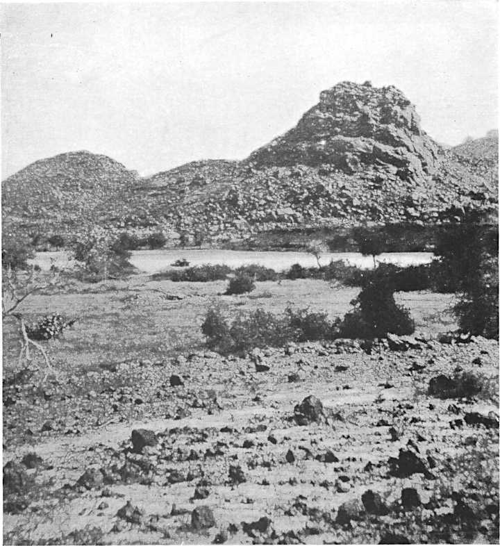
AUDERAS VALLEY: AERWAN TIDRAK
AUDERAS VALLEY: AERWAN TIDRAK
South of Agades the rains proved a terrible burden. The combined onslaughts of flies, mosquitoes and every other form of winged and crawling insect made life intolerable for Buchanan’s party; meals had to be eaten under[121] netting and naked lights were rapidly extinguished by incinerated corpses. Camels got no rest. Even the hardened natives had recourse to any device to snatch a little sleep. They went so far as to make their beds in the thorny arms of small acacia trees in order to escape the plague. The alluvial plain of the River of Agades had become so soft as to be almost impossible to cross. Mud engulfed the camels up to their bellies. The drivers used to unload them and push them bodily over on to their sides at the risk of breaking their legs in order to let the brutes kick themselves free. The several stream beds of the system, even if not too swollen to be completely unfordable, had such perpendicular banks where the water had cut its way down several feet below the surface of the ground that they became formidable obstacles. The constant threat of rain made long marches impossible, though it was abundantly clear that the longer the time that was spent in the valley the worse the ground would become. Buchanan was rewarded for his disappointment at not finding a lion by securing near Tanut two fine specimens of ostrich and an ant-bear. He also reported the existence near Marandet of a cemetery in the bank of a stream bed. It was unfortunate that he had not time to examine this site, as it seems to be an example of urn burial, probably of pre-Tuareg date.[112]
South of Agades, the rains became a huge burden. The relentless swarm of flies, mosquitoes, and all kinds of winged and crawling insects made life unbearable for Buchanan’s group; they had to eat meals under[121] netting, and open flames were quickly snuffed out by burned corpses. The camels never got a break. Even the tough locals resorted to any trick they could to grab a bit of sleep. They even went so far as to set up their beds in the thorny arms of small acacia trees to avoid the bug infestation. The alluvial plain of the River of Agades had become so muddy that it was nearly impossible to cross. Mud swallowed the camels up to their bellies. The drivers had to unload them and push them over onto their sides, risking injury to free them from the muck. The various stream beds in the area, even if not flooded enough to be completely impassable, had such steep banks where the water had cut down several feet below ground level that they posed serious obstacles. The constant threat of rain made long marches impractical, though it was clear that the longer they stayed in the valley, the worse the ground would get. Buchanan, disappointed that he didn’t find a lion, had better luck near Tanut, where he secured two fine ostriches and an ant-bear. He also noted the presence of a cemetery near Marandet along the bank of a stream bed. It was unfortunate he didn’t have time to investigate this site, as it appeared to be an example of urn burial, likely pre-Tuareg.[112]
Half a day’s march from Agades brought me to the village of Azzal on the valley of the same name, the lower part of which is called “Telwa,” the most convenient name for the whole of this important basin. Azzal and the neighbouring Alarsas[113] are small settlements with a few date palms and some gardens. They were formerly inhabited only by serfs engaged in cultivating the gardens which supply Agades with vegetables. After the 1917 revolution in Air the noble population of certain villages[122] in the Ighazar, which was evacuated, settled there temporarily under their chief, Abdulkerim of T’intaghoda. They were living in straw and reed huts, hoping in the course of time to return north and resume possession of the more substantial houses in their own country. During my stay in Air several families did, as a matter of fact, go back to Iferuan and Seliufet. But the presence of the remainder of these Kel Ighazar in the south is somewhat anomalous, as the country from the earliest times has been almost exclusively inhabited by servile people. The area, extending over the foothills of the main plateau, is not yet, properly speaking, Air, in the sense in which the name is used by the Tuareg. Like the desert further south, it is called Tegama.
Half a day's walk from Agades took me to the village of Azzal in the valley that shares its name, the lower part of which is called "Telwa," the most fitting name for this important basin. Azzal and the nearby Alarsas[113] are small communities with a few date palms and some gardens. They were once only home to serfs who worked the gardens that supply Agades with vegetables. After the 1917 revolution in Air, the noble families from certain villages[122] in the Ighazar, which was evacuated, moved there temporarily under their leader, Abdulkerim of T’intaghoda. They lived in straw and reed huts, hoping to eventually return north and reclaim their more substantial homes back in their own country. During my time in Air, a few families did, in fact, go back to Iferuan and Seliufet. However, the presence of the remaining Kel Ighazar in the south is somewhat unusual, as the area has historically been almost entirely populated by servile people. The region, which stretches across the foothills of the main plateau, is not yet, strictly speaking, Air, in the sense that the Tuareg use the term. Like the desert further south, it is referred to as Tegama.
After following the Telwa for a short distance the track crosses to the left bank and winds over low bare hills and torrent beds. A little before reaching Solom Solom there is a wooded valley which the road leaves to cross a stretch of higher ground by a small pass covered with the remains of stone dwellings, the site, I presumed, of Ir n’Allem. The track is evidently very old at this point, for in places it has worn deep into the rock. The country is wild and picturesque, but the earth-brown hills are fashioned on a small scale. The district used to be infested by brigands who preyed on the caravans bound to and from Agades.
After walking along the Telwa for a short distance, the path shifts to the left bank and moves over low, bare hills and dried-up riverbeds. Just before you get to Solom Solom, there’s a wooded valley that the road skips to cross over a stretch of higher ground through a small pass covered in the remains of stone houses, which I guessed was the site of Ir n’Allem. The path is clearly very old here, as in some places it has worn deep grooves into the rock. The landscape is rugged and picturesque, but the brown hills are small in scale. This area used to be overrun by bandits who targeted the caravans traveling to and from Agades.
The southern part of my journey followed the usual route, though Barth on his expedition from T’intellust to Agades travelled both there and back by an alternative track rather further east in the Boghel valley and via Tanut Unghaidan, which is not far from Azzal, where he rejoined the more habitual way.
The southern part of my journey followed the usual route, but Barth on his expedition from T’intellust to Agades took a different path both ways, further east through the Boghel valley and via Tanut Unghaidan, which is close to Azzal, where he reconnected with the more common route.
At Dabaga my road from Solom Solom rejoined the Telwa valley and crossed the stream bed after a short descent into a basin covered with dense thickets of dûm palms and acacias. The trees were filled with birds. The river was in full flood, over a quarter of a mile wide and some two feet deep—an imposing stream draining south-western[123] Bagezan and Todra into the River of Agades. I was luckily able to cross it with my laden camels, but some travellers only a little behind me were held up for several days by the floods which followed the heavy rain in Central Air. Travelling at this season of the year is slow, as camp must be pitched before the daily rains begin, usually soon after noon. On the other hand, it is very convenient to be able to halt anywhere on the road regardless of permanent watering-points; for every stream bed, even if not actually in flood, contains pools or water in the sand.
At Dabaga, my route from Solom Solom rejoined the Telwa valley and crossed the stream bed after a brief descent into a basin thick with dense thickets of dûm palms and acacias. The trees were alive with birds. The river was at full flood, over a quarter of a mile wide and about two feet deep—an impressive stream draining south-western[123] Bagezan and Todra into the River of Agades. I was fortunate enough to cross it with my loaded camels, but some travelers just behind me were delayed for several days by the floods that followed the heavy rain in Central Air. Traveling at this time of year is slow, as camp needs to be set up before the daily rains start, typically soon after noon. However, it is quite convenient to be able to stop anywhere along the route without worrying about permanent watering points, since every stream bed, even if not currently flooded, holds pools or water in the sand.
Climatically Air is a Central African country. It is wholly within the summer rainfall belt, the northern limit of which coincides fairly accurately with the geographical boundary of the country at the wells of In Azawa. The rains usually commence in July, and last for two months, finishing as abruptly as they have begun. Within the limits of the belt, the further north, the later, on the whole, is the wet season, though great irregularities are observed. In Nigeria the rains fall during May and June, at Iferuan they occur in August and September.[114] They are tropical in their intensity, and in Air nearly always fall between noon and sunset.
Climatically, Air is a Central African country. It's entirely within the summer rainfall zone, with its northern boundary aligning closely with the country's geographical edge at the wells of In Azawa. The rainy season typically starts in July and lasts for two months, ending as suddenly as it begins. Within this zone, the further north you go, the later the rainy season generally starts, although there are significant irregularities. In Nigeria, the rains occur in May and June, while in Iferuan, they happen in August and September.[114] The rain is tropical in intensity and in Air, it almost always falls between noon and sunset.
During my stay at Auderas there were a few days when the sky was overcast for the whole of the twenty-four hours, with little rainfall; the damp heavy feeling in the air reminded one of England, as the atmosphere was cold and misty. On one particular day it rained lightly and fitfully for fourteen hours on end with occasional heavy showers. Such phenomena, however, are rare. Precipitation follows a north-easterly wind and usually lasts three or four hours; as soon as the westerly wind, prevalent at this season, has sprung up, the nimbus disperses rapidly, leaving only enough clouds in the evening to produce the most magnificent sunsets that I have ever seen.
During my time at Auderas, there were a few days when the sky was completely overcast for a full twenty-four hours, with only a little bit of rain. The damp, heavy feeling in the air reminded me of England, as the atmosphere felt cold and misty. On one specific day, it rained lightly and sporadically for fourteen hours straight, with occasional heavy downpours. However, these occurrences are quite rare. Rain typically follows a north-easterly wind and usually lasts three to four hours; as soon as the westerly wind, which is common at this time of year, picks up, the clouds quickly clear away, leaving just enough behind in the evening to create the most stunning sunsets I have ever witnessed.
[124]In 1922 the rainy season at Auderas was virtually over by the 10th September, though it continued a little later in the north. The rains were followed by a period of damp heat, and then by some days when the ground haze was so thick that visibility was limited to a few hundred yards. Until recent years there seems to have been a short second rainy season in the north of Air coinciding with the first part of the Mediterranean winter precipitation. In November near Iferuan I experienced several days on which rain appeared to be imminent, but none fell. Natives told me that up to three or four years previously they had often had a few days’ rain in December and January. In 1850 the last rain of the summer season, which, exceptionally, had begun as far north and as early as 26th May at Murzuk, was recorded on 7th October, but in November and December after a fine period the sky had again become overcast, and a few drops of rain actually fell in Damergu on 7th January, 1851. The cycles of precipitation in the Sahara are constantly varying and data are as yet insufficient to permit any conclusion. It would be quite incorrect, from the accounts of the last ten years alone, to suppose that the rainfall had markedly diminished, or that the second rainy season had disappeared.
[124]In 1922, the rainy season in Auderas was mostly over by September 10th, though it lingered a bit longer in the north. The rains were followed by a stretch of muggy heat, then a few days when the ground haze was so thick that you could only see a few hundred yards. Until recently, there seemed to be a brief second rainy season in northern Air that coincided with the early part of the Mediterranean winter rains. In November, near Iferuan, I had several days where rain seemed likely, but it never came. Locals told me that up until three or four years ago, they often got a few days of rain in December and January. In 1850, the last rain of the summer season, which unusually began as far north and as early as May 26th in Murzuk, was recorded on October 7th. However, in November and December, after a clear spell, the sky became cloudy again, and a few drops of rain actually fell in Damergu on January 7, 1851. The patterns of rainfall in the Sahara are continually changing, and there's not enough data yet to draw any firm conclusions. It would be entirely misleading, based solely on the last ten years, to assume that rainfall has significantly decreased or that the second rainy season has vanished.
During the rains the larger watercourses meandering among the massifs of the country often become impassable for days on end, which is inconvenient, for in ordinary times they are the channels of communication. Owing to the lack of surface soil and vegetation on the as yet undisintegrated volcanic rock, streams fill with surprising rapidity during the rains and are very dangerous for the unwary traveller. The great joy of these weeks was the freshness of the air after the intolerable heat of June and July, especially in the plains. With the rain too came the annual rebirth of plant life, which made one’s outlook very sweet. In European spring-time Nature awakes from winter sleep, but in Africa a new world, fresh and green and luxurious, is born after the rains out of a shrivelled corpse of sun-dried desert.
During the rainy season, the larger rivers winding through the country's mountains often become impossible to cross for days, which is a hassle since they usually serve as the main routes of travel. Because there's a lack of topsoil and vegetation on the still-intact volcanic rock, the streams fill up surprisingly fast during the rains and can be very dangerous for unsuspecting travelers. The best part of these weeks is the refreshing air after the unbearable heat of June and July, especially in the plains. With the rain also comes the yearly revival of plant life, which makes everything feel so much brighter. In Europe, spring is when Nature wakes up from its winter slumber, but in Africa, after the rains, a completely new world bursts into life—fresh, green, and lush—rising from the withered remains of the sun-baked desert.
[125]At Dabaga I was persuaded to forsake the caravan road which continues up the Telwa and take a riding road by Assa Pool and the T’inien mountains. Difficulties began at Assa, when I tried to pitch my tent on rocky ground, with the result that it was almost impossible to keep it erect in the rain squalls which followed. The evening, after the rain, was unsatisfactory. I wounded two jackals at which I had shot, but did not kill either. I missed several guinea-fowl and only secured a pair of pigeons among the dûm palms of the valley. Also, there were many flies. However, I made the acquaintance of one of the greatest guides in Air, Efale, who overtook me on his way north, and camped near me. He talked volubly that night. Next day, after dropping sharply into the T’inien valley by a narrow defile, the road became frankly devilish. At the bottom of the steep sides the soil is impregnated with salt, which effectually prevents anything growing. There are a number of circular pits where the sandy salt, called “ara” or “agha,” is worked. The mixture is dried in cakes and sold in the south for a few pence. It is only fit for camels, which require a certain amount of salt every month, more especially after they have been feeding on fresh grass. “Ara” can only be used for human food if the sand has been washed out and the brine re-dried.
[125]At Dabaga, I was convinced to leave the caravan route that goes up the Telwa and take a riding trail by Assa Pool and the T’inien mountains. The trouble started at Assa when I tried to set up my tent on rocky ground, making it nearly impossible to keep it standing during the rain squalls that followed. The evening after the rain was disappointing. I injured two jackals that I shot at but didn’t kill either. I missed several guinea fowl and only managed to catch a pair of pigeons among the dûm palms in the valley. There were also a lot of flies. However, I got to know one of the best guides in Air, Efale, who caught up with me on his way north and camped nearby. He talked a lot that night. The next day, after descending sharply into the T’inien valley through a narrow pass, the road became extremely treacherous. At the base of the steep slopes, the soil is filled with salt, which prevents anything from growing. There are several circular pits where the sandy salt, known as “ara” or “agha,” is harvested. The mixture is dried into cakes and sold in the south for a few cents. It’s only suitable for camels, which need a certain amount of salt every month, especially after feeding on fresh grass. “Ara” can only be used for human consumption if the sand has been washed out and the brine re-dried.
After leaving Assa the vegetation had almost entirely disappeared. Low gravel-strewn hills on the right obscured the view to the east. The T’inien valley soon made a right-angle turn to the north, closing to a narrow cleft, which became even rougher. The track was a series of steps between huge granite and quartz boulders, among which the camels kept on stumbling. Their loads required constant readjustment and there was no room to kneel them down. The way was really only fit for unloaded camels or riders on urgent business. There had not been a tree or bush for hours. We climbed some 600 feet in about a mile, almost to the very top of the jagged peaks on the left that marked the summit of the T’inien range. By 11.15 a.m. I was beginning to despair of finding a camp[126] site before the rain was due, as I foresaw a similar unpleasant descent on the other side of the col which had so long been looming ahead. Then as I reached the gates of the pass a view over the whole of Central Air suddenly burst upon me in such beauty as I can never forget.
After leaving Assa, the vegetation had almost completely vanished. Low, gravel-covered hills to the right blocked the view to the east. The T’inien valley soon took a sharp turn to the north, narrowing into a tight fissure that became even rougher. The path was a series of steps between massive granite and quartz boulders, where the camels kept stumbling. Their loads needed constant rearranging, and there was no space to kneel them down. The route was really only suitable for unloaded camels or riders on urgent business. There hadn't been a tree or bush for hours. We climbed about 600 feet in roughly a mile, almost reaching the very top of the jagged peaks on the left that marked the summit of the T’inien range. By 11:15 a.m., I was starting to lose hope of finding a campsite before the rain was expected, as I anticipated a similarly unpleasant descent on the other side of the pass that had been looming ahead. Then, as I reached the entrance of the pass, a stunning view of all of Central Air suddenly opened up before me in a beauty I could never forget.
The ground sloped imperceptibly to the east. It fell away only about a hundred feet to the north, where a row of small crags, the continuation of the T’inien range, cut off the western horizon. Straight in front in the distance, piled mass upon mass, the blue mountains of Central Air rose suddenly out of the uplands, soaring into the African sky. Between the bold cliffs and peaks of the Bagezan mountains and the long low Taruaji group to the right, a few little conical hills of black rock broke the surface of the vast plain which rolled away to the east. From so great a distance the plain seemed tolerably smooth, veined like the hand of a man with watercourses winding southwards from the foot of the mountains. Black basalt boulders covered the flat spaces between lines of green vegetation and the threads of white sand, where the stream beds were just visible. Over the whole plain the new-born grass was like the bloom on a freshly-picked fruit. To the south-east stood the blue range of Taruaji itself, flat-topped and low on the horizon. Either side of the hills the curve of the world fell gently away towards the Nile.
The ground sloped gently to the east. It dropped only about a hundred feet to the north, where a line of small cliffs, part of the T’inien range, cut off the western skyline. Straight ahead in the distance, stacked upon each other, the blue mountains of Central Air suddenly rose from the uplands, soaring into the African sky. Between the dramatic cliffs and peaks of the Bagezan mountains and the long, low Taruaji group on the right, a few small conical hills of black rock broke through the surface of the vast plain that stretched to the east. From such a distance, the plain looked relatively smooth, patterned like a person's hand with watercourses winding south from the mountains. Black basalt boulders dotted the flat areas between lines of green vegetation and the threads of white sand, where the stream beds were just visible. Across the entire plain, the newly sprouted grass resembled the sheen on a freshly-picked fruit. To the southeast stood the blue Taruaji range itself, flat-topped and low on the horizon. On either side of the hills, the curve of the world gently descended toward the Nile.
I camped a mile or so north of the pass in a valley below the precipitous cliffs of a rock called Okluf, which has a castellated crown several hundred feet high. The rocks shone blue-black, with their feet in a carpet of green that seemed too vivid to be real. There were plenty of guinea-fowl and many other birds in the palm woods and thorn groves, and such grass as I thought only grew in the water meadows of England. I shall never forget the beauty of Central Air on that noonday in the rains, though I have it in me to regret the fiendish temper in which the day’s march had left me. The flies in the evening and the fast-running things upon the ground at night only made it worse. I had hurriedly and laboriously pitched a tent, and it never rained after all.
I camped about a mile north of the pass in a valley beneath the steep cliffs of a rock called Okluf, which has a tower-like top several hundred feet high. The rocks glistened a blue-black, with a vibrant green carpet at their base that seemed unreal. There were lots of guinea-fowl and various other birds in the palm trees and thorn bushes, and the grass looked like the kind I thought only grew in the water meadows of England. I’ll never forget the beauty of Central Air on that rainy midday, even though I regret the terrible mood I was in after the day’s hike. The flies in the evening and the fast-moving creatures on the ground at night only made things worse. I had hurriedly set up a tent, and it didn’t even rain after all.
PLATE 14
PLATE 14

MT. TODRA FROM AUDERAS
Mt. Todra from Auderas
[127]On the following day I ascended the T’ilisdak valley which flows into the Telwa, and reached Auderas village, where some huts had been prepared for us by the chief Ahodu, a man who soon became my most particular friend. The T’ilisdak valley is renowned for its excellent grazing and for some mineral springs where men, camels and herds go after the rainy season to take a “cure” of the waters.[115] Near Okluf there are the remains of several hut villages, and some with stone foundations of a more permanent character. They belong to a servile tribe of Southern Air called the Kel Nugguru, who at present are living somewhat further west.
[127]The next day, I traveled up the T’ilisdak valley that leads into the Telwa and arrived at Auderas village, where the chief Ahodu had arranged some huts for us. He quickly became my close friend. The T’ilisdak valley is famous for its excellent grazing and mineral springs, where people, camels, and herds go after the rainy season to take a "cure" in the waters.[115] Near Okluf, you can find the ruins of several hut villages, some with stone foundations that are more permanent. These belong to a servile tribe from Southern Air called the Kel Nugguru, who currently live a bit farther west.
Air proper may be said to begin at the head of the T’ilisdak valley. The part of the plateau I had traversed was therefore still in Tegama, which includes the whole area south of Bagezan and Todra as far as the River of Agades, as well as the Taruaji massif, but not the country east of the latter and of Bagezan. Most of the villages in Tegama have gardens, and some have groves of date palms. That they are inhabited by serfs is, of course, natural, since the cultivation of the soil, in the estimation of the noble Tuareg, is not a worthy occupation for a man. When, however, in a nomad society agriculture is relegated to an inferior caste of people, it is inevitable that the practice should undermine the older allegiances. It becomes possible for the settled and therefore originally the servile people to accumulate wealth even in bad times when the profit from raiding or caravaning is denied to the upper classes of Air. The social effects of the disruption caused by the 1917 revolution may be observed in the village organisations, where people of different tribes are now tending more and more to live in association under the rule of a village headman, who for them is displacing the authority of their own tribal chiefs. The village headmen,[128] it is true, are sometimes themselves the leaders of the tribes in whose area the village is situated, but more often they are merely local men acting on the delegated authority of the tribal chief, who in Tegama is probably the head of an Imghad or servile tribe dependent in turn upon some noble tribe living in a different part of Air. But in time the population of a village may become known collectively as the people of such and such a place, and so reference to the old tribal allegiance of the inhabitants disappears.
Air proper can be said to begin at the head of the T’ilisdak valley. The part of the plateau I had crossed was still in Tegama, which encompasses the entire area south of Bagezan and Todra, extending to the River of Agades, including the Taruaji massif, but not the land east of that and Bagezan. Most villages in Tegama have gardens, and some have date palm groves. It’s natural that they are inhabited by serfs since, in the eyes of the noble Tuareg, farming isn’t a respectable job for a man. However, in a nomadic society where agriculture is assigned to a lower caste, it's inevitable that this practice will weaken the traditional loyalties. This allows the settled, originally servile people to build wealth even during tough times when raiding or trading profits are not available to the upper classes of Air. The social impact of the disruption caused by the 1917 revolution can be seen in village organizations, where individuals from different tribes increasingly live together under the leadership of a village headman, who is replacing the authority of their traditional tribal chiefs. The village headmen, [128] are sometimes leaders of the tribes in which the village is located, but more often they are simply local men acting on the authority of the tribal chief, who in Tegama is likely the head of an Imghad or servile tribe that is dependent on a noble tribe in another part of Air. Over time, the residents of a village may collectively come to be known as the people of a certain place, and references to their old tribal affiliations fade away.
Tuareg tribal names deserve close investigation. They are of two categories: those which begin with “Kel” (People of . . .) and those which begin with “I” or sometimes “A.” This “I” or “A” may be quite strongly pronounced, but often represents the so-called “neutral vowel,”[116] which is very difficult to transliterate. Thus the word “Ahaggar” might as correctly be written “Ihaggar”; the initial vowel indeed is so little emphasised that the French have come to write simply “Hoggar” or “Haggar.” On the other hand, in the name Ikazkazan, an Air tribe, the “I” is marked; in the Azger tribe, again, the Ihadanaren, it is so lightly accentuated that Barth writes “Hadanarang.” This point, however, is of little moment: what matters is the question of the type of prefix to the name. To simplify reference I propose to call these two types “Kel name” and “I name” tribes. After examining the two categories at length, a distinction seemed to me to stand out clearly; I believe it holds good among other Tuareg as well as those of Air. The primary tribal divisions have names of the “I” category, except in certain cases where they are nearly always known to have been forgotten; the subdivisions of these tribes have “Kel names.” The former are proper names; the latter are derived either from the place where the people usually or once lived, or from some inherent peculiarity. The word “Kel” is also used to cover generalisations of no ethnic importance: the “I name,” on the other hand, is[129] scarcely ever geographical or adjectival. The generalisation will be clearer for a few examples, chosen among the Air tribes. The noble tribe called Imasrodang has for sub-tribes the Kel Elar, Kel Seliufet and Kel T’intaghoda, called after the villages where they lived in Northern Air. Again, the Ikazkazan have one section or group of sub-tribes called the Kel Ulli—the People of the Goats—who are themselves subdivided into other factions bearing “Kel names.”
Tuareg tribal names require careful analysis. They fall into two categories: those that begin with “Kel” (People of . . .) and those that start with “I” or sometimes “A.” This “I” or “A” might be pronounced distinctly, but often represents what’s called a “neutral vowel,”[116] which is quite tricky to transliterate. Therefore, the word “Ahaggar” could also be accurately written as “Ihaggar”; the initial vowel is so subtly emphasized that the French have come to simply write “Hoggar” or “Haggar.” In contrast, in the name Ikazkazan, which is an Air tribe, the “I” is prominent; in the Azger tribe, however, in the name Ihadanaren, it is so lightly stressed that Barth writes “Hadanarang.” Nonetheless, this is not a significant issue: what truly matters is understanding the type of prefix in the name. To make things easier, I’ll refer to these two types as “Kel name” and “I name” tribes. After thoroughly examining these categories, I noticed a clear distinction; I believe it applies to other Tuareg groups as well as those of Air. The major tribal divisions often have names from the “I” category, except in a few cases where these names have mostly been forgotten; the subdivisions of these tribes have “Kel names.” The former are proper names, while the latter are derived from either the place where the people typically or once lived, or from some defining characteristic. The word “Kel” is also used for generalizations that aren’t ethnically significant: in contrast, “I names” are[129] hardly ever geographical or adjectival. This distinction will be clearer with some examples from the Air tribes. The noble tribe known as Imasrodang has sub-tribes called Kel Elar, Kel Seliufet, and Kel T’intaghoda, named after the villages where they lived in Northern Air. Similarly, the Ikazkazan have one section or group of sub-tribes known as the Kel Ulli—the People of the Goats—who are further divided into other factions with “Kel names.”
Certain other “Kel names” like Kel Ataram or Kel Innek are often heard in Air, but are not proper names at all; they were erroneously regarded by Barth as tribal names, but simply mean the “People of the West” and the “People of the East” respectively, and have no inherent ethnic significance. In Air the former term logically includes, and is meant to include, the Arab as well as the Tuareg tribes of the west.[117]
Certain other “Kel names” like Kel Ataram or Kel Innek are often heard in Air, but they aren’t proper names at all; they were mistakenly seen by Barth as tribal names, but actually just mean the “People of the West” and the “People of the East” respectively, and have no real ethnic significance. In Air, the former term logically includes, and is intended to include, both the Arab and Tuareg tribes of the west.[117]
So clear is this use of geographical “Kel names” that we shall find repeated instances later on of tribes who, having migrated from a certain area, retain their old names, though these are no longer applicable to their new ranges. Take, for example, the Kel Ferwan—the People of Iferuan, in North Air; they now live in the southern parts of the country. Or, again, there are two Kel Baghzen, called after a mountain group in Central Air; the one group is still in that area, the other, which once lived there, has since migrated to the country north of Sokoto.
The use of geographical "Kel names" is so clear that we will see many examples later on of tribes that, after moving from a certain area, still keep their old names, even though these no longer describe their new locations. For instance, take the Kel Ferwan—the People of Iferuan, in North Air; they now live in the southern parts of the country. Similarly, there are two Kel Baghzen, named after a mountain group in Central Air; one group is still in that area, while the other, which used to live there, has since moved to the land north of Sokoto.
In certain forms the word “Kel” corresponds to the Arabic word “ahel,” but the latter seems more usually employed in connection with wide geographical indications of habitat, without much ethnic significance, like Kel Innek. The use of this type of “Kel name” is the exception rather than the rule in Temajegh and has a colloquial rather than traditional sanction. The more common “Kel names,” on the other hand, are definitely individual tribal[130] names, and refer to small areas. They are not by any means restricted to sedentary tribes.[118]
In some cases, the word “Kel” is similar to the Arabic word “ahel,” but the latter is more often used when referring to broad geographic areas without much ethnic meaning, like Kel Innek. This type of “Kel name” is more of an exception in Temajegh and has a casual rather than a traditional backing. In contrast, the more typical “Kel names” are clearly individual tribal names that relate to smaller regions. They’re not limited to just settled tribes.[130][118]
A third category of names commencing with the “Im” or “Em” prefix is regarded by Barth[119] as virtually identical with the “Kel” class, but this is not quite accurate. The “Im” prefix is used to make an adjectival word form of place names; the “Kel names” only become adjectival by prefixing “People of . . .” Thus “Emagadezi” would be more correctly translated as “Agadesian” than as the “People of Agades,” whose correct designation is Kel Agades. “I names” partake of neither of these characteristics. For the most part their significance remains unexplained. It follows that “Kel names,” although proper to the tribes that bear them, being descriptive or geographical, are certainly not so old as the individual and proper “I names.”
A third category of names that starts with the “Im” or “Em” prefix is seen by Barth[119] as practically the same as the “Kel” class, but that’s not entirely correct. The “Im” prefix is used to create an adjective from place names, whereas “Kel names” only become adjectives when you add “People of . . .” For example, “Emagadezi” is more accurately translated as “Agadesian” rather than “People of Agades,” whose proper name is Kel Agades. “I names” don't fit either of these definitions. Generally, their meanings remain unclear. Therefore, “Kel names,” while specific to the tribes that carry them, being descriptive or geographical, are definitely not as ancient as the individual and proper “I names.”
There are examples of tribes which have lost their “I names” and are only referred to by a “Kel name,” though in many cases this is more apparent than real. When a tribe with an “I name” increases until the point is reached where it subdivides, one of the subdivisions retains the original “I name,” the remainder take other and, usually, geographical appellations. This process might be shown graphically:—
There are examples of tribes that have lost their “I names” and are only called by a “Kel name,” although in many cases this is more apparent than real. When a tribe with an “I name” grows to the point where it splits up, one of the subdivisions keeps the original “I name,” while the others usually adopt different geographical names. This process could be illustrated visually:—
| Original I name tribe. | |||||||||
| I name sub-tribe (as above) | Kel name sub-tribe | Kel name sub-tribe | Kel name sub-tribe | ||||||
| Collective Kel name often the same as one of the sub-tribe Kel names if the latter has come to play a preponderating part in the group. | |||||||||
[131]This difference of nomenclature has a definite bearing on the difficulties of co-ordinating sedentarism and nomadism in one people, which must have occurred to everyone who has studied the problem in administration. The exact relations between a village headman, the tribal chiefs of the persons who are living in his village and the tribal chief of the area in which the village is situated cannot be defined. One set of allegiances is breaking down and another has not yet been completely formed. This was already going on in Air when the position was complicated by the advent of a European Power demanding a cut-and-dried devolution of authority, and tending to encourage sedentary qualities in order to prevent raiding. These problems in Air to-day are almost insoluble, but they are of an administrative rather than of an anthropological order.
[131] This difference in terminology significantly impacts the challenges of combining settled lifestyles and nomadic ones within a single community, a fact that anyone studying the administrative issues would notice. The specific relationship between a village headman, the tribal leaders of the people residing in his village, and the tribal chief of the surrounding area is unclear. One set of loyalties is breaking down while another has yet to be fully established. This situation was already unfolding in Air when the arrival of a European Power complicated matters by demanding a straightforward transfer of authority and promoting settled behaviors to prevent raiding. These problems in Air today are nearly impossible to resolve, but they are more about administrative issues than anthropological ones.
Auderas at the present time is probably the most important place in Air after Agades. As an essentially agricultural settlement it is an excellent example of the village organisation. The valley of Auderas lies about 2600 feet above the sea. Seven small valleys unite above the village and two affluents come in below, draining the western slopes of Mount Todra and a part of the Dogam group. The main stream eventually finds its way out into the Talak plain[120] under various names. The sandy bed of the valley near the village contains water all the year round. Both banks are covered with intense vegetation, including a date-palm plantation of some thousand trees. Under the date palms and amongst the branching dûm-palm woods, where the thickets and small trees have been cleared or burnt off, are a number of irrigated gardens supplied with water from shallow wells. Some wheat, millet, guinea corn and vegetables are grown with much labour and[132] devotion. Onions and tomatoes are the principal vegetables all the year round, with two sorts of beans in the winter. Occasionally sweet potatoes and some European vegetables like carrots, turnips and spinach are grown from seeds which have been supplied by the French. Pumpkins do well and water melons are common. There is also a sweet melon. Three different shapes of gourds for making drinking and household vessels are cultivated. Cotton is found in small quantities, the plant having probably been imported from the Sudan. Its presence in Air is interesting, as in 1850 Barth had placed the northern limit of Sudan cotton in the south of Damergu. The cotton plant does very well when carefully irrigated and produces a good quality of fibre. Two samples which I brought home from Air were reported on respectively as: “good colour, strong, fairly fine 1³⁄₁₆ staple,” and “generally good colour, staple 1³⁄₁₆-1¼ inches, strong and fine”; the materials were respectively valued at 20·35 and 21·35 pence per pound when American May Future Cotton stood at 17·35 pence (May 1924).[121] The Tuareg spin their cotton into a rough yarn for sewing or making cord, but in Air they do not seem to weave. The indigo plant grows wild in Air: it is not cultivated, nor is it used locally for dyeing.
Auderas is currently one of the most important places in Air after Agades. As a primarily agricultural community, it serves as a great example of village organization. The valley of Auderas is about 2,600 feet above sea level. Seven small valleys converge above the village, and two streams flow in below, draining the western slopes of Mount Todra and part of the Dogam group. The main stream eventually flows out into the Talak plain[120] under various names. The sandy riverbed near the village has water year-round. Both banks are lush with dense vegetation, including a date-palm plantation with about a thousand trees. Beneath the date palms and in the sprawling dûm-palm woods, where thickets and small trees have been cleared or burned, there are several irrigated gardens fed by shallow wells. Much labor and dedication go into growing wheat, millet, guinea corn, and vegetables. Onions and tomatoes are the main vegetables year-round, along with two kinds of beans in the winter. Occasionally, sweet potatoes and some European vegetables like carrots, turnips, and spinach are grown from seeds provided by the French. Pumpkins thrive, and watermelons are common. There's also a sweet melon. Three different types of gourds are grown for making drinking vessels and household items. Cotton is found in small amounts, likely imported from Sudan. Its presence in Air is notable, as Barth had previously set the northern limit of Sudan cotton near the south of Damergu in 1850. The cotton plant thrives with careful irrigation and produces high-quality fiber. Two samples I brought back from Air were reported as: “good color, strong, fairly fine 1³⁄₁₆ staple,” and “generally good color, staple 1³⁄₁₆-1¼ inches, strong and fine”; these materials were valued at 20.35 and 21.35 pence per pound when American May Future Cotton was at 17.35 pence (May 1924).[121] The Tuareg spin their cotton into rough yarn for sewing or making cords, but it seems they don't weave in Air. The indigo plant grows wild in Air; it isn’t cultivated or used locally for dyeing.
The gardens require much attention and preparation. The ground is cleared and the scrub burnt off as a top dressing. The soil is then carefully levelled by dragging a heavy plank or beam forwards and backwards by hand across the surface. The area is divided up into small patches about six feet square with a channel along one side communicating with a leat from an irrigation well. These wells are usually unlined and shallow, with a wooden platform overhanging the water on one side; on this a rectangular frame is set up with a second cross member carrying a pulley over which a rope is passed. An ox or[133] a donkey pulls up the big leather bucket by the simple process of walking away from the well, returning on its tracks to lower it again. The bucket is a tubular contrivance, the bottom of which is folded up while the water is raised; when it reaches the level of the irrigation channel, a cord is pulled to open the bottom of the leather tube and the water allowed to run out. The other end of this cord is attached to the animal, and the length is so adjusted that the operation is performed automatically each time the bucket comes to the top. The pole and bucket with a counterweight and the water wheel are not known in Air for raising water; nor are any dams constructed either to make reservoirs in ravines or to maintain a head of water for flow irrigation in the rainy season. Each little patch in the gardens is hoed and dressed with animal manure. The seed is planted and carefully tended every day, for it is very valuable. Barth records seeing at Auderas a plough drawn by slaves. This was clearly an importation from the north; the plough is not now used anywhere in the country, which at heart has never been agricultural.
The gardens need a lot of attention and preparation. The ground is cleared, and the brush is burned off as a top layer. The soil is then carefully leveled by dragging a heavy plank or beam back and forth by hand across the surface. The area is divided into small patches about six feet square, with a channel along one side connected to a leat from an irrigation well. These wells are usually unlined and shallow, with a wooden platform hanging over the water on one side; on this platform, a rectangular frame is set up with a second cross member that holds a pulley over which a rope is passed. An ox or a donkey pulls up the large leather bucket simply by walking away from the well, then returns on its path to lower it again. The bucket is a tubular device, with the bottom folded up while the water is being raised; when it reaches the level of the irrigation channel, a cord is pulled to open the bottom of the leather tube, allowing the water to run out. The other end of this cord is attached to the animal, and the length is adjusted so that the process happens automatically each time the bucket reaches the top. The pole and bucket with a counterweight and the water wheel are not used in Air for raising water; nor are any dams built to create reservoirs in ravines or to maintain a water supply for flow irrigation during the rainy season. Each small patch in the gardens is hoed and treated with animal manure. The seed is planted and carefully tended to every day, as it is very valuable. Barth notes seeing a plow drawn by slaves at Auderas. This was clearly brought in from the north; the plow is not currently used anywhere in the country, which has never truly been agricultural at its core.
PLATE 15
PLATE 15

GRAIN POTS, IFERUAN
GRAIN POTS, IFERUAN

GARDEN WELL
GARDEN GOOD
As in the south, millet and guinea corn are sown during the rains, but they usually require irrigation before they reach maturity. In certain areas rain-grown crops could be raised most years. In the past a fair amount of cereals seems to have been produced in this way; to-day the Tuareg are too poor to risk losing their seed in the event of inadequate or irregular rainfall. Although the wheat grown in the Ighazar used nearly all to be exported to the Fezzan, where it was much in demand on account of its excellent quality for making the Arab food “kus-kus,” Air at no time has produced enough grain for its own consumption. In the economics of Air necessary grain imports are paid for by the proceeds of wheat sales or live-stock traffic with the north, and by the profits of the trade in salt from Bilma; these provide the means of purchasing the cheaper millet and guinea corn of Damergu. Any additional surplus, representing annual savings, is invested[134] in live-stock, especially camels, within the borders of the country.
As in the south, millet and guinea corn are planted during the rainy season, but they usually need irrigation before they fully mature. In some areas, rain-fed crops could be grown most years. In the past, a decent amount of cereals seems to have been produced this way; today, the Tuareg are too poor to risk losing their seeds due to insufficient or erratic rainfall. Although almost all the wheat grown in the Ighazar used to be exported to the Fezzan, where it was in high demand because of its great quality for making the Arab dish "kus-kus," Air has never produced enough grain for its own needs. In Air's economy, necessary grain imports are funded by the revenue from wheat sales or livestock trading with the north, as well as the profits from salt trade from Bilma; these funds are used to buy the cheaper millet and guinea corn from Damergu. Any extra surplus, which represents annual savings, is invested[134] in livestock, especially camels, within the country's borders.
The breakdown of the social organisations of the Tuareg in Air compelled numbers of nobles out of sheer poverty after they had lost their camels and herds to cultivate the soil; before the war not even the servile people were very extensively so employed if they could find enough slaves to do the work.
The collapse of the social structures of the Tuareg in Air forced many nobles into poverty after they lost their camels and herds, pushing them to farm the land; before the war, not even the lower class worked the fields extensively if they could find enough slaves to do the labor.
Neither the advent of a European Power nor the subsequent changes in the social structure of the country has had very much effect on the position of slaves in Air. Of these there are two categories,[122] the household slave and the outdoor slave, and both of them are chattels in local customary law. The former are called “ikelan,” the latter “irawellan,”[123] or alternatively “bela,” “buzu” or “bugadie,” which, however, are not Temajegh words, but have been borrowed from the south. The term “irawel” is also used generically to cover both categories of slaves, although it primarily refers to the latter. In the use of this word Barth[124] makes one of the few mistakes of which he has been guilty, where he states that the most noble part of the Kel Owi group of tribes in Air is the “Irolangh” clan, to which the Amenokal or Sultan of the Kel Owi belonged. The paramount chief of his day, Annur, belonged to the Kel Assarara section of the Imaslagha tribe, which is probably the original and certainly one of the most noble of the Kel Owi, for it includes the Kel Tafidet, who gave their name to the whole confederation. The traveller’s mistaken reference to Irawellan or Irolangh is[135] probably due to his having been informed by a member of some non-Kel Owi tribe that Annur and all his people were “really Irawellan,” or servile people. Such abuse of the Kel Owi is common among the other Air Tuareg. It is certainly not justified in fact, and is due to the contempt in which an older nobility will always hold more recent arrivals.[125]
Neither the arrival of a European power nor the subsequent changes in the country’s social structure have significantly impacted the status of slaves in Air. There are two categories of slaves,[122] the household slave and the outdoor slave, both of whom are considered property under local customary law. The former are called “ikelan,” while the latter are referred to as “irawellan,”[123] or sometimes “bela,” “buzu,” or “bugadie,” which are not Temajegh words but have been borrowed from the south. The term “irawel” is also used as a general term for both categories of slaves, though it primarily refers to outdoor slaves. In using this term, Barth[124] makes one of his few errors by stating that the most noble part of the Kel Owi tribe in Air is the “Irolangh” clan, to which the Amenokal or Sultan of the Kel Owi belonged. The chief at the time, Annur, was part of the Kel Assarara section of the Imaslagha tribe, which is likely the original and certainly one of the most prestigious groups of the Kel Owi, as it includes the Kel Tafidet, who gave their name to the entire confederation. The traveler’s incorrect reference to Irawellan or Irolangh is[135] probably due to being told by someone from a different tribe that Annur and his people were “really Irawellan,” or enslaved people. This kind of derogatory labeling of the Kel Owi is common among other Air Tuareg. It is certainly not factually justified and stems from the disdain that older noble families often harbor for more recent arrivals.[125]
The negro slaves, the Ikelan, are primarily concerned with garden cultivation, and are consequently sedentary. One half of the produce of their labour goes to their masters and the other half to support themselves and their families. Ikelan also perform all the domestic duties of the Tuareg to whom they belong, and herd their masters’ goats and sheep if they happen to be living in the same neighbourhood. A certain proportion of the offspring of the flocks is also given to the slaves. Since, primarily, they are cultivators of the ground, they do not move from place to place with their owners. They consequently often escape domestic work and herding. Despite their legal status they are in practice permitted to own property, though, if their masters decided to remove it, they would be within their rights to do so. In other words, the theoretical status of slavery which makes it impossible for a chattel to own property has been considerably modified, and not as a consequence of the altered conditions, or of the legislation of a European Power, but because slavery among the Tuareg never did involve great hardship. Their slaves, furthermore, always had the hope of manumission and consequent change to the status of Imghad or serfs, a rise in the social scale which, in fact, often did occur. It was in slave trading and not in slave owning that the Tuareg sinned against the ethical standards which are usually accepted in Europe, and obtained so unenviable a reputation last century.
The Black slaves, known as the Ikelan, mainly focus on gardening, making them largely stationary. Half of what they produce goes to their masters, while the other half supports them and their families. The Ikelan also handle all the household chores for the Tuareg they serve and take care of their masters’ goats and sheep when they live nearby. A portion of the offspring from the flocks is also given to the slaves. Because they primarily cultivate the land, they don’t move around with their owners, which means they often avoid domestic work and herding. Although they are legally slaves, they can practically own property, though their masters could take it away if they chose to. Essentially, the traditional idea of slavery, which typically prevents a slave from owning property, has changed significantly—not due to changing conditions or European laws, but because slavery among the Tuareg was never that harsh. Moreover, their slaves always had the hope of being freed and transitioning to the status of Imghad or serfs, which often happened and represented a social advancement. It was in the trade of slaves, rather than ownership, that the Tuareg fell short of the ethical standards commonly upheld in Europe, earning them a negative reputation in the last century.
Herding live-stock, and especially camels, is the primary function of the outdoor slave or Buzu. Though often also a negro, he is considered to possess a somewhat higher[136] status than the Akel, for he does not as a rule work in the house or village. The Buzu’s work, if on the whole less strenuous than that of the tiller of gardens, is felt to be more manly because he is associated with camels. He travels with nobles or Imghad, to either of whom he may belong. He does all the hard menial work on the march. He is responsible especially for herding the camels at pasture and for loading and unloading them each day on the road. Such duties as filling water-skins, driving camels down to water, feeding them on the march and making rope for the loads, all fall to his lot. The Buzu may even accompany his master’s camels on raids or act as personal messenger for his lord. When the camels are resting he spends his days watching the grazing animals, or looking after any other herds which his master may own in the neighbourhood. On the whole I have found the Buzu a remarkably hard-working person. He is almost useless without his master to give him orders and to see that they are carried out, but ready to undertake any exertion connected with his work, which he regards as his fate, but not his privilege to perform without complaint.
Herding livestock, especially camels, is the main job of the outdoor slave or Buzu. Although he is often Black, he is seen as having a slightly higher status than the Akel, as he generally does not work in the home or village. The Buzu’s work, while overall less demanding than that of a gardener, is considered more masculine because of his association with camels. He travels with nobles or Imghad, to whom he may belong. He handles all the tough, menial tasks during the journey. He is particularly responsible for herding the camels while they graze and for loading and unloading them daily on the road. Duties such as filling water-skins, leading camels to water, feeding them during the trip, and making ropes for the loads are all part of his job. The Buzu may even accompany his master’s camels on raids or act as a personal messenger for his lord. When the camels rest, he spends his days watching over them or taking care of any other herds his master might have nearby. Overall, I have found the Buzu to be an incredibly hardworking individual. He is nearly useless without his master's orders to ensure tasks are completed, but he is willing to take on any effort related to his work, which he sees as his fate, not a privilege, and he does so without complaints.
It is difficult to determine whether there is any racial difference between the Buzu class, the tillers of gardens, and the ordinary household slaves. The first are more respected than the last, which may mean that they are more closely related in blood to their masters. The practice of concubinage, though not very widespread, has probably created the caste, and from them, in time, a certain proportion of the Imghad. While theoretically the children of a slave concubine and a Tuareg man ought to be “ikelan” like their mother, in practice they tend to rise into the superior caste of the Buzu, and eventually in successive generations to Imghad. In Air at least the general tendency is for the old-established caste distinctions to become more elastic and for the ancient order to pass away. Although the events of the last twenty years have contributed greatly to this change, the strongest factor has certainly been the[137] increasing wealth of the Imghad, but another reason is probably that many Imghad tribes in Air were themselves originally Imajeghan before their capture in war or their subjugation by some means. Consequently with the dissolution of tribal allegiances in Air and enhanced prosperity they have tended to revert to their former status. They cling so tenaciously to nobility of birth that, rather than accept the logical results of inferiority consequent upon defeat in war, the people collectively combine to admit the fiction of servile people possessing dual status.
It’s hard to figure out if there’s any racial difference between the Buzu class, who tend the gardens, and the regular household slaves. The Buzu are more respected than the latter, which might indicate that they are more closely related to their masters. Although concubinage isn’t very common, it likely created this caste, which over time has resulted in some of them becoming part of the Imghad. While in theory the children of a slave concubine and a Tuareg man should be “ikelan,” like their mother, in reality they often move up to the higher caste of the Buzu, and eventually, over generations, to the Imghad. At least in Air, there’s a general trend for historical caste distinctions to become more flexible and for the old order to fade away. Although the events of the last twenty years have significantly contributed to this change, the biggest factor has definitely been the growing wealth of the Imghad. Another likely reason is that many Imghad tribes in Air were originally Imajeghan before being captured in war or subjugated in some way. Thus, with the breakdown of tribal loyalties in Air and increased prosperity, they’ve started to return to their former status. They hold onto their noble heritage so tightly that, rather than accept the logical consequences of their defeat in war, the community collectively agrees to the idea that servile people can have dual status.
The presence of more than one racial type among the Imghad has led certain travellers to make quite unjustifiable generalisations about this section of Tuareg society. There have also been advanced numerous and most unnecessarily complicated theories to account for the division of the race as a whole into these two castes. The problem is really much simpler. Although by no general rule can it be said that the Imghad originally belonged to this or to that people, they are all clearly the descendants of groups or individuals captured in war and subsequently released from bondage to form a caste enjoying a certain measure of freedom, and having a separate legal or civil existence under something more than the mere political suzerainty of the noble tribe which originally possessed them. In this first stage, the noble tribe represents the original pure Tuareg race, while the oldest Imghad are the first extraneous people whom they conquered, in some cases perhaps as early as in the Neolithic ages. “It is necessary,” says Bates,[126] with great justice, “to state emphatically that the division into Imghad and Imajeghan is so ancient that the Saharan Berbers preserve no knowledge of its origin.” This antiquity may be held to account for the complete national fusion which has taken place among the two castes: nearly all Imghad would utterly fail to grasp a suggestion that they were not to-day as much Tuareg as their Imajeghan overlords, however they may dislike and abuse the latter.[138] As time went on more and more Imghad were added to the race, each group being subject to the noble tribe responsible for its conquest. The possibility of a group of people becoming the Imghad of an Imghad tribe was precluded by the relations obtaining between serfs and nobles, whereby it is the sole prerogative of the latter to wage war or make peace. Should an Imghad tribe capture slaves in war they could not be manumitted except by the Imajegh tribe, the lords of the victorious Imghad; and by the act of manumission the newly-acquired slaves would then become the equals of their Imghad conquerors under the dominion of the Imajeghan concerned.
The existence of multiple racial types among the Imghad has led some travelers to make completely unfounded generalizations about this part of Tuareg society. Additionally, numerous unnecessary and overly complex theories have been proposed to explain the division of the race into these two castes. The reality is much simpler. While there's no general rule to claim that the Imghad originally belonged to a specific group, they are all clearly descendants of individuals or groups captured in war who were later freed to create a caste that had a certain level of freedom and a separate legal status beyond the political control of the noble tribe that first had them. In this initial stage, the noble tribe represents the original pure Tuareg race, while the oldest Imghad are the first outside people they defeated, possibly as far back as the Neolithic period. “It is necessary,” says Bates,[126] rightly, “to state emphatically that the division into Imghad and Imajeghan is so ancient that the Saharan Berbers preserve no knowledge of its origin.” This ancient division may explain the complete merging that has occurred between the two castes: nearly all Imghad would completely fail to understand any suggestion that they are not as much Tuareg as their Imajeghan overlords, no matter how much they may dislike or criticize the latter.[138] Over time, more and more Imghad were added to the race, with each group being subject to the noble tribe that conquered them. The chance of one group becoming the Imghad of another Imghad tribe was prevented by the established relationships between serfs and nobles, granting the latter the exclusive right to go to war or make peace. If an Imghad tribe captured slaves in war, those slaves could only be freed by the Imajegh tribe, the lords of the victorious Imghad; and through the act of manumission, those newly freed slaves would then become equals to their Imghad conquerors under the authority of the Imajeghan involved.
The Imghad of Air may be divided into three categories whose history is so intimately bound up with the noble tribes that it cannot be considered separately. There are the Imghad whose association with their respective Imajeghan dates from before their advent to Air; their origin must be looked for in the Fezzan or elsewhere at some very early date. Secondly, there are the Imghad who were the original inhabitants of Air before the Tuareg came, and who by some agreement at the time, like the traditional one of Maket n’Ikelan,[127] were not enslaved but allowed to continue living in the country side by side with the new arrivals in a state of vassalage or semi-servitude. Lastly, there are the Imghad who are either Arabs, Tuareg of other divisions, or negroids from the south captured in the course of raids from Air, in some cases as recently as a generation ago. With these different origins it is not surprising to find among the Air Imghad both a strongly negroid type, a non-negroid and non-Tuareg type, and a type showing the fine features and complexion characteristic of the Imajeghan themselves. The first type is the pre-Tuareg population of Air. It is the most common, if only for the reason that negroid characteristics always appear to be dominant in the cross-breeding which ensued. The second type represents the Arab or Berber element acquired by[139] conquest. The third type represents the subjugated groups of Imajeghan of other divisions.[128] Of the latter category are, for instance, the Kel Ahaggar, Imghad of the Kel Gharus, who were originally nobles from the great northern division of the Tuareg. Many of the Kel Ferwan Imghad are believed to be Arabs or Tuareg of the west, captured comparatively recently on raids into the Aulimmiden territory. The Kel Nugguru are the freed slaves of the Añastafidet, the administrative head of the Kel Owi confederation: they have become so prosperous that they are now laying claim to be of noble origin, a pretension which no right-minded Imajegh in Air will admit for a moment. But it is almost impossible nowadays to trace the history of each Imghad tribe in detail. Generally, in the absence of more precise data, it may be assumed that those Imghad tribes which have “I names” are the oldest; for here the process of assimilation to the mass of the Tuareg race is most complete, either on account of the length of their mutual association or owing to the fact that they were originally themselves of the same race; the “Kel name” Imghad, on the other hand, are probably more recent additions.[129]
The Imghad of Air can be divided into three categories whose history is closely tied to the noble tribes, making it impossible to consider them separately. First, there are the Imghad whose connection with their respective Imajeghan dates back to before they arrived in Air; their origins likely trace back to Fezzan or another location at a very early date. Second, there are the Imghad who were the original inhabitants of Air before the Tuareg arrived. Due to an agreement at that time, similar to the traditional one of Maket n’Ikelan,[127] they were not enslaved but allowed to continue living alongside the newcomers in a state of vassalage or semi-servitude. Lastly, there are the Imghad who are either Arabs, Tuareg from other divisions, or individuals of African descent from the south who were captured during raids from Air, some of whom were taken as recently as a generation ago. With these various origins, it’s not surprising to find among the Air Imghad a distinct negroid type, a non-negroid and non-Tuareg type, and a type displaying the fine features and complexion typical of the Imajeghan themselves. The first type represents the pre-Tuareg population of Air and is the most common, largely because negroid characteristics tend to dominate in the cross-breeding that followed. The second type reflects the Arab or Berber influence acquired through[139] conquest. The third type consists of the subjugated groups of Imajeghan from other divisions.[128] This last category includes, for example, the Kel Ahaggar, Imghad of the Kel Gharus, who were originally nobles from the great northern division of the Tuareg. Many of the Kel Ferwan Imghad are believed to be Arabs or western Tuareg, captured relatively recently during raids into Aulimmiden territory. The Kel Nugguru are former slaves of the Añastafidet, the administrative leader of the Kel Owi confederation; they have become so prosperous that they now claim noble origins, a claim that no fair-minded Imajegh in Air will endorse. However, it's almost impossible today to trace the detailed history of each Imghad tribe. Generally, in the absence of more specific information, it can be assumed that the Imghad tribes with “I names” are the oldest; for here, the process of assimilation into the Tuareg race is most complete, either due to the length of their association or because they were originally of the same race. The “Kel name” Imghad, on the other hand, are likely more recent additions.[129]
The confusion reigning on the subject of the “Black” and “White” Tuareg in the minds of the few people in Europe who have ever heard of the race is due to the practice in the north of the servile wearing a white, and the nobles a black, veil. But a “Black” Tuareg, being a noble, will, in the vast majority of cases, have a much fairer complexion and more European features than a “White,” or servile Tuareg. In Air the colour of the veil affords no means of distinguishing the caste of the wearer. The[140] best veils, being made in the south, are consequently cheaper in Air than in the north, and this is probably the reason why Imajeghan and Imghad alike in Air wear the indigo-black Tagilmus. When a white veil is seen, it usually means that the wearer is too poor to buy a proper black one and has had to resort to some makeshift torn from the bottom of his robe.
The confusion surrounding the “Black” and “White” Tuareg among the few Europeans who have heard about them comes from the custom in the north where the lower class wears a white veil and the nobles a black one. However, a “Black” Tuareg, being of noble status, will, in most cases, have a much fairer complexion and more European features than a “White” or lower-class Tuareg. In Air, the color of the veil doesn't help to identify the caste of the wearer. The best veils, made in the south, are therefore cheaper in Air than in the north, which likely explains why both Imajeghan and Imghad in Air wear the indigo-black Tagilmus. When you see a white veil, it usually indicates that the wearer is too poor to afford a proper black one and has had to make do with a torn piece from the bottom of his robe.
Slaves, domestic or pastoral, do not wear the face veil at all. This is the essential outward difference between them and the Imghad. The latter, whatever their origin, are considered to be a part of the Tuareg people; the former cannot be so, for they are simply accounted to belong, as camels do, to the People of the Veil.
Slaves, whether they work in households or with livestock, don’t wear the face veil at all. This is the key outward distinction between them and the Imghad. The latter, regardless of their origins, are seen as part of the Tuareg people; the former cannot be considered as such because they are simply regarded as belonging, like camels, to the People of the Veil.
The exact status of the Imghad, or “meratha” (merathra) as they are called by the Arabs in Fezzan, is somewhat difficult to define. There is no adequate translation in any European language of the word “amghid.”[130] The process of their original enslavement and subsequent release to form a category of people who have achieved partial but not complete freedom has, I think, no parallel in Europe except in a modified form in the state of vassalage. Yet, as “servile” conveys too narrow and definite a relationship, so “vassal” is certainly too broad a term. In the state of servility or, to coin a word, “imghadage” to which the pre-Tuareg inhabitants of Air appear to have been reduced, the process of enslavement and release may be said to have taken place only as a legal fiction, and not, if the tradition is to be accepted as accurate, in real fact. The general practice seems to have been that when large groups of people were subjugated or captured in war they were simultaneously released into the state of imghadage, but when individuals or a few persons were acquired by force or by purchase, they were only manumitted in the course of time, if at all, and incorporated at some later date into an Imghad tribe or village already in existence.
The exact status of the Imghad, or “meratha” (merathra) as they are referred to by the Arabs in Fezzan, is somewhat difficult to define. There is no suitable translation for the word “amghid” in any European language.[130] The process of their original enslavement and subsequent release to create a group of people who have achieved partial but not full freedom seems to me to have no equivalent in Europe, except in a modified form in vassalage. However, while “servile” suggests too limited and specific a relationship, “vassal” is definitely too broad a term. In the state of servility, or to invent a term, “imghadage,” to which the pre-Tuareg inhabitants of Air seem to have been reduced, the process of enslavement and release may be considered to have occurred only as a legal fiction, and not, if we take the tradition to be accurate, in reality. The general practice appears to have been that when large groups of people were subjugated or captured in war, they were simultaneously released into the state of imghadage, but when individuals or a small number of people were taken by force or purchased, they were only freed over time, if at all, and eventually incorporated into an already existing Imghad tribe or village.
In contradistinction to slaves, the Imghad are not bound[141] individually, but collectively, and not to individuals, but to a noble tribe or group of tribes. They are in no sense considered to be the property of the latter; but the relationship is closer than that of suzerain and vassal. It is not within the power of an Imghad tribe to change its allegiance, since in the first instance its members were theoretically at least the property of its overlord tribe; they owe their separate existence to an act of manumission freely and voluntarily accomplished. A change of allegiance could occur only if a servile tribe were captured in whole or in part; it follows that when this has occurred one servile tribe might owe allegiance in several parts to different noble groups.[131] The bond between them consists of the right of the responsible noble tribe alone, and therefore of its chief, to administer justice among the dependent Imghad, either in small cases by tacitly confirming the verdict of their own headman, or in more weighty matters by express reference. The Imghad tribe may be fined or punished collectively by their lords, and would have no right to appeal to the Amenokal without permission. For the Amenokal to interfere on behalf of an Imghad tribe would constitute a breach of tribal custom and ensure a rebuff, if not worse. A certain proportion of the marriage portions payable in the Imghad tribes goes to their Imajeghan, who have the right to give or withhold consent to these contracts. One of the functions of the Imghad is to take complete charge of and use the camels of their lords for long periods or to trade with them on their behalf. In such cases the Imghad act as the agents of the nobles, each one of whom has a right to ask the servile tribe as a whole to undertake these duties. But such obligations are imposed collectively on the tribe and not on any one Imghad. It is the custom to share the offspring of the camels thus herded in equal shares, though in the event of any of the animals dying whilst under the charge of the Imghad, the[142] latter are collectively responsible for making good the loss, save in extenuating circumstances. Conversely, the nobles are, in every case,[132] the protectors of their dependents. The relations between Imghad and Imajeghan are a mixture of those obtaining under the feudalism of Europe and the “client” system of Rome.
In contrast to slaves, the Imghad are not tied down individually, but as a group, and not to individuals, but to a noble tribe or a group of tribes. They are not considered the property of these nobles; instead, the relationship is closer than that of a suzerain and vassal. An Imghad tribe cannot change its loyalty, as its members were originally the property of their overlord tribe; they owe their separate existence to a manumission that was willingly granted. A change of allegiance can only happen if a servile tribe is captured in whole or in part, meaning a servile tribe might owe loyalty to different noble groups at the same time. The bond between them is based solely on the right of the responsible noble tribe—and thus its leader—to administer justice among the dependent Imghad, either by implicitly confirming the decision of their own headman in minor cases or by making a direct reference in more serious matters. The Imghad tribe can be fined or punished collectively by their lords without the right to appeal to the Amenokal unless given permission. If the Amenokal intervenes on behalf of an Imghad tribe, it would violate tribal customs and likely result in a penalty, if not worse. A portion of the marriage payments in the Imghad tribes goes to their Imajeghan, who have the authority to grant or deny consent for these contracts. One of the responsibilities of the Imghad is to fully manage and use their lords' camels for extended periods or to trade on their behalf. In these situations, the Imghad act as the nobles’ agents, and each noble can ask the entire servile tribe to handle these duties. However, these responsibilities are imposed on the tribe collectively and not on individual Imghad. It's customary to share the offspring of the camels cared for in equal parts, but if any of the animals die while under the Imghad's care, the tribe is collectively responsible for compensating the loss, unless there are mitigating circumstances. Conversely, the nobles are, in every case, the protectors of their dependents. The relationship between the Imghad and the Imajeghan resembles a blend of European feudalism and the Roman "client" system.
A consequence of the interruption of caravan traffic and the disappearance of one of the principal sources of revenue of the noble Tuareg is that the Imghad as camel herders, and generally speaking as the more laborious members of the community, have gained where the nobles have lost.
A result of the halted caravan traffic and the loss of one of the main sources of income for the noble Tuareg is that the Imghad, as camel herders, and generally as the more hardworking members of the community, have benefited while the nobles have suffered.
Prosperity is emancipating the Imghad, and is materially assisting the breakdown of social distinctions which in time will survive only in the philosophic contemplation of the Imajeghan dreaming idly of the return of better days. The Imghad tribes used to be the unquestioning allies of their overlords in war; their numbers contributed greatly to the strength of any Imajegh tribe. Though they might not make war on their own initiative, the Imghad carried and still carry weapons.[133] They used to go on raids with their masters, or, if the Imajeghan were busy elsewhere, represent them with their masters’ camels and the weight of their own right arms. But the chiefs of the Imghad were never more than subordinates, or at the most advisers to the nobles.
Prosperity is freeing the Imghad and is helping to break down social distinctions that will eventually exist only in the philosophical musings of the Imajeghan, who idly dream of returning to better times. The Imghad tribes used to be the unquestioning allies of their overlords in battle; their numbers significantly boosted the strength of any Imajegh tribe. While they may not have initiated conflicts themselves, the Imghad have always carried weapons. They would go on raids alongside their masters or, if the Imajeghan were occupied elsewhere, represent them with their masters’ camels and the strength of their own right arms. However, the chiefs of the Imghad were never more than subordinates, or at best, advisers to the nobles.
To-day this unquestioning subservience has almost disappeared and we even find Khodi, chief of the Kel Nugguru, disputing with the noble Ahodu the leadership of the village of Auderas. This issue was one of great importance in local politics and originally arose out of the disputed ownership of certain palms which had been given to Ahodu when he was installed as head of the village as a reward for service rendered by him to the Foureau-Lamy expedition. The[143] village is on the edge of the Kel Nugguru country, while Ahodu in fact comes from a northern tribe, the Kel Tadek, who have no real concern with this district. The impossibility of reconciling the tribal and settled organisations was clearly demonstrated in every aspect of this controversy. Khodi, living as a nomad with his people and camels at some distance from the village, sought, without success, to govern the community through various representatives, while Ahodu, who had given up wandering, was suspended by the French during the settlement of the legal case, and sat in the village watching mistake after mistake being made. Under the old system Khodi could never have pretended to dispute with a noble the position of chief of a large village: in fact an Imghad tribe without a protecting noble overlord would have been unlikely to administer a village at all. Similarly among the Ahaggaren Imghad of the Kel Gharus, a man of servile origin, Bilalen by name, has come to share with T’iaman the lordship of a once noble people of the north, a position of such importance that he is regarded as one of the most influential chiefs in Air. Bilalen has only become associated with the Ahaggaren by marriage; he could never have achieved even this, much less could he have attained so powerful a following in the country, under the old régime.
Today, this unquestioning obedience has nearly vanished, and we even see Khodi, the chief of the Kel Nugguru, arguing with the noble Ahodu over the leadership of the village of Auderas. This issue was significant in local politics and originally stemmed from a dispute over the ownership of certain palm trees that were given to Ahodu when he became the village head as a reward for his service to the Foureau-Lamy expedition. The[143] village is located on the outskirts of the Kel Nugguru territory, while Ahodu actually hails from a northern tribe, the Kel Tadek, which has no real stake in this area. The difficulty of reconciling tribal and settled systems was clearly evident in every aspect of this disagreement. Khodi, living as a nomad with his people and camels some distance from the village, tried, but failed, to govern the community through various representatives, whereas Ahodu, who had stopped wandering, was put on hold by the French during the legal proceedings and sat in the village witnessing mistake after mistake unfold. Under the old system, Khodi would never have dared to challenge a noble for the chief position of a large village: in fact, an Imghad tribe without a protective noble wouldn’t likely have been able to manage a village at all. Similarly, among the Ahaggaren Imghad of the Kel Gharus, a man of servile origin named Bilalen has become a co-leader with T’iaman over a once-noble people of the north, a position so significant that he is considered one of the most influential chiefs in Air. Bilalen has only linked himself with the Ahaggaren through marriage; he could never have achieved even this, let alone gained such a powerful following in the region, under the old régime.
THE GOVERNMENT OF THE AIR TUAREG
THE GOVERNMENT OF THE AIR TUAREG

Note.—The scheme is largely theoretical, as the Amenokal has rarely had much authority over any tribes except the People of the King. His authority over a part of the Aulimmiden has been even more nominal and has varied considerably from time to time.
Note.—The plan is mostly theoretical, since the Amenokal has seldom wielded much power over any tribes other than the People of the King. His control over a portion of the Aulimmiden has been even more symbolic and has fluctuated greatly over time.
In addition to the social distinctions between nobles and serfs, the Tuareg attach great importance to tribal classification. Among the inhabitants of the mountains a man will describe himself as, say, “Mokhammad of the Kel Such-and-such of the Kel Owi,” or of the other category, which is called the “People of the King,” as the case might be. These two great tribal divisions (there were three before the departure of the Kel Geres for the Southland) will be referred to in detail when the history of the migrations of the Air Tuareg is considered. The divisions are absolute; a tribe either is of the Kel Owi or is not of the Kel Owi. There is usually never any doubt; the erroneous attribution of a man’s tribe to the Kel Owi confederation would[144] provoke the indignant rejoinder that his clan were “People of the King” and did not “belong (sic) to the Añastafidet.” The distinction means all that the difference between an ancient landed nobility and a parvenu commercial aristocracy denotes. Many of the older men of the “People of the King” go so far as to say that there are no nobles among the Kel Owi at all.[134] Apart from their slightly different ethnic origin, the principal reason why the Kel Owi have stood apart from the other tribes is that they possess an administrative leader of their own who represents the whole confederation; as they say, “he speaks for them to the Amenokal at Agades.” He is called the Añastafidet, the Child of Tafidet. The non-Kel Owi tribes, on the other hand, have no single leader other than the king; in their case each tribal chieftain transacts the business of his own tribe with the former independently of the other chiefs.[145] For them the Amenokal of Air assumes the dual function of nominal ruler of the whole country and of direct overlord of certain tribes.
In addition to the social differences between nobles and serfs, the Tuareg place a high value on tribal identity. Among the mountain dwellers, a man might introduce himself as “Mokhammad of the Kel Such-and-such of the Kel Owi,” or from another group, known as the “People of the King,” depending on his background. These two major tribal divisions (there were three before the Kel Geres moved to the South) will be discussed in detail when we examine the history of the Air Tuareg migrations. The divisions are clear-cut; a tribe is either part of the Kel Owi or it isn't. There’s usually no confusion; mistakenly identifying someone's tribe as part of the Kel Owi confederation would provoke a strong reaction, emphasizing that his clan belongs to the “People of the King” and does not “belong (sic) to the Añastafidet.” This distinction reflects the difference between an old landed nobility and a rising commercial aristocracy. Many older members of the “People of the King” even argue that there are no true nobles among the Kel Owi.[134] Besides their slightly different ethnic background, the main reason the Kel Owi have remained distinct from other tribes is that they have their own administrative leader who represents the entire confederation; as they say, “he speaks for them to the Amenokal at Agades.” This leader is called the Añastafidet, or the Child of Tafidet. In contrast, the non-Kel Owi tribes don’t have a single leader apart from the king; instead, each tribal chief independently manages the affairs of their own tribe with the king without referring to the other chiefs.[145] For these tribes, the Amenokal of Air serves as both the nominal ruler of the entire region and the direct overlord of certain tribes.
In accordance with the democratic traditions of the Tuareg, the Añastafidet,[135] like the Sultan, is elected. He must be a noble, but need not always be chosen from the same family. He is elected for a period of three years, but his tenure of office is really dependent upon a yearly revision by the Kel Owi tribes when they concentrate in the autumn to go with the salt caravan to Bilma. The tribal groups mainly responsible for the choice are the Kel Tafidet and Kel Azañieres; the Ikazkazan, being the junior group of the confederation, have little voice. The Añastafidet’s badge of office[136] is a drum; he retains no authority on leaving office, though it entitles him to a certain degree of respect, and leads to his being consulted on State matters. In practice if the Añastafidet is reasonably capable he is confirmed in power for a succession of three-year periods. During the last fifty years there have been in all about six Añastafidets; one, I think the last holder of the office, is at present living at Zawzawa in Damergu. The Añastafidet’s official place of residence was at Assode in Central Air, but since the evacuation of the north he has been living at Agades in direct touch with the Amenokal. His principal duties are to represent the confederation at the Court of the Sultan and maintain the freedom of transit through Air and Damergu for caravans, on which the prosperity of the tribes depends. Trade with the north and the position of the Kel Owi in Air astride the great caravan road which passes from north to south, east of the Central massifs, have in effect combined to place the foreign relations of all the Air people with Ghat and the Fezzan in the hands of the Añastafidet, business with the potentates of the south, on the other hand, being, as has already been stated, in the hands of the Amenokal at Agades. The[146] breakdown of the trans-desert traffic during the war deprived the Kel Owi of most of their prosperity and the Añastafidet of his work.
In line with the democratic traditions of the Tuareg, the Añastafidet,[135] like the Sultan, is elected. He must be a noble, but doesn’t always have to come from the same family. He's elected for a term of three years, but his role really depends on an annual review by the Kel Owi tribes when they gather in the autumn to accompany the salt caravan to Bilma. The tribal groups mainly responsible for the selection are the Kel Tafidet and Kel Azañieres; the Ikazkazan, being the junior group of the confederation, have little say. The Añastafidet’s symbol of office[136] is a drum; he doesn’t keep any power after leaving office, although it earns him a certain level of respect, leading to him being consulted on state matters. In practice, if the Añastafidet is reasonably capable, he is repeatedly confirmed in power for consecutive three-year terms. Over the last fifty years, there have been about six Añastafidets; one, I believe the most recent holder of the position, is currently living in Zawzawa in Damergu. The Añastafidet’s official residence was at Assode in Central Air, but since the evacuation of the north, he has been living in Agades in direct contact with the Amenokal. His main responsibilities are to represent the confederation at the Sultan’s Court and to ensure the freedom of transit through Air and Damergu for caravans, on which the tribes’ prosperity relies. Trade with the north and the location of the Kel Owi in Air, positioned along the major caravan route from north to south, east of the Central massifs, have effectively placed the foreign relations of all the Air people with Ghat and the Fezzan in the hands of the Añastafidet, while dealings with the rulers of the south remain, as mentioned earlier, in the hands of the Amenokal at Agades. The[146] disruption of trans-desert traffic during the war deprived the Kel Owi of most of their prosperity and left the Añastafidet without work.
The Añastafidet was assisted in his duties by four agents, two of whom dealt with local business, while the other two lived in the Southland to assist the Kel Owi tribes in their transactions there. Neither the Añastafidet nor his agents ever seem to have received a salary, and the former at least was expected to give munificent presents, but no doubt their official positions brought perquisites which compensated for any outlay. As in the case of the Sultan, the importance of the Añastafidet’s office depends entirely on the personality of the holder. When von Bary visited the country, Belkho, chief of the Igermaden tribe, living at Ajiru in Eastern Air, thanks to his military prowess and political wisdom, was the de facto ruler of the whole country. His relations with the Amenokal were strained, even though he had him more or less under his influence; the Añastafidet had become of so little moment that he is only once mentioned by this traveller.[137] In Barth’s day, when Air was under the domination of Annur, another Kel Owi chief of the same type, the Añastafidet was a mere shadow in the land.
The Añastafidet was supported in his duties by four agents, two of whom handled local business, while the other two resided in the Southland to help the Kel Owi tribes with their transactions there. Neither the Añastafidet nor his agents ever seemed to receive a salary, and the former at least was expected to give generous gifts, but their official roles likely provided benefits that made up for any expenses. Similar to the Sultan, the significance of the Añastafidet’s position relies entirely on the personality of the individual in charge. When von Bary visited the country, Belkho, the leader of the Igermaden tribe, living at Ajiru in Eastern Air, was, due to his military strength and political savvy, the de facto ruler of the entire region. His relationship with the Amenokal was tense, even though he had a degree of influence over him; the Añastafidet had become so insignificant that he is only mentioned once by this traveler.[137] In Barth’s time, when Air was controlled by Annur, another Kel Owi chief of a similar nature, the Añastafidet was just a mere shadow in the land.
The Añastafidet doubtless represents the surviving functions of a Kel Owi Amenokal. The restriction of his duties was probably the result of a compromise arrived at when the Kel Owi entered Air and found an Amenokal already established in the country, supported by the Kel Geres and the various tribes known as the “People of the King.” The more intimate inter-tribal relations between the various units of the Kel Owi confederation and the organisation of the “People of the King” will be referred to hereafter in detail.
The Añastafidet certainly represents the remaining roles of a Kel Owi Amenokal. The limitation of his responsibilities was likely a compromise made when the Kel Owi entered Air and found an Amenokal already established in the region, backed by the Kel Geres and the different tribes known as the “People of the King.” The closer inter-tribal relationships among the various units of the Kel Owi confederation and the structure of the “People of the King” will be discussed in detail later on.
The system by which the Kel Owi have an administrative leader who seems to have practically no warlike or judicial functions has in no way modified the tribal or social organisation[147] of the confederation. As in the case of all the Tuareg tribes, other than those which have become entirely sedentary, the government of each unit, large and small, is patriarchal and similar to that of Bedawin tribes. The chief of a noble tribe is the leader in war and the dispenser of justice in peace. The functions are not necessarily hereditary. In council with the heads of families he exercises authority over the Imghad tribes associated with his clan, through the chiefs of these servile groups in the manner already described. The council of the heads of families is of great importance, but plays an advisory rather than an executive part. The heads of families rule their own households, including their slaves.
The system used by the Kel Owi involves an administrative leader who seems to have almost no military or legal responsibilities, and this hasn’t changed the tribal or social structure of the confederation at all[147]. Like all Tuareg tribes, except those that have fully settled down, the governance of each unit, big or small, is patriarchal and similar to that of Bedouin tribes. The leader of a noble tribe is in charge during war and handles justice during peace. These roles aren't always passed down through family lines. In consultation with the heads of families, he maintains authority over the Imghad tribes linked to his clan, through the leaders of these subordinate groups as previously mentioned. The council of family heads is very important, but it primarily serves in an advisory capacity rather than taking executive action. The heads of families govern their own households, including their slaves.
Within ill-defined limits, certain tribes are grouped together under a common leader known as the “agoalla” or “agwalla.” This usually occurs in the case of tribes which are nearly related to each other. Three groups in the Kel Owi division have already been mentioned; in two of these, the Kel Tafidet and Kel Azañieres, the office of “agoalla” is said[138] to be hereditary, but I have been unable to find any confirmation of this except in so far as the son of a man who, by his personal ascendancy, has secured control over more than one tribe, would probably more easily step into his father’s shoes than another person. The grouping of tribes may also occur for military reasons, but in such cases it has a tendency to be of a temporary character. It is best to assume that the tribe is the unit of Tuareg society and that the tribal chiefs are the elements of which their Government is constructed. “Agoallas” are an exotic form principally due to individual personality or temporary conditions prevailing over long-standing customs.
Within loosely defined boundaries, certain tribes are united under a common leader known as the “agoalla” or “agwalla.” This typically happens with tribes that are closely related. Three groups in the Kel Owi division have already been mentioned; in two of these, the Kel Tafidet and Kel Azañieres, the role of “agoalla” is said[138] to be inherited, but I have not been able to find any confirmation of this, except that the son of a man who has gained control over multiple tribes through his personal influence would likely find it easier to take his father’s place than someone else. The grouping of tribes can also happen for military purposes, but in those cases, it tends to be temporary. It's best to consider the tribe as the main unit of Tuareg society, with tribal chiefs being the building blocks of their Government. “Agoallas” are a unique feature mainly shaped by individual personalities or temporary situations that override long-standing traditions.
Tribes sometimes group themselves into temporary or permanent alliances. The former probably spring from military exigencies, the latter may be due to common origins in the recent past. Such aggregations as the Kel[148] Azañieres and Kel Tafidet in the Kel Owi tribes are so obviously due to common tribal origins that they require no further examination. But the Kel Owi confederation in Air plays a far larger rôle than do mere tribal alliances. Here is no mere question of relationship or community of origin, but a more strict bond, which, however, cannot be defined. Such groups as these have been termed confederations, though the term is a little misleading, as no unity of government is implied. The origin of the confederation, which carries with it more moral than material obligations, is to be explained by the entry of the Kel Owi tribes into Air as a mass of people confronted by an already established hostile or at least jealous population of the same race as themselves. It followed that the new arrivals would tend to hold together and act with one another. The conditions of the confederation nevertheless have been such that the representative is only an administrative head and not a ruler. He is there to embody a common policy and to dictate one. Loose as these bonds have been they have served the Kel Owi in good stead, for their commerce has gained by co-operation at the expense of their rivals, the “People of the King,” who in the absence of any organisation have been forced to rely on the fickle ties of common jealousy. How far there are groups or confederations like the Kel Owi within the larger northern division of Azger or Ahaggar I cannot say, but the former are a confederation as the people of Air generally never have been.
Tribes sometimes form temporary or permanent alliances. The temporary ones likely arise from military needs, while the permanent ones may stem from shared origins in the recent past. Groups like the Kel[148] Azañieres and Kel Tafidet in the Kel Owi tribes are clearly based on common tribal roots and don’t need further explanation. However, the Kel Owi confederation in Air plays a much bigger role than just tribal alliances. This isn’t just about relationships or shared origins; it’s a stronger bond that can't be precisely defined. Such groups are referred to as confederations, though this term can be misleading since it doesn’t imply a unified government. The confederation came about when the Kel Owi tribes entered Air as a large group facing an already established, hostile, or at least envious population of the same race. This led the newcomers to stay close together and work as a unit. Nevertheless, within this confederation, the representative acts only as an administrative leader, not a ruler. Their role is to represent a common policy and enforce it. While these bonds have been loose, they have benefited the Kel Owi, as their cooperation has boosted trade at the expense of their rivals, the “People of the King,” who, lacking organization, have had to rely on unstable connections formed by shared jealousy. I can't say how many groups or confederations like the Kel Owi exist within the larger northern regions of Azger or Ahaggar, but the former truly functions as a confederation while the people of Air typically do not.
Much has already been said of the status of the Tuareg men and their tribal organisation, but before it is possible to consider their family life, the method they follow in tracing their descent must be described. A man’s status, in Air, as elsewhere among the Tuareg, is determined by the caste and allegiance of his mother. Survivals of a matriarchal state of society are numerous among the People of the Veil. They colour the whole life of the race. A woman, they say, carries her children before they are born,[149] and so they belong to her and not to the father. “After all,” as one of them said to me when we had been discussing this question for some time, “when you buy a cow camel in calf, the calf is yours and not the property of the man who sold the camel to you. It is the same with women,” he added; and he seemed to me to have some show of logic. Our medieval (and perhaps modern) lawyers would have said instead, “partus sequitur ventrem,” but he would have meant the same as my Tuareg friend. If a woman marries a man in her own tribe the children, of course, belong to that tribe, but if she marries away from her people they belong to her own, and not to her husband’s clan. In this case, were the husband to predecease his wife, the children and their mother would return to live with her tribe. If the father survives, the children usually go on living with him for a time, but as they belong to their mother’s tribe in any event, they eventually return there. Should inter-tribal hostilities break out they must leave their father and fight for their mother’s tribe, even against their own parent if need so be. Until this is understood the relationships of the Tuareg appear very puzzling to the traveller. When I first met Ahodu he informed me that he was of the Kel Tadek people, who are Kel Amenokal, but he had a half-brother and a paternal cousin who belonged to the Añastafidet. It appears that the fathers of Ahodu and Efale, the famous eastern guide, were brothers of a man in the noble Kel Fares of the Kel Owi confederation. Ahodu’s father took a wife from the Kel Tadek, so the son became a member of the latter tribe, whereas Efale’s father married within the confederation. The maternal allegiance is so strong that, though proud of his father’s repute as a holy man and representative of the fifth generation of keepers of the mosque of Tefgun near Iferuan, Ahodu used to speak of the Kel Owi in disparaging terms when comparing their recent origin with the antiquity of the Kel Tadek and the other “People of the Amenokal.”
A lot has already been discussed about the status of Tuareg men and their tribal structure, but before we can look at their family life, we need to explain how they trace their lineage. A man's status in Air, like in other Tuareg communities, is determined by his mother's caste and loyalty. There are many remnants of a matriarchal society among the People of the Veil, which influence their entire culture. They believe that a woman carries her children before they're born, so the children belong to her, not to the father. “After all,” as one discussed with me after some time on the subject, “when you buy a cow that's pregnant, the calf is yours, not the seller's. It’s the same with women,” he added, and his reasoning seemed valid to me. Our medieval (and maybe modern) lawyers might have said, “partus sequitur ventrem,” but he would have meant the same thing as my Tuareg friend. If a woman marries a man from her own tribe, the children belong to that tribe. However, if she marries outside her community, the children belong to her own tribe, not to her husband’s clan. In that case, if the husband dies before his wife, the children and their mother return to her tribe. If the father is still alive, the children often stay with him for a while, but since they belong to their mother’s tribe, they will eventually go back there. If there’s conflict between tribes, they must leave their father and fight for their mother’s tribe, even if it means going against their own father. Until this is understood, the relationships among the Tuareg can be quite confusing for outsiders. When I first met Ahodu, he told me he was from the Kel Tadek people, who are part of the Kel Amenokal, but he also had a half-brother and a paternal cousin who belonged to the Añastafidet. It turns out that the fathers of Ahodu and Efale, the well-known eastern guide, were brothers of a man in the noble Kel Fares of the Kel Owi confederation. Ahodu’s father married a woman from the Kel Tadek, so he became a member of that tribe, while Efale’s father married within the confederation. The loyalty to maternal lineage is so strong that, although Ahodu was proud of his father's reputation as a holy man and a representative of the fifth generation of keepers of the mosque of Tefgun near Iferuan, he often spoke negatively about the Kel Owi, comparing their recent history to the ancient background of the Kel Tadek and the other “People of the Amenokal.”
[150]The following examples of definite cases may assist in understanding the position:
[150]The following examples of specific cases might help clarify the situation:
1. A man of the noble Kel Tadek marries a woman of the noble Kel Ferwan. The children are Kel Ferwan, but will live with the father until his death or the divorce of the mother, when they return with her to her own tribe.
1. A man from the noble Kel Tadek marries a woman from the noble Kel Ferwan. The children belong to Kel Ferwan, but they will stay with their father until he dies or their mother gets a divorce, at which point they will go back with her to her tribe.
2. A man of the noble Kel Tadek married a woman of the Imghad of the Kel Ferwan. The children will normally be Imghad of the Kel Ferwan.
2. A man from the noble Kel Tadek married a woman from the Imghad of the Kel Ferwan. Their children will typically be Imghad of the Kel Ferwan.
3. If a man marries a slave woman of another tribe, this woman has become the property of the husband’s tribe by his purchase or payment of the marriage portion, and the children belong to the father. This occurred in Ahodu’s case. One day the Kel Gharus came over and stole eight slaves belonging to the Kel Tadek, who proceeded to retake them. The slaves in question were Kanuri people of Damagerim. The Kel Gharus appealed to the religious court at Agades, which awarded four slaves to each tribe. Later two of those allotted to the Kel Gharus ran away to the Kel Tadek, who were allowed to keep them on the ground that they had been ill-treated by their former masters. One of these two women Ahodu married, and his son is considered to belong to his own clan and not to his wife’s former tribe. In this case Ahodu nevertheless had to pay some compensation to the former masters of his wife.
3. If a man marries a slave woman from another tribe, that woman becomes the property of the husband's tribe through his purchase or payment of the marriage portion, and the children belong to the father. This happened in Ahodu’s case. One day, the Kel Gharus came over and stole eight slaves belonging to the Kel Tadek, who then went to reclaim them. The slaves in question were Kanuri people from Damagerim. The Kel Gharus appealed to the religious court in Agades, which awarded four slaves to each tribe. Later, two of those given to the Kel Gharus ran away to the Kel Tadek, who were allowed to keep them because they had been mistreated by their previous masters. One of these two women Ahodu married, and his son is recognized as belonging to his own clan and not to his wife's former tribe. In this situation, Ahodu still had to pay some compensation to his wife's former masters.
The derivation of tribal allegiance through the female line has carried in its train the consequence that a man or woman’s social status is always determined by that of the mother. But the restricted number of noble women, the deference and respect paid to them, and the impossibility of taking them as concubines have combined to diminish the numbers of Imajeghan as compared with the Imghad. The hard-and-fast rule among all the Tuareg, that nobles can only be born of a noble mother irrespective of the caste of the father, has done much to preserve the type and characteristics of the race. In recent years the custom has tended to break down, for where a noble father,[151] who has taken unto himself a servile wife, is sufficiently powerful to assert himself he will often succeed in passing off his sons and daughters as Imajeghan. Ahodu has done so with his boy; but had this been impossible the child would have been accounted of the Irejanaten or mixed people. The old laws of succession are said by von Bary to have become especially slack among the Kel Owi, but even here the status of noble women has remained so unassailable that it would still be impossible to-day for them to marry outside their own class.
The way tribal loyalty is passed down through the female line means that a person's social status is always determined by their mother. However, the limited number of noble women, along with the respect they receive and the fact that they can't be taken as concubines, has led to fewer Imajeghan compared to the Imghad. The strict rule among all the Tuareg that nobles can only be born from a noble mother, regardless of the father's caste, has helped maintain the traits and characteristics of the race. In recent years, this tradition has started to break down. For example, if a noble father, who has married a lower-status woman, is powerful enough, he can sometimes get away with claiming his sons and daughters as Imajeghan. Ahodu has done this with his son; otherwise, the child would have been considered part of the Irejanaten or mixed group. Von Bary notes that the old succession laws have become particularly relaxed among the Kel Owi, but even here, noble women’s status remains so strong that it’s still impossible for them to marry outside their own class.
The laws of inheritance and succession also show the strength of the matriarchal tradition. Although hereditary office is rare among the Tuareg nowadays, it seems to have been more frequent in the past.[139] Ibn Batutah states that the heir of the Sultan of Tekadda was the son of the ruler’s sister.[140] Similarly of the Mesufa who were Tuareg, he records that descent is traced through the maternal uncle, while inherited property passes from a deceased man to the children of his sister to the exclusion of his own family.[141] The traveller adds that nowhere except among the infidel Indians of Malabar did he observe a similar state of things.[142] Bates thinks that Egyptian records tend to show that the succession of the chieftainship of the Meshwesh Libyans passed in the female line. The genealogy of many of the kings of Agades is recorded by their female parentage. The Tuareg of Ghat not only treat their women-folk in much the same way as their brethren further south, but Richardson specifically states that the succession of the chiefs and Sultans of those parts is similar to the practice of the Tekadda house and at Agades. It is the son of the[152] sister of the Sultan who succeeds.[143] It seems clear that before the advent of Islam, which has tended to modify the system, the Tuareg had a completely matriarchal organisation. In this earlier state of society may perhaps be found the explanation of the reputed Amazons of the west of North Africa, recorded by Diodorus Siculus in a grossly exaggerated version of some story which he had probably heard concerning the status of certain Libyan women.[144]
The inheritance and succession laws also highlight the strength of the matriarchal tradition. While hereditary positions are uncommon among the Tuareg today, they seem to have been more common in the past.[139] Ibn Batutah mentions that the heir of the Sultan of Tekadda was the son of the ruler’s sister.[140] He also notes that among the Mesufa, who were Tuareg, lineage is traced through the maternal uncle, and inherited property goes from a deceased man to his sister's children, excluding his own family.[141] The traveler adds that he only observed a similar situation among the non-believing Indians of Malabar.[142] Bates believes that Egyptian records indicate that the chieftainship of the Meshwesh Libyans passed through the female line. The family trees of many Agades kings are noted through their mothers. The Tuareg of Ghat treat their women similarly to those further south, and Richardson specifically states that the succession of chiefs and Sultans in that region is akin to the practices of the Tekadda house and in Agades. It is the son of the[152] sister of the Sultan who takes over.[143] It seems clear that prior to the arrival of Islam, which has influenced the system, the Tuareg had a fully matriarchal society. This earlier social structure might explain the legendary Amazons of western North Africa, which Diodorus Siculus recorded in a greatly exaggerated account of a story he likely heard regarding the status of certain Libyan women.[144]
I know of no reason to suppose that these matriarchal customs were derived from association with the negro people; the reverse is quite as likely to have occurred, as the culture contacts of North Africa, following the trend of migration, seem to have taken a course from north to south and not the opposite direction.[145] The matter is one of great interest,[146] for the matriarchate is found in a highly developed state in Ashanti, and it would be of interest in connection with the origin of this people to learn if the system can be traced to a common origin.[147] I cannot agree with Barth’s[148] conclusion that the descent of the Sultan of Tekadda “is certain proof that it was not a pure Berber State, but rather a Berber dominion ingrafted upon a negro population, exactly as was the case in Walata,” where he cites the case of the Mesufa. Moreover, this remark is in contradiction with his previous assumption,[149][153] to wit: “With respect to the custom that the hereditary power does not descend from the father to the son but to the sister’s son . . . it may be supposed to have belonged originally to the Berber race; for the Askar (Azger), who have preserved their original manners tolerably pure, have the same custom. . . . It may therefore seem doubtful whether . . . this custom belonged to the black native,” with which statement I am decidedly inclined to agree. The problem, however, is one which I prefer on the whole to leave to qualified anthropologists.
I see no reason to believe that these matriarchal customs came from interactions with Black people; it’s just as likely that the opposite happened, since the cultural exchanges in North Africa, following migration patterns, seem to have moved from north to south rather than the other way around.[145] This issue is quite interesting,[146] especially since the matriarchal system is highly developed in Ashanti, and it would be valuable to investigate whether this system can be traced to a common origin.[147] I disagree with Barth’s[148] conclusion that the lineage of the Sultan of Tekadda “is clear proof that it was not a pure Berber State, but rather a Berber rule over a Black population, just like in Walata,” where he refers to the Mesufa case. Additionally, this comment contradicts his earlier assumption,[149][153] which states: “Regarding the custom that hereditary power does not pass from father to son but to the sister's son... it’s thought to have originally belonged to the Berber race; for the Askar (Azger), who have kept their original customs fairly intact, have the same practice... Therefore, it may be questionable whether... this custom belonged to the native Black population,” a statement I strongly agree with. However, I prefer to leave this issue to qualified anthropologists.
[108]Just north of Auderas.
Just north of Auderas.
[110]Jean, op. cit., pp. 148-9.
[114]The extremes in variation, for the first rains of sufficient volume to fill stream beds of a certain size with flood water, are recorded by von Bary east of Bagezan on 3rd June, 1877, and by Barth in Northern Air on 1st September, 1850. Both these dates seem to be exceptional.
[114]The extremes in variation, for the first rains that have enough volume to fill stream beds of a certain size with flood water, were recorded by von Bary east of Bagezan on June 3, 1877, and by Barth in Northern Air on September 1, 1850. Both of these dates appear to be exceptional.
[115]This, and not T’efira, is presumably the point south of Auderas where Barth saw “natron” encrustations on the ground (see Vol. I. p. 389). Salt or “ara” is collected at T’efira further east, but Barth would not have described “entering” the Buddei valley after seeing the “natron,” for the road past Auderas to T’efira winds down the Buddei valley.
[115]This, and not T’efira, is probably the point south of Auderas where Barth saw “natron” encrustations on the ground (see Vol. I. p. 389). Salt or “ara” is collected at T’efira further east, but Barth wouldn’t have talked about “entering” the Buddei valley after seeing the “natron,” since the road from Auderas to T’efira goes down through the Buddei valley.
[117]Cf. Barth, Vol. I. p. 350, and von Bary, p. 169, on the Kel Ataram of Auderas. The people of this village were simply “People of the West” for the inhabitants of Ajiru in Eastern Air, where von Bary was living.
[117]See Barth, Vol. I, p. 350, and von Bary, p. 169, on the Kel Ataram of Auderas. The residents of this village were just referred to as “People of the West” by the people of Ajiru in Eastern Air, where von Bary was living.
[120]The Cortier 1/500,000 map shows a large affluent to the right bank joining the Auderas valley below the village. This is incorrect: a small affluent called the Mafinet joins at the point shown, but the valley purporting to be the upper part of the Mafinet valley is the Tagharit valley, which falls into the Ben Guten, and not into the Auderas basin. The Cortier map is generally somewhat incorrect in this area, especially in regard to the position of Mount Dogam.
[120]The Cortier 1/500,000 map shows a major stream on the right side that connects to the Auderas valley just below the village. This is wrong: a smaller stream called the Mafinet actually connects at that location, but the valley labeled as the upper part of the Mafinet valley is actually the Tagharit valley, which flows into the Ben Guten, not the Auderas basin. The Cortier map is generally somewhat inaccurate in this area, particularly concerning the location of Mount Dogam.
[122]For fear of appearing to misinform people who are always ready to mind other people’s business before looking after their own, I hasten to add that the legal practice of slavery has, of course, been abolished in Air since the advent of the French. The psychology and habit of slavery, nevertheless, still remain as strong as ever, and master and slave continue to regard each other by mutual consent in the light of their former relationship. I therefore propose to refer to slaves and the custom of slavery as if they were still sanctioned by law.
[122]To avoid giving the impression that I'm misleading people who are quick to judge others instead of focusing on their own lives, I want to clarify that slavery has been legally abolished in Air since the French arrived. However, the mindset and habits of slavery still persist strongly, and both masters and slaves continue to see each other through the lens of their past relationship. Therefore, I will refer to slaves and the practice of slavery as if they were still legally recognized.
[126]Bates, op. cit., p. 115.
[128]When von Bary (op. cit., p. 184) says that Imajeghan were never enslaved, he is wrong. Although the Air Tuareg, when they raided the Aulimmiden, often used to lift their cattle but spare the men because they were of the same race, some of the latter division nevertheless, became Imghad of the Air Kel Ferwan, for instance, in the course of these raids.
[128]When von Bary (op. cit., p. 184) claims that Imajeghan were never enslaved, he's mistaken. While the Air Tuareg typically took cattle during their raids on the Aulimmiden but left the men unharmed due to shared ethnicity, some of these men still ended up becoming Imghad of the Air Kel Ferwan during these raids.
[129]This is, of course, not an absolute rule, for the “I name” might have been forgotten, as previously explained. The supposition that “Kel names” represent Imghad and the “I names” Imajeghan is, of course, quite untenable.
[129]This isn’t a hard and fast rule, since the “I name” might have been overlooked, as mentioned earlier. The idea that “Kel names” stand for Imghad and the “I names” for Imajeghan is clearly not valid.
[130]The singular form of Imghad.
The singular form of Imghad.
[133]Barth’s statement, op. cit., Vol. I. p. 237, that the Imghad are not allowed to carry arms is not substantiated: he seems at this point to have confused the Imghad with slaves.
[133]Barth’s statement, op. cit., Vol. I. p. 237, that the Imghad aren't allowed to carry weapons is not supported: he seems to have confused the Imghad with slaves at this point.
[138]By Jean, op. cit., p. 106.
[140]Ibn Batutah (ed. Soc. Asiatique), Vol. IV. pp. 388 and 443. Cf. also Appendix IV.
[140]Ibn Batutah (ed. Soc. Asiatique), Vol. IV. pp. 388 and 443. Cf. also Appendix IV.
[142]This statement is made in spite of the reference a little later to the succession of the Sultan of Tekadda, who, though a Tuareg, does not seem to have been of the Mesufa. This little inaccuracy is, however, of no importance.
[142]This statement is made despite the mention later of the succession of the Sultan of Tekadda, who, although a Tuareg, doesn't appear to be from the Mesufa. This small inaccuracy, however, is not significant.
[144]Diod. Sic., iii. 53 sq. See also Silius Italicus, ii. 80. Bates, op. cit., pp. 112-13 and 148, agrees that the existence of matriarchal society would be a reasonable explanation of the Amazon story.
[144]Diod. Sic., iii. 53 sq. See also Silius Italicus, ii. 80. Bates, op. cit., pp. 112-13 and 148, agrees that the existence of a matriarchal society would be a reasonable explanation for the Amazon story.
[147]See Rattray, Ashanti, 1924. This authority thinks that the Ashanti people themselves came from the north. Many of the details of their matriarchal system accord closely with that of the Tuareg.
[147]See Rattray, Ashanti, 1924. This source believes that the Ashanti people originated from the north. A lot of the specifics of their matriarchal system closely match that of the Tuareg.
[148]Barth, Vol. I. p. 388.
[149]Ibid., p. 341. On page 342 he says the Aulimmiden, who have the same custom, consider the practice shameful, “as exhibiting only the man’s distrust of his wife’s fidelity; for such is certainly its foundation.” I don’t agree with this conclusion; the origins of matriarchy are certainly not as simple as this.
[149]Same source., p. 341. On page 342 he mentions that the Aulimmiden, who share this custom, find the practice shameful, “as it shows only the man’s lack of trust in his wife’s fidelity; for that’s definitely its basis.” I don’t agree with this conclusion; the roots of matriarchy are definitely not that straightforward.
[154]CHAPTER V
SOCIAL CONDITIONS
SOCIAL ISSUES
By constantly seeing the same people for nearly three months at Auderas and in the neighbourhood, I was able to dissipate much of the innate diffidence which the Tuareg display in their relations with Europeans. Language always remained a source of difficulty. An interpreter is never satisfactory, more especially if he belongs to a people whom the Tuareg at heart really despise, while real proficiency in a language cannot be attained in so short a time as I had at my disposal. By the end of my stay in Air I had acquired a sufficient knowledge of Temajegh to be able to travel comfortably with a guide speaking only that language, and to collect a considerable amount of vicarious information, but never at any time was I able to discuss really abstruse questions. At Auderas I was lucky enough to find that Ahodu, the chief of the village, had a working knowledge of Arabic which was almost as indifferent as my own; but we both made up for lack of grammar by volubility. The local “inisilm,” or holy man, named El Mintaka, was a Ghati who had been settled for fifteen years in Air, where he had taken a Tuareg wife. He, of course, spoke Arabic in addition to Temajegh, and acted as scribe to Ahodu, who could neither read nor write. With these two men in the village, with my servant Amadu, a Fulani soldier who had served with distinction in the West African Frontier Force during the war, and had a working knowledge of English and Hausa, which most of the Air Tuareg speak, and with my interpreter Ali, a man from Ghat, I found myself quite at my ease.
By constantly seeing the same people for nearly three months in Auderas and the surrounding area, I was able to break down a lot of the natural shyness that the Tuareg show in their interactions with Europeans. Language was always a challenge. An interpreter is never ideal, especially if they're from a group that the Tuareg secretly look down on, and you can't really master a language in the short amount of time I had. By the end of my stay in Air, I had learned enough Temajegh to travel comfortably with a guide who spoke only that language and to gather quite a bit of indirect information, but I could never engage in deep discussions. In Auderas, I was fortunate that Ahodu, the village chief, had a basic understanding of Arabic, which was almost as poor as my own; we both compensated for our grammatical errors with chatter. The local holy man, El Mintaka, was a Ghati who had lived in Air for fifteen years and had married a Tuareg woman. He also spoke Arabic alongside Temajegh and served as a scribe for Ahodu, who couldn't read or write. With these two men in the village, my servant Amadu, a Fulani soldier who had performed well in the West African Frontier Force during the war and spoke some English and Hausa, which most of the Air Tuareg understand, and my interpreter Ali, a man from Ghat, I found myself quite comfortable.
This Ali ibn Tama el Ghati had lived for some years in Kano and had travelled all over the Central Sudan. He[155] was small and very black, but constantly cheerful and as clever as a tribe of monkeys. Somewhat of a rogue unless watched, he was tireless and devoted, and proved to be one of only two natives who, after I had been obliged to return home, completed the whole journey with Buchanan. He was one of the original race of Ghat, now called the Atara, who were there before the Tuareg and Berbers came. Ali spoke no English, but was loquacious in Hausa, Temajegh and Kanuri; he also spoke some Tebu and Fulani, in addition, of course, to Arabic. His especial joy was to wear many different combinations of gay clothes for periods of about ten days at a time. He would then change his apparel and adopt another disguise until the novelty of appearing as a Tuareg or a Hausa or an Arab in turn had worn off.
This Ali ibn Tama el Ghati had lived in Kano for several years and had traveled all over Central Sudan. He[155] was short and very dark-skinned, but always cheerful and as smart as a tribe of monkeys. A bit of a scamp unless kept an eye on, he was tireless and dedicated, becoming one of only two locals who completed the entire journey with Buchanan after I had to go back home. He belonged to the original Ghat people, now known as the Atara, who were there before the Tuareg and Berbers arrived. Ali didn't speak any English but was talkative in Hausa, Temajegh, and Kanuri; he also knew some Tebu and Fulani, along with, of course, Arabic. His greatest pleasure was wearing many different colorful outfits for about ten days at a time. He would then change his clothes and take on a new disguise until the novelty of looking like a Tuareg, Hausa, or Arab wore off.
PLATE 16
PLATE 16

AUDERAS: HUTS
AUDERAS: CABINS

AUDERAS: TENT-HUT AND SHELTER
AUDERAS: TENT AND SHELTER
On reaching Auderas I took up my residence in some huts which Ahodu had prepared on the edge of a diminutive plateau between the main bed of the valley and a secondary affluent. The area between the valleys and ravines which intersected the little plain was bare, but the sides of the valleys were covered with vegetation. About a hundred yards away across a steep gully was Teda Inisilman, the House of the Holy Men, the smallest of the three hamlets which together make up Auderas. On the other side of the main stream bed, where the water-holes of the village were dug in the sand, lay the larger hamlet called Karnuka, containing the house of El Mintaka. The third settlement was a few hundred yards further down-stream. These hamlets were all built of reeds and palm fronds, but the little plain was covered with what proved to be the ruins of stone houses, many of which were inhabited until 1915. Teda Inisilman is the village of the nobles where Ahodu and the only other three Imajeghan families of the place lived, together with their own dependent Irawellan and Ikelan, and the Enad or smith, a most important person in Tuareg society. Down-stream of Teda Inisilman and Karnuka lay the date-palm groves and most of the gardens;[156] there were a few above our camp also, in a side valley and in the main bed under a huge mass of overhanging rock resembling the keep of a fortress rising high above the sheer side of the stream. To the south were only dûm palms and the rugged hills, called Tidrak,[150] which formed the further edge of the valley. Elsewhere the ground was more open. Down-stream to the west were the low Mafinet and T’ilimsawin hills, joining on to the T’inien peaks north of the point where my road had emerged from among them on the way from Agades. To the north the ground rose over a low ridge to the Erarar (plain) n’Dendemu, the Taghist plateau[151] and the distant peak of Dogam.[152] The glistening black domes of the Abattul and Efaken peaks were rather nearer, on the far edge of the Auderas valley itself. A few miles north and north-east, this basin reached to the foot of the mountain group of Todra, which towers 3000 feet and more above the valley to a total height of about 5500 feet above the sea. The rounded sides rose out of a bed of green and yellow to a crest of bare red rock at the top. The mountain used to change colour all day, a whitish gleam off the rocks at high noon giving place to blue-black shadows under storm clouds and in the evening. At sunset it seemed to glow vivid red from within. It is one of the most beautiful mountains in the world. The Tuareg regard Todra and Dogam as one group, but separate from the Bagezan Mountains, and this is certainly the case. They are reckoned among the five principal massifs of Air, the others being Taruaji in[157] the south, Bila or Bilet north-west of Todra, and Tamgak which includes the Azañieres, Tafidet and Taghmeurt ranges in the north.
Upon arriving in Auderas, I settled into some huts that Ahodu had prepared on the edge of a small plateau between the main part of the valley and a smaller stream. The space between the valleys and the ravines crossing the little plain was bare, but the valley sides were lush with vegetation. About a hundred yards away, across a steep gully, was Teda Inisilman, the House of the Holy Men, the smallest of the three hamlets that make up Auderas. On the other side of the main stream bed, where the water holes of the village were dug into the sand, lay the larger hamlet called Karnuka, which included El Mintaka's house. The third settlement was a few hundred yards further downstream. These hamlets were all constructed from reeds and palm fronds, while the little plain was strewn with what turned out to be the remnants of stone houses, most of which were occupied until 1915. Teda Inisilman is the village of the nobles, where Ahodu and the only other three Imajeghan families lived, along with their Irawellan and Ikelan dependents, and the Enad or smith, a very important person in Tuareg society. Downstream from Teda Inisilman and Karnuka were the date-palm groves and most of the gardens; there were a few gardens above our camp as well, in a side valley and along the main stream bed under a large overhanging rock that resembled a fortress keep towering above the sheer edge of the stream. To the south were only dûm palms and the rugged hills known as Tidrak, which marked the far edge of the valley. Elsewhere, the terrain opened up more. Downstream to the west were the low Mafinet and T’ilimsawin hills, which connected to the T’inien peaks north of where my road had come from Agades. To the north, the ground rose over a low ridge to the Erarar (plain) n’Dendemu, the Taghist plateau, and the distant peak of Dogam. The shiny black domes of the Abattul and Efaken peaks were much closer, on the far edge of the Auderas valley itself. A few miles north and northeast, this basin extended to the base of the towering Todra mountain group, which rises over 3000 feet above the valley, reaching about 5500 feet above sea level. The rounded slopes emerged from a bed of green and yellow, culminating in a crest of bare red rock at the top. The mountain changed colors throughout the day; a whitish sheen on the rocks at noon shifted to blue-black shadows under storm clouds and in the evening. At sunset, it seemed to glow a vivid red from within. It is one of the most stunning mountains in the world. The Tuareg view Todra and Dogam as one group, distinct from the Bagezan Mountains, which is indeed true. They are counted among the five main massifs of Air, along with Taruaji to the south, Bila or Bilet northwest of Todra, and Tamgak, which includes the Azañieres, Tafidet, and Taghmeurt ranges in the north.
The advent of Europeans in Auderas caused a certain amount of excitement, but the novelty soon wore off as the routine of life was resumed. I was welcomed by Ahodu’s wife and other persons with a present of fresh dates, which were then ripening,[153] and newly-made cheese, known as T’ikammar, which is excellent food. The Tuareg live very simply and take so little trouble about their food that for Europeans it is almost uneatable. The staple diet is milk and cheese, but the more sedentary people eat locally grown or imported grain. The millet is pounded in a mortar as in the south and cooked with water, making a sort of porridge; but whereas in the Hausa countries this “pura,” or “fura” as it is called, can be quite palatable when seasoned or eaten with meat, the Tuareg in Air are too poor and too lackadaisical to dress it in any way. They often even forget to add salt, and without it the mess is peculiarly nasty on account of a certain glutinous consistency which it acquires. The finer flour obtained from the millet after it is pounded is also mixed with water and dry powdered cheese and drunk uncooked as very thin gruel; the dry cheese gives it a sour taste to which in time one gets used, and then it becomes really rather refreshing if one is thirsty. It is much better on the march for the stomach than large quantities of plain water. The drink is called “ghussub” in the south; it is often the sole means of sustenance of a Tuareg travelling quickly without baggage or when a scarcity of fuel makes it impossible to light fires. In the place of millet, guinea corn is also eaten; it is pounded and baked in embers into a heavy tasteless cake which is slightly more edible than millet porridge. The best food in Air is undoubtedly the wheat “kus-kus” of the Arabs and Berbers in the north: it is made in the same way by grinding wheat[158] into rough flour, and then steaming and rubbing it until it forms grains about the size of small barley. It is carried dry and can be prepared by boiling in water or stock for a short time. It has the great advantage of requiring very little fuel to cook it. With no other adjunct than a little salt it is very good indeed. During the latter part of my stay I lived almost exclusively on kus-kus and rice, with hardly any meat, but as many vegetables as I could procure. When neither millet, guinea corn nor wheat is available, the Tuareg collect the seeds of various grasses and grind them, notably of the grass called Afaza and of the prickly burr grass. The former is a tall grass with stems of such strength that they are used when dry with a weft of thin leather strips for making the stiff mats which are spread upon their Tuareg beds. The stalks grow as much as five feet high; the grass is dark grey-green when fresh, or yellow when dry. The burr grass is fortunately rare in Air. One can only be thankful that Nature has found some useful purpose in this damnable plant as food for the Tuareg.
The arrival of Europeans in Auderas generated some excitement, but the novelty quickly faded as life returned to routine. I was greeted by Ahodu’s wife and others with a gift of fresh dates, which were ripening, and newly-made cheese called T’ikammar, which is great food. The Tuareg live simply and put little effort into their meals, making the food almost inedible for Europeans. Their main diet consists of milk and cheese, but people who are more settled eat locally grown or imported grains. They pound millet in a mortar like in the south and cook it with water to make a kind of porridge; however, unlike in the Hausa regions where this “pura,” or “fura” can be quite tasty when seasoned or paired with meat, the Tuareg in Air are too poor and too laid-back to dress it up. They often even forget to add salt, and without it, the dish becomes particularly unappealing due to its glutinous texture. The finer flour produced from the milled millet is mixed with water and dry powdered cheese to create a very thin gruel that's consumed raw; the dry cheese adds a sour taste which one gradually gets used to, and it can actually be quite refreshing if you’re thirsty. It’s much easier on the stomach during a march than large amounts of plain water. This drink is known as “ghussub” in the south; it’s often the only source of sustenance for a Tuareg traveling light or when there’s not enough fuel to cook. Instead of millet, they also eat guinea corn; it’s pounded and baked in the embers into a heavy, tasteless cake that’s somewhat better than millet porridge. The best food in Air is undoubtedly the wheat “kus-kus” made by the Arabs and Berbers in the north: it’s created by grinding wheat into coarse flour, then steaming and rubbing it until it forms grains about the size of small barley. It’s carried dry and can be cooked by boiling in water or broth for a short while. It requires very little fuel to prepare, and with only a bit of salt, it’s quite good. During the latter part of my stay, I mostly ate kus-kus and rice, with hardly any meat, but I tried to get as many vegetables as possible. When millet, guinea corn, or wheat isn’t available, the Tuareg gather seeds from various grasses and grind them, particularly from the tall grass known as Afaza and prickly burr grass. The Afaza is strong enough that, when dried, its stems are used with thin leather strips to make the stiff mats laid on their Tuareg beds. The stalks can grow up to five feet tall; the grass appears dark grey-green when fresh and yellow when dry. Fortunately, the burr grass is rare in Air. One can only be grateful that Nature has found some use for this unpleasant plant as food for the Tuareg.
Of all the Tuareg food their cheese is best. It is usually made of equal parts of sheep’s or goat’s and camel’s milk, but any of them alone will do. The rennet is obtained from the entrails of the goat; the curds are pressed in matting made of dûm-palm fronds and formed into cakes about 4 in. × 5 in. × ¾ in. thick. The fresh cheese is pure white and soft, but nevertheless crisp; it is delicious with dates or with any other form of food, for it has no sour or “cheesy” flavour. It dries yellow and hard and is carried about by all Tuareg as a staple commodity, but in this state requires soaking or crumbling before use, and acquires rather an unpleasant sour smell. Butter is made of goat’s or sheep’s milk, churned in bottle-shaped gourds or in small skins. It is not bad mixed with kus-kus or rice or in cooking, but indifferent on bread or biscuits. Meat is very little eaten, for it is a luxury. But even when an animal is slaughtered and divided up the Tuareg do not[159] seem capable of turning it into a very edible dish. They neither roast nor fry; they either stew their meat in a pot with vegetables or with millet porridge, or on the march broil it in the hot sand under the embers of a fire until it becomes shredded. If ever there is a surplus supply of meat, it is preserved by soaking in brine and drying in the sun strung on cords.
Of all the food the Tuareg make, their cheese is the best. It's usually made from equal parts of sheep or goat milk and camel milk, but you can use any of them alone. The rennet comes from the entrails of the goat; the curds are pressed in mats made of dûm-palm fronds and shaped into cakes about 4 inches by 5 inches by ¾ inch thick. The fresh cheese is pure white and soft, yet firm; it's delicious with dates or any other type of food, as it doesn't have a sour or “cheesy” taste. When it dries, it turns yellow and hard, and all Tuareg carry this as a staple, but in this state, it needs soaking or crumbling before use and develops a rather unpleasant sour smell. Butter is made from goat or sheep milk, churned in bottle-shaped gourds or small skins. It's not bad when mixed with couscous or rice or used in cooking, but it's not great on bread or biscuits. Meat is eaten very little since it's a luxury. Even when an animal is slaughtered and shared, the Tuareg don't seem to make it into tasty dishes. They don’t roast or fry; instead, they either stew their meat in a pot with vegetables or millet porridge, or while traveling, they broil it in hot sand under the ashes of a fire until it becomes shredded. If there’s ever an excess of meat, it’s preserved by soaking in brine and drying in the sun on cords.
The preparation of food in the villages is done by the women, on the march by the “buzu,” or, where there is no slave present, by the youngest member of the party, whatever his caste or status, so long as he has not reached his majority. When there are no minors or slaves an Amghid does the work, but where all are of the same caste, the duty reverts once more to the youngest member of the party. The most arduous function is preparing the millet flour. Nowadays the millet is almost invariably pounded in a mortar with a long pestle, and the meal is then graded and separated from the husk and other impurities by shaking it with a circular motion on a flat tray. The mortar and long pestle, which is used by men and women standing up and working alone or pounding rhythmically with one or more companions, is certainly a southern invention; the wooden pestle is double-headed and some 3 feet long; the mortar is cut out of one piece of wood and stands about 12 inches high. The indigenous and more primitive fashion is to grind grain on the rudimentary saddle-stone quern, a form which has been preserved unchanged since prehistoric times. A large flat stone is placed on the ground, and the person grinding the wheat or millet kneels by it with a basket under the opposite lip of the stone to catch the flour as it is made. The wheat or other grain is poured on to the flat stone and crushed by rubbing it with a saddle-stone or rounded river pebble about the size of a baby’s head, held in both hands and worked forwards and backwards. As the grain is crushed the flour is automatically sorted out and pushed forward into the basket in front, the heavier meal remaining on the flat stone. These querns[160] may be seen lying about all over Air on all the deserted sites; the lower stones can readily be recognised by the broad channel which is worn along their length. Except for wheat, which is too hard to be pounded, they have largely been discarded in favour of the handier mortar and pestle. I do not think a more widespread use of the quern necessarily indicates that wheat was more extensively eaten than millet in olden days nor yet that agriculture was formerly more pursued than nowadays. The explanation of the fact is merely that pounding grain in a mortar was found a simpler method in a country where millet was the staple cereal and the consumption of wheat a luxury. Moreover, the Northern Tuareg when they came to Air were probably less familiar with millet than with wheat, and only modified their habits and utensils after they had settled down.
The preparation of food in the villages is done by women. When traveling, it's handled by the “buzu,” or if there's no slave available, the youngest member of the group takes on the task, regardless of their caste or status, as long as they aren’t of age yet. If there are no minors or slaves, an Amghid does the work, but when everyone is of the same caste, the responsibility goes back to the youngest member. The toughest job is preparing millet flour. Nowadays, millet is usually pounded in a mortar using a long pestle. After that, the meal is graded and separated from the husk and other impurities by shaking it with a circular motion on a flat tray. The mortar and long pestle, which is used by men and women standing and working alone or pounding rhythmically with one or more partners, is definitely a southern invention; the wooden pestle is double-headed and about 3 feet long, while the mortar is carved from a single piece of wood and is around 12 inches high. The traditional and more primitive method is to grind grain on a basic saddle-stone quern, a practice that hasn’t changed since prehistoric times. A large flat stone is placed on the ground, and the person grinding the wheat or millet kneels next to it, with a basket under the edge of the stone to catch the flour as it’s produced. The wheat or other grain is placed on the flat stone and crushed by rubbing it with a saddle-stone or rounded river pebble, about the size of a baby’s head, held in both hands and moved back and forth. As the grain is crushed, the flour is automatically sorted and pushed into the basket in front, while the heavier meal stays on the flat stone. These querns[160] can be found scattered throughout Air at deserted sites; the lower stones can easily be identified by the broad channel worn along their length. Except for wheat, which is too hard to pound, querns have mostly been replaced by the more convenient mortar and pestle. I don’t think a more widespread use of the quern means that wheat was eaten more often than millet in the past, nor that agriculture was once more prominent than it is today. The reason for this is simply that pounding grain in a mortar is seen as a simpler method in a country where millet is the main cereal and consuming wheat is considered a luxury. Additionally, the Northern Tuareg, when they arrived in Air, were likely less familiar with millet than with wheat, and only adjusted their habits and tools after settling down.
Though certain wild herbs are employed for medicinal purposes, I know of none which is used in cooking. Besides Afaza and the burr grass, several other seeds or berries are used by the more nomadic Tuareg for food; there are said to be some twenty odd varieties in Air which ripen at various times of the year. The Abisgi (Capparis sodata) leaf has a biting taste and is sometimes used as a condiment; the tamarind does not grow so far north; limes are found only in Bagezan, and are rare. Dates are eaten fresh, or are preserved by soaking them for a short time in boiling water, and pressing them into air-tight leather receptacles, which are then sewn up. The practice of drying dates and threading them on a string is resorted to in Fashi and Bilma but not in Air.
Though some wild herbs are used for medicinal purposes, I don’t know of any that are commonly used in cooking. Besides Afaza and burr grass, several other seeds and berries are used by the more nomadic Tuareg for food; there are said to be about twenty different varieties in Air that ripen at various times of the year. The Abisgi (Capparis sodata) leaf has a sharp taste and is sometimes used as a condiment; tamarind doesn’t grow this far north; limes can only be found in Bagezan and are rare. Dates are eaten fresh or preserved by soaking them briefly in boiling water and pressing them into airtight leather containers, which are then sewn shut. The practice of drying dates and stringing them is done in Fashi and Bilma but not in Air.
Food is cooked in pear-shaped earthenware pots of red clay. The vessels are only half baked when they are manufactured, principally in the Agades neighbourhood, and have to be fired before they can be used. They are plain and unornamented, with a lip or rim round the mouth, which is bound with a cord to prevent cracking. More elaborate pitchers with a blue design are used for[161] liquids, since the universal calabash of the south is comparatively rare in Air.[154] These pots are also made near Agades. The designs appear to be of local origin. The Sudanese jars and pots with bands of geometric design in straw-coloured slip and blue pigment are not used in Air. Many small pots for inks, spices and condiments are found in the houses of Northern Air: black and red pottery is used for such vessels and for saucers and little bowls. With the exception of what may be termed the “grape design” (Plate 22), none of the pottery is very remarkable. The pots used in the urn cemetery at Marandet seem to have been shaped like the common cooking-pot or with a slightly more round appearance: they are reported to have stood in saucers or plates. None of the pottery is wheel-turned.
Food is cooked in pear-shaped clay pots made of red clay. The pots are only partially fired when they’re made, mainly in the Agades area, and need to be fully fired before they can be used. They are simple and without decoration, featuring a lip or rim around the opening that is tied with a cord to prevent cracking. Fancier pitchers with a blue design are used for liquids since the common calabash from the south is relatively rare in Air. These pots are also produced near Agades. The designs seem to originate locally. Sudanese jars and pots with geometric patterns in a straw-colored slip and blue pigment are not found in Air. Many small pots for inks, spices, and condiments are present in the homes of Northern Air: black and red pottery is utilized for these vessels, as well as for saucers and small bowls. With the exception of what might be called the “grape design,” none of the pottery is particularly noteworthy. The pots found in the urn cemetery at Marandet appear to be shaped like standard cooking pots or slightly rounder: they are said to have been placed in saucers or plates. None of the pottery is made on a potter's wheel.
Auderas being essentially a sedentary and servile community, did not contain many characteristic noble Tuareg. Neither Ahodu nor his wife represents the fine physical type of the race, for he is of somewhat mixed parentage, having, according to his own tradition, some Arab blood in his veins, while she is a Kanuri woman. Among the Tuareg, as in all races, it is hard to find the absolutely pure type. I came across one or two examples, and must count myself lucky to have seen so many. I was never able to confirm the story one had so often heard of Tuareg with blue eyes, but such accurate observers have recorded this feature that its occurrence must be admitted. In Air it must certainly be most uncommon; nowhere is it the rule; light brown and grey eyes, however, are not unusual, nor is it rare to see hair which is not so much black as dark brown and wavy; it is never crinkled or “fuzzy” unless there has been an obvious infusion of negro blood. Very fair skins, as fair as among the people of Southern Europe, are comparatively frequent, but the transparent white skin of the North is not known: no deduction can be drawn from this, as skin pigmentation is notoriously[162] unreliable. Fair skins are held by the Tuareg to represent the purest type: a range of every shade to the black of the negro occurs. The Tuareg of Air differentiate the colouring of people somewhat arbitrarily: they call the pure negro “blue,”[155] but the dark-brown Hausa, “black”; the Arab is always “white,” whatever shade of bronze he happens to be; the Tuareg himself is “red,”[156] which is the most complimentary epithet he can apply to others. Fairness of complexion is much prized and is a social distinction, though when carried to such extremes as among Europeans it is apt to be regarded as strange and odd. Certain tribes in Air are reputed, even among the Tuareg, to be more than usually fair. When von Bary was in Air his acquaintances seem to have chaffed him about his celibacy; they offered to find him a woman of the Iwarwaren tribe, for, they said, she would match his own complexion.[157] Once on a time in Auderas I dressed completely as a Tuareg, a disguise which was not difficult, for I had grown a full dark beard and was very deeply sunburnt all up my arms and legs from wearing a sleeveless tunic, diminutive shorts and no shoes or stockings—the ideal garb for hot weather and an active life. I rode into the village on a great white camel by a circuitous path: the people were puzzled about my identity, and some, as I was later told, decided from the colour of my limbs that I came from the Igdalen tribe. It was typical of the Tuareg that they eventually recognised not me, but my camel, and so guessed who I was.
Auderas, being primarily a stationary and subordinate community, didn’t have many typical noble Tuareg. Neither Ahodu nor his wife exemplifies the ideal physical type of their race, as he has mixed heritage, claiming some Arab lineage, while she is from the Kanuri ethnic group. Among the Tuareg, as with all races, it's challenging to find an entirely pure type. I encountered a couple of examples and consider myself fortunate to have seen that many. I could never verify the frequently heard tale of Tuareg people with blue eyes, but since such careful observers have reported this trait, it must be acknowledged. In Air, it must certainly be quite rare; it's not common anywhere; however, light brown and gray eyes are not unusual, and it's not uncommon to see hair that's more dark brown and wavy rather than black; it's never crinkly or “fuzzy” unless there's a clear mix of negro ancestry. Very fair skin, comparable to that of Southern Europeans, is somewhat common, but the translucent white skin typical of Northern Europeans is not found: no conclusions can be drawn from this, as skin pigmentation is notoriously[162] unreliable. The Tuareg consider fair skin to represent the purest type: a spectrum runs from the black of negroes. The Tuareg in Air categorize people's skin color somewhat inconsistently: they refer to pure negro individuals as “blue,”[155] while dark-brown Hausa are labeled “black”; Arabs are always called “white,” regardless of their bronze shade; and the Tuareg themselves are termed “red,”[156] which is the most flattering term they use for others. Light complexion is highly valued and considered a social status, although when it reaches the extremes often seen among Europeans, it can be viewed as unusual. Certain tribes in Air are even reputed, among the Tuareg, to be unusually fair. When von Bary was in Air, his friends seemed to tease him about being single; they offered to find him a woman from the Iwarwaren tribe, claiming she would match his complexion.[157] Once, while in Auderas, I dressed entirely as a Tuareg, which wasn’t hard, as I had grown a full dark beard and was deeply sunburned all over my arms and legs from wearing a sleeveless tunic, small shorts, and no shoes or socks—the perfect outfit for hot weather and an active lifestyle. I rode into the village on a large white camel via a winding path: the locals were confused about my identity, and some, as I later learned, concluded from the color of my limbs that I was from the Igdalen tribe. It was typical of the Tuareg that they eventually recognized not me, but my camel, and thus guessed who I was.
PLATE 17
PLATE 17

THE AUTHOR DRESSING A WOUND AT AUDERAS
THE AUTHOR DRESSING A WOUND AT AUDERAS
In spite of the occurrence of many fair-skinned people, it must be admitted that the vast majority of Imajeghan and Imghad in Air are comparatively dark, yet these Tuareg are among the purest of their race. Their skin pigment seems to have changed before other characteristics.[163] The darkness of their complexion in Air is accentuated by the prize set upon indigo clothing, which is so impregnated with dye that it wears off on the skin of the proud owner, whose ablutions are conspicuously infrequent. The Tuareg does not believe in washing unless it is absolutely necessary, and he avers that an indigo-stained skin is good protection against strong sunlight, which may or may not be true. In justice to my friends, I must admit that they washed their clothing, especially their white trousers, very frequently, and when they washed their person, they did so very thoroughly from head to foot, with much rubbing and a prodigious splashing of volumes of water.
Despite the presence of many fair-skinned individuals, it's clear that most of the Imajeghan and Imghad people in Air are relatively dark-skinned, yet these Tuareg are among the purest of their ethnic group. Their skin color seems to have changed before other traits did.[163] The darkness of their complexion in Air is emphasized by their love for indigo clothing, which is so deeply dyed that it rubs off onto the skin of its proud wearer, who rarely bathes. The Tuareg don't believe in washing unless absolutely necessary, and they claim that an indigo-stained skin provides good protection against intense sunlight, whether that's true or not. To be fair to my friends, I must say they did wash their clothes, particularly their white trousers, quite often, and when they did bathe, they did so thoroughly from head to toe, with plenty of scrubbing and a huge amount of splashing water.
The beauty and grace of their bodies are the principal characteristics of the Tuareg. They are tall, more commonly in the neighbourhood of six feet than shorter. They look much taller owing to their flowing robes. When at rest they have little superficial muscular development; their bodies are not corrugated and knobbly like the powerfully built Latin: they are more like Nordic folk in that their limbs and backs are smooth until exerted, when the muscles stand up hard and tough. Their arms and legs are long and shapely and exceedingly graceful; they never have flaccid or cylindrical limbs like Abyssinians or certain Indian races. Their bones are small. They have wrists and ankles as slender as a woman’s; it is noteworthy that whatever the degree of negro admixture this sign of high breeding is the last to disappear. It is a most infallible mark of pure Tuareg parentage. With it, of course, go slenderness and refinement of hands and fingers. The men never grow fat: they are hard and fit and dry like the nerve of a bow, or a spring in tension. Of all their characteristics the one I have most vividly in mind is their grace of carriage. The men are born to walk and move as kings, they stride along swiftly and easily, like Princes of the Earth, fearing no man, cringing before none, and consciously superior to other people.
The beauty and grace of their bodies are the main traits of the Tuareg. They are tall, usually around six feet rather than shorter. They appear even taller due to their flowing robes. When at rest, they have little visible muscle; their bodies aren't rough and bulky like those of powerfully built Latins: they're more similar to Nordic people, with smooth limbs and backs that only show muscle when exerted, becoming hard and tough. Their arms and legs are long, shapely, and incredibly graceful; they don’t have soft or cylindrical limbs like Abyssinians or some Indian races. Their bones are small. Their wrists and ankles are as slender as a woman’s; it's worth noting that regardless of any negro ancestry, this sign of high breeding is the last to fade. It's a clear indicator of pure Tuareg parentage. With that also comes the slenderness and refinement of their hands and fingers. The men never become overweight: they are lean, fit, and strong, like the tension of a bow or a spring. Of all their characteristics, the one that stands out most to me is their graceful way of moving. The men naturally walk and move like kings, striding quickly and easily, like Princes of the Earth, fearing no one, bowing to none, and feeling superior to others.
Grace and mystery are added to their appearance by the[164] veil over the face and by their long black robes, which are called “takatkat.” They are of plain indigo black cotton stuff, and though some are embroidered on the breast, the old-fashioned men shun such ornament as ostentatious. More rarely their robes are white. Their dress, to be in good taste, must above all be simple. Silk is hardly known and not in great demand: plain native cloth made up of many narrow slips sewn together to the desired width is esteemed superior to the European sorts. Buchanan had brought for presents an indigo stuff of excellent quality, made in Lancashire and better than anything of the sort that could be bought in Kano. It was much appreciated, but as it had a thin white stripe in it, not a single man would wear it for a dress. They gave it to their women for skirts. Broad Moslem trousers called “takirbai” are worn beneath the robe; they are always of white cotton. Sometimes a tanned goat or sheep skin is worn around the loins below the trousers, more especially in bush country where burr grass is very prevalent.[158]
Grace and mystery are added to their appearance by the [164] veil over their faces and their long black robes, known as “takatkat.” These are made of plain indigo black cotton, and while some have embroidery on the chest, traditional men avoid such decoration as flashy. Occasionally, they wear white robes. To be considered stylish, their clothing must be simple above all else. Silk is rarely seen and not in high demand; plain local fabric made from many narrow strips sewn together is valued higher than European materials. Buchanan had brought an excellent quality indigo fabric from Lancashire, which was better than anything available in Kano. It was well-received, but since it had a thin white stripe, none of the men would wear it. They gave it to their women for skirts. They wear loose Muslim trousers called “takirbai” underneath the robe, typically made of white cotton. Sometimes, a tanned goat or sheep skin is worn around the waist beneath the trousers, especially in rural areas where burr grass is common.[158]
The best sandals used to be made in Agades only, but since the emigration of so many craftsmen from Air they can now also be procured in Kano, and more cheaply. They are of a shape peculiar to the Tuareg and are much in demand all over the Sahara. The form is pleasing: it is wide and round under the toes, slender under the instep, and at the heel, and just broad enough to carry the weight of the body. They are made of two thicknesses sewn together with neat white raw-hide stitching; the top piece is of red leather with a stained black border: the lower piece is of raw hide. Two red straps from the sides level with the instep join a thong, which passes under the top leather and is fastened between the two thicknesses of the sole in order to protect the sewing from wear on the ground. The thong is slipped between the big and second toes; the red straps pass over the breadth of the[165] foot to the sides of the sandal. The heel is free. It is the ideal footwear in sandy country, as nothing can collect on the surface and rub the foot. I wore nothing else for nine months and can vouch for the comfort of these sandals. They are usually made in two sizes[159]; the correct pattern for all those who can afford them is 12 inches long and 6 inches broad across the toes. This great surface, leaving several inches all round the breadth of the foot, gives much support on loose sand, on which it rests like a platform. Many other forms of improvised sandals are made, covering the sole and sometimes the sides of the foot, but the most ingenious home-made type I saw was woven in a few minutes of green dûm-palm fronds. These sandals were really a sole of palm matting under the foot: they have the advantage of costing nothing and, when the fronds are still green, of being supple and springy in any weather, whereas the leather sandals become flaccid on wet ground. They are, however, not proof against long acacia thorns, as I learnt to my cost. During the rains I used to have a new pair made for me every day by Ahodu’s son, aged nine, at the grossly excessive rate of about 6d. a dozen. The best leather sandals cost as much as 6s. a pair at Agades nowadays.
The best sandals used to be made only in Agades, but since many craftsmen migrated from Air, they are now also available in Kano, and at a lower price. These sandals have a unique shape that is characteristic of the Tuareg and are highly sought after throughout the Sahara. The design is attractive: wide and rounded at the toes, narrow under the arch, and just wide enough at the heel to support the body’s weight. They are constructed from two layers stitched together with neat white raw-hide thread; the top layer is red leather with a stained black border, and the bottom layer is raw hide. Two red straps come from the sides, level with the arch, connecting to a thong that goes under the top leather and is secured between the two layers of the sole to protect the stitching from wear. The thong is placed between the big toe and second toe, while the red straps cross the width of the foot to the sides of the sandal. The heel is open, making them ideal for sandy areas since nothing can gather on the surface and irritate the foot. I wore nothing else for nine months and can confirm how comfortable these sandals are. They typically come in two sizes; the right fit for everyone who can afford them is 12 inches long and 6 inches wide at the toes. This large surface area, leaving several inches around the foot's width, offers considerable support on loose sand, resting like a platform. Many other types of makeshift sandals are made that cover the sole and sometimes the sides of the foot, but the most creative homemade version I saw was quickly woven from green dûm-palm fronds. These sandals were basically a sole of palm matting under the foot: they cost nothing and, when the fronds are still green, are flexible and springy in any weather, while leather sandals become limp on wet ground. However, they do not hold up against long acacia thorns, as I learned the hard way. During the rainy season, I would have a new pair made for me every day by Ahodu’s nine-year-old son at the outrageous price of about 6d. for a dozen. The best leather sandals now cost about 6s. a pair in Agades.
Walking barefoot over loose sand in time produces severe cracks in the sole of the foot. The ball of the big toe and the inside part of the foot are particularly liable to be affected. In cold dry weather it is common to see men rubbing fat into the callous skin of their feet and warming them in front of a fire to soften the leather, for when a crack has begun to appear it is very difficult to induce healing. The skin of their feet is so insensible and thick that men often take a needle and thread and sew up their sole as one would mend a sandal. Some form of foot-wear is likewise desirable when there are many thorns about, and in the bush, where burrs find their way into the tender skin between the toes. As I often wore no foot-covering at all my feet became very hard, but I contrived on several[166] occasions to pick up thorns, which went as much as three-quarters of an inch into the sole of my foot. I well remember how the extraction of these spikes used to cause a most peculiar form of pain; it produced almost physical sickness. Curiously enough, these wounds never seemed to get septic, and I have always wondered why. For several months I did have septic sores on my feet and legs whenever a rub or scratch occurred, but they were principally due to being run down after malaria and the rainy season. Acacia thorns or burrs in my feet never became infected.
Walking barefoot over loose sand over time causes serious cracks in the soles of your feet. The ball of the big toe and the inner part of the foot are especially vulnerable. In cold, dry weather, it's common to see men rubbing fat into the rough skin of their feet and warming them by a fire to soften the skin, because once a crack appears, it’s very hard to heal. The skin on their feet is so tough and insensitive that men often use a needle and thread to sew up their soles like mending a sandal. Some kind of footwear is also a good idea when there are a lot of thorns around, and in the bush, where burrs can get into the delicate skin between the toes. Since I often went without any footwear, my feet became quite tough, but I managed on several[166] occasions to step on thorns, which went as deep as three-quarters of an inch into the soles of my feet. I clearly remember how pulling out these spikes caused a really strange kind of pain; it was almost sickening. Interestingly, these wounds never seemed to get infected, and I’ve always wondered about that. For several months, I did have septic sores on my feet and legs whenever I got a rub or scratch, but those were mainly due to being worn down after malaria and the rainy season. Acacia thorns or burrs in my feet never became infected.
With a veil, robe, trousers and sandals, the wardrobe of the Tuareg is complete. Some carry a white blanket of heavy native cotton stuff known in Nigeria as “Kano cloth,” woven in six-inch strips sewn together, with a blue border and fringe. But the article is a product of the Southland and almost seems to be considered a luxury in Air, where few men have any additional clothing or covering in cold weather. Some wear the conical hats of Kano basket-ware associated with the Hausa countries, but the practice is regarded as an affectation and is not very common.[160]
With a veil, robe, trousers, and sandals, the Tuareg's outfit is complete. Some carry a heavy white blanket made from a native cotton fabric known in Nigeria as “Kano cloth,” which is woven in six-inch strips sewn together with a blue border and fringe. However, this item comes from the South and is often seen as a luxury in Air, where few men have any extra clothing or covering for cold weather. Some wear conical hats made from Kano basket material, which is associated with the Hausa regions, but this practice is viewed as pretentious and isn't very common.[160]
The scantiness of the clothing of the Tuareg in Air is very remarkable. Their robe is admirably suited for hot weather, since any covering which hangs in loose folds over the back is good protection against the sun. The garment consists of two large squares of stuff, forming the front and back, the height of a man’s shoulder, or say about 5 feet × 5 feet. The two lower corners of the squares are sewn together, the bottom and sides are left open. The top is sewn up except for a space of about 18 inches where the head is put through, and a slit with a pocket is cut on the breast. The sides of the upper part either fall down the arms or can be looped up over the shoulders to leave them clear. As the sides are open, the circulation of air under the robe is quite free. In cold weather the ample volume of the robe enables it to be wrapped well around the body,[167] nevertheless it is very inadequate protection when the thermometer falls to freezing point. It speaks highly of the hardihood of these people that they wear this garment only throughout the year in spite of variations in temperature, such as in December I encountered on my way south through Azawagh, of as much as 60° F. in twenty-four hours. The three Tuareg with me had no sort of extra covering for the night until I gave them a ground sheet in which to wrap themselves near the fire. But they discarded it, because the canvas, as they said, “attracted the cold” more than did the sand. The dying embers of a fire warmed the soles of their feet, but the rest of their bodies must have been frozen.
The clothing of the Tuareg in Air is quite minimal. Their robe is perfectly designed for hot weather, as any loose fabric that drapes over the back offers good protection from the sun. The garment is made of two large squares of fabric that form the front and back, about the height of a man's shoulder, or roughly 5 feet by 5 feet. The two lower corners of the squares are stitched together, while the bottom and sides are left open. The top is sewn shut except for an opening of about 18 inches where the head goes through, and there's a slit with a pocket on the chest. The sides of the upper part either hang down the arms or can be looped up over the shoulders to keep them clear. With the sides being open, air can circulate freely under the robe. In colder weather, the ample size of the robe allows it to be wrapped tightly around the body; however, it offers very little protection when temperatures drop to freezing. It speaks volumes about the toughness of these people that they wear this garment year-round, despite temperature changes, like the 60° F drop I experienced in December while traveling south through Azawagh. The three Tuareg with me had no extra covering for the night until I provided them with a ground sheet to wrap around themselves by the fire. They rejected it, saying the canvas "attracted the cold" more than the sand did. The dying embers of the fire warmed their feet, but the rest of their bodies must have been freezing.
The Tuareg woman wears a long piece of indigo cloth rolled round her body as a skirt and tucked in at the waist. Over her shoulders is a garment which resembles a sleeveless coat, but is really a small square of light indigo or black stuff with a hole for the head. The ends hang down in front and behind to the level of the waist, the sides are open. She never veils her face; the upper garment, or a dark cloth worn over the head like a nun’s hood, may be drawn across the face, but more often in coquetry, I think, than in prudery. This upper garment is sometimes embroidered with a simple cross-stitch pattern around the neck; usually it is a piece of plain native cloth made, like the robes of the men, of narrow bands sewn together. Women who can only afford one piece of stuff wear it wound round their bodies close under the armpits, though, as a general rule, it may be said that there is no feeling of immodesty involved in exposing the body above the waist.[161]
The Tuareg woman wears a long piece of indigo fabric wrapped around her body as a skirt and tucked in at the waist. Over her shoulders is a garment that looks like a sleeveless coat but is actually a small square of light indigo or black material with a hole for her head. The ends hang down in front and back to her waist, and the sides are open. She never covers her face; the upper garment, or a dark cloth worn over her head like a nun's hood, can be pulled across her face, but I think it's often done more out of playfulness than modesty. This upper garment is sometimes decorated with a simple cross-stitch pattern around the neck; usually, it's made of plain native cloth, similar to the men's robes, from narrow strips sewn together. Women who can only afford one piece of fabric wear it wrapped around their bodies just under the armpits, though generally, there's no sense of immodesty in exposing the body above the waist. [161]
This ease of garb among the women and their unveiled countenances are in keeping with the perfect freedom which they enjoy. Irrespective of caste or circumstance, whether they be noble or slave, rich or poor, the women[168] of the People of the Veil are respected by their men in a manner which has no parallel in my experience. It is the more significant in a Moslem people, inasmuch as Islam has not hitherto taught the men of the Eastern world to treat their women-folk as their equals, still less as their betters. In saying this much I write in no depreciatory spirit, for the Western world has happily long ceased to regard the followers of Muhammad’s teaching of the Faith of the One God as heathen or pagan. But the morals and ethical code of Islam differ most essentially from those of the north of Europe and America precisely in regard to women; and in this respect Islam has lagged behind. But even in European countries the complete emancipation of women is only a modern development which may perhaps have just begun in Islam. Yet judged by our Northern standards the Tuareg have much in common with ourselves. So strange in Africa seems their conduct to women, that early travellers called them the Knights-Errant of the Desert Roads. The extent to which they have earned this name is their justifiable pride.
The relaxed clothing among the women and their uncovered faces align with the complete freedom they have. Regardless of their social status—whether noble or enslaved, rich or poor—the women of the People of the Veil are treated with a respect from their men that I've never seen before. This is especially noteworthy in a Muslim society, since Islam hasn't traditionally encouraged men in the Eastern world to see their women as equals, let alone as their superiors. I want to emphasize that I don’t mean this negatively; the Western world has thankfully moved past viewing followers of Muhammad's faith as heathens or pagans. However, the morals and ethical standards of Islam are fundamentally different from those in Northern Europe and America, particularly in relation to women, and in this way, Islam has fallen behind. Even in Europe, the full emancipation of women is a relatively recent development, which might just be beginning in Islam. Yet, when compared to our Northern values, the Tuareg share many similarities with us. Their treatment of women seems so unusual in Africa that early travelers referred to them as the Knights-Errant of the Desert Roads. They have every right to take pride in that recognition.
Their women have position and prerogatives not yet achieved by their sisters in many of those countries which we term “civilised.” The Tuareg women are strong-minded, gifted and intelligent. They have their share in public life; their advice is proffered and sought in tribal councils. Contrary to Moslem practice and to that of many European societies, a Tuareg woman may own property in her own name, and, more than that, may continue to own and administer it after her marriage without interference by her husband, who has no rights over it whatsoever. At death a woman’s property, unless otherwise disposed of in satisfaction of her expressed wish, is divided in accordance with the Moslem laws of inheritance, but if her family has been provided for as custom demands, she may bequeath what is over as she pleases. There are many instances of Tuareg women of noble birth being heiresses or receiving a share of property which has become available,[169] by conquest or the extinction of some group, for distribution generally among the community. Sometimes, if a tribe moves away from an old area, the community goes so far as to divide up and settle the free land on the chief women, who become, as Duveyrier has called them,[162] the “femmes douairières” of the Tuareg.
Their women enjoy positions and privileges that many of their counterparts in what we call “civilized” countries have yet to attain. Tuareg women are strong-minded, talented, and intelligent. They participate in public life; their opinions are valued and sought after in tribal councils. Unlike the practices in many Muslim and European societies, a Tuareg woman can own property in her name and can maintain and manage it after marriage without any interference from her husband, who has no rights over it. Upon her death, a woman’s property is divided according to Islamic inheritance laws unless she specifies otherwise. If her family is taken care of as tradition requires, she can leave the remaining property as she wishes. There are numerous examples of noble-born Tuareg women being heirs or receiving a share of property that has become available,[169] whether through conquest or the disappearance of some group, meant for distribution within the community. Occasionally, when a tribe relocates from an old area, the community goes as far as to allocate and settle the free land among the chief women, who, as Duveyrier referred to them,[162] are called the “femmes douairières” of the Tuareg.
Their bravery is famous in Africa. Instances are not lacking where they have played great parts in war. In one engagement in Air the Kel Fadé women led their men into battle, covering them with their own bodies and those of their children to prevent the French firing.[163] When Musa ag Mastan, the Amenokal of Ahaggar, went to France in 1910 his sister ruled the people in his stead. Though no instances are recorded in Air itself of women becoming chiefs of tribes they rule several villages among the Kel Geres. By usage and by right their functions are more consultative than executive. They do not seek election to tribal councils. They enter them as of right and not in competition, but not even then do they order men about. Their function is to counsel and to charm. They make poetry and have their own way. In recent years there seems to have been only one example in Air of a woman playing a definitely masculine rôle. Barkasho, of the Ikazkazan, was already an old woman when, as a small boy, Musa, of the same tribe, who was with me at one time as a camel-man, knew her. Soon after she married, Barkasho told her husband that she was going about a man’s work and proceeded to don the robe, veil and sword of the other sex. She set off on a raid to the east to avenge some depredations on her people. As her courage grew and became famous she turned her attention to the west and led a raid, it is said, as far afield as the Tademekkat country. On one of these expeditions she lifted, single-handed, seven camels from a party of three men who were guarding them. The curious side of Barkasho’s personality was that when she returned from these excursions, she put off her male attire[170] and quietly resumed her place and occupations in the household. Evidently, however, her husband must have become restive, for in the end she advised him to get rid of her, or at least to marry another woman as well, since she was useless to him as a wife. But history does not relate what the husband did. Musa last saw her as an old, old woman, sitting in front of her hut, looking into the sunset over the country where she used to raid, and dreaming. I failed in my endeavours to obtain other stories of women leaders. I found, therefore, nothing to bear out the Amazonian legend,[164] except the survival of the matriarchal system generally.
Their bravery is well-known in Africa. There are many instances where they've played important roles in wars. In one battle in Air, the Kel Fadé women led their men into combat, using their own bodies and those of their children to shield them from French gunfire.[163] When Musa ag Mastan, the Amenokal of Ahaggar, traveled to France in 1910, his sister ruled the people in his absence. Although there are no records of women becoming chiefs of tribes in Air itself, they lead several villages among the Kel Geres. Traditionally, their roles are more advisory than executive. They don’t seek election to tribal councils; they join as a matter of right and not through competition, but even then, they don’t give orders to men. Their role is to provide counsel and to charm. They create poetry and follow their own ways. Recently, there seems to be only one example in Air of a woman taking on a clearly masculine role. Barkasho, from the Ikazkazan, was already an old woman when a young boy named Musa, from the same tribe, who worked with me at one point, knew her. Shortly after she married, Barkasho told her husband that she was taking on a man’s work and proceeded to wear the robe, veil, and sword typically associated with men. She set out on a raid to the east to get revenge for some wrongs done to her people. As her courage grew and gained fame, she shifted her focus to the west and is said to have led a raid as far as the Tademekkat country. During one of these expeditions, she single-handedly took seven camels from a group of three men who were guarding them. Interestingly, when she returned from these adventures, she would remove her male clothing[170] and quietly return to her roles and tasks at home. However, it seems her husband became uneasy, so eventually, she suggested he either get rid of her or marry another woman as well, since she felt she was no longer useful to him as a wife. But history doesn’t tell us what her husband decided to do. Musa saw her one last time as a very old woman, sitting in front of her hut, gazing at the sunset over the land where she used to raid, lost in thought. I was unsuccessful in finding other stories of women leaders. Therefore, I found nothing to support the Amazonian legend,[164] apart from the general continuing existence of the matriarchal system.
Kahena lives on among the Tuareg only as a memory and as a proper name. They do not claim as one of their race the Berber queen who defended Ifrikiya against the Arabs in the seventh century. Ahodu had heard of her as a woman of the Imajeghan who were in the north when the Arabs came. “She led these noble people and defeated the Arabs, it is true, and those Imajeghan were great people, of course, but she was not one of our people: our people are older than they; and the Arabs—why, the Arabs have only just come to the land,” said Ahodu, who, where his own Kel Tadek were concerned, was always an intolerable snob.
Kahena lives on among the Tuareg only as a memory and name. They don’t consider the Berber queen who defended Ifrikiya against the Arabs in the seventh century to be one of their own. Ahodu had heard of her as a woman from the Imajeghan who were in the north when the Arabs arrived. “She led these noble people and defeated the Arabs, that’s true, and those Imajeghan were indeed great people, but she wasn't one of us: our people are older than they are; and the Arabs—well, the Arabs have only just come to the land,” said Ahodu, who, when it came to his own Kel Tadek, was always an unbearable snob.
Under Moslem law a man may take unto himself four legitimate wives in addition to a number of slave concubines. The rules laid down by the Prophet for the governance of the marital relations of good Moslems are theoretically, at least, in force among the Tuareg of Air. In practice, however, monogamy is more frequent than polygamy. I am not clear whether an explanation of this phenomenon is to be looked for in a survival of a matriarchal state of society where one would indeed be led to expect polyandry rather than polygamy, or whether the reason is rather to be sought in the economic condition of a people whose poverty does not allow them to keep more than one wife. I have no hesitation in disagreeing with Jean when he says[165][171] that monogamy is rare and even anomalous in Air. It does not accord with my personal observations, nor is it consistent with what I heard of those traditions and conditions which I was unable to verify. How often has it not been said to me that “the Imajeghan respect their women, and therefore have only one wife, not like the negroes, and heathen”? It does not accord with the conditions governing the status of women as described by Jean himself, nor yet with the remarks which he makes on the subject of the matrimonial relations of the Tuareg. It is, finally, in contradiction with the accounts given by Duveyrier[166] and others of the Northern Tuareg, concerning whom his enthusiasm even led him into the exaggeration of asserting that polygamy was unknown.
Under Muslim law, a man can have four legitimate wives along with several slave concubines. The rules set by the Prophet for how good Muslims should manage their marital relationships are theoretically enforced among the Tuareg of Air. However, in reality, monogamy is more common than polygamy. I'm not sure if this trend is due to a lingering matriarchal society where one would expect polyandry rather than polygamy, or if it's simply because the economic conditions of the people, who are too poor to support more than one wife, play a role. I strongly disagree with Jean when he says[165][171] that monogamy is rare and even anomalous in Air. This contradicts my personal observations and what I've heard about traditions and conditions that I couldn't verify. People often tell me that “the Imajeghan respect their women, and therefore have only one wife, unlike the negroes and heathens.” This does not align with the status of women as described by Jean himself, nor with his comments on the marital relationships of the Tuareg. Finally, it directly contradicts the accounts given by Duveyrier[166] and others regarding the Northern Tuareg, where his enthusiasm led him to exaggerate by claiming that polygamy was nonexistent.
After considering the question carefully, I have come to the conclusion that monogamy is probably an old tradition dependent upon and consistent with the status of Tuareg women, and not a consequence of economic conditions which have, however, served to perpetuate the custom. It is certainly connected with the matriarchate. The practice of concubinage is restricted, and where it does occur, is usually confined to women of the slave caste. A noble woman is not, and never could be, a concubine so long as the status of noble and of serf continues to exist; but if the maintenance of only one wife were due to economic necessity alone, the same conditions would not obtain in regard to concubinage in a community where every additional slave, male or female, is an asset as a productive unit. The position of women among the Tuareg has no real parallel in any other Oriental country. Even in Ashanti, where there are analogies for some of the matriarchal survivals found among the Tuareg, the exceptional positions of some of the royal women seem to be less favourable than that of any of the noble and most other women in Air, where all the sex is held in honour.
After thinking about the question carefully, I've concluded that monogamy is likely an old tradition that aligns with the status of Tuareg women, rather than being just a result of economic conditions that have helped keep the practice alive. It's definitely linked to the matriarchate. The practice of having concubines is limited, and when it does happen, it's usually restricted to women of the slave caste. A noblewoman cannot, and never could, be a concubine as long as the distinction between noble and serf exists; however, if having only one wife were purely due to economic necessity, the same rules wouldn't apply to concubinage in a community where each additional slave, male or female, is considered valuable as a productive unit. The status of women among the Tuareg is unlike anything seen in other Oriental countries. Even in Ashanti, where there are some similarities to certain matriarchal traditions found among the Tuareg, the unique status of some royal women appears to be less favorable compared to that of noblewomen and many others in Air, where all women are respected.
At Auderas I played the rôle of doctor to the best of my[172] ability. I found a great ally in Ahodu’s wife, who, though not a Tuareg by race, had acquired all their traditions and manners. Her appearance was not in the least characteristic; her negroid features were frankly ugly from the European point of view. But she made up for these physical disadvantages by her unfailing sense of humour and constant cheerfulness, which are very valuable qualities in Africa. In general the young Tuareg women are handsome and possessed of considerable charm. They are smaller in build than the men, but when their parentage is reasonably pure, they possess the same aristocratic features and proportions. Their demeanour is modest and dignified. In this Ahodu’s wife resembled them. She was perfectly natural and had great quickness of mind. She was what might be called “une femme du monde.” Ahodu had divorced at least two previous wives for their uncouth or unrestrained behaviour. He was devoted to his present one. He always used to speak with pride of her capability, which he averred was second to no man’s: one could place complete reliance in her. I made a point of taking her with me when visiting sick women and children in the hamlets, and through her tact and presence of mind gradually came to understand their perfect ease and bearing. In their tents or huts they would sit and listen without fear or shyness. After the inevitable diffidence had worn off they talked and were free from awkwardness, but never familiar like the negro or negroid women. They are gay but not infantile. They never lose their dignity. Their dress is staid and sombre like that of their men, with a few ornaments of beads and silver.[167] As they grow older the women of good family and wealth become fat, especially, as Barth remarks, in “the hinder parts,” for fatness is a sign of affluence, since it implies a sufficiency of the good things of life, like slaves and food, to obviate having to do much manual work. But among the unmarried women I saw no large-proportioned ladies: indeed few enough even of the married ones[173] at Auderas were fat, indicating, I am sorry to say, the poverty of most of them. When the women do not run to fat, they age with great beauty; nearly all the old women looked typical aristocrats and conscious of their breeding.
At Auderas, I did my best to play the role of doctor. I had a great ally in Ahodu’s wife, who, although not a Tuareg by birth, had embraced all their traditions and customs. Her appearance wasn’t particularly characteristic; her African features were honestly unattractive from a European perspective. However, she made up for these physical shortcomings with her keen sense of humor and constant cheerfulness, which are really valuable traits in Africa. Generally, young Tuareg women are beautiful and have considerable charm. They are smaller than the men, but when their ancestry is fairly pure, they have the same aristocratic features and proportions. Their demeanor is modest and dignified, much like Ahodu’s wife. She was completely natural and quick-witted, fitting what one might call “a worldly woman.” Ahodu had divorced at least two previous wives for their rude or uncontrolled behavior, but he was devoted to his current wife. He always spoke proudly of her competence, insisting that she was as capable as any man: she was completely trustworthy. I made it a point to take her with me when visiting sick women and children in the villages, and through her tact and presence of mind, I gradually learned to appreciate their natural grace and poise. In their tents or huts, they would sit and listen without fear or shyness. After the initial hesitance wore off, they spoke freely without awkwardness, but never in a familiar way like some African women. They are cheerful but not childish. They never lose their dignity. Their clothing is modest and muted, similar to what the men wear, with a few decorations of beads and silver. As they age, women of good families and wealth tend to become plump, especially, as Barth observes, in “the backside,” because being overweight is a sign of prosperity, implying access to sufficient resources, including slaves and food, to avoid doing much manual labor. However, among the unmarried women, I didn’t see any heavy-set ladies; in fact, there were very few even among the married women at Auderas who were overweight, which sadly indicates the poverty of most of them. When the women don’t become overweight, they age beautifully; nearly all the older women looked like typical aristocrats and were aware of their refined lineage.
The women use henna, which grows in Air, on their finger and toe nails, and “kohl” (antimony) for their eyes. On festive occasions they have a curious habit of daubing their cheeks and foreheads with paint, prepared either from a whitish earth found especially near Agades, or with red or yellow ochres which occur in several places. The effect of these colours on different shades of skin is uniformly ghastly, especially when the more usual yellow pigment is used, but they apparently like the habit. A possible explanation is that in the first instance the custom was intended as a symbolic or conventional method of expressing the respect felt for the fairer complexions of their original ancestors. The negro is despised in Air, the “red” man is respected; painting the face was perhaps at first intended to create an illusion of purer blood. Although the practice is supposed to be restricted to festive occasions, where the women have little work to do, they remain daubed most of the time: this seemed to be the case at T’imia, for instance, where the women were noble and had plenty of slaves. Tuareg men do not so adorn themselves.[168]
The women use henna, which grows in Air, on their fingernails and toenails, and “kohl” (antimony) for their eyes. During festive occasions, they have a unique habit of smearing their cheeks and foreheads with paint, made either from a whitish earth found near Agades, or with red or yellow ochres that can be found in various places. The result of these colors on different skin tones is consistently unflattering, especially when the more common yellow pigment is used, but they seem to enjoy this practice. One possible explanation is that initially, the tradition was meant to symbolically express the respect they felt for the lighter skin tones of their ancestors. The negro is looked down upon in Air, while the “red” man is respected; perhaps painting the face was originally intended to create an illusion of purer blood. Although this practice is meant to be limited to festive occasions, when the women have less work to do, they often remain painted most of the time: this appeared to be the case in T’imia, for example, where the women were noble and had many slaves. Tuareg men do not decorate themselves in this way.[168]
Before marriage, which for Oriental women occurs comparatively late in life, Tuareg girls enjoy a measure of freedom which would shock even the modern respectable folk of Southern Europe. They do no work, but dance and sing and make poetry, and in the olden days they learned to read and write. The art of literature is unfortunately dying out, but the women still are, as they always were in the past, the repositories of tradition and learning. Where the script of the Tuareg is still known[174] and freely used, it is the women who are more versed in it than the men. It is they who teach the children. When families have slaves, the noble woman does as little work as she can: her occupation among the poorer people is confined to the household work or to herding goats and sheep. They make cheese and butter and sort dates, but they do not as a rule work in the gardens. They are never beasts of burden. They have never learnt to weave or spin, but they plait mats and make articles of leather. The leather-working industry at Agades is exclusively in their hands. Their knowledge of needlework is limited; the men on the whole are more skilled than the women at cutting out and sewing clothes.
Before marriage, which for women in the East happens relatively late in life, Tuareg girls enjoy a level of freedom that would astonish even the modern respectable people of Southern Europe. They don’t do any work, but instead dance, sing, and create poetry, and in the past, they learned to read and write. Unfortunately, the art of literature is fading away, but the women remain, as they always were, the keepers of tradition and knowledge. Where the Tuareg script is still known[174] and commonly used, it’s the women who are more proficient in it than the men. They are the ones who teach the children. In families that have slaves, the noblewoman does as little work as possible; among the poorer families, her duties are limited to household chores or tending to goats and sheep. They make cheese and butter and sort dates, but generally, they don’t work in the gardens. They are never treated as beasts of burden. They haven’t learned to weave or spin, but they do braid mats and create leather goods. The leatherworking industry in Agades is entirely in their hands. Their sewing skills are limited; overall, the men are more skilled than the women at cutting and sewing clothes.
The household duties are simple but laborious. The children for the first few years of their lives are washed frequently, but when they are able to look after themselves in any way the practice is abandoned. The hut or tent is cleaned out several times a day and food has to be prepared. This entails pounding millet in a mortar and stewing the porridge, or steaming wheat to make kus-kus. The women eat their food with the men, a privilege often denied their sex among other Moslems. Among the Kel Ferwan[169] the women eat their food before the men do so, and the latter have to be content with what is left, which is often not very much. A man once said to me, to emphasise the good manners required by usage to be observed before women, that in the olden days if anyone had dared to break wind in their presence, the insult was punishable by death alone.
The household chores are straightforward but demanding. For the first few years of their lives, the children are cleaned regularly, but once they can take care of themselves, that practice stops. The hut or tent is tidied up several times a day, and meals need to be prepared. This involves grinding millet in a mortar and cooking porridge, or steaming wheat to make couscous. The women eat with the men, which is a privilege that’s often denied to women in other Muslim cultures. Among the Kel Ferwan[169], the women actually eat their meals before the men, who have to make do with what's left, which is often not very much. A man once told me, to emphasize the proper etiquette expected in front of women, that in the past, if anyone dared to fart in their presence, it was an offense punishable by death.
Half the poetry of the Tuareg deals with the loves and adventures of young men and women. Marriages are not arranged as among the Arabs. It often happens that a girl has two or more suitors, when her free choice alone is the deciding factor. It is common for a girl who is in love with a man to take a camel and ride all night to see him and then return to her own place, or for a suitor to make[175] expeditions of superhuman endurance to see his lady.[170] Fights between rivals are not uncommon. Illicit love affairs inevitably occur: if they have unfortunate consequences, the man is called upon to marry the woman, but infanticide is not unknown. Once married the woman is expected to behave with decorum and modesty. Public opinion on these matters is strong. The married state, however, does not prevent a woman admitting men friends to an intimacy similar to that existing, perhaps, only among the Anglo-Saxon peoples. In a passage in which Ibn Batutah describes the Mesufa, who before becoming debased were of the Western Sanhaja Tuareg, but had in part settled south of Air, he comments on the status of women in these charming terms:[171]
Half the poetry of the Tuareg talks about the loves and adventures of young men and women. Unlike the Arabs, marriages aren’t arranged. Often, a girl has two or more suitors, and her personal choice is what matters most. It’s not unusual for a girl who loves a guy to ride a camel all night just to see him, then head back home, or for a suitor to embark on exhausting journeys just to catch a glimpse of his lady. Fights between rivals happen quite often. Affairs happen too; if they lead to problems, the man is expected to marry the woman, but infanticide is not unheard of. Once married, a woman is expected to act with decorum and modesty. Public opinion is very influential about these issues. However, being married doesn’t stop a woman from having close friendships with men that might resemble what exists, perhaps, among Anglo-Saxon people. In a passage where Ibn Batutah describes the Mesufa, who before becoming less respectable were part of the Western Sanhaja Tuareg but had partly settled south of Air, he shares his thoughts on the status of women in these charming terms:
“The women of the Mesufa feel no shame in the presence of men; nor do they veil their faces. Despite this, they do not omit to perform their prayers punctually. Anyone who wishes to marry them can do so without difficulty. . . . In this country the women have friends and companions among men who are strangers. The men for their part have companions among women not in their own families. It often happens for a man to enter his own house to find his wife with a friend. He will neither disapprove nor make trouble. I (that is, Ibn Batutah himself) once went into the house of a judge at Walata after he had given me permission, and found quite a young and very beautiful woman with him. As I stopped, doubting, and hesitated, wanting to return on my steps, she began to laugh at my embarrassment instead of blushing with shame.” The great traveller is evidently very much shocked, for he goes on: “And yet this man was a lawyer and a pilgrim. I even heard that he had asked the Sultan for permission to perform the[176] pilgrimage that year to Mecca, in the company of this friend. Was it this one or another? I do not know. . . .” Again, he goes on to describe how he visited the house of one of his companions of the road and found him sitting on a carpet, “while in the middle of the house on a couch . . . was his wife in conversation with a man seated by her side. I asked Abu Muhammad: ‘Who is that woman?’ ‘It’s my wife,’ he replied. ‘And who is the individual with her?’ ‘It’s her friend.’ ‘But are you, who have lived in our countries, quite satisfied with such a state of affairs—you who know the precepts of the Holy Writ?’ He replied: ‘The relations of women with men in this country bring good and are correct, they are right and honourable. They give rise to no suspicion. Our women, as a matter of fact, are not like those in your country.’”
“The women of the Mesufa feel no shame around men; they don’t cover their faces either. Still, they make sure to pray on time. Anyone who wants to marry them can do so easily. In this country, women have friends who are men, even if they’re not family. Men also have friendships with women outside their families. It’s common for a man to come home and find his wife with a friend, and he won’t disapprove or cause a scene. I (Ibn Batutah) once went to the house of a judge at Walata after he invited me in, and I found a young and very beautiful woman there. As I paused, feeling uncertain and wanting to leave, she laughed at my embarrassment instead of blushing. The great traveler is clearly shocked, for he continues: “And yet this man was a lawyer and a pilgrim. I even heard he asked the Sultan for permission to perform the[176] pilgrimage to Mecca this year with this friend. Was it this one or another? I don’t know. . . .” He further describes visiting a companion's house and finding him sitting on a carpet, “while in the middle of the house on a couch . . . was his wife chatting with a man beside her. I asked Abu Muhammad: ‘Who is that woman?’ ‘It’s my wife,’ he replied. ‘And who is the guy with her?’ ‘It’s her friend.’ ‘But are you really okay with this situation, knowing the teachings of the Holy Writ?’ He answered: ‘The relationships between women and men in this country are beneficial and proper; they are right and respectable. They don’t create suspicion. Our women, in fact, are not like those in your country.’”
And that is the whole truth. The Tuareg men and women are not like the other inhabitants of North Africa. But Ibn Batutah must have been none the less shocked, because, though Abu Muhammad invited him to visit him again, he did not go.
And that's the whole truth. The Tuareg men and women are different from the other people living in North Africa. But Ibn Batutah must have been just as shocked, because even though Abu Muhammad invited him to visit again, he didn’t go.
Conditions have not changed since those days among the People of the Veil, but habits which would be considered natural in America or in England admittedly seem strange in Africa. They are all summed up in the Tuareg proverb which says: “Men and women towards each other are for the eyes and for the heart, and not only for the bed,” as among the Arabs. The consequence of such a frame of mind is that the men and women of the People of the Veil are often blessed, or cursed, with love so lasting, so sincere and so devoted that, like in our own society, it makes or mars a life.
Conditions have not changed since those days among the People of the Veil, but habits that would seem normal in America or England can feel odd in Africa. They’re captured in the Tuareg proverb: “Men and women are for each other for the eyes and for the heart, and not just for the bed,” like among the Arabs. The result of this mindset is that the men and women of the People of the Veil often experience love that is so enduring, so genuine, and so devoted that, just like in our own society, it can make or break a life.
Bates has discussed the marriage customs of the Libyan tribes mentioned in the classics. While some of these groups of people may represent the ancestors of the Tuareg, there is no evidence of the outrageous performances mentioned, for instance, by Herodotus, having persisted into modern times in Air. Divorce among the Tuareg is fairly frequent[177] and is carried out in accordance with Moslem prescription, but adultery is not very common. Prostitution exists, but perhaps, on the whole, is less common than in more favoured parts of the world. It is, of course, more frequent in Agades than in the villages, and in the latter than among the tribes. The harlot is not respected, and her marriage with a decent man is reprobated.
Bates has talked about the marriage customs of Libyan tribes mentioned in classic texts. While some of these groups might be related to the ancestors of the Tuareg, there’s no evidence that the shocking practices described by Herodotus, for example, have continued into modern times in Air. Divorce among the Tuareg happens relatively often and is done according to Muslim rules, but adultery is not very common. Prostitution exists, but overall, it might be less common than in more privileged parts of the world. It’s definitely more common in Agades than in the villages, and more so in the villages than among the tribes. The prostitute is not held in high regard, and her marriage to a respectable man is frowned upon.[177]
The husband is required to purchase his wife, the money or equivalent being paid to her parents. The sum varies from a few silver francs to several camels. Marriage portions in cattle, sheep or goats, according to the circumstances of the parents, are frequently given to women; the “dot” remains the property of the bride.
The husband must pay for his wife, with the amount or its equivalent given to her parents. The payment can range from a few silver francs to several camels. Women often receive marriage portions in the form of cattle, sheep, or goats, depending on the parents' situation; the “dowry” remains the bride's property.
The children of the Tuareg, and especially the little girls, are adorable persons. They are fairer than their parents, largely, I think, because they wash more often than their elders, but even discounting this factor they appear to turn darker as they grow up. Up to the age of seven or eight the children wear no clothes at all, summer or winter, indoors or out of doors, except perhaps a rag to keep off the flies when they are asleep. After that, their first clothes are white cotton shifts. Small boys have their hair cropped close, except for a crest along the top of the head; in some tribes, notably in the west of Air, a lock on either side of the head and a patch on top are sometimes left. Little girls are allowed long hair until they first put on a smock or cloth about their waists. At the age of puberty both sexes dress their hair in one of the several fashions current in Air, usually in small plaits all over the head; thereafter the boys continue to wear white shirts, but the girls put on the indigo skirt cloth. The children are so well brought up that European parents might be envious of them. I have never met small boys with such perfect manners and so free from selfishness as I experienced in Air. As soon as they are old enough to take an interest in things, the boys accompany their fathers on journeys, to which they are thus gradually broken from an early age.[178] They are made to work and do all the domestic duties that their powers allow in camp or on the march. They feed the camels on the road with grass or plants picked by the way; they carry water to their elders to drink; they bring in stray camels at loading-up time and hobble them when turned out to graze. The slaves, who prepare the food, are assisted by the boys and send them out to do all the hundred and one little jobs that are required. So the boys grow up to be useful men before they are mature, and in the process learn the respect which is due to their elders, and their elders show them such devotion as these pleasant little people deserve. The training is evidently successful, for nowhere else have I seen children so thoughtful or so kindly to all and to each other. It had never been my lot until I met the Tuareg to see a right-minded boy, for instance, who had been given a sweet or a penny or some equally valuable object, run off and offer it first to his father and then to his companions, who refused it. And this I saw not in an isolated instance, but as an universal practice.
The children of the Tuareg, especially the little girls, are adorable. They tend to be lighter in skin tone than their parents, probably because they wash more often, but even setting that aside, they seem to get darker as they grow up. Until they're about seven or eight, the children wear no clothes at all, summer or winter, indoors or outdoors, except maybe a rag to keep the flies away while they sleep. After that, their first clothes are simple white cotton shifts. Little boys have their hair cut very short except for a strip on top; in some tribes, especially in western Air, they sometimes have a lock on each side and a patch on top. Little girls can have long hair until they begin wearing a smock or cloth around their waists. Once they hit puberty, both boys and girls style their hair in various ways popular in Air, usually in small braids all over. After that, boys keep wearing white shirts, while girls switch to indigo skirts. The children are raised so well that European parents might envy them. I've never met young boys with such good manners and so little selfishness as I found in Air. Once they're old enough to take an interest, boys join their fathers on trips, gradually getting used to it from a young age. They help with work and take on as many household tasks as they can, whether in camp or on the move. They feed the camels with grass or plants they find along the way, carry water to their elders, and help gather stray camels for loading and tie them up when letting them graze. The boys assist the cooks, running errands for the many little tasks needed each day. This way, they grow into useful men before they reach adulthood, learning to respect their elders, who in turn show them the appreciation these delightful children deserve. The training clearly works well, as I've never seen such thoughtful or kind children anywhere else, especially towards one another. Before meeting the Tuareg, I had never witnessed a well-mannered boy, for example, who, after receiving a treat or a penny or something similarly valuable, would run off to offer it first to his father and then to his friends, even when they turned it down. This was not just a one-time thing, but a common practice. [178]
In the primitive conditions of life in Air, infant mortality is high. The happiest and some of the most successful days I spent in Air were doctoring people, and especially children, at Auderas. There are not many diseases in the clean dry mountain air, but under-feeding and malaria, which comes after the rains, take their annual toll. The almost miraculous effect of quinine on the fevers is a very saving grace. One can never have enough quinine, but fortunately small doses at frequent intervals will keep fever in check during bad attacks and prevent collapse. Thus can a great deal be achieved. But it was the good sense of the women, who had some faith in my elementary remedies, that did most to save several children of Auderas in the autumn of 1922.
In the basic living conditions of Air, infant mortality is high. Some of the best and most fulfilling days I had in Air were spent treating people, especially children, in Auderas. There aren’t many diseases in the clean, dry mountain air, but malnutrition and malaria, which comes after the rains, take their annual toll. The almost miraculous effect of quinine on fevers is a real lifesaver. You can never have enough quinine, but fortunately, small doses at regular intervals can keep fever under control during serious attacks and prevent collapse. A lot can be accomplished this way. However, it was the common sense of the women, who had some faith in my basic remedies, that did the most to save several children in Auderas in the autumn of 1922.
I was interested to find how long women went on suckling their children. I saw children of three and four years still feeding at the breast, though they were already eating[179] solid food. A woman will go on suckling an older child for many years so long as her younger ones do not suffer; she is especially prone to do so if her last baby has died. In company with most races living under primitive conditions, even advanced pregnancy does not interfere with a woman’s activities, nor do mothers suffer much from the effects of childbirth. The processes of nature take place unassisted: there are neither local medicine men nor midwives. Women in labour are attended by their older relations or intimate friends, whose assistance is limited to massaging the body with hands steeped in butter or fat. Death in childbirth appears to be rare. Newly-born children are wrapped in some ragged garment, but receive no especial care. Cradles or swaddling clothes are unknown; but perhaps a cushion of grass or leaves for the infant is prepared on the family sleeping mat or bed. Babies are carried on their mother’s back or by a slave woman, slung with one tiny leg each side of the woman’s waist, in a fold of the cloth which constitutes her skirt. The cloth is firmly rolled round the baby and the woman’s body, and tucked in over the breast; only the child’s head emerges from this pouch on her back. So the child sleeps or cries or sucks its finger, and the mother goes about her daily occupations, pounding millet or plaiting mats.
I was curious to see how long women breastfed their children. I noticed kids who were three and four years old still nursing at the breast, even though they were already eating solid food. A woman will continue to breastfeed an older child for many years as long as her younger ones are not affected; she is especially likely to do so if her last baby has passed away. Like many cultures living in traditional ways, even during advanced pregnancy, a woman’s activities are not disrupted, and mothers don’t seem to suffer much from the effects of childbirth. Natural processes happen without assistance: there are no local healers or midwives. Women in labor are supported by older family members or close friends, whose help mainly involves massaging the body with hands covered in butter or fat. Death during childbirth seems to be rare. Newborn babies are wrapped in some old piece of clothing but don’t get much special care. Cradles or swaddling clothes don’t exist; instead, maybe a cushion made of grass or leaves is placed on the family’s sleeping mat or bed for the infant. Babies are carried on their mother’s back or by a female slave, with one little leg on each side of the woman’s waist, tucked in a fold of the cloth that makes up her skirt. The cloth is tightly wrapped around both the baby and the woman’s body, secured over her breast; only the baby’s head sticks out from this pouch on her back. This way, the child sleeps or cries or sucks its thumb while the mother goes about her daily tasks, such as pounding millet or weaving mats.
PLATE 18
PLATE 18

TEKHMEDIN AND THE AUTHOR
Tekhmedin and the Author
Neither at birth nor later is any form of bodily deformation practised. Such horrors as flattened skulls or filed teeth are unknown. The only eunuchs in Air are negroes purchased in the south. As in the case of all good Moslems, the boys are circumcised at the age of a few months. The diseases which I myself observed in Air, I must admit, seemed few. Syphilis, malaria, certain digestive troubles, dysentery, a few minor skin diseases and eye troubles were the most serious. Syphilis is common, but apparently not very virulent: its method of propagation and origin are well known to the natives: in the Northern Sahara it is called the Great Disease. Von Bary thought that it, like malarial fevers, came from the Sudan, but there is no reason[180] to believe this, for it is very evenly distributed all over North Africa. The juice of the colocynth as a purge is believed to do good in cases of venereal disease. Guinea-worm is fairly common; the milky juice of the Asclepias, known as Calotropis Procera,[172] which grows all over Air, is said to have a curative effect, in addition to the usual method of extraction known to everyone who has travelled in Africa. I saw one case of tuberculosis of the lungs at Auderas, accompanied by hæmorrhage. It was rather an interesting case of a woman whose family for three generations was said to have died of the disease. I was too honest, I suppose, to profess to be able to cure her, but I need hardly say that my servant, Amadu, took over the case. He claimed to have established a complete cure in a few days with some herb which he had found. My reputation suffered, but my advice to Ahodu to move her hut to the outskirts of the village was nevertheless admitted to be reasonable, and was followed. Duveyrier[173] mentions a form of ulcer in the nose, said to be due to constant sand irritation. He describes hernia from long-distance camel riding as being frequent: to prevent abdominal strains from this cause the Tuareg bind a long strip of cotton stuff tightly about their waists. Von Bary[174] records having seen, in addition to the above diseases, epilepsy, atrophied children, skin eruptions, small-pox, hypochondria and madness. He remarks that the Kel Owi seemed to suffer more from disease than the other tribes, that their women were very fat, and that they appeared to have irregular periods. My investigations into local medicine were unproductive. I brought home some drugs which were used locally as purges, lotions and astringents, but they were without value. The empiric knowledge of the Tuareg may yet be worth[181] investigating, but has so far disclosed nothing of any value.
Neither at birth nor later is any form of bodily deformity practiced. Horrors like flattened skulls or filed teeth are unknown. The only eunuchs in Air are Black men bought from the south. Like all good Muslims, boys are circumcised at a few months old. The diseases I noticed in Air seemed few, I must admit. Syphilis, malaria, some digestive issues, dysentery, a few minor skin conditions, and eye problems were the most serious. Syphilis is common but seems not to be very severe; its way of spreading and origins are well-known to the locals: in the Northern Sahara, it’s called the Great Disease. Von Bary thought it, like malaria, came from the Sudan, but there’s no reason[180] to believe that, as it’s evenly spread throughout North Africa. The juice of the colocynth is believed to help with venereal diseases. Guinea-worm is fairly common; the milky juice of the Asclepias, known as Calotropis Procera,[172] which grows all over Air, is said to have a healing effect, in addition to the usual extraction methods known to anyone who has traveled in Africa. I saw one case of lung tuberculosis at Auderas, accompanied by bleeding. It was quite an interesting case of a woman whose family had supposedly died of the disease for three generations. I was probably too honest to pretend I could cure her, but my servant, Amadu, took over her case. He claimed to have completely cured her in just a few days with some herb he found. My reputation took a hit, but my advice to Ahodu to move her hut to the village outskirts was recognized as reasonable and was followed. Duveyrier[173] mentions a type of nose ulcer believed to be caused by constant sand irritation. He describes hernias from long-distance camel riding as common: to prevent abdominal strains, the Tuareg wrap a long strip of cotton tightly around their waists. Von Bary[174] noted, in addition to the diseases mentioned, cases of epilepsy, underdeveloped children, skin rashes, smallpox, depression, and madness. He observed that the Kel Owi seemed to suffer more from diseases than other tribes, that their women were very overweight, and that they appeared to have irregular periods. My research into local medicine didn’t yield much. I brought home some local drugs used as purges, lotions, and astringents, but they were ineffective. The practical knowledge of the Tuareg might still be worth[181] investigating, but so far it hasn’t revealed anything valuable.
Festivals connected with social life are not interesting. Births occur without unusual or curious celebrations. The naming of the child is supposed to be in the hands of the local holy man, but the mother brings her influence to bear in his choice by suitable payments. Marriages are celebrated with feast and rejoicing after the bridegroom has wooed his bride and paid the stipulated portion. Burials equally follow the Moslem practice. The body is laid in the ground on its back, the head to the north and the feet to the south, with the face turned towards Mecca. The rope by which the body is lowered into the grave is left lying to rot away on the tomb. The grave is marked by one or two standing stones according as the deceased is male or female. The graves in Air are intimately connected with the architecture and dwellings of the Tuareg, and are dealt with in a later chapter. There are cemeteries all over Air: the little one now in use at Auderas lies on the south side of the valley under the hills of Tidrak, opposite the site of our camp. In the rains, malaria claimed several victims. They were mournful little processions which I used to see from my hut. One such occasion particularly impressed itself upon me. I was returning from South Bagezan one evening, climbing down on a rough path in a ravine with three camels and three men, when Ahodu, El Mintaka and a few more appeared, carrying a man to his grave. They were walking quickly so as to have done as soon as possible, proclaiming as they went that there was no God but God. They did that which there was to be done in haste, and returned at their leisure near sundown when the sky and the mountains of Todra were on fire. It had been raining and the black clouds were still in sight, covering the place of sunset. Above, everything was as red as the light of a blast furnace shining on Todra. Already the darkness had gathered in the north-east and the stars were coming out, and the deep[182] valley with its white, sandy bottom was scarcely seen for the many trees in it. A chilly wind blew down the valley, waving the palms and troubling the gardens. As I reached my hut, Ahodu and his men joined me, and night fell, leaving purple and then dark red and then a yellow glow in the west. Last of all came the pale zodiacal light climbing up nearly to the zenith of the night, and the wind died down. Ahodu did not speak of death because it was unlucky, but he sat on the sand and told me many things. Ultimately came the information that a raid of Ahaggaren had plundered some villages in Kawar. He was afraid they would come on to Air, and that the village would have to be abandoned, and that his people would have to retreat into the mountain which towered as a black shadow in the east. He had left this subject to the last, because there was nothing in the matter to discuss. The raiders either would or they would not come. There was a proverb: “Reasoning is the shackle of the coward.”
Festivals tied to social life aren’t really exciting. Births happen without any special or unique celebrations. The child's naming is supposed to be handled by the local holy man, but the mother influences his choice through suitable payments. Marriages are celebrated with feasting and joy after the groom has courted his bride and paid the agreed-upon dowry. Burials follow the Moslem tradition. The body is placed in the ground on its back, with the head facing north, feet to the south, and face turned toward Mecca. The rope used to lower the body into the grave is left there to decay atop the tomb. The grave is marked by one or two stones depending on whether the deceased is male or female. The graves in Air are closely linked to the architecture and homes of the Tuareg, and this will be discussed in a later chapter. Cemeteries are spread throughout Air: the small one currently in use at Auderas is located on the south side of the valley under the Tidrak hills, across from our camp. During the rainy season, malaria claimed several lives. I often observed the somber little processions from my hut. One particular occasion stood out to me. I was returning from South Bagezan one evening, making my way down a rough path in a ravine with three camels and three men, when Ahodu, El Mintaka, and a few others appeared, carrying a man to his grave. They were walking quickly to finish as soon as possible, chanting that there is no God but God. They hurried through the necessary rites and returned at their leisure near sundown when the sky and the Todra mountains burned with color. It had been raining, and the dark clouds still lingered, blocking the sunset. Above, everything glowed as red as a blast furnace reflecting on Todra. Darkness was already settling in the northeast, with stars starting to appear, and the deep valley with its white, sandy bottom was barely visible through the many trees. A cold wind blew down the valley, swaying the palms and stirring the gardens. As I reached my hut, Ahodu and his men joined me, and night fell, leaving a purple hue that turned to deep red and then a yellow glow in the west. Finally, the pale zodiacal light ascended nearly to the zenith, and the wind calmed. Ahodu didn’t mention death because it was considered unlucky, but he sat on the sand and shared many stories. Eventually, he mentioned that a raid by the Ahaggaren had plundered some villages in Kawar. He feared they would advance toward Air, forcing the village to be abandoned and his people to retreat into the mountain, which loomed like a dark shadow in the east. He left this topic for last since there wasn’t much to discuss. The raiders would either come or they wouldn’t. There was a saying: “Reasoning is the shackle of the coward.”
PLATE 19
PLATE 19

BAGEZAN MOUNTAINS AND TOWAR VILLAGE
Bagezan Mountains and Towar Village
[150]Cf. Barth, Vol. I. p. 387. The village of Aerwan wan Tidrak is presumably to be placed in these hills, where there are numerous remains of hamlets. The “village” of “Ifarghan” at Auderas is presumably a mistake, for “Ifargan” means “gardens” in Temajegh. Several of the Auderas gardens are at the point where Barth placed this so-called village.
[150]See Barth, Vol. I, p. 387. The village of Aerwan wan Tidrak is likely located in these hills, where there are many remnants of small settlements. The “village” of “Ifarghan” at Auderas is probably an error, as “Ifargan” means “gardens” in Temajegh. Several of the Auderas gardens are at the spot where Barth identified this so-called village.
[152]Mount Dogam is not west of the Ighaghrar (Arharkhar) valley as shown in the Cortier map, but to the east at the head of three tributary streams and adjoining the Todra massif. The latter on the map is not named and is erroneously given as a south-western spur of Bagezan, from which it is really quite distinct.
[152]Mount Dogam isn't to the west of the Ighaghrar (Arharkhar) valley as indicated on the Cortier map; it's actually to the east, at the source of three tributary streams and next to the Todra massif. The Todra massif isn't labeled on the map and is mistakenly identified as a southwestern extension of Bagezan, which it is actually separate from.
[153]First half of August, 1922.
First half of August 1922.
[157]Von Bary, op. cit., p. 166.
[159]Sandals are called Irratemat.
Sandals are called Irratemat.
[162]Duveyrier, op. cit., p. 401.
[163]Jean, op. cit., pp. 192-3.
[165]Jean, op. cit., p. 195.
[166]Duveyrier, op. cit., p. 429.
[168]The practice is alluded to in Gsell’s Histoire de l’Afrique du Nord, Vol. I. Chap. IV, and a connection with the mysterious term Leucæthiopians is suggested, but I think mistakenly. It is an insult to the classical geographers to suggest that any people were so called because some negroes whitened their faces with paint.
[168]The practice is mentioned in Gsell’s Histoire de l’Afrique du Nord, Vol. I. Chap. IV, and a link to the mysterious term Leucæthiopians is proposed, but I believe that’s incorrect. It disrespects classical geographers to imply that any group of people was named that way because some black individuals painted their faces white.
[169]Jean, op. cit., p. 193.
[170]I cannot agree with Jean, p. 193, that until their marriage girls never leave their mothers. They are not taken on journeys like boys, but they walk about the villages or encampments in a remarkably free way. Their romances are a proof of their freedom, which is the topic of discussion and the object of remark of anyone who first comes into contact with this race.
[170]I can't agree with Jean, p. 193, that girls never leave their mothers until they get married. They might not travel like boys do, but they can move around the villages or camps quite freely. Their romantic interests show this freedom, which is something anyone observing this culture for the first time tends to notice and talk about.
[172]Known by various native names. In Air the usual name is the Hausa form Tunfafia. Barth refers to it as Asclepias gigantica. It is called Turha or Toreha or Tirza in Temajegh, Turdja in Mauretania, Ushr in Egyptian and Korunka in Algerian Arabic.
[172]Known by different native names. In Aire, it's usually called the Hausa form Tunfafia. Barth names it Asclepias gigantica. In Temajegh, it's called Turha or Toreha or Tirza, Turdja in Mauretania, Ushr in Egyptian, and Korunka in Algerian Arabic.
[173]Cf. Duveyrier, op. cit., pp. 433-5.
[174]Von Bary, op. cit., p. 185.
[183]CHAPTER VI
THE MODE OF LIFE OF THE NOMADS
THE MODE OF LIFE OF THE NOMADS
One of my first trips from Auderas was to the village of Towar,[175] which lies under the south-western spurs of Bagezan on the edge of the plain between this massif and Todra. Leaving Auderas by a very rough path over the hills on the south side of the valley, a narrow track with difficulty climbs up to the watershed of the basin where the central plain is reached. The northern part of the plain skirting Todra and Bagezan is covered with black basalt boulders all the way to Towar. The boulders are polished and range in size from a large water-melon to an orange. They were probably thrown out from Bagezan by some volcanic activity, which, in conjunction with later eruptions at Mount Dogam, also produced the basalt and cinerite formations in the Auderas valley. The plain is intersected by several valleys, the head-waters of the Buddei-Telwa system which drains the southern slopes of Todra. Further east is the Ara valley, which comes down from the south-east face of Mount Dogam between Todra and Bagezan. Several valleys descend from the south-western parts of Bagezan as tributaries to the Ara and Towar, which both flow into the Etaras, whose waters eventually find their way east of Taruaji into the River of Agades opposite Akaraq by the Turayet valley. The Ara valley is particularly important, for it divides Todra from Bagezan, which are distinct groups and not a single massif as the Cortier map implies.
One of my first trips from Auderas was to the village of Towar,[175] which is located under the south-western slopes of Bagezan, at the edge of the plain between this mountain range and Todra. Leaving Auderas, we took a very rugged path over the hills on the south side of the valley; a narrow trail that climbs steeply to the watershed of the basin where we reached the central plain. The northern part of the plain next to Todra and Bagezan is covered with black basalt boulders that stretch all the way to Towar. The boulders are smooth and vary in size from a large watermelon to an orange. They were likely ejected from Bagezan due to some volcanic activity, which, along with later eruptions at Mount Dogam, also formed the basalt and cinerite structures in the Auderas valley. The plain is crossed by several valleys that are the headwaters of the Buddei-Telwa system, which drains the southern slopes of Todra. Further east is the Ara valley, which flows down from the southeast side of Mount Dogam, situated between Todra and Bagezan. Several valleys descend from the southwestern sections of Bagezan and act as tributaries to the Ara and Towar, both of which feed into the Etaras. The waters of the Etaras eventually flow east of Taruaji into the River of Agades, opposite Akaraq by the Turayet valley. The Ara valley is especially significant because it separates Todra from Bagezan, which are distinct groups rather than a single massif, as the Cortier map suggests.
The plain between Bagezan and Taruaji is dotted with small conical hills. There is no vegetation except along[184] the watercourses: between the boulders a little grass finds a precarious existence. But there are many gazelle always roaming about. Of the two roads from Auderas to Towar village, I first tried the northern one, which is also the shortest. At the point where it crosses a col over a spur of Todra it proved precipitous and dangerous, but the alternative road, on the other hand, is more than half as long again, running south-east from Auderas and then turning north-east to rejoin the first track at the domed peak of Tegbeshi, some six miles east of Towar. At Tegbeshi the road to Towar crosses a track from Agades to Northern Air, running over the pass of the Upper Ara valley not far from the village of Dogam, which lies on the south slope of the peak. A branch leads up into the Bagezan mountains by a precipitous ravine north of Towar village.
The flat land between Bagezan and Taruaji is scattered with small conical hills. There’s no vegetation except along the watercourses: a little grass struggles to survive between the boulders. However, there are many gazelles always wandering around. Of the two roads from Auderas to Towar village, I first took the northern one, which is also the shortest. When it crossed a col over a spur of Todra, it turned out to be steep and dangerous, but the other road is more than half again as long, running south-east from Auderas and then turning north-east to reconnect with the first route at the domed peak of Tegbeshi, about six miles east of Towar. At Tegbeshi, the road to Towar intersects with a track from Agades to Northern Air, which crosses over the pass of the Upper Ara valley near the village of Dogam, located on the southern slope of the peak. A branch leads up into the Bagezan mountains through a steep ravine north of Towar village.
After crossing several more tributaries of the Ara and Towar valleys the village itself is reached, on the east side of the stream bed. There are two older deserted stone-built settlements, respectively south and east of the present site, which consist of a group of straw huts. The dwellings are typical of the Tuareg mode of hut construction. The frame is made of palm-frond ribs planted in the ground and tied together at the top; the section of the huts is consequently nearly parabolic. This framework is covered with thatch of coarse grass on top and mats round the lower part. The dwelling is built in one piece; it does not, as in the Southland, consist of two separate portions, namely, the conical roof and the vertical wall.[176] The stone houses of the two older villages point to the former settlements having been more extensive than the present one. There are small palm groves and a group of gardens on the banks of the valley, which contains plenty of water in the sand. The site was deserted during the war and has only recently been occupied. The population is mixed, but principally servile, derived from several tribes. The present inhabitants owe allegiance to the Kel Bagezan (Kel Owi) but the plain all round belongs[185] to the Kel Nugguru of the chief Khodi, whose camels were pasturing in the little watercourses of the plain. One of the first people I met on camping near the village on the east bank was a man from Ghat, Muhammad, who had left his native town many years ago in the course of a feud between the leading Tuareg of the city and some neighbouring villages. He had become completely Tuareg and had almost forgotten his Arabic. The man, however, I had come to see was working on his garden, and I sent a friend whom I had brought from Auderas, one Atagoom, of Ahodu’s group of Kel Tadek, to find him. Eventually the man returned, and I became aware that I had found the purest Tuareg type in Air.
After crossing several more tributaries of the Ara and Towar valleys, you reach the village, located on the east side of the stream bed. There are two older, abandoned stone-built settlements, situated to the south and east of the current site, which consist of a group of straw huts. These dwellings are typical of the Tuareg style of hut construction. The frame is made of palm-frond ribs planted in the ground and tied together at the top, resulting in a nearly parabolic shape. This framework is covered with thatch made of coarse grass on top and mats around the lower part. The dwelling is built as a single unit; unlike in the Southland, it does not have two separate sections—namely, the conical roof and the vertical wall.[176] The stone houses of the two older villages suggest that the former settlements were more extensive than the current one. There are small palm groves and a group of gardens along the valley banks, which contain plenty of water in the sand. The site was abandoned during the war and has only recently been populated again. The population is mixed but mainly made up of servile people from various tribes. The current inhabitants pledge loyalty to the Kel Bagezan (Kel Owi), but the plains surrounding them belong[185] to the Kel Nugguru, led by Chief Khodi, whose camels were grazing in the small watercourses of the plain. One of the first people I met while camping near the village on the east bank was a man from Ghat named Muhammad, who had left his hometown many years ago due to a feud between the leading Tuareg of the city and some neighboring villages. He had fully embraced Tuareg culture and had almost forgotten his Arabic. The man I had come to see was working in his garden, so I asked a friend I had brought from Auderas, a guy named Atagoom from Ahodu’s group of Kel Tadek, to find him. Eventually, Atagoom returned, and I realized I had encountered the purest Tuareg type in Air.
PLATE 20
PLATE 20

HUTS AT TOWAR SHOWING METHOD OF CONSTRUCTION
HUTS AT TOWAR SHOWING METHOD OF CONSTRUCTION

HUTS AT TIMIA
Huts at Timia
I went forward with the intention of greeting T’ekhmedin, but was met with a look of disdainful inquiry which said more clearly and forcibly than words could express, “Who the hell are you and what the devil do you want?” He is one of the most remarkable men in Air, and the greatest of all the guides to Ghat on the northern roads of Air. Now barely forty years old, he has done the journey from Iferuan to Ghat, which is some four hundred miles in a straight line on the map, more than eighty times. He knows every stone and mark on all the alternative tracks over this terrible desert, as well as one may know the way from Hyde Park Corner to Piccadilly Circus. He is famous all over the Central Sahara, among the hardest travellers of the world, as the surest and toughest guide alive. His birth is noble, his spirit uncompromising. He has fought against the French on many occasions: his activities at Ghat in connection with the capture of the French post of Janet are known to all who followed events in North Africa during the war. He continued to fight against the French when Kaossen came to Air, and was imprisoned after the termination of that revolution; the fetter-marks round his ankles will endure until he dies. He had lost all his property; the rags on his back were pitiful to see, but his leather tobacco bottle and sheath knife, though almost falling to pieces, were of a[186] quality which betokened affluence in the past. When I saw him he had nothing in the world but a small garden at Towar, which he had been reduced from high estate to cultivate like a mere slave. He seemed to be half starved. He was certainly over-worked, trying to grow enough food to keep life in his wife and small boy. The French at Agades have offered him pay to join their Camel Corps as a guide, but T’ekhmedin would have none of them. I wanted him to come with me as a guide, for his knowledge of the Central Sahara would have been invaluable to me in my researches, but he refused to come for pay. After I had broken the ice and explained my purpose in desiring to see him, T’ekhmedin began to thaw, and eventually became more affable. In time I learned to know him well, but in all our relations he never modified his independent attitude. He said: “I will come with you when my wife is provided for out of the harvest from my garden, and when I have placed her in the hands of my relations in T’imia. Then I will come with you for a month or for a year, but only because I want to come, and not for pay: if I come, I will go anywhere you want, but I will not come as your servant. You may give me a present if you like; you must feed me because I am poor, and give me a camel to ride, but I will not be paid for any service. I will come only as your friend because I, I myself, want to come.” On a second trip to Towar I had occasion to nurse him when he had fever. He was thus one of the few men I ever saw without the veil, and as he is so typical of the pure Tuareg, I will copy the description of his appearance which I recorded in my diary at the time. “On reaching Towar I found the whole village laid low with malaria due to the proximity of stagnant wells in the gardens on the edge of the settlement. So I delivered a lecture on the desirability of moving the huts further away, and set to work to dose T’ekhmedin with quinine, the only drug I had with me. He was very bad, and had been ill ever since he left me at Auderas ten days before. I persuaded him to come away with me again; he came, but had[187] a rotten time riding in the heat of the sun, and arrived rather done up. Thanks to good food and quinine he is better now. He is a handsome man, say six feet tall, of slight build, with a small beard and clipped moustache which, like his hair, is just steeled with grey. His domed forehead joins a retreating skull running back to a point behind. He has heavy eyebrow bones and the characteristic Libyan indentation between the forehead and root of the nose, which from that point is straight to the flat extremity. The nostrils are moderately flat and wide, but thin. The lips are not at all everted, rather the reverse. The upper lip is of the type which is very short, but in his case is not unduly so. There is an indentation between the lower lip and chin, which is very firm, very fine and very pointed. The cheek-bones are prominent but not high, and from here, accentuating their prominence, the outline of the face runs straight down to the chin. The ears are small, thin and flat. The profile is somewhat prorhinous; it is not at all prognathous. His hands and ankles are as slender as those of a woman; his body and waist are also slender; as is the case among all Tuareg, there is no superficial muscular development.”
I approached T’ekhmedin with the intention of greeting him, but he looked at me with a disdainful expression that clearly communicated, “Who are you and what do you want?” He is one of the most remarkable men in Air and the best guide to Ghat on the northern roads of Air. Now barely forty, he has made the journey from Iferuan to Ghat, about four hundred miles on the map, more than eighty times. He knows every stone and marker on the alternative paths across this harsh desert as well as someone might know the way from Hyde Park Corner to Piccadilly Circus. He is famous throughout the Central Sahara among the toughest travelers in the world as the surest and toughest guide alive. He comes from a noble background, and his spirit is uncompromising. He has fought against the French many times; everyone who followed events in North Africa during the war knows about his activities in Ghat related to the capture of the French post of Janet. He continued to resist the French when Kaossen came to Air and was imprisoned after that revolution ended; the marks from his shackles will remain on his ankles for life. He has lost all his possessions; the rags he wore were pitiful, but his leather tobacco bottle and sheath knife, though nearly falling apart, showed signs of past wealth. When I met him, he had nothing in the world except a small garden in Towar, which he had been reduced to cultivating like a laborer. He looked half-starved and was clearly overworked, struggling to grow enough food to support his wife and young son. The French at Agades had offered to pay him to join their Camel Corps as a guide, but T’ekhmedin refused. I wanted him to accompany me as a guide because his knowledge of the Central Sahara would have been invaluable for my research, but he declined to work for money. After I broke the ice and explained why I wanted to see him, T’ekhmedin began to warm up and eventually became more friendly. Over time, I got to know him well, but he always maintained his independent attitude. He said, “I will join you when I’ve taken care of my wife out of the harvest from my garden and placed her with my relatives in T’imia. Then I will come with you for a month or a year, but only because I want to, not for pay. If I come, I’ll go wherever you want, but I won’t come as your servant. You can give me a gift if you’d like; you must feed me because I’m poor, and provide me with a camel to ride, but I won’t accept payment for any service. I’ll come only as your friend because I, myself, want to come.” On a second trip to Towar, I had the chance to care for him when he had a fever. He was one of the few men I saw without a veil, and since he represents the pure Tuareg, I’ll share the description of his appearance that I recorded in my diary at that time. “When I got to Towar, I found the whole village suffering from malaria due to stagnant wells in the gardens near the settlement. So, I lectured on the need to move the huts further away and started giving T’ekhmedin quinine, the only medicine I had with me. He was very ill and had been unwell since leaving me at Auderas ten days earlier. I persuaded him to come away with me again; he did, but had a rough time riding in the hot sun and arrived pretty worn out. Thanks to good food and quinine, he is better now. He is a handsome man, about six feet tall and slim, with a small beard and clipped mustache that, like his hair, has some gray. His domed forehead meets a receding skull that tapers to a point at the back. He has strong brow bones and the typical Libyan indentation between his forehead and the root of his nose, which runs straight to the flat tip. His nostrils are moderately flat and wide but thin. His lips are not protruding but rather the opposite. The upper lip is quite short, but not excessively so in his case. There’s a dip between the lower lip and chin, which is very firm, refined, and pointed. His cheekbones are prominent but not overly high, and from there, the outline of his face runs straight down to the chin. His ears are small, thin, and flat. His profile is somewhat pronounced; he does not have a jutting jaw. His hands and ankles are as slender as a woman’s; his body and waist are also slender. Like all Tuareg, he lacks superficial muscular development.”
T’ekhmedin’s colleagues on the north roads, Kelama, who is nearly blind, and Sattaf, together with Efale, in the Eastern Desert, enjoy enormous respect in Air and indeed among all Tuareg. As a race the People of the Veil are all born to travel, but anyone among them who has a specialist’s knowledge is as important as a great scientist is in Europe. In general the topographical knowledge of Air and the surrounding countries has declined since raiding ceased, for this pastime was as much a sport as anything else. It is now confined to the people of those areas which are not under European control, that is, most of Tibesti, all the Fezzan and southern parts of Tripolitania and the interior of the Spanish colony of the Rio de Oro. Some of the exploits of the raiding bands from these areas sound so fantastic that they would hardly be credited were they not[188] established facts. The Arab and Moorish tribes from Southern Morocco and from the Rio de Oro, for instance, when they have finished cultivating their scanty fields, turn out nearly every year for the especial purpose of lifting camels from the salt caravans between Timbuctoo and Taodenit, but the parties do not confine their operations to this area if they miss their objective. They have, on several occasions, gone on until they have found elsewhere a sufficient number of camels to make their journey profitable. Thus they have come as far as Damergu and Tegama, south of Agades, a journey from the Atlantic half-way across North Africa and back. Once, with consummate humour, a band stole all the camels of a French Camel Corps patrol in the Tahua area north of Sokoto. These people usually start out in as large a body of men as they reckon can water at the wells by the way, and break up into small parties as soon as they have looted some camels, returning home by different routes. Although they often lose a part of their booty and suffer casualties at the hands of the French Camel Corps, their tactics make them very hard to catch.
T’ekhmedin’s colleagues on the northern routes, Kelama, who is nearly blind, and Sattaf, along with Efale in the Eastern Desert, are highly respected in Air and among all Tuareg people. As a group, the People of the Veil are all born to travel, but anyone with specialized knowledge is as valuable as a great scientist in Europe. Overall, the topographical knowledge of Air and the surrounding regions has declined since raiding has stopped, as this activity was as much a sport as anything else. It is now limited to the people of areas not under European control, meaning most of Tibesti, all of Fezzan, and the southern parts of Tripolitania, as well as the interior of the Spanish colony of the Rio de Oro. Some of the feats of the raiding groups from these regions sound so unbelievable that they would hardly be believed if they weren’t established facts. The Arab and Moorish tribes from Southern Morocco and the Rio de Oro, for example, when they finish tending to their sparse fields, head out nearly every year specifically to steal camels from the salt caravans between Timbuctoo and Taodenit, but they don’t limit their activities to this area if they miss their target. They’ve, on several occasions, continued their search until they found enough camels elsewhere to make their trip worthwhile. They have even traveled as far as Damergu and Tegama, south of Agades, making a journey from the Atlantic halfway across North Africa and back. Once, with great humor, a group stole all the camels from a French Camel Corps patrol in the Tahua area north of Sokoto. These people typically set out in as large a group as they think can drink at the wells along the way, then split into smaller parties as soon as they’ve stolen some camels, taking different routes home. Although they often lose some of their loot and incur losses against the French Camel Corps, their tactics make them very difficult to catch.
The Tebu and Tuareg from the Fezzan raid Kawar and Air. Their procedure varies considerably, and it is impossible to know which way they will come or return. One year a party from the north-east entered Air by the western side and left in an E.S.E. direction. The raiding season begins as soon as the rains have fallen, when there is plenty of water all over the Southern Sahara even in the most inaccessible places. Outlying watering-points which can rarely be visited are their favourite haunts. The wireless stations at Agades and Bilma are a serious handicap, for intercommunication enables the French Camel patrols of different areas to obtain a start, and very often some idea of the possible roads which the raiders are following. Yet even so the two Camel Corps platoons in Air have let many bands slip through their fingers. It is generally recognised as impossible to prevent a raid reaching its objective; at the most the raiders can be followed up and brought to action or forced[189] to abandon their loot on the way home. The latter politically is the end kept in view, for it exposes the raiders to the ridicule of failure rather than the sympathy of defeat. One of the great difficulties of defensive operations in the deserts of the Territoires du Niger is the use of the Tirailleurs Sénégalais as Camel Mounted Troops. The negro of the coast is not, and never will be, a good camel-man, and his efficiency cannot compare with that of the natives used by the French authorities in Southern Algeria, where tribesmen who have been born and bred in the saddle are enlisted as volunteers. Here, there is nothing to choose between the capacity of the raider and his opponent.
The Tebu and Tuareg from the Fezzan raid Kawar and Air. Their methods are quite different, making it unpredictable when and how they will attack or retreat. One year, a group from the northeast entered Air from the west and left heading southeast. The raiding season starts right after the rains, when there is plenty of water across the Southern Sahara, even in the most remote areas. They favor outlying watering points that are rarely visited. The wireless stations at Agades and Bilma are a significant challenge, as they allow the French Camel patrols from various areas to get the upper hand and often provide information about the possible routes the raiders are taking. Despite this, the two Camel Corps platoons in Air have still let many groups slip away. It’s widely believed that it’s impossible to stop a raid from reaching its target; at most, the raiders can be chased, engaged in battle, or forced to leave their loot behind on the way home. The latter is the preferred outcome politically, as it subjects the raiders to the shame of failure rather than the sympathy of defeat. One of the major challenges for defensive operations in the deserts of the Territoires du Niger is using the Tirailleurs Sénégalais as Camel Mounted Troops. The coastal black man is not, and likely will never be, a skilled camel rider, and his effectiveness doesn’t compare to that of the locals used by the French in Southern Algeria, where tribesmen born and raised on horseback volunteer. Here, there is little difference in the skills of the raider and his opponent.
The technique of raids is interesting. The size of the bodies attacking Air must always be limited by the capacity of the outlying watering-points, which, except in Damergu and Azawagh, are small. Bands of as few as ten men sometimes operate; a raid of one hundred men is considered large. They travel astonishing distances on practically no food or water: a few dates and a little water serve them for several days. If I were to record the periods of time for which men have lived without water in the lands of the People of the Veil, I would be accused of such mendacity that I will refrain from risking my good name. I will only say that seventy-two hours without water is an occurrence just sufficiently common not to pass as unduly remarkable. Similarly the distances ridden by raiders are fantastic. A hundred miles in the day have been covered by a band of a few hard-pressed men. Individual performances are even better. A messenger quite recently rode from Agades to In Gall in one day and back the next on the same camel, which therefore covered not less than one hundred and forty miles as the crow flies in forty hours, and probably one hundred and sixty by road. Another man, on a famous camel it is true, rode from the River of Agades near Akaraq to Iferuan, a distance of not less than one hundred and sixty miles, in just over twenty-four hours. The two messengers who brought the news to Zinder in 1917, that the post of[190] Agades was besieged, covered over four hundred kilometres in under four days. And such instances could be multiplied. A raiding party, however, will not usually average more than thirty-five miles a day, and even so the hardship is considerable if this rate has to be kept up for many days. The bands are often made up of more men than camels, some of them in turn having to walk until they can loot more mounts. The Tuareg on raids are generally well-behaved towards each other. They do not kill unless the looted tribe or village puts up a fight, for it is an unwritten law among them that on ordinary raids, as opposed to real warfare, only live-stock is taken. Houses are not destroyed and villages are not burnt. This forbearance is, of course, largely due to the fact that there is nothing of any weight worth removing, such wealth as the Tuareg possess being principally in flocks and herds, of which only the camels can readily be driven off. But secrecy is essential, and when, therefore, a stray wanderer is met on the road who might give warning of the arrival of a raiding party, he may be made to accompany the robbers, or, if his presence is inconvenient, he may have to be killed. The Tuareg do not capture each other as slaves unless they are at war, though to steal someone’s slaves is, of course, as legitimate as to steal his camels. Descents on French patrols, posts, and tribes known to be engaged in assisting them are considered legitimate, but they generally have had serious consequences. For here more than raiding is involved—it is war. At the end of last century raiding from Air was frequent: lifting camels from the Aulimmiden had, in fact, become so common a pastime that it was proscribed by the Holy Men, who decided that even though no killing of Tuareg was taking place, the People of the Veil should leave the People of the Veil alone and turn their attentions to the Tebu, who were legitimate enemies. With the latter the Air Tuareg neither give nor expect to receive mercy. Raiding eastward at the end of last century became popular, but fraught with more serious consequences. On one such[191] occasion the expedition turned out so badly that Belkho’s own people, the Igermadan, after successfully lifting camels and taking many prisoners in Kawar, were virtually exterminated. They were surprised at night in their over-confidence and massacred, a reverse from which the tribe to this day has never recovered.
The tactic of raiding is fascinating. The size of the groups attacking Air is always limited by the capacity of the nearby water sources, which are small except in Damergu and Azawagh. Groups can operate with as few as ten men; a raid of one hundred men is considered large. They travel incredible distances with practically no food or water: just a few dates and a little water can sustain them for several days. If I were to record how long men have survived without water in the lands of the People of the Veil, I’d be accused of dishonesty, so I won’t risk my reputation. I’ll just say that going seventy-two hours without water happens enough that it's not extraordinary. Similarly, the distances raiders cover are amazing. A group of a few determined men has ridden one hundred miles in a day. Individual feats are even more impressive. A messenger recently rode from Agades to In Gall in one day and back the next on the same camel, which covered no less than one hundred and forty miles in forty hours, and probably one hundred and sixty by road. Another man, known for his exceptional camel, rode from the River of Agades near Akaraq to Iferuan, a distance of at least one hundred and sixty miles, in just over twenty-four hours. The two messengers who delivered news to Zinder in 1917 that the post of[190] Agades was under siege covered over four hundred kilometers in less than four days. And there are plenty more examples. However, a raiding party typically averages about thirty-five miles a day, and even that rate is strenuous if maintained for many days. Often, the groups have more men than camels, with some individuals needing to walk until they can find more mounts to steal. Tuareg raiders generally behave well towards each other. They don’t kill unless the targeted tribe or village puts up a fight, as it’s an unwritten rule that during ordinary raids—compared to actual warfare—only livestock is taken. Houses are not destroyed, and villages are not burned. This restraint is largely because there's not much valuable to take, as the Tuareg's wealth mostly lies in flocks and herds, of which only the camels can be easily driven away. However, secrecy is crucial. Therefore, if a lone wanderer is encountered on the path who could warn of the raiding party's arrival, they may be forced to join the robbers, or, if their presence is an issue, they may have to be killed. Tuareg do not enslave each other unless they are at war, but stealing someone's slaves is just as legitimate as stealing their camels. Attacks on French patrols, posts, and tribes known to be supporting them are seen as valid, but they often have serious consequences. Because more than just raiding is involved—it’s war. By the end of the last century, raiding from Air was common: stealing camels from the Aulimmiden had become such a frequent activity that it was banned by the Holy Men, who decided that, even though no Tuareg were being killed, the People of the Veil should leave each other alone and focus on the Tebu, who were legitimate enemies. The Air Tuareg neither give nor expect mercy from the latter. Raids to the east became popular towards the end of the last century, but they came with greater risks. One such[191] expedition went so poorly that Belkho’s own people, the Igermadan, after successfully stealing camels and taking many prisoners in Kawar, were practically wiped out. They were ambushed at night due to their overconfidence and massacred, a defeat from which the tribe has never recovered.
In his youth Ahodu accomplished some very successful raids in the east. His greatest adventure was when he captured a big Arab caravan bound from Murzuk to Bornu, some thirty years ago. He told the story as follows, with Ali of Ghat sitting near him on the floor of my hut. Now when a Tuareg tells a story he always draws on the sand with his fingers to show the numbers of his camels and men and the direction of his march, and when he counts in that way he marks the units by little lines drawn with two or three fingers at a time till he has reached ten, and then marks up a group of ten with a single line to one side.
In his youth, Ahodu had some very successful raids in the east. His biggest adventure was capturing a large Arab caravan traveling from Murzuk to Bornu about thirty years ago. He described the story like this, with Ali from Ghat sitting next to him on the floor of my hut. When a Tuareg tells a story, he always draws in the sand with his fingers to illustrate the number of camels and men and the direction of his journey. When he counts this way, he uses little lines drawn with two or three fingers at a time until he reaches ten, and then he marks a group of ten with a single line to one side.
“That was nearly thirty years ago,” he said, and drew:
“That was almost thirty years ago,” he said, and drew:
| II | II | II | II | II | ||
| I | I | |||||
| II | II | III | III | |||
| I | ||||||
| II | III | IIIII | ||||
“I was one leader and Ula with the Ifadeyen people was the other. There were” (rubbing out the first marks with a sweep of the hand):
“I was one leader and Ula with the Ifadeyen people was the other. There were” (rubbing out the first marks with a sweep of the hand):
| III | III | I | ||||
| II | I | I | I | |||
| II | II | II | II | II | ||
| III |
(that is) “twenty-five of us and about I I I thirty of the Ifadeyen.
(that is) “twenty-five of us and about I I I thirty of the Ifadeyen.
“First we found a group of camels, the ones we came for, half a day on the Fashi side of Bilma. And some of the men went back with them from here. They were afraid, but we went on. As I was the leader I went too.
“First, we found a group of camels, the ones we came for, half a day on the Fashi side of Bilma. Some of the men went back with them from there. They were scared, but we pushed forward. Since I was the leader, I went too.
[192]“Then we had news of a caravan of Arabs coming down the road from Murzuk, but my men were afraid, for all the Arabs were supposed to have rifles—they were only old stone guns [flint-locks]—and horses to pursue us. We took counsel, and I agreed to go in and stampede the horses, when my men would rush the caravan, which was camped in the open under a dune. The dune had a little grass on it. [He then drew a rough map of the battle-field on the sand.] So we hid for the night behind another dune, and I crept in on the sleeping caravan and lay still till dawn, behaving like a Tebu. In the cold before dawn my men came up, but the Arabs saw them a little too soon and the alarm spread. My men rushed the caravan all right, but one Arab got away on his horse, barebacked, with a rifle, and nearly created a panic among my men when he sat down to shoot at us from a hill. He only fired two shots and they did no harm, but my men ran away till I showed them that we had picked up the only other two guns of the caravan. Then my men regained courage. We took two hundred laden camels with ‘malti’ [cotton stuff], tea and sugar, and we emptied even our waterskins to fill them with sugar, and still so had to leave much on the ground.”
[192] “Then we heard about a caravan of Arabs coming down the road from Murzuk, but my men were scared because all the Arabs were said to have rifles—they were only old stone guns [flint-locks]—and horses to chase us. We discussed what to do, and I decided to go in and stampede the horses while my men rushed the caravan, which was set up in the open under a dune. The dune had a bit of grass on it. [He then drew a rough map of the battlefield in the sand.] So we hid for the night behind another dune, and I crept up on the sleeping caravan and waited quietly until dawn, acting like a Tebu. In the cold before dawn, my men approached, but the Arabs spotted them a little too early and the alarm spread. My men charged the caravan successfully, but one Arab got away on his horse, bareback, with a rifle, and almost caused a panic among my men when he sat down to shoot at us from a hill. He only fired two shots, and they didn’t hit anyone, but my men started to flee until I showed them that we had picked up the only other two guns from the caravan. Then my men regained their courage. We took two hundred loaded camels with ‘malti’ [cotton stuff], tea, and sugar, and we even emptied our waterskins to fill them with sugar, and still had to leave a lot on the ground.”
Self. “What happened to the Arabs?”
“What happened to the Arabs?”
Ahodu. “A few were able to run away—the rest died.”
Ahodu. “A few managed to escape—the others died.”
Ali. “Was that the caravan of Rufai el Ghati?”
Ali. “Was that Rufai el Ghati's caravan?”
Ahodu. “Yes; why?”
Ahodu. “Yeah; what’s up?”
Ali. “I knew the man: he was my friend: and were Muhammad el Seghir and El Tunsi and Sheikh el Latif there?”[177]
Ali. “I knew the guy: he was my friend. Were Muhammad el Seghir, El Tunsi, and Sheikh el Latif there?”[177]
Ahodu. “Yes. I killed them myself, but there was a child . . .”
Ahodu. “Yes. I killed them myself, but there was a child . . .”
Ali. “. . . who was not killed but was found with his head all covered with blood. He was sitting on the ground playing when someone found him.”
Ali. “. . . who wasn't killed but was found with his head covered in blood. He was sitting on the ground playing when someone discovered him.”
Ahodu. “Yes, it is so.”
Ahodu. “Yep, that's right.”
Ali. “I was in Bornu then, waiting for that caravan.[193] Ai! There was dismay in Ghat when the news came there. It was you who did that! I did not know till now. The boy was my sister’s son. His father was her husband.”
Ali. “I was in Bornu at that time, waiting for that caravan.[193] Wow! Everyone was shocked in Ghat when the news arrived. You were the one who did that! I didn’t find out until now. The boy was my sister’s son. His father was her husband.”
Ahodu. “Yes (relapsing into silence); and we also got another caravan that time.”
Ahodu. “Yeah (going quiet again); and we also got another caravan that time.”
Self. “Will you come on a raid with me one day?”
Self. “Will you join me on a raid someday?”
Ahodu (quite seriously). “Wallahi, anywhere; and my people will come too, and many more, if you want.”
Ahodu (very seriously). “I swear, anywhere; and my people will come too, and many more if you want.”
Self. “But where shall we go?—there are no caravans now.”
Self. “But where should we go?—there aren’t any caravans right now.”
Ahodu. “Never mind, there are some fine female camels in Tibesti.”
Ahodu. “No worries, there are some great female camels in Tibesti.”
It was their great sport and had its recognised rules. It kept their men virile, but is finished now.
It was their favorite pastime and had established rules. It kept their men strong, but it's over now.
The essence of rapid travel by camel is lightness of equipment. It is a mistake to suppose that the actual rate of progression on camels is anything but very slow. It may come as a surprise to many to learn that even riding camels rarely move out of a walk. They say in the Sahara that it is bad for the camel to run. The riding camels of the Tuareg are selected and tried beasts, but they are never, in fact, trotted except for quite brief periods. The French camel patrols, after many years of experience, are by regulation forbidden to move out of a walk: the weight of equipment which they have to carry may be a reason, but there must be more in it than that, for even raiding parties follow the same practice. It is held that the fatigue of man and beast consequent upon trotting is disproportionate to the results achieved. But the walk of a camel is slow at any time; to average 3·5 miles an hour over long distances is very good going, while 2·5 with a baggage caravan is all that can be managed.
The key to traveling quickly by camel is keeping gear light. It’s a common misconception that camels can move at a fast pace. Many would be surprised to find out that even riding camels usually just walk. In the Sahara, they say it’s harmful for camels to run. The riding camels of the Tuareg are carefully chosen and tested, but they’re only trotted for short distances. The French camel patrols, after years of experience, are required by regulation to maintain a walk; the heavy equipment they carry might be one reason, but there’s likely more to it, as even raiding parties follow this practice. It’s believed that the exhaustion caused by trotting is not worth the outcome. However, a camel’s walk is slow by nature; averaging 3.5 miles per hour over long distances is considered quite good, while 2.5 miles per hour is all you can expect with a baggage caravan.
Where the raider has the advantage over any organised military body engaged in chasing him is in the lightness of his load. The Tuareg camel saddle weighs a few pounds only; the head-rope or bridle is a simple cord without trappings: a small skin of water, a skin of dates, a rifle and perhaps twenty to thirty rounds of ammunition are the only[194] serious additions to the rider’s own weight. But long marches under these conditions are tiring, and scarcely anyone not born to the saddle can survive ten to fourteen hours’ riding day after day for hundreds of miles on a minimum diet. It is the habit of the Tuareg, in Air and elsewhere as well, when they start on such expeditions to procure a long length of stuff woven in the Sudan and tie it round their bodies as support for the abdomen, on which the motion of the camel imposes great strain. In Air the stuff they use is rather like a bandage some four inches wide, of unbleached and undyed cotton tissue; the material is similar to that used for making up robes, for which purpose numerous strips are sewn together and then dyed. These strips of cotton stuff are wound several times tightly round the waist and then over the shoulders, crossing on the breast and back.[178] The practice is particularly interesting, because many of the Egyptian pictures of Libyans show the belt and cross strapping. In referring to the dress of the Libyans, who are often described as “cross-belted,” Bates[179] has made a peculiarly apposite remark: “As seen on the Egyptian monuments, the Libyan girdles were like some modern polo belts cut broader in the back than in the front.” And the Tuareg bandages serve identically the same purpose in similar circumstances, namely, during periods of great physical strain on the stomach muscles. On the analogy of the Tuareg practice, Bates is right in supposing that the Libyan method of wearing the “belt” was to pass it several times round the body: the end was then pushed “down between the body and the girdle, and afterwards again brought up and tucked in.”
Where the raider has the advantage over any organized military force trying to catch him is in the lightness of his load. The Tuareg camel saddle weighs only a few pounds; the head-rope or bridle is just a simple cord without any extras: a small skin of water, a skin of dates, a rifle, and maybe twenty to thirty rounds of ammunition are the only serious additions to the rider's own weight. But long marches under these conditions are exhausting, and hardly anyone not born to the saddle can manage ten to fourteen hours of riding day after day for hundreds of miles on a minimal diet. The Tuareg, in Air and elsewhere, typically prepare for such expeditions by getting a long piece of fabric woven in Sudan and tying it around their bodies to support their abdomen, which takes a lot of strain from the camel's motion. In Air, the material they use is somewhat like a four-inch wide bandage made of unbleached and undyed cotton fabric; this material is similar to what is used for making robes, for which many strips are sewn together and then dyed. These strips of cotton fabric are wrapped several times tightly around the waist and then over the shoulders, crossing at the chest and back. The practice is particularly interesting because many Egyptian pictures of Libyans show them wearing a belt and cross strapping. When referring to the dress of the Libyans, who are often described as “cross-belted,” Bates made a particularly relevant comment: “As seen on the Egyptian monuments, the Libyan girdles were like some modern polo belts cut broader in the back than in the front.” The Tuareg bandages serve an identical purpose in similar situations, specifically during periods of intense physical strain on the stomach muscles. Based on the Tuareg practice, Bates is correct in assuming that the Libyan method of wearing the “belt” involved wrapping it several times around the body: the end was then pushed “down between the body and the girdle, and afterwards again brought up and tucked in.”
To own camels, and yet more camels, is the ultimate ambition of every Tuareg. A man may be rich in donkeys, goats or sheep, or he may have houses, gardens and slaves, but camels are the coveted possessions. Therein the nomadic[195] instinct obtrudes. When I found T’ekhmedin at Towar, he possessed the few rags on his back, and a garden which just kept him alive. He had no prospects of becoming richer; there were no caravans to Ghat, by guiding which he might earn his fees: the French he would not serve: his surplus garden produce had no market. After I had known him a little while I gave him a white cotton robe embroidered on the breast, of the fashion worn by the Hausa, but not favoured in Air. One day not long afterwards I met him and noticed that he was in his old rags once more. He became confused and avoided me. He eventually begged my excuses and hoped that I would not be hurt; he had sold the robe I had given him to the Sultan of Agades, who had found the Southland fashion more to his taste than a true Imajegh would have done. With the proceeds of this deal, T’ekhmedin had bought a half-share in a young camel which had gone to Bilma in charge of a friend with the great caravan to fetch a load of salt. He became more cheerful as he explained. In a few weeks if all went well he expected to have enough money to buy a small camel of his own, and so build up his fortune once more. He nearly wept with gratitude when he had done telling his story. It seemed, I had been the means of rehabilitating him in the world of men, a prospect which appeared only a short time before to be beyond the range of possibility.
To own camels, and even more camels, is the ultimate goal for every Tuareg. A man might be wealthy in donkeys, goats, or sheep, or he might have houses, gardens, and slaves, but camels are the prized possessions. This reflects the nomadic instinct. When I met T’ekhmedin in Towar, he had just the few rags on his back and a garden that barely kept him alive. He had no hope of getting richer; there were no caravans heading to Ghat that he could guide for fees. He wouldn’t work for the French, and there was no market for his extra garden produce. After I had known him for a while, I gave him a white cotton robe embroidered on the chest, styled like those worn by the Hausa, though it wasn’t favored in Air. Not long after, I saw him again and noticed he was back in his old rags. He seemed embarrassed and avoided me. Eventually, he apologized and hoped I wouldn’t be hurt; he had sold the robe I gave him to the Sultan of Agades, who preferred the styles of the Southland over what a true Imajegh would wear. With the money from the sale, T’ekhmedin bought a half-share in a young camel that had gone to Bilma with a friend in a large caravan to fetch salt. He became more cheerful as he explained his situation. In a few weeks, if everything went well, he expected to have enough money to buy a small camel of his own and rebuild his fortune. He nearly cried with gratitude after telling his story. It seemed that I had helped restore him in the world of men, a possibility that had seemed just out of reach not long before.
PLATE 21
PLATE 21
CAMEL-BRANDS SEEN IN AIR.
Camel brands seen in air.

To a European all camels at first look much the same, but a few weeks’ association with them enables one rapidly to differentiate between the different breeds. They vary as much in build as they do in colour. Camels of almost every African and some Arabian varieties may, sooner or later, be seen in Air, but only two varieties properly belong to the country or to the Tuareg of these parts. The tall, sandy-fawn-coloured Tibesti camel, standing an immense height at the shoulder, is much prized; the Ghati camel, reddish-fawn in colour, is fairly common. The latter is short-legged with heavy stubby bones and big foot-pads; he has a straight back, holds his head low, and is capable[196] of carrying immense loads over sandy country, but at a slower pace than the Tebu animal, which is generally more of the riding build. The western camel of Timbuctoo is represented by an animal with a well-arched back, generally lighter-limbed and more graceful than the Ghati sort. The Ahaggar camel is recognisable by his great height and strength, and above all by his very shaggy coat with a long beard and fluffy shoulders: he is usually dark in colour. The Maghrabi camel also has very hairy shoulders, the colour varying from red-fawn to very dark brown. The two types of camels belonging to the Air Tuareg are both very distinctive. There is a great white camel and a smaller grey or piebald animal. The white camel is said originally to have belonged to the Kel Geres, to have been specially bred and brought by them originally to the Southland. He has long flat withers and a round hump; but either because the Kel Geres in recent years have lived in the Southland, or for some other reason connected with their original habitat, the white camel is a plain land animal and is almost useless on rocky ground. He is consequently not very highly valued in Air.
To a European, all camels initially look pretty similar, but after a few weeks of being around them, you can quickly tell the different breeds apart. They differ as much in size as they do in color. You can see nearly every African and some Arabian varieties in Air eventually, but only two types truly belong to the region and the Tuareg people here. The tall, sandy-fawn Tibesti camel, which stands really tall at the shoulder, is highly valued; the Ghati camel, which is reddish-fawn in color, is quite common. The Ghati is short-legged with thick bones and large foot-pads; it has a straight back, keeps its head low, and can carry heavy loads over sandy ground, though at a slower speed than the Tebu camel, which is generally built more for riding. The western camel from Timbuctoo is characterized by its well-arched back, usually lighter limbs, and a more graceful appearance than the Ghati type. The Ahaggar camel is easy to identify because of its great height and strength, especially due to its very shaggy coat with a long beard and fluffy shoulders: it’s usually dark in color. The Maghrabi camel also has hairy shoulders, with colors ranging from red-fawn to very dark brown. The two types of camels owned by the Air Tuareg are both quite distinct. One is a large white camel and the other is a smaller gray or piebald animal. The white camel is said to have originally belonged to the Kel Geres and was specially bred and brought by them to the Southland. It has long flat withers and a round hump; but either because the Kel Geres have recently inhabited the Southland or due to some other reason linked to their original home, the white camel is a flatland animal and is almost useless on rocky terrain. As a result, it isn’t highly valued in Air.
The true Air camel is very peculiar. The species may be divided into two categories, the grey and the piebald, the latter being perhaps derived from a cross between the former and some other breed. The Air grey is a sturdy and straight-backed animal with sloping quarters and a long neck, which he holds rather low. He can carry a fair load and negotiate any sort of ground. The colour varies from iron-grey to brown-ash and is quite distinctive; the coat is either uniform or speckled. Although the Tuareg say that the original stock is the piebald, the pure-bred animal apparently has a uniform coat. The “type animal” is called the Tegama camel, the iron-grey colour is known as “ifurfurzan.” In the parti-coloured animal the markings take the form of large patches of dark grey and white with sharp edges, as if the skin had been painted, or of small patches giving a dappled appearance, or of a combination of the two, or, more rarely, of undefined patches merging into one another. Inter-breeding has produced the red-fawn[197] and white, and the brown and white animals. Though very sturdy, they are light-boned and small-footed, but their short legs and short sloping withers give them an agility which is quite unbelievable in what the world has always regarded as an ungainly animal. The eyes of these camels are sometimes pale blue and white, a peculiarity which makes them look very strange. The breed is much prized as a curiosity or freak outside Air.
The true Air camel is quite unique. This species can be divided into two types: the grey and the piebald, with the latter possibly coming from a cross between the former and another breed. The Air grey is a sturdy, straight-backed animal with sloping hips and a long neck that it holds fairly low. It can carry a decent load and navigate all kinds of terrain. The color ranges from iron-grey to brown-ash and is quite distinctive; the coat can be either solid or speckled. Although the Tuareg claim that the original breed is the piebald, the pure-bred animal typically has a solid coat. The "type animal" is referred to as the Tegama camel, and the iron-grey color is called "ifurfurzan." In the piebald animal, the markings appear as large patches of dark grey and white with sharp edges, like the skin has been painted, or as small patches creating a dappled look, or a mix of both, or, more rarely, as undefined patches blending into each other. Through interbreeding, red-fawn and white, as well as brown and white animals have emerged. Despite being very sturdy, they are light-boned and small-footed, but their short legs and sloping withers give them an agility that is quite surprising for what has traditionally been seen as an awkward animal. Some of these camels have striking pale blue and white eyes, which adds to their unusual appearance. This breed is highly sought after as a curiosity or oddity outside of Air.
Temajegh, like Arabic, has innumerable names for various types of camels. The most valuable animal is the cow-camel which has calved once; they are not used more than can be helped for long or very strenuous work, because they are, on the whole, not so strong as the males. They are rested as much as possible prior to, and after, calving. If a cow-camel has calved on the road it is common to see the small calf carried on the mother’s back until it is fit to run alongside, which is within two or three days. Stud fees are unknown: attempts are made as far as possible to avoid cross-breeding. A certain Ahmadu of the Kel Tagei is known throughout Air as the possessor of the finest herd of pure Tegama cow-camels in the mountains: they are maintained exclusively for breeding purposes. These are some of the commonest Temajegh names used in Air:
Temajegh, like Arabic, has countless names for different types of camels. The most prized animal is the cow-camel that has given birth once; they’re not used for long or very tough work as much as possible, because they aren’t generally as strong as the males. They are given as much rest as they can before and after calving. If a cow-camel calves while traveling, it's common to see the small calf carried on the mother’s back until it’s strong enough to keep up, which usually takes two or three days. There are no stud fees: efforts are made to avoid cross-breeding as much as possible. A certain Ahmadu from the Kel Tagei is known throughout Air for having the best herd of pure Tegama cow-camels in the mountains; they are kept solely for breeding. Here are some of the most common Temajegh names used in Air:
| Temajegh name. | Meaning. |
|---|---|
| [180]Tefurfuz | Grey and white piebald camel. |
| Adignas | White. |
| Aberoq | Dark grey. |
| Kadigi | Thin. |
| Alletat | “White belly.” |
| Banghi | “One eye.” |
| Awina | Blue (or black) and white-eyed camel. |
| Korurimi | “The earless one.” |
| Tabzau | White (but not very white) camel. |
| Tāurak | Fawn. |
| Imusha | White-mouthed. |
| Izarf | Light grey. |
| Buzak | White-footed. |
| Ajmellel | Spotted white. |
| Kelbadu | “Big belly.” |
| Agoiyam | Tebu camel. |
[198]Camels are curiously delicate animals, as anyone who has had anything to do with them will know to his cost. They lose condition very quickly and mysteriously, and do not regain it easily. Camel travelling implies a perpetual fruitless attempt to maintain their condition by seeking to reconcile progress and pasturing. The ideal is to give the beasts at least four hours’ grazing, which must not be at night or in the heat of the day, when the camel is prone to rest in the shade of a tree instead of feeding. At the same time, when it is very hot it is neither good for man nor beast to march; nor should the camel march all night either, when four hours’ rest are very desirable. Lastly, it must be remembered that it is tiring for camels to be on and off loaded more than once a day, since every time they kneel or get up with a heavy burden they are subjected to a considerable strain; it is consequently inadvisable to divide a march into two parts. To reach a satisfactory compromise is difficult. So long as not more than about twenty miles a day are being covered, any system works well enough, but where long marches are necessary there is no really satisfactory solution. The Tuareg himself usually starts late in the morning and marches till dusk, when he off-loads; he then drives his camels to pasture, leaving them out all night; they are slowly collected after dawn, when they have again begun to feed. The disadvantage from the European point of view is that there is always some delay in finding the camels in the morning, as one or two are sure to have strayed, nor is it always safe to leave camels wandering about unguarded at night. The French Camel Corps patrols and other Europeans usually prefer to start in the night and march until high noon or the early afternoon. I have myself tried every course, and with all its disadvantages finally adopted the Tuareg system. To these complications must be added the consideration that if a camel is watered it should be at noon, when the sun is hot, in order to make him drink well. If there is no reason to anticipate long waterless journeys, camels are watered every third day, but if they are[199] required to cross difficult tracts of desert, the intervals must gradually be increased beforehand. Above all, the camel must be made really thirsty prior to his final drink before the longest waterless portion of the journey is attempted. The camel must start almost bursting with the water in his belly.
[198]Camels are surprisingly delicate animals, as anyone who has dealt with them knows all too well. They can lose their condition very quickly and mysteriously, and it's not easy to get it back. Traveling with camels means constantly trying to balance progress and grazing. Ideally, the animals should have at least four hours of grazing time, which shouldn’t be during the night or in the heat of the day, as camels tend to rest in the shade rather than eat. Also, when it's extremely hot, it's not good for either humans or animals to march, and camels shouldn’t be traveling all night either since they really need about four hours of rest. Additionally, it's tough for camels to be loaded and unloaded more than once a day because each time they kneel or get up with a heavy load, it puts a lot of strain on them; therefore, breaking a march into two parts isn’t advisable. Finding a good balance is tricky. As long as you’re only covering about twenty miles a day, any method seems to work fine, but when long marches are necessary, there’s no perfect solution. The Tuareg generally starts late in the morning and marches until dusk, at which point he off-loads; then he takes the camels to pasture, leaving them out all night. They are gradually rounded up after dawn when they start feeding again. The downside from a European perspective is that it takes time to find the camels in the morning since one or two are likely to have wandered off, and it’s not always safe to leave camels unsupervised at night. The French Camel Corps and other Europeans usually prefer to start at night and march until noon or early afternoon. I’ve tried every method, and despite its disadvantages, I eventually adopted the Tuareg system. Additionally, if a camel needs water, it should be given at noon when it's hot to encourage them to drink well. If long stretches without water aren’t expected, camels are watered every third day, but for tough desert crossings, the intervals must be extended ahead of time. Above all, the camel should be made really thirsty before the last drink before the longest stretch without water. The camel should start nearly bursting with water in its belly.
It is generally more important for a camel not to miss a day’s pasture than a day’s water. When the rains have fallen and green vegetation is abundant, camels need not be watered for long intervals. If they are not being worked they can go for weeks without drinking. Camels will eat anything if put to it, from hard grass with a straw like wire to any kind of tree or shrub; acacia thorns three and four inches long appear to make no difference to his digestion. Pasture is the most important factor on the march, for the animal is really a fastidious feeder and requires plenty of variety.
It’s usually more important for a camel to not miss a day of grazing than a day of drinking water. When it rains and there’s a lot of green vegetation, camels can go a long time without water. If they’re not working, they can last for weeks without drinking. Camels will eat anything offered to them, from tough grass with a straw-like texture to all kinds of trees and shrubs; even acacia thorns that are three or four inches long don’t seem to hurt their digestion. Grazing is the most important thing while traveling because camels are picky eaters and need a lot of variety.
The woes which afflict the camel are numerous. First and worst are saddle sores, which rapidly become stinking and gangrenous. They develop quickly from a slight rub or gall under the saddle, and often end by infecting the bones of the spine or ribs. They discharge a thick offensive pus either through the sore or under the skin. In treating them the first thing to do is to open the wound and let the pus escape, after which the best cure, I found as others have discovered, is to wash the wound with a strong solution of permanganate of potash. Thereafter an iodoform dressing is almost miraculous in its quick-healing properties, as it keeps away the flies, and consequently obviates maggots and re-infection. The great black crows in Air have an odious habit of sitting on the backs of camels and pecking at these sores. They do terrible damage with their long powerful beaks. The only way to keep them off is to tie a pair of crow’s wings to the hair on the hump of the camel. The remedy is sovereign, as I learnt by experience, but I am at a loss to explain the psychological process governing the action of the live crows which are thus scared away.
The problems that affect camels are many. The most serious is saddle sores, which quickly turn foul and can become gangrenous. They develop fast from a minor rub or chafing under the saddle and can end up infecting the bones in the spine or ribs. They release a thick, nasty pus either from the wound or beneath the skin. When treating these, the first step is to open the wound and let the pus drain out. After that, I found, as others have, that washing the wound with a strong solution of permanganate of potash is the best treatment. Following that, an iodoform dressing works wonders for healing quickly, as it keeps flies away and prevents maggots and reinfection. The large black crows in Air have a disgusting habit of perching on camels and pecking at these sores, causing severe damage with their long, strong beaks. The only way to keep them off is to tie a pair of crow wings to the hair on the camel's hump. This remedy is incredibly effective, as I learned from experience, though I can’t explain exactly how it psychologically impacts the live crows that are scared away.
[200]Apart from deaths due to eating poisonous plants, which are far more numerous in the Southland than in Air, the highest mortality among camels in Air comes from a disease known locally as “blood in the head.” It is a form of pernicious apoplexy or congestion of blood in the head. The early symptoms are hard to observe unless one happens to be born a Tuareg. As the attack develops the camel becomes dazed and lies in the sun with rather a glassy stare, instead of feeding. Later it runs about, hitting its head against trees, and finally falls to the ground in contortions, dying very rapidly of a stroke. The disease is especially common after the rains, when the pasture is rich or when the animals are idle, recovering condition. If they are left in the Southland for the whole year, the rich feeding there aggravates the incidence of the disease. An attack may be staved off by the remedy, which is also used for dealing with refractory animals, namely, of putting tobacco snuff in their eyes. This apparently cruel treatment is singularly efficacious, and I can only suppose that the irritation or smarting has the effect of a stimulant which draws or dispels the blood pressure. When the disease is more advanced, resort has to be had to blood-letting; the jugular artery is cut a span below the left ear and blood is drawn to an amount which will fill three cup-shaped hollows in the ground made by removing a double handful of sand or earth from each. The blood is seen at first to flow very dark in colour; as it gradually resumes its normal hue, the hæmorrhage is stopped by taking a tuft of hair, dipping it into the coagulated blood and inserting it in the cut. As soon as a clot is formed the incision is covered with sand. The whole proceeding sounds a fantastically imprudent and septic way of dealing with an arterial hæmorrhage, but it works most successfully. If camels are sickening for disease, and especially for “blood in the head,” which may sometimes be recognised by the premonitory symptom of very hard, dry droppings, they are dosed with a mixture made of tobacco leaf, onion, and the seed of grain called “Araruf,” containing a pungent[201] oil apparently of the mustard variety. These ingredients are pounded up, mixed with about a gallon of water and poured down the camel’s throat.
[200]Besides the deaths caused by eating poisonous plants, which are much more common in the Southland than in Air, the highest fatality rate among camels in Air is due to a disease known locally as “blood in the head.” It's a type of severe apoplexy or blood congestion in the head. The early signs are difficult to notice unless you’re born a Tuareg. As the condition worsens, the camel becomes disoriented and lies in the sun with a blank stare instead of eating. Later, it starts running around and banging its head against trees before collapsing in convulsions, dying quickly from a stroke. This disease is particularly prevalent after the rains, when the grass is lush or when the animals are resting to regain strength. If they stay in the Southland for the entire year, the rich diet increases the likelihood of the disease. An episode can be delayed by a remedy that's also used for stubborn animals, which involves putting tobacco snuff in their eyes. Although this method seems harsh, it’s surprisingly effective, and I can only assume that the irritation stimulates the system, helping to manage blood pressure. In more advanced cases, bloodletting is necessary; the jugular artery is cut a short distance below the left ear, and blood is drained until it fills three shallow depressions in the ground created by removing a handful of sand or dirt from each. Initially, the blood flows out very dark, and as it gradually returns to its normal color, the bleeding is stopped by taking a tuft of hair, dipping it into the congealed blood, and placing it in the cut. Once a clot forms, the incision is covered with sand. While this method sounds incredibly reckless and unhygienic for treating arterial bleeding, it is surprisingly effective. If camels show signs of illness, especially “blood in the head,” which can sometimes be detected by the warning sign of very hard, dry droppings, they are treated with a mixture of tobacco leaves, onion, and the seeds of a grain called “Araruf,” which contains a strong oil that seems to be mustard. These ingredients are ground together, mixed with about a gallon of water, and poured down the camel’s throat. [201]
Firing is resorted to for various ills, especially around bad sores to prevent them from spreading and to induce healing. A cow is very often fired across the flanks after calving, when she is also given a goatskin-full of millet and water “to fill up the empty space in her belly.” Firing round the breast pad is carried out when the animal is suffering from the disease which causes the pad to split. Mange is fairly frequent, and is treated with a mixture of oil and ashes. The worst disease of all is called “Tara,” for which there is said to be no cure: the symptoms are a wasting of the legs, and eventual death from debility and breakage of the bones: luckily I had no experience of the malady, which is said to be infectious or contagious. The Tuareg say that there is no reason for its coming, but that Allah sometimes unaccountably sends it.
Firing is used for various ailments, especially near bad sores to prevent them from spreading and to encourage healing. A cow is often fired along the flanks after giving birth, and she is also given a goatskin full of millet and water “to fill up the empty space in her belly.” Firing around the breast pad is done when the animal is suffering from a condition that causes the pad to split. Mange is fairly common and is treated with a mix of oil and ashes. The worst disease is called “Tara,” which is said to have no cure: the symptoms include wasting of the legs and eventual death from weakness and bone fractures. Fortunately, I have not experienced this disease, which is said to be infectious or contagious. The Tuareg say there is no reason for its occurrence, but that Allah sometimes sends it without explanation.
The Tuareg empiric remedies, other than those described, are not interesting except in their treatment of gangrenous wounds. When they have washed the wound with a lotion of female camel urine or brewed from one of several plants which seem to have remarkably little effect, they cover the exposed flesh with a powder of crumbled donkey droppings dried in the sun. I was appalled at the danger of septic infection when I first saw the practice, but soon discovered that the powder, which had, I supposed, become sterilised in the sun, was a really effectual method of preventing the great harm caused by flies settling on the wound. I can now confidently recommend this practice.
The Tuareg’s home remedies, aside from those mentioned, aren't particularly noteworthy except for how they treat gangrenous wounds. After cleaning the wound with a mixture of female camel urine or a brew from various plants that seemed to have barely any effect, they cover the exposed flesh with powdered dried donkey droppings. I was shocked by the risk of infection when I first witnessed this practice, but I quickly learned that the powder, which I had assumed was sterilized by the sun, was actually an effective way to prevent the serious issues caused by flies landing on the wound. I can now confidently endorse this method.
Camels, of course, are branded with tribal marks, a complete study of which would be worth making. Each mark has its own name, and many of them are derived from certain known symbols or perhaps letters, all of which call for investigation in connection with marks from other parts of Africa. Some of the principal brands in Air are given in Plate 21, the most interesting being the mark of the Ghati[202] Tuareg (Azger); it is called the Hatita, after the name of the famous leader of Barth’s day.
Camels, of course, are branded with tribal marks, and studying these would be quite valuable. Each mark has its own name, and many are based on known symbols or letters, all of which need to be examined alongside marks from other parts of Africa. Some of the main brands in Air are listed in Plate 21,, with the most notable being the mark of the Ghati[202] Tuareg (Azger); it’s called the Hatita, named after the famous leader from Barth’s time.
This necessarily brief note on the animal which is so intimately bound up with the life of the People of the Veil, not to say their very existence, may be supplemented by some mention of the other domestic animals of Air.
This brief note on the animal that is so closely tied to the life of the People of the Veil, and even their very existence, can be added to with some mention of the other domestic animals of Air.
In Nigeria the best horses are described as Asben horses; yet in Air there is hardly a horse to be seen. The explanation is presumably that the Tuareg bring, or used to bring, the best horses for sale in Hausaland; but they were not necessarily bred in Air. The supposition is reasonable, for the Tuareg north of Sokoto, and especially the Aulimmiden, west of Air, possess a number of horses which are renowned for their hardiness, and of course all Tuareg in the Southland are called Asbenawa. In Air the best of the few horses are, with an even lesser show of logic, described as Bagezan horses; but there are no horses in the mountains. The tracks are far too rough for there ever at any time to have been a considerable number of horses in the hills. I can offer no explanation of the name. Air is not a horse-breeding country. The pasture is too rough even after the rains, while during the dry season the only green stuff is on the trees, which, even if it were good fodder for horses, could only be reached by animals of the build of camels. The few horses which I saw in Air belonged to the Sultan at Agades and to the Añastafidet. They were small and wiry but rather nondescript, a variable cross of Arab and Sudanese blood; in no case could they be said to represent an “Air breed.” The Tuareg say the horse came to Air from the north, and in point of fact all those I saw bore a certain resemblance to the little animals of Tripolitania. There are probably not more than 100 horses in Air altogether to-day. Water is far too scarce a commodity for horses to be much used for travelling. Those in the mountains are never watered more than once a day, and can easily do three days between drinking without undue fatigue.
In Nigeria, the best horses are known as Asben horses, but in Air, there are hardly any horses to be found. The reason seems to be that the Tuareg used to bring the best horses for sale in Hausaland, but those horses were not necessarily bred in Air. This assumption makes sense, as the Tuareg north of Sokoto, especially the Aulimmiden west of Air, have a number of hardy horses, and all Tuareg in the Southland are called Asbenawa. In Air, the few horses present are described as Bagezan horses, though it’s a stretch to call them that, since there are no horses in the mountains. The terrain is too rough for there to have ever been a significant number of horses in the hills. I can't explain the name. Air isn't known for breeding horses. The pasture is too tough, even after the rains, and during the dry season, the only greenery is on the trees, which, even if suitable for horses, could only be reached by animals like camels. The few horses I saw in Air belonged to the Sultan at Agades and to the Añastafidet. They were small, wiry, and rather plain-looking, a mixed breed of Arab and Sudanese lineage; they certainly weren't representative of an "Air breed." The Tuareg say that horses came to Air from the north, and indeed, all the horses I saw resembled the small animals from Tripolitania. There are likely no more than 100 horses in Air today. Water is just too scarce for horses to be used much for traveling. Those in the mountains are only watered once a day and can easily go three days without drinking without much fatigue.
The other domestic animals are donkeys, cattle, sheep,[203] goats, dogs and a few Hausa cats. Falconry is not a pastime in Air. The cattle come from the south; they are of the humped and ordinary varieties. The bulls are used for drawing water from the garden irrigation wells; cows are more scarce. Before the war the Tuareg used to carry on an active trade in cattle, buying from the Fulani in Damergu and selling to the people of Ghat and the Fezzan. Incredible as it may seem, cattle used to be driven over the roads to Ghat after the rains, and do as much as four and five days without water. The mortality must have been considerable, but their cheapness in the Southland made the trade profitable. It is curious how all the animals in Air, including man, seem to get used to going without water for long periods. Oxen are used to a certain extent as pack animals both in Air and Damergu; Barth started his journey from Northern Air to Agades on an ox; he considered this mount indifferent as a means of transport, for he fell off and nearly broke his compass. The association of cattle with a well-watered country where they can drink every day must be dismissed in the Sahara, and this disposes of one of the difficulties surrounding the problem of the ox-drawn chariots of the Garamantes which so exercised Duveyrier;[181] loaded oxen can march comfortably with water only every third day.
The other domestic animals include donkeys, cattle, sheep,[203] goats, dogs, and a few Hausa cats. Falconry isn't popular in Air. The cattle come from the south; they are both humped and regular types. Bulls are used to draw water from the garden irrigation wells, while cows are more scarce. Before the war, the Tuareg actively traded in cattle, buying from the Fulani in Damergu and selling to the people of Ghat and the Fezzan. Surprisingly, cattle were driven over the roads to Ghat after the rains and could go four to five days without water. The loss of cattle must have been significant, but their low cost in the South made the trade lucrative. It's interesting how all the animals in Air, including humans, seem to adapt to going without water for long stretches. Oxen are also used as pack animals in both Air and Damergu; Barth began his journey from Northern Air to Agades on an ox. He found this mode of transport quite unimpressive, as he fell off and nearly broke his compass. The idea of cattle being associated with a well-watered region where they can drink daily doesn't apply in the Sahara, which clarifies one of the challenges related to the ox-drawn chariots of the Garamantes that puzzled Duveyrier; [181] loaded oxen can travel comfortably with water only every three days.
The donkey is very nearly as good a performer in the desert as the camel. In austerity of diet he is better, being less fastidious about pasture and quite as capable of doing four and five days in cold weather, between wells. But his pace is even slower than that of the camel, and his maximum load should not exceed 100 lbs. Curiously enough, donkeys suffer from the same disease as camels after the rains: they get “blood in the head,” but in their case a treatment of snuff in the eyes is said to be useless. They have to be bled by making an incision with a curious bent iron instrument in the roof of the mouth above the lower molars. The operation looks ridiculous, but the donkey is always a humorous beast. The ones in Air and nearly all those in the Southland[204] are small grey animals, standing not more than four feet from the ground, with straight knife-edged backs. I saw none of the large white donkeys of Egypt. Near T’imia and in the north-eastern parts of Air there are a number of wild donkeys, roaming unbroken and unherded. They are the descendants of domestic donkeys driven out to propagate and find their own livelihood by certain tribes who claim them when captured in their own areas. These animals, like the gazelle of the country, exist on pasture alone, for they often encounter no open water to drink for ten months of the year.
The donkey is almost as good a performer in the desert as the camel. When it comes to diet, he has the edge, being less picky about food and just as capable of going four or five days in the cold between wells. However, his pace is even slower than that of the camel, and he shouldn't carry more than 100 lbs. Interestingly, donkeys suffer from the same illness as camels after the rains: they get “blood in the head,” but in their case, using snuff in the eyes is said to be ineffective. They need to be bled by making a cut with a peculiar bent iron tool in the roof of the mouth above the lower molars. The procedure may look silly, but the donkey is always a funny animal. The ones in Air and almost all those in the Southland[204] are small grey creatures, not more than four feet tall, with straight, knife-like backs. I didn't see any of the large white donkeys from Egypt. Near T’imia and in the northeastern parts of Air, there are many wild donkeys roaming free and uncared for. They are descendants of domestic donkeys that were driven away to breed and find their own food by certain tribes who claim them when caught in their territories. These animals, like the local gazelles, survive on grass alone, as they often don't encounter any open water to drink from for ten months of the year.
The commonest domestic animals are the sheep and goats. Every village and tribe has large herds. After the camels they constitute the principal wealth of the people and do exceedingly well. The sheep are all of the gaunt wire-haired variety without woollen fleeces, resembling goats. The latter provide most of the milk in the villages, and vary in colour from white to black, with every intermediate shade of brown and type of marking. Curiously enough, none of the Tuareg of Air, and, I believe, none of the other groups, either spin the hair of goats or the wool of their own camels. A good sheep in 1922 could be bought for six to seven and a goat for four to five silver francs. Camels ranged between £5 and £12 a head.
The most common domestic animals are sheep and goats. Every village and tribe has large herds. After camels, they represent the main wealth of the people and thrive well. The sheep are all skinny, wiry-haired types without woolly fleeces, resembling goats. The goats provide most of the milk in the villages and come in colors ranging from white to black, with every shade of brown and various markings in between. Interestingly, none of the Tuareg of Air, and I believe other groups too, spin the hair from goats or the wool from their own camels. In 1922, a good sheep could be bought for six to seven silver francs, and a goat for four to five silver francs. Camels were priced between £5 and £12 each.
The number of domestic animals in Air, hard and barren as the country seems to be, is surprisingly large. In a rough classifying census of the Tuareg of Air, including only a few tribes in the Southland and not counting either the Kel Geres or Aulimmiden, Jean[182] in 1904 estimated (Column I) the numbers as follows:
The number of domestic animals in Air, as tough and barren as the land appears, is surprisingly high. In a rough census of the Tuareg of Air, which includes only a few tribes in the Southern region and excludes both the Kel Geres and Aulimmiden, Jean[182] estimated the numbers in 1904 (Column I) as follows:
| I. | II. | III. | IV. | |
|---|---|---|---|---|
| Camels | 20,150 | 20,000 | 60,000 | 25,000 |
| Horses | 554 | 600 | — | 100 |
| Cattle | 2,491 | 2,600 | — | 1,000 |
| Donkeys | 2,840 | 3,000 | — | 2,500 |
| Sheep and Goats | 51,300 | 45,000 | 400,000 | 450,000 |
[205]The figures in Column II are Chudeau’s[183] estimate of 1909, while those in Column III were compiled by another authority: those in Column IV are my present estimate. There is little doubt that the number of camels in Air before the war was grossly under-estimated by the early authorities. From fear of taxation and requisition the Tuareg will resort to every device to conceal their possessions, and especially the number of their camels. The same applies to their sheep and goats. In 1913 the number of camels in Air was put down at 60,000, which then was probably a reasonable figure. The herds were seriously depleted by the requisitions made for the expeditions of 1913-14 to Tibesti, when not less than 23,000 camels were taken, few of which ever returned to the country. This was certainly one of the principal grievances which led to the 1917 revolution. During the operations of 1917-18 the herds were further diminished, and have only recently again begun to increase at a rate which is bound to be slow when it is realised that a camel cannot be worked at all till it is over three years old, and ought not to be worked till it is five, while from seven years onward it is at its prime for only about five years. Nowadays there are probably not more than about 25,000 camels in Air; the sheep and goats, however, have once more reached their pre-war figure, which must have been nearly half a million.[184]
[205]The numbers in Column II reflect Chudeau’s[183] estimate from 1909, while those in Column III were compiled by another source: Column IV shows my current estimate. There’s no doubt that the number of camels in Air before the war was significantly underestimated by early authorities. The Tuareg will go to great lengths to hide their assets, especially their camels, out of fear of taxes and requisition. The same goes for their sheep and goats. In 1913, the number of camels in Air was estimated at 60,000, which was likely a reasonable figure at that time. The herds were severely reduced due to requisitions for the 1913-14 expeditions to Tibesti, when at least 23,000 camels were taken, with few ever returning. This was certainly one of the main grievances that sparked the 1917 revolution. During the operations of 1917-18, the herds were further diminished, and they have only recently begun to grow again, likely at a slow pace since a camel cannot be used until it's over three years old, and should not be worked until it's five; from seven years onward, it remains at its best for only about five years. Nowadays, there are probably only about 25,000 camels in Air; however, the sheep and goats have once again reached their pre-war numbers, which must have been nearly half a million.[184]
The last domestic animals worth mentioning are the dogs, of a type usually resembling inferior Arabian gazelle hounds, with short hair, often brown in colour, or with the brown or liver-and-white markings like foxhounds. The “pi” dog, which is so common in the north of Africa, I never saw in Air. Dogs are interesting owing to the friendly way in which they are treated by the Tuareg; they are much more the companions of man than is usual among Moslems, a[206] characteristic which has probably survived from pre-Moslem days. Duveyrier refers to three types of dog among the Tuareg: a greyhound (lévrier), a long-haired Arab dog which is very rare, and a short-haired cross from these two. The latter appears to be the domestic dog in Air.[185]
The last domestic animals worth mentioning are the dogs, which usually look like lower-quality Arabian gazelle hounds, with short hair, often brown, or with brown or liver-and-white markings similar to foxhounds. I never saw the “pi” dog, which is very common in northern Africa, in Air. Dogs are fascinating because the Tuareg treat them in a friendly manner; they are much more like companions to humans than is typical among Muslims, a[206] characteristic that likely dates back to pre-Muslim times. Duveyrier mentions three types of dog among the Tuareg: a greyhound (lévrier), a long-haired Arab dog that is quite rare, and a short-haired crossbreed of the two. The latter seems to be the domestic dog in Air.[185]
Chickens are common and are eaten. In this the southern Tuareg differ from the Tuareg of the north, among whom Duveyrier specifically states that chickens, other birds and eggs are prohibited as food.[186]
Chickens are common and eaten. In this regard, the southern Tuareg differ from the northern Tuareg, among whom Duveyrier specifically states that chickens, other birds, and eggs are forbidden as food.[186]
But all domestic animals sink into insignificance in comparison with the camel, whose rôle is so outstanding in the nomadic life of the Tuareg that one wonders how the inhabitants of the Sahara can have lived before the advent of this animal, which is usually supposed to have come from the East at a comparatively late date in history.
But all domestic animals become insignificant compared to the camel, whose role is so crucial in the nomadic life of the Tuareg that you have to wonder how the people of the Sahara managed before this animal arrived, which is generally believed to have come from the East at a relatively recent point in history.
The camel in Africa offers a most interesting historical problem around which there has been much inconclusive scientific dispute. The camel does not appear on Egyptian monuments before the Saitic period, and is not mentioned as living in Africa either by Herodotus or by Sallust, when the horse and probably the donkey were the ordinary means of transport of the nomads. It is fairly clear that the Carthaginians did not use camels, or we should certainly have found some reference to the animal in the accounts of the Punic or Jugurthine wars. It is said by so eminent an authority as Basset[187] that none of the Berber dialects contain any names for the camel which cannot be traced to Arabic origins, but this generalisation is also disputed. Sallust[188] says the Romans first saw a camel when they fought Mithridates at Rhyndacus, but Plutarch says it was at the battle of Magnesia in c. 190 B.C. The first text mentioning camels in Africa is in the account of the fighting with Juba, when Cæsar[189] captured twenty-two on the Zeta. A camel figures[207] on a coin attributed either to L. Lollius Palicanus, a prefect of Cyrenaica under Augustus, or alternatively to L. Lollius, a lieutenant of Pompey,[190] but the first mention of camels in any large numbers is during the Empire, when in the late fourth century A.D. the general Romanus requisitioned 4000 animals for transport purposes from the inhabitants of Leptis Magna.[191] Other sources, including sculptures and texts of this period from now on, confirm their frequency, and by the time Corippus was writing the camel was the normal means of transport in the interior. The silence of Pliny[192] the Elder is valuable, if negative, evidence for Africa, as he mentions camels in Bactria and Arabia, and speaks of the East as the home of this animal. He knows nothing of them apparently in Africa. It is on such evidence that it has been supposed that camels were first introduced into Cyrenaica[193] from Sinai and Arabia. The conclusion would be more readily acceptable were it not for the unfortunate discoveries of camel skeletons associated with evidence of human industry of the Pleistocene period in more than one palæolithic site in North Africa.[194] In rock drawings the camel, of course, figures largely; these glyphs may not be of extreme antiquity, but they are quite possibly prior to the earliest classical references. It has been said that in really early rock drawings the camel is not represented, but neither has any complete catalogue of the drawings yet been made, nor has any conclusive scheme of dating been compiled. The question remains undecided, for although the camel was rare on the coast in early historical times, there is no evidence that it was not used more extensively in the interior. It is difficult consequently to discuss the question of early transport methods in the Sahara, of which I would only say that conditions of water supply have apparently for several thousand[208] years been much as they certainly were throughout historical and modern times. An interesting theory has lately been advanced that there is an African and an Eastern species of camel distinguished by the peculiarity that some camels have one and some two canine teeth on each side of the upper jaw.
The camel in Africa presents a fascinating historical issue that has sparked much inconclusive scientific debate. The camel doesn't show up on Egyptian monuments until the Saitic period and isn't mentioned as living in Africa by either Herodotus or Sallust, at a time when horses and probably donkeys were the usual means of transport for nomads. It's quite clear that the Carthaginians didn't use camels; otherwise, we would surely have found references to the animal in the accounts of the Punic or Jugurthine wars. An esteemed authority like Basset[187] claims that no Berber dialects have names for camels that can’t be traced back to Arabic, but this generalization is also challenged. Sallust[188] states that the Romans first saw a camel while fighting Mithridates at Rhyndacus, while Plutarch asserts it was at the battle of Magnesia around 190 BCE The earliest text mentioning camels in Africa comes from the account of battles with Juba, when Cæsar[189] captured twenty-two camels on the Zeta. A camel appears[207] on a coin attributed either to L. Lollius Palicanus, a prefect of Cyrenaica under Augustus, or to L. Lollius, a lieutenant of Pompey,[190] but the first mention of camels in any significant numbers occurs during the Empire, when, in the late fourth century CE, the general Romanus requisitioned 4,000 animals for transport from the inhabitants of Leptis Magna.[191] Other sources, including sculptures and texts from this era, confirm their prevalence, and by the time Corippus was writing, the camel was the standard means of transport in the interior. Pliny[192] the Elder's silence offers valuable, albeit negative, evidence for Africa, as he mentions camels in Bactria and Arabia and refers to the East as the camel's home, having no apparent knowledge of them in Africa. This evidence has led to the belief that camels were first brought to Cyrenaica[193] from Sinai and Arabia. This conclusion would be more easily accepted if it weren't for the unfortunate finds of camel skeletons linked to evidence of human activity from the Pleistocene era at multiple Paleolithic sites in North Africa.[194] Camels are prominently featured in rock drawings; while these glyphs may not date back to extreme antiquity, they are likely older than the earliest classical references. It has been claimed that camels are not depicted in very early rock drawings, but no comprehensive catalog of the drawings has been produced, nor has any conclusive dating scheme been established. The question remains unresolved, as although camels were uncommon on the coast in early historical times, there’s no evidence that they weren't used more widely in the interior. Therefore, discussing the early transport methods in the Sahara is challenging; I can only say that water supply conditions have seemingly remained much the same for thousands[208] of years as they certainly were throughout historical and modern times. A new and intriguing theory suggests that there are African and Eastern species of camels, differentiated by the fact that some have one canine tooth and others have two on each side of the upper jaw.
In the absence of any conclusive evidence it is safest to assume, as do most authorities, that the camel was not common in North Africa till as late as the second century A.D.
In the absence of any conclusive evidence, it's safest to assume, as do most experts, that the camel wasn't common in North Africa until as late as the second century CE
Gsell[195] makes an interesting suggestion that “La prospérité de la Tripolitaine prit certainement un grand essor sous la dynastie des Sévères, dont le chef était originaire de Leptis Magna. Ce fut à cette époque que Rome mit des garnisons dans les oases situées sur les routes du Soudan, ce qui favorisa évidemment le commerce des caravanes. Peut-être le développement du trafic trans-saharien fit alors adopter définitivement l’usage du chameau.” The problem of what transport was used before this period is only in part answered by Herodotus,[196] who tells us that the Garamantes harnessed oxen to carts, a statement which is confirmed from other sources, which add that cattle were used as beasts of burden as well. Whether wheeled vehicles ever reached Air is doubtful,[197] but the use of the pack-ox there continues as it does in the south. Whatever the means of transport which they favoured in their original northern homes, the Tuareg were already using camels when they reached Air. Dissociation of the Tuareg from his camel is difficult to conceive, since his life to-day as a nomad is so intimately bound up with the animal, which in turn has served so strongly to maintain his nomadic instinct. Of all animals it alone enables the Tuareg to remain to a great extent independent of his physical surroundings. Neither oxen nor donkeys could do so to the same extent.
Gsell[195] makes an interesting point that “The prosperity of Tripolitania certainly grew significantly under the Severan dynasty, whose leader came from Leptis Magna. It was during this time that Rome established garrisons in the oases along the routes to Sudan, which obviously boosted caravan trade. Perhaps the growth of trans-Saharan trade led to the definitive use of camels.” The issue of what transport was used before this period is only partly addressed by Herodotus,[196] who mentions that the Garamantes used oxen for carts, a claim that is supported by other sources, which also state that cattle were used as pack animals. It's uncertain whether wheeled vehicles ever made it to Air,[197] but the use of pack oxen there continues, just like in the south. Regardless of the transport methods they favored in their original northern homes, the Tuareg were already using camels when they arrived in Air. It's hard to imagine a Tuareg without his camel, as his life today as a nomad is so closely tied to the animal, which has also helped to sustain his nomadic way of life. Among all animals, only the camel allows the Tuareg to stay relatively independent of his physical environment. Neither oxen nor donkeys could do this to the same extent.
The historical and anthropological aspect of the introduction of the ox and camel into Africa, and the identification[209] of the races with which these animals were associated, are questions which concern the general story of North Africa rather than that of the Tuareg in particular. Fundamentally the Tuareg remains the pure nomad even when his habitat has changed and circumstances have obliged him to settle in villages or on the land. In Air all the truest nomads inhabit the Talak plain and the N.W. of the plateau, with the one great exception of the Ifadyen tribe, which during the last generation has moved south to Azawagh and Tegama. The true nomads have no fixed centres of permanent habitation whatsoever, thereby differing considerably from many of the purest Arabian nomads. But, unlike the latter again, they do not migrate very far afield; their winter and summer pastures are usually not very distant from each other. The only exception that I know to this rule is the case of some of the Ahaggaren, who send their herds to graze as far afield as the Adghar n’Ifoghas[198] and at times Damergu.[199]
The historical and anthropological aspects of introducing the ox and camel into Africa, along with identifying the groups associated with these animals, are issues that relate more to the overall history of North Africa than specifically to the Tuareg. Essentially, the Tuareg remains a true nomad, even when his environment changes and circumstances force him to settle in villages or on agricultural land. In Air, the most genuine nomads live in the Talak plain and the northwest part of the plateau, with the significant exception of the Ifadyen tribe, which has moved south to Azawagh and Tegama over the last generation. The true nomads have no permanent homes, which sets them apart from many of the purest Arabian nomads. However, unlike those Arabian nomads, they don't migrate too far; their winter and summer pastures are typically close to one another. The only exception I know of is some of the Ahaggaren, who take their herds to graze as far as the Adghar n’Ifoghas[198] and sometimes Damergu.[199]
PLATE 22
PLATE 22
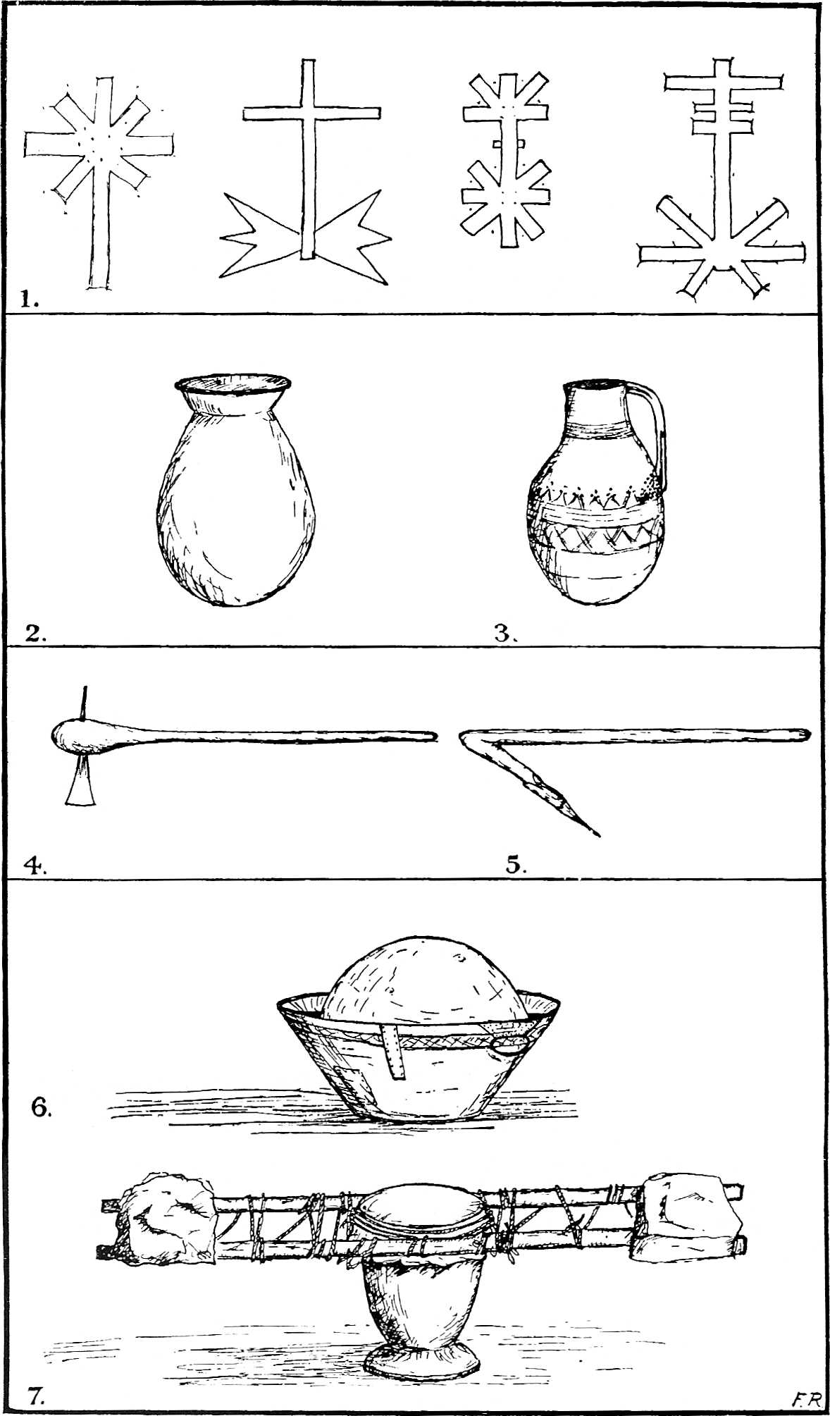
- 1. Ornamentation on shields.
- 2. Clay cooking pot.
- 3. Clay water pot.
- 4. Axe.
- 5. Adze.
- 6. Drum: calabash in a bowl.
- 7. Drum: millet mortar.
For many months of the year after the rains the true nomads do not even trouble to cluster round a group of wells; living on the milk of their camels and goats, they dispense with water for weeks on end. So long as their camels are only pasturing and the fodder is green they do not require to be watered. They are therefore able to live many days from the nearest wells. In such conditions water is a luxury, for it entails long marches and is not essential to man or beast. In South-eastern Air I came across a small party of Kel Takrizat, who had wandered some distance away from their usual grounds in North-western Air, to an area which had been uninhabited since the war. I was riding out from Tabello on the upper Beughqot valley to look for an old village site of which I had heard. Neither my companion, Alwali, nor I had any baggage, and we were short of water, as the skin I carried was leaky. For a mere two days’ journey Alwali had not thought it worth while[210] to bring any food for himself except a small skin of millet meal milk, which he had finished early the first afternoon. In the evening we entered a wide valley known as Tsabba,[200] where we saw a number of camels pasturing. We discovered that they belonged to a charming man called Ahmadu ag Musa. The valley was about miles broad from lip to lip, very green and full of a veitch-like plant called “Alwat,” which contains much moisture. The bottom under the steep sides lay some 100 feet below the level of the plain, which was covered with round basalt boulders wherever there were not hillocks of bare rock rising above it. It is a very arid country looking out towards the Eastern Desert, where the last rocks of Air are swallowed up in sand some thirty miles further on. Ahmadu’s camp consisted of a few mats spread under two or three little trees. As we reached it he came out to meet us. When he found out who we were, he asked me to spend the night with him; and this, having at the time intermittent fever which was due that evening, I willingly agreed to do, provided he could let me have some water. He regretted that he had no water, as he had not been near a well for three weeks, but his men went to fetch milk. I had barely dismounted and agreed to stay when a man ran up with a mat for me to sit on and a bowl of sour milk to drink. Among the Tuareg, if a man comes as a guest his host is personally responsible for his guest’s life, camels and property, so a slave unsaddled my two camels and hobbled them in the usual way by tying the two fore fetlocks together with the short hobble rope which everyone carries. My animals were driven off to feed with Ahmadu’s herd of piebald cow camels. I thought at first it was part of the famous Tegama herd of Ahmadu of the Kel Tagei, but it turned out to be another Ahmadu.
For many months of the year after the rains, the true nomads don't even bother gathering around a group of wells; living off the milk from their camels and goats, they can go weeks without water. As long as their camels are grazing and the fodder is green, they don’t need to be watered. This allows them to survive for many days away from the nearest wells. In such circumstances, water becomes a luxury, requiring long walks and is not essential for either humans or animals. In Southeastern Air, I encountered a small group of Kel Takrizat who had wandered far from their usual grounds in Northwestern Air to an area that had been uninhabited since the war. I was riding out from Tabello in the upper Beughqot valley to search for an old village site I had heard about. Neither my companion, Alwali, nor I had any luggage, and we were low on water since the skin I carried was leaking. For just a two-day journey, Alwali had deemed it not worth bringing food for himself except for a small skin of millet meal milk, which he had finished early the first afternoon. That evening, we entered a wide valley known as Tsabba, where we saw several camels grazing. We found out they belonged to a friendly man named Ahmadu ag Musa. The valley was about [miles] wide, very green, and filled with a moisture-rich plant called “Alwat.” The valley floor, lying about 100 feet below the level of the plain, was covered with round basalt boulders except where there were hillocks of bare rock sticking up from it. It’s a very dry area looking toward the Eastern Desert, where the last rocks of Air disappear into sand about thirty miles further on. Ahmadu’s camp consisted of a few mats laid out under two or three small trees. As we arrived, he came out to greet us. When he learned who we were, he invited me to spend the night with him, which I happily accepted, as I was dealing with intermittent fever that evening, provided he could offer me some water. He regretted that he had no water since he hadn’t been near a well for three weeks, but his men went to get milk. I had barely dismounted and agreed to stay when a man ran up with a mat for me to sit on and a bowl of sour milk to drink. Among the Tuareg, when a person comes as a guest, their host is personally responsible for the guest’s life, camels, and property, so a slave unsaddled my two camels and hobbled them in the usual way, tying their two front fetlocks together with the short hobble rope that everyone carries. My animals were driven off to graze with Ahmadu’s herd of piebald cow camels. At first, I thought it was part of the famous Tegama herd of Ahmadu of the Kel Tagei, but it turned out to be another Ahmadu.
I met him only that once, and for a few moments two days later at Tabello. I have the pleasantest recollections of a great gentleman. We sat talking of the impending departure of the salt caravan for Bilma. The sun set slowly, and, as the[211] light grew less, the cruel gleam left the basalt and granite of the plateau beyond the eastern lip of the valley. The rocks ceased to look metallic in the dance of the hot air, and became soft red and purple in the green-blue sky. Here and there white sand from the outer desert had been washed up against the hillocks. Mount Gorset, with one slope inundated by the sand flood, lay just north of the valley where we sat surrounded by acacia bushes and “Alwat.” The wind had fallen. More and more food was brought for us to eat, all of it of the sort on which the true nomad lives. Cheese, sweet and sour milk, curdled milk, whey water, some cakes of baked burr-grass seed and a very little millet. We sat down to eat; they thought I wanted to eat alone at first, but became more friendly when they saw that some white men were only human like themselves. A pot of cooked millet meal was set down in the middle; luckily they had added salt to the porridge. Each man in turn ate a mouthful from the big wooden spoon and handed it on to his neighbour. I ate little, having fever, but drank much milk, both sweet and sour. The former arrived during the meal, warm and fresh from the camel. It is best quite fresh; when it gets cold in the night it is good too, but becomes rather salt and thin to the taste. We went on eating slowly in the evening, and suddenly night came with a greenish light in the west behind our backs. Milk was left for me to drink during the night; a slave was told to fill my skin with millet meal and milk for the next day. We went on talking, and then the snuff-box was passed round. The Tuareg in Air do not smoke: their only vice, in the austere life they lead, is to take snuff, when they can get it, or to chew green tobacco mixed with a little saltpetre to bring out the taste. The tobacco and snuff are traded from the Southland: the saltpetre is found in Air, and is also used in cooking, for they say that a pinch in the stew-pot makes the meat cook in half the usual time. Presently I turned over to go to sleep on Ahmadu’s mat, in a blanket which I had brought. He and Alwali went on talking far into the night, for they were old friends: Alwali had travelled with him when he was a boy many years ago.
I met him just that once, and for a few moments two days later at Tabello. I have the fondest memories of a true gentleman. We sat chatting about the upcoming departure of the salt caravan for Bilma. The sun set slowly, and as the[211] light faded, the harsh shine left the basalt and granite of the plateau beyond the eastern edge of the valley. The rocks stopped looking metallic in the heat haze and turned soft red and purple against the green-blue sky. Here and there, white sand from the outer desert had been pushed up against the hills. Mount Gorset, with one slope covered by the sand, lay just north of the valley where we sat surrounded by acacia bushes and “Alwat.” The wind had calmed down. More and more food was brought for us to eat, all of it the kind true nomads live on. Cheese, sweet and sour milk, curdled milk, whey water, some baked cakes made from burr-grass seeds, and a little bit of millet. We sat down to eat; at first, they thought I wanted to eat alone, but they became friendlier when they realized that some white men are just human like themselves. A pot of cooked millet was placed in the middle; thankfully, they had added salt to the porridge. Each man took a mouthful from the big wooden spoon and passed it to his neighbor. I ate little, since I had a fever, but drank plenty of milk, both sweet and sour. The sweet milk arrived during the meal, warm and fresh from the camel. It’s best when it’s fresh; when it gets cold at night, it’s still good, but tastes a bit salty and thin. We continued eating slowly in the evening, and suddenly night fell with a greenish light in the west behind us. Milk was left for me to drink during the night; a slave was instructed to fill my skin with millet and milk for the next day. We kept chatting, and then the snuff-box was passed around. The Tuareg in Air don’t smoke; their only vice, in the strict life they lead, is taking snuff when they can get it, or chewing green tobacco mixed with a bit of saltpetre to enhance the flavor. The tobacco and snuff are traded from the South; the saltpetre is found in Air and is also used in cooking, as they say a pinch in the stew pot makes the meat cook in half the usual time. Eventually, I turned over to sleep on Ahmadu’s mat, wrapped in a blanket I had brought. He and Alwali continued talking late into the night, as they were old friends: Alwali had traveled with him when he was a boy many years ago.
[212]I thought of how very happy these nomads were. They have no possessions to speak of: a few mats, the clothes they wear, some water-skins, some camel trappings, a few weapons, some gourds and bowls, a cooking-pot or two and their camels. They have no routine of life, and no cares except to wonder if a raiding party will or will not happen on them. Even in their normal centres where their tribes are living more or less permanently they often have neither tents nor covering. At the best their tent is a leather roof made of two or three ox skins carried on a few poles, with brushwood laid across so that the top is dome-shaped. The sides are enclosed with vertical mats, and inside, if they are rich, they have a bed—two poles supported on four forked sticks stuck in the ground, with six transverse poles overlaid with stiff mats, woven of “Afaza” grass and strips of leather. On this bed, which is perhaps eight feet square, the whole family sleeps during the rains. At other times they sleep anywhere, on a mat on the ground. Their smaller possessions are carried in a leather sack of tanned goatskins, dyed and ornamented with fringes. All the belongings of a rich family could be loaded on one, certainly on two camels. So they move about looking for pasture. They are independent of water; their camels and goats provide both food and drink, the grasses of the field a change of diet; a slaughtered sheep or millet porridge is their luxury. When they want a fire they kindle it by rubbing a small green stick cut about the size of, and sharpened like, a pencil on a dry stick; the dust and fibre rubbed off the dry wood collect at one end of the channel which has been rubbed, and when the friction is enough, ignites. They do not even require flint and steel. I am sure they must be very happy, for they want so little and could have so much when the value of their herds often runs into thousands of pounds, but they prefer the freedom of the open world. They are even envied by the village dwellers, whose sole ambition is to make enough money to buy camels and live in the same way as their wandering kinsmen.
[212]I thought about how happy these nomads are. They have hardly any belongings: just a few mats, the clothes they wear, some water skins, some camel gear, a few weapons, a couple of gourds and bowls, one or two cooking pots, and their camels. They don’t have a set routine and only worry about whether a raiding party will come after them. Even in their main areas where their tribes settle more or less permanently, they often lack tents or coverings. At best, their tent is a leather roof made from two or three ox hides stretched over a few poles, with brushwood laid across to create a dome shape. The sides are surrounded by vertical mats, and inside, if they’re wealthier, they have a bed—two poles supported by four forked sticks stuck in the ground, covered with six horizontal poles topped with stiff mats woven from “Afaza” grass and strips of leather. On this bed, which is about eight feet square, the entire family sleeps during the rainy season. At other times, they sleep anywhere on a mat on the ground. Their smaller belongings are carried in a leather sack made from tanned goatskins, dyed and decorated with fringes. All the belongings of a wealthy family could fit on one, maybe two camels. So they move around in search of pastures. They don't depend on water; their camels and goats provide food and drink, while the grasses offer a change in diet; a slaughtered sheep or millet porridge is a treat for them. When they want to start a fire, they rub a small green stick cut to the size and sharpened like a pencil onto a dry stick; the dust and fibers scraped off the dry wood collect at one end of the rubbed spot, and when there’s enough friction, it ignites. They don’t even need flint and steel. I’m sure they must be very happy since they want so little yet have so much, as the value of their herds can run into thousands of pounds, but they prefer the freedom of the open world. Even the villagers envy them, whose only ambition is to earn enough money to buy camels and live like their wandering relatives.
[182]Jean, op. cit., Chap. XIII.
[183]Chudeau, op. cit., Sahara Soudanais, pp. 71-2.
[184]It must be remembered that since the evacuation of 1918 many of these animals are with their owners in Southern Air, Damergu, and the south, pending a return to normal conditions.
[184]It's important to remember that since the evacuation in 1918, many of these animals are with their owners in Southern Air, Damergu, and the south, waiting for normal conditions to return.
[185]Duveyrier, op. cit., p. 234.
[188]Apud Plutarchus, Lucullus, XI. 10.
[193]Cf. Strabo, XVII. 1. 45.
[196]Herodotus, IV. 183.
__A_TAG_PLACEHOLDER_0__Herodotus, IV. 183.
[213]CHAPTER VII
TRADE AND OCCUPATIONS
Jobs and Trades
The Auderas country, still almost in Tegama, is far less interesting ethnically than the north or east. The old permanent habitations in the area are less characteristic of the Tuareg; there are hardly any inscriptions or rock drawings, with the exception of the large group at T’in Wana, and a few scattered about elsewhere. Owing to the many pools and “eresan”[201] there are no deep wells. At Auderas itself there are some ruined stone-built dwellings of the later type, but a few earlier examples may be seen both there and at Abattul, a village about two miles to the N.E. in the same basin of valleys. A famous mosque was founded there by Muhammad Abd el Kerim el Baghdadi. Abattul village lies between the domed peaks of Faken[202] and Mt. Abattul, which is itself a spur of Mount Todra. Behind, and between them, a valley and rough track run north to Mount Dogam. Just south of the village are the valleys which converge from Todra and Faken on the main Auderas basin. From Auderas Mount Faken is a prominent object on the northern horizon with a rounded top and vertical black sides which look unscalable. Almost at the foot of Faken on the Abattul side is a pool in a deep gorge, usually containing water enough to swim in most of the year. The path from Auderas to Abattul is very rough, as it crosses and re-crosses several small valleys where gazelle, some wild pig, and occasionally monkeys are to be found. Abattul village lies just under a low white cliff in which there are a few caves and many smaller holes inhabited by owls and[214] night birds. It was the first settlement in the basin and was only gradually abandoned as the country became less subject to raids and war. The inhabitants had settled in this place so that they could easily take refuge in the inaccessible crags of Mount Todra just behind their village, in time of raids. Even nowadays the folk from Auderas have to resort to the mountain from time to time, but not so often as to prevent them from living further away. The stone mosque at Abattul is one of the few in Air which is still used for prayer.[203]
The Auderas region, still almost in Tegama, is much less diverse ethnically than the north or east. The old permanent settlements in the area aren't very characteristic of the Tuareg; there are hardly any inscriptions or rock carvings, except for the large group at T’in Wana and a few scattered elsewhere. Because of the many pools and “eresan”[201] there are no deep wells. In Auderas itself, there are some ruined stone buildings of a later style, but a few earlier examples can be seen both there and in Abattul, a village about two miles to the northeast in the same valley basin. A well-known mosque was established there by Muhammad Abd el Kerim el Baghdadi. The village of Abattul sits between the domed peaks of Faken[202] and Mount Abattul, which is part of Mount Todra. Behind and between them, a valley and a rough track lead north to Mount Dogam. Just south of the village, valleys converge from Todra and Faken into the main Auderas basin. From Auderas, Mount Faken is a prominent feature on the northern horizon with a rounded top and vertical black sides that appear impossible to climb. Almost at the base of Faken, on the Abattul side, there's a pool in a deep gorge that usually has enough water for swimming most of the year. The route from Auderas to Abattul is quite rough, as it crosses and re-crosses several small valleys where you can find gazelles, some wild pigs, and occasionally monkeys. Abattul village is located just below a low white cliff with a few caves and many smaller holes inhabited by owls and[214] night birds. It was the first settlement in the basin and was gradually abandoned as the area became less vulnerable to raids and warfare. The residents settled here so they could easily take refuge in the inaccessible cliffs of Mount Todra just behind their village during raids. Even now, the people from Auderas occasionally have to retreat to the mountain, but not often enough to stop them from living further away. The stone mosque at Abattul is one of the few in Air that is still used for prayer.[203]
The main road from Auderas to Northern Air runs over very rocky ground to a plain west of Faken, bordered by two valleys on the east and by low hills on the west side. The latter continue for some distance along the valley of Auderas until it eventually reaches the foothills of Air on the Talak plain. The different groups of hills are known by names which the Itesan sub-tribes adopted and retained.[204] The plain north of Agades is the Erarar n’Dendemu of Barth:[205] it contains El Baghdadi’s place of prayer mentioned by the traveller, lying under a small hill. Turning left here into more broken country by a small tributary the track enters the Ighaghrar valley, which descends from the Gissat and T’Sidderak hills.[206]
The main road from Auderas to Northern Air goes over very rocky terrain to a plain west of Faken, bordered by two valleys on the east and by low hills on the west. These hills stretch for some distance along the Auderas valley until they eventually reach the foothills of Air on the Talak plain. The different groups of hills are known by names that the Itesan sub-tribes adopted and kept. [204] The plain north of Agades is the Erarar n’Dendemu of Barth:[205] it contains El Baghdadi’s place of prayer mentioned by the traveler, located under a small hill. Turning left here into rougher terrain by a small stream, the path enters the Ighaghrar valley, which descends from the Gissat and T’Sidderak hills.[206]
At the head of the basin a steep drop leads into a valley flowing north between Mount Bila to the west and Mount Dogam to the east. This drop, the descent of Inzerak, is equivalent to the ascent south of Auderas at T’inien on to the central platform of the plateau. It leads into one of the most beautiful valleys in Air, called Assada, the head of which, at right angles to its main direction, is formed by small ravines draining Mount Dogam. It runs along the[215] eastern foot of Bila and falls into Anu Maqaran, the central basin of Air. When we came into Assada there were two or three pools near the foot of Inzerak; further up the T’ighummar tributary lay a small village of stone houses with a deep well and mosque on an alternative loop road from Auderas branching off at the place of prayer of El Baghdadi. This alternative track was the one taken by Barth in 1850; it debouches into the Tegidda valley, a tributary of the Assada from the north, at Aureran well.
At the top of the basin, a steep drop leads into a valley that flows north between Mount Bila to the west and Mount Dogam to the east. This drop, known as the descent of Inzerak, is similar to the ascent south of Auderas at T’inien up to the central platform of the plateau. It takes you into one of the most beautiful valleys in Air, called Assada, which is shaped at a right angle to its main direction by small ravines draining Mount Dogam. It runs along the eastern foot of Bila and flows into Anu Maqaran, the central basin of Air. When we entered Assada, there were two or three pools near the foot of Inzerak; further up the T’ighummar tributary, there was a small village of stone houses with a deep well and a mosque on an alternate road from Auderas that branches off at the prayer place of El Baghdadi. This alternate path was the one Barth took in 1850; it empties into the Tegidda valley, a northern tributary of Assada, at Aureran well.
I camped in Assada three times in all, twice near the foot of the descent and once a mile or so further down at the wells of Tamenzaret,[207] which are temporary and require to be dug again every year. The deep narrow valley with its sandy bed and immense trees growing in the thick vegetation on both banks was magnificent. Towering up on either side the red mountains framed, in a cleft towards the east, the cone of Dogam seated on a pedestal of black lava and basalt. Most of the Dogam massif is so rough as to be impassable. It seems to be a volcanic intrusion in the Todra group, to which it really belongs. I suspect that the basalt boulders covering the plain north and south of Auderas, and perhaps certain features of Todra itself, owe their origin to the Dogam activity. But Bila is hardly less imposing: on the Assada side it presents a wall of vivid red rock. The fine clean colours of dawn on the first morning I saw the mountains against a cold blue sky offered the most lovely spectacle I saw in all Air.
I camped in Assada three times in total, twice near the bottom of the descent and once about a mile further down at the wells of Tamenzaret,[207] which are temporary and need to be dug out again each year. The deep, narrow valley with its sandy floor and huge trees growing in the thick vegetation on both sides was stunning. Towering on either side, the red mountains framed a gap to the east, showcasing the cone of Dogam sitting on a base of black lava and basalt. Most of the Dogam massif is so rugged that it can't be traversed. It appears to be a volcanic intrusion in the Todra group, to which it actually belongs. I suspect that the basalt boulders covering the land north and south of Auderas, and maybe some features of Todra itself, are a result of Dogam's activity. But Bila is almost as impressive: on the Assada side, it features a wall of bright red rock. The vibrant colors of dawn on the first morning I saw the mountains against a cold blue sky provided the most beautiful sight I experienced in all of Air.
The Assada and T’ighummar valleys are inhabited by a northern section of the Kel Nugguru, who pasture their goats and camels there, and owe allegiance to Ahodu of Auderas. There are a few ruined stone houses below Tamenzaret and the remains of a mosque at the old deep well of Aureran, where the main road divides. From here one branch proceeds north past another ruined settlement to the Arwa Mellen valley and mountain, the other turns east towards the upper part of the Anu Maqaran basin.[216] I took the latter road to T’imia. It crossed several broad valley beds flowing northwards from Dogam, notably the Bacos, where there is a village and palm grove, and the Elazzas not far from where they fall into Anu Maqaran. The road I have had occasion to mention as running from Agades by the Ara valley over the shoulder of Dogam descends from the Central massif by Bacos or Elazzas. The latter corresponds to the Ara on the other side of the Dogam pass. By these two the Todra-Dogam group is divided from Bagezan.
The Assada and T’ighummar valleys are home to a northern group of the Kel Nugguru, who graze their goats and camels there, and are loyal to Ahodu of Auderas. There are a few old stone houses below Tamenzaret and the remains of a mosque at the old deep well of Aureran, where the main road splits. One branch goes north past another abandoned settlement to the Arwa Mellen valley and mountain, while the other heads east toward the upper part of the Anu Maqaran basin.[216] I took the eastward road to T’imia. It crossed several broad valley beds flowing north from Dogam, notably the Bacos, where there’s a village and palm grove, and the Elazzas not far from where they join Anu Maqaran. The road I've mentioned that runs from Agades through the Ara valley over the shoulder of Dogam descends from the Central massif by Bacos or Elazzas. The latter connects to the Ara on the other side of the Dogam pass. Through these two, the Todra-Dogam group is separated from Bagezan.
Near its junction with the main Anu Maqaran valley, the Elazzas is a broad bed between low rocky banks. At a certain point where it crosses a ridge of rock large quantities of water are held up in the sand. The remains of a recent village with a few date palms appear on the site. The rocks in the neighbourhood bear a few rude pictures, but the ruins, a few round pedestal foundations of loose stones some 15-20 feet in diameter and 2-3 feet high, on which reed huts used to stand, are uninteresting. Bila from here has the appearance of a long flat ridge, in pleasant contrast to the isolated peaks of Aggata and Arwa in the north, or the confused mass of Bagezan to the south and south-east.
Near its junction with the main Anu Maqaran valley, the Elazzas is a wide riverbed between low rocky banks. At one point where it crosses a rocky ridge, large amounts of water get trapped in the sand. The remains of a recent village with a few date palms can be seen at the site. The surrounding rocks have some crude carvings, but the ruins—few round pedestal foundations made of loose stones that are about 15-20 feet in diameter and 2-3 feet high, where reed huts used to stand—aren't particularly interesting. From here, Bila looks like a long flat ridge, standing in a nice contrast to the isolated peaks of Aggata and Arwa to the north, or the tangled mass of Bagezan to the south and southeast.
The upper part of the Anu Maqaran valley where the Bagezan and the Agalak mountains at the western side of the T’imia massif approach one another is called Abarakan. The road passes a large cemetery and the valley narrows between high hills with bare sides until a big fork is reached: one valley goes north to T’imia village, the other south, emerging on the central plateau east of the Bagezan mountains.
The upper part of the Anu Maqaran valley, where the Bagezan and Agalak mountains on the western side of the T’imia massif come close together, is called Abarakan. The road goes past a large cemetery, and the valley narrows between tall hills with bare sides until you reach a big fork: one valley heads north to T’imia village, while the other goes south, leading out onto the central plateau east of the Bagezan mountains.
T’imia village is a veritable mountain fastness. The Agalak-T’imia massif was evidently highly volcanic, for a great flow of basalt overlying pink granite boulders has taken place along the valley towards Abarakan. The track climbs steadily over the broken lava stream. The going is rough. Then suddenly the track seems to end altogether below an overhanging cliff of lava some 30 feet high lying right across the bed of the ravine. We reached this point[217] and found the men of T’imia had come down to meet us in order to help our camels to negotiate the path which follows a narrow crevasse in one side of the cliff. The cleft is so narrow that a camel with a bulky load cannot pass at all; it is so steep that the poor animals were forced to proceed in a series of ungainly lurches or jumps. Above the cliff the valley broadens out again, and where two small side valleys enter it lies the modern village of T’imia.
T’imia village is a true mountain stronghold. The Agalak-T’imia massif was clearly very volcanic, as a massive flow of basalt covers pink granite boulders along the valley towards Abarakan. The path steadily climbs over the broken lava stream. The terrain is rough. Then suddenly, the path seems to end completely beneath an overhanging lava cliff about 30 feet high, blocking the ravine. We reached this point[217] and found that the people of T’imia had come down to assist us in getting our camels through a narrow crevasse on one side of the cliff. The opening is so tight that a camel with a heavy load can't get through at all; it's so steep that the poor animals have to move in a series of awkward lurches or jumps. Above the cliff, the valley opens up again, and at the junction of two small side valleys lies the modern village of T’imia.
PLATE 23
PLATE 23

TIMIA GORGE
TIMIA GORGE

TIMIA GORGE: PINK GRANITE TO LEFT, BLACK BASALT TO RIGHT
TIMIA GORGE: PINK GRANITE ON THE LEFT, BLACK BASALT ON THE RIGHT
This settlement of Kel Owi nobles is very different from the servile Auderas. The parentage of these Kel Owi may be obscure and mixed, but their physique, the general cleanliness of the place and the neatness of their domed huts stamp them as nobles. The dwellings stand grouped in compounds, or sometimes as single huts, scattered between a row of gardens with irrigation wells, and the slope of a hill covered with huge boulders. In one of the smaller side valleys is a large grove of date palms with most of the gardens, near the site of the older village, a collection of rectangular masonry houses in ruins, and round hut sites marked by a ring of stones and a hearth. The little mosque of stone and mud construction lies between the old and new villages, but it was desecrated by the French soldiers and is no longer used. A matting shelter and compound in the new settlement serve to-day both for a place of prayer and a school, presided over by the ’alim ’Umbellu. Though over sixty he still works daily in his garden in the intervals of teaching the children of the village. Fugda, chief of T’imia, is one of the cleverest men in Air. Under the guidance of these two men the community has prospered. The villagers are enterprising. In the changing conditions of things they are an exception to the usual rule, for the men combine caravaning and trading on a large scale with gardening and date cultivation, without the help of any Imghad. When we came this way some of their camels were fattening in Abarakan ready to go to Bilma with the annual salt caravan in charge of a selected party of men. Another herd of some 100 head was going to Damergu to fetch millet for sale to[218] the French post at Agades, and later I met yet another drove in Assada going south from Iferuan by way of Auderas to fetch more grain for sale in Northern Air after working on transport duties in Nigeria for the winter.
This settlement of Kel Owi nobles is really different from the subservient Auderas. The background of these Kel Owi might be unclear and mixed, but their physical presence, the overall cleanliness of the area, and the tidiness of their dome-shaped huts clearly signal their noble status. The homes are organized in compounds or sometimes as individual huts, scattered among a row of gardens with irrigation wells, and along the slope of a hill dotted with large boulders. In one of the smaller side valleys, there's a large grove of date palms, with most gardens located near where the older village used to be, featuring a collection of rectangular masonry houses in ruins and round hut sites marked by a ring of stones and a hearth. A little mosque made of stone and mud is situated between the old and new villages, but it was desecrated by the French soldiers and is no longer in use. A matting shelter and compound in the new settlement currently serve as both a place of prayer and a school, led by the ’alim ’Umbellu. Even though he’s over sixty, he still works daily in his garden between teaching the village kids. Fugda, the chief of T’imia, is one of the smartest people in Air. Under the leadership of these two men, the community has thrived. The villagers are resourceful. In the ever-changing circumstances, they stand out from the norm, as the men combine large-scale caravaning and trading with gardening and date growing, all without any Imghad's assistance. When we passed through, some of their camels were being fattened in Abarakan, getting ready to head to Bilma with the annual salt caravan managed by a chosen group of men. Another herd of around 100 camels was heading to Damergu to collect millet to sell to the French post at Agades, and later I encountered yet another group in Assada making their way south from Iferuan through Auderas to fetch more grain for sale in Northern Air after working transport duties in Nigeria for the winter.
The life of the camel-owning Tuareg may be said to centre round the autumn salt caravan, which all the best camels accompany. It usually leaves in October, starting from Tabello[208] in the upper Beughqot valley, where parties from all over Air, Damergu and the Southland rendezvous in order to start together. Since the war these caravans have been comparatively small, but even during the last few years they have numbered 5000 camels. Ever since the occupation of Agades by the French, the Camel Corps has been turned out to guard the concentration and escort the caravan across the desert, for so valuable a congregation of camels might any year, as it sometimes did in the past, prove an irresistible temptation for raiders. The largest caravan ever escorted reached the fantastic total of over 30,000 camels. The caravan marches for five days to the oasis of Fashi, where it is joined by a smaller caravan from Damagarim via Termit. There, a halt is made for a short time to water and feed on whatever scanty pasture is available, and in some three more days Bilma is reached. The animals go out empty except for a little grain or live meat in the form of goats and sheep, and some trade goods for the Tebu and Kanuri inhabitants of Fashi and Kawar and Tibesti. They bring back salt and dates both from Fashi and Bilma. The latter place has perhaps the finest salt deposits in Africa. It costs nothing to get except the labour at the pans of making it up into loaves and loading it wrapped in matting bales. The outlay may be threepence to fivepence a load, in addition to an export tax of two francs per camel levied by the French authorities. The salt is sold in Hausaland for anything up to 7s. or more a loaf according to the time of year. As a fully-grown camel can carry four to six loaves of salt, the trade is extremely lucrative.
The life of the camel-owning Tuareg revolves around the autumn salt caravan, which is attended by the best camels. It usually departs in October from Tabello[208] in the upper Beughqot valley, where groups from all over Air, Damergu, and the Southland meet up to start together. Since the war, these caravans have been relatively small, but in recent years they have still had around 5,000 camels. Ever since the French occupied Agades, the Camel Corps has been deployed to secure the caravan and escort it across the desert, as such a valuable gathering of camels can be a tempting target for raiders. The largest caravan ever escorted reached an incredible total of over 30,000 camels. The caravan marches for five days to the oasis of Fashi, where it joins a smaller caravan coming from Damagarim via Termit. They pause briefly to water the camels and feed them on whatever limited pasture is available, and after another three days, they arrive at Bilma. The animals travel nearly empty, carrying only a bit of grain or live goats and sheep, along with some trade goods for the Tebu and Kanuri people of Fashi, Kawar, and Tibesti. They return with salt and dates from both Fashi and Bilma. Bilma is known for having some of the best salt deposits in Africa. The salt is essentially free to collect, aside from the labor required to turn it into loaves and load it wrapped in matting bales. The cost might be three to five pence per load, plus an export tax of two francs per camel imposed by the French authorities. The salt sells in Hausaland for as much as 7s. or more per loaf, depending on the season. Since a mature camel can carry four to six loaves of salt, the trade is very profitable.
[219]Both Fashi, or Agram as the place is also called, and Kawar have practically no pasture, and the few camels which live permanently there eat dates. The desert for five and a half days between Tabello and Fashi and three days between Fashi and Bilma is not only waterless but also nearly pastureless as well. The camels start out loaded with a sufficient supply of fodder for the outward and return journeys; the huge bales of grass are dropped en route at the end of each day’s march to provide for the equivalent return stage. Since the practice of escorting caravans has been instituted the French authorities quite rightly forbid isolated parties crossing the desert and attracting raiders to the neighbourhood. The route now chosen for the caravan runs from Tabello to Tazizilet on the edge of the Air mountains, and then straight across to Fashi in an almost due easterly direction. Formerly another road, which was more convenient for the northern tribes of Air, was also in use. It left the mountains at Agamgam pool in North-east Air and went to Ashegur well, north of Fashi; this way the distances between watering-points was shortened, and there was also rather more pasture.
[219]Both Fashi, also known as Agram, and Kawar have almost no pasture, and the few camels that live there permanently eat dates. The desert spans five and a half days between Tabello and Fashi and three days between Fashi and Bilma, and it's not only dry but also nearly devoid of pasture. The camels start off with enough fodder for the round trip; large bales of grass are dropped en route at the end of each day’s trek to ensure there’s enough for the return journey. Since the practice of escorting caravans began, the French authorities have rightfully prohibited isolated groups from crossing the desert to avoid attracting raiders. The current caravan route goes from Tabello to Tazizilet on the edge of the Air mountains and then directly across to Fashi in nearly an eastward direction. Previously, another route was used that was more convenient for the northern tribes of Air. It began at the Agamgam pool in Northeast Air and led to the Ashegur well, north of Fashi; this route shortened the distance between watering spots and offered slightly more pasture.
This annual salt caravan is the largest enterprise of its sort in the world at the present time. It is called in Air the “Taghalam,” a word derived from “aghelam,” meaning a “prize camel,” but the French call it the “Azalai,” which means the “Parting” or the “Separation,” the name given to a similar caravan which annually leaves Timbuctoo to collect salt at Taodenit for sale along the Niger.
This annual salt caravan is currently the largest operation of its kind in the world. In Air, it's called the “Taghalam,” a term derived from “aghelam,” meaning a “prize camel.” However, the French refer to it as the “Azalai,” which translates to “Parting” or “Separation,” a name that also applies to a similar caravan that leaves Timbuctoo every year to gather salt at Taodenit for sale along the Niger.
With the advent of European salt in Nigeria the trade has become somewhat less remunerative, as the Air “Taghalam” no longer enjoys its ancient monopoly in the Central Sudan, but the infinitesimal cost of production and the cheap transport in the hands of nomads will always enable it to compete with the imported European trade product to some extent. Bilma salt is of good quality; it is comparatively free from sand or medicinal chemicals and is preferred by the natives of the south to the purer European product.[220] The loaves are made up in conical form and are pink in colour, standing some 18-24″ high by 9-12″ at the base.
With the introduction of European salt in Nigeria, the trade has become somewhat less profitable, as the Air “Taghalam” no longer has its historical monopoly in the Central Sudan. However, the extremely low production costs and affordable transport managed by nomads will always allow it to compete with the imported European products to a certain extent. Bilma salt is of good quality; it’s relatively free from sand or medicinal chemicals and is preferred by the southern natives over the purer European salt. [220] The loaves are shaped like cones and are pink in color, standing about 18-24 inches tall and 9-12 inches at the base.
The return journey of the “Taghalam” follows the same course as the outward one. The whole trip, which is extremely strenuous for men and camels alike, takes some three weeks. There are always a number of casualties among the camels from exhaustion, but so large are the profits that every Tuareg is ready to take the risk and send as many of his herd as he can possibly spare at least once a year, either in the autumn or on the smaller “Taghalam” which goes in the spring. After returning from Bilma the camels are rested and then proceed to Damergu and the south to sell their salt and their services. They are joined by any other camels fit to go, and when they have disposed of their merchandise engage in transport work between the cities of the Southland until about March or April. Then they begin to move north again before the rains set in in the Sudan. The proceeds of this work and of the sale of Bilma salt, or dates from Fashi and Air, are invested in grain and such trade goods as cotton cloth, tea, sugar, snuff and hardware, which are the only luxuries of Air. By the time they reach the mountains the summer rains have probably begun, and they have some three months in which to recuperate on the fresh pasture of the hills in preparation for the next year’s routine.
The return journey of the “Taghalam” follows the same route as the outbound one. The entire trip, which is incredibly demanding for both the men and camels, takes about three weeks. There are always several casualties among the camels due to exhaustion, but the profits are so substantial that every Tuareg is willing to take the risk and send as many of their herd as they can afford at least once a year, either in the autumn or on the smaller “Taghalam” that occurs in the spring. After coming back from Bilma, the camels are rested and then head to Damergu and the south to sell their salt and services. They are joined by other camels that are fit to travel, and once they’ve sold their goods, they engage in transport work between the cities of the South until about March or April. Then they start moving north again before the rains hit the Sudan. The earnings from this work and from selling Bilma salt or dates from Fashi and Air are used to invest in grain and trade goods like cotton cloth, tea, sugar, snuff, and hardware, which are the only luxuries in Air. By the time they reach the mountains, the summer rains have likely begun, giving them about three months to recover on the fresh grass of the hills in preparation for the next year’s routine.
Transactions in salt and grain are measured by the camel load, which varies considerably from place to place. Metrology is not an exact science in Air, but recognised standards nevertheless exist. The actual measures are kept by the tribal chiefs, and it is, of course, common gossip to hear it said that a certain chief gives unduly short weight. The only truly Tuareg measure is a unit of capacity; in the first instance it is the handful, whether of grain or salt or other commodity. But the measure has been standardised by establishing that a handful shall be as much millet grain as an ordinary man can pick up in his hand with the fingers[221] closed palm upwards.[209] Six such handfuls nominally make one “tefakint,” which is measured by heaping the grain in a small circular basket with sloping sides 1¾″ deep × 3⅝″ in diameter at the mouth × 2″ at the bottom. The next larger measure is the “muda,” a cylindrical wooden cup with a hemispherical bottom in a U section. As the handful and the “tefakint” are too small to measure bulky wares like dates, the “muda” has become the effectual standard in the country, but it varies in certain areas. At Auderas it is of five “tefakint,” but in Agades of ten. The T’imia and Kel Owi or Ighazar “muda” is different again, three of them being the same as two Auderas or one Agades “muda.” The three “mudas” are, however, generally recognised and are not the subject of bargaining in each transaction. The measure corresponding to the Air “tefakint” basket in Damergu is a round section cut from a large calabash; this slightly convex plate is held by a loop for the fingers fixed to the underside. All these grain measures are considered to be full when the grain is heaped up so that it runs over the edge.
Transactions in salt and grain are measured by camel load, which varies greatly from one place to another. While metrology isn't an exact science in Air, there are recognized standards. The actual measurements are kept by the tribal chiefs, and it's common gossip that some chiefs give less than the promised amount. The only truly Tuareg measurement is a unit of capacity; initially, it refers to a handful, whether of grain, salt, or other goods. However, it has been standardized to mean the amount of millet grain that an average person can pick up in their hand with their fingers closed and palm facing up.[221]closed [209] Six of these handfuls make up one "tefakint," which is measured by heaping the grain in a small circular basket with sloping sides, measuring 1¾″ deep × 3⅝″ in diameter at the top × 2″ at the bottom. The next larger measure is the "muda," a cylindrical wooden cup with a hemispherical bottom shaped like a U. Since handfuls and "tefakint" are too small to measure larger items like dates, the "muda" has become the primary standard used across the country, though it still varies in some areas. In Auderas, it is equivalent to five "tefakint," but in Agades, it equals ten. The T’imia and Kel Owi or Ighazar "muda" differ, with three of them equal to two Auderas or one Agades "muda." However, the three "mudas" are generally accepted and aren't subject to negotiation in each transaction. The measure that corresponds to the Air "tefakint" basket in Damergu is a round section cut from a large calabash; this slightly convex plate has a loop for holding it by the fingers affixed to the underside. All these grain measurements are considered full when the grain piles over the edge.
For small weights the silver five-franc piece, or “sinko” as it is called, is now also used, especially in measuring the value of silver ornaments. The rate of exchange current in 1922 in Air at Agades was four silver shillings or five silver francs to the “sinko”; a general rate of five obtained elsewhere in Air, as silver francs and shillings were not distinguished from each other. The people of Air have the nomads’ dislike for paper currency in any form. Various coins, including the Maria Teresa dollar, are still in circulation, but French coinage is gradually replacing all others. Cowrie shells are no longer used and gold is now unknown. The mithkal of Agades dates from the time when the gold trade was still flourishing, and its form here is peculiar to this city. It seems to have been a unit of weight and not of currency; as a recognised amount of gold it was used as[222] the basis for striking bargains, but the metal probably did not pass from hand to hand owing to the inconvenience of handling dust. With the decline of the gold trade the mithkal survived as a unit of weight, but its theoretical value changed considerably in the course of centuries. We find in Barth’s day the exchange was reckoned at 1 mithkal = 1000 cowries, and 2500 cowries = 1 Maria Teresa dollar; but whereas the Agades mithkal was only worth two-fifths of a dollar, the Timbuctoo mithkal was worth one-third of a dollar. It is interesting to arrive by a round-about method at a rough estimate of the change in value of the unit.
For small weights, the silver five-franc coin, known as the “sinko,” is now commonly used, especially when assessing the value of silver jewelry. The exchange rate in 1922 in Air at Agades was four silver shillings or five silver francs for one “sinko”; a general rate of five was found elsewhere in Air, as silver francs and shillings were treated the same. The people of Air share the nomads’ aversion to paper money in any form. Various coins, including the Maria Teresa dollar, are still in circulation, but French coins are gradually taking over. Cowrie shells are no longer in use, and gold is now nonexistent. The mithkal of Agades comes from a time when the gold trade was thriving, and its form here is unique to this city. It appears to have been a unit of weight rather than a currency; as a recognized amount of gold, it was used as [222] a basis for making deals, but the metal likely didn’t change hands due to the inconvenience of dealing with dust. With the decline of the gold trade, the mithkal continued to exist as a unit of weight, but its theoretical value changed significantly over the centuries. In Barth’s time, the exchange rate was 1 mithkal = 1000 cowries, and 2500 cowries = 1 Maria Teresa dollar; however, while the Agades mithkal was only worth two-fifths of a dollar, the Timbuctoo mithkal was worth one-third of a dollar. It’s interesting to find a rough estimate of the value change of the unit through indirect means.
The mithkal as a simple unit of weight was a part of a larger unit in the following equation:[210] 100 mithkal = 3 small karruwe = 1 large karruwe = 6½ Arab rottls. The Arab rottl weight varies between 225 grammes in Persia and about 160 grammes in Cairo, several slightly different standard rottls being used in other parts of Egypt. Taking 160 grammes as the equivalent of 1 rottl, and assuming Barth’s equation to be correct, we get 10·4 grammes for the Agades mithkal. The unit of 10·4 grammes of gold dust in the fifteenth century A.D. was in the nineteenth century equal to two-fifths of a Maria Teresa dollar weighing 28·0668 grammes silver 0·833 fine, or in other words, 13·5 grammes of silver.
The mithkal, as a basic unit of weight, was part of a larger unit in the following equation:[210] 100 mithkal = 3 small karruwe = 1 large karruwe = 6½ Arab rottls. The weight of the Arab rottl varies between 225 grams in Persia and about 160 grams in Cairo, with a few slightly different standard rottls being used in other parts of Egypt. Taking 160 grams as the equivalent of 1 rottl, and assuming Barth’s equation is correct, we get 10.4 grams for the Agades mithkal. The unit of 10.4 grams of gold dust in the fifteenth century A.D. was, in the nineteenth century, equal to two-fifths of a Maria Teresa dollar weighing 28.0668 grams of silver at 0.833 fine, or in other words, 13.5 grams of silver.
The only measures of length in Air are the “aghil” (plural “ighillan”)[211] and the “tedi” or “teddi.” The former is the universal dra’, ell or cubit measured from the inner elbow-point to the first joint of the middle finger on an average man, say 5 ft. 10 in. tall. Ten “ighillan” make one “amitral,” the two measures being only used for cloth, etc. The “tedi” is the fathom and is used for measuring the depth of wells or the length of rope, etc. There is no measure in Air for distance, which is invariably calculated by the parts of a day or the number of days taken to cover the ground.
The only units of length in Air are the “aghil” (plural “ighillan”)[211] and the “tedi” or “teddi.” The former is the standard dra’, ell, or cubit, measured from the inner elbow to the first joint of the middle finger on an average man, roughly 5 ft. 10 in. tall. Ten “ighillan” equal one “amitral,” and these two measures are only used for fabric, etc. The “tedi” is the fathom, used for measuring the depth of wells or the length of rope, etc. There’s no measure in Air for distance; it’s always calculated in parts of a day or the number of days it takes to cover the distance.
[223]The pack-saddle of Air is peculiar to the country. It is very simple, consisting of two sheaves of grass or straw, two semi-circular pieces of matting made of plaited dûm palm fronds, a skin filled with grain or stuffed with dry camel dung and a wooden arch terminating in flat boards. A bundle of grass, with the butt ends even and trimmed, is laid on the semi-circular mat, which is then rolled around it and sewn up with ribbands of palm frond by a long wooden or iron bodkin; the flowery ends of the grass project beyond the matting. One of these mat cylinders or cushions is fitted each side of the camel’s hump with the butts nearly touching one another over the withers. Over these pads is placed the arch of wood, the ends of which terminate in boards some 9″ × 3″ at the ends, resting on the pads, which are tied on with twisted dûm palm rope. A stuffed goatskin thrown transversely over the back of the camel behind the hump forms a rear pad. Its corners are tied to the two ends of the arch with adjustable cords to regulate the distance between them. The loads, which must be carefully balanced, are slung over the pack-saddle; two loops on each load are hitched to the other two on the other load with two short sticks. The weight of the load rests on the side pads and the ends of the back pad; the load cords bear on the latter and on the side pads just in front of the wooden arch, which prevents them slipping backwards. The load ropes rest on, and are not tied to, the saddle. No girths, crupper or breastband are used unless the loads are very bulky or need special steadying. Unloading is extraordinarily simple, for as soon as the camel has been knelt down the loops are disconnected by pulling out the short sticks and the loads fall down on either side.
[223]The pack-saddle of Air is unique to the region. It’s quite simple, made up of two bundles of grass or straw, two semi-circular pieces of matting from woven dûm palm fronds, a bag filled with grain or packed with dried camel dung, and a wooden arch that ends in flat boards. A bundle of grass, with the cut ends even and trimmed, is placed on the semi-circular mat, which is then rolled around it and sewn up with strips of palm frond using a long wooden or metal needle; the flowery ends of the grass stick out beyond the matting. One of these mat cylinders or cushions is placed on each side of the camel’s hump, with the ends nearly touching over the withers. The wooden arch is placed over these pads, with ends that rest on the pads; the pads are tied on with twisted dûm palm rope. A stuffed goatskin draped across the camel’s back behind the hump forms a rear pad, with corners tied to the ends of the arch using adjustable cords to adjust the distance between them. The loads, which need to be carefully balanced, are placed over the pack-saddle; two loops on each load are connected to the other two on the opposite load using short sticks. The weight of the load rests on the side pads and the ends of the back pad; the load cords press against those and the side pads right in front of the wooden arch, which keeps them from sliding backward. The load ropes sit on the saddle and are not tied to it. No girths, cruppers, or breastbands are used unless the loads are quite large or need extra support. Unloading is really straightforward, because as soon as the camel kneels down, the loops can be disconnected by pulling out the short sticks, allowing the loads to fall down on either side.
The pack-saddle is simple and cheap, but is not efficient on steep slopes where the camel may stumble or lurch awkwardly. As these conditions prevail all over Air, the arrangement is really far from ideal, though in the plain land it is practical enough. The principal advantages are that every part of the saddle is easily adjustable to suit any particular camel, while the whole equipment weighs next[224] to nothing. The goatskin used as the back pad on long journeys is filled with a provision of grain, saving an additional receptacle on each camel of the caravan. The resultant economy of space and bulk is unequalled in any other system.
The pack-saddle is straightforward and affordable, but it's not very effective on steep slopes where the camel might trip or sway uncomfortably. Since these conditions are common throughout Air, the setup is pretty far from ideal, although it works well enough on flat land. The main benefits are that every part of the saddle can be easily adjusted to fit any specific camel, and the entire setup is incredibly lightweight. The goatskin used as the back pad on long trips is stuffed with grain, eliminating the need for an extra container on each camel in the caravan. The resulting efficiency in space and bulk is unmatched by any other system.
The rest of the camel’s equipment consists of a head rope, a hobbling rope and the load ropes. In Air all rope is made of split dûm palm fronds soaked in water till they have fermented, or, if no time is available, from fresh material. The strips are twisted like ordinary two or three strand “cable laid” rope. It is a strong, serviceable material costing nothing and available everywhere where the dûm palm grows, which is all over Air and the Sudan. The scarcity of date palms precludes the use of the brown fibre which grows below the fronds, known to camel travellers in the north. The dûm palm rope does not wear so well as the latter but is easier to manufacture. Every camel-man in Air spends a certain part of the day making rope, twisting the fronds from split ribbands about ¼-½″ broad, bundles of which he carries about; he sits on the ground talking and twisting, using his big toe to hold the end of the rope he has made, and weaving in strand after strand with incredible speed. The rope is nearly all two-stranded cable, but the tightness of twist and the finish vary with the use. Load ropes are very closely twisted cable, passed twice round the package at each end and terminating in a loop adjusted by a running half-hitch to raise or lower the load on the side of the camel. Lashing rope and rough nets are made of loosely twisted strands. The camel head rope is a long piece with a slip knot at one end passed over the lower jaw of the camel and pulled tight behind its front teeth. Hobble ropes are stout lengths passed round one foreleg, then twisted and passed round the other, leaving about 18″ of movement between the limbs: the ends are secured by passing a knot through a small loop. Carefully made rope is beaten with a stone to make the strands pack tightly.
The rest of the camel's gear includes a head rope, a hobbling rope, and load ropes. In Air, all ropes are made from split dûm palm fronds soaked in water until they ferment, or if time is short, from fresh material. The strips are twisted like regular two or three-strand “cable laid” rope. It's a strong, practical material that costs nothing and is available everywhere the dûm palm grows, which is all over Air and Sudan. The lack of date palms means they can't use the brown fiber that grows beneath the fronds, known to camel travelers in the north. The dûm palm rope doesn't last as long as the latter but is easier to make. Every camel handler in Air spends part of the day making rope, twisting fronds from split ribands about ¼-½″ wide, which they carry in bundles. They sit on the ground chatting and twisting, using their big toe to hold the end of the rope they've made, weaving in strand after strand incredibly quickly. The rope is mostly two-stranded cable, but the tightness of the twist and the finish depend on its use. Load ropes are tightly twisted cable, wrapped around the package twice at each end and ending in a loop that can be adjusted with a running half-hitch to raise or lower the load on the side of the camel. Lashing ropes and rough nets are made from loosely twisted strands. The camel head rope is a long piece with a slip knot at one end that goes over the camel's lower jaw and is pulled tight behind its front teeth. Hobble ropes are sturdy lengths wrapped around one foreleg, twisted, and then wrapped around the other, allowing about 18″ of movement between the legs; the ends are secured by passing a knot through a small loop. Carefully made ropes are beaten with a stone to make the strands pack tightly.
Loading camels is hard work and can only properly be done by two men. The pack-saddle is put on the kneeling[225] camel, which is prevented from rising by slipping one of his knees through a looped hobble rope, which, when not in use, is carried round the animal’s neck. The camel protests vigorously in season and out of season and pretends to bite the men. They work stripped to the waist, wearing only their trousers tucked up to the thigh, and the inevitable veil. They stagger under 150 to 200 lbs. loads, swinging them on to the camel’s back, slipping the loops through one another and securing them with the two sticks. The camel is then released, gets up with a jerky movement resembling a deck chair being opened, and probably throws its burden to the ground immediately, when the operation recommences. If this does not happen at once the head rope is secured to the next camel in front with a half-hitch that can be released by pulling the free end. By the time fifty camels have been loaded, at least five in an endeavour to graze on the same bush have bumped into one another and their loads have fallen off. The operation of loading may take place in the early morning when it is cool, or before dawn when it is always cold, or at noon when the temperature is like a furnace; it is always tedious and tiresome and bad for the temper, which the incessant complaining of the camels aggravates.
Loading camels is tough work and can only really be done by two people. The pack-saddle is placed on the kneeling[225] camel, which is kept from getting up by slipping one of its knees through a looped hobble rope that is carried around the animal's neck when not in use. The camel protests loudly at all times, pretending to bite the men. They work bare-chested, wearing only their trousers rolled up to the thigh, and the usual veil. They struggle with loads between 150 to 200 lbs, swinging them onto the camel's back, looping them together, and securing them with two sticks. The camel is then released, gets up with a jerky motion like a deck chair being opened, and usually drops its load immediately, causing the process to start all over again. If this doesn’t happen right away, the head rope is tied to the next camel in line with a half-hitch that can be easily untied by pulling the free end. By the time fifty camels have been loaded, at least five, trying to graze from the same bush, have bumped into each other and their loads have fallen off. The loading process can happen early in the morning when it's cool, or before dawn when it's always cold, or at noon when the heat is intense; it's always tedious, exhausting, and stressful, which is made worse by the constant complaints of the camels.
Eventually the caravan moves off. The camel-men walk along, watching their loads if they are conscientious, and when everything is going well they climb up on their camels and sit on the loads. They jump up on to the neck of the camel after pulling its head down and so reach the top, but they never kneel a camel after it has started on the march until the day’s journey is over, unless the load has been thrown or has slipped very badly. The guide takes the head of the caravan and the march starts. The Tuareg of Air know their mountains as well as the average Londoner knows London: they can find their way along the more important tracks. For the less known ways a special guide must be found: in the outer deserts the reliable guides can be counted on the fingers of both hands. Efale, the leader of the “Taghalam” and veteran of the Eastern Desert, T’ekhmedin[226] and Kalama on the northern routes—are all resourceful, patient and observant men when travelling, but complete autocrats whose orders cannot be questioned. Their knowledge of the roads depends on estimation of time and memory and not on any supernatural powers. They know the stars[212] and have some sense of direction, but especially do they know every fold of ground and almost every bush. Their powers are remarkable but not inexplicable; their observation and memory rarely fail them, but for obvious reasons they do not care to travel by night. Once started the march goes on hour after hour. The heat grows more intense. The narrow path winds down the bed of a valley or among the trees on the banks, or over rocky plains or amid sand dunes.
Eventually, the caravan sets off. The camel handlers walk alongside, keeping an eye on their loads if they're responsible, and when everything is going smoothly, they hop up on their camels and sit on the loads. They jump onto the camel's neck after pulling its head down to reach the top, but they never kneel a camel after it has begun the march until the day’s journey is finished, unless the load has fallen off or slipped badly. The guide takes the lead, and the march begins. The Tuareg of Air know their mountains as well as the average Londoner knows London: they can navigate the major paths easily. For the less familiar routes, a special guide is needed: in the outer deserts, reliable guides can be counted on one hand. Efale, the leader of the “Taghalam” and a veteran of the Eastern Desert, T’ekhmedin[226] and Kalama on the northern routes—are all resourceful, patient, and observant men while traveling, but they are complete autocrats whose orders cannot be questioned. Their knowledge of the roads is based on estimating time and memory, not on any supernatural abilities. They know the stars[212] and have a decent sense of direction, but especially they know every contour of the land and almost every bush. Their skills are impressive but not mysterious; their observation and memory rarely fail them, but for obvious reasons, they prefer not to travel at night. Once they start, the march continues hour after hour. The heat grows more intense. The narrow path winds down the valley floor, through the trees along the banks, over rocky plains, or through sand dunes.
In Air the vegetation exists principally along the valleys. In the south the dûm palm grows in veritable forests or in low thickets, when it resembles the dwarf palm. The Acacia Adansonii, Acacia Arabica (“Tamat” in Temajegh), Acacia Tortilis (the “Talha” of the Arabs and “Abesagh” or “Tiggeur” in Temajegh), as well as two or three other varieties, are common. They occasionally grow to very large dimensions. The Aborak (Balanites Ægyptiaca) also does very well; trees with trunks up to 2 feet in diameter are common in the larger valleys, and in North-eastern Air I have seen some up to 3½ feet across. The bushes and grasses are innumerable, but flowers are rare, except for the yellow and white mimosa blossom on the trees. Nearly all the trees and bushes are thorned, some with recurving barbs which are dangerous for the careless rider. If burr grass is less frequent than in the south, spear grass abounds and is almost as painful. Vegetation in Air defends itself against pasturing animals vigorously but vainly, for the animals in the country seem to thrive on a diet of thorns, and man ends up by being the worst sufferer from these useless provisions of Nature. Thorns are not the only minor horror of life. How often after a long march has some delicious glade appeared at[227] hand, cool and inviting. After angrily dismissing the suggestion to choose a camp site in the middle of an open river-bed where the sun on the sand will cook an egg in a few minutes, you throw yourself down to rest in deep green shade fanned by the breeze. The unwary traveller soon learns the consequences of disregarding native advice, for he will quickly arise from a bed of thorns with his clothes full of burrs, and his mouth full of bad words, while his whole attention will probably be directed towards dodging a large tarantula or scorpion or, happily less often, a little yellow-crested sand viper, than which there is hardly anything more deadly in all Africa.
In Air, plants mainly grow in the valleys. In the south, the dûm palm thrives in real forests or in low bushes, looking like a dwarf palm. The Acacia Adansonii, Acacia Arabica (known as “Tamat” in Temajegh), Acacia Tortilis (called “Talha” by the Arabs and “Abesagh” or “Tiggeur” in Temajegh), along with a few other varieties, are common. Some of these can grow very large. The Aborak (Balanites Ægyptiaca) also grows well; trees with trunks up to 2 feet wide are common in the bigger valleys, and in North-eastern Air, I’ve seen some that are as much as 3½ feet across. The bushes and grasses are countless, but flowers are rare, aside from the yellow and white mimosa blossoms on the trees. Nearly all the trees and bushes have thorns, some with sharp barbs that are dangerous for careless riders. While burr grass is less common than in the south, spear grass is plentiful and nearly as painful. The vegetation in Air fiercely but futilely defends itself against grazing animals, as the animals in the region seem to thrive on a thorny diet, leaving humans to suffer the most from these pointless defenses of Nature. Thorns aren’t the only minor annoyance of life here. How many times after a long trek has a tempting glade appeared nearby, cool and welcoming? After dismissing the idea of camping in the middle of an open riverbed where the sun could cook an egg on the sand in no time, you lay down to rest in the deep green shade with a nice breeze. The unwary traveler quickly learns the consequences of ignoring local advice, as they soon find themselves getting up from a bed of thorns with their clothes full of burrs and their mouths filled with curses, while likely trying to avoid a large tarantula or scorpion or, less often, a little yellow-crested sand viper, which is among the deadliest creatures in all of Africa.
PLATE 24
PLATE 24

ABOVE: NECK WALLETS, POUCH, “STAR” GAME TRAP
ABOVE: NECK WALLETS, POUCH, “STAR” GAME TRAP
CENTRE: AMULET BAG, WOODEN LADLE, WOODEN SPOON, AMULET POUCHES
CENTRE: AMULET BAG, WOODEN LADLE, WOODEN SPOON, AMULET POUCHES
BELOW: STRIP OF MATTING, LEATHER BOTTLE, HOUSEHOLD POTS OF CLAY AND HIDE, SKIN FOR CHURNING BUTTER
BELOW: STRIP OF MATTING, LEATHER BOTTLE, HOUSEHOLD POTS MADE OF CLAY AND HIDE, SKIN FOR CHURNING BUTTER
Apart from trades directly connected with camels the Tuareg have practically no industries. They neither dye nor spin anything, except a rough sewing thread of local cotton; nor do they weave in wool or cotton. Mats of two sorts are made; the one of palm fronds plaited in bands some two to three inches broad and sewn together spirally to form rectangles or ovals worked in varying degrees of fineness, the other made of stiff grass and thin strips of black leather. The technique of the latter is good: deep borders with an intricate geometric ornament are woven in the leather warp. Mat-making and leather-working are carried on by the women. They attain great skill, but although leather-working is usual all over the country, it is at Agades that the craft is especially well developed. Fine designs in coloured strips of leather are made on cushions, bags and pouches like a sort of embroidery. The industry is in the hands of a few women and is probably of Manding origin, brought to Air by the Songhai conquerors or even before. Decorated camel riding saddles, leather head ropes and travelling wallets or pouches of various shapes are made. The leather used is the goatskin locally tanned with the seed pod of the “Tamat” acacia, and dyed with red maize leaf or indigo. A certain amount of prepared leather is also imported from the south. In these articles the foundation is usually of black leather, which is ornamented with coloured[228] strips or bands and metal studs. Camel head ropes are made of twisted or plaited leather strands with coloured tassels; the more elaborate, the finer are the strands used; the tassels are bound with coloured leather threads woven in patterns. The technique of these head ropes is the best of its sort I have ever seen. Cutting leather in strands to the thickness of coarse sewing thread is a highly skilled art, and all the more remarkable in that only knives are used, for scissors are unknown except in the blacksmiths’ equipment. I have seen cords for carrying amulets or pouches made of ten or a dozen threads, each less than ¹⁄₃₂″ thick, bound at intervals and at the ends.
Aside from jobs related to camels, the Tuareg have almost no industry. They don’t dye or spin anything, except for a rough sewing thread made from local cotton; they also don’t weave with wool or cotton. They make two types of mats: one made of palm fronds braided into strips about two to three inches wide and sewn together spirally to create rectangles or ovals in various levels of quality, and the other made from stiff grass and thin strips of black leather. The technique for the latter is impressive: deep borders with intricate geometric patterns are woven into the leather. Women carry out mat-making and leather-working, becoming quite skilled in these crafts. Although leather-working is common throughout the country, it is particularly advanced in Agades. They create fine designs using colored strips of leather on cushions, bags, and pouches, resembling embroidery. This industry is controlled by a few women and likely has Manding roots, brought to Air by the Songhai conquerors or even earlier. They produce decorated camel saddles, leather head ropes, and various shaped traveling wallets or pouches. The leather used is goatskin, locally tanned with the seed pod of the “Tamat” acacia, and dyed with red maize leaves or indigo. Some prepped leather also comes from the south. Typically, the foundation of these items is black leather, which is embellished with colored strips or bands and metal studs. Camel head ropes are made from twisted or braided leather strands with colored tassels; the more elaborate they are, the finer the strands used. The tassels are tied with colored leather threads woven into patterns. The technique for these head ropes is the best of its kind I’ve ever seen. Cutting leather into strands as thin as coarse sewing thread is a skilled art, especially since only knives are used—scissors aren’t known except in blacksmiths’ tools. I’ve seen cords for carrying amulets or pouches made from ten or a dozen threads, each less than ¹⁄₃₂″ thick, bound at intervals and at the ends.
A most characteristic article is a flat rectangular envelope of leather some 6″ long × 3″ broad. It is only open at the bottom and slides up and down the two cords, by which a sort of portfolio is hung from the neck; this consists of four to six leather flaps in which amulets, trinkets, needles and papers are preserved. The black cover is ornamented with some stamped rectilinear pattern and has small tassels at the bottom. A similar object is the small leather amulet case about 3″ broad × 2″ long × 1″ deep, also slung round the neck, and provided with a lid like a box. A larger semi-circular pouch with a design in strips of coloured leather suspended over the shoulder by a long cord is typical Agades work. Triangular travelling bags of all sizes are made of soft leather, closed at the neck with a running cord; they vary in size from those 5 inches long for snuff to others 2 feet or more for clothing and food. Both these bags and ornamented goatskins for packing personal belongings have polychrome patterns on the surface, which is roughed and rubbed with moist dyes. The plaited head ropes and the surface dyeing of leather seem to be a more indigenous technique than the “Agades work” proper, in which the design is procured by appliqué strips.
A typical item is a flat rectangular leather envelope measuring about 6 inches long by 3 inches wide. It opens only at the bottom and slides up and down two cords that hang a sort of portfolio from the neck; this portfolio consists of four to six leather flaps that hold amulets, trinkets, needles, and papers. The black cover features a stamped geometric pattern and has small tassels at the bottom. Another similar item is a small leather amulet case about 3 inches wide, 2 inches long, and 1 inch deep, also worn around the neck, and it has a lid like a box. A larger semi-circular pouch with a design made from strips of colored leather is typically worn over the shoulder by a long cord. Triangular travel bags of various sizes are made from soft leather and close at the neck with a drawstring; they range in size from 5 inches long for snuff to over 2 feet for clothing and food. Both these bags and decorated goatskins for packing personal items feature colorful patterns on the surface, which is roughened and dyed with moist pigments. The braided head ropes and surface dyeing of leather appear to be more traditional techniques than the “Agades work” proper, in which the design is applied with strips of fabric.
Carpentry is rudimentary and the craft akin to iron-working. The artisan, known as the “Enad” or smith, whatever his caste, is a person of standing in the community:[229] he is a man whose advice is sought in council though he rarely becomes a leader. In the olden days the “Enad” is said even to have had a peculiar form of grave to distinguish his resting-place from that of other men, but however this may have been, there is nothing now to show that the smith of Air ever belonged to a separate race or caste. To-day the smith is only respected for his skill. The position is usually hereditary and includes the duties of the blacksmith, jeweller, carpenter and farrier, with the same set of tools for all these trades. His adze is an acute-angled crook of wood with a socketed iron cutting edge bound on to the point of the short limb; the form dates back at least to the Neolithic period of civilisation. The axe is equally primitive: the cutting edge, instead of having a socket, ends in a point which is fitted into a hole bored through the club head of a wooden haft. With these two tools, a few hammers, usually of European shape, tin-shears, pincers, files and chisels, the “Enad” contrives to turn out some remarkably fine work. Using only his adze he will cut spoons with a pointed bowl at a slight angle to the flat handle, or round ladles, from a solid block of “Aborak” wood. They are then ornamented with geometric patterns burnt on the handles around the edge. The Air “Enad” does not smelt iron, for all the presence of ironstone in the hills and magnetite sand in the river-beds. The only iron-working done is quite simple bending, beating or tempering on an anvil shaped like a huge horseshoe nail planted in the ground. A goatskin bellows closed by two wooden slats and a clay nozzle are used as in the Southland. The iron is heated in a hearth in the sand filled with charcoal. A certain number of inferior iron knives are forged, but the Tuareg of Air must be regarded as having hardly yet reached the iron-working age of evolution.
Carpentry is basic, and the craft is similar to blacksmithing. The craftsman, known as the “Enad” or smith, regardless of his social class, is a respected figure in the community:[229] he is someone whose opinions are valued in discussions, even though he rarely becomes a leader. In ancient times, it’s said that the “Enad” had a unique type of grave to set his burial apart from others, but whether that’s true or not, there’s no evidence now that the smith in Air was part of a distinct race or class. Today, the smith is mainly honored for his skills. This position is usually inherited and encompasses the roles of blacksmith, jeweler, carpenter, and farrier, using the same tools for all these trades. His adze is a sharply angled wooden tool with an iron cutting edge affixed to the end of its shorter arm; this design goes back at least to the Neolithic era. The axe is just as ancient: its cutting edge, instead of having a socket, ends in a point that fits into a hole drilled through the head of a wooden handle. With these two tools, along with some hammers, typically European-style, tin shears, pliers, files, and chisels, the “Enad” manages to produce some impressively fine work. Using only his adze, he can carve spoons with a pointed bowl that sits at a slight angle to the flat handle, or round ladles from a solid block of “Aborak” wood. These are then decorated with geometric patterns burnt into the handles along the edge. The Air “Enad” doesn’t smelt iron, despite the presence of ironstone in the hills and magnetite sand in the riverbeds. The only iron-working carried out is simple bending, beating, or tempering on an anvil shaped like a large horseshoe nail stuck in the ground. A goatskin bellows, secured by two wooden slats and a clay nozzle, is used as in the Southland. The iron is heated in a hearth filled with charcoal sand. Some low-quality iron knives are forged, but the Tuareg of Air can hardly be considered to have reached the iron-working age of development yet.
The Agades blacksmith-jewellers melt down silver coins heated in small clay crucibles. They lose a lot of silver by oxidation, but the work is remarkably well finished, considering the primitive nature of their tools and the heavy hammers employed. The wooden household furniture will[230] be described later; so far as there is any at all, it is well made, but rough. The principal skill of the smiths is displayed in making and decorating camel riding saddles and certain U-shaped luggage rests, to which particular reference will be made hereafter.
The blacksmith-jewelers in Agades melt down silver coins in small clay crucibles. They lose a significant amount of silver due to oxidation, but the finished products are impressively crafted, given the basic tools and heavy hammers they use. The wooden household furniture will[230] be described later; if there is any, it is well-made but rough. The main talent of the smiths is seen in the creation and decoration of camel riding saddles and certain U-shaped luggage rests, which will be specifically mentioned later.
The Tuareg riding saddle, or “tirik” (“t’iriken” in the plural) in Temajegh, or “rahla” in Arabic, is a highly efficient production, combining comfort with extreme lightness. It consists of a circular seat over an inverted V frame which fits across the withers of the camel. High above the seat are a broad, tall cantle shaped like a Gothic arch and large cross pommel. The whole saddle weighs perhaps 10 lbs. at the most. Its equipment includes a quilted saddle cloth over the withers and a single plaited leather girth two inches broad. No iron is used in the saddle, except for two rings which pull by diagonal straps from the underside of the seat over the flat Ʌ shaped frame of the saddle. The girth is permanently attached to these straps at one end, the other end is lashed to the ring on the off-side straps by a leather thong. The seat, cantle and pommel are made of separate pieces of wood held together by raw hide, which is pulled over them wet and dried in place; the violent contraction of the hide holds the component parts together as firmly as if they were screwed or dovetailed. The broad Ʌ sides which fit over the withers are of soft tanned leather stretched over a rectangular frame: the upper part is covered with leather over hide and wood. The common saddle has dark red leather over the seat and cantle and black leather over the cross pommel and along the edges of the cantle. The elaborate decoration of the more ornate patterns is invariably the same. In this variety the seat and edging are of red and black leather as previously described, but the back of the cantle and the front of the cross pommel are covered with pale green leather, on which is applied a geometric decoration of horizontal and diagonal strips of stamped and fretted silver or white metal, with red cloth showing through the holes. Every example I saw[231] had the same green leather background on the front of the pommel and back of the cantle. I observed no instance where the ornament was on a different background or where green leather without the silver metal design had been used. Where the design comes from I have no idea; it is remarkably well executed and dignified without being so barbaric in splendour as the horse saddles of the Sudan. Every element of the construction and ornament is traditional and rigidly adhered to. I can offer no suggestions regarding its origin, but can only note its presence. Some symbolism is probably involved.
The Tuareg riding saddle, or “tirik” (“t’iriken” in the plural) in Temajegh, or “rahla” in Arabic, is a highly efficient creation, mixing comfort with extreme lightness. It features a circular seat mounted on an inverted V frame that fits across the camel's shoulders. High above the seat is a broad, tall cantle shaped like a Gothic arch and a large cross pommel. The entire saddle weighs around 10 lbs. at most. Its equipment includes a quilted saddle cloth for the camel's withers and a single plaited leather girth that is two inches wide. There's no iron used in the saddle, except for two rings that are pulled by diagonal straps from the underside of the seat over the flat Ʌ shaped frame of the saddle. The girth is permanently attached to these straps at one end, while the other end is secured to the ring on the off-side straps with a leather thong. The seat, cantle, and pommel are made of separate pieces of wood held together by raw hide, which is pulled over them when wet and dried in place; the tight contraction of the hide secures the parts together as firmly as if they were screwed or dovetailed. The broad Ʌ sides that fit over the withers are made of soft tanned leather stretched over a rectangular frame: the upper part is covered with leather over hide and wood. The standard saddle has dark red leather on the seat and cantle, and black leather on the cross pommel and along the edges of the cantle. The intricate decoration of the fancier designs is always the same. In this version, the seat and edging are made of red and black leather as previously described, but the back of the cantle and the front of the cross pommel are covered with pale green leather, adorned with a geometric design of horizontal and diagonal strips of stamped and cut silver or white metal, revealing red cloth through the holes. Every example I saw[231] had the same green leather backdrop on the front of the pommel and back of the cantle. I didn’t see any instance where the decoration was on a different background or where green leather without the silver metal design was used. I have no idea where the design originates; it is exceptionally well crafted and dignified without being as ostentatious as the horse saddles from Sudan. Every aspect of the construction and decoration is traditional and strictly followed. I can't provide any insights regarding its origin, but I can only acknowledge its existence. There is likely some symbolism involved.
PLATE 25
PLATE 25

LEFT: BRIDLE STAND AND SEAT
Bridle rack and seat
CENTRE: CAMEL RIDING SADDLE WITH PLAITED GIRTH AND THONG
CENTRE: CAMEL RIDING SADDLE WITH BRAIDED GIRTH AND THONG
ABOVE: PLAITED LEATHER CAMEL BRIDLE AND LEATHER HOBBLE
ABOVE: BRAIDED LEATHER CAMEL BRIDLE AND LEATHER HOBBLE
RIGHT: WOODEN ARCH OF CAMEL PACK SADDLE
RIGHT: WOODEN ARCH OF CAMEL PACK SADDLE
Where a man can afford to have a leather bridle he usually dispenses with the running noose which, when rope is used, is slipped over the camel’s lower jaw behind the front teeth. The leather bridle is fitted to a head collar consisting of an arched iron nose-piece with a curved iron jowl-piece attached to one side by a brass or copper link ring. The bridle is fastened to the other end of the jowl-piece and runs through a ring on the nose-piece itself, so that any pull on the bridle closes the former on to the latter, compressing the jaws of the camel. The nose-piece is kept in position by a horizontal band of plaited leather attached to the ends and passing round the back of the camel’s head below the ears. The top of the arched nose-piece is usually shaped into a loop on to which a crest of black ostrich feathers may be attached.[213] As an alternative or in addition to this equipment the riding camel often also has a nose-ring in the left nostril for a light rope or leather bridle. The nose-ring is the mark of a good riding camel, but is sometimes not employed for guiding the animal, as its use necessitates light hands to avoid injuring the beast.
When a person can afford a leather bridle, they typically skip the running noose, which, when rope is used, is slipped over the camel’s lower jaw behind the front teeth. The leather bridle is attached to a head collar that includes a curved iron nose-piece with a hooked iron jowl-piece connected to one side by a brass or copper link ring. The bridle is secured to the other end of the jowl-piece and runs through a ring on the nose-piece itself, so that any pull on the bridle tightens it around the nose-piece, compressing the camel's jaws. The nose-piece is held in place by a horizontal band of braided leather connected at both ends and going around the back of the camel’s head just below the ears. The top of the arched nose-piece usually has a loop for attaching a crest of black ostrich feathers. [213] As an alternative or in addition to this equipment, the riding camel often also wears a nose-ring in the left nostril for a lightweight rope or leather bridle. The nose-ring signifies a quality riding camel, but it’s sometimes not used for steering the animal, as it requires a gentle touch to avoid hurting the camel.
In addition to its lightness the Tuareg riding saddle has the inestimable merit of bringing the weight of the rider over the shoulders of the camel, or in other words over the part where the animal is strongest. The hinder parts of the camel are sloping and can carry no weight; all the heavy[232] work is done by the fore-legs. The rider, sitting in the saddle, which must be arranged with padding if necessary over the front part of the withers to bring the seat horizontal, rests one foot against the vertical part of the camel’s neck just above its curve, holding on to the neck with a prehensile big toe. The other leg is crooked below and falls over the opposite shoulder of the camel at the base of the neck. Bare feet are essential for good riding, as, in addition to enabling some grip to be obtained, they are used to guide the camel with recognised “aids.” With a broad cantle and a high pommel between the legs a far better grip can be obtained than on the Arabian saddle, on which a good seat is entirely a question of balance. Provided the saddle cloth under the Tuareg saddle is properly adjusted there is practically no galling of the withers or sides. If provisions or water-skins are carried they are slung under the seat of the riding saddle, their front ends attached to the girth rings, their rear ends tied together behind the hump, resting on a small pad to prevent rubbing over the backbone.
In addition to being lightweight, the Tuareg riding saddle has the priceless benefit of distributing the rider's weight over the camel's shoulders, which is where the animal is strongest. The back part of the camel slopes and can't carry any weight; all the heavy work is done by its front legs. The rider, seated in the saddle, which should be padded if needed at the front of the withers to ensure a flat seat, rests one foot against the vertical part of the camel's neck just above its curve, gripping the neck with their prehensile big toe. The other leg bends below and drapes over the opposite shoulder of the camel at the base of the neck. Riding barefoot is crucial, as it provides grip and is used to guide the camel with recognized "aids." With a broad cantle and a high pommel between the legs, a much better grip can be achieved than on the Arabian saddle, where maintaining a good seat relies entirely on balance. As long as the saddlecloth under the Tuareg saddle is properly adjusted, there’s almost no chafing on the withers or sides. If supplies or water bags are carried, they are slung under the riding saddle, with the front ends attached to the girth rings and the rear ends tied together behind the hump, resting on a small pad to prevent rubbing against the backbone.
The large goatskins for water and small ones for meal do not differ from those used throughout the East. The goat is skinned without cutting the hide except around the neck and limbs: the skin is peeled off the carcass and well greased. The legs are sewn up and roped for slinging: rents or holes are skilfully sewn up or patched with leather and cotton thread so that they do not leak. A new skin recently greased with goat or sheep fat is abominable, as the water becomes strongly impregnated with the reek of goat. But water from a good old skin can be almost tasteless, though such skins are hard to come by. Some of the water one has drunk from goatskins beggars description; it is nearly always grey or black, and smelly beyond belief. The one compensation is that the wet outside of the skin keeps the water deliciously cool owing to constant evaporation. With a riding saddle, a skin of water and a skin of meal or grain as his sole equipment, the Tuareg reduces the complications of travelling to a minimum.
The large goatskins for water and the smaller ones for food are just like those used all over the East. The goat is skinned without slicing the hide except around the neck and legs: the skin is peeled away from the body and thoroughly greased. The legs are stitched up and tied for easy carrying: any tears or openings are expertly sewn or patched with leather and cotton thread to prevent leaks. A new skin that's recently greased with goat or sheep fat is awful, as the water takes on a strong goat smell. However, water from a well-used skin can be nearly tasteless, even though such skins are hard to find. Some of the water you drink from goatskins is indescribable; it’s almost always grey or black and incredibly smelly. The only upside is that the damp outer layer of the skin keeps the water refreshingly cool due to constant evaporation. With just a riding saddle, a water skin, and a food skin, the Tuareg simplifies traveling to the bare essentials.
[233]His weapons are few but characteristic. First and foremost he wears a sword, called “takuba,” as soon as he reaches man’s estate, and before even he dons the veil. His sword has been romantically associated with the Crusaders and I know not who else. It is a straight, flat, double-edged cutting sword of the old cross-hilted type up to 3 ft. 6 ins. long by 2-3½ ins. broad below the hilt, tapering slightly to a rounded point. The guard is square and broad and the hilt is short, for the Tuareg have small hands. The pommel is flattened and ornamented. The hilt and guard form a Latin cross. The type never varies, though of course the blades differ greatly in quality and form, ranging from old Toledo steels with the mark “Carlos V” on them to an iron object called a “Masri” blade made in the north. Some are elaborately ornamented, but the most prized are plain with two or three slight canellations down the middle; they are probably of European manufacture. The commonest Masri blades bear two opposed crescent “men in the moon” faces as their mark; another cheap variety has a small couchant lion. The Tuareg prizes his sword as his most valued possession and many, like Ahodu, speak with pride of a blade handed down in their families for generations. His particular sword was reputed to have magical properties, for it had been lost in a fight at Assode, where the owner, rather than allow it to be captured, had thrown it from him into the air, only, through the instrumentality of a slave, to find it again many years afterwards, buried deep in the rocky ground on a hillock near the site of the battle. The sword is worn in a red leather scabbard slung from two rings by a cotton band over the shoulder. The edges of the blades are kept very sharp. As a weapon these swords are quite effective. Ahodu in a raid received a sword wound from a blow which had glanced off his shield; it ran from the left shoulder to the left knee, and had cut deep into his arm and side. It would have killed most Europeans; he not only recovered but had to ride four days from the scene of the fight back to Air.
[233]His weapons are few but distinctive. First and foremost, he carries a sword, called “takuba,” as soon as he becomes an adult, even before he puts on the veil. His sword has been romantically linked to the Crusaders and other figures I can't recall. It’s a straight, flat, double-edged cutting sword of the traditional cross-hilted type, measuring up to 3 feet 6 inches long and 2 to 3.5 inches wide below the hilt, tapering slightly to a rounded point. The guard is broad and square, and the hilt is short, since the Tuareg have small hands. The pommel is flattened and decorated. The hilt and guard together create a Latin cross. The design remains consistent, although the blades vary significantly in quality and shape, ranging from old Toledo steels marked “Carlos V” to an iron blade known as a “Masri” made in the north. Some blades are intricately decorated, but the most valued ones are simple with two or three slight grooves down the middle; they are likely of European origin. The most common Masri blades feature two opposing crescent-shaped “men in the moon” faces as their mark; another lower-quality version has a small reclining lion. The Tuareg treasures his sword as his most prized possession, and many, like Ahodu, speak proudly of a blade passed down in their families for generations. His specific sword was said to have magical qualities; it had been lost in a fight at Assode, where the owner, rather than let it be captured, threw it into the air, only to have a slave help him find it years later, buried deep in the rocky ground on a small hill near the battle site. The sword is carried in a red leather scabbard attached to two rings by a cotton strap over the shoulder. The edges of the blades are kept extremely sharp. As a weapon, these swords are quite effective. Ahodu, during a raid, received a sword wound from a blow that glanced off his shield; it ran from his left shoulder to his left knee and deeply cut into his arm and side. It would have killed most Europeans; he not only recovered but had to ride four days from the scene of the battle back to Air.
Two sorts of spears are used, the wooden-hafted with[234] a narrow willow-leaf socketed blade and an iron socketed butt, and one made throughout of metal. The latter, called “allagh,” is a slender and beautiful weapon up to six feet long.[214] The head is very narrow, not above an inch broad: the greatest breadth is half-way down the blade, which projects on either side of a pronounced midrib. Below the head are one or more pairs of barbs in the plane of the blade. The haft is round and about half an inch in diameter, inlaid with brass rings. Two-thirds of the way along the haft is a leather grip; below that is an annular excrescence, and then the haft is splayed out, terminating in a chisel-shaped butt 1½″-2″ broad. These spears are used as lances or as throwing weapons. They are graceful and well-balanced, but are not made locally. Wherever they appear the influence of the Tuareg can seemingly be traced. It was from this people also that the cross-hilted sword probably came to be adopted in the Sudan, while they themselves certainly learnt its use in the Mediterranean lands, perhaps even from the Romans.
Two types of spears are used: one has a wooden handle with a narrow willow-leaf blade that fits into a socket and an iron socketed butt, while the other is entirely made of metal. The latter, known as “allagh,” is a slender and elegant weapon that can be up to six feet long. The blade's head is very narrow, no more than an inch wide, with the widest part located halfway down the blade, which extends on either side of a prominent midrib. Below the head, there are one or more pairs of barbs aligned with the blade. The handle is round and about half an inch in diameter, adorned with brass rings. About two-thirds of the way down the handle is a leather grip; below that is a protruding feature, followed by a splayed end that finishes in a chisel-shaped butt that is 1½″-2″ wide. These spears can be used as lances or throwing weapons. They are elegant and well-balanced, but they are not made locally. Wherever they appear, the influence of the Tuareg can usually be seen. It is believed that this group also introduced the cross-hilted sword in Sudan, while they themselves likely learned to use it from Mediterranean regions, possibly even from the Romans.
Sheath knives some 6″ long, with fretted or inlaid brass hilts and red leather or leather and brass sheaths, are worn at the waist. The arm dagger is the most typical of all Tuareg weapons. They seem to be the only people to use it: it has a small wooden cross hilt and a long, narrow, flat blade. This weapon is worn along the forearm, the point to the elbow, the hilt ready for use under the hand: the sheath has a leather ring which is slipped over the wrist. The hilt is held in the hand, knuckles upward and two fingers each side of the long member of the cross. It is, in fact, a short stabbing sword, the handiest and most redoubtable of all the weapons of the People of the Veil.
Sheath knives around 6 inches long, with detailed or inlaid brass handles and red leather or leather-and-brass sheaths, are worn at the waist. The arm dagger is the most common weapon among the Tuareg. They appear to be the only ones who use it: it has a small wooden cross handle and a long, narrow, flat blade. This weapon is worn along the forearm, with the blade pointing toward the elbow and the handle easily accessible under the hand: the sheath features a leather ring that slips over the wrist. The handle is held in the hand, knuckles facing up and two fingers on each side of the long part of the cross. It's essentially a short stabbing sword, the most practical and formidable of all the weapons of the People of the Veil.
For defence they have large shields[215] roughly rectangular in shape and as large as 5 ft. × 3 ft., of sun-dried hide from which the hair has been removed. The best are made in[235] Elakkos and some parts of Damergu of oryx hide. The edges are bound in leather, but the shield remains stiff yet fairly flexible, as it consists of only one thickness of hide. The corners are rounded and the sides somewhat incurved, the bottom being usually a few inches broader than the top. A loop in the centre of the top side is used to hang the shield from the camel saddle. In use it is held in the left hand by a handle attached behind about a third of its length from the top rim. There are no arm loops, as the shield is too ungainly to move rapidly in parry, though its size effectually protects the whole body. The hide of the white oryx is extremely tough and is said to turn any sword-cut and most spear-thrusts. The shield is especially remarkable for its ornamentation. Some of the more elaborate have metal studs with roundels of red stuff near the edges, but an uncoloured cruciform design worked on the surface by a series of small cuts always appears in the upper part of the shield on the centre line. The design in all examples I have seen, and probably in most cases, is much the same and is certainly symbolic, for we hear of the shield and cross ornament being engraved on rocks. The design seems to be derived from a Latin cross, the lower and longer arm of which terminates in a group of diagonal members, usually three on each side, forming a radial pattern. In this form it resembles nothing so much as the Christian cross standing on a radiating mass representing light or glory, but certain examples have the radiating marks at the top as well as at the bottom of the cross.
For defense, they use large shields[215] that are roughly rectangular and can be as big as 5 ft. × 3 ft., made from sun-dried hide with the hair removed. The best ones come from[235] Elakkos and some parts of Damergu, crafted from oryx hide. The edges are trimmed in leather, but the shield remains stiff yet fairly flexible since it's made from a single layer of hide. The corners are rounded, and the sides curve inward, with the bottom generally a few inches wider than the top. A loop at the center of the top side is used to hang the shield from the camel saddle. When in use, it's held in the left hand by a handle attached about a third of the way down from the top rim. There are no arm loops because the shield is too cumbersome for quick movements in defense, although its size effectively protects the entire body. The hide of the white oryx is incredibly tough and is said to withstand any sword cuts and most spear thrusts. The shield is particularly notable for its decoration. Some of the more detailed ones have metal studs with circular red decorations near the edges, but there is always an uncolored cruciform pattern created by a series of small cuts in the upper part of the shield along the center line. The design in all the examples I have seen, and probably in most cases, is quite similar and definitely symbolic, as the shield and cross motif has been found engraved on rocks. The design appears to be based on a Latin cross, with the lower, longer arm ending in a group of diagonal elements, usually three on each side, forming a radial pattern. In this form, it resembles a Christian cross standing on a radiating mass representing light or glory, though some examples have the radiating lines at both the top and bottom of the cross.
The Tuareg does not usually use either bows and arrows or the throwing iron with its many projecting knife-blades. Instances are not wanting in which these weapons have been used, but they are neither typical of the equipment of the Tuareg nor natural to his temperament. Where they have been used they have been consciously borrowed from some neighbouring or associated people, such as the Tebu, who use the throwing iron extensively. The People of the Veil have one most especial vaunt, which is that they fight[236] with the armes blanches and disdain insidious weapons like arrows. The advent of civilisation has brought them the rifle, which they are as proud to possess as any fighting man must be, but they have never been seduced from the sword, spear and knife which are their old allegiances. It is common to hear a Tuareg say that he would be ashamed to stoop to the infamy of the Tebu: he will explain that whatever happens the Tuareg will never creep up to a camp at night and cut his enemy’s throat in the dark. He will fight fair and clean, attacking with spear and sword, preferably by day. He prides himself on the distinction which he draws between murder by stealth and killing in a fight or raid. He may be a liar and not live up to his vaunt; but to have the ideal at all is remarkable; it must be said to his honour that on the whole he has proved that he can live up to his self-set standard. In all the bitter fighting with the French during the last two generations I am only aware of one instance in which the Tuareg have stooped to what in their own view was treachery, and that was when they tried to poison the survivors of the Flatters Mission after the attack at Bir Gharama.
The Tuareg typically don't use bows and arrows or the throwing iron with its various knife blades. While there have been cases where these weapons were utilized, they're neither standard for the Tuareg nor suited to their nature. When they have been employed, it’s usually because they've borrowed them from neighboring groups, like the Tebu, who extensively use the throwing iron. The People of the Veil take pride in the fact that they fight with armes blanches and look down on sneaky weapons like arrows. The rise of civilization has introduced them to rifles, which they value as much as any fighter does, but they haven’t abandoned their loyalty to the sword, spear, and knife. You often hear a Tuareg say he’d be ashamed to sink to the level of the Tebu, explaining that no matter what, the Tuareg will never sneak up on a camp at night to slit an enemy's throat in the dark. He believes in fighting fair and square, using spear and sword, preferably during the day. He takes pride in the distinction he makes between stealthy murder and killing in battle or during a raid. He might be a liar and not live up to his claims, but having that ideal is impressive; it must be acknowledged that he generally has shown he can adhere to his own standards. In all the fierce battles with the French over the last two generations, I’m only aware of one occasion where the Tuareg resorted to what they considered treachery, which was when they attempted to poison the survivors of the Flatters Mission after the attack at Bir Gharama.
Their tactics in war are the usual ones of desert fighting. Guerilla warfare, ambushes, surprise attacks and harassing descents on stragglers are all known. On one occasion in an attack on a French patrol, which had exacted a fine of camels from a tribe, the men came up in the dark on the opposite side of the square to that on which the animals were lying and called to them, whereupon the animals, recognising the voices of their masters, rose and swept through the sleeping camp, which was over-run and decimated. In the desert men neither give nor get quarter, for prisoners and slaves are encumbrances to free movement. In ordinary raids the losing side is either destroyed or dispersed.
Their tactics in war are the typical ones seen in desert combat. Guerrilla warfare, ambushes, surprise attacks, and sudden strikes on stragglers are all familiar strategies. One time, during an attack on a French patrol that had taken camels from a tribe, the men approached in the dark from the opposite side of where the animals were lying and called out to them. The animals recognized their masters' voices, stood up, and charged through the sleeping camp, which was quickly overwhelmed and decimated. In the desert, people neither give nor receive mercy, as prisoners and slaves hinder free movement. In regular raids, the losing side is either wiped out or scattered.
PLATE 26
PLATE 26

TUAREG SWORD AND SHEATH, SHIELD, ARM-SWORD AND SHEATH AND TWO KNIVES
TUAREG SWORD AND SHEATH, SHIELD, ARM-SWORD AND SHEATH AND TWO KNIVES
As far as possible the Tuareg fight according to their code, which in a less cynical age would be called chivalrous. They obey the injunctions of Islam neither to destroy palm trees nor to poison wells. They will give water in the[237] desert to their worst enemy. They will lie and deceive their opponent whenever possible, but they will not infringe the laws of hospitality. When they have given the “Amán” or peace, they do not break their word. They are faithful to the tribes which they take under their protection and to those who have received their “A’ada” or “right of passage,” confirmed with the “Timmi” or oath suitable to the occasion. Their reputation as base fighters has little real foundation. Every case of which I have heard, when such an accusation was brought against them, has resolved itself into some surprise attack by a raiding party, the essence of whose success depended upon an unexpected descent upon an unsuspecting enemy. Of their courage I will write nothing, for it is too easy to exaggerate; but their proverb says: “Hell itself abhors dishonour.”
As much as they can, the Tuareg fight by their code, which in a less cynical time would be seen as chivalrous. They follow Islamic teachings not to destroy palm trees or poison wells. They will offer water in the[237] desert to their worst enemy. They will lie and trick their opponent whenever they can, but they won’t break the rules of hospitality. When they give the “Amán” or peace, they keep their promise. They remain loyal to the tribes they protect and to those who have been granted their “A’ada” or “right of passage,” confirmed with the appropriate “Timmi” or oath. Their reputation as dishonorable fighters is largely unfounded. Every time I’ve heard such accusations, it has turned out to be a surprise attack by a raiding party, where their success relied on catching the enemy off guard. I won’t say much about their courage because it’s too easy to exaggerate; however, their proverb states: “Hell itself abhors dishonour.”
[202]Or Efaken.
Or Efaken.
[204]See the Kel Geres group in Appendix II.
[204]Check out the Kel Geres group in Appendix II.
[206]Misnamed the Dogam Mountains on the Cortier map. Dogam is to the east. The Ighaghrar valley runs south and then, assuming the name of Tagharit, west, and then on to the Talak plain. This valley does not run into the Auderas valley as the Cortier map shows.
[206]Incorrectly named the Dogam Mountains on the Cortier map. Dogam is located to the east. The Ighaghrar valley goes south and then, under the name Tagharit, heads west, continuing on to the Talak plain. This valley does not connect with the Auderas valley as the Cortier map indicates.
[238]CHAPTER VIII
ARCHITECTURE AND ART
Architecture and Art
The Bagezan group looms large in Central Air, but even its general features are unknown. The mountains have neither been reconnoitred nor mapped. The area they occupy figures as a blank on the Cortier map. I travelled around Bagezan and climbed up into one broad valley in the heart of the massif, but my own additions to the cartography hereabouts are confined to a few details along the towering sides. Buchanan in 1919-20 crossed the western side, from Towar to a valley which runs into the Anu Maqaran basin, where it is called Abarakan. A detachment of Jean’s first patrol to Air visited the southern valleys. But no European has ever entered the eastern or north-eastern part of the group. The reason for this apparent lack of enterprise is due to few of the mountain tracks being fit for camels; many of them are not even suitable for donkeys, and the complications of travelling in this sort of country, where none of the inhabitants will act as porters, thus become considerable.
The Bagezan group is a significant presence in Central Air, but even its basic features remain unknown. The mountains have not been surveyed or mapped. The area they occupy is blank on the Cortier map. I traveled around Bagezan and climbed into a wide valley in the heart of the massif, but my own contributions to the mapping here are limited to a few details along the steep cliffs. Buchanan crossed the western side in 1919-20, from Towar to a valley that leads into the Anu Maqaran basin, where it’s called Abarakan. A team from Jean’s first patrol to Air explored the southern valleys. However, no European has ever entered the eastern or northeastern part of the group. The reason for this apparent lack of exploration is that very few of the mountain paths are suitable for camels; many aren’t even good for donkeys, and the challenges of traveling in this type of terrain, where none of the locals will carry supplies, become quite difficult.
The massif rises some 2000 feet above the general level of the central plateau, except in the north-east, where the latter at 3500 feet above the sea is itself over 500 feet higher than in the north and west. The principal peaks must be well over 6000 feet, the bottoms of the upland valleys perhaps 3500 to 4000 feet above the sea. Many of the latter contain perennial streams, and rumours reached me of a small lake somewhere in the unexplored north-eastern part; but this may only be a fairy tale. The southern sides of Bagezan fall almost vertically on to the central plain between Towar and Arakieta on the upper Beughqot valley. Several small villages are hidden in the folds of the mountains above,[239] wherever there is a permanent supply of water. In some cases the streams are sufficient to irrigate a few gardens; at one or two points there are some date palms and the only lime trees in Air. The climate is cooler and everything ripens some four to six weeks later than on the plateau below. Frost is common in the winter.
The massif rises about 2000 feet above the general level of the central plateau, except in the northeast, where it reaches 3500 feet above sea level, which is over 500 feet higher than in the north and west. The main peaks are probably over 6000 feet, while the bottoms of the upland valleys are around 3500 to 4000 feet above sea level. Many of these valleys have year-round streams, and I heard rumors of a small lake somewhere in the unexplored northeastern area, but that might just be a myth. The southern slopes of Bagezan drop almost straight down to the central plain between Towar and Arakieta in the upper Beughqot valley. Several small villages are tucked away in the mountain folds above, wherever there is a steady water supply. In some cases, the streams are enough to nourish a few gardens; in one or two spots, there are some date palms and the only lime trees in Air. The climate is cooler, and everything ripens about four to six weeks later than on the plateau below. Frost is common in the winter.[239]
A few of the villages, notably those like Tasessat and Tadesa, near the southern edge of the massif, have been visited by French patrols. In addition settlements known as Atkaki, Emululi, Owari, Agaragar and Ighelablaban have been reported to exist, but generally speaking, owing to the difficulties of intercommunication, the villages are almost unknown. They are said to consist of stone houses apparently of the earliest period associated with the Itesan tribes, in whose country the mountains lay. Some of the houses, however, differ from any of those encountered in other districts of Air.
A few villages, especially ones like Tasessat and Tadesa near the southern edge of the massif, have been visited by French patrols. There are also settlements called Atkaki, Emululi, Owari, Agaragar, and Ighelablaban that have been reported, but overall, due to the challenges of communication, these villages are mostly unknown. They are said to consist of stone houses that seem to be from the earliest period associated with the Itesan tribes, which are in the mountain region. However, some of the houses differ from any found in other areas of Air.
In order to see the type of country and visit some of the people of the mountains I climbed from Towar up to the Telezu valley, where there were some Kel Bagezan, to-day a composite tribe made up of portions of Kel Tadek imghad and various Kel Owi elements. They are under the chief Minéru or El Minir, who owes allegiance to the Añastafidet. My way from Towar led past the ruined town of Agejir to the Tokede valley, which soon turned east and disappeared into the mountain. I subsequently found that the Tokede was the same valley as the one called Telesu higher up and Towar further down. The path turned west along the foot of Bagezan, past a scree of enormous boulders, ranging from five to twenty-five feet across, on which numerous families of red monkeys were playing. There we turned, T’ekhmedin, Atagoom and myself, and wound up the side of the mountain by a path so steep and rough that a self-respecting mule would have walked warily. The camels went up and up over loose stones. The left side dropped away precipitately into the deep valley which divides massifs of Bagezan and Todra. A stream roared in a gorge hundreds of feet below at the foot[240] of a cliff of gleaming rock. Still we climbed over stones and boulders by a two-foot path gradually turning north and then north-east and then east. We followed up a narrowing tributary bed of the stream in the gorge until we came to a pass between bare earth-coloured hills, the tops of which were only a few hundred feet above us, and at last dropped gently down the other side past some grazing camels which seemed interested in our arrival and followed us inquisitively into Telezu. An enclosed plain opened out full of big green trees and grass with wonderful pasture and plenty of water in the sand. It ran from west to east before turning and narrowing southwards to fall over the edge into the Tokede below. The valley was shut in all round by low peaks and rough crags along the sky-line. One had no impression of being so far above the plateau of Air on a higher table-land. The great summits of Bagezan had become small hills.
To see the kind of country and meet some of the mountain people, I climbed from Towar up to the Telezu Valley, where I encountered the Kel Bagezan, a mixed tribe made up of parts of the Kel Tadek imghad and various Kel Owi groups. They are led by Chief Minéru or El Minir, who is loyal to the Añastafidet. My route from Towar took me past the ruins of Agejir to the Tokede Valley, which soon turned east and vanished into the mountains. I later discovered that the Tokede was the same valley known as Telesu higher up and Towar further down. The path veered west along the base of Bagezan, past a slope filled with enormous boulders ranging from five to twenty-five feet wide, where families of red monkeys were playing. That's where T’ekhmedin, Atagoom, and I turned, making our way up the mountain on a steep, rough path that even a cautious mule would approach carefully. The camels climbed over loose stones. To our left, the ground dropped sharply into the deep valley separating the Bagezan and Todra massifs. A stream roared in a gorge hundreds of feet below at the base of a shining cliff. We continued to climb over stones and boulders along a two-foot path that gradually shifted from north to northeast and then east. We followed the narrowing streambed in the gorge until we reached a pass between bare earth-colored hills that were just a few hundred feet above us, and finally descended gently on the other side past some grazing camels, which seemed curious about our arrival and followed us into Telezu. An enclosed plain opened up, filled with large green trees and grass, providing wonderful pasture and plenty of water in the sand. It stretched from west to east before turning and narrowing southward to cascade over the edge into the Tokede below. The valley was surrounded by low peaks and jagged cliffs along the skyline. There was no sense of being so high above the plateau of Air on a higher table-land; the towering peaks of Bagezan seemed to have turned into small hills.
There was no other way out of Telesu except on foot, either over the hills or down the ravine made by the stream falling towards Tokede, so we returned as we had come, after drinking milk with the Kel Bagezan who were living there. The descent was terrific; the camels had to be led and we only made Towar by nightfall. After reaching the bottom of the scree we cut off a corner instead of going by Agejir, and marched towards the standing rock of Takazuzat (or Takazanzat), which looks like the spire of a cathedral, on the edge of the Ara valley near the isolated peak of In Bodinam.
There was no other way out of Telesu except on foot, either over the hills or down the ravine made by the stream flowing toward Tokede, so we returned the way we had come, after having some milk with the Kel Bagezan who were living there. The descent was intense; we had to lead the camels and only made it to Towar by nightfall. After reaching the bottom of the scree, we took a shortcut instead of going by Agejir and headed toward the standing rock of Takazuzat (or Takazanzat), which looks like the spire of a cathedral, at the edge of the Ara valley near the isolated peak of In Bodinam.
All the ways up to the Bagezan villages are similar, if not harder. The agility of the camels that have to negotiate these paths is unbelievable until it has been experienced.
All the routes to the Bagezan villages are alike, if not tougher. The skill of the camels navigating these paths is incredible until you've seen it for yourself.
The only account which I can give of the houses of Bagezan is second-hand, and this is the more unfortunate, because Jean’s description[216] of them as the first houses in Air does not correspond with the character of the earliest ones I saw. I will quote his exact words, as the point is important:[241] “Les premières constructions édifiées furent Afassaz et Elnoulli; maisons à dôme central recouvrant une grande pièce sombre entourée de nombreuses dépendances; l’étage aujourd’hui effondré avait été solidement étayé par des piliers de maçonnerie à large et forte structure.” To Afassaz, a large group of villages in a valley east of Bagezan, we will turn later; Barth erroneously supposed it lay near Towar, having apparently confused it with Agejir. “Elnoulli” I was entirely unable to trace under this name, and concluded that Emululi, which is one of the Bagezan villages, was intended.
The only account I can provide about the houses of Bagezan is second-hand, which is unfortunate because Jean’s description[216] of them as the first houses in Air doesn’t match the character of the earliest ones I saw. I will quote his exact words since this is important:[241] “The first constructions built were Afassaz and Elnoulli; houses with a central dome covering a large dark room surrounded by many outbuildings; the upper floor, now collapsed, had been solidly supported by wide and strong masonry pillars.” We will discuss Afassaz, a large group of villages in a valley east of Bagezan, later; Barth mistakenly thought it was near Towar, apparently confusing it with Agejir. I was completely unable to find “Elnoulli” under that name, so I concluded that Emululi, which is one of the Bagezan villages, was meant.
PLATE 27
PLATE 27
HOUSE TYPES.
Home styles.

PLATE 28
PLATE 28
HOUSE TYPES.
House Styles.

My interest in Tuareg architecture was first aroused near Tabello, east of Bagezan, a point reached while I was circumnavigating the massif. From Auderas we had been to visit T’imia, whence we returned to the Abarakan valley. We then climbed laboriously up the bed of the Teghazar[217] tributary, and so reached the plateau east of the Central massif. We camped at about 3500 feet, by the spring of Teginjir. The water here is strongly mineralised, and comes out of the ground at about 90° F. charged with carbonic acid gas. Within a short distance of the spring is the volcanic crater and cone of Gheshwa,[218] the only recent vent which I came across in Air. It was visited and described by Von Bary, but curiously enough is neither referred to in other works nor shown on the Cortier map. The cinder cone is small and rather broken down on the west side, but the sides are still exceedingly steep and covered with loose scoriæ. The lava flow which came out of the vent extends from the foot of the cone, for some five miles to the south-east; it appears to have originated in the course of a single eruption. The lava stratum is level and about 20 feet thick, overlying the Teginjir plain, which consists of a surface alluvium from the neighbouring mountains, and, at one point, a disintegrating crystalline outcrop. The lava[242] is acid and vesicular, resembling in appearance recent flows from Vesuvius or at Casamicciola on the island of Ischia in the Bay of Naples. The surface of the Teginjir flow proved indescribably rough and devoid of vegetation; it has as yet had no time to disintegrate and is undoubtedly still in the same twisted and cracked form which it had assumed during the cooling process. E.S.E. of Mount Gheshwa are two small black hillocks which appear to be minor cinder cones, not connected with any lava flows. The eruption which formed the Gheshwa cone and neighbouring lava flow is certainly posterior to the general configuration of the plateau and is a most recent geological phenomenon, but I found no tradition among the natives of any volcanic activity within living memory.
My interest in Tuareg architecture was first sparked near Tabello, east of Bagezan, which I reached while circling the massif. From Auderas, we had visited T’imia, and then returned to the Abarakan valley. We then slowly climbed up the Teghazar tributary, eventually reaching the plateau east of the Central massif. We set up camp at about 3,500 feet, near the Teginjir spring. The water here is highly mineralized and emerges from the ground at about 90°F, filled with carbonic acid gas. Not too far from the spring is the volcanic crater and cone of Gheshwa, the only recent vent I found in Air. It was visited and described by Von Bary, but strangely, it’s not mentioned in other works or shown on the Cortier map. The cinder cone is small and somewhat eroded on the west side, but the slopes are still very steep and covered with loose scoria. The lava flow that came from the vent extends about five miles to the southeast; it seems to have originated from a single eruption. The lava layer is flat and around 20 feet thick, sitting above the Teginjir plain, which is made up of surface alluvium from the nearby mountains and, at one point, a weathering crystalline outcrop. The lava is acidic and vesicular, resembling recent flows from Vesuvius or at Casamicciola on the island of Ischia in the Bay of Naples. The surface of the Teginjir flow is incredibly rough and lacks vegetation; it hasn’t had time to break down yet and is certainly still in the twisted and cracked shape it took on during the cooling process. To the E.S.E. of Mount Gheshwa are two small black hillocks that seem to be minor cinder cones, unrelated to any lava flows. The eruption that formed the Gheshwa cone and the nearby lava flow is definitely more recent than the overall shape of the plateau and is a very new geological event, but I found no stories among the locals about any volcanic activity in recent memory.
The ground drains eastward from Teginjir along the southern side of the T’imia massif to the Anfissak valley, named after the buttress hills which form the south-east corner of this group. East of Anfissak the plain extends towards and beyond Mount Mari in the north; a number of hillocks litter the plain to the south. The caravan road from Tripoli to the Sudan runs down this plain by the Adoral valley past Mari well, which is now filled in, by Anfissak well, and by Adaudu and the Tebernit water-holes to Beughqot. Thence it goes due south to Tergulawen and over the Azawagh to Damergu and Nigeria.
The land slopes east from Teginjir along the southern side of the T’imia massif to the Anfissak valley, which is named after the hills that make up the southeast corner of this area. East of Anfissak, the plain stretches towards and beyond Mount Mari to the north, with several small hills scattered across it to the south. The caravan route from Tripoli to Sudan runs through this plain via the Adoral valley, passing by the now-filled Mari well, Anfissak well, and the Adaudu and Tebernit water holes on its way to Beughqot. From there, it heads directly south to Tergulawen and crosses the Azawagh to reach Damergu and Nigeria.
A short distance to the south the Anfissak valley changes its name to Tamanet, so called after a watering-place which we reached in one day’s march from Teginjir. At least it was meant to be a watering-point, but we found that insufficient rain had fallen that year in Eastern Air and there was no water in the sand of the valley bed. We camped and left next day on a short ration of water over one of the most difficult parts of Air which I encountered in the whole of my journey. The plain is not boldly accidentated, but the valleys have cut deep into the disintegrating plateau. Their sides are steep and the flat places between them are so thickly covered with boulders that the area is almost impossible to[243] cross. We eventually reached the Tebernit[219] valley just above Adaudu and sent camels up the valley to find water at a point called Emilía on the way to Ajiru. Our supply had completely run out. It was thirsty work waiting for the watering party to return, and one’s worst apprehensions were of course aroused. I prowled about to relieve the tedium, and found a place where a ridge of rock crossed the bed or channel of the valley. I began digging in the sand to find water, for it seemed a likely place for an “Ers,” as there was an old village site near by. Sure enough I found water about two feet down, and everyone cheered up, as the Emilía party was not due back for several hours. The place became known to the expedition as “Rodd’s Ers.”
A short distance to the south, the Anfissak valley changes its name to Tamanet, named after a watering place we reached in one day’s march from Teginjir. It was supposed to be a watering point, but we found that not enough rain had fallen that year in Eastern Air, and there was no water in the sand of the valley bed. We set up camp and left the next day with a limited supply of water, crossing one of the toughest parts of Air I encountered during my entire journey. The plain isn’t particularly hilly, but the valleys have cut deeply into the crumbling plateau. Their sides are steep, and the flat areas in between are so covered with boulders that it’s almost impossible to cross. We eventually reached the Tebernit valley just above Adaudu and sent camels up the valley to find water at a spot called Emilía on the way to Ajiru. Our supply had completely run out. It was excruciating waiting for the watering party to come back, and, of course, our worst fears were aroused. To pass the time, I wandered around and found a spot where a ridge of rock crossed the valley bed. I started digging in the sand to look for water, as it seemed like a promising place for an “Ers,” since there was an old village site nearby. Sure enough, I found water about two feet down, and everyone cheered up, as the Emilía party wasn't due back for several hours. The spot became known to the expedition as “Rodd’s Ers.”
Marching from here to Tabello was light work; we camped in the valley where the Arakieta tributary comes down from Bagezan near a small hut village, and then made an easy stage to the rendezvous of the salt caravan. The valley known as Tabello we discovered to be the upper part of the Beughqot: it was another example of the confusing habit of giving a multitude of names to a single system. Each section bears a different name to which a traveller, according to where he happens to be, may refer. The Ajiru, Tellia, Tebernit and Afasas are really the same valley; similarly the Telezu, Tokede, Towar, Tessuma and Etaras are another, while the Abarakan, T’imilen, Agerzan, Bilasicat, Azar and Anu Maqaran are also one and the same watercourse.
Marching from here to Tabello was easy; we camped in the valley where the Arakieta tributary flows down from Bagezan near a small village of huts, and then made a straightforward trek to meet the salt caravan. The valley we called Tabello turned out to be the upper part of the Beughqot: it was another example of the confusing tendency to assign multiple names to a single system. Each section has a different name that a traveler might use depending on where they are. The Ajiru, Tellia, Tebernit, and Afasas are really the same valley; similarly, the Telezu, Tokede, Towar, Tessuma, and Etaras are another, while the Abarakan, T’imilen, Agerzan, Bilasicat, Azar, and Anu Maqaran are all one watercourse.
The country east of Bagezan now belongs to the Kel Owi confederation. The northern part of the plain is the country of the Kel Azañieres, but before their advent the Immikitan came as far south as Tamanet. The Kel Anfissak, living presumably at Barth’s well of Albes, are a Kel Azañieres sub-tribe. Ajiru was the home of Belkho and the head-quarters of the Igermaden; but Tabello belonged to the Igademawen. It was at Ajiru that Von Bary was detained[244] as a virtual prisoner by Belkho until he decided to abandon his projected journey to the Sudan.
The land east of Bagezan is now part of the Kel Owi confederation. The northern section of the plain is home to the Kel Azañieres, but before they arrived, the Immikitan extended as far south as Tamanet. The Kel Anfissak, who likely live near Barth’s well of Albes, are a sub-tribe of the Kel Azañieres. Ajiru was the residence of Belkho and the headquarters of the Igermaden; however, Tabello was owned by the Igademawen. It was at Ajiru that Von Bary was held as a sort of prisoner by Belkho until he chose to give up his planned trip to the Sudan.[244]
The countryside had evidently at one time been quite thickly inhabited, but presumably before the immigration of the Kel Owi, for nearly all the ruined villages contained a characteristic type of house, which every Tuareg agreed was built by the Itesan, who of course came to Air long before the Kel Owi. In the Beughqot valley where it is called Tabello a great deal of water is available all the year round in the sand, and consequently several villages sprang up on both banks. The largest group, which will be described in detail, is the northernmost on the west bank, called Tasawat. The houses here are all of the characteristic “old type,” which is culturally far the most advanced dwelling in Air. Many of the buildings here are very well preserved except for the roof, which in almost every instance has collapsed. In the Tabello houses the walls are for the most part well preserved, but elsewhere in Air the constructional material was less good, for little remains of the oldest type dwellings but the ground plan.
The countryside used to be quite densely populated, but this was likely before the migration of the Kel Owi, since almost all the ruined villages have a distinctive type of house recognized by every Tuareg as built by the Itesan, who arrived in Air long before the Kel Owi. In the Beughqot valley, known as Tabello, there is a lot of water available year-round in the sand, which led to several villages developing on both banks. The largest group, which will be described in detail, is the northernmost on the west bank, called Tasawat. The houses here are all of the distinctive “old type,” which is culturally the most advanced dwelling in Air. Many of the buildings are in good condition except for the roofs, which have mostly collapsed. In the Tabello houses, the walls are mostly well-preserved, but in other parts of Air, the building materials were of poorer quality, as little remains of the oldest type of dwellings apart from the ground plan.
The oldest houses, which I will call the “A type,” are rectangular in plan and have two rooms, a larger one with two or three outer doors, and an inner one with one door in the partition wall and no outer doors. All the houses of this type and most of the later houses in Air are oriented in the same direction, namely, within a few degrees of north and south, with the smaller room at the northern end. There were a few exceptions in the fourth group which I examined at Tabello; they were houses on a N.N.W.-S.S.E. line, or oriented E.-W. with the small room at the west end. The latter is an interesting point, because although the Air dialect of Temajegh contains a proper word for north (“tasalgi”), the word for west (“ataram”), which in some other dialects of the language has acquired the significance of north, is also sometimes used for this cardinal point.
The oldest houses, which I'll refer to as “A type,” have a rectangular layout and consist of two rooms: a larger one with two or three outer doors and a smaller one with one door in the partition wall and no outer doors. All the houses of this type, as well as most of the later houses in Air, are aligned in the same direction, specifically within a few degrees of north and south, with the smaller room located at the northern end. There were a few exceptions in the fourth group I looked at in Tabello; these were houses oriented on a N.N.W.-S.S.E. line, or facing E.-W. with the small room at the west end. This is an interesting detail because, although the Air dialect of Temajegh has a specific word for north (“tasalgi”), the term for west (“ataram”), which in some other dialects of the language has come to also mean north, is sometimes used for this cardinal direction.
PLATE 29
PLATE 29

TIMIA: “A” AND “B” TYPE HOUSES AND HUT CIRCLES
TIMIA: “A” AND “B” TYPE HOUSES AND HUT CIRCLES

TABELLO: INTERIOR OF “A” TYPE HOUSE
TABELLO: INTERIOR OF “A” TYPE HOUSE
The big rooms of these “A type” houses in all the village groups examined varied but little in size, the largest one I[245] measured being 29 ft. × 14 ft. inside. The small rooms varied rather more, ranging between 9 ft. and 12 ft. in length, the breadth being the same as for the big room. The head room was in all cases remarkable, one house I measured being as much as 12 ft. from the floor to the underside of the dûm palm rafters of the roof. In every instance the height was more than sufficient for a man to stand upright, a feature which does not obtain in the later houses. The large room was usually provided with three doors, the east and west ones being of similar dimensions, the south door rather smaller. In two cases in one group at Tabello and in other instances in the north I noticed that the east doors of the old houses had small buttresses outside as if to enhance their importance, though in one house the east door had been reduced to a small aperture; but this was exceptional. Buttresses were not observed on any of the west doors. In two cases I noticed here there was no south door, an omission which also occurred elsewhere among the later houses. The east and west doors, varying slightly according to the size of the house, were 4 ft. or more in height by 3 ft. 6 in. to 4 ft. in breadth. In all the Tabello houses the door openings were recessed on the inner side to take a removable wooden door some ten inches broader and taller than the opening itself. The recess was continued for a sufficient space laterally to allow the frame to be pushed to one side without taking up room space. One side of the recess was provided with an elbow-hole in the outer wall of the house about 2 ft. from the ground for access to a latch for securing the door frame. In the later houses, but not at Tabello, the sliding frame door gave place to one swinging from stone sockets in the threshold and lintel; these doors are in some cases over 3 ft. broad and cut out of one piece of wood: they also were provided with a latch or bolt fitting into a catch in the inner part of the elbow-hole by which the door was secured and sometimes locked with a rough padlock of Tripolitan or Algerian manufacture. No doubt the door frames of the earlier houses were provided with a similar latch and lock, but none[246] of the woodwork has survived. The neatness of design of the sliding door recess was particularly striking in these dwellings.
The large rooms of these “A type” houses in all the village groups examined were mostly similar in size, with the largest measuring 29 ft. × 14 ft. inside. The smaller rooms varied a bit more, ranging from 9 ft. to 12 ft. in length, while the width was the same as the large room. The ceiling height was impressive in all cases, with one house I measured having a height of 12 ft. from the floor to the underside of the palm rafters in the roof. In every instance, the height was ample for a person to stand upright, which isn’t the case in the newer houses. The large room typically had three doors, with the east and west ones being about the same size, while the south door was a bit smaller. In two cases in one group at Tabello and other instances in the north, I noticed the east doors of the old houses had small buttresses on the outside to emphasize their importance, although in one house, the east door had been reduced to a small opening; but that was rare. No buttresses were seen on the west doors. In two cases, I observed that there was no south door, a detail that also appeared in some of the later houses. The east and west doors, varying slightly with the size of the house, were 4 ft. or more in height and 3 ft. 6 in. to 4 ft. in width. In all the Tabello houses, the door openings were recessed on the inside to accommodate a removable wooden door that was about ten inches wider and taller than the opening itself. The recess extended far enough laterally to allow the frame to be pushed aside without taking up extra space. One side of the recess had an elbow-hole in the outer wall of the house about 2 ft. from the ground to access a latch for securing the door frame. In the newer houses, but not at Tabello, the sliding frame door was replaced by one swinging from stone sockets in the threshold and lintel; these doors are sometimes over 3 ft. wide and carved from a single piece of wood. They were also equipped with a latch or bolt that fit into a catch in the inner part of the elbow-hole, which secured the door and was sometimes locked with a rough padlock from Tripoli or Algeria. The door frames of the earlier houses likely had a similar latch and lock, but none of the original woodwork has survived. The neat design of the sliding door recess was particularly impressive in these homes.
The threshold of the doors in the older houses was on the floor level, which was a few inches above the outside level. The larger rooms had quadrangular niches of different dimensions at odd points in the walls, as well as certain peculiar and characteristic niches in the partition walls. The inner rooms were provided with small niches made of pots built into the walls; in many cases there were four shelves across the corners some 3-4 ft. from the ground made of heavy beams, evidently intended to carry considerable weights. The surfaces of these shelves, like all the inner walls of both rooms, were carefully plastered with mud mortar whitened or coloured with earths similar to those used in the washes on houses at Agades. In one case a dado or wainscot of a different colour had been applied with a finger-drawn zigzag border of another shade. The stucco surfaces were brown, earthy crimson, ochre, yellow or white.
The door thresholds in the older houses were level with the floor, sitting a few inches above the outside ground. The larger rooms featured square niches of various sizes positioned oddly in the walls, along with some distinct and recognizable niches in the partition walls. The inner rooms had small niches made from pots built into the walls; often, there were four shelves in the corners about 3-4 feet off the ground made of heavy beams, clearly designed to hold significant weight. The surfaces of these shelves, like all the inner walls of both rooms, were meticulously plastered with mud mortar that was whitened or colored with earths similar to those used for washes on houses in Agades. In one instance, a dado or wainscot of a different color had been applied, featuring a finger-drawn zigzag border of another shade. The stucco surfaces were brown, earthy crimson, ochre, yellow, or white.
One characteristic feature was observed in all the “old type” houses which still had walls standing of sufficient height for something more than the mere ground plan to be seen. On either side of the doorway in the partition or north wall of the large room there was a niche of very peculiar shape. The top was rather like a Gothic arch, and a recess was cut out in the base. The niches and the door in some cases were ornamented with an elaborate border, in other cases they were entirely unadorned. The shape of the niche, however, was constant and the size generally uniform. The style of decoration will be seen in Plates 29 and 30.
One distinctive feature was noticed in all the “old type” houses that still had walls tall enough to reveal more than just the floor plan. On either side of the doorway in the partition or north wall of the large room, there was a niche with a very unique shape. The top resembled a Gothic arch, and a cutout recess was formed at the base. In some cases, the niches and the door were decorated with an intricate border, while in other instances, they were completely plain. However, the shape of the niche remained consistent, and the size was generally uniform. The style of decoration can be seen in Plates 29 and 30.
The later houses in Air are clearly an adaptation of the earlier type, for they have many common characteristics. These houses I have called the “B type” to distinguish them from the “A” or “Itesan type.” The “B houses” also are rectangular but single-roomed; for the most part they too are oriented north and south. An Imajegh whom I questioned on this point at Iferuan said he did not know why[247] this was so, but that all the correct houses of nobles were built in this manner, including the one in which his own family had always lived. He added that the three usual outside doors were called Imi n’Innek, the Door of the East, the Imi n’Aghil, the Door of the South, but the west door, instead of being called the Imi n’Ataram, was called the Imi n’Tasalgi, which properly means the Door of the North. When I asked him to explain this curious fact, he told me that it was because the Tuareg came from there, a statement which seemed inadequate, albeit significant. The confusion of west and north is especially curious; and the explanation of the house oriented E. and W. at Tabello is probably due to a misunderstanding on this point in the mind of the early builder. The problem is not unconnected with the varying sense of the word Ataram. Analogies between the “A” and “B” types of house are not, however, confined to those peculiarities of orientation and doors. A door in the north wall of the “B type” houses is very rare; on the other hand, in the majority of examples of this type I noticed that there was a long, very low niche on that side of the room. These recesses were not more than four or five inches high by eighteen to twenty-four inches long; they were used for keeping the Holy Books in and for no other purpose. The position of these niches, it is true, was not absolutely constant, nor was the type of niche for the Holy Books in the north walls always that shape, but the conclusion I reached from their frequent occurrence was that they in some way correspond to the ogive niches of the earlier houses, which I conceive had an indisputably ritual or religious significance. In a “B type” house at Assarara in Northern Air I came across two rectangular niches in a west wall which were obviously developments of the ornamented ogive niches of the “A type” house, and may also have been used for Holy Books, but this example of displacement with the varying and fortuitous practices adopted in the later dwellings convinced me that the use which had prescribed the earlier fashion was in process of being forgotten as modern times[248] were approached, and that no explanation was therefore likely to be obtained by consulting local learned men. In the “B type” houses, as in the earlier dwellings, there was usually a profusion of other niches in the walls serving different household purposes.
The later houses in Air are clearly adapted from the earlier style, sharing many common features. I've referred to these houses as the “B type” to differentiate them from the “A” or “Itesan type.” The “B houses” are rectangular and typically consist of a single room, mostly facing north and south. An Imajegh I spoke with at Iferuan said he didn't know why this was the case, but that all the noble houses were built this way, including his family's home. He added that the three usual outside doors were called Imi n’Innek (the Door of the East), Imi n’Aghil (the Door of the South), but instead of naming the west door Imi n’Ataram, it was called Imi n’Tasalgi, which actually means the Door of the North. When I asked him to clarify this oddity, he said it was because the Tuareg came from there, a response that felt insufficient, though interesting. The mix-up of west and north is particularly intriguing; the explanation for the east and west orientation at Tabello likely stems from a misunderstanding by the original builder. This issue is connected to the different interpretations of the term Ataram. However, the similarities between the “A” and “B” house types aren't limited to those peculiarities regarding orientation and doors. A door in the north wall of the “B type” houses is very rare; on the other hand, in most examples of this type, I noticed a long, very low niche on that side of the room. These recesses were about four or five inches high and eighteen to twenty-four inches long; they were used solely for storing Holy Books. It's true that the location of these niches wasn't completely consistent, nor was the shape of the niches for the Holy Books in the north walls always the same, but the frequent presence of these niches led me to conclude that they somehow corresponded to the ogive niches of the earlier houses, which I believe had clear ritual or religious significance. In a “B type” house at Assarara in Northern Air, I found two rectangular niches in a west wall that were clearly developments of the decorated ogive niches from the “A type” house, and they may have also been intended for Holy Books. However, this example of displacement, along with the varying and random practices adopted in the later houses, convinced me that the purpose that dictated the earlier style was being forgotten as modern times approached, and thus no explanation was likely to come from consulting local scholars. In the “B type” houses, as with the earlier dwellings, there was usually an abundance of other niches in the walls serving various household functions.
The niches and the style of ornamentation of the “A type” houses of Air occur in the Sudan, but the formality of planning, the constant orientation and the ritualistic properties of the recesses, so far as I know, have no analogies outside Tuareg lands. I am not aware that attention has hitherto been drawn to these points either in the accounts of Air prepared by the French or in descriptions of dwellings in other parts of Africa, with the exception of one reference in Richardson’s account of his travels in 1845-6 in the Fezzan. He describes the houses at Ghat as having niches, and, from sketches he made, some of them are evidently of the same type as those in the Air houses of the first period.[220] They afford a problem which requires elucidation and which might throw much light on the cultural contacts of the Tuareg, among whom they seem to be traditional.
The niches and style of decoration of the “A type” houses in Air can also be found in Sudan, but the planning structure, the consistent orientation, and the ritualistic aspects of the recesses, as far as I know, have no parallels outside Tuareg regions. I haven't seen any previous attention drawn to these aspects in the French accounts of Air or in descriptions of homes in other parts of Africa, except for one mention in Richardson’s travel account from 1845-6 in Fezzan. He notes that the houses in Ghat have niches, and from his sketches, some of them clearly resemble those in the earlier Air houses. [220] They present a challenge that needs further exploration and could provide significant insights into the cultural connections of the Tuareg, where these features appear to be traditional.
PLATE 30
PLATE 30
HOUSE INTERIORS.
Home interiors.

The constant type of the houses, despite their disparity of date, is so marked that it cannot be fortuitous. I examined in the course of my stay in Air the villages and towns of Auderas, Towar, Agejir, the Tabello and Afassaz-Tebernit groups, T’imia, Assode, T’in Wansa, Igululof, Anu Samed, T’intaghoda, Tanutmolet, Iferuan, Seliufet, Agellal, Tefis and Anu Wisheran, and found the “A” and “B types” or their derivatives predominant to an extent which made it quite clear that some fundamental principle was involved in their construction. The earlier houses betray so highly developed a technique of building that we are clearly concerned with the remnants of a far higher cultural state than that which the Tuareg now possess. I say “remnants” advisedly, for since the date of the “A type” dwellings there has been a progressive deterioration in the art of construction. Technically, in Air, what is best is earliest. The first houses[249] of the Tuareg were obviously planned and executed with care. The walls, where still standing, measured about 2 ft. 9 in. to 3 ft. at the base, tapering 9 to 12 in. to the top. The inside faces were perpendicular, all the taper being on the outside, where it is clearly visible in the profiles of the corners. The outsides of the walls were roughly faced with mud stucco; the insides were more carefully plastered to produce a very smooth surface, which in the best houses appears to have been procured with a board; hand marks on the plaster surface seemed rare. The dûm palm rafters of the roofs, door lintels and tops of recesses were carefully placed so that any curve of the wood was upward in order to give as much height as possible. The most noticeable feature in the construction of the “A type” houses was certainly the squareness and accuracy of the corners, which were sharp and cleanly finished. The later houses were less carefully executed and the corners, instead of being square, were rounded both within and without. The walls were less perpendicular and straight, the rectangular planning was sometimes out of true, the stucco-work, while better conserved on the outer walls owing to their more recent date, was manifestly rougher; there was often, nay usually, hardly room to stand upright inside the dwelling.[221]
The consistent style of the houses, despite their different ages, is so distinct that it can't be a coincidence. During my stay in Air, I explored the villages and towns of Auderas, Towar, Agejir, the Tabello and Afassaz-Tebernit groups, T’imia, Assode, T’in Wansa, Igululof, Anu Samed, T’intaghoda, Tanutmolet, Iferuan, Seliufet, Agellal, Tefis, and Anu Wisheran, and found that the “A” and “B types” or their variations were so prevalent that it became clear some fundamental principle influenced their construction. The older houses show a highly advanced building technique, indicating that we are clearly dealing with the remnants of a much higher cultural level than what the Tuareg currently possess. I use the term “remnants” deliberately, as there has been a noticeable decline in the art of construction since the time of the “A type” homes. Technically, in Air, what's best is what's oldest. The first houses[249] of the Tuareg were obviously designed and built with great care. The walls, where they still stand, were about 2 ft. 9 in. to 3 ft. thick at the base, tapering 9 to 12 in. towards the top. The inner faces were vertical, with all the taper on the outside, which is clearly seen in the corner profiles. The exteriors of the walls were roughly covered with mud stucco; the insides were more carefully plastered to create a very smooth surface, which in the best houses seems to have been finished with a board; handprints on the plaster surface appeared to be rare. The dome palm rafters of the roofs, door lintels, and the tops of recesses were carefully arranged so that any curve in the wood was upward to maximize height. The most noticeable aspect of the construction of the “A type” houses was definitely the squared and precise corners, which were sharp and well-finished. The later houses were less carefully built, and instead of having square corners, they were rounded both inside and out. The walls were less vertical and straight, the rectangular layout was sometimes off, and while the stucco on the outer walls, due to their more recent construction, was better preserved, it was clearly rougher; there was often, if not always, barely enough space to stand upright inside the dwelling.[221]
The constructional material of both types of house was observed to vary very much according to the supplies available on the spot. Small stones up to six inches long set in mud mortar are generally used. The coursing of the stones was carefully levelled, and in the “A type” very regular; a deterioration was seen in the later dwellings. The influence of the Sudanese style of construction is reflected in one or two houses at Tabello, where dried mud cakes have been used instead of stones; but even in these cases the mud cakes have been used like stones, set in mud mortar, levelled and regularly coursed, and contrasting with the more irregular methods of the Southland. Generally speaking[250] the numbers of “A” and “B type” houses in Air built only of mud seemed exceedingly small. In the stone, as in the mud constructions, some re-surfacing every year after the rains must have been inevitable.
The building materials for both types of houses were found to vary significantly based on what was available locally. Small stones up to six inches long in mud mortar are typically used. The arrangement of the stones was carefully leveled, and in the “A type” it was very uniform; however, there was a decline in quality in the later homes. The influence of Sudanese construction style is seen in a couple of houses in Tabello, where dried mud bricks were used instead of stones; even in these cases, the mud bricks were treated like stones, placed in mud mortar, leveled, and arranged neatly, which contrasts with the more irregular methods used in the Southland. Generally speaking[250], the number of “A” and “B type” houses in Air made entirely of mud appeared to be very limited. In both stone and mud constructions, some resurfacing every year after the rains would have been necessary.
The roofs are made of palm fronds, brushwood and mud mortar with a low parapet around the edge, and often with six pinnacles, respectively at the four corners and half-way along the longest sides.
The roofs are constructed from palm fronds, brushwood, and mud mortar, featuring a low wall around the edge, and usually have six peaks at the four corners and the midpoint of the longest sides.
The ruins of the “A type” houses at Tabello and Afasas were nearly always surrounded by other derelict buildings within an enclosure of large stones marking a sort of compound. The enclosures were not formal; they sometimes surrounded the whole house, sometimes only one side. The outhouses in the compound had no particular character: they were storehouses or the dwellings of the slaves. The buildings were as formless as the main houses were formal: they were either one-roomed or many-chambered with or without inter-communicating doors. They rarely adjoined the “A type” buildings, and were invariably more roughly constructed, many more of them being built of mud. In the “B type” settlements one was struck with the greater absence of outhouses and enclosing walls. Where subsidiary dwellings existed there had been a tendency to build them on to the main dwelling. A large number of both “A” and “B” houses in the Ighazar had wooden porches or shelters outside the east door, and were surrounded by a sort of wooden fence or stockade.
The ruins of the “A type” houses at Tabello and Afasas were almost always surrounded by other abandoned buildings within an enclosure made of large stones, marking a sort of compound. The enclosures weren’t formal; sometimes they surrounded the entire house, and sometimes just one side. The outbuildings in the compound had no specific character: they were either storage units or the homes of the slaves. The buildings were as shapeless as the main houses were structured: they were either single-room or multi-roomed, with or without connecting doors. They rarely adjoined the “A type” buildings and were usually more crudely built, with many made of mud. In the “B type” settlements, there was a noticeable lack of outhouses and enclosing walls. When additional dwellings did exist, they tended to be built onto the main dwelling. A large number of both “A” and “B” houses in the Ighazar had wooden porches or shelters outside the east door and were surrounded by a sort of wooden fence or stockade.
Such are the two most characteristic types of house in Air. Other forms of dwellings I will refer to as the “C,” “D” and “E types.” The last-named “E type” can be disposed of immediately, for it is of no particular interest in connection with the Tuareg. Plate 28 gives the plan of one such a house formerly inhabited by Fugda, chief of T’imia, before the inhabitants moved to the present village and lived in huts. It is characteristic of the Southland both in design and construction, and, like all the recent “E type” houses, was built of mud.
Such are the two most typical types of houses in Air. Other types of dwellings will be referred to as the "C," "D," and "E types." The last one, the "E type," can be mentioned briefly because it isn't particularly relevant to the Tuareg. Plate 28 shows the layout of one such house that was previously lived in by Fugda, the chief of T’imia, before the residents relocated to the current village and lived in huts. It is typical of the Southland in both design and construction, and, like all recent "E type" houses, it was made of mud.
[251]The “D type” is a many-roomed dwelling, apparently occupied by several families. The largest example I saw was at Tabello. The plan is given on Plate 28. In this case the construction was of stone and mud, but principally of the former. The technique was very inferior; several periods of construction were observable. The individual dwellings in this group were apparently at least four, consisting of areas numbered in the plan 1 to 7, 8 to 10, 13 to 17, and 20 to 26, respectively. Areas numbered 4, 9, 21, 22 and 24 were courtyards, the entrance to 21 having holes in the wall for wooden bars, and being apparently designed as a cattle-pen. The group had at least one well in area 16, and possibly another one in 12, though the latter might only have been a grain-pit. Another example of the “D type” house situated in the Afassaz valley group is given on Plate 28. It lay at the foot of a rock, beneath which there is a permanent water-hole in the sand. A few hundred yards away was a village of “A type” houses. Along the valley in the same vicinity were enclosures of dry stone walls on the tops of the hills bordering the valley. I hazard a conclusion that these “D type” dwellings were used by the inhabitants of the area when the larger settlements were abandoned by the Itesan and Kel Geres in their move westward as a result of raiding from the east.[222] The “D type” dwelling is a semi-fortified work, or at least a defensible building where several families who had remained in a dangerous area might congregate for safety in times of trouble. These dwellings with the hill-top enclosures along the Afassaz valley are the nearest approach to fortifications which I discovered in Air.
[251]The “D type” is a multi-roomed house, clearly occupied by several families. The largest one I came across was at Tabello. The layout is shown on Plate 28.. In this case, the building was made of stone and mud, primarily stone. The construction technique was quite poor; several building phases were noticeable. The individual homes in this complex were at least four in number, corresponding to the areas labeled in the plan 1 to 7, 8 to 10, 13 to 17, and 20 to 26. Areas numbered 4, 9, 21, 22, and 24 were courtyards, with the entrance to 21 having holes in the wall for wooden bars, and seemingly designed as a cattle pen. The group had at least one well located in area 16, and possibly another in area 12, though the latter might have just been a grain pit. Another example of the “D type” house found in the Afassaz valley group is shown on Plate 28.. It was situated at the base of a rock, beneath which there is a permanent water hole in the sand. A few hundred yards away was a village of “A type” houses. Along the valley nearby were stone wall enclosures on the hilltops surrounding the valley. I suggest that these “D type” houses were used by the locals when the larger settlements were abandoned by the Itesan and Kel Geres as they moved westward due to raids from the east.[222] The “D type” dwelling is a semi-fortified structure, or at least a defensible home where several families remaining in a risky area could gather for safety during tough times. These homes with hilltop enclosures along the Afassaz valley are the closest thing to fortifications I found in Air.
The last type of house to be described represents a later development of the “A type.” The “C type” houses retain many of the characteristics of the earlier buildings, and although it is not always easy to date them, their preservation indicates that they are more recent. The rectangular formality of the earlier type survived but the orientation has been lost. The technique in many cases[252] is better than in the “B type”; but the ogive niches are absent and the interior stucco-work was often very rough. The various forms which the plan may take are given in Plates 29 and 30. Some of the “C type” houses belong to the Itesan period and are descended from the “A type” building, while some of them are certainly late Kel Owi houses. The town of Agejir, north of Towar, from which the plans on Plate 27 are taken was an Itesan settlement, probably founded when these tribes moved away from the plain east of Bagezan. Here I found only one true “A type” house, but as there must be over 300 ruined houses, I may well have missed many more. The state of the buildings here was very bad owing to the lack of good mud mortar, which has preserved those at Tabello. The better houses at Agejir seemed to fall into two categories: the one a single-roomed structure of about 20 ft. × 10 ft. internal dimensions, having usually two doors in the centre of the longest or east and west sides; the other a two-roomed structure. In the latter, the larger room was about the same size as in the single-roomed dwellings, the smaller room being about 10 ft. × 7 ft.; the common wall was not pierced, which may have been due to the use of inferior building materials. All the other buildings at Agejir were formless quadrangular structures, but the two types described are clearly descended directly from the “A type” house.
The last kind of house described marks a later evolution of the “A type.” The “C type” houses keep many characteristics from the earlier buildings, and while it isn’t always easy to date them, their preservation shows they are more recent. The rectangular shape of the earlier type remains, but the orientation has been lost. The construction in many cases[252] is better than in the “B type,” but the pointed niches are missing, and the interior stucco was often quite rough. The different layouts that the plan can take are shown in Plates 29 and 30.. Some of the “C type” houses belong to the Itesan period and have evolved from the “A type” building, while others are definitely late Kel Owi houses. The town of Agejir, located north of Towar, from which the plans on Plate 27 are taken, was an Itesan settlement, probably established when these tribes moved away from the plain east of Bagezan. Here, I found only one true “A type” house, but since there are over 300 ruined houses, I likely missed many more. The condition of the buildings here was very poor due to the lack of good mud mortar, which has preserved those at Tabello. The better houses in Agejir appeared to fit into two categories: one being a single-room structure of about 20 ft. × 10 ft. internally, usually with two doors at the center of the longest east and west sides; the other being a two-room structure. In the latter, the larger room was about the same size as those in the single-roomed homes, while the smaller room was around 10 ft. × 7 ft.; the shared wall wasn’t pierced, possibly because of the use of lower-quality building materials. All the other buildings in Agejir were shapeless quadrangular structures, but the two types described clearly descend directly from the “A type” house.
Of the three villages at Towar, the modern one is a collection of mud huts; the older site on the same bank is a group of single-roomed “B type” houses, while the oldest of the three settlements is on the west bank and is called the Itesan village. Among the twenty ruined houses which I examined there I found three very good examples of the “A type,” correctly oriented north and south, in addition to several others of the single-roomed variety, the better ones being similar to those at Agejir. The 100 odd houses on this site were in too ruinous a condition to be readily identifiable.
Of the three villages at Towar, the modern one consists of a cluster of mud huts; the older site on the same bank has a series of single-room “B type” houses, while the oldest of the three settlements is located on the west bank and is known as Itesan village. Among the twenty abandoned houses I looked at there, I found three excellent examples of the “A type,” properly oriented north and south, along with several others of the single-room variety, with the better ones resembling those at Agejir. The approximately 100 houses on this site were in too dilapidated a state to be easily identifiable.
The houses in Northern and North-eastern Air will be described in a succeeding chapter, but the subject cannot here[253] be left without reference to certain dwellings which I encountered at Faodet at the head of the Ighazar basin. Here, side by side with some ordinary “B type” dwellings, were a few straw and thatch huts of about the same size constructed on a rectangular plan in obvious imitation of the neighbouring masonry dwellings. They were correctly oriented and had flat thatched roofs. Their inhabitants, though using an unsuitable material, had evidently tried to construct that type of dwelling which they felt was more correct for permanent occupation than the temporary round huts, a more suitable shape, of course, for brushwood, grass and matting construction. This example of innate sense of formality is most significant.
The houses in Northern and North-eastern Air will be described in a later chapter, but I can't leave the topic without mentioning some homes I came across in Faodet at the head of the Ighazar basin. Here, alongside some typical "B type" houses, were a few straw and thatch huts of about the same size, built in a rectangular shape clearly inspired by the nearby masonry homes. They were correctly oriented and had flat thatched roofs. Their residents, even though using an unsuitable material, tried to build a type of dwelling they felt was more appropriate for permanent living than the temporary round huts, which are obviously better suited for construction with brushwood, grass, and matting. This example of an innate sense of formality is quite significant.
It is possible to draw certain conclusions on the style of Tuareg house construction in Air, even without the material evidence necessary for a more detailed study or comparative dating. Could excavation be undertaken, information would not be lacking, for pottery and stratified débris abound, only, unfortunately, time was not available for such investigations in the course of my journey.
It’s possible to come to some conclusions about the style of Tuareg house construction in Air, even without the physical evidence needed for a more detailed study or comparative dating. If an excavation could be done, there would be plenty of information available, as pottery and layered debris are abundant; however, unfortunately, there simply wasn’t enough time for such investigations during my journey.
The “A type” houses, according to the unanimous tradition of the present inhabitants, were built by the Itesan. Their vicarious distribution in Air suggests that all the Tuareg of the first wave used this style of dwelling. That fewer have survived in areas from which they were dispossessed by the Kel Geres and Kel Owi is natural. It is not, therefore, fortuitous that the present Tuareg call the houses Itesan rather than Kel Geres, despite the later association of the two groups of people; whatever claim has been put forward on behalf of the latter for a share in the earlier architectural development I am inclined to regard as simply due to their comparatively recent historical association. The later immigrants do not appear to have been so troubled by traditions of the formality which imbued their predecessors. In the essentially Kel Geres areas west of the Iferuan-Auderas-Agades road, other than the part which the Itesan occupied astride the line in the Auderas area,[254] the “A type” houses occur, but are rare. The “B” and transitional “C types,” predominate. Nevertheless these Kel Geres “B type” houses are larger and better in technical execution than the late “B type,” which are known to have been made and used by the Kel Owi. The latter in their dwellings display a more formal conception than the Kel Geres; many of the old characteristics, like orientation, arrangements of the doors, ritual niches and proportion come out more strongly in North-eastern Air than, for instance, in the Agellal and Sidawet areas. The formless quadrangular buildings of Assode with very few of the old peculiarities are apparently Kel Geres work. The influence of the first or Itesan immigrants was, however, still sufficiently powerful to render their technique of construction in many respects superior to that of the Kel Owi.
The "A type" houses, as the current residents unanimously agree, were built by the Itesan. Their widespread presence in Air suggests that all the Tuareg from the first wave used this style of housing. It's natural that fewer have survived in areas where they were displaced by the Kel Geres and Kel Owi. Thus, it's not surprising that today’s Tuareg refer to the houses as Itesan rather than Kel Geres, despite the later connection between the two groups; any claims made by the latter for a role in the earlier architectural development seem to stem from their more recent historical ties. The later immigrants don't seem to have been as affected by the formal traditions that their predecessors followed. In the primarily Kel Geres regions west of the Iferuan-Auderas-Agades road, aside from the section the Itesan occupied along the line in the Auderas area,[254] the "A type" houses exist but are uncommon. The "B" and transitional "C types" are more common. However, these Kel Geres "B type" houses are larger and better constructed than the late "B type" houses known to have been made and used by the Kel Owi. The latter show a more formal design in their homes compared to the Kel Geres; many old characteristics, like orientation, door arrangements, ritual niches, and proportions are more pronounced in North-eastern Air than, for example, in the Agellal and Sidawet areas. The shapeless quadrangular buildings in Assode, which lack most of the old distinct features, are evidently the work of the Kel Geres. However, the influence of the first Itesan immigrants was still strong enough to make their construction techniques superior in many ways to those of the Kel Owi.
The persistence of the characteristics of the Itesan period among the later Kel Owi, in fact its existence till quite recently among all the Air Tuareg in one form or another, is proof that we are not concerned with any fortuitous manifestation. Both the sentiments held by the people to-day and the occurrence of rectangular straw huts on the “B type” plan at Faodet, substantiate this conclusion. But if I am right in my feeling that the characteristics in question were more strongly present among the first Itesan or Kel Innek wave and among the third or Kel Owi wave than among the Kel Geres, then the explanation is tenable that the features are derived from the civilisation of the Lemta or Fezzanian branch of the Tuareg, who, we shall see, are the original stock from which the first and last wave of immigrants into Air were probably derived, the former by way of the Chad countries, the latter also from the north or north-west, but perhaps by way of the Adghar of the Ifoghas and Tademekka.[223] This line of reasoning, which is put forward very tentatively, indicates that the Fezzan requires to be examined in some detail before an advance in the solution of the problem surrounding the cultural origin[255] of the Air house can be made. Even if the evidence of their houses were all, I should be satisfied that the culture of the Air Tuareg was a shadowy memory of some higher civilisation. I will hazard no guess regarding its first cradle, but only suggest that some clues may be found in the Fezzan.
The ongoing presence of Itesan period characteristics among the later Kel Owi, and their existence even recently among all the Air Tuareg in various forms, shows that we're not dealing with just a random occurrence. The feelings held by people today and the presence of rectangular straw huts based on the “B type” plan at Faodet support this idea. However, if I’m correct that these characteristics were more prominent in the first Itesan or Kel Innek wave and the third or Kel Owi wave compared to the Kel Geres, then it’s plausible that these features come from the civilization of the Lemta or Fezzanian branch of the Tuareg. We will see that they are likely the original group from which the first and last waves of immigrants to Air originated— the first coming through the Chad region and the latter possibly from the north or northwest, perhaps via the Adghar of the Ifoghas and Tademekka.[223] This line of thought, which I present cautiously, suggests that the Fezzan needs a thorough examination before we can make progress in understanding the cultural origin[255] of the Air house. Even if the evidence of their houses were all we had, I would still believe that the culture of the Air Tuareg is a faint memory of some advanced civilization. I won't speculate on its original source but will only propose that some clues may be found in the Fezzan.
Another aspect of Tuareg architecture in Air remains to be examined. It concerns the style of their mosques. These buildings are comparatively numerous and all on much the same plan. The simplest form is a long, narrow construction running north and south with a “Qibla” in the centre of the east side. It is noteworthy that in several cases the “Qibla” gives the impression of having been added to the building, after the main walls had been erected, but this may only be an illusion due to defective workmanship. The larger mosques have one or more “aisles,” the wall or walls between them being pierced at many points to give the illusion of columns supporting the low roof. With the exception of one at Agejir, the head room of all the mosques I examined never exceeded 6 feet. Even the mosque at Assode, which was the largest in Air, had so low a ceiling that it was scarcely possible to stand upright anywhere inside. In one or two examples which I saw there was a separate construction, consisting of a single or double “aisle,” standing some feet away, west of the mosque proper. These buildings were of the same dimensions from north to south as the latter and served as alms-houses or “khans” for the distribution of food to the poor, who were also allowed to sleep there when travelling from village to village. In the mosque of Assode and in that of Tasawat in the Tabello group of villages certain portions of the sacred building were reserved for the worship of women, or as schools. In the Tasawat mosque the windows of the “harim” enclosure looked into the main part of the mosque, but had lattice gratings of split palm fronds crossing one another diagonally. This mosque was certainly later than any of the “A type” houses in the vicinity. Its construction[256] was indifferent, but noteworthy for the elaboration of the holes pierced in the partition walls, every alternate one being shaped like the ogive niches in the partition walls of the “A type” houses with the same recess cut out of the base. Neither in these openings nor in the niches of the houses has the principle of the true arch been applied: the ogives were built up by a wooden cantilever framing set in the thickness of the walls. With the exception of the great mosque at Agades, which is of the same type as the other holy buildings in Air, Assode is the only example which possessed a minaret. It is curious that the early houses of the Tuareg should be so noteworthy for the height of the roof, while the mosques should be equally remarkable for the lowness; the feature is one associated with a late period of building.
Another aspect of Tuareg architecture in Air still needs to be explored: the style of their mosques. These buildings are relatively numerous and follow a similar design. The simplest form is a long, narrow structure running north and south, with a “Qibla” in the center of the east side. It's interesting to note that in several cases, the “Qibla” seems like it was added after the main walls were built, but this could just be an illusion created by poor workmanship. Larger mosques feature one or more “aisles,” with walls between them having many openings to create the illusion of columns supporting the low roof. Except for one at Agejir, the ceiling height of all the mosques I examined was never more than 6 feet. Even the mosque at Assode, the largest in Air, had such a low ceiling that it was barely possible to stand upright inside. In one or two examples I saw, there was a separate building consisting of a single or double “aisle,” standing a few feet away from the main mosque to the west. These buildings were the same dimensions from north to south as the mosque and served as alms-houses or “khans” for distributing food to the poor, who were also allowed to sleep there while traveling from village to village. In the mosque of Assode and in the mosque at Tasawat in the Tabello group of villages, certain areas were reserved for women’s worship or as schools. In the Tasawat mosque, the windows of the “harim” enclosure overlooked the main area of the mosque but had lattice grilles made of split palm fronds crossing each other diagonally. This mosque was certainly built later than any of the “A type” houses nearby. Its construction[256] was mediocre, but it was notable for the intricate holes in the partition walls, with every alternate one shaped like the ogive niches found in the “A type” houses, featuring the same recess at the base. Neither in these openings nor in the niches of the houses has the principle of a true arch been used: the ogives were constructed using a wooden cantilever frame set into the thickness of the walls. Aside from the great mosque at Agades, which is similar to other holy buildings in Air, Assode is the only example that had a minaret. It’s odd that the early houses of the Tuareg are so remarkable for their tall roofs, while the mosques stand out for how low they are; this feature is typically associated with a later building period.
It is very difficult to date any of the mosques, or indeed any of the other buildings or graves in Air, absolutely, in the absence of archæological field evidence. Jean[224] has collected a tradition to the effect that the mosque of Tefis is the oldest in Air, and this accords with my information. He dates it, however, at 1150 years ago, and states that it was built by the Kel Geres, who, according to him, were the first Tuareg to reach Air. Though I cannot agree with the last part of this conclusion, I concur in finding that the Kel Geres were the first Tuareg to enter Air by the north, and that they were, therefore, perhaps responsible for the introduction of Islam into the country. If this should prove to be the case, it is indeed probable that they built the first mosques. But Jean’s acceptance of the traditional dating of the mosques is closely connected with the dates which he assigns to the advent of the Tuareg, namely, the eighth century A.D., a period which for reasons given elsewhere I am inclined to consider too early.
It’s really hard to pinpoint the dates for any of the mosques or other buildings and graves in Air without archaeological evidence. Jean[224] has gathered a tradition suggesting that the mosque of Tefis is the oldest in Air, which aligns with my information. However, he claims it was built 1,150 years ago by the Kel Geres, who he says were the first Tuareg to arrive in Air. While I disagree with that last part, I do agree that the Kel Geres were likely the first Tuareg to enter Air from the north, and they could have played a role in introducing Islam to the region. If that’s the case, it’s quite possible they constructed the first mosques. However, Jean’s acceptance of the traditional dates for the mosques is closely linked to the timeline he gives for the arrival of the Tuareg, specifically in the eighth century CE, a time frame I believe is a bit too early for various reasons I’ve discussed elsewhere.
The traditional date for the founding of the mosque at Tefis in the eighth century A.D. is hardly admissible, for it is more than doubtful whether Islam had spread so far south by that time. It is alternatively uncertain whether a Christian[257] Church then existed in the land. By the year 800 A.D. Islam had only penetrated Tripolitania and Tunisia to a limited extent and in the face of much opposition which persisted for long. Jean’s dates must be regarded, not as absolute, but only as indicating a chronological sequence. The second mosque according to him was founded at T’intaghoda fifty years after the one at Tefis. The building, he states, was made by the Kel Owi, but if they were responsible for its construction the date must be set down as much later. My information agrees with its having been the second mosque in Air to be built; and this much of Jean’s information I accept, but discard its Kel Owi origin.[225] The third mosque was built at Assode about 100 years later than Tefis. The one at Agades followed after an interval of 40 years, 980 years ago, and is said to have been offered to the second Sultan of Agades as a present from the tribes. Chudeau adds to this information the additional detail that the minaret of the mosque of Assode, which, according to him, was 1000 years old, fell four centuries ago, but as the débris has not been cleared away to this day, the accuracy of the statement seems doubtful. Both Chudeau’s and Jean’s dates are all too remote. Undue importance must not be attached to the round figures in which the Tuareg are prone to reckon their traditional history.
The traditional date for the founding of the mosque at Tefis in the eighth century A.D. is questionable because it's doubtful whether Islam had spread that far south by then. It's also uncertain if a Christian Church existed in the area at that time. By the year 800 A.D., Islam had only made limited inroads into Tripolitania and Tunisia, facing significant resistance that lasted for a long time. Jean’s dates should be viewed as indicative rather than definitive; they only suggest a chronological order. According to him, the second mosque was established at T’intaghoda fifty years after the one at Tefis. He claims it was built by the Kel Owi, but if they were indeed responsible for its construction, it would have to be dated much later. My information aligns with it being the second mosque built in Air; I accept this part of Jean’s account but reject the idea of its Kel Owi origin. The third mosque was built at Assode about 100 years after Tefis. The one at Agades was built 40 years later, 980 years ago, and is said to have been a gift to the second Sultan of Agades from the tribes. Chudeau adds that the minaret of the mosque at Assode, which he claims is 1000 years old, fell four centuries ago, but since the debris hasn’t been cleared away to this day, the accuracy of his claim seems questionable. Both Chudeau’s and Jean’s dates are too far removed. We shouldn’t place too much importance on the rounded figures that the Tuareg tend to use when recounting their traditional history.
PLATE 31
PLATE 31
MOSQUES.
Mosques.

PLATE 32
PLATE 32
MOSQUES.
Mosques.

The etymology given by the Arabs to the word “tarki” or “tawarek,” even if not strictly accurate, indicates that the People of the Veil adopted the Faith of Islam long after the other inhabitants of North Africa. When they did so, they appear to have been lukewarm converts and to have retained many practices which the Prophet directed good Moslems to abhor. At Ghat, which was ever under their influence and where numbers of them have always lived, the tradition of their recent conversion may be found in the two[258] parts of the town, known as the Quarter of Yes and the Quarter of No, from the people who accepted or refused Islam. At so late a period as when the Kel Owi arrived at the end of the seventeenth century A.D. the Kel Ferwan whom they drove out of the Iferuan valley in Northern Air were still “heathen,” though we are not told what their religion was. A very early date for the mosques of Air is therefore inherently improbable even if the Kel Geres did found Tefis as the first permanent place of worship for the new Faith. Assuming that the Kel Geres came to Air in the eleventh or twelfth century, the foundation of T’intaghoda mosque some 400 years later is not improbable; and it is not wholly impossible to reconcile such a date with the implications involved in the story of the gift of the mosque of Agades to the second Sultan of Air, who, we believe, reigned half-way through the fifteenth century. I prefer to consider that the mosques as a whole are not very old. Their style of construction demonstrates them to be more recent than the “A type” houses, though admittedly this view might have to be altered in the event of excavations providing additional or contradictory evidence.
The origin given by the Arabs for the word “tarki” or “tawarek,” although not entirely accurate, suggests that the People of the Veil adopted Islam long after other residents of North Africa. When they did convert, they seemed to have been half-hearted followers and kept many practices that the Prophet advised good Muslims to avoid. In Ghat, where they have always had influence and where many have lived, the history of their recent conversion is reflected in the two[258] parts of the town, called the Quarter of Yes and the Quarter of No, named after those who accepted or rejected Islam. As recently as when the Kel Owi arrived at the end of the seventeenth century CE, the Kel Ferwan, whom they expelled from the Iferuan valley in Northern Air, were still considered “heathen,” although their specific beliefs are not mentioned. Therefore, an early date for the mosques of Air seems unlikely, even if the Kel Geres established Tefis as the first permanent place of worship for the new Faith. If the Kel Geres came to Air in the eleventh or twelfth century, the construction of the T’intaghoda mosque about 400 years later is plausible; and it is not entirely impossible to align this date with the story of the donation of the mosque of Agades to the second Sultan of Air, who is believed to have ruled in the mid-fifteenth century. I tend to think that the mosques as a whole are not very old. Their architectural style indicates they were built more recently than the “A type” houses, although this perspective might need to be revised if excavations bring to light more information or conflicting evidence.
Apart from the numerous places of prayer marked by a “Qibla” of a few stones laid on the surface of the ground or by a quadrilateral enclosure of small stones, I only came across one site which might have been a pre-Moslem place of worship adapted to the later Faith. In the upper part of the River of Agades, on the south shore below the cliffs, at the entrance of the gulf where the Akaraq valley joins it, there is a square enclosure marked by what looks like the remains of a wall of which only the foundations on the ground level survive. The walls may never at any time have been more than a few inches high; what remains is of stones set in mud cement. At each of the four corners of the square there was a large stone. The four sides, each of some 15 ft. long, were true and square and oriented on the cardinal points. The enclosure was obviously not that of a hut, nor like the ground-plan of any of the houses in Air. In the[259] centre of the eastern side at a later period two standing stones had been set up. The stones were fossil trees, some other fragments of which were lying loose on the top of the neighbouring cliff. They had obviously been brought by human agency, as curious or interesting stones, from another place at no very remote period.[226] The two standing stones were about 2 ft. 6 in. apart. They were intended to mark the east, but were quite clearly later additions to the place, for they were merely standing, and not built into, the foundation of the enclosure. They were not even symmetrical or exactly in the centre of the side. The enclosure may, I think, be regarded as a pre-Moslem place of worship and not merely as a dwelling-house, because the “Qibla” pillars of an Islamic place of prayer could as readily have been set up elsewhere, had there not been a deliberate design to convert a site from one religious use to another. Its form does not resemble that of any of the usual buildings of Air. In the vicinity was a group of graves, some of which were circular enclosures, while others, obviously more recent in date, were oblong and correctly oriented from the Moslem point of view.
Aside from the many prayer sites marked by a "Qibla" made of a few stones on the ground or by a rectangular arrangement of small stones, I found only one location that might have been a pre-Islamic place of worship repurposed for the later Faith. In the upper part of the River of Agades, on the south shore below the cliffs, where the gulf meets the Akaraq valley, there is a square enclosure indicated by what appears to be the remnants of a wall, with only the foundations still visible at ground level. The walls could never have been more than a few inches tall; what remains consists of stones set in mud cement. At each of the four corners of the square, there was a large stone. The four sides, each about 15 ft. long, were straight and square, aligned with the cardinal points. This enclosure clearly wasn’t a hut and didn’t resemble the ground plans of any houses in Air. In the[259] center of the eastern side, at a later time, two standing stones were erected. These stones were fossilized trees, with other fragments scattered on top of the nearby cliff. They were obviously transported by humans as curious or interesting stones from another location not too long ago.[226] The two standing stones were about 2 ft. 6 in. apart. They were meant to indicate the east, but were clearly later additions since they were simply upright, not built into the foundation of the enclosure. They weren’t even symmetrical or positioned exactly in the center of the side. I think the enclosure can be seen as a pre-Islamic place of worship rather than just a dwelling, because the “Qibla” pillars of an Islamic prayer site could easily have been placed elsewhere unless there was a specific intention to adapt this site for a different religious purpose. Its shape doesn’t match any typical buildings in Air. Nearby, there was a group of graves, some of which had circular enclosures, while others, obviously more recent, were rectangular and properly oriented from the Muslim perspective.
The graves and tombs of Air might well form the object of interesting archæological excavation. Many of them display an indubitably non-Moslem appearance. The most common type which continues throughout the period of Tuareg occupation in one form or another is a ring of stones set on edge around a raised area covered with small white pebbles. The grave is too low to be termed a tumulus or mound, it is convex or shaped like an inverted saucer, but the centre rises only a few inches above the surrounding ground. The ring of stones may be roughly circular, oval or elliptical. In the Moslem period the graves are definitely oblong, the major axis being directed north and south, in order that the body may be placed in the grave with the head turned towards the east. The older graves were the[260] round, or elliptical enclosures, the latter with no fixed orientation; the earlier they are the more nearly circular they seem to be. This is especially noticeable in the case of the graves near, and probably contemporary with, the “A type” houses at Tabello. A large central circular grave is often surrounded by smaller oval ones lying in any direction, clustering about a more important burial.
The graves and tombs of Air could definitely be the subject of fascinating archaeological digs. Many of them have a distinctly non-Muslim look. The most common type, which has been present throughout the Tuareg occupation in various forms, is a ring of stones placed on edge around a raised area covered with small white pebbles. The grave is too shallow to be called a tumulus or mound; it's convex, resembling an upside-down saucer, with the center rising only a few inches above the surrounding ground. The ring of stones can be roughly circular, oval, or elliptical. In the Muslim period, the graves are clearly rectangular, with the longer side oriented north-south, so the body can be placed in the grave with the head facing east. The older graves were the[260] round or elliptical enclosures, the latter lacking a fixed orientation; the older they are, the more circular they appear. This is particularly evident in the graves near, and likely contemporary with, the “A type” houses at Tabello. A large central circular grave is often surrounded by smaller oval ones that can be in any direction, clustering around a more significant burial.
The later Moslem graves are smaller, but the practice of covering the surface with white pebbles or chips of quartz continues. The shape becomes narrower, less circular and more inclined to turn into a rectangle. The appearance of head-stones or head and feet stones, which the Arabs call “The Witnesses,” coincides with correct Moslem orientation, but even in modern times it is rare to find any inscription. The few I saw were rough scratchings in Arabic script and sometimes, in T’ifinagh, of some simple name like “Muhammad” or “Ahmed.” I only saw one instance, at Afis, of an inscription of any length; it recorded the interment of a notable sheikh, and was scored with a pointed tool on a potsherd. Neither in the houses nor in the graves of Air is there any evidence of the Tuareg having attempted to cut stone. Even the petroglyphs are hammered and scratched but not chiselled.
The later Muslim graves are smaller, but the practice of covering the surface with white pebbles or quartz chips continues. The shape becomes narrower, less circular, and more likely to turn into a rectangle. The appearance of headstones or head and foot stones, which the Arabs call “The Witnesses,” aligns with the correct Muslim orientation, but even today, it's rare to find any inscriptions. The few I saw were rough scratchings in Arabic script and sometimes in T’ifinagh, featuring simple names like “Muhammad” or “Ahmed.” I only came across one instance, at Afis, of a longer inscription; it recorded the burial of a notable sheikh and was etched with a pointed tool on a piece of pottery. Neither in the houses nor in the graves of Air is there any evidence of the Tuareg having attempted to cut stone. Even the petroglyphs are hammered and scratched, but not chiselled.
A great deal has been written about the funerary monuments of North Africa known as the “argem.”[227] They are found in many parts of the Northern Sahara, in the Ahnet mountains and the Adghar n’Ifoghas, and in the Nigerian Sudan, but not in Tuat. They have been reported in the Azger Tassili, at In Azawa on the north road from Air and at several points in Air. Bates reports them in the Gulf of Bomba and in the Nubian cemeteries of Upper Egypt.[228]
A lot has been written about the funerary monuments of North Africa known as the “argem.”[227] They can be found in various parts of the Northern Sahara, in the Ahnet mountains, the Adghar n’Ifoghas, and the Nigerian Sudan, but not in Tuat. They have been reported in the Azger Tassili, at In Azawa on the northern road from Air, and at several spots in Air. Bates mentions them in the Gulf of Bomba and in the Nubian cemeteries of Upper Egypt.[228]
They are enclosures of piled stones varying in shape from round to square, but generally the former; or they take the form of tumuli containing a cist or tomb. In certain cases the graves are described as surrounded by concentric circles[261] of stones. The distribution of these “argem” recalls immediately the geographical situation of the Tuareg. It would be easy to assume that their existence was due to this people, were it not for the difficulty that the monuments all appear quite late in date. To quote Gautier[229]: “En résumé la question des monuments rupestres du Sahara, funéraires et religieux, semble élucidée, au moins dans ses grandes lignes. Le problème d’ailleurs, tel qu’il se pose actuellement, et sous réserve de découvertes ultérieures, est remarquablement simple. En autres pays, en particulier dans les provinces voisines d’Algérie et du Soudan, le passé préhistorique se présente sous des aspects multiples. En Algérie les redjems abondent, mais on trouve à côté d’eux des dolmens, quelques sépultures sous roche, pour rien dire des Puniques et Romaines. Au Soudan, comme on peut s’y attendre, en un pays où tant de races sont juxtaposées, le livre de M. Desplagnes énumère des tombeaux de types divers et multiples, poterie, grottes sépulcrales, cases funéraires, tumulus.[230] Rien de pareil au Sahara. On distingue bien des types différents de redjem, les caveaux sous tumulus du nord qui sont peut-être influencés par les dolmens et sépultures romaines, les redjems à soutaches du Tassili des Azguers, les chouchets du Hogar qui semblent nous raconter l’itinéraire et l’expansion des nobles Touaregs actuels. . . . Parmi tant de pierres sahariennes entassées ou agencées par l’homme, on n’en connaît pas une seule qu’on peut soupçonner de l’avoir été par une autre main que Berbère.” But here the difficulty appears, for “ceci nous conduirait à conclure que les Berbères ont habité le Sahara dans toute l’étendue du passé historique et préhistorique si d’autre part tous ces redjems ne paraissaient récents. . . . Les mobiliers funéraires contiennent du fer, et on n’en connaît pas un seul qui soit purement et authentiquement néolithique. Cette énorme lacune est naturellement de nature à nous inspirer la plus grande prudence dans nos conclusions. D’autant plus[262] que, après tout, les monuments similaires algériens, dans l’état actuel de nos connaissances, ne paraissent pas plus anciens.”
They are enclosures made of stacked stones, ranging from round to square, but usually the former; or they take the form of mounds containing a cist or tomb. In some cases, the graves are described as being surrounded by concentric circles[261] of stones. The layout of these “argem” immediately brings to mind the geographical situation of the Tuareg. It would be easy to assume that they were created by this people, except for the fact that the monuments all seem to date back quite late. To quote Gautier[229]: “In summary, the question of the rock monuments in the Sahara, both funerary and religious, seems to be clarified, at least in its broad strokes. The problem, as it currently stands, and pending future discoveries, is remarkably simple. In other countries, especially in the neighboring provinces of Algeria and Sudan, the prehistoric past appears in many forms. In Algeria, redjems are abundant, but alongside them are dolmens, some graves under rock, not to mention the Punic and Roman remains. In Sudan, as one might expect in a land where many races coexist, Mr. Desplagnes’ book lists tombs of various and multiple types, pottery, burial caves, funerary huts, mounds.[230] Nothing comparable in the Sahara. There are indeed different types of redjem, the tombs under mounds in the north that may be influenced by dolmens and Roman burials, the redjems with ridges from the Tassili des Azguers, the chouchets from Hogar that seem to tell the story of the migration and expansion of the current noble Tuareg. . . . Among so many piled or arranged stones in the Sahara, there isn’t a single one we can suspect was created by anyone other than the Berbers.” But here the difficulty arises, for “this would lead us to conclude that the Berbers have inhabited the Sahara throughout the entirety of both the historic and prehistoric past if, on the other hand, all these redjems did not seem recent. . . . The funerary goods contain iron, and there isn’t a single one known that is purely and authentically Neolithic. This huge gap naturally inspires us to exercise the greatest caution in our conclusions. All the more so[262] because, after all, the similar monuments in Algeria, given our current knowledge, do not appear to be any older.”
While the distribution of “argem” seems then to coincide with, and be due to the Tuareg, the “Berbères” to whom Gautier refers arrived in North Africa and spread into the interior before the advent of the metal ages. The last word has certainly not been said regarding the age of these monuments, and in spite of this difficulty of dates I have little hesitation in finding in them evidence of the individuality and racial detachment of the Tuareg stock from that of the other Libyans, who do not seem to have used this funerary apparatus. After all, the late neolithic and early metal ages in inner Libya were hardly separate from one another, and in the south, where we know the Tuareg are only fairly recent arrivals, the lateness of the “argem” is readily understandable. But if we believe them to be due to the Tuareg, the earliest remains in the north must be far older than Gautier supposes.
While the distribution of “argem” seems to align with, and be attributed to, the Tuareg, the “Berbères” that Gautier mentions arrived in North Africa and moved into the interior before the metal ages began. We definitely haven't reached a final conclusion about the age of these monuments, and despite the issues with dating, I feel confident in seeing evidence of the uniqueness and separate identity of the Tuareg people from the other Libyans, who don't seem to have used this burial practice. After all, the late Neolithic and early metal ages in inner Libya were hardly distinct from one another, and in the south, where the Tuareg are known to have arrived only relatively recently, the later appearance of the “argem” makes sense. However, if we believe they belong to the Tuareg, then the oldest remains in the north must be much older than Gautier thinks.
Although certain remains of a presumed funerary or religious nature in Air have been described as “argem,” it has apparently escaped notice that both the pre-Moslem as well as the later graves of the country are all linear descendants of the older and more pretentious monuments. Yet if the term has any significance at all, there has been a tendency perhaps to describe rather too many enclosures as “argem.” Certain examples illustrated by Gautier are probably devoid of any spiritual significance. There are in Air, for instance, especially in the north of the country near Agwau, a number of groups of concentric stone circles, which were simply enclosures round temporary huts or tents. The old hut circles of the T’imia village (Plate 29) show clearly how an isolated example might be assumed to have been a prayer or religious enclosure. Again, the circular heaps of stones at Elazzas resemble the “argem” illustrated by Bates[231] so much that one might be tempted to conclude that they[263] were such, if it did not happen to be known that they were the raised plinths on which huts used to be constructed. A deduction drawn from the occurrence of the latter might indicate that the origin of the true “argem” was derived from a desire to commemorate in death the only permanent part of a man’s hut dwelling in life. Such an explanation is not only permissible but even probable; it is even possible that in some cases tombs were actually made in the very floor of the hut or side of the pedestal where the deceased had lived.
Although certain remains that are presumed to be funerary or religious in Air have been described as “argem,” it seems to have gone unnoticed that both the pre-Muslim and later graves in the country are linear descendants of the older, more impressive monuments. However, if the term has any significance at all, there seems to be a tendency to label too many enclosures as “argem.” Some examples shown by Gautier probably lack any spiritual significance. In Air, particularly in the northern region near Agwau, there are several groups of concentric stone circles that were simply enclosures around temporary huts or tents. The old hut circles of the T’imia village (Plate 29) clearly demonstrate how an isolated example might be mistaken for a prayer or religious enclosure. Moreover, the circular heaps of stones at Elazzas resemble the “argem” illustrated by Bates[231] so closely that one might be tempted to conclude they were such, if it were not known that they were the raised bases on which huts used to be built. A conclusion drawn from the existence of the latter might suggest that the origin of the true “argem” stemmed from a desire to memorialize in death the only permanent part of a man's dwelling in life. Such an explanation is not only acceptable but even likely; it’s also possible that in some cases tombs were actually created in the very floor of the hut or beside the pedestal where the deceased had lived.
In the lower Turayet valley in Southern Air I passed a number of graves which seemed to suggest an intermediate type between the large prehistoric “rigm” and the later small enclosure of stones covered with white pebbles. The Turayet graves were small circular platforms like the hut foundations at Elazzas, but not more than 10 ft. in diameter with vertical sides a few inches above the ground level and flat tops covered with white stones. The occurrence of these tombs on the Turayet valley, not far from the mouth of the Akaraq valley, where also is perhaps a pre-Moslem place of worship, and the existence of what may prove a pre-Moslem urn burial cemetery at Marandet, all of which places are in the extreme south of Air, are interesting points when it is remembered that the first Tuareg inhabitants of Air came to the country from the south. It may nevertheless be pure coincidence that there seemed to be fewer obviously ancient monuments in Northern Air than in the southern part.
In the lower Turayet valley in Southern Air, I came across several graves that appeared to be a mix between the large prehistoric “rigm” and the later small stone enclosures covered with white pebbles. The Turayet graves were small circular platforms, similar to the hut foundations at Elazzas, but no larger than 10 ft. in diameter, with vertical sides a few inches above ground level and flat tops topped with white stones. The presence of these tombs in the Turayet valley, not far from the mouth of the Akaraq valley, where there might also be a pre-Islamic place of worship, along with what could be a pre-Islamic urn burial cemetery at Marandet, all located in the far south of Air, are intriguing when considering that the first Tuareg inhabitants of Air came from the south. However, it might just be a coincidence that there seemed to be fewer clearly ancient monuments in Northern Air compared to the southern region.
The absence of funerary inscriptions is in marked contrast with the profusion of rock writings in Air. Written literature is, however, almost non-existent, but traditional poetry takes its place. The esteem in which poetry is held and the popularity which it enjoys are proof of the intellectual capacity which is present in this people.
The lack of funerary inscriptions sharply contrasts with the abundance of rock writings in Air. While written literature is nearly non-existent, traditional poetry fills that gap. The high regard for poetry and its widespread appeal demonstrate the intellectual capability of this people.
When it is realised that, alone among the ancient people of North Africa, the Tuareg have kept an individual script, it seems extraordinary that drawing, painting and sculpture should have remained in so primitive a state. Even if we are to admit that the earliest and therefore the best of the[264] rock drawings of North Africa are the work of the ancestors of the Tuareg, it is hardly possible to qualify them as more than interesting or curious. Few of them are beautiful. Some of the “Early Period”[232] drawings were executed with precision and care, but even if full allowance is made for the possibility of their having been coloured there are hardly any artistic achievements of merit. They do not bear comparison with the bushman drawings of South Africa, still less with the magnificent cave paintings of the Reindeer Age in Europe. But while some doubt exists regarding the authorship of the early drawings, the later North African pictures can be ascribed to the Tuareg without any fear of controversy. The Tuareg are still engaged in making them, but this modern work is even more crude. The drawings have become conventionalised; the symbols do not necessarily bear any likeness to the objects which they purport to represent.
When you realize that, uniquely among the ancient peoples of North Africa, the Tuareg have maintained their own writing system, it's surprising that drawing, painting, and sculpture have remained so basic. Even if we accept that the earliest and therefore the best of the[264] rock drawings in North Africa were created by the ancestors of the Tuareg, it's hard to consider them more than just interesting or curious. Few of them are beautiful. Some of the “Early Period”[232] drawings were made with precision and care, but even if we assume they were once colored, there are hardly any artistic accomplishments of significant value. They don’t compare to the bushman drawings of South Africa, let alone the stunning cave paintings from the Reindeer Age in Europe. While there may be some uncertainty about who created the early drawings, the later North African images can definitely be attributed to the Tuareg without any dispute. The Tuareg continue to create them today, but this modern work is even more basic. The drawings have become standardized; the symbols don’t necessarily resemble the objects they’re supposed to represent.
The rock drawings in Air display continuity from bad examples in the style of the early period down to the modern conventionalised glyphs. In most cases both the early and the late work is accompanied by T’ifinagh inscriptions. The earlier drawings represent animals which exist, or used to exist, in Air. The most carefully executed I saw were in the valley leading up from Agaragar to the pass into the Ighazar basin above Faodet. The place was near some watering-point, used by the northern Salt Caravan from Air to Bilma. The pictures were somewhat difficult to see as they had in part been covered by later drawings. The execution was rough, consisting of little more than an outline with a few markings on the bodies of some of the animals. As in the late petroglyphs there was no chiselling or cutting: the lines were made by hammering with a more or less suitable instrument and then by rubbing with a stone and sand. Among the animals thus represented, the giraffe and the ostrich in a wild state survive south of Air. An antelope[265] with sloping quarters and large lyre-shaped horns, the ox, the camel, the donkey, a horse, a large bird, and the human figure, both male and female, could also be traced. The large antelope I cannot identify for certain, but the large bird is probably the Greater Arab Bustard.
The rock drawings in Air show a consistent evolution from earlier poor examples to modern, standardized glyphs. In many cases, both the early and later works include T’ifinagh inscriptions. The earlier drawings depict animals that still exist or existed in Air. The most meticulously created ones I found were in the valley leading up from Agaragar to the pass into the Ighazar basin above Faodet. This location was near a watering point used by the northern Salt Caravan traveling from Air to Bilma. The images were somewhat hard to see since some were partially covered by later drawings. Their execution was rough, consisting mainly of outlines with a few markings on some animals' bodies. Like the later petroglyphs, there was no chiseling or cutting; the lines were made by hammering with a somewhat appropriate tool and then rubbing with a stone and sand. Among the animals portrayed, the giraffe and the ostrich still exist in the wild south of Air. I could also identify an antelope with sloping hindquarters and large lyre-shaped horns, an ox, a camel, a donkey, a horse, a large bird, and human figures, both male and female. I can't definitively identify the large antelope, but the large bird is likely the Greater Arab Bustard.
In the later work the conventionalised symbols remain fairly constant. The ox is shown as a straight line with four vertical lines representing legs, a clear indication of the hump, and two short horns. The rectangular camel symbol had become so debased that for a long time I was at a loss to interpret it. The representations of the human figure are only curious inasmuch as they emphasise the long robe worn by the Tuareg and sometimes the cross bands over the breast, so typical of the Libyans in the Egyptian paintings. An interesting point in these rudimentary examples of the pictorial art is that even in the early period they portray a similar fauna and habit of life to those of to-day. A faint Egyptian influence may be detected in the human figures. I know of no drawings in Air to compare with the ones found by Barth at Telizzarhen, nor any which appeared to have a religious significance. The most interesting example is certainly that of the ox and cart referred to in the following chapter.
In the later works, the conventional symbols stay pretty consistent. The ox is depicted as a straight line with four vertical lines for legs, a clear indication of the hump, and two short horns. The rectangular camel symbol had become so worn out that for a long time I couldn't figure out what it meant. The human figures are only interesting because they highlight the long robe worn by the Tuareg and sometimes the cross bands over the chest, which are typical of the Libyans in Egyptian paintings. One intriguing aspect of these basic examples of pictorial art is that even in the early period, they show a similar fauna and way of life to what we have today. A faint Egyptian influence can be seen in the human figures. I don't know of any drawings in Air to compare with those found by Barth at Telizzarhen, nor any that seemed to have religious significance. The most fascinating example is definitely the ox and cart mentioned in the following chapter.
The necessity of pictorial expression was evidently less felt than that of poetry, a condition to which nomadism has undoubtedly contributed. Yet even in ornament and draughtsmanship the Tuareg seem once to have reached a higher plane of civilisation in the past than that which they now possess and which their life has led them progressively to abandon.
The need for visual expression was clearly not as strong as that for poetry, a situation that nomadism has certainly influenced. However, even in decoration and drawing, the Tuareg appear to have once achieved a higher level of civilization in the past than what they currently have, which their way of life has gradually caused them to give up.
They have little knowledge of history outside their own tribal or group lore with the exception of that modicum of knowledge derived from a superficial study of the Quran. At the same time, men like Ahodu have heard and remembered stories of the past such as those of Kahena, Queen of the Aures, and of her fighting against the Arabs. Their knowledge of local geography is enormous, of the general[266] form or shape of North Africa small. They know of the Mediterranean and their language has a word for the sea. They have heard of the Nile, of Egypt, of the Niger and of Lake Chad, but they have only very vague inklings of the existence of Arabia or of the whereabouts of Istambul, where the Defender of the Faith lived. They can draw rough maps of local features on the sand and understand perfectly the conception of European maps on a wider scale. When I showed them an atlas with a map of the world and laboriously explained that it was a flat representation of a spherical object, Ahodu and Sidi surprised me by saying that they knew that the world was round, and that if you went in by a hole you would eventually come out on the other side. Duveyrier and others have been surprised at the knowledge of European countries and politics which they have found in the Sahara. The communication of news between distant parts of Africa is highly developed and at times astounding.
They know very little about history beyond their own tribal legends, except for some basic knowledge gained from a cursory study of the Quran. At the same time, people like Ahodu have heard and remembered stories from the past, such as those of Kahena, Queen of the Aures, and her battles against the Arabs. Their understanding of local geography is extensive, but their knowledge of the overall shape of North Africa is minimal. They are aware of the Mediterranean Sea and have a word for it in their language. They've heard of the Nile, Egypt, the Niger, and Lake Chad, but they have only vague ideas about Arabia and where Istanbul is, where the Defender of the Faith resided. They can draw rough maps of local features in the sand and fully grasp the concept of European maps on a larger scale. When I showed them an atlas with a map of the world and painstakingly explained that it was a flat representation of a spherical object, Ahodu and Sidi surprised me by saying they already knew the world was round and that if you entered through a hole, you would eventually come out on the other side. Duveyrier and others have been amazed at the knowledge of European countries and politics they have encountered in the Sahara. The sharing of news between distant parts of Africa is highly developed and often astonishing.
PLATE 33
PLATE 33
TIFINAGH ALPHABET
Tifinagh Script

If only on account of their script the Tuareg have deserved more attention in this country than they have received. I have no intention at this juncture of examining either T’ifinagh or Temajegh in detail, as they require study in a volume dedicated to them alone; but, as an ancient non-Arabic script which has survived in Africa, I cannot refrain from a brief description of the former. T’ifinagh is an alphabetic and not a syllabic script, but owing to the abbreviations practised in writing and the absence of all vowels except an A which resembles the Hamza or Alif, it has come to resemble a sort of shorthand. It is usually necessary to know the general meaning of any writing before it can be read. The T’ifinagh alphabet consists of between thirty and forty symbols varying somewhat from place to place. Duveyrier[233] collected an alphabet of twenty-three letters used in the north: Hanoteau,[234] who wrote the best grammar of Temajegh yet published, gives twenty-four letters: Masquerey[235] gives twenty-three letters for the Taitoq dialect[267] and script: Freeman found twenty-five in the Ghadamsi Tuareg dialects. In addition to these letter symbols there are about twelve ligatures of two or sometimes three letters. All these signs are used in Air, but there are also certain additional symbols which may be alternative forms. Of the twenty-three to twenty-five letters in T’ifinagh, some ten only have been derived from the classical Libyan script as exemplified by the bilingual Thugga inscription now in the British Museum. Of these ten letters perhaps five have Punic parallels, while for the thirty known Libyan letters six Phœnician parallels have been found. It has hitherto been assumed[236] that the T’ifinagh alphabet was descended from the Libyan, which, it may be noted, has not yet been found in any inscription proved to be earlier than the fourth century B.C. Many theories have been advanced for the origin of the Libyan script, but Halévy is usually accepted as the most reliable authority on the subject. He supposed that the Libyan alphabet was derived from the Phœnician with the addition of certain non-Semitic symbols current nearly all over the Mediterranean. If this were universally admitted as the correct view it would still not be possible to explain why the T’ifinagh alphabet contains so many symbols which are not common to either the Libyan or Punic systems. On evidence which cannot here be examined in detail, it seems easier to believe that the ancestors of the Tuareg brought to Africa, or copied from a people with whom they had been in contact before reaching the Sahara, an alphabet replenished by borrowing certain symbols from a Libyan system partly founded on the Phœnician one. A consideration of this problem, like the one which concerns the Temajegh language itself, must be left to experts to resolve. As much false analogy and loose reasoning have been used on this question as on the subject of the origin of the Libyan races. One thing only seems to me to stand out, namely, that the T’ifinagh alphabet and Temajegh language were not evolved in Africa but came from without, probably[268] from the east or north-east, into the continent, where they developed independently. To postulate an Arabian origin, for instance, for T’ifinagh and Temajegh could not be construed as evidence in support of any theory regarding the origin of the Tuareg themselves. Linguistic evidence is notoriously unreliable from the anthropological point of view, since more often than not it only indicates some cultural contact. The most interesting aspect of the linguistic question is the evidence which it may afford regarding the cultural development of the older Tuareg. In their present stage of development there is no reason for them to have retained, still less for them to have evolved by themselves, any form of script. Their mode of life does not necessitate the use of writing: they are for the most part illiterate or are in process of becoming so. To have had and in so far as they still use T’ifinagh, to have retained an individual script, is to my mind the most powerful evidence in favour of the conclusion to which I have already on several occasions referred, namely, their far higher degree of civilisation in the past.
If only because of their writing, the Tuareg deserve more attention in this country than they have gotten. Right now, I don’t plan to go into detail about T’ifinagh or Temajegh since they need separate study; however, as an ancient non-Arabic script that has survived in Africa, I feel compelled to give a brief overview of the former. T’ifinagh is an alphabet, not a syllabary, but because of the shorthand abbreviations used in writing and the lack of all vowels except for an A that looks like the Hamza or Alif, it has taken on a shorthand-like appearance. Generally, you need to understand the overall meaning of a piece of writing before you can read it. The T’ifinagh alphabet has between thirty and forty symbols that slightly vary by location. Duveyrier[233] compiled an alphabet of twenty-three letters used in the north: Hanoteau,[234] who published the best grammar of Temajegh, lists twenty-four letters: Masquerey[235] gives twenty-three letters for the Taitoq dialect[267] and script: Freeman found twenty-five in the Ghadamsi Tuareg dialects. Besides these letter symbols, there are around twelve ligatures made up of two or sometimes three letters. All these signs are used in Air, but there are also some additional symbols that might be alternative forms. Of the twenty-three to twenty-five letters in T’ifinagh, about ten are derived from the classical Libyan script, as shown by the bilingual Thugga inscription now in the British Museum. Of these ten letters, perhaps five have Punic equivalents, while six Phoenician parallels have been identified for the thirty known Libyan letters. It has been previously assumed[236] that the T’ifinagh alphabet descended from the Libyan, which has not yet been found in any inscription dating earlier than the fourth century BCE Many theories about the origin of the Libyan script have been proposed, but Halévy is usually considered as the most reliable source on the topic. He believed that the Libyan alphabet was derived from the Phoenician script with the addition of certain non-Semitic symbols widely used around the Mediterranean. If this view were widely accepted, it would still be difficult to explain why the T’ifinagh alphabet has so many symbols not found in either the Libyan or Punic systems. Based on evidence that cannot be detailed here, it seems more plausible to think that the ancestors of the Tuareg brought to Africa, or copied from a people they had encountered before reaching the Sahara, an alphabet that was enriched by borrowing symbols from a Libyan system partly based on Phoenician. Exploring this issue, like the one regarding the Temajegh language itself, should be left to experts for resolution. There has been as much misleading analogy and weak reasoning regarding this question as there has been about the origin of the Libyan races. One thing stands out to me: the T’ifinagh alphabet and Temajegh language were not developed in Africa but were brought in from outside, probably[268] from the east or northeast, where they evolved independently. To suggest that T’ifinagh and Temajegh originated in Arabia, for example, wouldn’t support any theory about the origin of the Tuareg themselves. Linguistic evidence is well-known for being unreliable from an anthropological perspective, as it often only indicates some form of cultural contact. The most intriguing aspect of the linguistic question is the insight it may provide into the cultural development of the early Tuareg. In their current stage of development, there’s no reason for them to have kept, let alone developed independently, any form of writing. Their lifestyle doesn’t require writing; they are mostly illiterate or are in the process of becoming so. The fact that they had—and, to the extent that they still use it, have kept—an individual script is, in my view, the strongest evidence supporting the conclusion I’ve made several times before: that they had a far higher degree of civilization in the past.
In Air, T’ifinagh is dying out. One tribal group is famous for having retained it in current use more than any other section of the Southern Tuareg. The Ifadeyen men and women still read and write Temajegh correctly if somewhat laboriously. They use it for sending messages to each other or for putting up notices on trees or rocks, saying how one or other of them visited the place. Among most of the other tribes a knowledge of T’ifinagh is confined to the older women and a few men. The younger generation can neither read nor write either in T’ifinagh or in Arabic: the scribes and holy men usually only write in Arabic script. In the olden days all the Tuareg women knew how to write and it was part of their duties to teach the children.
In Air, T’ifinagh is fading away. One tribal group is known for using it more than any other part of the Southern Tuareg. The Ifadeyen men and women still read and write Temajegh, though it takes them some effort. They use it to send messages to each other or to post notices on trees or rocks about their visits. Among most other tribes, only older women and a few men know T’ifinagh. The younger generation can’t read or write in either T’ifinagh or Arabic: the scribes and religious leaders usually only write in Arabic script. In the past, all Tuareg women could write, and it was their responsibility to teach the children.
The rocks of Air are covered with inscriptions which have neither been recorded nor translated. Owing to the changing linguistic forms of Temajegh and the absence of any very fixed rules for writing it, it is difficult to decipher any but[269] the modern writings. Words are not separated, vowels are not written, and where one word ends with the same consonant with which the following one begins, a single symbol is usually written for the two.
The rocks of Air are covered with inscriptions that haven’t been recorded or translated. Due to the evolving nature of Temajegh and the lack of strict writing rules, it’s hard to understand anything except for[269] the modern texts. Words aren't separated, vowels aren't written, and when one word ends with the same consonant that the next one starts with, a single symbol is usually used for both.
PLATE 34
PLATE 34

ROCK INSCRIPTIONS IN TIFINAGH
Tifinagh Rock Inscriptions
T’ifinagh script may be written from left to right or from right to left, or up and down or down and up, or in a spiral or in the boustrophedon manner. The European authors who have written of Temajegh have variously reproduced T’ifinagh running from right to left and from left to right, but the two best authorities, Hanoteau and de Foucauld,[237] have adopted the former direction. It ill becomes me to differ from such learned authorities, but the existence of certain inscriptions in Air leads me to believe that the left to right manner was, there at least, perhaps the most usual system. On Plate 40 is reproduced an Arabic inscription written by a Tuareg in Arabic characters running in the wrong direction, namely, from left to right, nor do I think the writer would have made this mistake unless he had been accustomed so to write in the only other script of which he could have had any knowledge, namely, T’ifinagh. The inscription, of course, records the common “La illa ilallah Muhammed rasul Allah.” I came across two or three other instances of the same sort.
T’ifinagh script can be written left to right, right to left, up and down, down and up, in a spiral, or in a boustrophedon style. European writers who have discussed Temajegh have shown T’ifinagh written both ways, but the two main authorities, Hanoteau and de Foucauld,[237] prefer the right-to-left direction. I don’t take it lightly to disagree with such knowledgeable figures, but the presence of certain inscriptions in Air makes me think that writing from left to right was possibly the more common practice there. On Plate 40 is a reproduction of an Arabic inscription written by a Tuareg in Arabic characters going the wrong way, specifically from left to right. I doubt the writer would have made this error unless he was familiar with writing that way in T’ifinagh, the only other script he could have learned. The inscription, naturally, records the phrase “La illa ilallah Muhammed rasul Allah.” I found two or three other examples like this.
The T’ifinagh inscriptions in Air, like the pictures with which they are so often associated, belong to all periods. Some of them certainly date back to the first Tuareg invasion.
The T’ifinagh inscriptions in Air, much like the images they are often linked with, come from all different periods. Some of them definitely date back to the first Tuareg invasion.
There is a tradition that the Quran was translated into Temajegh and written out in T’ifinagh, a most improper proceeding from the Moslem point of view. But no European has seen this interesting book, which is said to have been destroyed. It may possibly have survived in some place, for Ahodu told me he had once seen a book in Air written in T’ifinagh, though all the documents which I found in the mosques were in Arabic calligraphy. Until a “Corpus” of T’ifinagh inscriptions has been compiled it will be very difficult to make much progress.
There’s a story that the Quran was translated into Temajegh and written in T’ifinagh, which is considered very inappropriate from a Muslim perspective. However, no European has ever seen this intriguing book, which is said to have been destroyed. It might still exist somewhere, as Ahodu mentioned he once saw a book in Air written in T’ifinagh, even though all the documents I found in the mosques were in Arabic calligraphy. Until a “Corpus” of T’ifinagh inscriptions is put together, it will be quite challenging to make significant progress.
[270]Such a collection would assist in the study of Temajegh itself, for the language is in a somewhat fluid state, tending to vary dialectically from place to place and period to period. It is one of the languages termed “Berber,” the only connection in which I am prepared to admit the use of this word. By many it is considered the purest of the Berber forms of speech. Although related to such dialects as Siwi and Ghadamsi, and to western forms like Shillugh or the Atlas languages, Temajegh is distinct; it was not derived from them but developed independently, and probably preserved more of the original characteristics.
[270]Such a collection would aid in the study of Temajegh itself, as the language is somewhat fluid, often varying dialectically from one place and time to another. It falls under the category of languages referred to as “Berber,” which is the only context in which I'm willing to accept the use of this term. Many people consider it to be the purest form of Berber speech. Although it’s related to dialects like Siwi and Ghadamsi, as well as western varieties such as Shillugh or the Atlas languages, Temajegh is distinct; it wasn't derived from them but developed independently, likely preserving more of its original features.
The relationship of the original tongue to the Semitic groups of languages has not yet been defined. The two linguistic families have certain direct analogies, including the formation of words from triliteral verbal roots, verbal inflections, derived verbal formations, the genders of the second and third persons, the pronominal suffixes and the aoristic style of tense. Nevertheless there are also certain very notable differences, like the absence of any trace of more than two genders, the absence of the dual form, and verbs of two or three or four radicals with primary forms in the aorist and imperative only. Berber does not appear to be a Semitic language. But the two are probably derived from a common ancestor.
The relationship between the original language and the Semitic language family hasn’t been clearly established yet. The two language families share some similarities, such as building words from three-letter verbal roots, verb conjugations, derived verb forms, the genders for the second and third persons, pronominal suffixes, and the aoristic tense style. However, there are also significant differences, like the lack of more than two genders, no dual form, and verbs with two, three, or four roots that only have primary forms in the aorist and imperative tenses. Berber doesn't seem to be a Semitic language, but both are likely derived from a common ancestor.
The Air and Ahaggar dialects of Temajegh differ somewhat from each other. They are mutually quite intelligible, and so far as I could judge not more diverse than English and American. Barth stated that, unlike the rest of the Air Tuareg, the Kel Owi spoke the Auraghiye dialect, which is the name often given to the Ahaggar language. The name is, of course, derived from the Auriga or Hawara ethnic group, which, as we shall see, is the name of the parent stock of most of the Ahaggaren tribes. I have it on the best authority, however, of Ahodu, ’Umbellu and Sidi, that the Kel Owi language does not differ materially from the dialect of the rest of Air and am therefore at a loss to be able to explain Barth’s statement.
The Air and Ahaggar dialects of Temajegh have some differences between them. They are largely understandable to each other, and I would say they are not more different than English and American English. Barth mentioned that, unlike the other Air Tuareg, the Kel Owi spoke the Auraghiye dialect, which is often referred to as the Ahaggar language. This name comes from the Auriga or Hawara ethnic group, which, as we will see, is the ancestral group of most of the Ahaggaren tribes. However, according to reliable sources like Ahodu, 'Umbellu, and Sidi, the Kel Owi language doesn't significantly differ from the dialect of the rest of the Air, so I'm puzzled by Barth's statement.
[271]The absence of the Arabic ع (’ain) in Temajegh necessitates its transcription by the letter غ (ghen) which is so characteristic of Berber. In all words, therefore, adopted from the Arabic, and especially in proper names like ’Osman, ’Abdallah, ’Abdeddin, etc., the forms Ghosman, Ghibdillah, Ghabidin are used. The Temajegh letter (yegh) ⵗ or ghen is common and so strongly grasseyé that it becomes very similar to an R. The difficulty of transcription of the T’ifinagh into European languages is therefore very considerable,[238] for the R and Gh sounds are very confusing. In some T’ifinagh inscriptions the Arabic letter ع is frankly used when Arabic words occur.
[271]The absence of the Arabic ع (’ain) in Temajegh requires it to be represented by the letter غ (ghen), which is very typical of Berber. Consequently, in all words borrowed from Arabic, particularly in proper names like ’Osman, ’Abdallah, and ’Abdeddin, the forms Ghosman, Ghibdillah, and Ghabidin are used. The Temajegh letter (yegh) ⵗ or ghen is common and is pronounced so strongly that it becomes quite similar to an R. The challenge of transcribing T’ifinagh into European languages is therefore quite significant,[238] since the R and Gh sounds can be very confusing. In some T’ifinagh inscriptions, the Arabic letter ع is actually used when Arabic words appear.
The great feature of the Temajegh language and of the Tuareg is the diffusion of poetry. It is unfortunately impossible to give any examples in this volume, but the collections made by Duveyrier, Hanoteau, Masquerey, Haardt,[239] and de Foucauld[240] show the natural beauty and simplicity of this art among the People of the Veil. Their prosody is not strict, but nevertheless displays certain formality. Iambic verses of nine, ten and eleven syllables are the most usual forms of scansion, with a regular cæsura and rhymed or assonated terminations. In the matter of rhymes there is considerable freedom: the use of similarly sounding words is allowed. Terminations like “pen,” “mountain” and “waiting” would, for instance, all be permissible as rhymes. Poetry is sung, chanted or recited with or without music. The themes cover the whole field of humanity, from songs of love or thanksgiving to long ballads of war and travel. The Tuareg are in some measure all poets, but the women are most famous among them. They make verses impromptu or recite the traditional poems of their race which are so old that their origin has been forgotten. One hears of women famous throughout the Sahara as the greatest poets of their time.
The standout feature of the Temajegh language and the Tuareg culture is the widespread appreciation of poetry. Unfortunately, we can't provide any examples in this volume, but collections by Duveyrier, Hanoteau, Masquerey, Haardt,[239] and de Foucauld[240] highlight the natural beauty and simplicity of this art among the People of the Veil. Their prosody isn’t rigid but still maintains a certain structure. Iambic verses of nine, ten, and eleven syllables are the most common forms, featuring a regular pause and rhymed or assonated endings. There’s a lot of flexibility when it comes to rhymes; similar-sounding words are acceptable. Endings like “pen,” “mountain,” and “waiting,” for example, can all work as rhymes. Poetry can be sung, chanted, or recited, with or without music. The topics span the entire human experience, from love songs and expressions of gratitude to lengthy ballads about war and travel. The Tuareg are, in a sense, all poets, but the women are particularly renowned for their skills. They create verses spontaneously or recite traditional poems from their culture, some of which are so ancient that their origins have been lost. Women across the Sahara are known as some of the greatest poets of their time.
[272]Their way of life is attractive. These famous ladies hold what is called a “diffa,” which is a reception or “salon.” In the evening in front of their fires under an African night they play their one-stringed “amzad” or mandoline and recite their verses. Men from all over the country come to listen or take part. They seem to live and love and think in much the same manner as in Europe those of us do who retain our natural feelings. Only perhaps there are fewer grandes dames in Europe now than in the Sahara.
[272]Their lifestyle is appealing. These well-known women host what’s called a “diffa,” which is a gathering or “salon.” In the evenings, gathered around their fires beneath the African sky, they play their one-stringed “amzad” or mandolin and recite their poetry. Men from all over the country come to listen or participate. They seem to live, love, and think in a way that's similar to those of us in Europe who still embrace our natural emotions. But perhaps there are now fewer grandes dames in Europe than in the Sahara.
Poetry, music and dancing are all to a great extent branches of a single art in so far as they all depend on rhythm and seek to express the emotions. In Air the syncopated music of the negro has had more influence than in the north, so the “amzad” is less common. Their other instruments are drums, but the lilt of their dance is rather different from that of the south. Their improvised drums are most ingenious. There is the hemispherical calabash floating in a bowl of milk, the note of which varies according to the depth to which the gourd is sunk, and the millet mortar with a wet skin stretched over the mouth by two parallel poles weighed down with large stones lying across their ends. The other various drums of the Southland are also known and used by those who can afford them. The dances of the Tuareg men are done to a quick step on a syncopated beat. The most effective one is a sword dance by a single man running up to the drum and executing a series of rapid steps, with the sword held by both hands at arms’ length above the head. I have never seen any women dancing among the Air Tuareg and it is said not to be their practice. This may be so, for even among the men dancing is relatively uncommon and has probably been borrowed from the south. It seems hardly to be consistent with their grave and dignified demeanour, of which poetry is the more natural counterpart.
Poetry, music, and dance are largely interconnected forms of art, as they all rely on rhythm and aim to convey emotions. In Air, the syncopated music of the Black community has had a bigger impact than in the north, which is why the “amzad” is less common there. Their other instruments include drums, but the style of their dance differs quite a bit from that of the south. Their makeshift drums are quite clever. One example is a hemispherical calabash floating in a bowl of milk, with the pitch changing based on how deep the gourd is submerged. Another is the millet mortar covered with a wet skin stretched over the opening, held down by two parallel poles weighted down with large stones across their ends. Various other drums from the South are also known and used by those who can afford them. The dances of the Tuareg men feature quick steps to a syncopated beat. The most striking is a sword dance performed by a single man who rushes to the drum and carries out a series of rapid steps, holding the sword with both hands extended above his head. I have never seen women dancing among the Air Tuareg, and it's said that they don't practice it. This might be true, as dancing is relatively rare among the men as well, likely borrowed from the south. It seems to clash with their serious and dignified nature, which poetry better reflects.
[224]Jean, op. cit., p. 86.
[225]Jean throughout regards the Kel Owi as very ancient inhabitants of Air, but if due allowance is made for (as I think) this error and his traditions are not taken to refer to an earlier period than the one with which this group is associated, they are still valuable, from the comparative point of view.
[225]Jean consistently views the Kel Owi as very ancient inhabitants of Air, but if we acknowledge (as I believe) this mistake and his traditions aren't considered to refer to an earlier time than the one tied to this group, they remain valuable from a comparative perspective.
[228]Bates, op. cit., App. I.
__A_TAG_PLACEHOLDER_0__Bates, op. cit., App. I.
[229]Gautier, op. cit., p. 86.
[230]Desplagnes: Le plateau Central Nigérien.
[233]Duveyrier, op. cit.
__A_TAG_PLACEHOLDER_0__Duveyrier, op. cit.
[273]CHAPTER IX
RELIGION AND BELIEFS
Religion and Beliefs
Nominally at least all the Tuareg of Air are now Moslems with the possible exception of some of the Imghad of the Ikazkazan, who were described to me as Kufara (heathens). Nevertheless, even to-day the Tuareg are not good Moslems, and though, as a general rule, they say their prayers with regularity, they are remiss in such matters as ablutions. These they never perform except with sand or dust, which the Prophet enjoined were only to be resorted to on journeys or where water was scarce.
In name only at least all the Tuareg of Air are now Muslims with the possible exception of some of the Imghad of the Ikazkazan, who were described to me as Kufara (heathens). Still, even today the Tuareg are not practicing Muslims, and although they generally pray regularly, they skip important practices like ablutions. They only do these with sand or dust, which the Prophet said should only be used when traveling or when water is hard to find.
As was explained at the beginning of this volume, the word “Tuareg” is not used by the people themselves. It is used in the first place by the Arabs, in a somewhat derogatory sense. Barth makes no doubt about the etymology of the word Tuareg, or, as he spells it, Tawarek. “. . . if the reader inquires who gave them the other name (i.e. Tuareg), I answer in full confidence, the Arabs; and the reason why they called them so was probably from their having left or abandoned their religion, from the word ترك (as in), ‘tereku dinihum’; for from other evidence which I have collected elsewhere it seems clear that a great part of the Berbers of the desert were once Christians . . . and that they afterwards changed their religion. . . .”[241] The name is written either with a ك or a ق, but according to the learned traveller more often with the former letter. The form “Terga” or “Targa” would, however, if the word is identical radically with “Tuareg,” point to ق being correct in a country[274] where this letter so often becomes a hard ج in the local Arabic. The singular form of “Tuareg” is “Tarki” or “Tarqi,” with both forms of plural, توارك and تاركيون. Duveyrier[242] and nearly all other authorities agree in accepting this etymology, though some have suggested that it meant “The People of the Sand.”[243] Others add, as an alternative explanation for the ترك derivation, that it was not so much Christianity from which they fell away but Islam after their conversion, and in support of this their laxity in ritual is quoted. Duveyrier says that they were the “Abandoned of God” on account of the delay in their conversion to Islam and the numerous apostasies which occurred, or else because of their evil and violent habits of life. There is no doubt of the reproach attaching to the word, but the etymology is unsatisfactory. In its original usage it seems to have referred rather to a section of the Muleththemin than to the whole race[244]: if this observation is correct the religious flavour attaching to the word is misleading, and it becomes simply a proper name belonging to a section analogous to that of the Sanhaja and Hawara.
As explained at the beginning of this book, the term “Tuareg” isn’t used by the people themselves. It’s primarily used by the Arabs, often in a somewhat negative way. Barth is clear about the origin of the word Tuareg, or as he spells it, Tawarek. “...if the reader asks who gave them the other name (i.e. Tuareg), I confidently say the Arabs; and the reason they called them that was probably because they left or abandoned their religion, derived from the word ترك (as in), ‘tereku dinihum’; because from other evidence I've gathered elsewhere, it seems clear that many of the Berbers of the desert were once Christians...and that they later changed their religion...” The name can be written with either a ك or a ق, but according to the knowledgeable traveler, it’s more often written with the former letter. The form “Terga” or “Targa” would, however, if the word is fundamentally the same as “Tuareg,” suggest that ق is correct in a country where this letter frequently becomes a hard ج in the local Arabic. The singular form of “Tuareg” is “Tarki” or “Tarqi,” with both plural forms being توارك and تاركيون. Duveyrier and nearly all other experts agree on accepting this origin, although some have suggested it means “The People of the Sand.” Others add, as another explanation for the ترك derivation, that it was not so much Christianity that they turned away from, but Islam after their conversion, citing their lack of adherence to rituals as support. Duveyrier describes them as the “Abandoned of God” due to their slow conversion to Islam and the many apostasies that occurred, or possibly because of their harsh and violent way of life. There’s no doubt that the word carries a negative connotation, but the origin is unclear. In its original use, it seems to have referred more to a group of the Muleththemin than to the entire people: if this observation is accurate, then the religious connotation associated with the word is misleading, and it simply becomes a proper name referring to a group similar to the Sanhaja and Hawara.
The Tuareg of Air observe the usual religious feasts, but their fasting during Ramadhan, which they call Salla Shawal, like their ablutions, is usually excused on the grounds that they are travelling. On the first day of Ramadhan it is customary to visit the graves of ancestors and friends. The feast of Salla Laja or Laya is held on the tenth day of the moon of Zu’lhajja;[245] it is known in Turkey and Egypt as Bairam. On this occasion sheep are slaughtered and the people feast for three days. The feast of Bianu on the 20th of Muharrem is a sort of Saturnalia, and very similar to certain festivities described as occurring in Ashanti. The[275] feast lasts for a day and a half and is marked by scenes of joy and happiness, for it commemorates God’s forgiveness of humanity after the Flood. There is much dancing and love-making and laughter, and the old people, the children and the unmarried persons of the villages and camps are sent out of the settlements while the revelries are in progress. The feasts of the Birthday of the Prophet and of the Beginning of the Year are also celebrated. It is customary when a journey is successfully completed to give a sheep to be sacrificed for the poor, and when there is much sickness among men or camels the same habit obtains. When three of our camels had died in rapid succession at Auderas we were urged to make sacrifice, and did so with three sheep.
The Tuareg of Air celebrate the usual religious holidays, but their fasting during Ramadan, which they call Salla Shawal, along with their ablutions, is generally excused because they are traveling. On the first day of Ramadan, it’s common to visit the graves of ancestors and friends. The feast of Salla Laja or Laya takes place on the tenth day of the moon of Zu’lhajja; it's referred to as Bairam in Turkey and Egypt. During this time, sheep are slaughtered, and people celebrate for three days. The feast of Bianu on the 20th of Muharrem is like a Saturnalia and resembles some festivities seen in Ashanti. The feast lasts for a day and a half and is full of joy and happiness, as it marks God’s forgiveness of humanity after the Flood. There’s lots of dancing, flirting, and laughter, and the older people, children, and unmarried individuals from the villages and camps are sent away while the celebrations happen. The feasts for the Prophet’s Birthday and the New Year are also observed. It’s a tradition to sacrifice a sheep for the poor when a journey is completed successfully, and the same practice is followed when there’s a lot of sickness among people or camels. When three of our camels died quickly at Auderas, we were encouraged to make a sacrifice, and we did so with three sheep.
PLATE 35
PLATE 35

MT. ABATTUL AND VILLAGE
MT. ABATTUL AND VILLAGE
I regret that I was never sufficiently fluent in Temajegh to learn much of the superstitions of the Tuareg of Air. Such information can only be obtained after prolonged residence among a people, and superficial conclusions are worse than useless. There is no doubt that underlying all their Islamic practices they hold fundamental beliefs dating from their earlier religious practices, regarding which only very few indications are available. The existence of certain apparently Christian survivals led Duveyrier and other authorities to assert that the Tuareg were Christians before they were converted to Islam, and I am prepared to accept this view in spite of the denials which have been expressed by so eminent a writer as Bates. De Foucauld, I understand, was also doubtful of their having been Christians, for among the earlier beliefs which he found to be retained by the Tuareg of Ahaggar he detected the remains of a polytheistic rather than a monotheistic system. Bates has laboriously collected all the references to religious beliefs among the Eastern Libyans, and any reader interested in the subject cannot do better than refer to his work, for even as far as Air is concerned I can add nothing thereto.[246]
I regret that I was never fluent enough in Temajegh to learn much about the superstitions of the Tuareg of Air. This kind of information can only be gathered after living among a people for a long time, and making superficial conclusions is worse than useless. There's no doubt that underneath all their Islamic practices, they hold core beliefs that date back to their earlier religious practices, about which very few clues are available. The presence of certain seemingly Christian elements led Duveyrier and other experts to claim that the Tuareg were Christians before converting to Islam, and I’m willing to accept this perspective despite the rejections voiced by notable writers like Bates. I understand that De Foucauld also had doubts about them being Christians, as he found remnants of a polytheistic system among the earlier beliefs retained by the Tuareg of Ahaggar, rather than a monotheistic one. Bates has painstakingly gathered all the references to religious beliefs among the Eastern Libyans, and any reader interested in the topic would do well to consult his work; regarding Air, I can't add anything more. [246]
There are certain incontrovertible facts which demonstrate the influence, at least, of Christianity among the People of[276] the Veil. Much has been written of their use of the cross in ornament, nor can its so frequent occurrence be entirely fortuitous. I am aware that the cross is a simple and effective form of decoration which any primitive people is likely, unless formally prohibited, to have used; but I find it hard to believe that the Tuareg, who, after all, are not so very primitive in their culture, however much of it they may have lost, had no other inducement than a lack of imagination to drag in at every turn this symbol which their religion expressly forbids them to use. Their cross-hilted sword, which has been likened to a Crusader’s, may be a chance example of the use of a design which is as convenient as it is simple, but the tenacity with which they cling to the form, and only to this form, is none the less curious. The cross in T’ifinagh script for the letter “Iet” (T) is doubtless a pure accident occasioned by the rectilinear character of the alphabet. But in that case the absence of the equally convenient diagonal or St. Andrew’s cross is strange. In other instances the appearance of the cross can be even less lightly dismissed. The traditional form of ornamentation on the Tuareg shield is purely and simply the Latin cross rising out of what in design, apparently, is a traditional representation of glory or light, depicted as a radiating mass. Bates argues that the occurrence of a drawing of a shield with a cruciform design thereon upon a rock in Tibesti is an argument against the view which I have adopted, and that the use of this symbol is probably due to a former practice of sun worship which he finds widespread in Libya. But when it is realised how much the Tuareg of Air, to consider only one group, raided in that direction, and how natural it would be for them to commemorate a success by drawing their shield and cross, which they regard as characteristic of themselves, on a rock, his explanation seems rather lame. In the curved top of the iron camel head-piece of Air I am inclined to see another survival of the cross, such as also is probably the square top of their spoons. The pommel of their camel saddle, a design which is always strictly maintained, is another[277] convincing example, especially if the whole equipment is compared with the Tebu sort. In construction the Tuareg and Tebu saddles are very similar, though the cantle of the latter is generally low. The pommel of the Tebu saddle takes the form of a short upright member without any crosspiece or cruciform tendency; it rarely rises much above the level of the rider’s legs. It may be said, on the contrary, that the cross pommel of the Tuareg saddle is the most prominent part of their whole gear. It is of no practical value whatsoever, for the grip of the rider’s legs never reaches as high as the projecting arms of the cross-top, and it is extremely inconvenient for rapid mounting or dismounting in their flowing robes. The cross is also extensively used in ornamenting the leather-work of the saddle, and it plays a considerable part in the traditional metal-work of the more expensive quality.
There are certain undeniable facts that show the influence, at least, of Christianity among the people of[276] the Veil. A lot has been written about their use of the cross in decoration, and its frequent appearance can't be purely coincidental. I know that the cross is a simple and effective design that any primitive culture might use unless specifically banned, but I find it hard to believe that the Tuareg, who aren't as primitive in their culture as they may appear despite the cultural loss, only included this symbol—banned by their religion—due to a lack of creativity. Their cross-hilted sword, which has been compared to a Crusader’s, may be an accidental example of a design that is as practical as it is simple, but it's still interesting that they adhere strictly to this form. The cross symbol in T’ifinagh script for the letter “Iet” (T) might just be a coincidence due to the straight lines of the alphabet. However, it's odd that there's no equally convenient diagonal or St. Andrew’s cross. In other cases, the cross's appearance can't be so easily brushed aside. The traditional design on the Tuareg shield is straightforwardly the Latin cross rising from what appears to be a traditional representation of glory or light, depicted as rays emanating outward. Bates argues that a drawing of a shield with a cross design on a rock in Tibesti contradicts my viewpoint and suggests that this symbol likely stems from a past practice of sun worship, which he claims is common in Libya. However, considering how much the Tuareg of Air, for instance, raided that area and how natural it would be for them to commemorate a victory by etching their shield and cross—symbols they identify with—onto a rock, his explanation seems weak. I also see a survival of the cross in the curved top of the iron camel headpiece from Air, as well as probably in the square tops of their spoons. The pommel of their camel saddle, a design they consistently maintain, is another[277] strong example, especially when compared to the Tebu style. While Tuareg and Tebu saddles are quite similar in construction, the cantle of the latter is usually lower. The pommel of the Tebu saddle is a short upright piece with no crosspiece or cross-like shape; it rarely extends much above the rider's legs. In contrast, the cross pommel of the Tuareg saddle stands out as the most prominent feature of their entire gear. It has no practical use, since the rider's legs never reach as high as the protruding arms of the cross-top, and it makes rapid mounting or dismounting in their flowing robes quite awkward. The cross is also widely used in decorating the saddle's leatherwork and plays a significant role in the traditional metalwork of the more expensive items.
PLATE 36
PLATE 36
ORNAMENT.
Decoration.

- 1. “Agades Cross,” ornate form.
- 2, 3 and 4. “Agades Crosses,” debased forms from Damergu.
- 5. Necklaces.
- 6. Bridle Stand.
- 7. Ornamental strip around door at Agades made of tin plate.
- 8. Finial to border on riding saddles.
- 9. Wooden spoon.
- 10. Iron head-piece of camel-bridle.
In the course of my wanderings I saw two examples of sticks which are planted in the ground when camp is pitched; they have a crook on one side and are surmounted by a small cross of the same shape as the one on the camel saddle. On these sticks are hung the bridles and ropes when the camels are unsaddled. They are planted outside a man’s tent, and sometimes indicate his high position or prosperity.
During my travels, I came across two sticks that are planted in the ground when setting up camp. They have a hook on one side and are topped with a small cross shaped like the one on the camel saddle. The bridles and ropes are hung on these sticks when the camels are unsaddled. They're placed outside a person's tent and can sometimes indicate his status or wealth.
At Agades I saw a house door ornamented with a border of tin plate in which was cut the cross and ball design shown in Plate 36. A similar example of the cross in design is in the characteristic Agades cross which will be described later.
At Agades, I saw a house door decorated with a tin plate border featuring the cross and ball design shown in Plate 36.. A similar version of the cross design is found in the distinctive Agades cross, which will be described later.
In addition to this evidence of the use of the cross, certain words in Temajegh seem to be so closely associated with Christianity as to require more explanation than the suggestion that they were borrowed from the north in the course of contact with the Romans or other Mediterranean influence. The commonest of these words are given in the following list:[247]
In addition to this evidence of the use of the cross, some words in Temajegh seem to be so closely tied to Christianity that they need more explanation than just the idea that they were borrowed from the north during contact with the Romans or other Mediterranean influences. The most common of these words are listed below:[247]
| [278]Word in Temajegh. | Meaning. | Suggested derivation. | |
|---|---|---|---|
| “Mesi” | God. | Messiah. | |
| With “Mesina,” “Mesinak.” | ⎰ ⎱ |
My God, | |
| Thy God. | |||
| “Amanai.” | God. | Adonai (suggested by Duveyrier).[248] | |
| “Amerkid.” | Religious merit. | From the Latin: merces, mercedis. | |
| “Abekkad.” | Sin. | “ „ „ peccatum. | |
| “Tafaski.” | Feast day. | „ „ „ Pasca, or from some later form of the word meaning Easter. | |
| “Andjelous,” or “Angelous.” | Angel. | From the Latin: Angelus. | |
| “Aghora,” or “Arora.” | Dawn. | „ „ „ Aurora. | |
In Air, God is referred to either as Mesi or as Ialla, which, of course, comes from Allah. But there seems to be a slight difference in the use of the two words, for when Ahodu and others talked of praying they spoke of Ialla, but when he said to me that they were aware there was only one God, who was mine as well as theirs, Mesi was used.
In Air, God is referred to as either Mesi or Ialla, which comes from Allah. However, there seems to be a slight difference in how the two words are used. When Ahodu and others talked about praying, they used Ialla, but when he mentioned that they recognized there was only one God, who was both mine and theirs, he used Mesi.
The cumulative effect of all this evidence is to my thinking too great for Bates’ view that the occurrence of the cross among the Tuareg is merely due to the survival of certain practices connected with the worship of the sun.
The overall impact of all this evidence is, in my opinion, too significant for Bates’ belief that the presence of the cross among the Tuareg is just a result of the continuation of some sun-worship practices.
The Tuareg believe in Heaven and in Hell and in the Devil, but the latter seems to be a somewhat vague personage in their cosmos. Much more present are the good and evil spirits with which their world, as that of all Moslems, is peopled. Belief in these spirits among the Tuareg, however, is probably older than Islam, for they also assert the existence of angels who are indistinguishable from those of various Christian Faiths. Unfortunately the angels are less active in Air than the many other sorts of spirits who haunt the country. Among the latter are the Jinns or Elijinen,[249] as they call them, which are ghosts living in certain places or the spirits which attack people and send them mad. Certain country-sides are known to be haunted by the sounds of drumming, and curious things happen to people who visit[279] these parts after dark. The spirits have to be fed, and bowls of porridge and water are left out for them at night; they are invariably found empty next morning. Occasionally the spirits make merry: then they can be heard to play the drum and dance and sing. Elijinen speak Temajegh and sometimes Arabic: people have spoken with them. The spirits are rarely harmful, though they occasionally play practical jokes like deceiving travellers or frightening sheep or goats. From time to time, however, they do torture unfortunate people who displease them.
The Tuareg believe in Heaven, Hell, and the Devil, but the Devil is a bit of a vague figure in their worldview. Much more prominent are the good and evil spirits that fill their world, just like in all Muslim cultures. However, the Tuareg's belief in these spirits probably predates Islam, as they also acknowledge the existence of angels who are just like those in various Christian faiths. Unfortunately, the angels aren't as active in Air as the many other spirits that inhabit the area. Among these are the Jinns or Elijinen,[249], which are ghosts that reside in certain locations or spirits that attack people and drive them to madness. Certain rural areas are known to echo with sounds of drumming, and strange things happen to those who visit these places after dark. The spirits need to be fed, so bowls of porridge and water are left out for them at night; they are always found empty the next morning. Sometimes the spirits party: you can hear them playing drums, dancing, and singing. Elijinen speak Temajegh and sometimes Arabic: people have communicated with them. The spirits are rarely dangerous, although they occasionally pull practical jokes, like tricking travelers or scaring sheep or goats. However, they can torment unfortunate individuals who anger them from time to time.
The most powerful spirits in Air are identified with the mountains just north of Iferuan, called Ihrsan, opposite which are the mountains of Adesnu. In the olden time they fought against one another, the one armed with a spear and the other with a sword. In the equal combat Adesnu was transfixed and remains split to this day, while the crest of Ihrsan was battered with the sword and retains a serrated poll. They do not fight any more, but they often talk to one another. Aggata in Central Air is also the home of a spirit population, and so is Tebehic in the south.
The most powerful spirits in the Air are associated with the mountains just north of Iferuan, known as Ihrsan, across from which are the mountains of Adesnu. In ancient times, they fought against each other, one wielding a spear and the other a sword. During their battle, Adesnu was pierced and remains split to this day, while the peak of Ihrsan was damaged by the sword and has a jagged top. They don’t fight anymore, but they often converse with each other. Aggata in Central Air is also home to a spirit community, as is Tebehic in the south.
Spirits are part of the every-day life of the universe. No one doubts their existence. They may be found anywhere, even in the open desert, where their drums are often heard. Evidence of such noises is so circumstantial; although I have never experienced them myself, I cannot fail to believe that they are heard. Some physical explanation on the lines suggested by the late Lord Curzon in an essay must certainly be accepted.[250]
Spirits are a part of everyday life in the universe. No one questions their existence. You can find them anywhere, even in the open desert, where their drums are often heard. The evidence of these sounds is mostly anecdotal; even though I have never experienced them myself, I can’t help but believe they are real. Some physical explanation, like the ones suggested by the late Lord Curzon in an essay, must definitely be acknowledged.[250]
The spirits which obsess men and women are more serious. I was able to observe a case at Auderas, where Atagoom’s sister became possessed—an affliction to which she had been liable for a long time at irregular intervals. Her fits lasted from one to seven days. She used to lie crouched and huddled all day, sometimes in uncomfortable postures, but not apparently suffering from muscular contraction or fits or spasms. At night she used to wander about oblivious[280] of her surroundings, waking up the children or treading on the goats. Then she would seize a sword and wave it about, thinking she was a man and dancing like a man. It was said that if she could only get some sleep, the spirit would go away, so I provided a sleeping draught which her relations joyfully promised to administer. But they failed in their endeavours because the spirit, of course, knew what the medicine was and made the patient refuse to take it! The treatment for these possessions is both kind and sensible. Atagoom’s relations sat around her trying to attract her attention, calling on her by name, and saying familiar things to her. All the while they beat a drum to distract the spirit’s attention, and she was constantly called or given things to hold or shown a child whom she knew. As soon as the glassy stare leaves the patient’s eye, and the attention can be caught, even for a moment, a cure is certain. Persons afflicted in this way are usually women; it will happen to them at the time they first become aware of men, which is not necessarily when they first marry, but this rule also has many exceptions. Atagoom’s small brother, aged about twelve years, was shortly afterwards afflicted in the same way, but his access only lasted one day.
The spirits that take over men and women are more serious. I got to see a case at Auderas, where Atagoom’s sister became possessed—something she had experienced sporadically for a long time. Her episodes lasted anywhere from one to seven days. She would lie crouched and huddled all day, sometimes in awkward positions, but it didn’t seem like she was suffering from muscle contractions or spasms. At night, she would wander around, unaware of her surroundings, waking up the children or stepping on the goats. Then she would grab a sword and wave it around, thinking she was a man and dancing like one. It was said that if she could just get some sleep, the spirit would leave her, so I provided a sleeping potion that her family happily promised to give her. But they couldn’t succeed because, of course, the spirit knew what the medicine was and made her refuse to take it! The treatment for these possessions is both compassionate and sensible. Atagoom’s family would sit around her, trying to get her attention by calling her name and saying familiar things. All the while, they would beat a drum to divert the spirit’s attention, and she was constantly called or given things to hold or shown a child she recognized. As soon as the glassy look leaves the patient’s eye, and they can be engaged, even for just a moment, a cure is guaranteed. People affected this way are usually women; it happens to them when they first become aware of men, which is not necessarily when they first marry, but there are many exceptions to this rule. Atagoom’s younger brother, about twelve years old, was soon affected in the same way, but his episode only lasted one day.
The difficulty of exorcising spirits, at which the Holy Men of Ghat, for instance, are said to be very proficient, is, as Ali explained, that most of the people in Air who can read the Quran do not understand it sufficiently well to do any good. Of course it was useless, he added, to make charms unintelligently against the “jenun.” In Air there was only one man who is really proficient. El Mintaka, the scribe of Auderas, the man from Ghat, was said to know the method, but it was not his speciality and he had not been very successful.
The challenge of exorcising spirits, which the Holy Men of Ghat are said to be quite skilled at, is, as Ali explained, that most people in Air who can read the Quran don’t really understand it well enough to be effective. He added that it was pointless to create charms without any understanding against the “jenun.” In Air, there was only one person who was truly proficient. El Mintaka, the scribe of Auderas, the guy from Ghat, was said to know the methods, but it wasn’t his specialty and he hadn’t had much success.
The consensus of opinion is that, unlike many of the spirits at Ghat, where they take the form of objects like pumpkins rolling down the road in front of people who happen to be walking about at night, those in Air do not assume visible shape. The spirit which attacks women, nevertheless, is[281] stated to have been seen by some people and to have the aspect of a dragon; it is called “Tanghot.” Ghosts, more especially the ones who live near tombs and deserted villages, are called “Allelthrap.”
The general agreement is that, unlike many of the spirits at Ghat, which take on shapes like pumpkins rolling down the street in front of people out for a nighttime stroll, those in Air don’t have a visible form. The spirit that targets women, however, has been reported to be seen by some individuals and is said to resemble a dragon; it’s called “Tanghot.” Ghosts, especially those residing near graves and abandoned villages, are referred to as “Allelthrap.”
A famous legend in Air is that of the column of raiders which by the mercy of Allah was swallowed up suddenly as a result of the prayers of the Holy Man Bayazid. They were on the point of capturing Agades when the ground opened before them, and in proof thereof the Hole of Bayazid is shown to this day. The famous event lives on in memory because at that place the water, which we have already seen is naturally somewhat saline and foul in the immediate vicinity of the city, is said to have been poisoned by the corpses of the band. There is another story, too vague to record, of a legendary hero or religious leader called Awa whose tomb in the Talak area is an object of devotion. The rumour may repay investigation, for the tomb was mentioned to me in connection with the religious practices of the Air Tuareg before they became Moslems.
A well-known legend in Air is about a group of raiders who, through the mercy of Allah, were suddenly swallowed up as a result of the prayers of the Holy Man Bayazid. They were just about to capture Agades when the ground opened up beneath them, and to this day, the Hole of Bayazid serves as proof of this event. This famous occurrence remains memorable because, in that location, the water, which we have already noted is naturally somewhat salty and polluted near the city, is said to have been tainted by the bodies of the raiders. There’s also another story, too vague to write down, about a legendary hero or religious leader named Awa, whose tomb in the Talak area is a site of devotion. This rumor might be worth exploring further, as the tomb was mentioned to me regarding the religious practices of the Air Tuareg before they converted to Islam.
Divination is resorted to by means of the Quran, and also by playing that curious game resembling draughts which is so widespread all over the world. In Air the game takes the form of a “board” of thirty-six holes[251] marked in the sand. Each player has thirteen counters made of date stones, or bits of wood, or pebbles, or camel droppings. The object of the game is to surround a pawn belonging to one’s adversary, somewhat on the principle of “Noughts and Crosses.” The game is called “Alkarhat” and when a Holy Man presides, the winner of three successive games carries the alternative submitted for divine decision. Another form of divination is resorted to by women who desire to obtain news of their absent husbands or lovers; they sleep on certain well-known tombs, and thus are favoured with a vision of their desire. The women of Ghadames and of the Azger Tuareg do the same. The practice appears to be identical with that described by Herodotus as current among the[282] Nasamonians. It is also reported by Mela of the people of Augila.[252]
Divination is practiced using the Quran, as well as by playing a fascinating game similar to checkers that is popular worldwide. In Air, the game is played on a "board" made up of thirty-six holes[251] marked in the sand. Each player has thirteen pieces made from date stones, small wooden bits, pebbles, or even camel droppings. The goal is to surround an opponent's pawn, somewhat like in "Tic-Tac-Toe." This game is called "Alkarhat," and when a Holy Man oversees the game, the player who wins three consecutive games proposes a question for divine guidance. Another method of divination is practiced by women wishing to hear from their absent husbands or lovers; they sleep on specific well-known tombs to receive a vision of their desire. Women from Ghadames and the Azger Tuareg do the same. This practice seems to be similar to what Herodotus wrote about regarding the[282] Nasamonians. It has also been mentioned by Mela concerning the people of Augila.[252]
The consequence of these beliefs in spirits is that amulets are much in demand. They are especially in request to ward off the direct influence of particular evils, which are, of course, more especially potent when the local Holy Men have not been sufficiently regaled with presents. There is no man in Air who does not wear an amulet—usually a verse of the Quran in a leather envelope—somewhere on his person. The more modest may confine themselves to a little leather pouch tied in the white rag which is worn around the head to keep the veil in place. On the other hand, Atagoom, whose wealth permitted him the luxury, had little leather pouches sewn on to every part of his clothing in addition to some twenty-five strung on a cord round his neck. The manufacture of these amulets is the principal source of revenue to the Holy Men of Air. Besides verses written out on paper or skin other objects are also used. Lion claws are very efficacious, and in some cases fragments of bone of certain animals are good. I saw one bag containing the head of a hawk, and another filled with pieces of paper covered with magic squares. These leather amulet pouches are the principal ornament worn by men, with the exception of the “talhakim,” a most interesting object, the distribution of which in Africa still remains to be ascertained.
The result of these beliefs in spirits is that amulets are highly sought after. They are especially requested to protect against the direct impact of specific evils, which tend to be more powerful when the local Holy Men haven’t been sufficiently given gifts. There isn’t a man in Air who doesn’t wear an amulet—usually a verse of the Quran in a leather pouch—somewhere on his body. The more modest may limit themselves to a small leather pouch tied in the white cloth worn around the head to keep the veil in place. In contrast, Atagoom, whose wealth allowed him the luxury, had small leather pouches sewn onto every part of his clothing in addition to about twenty-five strung on a cord around his neck. The production of these amulets is the main source of income for the Holy Men of Air. Besides verses written on paper or skin, other items are also used. Lion claws are very effective, and in some cases, fragments of bones from certain animals are useful. I saw one pouch containing the head of a hawk and another filled with pieces of paper covered in magic squares. These leather amulet pouches are the main adornment worn by men, except for the “talhakim,” a very intriguing item, the distribution of which in Africa is still yet to be fully understood.
The “talhakim” is an ornament shaped like a triangle surmounted by a ring with three little bosses on its circumference. The material used for making these objects is red agate or white soap-stone or turquoise blue glass. They are so prized in the Sahara and Sudan that cheaper varieties of red and white china or glass were made in Austria before the Great War for trade purposes. The stone “talhakim” are not made in Air. They come from the north. I have it on the authority of Ali that they are not made at Ghat or in the Fezzan either, I have, however, still to learn where[283] they actually are made. The stone “talhakim” are beautifully cut and invariably of the same design. The upper part of the triangle is sometimes slightly thicker than the point, and in all cases is divided from the ring part by a ridge and one or two parallel lines with the addition, in some cases, of little indentations. I can neither find nor suggest any explanation of the significance of the design. It may be the prototype of the Agades cross, but I do not think it likely. The bosses on the ring are essential to the design, and somewhat similar, therefore, are agate rings which I used to see worn in the same way as ornaments strung on leather cords around the neck; they seemed too small to be worn on the finger. Most of them had on one side three little bosses analogous to those on the upper portion of the “talhakim.” These rings also came to Air from the north.
The “talhakim” is a triangular ornament topped with a ring featuring three small bumps on its edge. They are made from materials like red agate, white soapstone, or turquoise blue glass. In the Sahara and Sudan, these items are so valued that cheaper versions made from red and white china or glass were produced in Austria before World War I for trade. The stone “talhakim” aren’t made in Air; they come from the north. According to Ali, they’re not made in Ghat or Fezzan either, but I still need to find out where[283] they are actually produced. The stone “talhakim” are beautifully crafted and always share the same design. The top part of the triangle is sometimes slightly thicker than the tip and is always separated from the ring by a ridge and one or two parallel lines, with some variations including small indentations. I can't explain the significance of the design. It may resemble the Agades cross, but I doubt it. The bumps on the ring are crucial to the design, and similar agate rings were worn as ornaments strung on leather cords around the neck; they seemed too small for wearing on fingers. Most of them had three small bumps on one side similar to those on the top of the “talhakim.” These rings also came to Air from the north.
The flat tablet or plate of stone or wood hung around the neck, which is so widespread throughout the East, occurs in Air, but is not common. The finest example I saw was worn by a man at Towar; it was made of white soap-stone without any inscription on either surface, but was very thin and finely cut.
The flat tablet or plate made of stone or wood that people often wear around their necks, which is common in the East, can be found in Air, but it’s not very common there. The best example I saw was worn by a man in Towar; it was made of white soapstone, had no writing on either side, but it was very thin and finely crafted.
The women but not men wear necklaces of beads, or beads and small stone ornaments, resembling small “talhakim.” It has been suggested that these little objects were similar to those which are known, as far afield as Syria, to have been derived from stone arrow-heads conventionalised as trinkets after they had ceased to be used for weapons. In Air, however, I am convinced the necklace ornaments are intended as small “talhakim,” and I am loth to believe that the latter are conventionalised arrow-heads both on account of the difficulty presented by their large size and also on account of the essential upper ring portion, which points to a different origin. Circular bangles and bracelets with an opening between two knobs such as are worn in the north are affected by the Tuareg women; they are made of brass and copper and in some cases of silver. The workmanship of the latter, considering that they are made by the local blacksmith with[284] his ordinary tools, is remarkably good. On these bracelets the knobs are surprisingly accurate cubes with the eight corners hammered flat, forming a figure having six square and eight triangular facets.
The women, but not the men, wear necklaces made of beads or beads with small stone ornaments that look like small “talhakim.” It has been suggested that these items are similar to those found as far away as Syria, which are believed to have originated from stone arrowheads that were turned into trinkets once they were no longer used as weapons. However, I am convinced that the necklace ornaments in Air are meant to represent small “talhakim,” and I'm reluctant to think that the latter are just conventionalized arrowheads, mainly due to their large size and the distinctive upper ring portion, which suggests a different origin. Tuareg women also wear circular bangles and bracelets with an opening between two knobs, similar to those worn in the north. They are made of brass, copper, and sometimes silver. The craftsmanship on the silver ones is impressively good, considering they are made by the local blacksmith using ordinary tools. On these bracelets, the knobs are surprisingly accurate cubes with eight corners hammered flat, creating a shape with six square and eight triangular facets.
Of all the Air ornaments the so-called Agades cross is the most interesting. The lower part is shaped like the cross on the pommel of the camel saddle; its three points terminate in balls or cones. The fourth or upper arm of the cross fits on to a very large ring similar to that on the “talhakim,” and curiously enough also provided with three excrescences, though in this case all near one another at the top of the circle. An elaborate form worn by Ahodu’s wife had a pierced centre, but this was not generally a part of the design. A conventionalised form was seen among the Fulani and Kanuri of Damergu, where in one case the shape had been so lost that it had become a simple lozenge suspended from a small ring. In all the examples which I saw in Air the large ring of the ornament was obviously, as in the “talhakim,” an essential part of the whole; all the rings also had the three protuberances on the circumference. The cross is worn by men and women alike; it is referred to as the Ornament of the Nobles. They regard it as characteristic of themselves. The stone “talhakim” is worn in the Sudan, but the Agades cross is only known in Damergu, where it has been borrowed as a result of contact with the Tuareg, and in a debased form. In Air it seems as characteristic of the race as the face veil, and like the latter it is never put off, as are the amulet pouches and garments when heavy work necessitates stripping.
Of all the Air ornaments, the Agades cross is the most interesting. The lower part resembles the cross on the pommel of a camel saddle, with its three points ending in balls or cones. The upper arm of the cross attaches to a large ring similar to that on the “talhakim,” which also has three protrusions, all clustered near the top of the circle. Ahodu’s wife wore a more elaborate version that had a pierced center, though this isn't a typical feature of the design. A simplified version was seen among the Fulani and Kanuri of Damergu, where the shape had become so altered that it turned into a simple lozenge hanging from a small ring. In all the examples I observed in Air, the large ring of the ornament was clearly, like in the “talhakim,” a vital part of the whole; all the rings also had the three bumps on the edge. Both men and women wear the cross, which is referred to as the Ornament of the Nobles. They see it as representative of their identity. The stone “talhakim” is worn in the Sudan, but the Agades cross is only found in Damergu, where it has been adopted due to contact with the Tuareg, and in a simplified form. In Air, it seems as distinctive to the people as the face veil, and like the veil, it is never removed, unlike amulet pouches and clothing when heavy work requires changing.
PLATE 37
PLATE 37

ABOVE: FLAT SILVER ORNAMENTS, “TALHAKIM” OF RED STONE, BLUE AND WHITE PASTE, AND SILVER, SILVER HEAD ORNAMENT FOR WOMEN
ABOVE: FLAT SILVER ORNAMENTS, “TALHAKIM” OF RED STONE, BLUE AND WHITE PASTE, AND SILVER, SILVER HEAD ORNAMENT FOR WOMEN
BELOW: UNFINISHED AND FINISHED ARM RINGS, SILVER “AGADES CROSS,” RED STONE SIGNET RING
BELOW: UNFINISHED AND FINISHED ARM RINGS, SILVER “AGADES CROSS,” RED STONE SIGNET RING
The origin of both “talhakim” and cross must remain matters of conjecture. The former may or may not be, but the latter certainly is, peculiar to the People of the Veil; its occurrence is yet another example of the deep-rooted habit of mind which inculcates the use of the cross among the race. The ideal explanation, in view of the common characteristics of the ring and three excrescences thereon, would be that the “talhakim” and cross had an identical origin. But the cross suggests association with Christianity,[285] while the large ring points rather to some derivation from the Egyptian Ankh: the latter in my own opinion is more probable.
The origins of both “talhakim” and the cross can only be guessed at. The former might have a history, but the latter definitely has a unique connection to the People of the Veil; its presence is yet another example of the ingrained mindset that promotes the use of the cross within this group. The best explanation, considering the similarities between the ring and the three protrusions on it, would be that the “talhakim” and the cross share the same origin. However, the cross implies a link to Christianity,[285] while the large ring seems to have more in common with the Egyptian Ankh: in my opinion, the latter is more likely.
Two other adornments there are in Air, both restricted to men: a flat plaque and stone arm rings. The former is a flat rectangular piece of tin or silver, usually 2½ to 3 inches long by 1 inch broad, with some slight embossed design on the surface. It is often worn on the head, tied by two little thongs or threads to the band of stuff which is used to secure the veil around the forehead. The ornament may simply be a metal form of amulet pouch, but it certainly bears a striking resemblance to a fibula, which in the course of time for the sake of easier manufacture is turned out without a pin. The plaque is also worn on the shoulder, like certain classical brooches were on the Roman togæ, from which the white robes of North Africa are said to be descended.[253]
There are two other decorations in Air, both meant for men: a flat plaque and stone arm rings. The plaque is a flat rectangular piece of tin or silver, typically 2½ to 3 inches long and 1 inch wide, with a slight embossed design on the surface. It’s often worn on the head, secured by two small straps or threads to the band that keeps the veil around the forehead in place. The ornament may just be a metal version of an amulet pouch, but it definitely looks a lot like a fibula, which over time has been made without a pin for easier production. The plaque is also worn on the shoulder, similar to how certain classic brooches were worn on Roman togas, from which the white robes of North Africa are said to have originated.[253]
No man among the Tuareg will be seen who does not wear one or more arm rings, usually above the elbow and upon either or both arms. The rings are of two main types, a cylindrical ring some ¾ to 1 inch deep by ⅛ to ¼ inch thick, and of the circumference of a man’s forearm, with two or three ridges on the outer surface, and a flat ring some ¼ inch thick, of the same inner circumference, and ¾ to 1 inch broad. The second type is the most important and appears to be the traditional sort. Deep significance is to be attached to the custom of wearing these rings, and there are differences attributed to the numbers and position of the rings on the arms. But whilst I was well aware of the importance of these usages, I was unable to ascertain their precise interpretation. Only it is clear that boys do not wear the rings, that a ring is worn when the sword is girt on, that in the first place only one ring is worn, and that once a ring has been put on it is not again put off. The rings of all types should be made of stone. In Air a soft argillaceous stone of a greenish-grey hue found in the eastern hills is used. The rings are cut by hand without a lathe from a lump of stone[286] about one inch thick. The rough ring is smoothed and fined down with rasps and files and finally cleaned with sand and water. The traditional flat rings tend to taper from the inner to the outer circumference. When the cutting and shaping of the rings have been finished, they are dipped in fat and then baked, to give the slightly porous stone a deep black colour and a polished surface. The flat rings seem to be very important, for they are passed on from father to son. They are often mended with riveted brass plates if they happen to have been broken, and sometimes bear inscriptions, for the most part only names, in T’ifinagh. Of late, rings appear to have been made of a hard baked clay which is also dipped in fat, but they break too readily.
No man among the Tuareg is seen without one or more arm rings, usually worn above the elbow on one or both arms. There are two main types of rings: a cylindrical ring about ¾ to 1 inch deep and ⅛ to ¼ inch thick, fitting the circumference of a man’s forearm, with two or three ridges on the outer surface, and a flat ring about ¼ inch thick, with the same inner circumference, and ¾ to 1 inch wide. The second type is the most significant and appears to be the traditional style. Wearing these rings holds deep meaning, and there are notable differences based on the number and position of the rings on the arms. While I understood the importance of these customs, I couldn’t find out their exact interpretations. However, it is clear that boys do not wear the rings, a ring is worn when the sword is on, initially only one ring is worn, and once a ring is put on, it is never taken off. All types of rings should be made from stone. In Air, a soft, clay-like stone of a greenish-grey color from the eastern hills is used. The rings are shaped by hand without a lathe from a block of stone about one inch thick. The rough ring is smoothed and refined with rasps and files and then cleaned with sand and water. The traditional flat rings tend to taper from the inner to the outer circumference. After cutting and shaping, the rings are dipped in fat and then baked, giving the slightly porous stone a deep black color and a polished finish. The flat rings seem particularly important because they are passed down from father to son. They are often repaired with riveted brass plates if broken, and sometimes have inscriptions, mostly names, in T'ifinagh. Recently, some rings have been made from a hard baked clay that is also dipped in fat, but these tend to break too easily.[286]
Elaborate and fanciful explanations have been suggested for the practice, which has a sacred or at least mystic association. One author, who shall be nameless, has suggested that the rings were worn—and presumably he saw a Tuareg with many rings on both arms—to enable a man to crush his enemy’s skull when they closed in battle. I myself cannot offer any explanation worthy of much consideration. I must, however, note that such rings, especially when worn, as some always are, above the elbow, and also at the wrist, afford a valuable protection to the vulnerable arm muscles against sword-cuts. Nevertheless, if such was the reason for their first use they have become traditional with the lapse of time.
Elaborate and imaginative explanations have been proposed for the practice, which carries a sacred or at least mystical significance. One unnamed author suggested that the rings were worn—and he likely observed a Tuareg adorned with numerous rings on both arms—to give a man the power to crush his enemy's skull in battle. Personally, I can't provide any explanation that holds much weight. However, I do want to point out that such rings, especially when worn above the elbow and at the wrist, offer valuable protection to the vulnerable muscles of the arm against sword cuts. Still, if that was the original reason for their use, they have since become a tradition over time.
The last of these matters to which I propose to allude is the use of the Veil, a practice which has certainly assumed a ritual form. No self-respecting Tuareg of noble or servile caste will allow himself to be seen even by his most intimate friends without a veil over his face. The habit has no analogy in the practice of the Arabian Arabs, who sometimes cover their faces with the ends of their head-cloths to protect the mouth and face against the sun and sand. This is a hygienic device[254]; the Tuareg veil is more mysterious.[287] Not the least of the difficulties connected with the veil is, that it is not mentioned by classical authors in referring to people in North Africa who seem to be the ancestors of the present Tuareg and otherwise to correspond to descriptions of the latter. It is only with the advent of the Arabic writers that these same people are first referred to by the name of Muleththemin, the Veiled People.
The last topic I want to mention is the use of the veil, a practice that has definitely taken on a ritual significance. No self-respecting Tuareg, whether noble or of lower status, will let himself be seen by even his closest friends without a veil covering his face. This habit doesn't have a parallel among the Arabic Arabs, who sometimes cover their faces with the ends of their head scarves to shield their mouths and faces from the sun and sand. That is more of a practical measure; the Tuareg veil carries a deeper mystery.[287] One of the challenges related to the veil is that classical authors do not mention it when talking about people in North Africa who seem to be the ancestors of today’s Tuareg and fit descriptions of them otherwise. It is only with the arrival of Arabic writers that these same people are first called Muleththemin, the Veiled People.
The veil or “Tagilmus” is a long strip of indigo cloth woven and dyed in the Sudan. The best quality is made of six narrow strips about one inch wide sewn together, edge to edge. The material and the open stitching leave plenty of room for the air to pass through, and even a considerable degree of transparency. The veil is put on in the following wise: about one-half of the length is folded over three times into a band only 2½ inches wide. The part where the full breadth begins is placed over the forehead low enough to cover the nose; the narrow band is to the right, the broad part to the left. The latter is then passed round the back of the head and looped up under the narrow part, which is wound around the head on top of the broad portion so as to hold the latter in place. The broad part over the nose is pulled up into a pleat along the forehead and forms the hood over the eyes, being called “temeder.” There remains a long loop of the dependent broad portion held by the narrow fastening band: it hangs loosely from over the right ear, behind which it is passed, over to the left ear, behind which the end is brought and passed, under the narrow fastening band running round the head. The lower part of the veil thus falls below the wearer’s chin in a loop, both ends being under the narrow band which holds them in place. The centre of the strip is taken and placed on the bridge of the nose, and all the slack is pulled in from the two points over the ears. The lower part of the veil, called “imawal,” should now hang from the bridge of the nose over the mouth and chin without touching them; the upper edge from the nose to the lobes of the ears ought to be nearly horizontal. Thus worn, the veil leaves a slit about ½ to 1 inch wide[288] in front of the eyes, which, with a small part of the nose, are all that one can ever see of a Tuareg’s face.
The veil, or “Tagilmus,” is a long strip of indigo cloth woven and dyed in Sudan. The highest quality consists of six narrow strips, each about an inch wide, sewn together edge to edge. The fabric and the open stitching allow plenty of air to flow through and even offer a decent level of transparency. The veil is put on like this: about half of its length is folded over three times into a band that’s only 2½ inches wide. The part where the full width starts is placed over the forehead low enough to cover the nose; the narrow band goes to the right, and the wide part goes to the left. Then, the wide section is looped around the back of the head, tucked under the narrow part, which is then wrapped around the head on top of the wide section to secure it in place. The wide section over the nose is gathered into a pleat along the forehead, forming a hood over the eyes, known as “temeder.” A long loop of the hanging wide section is held by the narrow fastening band, hanging loosely from the right ear, passed behind to the left ear, and the end is brought and passed under the narrow band circling the head. The lower part of the veil then falls below the wearer’s chin in a loop, with both ends secured under the narrow band. The center of the strip is positioned on the bridge of the nose, and all slack is pulled in from the two points over the ears. The lower part of the veil, called “imawal,” should now hang from the bridge of the nose over the mouth and chin without touching them; the upper edge from the nose to the lobes of the ears should be nearly horizontal. When worn this way, the veil leaves a slit about ½ to 1 inch wide[288] in front of the eyes, with only a small part of the nose visible, which is all that can be seen of a Tuareg’s face.
In this veil the men live and sleep. They lift the “imawal” up to eat but in doing so hold their hand before the mouth. When the veil requires re-fixing, a man will disappear behind a bush to conceal his features even from his own family. These rigorous prescriptions are to some extent less strictly observed in the south among the younger generation, but they belong to the pride of race of the Tuareg. Even when the French induced some Tuareg to visit Paris, they declined to allow their photographs to be taken unveiled. They declared that they had no Moslem prejudices on the subject but firmly refused to entertain the idea.
In this veil, the men live and sleep. They lift the “imawal” to eat but do so while covering their mouths with their hands. When the veil needs to be adjusted, a man will step behind a bush to hide his face even from his own family. These strict rules are somewhat less enforced in the south among the younger generation, but they are part of the Tuareg's pride and identity. Even when the French encouraged some Tuareg to visit Paris, they refused to let anyone take their pictures without their veils on. They insisted that they had no Muslim prejudices about the matter but were adamant about not changing their stance.
What is the explanation of this curious habit? Every unlikely theory has been advanced, from that of the desire of raiders to conceal their faces in order to escape recognition, to the one which suggests that the Tuareg were the Amazons of the classics, and that the habits adopted by men and women respectively in such a society had become confused. Of this order of hypotheses the simplest one is that which explains the veil as a purely hygienic accessory designed to protect the wearer against the blinding glare and the sand of the desert: from the first use of the veil for this purpose the habit gradually became so innate as to acquire a ritual significance.
What explains this strange habit? Various unlikely theories have been proposed, ranging from the idea that raiders wear veils to hide their faces and avoid being recognized, to the suggestion that the Tuareg were the Amazons of ancient times, and that the roles of men and women in such a society became confused. Among these theories, the simplest one suggests that the veil originated as a practical accessory meant to protect the wearer from the harsh glare and sand of the desert. Over time, this practical use of the veil became so ingrained that it took on a ritual significance.
But none of these theories are really tenable: the Tuareg recognise each other, and foreigners can do the same in a short time, as easily in the veil as a man of another race without the veil. The Tuareg are not the Amazons of the classics, at least in the form in which popular beliefs have conceived the latter; nor is there, as a matter of fact, any reason to suppose that the Amazons, either male or female, veiled themselves. There is no logic in only the men veiling their faces and the women going unveiled if the veil were really intended for hygienic purposes; still less is any explanation of this nature reasonable for the use of the veil at night or in the rainy season. Yet almost all Tuareg, unless[289] they have become denationalised, would as soon walk unveiled as an English man would walk down Bond Street with his trousers falling down. No other race in the world possesses this peculiar habit, though some among the population of the Fezzan and the Sudan in contact with them have adopted it. The habit is essentially characteristic of the Tuareg. It is as typical of them as the cross-hilted sword, the cross-pommelled saddle, the status of their women, and their T’ifinagh script.
But none of these theories really hold up: the Tuareg recognize each other, and foreigners can do the same in no time, just as easily through the veil as a person of another race without it. The Tuareg are not the Amazons from classical times, at least not in the way popular belief has imagined them; nor is there any real evidence that the Amazons, whether male or female, covered their faces. It doesn’t make sense for only the men to wear veils while the women go without if the veil was truly meant for hygiene; even less so for veiling at night or during the rainy season. Still, almost all Tuareg, unless they’ve become disconnected from their culture, would sooner walk uncovered than an Englishman would walk down Bond Street with his pants falling down. No other ethnic group in the world has this unique habit, although some people in the Fezzan and the Sudan, who interact with them, have adopted it. This practice is fundamentally characteristic of the Tuareg. It’s as typical of them as the cross-hilted sword, the cross-pommelled saddle, the status of their women, and their T’ifinagh script.
On attaining the age of puberty, Tuareg youths in Air put on the large trousers which all Moslems should wear, and soon afterwards they begin to carry a sword and wear an arm ring. The first event may take place when they reach sixteen or seventeen; the others, two or three years later. As soon as they have put on the dress of a man they are inscribed in the register of the Holy Man of their village or tribe and they commence their individual existence. The veil, however, is sometimes not donned until the mature age of twenty-five years; in no case is it worn until several years have elapsed after the sword is girt on. The ceremony of putting on the veil for the first time is accompanied by much rejoicing in the family and feasting and dancing.
When Tuareg boys in Air reach puberty, they start wearing the large trousers required of all Muslims, and shortly after that, they begin carrying a sword and wearing an arm ring. This first event usually happens when they turn sixteen or seventeen, while the others follow two or three years later. Once they don the clothing of a man, they are registered by the Holy Man of their village or tribe and start their individual lives. However, the veil isn't typically worn until they reach the mature age of twenty-five; in any case, it is not put on until several years after they’ve strapped on the sword. The ceremony for wearing the veil for the first time is a joyful occasion for the family, filled with feasting and dancing.
Two aspects of this habit strike one. In the first place the ceremonial significance to which I have already alluded is very apparent, and in the second place the comparatively late age at which the veil first begins to be worn is curious in an Eastern people, where physical development takes place early in life. A parallel may perhaps be noticed in the late date at which marriages take place in Air. I questioned Ahodu closely about these practices connected with the veil, but obtained no satisfactory information: he had nothing to say on the subject except that a man was not a proper man until he had put on the veil. And there, for the moment, one must leave the matter.
Two aspects of this habit stand out. First, the ceremonial importance that I've mentioned before is clear, and second, it's interesting that the veil is typically worn at such a late age among an Eastern group, where physical development happens early in life. A similar observation can be made about the late age at which marriages occur in Air. I asked Ahodu in detail about the practices related to the veil, but he didn't provide any helpful information: all he said was that a man isn't considered a proper man until he wears the veil. And for now, that's all we can say on the topic.
The veil will be found wherever the Tuareg live, and only when the riddle of their origin is solved will an explanation probably be forthcoming. Equally obscure is the absence of any reference to the veil among them until the time of the[290] Arab authors. But up to the present no reasonable theory has been advanced.
The veil can be found wherever the Tuareg live, and only when the mystery of their origins is figured out will we likely get an explanation. It's also unclear why there are no mentions of the veil among them until the time of the[290] Arab authors. However, no convincing theory has been proposed so far.
Mention has been made on several occasions of the Holy Men of Air. As is natural among superstitious people, they have always been a powerful part of the community. In mitigation, it must be said that they have probably had a hard fight to keep the Tuareg in the way of Islam at all. Where Europeans have been concerned their influence has been uncompromisingly hostile. It was certainly the Inisilman, as they are called in Temajegh, of T’intaghoda who tried to have Barth and his companions killed on more than one occasion. The attack on the Foureau-Lamy Mission at Iferuan was also due to them. Their counsel to fall on the French expedition a second time would have prevailed at Agades had it not been for the advice of Ahodu and the common-sense of the Sultan, who replied to their promptings that if the attack failed he would have to face the consequences alone, while they, in the name of God and the Faith, saved their own skins.
Mention has been brought up multiple times about the Holy Men of Air. Naturally, among superstitious people, they have always played a significant role in the community. To be fair, they have probably faced a tough battle to keep the Tuareg aligned with Islam at all. When it comes to Europeans, their influence has been completely antagonistic. It was definitely the Inisilman, as they are referred to in Temajegh, from T’intaghoda who attempted to have Barth and his companions killed several times. The attack on the Foureau-Lamy Mission at Iferuan was also instigated by them. Their suggestion to attack the French expedition a second time would have succeeded at Agades if it weren't for the advice of Ahodu and the common sense of the Sultan, who responded to their urging by saying that if the attack failed, he would have to bear the consequences alone, while they would, in the name of God and the Faith, save themselves.
With an effete monarch and lazy Añastafidet at Agades, the most important men in Air to-day are Inisilman like Haj Musa of Agellal, Haj Saleh of the Kel Aggata at Agades, Agajida of the Kel Takrizat, ’Umbellu of T’imia, and Abd el Rahman of the Ikazkazan. Their influence is not exerted through sectarian organisations nor has any “tariqa” like that of the Senussi taken root in Air. The Tuareg have repeatedly come under the influence of the Senussiya, especially during the late war, but in Air at least they never became affiliated to the sect. They have continued to regard its tenets as heretical and its policy as selfish.
With a weak king and an indifferent Añastafidet in Agades, the most important figures in Air today are Inisilman like Haj Musa of Agellal, Haj Saleh of the Kel Aggata at Agades, Agajida of the Kel Takrizat, ’Umbellu of T’imia, and Abd el Rahman of the Ikazkazan. Their influence doesn’t come from sectarian groups, nor has any “tariqa” like that of the Senussi taken root in Air. The Tuareg have often been influenced by the Senussiya, especially during the last war, but in Air, they never joined the sect. They still view its beliefs as heretical and its agenda as self-serving.
A certain number of the Air tribes such as the Igdalen, Kel Takrizat, Isherifan, etc., are reputed to be holy. The Igdalen are said not to carry or resort to arms, but use only pens and prayer. It is difficult to ascertain the exact nature of the distinction which they possess over other noble tribes, but the same differentiation is known among other sections of the People of the Veil. They cannot and do not claim[291] descent from the Prophet, nor are their lives any holier or in the main different from those of their fellows. The Kel T’intaghoda who are Inisilman are reputed even in Air to be great scoundrels. The Kel Takrizat are not less warlike than other tribes. Their raison d’être must be sought in the shadowy past to which all problems surrounding the early religion of the Tuareg are still relegated. On this subject too little information is at present available.
A few of the Air tribes, like the Igdalen, Kel Takrizat, Isherifan, and others, are considered holy. The Igdalen are said to avoid weapons and rely solely on pens and prayer. It's hard to pinpoint exactly what makes them different from other noble tribes, but a similar distinction is recognized among other groups within the People of the Veil. They do not and cannot claim lineage from the Prophet, nor are their lives significantly holier or different from their peers. The Kel T’intaghoda, who are Inisilman, are known in Air as being quite unsavory. The Kel Takrizat are just as warlike as other tribes. Their purpose must be explored in the murky past, where all issues related to the early religion of the Tuareg are still placed. There is currently too little information available on this topic.
The people of Air belong to the Maliki persuasion of Islam, as a result of the teaching of a great leader who came amongst them in the early sixteenth century. His name was Muhammad ben Abd el Kerim el Maghili, surnamed El Baghdadi, and he was the Apostle of Islam in the Central Sudan. El Maghili belonged to Tilemsan and was born either at that place or in Tuat, where he was brought up. He was a contemporary of El Soyuti (A.D. 1445-1505), the Egyptian, whose encyclopædic works were destined to perpetuate Moslem learning of the fifteenth century. El Maghili was a man of bold and enterprising character. By his uncompromising fanaticism he stirred up massacres of the Jews in Tuat, which he eventually left in order to convert the Sudan. He preached in Katsina and in Kano, as well as in Air.[255] “Living in the time when the great Songhai empire began to decline from that pitch of power which it had reached under the energetic sway of Sunni Ali and Muhammad el Haj Askia, and stung by the injustice of Askia Ismail, who refused to punish the murderers of his son, he (El Maghili) turned his eyes on the country where successful resistance had first been made against the all-absorbing power of the Asaki, and turned his steps towards Katsina.” On his way thither he passed through Air, where he preached and gave to those Tuareg who were already Moslems a way of salvation, and to the others the first beginnings of their present Faith. He founded a mosque at Abattul near Auderas, and one of his sons is said to have been buried there; the tomb at least is described as his. A short distance[292] away on the road north from Auderas he knelt to pray in the Erarar n’Dendemu at the point known as Taghist, and the place was marked by a roughly rectangular enclosure of stones with a semi-circular bay in the eastern side near a small tree marking the Qibla. Travellers always stay there to make their prayers by the road. The place is remembered and far-famed as the “Makam el Sheikh ben Abd el Kerim,” but others call it the “Msid Sidi el Baghdadi,” the name by which he is usually known in Air, where men who have lived long in the East often earn this surname. His stay in Air was not entirely peaceable, for he was eventually driven out by these lax Moslems on account of his uncompromising attitude. It is reported traditionally that he was attacked by a party of Aulimmiden in Western Air, but was not apparently killed, for thereafter he again preached in Katsina. He eventually heard that one of his sons had been murdered in Tuat, probably by the Jews, for motives of revenge, and he set out for the north once more, but died before reaching the end of his journey. It is probably to this period that the attack in the west on his person must be referred. His death occurred between A.D. 1530 and 1540. El Maghili left behind him the greatest name of any religious teacher in Air and in the Central Sudan. Twenty volumes of his works on law and theology, in addition to a correspondence in verse and prose with El Soyuti,[256] have survived in various places.
The people of Air practice the Maliki branch of Islam, thanks to a great leader who came to them in the early sixteenth century. His name was Muhammad ben Abd el Kerim el Maghili, also known as El Baghdadi, who was the Apostle of Islam in Central Sudan. El Maghili was from Tilemsan and was either born there or raised in Tuat. He was a contemporary of El Soyuti (A.D. 1445-1505), the Egyptian scholar whose comprehensive works helped preserve Muslim knowledge from the fifteenth century. El Maghili was a bold and enterprising individual. His extreme fanaticism led to massacres of Jews in Tuat, which he eventually left to convert the Sudan. He preached in Katsina, Kano, and also in Air. Living during the decline of the great Songhai empire, which had once been powerful under Sunni Ali and Muhammad el Haj Askia, and angered by Askia Ismail's refusal to punish his son's murderers, he focused on the area that had first successfully resisted the Asaki's overwhelming power, directing his journey towards Katsina. On his way, he passed through Air, where he preached and offered salvation to those Tuareg already practicing Islam and introduced the initial elements of their current Faith to others. He established a mosque at Abattul near Auderas, and it is said that one of his sons was buried there; at least the tomb is described as his. A short distance away, on the road north from Auderas, he stopped to pray in the Erarar n’Dendemu at a place known as Taghist. This site is marked by a roughly rectangular stone enclosure with a semi-circular nook on the eastern side near a small tree that indicates the Qibla. Travelers always stop there to pray along the road. The location is well-remembered and famous as the “Makam el Sheikh ben Abd el Kerim,” but others refer to it as the “Msid Sidi el Baghdadi,” the name he is commonly known by in Air, where men who have spent time in the East often receive this surname. His time in Air wasn’t entirely peaceful; he was eventually driven out by the more relaxed Muslims due to his rigid views. It's traditionally reported that he was attacked by a group of Aulimmiden in Western Air but apparently survived, as he preached again in Katsina afterward. He later learned that one of his sons had been killed in Tuat, likely by the Jews as an act of revenge, prompting him to head north again, but he died before reaching his destination. This period likely corresponds to the attack on him in the west. His death occurred between A.D. 1530 and 1540. El Maghili left behind the most notable legacy of any religious teacher in Air and Central Sudan. Twenty volumes of his works on law and theology, along with poetry and prose correspondence with El Soyuti, have persisted in various places.
Near the “Makam el Sheikh ben Abd el Kerim,” which is only one of many similar prayer enclosures in Air, are some mounds of loose stones. On every important road such enclosures and mounds may be seen. The simplest form of praying-place is a semi-circular line of stones; the larger places have a rectangular plan like the mosques. Whenever a standing camp is set up, a place of prayer is cleared and marked, and once made these hallowed areas are not disturbed. The mounds of stones by the roadside mark spots where some holy man has stopped to pray or where some equally important but long since forgotten incident has[293] befallen. But although oblivion may have overtaken the event, passing caravans continue to commemorate the place; each man picks up a stone and throws it on the heap. The habit is good, for it clears the paths of loose stones. I acquired much respect by observing the custom scrupulously myself. I made my men do the same, and so assisted in perpetuating a highly commendable and utilitarian practice. Thanks to the many prayers which El Baghdadi must have said all over the neighbourhood, the paths over the Erarar n’Dendemu have been cleared of loose stones. The heaping of stones serves the additional purpose of marking tracks in a difficult country. Where rocks abound or the exact way through a defile is hard to find, it has also become the habit to indicate the way by placing different coloured stones in little heaps on the guiding rocks. It is a superstition that if the traveller does not either add to a mound or help to mark a path, some evil will befall him by the way.
Near the “Makam el Sheikh ben Abd el Kerim,” which is just one of many similar prayer enclosures in Air, there are some piles of loose stones. You can see these enclosures and mounds along every major road. The simplest form of a prayer place is a semicircular line of stones; larger ones have a rectangular shape like mosques. Whenever a standing camp is set up, a prayer area is cleared and marked, and once established, these sacred spaces are not disturbed. The stone mounds by the roadside indicate spots where a holy man has paused to pray or where some significant but long-forgotten event has occurred. Even though the details of the event may have faded, passing caravans continue to honor the location; each traveler picks up a stone and adds it to the pile. This practice is beneficial because it keeps the paths clear of loose stones. I gained a lot of respect by faithfully following this custom myself. I made my men participate too, thus helping to continue a highly commendable and practical tradition. Thanks to the many prayers that El Baghdadi must have offered throughout the area, the paths over the Erarar n’Dendemu have been cleared of loose stones. The piling of stones also helps mark trails in challenging terrain. In areas with lots of rocks or where finding the right way through a narrow pass is tricky, it's also become customary to point the way by placing different colored stones in small heaps on guiding rocks. There's a superstition that if a traveler doesn’t either add to a mound or help mark a path, some misfortune will come upon them on their journey.
In spite of the proselytising of El Baghdadi and the Holy Men of Air, much of the older Faith remained. They were unable to eradicate the use of the cross. The people are also given at times to using camel bells despite the injunctions of the Prophet, who denounced it as an object associated with Christianity. It is also possible to see in the status of women the practice of monogamy, the ownership of property by women, and the treatment of the wife as her husband’s equal, survivals of a state of society which must in many respects have been regarded by El Baghdadi as heretical and tending towards Christian ideals.
Despite the efforts of El Baghdadi and the Holy Men of Air to convert people, a lot of the older Faith still persisted. They couldn’t eliminate the use of the cross. People also sometimes used camel bells, even though the Prophet had forbidden it, seeing it as something linked to Christianity. Additionally, the status of women reflected practices like monogamy, women's property ownership, and treating wives as equals to their husbands, elements of a social structure that El Baghdadi likely viewed as heretical and leaning towards Christian ideals.
Is there after all any difficulty in accepting the view that the Tuareg were Christians before Islam in the Near East became victorious over all that schismatic and heterogeneous Christianity of the Dark Ages which did so little credit to the religion which we profess? There was a time when the Bishoprics of North Africa were numbered by the score. What was more natural than that Christianity should have spread into the interior? When the Arabs first came into Africa, we are told by Ibn Khaldun and El Bekri that they[294] found in Tunisia and Algeria a majority of the population apparently Christian. Certain “Berber” tribes, however, were Jews, while the Muleththemin, in part, were heathens. The profession of Judaism by people including the inhabitants of the Aures hills, who had Kahena the Queen as their leader in the eighth century A.D., means no more than that they professed some form of monotheism which is not inconsistent with Aryan Christianity. But in any case Christianity was quite sufficiently widespread to have accounted for the survival of certain beliefs among the People of the Veil. Even so remote a part of Africa as Bornu was known to have been subjected to the influence of Coptic Christianity from the Nile Valley, and we have Bello’s testimony that the Gober chiefs were Copts.[257] Why, then, should not the Tuareg have been Christians too?
Is there really any difficulty in accepting the idea that the Tuareg were Christians before Islam triumphed over the fragmented and diverse Christianity of the Dark Ages, which did little to honor the religion we believe in? There was a time when North Africa had many bishoprics. What could be more natural than that Christianity spread into the interior? When the Arabs first arrived in Africa, Ibn Khaldun and El Bekri tell us that they found a majority of the population in Tunisia and Algeria apparently Christian. However, some “Berber” tribes were Jewish, while some of the Muleththemin were pagans. The Jewish identity of groups, including the people of the Aures hills, who were led by Kahena the Queen in the eighth century A.D., signifies no more than that they believed in some form of monotheism, which is compatible with Aryan Christianity. Nonetheless, Christianity was widespread enough to explain the persistence of certain beliefs among the People of the Veil. Even in a distant part of Africa like Bornu, it was known to have been influenced by Coptic Christianity from the Nile Valley, and Bello’s accounts confirm that the Gober chiefs were Copts.[257] So why shouldn't the Tuareg have been Christians too?
Neither to Islam nor to Christianity, however, can be attributed what is susceptible only of explanation as a survival of totemism. The Northern Tuareg[258] believe that “they must abstain from eating birds, fish and lizards, on the score that these animals are their mothers’ brothers. This reason at once suggests that these taboos are both totemic and matriarchal in their origin”; but while the facts have been alluded to by many authors, the possibility that the taboos may be of recent and therefore of Sudanese, origin has not been sufficiently taken into account.[259] As against their southern origin—for birds and fishes are recognised as totemic animals, in Nigeria, for instance—it may be pointed out that no proscription against these animals obtains in Air. Instead, however, another taboo is strongly indicated in the belief which the Tuareg of the latter country hold, that the harmless and vegetarian jerboa is second only in uncleanliness to the pig. Any food or grain which the jerboa has touched must be destroyed, but rats and mice are not abhorred, and the large rat or bandicoot of the Southland is even eaten.[295] Bates cites examples of the ceremonial eating of dogs among the Eastern Libyans, and considers that this may also have been a taboo animal, but these rites are not found in Air, where the eating of dogs, pigs, horses, donkeys or mules in any circumstance is regarded as infamous. Incidentally the prohibition regarding pigs is probably very old, for Herodotus states that none of the Libyans in North Africa bred swine in his day, and the women of Barca abstained from eating pork, as well as in certain cases cow’s flesh, on ritualistic grounds.[260]
Neither Islam nor Christianity can be credited with something that can only be explained as a leftover from totemism. The Northern Tuareg[258] believe they must avoid eating birds, fish, and lizards because these animals are considered their mothers’ brothers. This reasoning suggests that these taboos have both totemic and matriarchal roots; however, while many authors have mentioned this, the possibility that these taboos may be more recent and therefore of Sudanese origin hasn't been fully considered.[259] In contrast to their southern origins—since birds and fish are recognized as totemic animals in Nigeria, for instance—it’s worth noting that there are no restrictions against these animals in Air. Instead, a different taboo is evident in the belief held by the Tuareg of this region that the harmless vegetarian jerboa is nearly as unclean as the pig. Any food or grain that the jerboa has touched must be destroyed, but rats and mice are not shunned, and the large rat or bandicoot from the South is even consumed.[295] Bates provides examples of ceremonial dog consumption among the Eastern Libyans and thinks this might have also been a taboo animal, but such rites are absent in Air, where eating dogs, pigs, horses, donkeys, or mules in any situation is seen as disgraceful. Interestingly, the ban on pigs likely dates back a long time, as Herodotus noted that none of the Libyans in North Africa raised pigs in his era, and the women of Barca refrained from eating pork, and in some cases beef, for ritual reasons.[260]
PLATE 38
PLATE 38

MT. ARWA: DRAWN BY T. A. EMMET FROM A SKETCH BY THE AUTHOR
MT. ARWA: BASED ON A SKETCH BY THE AUTHOR, DRAWN BY T. A. EMMET
I have a distinct impression of an animistic view of nature among the Tuareg in Air, but I am unable to base it on any tangible evidence. Herodotus tells us that the Libyans sacrificed to the sun and moon,[261] and Ibn Khaldun[262] certainly states that the early Berbers generally worshipped the sun. Bates deduces that the Eastern Libyans revered the sun, and connects their rites with bull worship and the Egyptian deity Amon. The only surviving Libyan name for the solar deity is preserved by Corippus as Gurzil.[263] A trace of sun worship survives in Air perhaps in association with the Kel Owi tribes. When the sun is veiled by white cloud in the early morning and the temperature is low, it is customary to say that “it is as cold as the mother of the Kel Owi,” or “the mother of the Kel Owi is cold.” I asked for an explanation of the remark, and was told that the sun was the mother of the Kel Owi, and that when the early morning air was cold the saying was used, for the Kel Owi are known to be ungenerous and mean.
I have a clear impression of an animistic view of nature among the Tuareg in Air, but I can't provide any tangible evidence for it. Herodotus mentions that the Libyans sacrificed to the sun and moon,[261] and Ibn Khaldun[262] definitely claims that the early Berbers usually worshipped the sun. Bates concludes that the Eastern Libyans honored the sun and links their rituals to bull worship and the Egyptian god Amon. The only remaining Libyan name for the solar deity is recorded by Corippus as Gurzil.[263] A hint of sun worship still exists in Air, possibly associated with the Kel Owi tribes. When the sun is hidden by white clouds in the early morning and it's chilly, people usually say, “it’s as cold as the mother of the Kel Owi,” or “the mother of the Kel Owi is cold.” I asked for the meaning of that saying, and I was told that the sun was considered the mother of the Kel Owi, and that when the early morning air was cold, the saying was used, since the Kel Owi are known to be stingy and unkind.
The weather superstitions of the Tuareg are numerous. The climate on certain mornings of the year is heavy and still, with a thick cirro-cumulus cloud in the sky; when this occurs it is held to presage some evil event. A north-west wind, with the thick haze which so often accompanies it, indicates the advent of raiders from the north, probably because in the past some famous raids have occurred in this[296] weather. Similarly a haze without wind, or a light north-east breeze and a damp mist, are warnings of Tebu raids. The fall of a thunderbolt is a very evil omen, as also is the rare form of atmospheric phenomenon to which the general name of “Tufakoret” is given. It consists of a slight prismatic halo around the sun in the clear morning sky when there is no evident sign of rain. The phenomenon is probably due to the refraction of low sunlight in semicondensed water vapour derived from heavy dew. A sunset behind a deep bank of cloud causing a vivid or lurid effect but obscuring the disc of the sun is also called “Tufakoret” and is equally a bad sign. A morning rainbow “Tufakoret” was seen in Air shortly before the late European war broke out. An ordinary rainbow in wet weather is a good omen.
The weather superstitions of the Tuareg are many. On certain mornings of the year, the climate can feel heavy and still, with a thick layer of cirro-cumulus clouds in the sky; when this happens, it’s believed to signal some bad event. A northwest wind, along with the thick haze that often comes with it, signals the approach of raiders from the north, likely because some notorious raids have taken place in this kind of weather before. Similarly, a haze without wind, or a light northeast breeze combined with damp mist, are warnings of potential Tebu raids. The occurrence of a thunderbolt is viewed as a very bad omen, as is a rare atmospheric phenomenon known as “Tufakoret.” This consists of a faint prismatic halo around the sun in a clear morning sky when there are no obvious signs of rain. It's likely caused by the refraction of low sunlight in half-condensed water vapor from heavy dew. A sunset behind a thick bank of clouds that creates a vivid or eerie effect while obscuring the sun is also referred to as “Tufakoret” and is seen as another bad sign. A morning rainbow “Tufakoret” was observed in Air shortly before the last European war started. An ordinary rainbow during wet weather, however, is considered a good omen.
The two most noticeable virtues among the Tuareg, that of patience and of a sense of honour, have not come to them from Islam. They are attributable to something older. Their patience is not that of quietism or of fatalism. It is rather the faculty of being content to seek in the morrow what has been denied in the present. They take the long view of life and are not querulous; they are of the optimistic school of thought. Theirs has seemed to me the patience of the philosopher and not the sulky resignation of a believer in pre-ordained things.
The two most obvious virtues among the Tuareg, patience and a sense of honor, didn't come from Islam. They stem from something older. Their patience isn't about quiet acceptance or fatalism. Instead, it's the ability to find contentment in pursuing what is unattainable today for tomorrow. They take a long-term view of life and don't complain; they belong to the optimistic way of thinking. To me, their patience resembles that of a philosopher rather than the sulky resignation of someone who believes in fate.
Their ethical standards of right and wrong, while differing profoundly from our own, and in no way to be commended or condemned in our shallow European way, seem to come from some older philosophy, some source less obvious than their present religion. Not only have they standards which the Quran does not establish or even approve, but they hold certain codes of conduct for which there can be no legislation. When right and wrong, or good and evil, are not obviously in question, and a Tuareg will still say that a man does not do a thing because it is dishonourable and an action such as no Imajegh would commit, it must mean that his forefathers did learn in an ancient school to seek some goal which is no reward in the present material life.
Their sense of ethics about right and wrong, though very different from our own and not necessarily something we should judge in our superficial European way, appears to stem from an older philosophy, from a source that isn't as apparent as their current religion. They have standards that the Quran neither establishes nor endorses, and they adhere to certain codes of conduct that can't be legislated. When the concepts of right and wrong, or good and evil, aren't clearly at stake, and a Tuareg still claims that a man refrains from doing something because it's dishonorable—something no Imajegh would ever do—it suggests that their ancestors were taught in some ancient tradition to pursue a goal that offers no rewards in this material life.
[297]Such development is only found in societies, whether Christian, Moslem or otherwise, which have for long been evolving under the guidance of a few men who have learnt much and taught much. Yet the feet of the Tuareg are not now kept in this way; their conduct is unconscious. They are no community of philosophers seeking by choice to live in primitive conditions for the betterment of their souls. They hold what they have as an inheritance of grace from bygone generations. In mind, as in custom, they are very old. Only a slight glow of the past glory remains to gild the meanness of their perpetual struggle and the eternal hardship of existence. It is doubtful whether they could still be caught and moulded afresh. There is too little left of the now threadbare stuff; it just survives in the clean air of the desert; it would fall to pieces in the atmosphere of more luxurious circumstance. And then, nothing would remain but lying tongues and thieving hands unredeemed by any saving grace.
[297]Such development exists only in societies, whether Christian, Muslim, or otherwise, that have been evolving under the guidance of a few knowledgeable individuals who have learned a lot and shared their knowledge. However, the Tuareg are not kept in this way; their actions are instinctive. They are not a community of thinkers who consciously choose to live in primitive conditions for spiritual improvement. They possess what they have as a legacy of blessing from past generations. In both thought and custom, they are very old. Only a faint trace of their former glory remains to brighten the harshness of their constant struggle and the ongoing challenges of life. It’s uncertain whether they could still be reshaped. There is too little left of the now worn-out fabric; it barely survives in the clear desert air; it would disintegrate in the atmosphere of more luxurious conditions. And then, nothing would be left but deceptive words and dishonest hands, without any redeeming grace.
[245]Not, I think, Zu’lqada, as Jean, op. cit., p. 224, suggests. It is properly the greater Bairam, though sometimes known as the Lesser. Sale: Koran Prelim. Dis., § VII.
[245]I don't believe it's Zu'lqada, as Jean, op. cit., p. 224, suggests. It's actually the greater Bairam, although it's sometimes referred to as the Lesser. Sale: Koran Prelim. Dis., § VII.
[246]Bates, op. cit., Chap. VIII.
[249]From the Arabic “el jenun.”
From the Arabic “el jenun.”
[254]The illustration of the Persian in Maspero’s Histoire Ancienne, Chap. XIII, is an example of the use of the head-cloth in early times as a protection in the Arabian manner.
[254]The illustration of the Persian in Maspero’s Histoire Ancienne, Chap. XIII, shows how the head-cloth was used in ancient times for protection in the Arabian style.
[256]C. Huart: Arabic Literature, pp. 383-4.
[259]Bates, op. cit., pp. 176-7.
[262]Ibn Khaldun, IV. p. 89.
__A_TAG_PLACEHOLDER_0__Ibn Khaldun, IV. p. 89.
[263]Corippus, Johannis, IV., passim.
[298]CHAPTER X
NORTHERN AIR AND THE KEL OWI
NORTHERN AIR AND THE KEL OWI
When I returned to Auderas from Tabello I found the valley had dried up very much. The hamlets were already in great part deserted. The people had moved out of the settlements with their flocks in search of better pasture than could be found on the parched trees and straw of the little valleys. Ahodu, temporarily relieved of his authority pending an adjudication in Agades on a dispute regarding the possession of certain date palms, was living about two miles down the valley with a part of our camels and his own goats and sheep. I was now anxious to stay as short a time as possible in this part of the country, since I wanted to see the north during the time which remained before I was due to return to England. Ahodu himself was unable to come with me, but he provided as guide an Imajegh called Sidi from his own Kel Tadek people at Auderas. With a few camels, my servant and two other men I set forth once more on November 3rd by the now familiar road to the Assada valley. Camping there on the second day out, I met a large caravan of Kel T’imia bound for Damergu via Agades. They were ostensibly trading in dates but were in reality destined for the Southland to undertake transport work in Nigeria during the winter months.
When I got back to Auderas from Tabello, I noticed the valley had dried up significantly. Many of the hamlets were mostly deserted. People had left their homes with their flocks in search of better grazing than what could be found among the parched trees and straw of the small valleys. Ahodu, temporarily relieved of his authority while a dispute about the ownership of certain date palms was settled in Agades, was living about two miles down the valley with some of our camels and his own goats and sheep. I was eager to spend as little time as possible in this area since I wanted to explore the north before I had to return to England. Ahodu couldn’t come with me, but he arranged for a guide, an Imajegh named Sidi from his own Kel Tadek group in Auderas. With a few camels, my servant, and two other men, I set off again on November 3rd along the now familiar route to the Assada valley. While camping there on the second day, I encountered a large caravan of Kel T’imia headed for Damergu via Agades. They were supposedly trading in dates but were actually making their way to the Southland to do transport work in Nigeria during the winter months.
The weather was very pleasant, but in the open country the temporary watering-places were fast disappearing. The maximum day temperatures varied between 90° and 95° F. in the shade; the nights were already fresh with temperatures as low as 42° F.
The weather was really nice, but in the countryside, the temporary watering holes were quickly drying up. The daytime temperatures ranged from 90° to 95° F. in the shade; the nights were already cool, dropping to as low as 42° F.
On the following day after leaving the Assada camp I did a thirty-mile march along the valley, past the site of[299] Aureran well with a few ruined stone houses both there and on the way there, and then up a side valley under Mount Arwa Mellen. At the mouth of the Tegidda valley my track branched off from the road which I had followed earlier in the year with Buchanan to T’imia. I proceeded north into the Anu Maqaran basin over the low pass to which both Barth and Foureau refer. From the col a long sweep of grassy plain ran gently down to the great valley of Central Air. It is here called T’imilen after the mountains which lie on the north bank of the section higher up, where it is named Abarakan. The T’imilen mountains are a continuation of the small Agalak massif which was just visible to the north; its south-west face lying on my right was very imposing with steep and rugged sides. Straight in front of the pass, beyond the valley, a gap appeared between the broken mass of the Agalak and a small, bold mountain called Aggata on the left hand. The gap, wherein were framed the distant mountains of Northern Air, proved to be a basin containing the Agalak and Aggata tributaries of the main T’imilen valley. I camped within an hour of the pass, a few hundred yards from the north bank of the main bed at the deep well of Aggata, not far from the mountain which is also called by that name.
The day after leaving the Assada camp, I did a thirty-mile hike along the valley, passing the site of [299] Aureran well, where there were a few ruined stone houses both there and along the way. Then I moved up a side valley under Mount Arwa Mellen. At the entrance to the Tegidda valley, my path diverged from the road I had taken earlier in the year with Buchanan to T’imia. I headed north into the Anu Maqaran basin over the low pass that both Barth and Foureau mentioned. From the pass, a long stretch of grassy plain gently sloped down to the great valley of Central Air. Here, it's called T’imilen after the mountains on the northern edge of the section further up, where it’s known as Abarakan. The T’imilen mountains extend from the small Agalak massif, which was just visible to the north; its southwest face to my right was quite impressive with steep, rugged sides. Directly in front of the pass, beyond the valley, a gap appeared between the jagged mass of Agalak and a small, prominent mountain called Aggata on the left. This gap framed the distant Northern Air mountains and turned out to be a basin containing the Agalak and Aggata tributaries of the main T’imilen valley. I set up camp within an hour of the pass, just a few hundred yards from the north bank of the main riverbed at the deep well of Aggata, not far from the mountain that shares the same name.
When the Bila and Bagezan massifs appear on the southern horizon, one may be said to have entered Northern Air. While the north-eastern part is more properly the country of the Kel Owi tribes, the whole area north of the central massifs, including the western plain and the towns of Agellal, Sidawet and Zilalet, was largely under their influence. This part of Air is a rugged plateau crossed by wide valleys and broken by only relatively small mountain groups. The most distinctive feature is the number of little peaks which rise abruptly into sharp points and ridges. But though small they are no mere conical hillocks, for they are crowned with the pinnacles and towers usually associated with the Dolomites. T’iriken, for instance, on the way to Assode, has a triple crest rising out of a crown,[300] like the fangs of a tooth. T’imuru is a saddle-backed ridge with turrets along the crest like the spikes on a scaly reptilian back. Asnagho, near Agellal, is shaped like an axe; the one profile is sharp as a blade set on edge, the other flat and long. Most beautiful of all are Arwa and Aggata, soaring out of the plain like dream castles, with battlements and keeps and curtain walls perched high above the cliffs and screes of the lower glacis. The landscape is rather less coloured than in the centre or south, for until the edge of the northern mountains of Air is reached there are hardly any big trees or green vegetation in the valleys. But the same red and black of the rocks against a blue sky and straw-coloured ground prevail.
When the Bila and Bagezan massifs come into view on the southern horizon, it’s like you’ve stepped into Northern Air. While the northeastern part is mainly the territory of the Kel Owi tribes, the entire area north of the central massifs, including the western plain and the towns of Agellal, Sidawet, and Zilalet, was significantly influenced by them. This section of Air is a rough plateau interspersed with wide valleys and only interrupted by relatively small mountain groups. The most notable feature is the many little peaks that rise sharply into points and ridges. Although they are small, they are not just simple conical hills; they are topped with pinnacles and towers similar to those found in the Dolomites. For example, T’iriken, along the route to Assode, features a triple crest that rises out like the fangs of a tooth. T’imuru has a saddle-backed ridge adorned with turrets along the peak, resembling the spikes on a scaly reptile's back. Asnagho, near Agellal, looks like an axe; one side is sharp like a blade set on edge, while the other is flat and elongated. The most stunning of all are Arwa and Aggata, rising from the plain like fantasy castles, complete with battlements, towers, and walls hanging high above the cliffs and screes of the lower slopes. The landscape is somewhat less colorful compared to the center or south since there are hardly any large trees or green plants in the valleys until you reach the northern mountains of Air. Yet, the same shades of red and black in the rocks stand out against a blue sky and straw-colored ground.
Aggata well proved copious but somewhat stagnant. Agalak well is also deep and similar. It is the country of deep wells, and they are ascribed to the first Tuareg, the Itesan. They are anything up to 100 feet or more deep and 10 to 12 feet broad. The sides are carefully dry-walled with rough basalt boulders. The well mouths are slightly raised above the level of the ground and surrounded by great logs of wood, scored with rope-marks. They are undoubtedly the work of highly-skilled diggers and may be pre-Tuareg. Many of them require cleaning out, but none of them seems to have fallen in.
Aggata well is really deep but somewhat stagnant. Agalak well is also deep and similar. This area is known for its deep wells, which are attributed to the first Tuareg, the Itesan. They can be as deep as 100 feet or more and about 10 to 12 feet wide. The sides are neatly dry-walled with rough basalt boulders. The well openings are slightly raised above ground level and surrounded by large logs of wood marked with rope grooves. They are clearly the work of highly skilled diggers and may even predate the Tuareg. Many of them need to be cleaned out, but none of them appears to have collapsed.
PLATE 39
PLATE 39

MT. AGGATA: DRAWN BY T. A. EMMET FROM A SKETCH BY THE AUTHOR
MT. AGGATA: DRAWN BY T. A. EMMET FROM A SKETCH BY THE AUTHOR
I slept quite quietly at Aggata and was disappointed at not hearing the Drums of the Spirits which haunt the mountain. The next day I again marched some thirty miles, around Aggata and T’imuru peaks, where there is an old deep well, now, alas! silted up, and reached Assode, once the most considerable town in Air after Agades. The plain was flat and the going good, even over the scattered rock outcrop. Mirages were showing all the time. The mount of T’in Awak, north of the point I was making for, shone in the dancing air like a chalk hill standing in a blue lake. There was no shade and it was hot. We were all tired and disappointed by the elusive valley which continually crept away beyond another ridge, so when Assode was finally[301] reached we were very glad. The Agoras, or “The Valley” by which the town lies, is not inspiring; and the site is marked by no prominent feature. The position, however, is otherwise interesting. The Agoras rises in the Agalak-T’imia massif and joins the basin of Northern Air not far north of Assode; the low hills on the north bank of the Agoras surround the town like the rim of a saucer. The position is not artificially fortified, but could readily have been defended, were it not that the only well lies some hundreds of yards distant from the houses in the bed of the valley.
I slept pretty well at Aggata but was let down that I didn’t hear the Drums of the Spirits that haunt the mountain. The next day, I marched about thirty miles around the Aggata and T’imuru peaks, where there’s an old deep well that’s now, unfortunately, silted up, and finally reached Assode, which used to be the most significant town in Air after Agades. The plain was flat and the terrain was good, even with the scattered rock outcrops. Mirages were appearing all the time. The mount of T’in Awak, north of my destination, glimmered in the shimmering air like a white hill in a blue lake. There was no shade, and it was hot. We were all exhausted and frustrated by the elusive valley that kept slipping away beyond another ridge, so when we finally arrived at Assode, we were really relieved. The Agoras, or “The Valley,” where the town is located, isn’t impressive; and the site doesn’t have any standout features. However, the location is interesting in another way. The Agoras rises in the Agalak-T’imia massif and connects with the Northern Air basin not far north of Assode; the low hills on the north bank of the Agoras encircle the town like a saucer's rim. The area isn’t fortified, but it could have been defended easily, if not for the fact that the only well is several hundred yards away from the houses in the valley bottom.
Assode is said by Jean[264] to have been built by the Kel Owi for the first Añastafidet, but is certainly older than that. It very possibly dates from the first immigration of Tuareg. The reputed date of its foundation in A.D. 900 is therefore far more probable than that which Jean’s statement implies. Nor is there any reason to follow Barth[265] in setting it down to be of recent origin simply because it is not mentioned by Arabic authors. The superficial extension of the place is considerable, but the settlement belongs to various periods, and not all the 1000 ruined houses were probably ever inhabited at the same time. Although it is completely abandoned to-day, the population, even in Barth’s time, had become scanty, for he heard that only eighty houses were occupied, despite the fact that it was then, as in former and also more recent times, the official place of residence of the Añastafidet.[266]
Assode is believed by Jean[264] to have been built by the Kel Owi for the first Añastafidet, but it’s definitely older than that. It likely dates back to the first wave of Tuareg immigration. The commonly accepted date of its foundation in CE 900 is therefore much more believable than what Jean’s statement suggests. There’s also no reason to follow Barth[265] in claiming it was recently established just because it isn’t mentioned by Arabic authors. The size of the area is quite large, but the settlement comes from different time periods, and not all of the 1000 ruined houses were likely occupied at the same time. Although it is completely abandoned today, the population, even in Barth’s time, had become sparse, as he learned that only eighty houses were occupied, despite the fact that it was then, as in earlier and more recent times, the official residence of the Añastafidet.[266]
On a small rise in the middle of the little basin is the mosque, the largest building in Air.[267] The minaret fell many years ago, but the mosque is still well preserved in spite of the rain[302] which, since the evacuation of 1918, has gradually been breaking down the roof. The saucer in which the town lies warrants the construction of a minaret to serve, like the one at Agades, as a watch-tower. The general plan of the building may be gathered from Plate 32. The roof is low, as in all the Air mosques. The various outhouses and separate portions were used as khans and as schools. It once boasted a large library, the rotting remains of which I collected. I made up a whole camel load of these manuscripts[268] and took them to Iferuan, where I placed them in charge of the local alim, who turned out to be El Mintaka from Auderas. The books in part proved to be the remains of the private library of El Haj Suliman of Agellal, who possessed over 1000 volumes; he lived in the last century and belonged to the Qadria sect.
On a small rise in the center of the little basin is the mosque, the largest building in Air.[267] The minaret fell many years ago, but the mosque remains well-preserved despite the rain[302] that has gradually worn down the roof since the evacuation of 1918. The saucer shape of the terrain calls for a minaret to serve, like the one in Agades, as a lookout tower. You can get a sense of the overall layout of the building from Plate 32.. The roof is low, as in all the mosques in Air. Various outbuildings and separate sections were used as inns and schools. It once had a large library, the decayed remnants of which I gathered. I filled an entire camel's load with these manuscripts[268] and took them to Iferuan, where I entrusted them to the local alim, who turned out to be El Mintaka from Auderas. The books were partly the remnants of the private library of El Haj Suliman of Agellal, who owned over 1,000 volumes; he lived in the last century and was part of the Qadria sect.
North of the mosque was the quarter where the Añastafidet used to live. The houses seemed to be mainly of the “A type.” The dwellings further south were more numerous, and included examples of all types and periods. The houses for the most part were surrounded by low compound walls and lay close together along narrow streets and lanes. No particular details are worth recording except the presence in many of the houses of grain pits, some of which had been used for concealing belongings and might repay investigation.[269]
North of the mosque was the area where the Añastafidet used to live. The houses appeared to mostly be of the “A type.” The homes further south were more numerous and included examples from various types and periods. Most of the houses were surrounded by low walls and were situated close together along narrow streets and alleys. No specific details are particularly significant, except that many of the houses had grain pits, some of which had been used for hiding belongings and might be worth checking out.[269]
The most interesting feature of Assode, considering its size, was the absence of all traces of garden or date cultivation. The town was obviously inhabited only by camel-owners and their domestic slaves. It was a trading depot and a metropolis, but not a productive centre, for even the pasture in the neighbourhood is limited. The selection of[303] the place as the residence of the Añastafidet must have been due to its convenience as a centre for the tribes of the Confederation of Kel Owi. It also suited the conditions of their trade, and therefore probably that of their predecessors in the area, the first Tuareg to enter Air. As a strategic position it was admirably located, well within the borders of the plateau, and consequently not liable to be easily raided from without; tactically, also, it was defensible. It is interesting to note that of the thirty to forty wars, most of which were in Air and Tegama, mentioned in the Agades Chronicle, only two are recorded at Assode, whereas Agades was repeatedly involved. Assode was, to my mind, unquestionably the first real capital of the country, before Agades or any town in Tegama assumed an important rôle.
The most interesting feature of Assode, given its size, was the complete lack of gardens or date cultivation. The town was clearly populated only by camel owners and their domestic slaves. It served as a trading hub and a city, but it wasn’t an area of production, since even the nearby pastures are limited. The choice of this location as the home of the Añastafidet likely stemmed from its practicality as a center for the tribes of the Confederation of Kel Owi. It also aligned well with their trading conditions, and probably those of their predecessors in the area, the first Tuareg to enter Air. As a strategic location, it was ideally situated within the plateau’s borders, making it less vulnerable to attacks from outside; it was also defensible from a tactical standpoint. It’s noteworthy that out of the thirty to forty wars, most of which took place in Air and Tegama, mentioned in the Agades Chronicle, only two occurred at Assode, while Agades was frequently involved. In my view, Assode was undoubtedly the first true capital of the country, before Agades or any town in Tegama played a significant role.
The great Kel Owi tribes in modern times are the Kel Azañieres, the Kel Tafidet and the Ikazkazan. The major part of the confederation lived in North and North-eastern Air; the Ikazkazan alone were in the west with sections ranging as far afield as Damergu and Elakkos. A little research makes it clear that both the Kel Azañieres and the Kel Tafidet are “Kel name” sections of older “I name” tribes; in the course of time they became so powerful and numerous that their parent stems were obscured. Of the latter three main stocks can still be traced, in addition to the Ikazkazan, certain unattached Imghad tribes, and several settled communities. The three parent tribes bear the names of Imaslagha, Igermaden, and Imasrodang.
The major Kel Owi tribes today are the Kel Azañieres, the Kel Tafidet, and the Ikazkazan. Most of the confederation is located in the northern and northeastern parts of Air; the Ikazkazan are in the west, with some groups as far away as Damergu and Elakkos. A bit of research shows that both the Kel Azañieres and the Kel Tafidet are “Kel name” branches of older “I name” tribes; over time, they grew so powerful and numerous that their original roots were lost. Of those original three main tribes, along with the Ikazkazan, there are also some independent Imghad tribes and several settled communities. The three parent tribes are named Imaslagha, Igermaden, and Imasrodang.
The Imaslagha include the important Kel Azañieres tribes of the Azañieres mountains in the extreme north-west of Air, as well as the Kel Assarara of the north-eastern plain. When the Kel Owi entered Air, this stock occupied the area of the Immikitan and Imezegzil tribes of earlier Tuareg known as the People of the King.[270] It contains several ancient “I name” sections which might also be considered as separate stocks, were it not that on the one hand they never[304] split up into “Kel name” tribes associated with definite localities, and, on the other, that they continued to be traditionally connected with the parent Imaslagha stems until to-day. These “I tribes” are the Izeyyakan, who are also said to be People of the King and may in fact have been a part of the latter division absorbed by the Kel Owi, the Imarsutan, and the now almost extinct Igururan, represented by one surviving section, the Kel Fares, who take their name from Fares water and pasture in the far north of North-eastern Air on the edge of the desert. If the Izeyyakan were originally People of the King, their absorption would afford a precedent for a similar process which can be observed in progress among the Immikitan who have fallen under the political influence of the Imaslagha stock of tribes. The Imarsutan are said to have come from an unidentified place called Arsu, which is presumed not to be in Air. In popular parlance all these tribes have collectively come to be known as the Kel Azañieres, but, although of the same Imaslagha stock, the Kel Assarara are usually not included under this head. The Kel Assarara with the subdivision, Kel Agwau and Kel Igululof, were the people of Annur, the paramount chief of Air in Barth’s day. Their villages are along the great valley of North-eastern Air, for which the Tuareg have no one name. They call the valley after the various villages on its banks, and these in turn are named from the neighbouring tributaries. It is into this basin that the Assode Agoras flows. The Kel Assarara fall into a somewhat separate category from the Kel Azañieres because Annur had made them into a powerful people, his own position being in reality far greater than either that of the Amenokal or the Añastafidet. It was due to him that his tribe acquired independent status in genealogical systems. Barth gives a good picture of the chief, and it is worth reproducing as the impression of a traveller who had no reason to be prejudiced in favour of the Air Tuareg, having at that time recently been attacked and nearly massacred by them.[271] “We saw the[305] old chief on the day following our arrival. He received us in a straightforward and kindly manner, observing very simply that even if, as Christians, we had come to his country stained with guilt, the many dangers and difficulties we had gone through would have sufficed to wash us clean, and that we had nothing to fear but the climate and the thieves. The presents we spread out before him he received graciously, but without saying a single word. Of hospitality he showed no sign. All this was characteristic. We soon received further explanations. Some days afterwards he sent us the simple and unmistakable message that if we wished to proceed to the Sudan at our own risk, he would place no obstacle in our way; but if we wanted him to go with us and protect us, we ought to pay him a considerable sum. In stating these plain terms he made use of a very expressive simile saying that as the ‘leffa’ (or snake) killed everything she touched, so his word, when it had once escaped his lips, had terminated the matter in question—there was nothing more to be said. . . . Having observed Annur’s dealings to the very last, and having arrived under his protection safely at Katsena, I must pronounce him a straightforward and trustworthy man, who stated his terms plainly and dryly, but stuck to them with scrupulosity (sic); and as he did not treat us, neither did he ask anything from us, nor allowed his people to do so. I shall never forgive him for his niggardliness in not offering me so much as a drink of ‘fura’ or ‘ghussub water’ when I visited him, in the heat of the day, on his little estate near Tasawa, but I cannot withhold from him my esteem both as a great politician in his curious little empire, and as a man remarkable for singleness of word and purpose.”
The Imaslagha includes the significant Kel Azañieres tribes from the Azañieres mountains in the far northwest of Air, as well as the Kel Assarara from the northeastern plains. When the Kel Owi came to Air, this group occupied the area of the Immikitan and Imezegzil tribes, earlier known as the People of the King.[270] It contains several ancient “I name” sections, which might also be seen as separate groups, but on one hand, they never split into “Kel name” tribes tied to specific areas, and on the other, they have remained traditionally linked to the original Imaslagha roots until now. These “I tribes” include the Izeyyakan, who are also considered People of the King and may have actually been part of this group absorbed by the Kel Owi, the Imarsutan, and the nearly extinct Igururan, represented by one surviving section, the Kel Fares, who derive their name from Fares water and pasture in the far north of northeastern Air, near the desert. If the Izeyyakan were originally People of the King, their absorption sets a precedent for a similar process happening with the Immikitan, who have come under the political influence of the Imaslagha tribes. The Imarsutan are believed to have come from an unidentified place called Arsu, which is thought not to be in Air. Generally, all these tribes are known as the Kel Azañieres, but while they share the same Imaslagha roots, the Kel Assarara are usually not included in this group. The Kel Assarara, with the sub-divisions Kel Agwau and Kel Igululof, were the people of Annur, the top chief of Air during Barth's time. Their villages are located along the large valley of northeastern Air, which the Tuareg refer to by the names of the various villages along its banks, named after nearby tributaries. Into this basin flows the Assode Agoras. The Kel Assarara are somewhat distinct from the Kel Azañieres because Annur had made them a formidable group, his standing being significantly more powerful than that of either the Amenokal or the Añastafidet. Thanks to him, his tribe gained independent status in genealogical systems. Barth provides a vivid description of the chief, which is worth sharing as it reflects the view of a traveler who had no reason to favor the Air Tuareg, having recently been attacked and nearly killed by them.[271] “We met the old chief the day after we arrived. He welcomed us straightforwardly and kindly, simply noting that even if, as Christians, we came into his land with guilt, the many dangers and hardships we had faced were enough to cleanse us, and that our only fears should be the climate and thieves. He accepted the gifts we laid before him graciously but said nothing at all. He showed no sign of hospitality. All of this was typical. We soon got further clarification. A few days later, he sent us a clear and simple message: if we wanted to go to the Sudan at our own risk, he wouldn’t stop us; but if we wanted him to accompany us and protect us, we needed to pay him a substantial amount. In making these straightforward terms, he used a very expressive analogy, saying that just like the ‘leffa’ (or snake) kills everything it touches, his words, once spoken, settled the matter—there was nothing more to discuss… After observing Annur's actions to the very end, and safely arriving under his protection at Katsena, I must say he is a straightforward and reliable man, who clearly stated his terms and adhered to them strictly; and since he did not demand anything from us, he did not allow his people to do so either. I will never forgive him for his stinginess in not offering me even a drink of ‘fura’ or ‘ghussub water’ when I visited him on his small estate near Tasawa in the mid-afternoon heat, but I can't help but admire him both as a skilled politician in his peculiar little realm and as a person notable for his integrity and determination.”
PLATE 40
PLATE 40
ROCK DRAWINGS.
Rock art.
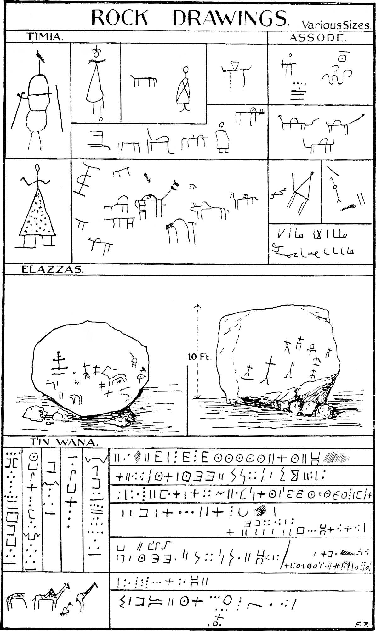
Annur was killed in 1856 by raiders from Bilma, which he had frequently attacked. As another example of a similar type of chief, I will copy the entry made in my diary when Ahodu and Sidi described to me Annur’s successor, Belkho of Ajiru, chief of the Igermaden during the last years of the nineteenth century. “He was the last independent[306] ruler of Air. He was small and rather hunched, but with authority unquestioned from Ghat to the Sudan. His raids were swift, well planned and executed in a manner which betrayed imagination. He had a great reputation for generosity, combined with personal magnetism of such a remarkable nature that his power was believed to be derived from communing with the spirits. ‘We used,’ said Sidi, ‘to see him sitting near the fire at night when he was travelling or raiding, crouched with his back turned on his companions, saying no word, but looking into the darkness with the firelight flickering on his small form, casting shadows in the distance, where his friends among the spirits sat and conferred with him!’”
Annur was killed in 1856 by raiders from Bilma, whom he had often attacked. As another example of a similar type of chief, I will copy the entry I made in my diary when Ahodu and Sidi told me about Annur’s successor, Belkho of Ajiru, chief of the Igermaden during the last years of the nineteenth century. “He was the last independent[306] ruler of Air. He was short and somewhat hunched, but he had unquestioned authority from Ghat to Sudan. His raids were quick, well-planned, and executed in a way that showed creativity. He was well-known for his generosity, along with personal charisma so remarkable that people believed his power came from connecting with the spirits. 'We used,' said Sidi, 'to see him sitting by the fire at night when he was traveling or raiding, crouched with his back to his companions, saying nothing, but staring into the darkness with the firelight flickering on his small frame, casting shadows in the distance, where his friends among the spirits sat and talked with him!'”
Belkho’s people, the Igermaden, are the parent stock of the Kel Tafidet, who not only became the most distinguished tribe in the Confederation, but also gave their name to the administrative ruler of the Kel Owi and the Confederation generally. They inherited the Tafidet mountains in the easternmost parts of Air and include an old “I name” tribe, the Igademawen. The name Igermaden seems to associate them with Jerma or Garama in the Fezzan, but I am aware of no particular reasons for supposing that they came to Air from there, though it may once have been theirs in the remote past. There are, incidentally, numerous names of places in Air containing the root ‘Germa’ in their composition.
Belkho’s people, the Igermaden, are the original group of the Kel Tafidet, who not only became the most prominent tribe in the Confederation but also lent their name to the administrative leader of the Kel Owi and the Confederation as a whole. They inherited the Tafidet mountains in the far eastern part of Air and include an ancient “I name” tribe, the Igademawen. The name Igermaden seems to link them with Jerma or Garama in Fezzan, but I don’t know of any specific reasons to believe they came to Air from there, although it might have belonged to them in the distant past. By the way, there are many place names in Air that include the root ‘Germa’ in their names.
The third group of the Kel Owi, the Imasrodang, occupied the Ighazar valley and villages, whence they drove the Kel Ferwan. Certain small nuclei of People of the King, however, remained in this area, as we have seen also occurred elsewhere. The Imasrodang deserve no particular comment except that a section, the Kel T’intaghoda, is reputed to be “holy.” There is no justification in their conduct for the description. They are the lords of the servile people of Tamgak, as well as of the so-called “Wild Men of Air.”
The third group of the Kel Owi, the Imasrodang, inhabited the Ighazar valley and villages, from which they expelled the Kel Ferwan. However, some small groups of the People of the King still remained in this area, as we’ve seen happen in other places. The Imasrodang don’t need much comment, except that a branch of them, the Kel T’intaghoda, is considered “holy.” There’s no real reason for this label based on their actions. They are the rulers over the servile people of Tamgak, as well as over the so-called “Wild Men of Air.”
I never succeeded in seeing these curious people. Their origin is a deep mystery. Buchanan on his first journey ran across a party of them in Northern Air, but they come down[307] very seldom from Tamgak and betray the utmost nervousness of any strangers. The Tuareg call them Immedideran and admit that they are noble, though not of their own race. They emphatically deny that these people are negroid. They are said to speak a language which the Tuareg do not understand. When they meet any Tuareg they are reputed, probably quite untruly, to hold their noses as if to indicate that they smelled a bad or at any rate a curious smell. According to Sidi, who has seen them, they live in Tamgak in a very primitive state, wearing hardly any clothes except a few rags or skins. They nevertheless all affect the Veil, but although they possess many sheep and goats, the camel seems strange and unfamiliar to them when they come down to the valleys to sell their animals. They live neither in houses nor in huts nor in tents, but in very low shelters made of three uprights of stone or wood, with a fire in front and a roof of skins or grass. The Tuareg know nothing of their origin, but say that they were there before the Veiled People came. They are apparently as fair as the Tuareg themselves, and not negroid in type, but who they are it is not possible even to surmise, unless they are the Leucæthiopians of the classics.
I never managed to see these intriguing people. Their origins are a complete mystery. Buchanan encountered a group of them in Northern Air on his first trip, but they rarely come down from Tamgak and show extreme nervousness around strangers. The Tuareg call them Immedideran and acknowledge that they are noble, although not of their own race. They firmly deny that these people are of African descent. It’s said that they speak a language that the Tuareg don’t understand. When they encounter any Tuareg, they are rumored, probably quite falsely, to hold their noses as if to suggest that they smell something unpleasant or, at least, odd. According to Sidi, who has seen them, they live in Tamgak in a very primitive condition, wearing almost no clothes apart from a few rags or skins. They all wear the Veil, yet even though they own many sheep and goats, camels seem strange and unfamiliar to them when they come down to the valleys to sell their animals. They don’t live in houses, huts, or tents, but in very low shelters made of three upright stones or wooden posts, with a fire in front and a roof of skins or grass. The Tuareg have no idea about their origins but say they were there before the Veiled People arrived. They seem to have a complexion similar to the Tuareg themselves and are not of African descent, but who they truly are remains unknown, unless they are the Leucæthiopians of classical texts.
PLATE 41
PLATE 41
ROCK DRAWINGS.
Rock art.

The Ikazkazan group are the junior partners of the Kel Owi, but probably the most numerous group in the Confederation of the Children of Tafidet. They range as far south as Elakkos, which sometimes makes one wonder if they are perhaps a non-Kel Owi tribe which threw in its lot with these people when they entered Air. Their many tribes are grouped into two main divisions, the Kel Tamat (the People of the Acacia) in the north, and the Kel Ulli (the People of the Goats) in the south, both of which appellations are in the nature of distinctive nicknames to distinguish the two geographical units. The names may have a totemic significance, in which case the Kel Tagei (the People of the Dûm Palm) and Kel Intirza (the People of the Asclepias) could be cited as other examples of the practice. There is no particular reason for calling the People of the Goats by this name, since they own as many camels as do the other Tuareg[308] and are not in any way the only tribe to keep goats. Their occupation of Elakkos is reputed, probably rightly, to be fairly recent. The most important tribe of the northern section is the Kel Gharus (the People of the Deep Well) in Talak—with their dependent Imghad, the Ahaggaren.
The Ikazkazan group is the junior partner to the Kel Owi, but they are likely the largest group in the Confederation of the Children of Tafidet. They extend as far south as Elakkos, which sometimes raises the question of whether they might actually be a non-Kel Owi tribe that allied with these people when they arrived in Air. Their numerous tribes are divided into two main groups: the Kel Tamat (the People of the Acacia) in the north and the Kel Ulli (the People of the Goats) in the south, both of which are basically descriptive nicknames used to differentiate the two geographical areas. These names might have totemic significance; for example, the Kel Tagei (the People of the Dûm Palm) and Kel Intirza (the People of the Asclepias) represent other instances of this practice. There isn't a specific reason for calling the People of the Goats by this name since they own just as many camels as other Tuareg and are not the only tribe that keeps goats. Their presence in Elakkos is said to be fairly recent, and the most significant tribe in the northern area is the Kel Gharus (the People of the Deep Well) in Talak, along with their dependents, the Imghad and the Ahaggaren.[308]
Such, briefly, is the Kel Owi tribal system. From Assode I determined to examine their country in the great north-eastern basin of Air contained between the mountain groups of Afis, Taghmeurt, Azañieres and Tafidet. Somewhere in this area clearly was the village and valley of T’intellust where Annur lived and where Barth’s expedition made its head-quarters in Air. The name does not figure on the French maps, and since such indications as I had received from native sources seemed to be confused, I was determined to find it for myself.
Such is the Kel Owi tribal system, in brief. From Assode, I decided to explore their area in the great northeastern basin of Air, located between the mountain groups of Afis, Taghmeurt, Azañieres, and Tafidet. Somewhere in this region was the village and valley of T’intellust, where Annur lived and where Barth’s expedition set up its headquarters in Air. The name doesn’t appear on the French maps, and since the hints I received from local sources seemed confusing, I was set on finding it myself.
The country east of Assode was a broken plain, out of which only one small massif emerged, the Gundai[272] hills, standing isolated and compact against the background of the eastern mountains. Between Gundai and T’imia the country is drained by the Unankara valley, which is crossed by the trans-Saharan caravan road on its way from the Ighazar to Mount Mari. The watering-point of Unankara lies below Gundai opposite the Talat Mellen hills: from there a branch off the Tarei tan Kel Owi runs up to T’imia village by a very difficult road along a watercourse which is the upper part of the Assode Agoras. Whenever in the south-eastern plain I crossed the main Kel Owi road and plotted the point on a map compiled from my compass traverse, I was impressed by the directness and straightness of its course across country. From Mount Mari southward the line was almost due north and south; at that point a change of direction takes place, and a line drawn somewhat west of north from Mount Mari to Unankara and produced, would, as the road does, pass within a short distance of Assatartar and enter the Ighazar between T’intaghoda and Iferuan. The upper part of the great caravan road in Air is as straight as the southern section[309] across the Azawagh and Damergu. Great age alone can account for the directness of the road and the worn tracks on the rocky ground. Its conquest and tenure by the Kel Owi is only an episode in the history of one of the oldest roads in the world.
The area east of Assode was a flat landscape, with only one small mountain range, the Gundai[272] hills, standing out clearly against the eastern mountains. Between Gundai and T’imia, the land is drained by the Unankara valley, which the trans-Saharan caravan road crosses on its route from the Ighazar to Mount Mari. The water source at Unankara is located below Gundai, across from the Talat Mellen hills. From there, a branch of the Tarei tan Kel Owi leads up to T’imia village via a challenging road along a watercourse, which is the upper part of the Assode Agoras. Whenever I crossed the main Kel Owi road in the south-eastern plain and marked the point on a map I created using my compass, I was struck by how straight and direct its route was. From Mount Mari heading south, the line was nearly north and south; at that point, the direction shifted, and a line drawn slightly west of north from Mount Mari to Unankara would, like the road, pass close to Assatartar and enter the Ighazar between T’intaghoda and Iferuan. The upper section of the great caravan road in Air is as straight as the southern part across the Azawagh and Damergu. Only the passage of time can explain the road's straightness and the worn paths on the rocky ground. The Kel Owi's control of this area is just a chapter in the history of one of the oldest roads in the world.
Leaving three men with my baggage at Assode to take care of themselves, Sidi and I on two camels set out to look for T’intellust, which he had often visited in his younger days. I passed one or two small settlements of stone houses, including Assadoragan, near Assode, and T’in Wansa, and reached Igululof after crossing or ascending a number of small valleys which flowed from Gundai into the Agoras. Igululof is a largish village with a date grove and the remains of some gardens; the houses were nearly all of the “B type” and were still filled with the household effects of the inhabitants who had evacuated the country in 1918. Apart from the usual collections of skins for water and grain, mortars, saddle-stone querns and pottery, the frequent occurrence of beds and furniture deserves mention as indicating the prosperity of the communities in the past. One also saw here, as elsewhere in these northern villages, swinging doors hewn out of one piece of wood set in stone sockets. The trees from which they were cut must certainly have been four feet in diameter, a few such were still to be seen in all the larger valleys. In one house I remarked a wooden bridle stand with a broadening top like the capital of a column surmounted by four wooden horns, on which were hung looped bridle ropes and halters. There were examples of low kidney-shaped or rectangular seats standing not four inches from the ground cut out of blocks of wood: they were used by the women when preparing food, and constituted the nearest approach to a chair in a country where it is the universal custom to sit on mats on the ground. Many of the houses had long rectangular racks of palm ribs up to 10 ft. × 5 ft. × 1 ft. deep slung from the roof, with the household effects, which they were intended to contain, still in their places. The niches were filled with the pots and skins[310] and trinkets of the former owners. The spectacle of desolation produced by these pathetic human remains made one sympathise profoundly with the unfortunate people who had had no time even to save their few worldly goods.
Leaving three men with my luggage at Assode to fend for themselves, Sidi and I set out on two camels to find T’intellust, which he had visited often in his younger days. I passed one or two small settlements of stone houses, including Assadoragan, near Assode, and T’in Wansa, and reached Igululof after crossing or climbing several small valleys that flowed from Gundai into the Agoras. Igululof is a medium-sized village with a date grove and the remains of some gardens; the houses were mostly of the “B type” and still contained the belongings of inhabitants who had evacuated in 1918. Besides the usual collections of water and grain skins, mortars, saddle stones, querns, and pottery, the frequent presence of beds and furniture is noteworthy, indicating the prosperity of the communities in the past. Here, as in other northern villages, there were swinging doors carved from a single piece of wood set in stone sockets. The trees they were cut from must have been at least four feet in diameter; a few such trees were still visible in the larger valleys. In one house, I noticed a wooden bridle stand with a widening top like a column capital, topped by four wooden horns, on which hung looped bridle ropes and halters. There were low kidney-shaped or rectangular seats, just four inches off the ground, carved from blocks of wood: these were used by women while preparing food and were the closest thing to chairs in a place where it is customary to sit on mats on the ground. Many of the houses featured long rectangular racks made of palm ribs, measuring up to 10 ft. × 5 ft. × 1 ft. deep, hanging from the roof, with the household items they were intended to hold still in place. The niches held pots, skins[310], and trinkets of the former owners. The sight of desolation created by these sad remnants made one feel deeply for the unfortunate people who had no time to save even their few worldly possessions.
By far the most important household implement appeared to be the double luggage rest which was conspicuous in all the houses. It consists of a pair of U-shaped wooden crutches on a short round pole, which is planted in the ground. The upper or U-part of these rests, in the ordinary variety, has plain flat surfaces some four inches broad by a half-inch thick. The elaborate variety has a broader front member which spreads gradually from some four inches at the base, where it joins the round pole or leg, to a breadth of twelve to fifteen inches. The tops of these members are flat or stepped down in the centre, so as to make the corners appear like wide projecting horns. Their front surfaces were very elaborately ornamented with brass ribs and silver, lead or zinc studs. The brass was nailed on or hammered into the surface of the wood as an inlay. Brass sheet fretted in patterns with green leather or red stuff behind it covered the larger spaces. The designs were geometrical and somewhat analogous to the ornamentation on the camel saddles, but rather more varied. The workmanship was excellent and displayed the most finished craft in Air. These rests were traditionally used in pairs on the march to keep valuable merchandise and baggage out of the wet. Their great weight—as they measure up to 5 ft. high and 2 ft. 6 in. between tops of the arms, and are always cut in one piece from a log of hard wood—in practice rendered it impossible to use them much on the road, and they have consequently become articles of household furniture. So far as I know, both the shape of the objects themselves and the designs which ornament them are traditional and peculiar to the Tuareg.
By far, the most important household item seemed to be the double luggage rack, which was noticeable in every home. It consists of a pair of U-shaped wooden supports on a short round pole that’s planted in the ground. The upper or U part of these racks, in the standard style, has plain flat surfaces about four inches wide and half an inch thick. The more elaborate style has a wider front piece that gradually expands from about four inches at the base, where it connects to the round pole, to a width of twelve to fifteen inches. The tops of these pieces are flat or have a step down in the center, giving the corners an appearance like wide projecting horns. Their front surfaces are intricately decorated with brass ribs and silver, lead, or zinc studs. The brass is either nailed or hammered into the wood as an embedded design. Brass sheets are intricately patterned with green leather or red fabric behind them to cover the larger areas. The designs are geometric and somewhat similar to the decoration on camel saddles, but more varied. The craftsmanship is excellent and shows advanced skill in Air. These racks were traditionally used in pairs during travel to keep valuable goods and luggage off the wet ground. Their significant weight—standing up to 5 ft. tall and 2 ft. 6 in. wide between the tops of the arms, and always carved from a single piece of hardwood—made them impractical for regular use on the road, so they have become pieces of household furniture. As far as I know, both the shapes of the objects and the designs that decorate them are traditional and unique to the Tuareg.
PLATE 42
PLATE 42
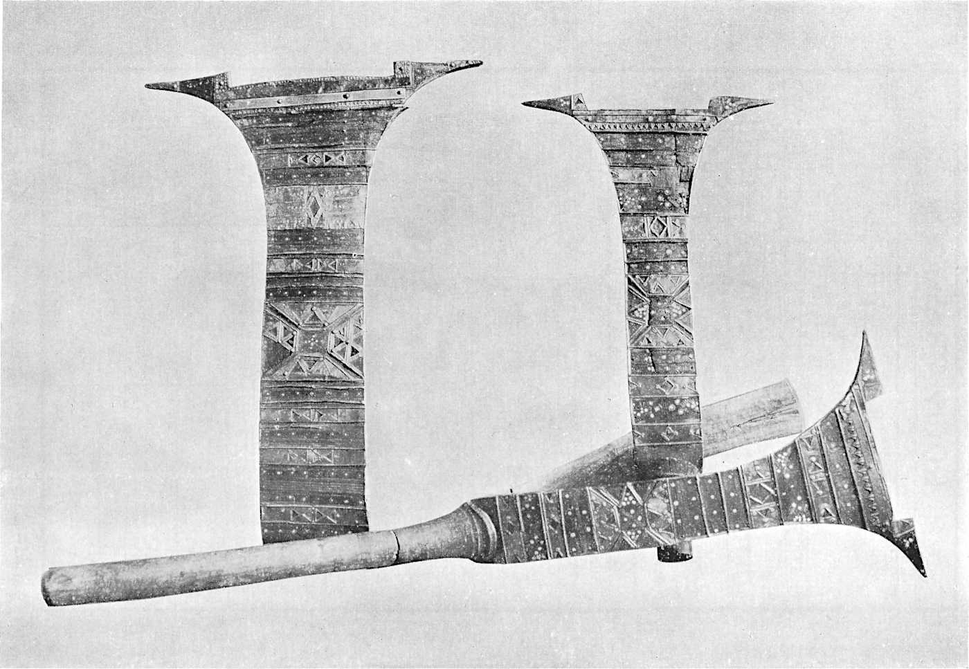
ORNAMENTED BAGGAGE RESTS
Decorative luggage racks
In view of their having been so recently inhabited and being at the same time so similar to the older “A type” houses, these houses were very interesting, as they showed the[311] mode of life of the earlier Tuareg. Within, the floors were neatly sprinkled with sand or small quartz gravel; two rings of stones containing coarser pebbles marked the places where personal ablutions were performed or where rubbish was collected. A group of large stones represented the hearth. The absence of windows and the lower roofs and doors make the more recent houses seem rather dark, but otherwise they are quite pleasant dwellings. The older houses must have been most comfortable. Their cleanliness, as early travellers remarked, depended on the owners: judging by the state of their present-day huts they were very well kept.
Considering that they were recently lived in and closely resembled the older “A type” houses, these homes were quite fascinating, as they demonstrated the lifestyle of the early Tuareg. Inside, the floors were nicely covered with sand or small quartz gravel; two rings of stones filled with larger pebbles indicated where people washed themselves or where trash was collected. A group of larger stones acted as the hearth. The lack of windows and the lower roofs and doors make the newer houses feel somewhat dark, but overall they are quite nice places to live. The older houses must have been very comfortable. Their cleanliness, as noted by early travelers, depended on the owners: judging by the condition of their current huts, they were very well maintained.
Crossing to the north of the broad Igululof valley, Sidi and I entered a very rough plateau covered with large ochreous and brown boulders; it was intersected by numerous small valleys and gullies flowing north into the main basin. We climbed laboriously over a steep ravine and up a pass between two hillocks where there was a way down into the further valley of Anu Samed.[273] It was already late in the evening and the sun was setting on our left: in front the whole plain of the basin of North-eastern Air was spread out with a great green and white snake of a bed winding through it. In the distance along the horizon were the fantastic purple mountains which reach from Tamgak to Tafidet along the edge of the desert. We descended slowly in the dusk into the Anu Samed ravine, and lay down to sleep where this tributary enters the stream bed of the nameless basin. Night came on immediately. I made some cocoa, but we had to put out the fire as soon as possible, for this is the way by which raiding parties enter Air from the east. There is no permanent habitation nearer than T’imia or Iferuan, fifty miles away to the south and west respectively. The country was impressive and rather frightening.
Crossing to the north of the wide Igululof valley, Sidi and I entered a rough plateau filled with large yellowish and brown boulders, crossed by many small valleys and gullies flowing north into the main basin. We struggled over a steep ravine and up a pass between two hills where we could descend into the next valley of Anu Samed.[273] It was already late evening, and the sun was setting to our left: ahead of us, the entire plain of the North-eastern Air basin spread out, with a long green and white stream winding through it. In the distance, along the horizon, were the stunning purple mountains stretching from Tamgak to Tafidet along the edge of the desert. We slowly descended into the Anu Samed ravine as dusk settled and lay down to sleep where this tributary flowed into the streambed of the unnamed basin. Night fell quickly. I made some cocoa, but we had to put out the fire as soon as we could, since this is the route raiding parties take to enter Air from the east. The closest permanent settlements are T’imia and Iferuan, located fifty miles away to the south and west, respectively. The landscape was impressive and somewhat intimidating.
Next morning I said I wanted to go to T’intellust. We set off up the main valley in an east to north-easterly direction; it was filled with big trees and had a series of small villages on either bank. After riding for some hours Sidi[312] turned to me and asked me if I wanted to go to T’intellust village or to the House of the Christians. I supposed the latter was some old French Camel Corps camp, but expressed mild curiosity about it. I asked him why, particularly, it was so called. Sidi replied that in the olden days when his father was alive, he had told him that some Christians had come to the valley and had lived with the chief Annur. This interesting information decided me to make for the House of the Christians, which proved to be not so very far from T’intellust village itself, a settlement of “B type” stone houses with a few enclosures and brushwood huts. It lay on the north side of the great bed, which here was several hundred yards broad and contained many large trees between various flood channels. As we approached a group of large trees south of the village I saw some piles of brushwood. They turned out to be the ruins of two thatch huts. I dismounted, tethered the camels and again questioned Sidi, who repeated his story, adding that the Christians were three white men of whom he supposed I knew, for they had not been French. Because they were great men and friends of Annur their houses had neither been inhabited nor pulled down since they went away. Their dwellings had been left slowly to decay, but not before the place had been called after them, the House of the Christians.
The next morning, I said I wanted to go to T’intellust. We headed up the main valley toward the northeast; it was full of big trees and had a series of small villages on both sides. After riding for a few hours, Sidi[312] turned to me and asked if I wanted to go to T’intellust village or to the House of the Christians. I figured the latter was some old French Camel Corps camp, but I expressed mild curiosity about it. I asked him why it was called that. Sidi replied that in the old days, when his father was alive, he had told him that some Christians had come to the valley and lived with the chief Annur. This interesting information made me decide to head for the House of the Christians, which turned out to be pretty close to T’intellust village itself, a settlement of “B type” stone houses with a few enclosures and brushwood huts. It was on the north side of the great riverbed, which here was several hundred yards wide, with many large trees scattered between various flood channels. As we approached a group of large trees south of the village, I noticed some piles of brushwood. They ended up being the ruins of two thatched huts. I got off my camel, tied them up, and asked Sidi again, who repeated his story, adding that the Christians were three white men whom he thought I would know, since they hadn't been French. Because they were important men and friends of Annur, their houses had neither been lived in nor torn down since they left. Their homes had been left to slowly fall apart, but not before the place had been named after them, the House of the Christians.
Sidi had vouchsafed this information unsolicited; he had no idea of what I was coming to seek. There is no doubt that the ruined huts are the remains of the camp occupied by Barth and his companions in 1850. When they reached T’intellust after narrowly escaping massacre at T’intaghoda, they had camped on a low hill to the south of the village where Annur himself was living. Another attack, by robbers this time, took place there, and for greater safety they moved their camp rather nearer to his village. It was this second camp which I saw.
Sidi had shared this information without being asked; he had no idea what I was looking for. There’s no doubt that the ruined huts are the remains of the camp occupied by Barth and his companions in 1850. When they reached T’intellust after barely escaping a massacre at T’intaghoda, they camped on a low hill south of the village where Annur himself was living. Another attack, this time by robbers, happened there, and for better safety, they moved their camp closer to his village. It was this second camp that I saw.
PLATE 43
PLATE 43

T’INTELLUST
T'INTELLUST
Little remains to-day of the falling huts. There was a small wooden drinking-trough and a semicircle of stones to mark the east, to which their servants knelt in prayer. Three-quarters[313] of a century have passed and gone, but their camp has never been touched, “because they were the friends of Annur,” who had given them his word that they would be safe in Air. Barth’s speculation was fulfilled when he said: “This spot being once selected the tents were soon pitched, and in a short time there rose the little encampment of the English expedition. . . . Doubtless this said hill will ever remain memorable in the annals of the Asbenawa as the ‘English Hill,’ or the ‘Hill of the Christians.’”[274] And so it has come to pass. The site induced in me a justifiable glow of pride. Her Majesty’s Government had sent the first successful expedition to Air. A German, Heinrich Barth, assisted by another compatriot of his, had been Richardson’s companions. Their memory survives in the land as the white men who were not French and who did not come as conquerors but as the friends of Annur. In the light of history, the broad-mindedness of the statesman who selected a German to assist Richardson in his work on behalf of Her Majesty’s Government is only less worthy of praise than the loyalty with which Barth carried out his task when lesser men would have considered themselves free to return to Europe after accomplishing only a fraction of what he achieved.
Little remains today of the falling huts. There was a small wooden drinking trough and a semicircle of stones to mark the east, where their servants knelt in prayer. Three-quarters[313] of a century have passed, but their camp has never been disturbed, “because they were the friends of Annur,” who had promised them safety in Air. Barth’s observation came true when he remarked: “Once this spot was chosen, the tents were quickly set up, and soon the little encampment of the English expedition emerged. . . . This hill will undoubtedly be remembered in the history of the Asbenawa as the ‘English Hill’ or the ‘Hill of the Christians.’”[274] And so it has happened. The site filled me with a justified sense of pride. Her Majesty’s Government had sent the first successful expedition to Air. A German, Heinrich Barth, along with another compatriot, had been companions of Richardson. Their legacy endures in the land as the white men who were not French and who came not as conquerors but as the friends of Annur. In retrospect, the open-mindedness of the statesman who chose a German to assist Richardson on behalf of Her Majesty’s Government deserves commendation, almost as much as Barth's dedication in completing his mission, especially when lesser men might have felt free to return to Europe after achieving only a small part of what he accomplished.
PLATE 44
PLATE 44

BARTH’S CAMP AT T’INTELLUST
BARTH’S CAMP AT T’INTELLUST

BARTH’S CAMP AT T’INTELLUST
Barth's Camp at T'Intellust
Neither T’intellust nor Oborassan, a little further up the valley, deserve any special mention. Annur had houses in both villages, though his official residence was in the latter. They are small settlements of a nomadic people, dependent upon camels and goats for sustenance, and lie near the point where the great valley receives the waters of Gundai by a large tributary from the south. The west side of the mountains of Tafidet also drain into the main basin, the upper part of which eventually turns north-east towards the Taghmeurt n’Afara hills. These mountains are the last barrier which divide the plateau of Air from the desert. The plain north of T’intellust and the right bank of the valley bed are low,[314] rocky and devoid of vegetation. Along the western side of the plain runs the Agwau valley. Agwau village, marked by a white hillock, is the principal settlement of the Kel Agwau section of the Kel Assarara tribe in the Imaslagha group of the Kel Owi. It boasts a number of houses of the “B type,” a small mosque, a few “A type” dwellings and many large circles which were once hut enclosures.
Neither T’intellust nor Oborassan, a little further up the valley, are worth any special mention. Annur had homes in both villages, though his main residence was in the latter. They are small settlements of a nomadic people, relying on camels and goats for food, and are located near where the great valley receives the waters of Gundai through a large tributary from the south. The west side of the Tafidet mountains also drains into the main basin, the upper part of which eventually heads northeast towards the Taghmeurt n’Afara hills. These mountains form the last barrier that separates the Air plateau from the desert. The plain north of T’intellust and the right bank of the valley bed are low, rocky, and lacking vegetation. Along the western edge of the plain runs the Agwau valley. Agwau village, marked by a white hillock, is the main settlement of the Kel Agwau section of the Kel Assarara tribe in the Imaslagha group of the Kel Owi. It features several “B type” houses, a small mosque, a few “A type” dwellings, and many large circles that were once hut enclosures.
Marching west from Oborassan and T’intellust towards Agwau, there were few landmarks of any note along the north side of the main valley. I gradually left the line of the main bed and skirted some low rocky ground, which reaches for some distance towards the north. Beyond Agwau I crossed a grassy plain in the direction of a big group of bare mountains, one side of which is called the Assarara and the other the Afis massif;[275] it is an isolated southern spur of the great Tamgak formation just visible behind it in the north-west. The Agwau torrent flows down between its eastern side and the plain of North-eastern Air. A road from the great nameless valley runs northwards up its course and eventually leaves the mountains for the desert by Fares and T’iwilmas watering-points.
Marching west from Oborassan and T'intellust towards Agwau, there weren’t many notable landmarks on the north side of the main valley. I gradually moved away from the main riverbed and went around some low rocky land that stretches for quite a distance to the north. Beyond Agwau, I crossed a grassy plain heading toward a large group of bare mountains, one side called the Assarara and the other the Afis massif; [275] it’s an isolated southern extension of the large Tamgak formation, barely visible to the northwest. The Agwau torrent flows between its eastern side and the plain of North-eastern Air. A road from the vast nameless valley runs northward up its course and eventually leads out of the mountains into the desert near the watering spots at Fares and T’iwilmas.
The most important settlement of this north-eastern basin of Air is Assarara, a small town lying in a cranny between two boulder-strewn peaks which rise suddenly out of the gentle slope of the northern bank of the main valley. Here I spent a night after looting a number of ethnological specimens from deserted houses, mainly of the “B type.” The dwellings were all well built and were still filled with abandoned household goods: several had stucco decorations derived from the older “A type” house decoration which has already been described. There were also a mosque and khan. Thence I returned to Assode by Assatartar village, crossing the Tarei tan Kel Owi as it emerges from the plateau south of the main valley by the little left bank ravine called Azañieres.[276]
The most important settlement in this northeastern basin of Air is Assarara, a small town nestled between two rocky peaks that rise abruptly from the gentle slope of the northern bank of the main valley. I spent a night here after collecting several ethnological specimens from abandoned houses, mostly of the “B type.” The homes were well-constructed and still filled with leftover household items; some featured stucco decorations inspired by the older “A type” house decoration that has already been described. There was also a mosque and a khan. From there, I returned to Assode via Assatartar village, crossing the Tarei tan Kel Owi as it flows out from the plateau south of the main valley through a small ravine on the left bank called Azañieres.[276]
[315]By the next day I had again set forth towards the north, halting after the first march at Afis village, not far from Assarara, but on the other side of the Afis massif. There also I saw a number of stone houses and another mosque. The country in a sense was dangerous, because the neighbouring watering-point called Agaragar, has often proved to be the favourite camping-ground for raiders entering Air from the north. It happened while I was taking an astronomical observation during the night at about 1 a.m. that a sudden wind arose in the valley, and the camp woke up with a sense of foreboding. The air seemed filled with impending danger, of which the camels also became aware. Almost at once a camel was seen silhouetted on a ridge against the dark sky. Amadu, my servant, seized a rifle and quickly but silently woke up Sidi and the camel men. They said that a raid was upon us, and with difficulty I restrained them from firing indiscriminately into the night. We took up our positions behind the baggage in the black shadow of a tree under which we were camped. But the camel on the sky-line turned out to be one of my own beasts which had strayed, and calm was restored. We had received a visitation from the great god Pan.
[315]By the next day, I had set out again headed north, stopping after the first march at Afis village, not far from Assarara, but on the other side of the Afis massif. There, I saw several stone houses and another mosque. The area was somewhat dangerous because the nearby watering point called Agaragar often served as a favorite camping spot for raiders coming into Air from the north. While I was taking an astronomical observation around 1 a.m., a sudden wind picked up in the valley, and the camp felt a sense of unease. The air seemed charged with impending danger, which the camels also picked up on. Almost immediately, a camel was spotted silhouetted on a ridge against the dark sky. Amadu, my servant, grabbed a rifle and quickly but quietly woke up Sidi and the camel drivers. They said that a raid was upon us, and I had to work hard to keep them from firing wildly into the night. We took our positions behind the baggage in the deep shadow of a tree where we were camped. But the camel on the skyline turned out to be one of my own that had wandered off, and calm was restored. We had received a visit from the great god Pan.
On the following day we crossed the Agaragar valley and wound slowly up a defile towards the upper part of the Ighazar basin. We climbed to a pass over a spur of the Tamgak mountains. The rocks all round were covered with drawings and inscriptions, for the way was very old. It was the road of the Northern Air salt caravan which went to Bilma from Iferuan by Faodet, Agwau, Taghmeurt n’Afara and the pool of Agamgam on the edge of the desert in the far north-eastern corner of the mountains. From Agamgam the caravan used to march by an easier route than the southern track which is now followed to Ashegur well, north of Fashi and from that place to Bilma.
On the next day, we crossed the Agaragar valley and slowly made our way up a narrow passage toward the upper part of the Ighazar basin. We climbed to a pass over a ridge of the Tamgak mountains. The rocks around us were covered with drawings and inscriptions, as this route was very old. It was the path of the Northern Air salt caravan that traveled from Iferuan to Bilma, passing through Faodet, Agwau, Taghmeurt n’Afara, and the pool of Agamgam at the edge of the desert in the far northeastern corner of the mountains. From Agamgam, the caravan would take an easier route than the southern path that is now used to reach Ashegur well, north of Fashi, and then onward to Bilma.
From the pass the road fell steeply to Faodet in an amphitheatre of great hills, a picturesque place, and important on account of a good, deep well. Although the houses were[316] few the site proved interesting by reason of the existence of rectangular grass huts constructed at great labour to preserve the traditional type of the Tuareg house. They provided an excellent example of the tenacity of custom, for the material of which they had been built was totally unsuited to their shape or plan.
From the pass, the road dropped steeply to Faodet, nestled in a beautiful valley surrounded by large hills. It was an attractive place, and significant because of a deep, reliable well. Although the houses were[316] few, the location was intriguing due to the rectangular grass huts built with great effort to maintain the traditional style of Tuareg homes. They were a prime example of how persistent customs can be, as the materials used for their construction were completely unsuitable for their design or layout.
The upper waters of the Ighazar basin collect in three valleys which unite between T’intaghoda and Seliufet. On the way down the valley from Faodet, the village and palm grove of Iberkom were passed, whence a fine valley runs up into the heart of Tamgak and provides some degree of communication between T’iwilmas or Fares on the desert, and the villages in the Ighazar. Further on we come to Tanutmolet village, remarkable for a modern elaboration of the “B type” house displayed in the strictly rectangular but many-roomed dwelling shown in Plate 27. T’intaghoda is interesting as possessing an early mosque and several fine “A” and “B type” houses covered with a stucco of red earth. Most of the houses had been built on two low hills standing in the bottom of the valley. There are no gardens near them nor any palm grove. The importance of the merchants and holy men who used to live there had made of T’intaghoda the capital of Northern Air. A little further on begins the palm grove of Seliufet, and from there date palms and gardens continue all the way to Iferuan, with a chain of almost contiguous settlements on both sides of the valley bed.
The upper waters of the Ighazar basin gather in three valleys that merge between T’intaghoda and Seliufet. As we travel down the valley from Faodet, we pass the village and palm grove of Iberkom, where a beautiful valley leads into the heart of Tamgak and offers some connection between T’iwilmas or Fares in the desert and the villages in the Ighazar. Further along, we reach Tanutmolet village, notable for its modern version of the “B type” house, characterized by a strictly rectangular but multi-roomed layout shown in Plate 27.. T’intaghoda is interesting for its early mosque and several impressive “A” and “B type” houses covered in a layer of red earth stucco. Most of the houses have been built on two low hills in the valley bottom. There are no gardens nearby or any palm groves. The significance of the merchants and holy men who once lived there made T’intaghoda the capital of Northern Air. A little further on, we enter the palm grove of Seliufet, and from there, date palms and gardens stretch all the way to Iferuan, with a series of almost continuous settlements on both sides of the valley floor.
At Iferuan the French established a small fort in 1921 near the site where the Foureau-Lamy expedition had camped and had been attacked some twenty years before. The fort is valueless except for the moral support it may offer to induce the local Tuareg to return to their old villages from the south. The Senegalese soldiers of the garrison are not mounted and would be powerless to do anything in the event of a raid. By the end of 1922 some families, but only a few compared with the numbers who lived there before the war, had returned to their homes.
At Iferuan, the French built a small fort in 1921 close to where the Foureau-Lamy expedition had camped and faced an attack about twenty years earlier. The fort has no real value other than the moral support it might provide to encourage the local Tuareg to come back to their old villages from the south. The Senegalese soldiers stationed there are unmounted and would be unable to take any action if there were a raid. By the end of 1922, some families had returned, but only a few compared to the number that lived there before the war.
[317]Iferuan was a very delightful place. The peak of Tamgak stands pointing like a finger to heaven on the edge of the massif. The gardens and the groves of palm trees, some of which, alas! have died through lack of attention during the years of neglect since 1917, give the area a distinctly fertile aspect. It is impossible to say how many palm trees there are in the Ighazar, but they must run into many thousands. There are said to be 4250 at Iferuan alone. This number exceeds the next largest single group at In Gall west of Agades, where there are some 4000 trees, and the former are only a part of the total in the Ighazar.
[317]Iferuan was a very charming place. The peak of Tamgak rises like a finger pointing to the sky at the edge of the massif. The gardens and palm tree groves, some of which, unfortunately, have died due to neglect over the years since 1917, give the area a clearly fertile look. It's hard to estimate how many palm trees are in the Ighazar, but they must number in the thousands. It's said there are 4,250 at Iferuan alone. This number surpasses the next largest group at In Gall west of Agades, which has about 4,000 trees, and the former is just a part of the total in the Ighazar.
The date palm is a comparatively late arrival in Air, where it was introduced from the north. The trees are a cross of the Medina and Fezzan varieties. As elsewhere in North Africa, each tree is an immovable asset like a house, and often does not belong to the same man as the ground on which it is grown.
The date palm is a relatively recent addition in Air, having been brought in from the north. The trees are a hybrid of the Medina and Fezzan varieties. Like in other parts of North Africa, each tree is a permanent asset, much like a house, and often doesn't belong to the same person as the land it's planted on.
At the foot of the palms were numerous gardens growing vegetables and grain. The fort had a wonderful kitchen garden with all sorts of melons, gourds and welcome European green food. The French officer in command of the post used to declare that Iferuan was the Switzerland of the Sahara, and the cool climate seemed to justify his praise. The Tuareg buildings had nothing remarkable about them with the exception of the large mosque of Tefgun not far away, and the khan or caravanserai built on the Arab plan. The Sudanese habit of making large clay amphoræ and baking them in situ, for the storage of wheat and millet grown in the gardens, has been adopted in Iferuan, and to my knowledge not elsewhere in Air.
At the base of the palm trees were several gardens filled with vegetables and grains. The fort had a great kitchen garden with all kinds of melons, gourds, and welcome European greens. The French officer in charge of the post used to say that Iferuan was the Switzerland of the Sahara, and the cool climate seemed to support his claim. The Tuareg buildings were pretty ordinary except for the large mosque in Tefgun nearby, and the khan or caravanserai built in the traditional Arab style. The Sudanese practice of making large clay amphorae and baking them on-site for storing wheat and millet from the gardens has been adopted in Iferuan, and to my knowledge, it's not found anywhere else in Air.
Although the open desert on the way to Ghat is not reached much before In Azawa, several days further north, now, as in the past, Iferuan is the last permanently inhabited point in Northern Air. Between these points the mountain mass of Fadé has first to be crossed; it contains several watering-points and some pastures, and huts were occasionally built at a pool called Zelim, but they had no permanence.[318] The mountains and the watering-places have long since been abandoned by their old owners, the Ifadeyen and Kel Fadé and now belong to the Ikazkazan and Kel Tadek tribes.
Although the open desert on the way to Ghat is not reached until much later, especially past In Azawa a few days further north, Iferuan remains, as it always has, the last permanent settlement in Northern Air. To travel between these points, one must first cross the Fadé mountain range, which has several watering holes and some pastures. Huts were occasionally set up by a pool called Zelim, but they weren’t permanent. The mountains and watering places have long been abandoned by their original inhabitants, the Ifadeyen and Kel Fadé, and are now occupied by the Ikazkazan and Kel Tadek tribes.[318]
At Iferuan several important roads meet. The road from Air to Tuat and to Ghat, which is the main north and south caravan track across the Central Sahara, and the Haj road from Timbuctoo to Cairo, all three have a stage in common from Iferuan to In Azawa. The Haj road used to leave the Niger at Gao and enter Air at In Gall, whence it skirted the western edge of the plateau and then turned into the mountains to Iferuan: after passing In Azawa and Ghat it ran through Murzuk, Aujila and Siwa to Cairo. From Iferuan there are also several roads to the west, while the northern of the two alternative eastern roads across the desert to Kawar equally started from there, running, as already stated, by way of Taghmeurt n’Afara, Agamgam and Ashegur.
At Iferuan, several key roads intersect. The route from Air to Tuat and Ghat, which is the main north-south caravan path across the Central Sahara, and the pilgrimage road from Timbuktu to Cairo all share a section in common from Iferuan to In Azawa. The pilgrimage road once left the Niger at Gao and entered Air at In Gall, where it followed the western edge of the plateau before heading into the mountains to Iferuan. After passing through In Azawa and Ghat, it continued through Murzuk, Aujila, and Siwa to Cairo. From Iferuan, there are also multiple roads leading west, while the northern of the two alternative eastern roads across the desert to Kawar also started there, running, as mentioned earlier, via Taghmeurt n’Afara, Agamgam, and Ashegur.
In seeking to identify Air with the Agisymba Regio of the Roman geographers, Duveyrier presumed that the Fezzanian Garamantes were in the habit of visiting the plateau in ox-drawn chariots or wagons. If they had, in fact, done so, it is logical to suppose the road they used would have come to Iferuan or one of the Ighazar villages. Indeed he states that he heard rumours of a direct road from Murzuk or Garama to Air, a “Garamantian way” which passed through a place called Anai, where there were rock drawings similar to those found in Algeria and Tripolitania. This Anai was south-west of Murzuk and must not be mistaken for the better known Anai of Kawar, which is north of Bilma on the Murzuk-Chad road.
In trying to link Air with the Agisymba Regio of the Roman geographers, Duveyrier assumed that the Fezzanian Garamantes often traveled to the plateau in ox-drawn chariots or wagons. If they did, it makes sense to think the route they took would lead to Iferuan or one of the Ighazar villages. He even mentioned hearing rumors of a direct road from Murzuk or Garama to Air, a “Garamantian way” that went through a place called Anai, where there were rock drawings resembling those found in Algeria and Tripolitania. This Anai was southwest of Murzuk and shouldn’t be confused with the more well-known Anai of Kawar, which is located north of Bilma along the Murzuk-Chad road.
I was at particular pains to inquire into the existence of this road from all the most prominent guides and personages in Air whom I could find. It would have been peculiarly interesting to establish its existence, for Duveyrier says, “La voie, avec ses anciennes ornières, est encore assez caractérisée pour que les Tebou, mes informateurs, qui en arrivaient, n’aient laissé dans mon esprit aucun doute à ce[319] sujet.”[277] Other writers, presumably on his authority, have added that where this road crossed the sand, stone flags were laid for the wheels to pass over. Duveyrier’s informers stated that the petroglyphs at Anai represented ox-drawn vehicles, and that the road also passed by way of Telizzarhen, where Barth discovered the famous rock drawings depicting men with animal heads.[278] While the broad valley at T’intellust would afford easy passage for a wheeled vehicle, there is no way to the south for any but pack transport. There are no signs of any road for vehicles ever having existed either east or west of the Bagezan massif. The great Kel Owi road is only fit for pack animals; and although many parallel tracks are visible in the open country there are numerous defiles where a single path only a few inches broad occurs. I am convinced that wheeled transport could never have been used anywhere in Central or Southern Air. But, it may be asked, could chariots have arrived even as far as T’intellust or Iferuan? There are only three ways into the plateau from the north-east that are at all suitable even for loaded camels. They are (a) through the Fadé mountains to Iferuan, (b) by Fares water and the Agwau valley to the great north-east basin, and by Taghmeurt n’Afara to T’intellust. The first two are not practicable for wheeled traffic, and on hearsay evidence the third one is equally out of the question. I do not, therefore, think that wheeled transport could ever even have entered Air from the north or north-east, though wagons might, of course, have come as far as the borders of the mountains to points such as Fares or Agamgam, provided the surface of the desert were hard enough. This cannot be determined until Anai and the country between it and Air have been visited.
I made a strong effort to find out about this road from all the most prominent guides and people in Air that I could locate. It would have been particularly interesting to confirm its existence, because Duveyrier says, “La voie, avec ses anciennes ornières, est encore assez caractérisée pour que les Tebou, mes informateurs, qui en arrivaient, n’aient laissé dans mon esprit aucun doute à ce[319] sujet.”[277] Other writers, likely relying on his authority, have mentioned that where this road crossed the sand, stone flags were laid for the wheels to roll over. Duveyrier's sources indicated that the petroglyphs at Anai showed ox-drawn vehicles, and that the road also passed through Telizzarhen, where Barth discovered the famous rock drawings of men with animal heads.[278] While the wide valley at T’intellust would allow easy passage for a wheeled vehicle, there's no way to the south for anything other than pack transport. There are no signs that any road for vehicles ever existed either east or west of the Bagezan massif. The major Kel Owi road is only suitable for pack animals; and although many parallel tracks are visible in the open landscape, there are several narrow paths that are only a few inches wide. I’m convinced that wheeled transport was never used anywhere in Central or Southern Air. However, one might ask, could chariots have made it even as far as T’intellust or Iferuan? There are only three routes into the plateau from the northeast that are even somewhat suitable for loaded camels: (a) through the Fadé mountains to Iferuan, (b) via Fares water and the Agwau valley to the large northeast basin, and by Taghmeurt n’Afara to T’intellust. The first two are not feasible for wheeled traffic, and based on hearsay, the third one is equally out of the question. Therefore, I don't believe wheeled transport could have entered Air from the north or northeast, although wagons might have reached the edges of the mountains at places like Fares or Agamgam, assuming the surface of the desert was firm enough. This can't be verified until Anai and the land between it and Air have been explored.
If any direct road between these areas ever existed, it is[320] very unlikely to have run straight from Anai to T’intellust, as Duveyrier’s map shows. In my inquiries I heard in all of only four roads across the Eastern Desert: (a) the southernmost from Damagarim by Termit;[279] (b) the direct road to Fashi and Bilma from Southern Air, starting at Tabello; (c) the old Kel Owi Taghalam road from Agamgam to Ashegur, whence one branch goes north to Jado oasis and the other south to Fashi; and (d) a northern road from Fadé to Jado direct. Guides like Efale, who know every part of the Eastern Desert, state that there is no road from Air direct to Murzuk which does not go either by way of Jado or by way of the usual caravan road between Kawar and the Fezzan. The northernmost road from Fadé to Jado runs through two places called Booz and Ghudet, where water is found a short way below the surface; Efale travelled this way in his youth. He told me that it was known to and used by Tebu raiders to-day. But there are no deep wells on this track to be filled up to prevent raiders passing down the old Garamantian way, as Duveyrier implies was done. From Jado it, of course, is possible to reach Murzuk either by Anai or by joining the usual Chad road via Tummo. The existence of this northern Anai is certainly substantiated, and Jado, a Tebu oasis with a palm grove, is known to exist. It is called by this name among the Arabs, but Agewas by the Tuareg of Air and Braun by the Tebu themselves. The place has been reconnoitred by certain French officers, one of whom, a commandant of the fort of Bilma, I had the good fortune to meet. He was aware of the story of a flagged road, but after visiting Jado several times found no trace of any such track and did not believe in its existence. That the Garamantes and, indeed, other inhabitants of the Fezzan at one period in history used chariots drawn by oxen is quite likely, but it is highly improbable that they ever ventured so far afield in them as Air.
If there was ever a direct road between these areas, it’s very unlikely that it went straight from Anai to T’intellust, as Duveyrier’s map suggests. In my research, I discovered only four roads across the Eastern Desert: (a) the southernmost route from Damagarim by Termit; [279] (b) the direct road to Fashi and Bilma from Southern Air, starting at Tabello; (c) the old Kel Owi Taghalam road from Agamgam to Ashegur, which branches north to Jado oasis and south to Fashi; and (d) a northern route from Fadé to Jado directly. Guides like Efale, who know every part of the Eastern Desert, say there is no road from Air to Murzuk that doesn’t go either through Jado or along the usual caravan road between Kawar and the Fezzan. The northernmost road from Fadé to Jado goes through two places called Booz and Ghudet, where water is found just below the surface; Efale traveled this route in his youth. He mentioned that Tebu raiders still know and use it today. However, there aren’t deep wells on this path that could have been filled in to block raiders from using the old Garamantian way, as Duveyrier suggests. From Jado, you can reach Murzuk either by Anai or by taking the usual Chad road via Tummo. The existence of this northern Anai is definitely confirmed, and Jado, a Tebu oasis with palm trees, is known to exist. The Arabs call it Jado, but the Tuareg from Air refer to it as Agewas, and the Tebu themselves call it Braun. Some French officers have surveyed the area, and I was fortunate enough to meet one, a commandant of the fort of Bilma. He knew about the story of a marked road, but after visiting Jado several times, he found no signs of such a path and didn’t believe it existed. It’s quite possible that the Garamantes, and other inhabitants of Fezzan at some point in history, used chariots drawn by oxen, but it’s very unlikely they ventured as far as Air with them.
The existence of a road between Air and the Fezzan may be admitted as possible, but only on condition that it is not[321] made to run direct between these countries. South of Anai it would almost certainly pass through Jado, and thence may have reached the plateau either by Ghudet and Booz to a water-point called Temed[280] on the eastern edge of Fadé north of the Tamgak group, or else by Ashegur and Agamgam north-east of T’intellust. This is not the road of the Garamantes on Duveyrier’s map; and beyond this his story cannot be further substantiated. As against this line of argument it must be observed that Von Bary[281] during this stay in Air collected information which led him to believe that there was a road from Air to Jerma by way of Anai. It is implied that it went direct, but he was never able to learn any details and was probably influenced by Duveyrier’s statements. He heard that there were some traces visible, but found no evidence to confirm the report of flagstones, wheel-marks or sculpture along its course.
The idea of a road connecting Air and the Fezzan is plausible, but only if it's not a direct route between these regions. South of Anai, it would likely go through Jado, and from there it could reach the plateau either via Ghudet and Booz to a water point called Temed[280] on the eastern edge of Fadé, north of the Tamgak group, or by Ashegur and Agamgam, northeast of T’intellust. This isn't the road shown on Duveyrier’s map for the Garamantes, and beyond this, his findings cannot be fully supported. On the other hand, it should be noted that during his time in Air, Von Bary[281] gathered information that led him to believe there was a road from Air to Jerma via Anai. It's suggested that it was a direct route, but he never managed to get any specifics and was likely swayed by Duveyrier’s claims. He heard there were some visible traces, but found no evidence to back up the reports of flagstones, wheel tracks, or carvings along the way.
There is nevertheless one piece of evidence which militates in some measure against my belief that chariots never were seen in Air, and that is a rock drawing which I found in Air on a boulder in the Anu Maqaran valley just west of Mount Arwa. The drawing is reproduced in Plate 41. In the conventional manner adopted in these designs it represents oxen pulling four-wheeled vehicles. The identification of the ox is confirmed from the many other similar pictures of this animal on rocks in Air. The object behind it must apparently be a cart. The whiteness of the marks in the Anu Maqaran drawing appears to indicate that it is a comparatively recent production, although the colour and degree of patination of Saharan drawings are of course no real criteria, for weathering is notoriously uneven in its action. Near the drawing of the ox and chariot, but on a different boulder, was the magic square shown in the same figure. Both drawings were in a very sheltered place and seemed contemporary. The evidence of this picture of the chariot or[322] wagon is too unreliable and slender to establish any theory, but it is certainly difficult to understand where the draughtsman obtained his idea except as a result of seeing chariots drawn by oxen, a condition which does not, I think, obtain in the Fezzan to-day. Wheeled vehicles have only been known in the Sudan since they were imported by Europeans during the last twenty years, and I am not aware that even those are ox-drawn. Furthermore, although the most puzzling point about the Anu Maqaran rock drawing is its apparent modernity, which is paradoxical in view of the disuse of wheeled vehicles in the Sahara, it is almost certainly older than this century. Yet the application of an ox to a cart is not likely to have been imagined by any Tuareg who had not seen an instance of it, and there seems to be no adequate reason for him to reproduce his knowledge on a rock in Air even if chance had taken him so far afield as the Mediterranean littoral, where he might have seen the equipage, unless it had in some way become associated with Air.
There's still one piece of evidence that somewhat contradicts my belief that chariots were never seen in Air, and that is a rock drawing I found in Air on a boulder in the Anu Maqaran valley, just west of Mount Arwa. The drawing is reproduced in Plate 41.. In the usual style of these designs, it depicts oxen pulling four-wheeled vehicles. The identification of the ox is confirmed by numerous other similar pictures of this animal on rocks in Air. The object behind them must be a cart. The whiteness of the marks in the Anu Maqaran drawing suggests that it is relatively recent, although the color and level of wear of Saharan drawings aren’t reliable criteria, since weathering can be notoriously uneven. Near the drawing of the ox and chariot, but on a different boulder, was the magic square shown in the same figure. Both drawings were in a very sheltered spot and appeared to be from the same time period. The evidence of this picture of the chariot or[322] wagon is too uncertain and minimal to support any theory, but it's certainly hard to understand where the artist got their idea unless they had seen chariots drawn by oxen, a situation that I don’t think exists in the Fezzan today. Wheeled vehicles have only been known in the Sudan since they were brought in by Europeans in the last twenty years, and I’m not aware that even those are ox-drawn. Furthermore, although the most puzzling aspect of the Anu Maqaran rock drawing is its apparent modernity—which is ironic given the lack of wheeled vehicles in the Sahara—it’s almost certainly older than this century. However, the idea of using an ox to pull a cart likely wouldn't have been imagined by any Tuareg who hadn't seen it in action, and there doesn’t seem to be a good reason for him to carve that knowledge into a rock in Air, even if chance led him to the Mediterranean coast, where he might have encountered such a setup, unless it had somehow become linked with Air.
The identification of Air with the Agisymba Regio of the Romans has been accepted by many authorities other than Duveyrier. It raises the whole problem of the Roman penetration of the Sahara. They are known to have administered the Fezzan, and it is even pretended that they reached the Niger, but evidence on this point is more scanty. Doubtless as the exploration of the Central Sahara is carried out systematically further evidence of their penetration will come to light. I am, for instance, not aware that any remains have actually been found at Ghat, though the city, which was known to them as Rapsa, was almost certainly that place and was visited in 19 B.C. by Cornelius Balbus. The Roman remains discovered by Barth on the road from Mizda over the Hammada el Homra to Murzuk are better known. This route seems to have been opened about the time of the Emperor Vespasian, and to have rendered possible or at least easier the occupation of the Fezzan, which had, however, already been visited by military expeditions earlier than that reign. Pliny writes: “Ad Garamantes iter inexplicabile[323] adhuc fuit. Proximo bello, quod cum Œensibus Romani gessere auspiciis Vespasiani Imperatoris, compendium viæ quatridui deprehensum est. Hoc iter vocatur ‘Præter caput saxæ.’” Evidently the road was called by the natives, even in those days, by the same name which it now possesses, for the Pass over the Red Rock Desert at 1568 feet above the sea is still known to the Arabs as “Bab Ras el Hammada.”[282] In about A.D. 100[283] Septimius Flaccus penetrated from the Fezzan into Æthiopia at the head of a Roman column; Julius Maternus marching from some point on the coast to Garama had joined forces with the Garamantes in order to proceed southward together against various Æthiopian bands. By this date, then, it is probable that an occupation of the Fezzan had been accomplished, for this alone would justify a further advance or punitive expeditions on such a scale against raiders from the south. Indeed, from the account given by Pliny[284] of Cornelius Balbus’ expedition of 19 B.C. to the Fezzan, it might be supposed that the occupation of Southern Tripolitania and the Central Sahara had taken place a century earlier. The identification of the cities conquered by Balbus has not been satisfactory except in the case of Cydamus, Cillaba or Cilliba, Tabudium,[285] Rapsa and Jerma, respectively Ghadames, Zuila,[286] Tabonie, Ghat and Garama; the last named being the capital of the Garamantes and of the whole Fezzan, a position which later passed on to other places and finally to Murzuk.
The identification of Air with the Agisymba Regio of the Romans has been accepted by many scholars besides Duveyrier. It brings up the broader issue of Roman expansion into the Sahara. They are known to have administered the Fezzan, and there are even claims that they reached the Niger, but evidence for this is limited. As exploration of the Central Sahara is conducted more thoroughly, further evidence of their expansion will likely emerge. For instance, I am not aware of any remains being found at Ghat, although the city, known to them as Rapsa, was almost certainly that location and was visited in 19 BCE by Cornelius Balbus. The Roman remains discovered by Barth along the route from Mizda over the Hammada el Homra to Murzuk are better documented. This route appears to have been opened around the time of Emperor Vespasian and likely facilitated the occupation of the Fezzan, which had already been visited by military expeditions prior to his reign. Pliny writes: “Ad Garamantes iter inexplicabile[323] adhuc fuit. Proximo bello, quod cum Œensibus Romani gessere auspiciis Vespasiani Imperatoris, compendium viæ quatridui deprehensum est. Hoc iter vocatur ‘Præter caput saxæ.’” Clearly, the locals called the road by the same name it has today, as the pass over the Red Rock Desert, at 1568 feet above sea level, is still known to the Arabs as “Bab Ras el Hammada.”[282] Around A.D. 100[283] Septimius Flaccus led a Roman column from the Fezzan into Æthiopia; Julius Maternus, marching from a coastal point to Garama, joined forces with the Garamantes to advance southward against various Æthiopian groups. By this time, it's likely that the occupation of the Fezzan had occurred, as this would justify further advances or punitive expeditions against raiders from the south. In fact, from Pliny's account[284] of Cornelius Balbus’s expedition to the Fezzan in 19 BCE, one might infer that the occupation of Southern Tripolitania and the Central Sahara had happened a century earlier. The identification of the cities conquered by Balbus has not been clear except for Cydamus, Cillaba or Cilliba, Tabudium,[285] Rapsa, and Jerma, which correspond to Ghadames, Zuila,[286] Tabonie, Ghat, and Garama, the latter being the capital of the Garamantes and the entire Fezzan, a status that later shifted to other locations and eventually to Murzuk.
These operations of Septimius Flaccus and Julius Maternus have been held to concern Air. The latter, ἀπὸ Γαράμης ἅμα τῷ βασιλεῖ τῶν Γαραμαντίων ἐπερχομένῳ τοῖς Αἰθιόψιν ὁδεύσαντα τὰ πάντα πρὸς μεσημβρίαν μησὶ τέσσαρσι ἀφικέσθαι εἰς τὴν Ἀγίσυμβα. . . .[287] It is important to try to identify[324] the area, since it appears to be the most southerly point to which Roman geographical knowledge is recorded as having extended. Duveyrier, arguing, on what may in any case be a false premise, that because Pliny mentions no camels in Africa there were no camels, concludes with the fantastic statement that the Romans must have used wheeled transport on their expeditions, and that that is why the “Iter præter caput saxæ” played such an important part in their operations; but I have seen no evidence which might lead one to suppose that this route over the Hammada el Homra was fit for wheeled traffic. The Garamantes were said by Herodotus to have used wagons drawn by four horses.[288] From this Duveyrier concludes that at a later date oxen were substituted for horses, and that in virtue of a perfectly imaginary road from Murzuk by way of Anai Air must be the Agisymba Regio. He gives no convincing reason for the identification, but implies that by a process of elimination it must be so. The name Agisymba and Bagezan have been connected by displacing the terminal and initial syllables respectively of the two words, but undoubtedly it was not this so much as the existence of a Garamantian road which appealed to the learned author.
These actions by Septimius Flaccus and Julius Maternus are thought to be related to Air. The latter, from Garama, while the king of the Garamantes was advancing against the Ethiopians, made his way directly to Agisymba around noon, reaching it at four in the afternoon. . . .[287] It’s important to identify the area, as it seems to be the furthest point south that Roman geographical knowledge has recorded. Duveyrier, arguing from what might be a mistaken assumption that because Pliny didn’t mention camels in Africa, there were none, comes to the outlandish conclusion that the Romans must have used wheeled transport on their expeditions, which is why the "Iter præter caput saxæ" was so crucial in their operations; however, I’ve seen no evidence to suggest that this route over the Hammada el Homra was suitable for wheeled vehicles. Herodotus mentioned that the Garamantes used wagons pulled by four horses.[288] From this, Duveyrier concludes that at a later time, oxen replaced horses and that due to a completely imaginary road from Murzuk via Anai, Air must be the Agisymba Regio. He offers no convincing justification for this identification, but implies that by eliminating other options, it must be correct. The names Agisymba and Bagezan have been linked by swapping the last and first syllables of the two words, but it was clearly the existence of a Garamantian road that caught the attention of the learned author.
One of the principal objectives which I had in mind in visiting Air was to seek evidence of Roman penetration. In the course of their long historical knowledge and occupation of the Fezzan, it seemed natural for the Romans to have explored the Air road. But I found no remains, nor evidence whatsoever of their penetration, not even at points which had considerable strategic value. Some more fortunate traveller than myself may one day chance upon an inscription or a camp. Such a discovery in so vast and little known a land is quite conceivable, but up till now the weight of evidence is against the Romans ever having come to Air. There is a certain historical analogy in the fact that the Arabs never invaded the country either. Their influence on the Tuareg of Air was confined to an unenthusiastic conversion to Islam[325] in comparatively recent times. On the other hand, the Arabs in the first century of the Hijra, like the Romans, seem to have descended the Chad road at least as far as Bilma, and again, Arab influence in Central Africa east of the lake is at least as strong as, and perhaps even greater than, the Western Arab-Moorish influence on the Upper Niger.
One of the main goals I had in visiting Air was to look for evidence of Roman presence. Given their long history and occupation of the Fezzan, it seemed likely that the Romans would have explored the Air route. However, I found no remains or any sign of their presence, not even in strategically important locations. Perhaps a luckier traveler than I will eventually stumble upon an inscription or a camp. Such a discovery in such a vast and largely unknown land is certainly possible, but so far, the evidence suggests that the Romans never reached Air. There's a historical parallel in the fact that the Arabs never invaded the area either. Their influence on the Tuareg of Air was limited to a reluctant conversion to Islam[325] in relatively recent times. On the other hand, in the first century of the Hijra, the Arabs, like the Romans, seemed to have traveled down the Chad route at least as far as Bilma, and further, Arab influence in Central Africa, east of the lake, is at least as strong as, and possibly even greater than, the Western Arab-Moorish influence on the Upper Niger.
I am, however, much more inclined to regard Tibesti and not Air as the Agisymba Regio. We find the Arabs in the Fezzan evidently feeling the same necessity of expansion southwards along the Chad road as did the Romans. By 46 A.H. the Fezzan had already twice been conquered by the Arabs, first in 26 A.H., soon after the occupation of Egypt had been completed and the attention of Islam was turned to North Africa, and again when the inhabitants had cast off their servitude to the Arabs. Okba ibn Nafé was induced by this breach of faith[289] to leave his army, which was on its way to conquer Ifrikiya (Tunisia and Western Algeria), at Sert in the Great Syrtis, and to lead an expedition to reconquer the desert. He took Wadan and Jerma, near Murzuk, and the last strong places of the country, and asking what lay “beyond,” learnt of the “people of Hawar,”[290] who had a fortress on the edge of the desert at the top of an escarpment. It was said to be the capital of a country called Kawar, the name which is borne even to-day by the depression along which the main caravan road passes south through Bilma and other small villages, any one of which may have been their stronghold, which El Bekri[291] also calls Jawan. After a march of fifteen nights Okba came to this place and eventually captured it. At one moment his expedition nearly perished of thirst, but according to the story Okba’s horse found water in the sand and saved the column, wherefore the place was called Ma el Fares, the[326] “Water of the Horse.” This point is now spelt Mafaras on the Murzuk-Kawar road in about Lat. 21° 15′ N.[292]
I am, however, much more inclined to see Tibesti and not Air as the Agisymba Regio. The Arabs in the Fezzan clearly felt the same need to expand southwards along the Chad route as the Romans did. By 46 A.H., the Fezzan had already been conquered twice by the Arabs, first in 26 A.H., shortly after the completion of Egypt's occupation and when Islam's focus shifted to North Africa, and again when the locals broke free from Arab rule. Okba ibn Nafé was prompted by this betrayal[289] to leave his army, which was heading to conquer Ifrikiya (Tunisia and Western Algeria), at Sert in the Great Syrtis and lead a mission to reclaim the desert. He took Wadan and Jerma, near Murzuk, which were the last strongholds of the region, and when he asked what lay “beyond,” he learned of the “people of Hawar,”[290] who had a fortress on the edge of the desert atop an escarpment. It was said to be the capital of a land called Kawar, a name that still exists today for the area along which the main caravan route goes south through Bilma and other small villages, any of which might have been their stronghold, which El Bekri[291] also refers to as Jawan. After a fifteen-night march, Okba arrived at this location and eventually captured it. At one point, his expedition almost perished from thirst, but according to the tale, Okba’s horse found water in the sand and saved the group, which is why the place was named Ma el Fares, the[326] “Water of the Horse.” This site is now spelled Mafaras on the Murzuk-Kawar road at approximately Lat. 21° 15′ N.[292]
The Romans seem to have had much the same experience as the Arabs, though we can identify the movements of the latter with greater certainty. The expedition of Septimius Flaccus and Julius Maternus started from Garama. Now an expedition from the Fezzan proper to Negroland would normally have proceeded along the Chad road, which runs south, and not in the direction of Air, which lies south-west. Furthermore, we have already seen that there is no direct road from the Fezzan to Air save by making a detour via Jado and crossing the worst part of the desert. Had the Romans intended to use the Air road to Negroland they would assuredly have started from Rapsa (Ghat) and not from Garama; alternately had they started from Garama and proceeded by way of Ghat, it is likely to have been mentioned, nor would the enterprise have been so directly connected with the Garamantes. After marching south from Garama the expedition reached the Agisymba Regio. But if the Air mountains are neither south of Garama nor on a direct road from that place, both these conditions do apply to Tibesti. This country lies due south of the eastern Fezzan and there is a direct road from Garama by way of Tibesti to Negroland, though it is not so well known as the main Chad road. The latter trade road, however, and the Tibesti mountains seem to fit the description of the course taken by the expedition sufficiently well, and clearly better than the Air road and plateau. The Romans, we are told, marched for three months to the south; it may be objected that this would be an inordinately long time to take on a journey to Tibesti and that Air, being somewhat further away from Garama, is the more probable. But expeditions may take longer or shorter times to traverse any particular desert road[327] according to the difficulties encountered, the fighting sustained and the pasturage available on the way for the transport animals, and I do not think that any conclusion can be drawn from the reported length of the march. A period of three to four months might as easily bring one expedition from the Fezzan to Tibesti or to Air as it would be insufficient for another under different conditions but on the same road to get more than half-way.
The Romans seem to have had a similar experience to the Arabs, although we can track the movements of the latter more accurately. The expedition led by Septimius Flaccus and Julius Maternus started from Garama. Normally, an expedition from Fezzan to Negroland would have gone along the Chad road, which runs south, rather than toward Air, which is southwest. Additionally, we've already noted that there is no direct route from Fezzan to Air except by taking a detour through Jado and crossing the toughest part of the desert. If the Romans had intended to take the Air route to Negroland, they definitely would have started from Rapsa (Ghat) instead of Garama; alternatively, had they left from Garama and traveled via Ghat, it likely would have been mentioned, and the venture wouldn’t have been so closely linked to the Garamantes. After moving south from Garama, the expedition reached the Agisymba Regio. However, since the Air mountains are neither south of Garama nor directly on the road from there, both of these criteria apply to Tibesti. This region lies directly south of eastern Fezzan, and there’s a direct route from Garama through Tibesti to Negroland, even though it’s not as well-known as the main Chad road. That said, the Chad trade route and the Tibesti mountains seem to fit the description of the path taken by the expedition quite well, and clearly better than the Air road and plateau. We are told that the Romans marched south for three months; it could be argued that this is an excessively long time for a journey to Tibesti, and since Air is somewhat farther from Garama, it seems more likely. However, expeditions can take longer or shorter amounts of time to travel any particular desert road[327] depending on the challenges faced, the fighting endured, and the availability of pasture for the transport animals, so I don’t think any conclusions can be drawn from the reported duration of the march. A span of three to four months could allow one expedition to move from Fezzan to Tibesti or Air, while it might not be enough time for another expedition under different circumstances on the same road to travel more than halfway.
PLATE 45
PLATE 45

ASSARARA
ASSARARA
If circumstantial evidence seems to point to Tibesti, there is also that of the place names given in the account. The Agisymba Regio contained the mountains of Bardetus, Mesche and Zipta. No similarity to these names can be found in Air, but in Tibesti the first may well be the area and massif round the village of Bardai, while Mesche may be a Latinised form of Miski, a valley and group south-west of Bardai. For Zipta I can offer no suggestion.
If circumstantial evidence appears to indicate Tibesti, there are also the place names mentioned in the account. The Agisymba Regio included the mountains of Bardetus, Mesche, and Zipta. No similar names can be found in Air, but in Tibesti, Bardetus might refer to the area and massif around the village of Bardai, while Mesche could be a Latinized version of Miski, a valley and group located southwest of Bardai. I have no suggestions for Zipta.
Like the Romans and the Arabs the modern Turks also penetrated Tibesti as a consequence of their occupation of the Fezzan in an attempt to stop the Tebu raiding. History is curiously consistent in that we have no evidence of the Arabs or the Turks having penetrated Air. The Romans, I assume, probably did not do so either.[293]
Like the Romans and the Arabs, the modern Turks also entered Tibesti due to their occupation of the Fezzan in an effort to halt the Tebu raids. History is oddly consistent in that we have no proof of the Arabs or the Turks having entered Air. I assume the Romans probably didn’t either.[293]
The Romans must have come into contact with the Tuareg in the Fezzan, where the latter, it might be assumed from Arab evidence alone, were early established if they did not actually constitute the majority of the original population. It is possible to trace in Roman records the names of certain well-known Tuareg tribes. The description which Corippus gives of the Ifuraces, the Ifoghas tribe of the Southern Tuareg, corresponds accurately with that of the present-day camel riders of the Sahara. In a description of an encounter with the Byzantine forces under John, the general himself cuts down a camel with his sword and the rider falls with the accoutrements and paraphernalia, which are those of a Tuareg on campaign or in battle to-day.[294] The activities[328] of the Circumcelliones during the troubles described by Opatus[295] during the Donatist heresy in North Africa in the course of the fourth century A.D. remind one irresistibly of those of the Tuareg. These bands of marauders from the desert came into Southern Tunisia and Algeria on swift and remorseless errands of plunder for the greater glory of their heretical Faith. They lived in the barren hills of the outer waste and descended to burn churches, sack houses and carry off live-stock with such deadly efficiency and ease that the motive power of their organisation can only have come from a spirit which considers raiding a national sport. “When they were not resisted they usually contented themselves with plunder, but the slightest opposition provoked them to acts of violence and murder. . . . The spirit of the Circumcellians, armed with a huge and weighty club, as they were indifferently supplied with swords and spears, and waging war to the cry of ‘Praise be to God’ . . . was not always directed against their defenceless enemies, the peasants of the orthodox belief; they engaged and sometimes defeated the troops of the province, and in the bloody action of Bagai they attacked in the open field, but with unsuccessful valour, the advance guard of the Imperial cavalry.”[296]
The Romans likely encountered the Tuareg in the Fezzan region, where it can be assumed from Arab sources that they were established early on, possibly even making up the majority of the original population. Roman records trace the names of several well-known Tuareg tribes. Corippus describes the Ifuraces, a branch of the Ifoghas tribe from the Southern Tuareg, in a way that closely matches today’s camel riders of the Sahara. In an account of a clash with the Byzantine forces led by General John, he himself cuts down a camel with his sword, and the rider falls with gear that resembles that of a Tuareg in battle today.[294] The activities[328] of the Circumcelliones during the unrest described by Opatus[295] during the Donatist heresy in North Africa in the fourth century AD are strikingly reminiscent of those of the Tuareg. These desert marauders swept into Southern Tunisia and Algeria on swift and merciless raids for the greater glory of their heretical beliefs. They lived in the desolate hills and descended to burn churches, loot homes, and steal livestock with such chilling efficiency that their organization must have stemmed from a mentality that treats raiding as a national pastime. “When they faced no resistance, they typically settled for plunder, but the slightest opposition provoked them to violence and murder. . . . The Circumcellians, armed with large, heavy clubs, although they had swords and spears on hand, fought while shouting ‘Praise be to God’ . . . and they didn't always target their defenseless enemies, the peasants of orthodox faith; they sometimes clashed with and even defeated provincial troops, and in the bloody battle of Bagai, they confronted the Imperial cavalry’s advance guard in the open field, though their courage was ultimately in vain.”[296]
So in later years the Tuareg of Ahaggar, disdaining any but les armes blanches, fell in ranks under the rifle fire of the French troops at Tit.
So in later years, the Tuareg of Ahaggar, disregarding anything but les armes blanches, formed ranks under the gunfire of the French troops at Tit.
But it is curious that in none of these and other early descriptions of the Tuareg is any mention made of their outstanding characteristics, so obvious to the person who sees them for the first time—the Face Veil worn by the men. It seems very strange that none of the classical and post-classical authors should have recorded a feature which so distinguishes these people from other races. There is no reference to the Veil until we come to the first Arab authors, when the whole race is immediately described by this very peculiarity, as the Muleththemin, ملثّمين,the “Veiled Ones,”[329] a second form plural past participle from the root لثم, which also forms the word litham, لثام, the Arabic name for the Veil itself. How it came about that the Arabs should be the first to record the use of the Veil is a problem to which I have been able to find no satisfactory solution.
But it's interesting that in none of these early descriptions of the Tuareg is there any mention of their distinctive characteristics, which are so obvious to someone seeing them for the first time—the face veil worn by the men. It seems strange that none of the classical and post-classical authors noted a feature that sets these people apart from others. The veil isn’t mentioned until the first Arab authors, who immediately describe the entire race by this very trait, calling them the Muleththemin, Masked, the “Veiled Ones,”[329], a second form plural past participle from the root Kiss, which also forms the word litham, لثام, the Arabic term for the veil itself. How the Arabs came to be the first to document the use of the veil remains a question I haven’t found a satisfactory answer to.
[264]Cf. remarks in Chap. VIII regarding the dating of the mosques in Air.
[264]See comments in Chap. VIII about the timeline of the mosques in Air.
[267]I could not trace any other of the seven mosques referred to by Barth, nor is the great mosque decorated with columns as he says, unless the pierced walls supporting the roof can so be described. There is no “mimbar.”
[267]I couldn’t find any of the seven mosques that Barth mentioned, nor is the large mosque decorated with columns as he states, unless the perforated walls that hold up the roof can be considered as such. There is no “mimbar.”
[268]Some of them were quite old and had painted borders and coloured letters. The work was all, however, rather rough; no T’ifinagh writing was found. I had no facilities for examining the work in detail.
[268]Some of them were pretty old and had painted edges and colorful letters. The craftsmanship was, though, a bit crude; there was no T’ifinagh writing found. I didn’t have the means to examine the work closely.
[269]People have stumbled upon small beehive grain pits in Air cut in the rock away from villages. In these no doubt the Tuareg who were hastily cleared out of Air in 1918 hid their small treasures. They will in many cases remain undiscovered perhaps for centuries and will prove the happiness of some later archæologist.
[269]People have found small grain pits resembling beehives in Air, cut into the rock away from villages. It's likely that the Tuareg, who were quickly removed from Air in 1918, hid their little treasures there. In many cases, these treasures might remain hidden for centuries and bring joy to some archaeologist in the future.
[270]The significance of the name “People of the King” will be explained in Chap. XII.
[270]The meaning of the name “People of the King” will be explained in Chap. XII.
[272]Or Bundai; Barth has “Bunday.”
__A_TAG_PLACEHOLDER_0__Or Bundai; Barth has “Bunday.”
[278]Barth, op. cit., Vol. I. p. 197. That the road should have run from Telizzarhen to Anai and then to Air is very doubtful, as this would have entailed a very devious route. What, doubtless, was meant was that it ran from Murzuk or Garama via Anai to Air.
[278]Barth, op. cit., Vol. I. p. 197. It's very unlikely that the road went from Telizzarhen to Anai and then to Air, since that would have required a complicated path. What was probably meant is that it went from Murzuk or Garama through Anai to Air.
[282]“The Gate of the Head of the Desert.”
“The Entrance to the Desert.”
[284]Pliny, Nat. Hist., V. 5.
[287]Ptolemy, loc. cit.
__A_TAG_PLACEHOLDER_0__Ptolemy, loc. cit.
[288]Herodotus, IV. 183.
__A_TAG_PLACEHOLDER_0__Herodotus, IV. 183.
[292]El Noweiri tells the same story of a later expedition in Morocco led by Okba. If only for the fact that no place of this name can be found on the route of the latter expedition, the attribution of the incident to the Kawar campaign is justified, though there are also other reasons for accepting this identification.
[292]El Noweiri shares a similar story about a later expedition in Morocco led by Okba. Just based on the fact that there's no location with this name found along the route of that expedition, it's reasonable to attribute the incident to the Kawar campaign. There are also additional reasons to support this identification.
[294]Corippus, Johannis, IV. 1065-83 et passim.
[295]De Schis. donatistarum, passim.
[296]Gibbon: Decline and Fall, Chap. XXI.
__A_TAG_PLACEHOLDER_0__Gibbon: Decline and Fall, Ch. XXI.
[330]CHAPTER XI
THE ANCESTRY OF THE TUAREG OF AIR
THE ANCESTRY OF THE TUAREG OF AIR
After the close of the classical period, the works of that great historian and philosopher, Abu Zeid Abd el Rahman ibn Khaldun, are our most fruitful source of information regarding North Africa. Himself a native of North Africa, whose inhabitants he esteemed inferior to none in the world, Ibn Khaldun compiled a monumental History of the Berbers, which has become a classic in the Arabic language. His lifetime, falling between A.D. 1332 and 1406, was still sufficiently early for him to have had experience of conditions and people before they had fallen so completely under the influence of the Arabs as we find them a century or two later. On the subject of the Tuareg, or Muleththemin as he calls them, the work is perhaps a little disappointing, for the author seems to have drawn his material from several sources; he is not wholly free from contradictions. To avoid, however, adding unduly to the complications attending a study of the divisions of the Tuareg in the Central Sahara, it will be preferable in the first instance to examine the account of another historian, Leo Africanus. Hassan ibn Muhammad el Wezaz el Fazi or el Gharnathi, to give him his full name, was also a North African, but born, probably in A.D. 1494 or 1495, at Granada. In the course of his life he became converted to Christianity, when he relinquished his original name. He travelled extensively in North Africa, and after living for some time in Rome, died at Tunis in 1552.[297]
After the end of the classical period, the works of the great historian and philosopher, Abu Zeid Abd el Rahman ibn Khaldun, are our richest source of information about North Africa. A native of North Africa, who believed its people were unmatched in the world, Ibn Khaldun wrote a monumental History of the Berbers, which has become a classic in the Arabic language. He lived between CE 1332 and 1406, which was early enough for him to have experienced conditions and people before they were heavily influenced by the Arabs, as we find them a century or two later. Regarding the Tuareg, or Muleththemin as he refers to them, the work is somewhat lacking, as the author seems to have used material from various sources and contains some contradictions. To avoid further complicating the study of the divisions of the Tuareg in the Central Sahara, it will be better initially to examine the account of another historian, Leo Africanus. Hassan ibn Muhammad el Wezaz el Fazi or el Gharnathi, to give him his full name, was also a North African but was probably born in A.D. 1494 or 1495 in Granada. Throughout his life, he converted to Christianity and abandoned his original name. He traveled extensively in North Africa and, after living in Rome for a while, died in Tunis in 1552.[297]
According to Leo,[298] in the interior of Libya there was a people who wore the Litham or Veil. The nations of this[331] people were called Lemtuna, Lemta, Jedala, Targa,[299] and Zenega; in other lists the names are given as Zenega or Sanhaja, Zanziga or Ganziga, Targa, Lemta and Jedala. While “Lemta” and “Lemtuna” have been regarded in some quarters as two forms of the same name, the groups are only ethnically connected, inasmuch as both were Muleththemin. In Leo’s descriptions of the deserts of Inner Libya the Lemta figure in the country between Air and the Tibesti mountains; the northern part of their area is almost identical with the present habitat of the Azger Tuareg. The Lemtuna, on the other hand, as we shall presently see, were a subdivision of the Sanhaja who lived much further west. The passage is a little obscure, but I find it difficult to agree with the interpretation put upon it by the learned editors of the Hakluyt Society in their reprint of Leo’s works.
According to Leo,[298] in the interior of Libya, there was a group of people who wore the Litham or Veil. The nations of this[331] group were called Lemtuna, Lemta, Jedala, Targa,[299] and Zenega; in other lists, the names are listed as Zenega or Sanhaja, Zanziga or Ganziga, Targa, Lemta, and Jedala. While “Lemta” and “Lemtuna” have been thought by some to be two versions of the same name, the groups are only ethnically linked, as both were Muleththemin. In Leo’s descriptions of the deserts of Inner Libya, the Lemta are located between Air and the Tibesti mountains; the northern part of their territory is nearly the same as the current home of the Azger Tuareg. The Lemtuna, on the other hand, as we will soon see, were a subgroup of the Sanhaja who lived much further west. The passage is a bit unclear, but I find it hard to agree with the interpretation given by the knowledgeable editors of the Hakluyt Society in their reprint of Leo’s works.
LEO’S
SAHARAN AREAS
LEO'S
SAHARAN REGIONS

| F. R. del. | Emery Walker Ltd. sc. |
Leo writes:[300] “Having described all the regions of Numidia,[332] let us now proceed with the description of Libya, which is divided into five parts. . . .”
Leo writes:[300] “Having outlined all the areas of Numidia,[332] let’s now move on to the description of Libya, which is split into five sections. . . .”
“The drie and forlorne desert of Zanhaga which bordereth the westward upon the Ocean Sea and extendeth eastward to the salt pits of Tegaza”[301] is clearly the Atlantic area, now called Mauretania by the French, between Southern Morocco and the Upper Niger and Senegal rivers. The Zanhaga are the Sanhaja, a famous part of the Muleththemin early in their recorded history, but now fallen into great decay.
“The dry and desolate desert of Zanhaga, which borders the ocean to the west and stretches eastward to the salt pits of Tegaza”[301] clearly refers to the Atlantic region, now known as Mauretania by the French, located between Southern Morocco and the Upper Niger and Senegal rivers. The Zanhaga are the Sanhaja, a notable part of the Muleththemin in their early history, but now in significant decline.
The second area appears to be east of the first. The great steppe and desert area bounded by Southern Morocco and Southern Algeria in the north, and by the Niger country from Walata[302] to Gao[303] in the south, is divided into two and shared between the Sanhaja in the west, inhabiting his first area, and the Zanziga or Ganziga in the east, inhabiting his second area. The latter names are akin to the former and the people, if not identical, are probably related.
The second area seems to be east of the first. The vast steppe and desert region bordered by Southern Morocco and Southern Algeria to the north, and by the Niger region from Walata[302] to Gao[303] to the south, is split into two parts and shared between the Sanhaja in the west, who live in the first area, and the Zanziga or Ganziga in the east, who inhabit the second area. The latter names are similar to the former, and while the people may not be identical, they are likely related.
The third area was inhabited by the Targa. It commences from the desert steppe west of Air and extends eastwards towards the desert of Igidi.[304] Northward it borders on the Tuat, Gourara and Mzab countries, while in the south it terminates in the wilderness around Agades and Lower Air. The boundaries of this area are quite clear: they include the massifs of Air and Ahaggar and the deserts immediately east and west of the former.
The third area was home to the Targa. It starts from the desert steppe west of Air and stretches eastward toward the desert of Igidi.[304] To the north, it borders the Tuat, Gourara, and Mzab regions, while in the south it ends in the wild lands around Agades and Lower Air. The boundaries of this area are quite distinct: they encompass the massifs of Air and Ahaggar and the deserts directly east and west of the former.
The fourth and fifth areas we will come to later.
The fourth and fifth topics will be addressed later.
Leo is obviously attempting to describe the principal geographical divisions of the Sahara and the Veiled People inhabiting them. The boundaries of each area are given in terms of intervening deserts, or of countries inhabited by sedentaries or by other races which did not wear the Veil.[333] His divisions, therefore, are not deserts but habitable steppe or other types of country bounded by deserts, or non-Tuareg districts.
Leo is clearly trying to explain the main geographical areas of the Sahara and the Veiled People who live there. He outlines the borders of each region based on surrounding deserts or countries where settled people or other groups who didn’t wear the Veil reside.[333] His classifications, therefore, are not deserts but livable steppes or other kinds of land bordered by deserts or non-Tuareg regions.
Some confusion reigns in regard to the third area, the eastern limit of which is described as the Igidi desert. What is known as the Igidi desert to-day is a dune area south-west of Beni Abbes in South Western Algeria; but the position of this Igidi, lying as it does on the road from Morocco to Timbuctoo, cannot be the eastern boundary of the third area. This Igidi is, in fact, in the northern part of the second area, which is that of the Zanziga. Now this second area is said to contain a desert zone called “Gogdem,” a name which cannot now be traced in that neighbourhood, though the well-defined Igidi south-west of Beni Abbes immediately jumps to the mind as a probable identification. The eastern boundary of the third area, which includes Air, or, as Leo calls it, “Hair,” must lie between these mountains and those of Tibesti. This vast tract is in part true desert, with patches of white sand dunes, and in part desert steppe with scanty vegetation; it also contains a few oases. In it is one particular area of white dune desert crossed by the Chad road and containing a famous well called Agadem.[305] One of two hypotheses is possible: either the names “Igidi” and “Gogdem” in the paragraphs[306] dealing with the second and third areas respectively have become transposed in the text and Gogdem is to be identified with the Agadem dune desert, or else the whole phrase relating to the desert of Gogdem has been bodily misplaced at the end of the section dealing with the Zanziga area, instead of standing at the end of the succeeding paragraph on the Targa area, in which case Leo would be calling the Agadem dunes the Gogdem desert, within or near another Igidi[307] waste. Agadem is quite sufficiently important as a watering-point on a most difficult section of[334] the Chad road to give its name to the area, nor is it hard to account for the corruption of the name into Gogdem[308]—such changes have occurred in many travellers’ notes.[309] The first hypothesis is the most probable; it affords a simple explanation of an otherwise obscure passage and renders Leo’s boundaries lucid.
Some confusion exists regarding the third area, whose eastern edge is referred to as the Igidi desert. Today, the Igidi desert is known as a dune area southwest of Beni Abbes in southwestern Algeria; however, this Igidi, situated on the route from Morocco to Timbuktu, cannot be the eastern boundary of the third area. In fact, this Igidi lies in the northern part of the second area, which is that of the Zanziga. It is said that this second area contains a desert zone called "Gogdem," a name that can no longer be traced in that region, although the well-defined Igidi southwest of Beni Abbes immediately comes to mind as a likely identification. The eastern boundary of the third area, which includes Air, or "Hair" as Leo calls it, must be located between these mountains and those of Tibesti. This vast region is partly true desert, with patches of white sand dunes, and partly desert steppe with sparse vegetation; it also contains a few oases. There is one specific area of white dune desert crossed by the Chad road that features a famous well named Agadem.[305] There are two possible hypotheses: either the names “Igidi” and “Gogdem” in the paragraphs[306] discussing the second and third areas have been switched in the text, meaning Gogdem should be identified with the Agadem dune desert, or the entire phrase related to the Gogdem desert has been misplaced at the end of the section about the Zanziga area, instead of being at the end of the following paragraph on the Targa area, in which case Leo would be referring to the Agadem dunes as the Gogdem desert, within or near another Igidi[307] wasteland. Agadem is quite significant as a watering point on a challenging section of[334] the Chad road to merit naming the area, and it’s easy to understand how the name could have been corrupted into Gogdem[308]—such changes occur frequently in many travelers’ accounts.[309] The first hypothesis is the most likely; it provides a straightforward explanation of an otherwise unclear passage and clarifies Leo’s boundaries.
The fourth of Leo’s areas inhabited by the Lemta is described as extending from the desert east of Air as far as the country of the Berdeoa. This area seems to be that in which the Chad road and the wells to the east of it are found. It would include a part of the desert of Agadem, the Great Steppe north of Lake Chad, and oases like Jado and the Kawar depression.
The fourth area of Leo’s territory occupied by the Lemta is described as extending from the desert east of Air to the land of the Berdeoa. This region appears to include the Chad road and the wells located to its east. It encompasses a section of the Agadem desert, the Great Steppe north of Lake Chad, and oases such as Jado and the Kawar depression.
The fifth and last area is that of the people of Berdeoa; it adjoins the Fezzan and Barca in the north, and in the south the wilderness north of Wadai, including presumably Tibesti and the Libyan desert west of the Nile Valley. It is said to extend eastward to the deserts of Aujila, though north-eastward would have been a more accurate definition.
The fifth and final area is that of the people of Berdeoa; it borders Fezzan and Barca to the north, and to the south, the wilderness north of Wadai, likely including Tibesti and the Libyan desert west of the Nile Valley. It's said to stretch eastward to the deserts of Aujila, although a northeastward description would be more precise.
Between the people of Berdeoa and the Nile Valley are the Egyptian oases inhabited by the Arabs and some “vile” black people.
Between the people of Berdeoa and the Nile Valley are the Egyptian oases inhabited by Arabs and some "undesirable" black people.
Leo’s description of the Sahara is far from being incorrect or confused; his information may be summarised as follows:[310]
Leo’s description of the Sahara isn’t wrong or unclear; his information can be summarized as follows:[310]
Areas I and II.—South of Morocco and Western Algeria; north of the Niger and Senegal rivers; between the Atlantic littoral and the Ahaggar and Air massifs with their immediately adjacent deserts or steppes. Inhabitants: Sanhaja in the west and Zanziga in the east.
Areas I and II.—South of Morocco and Western Algeria; north of the Niger and Senegal rivers; between the Atlantic coast and the Ahaggar and Air mountain ranges along with their nearby deserts or plains. Inhabitants: Sanhaja in the west and Zanziga in the east.
Area III.—Air and Ahaggar, with their adjacent areas; south of Tuat, Gourara and Mzab, and north of Damergu. Inhabitants: Targa.
Area III.—Air and Ahaggar, along with their neighboring regions; south of Tuat, Gourara, and Mzab, and north of Damergu. Inhabitants: Targa.
[335]Area IV.—Desert and steppe between Air and Tibesti from Wargla and Ghadames in the north to the country of Kano and Nigeria generally in the south, including the country of Ghat and the Western Fezzan. Inhabitants: Lemta.
[335]Area IV.—The desert and steppe between Air and Tibesti, stretching from Wargla and Ghadames in the north to the region of Kano and Nigeria in the south, including the area of Ghat and Western Fezzan. Inhabitants: Lemta.
Area V.—The Libyan desert of Egypt, the Cyrenaican steppes and desert, a part of the Eastern Fezzan and Tibesti, Erdi and Kufra. Inhabitants: the people of Berdeoa with Arabs in the north-east and some blacks in the south-east.
Area V.—The Libyan desert of Egypt, the Cyrenaican steppes and desert, part of the Eastern Fezzan and Tibesti, Erdi, and Kufra. Inhabitants: the people of Berdeoa, with Arabs in the northeast and some Black communities in the southeast.
In the fourth area the Lemta were in the country where the Azger now live, but the southern and the eastern sides have since been lost to the Tuareg. Kawar, whence the Tuareg of Air fetch salt, is under the domination of the latter, but, like the other habitable areas on the Chad road and in the Great Steppe, is now inhabited largely by Kanuri and Tebu. There is nothing improbable in the statement that the Lemta covered the whole of the fourth area. We have quite other definite and probably independent records of the Tuareg having lived in the Chad area and in Bornu, whence they were driven by the Kanuri, who are known to have conquered Kawar in fairly recent historical times.[311]
In the fourth area, the Lemta were in the region where the Azger now live, but they have since lost the southern and eastern sides to the Tuareg. Kawar, where the Tuareg of Air get salt, is under their control as well, but like other habitable areas along the Chad road and in the Great Steppe, it is now mostly populated by Kanuri and Tebu. It's not unlikely to say that the Lemta once occupied the entire fourth area. We have other clear and likely independent records showing that the Tuareg lived in the Chad area and in Bornu, from which they were displaced by the Kanuri, who are known to have conquered Kawar in relatively recent history.[311]
The people of Berdeoa are the only inhabitants of any of the five areas who were not Muleththemin. I have little doubt that they are the inhabitants of Tibesti, where the town or village of Bardai is perhaps the most important of the permanently inhabited places. To-day they are Tebu, a name which seems to mean “The People of the Rock,”[312] with an incorrectly formed Arab version, Tibawi. The racial problem which they present can only be solved when they are better known. Keane[313] assumes that they are the descendants of the Garamantes, whose primeval home was perhaps in the Tibesti mountains. He notes the similarity of the names of their northern branch, the Teda, and a tribe called the[336] Tedamansii, who seem, however, to have lived too far north to be connected with them.[314] The Southern Tebu or Daza section is certainly more negroid than the northern, and there are reasons for not accepting the view that the Garamantian civilisation was the product of a negroid people. Leo[315] records the discovery “of the region of Berdeoa,” which from the context is probably a misreading for a “region of the Berdeoa” in the Libyan desert of Egypt. The area is described as containing three castles and five or six villages. It is probably the Kufra archipelago of oases. The story of accidental discoveries of oases is also told of other places; Wau el Harir,[316] an oasis in the Eastern Fezzan, was reported to have been found by accident in 1860, and the Arab geographers relate similar stories of other points in the Libyan desert. The accounts of Kufra by Rohlfs and Hassanein Bey go to show that before it became a centre of the Senussi sect, with the consequent influx of Cyrenaican Arabs and Libyans, the population was Tebu. The identity of Berdeoa, which I think must be Bardai, was the subject of some controversy before circumstantial accounts of its existence were brought back by travellers in modern times. The name was for long assumed to be a misreading for Borku or Borgu, as D’Anville suggested. In Rennell’s map accompanying the account of Hornemann’s travels at the end of the eighteenth century the town (sic) of Bornu north of what is presumably meant to represent Lake Chad is a mislocation for Bornu province, while Bourgou in Lat. 26° N., Long. 22° E. is intended to represent Bardai in Tibesti, the Berdeoa of Leo. The “residue of the Libyan desert”[317] (i.e. other than that of the Tebu people of Berdeoa), namely, Augela (Aujila oasis) to the River of the Nile, we are told by Leo was inhabited by certaine Arabians and Africans called[337] “Leuata,” a name which coincides with the Lebu or Rebu of Egyptian records. Idrisi places them in the same area as Leo, calling them Lebetae or Levata. The stock is referred to under the general name of Levata or Leuata by Ibn Khaldun in several connections. An ethnic rather than a tribal name seems to be involved, and this is natural if they are the descendants of the Lebu. Bates concludes that in the name of this people is the origin of the classical word “Libyan.”[318] The Leuata[319] assisted Hamid ibn Yesel, Lord of Tehert, in a war in Algeria against El Mansur, the third Fatimite Khalif. In A.D. 947-8, when El Mansur drove Hamid into Spain, the Levata were dispersed into the desert; some who escaped found refuge in the mountains between Sfax and Gabes, where they were still living in Ibn Khaldun’s day; others he places in the Great Syrtis and in the Siwa area. In Byzantine times they are shown in the Little Syrtis. El Masa’udi states that the Leuata survived in the Oases of Egypt. Their principal habitat is, in fact, not far from the country of the Lebu, who were in Cyrenaica according to Egyptian records. Both the Tehenu further east and the Lebu are known to have been subjected to pressure from the Meshwesh in the west, and some fusion between the two may well, therefore, have occurred. The ancestors of the Levata of Arab geographers and the modern Libyan inhabitants of Siwa and the northern oases of the Western Desert of Egypt are either the product of this fusion or the descendants of the Lebu alone. The Levata and Lebu seem to have this in common, that they are probably a non-Tuareg Libyan people immigrant from across the Mediterranean at the time of the invasions of Egypt by the Libyan and Sea People. In the course of history they were displaced and reduced; only in the north-east of the Libyan desert did they remain at all concentrated or homogeneous.
The people of Berdeoa are the only inhabitants among the five areas who are not Muleththemin. I'm pretty sure they are the residents of Tibesti, where the town or village of Bardai is probably the most important of the permanently inhabited places. Today, they are called Tebu, which seems to mean “The People of the Rock,”[312] with the incorrectly formed Arab version, Tibawi. The racial issues they present can only be resolved when they are better understood. Keane[313] believes they are the descendants of the Garamantes, whose original homeland was perhaps in the Tibesti mountains. He points out the similarity between the names of their northern branch, the Teda, and a tribe called the[336] Tedamansii, who, however, seem to have lived too far north to be connected with them.[314] The Southern Tebu or Daza section is definitely more negroid than the northern, and there are reasons to reject the idea that Garamantian civilization was created by a negroid people. Leo[315] recorded the discovery of “the region of Berdeoa,” which from the context is probably a mistake for a “region of the Berdeoa” in the Libyan desert of Egypt. The area is described as having three castles and five or six villages. It's probably the Kufra archipelago of oases. There are also accounts of accidental discoveries of oases in other places; Wau el Harir,[316] an oasis in the Eastern Fezzan, was said to have been found by accident in 1860, and Arab geographers share similar stories about other locations in the Libyan desert. Rohlfs and Hassanein Bey’s accounts of Kufra indicate that before it became a center for the Senussi sect, leading to an influx of Cyrenaican Arabs and Libyans, the population was Tebu. The identity of Berdeoa, which I believe must be Bardai, was debated for a while before travelers brought back circumstantial evidence of its existence in modern times. For a long time, it was assumed to be a misreading for Borku or Borgu, as D’Anville suggested. In Rennell’s map accompanying the account of Hornemann’s travels at the end of the eighteenth century, the town (sic) of Bornu north of what is presumably Lake Chad is misplaced for Bornu province, while Bourgou at Lat. 26° N., Long. 22° E. is meant to represent Bardai in Tibesti, the Berdeoa of Leo. The “residue of the Libyan desert”[317] (i.e. other than that of the Tebu people of Berdeoa), namely, Augela (Aujila oasis) to the River of the Nile, was said by Leo to be inhabited by certain Arabs and Africans called[337] “Leuata,” a name that matches the Lebu or Rebu found in Egyptian records. Idrisi places them in the same area as Leo, calling them Lebetae or Levata. Ibn Khaldun refers to them under the general name Levata or Leuata in several instances. It seems to be an ethnic rather than a tribal name, which makes sense if they are descendants of the Lebu. Bates concludes that the name of this group is the origin of the classical word “Libyan.”[318] The Leuata[319] assisted Hamid ibn Yesel, Lord of Tehert, in a war in Algeria against El Mansur, the third Fatimite Khalif. In CE 947-8, when El Mansur drove Hamid into Spain, the Levata were scattered into the desert; some who escaped took refuge in the mountains between Sfax and Gabes, where they were still living in Ibn Khaldun’s time; others he places in the Great Syrtis and in the Siwa area. During Byzantine times, they are shown in the Little Syrtis. El Masa’udi states that the Leuata survived in the Oases of Egypt. Their main habitat is, in fact, not far from the land of the Lebu, who were in Cyrenaica according to Egyptian records. Both the Tehenu further east and the Lebu are known to have faced pressure from the Meshwesh in the west, and some merging between the two may have taken place. The ancestors of the Levata as described by Arab geographers and the modern Libyan inhabitants of Siwa and the northern oases of the Western Desert of Egypt are either the result of this merging or descendants of the Lebu alone. The Levata and Lebu seem to have this in common: they are probably a non-Tuareg Libyan people who immigrated from across the Mediterranean during the invasions of Egypt by the Libyan and Sea Peoples. Throughout history, they were displaced and diminished; only in the northeast of the Libyan desert did they remain even somewhat concentrated or homogenous.
The Targa who inhabited the third area of Leo concern[338] this volume most particularly, as their zone includes Air as well as Ahaggar. So long as the Tuareg were believed to be only a tribe they were identified with the Targa, but when the former term was discovered to have a wider or racial significance it was not clear, unless it was a proper name, why Leo used it of any one section of the Muleththemin. The exact significance only appears when Ibn Khaldun’s narrative is considered.
The Targa who lived in the third area of Leo concern[338] this volume specifically, as their region includes Air as well as Ahaggar. As long as the Tuareg were thought to be just a tribe, they were associated with the Targa, but when the term was found to have a broader or racial meaning, it became unclear—unless it was a proper name—why Leo applied it to any one section of the Muleththemin. The true significance only becomes apparent when considering Ibn Khaldun’s narrative.
In his History of the Berbers Ibn Khaldun attempted to make a comprehensive classification of the Libyans. After working out a comparatively simple system which emphasises both the obvious diversity as well as the superficial appearance of unity[320] of the population of North Africa, he proceeds to elaborate more complex schemes of classification which are difficult to reconcile with one another. He seems throughout to have derived his information from two or more sources which he was himself unable to co-ordinate.
In his History of the Berbers, Ibn Khaldun tried to create a complete classification of the Libyans. After developing a relatively simple system that highlights both the clear diversity and the outward sense of unity[320] of the North African population, he goes on to explain more complex classification schemes that are hard to align with each other. It seems that he consistently gathered his information from two or more sources that he could not coordinate himself.
Ibn Khaldun divides the Libyans into two families descended from the eponymous heroes, Branes and Madghis, a theory which recognises the difficulties involved by the assumption that they all belonged to a single stock. The division may be traced even to-day. In many Libyan villages the inhabitants are divided into two factions which, without being hostile, are conscious of being different. The factions are not found among the nomadic tribes, where opportunities for living in separate places are greater than in the sedentary districts, but their existence among the latter, however, is hardly otherwise explicable than by the assumption of separate racial origins. This view is suggested by Ibn Khaldun’s classification, and also by the result of a detailed examination of the different constituent elements of the Libyan population. Among the Tuareg, whom I consider belong to a single stock, different from that of the various races which composed the other Libyans, these factions do not exist even in the villages where tribal organisation[339] is in process of breaking down and people of different clans live together under one headman.
Ibn Khaldun categorizes the Libyans into two groups that trace their lineage back to the legendary figures Branes and Madghis. This theory acknowledges the challenges of assuming they all came from one ancestral line. This division can still be seen today. In many Libyan villages, the residents are split into two factions that, while not hostile, are aware of their differences. These factions are not present among the nomadic tribes, where there are more opportunities to live in separate areas compared to the sedentary communities. However, the presence of these factions in the latter is difficult to explain without considering separate racial origins. This perspective is supported by Ibn Khaldun’s classification and is also evident from a thorough analysis of the various components of the Libyan population. Among the Tuareg, who I believe come from a distinct ancestry compared to the other Libyans, these factions do not exist, even in villages where tribal organization[339] is starting to break down and people from different clans live together under one headman.
Out of deference to the patriarchal system of the Arabs—a habit of mind which pervades their life and often distorts their historical perception—Ibn Khaldun has given to the two Libyan families of Branes and Madghis a common ancestor called Mazigh. Both “Madghis” and “Mazigh” are probably derived from the common MZGh root found to be so widespread in North African names.[321] All three are almost certainly mythical personages. The selection of Mazigh as the common ancestor points to an attempt having been made, in accordance with patriarchal custom, to explain the one characteristic which is really common to all the Libyans including the Tuareg, namely, their language. While the MZGh root is not at all universally used as the root of a national appellation, its occurrence in various parts of North Africa might well allow one to talk of “Mazigh-speaking People,” or, as we might more comprehensibly say, “Berber-speaking People.” And so I would confine the use of both “Berber” and “Mazigh” to a linguistic signification, analogous to that of the word “Aryan,” which simply denotes people, not necessarily of the same racial stock, speaking one of the Aryan group of languages.[322]
Out of respect for the patriarchal system of the Arabs—a mindset that influences their lives and can distort their historical understanding—Ibn Khaldun has assigned a shared ancestor named Mazigh to the two Libyan families of Branes and Madghis. Both "Madghis" and "Mazigh" likely come from the common MZGh root that is widely found in North African names.[321] All three are almost certainly mythical figures. Choosing Mazigh as the common ancestor suggests an effort, in line with patriarchal traditions, to explain the one trait truly shared by all Libyans, including the Tuareg, which is their language. While the MZGh root isn't universally used as the basis for a national name, its presence in various parts of North Africa could justify referring to “Mazigh-speaking People,” or, in more understandable terms, “Berber-speaking People.” Therefore, I would limit the use of both “Berber” and “Mazigh” to a linguistic context, similar to the term “Aryan,” which simply identifies people who speak one of the Aryan language group without implying a common racial background.[322]
Ibn Khaldun places the home of most of the divisions of the Beranes and Madghis Libyans in Syria. They were, he says, the sons of Mazigh, the son of Canaan, the son of Ham, and consequently related to the Philistines and Gergesenes, who did not leave the east when their kinsmen came to Africa. All Moslems possess a form of snobbishness which is displayed in their attempt to establish some connection, direct or indirect, with an Arabian tribe related to the people of the Prophet Muhammad. In Morocco this feeling is so strong that it is common to find Libyan families free from all admixture with the Arab invaders, boasting ancestral trees descended from the Prophet. The Maghreb is full of pseudo-Ashraf; a term in the Moslem world which is properly[340] reserved for the descendants of the Leader of Islam. The same occurs in Central Africa. Much of the legendary history of the Libyans relating to an eastern home may therefore be discounted as attempts on the part of Moslem historians to connect them with the lands and race of Islam. Nevertheless, even when all allowances have been made for this factor there remains to be explained a strong tradition of some connection between North Africa and the Arab countries. Not only is it commented upon in all the early histories, but it is to some extent still current to-day among the people. I am not convinced that it cannot be explained by the presence among the Libyans of one element which certainly did come from the East in the period preceding and during the invasions of Egypt, when the people of the Eastern Mediterranean co-operated with the Africans in their attacks on the Nile Valley. The undoubted occurrence of migrations within the historical period both from Syria and from the east coast of the Red Sea are alone sufficient, if the characteristic of Moslem snobbishness is taken into account, to account for such traditions regarding their home. It is unnecessary to attribute these stories to the original appearance of the Libyans proper in Africa even if their cradle is to be looked for in the East. This may be inherently probable, but must be placed at so remote a date as to ensure that traditions connected therewith were certainly by now forgotten.
Ibn Khaldun states that most of the divisions of the Beranes and Madghis Libyans are from Syria. He mentions that they are the descendants of Mazigh, who is the son of Canaan, the son of Ham, and therefore related to the Philistines and Gergesenes, who didn’t leave the east when their relatives moved to Africa. All Muslims have a certain snobbishness that shows in their attempts to establish some kind of connection, whether direct or indirect, with an Arabian tribe linked to the people of the Prophet Muhammad. In Morocco, this feeling is particularly strong, leading to Libyan families, who have no Arab ancestry, boasting about their family trees tracing back to the Prophet. The Maghreb is filled with pseudo-Ashraf, a term in the Muslim world strictly reserved for the descendants of the Leader of Islam. The same thing happens in Central Africa. Much of the legendary history of the Libyans regarding an eastern origin can therefore be dismissed as attempts by Muslim historians to link them to the lands and race of Islam. Nevertheless, even considering this factor, a strong tradition of some connection between North Africa and the Arab countries persists. It's noted in all the early histories and to some extent still exists today among the people. I am not convinced that this connection cannot be explained by the presence of an element among the Libyans that definitely came from the East during the period before and during the invasions of Egypt, when people from the Eastern Mediterranean collaborated with Africans in their assaults on the Nile Valley. The clear instances of migrations during historical times from both Syria and the east coast of the Red Sea are enough, especially when taking Muslim snobbishness into account, to explain these traditions about their origins. It’s unnecessary to link these stories to the original arrival of the Libyans in Africa, even if their beginnings trace back to the East. This might make sense, but it must be dated so far back that any related traditions would have likely been forgotten by now.
Ibn Khaldun divides the families of Branes and Madghis respectively into ten and four divisions. Four of the ten Beranes people, the Lemta, Sanhaja, Ketama and Auriga, are called the Muleththemin, or People of the Veil.[323] The descendants of Madghis, with whom we are not concerned, include the Louata or Levata. The hypothesis previously brought forward for their non-Tuareg origin gains support from the fact that in Ibn Khaldun’s classification they are not placed in the same family as the People of the Veil.
Ibn Khaldun divides the Branes and Madghis families into ten and four groups, respectively. Four of the ten Beranes groups—the Lemta, Sanhaja, Ketama, and Auriga—are referred to as the Muleththemin, or People of the Veil.[323] The descendants of Madghis, which we won't focus on, include the Louata or Levata. The earlier hypothesis suggesting their non-Tuareg origins is supported by the fact that in Ibn Khaldun’s classification, they are not placed in the same family as the People of the Veil.
We now come to Ibn Khaldun’s views regarding the origin of the Muleththemin. The four divisions of Lemta, Sanhaja,[341] Ketama and Auriga, though in the Beranes group, he regarded as of a different origin to the other six sections. The inconsistency of the patriarchal classification is apparent. He states that certain traditions which he is inclined to accept as true connect the Sanhaja and the Ketama with the Yemen.[324] They were Himyarite tribes which came from the east coast of the Red Sea to Africa under the leadership of Ifrikos, the hero who gave his name to Ifrikiya, which is now called Tunisia. In examining the organisation and history of the Aulimmiden Tuareg who live between the Air mountains and the Niger bend, Barth[325] found that they also claimed to be descended from Himyer. Now the Aulimmiden in name and history are a part of the Lemta who migrated from the area in North Africa where the rest of the section still lives under the name of Azger, and where we are first able to identify them from our records. What is true in this respect of a part is true of the whole, and three out of the four divisions of the Muleththemin thus seem to be racially different from the other six Beranes divisions, the fourth section in question being the Auriga people, who are also called Hawara. The latter present one of the most difficult problems in the early history of North Africa. Suffice it here to state that in the course of the early Arab invasions many of them lost so much of their individuality that we must rely largely on Ibn Khaldun’s classification of them among the four divisions of the Tuareg for their early identity.
We now turn to Ibn Khaldun’s perspectives on the origin of the Muleththemin. He saw the four divisions of Lemta, Sanhaja,[341] Ketama, and Auriga, though part of the Beranes group, as having a different background than the other six sections. The inconsistencies in the patriarchal classification are evident. He mentions that certain traditions he leans toward believing connect the Sanhaja and the Ketama with Yemen.[324] They were Himyarite tribes that migrated from the eastern coast of the Red Sea to Africa under the leadership of Ifrikos, the hero who lent his name to Ifrikiya, now known as Tunisia. In studying the organization and history of the Aulimmiden Tuareg, who reside between the Air mountains and the Niger bend, Barth[325] discovered that they also claim descent from Himyer. The Aulimmiden, by name and history, are part of the Lemta who moved from the region in North Africa where the rest of the section still exists under the name of Azger, and there we can first identify them in our records. What is true for part of the group is true for the whole, and three out of the four divisions of the Muleththemin appear racially distinct from the other six Beranes divisions, with the fourth group being the Auriga people, also known as Hawara. The latter pose one of the most challenging issues in the early history of North Africa. It's enough to say that during the early Arab invasions, many of them lost so much of their unique identity that we largely depend on Ibn Khaldun’s classification of them among the four divisions of the Tuareg for their early identity.
There are then, according to Ibn Khaldun, two separate families of Libyans, and in one of these is a group apparently different racially from the remainder of the two families.
There are, according to Ibn Khaldun, two distinct groups of Libyans, and within one of these groups is a subset that seems racially different from the rest of the two groups.
![[Illustration]](images/map08.jpg)
[342]It is a complicated classification which attempts to establish some sort of unity among all the Libyans, and at the same time indicates without room for doubt that the learned historian felt he was dealing with a mixed population. His difficulties are clear. His statements support the view that the Tuareg are separate from the rest of the people called Libyans, who are themselves composed of at least two stocks, though more than this regarding the origin of the Tuareg I should not yet feel entitled to deduce from his account.
[342]It’s a complex classification that tries to find some commonality among all the Libyans while clearly showing that the historian recognized he was dealing with a mixed population. His challenges are evident. His comments support the idea that the Tuareg are distinct from the other groups referred to as Libyans, who themselves come from at least two different backgrounds. However, I don’t feel justified in making any further conclusions about the origin of the Tuareg based on his account.
At a later stage, when the origins of the People of Air come to be examined, another reference will be found, in the writings of an authority in the Sudan, to the migration of a people from the east coast of the Red Sea into Africa. This Himyaritic invasion is so much insisted upon in various works that the presumption of a migration from that direction, with which the Tuareg were associated, is tempting, though it is not clear whether the Sudanese authority was merely copying Ibn Khaldun’s statements or whether he was working on independent information. I have mentioned the theory because it is one of the more usually accepted explanations of the origin of the Tuareg, but I do not think the problem can be so easily resolved. My own view is that the Tuareg are not Himyarites, but that the memory of an invasion from that quarter which undoubtedly did contribute to the population of Central Africa was adopted by their own traditional historians and accepted by Ibn Khaldun to establish a connection for the People of the Veil with the land of the Prophet. The migrations across the Red Sea are far more likely to have accounted for the early Semitic influence in Africa, especially in the Nilotic Sudan before the rise of Islam, and in Abyssinia, than for the origin of the Tuareg, who, I am convinced, were already in the continent at a far earlier date.
At a later point, when we look into the origins of the People of Air, we’ll find another mention, in the writings of an expert from Sudan, about a group migrating from the east coast of the Red Sea into Africa. This Himyaritic invasion is highlighted in several works, leading to the assumption of a migration from that area, which the Tuareg were linked to. However, it’s unclear whether the Sudanese expert was just repeating Ibn Khaldun's statements or if he was using independent sources. I bring up this theory because it's one of the more commonly accepted explanations for the origin of the Tuareg, but I don't think the issue can be resolved so easily. Personally, I believe the Tuareg are not Himyarites; rather, the memory of an invasion from that direction—which undoubtedly did influence the population of Central Africa—was taken on by their traditional historians and accepted by Ibn Khaldun to connect the People of the Veil with the land of the Prophet. The migrations across the Red Sea are much more likely to explain the early Semitic influence in Africa, particularly in the Nilotic Sudan before Islam emerged, and in Abyssinia, than to account for the origin of the Tuareg, who, I’m convinced, were already on the continent much earlier.
Ibn Khaldun now introduces a further classification which again emphasises the separateness or individuality of the Tuareg. He states that among the Beranes were certain divisions collectively known as the Children of Tiski. Among[343] these were the Hawara, Heskura, Sanhaja, Lemta, and Gezula. The Hawara we know were the same as the Auriga; the Sanhaja and Lemta have already been mentioned. The Heskura and Gezula may therefore be subdivisions of the Ketama, and the Children of Tiski, therefore, probably a collective term for all the Muleththemin as a whole.
Ibn Khaldun now introduces another classification that highlights the uniqueness of the Tuareg. He mentions that among the Beranes were specific groups collectively referred to as the Children of Tiski. Among[343] these groups were the Hawara, Heskura, Sanhaja, Lemta, and Gezula. The Hawara, we know, were the same as the Auriga; the Sanhaja and Lemta have already been mentioned. The Heskura and Gezula may therefore be subgroups of the Ketama, and the Children of Tiski are likely a collective term for all the Muleththemin as a whole.
Ibn Khaldun’s writings are voluminous and have a baffling tendency to jump about from subject to subject. Having given us these explanations, which though complicated are comprehensible, he suddenly brings in a host of new names, and proceeds to inform us that the Muleththemin are descended from the “Sanhaja of the second race” and to consist of the Jedala or Gedala, Lemtuna, Utzila, Targa, Zegawa and Lemta divisions. It is not within the scope of this work to examine all the Tuareg groups in Africa in detail. To investigate the Zanziga of Leo’s second area or the Utzila or Jedala of Ibn Khaldun would only serve to complicate the issue which deals with the Tuareg of Air. But the Sanhaja, although they lived in the furthest west of the Sahara, played such an important part in the history of all the Tuareg that they must be briefly mentioned in passing.
Ibn Khaldun’s writings are extensive and often jump between topics. After providing explanations that, while complex, are understandable, he suddenly introduces a number of new names, explaining that the Muleththemin are descendants of the “Sanhaja of the second race” and include the Jedala or Gedala, Lemtuna, Utzila, Targa, Zegawa, and Lemta divisions. This work does not aim to explore all the Tuareg groups in Africa in detail. Looking into the Zanziga from Leo’s second area or the Utzila or Jedala from Ibn Khaldun would only complicate the discussion about the Tuareg of Air. However, the Sanhaja, despite living in the far west of the Sahara, played such a crucial role in the history of all the Tuareg that they deserve a brief mention.
At one period nearly all the People of the Veil were united in a sort of desert confederation under the dominion of the Sanhaja. The era terminated with the death of Ibn Ghania in about A.D. 1233, some 150 years before Ibn Khaldun wrote, even by which time, however, the inner parts of Africa had hardly recovered. The memory of the Sanhaja empire, which extended from the Senegal River to Fez and eastwards perhaps as far as Tibesti, survived in the additional classifications of Ibn Khaldun and in the stories about the Tuareg collected by his contemporaries. It is possible to suppose that the first ethnological systems he gives refer to the state of the Muleththemin before or during the Sanhaja confederacy, but that when he gives the list of names of six divisions descended from the “second race of Sanhaja” he is referring to the People of the Veil after the death of Ibn Ghania. At that time the name of the dominant group in[344] the confederation had been given by the other inhabitants of North Africa generally to all the Tuareg. In the process of disintegration of the empire several truly Sanhaja tribes were absorbed by other Tuareg groups. It is difficult to accept the alternative view that the Sanhaja of the second race are a different people from the earlier Sanhaja, for such a conclusion would imply that the Muleththemin were made up of more than one racial stock, whereas their most obvious characteristic is unity of type and habit.
At one point, almost all the People of the Veil came together in a sort of desert alliance under the rule of the Sanhaja. This period ended with the death of Ibn Ghania around CE 1233, about 150 years before Ibn Khaldun wrote, by which time the interior regions of Africa had barely recovered. The memory of the Sanhaja empire, which stretched from the Senegal River to Fez and possibly as far east as Tibesti, lived on in Ibn Khaldun's additional classifications and in the tales about the Tuareg collected by his contemporaries. It’s possible that the first ethnological systems he describes refer to the situation of the Muleththemin before or during the Sanhaja alliance, but when he lists the names of six divisions descended from the “second race of Sanhaja,” he likely refers to the People of the Veil after Ibn Ghania's death. By that time, the dominant group in[344] the alliance had been referred to by the other inhabitants of North Africa as all the Tuareg. During the breakdown of the empire, several truly Sanhaja tribes were absorbed by other Tuareg groups. It's hard to accept the alternative view that the Sanhaja of the second race were a different people from the earlier Sanhaja, as such a conclusion would suggest that the Muleththemin consisted of more than one racial stock, while their most obvious characteristic is a unity of type and behavior.
The Sanhaja division of Ibn Khaldun’s first grouping are obviously the same as the people of Leo’s first area on the western side of the great desert which extends between Beni Abbes and Timbuctoo. After their period of fame they came on evil days, and were reduced to the position of tributaries when they lost many of their Tuareg characteristics. Their remnants are the Mesufa and Lemtuna tribes. The relationship of the Sanhaja and Lemta noted by Barth either means nothing more than that they were both Muleththemin, or dates from their association with each other during the Sanhaja empire; for they were ever separate ethnic divisions of the People of the Veil.
The Sanhaja division of Ibn Khaldun's first grouping clearly refers to the same people as Leo's first area on the western side of the vast desert stretching between Beni Abbes and Timbuktu. After a time of prominence, they faced difficult days and became tributaries, losing many of their Tuareg traits in the process. Their remnants are the Mesufa and Lemtuna tribes. The connection noted by Barth between the Sanhaja and Lemta likely means nothing more than that they were both Muleththemin, or it could date back to their association during the Sanhaja empire; they were always distinct ethnic divisions of the People of the Veil.
Much trouble has been occasioned by the confusion of the names Lemta and Lemtuna. The apparent derivation of the latter from the former may also have been due to the association of the two main divisions: it is important only to emphasise that while the one is a subdivision of the Sanhaja now living in the north-west corner of the Sahara near Morocco, the other is a branch of the Tuareg race co-equal with the latter. It is in this confusion of names that the explanation is to be found of the statement so often heard and repeated by Barth, that the Lemta were the neighbours of the Moorish Walad Delim of Southern Morocco. The position of the Lemtuna makes this statement true of them, but not of the Lemta, whose home, both on the authority of Leo and on other evidence, was far removed from Mauretania, and, to wit, in the Fezzan. The erroneous association of the Lemta with the Walad Delim is largely responsible for the wrong account of the migrations of various sections[345] of the southern and south-eastern Tuareg given by Barth and his successors.[326]
Much confusion has arisen from mixing up the names Lemta and Lemtuna. The seemingly related origins of the latter from the former might also come from the connection between the two main groups: it's crucial to point out that while one is a subgroup of the Sanhaja now residing in the northwestern part of the Sahara near Morocco, the other is a branch of the Tuareg people, equal to the latter. This mix-up of names explains the common statement made by Barth that the Lemta were neighbors of the Moorish Walad Delim in Southern Morocco. The location of the Lemtuna makes this statement applicable to them, but not to the Lemta, whose territory, supported by Leo and other evidence, was far from Mauretania, specifically in the Fezzan. The incorrect link between the Lemta and the Walad Delim mainly leads to the misrepresentation of the migrations of different groups of the southern and southeastern Tuareg as reported by Barth and his followers.[345][326]
But let us return to the people who were the ancestors of the Air Tuareg. The Hawara, according to Ibn Khaldun, El Bekri and El Masa’udi, inhabited Tripolitania, the deserts of Ifrikiya, and even parts of Barca. They lived, in part at least, side by side with the Lemta, Wearers of the Veil, who were “near,” or “as far as” Gawgawa. It has been assumed that this Gawgawa was the Kaukau of Ibn Batutah’s travels, and consequently Gao or Gaogao or Gogo or Gagho on the Niger. But it is more reasonably identified with Kuka on Lake Chad, and if this is so, the Lemta according to Ibn Khaldun extended precisely as far as the place referred to by Leo, in speaking of his fourth area.[327] It is clear that Ibn Khaldun meant “as far as” and not “near,” for in referring to the Hawarid origin of a part of the Lemta people he says that they may be so recognised “by their name, which is an altered form of the word Hawara: for having changed the و (w) into a sort of k which is intermediary between the soft g and the hard q, they have formed “Haggar.” The latter are, of course, the Ahaggaren, who then, as now, lived in mountains called by the same name a very long way from Kuka on Lake Chad; even so they were coterminous with the Lemta, a point which coincides with the evidence of Leo and others. Further indications of the extension of the Lemta as far as Lake Chad will be dealt with in the next chapter; they are confirmed both by the sequence of events in Air and by the occupation of Tademekka by the Aulimmiden-Lemta, culminating in A.D. 1640 when the former inhabitants of that area were driven towards the west.[328] All this would be incomprehensible if Gawgawa were identified with Gao on the Niger, or if Ibn Khaldun’s “near” were not interpreted as “towards” or “as far as.”
But let’s go back to the people who were the ancestors of the Air Tuareg. The Hawara, according to Ibn Khaldun, El Bekri, and El Masa’udi, lived in Tripolitania, the deserts of Ifrikiya, and even parts of Barca. They lived, at least in part, alongside the Lemta, the Wearers of the Veil, who were “near” or “as far as” Gawgawa. It’s been assumed that this Gawgawa was the Kaukau from Ibn Batutah’s travels, and therefore Gao or Gaogao or Gogo or Gagho on the Niger. However, it's more reasonably identified with Kuka on Lake Chad. If this is true, then the Lemta, according to Ibn Khaldun, extended exactly to the area referred to by Leo when discussing his fourth area.[327] It's clear that Ibn Khaldun meant “as far as” and not “near,” because when referencing the Hawarid origin of part of the Lemta people, he notes that they can be recognized “by their name, which is a variation of the word Hawara: for having changed the و (w) into a sort of k that falls between the soft g and the hard q, they formed ‘Haggar.’” The latter are, of course, the Ahaggaren, who then, as now, lived in mountains sharing the same name, far from Kuka on Lake Chad; even so, they were aligned with the Lemta, which coincides with the evidence from Leo and others. Further evidence of how far the Lemta extended towards Lake Chad will be covered in the next chapter; they are supported by the sequence of events in Air and by the occupation of Tademekka by the Aulimmiden-Lemta, culminating in A.D. 1640 when the previous inhabitants of that area were pushed westward.[328] All this would be confusing if Gawgawa were identified with Gao on the Niger, or if Ibn Khaldun’s “near” weren’t interpreted as “towards” or “as far as.”
[346]It may appear strange to find Ibn Khaldun referring to the Hawarid origin of the Lemta when they are repeatedly given elsewhere by him as separate and co-equal divisions of the Muleththemin. It is possible that originally “Hawara” or “Auriga” may have been the national name of all the Tuareg, and that on the analogy of what we know happens in the case of tribes which have split up, one group may have retained the name of the parent stock. But if this ever did take place it must have happened long before the Moslem invasion, by which time the Tuareg had already become established in the divisions which we know; such an occurrence would have no practical bearing on conditions prevailing to-day. It is therefore easier to assume that all he meant to convey was the existence of a certain rather close connection between the Hawara and Lemta. We know in fact that, though not identical, the two groups have interchanged tribes, some of each division being found in the other one. This connection would account for the suspicious etymology of the word “Haggar,” which sounds uncommonly like an attempt on his part to prove philologically what is known traditionally to be the case.
[346]It might seem odd to see Ibn Khaldun mentioning the Hawarid origin of the Lemta when he often lists them separately and as equal divisions of the Muleththemin. It's possible that initially “Hawara” or “Auriga” was the name for all the Tuareg, and, similar to what happens with tribes that have split, one group may have kept the name of the original stock. However, if this occurred, it must have happened long before the Muslim invasion, by which time the Tuareg had already settled into the divisions we recognize today; such a situation wouldn't impact current conditions. Therefore, it's easier to interpret that he was simply trying to indicate a close connection between the Hawara and Lemta. In fact, we know that, while not identical, the two groups have exchanged tribes, with some from each division found in the other. This connection might explain the questionable etymology of the word “Haggar,” which sounds suspiciously like an effort on his part to linguistically validate what is traditionally understood.
The Hawara as we know them to-day are not all Tuareg or even Libyans, although they were included among the Beranes families under the name of Auriga, and were specifically numbered among the People of the Veil. They were described as an element of great importance among the pre-Arab Libyans and reckoned co-equal with the Sanhaja. Ibn Khaldun does, however, add that at the time of the Arab conquest of North Africa they had assimilated a number of other tribes of different stock, which probably explains the rapid “Arabisation” of a part of them. It was the non-Tuareg part which became readily proselytised and so passed under the influence of the new rulers of North Africa. The Hawara were much to the fore in the occupation of Spain and generally in the Arab doings of the Fatimite era. Some of them in common with other Libyans supported the Kharejite schism in Islam; yet another part which had[347] become “Arabised” established itself under the name of the Beni Khattab in the Fezzan, with their capital at Zuila. But those of them who most retained their Tuareg characteristics represent the original stock. In referring to certain Libyans by the name of Hawara, Ibn Khaldun is obviously not speaking of Tuareg people; one may therefore conclude that he means the strangers whom they assimilated.[329] Consequently I prefer to use the name “Hawara” for the whole group, but when the section which preserves its Tuareg characteristics is indicated the name “Auriga” is more applicable.
The Hawara, as we know them today, aren’t all Tuareg or even Libyans, even though they were classified among the Beranes families under the name Auriga and specifically counted among the People of the Veil. They were seen as a significant group among the pre-Arab Libyans and were considered equal to the Sanhaja. However, Ibn Khaldun notes that by the time of the Arab conquest of North Africa, they had absorbed several other tribes of different backgrounds, which likely explains the quick “Arabization” of part of them. It was the non-Tuareg group that easily converted and fell under the influence of the new rulers of North Africa. The Hawara played a prominent role in the occupation of Spain and in the Arab activities during the Fatimid era. Some of them, along with other Libyans, supported the Kharejite schism in Islam; yet another group that had become “Arabized” settled under the name Beni Khattab in the Fezzan, with their capital at Zuila. However, those who retained their Tuareg features represent the original stock. When Ibn Khaldun refers to certain Libyans as Hawara, he’s clearly not talking about Tuareg people; thus, it can be concluded that he means the outsiders they assimilated. Therefore, I prefer to use the name “Hawara” for the entire group, but when referring to the section that maintains its Tuareg characteristics, the name “Auriga” is more fitting.
It may be conceived that a people of such importance left some trace of their name among the Tuareg of to-day, in addition to the name “Haggar,” where Ibn Khaldun’s etymology seems suspicious. The name can be recognised in the form “Oraghen” or “Auraghen,” or in an older spelling “Iuraghen,” a tribe in the Azger group. The root also occurs in the name “Auraghiye” given to the Air dialect of the Tuareg language. These instances are valuable evidence.
It’s possible that a people of such significance left some trace of their name among today’s Tuareg, apart from the name “Haggar,” which Ibn Khaldun’s etymology raises doubts about. The name can be found as “Oraghen” or “Auraghen,” or in an older spelling “Iuraghen,” which is a tribe in the Azger group. The root also appears in the name “Auraghiye,” which is used for the Air dialect of the Tuareg language. These examples serve as important evidence.
Duveyrier[330] records of the Oraghen tribe that “according to tradition they originally came from the neighbourhood of Sokna.[331] Before establishing themselves where they are now located, the tribe inhabited in succession the Fezzan, the country of Ghat, and Ahawagh, a territory situate on the left bank of the Niger, east of Timbuctoo. It was in this locality that the tribe divided; one part, the one under review, returned to the environs of Ghat, the other more numerous part remained in the Ahawagh. . . .” The Ahawagh or Azawagh is some way east of Timbuctoo, it is, in point of fact, as Barth rightly points out, the area south of Air. He says:[332] “Their original abode was said to be at a place called Asawa (Azawagh)[333] to the south of Iralghawen (Eghalgawen)[348] in Southern Air.” While the exact sequence of movements thus recorded may not be accurate, the indications are of importance in considering the origin of the people of Air as they refer to a southward migration through Air and a partial return north. But whereas in the Azger country the Auraghen are a noble tribe, in the Southland they are a servile tribe of the Aulimmiden.[334] This fact is very significant and seems to provide an explanation of the ancestry of the Tademekkat and of some of the People of Air,[335] who are in part of Hawarid origin. The date of the expulsion of the Tademekkat people towards the west and north by the Aulimmiden prior and up to about A.D. 1640 coincides with the legend recorded by Duveyrier of a party of southern Auraghen who came to the assistance of their cousins among the Azger and helped to break the domination of the Imanen kings of the Azger. Those Auraghen who remained behind in the Tademekka country were eventually reduced to a state of vassalage and pushed westward during the general movement which took place in that direction.
Duveyrier[330] notes that the Oraghen tribe “traditionally came from near Sokna.[331] Before settling where they are now, the tribe lived in various places, including Fezzan, the region of Ghat, and Ahawagh, an area on the left bank of the Niger, east of Timbuktu. It was in this area that the tribe split; one group, the one we're discussing, returned to the vicinity of Ghat, while the larger group stayed in Ahawagh...” The Ahawagh or Azawagh is located to the east of Timbuktu, and, as Barth accurately points out, it is actually south of Air. He states:[332] “Their original home is said to be at a place called Asawa (Azawagh)[333] south of Iralghawen (Eghalgawen)[348] in Southern Air.” While the exact order of movements recorded may not be precise, these references are significant for understanding the origins of the people of Air as they suggest a migration south through Air and a partial return north. However, in the Azger region, the Auraghen are considered a noble tribe, whereas in the Southland, they are viewed as a servile tribe of the Aulimmiden.[334] This distinction is quite important and seems to explain the ancestry of the Tademekkat and some members of the People of Air,[335] who are partially of Hawarid descent. The timeline of the Tademekkat people's expulsion to the west and north by the Aulimmiden, which occurred around A.D. 1640, aligns with the legend recorded by Duveyrier about a group of southern Auraghen who came to assist their cousins in the Azger and helped overthrow the Imanen kings of Azger. Those Auraghen who stayed in the Tademekka territory were eventually subjugated and pushed westward during the general movement in that direction.
But in spite of the occurrence of a tribe with this name among the Azger, it is not the latter group but the Ahaggaren who were originally Auriga, even as the Azger were in essence Lemta, notwithstanding the considerable exchange of tribes which has taken place between the two groups.
But despite the existence of a tribe with this name among the Azger, it's not that group but the Ahaggaren who were originally Auriga, just as the Azger were essentially Lemta, even with the significant exchange of tribes that has occurred between the two groups.
In another place I have had occasion to doubt whether the usually accepted derivation of the word “Tuareg” applied, as it now is, to all the People of the Veil was entirely satisfactory. The derivation seemed founded on the fallacy of “post hoc, ergo propter hoc.” The name Targa in Leo and Ibn Khaldun appears to be the same word as Tuareg, in a slightly modified form; but in these authors it is not used of all but only of a part of the Muleththemin. It is a proper name like Sanhaja, or Lemta, and the group which[349] bears it is as important as the other main divisions. Now in one place Leo names the divisions of the Muleththemin as the Sanhaja, Zanziga, Targa, Lemta and Jadala; in another as the Sanhaja, Targa, Jedala, Lemta and Lemtuna, of which we can eliminate the last named as a subdivision of the Sanhaja. Elsewhere again he calls them the Sanhaja, Zanziga, Guenziga, Targa and Lemta. Further, in Ibn Khaldun we learn that the Sanhaja, Hawara, Lemta, Gezula and Heskura are in one group as the Children of Tiski, and again he divides the race into four divisions only, the Sanhaja, Auriga, Ketama and Lemta. Of these we can eliminate the Lemtuna as a part of the Sanhaja. Leo’s Zanziga and Guenziga are modifications of the latter name and were given to the Tuareg immediately east of them, probably during their desert confederation; Ibn Khaldun’s Heskura and Gezula seem to be two names for one division which possibly was the Ketama. Now if the remaining names are considered, it is noteworthy that in no one of the lists do the two names Targa and Hawara or Auriga occur. They are therefore quite likely to be different names for the same group. Furthermore, in Leo’s third area the veiled inhabitants of the Air and Ahaggar mountains are both called Targa, and the latter and a large part of the former are known to be Hawara. The conclusion is that “Targa,” so far from being merely a descriptive or abusive term, is another name for Hawara-Auriga. The fact that the dialect spoken in Air is called Auraghiye alone would justify Leo classifying the inhabitants both of Air as well as of Ahaggar under one term, namely, Targa, if, as is highly probable, the name is an alternative for Auriga or Hawara, or for at least a large part of them.
In another context, I’ve found myself questioning whether the commonly accepted origin of the word “Tuareg,” as it’s currently applied to all the People of the Veil, is entirely accurate. The origin appears to rely on the fallacy of “post hoc, ergo propter hoc.” The name Targa, mentioned by Leo and Ibn Khaldun, seems to be the same as Tuareg but in a slightly different form; however, in these texts, it doesn’t refer to everyone but rather to just a part of the Muleththemin. It serves as a proper name like Sanhaja or Lemta, and the group that holds it is as significant as the other main divisions. In one instance, Leo identifies the divisions of the Muleththemin as the Sanhaja, Zanziga, Targa, Lemta, and Jadala; in another, he lists them as the Sanhaja, Targa, Jadala, Lemta, and Lemtuna, from which we can dismiss the last as a subdivision of the Sanhaja. Elsewhere, he calls them the Sanhaja, Zanziga, Guenziga, Targa, and Lemta. Furthermore, Ibn Khaldun informs us that the Sanhaja, Hawara, Lemta, Gezula, and Heskura are grouped as the Children of Tiski, and he further subdivides the race into just four divisions: the Sanhaja, Auriga, Ketama, and Lemta. Here, we can also set aside the Lemtuna as a segment of the Sanhaja. Leo’s Zanziga and Guenziga are variations of the latter name and were likely given to the Tuareg just east of them, probably during their desert confederation; Ibn Khaldun’s Heskura and Gezula appear to refer to the same division, which might have been the Ketama. Notably, when we examine the remaining names, we find that in none of the lists do Targa and Hawara or Auriga appear together. They are likely different terms for the same group. Additionally, in Leo’s third area, the veiled inhabitants of the Air and Ahaggar mountains are both referred to as Targa, with the latter and a large part of the former being identified as Hawara. Therefore, it can be concluded that “Targa,” rather than just being a descriptive or derogatory term, is another name for Hawara-Auriga. The fact that the dialect spoken in Air is called Auraghiye alone supports Leo’s classification of the inhabitants of both Air and Ahaggar under a single term, Targa, if, as seems highly likely, the name is an alternative for Auriga or Hawara, or at least a significant portion of them.
Having suggested this equivalent we must return to the question, already foreshadowed, namely, whether, from an examination of the present tribes of the Ahaggaren and Azger groups of Tuareg, any conclusion can be drawn showing that at one and the same time a connection between the two divisions and a separate ancestry existed. It is necessary to postulate for the moment, as has already been done, that[350] the Azger were the old Lemta, for the evidence can only be considered in detail a little later. It might have seemed more rational to deal with it now, especially as their history is of greater importance to Air than that of the Ahaggaren, but for various reasons which will become apparent it will be found more convenient to examine the latter first.
Having suggested this equivalent, we need to revisit the question that has already been hinted at: can we draw any conclusions from studying the current tribes of the Ahaggaren and Azger groups of Tuareg that show both a connection between the two divisions and a distinct ancestry? For now, we must assume, as previously stated, that[350] the Azger were the old Lemta, because we will go into detail about the evidence later. It might seem more logical to tackle this now, especially since their history is more significant to Air than that of the Ahaggaren, but for various reasons that will become clear, it will be more convenient to examine the latter first.
In Air and in the south generally the two divisions are referred to collectively by the name of Ahaggaren. The reason is that the Azger are now so reduced in numbers that the world has tended to forget their name for that of their more powerful and prosperous western neighbours; the Ahaggaren on account of their trading and caravan traffic have also come more into contact with the outside world. The Azger, on the other hand, instead of becoming better known, as a result of the French penetration of the Sahara have migrated eastwards further and further away from Europeans into the recondite places of the Fezzan mountains, which they now only leave to raid Air or Kawar in company with rascals like the northern Tebu and the more irreconcilable Ahaggaren, who have refused to submit to French administration. Although in Air “Ahaggaren” has come to mean just Northern Tuareg, it has no strict ethnic signification.
In Air and in the southern regions, the two groups are often called Ahaggaren. This is because the Azger have become so few in number that people tend to forget their name and instead use that of their stronger and wealthier western neighbors. The Ahaggaren, through their trade and caravan routes, have also built more connections with the outside world. The Azger, however, haven't gained more recognition; due to the French encroachment in the Sahara, they have moved further east, away from Europeans, into the remote areas of the Fezzan mountains. They now only leave these places to raid Air or Kawar, often teaming up with troublemakers like the northern Tebu and the more rebellious Ahaggaren, who refuse to accept French rule. While in Air “Ahaggaren” has come to specifically refer to the Northern Tuareg, it doesn't have a strict ethnic meaning.
Many travellers in the Ahaggar country have heard the tradition current among the population that the Ahaggaren are considered originally to have formed part of the Azger division. Duveyrier[336] records that the Ahaggaren and cognate Tuareg to the north-west are divided into fourteen principal noble tribes:
Many travelers in the Ahaggar region have heard the local tradition that the Ahaggaren were originally part of the Azger division. Duveyrier[336] notes that the Ahaggaren and their related Tuareg to the northwest are divided into fourteen main noble tribes:
- Tegehe[337] Mellen,
- Tegehe n’es Sidi,
- En Nitra,
- Taitoq,
- Tegehe n’Aggali,[338]
- Inemba Kel Emoghi,
- [351]Inemba Kel Tahat,
- Kel[339] Ghela,
- Ireshshumen,
- Kel Ahamellen,
- Ibogelan,
- Tegehe n’Essakkal,
- Ikadeen,
- Ikerremoïn.
Bissuel,[340] however, declares that the Taitoq, Tegehe n’es Sidi and Ireshshumen form a separate group of people living in the Adrar Ahnet, who are sometimes called collectively the Taitoq, but should more correctly be described as the Ar’rerf Ahnet. The noble tribes of this confederation, the Taitoq proper and the Tegehe n’es Sidi, claim to be of independent origin and not related either to the Ahaggaren or the Azger. The Ireshshumen are said to be a mixed tribe composed of the descendants of Taitoq men, and women of their Imghad, the Kel Ahnet. There are also four Imghad tribes: the Kel Ahnet and Ikerremoin, who depend from the Taitoq, and the Tegehe n’Efis (probably n’Afis) and the Issokenaten, who depend from the Tegehe n’es Sidi. These Imghad live in Ahnet, but in 1888 were as far afield as the Talak plain west of Air.[341] The Ikerremoin of the Ahnet mountains—though probably of the same stock as the noble tribe of the same name in Ahaggar—are a distinct unit; they were probably a part of the latter until conquered in war by the Taitoq. The Tuareg nobles of Ahnet may be considered a separate branch of the race, possibly descended from the Ketama. They are neither Auriga nor Lemta and probably not Sanhaja either. The Taitoq tribes must therefore be omitted from Duveyrier’s record.
Bissuel,[340] however, states that the Taitoq, Tegehe n’es Sidi, and Ireshshumen are a separate group of people living in the Adrar Ahnet. They are sometimes collectively called the Taitoq but should more accurately be referred to as the Ar’rerf Ahnet. The noble tribes in this confederation, including the Taitoq and Tegehe n’es Sidi, claim to have independent origins and are not related to either the Ahaggaren or the Azger. The Ireshshumen are said to be a mixed tribe made up of descendants of Taitoq men and women from their Imghad, the Kel Ahnet. There are also four Imghad tribes: the Kel Ahnet and Ikerremoin, who are connected to the Taitoq, and the Tegehe n’Efis (likely n’Afis) and the Issokenaten, who are linked to the Tegehe n’es Sidi. These Imghad reside in Ahnet but were, in 1888, as far away as the Talak plain west of Air.[341] The Ikerremoin from the Ahnet mountains—probably from the same background as the noble tribe of the same name in Ahaggar—are a distinct group; they were likely part of the latter until they were conquered by the Taitoq. The Tuareg nobles of Ahnet can be seen as a separate branch of the race, possibly descended from the Ketama. They are neither Auriga nor Lemta, and probably not Sanhaja either. Therefore, the Taitoq tribes should be excluded from Duveyrier’s record.
He states that a split occurred between the Azger and Ahaggaren. About fifty years before he was writing, or,[352] in other words, about a century ago, the Kel Ahamellen, like other Tuareg tribes in the area, were under the rule of the Imanen kings of Azger. The latter rulers are described as of the same stock as the Auraghen and as “strangers” among the Azger. Such a description is logical if they were, as we may suppose, an Auriga stock living among the Lemta or Azger. The Kel Ahamellen were settled on the extreme west of the country held by the latter division, and according to the story became so numerous that they divided up into the sub-tribes whose names occur in this list, and so broke away from the allegiance of the Imanen kings. But if in Duveyrier’s day the Kel Ahamellen had only broken away from the Azger confederation as recently as fifty years previously, and were, as he also says, in a state of internal anarchy, it is out of the question for one clan to have increased sufficiently rapidly to form fourteen large noble sub-tribes covering an area reaching from Ghat to the Ahnet massif. The supposition is that the Kel Ahamellen did in fact break away from the Azger about then, for tradition is strong on this point, but that instead of being alone to form the new division they joined a group of other tribes already in existence, namely, the descendants of the original Auriga-Ahaggaren stock. It is immaterial whether the latter were also under the domination of the Azger Imanen kings a century or so before, though it may be remembered that this reigning clan was itself from Ahaggar.
He says that a split happened between the Azger and Ahaggaren. About fifty years before he wrote, or, [352] in other words, about a century ago, the Kel Ahamellen, like other Tuareg tribes in the region, were ruled by the Imanen kings of Azger. These rulers are described as being of the same lineage as the Auraghen and as “outsiders” among the Azger. Such a description makes sense if they were, as we can assume, of Auriga descent living among the Lemta or Azger. The Kel Ahamellen were settled in the far west of the territory held by the latter group, and according to the story, they became so numerous that they split into the sub-tribes whose names appear in this list, effectively breaking away from the allegiance to the Imanen kings. However, if in Duveyrier’s time the Kel Ahamellen had only separated from the Azger confederation about fifty years before, and were, as he also states, in a state of internal chaos, it seems unlikely that one clan could have grown quickly enough to create fourteen large noble sub-tribes covering an area from Ghat to the Ahnet massif. It’s believed that the Kel Ahamellen did indeed separate from the Azger around that time, as tradition strongly supports this point, but rather than being the sole creators of the new division, they likely merged with a group of other tribes that were already present, namely, the descendants of the original Auriga-Ahaggaren lineage. Whether the latter were also under the rule of the Azger Imanen kings about a century prior is not significant, although it’s worth noting that this ruling clan originated from Ahaggar.
PLATE 46
PLATE 46

FUGDA (R.), CHIEF OF TIMIA AND HIS WAKIL
FUGDA (R.), CHIEF OF TIMIA AND HIS WAKIL

ATAGOOM
ATAGOOM
Kel Ahamellen, or the “White People,” is a descriptive and not a proper name, a circumstance which points to the view that such was not their original appellation. In the course of time the unit became divided into three tribes, the Kel Ahamellen proper, the Tegehe Aggali (dag Rali) and the Tegehe n’Esakkal. The “I name” of the original stock was lost, and so the group collectively bore the same label as the smaller Kel Ahamellen tribe. By the beginning of this century, when the French advance took place, the Ahaggaren were already organised under their own king Ahitagel. When their country was finally occupied, Musa[353] Ag Mastan was reigning over them and contributed largely to the pacification. He continued as Amenokal of Ahaggar until his death in December 1916. Of the fourteen Ahaggar tribes, therefore, the three Kel Ahamellen are closely related to each other, and appear to constitute the Azger nucleus among them. There may, of course, be other Azger among the remaining eleven Ahaggaren tribes who are the Auriga element, but no other information seems at the moment available. The traditional connection of these two Tuareg divisions is so strongly associated with the three Kel Ahamellen that it is they who must be regarded as the most recent and perhaps as the primary or principal offshoot of the Azger among the Ahaggar people.
Kel Ahamellen, or the “White People,” is a descriptive term rather than a proper name, suggesting it wasn’t their original name. Over time, the group split into three tribes: the Kel Ahamellen proper, the Tegehe Aggali (also known as dag Rali), and the Tegehe n’Esakkal. The original name for the group was lost, leading them to collectively adopt the label of the smaller Kel Ahamellen tribe. By the early 1900s, coinciding with the French advance, the Ahaggaren were already organized under their king, Ahitagel. When their land was eventually occupied, Musa[353] Ag Mastan was ruling over them and played a significant role in bringing peace. He remained as Amenokal of Ahaggar until his death in December 1916. Among the fourteen Ahaggar tribes, the three Kel Ahamellen are closely related and seem to form the core Azger among them. There might be other Azger within the remaining eleven Ahaggaren tribes that make up the Auriga element, but currently, no further information is available. The historical link between these two Tuareg divisions is so strongly tied to the three Kel Ahamellen that they should be seen as the most recent and possibly the primary offshoot of the Azger among the Ahaggar people.
The presence of the Kel Ahamellen in the west would account for the traditional common origin of the Ahaggaren and Azger. The warlike qualities of the latter would inevitably tempt a vain people even though of different stock to associate themselves with so famous a division. The fact that both Ahaggar and the Azger were at one time under the domination of the Azger Imanen kings would, moreover, have the same effect. That some explanation of the sort which I have given is correct seems to be clear from the two different forms in which the traditional connection is recorded. Ibn Khaldun postulated the Hawarid origin of the Lemta, and adduced as proof the etymology of the name “Haggar.” Duveyrier, on the other hand, declared that his researches led him to believe that the Ahaggaren were originally Azger.[342]
The presence of the Kel Ahamellen in the west would explain the traditional shared origin of the Ahaggaren and Azger. The warlike nature of the Azger would naturally attract a proud group, even if they were of different backgrounds, to align themselves with such a notable faction. Additionally, the fact that both Ahaggar and the Azger were once ruled by the Azger Imanen kings would have a similar influence. It's clear that some explanation like the one I've provided is accurate, as seen in the two different ways the traditional link is documented. Ibn Khaldun suggested that the Lemta came from the Hawarid and pointed to the etymology of the name "Haggar" as evidence. In contrast, Duveyrier claimed that his research led him to believe that the Ahaggaren were originally from Azger.[342]
The Azger, whom all are agreed to-day in regarding as a distinct group of Tuareg for all that they are connected with the Ahaggaren and the people of Air, range over the country between the eastern slopes of the Ahaggar mountains and Murzuk in the Fezzan. Whereas the Ahaggaren control the caravan roads between Algeria or Tuat and Ahaggar, and share with the Tuareg of Air the western tracks between their respective mountains, the Azger consider the roads[354] from Ghat to the north and to the east as their own property. They share with the people of Air the main caravan track by way of Asiu or In Azawa to the latter country.
The Azger, who are recognized today as a distinct group of Tuareg despite their connections to the Ahaggaren and the people of Air, inhabit the area between the eastern slopes of the Ahaggar mountains and Murzuk in the Fezzan. While the Ahaggaren control the caravan routes between Algeria or Tuat and Ahaggar, and share the western paths with the Tuareg of Air, the Azger see the roads[354] leading north and east from Ghat as their own territory. They also share the main caravan route with the people of Air through Asiu or In Azawa to that region.
It is very difficult to say much of the present state of the Azger. Their movement away from contact with Europeans and their intractable characteristics have kept them from becoming known. This is all the more regrettable, since, owing to their association with the Fezzan, a knowledge of their history and peculiarities might throw light on the puzzling problem of the Garamantian and Tuareg civilisations. They seem also, in spite of their very reduced numbers, to be the purest of all the Tuareg. Duveyrier’s[343] account of them is the best one which exists. They have always enjoyed a most remarkable reputation for courage and even foolhardiness. It is said that it takes two Azger to raid a village out of which twenty Ahaggaren would be chased.
It’s quite challenging to describe the current situation of the Azger. Their move away from interaction with Europeans and their unyielding nature have kept them relatively unknown. This is especially unfortunate because their connection to the Fezzan could provide insights into the intriguing history of the Garamantian and Tuareg civilizations. Despite their small population, they appear to be the most authentic among the Tuareg. Duveyrier’s[343] account of them is the most comprehensive available. They have consistently been known for their remarkable bravery, even to the point of recklessness. It is said that it takes two Azger to raid a village from which twenty Ahaggaren would flee.
The Azger count six noble tribes, the Imanen, Auraghen, Imettrilalen, Kel Ishaban, Ihadanaren, Imanghassaten. The last-named tribe is of Arab origin descended from a Bedawi stock of the Wadi el Shati in the Fezzan. Its members are the fighting troops of the Imanen and have come to be regarded as Noble Tuareg. Though the People of the Veil recognise nobility or servility of other races, I know of no other instance where a foreign stock has achieved complete recognition among these people as Imajegh or Noble. In all other cases foreign stocks, even of noble caste according to the standards of the Tuareg, technically become servile when conquered or absorbed. In the case of the Imanghassaten, their assimilation to the nobility must have been due to the fact that they lived side by side with the Azger and were never conquered by them. In other instances of Arabs associated with Tuareg the racial distinction remains clear and is recognised. Among the Taitoq of Ahnet the Arab Mazil and Sokakna tribes supply the camels for the caravans crossing the desert to Timbuctoo, where the Arab Meshagra, who dress like the Tuareg, used to be associated[355] with the veiled Kunta tribe until they were evicted by the Igdalen Tuareg from their homes and took refuge with the Aulimmiden.[344] But though associated with them, none of these three Arab tribes have ever been counted as Tuareg nobles.
The Azger count six noble tribes: the Imanen, Auraghen, Imettrilalen, Kel Ishaban, Ihadanaren, and Imanghassaten. The last tribe is of Arab origin, descended from a Bedawi lineage from the Wadi el Shati in the Fezzan. Its members serve as the fighting troops of the Imanen and have come to be seen as Noble Tuareg. While the People of the Veil acknowledge the nobility or servility of other races, I don’t know of any other case where a foreign group has gained complete recognition among these people as Imajegh or Noble. In all other cases, foreign groups, even those of noble status by Tuareg standards, typically become servile when conquered or assimilated. In the case of the Imanghassaten, their acceptance into the nobility likely happened because they lived alongside the Azger and were never conquered by them. In other cases involving Arabs and Tuareg, the racial distinction remains apparent and is accepted. Among the Taitoq of Ahnet, the Arab Mazil and Sokakna tribes provide the camels for caravans crossing the desert to Timbuctoo, where the Arab Meshagra, who dress like the Tuareg, used to be associated[355] with the veiled Kunta tribe until they were expelled by the Igdalen Tuareg from their homes and took refuge with the Aulimmiden.[344] However, despite their association, none of these three Arab tribes have ever been considered Tuareg nobles.
Parallel to the Azger Kel Ahamellen among the Ahaggaren are the Auraghen and Imanen in the Azger group, for they belong to the Auriga family. Other Azger tribes may also have been Auriga, but there are no records on the subject.
Parallel to the Azger Kel Ahamellen among the Ahaggaren are the Auraghen and Imanen in the Azger group, as they belong to the Auriga family. Other Azger tribes may also have been Auriga, but there are no records on this topic.
Nearly all the Azger tribes have dependent servile tribes in addition to slaves, but there are two classes in the confederation described as neither noble nor servile but mixed in caste. These are the Kel T’inalkum[345] (the Tinylkum of Barth) and the Ilemtin tribes, and two tribes of Inisilman or Holy Men, the Ifoghas and the Ihehawen. These are accorded the privileges of nobles.[346]
Nearly all the Azger tribes have dependent servile tribes in addition to slaves, but there are two classes in the confederation described as neither noble nor servile but mixed in status. These are the Kel T’inalkum[345] (the Tinylkum of Barth) and the Ilemtin tribes, along with two tribes of Inisilman or Holy Men, the Ifoghas and the Ihehawen. These are granted the privileges of nobles.[346]
The name of the “Ilemtin” is interesting. It is another form of “Aulimmiden,” the Tuareg who live in the steppe west of Air, and is, of course, identical with “Lemta.” Moreover, the Ilemtin are in the very area where Leo had placed the northern part of the Lemta division. With their kindred the Kel T’inalkum, who also are neither noble nor servile, and perhaps with the Ihehawen, they represent the old parent stock of the Azger-Lemta. Their very antiquity, together with their tradition of nobility among the other tribes in the confederation, may be held to account by progressive deterioration for their curious caste. The Ifoghas and the Kel Ishaban are said to have been of the Kel el Suk or Tademekkat Tuareg: in the case of the former, at least, I do not think that this is so. They are a very widespread tribe in the Sahara, but indications will be given later showing that they too are probably Lemta. Their association[356] with Tademekka is doubtless due to a part of them being found in a region to which they presumably migrated when the other Lemta people invaded Air from the south-east and also formed the Aulimmiden group.[347]
The name "Ilemtin" is interesting. It's another version of "Aulimmiden," the Tuareg who live in the steppe west of Air, and it’s, of course, the same as "Lemta." Additionally, the Ilemtin are right where Leo placed the northern part of the Lemta division. With their relatives, the Kel T’inalkum, who are also neither noble nor servile, and possibly the Ihehawen, they represent the ancient parent stock of the Azger-Lemta. Their very old origins, along with their tradition of nobility among the other tribes in the confederation, might explain their strange caste system due to progressive decline. The Ifoghas and the Kel Ishaban are said to have come from the Kel el Suk or Tademekkat Tuareg; however, at least in the case of the former, I don’t believe this is true. They are a very widespread tribe in the Sahara, but later indications will show that they too are likely Lemta. Their association[356] with Tademekka is likely because some of them settled in a region they probably migrated to when the other Lemta people came into Air from the southeast and also formed the Aulimmiden group.[347]
In late classical times the northern part of the Lemta area of Leo was occupied by the Garamantian kingdom and by the nomadic Ausuriani, Mazices and Ifuraces.[348] The Ausuriani and Mazices were people of considerable importance and behaved like true Tuareg, raiding in company with one another into Cyrenaica and Egypt. The Maxyes, Mazices, etc., people with names of the MZGh root, seem to be the Meshwesh of Egyptian records. They are probably some of the ancestors of the Tuareg, and may be assumed to have been related to the Ausuriani, with whom they were always associated. The latter, who are also called Austuriani, are described by Synesius as one of the native people of Libya, in contrast with other Libyans whom he knew to have arrived at a later date.[349] Bates[350] thinks that the Ausuriani may be the Arzuges of Orosius. Now the form of the name Arzuges, and more remotely that of Ausuriani or Austuriani, points to an identification with the Azger. But that is not all. The position of the Ausuriani in late classical times agrees well with that given by Ammianus for the home of the Astacures, who are also mentioned by Ptolemy.[351] This name is intermediate between “Ausuriani” and “Arzuges,” and again is similar to “Azger.” Duveyrier[352] has come to the independent conclusion that these people under various but similar names must be identified with the Azger, who therefore for the last fourteen centuries appear to have occupied the same area in part that they do now. Their northern limit, it is true, has been driven south as a result of the Arab and other invasions of the Mediterranean littoral, and their southern territory has been lost to them, but in the main their zone has hardly changed.
In late classical times, the northern part of the Lemta area of Leo was inhabited by the Garamantian kingdom and the nomadic Ausuriani, Mazices, and Ifuraces.[348] The Ausuriani and Mazices were significant groups who acted like true Tuareg, often raiding together into Cyrenaica and Egypt. The Maxyes, Mazices, and others with names derived from the MZGh root seem to correspond to the Meshwesh mentioned in Egyptian records. They likely are some of the ancestors of the Tuareg and may have been related to the Ausuriani, with whom they were consistently associated. The Ausuriani, also referred to as Austuriani, are described by Synesius as one of the native peoples of Libya, in contrast to other Libyans he noted arrived later.[349] Bates[350] suggests that the Ausuriani might be the Arzuges mentioned by Orosius. The name Arzuges, and more distantly Ausuriani or Austuriani, suggests a link to the Azger. But that's not all. The placement of the Ausuriani in late classical times aligns well with what Ammianus described for the home of the Astacures, also cited by Ptolemy.[351] This name sits between “Ausuriani” and “Arzuges,” and is again similar to “Azger.” Duveyrier[352] independently concluded that these groups, despite having different but related names, should be linked to the Azger, who for the last fourteen centuries have occupied much of the same area they do now. Their northern boundary has indeed shifted south due to the Arab and other invasions along the Mediterranean coast, and they have lost parts of their southern territory, but overall, their region has not changed much.
[357]One may, however, adduce further evidence. Among the Lemta-Azger are the Ifoghas, a tribe of Holy Men. There is little doubt that these people are the Ifuraces of Corippus and others, whose position east of the Ausuriani is only a little north of where their descendants still live.[353] Incidentally both the area in which they live and the area in which they were reported in classical times may be held to be well within the boundaries of Leo’s Lemta zone. Last of all, there arises the question of the Ilaguantan or Laguatan of Corippus, who are not, I think, to be identified with the Levata or Louata, but are the people who gave the name to the country now called Elakkos, or Alagwas, or Elakwas, to the east of Damergu and south-east of Air, at the southern end of the Lemta area of Leo. In view of the course taken by the migration of the Lemta southwards there is nothing inherently improbable in the people, who in late classical times appear in the north, having migrated to a new habitat near the Sudan.
[357]However, additional evidence can be presented. Among the Lemta-Azger are the Ifoghas, a tribe of Holy Men. There is little doubt that these people are the Ifuraces mentioned by Corippus and others, whose location east of the Ausuriani is just a bit north of where their descendants still reside.[353] By the way, both the area where they currently live and the area where they were reported in ancient times can be considered well within the limits of Leo’s Lemta zone. Lastly, there’s the question of the Ilaguantan or Laguatan from Corippus, who I believe should not be associated with the Levata or Louata, but are instead the people who gave their name to the region now called Elakkos, or Alagwas, or Elakwas, located east of Damergu and southeast of Air, at the southern tip of the Lemta area of Leo. Considering the migration path of the Lemta moving south, it’s not at all unlikely that the people who appeared in the north during late classical times migrated to a new home near Sudan.
The migration of the Lemta is intimately connected with the history of the Tuareg of Air, and accounts for the position of the Aulimmiden west of the latter country. In commenting on the organisation of the south-western division of the Tuareg, Barth[354] says that the whole group is designated by the name of Awelimmid, Welimmid or Aulimmiden (as they are known in Air), from the dominating tribe whose supremacy is recognised in some form or other by the remainder, “and in that respect even (the Tademmekat or) Tademekkat are included among the Aulimmiden;[355] but the real stock of Aulimmiden is very small.” He goes on to make the statement, which is obviously correct, and which my deductions absolutely confirm, that “the original group of the Aulimmiden (Ulmdn is the way the name is expressed in T’ifinagh) are identical with the Lemta,” the name[358] probably signifying literally “the Children of Lemta, or rather ‘Limmid,’ or the name may originally have been an adjective.” As already stated, I do not agree with him that the Lemta, who became the Aulimmiden, descended from the Igidi in the north and drove out the Tademekkat, for I believe that the people in the north were the Lemtuna, living near the Walad Delim or Morocco, and that they were therefore a Sanhaja and not a Lemta tribe. If the Lemta had been in the area where Barth would have them, as opposed to where Leo placed them, it means that the latter’s account is fundamentally wrong. Nor would there be any adequate explanation of several phenomena just now indicated such as the westward movements of the Tademekkat and the presence of the Ilemtin in the Azger country.
The migration of the Lemta is closely linked to the history of the Tuareg in Air, which explains the position of the Aulimmiden to the west of that region. In discussing the organization of the southwestern division of the Tuareg, Barth[354] mentions that this entire group is referred to as the Awelimmid, Welimmid, or Aulimmiden (as they are called in Air), named after the dominant tribe whose authority is acknowledged in some form by the others. “In this regard, even the Tademmekat or Tademekkat are considered part of the Aulimmiden;[355] but the actual Aulimmiden population is quite small.” He further states, which is clearly correct and supported by my findings, that “the original group of the Aulimmiden (Ulmdn is how the name is written in T’ifinagh) is the same as the Lemta,” with the name[358] likely meaning “the Children of Lemta,” or possibly ‘Limmid,’ and the name might originally have been an adjective. As previously mentioned, I disagree with Barth’s assertion that the Lemta, who became the Aulimmiden, originated from the Igidi in the north and displaced the Tademekkat, as I believe the northern people were actually the Lemtuna, residing near the Walad Delim or Morocco, and thus they were a Sanhaja and not a Lemta tribe. If the Lemta were located where Barth suggests, instead of the position indicated by Leo, that would mean Leo's account is fundamentally incorrect. Additionally, there wouldn't be a satisfactory explanation for several phenomena I've just pointed out, like the westward movements of the Tademmekkat and the presence of the Ilemtin in the Azger region.
The vicissitudes of the Lemta and Auriga in the history of Air may be summarised as follows:—The Azger represent the old Lemta stock in the northern part of the area which Leo allocated to them. They are identical with the Ausuriani, Asturiani, Arzuges or Astacuri, and included the Ifoghas (Ifuraces) and Elakkos people (Ilaguantan). The Mazices are probably also in the same Lemta-Azger group, but I can find only circumstantial evidence for this supposition. The southern end of the Lemta area, which reached the Sudan between Lake Chad and Damergu, was lost to the Tuareg under pressure from the east. They were driven out of Bornu, where we shall see the Central African histories placed them in the early days. This part, as well as the Kawar road down which they came from the north, and the steppe north of Chad, was cleared of Tuareg by the Kanuri and Tebu from the east. In Elakkos, the country named by the tribe which in classical times was in Tripolitania, is the boundary to-day between Tebu and Tuareg. Progressive ethnic pressure from the east drove the eastern boundary of the Tuareg westwards, but it also forced the Lemta to find room in the west for their expansion. Some of the latter, as we shall see, entered Air from the south; others went on to occupy Tademekka and drove the inhabitants westward.[359] The Lemta movement was of long duration and directly involved the first invasion of Air by the Tuareg: it took place south and then west, not, as Barth and others would have it, south-eastwards from North-west Africa. Before these movements took place Ahaggar was held by a Hawara stock which later received an admixture of Azger by the Kel Ahamellen who had split off from the latter. Air, which had first been occupied by a group of Lemta from the south-east, was then invaded by another wave of Tuareg from the north. They were almost certainly a Hawarid stock. By the time Leo wrote Air was therefore in a large measure occupied by the same race and group as Ahaggar, and like the latter was therefore rightly described as held by the “Targa popolo.”
The changes in the Lemta and Auriga throughout the history of Air can be summarized like this: The Azger represent the ancient Lemta lineage in the northern part of the area designated to them by Leo. They are the same as the Ausuriani, Asturiani, Arzuges, or Astacuri and included the Ifoghas (Ifuraces) and Elakkos people (Ilaguantan). The Mazices likely belong to the same Lemta-Azger group, but I only have indirect evidence for this idea. The southern end of the Lemta area, reaching into Sudan between Lake Chad and Damergu, was lost to the Tuareg due to pressure from the east. They were pushed out of Bornu, where we see the Central African histories placed them in earlier times. This area, along with the Kawar road they traversed from the north and the steppe north of Chad, was cleared of Tuareg by the Kanuri and Tebu from the east. In Elakkos, which was named after the tribe that was located in Tripolitania during classical times, is now the boundary between Tebu and Tuareg. Increasing ethnic pressure from the east pushed the eastern boundary of the Tuareg westward, but it also compelled the Lemta to find space for their expansion in the west. Some of the Lemta, as we will see, entered Air from the south, while others moved on to occupy Tademekka and pushed the local population westward.[359] The Lemta movement lasted a long time and was directly linked to the first invasion of Air by the Tuareg: it moved south and then west, not, as Barth and others suggested, southeast from Northwest Africa. Before these movements occurred, Ahaggar was occupied by a Hawara lineage, which later mixed with the Azger through the Kel Ahamellen who separated from the latter. Air, which was initially settled by a group of Lemta from the southeast, was then invaded by another group of Tuareg from the north. They were almost certainly a Hawarid lineage. By the time Leo wrote, Air was largely inhabited by the same race and group as Ahaggar, and like the latter, it was rightly described as being held by the “Targa popolo.”
[298]Leo, III. p. 820.
[299]The learned editor of the Hakluyt Society calls one of these nations the Tuareg. In my view all five nations were Tuareg, which term I have throughout used as equivalent to Muleththemin. Of these five nations, one apparently had Targa as a proper name.
[299]The knowledgeable editor of the Hakluyt Society refers to one of these groups as the Tuareg. I believe that all five groups were Tuareg, a term I have consistently used as equivalent to Muleththemin. Of these five groups, one seemed to have Targa as its proper name.
[300]Leo, III. p. 797.
__A_TAG_PLACEHOLDER_0__Leo, III. p. 797.
[303]Also spelt Gago, near the north-west corner of the great Niger Bend. I have called it Gao throughout, as in the ancient and uncertain spellings it was often confused with Kuka on Lake Chad.
[303]Also spelled Gago, located near the northwest corner of the great Niger Bend. I've referred to it as Gao throughout, since in the ancient and unclear spellings it was often mistaken for Kuka on Lake Chad.
[304]Leo, III. p. 799.
[311]Vide infra, Chap. XII.
[311]See below, __A_TAG_PLACEHOLDER_1__
[315]Leo, op. cit., III. 801.
[317]Leo, loc. cit.
[321]Cf. Appendix V.
[322]Cf. Boule: Fossil Man, p. 316.
[323]Ibn Khaldun, op. cit., I. 273.
[326]Infra in this chapter and in Chap. XII.
[326]Below in this chapter and in __A_TAG_PLACEHOLDER_1__
[328]This could only follow upon an invasion from the east or south-east, and not from the north or north-west, as Barth thought in consequence of his assumption that the Lemta were the Lemtuna near the Walad Delim. See Barth, op. cit. Vol. IV. p. 626.
[328]This could only happen due to an invasion from the east or southeast, and not from the north or northwest, as Barth believed because he thought the Lemta were the Lemtuna near the Walad Delim. See Barth, op. cit. Vol. IV. p. 626.
[330]Duveyrier, op. cit., p. 347.
[331]In the Fezzan.
In the Fezzan.
[334]Barth, Vol. V. p. 557.
[335]Namely, the Kel Geres. Infra, Chap. XII.
[338]“Ag Ali” = son of ’Ali. The ’ain in Arabic when transliterated by the Tuareg becomes gh, and ’Ali, ’Osman, ’Adullah, etc., become Ghali, Ghosman, Ghabdullah, etc. The gh in Temajegh is so strongly grasseyé (as the French term the sound), as to be very nearly an R. It is consequently very often transliterated with this letter instead of ’ain. The Ag ’Ali tribe is therefore very often referred to as the Dag Rali or Dag Ghali, the prefixed D being grammatical.
[338]“Ag Ali” means son of ’Ali. The ’ain in Arabic, when transliterated by the Tuareg, becomes gh, so ’Ali, ’Osman, ’Adullah, etc., turn into Ghali, Ghosman, Ghabdullah, and so on. The gh in Temajegh is pronounced so strongly, almost like an R, that it often gets written with this letter instead of ’ain. Therefore, the Ag ’Ali tribe is commonly called the Dag Rali or Dag Ghali, with the prefixed D being grammatical.
[341]Bissuel, loc. cit.
[343]Duveyrier, op. cit., p. 330.
[346]Schirmer perhaps rightly considers that the Ifoghas are less holy than Duveyrier imagined. They are as ready to fight as other tribes, and those in the south have not even the reputation of sanctity.
[346]Schirmer may be correct in thinking that the Ifoghas are not as holy as Duveyrier believed. They are just as willing to fight as other tribes, and those in the south don’t even have a reputation for being sacred.
[347]See Chap. XII.
[348]Bates, op. cit., Map X, etc.
[351]Bates, op. cit., p. 64.
[352]Duveyrier, op. cit., p. 467.
[360]CHAPTER XII
THE HISTORY OF AIR
The History of Air
Part I
Part I
The Migrations of the Tuareg to Air
The Movements of the Tuareg to Air
The history of Air is inextricably mixed up with the problems of Tuareg ethnology. It is best to treat the various questions which arise as a whole. Information for all the earlier events is scanty. As has already become apparent in previous chapters, much must be based on deduction, since no early written evidence of the Air people exists but that contained in their rock inscriptions. In later years the practice arose of keeping book records or tribal histories in Arabic; they were designed to establish the nobility of origin of the various clans, a subject of continual dispute among the Tuareg; but most of these precious books, which used to be kept in the mosques or houses of the learned men, were lost when the whole of Air north of the Central massifs was cleared by French Camel patrols after the 1917 rebellion.
The history of Air is closely tied to the issues of Tuareg ethnology. It's best to address the various questions that come up as a whole. Information about earlier events is limited. As has already become clear in previous chapters, much must be inferred since there is no early written record of the Air people except for their rock inscriptions. Over time, the practice developed of keeping written records or tribal histories in Arabic; these were meant to establish the noble origins of different clans, which has been a constant point of contention among the Tuareg. Unfortunately, most of these valuable books, which were kept in mosques or with knowledgeable individuals, were lost when French Camel patrols cleared the entire area of Air north of the Central massifs after the 1917 rebellion.
For long the avowed policy of the French authorities was to remove the population of the mountains of Air lock, stock and barrel, and settle them in the lands of Damergu and the Sudan. The Tuareg, as may be imagined, took unkindly to living in the plains away from the mountains and desert to which they were used. They cannot be persuaded to settle on the land as agriculturists except after generations of contact with tillers of the soil, and even then they only adopt the new mode of life in a half-hearted fashion or as a result of intermarriage, and as a consequence[361] lose their individuality. Besides embittering relations to an extent which may prove irremediable, the French policy was otherwise disastrous from a local point of view. After being driven out of their homes in the mountains, these people were not content to live in the half-way house of the Damergu plains or in Damagarim. Many of them moved out of French territory altogether into Nigeria, where they had no quarrel with the authorities and where existence was even easier than in the belt between the Sahara and the Sudan. As many as 30,000 Veiled People left Air; most of them settled in the Emirates of Kano and Katsina.
For a long time, the French authorities openly aimed to completely relocate the mountain population of Air, moving them to the lands of Damergu and Sudan. Naturally, the Tuareg disliked the idea of living in the plains, far from the mountains and desert that they were accustomed to. They can't be persuaded to settle as farmers unless they have generations of interaction with those who work the land, and even then, they only adopt this new way of life half-heartedly or due to intermarriage, which leads to a loss of their unique identity. Besides causing a level of tension that might be impossible to fix, the French policy was a disaster from a local perspective. After being forced from their homes in the mountains, these people were unhappy living in the temporary accommodations of the Damergu plains or Damagarim. Many chose to leave French territory entirely for Nigeria, where they had no issues with local authorities and where life was even easier than in the area between the Sahara and Sudan. As many as 30,000 Veiled People left Air; most of them settled in the Emirates of Kano and Katsina.
Depopulation in Air allowed the desert to encroach. Wells fell in, gardens went out of tillage, and the live-stock of the country, more especially the camel herds, were reduced to a fraction of what they had been. These factors in turn contributed to make it harder than ever to reopen the old caravan roads, after they had been closed during the Great War. From the economic standpoint the possibility of obtaining any return from the military occupation of this part of the Sahara became more than ever problematical. Finally, the cruel evacuation of Air, for which there was no administrative excuse save that of short-sighted expediency, made it infinitely more difficult to obtain information regarding the origin and habits of a people who are in any case probably doomed to disappear before the advance of civilisation. The records in their mosques were abandoned to be rained on and gradually destroyed. Tradition is being lost among a younger generation in a new environment. In 1922 the policy of the French was reversed and the population was being encouraged to return to their homes, but one is inclined to wonder whether it was not already too late.
Depopulation in Air allowed the desert to spread. Wells collapsed, gardens stopped being farmed, and the country’s livestock, especially the camel herds, were reduced to a fraction of what they used to be. These issues made it even harder to reopen the old caravan routes, which had been closed during the Great War. From an economic perspective, the chance of getting any return from the military occupation of this part of the Sahara became increasingly uncertain. Ultimately, the harsh evacuation of Air, which had no real administrative justification other than short-sighted practicality, made it much more difficult to gather information about the origins and habits of a people who are likely doomed to vanish in the face of civilization. The records in their mosques were left to the rain and gradually destroyed. The younger generation is losing touch with tradition in a new environment. In 1922, the French reversed their policy and encouraged the population to return to their homes, but one wonders if it was already too late.
In the course of my stay in Air I heard of two books on tribal lore and history. The one which appeared the most important had belonged to the family of Ahodu, chief of Auderas village, and had long been in the possession of his forefathers. In 1917, when the northern villages were cleared, the book was left in a hiding-place, but all my[362] efforts and those of Ahodu to trace it were in vain. Later I heard of another similar work at Agades, but only after I had left the town. It is kept by a woman called Taburgula, and is quoted by the Kel Geres as their authority for the nobility, etc. of the tribes of the south.[356]
During my time in Air, I learned about two books on tribal knowledge and history. The one that seemed most significant had belonged to the family of Ahodu, the chief of Auderas village, and had been in his family's possession for generations. In 1917, when the northern villages were evacuated, the book was hidden away, but all my[362] attempts, along with Ahodu’s, to find it were unsuccessful. Later, I found out about another similar book in Agades, but only after I had left the town. It's kept by a woman named Taburgula, and the Kel Geres reference it as their source for the nobility, etc., of the southern tribes.[356]
Certain extracts from a Chronicle of Air have been collected and translated by H. R. Palmer, Lieut.-Governor of Northern Nigeria. The information was contained in the notes of a Hausa scribe, who seems to have compiled them on the authority of a manuscript which is probably still extant in Air. The compilation is not necessarily accurate, but ranks as good material, and has already been referred to in previous chapters as the Agades Chronicle.[357]
Certain excerpts from a Chronicle of Air have been gathered and translated by H. R. Palmer, the Lieutenant Governor of Northern Nigeria. The information came from the notes of a Hausa scribe, who seems to have put them together based on a manuscript that likely still exists in Air. The compilation might not be entirely accurate, but it is considered valuable material and has already been mentioned in previous chapters as the Agades Chronicle.[357]
Finally, there is the record of Sultan Bello, Emir of Sokoto, when Denham and Clapperton reached the Sudan in 1824. Bello was a great historian, and probably the most enlightened ruler in Africa of his day. He has left for us a history without which we should find it difficult to piece together the story of Air and the neighbouring countries.[358]
Finally, there is the account of Sultan Bello, Emir of Sokoto, when Denham and Clapperton arrived in the Sudan in 1824. Bello was a remarkable historian and likely the most progressive ruler in Africa during his time. He has provided us with a history that we would struggle to reconstruct the story of Air and the surrounding regions without.[358]
Such information as it was possible to obtain to supplement these authorities and Jean and Barth was derived from numerous conversations with the older men whom I met in Air. By repetition and sifting it acquired sufficient consistency probably to represent, somewhat approximately, the truth. Apart from an inadequate knowledge of the language, I encountered another great difficulty in research. The years 1917 and 1918 were so calamitous for the Tuareg that circumstances obliged them to change many of their habits of life and scattered their traditions. There was always a danger of being misled by assuming that present practices represented historical customs, or that deductions[363] made in 1922 were necessarily as accurate as if the observations had been made in 1850.
The information I was able to gather to support these authorities and Jean and Barth came from many conversations with the older men I met in Air. Through repetition and careful filtering, it gained enough consistency to likely represent, at least somewhat, the truth. Besides my limited knowledge of the language, I faced another significant challenge in my research. The years 1917 and 1918 were so disastrous for the Tuareg that they were forced to change many of their lifestyles and their traditions became scattered. There was always a risk of being misled by assuming that current practices reflected historical customs or that conclusions drawn in 1922 were necessarily as accurate as if the observations had been made in 1850.[363]
The early history of Air may be resolved into the answers to the three problems: When did the Tuareg reach Air? Where did they come from? And, whom did they meet on arrival? We shall deal with the last first, piecing together such scanty evidence as is at our disposal.
The early history of Air can be explained by answering three questions: When did the Tuareg arrive in Air? Where did they come from? And who did they encounter when they got there? We'll address the last question first, putting together the limited evidence we have.
The existence at an early date in North Africa of negroid people much further north than their present limit of permanent habitation is generally admitted. It is logical to suppose that Air, which is an eminently habitable land, was therefore originally occupied by a negroid race. In support of this supposition there is the testimony of Muhammad el Bakeir,[359] son of Sultan Muhammad el Addal, to the effect that the Goberawa originally possessed Air, under the leadership of “Kipti” or Copts. Bello adds that the Goberawa were a free people and that they were the noblest of the Hausa-speaking races. It is not clear what the mention of Kipti can mean, except that the influence of the Egyptian Coptic church was spread as far afield as Air;[360] and this is possible, for traces of Christianity from the Nile Valley can probably be found in the Chad area. It may, on the other hand, merely mean that there was a North African element in the racial composition of the Goberawa; and this is certainly true, for the Hausa people are not pure Negroes. Gober was the most northern Hausa state, and later the home of Othman dan Fodio, the founder of the Fulani empire.[361] The Agades Chronicle states that the people of Daura, who are regarded as the purest of the Hausa, whatever this people or race may eventually be proved to be, first ruled in Air; but they grew weak and were conquered by the Kanuri, who in their turn gave place to the Goberawa.
The presence of Black people in North Africa much farther north than where they live today is widely accepted. It makes sense to believe that Air, which is a very livable area, was originally inhabited by a Black race. Supporting this idea is the account of Muhammad el Bakeir,[359] son of Sultan Muhammad el Addal, who stated that the Goberawa first occupied Air, led by “Kipti” or Copts. Bello adds that the Goberawa were free people and considered the noblest among the Hausa-speaking groups. The mention of Kipti is unclear, but it could suggest that the influence of the Egyptian Coptic church reached as far as Air;[360] which is possible since there might be signs of Christianity from the Nile Valley in the Chad region. Alternatively, it could simply indicate that there was a North African influence in the racial makeup of the Goberawa; this is definitely the case, as the Hausa people are not entirely Black. Gober was the northernmost Hausa state and later became home to Othman dan Fodio, who founded the Fulani empire.[361] The Agades Chronicle mentions that the people of Daura, who are seen as the purest among the Hausa, whatever their true identity or background might eventually reveal, were the first rulers in Air; however, they weakened and were conquered by the Kanuri, who were then replaced by the Goberawa.
Asben is the name by which Air is still known in the Southland, and the word is probably of the same root as[364] “Abyssinia” and the Arabic “Habesh.” It may also perhaps be found in the name Agisymba Regio, but no significance need be attached to this, for the name seems to have been applied very widely in Africa to countries inhabited by negroid people.[362]
Asben is the name that Air is still called in the Southland, and the word likely shares the same root as “Abyssinia” and the Arabic “Habesh.” It might also be found in the name Agisymba Regio, but this doesn’t require any special significance since the name seems to have been used quite broadly in Africa for countries inhabited by Black people.[362]
The exact ethnic origin of the first negroid inhabitants of Air or their order does not signify very much, once their racial character is established. Although at first sight the presence of negroids might seem to account for the peculiar aspect of the city of Agades, its true explanation, as we have seen, must be sought elsewhere.[363] The date of the foundation of Agades is considerably later than the displacement of the early inhabitants of Air by the advent of the first Tuareg.
The exact ethnic origin of the first Black inhabitants of Air or their order doesn't mean much once their racial identity is established. While it might initially seem that the presence of Black people explains the unique look of the city of Agades, the real reason, as we've seen, has to be found elsewhere.[363] The founding date of Agades is much later than when the early inhabitants of Air were displaced by the arrival of the first Tuareg.
In addition to the negroid people of Air, the first Tuareg are said by Bello to have found some Sanhaja in the country, by which term he presumably means some Western Muleththemin, who lived in the first or second of Leo’s zones. This is to some extent confirmed by Ibn Batutah’s accounts of the tribes which he encountered in these parts, but I have been unable to trace their descendants with any degree of certainty. Some of their descendants may probably be found in Azawagh and Damergu;[364] the Mesufa of Ibn Batutah are also quite likely to have been Sanhaja. Another tribe of the same name and origin occurs in North-west Morocco.
In addition to the Black people of Air, Bello claims that the first Tuareg encountered some Sanhaja in the area, which he likely refers to as some Western Muleththemin who lived in the first or second of Leo’s zones. This is partially supported by Ibn Batutah’s accounts of the tribes he met in those regions, but I haven't been able to trace their descendants with any certainty. Some of their descendants might still be found in Azawagh and Damergu; [364] the Mesufa mentioned by Ibn Batutah probably also originated from the Sanhaja. Another tribe with the same name and background exists in north-west Morocco.
The Goberawa capital at this time was T’in Shaman, like the later Agades lying at the southern borders of the country, a site naturally likely to be selected by a people of equatorial origin with homes further south. T’in Shaman or Ansaman is stated by Barth to have been some twenty miles from Agades on the road to Auderas; but I conceive this may be a slip. I was only able to find the name applied in Air to[365] the wells of T’in Shaman, which lie in the direction given, but scarcely two miles from the city, near the site of the present French fort. Although the name appears to be a Libyan form it does not follow that the town was of Tuareg origin or was inhabited by them in early Goberawa days. Record of it has come to us from Tuareg sources, referable to a period when Tuareg and Goberawa were living side by side in Air, but we do not know the Goberawa form of the name. These two folk were both in the area before the first Tuareg immigration, when Libyan influence was already strong in Air, and also after the first immigration, but before the second brought in a sufficient number of Tuareg to effect the expulsion of the Goberawa.[365] A certain degree of civilisation must have existed in Air even in these early days, for several learned men, inhabitants of T’in Shaman, are mentioned by the historians of Negroland.[366] That it was not a Tuareg town is further shown by the information recorded, that when Agades was eventually founded in the fifteenth century A.D., it was from Ir n’Allem and not from T’in Shaman: Ir n’Allem may be doubtfully identified with a site north of Agades well within the defending hills near Solom Solom.[367] Of greater interest perhaps is the close analogy between the names of T’in Shaman or Ansaman and Nasamones, that great tribe of travellers on the Great Syrtis described by Herodotus. There is no doubt that with such caravaneers as we know lived in the north, the influence of the Tuareg in Air and the South generally must have been great for a long time before they settled there.
The Goberawa capital at this time was T’in Shaman, similar to the later Agades, located at the southern borders of the country—an area likely chosen by people of equatorial origin from further south. T’in Shaman, or Ansaman, is reported by Barth to have been about twenty miles from Agades along the route to Auderas; however, I think this might be a mistake. I could only find the name associated with the wells of T’in Shaman, which are in the direction mentioned but are hardly two miles from the city, near the current French fort. Although the name seems to be of Libyan origin, it doesn't necessarily mean that the town was originally Tuareg or inhabited by them in the early Goberawa days. We know of it from Tuareg sources referring to a time when Tuareg and Goberawa coexisted in Air, but we don’t have the Goberawa version of the name. Both groups were present in the area before the first Tuareg migration, when Libyan influence was already strong in Air, and also after the first immigration but before the second one brought in enough Tuareg to drive out the Goberawa. A certain level of civilization must have existed in Air even in those early days, as several learned individuals from T’in Shaman are noted by historians of Negroland. That it wasn’t a Tuareg town is further illustrated by the records indicating that when Agades was ultimately established in the fifteenth century A.D., it was from Ir n’Allem and not from T’in Shaman: Ir n’Allem may be tentatively identified with a location north of Agades, well within the defensive hills near Solom Solom. Of perhaps greater interest is the close similarity between the names T’in Shaman or Ansaman and Nasamones, that prominent tribe of travelers on the Great Syrtis described by Herodotus. There’s no doubt that with the caravan traders we know lived in the north, the influence of the Tuareg in Air and the South, in general, must have been significant for a long time before they settled there.
Into Air, inhabited by negroids and Sanhaja, came the modern Tuareg of Air. What happened to the Goberawa in the process of time as a consequence of this movement can easily be assumed. Whatever may have been the terms of a peaceful settlement, the negroid people were either driven back into Central Africa here as elsewhere, or they became the serfs[368] of the conquerors, and were incorporated[366] into the race as Imghad tribes. The darker element among them must certainly in part be accounted for in this manner.
Into Air, home to Black Africans and the Sanhaja, saw the arrival of the modern Tuareg of Air. What happened to the Goberawa over time as a result of this migration can be easily inferred. Regardless of the terms of any peaceful agreement, the Black population was either pushed back into Central Africa like in other regions, or they became the serfs[368] of the conquerors and were integrated[366] into the race as Imghad tribes. The darker element among them can certainly be partly attributed to this situation.
The modern Tuareg immigrants can broadly be divided into the three categories, of which the exact significance has already become apparent. They are the Kel Owi tribes who came into the country quite recently, the Kel Geres tribes and those septs collectively known as the People of the King. Of these, the Kel Geres, as well as a once separate but now associated tribe, the Itesan, are no longer in Air, but live in an area north of Sokoto, whither they migrated in comparatively recent times. It requires to be established whether the people who came to Air before the Kel Owi, all arrived at much the same time, or in different waves, when the respective movements took place, and who in each case were the immigrants.
The modern Tuareg immigrants can generally be divided into three categories, which have already become clear. They are the Kel Owi tribes who recently entered the country, the Kel Geres tribes, and the groups collectively known as the People of the King. Among these, the Kel Geres, along with a once separate but now associated tribe, the Itesan, no longer live in Air but have moved to an area north of Sokoto, where they migrated relatively recently. It's important to determine whether the people who arrived in Air before the Kel Owi all came around the same time or in different waves, when those movements occurred, and who the immigrants were in each instance.
PLATE 47
PLATE 47

SIDI
SIDI
The First Immigration
Before attacking these problems, it will be necessary, because relevant to their solution, to consider the direction from which the invasion took place. Tuareg traditions without any exception ascribe a northern home to the race. They maintain that they reached Air from that direction in different waves at different times and by different routes. Ask any Tuareg of the older tribes about the history of his people and he will say, for instance: “My people, the Kel Tadek, have been in the country since the beginning of the world,” but he will add in the same breath: “But we are a people from the north, from far away, not like the niggers of the south.” They have a story to the effect that the Sultan of Stambul, seeing how North Africa was over-populated,[369] ordered the tribes which had taken refuge on the borders of the Libyan desert in the region of Aujila and the Eastern Fezzan to migrate and spread the true religion far afield. The Tuareg, with the Itesan leading, thereupon came into Air. Now, whatever else they were,[367] the Libyans at the time of these early movements were, of course, not Moslems, nor is it likely that any Khalif or Emperor at Constantinople intervened in the way suggested. There is not even any reason to suppose that the migration occurred in the Moslem era, though we are not as yet concerned with dates. Such details as these are picturesque embellishments added in the course of time to popular tradition. I can agree that the Tuareg came from the north; but I am less than certain that they came by the north.
Before tackling these issues, it's important to consider the direction of the invasion. Tuareg traditions consistently trace the origins of their people to the north. They assert that they arrived in Air from that direction in various waves, at different times, and by different paths. If you ask any elder from the Tuareg tribes about their history, they might say something like, "My people, the Kel Tadek, have been in this land since the dawn of time," but they will quickly add, "However, we are a people from the north, from far away, unlike the people from the south." There's a story that the Sultan of Stambul, noticing the overpopulation in North Africa,[369] ordered the tribes seeking refuge at the edges of the Libyan desert near Aujila and Eastern Fezzan to move and spread the true religion. The Tuareg, led by the Itesan, then made their way into Air. Now, whatever else the Libyans were at the time of these early movements, they were certainly not Muslims, and it's unlikely that any Khalif or Emperor in Constantinople took action as suggested. There's no reason to believe this migration happened during the Muslim era, although we are not focusing on dates right now. Such details are often colorful additions that have been woven into popular tradition over time. I can agree that the Tuareg came from the north; however, I'm not entirely sure they came by the north.
North of Air, about half-way between the wells of Asiu and the Valley of T’iyut, there is a small hill called Maket n’Ikelan, which means in Temajegh, “The Mecca (or shrine) of the Slaves.”[370] This is said to have been the northernmost boundary of the old kingdom of Gober. At Maket n’Ikelan the custom was preserved among passing Tuareg caravans of allowing the slaves to make merry and dance and levy a small tribute from their masters. The hill was probably a pagan place of worship, but is important from the historical point of view, because tradition represents, somewhat erroneously as regards details, that there, “when the Kel Owi took possession of old Gober with its capital at T’in Shaman, a compromise was entered into between the Red conquerors and the Black natives, that the latter should not be destroyed and that the principal chief of the Kel Owi should be allowed to marry a black woman.” The story is interesting, though there has evidently been a slight confusion of thought, because there was already a large Tuareg population in Air before the Kel Owi came comparatively late in history; and it is not they who were the first Tuareg in the plateau. The marriage of the red chief with a black slave woman may be an allusion, and perhaps a direct one, to the practice associated with the Sultan of Air.[371]
North of Air, about halfway between the Asiu wells and the Valley of T’iyut, there’s a small hill called Maket n’Ikelan, which translates in Temajegh to “The Mecca (or shrine) of the Slaves.”[370] This is said to have been the northernmost boundary of the ancient kingdom of Gober. At Maket n’Ikelan, it was customary for passing Tuareg caravans to let their slaves celebrate, dance, and collect a small tribute from their masters. The hill likely served as a pagan place of worship but holds historical significance because tradition somewhat inaccurately indicates that there, “when the Kel Owi took control of old Gober with its capital at T’in Shaman, an agreement was made between the Red conquerors and the Black natives, assuring that the latter would not be harmed and that the principal chief of the Kel Owi could marry a Black woman.” The story is intriguing, though there appears to be a bit of a misunderstanding since there was already a sizable Tuareg population in Air before the Kel Owi arrived relatively late in history; and they were not the first Tuareg on the plateau. The marriage of the red chief to a Black slave woman might reference, and perhaps directly relate to, a practice linked with the Sultan of Air.[371]
With the old frontier of Gober at Maket n’Ikelan one[368] might from this story have supposed that the first Tuareg invaders met the original inhabitants of the country there and came to an agreement regarding an occupation of the northern mountains, whence they eventually overran the whole plateau. Although such a conclusion would seem to be borne out by such traditions as I have quoted of a descent from the north, the weight of evidence indicates the south-east as the direction from which the first Tuareg actually came. But this will be seen to be not incompatible with a northern home for the race. The view is only in conflict with the Maket n’Ikelan tradition if the latter is interpreted literally. The terms of the settlement of treaty need only be associated with a point in Northern Air, inasmuch as the site in question marked the frontier of the old kingdom of Gober, which the Tuareg eventually took over in its entirety from its ancient possessors. It need not be supposed that the Treaty was made at Maket n’Ikelan. I regard this old frontier point as merely symbolic of the event.
With the old frontier of Gober at Maket n’Ikelan one[368] might think from this story that the first Tuareg invaders encountered the original inhabitants of the area there and reached an agreement about settling in the northern mountains, from where they eventually spread across the whole plateau. While such a conclusion seems supported by traditions I’ve mentioned about a descent from the north, the evidence actually suggests that the first Tuareg came from the southeast. However, this doesn’t conflict with the idea of a northern homeland for the race. The view only contradicts the Maket n’Ikelan tradition if we take it literally. The terms of the settlement or treaty only need to be linked to a location in Northern Air, as that site marked the boundary of the old kingdom of Gober, which the Tuareg eventually fully took over from its ancient inhabitants. It shouldn't be assumed that the Treaty was made at Maket n’Ikelan. I see this old frontier point as merely symbolic of the event.
The testimony of Sultan Bello regarding the first migration of the People of the Veil is most helpful.[372] “Adjoining Bornu, on the south side, is the province of Air (i.e. on the south side of Air). It is inhabited by the Tuareg and by some remnants of the Sanhaja and the Sudanese. This province was formerly in the hands of the Sudanese inhabitants of Gober, but five tribes of the Tuareg, called Amakeetan, Tamkak, Sendal, Agdalar, and Ajaraneen, came out of Aowjal[373] and conquered it. They nominated a prince for themselves from the family of Ansatfen, but they quarrelled among themselves and dismissed him.” Bello thereupon goes on to describe the Arabian origin of the Tuareg people.
The account from Sultan Bello about the first migration of the People of the Veil is very informative.[372] “Next to Bornu, on the south side, is the province of Air (i.e. to the south of Air). It is home to the Tuareg and some remnants of the Sanhaja and the Sudanese. This province was previously controlled by the Sudanese people of Gober, but five tribes of the Tuareg, known as Amakeetan, Tamkak, Sendal, Agdalar, and Ajaraneen, emerged from Aowjal[373] and took over. They chose a leader from the Ansatfen family, but then they fought among themselves and got rid of him.” Bello then continues to explain the Arabian roots of the Tuareg people.
I agree with Barth[374] that these five tribes probably did not come from Aujila oasis itself, but his remark that one of the five tribes was “the Aujila tribe” is surely a mistake.[369] Bello distinctly speaks of the five tribes by name as having come from Aowjal. Aujila seems never to have been the name of a people. As far back as Herodotus[375] it is already a place name. As for Bello’s reference to the selection of a ruler from a slave family, it is probably an allusion to the practice we have already examined,[376] for Ansatfen, i.e. n’Sattafan, means “of the black ones,” from the word “sattaf” = “black.” The fact that according to the Agades Chronicle the ninth Sultan was called Muhammad Sottofé (the Black), who ruled from A.D. 1486-93, and is referred to in Sudanese records, in some measure confirms the accuracy of Bello’s history.
I agree with Barth[374] that these five tribes probably didn't originate from the Aujila oasis itself, but his claim that one of the five tribes was “the Aujila tribe” is definitely a mistake.[369] Bello clearly names the five tribes as coming from Aowjal. Aujila doesn't seem to have ever been the name of a people. As far back as Herodotus[375], it's already just a place name. Regarding Bello’s comment about choosing a ruler from a slave family, it likely references the practice we've already discussed,[376] since Ansatfen, i.e. n’Sattafan, means “of the black ones,” coming from the word “sattaf” = “black.” The fact that the Agades Chronicle states the ninth Sultan was named Muhammad Sottofé (the Black), who ruled from CE 1486-93, and is mentioned in Sudanese records, partially confirms the reliability of Bello’s history.
The story that the first Tuareg came from Aujila is nothing more than a reflection of their own tradition that they came from a far country in the north-east, where one of the most important and well-known points was this oasis, whence people had long been in the habit of trading as far afield as Kawar and even Gao. Aujila was a northern caravan terminus. The trade between Aujila and Kawar, as early as the twelfth century, is referred to by Idrisi,[377] and this reference is the more interesting as it indicates, though at a later period than that of the first Tuareg invasion of Air, a steady stream of traffic organised by the North-eastern Tuareg down the Chad road to Bornu and Kanem. This is most significant; it had probably been going on since the days perhaps of the Nasamonian merchant adventurers.
The story that the first Tuareg came from Aujila is simply a reflection of their tradition that they originated from a distant land in the northeast, where one of the most significant and recognized spots was this oasis, where people had long traded as far away as Kawar and even Gao. Aujila served as a northern caravan hub. The trade between Aujila and Kawar, as early as the twelfth century, is mentioned by Idrisi,[377] and this mention is particularly intriguing as it suggests, albeit at a later period than that of the first Tuareg invasion of Air, a consistent flow of trade organized by the northeastern Tuareg down the Chad route to Bornu and Kanem. This is highly significant; it had likely been occurring since the times of the Nasamonian merchant adventurers.
The Agades Chronicle, on the authority of the learned Ibn Assafarani, says that the first Tuareg who came to Air were the Kel Innek, under a ruler called the Agumbulum; and that other Tuareg followed them. Now, Kel Innek means literally “The People of the East”; it is primarily a generic or descriptive term, and not a tribal proper name. Ibn Assafarani wrote from Asben, where the eastern country always and necessarily means the area around Lake Chad. Bello further mentions that when the Kanuri entered Kanem[370] they settled there as strangers under the government of the Amakeetan, one of the five tribes previously mentioned as the first to enter Air. He also refers to the latter by the general name of Kel Innek. Again, one of the two tribes in Elakkos, between Air and Lake Chad, are the Immikitan, while we know from Leo that the Lemta Tuareg occupied an area extending from the north-eastern Fezzan to Kuka on Lake Chad.[378] This evidence, therefore, leads one to the conclusion that the first Tuareg, or at any rate some of the first Tuareg, to enter Air were not migrants from the north, that is to say, from Ghat or Ahaggar, but from Kanem and from Bornu in the south-east, which parts are racially connected with the Fezzan and not with the former areas. In the course of these movements a group of Immikitan remained in Elakkos, which, we have seen on the quite distinct evidence of the Ilagwas, was in any case connected with the Lemta country of the north.
The Agades Chronicle, citing the knowledgeable Ibn Assafarani, states that the first Tuareg to arrive in Air were the Kel Innek, led by a ruler named Agumbulum; and that other Tuareg followed them. "Kel Innek" literally means "The People of the East"; it is mainly a general or descriptive term rather than a specific tribal name. Ibn Assafarani wrote from Asben, where "the eastern country" always refers to the area around Lake Chad. Bello additionally notes that when the Kanuri entered Kanem[370], they settled there as outsiders under the rule of the Amakeetan, one of the five tribes mentioned earlier as the first to enter Air. He also refers to these tribes collectively as Kel Innek. Moreover, one of the two tribes in Elakkos, located between Air and Lake Chad, is the Immikitan, while Leo informs us that the Lemta Tuareg occupied an area stretching from the northeastern Fezzan to Kuka on Lake Chad.[378] This evidence, therefore, suggests that the earliest Tuareg, or at least some of the first Tuareg to enter Air, did not migrate from the north, meaning from Ghat or Ahaggar, but rather from Kanem and Bornu in the southeast, which regions are ethnically connected to the Fezzan and not to the earlier areas. During these migrations, a group of Immikitan settled in Elakkos, which we found, based on separate evidence from the Ilagwas, was connected to the Lemta region in the north.
There exists to-day a sub-tribe of the Itesan bearing the name of Kel Innek. On the analogy of what occurred among the Kel Ahamellen, among the Ahaggaren, and in recent years in Air also among the Kel Tafidet, it is almost certain that we have an example here of a name originally applied to a sub-tribe and the whole group simultaneously but now used to differentiate a sub-tribe only. The Itesan of to-day, in spite of their connection with the Kel Geres, were, as will be explained later on, among the original invaders of Air, a fact which might in any case have been deduced from the survival among them, and not among other confederations, of the name Kel Innek.
There exists today a sub-tribe of the Itesan called Kel Innek. Similar to what happened with the Kel Ahamellen, the Ahaggaren, and more recently in Air with the Kel Tafidet, it's almost certain that this name was originally used for both a sub-tribe and the entire group but is now specifically designating just a sub-tribe. The Itesan today, despite their link with the Kel Geres, were, as will be explained later, among the original invaders of Air—a point that could be inferred from the fact that the name Kel Innek has persisted among them and not among other confederations.
It appears unnecessary when such an easy interpretation of the available evidence is forthcoming, and above all when some of the names accurately recorded by Bello are still traceable in Air, to assume that they are erroneous. I cannot follow Barth at all when he is dealing with these early tribes. He seems to have created difficulties where they do not exist. It is not necessary to suppose that the[371] five tribes came into Air to form an entrepôt for their trade between Negroland and Aujila or the north-east generally; the suggestion is so far-fetched that even Barth admitted that the whole affair was peculiar.[379]
It seems unnecessary when such a straightforward interpretation of the available evidence is clear, especially when some of the names accurately recorded by Bello can still be traced in Air, to assume that they are incorrect. I can't follow Barth at all when he talks about these early tribes. He seems to have created problems where none exist. It’s not necessary to assume that the[371] five tribes came to Air to set up a trade hub between Negroland and Aujila or the northeast in general; the suggestion is so far-fetched that even Barth acknowledged that the whole situation was unusual.[379]
If an invasion of Air from the south-east took place, what provoked it? In order to establish even an approximate date, which Jean puts at about A.D. 800, without, however, giving his reasons, a digression into the story of Bornu is necessary.
If an invasion from the southeast happened, what triggered it? To pinpoint even a rough date, which Jean places around AD 800 without explaining his reasoning, we need to briefly explore the history of Bornu.
Bello, referring to the people east of Lake Chad, mentions an early invasion from the Yemen as far as Bornu. He calls the invaders “Barbars,”[380] which name, however, he seems later to transfer to the Tuareg, finally, however, reserving it for the Kanuri. Europeans nowadays, adding considerably to the confusion, have called the Libyans “Berbers” and the Kanuri “Beriberi.” The invasion from the Yemen is reported to have taken place under Himyer, but on the showing of El Masa’udi’s history, probably the most valuable for so mythical a period, Himyer has been confused with another hero, Ifrikos. There are other references to an invasion from Arabia across Africa in various authorities, including Ibn Khaldun. Whether the invaders were the Kanuri, as the name “Barbar” given to them by Bello seems to imply, or whether they displaced the Kanuri, causing the latter to move into Kanem and settle as strangers under the rule of the Immikitan, then resident in that region, or whether, in fine, the Kanuri are not a race but a congeries of people, it is both difficult and irrelevant here to determine. In the first case there are no difficulties about the application of the name Barbar to the Kanuri; in the second, the participation of the Kanuri in a movement connected with a people from Arabia might easily lead Bello to a confusion resulting in his identification of the Kanuri with, and his application of Barbar to, the latter. After the settlement of the Kanuri in Kanem and Bornu[372] under the Tuareg, the name Barbar, originally that of the subject people, came to be applied to the inhabitants of the country as a whole, thus including the Tuareg. The persistence of the name is the more easily accounted for by the predominance later on of the people to whom it originally belonged, in spite of their situation in the beginning, for, as we shall see later, the Tuareg, their masters in the early days, were gradually displaced in Kanem and Bornu at a period which might coincide with their invasion of Air.
Bello, speaking about the people east of Lake Chad, notes an early invasion from Yemen that reached as far as Bornu. He initially refers to the invaders as “Barbars,”[380], but later seems to apply this name to the Tuareg, ultimately using it to refer to the Kanuri. Nowadays, Europeans have added to the confusion by calling the Libyans “Berbers” and the Kanuri “Beriberi.” The invasion from Yemen is said to have happened under Himyer, but according to El Masa’udi’s history, likely the most reliable for such a mythical period, Himyer has been mistaken for another figure, Ifrikos. Other sources, including Ibn Khaldun, also mention an invasion from Arabia across Africa. It's unclear whether the invaders were the Kanuri, as Bello's use of the term “Barbar” suggests, or if they displaced the Kanuri, forcing them to move into Kanem and settle as outsiders under the ruling Immikitan in that area, or if, in reality, the Kanuri are not a single race but a mix of various groups. In the first scenario, applying the term Barbar to the Kanuri would make sense; in the second, the Kanuri's involvement in an event related to people from Arabia could have led Bello to mistakenly identify them as such, applying the term Barbar to them. After the Kanuri settled in Kanem and Bornu[372] under the Tuareg, the name Barbar, originally belonging to the subject people, began to be used for the entire population, including the Tuareg. The lasting use of the name can be explained by the later dominance of the people it originally referred to, despite their initial situation, since, as we will see later, the Tuareg, who were in control in the early days, were gradually pushed out of Kanem and Bornu around the same time as their invasion of Air.
The history of Kanem and Bornu, at first under a single government, is recorded in a chronicle collected by Barth.[381] It is, of course, not entirely trustworthy, but the salient facts are reasonably correct. The first king of Kanem, Sef, doubtfully referred to about A.D. 850, founded a dynasty and reigned over Berbers,[382] Tebu, and people of Kanem. This dynasty, called Duguwa, after the name of the grandson of Sef, continued until the end of the reign of Abd el Jelil or Selma I, who was succeeded in 1086 by Hume, the first king of the Beni Hume dynasty. Hume was reputed to be the son of Selma I, and the change of name in the ruling dynasty is attributed to the fact that the former was the first Moslem ruler,[383] whereas his predecessors were not. The chronology is confirmed by El Bekri’s statement,[384] written towards the end of the Beni Dugu dynasty, that Arki, the ante-penultimate king of the line in 1067, was a pagan. The dynastic change of name is even more important when the ethnic relation of the kings of the Beni Dugu and the Beni Hume are examined. During the period of the Beni Dugu, Bornu, according to Sultan Bello, was under the rule of the Tuareg. In the Chronicle two of the Duguwa kings are stated to have had mothers of the Temagheri tribe, while another was descended from a woman of the Beni Ghalgha bearing the Libyan name of Tumayu. The name[373] Beni Ghalgha reminds one perhaps only fortuitously of the Kel Ghela,[385] while Temagheri may simply be a variant for Temajegh, which of course is the female form in the Air dialect of Imajegh, meaning a Tuareg noble, though I am told this etymology is unlikely. The importance of the women in the ancestry of these kings, as among all the Tuareg, is emphasised by the mention of their names. With the Beni Hume, on the other hand, the alliances seem to have been contracted, no longer with Tuareg women, but from Hume’s successor, Dunama I, till the reign of Abd el Jelil or Selma II, with Tebu women. In any event there are good reasons to believe that the change in the name of the dynasty at the end of Selma I’s reign in 1086 means more than a mere change in religion; it marks the passing of the power of the Tuareg in Bornu.[386]
The history of Kanem and Bornu, initially governed as a single entity, is documented in a chronicle compiled by Barth.[381] While it’s not entirely reliable, the key facts are mostly accurate. The first king of Kanem, Sef, who is uncertainly placed around CE 850, established a dynasty and ruled over Berbers,[382] Tebu, and the people of Kanem. This dynasty, known as Duguwa, named after Sef's grandson, lasted until the end of the reign of Abd el Jelil or Selma I, who was succeeded in 1086 by Hume, the first king of the Beni Hume dynasty. Hume was believed to be the son of Selma I, and the name change in the ruling dynasty is attributed to the fact that he was the first Muslim ruler,[383] while his predecessors were not. This timeline is supported by El Bekri’s statement,[384] written toward the end of the Beni Dugu dynasty, noting that Arki, the antepenultimate king of the line in 1067, was a pagan. The change in the dynasty's name is even more significant when examining the ethnic connections between the kings of the Beni Dugu and the Beni Hume. During the Beni Dugu era, Bornu, as Sultan Bello noted, was ruled by the Tuareg. The Chronicle states that two of the Duguwa kings had mothers from the Temagheri tribe, while another was descended from a woman of the Beni Ghalgha carrying the Libyan name Tumayu. The name[373] Beni Ghalgha may coincidentally remind one of the Kel Ghela,[385] while Temagheri could simply be a variant of Temajegh, which is the female form in the Air dialect of Imajegh, meaning a Tuareg noble, though I’ve been told this etymology is doubtful. The importance of women in the lineage of these kings, as with all Tuareg, is highlighted by the mention of their names. Conversely, with the Beni Hume, the marriages appear to have shifted away from Tuareg women, starting from Hume’s successor, Dunama I, to the reign of Abd el Jelil or Selma II, involving Tebu women instead. Regardless, there are strong reasons to believe that the change in the dynasty's name at the end of Selma I’s reign in 1086 signifies more than just a shift in religion; it marks the decline of Tuareg power in Bornu.[386]
The year 1086 may therefore also mark approximately the first wave of the Tuareg migration into Air. The immigration was probably gradual, since tradition records no single event or cataclysm to account for the changes which took place, which have, on the contrary, to be deduced from stories like that of Maket n’Ikelan and the change in the name of a dynasty. But 1086 is probably the latest date of the migration into Air and it may have been earlier. The invaders were the five tribes already mentioned, together with or including others which it would be difficult to trace by name, though one of them was probably the Itesan. All the tribes concerned can be traced among the People of the King, most of them in Air, though the Igdalen are on the south-eastern fringe of the plateau. The Itesan, whose dominant position in Air involved them in the vicissitudes of the Kel Geres, shared in their expulsion from the mountains.[374] But the others belong to the Amenokal, and none of them to that later personage, the Añastafidet.
The year 1086 might also roughly mark the first wave of the Tuareg migration into Air. The migration likely happened gradually, since traditions do not mention a specific event or disaster that explains the changes that occurred. Instead, these changes have to be inferred from stories like that of Maket n’Ikelan and the shift in a dynasty's name. However, 1086 is probably the latest date for the migration into Air, and it could have happened even earlier. The invaders were the five tribes previously mentioned, along with others that are hard to identify by name, though one of them was likely the Itesan. All the tribes involved can be found among the People of the King, with most of them in Air, while the Igdalen are located on the southeastern edge of the plateau. The Itesan, whose prominent role in Air connected them to the challenges faced by the Kel Geres, participated in their expulsion from the mountains.[374]
The Beni Hume dynasty in Bornu may be regarded as a Tebu dynasty or a negroid dynasty with Tebu alliances. The Chronicle makes this line continue until its expulsion from Kanem by the Bulala, a negroid people from east of Lake Chad, early in the fourteenth century, and its final extinction with the Bulala conquest of Bornu itself in the fifteenth century. The Beni Hume line seems in reality to have terminated in 1177, when Abdallah, or Dala, came to the throne. His half-brother, Selma II, is described as the first black king of Bornu, his predecessors having been fair-skinned like the Arabs. It is this reign which really seems to mark the advent to power of the negroid Kanuri, to which Bello makes allusion, even if it is not to be looked for earlier with the rise of the Beni Hume themselves. Bello describes the occurrence in the following terms:[387] “They came to Kanem and settled there as strangers under the government of the Tawarek . . . but they soon rebelled against them and usurped the country.” But I am nevertheless not disposed to consider the Beni Hume negroid Kanuri, so much as a Tebu or similar stock,[388] for, in the reign of Dunama II, the son of Selma II, we find, after a series of marriages with Tebu women, an apparently definite change of policy. No more Tebu women are recorded as the mothers of kings, and instead the great Dunama II, who ruled from 1221 to 1259, waged a war which lasted seven years, seven months and seven days against these people. As the result of this campaign he extended the jurisdiction of the empire of Kanem over the Fezzan, which remained within its borders for over a century.[389]
The Beni Hume dynasty in Bornu can be seen as a Tebu dynasty or a negroid dynasty with Tebu connections. The Chronicle records that this line continued until the Bulala, a negroid group from east of Lake Chad, expelled them from Kanem in the early fourteenth century, leading to their eventual demise with the Bulala conquest of Bornu itself in the fifteenth century. However, it appears that the Beni Hume line actually ended in 1177 when Abdallah, or Dala, ascended to the throne. His half-brother, Selma II, is noted as the first black king of Bornu, while his predecessors were fair-skinned like the Arabs. This reign seems to represent the rise of the negroid Kanuri, which Bello references, although this development likely didn’t begin until the Beni Hume's emergence. Bello describes the situation as follows:[387] “They came to Kanem and settled there as strangers under the government of the Tawarek . . . but they soon rebelled against them and took over the land.” However, I tend not to view the Beni Hume as negroid Kanuri but rather as a Tebu or similar group,[388] because during the reign of Dunama II, the son of Selma II, after a series of marriages to Tebu women, we see a clear shift in policy. No more Tebu women are noted as the mothers of kings, and instead, the prominent Dunama II, who ruled from 1221 to 1259, led a war lasting seven years, seven months, and seven days against these people. This campaign resulted in him extending the Kanem empire’s reach over the Fezzan, which remained part of its territory for more than a century.[389]
[375]The fall of the Duguwa in Bornu at the end of the eleventh century was, then, the ultimate reason for the first Tuareg invasion of Air. We should thus have a fairly satisfactory date were it not probably to be regarded only as the latest limiting date, since the overthrow of the Tuareg dynasty probably only marked the culmination in Bornu of a steadily growing ethnic pressure from the east and north. An additional reason for assuming a late date for the invasion of Air is the detail recorded by Bello, that when the Kel Innek arrived they found some Sanhaja tribes already there. Now the true Sanhaja confederation was not brought into being until the beginning of the eleventh century, the most probable period for tribes of this division to have wandered as far afield as Air. It follows that the invasion of the Kel Innek should be placed later than that or towards the end of the century.
[375]The fall of the Duguwa in Bornu at the end of the eleventh century was the main reason for the first Tuareg invasion of Air. We would have a fairly reliable date if it weren't likely just the latest limiting date, as the downfall of the Tuareg dynasty probably only represented the peak of a growing ethnic pressure from the east and north. Another reason for placing the invasion of Air later is the detail noted by Bello, that when the Kel Innek arrived, they found some Sanhaja tribes already there. The true Sanhaja confederation didn't emerge until the early eleventh century, which is the most likely time for tribes from this group to have traveled as far as Air. Therefore, it's reasonable to suggest that the Kel Innek invasion should be dated later, toward the end of the century.
There is scarcely any evidence regarding the earliest period at which it might have taken place. It may be possible to arrive at an estimate, when the results of further researches into the history of Bornu have been made public. It would be most interesting to learn, for instance, when the first Tuareg reached Bornu and Kanem. Is their presence there as a ruling caste to be ascribed to the very early days, or are they to be considered as having come in at a comparatively late epoch? It is difficult to reconcile their presence there in the earliest times with their failure to fuse to a greater extent with the local negroid population and their consequent retention of the individuality which they still possessed when they entered Air.
There’s barely any evidence about the earliest time when this could have happened. We might be able to estimate it once more research on the history of Bornu is made public. For example, it would be really interesting to find out when the first Tuareg arrived in Bornu and Kanem. Should we think of their presence there as going back to the very early days, or did they arrive much later? It’s tough to reconcile their early presence with the fact that they didn’t blend more with the local Black population, which allowed them to maintain the distinct identity they still had when they entered Air.
In the four centuries preceding A.D. 850, when the first Beni Dugu king ascended the throne, there are no recorded events in North Africa very likely to have caused extensive emigration of the Tuareg of the Fezzan to Equatoria, other than the Arab conquest; the only other invasion, that of Chosroes with the Persians in A.D. 616, does not seem to have had a far-reaching effect, or to have been accompanied by foreign immigration on a large scale. The first invasion[376] of the Arabs in the seventh century was only small and at first did not cause widespread ethnic disturbances.[390] Okba invaded the Fezzan in A.H. 46 with only a small expeditionary force; the previous expedition of A.H. 26 was probably not larger. Arab pressure only began to become intense in the eighth century, when the conquest of Spain after Tariq’s exploits in A.D. 710 had become an accomplished fact. And then there followed another pause until the Hillalian invasion in the eleventh century took place.
In the four centuries leading up to CE 850, when the first Beni Dugu king took the throne, there aren’t any recorded events in North Africa that likely prompted significant emigration of the Tuareg from the Fezzan to Equatoria, apart from the Arab conquest. The only other invasion, that of Chosroes and the Persians in A.D. 616, doesn’t seem to have had a significant impact or led to large-scale foreign immigration. The first invasion[376] by the Arabs in the seventh century was small and initially didn’t cause widespread ethnic disruptions.[390] Okba invaded the Fezzan in A.H. 46 with just a small military force; the earlier expedition in A.H. 26 was likely no bigger. Arab pressure started to intensify in the eighth century, after the conquest of Spain became a reality following Tariq’s actions in CE 710. Then there was another pause until the Hillalian invasion occurred in the eleventh century.
On the other hand, the presence of Tuareg in the earliest days in the lands east of Lake Chad would find some justification in the position recorded of the Temahu in the southern part of the Libyan desert by Egyptian records. They might also explain the mysterious Blemmyes and the Men with Eyes in their Stomachs referred to by the classical authors.
On the other hand, the presence of the Tuareg in the early days in the areas east of Lake Chad can be partly justified by the accounts of the Temahu in the southern part of the Libyan desert as noted in Egyptian records. They could also help clarify the references made by classical authors to the mysterious Blemmyes and the Men with Eyes in their Stomachs.
On the whole I prefer not to speculate too much along these lines for fear of plunging into deep waters connected with the people of the upper Nile basin. I shall simply regard the Tuareg of Bornu as a part of the Lemta of the Fezzan, which we may assume from various sources they were. In consequence, however slender the evidence, it becomes difficult to avoid the conclusion that the Tuareg reached Bornu from the north along the Bilma road in the course of the Arab invasions of the eighth century. They remained as rulers of the country until they were driven from there also, in consequence of increasing Arab pressure in the Fezzan and in Equatoria itself, for in the middle of the eleventh century the Hillal and Soleim Arabs are found extending their conquests as far as Central Africa. Their fighting under Abu Zeid el Hillali against the Alamt (Lemta) Tuareg in the Fezzan is still remembered in the traditions of the Equatorial Arab tribes.
Overall, I prefer not to speculate too much on this topic for fear of diving into complex issues related to the people of the upper Nile basin. I'll simply consider the Tuareg of Bornu to be part of the Lemta of the Fezzan, as we can assume from various sources that they were. Therefore, although the evidence is limited, it's hard to ignore the idea that the Tuareg came to Bornu from the north along the Bilma road during the Arab invasions in the eighth century. They remained in power until they were forced out due to increasing Arab pressure in the Fezzan and Equatoria, as by the mid-eleventh century, the Hillal and Soleim Arabs had extended their conquests into Central Africa. Their battles under Abu Zeid el Hillali against the Alamt (Lemta) Tuareg in the Fezzan are still remembered in the stories of the Equatorial Arab tribes.
All we can say with any degree of certainty is that somewhere between the eighth and eleventh centuries the Lemta Tuareg eventually emigrated from the Chad countries.[377] In due course the first five tribes reached Air, with Elakkos and Damergu behind them already occupied. But in Air they only peopled the whole land later on. Some of the Tuareg of this emigration never entered Air at all or stayed in Damergu, but moved still further west to form with other groups from the north the Tademekkat and Kel el Suk, as well as some of the communities of Tuareg on the Niger. Subsequent historical events isolated the Air tribes, and when other waves of Tuareg joined them, their original relationship with the western Tuareg and the Aulimmiden had been forgotten. The origin of the latter is to be explained in this wise, and not by supposing that they arrived from Mauretania, as Barth would have it.[391] The further westward movement of the Tuareg from Lake Chad is borne out by a reference in Ibn Khaldun’s works to some Itesan[392] under the name of Beni Itisan among the Sanhaja.
All we can say for sure is that sometime between the eighth and eleventh centuries, the Lemta Tuareg eventually moved away from the Chad region.[377] Eventually, the first five tribes arrived in Air, with Elakkos and Damergu already populated behind them. However, the full settlement of Air happened later. Some of the Tuareg from this migration never reached Air or stayed in Damergu, but instead moved even further west to join other groups from the north, creating the Tademekkat and Kel el Suk, along with some Tuareg communities along the Niger. Later historical events separated the Air tribes, and when other groups of Tuareg joined them, they lost their original connection with the western Tuareg and the Aulimmiden. The origins of the latter should be explained in this way, rather than by assuming they came from Mauretania, as Barth suggested.[391] The further movement of the Tuareg westward from Lake Chad is supported by a reference in Ibn Khaldun’s works to some Itesan[392] known as Beni Itisan among the Sanhaja.
Tradition represents that the oldest people in Air are those known to-day as the People of the King and the Itesan to whom the most evolved handiwork in the plateau, including the deep wells, is attributed. With the Itesan are associated all the older and more remarkable houses in Air. The form and construction of these buildings evidently had a great influence on the subsequent inhabitants, but as they are all found in an already evolved type, it is clear that the tradition and experience necessary for building them must have been brought from elsewhere. In accepting the view that these houses are the work of the Itesan and not of the later immigrants I can only follow the unanimous opinion of the natives to-day, who are, if anything, too prone to attribute anything remarkable to them. It may, of course, be discovered later that the Itesan had nothing to do with any of these works, and it is all the more curious that in their present habitat north of Sokoto they should have shown no similar architectural propensities. It is also strange[378] that most of the “Kel names” among the Itesan are derived from places west of the Central massifs, while most of the large settlements containing the best so-called “Itesan” houses are on the east side. But the houses and wells in Air do not seem to be associated with the Kel Geres, with whom the Itesan now live, and there seems to be no doubt whatever in the minds of the natives that they are the works of the latter and not of other immigrants.
Tradition states that the oldest people in Air today are the People of the King and the Itesan, who are credited with the most advanced craftsmanship in the plateau, including the deep wells. The Itesan are linked to all the older and more notable houses in Air. The design and construction of these buildings clearly influenced the later inhabitants, but since they all appear in an already developed style, it’s evident that the tradition and skills needed to build them must have come from somewhere else. I agree with the prevailing belief among the locals today that these houses were built by the Itesan and not by later settlers, even though they might be too quick to give them credit for anything impressive. It's possible that future discoveries will reveal the Itesan had no involvement in these structures, which is particularly interesting since they currently reside north of Sokoto without demonstrating any similar architectural tendencies. It’s also odd that most of the “Kel names” among the Itesan come from places west of the Central Massifs, while the majority of the larger settlements with the most renowned “Itesan” houses are on the eastern side. However, the houses and wells in Air don’t seem to be linked to the Kel Geres, who now live with the Itesan, and the locals are certain that they are the creations of the Itesan, not of other immigrants.
The architectural technique shows that the race was in process of cultural decay when it reached Air, and that under the influence of new environment the memory and tradition of this civilisation were lost with remarkable rapidity. The succession of events and the causes culminating in the migration of the Chad Tuareg are not inconsistent with such a decline of culture, but only a thorough investigation of the Fezzan will probably throw any light upon its derivation.
The architectural style indicates that the culture was in decline when it reached Air, and that, influenced by the new environment, the memories and traditions of this civilization were lost quite quickly. The sequence of events and the factors leading to the migration of the Chad Tuareg align with this cultural decline, but only a detailed study of the Fezzan will likely provide insight into its origins.
The popular view of the origin of these stone buildings bears out the separate identity of the Itesan and the Kel Geres. It is obvious that the two divisions must have entered Air at different times; and since the Itesan were therefore among the first invaders, the Kel Geres must have come in later. This traditional version is further consistent with facts already noticed, in that among the People of the King in Air and among the Itesan it is possible to trace the names of the first recorded tribes to enter Air, whereas their names do not occur among the Kel Geres. Apart from proving the separate origin of the Itesan and the Kel Geres, these facts leave little room for doubt that the Itesan formed part of the group that was the first to invade the plateau.
The common belief about the origins of these stone buildings supports the distinct identities of the Itesan and the Kel Geres. It's clear that the two groups must have arrived in Air at different times; since the Itesan were among the earliest invaders, the Kel Geres must have come later. This traditional account aligns with previously noted facts, as it's possible to trace the names of the first recorded tribes to enter Air among the People of the King and the Itesan, while those names are absent among the Kel Geres. In addition to proving the separate origins of the Itesan and the Kel Geres, these facts leave little doubt that the Itesan were part of the first group to invade the plateau.
The names of the five tribes, mentioned by Bello in his history, were, as we have seen above, the Immikitan, the Igdalen, the Ijaranen, the Tamgak, and the Sendal. Of these the Immikitan are found with the Igdalen among the People of the King in Air to-day, while the Ijaranen survive among the Itesan tribes who now live in the south. The[379] Sendal and the Tamgak are mentioned as late as 1850 in the Agades Chronicle, when there is no doubt that they were a people of the king, since they are referred to as the allies of the Sultan Abd el Qader in a war against the Kel Geres.
The names of the five tribes mentioned by Bello in his history were, as we saw above, the Immikitan, the Igdalen, the Ijaranen, the Tamgak, and the Sendal. Among these, the Immikitan are now with the Igdalen in the People of the King in Air, while the Ijaranen are found among the Itesan tribes who currently live in the south. The[379] Sendal and the Tamgak are noted as recently as 1850 in the Agades Chronicle, where there’s no doubt they were a people of the king since they are mentioned as allies of Sultan Abd el Qader in a conflict against the Kel Geres.
The first Tuareg lived in Air as a minority and as foreigners. It is possible they represented only a fraction of the Tuareg who were moving and that the greater part went on into the west. The Agades Chronicle, describing the advent of the Itesan, records that they “. . . . said to the Goberawa, ‘We want a place in your town to settle.’ The Goberawa refused at first to give them a place, but in the end agreed. The Itesan refused the place as a gift, but bought a house for 1000 dinars. Into this house they led their chief, and from there he ruled the Tuareg of the desert. War, however, soon ensued between the Goberawa, supported by the Abalkoran, and the Itesan. The result of this war was that the Goberawa went back into Hausaland, while the Abalkoran went west into the land of the Aulimmiden.” The Abalkoran had just before in the Chronicle been described as a priestly caste associated with the Goberawa, but among the Air Tuareg the name Iberkoran or Abalkoran is the name of the Aulimmiden themselves. The record has suffered chronological compression, but clearly implies that the Goberawa were still in South Air at a time when the Aulimmiden had already reached their habitat west of the mountains. The latter is an event which some authorities consider fairly recent, but my view, already put forward elsewhere, is that the Aulimmiden are not a group of Hawara people who left the Fezzan some time between 1200 and 1300, as Ibn Khaldun suggests, nor yet people from Mauretania; I prefer to believe that they are Lemta who originally migrated to their present habitat from the Chad regions at much the same time as the first Tuareg invasion of Air took place.
The first Tuareg lived in Air as a minority and as outsiders. They probably made up only a small part of the Tuareg who were migrating, while most moved further west. The Agades Chronicle, which details the arrival of the Itesan, notes that they “. . . . told the Goberawa, ‘We want a place in your town to settle.’ The Goberawa initially declined to provide them with a spot, but eventually agreed. The Itesan didn’t want the place as a gift; instead, they bought a house for 1000 dinars. They then brought their chief into this house, and from there he governed the Tuareg of the desert. However, war quickly broke out between the Goberawa, with support from the Abalkoran, and the Itesan. As a result of this conflict, the Goberawa retreated back to Hausaland, while the Abalkoran moved west into the territory of the Aulimmiden.” The Chronicle earlier described the Abalkoran as a priestly caste connected with the Goberawa, but among the Air Tuareg, the name Iberkoran or Abalkoran actually refers to the Aulimmiden themselves. The record has experienced some chronological compression, but it clearly suggests that the Goberawa were still in South Air at a time when the Aulimmiden had already settled in their land west of the mountains. Some experts consider this event quite recent, but my perspective, which I’ve already shared elsewhere, is that the Aulimmiden are not a group of Hawara people who left the Fezzan between 1200 and 1300, as Ibn Khaldun proposes, nor are they people from Mauretania; I believe they are Lemta who originally migrated to their current area from the Chad regions around the same time as the first Tuareg invasion of Air happened.
The statement that the Abalkoran left Air to join the Aulimmiden tends to support the view that this Air invasion was only part of a general westerly movement.
The claim that the Abalkoran left Air to join the Aulimmiden suggests that this Air invasion was merely a part of a broader westward movement.
[380]The Second Migration
The second wave of immigration was that of the Kel Geres. Jean believed that the Kel Geres were among the first arrivals because he wrongly assumed that they were identical with the Itesan. An examination of the names of the various groups[393] discloses the fact that whereas many Itesan tribes have “Kel names” derived from known localities in Central Air, for the most part in the Auderas neighbourhood, of the Kel Geres tribes only the Kel Garet, Kel Anigara and the Kel Agellal have names similarly derived.[394] Traditionally the Kel Geres reached Air by way of the north. They also are associated with the story of over-population in the Mediterranean lands. They arrived, according to Jean, in considerable numbers, and settled in the part of Air which is west of the road from Iferuan to Agades by way of Assode and Auderas.[395] East of this line in later days lived the Kel Owi, and presumably, at this early period, the original five tribes. The assumption is confirmed by certain evidence, for although the Itesan tribe names refer to an area lying across this line, the only territorial Kel Geres tribe names refer to an area west of it; the country, on the other hand, known to have been occupied by some of the first immigrants is, as would be expected, to the east. With the exception of the Igdalen, who moved in recent years, most of the older People of the King were also east of this line, before the Kel Owi scattered them.
The second wave of immigration was that of the Kel Geres. Jean believed that the Kel Geres were among the first arrivals because he mistakenly thought they were the same as the Itesan. A look at the names of the various groups[393] reveals that while many Itesan tribes have “Kel names” based on known locations in Central Air, mostly in the Auderas area, only the Kel Garet, Kel Anigara, and the Kel Agellal from the Kel Geres tribes have names derived in the same way.[394] Traditionally, the Kel Geres reached Air from the north. They are also linked to the story of overpopulation in the Mediterranean regions. According to Jean, they arrived in large numbers and settled in the part of Air west of the road from Iferuan to Agades via Assode and Auderas.[395] East of this line, later on, lived the Kel Owi, and presumably, during this early period, the original five tribes. This assumption is supported by certain evidence, because while the Itesan tribe names refer to a territory on both sides of this line, the only territorial Kel Geres tribe names refer to the area west of it; the land known to have been occupied by some of the first immigrants is, as expected, to the east. With the exception of the Igdalen, who moved in recent years, most of the older People of the King were also east of this line before the Kel Owi scattered them.
The present Itesan-Kel Geres group in the Southland is said to number forty-seven tribes divided as follows:[396]
The current Itesan-Kel Geres group in the Southland is said to consist of forty-seven tribes, divided as follows:[396]
| [381]Itesan | 6 | tribes of the | Itesan. |
| Kel Geres | 12 | „ „ | Tetmokarak. |
| 6 | „ „ | Kel Unnar. | |
| 5 | „ „ | Kel Anigara. | |
| 6 | „ „ | Kel Garet. | |
| 12 | „ „ | Tadadawa and Kel Tatenei. |
The principal tribal names of the Itesan which retain the more familiar place names of Air are the Kel Mafinet, Kel T’sidderak, Kel Dogam and Kel Bagezan or Maghzen, all of them derived from places in the neighbourhood of Auderas.[397] Among the Kel Geres the name of the Kel Garet records a habitat somewhat further north, the Kel Agellal of the Kel Unnar probably came from Agellal, and the Kel Anigara from an area still further north.
The main tribal names of the Itesan that still use the more well-known place names of Air include the Kel Mafinet, Kel T’sidderak, Kel Dogam, and Kel Bagezan or Maghzen, all of which come from locations near Auderas.[397] Among the Kel Geres, the name of the Kel Garet indicates a habitat located a bit further north, the Kel Agellal of the Kel Unnar likely originated from Agellal, and the Kel Anigara is from an area even further north.
It is difficult to accept the view that the first Tuareg to enter Air arrived in the eighth century, even if it is only for the reason that the surviving “Itesan” houses could not for so long a time have remained in the state of preservation in which some of them are now found. I am personally not disposed to regard the first immigration as having taken place much before the latest date previously suggested as a limit, namely, the end of the eleventh century.
It’s hard to believe that the first Tuareg arrived in Air in the eighth century, especially since the surviving “Itesan” houses couldn’t have stayed in such good condition for that long. Personally, I don’t think the first migration happened much earlier than the latest date that has been proposed as a limit, which is the end of the eleventh century.
The invasion of the first tribes left the mountains with a mixed population of Tuareg and Goberawa; the disappearance of the latter as a separate race was only accomplished when the second or Kel Geres invasion took place. The Kel Geres so added to the Tuareg population in Air that henceforward the country must be regarded as essentially Tuareg, and this probably accounts for the tradition that the Kel Geres conquered the country, and as they came in both from the north and by the north, it doubtless gave rise to legends such as that of Maket n’Ikelan.
The invasion of the first tribes left the mountains with a mixed population of Tuareg and Goberawa; the disappearance of the latter as a distinct group only happened when the second invasion, the Kel Geres, occurred. The Kel Geres significantly increased the Tuareg population in Air, so from then on, the country should be seen as primarily Tuareg. This likely explains the tradition that the Kel Geres conquered the region. Since they came in from both the north and by the north, it probably led to legends like that of Maket n'Ikelan.
[382]Failing more definite evidence than we now possess, I regard the Kel Geres movement as a part of a Hawara-Auriga emigration from the north to which Ibn Khaldun alludes. This does not exclude the possibility of some nuclei of Hawara having gone west of Air to join either the Aulimmiden or the Tademekkat or both groups. In fact, such a course of events would explain the distant affinity with, yet independence of, the Aulimmiden which is insisted upon by many authorities. We know that by the time Leo was writing he regarded both Ahaggar and Air as inhabited by Targa, while the Fezzan and the Chad road were inhabited by Lemta. The Ahaggaren I have previously tried to show were, in the main, Hawara. Now the advent in Air of a large mass from this division under the name of Kel Geres would warrant his grouping of both plateaux under one ethnic heading. The Hawara movement from the Western Fezzan and between Ghat and Ahaggar may be placed in the twelfth century, and therefore not so very far removed from the first immigration into Air from the south-east. It can also be accounted for by similar causes, namely, the growing pressure of the Arabs, perhaps as a sequel to the Hillalian invasion.
[382]Without more concrete evidence than we currently have, I consider the Kel Geres movement to be part of an emigration from the north involving the Hawara and Auriga, which Ibn Khaldun mentions. This doesn’t rule out the chance that some groups of Hawara moved west of Air to join either the Aulimmiden or the Tademekkat, or both. In fact, this scenario would explain the distant connections with, yet independence from, the Aulimmiden that many experts emphasize. By the time Leo was writing, he believed that both Ahaggar and Air were populated by Targa, while the Fezzan and the Chad routes were inhabited by Lemta. I have previously argued that the Ahaggaren were primarily Hawara. So, the arrival in Air of a substantial group from this division known as Kel Geres would justify his classification of both plateaus under one ethnic label. The Hawara movement from the Western Fezzan and between Ghat and Ahaggar can be dated to the twelfth century, which isn't too far off from the first wave of immigration to Air from the southeast. This can also be explained by similar reasons, specifically the increasing pressure from the Arabs, possibly as a result of the Hillalian invasion.
Following the two initial migrations, it may be assumed that small nuclei of Tuareg continued to reach Air. These would to-day be represented by such of the People of the King as are not to be connected with either the first five tribes or with the Kel Geres.
Following the first two migrations, it can be assumed that small groups of Tuareg continued to arrive in Air. Today, these would be represented by some of the People of the King who aren’t linked to either the first five tribes or to the Kel Geres.
The Third Immigration
The third wave was that of the Kel Owi. On Barth and Hornemann’s authority they arrived in modern times, while according to Jean they arrived in the ninth century. Barth’s researches, which in all cases are more reliable than those of Jean, who appears usually to have accepted native dates without hesitation, led him to believe that the Kel Owi[383] entered, in fact conquered Air, about A.D. 1740. They are not mentioned by Leo or any other writers before the time of Hornemann (A.D. 1800), who obtained such good information about them that his commentator, Major Rennell, also assumed their arrival to be recent.[398] By the end of the nineteenth century the Kel Owi had already achieved such fame that of all Tuareg known to him, Hornemann only mentions them. He adds in his account that Gober was at this time tributary to Air, a detail consistent with other records. Barth’s very late date[399] for the arrival of the Kel Owi nevertheless presents certain difficulties. It is clear on the one hand that it could not have been the Kel Owi who made the arrangement of Maket n’Ikelan, and that it must therefore have been the Kel Geres or their predecessors, but it is further difficult to see how a people could have entered Air in such numbers as to become the preponderant group within barely one hundred years and to have evicted the firmly rooted Kel Geres tribes so soon. That the Kel Owi should have appropriated the historical credit for the settlement of Maket n’Ikelan is easy to understand, for it was they who held the trade route to the north out of the country, but the early expulsion of the Kel Geres indicates a numerical superiority which, unfortunately, native tradition does not bear out.
The third wave was the Kel Owi. Based on Barth and Hornemann's accounts, they arrived in modern times, while Jean claims they came in the ninth century. Barth's research, which is generally more trustworthy than Jean's—who often accepted local dates without question—led him to believe that the Kel Owi[383] actually entered, and conquered, Air around CE 1740. They are not mentioned by Leo or any other writers before Hornemann's time (CE 1800), who gathered such reliable information about them that his commentator, Major Rennell, also presumed their arrival was recent.[398] By the end of the nineteenth century, the Kel Owi had gained such recognition that of all the Tuareg he knew, Hornemann only mentioned them. He also noted that Gober was at that time a tributary to Air, which aligns with other records. Barth’s very late date[399] for the arrival of the Kel Owi does present some challenges. It's clear, on one hand, that it couldn't have been the Kel Owi who arranged the settlement of Maket n’Ikelan; that must have been the Kel Geres or their forebears. But it’s also hard to understand how a group could have come into Air in such large numbers to become the dominant group in just over a hundred years and have displaced the well-established Kel Geres tribes so quickly. It makes sense that the Kel Owi would claim the historical credit for settling Maket n’Ikelan since they controlled the trade route to the north out of the region, but the early expulsion of the Kel Geres suggests they had a numerical advantage that, unfortunately, local tradition doesn’t support.
It is noteworthy that no Kel Owi tribe is represented in the election of the king, which supports the view that they had not yet reached Air when the local system of government from Agades was devised.
It’s important to note that no Kel Owi tribe is included in the election of the king, which backs the idea that they hadn’t made it to Air yet when the local government system from Agades was created.
“The vulgar account of the origin of the Kel Owi from the female slave of a Tinylcum who came to Asben where she gave birth to a boy who was the progenitor of the Kel Owi . . . is obviously nothing but a popular tale. . . .”[400]
“The crude story about the origin of the Kel Owi coming from the female slave of a Tinylcum who arrived in Asben and gave birth to a boy who became the ancestor of the Kel Owi . . . is clearly just a folk tale. . . .”[400]
The story collected by Jean, which purports to explain[384] the two categories of tribes in Air to-day, the Kel Owi confederation and the People of the King, is not more authentic.[401] He tells how, after the arrival of the Sultan in Air, the Kel Geres kept away from his presence, while the Kel Owi ingratiated themselves and secured their own administration under the Añastafidet. The Sultan, however, wishing to create his own tribal group, divided the Kel Owi amongst themselves, and this is the origin of the People of the Añastafidet and the People of the King. In their efforts to ingratiate themselves, the Kel Owi of Bagezan which, as we have seen, was Itesan country at the time, sent as a present to the Sultan a woman named T’iugas with her six daughters of the Imanen tribe of the north; these women had been sent from the north to cement good relations between Air and Azger.[402] The six sisters nominated the eldest as their speaker and the Sultan gave her authority over the rest. She was followed by the next two sisters, and these three are the mothers of the three senior tribes of the Kel Owi, namely, the Kel Owi proper, the Kel Tafidet and the Kel Azañieres.[403] The other three women refused to accept the leadership of the eldest sister and placed themselves under the authority of the Sultan direct; and they were the mothers of the Kel Tadek, Imezegzil and Kel Zilalet.[404] The details of the story are obviously a Kel Owi invention. They are designed to establish nobility and equality of ancestry with the older and more respected tribes. The legend, however, probably also contains certain indications of truth, notably in the allusion to the Imanen women from the north, since there does exist an affinity[385] between that tribe and the Itesan, though it must, of course, be understood that the Kel Bagezan of the story were an Itesan sub-tribe, and not the later Kel Bagezan of the Kel Owi group. With these conditions the story becomes intelligible as a legendary or traditional account. It is not meant to be taken as literally true, and is not even a very widely accepted version of the origin of the present social structure in Air, but it is amusing, for it shows how on this as on every other occasion the Kel Owi have attempted to claim antiquity of descent equal to that of the tribes they found on their arrival.
The story collected by Jean, which claims to explain[384] the two categories of tribes in Air today, the Kel Owi confederation and the People of the King, isn't more authentic.[401] He recounts how, after the Sultan arrived in Air, the Kel Geres avoided him, while the Kel Owi sought to win his favor and established their own administration under the Añastafidet. The Sultan, wanting to create his own tribal group, divided the Kel Owi among themselves, which led to the formation of the People of the Añastafidet and the People of the King. To gain favor, the Kel Owi of Bagezan, which was Itesan country at that time, gifted the Sultan a woman named T’iugas and her six daughters from the Imanen tribe in the north; these women were sent from the north to strengthen ties between Air and Azger.[402] The six sisters chose the eldest as their spokesperson, and the Sultan granted her authority over the others. She was accompanied by the next two sisters, and these three became the mothers of the three main tribes of the Kel Owi: the Kel Owi proper, the Kel Tafidet, and the Kel Azañieres.[403] The other three women refused to follow the eldest sister and instead aligned directly with the Sultan; they became the mothers of the Kel Tadek, Imezegzil, and Kel Zilalet.[404] The specifics of the story are clearly a Kel Owi fabrication. They aim to establish their nobility and equal ancestry with the older, more respected tribes. However, the legend may also contain some elements of truth, particularly in the mention of the Imanen women from the north, given that there is a connection[385] between that tribe and the Itesan, though it's important to note that the Kel Bagezan in the story were an Itesan sub-tribe and not the later Kel Bagezan of the Kel Owi group. With these clarifications, the story is understandable as a legendary or traditional narrative. It's not meant to be taken as literally true and isn't widely accepted as the origin of the current social structure in Air, but it's entertaining, as it illustrates how the Kel Owi have tried to claim a lineage as ancient as that of the tribes they encountered upon their arrival.
Two other traditions which I collected are best summarised by quoting the following extract from my diary, written while at T’imia, a Kel Owi village in the Bagezan mountains. One of the big men in the village was the “’alim” ’Umbellu, a fine figure of a man, old and bald but still powerful and vigorous, with the heavy noble features of a Roman emperor. He used to be the keeper of the old mosque, and is said to be one of the most learned men in the country. I had examined the ruined sanctuary, in which he had not set foot since it was desecrated by the French troops after the Kaossen revolt, and found some fragments of holy books, which I restored to ’Umbellu in the present mosque at T’imia, a shelter of reeds and matting. From him I received the same sort of confused account which others besides myself had heard. “. . . He says that the Kel Owi are not pure Tuareg, but that some Arabs or (sic) Tuareg of the north came down to Northern Air and mixed with the local population, which stock became the Kel Owi Confederation; but whether these people came as raiders or settlers he could not say. He was, however, quite clear that they had come from the Arab country.[405] Then in almost the same breath he told me that the Kel Owi are descended from a woman who came from the[386] north and lived in Tamgak, where she mated with one of the local inhabitants and became the mother of all these tribes. He added that she was a Moslem at a time when the Kel Ferwan (a non-Kel Owi tribe, or People of the King, then living in Iferuan) were heathen, but whether Christians or pagan he could not say.”
Two other traditions I gathered can best be summarized by quoting this excerpt from my diary, written while I was in T’imia, a Kel Owi village in the Bagezan mountains. One of the prominent figures in the village was 'alim 'Umbellu, a distinguished old man, bald but still strong and energetic, with the regal features of a Roman emperor. He used to be the caretaker of the old mosque and is said to be one of the most knowledgeable men in the country. I looked at the ruined sanctuary, which he hadn't visited since it was desecrated by French troops after the Kaossen revolt, and found some fragments of holy books, which I returned to 'Umbellu in the current mosque at T’imia, a structure made of reeds and matting. From him, I received the same kind of unclear account others had shared with me. “. . . He says that the Kel Owi are not pure Tuareg, but that some Arabs or (sic) Tuareg from the north came down to Northern Air and mixed with the local population, creating the Kel Owi Confederation; but he couldn't say if these people came as raiders or settlers. However, he was quite sure they originated from the Arab country.[405] Then, almost immediately, he told me that the Kel Owi are descended from a woman who came from the [386] north and lived in Tamgak, where she paired with one of the local inhabitants and became the mother of all these tribes. He added that she was a Muslim at a time when the Kel Ferwan (a non-Kel Owi tribe, or People of the King, then living in Iferuan) were not believers, but whether they were Christians or pagans, he could not say.”
The second story is analogous to that which Barth heard.
The second story is similar to the one Barth heard.
Generally speaking traditions give the two separate versions, which are rather puzzling. If the account of the woman who settled in Tamgak is taken as a legendary record of the indigenous growth of the Kel Owi tribes, it must be supposed that their forefathers were in Air for much more than two hundred years, and Jean’s date would consequently not be out of the question. Against this must be set the other version, that they arrived quite recently, a view which is supported unanimously by all the other Tuareg. It was, we have seen, confirmed by Barth’s researches and deduced by Rennell from information collected by Hornemann. The compact organisation and the definite division which exists between them and the other tribes in Air would also point to their having a separate origin and being comparatively recent arrivals; they are still organised in an administrative system which has not yet had time to break down and merge into the régime of the other tribes. Furthermore, no mention is made of the Kel Owi by any of the earlier authors, which, if negative evidence, is nevertheless significant in the works of an authority like Leo, especially as, apart from the ethnic distinction which might have been overlooked, the dual government of the King and the Añastafidet is too remarkable a feature to have escaped his discernment. The balance of testimony is therefore in favour of attributing a fairly recent date to their arrival, though perhaps not so late as Barth would have us believe. I myself make no doubt that they were late arrivals: I only differ with the learned traveller in a small matter of the exact date.
Generally speaking, traditions present two separate versions, which can be quite confusing. If we view the story of the woman who settled in Tamgak as a legendary account of the indigenous development of the Kel Owi tribes, we'd have to assume that their ancestors were in Air for much longer than two hundred years, making Jean's timeline plausible. However, there's the opposing view that they arrived quite recently, which is unanimously supported by other Tuareg. This was confirmed by Barth's research and inferred by Rennell from information gathered by Hornemann. The well-structured organization and clear distinctions between them and other tribes in Air suggest a separate origin and that they are relatively recent arrivals; they are still organized under an administrative system that hasn't had time to break down and blend into the regime of the other tribes. Additionally, none of the earlier authors mention the Kel Owi, which, although considered negative evidence, is still significant in the work of an authority like Leo. This is particularly true since, aside from any ethnic distinction that might have been missed, the dual governance of the King and the Añastafidet is too notable to have gone unnoticed. Thus, the evidence leans toward attributing a fairly recent date to their arrival, though maybe not as late as Barth suggests. I have no doubt they are late arrivals; I just differ from the learned traveler on the precise date.
But what impelled them to migrate it is difficult to say.[387] Barth thought that they could be traced to an earlier habitat in the north-west, and that the nobler portion of them once belonged to the Auraghen tribe, whence their dialect was called Auraghiye. I have no evidence on this point except that of Ahodu, who gave me to understand that the language of the Kel Owi was not different from that of any other Tuareg tribe in the plateau, and he added that he had not heard the name Auraghiye employed to describe it, though he knew that it was applied to the dialect spoken in Ahaggar. Barth’s testimony, otherwise, is acceptable.
But it's hard to say what drove them to migrate.[387] Barth believed they could be linked to an earlier home in the northwest, and that the more distinguished part of them once belonged to the Auraghen tribe, which is why their dialect was called Auraghiye. I don’t have any proof of this except for what Ahodu told me, indicating that the language of the Kel Owi was no different from that of any other Tuareg tribe in the plateau. He mentioned that he hadn’t heard the term Auraghiye used to describe it, although he was aware that it referred to the dialect spoken in Ahaggar. Barth’s testimony, however, is generally reliable.
Jean is of the impression that they are essentially of the same race as the Kel Geres, who were probably Hawara. If this deduction is true, three possibilities require to be considered. The Kel Owi may have been an Auraghen tribe living to the north or north-east of Air among the Azger; or, they may have been among the older Auraghen people, to use this term in its wider sense, namely, of the Auriga-Hawara, represented by the Ahaggaren, to whom, of course, the Azger Auraghen of to-day belong; or, lastly, they may be descended from the Auraghen of the west, from the Tademekkat country. The last is the soundest view in the present state of our knowledge, though the second is also quite probable.
Jean believes that they are basically the same race as the Kel Geres, who were probably Hawara. If this is accurate, three possibilities need to be considered. The Kel Owi could have been an Auraghen tribe living to the north or northeast of Air among the Azger; or they could have been part of the older Auraghen people, using the term more broadly to refer to the Auriga-Hawara represented by the Ahaggaren, to which today's Azger Auraghen belong; or lastly, they might be descendants of the Auraghen from the west, from the Tademekkat region. The last option seems to be the most valid based on what we currently know, although the second one is also quite likely.
The Tademekkat people, we know, were driven from their homes in A.D. 1640 by the Aulimmiden. While some of them were driven out to the west, some at least found their way back into the Azger country.[406] It is no less probable that others may have gone to Air by a roundabout route. In that case Barth’s date for the arrival of the Kel Owi in Air seems to be at least fifty years too late. During the last half of the sixteenth and the seventeenth centuries they would have been finding their way into Northern Air in small groups. This is not inconsistent with the appearance at Agades of an Amenokal with a Kel Owi mother, if the admittedly tentative date of 1629 given in the Agades Chronicle is placed a decade or so later.
The Tademekkat people were forced out of their homes in AD 1640 by the Aulimmiden. While some fled to the west, a few managed to return to the Azger country.[406] It's also possible that others took a roundabout route to Air. If so, Barth's date for the arrival of the Kel Owi in Air seems to be at least fifty years off. During the latter half of the sixteenth century and throughout the seventeenth century, they would have been settling in Northern Air in small groups. This is consistent with the emergence of an Amenokal with a Kel Owi mother in Agades, especially if we consider that the tentative date of 1629 given in the Agades Chronicle should be pushed back by about a decade.
[388]I am inclined to regard the arrival of the Kel Owi in Air as having taken place in the latter half of the seventeenth century. According to the Agades Chronicle they were already fighting the Kel Geres at Abattul, west of the Central massif, in 1728, some time before Barth’s date; and this obviously implies an earlier arrival in the north of the plateau, for their entry must have taken place from that direction and not from the south. But a recent date, taken in conjunction with the dominant position which the Kel Owi occupied and their separate political organisation, further implies that they came in considerable numbers, a conclusion which is at variance with one set of native traditions. They could not otherwise in two hundred years have achieved so much as they did by the beginning of the century.
[388]I believe the Kel Owi arrived in Air during the latter half of the seventeenth century. The Agades Chronicle mentions they were already battling the Kel Geres at Abattul, west of the Central massif, in 1728, which is some time before Barth's date; this clearly suggests they arrived earlier in the northern part of the plateau, entering from that direction rather than from the south. However, the relatively recent date, along with the prominent position the Kel Owi held and their distinct political organization, suggests they arrived in significant numbers, a view that contradicts one version of local traditions. Otherwise, they could not have accomplished so much within two hundred years by the start of the century.
THE MIGRATIONS OF THE AIR TUAREG
THE MIGRATIONS OF THE AIR TUAREG

We know that their coming was followed by an economic disturbance of far-reaching importance. They first occupied North-eastern and Northern Air; the later phase of their[389] penetration is recorded in the statement that the Kel Owi and the Kel Geres lived side by side, west and east of the Iferuan-Auderas-Agades road. The eastern plains of Air, according to Ahodu of Auderas and ’Umbellu of T’imia, had by this time been evacuated by the Itesan and the early settlers, but the invasion of the Kel Owi must have led also to the expulsion of the early settlers from the northern marches. The removal of the Kel Ferwan from the Iferuan area, and of the Kel Tadek from their territories north of Tamgak to the west and the south, probably took place in this period. The Kel Owi movement, though accompanied by frequent disturbances, was gradual. At T’imia, where the original inhabitants, according to ’Umbellu, were Kel Geres, they were only displaced in the time of his own grandparents by a mixed band of settlers from various Kel Owi tribes then living in the Ighazar in Northern Air. ’Umbellu is a man of about sixty now, so this event may have been one hundred years ago, at a time, in fact, when we should still expect the southward movement of the Kel Owi to be in progress.
We know that their arrival was followed by a significant economic disruption. They initially took over North-eastern and Northern Air; the later stage of their[389] expansion is noted by the fact that the Kel Owi and the Kel Geres lived next to each other, to the west and east of the Iferuan-Auderas-Agades road. By this time, the eastern plains of Air, according to Ahodu of Auderas and ’Umbellu of T’imia, had already been abandoned by the Itesan and the early settlers, but the invasion of the Kel Owi must have also forced the early settlers out of the northern borders. The removal of the Kel Ferwan from the Iferuan area, and of the Kel Tadek from their lands north of Tamgak to the west and south, likely happened during this time. The movement of the Kel Owi, although marked by frequent disturbances, was gradual. In T’imia, where the original inhabitants, according to ’Umbellu, were the Kel Geres, they were only pushed out during the time of his grandparents by a mixed group of settlers from various Kel Owi tribes living in the Ighazar in Northern Air. ’Umbellu is about sixty now, so this event may have occurred around a hundred years ago, at a point when we would still expect the Kel Owi’s southward movement to be ongoing.
More recently still the south-eastern part of the country was distributed among certain of their clans. The large Itesan settlements like those near Tabello had already been abandoned and were never again permanently inhabited; some dwellings were built later by the Kel Owi, but never on so large a scale as in the previous epoch. The extant houses and ruins are mostly of the first period; a few only show a transitional phase to the later Kel Owi type. Sometimes a compact block of contiguous buildings is to be found, possessing the character of a fortified settlement. It would seem that this defensible type of habitation had been evolved during the period after the Itesan were known to have been driven out by Tebu raiding and before the Kel Owi arrived. These dwellings betray certain features alien to the Tuareg, which may be explained by supposing that they were used by the serfs of the Itesan when their lords had retreated west of the Bagezan massif.
More recently, the southeastern part of the country was divided among some of their clans. The large Itesan settlements, like those near Tabello, had already been abandoned and were never permanently inhabited again; some homes were built later by the Kel Owi, but never on the same large scale as before. The existing houses and ruins are mostly from the first period; only a few show a transition to the later Kel Owi style. Sometimes, you can find a compact block of adjacent buildings that resembles a fortified settlement. It seems that this defensible type of living space was developed during the time after the Itesan had been driven out by Tebu raiders and before the Kel Owi arrived. These dwellings display certain features that are not typical for the Tuareg, which might suggest they were used by the serfs of the Itesan when their lords had retreated west of the Bagezan massif.
[390]With the occupation of the eastern part of Air by the Kel Owi, the ancient caravan road which has run from time immemorial by T’intaghoda, Unankara, Mari, Beughqot and Tergulawen fell into their hands. It is the easiest road across the Air plateau, and perhaps for this reason, but more probably because they always had propensities of this sort, they developed such commercial ability that they rapidly made for themselves a dominant place in all trade and transport enterprises between Ghat and the Sudan. But although their efficiency in organisation gave them the control of the road, they certainly did not create it. But they did create a monopoly which deprived the Kel Geres of their legitimate profit.
[390]With the Kel Owi taking over the eastern part of Air, the ancient caravan route that has existed for ages running through T’intaghoda, Unankara, Mari, Beughqot, and Tergulawen fell into their hands. This is the easiest road across the Air plateau, and maybe for this reason—though more likely because of their natural inclination—they quickly developed such a strong commercial acumen that they secured a dominant position in all trade and transport activities between Ghat and Sudan. However, while their effective organization allowed them to control the road, they certainly didn’t create it. They did establish a monopoly that deprived the Kel Geres of their rightful profits.
The hostilities which soon broke out between the Kel Owi and the Kel Geres could lead to only one of two possible solutions, the expulsion or extermination of one of the rivals. Such economic problems are, of course, not always realised at the time when they are most urgently felt, and the current record of events to which they give rise is therefore often slightly distorted. Here, however, even the popular version shows that the real cause of the disturbances was an economic one. The Kel Owi began by appropriating the half of a country in which they were new-comers. They proceeded to demand the serfs and slaves whom the Kel Geres had possessed since their subjugation of the negroid peoples of Air. This impossible demand gave rise to considerable strife and was referred for arbitration to the reigning Sultan of Agades. The Hausa elements were supported by the Kel Owi for political reasons and as far as possible abandoned their former masters. The Sultan seems to have maintained the neutrality for which he stood, and even to have prevented the tribes which owed allegiance to him directly and belonged to neither party from taking sides in the dispute.[407] He was nevertheless unsuccessful, and after years of desultory fighting the Kel Geres abandoned Air for Adar and Gober to the west of Damergu and to the[391] north of Sokoto. They retained their rights in the election of the Amenokal, to whom they continued to owe nominal allegiance through their chiefs, and were allowed to continue to use certain Air place-names in their tribal nomenclature. In the last century they repeatedly interfered in choice of the Sultan, and they still consider themselves to this day a part of the Air Tuareg, although their hostility against the Kel Owi never died. They evacuated the country with all the slaves and serfs whom they succeeded in retaining. It is possible that a few of the older non-Kel Owi tribes of Air and Damergu went with them.
The conflicts that quickly arose between the Kel Owi and the Kel Geres could only lead to one of two outcomes: the expulsion or extermination of one of the sides. These economic issues are often not fully understood at the moment they are most pressing, which can result in a somewhat distorted record of events. However, even the common narrative shows that the real cause of the disturbances was economic. The Kel Owi started by taking over half of a territory where they were newcomers. They then demanded the serfs and slaves that the Kel Geres had held since conquering the negroid peoples of Air. This unreasonable demand caused significant conflict and was referred to the reigning Sultan of Agades for arbitration. The Hausa people were backed by the Kel Owi for political reasons and, as much as possible, distanced themselves from their former masters. The Sultan appeared to remain neutral, as he intended, and even tried to keep the tribes loyal to him, who were not part of either side, from getting involved in the dispute.[407] Nonetheless, he was unsuccessful, and after years of sporadic fighting, the Kel Geres left Air for Adar and Gober to the west of Damergu and to the[391] north of Sokoto. They kept their rights in the election of the Amenokal, to whom they still owed nominal loyalty through their chiefs, and were allowed to retain certain Air place names in their tribal titles. In the last century, they frequently intervened in the selection of the Sultan, and even today they still consider themselves part of the Air Tuareg, despite their ongoing hostility toward the Kel Owi. They left the area with all the slaves and serfs they could hold onto. It's possible that a few of the older non-Kel Owi tribes of Air and Damergu accompanied them.
If Barth’s date for the arrival of the Kel Owi were accepted, this migration should have occurred in the end of the eighteenth century. But as a matter of fact the movement took place earlier. Jean states that an arrangement for the evacuation was reached in the reign of the Sultan Almoubari or El Mubarak, who ruled thirty-four years, from A.D. 1653 to 1687. If the agreement was made at the end of his reign, the date for the immigration of the Kel Owi in accordance with previous information falls in the neighbourhood of 1640, to which epoch the reign of Sultan Muhammad Attafriya, who was deposed two years after his accession by the Itesan, can be assigned. The Kel Geres did not, however, leave the country directly the arrangement was made, and in the meanwhile continued the struggle. In 1728 the Kel Owi and the Itesan were still fighting in Air, the latter being defeated at Abattul, near Auderas. Halfway through this century the Itesan were fighting in the Southland and attacked Katsina in company with the Zamfarawa. It is at this time that the Kel Geres seem to have obtained a footing in the lands of Adar and Sokoto, though the Itesan still refused to settle there. In 1759 there is recorded a war between the Kel Geres and the Kel Tegama at the cliffs of Tiggedi, in which the latter were defeated. This war was followed by another in 1761 between the Kel Geres and the Aulimmiden, where, however, the former suffered. In the same year the Kel Owi[392] and the Kel Geres fought each other at Agades. In this period the Amenokal Muhammad Hammad, who had come to the throne in 1735, changed places twice with Muhammad Guma, according as the Kel Owi or the Kel Geres faction prevailed. The former, restored to the throne in 1763, undertook an expedition with the men of Air against the King of Gober, and was severely defeated in 1767. In order to avenge the defeat, a truce between the warring Tuareg was finally concluded after a century of fighting. The combined men of Air then marched on, and defeated Dan Gudde and cut off his head. This event may be held to mark the final settlement of the Itesan and Kel Geres in the Southland. Their success accounts for Hornemann’s report that at the end of the nineteenth century the Tuareg were masters of Gober. Internecine hostilities continued, but henceforth the Itesan and the Kel Geres are no longer described as fighting the Kel Owi but the men of Air, as in 1780 and again in 1788, when they made their nominee, Muhammad Dani, Sultan at Agades. In 1835 the Amenokal, Guma, was captured in Damergu by the Kel Geres after a massacre of the Kel Owi. It was only in about 1860 that hostilities, which were in full progress in Barth’s day, finally ceased.
If Barth’s timeline for the arrival of the Kel Owi is correct, this migration should have happened at the end of the eighteenth century. However, the movement actually occurred earlier. Jean mentions that an agreement for the evacuation was made during the reign of Sultan Almoubari or El Mubarak, who ruled for thirty-four years, from CE 1653 to 1687. If the deal was struck at the end of his reign, then the Kel Owi's immigration aligns with earlier information that places it around 1640, which coincides with the reign of Sultan Muhammad Attafriya, who was ousted two years after he took power by the Itesan. The Kel Geres did not leave the country immediately after this arrangement was made and continued to fight in the meantime. In 1728, the Kel Owi and the Itesan were still battling in Air, with the Itesan being defeated at Abattul, near Auderas. By the mid-century, the Itesan were engaged in conflict in the Southland and attacked Katsina alongside the Zamfarawa. Around this time, the Kel Geres seemed to have established themselves in the territories of Adar and Sokoto, although the Itesan refused to settle there. In 1759, a war was noted between the Kel Geres and the Kel Tegama at the cliffs of Tiggedi, in which the latter were defeated. This was followed by another war in 1761 between the Kel Geres and the Aulimmiden, where the former suffered losses. In the same year, the Kel Owi[392] and the Kel Geres clashed at Agades. During this time, the Amenokal Muhammad Hammad, who came to power in 1735, switched places twice with Muhammad Guma, depending on which faction, Kel Owi or Kel Geres, was dominant. The former regained the throne in 1763 and led an expedition with the men of Air against the King of Gober but faced a severe defeat in 1767. To seek revenge for this loss, a truce was finally reached between the warring Tuareg after a century of conflict. The united forces from Air then advanced and defeated Dan Gudde, taking his head. This event is considered the final settlement of the Itesan and Kel Geres in the Southland. Their victory explains Hornemann’s report that by the end of the nineteenth century, the Tuareg were in control of Gober. Although internal conflicts persisted, the Itesan and the Kel Geres no longer battled the Kel Owi but instead fought against the men of Air, as seen in 1780 and again in 1788 when they installed their candidate, Muhammad Dani, as Sultan at Agades. In 1835, the Amenokal, Guma, was captured in Damergu by the Kel Geres following a massacre of the Kel Owi. It wasn't until around 1860 that the fighting, which was ongoing during Barth’s time, finally came to an end.
Why, it may be asked, did the Itesan and not all the rest of the pre-Kel Geres people of Air leave in consequence of the Kel Owi invasion? The question is not easy to answer, but the surmise is that, as the largest and most important group, they became most involved in the struggle. With their departure and that of the Kel Geres the remaining people became leaderless: having no confederation of their own they clustered around the person of the Sultan, and so came to be known as the People of the King. Yet, on account of their ancestry and nobility, the Kel Owi sought to attack them and arrogate to themselves the principal rôles in history, like the story of the peace of Maket n’Ikelan and that of the Imanen women. These claims are consistent with the characteristic which is felt to-day in[393] relations with them—the arrogance of the parvenu. The ascendancy of the noble Itesan has continued in the Southland as it existed in Air. They lead the Kel Geres division, with whom fate had made them throw in their lot. They remain primarily responsible for the choice of the Sultan even to-day.
Why, it might be asked, did the Itesan and not all the other pre-Kel Geres people of Air leave because of the Kel Owi invasion? The question isn’t easy to answer, but the guess is that, as the largest and most significant group, they got most involved in the fight. With their departure and that of the Kel Geres, the remaining people became leaderless: without a confederation of their own, they grouped around the Sultan and came to be known as the People of the King. However, because of their ancestry and nobility, the Kel Owi sought to attack them and take over the main roles in history, like the story of the peace of Maket n’Ikelan and that of the Imanen women. These claims align with the trait that is felt today in [393] relations with them—the arrogance of the social climber. The prominence of the noble Itesan has continued in the Southland as it did in Air. They lead the Kel Geres division, with whom fate has made them join forces. They remain primarily responsible for selecting the Sultan even today.
Enough—too much perhaps—has been said of the three migrations of the Tuareg people into Air. It would be tedious to continue on that narrow subject. The complexity of the tribal organisation of the Air Tuareg has also been made patent in the earlier attempts to discover their social life. It is unfortunately impossible, even if space were available, to allocate the various clans of whose existence report has reached us to the larger groups or waves of immigration which have been examined. Lists of the tribes which have survived are given in Appendix II to this work: they have been arranged in such system as was feasible, using the information collected by Barth, and Jean, and by myself. But the classification is unsatisfactory, since there is, in many instances, but little evidence. The organisation of the Kel Owi is, of course, the easiest to ascertain and it was briefly outlined in Chapter X, but the People of the King are really more interesting both because they were the earliest arrivals and because of their association with the Itesan culture of the old houses and deep wells. Among the People of the King the most valuable anthropological data are to be collected. They brought such civilisation as Nigeria possessed in the Middle Ages from the Mediterranean, having absorbed and forgotten much of it on the way and since those epochs.
Enough—perhaps too much—has been said about the three migrations of the Tuareg people into Air. It would be tedious to keep going on that narrow topic. The complexity of the tribal organization of the Air Tuareg has also been made clear in previous attempts to explore their social life. Unfortunately, it’s impossible, even if there were enough space, to assign the various clans we’ve heard about to the larger groups or waves of immigration that have been studied. Lists of the tribes that have survived are included in Appendix II of this work: they’ve been arranged in the most systematic way possible, using information collected by Barth, Jean, and myself. However, the classification is unsatisfactory because, in many cases, there’s just not enough evidence. The organization of the Kel Owi is, of course, the easiest to identify and was briefly outlined in Chapter X,, but the People of the King are truly more fascinating, both because they were the first to arrive and due to their connection with the Itesan culture of the ancient houses and deep wells. Among the People of the King, the most valuable anthropological data can be gathered. They brought whatever civilization Nigeria had during the Middle Ages from the Mediterranean, having absorbed and forgotten much of it along the way and since those times.
Identification of Existing Tribes
Before passing on to a brief summary of Central African history as a frame into which to fit the Air migrations, I would like to leave on record for some future student to use such conclusions as I have been able to reach regarding the[394] descendants of the first invaders of Air recorded by Sultan Bello.
Before moving on to a short summary of Central African history to provide context for the Air migrations, I want to document my conclusions for future students about the [394] descendants of the first invaders of Air noted by Sultan Bello.
The geographical areas of the Kel Owi and People of the King respectively had almost ceased to be distinguishable even before the 1917 revolution added to the prevailing confusion. In so far as it is at all possible to lay down broad definitions, Central and West-central Air belonged to the People of the King, Northern, North-eastern and Eastern Air to the Kel Owi, or People of the Añastafidet, and Southern Air, or, as it is more properly called, Tegama, to the servile tribes. The Talak plain was diversely populated.
The geographical areas of the Kel Owi and the People of the King had almost stopped being distinguishable even before the 1917 revolution added to the existing confusion. If we can attempt to set some broad definitions, Central and West-Central Air belonged to the People of the King, while Northern, North-Eastern, and Eastern Air belonged to the Kel Owi, or the People of the Añastafidet. Southern Air, more accurately known as Tegama, was home to the servile tribes. The Talak plain had a diverse population.
The first immigrants, the Immikitan, Sendal, Tamgak, Igdalen, Ijaranen and probably Itesan, have for the most part survived in some distinguishable form in or around Air. The survivors are all, of course, as is to be expected, People of the King. The only exceptions are certain nuclei which are known to have been absorbed by the Añastafidet and his people.
The first immigrants, the Immikitan, Sendal, Tamgak, Igdalen, Ijaranen, and probably Itesan, have mostly remained in some recognizable form in or around Air. The survivors are all, as expected, People of the King. The only exceptions are certain groups that have been absorbed by the Añastafidet and his people.
In addition to the survivors in Air there are some Igdalen north of Tahua, while others are Imghad of the Tarat Mellet[408] tribe of the Ifoghas of the west. These Imghad may have been a part of the Air group of Igdalen captured in war, or may represent a westward emigration of a part of the stock which came on evil days in Damergu. Generally, I regard the presence of these Igdalen in the west as confirming Bello’s account of their early arrival in the Air area from the east; it may also be taken to substantiate my view that the first wave of Tuareg to the El Suk country came from the south-east and not from the north.[409]
In addition to the survivors in Air, there are some Igdalen north of Tahua, while others are Imghad from the Tarat Mellet[408] tribe of the Ifoghas in the west. These Imghad might have been part of the Air group of Igdalen captured in conflict, or they could be a result of westward migration from those who faced hardships in Damergu. Overall, I believe the presence of these Igdalen in the west supports Bello’s account of their early arrival in the Air region from the east; it may also back up my perspective that the first group of Tuareg to reach El Suk came from the southeast rather than the north.[409]
How far can the tribes which are known to exist to-day or whose names have been recorded by modern travellers be associated with these groups of early immigrants? A critical examination[410] of the tribes reveals at least six main[395] tribal groups of the People of the King in Air itself, that is to say, six groups in which the respective tribes either acknowledge themselves to be, or can be shown to possess, certain affinities pointing to a descent from single stocks; but not all of these can with certainty be identified with Bello’s named clans. These six extant groups are the Kel Ferwan, Kel Tadek, Immikitan, Imezegzil, Imaqoaran and Ifadeyen.
How far can the tribes known to exist today or whose names have been documented by modern travelers be linked to these groups of early immigrants? A critical examination[410] of the tribes reveals at least six main[395] tribal groups of the People of the King in the Air itself, which means six groups where the respective tribes either acknowledge they are, or can be shown to have, certain similarities indicating a common ancestry; however, not all of these can be confidently identified with Bello’s named clans. These six existing groups are the Kel Ferwan, Kel Tadek, Immikitan, Imezegzil, Imaqoaran, and Ifadeyen.
Two of them, in some ways the most important, have no proper names of their own at all: both the Kel Ferwan and Kel Tadek are named after places, respectively Iferuan in the Ighazar of Northern Air, and the Tadek valley. Neither of these groups, which have the reputation of great antiquity and nobility, can be affiliated to any of the other four groups; they are indubitably separate clans which in the course of ages have lost their old “I names.” Returning to the five old tribes of Bello we nevertheless find certain points of contact between records and actual conditions, as well as certain differences:
Two of them, in some ways the most significant, don’t have proper names of their own: both the Kel Ferwan and Kel Tadek are named after places, specifically Iferuan in the Ighazar of Northern Air, and the Tadek valley. Neither of these groups, which are known for their ancient history and nobility, can be linked to any of the other four groups; they are undeniably distinct clans that over the years have lost their original “I names.” However, when we return to the five old tribes of Bello, we still find some connections between the records and current conditions, as well as some differences:
| Bello’s tribes. | Modern groups. | ||
|---|---|---|---|
| Immikitan | = | ⎰ ⎱ |
Immikitan. |
| Imezegzil. | |||
| Igdalen | = | Igdalen. | |
| Ijaranen | = | Ijanarnen (of the Itesan). | |
| Sendal | = | ? | |
| Tamgak | = | ? | |
| ? | = | Kel Ferwan. | |
| ? | = | Kel Tadek. | |
| ? | = | Imaqoaran. | |
| ? | = | Ifadeyen. | |
| (Itesan) | = | Itesan. | |
In discussing tribal origins in Air and comparing my results with those of Jean, I found the greatest difficulty in sorting out the tribes of the Immikitan and Imezegzil groups: so much so that I am inclined to think that both[396] clans represent the old Immikitan stock which split into two main branches some time ago. The widespread use of the name Immikitan for Tuareg makes it possible that the original stock of the People of the King was Immikitan in the first instance; in that event, on the analogy of other Tuareg tribes, when one clan grew unmanageable in size, new groups were formed, only one of which retained the original nomenclature as a proper or individual name—a process which no doubt occurred before any migration out of the Chad area took place. But that is too far back to consider.
In discussing the origins of tribes in Air and comparing my findings with those of Jean, I found it really challenging to differentiate between the Immikitan and Imezegzil groups. I’m starting to think that both clans actually come from the old Immikitan lineage, which branched off into two main groups a while ago. The widespread use of the name Immikitan for Tuareg suggests that the original group of the People of the King was Immikitan from the beginning; in that case, similar to other Tuareg tribes, when one clan became too large, new groups were formed, but only one of them kept the original name as a proper or individual identifier—a process that probably happened well before any migration from the Chad area occurred. But that’s too far back to think about.
Leaving the Ifadeyen out of account for the moment we are left with the Kel Ferwan, the Kel Tadek and the Imaqoaran to compete for the right of descent from the Tamgak and Sendal. A remote ancestry is indicated by their undoubted nobility and antiquity. The original home of the Kel Tadek in a valley flowing out of Tamgak and the association of the Tamgak tribe with the Tamgak massif suggest that these groups may be identified, in which case the Sendal might be the ancestors of the Kel Ferwan. Nevertheless there is also a possibility that the descendants of the Sendal are the old tribes of Damergu. That the descendants of the Sendal are to be sought for south of, rather than in Air proper, is further indicated by the record of a war between the People of Air against the Sendal in Elakkos as late as 1727.[411] The Kel Ferwan, would, thus, be descended from the Damergu-Elakkos Tuareg directly, and from the Sendal therefore only indirectly, if their origin indeed is to be sought in this early wave of immigration at all.
Leaving the Ifadeyen aside for now, we focus on the Kel Ferwan, the Kel Tadek, and the Imaqoaran, who are competing for the right to claim descent from the Tamgak and Sendal. Their undeniable nobility and ancient lineage suggest a distant ancestry. The original home of the Kel Tadek, located in a valley that flows from Tamgak, along with their connection to the Tamgak tribe and the Tamgak massif implies these groups might be related, which would mean the Sendal could be the ancestors of the Kel Ferwan. However, it’s also possible that the descendants of the Sendal are among the old tribes of Damergu. The fact that the descendants of the Sendal are likely found south of, rather than within Air itself, is further supported by accounts of a war between the People of Air and the Sendal in Elakkos as recently as 1727.[411] Thus, the Kel Ferwan would be directly descended from the Damergu-Elakkos Tuareg and only indirectly from the Sendal, if their origins truly trace back to this early wave of immigration at all.
The selection of the Sultan of Agades being in the hands of the tribes who traditionally sent the deputation to Constantinople after the arrival of the Kel Geres in Air, and the object of the mission being to settle a dispute as to who should be king, it would be natural to find all the contestant groups represented on the delegation. The Kel Owi would,[397] of course, not figure among them, for they had not at that time reached Air. Now the names of tribes charged with sending the delegation is given by Jean, and I accept his version because all the information which I procured on the subject was very contradictory; and the list is most interesting. It is given as: the Itesan and the Dzianara of the modern Itesan-Kel Geres group, and the Izagaran, Ifadalen, Imaqoaran and Immikitan of the other Tuareg. The Itesan we know about; the Dzianara were a noble part of the Kel Geres but are now extinct: it is natural that both these should be represented. The Izagaran and Ifadalen survive as names of noble Damergu tribes, while the Immikitan and Imaqoaran represent the older clans of Air proper, all four, of course, owing allegiance to the King. From their “I names” these tribes all seem to be old; we have no reason from any other evidence to believe that any recent arrivals are represented in the list. The very choice of representatives from each of three groups may consequently be taken to indicate that these tribes were regarded as the oldest or most important units in each division. It is tempting, therefore, to suppose that the Izagaran and Ifadalen are the descendants of one of the tribes in the first wave of Tuareg which came from the south-east, and therefore perhaps of Bello’s Sendal.
The selection of the Sultan of Agades was in the hands of the tribes that traditionally sent a delegation to Constantinople after the arrival of the Kel Geres in Air, with the mission aimed at resolving a dispute over who should be king. It’s natural that all the competing groups would be represented in the delegation. The Kel Owi wouldn’t be among them, as they hadn’t reached Air at that time. Jean provides the names of the tribes tasked with sending the delegation, and I accept his account because all the information I found on the subject was quite contradictory; and the list is really interesting. It includes: the Itesan and the Dzianara from the modern Itesan-Kel Geres group, and the Izagaran, Ifadalen, Imaqoaran, and Immikitan from the other Tuareg. We know about the Itesan; the Dzianara were a noble part of the Kel Geres but are now extinct, which makes their representation expected. The Izagaran and Ifadalen still exist as names of noble Damergu tribes, while the Immikitan and Imaqoaran represent older clans of Air itself, all four, of course, pledging allegiance to the King. From their "I names," it seems these tribes are ancient; we have no reason to believe any recent arrivals are included in this list. The selection of representatives from each of the three groups suggests that these tribes were considered the oldest or most important units in each division. It’s tempting to think that the Izagaran and Ifadalen are descendants of one of the tribes from the first wave of Tuareg who came from the southeast, possibly linked to Bello's Sendal.
Another version of the method adopted to select the first Amenokal is recorded in the Agades Chronicle, which states that the persons responsible for the task were the Agoalla[412] T’Sidderak, Agoalla Mafinet and Agoalla Kel Tagei. The story relates how the Agumbulum, the title of the ruler of the first Tuareg to enter Air, namely the Kel Innek, desired to settle the differences which had arisen in regard to the government, but was unable to find anyone to send to Stambul until an old woman called Tagirit offered to send her grandsons, who were the chieftains in question. The story emphasises what will have been noticed on the subject of the origin of the Kel Owi, namely, that the tribes of Air[398] generally claim a woman either as ancestress or as a prominent head. The first two names are those of certain Itesan sub-tribes who, from residence in these mountain areas, which still bear the same names in Central Air, had adopted geographical Kel names, and conserve them to this day in their modern habitats in the Southland. The Kel Tagei is another subdivision of the Itesan, and, though a servile tribe of this name exists in the Imarsutan section of the Kel Owi, it is probably a portion of the former enslaved during the later civil wars of Air.[413]
Another version of the method used to choose the first Amenokal is documented in the Agades Chronicle, which mentions that the people in charge were the Agoalla T’Sidderak, Agoalla Mafinet, and Agoalla Kel Tagei. The story tells how the Agumbulum, a title for the ruler of the first Tuareg tribe to enter Air, specifically the Kel Innek, wanted to resolve the disputes regarding governance but couldn’t find anyone to send to Stambul until an elderly woman named Tagirit offered to send her grandsons, who were the chieftains involved. The tale highlights what has been observed about the origin of the Kel Owi, namely that the tribes of Air generally recognize a woman either as their ancestor or as a significant leader. The first two names refer to specific Itesan sub-tribes that, because of their residence in these mountainous regions, which still retain the same names in Central Air, adopted geographical Kel names, which they still maintain today in their modern locations in the Southland. The Kel Tagei is another subdivision of the Itesan, and while there is a servile tribe by that name in the Imarsutan section of the Kel Owi, it is likely a remnant of those who were enslaved during the later civil wars of Air.
This alternative story is not necessarily contradictory to the first version of the deputation to Stambul, even though it does not allow the remaining tribes of the People of the King to have a share in the election. Since, however, the Itesan were certainly the dominant tribe in Air until the arrival of the Kel Owi, the omission is comprehensible; it is a statement of a part for the whole. If it has any significance it tends to support the view that the Itesan were, in fact, a tribe of the Kel Innek from the Chad lands, as I have supposed, and not a part of the Kel Geres group.
This alternative story isn't necessarily at odds with the first version of the deputation to Stambul, even though it doesn't give the remaining tribes of the People of the King a say in the election. However, since the Itesan were definitely the dominant tribe in Air until the Kel Owi arrived, their exclusion makes sense; it represents a part standing in for the whole. If it has any significance, it reinforces the idea that the Itesan were actually a tribe of the Kel Innek from the Chad lands, as I've suggested, rather than part of the Kel Geres group.
The Imaqoaran and Kel Ferwan, however, remain a difficult problem. The latter are in many ways peculiar and seem to differ in many ways so much from their other friends in the division of the People of the King, that although I have no direct evidence on the subject, I half suspect them of having come to Air from some other part than the south-east and at a later period than the first wave. Certain it is that they specialised in raiding westward, where they obtained their numerous dependent Imghad. Furthermore, in Cortier’s account of the history of the Ifoghas n’Adghar there are stories of the formation of this western group of Tuareg tending to show that while a part of the division probably came from the north, the bulk of the immigration was from the east. He says that after the Kel[399] el Suk reached the southern parts of the Sahara, they divided into two groups. The two groups fought, and one section, which had apparently settled in Air, was victorious, whereupon a part migrated into the Adghar, where the other section had already established itself and had founded the town of Tademekka. In the fighting, which continued, there seems to have been considerable movement between the two mountain groups; the Kel Ferwan portion of the People of the King in Air may therefore be more nearly related to the western group than to the other Air folk.
The Imaqoaran and Kel Ferwan, however, pose a challenging issue. The latter are quite unique and seem to differ significantly from their other allies in the division of the People of the King, so much so that, although I don’t have direct evidence, I suspect they might have arrived in Air from somewhere other than the southeast and at a later time than the initial wave. It’s clear they specialized in raiding to the west, where they gained their many dependent Imghad. Moreover, in Cortier’s account of the history of the Ifoghas n’Adghar, there are stories about the formation of this western group of Tuareg that suggest while part of the division likely came from the north, the majority of the immigration was from the east. He mentions that after the Kel[399] el Suk reached the southern areas of the Sahara, they split into two groups. The two groups fought, and one faction, which seemed to have settled in Air, emerged victorious, leading part of them to migrate into the Adghar, where the other faction had already established itself and founded the town of Tademekka. In the ongoing fighting, there appears to have been significant movement between the two mountain groups; thus, the Kel Ferwan faction of the People of the King in Air may be more closely related to the western group than to the other people in Air.
The Ifadeyen are associated with Fadé, which is the northernmost part of the Air plateau. To-day they are very friendly with the Kel Tadek, and some people have even suggested that they were of the same stock. There is, however, another tribe, the Kel Fadé, the similarity of whose name suggests, quite erroneously, an identification. The Ifadeyen are known to be a very old tribe, while the Kel Fadé are known to have been formed at about the time of the arrival of the Kel Owi in Air and to have lived in the Fadé mountains, whence the Ifadeyen were already moving south. Barth speaks of the Kel Fadé as a collection of brigands and vagabonds, and implies that they were mainly outlaws of mixed parentage. A part of them is certainly Kel Owi and composed of those elements which went on living in the northern mountains when the main body entered Air, while another part is almost certainly Ifadeyen; as a whole they remained outside the Kel Owi Confederation as People of the King. Until about thirty years ago the Kel Fadé used to maintain that the Ifadeyen were their serfs; after many disputes the matter was referred to the paramount chief of the Kel Owi, who, after consulting various authorities, decided that the Ifadeyen were noble and free. Their chief, Matali, nevertheless preferred to evacuate the northern mountains completely in favour of the Kel Fadé in order to avoid further friction, and since then, a full generation ago, they have been gradually moving south to the Azawagh, where they pasture in the winter,[400] withdrawing to Damergu in the dry season. Their original history might have been easier to ascertain had it not been for the fact that despite its “I form” their name is a placename, though it is possible that they gave their name to Fadé and did not take it from their habitat. The presence of the Ifadeyen in an area west and north of country which we know the Kel Tadek held, and their association with the latter, render it likely that we are, in fact, dealing with one and the same stock, namely, the descendants of the Tamgak.
The Ifadeyen are linked to Fadé, the northernmost part of the Air plateau. Today, they are very friendly with the Kel Tadek, and some individuals have even claimed that they share the same ancestry. However, there is another tribe, the Kel Fadé, whose similar name misleadingly suggests they are the same. The Ifadeyen are known to be an ancient tribe, while the Kel Fadé are believed to have emerged around the time the Kel Owi arrived in Air, living in the Fadé mountains, from which the Ifadeyen were already migrating south. Barth describes the Kel Fadé as a group of bandits and drifters, suggesting they were mostly outlaws of mixed heritage. Part of them is certainly Kel Owi, made up of those who continued living in the northern mountains when the main group entered Air, while another part is likely Ifadeyen; overall, they remained outside the Kel Owi Confederation as People of the King. Until about thirty years ago, the Kel Fadé claimed that the Ifadeyen were their serfs; after many disputes, the issue was taken to the chief of the Kel Owi, who, after consulting various authorities, ruled that the Ifadeyen were noble and free. Nevertheless, their chief, Matali, chose to completely evacuate the northern mountains in favor of the Kel Fadé to prevent further conflict, and since then, about a generation ago, they have been gradually moving south to the Azawagh, where they graze in the winter, retreating to Damergu in the dry season. Their original history might have been easier to establish if it weren't for the fact that, despite its "I form," their name is a placename, though it’s possible they named Fadé instead of taking their name from their habitat. The presence of the Ifadeyen in an area west and north of the territory known to be held by the Kel Tadek, combined with their association with them, makes it likely that we are actually dealing with one and the same people, namely, the descendants of the Tamgak.
The Ifadeyen are renowned all over Air for their pure nomadism, and above all for the fact that they are almost the last of the Tuareg in the Southern Sahara to retain the current use of the T’ifingh script with a knowledge of reading and writing it. This learning, as is usual among Imajeghan tribes, reposes with the women-folk, one of whose principal functions is to educate the children; it is consistent with their supposed origin as one of the oldest and purest of all the tribes in Air.
The Ifadeyen are well-known throughout Air for their true nomadic lifestyle, and especially because they are nearly the last of the Tuareg in the Southern Sahara to continue using the T’ifingh script and to have literacy in it. This knowledge, as is typical among Imajeghan tribes, is passed down through the women, whose main role is to educate the children; this aligns with their believed status as one of the oldest and most authentic tribes in Air.
As a result of the foregoing argument the following suggestions for the main tribes of the People of the King hitherto mentioned can be made:
As a result of the previous argument, the following suggestions can be made for the main tribes of the People of the King mentioned earlier:
| Tribes of the King (Division I).[414] | ||||
|---|---|---|---|---|
| Bello’s five tribes generically called Kel Innek, originally from the Fezzan, where the Imanen are also found. | Immikitan | ⎰ ⎱ |
Immikitan, | |
| Imezegzil. | ||||
| Igdalen | Igdalen (Damergu: Division IV). | |||
| Tamgak | Represented by the Kel Tadek and ? Ifadeyen. | |||
| Ijaranen | Representing the Itesan, which includes: | |||
| (Itesan) | Ijaranen, | |||
| Kel Innek, | ||||
| Kel Manen (Imanen). | ||||
| Sendal | Represented by the Damergu and Elakkos Tuareg, who include: | |||
| Izagaran, | ||||
| Ifadalen. | ||||
| ? | Imaqoaran. | |||
| ?Western Tuareg | Kel Ferwan. | |||
| Mixed | Kel Fadé. | |||
PLATE 48
PLATE 48

EGHALGAWEN POOL
EGHALGAWEN POOL

TIZRAET POOL
TIZRAET POOL
[362]Cf. also Asbytæ and Esbet with references in Bates, op. cit., passim. The root is probably, if a generalisation is at all permitted, applicable to the earliest negroid, or Grimaldi race survivors, in North Africa.
[362]See also Asbytæ and Esbet with references in Bates, op. cit., throughout. The root likely applies, if we can generalize, to the earliest Negroid or Grimaldi race descendants in North Africa.
[363]Vide supra, Chap. III.
[363]See above, __A_TAG_PLACEHOLDER_1__
[365]Cf. infra.
[368]But not necessarily the slaves.
But not necessarily the enslaved.
[371]Vide supra, Chap. III.
[371]See above, __A_TAG_PLACEHOLDER_1__
[372]Denham and Clapperton, loc. cit.
__A_TAG_PLACEHOLDER_0__Denham and Clapperton, loc. cit.
[375]Herodotus, IV. 172.
[380]To adopt Clapperton’s spelling.
To adopt Clapperton's spelling.
[384]El Bekri, op. cit., p. 456.
[385]A tribe of the Ahaggaren.
A tribe of the Ahaggaren.
[386]In a communication to the author, Mr. H. R. Palmer, Resident in Bornu, writes: “After hearing probably all the extant tradition on the subject of the early rulers of Kanem, my belief is that the so-called Dugawa were Tuareg of some kind, and that the appellation Beri-beri applied originally to them and not to the Teda element which later on preponderated and gave the resulting Kanemi empire its language, i.e. Kanuri.”
[386]In a message to the author, Mr. H. R. Palmer, who is the Resident in Bornu, states: “After gathering probably all the existing stories about the early rulers of Kanem, I believe that the so-called Dugawa were a type of Tuareg, and that the term Beri-beri originally referred to them, not to the Teda group that later became dominant and shaped the resulting Kanemi empire's language, i.e., Kanuri.”
[388]Though the Tebu are probably themselves a Kanuri stock, a distinction may be drawn between them and the more negroid Kanuri of Bornu and the Chad lands.
[388]Even though the Tebu likely originate from a Kanuri background, there is a distinction between them and the more African-looking Kanuri from Bornu and the Chad region.
[389]See Abul Fida (French ed.), pp. 127-8 and 245; El Idrisi (ed. Jaubert), p. 288. At the time of El Maqrizi the empire of Kanem extended from Zella (Sella), south of the Great Syrtis, to Gogo (Gao) on the Niger. El Maqrizi lived from 1365 to 1442: Abul Fida died in 1331 writing his history, which was finished down to the year A.D. 1329.
[389]See Abul Fida (French ed.), pp. 127-8 and 245; El Idrisi (ed. Jaubert), p. 288. During El Maqrizi's time, the Kanem empire stretched from Zella (Sella), south of the Great Syrtis, to Gogo (Gao) on the Niger. El Maqrizi lived from 1365 to 1442; Abul Fida passed away in 1331 while writing his history, which was completed up to the year CE 1329.
[392]See Appendix II. and elsewhere in this chapter, also Ibn Khaldun, op. cit., Vol. II. p. 3.
[392]See Appendix II. and elsewhere in this chapter, also Ibn Khaldun, op. cit., Vol. II. p. 3.
[394]Consider the proportion of such names in the Itesan group, and in the forty-six Kel Geres tribes, respectively. Cf. Appendix II.
[394]Think about how many of these names appear in the Itesan group and in the forty-six Kel Geres tribes, respectively. Cf. Appendix II.
[395]Jean, op. cit., p. 86.
[396]Jean, op. cit., p. 113, and Barth, op. cit., Vol. I. p. 356, also Appendix II. to this volume.
[396]Jean, op. cit., p. 113, and Barth, op. cit., Vol. I. p. 356, also Appendix II. to this volume.
[397]Cf. Appendix II. Tribes having the same place names now in Air are not related to these clans; their history is independently established.
[397]See Appendix II. Tribes with the same place names today in Air are not connected to these clans; their history is established independently.
[401]Jean, op. cit., pp. 90-1.
[402]Jean calls them Ahaggaren, but only because all the northern Tuareg are in Air called Ahaggaren irrespective of whether they come from the Azger, Ahaggar or Ahnet divisions. In addition to these Imanen among the Azger and Itesan, there are also some on the Niger who are probably the product of the same early migrations which took the five tribes, including the Itesan, into Air.
[402]Jean refers to them as Ahaggaren, but only because all the northern Tuareg in Air are called Ahaggaren, regardless of whether they originate from the Azger, Ahaggar, or Ahnet groups. Along with these Imanen from the Azger and Itesan, there are also some along the Niger who likely resulted from the same early migrations that brought the five tribes, including the Itesan, into Air.
[403]Compare the grouping in Appendix II. and the comments in Chap X.
[403]Look at the grouping in Appendix II. and the remarks in Chap X.
[404]See Appendix II. All these three tribes are People of the King, though the Kel Zilalet are rather mixed, being sedentaries.
[404]See Appendix II. All three of these tribes are People of the King, although the Kel Zilalet are more diverse, as they are settled people.
[407]Jean, op. cit., pp. 92-3.
[410]See Appendix II. Division I. for details of People of the King in Air, and Division IV. for the Damergu Tuareg.
[410]See Appendix II. Division I for details on the People of the King in Air, and Division IV for the Damergu Tuareg.
[411]Agades Chronicle.
__A_TAG_PLACEHOLDER_0__Agades Chronicle.
[413]The Imarsutan Kel Tagei may also have merely fortuitously acquired this name, which only means the People of the Dûm Palm, and is therefore not very individual.
[413]The Imarsutan Kel Tagei might have just coincidentally gotten this name, which simply means the People of the Dûm Palm, and is thus not very distinctive.
[401]CHAPTER XIII
THE HISTORY OF AIR (continued)
THE HISTORY OF AIR (continued)
Part II
Part II
The Vicissitudes of the Tuareg in Air
The Ups and Downs of the Tuareg in Air
As a division of Tuareg the people of Air cannot be said to have achieved great deeds in the history of the world as did the Sanhaja; but as a part of the race they can justly claim to share in its glory. That they brought culture and the amenities of civilisation from the Mediterranean to Central Africa has been mentioned several times. This progress in the past was responsible for the prosperity of Nigeria to-day.
As a subgroup of the Tuareg, the people of Air haven't accomplished as many significant feats in world history as the Sanhaja; however, as part of the same ethnic group, they can rightly take pride in its achievements. They have often been credited with bringing culture and the comforts of civilization from the Mediterranean to Central Africa. This historical progress contributed to Nigeria's prosperity today.
The People of Air are a small and insignificant group of human beings considered by themselves alone. It may only be when that characteristic of the Englishman displays itself and he seeks to extol the virtues, charm and history of some obscure race, that such a people assumes, in his eyes at least, an importance which to the rest of the world may seem unjustified. There is probably no race so vile, so dull or so unimpressive but that some Briton will arise as its defender, and aver that if properly treated it is the salt of the earth. I am not unconscious of the dangers of this frame of mind, but being acutely aware of the mentality, I trust that this characteristic will not have led me over-much to conceal the unpleasant or unfavourable.
The People of Air are a small and insignificant group of humans when viewed by themselves. It’s usually only when an English person shows their tendency to highlight the virtues, charm, and history of some lesser-known race that such a group gains, at least in their eyes, an importance that seems unwarranted to the rest of the world. There’s probably no race so despicable, boring, or unremarkable that some Brit will come forward to defend it, insisting that if given the right treatment, it is the salt of the earth. I’m aware of the dangers of this mindset, but understanding this mentality, I hope it hasn’t led me to overly hide the unpleasant or unfavorable aspects.
A chapter which attempts to deal summarily with the history of the Air Tuareg[415] set in its appropriate frame of Central African history must inevitably seem in some measure a justification for the trouble taken to piece together[402] an obscure and complex collection of facts relating to the country and its people. But the darkness surrounding the arguments contained in the preceding account of the migrations of the Air tribes has seemed so impenetrable that instead of closing the book at this point, I have felt moved to give the reader some rather less indigestible matter with which to conclude.
A chapter that tries to briefly cover the history of the Air Tuareg[415] within the context of Central African history will inevitably seem like a justification for the effort put into gathering an obscure and complicated collection of facts about the country and its people. However, the confusion surrounding the discussions in the previous account of the migrations of the Air tribes has felt so overwhelming that rather than ending the book here, I felt compelled to provide the reader with some more digestible content to finish with.
To obviate the accusation of attaching unwarrantable importance to the People of Air, it may be well to state that the population of the country is small. It was never very large. Perhaps 50,000 to 60,000 souls, including the Kel Geres and the other clans in the Southland, would have been a conservative estimate in 1904. At that time Jean, numbering only the People of Air and some of the Tuareg of Elakkos and Damergu, arrived at a tentative figure of 25-27,000 inhabitants, but he was certainly misled by his local informants into thinking that the tribes were smaller than they really were. Nor did he take all the septs of Air and the Southland into account. His estimate included somewhat over 8000 People of the King, rather more than 8500 People of the Añastafidet, 4-5000 Irawellan, 2000 slaves and 2500-3000 mixed sedentaries in Agades and In Gall.[416] At the time of the prosperity of Agades the population of these countries, not including detached sedentaries and other groups lying far afield, may have attained a maximum of 100,000.
To avoid the claim of placing unwarranted importance on the People of Air, it's worth mentioning that the country's population is small. It was never very large. A conservative estimate in 1904 would have placed it at around 50,000 to 60,000 people, which includes the Kel Geres and other clans in the Southland. At that time, Jean, counting only the People of Air and some of the Tuareg from Elakkos and Damergu, arrived at a rough estimate of 25,000 to 27,000 inhabitants, but he was likely misled by his local informants into believing the tribes were smaller than they actually were. He also didn’t account for all the septs of Air and the Southland. His estimate included just over 8,000 People of the King, a bit more than 8,500 People of the Añastafidet, 4,000 to 5,000 Irawellan, 2,000 slaves, and 2,500 to 3,000 mixed sedentary people in Agades and In Gall.[416] At the height of Agades' prosperity, the population of these regions, not counting detached sedentaries and other groups living far away, might have reached a maximum of 100,000.
It is impossible to estimate the total numbers of Tuareg in North Africa with any accuracy. It would be interesting to make a serious study of the numbers and general state even of those in French territories.
It’s impossible to accurately estimate the total number of Tuareg in North Africa. It would be valuable to conduct a thorough study of the population and overall situation, even for those in French territories.
The internecine struggles of the Air Tuareg are hardly interesting, and have only been mentioned where relevant to the origin and movements of the three immigrations. The wars between the different divisions, like the Ahaggaren and the Azger, are not really more valuable in a general survey. But even to summarise the principal events in Air[403] in the broad outlines is easier than to describe in a few words the events which took place in the Central Sahara and the Central Sudan during the 1000 years of history which have elapsed since first, in my view at least, the Tuareg reached these mountains from their more ancient northern home.
The internal conflicts of the Air Tuareg aren't particularly interesting and have only been mentioned where necessary for understanding the origins and movements of the three migrations. The wars between different factions, like the Ahaggaren and the Azger, don't hold much significance in a broader overview either. However, summarizing the key events in Air[403] in general terms is easier than trying to briefly describe the events that occurred in the Central Sahara and the Central Sudan over the 1,000 years of history since, in my opinion at least, the Tuareg migrated to these mountains from their ancient northern homeland.
In early times the Tuareg were already in North Africa. They can be distinguished probably as early as the Fifth, and certainly as early as the Twelfth, Dynasty in Egypt. We can follow much of what they were doing and trace where they were living in Roman times, but it is less easy to discern the groups which composed the immigrant waves of humanity into Air until about the time when the first of them came to the south, and even then the picture is obscure.
In ancient times, the Tuareg were already in North Africa. They can likely be identified as early as the Fifth Dynasty, and definitely by the Twelfth Dynasty in Egypt. We can track much of their activities and see where they lived during Roman times, but it's harder to understand the groups that made up the waves of immigrants into Air until around the time when the first of them moved south, and even then the details are unclear.
When Air was first invaded by the Tuareg it was called Asben and was part of the kingdom of Gober, a country of negroid people who lived both in the mountains and to the south. But before the first invasion took place there was already Libyan influence in the country, both due to the northern trade which had gone on since the earliest times conceivable, and also on account of the Sanhaja Tuareg, whose power and glory had extended thus far eastwards.
When the Tuareg first invaded Air, it was known as Asben and was part of the kingdom of Gober, a land of Black people who lived in both the mountains and the south. However, before the first invasion occurred, there was already Libyan influence in the region, thanks to the northern trade that had been happening since ancient times, and also because of the Sanhaja Tuareg, whose power and prestige had spread this far east.
The first invasion consisted of tribes who had formed part of a mass of Tuareg of the Lemta division originally from, and now still settled in, the Fezzan and Ghat areas. These people had descended the Kawar road to Lake Chad. They had occupied Bornu, perhaps in the early ninth century A.D., or even before. The Goberawa of Air or Asben seem to have received a slight admixture of Libyan blood derived from the northerners who travelled down the caravan road to the Sudan; the people of Bornu were more purely negroid, and more so than their northern neighbours and probably kinsfolk, the Tebu of Tibesti. The Tuareg who were settled in Bornu were subjected to pressure from the east and north, at the hands of the Kanuri from east of Lake Chad, and of the Arabs. In due course, after being kings[404] of Bornu for many generations the Tuareg began to move westwards. Some of them reached Air, leaving settlers, or having previously settled the regions of Elakkos and Damergu. The date of this movement cannot be fixed with any accuracy; it is probably not as early at the eighth century, but is certainly anterior to the great Kanuri expansion of the thirteenth century. An early date is suggested by Barth and accepted by Jean, probably merely on account of the incidence of the first Arab invasion of North Africa, though as a matter of fact the forces of Islam for the sixty years which elapsed after the conquest of Egypt were not really sufficiently numerous to occasion great ethnic movements. The six centuries between A.D. 700 and A.D. 1300 are very obscure; but if any reason must be assigned for the first invasion of Air by the Bornu Tuareg, it was probably due to the Hillalian invasion of Africa. For this and other reasons it may, therefore, be placed in the eleventh century.
The first invasion was made up of tribes that were part of a large group of Tuareg from the Lemta division, originally from and still settled in the Fezzan and Ghat areas. These people traveled down the Kawar road to Lake Chad. They likely occupied Bornu in the early ninth century A.D., or possibly even earlier. The Goberawa of Air or Asben appear to have mixed slightly with Libyan blood from the northerners who traveled down the caravan road to the Sudan; the people of Bornu were more purely Negroid, more so than their northern neighbors and probably relatives, the Tebu of Tibesti. The Tuareg who settled in Bornu faced pressure from the east and north from the Kanuri to the east of Lake Chad and from the Arabs. Eventually, after being kings of Bornu for many generations, the Tuareg began to move westward. Some reached Air, having settled or previously settled in the regions of Elakkos and Damergu. The exact date of this movement cannot be determined; it likely wasn't as early as the eighth century but was certainly before the significant Kanuri expansion in the thirteenth century. An earlier date is proposed by Barth and accepted by Jean, probably just based on the timing of the first Arab invasion of North Africa, although, in reality, the forces of Islam during the sixty years after the conquest of Egypt were not numerous enough to cause major ethnic shifts. The six centuries between A.D. 700 and A.D. 1300 are very unclear; however, if any reason must be given for the first invasion of Air by the Bornu Tuareg, it was probably due to the Hillalian invasion of Africa. Therefore, it may be placed in the eleventh century.
With the opening of the Muhammadan era we find a kingdom at Ghana in Western Negroland with a ruling family of “white people” and the Libyan dynasty of Za Alayamin (Za el Yemani) installed at Kukia.[417] Gao, on the Niger, was already an important commercial centre at the southern end of the trade road from Algeria. In A.D. 837 we read of the death of Tilutan, a Tuareg of the Lemtuna,[418] who was very powerful in the Sahara; he was succeeded by Ilettan, who died in 900; the latter was followed by T’in Yerutan as lord of the Western Sahara. He was established at Audaghost,[419] an outpost of the Sanhaja, who appear at this time to have dominated Western Negroland, including[405] even the great city of Ghana,[420] and to have carried on active intercourse between the Southland and Sijilmasa in Morocco. This and the succeeding century are notable for the influence of the Libyan tribes, in the first instance through the Libyan kings of Audaghost, and later, at the beginning of the eleventh century, by the desert confederation which Abu Abdallah, called Naresht, the son of Tifaut, had brought into being. It was at this time that the preacher and reformer, Abdallah ibn Yasin, arose and collected in the Sahara his band of Holy Men called the “Merabtin,” who were destined to play such a large rôle in the history of the world under the name of Almoravid in Morocco and in Spain. Throughout the latter part of the eleventh century and in the whole of the twelfth, the really important element in all the Western Sahara and Sudan was the Sanhaja division of the Tuareg of the west, and though nothing is heard of the effects of their rule on Air, they must nevertheless have been considerable. The Mesufa branch of the Sanhaja were, according to Ibn Batutah, established in Gober, south of Air; the influence of the Sanhaja in Air itself as well as in Damergu is also recorded. West of Air was the city of Tademekka, nine days northwards from Gao. We also hear of the Libyan towns of Tirekka, between the Tademekka and Walata, and Tautek six days beyond Tirekka; all these appear to have sprung up under the Sanhaja dominion as commercial centres in the same way as the later city of Timbuctoo. Agades, at this time, had not yet been founded.
With the start of the Muhammadan era, we see a kingdom in Ghana, located in Western Negroland, ruled by a family of "white people" and the Libyan dynasty of Za Alayamin (Za el Yemani) based in Kukia.[417] Gao, situated on the Niger, was already a key commercial hub at the southern end of the trade route from Algeria. In CE 837, we learn about the death of Tilutan, a powerful Tuareg from the Lemtuna,[418] who held significant power in the Sahara; he was succeeded by Ilettan, who died in 900. Then T’in Yerutan became the lord of the Western Sahara, based at Audaghost,[419] an outpost of the Sanhaja, who seemed to have dominated Western Negroland at this time, even controlling the great city of Ghana,[420] and actively facilitating trade between the South and Sijilmasa in Morocco. This century and the next are marked by the influence of the Libyan tribes, first through the Libyan kings of Audaghost, and later, at the beginning of the eleventh century, by a desert confederation formed by Abu Abdallah, known as Naresht, the son of Tifaut. It was during this period that the preacher and reformer, Abdallah ibn Yasin, emerged and gathered a group of Holy Men known as the "Merabtin" in the Sahara, who would later play a significant role in global history under the name Almoravid in Morocco and Spain. Throughout the latter part of the eleventh century and all of the twelfth century, the dominant group in the entire Western Sahara and Sudan was the Sanhaja division of the Tuareg from the west, and while we don’t hear much about how their rule affected Air, it must have been substantial. The Mesufa branch of the Sanhaja, according to Ibn Batutah, was established in Gober, south of Air; their influence in Air itself as well as in Damergu is also noted. West of Air was the city of Tademekka, located nine days north of Gao. We also hear about the Libyan towns of Tirekka, situated between Tademekka and Walata, and Tautek, which was six days beyond Tirekka; all these towns seem to have developed under Sanhaja rule as commercial centers, similar to the later-established city of Timbuktu. Agades had not yet been founded at this time.
At the beginning of the thirteenth or end of the twelfth century the second invasion of Air took place. Until now the Tuareg immigrants had lived side by side with the Goberawa despite the assistance which the former must have derived from the Sanhaja influence in the land. The new invaders were the Kel Geres, and their advent led to the expulsion or absorption of the negroid people. Together with the former inhabitants and under the leadership of the[406] dominant Itesan tribe, the Tuareg consolidated their independence in Air. This might never have been achieved had it not been for the Sanhaja empire in the west; there is no doubt that the success of the latter contributed directly to the Bornu and Air movements.
At the start of the thirteenth century or the end of the twelfth century, the second invasion of Air took place. Up until then, the Tuareg immigrants had coexisted with the Goberawa, despite the support the former likely received from the Sanhaja influence in the area. The new invaders were the Kel Geres, and their arrival resulted in the expulsion or absorption of the negroid people. Alongside the former inhabitants and under the leadership of the[406] dominant Itesan tribe, the Tuareg strengthened their independence in Air. This might not have been possible without the Sanhaja empire to the west; it’s clear that the success of the latter had a direct impact on the movements in Bornu and Air.
By the time Ibn Batutah made his journey through Negroland in A.D. 1353, Tekadda, some days south of the mountains, as well as Air itself were wholly Tuareg.
By the time Ibn Batutah traveled through Negroland in CE 1353, Tekadda, a few days south of the mountains, as well as Air itself were entirely Tuareg.
Between Gao and Tekadda he had journeyed through the land of the “Bardamah, a nomad Berber tribe,”[421] whose tents and dietary are described in a manner which makes it clear that we are dealing with typical nomadic Tuareg. The Bardamah women, incidentally, are said to have been very beautiful and to have been endowed with that particular fatness which so struck Barth. At Tekadda the Sultan was a “Berber” (Libyan) called Izar.[422] There was also another prince of the same race called “the Tekerkeri,” though further on Ibn Batutah refers to him somewhat differently, saying, “We arrived in Kahir, which is part of the domains of the Sultan Kerkeri.” From this Barth deduces that the name of the ruler’s kingdom, which included Air but apparently not Tekadda, was “Kerker,” but we have seen that the chief minister of the Sultan of the Tuareg is called the Kokoi Geregeri, and it is to this title that I think Ibn Batutah is referring. Nevertheless, as a branch of the Aulimmiden in the west is also called Takarkari, this may signify that the plateau was at this period under the influence of those western Tuareg who have in history often exerted a preponderating part in the history of Southern Air.
Between Gao and Tekadda, he traveled through the land of the “Bardamah, a nomadic Berber tribe,”[421] whose tents and food are described in a way that clearly indicates we are dealing with typical nomadic Tuareg. The Bardamah women, by the way, were said to be very beautiful and had that particular kind of fullness that impressed Barth. At Tekadda, the Sultan was a “Berber” (Libyan) named Izar.[422] There was also another prince from the same race known as “the Tekerkeri,” though later Ibn Batutah refers to him a bit differently, saying, “We arrived in Kahir, which is part of the domains of Sultan Kerkeri.” From this, Barth concludes that the name of the ruler’s kingdom, which included Air but apparently not Tekadda, was “Kerker,” but we have seen that the chief minister of the Sultan of the Tuareg is called the Kokoi Geregeri, and I believe this is the title Ibn Batutah is referring to. However, since a branch of the Aulimmiden in the west is also called Takarkari, this may indicate that the plateau was, during this period, under the influence of those western Tuareg who have historically played a significant role in the history of Southern Air.
The expansion of Bornu under Dunama II in the thirteenth century had, in the course of the conquest of the Fezzan, brought about the occupation of Kawar and other points on the Murzuk-Chad road. This could not but have had a serious effect on the economics of Air on account[407] of the Bilma salt trade, and there is a tradition of a war with Bornu in about A.D. 1300. Raiding on a large scale across the desert no doubt also took place. By the middle of the fourteenth century, however, the greatness of Bornu had commenced to decline; the reigning dynasty was suffering severely at the hands of the “Sô people,” who were the original pagan inhabitants of the country. They had succeeded in defeating and killing four successive Kanuri rulers, and only twenty years after Ibn Batutah’s journey there were sown in the reign of Daud the germs of that internal strife which led to the complete expulsion of the Bornu dynasty from Kanem and continuous warfare between these two countries.
The expansion of Bornu under Dunama II in the 13th century led to the conquest of the Fezzan, resulting in the occupation of Kawar and other locations along the Murzuk-Chad road. This had a significant impact on the economy of Air due to the Bilma salt trade, and there is a tradition of a conflict with Bornu around A.D. 1300. Large-scale raiding across the desert certainly occurred as well. However, by the middle of the 14th century, Bornu's influence began to decline; the ruling dynasty was facing serious challenges from the “Sô people,” the original pagan inhabitants of the region. They managed to defeat and kill four consecutive Kanuri rulers, and only twenty years after Ibn Batutah’s journey, the reign of Daud saw the beginnings of internal conflict that ultimately led to the complete removal of the Bornu dynasty from Kanem and ongoing warfare between these two regions.
In the west, on the other hand, the power of the empire of Melle was still, if not quite at its height, at least unmenaced by any serious rival. With the death of Ibn Ghania in A.D. 1233 the Sanhaja Confederation had come to an end. There then arose on the Upper Niger a leader called Mari Jatah I. After making himself master of two of the greatest negroid peoples of the west, he was succeeded by Mansa Musa, the founder of the empire of Melle. Mansa Musa, or, as he was also called, Mansa Kunkur Musa, after adding to his dominions all the famous countries of Western Sudan, turned eastwards and conquered Gao, on the Middle Niger. He also subjected Timbuctoo, which had been founded about the year A.D. 1000 by the Tuareg of the Idenan and Immedideren tribes during the Sanhaja period, but its conquest only served to increase its prosperity as a trading centre. It was visited and inhabited by merchants from all over North Africa.
In the west, the power of the Melle empire was still strong, if not at its peak, and unchallenged by any serious rivals. With the death of Ibn Ghania in CE 1233, the Sanhaja Confederation came to an end. This led to the rise of a leader named Mari Jatah I on the Upper Niger. After he conquered two of the largest West African ethnic groups, he was succeeded by Mansa Musa, the founder of the Melle empire. Mansa Musa, also known as Mansa Kunkur Musa, expanded his territory to include all the renowned regions of Western Sudan, then turned east and conquered Gao, located on the Middle Niger. He also took control of Timbuctoo, which had been established around the year CE 1000 by the Tuareg tribes of Idénan and Immedideren during the Sanhaja period, but its conquest only boosted its prosperity as a trade hub. Merchants from across North Africa visited and settled there.
It is interesting, in considering the history of Melle, to observe an attempt which was made at this early period, in a country so long considered by Europeans as savage and barbarous, to solve a problem of government on more rational lines than has ever been tried in modern Europe. A dual system of administration was organised to deal with races foreign to the authority of the central government.[408] There was a national and a territorial bureaucracy: the feature of the government was that Melle was divided territorially into two provinces, or vice-royalties, concurrently with which there were three separate ethnic or national administrations. It almost goes without saying that the military administration was kept strictly apart from the civil.
It’s interesting, when looking at the history of Melle, to see an attempt made during this early period, in a country that Europeans long viewed as savage and barbaric, to address a problem of governance in a more rational way than anything tried in modern Europe. A dual system of administration was set up to manage groups that were outside the central government’s authority.[408] There was a national and a territorial bureaucracy: the main feature of the government was that Melle was divided territorially into two provinces, or vice-royalties, along with three separate ethnic or national administrations. It’s almost obvious that the military administration was kept completely separate from the civil.
With the death of Mansa Musa and the succession of his son Mansa Magha, in 1331, the fabric of the empire began to fall in pieces. Timbuctoo had been successfully attacked in 1329 by the King of Mosi, who expelled the Melle garrison. A little later the prince, Ali Killun, son of Za Yasebi, of the original Songhai dynasty of Gao, escaped with his brother from the court of Mansa Magha, where they had been living as political prisoners in the guise of pages. They acquired some measure of independence and, though again subjected by the succeeding king of Melle, Mansa Suleiman, in about 1336 commenced to lay the foundations of the later Songhai empire on the Middle Niger. Mansa Suleiman recaptured Timbuctoo, which at this time, inhabited by the Mesufa, had begun to take the place of the older Tuareg centre, Tademekka, further east. The Mesufa, whom we last saw south of Air, were doubtless being pushed back west again by the pressure of the Aulimmiden and migrants from the East.
With the death of Mansa Musa and the rise of his son Mansa Magha in 1331, the empire started to fall apart. Timbuktu was successfully attacked in 1329 by the King of Mosi, who drove out the Melle garrison. Soon after, the prince, Ali Killun, son of Za Yasebi from the original Songhai dynasty of Gao, escaped with his brother from Mansa Magha's court, where they had been kept as political prisoners disguised as pages. They gained some independence and, although they were again subjected to the next king of Melle, Mansa Suleiman, they began laying the groundwork for the future Songhai empire along the Middle Niger around 1336. Mansa Suleiman recaptured Timbuktu, which at that time was inhabited by the Mesufa and had started to replace the older Tuareg center, Tademekka, further east. The Mesufa, whom we last saw south of Air, were likely being pushed back west again due to the pressure from the Aulimmiden and migrants from the East.
In 1373 the Vizier of Melle, another Mari Jatah, usurped the power from the grandson of Mansa Magha and reconquered Tekadda, but it was the last flicker of life in the old empire. The opening years of the fourteenth century saw a succession of weak kings and powerful governors who were not strong enough to resist the incursions of the Tuareg from the desert. Timbuctoo was conquered in 1433 from the Mesufa by some other Tuareg, probably from the west or north-west, under Akil (Ag Malwal), who declined to abandon his nomadic life and installed as governor Muhammad Nasr el Senhaji from Shingit in Mauretania. The Tuareg at this time were everywhere victorious but destructive.[409] They never succeeded in consolidating their power into an empire. In this era of their ascendancy Agades was founded in about the year 1460, just as Sunni Ali, the son of Sunni Muhammad Dau, ascended the throne of Gao and changed the whole political map of North Africa by prostrating the small surviving kingdom of Melle and finally setting up in its place the Songhai empire.
In 1373, the Vizier of Melle, another Mari Jatah, took power from the grandson of Mansa Magha and recaptured Tekadda, but it was the final breath of the old empire. The early years of the 1400s were marked by a series of weak kings and powerful governors who were unable to defend against the Tuareg incursions from the desert. Timbuctoo was taken in 1433 from the Mesufa by other Tuareg, likely from the west or northwest, under Akil (Ag Malwal), who refused to give up his nomadic lifestyle and appointed Muhammad Nasr el Senhaji from Shingit in Mauretania as governor. During this period, the Tuareg were consistently victorious but also destructive. They never managed to unite their power into a lasting empire. In this time of their rise, Agades was founded around 1460, just as Sunni Ali, the son of Sunni Muhammad Dau, took the throne of Gao, radically altering the political landscape of North Africa by overthrowing the small remaining kingdom of Melle and establishing the Songhai empire in its place.[409]
The incessant bickering and local feuds had driven the Tuareg of Air to come to some arrangement by which, nominally at least, they could consolidate themselves against the powers of the Sudan. They had agreed to have a Sultan, and he was installed, and not long afterwards the Amenokalate was set up in Agades, at a most eventful period in Central African history. The empire of Songhai on the Niger seemed invincible. By 1468 Timbuctoo had been overwhelmed and the governor driven out; Akil, the Tuareg, was forced to flee westwards. The city was plundered and the occupation of Western Negroland commenced. In the meanwhile the Portuguese had planted the factory of Elmina on the Guinea coast, and Alfonso V was succeeded by João II, who sent an embassy to Sunni Ali.
The constant arguing and local disputes had pushed the Tuareg of Air to come to an agreement that, at least on the surface, allowed them to unite against the powers of Sudan. They decided to have a Sultan, who was installed, and shortly after, the Amenokalate was established in Agades during a significant time in Central African history. The Songhai Empire on the Niger appeared unbeatable. By 1468, Timbuktu had been captured and the governor expelled; Akil, the Tuareg, was forced to retreat westward. The city was looted and the occupation of Western Negroland began. Meanwhile, the Portuguese had set up the factory of Elmina on the Guinea coast, and Alfonso V was succeeded by João II, who sent an embassy to Sunni Ali.
Sunni Ali met his death by drowning in 1492, and was followed by his son Abu Bakr Dau, and at a short interval by Muhammad ben Abu Bakr, called Muhammad Askia, the greatest of all the kings of the Sudan, and one of the greatest monarchs in the world of the fifteenth century. He appears to have ruled with great wisdom, depending on careful administration rather than on force to maintain his prestige. In addition to Melle itself and Jenne, which had already fallen, Ghana and Mosi in the far west were added to Songhai. After a pilgrimage of great pomp across Africa and through Egypt, Haj Muhammad Askia turned his attentions to the east. Katsina was occupied in 1513 as well as the whole of Gober and the rest of Hausaland. It was inevitable, to stop the Tuareg raiding down in the settled country, that Air should be added to his dominion as well.
Sunni Ali drowned in 1492, and was succeeded by his son Abu Bakr Dau, followed shortly by Muhammad ben Abu Bakr, known as Muhammad Askia, who was the greatest of all the kings of the Sudan and one of the most significant monarchs of the fifteenth century. He ruled wisely, relying on careful administration rather than force to maintain his status. In addition to Melle and Jenne, which had already been captured, Ghana and Mosi in the far west were incorporated into Songhai. After a lavish pilgrimage across Africa and through Egypt, Haj Muhammad Askia focused on the east. In 1513, he took control of Katsina, as well as the entire Gober region and the rest of Hausaland. To prevent the Tuareg from raiding the settled areas, it was necessary to include Air in his territory as well.
In 1515 Askia marched against Al Adalet, or Adil, one[410] of the twin co-Sultans of Agades, and drove out the Tuareg tribes living in the town,[423] replacing them with his own Songhai people, a colonisation from which the city has not recovered to this day. He remained in occupation a year, and was called the “Cursed.” The conquest is unfortunately not mentioned by Leo,[424] who only refers to the expedition against Kano and Katsina; and this is all the more unpardonable, for he had accompanied his uncle on an official visit to Askia himself. Leo clearly regards Agades at the time he was writing as a negro settlement. According to traditions current in the city, numbers of Tuareg were massacred by Askia’s men, but however many Songhai may have been planted there, and however many Tuareg expelled, there is no doubt that considerable numbers remained behind to mix with the southerners and form the present Emagadesi people. The town must have been in a very flourishing state at that time: “the greatest part of the citizens are forren merchants” who paid “. . . large custom to the king . . . on their merchandise out of other places.” But apart from the yearly tribute of 150,000 ducats due to the King of Gao, the conquest of Air does not seem to have affected the independence of the Tuareg, as no mention is made of a Songhai governor, while the King of Agades, already within a few years of the time of Leo’s journey, is reported to have kept a military force of his own.
In 1515, Askia marched against Al Adalet, one of the two co-Sultans of Agades, and expelled the Tuareg tribes living in the town, replacing them with his own Songhai people, a colonization from which the city has not recovered to this day. He remained in control for a year and was called the “Cursed.” Unfortunately, this conquest is not mentioned by Leo, who only talks about the expedition against Kano and Katsina; this is particularly surprising since he had accompanied his uncle on an official visit to Askia himself. Leo clearly views Agades as a black settlement at the time he was writing. According to local traditions, many Tuareg were killed by Askia’s men, but regardless of how many Songhai were settled there and how many Tuareg were driven out, it's clear that a significant number remained and mixed with the southerners to form the current Emagadesi people. The town must have been quite prosperous at that time, as “the greatest part of the citizens are foreign merchants” who paid “. . . large customs to the king . . . on their merchandise from other places.” However, aside from the yearly tribute of 150,000 ducats owed to the King of Gao, the conquest of Air seemingly did not affect the independence of the Tuareg, as there's no mention of a Songhai governor, and the King of Agades, just a few years after Leo’s journey, is reported to have maintained a military force of his own.
The contemporaries of Askia in Kanem and Bornu were Ali, the son of another Dunama, and later, Ali’s son, Idris, both kings of such renown that their country appears on European maps as early as 1489. Not to be outdone by the Songhai kings, whose emissaries had reached Portugal, Idris sent an embassy to Tripoli in 1512. Under the son of Idris, Muhammad, who ruled from 1526 to 1545, the kingdom of Bornu reached the summit of its greatness. This remarkable century in Central Africa deserves examination in greater detail, but lack of space makes it impossible.
The contemporaries of Askia in Kanem and Bornu were Ali, the son of another Dunama, and later, Ali’s son, Idris, both kings so renowned that their country appeared on European maps as early as 1489. Not to be outdone by the Songhai kings, whose envoys had reached Portugal, Idris sent a delegation to Tripoli in 1512. Under Idris’s son, Muhammad, who ruled from 1526 to 1545, the kingdom of Bornu achieved its peak. This remarkable century in Central Africa deserves a closer look, but lack of space makes it impossible.
[411]Agades was perhaps at the height of its prosperity before and immediately after the conquest of Muhammad Askia. The scale of life in which Air shared is shown by the description of Muhammad Askia’s pilgrimage in 1495. He was accompanied by 1000 men on foot and 500 on horseback, and in the course of which he spent 300,100 mithkal of gold. The prosperity of Agades continued until the commencement of the nineteenth century, but in a form far different from what it must have been in the sixteenth century, when it served as an advanced trading-post or entrepôt for Gao, at that time the centre of the gold trade of the Sudan and probably the most flourishing commercial city in Central Africa. The gradual desertion of Agades, almost complete by 1790, when the bulk of the population migrated to Katsina, Tasawa, Maradi and Kano, commenced in 1591, at which date Gao, the parent city from the commercial point of view, had fallen to be a province of the Moroccan empire.
[411]Agades was probably at its peak of prosperity before and right after Muhammad Askia's conquest. The scale of life there is highlighted by the account of Muhammad Askia’s pilgrimage in 1495. He was accompanied by 1,000 men on foot and 500 on horseback, and during the journey, he spent 300,100 mithkal of gold. Agades remained prosperous until the early 19th century, but in a way that was very different from its situation in the 16th century when it functioned as a major trading post for Gao, which at the time was the center of the gold trade in Sudan and likely the most thriving commercial city in Central Africa. The gradual decline of Agades, nearly complete by 1790 when most of the population moved to Katsina, Tasawa, Maradi, and Kano, began in 1591, when Gao, the main commercial city, became a province of the Moroccan empire.
The heritage of Muhammad Askia was beyond the power of his successors to maintain. Intestine wars and intrigues broke down the authority of the central government. Revolts took place in Melle, and the covetous eyes of Mulai Ahmed, the Sultan of Morocco, in 1549, were turned towards Negroland. He demanded the cession of the Tegaza salt-mines, and though this insult was avenged by an army of 2000 Tuareg invading Morocco in 1586, Tegaza was captured by the Moors soon afterwards and the deposits of Taodenit, north of Timbuctoo, were opened instead. The final blow fell three years later, when Gao was entered by Basha Jodar, the eunuch-general of Mulai Hamed, with a Moroccan army. The final struggles of Ishak Askia in 1591 were unavailing. Henceforth Moroccan governors reigned over the Western Sudan with garrisons in Jenne, Timbuctoo, Gao and elsewhere. In 1603 Mulai Hamed el Mansur of Morocco died, with the whole of Western Africa under his rule.
The legacy of Muhammad Askia was too much for his successors to sustain. Internal conflicts and schemes weakened the authority of the central government. There were uprisings in Melle, and in 1549, Mulai Ahmed, the Sultan of Morocco, set his sights on Negroland. He demanded the handover of the Tegaza salt mines, and although this insult was retaliated against by a 2000-strong Tuareg army invading Morocco in 1586, Tegaza was soon taken by the Moors, who then accessed the Taodenit deposits north of Timbuktu. The final blow came three years later when Basha Jodar, the eunuch-general of Mulai Hamed, led a Moroccan army into Gao. Ishak Askia's last attempts in 1591 were fruitless. From then on, Moroccan governors ruled over Western Sudan, with military garrisons in Jenne, Timbuktu, Gao, and elsewhere. In 1603, Mulai Hamed el Mansur of Morocco passed away, having control over all of Western Africa.
Power in the west thus passed once more from the negroid[412] to the northern people, but traditions of empire persisted in the centre. In 1571 there came to the throne of Bornu, Idris Ansami, known more usually from the place of his burial as Idris Alawoma. His mother seems from her name—’Aisha-Kel Eghrarmar—to have been a Tuareg; she had the reputation of great beauty. After consolidating his empire to the east, Idris conquered Hausaland as far west as and including Kano, where he must have come into contact with the Songhai empire, just then in process of passing under the rule of Morocco. So Idris Alawoma[425] turned his attention to the north-west, and undertook three expeditions against the Tuareg, the last one of which was against Air itself, the first two presumably being against more southern tribes. The chronicle of Idris’ expeditions is not clear enough to identify the exact areas of his operations. The first one was described as a raid, and the second, an expedition against a tribe. The operations against Air started from Atrebisa and passed Ghamarama, doubtfully identified with Gamram in Northern Damergu, after which a host of Tuareg was overtaken in the open desert between the town, Tadsa, and Air, and many were slaughtered. Idris returned to Munio by way of Zibduwa and Susubaki. At an earlier date than these expeditions his vizier had fought a battle with the Tuareg, who had come with a numerous host of Tildhin (?)[426] and others to attack him at Aghalwen, which is Eghalgawen in Southern Air, on the road to the Southland.
Power in the west shifted again from the black peoples[412] to the northern tribes, but the traditions of empire remained in the center. In 1571, Idris Ansami, better known by the name of his burial place, Idris Alawoma, became the ruler of Bornu. His mother, ‘Aisha-Kel Eghrarmar, appears to have been a Tuareg and was renowned for her beauty. After establishing his empire to the east, Idris went on to conquer Hausaland, reaching as far west as Kano, where he likely encountered the Songhai empire, which was then transitioning under Moroccan control. Idris Alawoma[425] turned his focus to the northwest and launched three campaigns against the Tuareg, the last of which targeted Air itself, while the first two were probably against southern tribes. The accounts of Idris' campaigns aren't detailed enough to pinpoint the exact areas where he operated. The first campaign was labeled a raid, and the second an expedition against a tribe. The battles against Air began from Atrebisa and moved past Ghamarama, which is possibly Gamram in Northern Damergu. There, Idris's forces caught up with a large group of Tuareg in the open desert between the town of Tadsa and Air, resulting in many being killed. Idris returned to Munio via Zibduwa and Susubaki. At an earlier time before these expeditions, his vizier had engaged in a battle with the Tuareg, who had a large contingent of Tildhin (?)[426] and others attacking him at Aghalwen, known as Eghalgawen in Southern Air, on the way to the Southland.
Having broken the power of the Air Tuareg, Idris Alawoma ordered the Kel Yiti, or Kel Wati, who were living in his dominions, to raid north and north-west in order to keep the tribes in a properly chastened frame of mind, until they were obliged to sue for peace and acknowledge their allegiance to the kingdom of Bornu. Barth thinks the Kel Wati are to be identified with the Kel Eti, or Jokto,[413] a mixed Tebu and Tuareg people in the parts near Lake Chad. This is probably the period of raids in South-eastern Air, previously referred to, which obliged the Itesan to abandon their eastern settlements and move west into the heart of the mountains. The supposition is borne out by the record of Idris’ expedition against the Tebu of Dirki and Agram, or Fashi, which was followed by a long stay at Bilma and the opening up of relations with the north. All these events fall into the first twelve years of Idris Alawoma’s reign: of the last twenty-one we know little.
After defeating the Air Tuareg, Idris Alawoma ordered the Kel Yiti, or Kel Wati, who were living in his territory, to raid to the north and northwest to keep the tribes in a properly disciplined mindset until they were forced to seek peace and recognize their loyalty to the kingdom of Bornu. Barth believes the Kel Wati are the same as the Kel Eti, or Jokto,[413] a mixed Tebu and Tuareg group living near Lake Chad. This likely coincides with the period of raids in Southeastern Air, mentioned earlier, which forced the Itesan to leave their eastern settlements and relocate to the western part of the mountains. This assumption is supported by records of Idris’ campaign against the Tebu of Dirki and Agram, or Fashi, which was followed by a long stay at Bilma and the establishment of connections with the north. All these events took place during the first twelve years of Idris Alawoma’s reign, and we know little about the last twenty-one years.
In 1601 at Agades, Muhammad ben Mubarak ibn el Guddala, or Ghodala, deposed the Amenokal Yussif ben el Haj Ahmed ibn el Haj Abeshan, and reigned in his stead for four months. Yussif recaptured the power and ben Mubarak fled to Katsina and Kano, but returning to Air entered Agades with a body of men from Bornu. He went on to Assode, and then retired within a short time to Gamram in Damergu. Yussif in the meanwhile had collected men in the Southland of Kebbi and returned to the charge. Ben Mubarak again fled to Bornu, but was later captured, and died in prison. This period of hostility between Air and Bornu led Idris Alawoma’s grandson Ali ben el Haj Omar ben Idris to wage several wars against the Sultan of Agades, though he was once himself besieged in his own capital by the Tuareg and their allies. To the wars in this reign, lasting from 1645 to 1684 or 1685, belong the events which Jean has recorded incorrectly as occurring in 1300,[427] in the reign of the eighth Sultan before Lamini.[428] The latter is, of course, the famous Muhammad el Amin el Kanemi of Denham and Clapperton’s expedition, who was, in fact, the eighth Sultan before Ali ben Idris.
In 1601 in Agades, Muhammad ben Mubarak ibn el Guddala, or Ghodala, ousted the Amenokal Yussif ben el Haj Ahmed ibn el Haj Abeshan and ruled for four months. Yussif regained power, forcing ben Mubarak to flee to Katsina and Kano. However, he returned to Air with a group of men from Bornu, continued to Assode, and then shortly retreated to Gamram in Damergu. Meanwhile, Yussif gathered a force in the Southland of Kebbi and launched another offensive. Ben Mubarak fled to Bornu again but was eventually captured and died in prison. This conflict between Air and Bornu prompted Idris Alawoma’s grandson, Ali ben el Haj Omar ben Idris, to engage in several wars against the Sultan of Agades, even as he faced a siege in his own capital by the Tuareg and their allies. The wars during this period, which lasted from 1645 to 1684 or 1685, included events that Jean inaccurately recorded as taking place in 1300,[427] during the reign of the eighth Sultan before Lamini.[428] Lamini was, of course, the famous Muhammad el Amin el Kanemi from Denham and Clapperton’s expedition, who was actually the eighth Sultan before Ali ben Idris.
Tradition in Air and the Agades Chronicle at this point agree tolerably well with the Bornu Chronicle. The Bornu king laid siege to Agades, where Muhammad Mubaraki (1653-87) was reigning, and defeated the Tuareg, who,[414] after a number of engagements in the Telwa valley, retired to the fastness of Bagezan. Their resources enabled them to hold out for three years against the Bornuwi forces, who were starving in the lowlands. The war of 1685 is called in the Agades Chronicle the War of Famine. The people of Bornu eventually withdrew eastwards over the desert, hotly pursued by the Tuareg all the way to the well of Ashegur, north of Fashi, which, as will be remembered, had previously been occupied by Idris Alawoma. Deserted by their Sultan, the Bornuwi were surprised, and left 300-400 prisoners in the hands of the Tuareg, who, from now on to the present day, have exercised a paramount influence over these oases, where they developed the salt trade with the Sudan[429] through Air. The gold trade of Songhai, at one time so important in Agades that it had its own standard weight for the metal, which long after its disappearance continued to regulate the circulating medium of exchange, was replaced by the salt traffic as an asset of much value.[430]
Tradition in Air and the Agades Chronicle now align fairly well with the Bornu Chronicle. The king of Bornu laid siege to Agades, where Muhammad Mubaraki (1653-87) was ruling, and defeated the Tuareg, who, after several battles in the Telwa valley, retreated to the stronghold of Bagezan. Their resources allowed them to withstand three years against the Bornuwi forces, who were struggling in the lowlands. The war of 1685 is referred to in the Agades Chronicle as the War of Famine. The people of Bornu eventually withdrew eastward across the desert, pursued closely by the Tuareg all the way to the well of Ashegur, north of Fashi, which, as noted, had previously been occupied by Idris Alawoma. Abandoned by their Sultan, the Bornuwi were caught off guard and left 300-400 prisoners to the Tuareg, who, from then until now, have held significant influence over these oases, where they established the salt trade with the Sudan through Air. The gold trade of Songhai, once so vital in Agades that it had its own standard weight for the metal, which continued to govern the circulating currency long after it vanished, was replaced by the salt trade as a valuable asset.
The campaigns of Idris Alawoma and of Ali repeated the effects of the earlier Kanuri pressure on the west. Evidence of the tendency of the southern Tuareg to move west has been noticed on several occasions. The effect of the Bornu campaigns was to exert pressure on the Aulimmiden, which culminated in their attacks on the Tademekkat people and eventually in the Kel Owi immigration into Air. The sequence of events in Air has already been related; the successes of the Aulimmiden contributed directly and indirectly to the decline of Agades as a commercial centre. By 1770 they had captured Gao. Under Kawa, in 1780, they established a dominion over the north bank of the[415] Niger at Ausa; these were doubtless some factors which influenced the Kel Geres in their decision to abandon Air as a result of the arrival of the Kel Owi. The westward move of the Aulimmiden before the Kanuri of Bornu, who were suffering from the reaction which follows greatness, had left an area correspondingly free for the Kel Geres to occupy. The middle of the century had been taken up in desultory fighting between Air and the south. The next notable event had been in 1761—an attack on Kano by the Kel Owi and the defeat of the Kel Geres by the Aulimmiden in the same year. The inroads of the Fulani into Hausaland had commenced, but as yet Othman dan Fodio had not established himself in Sokoto, or the ruling families of Fulani in all the large towns of the Central Sudan.
The campaigns of Idris Alawoma and Ali mirrored the earlier pressure the Kanuri exerted on the west. Evidence of the southern Tuareg's tendency to move westward has been observed multiple times. The outcome of the Bornu campaigns was to apply pressure on the Aulimmiden, which led to their attacks on the Tademekkat people and eventually to the immigration of the Kel Owi into Air. The sequence of events in Air has already been discussed; the Aulimmiden’s successes did both directly and indirectly contribute to the decline of Agades as a commercial center. By 1770, they had taken Gao. Under Kawa, in 1780, they established control over the north bank of the[415] Niger at Ausa; these were certainly some of the factors that influenced the Kel Geres to leave Air due to the arrival of the Kel Owi. The westward movement of the Aulimmiden, prompted by the Kanuri of Bornu, who were experiencing the backlash that often follows greatness, had created an area that was free for the Kel Geres to occupy. The middle of the century was marked by sporadic fighting between Air and the south. The next significant event was in 1761—an attack on Kano by the Kel Owi and the defeat of the Kel Geres by the Aulimmiden in that same year. The Fulani began their incursions into Hausaland, but Othman dan Fodio had yet to establish himself in Sokoto, nor had the ruling Fulani families taken control in all the major towns of the Central Sudan.
PLATE 49
PLATE 49

EGHALGAWEN AND THE LAST HILLS OF AIR
EGHALGAWEN AND THE LAST HILLS OF AIR
The protection of the salt trade led to continual struggles between Air and Bornu. An expedition by the Sultan of Agades, in about 1760,[431] to Kuka on Lake Chad is probably part of the war of Bilma in 1759 referred to in the Agades Chronicle as having been made by Muhammad Guma, the son of Mubarak. The Sultan was accompanied by the Kel Ferwan, and returned with a war indemnity of 2000 head of cattle and a promise that trade would not be subjected to interference.
The control of the salt trade led to ongoing conflicts between Air and Bornu. An expedition by the Sultan of Agades, around 1760,[431] to Kuka at Lake Chad is likely part of the Bilma war in 1759 mentioned in the Agades Chronicle, which says it was led by Muhammad Guma, the son of Mubarak. The Sultan was accompanied by the Kel Ferwan and returned with a war payment of 2,000 cattle and a commitment that trade would not be disrupted.
The occupation of part of Damergu by the Kel Owi Tuareg is of course recent, though it had been seized by the earlier immigrants at the same time as Air, with this difference, that the negroid inhabitants were never driven out or absorbed as in the mountains. The Kel Owi interference and immigration took the form of successful raiding or warfare to keep open the caravan road into the south. The fate of Damergu in all this long period of history was to be squeezed between the Tuareg on two sides and the Sudan empires on the other two.[432]
The Kel Owi Tuareg recently occupied part of Damergu, although earlier immigrants had taken control of it around the same time as Air. The difference is that the indigenous Negroid inhabitants were never driven out or absorbed like those in the mountains. The Kel Owi's involvement led to successful raids or warfare aimed at keeping the caravan routes to the south open. Throughout this long period of history, Damergu’s fate was to be caught between the Tuareg on two sides and the Sudanese empires on the other two.[432]
[416]The modern period commences with the passage through Air of the Foureau-Lamy Mission. Beyond what has already been said, it is impossible to discuss this phase, as it is still too recent, but the French version is contained in Lieut. Jean’s admirable review of French colonial policy in the Territoires du Niger.
[416]The modern period begins with the Foureau-Lamy Mission's journey through Air. It’s hard to discuss this phase any further since it’s still quite recent, but the French version is included in Lieut. Jean’s excellent review of French colonial policy in the Territoires du Niger.
[415]Some notes on the early history and the origins of the Tuareg race will be found in a paper by the author in the Journal of the R.G.S. for Jan. 1926.
[415]You can find some notes on the early history and origins of the Tuareg people in a paper by the author in the Journal of the R.G.S. from January 1926.
[417]Fifteen days east of Ghana in the Upper Niger country. Not to be confused with Kuka on Lake Chad, or with Gao (Gago) on the Middle Niger. Kukia is called Kugha in el Bekri and Cochia by Ca’ da Mosto (Barth, op. cit., Vol. IV., pp. 583-4).
[417]Fifteen days east of Ghana in the Upper Niger region. It's not the same as Kuka by Lake Chad, or Gao (Gago) on the Middle Niger. Kukia is referred to as Kugha in el Bekri and Cochia by Ca’ da Mosto (Barth, op. cit., Vol. IV., pp. 583-4).
[419]Audaghost was for long confused by European geographers with Agades, or, as soon as the first news of Air was received, with Auderas. Audaghost was in Mauretania between Tegaza and Walata.
[419]For a long time, European geographers mistakenly identified Audaghost with Agades, or once they got news about Air, with Auderas. Audaghost was located in Mauretania between Tegaza and Walata.
[427]Jean, op. cit., p. 115.
[429]Jean is, of course, quite unjustified in dragging in the Kel Owi. His information, owing to the fact that the Kel Owi had always favoured the French expansion both during the Foureau-Lamy expedition and when Jean occupied Air, seems to be derived largely from this source, which is as prejudiced as the accounts given by all parvenus in the world when discussing history in which they have not been, but would have liked to have been, involved. A parallel unjustified assumption of historical responsibility is found in the Maket n’Ikelan story.
[429]Jean is clearly off base for bringing up the Kel Owi. His perspective seems mainly influenced by the Kel Owi's past support for French expansion during the Foureau-Lamy expedition and when Jean was in Air. This viewpoint is as biased as what anyone with an inflated sense of importance tends to say about history they weren’t part of but wish they had been. A similar unfounded assumption of historical responsibility appears in the Maket n’Ikelan story.
[431]Jean, op. cit., p. 121.
[432]I cannot agree with Jean that the first occupation of Damergu, Elakkos and Damagarim by the earlier Tuareg is at all recent (op. cit., pp. 121-2). Some of the events he records are recent, but not the earlier movements of the tribes.
[432]I can't agree with Jean that the initial settlement of Damergu, Elakkos, and Damagarim by the earlier Tuareg is anything but old (op. cit., pp. 121-2). Some of the events he notes are recent, but the earlier movements of the tribes are not.
[417]CHAPTER XIV
VALEDICTORY
Goodbye Speech
Here my account of the Air Tuareg must close. No one can be better aware than myself of the shortcomings and discrepancies of my story. The task would have been easier had a general survey of an unprejudiced character of the history and ethnology of North Africa existed. Where my account has wandered from the field of the Tuareg of Air, it has had to build both a general and a particular foundation for itself, and I am conscious that the result is not as satisfactory as it should be. The subjects of script and of language have scarcely been touched upon at all; they are too large and specialised matters for this volume. If ever there should come a period of leisure for me, they might be made the subject of a separate study.
Here my account of the Air Tuareg must come to an end. No one is more aware than I am of the flaws and inconsistencies in my story. The task would have been easier if there was a general, unbiased overview of the history and ethnology of North Africa. When my account strays from the topic of the Tuareg of Air, it has had to create both a broad and specific foundation, and I realize that the result isn't as good as it should be. The topics of writing and language have hardly been addressed; they're too big and specialized for this book. If I ever find some free time, I might explore them in a separate study.
I cannot conceal the pleasure that writing this account has afforded me in the course of my researches, by making the scenes which I enjoyed in Air live again before my eyes. Had the time available both in Africa and since my return been commensurate with my interest in the subject, the result would have been better. Intended originally as a book of travel, it has in places become complicated, obscure and overladen with some of the fruits of inquiry in a vast field, namely, the origin and nature of all the peoples of North Africa. I shall feel amply rewarded if another student will allow his curiosity to be sufficiently stimulated to continue the work.
I can't hide the joy that writing this account has brought me during my research, as it has brought the moments I enjoyed in Air back to life for me. If I had had more time both in Africa and since my return that matched my interest in the topic, the outcome would have been better. Originally intended as a travel book, it has at times become complex, unclear, and overly detailed with some of the findings from my extensive research into the origins and nature of all the peoples of North Africa. I will feel greatly rewarded if another researcher is inspired enough to continue the work.
As the writer of a book of travel I must complete the tale of the journey. I came to an end of my wanderings where I had begun them, in Northern Nigeria. My two friends and I had started from there on 27th April, 1922; I returned there alone on the 29th December of the same[418] year. After my tour in Northern Air it became apparent that the time at my disposal must prove too short to achieve the object of crossing the Sahara to the Mediterranean with my companions. At Iferuan I regretfully decided to return home by way of Nigeria. At the commencement of December I turned south and marched to Agellal, a large village of stone houses under a singularly beautiful mountain. From there I went to Tefis to see the mosque, and camped at Anu Wisheran, which means “The Old Well.” There were small deserted settlements at both places. After another camp at Garet I descended into the basin of Central Air, over a barren slope intersected by numerous north and south rivulets between bare stony ridges. I halted in the Anu Maqaran valley near the boulder on which I discovered the chariot drawing. The site of my camp had been purely adventitious, but that obscure rock may well prove to be the most important observation of my whole journey. On the following day, Bila was reached at the spur of the Azamkoran mountains, and then we passed by the sugar-loaf hill of Sampfotchi into the Arwa Mellen and familiar Assada valleys. After a long march from the Tamenzaret wells I came again to Auderas, where I rejoined my companions, but only for a day or two, to sort our belongings and part company, I to return south, they to go on north and after many tedious delays to reach Algiers. The pleasant people of Auderas came to say good-bye. My companions walked a mile or so along my road, over the valley and hill, till we reached the plain sloping down to Taruaji. There they turned back. With me were only Sidi my guide, Amadu my servant, and one camel boy. Sidi had not been to Nigeria for many years and I was anxious for him to see modern Kano. We travelled fast, stopping only one day on the way in order to try to save a camel which had caught pneumonia during the bitterly cold nights in Azawagh. We went by Inwatza, the pool of Tizraet near Turayet, Akaraq, Eghalgawen, Milen, Hannekar and Tanut, and then straight into Nigeria without going to Zinder. On[419] 29th December, the thirty-third day after leaving Iferuan, I reached Kano again after a journey of some 550 miles in twenty-nine marches. Even the Tuareg admitted that it was fast travelling. The camels arrived very fit indeed and were sold. A fortnight later I was embarking at Lagos for England.
As the author of a travel book, I need to finish the story of my journey. I ended my travels where I started, in Northern Nigeria. My two friends and I left from there on April 27, 1922; I returned alone on December 29 of the same year. After my tour in Northern Air, it became clear that I didn’t have enough time to cross the Sahara to the Mediterranean with my companions. In Iferuan, I sadly decided to head home via Nigeria. At the beginning of December, I headed south and marched to Agellal, a large village of stone houses beneath a beautifully distinctive mountain. From there, I visited the mosque in Tefis and camped at Anu Wisheran, which means “The Old Well.” There were small abandoned settlements at both locations. After another stop at Garet, I descended into the basin of Central Air, crossing a barren slope cut by several north-south streams between bare stone ridges. I paused in the Anu Maqaran valley near the boulder where I found the chariot drawing. The location of my camp was purely accidental, but that obscure rock might turn out to be the most significant discovery of my entire journey. The next day, we reached Bila at the foothills of the Azamkoran mountains, then passed by the sugar-loaf hill of Sampfotchi into the Arwa Mellen and familiar Assada valleys. After a long march from the Tamenzaret wells, I arrived back at Auderas, where I reunited with my companions for just a day or two to organize our gear and say goodbye. I was heading south while they would continue north and, after many frustrating delays, reach Algiers. The friendly people of Auderas came to bid farewell. My companions walked a mile or so along my route, across the valley and up the hill, until we reached the plain sloping down to Taruaji. There, they turned back. I was left with Sidi, my guide, Amadu, my servant, and one camel boy. Sidi hadn’t been to Nigeria in many years, and I wanted him to see modern Kano. We traveled quickly, stopping for just one day to try to save a camel that had caught pneumonia during the brutally cold nights in Azawagh. We passed through Inwatza, the pool of Tizraet near Turayet, Akaraq, Eghalgawen, Milen, Hannekar, and Tanut, and then headed straight into Nigeria without going to Zinder. On December 29, the thirty-third day after leaving Iferuan, I reached Kano again after traveling about 550 miles over twenty-nine marches. Even the Tuareg acknowledged that it was fast traveling. The camels arrived in excellent shape and were sold. Two weeks later, I was boarding a ship in Lagos for England.
PLATE 50
PLATE 50

MT. BILA AT SUNSET
Mt. Bila at Sunset
My guide, Sidi, was astonished at the prosperity and development of Kano. I gave him some small presents and a few things to take back to Ahodu of Auderas. He left Kano before I did, as he had found a caravan returning north and did not want to miss the opportunity of travelling with friends. He came to see me in the morning of the day he was due to leave, and we walked round the European quarter of Kano together. I happened to be with a French officer at the time. We met Sidi waiting where I had told him to be, under a certain tree in front of a well-known merchant’s store in the European town of Kano. Sidi got up and greeted me. His hand and mine brushed over one another’s, the fingers being withdrawn with a closing snap. I gave him the usual greeting: “Ma’-tt-uli,” and he replied very solemnly, “El Kheir ’Ras”; which mean, “How do you fare?” and “Naught but good.” When Tuareg meet these hand-clasps and greetings continue to punctuate their conversation for a long time. They are varied with the question, “Iselan?” meaning, “What news?” to which the right answer is, “Kalá, kalá,” “No, no!” since for them any news must be bad news. Then, as I have said, Sidi and I and the Frenchman walked together; the latter looked wonderingly at the demeanour of my friend, whom he did not know. At last it was time for Sidi to join the camels of his caravan. Their number had been increased by one camel which I had given to him. He turned to say good-bye, but did not speak at all. He took my hand and held it with both of his, and then bowed his forehead till his veil touched my fingers. I gave him the thanks of the Lord in Arabic, and he murmured something incomprehensible. My French friend looked on curiously. And[420] then Sidi without glancing at him turned quickly and walked away like a Prince of the Earth striding over the land. He walked erect and swiftly till I lost him to sight. He never turned his head again.
My guide, Sidi, was amazed by the growth and development of Kano. I gave him some small gifts and a few items to bring back to Ahodu of Auderas. He left Kano before I did since he found a caravan heading north and didn’t want to miss the chance to travel with friends. He visited me on the morning of his departure, and we strolled around the European quarter of Kano together. At the time, I was with a French officer. We found Sidi waiting where I had told him to be, under a tree in front of a well-known merchant’s store in the European part of Kano. Sidi stood up and greeted me. Our hands brushed against each other, fingers pulled back with a quick snap. I gave him the usual greeting: “Ma’-tt-uli,” and he responded very seriously, “El Kheir ’Ras,” which means, “How do you fare?” and “Nothing but good.” When Tuaregs meet, these handshakes and greetings continue to highlight their conversation for a long time. They are mixed with the question, “Iselan?” meaning, “What’s the news?” to which the expected answer is, “Kalá, kalá,” “No, no!” since for them any news has to be bad news. Then, as I mentioned, Sidi, the Frenchman, and I walked together; the latter looked on in wonder at my friend, whom he didn’t know. Finally, it was time for Sidi to join his caravan’s camels. Their number had increased by one camel that I had given him. He turned to say goodbye but didn’t say a word. He took my hand and held it with both of his, then bowed his forehead until his veil touched my fingers. I thanked him in Arabic, and he murmured something I couldn’t understand. My French friend looked on curiously. And[420] then Sidi, without looking at him, turned quickly and walked away like a Prince of the Earth striding across the land. He walked tall and fast until I could no longer see him. He never turned his head again.
He was in many ways rather a ruffian, but, like his folk, patient, long-suffering and unforgiving. He was a true specimen of the Tuareg race.
He was, in many ways, quite a troublemaker, but, like his people, he was patient, resilient, and unforgiving. He was a genuine representative of the Tuareg race.
These people never become angry or speak loud: I have rarely seen them excited, but they have an indomitable spirit and for that reason will perhaps survive. They say, “Kiss the hand you cannot cut off,” and again, “The path, though it be winding, and the King, though he be old.” So they may have patience after all to wait for the fulfilment of their fate and not throw themselves fruitlessly again on rifles or machine-guns. I remember sitting at Gamram one evening on the ruins of the walls of the town where once their rulers lived as wardens of the marches of the desert on that great Saharan road. In my diary I wrote:
These people never get angry or raise their voices: I’ve rarely seen them excited, but they have an unbreakable spirit, and because of that, they might just survive. They say, “Kiss the hand you can’t cut off,” and also, “The path may be winding, and the King may be old.” So they might have the patience to wait for their fate to unfold rather than throw themselves helplessly against rifles or machine-guns. I remember sitting in Gamram one evening on the ruins of the walls of the town where their rulers once lived as guardians of the desert borders along that great Saharan road. In my diary, I wrote:
“Last night I sat on the old walls looking west towards the yellow sunset under a blue-black cloud of rain hanging low in the sky. A man had lit a fire which smoked very much, and the west wind was carrying the smoke away over the wall in a horizontal streak between me and the sunset. They have gone, the Tuareg, from history like that streak of smoke. Even the Almoravids are only a name. I wonder why. They have fought with a losing hand so long. They were driven down from the north by the Arabs and by Europe, and harried by everyone. They have also harried others well. Finally, the French have come and have occupied their country. For long it was thought that the Tuareg would be untamable. They fought well and hard. The fire of old remained. In Air it broke again into flame in 1917 with Kaossen’s revolt, but in the end the force of European arms prevailed. The French killed many and punished the people of Air very hardly, too hardly as some of their own officers think, in dealing with a people[421] which is already so small and tending to die out. But though calm and peaceful to-day like the smoke carried away from the fire by the walls of Gamram, the point of flame remains. I could see the heart of the fire from which the smoke was coming. I wonder if the flame will burst forth again. You have fought well, you people. You would not bow your necks, so they have been broken, but perhaps your day may come again. It grew dark on the walls of Gamram and the sunset of rain faded away; the fire continued to burn, but my thoughts turned elsewhere, to my journey, to my riding camel (wondering whether it would survive: I gave it some millet that night as extra fodder), to England, and to what I should have to eat there. I had an omelette which I made myself, and some fresh milk for supper that evening. Thence my thoughts turned to other things as well. . . .”
“Last night I sat on the old walls looking west toward the yellow sunset under a blue-black rain cloud hanging low in the sky. A man had lit a fire that smoked a lot, and the west wind was blowing the smoke away over the wall in a horizontal streak between me and the sunset. They have vanished, the Tuareg, from history like that streak of smoke. Even the Almoravids are just a name now. I wonder why. They have been dealt a losing hand for so long. They were pushed down from the north by the Arabs and Europe, and chased by everyone. They have also chased others quite effectively. Finally, the French came and occupied their country. For a long time, it was believed that the Tuareg would be impossible to tame. They fought fiercely and determinedly. The fire of old remained. In Air, it flared up again in 1917 with Kaossen’s revolt, but ultimately, European military power won out. The French killed many and punished the people of Air harshly, too harshly in the view of some of their own officers, in dealing with a people[421] that is already so small and on the verge of extinction. But although calm and peaceful today like the smoke carried away from the fire by the walls of Gamram, the spark remains. I could see the heart of the fire from which the smoke was rising. I wonder if the flame will burst forth again. You have fought bravely, you people. You wouldn’t bow your necks, so they’ve been broken, but perhaps your time may come again. It grew dark on the walls of Gamram and the rainy sunset faded; the fire continued to burn, but my thoughts shifted elsewhere—toward my journey, to my riding camel (wondering whether it would survive: I gave it some millet that night as extra feed), to England, and to what I would have to eat there. I had an omelette that I made myself and some fresh milk for dinner that evening. From there, my thoughts drifted to other things as well. . . .”
And here it is better that I close. It is on the knees of the gods how they achieve their destiny. I hope that the gods will be good to them.
And here it’s best that I stop. It’s up to the gods how they reach their fate. I hope the gods will be kind to them.
They were my very good friends, and I was very pleased to live with them, for they were very agreeable. Perhaps we shall meet again and travel together once more. And so their proverb, which has seemed to me very true, will be fulfilled for them and for me. They say that:
They were my really good friends, and I was really happy to live with them because they were very nice. Maybe we’ll meet again and travel together once more. And so their saying, which I think is very true, will come true for them and for me. They say that:
“Living People Often Meet.”
“Living People Often Meet.”
[422]APPENDIX I
A LIST OF THE ASTRONOMICALLY DETERMINED POINTS IN AIR
A LIST OF THE ASTRONOMICALLY DETERMINED POINTS IN AIR
The positions given in the following table have been collected from the record of the proceedings of the Foureau-Lamy Mission, from the list given on the second sheet of the “Carte de l’Air” prepared by the Mission Cortier and others on a scale of 1/500,000, and from the observations by the author. Two positions given in Lieut. Jean’s Les Touareg du Sud-Est are also included. The French longitudes have been converted into longitudes east of Greenwich by the addition 2° 20′ 14″.
The positions listed in the following table have been gathered from the records of the Foureau-Lamy Mission proceedings, from the list found on the second sheet of the “Carte de l’Air” created by the Mission Cortier and others at a scale of 1/500,000, and from the author's observations. Two positions provided in Lieut. Jean’s Les Touareg du Sud-Est are also included. The French longitudes have been converted to longitudes east of Greenwich by adding 2° 20′ 14″.
The author’s observations were carried out with a three-inch transit theodolite by Cary and Porter, and were in all cases stellar sights. The latitudes were in all cases determined from pairs of north and south circum-meridian stars, or from altitudes of Polaris and one south star. The longitudes were determined by calculations based on local mean time derived from pairs of east and west stars, and chronometric differences from points which had previously been determined by French travellers. Where the author’s longitudes for points previously determined by French observers are also given, they are the result of chronometric differences from other points previously or successively visited. The author, however, has not used his own longitudes for determining intermediate points when French observations were available, and his co-ordinates in these instances are only reproduced for purposes of comparison.
The author's observations were made using a three-inch transit theodolite by Cary and Porter, and involved stellar sightings in all cases. The latitudes were determined from pairs of north and south circum-meridian stars or from the altitudes of Polaris and one southern star. Longitudes were calculated based on local mean time from pairs of east and west stars and chronometric differences from locations previously determined by French travelers. Where the author's longitudes for points already established by French observers are also provided, they result from chronometric differences from other points that were previously or successively visited. However, the author did not use his own longitudes to determine intermediate points when French observations were available, and his coordinates in these cases are included solely for comparison purposes.
The data for the Foureau-Lamy observations are described in the record of the proceedings of the expedition. The source of the positions given on the Cortier map is not stated. The data for Colonel Tilho’s positions are in the record of[423] the delimitation of the northern boundary of Nigeria. The author’s computations are in the records of the Royal Geographical Society in London, where are also the original route reports and prismatic compass traverses made throughout the journey.
The information from the Foureau-Lamy observations is found in the expedition's proceedings. The source of the locations provided on the Cortier map is not mentioned. The data for Colonel Tilho’s locations are recorded in the documentation regarding[423] the definition of Nigeria's northern boundary. The author's calculations can be found in the records of the Royal Geographical Society in London, which also houses the original route reports and prismatic compass traverses from the entire journey.
Where possible the author’s chronometric differences were checked by opening and closing a series of observations on points previously fixed by French observers. In one unfortunate case, however, the author’s watches stopped as a result of his camels going astray and the series was consequently broken. His watches again stopped at Auderas, where, however, he stayed a sufficient length of time to re-rate them. At this place a number of local mean time observations were taken over a long period.
Where possible, the author's timing differences were checked by starting and ending a series of observations on points previously established by French observers. In one unfortunate instance, however, the author's watches stopped because his camels went off course, and the series was consequently interrupted. His watches stopped again at Auderas, where he remained long enough to recalibrate them. During this time, several local mean time observations were taken over an extended period.
The author’s longitude observations were carried out as follows:
The author's longitude observations were conducted as follows:
| Series A | opened at Fanisau camp near Kano from a position supplied by the Survey school—closed at Tessawa— Dan Kaba (unreliable), intermediate position. |
| Series B | opened at Tessawa—not closed: Urufan-Gangara-Tanut, intermediate positions. |
| Series C | not opened—closed at T’in Wana: Termit—Teskar-Guliski, intermediate positions. |
| Series D | opened at T’in Wana—closed at Auderas. |
| Series E | opened at Auderas—watches rated—closed at Auderas. |
| Series F | opened at Auderas—closed at Auderas: Abarakan-Teginjir-Telia-Teloas, intermediate positions. |
| Series G | opened at Auderas—closed at Auderas: Aggata-Assode-Afis-Iferuan, intermediate positions. |
The author’s meteorological record, which was kept for nine months, has not been reproduced. It consists of daily maximum and minimum, actual (twice daily), and wet and dry bulb temperatures; aneroid readings; wind and rainfall, and sunset and sunrise notes. It is at any student’s disposal to consult.
The author's weather record, maintained for nine months, has not been replicated. It includes daily high and low temperatures, actual temperatures (recorded twice daily), wet and dry bulb temperatures; aneroid readings; wind and rainfall measurements, and notes on sunset and sunrise. Any student can consult it at their convenience.
[424]The following abbreviations are used in the ensuing table:
[424]The following abbreviations are used in the table below:
F—Foureau; Ch—Chambrun (see Record of Foureau-Lamy expedition); R—Rodd; T—Tilho; C—Cortier’s Map of Air; J—Jean’s Touareg du Sud-Est.
F—Foureau; Ch—Chambrun (see Record of Foureau-Lamy expedition); R—Rodd; T—Tilho; C—Cortier’s Map of Air; J—Jean’s Touareg du Sud-Est.
| Place. | Area. | Latitude, north. | Longitude (east of Greenwich). | Authority. | |
|---|---|---|---|---|---|
| ° ′ ″ | ° ′ ″ | ||||
| Dan Kaba[433] | Nigeria | 13-12-40 | 7-44-30 | R | |
| Tessawa | Tessawa | 13-45-20·5 | 7-59-12·6 | T | |
| 13-45-50 | 7-59-15 | R | |||
| Urufan | Tessawa | 14-04-50 | 8-06-25 | R | |
| Gangara | Damergu | 14-36-30 | 8-27-32 | F | |
| 14-36-42 | — | Ch | |||
| 14-36-50 | 8-25-40 | R | |||
| Tanut[434] | Damergu | 14-58-20 | 8-47-50 | R | |
| Guliski | Damergu | 15-00-50 | 9-06-20 | R | |
| Teshkar | Elakkos | 15-07-40 | 10-35-10 | R | |
| Termite | Eastern Desert | 16-04-10 | 11-04-50 | R | |
| Abellama | Tegama-Azawagh | 16-16-32 | 7-47-19 | C | |
| Marandet | Tegama-Azawagh | 16-22-20 | 7-24-14 | C | |
| Ain Irhayen | Tegama-Azawagh | 16-26-40 | 7-55-22 | C | |
| Tabzagur | Tegama-Azawagh | 16-36-57 | 7-08-17 | C | |
| Tin Wana (T’in-Nouana) | S. Air | 16-42-32 | 8-25-19 | C | |
| 16-42-55 | 8-25-15 | R | |||
| In Gall | S.W. | Air | 16-47-08 | 6-54-15 | C |
| Tebehic | S. | Air | 16-47-32 | 8-21-14 | C |
| Eghalgawen | S. | Air | 16-48-21 | 8-31-19 | C |
| Agadez (Post) | S. | Air | 16-59-19 | 7-57-15 | C |
| „ (T’in Shaman[435]) | S. | Air | 16-59-02 | (8-24-18) | J |
| Tin Dawin | S. | Air | 17-00-07 | 8-26-19 | C |
| Tin Taboraq | S. | Air | 17-01-50 | 8-08-19 | C |
| Tagidda N’Adrar | W. | Air | 17-04-13 | 7-22-21 | C |
| Anu Areran | W. | Air | 17-15-27 | 7-43-20 | C |
| Fagoshia | W. | Air | 17-16-01 | 6-57-17 | C |
| Tafadek | S. | Air | 17-23-32 | 7-55-19 | C |
| Tagidda N’T’isemt | W. | Air | 17-25-38 | 6-34-33 | C |
| Tinien | S. | Air | 17-26-54 | 8-09-02 | F |
| 17-26-24 | — | Ch | |||
| Idikel | W. | Air | 17-29-42 | 7-37-23 | C |
| Teloas-Tabello | E. | Air | 17-34-40 | 8-49-30 | R |
| Egeruen | S.W. | Air | 17-35-15 | 7-54-22 | C |
| Auderas[436] | C. | Air | 17-37-50 | 8-19-00 | R |
| 17-38-00 | 8-18-14 | F | |||
| 17-37-48 | 8-19-30 | (C) | |||
| [425]Telia | E. | Air | 17-47-30 | 8-49-20 | R |
| In Kakkan | W. | Air | 17-49-22 | 7-48-23 | C |
| In Abbagarit | Western Desert | 17-53-47 | 5-59-15 | C | |
| Tamet Tedderet | Western Desert | 17-54-04 | 6-36-18 | C | |
| Anu n’Ageruf | W. | Air | 17-54-46 | 7-24-22 | C |
| Aureran | C. | Air | 17-56-54 | 8-23-17 | F |
| 17-56-42 | — | Ch | |||
| Teginjir | C. | Air | 17-59-20 | — | R |
| Abarakan | C. | Air | 18-03-30 | 8-39-20 | R |
| Aggata | C. | Air | 18-09-00 | 8-26-40 | R |
| Ufa Atikin | W. | Air | 18-09-26 | 7-12-21 | C |
| In Allaram | Western Desert | 18-16-12 | 6-15-19 | C | |
| Tamadalt Tan Ataram | W. | Air | 18-16-23 | 7-49-18 | C |
| Afasto | W. | Air | 18-17-08 | 7-17-22 | C |
| Zilalet | W. | Air | 18-23-19 | 7-51-21 | C |
| Assode | C. | Air | 18-27-00 | 8-26-50 | R |
| Sidedish | C. | Air | 18-30-54 | 8-02-20 | C |
| Afis | N. | Air | 18-37-30 | 8-35-40 | R |
| Agellal | N. | Air | 18-43-02 | 8-07-17 | C |
| 18-43-00 | 8-10-02 | F | |||
| 18-43-00 | 8-07-14 | Ch | |||
| Faodet | N. | Air | 18-47-20 | 8-34-50 | R |
| Iferuan[437] | N. | Air | 19-04-10 | 8-22-45 | R |
| 19-04-28 | 8-22-22 | C | |||
| 19-04-18 | 8-24-32 | F | |||
| 19-04-12 | 8-21-20 | Ch | |||
| 19-04-03 | 8-24-24 | J | |||
| Zurika | N. | Air | 19-14-35 | 7-50-15 | C |
| Uraren | Western Desert | 19-31-44 | 7-08-17 | C | |
| In Gezzam | Western Desert | 19-33-10 | 5-44-20 | C | |
| Iferuan | 681 | metres | (F) |
| 673 | „ | (C) | |
| Uraren | 485 | „ | (C) |
| Sidawet | 554 | „ | (C) |
| Agellal | 613 | „ | (C) |
| 604 | „ | (F) | |
| Auderas | 798 | „ | (F) |
| Agadez (T’in Shaman) | 500 | „ | (F) |
| In Gezzam | 374 | „ | (C) |
| Zilalet | 557 | „ | (C) |
Note.—The exact positions of the observations in the same localities are not identical in the case of all observers, which accounts for some of the apparent discrepancies.
Note.—The exact locations of the observations in the same areas aren't the same for all observers, which explains some of the obvious differences.
[435]Jean’s longitude for T’in Shaman, which is the site of the French post and therefore also of the rest-house where the Cortier observation was taken, differs so materially from the latter that it cannot be accepted. It is described (like the position he gives for Iferuan) as “d’après F. Foureau,” but I can find no record in the account of the proceedings of the Foureau-Lamy Mission to justify this statement.
[435]Jean’s longitude for T’in Shaman, the location of the French post and the rest-house where the Cortier observation was made, is so different from the latter that it cannot be accepted. It is noted (similar to the position he gives for Iferuan) as “according to F. Foureau,” but I cannot find any record in the proceedings of the Foureau-Lamy Mission to support this claim.
[436]My camp at Auderas was situated about 400 yards east of the camp site which the Foureau-Lamy Mission occupied and where, therefore, Foureau’s observation was probably made. This difference accounts for the discrepancy in our longitudes. The Cortier map shows an astronomically fixed point at Auderas which, when measured on the copy in my possession, gives these co-ordinates, but they are not recorded in the table on the second sheet of the map, as are the other positions in Air. Foureau’s latitude is based upon five observations, one of which is appreciably smaller than the other four; if this result is omitted from the average, the latitude becomes even higher than it is given in the table.
[436]My camp at Auderas was located about 400 yards east of the campsite used by the Foureau-Lamy Mission, where Foureau likely made his observations. This difference explains the discrepancy in our longitudes. The Cortier map shows an astronomically fixed point at Auderas, which, when measured on the copy I have, provides these coordinates, but they aren't listed in the table on the second sheet of the map, unlike the other positions in Air. Foureau’s latitude is based on five observations, one of which is significantly lower than the other four; if this outlier is removed from the average, the latitude is even higher than what is stated in the table.
[437]Foureau’s latitude for Iferuan is based upon five observations, one of which is appreciably higher than the other four; if this result is omitted the average practically coincides with my observation, which was taken on the identical spot.
[437]Foureau’s latitude for Iferuan is based on five observations, but one of them is significantly higher than the other four. If you leave out that result, the average closely matches my observation, which was taken at the exact location.
[438]The altitudes obtained by me from boiling-point observations and aneroid readings are not given; they are numerous but have not been fully worked out.
[438]I have collected many altitude measurements from boiling-point observations and aneroid readings, but they are not presented here because they haven't been completely analyzed.
[426]APPENDIX II
THE TRIBAL ORGANISATION OF THE TUAREG OF AIR
THE TRIBAL ORGANIZATION OF THE TUAREG OF AIR
Division I. The People of the King.
__A_TAG_PLACEHOLDER_0__ The King's Subjects.
Division II. The Itesan and Kel Geres.
__A_TAG_PLACEHOLDER_0__ The Itesan and Kel Geres.
Division III. The Kel Owi.
__A_TAG_PLACEHOLDER_0__ The Kel Owi.
Division IV. The Tuareg of Damergu.
__A_TAG_PLACEHOLDER_0__ The Tuareg people of Damergu.
Division V. Unidentified tribes, generic names, etc.
__A_TAG_PLACEHOLDER_0__ Unknown tribes, common names, etc.
The work of Barth and Jean has been incorporated in these tables; further reference to these authors is therefore omitted. Alternative name forms from these and other sources are given in brackets below the spelling which has been adopted to conform as far as possible with the rules of the Royal Geographical Society’s Committee on names.
The work of Barth and Jean has been included in these tables; further references to these authors are therefore not needed. Alternative name forms from these and other sources are provided in brackets below the adopted spelling, which aligns as closely as possible with the rules of the Royal Geographical Society’s Committee on names.
(N) and (S) respectively signify “noble” and “servile” tribes.
(N) and (S) stand for “noble” and “servile” tribes, respectively.
In many cases no territorial identification is given, as tribes have changed their areas very greatly since 1917-18, nor have they settled down permanently to occupy other ranges since then. When Northern Air was cleared by the French patrols, the tribes were moved south, and for the most part they are therefore now in the neighbourhood of Agades, or in the Azawagh or even further south. But they are arranged in a disorderly fashion and are always moving from place to place; any attempt to give their present areas would be fruitless, since they will probably prove to be only temporary. The process of returning north had already commenced in 1922 and has presumably continued since then. Such locations as are given in the tables refer to periods prior to 1917 unless the contrary is stated.
In many cases, no territorial identification is provided, as tribes have significantly changed their territories since 1917-18, nor have they permanently settled in other areas since then. When Northern Air was cleared by French patrols, the tribes were moved south, so they are mostly now around Agades, in the Azawagh, or even further south. However, they are organized in a disordered way and constantly moving from one place to another; trying to specify their current areas would be pointless, as they will likely only be temporary. The process of moving back north had already started in 1922 and has presumably continued since then. The locations provided in the tables refer to periods before 1917 unless stated otherwise.
The left-hand column gives the name of the original tribal stock so far as it has been possible to trace one. The next column gives the names of the tribes and sub-tribes[427] formed by the original group. It is often impossible to state for certain whether large tribes are still to be described as such, or whether they have become independent tribes with subsidiary clans. Thus the whole classification must be considered approximate. It is designed to carry one stage further the system commenced by Barth, and continued by Jean. Where these two authorities are stated to have made mistakes or to have been inaccurate, the brevity of such phrases, occasioned as it has been by the use of a tabular form of arrangement, does not denote more than an expression of different opinion. It is intended to convey no disparagement, but merely to obviate circumlocution. The remarks in the right-hand column are intended to be read in conjunction with the relevant parts of the text of this book to which they are supplementary.
The left column shows the name of the original tribal group as far as it has been traced. The next column lists the names of the tribes and sub-tribes[427] that formed from the original group. It's often unclear whether large tribes should still be considered as such, or if they've become separate tribes with their own smaller groups. Therefore, the entire classification should be viewed as approximate. It aims to take the system started by Barth and continued by Jean one step further. When these two sources are said to have made errors or been inaccurate, the brevity of those phrases, due to the use of a table, only reflects differing opinions and not any intention to belittle. The remarks in the right column are meant to be read along with the relevant parts of the text in this book that they are meant to supplement.
Division I. The King's People.
| Group. | Tribes and sub-tribes. | Notes. | |
|---|---|---|---|
| 1. | |||
| Kel Ferwan. | Kel Ferwan (N.). | From its present name the group was originally in Iferuan (Ighazar) valley, whence probably expelled to W. and S. by Kel Owi. Original name unknown. Possibly not originally of same stock as others in division, and perhaps immigrant from W. Tribes ranged over S.W. Air, N.W. Damergu, and W. Tegama, but since 1917 nearly all the nobles have settled in Katsina, leaving Imghad in old areas. Great raiders westward. About 4320 souls according to Jean. | |
| Irawattan (N.). | At T’intabisgi (S. Talak plain). The only “I name” tribe recorded in the group. | ||
| Kel Azel (N.). | At T’intabisgi. | ||
| Kel Tadele. | Large tribe now partially independent of Kel Ferwan group. Described by Jean as servile and by others as noble; explanation being probably that both castes occur as sub-tribes. Apparently originally an Ahaggar tribe which with its Imghad came to Air; if this was due to conquest by an Air tribe, the confusion of status is comprehensible. | ||
| Kel Tadele (N.). | ⎰ ⎱ |
Talak-Zurika area. They own Zelim and Tuaghet pools in Fadé, a part of which is also theirs. Their chief is Rabidin. | |
| Tehammam (S.). | |||
| [428]Imuzurak (S.). | W. Tegama and S.W. Air. Some nobles of this name in Damergu are wrongly described by Jean as Imghad of the Ikazkazan. The Imghad Imuzurak were probably captured from the noble sept. | ||
| Imuzuran (S.). | At T’intabisgi. The name is abusive, meaning “Donkey droppings.” Reputed very fair skinned. | ||
| Iberdian (S.) | At Araten. | ||
| (Berdianen) | |||
| Jekarkaren (S.). | At Araten. | ||
| Igedeyenan (S.). | At Azel. | ||
| (Gedeyenan) | |||
| (Iguendianna) | |||
| Isakarkaran (S.). | At T’intabisgi. Both names are wrongly given by Jean as separate units. | ||
| (Zakarkaran) | |||
| Ideleyen (S.). | At T’intabisgi. | ||
| Ikawkan (S.). | Do. | ||
| Eghbaren (S.). | Do. | ||
| The last eight servile tribes represent nuclei captured in the W. They are of Tuareg, Arab and Moroccan origin, but have been assimilated to the People of the Veil. | |||
| Ifoghas (S.). | Tafadek area. Said by Jean to be Imghad of the Kel Ferwan and to have come from the Kel Antassar stock (unidentified) S. of Timbuctoo. They came to Air about 1860 and settled under the Amenokal; they were allowed to retain noble privileges. Their inclusion in the Kel Ferwan group indicates that the latter may be of W. origin. | ||
| (Ifadeyen) (?). | Believed to be noble. Included by Jean among the Kel Ferwan Imghad, but for a more probable attribution see Div. I. Group 6. | ||
| 2. | |||
| (Kel Tadek). | No original name is traceable, but that of “Tamgak” is suggested. They were named from the Tidik (or Tadek) valley N. of Tamgak and the Ighazar. One of the oldest tribes in Air. They possessed the country from Agalenge to Tezirzak in Fadé and N. Air. They had the Kel Fares to E. and Kel Tamat to W., and covered area from Temed to just N. of Ighazar. Now scattered all over Air. Their chief is Ahodu of Auderas. | ||
| Kel Tadek (N.). | Tadek valley and Gissat. Now scattered and in small numbers. Their original name is unknown. | ||
| Kel Umuzut (N.). | Agades area, and Damergu. Practically separate from the other tribes in the division. | ||
| (Kalenuzuk) | |||
| Kel Tefgun (N.). | At Tefgun mosque, Ighazar. A small personal tribe of Ahodu’s own family; keepers of the mosque for at least five generations. | ||
| [429]Kel Aghimmat (?). | Probably a sub-tribe of the Kel Tadek. | ||
| (Kelghimmat) | |||
| Kel Takermus (N.). | |||
| Kel Gareth. | Garet plain, C. Air. Not to be confused with the Kel Garet of the Kel Geres. From a place S. of Agellal pronounced “Anigara.” | ||
| Kel Garet (N.). | |||
| Kel Aniogara (?). | |||
| Kel Anu Wisheran. | |||
| Kel Anuwisheran (N.). | At Anu Wisheran, C. Air. Very nomadic and ancient; now in Tegama. | ||
| Kel Ezelu (N.). | Ezelu valley, S. of above. | ||
| Kel Garet (S.). | A fortuitous collection of Imghad in the Garet valley. The existence of two Kel Garet may be compared with the two Kel Garet in Div. II. Group 5, with whom there may be some connection. | ||
| Kel Izirza (N.). | |||
| Izumzumaten (N.). | |||
| Kel Giga (S.). | At Agejir, S. Bagezan. Probably assimilated to the Ittegen. | ||
| Ittegen (S.). | Large Imghad section of the Kel Tadek. Their “I name” is the only one in the Kel Tadek group, and they are probably dependent on some parent tribe, possibly the Kel Giga. They have broken away to form a new tribal group, the modern Kel Bagezan (q.v. sub Kel Owi). | ||
| (Etteguen) | |||
| Kel Aggata (?N.). | Have recently joined the Kel Tadek (Groups 3 and 4). | ||
| 3 and 4. | |||
| Immikitan and Imezegzil. | The alternative attribution of many tribes to these two groups makes it difficult to distinguish them apart. The reason for the confusion is that both groups occur in areas predominantly Kel Owi, where they form isolated islands of extraneous people dependent upon the Añastafidet. Both groups were probably in occupation of N.E. Air when Kel Owi arrived; latter proved unable to eliminate them completely, and the remnants consequently fell under their influence and were thus variously described as belonging to one or other division. The two groups perhaps represent a single stock with the Immikitan predominant, but in later times certainly acquired, as here shown, co-equal status. Immikitan are known to have been among first Tuareg in Air. | ||
| Immikitan. | |||
| (Amakeetan) | |||
| Immikitan (N.). | Also called Elmiki. Originally, after immigration, in N. Central Air. Now isolated nuclei of this division live among people of Div. II. There are also Immikitan in Div. IV. Jean has rightly not accepted popular account that they are Kel Owi owing to recent association. | ||
| [430]Kel Tegir (N.). | At Tegir near Assatartar. | ||
| (Kel Teguer) | |||
| Kel Assatartar (N.). | A geographical synonym for the above. | ||
| Kel Aggata. | |||
| Kel Aggata (N.). | Aggata area. This tribe did not move south after the 1917 episode, and thus became affiliated to Kel Tadek. Their chief is El Haj Saleh at Agades. | ||
| Kel Tadenak (N.). | Placed by Barth at Tadenak, E. of Agellal, and later by Jean at Intayet on Anu Maqaran valley. | ||
| (Ikaros) (S.). | Placed by Jean at Aggata, but the word means Tebu in Air Temajegh; the nucleus almost certainly consists of Tebu living near their masters and not a separate tribe. | ||
| Kel Mawen (?). | Placed by Jean at N’Ouajour, which is probably In Wadjud near Taruaji. No information. | ||
| (Kel Maouen) | |||
| (Kel Assarara) | Wrongly placed by Jean in this group either on account of confusion with Kel Assatartar or perhaps because Kel Assarara inhabited Assarara area as Immikitan before the arrival of the Kel Owi (see above). The only Kel Assarara to-day in existence are Kel Owi (q. v.). | ||
| Imezegzil. | Originally N. of the Immikitan in the Agwau-Afis-Faodet area before arrival of Kel Owi. Jean thinks only two tribes can be assigned to this group, the Kel Faodet and Kel Tagunar, but others seem to belong. The group is surrounded by Kel Owi, who are especially strong in the originally most important area of the tribe, namely Agwau. They are now all in the Agades area. | ||
| (Imezegzil) (N.). | No independent Imezegzil survive, but its existence is remembered in the Agwau area. Remnants are probably represented by the Kel Afis. | ||
| Kel Afis. | |||
| (Kel Afess) | |||
| Kel Afis (N.). | At Afis, N. Air. They are called the “big men,” the Imezegzil. In the wider geographical term, Kel Afis includes some Kel Owi living in the village. Jean rightly calls Kel Afis a separate tribe which probably represents the oldest part surviving to the Imezegzil. | ||
| Azan playing (S.). | Imghad of the above, but living further W. at Tanutmolet in Ighazar. Their “I name” indicates antiquity, and the fact that the Kel Afis possessed such an old tribe indicates that the latter were the parent stock of group. | ||
| Kel Tanutmolet (S.). | |||
| Izarza. | A group of serfs living among Kel Owi at this village, whose population has come to be called Kel Tanutmolet, which is also used as a variant for the[431] Azanierken. I have a note that these Kel Tanutmolet serfs are also called Izarza, which may be a corrupt form for Azanierken. They are now only two or three families. | ||
| Kel Faodet (N.). | At Faodet in the upper Ighazar. | ||
| Kel Tagunar (?). | At Tagunet in the upper Ighazar. | ||
| 5. | |||
| Imaqoaran. | Originally in W. Central Air. Although belonging to a category of the People of the King, they were never much under his authority. | ||
| Imaqoaran (N.). | In the Agellal area. Very small, only five families are said to survive. See Kel Wadigi. | ||
| (Immakkorhan) | |||
| (Kel Agellal) | Are probably in great part Imaqoaran, especially when Kel Agellal is used in a general or geographical sense (cf. Kel Agellal, Div. III. Group 4). | ||
| Kel Wadigi. | |||
| Kel Wadigi (N,). | In Wadigi valley, E. of Agellal. Small unimportant group of recent origin, consisting of Kel Agellal Imaqoaran, Kel Agellal Ikazkazan, and people from Ighazar. | ||
| Kel Tefis (N.). | At Tefis. | ||
| Kel Areitun (S.). | Imghad of above in Areitun village, W. of Anu Wisheran (not the Areitun N. of Agellal). | ||
| Kel Sidawet (N. and S.). | At Sidawet village. A sedentary group of mixed parentage and doubtful origin. Also ascribed to Izeyyakan, but on account of the established origin of the Kel Agellal Imaqoaran and Kel Zilalet, whose villages are in same area as Sidawet, they are all probably of the same parentage. | ||
| (Kel Sadaouet) | |||
| Kel Zilalet (N. and S.). | Zilalet village. Wrongly described as an independent tribe by Jean. | ||
| 6. | Both the last are mixed village groups of people of all castes. | ||
| Ifadeyen and Kel Faded. | No more information is available than that given in the preceding chapters (see pp. 399 and 400). | ||
[432]Division II. The Itesan and Kel Geres.
Note: All these tribes are in the Southland, and their present areas are not, therefore, specified.
Note: All these tribes are in the Southland, and their current locations are not specified.
| Group. | Tribes and sub-tribes. | Notes. |
|---|---|---|
| 1. | ||
| Itesan. | Probably one of the original tribes of the Kel Innek who invaded Air from the Chad direction. Being the preponderant tribe in Air, the Itesan were driven from the country by the Kel Owi when the latter arrived. Though now in the Southland, the Itesan still play a prominent rôle in electing the Amenokal of Air. | |
| (Kel) T’Sidderak. | Named from a group of hills N. of Auderas. | |
| Kel Tagei. | “The People of the Dûm Palm,” possibly a totemic name or else derived from name of a valley so-called. There are many such in Air, in particular one N. of Auderas is probably responsible for the name. Not to be confused with the people in Div. III. Group I. | |
| (Kel Tagay) | ||
| (? also Tagayes) | ||
| Kel Bagezan. | Originally inhabiting the mountains so called. Not to be confused with other later Kel Bagezan. | |
| (Kel Maghzen- Kel Bagezan) | ||
| Kel Allaghan. | “The People of the Spears.” | |
| (Alaren) | ||
| (Emallarhsen). | Probably a misreading for “Im” or “In Allaghan” (where the prefix takes the place of “Kel”), and therefore identical with above. | |
| (Itziarrame). | Probably a corrupt name, perhaps a mistake for the above. | |
| (Kel) Telamse. | The second is probably the right form, and is derived from the name of a village and hills near Auderas. | |
| (Kel T’ilimsawin) | ||
| Kel Mafinet. | Named after a valley tributary to the Auderas valley. | |
| Kel Duga. | The second is probably the right form, and is derived from Mount Dogam, N. of Auderas. | |
| (Kel Dogam). | ||
| Kel Uye. | Kel Wadigi, from a valley E. of Agellal, has been suggested as a more correct version. In this case the tribe would more probably belong to the Kel Agellal of the Kel Unnar in Group 3, but the derivation is doubtful. | |
| Kel Manen. | Given by Barth as a tribe of the Itesan. | |
| Imanen. | With the two following tribes they seem to represent the oldest stock of people who invaded Air from the E. These Imanen are obviously of the same stock as the Imanen of the Azger Lemta division of Tuareg in the N. | |
| Kel Innek. | Are given by Barth as a part of the Itesan. While the name may have survived as a tribal name, it is more properly applicable to all the people who came from the E. when Air was invaded. The existence of such a tribe name among the Itesan, whose original name it may have been, is, however, proof of the accuracy of Bello’s statement. | |
| [433]Ijanarnen. | This tribe is given by Bello as one of those who originally invaded Air from the E. The occurrence of such a tribe in the Itesan group, according to Barth, substantiates the supposition made above and in the body of the book. | |
| (Ijaranen) | ||
| 2. | ||
| Tetmokarak. | ||
| Tetmokarak. | ||
| (Tedmukkeren) | ||
| Kel Teghzeren. | Kel Teghzeren may be a corruption of “Kel Intirzawen” derived from the name of the Asclepias Gigantica. The Kel Teghzeren appear to be the principal tribe of the Tetmokarak, and are possibly the parent group. | |
| Kel Azar. | Perhaps derived from a place of that name in the upper Anu Maqaran valley, C. Air. | |
| (Kel) Ungwa. | The origin of the name is doubtful, for “ungwa” seems in Kanuri to mean “village.” The name may be a form of Kel Unnar (see below), another Kel Geres group. | |
| (Oung Oua) | ||
| (Kel Ungwar) | ||
| Tashel. | ||
| (Taschell) | ||
| (Tashil) | ||
| Isherifan. | Of which the Isherifan in Damergu were probably a part. | |
| Kel Atan. | ||
| Tegama. | See also the People of Tegama in the Damergu group. The two septs are probably of the same stock; they are more fully discussed in the body of the book. | |
| Kerfeitei. | The second version is perhaps more correct. | |
| (? Kel Feitei) | ||
| (Kel) Ighelaf. | From a group of wells in E. Damergu. | |
| (Ighlab) | ||
| Escher's work. | ||
| Inardaf | ||
| Zerumini. | ||
| 3. | ||
| Kel Unnar. | The Kel Ungwa may be the same people, but there is no information. | |
| Kel Unnar. | ||
| Tarenkat. | ||
| Alwalitan. | A patronymic, from the common personal name among the Tuareg, Al Wali. | |
| Gurfautan. | Probably also a patronymic. | |
| Kel Agellal. | From Agellal in C. Air, and not to be confused with the present Kel Agellal (Div. I. Group 5). | |
| (Kel Aghellal) | ||
| Kel Taiagaia. | ?, unless a corruption in the manuscripts of European authors of Kel Agellal. | |
| 4. | ||
| Kel Anigara. | ||
| (Kel) Anigara. | There are two places called Anigara (Aniogara) near Agellal, and this group might be named from either of them. The present Kel Aniogara are a sub-tribe of the Kel Garet (in Div. I. Group 2). | |
| [434]Tafarzas. | No information. | |
| Zurbatan. | Do. | |
| Izenan. | Do. | |
| Tanzar. | Do. | |
| 5. | ||
| Kel Garet. | Doubtless originally from the Garet Mts. and plain in C. Air, and not to be confused with the Kel Garet of Div. I., of whom, however, these people may have been a part which moved S. when the Itesan also went. | |
| Kel Garet. | The people originally inhabiting the plain of that name. | |
| Kel Garet N’Dutsi. | I.e. the “Kel Garet of the Mountain,” who lived in the mountains in the same area. | |
| Aiawan. | No information. | |
| Tiakkar. | Do. | |
| Irkairawan. | Do. | |
| Tadadawa, Kel Tamei. | These are grouped together, largely perhaps because not enough is known to separate their various tribes. Their tribes are given without comment, as there is little available on record. | |
| Tadadawa. | ? the Tadara of Barth. | |
| Kel Tamel. | ||
| Kel Amarkos. | ||
| Kel Intadeini. | Probably from a place Intadeini on the Anu Maqaran, C. Air. | |
| Kel Ufugum. | ||
| Tegibbut. | ||
| (Tgibbu) | ||
| Iburuban. | ||
| (Iabrubat) | ||
| Toiyamama. | ||
| Irmakaraza. | Perhaps connected with the name Anu Maqaran. |
Note.—Barth also gives the following unidentified names of Kel Geres tribes: Kel n’Sattafan (the Black People), which is also the name of the family of the Amenokal according to Bello: this tribe, if it is a tribe at all, may be attributed to the Itesan group; Tilkatine; Taginna; Riaina, and Alhassan.
Note.—Barth also lists the following unnamed tribes of the Kel Geres: Kel n’Sattafan (the Black People), which is also the name of the family of the Amenokal according to Bello; this tribe, if it can be considered a tribe, might belong to the Itesan group; Tilkatine; Taginna; Riaina; and Alhassan.
The caste of these tribes is not specified, but all the principal units, at any rate, may be assumed noble. The tribes have simply been enumerated here for purposes of record and comparison. They are not adduced as ethnological material comparable with that provided by the lists of tribes in Divisions I. and III.
The status of these tribes isn't specified, but we can assume that all the main groups are noble, at least. The tribes have just been listed here for the sake of record and comparison. They aren't mentioned as ethnological material that compares with what's provided in the lists of tribes in Divisions I and III.
[435]Division III. The People of the Añastafidet or Kel Owi
| Group. | Tribes and sub-tribes. | Notes. | |
|---|---|---|---|
| 1. | |||
| Imaslagha. | The Kel Azañieres, and therefore the Imaslagha, with the Izeyyakan and Igururan, are said to be the oldest of the Kel Owi division. | ||
| Imaslagha. | |||
| Kel Azañieres. | |||
| Kel Azañieres (N.). | In the Azañieres mountains. | ||
| Kel Intirzawen (S.). | West of the southern Kel Nugguru in the Intirzawen and T’ilisdak valley, S. of Auderas. | ||
| Kel Taghmeurt (N.). | In the Taghmeurt Mts. It has certain unspecified servile tribes. | ||
| (Tagmart) | |||
| Kel Assarara. | In the Assarara and Agwau area, N.E. Air, at the places mentioned. Their chief in Barth’s day was Annur, paramount chief of Air. | ||
| Kel Assarara (N.). | ⎫ ⎪ ⎪ ⎬ ⎪ ⎪ ⎭ |
Along the great valley of N.E. Air. | |
| Kel Agwau (N.). | |||
| Kel Igululof (N.). | |||
| Kel Oborassan (S.). | |||
| Kel Anu Samed (S.). | |||
| Kel T’intellust (S.). | |||
| The last is wrongly placed by Jean in Group 2 with the Kel Tafidet. | |||
| Igururan (Igururan) (N.). | Apparently now extinct in name. | ||
| Kel Tickets (N.). | At Fares N. of Agwau; now near Agades. Their position is confirmed by Barth, but the place is called Tinteyyat. Their original name was probably Igururan, but since the extinction of the parent stock they rank as connected with the Imaslagha group. The “I name” Igururan may have been a group name in the first place. | ||
| Kel Zegedan. | Name recorded by Barth but not now traceable. May be connected with Kel Bagezan, whose position might be described as 1½ days from T’intellust. | ||
| Izeyyakan (N.). | By some described as People of the King, but placed by Jean, probably rightly, in this group. Formerly a noble portion of the inhabitants of Auderas. | ||
| Imarsutan (N.). | The same considerations as above apply. Wrongly placed at Auderas. Said to have come from unidentified place called Arsu. | ||
| Imarsutan (N.). | A comparatively modern tribe said to have been formed from remnants of the old tribe. | ||
| Kel Tagei (S.). | Perhaps a totemic name, but readily derived from any place abounding in “dûm palms.” Perhaps but not necessarily a conquered part of Itesan Kel Tagei (cf. Div. II Group 1). | ||
| (Kel Teget) | |||
| (? Kel Tintagete) | |||
| [436]Kel Erarar. | Name means “People of the Plain,” and probably refers to plain N. of T’intellust, near which Barth also places them. Name may therefore be generic and applicable to various sections in group. | ||
| 2. | |||
| Igermaden. | The name is radically connected with Jerma or Garama in the Fezzan. | ||
| Igermaden. | |||
| Igermaden (N.). | At Ajiru, E. of Bagezan. The people of Belkho, paramount chief of Air after Annur. | ||
| Kel Ajiru (N.). | Perhaps an alternative name for above, for the sedentary element among them. | ||
| Kel Assatartar (N.). | The name of the inhabitants of Assatartar other than the Immikitan element there (see Div. I Groups 3 and 4). | ||
| (Immikitan (N.)). | Of Assatartar; have become to be considered connected with Igermaden owing to propinquity and gradual absorption. | ||
| (Kel Tag rug (N.)). | Perhaps a confusion for Kel Taghmeurt in Group 1; placed by Barth at unidentified place, Azuraiden, E.N.E. of T’intellust, corresponding roughly with Taghmeurt mountains. | ||
| Igademawen. | Wrongly placed by Jean in Imaslagha group. | ||
| (Ikademawen) | |||
| Igademawen (N.). | Afasas and Beughqot areas E. of Bagezan. The name suggests analogies to Kel Mawen of Immikitan in Div. I. Groups 3 and 4. Perhaps a part of group was here absorbed as in case of Kel Assartartar. | ||
| (Kel Mawen?) | |||
| Kel Nabaro (?). | Nabaro villages near Tabello, E. of Bagezan. | ||
| Kel Tafidet (N.). | Also given, but wrongly I think, as an independent tribe in this group. Lived in the Tafidet Mts. with unspecified servile tribes. | ||
| Kel Tafidet. | |||
| Kel Anfissac. | Anfissac well E. of T’imia massif. | ||
| Kel Intirzawen (S.). | A part of the same tribe which is also servile to Kel Azañieres in Group 1. | ||
| Kel Agalak (?). | Placed by Jean in this group. The name is well known but tribe was not identified by me. | ||
| Jean also places some Ifadeyen, some Ikazkazan of Garazu in Damergu, and some people with generic name of Kel Ighazar in this group; but he is, I think, mistaken in doing so. | |||
| 3. | |||
| Imasrodang. | In the Ighazar, whence they have acquired the generic name of Kel Ighazar. The latter are placed by Jean in Group 2, but they are certainly a separate stock, namely, the Imasrodang, who are co-equal with Igermaden. | ||
| Kel Ighazar. | |||
| The headman of the group is Abdulkerim, now living at Azzal near Agades, but formerly settled at T’intaghoda. | |||
| [437]Kel T’intaghoda (N.). | At T’intaghoda. Reputed to be Holy Men. | ||
| Kel Tamgak or Imedideran. | Some serfs and some free wild men living in Tamgak, historically belonging to, but never subjected by, Kel T’intaghoda. Their status is undefined, for their inherent nobility is recognised. | ||
| Kel Elar (N.). | ⎫ ⎪ ⎬ ⎪ ⎭ |
All at various points in the Ighazar between Iferuan and Iberkom. | |
| Kel Iberkom (N.). | |||
| (Kel Abirkom) | |||
| (Kel Aberkan) | |||
| Kel Seliufet (N.). | |||
| Kel Iferuan (N.). | Not to be confused with Kel Ferwan in Div. I. | ||
| Kel Tedekel (?). | Now believed to be extinct. Originally also in Ighazar, but said to have become merged with other clans. | ||
| (Kel Fedekel) | |||
| (Fedala) | |||
| 4. | |||
| Ikazkazan. | The tribe as such of this name has disappeared in the various large groups into which it has become divided. It is considered the junior group of the Kel Owi Confederation, the others being called from their chief constituent parts the Kel Tafidet and Kel Azañieres. The use of these territorial names corresponds in the Ikazkazan to the use of the names of the big subgroups, the Kel Tamat, Kel Ulli, etc. | ||
| Kel Tamat. | A sub-group named from the Tamat acacia tree. It is the great northern sub-group of the Ikazkazan, corresponding with the Kel Ulli in the south. It would include all the northern Ikazkazan had some tribes not broken off to virtual independent status. | ||
| Kel Tamat (N.). | In part near Agellal, where it has contributed to form Kel Agellal. Also at Ben Guten in W. Air. There is also a section in Damergu under the Kel Ulli grouping. | ||
| Kel Tubuzzat (N.). | W. Air. In some respects almost independent. | ||
| Kel Agellal (N.). | Agellal village. The local tribe of this name is composed of Kel Tamat, or Kel Tubuzzat and of certain People of the King (see Div. I. Group 5). | ||
| (Kel Wadigi) | Formed of certain composite Kel Agellal and other People of the King (see Div. I. Group 5). | ||
| Ibanderan (? S.) | Sakafat in W. Air, and also in S.W. Air. | ||
| Kel Quarantine station. | As above. | ||
| (Kel Azaret) | |||
| Igerzawen. | Do. | ||
| Alburdatan (S.). | At Auderas. | ||
| Ifagarwal (? S.). | At Issakanan in S.W. Air. | ||
| (Afaguruel) | |||
| Adamber. | At T’in Wafara, which is unidentified. | ||
| Azenata. | No information. | ||
| Kel Takrizat (N.). | At Takrizat in N. Air. Having unspecified servile tribes, including perhaps some of the above. | ||
| [438]Kel Tagei (N.). | Distinct from Kel Tagei (S.) in Group 1. Possibly, but not necessarily, connected with Itesan Kel Tagei (cf. Div. II. Group 1), W. Air. | ||
| Kel Gharus. | |||
| Kel Gharus (N.). | Gharus valley, Lower Ighazar. Very nomadic and perhaps the largest tribe in Air. | ||
| Ahaggaren (S.). | Talak plain. Serfs of Kel Gharus but, having had a noble origin in the north in Ahaggar, are considered quasi-noble in status. | ||
| Kel Tattoos. | Unidentified. | ||
| Kel Ulli. | Meaning the “People of the Goats.” Collective name for all the Ikazkazan in S. Air and Damergu. | ||
| Kel Ulli. | Tegama and Damergu. | ||
| Imuzurak (S.). | Probably a part of older Imuzurak (N.) in Div. IV. | ||
| (Isherifan (N.)). | Holy Men. Gamram area (cf. Div. II. Group 2 and Division IV.). | ||
| Ifadalen (N.). | Damergu. | ||
| Kel Tamat (N.). | Do. (Cf. above.) | ||
| The Kel Ulli group, though nominally Ikazkazan and probably including other tribes than those given above, seem to have absorbed a number of early Tuareg in Damergu. Their presence in this group has led to the suspicion that the latter, instead of being absorbed by an extraneous group of Tuareg, namely, the Kel Owi, really represent the true Ikazkazan stock, which was not in truth a Kel Owi family or clan at all, but a mass of people who joined forces with the latter at an early period of their sojourn in Air. | |||
| 5. | |||
| Independent tribes. | Among the Kel Owi there are a number of independent tribes of servile status. Their existence is not paralleled in the other divisions. They owe allegiance, not to any particular noble tribe, but directly to the Añastafidet. They are consequently more emancipated than most Imghad, a phenomenon which confirms the greater cultural development of the Kel Owi. | ||
| Kel Nugguru (S.). | Divided into two parts. That of the north called the Toshit (part) N’Yussuf in the Assada valley is actually under Ahodu of Auderas. The southern part between Bagezan and Taruaji Mts. is under Khodi, who claims to be headman of Auderas. | ||
| Kel Idakka. | A part of, or synonymous with, one of above. | ||
| Kel Taferaut. | Do. | ||
| Kel Bagezan (S.). | In Bagezan under Mineru or El Minir. A recent composite tribe, not to be confused with Kel Bagezan in Div. I.[439] Group 1. Made up of Ittegen of Kel Tadek (Div. I. Group 2) and several other elements. | ||
| Kel Bazezan. | |||
| Ittegen. | |||
| Kel Goods. | A sedentary group, principally of serfs, at Towar, S. Bagezan. | ||
| Kel T’imia (N.). | Nobles of various, but all Kel Owi, tribal origins living at T’imia village under Fugda. | ||
| Kel Taranet. | Unidentified. | ||
| Kel Tafasas. | Unidentified, unless the inhabitants of the villages along the Afasas valley, E. of Bagezan. | ||
Division IV. The Tuareg of Damergu
A. People of the King.
A. King's People.
B. People of the Añastafidet.
B. People of the Añastafidet.
| Tribe and sub-tribe. | Notes. | |
|---|---|---|
| A. People of the King. | The oldest tribes in Damergu, as might be expected, are all of the People of the King. They do not belong to any of the Air tribes of this category; like most of the latter, they probably represent the oldest stock of Tuareg in these regions. | |
| It has not been possible to identify the names of the stock or stocks to which the tribes belonged, so no larger grouping has been attempted. | ||
| Ifoghas (N.). | The Ifoghas certainly represent a stock as well as a tribe, but it has not been ascertained whether among the Damergu Ifoghas several tribal divisions are recognised, nor whether the under-mentioned tribes were originally of the Ifoghas group. Though very poor and fallen on evil days, they are considered Holy Men, and would be more readily recognised as noble were their state of destitution less severe. They are the Ifuraces of the classics and have related groups in other parts of the Sahara. | |
| Kel Tamizgidda (N.). | Meaning the People of the Mosque, Holy Men. Farak area. (See further note below.) | |
| (Misgiddan) | ||
| (? Mosgu) | ||
| Isherifan (N.). | In Damergu since the earliest time. The name is equivalent to “Ashraf,” or Descendants of the Prophet. Gamram area. (See further note below.) | |
| “Mallamei.” | A name given by Jean. It appears to be a Hausa equivalent of one of the above names, indicating that the tribe is holy. | |
| The last three names (probably only two names are really involved) are not really proper names. They are descriptive names connected with the attribution of sanctity to the men of these clans. In view of the well-known application of such a description to the Ifoghas wherever this tribe appears, it is quite justifiable to suppose that these clans, which incidentally are known to have inhabited Damergu from remote times, are really tribes of the Ifoghas stock. | ||
| [440]Izagaran. | ||
| (Izagharan) (? N). | In Damergu from earliest times. | |
| Izarzaran (? N.). | Name recorded by Jean. | |
| Igdalen (N.). | A stock known to have entered these parts with the very first Tuareg to arrive. Subdivisions of this stock are not known unless some of the other Damergu tribes and Air clans previously mentioned must so be classed. | |
| S. of Agades, W. Tegama and N. Damergu. Holy Men. Very fair. Said not to carry arms. | ||
| (Kel Tadek). Kel Umuzut (N.). | A semi-independent tribe of the Kel Tadek stock (see Div. I. No. 2). N. Damergu. | |
| Ifadeyen (N.). | Now live in Azawagh and Damergu (see Div. I. No. 6). | |
| B. People of the Añastafidet. | ||
| Ikazkazan. | Kel Ulli. | Including various unspecified sub-tribes (N.) and (S.). |
| Ifadalen (S.). | Wrongly placed by Jean as an independent tribe in Damergu. They are Holy Men and probably were of the same stock as tribes in category A (above), but at one time were subjected by the Ikazkazan. | |
| The Isherifan are wrongly given by Jean as a People of the Añastafidet, probably on the grounds that they were at one time conquered by Belkho, chief of the Igermaden (see Div. III. No. 2). | ||
| The Ikazkazan and Immikitan of Elakkos are specifically referred to at length in the text of the book. | ||
Division 5
Various unlocated and unidentified tribes; generic tribal names; more important village groups of mixed origins owing to breakdown of tribal organisation under sedentary conditions.
Various unlocated and unidentified tribes; general tribal names; more significant village groups of mixed origins due to the breakdown of tribal organization under settled conditions.
| Kel Agellal. | See Div. I. Group 5 and Div. III. Group 4. Originally an Imaqoaran area, but these, with Ikazkazan of various tribes and people from Ighazar, formed the present Kel Agellal. Principally noble, but also some Imghad. Agellal village. |
| Kel Zilalet. | See Div. I. Group 5. Zilalet village. |
| Kel Sidawet. | Do. Sidawet village. |
| Kel Auderas. | Principally Kel Aggata (q.v. Div. I. Groups 2 and 4) and Kel Nugguru (q.v. Div. III. Group 5). All Imghad except three or four families of Kel Aggata and Ahodu’s own dependents from Kel Tadek who came when he was given the chieftainship of the village by the French at the time of the Foureau-Lamy expedition. Auderas village. |
| Kel T'imia. | All noble Kel Owi, but derived from many different tribes. Present inhabitants occupied village after the Kel T’imia of the Kel Geres went out. T’imia valley. See Div. III. Group 5. |
| Kel Product. | Mixed Imghad of Kel Owi with one or two nobles from Kel Bagezan and Imasrodang. Towar village. |
| Kel Agades. | Not a strict term: only used in a geographical sense. The real inhabitants of Agades are called Emagadezi (vide Chap. III). Songhai colony left in the sixteenth century, and people from all other tribes make up population, which is principally Imghad. Since 1917, when they lost their camels, many of the Tuareg from N. Air settled in Agades, or in the neighbourhood. |
| [441]Kel In Gall. | Population composed of Songhai, Igdalen and some Aulimmiden in addition to Kel Ferwan and Ikazkazan. There are probably some Ifoghas both here and also at the three Tagiddas. In Gall area. |
| Ikarus. | The Temajegh name for the Tebu, of which there are probably several groups in Air captured on raids; notably one group, a part of the Kel Aggata. |
| Izeran. | Given by Barth as a tribal name, but as the word (in the correct form, Izghan) means “Kanuri” in Temajegh, the same considerations apply as in the case of the Ikaradan. Many Kanuri groups are known to have been captured on raids. |
| Kel Ighazar. | A generic term for all the tribes living in the Ighazar. They are principally Imasrodang Kel Owi. |
| Kel Aghil. | Given by Barth as Kel Aril. A generic term meaning the “People of the South,” and applied especially to the Kel Geres. |
| Kel Ataram. | Meaning the “People of the West,” applied especially to the Tuareg and Moors of Timbuctoo, and the Aulimmiden and Tuareg of the Mountain, in the Western Desert. |
| Kel Innek. | Given by Barth as a tribal name. But it means the “People of the East,” and is similar to the above names. |
| Kel T’isemt. | (Kel Tecoum) Meaning the “People of the Salt.” According to Jean it is applied to a tribe in the Telwa valley, but appears to be in the nature of a nickname given to people who made the collecting of Agha a trade. It is given to the southern Kel Nugguru generally (q.v. Div. III. Group 5) and to the people of the Tagiddas and the Ifoghas of Damergu. The People of the Tagiddas in any case are probably of the Ifoghas, so that Kel T’isemt may have been the name of a large division of the latter on the analogy of the “Kel Ulli” division of the Ikazkazan. |
| Idemkiun. | Seems to be the tribal name of which Tademekka is the feminine form. According to Cortier (Appendix to D’une Rive à l’Autre du Sahara) this tribe survives in Air, but I have been unable to trace the name. They are probably a part of the Tuareg who settled in Air and further west during the very first migrations which took place. |
| Kel Divorce. | A generic name for all the tribes which roam about the Talak plain. |
[442]APPENDIX III
North of Gure the hills terminate suddenly in a cliff, and the area called Elakkos begins to the north of them. It has an individuality of its very own. A maze of small, closed depressions, that become ponds and lakes after the rainy season, break up the plain into sharp unsystematic undulations, which appear originally to have been sand dunes. They have now become fixed with grass and scanty scrub, but in most cases retain their characteristic shape. Here and there, rising several hundred feet above the plain, are a number of flat-topped hills of red sandstone. They stand alone like islands off a rock-bound coast. The edges of the hills are sheer cliffs, but the lower parts are covered with fallen detritus, which has formed steep slopes above the plain, and the wind has washed the sand up against their sides.
North of Gure, the hills suddenly drop off into a cliff, and the area known as Elakkos begins to the north of them. It has a distinct character all its own. A maze of small, closed depressions, which turn into ponds and lakes after the rainy season, breaks the plain into sharp, irregular undulations that seem to have originally been sand dunes. They are now covered with grass and sparse scrub, but still keep their unique shape in most places. Scattered here and there are several flat-topped hills of red sandstone, rising hundreds of feet above the plain. They stand alone like islands off a rocky shore. The edges of the hills are sheer cliffs, but the lower sections are covered with fallen debris, creating steep slopes above the plain, while the wind has blown sand up against their sides.
The plain of Elakkos is like a sea floor from which the water has only recently run off. An irregular sand-strewn bottom has been left, churned up by immense waves that, in a succession of cyclonic storms, washed the sand up against the sides of the islands before retreating. When the blinding glare of midday has passed, deep blue shadows in the hills appear, and the country looks very beautiful. The great table-topped hills are blood-red and blue, in an expanse of yellow sea. Little villages are dotted about in the plain with a few trees and some deep green vegetation in the hollows.
The Elakkos plain looks like the bottom of a sea that just dried up. It has an uneven sandy surface, stirred up by huge waves from a series of cyclonic storms that pushed the sand against the islands before pulling back. After the harsh midday glare fades, deep blue shadows appear on the hills, making the landscape look stunning. The large, flat-topped hills are shades of blood-red and blue, set against a vast yellow sea. Small villages are scattered across the plain, accompanied by a few trees and patches of deep green plants in the dips.
[ADDITIONAL PLATE]
[ADDITIONAL PLATE]

TYPICAL TEBU
TYPICAL TEBU

TERMIT PEAK AND WELL
TERMITE PEAK AND WELL
Lying between the desert and the Sudan, Elakkos has suffered greatly. It has been a field of battle where the Tuareg of Air, the Tebu from the north-east and the people[443] of Bornu have met one another in order to do battle. Until the advent of the French it was considered the legitimate playground for the only international sport known in the desert, the gentle occupation of raid and counter-raid. The flat-topped hills, with scarcely a path worthy of the name to ascend the cliffs, were the citadels of the villages which nestle under their slopes. The huts in the villages are built of straw with conical roofs: neither mud buildings nor walled settlements exist. The inhabitants are Kanuri, sedentary Tuareg, and both nomadic and settled Tebu.
Lying between the desert and Sudan, Elakkos has endured significant hardship. It has served as a battleground where the Tuareg from Air, the Tebu from the northeast, and the people of Bornu have clashed. Before the French arrived, it was seen as the rightful venue for the only international sport known in the desert, the subtle pursuit of raiding and counter-raiding. The flat-topped hills, with barely a proper path to climb the cliffs, were the strongholds of the villages that lie beneath them. The huts in these villages are made of straw with pointed roofs; there are no mud structures or walled settlements. The residents include Kanuri, settled Tuareg, and both nomadic and settled Tebu.
While the Tuareg and Tebu live side by side with the Kanuri, the first two are such uncompromising enemies that they never adventure themselves into each other’s territory. The dividing line between them in Elakkos is sharp and clearly defined; it runs just west of the village group of Bultum, which is the last permanent settlement on the caravan road from Damagarim to Kawar by the wells of Termit, where twice a year pass caravans to fetch salt in the east. They leave at the same seasons when the people of Air, whom they join at Fashi, also cross the desert.
While the Tuareg and Tebu live alongside the Kanuri, the two groups are such fierce enemies that they never venture into each other’s territory. The boundary between them in Elakkos is clear and well-defined; it runs just west of the village group of Bultum, which is the last permanent settlement on the caravan route from Damagarim to Kawar near the wells of Termit, where caravans head to collect salt in the east twice a year. They leave at the same times as the people of Air, who they meet at Fashi before crossing the desert.
The Tuareg of Elakkos to-day are sedentary, but their tribal names, Ikazkazan and Immikitan, belong to noble Air clans of confirmed nomadic habits. As in Damergu, they are the ruling class. Barth,[440] basing himself on hearsay information sixty years earlier than Jean, stated that they were akin to the Tegama people.[441] The Ikazkazan of Garazu in Elakkos, however, according to tradition, are late arrivals, certainly later than the Immikitan, who live rather further east. The latter seem to have come when the first Tuareg arrived from the east and installed themselves in Air. It is not clear which of the two tribal groups Barth proposed to classify as akin to the Tegama, but presumably he meant the Immikitan.
The Tuareg of Elakkos today are settled, but their tribal names, Ikazkazan and Immikitan, come from noble Air clans known for their nomadic lifestyle. Like in Damergu, they form the ruling class. Barth,[440] who relied on hearsay from sixty years before Jean, mentioned that they were related to the Tegama people.[441] However, according to tradition, the Ikazkazan of Garazu in Elakkos arrived later, certainly after the Immikitan, who live a bit further east. The latter group seems to have come when the first Tuareg migrated from the east and settled in Air. It's unclear which of the two tribal groups Barth intended to classify as related to the Tegama, but he likely meant the Immikitan.
The Ikazkazan of Garazu are grouped by Jean[442] as a sub-tribe of the Kel Tafidet, probably the, if not actually[444] the, principal tribe of the Kel Owi Confederation. While I had no opportunity during my only too short sojourn in Elakkos, in the course of a rapid march to Termit, to collect information on the ethnology of the Tuareg in this area, my experience in Air leads me to doubt the accuracy of Jean’s attribution. It is very improbable that a section of so important a tribe as the Ikazkazan could in any circumstances have come under the control of another tribe within the same Kel Owi Confederation, like the Kel Tafidet, least of all when it had moved so far afield as Elakkos.
The Ikazkazan of Garazu are classified by Jean[442] as a sub-tribe of the Kel Tafidet, likely the main tribe of the Kel Owi Confederation. Although I didn’t have the chance during my brief stay in Elakkos, while quickly traveling to Termit, to gather information on the ethnology of the Tuareg in this area, my experiences in Air lead me to question the correctness of Jean’s categorization. It seems very unlikely that a section of such an important tribe as the Ikazkazan could ever fall under the control of another tribe within the same Kel Owi Confederation, like the Kel Tafidet, especially after having traveled so far to Elakkos.
Both from Barth’s description of the “Principality of Elakkos,” that “sequestered haunt of robbers and freebooters,” as well as from other indications, there seem to have been more People of the Veil in this area in former days than now. The decrease may be accounted for by a general movement westwards, as a consequence of the encroachments of the Kanuri from Bornu, who were themselves constantly being driven onwards by pressure from the east, by the advent in the Chad area of the Arab tribes from the north, and by raids of the Tebu from Tibesti.[443]
Both from Barth’s description of the “Principality of Elakkos,” that “hidden refuge of thieves and pirates,” as well as from other signs, it seems that there were more People of the Veil in this area in the past than there are now. The decline may be due to a general movement westward, as a result of the encroachment of the Kanuri from Bornu, who were themselves being pushed forward by pressure from the east, by the arrival of Arab tribes from the north in the Chad area, and by raids from the Tebu from Tibesti.[443]
Barth records that Elakkos was celebrated among the hungry people of the desert on account of its grain. The same reputation and source of wealth continue to the present time. More millet is grown in a limited area on the sandy plains of this country than in almost any other part of the belt which marks the transition between the Desert and the Sown. But Elakkos is especially celebrated among the Tuareg all over North Africa for the shields which are used by the People of the Veil and are made in this country. The hide of the white oryx, which with much other game lives in the bush along the border of the desert, is used for their manufacture. Their reputation in Temajegh speech and poetry points to the country of Elakkos having long been essentially Tuareg, for the traditional shape and technique are not found among the neighbouring peoples.
Barth notes that Elakkos was well-known among the hungry people of the desert for its grain. This reputation and source of wealth still exist today. More millet is grown in a small area on the sandy plains of this country than in almost any other part of the area that marks the transition between the desert and the cultivated land. However, Elakkos is particularly renowned among the Tuareg across North Africa for the shields made in this country, which are used by the People of the Veil. The hide of the white oryx, along with other game found in the bush along the desert border, is used to make them. Their prominence in Temajegh speech and poetry suggests that the region of Elakkos has long been primarily Tuareg, as the traditional shape and technique are not seen among the neighboring peoples.
The strong circumstantial evidence regarding the essentially[445] Tuareg character of the country, is further borne out by a reference in Leo to the Lemta Tuareg. This people, we are told, extended over all that part of North Africa which lay immediately east of the Targa people, from the Fezzan as far as Kawkaw. The latter, for reasons which have been discussed, was not Gao or Gago on the Niger, but Kuka on Lake Chad.[444] But there is more than this, Elakkos is alternatively spelt Alakkos, Alakwas, and Ilagwas, which cannot be denied to bear a marked resemblance to the name of the Ilasgwas people of Corippus, who in Byzantine times were fighting in the Fezzan, or in other words in an area, according to Leo, occupied by the Lemta Tuareg. One would in any case have been inclined to accept the tradition that the early Tuareg in Elakkos were formerly more numerous than now, but in the light of this additional evidence I am satisfied that they are identical with the very Ilasgwas who came from the north, and therefore of the same stock as the Tuareg in the Fezzan. It follows that they were of the old Aulimmiden-Lemta stock and that they were a part of the latter group which entered the Chad area from the north and then moved westwards. I further believe that the Ilasgwas gave their name to Elakkos, where some of them stayed while the rest of the Lemta tribes went on, some of them into Air and some of them further west. The origin both of the Immikitan in Elakkos and in Air is due to this movement.
The strong circumstantial evidence about the essentially [445] Tuareg identity of the country is further supported by a reference in Leo to the Lemta Tuareg. This group, we learn, covered all the area of North Africa that lay immediately east of the Targa people, stretching from the Fezzan to Kawkaw. The latter, for reasons previously discussed, was not Gao or Gago on the Niger, but Kuka on Lake Chad.[444] But there’s more; Elakkos is also spelled Alakkos, Alakwas, and Ilagwas, which clearly resembles the name of the Ilasgwas people of Corippus, who were fighting in the Fezzan during Byzantine times, or in other words, in an area that Leo noted was occupied by the Lemta Tuareg. One would generally be inclined to accept the tradition that the early Tuareg in Elakkos were once more numerous than they are now, but given this additional evidence, I am convinced that they are indeed the same Ilasgwas who migrated from the north, and therefore share the same heritage as the Tuareg in the Fezzan. This implies that they belonged to the old Aulimmiden-Lemta lineage and were part of the latter group that moved into the Chad area from the north before heading westward. I also believe that the Ilasgwas named Elakkos, where some of them settled while the rest of the Lemta tribes continued on, some into Air and others further west. The origins of both the Immikitan in Elakkos and in Air trace back to this migration.
Elakkos is well supplied with water at all times of the year. Tropical summer rains fall in abundance, leaving pools in the depressions, to which most of the inhabitants of the villages migrate for the few weeks which elapse between sowing and reaping the millet, during and directly after the annual break of the weather. As the pools dry up, leaving a luxuriant Sudanese vegetation around the edges, recourse again becomes necessary to the numerous village wells. They are all of considerable depth, and surrounded by large spoil heaps, but the output is not very copious, or rather not sufficiently large to supply numerous thirsty camels in hot[446] weather, when each animal may drink ten gallons or more. I travelled through Elakkos in June 1922 with a section of French Camel Corps, and we found watering a very tedious operation. The wells we used were 150 to 220 feet deep, and in order that the fastidious animals should drink copiously, the water had to be drawn at noon in a “shade temperature” ranging from 105° to 110° Fahr. in places where invariably there was no real shade to be seen.
Elakkos is always well supplied with water throughout the year. Abundant tropical summer rains create pools in the depressions, where most villagers migrate for the few weeks between planting and harvesting millet, during and right after the annual break in the weather. As the pools dry up, leaving lush Sudanese vegetation around the edges, villagers must return to the many wells. These wells are quite deep and surrounded by large piles of dirt, but the water output is not very plentiful, or rather not enough to satisfy many thirsty camels in the heat, when each camel can drink ten gallons or more. I traveled through Elakkos in June 1922 with a section of the French Camel Corps, and we found the watering process to be quite tedious. The wells we used were 150 to 220 feet deep, and to ensure that the picky animals drank enough, the water had to be drawn at noon when the “shade temperature” ranged from 105° to 110° Fahrenheit, in places where there was no real shade to be found.
After leaving the Bultum group of three Kanuri and Tebu hamlets, the road from Damagarim to Kawar crosses a low scarp and plunges into the belt of thick green bush which merges imperceptibly into small thorn scrub and divides the Southland from the desert. The vegetation in this zone ranges from small thorns to largish trees. It is part of the same belt of bush which surrounds Damergu, with this difference, that the latter immediately south of Air extends considerably further north and forms a salient of vegetation into the desert. The Elakkos bush is luxuriant even in the dry season, and abounds in game. If a few more wells were made available it would soon be thickly inhabited by pastoral tribes, now that immunity from the northern raiding parties has more or less been assured. It is a sanctuary for large herds of various species of gazelle, for the white oryx and addax antelope, as well as for numerous ostriches and some giraffes. There are excellent pastures for cattle, goats and camels, but although some of the Damergu Tuareg use the western part for their flocks and a few Tebu use the eastern side, there are few inhabitants in the country at any time of year. The surface of old fixed dunes is undulating, and in the occasional deep hollows are a few wells like those of Tasr[445] and Teshkar[446] on the Termit road, and Bullum Babá and others to the west. The wells belong to the Tebu, who visit them with their cattle in the summer. Immediately around them the vegetation has been eaten bare and the whitish downs under which they lie show up some distance away. The three wells at Tasr are[447] twenty-seven feet deep; they are the last water before the Termit wells are reached, forty hours’ fast marching further on into the desert. The road, it is true, passes by Teshkar, but the output of the single well there, forty-five feet deep, is insufficient for more than a few animals at a time.
After leaving the Bultum group of three Kanuri and Tebu villages, the road from Damagarim to Kawar crosses a low ridge and dips into a thick green bush area that gradually transitions into small thorny scrub, marking the separation between the Southland and the desert. The vegetation here varies from small thorns to larger trees. It's part of the same bush area surrounding Damergu, with the difference that the latter, just south of Air, extends much further north, pushing into the desert. The Elakkos bush is lush even in the dry season and is full of game. If a few more wells were created, it could quickly become densely populated by pastoral tribes, especially now that safety from northern raiders is more or less guaranteed. It serves as a refuge for large herds of different types of gazelle, white oryx, addax antelope, as well as many ostriches and some giraffes. There are great pastures for cattle, goats, and camels, but even though some of the Damergu Tuareg use the western part for their livestock and a few Tebu use the eastern side, the area has few residents throughout the year. The surface of the old fixed dunes is uneven, and in the occasional deep depressions, there are a few wells like those at Tasr[445] and Teshkar[446] on the Termit road, and Bullum Babá and others to the west. The wells belong to the Tebu, who visit with their cattle in the summer. The area around them has been grazed bare, and the pale dunes beneath them can be seen from quite a distance. The three wells at Tasr are[447] twenty-seven feet deep; they are the last source of water before reaching the Termit wells, a forty-hour fast march further into the desert. The road does pass by Teshkar, but the output of the single well there, which is forty-five feet deep, is not enough for more than a few animals at a time.
For more than ten hours’ marching N.N.E. of Teshkar, which is in Lat. 15° 07′ 40″ N., Long. 10° 35′ 10″E.,[447] the country gradually gets more barren, but the character of the bush is maintained by small trees and shrubs on a reddish ground. Then suddenly the track descends into a hollow between bare snow-white dunes. A succession of depressions between them is followed, the path crossing the intervening sand-hills diagonally to their general direction. The sand dunes themselves are loose and shifting, but the hollows curiously enough are permanent and contain small groups of vivid green acacias. When we first entered the dunes there was a thick white mist on all the land and the green trees and white sand looked very mysterious and beautiful in the early dawn. This belt of dunes marks the edge of the desert itself. The long, buff-coloured, whale-back dunes of the latter are covered with very scanty salt grass and scrub; they are typical of the Saharan steppe desert. The surface is fairly good; the form of the dunes is fixed, for the sand is heavy. The occasional small tree is a landmark for miles around. At one point we passed a depression with some larger acacias, but otherwise there were no recognisable marks to guide a caravan to Termit and the north-east.
For over ten hours of marching N.N.E. of Teshkar, which is located at Lat. 15° 07′ 40″ N., Long. 10° 35′ 10″E.,[447] the landscape gradually becomes more barren, yet the bush retains its character with small trees and shrubs on reddish soil. Suddenly, the path descends into a hollow surrounded by bare, white dunes. We navigate through a series of dips between them, crossing the sand-hills diagonally to their general direction. While the sand dunes are loose and shifting, the hollows are surprisingly permanent and house small clusters of bright green acacias. When we first entered the dunes, a thick white mist covered the land, making the green trees and white sand appear mysterious and beautiful in the early dawn. This belt of dunes marks the edge of the desert itself. The long, buff-colored, whale-back dunes are sparsely covered with salt grass and scrub; they are typical of the Saharan steppe desert. The surface is fairly solid; the shape of the dunes is stable due to the heavy sand. An occasional small tree serves as a landmark for miles. At one point, we came across a depression with some larger acacias, but otherwise, there were no recognizable landmarks to guide a caravan towards Termit and the northeast.
The heat of the June weather obliged us to travel largely by night, and in the course of one march which commenced at 3 a.m. it soon became apparent that the guide had lost his way. He had mistaken a star to the west of the Southern Cross for the one to the east of Polaris, and was marching S.W. instead of N.N.E. We decided to halt until dawn, but not before many precious hours had been wasted and the prospect of reaching Termit on the third day after leaving Teshkar had completely vanished, the normal distance from[448] there to the wells of Termit being twenty-eight hours’ fast marching, or about thirty-five by caravan.
The heat of the June weather forced us to travel mostly at night, and during one march that started at 3 a.m., it quickly became clear that the guide had lost his way. He mistakenly identified a star to the west of the Southern Cross as the one east of Polaris, and was heading S.W. instead of N.N.E. We decided to stop until dawn, but not before wasting many valuable hours and losing the chance to reach Termit on the third day after leaving Teshkar. The usual distance from[448] there to the wells of Termit is twenty-eight hours of fast marching, or about thirty-five by caravan.
Under ordinary conditions the mountains of Termit are visible for some time before they are reached; in point of fact on our way south we saw the Centre Peak at a distance of no less than fourteen hours’ marching. Approaching it, however, the intense heat and wind had obscured everything in a dense mist which limited the maximum visibility to under two miles. On this day in camp the thermometer registered 113·9° F. in the shade at 2 p.m. The heat usually appeared to last without appreciable change from 11 a.m. till 3 p.m. Owing to the misadventure of the previous night we were not very sure of our position, and dependent on seeing the mountains to find our next water, which we sorely needed as the supply was rather short. Then suddenly as evening came on the atmosphere cleared and an imposing chain of dark, jagged peaks, with no appreciable foot-hills, appeared suddenly in the east. The range faded out of sight to the north and south beneath the sand of the desert. An isolated group of blue mountains in a sea of yellow sand at evening is one of those unforgettable sights which reward the traveller in the desert. Their beauty is never equalled by any snowy peaks or waterfalls in a more favoured land.
Under normal conditions, the Termit mountains can be seen for quite a while before you actually reach them; in fact, on our journey south, we spotted the Centre Peak from a distance of at least fourteen hours of walking. However, as we got closer, the intense heat and wind created a thick mist that reduced visibility to under two miles. That day at camp, the thermometer read 113.9° F in the shade at 2 p.m. The heat typically lasted without much change from 11 a.m. to 3 p.m. Because of the mishap the night before, we weren’t entirely sure of our location and relied on seeing the mountains to find our next water source, which we desperately needed since our supply was running low. Then, just as evening approached, the atmosphere cleared, revealing a stunning range of dark, jagged peaks with no noticeable foothills appearing suddenly in the east. The range faded from sight to the north and south beneath the desert sand. An isolated group of blue mountains rising from a sea of yellow sand at dusk is one of those unforgettable sights that reward a desert traveler. Their beauty is never matched by any snowy peaks or waterfalls in more privileged lands.
After crossing a narrow belt of shifting sand we camped the next morning in a valley at the foot of the Centre Peak of Termit, near the famous well which is reputed to have been made by Divine agency. The water lies in Lat. 16° 04′ 10″ N., Long. 11° 04′ 50″ E.,[448] forty feet below ground. The bottom of the well has become vaulted owing to the continual collapse of the sides. In the course of a week’s stay another well was dug a few yards from the old one, in spite of the pessimism of the well-diggers, who considered it useless as well as very tiring to emulate the Almighty. But about forty feet down through the packed sand of the valley-bottom water filtering through a bed of loose gravel was duly reached. Some 1½ miles west in a continuation of the[449] valley where it turns towards the north, is another group of several wells. They are almost surrounded by sand dunes, and have latterly in part become silted up. Some of them are likely to be covered entirely in a few years’ time by an encroaching dune. We cleared two of these wells, but they proved very saline in contrast with the excellent water of the main wells; nevertheless they were sufficiently good for camels.
After crossing a narrow area of shifting sand, we set up camp the next morning in a valley at the base of Centre Peak of Termit, near the famous well that's said to have been created by divine intervention. The water is located at latitude 16° 04′ 10″ N., longitude 11° 04′ 50″ E.,[448] forty feet underground. The bottom of the well has developed a vaulted shape due to the constant collapse of the walls. During our week-long stay, we dug another well a few yards from the old one, despite the negativity of the well-diggers, who thought it was pointless and exhausting to try to imitate the Almighty. However, about forty feet down through the compacted sand at the valley's bottom, we successfully tapped into water filtering through a layer of loose gravel. Approximately 1½ miles west, where the valley turns north, is another group of several wells. They are almost surrounded by sand dunes and have recently started to become silted up. Some may be completely covered by encroaching dunes in a few years. We cleared two of these wells, but they turned out to be quite saline compared to the excellent water from the main wells; still, they were good enough for the camels.
Termit is within the area of the summer rains, which form a pool lasting for about two months to the north of the western group of wells. I marched seven miles north with some Tebu who were based on Termit for their hunting season without reaching anywhere near the end of the range. The vegetation got scantier and the loose sand of the outer desert had been washed higher and higher up the eastern sides of the hills, which here extended in a single chain of no great depth in a north-easterly direction. But I never reached the end of the chain.
Termit is in the area affected by the summer rains, which create a pool that lasts for about two months north of the western group of wells. I walked seven miles north with some Tebu who were using Termit as their base during the hunting season, but I didn't get anywhere near the end of the range. The vegetation became sparser, and the loose sand from the outer desert had washed further up the eastern sides of the hills, which here ran in a single chain that wasn't very deep, stretching in a north-easterly direction. But I never reached the end of the chain.
The foot-hills around the main peak, where the laterite rock in places is in process of disintegration, carry a certain amount of vegetation, principally of the shrub known as “Abisgi” (Capparis sodata), together with several grasses and small acacias. We found many gazelle and antelope were pasturing there. Behind the rugged contreforts rises the steep wall of the main range to a height of over 2000 feet at the main peak, which appears to be about 2300 feet above the sea. To the east, behind the principal chain and some 300 feet higher than the valley where the wells are and surrounding desert, is a small plateau which extends for a distance of some four to five miles as far as a secondary and lower Eastern Chain which divides it from the desert beyond. This narrow plateau tapers away to the north, where the two chains join one another. It is well covered with small trees and scrub and contains several small groups of hillocks. The passes on to this plateau from the west run steeply up to its level; they are, in fact, the ravines formed by the water draining off the plain, which, when we looked down on[450] it from the centre peak, appeared to be the playground of several enormous flocks of antelope and gazelle. The mountain sheep of Air was also found and shot here—the furthest south where this animal has yet been reported.
The foothills around the main peak, where the laterite rock is breaking down in some areas, support a variety of vegetation, mainly the shrub known as “Abisgi” (Capparis sodata), along with several grasses and small acacias. We noticed many gazelles and antelopes grazing there. Behind the rugged contreforts, the steep wall of the main range rises over 2000 feet at the main peak, which appears to be about 2300 feet above sea level. To the east, behind the main chain and about 300 feet higher than the valley where the wells are located and the surrounding desert, there is a small plateau that extends roughly four to five miles up to a secondary, lower Eastern Chain that separates it from the desert beyond. This narrow plateau tapers off to the north, where the two chains meet. It is well-covered with small trees and bushes, and contains several small groups of hillocks. The paths leading up to this plateau from the west steeply rise to its level; they are actually the ravines created by the water draining off the plain, which, when we looked down on[450] it from the center peak, appeared to be teeming with numerous flocks of antelope and gazelles. The mountain sheep of Air were also found and shot here—the furthest south this animal has been reported.
The rocky slopes of the range are incredibly rough. They are entirely covered with loose pebbles, stones and boulders of all sizes. In some places the black laterite rock has assumed the strangest shapes. At one point on the centre peak the entire slope was apparently covered with stone drain-pipes, whole and broken, including perfectly shaped specimens with ½ in. walls, 15 in. long and 5 in. to 2 in. in internal diameter. In addition to these, plates, bowls, cylinders, small balls and tiles of all shapes were to be seen.
The rocky slopes of the mountain range are extremely rough. They’re completely covered with loose pebbles, stones, and boulders of various sizes. In some areas, the black laterite rock has taken on the weirdest shapes. At one point on the central peak, the entire slope seemed to be covered with stone drainpipes, both whole and broken, including perfectly crafted ones with ½ inch walls, 15 inches long, and internal diameters ranging from 5 inches to 2 inches. Along with these, there were also plates, bowls, cylinders, small balls, and tiles of all kinds.
Although capable of supporting the flocks of a limited number of people, there are no traces of inhabitants. Termit never seems to have been anything but a point de passage. It was for long a favourite haunt of Tebu raiders from the N.E. and E., for the road from the south branches here both to Fashi and to Bilma. There is also a track to the Chad country by Ido well, and one to Agadem on the Kawar-Chad road. There were traditions of a direct caravan road from Air to Lake Chad, which I was anxious to investigate, but the condition of my camels made it impossible. I am glad to say that connection between the Elakkos Camel Patrol and Air was successfully established in the course of the summer of 1922 by the unit I had accompanied to Termit, and thanks to the courtesy of my friend, its Commanding Officer, than whom I have never met a more perfect travelling companion, I was supplied with full details which I reproduce in his own words, translated into English:
Although it could support the herds of a small number of people, there are no signs of inhabitants. Termit seems to have always been just a stopover. For a long time, it was a favorite spot for Tebu raiders from the northeast and east, as the road from the south splits here towards both Fashi and Bilma. There's also a route to the Chad region via Ido well, and another to Agadem on the Kawar-Chad road. There were stories of a direct caravan route from Air to Lake Chad that I was eager to explore, but the condition of my camels made it impossible. I'm pleased to report that a connection between the Elakkos Camel Patrol and Air was successfully established during the summer of 1922 by the unit I traveled with to Termit. Thanks to the kindness of my friend, the Commanding Officer—who has been the best traveling companion I've ever met—I received full details, which I’m sharing in his own words, translated into English:
“From Talras (an old well near T’igefen) we marched together (two sections of Camel Corps) to the north for about 80 km. There we were lucky enough in the middle of a truly desert area to chance on a patch of trees, perhaps some 700 to 800 in number, where we parted company. I marched east for thirty-seven hours and made the peak overhanging the walls of Termit with great accuracy. Lieut. X.[451] (with the other section of Camel Corps), after marching thirty-six hours approximately north-west and following a valley bed, arrived at Eghalgawen (in South Air). I made him come back by Tanut. . . . When I return I shall have a well dug where we separated, and the Agades-Termit road will be possible for going direct to Chad, as I know there is a well between Termit and the lake.”
“From Talras (an old well near T’igefen), we marched together (two sections of the Camel Corps) north for about 80 km. There, we were fortunate enough to come across a grove of trees, probably around 700 to 800 in number, in the middle of what was a truly desert area, where we parted ways. I headed east for thirty-seven hours and accurately reached the peak overhanging the walls of Termit. Lieutenant X.[451] (with the other section of Camel Corps), after marching for about thirty-six hours northwest and following a valley bed, arrived at Eghalgawen (in South Air). I made him come back by Tanut. . . . When I return, I will have a well dug where we separated, and the Agades-Termit road will be feasible for traveling directly to Chad, as I know there’s a well between Termit and the lake.”
In improving the water supply at Termit we had accomplished our work. I was obliged to give up my idea of going straight to Air, and consequently returned with the Camel Corps to Teshkar, marching twenty-seven hours in three comfortable stages of seven, nine and eleven hours. There we parted company. I proceeded due west with four camels to rejoin my own caravan, marching to the wells of Bullum Babá (two wells forty feet deep), and thence through impenetrable bush without landmarks or visibility until I crossed the Diom-Talras track, along which I passed in a north-west direction. I had intended to water at T’igefen just south of Talras, but found the wells there as well as those at Fonfoni had been filled in. Like those of Adermellen and Tamatut, they were destroyed in 1917 during the revolt in Air to prevent raiding towards the south. Water was eventually obtained in shallow wells at Ighelaf, though a violent and drenching thunderstorm at T’igefen, the first one of the season, would have provided drinking water had I been really short; as it was, it merely made my men and myself very wet and cold and miserable during the ensuing night. I reached the first village of Damergu at Guliski on the fifth day from Teshkar.
In improving the water supply at Termit, we completed our work. I had to abandon my plan to go straight to Air and instead returned with the Camel Corps to Teshkar, marching for twenty-seven hours in three comfortable stretches of seven, nine, and eleven hours. There, we parted ways. I headed due west with four camels to rejoin my own caravan, making my way to the wells of Bullum Babá (two wells forty feet deep), and then through dense bush with no landmarks or visibility until I crossed the Diom-Talras track, which I followed in a north-west direction. I had planned to get water at T’igefen, just south of Talras, but discovered that the wells there, as well as those at Fonfoni, had been filled in. Like the wells at Adermellen and Tamatut, they were destroyed in 1917 during the revolt in Air to prevent raiding to the south. Eventually, we found water in shallow wells at Ighelaf, although a heavy and soaking thunderstorm at T’igefen, the first of the season, would have given us drinking water if we had been really short; instead, it just left my men and me very wet, cold, and miserable during the following night. I reached the first village of Damergu at Guliski on the fifth day from Teshkar.
[452]APPENDIX IV
IBN BATUTAH’S JOURNEY
IBN BATUTAH’S ADVENTURE
Ibn Abdallah Muhammad, better known as Ibn Batutah, seems to have returned to the north by way of Air from a visit to the Sudan which he made after his better known travels in the East. He left Fez in A.D. 1351 for the countries of the Upper Niger by way of Sijilmasa[449] and Tegaza,[450] and returned to Morocco in 1354. His account[451] of Air and the neighbouring parts is brief but very well worth examining, as it raises several interesting historical points.
Ibn Abdallah Muhammad, more commonly known as Ibn Batutah, appears to have made his way back north through Air after visiting Sudan, following his more famous travels in the East. He departed from Fez in CE 1351, heading to the regions along the Upper Niger via Sijilmasa[449] and Tegaza,[450] returning to Morocco in 1354. His account[451] of Air and the surrounding areas is short but definitely worth a look, as it highlights several intriguing historical points.
After visiting all the Western Sudan as far as Kawkaw (Gao or Gago or Gaogao) on the Niger he went to Bardama, where the inhabitants protect caravans and the women are chaste and beautiful, and “next arrived at Nakda, which is handsome and built of red stone.”[452] The variants of this name are spelt نَكْدَا, Nakda; ثُكْذَا, Thukdha; تَكْدَا, Tukda, and by the learned Kosegarten in his version تَكَدَّا, Takadda. The latter, with a somewhat corrupt text, reads: “Takadda scorpiis abundat. Segetes ibi raræ. Scorpii morsu repentinum infantibus adferunt mortem, cui remedio occurritur nullo: viros tamen raro perimunt. Urbis incolæ sola mercatura versantur. Ægyptum adeunt, indique vestes pretiosas afferunt; de servorum et mancipiorum multudine inter se gloriunt.” Lee’s translation, after describing the arrival at Tekadda, proceeds:[453] “Its water runs over copper mines, which changes its colour and taste. The inhabitants are neither artisans nor merchants. The copper mine is without Nakda (Tekadda), and in this slaves are employed, who melt the ore and make it into bars. The merchants then take it to the infidel and other parts of the Sudan. The Sultan of Nakda is a Berber. I met him and was treated as his guest, and was also provided by him with the necessaries for my journey. I was often visited by the Commander of the Faithful in Nakda, who ordered me to wait on him, which I did, and then prepared for my journey. I then left this place in the month of Sha’aban in the year 54 (A.D. 1353), and travelled till I came to the territories of Hakar (هكاَر), the inhabitants of which are a tribe of the Berbers, but a worthless people. I next came to Sijilmasa and thence to Fez.” Kosegarten’s version, however, differs somewhat, reading, “. . . and left Tekadda with a band of travellers making for Tuat. It is seventy stages from there, for which travellers take their provisions with them, as nothing is to be found on the road. We reached Kahor, which is the country of the Sultan of Kerker, with much pasture. Leaving there we journeyed for three days through a desert without inhabitants and lacking water; thence for fifteen days we journeyed through desert not lacking water but without inhabitants. Then we came to a place of two roads where the road that goes to Egypt leaves the road which leads to Tuat. Here is a well whose water flows over iron: if anyone washes clothes with these waters they become black. Thence after completing ten days we came to Dehkar[453] (دَهْكاَر). Through these lands, where grasses are scarce, we made our way, reaching Buda, which is the largest of the towns of Tuat.”
After visiting all of Western Sudan as far as Kawkaw (Gao or Gago or Gaogao) on the Niger, he went to Bardama, where the locals protect caravans and the women are pure and beautiful, and then he arrived at Nakda, which is attractive and built of red stone.[452] The name has several spellings: نكد, Nakda; ثُكْذَا, Thukdha; تَكْدَا, Tukda, and in Kosegarten's version, تَكَدَّا, Takadda. The latter, with a somewhat corrupt text, states: “Takadda is abundant in scorpions. Crops there are rare. The sting of scorpions brings sudden death to infants, for which there is no remedy: however, they rarely kill men. The inhabitants only engage in trade. They travel to Egypt and bring back fine garments; they boast of the number of slaves and servants they possess.” Lee’s translation, after detailing the arrival at Tekadda, continues:[453] “Its water flows over copper mines, which alters its color and taste. The residents are neither craftsmen nor traders. The copper mine is located outside of Nakda (Tekadda), where slaves are employed to melt the ore and cast it into bars. The traders then take it to the infidels and other areas of Sudan. The Sultan of Nakda is a Berber. I met him, and he hosted me as his guest, providing me with the essentials for my journey. The Commander of the Faithful in Nakda often visited me, asking me to attend to him, which I did, and then I prepared for my trip. I left this place in the month of Sha’aban in the year 54 (CE 1353) and traveled until I reached the lands of Hakar (هكار), whose people belong to a Berber tribe but are a disreputable lot. I then arrived at Sijilmasa and then to Fez.” Kosegarten’s version, however, varies slightly, stating, “. . . and left Tekadda with a group of travelers heading for Tuat. It is seventy stages from there, so travelers must bring their supplies since nothing is available along the way. We reached Kahor, which is the territory of the Sultan of Kerker, with much pasture. After leaving there, we traveled three days through an uninhabited desert without water; then for fifteen days we traveled through a desert that had water but no inhabitants. Then we came to a fork in the road where the path to Egypt diverges from the road leading to Tuat. Here there is a well whose water flows over iron: if anyone washes clothes in this water, they turn black. After completing ten days, we arrived at Dehkar[453] (دَهْكاَر). Through these lands, where grass is scarce, we continued our journey, reaching Buda, which is the largest town in Tuat.”
Such are the accounts given by the first intelligent traveller in Air, and they are all too brief. The two versions are not contradictory, but in a sense supplementary to one another, and are probably excerpts made by different persons from a[454] longer original work. The discrepancy between “Tekadda” and “Nakda,” and between “Hakar” and “Dehkar” are not difficult to account for in Arabic script. The first in each case seems to be correct. Ibn Batutah says the people of Hakar wore the veil; and “Hakar” is of course Haggar or Ahaggar, the mountains by which it is necessary to pass on the way from Air to Tuat; the Tuareg in Arab eyes are all worthless, as their name implies.
These are the accounts provided by the first intelligent traveler in Air, and they’re all too short. The two versions aren't contradictory but are, in a way, complementary to each other and are likely excerpts taken by different people from a[454] longer original text. The difference between "Tekadda" and "Nakda," and between "Hakar" and "Dehkar" can be easily explained in Arabic script. The first one in each case appears to be accurate. Ibn Batutah mentions that the people of Hakar wore veils; and "Hakar" is indeed Haggar or Ahaggar, the mountains that one must pass while traveling from Air to Tuat; the Tuareg, in the eyes of Arabs, are all considered worthless, as their name suggests.
“Kahor” is a variant for “Kahir,” used indiscriminately by Arab writers with “Ahir” for Air. Barth’s[454] explanation of the insertion of an “h” in “Ahir” (اهير), is interesting but unnecessary if, as is clear, it is derived from “Kahir” (كاهير). These variants seem all to be merely Arabic attempts to spell “Air,” which the Tuaregs write in their own script ⵔⵉⴰ (R Y A).
“Kahor” is a variation of “Kahir,” which Arab writers use interchangeably with “Ahir” for Air. Barth’s[454] explanation for the addition of an “h” in “Ahir” (اهير) is interesting but unnecessary, since it’s clear that it comes from “Kahir” (كاهير). These variations all seem to be simply Arabic ways to spell “Air,” which the Tuaregs write in their own script ⵔⵉⴰ (R Y A).
Tekadda has been assumed by Barth[455] and others to be one, or a group, of three localities, Tagidda n’Adrar, Tagidda n’Tagei, Tagidda n’T’isemt,[456] lying some 40, 50 and 100 miles respectively W. or W.N.W. of Agades.[457] But there are good reasons for not accepting this identification. In the first place, though salt deposits are worked at Tagidda n’T’isemt, there are no signs of copper mines at this point, or indeed anywhere in Air. In the second place, it is very unlikely that the ruler of a locality so close as any of the Tagiddas to the important communities in Air, in any one of which the Sultan of that country might have had his throne,[458] should have equalled the latter in importance; but Ibn Batutah’s Sultan of Tekadda seems to have been at least[455] as important a personage as the Sultan of Air, whom he calls the Sultan of Kerker, Ruler of Kahor.
Tekadda has been assumed by Barth[455] and others to be one, or a group, of three localities: Tagidda n’Adrar, Tagidda n’Tagei, Tagidda n’T’isemt,[456] located about 40, 50, and 100 miles respectively W. or W.N.W. of Agades.[457] However, there are good reasons to question this identification. First, while salt deposits are mined at Tagidda n’T’isemt, there are no signs of copper mines at this location, or anywhere else in Air. Second, it is highly unlikely that the ruler of a locality as close as any of the Tagiddas to the significant communities in Air, any of which could have hosted the Sultan of that region,[458] would have matched the latter in importance; yet Ibn Batutah’s Sultan of Tekadda appears to have been at least as significant a figure as the Sultan of Air, whom he refers to as the Sultan of Kerker, Ruler of Kahor.[455]
The problem presented by “Kerker” is not easy, but the existence of a district still called Gerigeri, some fifty miles east of the Air mountains, and about forty miles north of Tagidda n’T’isemt, inclines one to regard this Sultan, who was also ruler of Kahor, as one of the Aulimmiden chiefs who are known at various times to have dominated the mountains. If this view is correct the Sultan of Tekadda must certainly have had his being some way further south than the Tagiddas, since two rulers of such an importance as Ibn Batutah makes them out to be would certainly not have lived only forty miles apart.
The problem posed by “Kerker” isn't straightforward, but the fact that there’s still a district called Gerigeri, about fifty miles east of the Air mountains and roughly forty miles north of Tagidda n’T’isemt, suggests that this Sultan, who was also the ruler of Kahor, is one of the Aulimmiden chiefs known to have dominated the mountains at different times. If this is accurate, the Sultan of Tekadda must have lived further south than the Tagiddas, since having two important rulers so close together, as Ibn Batutah describes them, would be unlikely.
Lastly, the traveller speaks of seventy stages between Tekadda and Tuat, which is in fact only forty-five stages from Agades,[459] and therefore the same or perhaps rather less from the Tagiddas, which are in the latitude or even somewhat north of the city. Now forty-five marching stages are equivalent to some sixty caravan days, including halts, while seventy stages correspond to about one hundred days’ journeying. As it is clear that he did not delay on the road, the disproportion between the normal time taken to travel from the Tagiddas to Tuat and the time he did take from Tekadda to Tuat makes it impossible not to look for Ibn Batutah’s point of departure at some considerable distance south of Agades.
Lastly, the traveler mentions seventy stages between Tekadda and Tuat, which is actually only forty-five stages from Agades,[459] and therefore the same or possibly even less from the Tagiddas, which are at the same latitude or slightly north of the city. Now, forty-five marching stages are about sixty days for a caravan, including breaks, while seventy stages would take around one hundred days of travel. Since it’s clear he didn’t take long on the journey, the difference between the typical time to travel from the Tagiddas to Tuat and the time he took from Tekadda to Tuat suggests Ibn Batutah must have started from a significant distance south of Agades.
An examination of the times assigned to the various stages of the journey makes it apparent that in the first part he actually marched rather faster than an ordinary commercial caravan. Considering the actual times he employed, we find that he took one month crossing Ahaggar to Tuat; the usual time for this section on the Agades In Salah road is twenty marching days, and Ibn Batutah probably took about that time, making thirty days with halts. We next find that it took ten days from Hakar (Ahaggar) to the place where the roads to Egypt and Tuat divided. This point is at the wells of In Azawa or Asiu, which are close together on the northern boundary of Air; the distance between them and Ahaggar is in fact ten days’ marching. It is reasonable to[456] assume that Ibn Batutah’s point where the roads divide is, in fact, In Azawa or Asiu, and has therefore remained unchanged for over four centuries. South of these wells he had spent fifteen days in a country which was barren but had numerous watering-points—a good description of Air by a traveller who was used to the fertile and populous Sudan; the period of fifteen days corresponds accurately with the number of stages between In Azawa and Agades by any of the routes through Air.[460] As Agades was probably not founded at this date, Ibn Batutah in coming from the Niger would have no reason to travel as far as the site of the city and probably therefore kept west of the Central massifs and counted this stage from some point west of Agades like In Gall, though the exact locality is immaterial. South of this stage he crossed a desert where there is no water for three days: this is clearly the sterile tract separating Air from the Southland. The total of these times is fifty-eight days, even counting thirty days in Ahaggar instead of twenty; this, at a generous estimate, may be called sixty, from the northern edge of the Southland across Air and Ahaggar to Tuat, and this reckoning coincides with the usual forty-five caravan marching stages to which previous reference has been made. There are, therefore, still at least ten days to be accounted for, and they are referred to in the passage in which he simply states that he left Tekadda and marched for an indefinite time, making no mention of the number of days employed till he reached the domains of the Sultan of Kerker. I would be inclined to look for Tekadda not at any of the Tagiddas, which are rather north of the River of Agades and consequently north of the three days’ desert travelling, but at some point in the direction of Gao, thirteen days’ journey from the southernmost part of Air, or ten days from the northern fringe of the Southland below the desert belt. I have unfortunately no knowledge of the country west of Damergu to suggest an identification, but am convinced that no place in or just west of Air is intended by the description of Tekadda.
A look at the times assigned to the various stages of the journey shows that in the first part, he actually traveled faster than a typical trade caravan. Based on the actual times he used, we see he took one month to cross Ahaggar to Tuat; the usual time for this section on the Agades to In Salah route is twenty days of travel, and Ibn Batutah likely took about that long, totaling thirty days with breaks. Next, it took him ten days from Hakar (Ahaggar) to the point where the roads to Egypt and Tuat split. This split is at the wells of In Azawa or Asiu, which are nearby on the northern edge of Air; the distance from them to Ahaggar is indeed ten days of marching. It's reasonable to assume that the point where Ibn Batutah said the roads split is, in fact, In Azawa or Asiu, and has likely remained the same for over four centuries. South of these wells, he spent fifteen days in a barren area with many water sources—a fitting description of Air by a traveler used to the fertile and populated Sudan; the fifteen days match exactly the number of stages between In Azawa and Agades on any route through Air.[460] Since Agades was probably not established at this time, Ibn Batutah wouldn’t have had any reason to travel all the way to the city’s site and likely stayed west of the Central massifs, counting this stage from a point west of Agades like In Gall, although the exact location isn’t crucial. South of this stage, he crossed a desert where there’s no water for three days: this is evidently the dry area separating Air from the Southland. Altogether, these times sum up to fifty-eight days, even if we count thirty days in Ahaggar instead of twenty; with a generous estimate, we can call it sixty days from the northern edge of the Southland across Air and Ahaggar to Tuat, and this matches the typical forty-five caravan travel stages previously mentioned. So, there are still at least ten days to explain, mentioned in the passage where he simply states that he left Tekadda and marched for an unspecified time, not noting the number of days until he reached the lands of the Sultan of Kerker. I would probably look for Tekadda not at any of the Tagiddas, which are a bit north of the River of Agades and thus north of the three days’ desert travel, but at some spot toward Gao, thirteen days from the southernmost part of Air, or ten days from the northern edge of the Southland below the desert zone. Unfortunately, I have no knowledge of the area west of Damergu to suggest an identification, but I’m convinced that the description of Tekadda does not refer to any place in or just west of Air.
[449]Sijilmasa (Sigilmasiyah) was the capital of the Tafilelt area in Morocco south of the Atlas. Its ruins in the Wadi Ifli are now called Medinet el ’Amira.
[449]Sijilmasa (Sigilmasiyah) was the capital of the Tafilelt region in Morocco, located south of the Atlas Mountains. Its ruins in the Wadi Ifli are now referred to as Medinet el ’Amira.
[450]The salt mines of Tegaza were referred to in Chap. XII. They were abandoned in A.D. 1586, and those of Taodenit, where caravans still go from Timbuctoo to fetch salt for the Upper Niger, were opened instead. Vide Barth, op. cit., Vol. V. p. 612, and Map No. 14 (Western Sheet) in Vol. V.
[450]The salt mines of Tegaza were mentioned in Chap. XII.. They were abandoned in CE 1586, and the mines at Taodenit, which caravans still use to bring salt from Timbuktu for the Upper Niger, were opened instead. See Barth, op. cit., Vol. V. p. 612, and Map No. 14 (Western Sheet) in Vol. V.
[456]Tagidda (Cortier, Map of Air—Teguidda) means a small hollow or basin where water collects (De Foucauld, I. 276). The names of the three places therefore mean “Basin of the Mountain,” “Basin of the Dûm palm,” and “Basin of Salt.” Tagidda = basin, is not to be confused with Tiggedi = cliff (as the Cliff S. of Agades), from the root egged, “to jump.” De Foucauld, op. cit., I. 273, and Motylinski, Dictionnaire, etc., 1908.
[456]Tagidda (Cortier, Map of Air—Teguidda) refers to a small hollow or basin where water gathers (De Foucauld, I. 276). The names of the three locations mean “Basin of the Mountain,” “Basin of the Dûm palm,” and “Basin of Salt.” Tagidda = basin, should not be confused with Tiggedi = cliff (as in the Cliff S. of Agades), derived from the root egged, meaning “to jump.” De Foucauld, op. cit., I. 273, and Motylinski, Dictionnaire, etc., 1908.
[458]Agades was probably not founded in Ibn Batutah’s day, or he would certainly have referred to it; there were, however, other large settlements in Air already in existence at this time, such as Assode (see Chap. XVII).
[458]Agades likely wasn't established during Ibn Batutah's time, or he definitely would have mentioned it; however, there were other sizable settlements in Air that were already there at that time, like Assode (see Chap. XVII).
[460]Cf. Chap. III.
[457]APPENDIX V
ON THE ROOT “MZGh” IN VARIOUS LIBYAN NAMES
AT THE ROOT “MZGh” IN DIFFERENT LIBYAN NAMES
Many authors have assumed that the word “Imajegh” was a generic or even a national name applicable to the whole of the Tuareg race, and perhaps even to most of the Libyans in North Africa. The “MZGh” root of this word, which properly denotes the noble caste of the Tuareg, does indeed appear in the classical names of many tribes or groups of people in North Africa. Among these may be cited the Meshwesh of early Egyptian records and the Macae of Greek historians, the latter being apparently a racial and not a tribal name. The root reappears in several such forms as Mazices, Maxitani, Mazaces, etc., all belonging to a people found principally in the Great Syrtis, in Southern Cyrenaica, and in Tripolitania, both on the coast and in the interior:[461] a more isolated group with radically the same name, the Maxyes, is placed by Herodotus as far west as Tunisia.[462]
Many authors believe that the term “Imajegh” was a broad or even a national label that applied to the entire Tuareg people, and possibly to most Libyans in North Africa. The “MZGh” root of this word, which specifically refers to the noble class of the Tuareg, does indeed show up in the classical names of various tribes or groups in North Africa. Notable examples include the Meshwesh from early Egyptian records and the Macae from Greek historians, with the latter clearly indicating a racial identity rather than a tribal one. The root appears in several variations like Mazices, Maxitani, Mazaces, etc., all relating to a population primarily located in the Great Syrtis, Southern Cyrenaica, and Tripolitania, both along the coast and in the interior. [461] A more isolated group with a strikingly similar name, the Maxyes, is mentioned by Herodotus as being as far west as Tunisia.[462]
In the Air dialect of the Temajegh language the name for the nobles of the Tuareg takes the form of “Imajeghan” with the singular “Imajegh.” In other dialects the word displays some variations including the forms Amazigh, Imazir, Imohagh, Imohaq, Imoshag, etc., according to the local pronunciation. The word is derived according to an informant of Duveyrier[463] from the verb “ahegh,” meaning “to raid” or, by extension of the meaning, “to be free,” or “independent.” De Foucauld, however, gives the form of the word as “Amahar,” a proper name having as its root[458] ⵗⵂ (Gh H), like “Ahegh,” but not necessarily derived from the latter.[464]
In the Air dialect of the Temajegh language, the name for the nobles of the Tuareg is “Imajeghan,” with the singular form being “Imajegh.” In other dialects, the word has several variations, including Amazigh, Imazir, Imohagh, Imohaq, Imoshag, etc., depending on the local pronunciation. According to an informant of Duveyrier[463], the word comes from the verb “ahegh,” which means “to raid” or, by extension, “to be free” or “independent.” However, De Foucauld cites the word as “Amahar,” a proper name that has its root[458] ⵗⵂ (Gh H), similar to “Ahegh,” but not necessarily derived from it.[464]
As has already been noted, the name does not cover the totality of the race, for it does not include the servile clans, which, whatever their origin, are considered even by the nobles to belong, like themselves, to the Tuareg people. The word “Imajegh” is a caste and not a racial appellation.
As mentioned before, the name doesn’t encompass the entire race, as it doesn’t account for the servile clans, which, regardless of their origins, are seen by the nobles as being part of the Tuareg people, just like themselves. The term “Imajegh” refers to a caste rather than a racial label.
I am doubtful if Sergi is justified in using a statement made by Père de Foucauld in 1888,[465] to the effect that the “Berbers” of North Africa generally, and those of the north-west in particular, who are known to the Arabs under various names, used the MZGh root as a name for themselves in such a manner as to indicate that it was a national appellation or the name of a racial stock of wide extension. It would be interesting to know how far de Foucauld, after a long period of residence as a hermit among the Tuareg of Ahaggar, modified the views he expressed in 1888. Subject to correction by any authority having had access to his notes, I take it he would rather have meant that the MZGh root was used in a quasi-national sense in a number of Berber dialects or by a number of Berber-speaking people when talking of themselves, but not in referring generally to the population of North Africa.
I’m not sure if Sergi is right to use a statement made by Père de Foucauld in 1888,[465] suggesting that the “Berbers” of North Africa, especially those in the northwest known to the Arabs by various names, used the MZGh root as a way to refer to themselves, indicating it was a national name or a term for a broadly extended racial group. It would be interesting to find out how much de Foucauld, after living as a hermit among the Tuareg of Ahaggar for a long time, changed his views from 1888. Unless corrected by someone with access to his notes, I think he probably meant that the MZGh root was used in a quasi-national way in several Berber dialects or by various Berber-speaking people when talking about themselves, but not in relation to the entire population of North Africa.
Stuhlmann[466] went so far as to talk of “Die Mazigh Völker,” and stated that all the “Berbers” from Tripoli to Western Morocco call themselves Mazigh: this, however, is not the case. As Lenz, supporting the theory of a dual origin for the Libyans, points out, the “Berbers”[467] even of Morocco are divided into two families, to which he gives the names of Amazigh and Shellakh.[468]
Stuhlmann[466] claimed that all the “Berbers” from Tripoli to Western Morocco refer to themselves as Mazigh, but that’s not true. Lenz, who supports the idea that the Libyans have dual origins, notes that the “Berbers”[467] in Morocco are actually split into two groups, which he calls Amazigh and Shellakh.[468]
Hanoteau, on the other hand, seeking at least a unity of language, says[469] that “plusieurs de ces peuples . . . ont[459] oublié leur nom national. Mais partout où les populations berbères ont été à l’abri du contact et de l’influence arabe, elles ont conservé des noms appartenant à leur idiome,” and he goes on to mention the various dialectical forms of the MZGh root which he has found in different localities. He concludes, “toutes ces dénominations ne sont en realité que des variantes de prononciation d’un même nom.” This certainly is so, but that he is justified in assuming it to be a national name is more doubtful. He next tries to establish that the signification which “some people” have given to the word Imajegh and its derivatives is not substantiated, and that when a Tuareg wishes to refer to a noble or to a free man he calls them “ilelli” or “amunan” and not “imajeghan.” This, however, is not correct. The first two words may indeed signify an abstract quality, but when the nobles are mentioned, “Imajegh” is invariably used. Hanoteau’s statement is misleading. In addition to the use of the term “imajeghan” to denote the Tuareg nobles, with no reference to their characters or qualities, the Tuareg say “imajegh” to qualify any individual, as “imajegh” to denote someone of a certain class either in their own or in another race. They speak of the “Imajeghan n’Arab,” meaning the upper class Arabs as opposed to the slaves and under-dogs of the Arab countries. They describe the British, I am glad to say, as Imajeghan, or the White Nobles, even in every-day conversation among themselves. It is always a class distinction, and not a compliment, an epithet of virtue or a national name. The dictionaries and grammars of Motylinski, de Foucauld,[470] Masquerey and even of Hanoteau himself on the Tuareg language bear out this point.
Hanoteau, on the other hand, looking for at least a common language, says[469] that “many of these peoples . . . have[459] forgotten their national name. But everywhere the Berber populations have been protected from Arab contact and influence, they have kept names from their language,” and he continues to mention the various dialectical forms of the MZGh root he has found in different areas. He concludes, “all these names are really just pronunciation variants of the same name.” This is certainly true, but it's more questionable whether he is justified in assuming it to be a national name. He then tries to prove that the meaning attributed to the word Imajegh and its derivatives by “some people” is not supported, noting that when a Tuareg wants to refer to a noble or a free person, they call them “ilelli” or “amunan” instead of “imajeghan.” However, this is not correct. The first two words may indeed suggest an abstract quality, but when nobles are mentioned, “Imajegh” is always used. Hanoteau’s statement is misleading. Besides using “imajeghan” to refer to Tuareg nobles without reference to their qualities, Tuareg people use “imajegh” to qualify any individual, as “imajegh” to indicate someone of a certain class from either their group or another one. They refer to the “Imajeghan n’Arab,” meaning the upper-class Arabs compared to the slaves and lower classes of Arab countries. They even describe the British, which I’m happy to note, as Imajeghan, or the White Nobles, in everyday conversation among themselves. It is always a class distinction, not a compliment, an epithet of virtue, or a national name. The dictionaries and grammars of Motylinski, de Foucauld,[470] Masquerey, and even Hanoteau himself regarding the Tuareg language support this point.
One of the principal reasons for using the foreign word “Tuareg” to describe this people is that they do not possess a national name. Barth,[471] who is a meticulous observer, makes this very clear: “as Amóshagh (in the plural form I’móshagh)[472] designates rather in the present state of[460] Tawárek society the free and noble man in opposition to A’mghi (plural, Imghad), the whole of these free and degraded tribes together are better designated by the general term ‘the Red People,’ ‘I’dinet n’sheggarnén,’ for which there is still another form, viz. ‘Tishorén.’” I myself did not hear these two terms used in Air, so prefer to adopt the circumlocution Kel Tagilmus, or People of the Veil, which is used and understood by all Tuareg.
One of the main reasons for using the foreign word “Tuareg” to describe this group is that they don’t have a national name. Barth,[471] who is a careful observer, makes this very clear: “as Amóshagh (in the plural form I’móshagh)[472] refers specifically in the current state of[460] Tawárek society to the free and noble individual in contrast to A’mghi (plural, Imghad), the entire collection of these free and degraded tribes is better described by the general term ‘the Red People,’ ‘I’dinet n’sheggarnén,’ for which there is also another version, namely ‘Tishorén.’” I personally didn’t hear these two terms used in Air, so I prefer to use the phrase Kel Tagilmus, or People of the Veil, which is recognized and understood by all Tuareg.
Many of the Imghad, or servile people, are themselves of noble origin, but have become the serfs of other noble clans by conquest. It is clear that the former could not use as a national name what is primarily a caste name to which they had lost their right.
Many of the Imghad, or serfs, actually come from noble backgrounds, but they have become the serfs of other noble families through conquest. It's obvious that those individuals couldn't use a national name that is primarily associated with a caste to which they no longer belong.
The confusion which has arisen around the word “imajegh” and hasty generalisations such as those of Stuhlmann are nevertheless easy to understand, for a superficial observer talking to nobles of the Tuareg race would so readily be impressed by the recurrence and common use of the term as to assume that it really had some national sense. But Sergi[473] in this connection is misleading in citing the authority of Barth when he writes, with a footnote referring to the great explorer and implying that he is quoting him almost textually, “il nome di questi Berberi è quello di Tuareg, plurale di Tarki o Targi. Ma, osserva lo stesso Barth, questo non è il loro nome nazionale. . . . Il vero nome che essi si danno è quel medesimo che già si dava ad alcune tribù del settentrionale d’Africa, conosciuto dai Greci e dai Romani, cioè di Mazi o Macii, Maxitani è dato loro anche dagli scrittori Arabi. Oggi si adopera la forma di Amosciarg al singolare. . . . Questo sembra essere applicato a tutte le frazioni della tribù mentre quel di Tuareg probabilmente deriva dagli Arabi.” Barth, we have seen, does not do so, and Sergi is making the same error as Stuhlmann. It is true that at one point, in discussing the use of the name “Tuareg,” Barth[474] goes so far as to say, “This (the MZGh root) is the native name by which the so-called Tawarek[461] designate their whole nation, which is divided into several families,” but from the context and from the passage generally, as well as from the other passages already quoted, it is manifest that he was referring only to the noble part of the race and not to the Imghad as well, who, he had not then realised, as he later understood, are a part of the nation.[475] The context of the passage just quoted from Barth is one in which he is showing that the Tuareg are not a tribe, but a nation, as has already been pointed out: He corrects his predecessors, saying:[476] “This name (Terga, Targa, Tarki, etc.), which has been given to the Berber inhabitants of the desert, and which Hodgson erroneously supposed to mean ‘Tribe,’ is quite foreign to them. . . .” Richardson,[477] in a previous trip to the Central Sahara before travelling to Air and the Sudan with Barth, had already made the same point clear. It is therefore with no shadow of justification that Sergi[478] states: “Barth non fa distinzione alcuna delle popolazioni dando il nome etnico di Tuareg o Imosciarg, e le considera tutte come una grande tribù.” He does nothing of the sort.
The confusion around the word "imajegh" and quick generalizations like those of Stuhlmann is understandable. A casual observer talking to nobles of the Tuareg race might easily be struck by how frequently the term is used and mistakenly think it carries a national meaning. However, Sergi[473] misleads by citing Barth's authority while implying he is quoting him nearly word-for-word when he writes, with a footnote referring to the great explorer, “The name of these Berbers is Tuareg, the plural of Tarki or Targi. But, as Barth himself notes, this is not their national name... The true name they refer to themselves with is the same name that was once used for some tribes in northern Africa, known to the Greeks and Romans as Mazi or Macii, and Maxitani is also used by Arab writers. Today, the singular form Amosciarg is used... This seems to apply to all divisions of the tribe, whereas 'Tuareg' likely comes from the Arabs.” We have seen that Barth does not say this, and Sergi is making the same mistake as Stuhlmann. It is true that at one point, while discussing the name "Tuareg," Barth[474] states, “This (the MZGh root) is the native name by which the so-called Tawarek[461] identify their entire nation, which is divided into several families,” but from the context and the overall passage, as well as other passages previously cited, it’s clear he was only referring to the noble part of the race and not to the Imghad, who he later realized are part of the nation.[475] The context of the quoted passage from Barth shows he is demonstrating that the Tuareg are not a tribe but a nation, as previously pointed out. He corrects his predecessors, saying:[476] “This name (Terga, Targa, Tarki, etc.), which has been applied to the Berber inhabitants of the desert, and which Hodgson wrongly assumed to mean ‘Tribe,’ is completely foreign to them....” Richardson,[477] during an earlier trip to the Central Sahara before joining Barth in Air and Sudan, had already made the same point clear. Therefore, there’s no basis for Sergi[478] to state, “Barth makes no distinction among the populations, calling them all by the ethnic name Tuareg or Imosciarg, and considers them all as one large tribe.” He does nothing of the sort.
Bates[479] goes into the question of the MZGh names very fully. He thinks that it is evidence “of an ethnic substratum of ‘autochthones’ of a single race.” He notes the obviously close connection between the MZGh root used by the Tuareg nobles and the names in the Atlas mountains on the one hand, and the root of the Mazices, Mazaces, Macae, etc., names whose affinity with the Meshwesh of the invasions of Egypt is also obvious on the other hand. He draws the inference that a racial rather than a tribal name is involved.[480]
Bates[479] thoroughly examines the issue of the MZGh names. He believes they are evidence “of an ethnic substratum of ‘autochthones’ of a single race.” He highlights the clear connection between the MZGh root used by the Tuareg nobles and the names found in the Atlas mountains, as well as the root of the Mazices, Mazaces, Macae, etc., whose link to the Meshwesh from the invasions of Egypt is also evident. He concludes that a racial, rather than a tribal, name is at play.[480]
Nevertheless, some explanation must be sought for the appearance of the root both in a Tuareg caste name in the[462] names of certain Atlas tribes and in classical geographical lists of North African people. Much as one might be tempted, however, to believe with Barth in the existence of a substratum of a single race, there is no real justification for assuming that all the people using the root in one form or another were even closely related. Its adoption may well have become widespread among various peoples by the use of a common language. If in its primary sense it had implied nobility or freedom or some such attribute, it is more than likely that the innate snobbishness of one race in contact with, or at one time subjected to, another race using the root in this sense, would rapidly lead them to adopt it and misuse it as their own national appellation. I am not inclined to consider the use of this root as evidence for anything but community of language. With the mixed origins which we know the Libyans possessed, any other conclusion would be dangerous. It must be remembered that there is plenty of evidence to show that in spite of the diversity of races involved, they had by the time of the Arab conquest all come to speak a common language or a series of dialects linguistically of the same origin. It is only at an early period, when the use of a single language in North Africa was probably not widespread, that the common root in the “Meshwesh” and “Macae” names can be assumed as an indication of the affinity or identification of these peoples with the later Tuareg. And at that time the names are found in the centre of North Africa only and not in the west or even in Algeria. The same considerations apply to the “Temahu”[481] of Egyptian records. The feminine form of Imajegh or Amoshagh, etc., is, of course, Temajegh or Tamahek, etc., which is the name given to the language which the Tuareg speak, though were it not for the physical likeness of the Temahu in Egyptian paintings to the Tuareg the similarity of the names alone would probably be insufficient to draw a conclusion to which, however, nearly all evidence also points.
Nevertheless, some explanation is needed for the appearance of the root in a Tuareg caste name in the[462] names of certain Atlas tribes and in classical geographical lists of North African people. While one might be tempted to agree with Barth about the existence of a single racial substratum, there’s no real basis for assuming that all people using the root in one form or another were closely related. Its adoption may have become widespread among different groups through a common language. If in its original sense it suggested nobility or freedom or something similar, it’s very likely that the natural snobbery of one race in contact with, or at one time subjected to, another race using the root in this way would swiftly lead them to adopt it and misuse it as their own national identity. I’m not inclined to view the use of this root as evidence of anything other than shared language. Given the mixed origins of the Libyans, any other conclusion would be risky. It’s important to remember that evidence shows that despite the varied races involved, by the time of the Arab conquest, they all spoke a common language or a series of dialects that were linguistically related. It’s only at an earlier time, when the use of a single language in North Africa was likely not widespread, that the common root in the “Meshwesh” and “Macae” names can be seen as indicating a connection or identification of these groups with the later Tuareg. At that time, the names are found only in central North Africa, not in the west or even in Algeria. The same considerations apply to the “Temahu”[481] of Egyptian records. The feminine form of Imajegh or Amoshagh, etc., is, of course, Temajegh or Tamahek, etc., which is the name given to the language spoken by the Tuareg. However, if it weren’t for the physical resemblance of the Temahu in Egyptian paintings to the Tuareg, the similarity of the names alone would likely be insufficient to reach a conclusion, although nearly all evidence also points in that direction.
[462]Herodotus, IV. 191.
[463]Duveyrier, op. cit., p. 318.
[467]I.e. Libyans.
Libyans.
[469]Hanoteau: Grammaire Kabyle, p. ix.
[472]Or in Air “Imajeghan.”
Or in Air “Imajeghan.”
[473]Sergi: Africa, etc., pp. 342-3.
[475]Where Barth is in apparent contradiction in Volume I with other statements, and especially in Volume V, on this question of the MZGh root as a national name, the explanation, I think, is that he did not apparently consider the Northern Imghad, of whom he was speaking in the first volume, as pertaining to the Tuareg nation. Later on, when this became clear, he corrected himself.
[475]Where Barth seems to contradict himself in Volume I regarding other statements, especially in Volume V, about the MZGh root as a national name, I think the explanation is that he didn’t see the Northern Imghad, whom he referred to in the first volume, as part of the Tuareg nation. Later, when this became clear, he corrected himself.
[479]Bates, op. cit., p. 42 seq.
[481]And therefore of the Tehenu.
And therefore of the Tehenu.
[463]APPENDIX VI
THE KINGS OF THE TUAREG OF AIR
THE KINGS OF THE TUAREG OF AIR
The following list of the kings of Agades was collected by Mr. H. R. Palmer, now Lieutenant-Governor of Northern Nigeria, in a record which has been referred to in the body of this work as the Agades Chronicle. The information was supplied by a learned Hausa scribe and is derived from Tuareg sources, probably in part MSS. The record ranks as “good oral testimony.” It was published in an English translation prepared by Mr. Palmer and printed in the Journal of the African Society, Vol. IX. No. XXXVI., July 1910. I am indebted to Mr. H. R. Palmer and to Messrs. Macmillan and Co., Ltd., the publishers of the Journal, for permission to reproduce the information in extenso.
The following list of the kings of Agades was gathered by Mr. H. R. Palmer, who is now the Lieutenant-Governor of Northern Nigeria, in a document referred to in this work as the Agades Chronicle. The information was provided by a knowledgeable Hausa scribe and comes from Tuareg sources, likely including manuscripts. The record is considered “good oral testimony.” It was published in an English translation crafted by Mr. Palmer and printed in the Journal of the African Society, Vol. IX. No. XXXVI., July 1910. I am grateful to Mr. H. R. Palmer and to Messrs. Macmillan and Co., Ltd., the publishers of the Journal, for allowing me to reproduce the information in extenso.
In the following pages little more is given than the bare list of kings with the dates, but much of the other information contained in the Chronicle has been incorporated in the text of the third, eleventh, twelfth and thirteenth chapters of this book. The spelling of some of the proper names in the list and in the text has been slightly modified to accord with the system of transliteration adopted.
In the following pages, there's not much more than just a simple list of kings along with their dates, but a lot of the other information from the Chronicle has been included in the text of the third, eleventh, twelfth, and thirteenth chapters of this book. The spelling of some proper names in the list and in the text has been slightly changed to match the transliteration system used.
The genealogical table following the list of kings has been compiled from the information contained in the Chronicle.
The family tree after the list of kings has been put together based on the details found in the Chronicle.
| Date. | Name. | Period of reign. | Remarks. | ||
|---|---|---|---|---|---|
| A.D. | A.H. | ||||
| I | 1406 | 809 | Yunis, son of Tahanazeta | 20 yrs. | |
| II | 1425 | 829 | Akasani | 6 „ | Son of the sister of Yunis. |
| III | 1429 | 833 | El Haj Aliso | 20 „ | He was killed by his people. |
| IV | 1449 | 853 | Amati | ?4 „ | Brother of the above: he also was killed and the dynasty ended. |
| [464]V | ? | ? | Ibn Takoha | 4 yrs. 2 mths. | A new dynasty. |
| VI | 1453 | 857 | Ibrahim ben Hailas | 9 yrs. | |
| VII | Yusif ben Gashta | 16 „ | Brother of the above. | ||
| VIII | 1477 | 882 | Muhammad the Great | 10 „ | |
| IX | 1486 | 892 | Muhammad Sottofe | Date confirmed approximately from Nigerian records. He was a contemporary of M. Rimfa of Kano, 1463-99, and Ibrahim of Katsina, 1493-6. | |
| X | 1493 | 899 | Muhammad ben Abdurahman el Mekkaniyi | 9 „ | Son of sister of above: he was killed. |
| XI | 1502 | 908 | The twins Adil and Muhammad Hammat | Known as the children of Fatimallat. They reigned together. Their date is confirmed by the advent of Askia to Air in their reign in 1515. | |
| XII | 1516 | 922 | Muhammad bin Talazar | 2 yrs. | |
| XIII | 1518 | 924 | Ibrahim | 24-5 yrs. | Son of M. Sottofe. |
| XIV | 1553 | 961 | Muhammad el Guddala | 39-40 „ | Brother of above (name also given as Ghodala and Alghoddala). |
| XV | 1591 | 1000 | Akampaiya | 2½ „ | |
| XVI | 1594? | — | Yusif | 8 & 28 yrs. | Son of sister of above. |
| XVII | 1601? | — | Muhammad bin Mubaraki ibn el Guddala | Son of younger brother of Yusif’s father, and presumably grandson of No. XIV; deposed Yusif and was shortly after himself deposed. | |
| XVIII | 1629? | — | Muhammad Attafrija | 2 yrs. | Son of Yusif: his mother was daughter of No. XIV. Deposed. |
| XIX | 1631? | — | Aukar ibn Talyat | 1 mth. | Deposed. |
| XX | 1631 | — | Muhammad Attafriya | ? 31 yrs. | For the second time. |
| XXI | 1653 | 1064 | Muhammad Mubaraki | 34 „ | ? Son of father of above. |
| XXII | 1687 | 1098 | Muhammad Agabba | 33-4 yrs. | |
| XXIII | 1720 | 1132 | Muhammad el Amin | 9 mths. | |
| XXIV | 1720 | 1133 | El Wali | 1 yr. 2 mths. | Brother of above. |
| XXV | 1721 | 1134 | El Mumuni Muhammad | 9 mths. | |
| XXVI | 1722? | — | Muhammad Agagesha | Son of No. XXII. | |
| XXVII | 1735 | 1147 | Muhammad Hammad | 5 yrs. | Son of No. XXI. Deposed. |
| XXVIII | 1739 | 1152 | Muhammad Guwa | 4 yrs. 7 mths. | ? Son or grandson of No. XVII. |
| [465]XXIX | 1744 | 1742 | Muhammad Hammad | For the second time. | |
| XXX | 1759 | — | Muhammad Guwa | 4 yrs. 6 mths. | Do. |
| XXXI | 1763 | 1176 | Muhammad Hammad | 5 yrs. 6 mths. | For the third time. |
| XXXII | 1768 | 1181 | Muhammad Guddala | 25 yrs. | Son of above. |
| XXXIII | 1797 | — | Muhammad Dani | 5 yrs. 7 mths. | Deposed in A.H. 1212. |
| Interregnum | 7 yrs. | Government of chief learned men. | |||
| XXXIV | 1797 | 1212 | El Bekri [El Bakeri] | 19-20 yrs. | Succeeded in 1797, but was not installed till later. |
| XXXV | 1815 | 1231 | Muhammad Gumma | 5 yrs. 1 mth. | |
| XXXVI | 1826 | — | Ibrahim Waffa | 7 yrs. | Deposed. |
| XXXVII | 1835 | — | Guma | 7 „ | Killed. |
| XXXVIII | 18-- | — | Abdul Qader | 22-3 yrs. | Deposed in 1857. |
| XXXIX | 1857 | 1274 | Ahmed Rufaiyi | 12 „ | Twice deposed, finally in 1869. |
| XL | about 1869 | 1286 | Sofo el Bekri | ? 32 „ | Four times deposed. |
| XLI | about 1900 | 1318 | Osman Mikitan | 4 yrs. 5 mths. | |
| XLII | 1904 | 1322 | Ibrahim Da Sugi | 4 yrs. | Three times deposed. |
| XLIII | 1908 | 1336 | Tegama | 11 „ | Died in prison. |
| XLIV | 1919 | Omar | Reigning | ||
![[Illustration]](images/map10.jpg)
[466]APPENDIX VII
SOME BIBLIOGRAPHICAL MATERIAL USED IN THIS BOOK
SOME BIBLIOGRAPHICAL MATERIAL USED IN THIS BOOK
A great student was showing a friend over his library, and it happened to the friend to ask the obvious question that has occurred to nearly everyone in the same circumstances. The learned man in reply remarked wearily, that neither had he read all the books which adorned his shelves, nor yet were those all the books which he had read. I would say much the same of the lists which are given below. Many as are the works mentioned, those dealing with Air in any detail are very few.
Awesome student was showing a friend around his library, and the friend happened to ask the obvious question that nearly everyone thinks of in the same situation. The knowledgeable man replied wearily that he hadn't read all the books on his shelves, nor were those all the books he had read. I would say something similar about the lists provided below. As numerous as the works mentioned are, there are very few that discuss Air in detail.
A fuller bibliography of the people and places in the Central Sahara generally will be found in Gsell’s first volume of his Histoire de l’Afrique du Nord and in Oric Bates’ Eastern Libyans.
A more complete bibliography of the people and places in the Central Sahara can be found in Gsell’s first volume of his Histoire de l’Afrique du Nord and in Oric Bates’ Eastern Libyans.
Maps
Maps
- Carte de l’Air: Mission Cortier, Service Géographique des Colonies. Two sheets. 1912. 1/500,000. With a table of astronomical positions.
- Territoires Militaires du Chad: Édition Meunier. 1921. 1/4,000,000.
- Afrique Occidentale Française: Service Géographique des Colonies. Sheet 3. 1/2,000,000.
- Carte du Sahara: Delingette and others, Société d’Éditions Géographiques, Maritimes et Coloniales. 1/4,000,000.
- Afrique: Service Géographique de l’Armée. Sheet 19. 1896. 1/2,000,000 with neighbouring parts on other sheets.
- Africa settentrionale (Edizione provvisoria). 1917. Ministero delle Colonie. 1/4,000,000.
- A geological map and diagrammatic section of Air, in Chudeau’s thesis (see Bibliography).
- Map of Air and neighbouring parts, compiled from data collected by the author. R.G.S. Journal, Vol. LXII., August 2, 1923. 1/2,000,000.
- Original sketch maps and topographical data in the works of Barth, Foureau-Lamy, Jean, Chudeau and Buchanan enumerated in the Bibliography.
- The Anglo-French frontier was delimited by the Mission Tilho. There are various sheets covering the frontier from Lake Chad to the Niger, on a scale of 1/500,000, but they do not extend far into Damergu.
- General maps of the Sahara are not enumerated. They are many.
[467]General Books about the Central Sahara
[467]General Books about the Central Sahara
- Duveyrier, H.: Exploration du Sahara. (Les Touareg du Nord.) Two volumes. Paris. 1864.
- Duveyrier, H.: Biographical sketch by Manoir and Schirmer, 1905.
- Carette: “Recherches sur l’Origine et les Migrations des principales tribus de l’Afrique septentrionale.” In Exploration scientifique de l’Algérie. Paris, 1853. Vol. III.
- Schirmer, H.: Le Sahara. 1893.
- Gautier, E. F.: La Conquête du Sahara. Paris, 1922.
- Boissier, G.: L’Afrique Romaine. Paris, 1901.
- Marmol-Caravajal: History of Africa. Three volumes. 1667.
- Tissot, C. J.: Géographie comparée de la province romaine de l’Afrique. Two volumes and atlas. 1884-8.
- Bates, O.: The Eastern Libyans. London: Macmillan, 1914.
- Gsell, S.: Histoire de l’Afrique du Nord. In course of publication. Four volumes have appeared. Paris, 1921, etc.
- Richardson, J.: Travels in the Great Desert of Sahara. London, 1847. Two volumes.
- Minutilli, F.: La Tripolitania. Rome, 1912.
- de Agostini, E.: Le Popolazioni della Tripolitania. Tripoli, 1917.
- Denham and Clapperton: Travels and Discoveries in Central Africa. London: Murray, 1826. Two volumes.
- Lyon, G. F.: Travels in Northern Africa. London: Murray, 1921.
- Bazin, R.: Life of Charles de Foucauld. London, 1923.
- Hornemann: Travels in the Interior of Africa. Commentary by Major Rennell. French edition. Dentu: Paris, 1803.
- Rennell’s miscellaneous works and addresses to the African Society, and his Commentary on Herodotus.
- Largeau, V.: Le Sahara. Paris, 1877.
- Desplagnes, L.: Le Plateau Central Nigérien. Paris, 1907.
Linguistic and Grammatical
Language and Grammar
- The contributions of Halévy, Letourneux, Hanoteau, etc. in various periodicals.
- Hanoteau, A.: Grammaire de la Langue Tamachek. Algiers, 1896.
- Masquerey, E.: Dictionnaire Français-Touareg. Paris, 1898.
- —— Essai de Grammaire Touareg. Paris, 1896.
- de Foucauld, C.: Dictionnaire abrégé Touareg-Français. Two volumes. Algiers, 1918, etc.
- —— Notes pour servir à un Essai de Grammaire Touaregue. Algiers, 1920.
- Freeman, H. Stanhope: A Grammatical Sketch of the Temahuq Language. London: Harrison, 1862.
Books dealing with the Tuareg and the Anthropology of the Sahara generally
Books about the Tuareg and the anthropology of the Sahara in general
- Ripley, W.: The Races of Europe. 1900.
- Sergi, G.: The Mediterranean Race. London, 1901.
- —— Arii ed Italici. 1898.
- —— Africa, La stirpe camitica. Turin, 1897.
- Keane, A. H.: Man, Past and Present. Cambridge, 1920.
- Boule, M.: Fossil Man. Edinburgh, 1923.
- Duveyrier, H.: Les Touareg du Nord (Volume I of the work already cited).
- Cortier, M.: D’une Rive à l’autre du Sahara. Paris, 1908.
- Bissuel: Les Touareg de l’Ouest.
- Aymard, Capt.: Les Touareg. Paris, 1911.
- Foureau, F.: Mission chez les Touareg. 1895.
- —— Une Mission au Tadamayt. 1890.
- King, H.: A Search for the Masked Tawareks. London, 1908.
- Rinn, L.: Origines Berbères. 1889.
- Schirmer, H.: De nomine et genere populorum qui Berberi . . . dicuntur. 1892.
- Buchanan, A.: Sahara. Murray, 1926.
- [468]Stuhlmann, F.: Die Mazighvölker. Kolonial Institut. Band 27.
- —— Ein Ausflug im Aures. Kolonial Institut. Band 10.
- —— Handwerk und Industrie in Ost-Afrika. Kolonial Institut. Band 1.
- Newberry, Percy: Beni Hassan. 1893.
- Rosellini, I.: I Monumenti dell’ Egitto e della Nubia. 1832-44.
- Elliot Smith, G.: The Ancient Egyptians. 1923.
- Maspero, G.: L’Histoire ancienne des peuples de l’orient. 1909.
- Meyer, E.: Geschichte des Altertums.
- Rodd, F.: A paper on the Origins of the Tuareg, R.G.S. Journal, Vol. LXVII. No. 1. Jan. 1926.
Classical and Arabic Authors
Classical and Arabic Writers
- Pliny’s Natural History. Various editions.
- Strabo’s Geography. Various editions.
- Herodotus’ Geography. Various editions.
- Hanno’s Periplus (London, 1797), and Geographi Græci Minores (Editio Mueller).
- Sallustius: De bello Jugurthino. Various editions.
- Ptolemy’s Geography and Marinus of Tyre.
- The Works of Diodorus Siculus.
- Corippus: Libri qui supersunt. Berlin, 1879.
- The Works of Aulus Gellius.
- Silius Italicus: Œuvres complètes. 1850.
- Leo Africanus: History and Description of Africa. Hakluyt Society. London, 1896. Three volumes.
- Ibn Batutah’s Travels. Translation of Defrémery and Sanguinetti. Paris: Société Asiatique. 1893. Four volumes.
- —— Lee’s edition in the Oriental Translations Fund, with references to Kosegarten’s edition, 1929.
- Ibn Khaldun’s History of the Berbers. Translation by Slane. Algiers, 1852-4. Four books.
- Abderrahman Ibn Abd el Hakim’s History of the Conquest of Egypt. In the above edition of Ibn Khaldun.
- El Noweiri: Extracts in the above edition of Ibn Khaldun.
- Abdallah abu Obeid Ibn Abd el Aziz el Bekri: A Description of North Africa. Edition Slane. Algiers, 1913.
- —— Wüstenfels Das Geographische Wörterbuch des Abu Obeid el Bekri. 1876.
- Abu el Hassan Ali Mas’udi: The Meadows of Gold. Oriental Translations Fund, 1841.
- Sultan Bello’s History. See Denham and Clapperton’s journey.
Works dealing more particularly with Air
Works dealing more specifically with Air
- Barth, H.: Travels in Central Africa. Five volumes. London, 1857. (For Air, see principally Vol. I. Historical and ethnological references to the Tuareg are contained in all the volumes.)
- Jean, C.: Les Touareg du Sud-Est; L’Air. Paris, 1909.
- Documents Scientifiques de la Mission Foureau-Lamy. Paris.
- Buchanan, A.: Out of the World North of Nigeria. London: Murray, 1921.
- Novitates Zoologicæ, the Journal of the Tring Museum, Vol. XXVIII. pp. 1-13, 75-77. 1921.
- Rodd, F.: A paper (with map) on Air, R.G.S. Journal, Vol. LXIII. 2, August, 1923.
- von Bary, E.: his Diary edited by Schirmer. Paris (Fischbacher), 1898.
- Chudeau, R., and Gautier, E. F.: Missions au Sahara et au Soudan. Two volumes (especially Vol. II.). Paris, 1908.
- Palmer, H. R.: “Some Asben Records.” (The Agades Chronicle), Journal of the African Society, No. XXXVI. Vol. IX., 1910.
[469]INDEX
- “A” names, tribal, 128
- “A type” of Tuareg houses, 244-6, 247, 248, 249, 253, 255, 258, 260, 302, 316; ornamentation of, 246, 247, 248
- “A’ada” (right of passage), 237
- Abadarjan, Ridge of, 70, 71, 78
- Abalkoran, the, 379
- “Abandoned of God,” the, 274
- Abarakan, 216, 217, 238, 241, 243, 299; position of, 425
- Abattul, 213, 214, 388; Itesan defeated at, 391; mosque of, 213, 214, 291
- Abattul, Mount, 156, 213
- Abd el Jelil (Selma I), 372, 373
- Abd el Qader, Sultan, 93, 99, 100, 108-9, 117, 379, 467
- Abd el Rahman, 290
- Abdallah, King of Bornu, 374
- Abdallah, Abu, 405
- Abdallah ibn Yasin, 405
- Abderrahman Ibn Abd el Hakim, 468
- Abdominal strain of camel riding, 180, 194
- Abdulkerim, 122, 436
- Abellama, 60, 69, 70, 75; position of, 424
- Aberkan, Kel, 437
- “Abesagh” acacia, 226
- Abeshan, Sultan, 103
- Abirkom, Kel, 437
- “Abisgi” bush, 82, 449; leaf as condiment, 160
- Ablutions, Tuareg remiss in, 273, 274
- “Aborak” tree, 226; articles made from wood of, 229
- Abscess, native treatment of, 82
- Absen (Air), 17, 28
- Absenawa (people of Air), 17
- Abu Abdallah, 405
- Abu Bakr Dau, 409
- Abu Muhammad, 176
- Abyssinia, Semitic influence in, 342
- Acacia, People of the, 307, 437
- Acacia trees, 58, 67, 86, 211, 226, 447, 449; eaten by camels, 199; a defence from insects, 121; thorns of, 165, 166, 199
- Adalet, Al, Sultan of Agades, 409-10
- Adamber, the, 437
- Adar, Kel Geres move to, 390, 391
- Adaudu, 242, 243
- Addal, Muhammad el, Sultan, 363
- Addax antelopes, 446
- Aderbissinat, 69-70; fort, 70; well, 75
- Adermellen well, 451
- Adesnu, spirits of, 279
- “Adghar,” 18 n.[18], 254
- Adghar n’Ifoghas, 18 n.[18], 209, 260, 399
- Adil, Sultan, 409-10, 464
- Adjeur, see Azger.
- Adoral valley, 242
- Adrar Ahnet, tribes of, 351
- Adultery not common among Tuareg, 177
- Adze, Tuareg, 229
- Aerwan wan Tidrak, 156 n.[150]
- Æthiopia; matriarchate in, 152 n.[144]; Romans in, 323
- Afaguruel (Ifagarwal), the, 437
- Afasas, 241, 250, 436; valley, 210 n.[200], 243, 439
- Afasas-Tebernit groups, houses in, 248, 250, 251
- Afasto, position of, 425
- Afaza grass, 158, 160, 212
- Afis, 315, 430; inscription on grave at, 260; position of, 425
- Afis mountains, 308, 314, 315
- Afis, Kel, 430
- Africa, partition of, 20, 22, 25; problem of introduction of camel into, 206-8
- Africa, North, see North Africa.
- “Africa Minor,” 1
- “Ag Ali” (son of Ali), 350 n.[338]
- Ag Malwal, 408
- Ag Mastan, 169, 353
- Aga (salt), 125, 441
- Agadem, 333-4, 450; road to, 32; well, 58
- Agades, 19, 84, 298, 303, 405, 413, 426, 440; Air administered from, 115-16, 383; decline of, 411, 414; foundation of, 102, 364, 365, 409; population of, 113, 402; position of, 424, 425; prosperity of, former, 411; quarters of, 91; races and languages of, 117, 118; revolt of 1917 and, 84, 85, 86, 98, 189-90; sanitary system of, 91; site of, peculiar, 110, 112-16, 364; Songhai colonisation of, 410, 440; Songhai element in people of, 117; Sudanese in aspect, 87, 90
- Amenokal of, see Amenokal; Añastafidet’s residence at, 92, 100, 145; Barth’s journey to, 23; battle at, 392; blacksmith-jewellers of, 229-30; earth from, daubed on women’s faces, 173; exchange rates at, 221, 414; French occupation of, 27, 52; French post at, 86, 91, 118, 218; gaol of, 107; Hole of Bayazid at, 281; Holy Men of, 290; House of Kaossen at, 92-3; houses of,[470] 87, 90, 91, 92, 246; King of, see Amenokal; Kings of, list of, 463-5; leather-working at, 164, 165, 174, 227, 228; markets at, 91; merchants of, 410; minaret of, 87, 93-4, 302; measures of, 221; mithkal of, 221-2; Mosque, Great, of, 86, 87, 93-4, 257, 258; pots made near, 160, 161; prostitution in, 177; sandals made in, 164, 165; Sultan of, see Amenokal; tribal history kept at, 362; weights of, 221-2; wells at, 90; wireless station at, 188; women of, 118
- Agades Chronicle, the, 53, 93 n.[81], 100 n.[86], 102, 103, 303, 362, 363, 369, 379, 387, 388, 396 n.[411], 414, 415; list of kings of Air compiled from, 463-5; on selection of first Amenokal, 397-8
- Agades Cross, the, 44, 277, 283, 284
- Agades, Kel, 117, 130, 440
- Agades, River of, 33, 34, 69, 70, 71, 76, 77, 78, 79, 80, 81, 83, 115, 119, 121, 123, 127, 183, 189, 258, 456; plain of, 79, 82-3, 85-6
- Agades-Tabello road, 85-6
- Agades-Taberghit road, 62
- Agades-Tanut road, 69-70
- Agades-Termit road made practicable, 451
- Agajida, 290
- Agalak mountains, 216, 299, 301
- Agalak well, 300
- Agalak, Kel, 436
- Agalenge, 428
- Agamgam, 315, 318, 319, 320, 321; pool, 219
- Agaragar, 239, 264, 315
- Agate, ornaments made of, 282, 283
- Agdalar, the, 368
- Agejir, 239, 240, 241, 429; houses in, 248, 252; mosque of, 255
- Agellal, 26, 290, 299, 302, 418, 431, 437, 440; houses in, 248, 254; position of, 425
- Agellal, Kel: of the Kel Unnar, 380, 381, 432, 433; Ikazkazan, 437; Imaqoaran, 431; present, mixed, 440
- Agerzan valley, 243
- Agewas, 320
- Aggata mountain, 33, 216, 299, 300; spirit drums of, 279, 300
- Aggata well, 299, 300, 430; position of, 425
- Aggata, Kel, 290, 429, 430, 440, 441
- “Agha” (salt), 125, 441
- Aghalwen, 412
- “Aghelam,” 219
- Aghelashem wells, 9
- “Aghil” (measure of length), 222
- Aghil, Kel, 441
- Aghimmat, Kel, 429
- Aghmat well, 66, 74
- “Agilman” (pool) of Taghazit, 23
- Agisymba Regio, attempt to identify with Air, 318, 322, 324, 326; derivation and application of name, 364
- “Agoalla,” 147
- Agoalla Kel Tagei, 397
- Agoalla Mafinet, 397
- Agoalla T’Sidderak, 397
- Agoras, the, of Assode, 301, 304, 308, 309
- Agram (Fashi), 413
- Agriculture: in Air, 131-4, 135; despised by noble Tuareg, 127, 134, 174, 360
- Agumbulum, the, 369, 397
- “Agwalla,” 147
- Agwau, 262, 314, 315, 319, 430, 435; valley, 314
- Agwau, Kel, 304, 314, 435
- Ahaggar, 2, 3, 4, 6, 9, 18, 334, forms of the name, 128
- Amenokal of, 169, 352-3; camels of, 196; De Foucauld in, 11-12, 13; Hawara occupy, 359; Ibn Batutah in, 453, 454, 455, 456; language of, 12, 387; mountains, 2, 3, 4, 6, 18, 332
- Ahaggar, Kel, 17, 139; see Ahaggaren.
- Ahaggaren (Imghad of Kel Gharus), 308, 438
- Ahaggaren (Tuareg of Ahaggar), 109, 148, 209, 345, 350, 384 n.[402], 402; works on, 8-9, 20
- Originally Auriga, 270, 348, 349, 352; Azger and, their origin and connection, 349-53; caravan roads controlled by, 353; dialect of, 270; French occupation resisted by, 10, 13, 328, 350, 352-3; polytheistic traces among, 275; as raiders, 182, 350, 354; tribal divisions of, 350-51
- Ahamellen, Kel, 351, 352, 353, 355, 359, 370
- Ahawagh, 347
- “Ahel” and “Kel,” 129
- Ahir (Air), 454
- Ahitagel, 352
- Ahmadu, of the Kel Tagei, 197, 210, 211
- Ahmadu ag Musa, 210
- Ahmed Rufaiyi, Sultan, 99
- Ahnet mountains, 17, 260, 351, 352, 354
- Ahnet, Kel, 351, 354
- Ahodu, chief of the Kel Tadek, 26-7, 127, 149, 154, 155, 161, 172, 180, 181, 182, 215, 266, 269, 270, 278, 298, 305, 419, 428, 438, 440; disputed headship of Auderas, 142-3; female descent exemplified in family of, 149, 150, 151; French assisted by, 26-7, 142, 290; on the Kel Owi, 149, 387, 389; on Queen Kahena, 170, 265; raiding reminiscences of, 191-3; his son, 150, 151, 165; his sword, 233; tribal history in possession of family of, 361-2; on the Veil, 289; his wife, 150, 161, 172, 284
- Aiawan, the, 434
- Ain Irhayen, position of, 424
- Air, 5, 6, 18-19, 112, 115, 334; as a geographical term, 28; attempted identification with Agisymba Regio, 318, 322, 324, 325; origin of name of, 28; original inhabitants of, 138, 363-4, 365-6; not penetrated by Romans, Arabs or Turks, 327
- [471]Air, accounts of, 18-19, 452-3, 456; agriculture in, 5, 131-4; Askia’s conquest of, 409-10, 411; astronomically determined points in, 422-5; Azger and, women sent to ensure friendship between, 384; Bornu and, war between, 406-7, 412; boundaries of, 28-33; camels of, 195, 196-7; caste system of, 136, 137-8, see Nobles and serfs; civilisation of, pre-Tuareg, 365; climate of, 28, 123; cotton of, 132; Damergu economically part of, 47; disease in, 178, 179-80; dialect of, 270, 347, 349; distribution of, 394; drainage system of, 23, 28-31, 71, 76, 122-3, 183, 214-15, 242; economics of, 133-4, 218-20; European penetration of, 8-14, 19-27; evacuation of, 1918, 113, 121-2, 302, 309, 360-61, 426; exploration of, 23-4, 24-5, 27; fair tribes of, 162; fauna and flora of, 27-8, 119, 120; French occupation and annexation of, 26, 27, 50, 52, 99, 114 n.[104], 361, 420; revolt against, see below revolt in, 1917; geology of, 27, 31, 33-5, 76, 78, 79, 183, 215, 216, 241-2; Goberawa in, 364, 365-6, 379, 403; graves and tombs of, 259-63; history of, 17, 360-416; Holy Men of, 290, 293; holy tribes of, 290-91, 306; houses and huts of, 89, 90, 244-55; infant mortality high in, 178; Lemta invasion of, 356, 358, 359; Libyan influence in, 403; lions in, 119, 120; live-stock of, 202, 204-5, 361; mosques of, 255-8; mountains of, 2, 4, 5, 16, 23, 27, 83-4, 156-7, 332, 334; negroid original inhabitants of, 363-4, 365-6; oases of, 32; population of, 402; raids from, 190-91; raids on, 113-14, 188, 189, 350; rains in, 79, 120-21, 123-4; revolt in, 1917, 39, 59, 60, 69, 70, 84-5, 86, 93, 98, 121-2, 127-8, 185, 205, 302, 309, 420; roads of, 32, 37, 38, 353-4; rock drawings and inscriptions in, 207, 213, 216, 260, 263-5, 269, 271, 276, 315, 318, 319, 321-2, 360; rocks of, 72, 76, 78, 126; Roman campaigns near, 322, 323, 324, 325-6; Sanhaja in, 364, 365, 368, 375, 405; scale of life in, former, 411; Senussiya in, 290; spirits of, 278-81; tribal names in, 128, 129; tribal warfare in, 101; Sultan of, see Amenokal.
- Tuareg of, see Tuareg of Air; invasion of Air by, 359, 366-93, 394, 395, 396, 397, 403, 404, 405-6; its date, 364, 371, 373, 375, 381, 403, 404; their vicissitudes in, 401-16; Tuareg symbol for name of, 454
- Air, Central, 299, 418; belonged to People of the King, 394; rains in, 123; tribal names derived from, 378, 380, 398; view over, 126
- Air, Eastern, Kel Owi in, 394
- Air, North-eastern: houses of, 252, 254; unnamed valley of, 304
- Air, Northern, 298-329; ancient monuments in, 263; evacuation of, 1918, 309; houses of, 252, 309-11, 316; Kel Owi tribes of, 303-8, 394; palm groves of, 317; roads traversing, 318-22; salt caravan route from, 315
- Air, Southern: Goberawa in, 379; graves in, 263; servile tribes in, 394; see Tegama.
- ’Aisha-Kel Eghrarmar, 412
- Ajaraneen, the, 368
- Ajiru, 24, 129 n.[117], 146, 243, 305, 436
- Ajiru, Kel, 436
- Akaraq, 71, 77, 79, 82, 183, 189, 418; valley, 77-8, 258, 263
- Akasani, Sultan, 102
- “Akel,” meaning of, 134 n.[123], 136, 367 n.[370]
- Akil, 408, 409
- Akir (Air), 28
- Akri, 47
- Akritan hills, 47
- Alagwas, Alakkos, Alakwas (Elakkos), 357, 445
- Alali, Bir, 51, 52, 92
- Alamt (Lemta) Tuareg, 376
- Alaren (Allaghan), Kel, 432
- Alarsas, 121
- Albes, well of, 243
- Alburdatan, the, 437
- Alfalehle plant, 10
- Alfalehle river, 30-31
- Algeria, 41; Christianity in, 294; the Circumcelliones, 328; French expedition from, 25, 26-7; French occupation of, 22; funerary monuments in, 261; rock drawings in, 318
- Algeria, Southern, 332, 334; French operations in, 11; native Camel Corps in, 189
- Algeria-Ahaggar caravan road, 353
- Algiers, 418
- “Alguechet,” 6 n.[5]
- Alhassan, the, 434 n.
- Ali, King of Bornu, 410
- Ali ben el Haj Omar ben Idris, King of Bornu, 413, 414
- Ali ibn Tama el Ghati, 96, 154-5, 191, 192, 193, 280, 282
- Ali Killun, 408
- Aliso, El Haj, Sultan, 102, 463
- “Alkarhat,” game of, 281
- “Allagh” (spear), 234
- Allaghan, Kel, 432
- “Allelthrap” (ghosts), 281
- Alliances, tribal, 147-8
- Alluvial soil, Air, 31; plain of River of Agades, 79, 121
- Almoravids, the, 405, 420
- Almoubari, Sultan, 102 n.[91], 391
- Alms-houses, 255
- Almubari (El Mubaraki), 102 n.[91], 391
- Alphabet, Tuareg, 266, 267-8
- Alwali, 96, 209-10, 211
- Alwalitan, the, 433
- “Alwat” plant, 77, 210, 211
- Amadu, 154, 180, 315, 418
- [472]Amahar (form of Imajegh), 457-8
- Amakeetan (Immikitan), the, 368, 370, 429
- “Amán” (peace), 237
- Amarkos, Kel, 434
- Amati, Sultan, 102, 463
- Amazigh (form of Imajegh), 457
- Amazigh, the, 458
- Amazons, suggested explanation of story of, 152, 170, 288
- Ameluli, 91
- Amenokal, the (Sultan of Agades), 54, 96, 97-100, 134, 144, 304, 387, 409; deputation sent to Constantinople for the first, 101, 102, 104-5, 396-7; list of his successors, 463-5
- election of, 99, 103, 104, 107, 108, 109, 391, 393, 432; family of, foreign appearance of, 117; family name of, 434 n.; female descent of, 151; first, possibly a Byzantine prince, 102, 104; legend of Imanen women sent to, 384; installation of, 99-100, 101-2, 383, 384, 391, 393, 396-7, 432; Itesan and election of, 100, 103, 109, 379, 391, 393, 397, 432; judicial functions of, 107, 110, 141, 390; Kel Geres and election of, 100, 146, 384, 391, 392, 393, 397; Kel Owi and election of, 100, 108, 383, 396-7; officials and courtiers of, 106-7; palace of, 97, 100; People of, 374, 384, see People of the King; position of, 101, 104-5, 107-8, 109-10, 116, 141, 144, 145, 146; precarious tenure of office, 99, 368, 392; revenue of, 110; second, Agades mosque presented to, 257, 258
- Amenokal of Ahaggar, the, 169
- Amenokal, Kel, see People of the King.
- Amezegzil, the, 430
- “Amghid” (singular of “Imghad”), 140 Amidera valley, 84
- Amin, Muhammad el, Sultan, 413, 464
- “Amitral” (measure of length), 222
- Amjid, wells of, 10
- Ammianus, 356
- Amon, Egyptian deity, 295
- Amosciarg (form of Imajegh), 460
- Amóshagh (form of Imajegh), 459-60, 462
- Amulet cases, leather, 228
- Amulets, Tuareg, 282, 284
- “Amunan,” 459
- “Amzad” (mandoline), 272
- Anai (S.W. of Murzuk), 318, 319, 320, 321, 324
- Anai (Kawar), 318
- Añastafidet, the, 96, 107, 144, 239, 290, 301, 302, 303, 374; origin of authority of, 384, 386; election of, 145; freed slaves of, 139; house of, 92, 100, 145, 301; position and duties of, 107, 145-6
- Añastafidet, people of the, 374, 384, 386, 394, 429; numbers of, 402; tribes and subtribes of, 435-9, 440
- Anfissak valley, 242; well, 242, 436
- Anfissak, Kel, 243, 436
- Angels, Tuareg belief in, 278
- Anglo-Egyptian Sudan, 1 n.[1]
- Anglo-French boundary, Northern Nigeria, 41
- Anglo-German Convention, 1890, 25
- Anigara, 433
- Anigara, Kel, 380, 381, 433
- Animals, domestic, Air, 202-6; rock drawings of, 264-5
- Animistic view of nature, Tuareg, 295
- Aniogara, Kel, 429, 433
- Ankh, the Agades Cross and the, 285
- Annur, chief of the Kel Owi, 23, 24, 108, 134, 135, 146, 304-5, 308, 312, 313, 435
- Ansaman (T’in Shaman), 364-5
- Ansatfen, family of, 368, 369
- Ant-bear secured by Buchanan, 121
- Antassar, Kel, 428
- Antelopes, 446, 449, 450
- Antimony, women’s eyes darkened with, 173
- Anu Areran, position of, 424
- Anu Maqaran, 215, 216, 238, 243, 299, 418, 434; rock drawing, 321-2
- Anu n’Ageruf, position of, 425
- Anu n’Banka, 62, 66, 74
- Anu Samed valley, 311; houses in, 248
- Anu Samed, Kel, 435
- Anu Wisheran, 248, 418, 429
- Anu Wisheran, Kel, 429
- Aouror well, 74, 75
- Aowjal, see Aujila, 368, 369
- “Ara” (salt), 125, 127 n.[115]
- Ara valley, 183, 184, 216, 240
- Arab authors: the Veil first mentioned by, 328-9; works by, 468
- Arab country, meaning of term in Air, 385 n.[405]
- Arab element among Imghad, 138, 139
- Arab geographers and historians, 61, 468; see Bekri, Ibn Khaldun, etc.
- Arab merchants, Agades, 96, 106; caravan raided by Ahodu, 192-3
- Arab raiders, 12, 13, 14, 188
- Arabia, 266; question of introduction of camels from, 207; invasions from, 371
- Arabian origin of Tuareg, Bello on, 368, 369, 371
- Arabic: Temajegh and, 271; used by Tuareg, 268, 269
- Arabs: Air not invaded by, 324; head-cloths worn by, 286; Kaossen believed killed by, 98; North Africa conquered by, 293-4, 346, 356, 371, 375-6, 404; patriarchal system of, 339; raids by, 12, 13, 14, 188; robes of, 285 n.[253]; Southland invaded by, 325, 326, 376, 403, 444; Spain conquered by, 376
- Tuareg (Muleththemin, q.v.) and, 14-15, 273, 274, 287, 294, 364; Arab influence on, 324-5; Arab opinion of, 454; connection with Arabs claimed in order to establish descent from the Prophet, 339, 342; Arab tribes assimilated by, 347 n.[329], 354; Arabs considered newcomers by, 170; Arabs called[473] “white” by, 162; upper-class Arabs considered nobles by, 459
- Arakieta, 238, 243
- “Araruf,” 200
- Araten valley, 78, 428
- Archean rocks, Air, 33, 34, 35, 78
- Architecture, Tuareg, 184, 241, 244-59; ascribed to the Itesan, 253, 377, 378
- “Areg,” 274 n.[243]
- Areitun, 431
- Areitun, Kel, 431
- “Argem” (funerary monuments), 260-62, 263
- Arguin, 332 n.[301]
- Arharkhar valley, 156 n.[152]
- Aril, Kel, 441
- Arki, King of Kanem, 372
- Arm daggers, Tuareg, 234
- Arm rings, Tuareg, 91, 285-6, 289
- Armes blanches, Tuareg allegiance to, 55, 235-6, 328
- Ar’rerf Ahnet, the, 351
- Arrow-heads, conventionalised, as ornaments, 283
- Arrows, poisoned, used by bush folk, 45
- Arsu, 304
- Art, Tuareg, 246, 263-5
- Arwa, Mount, 216, 300, 321
- Arwa Mellen, 215, 299, 418
- “Aryan,” the word, 339
- Arzuges, the, 356, 358
- Asaki, the, 291
- Asawa, 347
- Asben (Air), 17, 28, 313 n.[274], 363-4, 369, 403; derivation of, 363-4
- Asben horses, 202
- Asbenawa (people of Air), 17, 202, 313
- Asbytæ, 364 n.[362]
- Asclepias, use of juice of, 180
- Asclepias, People of the, 307, 433
- Ashanti, matriarchal survivals in, 152, 171; religious feasts, 274
- Ashegur well, 32, 219, 315, 318, 320, 321, 414
- Ashraf (descendants of the Prophet), 339-40, 439
- Asiu, 23, 30, 31, 354, 367, 455, 456
- Askar, see Azger.
- Askia, Ishak, 411
- Askia Ismael, 291
- Askia, Muhammad el Haj, 291, 409-10; conquests of, 116, 117, 409-10; pilgrimage of, 409, 411
- Asnagho, peak, 300
- Assa, 125
- Assada valley, 34, 214-15, 218, 298, 418
- Assadoragan, 309
- Assarara, 247, 314, 315, 435
- Assarara mountains, 314
- Assarara, Kel, 134, 303, 304, 314, 430, 435
- Assatartar, 308, 314, 436
- Assatartar, Kel (Igermaden), 436
- Assatartar, Kel (Immikitan), 430
- Assawas swamp, 31, 78
- Assingerma, 241 n.[217]
- Assode, 145, 233, 299, 300-303, 314, 413, 454 n.[458]; first real capital of Air, 303; houses of, 248, 254, 302; mosque of, 255, 257, 301-2; position of, 425
- Astacures, the, 356, 358
- Astronomically determined points in Air, list of, 422-5
- Atagoom, 185, 239; amulets worn by, 282; cases of possession in family of, 279-80
- Atan, Kel, 433
- Atara, the, 155
- “Ataram” (west), varying sense of, 244, 247
- Ataram, Kel, 129, 441
- Atkaki, 239
- Atlas languages, 270
- Atlas mountains, 2; MZGh names in, 461, 462
- Atrebisa, 412
- Attafriya, Muhammad, Sultan, 391, 464
- Audaghost, Libyan kings of, 404, 405
- Auderas, 26, 33, 155-7, 161, 214, 241, 253, 404 n.[418]; author’s stay at, 123, 127, 154-5, 157, 158-62, 171-2, 178, 275, 279-80, 418, 423, 424 n.[436]; basin of, 34, 131, 156, 213; cemetery at, 181; headship of, disputed, 142-3; houses of, 213, 248; Itesan “Kel names” derived from, 380, 381; Kel Ataram of, 129 n.[117]; lion killed near, 119-20; measures of, 221; plough seen at, 133; position of, 424, 425; possession, case of, at, 279-80; rainy season at, 123-4; village organisation in, 131, 142-3
- Auderas, Kel, 440
- Augela (Aujila), 336
- Augila, people of, 282
- Aujila, 318, 334, 336; story of compulsory migration from, 366, 368, 369; trade with Kawar, 369, 370
- Aulimmiden, the, 18, 101, 109, 408, 441; the Abalkoran and, 379; Amenokal and, 144; El Baghdadi attacked by, 292; horses of, 202; Ibn Batutah’s possible reference to, 455; Ilemtin a form of the name, 355; Kel Geres defeated by, 391, 415; identical with the Lemta, 341, 345, 355, 356, 357-8, 379, 445; matriarchal inheritance system disliked by, 152 n.[149]; origin of, 341, 377, 379; position of, explained, 357-8; raids on, 139, 190; Tademekka occupied by, 345, 348, 357, 387, 414
- Aulus Gellius, 468
- Auraghen, the, 347, 348, 352, 354, 355; noble in Azger, servile in Southland, 348; noble Kel Owi once belonged to, 387
- Auraghiye dialect, 270, 347, 349, 387 Aureran well, 215, 299; position of, 425
- Aures, people of, 294
- Aures, Queen of the (Kahena), 170, 265, 294
- Auriga, the, 270, 340, 341, 343, 346, 347, 348, 349, 352; Auriga-Hawara represented by Ahaggaren, 353, 355, 387
- [474]Ausa, 415
- Austria, “talhakim” made in, 282
- Austuriani (or Ausuriani), the, 356, 357, 358
- Autochthonous significance of MZGh root, 461
- Awa, tomb of, 281
- Awelimmid (Aulimmiden), the, 357
- Axe, Tuareg, 229
- “Azalai,” the, 219
- Azamkoram mountains, 418
- Azañieres mountains, 157, 308, 314 n.[276]
- Azañieres, Kel, 145, 147, 148, 243, 303, 304, 435, 436, 437; legend of the mother of, 384
- Azañierken, the, 430, 431
- Azanzara valley, 84
- Azar valley, 243
- Azar, Kel, 433
- Azaret, Kel, 437
- Azawad, 61
- Azawagh (Asawa), 347
- Azawagh, the, 32, 49, 54, 61, 62-3, 80, 114, 115, 242, 309, 347 n.[333], 426; cold encountered in, 63, 167, 418; deserted sites in, 64; millet cultivation in, 74; Ifadeyen move into, 209, 399; population decreasing in, 64; Sanhaja in, 364; Tegama of, 54; valleys of, 61-2, 63, 66-7, 71, 76; wells of, 74-5; wind prevalent in, 63
- Azawagh, Kel, 64, 65, 80; name disappears, 65
- Azawak, 31
- Azbin (Air), 17
- Azel, 428
- Azel, Kel, 427
- Azelik valley, 71
- Azenata, the, 437
- Azger country, the, 9, 18, 335, 353, 355, 356; Aulimmiden return to, 387; Auraghen noble in, 348; Ifoghas of, 54
- Azger Tassili, the, 260, 261
- Azger Tuareg, 17, 148, 331, 335, 347, 402; Ahaggaren and, origin and connection of, 348, 349-53, 359, 402; Ausuriani identified with, 356, 358; camel brands of, 201-2; caravan roads controlled by, 353; courage of, 354; divination by women of, 281; European contact with, 8, 9; fort built to watch, 12; French penetration and, 12, 18, 350, 354; Imanen of, 348 n.[385], 432; Imanen kings of, 352, 353; inheritance, system of, 153; Kaossen sheltered by, 92; Kel Ahamellen break from, 352, 359; old Lemta stock represented by, 341, 348, 350, 355-9, 432; migrations of, 18, 350; purity of stock of, 18, 354; raids by, 350, 354; tribes of, noble and mixed caste, 354-5; warlikeness of, 353, 354; women sent by, to first Sultan of Air, 384
- Azger-Auraghen, the, 348, 387
- Azjer Tuareg, see Azger, 17
- Azuraiden, 436
- Azzal, 121, 122, 436
- “B type” of Tuareg houses, 246-8, 249 n.[221], 250, 252, 254, 309, 310-11, 314, 315, 316
- “Bab Ras el Hammada,” 323
- Babies, Tuareg method of carrying, 179
- Bacos valley, 216
- Badge of office, Añastafidet’s, 145
- Bagai, 328
- Bagezan horses, 202
- Bagezan mountains, 23, 33, 34, 84, 85, 123, 126, 127, 156, 183, 216, 238-40, 299, 319, 384, 385, 389; an unknown area, 238; houses of, 239, 240-41; limes found in, 160, 239; lions in, 120; name of, connected with Agisymba, 324; Tuareg stronghold against Bornuwi, 414
- Bagezan, Kel; Itesan sub-tribe, 381, 385, 432; Kel Owi group, 184, 385, 429, 435; present, composite, 239, 240, 438-9
- Baghdadi, El, 213, 214, 215, 291, 292, 293
- Baghzen, Kel, 129
- Bagirmi, 26
- Bahr Bela Ma, 3
- Bairam, feast of, 274
- Bakeir, Muhammad el, Sultan, 363, 465
- Bakiri, Sultan, 99; see Bekri.
- Bandages, abdominal, worn by Tuareg riders, 180, 194
- Bangles, women’s, 283-4
- “Barbars,” the term, 371, 372
- Barca, 334; food taboos in, 295; the Hawara in, 345
- Bardai, 327, 335, 336
- Bardamah, the, 406; women of, 452
- Bardetus mountain, 327
- Barkasho, 169-70
- Barth, Dr. Heinrich, 8, 9, 21, 22-3, 28, 31 n.[36], 36, 49, 118, 127 n.[115], 128, 132, 180 n.[172], 214, 243, 299, 362, 392; Travels and Discoveries in Central Africa by, 14, 23, 106 n.[96], 277 n.[247], 410 n.[423], 412 n.[425], 452 n.[450], 455 n.[459], 460, 461, 468; expeditions of, 8, 9, 18, 20, 21, 23-4, 36, 59, 60, 61, 215; attempts on his life, 290, 304, 312
- account of Air by, 18, 28; origin of name of, 28, 454; Tuareg invasion of, 359, 368, 370-71, 382-3, 386, 387, 391
- on Abd el Qader, 108, 117; on site of Afasas, 241; his journey to Agades, 23, 70, 71, 78, 80 n.[75], 122; at Agades, 86, 87, 90, 91, 92, 93, 99, 117, 118; on date of foundation of Agades, 116; on the Amenokal and Añastafidet, 100, 105, 108, 145 n.[135], 146; Annur and, 304-5, 312, 313; on Assode, 301; at Auderas, 133, 156 n.[150]; in the Azawagh, 49, 63, 67, 70, 71, 78, 80 n.[75]; on Bardamah women, 406; on El Maghili, 291-2; on Elakkos, 444; on exchange rates, 222; on Gamram, 49, 334 n.[309]; on[475] Ibn Batutah’s journey, 406, 454, 455; Kanem and Bornu chronicle collected by, 372-3; lion’s prints seen by, 120; on population of Murzuk, 113; on the MZGh root in North African names, 460-61, 462; as an ox-rider, 203; rock drawings discovered by, 265, 319; Roman remains discovered by, 322; on site of T’in Shaman, 364; at T’intellust, 308, 312-13; his quarters there still known as the House of the Christians, 312-13
- on the Tuareg: etymology of word, 273-4; absence of national name, 459-60; Air invaded by, 359, 368, 370-71, 382-3, 386-7; date of invasion, 382-3, 386, 391, 404; the Aulimmiden, origin of, 341, 357-8, 377; the Auraghen (Oraghen), 347-8, 387; Azger tribes, 355; Damergu tribes, 53, 54; Elakkos tribes, 444; female descent system, 152-3; Imghad and slaves, mistakes regarding, 134-5, 142 n.[133]; the Kel Fadé, 399; the Kel Owi, their arrival in Air, 382-3, 386, 387, 391; their earlier habitat, 387; their language, 270; the Kel Wati, 412; Lemta migrations, mistakes regarding, 344-5, 359; tribal names, 129, 130; tribal organisation, 380 n.[396], 393, 426, 427; women, fatness of, 118, 172
- Bary, Erwin von, 24-5, 146, 241, 321, 355 n.[344], 468; Air explored by, 24-5; boundary fixed by, 31; detained at Ajiru, 24, 243-4; on disease among Tuareg, 179, 180; on the Imajeghan, 139 n.[128]; on laws of succession among Kel Owi, 151; on lions in Air, 120; on rains in Air, 123 n.[114]; on social distinctions lost among Kel Owi, 144 n.[134]; prevented from entering Sudan, 24, 244; on tribal names, 129 n.[117]
- Basalt boulders, 210, 215, 216, 217
- Basalt flows, Air, 33, 34, 119, 126, 183, 216
- Basin formations, 3, 32, 43
- Basket, grain measures in, 221
- Basset, 206
- Bates, Oric: Eastern Libyans by, 6 n.[3], 145 n.[136], 166 n.[160], 176, 267 n.[236], 294 n.[259], 336 n.[314], 364 n.[362], 466, 467; references to, on: the Ausuriani, 356; cross symbol among Tuareg, 276, 278; cross-belts, Libyan, 194; eating of dogs, 295; female descent, 151; funerary monuments, 260, 262; Imghad and Imajeghan, 137; Lebu and word Libyan, 337; MZGh root of Libyan names, 457 n.[461], 461; the “penistasche,” 164 n.[158]; religious beliefs, 275; sun worship, 276, 278, 295
- Battles, Saharan, small numbers involved, 11
- Bayazid, the Hole of, 281
- Bazin, R.: Life of Charles de Foucauld, 12 n.[9], 271 n.[240], 467
- Beds, nomads’, 212
- Beduaram, 21
- Bekri, El, Sultan, 99, 293, 325, 336 n.[316], 345, 372, 404 n.[417], 465, 468
- “Bela,” 134
- Belkho, paramount chief of Air, 24, 146, 191, 243, 244, 305-6, 436; defeat of the Isherifan by, 50, 75, 440
- Bello, Emir of Sokoto, 362, 372; on “Barbar” invasion of Air, 371; on Goberawa Copts, 294, 363; on rise of Kanuri in Kanem, 369-70, 374; on Sultan of Agades, 99, 108
- on Tuareg invasion of Air, 364, 368, 369-70; the original five tribes, 368, 369, 394, 397, 400, 432, 433; their modern representatives, 394-5, 397, 400
- Bells, camel, the Prophet’s ban on, 293
- Belly of the Desert, the, 30, 347 n.[333]
- Belts, Libyan, 194, 265; Tuareg, 180, 194
- Ben Guten, the, 131 n.[120], 437
- Ben Hazera, 282 n.[252]
- Ben Mubarak, Muhammad, 413
- Benghazi, 110
- Beni Abbes, 333, 344
- Beni Dugu dynasty, 372, 375
- Beni Ghalgha, 372-3
- Beni Hume dynasty, 372, 373, 374, 378
- Beni Itisan, 377
- Beni Khattab, 347; conquest of Zuila by, 112
- Benue, the, 30
- Beranes Libyans, 339, 340, 341, 342, 346
- Berber, linguistic sense of word, 339
- Berber languages, 270, 271; camel names in, 206; MZGh root in, 458
- “Berbers”: confused use of term, 371-2; applied to Libyans and Tuareg, 338, 371, 372, 458, 461; Jewish tribes of, 294
- Berbers of North Africa, 16; arrival in N. Africa, 262; Arab invasion resisted by, 170; former Christianity of, suggested, 273; funerary monuments of, 261; Ibn Batutah on, 453; Ibn Khaldun’s History of, 295, 330, 338; matriarchal inheritance system of, 152-3; MZGh root, significance of, among, 458; origins of, 7; robes of, 285 n.[253]; sun worship by, 295; Tuareg and, 7, 16, 371, 372, 458, 461; element of, in Tuareg Imghad, 138
- Berdeoa, country of the, 334, 335-6
- Berdianen, the, 428
- “Beriberi,” applied to Kanuri, 371, 373 n.[386]
- Bettina plant, the, 10 n.[7]
- Beughqot, 242, 390; valley, 71, 209, 210 n.[200], 218, 238, 243, 244, 390, 436
- Beurmann, 9
- Bianu, feast of, 274-5
- Bibliographical material, list of, 466-8
- Bight of Benin, 22, 30
- Bila, Mount, 157, 214, 215, 216, 299, 418
- Bilalen, 143
- Bilasicat valley, 243
- [476]Bilet, 157
- Bilma, 21, 305, 413; French fort at, 320; wireless station at, 188
- salt caravan, 69, 85, 114, 115, 195, 210, 217, 218-20, 443; Amenokal’s revenue from, 110; number of camels in, 218; French escort for, 84, 218, 219; Minister accompanying, 106; raids on, 218, 219, 450; route of, 32, 114, 145, 219, 264, 315, 320, 450
- salt trade, 133, 218, 219-20; struggles between Air and Bornu for, 407, 415
- war of, 407, 415
- Bir Alali, 51, 52, 92
- Bir Gharama, disaster to French at, 9-10, 236
- Birds, taboo on, 294
- Birjintoro, 46
- Births, among Tuareg, 179, 181
- Bishoprics, North African, 293
- Bissuel: Les Touareg de l’Ouest, 10 n.[7], 351, 467
- “Black” and “White” Tuareg, 139-40
- Blacksmith, Tuareg, 155, 228-9, 230, 283-4
- Blanket carried by some Tuareg, 166
- Bleeding, remedy for donkey disease, 203
- Blemmyes, the, 376
- “Blood in the head,” camel and donkey disease, 200-201, 203
- “Blue,” negroes spoken of as, 162
- Blue-eyed Tuareg, 161
- Boghel valley, 122
- Bomba, Gulf of, 260
- Books, Tuareg, 269; lost during revolt, 360, 361-2; fragments of, discovered, 385
- Booz, 320, 321
- Borgu, 336
- Borku, 336
- Bornu, 26, 191, 192, 336, 369; on early maps, 336, 410
- Beni Hume dynasty in, 372, 373, 374, 378; Bulala conquest of, 374; Christian influence in, 294; history of, chronicle of, 372-3, 374
- Empire of, 37, 47, 374, 406, 410, 412; decline of, 407; war with Air, 407, 415, 443
- Kanuri in, 335, 371, 403, 407
- Tuareg arrival in, problem of, 375-6; their ascendancy in, 372-4, 375, 376, 403-4, 406; expulsion of, from, 335, 358, 372, 374, 375, 403-4; migration into Air from, 370, 371, 372, 375, 376-7, 403-4; Tuareg besiege, 413
- Bornu Chronicle, 372-3, 374, 413
- Bornuwi, 44
- Bororoji Fulani, 57-8
- Borrow pits, Sudanese, 90
- Boucle du Niger, La, 30
- Boulders, basalt, 34, 183, 210
- Boule, M.: Fossil Man, 339 n.[322], 467
- Boundaries of Air, 28-33
- Bourgou, 336
- Bouthel, Sergeant, 50-51
- Bows and arrows used by Kanuri, 55; not used by Tuareg, 235, 236
- Boys, Tuareg, circumcision of, 179; dress of, 177; upbringing of, 177-8
- Bracelets, women’s, 283-4
- Brahim, Sultan, 52, 99, 108
- Brands, tribal, on camels, 201-2
- Branes, Libyan family of, 338, 339, 340, 341
- Brass, decorative work in, 310
- Braun, 320
- Bridle, camel, 193, 231
- Bridle stand, 309
- Brigands, 122
- British described as White Nobles, 459
- British part in exploration of Central Sahara, 20, 313; in penetration of West Africa and Sudan, 36-7
- British tendency to belaud obscure races, 401
- Broking centres for desert traffic, 110, 111
- Buchanan, Captain Angus, 20, 68, 110, 120, 121, 155, 164, 238, 299; fauna of Air collected by, 27; Out of the World North of Nigeria, 27 n.[31], 70 n.[67], 468
- Buda, 453
- Buddei valley, 127 n.[115]
- Buddei-Telwa drainage system, 183
- “Bugadie,” 134
- Building methods: Sudan and Northern Nigeria, 88-9; Tuareg, 89, 90, 248-50, 251-2
- Bulala, the, conquest of Bornu by, 374
- Bulls, 203
- Bullum Babá well, 446, 451
- Bullum village group, 443, 446
- Bundai hills, 308 n.[272]
- Burials, Tuareg, 181-2
- Burin, 9
- Burr grass, 45, 58-9, 62, 164, 165, 226, 227; seeds ground and eaten, 158, 160, 211
- Bush, Central African, discomforts of travel in, 45-6; Damergu, 58-9, 446; Elakkos, 446, 447, 451; the Southland, 42, 43
- Bush folk, poisoned arrows used by, 45
- Bushman drawings, 264
- Bustard, 43, 265
- Butter, Tuareg, 158
- “Buzu,” 134, 135-6, 159
- Byzantine origin of first Sultan of Air discussed, 102, 104
- Byzantines: emigration from North Africa, 376 n.[390]; encounters with Tuareg, 327
- “C type” Tuareg houses, 250, 251-2
- Ca’da Mosto, 404 n.[417]
- Cæsar, camels captured by, 206
- Caillé, 19
- Cairns, memorial, 292-3
- Cairo, 20; Arab rottl in, 222
- Cairo-Timbuctoo road, 318
- Calabashes, rare in Air, 161; as grain measures, 221; as drums, 272
- [477]Camel bells, the Prophet’s ban on, 293
- Camel Corps, French, 10, 11, 68, 84, 188, 189, 193, 198; camels stolen from, 188; rate of travel of, 193
- Camel skeletons, palæolithic, 207
- Camel-borne trade, decline of, 38
- Camel-riding, abdominal strain of, 180, 194; position for, 232
- Camels, 38, 95, 194-5, 354; their arrival in Africa, problem of, 206-8; breeds of, 195-7; delicacy of, 198; diseases of, 72, 199-201; equipment of, Tuareg, 193-4, 223-4, 227, 230-31, 276-7; fodder of, 62, 64, 199; herding of, 135-6, 141-2; a popular investment, 134; loading and unloading, 198, 223, 224-5; numbers of, 204-5, 361; prices of, 204; raids for, 188, 190, 191; rock drawings of, 265; saddles of, 223-4, 227, 230-31, 276-7; salt needed by, 125; with salt caravans, 218, 219, 220; sores of, 72, 199, 201; technique of travel with, 193, 198-9; Temajegh names for, 197; thirst of, 72, 198-9, 445-6; tribal marks on, 201-2; rarely trotted, 193
- Canaan, 339
- Caravan roads, 5, 6-7, 30, 32, 43-4, 48, 62, 114, 145, 219, 242, 264, 308-9, 315, 320, 325, 443, 450; abandoned owing to destruction of wells, 60-61; closed during war, 361; controlled by Azger and Ahaggaren, 353-4; controlled by Kel Owi, 390, see Kel Owi road; evacuation policy and, 361; the “Garamantian way,” 318-20; junction at Iferuan, 318; Roman garrisons on, 208; and sites of cities, 110, 111, 112, 114
- Caravan trade: Añastafidet’s position and, 145; breakdown of, during war, 142, 146
- Caravan wells, 74-5, 80; rights over, 75
- Caravans: large, formed for safety’s sake, 11; camels for, supplied by Arabs, 354; raids on, 50, 51, 52, 59, 80, 191-3, 218, 219, 450; salt, see under Bilma.
- Cardinal points, Temajegh names for, 244
- Carpentry, 228
- Carthaginians, camels not used by, 206
- Casamicciola, 242
- Caste, mixed, of some Azger tribes, 355
- Caste system, Air, 103-4, 108, 136, 137-8; see Noble and servile tribes.
- Cattle, Air, 133-4, 202, 203, 204, 205; horns of, anointed by Bororoji, 58
- Cats, Air, 203
- Cave paintings, European, 264
- Cemeteries, Nubian, 260; Tuareg, 181, 216, 259-63; urn cemetery, Marandet, 121, 161, 263
- Central Africa: Arab influence in, 325; Arab invasion of, 376; bush of, discomforts of travel in, 45-6; Empires of, 47 (see Bornu, Melle, Sokoto, Songhai); French scheme for occupation of, 25-7; history of, in relation to that of Air, 358, 401, 403-16; huts of, 87, 89; Mediterranean civilisation brought to, 401; trend of migration towards, 39, 342
- Central Air, 299, 418; belonged to People of the King, 394; rains in, 123; tribal names derived from, 378, 380, 398; view over, 126
- Central Empires, unrest in North Africa fomented by, 12-13, 93
- Central Sahara, 2; bibliography of, 467; British part in exploration of, 20-24; caravan road, 318; drainage system of, 4, 28-34; allocated to French, 20, 22; guides of, 185, 186; mountain groups of, 2; rains in, 28; Roman penetration of, 322, 323, 324, 325, 326-7
- Central Sudan, caravan route to, 7
- Centre Peak, Termit, 448, 450
- “Cercles,” 41
- Chad, Lake, 3, 21, 23, 266; caravan road, 7, 8, 320, 325, 326, 333, 334, 335, 369; diversion of water from, 30; French expeditions to, 25-6, 50-51; Lemta extend to, 345; track from Termit to, 450
- Chad area: Arab invasion of, 444; early home of the Lemta, 376; Tuareg migration into Air from, 376-7, 378, 379, 396, 403, 432, 445
- Chad road, 7, 8, 320, 325, 326, 333, 334, 335, 369
- Chanoine, Lieut., 26
- Chariots, discussion of ancient use of, in Air, 318-19, 320, 321-2, 324
- Cheese, Tuareg, 157, 158
- Chemical incrustation, line of valley marked by, 68
- Chickens, 206
- “Chief of the Market Place,” 106
- “Chief of the White People,” 106
- Childbirth among Tuareg, 179
- Children, Tuareg, 174, 177-9; belong to the mother, 148-9; education of, 268, 400; naming of, 181; suckled late, 178-9
- Chosroes, invasion of North Africa by, 375
- Christianity: question of its existence in Air, 256-7, 363; former Berber religion, 273, 274; among the Tegama, 53, 54; possibly former religion of Tuareg, 275-8, 293-4; traces of its influence among Tuareg, 275-6, 277, 278, 284-5, 289, 293-4
- Christians, House of the, 312-13
- Chudeau, R., 27, 32, 257, 468; on Assode, 301 n.[266]; Le Sahara Soudanais, 27 n.[30], 31 n.[34], 34-5, 41 n.[45], 94 n.[82], 102 n.[89],[91], 205, 402 n.[416]
- “Cidamus, the people of,” 336 n.[314]
- Cillaba (Cilliba), 323
- Cillala (Zuila), 112
- Cinerite, Auderas basin, 34, 183
- Circumcelliones, the, 12, 328
- [478]Circumcision, practised by Tuareg, 179
- Cities, North African, caravan roads and sites of, 110, 111, 112, 114
- Cities of the Desert, 110-13, 114
- Citroën Motor Expedition, 271 n.[239]
- Clapperton, Captain H., 8, 20, 21; death of, 21; Travels and Discoveries in Central Africa (Denham and Clapperton), 99 n.[85], 362, 363 n.[359], 368 n.[372], 371 n.[380], 374 n.[387], 413, 467
- Classical authors, references in, possibly indicate early Tuareg, 376; bibliography of, 468
- Clay amphoræ, grain stored in, 317
- Climate, of Air, 28, 123; of the Sahara, 4-5
- Cloth, native, 164, 166, 167, 194
- Cochia, 404 n.[417]
- Coins, Air, 221-2
- Cold weather, encountered in Azawagh, 63, 167, 418; scantiness of Tuareg dress for, 166-7
- Colocynth, use of juice of, 180
- Colour, used on houses of Agades, 92; not used in Tuareg dress, 95, 96
- Colouring of Tuareg, 161-2, 173, 367, 460
- Concubinage in Air, 170, 171; the caste system and, 136; impossible for noble women, 160, 171
- Congo, French expedition from, 25, 26
- Congress of Berlin, 25
- Constantinople, delegation from Air seeks a Sultan from, 101, 102, 104, 396-7; list of tribes sending the delegation, 397
- Cooley, Negroland of the Arabs, 116 n.[106]
- Copper mines, Tekadda, 452-3, 454
- Coptic Christianity, influence of, in Air, 294, 363
- Corippus, 207, 295, 327 n.[294], 357, 445, 468
- Cornelius Balbus, 322, 323
- Cornish, V., 66 n.[63]
- Cortier: D’une Rive à l’autre du Sahara, 209 n.[198], 277 n.[247], 441, 467; history of Ifoghas n’Adghar, 398-9; Geographical Mission, maps of Air, 27, 71, 131 n.[120], 156 n.[152], 183, 210 n.[200], 214 n.[206], 215 n.[207], 218 n.[208], 238, 241, 311 n.[273], 314, 422, 424-5, 454 n.[456], 466
- Cosmetics used by Tuareg women, 173
- Cotton cultivation, Air, 132, 227
- Cottonest, Lieut., 10
- Counting, Tuareg method of, 191
- Courage of Tuareg, 11, 169-70, 236, 237, 354; of Tuareg women, 169-70
- Cow-camels, 197, 201
- Cowrie-shell currency discarded, 221
- Cows, scarce in Air, 203
- Crescentic type of sand dunes, 66-7, 68
- Criminals, gaol for, Agades, 107
- Cross, Tuareg use of, as ornament, 235, 276-7, 278, 289, 293; the Agades Cross, 44, 277, 283, 284; cross-hilted swords, 233, 234, 276, 289; on pommel of saddle, 230, 276-7, 289; on shields, 235
- Crows, camels attacked by, 199
- Cruciform design, Tuareg use of, see Cross.
- Crusaders, the, 233, 276
- Cubes on women’s bracelets, 284
- Currency, Air, 221-2
- Currie, Sir J., 132 n.[121]
- “Cursed,” the (Muhammad Askia), 410
- Curzon, Lord, 279
- Cydamus, 323
- Cyrenaica: camels introduced into, 207; the Lebu in, 337; raids into, in classical times, 356; steppes and desert of, 335
- “D type” Tuareg houses, 250, 251
- Dabaga, 122, 125
- Daggers, Tuareg, 234
- Dala, King of Bornu, 374
- Damagarim, 42, 43, 44, 48, 150, 218, 320, 361, 443, 446; date of Tuareg occupation of, 415 n.[432]
- Dambansa, 46
- Dambida, 46
- Damergu, 23, 32, 41, 43, 44-62, 209, 309; an appanage of Air, 47; Agades Cross in, 284; Barth in, 23; bush of, 45-6, 58-9, 446; cattle supplied from, 203; cultivation in, 47, 48, 132, 133, 217; drainage system of, 46; French entry into, and events leading to occupation of Air, 50-52; Fulani of, 16, 54, 55, 56-8, 203; geology of, 46; granary of Air, 47; hills of, 46-7; measures of, 221; negroid inhabitants of, 415; oryx hide shields from, 235; oxen used in, 203; population of, 48, 64; raiders in, 50, 51, 188, 189; rains in, 124; revolt, 1917, in, 85; Sanhaja in, 364, 405; villages of, 48
- Tuareg of, 47-8, 52-3, 303, 400, 446; evacuated from Air to, 360-61; their predominance in, 54-5; their migration into, 377, 396, 404, 415; Sendal possibly ancestors of, 396; Sultans of, 47-8; tribes and sub-tribes of, 18 n.[18], 400, 426, 427, 428, 433, 436, 437, 438, 439-40
- Dan Gudde, King of Gober, 392
- Dan Kaba, 55; position of, 424
- Dancing, Tuareg, 44, 272
- Danda, ruler of the Imuzuraq, 50, 51
- Dani, Muhammad, Sultan, 392
- D’Anville, 336
- Darfur, Tuareg in, 51
- Date-palms: cultivation of, 131, 155, 216, 217, 239, 317; disputed ownership of, 298; scarcity of, 224
- Dates, 160; date of ripening, 157; preserved, 160; trade in, 218, 220
- Daud, King of Kanem, 407
- Daura, 41; people of, 363
- Daza, the, 336
- De la Roncière, Charles, 19 n.[19],[20]
- Deformation of body not practised among Tuareg, 179
- Dehkar, mentioned by Ibn Batutah, 453
- Demmili, 47, 48
- [479]Denham, D., Oudney, and Clapperton expedition, 8, 20, 21; Travels and Discoveries in Central Africa (Denham and Clapperton), 99 n.[85], 362, 363 n.[359], 368 n.[372], 371 n.[380], 374 n.[387], 413, 467
- Depopulation of Air, results of, 361
- Descent, Tuareg system of, 103-4, 148-53, 373, 398
- Desert between Air and Southland, 456
- Desert, steppe and true, 2, 332, 333, 334
- Desert vegetation, 64, 70, 226; hardiness of, 67; rain and, 124; Elakkos and Termit, 445, 446, 449
- Desert warfare: small numbers involved in, 11; tactics of, 236-7
- Desiccation, of the Sahara, 4; of upper reaches of Niger, 30
- Desplagnes: Le Plateau Central Nigérien, 261, 467
- Devil, the, Tuareg belief in, 278
- Dianous, Captain, 10
- Dibbela well, 21
- Dickson, 9
- “Diffa” (reception), 272
- Diodorus Siculus, 152, 468
- Diom-Talras track, 451
- Dirki, 413
- Disease in Air, 178, 179-80
- Diseases of camels, 199-201
- Distance, no measure of, Air, 222
- Distances covered by raiders, 188, 189-90
- Divination, methods of, 281-2
- Divorce among Tuareg, 176-7
- Doctor, author as, 171-2, 178, 180, 186
- Dogam village, 184
- Dogam, Kel, 381, 432
- Dogam, Mount, 33, 131, 156, 183, 213, 214, 215, 216, 432
- Dogs: Air, 203, 205-6; eaten by Eastern Libyans, 295
- Domestic animals, Air, 202-6
- Donatist heresy, the, 328
- Donkeys: Air, 202, 203-4; wild, 204
- Doors of Tuareg houses, 245-6, 247, 277, 309
- Drainage system of Air, 23, 28-31, 71, 76, 122-3, 183, 214-15, 242; of Sahara, 3-4, 9, 28-33
- Draughts, game of, 281
- Drawings, rock, 263-5, 269, 315, 318, 319; of camel, 265; of ox-drawn vehicles, 321-2; of shield with cruciform design, 276
- Dress, Tuareg, 14, 15, 95-6, 163-7, 177, 265, 289; simplicity of, 164; of women, 172
- Drought, former administrative measures against, 47, 48
- Drugs, Tuareg, 180
- Drum as badge of office, 145
- Drums, spirit, legends of, 278, 279, 300
- Drums, Tuareg, 272
- Dryness of air in the Sahara, 4
- Dual administration of empire of Melle, 407-8
- Dubreuil, 271 n.[239]
- Duga, Kel, 432
- Dûm Palm, People of the, 307, 398 n.[413], 432, 435
- Dûm palms, 87, 122, 125, 131, 156, 158, 226; rope made of fronds of, 224; sandals made of fronds of, 165; wood used in building, 88, 93, 245, 249
- Duguwa dynasty, the, 372, 373, 375
- Dunama I, 373
- Dunama II, 374, 406
- Dunes, sand, 4, 58, 62, 63-4, 66-7, 70, 442, 446, 447
- Duveyrier, H., 8-9, 266, 271, 322; explorations and work of, 8-9; Les Touareg du Nord by, 9, 28-9, 54 n.[54], 169, 180, 282 n.[252], 467; on Ahaggaren and Azger, 350-52, 353, 354, 355 n.[346], 356; on Bir Gharama disaster, 10; on dogs of Air, 206; on food taboos, 206; on the “Garamantian way,” 203, 318-19, 320, 321, 324; on derivation of Imajegh, 457; on marriage system of Tuareg, 171; on origin of Oraghen, 347, 348; on religion of Tuareg, 274, 275; on shields of Tuareg, 234 n.[215]; on T’ifinagh alphabet, 266
- Dzianara, the, 397
- “E type” of Tuareg houses, 250
- “Early Period” rock drawings, 264
- Earthenware, Tuareg, 160-61
- Eastern Air, Kel Owi in, 394
- Eastern Desert, roads across, 320
- Eastern origin of camel, theory of, 207, 208
- Eastern origin of the Libyans, probability of, 340
- Eastern Sahara, 2-3; drainage system, 3
- Ebesan, El Haj, 102-3
- Economic issues between Kel Owi and Kel Geres, 390
- Economics of Air, 133-4, 218-20
- Education, Tuareg, 174, 177-8, 268, 400
- Efaken, Mount, 156, 213
- Efale, the guide, 125, 149, 187, 225, 320
- Egeruen, position of, 424
- Eghalgawen, 68, 69, 347, 412, 418, 451; position of, 424; valley, 76, 77 n.[72]; watering points, 76, 80, 114
- Eghalgawen-T’in Wana massif, 71, 77, 78; fossil trees in, 259 n.[226]
- Eghbaren, the, 428
- Egypt: Arab conquest of, 404; invasions of, by Libyans and Sea People, 337, 340; matriarchate in, 152 n.[145]; raids into, in classical times, 356; weights in, 222
- Egyptian Coptic church, influence of, in Air, 294, 363
- Egyptian oases, the, 334, 337
- Egyptian paintings, of Libyans, 194, 265; figures like Tuareg on, 462
- Egyptian records, possible references to Tuareg in, 376, 462
- El Golea, 9
- El Suk, 394
- [480]El Suk, Kel, 355, 377
- Elakkos, 42, 49, 51, 81, 357, 358, 442-8; as battle-ground, 396, 442-3; bush of, 49, 58, 446, 447, 451; Camel Patrol of, 450; grain of, 444, 445; name of, its origin, 357, 445; oryx hide shields of, 235, 444; plain of, 442; rains in, 445; wells of, 445-6, 447
- Tuareg of, 51, 303, 307, 308, 370, 396, 400, 440; their migration into, 376, 377, 404, 415 n.[432]; their predominance in, 443, 444, 445
- Elakwas (Elakkos), 357
- Elar, Kel, 129, 437
- Elattu, 96
- Elazzas, hut foundations at, 262-3; valley, 216
- Elijah, the cave of, 321 n.[280]
- Elijinen, the, Tuareg tales of, 278-81; amulets against, 282
- Elmiki (Immikitan), the, 429
- Elmina, Portuguese factory at, 409
- Elnoulli, 241
- “Em” names, tribal, 130
- Emagadezi people, the, 107, 117, 130, 410, 440
- Emallarhsen, the, 432
- Emilía, 243
- Emirates of Nigeria, 37, 38, 41; French administration of, 42; see Daura, Hadeija, Kano, Katsina, Sokoto.
- Emululi, 239, 241
- En Nitra, the, 350
- “Enad” (smith), 155, 228-9, 230
- Enclosures: funerary monuments, 260-62, 263; places of worship, 258-9, 292-3; round Tuareg houses, 250, 251, 262-3
- “English Hill,” the, 313
- English tendency to extol obscure races, 401
- Ennedi, 92
- Entrepôts of the desert, 110, 111
- Envelopes, leather, 228
- Equatorial Africa, 2, 21; Arab pressure in, 376; French, annexed, 26; operations against French in, 92; rainfall belt of, 4; Tuareg migration to, 375
- Erarar, Kel, 436
- Erarar n’Dendemu, 156, 214, 292, 293
- Erdi, 335
- Erosion in valleys of Air, 34; of sandstone formations, 77, 79, 81
- “Ers” (eresan), 213
- “Ers, Rodd’s,” 243
- Esbet, 364 n.[362]
- Escherha, the, 433
- Etaras valley, 183, 243
- Ethical standards, Tuareg, pre-Moslem source of, 296
- Ethnology of Air, 28
- Eti, Kel, 412
- Etteguen, the, 429
- Eunuchs, negro, 179
- European affairs, knowledge of, in Sahara, 266
- European penetration, of the Sudan, 36-7, 38, 41-2; of Tuareg country, 8-14, 19-27
- European salt competing with Bilma product, 219
- Europeans, Tuareg hostility to, 23, 24, 154; Holy Men and, 290
- Evacuation of Air during revolt, 113, 121-2, 302, 309, 360-61, 426
- Exchange, rates of, 221, 222
- Exorcism of spirits, 280
- Exploration of Tuareg country, 8-14, 19-27
- Eye troubles common in Air, 179
- Eyes, Tuareg, colour of, 161
- Ezelu valley, 429
- Ezelu, Kel, 429
- Faces of Tuareg: man’s, seen without veil, 187; women’s, daubed with earth or ochre, 173
- Factions in Libyan villages, 338-9
- Fadé, 23, 317, 319, 320, 321, 399, 400, 427
- Fadé, Kel, 169, 318, 399, 400, 431
- Fadeangh, Barth’s name for Fadé, 23 n.[25]
- Fagoshia, position of, 424
- Fairness of skin among Tuareg, 161-2; a social distinction, 162, 173
- Faji, Tuareg village, 39
- Faken, Mount, 213
- Falezlez, Wadi, 30-31
- Fall, 51
- Family system, Tuareg: authority of heads of families, 147; female descent, 103-4, 148-53, 373, 398
- Famine, the War of, 414
- Faodet, 253, 254, 315-16; position of, 425
- Faodet, Kel, 430, 431
- Farak, 50, 51, 52, 54, 59, 60, 62, 439; disasters at, 59; hill north of, 60; water supply at, 59
- Fardi, Wadi, 3
- Fareg, Wadi, 3
- Fares, 304, 314, 316, 319
- Fares, Kel, 149, 304, 428, 435
- Fasher, El, 51
- Fashi, 32, 68, 160, 191, 218, 219, 220, 315, 413, 414, 443, 450
- Fashi road, 320
- Fatimite era, the, 346
- Fatness of Tuareg women, 118, 172, 406; a sign of affluence, 172
- Fauna of Air, 27-8
- Feast of the Sheep, Sidi Hamada, 95-7
- Feast of the Veil, 289
- Feasts, religious, 274-5
- Fedala, the, 437
- Fedekel, Kel, 437
- Feet, insensitive skin of Tuaregs’, 165
- Feitei, Kel, 433
- Female descent, rule of, among Tuareg, 103-4, 148-53, 373, 398; of kings of Kanem, 373
- Femmes douairières, Tuareg, 169
- [481]Ferwan, Kel, 102, 104, 119, 129, 150, 415, 441; described as heathen, 258, 386; Imghad of, 139, 398; numbers of, 427; origin of, 395, 396, 398-9, 427; among original invaders of Air, 395, 396, 398, 399, 400; tribes and sub-tribes of, 427-8; women of, status of, 174
- Festivals, Tuareg, 181, 274-5
- Fevers, value of quinine against, 178
- Fez, 343, 452, 453
- Fezzan, the, 8, 9, 20, 112, 145, 334, 335; Ahaggaren and Azger migrate into, 350; Arab conquest of, 325, 376; Azger of, 350, 354; British geographical work in, 8, 20; cattle trade between Air and, 203; date palms of, 317; exploration of, 8, 9, 20, 248; French and British factions in, 22; anti-French and -British activities in, during war, 84, 92; Hawara of, 347, 379; houses of, 248, 254, 255; conquered by Kanem, 112, 374, 406; Kel Innek of, 400; Lemta Tuareg of, 376, 403, 445; oases of, 6; Okba’s invasion of, 376; Oraghen of, 347; racial mixture in, 16; raiders of, 12, 13, 187, 188, 350; road from Air to, 318-21; Roman occupation of, 322, 323, 324, 326, 403, 445; wheat exported from Air to, 133
- Fezzan, Eastern, the, 112, 335; story of compulsory migration from, 366, 375
- Fezzan, Southern, mountains of, 2, 3, 4
- Fezzan mountains, unknown area between Air and, 32
- Fezzanian branch of Tuareg, 254
- Fida, Abul, 374 n.[389]
- Fire-making, nomads’ method of, 212
- Firing, camel diseases treated by, 201
- Fish, taboo on, 294
- Flagged road (the “Garamantian way”), its existence discussed, 318-20
- Flammand: Les Pierres Ecrites, 264 n.[232]
- Flat arm-rings, 286
- Flatters, Colonel, 26; French expedition under, 9-10, 236
- Flies, a pest, during rains in Air, 120-21, 125, 126
- Flora of Air, 27
- Flour, millet, preparation of, 159-60
- Flowers rare in Air, 226
- Fonfoni, wells filled in at, 451
- Food, Tuareg, 157-60, 174, 211, 212
- Food taboos, totemic, 294-5
- Footgear, Tuareg, 164-6
- Foreign Affairs, Tuareg Minister for, 106, 145
- Foreign origin and servile status, 354
- Foreign races, administration of, by empire of Melle, 407-8
- Fort Laperrine, 12
- Fort Motylinski, 12, 13
- Fort Pradie, 51, 92
- Fortified settlements, buildings of type of, 389
- Fossil trees, specimens of, 81-2, 259
- Foucauld, Charles de, 11-12, 13-14; on derivation and use of the word Imajegh, 457, 458, 459; Tuareg dictionary by, 12 n.[9], 269, 271, 454 n.[456], 467; on Tuareg religion, 275
- Foureau, F., 36, 299, 467
- Foureau-Lamy Expedition, 26-7, 36, 50, 51, 60, 86, 99, 114 n.[104], 143, 290, 316, 414 n.[429], 416; observations taken from, 422, 424-5
- Franks, emigration from North Africa, 376 n.[390]
- Freeman, H. Stanhope, 267, 467
- French, the: African exploration and expansion by, 9-14, 25-7, 37; penetration of Tuareg country by, 9-14, 26-7, 350, 352; occupation and annexation of Air by, 26, 27, 50-52, 99, 114 n.[104]
- books destroyed by action of, 361, 385; Camel Corps of, 10, 11, 68, 84, 188, 189, 193, 198, 218, 219, 446, 450-51; colonial policy of, 42, 360-61, 416; evacuation policy of, 360-61, 385; forts of, 12, 13, 86, 91, 118, 218, 316, 317, 320; maps of Air by, 27, 65, 68, 71, 131 n.[120], 156 n.[152], 183, 210 n.[200], 214 n.[206], 215 n.[207], 218 n.[208], 238, 241, 311 n.[273], 314, 422, 424-5, 454 n.[456], 466; mosque desecrated by, 385; Nigeria indirectly defended by, 85; sedentarism encouraged by, 131; seeds supplied by, 132; slavery abolished by, 134 n.[122]
- Tuareg and, hostilities between, 9-11, 13, 26, 51, 52, 114 n.[104], 236, 328; migration of some tribes from, 51, 350, 352; pacific counsels of others, 26-7, 51, 52, 414 n.[429]; the 1917 revolt against, 39, 59, 60, 69, 70, 84-5, 86, 93, 98, 121-2, 127-8, 169, 185, 205, 302, 309, 420
- French works on Air and the Tuareg, 14, 466, 467, 468. See under names of authors mentioned on these pages.
- Frobenius, 264 n.[232]
- Fugda, 217, 250, 439
- Fulani, the, of Damergu, 16, 54, 55, 56-8, 203; Agades Cross among, 284; Hausa and, feud between, 42-3; houses of, 89; language of, 118, 155; musical instruments of, 44; a noble race, 56-7; in Punch and Judy show, 56; tradition of return to the East among, 58
- Fulani, Bororoji, 57-8
- Fulani, Rahazawa, 57
- Fulani Empire of Sokoto, the, 37, 57, 363, 415
- Funerals, Tuareg, 181-2
- Funerary inscriptions, absence of, 260, 263
- Funerary monuments, North African, 260-62
- “Fura,” 157, 305
- Furniture, 309; household, Tuareg, 229-30
- Gabes, 337
- [482]Gadé, Mount, 77 n.[73], 79, 85
- Gado, the, 100
- Gagho (Gao), 345
- Gago (Gao), 332 n.[303], 404 n.[417], 445, 452
- Gall, 52
- Game: Auderas, 184, 213; Elakkos, 446; Damergu, 43; Termit, 449, 450; T’in Wana, 81
- Gamram, 47, 49-50, 52, 60, 334 n.[309], 412, 413, 438, 439; its amenities, 49; Belkho’s attack on, 75; extract from diary written at, 420-21
- Gangara, 44, 46, 48, 57, 97; position of, 424
- Ganziga, the, 331, 332, 334
- Gao, 110, 318, 332, 369, 374 n.[389], 404, 405, 445; Agades as entrepôt for, 411; Aulimmiden capture, 414; centre of gold trade, 411; decline of, 411; history of, 407, 408, 409; Ibn Batutah in, 345, 452, 456; Moors occupy, 411
- Gao, King of, tribute from Air to, 410
- Gaogao, (Gao), 345, 452
- Garama, 112, 306, 323, 326, 436; the “Garamantian way,” 318-20, 321, 324
- Garamantes, the, 16, 318, 321, 322, 323, 326, 354, 356; ox-drawn chariots of, 203, 208, 318, 320, 321-2, 324; suggested descendants of, 335-6
- Garari, 44
- Garazu, Ikazkazan of, 436, 443-4
- Gardens, cultivation of, Air, 131, 132; carried on by negro slaves, 135
- Garet valley, 418, 429, 434
- Garet, Kel, (of Kel Geres), 380, 381, 434
- Garet, Kel, (of Kel Tadek), 429
- Garet n’Dutsi, Kel, 434
- Gautier, E. F., 261-2, 468; La Conquête du Sahara, 10 n.[8], 467; Le Sahara, 5 n.[2], 27 n.[30], 31 n.[33]
- Gawgawa, 345
- Gazelle, 43, 81, 184, 204, 213, 446, 449, 450
- Gedala, the, 343
- Gedeyenan, the, 428
- Geographical tribal names, 128, 129, 130
- Geography, Tuareg knowledge of, 265-6
- Geography of the Sahara, 2-5
- Geres, Kel, 17, 53; Air invaded by, 256, 378, 380-82, 405-6; leave Air for Southland, 65, 143, 366, 390-91, 392, 415; and Amenokal’s installation, 100, 146, 384, 391, 392, 393, 397; Aulimmiden defeat, 391, 415; camels, white, of, 196; a Hawara people, 65, 82, 348 n.[335], 387; houses of, 251, 253, 254; Islam introduced by, 256, 258; Itesan and, connection between, 370, 373, 378, 380, 392, 393, 397, 398; Kel Owi defeat and displace, 373-4, 383, 388, 389, 390, 391, 392, 415; tribal record of, 362; tribes of, 65, 381, 422-3; wars of, 388, 390, 391-2, 415; women as heads of villages of, 169
- Gergesenes, Libyans related to, 339
- Gerigeri, 455
- “Germa,” root of many place names, 306
- German intrigues in North Africa during the War, 12-13, 93
- Gezula, the, 343, 349
- Gh sound, difficulty of transliterating, 271, 350 n.[338]
- Ghadames, 7, 8, 9, 21, 110, 323, 335, 336 n.[314]; population of, 113; divination by women of, 281
- Ghadamsi dialect, 267, 270
- Ghamarama, 412
- Ghana, kingdom of, 404, 405, 409
- Gharama, Bir, 9-10, 236
- Gharnathi, El, 330; see Leo Africanus.
- Gharus, 438
- Gharus, Kel, 139, 143, 150, 308, 438
- Gharus n’Zurru, 69, 74
- Ghat, 7, 9, 20, 23, 24, 114, 145, 185, 335, 390; difficulty of transcribing the word, 271; caravan road to, 30, 318; caravan roads from, controlled by Azger, 354; cattle trade with, 203; development of, 111-12, 113; Holy Men of, 280; houses of, 248; Oraghen in, 347; population of, 113; race of, original, 155; raiders from, 12, 13; religion of, recent conversion to Islam, 257-8; Romans in, 322, 323, 326; spirits at, 280
- Tuareg of, female succession among, 151-2; Lemta, 403
- Ghati camels, 195-6; brands of, 201-2
- Ghela, Kel, 351, 373
- Gheshwa, Mount, 33; volcanic cone, 241, 242
- Ghodala, El (Guddala), 413; ruling family of, 103
- Ghosts, Tuareg belief in, 278-9, 281
- Ghudet, 320, 321
- “Ghussub” water, 19, 157, 305
- Gibbon quoted, 328
- Gidjigawa, 51
- Giga, Kel, 80, 429
- Ginea, Mount, 47, 51
- Giraffes, 43, 264, 446
- Girls, Tuareg, freedom of, 173, 174-5
- Gissat hills, 214, 428
- Glyphs, rock, see Rock drawings.
- Goats, Air, 203, 204, 205
- Goats, People of the (Kel Ulli), 52, 129, 307-8, 438
- Goatskins, 223, 224; decorated, 227, 228; for water, 232
- Gober, Kingdom of, 363, 367, 368, 403, 405; Air receives tribute from, 383; Air at war with, 392; chiefs of, Copts, 294; Kel Geres migrate to, 390, 391, 392; Songhai occupy, 409
- Goberawa, the, 363, 403; in Air, 363, 364, 365, 368; driven from Air, 379, 381, 405; the Itesan and, 379
- God, Tuareg words for, 278
- Goethe, 91
- “Gogdem,” 333-4
- Gogo (Gao), 345, 374 n.[389]
- Gold Coast, British penetration of, 36
- [483]Gold currency, disappearance of, 221
- Gold trade in Sudan, 411, 414
- Gorset, Mount, 211
- Gourara, 332, 334
- Gourds, 132; rare in Air, 161
- Government of the Air Tuareg, 144-8; of the tribal units, 147-8
- Grain: from Damergu exported, 47; dishes made from, 157-8; of Elakkos, 444; grinding of, 159-160; measures of, 220-21; former reserves of, 48
- Grain pits, Assode, 302
- Granary of Air, Damergu as, 47
- Granite formations, Air, 78, 119, 125
- “Grape design” on Tuareg pottery, 161
- Grasses, seeds of, ground and eaten, 158
- Graves, Tuareg, 181, 259-63; peculiar form for a smith, 229
- Great Bear, Tuareg name for, 226 n.[212]
- Great Bend, the, 30
- Great South Road, the, 80; see Kel Owi road and Tarei tan Kel Owi.
- Green leather and silver, saddles ornamented with, 230-31
- Grimaldi race, survivors of, 364 n.[362]
- Gsell: Histoire de l’Afrique du Nord, 173 n.[168], 207 n.[194], 208, 466, 467
- Guddala, El, 413, 464; ruling family of, 103
- Guenziga, the, 349
- Guides, 72, 81, 125, 149, 185-7, 225-6, 320, 447; see Efale, Ishnegga, Kelama, Sattaf, Sidi, T’ekhmedin.
- Guinea coast, Portuguese factory on, 409
- Guinea corn, 47, 131, 133; cakes of, 157
- Guinea-fowl, 43, 125, 126
- Guinea-worm, 180
- Gulbi n’Kaba, the, 33, 43, 44, 46, 71
- Gulbi n’Maradi, the, 33
- Guliski, 50, 60, 451; position of, 424; rainstorm at, 83
- Guma, Muhammad, Sultan, 392, 465
- “Gumrek,” 334 n.[309]
- Gundai hills, 308, 309, 313
- Gure, 42, 43, 44, 442
- Gurfautan, the, 433
- Gurzil (the sun-god), 295
- Haardt, 271
- “Hád” plant, 70
- “Hadanarang” (Ihadanaren), the, 128
- Hadeija, 21, 41
- Haggar, French form of Ahaggar, 128, 454; Ibn Khaldun’s etymology of, 345, 346, 347, 353
- “Hair,” see Air.
- Hair of Tuareg, 161; of children, 177; untidiness in, an abomination, 117
- Haj Road, the, 20, 318
- Hakar (Ahaggar), Ibn Batutah in, 453, 454, 455, 456
- Hakluyt Society reprint of Leo Africanus, editors of, 331
- Halévy, J., on Libyan script, 267
- Halo, solar, an evil omen, 296
- Ham, 339
- Hamed el Rufai, Sultan, 99
- Hammad, Muhammad, Sultan, 103, 109, 392, 464, 465
- Hammada el Homra, the, 322, 324
- Hamid ibn Yesel, 337
- Handful as unit of capacity, 220-21
- Hannekar, 59, 60, 72, 74, 81, 418; track to Agades, 62
- Hanoteau, A.: grammar of Temajegh by, 266, 269, 271, 467; on MZGh root, 458-9
- Harris Papyrus, the, 6
- Hassan ibn Muhammad el Wezaz el Fazi, 330; see Leo Africanus
- Hassanein Bey, 3, 336
- Hatita camel mark, 202
- Hats, Kano conical, 166
- Haunted places, Air, 278-9
- Hausa, the term, 16 n.[17]; called “black,” 162; commercial genius of the people, 38; feud with Fulani, 42-3; houses of, 89; not pure negroes, 363
- Hausa language, 16, 17, 40-41, 118, 154
- Hausaland, 218; conquered by Bornu, 412; Fulani ascendancy in, 56, 57, 415; Goberawa withdraw into, 379; Songhai occupation of, 409
- “Hawar, people of,” 325
- Hawara, the, 65, 270, 274, 325 n.[290], 341, 359, 385 n.[405]; ancestors of the Ahaggaren tribes, 270, 345, 349, 359, 387; “Arabisation” of, 346-7; Auriga the same as, 341, 343, 346, 347, 349, 387; home of, 345; Ibn Khaldun on, 341, 343, 345, 346, 347, 353, 379; Kel Geres descended from, 65, 82, 348 n.[334], 387; division of Libyan family, 341, 343, 346, 347; Lemta people and, 345, 346, 348, 353; not all Tuareg, 346-7
- Hawarid origin of the Lemta, 345-6, 353, 359
- Hawk’s head as amulet, 282
- Head-cloths, Arab use of, 286
- Head-piece, camel’s, 276
- Head-ropes, camel’s, 193, 224, 228
- Head-stones on graves, 260
- Headmen, village, 127-8, 131, 339
- Heaven, Tuareg belief in, 278
- Height of Tuareg, 163
- Hell, Tuareg belief in, 278
- Henna, use of, 173
- Herding, live-stock, 135-6
- Hereditary principle rare among Tuareg, 151
- Hernia frequent among Tuareg, 180
- Herodotus, 7, 176, 206, 208, 281, 282, 295, 324, 365, 369, 457, 468
- Heskura, the, 343, 349
- “Hill of the Christians,” the, 313
- Hillali, Abu Zeid el, invasion of North and Central Africa by, 376, 404
- Himyarite tribes, 341; invasion of, 342
- Himyer, 341, 371
- [484]Historical works, native, 360, 361-2
- History, Tuareg knowledge of, 265, 360, 361-2
- Hobble ropes, 224
- Hoggar, French form of Ahaggar, 128
- Hole of Bayazid, the, legend of, 281
- Holy Books, niches in houses for, 247
- Holy Men, 289, 290, 293, 316, 355, 357, 405; amulets manufactured by, 282; children named by, 181; divination by, 281; as exorcisers, 280; raids on Aulimmiden forbidden by, 190
- Holy tribes, 290-91, 306, 355, 357, 437, 438, 439, 440
- Hornemann, F. C., expedition of, 8, 19-20, 336; on date of arrival of Kel Owi in Air, 383, 386; on the Tegama, 53; on Tuareg ascendancy in Gober, 392; work by, 19 n.[22], 336, 467
- Horses, Air, 202
- Hospitality, Tuareg laws of, 210, 237
- House of the Christians, 312-13
- House-flies, country infested by, during rains, 120, 121, 125
- Household duties, Tuareg, 174
- Household slaves, 134, 136
- Houses: Central African, 87, 89; Northern Nigerian, 87-8, 89; Sudanese, 87, 88, 90; Tuareg, various types of, 89, 90, 92, 181, 184, 239, 240-41, 244-55, 256, 302, 309, 310-11, 314, 315-16; attributed to the Itesan, 239, 244-6, 251, 252, 253, 254, 377-8, 381, 389, 393; fortified type, 389
- Huart, C.: Arabic Literature, 292 n.[256]
- Human figure, rock drawings of, 265
- Hume, King of Kanem, 372; see Beni Hume.
- Huts, Tuareg, 184, 253, 254; stone circles round, 262-3; on raised plinths, 262-3
- “I names,” tribal, 128, 130, 139, 303-4, 306, 352, 400, 430; lost, 395
- Iabrubat (Iburuban), the, 434
- Ialla (God), 278
- Ibandeghan, the, 52
- Ibanderan, the, 437
- Iberdianen, the, 428
- Iberkom, 316
- Iberkom, Kel, 437
- Iberkoran (Aulimmiden), the, 379
- Ibn Abd el Hakim, 325 n.[289]
- Ibn Assafarani, 369
- Ibn Batutah, 18, 19, 452, 468; account of Air by, 18, 19, 452-3, 456; Agades not mentioned by, 116; his journey, 114, 406, 452-6; on female descent, 103, 151; on the Mesufa, 175-6, 364, 405
- Ibn Ghania, 343, 407
- Ibn Khaldun, Abu Zeid Abd el Rahman, 151 n.[141], 293, 294 n.[258], 295, 325 n.[289], 330, 337-43, 371, 377, 468; classification of the Libyans by, 338-43; on the divisions of the Muleththemin, 349, 379; on the origin of the Tuareg, 343-4, 345, 346, 347, 348, 353, 379
- Ibogelan, the, 351
- Ibrahim, Sultan, 464
- Ibrahim Dan Sugi, 99
- Ibram, Chief of the Tegama, 53
- Iburuban, the, 434
- Ibuzahil, 102, 104
- Ice in the Sahara, 4
- Idakka, Kel, 438
- Ideleyen, the, 428
- Idemkiun, the, 441
- Idenan, the, founders of Timbuctoo, 407
- Idikel, position of, 424
- I’dinet n’sheggarnén, Barth’s term for Tuareg, 460
- Ido well, 450
- Idris, King of Bornu, 410
- Idris Alawoma (Ansami), King of Bornu, 412, 413, 414
- Idrisi, El, 337, 369, 374 n.[389]
- “Iet,” Tuareg letter, 276
- Ifadalen, the, 397, 400, 438; Damergu, 440
- Ifadeyen, the, 60, 65, 74, 80, 82, 191, 209, 395, 428, 431, 436; of Damergu, 440; literacy of, 268, 400; nomadism of, 400; origin of, 399-400; wells attributed to, 74
- Ifagarwal, the, 437
- “Ifarghan, village of,” 156 n.[150]
- Iferuan, 26, 114, 115, 122, 129, 189, 218, 246, 290, 302, 308, 311, 315, 317, 418; French fort at, 316; houses at, 248; Kel Ferwan move from, 389; Kel Ferwan named after, 395, 427; position of, 424 n.[435], 425; rains in, 123, 124; roads meeting at, 318, 319; valley, 258
- Iferuan, Kel (not Kel Ferwan), 437
- Iferuan-Ghat track, 185
- Ifli, Wadi, 452 n.[449]
- Ifoghas, the, 52-3, 54, 254, 327, 394, 428, 441; of the Azger, 18 n.[18]; of Damergu, 18 n.[18], 80, 439; a holy tribe, 355, 357, 439; probably Lemta, 355-6, 357, 358
- Ifoghas n’Adghar, 18, 52, 398-9
- Ifoghas of the Mountain (Ifoghas n’Adghar), 18, 52, 398-9
- Ifrikiya, 325, 341; defended by Queen Kahena against Arabs, 170, 265; the Hawara in, 345
- Ifrikos, 341, 371
- Ifuraces, the, 327, 356, 357, 358, 439
- “Ifurfurzan,” colour of camels, 196
- Igademawen, the, 243, 306, 436
- Igdalen, the, 162, 355, 380, 394, 395, 400, 441; of Damergu, 440; a holy tribe, 290; Imghad among, 394; their migration into Air, 373, 378, 380, 394, 395
- Igedeyenan, the, 428
- Igermaden, the, 146, 243, 303, 306, 436; chief of, see Belkho; massacre of, 191; tribes and sub-tribes of, 436
- Igerzawen, the, 437
- [485]Ighaghar basin, 9, 10, 28
- Ighaghrar valley, 156 n.[152], 214
- Ighazar basin, the, 23, 26, 34, 241 n.[217], 264, 308, 315, 316, 395, 437; evacuated during revolt, 122; Kel Owi occupy, 308, 389, 427; measures used in, 221; palm trees of, 316, 317; villages of, 316, 318; wheat cultivation in, 133
- Ighazar, Kel, 122, 436-7, 441
- Ighazar n’Agades, 78
- Ighelablaban, 239
- Ighelaf wells, 451
- Ighelaf, Kel, 60, 433
- “Ighillan” (measure of length), 222
- Ighlab (Ighelaf), Kel, 433
- Ighzan, 33
- Igidi, desert of, 332, 333-4
- Igidi, the, 358
- Iguendianna, the, 428
- Igululof, 309-11; houses in, 248
- Igululof, Kel, 304, 435
- Igururan, the, 304, 435
- Ihadanaren, the, 128, 354
- Ihagarnen, the, 162 n.[156]
- “Ihaggar” (Ahaggar), 128
- Ihaggaren, the, 162 n.[156]
- Ihehawen, the, a holy tribe, 355
- Ihrayen spring, 62, 70, 71
- Ihrsan, the spirits of, 279
- Ijanarnen, the, 395, 433
- Ijaranen, the, 378, 394, 395, 400, 403, 433
- Ikadeen, the, 351
- Ikademawen (Igademawen), the, 436
- Ikaradan, the, 117, 430, 441
- Ikawkan, the, 428
- Ikazkazan, the, 128, 145, 169, 290, 303, 307-8, 318, 437-8; in Damergu, 52, 303, 436, 440; in Elakkos, 303, 307, 308, 443-4; Imghad of, called heathen, 273; tribes and sub-tribes of, 52, 129, 307-8, 437-8, 441
- Ikelan, the, 134, 135, 136, 155
- Ikerremoïn, the, 351
- Ilaguantan, the, 357, 358
- Ilagwas (Elakkos), 445
- Ilagwas, the, 370
- Ilasgwas, the, Elakkos Tuareg identified with, 445
- Ilemtin, the, 355-6, 358
- Ilettan, 404
- “Illeli,” 459
- Imajegh: the MZGh root of the word, 457-62; a caste appellation, 458, 459, 460
- Imajeghan (nobles, q.v.), 15, 170, 171, 354-5; Ahaggaren, 350-51, 352; Azger, 348, 354-5; dark colouring of, 162; diminishing numbers of, 150; marriage tribute payable to, 141; among Kel Owi, 144 n.[134]; relations of Imghad and, 137, 138, 139, 140-43
- Imajeghan n’Arab, the, 459
- Imam, the, Agades, 96, 97
- Imanen, the, 354, 355, 400, 432; affinity with the Itesan, 384-5
- Imanen Kings of Azger, 348, 352, 353
- Imanen women, legendary mothers of Kel Owi tribes, 384, 392
- Imanghassaten, the, 354
- Imaqoaran, the, 52, 395, 396, 397, 398, 400, 431
- Imarsutan, the, 52, 304, 435; Kel Tagei of, 398, 435
- Imaslagha, the, 134, 303, 304, 314; tribes and sub-tribes of, 134, 303-4, 435-6
- Imasrodang, the, 129, 303, 306, 436; tribes and sub-tribes of, 129, 306, 436-7, 440, 441
- “Imawal” (part of the Veil), 287, 288
- Imazir (form of Imajegh), 457
- Imettrilalen, the, 354
- Imezegzil, the, 303, 384, 395, 400; tribes and sub-tribes of, 429, 430
- Imghad (serfs), 15, 105, 128, 137-8, 142, 351; Barth’s error regarding, 461 n.[475]; categories of, 138-9; concubinage and, 138-9; dark colouring of, 162, 366; Imajeghan and, relations between, 137, 138, 139, 140-43; among Kel Owi, 144 n.[134]; lists showing tribes of, 427-31, 435-40; negroid inhabitants of Air as, 138, 365-6; nobles, conquered, as, 138, 394, 460; origins of, 137-8, 139, 365-6, 394, 460; prosperity of, 137, 142; racial types in, 137, 138; slaves rise to be, 135; status of, 105, 140-43, 150; veils, distinguishing, worn by some, 139-40
- Imi n’Aghil, 247
- Imi n’Ataram, 247
- Imi n’Innek, 247
- Imi n’Tasalgi, 247
- Immakkorhan (Imaqoaran), the, 431
- Immedideran, the, 307, 437; founders of Timbuctoo, 407
- Immidir, Wadi, 31
- Immikitan, the, 243, 303, 304, 371, 429, 443; of Assatartar, 436; of Elakkos, 370, 440, 443; name used for Tuareg, 396; one of original five tribes, 370, 378, 394, 395-6, 397, 400, 429, 443; tribes and sub-tribes of, 429-30
- Imohagh (form of Imajegh), 457
- Imohaq (form of Imajegh), 457
- Imóshag (form of Imajegh), 457, 459
- Imuzurak, the (Ikazkazan), 438
- Imuzurak, the (Kel Ferwan), 50, 52, 428; hostilities with French, 51, 52
- Imuzuran, the, 428
- In Abbagarit, position of, 425
- In Allaram, position of, 425
- In Asamed, 26, 30, 31, 33, 54, 59, 61, 62, 123; filled in, 60
- In Azawa, 260, 317, 318, 354, 455, 456
- In Bodinam, 240
- In Gall, 114, 189, 317, 318, 402, 441, 456; position of, 424
- In Gall, Kel, 441
- In Gezzam, position of, 425
- In Kakkan, position of, 425
- In Salah, 30, 111
- [486]In Wadjud, 430
- Inafagak valley, 61
- Inardaf, the, 433
- Independent tribes, Kel Owi, 438-9
- Indigo cloth, Tuareg dress made of, 163, 164, 177; the Veil made of, 140, 287
- Indigo plant, 132
- Indigo-stained skin as protection from sun, 163
- Industries, Tuareg, 131, 164-6, 174, 227-30, 231, 277, 310; in women’s hands, 174, 227
- Inemba Kel Emoghi, the, 350
- Inemba Kel Tahat, the, 351
- Infant mortality high among Tuareg, 178
- Infanticide, 175
- Inheritance and succession, matriarchal tradition in, 151-3; of women’s property, 168
- Inisilman (Holy Men), 54, 154, 290, 291; Azger tribes of, 355; see Holy Men and Holy tribes.
- Innek, Kel, 129, 369; first Tuareg to enter Air, 254, 369, 370, 375, 397, 398, 400; sub-tribe of the Itesan, 370, 398, 432
- Innek, Kel (unlocated), 441
- Inscriptions: on arm rings, 286; on graves, 260; on rocks, 213, 260, 264, 268-9, 271, 315, 360
- Insect pests during rains in Air, 120-21, 125-6
- Installation of Amenokal, 99-100, 103, 108, 109, 379, 383, 391, 393, 397, 432
- Intadeini, 434
- Intadeini, Kel, 434
- Intayet, 430
- Inter-breeding in camels, result of, 196-7
- Intirza, Kel, 307
- Intirzawen, Kel (Tetmokarak), 433; (Kel Owi), 435, 436
- Inwatza, 418
- Inzerak, 214, 215
- Ir n’Allem, 122, 365
- Iralghawen (Eghalgawen), 347
- Irawattan, the, 427
- Irawellan (outdoor slaves), 134, 135, 155; numbers of, 402
- Iraz, Sultan, 406 n.[422]
- Irejanaten, the, 151
- Ireshshumen, the, 351
- Irkairawan, the, 434
- Irmakaraza, the, 434
- “Irolangh,” 134
- Iron in well, alleged effect of, 453
- Iron-working, Tuareg, 229
- Irratemat (sandals), 165 n.[159]
- Irrigation, Air, 131, 132, 133, 239
- Isabel (Izubahil), wife of first Sultan of Agades, 102, 104
- Isagelmas valley, 80, 82
- Isakarkaran, the, 428
- Ischia, lava flows on, 242
- Ishaban, Kel, 355
- Isherifan, the (of Gamram), 50, 52, 60, 439; a holy tribe, 290, 438; Belkho’s defeat of, 50, 75, 440
- Isherifan, the (Tetmokarak), 433
- Ishnegga, the guide, 72, 81
- Islam: introduction of, into Air, 256-8; Maliki sect of, 291-2; matriarchate modified by, 152; new spirit in, 12, 13; Tuareg conversion to, and lax practice of, 273, 274, 290, 291, 293, 324-5; women’s position under, 152, 168, 170, 174
- Issala, wells of, 9
- Istambul (Constantinople), 101, 266
- Italian occupation of Tripolitania, and Tuareg movements, 8
- Itesan, the, 109, 214, 253, 394, 406; original invaders of Air, 244, 253, 254, 370, 373-4, 378, 379, 380, 381, 395, 400, 432; leave Air for Southland, 366, 373-4, 377, 392, 393, 398, 432; and the election of the Amenokal, 100, 103, 109, 379, 391, 393, 397, 432; the Goberawa and, 379; houses attributed to, 239, 244-6, 251, 252, 253, 254, 377-8, 381, 389, 393; “Kel” names among, origin of, 378, 380, 381, 398; connection between the Kel Geres and, 370, 373, 378, 380, 392, 393, 397, 398; migration westward of, 251, 252, 377, 389, 398, 413; among the Sanhaja, 377; tribes and sub-tribes of, 380-81, 398, 432-3; wells attributed to, 300, 377, 378
- Ittegen, the (Kel Tadek), 429; (independent), 438
- Itziarrame, the, 432
- Iuraghen, the, 347
- Iwarwaren, the, 162
- Izagaran (Izagharan), the, 52, 397, 400, 440
- Izagarnen (“the red ones”), name for Tuareg, 162 n.[156]
- Izagheran, the, 52
- Izar, Sultan, 406
- Izarza, the, 430-31
- Izarzaran, the, Damergu, 440
- Izenan, the, 434
- Izeyyakan, the, 303, 431, 435
- “Izghan,” 117
- Izirza, Kel, 429
- Izubahil (Isabel), wife of first Sultan of Agades, 102, 104
- Izumzumaten, the, 429
- Jackals, 125
- Jado oasis, 320, 321, 326, 334
- Jaghbub, 3
- Jajiduna, 47, 48; French fort at, 51
- Jalo, 3
- Janet, 12, 53, 185
- Jauf, 347 n.[333]
- Jawan, 325
- Jean, Lieut. C., 27, 238, 387; Les Touareg du Sud-Est by, 14, 28, 50 n.[50], 94 n.[82], 101 n.[88], 102 n.[89],[91], 107 n.[98], 120 n.[110], 174 n.[169], 274 n.[245], 281 n.[251], 390 n.[407], 468; Agades[487] occupied by, 52; on Assode, 301; astronomical observations made by, 422, 424, 425; on Bornu wars with Air, 413; on Egyptian influence in Air, 363 n.[360]; on French colonial policy, 416; on the houses of Bagezan, 240-41; live-stock census by, 204; on Kel Geres invasion and evacuation of Air, 380, 391; on date of arrival of Kel Owi in Air, 257 n.[225], 382, 386; on date of mosques of Air, 256, 257; on polygamy in Air, 170-71; on population of Air, 402; on tribal origins and organisation, 383-4, 387, 393, 395, 426, 427, 428-31, 435-6, 439-41, 443-41; tribes sending delegation to Constantinople, list given by, 397; on Tuareg invasion of Air, and its date, 256, 362, 371, 382, 386, 404; on Tuareg of Damergu and Elakkos, 415 n.[432], 443, 444
- Jedala (Jadala), the, 331, 343, 348, 349
- Jekarkaren, the, 428
- Jenne, 409, 411
- “Jenun” (Jinn), 278 n.[249], 280
- Jerboa considered unclean, 294
- Jerma, 112, 306, 321, 323, 325, 436
- Jewellers, Agades, 229
- Jews, “Berber” tribes as, 294; massacre of, in Tuat, 291, 292
- Jinns: amulets against, 282; Tuareg tales of, 278-81
- Joalland, Lieut., 50
- Jodar, Basha, 411
- John, Byzantine general, 327
- John (Yunis), first Sultan of Agades, 102, 103, 104, 463
- Jokto, the, 412-13
- Juba, 206
- Judaism in North Africa, 294
- Justice, system of, Agades, 107, 110
- Kadhi, the, Agades, 96, 107; house of, 92
- Kaffardá valley, 63
- Kahena, Queen, 170, 265, 294
- Kahir (Air), 406, 454
- Kahor (Air), 453, 454, 455
- Kaimakam, 25
- Kalama, 226
- Kalenuzuk, the, 428
- Kallilua, 46, 48
- Kanem, 369; chronicle of, 372-3, 374; Bornu dynasty expelled from, 374, 375; Fezzan overrun from, 112, 374, 406; Kanuri seize power in, 369, 370, 371-2, 374, 407; Tuareg as rulers of, 371, 372-3, 374, 375; Tuareg expelled by Kanuri from, 371-2, 374, 375; Tuareg invade Air from, 369-70, 372, 375
- Kanem, Empire of, 374, 410
- Kano, 38, 44, 106, 110, 291, 335, 413, 418, 419; Agades deserted for, 411; annexation of, 137; Bornu conquers, 412; cloth of, 164, 166; country round, 41; Fulani in, 57; houses of, 87, 90; industries of, 164, 166; Kel Owi attack on, 415; modern prosperity of, 418, 419; railway from Lagos to, 38; Senussi “zawia” at, 48; slave market in, 38; Songhai attack on, 410; Tuareg migrate to, 38, 39, 361, 411
- Kano, Emirate of, 37
- Kanuri, the, 16, 49, 117, 218, 441; Agades Cross among, 284; as “Barbars” or “Beriberi,” 371; Bornu Tuareg overthrown by, 335, 371-2, 374, 375, 403, 404; in Damergu, 42, 43, 47, 55, 56; Daura conquered by, 363; in Elakkos, 443, 446; Goberawa conquer, 363; hair dress of, 44; settlement and rise to power in Kanem, 369, 370, 371-2, 374, 407; Kawar conquered by, 335; language of, 16, 118, 373 n.[386]; Tuareg migrations caused by, 335, 358, 369-70, 372, 375, 404, 414, 415, 444; their name for Tuareg, 412 n.[426]
- Kaossen, 69, 84, 86, 92-3, 99, 185, 385, 420; the House of, Agades, 92
- Karawa, 46
- “Karengia” grass, 58-9, 62; see Burr grass.
- Karnuka, 155
- Karruwe (weight), 222
- Kashwar n’Tawa, 68
- Kaswa n’Rakumi, 91
- Katanga, 91
- Katchena, Kel, 40, 117
- Katsina, 38, 110, 291, 413; Agades deserted for, 411; annexation of, 37; El Baghdadi preaches in, 291, 292; Fulani in, 57; Itesan attack, 391; slave market in, 38; Songhai occupation of, 409, 410; Tuareg migrate to, 39, 361, 411, 427
- Katsina, Emir of, 39
- Kaukau, 345
- Kawa, 414-15
- Kawar, 31, 32, 98, 218, 334, 335, 369; caravan road by, 7, 8, 37, 318, 320, 325, 358, 369, 403, 443, 446, 450; Kanuri conquer, 335, 406; Okba’s campaign in, 325, 326 n.[292]; pastureless, 219; raids on, 182, 188, 191, 350
- Kawar road, 318, 320, 325, 358, 369, 403, 443, 446, 450
- Kawkaw (Gao), 452
- Kawkaw (Kuka), 445
- Keane: on the Berdeoa and the Garamantes, 335-6
- Kebbi, 413
- “Kel” names, tribal, 128-30, 139, 303-4, 370; among the Itesan, derivation of, 378, 380, 381
- Kel Aberkan, etc., see under Aberkan, Kel, etc.
- Kel Owi road, 61, 74-5, 308, 319, 320, 383, 390. See also “Tarei tan Kel Owi.”
- Kelama, 187
- Kelghimmat, the, 429
- Kerfeitei, the, 433
- [488]Kerker, Sultan of, Ibn Batutah’s, 406, 453, 454-5, 456
- Keta valley, 61, 64
- Ketama, the, 340, 341, 343, 349, 351
- Khalif (Commander of the Faithful), deputation from Air to, 101, 102, 104, 105
- “Khans,” 255
- Kharejite schism, the, 346
- Khodi, 142-3, 185, 438
- Khoms, 21
- Kidal, 52
- Kidigi, 60
- Kindin, Kanuri name for Tuareg, 412 n.[426]
- King, see Amenokal.
- Kings of Agades, list of, 463-5
- “Kipti” (Copts) in Air, 294, 363
- “Knights-Errant of the Desert Roads,” the, 168
- Knives, Tuareg, 234, 236
- “Kohl” (antimony), use of, 173
- Kokoi Geregeri (chief minister), 106, 406
- “Kolouvey” (Kel Owi), the, 20
- Korunka, 180 n.[172]
- Kosegarten, J. G. L., version of Ibn Batutah by, 452, 453, 468
- Kufara (heathen), 273
- Kufra, 3, 6, 98, 335, 336; a Senussi centre, 336
- Kugha, 404 n.[417]
- Kuka, 21, 332 n.[303], 345, 415, 445
- Kukia, Libyan dynasty of, 404
- Kunta, the, 355
- “Kus-kus,” 133, 157-8
- Kuttus, 42
- Laghuat, 111
- Lagos, 38, 419; railway to Kano from, 38
- Laguatan, the, 357
- Lake, Gamram, 49; rumoured, in Bagezan, 238
- Lake Chad, see Chad, Lake, and Chad area.
- Lamini, Sultan, 413
- Lamy, Commandant, 26, 36; see Foureau-Lamy Expedition.
- Land settled on chief women, 169
- Language, Tuareg (see Temajegh), 15, 339; words associated with Christianity in, 277
- Laperrine, 11, 12
- Laperrine, Fort, 12
- Laterite rock, disintegrating, 449, 450
- Latif, Sheikh el, 192
- Latitudes and longitudes of points in Air, 422-5
- Lava flows, Air, 216, 241-2
- Lazaret, Kel, 437
- Leather and metal decoration, 277, 310
- Leather pouches, amulets in, 282, 284
- Leather-working industry, 174, 277-8; in women’s hands, 174; decorated luggage rests, 277; riding saddles, 230-31, 377
- Lebetae, 337
- Lebu, the, 337
- Lee, S., translation of Ibn Batutah, 452-3, 468
- Legends, Tuareg, 279, 280, 281
- Lemta, the, 254, 331; Ahaggaren and, 345; Aulimmiden as part of, 341, 345, 355, 356, 357-8, 379, 445; Azger Tuareg as, 331, 335, 341, 348, 350, 351, 352, 355, 357, 358, 432; area occupied by, 331, 334, 335, 341, 344, 345, 355, 356, 357, 358, 370, 445; Barth’s error regarding, 344-5, 358; Bornu Tuareg as, 376; Hawarid origin of, 345, 346, 353; Ibn Khaldun on, 340, 343, 345, 346, 353; Ifoghas as, 355, 356, 357, 358; Ilemtin represent, 355, 358; Lemtuna and, confusion between, 344-5, 358; Leo Africanus on, 331, 334, 335, 344, 345, 349, 355, 356, 357, 358, 359, 370, 445; as a Libyan people, 331, 334, 335, 340, 341, 343; migration of, south and west, 341, 345, 356, 357, 358-9, 376-7, 378, 379, 445; original stock of first and last migrants into Air, 254, 345, 349, 356, 359, 370, 403; Tuareg invasion of Air involved by migration of, 358-9, 377, 379, 403, 445
- Lemtuna, the, 331, 343, 344, 349, 358, 404; confused with Lemta, 344-5, 358
- Length, measure of Air, 222
- Lenz, O.: on the two families of the “Berbers,” 458
- Leo Africanus, 6 n.[5], 110 n.[101], 330, 347 n.[333], 363 n.[361], 468; account of Agades by, 19, 410; account of Air by, 18, 19, 359; on the Amenokal, 97 n.[83], 99, 108, 110 n.[101]; Kel Owi not mentioned by, 383, 386; on the Lemta, 331, 334, 335, 344, 345, 349, 355, 356, 357, 358, 359, 370, 445; on the divisions of the Muleththemin, 330-31, 332, 334-5, 337-8, 343, 344, 345, 348, 349; on areas and tribes of the Sahara, 330-35, 336-7, 343, 344, 345, 355, 356, 357, 358, 359, 364
- Leptis Magna, 207, 208
- “Leuata,” the, 337
- Leucæthiopians, the, 173 n.[168], 307
- Levata, the, 337, 340, 357
- Library, Assode, remains of, 302
- Libya, areas and peoples of, Leo Africanus on, 330-35, 336-7; see Libyans.
- Libyan, origin of word, 337
- Libyan desert, the, 3, 334, 335, 336, 337; story of compulsory migration from, 366; Tuareg possibly originally inhabitants of, 366, 376
- Libyan dynasty, Kukia, 404
- Libyan influence in Air and the Southland, 403, 405, 406
- Libyan names, the MZGh root in, and its significance, 339, 356, 457-62
- Libyans, the, 16, 164 n.[158], 262; areas and peoples of, 330-35, 336-7, 338-43, 356; belts worn by, 194, 265; term used for Berbers, 7, 371, 372 n.[382]; classification of, by Ibn Khaldun, 338-43; descent[489] from Prophet claimed by, 339-40, 342; dogs ceremonially eaten by, 295; Eastern origin of, legendary, 340; facial characteristics of, 187; Leo Africanus on, 330-35, 336-7; marriage customs of, 176; migration of, legendary, 366-7; nationalism among, 12-13; origin of, mixed, 340, 458, 462; sun worship among, 12-13; Tuareg relationship with, 7, 262, 341, 342, 356, 366, 462; women, status of, among, 151, 152
- Libyans, Eastern, work on, see Bates.
- Libyans, Meshwesh, 151, 337, 356, 457, 461, 462
- Lime trees, 160, 239
- Lion claws as amulets, 282
- Lions still seen in Air, 119-20
- Literature, Tuareg, 173, 263; historical works, 360, 361-2
- Litham (the Veil), 329, 330
- Live-stock industry, Air, 133-4, 190, 202-5; evacuation policy and, 361; herding carried on by slaves, 135-6
- Lizards, taboo on, 294
- Load ropes, 224
- Loading and unloading camels, 198, 223, 224-5
- Lollius, L., 207
- Louata, the, 340, 357
- Love affairs, Tuareg, 174-5, 176
- Lugard, Sir F., 37, 42
- Luggage rests, decorated, 230, 310
- Lyon, G. F., work by, 21, 467
- Lyon expedition, the, 8
- Ma el Fares, 325-6
- Macae, the, 457, 461, 462
- MacGuire, Corporal, 21
- Macii, the, 460
- Madghis, Libyan family of, 338, 339, 340, 341
- Mafaras, 326
- Mafinet hills, 156; valley, 131 n.[120]
- Mafinet, Kel, 381, 432; Agoalla of, 397
- “Magadeza,” the, 106-7
- Magazawa Hausa women, 44
- Maghili, El, 291, 292, 293
- Maghrabi camels, 196
- Maghreb, the, 339
- Maghzen (Bagezan), Kel, 381, 432
- Magic square, rock drawing of, 321
- Magnesia, battle of, 206
- Maisumo valley, 69; well, 74, 76
- “Makam el Sheikh ben Abd el Kerim,” 292
- Maket n’Ikelan, 138; tradition of, 367-8, 373, 381, 383, 392, 414 n.[429]
- Malabar Indians, laws of inheritance among, 151
- Malam Chidam, 46
- Malaria, 178, 179, 181, 186
- Maliki sect, people of Air belong to, 291, 292
- Mallamei, the, 439
- Manding origin of leather industry, 227
- Manen, Kel, 400, 432
- Manga, 21
- Mange in camels, 201
- Manna, Leo Africanus on, 19
- Mansa Magha, 408
- Mansa (Kunkur) Musa, 407, 408
- Mansur, El, 337
- Manumission of slaves, 135, 137, 138, 140, 141
- Manuscripts found at Assode, 302
- Maouen (Mawen), Kel, 430
- Maps, Tuareg comprehension of, 266
- Maps of Air, 466-7; see Cortier.
- Maqrizi, El, 372 n.[383], 374 n.[389]
- Maradi, 42, 411
- Marandet, 77, 119, 121; position of, 424; urn cemetery at, 121, 161, 263
- Marcellinus, Ammianus, 207 n.[191]
- Mari, Mount, 242, 308, 390
- Mari well, 242
- Mari Jatah I, 407
- Mari Jatah, Vizier, 408
- Maria Teresa dollars, 221, 222
- Marinus of Tyre, 323 n.[283]
- Markets, development of, along caravan roads, 110
- Marmol, 116
- Marriage, Tuareg system, 170-71, 174, 175, 196-7; festivals, 181; late in life, 173, 289; not arranged, 174; by purchase, 181; wife’s intimate male friends, 175-6
- Marriage portions, 177; Imghad, part payable to Imajeghan, 141
- Masalet, 69, 81, 114
- Masa’udi, El, 337, 345, 371, 468
- Maspero, G., 286, 468
- Masquerey, E., dictionary and grammar of Temajegh by, 222 n.[211], 266, 271, 459, 467
- “Masri” blades, 233
- Masson, Captain, 10
- “Master of the Interior of the Palace,” 106
- Matali, chief of the Ifadeyen, 399
- Maternus, Julius, in the Fezzan, 323, 326
- Matriarchate, the, 151-3
- Matriarchy among Tuareg, 103, 148-53, 170, 171; and monogamy, 171
- Mats, 158, 174, 212, 227
- Mauretania, 332, 377, 379, 404 n.[419]
- Mawen, Kel, 430, 436
- Maxitani, the, 457, 460
- Maxyes, the, 356, 457
- Mazaces, the, 457, 461
- Mazi, the, 460
- Mazia, 46, 48
- Mazices, the, 356, 358, 457, 461
- Mazigh, common ancestor of Libyans, 339, 341, 458
- Mazigh, the, 458
- Mazil, the, Arab tribe, 354
- Measures and weights, Air, 220-22
- Meat, little eaten by Tuareg, 158-9
- “Mecca of the Slaves, The,” 367; see Maket n’Ikelan
- [490]Medicine, native, 82, 180, 201
- Medina date palms, 317
- Medinet el ’Amira, 452 n.[449]
- Mediterranean, the: civilisation brought southwards from, 37, 393, 401; known to Tuareg, 266
- Mela, 282
- Melle, Empire of, 37, 47, 48, 407-8, 409; administration of foreign races by, 407-8; revolts in, 411; Songhai overthrow, 409
- Melle, Vizier of, 408
- Melons, 132
- “Men with Eyes in their Stomachs,” possibly Tuareg, 376
- Menzaffer valley, 59
- “Merabtin,” the, 405
- “Meratha” (Imghad), 140
- Mermeru, 91
- Mesche mountain, 327
- Meshagra, the, Arab tribe, 354-5
- Meshwesh, the, 337, 457, 461; probable ancestors of Tuareg, 356, 462; succession in female line among, 151
- Mesi (God), 278
- Mesufa, the, 151, 153, 344, 364, 405, 408; status of women of, 175-6
- Meteorological record kept by author, 423
- Migration from Red Sea, reference to, 342
- Migrations, tribal, see under names of tribes.
- Migrations, Tuareg: into Air, 52, 53, 113, 254, 256, 359, 364, 365-6, 366-93, 403, 404; date of, 256, 364, 371, 373, 375, 381, 403, 404; caused by Kanuri, 335, 358, 369-70, 372, 375, 404, 414, 415, 444; Lemta movement and, 358-9, 377, 379, 403, 445; stages of, 52, 53, 254, 359, 366-93, 394, 403; into the Southland, 17, 38, 39, 51, 65, 143, 361, 366, 373-4, 377, 390-91, 392, 393, 398, 411, 415, 432
- Mikitan, Osman, 52, 99, 108, 465
- Milen, 60, 62, 67, 68, 69, 70, 71, 418; well of, 72-4, 75, 76
- Milk, camel’s, 211; offering of, Bororoji custom, 58
- Millet cultivation, 47, 64, 131, 133, 444, 445; dishes made from, 157; flour, preparation of, 159-60; stores for, in villages, 42
- Millet mortar used as drum, 272
- Mimosa, 226
- Minaret, Agades, 86, 87, 93-4, 302; Assode, 301, 302
- Mineral springs, 127, 241
- Minéru, 239, 438
- Minir, El, 239, 438
- Minister for Foreign Affairs, Agades, 106, 116
- Mintaka, El, 154, 155, 181, 280, 302
- Minutilli, 336 n.[316]
- Mirages, Northern Air, 300
- Misgiddan (Tamisgidda), the, 439
- Misurata, 21
- “Mithkal,” 221-2
- Mithridates, 206
- Mixed caste, Azger tribes of, 355-6
- Mizda-Murzuk road, 322, 323 n.[285]
- Mokhammed, 96
- Monarchy, democratic Tuareg system of, 107-8
- Mongolian traits in Southland women, 44
- Monkeys, 213, 239
- Monogamy, 293; more frequent in Air than polygamy, 170, 171
- Moorish tribes, raids by, 188
- Moors conquer Western Sudan, 411
- Moroccan road, the, 7
- Morocco, 358; “Berbers” of, 458; Ibn Batutah in, 411; Negroland conquered by, 411; Okba’s expedition in, 326 n.[292]; Sanhaja trade with, 405; Tuareg invasion of, 411
- Morocco, Southern, 332, 334
- Mosgu (Kel Tamisgidda), the, 439
- Mosi added to Songhai empire, 409
- Mosi, King of, 408
- Moslem attitude to women, 152, 168, 170, 174
- Moslem faith: introduction of, into Air, 256-8; Maliki sect of, 291-2; new spirit in, 12, 13; polygamy permitted by, 170; a form of snobbishness induced by, 339-40, 342; Tuareg adoption of, 256, 257-8, 273, 274, 290, 291, 293, 324-5. See also Islam.
- Moslem graves, 259
- Mosque, People of the, 439
- Mosques, Tuareg, 93, 94, 255-8, 301-2; Agades, 86, 87, 93-4; Assode, 301-2; records kept in, 360, 361; T’intaghoda, 257, 258, 316
- Mosquitoes, Air, prevalent during rains, 120, 121
- Motor road between Lake Chad and Niger, 42
- Motylinski, Temajegh dictionary by, 12, 454 n.[456], 459
- Motylinski, Fort, 12, 13
- Mounds of stones as memorials, 292-3
- Mountain groups of the Sahara, 2, 5
- Mountain sheep of Air, 450
- Mountains in the desert, beauty of, 448
- “Msid Sidi el Baghdadi,” 292
- Mubaraki, Muhammad, 102 n.[91], 391, 413, 464
- Mud construction, 41, 43, 48, 249-50, 252; Sudan and Northern Nigeria, 88, 89, 90
- “Muda,” grain measure, 221
- Muhammad (of Towar), 185
- Muhammad, King of Bornu, 410
- Muhammad, the Prophet, Moslem desire to claim descent from, 339-40, 342
- Mulai Ahmed, Sultan of Morocco, 411
- Mulai Hamed el Mansur, Sultan of Morocco, 411
- Muleththemin, the (Arab name for Tuareg), 14-15, 274, 287, 294, 364; Ibn[491] Khaldun on origin of, 340-49, 353, 379; Leo Africanus on the divisions of, 330-31, 332, 334-5, 337-8, 343, 344, 345, 348, 349
- Munio, 412
- Murmur, 21
- Murzuk, 7, 8, 9, 20, 21, 191, 325, 353; capital of Fezzan, 323; the “Garamantian way” from, 318, 319 n.[278], 324; population of, 113; rains in, 124; road to Lake Chad by, 7, 8, 32, 320; Roman remains on road to, 322; as trade centre, 112, 113
- Musa, camel-man, 169, 170
- Musa, chief of the Imuzuraq, 51
- Musa, Haj, 290
- Musa, Mansa Kunkur, 407, 408
- Musa ag Mastan, Amenokal of Ahaggar, 169, 352-3
- Muscles of Tuareg not conspicuous, 163, 187
- Music, Tuareg, 272
- Musical instruments, Tuareg, 272
- Mzab, 332, 334
- MZGh root of North African names, 339, 356; its significance, 457-62
- Nabaro, 436
- Nabaro, Kel, 436
- Nabarro, 218 n.[208]
- Nachtigal: population of Murzuk, 113
- Nakda, 452; copper mines of, 452-3; Sultan of, 453
- Names, tribal: North African, MZGh root of, 339, 356, 457-62; Tuareg, 128-31
- Naresht, son of Tifaut, 405
- Nasamones, the, 282, 365, 369
- Nationalism in North Africa, 12-13
- “Natron” encrustations seen by Barth, 127 n.[115]
- Natrun, Wadi, 3
- Nature, animistic view of, among Tuareg, 295
- Neck ornaments, 283
- Necklaces, women’s, 283
- Needlework, skill of Tuareg men in, 174
- Negro music, influence of, 272
- Negroes: eunuchs purchased, 179; matriarchate among, 152-3; as slaves, 135; Tuareg contempt for, 173
- Negroid inhabitants of Air, pre-Tuareg, 363-4, 365-6, 403, 405; type of Air Imghad, 138
- Negroland, 101, 371; historians of, 365; Ibn Batutah’s journey through, 406, 452; Roman expedition to, 326
- Negroland, Western, 404; occupied by Songhai, 409
- “Neutral vowel” in Tuareg tribal names, 128
- New Year, feast of the, 275
- News, communication of, in Africa, 266
- N’Gurutawa, 21
- Niches in Tuareg houses, 246, 247-8, 252, 254, 255, 256, 309
- Niger, the, 3-4, 30, 332; diversion of Upper into Lower, theory of, 30; drainage basin of, 3-4; Romans said to have reached, 322; Tuareg communities on, 377, 384 n.[402]
- “Niger,” Pliny’s, 28-9
- Niger Empires, the, 37, 47, 407-12; see Melle and Songhai.
- Niger, Territoires du, 41-2, 43, 416; raids in, 189
- Niger-Tchad, Colonie du, 41 n.[46]
- Nigeria, 17, 18, 24, 219, 335; author returns through, 418-19; Anglo-French boundary, 41; British penetration of, 20, 21, 36-7; French indirectly defend, 85; horses of, 202; Mediterranean civilisation brought to, 393, 401; railway development in, 38; rains in, 123; totemism in, 294
- Tuareg in, 38-41, 361; civilisation brought to, by, 393, 401; transport work in, by, 38, 298
- Nigeria, Northern, 37; author’s journey begins and ends in, 417-18; British annexation of, 37; houses of, 87-8
- Nigerian Emirates, the, 26, 37; British annexation of, 37; see Kano, Katsina, and Sokoto.
- Nile, the, 266
- Nile valley, Libyan invasions of, 340
- Nilotic Sudan, the, 1 n.[1]; Fulani settlement in, 58; Semitic influence in, 342
- No, Quarter of, Ghat, 258
- Nobility of origin, Tuareg adherence to, 137; records kept to establish, 360, 362
- Noble and servile tribes (see Imghad and Imajeghan), 15; lists showing, 427-31, 435-40
- Noble women, high standing of, 150, 151, 168, 169, 171, 172, 174
- Nobles: British described as, 459; conquered, as Imghad, 138, 394, 460
- Tuareg (Imajeghan), 137, 217; appearance of, 217; female descent of, 150-51; Holy Men treated as, 355; Imghad and, relationship between, 136, 137, 138, 140-43; northern, black veil worn by, 139; original pure race represented by, 137
- Nomadic Tuareg, described by Ibn Batutah, 406
- Nomadism and sedentarism, difficulties of co-ordinating, 131
- Nomads, 16, 209, 212, 406; ability to dispense with water, 208, 209-10; Ifadeyen famous as, 400
- North and west, confusion of terms, 244, 247
- North Africa: the term, 1
- Arab conquest of, 346, 375-6, 404, 462; Arab countries, traditional connection with, 340; Bishoprics of, 293; British part in exploration of, 20-21; camels, problem of introduction into, 206-8, 267; caravan roads (q.v.) of, 5, 6-7; caravan roads and sites of[492] cities of, 110, 111, 112, 114; Central Empires, intrigues of, in, 12-13, 93; fossil camel skeletons found in, 267; French expansion in, 20, 22; funerary monuments in, 260-62; history of, its sources, 330; Islam, spread of, in, 256, 257-8, 325; migration from, compulsory, legend of, 366, 375, 380; migrations into, 39, 340, 341; negroid peoples once farther north in, 342; partition of, 20, 22; Persian invasion of, 375; population of, its superficial unity, 338; rock drawing in, 264; tribal names of, and MZGh root, 339, 356, 457-62; Tuareg in, in early times, 403
- North-eastern Air; houses of, 252, 254; unnamed valley of, 304
- Northern Air, 298-329; ancient monuments in, 263; evacuation of, 1918, 309; houses of, 252, 309-11, 316; Kel Owi tribes of, 303-8, 394; palm groves of, 317; roads traversing, 318-22; salt caravan route from, 315
- Nose-piece, camel’s, 231
- Nose-ring, camel’s, 231
- N’Ouajour, 430
- Noweiri, El, 326 n.[292], 468
- N’Sattafan, Kel, 434 n.
- Nubian cemeteries, 260
- Nugguru, Kel, 127, 139, 142, 185, 215, 435, 438, 440, 441
- Oases, 2, 3; accidental discoveries of, 336; of Air, 32; Egyptian, 334, 337; origin of the word, 6; Saharan, 3, 5-6
- Oborassan, 313, 314
- Oborassan, Kel, 435
- Ochre, Tuareg women’s faces daubed with, 173
- Oghum, Rocks of, 68
- Ogive niches in Tuareg houses, 246, 247-8, 252, 254, 255, 256, 309
- Okba ibn Nafé, campaigns of, 325, 326 n.[292], 376
- Okluf, 126, 127
- “Old Well,” the, 418
- Ollelua, 46
- Omar, Sultan, 84, 96, 97-8, 100, 104, 109, 117, 195, 465; horses of, 202; refuses to attack French, 290
- Optatus, 328
- Oraghen, the, 347
- Orfella, 110
- Orientation: of Moslem graves, 259, 260; of Tuareg houses, 244, 246-7, 248, 251, 252, 253, 254
- Ornament of the Nobles, the, 284
- Ornamental work, Tuareg, 230-31, 277, 310
- Ornaments, Tuareg, 282-6
- Orosius, 356
- Oryx, white, 444, 446
- Oryx hide shields, 235, 444
- Osman Mikitan, Sultan, 52, 99, 108, 465
- Ostrich feathers, on camel’s nose-piece, 231
- Ostriches, 43, 121, 264, 446
- Othman dan Fodio, 363, 415
- Oudney, Dr. W. (with Denham and Clapperton), 8, 20; death of, 21
- Oung Oua (Ungwa), Kel, 433
- Outdoor slaves, 134, 135-6, 155, 402
- Outhouses, Tuareg, 250
- Over-population of Mediterranean lands, and compulsory migration, story of, 366, 375, 380
- Overweg (with Barth and Richardson), 18, 20, 21, 23-4; death of, 21
- Owari, 239
- Owi, Kel, 20, 23, 53, 54, 107, 134-5, 143, 144, 184, 217, 239; their arrival in Air, 382-93, 414, 415; cause of migration of, 386-7; date of arrival of, 135, 149, 257, 258, 366, 367, 382-3, 386, 387, 388, 391; and the Amenokal, 100, 108, 383, 396-7; the Añastafidet of, 92, 96, 100, 107, 139, 144-6, 148; arrogance of, 383; Assode the capital of, 301, 303; Auraghen and, 387; caravan road controlled by, 61, 74-5, 308, 319, 320, 383, 390; claims and pretensions of, unjustified, 384-5, 386, 392-3, 414 n.[429]; commercial ability of, 390; country of, 243, 244, 299, 394; in Damergu, 415; dialect of, 270, 387; disease among, 180; disparaged by other tribes, 135, 149, 295; attitude towards French of, 51, 52, 414 n.[429]; in Gober, tradition of arrival of, 367-8; houses of, 252, 253, 254; Ifadeyen and, 399; Immikitan and, 429; Itesan driven out by, 366, 373-4, 391, 392, 393, 398, 432; Kel Geres displaced by, 373-4, 383, 388, 389, 390, 391, 392, 415; measures of, 221; and mosque of T’intaghoda, 257; mothers of, legend of, 384-5, 386; origin of, 148, 380, 385-7; sun as mother of, 295; tribal organisation of, 303-8, 430, 435-9; women of, noble, 150
- Ox, rock drawing of, 265
- Ox and cart, drawing of, 265, 319, 321-2, 418
- Ox-drawn chariots of the Garamantes, 318, 320, 321-2, 324; rock drawing suggestive of, 265, 319, 321-2, 418
- Oxen: as pack animals, 203, 208; harnessed to carts, 203, 208, 215; see Ox-drawn chariots.
- Pack-saddles, camel, 223-4
- Paint, Tuareg women’s faces daubed with, 173
- Paleolithic camel skeletons discovered, 207
- Palicanus, L. Lollius, 207
- Palm frond mats, 227; rope, 224; sandals, 165
- Palm groves, 316, 317
- Palm trees not destroyed in warfare, 236
- Palmer, H. R., 362, 373 n.[386], 463, 468
- Paper currency disliked by Tuareg, 221
- Partition of Africa, 20, 22, 25
- [493]Pasture wells, Azawagh, 74, 75, 80; rights over, 75
- Patience, Tuareg, philosophic, 296, 420
- Patination of rocks of Air, 35; of rock drawings, 321
- Patriarchal government: Arab, 339; of Tuareg tribal units, 147
- “Penistasche,” the, 164 n.[156]
- People of the Acacia (Kel Tamat), 307, 437
- People of the Añastafidet, 374, 394; in Damergu, 440; estimated numbers of, 402; tribes and sub-tribes of, 435-9
- People of the Asclepias (Kel Intirzawen), 307, 433
- People of the Deep Well (Kel Gharus), 308
- People of the Dûm Palm (Kel Tagei), 307, 398 n.[413], 432, 435
- People of the East (Kel Innek), 129, 369, 441
- People of the Goats (Kel Ulli), 52, 129, 307-8, 438
- People of the King, 143, 144, 146, 148, 149, 304, 306, 366, 392, 393; represent earliest arrivals in Air, 373, 374, 377, 378-9; geographical area of, 394; Immikitan possibly original stock of, 396; interest attaching to, 393; Kel Owi and, 146, 148, 149, 303, 366, 380, 392; numbers of, estimated, 402; origin of, legendary, 384, 386; tribes, sub-tribes, and organisation of, 395, 398, 400, 427-31; in Damergu, 437-40
- People of the Mosque (Kel Tamisgidda), 439
- People of the Rock (Tebu), 335
- People of the Salt (Kel T’Isemt), 441
- People of the Sand (suggested meaning of Tuareg), 274
- People of the South (Kel Aghil), 441
- People of the Spears (Kel Allaghan), 432
- People of the Veil, see Tuareg.
- People of the West (Kel Ataram), 129, 441
- Peroz, Colonel, 50
- Perry: Children of the Sun, 152 n.[146]
- Persian invasion of North Africa, 375
- Petroglyphs, see Rock drawings and Rock inscriptions.
- Philistines, Libyans related to, 339
- Phœnician script and Libyan, 267
- Photographs of unveiled Tuareg not permitted, 288
- Physical characteristics of Tuareg, 161-3, 172, 177, 187, 217; deformation not practised, 179
- “Pi” dogs, 205
- Piebald camels, 196
- Pigeons, 125
- Pigs, taboo on eating of, 294, 295
- Pilgrim road, Timbuctoo-Cairo, 20, 114, 318
- Pilgrimage, Muhammad Askia’s, 409, 411
- Pitchers, 160-61
- Plaque, men’s ornament, 285
- Pleiades, Tuareg name for, 226 n.[212]
- Pleistocene period, discovery of camel-skeletons of, 207
- Pliny, 207, 324, 468; quoted, 322-3
- Plough seen by Barth, 133
- Plutarch, 206
- Poetry, Tuareg appreciation of, 263, 265, 271, 272; women authors of, 169, 173, 271, 272
- Poison, use of, by Tuareg, 10
- Poisoned arrows used by bush folk, 45
- Poisonous plants, deaths of camels due to, 200
- Police, Agades, 106
- Polygamy infrequent in Air, 170-71
- Polytheism, traces of, among Ahaggaren, 275
- Pomel, 264 n.[232]
- Pommel of Tuareg saddle, ornamental cross on, 230, 276-7, 289
- Pompey, 207
- Pools, 213, 215, 442, 445, 449
- Population: of Air, 402; variation of, in desert cities, 113
- Portfolios, leather, 228
- “Ports,” trans-desert traffic, 110, 111
- Portuguese and Songhai rulers, 409, 410
- Possession, case of, Auderas, 279-80
- Pottery, Tuareg, 160-61, 317
- Pouches, leather, 228
- Pradie, Fort, 51, 92
- Prayer enclosures, 292-3
- Pre-Moslem, funerary remains, 260-63; place of worship, 258-9, 263
- Precipitation of rain, North Africa, 123, 124
- Prime Minister, Tuareg, also Minister for Foreign Affairs, 106; title of, 106, 406
- Property, women’s ownership of, 168-9, 177, 293
- Prophet, the, Moslem desire to claim descent from, 339-40, 342
- Prophet’s Birthday, the, feast of, 275
- Prosody, Tuareg, 271
- Prostitution among Tuareg, 177
- Proverbs, Tuareg, 176, 182, 237, 420, 421
- Pseudo-Ashraf, the, 339-40
- Ptolemy, 323 n.[283],[287], 336 n.[314], 356, 468; on the Kel Tegama, 53, 65
- Pumpkins, 132; spirits in form of, 280
- Punch and Judy show, Tuareg ascendancy symbolised in, 55-6
- “Pura” water, 19, 157
- Qadria sect, 302
- Qibla, the, 95, 97, 255, 258, 259, 292
- Querns, Tuareg, 159-60, 309
- Quinine, value of, in fever cases, 178, 186, 187
- Quran, the, 265, 280, 281, 296; in Tuareg language, 269; verse of, as amulet, 282
- R and Gh sounds, confusion between, 271
- Rabah, 26
- Rabidin, 427
- Racks in houses, 309
- Rahazawa Fulani, 57
- [494]“Rahla” (riding saddle), 230-31
- Raiding, 11, 12, 13-14, 113, 187-93, 350, 407, 444; Ahodu’s reminiscences of, 191-3; the Amenokal and, 109-10; Camel Corps organised to suppress, 11, 51, 188, 189, 218, 219; cessation of, 187, 193; in Damergu, 50, 51, 59; fear of, still prevalent, 311, 315; legend of raiders swallowed up, 281; regarded as a sport, 187, 193, 328, 443; technique of, 11, 187-93, 236, 237; weather conditions supposed to foretell, 295-6; wells filled in to prevent, 59, 60, 451; by women, 169-70
- Railway development, its effect on camel-borne trade, 38
- Rainbow, superstition regarding, 296
- Rainfall in the Sahara, 4, 28; ancient, 28; geological effects of, 79; during storms, 83
- Rain-water pools, Azawagh, 62, 67-8
- Rains, the: in Air, 121, 123-4, 220; in Elakkos, 445; discomforts of travel during, 120-21, 123, 124, 125; raids begun after, 188
- Ramadhan, Tuareg observance of, 274
- Rapsa (Ghat), 322, 323, 326
- Rats eaten by Tuareg, 294
- Rattray: Ashanti, 152 n.[146]
- Rebu, the, 337
- “Red,” Tuareg spoken of as, 162, 173, 367, 460
- Red agate “talhakim,” 282
- Red mud, cities and houses constructed of, 41, 43, 48, 88, 90, 452 n.[452]
- Red ochre, Tuareg women’s faces daubed with, 173
- Red Rock Desert, pass over, 323
- Red rocks, Air, 35
- Red Sea, migrations of tribes from, into North Africa, 340, 341, 342
- “Reg,” 274 n.[243]
- Reindeer Age, cave paintings of, 264
- Rela, Kel, 351 n.[339]
- Religion of Tuareg, 273-8, 290, 291-4; earlier, possibly Christianity, 275-8, 293-4; traces of Christian influence, 275-6, 277, 278, 284-5, 289, 293-4; their conversion to Islam, and their lax practice, 273, 274, 290, 291, 293, 324-5
- Rennell, Major, 383, 386; commentary on Hornemann by, 336, 383, 386, 467; map by, 336; works by, 336, 383, 386, 467
- Revenue, the Amenokal’s, 110
- Revolt against French in Air, 1917, 39, 69, 70, 84-5, 98, 309, 394, 420, 421; Agades besieged during, 70, 85, 86, 98; camel requisitions a cause of, 205; evacuation of Air during, 113, 121-2, 302, 309, 360-61, 426; Kaossen’s leadership of, 69, 84, 86, 92-3, 185, 385, 420; Nigeria indirectly defended during, 85; opening tragedy of, 84; social effects of, 127-8, 338-9; Tegama’s part in, 98-9; T’ekhmedin’s part in, 98-9; wells filled in during, 59, 60, 451
- Rhymes, Tuareg, 271
- Rhyndacus, 206
- Riaina, the, 434 n.
- Richardson, J.: Travels in the Great Desert of Sahara by, 151-2, 467; death of, 21; expeditions of, 8, 18, 20, 21, 23-4, 248, 461; on houses of Ghat, 248
- Ridge of Abadarjan, 70, 71, 78
- “Rigm” (funerary monument), 260 n.[227], 261-2, 263
- Ring of stones marking graves, 259
- Rings, agate, as neck ornaments, 283
- Rings, arm, Tuareg, 91, 285-6, 289
- Rio de Oro, raiding in, 187, 188
- Ritchie, death of, 21
- River of Agades, 33, 34, 69, 70, 71, 76, 77, 78, 79, 80, 81, 83, 115, 119, 121, 123, 127, 183, 189, 258, 456; plain of, 79, 82-3, 85-6
- River beds of Central Sahara, 28-31
- Rivoli, 91
- Roads, caravan, see Caravan roads; the “Garamantian way,” 318-20, 321, 324
- Robe, T’ekhmedin’s, the fate of, 195
- Robes, Tuareg, 163-4, 166-7, 195
- Rock, People of the, 335
- Rock drawings, 213, 216, 260, 263, 264, 318; of animals and birds, 264-5; of camels, 207, 265; of human figures, 265, 319; of men with animal heads, 319; modern, 264, 265; of ox and cart, 265, 319, 321-2, 418; of shield with cruciform design, 276
- Rock inscriptions, 213, 260, 264, 268-9, 271, 315, 360; funerary, 260, 263; profusion of, 263, 268
- Rohlfs, F. G., expeditions of, 3, 19; Kufra by, 6 n.[4], 336
- Roman remains discovered by Barth, 322
- Romans, the: caravan roads garrisoned by, 208; penetration of the Sahara by, 322-3, 324, 325, 326-7; Tuareg swords probably derived from, 234
- Romanus, 207
- Roncière, Charles de la, 19 n.[20],[21]
- Roofs of Tuareg houses, 249, 250, 256
- Rope-making, native, 224; in leather, 228
- Rothschild, Lord, his museum at Tring, 27-8
- Rottl (Arab weight), 222
- Royal Geographical Society, author’s computations in charge of, 423
- Rufai el Ghati, 192
- Sabha Jail, 332 n.[301]
- Sacrifices of sheep, 95, 97, 274, 275
- Sadaouet (Sidawet), Kel, 431
- Saddle-sores on camels, 199, 201
- Saddle-stone querns, 159-60, 309
- Saddles, camel; Tebu, 277; Tuareg, 193, 223-4, 227, 230-31, 276-7, 289; with cross on pommel, 230, 276-7, 289
- Sahara, the, 1-6; not once a sea-bed, 78 author’s companions cross, 418;[495] British influence in, 21-2; climate of, 4; European affairs well known in, 266; French occupation of, 25, 350; funerary monuments of, 260-62; Leo Africanus’ description of, 331-5; mountain groups of, 2; name of, 1; oases of, 2, 3, 5-6; population of, 113; races of, 2, 8; railway across, advocated, 38; rainfall in, 4, 124; rivers of, 3, 4; Roman penetration of, 322-3, 324, 325, 326-7; surface of, 2-6; “talhakim” prized in, 282; temperatures in, 4; transport methods in, early, 207-8; warfare in, small numbers involved, 11
- Sahara, Central, 2, 4, 8; British geographical work in, 20-21, 22-4
- Sahara, Eastern, 2-3
- Sahara, Western, 3-4
- Saharan Alps, the, 35
- Saharan and Equatorial zones, transitional area between, 41
- Sahel Zone, the, 41
- Sakafat, 437
- Sale, 274 n.[245]
- Saleh, El Haj, 96, 290, 430
- Salla Laja (Laya), the Feast of the Sheep, 95-7, 274
- Salla Shawal, 274
- Sallust, 206, 468
- Salt: impregnation of soil with, 125; price of, 218
- Salt caravans, 69, 84, 85, 114, 115, 133, 145, 195, 210, 217, 218-20, 335, 443, 452 n.[450]; Amenokal’s revenue from, 110; French escort for, 84, 218, 219; Minister accompanying, 106; raids on, 188, 218, 219, 450; route of, 32, 114, 145, 219, 264, 315, 320, 450
- Salt mines: Bilma, q.v.; captured by Moors, 411; Taodenit, 30, 411, 452 n.[450]; Tegaza, 411, 452 n.[450]
- Salt, People of the, 441
- Salt-pits, 125
- Salt trade, 133, 218, 219-20, 414; struggles between Air and Bornu for, 415
- Saltpetre, uses of, 211
- Sampfotchi hill, 418
- Sand: effect on feet, 165; wind-borne, polishing of rocks by, 35, 79; wells silted up by, 66, 72, 74
- Sand, People of the, 274
- Sand-dune formations, 4, 58; characteristic form in Azawagh, 63-4, 70; crescentic type, 66-7; in Elakkos, 442, 446, 447; mobile, 66, 67; valleys formed between, 62
- Sand-grouse, 81
- Sandstone formations: Elakkos, 442; effects of erosion, 77, 79, 81
- Sand viper, 227
- Sandals, Tuareg, 164-6
- Sanhaja, the, 274, 331, 332, 340, 343-4, 346, 348, 349, 401; in Air at arrival of Tuareg, 364, 365, 368, 375, 405; Empire of, 343-4, 403, 404-5, 407; Itesan among, 377; Mesufa and Lemtuna
- sections of, 151 n.[141], 344, 349, 358, 364, 405; of North-west Morocco, 364
- Santambul (Constantinople), 101
- Sariki n’Kaswa, 106
- Sariki n’Turawa, the, 96, 106
- Sattaf, 187
- Say, 50
- Schirmer, H.: Le Sahara by, 5 n.[2], 142 n.[132], 327 n.[293], 467; on the Ifoghas, 355 n.[346]
- Scorpion, 227
- Script, Tuareg, see T’ifinagh.
- Seats, wooden, for women, 309
- Sedentaries: factions among, 338; numbers of, 402
- Sedentarism, encouraged by French, 131; nomadism and, difficulties of co-ordinating, 131, 143
- Seeds, very valuable in Air, 132, 133; used for food, 158, 160
- Sef, King of Kanem, 372
- Seliufet village, 23, 122, 248, 316
- Seliufet, Kel, 129, 437
- Selma I, King of Kanem, 372
- Selma II, first black king of Bornu, 373, 374
- Semitic influence in Africa, 342
- Semitic languages, relationship of Temajegh to, 270
- Sendal, the, 394, 396, 400; one of original five tribes in Air, 368, 378; their modern representatives, 395, 396, 400
- Senegal, caravan route to, 7
- Senegal River, 343
- Senegalese troops, French, 84, 98, 118, 316; Camel Corps of, 189
- Senhaji, Muhammad Nasr el, 408
- Senussiya, the: their part in the revolt in Air, 12, 13, 51, 84, 93, 98; caravan route opened by, 7; in Equatorial Africa, operations against French, 92; Kufra the centre of, 336; Tuareg relations with, 48-9, 290
- Septimius Flaccus, 323, 326
- Serfs, see Imghad.
- Sergi, G., 458, 460, 467
- Sert, 325
- Servile tribes, see Imghad.
- Sfax, 337
- Sheath knives, Tuareg, 234
- Sheep, Air, 202, 204, 205, 450; sacrifices of, 95, 97, 274, 275
- “Sheikh el Arab,” 106
- Shellagh, the, 458
- “Sherrifa,” title of royal family of Air, 105
- Shields, Tuareg, 234-5, 276, 444
- Shillugh language, 270
- Shingit, 408
- Shott country, the, 9
- Sidawet, 299, 431, 440; houses in, 254; position of, 425
- Sidawet, Kel, 431, 440
- Sidi, the guide, 68, 234 n.[214], 266, 270, 298, 307, 309, 315, 418; description of Belkho by, 305, 306; on the House of the Christians, 311-12; leaves the author in Kano, 419-20
- [496]Sidi Hamada, shrine of, 94-5; Feast of the Sheep at, 95-7
- Sierra Leone, British penetration of, 36, 37
- Siggedim, 334 n.[308]
- Sijilmasa, 110, 405, 452, 453
- Silius Italicus, 152 n.[144], 468
- Silk not in great demand among Tuareg, 164
- Silurian rocks, Air, 33, 34, 35
- Silver, saddles ornamented with, 230-31
- Silver bracelets, 283-4
- Silver coins melted down, 229
- Silver currency, 221
- “Sinko” (five-franc piece), 221
- Siwa, 3, 318, 337
- Siwi dialect, 270
- Skin, colour of, in Tuareg, 161-2, 173
- Slave King of the Tuareg of Air, the, 96, 97, 100, 103, 104-5, 108, 367, 369
- Slave markets, Kano, Katsina, Sokoto, 38
- Slave trade, African, 38; British attempts to abolish, 20, 21, 22; former Tuareg, 135
- Slavery legally abolished in Air, 134 n.[122]
- Slaves, 103-4, 178; position of, 15 n.[13], 103-4, 105, 134, 178; raised to status of Imghad, 135; slave mothers and status of children, 150; stolen in raids, 190; veil not worn by, 15 n.[13], 140
- “Slaves, the Mecca of the,” 367
- Sliding doors in Tuareg houses, 245-6
- Smiths, Tuareg, 155, 228-9, 230; jewellery made by, 283-4
- Smoking, not a Tuareg practice, 211
- Snobbishness, Moslem form of, 339-40, 342
- Snuff, taken by Tuareg, 211; used as remedy for camel disease, 200
- “Sô people,” the, 407
- Soap-stone, ornaments of, 282, 283
- Social distinctions, Tuareg, present breakdown in, 142
- Social effects of revolt of, 1917, 127-8, 338-9
- “Sofo” tower, Agades, 94
- Sokakna, the, Arab tribe, 354
- Sokna, 9, 347
- Sokoto, 21, 33, 38, 47, 48, 101, 106, 110, 415; British annexation of, 37; Fulani Empire of, 37, 57, 363, 415; Itesan settle near, 109 n.[100], 366, 373-4, 392, 393, 398, 432; Kel Geres settle near, 17, 39, 65, 143, 366, 373, 390-91, 392, 415: route to, alternative, 114; slave market in, 38; stone buildings in, 89 n.[78]; Tegama expedition against, 53
- Sokoto, Emir of, influence of, 109 n.[100] See also Bello.
- Sokoto-Agades track, 85
- Soleim Arabs invade Central Africa, 376
- Solom Solom, 122, 365
- Songhai Empire, the, 37, 47, 48, 117, 227, 291, 408, 409, 410, 411; Agades colonised by, 117, 410, 440; gold trade of, 411, 414; Moors overthrow, 411, 412; Portuguese and, 409, 410
- Songhai language, 117, 118
- Sorbo Hausa, 50
- Sores, camels’, 199, 201
- Sottofé, Muhammad, Sultan, 369, 464
- South, People of the, 441
- Southern Air: Goberawa in, 379; graves in, 263; servile tribes in, 394
- Southern Algeria, native Camel Corps in, 189
- Southland, the, 17, 36-79; Air and, political relations of, 105, 116; Barth’s expeditions in, 23-4, 36, 49, 59, 60-61; bush of, 42, 43, 44, 45, 58, 444, 446; houses and huts of, 184, 249, 250; Itesan migration to, 109 n.[100], 366, 373-4, 377, 392, 393, 398, 432; Kel Geres migration to, 17, 39, 65, 143, 366, 373, 390-91, 392, 415; music of, 17; Morocco and, trade between, 405; Tuareg of, 17-18; Tuareg ascendancy in, 54-6; Tuareg migrations to, 17, 38-9, 51, 65, 143, 361, 366, 373-4, 377, 390-91, 392, 393, 398, 411, 415, 432
- Southward trend of migration in N. Africa, 39
- Soyuti, El, 291, 292
- Spain, Arab conquest of, 346, 376, 405
- Spear grass, 226
- Spears, People of the, 432
- Spears, Tuareg, 233-4, 236
- Spirits, Tuareg belief in, and tales of, 278-81, 300, 306; amulets against, 282
- Spoons, Tuareg, 229, 276
- Spouts on roofs of Sudanese houses, 89, 90
- Stambul, delegation from Air to, 101, 102, 104, 396-7
- Stambul, Sultan of, story of migration ordered by, 366-7, 380
- Stars, Tuareg names for, 226 n.[212]
- Steppe, the Great, 334, 335
- Steppe desert, 114, 115, 332, 333, 334, 447; and true desert, 2, 332, 333, 334
- Sticks for holding bridles and ropes, 277
- Stone, not used in building in Sudan and Northern Nigeria, 89; used by Tuareg, 89
- Stone arm rings, Tuareg, 91, 285-6
- Stone flags, “Garamantian way” said to be paved with, 319
- Stone houses, 155, 184, 213, 239, 250, 418
- Stone ornaments, small, 283
- Stone “talhakim,” mystery of origin of, 282-3
- Stones: circles of, round huts, 262-3; coloured, to indicate tracks, 293; graves marked by, 259-60; hammered, not chiselled, 260, 264; mounds of, as memorials, 292-3
- Strabo, 207 n.[193], 468
- Stuhlmann, F., 468; on MZGh root in “Berber” names, 458, 460
- Sub-tribes: “Kel names” of, 128-9; lists of, 427-41
- Succession and inheritance, matriarchal tradition in, 151-3, 168
- Suckling of children, protracted, 178-9
- [497]Sudan, the, 1 n.[1], 37; Air and, political relations with, 105, 116; Barth’s expedition in, 23, 37; British share in opening up, 20; European penetration of, 20, 36-9; Fulani rise to power in, 415; funerary monuments in, 261; horse saddles of, 231; houses of, 87, 88, 90; Ibn Batutah in, 452, 456; Islam in, 291; Lemta area extends to, 345, 357, 358, 370, 445; Mediterranean civilisation in, 37; salt trade with, 414; Sanhaja power in, 405; syphilis thought to originate in, 179; taboos originating in, 294; “talhakim” prized in, 282; Tuareg driven from, 358; Tuareg evacuated to, 360-61; wheeled vehicles in, 322
- Sudan, Anglo-Egyptian, 1 n.[1]
- Sudan, Nilotic, 1 n.[1]; Fulani settlement in, 58; Semitic influence in, 342
- Sudan, Western: French expedition from, 25; added to empire of Melle, 407; Moorish conquest of, 411
- Sudan Empires, the, 37; history of, 405, 406, 407-15; see Melle and Songhai.
- Sudanese buildings, 249
- Sudanese historian on migrations from Red Sea, 342
- Sudanese pottery, 161, 317; clay amphoræ, 317
- Suk, El, country, Tuareg migration to, 394
- Suk, Kel el, 355, 377, 394
- Suleiman, Mansa, 408
- Suliman, El Haj, library of, 302
- Sultan of Agades, see Amenokal.
- Sun, halo round, an evil omen, 296
- Sun worship, Libyan, 276, 278, 295; trace of, among Tuareg, 295
- Sunni Ali, 291, 409
- Sunni Muhammad Dau, 409
- Sunsets, magnificent, Air, 123, 181; superstition regarding, 296
- Superstitions of Tuareg, 275, 293; concerning weather, 295-6
- Susubaki, 412
- “Switzerland of the Sahara,” the, 317
- Sword dance, Tuareg, 272
- Swords, Tuareg, cross-hilted, 96, 233, 234, 236, 276, 289
- Symbolism in Tuareg rock drawings, 264, 265
- Synesius, 356
- Syphilis, 179-80
- Syria, Ibn Khaldun on inhabitants of, 339
- Syrtis, Great, 325, 337, 365; people of, 457
- Syrtis, Little, 337
- Tabello, 86, 209, 210, 243, 244, 298, 320; houses at, 241, 244-8, 249, 250, 251, 252; Itesan settlements at, abandoned, 244, 389; salt caravan assembles at, 85, 218, 219, 243
- Taberghit valley, 58, 61, 62, 66, 67, 68, 70, 74
- Tablet ornaments, 283
- Tabonie, 323
- Taboos, food, totemic, 294-5
- Tabudium, 323
- Taburgula, 362
- Tabzagur, position of, 424
- Tadadawa, Kel, 381, 434
- Tadek valley, 395, 396, 428
- Tadek, Kel, 26, 80, 143, 149, 150, 170, 185, 239, 298, 318, 428-9; antiquity of, 149, 366, 428; represent original invaders of Air, 395, 396, 400; expelled by Kel Owi, 389; mother of, legend of, 384; tribes and sub-tribes of, 428-9, 430, 440
- Tadele, Kel, 427
- Tademari, 47, 48, 51
- Tademekka, 169, 254, 441; Aulimmiden occupy, 345, 348, 358, 387, 414
- Tademekka, city of, 405, 408; foundation of, 399
- Tademekkat, the, 355, 356, 357, 377; driven out by Aulimmiden, 345, 348, 358, 387, 414
- Tadenak, Kel, 430
- Tadent, 101
- Tadesa, 239
- Tadsa, Tuareg defeat near, 412
- Tafadek, 428; position of, 424
- Tafarzas, the, 434
- Tafasas, Kel, 439
- Tafassasset, the, 30, 31
- Tafassasset-T’immersoi basin, 71
- Taferaut, Kel, 438
- Tafidet, Child of, 144; see Añastafidet.
- Tafidet range, 157, 306, 308, 313, 436; valley, 32 n.[37]
- Tafidet, Kel, 134, 148, 307, 370, 436, 437, 443-4; “agoalla” of, 147; and appointment of Añastafidet, 145, 306; place in Kel Owi Confederation, 134, 306, 443-4; mother of, legend of, 384; origin of, 148, 303, 306
- Tafilelt area, Morocco, capital of, 452 n.[449]
- Tagay (Tagei), Kel, 432
- Tagedufat, 80, 120; valley, 32-3, 63-4, 66, 67-8, 71, 74, 76; well, 74
- Tagei, Kel (Ikazkazan), 210, 307, 438; (Imaslagha), 435; (Itesan), 397, 398, 432
- Tagermat, Kel, 436
- “Taghalam,” the, 219, 220
- Tagharit valley, 131 n.[120]; lions in, 119, 120, 214 n.[206]
- Taghazit, 23, 33
- Taghist plateau, 156, 292
- Taghmeurt range, 157, 308, 435, 436
- Taghmeurt, Kel, 435, 436
- Taghmeurt n’Afara, 313, 315, 318, 319
- Tagidda n’Adrar, 454, 455, 456; position of, 424
- Tagidda n’Tagei, 454, 455, 456
- Tagidda n’T’isemt, 454, 455, 456; position of, 424
- Tagiddas, the: and Ibn Batutah’s “Tekadda,” 454-6; people of, 441
- “Tagilmus” (the Veil), 15 n.[15], 140, 287-90
- [498]Tagilmus, Kel, 15, 460
- Taginna, the, 434 n.
- Tagirit, 397
- Tagmart (Taghmeurt), Kel, 435
- Tagunar, Kel, 430, 431
- Tagunet, 431
- Tagurast, 91
- Tahanazeta, 102
- Tahua, 42, 188, 394
- Taiagaia, Kel, 433
- Taitoq, the, 17, 350, 351, 354; dialect of, 266-7
- Takadda (Nakda), 452
- Takarkari, the, 406
- “Takatkat,” 164
- Takazanzat (Takazuzat), rock of, 240
- Takermus, Kel, 429
- “Takirbai,” 164
- Takrizat, 437
- Takrizat, Kel, 209, 290, 437; a holy tribe, 290, 291
- “Takuba” (sword), 233
- Talak plain, 31, 114, 131, 209, 214, 308, 351, 394, 438, 441; tomb of Awa in, 281
- Talak, Kel, 441
- Talat Mellen, 308
- “Talha” acacia, 226
- “Talhakim,” the (ornament), 282-3, 284
- “Talimt,” 226 n.[212]
- Talras, 68, 450
- Tamadalt Tan Ataram, position of, 425
- Tamanet, 242, 243
- Tamanghasset, 12
- “Tamat” acacia, 226, 227
- Tamat, Kel, 52, 60, 307, 428, 437, 438
- Tamatut well, 60; destroyed, 60, 451
- Tamel, Kel, 434
- Tamenzaret, wells of, 215, 418
- Tamet Tedderet, position of, 425
- Tamgak, 311, 389, 428, 437; mother of Kel Owi settles in, 386; “Wild Men” of, 306-7, 437
- Tamgak mountains, 157, 311, 314 n.[275], 315, 316, 317, 321, 396
- Tamgak, Kel, 306, 394, 400, 437; one of the original five tribes, 368, 378, 379; modern representatives of, 395, 396, 400, 437
- Tamizgidda, Kel, 53, 439
- Tamkak, the, 368; see Tamgak, Kel.
- Tanamari, 51
- “Tanghot” (spirit), 281
- Tanut (in Damergu), 47, 48, 52, 69, 81, 119 n.[107], 418, 451; position of, 424
- Tanut (near Marandet), 119, 121
- Tanut Unghaidan, 122
- Tanutmolet, 316, 430; houses in, 248
- Tanutmolet, Kel, 430-31
- Tanzar, the, 434
- Taodenit, 219; salt deposits of, 30, 411, 452 n.[450]
- “Tara,” camel disease, 201
- Tara Bere, 91
- Taranet, Kel, 439
- Tarantulas, 227
- Tarat Mellet, the, 394
- “Tarei tan Kel Owi,” 61, 308, 314
- Tarenkat, 433
- Targa, the, 19, 445; Ibn Khaldun on, 343; Leo Africanus describes Air and Ahaggar as inhabited by, 19, 331, 332, 333, 334, 337-8, 359; and the name “Tuareg,” 273, 338, 348-9, 461
- Tariq, 376
- “Tariqa,” Senussi, 290
- “Tarki” (Tarqi) and the word “Tuareg,” 257, 274, 460, 461
- Tarrajerat, 80
- Taruaji, 418
- Taruaji mountains, 78, 84, 86, 126, 127, 156, 183
- “Tasalgi” (north), 244, 247
- Tasawa, 305, 411
- Tasawat, 244; mosque of, 255-6
- Tasessat, 239
- Tashel (Taschell, Tashil), the, 433
- Tashkeur (Teshkar) well, 446 n.[446]
- Tasr, wells of, 446-7
- Tassili, Azger, 260, 261
- Tatenei, Kel, 381
- Tateus well, 66, 74
- Tattus, Kel, 438
- Tautek, 405
- Tawarek, the, 118, 257, 273, 460; Arab etymology of, 257; see Tuareg.
- Tazizilet, 69, 71, 219
- Tebehic, 80, 82; position of, 424; spirits of, 279
- Tebernit valley, 243; water holes, 242
- Tebu, the, 16, 109, 218, 318, 358, 403, 413, 443, 446; Berdeoa, people of, identified with, 335-6; Bornu dynasty of, 372, 374; boundary between Tuareg and, 358, 443; camel saddles of, 277; camels of, 196; Dunama II’s war with, 374; Ikaradan, Temajegh name for, 117, 335, 430, 441; Itesan driven out by, 389, 413; language of, 118, 155; origin of, 335-6; raids by, 59, 69, 188, 190, 296, 320, 327, 350, 389, 444, 450; throwing irons used by, 235; treachery of, 98, 236; Tuareg driven from south by, 358; Tuareg feud with, 98, 190, 442, 443; women of, wives of kings of Kanem, 373, 374
- Technique of raids, 11, 189-93, 236, 237
- Tecoum, the, 441
- Teda, the, 335, 373 n.[387]
- Teda Inisilman, 155
- Tedamansii, the, 336
- Tedekel, Kel, 437
- “Tedi” or “teddi” (measure of length), 222
- Tedmukkeren (Tetmokarak), the, 433
- “Tefakint,” 221
- Tefgun, mosque of, 27, 149, 317, 428
- Tefgun, Kel, 428
- T’efira, 127 n.[115]
- Tefis, 248, 431; mosque of, 256, 258, 418
- Tefis, Kel, 431
- Tegama (Southern Air), 23, 32, 53, 64, 65, 188, 209, 303; Barth in, 23, 53,[499] 118; camels of, 196, 197, 210; servile tribes of, 127, 128, 394; villages of, 127-8
- Tegama valley, 58
- Tegama, Kel, 53-4, 64-5, 118, 127, 128, 394, 433, 443; defeated by Kel Geres, 391; women of, 118
- Tegama, Sultan, 98-9, 109, 465
- Tegaza, 404 n.[419], 452; Moors capture, 411; salt mines of, 332, 411, 452 n.[450]
- Tegbeshi, 184
- “Tegehe” (descendants), 350 n.[336]
- Tegehe Mellen, the, 350
- Tegehe n’Aggali, the, 350, 352
- Tegehe n’Efis, 351
- Tegehe n’es Sidi, the, 350, 351
- Tegehe n’Essakal, 351, 352
- Tegemi (Tégémui), 68
- Teget (Tagei), Kel, 435
- Teghazar valley, 84, 86, 241
- Teghzeren, Kel, 433
- Tegibbut, the, 434
- Tegidda valley, 215, 299
- Teginjir, 33; plain, 241, 242; position of, 425; spring, 241
- Tegir, 430
- Tegir, Kel, 430
- Teguer, Kel, 430
- Tehammam, the, 427
- Tehenu, the, 337, 462 n.[481]
- Tehert, 337
- Tekadda, 406, 408
- Ibn Batutah’s, 452-3, 454, 455, 456; copper mines of, 452-3, 454; identification of, attempted, 454, 455; Sultan of, 151, 152, 406, 454, 455
- “Tekerkeri, the,” 406
- T’ekhmedin, the guide, 185-7, 195, 225, 239
- Tekursat valley, the, 60, 61
- Telamse, Kel, 432
- Telezu valley, 239, 240, 243
- Telia, position of, 425
- Telizzarhen, 265; rock drawings of, 319
- Tellia valley, 243
- Teloas-Tabello, position of, 424
- Telwa river, 122-3, 127; valley, 84, 115, 122-3, 125, 414, 441
- Temagheri, the, 372, 373
- Temahu, the, 376, 462
- Temajegh, 12, 15, 118, 154, 266, 269, 270-71, 462; camel names in, 197; Christianity, words associated with, in, 277-8; dictionaries of, 12, 467; etymology of, 15 n.[14], 373, 462; “Kel” names in, 129; Latin, traces of, in, 75 n.[70], 278; origin of, 267-8, 270; Quran translated into, 269; written, see T’ifinagh.
- Tembellaga, 58
- Temed, 321, 428
- “Temeder” (part of the Veil), 287
- Temperatures in the Sahara, 4, 298
- Tents, Tuareg, 89, 212
- “Terga,” 273, 461; see Targa.
- Tergulawen, 50, 61, 62, 67, 69, 114, 242, 390; road, 70; well, 59, 60, 74, 80
- Terjeman, quarter of Agades, 91, 118
- Terminal points of trans-desert traffic, 110, 111
- Termit, 32, 46, 58, 67, 68, 81, 218, 320, 448-50; author’s march to, 46, 81, 444, 446-51; drainage of, 450; mountains of, 448, 449-50; position of, 424; rocks of, oddly shaped, 450; wells of, 443, 447, 448-9, 451
- Territories du Niger, 41-2, 43, 189, 416
- Tesabba valley, 210
- Teshkar, 446, 447, 451; position of, 424
- Teskokrit, 69, 72
- Tessawa, 42, 43, 46, 47; position of, 424
- Tessuma valley, 243
- Tetmokarak, the, 65, 381, 433
- Teworshekaken valleys, 61
- Tezirzak, 428
- Tezogiri valley, 78
- Tgibbu (Tegibbut), the, 434
- Thorns in vegetation of Air, 199, 226
- Throwing-iron, used by Tebu, 235
- Thuben, 323
- Thugga inscription, 267
- Thukdha (Nakda), 452
- Thunderbolt, an evil omen, 296
- Thunderstorms, violent, 82-3, 451
- Tiakkar, the, 434
- T’iaman, 143
- Tibawi (Tebu), 335
- Tibesti, 7, 92, 98, 218, 334, 335, 403, 444; identified with Agisymba Regio, 325, 326, 327; camels of, 195; camels commandeered for expeditions to, 205; drainage system of, 3; mountains of, 2, 4, 32; raiding in, 187, 193, 276, 444; rainfall of, 4; rock drawing in, 276; unknown area of, 32; Turkish penetration of, 327
- Tidikelt, 111
- Tidrak hills, 156, 181
- Tifaut, 405
- T’ifinagh (Tuareg script), 15-16, 263, 264, 266-9, 271, 276, 289; name of Air in, 454; alphabet of, 266-7; Arabic letters in, 271; Ifadeyen familiarity with, 268, 400; inscriptions in, 81, 264, 268, 269, 286; origin of, 267-8; Quran in, 269; taught by women, 173-4, 268
- T’igefen, 450
- Tiggedi cliff, 65, 70, 71, 76-7, 454 n.[456]; defeat of Kel Tegama at, 391
- “Tiggeur” acacia, 226
- T’ighummar valley, 215
- Tikammar cheese, 157, 158
- Tildhin, the, 412
- Tilemsan, 291
- Tilho, Colonel, 30; Anglo-French frontier delimitation by, 41; maps of, 33 n.[38], 41, 466; observations made by, 422, 424
- T’ilimsawin hills, 156
- T’ilimsawin, Kel, 432
- T’ilisdak valley, 127, 435
- Tilkatine, the, 434 n.
- Tilutan, 404
- [500]Timbuctoo, 7, 23, 30, 110, 344, 354, 405; earliest accounts of, 19; camels of, 196; foundation of, 407; Melle conquest and loss of, 407, 408; mithkal of, 222; Moorish garrison in, 411; “People of the West” in, 441; salt caravan from, 188, 219, 452 n.[451]; Songhai conquest of, 409; Tuareg of, 18; Tuareg conquest and loss of, 408, 409
- Timbuctoo-Cairo pilgrim road, 114, 318
- Timbulaga, 70
- T’imia, 33, 186, 204, 216-17, 241, 290, 299, 308, 311, 385, 439; houses in, 248, 250; hut circles at, 262; Kel Owi invasion of, 389; massif of, 33, 216, 242; measures used in, 221; mosque of, 385; rock drawing at, 194 n.[178]; women of, 173
- T’imia, Kel, 298, 439; mixed, 440
- T’imilen mountains, 299
- T’imilen valley, 243, 299
- T’immersoi, 31, 32, 33, 78
- “Timmi” (oath of friendship), 237
- T’imuru peak, 300
- T’in Awak mountain, 300
- T’in Dawin, 78; position of, 424
- T’in Shaman, 116, 364-5, 367; French post at, 86, 99, 365; position of, 424
- T’in Taboraq, 82, 84, 85; position of, 424
- T’in Tarabin valley, 9, 30
- T’in Wafara, 437
- T’in Wana, 71, 73, 76, 77, 78, 80, 213; fossil trees at, 81-2, 259 n.[226]; pool of, 81; position of, 424; rock inscriptions at, 81
- T’in Wansa, 309; houses in, 248
- T’in Yerutan, 404
- T’inalkum, Kel, 355, 383 n.[400]
- T’inien, 214; position of, 424
- T’inien mountains, 125, 156
- T’intabisgi, 427, 428
- Tintagete, Kel, 435
- T’intaghoda, 26, 122, 308, 316, 390, 436, 437; Barth’s expedition attacked at, 23, 290, 312; capital of Northern Air, 316; houses of, 248, 316; mosque of, 257, 258, 316
- T’intaghoda, Kel, 129, 312, 437; a holy tribe, 291, 306, 437
- T’intellust, 308, 309, 311, 319, 320, 321, 436; Barth’s headquarters at, 23, 122, 308, 312-13
- T’intellust, Kel, 435
- Tinteyyat, 435
- Tinylcum, the, 383
- Tinylkum, Barth’s, 355
- Tirekka, 405
- “Tirik” (riding saddle), 230-31
- T’iriken peak, 299-300
- Tirza, 180 n.[172]
- Tisak n’Talle, 91
- T’Isemt, Kel, 441
- Tishorén (Tuareg), 460
- Tiski, the Children of, 342-3, 349
- Tissot, C. J.: Géographie comparée, 207 n.[190]
- Tit, Ahaggar Tuareg defeated at, 10, 11, 328
- T’iugas and her six daughters, story of, 384
- T’iwilmas, 314, 316
- T’iyut valley, 23, 31 n.[36], 367
- Tizraet, the pool of, 418
- Tobacco chewed by Tuareg, 211
- Tobacco snuff as remedy for camel disease, 200
- Todra, Mount, 84, 123, 127, 131, 156, 181, 183, 184, 213, 214, 215, 216, 239
- Toga, North African robes said to be descended from, 285
- Toiyamama, the, 434
- Tokede valley, 239, 240, 243
- Toledo swords owned by Tuareg, 233
- Tomb of Awa, 281
- Tombs (see Graves), Air, 259-63; possibly made in floor of hut, 263
- Tools, Tuareg, 229
- Toreha, 180 n.[172]
- Toshit N’Yussuf, 438
- Totemism, survival of, among Tuareg, 294-5, 394 n.[408]
- Tournées d’apprivoisement, 11
- Towar, 183, 184-5, 186, 195, 238, 239, 240, 243, 283, 440; houses in, 248, 252
- Towar river, 183
- Towar, Kel, 184, 439; mixed, 184, 440
- Tower of Agades, 94; see Minaret.
- Tracks, marked by coloured stones, 293
- Trade roads, 5, 23, 37, 38; map of, 5; railway’s effect on, 38; see Caravan roads.
- Traghen, 112
- Transliteration, difficulties of, 271, 350 n.[338]
- Transport enterprises, Kel Owi monopoly of, 390
- Trans-Saharan caravan roads, 308-9, 318
- Trans-Saharan railway, suggestion of, 38
- Travelling bags, leather, Tuareg, 228
- Treachery, Tuareg averse to, 236, 237
- Treaty between Tuareg and original inhabitants of Air, tradition of, 367-8
- Trees, fossil, 81-2, 259 n.[226]
- Triangular ornaments (“talhakim”), 282-3
- Tribal allegiance derived through mother, 149-51
- Tribal alliances, 147-8
- Tribal chiefs: and the Amenokal, 108, 144; authority of, passing to village headmen, 127-8, 131; functions of, 110, 147; measures kept by, 220; selection of, 108
- Tribal classification, importance attached by Tuareg to, 143-5
- Tribal councils, women in, 168, 169
- Tribal feuds set aside in trade centres, 111
- Tribal groupings, 147-8
- Tribal histories, 360, 361-2
- Tribal marks on camels, 201-2
- Tribal names, Tuareg, 128-31
- Tribal organisation of Tuareg of Air, 393, 400, 426-41
- Tribal warfare, 390, 391, 392, 402-3; before appointment of common ruler, 101
- Tribes, colour differences in, 161, 162; holy, 290-91, 306, 355, 357, 437, 438,[501] 439, 440; of mixed caste, 355; noble and servile, see Imajeghan, Imghad, and Noble and servile tribes.
- Tripoli, 110; caravan road, 23, 48, 61, 242; Col. Hamer Warrington Consul at, 21; embassy from Bornu to, 410
- Tripolitania, 41, 187, 208, 358, 457; former British paramountcy in, 20, 21, 22; anti-French and -British activities in, 84; Hawara in, 345; Islam, spread of, in, 257; Italian occupation of, Tuareg and, 8; rock drawings in, 318; Southern, Roman occupation of, 323
- Trotting on camels thought unwise, 193
- Trousers, Tuareg, 164, 289
- Tsabba valley, 210
- T’Sidderak hills, 214
- T’Sidderak, Agoalla of, 397
- T’Sidderak, Kel, 381, 432
- Tuaghet pool, 427
- Tuareg of Ahaggar, see Ahaggaren.
- Tuareg of Air: not a tribe but a people, 14, 461; racial purity of, 16, 137, 161, 162, 163
- their arrival in Air, 359, 366-93, 394, 395, 396, 397, 403, 404, 405-6; its date, 364, 371, 373, 375, 381, 403, 404; their vicissitudes, 401-16; future of, 420, 421
- accounts of, 8-9, 10, 14, 18-20, 24, 25, 28
- adultery not common among, 177
- agriculture despised by, 127, 134, 174, 360
- amulets worn by, 282, 284
- ancestry of, 7-8, 254, 345-6, 353, 359, 366, 367, 368, 369, 385-7, 403, 462; Bello on, 368, 369, 371; Ibn Khaldun on, 343-4, 345, 346, 347, 348, 353, 379; Leo Africanus on, 330-31, 332, 334-5, 337-8, 343, 344, 345, 348, 349
- animism of, 295
- architecture of, 184, 241, 244-59, 377, 378
- art of, 246, 263-5
- belts worn by, 180, 194, 236, 237
- Berbers and, 7, 16, 338, 371, 372, 458, 461
- “Black” and “White,” 139-40
- blue-eyed, 16
- calm manner of, 420
- caravan trade of, 7, 38, 48, 50, 142, 145, 146; see Salt caravans.
- caste system of, 103-4, 108, 136, 137-8; see Imajeghan and Imghad.
- cattle trade of, 133-4, 190, 202-5
- characteristics lost by, 40-41
- children of, 148-9, 174, 177-9, 181, 268, 400
- chivalry of, 168, 236-7
- Christianity, former, of, 275-8, 284-5, 289, 293-4
- circumcision practised by, 179
- civilisation of, present, decline from earlier, 7, 255, 265, 268, 378
- civilising rôle of, 37, 393, 401
- cleanliness of, 163, 273, 274
- colouring of, 161-2, 173, 367, 460
- courage of, 11, 169-70, 236, 237, 354
- dancing of, 44, 272
- disease among, 178, 179-80
- divorce among, 176-7
- dress of, 14, 15, 95-6, 163-7, 177, 265, 289
- education among, 174, 177-8, 268, 400
- Europeans and, 8, 23, 24, 154, 290
- evacuation of, by French, 113, 121-2, 302, 309, 360-61, 426
- family system of, 103-4, 147, 148-53, 373, 398
- female descent among, 103-4, 148-53, 373, 398
- festivals of, 181, 274-5
- food of, 157-60, 174, 211, 212
- French and: hostilities between, 9-11, 13, 26, 51, 52, 114 n.[104], 236, 328; migration of some tribes from, 51, 350, 352; pacific attitude of others, 26-7, 51, 52, 414 n.[429]; revolt against, in 1917, 39, 59, 60, 69, 70, 84-5, 86, 93, 98, 121-2, 127-8, 169, 185, 205, 302, 309, 420
- furniture of, 229-30
- geographical knowledge of, 265-6
- government of, 144-8
- graves and tombs of, 181, 229, 259-63
- greetings used between, 419
- historical knowledge of, 265, 360, 361-2
- honour, sense of, among, 296
- hospitality of, 210, 237
- houses of, various types, 89, 90, 92, 181, 184, 239, 240-41, 244-55, 256, 302, 309, 310-11, 314, 315-16, 377-8, 381, 389, 393
- huts of, 184, 253, 254, 262-3
- industries of, 131, 164-6, 174, 227-30, 231, 277, 310
- judicial system of, 107, 110
- Kings of, see Amenokal; list of, 463-5
- language of, 15; see Temajegh.
- Libyans and, 7, 262, 341, 342, 356, 366, 462
- literature of, 173, 263, 269, 360, 361-2
- live stock of, 133-4, 190, 202, 203, 204-5
- love affairs among, 174-5, 176
- marriage system of, 170-71, 173, 174, 175-7, 181, 289
- matriarchal system among, 103-4, 148-53, 170, 171
- medicine among, 82, 180-81, 201
- migrations of, see Migrations.
- ministers and officials of, 106-7
- monarchy, democratic, of, 107-8, 145
- monogamy usual among, 170, 171
- mosques of, 86, 87, 93, 94, 255-8, 301-2, 360, 361
- music of, 272
- name of, 14, 15, 118, 257, 273-4,[502] 412 n.[426], 454, 459-60, 461; derivation of, 348-9
- noble and servile, 15, 103-4, 110, 128, 137, 140-43, 217; see Imajeghan and Imghad.
- nomadism of, 16, 208, 209, 212, 400, 406
- numbers of, 402
- origin of, see above under ancestry of.
- ornaments of, 282-6
- patience of, 296, 420
- physical type of, 161-3, 172, 177, 187, 217
- poetry of, 169, 173, 263, 265, 271, 272
- population of, 402
- pottery of, 160-61, 317
- prostitution among, 177
- proverbs of, 176, 182, 237, 420, 421
- raiding by, 51, 59, 187, 188, 189, 190-94
- “red” colouring of, 162, 173, 367, 460
- religion of, 273-8, 290, 291-4; earlier, possibly Christianity, 275-8, 293-4; traces of Christian influence, 275-6, 277, 278, 284-5, 289, 293-4; their conversion to Islam, and their lax practice, 273, 274, 290, 291, 293, 324-5
- revolt of, 1917, see above under French.
- script of, 15-16; see T’ifinagh.
- shields of, 234-5, 276, 444
- slave trading, former, by, 135
- slaves of, 15 n.[13], 103-4, 105, 134, 135, 140, 150, 178
- snuff taken by, 211, 220
- Sultan of, see Amenokal.
- superstitions of, 275, 278-81, 293, 295-6
- taboos among, 294-5
- tobacco chewed by, 211
- tools of, 229
- totemism among, 294-5, 394 n.[408]
- trade of, 38, 48, 50, 133, 414
- tribal names of, 128-31
- tribes and sub-tribes of, 143-5, 393, 400, 426-41
- unselfishness of, 95, 177, 178
- vanity of, 95
- Veil worn by, 14-15, 139-40, 163, 284-90, 328-9
- warfare, methods of, 236-7; tribal, 101, 390, 391, 392, 402-3
- weapons of, 233-6, 276; allegiance to armes blanches, 55, 235-6, 328; arm daggers, 234; knives, 234, 236; spears, 233-4, 236; swords, 96, 233, 234, 236, 276, 289
- weights and measures of, 220-22
- women of, see Women, Tuareg.
- Tuareg, Azger, Damergu, Elakkos, Fezzan, etc., see under those heads.
- Tuat, 9, 260, 291, 292, 332, 334; earliest account of, 19; Ibn Batutah’s journey to, 453, 455, 456; Jews massacred in, 291
- Tuat road, 318, 353, 453
- Tuat-Tidikelt area, 111
- Tuberculosis case at Auderas, 180
- Tubuzzat, Kel, 437
- “Tufakoret” (solar halo), 296
- Tuggurt, 9, 111
- Tukda (Nakda), 452
- Tumayu, 372
- Tummo, 320
- Tumuli, funerary, 260-61
- Tunfafia, 180 n.[172]
- Tunisia, 325, 341, 457; Christianity in, 294; the Circumcelliones in, 328; spread of Islam in, 257
- Tunsi, El, 192
- Turayet, 51, 418; graves in, 263; valley, 84, 183
- Turdja, 180 n.[172]
- Turha, 180 n.[172]
- Turks: their part in the 1917 revolt, 93, 98; penetration of Tibesti by, 327
- Ufa Atikin, position of, 425
- Ufugum, Kel, 434
- Ula, 191
- Ulcer, nasal, caused by sand, 180
- Ulli, Kel, 52, 129, 307, 437, 438, 441; Damergu, 440
- ’Umbellu, the ’alim, 217, 270, 290, 385, 389
- Umuzut, Kel, 428; Damergu, 440
- Unankara valley, 308, 390
- Uncle, maternal, descent traced through, 151
- Ungwa, Kel, 433
- Unnar, Kel, 381, 432, 433
- Uraren, position of, 425
- Urn burial, 161, 263; pre-Tuareg example of, 121
- Urufan, 44; position of, 424
- Ushr, 180 n.[172]
- Utzila, the, 343
- Uye, Kel, 432
- Valleys, of Air, 34-5, 83-4; of Azawagh, 61-2, 63, 66-7, 71, 76
- Vassalage and Imghadage compared, 38, 140, 141
- Vegetables, cultivation of, 131-2, 133
- Vegetation, desert, 64, 70, 226; hardiness of, 67; rain and, 124; Elakkos and Termit, 445, 446, 449
- Veil, People of the, see Tuareg.
- Veil, the, 14-15, 41, 284, 286-90, 328; appearance of Tuareg without, 187; colour of, 117, 139-40; how put on, 287-8; Southerners adopt practice of wearing, 41; theories concerning, 288-90; not worn by women and slaves, 15, 140, 288
- Venereal disease, 179-80
- Vespasian, 322
- Vesuvius, 242
- Vicissitudes of Tuareg in Air, 401-16
- Village organisations, effect of 1917 revolt on, 127-8, 338-9
- Villagers, nomads’ lot envied by, 212
- [503]Villages, Central and North African type, 42, 43, 48, 87-90, 91; Damergu, 48; Elakkos, 442, 443, 446; Tuareg, no factions in, 338
- Viper, Sand, 227
- Vizir, the, Agades, 106, 116
- Vogel, Dr., 21
- Volcanic origin of Saharan mountains, 2; phenomena in geology of Air, 33, 79, 81, 183, 215, 216
- Volcano, Gheshwa, 241-2
- Von Bary, Erwin, see Bary.
- Voulet, Captain, French expedition under, 25-6, 51
- Wad Righ, 9
- Wadai, 7, 334
- Wadan, 325, 332 n.[301]
- Wadi el Shati, 354
- Wadigi valley, 431
- Wadigi, Kel, 431, 432, 437
- Wahat, El, 6
- “Wakili,” the Sultan’s, 106
- Walad Delim, the, 344, 345 n.[328], 358
- Walata, 153, 175, 332, 404 n.[419], 405
- War of Famine, the, 414
- Warfare, desert: raids distinct from, 190; small numbers involved in, 11; Tuareg methods of, 236-7
- Wargla, 9, 110, 335
- Warrington, Colonel Hamer, 21
- Warrington, Henry, 21
- Water, native powers of abstinence from, 189, 208, 209, 210
- “Water of the Horse,” 325-6
- Water-skins, 232
- Watering points: for salt caravans, 219; technique of raids and, 11, 188, 189; see Wells.
- Wati, Kel, 412-13
- Wau el Harir, 336
- Wau el Kebir, 6
- Wau el Namus, 6
- Wau el Seghir, 6
- Wawat People of the West, 6
- Weather superstitions, Tuareg, 295-6
- Weathering, uneven in action, 321
- Webster, G. W., 362 n.[356]
- Weights and measures, Air, 220-22
- Welimmid (Aulimmiden), the, 357
- Well, iron in, Ibn Batutah on, 453
- Well, People of the Deep, 308
- Wells, 7, 74-6, 80, 300; filled in during revolt, 59, 60, 451; not poisoned in warfare, 236; silted up, 66, 72, 74
- of Azawagh, 74-6, 80; of Elakkos, 445-6, 447; irrigation, 132-3; attributed to the Itesan, 377, 378, 393; of Northern Air, 300; origin and guardianship of, 74-5, 377, 378, 393
- West, People of the, 129, 441
- West and north, confusion of terms for, 244, 247
- Western Negroland: Sanhaja dominant in, 404-5; occupied by Songhai, 409
- Western Sahara, 3-4; caravan route to, 7; Sanhaja rulers of, 404, 405
- Western Sudan, French expedition from, 25
- Wheat: cultivation of, 131, 133; “kus-kus” made of, 157-8; considered a luxury, 160
- Wheeled transport, ancient use of, in Air, discussed, 318-19, 320, 321-2, 324
- “White” and “Black” Tuareg, 139-40
- White camels, 196
- “White Nobles,” Tuareg term for British, 459
- “White People,” the (Arab traders), 106, 404
- “White People,” the (Kel Ahamellan), 352
- Wild donkeys, 204
- “Wild Men of Air,” the, 306-7
- Wireless stations: Agades, 86; raiders handicapped by, 188
- “Witnesses, The,” 260
- Wives of Tuareg: male friends allowed to, 175-6; monogamy usual in Air, 170, 171; purchase of, 177
- Wolof language, 118
- Women: Bardamah, 406, 452; Bororoji, 57; Hausa and Kanuri, 44; Kel Owi, 180; Tegama, 54
- Tuareg: general status of, 167-71, 272, 293; claimed as tribal ancestresses or leaders, 398; in childbirth, 179; courage of, 169-70; descent traced through, 103-4, 148-53, 373, 398; divination by, 281-2; dress of, 167, 172; eat with men, 174; education given by, 173-4, 268, 400; faces of, painted, 173; fatness of, 118, 172, 406; forwardness of, 54, 118; household duties of, 174; industries in hands of, 174, 227; male friends of, 175-6; marriage system, 170-71, 174, 175-6, 181, 196-7; noble, high standing of, 150, 151, 168, 169, 171, 172, 174; old, handsomeness of, 173; ornaments of, 283; as poets, 169, 173, 271, 272; property owned by, 168-9, 177, 293; in public life, 168, 169; salons held by, 272; spirits supposed to attack, 279-81; veil not worn by, 15, 288; young, 172, 173, 174-5
- World, roundness of, known to Tuareg, 266
- Wounds, Tuareg treatment of, 201
- Yellow ochre used as cosmetic, 173
- Yemen, the, 341; early invasion from, 371
- Yes, Quarter of, Ghat, 258
- Yiti, Kel, 412
- Youngest member of party made cook, 159
- Youths, Tuareg, dress of, 289
- Yunis, Sultan, 102, 103, 104, 463
- Yusif (ben el Haj Ahmed ibn el Haj Abeshan), Sultan, 102 n.[91], 103, 413, 464
- Za Alayamin (el Yemani), Libyan dynasty of, 404
- Za Yasebi, 408
- [504]Zakarkaran, the, 428
- Zamfarawa, the, 391
- Zanhaga, desert of, 332
- Zanziga, the, 332, 333, 334, 343, 348
- Zaria, type of houses of, 87
- Zawzawa, 46, 145
- Zegawa, the 343
- Zegedan, Kel, 435
- Zelim massif. 33; pool of, 317, 427
- Zella, 374 n.[389]
- Zenega, the, 331
- Zerumini, the, 433
- Zibduwa, 412
- Zilalet, 299, 431, 440; position of, 425
- Zilalet, Kel, 384, 431, 440
- Zinder, 42, 43-4, 49, 50, 51, 85, 189, 418; French garrison at, 85; Senussi “zawia” at, 49
- Zinder-Chad, territory of, 50
- Zinder-Fashi-Kawar road, 32
- Zipta mountain, 327
- Zuila (Cillala), 112, 323, 347
- Zu’lhajja, 274
- Zungu, 46
- Zurbatan, the, 434
- Zurika, position of, 425
Map showing
MR. FRANCIS RODD’S ROUTES
in
AÏR AND ADJACENT
PARTS
of
FRENCH WEST AFRICA
Map showing
MR. FRANCIS RODD’S ROUTES
in
AÏR AND Nearby locations
of
FRENCH WEST AFRICA

Published by permission of the Royal Geographical Society.
Published with permission from the Royal Geographical Society.
Transcriber's note:
- pg 76 Changed: Crucifera thebaica to: Cucifera
- pg 184, footnote 176, Changed: Plate 21 to: Plate 20
- pg 220 Changed: gives undulys hort weight to: unduly short
- pg 221 Changed: especially in measurng the to: measuring
- pg 224 Changed: at one end pased over to: passed
- pg 323 Changed: justify a futher advance to: further
- pg 350, footnote 338, Changed all instances of: ʿ to: ’
- pg 423 Changed: author’s meterological record to: meteorological
- pg 435 Changed: abounding in in “dûm palms.” to: abounding in “dûm palms.”
- pg 442 Changed: in an expense of yellow sea to: expanse
- pg 451 Changed: Bultum Babá to: Bullum
- pg 457 Changed: authors have asumed that to: assumed
- pg 460 Changed: del settrentrionale d’Africa to: settentrionale
- pg 468 Changed: Oriental Translations Fund, 1941 to: 1841
- pg 470 Changed: Agheláshem wells to: Aghelashem
- pg 473 Changed: Aulimmiden, the, [. . .] inheritance system disliked by, 153 to: 152
- pg 487 Changed: Songhai atack on to: attack
- Minor changes in punctuation have been done silently.
- Other spelling inconsistencies have been left unchanged.
Download ePUB
If you like this ebook, consider a donation!